Province of Arequipa - South American Destination
Province of Arequipa - South American Destination
Province of Arequipa - South American Destination

Create successful ePaper yourself
Turn your PDF publications into a flip-book with our unique Google optimized e-Paper software.
Location:<br />
Coast and highlands (Andes) in southern Peru<br />
Area: 63.345 km 2 / 24.457 miles 2<br />
Capital:<br />
<strong>Arequipa</strong> (2335 masl / 7333 fasl)<br />
Lima<br />
Altitude:<br />
Lowest point: 9 masl / 30 fasl (Punta de Bombón)<br />
Highest point: 4910 masl / 16.109 fasl<br />
(Mirador de los Volcanes, Volcano Lookout, – Caylloma)<br />
<strong>Arequipa</strong><br />
Distances:<br />
From the city <strong>of</strong> <strong>Arequipa</strong> to the following cities:<br />
Camaná<br />
(<strong>Province</strong> <strong>of</strong> Camaná) 173 km (108 miles)/ 2 hours and 30 minutes<br />
Caravelí<br />
(<strong>Province</strong> <strong>of</strong> Caravelí) 382 km (238 miles) / 7 hours<br />
Aplao<br />
(<strong>Province</strong> <strong>of</strong> Castilla) 178 km (111 miles) / 3 hours<br />
Chivay (<strong>Province</strong> <strong>of</strong> Caylloma) 162 km (101 miles) / 3 hours and 45<br />
minutes<br />
Chuquibamba (<strong>Province</strong> <strong>of</strong> Condesuyos) 234 km (145 miles) / 5 hours<br />
Mollendo<br />
(<strong>Province</strong> <strong>of</strong> Islay) 113 km (70 miles) / 2 hours and 15 minutes<br />
Cotahuasi<br />
(<strong>Province</strong> <strong>of</strong> La Union) 379 km (236 miles) / 12 hours<br />
Access Routes:<br />
By land:<br />
Lima – <strong>Arequipa</strong>: 1003 km / 623 miles on the Pan-<strong>American</strong><br />
Highway <strong>South</strong> (14 hours by car)<br />
By air:<br />
Daily flights to <strong>Arequipa</strong> from: Lima (1 hour), Cusco<br />
(30 minutes), Juliaca (30 minutes) and Tacna (30 minutes)<br />
Farmer in Colca Valle <br />
Archivo de PromPerú<br />
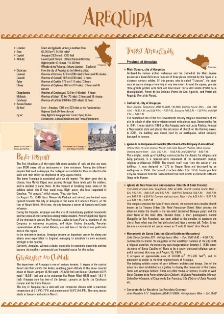
Main Square city <strong>of</strong> <strong>Arequipa</strong> <br />
Heinz Plenge / PromPerú<br />
The first inhabitants <strong>of</strong> the region left some samples <strong>of</strong> rock art that are more<br />
than 8000 years old as testimonies <strong>of</strong> their existence. Among the different<br />
peoples that lived in <strong>Arequipa</strong>, the Collaguas are notable for their excellent textile<br />
skills and their ability as shepherds <strong>of</strong> large alpaca flocks.<br />
The name <strong>Arequipa</strong> is associated with an old legend. The story goes that by<br />
chance, Inca Mayta Cápac was passing through these lands with his soldiers,<br />
and he decided to camp there. At the moment <strong>of</strong> breaking camp, some <strong>of</strong> the<br />
soldiers asked him if they could stay. Right away, the Inca responded in<br />
Quechua, “Ari quepay,” which means, “Yes, stay here.”<br />
On August 15, 1540, Garci Manuel de Carbajal and almost one hundred more<br />
Spanish founded the city <strong>of</strong> <strong>Arequipa</strong> in the name <strong>of</strong> Francisco Pizarro, at the<br />
foot <strong>of</strong> Mount Misti. With time, the city became a center <strong>of</strong> Spanish and Creole<br />
influence.<br />
During the Republic, <strong>Arequipa</strong> was the site <strong>of</strong> revolutionary political movements<br />
and the scene <strong>of</strong> confrontations among various leaders. Powerful political figures<br />
<strong>of</strong> the nineteenth century like Francisco Javier de Luna Pizarro, president <strong>of</strong> the<br />
Congress on numerous occasions, and Victor Andres Belaunde, Peruvian<br />
representative at the United Nations, are just two <strong>of</strong> the illustrious politicians<br />
born in this region.<br />
In the nineteenth century, <strong>Arequipa</strong> became an important center for sheep and<br />
alpaca wool exportation to England, managing to establish its own economic<br />
strength in the country.<br />
Currently, <strong>Arequipa</strong>, without a doubt, maintains its economic leadership and has<br />
become the southern commercial and industrial center for the nation.<br />
The department <strong>of</strong> <strong>Arequipa</strong> is one <strong>of</strong> various terrains. It begins in the coastal<br />
desert and then climbs the Andes, reaching great altitude at the snow covered<br />
peaks <strong>of</strong> Mount Ampato (6288 masl / 20.630 fasl) and Mount Chachani (6075<br />
masl / 19.931 fasl) and at its volcanoes like Mount Misti (5825 masl / 19.111<br />
fasl). <strong>Arequipa</strong> also has two <strong>of</strong> the deepest canyons on Earth: the Cotahuasi<br />
Canyon and the Colca Canyon.<br />
The city <strong>of</strong> <strong>Arequipa</strong> has a semi-arid and temperate climate with a maximum<br />
temperature <strong>of</strong> 21.7ºC (71ºF) and a minimum <strong>of</strong> 6.9ºC (44.4ºF). The rainy season<br />
starts in January and ends in March.<br />
<strong>Province</strong> <strong>of</strong> <strong>Arequipa</strong><br />
<strong>Arequipa</strong><br />
Main Square, city <strong>of</strong> <strong>Arequipa</strong><br />
Bordered by various arched walkways and the Cathedral, the Main Square<br />
possesses a beautiful bronze fountain <strong>of</strong> three plates crowned by the figure <strong>of</strong> a<br />
sixteenth century soldier. Of this person, who is called “Tuturutu”, the story<br />
says he was in charge <strong>of</strong> warning <strong>of</strong> any new event. Around the square, you see<br />
three granite portals with brick and lime bases: Portal del Cabildo (Portal de la<br />
Municipalidad), Portal de las Delicias (Portal de San Agustín), and Portal del<br />
Regocijo (Portal de Flores).<br />
Cathedral, city <strong>of</strong> <strong>Arequipa</strong><br />
Main Square. Telephone: (054) 23-2635 / 40-5393. Visiting hours: Mon. – Sat. 7:00<br />
A.M. – 11:30 A.M. and 5:00 P.M. – 7:30 P.M., Sundays 7:00 A.M. – 1:30 P.M. and 5:00<br />
P.M. – 7:00 P.M.<br />
It is considered one <strong>of</strong> the first seventeenth century religious monuments <strong>of</strong> the<br />
city. It is built <strong>of</strong> sillar (white volcanic stone) with a brick base. Destroyed by fire<br />
in 1844, it was rebuilt in 1868 by the <strong>Arequipa</strong> architect Lucas Poblete. He used<br />
a Neoclassical style and placed the entrances <strong>of</strong> church on the flanking naves.<br />
In 2001, the building was struck hard by an earthquake, which seriously<br />
damaged its towers.<br />
Iglesia de La Compañía and complex (The Church <strong>of</strong> the Company <strong>of</strong> Jesus Christ)<br />
Intersection <strong>of</strong> Calle General Morán and Calle Álvarez Thomas, Main Square.<br />
Visiting hours: Mon. – Sun. 9:00 A.M. – 11:00 A.M. and 3:00 P.M. – 6:00 P.M.<br />
This complex, made up <strong>of</strong> buildings constructed by the Jesuits for religious and<br />
living purposes, is a representative monument <strong>of</strong> the seventeenth century<br />
religious architecture (1660). The church itself rises from the center <strong>of</strong> the<br />
buildings. It was designed in 1573 by Gaspar Baez and destroyed by an<br />
earthquake in 1584. The current structure dates from 1650. Inside you find<br />
sixty-six canvases from the Cusco School from such artists as Bernardo Bitti and<br />
Diego de la Puente.<br />
Iglesia de San Francisco and complex (Church <strong>of</strong> Saint Francis)<br />
First block <strong>of</strong> Calle Zela. Telephone: (054) 22-3048. Church visiting hours: Mon. –<br />
Sat. 7:00 A.M. – 9:00 A.M. and 5:00 P.M. – 8:00 P.M. Sundays 7:00 A.M. – 12:00 P.M.<br />
and 5:00 P.M. – 8:00 P.M. Convent visiting hours: Mon. – Sat. 9:00 A.M. – 12:30 P.M.<br />
and 3:00 P.M – 5:00 P.M.<br />
The complex contains the Saint Francis church, the convent and a smaller church<br />
known as La Tercera Orden (the Third Franciscan Order). What catches the<br />
attention inside the church is the bas-relief decorated Baroque pulpit and the<br />
silver front <strong>of</strong> the main altar. Besides these, a short passageway, named<br />
Manguillo de San Francisco, has been added to the complex to separate the<br />
church from what was the first girl school and later a women jail. Today, it has<br />
become a commercial art center known as “Fundo El Fierro” (Iron Ranch).<br />
Monasterio de Santa Catalina (Saint Kathleen Monastery)<br />
Calle Santa Catalina 301. Visiting hours: Mon. – Sun. 9:00 A.M. – 4:00 P.M.<br />
Constructed to shelter the daughters <strong>of</strong> the wealthiest families <strong>of</strong> the city with<br />
a religious vocation, the monastery was inaugurated on October 2, 1580, under<br />
the name <strong>of</strong> Santa Catalina <strong>of</strong> Siena to be a totaly cloistered religious center,<br />
and it remained that way until August 15, 1970.<br />
It occupies an approximate area <strong>of</strong> 20.000 m 2 (215.285 feet 2 ), and its<br />
placement is similar to the first neighborhoods <strong>of</strong> <strong>Arequipa</strong>.<br />
The building exhibits rooms <strong>of</strong> very different architectural design. One <strong>of</strong> the<br />
areas has been established as a gallery to display the canvasses <strong>of</strong> the Cusco,<br />
Quito, and <strong>Arequipa</strong> Schools. There are other rooms, or sectors, to visit as well,<br />
like el Claustro de la Portería (the Gate Cloister), el Museo Precolombino (the pre-<br />
Colombian Museum), el Claustro de San Francisco (the Cloister <strong>of</strong> Saint Francis),<br />
etc.<br />
Convento de La Recoleta (La Recoleta Convent)<br />
Jiron Recoleta 117. Telephone: (054) 27-0966. Visiting hours: Mon. – Sat. 9:00
A.M. – 12:00 P.M. and 3:00 P.M. – 5:00 P.M. Email: convento-larecoleta@terra.com.pe<br />
A Franciscan convent founded in 1848, open to the public since 1978. It<br />
features various styles that include Romantic and Neo-gothic styles due to its<br />
different remodeling campaigns (the last one in 1940). It has four cloisters and<br />
eleven sectors, as well as two pre-Colombian art rooms, two others dedicated to<br />
the Amazon Rain Forest, and another to religious art. It also has a gallery<br />
exhibiting canvasses from the Cusco and <strong>Arequipa</strong> Schools and a valuable library<br />
that protects more than 20.000 volumes and ancient books.<br />
Iglesia y Convento de Santo Domingo (Church and Convent <strong>of</strong> Santo<br />
Domingo)<br />
Intersection <strong>of</strong> Calle Santo Domingo and Calle Rivero. Telephone: (054) 21-<br />
3511. Visiting hours: Mon. – Sat. 7:00 A.M. – 12:00 P.M. and 3:00 P.M. – 7:30<br />
P.M. Sundays 5:45 A.M. – 1:00 P.M. and 6:30 P.M. – 7:45 P.M.<br />
Architecturally, the church is characterized by a bell tower, its entrance with a<br />
corner pedestal, and its impeccable arch under the choir l<strong>of</strong>t. Inside, one can<br />
appreciate paintings and other pieces <strong>of</strong> sacred art.It is also known for its side<br />
entrance being the oldest in <strong>Arequipa</strong>. The upper cloister <strong>of</strong> the convent was<br />
constructed around 1734.<br />
Casa del Moral (Moral House)<br />
Calle Moral 318, downtown <strong>Arequipa</strong>. Visiting hours: Mon. – Sat. 9:00 A.M. – 5:00<br />
P.M. Holidays 9:00 A.M. – 1:00 P.M.<br />
An eighteenth century house, constituting one <strong>of</strong> the oldest and most important<br />
architectural monuments from the <strong>Arequipa</strong> Baroque period. The house owes its<br />
name to an ancient blackberry tree that grows in its main patio. Inside, furniture<br />
from Peru’s Colonial and Republican epochs is on display. The main entrance <strong>of</strong><br />
white sillar stone is a work <strong>of</strong> art in which you can admire carefully carved<br />
figures. For example, there is a crown suspended above a coat <strong>of</strong> arms that is<br />
held up by two angels, the coat <strong>of</strong> arms is composed <strong>of</strong> tinier carvings <strong>of</strong> a<br />
castle, a bird, a puma, and two crossed keys. In the same way, the room <strong>of</strong><br />
sixteenth century “antique” maps <strong>of</strong> America stands out.<br />
Barrio de San Lázaro (Saint Lazarus neighborhood)<br />
Five blocks from the Main Square, <strong>Arequipa</strong>.<br />
This neighborhood <strong>of</strong> alleys, narrow passageways, small plazas, and large homes<br />
is the most representative <strong>of</strong> old <strong>Arequipa</strong>. This place was established by<br />
Dominican priests in 1538, who built a sanctuary to evangelize the natives <strong>of</strong> the<br />
area and prepare the land to found a new Spanish city. The small bridge that<br />
connects the Church <strong>of</strong> San Lázaro and its small plaza with the rest <strong>of</strong> the<br />
quarter is worth a visit.<br />
Casa Goyeneche (Goyeneche House)<br />
Calle La Merced 201. Telephone: (054) 21-2251. Visiting hours: Mon. – Fri. 9:15<br />
A.M. – 3:00 P.M.<br />
This sixteenth century house <strong>of</strong> white sillar stone is completely designed in the<br />
Colonial style. Prints from the Cusco and <strong>Arequipa</strong> Schools are preserved there<br />
as well as sculptures from the Granada School <strong>of</strong> the seventeenth century. The<br />
name comes from Mr. Juan de Goyeneche y Aguerreverre, who bought it in<br />
1782. Presently, it is headquarters to the Central Reserve Bank <strong>of</strong> Peru in<br />
<strong>Arequipa</strong>.<br />
Iglesia San Agustín (Saint Augustine Church)<br />
Intersection <strong>of</strong> Calle San Agustín and Calle Bolívar. Telephone: (054) 22-0066. Visiting<br />
hours: Mon. – Sat. 8:00 A.M. – 12:00 P.M. and 5:00 P.M. – 7:00 P.M. Sundays 8:00<br />
A.M. – 1:00 P.M. and 5:00 P.M. – 7:00 P.M.<br />
Built in 1575, the church displays a façade that dates from the first half <strong>of</strong> the<br />
eighteenth century and is considered one <strong>of</strong> the best <strong>of</strong> its time. In architectural terms,<br />
it belongs to the mixed-origin Baroque and the main construction material is white sillar<br />
stone. Inside, the main highlights are the dome, its Neoclassical altars, especially the<br />
major one, for the precise carvings and gilding<br />
Iglesia La Merced (Mercy Church)<br />
Intersection <strong>of</strong> Calle La Merced and Calle Tristán. Telephone: (054) 21-3233.<br />
Visiting hours: Mon. – Fri. 8:00 A.M. – 1:00 P.M. and 4:00 P.M. – 7:00 P.M.<br />
Saturdays 8:00 A.M. – 12:00 P.M.<br />
Its construction began in 1551 and was completed in 1607. It has an attractive<br />
side entrance, which features the image <strong>of</strong> the Virgin <strong>of</strong> Mercy accompanied by<br />
two saints <strong>of</strong> mercy. Important works <strong>of</strong> art like the “Aparición de la Virgen a<br />
San Pedro Nolasco” (Saint Peter Nolasco Recovering the Image <strong>of</strong> the Virgin) are<br />
preserved in its sacristy as well as a series <strong>of</strong> paintings related to the Virgin de<br />
la Merced in the main hall. The church and the convent, the latter constructed in<br />
the city, were built using the white sillar stone from <strong>Arequipa</strong>. The cloister<br />
maintains a library that dates back to the Vice royal period.<br />
Casa Tristán del Pozo (Tristán del Pozo house)<br />
Calle San Francisco 108. Telephone: (054) 21-2209. Visiting hours: Mon. – Fri. 9:15<br />
A.M. – 12:45 P.M. and 4:00 P.M. – 6:00 P.M. Saturdays 9:30 A.M. – 12:30 P.M.<br />
This traditional, colonial house has a façade carved in mixed-origin Baroque. In<br />
addition, it was made with wide, unique patios inside. It was built in 1738 for General<br />
Domingo Tristán del Pozo. Today, it is the property <strong>of</strong> Banco Continental.<br />
Museo Arqueológico de la Universidad de San Agustín<br />
(University <strong>of</strong> San Agustín Archeological Museum)<br />
Intersection <strong>of</strong> Calle Álvarez Thomas and Calle Palacio Viejo. Telephone: (054)<br />
28-8881. Visiting hours: Mon. – Fri. 8:15 A.M. – 4:15 P.M.<br />
A varied collection is exhibited here including stone items, bones from human<br />
sacrifices, ceramic pieces from the Nasca, Tiahuanaco, Huari, and Inca, and<br />
objects <strong>of</strong> gold and silver from the Colonial and Inca eras.<br />
Museo de Arqueología de la Universidad Católica de Santa María de <strong>Arequipa</strong><br />
(University <strong>of</strong> Santa María de <strong>Arequipa</strong> Archeological Museum)<br />
Calle Cruz Verde 303. Telephone: (054) 95-9636. Visiting hours: Mon. – Fri. 9:00<br />
A.M. – 12:00 P.M. and 2:00 P.M. – 5:00 P.M.<br />
The museum has around 1000 pieces (ceramics, textiles, mummies, works <strong>of</strong><br />
stone, wood, and metal) from the different cultural groups that inhabited the<br />
Department <strong>of</strong> <strong>Arequipa</strong> from 12.000 B.C. up to the time <strong>of</strong> the colony: Nasca,<br />
Tiahuanaco, Wari, Churajón, Acarí, Aruni and Inca as well as transitional and<br />
colonial materials.<br />
Museo Santuarios Andinos de la Universidad Católica de Santa María<br />
(Catholic University <strong>of</strong> Saint Mary)<br />
Calle La Merced 110, downtown <strong>Arequipa</strong>. Telephone: (054) 21-5013. Visiting<br />
hours: Mon. – Sat. 9:00 A.M. – 6:00 P.M. Sundays 9:00 A.M. – 3:00 P.M.<br />
Here, they exhibit la Dama de Ampato (the Lady <strong>of</strong> Ampato), an Inca mummy <strong>of</strong><br />
a twelve to fourteen year old girl found at the top <strong>of</strong> the Ampato volcano by the<br />
climber Miguel Zárate, the archeologist José Chávez, and the anthropologist<br />
Johan Reinhard on September 8, 1995. According to the specialists, it is very<br />
likely that the girl, whose remains were found frozen, died from a blow to the<br />
temple from a five pointed granite mace. It seems that she was sacrificed to the<br />
Ampato Apu (protector god) some 500 years ago.<br />
Urbanización Selva Alegre (Selva Alegre suburb)<br />
Considered the “garden <strong>of</strong> the city” for its large parks and huge trees that live in<br />
harmony with the modern houses <strong>of</strong> the area, Selva Alegre was constructed as<br />
a monument to Juan Pablo Vizcardo y Guzmán, fore runner <strong>of</strong> the Peruvian<br />
independence. The Molino de Santa Catalina (Mill <strong>of</strong> Saint Kathleen) is another<br />
site to visit, completely restored and located on the mall <strong>of</strong> this zone.<br />
Yanahuara Lookout<br />
2 km / 1 mile from downtown <strong>Arequipa</strong> (8 minutes by car)<br />
It was built in the nineteenth century and is composed <strong>of</strong> a series <strong>of</strong> sillar stone<br />
arches where the words <strong>of</strong> famous <strong>Arequipa</strong> citizens have been engraved. This<br />
spot is a wonderful view point <strong>of</strong> the city and Mount Misti volcano.<br />
City <strong>of</strong> Sabandia<br />
8 km / 5 miles from <strong>Arequipa</strong> (20 minutes by car)<br />
Wide terraces and three volcanoes, the Misti, the Chachani, and the Pichu Pichu,<br />
provide the scenery around this traditional town. Some <strong>of</strong> the houses still<br />
preserve characteristic styles <strong>of</strong> the Viceroyalty or <strong>of</strong> the nineteenth century<br />
Republicanism. A recreational area with two swimming pools that use the cold<br />
river waters <strong>of</strong> the surrounding region has been built.<br />
Molino de Sabandía (Sabandía Mill)<br />
Located in Sabandía<br />
Constructed in 1785, it represents the typical architecture <strong>of</strong> the zone where the<br />
use <strong>of</strong> sillar stone predominates. It is characterized by solid supports and rustic<br />
balconies. Stone grinding wheel techniques for wheat processing can be viewed<br />
here as well.<br />
Mansión del Fundador (Founder’s Mansion)<br />
9 km / 6 miles from <strong>Arequipa</strong> (15 minutes by car)
1 Cathedral<br />
2 Church and Complex <strong>of</strong> the Company <strong>of</strong> Jesus Christ<br />
3 Church and Complex <strong>of</strong> Saint Francis<br />
4 Saint Kathleen Monastery<br />
5 La Recoleta Convent<br />
6 Church anf Convent <strong>of</strong> Santo Domingo<br />
7 Moral House<br />
8 Goyeneche House<br />
9 San Agustín Church<br />
10 Mercy Church<br />
11 Tristán del Pozo Church<br />
12 University <strong>of</strong> San Agustín Archeological Museum<br />
13 University <strong>of</strong> Santa María de <strong>Arequipa</strong> Archeological Museum<br />
14 Catholic University <strong>of</strong> Saint Mary Museum <strong>of</strong> Andean Sanctuaries<br />
Located within the boundaries <strong>of</strong> the Salinas and Aguada Blanca National<br />
Reserve, this area boasts over 500 rock art figures. These representations,<br />
possibly made by the first inhabitants <strong>of</strong> the area, are approximately 6000 to<br />
8000 years old.<br />
Mount Chachani<br />
The base camp is 55 km / 34 miles north <strong>of</strong> <strong>Arequipa</strong> (2 hours by 4x4 vehicle).<br />
From there, an approximate 6-hour hike will take you to the summit.<br />
This snow covered peak, towering over 6075 masl / 19931 fasl is considered<br />
one <strong>of</strong> the most difficult mountains to climb in Peru. It is an inactive volcano, but<br />
lava is still visible, and there are depressions and moraines. It takes two days<br />
and one night to ascend.<br />
District <strong>of</strong> Yarabamba<br />
21 km / 13 miles south <strong>of</strong> the city <strong>of</strong> <strong>Arequipa</strong> (35 minutes by car)<br />
The name <strong>of</strong> the district comes from two Quechua words: “yaro” or “yara”, a<br />
native bush <strong>of</strong> the area, and “bamba” which means pampas. Visiting the mansion<br />
<strong>of</strong> Arenas y Pinto and the colonial house <strong>of</strong> Rivera y Echevarría are the things to<br />
do in the town.<br />
District <strong>of</strong> Quequeña<br />
25 km / 16 miles southeast <strong>of</strong> <strong>Arequipa</strong> (40 minutes by car)<br />
This area has been inhabited by the Lupacas, Aymaras, Quechuas, Collaguas,<br />
Puquinas, and, in the middle <strong>of</strong> the fifteenth century, the Incas. The name <strong>of</strong> the<br />
town probably comes from the Puquina word, “quequeña”, which means “rocky<br />
and solid place”. The main places <strong>of</strong> interest are la Alameda de los Sauces<br />
(Willows Walk), la Alameda de los Muertos (Path <strong>of</strong> the Dead), and Guanaqueros<br />
Gorge. There is also a recently restored church to see.<br />
District <strong>of</strong> Chiguata<br />
30 km / 19 miles east <strong>of</strong> <strong>Arequipa</strong> (45 minutes by car) at the foothills <strong>of</strong> the<br />
Pichu-Pichu volcano<br />
Chiguata was founded on January 22, 1540, by the steward - Diego Hernández.<br />
The name <strong>of</strong> the city is a combination <strong>of</strong> two Quechua words, “chiri” (cold) and<br />
“guata” (year), and means “cold all year long”. Among the main attractions, you<br />
can visit the Iglesia del Espíritu Santo (Church <strong>of</strong> the Holy Spirit) and the<br />
archeological centers <strong>of</strong> Tambo de León and Infiernillos.<br />
Built with sillar stone at the edge <strong>of</strong> a cliff, it is one <strong>of</strong> the most important and<br />
traditional mansions or houses in the department. According to the story, Garcí<br />
Manuel de Carbajal, founder <strong>of</strong> <strong>Arequipa</strong>, had it built for his son. Later, in 1785,<br />
Mr. Juan Crisóstomo de Goyeneche y Aguerreverre was its proprietor and<br />
remodeled it, giving it the distinguished characteristics that can be seen today.<br />
The main entrance is composed <strong>of</strong> a foyer with an arched ceiling, followed by a<br />
wide principal patio over which the windows and doors <strong>of</strong> the bedrooms open.<br />
District <strong>of</strong> Cayma<br />
3 km / 2 miles south <strong>of</strong> <strong>Arequipa</strong> (8 minutes by car)<br />
The village <strong>of</strong> Cayma is known as the “Balcony <strong>of</strong> <strong>Arequipa</strong>” for its<br />
advantageous location that allows the entire city to be seen. Its central plaza<br />
houses the church <strong>of</strong> San Miguel Arcángel (Saint Michael the Archangel), built in<br />
1730 and considered an architectural jewel because <strong>of</strong> its mixed façade. In the<br />
rectory annex, the “Comedor de Bolívar” (Bolivar’s dining room) is preserved<br />
where, according to legend, the Liberators used to have lunch during their stay<br />
in the town.<br />
Misti Volcano<br />
The foothills <strong>of</strong> the volcano are located 20 km / 12 miles. northeast <strong>of</strong> <strong>Arequipa</strong><br />
(1 hour by 4x4 vehicle)<br />
The Misti volcano, 5825 masl / 19.111 fasl is the guardian <strong>of</strong> the city. From the<br />
summit, you can see the city <strong>of</strong> <strong>Arequipa</strong>, the Chili River valley, and the Chachani<br />
and Pichu Pichu volcanoes.<br />
Yura Hot Springs<br />
27 km / 17 miles north <strong>of</strong> <strong>Arequipa</strong> (45 minutes by bus)<br />
These are wells <strong>of</strong> thermal waters at the foothills <strong>of</strong> the Chachani volcano, 2575<br />
masl / 8448 fasl. The therapeutic properties <strong>of</strong> the waters, which temperature<br />
fluctuates between 23ºC (73.40ºF) and 28ºC (82.40ºF), are celebrated. Between<br />
1810 and 1831, Mr. José Nogal y Noguerol built the wells that are still<br />
maintained today.<br />
Sumbay Caves – Rock Art<br />
97 km / 60 miles north <strong>of</strong> <strong>Arequipa</strong> on the Caylloma highway (1 hour and 45<br />
minutes by bus)<br />
District <strong>of</strong> Tiabaya<br />
10 km / 6 miles from <strong>Arequipa</strong> (15 minutes by car)<br />
The valley is completely agricultural and is believed to have been inhabited by the<br />
ethnic groups <strong>of</strong> the Kuntis from Cabana, the Yanahuaras, and the Chumbivilcas.<br />
On November 8, 1870, it was given the title <strong>of</strong> “city” and is famous for its rustic<br />
restaurants.<br />
District <strong>of</strong> Characato<br />
10 km / 6 miles from <strong>Arequipa</strong> (15 minutes by car)<br />
This town has plenty <strong>of</strong> vegetation and abundant water, so it is ideal for farming.<br />
Very close to the town is the “Ojo de Milagro” waterspring (Eye <strong>of</strong> Miracle Spring).<br />
There is also a beautiful colonial church. Historically, the inhabitants <strong>of</strong> this area<br />
went to work at the southern salt licks, now territory <strong>of</strong> Chile. When the people <strong>of</strong><br />
this place were asked where they were from, they used to say “from Characato, sir”;<br />
that is where the nickname <strong>of</strong> the people <strong>of</strong> <strong>Arequipa</strong> – “characatos” come from.<br />
Salinas and Aguada Blanca National Reserve<br />
35 km / 22 miles northeast <strong>of</strong> <strong>Arequipa</strong> (1 hour and 30 minutes by bus)<br />
The reserve covers almost 367.000 hectares, including territory from the <strong>Province</strong>s<br />
<strong>of</strong> <strong>Arequipa</strong>, Caylloma (department <strong>of</strong> <strong>Arequipa</strong>), and General Sánchez Cerro<br />
(department <strong>of</strong> Moqueqa). It was created for the purpose <strong>of</strong> preserving important<br />
associations <strong>of</strong> flora and fauna, protecting the natural environment that was<br />
deteriorating and in the process <strong>of</strong> being destroyed, as well as caring for the vicuña<br />
through a repopulation program. The reserve is located between 2800 and 6050<br />
masl (9186 and 19.849 fasl) and the Misti (5825 masl / 19.111 fasl), the Chachani<br />
(6075 masl / 19.931 fasl), and the Pichu-Pichu (5664 masl / 18.583 fasl) volcanoes<br />
are found there.<br />
Among the most representative species <strong>of</strong> the reserve are the vizcacha, the fox, the<br />
condor, and the Andean flamingo or parihuana. Scientists have determined the<br />
existence <strong>of</strong> 169 animal species, 23 <strong>of</strong> which are mammals (including two forms <strong>of</strong><br />
domesticated <strong>South</strong> <strong>American</strong> camelids), 138 species <strong>of</strong> birds (blue billed ducks,<br />
eagles, and kestrels are the trophies), 3 reptilians, 4 amphibious, and 3 fish species.<br />
Salinas Lake is considered a special spot to observe<br />
Caylloma<br />
flamingos during their migration period.<br />
<strong>Province</strong> <strong>of</strong> Caylloma
Colca Valley<br />
151 km / 94 miles north <strong>of</strong> <strong>Arequipa</strong> (3 hours by car)<br />
The extreme northeastern section <strong>of</strong> the department <strong>of</strong> <strong>Arequipa</strong> is located here.<br />
The highest point is the inactive volcano Mount Ampato (6288 masl), and the<br />
lowest at the confluence <strong>of</strong> the rivers Colca and Andamayo (970 masl). The<br />
Colca valley is 100 km in length and occupies only part <strong>of</strong> the Colca river basin,<br />
comprising the districts <strong>of</strong> Callalli and Huambo.<br />
There are sixteen villages in this zone made up <strong>of</strong> descendents <strong>of</strong> the Collaguas<br />
and Cabanas tribes, inheritors <strong>of</strong> rich cultural traditions. The towns <strong>of</strong> Chivay<br />
and Cabanaconde are the most visited by tourists.<br />
In the latter, you can watch condors soar from the Cruz de Condor (Condor<br />
Crossing) Lookout. The Colca valley forms part <strong>of</strong> the <strong>South</strong> <strong>American</strong> tectonic<br />
plate and contains the active volcano Sabancaya, located on the volcanic<br />
mountain Hualca Hualca. This valley possesses a great diversity <strong>of</strong> flora and<br />
fauna. Among the most representative species are the condor, the kestrel, the<br />
peregrine falcon, and the Andean tinamou.<br />
Colca Canyon<br />
42 km / 26 miles west <strong>of</strong> the town <strong>of</strong> Chivay (1 hour by car)<br />
This is one <strong>of</strong> the deepest places on the planet, reaching a depth <strong>of</strong> 3400 meters<br />
/ 11.155 feet at the lowest point in the location <strong>of</strong> Canco. On the right side, it<br />
is flanked by the Chila Cordillera (Bomboya, Serpregrina, Mismi, Queshihua) and<br />
on the other by Mount Hualca Hualca, Sabancaya, and Ampato. You can see<br />
Mount Ubinas and beautiful Mount Coropuna in the distance.<br />
Imata Stone Forest<br />
150 km / 93 miles northeast <strong>of</strong> <strong>Arequipa</strong> on the Puno highway (2 hours by car)<br />
It is a complex <strong>of</strong> stone structures that have the appearance <strong>of</strong> a mysterious<br />
petrified forest. Erosion has shaped the stones, giving them a peculiar aspect.<br />
The place is easily accessible since it is located near the <strong>Arequipa</strong> – Juliaca<br />
highway.<br />
Ampato volcano<br />
173 km / 108 miles north <strong>of</strong> <strong>Arequipa</strong> (5 hours by 4x4 vehicle)<br />
At 6288 masl / 20.630 fasl, it is temporarily inactive and exhibits a perpetual<br />
snowcap at the height <strong>of</strong> 5000 meters / 16.404 feet. The foothills have scarce<br />
vegetation limited to bunch grass and hawthorn. At the top, from which you can<br />
see the Colca Canyon, explorers found the “Dama de Ampato”, the mummified<br />
remains <strong>of</strong> a girl from the time <strong>of</strong> the Incas.<br />
<strong>Province</strong> <strong>of</strong> Islay<br />
Lagunas de Mejia National Sanctuary<br />
Islay<br />
146 km / 91 miles southwest <strong>of</strong> <strong>Arequipa</strong> (2 hours<br />
and 10 minutes by car); 11 km / 7 miles south from the Mejia baths and 5 km /<br />
3 miles south <strong>of</strong> Mollendo<br />
It possesses an area <strong>of</strong> 691 hectares and includes different habitats comprising<br />
swamps, salt marshes, tortora reeds, hills, riverside estuaries, fields <strong>of</strong> salt<br />
grass, and sandy beaches. It is ideal for bird-watching, and 195 species have<br />
been registered: 75 are resident species (you can find them there all year long),<br />
6 are ocean residing species, and 80 are migratory ones that travel from places<br />
so diverse and distant as the Peruvian jungle and the Antarctic.<br />
<strong>Province</strong> <strong>of</strong> Castilla<br />
Castilla<br />
Toro Muerto Petroglyphs<br />
164 km / 102 miles northwest <strong>of</strong> <strong>Arequipa</strong> (2 hours and<br />
30 minutes)<br />
Leaving the Colca valley and passing through the Sihuas pampas is one way to get<br />
there. To arrive there directly from <strong>Arequipa</strong>, take the road to Lima and turn <strong>of</strong>f at<br />
Corire (District <strong>of</strong> Uraca) and drive for 6 km / 4 miles.<br />
The site consists <strong>of</strong> a group <strong>of</strong> carvings spread out over 5 km 2 / 2 miles 2 .The majority<br />
<strong>of</strong> them are representations <strong>of</strong> human beings, animals, and plants, as well as geometric<br />
designs that seem to have been carved with sharpened stones. The techniques used<br />
varied from striking, scratching, chipping, to hammering, and their age could begin<br />
around 1100 A.D.<br />
Andagua, Valley <strong>of</strong> the Volcanoes<br />
323 km / 201 miles northeast from <strong>Arequipa</strong> (9 hours by car)<br />
The Valley <strong>of</strong> the Volcanoes was the center <strong>of</strong> strenuous convulsions in the<br />
volcanic mountain chain 200.000 years ago. We can still see today an extensive<br />
layer <strong>of</strong> lava over which around eighty-six smaller inactive volcanoes have<br />
emerged. It reaches an altitude <strong>of</strong> 3546 masl / 11.634 fasl.<br />
<strong>Province</strong> <strong>of</strong> La Union<br />
Cotahuasi Valley and Canyon (Scenic Reserve <strong>of</strong><br />
the Cotahuasi Sub-basin)<br />
375 km / 233 miles northwest <strong>of</strong> <strong>Arequipa</strong> (9 hours by car / 12<br />
hours by public bus)<br />
Different altitudinal tiers have created the conditions for a large biological<br />
diversity with high indices <strong>of</strong> endemism in both the flora and fauna. The<br />
Cotahuasi Canyon includes twelve life zones and three ecological regions. It is<br />
considered the deepest in Peru (3535 m / 11.598 feet).<br />
<strong>Province</strong> <strong>of</strong> Caravelí<br />
Waca Gorge or Puerto Inca Archeological Site<br />
417 km / 259 miles northwest <strong>of</strong> <strong>Arequipa</strong> (6 hours<br />
and 30 minutes by car);<br />
Archeological complex known for its long period <strong>of</strong> human occupation since the<br />
remnants found there date from the pre-ceramic era to the fourteenth and<br />
fifteenth centuries, indicating an Inca presence. Some archeologists and<br />
historians think that from this site, one <strong>of</strong> the most important Inca trails started<br />
which crossed into the territory <strong>of</strong> Ayacucho and later reached Cusco.<br />
<strong>Province</strong> <strong>of</strong> Camaná<br />
La Unión<br />
Caravelí<br />
173 km / 568 miles southwest <strong>of</strong> <strong>Arequipa</strong> (2 hours and 30 minutes by car)<br />
The central territory <strong>of</strong> <strong>Arequipa</strong> is located here. During the pre-Hispanic era,<br />
cultures like the Nasca, Paracas, Waris, Collaguas, Chuquibambas, and Incas<br />
lived in this pleasant valley. In 1539, the city <strong>of</strong> Camaná was founded under the<br />
name <strong>of</strong> “Villa Hermosa de Camaná” (Beautiful Villa <strong>of</strong> Camaná).<br />
Beach circuit<br />
It is located 10 - 40 km. / 6 - 25 miles from the city <strong>of</strong> Camaná (5 to 20 minutes<br />
by car)<br />
The beautiful beaches stretching to the Pacific Ocean are the best part <strong>of</strong> this<br />
area. These include la Punta, Cerrillos, el Chorro, las Cuevas, Quilca, la Miel,<br />
Arantas, Honoratos, La Playuela, etc. Some <strong>of</strong> these beaches are <strong>of</strong>ten visited<br />
by adventure sports lovers and fishing fans.<br />
José María Quimper Archeological Museum – El Cardo<br />
Located in the District <strong>of</strong> El Cardo, 20 km / 12 miles from Camaná (20 minutes by car)<br />
There, you can see 10.000 years <strong>of</strong> history through the uncountable objects<br />
among which appear vestiges <strong>of</strong> the Nasca, Paracas, Wari, Chuquibamba,<br />
Collagua, and Inca cultures.<br />
Pucchun Lakes<br />
Enjoy watching a variety <strong>of</strong> wild bird species: ducks, antshrikes, moorehens,<br />
geese, flamingos, and more.<br />
Quilca<br />
33 km / 21 miles from the city <strong>of</strong> Camaná (30 minutes by car)<br />
It is the first southern Peruvian port, known for being the place where the hero<br />
<strong>of</strong> the War <strong>of</strong> the Pacific, Admiral Miguel Grau, defied the Chilean fleet<br />
commanded by Monitor Huáscar. It is ideal for underwater hunting and<br />
ecotourism.<br />
Inca Trails<br />
Roads used in pre-Hispanic times. Today, bicyclists, walkers, and equestrians<br />
use them.<br />
Inca Observatory<br />
Located on the right bank <strong>of</strong> the Camaná River at kilometer marker 826 <strong>of</strong> the<br />
Pan-<strong>American</strong> Highway <strong>South</strong>, you can enjoy nature and watch the waters flow<br />
into the Pacific Ocean.<br />
<strong>Arequipa</strong> has a large variety <strong>of</strong> dances and musical styles complemented by<br />
multicolored dance costumes.<br />
The most characteristic dance is the <strong>Arequipa</strong>n Carnaval, mainly done during the<br />
celebrations <strong>of</strong> Carnival and the anniversary <strong>of</strong> the founding <strong>of</strong> the city (15th<br />
August). Other typical music are the Yaraví, Quechua in origin, and the Pampeña,
considered a primitive Huayno in which the dancers dress as chacareros, or<br />
people who live and work on a chacra (farm).<br />
<strong>Arequipa</strong> is known for its leatherwork <strong>of</strong> articles such as belts, desk ornaments,<br />
and furniture. In the same way, during the colonial epoch, saddles and other<br />
horse tack was a highly recognized trade. These items were sent to countries as<br />
far away as Cuba and Panamá. The white sillar stone, characteristic symbol <strong>of</strong><br />
the city <strong>of</strong> <strong>Arequipa</strong>, was used in the building <strong>of</strong> houses and churches as well as<br />
decorative articles. As for foged iron, it served to fabricate street lamps, gates,<br />
lamps, and decorative furniture.<br />
The cuisine <strong>of</strong> <strong>Arequipa</strong> is one <strong>of</strong> the most varied in Peru. The best example <strong>of</strong><br />
this are the different soups for each day <strong>of</strong> the week and other dishes like:<br />
Chupe de camarones: chowder made with shrimp, milk, eggs, and oregano.<br />
Rocoto relleno: rocotos (red hot peppers) stuffed with chopped beef, cheese,<br />
and milk and served with mashed potatoes.<br />
Soltero: a salad <strong>of</strong> fresh cheese, lima beans, onions, olives, tomatoes, and rocoto.<br />
Adobo arequipeño: pork marinated with concho de chichi (corn beer<br />
sediment) and spices, cooked in a pot.<br />
Ocopa: boiled potatoes covered with a fresh cheese sauce, lima beans, onions,<br />
olives, and rocoto.<br />
Escribano: potato salad, with rocoto, vinegar, oil, tomatoes, and parsley<br />
Pebre: soup with lamb, beef, and ram jerky<br />
El sango: a dessert made from wheat, raisins, miel de chancaca (sugar syrup),<br />
milk, and butter<br />
Carnival Festival <strong>of</strong> Camaná / February or March (fluctuates)<br />
<strong>Province</strong> <strong>of</strong> Camaná, District <strong>of</strong> San José<br />
The guachanacos (masked riders) ride through the city streets three days before,<br />
inviting the population to join the carnival festivities. The “yunsa” or<br />
“cortamonte” festivity happens on the main day <strong>of</strong> the celebration. On that day,<br />
you can enjoy the wonderful dishes <strong>of</strong> this place.<br />
Virgin <strong>of</strong> Chapi / May 1 st<br />
<strong>Province</strong> <strong>of</strong> <strong>Arequipa</strong>, Districts <strong>of</strong> Miraflores and Cayma, and the <strong>Province</strong> <strong>of</strong><br />
Islay<br />
A traditional pilgrimage to the Chapi Sanctuary some 90 km / 56 miles from<br />
<strong>Arequipa</strong>. The custom is to promise the Virgin to make the pilgrimage for three<br />
consecutive years.<br />
Anniversary <strong>of</strong> Cotahuasi / 4 th May<br />
<strong>Province</strong> <strong>of</strong> La Union, District <strong>of</strong> Cotahuasi<br />
It is the most important traditional festival <strong>of</strong> the province. There are bull fights<br />
and group dance competitions, and visits to the different attractions in the<br />
region are promoted.<br />
Anniversary <strong>of</strong> the city <strong>of</strong> <strong>Arequipa</strong> / August<br />
<strong>Province</strong> <strong>of</strong> <strong>Arequipa</strong>, District <strong>of</strong> <strong>Arequipa</strong><br />
For this celebration, the city organizes the International Fair <strong>of</strong> <strong>Arequipa</strong> located<br />
on Mount Juli, artisanal exhibitions in the Fundo El Fierro, the Festidanza dance<br />
festival, and the international Climb Mount Misti contest. The main day, 15 th<br />
August , is when the Friendship Parade takes place.<br />
Festival <strong>of</strong> Santa Úrsula / 21 st October<br />
<strong>Province</strong> <strong>of</strong> Castilla, District <strong>of</strong> Viraco<br />
A very popular, grassroots celebration. It is celebrated with the bringing <strong>of</strong> the<br />
“capo” herb, the burning <strong>of</strong> the “yareta”, evergreen tree, fireworks, masses, and<br />
processions. There are also bull fights with Spanish bullfighting apprentices and<br />
very traditional cock fights.<br />
AIRPORT<br />
Alfredo Rodríguez Ballón Airport<br />
Avenida Aviación, Zamácola, Cerro Colorado. Telephone: (054) 44-3464, (054)<br />
44-3458<br />
OVERLAND TRANSPORT<br />
Bus station. Terrapuerto<br />
Avenida Arturo Ibáñez, Jacobo D. Hunter. Telephone: (054) 34-8810<br />
Bus station. Terminal Terrestre<br />
Intersection <strong>of</strong> Avenida Andrés Avelino Cáceres and Arturo Ibáñez, Jacobo D.<br />
Hunter. Telephone: (054) 42-7798<br />
HEALTH CENTERS<br />
Honorio Delgado Espinoza Regional Hospital<br />
Avenida Daniel Alcides Carrión, la Pampilla José Luis Bustamante y Rivero,<br />
<strong>Arequipa</strong>. Telephone: (054) 23-1818 / 21-9702 / 23-3812. Attention: 24 hours<br />
Goyeneche Hospital<br />
Avenida Goyeneche, Cercado. Telephone: (054) 23-1313 / 22-3501. Attention:<br />
24 hours<br />
LOCAL POLICE<br />
Jefatura de Seguridad Ciudadana (Citizen Security Headquarters)<br />
Calle Quinta Romaña 315, Cercado. Telephone: (054) 28-4354. Attention: 24<br />
hours<br />
XI Región de la Policía Nacional del Perú (National Police <strong>of</strong> Peru 9th<br />
Region)<br />
Avenida Emmel 106, Yanahuara. Telephone: (054) 25-4020. Attention: 24 hours<br />
Tourism Police<br />
Calle Jerusalén 315, Cercado. Telephone: (054) 20-1258<br />
CRAFT MARKETS<br />
Fundo El Fierro – FEDARA<br />
San Francisco 415, Cercado.<br />
Frente de Artesanos<br />
Mercaderes 236, Cercado. Telephone: (054) 21-2729. Opening hours: Mon. – Thur.<br />
9:00 A.M. – 1:30 P.M. and 3:00 P.M. – 8:30; Fri. – Sat. 9:00 A.M. – 9:00 P.M.<br />
Patio del Ekeko - C.C. de Artesanías<br />
Calle Mercaderes 141. Telephone: (054) 21-5861. Fax: (054) 23-3575<br />
POSTAL SERVICES<br />
SERPOST<br />
Calle Moral 118, Cercado. Telephone: (054) 21-5247 / 21-5245. Attention:<br />
Mon. – Sat. 8:00 A.M. – 10:00 P.M.; Sun. 9:00 A.M. – 1:00 P.M.<br />
Alfredo Rodríguez Ballón Airport<br />
Av. Aviación s/n. Cerro Colorado. Telephone: (054) 44-39-67. Attention: Mon. –<br />
Fri. 6:15 A.M. – 10:30 A.M. y 12:30 P.M. – 4:30 P.M. Sat. 6:15 A.M. – 12:00<br />
P.M.<br />
REGIONAL GOVERNMENT OF AREQUIPA<br />
www.regionarequipa.gob.pe<br />
AREQUIPA ASSOCIATION OF HOTELS, RESTAURANTS, AND RELATED<br />
SERVICES<br />
www.arequipa-tourism.com<br />
TOURIST INFORMATION<br />
At the Tourist Information and Assistance Service, iperu, you can to ask<br />
for objective and impartial tourism information, as well as assistance in<br />
case the tourist services you received were not provided according to the<br />
contract signed.<br />
Contact the service nationwide, 24 hours a day:<br />
Telephone: (01) 574-8000. Email: iperu@promperu.gob.pe<br />
<strong>Arequipa</strong>:<br />
Alfredo Rodríguez Ballón Airport – Main hall<br />
Telephone / Fax: (054) 44-4564. Attention: Mon. – Sun. 6:30 A.M. – 8:45 P.M.<br />
Email: iperuarequipaapto@promperu.gob.pe<br />
Casona Santa Catalina<br />
Calle Sta Catalina 210. Telephone / Fax: (054) 22-1227. Attention: Mon. – Sun.<br />
9:00 A.M. – 7:00 P.M. E-mail: iperuarequipa@promperu.gob.pe<br />
MORE INFORMATION: www.peru.info<br />
Legal Deposit Number: 2005 - 7563<br />
The information contained in this document is a list <strong>of</strong> attractions and services at the disposal <strong>of</strong> the traveler in the entire<br />
department. In order to update it, PromPerú has been assisted by <strong>of</strong>ficial information sources like: National Institute <strong>of</strong><br />
Natural Resources (INRENA), National Culture Institute (INC), National Institute <strong>of</strong> Geography (IGN), National Meteorology<br />
and Hydrology Service (SENAMHI), and the Regional Administration <strong>of</strong> Foreign Trade and Tourism.<br />
Publication Date: September, 2005.<br />
Commission for the Promotion <strong>of</strong> Peru