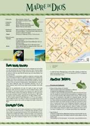
Province of Puno - South American Destination
Province of Puno - South American Destination
Province of Puno - South American Destination

Create successful ePaper yourself
Turn your PDF publications into a flip-book with our unique Google optimized e-Paper software.
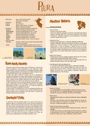
Location:<strong>South</strong>ern Andes (Highlands) <strong>of</strong> Peru; itshares a border with Bolivia.Area: 71.999 km 2 / 27.799 miles 2Capital:Altitude:<strong>Puno</strong> (3827 masl / 12.553 fasl)LimaLowest point: 820 masl / 2690 fasl<strong>Puno</strong>(Lanlacuni Bajo)Highest point: 4725 masl / 15.498 fasl (San Antonio deEsquilache)Distances: From the city <strong>of</strong> <strong>Puno</strong> to the following cities:Juli(<strong>Province</strong> <strong>of</strong> Chucuito) 79 km (49 miles) / 1 hour and 20 minutesIlave(<strong>Province</strong> <strong>of</strong> El Collao) 54 km (34 miles) / 1 hourHuancane (<strong>Province</strong> <strong>of</strong> Huancane) 99 km (62 miles) / 2 hours and 30 minutesLampa(<strong>Province</strong> <strong>of</strong> Lampa) 80 km (50 miles) / 1 hour and 30 minutesAyaviri(<strong>Province</strong> <strong>of</strong> Melgar) 137 km (85 miles) / 2 hours and 45 minutesMoho(<strong>Province</strong> <strong>of</strong> Moho) 138 km (86 miles) / 3 hoursPutina(<strong>Province</strong> <strong>of</strong> San Antonio de Putina) 124 km (77 miles) / 3 hoursand 30 minutesJuliaca(<strong>Province</strong> <strong>of</strong> San Roman) 44 km (27 miles) / 45 minutesSandia(<strong>Province</strong> <strong>of</strong> Sandia) 272 km (169 miles) / 9 hoursYunguyo(<strong>Province</strong> <strong>of</strong> Yunguyo) 128 km (80 miles) / 2 hours and 30 minutesAzangaro (<strong>Province</strong> <strong>of</strong> Azangaro) 148 km (92 miles) / 2 hours and 15minutesMacuzani (<strong>Province</strong> <strong>of</strong> Carabaya) 255 km (158 miles) / 7 hoursAccess Routes:By land Lima – Arequipa – Juliaca – <strong>Puno</strong>: 1324 km / 823 miles (18hours by car)By airRegular flights to Juliaca from Lima (1 hour and 45 minutes, witha stop in Arequipa) and from Arequipa (25 minutes).By trainCusco – <strong>Puno</strong>: 384 km / 239 miles (10 hours)Around 200 B.C., the Pukara culture developed in the area, characterized by huge pyramids,stone monuments, steles, and one-<strong>of</strong>-a-kind pottery. Later, between 800 A.D.and 1200 A.D., the high plateau (Altiplano, today shared by Peru and Bolivia) becamethe cradle <strong>of</strong> the Tiahuanaco civilization that influenced almost the entire territory <strong>of</strong>Peru, especially religiously. The Tiahuanacos distinguished themselves in architecture,stone sculpture, pottery, and textiles, expressing their, as <strong>of</strong> yet undecipherable, religiousiconography in their artwork. As the Tiahuanaco power started to fade, severallocal Lords arose in their old domains, the Collas and Aymaras being the most importantones.In the fifteenth century, the Incas came to the Collao Plateau and violently conqueredthe Collas that had settled in the lowlands and highlands <strong>of</strong> the region. The Aymaraesor Aymaras never fully capitulated, and their descendants, the Lupakas, Lupajaques or“children <strong>of</strong> the sun” as they wanted to be called, represent the most important anddominant villages <strong>of</strong> the high plateau since then.When the Spanish Conquistadors in Cusco heard reports <strong>of</strong> the wealth <strong>of</strong> the Collaoregion, they began to move to the high plateau (el Altiplano).In the middle <strong>of</strong> the seventeenth century, the most powerful Spanish families fromAndalucia and Vizcaya violently fought over the control <strong>of</strong> the Laykacota mines, so thatthe Viceroy, Conde de Lemos, had to travel to the area to reestablish order. In 1668,he founded the city, known today as <strong>Puno</strong>, under the name <strong>of</strong> San Carlos de <strong>Puno</strong>.During the eighteenth century, the indigenous people <strong>of</strong> the region supported the rebellion<strong>of</strong> Tupac Amaru II and that <strong>of</strong> Tupac Catari, demanding an end to the abuses committedby the authorities.The local communities have maintained their farming tradition in the region, and themain activities are still agriculture and cattle breeding with a view on the southernAndean regional market.The Department <strong>of</strong> <strong>Puno</strong> is mainly flat since the immense Collao Plateau constitutesmost <strong>of</strong> its territory. Two mountain ranges, the Carabaya Cordillera (north) and theMaritime or Volcanic Cordillera (south) complete the Territory.The city <strong>of</strong> <strong>Puno</strong> is located on the shores <strong>of</strong> Lake Titicaca, and its climate is cold andsemi-dry. The rainy season starts in October and ends in April.The annual average maximum temperature is 14ºC (58ºF) and the minimum is 3ºC (37ºF).<strong>Province</strong> <strong>of</strong> <strong>Puno</strong><strong>Puno</strong>Cathedral <strong>of</strong> the City <strong>of</strong> <strong>Puno</strong>Downtown. Visiting hours: Mon. – Fri. and Sun. 7:00 A.M. –12:00 P.M. and 3:00 P.M. – 6:00 P.M. Sat. 7:00 A.M. – 12:00 P.M. and 3:00 P.M. – 7:00 P.MThe cathedral was built in the seventeenth century and the Peruvian architectSimon de Asto sculpted its façade. This Spanish Baroque church includes Andeanelements that give the monument its mixed character.Conde de Lemos BalconyIntersection <strong>of</strong> Calles Deustua and Conde de Lemos. Visiting hours: Mon. – Fri. 8:30A.M. – 4:00 P.M.Built around 1668, it is said that Conde de Lemos was lodged in this house whenhe arrived to stamp out the rebellion. Today, it is the cultural complex <strong>of</strong> theNational Culture Institute <strong>of</strong> the Department <strong>of</strong> <strong>Puno</strong> and it contains an art gallery.Fest <strong>of</strong> The Virgin <strong>of</strong> the Candles Archivo de PromPerúLake TiticacaDomingo Giribaldi / PromPerúDeustua ArchJiron Independencia, block 2Constructed with cobblestones, it was erected by the people <strong>of</strong> <strong>Puno</strong> in memory <strong>of</strong>the patriots who fought for the independence <strong>of</strong> Peru.Deustua ArchDomingo Giribaldi / PromPerúLake TiticacaRenzo Uccelli / PromPerúHuajsapata Hill4 blocks from the Main Square, west <strong>of</strong> the cityHuajsapata means “witness <strong>of</strong> my love”. It is a natural lookout dominating the cityand Lake Titicaca. At the top, there is a monument to Manco Capac, founder <strong>of</strong> theInca Empire. They say that there are caverns and subterranean pathways in the hillthat connect <strong>Puno</strong> to the Koricancha Temple in the city <strong>of</strong> Cusco.La Casa del Corregidor (Chief Magistrate’s House)Jiron Deustua 576. Telephone: (051) 35-1921 / 35-3979. Visiting hours: Wed. – Fri. 10:00A.M. – 10:00 P.M. Sat. 10:00 A.M. – 2:30 P.M. and 5:00 P.M. – 10:00 P.M.It is a seventeenth century Colonial mansion where <strong>Puno</strong> art exhibitions take place.There is a c<strong>of</strong>fee bar, a library, and an Internet and video club. Cultural activitiesare organized and information on rural tourism is also available there.Kuntur Wasi Lookout2 km / 1 mile from downtown <strong>Puno</strong> (10 minutes by car)Kuntur Wasi means “house <strong>of</strong> the condor” and <strong>of</strong>fers an unsurpassed view <strong>of</strong> <strong>Puno</strong>
and Lake Titicaca. You must climb a large flight <strong>of</strong> steps to get there.Puma Uta Lookout Park3 km / 2 miles northwest <strong>of</strong> <strong>Puno</strong> (20 minutes by car)The park features a puma shaped stone monument – symbol <strong>of</strong> the lookout sincethis animal is a guardian related to the protection <strong>of</strong> the Andes – built on a fountainthat symbolizes Lake Titicaca. There are many recreational areas.Bahia de los Incas Ecotourism Seawall8 blocks from the Main Square, on the shores <strong>of</strong> Lake TiticacaIt is a pedestrian walkway <strong>of</strong>fering a beautiful view <strong>of</strong> Lake Titicaca where youfind the solar clocks and calendars called Sukankas or Intihuatanas. The pre-Incacultures used them to determine where the ceremonial and sacrificial rituals weregoing to take place. They also used them to establish the territorial boundaries<strong>of</strong> the communities.Yaravi Ship MuseumAvenida Sesquicentenario 610, Sector Huaje (Hotel Sonesta Posada del Inca Pier).Telephone: (051) 36-9329. Visiting hours: Mon. – Sun. 8:00 A.M. – 5:15 P.M. - FreeadmissionIt is an iron ship built in Great Britain in the 1860’s that was transported fromthe Pacific coast to the High Plateau in pieces – 2766 in total. Inside, differentaccessories <strong>of</strong> the ship compartments are exhibited as well as documents,archives, historical maps, and models <strong>of</strong> that time.Floating Islands <strong>of</strong> the UrosDomingo Giribaldi / PromPerúUro WomanMylene D'Auriol / PromPerúTiticaca National ReserveThis Protected Natural Area was created in 1978 in order to preserve the naturalresources characteristic <strong>of</strong> Lake Titicaca and the highland ecosystem. It coversan area <strong>of</strong> 36.180 hectares.In the reserve, dozens <strong>of</strong> birds, fish, and amphibious species have been registeredlike flamingos or parihuanas, Andean geese, seagulls, Titicaca grebes, chullumpis,and Andean lapwings as well as numerous endangered species. You will findtwelve varieties <strong>of</strong> aquatic plants representative <strong>of</strong> the lake flora, the mostremarkable being the totora reeds and algae.Lake Titicaca10 blocks from the Main SquareThis lake is very important in Andean mythology since, according to legend,Manco Capac and Mama Ocllo, children <strong>of</strong> the sun god and founders <strong>of</strong> the IncaEmpire, emerged from its waters.Peru and Bolivia share sovereignty over this navigable lake, the highest in theworld (3810 masl / 12.497 fasl). It covers an area <strong>of</strong> 8559 km 2 (3305 miles 2 ), amaximum depth <strong>of</strong> 283 meters (928 feet), and the average water temperaturevaries from October to May between 9ºC (48ºF) and 11ºC (52ºF) and from Juneto September between -7ºC (19ºF) and -10ºC (14ºF). Moreover, the lake tempersthe area since without its presence, there would not be life at that altitude.On the Peruvian side <strong>of</strong> Lake Titicaca, there are several islands; the naturalislands include Amantani, Taquile, Soto, and Anapia, and the artificial islands arethe ones that the Uros people have built, each one <strong>of</strong>fering different attractions.Along the shores <strong>of</strong> the lake, totora reeds grow where different birds and fish likethe carachis, ispis, bogas, umantos, suches (an endanger specie), silverfish, andtrout call home. All these species are native <strong>of</strong> the area and are prized for theirhigh nutritional value.Floating Islands <strong>of</strong> the Uros5 km / 3 miles west <strong>of</strong> the <strong>Puno</strong> harbor (20 minutes by boat)The Uros Islands (3810 masl / 12.497 fasl) number around 20 and are located inthe Bay <strong>of</strong> <strong>Puno</strong>. Three to ten Uro-Aymaras families live on each one. They ro<strong>of</strong>their houses with totora reed carpets, although some families have replaced theirtraditional ro<strong>of</strong>s by metal ones. The largest Islands are Tupiri, Santa María,Tribuna, Toranipata, Chumi, Paraiso, Kapi, Titino, Tinajero, and Negrone.The Uros call themselves Kotsuña, “the lake people”, and their origins go back toeras before the Incas. They hunt wild birds and maintain traditional fishing methods,especially those used for the carachi and the silverfish. The men are skillfulhandlers <strong>of</strong> the totora reed boats, and the women are expert knitters.The characteristic cold and dry weather <strong>of</strong> the region is tempered in this areathanks to the constantly evaporating water <strong>of</strong> the large lake.Amantani Island36 km / 22 miles northeast <strong>of</strong> the <strong>Puno</strong> harbor (3 hours and 30 minutes by boat)Located at 3187 masl (10.453 fasl), Amantani covers some 9 km 2 (3.5 miles 2 ).The flora is characterized by the presence <strong>of</strong> bushes like the muña, the kantuta,the sage, the tola and the patamuña. Eight communities live on the island andmake their living from growing potatoes, corn, oca, quinoa, lima beans, and greenpeas, and their most representative handcrafts are textiles and stone carvings.Among its natural attractions, there are two lookouts on the highest part <strong>of</strong>feringa view <strong>of</strong> the entire lake, some pre-Hispanic remains, ceremonial centers anda mummy cemetery.Taquile Island35 km / 22 miles east <strong>of</strong> the <strong>Puno</strong> port (3 hours by boat)Its approximate size is <strong>of</strong> 6 km 2 (2 miles 2 ) and the altitude between the port andthe town varies slightly from 3810 to 3950 masl (12.497 to 12.956 fasl). Themaximum temperature there is 23ºC (66ºF), and the minimum is 7ºC (37ºF).Pre-Inca vestiges are found in the highest part <strong>of</strong> the island. During the Colonialperiod and up to the first years <strong>of</strong> the twentieth century, it was used as a politicalprison, until the island became property <strong>of</strong> the Taquile people in 1970. Thetown <strong>of</strong> the same name, Taquile, is characterized by its friendly inhabitants, whomaintain their customs and traditional clothing. They distinguish themselves bytheir detailed, fine, and colorful textiles with symmetrical decorations and symbolsthat reflect their way <strong>of</strong> life, customs, and Andean beliefs.Chucuito18 km / 11 miles south <strong>of</strong> <strong>Puno</strong> (15 minutes by car)It is also known as the Royal Treasury City because it used to be the tax collectioncenter during the Colonial era. It features a main square and the Renaissancechurches <strong>of</strong> Santo Domingo (sixteenth century) and La Asuncion (seventeenthcentury).Cutimbo Archeological ComplexThe turn<strong>of</strong>f to the complex is located near kilometer marker 17 <strong>of</strong> the <strong>Puno</strong>-Moquegua Highway, south <strong>of</strong> <strong>Puno</strong> (20 minutes by car).It is a pre-Hispanic cemetery that belonged to the Lupaca and Colla Lordships.Although there is evidence <strong>of</strong> 8000 years old rock-art, the main structures datefrom 1100 A.D. to 1450 A.D. There are also Inca archeological remnants. Thechullpas or pucullos, large fortified burial towers, overlook the landscape.Amantani IslandDomingo Giribaldi / PromPerúChucuito Carlos Sala / PromPerúSillustani Archeological Complex34 km /21 miles north <strong>of</strong> <strong>Puno</strong> (35 minutes by car)This complex stands on the shore <strong>of</strong> Lake Umayo. It is famous for its chullpas,large circular fortified burial towers for the main leaders <strong>of</strong> the early villages <strong>of</strong>the Collao plateau. Some are 12 meters high (39 feet), and remarkable for theirshape, thinner at the base and wider at the top. Close to the archeological complexis the site museum where different pieces from the Colla, Tiahuanuaco, andInca cultures are preserved.Llachon74 km / 46 miles northeast <strong>of</strong> <strong>Puno</strong>, on the shores <strong>of</strong> Lake Titicaca (2 hours by car)This community <strong>of</strong> around 1300 inhabitants still maintains its customs and nativecultural manifestations, and its main activities are farming, cattle breeding, fishing,and handicraft. Llachon can be reached by motorboat from <strong>Puno</strong> harbor andfrom the Islands <strong>of</strong> Taquile and Amantani or by land from <strong>Puno</strong> or Juliaca. Theplace <strong>of</strong>fers experimental tourism, “living tourism”, allowing visitors to stay withfamilies <strong>of</strong> the community.
Attention: Mon. – Fri. 7:00 A.M. - 12:00 P.M. and 1:00 P.M. - 5:00 P.M.; Sat. –Sun. 7:00 A.M. -11:00 A.M.The most typical dishes <strong>of</strong> the region are:Cancacho: roasted pork or lamb macerated in aji (hot pepper) and oil.Pesque de quinoa: mashed quinoa seasoned with milk and cheese.Chairo: Beef and lamb soup with potatoes, lima beans, squash, cabbage, chuño ordehydrated potatoes, wheat, and chalona or dried lamb.Feast <strong>of</strong> the Virgen de la Candelaria (Virgin <strong>of</strong> the Candles) / 2 nd February<strong>Province</strong> <strong>of</strong> <strong>Puno</strong>, District <strong>of</strong> <strong>Puno</strong>The feast <strong>of</strong> the Virgen de la Candelaria, that used to last 40 days and 40 nightsafter Christmas, comes from an old Catholic tradition <strong>of</strong> “purification” <strong>of</strong> the VirginMary. Besides the feast, there was a solemn procession <strong>of</strong> holy candles, source <strong>of</strong>the festival name. Today, the Virgen de la Candelaria is the most important religiouscelebration day in <strong>Puno</strong>, and it includes masses, banquets, dances, contests, and acolorful procession that gathers hundreds <strong>of</strong> believers.Llachon WearingDomingo Giribaldi / PromPerúLittle Bull <strong>of</strong> Pucará Domingo Giribaldi / PromPerúFeast <strong>of</strong> Alacitas and Las Cruces / 3 rd and 4 th May<strong>Province</strong> <strong>of</strong> San Roman and <strong>Puno</strong>. Districts <strong>of</strong> Juliaca, <strong>Puno</strong>, and Cabanillos.It is a special occasion where the inhabitants sell miniature handcrafted items, symbolizingthe things anyone wishes to possess like houses, cars, money, etc, in differentfairs located along the main streets <strong>of</strong> each city. Bolivian artisans also participatein this festival.Anniversary <strong>of</strong> the Founding <strong>of</strong> the City <strong>of</strong> <strong>Puno</strong> / 1 st to 7 th November<strong>Province</strong> <strong>of</strong> <strong>Puno</strong>, District <strong>of</strong> <strong>Puno</strong>To celebrate the city, the school pupils are in charge <strong>of</strong> organizing civic demonstrationsand dance shows throughout the city streets. On 5 th November, the peoplepresent an account <strong>of</strong> the creation <strong>of</strong> the Inca Empire, the legend that tells how themythic couple Manco Capac and Mama Ocllo emerged from the sacred lake insearch <strong>of</strong> land to found the Empire.AIRPORTInca Manco Capac International Airport. Avenida Aviación - UrbanizaciónSanta Adriana. Juliaca. Telephone: (051) 32-8974 / 32-2905Attention: Mon. – Fri. 8:30 A.M. – 4:30 P.M. Sat. 8:00 A.M. – 1:00 P.M.OVERLAND TRANSPORTBus Station. Jiron Primero de Mayo 703, Barrio Magisterial, <strong>Puno</strong>. Telephone:(051) 36-4733. Attention: Mon. – Sun. 8:00 A.M. – 4:00 P.M.Terminal Zonal. Avenida Simon Bolivar, <strong>Puno</strong>. Attention: Mon. – Sun. 4:00 P.M.– 9:00 P.M.TRAIN STATIONPeru Rail Corporation.<strong>Puno</strong>: Avenida La Torre 224, <strong>Puno</strong>. Telephone: (051) 35-1041 / 36-9179Juliaca:Plaza Bolognesi 303, Juliaca. Telephone: (051) 32-1036.E-mail: reservas@perurail.comWeb site: http://www.perurail.comHEALTH CENTERS<strong>Puno</strong>. Manuel Nuñez Butron National Hospital, Avenida El Sol 1022. Telephone:(051) 36-9696 / 35-1021 / 36-7777. Attention: Mon. – Fri. 7:30 A.M – 2:30 P.M.Juliaca. San Roman. Carlos Monge Medrano Hospital, Kilometer marker 2 <strong>of</strong> theHuancane Highway. Telephone: (051) 32-1750 / 32-1131 / 32-1370. Attention:Mon. – Fri. 7:30 A.M – 1:30 P.M.LOCAL POLICE<strong>Puno</strong>. XII Police Region. Jiron Deustua 530. Telephone: (051) 35-3988. Attention:24 hours<strong>Puno</strong>. Tourism Police. Jiron Deustua 558. Attention: 24 hoursJuliaca. National Police <strong>of</strong> Peru. Jiron San Martin and Jiron Ramon. Telephone:(051) 32-2091. Attention: 24 hoursCRAFT MARKETS<strong>Puno</strong>“San Jose Artisan Association” Craft MarketCalle Cahuide, Block 3. Opening hours: Mon. – Sun. 8:00 A.M. – 7:00 P.M.“La Cholita” Artisans AssociationPasaje Lima 550, 2nd level.Opening hours: Mon. – Sun. 8:00 A.M. – 7:00 P.M.“Tucuy Atipac” Handicrafts CenterPasaje Lima 339, 2nd level. Opening hours: Mon. – Sun. 8:00 A.M. – 7:00 P.M.“Coriwasi Association” Craft MarketCalle Alfonso Ugarte 150. Opening hours: Mon. – Sun. 8:00 A.M. – 9:00 P.M.San Roman:Original Folk Art Handicrafts CenterInca Manco Capac International Airport, Juliaca. Telephone: (051) 32-2905.POSTAL SERVICES<strong>Puno</strong>. Jiron Moquegua 269. Telephone: (051) 35-1141. Attention: Mon. – Sat.8:00 A.M. – 8:00 P.M.Juliaca-San Roman. Intersection <strong>of</strong> Calles Sandia and Ladislao Butron.Telephone: (051) 32-1391. Attention: Mon. – Sat. 8:15 A.M. – 7:00 P.M.REGIONAL GOVERNMENT OF PUNOwww.regionpuno.gob.peTOURIST INFORMATIONAt the Tourist Information and Assistance Service, iperu, you can ask forobjective and impartial tourism information, as well as assistance in case thetourist services you received were not provided according to the contractsigned.Contact the service nationwide 24 hours a day:Telephone: (01) 574-8000. Email: iperu@promperu.gob.pe<strong>Puno</strong>: Main Square, Corner <strong>of</strong> Jiron Deustua and Jiron Lima. Telephone/Fax: (051)36-5088. Attention: Mon. – Sun. 8:30 A.M. – 7:30 P.M. E-mail:iperupuno@promperu.gob.peMORE INFORMATION: www.peru.infoLegal Deposit Number: 2005-7581The information contained in this document is a list <strong>of</strong> attractions and services at the disposal <strong>of</strong> the travelerin the entire department. In order to update it, PromPerú has been assisted by <strong>of</strong>ficial informationsources like: National Institute for Natural Resources (INRENA), National Culture Institute (INC), NationalInstitute <strong>of</strong> Geography (IGN), National Meteorology and Hydrology Service <strong>of</strong> Peru (SENAMHI), and theRegional Administration <strong>of</strong> Foreign Trade and Tourism, Regional Foreign Trade and Tourism Administration,Regional Chamber and Regional Association <strong>of</strong> Travel Agencies and Tourism <strong>of</strong> <strong>Puno</strong>.Publication Date: November 2005.Commission for the Promotion <strong>of</strong> Peru