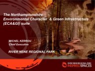
Green Infrastructure for the East Midlands - River Nene Regional Park
Green Infrastructure for the East Midlands - River Nene Regional Park
Green Infrastructure for the East Midlands - River Nene Regional Park

You also want an ePaper? Increase the reach of your titles
YUMPU automatically turns print PDFs into web optimized ePapers that Google loves.
EXECUTIVE SUMMARY<br />
28TH JULY 2006<br />
The purpose of this study was to identify whe<strong>the</strong>r <strong>the</strong> Public<br />
Benefit Recording System (PBRS) technique could be applied<br />
to <strong>the</strong> <strong>East</strong> <strong>Midlands</strong> region to identify where <strong>the</strong> greatest public<br />
benefit could be derived from investments in <strong>Green</strong><br />
<strong>Infrastructure</strong> (GI).<br />
The Integrated <strong>Regional</strong> Strategy (IRS) outlines 17 key<br />
objectives <strong>for</strong> <strong>the</strong> region across social, economic and<br />
environmental <strong>the</strong>mes. The provision or enhancement of GI<br />
can contribute significantly to <strong>the</strong> achievement of most of <strong>the</strong>se.<br />
Geographical In<strong>for</strong>mation Systems (GIS) were used to spatially<br />
and <strong>the</strong>matically map where GI could contribute to <strong>the</strong> IRS<br />
objectives. Appropriate indicator datasets, ranging in scale<br />
from neighbourhood to local authority level, were identified to<br />
enable <strong>the</strong>se assessments. Data was benchmarked and<br />
ranked in order to provide a robust regional focus and to<br />
account <strong>for</strong> urban, rural and national contexts where appropriate.<br />
Twenty seven ‘public benefit’ maps were produced, each relating<br />
to a separate <strong>the</strong>me of <strong>the</strong> IRS (eg. health, housing, cultural<br />
assets etc.), to identify where <strong>the</strong>re is greatest need and/or<br />
opportunity <strong>for</strong> GI to contribute to IRS objectives. The maps<br />
are presented, each with a narrative, outlining areas of particular<br />
priority <strong>for</strong> GI, toge<strong>the</strong>r with a short discussion on <strong>the</strong><br />
limitations of <strong>the</strong> data.<br />
The greatest depth of public benefit will generally be derived<br />
where greatest need and opportunity coincide and where multiple<br />
objectives may be delivered in parallel. A simple scoring<br />
system was devised to represent <strong>the</strong> depth of public benefit<br />
potentially attainable from GI <strong>for</strong> each of <strong>the</strong> objectives,<br />
spatially across <strong>the</strong> region. Public benefit scores were <strong>the</strong>n<br />
combined within and across <strong>the</strong> social, economic and<br />
environmental <strong>the</strong>mes to create maps highlighting <strong>the</strong><br />
potential <strong>for</strong> multiple public benefits.<br />
THE RESULTING MULTIPLE PUBLIC<br />
BENEFITS MAPS REVEALED:<br />
The greatest opportunity <strong>for</strong> social uplift occurs within <strong>the</strong><br />
Three Cities Areas, <strong>the</strong> Derbyshire and North Nottinghamshire<br />
coalfields, <strong>the</strong> Lincolnshire coast and <strong>the</strong> Northamptonshire<br />
Growth Areas.<br />
The greatest opportunity <strong>for</strong> environmental uplift occurs<br />
around areas of existing environmental assets (particularly<br />
around Strategic <strong>River</strong> Corridors) and in areas of poor<br />
environmental quality.<br />
The greatest opportunity <strong>for</strong> economic uplift occurs mainly<br />
within <strong>the</strong> Three Cities Area and around strategic economic<br />
gateways. Northampton, <strong>the</strong> Lincolnshire Coast, some rural<br />
areas and key natural assets also show potential <strong>for</strong> tourism<br />
and environmental economy benefits.<br />
The Combined Multiple Public Benefits Map revealed <strong>the</strong><br />
greatest opportunity <strong>for</strong> uplift around <strong>the</strong> Strategic <strong>River</strong><br />
Corridors, <strong>the</strong> Three Cities sub area, <strong>the</strong> Northamptonshire<br />
Growth Area centres, <strong>the</strong> Nor<strong>the</strong>rn sub area and <strong>the</strong><br />
Lincolnshire coast. Cross-reference with <strong>the</strong> Environmental<br />
Public Benefits Map confirmed that most of <strong>the</strong> areas of<br />
greatest environmental priority are included within <strong>the</strong><br />
multiple benefits map.<br />
The implications of <strong>the</strong> results are discussed in terms of<br />
priorities <strong>for</strong> <strong>the</strong> delivery of GI and <strong>the</strong> implications <strong>for</strong> <strong>the</strong><br />
region’s spatial strategy, population growth, quality of life and<br />
sustainable development.<br />
The study shows at a regional scale that it is possible to map<br />
<strong>the</strong> potential public benefit GI can bring. Fur<strong>the</strong>r, it provides a<br />
firm evidence base <strong>for</strong> strategic investment in GI to deliver<br />
regional objectives in an integrated manner. It substantiates GI<br />
investments in <strong>the</strong> <strong>River</strong> <strong>Nene</strong> <strong>Regional</strong> <strong>Park</strong> and o<strong>the</strong>r<br />
Northamptonshire Growth Areas but also emphasises that<br />
equal, and in some cases greater, public benefit can be<br />
achieved by GI investments elsewhere in <strong>the</strong> region.<br />
It is recognised that <strong>the</strong> PBRS is a ‘top-down’ approach – it is<br />
an aid to strategic planning and investment. The spatial<br />
insights it brings must be combined with local knowledge and<br />
community values in order to deliver GI and its benefits on<br />
<strong>the</strong> ground.<br />
To facilitate <strong>the</strong> realisation of enhanced GI in <strong>the</strong> region, a<br />
database of stakeholders was developed through correspondence<br />
with regional and local Government and Non<br />
Governmental Organisations. This will <strong>for</strong>m <strong>the</strong> basis of a<br />
<strong>Green</strong> <strong>Infrastructure</strong> Network (GIN) <strong>for</strong> <strong>the</strong> coordinated<br />
delivery of GI across <strong>the</strong> region.<br />
A seminar was held in Melton Mowbray (May 2006) and a<br />
public in<strong>for</strong>mation leaflet was created (opposite) to increase<br />
awareness of <strong>the</strong> study throughout <strong>the</strong> region.<br />
4