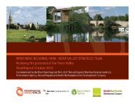
Green Infrastructure for the East Midlands - River Nene Regional Park
Green Infrastructure for the East Midlands - River Nene Regional Park
Green Infrastructure for the East Midlands - River Nene Regional Park

You also want an ePaper? Increase the reach of your titles
YUMPU automatically turns print PDFs into web optimized ePapers that Google loves.
3.0<br />
METHODOLOGY<br />
Datasets were available to map GI’s potential contribution to<br />
most IRS objectives – <strong>the</strong>re has been considerable investment<br />
in mapping and data collection over <strong>the</strong> past few years, which<br />
means that <strong>for</strong> most objectives, directly relevant datasets are<br />
available; or at least good “proxies” can be found.<br />
In <strong>the</strong> example cited above re GI contributing to sustainable<br />
housing, Census 2001 statistics were used to identify Super<br />
Output Areas 3 where proportions of <strong>the</strong> very young and/or very<br />
old were significantly higher than <strong>the</strong> regional average.<br />
Column 4 (Map Theme) of Appendix 1 lists <strong>the</strong> various <strong>the</strong>mes<br />
which were mapped. Column 6 identifies <strong>the</strong> sources of data<br />
used <strong>for</strong> each map.<br />
Inevitably <strong>the</strong>re are limitations imposed by <strong>the</strong> geographic<br />
focus of <strong>the</strong> data, and in some cases, time has passed since<br />
data was collected. Significant areas <strong>for</strong> future development<br />
are discussed in relation to each map; and are summarised at<br />
<strong>the</strong> end of this study.<br />
STEP 3 - BENCHMARKING AND RANKING INDICATORS –<br />
was carried out to identify regional “hotspots” of need or<br />
opportunity. As far as possible, data was benchmarked around<br />
regional (ra<strong>the</strong>r than national) means; although national<br />
benchmarks were borne in mind to ensure only<br />
genuine need was prioritised.<br />
It was also found useful, <strong>for</strong> many social datasets, to provide<br />
parallel benchmarks <strong>for</strong> urban and rural neighbourhoods;<br />
specifically to ensure that pockets of rural disadvantage are not<br />
ignored or obscured due to <strong>the</strong> ra<strong>the</strong>r urban-centric nature of<br />
Index of Deprivation statistics. This process of urban – rural<br />
benchmarking used <strong>the</strong> Defra rural classification (see Map B).<br />
Once datasets had been assembled and benchmarked to <strong>the</strong><br />
region, a process of ranking occurred in order to identify <strong>the</strong><br />
areas of greatest need and / or opportunity.<br />
In some cases <strong>the</strong> maps simply identify areas of need /<br />
opportunity. In o<strong>the</strong>r cases, <strong>the</strong> maps illustrate <strong>the</strong> “depth” of<br />
need / opportunity, using a ranking. This process required<br />
sensitivity testing in order to ensure that only genuine need /<br />
opportunity was ranked highly.<br />
75, 76-100). However, if an <strong>East</strong> <strong>Midlands</strong> neighbourhood<br />
ranked 51 is in fact significantly healthier than <strong>the</strong> English<br />
median, a weighting may be set to give priority only to those<br />
areas of genuine health need.<br />
Column 5 of Appendix 1 lists how <strong>the</strong> ranking was carried out,<br />
showing <strong>for</strong> each map, which areas are of greatest need /<br />
opportunity – and how this translates into “scores”.<br />
A simple scoring system, from 0 to 3, was adopted <strong>for</strong> each<br />
indicator dataset. Areas which scored 3 indicating, <strong>for</strong> that<br />
specific dataset, that ei<strong>the</strong>r;<br />
There is a significant need, at regional level, <strong>for</strong> GI uplift to<br />
address social, environmental or economic problem areas; or<br />
that GI makes, or could make, a significant contribution to <strong>the</strong><br />
economy, environment or society’s needs.<br />
STEP 4 – IDENTIFYING WHERE THERE IS GREATEST NEED<br />
FOR GI AND/OR GREATEST OPPORTUNITY FOR GI TO<br />
DELIVER IRS OBJECTIVES –<br />
resulted in <strong>the</strong> production of 27 <strong>the</strong>med Public Benefits maps:<br />
13 in relation to <strong>the</strong> IRS’s 5 social outcomes, 8 in respect of <strong>the</strong><br />
5 environmental outcomes; and 6 illustrating contribution to<br />
<strong>the</strong> 3 economic outcomes. Of course, a number of <strong>the</strong> maps<br />
are cross-cutting e.g. Map 13 (Index of Multiple Deprivation)<br />
which falls into <strong>the</strong> “social” <strong>the</strong>me also has an<br />
economic purpose.<br />
Appendix 1 (in column 4) lists <strong>the</strong> 27 maps, in relation to <strong>the</strong>ir<br />
IRS <strong>the</strong>me.<br />
A series of Multiple Public Benefit maps were <strong>the</strong>n produced<br />
by combining <strong>the</strong> 27 <strong>the</strong>med maps to demonstrate where GI<br />
provision would have <strong>the</strong> greatest public benefit potential<br />
towards social, environmental, economic and combined agendas.<br />
3.5 STAKEHOLDER CONSULTATION<br />
A seminar and workshop was held at Pera Innovation <strong>Park</strong>,<br />
Melton Mowbray on May 31st to present <strong>the</strong> interim findings,<br />
discuss <strong>the</strong> project and promote <strong>the</strong> <strong>for</strong>mation of a regional GI<br />
network. Results of a questions and answer session and<br />
interactive workshop are included at Appendix 2.<br />
For example, a map outlining health may rank areas across<br />
<strong>the</strong> region from 1 (best) to 100 (worst). One might impose a<br />
four point scoring scale based on quartiles (1- 25, 26-50, 51-<br />
3 Demographic units <strong>for</strong> <strong>the</strong> purposes of census and social mapping – typically 1/3rd of an electoral ward, comprising 3 to 4,000 people.<br />
8