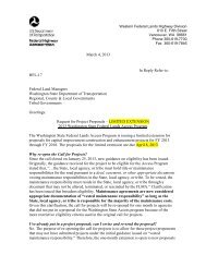
Memorandum - Western Federal Lands Highway Division - U.S. ...
Memorandum - Western Federal Lands Highway Division - U.S. ...
Memorandum - Western Federal Lands Highway Division - U.S. ...

Create successful ePaper yourself
Turn your PDF publications into a flip-book with our unique Google optimized e-Paper software.
thick. The conglomerate layer is often locally included as part of the Troutdale Formation.<br />
The alluvium is described as unconsolidated sediments underlying the modern floodplains of<br />
the Columbia River and Lake River.<br />
GEOLOGIC HAZARDS<br />
Geologic hazards relevant to this site were reviewed as part of this corridor assessment. Clark<br />
County has an online map database that identifies landslide, liquefaction, and erosion hazards.<br />
The USGS Earthquake Hazards Program website was used to perform a seismic deaggregation<br />
for the site and locate nearby active faults.<br />
<strong>Lands</strong>lides<br />
The cut slopes and natural slopes within the drainage along the road are mapped as “potential”<br />
and “moderate” under <strong>Lands</strong>lide Hazard Areas in the Clark County Maps Online database for<br />
Slopes and Geologic Hazards. See attached Figure 2 (attached).<br />
Seismicity and Liquefaction<br />
The USGS interactive deaggregations website was used to determine the seismic hazard at the<br />
site. The current AASHTO Bridge Design Specifications (2012) specify a design seismic<br />
event with a 7 percent probability of exceedance in 75 years which is approximately a 1000-<br />
year return period. The peak ground acceleration for the specified return period was<br />
determined to be 0.28g using the USGS 2008 deaggregation website. The closest active fault<br />
is the Portland Hills Fault located about 11 miles south of bridge. The deaggregation indicates<br />
the sources contributing significantly to the seismic hazard at the site are the Cascadia<br />
Subduction Zone (megathrust and floating), western US gridded crustal faults, and 50-km deep<br />
intraplate earthquakes.<br />
In the Clark County Maps Online database for Slopes and Geologic Hazards the Liquefaction<br />
hazard along most of the alignment is mapped as “very low” and “very low to low”. However,<br />
the low and flat-laying area on both sides of the bridge is mapped as a “moderate to high”<br />
liquefaction hazard. See attached Figure 3 (attached).<br />
This bridge site has a seismic hazard and subsurface conditions that would require special<br />
consideration during design of a replacement structure.<br />
Erosion<br />
In the Clark County Maps Online database for Slopes and Geologic Hazards the entire<br />
drainage that parallels most of the access road and the slopes facing Lake River are mapped as<br />
a “Severe Erosion Hazard Area”. See Figure 4 (attached).<br />
Page 3 of 10