Memorandum - Western Federal Lands Highway Division - U.S. ...
Memorandum - Western Federal Lands Highway Division - U.S. ...
Memorandum - Western Federal Lands Highway Division - U.S. ...

Create successful ePaper yourself
Turn your PDF publications into a flip-book with our unique Google optimized e-Paper software.
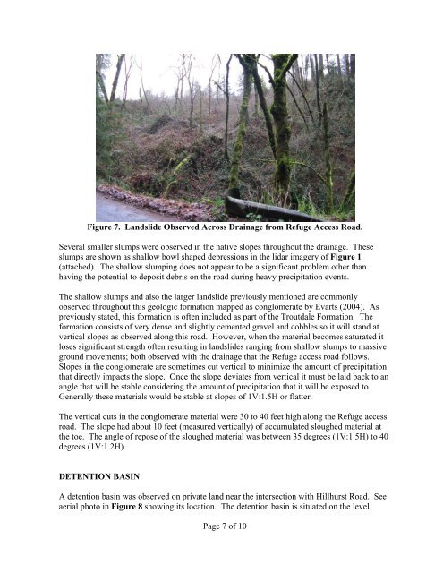
Figure 7. <strong>Lands</strong>lide Observed Across Drainage from Refuge Access Road.<br />
Several smaller slumps were observed in the native slopes throughout the drainage. These<br />
slumps are shown as shallow bowl shaped depressions in the lidar imagery of Figure 1<br />
(attached). The shallow slumping does not appear to be a significant problem other than<br />
having the potential to deposit debris on the road during heavy precipitation events.<br />
The shallow slumps and also the larger landslide previously mentioned are commonly<br />
observed throughout this geologic formation mapped as conglomerate by Evarts (2004). As<br />
previously stated, this formation is often included as part of the Troutdale Formation. The<br />
formation consists of very dense and slightly cemented gravel and cobbles so it will stand at<br />
vertical slopes as observed along this road. However, when the material becomes saturated it<br />
loses significant strength often resulting in landslides ranging from shallow slumps to massive<br />
ground movements; both observed with the drainage that the Refuge access road follows.<br />
Slopes in the conglomerate are sometimes cut vertical to minimize the amount of precipitation<br />
that directly impacts the slope. Once the slope deviates from vertical it must be laid back to an<br />
angle that will be stable considering the amount of precipitation that it will be exposed to.<br />
Generally these materials would be stable at slopes of 1V:1.5H or flatter.<br />
The vertical cuts in the conglomerate material were 30 to 40 feet high along the Refuge access<br />
road. The slope had about 10 feet (measured vertically) of accumulated sloughed material at<br />
the toe. The angle of repose of the sloughed material was between 35 degrees (1V:1.5H) to 40<br />
degrees (1V:1.2H).<br />
DETENTION BASIN<br />
A detention basin was observed on private land near the intersection with Hillhurst Road. See<br />
aerial photo in Figure 8 showing its location. The detention basin is situated on the level<br />
Page 7 of 10