Memorandum - Western Federal Lands Highway Division - U.S. ...
Memorandum - Western Federal Lands Highway Division - U.S. ...
Memorandum - Western Federal Lands Highway Division - U.S. ...

You also want an ePaper? Increase the reach of your titles
YUMPU automatically turns print PDFs into web optimized ePapers that Google loves.
Site Observations<br />
Brian Collins, WFLHD Geotechnical Engineer, and Jeff Berg, WFLHD Structural Engineer,<br />
visited the site on March 27, 2012. The field review consisted of a general surface<br />
reconnaissance of the existing access road and bridge. It should be noted that the extent of the<br />
field review is limited to interpretations of surface features.<br />
SLOPE INCLINATIONS<br />
The existing road template appears to have generally been constructed with a partial cut bench<br />
on the uphill side and a fill on the downhill side. Both the cut and fill slopes are relatively<br />
steep with slope angles ranging from 40 degrees (1V:1.2H) to vertical. Natural slopes within<br />
the drainage were generally between 30 degrees (1V:1.75H) to 40 degrees (1V:1.2H). A<br />
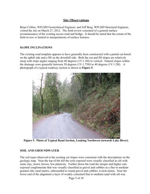
photograph of a typical roadway section is shown in Figure 5.<br />
Figure 5. Photo of Typical Road Section, Looking Northwest (towards Lake River).<br />
SOIL AND GROUNDWATER<br />
The soil types observed in the existing cut slopes were consistent with the descriptions on the<br />
geologic map. Near the top of the hill the soils exposed were visually classified as silt with<br />
some clay, moist, brown, low plasticity. Further down the road the steeper and higher cuts<br />
exposed conglomerate that was visually classified as gravel and cobbles in a fine to medium<br />
grained silty sand matrix, subrounded to round gravel and cobbles, 6-inch minus. Near the<br />
lower end of the alignment a layer of weakly cemented fine to medium sand with silt was<br />
Page 5 of 10