Concept study of radar sensors for near-field tsunami early warning
Concept study of radar sensors for near-field tsunami early warning
Concept study of radar sensors for near-field tsunami early warning
You also want an ePaper? Increase the reach of your titles
YUMPU automatically turns print PDFs into web optimized ePapers that Google loves.
Nat. Hazards Earth Syst. Sci., 10, 1957–1964, 2010<br />
www.nat-hazards-earth-syst-sci.net/10/1957/2010/<br />
doi:10.5194/nhess-10-1957-2010<br />
© Author(s) 2010. CC Attribution 3.0 License.<br />
Natural Hazards<br />
and Earth<br />
System Sciences<br />
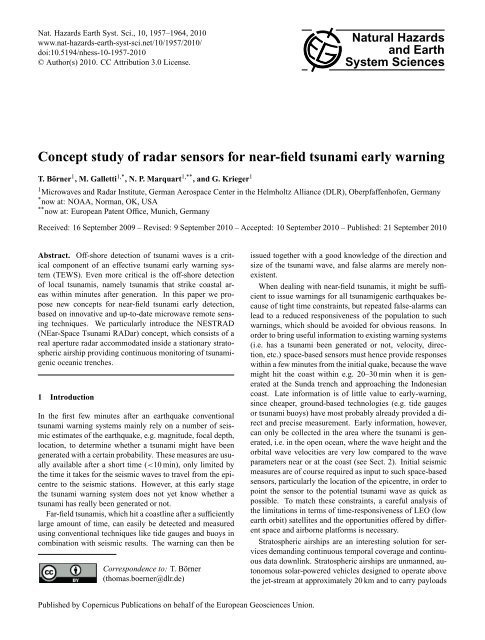
<strong>Concept</strong> <strong>study</strong> <strong>of</strong> <strong>radar</strong> <strong>sensors</strong> <strong>for</strong> <strong>near</strong>-<strong>field</strong> <strong>tsunami</strong> <strong>early</strong> <strong>warning</strong><br />
T. Börner 1 , M. Galletti 1,* , N. P. Marquart 1,** , and G. Krieger 1<br />
1Microwaves and Radar Institute, German Aerospace Center in the Helmholtz Alliance (DLR), Oberpfaffenh<strong>of</strong>en, Germany<br />
* now at: NOAA, Norman, OK, USA<br />
** now at: European Patent Office, Munich, Germany<br />
Received: 16 September 2009 – Revised: 9 September 2010 – Accepted: 10 September 2010 – Published: 21 September 2010<br />
Abstract. Off-shore detection <strong>of</strong> <strong>tsunami</strong> waves is a critical<br />
component <strong>of</strong> an effective <strong>tsunami</strong> <strong>early</strong> <strong>warning</strong> system<br />
(TEWS). Even more critical is the <strong>of</strong>f-shore detection<br />
<strong>of</strong> local <strong>tsunami</strong>s, namely <strong>tsunami</strong>s that strike coastal areas<br />
within minutes after generation. In this paper we propose<br />
new concepts <strong>for</strong> <strong>near</strong>-<strong>field</strong> <strong>tsunami</strong> <strong>early</strong> detection,<br />
based on innovative and up-to-date microwave remote sensing<br />
techniques. We particularly introduce the NESTRAD<br />
(NEar-Space Tsunami RADar) concept, which consists <strong>of</strong> a<br />
real aperture <strong>radar</strong> accommodated inside a stationary stratospheric<br />
airship providing continuous monitoring <strong>of</strong> <strong>tsunami</strong>genic<br />
oceanic trenches.<br />
1 Introduction<br />
In the first few minutes after an earthquake conventional<br />
<strong>tsunami</strong> <strong>warning</strong> systems mainly rely on a number <strong>of</strong> seismic<br />
estimates <strong>of</strong> the earthquake, e.g. magnitude, focal depth,<br />
location, to determine whether a <strong>tsunami</strong> might have been<br />
generated with a certain probability. These measures are usually<br />
available after a short time (
1958 T. Börner et al.: <strong>Concept</strong> <strong>study</strong> <strong>of</strong> <strong>radar</strong> <strong>sensors</strong> <strong>for</strong> <strong>near</strong>-<strong>field</strong> <strong>tsunami</strong> <strong>early</strong> <strong>warning</strong><br />
<strong>of</strong> up to a few tons (Hanlon, 2005; Qureshi, 2003; Cooney,<br />
2009). The airships, measuring more than 100 m in length,<br />
can be used <strong>for</strong> both military and civilian applications. Besides<br />
<strong>early</strong>-<strong>warning</strong> and post-disaster damage assessment,<br />
they <strong>of</strong>fer reliable and continuous downlink transmission and<br />
might also serve the purpose <strong>of</strong> mobile data communication.<br />
The NESTRAD concept presented in this paper consists <strong>of</strong><br />
a C-band phased-array <strong>radar</strong> accommodated inside a stratospheric<br />
airship, providing quasi-geostationary, all-weather,<br />
24/7 coverage and consequently a response time less than<br />
5 min. It is meant to detect <strong>tsunami</strong>-induced RCS modulations<br />
(<strong>tsunami</strong> shadows) (Godin, 2004; Troitskaya et al.,<br />
2008), <strong>tsunami</strong> wave height as well as <strong>tsunami</strong> orbital velocities.<br />
Depending whether the plat<strong>for</strong>m is stationary or slowmoving,<br />
it can operate as a real aperture <strong>radar</strong> or as a synthetic<br />
aperture <strong>radar</strong> (SAR).<br />
The per<strong>for</strong>mance analysis shown in the following tries to<br />
give an account on the system capabilities to resolve <strong>tsunami</strong>related<br />
geophysical features. In particular, the detection <strong>of</strong><br />
<strong>radar</strong> cross section modulations (Godin, 2004) is expected to<br />
provide wide area coverage. In this case modulations <strong>of</strong> a<br />
few dB should be present <strong>for</strong> <strong>tsunami</strong>s <strong>of</strong> virtually any size.<br />
2 Radar relevant <strong>tsunami</strong> signatures<br />
In this section we review, from a <strong>radar</strong> remote sensing viewpoint,<br />
all known <strong>tsunami</strong>-related signatures. For each detectable<br />
geophysical feature, every sensor with either proven<br />
or potential detection capability is listed and briefly discussed.<br />
Each sensor relies on at least one principle <strong>of</strong> detection<br />
but, obviously, one sensor can combine more principles<br />
<strong>of</strong> detection.<br />
2.1 Tsunami wave height<br />
Wave height is the most intuitive physical feature <strong>of</strong> an ocean<br />
wave and can be measured by tide gauges at shore, ocean<br />
bottom pressure <strong>sensors</strong> <strong>of</strong>f shore and, lately, <strong>tsunami</strong> wave<br />
height measurements were recorded by satellite-borne altimeters<br />
(e.g. Okal, 1999). Satellite altimetry relies on nadirpointing<br />
<strong>radar</strong>s carried onboard a number <strong>of</strong> satellite missions<br />
like ESA’s ERS-1, ERS-2, ENVISAT, SENTINEL and<br />
the series <strong>of</strong> US-French satellites Topex/Poseidon, Jason-1<br />
and Jason-2. On Boxing Day 2004, a number <strong>of</strong> altimeters<br />
accidentally overflew the <strong>tsunami</strong> wave and provided the scientific<br />
community with valuable measurements (e.g. a wave<br />
amplitude <strong>of</strong> 0.7 m in the open ocean). Following this accidental<br />
data-takes, concepts were put <strong>for</strong>th <strong>for</strong> <strong>tsunami</strong> <strong>early</strong><strong>warning</strong><br />
from space. The proposed concepts envision a number<br />
<strong>of</strong> LEO microsatellites carrying altimeters (implemented<br />
either with active or passive <strong>radar</strong> technology). For example,<br />
results from the GANDER project (Global Altimeter Network<br />
Designed to Evaluate Risk) (Allen, 2006) put <strong>for</strong>th a<br />
constellation <strong>of</strong> 24 micro-satellites (4 satellites in each <strong>of</strong> 6<br />
<strong>near</strong>-polar orbits at 1682 km altitude, orbit period 2 h) in order<br />
to overfly a <strong>tsunami</strong> within 30 min from the initial quake.<br />
An interesting alternative to classical altimeters is to use<br />
GNSS reflectometry, as proposed in (Stosius, 2010). However,<br />
the satellite still has to overfly a ground station <strong>for</strong> the<br />
data downlink, which might well take another 30 min under<br />
rather favourable conditions. If a constellation <strong>of</strong> satellites<br />
is put <strong>for</strong>th <strong>for</strong> <strong>tsunami</strong> <strong>early</strong> <strong>warning</strong>, intra-satellite communication<br />
links should be envisioned to match the constraints<br />
dictated by <strong>near</strong>-<strong>field</strong> <strong>tsunami</strong> <strong>early</strong> <strong>warning</strong>.<br />
Since <strong>tsunami</strong> wave heights in the open ocean are expected<br />
to be far below 1 m, detecting such a small change will certainly<br />
be a challenge. The Topex/Poseidon and Jason-1/2<br />
altimeter measurements already showed that averaging over<br />
long times is required to resolve these changes, and it might<br />
become impossible <strong>for</strong> low amplitude <strong>tsunami</strong>s, especially<br />
under bad weather conditions where the ocean is already very<br />
rough.<br />
However, one advantage, which is true <strong>for</strong> all signatures<br />
mentioned in this section, is that <strong>tsunami</strong>s are extremely<br />
large-scale phenomena and that the changes, although being<br />
very small, apply <strong>for</strong> very large areas in the order <strong>of</strong> hundreds<br />
times tens <strong>of</strong> kilometers or even more. By continuously<br />
monitoring these large areas and by adequate averaging and<br />
filtering, it should be possible to extract even small changes<br />
from the overall statistics.<br />
2.2 Tsunami orbital velocities<br />
As with every ocean wave, <strong>tsunami</strong> propagation relies on the<br />
elliptical movement <strong>of</strong> water masses. Even though the group<br />
velocity <strong>of</strong> the wave is generally high (700 km/h in the open<br />
ocean, slows down with shallower bathymetry) the horizontal<br />
orbital velocities <strong>of</strong> water masses accomplishing <strong>tsunami</strong><br />
propagation are extremely small. The horizontal orbital velocity<br />
<strong>of</strong> a <strong>tsunami</strong> wave Uh can be calculated using the following<br />
<strong>for</strong>mula (e.g. Lautrup, 2005; Myers, 2008; Bryant,<br />
2001)<br />
�<br />
g<br />
Uh = A<br />
(1)<br />
D<br />
where A is the wave amplitude, g is the gravitational constant<br />
and D is the ocean depth. For the Sumatra Boxing Day<br />
<strong>tsunami</strong> in 2004, which had an amplitude <strong>of</strong> 0.7 m in the open<br />
ocean with a depth <strong>of</strong> 4000 m, the horizontal orbital velocity<br />
Uh results to 3.5 cm/s. This value certainly represents the upper<br />
bound <strong>of</strong> expected velocities; smaller (average) <strong>tsunami</strong>s<br />
should be in the range <strong>of</strong> 1–2 cm/s. These orbital velocities<br />
are amplified by shallow bathymetric features and might<br />
reach tens <strong>of</strong> cm/s or even m/s in coastal areas. Tsunami<br />
orbital velocities might be detected by along-track interferometric<br />
SAR systems (Romeiser, 2000) and HF surface wave<br />
<strong>radar</strong>s (e.g. Lipa, 2006; Anderson, 2008).<br />
Nat. Hazards Earth Syst. Sci., 10, 1957–1964, 2010 www.nat-hazards-earth-syst-sci.net/10/1957/2010/
T. Börner et al.: <strong>Concept</strong> <strong>study</strong> <strong>of</strong> <strong>radar</strong> <strong>sensors</strong> <strong>for</strong> <strong>near</strong>-<strong>field</strong> <strong>tsunami</strong> <strong>early</strong> <strong>warning</strong> 1959<br />
2.3 Tsunami shadows<br />
Tsunami shadows are spatially extended alterations <strong>of</strong> the<br />
<strong>radar</strong> cross section <strong>of</strong> the ocean surface. Observations <strong>of</strong><br />
<strong>tsunami</strong> shadows, i.e., extended darker strips on the ocean<br />
surface along the front <strong>of</strong> a <strong>tsunami</strong> wave were first reported<br />
by the pilot <strong>of</strong> an aircraft overflying the 1946 Aleutian<br />
<strong>tsunami</strong> (Perkins, 2004). Later, observations were reported<br />
by eye-witnesses located at different points along the shore<br />
<strong>of</strong> the island <strong>of</strong> Oahu, Hawaii, coinciding with the arrival <strong>of</strong><br />
a small <strong>tsunami</strong> triggered by the 1994 Shikotan earthquake.<br />
Besides optical observations, <strong>tsunami</strong> shadows were also observed<br />
at microwave frequencies by satellite altimeters overflying<br />
the Boxing Day <strong>tsunami</strong> (Godin, 2004; Troitskaya et<br />
al., 2008). This unique data-take confirmed the presence <strong>of</strong><br />
relevant (a few dB) variations <strong>of</strong> the ocean surface <strong>radar</strong> cross<br />
section (RCS) associated with the <strong>tsunami</strong> wave front. However,<br />
the physical mechanisms causing <strong>tsunami</strong> shadows are<br />
not yet entirely understood. The most likely explanation is<br />
that the orbital velocities <strong>of</strong> the <strong>tsunami</strong> wave cause modulations<br />
<strong>of</strong> wind velocity over the sea surface and thus cause<br />
variations <strong>of</strong> the intensity <strong>of</strong> short surface waves.<br />
These observations suggest that satellite altimetry, synthetic<br />
aperture <strong>radar</strong> (SAR), scatterometers and radiometers<br />
might have good <strong>tsunami</strong> detection capabilities. Of particular<br />
significance is the fact that the <strong>tsunami</strong> shadows propagate at<br />
a known and very distinct speed, which allows <strong>for</strong> their unambiguous<br />
differentiation from other features on the ocean<br />
surface. There<strong>for</strong>e these shadows appear to be the most<br />
promising detectable signature <strong>for</strong> the <strong>near</strong>-<strong>field</strong> problem and<br />
<strong>for</strong> <strong>tsunami</strong> detection in the open ocean in general. Further<br />
research is however needed to evaluate the time needed <strong>for</strong><br />
<strong>tsunami</strong> shadows to build up after the <strong>tsunami</strong> inception.<br />
2.4 Tsunami-induced internal waves<br />
Tsunamis are long gravity waves and, like tides, have the<br />
capability <strong>of</strong> triggering internal waves under given oceanographic<br />
conditions. Internal waves generated by the Boxing<br />
Day <strong>tsunami</strong> were recorded by MODIS (Santek, 2007). Even<br />
though internal waves appear as <strong>radar</strong> cross section variations<br />
<strong>of</strong> the ocean surface, it is worth reminding that the generating<br />
mechanism and the spatial scale <strong>of</strong> these features are<br />
completely different from <strong>tsunami</strong> shadows.<br />
All these features are ocean surface physical features, and<br />
might be detectable by satellite borne <strong>sensors</strong> (SAR, satellite<br />
altimeters, scatterometers and radiometers). Indeed, a<br />
number <strong>of</strong> mechanisms (either known or unknown) might<br />
contribute to <strong>tsunami</strong>-induced <strong>radar</strong> cross section modulations<br />
and chances are that these effects are strong enough<br />
to be used as principles <strong>of</strong> detection by future <strong>tsunami</strong> <strong>warning</strong><br />
systems. This involves not only detection but also an<br />
estimate <strong>of</strong> the <strong>tsunami</strong> magnitude. Ultimately, a stationary<br />
sensor (e.g. NESTRAD) has the possibility to learn normal<br />
patterns and detection and/or magnitude estimation can be<br />
achieved by comparing pre- and post-quake patterns.<br />
3 The NESTRAD concept<br />
NESTRAD consists <strong>of</strong> a phased array real aperture <strong>radar</strong> operating<br />
at microwave frequencies (e.g. C-band, as chosen <strong>for</strong><br />
the concept shown in the following) accommodated inside a<br />
stratospheric airship. Contrary to a satellite, no stowing and<br />
deployment <strong>of</strong> the antenna is required, prompting the use <strong>of</strong><br />
low power density active electronically scanned array technology<br />
(LPD-AESA). In the following, a planar phased array<br />
is considered, but other solutions (con<strong>for</strong>mal arrays or a<br />
reflector illuminated by a feed array) could be envisioned to<br />
achieve full 360 ◦ azimuth coverage using highly innovative<br />
digital beam<strong>for</strong>ming techniques (Krieger, 2008). NESTRAD<br />
<strong>of</strong>fers four principles <strong>of</strong> detection. The first is the detection<br />
<strong>of</strong> <strong>tsunami</strong>-induced <strong>radar</strong> cross section modulations (RCS<br />
mode). The second is the Doppler retrieval <strong>of</strong> <strong>tsunami</strong> orbital<br />
velocities (Doppler mode). The third is the retrieval <strong>of</strong> velocities<br />
by using ground moving target indication (GMTI) via<br />
along-track interferometry (ATI mode), and the fourth is the<br />
retrieval <strong>of</strong> <strong>tsunami</strong> wave amplitudes obtained by pointing<br />
the beam downwards and detecting relative displacements in<br />
sea-surface height (altimeter mode). In the following the first<br />
three principles will be analyzed and a per<strong>for</strong>mance prediction<br />
<strong>of</strong> the proposed design will be provided.<br />
One important error source that has to be mentioned are<br />
stratospheric winds and thus uncertainties in the knowledge<br />
<strong>of</strong> the exact position and trajectory <strong>of</strong> the plat<strong>for</strong>m. The<br />
altitude <strong>of</strong> 20 km (above the jet streams) has been chosen,<br />
since minimal wind conditions are to be expected during<br />
most <strong>of</strong> the time. Winds still can change by up to 50 m/s<br />
e.g. due to sudden stratospheric warming, but these effects<br />
are usually slow and smooth (within 1–2 weeks) and only<br />
few <strong>of</strong> these peaks are to be expected over the year (Modica,<br />
2007). There<strong>for</strong>e this error source is assumed to be negligible<br />
(quasi-constant wind conditions in short time periods) in<br />
the per<strong>for</strong>mance estimation <strong>for</strong> the different modes, at least<br />
<strong>for</strong> a first-order estimate.<br />
Be<strong>for</strong>e per<strong>for</strong>mance prediction, however, we start with<br />
spatial coverage considerations.<br />
3.1 Spatial coverage<br />
According to the illumination geometry depicted in Fig. 1,<br />
the <strong>of</strong>f-nadir angle θ can be written as<br />
� �<br />
� �<br />
Rsin(ϕ)<br />
Rsin(ϕ)<br />
tan(θ) =<br />
→ θ = arctan<br />
,(2)<br />
H −Rcos(ϕ)<br />
H −Rcos(ϕ)<br />
where R is the earth radius (6370 km), H is the plat<strong>for</strong>m<br />
height from earth center (i.e. 6370 kM+20 km=6390 km) and<br />
ϕ=ηθ, where η is the incidence angle. The distance Dhor<br />
from nadir to horizon is then derived by<br />
Dhor = Rϕ. (3)<br />
www.nat-hazards-earth-syst-sci.net/10/1957/2010/ Nat. Hazards Earth Syst. Sci., 10, 1957–1964, 2010
1960 T. Börner et al.: <strong>Concept</strong> <strong>study</strong> <strong>of</strong> <strong>radar</strong> <strong>sensors</strong> <strong>for</strong> <strong>near</strong>-<strong>field</strong> <strong>tsunami</strong> <strong>early</strong> <strong>warning</strong><br />
Fig. 1. Sketch <strong>of</strong> illumination geometry and spatial coverage.<br />
The <strong>for</strong>mulae above account <strong>for</strong> the geometric horizon (also<br />
called visual horizon). At microwave frequencies however,<br />
electromagnetic energy is bent slightly downwards. This<br />
phenomenon is such that the <strong>radar</strong> horizon is displaced farther<br />
away from the visual horizon. This effect can be taken<br />
into account by multiplying the earth radius by 4/3 (provided<br />
propagation occurs through a standard atmosphere) (Afullo<br />
et al., 2006). For a stratospheric airship located 20 km above<br />
ground, the <strong>radar</strong> horizon is thus located 575 km from the<br />
nadir point. So, considering the attitude change capabilities<br />
<strong>of</strong> the airship, the <strong>radar</strong> coverage <strong>for</strong> target detection is a<br />
disk <strong>of</strong> approximately 1000 km diameter. For the purpose <strong>of</strong><br />
<strong>tsunami</strong> detection however, we must be able to retrieve the<br />
RCS <strong>of</strong> the ocean itself, and not <strong>of</strong> a target on its surface.<br />
In the following section the per<strong>for</strong>mance prediction shows<br />
acceptable signal-to-noise ratio (SNR) even <strong>for</strong> −30 dB at<br />
incidence angles up to 85 ◦ (250 km ground range, 500 km diameter<br />
disk), but the variability <strong>of</strong> ocean surface <strong>radar</strong> cross<br />
section (RCS) at low grazing angles is such that the real monitoring<br />
capabilities <strong>of</strong> the system can only be ascertained by<br />
experimental measurements.<br />
In the case <strong>of</strong> the Sunda trench (see Fig. 2), the length<br />
(3000 km) is such that an array <strong>of</strong> 4–5 airships is necessary<br />
to provide <strong>early</strong> <strong>warning</strong> to the entire Java and Sumatra coastline.<br />
The same applies <strong>for</strong> the Mediterranean Sea (see Fig. 3),<br />
where almost every coastline lies in the <strong>near</strong>-<strong>field</strong>.<br />
There are however situations where fewer units could<br />
cover the whole <strong>tsunami</strong>genic areas <strong>of</strong> concern, providing<br />
<strong>near</strong>-<strong>field</strong> <strong>early</strong> <strong>warning</strong> to densely populated areas like<br />
Japan, the Cascadia Subduction Zone (CSZ) <strong>of</strong>f Oregon and<br />
British Columbia or the Philippines.<br />
3.2 RCS (<strong>radar</strong> cross section) mode<br />
For the RCS mode we present a per<strong>for</strong>mance prediction<br />
based on the single pulse <strong>radar</strong> equation, known in the literature<br />
as the SLAR <strong>radar</strong> equation (Henderson et al., 1998). In<br />
Fig. 2. Spatial coverage <strong>for</strong> Sunda trench and the Philippines.<br />
Fig. 3. Spatial coverage required <strong>for</strong> the Mediterranean Sea.<br />
remote sensing applications, in which the target is extended,<br />
it is appropriate to define σ 0 (normalized <strong>radar</strong> cross section)<br />
as the <strong>radar</strong> cross section per unit area <strong>of</strong> the scene as a random<br />
variable, with a mean σ 0, which in general varies from<br />
one resolution element to another. The following equation<br />
expresses the average SNR <strong>of</strong> a single <strong>radar</strong> pulse viewing an<br />
extended target with homogeneous mean specific backscatter<br />
coefficient σ 0.<br />
�<br />
PtG<br />
SNR=<br />
2λ2 (4π) 3R4 �� �<br />
1<br />
σ<br />
L<br />
0<br />
� �� �� �<br />
cτ λR 1<br />
(4)<br />
2sin(η) La kNTB<br />
where Pt is the transmitted power, G the antenna gain, R the<br />
range distance, La the antenna aperture, τ the pulse width,<br />
λ the <strong>radar</strong> signal wavelength, c the speed <strong>of</strong> light, N the<br />
noise figure, T the noise temperature, L the loss, and B is<br />
the Boltzmann constant.<br />
For oceanographic applications, the normalized <strong>radar</strong><br />
cross-section is strongly dependent on polarization (vertical<br />
VV or horizontal HH), angle <strong>of</strong> incidence, local wind speed<br />
and sea-state. For our per<strong>for</strong>mance prediction we will use<br />
indicative values. NESTRAD is meant to detect <strong>tsunami</strong>induced<br />
<strong>radar</strong> cross section modulations in the largest possible<br />
area. We will there<strong>for</strong>e consider incidence angles ranging<br />
Nat. Hazards Earth Syst. Sci., 10, 1957–1964, 2010 www.nat-hazards-earth-syst-sci.net/10/1957/2010/
T. Börner et al.: <strong>Concept</strong> <strong>study</strong> <strong>of</strong> <strong>radar</strong> <strong>sensors</strong> <strong>for</strong> <strong>near</strong>-<strong>field</strong> <strong>tsunami</strong> <strong>early</strong> <strong>warning</strong> 1961<br />
from 0 ◦ (nadir) to 80 ◦ –85 ◦ (low grazing). For ocean observations,<br />
vertical polarization yields higher RCS than horizontal,<br />
thus driving the choice <strong>for</strong> a single polarization VV system.<br />
For low grazing angles, the RCS can be taken approximately<br />
equal to −30 dB. For airship-borne real aperture <strong>radar</strong>s, PRF<br />
(pulse repetition frequency) constraints come from Nadirtransmit<br />
interferences and range ambiguities, i.e.<br />
Wa > 2λR (PRF)tan(η)/c (5)<br />
Further, if Doppler measurements are considered, the PRT<br />
(pulse repetition time) must also be reasonably shorter than<br />
the target decorrelation time, which is in the order <strong>of</strong> milliseconds.<br />
Considering a continuous wave<strong>for</strong>m (FMCW), follows an<br />
indicative system design <strong>for</strong> NESTRAD as shown in Table 1.<br />
C-band is chosen <strong>for</strong> its sensitivity to sea-surface roughness<br />
and cloud penetrating capabilities. Ka-band would also provide<br />
a very good sensitivity to ocean roughness, but un<strong>for</strong>tunately<br />
is much more affected by bad weather conditions<br />
(Danklmayer, 2009) than C-band and hence not a good<br />
choice <strong>for</strong> a reliable <strong>early</strong> <strong>warning</strong> tool. Vertical polarization<br />
is chosen given the higher RCS with respect to horizontal<br />
polarization. Beam steering capabilities allow the coverage<br />
from nadir to low grazing in elevation and from −60 ◦ to +60 ◦<br />
from broadside in the azimuth direction, thus covering a circular<br />
sector approximately 120 ◦ wide. From Table 2 we can<br />
see that in the far range a SNR <strong>of</strong> 13 dB can be achieved<br />
at broadside, corresponding to an acceptable 10 dB SNR at<br />
60 ◦ <strong>of</strong>f broadside. Even though azimuth resolution in the far<br />
range appears to be poor (2000 m), it is still acceptable to resolve<br />
<strong>tsunami</strong> shadows, the latter having spatial extensions <strong>of</strong><br />
thousands times tens <strong>of</strong> kilometers. This huge spatial scale<br />
will also be <strong>of</strong> great advantage <strong>for</strong> resolving the shadows, i.e.<br />
changes in the RCS <strong>of</strong> few up to 5 dB, since averaging over<br />
large areas is possible and thus will reduce uncertainties due<br />
to local statistical variation in ocean backscatter to a large<br />
extent. Finally it has to be stated that it is not yet clear how<br />
much bad weather situations with rain, turbulent and strong<br />
winds and huge seas will affect or limit the detection capabilities<br />
<strong>of</strong> the <strong>radar</strong>. However, since the per<strong>for</strong>mance shown in<br />
Table 2 is based on minimum power requirements, the sensitivity<br />
<strong>of</strong> the system can be easily enhanced by increasing the<br />
power, which is absolutely no problem on airships.<br />
3.3 Doppler mode<br />
Being stationary, the system can be used as a pulse Doppler<br />
<strong>radar</strong> to estimate sea surface radial velocities. Tsunami orbital<br />
velocities appear as anomalous surface currents whose<br />
value is crucially dependent on <strong>tsunami</strong> magnitude and<br />
bathymetry. In this section, we consider the problem <strong>of</strong><br />
<strong>tsunami</strong> orbital velocity detection with a real aperture <strong>radar</strong><br />
at microwave frequencies.<br />
Table 1. NESTRAD design parameters.<br />
System Parameters<br />
Antenna 10 m×3 m<br />
phased array<br />
Frequency 5 GHz<br />
Polarization VV<br />
Path Loss 3 dB<br />
Noise Figure 3 dB<br />
Antenna Parameters<br />
Antenna Aperture 30 m 2<br />
Antenna Gain 51 dBi<br />
Side lobe level −15 dB<br />
Max. scan angle from broadside (elevation) 45 ◦<br />
Max. scan angle from broadside (azimuth) 60 ◦<br />
The accuracy <strong>of</strong> the velocity measurement yielded by a<br />
stationary Doppler <strong>radar</strong> system is given by the square root<br />
<strong>of</strong> the variance <strong>of</strong> the velocity estimator (Doviak et al., 1993;<br />
Rodriguez et al., 1992):<br />
var � ˆv � � �2 λ 1<br />
=<br />
4πPRF 2N 2<br />
(N−1) �<br />
n=−(N−1)<br />
�<br />
1−|ρ[1]| 2<br />
|ρ[1]| 2<br />
|ρ[n]| 2 (N −|n|) (6)<br />
where ˆv is the line-<strong>of</strong>-sight velocity estimator, N is the number<br />
<strong>of</strong> samples, ρ[n] is the correlation coefficient at PRT ·n<br />
time lag, and λ is the <strong>radar</strong> wavelength. Substituting the<br />
design values given in Tables 1 and 2 into the <strong>for</strong>mula we<br />
obtain a velocity accuracy <strong>of</strong> approx. 1 cm/s <strong>for</strong> a SNR <strong>of</strong><br />
20 dB. This value should in principle allow the retrieval <strong>of</strong> the<br />
<strong>tsunami</strong>-induced surface current signature also in the open<br />
ocean without requiring the wave to propagate in shallow<br />
bathymetry.<br />
Note that the correlation coefficient is not only dependent<br />
on the time lag, but also on the spatial extension <strong>of</strong> the<br />
<strong>radar</strong> resolution cell. Being a real aperture <strong>radar</strong> the quality<br />
<strong>of</strong> the Doppler measurement might be degraded in the far<br />
range with a consequent constraint on the coverage area <strong>for</strong><br />
this operating mode, i.e. the spatial coverage will be much<br />
lower (∼100 km) than <strong>for</strong> the RCS mode. The velocity accuracy<br />
can be enhanced by increasing the PRF, and thus also<br />
a <strong>tsunami</strong> with low horizontal orbital velocities should principally<br />
be detectable, since these <strong>tsunami</strong>-induced velocity<br />
changes again apply to a very large area. However, the spatial<br />
coverage limitation emphasizes to treat this detection mode<br />
only as an add-on, which is not able to fully replace, but probably<br />
to add significant value to the RCS mode.<br />
www.nat-hazards-earth-syst-sci.net/10/1957/2010/ Nat. Hazards Earth Syst. Sci., 10, 1957–1964, 2010<br />
�
1962 T. Börner et al.: <strong>Concept</strong> <strong>study</strong> <strong>of</strong> <strong>radar</strong> <strong>sensors</strong> <strong>for</strong> <strong>near</strong>-<strong>field</strong> <strong>tsunami</strong> <strong>early</strong> <strong>warning</strong><br />
Table 2. NESTRAD per<strong>for</strong>mance at <strong>near</strong> and far range.<br />
Wave<strong>for</strong>m Parameters far range <strong>near</strong> range<br />
Incidence angle 70 ◦ –80 ◦ 20 ◦<br />
σ 0 −30 dB −20 dB<br />
PRF 800 Hz 2 kHz<br />
Pulse width 1.25 ms 0.5 ms<br />
Peak power 100 W 1 W<br />
Bandwidth 150 MHz 150 MHz<br />
Duty cycle 100% FMCW 100% FMCW<br />
SNR 13 dB 40 dB<br />
Range resolution 1 m 3 m<br />
Azimuth resolution 2000 m 100 m<br />
3.4 ATI (along-track interferometry) mode and SAR<br />
(synthetic aperture <strong>radar</strong>)<br />
Considering the airship plat<strong>for</strong>m to be moving, rather than<br />
being stationary, <strong>of</strong>fers additional possibilities <strong>of</strong> operating<br />
the <strong>radar</strong>. With a li<strong>near</strong> movement <strong>of</strong> the plat<strong>for</strong>m along the<br />
antenna aperture (azimuth) a much larger antenna aperture<br />
can be synthesized, resulting in the typical high-resolution<br />
SAR imaging mode, which is used by almost all the current<br />
remote-sensing <strong>radar</strong> systems. Thus, assuming an aperture<br />
length <strong>of</strong> 10 m and a signal bandwidth <strong>of</strong> 150 MHz, the spatial<br />
resolution would be around 5 m in azimuth (flight direction)<br />
and 1 m in range (<strong>radar</strong> look direction), independent <strong>of</strong><br />
the sensor height above ground. The SAR mode, however,<br />
is not a good candidate <strong>for</strong> ocean monitoring, since it requires<br />
coherent summation <strong>of</strong> <strong>radar</strong> signals over the whole<br />
length <strong>of</strong> the synthetic aperture. At the low speed <strong>of</strong> an airship<br />
(∼50 m/s), building up the synthetic aperture requires<br />
acquisition time in the order <strong>of</strong> seconds, whereas the correlation<br />
length <strong>of</strong> ocean wave movement is in the order <strong>of</strong> milliseconds.<br />
SAR imaging, in this case, makes only sense over<br />
solid earth targets, which stay coherent over longer periods<br />
<strong>of</strong> time.<br />
Coming back to <strong>tsunami</strong> detection, the movement <strong>of</strong> the<br />
plat<strong>for</strong>m also opens up the opportunity <strong>of</strong> using along-track<br />
interferometry (ATI) to measure velocities <strong>of</strong> ground targets<br />
and thus also orbital velocities <strong>of</strong> ocean waves. The principal<br />
<strong>of</strong> ATI is to use two antennas at slightly different positions in<br />
the along-track (flight-) direction. If a target is moving in the<br />
radial direction (<strong>radar</strong> look direction), the Doppler spectra<br />
at the two antennas will be different and, with this difference,<br />
the radial velocity component can be estimated. The<br />
details <strong>of</strong> ATI and ground moving target indication (GMTI)<br />
can be found in (Sharma, 2004). With regard to <strong>tsunami</strong> detection<br />
it is particularly important to know, whether the expected<br />
orbital velocities can be resolved by ATI techniques<br />
or not. The minimal resolvable radial target velocity vmin<br />
depends on the velocity <strong>of</strong> the plat<strong>for</strong>m vP, the <strong>radar</strong> wave-<br />
length λ and the length <strong>of</strong> the antenna aperture L. In order<br />
to generate two separate antennas in along-track with the actual<br />
NESTRAD design, the 10 m phased array antenna can<br />
be electronically divided into two smaller antennas with the<br />
length <strong>of</strong> 5 m each, which would then yield a minimal resolvable<br />
velocity <strong>of</strong><br />
vmin = λvP<br />
= 0.025m = 2.5cm,<br />
(7)<br />
2L s s<br />
assuming a plat<strong>for</strong>m velocity <strong>of</strong> 50 m/s. Since 2.5 cm/s is<br />
in the range <strong>of</strong> a large <strong>tsunami</strong>, the accuracy would have to<br />
be increased <strong>for</strong> a small <strong>tsunami</strong>, e.g. by increasing the aperture<br />
L. Un<strong>for</strong>tunately this is not the only limiting factor <strong>for</strong><br />
ATI over the ocean. In order to enable sufficiently coherent<br />
data <strong>for</strong> resolving the required ocean currents, the time<br />
lag between the two ATI acquisitions has to be in the order<br />
<strong>of</strong> the decorrelation time, i.e. milliseconds. The distance d<br />
<strong>of</strong> the two individual antenna phase centers with respect to<br />
correlation time τ corr and plat<strong>for</strong>m velocity vP is given by<br />
(Romeiser, 2000)<br />
d = τcorr ·vP. (8)<br />
As <strong>for</strong> the a<strong>for</strong>ementioned configuration and a correlation<br />
time <strong>of</strong> 1 ms, the distance d would have to be 5 cm, which<br />
cannot be achieved by using only one electronically divided<br />
antenna. Hence the biggest problem and limiting factor is<br />
the low plat<strong>for</strong>m velocity, which cannot be significantly increased.<br />
Only expensive solutions using at least two very<br />
large antennas are able to ensure sufficient ATI per<strong>for</strong>mance<br />
<strong>for</strong> <strong>tsunami</strong> detection.<br />
Interferometry (InSAR), polarimetry (PolSAR), polarimetric<br />
SAR interferometry (PolInSAR) and also bistatic geometries<br />
(e.g. using two NESTRAD plat<strong>for</strong>ms) are further<br />
options <strong>of</strong> using the <strong>radar</strong>.<br />
4 NESTRAD’s multi-purpose approach<br />
Since a <strong>tsunami</strong> occurs only rarely, a sensor like NESTRAD<br />
would be too expensive and inefficient if designed exclusively<br />
<strong>for</strong> the purpose <strong>of</strong> <strong>tsunami</strong> <strong>warning</strong>. As already<br />
pointed out in the previous sections there are many different<br />
possibilities and options/modes to operate an advanced <strong>radar</strong><br />
instrument. Due to the fact that <strong>radar</strong> instruments nowadays<br />
can be very lightweight (easily below 50 kg if required), and<br />
that airships are able to carry huge payloads up to a few tons,<br />
there is enough space and mass budget left <strong>for</strong> arbitrary additional<br />
<strong>sensors</strong> (e.g. optical, GNSS, infrared, more <strong>radar</strong>, etc.)<br />
on the same plat<strong>for</strong>m, which could be used <strong>for</strong> many applications.<br />
Beyond the capability <strong>of</strong> quick and effective <strong>tsunami</strong><br />
detection, such a system could be able to serve <strong>for</strong> example<br />
<strong>for</strong> sea state monitoring in general, ship tracking (traffic,<br />
piracy, etc.), reconnaissance and surveillance, local weather<br />
monitoring, hurricane monitoring, volcano monitoring, flood<br />
monitoring, traffic monitoring, and as a communication relay<br />
station.<br />
Nat. Hazards Earth Syst. Sci., 10, 1957–1964, 2010 www.nat-hazards-earth-syst-sci.net/10/1957/2010/
T. Börner et al.: <strong>Concept</strong> <strong>study</strong> <strong>of</strong> <strong>radar</strong> <strong>sensors</strong> <strong>for</strong> <strong>near</strong>-<strong>field</strong> <strong>tsunami</strong> <strong>early</strong> <strong>warning</strong> 1963<br />
5 Conclusions<br />
In this paper, a concept <strong>for</strong> <strong>near</strong>-<strong>field</strong> <strong>tsunami</strong> <strong>early</strong> <strong>warning</strong><br />
is presented. NESTRAD consists <strong>of</strong> a phased array antenna<br />
accommodated inside a stationary or slowly moving airship<br />
meant to provide continuous monitoring <strong>of</strong> the ocean surface.<br />
A preliminary per<strong>for</strong>mance prediction is given, and the<br />
system appears to be capable <strong>of</strong> providing <strong>of</strong>f-shore measurements<br />
<strong>of</strong> <strong>tsunami</strong>-related features.<br />
The initial review <strong>of</strong> <strong>tsunami</strong> physical features has<br />
highlighted a plethora <strong>of</strong> phenomena that have received<br />
widespread attention in the remote sensing literature. Research<br />
in the <strong>field</strong> was mainly substantiated by data from<br />
LEO satellites. However, unless an inter-linked constellation<br />
<strong>of</strong> a large number (>50) <strong>of</strong> satellites is considered, LEO<br />
satellites cannot match the challenging requirements posed<br />
by <strong>near</strong>-<strong>field</strong> <strong>tsunami</strong> <strong>early</strong> <strong>warning</strong>. All possible space plat<strong>for</strong>ms<br />
have then been considered and stratospheric airships<br />
were found to be able to serve as ideal plat<strong>for</strong>ms <strong>for</strong> continuous<br />
monitoring <strong>of</strong> large ocean areas.<br />
Tsunami shadows have been found to be the most promising<br />
<strong>tsunami</strong> related signature <strong>for</strong> detection using <strong>radar</strong> <strong>sensors</strong>,<br />
since the observed RCS modulations <strong>of</strong> a few dB over<br />
very large areas should be easy to resolve even using very<br />
minimalistic <strong>radar</strong> designs. The RCS mode also provides a<br />
huge permanent coverage <strong>of</strong> approx. 1000 km disk diameter<br />
from 20 km plat<strong>for</strong>m height.<br />
The physical characterization <strong>of</strong> <strong>tsunami</strong> waves from a<br />
<strong>radar</strong> remote sensing viewpoint is still in its initial stages,<br />
and more in<strong>for</strong>mation is needed <strong>for</strong> a robust characterization.<br />
Open questions are, among others, related to in<strong>for</strong>mation on<br />
the initial stages <strong>of</strong> the wave, e.g.: how long does it take <strong>for</strong><br />
orbital velocities and/or <strong>for</strong> <strong>tsunami</strong> shadows to build up to<br />
a maximum after the initial generation? Which is the dependence<br />
<strong>of</strong> <strong>tsunami</strong> shadows on atmospheric weather? Which<br />
is the dependence <strong>of</strong> <strong>tsunami</strong> shadows on <strong>tsunami</strong> magnitude?<br />
Finally we shall like to point out that first experimental<br />
tests using <strong>radar</strong> on an airship plat<strong>for</strong>m are planned by the<br />
Microwaves and Radar Institute <strong>of</strong> DLR in cooperation with<br />
the University <strong>of</strong> Jülich (Germany) and the Zeppelin company<br />
<strong>for</strong> the year 2011.<br />
Acknowledgements. The presented work is part <strong>of</strong> the GITEWS<br />
project (German Indonesian Tsunami Early Warning System)<br />
funded by the German Federal Ministry <strong>for</strong> Education and Research<br />
(BMBF), Grant 03TSU01.<br />
Edited by: J. Lauterjung<br />
Reviewed by: two anonymous referees<br />
References<br />
Afullo, T. J. and Odedina, P. K.: On the K-factor distribution and<br />
diffraction fading <strong>for</strong> southern Africa, Trans. SAIEE, 97(2), 172–<br />
181, 2006.<br />
Allen, T.: The Story <strong>of</strong> GANDER, Sensors 2006, 6(3), 249–259,<br />
doi:10.3390/s6030249, 2006.<br />
Anderson, S. J.: Prospects <strong>for</strong> Tsunami Detection and Characterisation<br />
with HF Skywave Radar, Proc. IEEE International Radar<br />
Conference Radar 2008, Adelaide, Australia, 666–672, 2008.<br />
Bryant, E.: Tsunami: the underrated hazard, Cambridge University<br />
Press, New York, 2001.<br />
Cooney, M.: Colossal spy airships with 15-story <strong>radar</strong>s get $400M<br />
reality check, available at: www.networkworld.com/community/<br />
node/41368 (last access: September 2010), 2009.<br />
Danklmayer, A. and Chandra, M.: Precipitation Effects <strong>for</strong> Ka-band<br />
SAR, Proc. Advanced RF Sensors For Earth Observation (ARSI),<br />
Noordwijk, 2009.<br />
Doviak, R. J. and Zrnic, D. S.: Doppler Radar and Weather Observations,<br />
2nd ed., San Diego, CA: Academic Press, 1993.<br />
Godin, O. A.: Air-sea interaction and feasibility <strong>of</strong> <strong>tsunami</strong> detection<br />
in the open ocean, J. Geophys. Res., 109, C05002,<br />
doi:10.1029/2003JC002030, 2004.<br />
Hanlon, M.: Stratospheric airship reaches <strong>near</strong>-space altitude during<br />
demonstration flight, available at: www.gizmag.com/go/<br />
4901/ (last access: September 2010), 2005.<br />
Henderson, F. M. and Lewis, A. J. (eds.): Principles and applications<br />
<strong>of</strong> imaging <strong>radar</strong>, Manual <strong>of</strong> remote sensing: Third edition,<br />
Volume 2, John Wiley and Sons, Inc., Somerset, NJ (United<br />
States), ISBN 0-471-33046-9, 1998.<br />
Krieger, G., Gebert, N., Younis, M., Bordoni, F., Patyuchenko,<br />
A., and Moreira, A.: Advanced concepts <strong>for</strong> ultra-wide swath<br />
SAR imaging, Proc. European Conference on Synthetic Aperture<br />
Radar EUSAR 2008, Friedrichshafen, Germany, 2008.<br />
Lautrup, B.: Tsunami Physics, Science Journal Kvant, 22–25, 2005.<br />
Lipa, B. J., Barrick, D. E., Bourg, J., and Nyden, B. B.: HF Radar<br />
Detection <strong>of</strong> Tsunamis, J. Oceanography, 62, 705–716, 2006.<br />
Modica, G. D., Nehrkorn, T., and Myers, T.: An Investigation<br />
<strong>of</strong> Stratospheric Winds in Support <strong>of</strong> the High Altitude Airship,<br />
available at: ams.confex.com/ams/pdfpapers/128256.pdf<br />
(last access: September 2010), 2007.<br />
Myers, R. G.: Potential For Tsunami Detection And Early-Warning<br />
Using Space-Based Passive Microwave Radiometry, Master<br />
Thesis at the Massachusetts Institute <strong>of</strong> Technology, available<br />
at: dspace.mit.edu/bitstream/handle/1721.1/42913/244303119.<br />
pdf?sequence=1 (last access: September 2010), 2008.<br />
Okal, E. A.: Tsunami detection by satellite altimetry, J. Geophys.<br />
Res., 104(B1), 589–615, 1999.<br />
Perkins, S.: Catching waves: ocean-surface changes may mark<br />
<strong>tsunami</strong>s, Science News, vol. 165, February 21, p. 116, 2004.<br />
Qureshi, I.: An airship that can counter cross-border terrorism,<br />
available at: spot.colorado.edu/∼dziadeck/airship/india.<br />
htm, 2003.<br />
Rodriguez, E. and Martin, J. M.: Theory and design <strong>of</strong> interferometric<br />
synthetic aperture <strong>radar</strong>s, Radar and Signal Processing,<br />
IEE Proceedings F, 139(2), 147–159, 1992.<br />
Romeiser, R. and Thompson, D. R.: Numerical Study on the Along-<br />
Track Interferometric Radar Imaging Mechanism <strong>of</strong> Oceanic<br />
Surface Currents, IEEE T. Geosci. Remote, 38(1), 446–458,<br />
2000.<br />
www.nat-hazards-earth-syst-sci.net/10/1957/2010/ Nat. Hazards Earth Syst. Sci., 10, 1957–1964, 2010
1964 T. Börner et al.: <strong>Concept</strong> <strong>study</strong> <strong>of</strong> <strong>radar</strong> <strong>sensors</strong> <strong>for</strong> <strong>near</strong>-<strong>field</strong> <strong>tsunami</strong> <strong>early</strong> <strong>warning</strong><br />
Santek, D. A. and Winguth, A.: A satellite view <strong>of</strong> internal waves<br />
induced by the Indian Ocean <strong>tsunami</strong>, Int. J. Remote Sens.,<br />
28(13–14), 2927–2936, ISSN:0143-1161, 2007.<br />
Sharma, J.: The Influence <strong>of</strong> Target Acceleration on Dual-Channel<br />
SAR-GMTI (Synthetic Aperture Radar Ground Moving Target<br />
Indication) Data, Master thesis, Department <strong>of</strong> Geomatics<br />
Engineering, Calgary, Alberta, available at: www.ucalgary.ca/<br />
engo webdocs/MJC/04.20206.jsharma.pdf (last access: September<br />
2010), 2004.<br />
Stosius, R., Beyerle, G., Helm, A., Hoechner, A., and Wickert,<br />
J.: Simulation <strong>of</strong> space-borne <strong>tsunami</strong> detection using GNSS-<br />
Reflectometry applied to <strong>tsunami</strong>s in the Indian Ocean, Nat.<br />
Hazards Earth Syst. Sci., 10, 1359–1372, doi:10.5194/nhess-10-<br />
1359-2010, 2010.<br />
Troitskaya, Y. I. and Ermakov, S. A.: Manifestations <strong>of</strong> the Indian<br />
Ocean <strong>tsunami</strong> <strong>of</strong> 2004 in satellite nadir-viewing <strong>radar</strong> backscatter<br />
variations, Int. J. Remote Sens., 29(21), 6361–6371, 2008.<br />
Nat. Hazards Earth Syst. Sci., 10, 1957–1964, 2010 www.nat-hazards-earth-syst-sci.net/10/1957/2010/


