Wolf Creek COG Comprehensive Plan - Mercer County Regional ...
Wolf Creek COG Comprehensive Plan - Mercer County Regional ...
Wolf Creek COG Comprehensive Plan - Mercer County Regional ...

You also want an ePaper? Increase the reach of your titles
YUMPU automatically turns print PDFs into web optimized ePapers that Google loves.
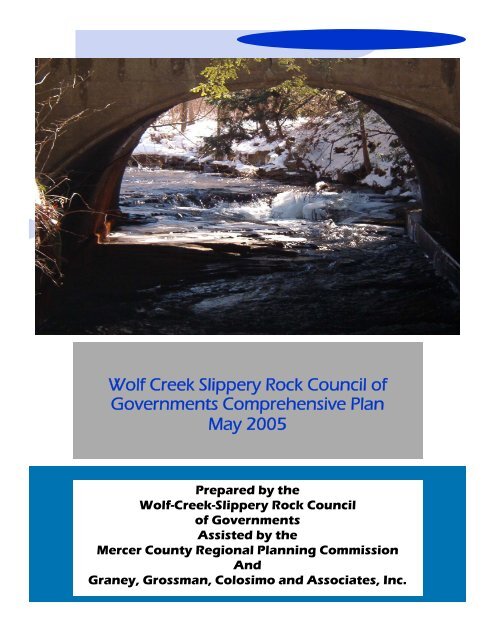
<strong>Wolf</strong> <strong>Creek</strong> Slippery Rock Council of<br />
Governments <strong>Comprehensive</strong> <strong>Plan</strong><br />
May 2005<br />
Prepared by the<br />
<strong>Wolf</strong>-<strong>Creek</strong>-Slippery Rock Council<br />
of Governments<br />
Assisted by the<br />
<strong>Mercer</strong> <strong>County</strong> <strong>Regional</strong> <strong>Plan</strong>ning Commission<br />
And<br />
Graney, Grossman, Colosimo and Associates, Inc.
<strong>Wolf</strong> <strong>Creek</strong> Slippery Rock <strong>Creek</strong><br />
Council of Governments<br />
<strong>Comprehensive</strong> <strong>Plan</strong><br />
May 2005*<br />
Prepared by the<br />
<strong>Wolf</strong> <strong>Creek</strong> Slippery Rock Council of Governments<br />
Assisted by the<br />
<strong>Mercer</strong> <strong>County</strong> <strong>Regional</strong> <strong>Plan</strong>ning Commission<br />
and<br />
Graney, Grossman, Colosimo and Associates, Inc.<br />
*Revised September 2005<br />
This document and all attached maps were financed, in part, by a Land<br />
Use <strong>Plan</strong>ning Technical Assistance Program (LUPTAP) grant from the<br />
Commonwealth of Pennsylvania, Department of Community and Economic<br />
Development.
Table of Contents<br />
Page Number<br />
The <strong>Comprehensive</strong> <strong>Plan</strong>: Basic Policy Document 1<br />
A Pennsylvania <strong>Comprehensive</strong> <strong>Plan</strong> 2<br />
The Communities of <strong>Wolf</strong> <strong>Creek</strong> <strong>COG</strong> 2<br />
Introduction to the Region 2<br />
Grove City Borough 3<br />
Liberty Township 3<br />
Pine Township 4<br />
Springfield Township 5<br />
<strong>Wolf</strong> <strong>Creek</strong> Township 7<br />
Community Development Goals and Objectives 9<br />
Location of Future Growth 10<br />
Grove City Borough Zoning Ordinance 11<br />
Liberty Township Zoning Ordinance 12<br />
Pine Township Zoning Ordinance 13<br />
Springfield Township Zoning Ordinance 15<br />
<strong>Wolf</strong> <strong>Creek</strong> Township Zoning Ordinance 17<br />
Land Use <strong>Plan</strong> 18<br />
A Summary of Pertinent Facts and Issues 19<br />
Grove City Zoning Ordinance 20<br />
Liberty Township Zoning Ordinance 21<br />
Pine Township Zoning Ordinance 22<br />
Springfield Township Zoning Ordinance 23<br />
<strong>Wolf</strong> <strong>Creek</strong> Township Zoning Ordinance 24<br />
Comparison 24<br />
Land Use <strong>Plan</strong> 25<br />
Central Vision 25<br />
Key Ideas 26<br />
Policies and Actions 27<br />
Grove City Borough Land Use <strong>Plan</strong> 30<br />
Liberty Township Land Use <strong>Plan</strong> 32<br />
Pine Township Land Use <strong>Plan</strong> 32<br />
Springfield Township Land Use <strong>Plan</strong> 33<br />
<strong>Wolf</strong> <strong>Creek</strong> Township Land Use <strong>Plan</strong> 34<br />
Economic Development <strong>Plan</strong> 35<br />
Grove City Borough 36<br />
Liberty Township 36<br />
Pine Township 37<br />
Springfield Township 37
<strong>Wolf</strong> <strong>Creek</strong> Township 37<br />
Core Employers: Occupation by Sector 38<br />
Where Income is Earned: Economic Census 39<br />
Key Ideas 39<br />
Overall Policies and Actions 41<br />
Conservation of Natural and Historic Resources <strong>Plan</strong> 44<br />
Historic Resources 45<br />
National Register Properties 45<br />
Key Ideas 46<br />
Policy <strong>Plan</strong> and Strategies 47<br />
Overall Actions and Policies 47<br />
Community Facilities <strong>Plan</strong> and Transportation 50<br />
Community Facilities 50<br />
Water 50<br />
Sewer System Supply 51<br />
Fire and Rescue 51<br />
Police 52<br />
Education 52<br />
Grove City Area School District 52<br />
Recreation 53<br />
Transportation 53<br />
Key Ideas 56<br />
Policy <strong>Plan</strong> and Strategy 59<br />
Transportation 59<br />
Community Facilities 63<br />
Housing <strong>Plan</strong> 66<br />
A Summary of Pertinent Facts and Issues 66<br />
Grove City Borough Housing 66<br />
Liberty Township Housing 67<br />
Pine Township Housing 67<br />
Springfield Township Housing 68<br />
<strong>Wolf</strong> <strong>Creek</strong> Township Housing 68<br />
Key Ideas 68<br />
Overall Policies and Actions 69<br />
Preserving Affordable Housing While Growing 69<br />
Grove City Borough Housing <strong>Plan</strong> 69<br />
Township Housing <strong>Plan</strong>s 70<br />
Action <strong>Plan</strong> and Multi-Municipal <strong>Comprehensive</strong> <strong>Plan</strong> Implementation 72<br />
Implementation Agreement 73<br />
Consistency Review Process 74<br />
Implementing Land Use <strong>Plan</strong>ning on an Area-Wide Basis 75<br />
Investing in Infrastructure and Sharing Revenues from New Developments 78
Tax Base, Public Services, and Land Use 78<br />
<strong>Plan</strong>ning for Developments of <strong>Regional</strong> Significance and Impact 79<br />
<strong>Plan</strong> Interrelationships 81<br />
Conclusion: An Initial Action <strong>Plan</strong> 81<br />
Maps<br />
<strong>Wolf</strong> <strong>Creek</strong> <strong>COG</strong> Joint Visioning Results Follows Page 3<br />
<strong>Wolf</strong> <strong>Creek</strong> <strong>COG</strong> Existing Land Use Conditions Map Follows Page 19<br />
<strong>Wolf</strong> <strong>Creek</strong> <strong>COG</strong> <strong>Comprehensive</strong> Zoning Map Precedes Page 20<br />
<strong>Wolf</strong> <strong>Creek</strong> <strong>COG</strong> Future Land Use <strong>Plan</strong> Follows Page 25<br />
Proposed Small Business Training Site: Cooper Bessemer Follows Page 40<br />
Proposed Business Park Site: Route 208 East of Grove City Follows Cooper Bessemer Site Map<br />
Proposed <strong>Regional</strong> Retail Development: Southwest Corner of the I-79/PA 208<br />
Interchange Precedes Page 41<br />
<strong>Wolf</strong> <strong>Creek</strong> <strong>COG</strong> Hydric Soils and Soils with Hydric Components Follows Page 44<br />
<strong>Wolf</strong> <strong>Creek</strong> <strong>COG</strong> Prime Farmlands and Farmlands of Statewide<br />
Importance Precedes Page 45<br />
<strong>Wolf</strong> <strong>Creek</strong> <strong>COG</strong> Transportation <strong>Plan</strong> Follows Page 60<br />
<strong>Wolf</strong> <strong>Creek</strong> <strong>COG</strong> Sewer Service Areas Follows Page 64<br />
<strong>Wolf</strong> <strong>Creek</strong> <strong>COG</strong> Water Service Areas Precedes Page 65<br />
Appendices<br />
1. Grove City Action <strong>Plan</strong><br />
2. Town Hall Meeting Results<br />
3. Grove City Town Hall Meeting Results<br />
4. <strong>Wolf</strong> <strong>Creek</strong> <strong>COG</strong> Community Attitude Survey Results<br />
5. Grove City Borough Community Development Questionnaire Results<br />
6. Model Agreements for Multi-Municipal <strong>Plan</strong>ning
<strong>Wolf</strong> <strong>Creek</strong> Slippery Rock <strong>Creek</strong><br />
Council of Governments<br />
<strong>Mercer</strong> <strong>County</strong><br />
<strong>Comprehensive</strong> <strong>Plan</strong><br />
This document is the first comprehensive plan to include all of the <strong>Mercer</strong> <strong>County</strong><br />
municipalities which are members of the <strong>Wolf</strong> <strong>Creek</strong> Slippery Rock <strong>Creek</strong><br />
Council of Governments. The Council of Governments, or <strong>COG</strong>, is a voluntary<br />
cooperative association of the chief elected officials and staff of Grove City Borough and<br />
the townships of Pine, Liberty, Springfield, and <strong>Wolf</strong> <strong>Creek</strong>. In this document, each of<br />
the communities has attempted to look beyond their borders and examine future<br />
opportunities and issues, which will affect each. This document is also intended as a local<br />
amendment to be integrated into the <strong>Mercer</strong> <strong>County</strong> <strong>Comprehensive</strong> <strong>Plan</strong>.<br />
The <strong>Comprehensive</strong> <strong>Plan</strong>: Basic Policy Document<br />
A comprehensive plan is an official municipal document. The Pennsylvania<br />
Municipalities <strong>Plan</strong>ning Code (PA MPC) regulates its preparation and contents. The plan<br />
itself serves several roles:<br />
• State agencies rely on the plan in making a variety of funding decisions,<br />
ranging from competitive grants to highway permits.<br />
• If the plan is adopted, any decision relative to public property such as<br />
extension of water/sewer lines, construction, demolition or sale of municipal or<br />
school district buildings/land, and adoption of land use ordinance amendments<br />
must be reviewed for consistency to the plan. (This review is non-binding, and<br />
conducted by the municipal planning commission.)<br />
• Zoning and subdivision and land development ordinances must be generally<br />
consistent with the comprehensive plan. Beyond the consistency requirement,<br />
the plan is important as a place to explain these laws in easy to understand<br />
terms. This helps citizens. It also can be very useful in a dispute between a<br />
developer and a community.<br />
The following table helps briefly understand both what a comprehensive plan is, as well<br />
as what it is not.<br />
<strong>Wolf</strong> <strong>Creek</strong> Slippery Rock <strong>Creek</strong> <strong>COG</strong> <strong>Comprehensive</strong> <strong>Plan</strong><br />
Page 1
A Pennsylvania <strong>Comprehensive</strong> <strong>Plan</strong><br />
Is . . . Is not . . .<br />
The official statement of where and how the<br />
community wants to see future growth and<br />
development.<br />
An ordinance that makes decisions about<br />
individual properties.<br />
The explanation of policies behind ordinances,<br />
funding policies, and general changes<br />
(construction, demolition, etc.) in public<br />
facilities.<br />
A measuring stick State agencies use to make<br />
funding or permitting decisions.<br />
A way to focus on major issues.<br />
A document that binds the community to<br />
unchangeable policies.<br />
A specific plan to build, design or locate any<br />
public or private facility.<br />
A document to deal with every possible issue<br />
in the future.<br />
The <strong>Wolf</strong> <strong>Creek</strong> Slippery Rock <strong>Creek</strong> Council of Governments <strong>Comprehensive</strong> <strong>Plan</strong> is<br />
somewhat special because it is a multi-municipal plan. <strong>Plan</strong>s adopted by more than one<br />
municipality have greater power and status. The municipalities that adopt the <strong>Plan</strong> have<br />
the right to develop intergovernmental agreements. These agreements can be simple or<br />
complex, based on local needs. Intergovernmental agreements can be developed to share<br />
tax revenue between participants. Legal obligation to zone for all conceivable uses can be<br />
shared among several communities. State agencies grant inter-municipal plans more<br />
consideration. If an inter-municipal plan is offered as an amendment to the county<br />
comprehensive plan, it must generally be accepted.<br />
The Communities of the <strong>Wolf</strong> <strong>Creek</strong> <strong>COG</strong><br />
Introduction to the Region<br />
The impetus of this multi-municipal planning process and document came from two<br />
sources. The Borough of Grove City was in the process of updating its old<br />
comprehensive plan. In fact, the borough had already begun work on its update.<br />
Simultaneously, <strong>Mercer</strong> <strong>County</strong> was beginning a ten-year update to the <strong>County</strong> plan.<br />
State assistance was sought from the Commonwealth of Pennsylvania, Department of<br />
Community and Economic Development. The <strong>COG</strong> was awarded a Land Use <strong>Plan</strong>ning<br />
Assistance (LUPTAP) grant from the Commonwealth, and the Borough of Grove City<br />
agreed to integrate its plan into the overall <strong>COG</strong> process. Thus, this <strong>Plan</strong> hopes to<br />
accomplish the simple goal of a uniform blueprint for the future among all the local<br />
governments in this portion of <strong>Mercer</strong> <strong>County</strong>.<br />
Central to this intergovernmental planning process was broad-based input. Citizens were<br />
surveyed to determine their attitudes about local government priorities and activities.<br />
Thus, representatives of over one thousand households shared their vision for the future.<br />
Town hall meetings were conducted in every one of the participant municipalities<br />
(reports on the survey and Town Hall meetings are included in the appendices). After<br />
citizen input, a congress of local leaders was convened at the Grove City Area School<br />
District. This meeting brought together zoning hearing board members, planning<br />
<strong>Wolf</strong> <strong>Creek</strong> Slippery Rock <strong>Creek</strong> <strong>COG</strong> <strong>Comprehensive</strong> <strong>Plan</strong><br />
Page 2
commissioners, general government officials, and school district officials to examine the<br />
opportunities available through cooperative approaches to the future. This meeting<br />
produced a vision map. Following a lengthy information-gathering process, <strong>COG</strong><br />
officials invited the local leaders back for a review of a sketch plan. The sketch plan was<br />
then refined into this document.<br />
Valentine Cunningham, along with his wife Margaret and children were the first<br />
European settlers in the area named <strong>Wolf</strong> <strong>Creek</strong>, the symbolic heart of the region. They<br />
settled along the banks of the creek in 1798 in what is now Grove City Borough.<br />
Cunningham named the creek, presumably for the number of wolves that roamed the<br />
area.<br />
<strong>Wolf</strong> <strong>Creek</strong> runs south from Pine Swamp in Worth Township through <strong>Wolf</strong> <strong>Creek</strong> and<br />
Pine Townships, then through the Borough of Grove City and Liberty Township where it<br />
meets Slippery Rock <strong>Creek</strong> in Butler <strong>County</strong>.<br />
Grove City Borough<br />
<strong>Wolf</strong> <strong>Creek</strong> enters the borough from Pine Township to the north. Grove City Borough<br />
has over 25.89 miles of borough roads and 5.2 miles of state roads and encompasses an<br />
area of approximately 2.3 square miles. With its educational centers, theaters, and distinct<br />
downtown, the borough is the cultural center of the region. The borough has very little<br />
open land and no agricultural security areas.<br />
Grove City Borough had 8,024 residents in 2000, making it the largest community in the<br />
study area. However, the borough is losing some population, seeing a decline of 216<br />
residents since 1990.The borough has sewer and water throughout its borders. In<br />
addition, the Grove City Borough sewer system extends through Pine Township to the<br />
intersection of Route 208 and Interstate 79, just west of Old Ash Road; the George Junior<br />
Road in Pine Township; and north to Scrubgrass Road on Route 173 and east into Butler<br />
<strong>County</strong>. Water is provided to borough residents and to residents in Pine Township. Grove<br />
City residents are served by the Grove City Post Office.<br />
All of the schools in the Grove City Area School District (GCASD) are in the borough:<br />
Grove City Area High School, on Highland Avenue; GCASD Middle School, 130 East<br />
Main Street; Highland Primary Center (Highland Avenue); Hillview Intermediate Center,<br />
East Main Street; and Washington Kindergarten Center, Madison Avenue. In addition, the<br />
privately held Grove City College (GCC) is also roughly within the borough.<br />
The offices of the Allied News, a twice-weekly paper, are in the borough. There is a<br />
movie theater in the borough, and a number of programs at the college, as well as other<br />
venues, offer cultural programming.<br />
Liberty Township<br />
<strong>Wolf</strong> <strong>Creek</strong> enters Liberty Township from Pine Township south of the Borough of Grove<br />
City. Liberty Township has 28.59 miles of township road and 6.57 miles of state<br />
<strong>Wolf</strong> <strong>Creek</strong> Slippery Rock <strong>Creek</strong> <strong>COG</strong> <strong>Comprehensive</strong> <strong>Plan</strong><br />
Page 3
highway. Liberty Township had 1,276 residents in 2000—a growth of 53 residents since<br />
1990. With its proximity to Interstate 79, Liberty Township is poised to become a<br />
bedroom community to Cranberry Township, Butler <strong>County</strong>, and other North Pittsburgh<br />
communities. At the same time, Liberty has long been a farming community and has<br />
extensive agricultural security areas.<br />
There are two main thoroughfares in the township:<br />
• Route 258 runs south to north from Slippery Rock to London, where it<br />
intersects with Route 208 in Springfield Township.<br />
• There is a short distance of Route 173 North in Liberty Township, from the<br />
Pine Township line to the border of <strong>Mercer</strong> Township, in Butler <strong>County</strong>.<br />
The Liberty Township building is in the old<br />
North Liberty School, at 2873 <strong>Mercer</strong>-Butler<br />
Pike/Route 258 in the Village of North Liberty.<br />
The township also owns a large pole building<br />
on the same property as the township building.<br />
It is used for storage and as an office building.<br />
There are no township parks or other public<br />
lands. Liberty Township does not have public<br />
water and sewer systems. Liberty Township<br />
residents are served by the Grove City Post<br />
Office. Residents must contract with a private<br />
Liberty Township Building<br />
garbage collection service for trash hauling.<br />
Children in the Township are bused to the Grove City Area School District.<br />
Liberty Township has comparatively few business and residential developments, perhaps<br />
because there is no public water and sewer. Tri-<strong>County</strong> Industries has a transfer station in<br />
Liberty Township. There is also Faull Fabricating, which is a welding and manufacturing<br />
facility and Campbell Asphalt. There are two small housing developments: Liberty Gait<br />
on Route 173 South and Kimberly Estates on Airport Road. There are also several homebased<br />
businesses, such as a dog kennel and a beauty shop, and firearms dealer.<br />
Pine Township<br />
<strong>Wolf</strong> <strong>Creek</strong> enters Pine Township from <strong>Wolf</strong> <strong>Creek</strong> Township north of Pine Township and<br />
east of Route 173. Pine Township has over 50 miles of roads and encompasses an area of<br />
approximately 28.65 square miles. With its manufacturing facilities and service and retail<br />
businesses, Pine Township is one of the commercial centers of the region. Pine Township<br />
had the second largest population in the study area, with 4,493 residents. It has grown by<br />
300 residents since 1990.<br />
<strong>Wolf</strong> <strong>Creek</strong> Slippery Rock <strong>Creek</strong> <strong>COG</strong> <strong>Comprehensive</strong> <strong>Plan</strong><br />
Page 4
There are four main thoroughfares in the township:<br />
• Interstate 80 crosses the northwest corner of the Township. Though it crosses<br />
the Township, there is no direct access to the interstate in the municipality.<br />
• Route 173 runs north to south from the Township’s border with <strong>Wolf</strong> <strong>Creek</strong><br />
Township to its border with Grove City and then again from the southern<br />
border of town to Liberty Township.<br />
• Route 208 runs west to east from Springfield Township to Venango <strong>County</strong>,<br />
with the Borough in the middle.<br />
• PA Route 58 runs east to west from Butler <strong>County</strong> through the Borough and<br />
once again through Pine Township to Findley Township.<br />
The Pine Township building is at 545 Barkeyville Road/Route 208. The township has a<br />
community center located next door to the township offices. There is a community park<br />
on this site as well and ball fields behind the building. The Pine Township Engine<br />
Company is also housed in this complex.<br />
The township owns three sewage pump stations: (1) North Broad Street Extension/Route<br />
173, (2) Village Park/Route 173 South, (3) Route 208 West. These pump stations are<br />
owned by the township but feed into the Grove City sanitary sewer system. The township<br />
owns a water tower on Eastgate Industrial Drive and a storage building on Gill Road.<br />
Pine Township has water and sewer to many of its residents. United Community Hospital<br />
(UCH) is located on Route 173 north of Grove City. Several related medical facilities,<br />
such as doctors’ offices, etc., are also located in Pine Township. The township is also<br />
home to George Junior Republic, a group-quarter facility for youth.<br />
Residents contract with a private garbage collection service for trash hauling. Children in<br />
Pine Township are bused to the Grove City Area School District. Pine Township residents<br />
are served by the Grove City Post Office.<br />
The majority of manufacturing facilities and retail and services businesses in the greater<br />
Grove City area is in Pine Township. Alcoa is located on Route 208 as is Montgomery<br />
Builders. The General Electric Locomotive Diesel Works on PA Route 58/Main Street is<br />
partially in the township as well as the borough.<br />
Orchard Manor Nursing Home and the YMCA<br />
are also located in Pine Township.<br />
Springfield Township<br />
Springfield Township is the only township in<br />
the study area not wholly in the <strong>Wolf</strong> <strong>Creek</strong><br />
watershed. Most of the township is in the<br />
Neshannock <strong>Creek</strong> watershed. Springfield<br />
Township had 1,972 residents in 2000, and<br />
experienced a growth of 80 residents since<br />
Old Johnson Tavern in<br />
Springfield Township<br />
<strong>Wolf</strong> <strong>Creek</strong> Slippery Rock <strong>Creek</strong> <strong>COG</strong> <strong>Comprehensive</strong> <strong>Plan</strong><br />
Page 5
1990. Springfield Township has over 38.24 miles of roads and encompasses an area of<br />
28.7 square miles. The township has three NHI sites identified by the WPC in its 2003<br />
natural heritage inventory study.<br />
The Grove City Prime Outlets and surrounding service businesses help make Springfield<br />
Township one of the primary commercial centers in the region.<br />
There are four main thoroughfares in the township:<br />
• Interstate 79 runs north to south from the Springfield Township border with<br />
Findley Township, <strong>Mercer</strong> <strong>County</strong>, to its border with Plain Grove Township,<br />
Lawrence <strong>County</strong>. The Grove City Outlet Mall was developed, in part, because<br />
of its proximity to this important arterial.<br />
• Route 19 runs north to south from the Springfield Township border with East<br />
Lackawannock Township, <strong>Mercer</strong> <strong>County</strong>, to its border with Plain Grove<br />
Township. Route 19 parallels I-79 and was the primary north-south route in the<br />
county before the interstate was constructed.<br />
• Route 208 runs from the southwest corner of the Township through<br />
Leesburg, then due east to Pine Township.<br />
• Route 258 runs south to north from Liberty Township to Springfield<br />
Township’s border with Findley Township.<br />
The Springfield Township building is at 1791<br />
Perry Highway, in the Village of Leesburg.<br />
The township also has a fire hall and<br />
emergency operations center at 303 Old Ash<br />
Road. There is a garage and maintenance<br />
facility on Old Ash Road South.<br />
There are public sewer lines from the<br />
southern point of the village of No. 5 Mine<br />
and along Old Ash Road and east on Route<br />
208. There are also two private water<br />
companies in Springfield Township: Buhl<br />
Springfield Township Municipal Building<br />
Community Water and Leesburg Community<br />
Water. Springfield Township residents are<br />
served by the Grove City, <strong>Mercer</strong>, Volant, and New Wilmington Post Offices. Residents<br />
contract with a private garbage collection service for trash hauling. Children in the<br />
township are bused to the Grove City Area School District.<br />
Springfield Township’s strategic location on I-79 and close to Interstate 80 has helped it<br />
to become an important shopping area within the tri-state region and New York and<br />
southern Ontario. The development of the Grove City Outlets has attracted numerous<br />
other businesses, including restaurants, motels, service stations, etc. There are a number<br />
<strong>Wolf</strong> <strong>Creek</strong> Slippery Rock <strong>Creek</strong> <strong>COG</strong> <strong>Comprehensive</strong> <strong>Plan</strong><br />
Page 6
of small retail and craft businesses as well throughout the Route 208 corridor and in the<br />
Village of Leesburg.<br />
<strong>Wolf</strong> <strong>Creek</strong> Township<br />
The eponymous <strong>Wolf</strong> <strong>Creek</strong> enters the township just north of Scrubgrass Road in an<br />
unnamed swamp. Much of the land in the township is characterized by rolling hills and<br />
farmland, intersected by the broadly flowing <strong>Wolf</strong> <strong>Creek</strong>. The township has remained<br />
rural and though it is growing, it is the smallest community in the study area. There were<br />
729 residents in 2000, 76 more than were in the township in 1990.The township has 28.3<br />
miles of roads and covers an area of 18 square miles.<br />
There are two main thoroughfares in the township:<br />
• Interstate 80 runs east to west on the<br />
edge of <strong>Wolf</strong> <strong>Creek</strong> Township. Exit 20 is<br />
at Perrine's Corners in the township.<br />
• Route 173 runs north and south<br />
through the township, intersecting with<br />
I-80 three miles north of Grove City.<br />
The township owns an office building at 851<br />
Centertown Road and a garage at 827 Centertown<br />
Road. It does not own any other property. The<br />
<strong>Wolf</strong> <strong>Creek</strong> Township<br />
township does not have water or sewer.<br />
The Grove City and Jackson Center Post Offices serve the residents of <strong>Wolf</strong> <strong>Creek</strong><br />
Township. Residents contract with a private garbage collection service for trash hauling.<br />
Children in the township are bused to the Grove City Area School District.<br />
There are several small businesses in <strong>Wolf</strong> <strong>Creek</strong> Township, most of which are related to<br />
agricultural practices. For example, <strong>Wolf</strong> <strong>Creek</strong> Custom Hardwoods is a lumber mill.<br />
McDowell Implements sells farm machinery. In addition, there are several other, small or<br />
home-based businesses, a small restaurant and an alternator-repair business.<br />
In summary, the planning area encompasses nearly 100 square miles, and includes over<br />
16,000 citizens, broken down as follows.<br />
Community Population Square Mileage<br />
Grove City 8,024 2.3<br />
Liberty Township 1,276 26.5<br />
Pine Township 4,493 28.65<br />
Springfield Township 1,972 28.7<br />
<strong>Wolf</strong> <strong>Creek</strong> Township 729 18.0<br />
<strong>Wolf</strong> <strong>Creek</strong> Slippery Rock <strong>Creek</strong> <strong>COG</strong> <strong>Comprehensive</strong> <strong>Plan</strong><br />
Page 7
This diverse area includes small town commercial areas, a major regional retail center,<br />
and wide choice of neighborhoods, diverse employment base, and excellent<br />
transportation access. The <strong>Wolf</strong> <strong>Creek</strong> Slippery Rock <strong>Creek</strong> <strong>COG</strong> area has many of the<br />
components of a healthy, thriving community and sound local economy. This <strong>Plan</strong> can be<br />
another tool to keep the Grove City area prosperous and healthy.<br />
<strong>Wolf</strong> <strong>Creek</strong> Slippery Rock <strong>Creek</strong> <strong>COG</strong> <strong>Comprehensive</strong> <strong>Plan</strong><br />
Page 8
Community Development Goals and Objectives<br />
“It is the overall goal of the Borough of Grove City to develop and preserve a pleasant,<br />
attractive, healthy, safe, and convenient environment for living, working, shopping, and<br />
relaxing.”<br />
- Grove City Zoning Ordinance<br />
“Preserve the Township’s rural community character most exemplified by open spaces<br />
and woodlands, farms, low-density development, un-congested roads, clean air and<br />
water, and quiet noise levels.”<br />
- Liberty Township Zoning Ordinance<br />
The regulations of the “Zoning Ordinance” are made in accordance with a<br />
<strong>Comprehensive</strong> <strong>Plan</strong>.”<br />
- Pine Township Zoning Ordinance<br />
“By the year 2007, Springfield Township should be primarily a rural, small-town<br />
community; keep its natural/scenic qualities, its ability to farm, personal freedoms and<br />
other high qualities of life; and plan of a targeted and limited development area in which<br />
to provide for economic development opportunities, yielding higher-pay job opportunities<br />
and thriving local businesses, and not result in sprawl or undesirable impacts or costs for<br />
the community.”<br />
- Springfield Township Zoning Ordinance<br />
“This Zoning Ordinance reflects the policy goals of the Township as stated in the<br />
following community development objectives and has been developed as a legislative and<br />
administrative tool of the Township to implement these objectives.”<br />
- <strong>Wolf</strong> <strong>Creek</strong> Township Zoning Ordinance<br />
The Pennsylvania Municipalities <strong>Plan</strong>ning Code requires a comprehensive plan to<br />
contain, “A statement of objectives of the municipality concerning its future<br />
development, including, but not limited to, the location, character and timing of future<br />
development, that may also serve as a statement of community development objectives as<br />
provided in section 606.” (Section 606 refers to the community development objectives,<br />
which must precede a zoning ordinance.) The ideal is simply that a municipality that is<br />
involved in formal planning has a general idea of where it wants to go, and what kind of<br />
future it wants. Then, specific actions and policies can be based upon achieving the<br />
<strong>Wolf</strong> <strong>Creek</strong> Slippery Rock <strong>Creek</strong> <strong>COG</strong> <strong>Comprehensive</strong> <strong>Plan</strong><br />
Page 9
overall goal or objective. At its worst, this kind of general goal or objective can result in<br />
such earth-shattering statements, as “trees are nice.” However, at its best, the overall<br />
goals and objectives represent a significant defense of local policies from outside legal<br />
challenge, and a measuring stick to make sure individual actions are moving toward a<br />
cohesive vision, not away from it.<br />
This section of the <strong>Plan</strong> contains two sets of goals and objectives. The first is the general<br />
statement concerning the location, character, and timing of future growth, based upon<br />
geography. The second are the general objectives and policies in each subject area of the<br />
<strong>Plan</strong>. To avoid confusion, the following terms are defined in the manner intended by the<br />
<strong>Wolf</strong> <strong>Creek</strong> Slippery Rock <strong>Creek</strong> Council of Governments.<br />
Growth: The action of getting bigger. An increase in size, whether in population,<br />
housing units, or land area.<br />
Development: A change in the use of land, normally resulting in more buildings,<br />
or a change in intensity<br />
Intensity: The concentration of activities within a site. Intensity can include the<br />
number of vehicles, the amount of noise or light, or the variety of activities<br />
Density: The quantity of people or buildings within a given space<br />
Character: The qualities that make a place distinctive<br />
Scale: The size of buildings, and structures, including height, bulk, and square<br />
footage<br />
Location of Future Growth<br />
The region will welcome future growth and development that conforms to the overall<br />
character, scale, and intensity of development within the area’s diverse neighborhoods<br />
and regions. For this to succeed will require that new development within the various<br />
municipalities be cognizant of pre-existing development, the natural environment, and the<br />
presence of community facilities and transportation infrastructure.<br />
The highest priorities in the region are as follows:<br />
• Protect the rural uses and features of the region from over-development<br />
pursuant to both local desires and the mandate within the Pennsylvania<br />
Municipalities <strong>Plan</strong>ning Code to conserve natural resources. The region can<br />
best accomplish such conservation by encouraging a variety of small-scale<br />
economic activities within rural areas, while limiting development whose<br />
scale, character, density, or intensity are more typical of suburban or urban<br />
development. It is essential that any major development in these areas be<br />
planned to minimize impact on natural resources, especially the natural<br />
stormwater management of streams and wetlands, scenic resources of the <strong>Wolf</strong><br />
<strong>Creek</strong> and Neshannock <strong>Creek</strong> Valleys, and prime or significant farmlands.<br />
<strong>Wolf</strong> <strong>Creek</strong> Slippery Rock <strong>Creek</strong> <strong>COG</strong> <strong>Comprehensive</strong> <strong>Plan</strong><br />
Page 10
• Maintain the integrity of existing single-family residential neighborhoods,<br />
whether an older neighborhood in the borough or a village or newer singlefamily<br />
areas. This can be done by limiting the scale of buildings and<br />
developments, and limiting uses to those compatible with single-family<br />
dwellings.<br />
• Promote continued economic diversification through select high-quality<br />
business sites, support of existing businesses, and recognizing that past<br />
community success has rested on many different economic activities.<br />
• That each municipality should retain its autonomy and unique identity, but that<br />
cooperation in financial and land use matters is imperative if this area is to<br />
avoid the mistakes made by so many other Pennsylvania communities.<br />
Within the context of these overall regional goals, each municipality has specific goals<br />
and objectives. These focus on unique aspects of each municipality. Though they are<br />
different, they are compatible and consistent with the role of each jurisdiction within the<br />
whole.<br />
Grove City Borough Zoning Ordinance<br />
Land Use – To provide and perpetrate a land use pattern, which includes a wide<br />
variety of uses appropriate in a small urban area<br />
Environmental – To preserve natural features in a manner consistent with a<br />
small urban area<br />
Aesthetic – To enrich the lives of all residents by striving to improve the<br />
aesthetic quality and visual impact of the built environment and preserving<br />
elements of the natural environment that enhance the small-town setting<br />
Transportation, Traffic, and Circulation – To maintain safe and convenient<br />
circulation and movements of goods and people within the community and to<br />
points beyond by all means practical. The multi-modal functions of pedestrian,<br />
auto, rail, and air available through the borough shall be continued as possible.<br />
Economy – To establish areas for all forms of economic endeavor at various<br />
scales, including small businesses, highway commercial areas, information and<br />
services, manufacturing and industry as infrastructure is available and within an<br />
appropriate geographic context.<br />
Housing – To support the continuation of the borough’s many high-quality<br />
residential neighborhoods, as well as provide a variety of housing choices to<br />
borough residents within the appropriate settings.<br />
Community Facilities and Services – To provide for facilities, services, and<br />
utilities of the quantity and quality necessary to meet the physical, social, cultural,<br />
recreational, and esthetic needs of the community and to do so in a timely and<br />
fiscally responsible manner. Within this context, the borough will strive to provide<br />
<strong>Wolf</strong> <strong>Creek</strong> Slippery Rock <strong>Creek</strong> <strong>COG</strong> <strong>Comprehensive</strong> <strong>Plan</strong><br />
Page 11
these facilities, services, and utilities outside its jurisdictional boundaries in a<br />
mutually cooperative and fair manner.<br />
Energy Conservation – To promote the conservation of energy in every way<br />
possible as a matter of serious public concern<br />
Historic Preservation – To preserve Grove City’s historical heritage for the<br />
enjoyment, enrichment, and education of future generations, and to engender and<br />
perpetuate an appreciation and respect for Grove City’s early efforts and<br />
achievements<br />
Citizen Participation – Provide mechanism for continual discussion among<br />
residents concerning the development of Grove City and for their participation in<br />
regional affairs<br />
Intergovernmental Cooperation – To participate fully in matters of regional<br />
importance, and provide for the continued development of a healthy community<br />
with the neighboring townships, school district, and greater region<br />
Liberty Township Zoning Ordinance<br />
1. Preserve the township’s rural community character most exemplified by open<br />
spaces and woodlands, farms, low-density development, uncongested roads, clean<br />
air and water, and low noise levels<br />
2. Identify development that may adversely impact the township’s desired<br />
community character and the health, safety, and welfare of its residents and<br />
establish conditions to minimize impacts<br />
3. Identify areas where growth is desired and where it is not desired and establish site<br />
development standards to minimize impacts of growth on adjacent lands<br />
4. Provide opportunities for types of development beneficial to the rural economy<br />
including farming, home occupations, and home based businesses, but ensure that<br />
such development maintains a scale and character compatible with the township’s<br />
desired rural community character<br />
5. Provide opportunities for mixed development so that residents can have close-tohome<br />
access to needed goods and services<br />
6. Provide opportunities for industrial and commercial development which would<br />
create jobs and enlarged tax base for the township and would be located where<br />
adequate highway access, public sewer service, and public water service is<br />
available now or in the near future and where such development would be a<br />
reasonable extension of existing similar development<br />
7. Provide for a variety of housing choices, including a variety of housing types<br />
(single-family, duplexes, apartments, etc.)<br />
<strong>Wolf</strong> <strong>Creek</strong> Slippery Rock <strong>Creek</strong> <strong>COG</strong> <strong>Comprehensive</strong> <strong>Plan</strong><br />
Page 12
8. Encourage buffer areas and vegetative screening to minimize impacts of<br />
commercial and industrial uses on adjacent non-commercial and non-industrial<br />
uses and to encourage that commercial/industrial uses “blend in” with the<br />
township’s desired rural community character<br />
9. Control construction and placement of signs to minimize public safety hazards<br />
10. Control off-street parking to minimize public safety hazards and to promote<br />
conformity to the township’s desired community character<br />
11. Control the development and location of adult entertainment establishments,<br />
acknowledged to be threatening to the public health, safety, and welfare of the<br />
community especially its minors, and acknowledged to have adverse secondary<br />
effects including but not limited to unhealthy conditions, the spread of diseases,<br />
illegal sexual activities, and crime, in order to minimize exposure of such<br />
establishments to township residents, minimize the blighting impact of such uses,<br />
and protect the health, safety, and welfare of township residents<br />
12. Preserve and enhance the “village” characteristics of the village of North Liberty<br />
13. Encourage public involvement in the development of and any amendments to the<br />
zoning ordinance<br />
14. Encourage land uses and development and location of development that is most<br />
efficient to the delivery of township services and minimizes the cost of same<br />
Pine Township Zoning Ordinance<br />
Overall Goal – It is the overall goal of Pine Township to develop and preserve a<br />
pleasant, attractive, healthy, safe, and convenient environment for living, working,<br />
shopping, and recreating in the township.<br />
Land Use Goal – To provide and perpetuate a land use pattern which is able to function<br />
efficiently, which features an optimum degree of compatibility between land uses and<br />
between development and the natural environment, and which enhances the orderly<br />
timing of development.<br />
Specific Objectives<br />
1. To encourage the concentration of land uses into discernable clusters and<br />
limit both “spot” development and irregularly dispersed development<br />
patterns.<br />
2. Prevent undesirable land use relationships and protect property values by<br />
avoiding the mixing of incompatible, conflicting land uses.<br />
3. To encourage new growth and development by providing adequate land use<br />
area in each zoning district to meet anticipated future needs and demands.<br />
<strong>Wolf</strong> <strong>Creek</strong> Slippery Rock <strong>Creek</strong> <strong>COG</strong> <strong>Comprehensive</strong> <strong>Plan</strong><br />
Page 13
4. To develop a land use patterns which considers highway load capacities,<br />
traffic volumes and patterns, and speed limits.<br />
Economic Goal – To provide adequate shopping and employment opportunities for<br />
Pine Township residents while at the same time preserving a healthful, secure, and<br />
pleasant residential environment.<br />
Specific Objectives<br />
1. To encourage economic growth in the township via new commercial and<br />
industrial development<br />
2. To encourage commercial development along major transportation routes<br />
and areas of existing or proposed public sewer and water facilities<br />
3. To discourage the indiscriminate spread of commercial and industrial<br />
development<br />
4. Encourage the orderly development of business and industry and minimize<br />
the undesirable impacts of sight, noise, odor, or other public hazards and<br />
nuisances generated by commercial and industrial development<br />
5. To provide site development controls and protective buffer areas where<br />
commercial and industrial development will occur adjacent to residentially<br />
zoned lands<br />
Housing Goal – To provide and maintain an adequate supply of sound, safe, and<br />
sanitary housing in a variety of price ranges for all the residents of Pine Township.<br />
Specific Objectives<br />
1. Preserve the residential character and quality of viable residential areas and<br />
protect them from incompatible land uses<br />
2. Provide for diversity in housing types in the township so that every family<br />
or individual has a choice of residential environment and lifestyle<br />
3. Control the placement of mobile homes and the development of mobile<br />
home parks in order to ensure their conformity with the aesthetics and<br />
neighborhood character of existing residential areas in the township<br />
4. To discourage the scattering of high-density, multi-family residential<br />
development<br />
Community Facilities and Services Goal – To provide for facilities, services, and<br />
utilities in the quantity and quality necessary to meet the physical, social, cultural,<br />
recreational, and aesthetic needs of the community<br />
<strong>Wolf</strong> <strong>Creek</strong> Slippery Rock <strong>Creek</strong> <strong>COG</strong> <strong>Comprehensive</strong> <strong>Plan</strong><br />
Page 14
Specific Objectives<br />
1. Provide adequate land area for the provision and maintenance of essential<br />
public facilities and services such as water and sewers, streets, recreation,<br />
schools, police and fire protection, and human services<br />
2. Encourage an orderly and efficient pattern of development, which<br />
facilitates and minimizes the cost of provision of community facilities and<br />
services<br />
3. Provide for efficient traffic circulation; prevent congestion of<br />
streets/pedestrian ways<br />
4. Discourage land use development, which would create safety hazards to<br />
vehicular and pedestrian traffic<br />
Environmental and Aesthetic Goal – To enrich the lives of all residents and to<br />
promote Pine Township’s attractive, small-town atmosphere by striving to improve the<br />
aesthetic quality and visual impact of the manmade environment and to preserve and<br />
enhance the natural environment<br />
Specific Objectives<br />
1. Eliminate or carefully control all causes of pollution including but not<br />
limited to noise, water, air, and surface pollution<br />
2. To discourage or control development in areas characterized by unsuitable<br />
soil conditions or potential for flooding<br />
3. To preserve wetlands and unique natural areas and protect them from<br />
development<br />
4. Promote the conservation of energy as a matter of serious public concern<br />
5. Encourage the elimination, isolation, or screening of all scenic detriments<br />
created by man<br />
6. Encourage the user of aesthetically pleasing landscaping practices to<br />
enhance the visual quality of the manmade environment<br />
a. Control the use of signs in terms of number, type, size and location, and<br />
encourage aesthetics and attractiveness in their design<br />
Springfield Township Zoning Ordinance<br />
Objectives<br />
Residential<br />
A. Maintaining low density residential development<br />
B. Promote low density, single-family residential development<br />
C. Control location of multi-family residential development<br />
<strong>Wolf</strong> <strong>Creek</strong> Slippery Rock <strong>Creek</strong> <strong>COG</strong> <strong>Comprehensive</strong> <strong>Plan</strong><br />
Page 15
D. Provide housing for all economic levels<br />
E. Promote the preservation of historic residential structures<br />
Agricultural<br />
A. Promote the preservation of active farmland<br />
B. Encourage participation of farm owners in the Agricultural Security Area<br />
program<br />
C. Provide farm owners the opportunity to develop property within certain<br />
guidelines<br />
D. Discourage the subdivision of farm tracts into small building lots, unless<br />
public open space is guaranteed<br />
E. Encourage farmers to participate in county and state programs that support<br />
and promote sound farming practices, such as surface water protection and<br />
erosion and sedimentation control<br />
Economic Development<br />
A. Provide for commercial/industrial development in limited areas<br />
B. Identify areas with adequate infrastructure that can support commercial<br />
and/or industrial development<br />
C. Create site development controls to protect adjacent properties<br />
D. Provide adequate opportunities to expand the tax base<br />
E. Provide for a variety of commercial and industrial development<br />
opportunities<br />
Infrastructure<br />
A. Ensure that existing facilities and services are maintained at a level that<br />
meets the needs of current residents and businesses<br />
B. Promote construction standards that address township goals<br />
C. Require development applications to address the health, safety and general<br />
welfare needs of township residents<br />
Traffic/Circulation<br />
A. Create a safe, well-constructed road system within the township<br />
B. Promote an adequate, safe non-vehicular circulation system with the<br />
township<br />
C. Encourage efficient land use patterns that minimize traffic congestion<br />
D. Encourage new development to provide for alternative modes of<br />
transportation<br />
<strong>Wolf</strong> <strong>Creek</strong> Slippery Rock <strong>Creek</strong> <strong>COG</strong> <strong>Comprehensive</strong> <strong>Plan</strong><br />
Page 16
E. Encourage identification and protection of rights of way for future public<br />
use<br />
Historic Preservation<br />
A. Encourage preservation of cultural and historic sites<br />
B. Cooperate with other agencies, both public and private, in the promotion of<br />
preserving identified sites<br />
C. Encourage new development to be architecturally compatible with existing<br />
structures and sites<br />
Recreation<br />
A. Encourage adequate recreational opportunities for township residents<br />
B. Encourage new development to provide open space and/or recreation areas<br />
C. Encourage development of community-wide recreation program and<br />
facilities<br />
Natural Resources Preservation<br />
A. Discourage development on, or in, identified environmentally sensitive<br />
areas<br />
B. Promote the preservation of identified environmentally sensitive areas and<br />
natural resources<br />
Land Use<br />
A. Encourage development that enhances the rural character of the township<br />
B. Promote open space requirements for new development<br />
C. Encourage a variety of housing opportunities in the township<br />
D. Promote development arrangements that require less lineal footage of<br />
roads, sewers and water lines.<br />
<strong>Wolf</strong> <strong>Creek</strong> Township Zoning Ordinance<br />
Land Use Objectives<br />
1. The township should retain its rural and agricultural characteristics.<br />
2. The township should realize that it is becoming increasingly difficult to<br />
farm for a living and should allow some development of farmland.<br />
3. The township should promote low-density development.<br />
4. The township should regulate corporate animal feeding operations.<br />
5. The township should discourage the placement of disabled vehicles and<br />
junk in areas that can be seen from public rights-of-way.<br />
<strong>Wolf</strong> <strong>Creek</strong> Slippery Rock <strong>Creek</strong> <strong>COG</strong> <strong>Comprehensive</strong> <strong>Plan</strong><br />
Page 17
Economic Objectives<br />
1. The township should allow for small businesses, especially home-based<br />
businesses and home occupations throughout the township.<br />
2. Economic development in the township should not disturb neighboring<br />
properties with light, noise, dust, pollution, and other nuisances.<br />
3. The township should promote some development near the I-80/Route<br />
Interchange but should be cautious not to overrun existing or potential<br />
residences in the area.<br />
4. The township should allow for the reasonable construction of signs,<br />
particularly to promote businesses in the I-80/Route 173 Interchange area.<br />
5. The township should support economic development that would support the<br />
agricultural industry.<br />
Housing Objectives<br />
1. The township should allow multiple residential dwellings on the same lot,<br />
making it favorable for family members to live in separate residential units<br />
on the same lot.<br />
2. The township should regulate the development of multi-family residential<br />
units.<br />
3. The township should promote single-family residential.<br />
Transportation Objectives<br />
1. Development in the township should occur along transportation routes that<br />
can support such development without placing a burden on that<br />
transportation route itself or on the township to improve a particular<br />
transportation route.<br />
Natural Resource and Preservation Objectives<br />
1. The township should preserve woodlands, wetlands, waterways and other<br />
natural and environmental areas and resources.<br />
Community Resource Objectives<br />
1. The township should maintain safe, quiet neighborhoods.<br />
Land Use <strong>Plan</strong><br />
Land use is the heart of the comprehensive plan for several reasons. First, the<br />
comprehensive plan is the factual basis for zoning and subdivision and land development<br />
ordinances. The plan is proof that a zoning policy was not just arbitrarily invented, but is<br />
an effort to work toward a greater future vision for the development of the community. It<br />
thus has the most direct bearing on a comprehensive plan as an official, quasi-legal<br />
<strong>Wolf</strong> <strong>Creek</strong> Slippery Rock <strong>Creek</strong> <strong>COG</strong> <strong>Comprehensive</strong> <strong>Plan</strong><br />
Page 18
document. Topically, the land use chapter is also the broadest chapter, because land use<br />
policies are tied to issues such as housing, community facilities, transportation, and<br />
others. Finally, in a growth scenario such as anticipated for the <strong>COG</strong> region, land use<br />
planning is the palette on which the community attempts to accommodate the expected<br />
growth and development.<br />
A Summary of Pertinent Facts and Issues<br />
The region is expected to continue to grow, and it is even likely that this growth will<br />
accelerate. For the purposes of the plan, a future growth scenario was adopted that<br />
assumed a continued high rate of growth. This was largely based upon trends in nearby<br />
Butler <strong>County</strong> and the affects of Interstate 79 on the <strong>COG</strong> region’s accessibility.<br />
It is important to note that a Pennsylvania municipality cannot completely shut the door<br />
to future growth and development. Zoning must allow for reasonable development of all<br />
types of housing, commerce and industry. Regions or communities in “the path of<br />
growth” must accept a reasonable role in accommodating that growth. Central to efforts<br />
to plan for future growth and development in the region is an honest attempt to analyze<br />
future growth and development. There is no doubt that this region is one of the key<br />
growth areas in <strong>Mercer</strong> <strong>County</strong>. Through the past two decades, there was a pattern of<br />
slow steady growth. There is reason to believe that this will accelerate over the next<br />
decades. The Butler <strong>County</strong> <strong>Comprehensive</strong> <strong>Plan</strong> has forecast significant growth for the<br />
northwest section of Butler <strong>County</strong>, which borders the <strong>COG</strong> area (Butler <strong>County</strong><br />
townships such as <strong>Mercer</strong> and Slippery Rock).<br />
Even in the context of a joint or multi-municipal comprehensive plan, the community still<br />
has a legal obligation to provide for the reasonably anticipated level of growth over the<br />
period of the plan. Pursuant to this, the following represent a high growth projection,<br />
which would account for increases in historic levels of demographic growth, due to outmigration<br />
from the regional population center in Allegheny <strong>County</strong>. This typically creates<br />
a donut-hole situation—a decaying urban center surrounded by a band of suburban<br />
sprawl, each with unique problems. So far, this has not happened in the study area.<br />
However, the joint plan may be the best opportunity to prevent this from happening in the<br />
future. The next table illustrates a very conservative growth scenario, in which past trends<br />
would play a greater role. Even in this, most <strong>COG</strong> communities will see some growth.<br />
Place 2000 2005 2010 2015 2020<br />
Grove City With Students 8,024 7,942 7,878 7,830 7,820<br />
Grove City Without Students 5,961 5,899 5,847 5,812 5,785<br />
Liberty Township 1,276 1,311 1,330 1,339 1,336<br />
Pine Township 4,493 4,530 4,537 4,517 4,484<br />
Springfield Township 1,972 2,021 2,059 2,084 2,096<br />
<strong>Wolf</strong> <strong>Creek</strong> Township 729 749 762 765 762<br />
<strong>Regional</strong> Total<br />
(With/Without Students)<br />
16,494<br />
(14,431)<br />
16,553<br />
(14,510)<br />
16,566<br />
(14,535)<br />
16,535<br />
(14,517)<br />
16,498<br />
(14,463)<br />
<strong>Wolf</strong> <strong>Creek</strong> Slippery Rock <strong>Creek</strong> <strong>COG</strong> <strong>Comprehensive</strong> <strong>Plan</strong><br />
Page 19
However, this is conservative, as previously mentioned. The northwest region of Butler<br />
<strong>County</strong> (Slippery Rock area) is anticipating a population growth rate of over 20% by<br />
2010. Even modest spillover of this will create the reality of a <strong>COG</strong> region of 20,000<br />
people by 2020.<br />
This makes an analysis of land use especially pertinent. The attached maps illustrate<br />
historic land use patterns and zoning. As of this writing, all of the <strong>COG</strong> communities<br />
have enacted some form of zoning ordinance. When zoning and subdivision ordinances<br />
are well conceived, they can become primary means to implement the community<br />
comprehensive plan. In the context of a multi-municipal plan, they can become even<br />
more important, as the relationship between availability of land for various uses will<br />
affect every community’s economy and quality of life.<br />
All of the communities within the Grove City region have chosen to adopt zoning<br />
ordinances (Grove City Borough, Pine Township, Liberty Township, Springfield<br />
Township and <strong>Wolf</strong> <strong>Creek</strong> Township). Two of the municipalities have local subdivision<br />
and land development ordinances (Grove City and Springfield Township), with Pine<br />
Township, <strong>Wolf</strong> <strong>Creek</strong> Township, and Liberty Township falling under the jurisdiction of<br />
the <strong>Mercer</strong> <strong>County</strong> Subdivision and Land Development Ordinance. This section will<br />
initially examine the borough and township zoning ordinances as they stand, then make<br />
some comparative analysis.<br />
Grove City Zoning Ordinance<br />
The development of land use ordinances in a substantially developed community<br />
presented some challenges. Perhaps the most important of these was the need to develop<br />
regulations that were consistent with both the enabling legislation and majority of<br />
conditions found in the community. Grove City was no exception. For example, in<br />
residential areas, minimum lot sizes can be as small as 7,200 square feet in the R-3 and<br />
R-LC Districts to 9,375 square feet in the R-1 and R-2 Districts. These standards reflect<br />
the reality of the lots that were established one hundred or more years ago.<br />
The fact that Grove City, a relatively small municipality, requires four different<br />
residential districts is a testimony to the various uses that existed when the zoning<br />
ordinance was developed. The R-1 District is almost exclusively composed of singlefamily,<br />
detached homes. The only other uses permitted in this district are public schools<br />
and public recreational spaces. The special exceptions are limited to essential services,<br />
churches, private schools, and government buildings.<br />
The R-2 District expands on the uses of the R-1 District. In addition to those uses allowed<br />
in the R-1 District, R-2 allows for multi-family and multi-person housing situations. It,<br />
too, is a very residential district in character and practice. Non-residential uses of the land<br />
in the R-2 District are confined to the following special exceptions: essential services,<br />
public and rental parking, funeral homes, hospitals, nursing homes, and charitable<br />
institutions. It is also interesting to point out that home-based occupations are permitted<br />
<strong>Wolf</strong> <strong>Creek</strong> Slippery Rock <strong>Creek</strong> <strong>COG</strong> <strong>Comprehensive</strong> <strong>Plan</strong><br />
Page 20
as an accessory use in either of these districts. However, non-family employees are not<br />
allowed nor can the business occupy more than 10% of the home’s floor space.<br />
These first two districts are almost exclusively residential in look and feel. The other two<br />
residential districts have much more of the mixed-use residential make up that was found<br />
in neighborhoods of the late 1800s to early 1900s. The minimum lot size of 60 feet by<br />
120 feet helps to add to this feeling. All residential uses, single-family, duplex, and multifamily<br />
are permitted uses in the R-3 District. The multi-family units can be either result<br />
from the conversion of single-family units to multi-family or new construction.<br />
Also permitted in the R-3 District are those uses which have a residential-like quality,<br />
such as nursing homes, boarding houses, college and preparatory school dormitories.<br />
Institutions that arguably enhance family/residential life, such as churches, day care<br />
centers, schools, and hospitals are permitted as well. Finally, government buildings and<br />
publicly owned facilities for service, safety, and recreation were also uses by right in this<br />
district. Essential services are a special exception.<br />
The final residential district, the R-LC District, is a mixed residential and commercial use<br />
district. Most low-intensity business uses, such as barbers, shoe repair, medical offices,<br />
art studios, funeral homes, day care centers, and many others are all permitted by right.<br />
Small-scale retail establishments can be permitted as a special exception, as are essential<br />
services.<br />
In addition to these four residential districts there are two commercial districts and the<br />
industrial district. The commercial districts permit traditional commercial operations;<br />
restaurants, movie theaters, laundries, doctors’ office or lawyers’ chambers, stores and<br />
other retail outlets, and the multitude of other uses typically found in commercial<br />
districts. In the Highway Commercial District, larger commercial operations can exist,<br />
such as mobile home sales and building supply houses. This enables commercial<br />
development appropriate to the context of the district.<br />
The Industrial District is the last of Grove City’s zoning districts. Either through<br />
permitted use or special exception, no industrial use is specifically forbidden. Several<br />
specific industrial uses are permitted by right, such as manufacturing processing,<br />
warehousing, and research work. Industrial uses not specifically mentioned in the<br />
permitted use section can be brought before the zoning hearing board. The purpose of this<br />
feature of the zoning ordinance is to identify possible adverse affects to both the borough<br />
and its neighbors.<br />
Liberty Township Zoning Ordinance<br />
Liberty Township’s zoning ordinance also dates from 2001. Its principal objective seems<br />
to be to preserve the rural nature of the township from an environmental and economic<br />
vantage. Some specific goals include:<br />
• Provide opportunities for types of development beneficial to the rural<br />
economy, including farming, home occupations, and home-based businesses,<br />
<strong>Wolf</strong> <strong>Creek</strong> Slippery Rock <strong>Creek</strong> <strong>COG</strong> <strong>Comprehensive</strong> <strong>Plan</strong><br />
Page 21
mobile home parks, which are all principal permitted uses. Business uses are<br />
limited to veterinary, mini-storage, or personal storage units, and residentially<br />
related uses (home occupations, bed and breakfast, etc.).<br />
• The Rural Opportunity District allows all RA District uses but includes<br />
provisions for auto sales, light manufacturing, and various indoor commercial<br />
uses.<br />
• The Village District has great similarity in its use structure to Springfield<br />
Township. This was a natural occurrence due to the concurrent process and<br />
involvement of county planning staff in both projects.<br />
• The Business Districts are fairly standard. C-Commercial is a small highway<br />
business district to take advantage of proximity to I-79 and the Prime Outlets.<br />
The I-District is light manufacturing, similar to Pine Township’s, and the I-S<br />
District encompasses the Tri-<strong>County</strong> site.<br />
Pine Township Zoning Ordinance<br />
The most recent edition of the Pine Township zoning ordinance dates from 1997, but was<br />
a comprehensive amendment of a 1972 ordinance. The ordinance divides the Township<br />
into seven zoning districts:<br />
Rural Residential (R-1)<br />
Residential One Family (R-2)<br />
Residential Multiple-Family (R-3)<br />
General Business (B-1)<br />
Limited Business (B-2)<br />
Industrial (I)<br />
Floodplain (F)<br />
The ordinance’s Community Development Objectives are not site-specific, but rather to<br />
provide for a variety of economic and societal and civic opportunities. Of particular note<br />
are the stated objectives to discourage the scattering of high-density residential<br />
development of mobile home parks and to buffer residential and industrial/commercial<br />
developments from each other.<br />
The R-1 District is entitled Residential Rural and includes the explicit goal of<br />
encouraging agriculture (while still providing for orderly development). The district<br />
provides for single-family dwellings, farms, some civic uses (sportsmen, grange, school,<br />
church, etc.), and a few limited or restricted business uses (sawmills, veterinary/human<br />
clinics and hospitals, recreational vehicle parks). One unusual feature of the district is a<br />
distinguishing of “campgrounds” and “recreational vehicle parks.”<br />
The R-2 District is expressly for residential purposes. This district differs from the R-1 in<br />
that it allows agriculture, but a smaller range of agriculture-related facilities. The district<br />
<strong>Wolf</strong> <strong>Creek</strong> Slippery Rock <strong>Creek</strong> <strong>COG</strong> <strong>Comprehensive</strong> <strong>Plan</strong><br />
Page 22
differentiates mobile homes from other single-family dwellings. This district would meet<br />
what is regarded in common national parlance as “R-1” zoning.<br />
The R-3 District provides for all forms of residential development, and some medical<br />
uses. This district includes design standards for multi-family dwellings of more than five<br />
units, such as stormwater management, 2,000 square feet of undeveloped open space per<br />
unit and minimizing pedestrian/vehicular traffic problems.<br />
The Business Districts include B-1, which is a standard highway commercial district, and<br />
B-2, which is limited business, while also allowing all R-1 Residential rural uses. The B-<br />
2 requires some design standards for business uses, which would abut residential areas.<br />
The I-Industrial District is purely an industrial district, with no commercial or<br />
independent office uses permitted. All industrial uses are also excluded from the “B”<br />
districts.<br />
Springfield Township Zoning Ordinance<br />
Springfield Township’s zoning ordinance was adopted in September 2001. The ordinance<br />
was the culmination of a fairly lengthy planning process that started when the Prime<br />
Outlets was proposed to locate in the township. It is based upon a detailed set of<br />
community development goals and objectives, which were part of a participatory<br />
planning process sponsored by the <strong>Mercer</strong> <strong>County</strong> <strong>Regional</strong> <strong>Plan</strong>ning Commission. The<br />
objectives of the ordinance include:<br />
Maintaining low-density residential development<br />
Promoting the preservation of active farmland<br />
Create site development controls to protect adjacent properties<br />
Encourage preservation of cultural and historic sites<br />
Promote development arrangements that require less lineal footage of roads, sewer<br />
and waterlines<br />
The ordinance contains only four districts. These are RD Rural Development, C-1<br />
Commercial, C-2 Commercial, and V-Village.<br />
The RD Rural Development District provides for a wide range of activities and cannot be<br />
characterized as strictly residential or agricultural. In addition to the standards, rural uses<br />
such as single-family dwellings, farms, and mineral extraction, the district allows for<br />
such uses as professional offices, multiple-family dwellings, sawmills, mini-storage<br />
facilities, repair/service businesses, and eating and drinking places. It can be<br />
characterized as taking a libertarian approach to rural development.<br />
The C-1 District is built around a classic Highway Commercial District. However, this<br />
might be regarded as an all-purpose district for intensive uses. In addition to standard<br />
business uses, there are conditional use provisions for such high-impact uses as heavy<br />
manufacturing, junkyards, and sexually oriented businesses.<br />
<strong>Wolf</strong> <strong>Creek</strong> Slippery Rock <strong>Creek</strong> <strong>COG</strong> <strong>Comprehensive</strong> <strong>Plan</strong><br />
Page 23
The C-2 District functions more like a Transitional or Limited Business District. Lessintensive<br />
businesses are allowed by right (landscaping/ nursery, personal services, and<br />
retail businesses of less than 20,000 square feet floor area). Higher-impact business uses<br />
(shopping centers, eating and drinking places) must meet more stringent conditional use<br />
standards.<br />
The V-Village District is perhaps the most restrictive district in terms of use standards.<br />
However, it remains a mixed-use district as well, utilizing conditional use standards to<br />
limit the impact of commercial uses upon residential ones.<br />
<strong>Wolf</strong> <strong>Creek</strong> Township Zoning Ordinance<br />
<strong>Wolf</strong> <strong>Creek</strong>’s zoning ordinance was adopted on June 14, 2004. The ordinance divides the<br />
Township in four districts:<br />
Rural Residential (R-1)<br />
General Residential (R-2)<br />
Mixed Use (B-1)<br />
Industrial (I)<br />
The Rural Residential: The R-1 District is intended to promote and allow for<br />
agricultural operations, low-density single-family residential, open space, recreational<br />
facilities, home based business, and home occupations as primarily found throughout the<br />
township.<br />
The General Residential: The R-2 District was created to allow, primarily, for the<br />
development and expansion of manufactured/mobile home parks in the township.<br />
The Mixed Use: The B-1 District promotes and allows for a mix of residential dwellings<br />
and business along Route 173, expanding north from the I-80 interchange.<br />
The Industrial: The I-District, promotes industrial and commercial development at the<br />
Route 173/I-80 interchange, and allows for the residential uses compatible with existing<br />
residential uses, while minimizing the impact between industrial, commercial, and<br />
residential uses. Overall, the ordinance reflects the rural nature of the township.<br />
Comparison<br />
Density standards vary tremendously between local zoning ordinances, as depicted in the<br />
next two charts.<br />
<strong>Wolf</strong> <strong>Creek</strong> Slippery Rock <strong>Creek</strong> <strong>COG</strong> <strong>Comprehensive</strong> <strong>Plan</strong><br />
Page 24
Municipality<br />
Rural/Agricultural District Lot Standards<br />
Minimum<br />
Minimum<br />
Minimum Minimum<br />
Front Yard<br />
Lot Size<br />
Side Yard Rear Yard<br />
Setback<br />
Maximum<br />
Lot<br />
Coverage<br />
Minimum<br />
Lot Width<br />
Grove City Borough NA NA NA NA NA NA<br />
Liberty Township 40,000<br />
25% structures 125 feet<br />
square feet<br />
only<br />
75 feet 20 feet<br />
(10 feet<br />
accessory)<br />
25 feet<br />
(10 feet<br />
accessory)<br />
Pine Township 25,000<br />
square feet<br />
100 feet major<br />
roads<br />
12 feet 10 feet 35% structures<br />
only<br />
100 feet<br />
75 feet all<br />
other roads<br />
Springfield Township<br />
<strong>Wolf</strong> <strong>Creek</strong> Township<br />
1.5 acres<br />
(65,340<br />
square feet)<br />
1.5 acres<br />
(65,340<br />
square feet)<br />
40 feet 25 feet 50 feet 15% 150 feet<br />
75 feet Route<br />
173<br />
50 feet all<br />
other roads<br />
10 feet with<br />
sewer<br />
15 feet without<br />
sewer<br />
25 feet with<br />
sewer<br />
35 feet<br />
without<br />
sewer<br />
30% 100 feet<br />
Municipality<br />
Single-Family Residential District Lot Standards<br />
Minimum<br />
Minimum Minimum<br />
Front Yard<br />
Side Yard Rear Yard<br />
Setback<br />
Minimum<br />
Size<br />
Maximum Lot<br />
Coverage<br />
Minimum<br />
Lot Width<br />
Grove City Borough 9,375 square 25 feet 10 feet 10 feet NA 60 feet<br />
feet<br />
Liberty Township NA NA NA NA NA NA<br />
Pine Township<br />
25,000 square<br />
feet on-lot<br />
sewer or water<br />
15,000 square<br />
feet<br />
Both public<br />
water and<br />
sewer<br />
100 feet<br />
major roads<br />
75 feet all<br />
other roads<br />
12 feet 10 feet 35% structures<br />
only<br />
100 feet<br />
Springfield Township No District NA NA NA NA NA<br />
<strong>Wolf</strong> <strong>Creek</strong> Township 1 acre 50 feet 10 feet 35 feet 20% 125 feet<br />
Land Use <strong>Plan</strong><br />
Central Vision<br />
The region avoids the “donut-hole” syndrome, where older settled areas decline and<br />
formerly rural areas become congested and lose rural/small-town character. The <strong>COG</strong><br />
communities accomplish this by:<br />
1. Ensuring that older settled areas in the <strong>COG</strong> remain sound places where<br />
citizens wish to continue to reside and invest. These areas include the<br />
traditional neighborhoods of Grove City Borough as well as the numerous<br />
villages located throughout the Townships.<br />
<strong>Wolf</strong> <strong>Creek</strong> Slippery Rock <strong>Creek</strong> <strong>COG</strong> <strong>Comprehensive</strong> <strong>Plan</strong><br />
Page 25
KEY IDEAS<br />
2. Avoiding mistakes made by other regions in the state where growth and<br />
development has led to traffic congestion, higher taxes, loss of natural<br />
resources, and intergovernmental conflicts.<br />
Create a regional growth fund from the tax base, which qualifies as self defined<br />
“Developments of regional impact and significance.” A mutually agreed percentage of<br />
tax funds generated by such developments will be placed into a <strong>COG</strong>-controlled fund to<br />
pay for infrastructure, road improvements, and other investments in each participating<br />
community.<br />
Define such development of regional impact and significance as:<br />
Subdivision of more than 30 lots<br />
New commercial buildings of 50,000 or more square feet<br />
New industrial buildings of 80,000 square feet<br />
Any rehabilitation, or expansion of an existing taxable building that exceeds an increase<br />
in valuation of one to two million dollars. It is anticipated that this activity will be one of<br />
the <strong>COG</strong>’s first activities. It will be essential if crucial sewage facility improvements are<br />
to be made. It will also be essential if every community is to fairly pay for growth and<br />
prosper from development.<br />
Priority Ranking: Top<br />
Create a uniform standard for village districts, throughout the <strong>COG</strong> area. Base this on the<br />
best of the village development standards from Springfield Township and Liberty<br />
Township.<br />
Priority Ranking: Top<br />
Consider creating a specific plan for the most intensive commercial growth areas. This<br />
specific plan would be implemented through a site specific ordinance which would<br />
outline where new streets, connections to existing streets and infrastructure and<br />
stormwater systems would be placed and design features of the development. By being<br />
much more specific than zoning or subdivision and land development ordinances, it could<br />
ensure very efficient land utilization.<br />
Priority Ranking: Top<br />
If a specific plan is created, it should include West Main Street in Grove City and Pine<br />
Township.<br />
Priority Ranking: Top<br />
If a specific plan is created, it should include the west side of the Route 208/I79<br />
Interchange.<br />
<strong>Wolf</strong> <strong>Creek</strong> Slippery Rock <strong>Creek</strong> <strong>COG</strong> <strong>Comprehensive</strong> <strong>Plan</strong><br />
Page 26
Priority Ranking: Top<br />
If a specific plan is created, it should include all of Route 208 from the Grove City<br />
Borough/Pine Township line to the I-79 Interchange.<br />
Priority Ranking: Top<br />
For new residential development outside the residential growth target area, create a<br />
design standard which conserves natural features or keeps density low for all properties<br />
after the creation of five new lots.<br />
Priority Ranking: Top<br />
Endorse the creation of a lot standard throughout the region, which removes unbuildable<br />
or environmentally limited areas from the stated minimum lot area.<br />
Priority Ranking: High<br />
Work to strongly limit major residential development to within the residential growth<br />
areas depicted on the sketch land use plan map.<br />
Priority Ranking: High<br />
Create a new standard for an Agricultural Protection Zoning District. Apply this to the<br />
best areas of farmland, especially in northern <strong>Wolf</strong> <strong>Creek</strong> Township, western Springfield<br />
and the <strong>Wolf</strong> <strong>Creek</strong> valley area of Liberty Township. Standards can include, sliding scale<br />
to set aside farmland from development lots, deed notation to enhance protection of<br />
farmers from nuisance suits, and standards for large developments to preserve and re-sell<br />
farmland as permanent open space.<br />
Priority Ranking: High<br />
Within the defined residential growth area, create a standard for suburban development,<br />
which mirrors the density, street patterns, and design features of older neighborhoods in<br />
the Grove City area. Create design bonuses for developers (easier approval, additional<br />
lots) and disincentives for poor design.<br />
Priority Ranking: High<br />
Policies and Actions<br />
Local leaders have come to the conclusion that the future success of all the communities<br />
that make up the <strong>Wolf</strong> <strong>Creek</strong> <strong>COG</strong>/watershed and encompass the Grove City Area<br />
School District must act as a region for the purposes of economics, public investment,<br />
and growth/ development policies. This is explicitly to avoid the “donut-hole” syndrome,<br />
which has plagued a vast majority of Pennsylvania communities. This unenviable<br />
situation is characterized by an older settled place (such as a borough or city) suffering<br />
from aging populace, large percentage of non-taxable properties, numerous absentee<br />
rental properties, population decline, physical decay or physical distress. The township<br />
<strong>Wolf</strong> <strong>Creek</strong> Slippery Rock <strong>Creek</strong> <strong>COG</strong> <strong>Comprehensive</strong> <strong>Plan</strong><br />
Page 27
that surrounds the older settled place is characterized by population growth, conversion<br />
of farm and open land to other uses, problems with traffic congestion, overwhelmed<br />
infrastructure, or loss of a sense of place or rural character. At its worst, the situation is<br />
marked by animosity between the older settled place and the growing township. The<br />
older settled place frequently tries to withhold public services, and the township often<br />
replicates expensive infrastructure. The long-term effects are typically a local economy<br />
where there is no real growth, just a shifting of activities, overspending and replication of<br />
services and facilities, or the loss of neighborhood, small town, or rural quality of life.<br />
To avoid this damaging syndrome, the <strong>COG</strong> communities should embark on three major<br />
tasks. The first is planning for land uses on a regional basis so that there will not be<br />
dilution of public investment, or unnecessary spreading of infrastructure. The second task<br />
will be the means to implement the land use plan by sharing in “big ticket” improvements<br />
to support development. The third will be a fair means to share in increased revenues<br />
derived through joint planning.<br />
The attached Future Land Use <strong>Plan</strong> map envisions a variety of future land uses.<br />
In the center of Grove City, a downtown Economic Opportunity District is depicted.<br />
Policy here is to continue providing for a variety of small business opportunities that can<br />
thrive in an older urban, pedestrian-oriented environment. At times, these may not be<br />
traditional retail businesses. But, newer service or technology businesses are certainly<br />
appropriate here, due to low impact (lack of noise, favorable rents, etc.). Efforts should<br />
be made to maintain this area as a pedestrian-oriented business district.<br />
Surrounding this is a number of core residential neighborhoods. While often comprised<br />
of 50-plus year-old housing, most are sound. Public policy should prioritize the continued<br />
use of these neighborhoods through continued investment in the public realm (sound<br />
streets, decent sidewalks, street trees, and public parks). Where single-family dwellings<br />
remain the dominant land use, they should be strongly protected through single-family<br />
(“R-1”) zoning designations.<br />
Residential growth areas surround the residential core neighborhoods. Primarily located<br />
in Pine Township (with a small area in Liberty Township), these areas have seen some<br />
recent residential growth and development. Because there has not been tremendous<br />
growth pressure, development has been small scale or phased. The danger in this area is<br />
that new street systems will lose interconnectivity, and the area will develop into a maze<br />
of dead-end streets. There may also be opportunities here for developers to create better<br />
subdivisions based upon rural and small-town models, rather than urban/suburban ones.<br />
There are opportunities for new developments that entail “better suburbs” from a design<br />
standpoint.<br />
The long-term residential growth area lies in the northern part of Pine Township. Due to<br />
technical and market factors, it is not envisioned that this area will see immediate<br />
residential growth. Public investments will be thus tied to timing, as necessary and<br />
prudent. For areas within this designated growth area, that are served by public sewer,<br />
<strong>Wolf</strong> <strong>Creek</strong> Slippery Rock <strong>Creek</strong> <strong>COG</strong> <strong>Comprehensive</strong> <strong>Plan</strong><br />
Page 28
higher-density or alternative housing types may be appropriate here because there is less<br />
traffic congestion than other major corridors.<br />
Two sites are also identified as business park locations. These sites should be reserved or<br />
encouraged for uses that will offer non-retail businesses an opportunity to expand. They<br />
are discussed in detail within the Economic Development <strong>Plan</strong> chapter.<br />
Two regional retail/service business centers are depicted on the map. The first of these is<br />
the Route 58 corridor through Grove City Borough and a portion of Pine Township. The<br />
second entails quadrants of the interchange of I-79 and PA Route 208. The former has<br />
developed as a classic highway “strip” commercial area. It has been economically<br />
successful, and serves local residents. Its principal problem at the present is highway<br />
congestion. The latter area (the I-79 Interchange) may arguably be the most successful<br />
regional retail center in rural western Pennsylvania. Shoppers routinely drive 50 to 150<br />
miles to purchase a variety of goods there. The base outlet mall facility is well designed<br />
and avoids many of the issues of large retail centers elsewhere. The key to this area’s<br />
future lies in recognizing its success and expecting that future developments enhance this<br />
good design base. This also increases the likelihood that new retail stores will<br />
complement, rather than compete with other retail districts in the <strong>COG</strong> area.<br />
A number of rural opportunity gateways are also depicted on the Future Land Use <strong>Plan</strong><br />
map. These areas are often outside public sewer or water service areas, and cannot<br />
support major business activities. However, these areas bring much traffic into the area<br />
and present local small businesses with the means to reach customers. Rural, small-scale<br />
businesses are wholly appropriate in these areas if they do not adversely impact preexisting<br />
residences. Two townships in the <strong>COG</strong> (Springfield and Liberty) have explored<br />
this corridor approach to rural development.<br />
In a similar manner, three urban gateway corridors are depicted on the map. These are<br />
primarily residential areas, which are all located in Grove City Borough along Routes<br />
173, 58, and 208. They represent the first view visitors get of the heart of the community.<br />
Public policy should emphasize preserving the well kept, often stately homes.<br />
Within the growth area are also a number of major parks and institutions, which add<br />
immensely to residential quality of life. Development around these areas should remain<br />
principally residential or low-impact/low-intensity businesses.<br />
Outside the areas recommended for growth and development lie thousands of acres of<br />
streams, farms, woods, and wetlands, as well as scattered residential development and<br />
small businesses. There are also four principal villages, which are small urban areas of<br />
mixed residential and commercial use.<br />
The village areas have a stock of older houses and buildings. Buildings generally sit on<br />
smaller lots. Only one, the village of No. 5 Mine has both community water and sewer.<br />
The villages are an important addition to the character of the <strong>COG</strong> area as well as a<br />
source of rural affordable housing. Public policy should emphasize traffic safety, sound<br />
streets, and the provision of infrastructure.<br />
<strong>Wolf</strong> <strong>Creek</strong> Slippery Rock <strong>Creek</strong> <strong>COG</strong> <strong>Comprehensive</strong> <strong>Plan</strong><br />
Page 29
Rural resource areas are where the <strong>COG</strong> communities do not intend to extend public<br />
water or sewer. A number of rural uses are appropriate here. These include:<br />
• Single-family homes on lots large enough to ensure adequate on-lot water supply<br />
and safe on-lot sewage disposal<br />
• Small businesses on lots large enough to prevent impacts to residences<br />
• Responsible natural resource extraction, such as natural gas drilling or mining<br />
• Agriculture and agricultural related businesses<br />
New residential development in these areas should be developed with regard to the area’s<br />
mixed-use setting and its natural environment. Larger developments may need to either<br />
reserve open space, provide additional lot area, or buffer developments from pre-existing<br />
uses. Also there is the very real possibility that mining or agricultural activities can<br />
impact water supplies in these areas, as stated in Article III of the Pennsylvania<br />
Municipalities <strong>Plan</strong>ning Code.<br />
The map depicts farmland preservation priority areas. These are rural resource areas that<br />
have a concentration of prime agricultural land, active farmland, and agricultural security<br />
areas. The foremost goal of these areas is to protect farmland from nuisance actions or<br />
other conflicts from development. Policy will also emphasize support for farm-related<br />
businesses as a means of preserving the rural economy. Residential development in this<br />
area should be confined to small-scale creation of new lots by farmers. Large-scale<br />
residential development should only occur with maximum protection for surrounding<br />
farms.<br />
Finally, the streams, which give the area its name and character, merit special<br />
consideration. These should be further studied and setbacks should be considered where<br />
possible to preserve water quality through natural stormwater management and avoidance<br />
of flooding.<br />
Within this overall policy plan, each community has a role, and can assist in<br />
implementing key policies. Municipal actions are discussed as follows. Further specific<br />
recommendations are included in the Action <strong>Plan</strong>.<br />
Grove City Borough Land Use <strong>Plan</strong><br />
The Borough of Grove City has identified the preservation of a high-quality environment<br />
for single-family residential neighborhoods as its highest land use priority. Throughout<br />
Pennsylvania, older urban places have been losing population. Many face issues of crime,<br />
crumbling infrastructure, and difficulty in maintaining public services. Thus far, Grove<br />
City has escaped much of this disturbing trend. While the housing stock is mostly<br />
comprised of pre-1950 homes, rates of deteriorated housing are much lower than the<br />
norm. Residents enjoy a wide range of sound, well-maintained public services and<br />
infrastructure. This wide range of positive features includes a park system, which<br />
includes two major parks and numerous neighborhood playgrounds. The Borough also<br />
<strong>Wolf</strong> <strong>Creek</strong> Slippery Rock <strong>Creek</strong> <strong>COG</strong> <strong>Comprehensive</strong> <strong>Plan</strong><br />
Page 30
offers full public water and sewer with municipal electric, all of which are offered at<br />
reasonable rates, full police protection, and smaller benefits such as free compost and<br />
street trees. The ability of the municipality to offer these at reasonable cost has been a<br />
major factor in Grove City’s remarkable stability. Thus, continuation of existing policies<br />
is in order.<br />
There are, however, a few policies that could improve upon the situation. First is an<br />
examination of a few residential neighborhoods that, while not deteriorated, could<br />
become so in the next ten years. Efforts should be made to target where residential<br />
neighborhoods lack elements locally defined as creating high quality. Then, the priority<br />
should be to revitalize them. Activities can include removal of abandoned isolated<br />
blighting buildings. Continued housing rehabilitation [the borough has successfully<br />
rehabilitated 56 homes using Community Development Block Grant (CDBG) funds] and<br />
careful monitoring and control of rental properties can also be a major factor in<br />
neighborhood quality. Pursuant to the latter, it is also recommended that a number of R-2<br />
zoned areas be upgraded to R-1 designation, where single-family dwellings remain the<br />
dominant housing type. This could be done by incorporating standards into the existing<br />
R-1 District or creation of a new single-family residential district.<br />
While it is an important part of the community, a major land use inconsistency in the<br />
borough is the zoning of major institutions such as Grove City College as R-Residential<br />
areas. The borough should create a new clear institutional zoning district for major<br />
educational facilities. This serves three purposes. First, it allows major institutions to<br />
have an area where they are free to expand their activities. Second, it protects tax base by<br />
reserving some areas for substantially private sector, taxable activities. Finally, it allows<br />
freedom to homeowners to know major institutional facilities will not locate in residential<br />
areas. This area should also receive priority for Elm Street funds by the Commonwealth.<br />
The borough has two principal commercial business areas; the traditional pedestrianbased<br />
downtown, and the West Main Street business district, which flows into Pine<br />
Township. The concern of the first is loss of traditional business activities. The principal<br />
need of the latter is traffic control. For the downtown, consideration has been given to<br />
physical revitalization of the downtown, through the utilization of grants to rebuild and<br />
rehabilitate infrastructure. However, it must be noted that physical revitalization alone is<br />
not a solution to an economic problem.<br />
In addition to its zoning policies, the borough can foster the preservation of high-quality<br />
residential and business districts through its direct policies. Numerous studies have<br />
shown that urban decline is preceded by a lack of attention to spot blight. The abandoned<br />
house with broken windows, the vacant dilapidated business building, and the litterstrewn<br />
alley are the precursors to out-migration and street crime. In addition to the<br />
current code program, consideration should be given to a demolition program, which<br />
could be conducted using CDBG funding (spot slum/blight).<br />
There are many examples of downtowns in western Pennsylvania where significant<br />
spending in public improvements has brought neither increased retail activity nor private<br />
<strong>Wolf</strong> <strong>Creek</strong> Slippery Rock <strong>Creek</strong> <strong>COG</strong> <strong>Comprehensive</strong> <strong>Plan</strong><br />
Page 31
investment. Pursuant to the desire of citizens, revitalization grants should be pursued to<br />
make initial public improvements. However, this process should be accompanied by an<br />
economic development process that emphasizes business startups, cost of capital issues,<br />
and market analysis. This process should recognize the dual character of the downtown.<br />
The first component of that character is the traditional retail business community. The<br />
second component is numerous professional service businesses, which are less dependent<br />
on a downtown location. Zoning should remain flexible to accommodate both.<br />
Liberty Township Land Use <strong>Plan</strong><br />
As previously mentioned, Liberty Township’s approach to zoning shares much with<br />
Springfield Township. The idea of the rural opportunity district is a means to allow rural<br />
small businesses to thrive in areas without concentrated development or utilities. Sewer is<br />
very likely being extended to northern Liberty Township and is part of a short-term sewer<br />
service project recommendation. Within the next few year’s areas of northern Liberty<br />
Township will have access to sewer services (see map entitled: <strong>Wolf</strong> <strong>Creek</strong> <strong>COG</strong> Sewer<br />
Service Areas). This will make the area more attractive for residential development.<br />
Zoning may need to reflect this change. At that point, a small suburban residential district<br />
may be in order.<br />
The second issue is whether the township wishes to provide for major highway<br />
commercial uses at all. The small district on Route 258 could be changed to a rural<br />
opportunity district and agreements with Springfield and/or Pine could supersede its<br />
need.<br />
Pine Township Land Use <strong>Plan</strong><br />
Pine Township is the home of most of the residential growth areas depicted in the plan<br />
map. In addition to sharing a major commercial area with Grove City Borough and being<br />
home to one of the priority economic sites, the township’s development patterns also<br />
have the greatest continuity with Grove City Borough.<br />
This continuity is a local strength that should be built upon and expanded. Whether this<br />
can succeed will depend upon how well new subdivisions are related to the existing<br />
transportation network and community design.<br />
There are three principal tools to accomplish this: subdivision and land development<br />
regulations, a traditional neighborhood development zoning district or planned residential<br />
development regulations, and a specific plan.<br />
The <strong>Mercer</strong> <strong>County</strong> <strong>Regional</strong> <strong>Plan</strong>ning Commission currently administers the subdivision<br />
and land development regulations in the township. As countywide regulations, they must<br />
apply to all situations, from the Shenango Valley to the rural northern parts of the county.<br />
Pine Township could enact updated local regulations, which would meet their specific<br />
needs. Key features should include:<br />
<strong>Wolf</strong> <strong>Creek</strong> Slippery Rock <strong>Creek</strong> <strong>COG</strong> <strong>Comprehensive</strong> <strong>Plan</strong><br />
Page 32
• Discouraging unnecessary cul-de-sacs<br />
• Requiring large parking lots to interconnect<br />
• Laying out lot and block patterns which extend the design styles of the best<br />
borough neighborhoods<br />
• Making street designs conform to anticipated traffic<br />
The second tool is traditional neighborhood development (TND), or planned residential<br />
development (PRD). Each of these is authorized by the Pennsylvania Municipalities<br />
<strong>Plan</strong>ning Code and allows municipalities to combine subdivision and land development<br />
standards within zoning to ensure a cohesive development process. Municipalities can<br />
use the process to gain high-quality development (street trees, sidewalks, sensible street<br />
systems). Developers like the fact that separate zoning and subdivision requirements are<br />
combined. Again, the development of these regulations could be a very good joint project<br />
for Pine Township and Grove City Borough (the borough has very antiquated subdivision<br />
and land development regulations).<br />
Finally, multi-municipal comprehensive plans are a pre-requisite to a specific plan. A<br />
specific plan allows the community to precisely locate future public improvements before<br />
development comes. Standards may also include building siting and coverage,<br />
stormwater, and greenspace. As an incentive to developers, it could be combined with a<br />
tax incremental financing package to help pay for improvements. The specific plan may<br />
include text, maps, and diagrams. However, it may only address non-residential<br />
development, so it is most useful in an area such as West Main Street or Route 58.<br />
Springfield Township Land Use <strong>Plan</strong><br />
Springfield Township is anticipated to be the host of significant non-residential<br />
developments, primarily around the four quadrants of the I-79, PA 208 interchange.<br />
Dense residential development is not anticipated outside the village areas.<br />
If the Land Use <strong>Plan</strong> develops as depicted, there are two major concerns. The first would<br />
be continued traffic congestion. The second would be a loss of some of the good design<br />
features of the initial outlet mall complex. The aforementioned specific plan is strongly<br />
recommended as a principal tool for the township. Future road rights-of-way and building<br />
coverage may mean the difference between the current success and just another<br />
congested highway commercial area.<br />
Springfield Township also shares a number of development aspects with neighboring<br />
Liberty Township. Both employ village zoning techniques. Both employ limited business<br />
districts on major state highways. Both have large rural development districts. It is<br />
recommended that planning commissions in each community investigate each other’s<br />
standards in the interest of promoting greater uniformity.<br />
<strong>Wolf</strong> <strong>Creek</strong> Slippery Rock <strong>Creek</strong> <strong>COG</strong> <strong>Comprehensive</strong> <strong>Plan</strong><br />
Page 33
<strong>Wolf</strong> <strong>Creek</strong> Township Land Use <strong>Plan</strong><br />
<strong>Wolf</strong> <strong>Creek</strong> Township is the most recently zoned <strong>COG</strong> community. As such, it has<br />
independently zoned for all conceivable uses. This is no longer necessary, though longterm<br />
development of the I-80/PA 173 Interchange may be a consideration. Sewer service<br />
north of the I-80 interchange is part of the long-term sewer service area recommendation.<br />
Realistically, with in the next 10 to 12 years sewer will be extended from Pine Township<br />
south to I-80 (see map entitled: <strong>Wolf</strong> <strong>Creek</strong> <strong>COG</strong> Sewer Service Areas). However,<br />
current township zoning reflects this change.<br />
If <strong>Wolf</strong> <strong>Creek</strong> Township wishes to remain rural, fostering its farms, low-density homes,<br />
and small businesses, zoning can be the tool to discourage large major developments that<br />
threaten rural lifestyles.<br />
<strong>Wolf</strong> <strong>Creek</strong> Slippery Rock <strong>Creek</strong> <strong>COG</strong> <strong>Comprehensive</strong> <strong>Plan</strong><br />
Page 34
Economic Development <strong>Plan</strong><br />
Of all the sections of the <strong>Comprehensive</strong> <strong>Plan</strong>, economic activities are one of the least<br />
restricted to municipal borders. Residents routinely commute to jobs in other<br />
communities both within and outside the <strong>COG</strong> region. Shopping patterns are similarly<br />
widespread. Therefore, economic development activities are not offered on a municipal<br />
basis, but on a regional one. However, each municipality has a role to play in building a<br />
strong regional economy. All economies must be able to import capital by having a<br />
product, service or, other means of bringing dollars from the outside. Once money is<br />
imported to within a system, the task becomes retaining it for as long as possible by<br />
keeping it cycling within the region. The <strong>Wolf</strong> <strong>Creek</strong>/Grove City region has great<br />
potential for a continued healthy economy due to the diversity of economic activity.<br />
Capital enters the region through a variety of goods and services. These include<br />
manufacturing entities such as General Electric, which sells and refurbishes diesel<br />
locomotive engines all over the world. It also includes entities such as Grove City<br />
College whose students pay tuition that benefits the local economy. Often, retail<br />
businesses retain capital through spending, but in the <strong>COG</strong> area, even retail brings in<br />
outside dollars through the international and interstate customers of the Prime Outlets.<br />
According to the Federal Deposit Insurance Corporation (FDIC), Division of Insurance<br />
and Research, Pennsylvania continues to have a slow rate of recovery from the recent<br />
“deep recession.” The bureau specifically states that the “slow recovery in<br />
manufacturing, especially in the western part of the state, is driving the state’s net job<br />
losses.”<br />
At the same time, however, the <strong>Wolf</strong> <strong>Creek</strong> <strong>COG</strong> area has a robust economy. In fact, it is<br />
one of the few growth areas in <strong>Mercer</strong> <strong>County</strong>. There are several reasons for this, some of<br />
which will be discussed in this document.<br />
The communities in the study area, particularly Grove City, its hub, are centrally located<br />
just a few miles from both Interstate 79 and 80. It is thus relatively easy for local<br />
residents to commute to jobs in the northern suburbs of the Pittsburgh area. It was also a<br />
factor in the growing regional retail concentration at the interchange of I-79 and PA 208.<br />
The Prime Outlets mall in Springfield Township has become a very strong employer. Its<br />
strategic location indicates that it will continue to do well. The General Electric (GE)<br />
plant in Pine Township remains sound with over 700 direct employees. George Junior<br />
Republic is another major employer. At the same time, US Investigation Services has its<br />
world headquarters in Grove City. United Community Hospital and the GCSD are ranked<br />
8 th and 14 th , respectively on the <strong>County</strong>’s list of 50 employers. Grove City College,<br />
another service-sector employer, is slowly, but steadily, growing, and has about 450 partand<br />
full-time employees.<br />
There has been much local success in gaining various elements of the “new economy”<br />
from small information services in downtown Grove City to education, health, and<br />
<strong>Wolf</strong> <strong>Creek</strong> Slippery Rock <strong>Creek</strong> <strong>COG</strong> <strong>Comprehensive</strong> <strong>Plan</strong><br />
Page 35
egional retailing. However, there are still healthy remnants of a more traditional<br />
economy, and adequate local retail and service businesses, such as restaurants, small<br />
shops establishments, etc. Additionally, people want to live in the communities that make<br />
up the study area. In other words, this area has the underpinnings of a strong economy.<br />
Still, the leaders of the communities that make up this study will have to guide the<br />
economic future of the region. While detailed recommendations are beyond the scope of<br />
this document, there are areas that community leaders might want to study more fully.<br />
These are discussed in the next section. Sound economic and business development plans<br />
rely on a comprehensive assessment of resources and assets as well as finding innovative<br />
solutions to common problems. The local leaders of the <strong>COG</strong> work well together and<br />
through this <strong>Comprehensive</strong> <strong>Plan</strong>, are well on their way to developing a regional plan that<br />
benefits all of the members communities equally. The communities in the <strong>Wolf</strong> <strong>Creek</strong><br />
<strong>COG</strong> have at least one asset that could well set it apart from other, similar communities;<br />
its people.<br />
Median household incomes are analyzed for the state, Butler and <strong>Mercer</strong> Counties, as<br />
well as the five communities in the study area. Data are compared from the 1990 and<br />
2000 Censuses. These numbers have not been adjusted for inflation.<br />
Median Household Incomes, 1999 and 1989<br />
Nation, Pennsylvania, Butler, <strong>Mercer</strong> Counties<br />
Grove City Borough, and Liberty, Pine, Springfield, <strong>Wolf</strong> <strong>Creek</strong> Townships<br />
Community 1999 1 ($) 1989 2 ($) Increase ($) Percent Change (%)<br />
Nation 41,994 30,056 11,938 40<br />
Pennsylvania 40,106 29,069 11,037 38<br />
Butler <strong>County</strong> 42,308 29,358 12,950 44<br />
<strong>Mercer</strong> <strong>County</strong> 34,666 24,599 10,067 41<br />
Grove City Borough 34,598 24,828 9,770 39<br />
Liberty Township 43,355 26,799 16,556 62<br />
Pine Township 41,423 29,795 11,628 39<br />
Springfield Township 40,341 23,177 17,164 74<br />
<strong>Wolf</strong> <strong>Creek</strong> Township 37,500 30,625 6,875 22<br />
1 From the 2000 U.S. Census<br />
2 From the 1990 U.S. Census<br />
As can be seen from the above data, the study area has generally been consistent with the<br />
rest of the nation in terms of growth in personal income. There are a few exceptions,<br />
which are discussed below.<br />
Grove City Borough – Residents had an increase in MHI of 39%, which is just one<br />
percentage point below the national average, and one percentage point above the state<br />
average.<br />
Liberty Township – Residents had an increase in MHI of 62%, more than 20<br />
percentage points higher than the national or state averages, but 12 points less than<br />
<strong>Wolf</strong> <strong>Creek</strong> Slippery Rock <strong>Creek</strong> <strong>COG</strong> <strong>Comprehensive</strong> <strong>Plan</strong><br />
Page 36
Springfield Township, which had the greatest increase. There are likely several reasons<br />
for this increase. A number of small family farms ceased operation in the decade between<br />
1989 and 1999. The farming sector is generally less lucrative than virtually any other<br />
sector. Farmers may have retired, found other work in the area (full-time or augmenting<br />
farm income), or moved elsewhere. All would positively affect the median household<br />
income, albeit for different reasons. According to Occupation-by-Sector data, Liberty<br />
Township had the fewest residents employed in agriculture and related industries.<br />
Additionally, Butler <strong>County</strong> had an increase in MHI of 44%, the highest of any of the<br />
counties in the region. The data may indicate that Liberty Township is becoming a<br />
bedroom community for Butler <strong>County</strong> communities. Newer residents in Liberty are<br />
likely commuting to communities in Butler and Allegheny Counties, such as Cranberry,<br />
Wexford, and Pittsburgh. It is likely that these residents have higher household incomes.<br />
Note that at least some of these residents are also likely working in better-paying<br />
positions closer to the area, such as in management positions at Prime Outlets, or in<br />
Educational, Health, and Social Services. The Occupation-by-Sector data, again, show<br />
this is likely the case. Over 100 individuals in Liberty work in manufacturing and retail<br />
trade, respectively. An additional 137 residents work in the Educational, Health, and<br />
Social Services sectors.<br />
Pine Township – Pine Township residents had the same increase as residents in the<br />
borough, at 39%, just below the national MHI and just above the state’s increase.<br />
According to Occupation-by-Sector data, 27% (450) of residents in the township worked<br />
in the Educational, Health, and Social Services sector. As is discussed in more detail in<br />
the next section, these jobs tend to be higher paying, thereby causing the MHI to increase.<br />
An additional 22% (368) work in the Manufacturing sector, which is again a relatively<br />
well-paying sector.<br />
Springfield Township – The residents in Springfield Township enjoyed the greatest<br />
increase in MHI of any of the communities in the study area. Their MHI increased by<br />
62%, 34 points above the national average and 36 points above the state average.<br />
Residents in Springfield Township had an MHI 52 points higher than <strong>Wolf</strong> <strong>Creek</strong>, which<br />
had the lowest gain in median household income. Springfield residents paralleled Pine<br />
Township residents in Occupation-by-Sector data. Nearly 21% (199) worked in the<br />
Educational, Health, and Social Services sector. An additional 17% (169) worked in the<br />
Manufacturing sector, and 14% (139) worked in Retail Trade, likely at Prime Outlets.<br />
According to 1990 census data 1 , there were 44 residents who worked in the Agriculture<br />
or Mining sectors. That level dropped to 29 by the 2000 Census.<br />
<strong>Wolf</strong> <strong>Creek</strong> Township – <strong>Wolf</strong> <strong>Creek</strong> Township residents had the lowest increase in<br />
the area, realizing a net increase of 22%, or $6,875. There are likely several reasons for<br />
this small increase. <strong>Wolf</strong> <strong>Creek</strong> Township remains the most rural of all the communities<br />
in the study area. It also had the highest per capita number of farmers in the region. Of<br />
1 Note that the data are only reviewed for Springfield Township. For more information, see the next section,<br />
Occupation by Sector.<br />
<strong>Wolf</strong> <strong>Creek</strong> Slippery Rock <strong>Creek</strong> <strong>COG</strong> <strong>Comprehensive</strong> <strong>Plan</strong><br />
Page 37
the number of residents working (as shown in the Occupation-by-Sector data), 8% (29)<br />
worked in agriculture or related sectors. In Springfield Township, which also had 29<br />
residents working in these sectors, only 3% of the residents were farmers or in related<br />
businesses. It is also the least accessible community to jobs in the Pittsburgh Metro area.<br />
Generally, personal incomes have held their own compared to larger economies,<br />
such as the region, the state, and the nation. While this is good news, <strong>Wolf</strong> <strong>Creek</strong><br />
residents trail other residents in personal wealth.<br />
Core Employers: Occupation by Sector<br />
The U.S. Census Bureau classifies industries by the North American Industrial<br />
Classification System (NAICS). This system groups industries in 13 major sectors, from<br />
Agriculture and Mining to Wholesale Trade, and an additional 12 subcategories.<br />
The Census Bureau provides<br />
data on the number of<br />
employees in each of these<br />
categories. The general<br />
breakdown of all sectors for<br />
the entire national economy is<br />
shown in this image.<br />
Economies that have diversified core employers are generally stronger. Further, the<br />
traditional sector of manufacturing is giving way to more service-base industries across<br />
the nation. These points are true in the local economy as well, as illustrated by the<br />
following analysis of Occupation-by-Sector data. The employment data by sector for all<br />
five communities are shown in the table on page 39. Note that this table is based on<br />
sample data from the U.S. Census. Not every citizen was polled regarding his or her<br />
employment. Also, please note that the following chart shows the industry where<br />
individuals work, not that the community has a particular number of such positions.<br />
For example, there are 585 residents in Grove City who work in retail trade positions.<br />
This does not mean that there are 585 retail positions in Grove City, but rather that 585<br />
individuals who live in Grove City work in retail businesses. Given the number of retail<br />
businesses in Springfield Township, it’s likely that many of these residents commute to<br />
Springfield. It is important to look at the total number of jobs, rather than the individual<br />
totals by community.<br />
<strong>Wolf</strong> <strong>Creek</strong> Slippery Rock <strong>Creek</strong> <strong>COG</strong> <strong>Comprehensive</strong> <strong>Plan</strong><br />
Page 38
Where Income is Earned: Economic Census<br />
Every five years, the U.S. Census Bureau conducts an economic census as a measure of<br />
the structure and functioning of the nation’s economy. The information in this census can<br />
be used to determine which sectors provide the best wages. While ideally the five top jobproducing<br />
sectors in the previous section would be analyzed for income earned, the<br />
information in the Economic Census cannot always be directly correlated to the<br />
Population Census. The following table presents data that can be directly compared.<br />
Economic Census: Top Five Sectors, <strong>Wolf</strong> <strong>Creek</strong> <strong>COG</strong> Area, 1997 1<br />
Sector<br />
Agriculture/Agriservices<br />
Educational Services<br />
Community<br />
No.<br />
Businesses<br />
Payroll<br />
($1,000)<br />
No. Paid<br />
Employees<br />
Data collected not equivalent to other sectors<br />
Average<br />
Salary ($)<br />
Data collected not released because of small number of institutions<br />
Health Care and Social<br />
Assistance<br />
Grove City 29 10,786 472 22,852<br />
Information<br />
Data collected not applicable to study area<br />
Manufacturing Grove City 13 36,832 1,023 36,004<br />
Retail Trade Grove City 135 16,589 1,311 12,654<br />
1 Information from U.S. Census Bureau, 1997 Economic Census, Geographic Area Series, Pennsylvania, Various Sectors, and<br />
consultant calculations.<br />
These data show the differences in the salaries in the sectors that can be analyzed. In<br />
1997, Manufacturing salaries in Grove City were, on average, $36,004—the highest level<br />
of any of the three sectors analyzed. These salaries included all levels of workers, from<br />
line workers to upper-level management. The next highest category, in terms of salary,<br />
was the Health Care sector, with the average salary at $22,852. Finally, the Retail Trade<br />
sector had an average salary of $12,654 per person in 1997.<br />
In other words, though the Manufacturing sector still (according to the most recent data)<br />
provides the best jobs in terms of salary, the Health Care sector had the largest number of<br />
jobs. Retail jobs, on average, do not pay a living wage. Note, however, that all categories<br />
include the lowest as well as highest salaries and they include part- and full-time<br />
employees.<br />
Finally, related fields, for which data are not available, would likely yield similar results.<br />
For example, salaries in the Educational Services sector would be equivalent to the<br />
Health Care sector. Salaries in the Information Services sector would likely fall in<br />
between the Manufacturing and Educational Services sectors.<br />
Key Ideas<br />
Prioritize sites within the <strong>COG</strong> area for industrial or business park developments.<br />
Prioritization would include transportation and infrastructure improvements to facilitate<br />
<strong>Wolf</strong> <strong>Creek</strong> Slippery Rock <strong>Creek</strong> <strong>COG</strong> <strong>Comprehensive</strong> <strong>Plan</strong><br />
Page 39
development, proper zoning, and, in some cases, facilitating site acquisition or<br />
preferential tax policies (abatements, tax incremental financing). The advantage of<br />
prioritizing is it makes for a realistic target of funds to actually get improvements made<br />
so the sites can be occupied by businesses.<br />
Priority Ranking: Top<br />
Choice of Sites:<br />
1. The area of the former Cooper Bessemer plant in Grove City Borough. (In<br />
addition to providing business space, consideration may be given to a small<br />
business training and development center, or a training facility for instruction in<br />
crafts and trades.)<br />
Priority Ranking: Top<br />
2. Land in Pine Township on 208 East of Grove City Borough (near the Alcoa<br />
Reynolds plant)<br />
Priority Ranking: Top<br />
3. Prioritize the southwest corner of the I-79/PA 208 interchange for regional retail<br />
developments. Recognizing this area is highly desirable, demand excellent design,<br />
which minimizes new traffic congestion and stormwater impacts.<br />
Priority Ranking: Top<br />
Explore ways to help local residents create and expand small businesses, capitalizing on<br />
the strong local crafts traditions.<br />
Priority Ranking: Top<br />
Work with Grove City College to expand opportunities through their entrepreneurship<br />
program to benefit the local economy.<br />
Priority Ranking: High<br />
Examine the local economic delivery system, and create local means to ensure<br />
opportunities do not slip away due to lack of communication.<br />
Priority Ranking: High<br />
Initiate a new regional tourism development strategy that emphasizes the rural setting of<br />
the area and can allow small businesses and some farms to reap some of the benefits of<br />
the nearby major retail developments.<br />
Priority Ranking: Moderate<br />
<strong>Wolf</strong> <strong>Creek</strong> Slippery Rock <strong>Creek</strong> <strong>COG</strong> <strong>Comprehensive</strong> <strong>Plan</strong><br />
Page 40
Overall Policies and Actions<br />
As recently as a decade ago, the common approach to economic development involved<br />
marketing to larger companies who were interested in locating or re-locating plants. If a<br />
company was interested in a town, they would take time to analyze a site carefully,<br />
examine labor force statistics, allied industries, and distances to major customers. The<br />
site selection process could take months or even years.<br />
Today, an economic development professional is more likely to get a call from a business<br />
executive already within the region, who says something like, “I just received a major<br />
new contract. I need 40,000 square feet of space with 15-foot ceilings and 2,000 square<br />
feet of office space next month. I also need to hire twenty new employees with welding<br />
experience. What do you have available”<br />
Within the chaos of this just in time environment, communities have learned valuable<br />
lessons. Communities must treat economic development by examining all sectors. Sites<br />
for new business must be turnkey or a least shovel-ready. Skilled employees are an asset<br />
that can attract new enterprises. Above all else, assistance packages and sites must be<br />
available before the inquiry comes from a business.<br />
The key local policy is to prioritize the best sites for development within the area,<br />
identify any impediments to their development, and get them as ready as possible to serve<br />
as homes for new business. This is followed by efforts to broaden the local economy, and<br />
prepare local residents to have the skills they need to become either valued employees or<br />
entrepreneurs.<br />
Western Pennsylvanians have earned a reputation as having an excellent work ethic.<br />
Further, there are many in the region, particularly older residents, who are quite skilled<br />
craftspeople. For example, one of the world’s premier slate roofers lives in the area. The<br />
metalworkers employed by Wendell August Forge have reached a level of craft that is<br />
also artistic. There are woodworkers, metal smiths, and others as well, that are highly<br />
talented, or who could be highly talented, given the proper training and background.<br />
Further, some of our natural resources, such as Pennsylvania Cherry, are prized<br />
throughout the world for their quality. And, given the cost of living in the area,<br />
craftspeople in the region can earn a living wage, which is still a relative bargain<br />
compared to equally skilled workers in many other locations.<br />
What these craftspeople lack, however, is a cohesive approach to marketing themselves<br />
and, often times, training. The <strong>Wolf</strong> <strong>Creek</strong> <strong>COG</strong> may be able to fill these gaps by<br />
establishing a cooperative that would provide training as well as provide a central<br />
location for the shops needed for these workers. The abandoned Cooper Bessemer<br />
building would be an ideal location for several small trade shops to set up businesses.<br />
There could be an apprentice program, but unlike many other such programs, a business<br />
and marketing component could be incorporated.<br />
<strong>Wolf</strong> <strong>Creek</strong> Slippery Rock <strong>Creek</strong> <strong>COG</strong> <strong>Comprehensive</strong> <strong>Plan</strong><br />
Page 41
• The space could be easily remodeled to allow several small crafts shop to be<br />
set up. Since the shops would be industrial in nature, the abandoned plant<br />
would not have to be brought to the standards required of clean office space.<br />
• Empty portions of the old Cooper Bessemer building would be put to good use,<br />
one well suited to its current state.<br />
• The area could earn a reputation as a go-to location for such hard-to-find<br />
craftspeople.<br />
• Many of the local craftspeople that love the work they do but don’t quite have<br />
the ability to move to the next level, could take advantage of the economies of<br />
scale offered by such a cooperative venture.<br />
• The apprenticeship program would build on the expertise of elders in the<br />
community, while offering real jobs for local residents, the kind that would<br />
help the communities retain citizens.<br />
Developing this kind of venture could well help the <strong>COG</strong> communities build an economy<br />
that combines the best of all worlds—one that builds on the past, while taking full<br />
advantage of the future. The three priority sites represent a variety of Greenfield and<br />
Brownfield opportunities. What is needed is an action plan to allow them to be actually<br />
developed.<br />
Site One has been discussed as far as its potential use (see Proposed Small Business<br />
Training Site: Cooper Bessemer map). A first step to begin to realize it is some<br />
organization to take the lead in developing a training and marketing plan. The<br />
Commonwealth could fund initial analysis, and Grove City College’s entrepreneurial<br />
program may be of particular assistance. Much of Site Two is presently on the private<br />
market. Possibly the greatest impediment to its development will be whether a privatesector<br />
industry could afford to develop it. The process could be expedited by public<br />
involvement in pre-engineering, site planning, and grants to pay for infrastructure costs,<br />
lot layout, and street planning. There are two options. The first would be public<br />
acquisition of the site. The second would be a public-private partnership in which an<br />
agreement is signed to provide public improvements, either prior to development or when<br />
a business wishes to locate there, through a tax incremental financing arrangement (the<br />
public-private partnership between landowner and county economic development agency<br />
was a factor in funding initial development of the Barkeyville Industrial Park). Finally,<br />
there is Site Three, Southwest Corner of the I-79/PA 208 Interchange, which is<br />
recommended for regional retail development. As stated in the Land Use <strong>Plan</strong>, highquality<br />
development should be expected at this very desirable site. In the current market,<br />
there is no reason to accept second-rate retail design, or businesses that will only “move<br />
the deck chairs,” rather than truly grow the economy.<br />
Within the context of the entire <strong>COG</strong>, these sites must become county priorities as well as<br />
local ones. The <strong>Wolf</strong> <strong>Creek</strong> <strong>COG</strong> region has the most dynamic economy in <strong>Mercer</strong><br />
<strong>County</strong>. The successful development of these four sites will benefit many outside the<br />
<strong>Wolf</strong> <strong>Creek</strong> Slippery Rock <strong>Creek</strong> <strong>COG</strong> <strong>Comprehensive</strong> <strong>Plan</strong><br />
Page 42
<strong>COG</strong> municipalities. <strong>COG</strong> officials should work carefully with the entire economic<br />
development delivery system to ensure local priorities are a part of a cohesive<br />
countywide approach to building the economy.<br />
<strong>Wolf</strong> <strong>Creek</strong> Slippery Rock <strong>Creek</strong> <strong>COG</strong> <strong>Comprehensive</strong> <strong>Plan</strong><br />
Page 43
Conservation of Natural and Historic Resources <strong>Plan</strong><br />
Citizens have prioritized rural landscape values as an important aspect of the<br />
community’s future. However, these are precisely the aspects of the community that are<br />
most at risk in a future scenario, which anticipates high levels of growth and<br />
development. The <strong>Plan</strong> hopes to both wisely use and protect these areas, while<br />
accommodating necessary development<br />
A first step in planning for natural and historic resources is simply knowing what and<br />
where they are. The <strong>COG</strong> area has a number of pertinent natural features that can, or<br />
should, limit development. It also has a rich history.<br />
The slope of land (and to a lesser extent the related categories of soil and surface<br />
geology) determines where development can take place. Steeply sloped land (with slopes<br />
greater than 15%) is inappropriate for development in Pennsylvania. Though most of the<br />
land in the <strong>Wolf</strong> <strong>Creek</strong> <strong>COG</strong> area does not have steep slopes, there are a few areas of<br />
fairly steep slope. Soils are also a determining factor for development activities. For<br />
example, the flow of septic waste through soils is affected by soil type. If the soils have<br />
too much clay, then water cannot penetrate them, potentially contaminating the surface<br />
water. If the soils are too sandy, water and septic wastes are drained too quickly, thus<br />
potentially contaminating the groundwater. The area has very few soils which are ideal<br />
for on-lot sewage disposal. On the other hand, good, fertile soils are a valuable and<br />
limited resource. They are one of the most important factors in rural land use planning,<br />
especially in Pennsylvania, which has a stated mandate to protect agricultural lands. In<br />
the <strong>COG</strong> area, soils range from “prime soils,” defined by the Natural Resources<br />
Conservation Service (NRCS) as those soils that are of such quality that they have few<br />
limitations for farming and “soils of statewide significance,” that while not prime, have<br />
good potential for farming, if well managed for any inherent deficiencies. A third<br />
classification in the area is “not prime,” or soils that are not suitable for farming for<br />
various reasons, and “wetlands” areas that are inundated or saturated by water and<br />
support vegetation and animals specifically adapted to life in saturated soil conditions.<br />
Prime soils make up more than half (50.5%, or about 28,221 acres) of all the soils in the<br />
study area. Soils of statewide significance make up an additional 30.8% (about 17,209<br />
acres) of the soils. Not prime soils are just 12.6% (about 7,027 acres) of the soils, and<br />
water or wetlands make up 6.1% (about 3,360 acres) of the area.<br />
Hydrological resources are very important to the area. Even the name of the <strong>COG</strong> is<br />
taken from the stream that local communities identify with. In general, water quality in<br />
local streams is good. There is some degradation related to existing land use (some<br />
nutrient runoff from agriculture, and some septic tank pollution of streams from<br />
residential areas). However, the mix of wildlife species and plant communities shows the<br />
area’s streams to be generally healthy.<br />
The area also has significant concentrations of wetland areas, due to a combination of<br />
low slopes and favorable soils. These have a generally beneficial effect on water quality;<br />
<strong>Wolf</strong> <strong>Creek</strong> Slippery Rock <strong>Creek</strong> <strong>COG</strong> <strong>Comprehensive</strong> <strong>Plan</strong><br />
Page 44
ut, along with farmland and soil limitations for septic systems, wetlands may be the<br />
most significant impediments to development in the area. This is due to state and federal<br />
legal constraints on development of wetland areas.<br />
The attached map series details some of the aforementioned environmental factors and<br />
their extent in the <strong>COG</strong> area.<br />
Historic Resources<br />
Historic resources are more generally scattered, but there are historic resources<br />
everywhere. Underneath many places in the <strong>COG</strong> region, there are archeological<br />
resources dating back perhaps ten thousand years. Many homes built or lived in by the<br />
first generation of settlers remain occupied, some by their direct descendants. Many early<br />
industrial, agricultural, and institutional buildings remain. Unfortunately, a complete<br />
inventory of all historically significant structures has never been undertaken within the<br />
region. Some material about existing resources is available from several sources. These<br />
include the National Register of Historic Places, local historical society information, and<br />
some informal municipal inventories.<br />
National Register Properties<br />
The National Register of Historic Places was created by the Federal Historic Preservation<br />
Act of 1966. The Pennsylvania Historical and Museum Commission’s State Historic<br />
Preservation Office maintains the Register in Pennsylvania. Listing (or eligibility for<br />
listing) confers some level of protection from adverse impacts to the resource by<br />
government activities (highway projects, etc.). Listing or eligibility also allows<br />
implementation by the owner of a tax credit under certain circumstances.<br />
At present, the following properties in the region are known to be eligible or formally<br />
listed:<br />
Wendell August Forge, Grove City Borough, Listed 1996<br />
U.S. Post Office, Grove City Borough, Eligible<br />
Chestnut Street Bridge, Grove City Borough, Eligible<br />
Johnston’s Tavern, Springfield Township, Listed 1972<br />
Smith and Swetnam’s Guidebook to Historic Western Pennsylvania also lists<br />
The Cooper Bessemer plant<br />
Filer Homestead (Kinder Avenue)<br />
Cunningham Memorial Park<br />
Grove City College<br />
The Fleming House (Liberty Street)<br />
George Junior Republic<br />
The Village of North Liberty<br />
One Room School (Springfield Township)<br />
<strong>Wolf</strong> <strong>Creek</strong> Slippery Rock <strong>Creek</strong> <strong>COG</strong> <strong>Comprehensive</strong> <strong>Plan</strong><br />
Page 45
Schollard house on Schollard Road (Springfield Township)<br />
Iron Furnace remains near Schollard House (Springfield Township)<br />
The Grove City Area Historical Society has also begun collecting information about<br />
historic structures, and Springfield Township maintains a database of points of historical<br />
interest within the township.<br />
Key Ideas<br />
Examine local funding of the purchase of agricultural conservation easements.<br />
Priority Ranking: High<br />
Create a streamside yard area setback in all local ordinances where land abuts <strong>Wolf</strong><br />
<strong>Creek</strong> or Neshannock <strong>Creek</strong>. This buffer would be a building/parking lot setback from<br />
the stream, and would preserve natural vegetation to naturally manage stormwater runoff.<br />
Dependent on slope between the stream and proposed development, the setback size<br />
would range from perhaps 30 to100 feet. However, it must be emphasized such setbacks<br />
are for private land protection and do not allow public access.<br />
Priority Ranking: High<br />
Begin to undertake a formal historic resources survey, in cooperation with the county or<br />
Grove City Area Historical Society. The object of this would be to get all data about<br />
historic and architecturally significant structures into one place.<br />
Priority Ranking: Low<br />
Begin to prioritize tracts of open space for purchase by the <strong>COG</strong> for long-term outdoor<br />
recreation, open space, and income from forestry activities.<br />
Priority Ranking Moderate<br />
Every new subdivision of over 20 lots should be required to set aside permanent open<br />
space.<br />
Priority Ranking: High<br />
Major subdivisions and land developments should have green buffer areas, and leave<br />
natural vegetation around watercourses and such features as old fence rows.<br />
Priority Ranking: High<br />
Create an adaptive reuse code that would allow the reuse of historic buildings for<br />
additional uses, provided that they meet National Register listing criteria and local design<br />
standards.<br />
Priority Ranking: High<br />
<strong>Wolf</strong> <strong>Creek</strong> Slippery Rock <strong>Creek</strong> <strong>COG</strong> <strong>Comprehensive</strong> <strong>Plan</strong><br />
Page 46
Policy <strong>Plan</strong> and Strategies<br />
One of the priorities that local residents continually stated during the development<br />
process was to preserve and protect the area’s rural and small-town character.<br />
Overall Actions and Policies<br />
It is equally important to understand that many of these environmental issues are more<br />
than ambiguous rural character. Poor development practices can create real harm.<br />
Property damage from stormwater runoff, well water pollution, and loss of the economic<br />
activity of farming to the local economy are all real issues.<br />
The key to a successful policy will be the standards that the communities set for<br />
development of the large rural resource/rural development areas. Some residential<br />
development may be expected in these areas, and it is the task of the <strong>COG</strong> to protect<br />
traditional rural uses and features through planning standards.<br />
A very simple technique is a modification to the basic lot requirements used by all <strong>COG</strong><br />
communities. The minimum lot size should be a buildable lot, free of wetlands,<br />
undevelopable steep slopes, and floodplain. Lot size should be increased to ensure this<br />
buildable minimum, or in the case of moderate steep slopes, increased proportionately.<br />
Such standards can be integrated into either zoning or subdivision and land development<br />
ordinances. They have been used in Huntingdon <strong>County</strong>, Butler <strong>County</strong>, and other areas.<br />
The standards can be applied through a definition of “lot” or a series of charts that show<br />
developers how to remove the unbuildable or constrained lands from consideration. This<br />
approach also gives the developer the option of dealing with the constrained lands<br />
through a variety of configurations.<br />
In a similar fashion, local zoning ordinances can require setbacks from streams to<br />
minimize stormwater runoff. Vegetative buffers can slow up to 70% of the water from a<br />
major rain event. The buffers are similar to setbacks from roads or streets, except they are<br />
sized to match the slope between a building and the stream bank. Thus, in a small slope<br />
area, the buffer might be smaller, but larger in steep slope areas. An objective standard<br />
for this would be the best management standards for timber harvest erosion and<br />
sedimentation controls developed by the Commonwealth. As with buildable lots, these<br />
standards could be a part of either zoning or subdivision and land development<br />
ordinances.<br />
One of the most important local resources is farmland. The <strong>COG</strong> can protect farmland in<br />
a number of ways that will not affect the ability of farmers to sell for development. The<br />
right of farmers and landowners to market their land will not be infringed. The intent of<br />
this document is to recommend ways of protecting existing farmers and farmland, so that<br />
the quality of life they help to provide will be ensured. At the most basic level, deed<br />
covenants should be attached to new lots that abut agricultural security areas. This<br />
<strong>Wolf</strong> <strong>Creek</strong> Slippery Rock <strong>Creek</strong> <strong>COG</strong> <strong>Comprehensive</strong> <strong>Plan</strong><br />
Page 47
strengthens the protection of farmers from nuisance actions by homeowners who may not<br />
understand that farms generate noise, dust, and odors.<br />
For the <strong>COG</strong> area, the sliding scale might best be combined with some sort of planned<br />
residential development approach, which would ensure that large-scale developments<br />
remain rural. If a developer wanted to create more lots than the sliding scale allowed,<br />
ordinances could allow planned residential development by conditional use or special<br />
exception. A condition of the planned residential development would be the mandatory<br />
creation of permanent open space, which would preferably be farmland. In exchange for<br />
this, developers could achieve higher density of a portion of the site. The remaining<br />
farmland could then be sold to another farmer. The design of these developments should<br />
also account for rural features, and integrate them into planning, rather than obliterate<br />
them. Such features include trees, fencerows, and the context of lots on the site. A<br />
threshold of twenty new lots is being suggested for this in priority farmland preservation<br />
areas.<br />
In some cases, the best way to protect resources is to buy them. The <strong>COG</strong> is interested in<br />
pursuing the purchase of agricultural conservation easements at the local level. An<br />
Agricultural Security Area is a voluntary covenant between a local farmer and the<br />
township. Generally, the farmer intends to continue keeping the land in agriculture, and<br />
the township agrees not to pass an ordinance to restrict farming activities and not to use<br />
eminent domain to run sewer, water, and new roads on the given property. Another<br />
option is to encourage farmers to sell their land as an Agricultural Conservation<br />
Easement program. In this case, the county buys the development rights from the farmer.<br />
The amount paid for the development rights is the property value as developed land<br />
minus the value as farmland. In the <strong>COG</strong> farmland is worth roughly $2,000 to $3,000<br />
dollars per acre and developed land is worth $10,000 to $12,000 per acre, roughly. This<br />
means that development rights might be purchased from the farmer for $5,000 to $10,000<br />
per acre. However, current PACE payments in <strong>Mercer</strong> <strong>County</strong> are in the $1,000 to $1,300<br />
range. The money paid to the farmer does two things. First, it helps to ensure that the<br />
farm stays in business and secondly, it helps to protect and ensure the rural quality of this<br />
area. Initially, it would request that priority farmland preservation areas on the land use<br />
map be countywide priorities for the purchase of easements. The <strong>COG</strong> will also<br />
investigate local funding to supplement this important program.<br />
The greatest concentration of historic resources is within the borough. Generally, the<br />
architectural quality of residential structures exceeds that of commercial ones in the<br />
borough. There are a number of particularly fine, potentially significant older homes in<br />
the urban gateway corridors. Owners who may wish to preserve or restore them are<br />
eligible for significant Federal historic preservation tax credits. However, these credits<br />
are contingent upon the structure qualifying as “income producing property” In the high<br />
traffic context of the urban gateways, the borough should consider allowing light<br />
commercial uses (bed and breakfast, professional office) in the older homes. Instituting<br />
an adaptive re-use code could do this. Such a code makes broader use contingent on using<br />
the older structure without altering its historic features.<br />
<strong>Wolf</strong> <strong>Creek</strong> Slippery Rock <strong>Creek</strong> <strong>COG</strong> <strong>Comprehensive</strong> <strong>Plan</strong><br />
Page 48
Other purchase priorities include green space along <strong>Wolf</strong> <strong>Creek</strong>. In Grove City this green<br />
space would take the form of urban linear parks. In the townships, it may be reserves held<br />
for forestry purposes (forestry is an excellent investment for municipalities as they are<br />
not subject to property taxes, and can manage tracts for long-term gain and conservation).<br />
Finally, the effort to learn about natural and historic resources should continue. Toward<br />
this, the <strong>COG</strong> endorses efforts to fund watershed planning for the <strong>Wolf</strong> <strong>Creek</strong> and<br />
Neshannock <strong>Creek</strong> basins. Over the long term, a more comprehensive historic resource<br />
survey might also be considered.<br />
<strong>Wolf</strong> <strong>Creek</strong> Slippery Rock <strong>Creek</strong> <strong>COG</strong> <strong>Comprehensive</strong> <strong>Plan</strong><br />
Page 49
Transportation and Community Facilities <strong>Plan</strong><br />
If the anticipated level of growth happens, the rural setting that residents cherish may be<br />
significantly threatened. If large a developer begins extending utilities to the edges or<br />
beyond service areas, the intervening farmland will be converted over time to residential<br />
use as well. In such a scenario, residential growth can create significant traffic<br />
congestion on rural roads, and create an unsustainable tax-base situation from an excess<br />
of residential development in harder-to-serve areas (residential development is typically<br />
revenue neutral in terms of municipal and school taxes). The key to a successful policy in<br />
these areas is to build financially secure infrastructure policies, which are clearly linked<br />
to land use planning.<br />
Community Facilities<br />
Water<br />
The Grove City municipal water system is the only publicly owned water system in the<br />
region. This system services approximately 8,200 residential, industrial, and commercial<br />
customers in Grove City Borough and areas of Pine Township. Water is obtained entirely<br />
from groundwater sources consisting of three water supply wells. Two of these wells are<br />
located in the northeastern part of the borough, the other well is in Memorial Park, close<br />
to the high school. All of the wells are relatively deep (357 feet deep) and intercept<br />
groundwater from a fractured medium bedrock aquifer. Total source capacity is 1,800<br />
gallons per minute (gpm), or 2.592 million gallons per day (MGD). A 2003 Source Water<br />
Assessment and Protection Report, prepared by the Pennsylvania Department of<br />
Environmental Protection (DEP), identified the greatest potential threats to the Grove<br />
City water supply wells would be from non-point pollution sources, such as former and<br />
active industrial sites and previous coal mining and underground storage tanks.<br />
Together, the Park Street and Memorial Park facilities processed nearly 410 million<br />
gallons of water in 2002, averaging almost 1.3 MGD. The extremes of usage in the year<br />
2002 went from roughly 750,000 gallons on December 24 th , Christmas Eve, to roughly<br />
double that, about 1.5 million gallons on October 28 th . Available water supply for the<br />
system is 1,300 gpm, or 1.872 MGD; therefore, the plants are operating at approximately<br />
69% capacity.<br />
Pine Township owns its distribution system and a water tank. The water tank is located in<br />
the Pine Township Industrial Park and has a capacity of approximately 300,000 gallons.<br />
The Buhl Community Water Company (Buhl) and Leesburg Water Company provide<br />
water to Springfield Township. Buhl provides service to about three square miles of<br />
Springfield Township, including the outlet mall and surrounding development at the I-<br />
79/SR 208 intersection. Buhl's water plant and distribution system were recently<br />
expanded and has two wells that are about 410 feet deep and a 200,000-gallon holding<br />
tank. Buhl currently has plenty of capacity for its current customer base (74 total<br />
<strong>Wolf</strong> <strong>Creek</strong> Slippery Rock <strong>Creek</strong> <strong>COG</strong> <strong>Comprehensive</strong> <strong>Plan</strong><br />
Page 50
connections—52 residential and 22 commercial) and, at times, average maximum daily<br />
usage amounts to 100,000 gallons per day.<br />
Liberty and <strong>Wolf</strong> <strong>Creek</strong> Townships currently are not serviced by public water. Homes and<br />
businesses in the region obtain water from private wells.<br />
Sewer System Supply<br />
The Borough of Grove City operates a wastewater treatment plant located along<br />
Greenwood Drive adjacent to <strong>Wolf</strong> <strong>Creek</strong> in the south central portion of the Borough of<br />
Grove City. The service area includes the Boroughs of Grove City and Harrisville and the<br />
built-up portions of Pine and Springfield Townships and serves approximately 6,800<br />
customers. Pine, Springfield, Liberty, and <strong>Wolf</strong> <strong>Creek</strong> Townships have requested<br />
additional future capacity. (Liberty and <strong>Wolf</strong> Townships are currently not serviced by the<br />
Grove City sanitary sewer system.). Exclusive of public sewer, private on-lot systems<br />
serve the sewer needs of the region.<br />
According to the Chapter 94, Municipal Wasteload Management Report for Operating<br />
Year 2002, the Grove City wastewater treatment plant has the capacity to handle<br />
projected flows until 2010. The annual average flow for 2002 was 65% (1.947 million<br />
gallons per day [MGD]) of the plant’s permitted capacity (3 MGD). The maximum<br />
consecutive three-month average was 73% (2.184 MGD) of its permitted capacity.<br />
The wastewater treatment system is comprised of the following systems:<br />
• Grove City Sewers: The borough’s collection system is considered to be in<br />
good condition. The borough is implementing a plan to rehabilitate the<br />
wastewater collection system (laterals, main line pipe, and manholes). This<br />
program is expected to reduce the flows to the wastewater treatment plant by<br />
85,000 gallons per day (gpd).<br />
• Springfield Township Sewers: Springfield Township owns its sewer<br />
distribution system that was completed in 1994, with an extension in 1999 and<br />
is generally considered new.<br />
• Pine Township Sewers: Pine Township owns its sewer distribution system<br />
as well and it is in good overall condition. This system services approximately<br />
902 dwelling units (EDUs) and is responsible for about 354,000 gallons of<br />
daily flows, or about 14% of sewage received at the Grove City wastewater<br />
treatment plant each day.<br />
• Harrisville Borough Sewers: Good overall condition.<br />
Fire and Rescue<br />
Fire protection is provided by a number of volunteer fire companies. Grove City Borough<br />
covers itself and <strong>Wolf</strong> <strong>Creek</strong> Township. Springfield Township Volunteer Fire<br />
<strong>Wolf</strong> <strong>Creek</strong> Slippery Rock <strong>Creek</strong> <strong>COG</strong> <strong>Comprehensive</strong> <strong>Plan</strong><br />
Page 51
Department provides protection to the township and about one third of Liberty Township.<br />
The Slippery Rock (Butler <strong>County</strong>) Volunteer Fire Department services the remainder of<br />
Liberty Township. The Grove City Area Rescue Squad and Life Support Unit covers all<br />
the <strong>COG</strong> communities.<br />
Police<br />
The Grove City Borough Police Department (8 full-time personnel) and the Pennsylvania<br />
State Police provide police service for the region.<br />
Education<br />
Grove City Area School District<br />
Primary and secondary public education is provided by the Grove City Area School<br />
District. Students attend the Washington Kindergarten Center, the Highland Primary<br />
Center (grades 1-2), the Hillview Intermediate Center (3-6), Middle School (7-8), and<br />
Senior High School (9-12).<br />
During the 2002-2003 school year, 2,760 students attended the Grove City Area School<br />
District. Enrollment projections for the district are as follows:<br />
School Years<br />
Enrollment<br />
Projection<br />
2003-2004 2,797<br />
2004-2005 2,790<br />
2005-2006 2,837<br />
2006-2007 2,831<br />
2007-2008 2,840<br />
2008-2009 2,852<br />
2009-2010 2,845<br />
2010-2011 2,845<br />
2011-2012 2,875<br />
2012-2013 2,921<br />
Source: Pennsylvania Department of Education<br />
Note: Rated school student performance is well above average.<br />
2003 Scaled Scores<br />
Grade 8<br />
Grove City (Statewide<br />
Average)<br />
Grade 11<br />
Grove City<br />
(Statewide Average)<br />
Mathematics 1,420 (1,320) 1,410 (1,320)<br />
Reading 1,410 (1,340) 1,420 (1,320)<br />
Source: Pennsylvania Department of Education<br />
<strong>Wolf</strong> <strong>Creek</strong> Slippery Rock <strong>Creek</strong> <strong>COG</strong> <strong>Comprehensive</strong> <strong>Plan</strong><br />
Page 52
Recreation<br />
The main recreation area for the Grove City region is the borough’s Memorial Park. It is<br />
approximately 250 acres in size, with its main entrance on SR 58 (West Main Street).<br />
Throughout the park, there are large stands of mature oak, hickory, beech, and hemlock<br />
trees, as well as a large tract of white pine. The facilities located at Memorial Park<br />
include softball and baseball fields, basketball courts, war memorials, a fountain and<br />
pond, picnic shelters, a swimming pool and bathhouse, picnic shelters, and Pine Grove<br />
Lodge. The Girl Scouts have a facility in the park and it borders upon the Grove City<br />
High School and Highland Elementary School campuses. The park is adjacent to Grove<br />
City Area High School on the east and residential areas to the north and south.<br />
Also within the borough is an area of open space, known as Hunter Farm. This area is<br />
bordered by <strong>Wolf</strong> <strong>Creek</strong> and contains open fields, forests of partially mature timber,<br />
streamside forests, wetlands, and riparian zones. <strong>Wolf</strong> <strong>Creek</strong> is stocked for trout fishing<br />
by the Pennsylvania Fish and Boat Commission. This area does contain several small<br />
soccer fields and a small playground. Scattered throughout the borough are neighborhood<br />
playgrounds, complete with all the apparatus that the younger residents enjoy so much.<br />
Grove City College also has numerous recreation facilities on campus that local residents<br />
may use. Perchance, the most accessible of these are the tennis courts located near the<br />
college’s football stadium, just north of East Main Street.<br />
Outside the borough limits, the Grove City region contains a wide variety of other<br />
recreational venues. These range from the large Pine Township baseball field complex<br />
off Route 208, to state gamelands and small church or community organization ball<br />
fields. The YMCA has a large, modern complex just east of the Borough in Pine<br />
Township on SR 58.<br />
Transportation<br />
Transportation modes in the <strong>COG</strong> region are primarily of vehicular and pedestrian types.<br />
No passenger rail or water systems directly service the area, although the Bessemer and<br />
Lake Erie Railroad carries freight through the area. Within Grove City Borough,<br />
pedestrian transportation is fairly important. The borough maintains and financially<br />
supports the Grove City Airport at the Interstate 79 interchange, across from the Prime<br />
Outlets in Springfield Township. It is a small, single runway airport geared to small<br />
private planes. The airport has a sailplane towing service and a school for parachute<br />
training. Additionally, small corporate jets have access to the field. These factors<br />
contribute to the economic impact the airport has on the local economy. Two thirds of<br />
those who responded to the citizen survey (61% for versus 30.5% against, with 8.5% not<br />
responding) believe that the borough should continue to financially support the airport.<br />
The area has developed due to its importance as a regional crossroads. Several roadways<br />
with local, statewide, and national significance converge either in or near the community.<br />
The most important of these highway systems is Interstate 80 (I-80), which connects the<br />
<strong>Wolf</strong> <strong>Creek</strong> Slippery Rock <strong>Creek</strong> <strong>COG</strong> <strong>Comprehensive</strong> <strong>Plan</strong><br />
Page 53
east and west coasts of the United States. The convergence of I-80 with I-79 ensures that<br />
local manufacturers can easily send and receive goods and services. The interstates are<br />
important to the community in a macro, “big picture” sense. These highways enable the<br />
quality of life in the region to be similar to that of any other community in the nation,<br />
which is often considered desirable. The condition of state and local roadways, however,<br />
are perhaps more important to most citizens on a day-to-day basis. It is the secondary<br />
roads that move citizens through the borough and from one community to another. In<br />
particular, State Routes 208, 58, and 173 provide important access to the community on a<br />
daily basis.<br />
It is hard to decide which of these roadways is most important to the area. They all<br />
provide unique access to other communities. Route 208 is an east-west road that connects<br />
the borough with I-79 to the west and to southern Venango <strong>County</strong> to the east. Its<br />
roadway parallels I-80 for much of its run from the Ohio line to the middle of Clarion<br />
<strong>County</strong>. Along this road are such communities as New Wilmington, Barkeyville,<br />
Emlenton, and Knox. Route 208 connects these small towns of regional importance to<br />
one another. In rural western Pennsylvania, a road such as Route 208 is very important in<br />
the day-to-day lives of local citizens. Route 58 has a similar purpose. Originally the road<br />
from <strong>Mercer</strong> to Cunningham Mills, Route 58 now continues east through Harrisville to<br />
Clarion <strong>County</strong> as well. Its connection with Pennsylvania Route 8 in Harrisville was for<br />
many years the main travel route to Butler, as well as the larger cities of Erie and<br />
Pittsburgh. Route 173 travels north and south. It is the connector to I-80 for the Borough<br />
to the north and to Slippery Rock Borough to the south. Each of these highways has a<br />
significant impact on the travel in and out of the borough. In recent years, sections of<br />
both Routes 208 and 173 have seen extensive improvements outside of Grove City, thus<br />
making travel to and from the borough more convenient. All three roadways in the<br />
immediate vicinity are in good repair—a plus for the region and the borough.<br />
Because all of these highways are, to some extent, based on old cartways from well over<br />
one hundred years ago, there are some limitations to modern transportation needs. The<br />
most pressing of these limitations is the turning radius found at many intersections. With<br />
the narrow width of the roadways which lead to these intersections, it is often difficult for<br />
modern trucks, both straight body and semi, to negotiate the turns. Trucks need to swing<br />
wide, cars must back up, and traffic must stop while the trucks negotiate the intersection.<br />
This prevents traffic from flowing as it should and is a common occurrence at some of<br />
Grove City’s most important and heavily traveled intersections.<br />
The intersection of West Main and South Center Streets, at the junction of Routes 208,<br />
58, and 173 South is frequently a problem. As one can imagine, the traffic there is the<br />
busiest of any roadway in the community. The traffic volumes at this intersection are<br />
10,000 vehicles per day (VPD) from Main Street (PA 58), 8,000 VPD along South Center<br />
Street (PA 208) to the south and west, and 6,300 VPD approaching the intersection from<br />
the north, also from South Center Street (PA 173). Turns from Route 208 westbound onto<br />
eastbound Route 58 often tie traffic because trucks making the turn cannot complete it<br />
before the light turns. Usually, the truck will need to wait until the signal starts to change<br />
<strong>Wolf</strong> <strong>Creek</strong> Slippery Rock <strong>Creek</strong> <strong>COG</strong> <strong>Comprehensive</strong> <strong>Plan</strong><br />
Page 54
efore even beginning the turn. The result is that the vehicles already on Main Street are<br />
not able to continue their journey. The other turns at the intersection by large vehicles<br />
also create similar delays. While some modern traffic pattern changes do help the<br />
situation (e.g. one-way traffic on South Center Street and the left turning lane for<br />
eastbound West Main Street), the intersection is roughly the same today as it was in the<br />
1890s. The Borough of Grove City’s dependence on this intersection makes it critical that<br />
solutions be both proposed and explored to expedite the flow of traffic.<br />
This is true not only of the Routes 58/173/208 intersection, but also of much of the Route<br />
58 corridor in Grove City, of which most is only two lanes wide. Particularly difficult is<br />
the section from Kinder Street to South Center Street. Besides the traffic volume, roughly<br />
10,000 vehicles a day, this section of West Main has several cross streets that have<br />
substantial traffic flows as well. Stewart and Elm Streets are the most prominent. Also,<br />
this stretch of West Main is a very residential street. It is not uncommon for people to be<br />
pulling into or out of a family driveway onto West Main. It is not the danger associated<br />
with these activities per se. Instead it is the disruptions that all these activities place on<br />
the regular flow of traffic that gives one cause for concern.<br />
Routes 208, 58, and 173 are all governed by PennDOT and as such, are controlled by the<br />
State of Pennsylvania. Therefore, design or capacity changes to these roads will be made<br />
by PennDOT and not Grove City. The community is responsible for the rest of the<br />
roadways in Grove City though, including determining what is appropriate for upkeep<br />
and maintenance. These municipal streets and roads are the backbone of Grove City’s<br />
transportation grid. Some of these streets have the typical small town, residential vehicle<br />
trips per day. For example, North Center Street, which is lined with numerous residences<br />
and several large institutions (nursing homes and churches), averages just under 1,500<br />
VPD. Other residential streets though, for various reasons, see much higher traffic flows.<br />
East Pine Street sees nearly 4,300 vehicles per day, nearly triple that of North Center. In<br />
fact, East Pine has nearly the same vehicle use, as does PA 58 (5,000 VPD) east of Broad<br />
Street.<br />
One of the most important public facilities that the borough is responsible for are the<br />
community’s streets. The importance of the local roadways to the community and its<br />
budget cannot be overlooked. The borough maintains an aggressive street cleaning<br />
program during the spring, summer, and fall. During the winter, snow plowing and road<br />
salting are done on a regular basis to ensure safety of local commuters. And in all<br />
seasons, road repair and maintenance are accomplished on a timely basis. The borough’s<br />
streets are the facility that most residents encounter on a daily basis, but that they often<br />
forget about. Only when there is a problem in the quality of the roadway do the<br />
community leaders hear any feedback. In the community development survey, nearly<br />
94% of those who answered the question thought that the borough’s streets were<br />
maintained in a satisfactory to excellent manner. A similar proportion was equally pleased<br />
with the snow removal efforts. Given the magnitude of the job, that is high praise.<br />
<strong>Wolf</strong> <strong>Creek</strong> Slippery Rock <strong>Creek</strong> <strong>COG</strong> <strong>Comprehensive</strong> <strong>Plan</strong><br />
Page 55
The Bessemer and Lake Erie Railroad has a line that runs through the Borough of Grove<br />
City and Pine Township. For the most part, it does not stop in the community as it once<br />
did. Most of the cargo that is transported on these tracks consists of coal and scrap metals<br />
which are in transit to and from destinations outside of the borough. Still, the tracks are<br />
used frequently and are well maintained. Unlike in many communities, the railroad is not<br />
a hindrance.<br />
The community bus service, operated by <strong>Mercer</strong> <strong>County</strong>, is designed to give access to the<br />
elderly and disabled to local shops and services. The bus picks up riders at the place of<br />
their choosing and takes them to their destination. It is a free service to all those who<br />
meet the program’s criteria. This service is especially welcomed by the residents of<br />
College View Towers, enabling them the freedom of movement without need of their own<br />
vehicle. With the large elderly population in the borough, the continued existence of this<br />
program is very valuable.<br />
In terms of other transportation options, such as airline service, direct air cargo shipping,<br />
bus and cab service, the Borough of Grove City is lacking in these options. The size of<br />
the community and its close proximity to larger communities such as Pittsburgh,<br />
Cleveland, Erie and even the Franklin/Oil City area make commercial air service, both<br />
commercial and cargo, a non-viable option.<br />
Key Ideas<br />
Create future public utility service areas that are consistent with the residential and<br />
business growth areas in the Land Use <strong>Plan</strong>. Use lot size and lot width regulations to<br />
discourage further extensions outside these areas.<br />
Priority Ranking: High<br />
Develop a regional investment committee to include representation from all municipal<br />
sewer service users. This committee will develop fair schemes for tax-base sharing<br />
between the borough and neighboring municipalities where the benefits of borough<br />
utilities can be shown to make a difference in whether development will occur or not. The<br />
result of this committee will be passed on to the governing body of each participant for<br />
consideration as an adopted intergovernmental agreement.<br />
Priority Ranking: High<br />
Re-examine the finance capacity for large sewer projects. At present, there is a Pine/<br />
Springfield/Harrisville joint municipal authority. Liberty Township may be joining. If<br />
pursuant to a mutually agreeable intergovernmental agreement, the borough could join.<br />
Another option would be a new super-authority structure.<br />
Priority Ranking: High<br />
<strong>Wolf</strong> <strong>Creek</strong> Slippery Rock <strong>Creek</strong> <strong>COG</strong> <strong>Comprehensive</strong> <strong>Plan</strong><br />
Page 56
Adopt a limited transportation impact fee district in the area of the PA 208 and I-79<br />
interchange. Use funds generated to pay for long-term improvements.<br />
Priority Ranking: High<br />
Build upon the best aspects of the C-2 Commercial District in Springfield Township and<br />
the Rural Opportunity District in Liberty Township to create a new “Rural Gateway”<br />
District for Routes 208, 173, and 58. The standards of this district should be to create a<br />
mix of rural residential and business uses while still preserving highway capacity and<br />
rural setting.<br />
Priority Ranking: High<br />
Adopt a limited transportation impact fee district in the area of PA 58. Use funds<br />
generated to pay for long-term improvements.<br />
Priority Ranking: Moderate<br />
Amend all current subdivision and land development ordinances to require a recreation<br />
impact fee for new homes, based upon adopted the Recreation <strong>Plan</strong> (Grove City<br />
Borough) and text from this <strong>Plan</strong>. Utilize fees for the existing park system and acquisition<br />
of new parcels for greenspace within growth areas.<br />
Priority Ranking: Moderate<br />
Create urban gateways on Routes 173, and residential parts of Routes 58 and 208 in<br />
Grove City Borough. Allow some additional uses in these areas if they can be compatible<br />
with residential settings.<br />
Priority Ranking: High<br />
Grove City Borough<br />
Prioritize the expansion of the Borough water and sewer plants as the highest local<br />
financial priority.<br />
Priority Ranking: Top<br />
Conduct a congested corridor study of Route 58, possibly including part of Route 208.<br />
Priority Ranking: High<br />
Have a traffic engineer run Simtraffic (a traffic modeling program) scenarios on Broad<br />
and Center Streets, illustrating various peak hour flows and potential lane changes.<br />
Priority Ranking: High<br />
<strong>Wolf</strong> <strong>Creek</strong> Slippery Rock <strong>Creek</strong> <strong>COG</strong> <strong>Comprehensive</strong> <strong>Plan</strong><br />
Page 57
Create linear park corridors linking the Cunningham Mill site with Grove City College<br />
and the downtown along <strong>Wolf</strong> <strong>Creek</strong>.<br />
Priority Ranking: High<br />
Liberty Township<br />
Initiate a traffic-calming program for the Village of North Liberty. Include intersection<br />
improvements, curbing, pavement changes, turn off for police car, signage, possibly bulb<br />
outs, or similar devices.<br />
Priority Ranking: High<br />
Examine creation of an alternate or small flow sewage system for the Village of North<br />
Liberty/sewage management program, to be managed at a <strong>COG</strong> or system level.<br />
Priority Ranking: Low<br />
Extend Grove City public sewer service to North Liberty village, thus increasing the<br />
southern bound of the growth boundary.<br />
Priority Ranking: Low<br />
Consider the creation of special police service districts where additional taxation would<br />
fund local police protection though agreement with Grove City in dense or high-growth<br />
areas of the townships.<br />
Priority Ranking: Low<br />
Pine Township<br />
Conduct a congested corridor analysis of the section of Route 58 from Wal-Mart east to<br />
the Grove City Borough line.<br />
Priority Ranking: Top<br />
Examine intersection improvements at the intersection of PA Route 173 and Route 208 to<br />
better accommodate truck traffic.<br />
Priority Ranking: Top<br />
Upgrade the intersection of Route 208 and George Junior Road, study traffic signal<br />
warrants.<br />
Priority Ranking: Top<br />
Initiate a curb cut/access management program along the entirety of Route 208 in the<br />
township.<br />
Priority Ranking: High<br />
<strong>Wolf</strong> <strong>Creek</strong> Slippery Rock <strong>Creek</strong> <strong>COG</strong> <strong>Comprehensive</strong> <strong>Plan</strong><br />
Page 58
Initiate a curb cut/access management program along Route 173 in the township from the<br />
Grove City Borough line to the <strong>Wolf</strong> <strong>Creek</strong> Township line.<br />
Priority Ranking: High<br />
Examine an upgrade of the township road network, including possibly Cranberry Road,<br />
George Junior Road, Irishtown Road, and Gasper Road as a new collector road from PA<br />
208 to PA 173 North of Grove City Borough.<br />
Priority Ranking: High<br />
Utilize CDBG funds to repair, upgrade, and, in some cases, interconnect septic systems<br />
existing houses in the township, based upon income of householder and location outside<br />
future sewer service areas.<br />
Priority Ranking: High<br />
Springfield Township<br />
Initiate a curb cut/access management program along the entirety of Route 208 in the<br />
township.<br />
Priority Ranking: Top<br />
Examine creation of an alternate sewage system built around purchase of the Springfield<br />
Restaurant Group package plants, and managed at a <strong>COG</strong> or system level.<br />
Priority Ranking: Low<br />
<strong>Wolf</strong> <strong>Creek</strong> Township<br />
Extend public sewer north of the I-80 interchange, thereby extending the growth<br />
boundary north and bringing the possibility of major growth and development to <strong>Wolf</strong><br />
<strong>Creek</strong> Township.<br />
Priority Ranking: High<br />
Policy <strong>Plan</strong> and Strategy<br />
Transportation<br />
At present, the area suffers from isolated areas of traffic congestion. There are several<br />
reasons for this. The first is the design of roads and streets in Grove City Borough, where<br />
a number of major state roads intersect in a small portion of the downtown, and two-lane<br />
roads are carrying 10,000-plus vehicles per day, at 35 miles per hour speeds.<br />
As a part of the overall <strong>Mercer</strong> <strong>County</strong> comprehensive plan, Gannett Fleming has<br />
assessed the traffic and transportation issues to help identify specific projects for the<br />
Grove City area. For each of the issues identified, Gannett Fleming has developed<br />
potential concept(s) for improvements and a relative order of magnitude planning cost<br />
estimate. The project concepts and cost estimates are only included for initial program<br />
<strong>Wolf</strong> <strong>Creek</strong> Slippery Rock <strong>Creek</strong> <strong>COG</strong> <strong>Comprehensive</strong> <strong>Plan</strong><br />
Page 59
planning and will need to be further developed through feasibility studies or in the early<br />
parts of the project development process. The following sections identify transportationrelated<br />
issues that have been identified up to this point with cost estimates.<br />
1. Intersection of 208/58/173 and Route 58 Corridor West<br />
1a. West Main Street Intersection Improvements<br />
Issue Description and Recommendation<br />
Intersection exists in the heart of the town of Grove City. Three main approaches feed<br />
into a one-way road, West Main Street/PA 58. Retail businesses, homes, and offices are<br />
located near the intersection and setback close to the street. Sidewalks front the road.<br />
Intersection alignment and turning radii are narrow along all four approaches. Truck<br />
traffic, which can be heavy through town, is a concern. Truck turning alignment is too<br />
narrow resulting in unsafe or slow turning capabilities, specifically among trucks. A<br />
variety of strategies have been discussed and proposed to resolve the issue.<br />
Possible solutions include:<br />
<br />
Conduct a feasibility study to determine the most appropriate solution to the<br />
problem. The feasibility study should include a public involvement process<br />
with residents of Grove City and area shippers and carriers as well as a context<br />
sensitive approach to designing alternatives. A transportation solution should<br />
be sought as well as a streetscape design that is compatible with the town of<br />
Grove City and immediate surroundings.<br />
Estimated Cost:<br />
• Feasibility Study – $40,000 to $80,000<br />
<br />
Redevelop the intersection in a context sensitive manner. Right-of-way would<br />
need to be enlarged which would result in taking adjacent properties and<br />
relocating them. Widen the intersection turning radii for additional capacity for<br />
queuing, approximately 100 to 150 feet.<br />
Estimated Cost:<br />
• $1.5 to $2.5 million to construct intersection<br />
• $2 to $7 million to acquire right-of-way (depends on number of<br />
parcels that need to be acquired)<br />
• Signalize intersection - $250,000<br />
<strong>Wolf</strong> <strong>Creek</strong> Slippery Rock <strong>Creek</strong> <strong>COG</strong> <strong>Comprehensive</strong> <strong>Plan</strong><br />
Page 60
Re-route truck traffic using arterial roads. Consider Blacktown Road, Irishtown<br />
Road, and George Junior Road. Considerable upgrades will be needed if those<br />
routes are used. The purpose of developing an alternative route would be to<br />
avoid Main Street/PA 58 within Grove City. The street serves as a focal point<br />
and hub of businesses and offices within Grove City as well as the college in<br />
Grove City.<br />
Estimated Cost: Depends on size of route to be upgraded and projected traffic<br />
volumes.<br />
1b. Route 58 Corridor West Congestion and Access Management<br />
Strategy<br />
Issue Description and Recommendations<br />
Traffic is a concern in both directions along the Route 58 West corridor.<br />
<br />
Consider adding additional turning lane.<br />
Estimated Cost: Cost is dependent on the length of the corridor to which the<br />
center turning lane is to be added.<br />
<br />
Investigate and propose solutions to manage driveway access points along the<br />
corridor. MPO and PennDOT to coordinate to make recommendations and<br />
improvements.<br />
2. Route 173 Interchange Development with I-80/ Access Improvements<br />
to Grove City from I-80 using Route 173 and PA 208<br />
Issue Description and Recommendations<br />
The interchange has been developed. Water and sewer infrastructure does not exist at this<br />
location. If infrastructure is extended, the township would like to encourage economic<br />
development opportunities by creating incentives to leverage commercial and industrial<br />
land uses. Land use regulations need to support and accommodate the future<br />
development. Zoning does exist; however, if plans for extending the water and sewer<br />
infrastructure are developed, ordinances will need to be updated allowing the appropriate<br />
mix of land uses and with specific access management and design standards.<br />
<br />
Access and capacity improvements will need to be made to Route 173 and PA<br />
208 to Grove City if infrastructure is extended and development occurs at the<br />
interchange.<br />
<strong>Wolf</strong> <strong>Creek</strong> Slippery Rock <strong>Creek</strong> <strong>COG</strong> <strong>Comprehensive</strong> <strong>Plan</strong><br />
Page 61
Estimated Cost: Will vary, based on projected traffic volumes and impact<br />
assessments at time of upgrade.<br />
<br />
Zoning and subdivision and land development ordinance updates should be<br />
considered if infrastructure is extended to the area surrounding the interchange.<br />
Updates should consider access management, stormwater management, and<br />
design standards appropriate for future land uses. An interchange overlay zone<br />
should be explored, which can be applied to the municipal zoning ordinance.<br />
Estimated Cost: $10,000 to $25,000 for ordinance and zoning map updates<br />
3. Route 258 – Village of North Liberty – Speeding Concern/Traffic-<br />
Calming<br />
Issue Description and Recommendations<br />
Road is narrow, yet speeding is a concern through the town.<br />
<br />
<br />
Consider implementing traffic-calming techniques, which may include a series<br />
of striping and speed humps through town.<br />
As an alternative, a design process could involve citizens of the village. This<br />
could be funded as a PennDOT pilot program.<br />
Estimated Cost: Up to $100,000 ($20,000 per hump and stripe)<br />
4. Intersection Improvements with PA 208<br />
This road serves as the main arterial between I-79 and the heart of the region. Its<br />
performance must not be allowed to deteriorate. Key intersections include:<br />
PA 208/Brent Road<br />
PA 208/<strong>Mercer</strong> Road<br />
PA 208/Spring Road<br />
PA 208/Blacktown Road<br />
PA 208/Irishtown Road<br />
PA 208/George Junior Road<br />
Issue Description and Recommendations<br />
Offset intersections and site distance problems. Problems consist of overgrown<br />
vegetation, poor alignment of intersections, steep grades causing blind curves, and<br />
placement of stop signs and markings too far away from the intersection.<br />
<strong>Wolf</strong> <strong>Creek</strong> Slippery Rock <strong>Creek</strong> <strong>COG</strong> <strong>Comprehensive</strong> <strong>Plan</strong><br />
Page 62
Turning movement counts and level of service data should be collected for all<br />
of these intersections.<br />
Consider placing a line item on the TIP titled “TIP Safety Upgrades,” which<br />
should address intersections all over the county. The MPO and PennDOT to<br />
prioritize the intersection upgrades.<br />
Estimated Cost: Allocate $150,000 to $300,000 per TIP project. Intersection<br />
improvements may range from $150,000 to $300,000 per intersection and<br />
problem.<br />
These priority projects will deal with short-term congestion. However, planning must<br />
also avoid congestion in the future. There are two approaches warranted. The first is<br />
curb-cut management on Routes 58 and 208. The idea of this is simply to encourage new<br />
developments to link into neighboring ones through the zoning or land development<br />
approval process. Interconnecting parking lots, requiring corner lots to access from<br />
existing intersections, or reserving rights-of-way for secondary access can do this.<br />
Springfield Township has integrated some of these standards in its C-2 Commercial<br />
District. Creating traffic overlay zones could expand this approach, or additional<br />
standards for land developments, which abut major arterials.<br />
Even with a host of intersection improvements, long-term collectors should also be<br />
examined. This can be done through subdivision street planning (primarily by not<br />
allowing unnecessary cul-de-sacs) and the identification of the collector network of<br />
Irishtown, Centertown, and Cranberry Roads. Consideration might also be given to an<br />
entirely new collector road in Grove City Borough to roughly parallel Route 58/West<br />
Main Street. It could begin in the area of the old National Guard Armory and extend to<br />
the area of Breckenridge.<br />
Community Facilities<br />
The real “big ticket” item in the region’s future is the need for sewage plant capacity<br />
expansion and technical improvements. Without these improvements, real economic<br />
development will be hampered. Based upon an engineering report prepared for the <strong>COG</strong>,<br />
improvements must be made to meet the growth projected by this <strong>Plan</strong>.<br />
<strong>Wolf</strong> <strong>Creek</strong> Slippery Rock <strong>Creek</strong> <strong>COG</strong> <strong>Comprehensive</strong> <strong>Plan</strong><br />
Page 63
Percentage of use by communities is as follows (from spreadsheet):<br />
Startup (2003)<br />
Percentage (%)<br />
Projected<br />
(2020)<br />
Grove City Borough 76 63.0<br />
Harrisville Borough 6 6.0<br />
Liberty Township 0 2.5<br />
Pine Township 15 17.0<br />
Springfield Township 3 9.0<br />
<strong>Wolf</strong> <strong>Creek</strong> Township 0 2.5<br />
Given a calculated cost of $11.22/gallon for new capacity and the expected rate of<br />
contribution (mgd/community), the cost to the communities is estimated as follows:<br />
Estimated Cost<br />
Grove City Borough $338,283<br />
Harrisville Borough $219,912<br />
Liberty Township $1,703,760<br />
Pine Township $1,937,738<br />
Springfield Township $2,667,914<br />
<strong>Wolf</strong> <strong>Creek</strong> Township $1,065,260<br />
The goal must be to fund this project within the near term to sustain the growth and<br />
development that is already occurring in the area. Given local financial limitations,<br />
funding assistance from state agencies must be a part of this project. It is estimated that<br />
the cost will be $5.2 million to keep up with the current needs. In order to plan for<br />
anticipated future growth, a figure of $7.2 million should be anticipated.<br />
In conjunction with the plant expansions and upgrades, decisions must be made about<br />
future service areas. As serving the priority economic development sites is an issue of<br />
capacity, not geography, the greatest geographic priority is to serve the residential growth<br />
areas, first to the south of Grove City Borough. Over the longer term, extensions to the<br />
north on PA 173 will create more non-residential development sites and possibly allow<br />
for better interconnection of the system with the secondary residential growth area.<br />
Outside the principal service areas are also some village areas, of which only one has<br />
public sewer. Extensions from the Grove City system will probably be financially<br />
impractical. North Liberty is perhaps in long-term reach of the Slippery Rock system, but<br />
near-term plans have been abandoned with the Butler <strong>County</strong> Community Development<br />
Corporation, who is no longer pursuing an industrial park on the border area. Therefore,<br />
an alternative should be sought. Package plant technology is one real solution for limited<br />
the service area, especially if these could be included as a public service area, and a<br />
second small plant. Restaurant package plants also exist in Leesburg, which would be<br />
taken over and managed at a <strong>COG</strong> or authority level.<br />
Outside either the villages or the growth areas, there will remain a variety of on-lot<br />
systems. If well managed, these are not problematic, but many older homes may have<br />
<strong>Wolf</strong> <strong>Creek</strong> Slippery Rock <strong>Creek</strong> <strong>COG</strong> <strong>Comprehensive</strong> <strong>Plan</strong><br />
Page 64
failed systems. CDBG funding could be used to repair malfunctioning septic tanks on an<br />
individual volunteer basis. This will prevent failed septic tanks from forcing unnecessary<br />
extensions of public sewer.<br />
Water also presents real difficulties. There is a need to serve the east side of the I-79/208<br />
Interchange, but no present customer base. There are also land use and traffic congestion<br />
concerns in the intervening area. However, service to this area should be a top priority.<br />
There are also issues of developed recreation in the <strong>COG</strong> area, in light of anticipated<br />
residential growth and the local priority of residential neighborhood preservation. Only<br />
two <strong>COG</strong> communities have significant developed recreation opportunities (Grove City<br />
Borough, with two major parks, and the ball field complex in Pine Township). In reality,<br />
residents from every <strong>COG</strong> community use these facilities, but only two fund them.<br />
Consideration should be given to regionalizing recreation plans, adopting them, and<br />
instituting recreation impact fees pursuant to subdivision powers in the Pennsylvania<br />
Municipalities <strong>Plan</strong>ning Code. These parks should also be a regional grant priority for<br />
DCNR funding, or other programs that may be available. In particular, priority should be<br />
given to continuing to develop a linear park with strong conservation linkages in the land<br />
owned by both Grove City Borough and Pine Township along <strong>Wolf</strong> <strong>Creek</strong>.<br />
It is important that the <strong>COG</strong> communities share the same school district. District officials<br />
participated in the development of this <strong>Plan</strong>. There are two items of concern. One is<br />
future school facility sizing, which should be planned with some account of the future<br />
growth scenarios from this document. The second issue is tax base, which is discussed in<br />
the final chapter of this document.<br />
An unanswered question is whether anticipated growth will lead to a greater need for<br />
local police services Whether retail crime or isolated areas of speeding, there may be<br />
circumstances where local police are needed, though probably not township-wide. It may<br />
be possible to create police service districts through intergovernmental agreements. This<br />
would allow the borough-type public services to be extended only to those areas of the<br />
townships that actually need them. There must also be some examination of fire<br />
protection needs as these growth areas develop.<br />
<strong>Wolf</strong> <strong>Creek</strong> Slippery Rock <strong>Creek</strong> <strong>COG</strong> <strong>Comprehensive</strong> <strong>Plan</strong><br />
Page 65
Housing <strong>Plan</strong><br />
Housing plans are an outgrowth of the land use plan in respect to the need to estimate<br />
and account for future growth and the need to accommodate that growth. However, it is<br />
also important in the need for decent, affordable housing and sustainable tax base<br />
policies.<br />
A Summary of Pertinent Facts and Issues<br />
One of the high points of community pride is the overall quality of the area’s housing<br />
stock. This section is primarily a statistical view of the housing stock in each community,<br />
though a visual exterior survey was conducted as well. This pride seems to reflect the<br />
fact, that this is largely a community of homeowners. The next table illustrates the overall<br />
number and ratio of homes by tenure in the <strong>COG</strong> communities.<br />
Name<br />
Overall Number and Ratio of Homes by Tenure<br />
In the <strong>COG</strong> Area<br />
Percent of<br />
Number of<br />
Number of Owner-Occupied<br />
Renter-<br />
Owner- Units As a Ratio<br />
Occupied<br />
Occupied Units of All Occupied<br />
Units<br />
Housing<br />
Percent of<br />
Renter-Occupied<br />
Units As a Ratio<br />
of All Occupied<br />
Housing<br />
Grove City Borough 1,639 63.7% 936 36.3%<br />
Liberty Township 449 91.3% 43 8.7%<br />
Pine Township 1,538 87.3% 196 12.7%<br />
Springfield Township 627 87.4% 90 12.6%<br />
<strong>Wolf</strong> <strong>Creek</strong> Township 256 92.4% 21 7.6%<br />
Source: U.S. Census Bureau<br />
By comparison, the national rate of homeownership is 66.2 percent. Statewide, it is 71<br />
percent. Thus, only one <strong>COG</strong> community does not exhibit this pattern.<br />
Grove City Borough Housing<br />
The condition of the housing stock in the borough is primarily sound. Much of the<br />
housing stock, more than 60%, is over 50 years old, while less than 15% has been<br />
constructed since 1970. Therefore, only a small portion of the borough’s housing stock<br />
has been built with current, or relatively current, construction practices and techniques.<br />
Such items as the electrical systems, plumbing, insulation, windows, and doors are<br />
frequently not up to current standards or codes. At the same time, roofing, siding, and<br />
other details more than likely need addressed, since they are either approaching or at the<br />
end of their useful lives. According to a recently completed windshield survey in the<br />
borough, approximately 1%, or 25 to 30 housing units, are deteriorated and need<br />
<strong>Wolf</strong> <strong>Creek</strong> Slippery Rock <strong>Creek</strong> <strong>COG</strong> <strong>Comprehensive</strong> <strong>Plan</strong><br />
Page 66
extensive renovation. Much of this seems to be a result of the borough’s focused efforts<br />
at rehabilitating housing units.<br />
However, there are a number of items of concern relative to the housing stock. Much of it<br />
is old, and values are lower than the nation. In 1990, Grove City’s MHV was $45,000,<br />
well below Pennsylvania’s MHV of $69,700. According to the 2000 Census, the<br />
borough’s MHV was $84,200 while the state’s was $97,000. Looking at the 1990 MHV<br />
in terms of constant, year 2000 dollars, the borough’s and the state’s MHV were $59,300<br />
and $91,800, respectively. The real value increased in borough homes; therefore, was<br />
greater than that in the state. In constant dollars, between 1990 and 2000, the typical<br />
borough home gained nearly $25,000 in value, or 42%, while the typical residential unit<br />
in the state had a $5,200, or 6%, increase. Despite this increase, the borough’s home<br />
values were, and still are, significantly below state norms (Pennsylvania also lags the<br />
nationwide MHV of $119,600).<br />
As previously mentioned, the borough’s owner-occupancy rate is lower than the state and<br />
countywide owner-occupancy rates. Owner occupancy tends to result in better<br />
neighborhoods and housing conditions. A well-maintained property means a higher resale<br />
value, thus increasing overall wealth. However, renter occupied does not always equate<br />
with blight. Housing must meet the needs of people at various life stages. There are many<br />
elderly persons residing in the borough who rent small units that meet their needs. There<br />
are a large number of renter residences in the downtown above businesses. Additionally,<br />
the College View Towers Senior Apartment complex is downtown. The rental mix<br />
includes residential homes geared to college faculty and staff who are in Grove City for a<br />
short period of time. All of this helps to contribute to the overall good quality of the<br />
housing stock for both owner occupied and rental units in the borough.<br />
Thus, borough policies of emphasizing residential neighborhoods have served it well.<br />
However, like an older home, older neighborhoods must be monitored for signs of<br />
deterioration.<br />
Liberty Township Housing<br />
Liberty Township had a small number of housing units (514) in 2000. About six out of<br />
every ten homes were built after 1970. This newer housing stock exceeds even Pine<br />
Township in terms of valuation. At a median of $109,100, it is the highest owner-defined<br />
median value in the <strong>COG</strong> region. Housing is a little less affordable per resident incomes,<br />
with about 15% of the population paying more than 30% of their income in housing. Of<br />
all the <strong>COG</strong> communities, Liberty Township seems to share the most similarity with<br />
emerging patterns of housing in nearby Butler <strong>County</strong>.<br />
Pine Township Housing<br />
Unlike Grove City Borough, Pine Township has a higher proportion of newer homes,<br />
largely due to the rapidity of growth in the township over the past 20 years. From 1990 to<br />
<strong>Wolf</strong> <strong>Creek</strong> Slippery Rock <strong>Creek</strong> <strong>COG</strong> <strong>Comprehensive</strong> <strong>Plan</strong><br />
Page 67
2000, the township gained about 300 housing units, per building permit records. The vast<br />
majority of these are single family detached or mobile homes. Only 13% of the housing<br />
stock was built before 1939. The median value of homes was $105,000 in 2000, placing<br />
the township well above the state MHV and approaching the national level. Yet, this is<br />
not an unaffordable luxury home market. No homes were valued at over $1,000,000, and<br />
90% of the township’s 936 homeowners are spending less than 30% of their income on<br />
housing costs.<br />
Springfield Township Housing<br />
Values are at $105,000, almost matching the situation in Pine Township. However, it is<br />
an older stock, with 35% of housing being pre-1940. There are only 19 units with more<br />
than one housing unit in the structure, but 16% of the total units are mobile homes. As in<br />
Pine Township, 90% of residents are spending less than 30% of their income on housing<br />
costs.<br />
<strong>Wolf</strong> <strong>Creek</strong> Township Housing<br />
<strong>Wolf</strong> <strong>Creek</strong> Township has a small stable stock of housing. With lower levels of growth,<br />
there are higher proportions of pre-1940 housing. Almost the entire stock is single-family<br />
detached; values are more consistent with Pine Township.<br />
Key Ideas<br />
Create a new uniform standard for mobile home parks throughout the townships. This<br />
standard would demand high quality, including:<br />
Street Trees<br />
Vegetated buffering<br />
Paved Streets and sidewalks<br />
Recreation areas<br />
Priority Ranking: Top<br />
Concentrate on new multiple-family housing developments of over three units per<br />
building in Grove City Borough or more dense sections of Pine Township.<br />
Priority Ranking: High<br />
Limit mobile home parks of over four units to within the growth boundary.<br />
Priority Ranking: High<br />
Preserve housing affordability by creating some modest lot standards in areas around the<br />
villages of Leesburg and North Liberty.<br />
Priority Ranking: High<br />
<strong>Wolf</strong> <strong>Creek</strong> Slippery Rock <strong>Creek</strong> <strong>COG</strong> <strong>Comprehensive</strong> <strong>Plan</strong><br />
Page 68
The <strong>COG</strong> should take a lead in annual licensing and inspection of rental housing based<br />
upon the Springfield Township ordinance.<br />
Priority Ranking: High<br />
Allow mobile home parks outside the growth boundary only if they meet the density<br />
standards of other dwelling types.<br />
Priority Ranking: Moderate<br />
Overall Policies and Actions<br />
One major factor in the community’s economic and social stability is due to the fact that<br />
it is a community of homeowners. Thus, the foundation of local government housing<br />
policy should be the continuance of homeowner neighborhoods. This can be<br />
accomplished by addressing affordability and the quality of neighborhoods. While the<br />
single-family detached dwelling is expected to remain the norm within the study area, the<br />
community can, and should, plan for high-quality rental housing as well. This ensures a<br />
variety of housing choices to meet the needs of people in various life situations. An<br />
elderly widow is probably less interested in owning a home with a half an acre of yard,<br />
than the young family with two children would be. This section will address three<br />
principal policy areas: affordability, quality, and meeting the housing needs of a variety<br />
of persons.<br />
Preserving Affordable Housing While Growing<br />
Because demographic growth is anticipated, there will be a growth in housing units,<br />
probably in excess of population growth (because household size is decreasing). In such a<br />
situation, land costs rise, and housing costs are reflective of this. Without planned<br />
growth, local governments get trapped into increasing housing costs when they need to<br />
extend public infrastructure too far. Inadvertently, some local governments also increase<br />
housing costs by requiring excessive road widths, or permitting excessive cul-de-sacs<br />
within new developments.<br />
The communities’ key policy is to permit relatively modest lot and road standards for<br />
new single-family homes within the residential growth areas depicted on the Future Land<br />
Use Map.<br />
Grove City Borough Housing <strong>Plan</strong><br />
The borough has a number of housing issues. It has a high proportion of older housing<br />
stock and greater proportions of rental units. The greatest need is to monitor these rental<br />
units to prevent absentee rental properties from becoming a blighting influence. This<br />
activity must be combined with strong efforts to maintain high-quality residential<br />
neighborhoods. Thus, key activities include:<br />
<strong>Wolf</strong> <strong>Creek</strong> Slippery Rock <strong>Creek</strong> <strong>COG</strong> <strong>Comprehensive</strong> <strong>Plan</strong><br />
Page 69
• Adopting a rental-licensing ordinance to control the quality of rental housing in<br />
the borough. This has been done by Springfield Township. Admittedly,<br />
Springfield has a smaller number of rental units.<br />
• There is also a concern that Slippery Rock University students are locating in<br />
parts of the borough. The borough should consider creating a new zoning<br />
category for “student homes” This has been done by State College Borough to<br />
prevent over-concentration of transient student within family neighborhoods.<br />
• The borough recently completed a borough-wide income survey to better<br />
identify where low-moderate income (LMI) persons live. They could,<br />
therefore, create a CDBG neighborhood revitalization initiative in lowmoderate<br />
income neighborhoods, which focus on complete sidewalk<br />
replacement, street trees, housing (as fundable), and neighborhood parks.<br />
CDBG funds could also be used as leverage for the new Pennsylvania Elm<br />
Street Program. It is highly recommended that the borough pursue Elm Street<br />
funding. This will allow for bricks-and-mortar assistance in older<br />
neighborhoods near the downtown area.<br />
• Housing rehabilitation has been a success, though new lead based paint<br />
regulations are making it more difficult. A homeownership program could be<br />
created in concert with local banks or the Grove City Area Credit Union using<br />
CDBG funding. This could focus on vacant or for sale units, and utilize<br />
rehabilitation funding as an alternative to a down payment for otherwise creditworthy<br />
LMI families.<br />
• From a multi-municipal vantage, the borough also has the ability to be the<br />
<strong>COG</strong>’s home for high-quality multi-tenant dwellings. The borough can<br />
accomplish this through an intergovernmental agreement, as well as local<br />
zoning standards that distinguishes between newly built apartments, and<br />
conversions apartments (former single-family units.)<br />
Township Housing <strong>Plan</strong>s<br />
For all of the townships, housing issues will be different than Grove City Borough. As<br />
mentioned earlier in this document, Pine Township will likely be the home of much new<br />
residential growth. Affordability could become a problem for long term residents. The<br />
idea of homebuyer programs outlined for the borough would also benefit this community.<br />
In fact, a joint application might be sought with the borough to run a pilot homebuyer<br />
program. A second key need would be to ensure that affordable housing does not mean<br />
low quality. In this, the township should work with other townships to create a reasonable<br />
standard for high-quality mobile home parks.<br />
<strong>Wolf</strong> <strong>Creek</strong> Slippery Rock <strong>Creek</strong> <strong>COG</strong> <strong>Comprehensive</strong> <strong>Plan</strong><br />
Page 70
In Springfield, <strong>Wolf</strong> <strong>Creek</strong>, and Liberty, special attention might be paid to older rural<br />
housing, both in villages and elsewhere. These three townships might apply for<br />
rehabilitation funds to duplicate the Pine Township and Grove City programs. A joint<br />
application should be well received. If funding were available, village revitalization<br />
might be pursued in North Liberty, Leesburg, and Number Five Mines. This should treat<br />
these areas as residential neighborhoods, in an Elm Street-like approach.<br />
<strong>Wolf</strong> <strong>Creek</strong> Slippery Rock <strong>Creek</strong> <strong>COG</strong> <strong>Comprehensive</strong> <strong>Plan</strong><br />
Page 71
Action <strong>Plan</strong> and Multi-Municipal <strong>Comprehensive</strong><br />
<strong>Plan</strong> Implementation<br />
The process and document of the <strong>Wolf</strong> <strong>Creek</strong> Slippery Rock <strong>Creek</strong> <strong>COG</strong> Joint<br />
<strong>Comprehensive</strong> <strong>Plan</strong> represents a shared vision for the community’s future. However,<br />
this vision cannot become a reality unless it is implemented through further<br />
intergovernmental cooperation and use of the enabling tools under the Pennsylvania<br />
Municipalities <strong>Plan</strong>ning Code. A multi-municipal plan is more than just a plan prepared<br />
by two or more municipalities. Article XI of the Pennsylvania MPC gives multimunicipal<br />
plan participants special planning tools and unique authorities not given to<br />
municipalities that prepare comprehensive plans alone. The table illustrates some of these<br />
differences.<br />
Optional <strong>Plan</strong> Content<br />
• May designate growth areas for 20-<br />
year development at one-plus unit per<br />
acre where public services are provided<br />
or planned for.<br />
• May designate future growth areas for<br />
longer term growth and orderly<br />
extension of services.<br />
• May designate rural resource areas for<br />
low-density, rural development where<br />
publicly-financed services are not<br />
intended.<br />
• May plan for the accommodation of all<br />
categories of land uses within the entire<br />
area of the plan without all uses being<br />
provided for in each municipality.<br />
• May plan for developments of regional<br />
significance and impact.<br />
• May plan for conservation of scenic<br />
and aesthetic resources in addition to<br />
natural and historic resources.<br />
Multi-Municipal <strong>Comprehensive</strong> <strong>Plan</strong>s<br />
Unique <strong>Plan</strong>ning Tools and Authorities<br />
Legal Effects<br />
• Municipalities will be given protection<br />
from exclusionary zoning challenges if<br />
land uses are accommodated within the<br />
entire area of the plan without all uses<br />
being provided for in each municipality.<br />
• Municipalities will be given more<br />
favorable state decisions regarding<br />
funding requests and certain facilities<br />
permitted by the state.<br />
• Municipalities may share tax revenues<br />
and fees.<br />
• Municipalities may adopt a transfer of<br />
development rights program enabling<br />
transfer between municipalities.<br />
• Municipalities may adopt specific plans<br />
to guide development, in greater detail,<br />
of specific non-residential properties.<br />
<strong>Wolf</strong> <strong>Creek</strong> Slippery Rock <strong>Creek</strong> <strong>COG</strong> <strong>Comprehensive</strong> <strong>Plan</strong><br />
Page 72
Implementation Agreement<br />
The means to take advantage of these tools is through intergovernmental agreements. The<br />
Pennsylvania Municipalities <strong>Plan</strong>ning Code provides that municipalities may enter into<br />
an intergovernmental cooperative agreement to implement the multi-municipal<br />
comprehensive plan. While entering into such agreement is optional, municipalities must<br />
enter into such agreement in order to legally utilize most of the above-described tools and<br />
authorities.<br />
Therefore, it is recommended that <strong>COG</strong> municipalities enter into an intergovernmental<br />
cooperative agreement. Such agreements are enacted by ordinance, as provided for in the<br />
Pennsylvania Intergovernmental Cooperation Law. As such, they may parallel<br />
agreements already entered into by <strong>COG</strong> participants. The content of such an agreement<br />
must be consistent with both the Pennsylvania Intergovernmental Cooperation Act and<br />
the MPC. Key requirements are listed below:<br />
• Implementation agreement content required by the Pennsylvania<br />
Intergovernmental Cooperation Law<br />
1. Conditions of the agreement<br />
2. Duration of the agreement<br />
3. Purpose and objectives of the agreement, including powers and scope of<br />
authority delegated in the agreement<br />
4. How the activities and actions specified in the agreement will be financed<br />
5. Organizational structure necessary to carry out the agreement<br />
6. Manner in which any property involved in the agreement will be acquired,<br />
licensed, or disposed<br />
7. Provisions for employee insurance and benefit contracts, if any, associated<br />
with the agreement<br />
• Implementation agreement content required by the Pennsylvania Municipalities<br />
<strong>Plan</strong>ning Code<br />
1. Consistency review process to be used by participating municipalities to<br />
judge consistency of implementing actions, like zoning ordinances or<br />
capital projects, with the multi-municipal comprehensive plan<br />
2. Process for the review and approval of developments of regional<br />
significance and impact<br />
3. Roles and responsibilities of participating municipalities with respect to<br />
implementation of the multi-municipal comprehensive plan, including<br />
particularly the provision of public infrastructure and services<br />
4. Yearly report of implementation activities, particularly infrastructure<br />
projects undertaken and development applications and approvals<br />
5. Process by which the multi-municipal comprehensive plan can be amended<br />
and growth, future growth, and rural resource areas can be redefined<br />
<strong>Wolf</strong> <strong>Creek</strong> Slippery Rock <strong>Creek</strong> <strong>COG</strong> <strong>Comprehensive</strong> <strong>Plan</strong><br />
Page 73
A sample implementation agreement is included in the Appendix. The agreement can be<br />
modified to address more specific plan implementation activities. Also, other parties—<br />
municipal authorities and utility providers, the county, and/or county planning<br />
commission—can be added to the agreement to serve in specific roles to help implement<br />
the <strong>Plan</strong>.<br />
Many MPC-related aspects of multi-municipal plan implementation—including<br />
designation of growth, future growth, and rural resource areas, area-wide accommodation<br />
of land uses, and developments of regional impact—are discussed in more detail in the<br />
main body of this document. However, one important aspect deserves additional attention<br />
here—consistency review process.<br />
Consistency Review Process<br />
A consistency review process is a required element of an implementation agreement. It<br />
ties implementing actions taken by municipalities to the comprehensive plan. As the<br />
adopted comprehensive plan is a form of partnership, in which municipalities agree on<br />
long-range regional development and how to implement it, the consistency review<br />
process is a major part of keeping the partner municipalities on the same course in<br />
implementing the agreed plan.<br />
The consistency review process provides a means in which implementing actions can be<br />
reviewed by both partner municipalities and determined to be consistent with the goals<br />
and recommendations of the multi-municipal comprehensive plan. Implementing actions<br />
can include adoption or amendment of land use ordinances like zoning, subdivision and<br />
land development, or official map; implementation of capital projects like water or sewer<br />
system improvements; street and highway upgrades; and other publicly funded projects<br />
like streetscape, industrial development, housing development, or parks. A joint review<br />
process is outlined below and further addressed in the sample implementation agreement<br />
included in Appendix 6.<br />
Basic Elements of a Consistency Review Process<br />
• According to the Pennsylvania Municipalities <strong>Plan</strong>ning Code, implementing<br />
ordinances must be adopted within two years of plan adoption date. The<br />
primary focus will be amendment, as necessary, of municipal zoning<br />
ordinances to reflect the new comprehensive plan.<br />
• A joint review committee should be established to conduct consistency<br />
reviews. <strong>COG</strong> municipalities could authorize the <strong>COG</strong> itself, which served as<br />
advisory committee established for this comprehensive plan, to serve as the<br />
consistency review committee.<br />
• Definition of consistency<br />
<strong>Wolf</strong> <strong>Creek</strong> Slippery Rock <strong>Creek</strong> <strong>COG</strong> <strong>Comprehensive</strong> <strong>Plan</strong><br />
Page 74
According to the PA MPC, “an agreement or correspondence between<br />
matters being compared which denotes a reasonable, rational, similar,<br />
connection or relationship.”<br />
< Other recommended criteria:<br />
- An implementing action furthers or complements, or at least does<br />
not interfere with, the goals, policies, and recommended actions<br />
and strategies contained in the comprehensive plan<br />
- An implementing action is compatible with the proposed future<br />
land uses and densities and/or intensities contained in the<br />
comprehensive plan<br />
• A participant municipality would provide notice and information about a<br />
proposed implementing ordinance or project to the joint consistency review<br />
committee<br />
• The committee would review the proposal and confirm consistency in writing<br />
or identify corrections needed to make the ordinance or project consistent.<br />
What advantage will these agreements and processes bring in making the shared vision<br />
become a reality For the <strong>Wolf</strong> <strong>Creek</strong> <strong>COG</strong> area, there are several. First and foremost is<br />
the ability to concentrate development within the area of the <strong>Plan</strong> so that public<br />
investments in infrastructure (such as water, sewerage and road improvements) are<br />
appropriately focused. Through this, areas that wish to remain rural can do so without the<br />
threat of needing to accommodate major development. If this is done, fiscal planning can<br />
follow to allow each community share in both the needed public investments and the<br />
subsequent revenues. Equally important, limited municipal capital can be focused on the<br />
areas that will both grow, and produce forms of tax base that will exceed service costs.<br />
Implementing Land Use <strong>Plan</strong>ning On An Area-Wide Basis<br />
The Pennsylvania Municipalities <strong>Plan</strong>ning Code grants zoning flexibility to<br />
municipalities participating in multi-municipal comprehensive plans. Those<br />
municipalities may plan for zoning of land uses considering the whole geographic area of<br />
the plan. On the contrary, municipalities without the benefit of a multi-municipal plan, as<br />
interpreted by Pennsylvania courts, must accommodate, via zoning, every conceivable,<br />
reasonable, and lawful use in their municipality, whether or not the use is compatible.<br />
Multi-municipal plan participants may zone for higher-density uses requiring a full range<br />
of public services in an urban core municipality where such uses are appropriate and<br />
services are available, and not zone for such uses in a more rural municipality where such<br />
uses are not appropriate and services are not available. Conversely, multi-municipal plan<br />
participants may zone for low-density uses and uses that require space to buffer their<br />
impacts in a more rural municipality, and not zone for such uses in an urban core<br />
municipality. This will facilitate a more rational and efficient development pattern.<br />
<strong>Wolf</strong> <strong>Creek</strong> Slippery Rock <strong>Creek</strong> <strong>COG</strong> <strong>Comprehensive</strong> <strong>Plan</strong><br />
Page 75
In preparing a plan for area-wide accommodation of uses, the MPC specifies that the plan<br />
must accommodate uses within a “reasonable geographic area.” This term and concept<br />
are not defined in the MPC. Also, since the law is new (2000), courts have not yet heard<br />
cases on any further defined reasonable geographic area. However, two criteria make<br />
sense in support of the reasonable geographic area concept:<br />
1. Market – Uses should be accommodated in quantity and location reasonably<br />
appropriate for their markets. For example, fewer locations are needed for major<br />
retail department stores with regional markets, while more locations throughout an<br />
area are needed for personal service uses like beauty salons with neighborhood<br />
markets.<br />
2. Compatibility – Uses accommodated, where reasonable and appropriate, for the<br />
character of an area, i.e. its density, scale, physical attributes, etc.<br />
As part of the <strong>Wolf</strong> <strong>Creek</strong> Slippery Rock <strong>Creek</strong> <strong>COG</strong> <strong>Plan</strong> process, all categories of land<br />
uses were evaluated using the above criteria for appropriate locations and potential to be<br />
best accommodated in any of the participating municipalities. The following table<br />
contains initial recommendations and explanation.<br />
<strong>Wolf</strong> <strong>Creek</strong> Slippery Rock <strong>Creek</strong> <strong>COG</strong> <strong>Comprehensive</strong> <strong>Plan</strong><br />
Page 76
Land Use<br />
Municipality in<br />
Which Best<br />
Accommodated<br />
Market Rationale<br />
Compatibility Rationale<br />
Mobile Home<br />
Parks<br />
Large-Scale: Pine<br />
Small Scale:<br />
Springfield,<br />
Liberty, <strong>Wolf</strong><br />
<strong>Creek</strong> Townships<br />
Rarely located in urban core<br />
municipalities, typically found<br />
in surrounding more rural<br />
municipalities<br />
Need for large land area to<br />
accommodate the development<br />
plus space to buffer it from<br />
adjacent development<br />
High-Density<br />
Multi-Family<br />
Dwellings<br />
Grove City<br />
Borough, portions<br />
of Pine Township<br />
surrounding the<br />
borough<br />
Can thrive in an environment of<br />
higher density near public<br />
services (police, sewer, parks,<br />
etc.)<br />
There are already significant<br />
concentrations in these areas.<br />
Independent<br />
Elderly<br />
Housing<br />
Grove City<br />
Borough, portions<br />
of Pine Township<br />
surrounding the<br />
borough<br />
Need higher density for nondrivers,<br />
and proximity to public<br />
services<br />
There are already significant<br />
concentrations in these areas.<br />
Farms and<br />
Agriculture<br />
Eastern Pine<br />
Township,<br />
Springfield, <strong>Wolf</strong><br />
<strong>Creek</strong>, and Liberty<br />
Townships<br />
A predominant use in more<br />
rural municipalities, rarely<br />
located in urban core<br />
municipalities<br />
Need for large land area<br />
typically separated from urban<br />
development. May require<br />
various levels of protection<br />
from residential uses in growth<br />
communities.<br />
Mineral<br />
Extraction<br />
Springfield, <strong>Wolf</strong><br />
<strong>Creek</strong>, and Liberty<br />
Townships<br />
Rarely located in urban core<br />
municipalities, typically some<br />
in surrounding more rural<br />
municipalities<br />
Need for large land area plus<br />
space to buffer it from adjacent<br />
development<br />
<strong>Regional</strong><br />
Retail<br />
Facilities<br />
Springfield<br />
Township<br />
Concentration has already<br />
developed and significant<br />
infrastructure investment will<br />
likely follow.<br />
Produces significant traffic light<br />
and stormwater impacts<br />
Non-taxable<br />
Institutions<br />
(schools,<br />
colleges,<br />
hospitals)<br />
Grove City<br />
Borough and<br />
portions of Pine<br />
Township near the<br />
borough<br />
Need for proximity to public<br />
services. While they do not<br />
generate taxes, they have a<br />
value as symbolizing the heart<br />
of the community, and generate<br />
beneficial spin-of development.<br />
Large institutions can have a<br />
large impact (traffic, noise, etc).<br />
There are other uses that may need to be discussed as well, but rationale may need to be<br />
more nuanced. Such uses include telecommunications towers, sexually oriented<br />
businesses, and sanitary landfills. Once discussion is complete, the base agreements can<br />
be used to enable additional agreements whereby a municipality can relieve itself from<br />
<strong>Wolf</strong> <strong>Creek</strong> Slippery Rock <strong>Creek</strong> <strong>COG</strong> <strong>Comprehensive</strong> <strong>Plan</strong><br />
Page 77
accommodating a use on the list (provided it is accommodated elsewhere within the<br />
area).<br />
Investing in Infrastructure and Sharing Revenues From New Developments<br />
The Community Facilities <strong>Plan</strong> notes that fairly extensive and expensive improvements<br />
are needed to the sewage treatment system of Grove City Borough to accommodate<br />
expected new development.<br />
One of the highest priorities in the Land Use <strong>Plan</strong> is to “create a regional growth fund<br />
from tax base” or “develop a regional investment committee” to develop fair schemes for<br />
tax base sharing. If this can be carried out, the <strong>COG</strong> will be on the road to wisely<br />
prospering from development, rather than simply growing and playing a game of<br />
financial catch up.<br />
There are several areas that must initially be considered:<br />
• The link between land use, tax revenues, and public service needs<br />
• The implications of this upon the Land Use <strong>Plan</strong><br />
• The need to fund infrastructure to bring beneficial development<br />
• Allowing each community to play its role in the region without going broke<br />
Tax Base, Public Services, and Land Use<br />
All land uses have various service needs and produce various levels of tax for local<br />
governments. In some cases, the public service needs equal or exceed tax revenues. In<br />
other cases, taxes exceed service needs. Individual communities often must maintain a<br />
careful balance to avoid growth actually causing a tax increase to its residents. The<br />
Pennsylvania experience has been analyzed by Professor Tim Kelsey. Kelsey’s analysis<br />
generally shows the following:<br />
• Residential development of median-price homes will be a wash from a revenue<br />
service vantage. Luxury homes generally contribute more than they require.<br />
Higher-density housing will normally require more in services than it<br />
contributes, though elderly housing is a notable exception. Commercial and<br />
industrial developments can generate surpluses well in excess of service needs<br />
for both the host municipality and the school district. These surpluses may be<br />
as high as 70 cents of each tax dollar. Open private woodland or farmland<br />
contributes smaller per-acre revenues, but surpluses can be even higher, and<br />
cows and trees seldom go to school or call the police.<br />
• When this is considered against the Land Use <strong>Plan</strong>, each community is affected<br />
differently. <strong>Wolf</strong> <strong>Creek</strong> and Liberty Townships will have low tax revenues, but<br />
low needs to provide services. They may not be able to afford high-density<br />
residential development. However, if each transferred some of its commercial/<br />
<strong>Wolf</strong> <strong>Creek</strong> Slippery Rock <strong>Creek</strong> <strong>COG</strong> <strong>Comprehensive</strong> <strong>Plan</strong><br />
Page 78
industrial growth capacity to other municipalities, modest re-numeration would<br />
serve it well. In simple terms, it might merit consideration to not grow or<br />
receive compensation to shift some growth elsewhere. Springfield Township<br />
has the potential of generating significant new revenues above its public<br />
service costs. However, it cannot do this without providing public sewer at a<br />
township or regional level. It, thus, faces a choice of spending significant funds<br />
before new development can occur, or sharing regional revenues. Pine<br />
Township’s revenues may rise, but public service costs will equal these in the<br />
large residential growth area. Actually seeing some non-residential growth<br />
would be critical. Grove City Borough has significant public service<br />
management capacity. However, its land use/public service ratios are the least<br />
enviable in the region. In addition to large modest residential neighborhoods,<br />
there are large areas of tax-exempt properties that still require public facilities<br />
and services.<br />
Allowing each community to play its role in the regional Land Use <strong>Plan</strong> will require<br />
careful consideration of four issues:<br />
• <strong>Regional</strong> investment strategy for “big- ticket” items (such as the sewer plant)<br />
• Portions of tax base in excess of service needs should be pooled into a <strong>COG</strong><br />
fund for growth and development<br />
• Portions of tax base in excess of public service needs should be shared with<br />
communities who either will not see much development or have relinquished<br />
rights to certain forms of development<br />
• The system must be simple and not require any changes to the present<br />
municipal taxation structure (assessments, millage, tax collection)<br />
Fortunately, there are a number of models for regional tax sharing through<br />
intergovernmental agreement. Each has applicability to elements of the <strong>COG</strong> situation.<br />
The City of Racine, Wisconsin embarked on a regional approach with neighboring<br />
communities due to lack of sewage treatment plant capacity. It developed a capacityselling<br />
formula that separated upgrade and expansion costs. The latter were sold as<br />
capacity rights to other communities. This approach led to a regional effort to reduce<br />
competition for beneficial development, share beneficial tax base, and link revenue to<br />
fiscal capacity. Basically, portions of both existing and new industrial/commercial<br />
development are placed in a pool and redistributed based upon an agreed formula. Thus,<br />
“growth pays for growth.”<br />
The Meadowlands district in New Jersey had inter-municipal tax sharing established by<br />
the legislature. Key to their program is each municipality continues its own taxing. A<br />
base year was established and current tax revenues analyzed. New taxable development is<br />
based upon what happens after the base year. Initial, large proportions of new revenue are<br />
directed to the growth pool, but this declines over time. This helps pay up-front costs of<br />
<strong>Wolf</strong> <strong>Creek</strong> Slippery Rock <strong>Creek</strong> <strong>COG</strong> <strong>Comprehensive</strong> <strong>Plan</strong><br />
Page 79
large development to the host community. This is also combined with Racine-style<br />
formulaic redistribution.<br />
Minnesota law has enabled an approach that allows area-wide base distribution and<br />
which is used by the Twin Cities region. In this approach, a distribution index is<br />
established (total property valuation divided by population then multiplied by<br />
population). This is compared to the total regional base, and distributed on a ratio of<br />
population to valuation. Thus, low population/low valuation communities receive funds<br />
proportionate to lower needs, and high population, low valuation communities receive<br />
higher distributions.<br />
Finally, some communities have established site-specific “joint economic development<br />
zones.” In this very simple approach, only future revenue of raw land likely to be<br />
developed is shared.<br />
The <strong>COG</strong> must explore all of these options toward an intergovernmental agreement to fit<br />
its needs and fulfill this <strong>Plan</strong>.<br />
<strong>Plan</strong>ning for Developments of <strong>Regional</strong> Significance and Impact<br />
The <strong>Wolf</strong> <strong>Creek</strong> Slippery Rock <strong>Creek</strong> <strong>COG</strong> <strong>Comprehensive</strong> <strong>Plan</strong> recommends that<br />
certain large land uses be given greater scrutiny when proposed. The Pennsylvania<br />
Municipalities <strong>Plan</strong>ning Code terms such uses “developments of regional significance<br />
and impact” and defines them as follows:<br />
“Any land development that, because of its character, magnitude, or location will<br />
have substantial impact upon the health, safety, or welfare of citizens in more than<br />
one municipality.”<br />
DRIs (short for developments of regional impact) are developments, large in size or<br />
impact, or both, that will affect neighboring municipalities in addition to the one in which<br />
located. Examples of DRIs include large residential subdivisions, shopping malls,<br />
industrial parks, waste disposal facilities, and major highways. Development impacts<br />
may include traffic, noise, light, stormwater runoff, pollutants, open space loss,<br />
commercial market encroachment, and/or water/sewer demand. It makes sense for all<br />
affected municipalities to participate in reviewing the development.<br />
The <strong>Wolf</strong> <strong>Creek</strong> Slippery Rock <strong>Creek</strong> <strong>COG</strong> <strong>Plan</strong> recommends establishing a process<br />
allowing both municipalities to review proposed DRIs. The process is outlined in the<br />
suggested intergovernmental cooperative agreement for implementation included in the<br />
Appendices. It includes a few basic elements:<br />
• Referral by the host municipality of a zoning permit application by a DRI<br />
• Review by a committee consisting of representatives from both municipalities<br />
• Comments and recommendations, as appropriate, by the review committee<br />
• Consideration by the host municipality of the review committee’s comments.<br />
<strong>Wolf</strong> <strong>Creek</strong> Slippery Rock <strong>Creek</strong> <strong>COG</strong> <strong>Comprehensive</strong> <strong>Plan</strong><br />
Page 80
While DRIs may be subject to review of both municipalities, Pennsylvania planning law<br />
clearly specifies that the host municipality retains the decision-making authority to grant<br />
or deny the permit (unless such authority is pre-empted by State or Federal law).<br />
According to law, the host municipality must approve the DRI if it meets all local<br />
requirements. Further, though DRI review may involve both municipalities, the review<br />
process may take no longer than already provided for in state planning law.<br />
Since the PA MPC definition for DRIs is broad, additional threshold criteria should be<br />
employed to determine if a development is a DRI and should be subject to the DRI<br />
review process. The following criteria were researched from other states with DRI<br />
threshold criteria and modified to best fit the <strong>Wolf</strong> <strong>Creek</strong> Slippery Rock <strong>Creek</strong> <strong>COG</strong>.<br />
Determined to be DRI in the <strong>Wolf</strong> <strong>Creek</strong> <strong>COG</strong> Area Because of Character of Land Use<br />
• Sanitary landfills<br />
• Airports and rail terminals<br />
• Community water/wastewater plants<br />
• Hospitals<br />
• Colleges and universities<br />
Determined to be DRI Because of Magnitude of Land Use or Development<br />
• Commercial, retail, service, etc. greater than 50,000 square feet<br />
• Industrial facility, park, etc. greater than 80,000 square feet, or creating more<br />
than 200 jobs<br />
• Attractions and recreation facilities with more than 500 parking spaces or<br />
capacity for more than 2,000 patrons<br />
• Housing developments creating more than 30 lots or units<br />
• Any development causing more than 100 acres of earth disturbance<br />
• Any development generating more than 1,000 vehicle trips per day or 100<br />
truck trips per day<br />
The task for the community will be to develop a process that allows meaningful comment<br />
by all <strong>COG</strong> member municipalities while remaining within the context of Pennsylvania<br />
law. Two different approaches could be codified into all municipal ordinances. The first<br />
would be to treat DRIs as a sort of super-major subdivision/land development. The<br />
second choice would be conditional use standards. In either case, objective standards for<br />
traffic, screening, land use conflict, and similar impacts should be included in the actual<br />
text of each community’s code.<br />
Within this context, there are three DRIs that will likely affect <strong>COG</strong> communities in the<br />
near future. The first of these is the proposed sewage treatment plant upgrades. The<br />
second is the potential for major new retail development in Springfield Township that<br />
<strong>Wolf</strong> <strong>Creek</strong> Slippery Rock <strong>Creek</strong> <strong>COG</strong> <strong>Comprehensive</strong> <strong>Plan</strong><br />
Page 81
ests upon said improvement. The last is the potential of Tri-<strong>County</strong> Industries to convert<br />
the current transfer station into a sanitary landfill facility. The site is located near the<br />
point where Springfield, Pine, and Liberty Townships meet. A recent application to begin<br />
landfilling was turned down by PA DEP due to the potential of bird strike hazards at the<br />
nearby airport. While a landfill is normally a Development of <strong>Regional</strong> Impact, the<br />
influence of the <strong>COG</strong> <strong>Comprehensive</strong> <strong>Plan</strong> in this particular case is potentially nominal.<br />
At this particular time, PA DEP does consider county, and multi-municipal plans before<br />
issuing permits. The issue evolves around whether or not there will be a “land use<br />
change.” Prior to Tri-<strong>County</strong>’s transfer operations at the site, there was a landfill there<br />
that ceased operations.<br />
<strong>Plan</strong> Interrelationships<br />
Section 301 of the Pennsylvania Municipalities <strong>Plan</strong>ning Code requires that a<br />
comprehensive plan contain both a statement of the interrelationship between various<br />
plan components, and a statement outlining the consistency of this <strong>Plan</strong> with the plans of<br />
neighboring municipalities. The plan is generally consistent with plans of neighboring<br />
municipalities, particularly with the rural development or agricultural preservation areas<br />
of Slippery Rock Township, Butler <strong>County</strong>, and Plain Grove Township, Lawrence<br />
<strong>County</strong>, as well as rural areas in Venango <strong>County</strong>. It is anticipated that consistency with<br />
the <strong>Mercer</strong> <strong>County</strong> comprehensive plan will be achieved through co-adoption, and<br />
incorporation of this document into the county plan. Internal interrelationships are<br />
achieved through basing the entirety of this document on the Land Use <strong>Plan</strong>.<br />
Conclusion: An initial Action <strong>Plan</strong><br />
The preceding <strong>Comprehensive</strong> <strong>Plan</strong> contains a large number of activities for the <strong>COG</strong><br />
communities, all of which cannot be undertaken at once. This recommends some key<br />
projects to break down the many activities into a one-year starting point. Following<br />
completion of these items, additional actions plans can be created on an annual basis.<br />
<strong>Wolf</strong> <strong>Creek</strong> Slippery Rock <strong>Creek</strong> <strong>COG</strong> <strong>Comprehensive</strong> <strong>Plan</strong><br />
Page 82
Activity Lead First Step<br />
Possible<br />
Funding<br />
Sign intergovernmental <strong>COG</strong> Use model in <strong>Plan</strong> Minimum Cost<br />
agreements to allow use<br />
of specific tools<br />
Negotiate short term<br />
(sewer plant expansion)<br />
and longer-term tax base<br />
<strong>COG</strong><br />
Select a municipal<br />
financial consultant,<br />
or file grant<br />
LUPTAP<br />
Shared Municipal<br />
Services<br />
sharing arrangements<br />
application<br />
Elm Street funding for Grove City Borough Apply with assistance Elm Street<br />
Grove City<br />
Undertake a zoning and<br />
Subdivision amendment<br />
action plan to implement<br />
land use plan (both<br />
amendments and possible<br />
intergovernmental<br />
agreements)<br />
Develop Simtraffic<br />
model for Broad and<br />
Center Streets<br />
Specific plan for<br />
Springfield Township<br />
<strong>Regional</strong> Retail Area<br />
Prepare and file specific<br />
plans<br />
Funding for a Route 58<br />
congested corridor study<br />
Liberty Township<br />
Traffic-Calming<br />
Initiative<br />
<strong>COG</strong> or committee<br />
of all local planning<br />
commissions<br />
Grove City Borough<br />
Springfield<br />
Township<br />
<strong>COG</strong><br />
Pine Township/<br />
Grove City Borough<br />
Liberty Township<br />
of <strong>Mercer</strong> <strong>County</strong><br />
Apply for LUPTAP<br />
funding, or discuss<br />
with MCRPC staff.<br />
Get prices from<br />
transportation<br />
engineers<br />
Meet MCPRC and<br />
DCED officials<br />
Apply with assistance<br />
of <strong>Mercer</strong> <strong>County</strong><br />
Ask MCRPC to<br />
investigate sources of<br />
funding<br />
Ask MCRPC to<br />
investigate sources of<br />
funding<br />
LUPTAP<br />
PennDOT<br />
LUPTAP<br />
TIF<br />
LUPTAP<br />
PennDOT<br />
PennDOT<br />
<strong>Wolf</strong> <strong>Creek</strong> Slippery Rock <strong>Creek</strong> <strong>COG</strong> <strong>Comprehensive</strong> <strong>Plan</strong><br />
Page 83