Vaisala Corporate Responsibility Report 2011
Vaisala Corporate Responsibility Report 2011
Vaisala Corporate Responsibility Report 2011

Create successful ePaper yourself
Turn your PDF publications into a flip-book with our unique Google optimized e-Paper software.
Case: <strong>Vaisala</strong> Tsunami Detection Network in Chile<br />
Monitoring the Oceans<br />
At 03:34 a.m. on February 27th 2010, a devastating<br />
earthquake and series of tsunamis suddenly hit the<br />
central–south coast of Chile. The 8.8 magnitude<br />
earthquake was the sixth strongest ever recorded<br />
and the tremors were felt all the way in Ica, Peru<br />
some 2,400 kilometers away. Tsunami warnings were<br />
issued in 53 countries, although many were later<br />
cancelled as tidal waves remained mostly low or<br />
moderate, with no reported casualties outside Chile.<br />
The quake was so powerful that GPS measurements<br />
later showed that it had shifted the city of Concepción<br />
at least three meters to the west. 525 people reportedly<br />
lost their lives, and 25 people went missing in Chile,<br />
because of the earthquake and the following tsunami,<br />
which reached a height of 2.6m in Concepción.<br />
Tsunami Warnings Save Lives<br />
A natural warning sign for the impending tsunami<br />
in the 2010 disaster was the nearby earthquake that<br />
in itself was devastating. Along the Chilean coast,<br />
local knowledge had been passed on for generations<br />
in the fishing communities: “If an earthquake is so<br />
strong that you can not stand up – run for the hills”.<br />
A wise precaution, but one that left visitors and those<br />
without the local knowledge stranded.<br />
Chile's Pacific coastline is more than 78,000<br />
kilometers long. Not willing to rely on local knowledge<br />
alone, the Hydrographic and Oceanographic Service<br />
of the Chilean Navy (SHOA) is dedicated to providing<br />
as much advance warning as possible on tsunamis. To<br />
this end, SHOA has installed one of the world’s most<br />
advanced early warning tsunami detection networks,<br />
delivered by <strong>Vaisala</strong>.<br />
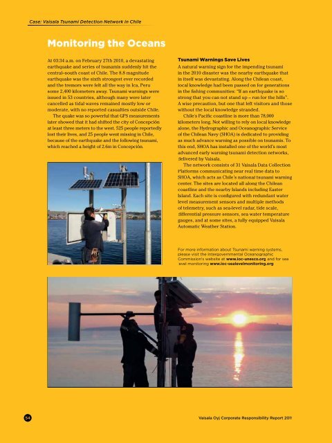
The network consists of 31 <strong>Vaisala</strong> Data Collection<br />
Platforms communicating near real time data to<br />
SHOA, which acts as Chile’s national tsunami warning<br />
center. The sites are located all along the Chilean<br />
coastline and the nearby Islands including Easter<br />
Island. Each site is configured with redundant water<br />
level measurement sensors and multiple methods<br />
of telemetry, such as sea-level radar, tide scale,<br />
differential pressure sensors, sea water temperature<br />
gauges, and at some sites, a fully equipped <strong>Vaisala</strong><br />
Automatic Weather Station.<br />
For more information about Tsunami warning systems,<br />
please visit the Intergovernmental Oceanographic<br />
Commission's website at www.ioc-unesco.org and for sea<br />
level monitoring www.ioc-sealevelmonitoring.org<br />
54 <strong>Vaisala</strong> Oyj <strong>Corporate</strong> <strong>Responsibility</strong> <strong>Report</strong> <strong>2011</strong>