

Untitled
Untitled
Untitled

Create successful ePaper yourself
Turn your PDF publications into a flip-book with our unique Google optimized e-Paper software.
Soils of the Nazko area,<br />
British Columbia<br />
Report No. 38 of the<br />
British Columbia Soi1 Survey<br />
Compiled by<br />
T.M. Lord’ and M. Walmsley2<br />
Mapped by<br />
E.B. Wiken’ and K.T.L. Guthrie4<br />
Land Resource Research Centre<br />
Contribution No. 85-55<br />
(Map sheets 93B/NW and 93G/SW)<br />
Research<br />
Agriculture<br />
1988<br />
Branch<br />
Canada<br />
’ Retired.<br />
2 Pedology Consultant.<br />
3 Moved to Lands Directorate, Environment Canada, Ottawa, Ont.<br />
4 Moved to Surrey, B.C.
Copies of this publication are available from<br />
Maps B.C.<br />
Ministry of Environment<br />
Victoria, B.C.<br />
WV 1x5<br />
Produced by Research Program Service<br />
0 Minister of Supply and Services Canada 1988<br />
Cat. No.: A57-429E<br />
ISBN: O-662-15786-9<br />
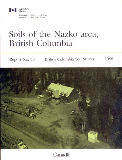
Cover photo: Logging trucks at Nazko<br />
(photo by D. Moon)
CONTENTS<br />
ACRNOWLEDGMENTS ........................................... vi<br />
PREFACE ................................................... vii<br />
GENERAL DESCRIPTION OF THE AREA ........................... 1<br />
Location and extent .................................... 1<br />
History and resources .................................. 1<br />
Physiography and drainage .............................. 1<br />
Bedrock geology ........................................ 6<br />
Surficial geology and soi1 parent materials ............ 7<br />
Climate ................................................ 12<br />
Vegetation ............................................. 12<br />
SOILS ..................................................... 16<br />
Mapping procedures ..................................... 16<br />
How to use this soi1 survey ............................ 17<br />
Description of the soi1 units .......................... 19<br />
Alix ............................................... 19<br />
Barrett ............................................ 20<br />
Beaverley .......................................... 21<br />
Chasm .............................................. 22<br />
Chief .............................................. 23<br />
Cottonwood ......................................... 24<br />
Deserters .......................................... 25<br />
Elliot ............................................. 26<br />
Ormond ............................................. 27<br />
Rail ............................................... 28<br />
Roaring ............................................ 29<br />
Salt Lake .......................................... 30<br />
Stellako ........................................... 31<br />
Telegraph .......................................... 31<br />
Tyee ............................................... 32<br />
Vanderhoof ......................................... 34<br />
West Road .......................................... 34<br />
LAND USE .................................................. 36<br />
Agriculture .......................................... 36<br />
Forestry ............................................. 38<br />
Wildife .............................................. 39<br />
- Ungulates ........................................ 39<br />
- Waterfowl ........................................ 39<br />
Recreation ........................................... 39<br />
DERIVED AND INTERPRETATIVE MAPS ........................... 40<br />
REFERENCES ................................................ 41<br />
Page<br />
iii
Page<br />
APPENDIX. DESCRIPTION AND ANALYSES 0~ THE soILs (TABLES) . . 45<br />
Alix .................................................... 46<br />
Barrett ................................................. 47<br />
Beaverley ............................................... 48<br />
Chasm ................................................... 49<br />
Cottonwood .............................................. 50<br />
Deserters ............................................... 51<br />
Dragon .................................................. 52<br />
Elliot .................................................. 53<br />
Ormond .................................................. 54<br />
Rail .................................................... 55<br />
Roaring ................................................. 56<br />
Salt Lake ............................................... 57<br />
Stellako ................................................ 58<br />
Telegraph ............................................... 59<br />
Tyee .................................................... 60<br />
Vanderhoof .............................................. 61<br />
West Road ............................................... 62<br />
iv
LIST OF TABLES AND ILLUSTRATIONS<br />
Page<br />
TABLES<br />
FIGURES<br />
PLATES<br />
1. Selected climatic data . . . . . . . . . . . . . . . . . . . . . . . . . . . . . . . 13<br />
2. Climatic capability for agriculture in interior<br />
British Columbia ,...................*................ 37<br />
1 . Location of the Nazko map area in British Columbia ... 2<br />
2. Physiography and drainage ............................ 3<br />
3. Generalized bedrock geology .......................... 7<br />
4. Direction of ice movement in central British<br />
Columbia ............................................. 9<br />
5. Generalized surficial geology ........................ 10<br />
6. Biogeoclimatic zones ................................. 15<br />
1 (a) Upper Nazko valley (b) Pelican Lake................. 4<br />
II (a) Wetlands (b) Haying crew (c) Haylands near Nazko.. 5<br />
V
ACKNOWLED'GMENTS<br />
Assistance and support were provided by the following<br />
agencies and individuals: L. Farstad (retired), former Head,<br />
Soi1 Survey Unit, Agriculture Canada, Vancouver, B.C., directed<br />
the soi1 survey; Bruce Burton, Mike Cleery, and David Paton<br />
assisted in the field mapping; L. Chan conducted much of the<br />
laboratory analysis; Nada Cukor drafted the preliminary soi1<br />
maps; J. Melzer typed the manuscript; G.E. Cheesman provided<br />
climate information; R. Annas and R. Coupé gave helpful advice<br />
on vegetation; the Cartography Section, Land Resource Research<br />
Centre, Agriculture Canada, Ottawa, Ontario, provided base maps,<br />
drafted figures and prepared the final soi1 maps; Surveys and<br />
Resource Mapping Branch, Ministry of Environment, Victoria,<br />
drafted and prepared the original soil-landform manuscript maps<br />
and legends. Original photographs for the plates were from<br />
files of B.C. Tourism, Victoria.<br />
Pedologists Al Dawson of the B.C. Ministry of Agriculture<br />
and Food, Bill Watt of the B.C. Ministry of Forests, and Keith<br />
Valentine of Agriculture Canada, provided advice and much help<br />
in the form of soils data from published reports and from<br />
reports in preparation, and through persona1 communication.<br />
Charles Tarnocai, Land Resource Research Centre, reviewed the<br />
manuscript and the map legend.<br />
vi
PREFACE<br />
This report and the soi1 maps it contains [map sheets 93<br />
B/NW (Nazko River) and 93 G/SW (West Road River) in the National<br />
Topographie System] caver about 745 000 ha lying west of the<br />
Fraser River and west of the city of Quesnel. Ed Wiken<br />
conducted the soi1 survey and established the capability<br />
classification for agriculture on the West Road River map sheet;<br />
Ken Guthrie was responsible for the survey and agriculture<br />
capability ratings on the Nazko River sheet.<br />
The report describes the characteristics of the soils and<br />
map units and specifies their location and extent. It gives<br />
short accounts of the history and natural features of the map<br />
area. The soi1 maps show the distribution of the soils. The<br />
soi1 survey was undertaken to provide an inventory of land<br />
capabilities through the Canada Land Inventory (CLI) program.<br />
Land capability maps for the sectors agriculture, forestry,<br />
wildlife (ungulates and waterfowl), and recreation, were<br />
published during the 1970s. Manuscript soil-and-terrain maps at<br />
a scale of 1:50 000 covering this map area and surrounds are<br />
available from the B.C. Ministry of Environment.<br />
This publication is one of a series (Soils of the Lac la<br />
Hache - Clinton Area 1980; Soils of the Quesnel Area 1982;<br />
Soils of the Horsefly Area 1984; Soils of the Barkerville Area<br />
1985 and reports in preparation for the Taseko Lakes Area, the<br />
Canim Lake - Bonaparte River Area, and the Williams Lake -<br />
Alexis Creek Area), covering the Cariboo-Chilcotin region.<br />
These publications provide soils information in maps of the<br />
region at scales of 1: 100 000 or 1:125 000, with legends, and<br />
textual descriptions in which simplified map units, extended map<br />
legends, and simple map unit symbols are used.<br />
vii
GENERAL DESCRIPTION OF THE AREA<br />
Location and extent<br />
The surveyed area (Fig. 1) is on the Interior Plateau of<br />
central British Columbia. The area extends from 52“30' to<br />
53O30' north latitude and from 123" to 124O west longitude,<br />
comprising an area of 745 380 ha. The communities of Nazko and<br />
Punchaw lie in the central and northeastern part of the map area<br />
respectively. Nazko is about 75 km west of Quesnel and Punchaw<br />
about 60 km southwest of Prince George. In 1975 the population<br />
of the Nazko area was around 425.<br />
History and resources<br />
Alexander Mackenzie crossed the continental divide on June<br />
12, 1793. Arriving on the banks of a river the Indians called<br />
Tacoutche Tesse (now the Fraser) he became the first white man<br />
to find a way to the Cariboo. The Carrier Indians proved to be<br />
friends and allies as well as, at times, a formidable foe. With<br />
the major exception of Simon Fraser who introduced the fur trade<br />
in 1808, there were few settlers in the Nazko area until the<br />
Cariboo gold rush of 1859.<br />
Subsistence ranching and farming have been and Will<br />
probably continue to be, part of the economy of the area, but<br />
they are for the most part carried out by people who are<br />
interested mainly in the lifestyle of the country.<br />
Forestry and related lumbering activities give most of the<br />
employment in the area. Processing is centered at or near<br />
Quesnel where lumber and planer mills, chip and pulp mills, and<br />
plywood plants are located.<br />
As a consequence of the improved access provided by logging<br />
activities, much of the plateau country is now accessible by<br />
grave1 roads. Fishing, hunting, hiking, camping and boating are<br />
pleasant and available recreational pursuits. Ice fishing,<br />
snowmobiling, and cross country skiing are winter time<br />
activities.<br />
Physiography and drainage<br />
The survey area lies on the Interior Plateau (Fig. 2). It<br />
contains portions of the Fraser Plateau in the south half of the<br />
map area and the Nechako Plateau in the extreme northwest. The<br />
Fraser Basin includes the valleys of the West Road, the Nazko,<br />
and the Chilako rivers (Holland 1976). These drainage systems,<br />
for the most part, are of low gradient and lack the steep-sided<br />
1
canyons which are more characteristic east of the map area. The<br />
Telegraph Range separates the map area from the immediate Fraser<br />
drainage to the east. This range is breached by the West Road<br />
River, or Blackwater which flows east into the Fraser and by the<br />
Chilako River which flows north into the Nechako River.<br />
The numerous fields of drumlins and eskers provide a<br />
rolling ridged surface form to the widespread and deep mantle of<br />
glacial drift on the Fraser Plateau. Th elevations range from<br />
approximately 800 m at Punchaw Lake to 1550 m northeast of<br />
Cantillon Lake. The Nechako Plateau, of minor extent in the map<br />
area, has elevations of 1000'to 1300 m. In general, it is an<br />
area of low relief, with broad expanses of flat or gently<br />
rolling topography and a surface covered extensively by<br />
drumlinized glacial drift.<br />
The Fraser Basin, an area of low relief in the north part<br />
of the map area, is drained by the West Road and Chilako<br />
rivers. Its boundaries are near the 920 m contour and include<br />
deposits of former ice-dammed glacial lakes, glaciofluvial<br />
materials, and morainal deposits. Early geological<br />
investigations (Lay 1940, 1941) indicate that the basin was<br />
eroded by an ancestral Fraser River flowing northward into the<br />
Peace River.<br />
Disruption of drainage during the Pleistocene and the<br />
generally low relief over much of the plateau surfaces have left<br />
a landscape that is dotted with numerous bogs and small lakes.<br />
This is particularly evident in the Euchiniko and Clisbako river<br />
areas. The major lakes are Pantage, Pelican, Titetown, Tagai,<br />
Kluskoil, Batnuni and Puntataenkut. Drainage is by way of the<br />
Nazko, West Road, and Chilako rivers which trend north prior to<br />
joining the Fraser or one of its tributaries.<br />
Bedrock<br />
geology<br />
Figure 3 shows the bedrock geology as generalized from<br />
mapping by the Geological Survey of Canada (1959, 1960). It<br />
illustrates the location and extent of the various bedrock types<br />
and unconsolidated sediments in the survey area. However,<br />
outcroppings of bedrock are rare. By far the most extensive<br />
surface materials are unconsolidated sediments. The Fraser<br />
Plateau is underlain largely by gently dipping olivine basalt<br />
flows of the Miocene or Pliocene era. The Nechako Plateau<br />
however, has Tertiary lava flows which caver the older volcanic<br />
and sedimentary rocks and intrusive rocks of Upper Jurassic and<br />
Cretaceous age. A small Tertiary volcanic dome lies south of<br />
the community of Nazko. The Fraser Basin is largely an<br />
erosional feature characterized by extensive glacial deposits<br />
and few bedrock outcrops.
Surficial geology and soi1 parent materials<br />
Tipper (1971) has discussed and described the glacial<br />
geomorphology and Pleistocene history of central British<br />
Columbia in a comprehensive report. The purpose of this section<br />
is not to repeat his description but to describe the<br />
relationship between these surficial deposits and the parent<br />
materials of the mapped soils. Figure 4 provides an overview<br />
illustration of the direction of glacial ice movement in central<br />
British Columbia (Tipper 1971) and Figure 5 illustrates the<br />
general location and extent of surficial geologic deposits<br />
(classified according to the Canada Soi1 Survey Committee<br />
1978). While there are definite chemical and physical<br />
differences within each of the main surficial geological<br />
material types, the remainder of this section describes, in a<br />
general fashion, the significant attributes of each group.<br />
Fluvial<br />
deposits<br />
Adjacent to present-day river systems, there are extensive<br />
terraces and floodplain deposits. These fluvial deposits vary<br />
in their extent and mode of formation but are generally found<br />
below 600 m and characteristically exhibit level to gently<br />
sloping topography. Terraced deposits are usually separated by<br />
steep escarpments. As a consequence of their varying mode of<br />
formation, fluvial parent materials cari exhibit a considerable<br />
range in surface textures. However, for the most part, the<br />
textures range from loam to loamy Sand. Fluvial deposits are<br />
parent materials for soils of the Stellako and Elliot<br />
associations.<br />
Glaciofluvial deposits occur throughout the map area and<br />
are often in close association with morainal deposits (glacial<br />
till) at their higher elevations (800 m to 1000 m). A variety<br />
of landforms occurs, associated with recessional glacial ice as<br />
well as esker-kame complexes. Where these deposits are in<br />
association with morainal deposits, they are often thin veneers<br />
overlying morainal ridges or thicker deposits between drumlin<br />
ridges. The textures of the materials generally range from<br />
gravels to gravelly sands and gravelly loamy sands. Coarse<br />
glaciofluvial deposits are parent materials for the Alix,<br />
Roaring, and most Salt Lake soils. Cottonwood soils are<br />
developed on loamy and sandy materials of glaciofluvial or<br />
glaciolacustrine<br />
origin.<br />
Lacustrine<br />
deposits<br />
In basins centred around Prince George, Fort St. James and<br />
Vanderhoof, ice-dammed lakes formed during late glacial stages<br />
and resulted in the deposition of glaciolacustrine sediments up<br />
8
to an elevation of approximately 800 m (Tipper 1971). The map<br />
area includes part of the southern extent of these large glacial<br />
laking basins.<br />
Glaciolacustrine sediments are parent materials for the<br />
Beaverley and Vanderhoof associations. The predominant textures<br />
of these sediments are clay loam to heavy clay. On the<br />
extensive plain north of the Blackwater River, sandy and loamy<br />
glaciolacustrine and glaciofluvial sediments are parent<br />
materials for Cottonwood soils.<br />
Morainal<br />
deposits<br />
Morainal deposits of till, the most extensive surficial<br />
materials in the area, occur mostly above 750 m. At their lower<br />
levels, the deposits often occur as islands protruding above the<br />
general level of the glaciolacustrine or glaciofluvial<br />
sediments. Landforms are commonly well- to poorly-defined<br />
drumlins as well as crag-and-tail features where the till is a<br />
thin veneer overlying bedrock.<br />
Two types of morainal materials are recognized. One type,<br />
a compact, pseudoplaty-structured deposit occurring throughout<br />
the area, is described as a basa1 till (Deserters and Barrett<br />
associations). The other type is a loose, sandy loam to<br />
loam-textured material displaying evidence of reworking by<br />
fluvial action. These deposits, parent materials of Salt Lake<br />
soils, are likened to an ablation till and result in coarser<br />
textures and a higher coarse fragment content (Salt Lake soils<br />
may occur on this material as well as on glaciofluvial parent<br />
materials).<br />
Other soi1 associations representing morainal parent<br />
materials are recognized and differentiated on the basis of<br />
climatic characteristics as well as texture and composition<br />
resulting from the influence of different bedrock sources. The<br />
influence of coarse textured intrusive rocks is apparent in the<br />
soils of the West Road Association. Finer-textured<br />
metavolcanic, metasedimentary, and volcanic rocks influence the<br />
Telegraph and Tyee soils.<br />
Colluvial<br />
deposits<br />
Soils developed from colluvial materials are highly<br />
influenced by the parent bedrock from which the colluvium was<br />
derived. Volcanic and metavolcanic bedrock forms the principal<br />
parent material of the Ormond Association. The Chasm soils tend<br />
to be sandy and loamy textured, slightly to moderately<br />
calcareous, and derived from intrusive bedrock.<br />
11
Organic<br />
deposits<br />
The rolling, subdued topography of the plateau surface in<br />
combination with the chaotic, often disoriented nature of the<br />
drainage pattern, has resulted in a multitude of small lakes,<br />
ponds, and organic areas. The buildup of organic deposits<br />
occurs in wet areas which support vegetation adapted to specific<br />
wetland environments. Relatively undecomposed- to moderately<br />
decomposed, dominantly moss-derived peats predominate in deep<br />
meltwater channels and large, open basins with a relatively<br />
small fluctuation in the water table. Chief soils are<br />
characteristic in these areas. Organic deposits of moderately<br />
decomposed sedge materials with an admixture of moss tend to<br />
occur in shallower and smaller basins which generally have a<br />
sequence of soils grading from organic through peaty phase<br />
Gleysols to Orthic Gleysols (Elliot soils). The water table is<br />
generally drawn down during the summer growing season. Rail<br />
soils are dominant on these primarily sedge-derived peats.<br />
CLIMATE<br />
Given its location in the lee of the Coast Mountains, the<br />
map area experiences light precipitation, a high frequency of<br />
clear skies and therefore a relatively dry climate. Owing to<br />
its elevation the plateau areas also have a short freeze-free<br />
period.<br />
The climate of the Cariboo forest region is described in<br />
some detail by Annas and Coupé (1979) as well as by data<br />
supplied by G. Cheesman of the B.C. Ministry of Environment<br />
(persona1 communication). Climatic data were collected over the<br />
area through a network of short-term stations and related to the<br />
few established long-term stations in or near the map area.<br />
These data are presented in Table 1. The data indicate that<br />
precipitation increases, freeze-free periods shorten, and<br />
growing degree-days are reduced as one proceeds west from the<br />
Fraser River. Snowpacks become deeper and more prolonged at<br />
higher elevations.<br />
VEGETATION<br />
Krajina (1969) and Annas and Coupé (1979) have described<br />
the vegetation and biogeoclimatic zones of the Cariboo Forest<br />
Region on a broad scale. For that portion of the map area which<br />
lies within the Prince George Forest Region, work has been<br />
undertaken by B.C. Forest Service staff. Two biogeoclimatic<br />
12
Table 1. Selected climatic data<br />
Station Location Elev. Mean temperature Mean precipitation(mm) Growing Freeze- Average Climatic<br />
(m) Annual January July Annual May-Sept. degree- free annual moisture<br />
daysl -period* snowfall balance3<br />
(dw) km) (mm)<br />
Gillies Cross<br />
Nazko<br />
5316 N 12331 W<br />
5255 N 12337 W<br />
848<br />
900<br />
2.2<br />
2.3<br />
-12.9<br />
-12.9<br />
13.7<br />
13.9<br />
502<br />
442<br />
268<br />
248<br />
955<br />
980<br />
40e<br />
40e<br />
- -172<br />
-189<br />
Puntchezacut 5300 N 12255 W 914 2.5 -12.3 14.3<br />
Alexis-Tautri 5232 N 12311 W 1220 0.4 -13.8 11.6<br />
518<br />
464<br />
300<br />
243<br />
970<br />
635<br />
61<br />
12<br />
1;8<br />
195<br />
-33<br />
-265<br />
P 1Growing degree-days: degree days accumulated above 5°C.<br />
w *Freeze-free period: days above 0°C.<br />
3Climatic moisture balance: moisture deficit (-) or surplus (+).<br />
eEstimate<br />
Reference: Persona1 communication - G.E. Cheesman, B.C. Ministry of Environment.
zones occur in the map area (Fig. 6)*; a biogeoclimatic zone is<br />
a geographic area in a broadly homogeneous macroclimate. Zones<br />
are geographically subdivided into subzones on the basis that<br />
each subzone has homogeneous patterns of soi1 and vegetation<br />
distribution. In the map area are three subzones of the<br />
subboreal spruce zone and one subzone of the Engelmann spruce -<br />
subalpine fir zone. Botanical and common names of plant species<br />
used here are from Taylor and MacBryde (1977).<br />
Subboreal spruce zone<br />
Most of the survey area falls within the subboreal spruce<br />
zone. This zone and its three subzones caver most of the study<br />
area by far.<br />
Of the three subzones, the cold, dry Chilcotin pine subzone<br />
(SBSa) has the greatest geographic extent. Here, white spruce<br />
(Picea glauca) and lodgepole pine (Pinus contorta var.<br />
latifolia) are the dominant coniferous trees with black spruce<br />
(Picea mariana) occuring in bogs. One of the key features of<br />
this subzone is the general absence of Rocky Mountain Douglas<br />
fir (interior Douglas fir) (Pseudotsuga menziesii). Generally,<br />
the herb layer is sparse, and pine grass (Calamagrostis<br />
rubescens) caver is variable.<br />
The Douglas fir - white spruce subzone (SBSb) occurs in the<br />
northeastern part of the area, particularly in the Fraser<br />
Basin. Douglas fir, white spruce, lodgepole pine, trembling<br />
aspen (Populus tremuloides), and common paper birch (Betula<br />
papyrifera) are the dominant trees. The well developed shrub<br />
layer includes western thimbleberry (Rubus parviflorus), Oregon<br />
boxwood (Paxistima myrsinites), Rocky Mountain maple (Acer<br />
glabrum), and blueberries (Vaccinium spp.). Pine grass is<br />
usually sparse, but herbs such as wild sarsaparilla (Aralia<br />
nudicaulis), Canadian bunchberry (Cornus canadensis) and asters<br />
(Aster spp.) are common.<br />
The cold, northern climate experienced at higher elevations<br />
in the Telegraph Range is represented by the white spruce -<br />
subalpine fir - Douglas fir subzone (SBSc). Generally, white<br />
spruce and subalpine fir (alpine fir) (Abies lasiocarpa) are the<br />
dominant trees. However, Douglas fir, lodgepole pine, trembling<br />
aspen, paper birch and black cottonwood (Populus balsamifera<br />
subsp. trichocarpa) are also common.<br />
*D. Meitinger and A. McLeod, of B.C. Ministry of Forests<br />
(persona1 communication)<br />
14
Engelmann spruce - subalpine fir zone<br />
At elevations generally greater than 1200 m is the wet<br />
subzone of the Engelmann spruce - subalpine fir zone (ESSFh).<br />
In the map area, this is generally restricted to isolated areas<br />
in the Telegraph Range and in the mountains southeast of the<br />
West Road River. Subalpine fir and Engelmann spruce (Picea<br />
engelmannii) are the dominant trees. The quite remarkably<br />
developed shrub layer includes white-flowered rhododendron<br />
(Rhododendron albiflorum), blueberries, Sitka mountain alder<br />
(Alnus viridis subsp. sinuata), and devil's club (Oplopanax<br />
horridus). Herbs are also well represented by Sitka valerian<br />
(Valeriana sitchensis subsp. sitchensis), oak fern (Gymnocarpium<br />
dryopteris), Canadian bunchberry, and simple-stemmed<br />
twistedstalk (Streptopus roseus).<br />
SOILS<br />
Mapping<br />
procedures<br />
The soi1 survey of the Nazko area was one of several<br />
projects conducted under the Canada Land Inventory (CL11 program<br />
(Canada Land Inventory 1970) to provide information on soi1<br />
resources for land capability ratings. Each of these projects,<br />
as does this one, had a common objective and well-defined<br />
guidelines (Working Group on Soi1 Survey Data 1983). As with<br />
previous projects, soi1 scientists made this survey to learn<br />
what kinds of soi1 and soil-like materials are in the survey<br />
area, where they are located and how they cari be used. The soi1<br />
scientists went into the area knowing they probably would locate<br />
many soils they already knew something about and perhaps<br />
identify some they had never seen before. They dug many holes,<br />
studied the soi1 profiles and gathered much data on factors such<br />
as: the steepness, length, and shape of slopes; drainage; parent<br />
materials; and the chemical and physical characteristics of the<br />
individual soi1 horizons. With these data in hand, as well as<br />
much more, the soi1 scientists undertook the task of mapping the<br />
distribution of the identified soils.<br />
For detailed accounts of survey methods and mapping<br />
procedures used, the reader is referred to the following<br />
publications:<br />
A Soi1 Mapping System for Canada : Revised (Mapping Systems<br />
Working Group, 1981)<br />
The Soi1 Landscapes of British Columbia (Valentine et al.<br />
1978)<br />
16
For definitions of terms used in soi.1 science, the reader is<br />
referred to:Glossary of Terms in Soi1 Science (Canada Soi.1<br />
Survey Committee, 1976).<br />
The scale of the published soi1 maps is 1:lOO 000. Soils<br />
are classified and defined according to guidelines established<br />
by the Canada Soi1 Survey Committee (1978). The definition of<br />
soi1 association used in this report is the same as that in Soi1<br />
Report No. 25 viz., that a soi1 association is a group of soils<br />
developed on similar parent materials, which differ because of<br />
different soi1 water regimes or because of variations in other<br />
characteristics. A soi1 association occurs when climatic<br />
conditions are similar, usually within one physiographic area or<br />
vegetation zone. Although a soi1 associaticn is named after its<br />
most common soil, it may contain several other different but<br />
related soils. The full range of soils is not represented in<br />
every part of the landscape where a soi1 association occurs.<br />
Each soi1 association is shown on the map by one or more map<br />
units, each of which is given a particular combination of<br />
letters and numbers.<br />
There are two types of map units employed: a single map<br />
unit and a compound map unit. A single map unit contains soils<br />
from only one association whereas a compound map unit contains<br />
soils from two (or even three) associations.<br />
For example a single map unit may be D (Deserters<br />
Association). This map unit represents dominantly deep,<br />
moderately well drained Luvisolic soils derived from gravelly<br />
loamy till occurring mainly in the Fraser Plateau. A compound<br />
map unit may be D-AX (Deserters-Alix associations). This map<br />
unit represents dominantly deep, moderately well drained soils<br />
derived from gravelly loamy till, with significant inclusions of<br />
gravelly, stony, rapidly drained soils derived from<br />
glaciofluvial materials (AX).<br />
How to use this soi1 survey<br />
The following is a brief guide to using the mapped<br />
information and report data. It is understood that as a<br />
consequence of the diversity of potential users and their<br />
individual needs, there Will be other means of<br />
making use of this information. However, it is hoped that this<br />
section Will help the first-time user of the report and maps.<br />
1. Locate the area of interest on the map sheet.<br />
2. List the mapping unit symbols that are in the area.<br />
3. Turn to the list of the names of each soi1 association in<br />
the table of Contents and the page where the mapping unit is<br />
described.<br />
17
4. See "Tables" (following the Contents) for location of<br />
additional data on a specific soi1 use or regional<br />
characteristic.<br />
5. Consult "Land Use" and "Derived and Interpretive Maps"<br />
sections of the report for information on land capability<br />
and other potential uses of the mapped information.<br />
6. For specific data on the chemical and physical<br />
characteristics of the soils, refer to "Appendix".<br />
18
DESCRIPTIOR OF THE SOIL UNITS<br />
ALIX Soi1 Units (AX)<br />
Alix are sandy-skeletal soils developed on glaciofluvial<br />
materials that were deposited near lake margins. The soils<br />
occur on level to strongly sloping lands of stream valleys and<br />
basins below the general level of the plateau. The elevations<br />
range from 850 - 1200 m. The soils are dominant over 5.5% of<br />
the map area.<br />
The mean annual precipitation is 300-400 mm. The<br />
freeze-free period is 30-74 days and there are 780-1309 growing<br />
degree-days above SOC. Lodgepole pine is a common tree, but<br />
other species characteristic of the subboreal spruce zone--white<br />
spruce, Douglas fir, trembling aspen, and common paper<br />
birch --occur with a ground caver of blueberries, Oregon boxwood,<br />
pine grass, and mosses.<br />
The parent material of the Alix soils is sandy-skeletal<br />
glaciofluvial material of variable thickness overlying till or<br />
bedrock. Although the predominant terrain form is a nearly<br />
level terrace, hummocky and kettled landforms occur. The soils<br />
are rapidly drained, are rapidly pervious, and have a subhumid<br />
to humid soi1 moisture regime.<br />
The classification of the soils is Dystric Brunisol with<br />
the orthic subgroup dominating in some map units and the<br />
eluviated subgroup occurring in slightly moister environments.<br />
The more leached soils have a thin surface layer of grayish<br />
sandy loam. Subsoils are yellowish brown gravelly sandy loam<br />
overlying very gravelly material that may occasionally be<br />
calcareous, A complete profile description of an Eluviated<br />
Dystric Brunisol is from Soils of the Nechako-Francois Lake Area<br />
(Cotic et al. 1976).<br />
Alix soils have many characteristics associated with other<br />
sandy-skeletal and gravelly soils mapped in or near near the<br />
area: Roaring soils of the Nazko area were mapped on complex<br />
esker-kame terrain; Ramsey soils are Podzolic.<br />
The Alix soi1 units provide lodgepole pine pulpwood, and<br />
have potential for recreation and wildlife.<br />
19
The Alix soils were first described in the Quesnel area by<br />
Mackintosh et al., in 1965 (unpublished manuscript).<br />
Map<br />
units<br />
AX Alix (38 618 ha): The AX map unit occurs mainly as narrow<br />
delineations along river and stream valleys. The deep,<br />
rapidly drained soils of the unit occur with small pockets<br />
of poorly drained minera1 and Organic soils. Topography is<br />
generally smooth and level to gently sloping, but<br />
irregular, ridged, and kettled phases occur. Gully erosion<br />
may affect up to 20% of the map unit.<br />
AX-CE' Alix-Chief (2379 ha): The Organic soi1 (Chief) is<br />
complexed with Alix soils in this map unit where the very<br />
poorly drained secondary soils form a significant landform<br />
pattern, or where they occupy 30-40% of the unit.<br />
Elevation ranges are similar to those in the AX map unit<br />
but topography is more subdued.<br />
BARRETT Soi1 Units (BA)<br />
Barrett are gravelly, loamy soils developed on morainal<br />
materials on rolling and strongly sloping terrain. The soils<br />
occur in the central and northern parts of the map sheet at<br />
elevations from 850 to 1250 m. The association is dominant over<br />
28% of the map area.<br />
The mean annual precipitation is 300-40.0 mm. The<br />
freeze-free period is 30-74 days and there are 780-1169 growing<br />
degree-days above SOC. Lodgepole pine is a common tree, but<br />
other species characteristic of the subboreal spruce zone--white<br />
spruce, Douglas fir, trembling aspen, and common paper birch--<br />
occur with a ground caver of blueberries, Oregon boxwood, pine<br />
grass, and mosses.<br />
The parent material of the Barrett soils is gravelly,<br />
moderately stony, and neutral in reaction. The soils are<br />
moderately well to well drained, are moderately to slowly<br />
pervious, and have a humid to subhumid soi1 moisture regime.<br />
The classification of the soils is Gray Luvisol with the<br />
orthic subgroup dominating in most areas and the brunisolic<br />
subgroup occurring in slightly moister environments. The soils<br />
have a thin surface layer of grayish sandy loam. Subsoils are<br />
grayish brown, gravelly loam that overlies gravelly loamy parent<br />
20
material. A complet@ profile description of an Orthic Gray<br />
Luvisol of the Barrett Association is taken from Soils of the<br />
Nechako-Francois Lake Area (Cotic et al. 1976).<br />
The present use for Barrett soils is the production of<br />
pulpwood and sawlogs.<br />
The Barrett soils were first described by Farstad and Laird<br />
in 7954 (Report No. 4 of the B.C. Soi1 Survey).<br />
Map<br />
units<br />
BAl Barrett 1 (84 509 ha): Topography ranges from undulating to<br />
strongly rolling in the map unit. Small amounts of soi19<br />
such as Alix and Chief are included.<br />
BA2 Barrett 2 (10 835 ha): This unit is associated with<br />
irregular terrain and significant components of gleyed<br />
soils.<br />
BA3 Barrett 3 (62 719 ha): This map unit is distinguished by<br />
significant inclusions of Gleyed Gray Luvisols and<br />
Brunisolic Gray Luvisols.<br />
BA-AX Barrett-Alix (51 563 ha); About 20-40% of the soils in<br />
this map unit are gravelly and sandy-skeletal Alix soils.<br />
BEAVERLEY Soi1 Unit (BY)<br />
Beaverley are fine-loamy and clayey soils developed on<br />
glaciolacustrine deposits. The terrain is nearly level to<br />
rolling with some steep eroded slopes. Elevations range from<br />
700 m in the Blackwater valley to about 850 m near McLeese<br />
Lake. The soils predominate in less than 1% of the map area.<br />
The mean annual precipitation is 300-400 mm. The<br />
freeze-free period is 60-119 days and there are 1170-1504<br />
growing degree-days above 5OC. Lodgepole pine is a common tree,<br />
but other species characteristic of the subboreal spruce<br />
zone--Douglas fir, white spruce and trembling aspen are common<br />
trees that occur with a ground caver of herbs, pine grass, and<br />
mosses.<br />
The parent material of Beaverley soils is a stratified<br />
fine-loamy glaciolacustrine deposit that is only weakly<br />
calcareous. Stones or grave1 may occur where the lacustrine<br />
21
mantle is shallow over till, especially near the higher<br />
elevation limits of the glacial lake basins. The soils are<br />
moderately well drained, are moderately pervious, and have a<br />
subhumid soi1 moisture regime.<br />
The most common soils are Orthic Gray Luvisols. Beaverley<br />
soils have thick, grayish surface horizons that cari usually be<br />
divided into Upper and lower subhorizons. The brown, strongly<br />
structured subsoil horizons overlie distinctly stratified<br />
(varved) lacustrine parent material at depths between 50 and 85<br />
cm. A complete description of an Orthic Gray Luvisol of the<br />
Beaverley Association is from a site near Quesnel (Lord and<br />
Mackintosh 1982).<br />
A number of soi1 associations that occupy the extensive<br />
glacial lake deposits of the Fraser Basin are dominated by<br />
somewhat similar soils. These Gray Luvisols of the Berman,<br />
Beaverley, Narcosli, and Pineview associations are separated on<br />
the basis of criteria such as the texture of the parent<br />
materials, landform and climatic features, and soi1 profile<br />
characteristics. For the purpose of interpretive groupings most<br />
of these associations cari be brought together.<br />
Beaverley soils occur extensively in the Prince George-<br />
McLeod Lake map area north of Quesnel. The map unit provides<br />
wood for timber and pulp and where cleared is used for grain,<br />
hay, and pasture.<br />
Beaverley soils were first described in the Quesnel area.<br />
Map<br />
unit<br />
BY Beaverley (5546 ha): The BY map unit occupies two areas<br />
near Pantage Lake. As much as 20% of the unit may be<br />
comprised of soils on organic materials and a further 20%<br />
may be other clayey lacustrine soils. Topography ranges<br />
from level to rolling; areas of strongly eroded soils occur<br />
along the valleys.<br />
CHASIY Soi1 Unit (CH)<br />
Chasm are gravelly, loamy soils developed in colluvium on<br />
Upper valley sides of the main rivers. Slopes range from<br />
moderate to very steep on elevations below 1000 m. These soils<br />
caver about 2.2% of the map sheet.<br />
22
The mean annual precipitation is 300-400 m. The freezefree<br />
period is 75-89 days and there are 1310-1504 growing<br />
degree-days above 5°C. Chasm soils are mainly in the subboreal<br />
spruce zone where lodgepole pine is a common tree over a ground<br />
caver of pine grass and shrubs such as willows, blueberries, and<br />
Oregon boxwood.<br />
Chasm soils are moderately well drained, slightly hard, and<br />
moderately pervious, with a semiarid moisture .regime. They are<br />
classified as Eluviated Eutric Brunisols that have a thin litter<br />
layer, and a calcareous subsoil and parent material. In some of<br />
these soils there is a layer of volcanic ash in the Upper<br />
horizons. A profile from the Clinton area (Valentine and Schori<br />
1980) is described in the Appendix.<br />
These soils have moderate potential as spring range for<br />
cattle and provide winter habitat for wildife (mule deer).<br />
Map<br />
unit<br />
C@l Chasm (16 267 ha): On the Upper valley sides this unit<br />
includes rock outcrops and thin soils. Slopes vary from<br />
moderate to very steep.<br />
CHIEF Soi1 Unit (Cl)<br />
Chief are deep soils developed from organic materials that<br />
are derived mainly from moss peat, often with significant<br />
inclusions of sedge peat. The soils occupy depressional or very<br />
gently sloping areas generally below elevations of 1200 m. The<br />
map units are mainly small and are distributed throughout the<br />
subboreal spruce zone of the plateau and basin regions. They<br />
are dominant over 3.3% of the map area.<br />
The mean annual precipitation is 300-750 mm. The<br />
freeze-free period is 30-89 days and there are 780-1309 growing<br />
degree-days above 5OC. The fens are mostly nonforested, with a<br />
vegetative caver of sedges and grasses. Vegetation on bogs is<br />
black spruce, lodgepole pine, ericaceous shrubs, and mosses.<br />
The soils are very poorly drained and have an aquic moisture<br />
regime.<br />
The Chief Association includes a wide range of organic<br />
materials in various states of decomposition. Most profiles are<br />
classified as Typic Mesisols but Fibrisols predominate in some<br />
areas. The surface tier of a typical profile is composed of<br />
23
5-20 cm of fibric moss peat or sedge peat material that overlies<br />
more decomposed layers of dark brown, acidic organic materials.<br />
Organic soils have been recognized and mapped since the<br />
days of the first soi1 surveys in the Interior Plateau (Kelley<br />
and Farstad 1946, Farstad and Laird 1954). At that time, three<br />
kinds of groundwater soils - muskeg, meadow, and shallow muck -<br />
were described in the Prince George area. Although some of<br />
these soils are still grouped under the name "Chief Association"<br />
in current reports, this association name is now used mainly to<br />
identify organic landforms in which Mesisols predominate.<br />
Most of the Chief soils are used for wildlife and livestock<br />
grazing. Some map areas produce hay from native sedges or from<br />
seeded grasses.<br />
Map<br />
unit<br />
CF Chief (24 409 ha): Many small map delineations of this unit<br />
occur in the subboreal spruce zone. The map unit includes<br />
variable amounts of Humic Mesisol, terric subgroups, and<br />
Gleysols.<br />
COTTONWOOD Soi1 Units (CN)<br />
Cottonwood are coarse-loamy soils developed on<br />
glaciolacustrine and glaciofluvial materials deposited near lake<br />
margins. The soils occur on gently sloping to hummocky terraces<br />
and deltas associated with the Blackwater River. The elevations<br />
are less than 850 m. The soils are dominant over 4.1% of the<br />
map area.<br />
The mean annual precipitation is 400-500 mm. The freezefree<br />
period is 30-74 days and there are 780-1169 growing<br />
degree-days above SQ C. Lodgepole pine is common but other<br />
trees characteristic of the subboreal spruce zone--white spruce,<br />
Douglas fir, trembling aspen, and common paper birch--occur with<br />
a ground caver of blueberries, Oregon boxwood, pine grass, and<br />
mosses.<br />
The parent material of the Cottonwood soils is nonstony,<br />
sandy loam to loamy Sand but silty strata commonly occur at<br />
about one m from the surface. The soils are well to rapidly<br />
drained, are moderately pervious, and have a subhumid to humid<br />
soi.1 moisture regime.<br />
24
The classification of the soils is Dystric Brunisol with the<br />
orthic subgroup predominating in most areas. Brown fine sandy<br />
loam surface horizons overlie a thin loamy Btj horizon and a<br />
sandy textured C horizon. A complete profile descripton of an<br />
Orthic Dystric Brunisol from a site north of Blackwater is given<br />
in the Appendix.<br />
Cottonwood soils were first described in the Blackwater<br />
River area. The soils provide pulpwood and are farmed to a<br />
limited extent.<br />
Map<br />
units<br />
CN Cottonwood (28 638 ha): Large areas south of the community of<br />
Punchaw and east of Pelican Lake have inclusions of organic<br />
soils as minor components. Steeply sloping and eroded<br />
terrain occurs along the Blackwater River.<br />
CN-BY Cottonwood-Beaverley (2042 ha): The few areas of this map<br />
unit contain 20 - 40% of heavier textured, more poorly<br />
drained soils, often eroded and strongly sloping.<br />
DESERTERS Soi1 Units (D)<br />
Deserters are gravelly, loamy soils developed on morainal<br />
materials over tooography that ranges from rolling to<br />
undulating. The eievati.Cns are from 750 m to about 1500 m. The<br />
Deserters map units are confined to the vicinity of Punchaw and<br />
Ramsey Creek where they occupy 4.2% of the map area.<br />
The mean annual precipitation is 300-450 mm* The freezefree<br />
period is 60-74 days and there are 1170-1309 growing<br />
degree-days above 5OC. LOdgepOle pine .ig.a COlIllIlOIl tree, but<br />
other species characteristic of the subboreal sPruce zone--whits<br />
spruce, Douglas fir, trembling aspen, and combon paper birhh--<br />
occur with a ground caver of blueberries, Oregoa-boxwood, pine<br />
grass, and mosses.<br />
The parent materials of Deserte.rs soils are sandy loams and<br />
sandy clay loam that are generally gravelly and greater than 1 m<br />
thick over bedrock. Areas of drumlinized landform adjacent to<br />
the shoreline zone of the former glacial lake may have 30 cm or<br />
more of gravelly, washed materials. Parent materials are mainly<br />
neutral and free of lime to depths of about 1 m. The soils are<br />
moderately well to well drained, are moderately to slowly<br />
pervious, and have a humid to subhumid soi1 moisture regime.<br />
25
The dominant soils are Brunisolic Gray Luvisols, but<br />
Podzolic Gray Luvisols and gleyed subgroups are common. The<br />
soils have brownish surface horizons and grayish brown<br />
subsoils. A complete profile description of a Brunisolic Gray<br />
Luvisol is from Soils of the Prince George Area (Dawson, in<br />
preparation).<br />
Soils of the Barrett Asso.ciation are Orthic Gray Luvisols<br />
that occur on similar parent material to that of Deserters soils<br />
but under a slightly drier environment.<br />
The soils are largely under forest that is currently being<br />
tut for pulpwood and sawlogs.<br />
The Deserters Association was first identified and<br />
characterized in the Prince George area by Dawson (report in<br />
preparation).<br />
Map<br />
units<br />
D Deserters (17 552 ha): Most delineations of this map unit<br />
contain drumlinized terrain in which 15-30% of the soils<br />
may be sandy and gravelly. Orthic Gray Luvisols occupy the<br />
drier aspects.<br />
D-DN Deserters-Dragon (13 602 ha): This map unit lies on<br />
Upper slopes of ridges in the headwaters ar5a of Baker and<br />
Ramsey creeks. It carries a significant CGmpCnent of<br />
Dragon soils that are developed on r'olluvium. These Humo-<br />
Ferric Podzols occur in the Enge:mann SpruCe-subalpine fir<br />
zone. A profile description from Soils of the Nechako-<br />
Francois Lake Area (Cotic et al, 1976) is given in the<br />
Appendix.<br />
BLLIOT Soi1 Unit (EL)<br />
Elllot -Xi fine loamy soils formed on fluvial sediments.<br />
Their topography is subdued with 0 to 5% slopes, over an<br />
elevation range from 800 to 1200 m. They caver less than 1% of<br />
the map sheet, mainly in the southern portion.<br />
The mean annual precipitation is 300 - 400 mm or more. The<br />
freeze-free period is 30-49 days and there are 780-1029 growing<br />
degree-days above 5°C. Concentrated mainly in the subboreal<br />
spruce zone, the vegetation on Elliot soils, consisting of<br />
willows, sedges, and grasses reflects local wetness, not<br />
26
egional climate. There are few trees, and shrubs such as<br />
willows (Salix spp.) and bog birch (Betula glandulosa) are<br />
restricted to Upper slopes.<br />
The soils are imperfectly and poorly drained, moderately<br />
pervious, with a perhumid moisture regime. They are classified<br />
as Rego Humic Gleysols, carbonated phase with water near the<br />
surface for most of the year. They are calcareous to the<br />
surface and have a thick, organic enriched, surface horizon. A<br />
profile described in the Lac la Hache area (Valentine and Schori<br />
1980) is given in the Appendix.<br />
Map<br />
unit<br />
EL Elliot (2572 ha); Restricted mainly to narrow valleys<br />
and linear hollows, most delineations are small, irregular,<br />
and complexed with 20-40% Organic (Rail) soils.<br />
ORMOND Soi1 Units (OD)<br />
Ormond are gravelly, loamy soils developed in veneers of<br />
morainal and colluvial materials on rolling, hummocky, terrain.<br />
West of Quesnel these soils are associated with the Barrett<br />
soils. Elevations are from 1000 to 1350 m. Ormond soils occupy<br />
4.3% of the map area.<br />
The mean annual precipitation is 300-400 mm. The<br />
freeze-free period is 30-49 days and there are 780-1029 growing<br />
degree-days above 5°C. Most Ormond soils are in the Engelmann<br />
spruce-subalpine fir zone where these trees are common over a<br />
ground caver of blueberries, Oregon boxwood, and mosses.<br />
The parent materials are shallow till or colluvium derived<br />
from basic volcanic rock types. The soils have thin leached<br />
surface horizons overlying a brownish subsurface. One of the<br />
common soils, a lithic phase Orthic Dystric Brunisol from Soils<br />
of the Nechako-Francois Lake Area ( Cotic et al. 1976) is<br />
described in the Appendix.<br />
Map<br />
units<br />
OD Oraond (5784 ha): most areas contain about 30% Telegraph<br />
soils which are Brunisolic Gray Luvisols on gravelly loamy<br />
till.<br />
27
OD-BA Orrond-Barrett (26 069 ha): The delineations of this map<br />
unit are on strongly rolling and steeply sloping land. The<br />
Orthic Gray Luvisol of the Barrett Association makes up<br />
20-40% of the soils in the map unit.<br />
RAIL Soi1 Unit (RL)<br />
Rail are Organic soils developed on accumulations of<br />
moderately decomposed sedge peat. The terrain is level to<br />
undulating. These soils occur throughout the southern Fraser<br />
Plateau. They predominate in 1.4% of the map area.<br />
The mean annual precipitation is greater than 426 mm, the<br />
freeze-free period is less than 49 days, and there are fewer<br />
than 1029 growing degree-days above SOC.<br />
In the map area Rail soils occur within the Chilcotin pine<br />
subzone of the subboreal spruce zone. The hydrophytic<br />
vegetation is dominated by sedges, reeds, grasses, willows, and<br />
herbs.<br />
Parent materials of the Rail soils are moderatelydecomposed<br />
organic material that has been derived from<br />
water-loving plants common to fen landforms; it is neutral to<br />
acid in reaction. The soils are very poorly drained, are<br />
moderately pervious, and have an aquic soi1 moisture regime.<br />
The most common soils are Terric Mesisols. They have a<br />
mesic middle tier and are less than 160 cm in depth. A complete<br />
description of a Terric Mesisol, from the Clinton-Lac la Hache<br />
map area (Valentine and Schori 19801, is given in the Appendix.<br />
The Rail soils were first described in the Lac la Hache area.<br />
Rail soils provide a source of hay and grazing for the<br />
cattle industry and browse for wild ungulates.<br />
Map<br />
unit<br />
RL Rail (10 318 ha): This unit may contain up to 20% inclusions<br />
of Gleysolic soils and deep (typic) Organic soils. Rail<br />
soils tend to be somewhat more decomposed, and include less<br />
moss-derived peat than Chief soils.<br />
28
ROARING Soi1 Unit (RG)<br />
Roaring are sandy-skeletal and coarse-loamy soils developed<br />
on steep, irregular slopes of glaciofluvial landforms that<br />
include eskers and crevasse fillings. The elevations range from<br />
700-1000 m in the Nazko area. The soils are dominant in 1% of<br />
the area.<br />
The mean annual precipitation is 400 mm or more. The<br />
freeze-free period is 30-74 days and there are 780 growing<br />
degree-days above 5OC. Lodgepole pine is a common tree, but<br />
other species characteristic of the subboreal spruce zone--white<br />
spruce, Douglas fir, trembling aspen, and common birch--occur<br />
with a ground caver of blueberries, Oregon boxwood, pine grass,<br />
and mosses.<br />
The parent materials of the Roaring soils are thick<br />
deposits of sandy-skeletal glaciofluvial material. The<br />
predominant terrain form is steep-sided eskers occurring with<br />
hummocky and kettled landforms. The soils are rapidly drained,<br />
are rapidly pervious, and have a subhumid to humid soi1 moisture<br />
regime.<br />
The classification of the soils is Eluviated Dystric<br />
Brunisol with the orthic subgroup dominating in some map units<br />
and Podzolic soils occurring in slightly moister environments.<br />
The more leached soils have a thin surface layer of grayish<br />
sandy loam. Subsoils are yellowish brown gravelly sandy loam<br />
overlying very gravelly material. A complete profile<br />
description of an Eluviated Dystric Brunisol is from Soils of<br />
the Nechako-Francois.Lake Area (Cotic et al. 1976).<br />
Roaring soils have many characteristics associated with<br />
other sandy- skeletal and gravelly soils mapped near the area:<br />
Alix soils are mapped on terraces; Ramsey soils are Podzolic.<br />
The Roaring soi1 unit provides lodgepole pine pulpwood, and<br />
has potential for recreation and wildlife.<br />
The Roaring soils were first described in the Quesnel area.<br />
Map<br />
unit<br />
RG Roaring (7552 ha): The RG map unit occurs near Nazko and in<br />
the valley of the Blackwater River. The deep, rapidly<br />
drained soils of the unit occur with small pockets of<br />
poorly drained, clayey or loamy textured minera1 soils and<br />
29
organic soils. Topography is generally irregular, ridged,<br />
and kettled phases occur. Gully erosion may affect up to<br />
20% of the map unit.<br />
SALT LAKE Soi1 Units (SY)<br />
Salt Lake are coarse-loamy, gravelly and stony soils<br />
developed on loose, water-sorted materials that overlie compact<br />
till. The landform is hummocky terrain with gentle to moderate<br />
slopes. The elevation ranges from about 1000 to 1200 m in the<br />
Upper Nazko River drainage. The association is dominant over<br />
5.8% of the map area.<br />
The mean precipitation is 300-400 mm. The freeze-free<br />
period is 30-89 days and there are 780-1309 growing degree-days<br />
above SOC. The soils occur mainly in the subboreal spruce zone<br />
where an open forest of lodgepole pine and white spruce has an<br />
understory of rose, willows, kinnikinnick (Arctostaphylos<br />
uva-ursi), and pine grass.<br />
Salt Lake soils are classified as Orthic Gray Luvisols.<br />
They are generally associated with Brunisols. Surface horizons<br />
are light gray or brownish fine sandy loam. Subsoils are<br />
compact, brownish, gravelly loams or sandy loams. A moderately<br />
calcareous horizon is usually present at some depth. The<br />
complete soi1 description in the Appendix is of an Orthic Gray<br />
Luvisol from near Alexis Creek.<br />
Because of the nature of the materials and their origins,<br />
the map delineations of Salt Lake soils contain varying amounts<br />
of gravelly soils, mainly of the Alix Assocation and Organic<br />
soils (Chief).<br />
Map<br />
units<br />
SY Salt Lake (22 159 ha): The large delineations are mainly<br />
nearly level but some contain irregular, hummocky, kettled<br />
terrain. Some gravelly soils are included.<br />
SY-AX Salt Lake-Alix (3885 ha): Alix and some similar soils<br />
comprise 20-40% of the unit.<br />
SY-TE Salt Lake-Tyee (13 328 ha): This unit may contain greater<br />
than 40% Tyee soils on gentle smooth slopes that lie<br />
somewhat higher than the other Salt Lake units.<br />
30
SY-CF Salt Lake-Chief (3841 ha): Chief soils comprise 20-40%<br />
of the unit that is characterized by a pattern of many<br />
small lakes, ponds, and potholes.<br />
STELLAKO Soi1 Units (SL)<br />
Stellako are sandy and silty soils developed on fluvial<br />
floodplain deposits. They occupy small areas of bottom lands<br />
along the Nazko, Baezaeko, and Chilako river systems.<br />
Elevations range from 750 to 1050 m on mainly level and<br />
undulating terrain. The map unit occupies less than 1% of the<br />
map area.<br />
The mean annual precipitation is greater than 400 m. The<br />
freeze-free period is 30-74 days and there are 780-1169 growing<br />
degree-days above 5“C. Stellako soils are in the subboreal<br />
spruce zone where the local conditions favor the growth of white<br />
spruce, trembling aspen, white birch, moisture- loving shrubs<br />
and masses.<br />
Textures in the profile range from sandy loam to silt loam<br />
with some coarser and finer inclusions. These imperfectly to<br />
poorly drained soils are generally flooded in the spring.<br />
Stellako soils are classified as Gleyed Regosols and Gleysols.<br />
A description of a Gleyed Regosol, from Soils of the Nechako-<br />
Francois Lake Area (Cotic et al. 1976) is given in the Appendix.<br />
Stellako soils are mainly under forest; minor areas are<br />
used for pasture or hay production.<br />
Map<br />
unit<br />
SL Stellako (5664 ha); About 20-40% of the unit may include<br />
Alix soils and minor amounts of Chief soils.<br />
TELEGRAPH Soi1 Units (T)<br />
Telegraph are stony loamy soils developed on compact<br />
morainal materials in steeply sloping mountainous terrain. They<br />
occur within the highest parts (to 1500 m) of the map area. The<br />
soils are dominant over 19.7% of the area.<br />
31
The mean annual precipitation is 400-500 mm. The<br />
freeze-free period is 30-74 days and there are 780-1169 growing<br />
degree-days above 5°C. Lodgepole pine is a common tree, but<br />
other species characteristic of the subboreal spruce zone--white<br />
spruce, Douglas fir, trembling aspen, and common paper<br />
birch --occur with a ground caver of blueberries, Oregon boxwood,<br />
pine grass, and mosses.<br />
The parent material of the Telegraph soils is gravelly,<br />
stony, and acid to neutral in reaction. The compact till is<br />
overlain by a somewhat looser, moderately coarse material. The<br />
soils are moderately well to well drained, are moderately to<br />
slowly pervious, and have a humid to subhumid soi1 moisture<br />
regime.<br />
The classification of the soils is mainly Brunisolic Gray<br />
Luvisol. The soils have a thin surface layer of brownish sandy<br />
loam. Subsoils are grayish brown, gravelly loam that overlies<br />
compact loamy parent material. A partial description of an<br />
Eluviated Dystric Brunisol profile from a site in a large<br />
Telegraph map unit in the Wentworth Creek area is given in the<br />
Appendix.<br />
The present use for Telegraph soils is the production of<br />
pulpwood and sawlogs.<br />
Telegraph soils were first described in the Nazko area.<br />
Map<br />
units<br />
T Telegraph (71 735 ha): This unit includes variable amounts of<br />
gleyed soils, Orthic Gray Luvisols, and Dystric Brunisols.<br />
T-OD Telegraph-Ormond (74 996 ha): A high percentage of shallow<br />
lithic phase soils are components of this unit, found on<br />
high mountain ridges and uplands.<br />
TYEE Soi1 Units (TE)<br />
Tyee are gravelly, loamy soils developed on morainal<br />
materials in the southern portion of the survey area. The<br />
terrain is mostly undulating and rolling with some moderate to<br />
strong slopes. Elevations range from 1000-1500 m. This<br />
extensive soi1 association is dominant over 6.9% of the map<br />
area.<br />
32
The mean annual precipitation ranges between 426 and 566<br />
mm, the freeze-free period is 30-59 days, and there are less<br />
than 1029 growing degree-days above 5°C. The Tyee soils occur<br />
in the subboreal spruce zone where lodgepole pine and white<br />
spruce predominate with Douglas fir and a ground caver of pine<br />
grass, herbs, and blueberries.<br />
Parent materials of the Tyee soils are gravelly loam and<br />
clay loam deposits which are moderately calcareous. Stones and<br />
grave1 occur frequently. Variable amounts of volcanic ash caver<br />
the soils or are incorporated in the Upper part of the profile.<br />
The soils are moderately well drained, are moderately to slowly<br />
pervious, and have a humid to subhumid soi1 moisture regime.<br />
The most common soils are Orthic Gray Luvisols. They have<br />
grayish surface horizons and compact, brown clay loam subsoils<br />
underlain by yellowish brown loam parent material. A complete<br />
description of a typical soil, from Soils of the Lac la Hache -<br />
Clinton Area (Valentine and Schori 19801, is given in the<br />
Appendix.<br />
Soils of the Tyee units provide timber and grazing<br />
throughout the Cariboo area.<br />
Lake<br />
Tyee soils were first described and mapped in the Williams<br />
area.<br />
Map<br />
units<br />
TE1 Tyee 1 (24 882 ha): This map unit predominates in the lower<br />
portions of the plateau area. The gently undulating<br />
landscape is dominated by Orthic Gray Luvisols with minor<br />
amounts of imperfectly drained soils.<br />
TE3 Tyee 3 (2464 ha): On higher portions of the plateau the<br />
few areas of this unit contain some shallow or lithic<br />
phases of the Tyee soils.<br />
TE4 Tyee 4 (23 933 ha): Soils in this map unit are dominantly<br />
lithic phase and are associated with rock outcrop on<br />
steeply sloping high elevation terrain.<br />
33
VAUDERHOOF Soi1 Unit (VI<br />
Vanderhoof are clayey and loamy soils developed on<br />
glaciolacustrine clay sediments on mainly level and undulating<br />
terrain. These soils are mapped along the northern boundary<br />
area as the most southerly extension of the Vanderhoof laking<br />
basin. Elevations are below the 750 m contour. The map unit<br />
occupies 1.7% of the map area.<br />
The mean annual precipitation is greater than 400 mm. The<br />
freeze-free period is 30-74 days and there are 780-1169 growing<br />
degree-days above 5OC. Lodgepole pine is a common tree, with<br />
other species characteristic of the subboreal spruce zone--white<br />
spruce, and trembling aspen, and blueberries, Oregon boxwood,<br />
pine grass and mosses occur as ground caver.<br />
Silty clay loam and silty clays are common surface textures<br />
while clay and silty clays occur in the subsoil and parent<br />
material. The most common soi1 is Orthic Gray Luvisol,<br />
characterized by a thick, platy, leached horizon over an angular<br />
blocky subsoil and a varved parent material. The soils are<br />
moderately well to imperfectly drained. A description of a<br />
typical soil, from Soils of the Nechako-Francois Lake Area<br />
(Cotic et al. 1976) is given in the Appendix.<br />
Vanderhoof soils are used for timber and farmed in areas<br />
that are suitable topographically.<br />
Map<br />
unit<br />
V Vanderhoof (12 709 ha): The map unit includes steep eroded<br />
lands along tributaries of the Chilako River.<br />
UEST ROAD Soi1 Units (U)<br />
West Road are stony, loamy and sandy soils developed on<br />
water-worked materials that overlie compact moderately fine<br />
textured morainal deposits. The soi1 units occupy hummocky,<br />
rolling, terrain at relatively low elevations (< 1200 m) centred<br />
at the junction of the Baezaeko and West Road rivers. The soils<br />
are dominant over 9% of the map area.<br />
The mean annual precipitation is 400-500 mm. The<br />
freeze-free period is 30-74 days and there are 780-1169 growing<br />
degree-days above 5OC. Lodgepole pine is a common tree, but<br />
34
other species characteristic of the subboreal spruce zone--white<br />
spruce, Douglas fir, trembling aspen, and common paper<br />
birch --occur with a ground caver of blueberries, Oregon boxwood,<br />
pine grass, and mosses.<br />
The parent materials of the West Road soils are gravelly,<br />
stony, ablation deposits that are l-l .5 m thick over compact<br />
basa1 till. The soils are moderately well to well drained, are<br />
moderately to slowly pervious, and have a humid to subhumid soi1<br />
moisture regime.<br />
The classification of the predominant soils is Orthic and<br />
Eluviated Dystric Brunisol but Orthic and Brunisolic Gray<br />
Luvisols are common in the map units. The soils have a surface<br />
layer of brownish sandy loam. Subsoils are grayish brown,<br />
gravelly loam that overlies gravelly sandy or loamy parent<br />
material. A complete profile description of an Eluviated<br />
Dystric Brunisol from a site near the junction of the West Road<br />
and Nazko rivers is given in the Appendix.<br />
The present use for West Road soils is the production of<br />
pulpwood and sawlogs.<br />
West Road soils were first described in the Nazko area.<br />
Map<br />
units<br />
W-AX West Road-Alix (13 980 ha): Alix soils occupy 4O-50% of<br />
the map unit under hummocky, sag and swale topography.<br />
Chief soils commonly occupy 20% or less.<br />
W-BA West Road-Barrett (49 906 ha): On moderately sloping land,<br />
Barrett soils may comprise 30-40% of the unit.<br />
W-CP West Road-Chief (3108 ha): Chief soils occupy more<br />
than 20% of the unit.<br />
35
LAND<br />
USE<br />
As mentioned in the report section "Soils", the soi1<br />
mapping reported on here was conducted under the auspices of the<br />
Canada Land Inventory (CL11 (Canada Land Inventory, 1970). The<br />
primary objective of this program was to determine and map the<br />
land or soi1 capability for various purposes. This mapping has<br />
been accomplished for the Nazko area. Published maps showing<br />
soi1 capability for agriculture are at a scale of I:l25 000.<br />
Land capability for forestry maps are published at the same<br />
scale. Capability for recreation and wildlife (waterfowl and<br />
ungulates on separate maps) are shown at a scale of 1:250 000.<br />
Present land use maps at a scale of 1:50 000 (in manuscript<br />
form) are also available. However, these maps have not recently<br />
been up-dated. The user of these capability maps should realize<br />
that at such small scales, the information is suitable for<br />
regional planning but is considered too generalized for detailed<br />
site evaluation.<br />
Given the nature of soi1 mapping and the manner in which<br />
soi1 and map information is stored in computer files, it is<br />
possible to provide mapped and tabular information on a wide<br />
variety of land characteristics. Such characteristics could<br />
include, among others, texture groups, drainage, geologic<br />
materials, and wetlands. This report does not include such<br />
analyses. However, derivative and interpretive maps such as<br />
those described cari be made available upon request to the Land<br />
Resource Research Centre, Vancouver, B.C.<br />
The following sections on agriculture, forestry, wildlife<br />
(waterfowl and ungulates) and recreation provide brief<br />
supplementary information on soi1 or land capability of the<br />
study area. The reader is referred to the descriptive legends<br />
contained on the maps for informatin on the important factors<br />
and limitations used in the capability classifications.<br />
Agriculture<br />
Capability for agriculture, under the CL1 system (Canada<br />
Land Inventory 19761, is controlled mainly by climate. Table 2<br />
(taken from Air Studies Branch 1981) defines the climatic<br />
capability classes for the interior of British Columbia.<br />
According to the soi1 capability for agriculture<br />
publications (Canada Land Inventory 1980, and Wiken 19791,<br />
approximately 70% of the area is comprised of climate classes 5<br />
and 6, located mainly in the hilly and rolling areas where there<br />
are only 30 - 50 freeze-free days and 670 and 1029 growing<br />
degree-days. The lack of heat-units and low air temperatures<br />
36
Table 2. Climatic capability for agriculture in interior British<br />
Columbia<br />
Freeze-free Growing Climatic Climatic<br />
period degree-days moisture moisture<br />
(base OoC) (above Soc) deficit' surplus<br />
(days) (mm) ratio2<br />
Class 1 90 - 119 1310 - 1504 < 40 < 0.33<br />
Class 2 75 - 89 1170 - 1309 40 - 115 0.34 - 0.55<br />
Class 3 60 - 74 1030 - 1169 116 - 190 0.56 - 0.75<br />
Class 4 50 - 59 1030 - 1169 191 - 265 0.76 - 1.00<br />
Class 5 30 - 49 780 - 1029 266 - 340 > 1.00<br />
Class 6 < 30 670 - 779 341 - 415<br />
Class 7 < 30 < 670 > 415<br />
'Climatic moisture deficit: the neqative difference between May-<br />
September precipitation and potential evapotranspiration.<br />
2Climatic moisture surplus: the positive difference between May-<br />
September precipitation and potential evapotranspiration<br />
expressed as a ratio.<br />
37
estrict these areas to the production of forage crops or native<br />
pasture. Climate class 4 occurs along the West Road, Euchiniko<br />
and Nazko river valleys as well as in the Pantage Lake area<br />
where growing degree-days range from 1030 to 1169 and there are<br />
50 - 60 freeze-free days. Under these conditions, cereal crops<br />
are restricted mainly to oats and barley. Climate class 3 and a<br />
minor area of class 2 in the West Road valley, occupy about 10%<br />
of the area. These areas are suited to coarse grains,<br />
cool-season vegetables, and forage crops.<br />
The most favourable soils for agriculture in the map area<br />
are limited to soi1 capability class 4, unimproved rating, but<br />
they are usually limited by climate, topography or both. Gray<br />
Luvisols developed on morainal or lacustrine materials are<br />
generally rated class 4, where stoniness or topographie factors<br />
are not limiting. Where limited by more severe topography or<br />
stoninesss, these soils are suitable only for forage crops,<br />
pasture or grazing. Podzolic and Brunisolic soils are generally<br />
restricted to classes 5 and 7 owing to severe limitations of<br />
topography and stoniness. Lithic phase soils are generally<br />
rated class 6 or 7 owing to severe climate or shallow depth to<br />
bedrock. Organic soils are shown on the Agriculture Capability<br />
map but are not rated. However, these are important for the<br />
ranching industry in the Cariboo since meadows cari often be<br />
readily cleared and drained. Organic soils occur throughout the<br />
area in valley bottom locations. The reader is referred to the<br />
publication Land Capability Classification for Agriculture in<br />
British Columbia (Kenk and Cotic, 1983) for a description of the<br />
classification system used in rating organic soils.<br />
Forestry<br />
The text table outlines the land capability classes for<br />
forestry, based on a productivity range determined as the mean<br />
annual increment of the best species adapted to the site at or<br />
near rotation age (generally 100 years). The land capability<br />
for forestry maps (Wiken and Louie 1980, Wiken and Senyk 1980)<br />
show, for each map delineation, the land capability classes,<br />
limiting factors, and suitable species (Kowall 1983).<br />
Class 4 is the dominant forest capability found mainly on<br />
Luvisolic and Podzolic soils developed on morainal parent<br />
materials. Minor areas of class 3 are found in the northeastern<br />
part of the area where lacustrine materials predominate, or at<br />
higher elevations where soi1 moisture conditions are more<br />
favourable. Small areas of class 2 occur on alluvial soils of<br />
the Baezaeko River. Classes 5 and 6 occur throughout the area,<br />
downgraded mainly by moisture limitations. Class 7 occurs on<br />
wetlands, mainly in the southern part of the map area.<br />
38
Capability Wood productivity<br />
class<br />
m3/ha/yr<br />
1 7.8 - 9.1 +<br />
2 6.4 - 7.7<br />
3 5.0 - 6.3<br />
4 3.6 - 4.9<br />
5 2.2 - 3.5<br />
6 0.8 - 2.1<br />
7 < 0.8<br />
Wildlife<br />
Ungulates<br />
The main ungulate species in the area is moose; however,<br />
deer are also considered in some areas, particularly in the<br />
southeast and south-central portions of the map area. The<br />
highest capability for wildlife-ungulates (Blower et al. 1970,<br />
Mide and Mathews 1973) is class 1 land which occurs near Pantage<br />
Lake, Pelican Lake and along the floodplain of the Nazko River.<br />
Class 2 winter range occurs along the floodplain of the Nazko<br />
and West Road rivers as well as in isolated areas along Baezaeko<br />
and Punchaw creeks. Large areas of class 3 winter range occur<br />
in the south central, northwestern, and east central portions of<br />
the map area. The remainder of the area is considered a<br />
combination of Classes 3 and 4, with some class 5 occurring at<br />
higher elevations where excessively deep snow is the main<br />
limitation.<br />
Waterfowl<br />
As a consequence of topographie and climatic limitations,<br />
the capability of the lands in the area to produce or sustain<br />
waterfowl (Taylor and Carreiro, 1970, 1971) is generally rated<br />
in Classes 5 and 6, with most of the area rated as Class 7.<br />
Class 3 areas are located near Pelican Lake, Pantage Lake and<br />
Wutlus Lake, but these are generally small and isolated.<br />
Recreation<br />
The land capability for recreation maps (Yeomans 1969, Benn<br />
and Lebaron 1974) show that the moderate or better capability<br />
lands are confined almost entirely to valley bottomlands and<br />
lakes and their shorelines. These areas are generally rated in<br />
classes 2 and 3. Soils on morainal materials are generally<br />
rated as class 6 with some 5. High elevation areas are<br />
39
Cotic, 1.; van Barneveld, J.; Sprout; P.N. 1976. Soils of the<br />
Nechako-Francois Lake area. Interim report, Soils Branch,<br />
B.C. Department of Agriculture, Kelowna, B.C. 218 pp.<br />
Dawson, A.B. (in preparation). Soils of the Prince George<br />
area. Report No. 23 of the B.C. Soi1 Survey. Surveys and<br />
Resource Mapping Branch, Ministry of Environment, Victoria,<br />
B.C.<br />
Farstad, L.; Laird, D.G. 1954. Soi1 Survey of the Quesnel,<br />
Nechako, Francois Lake, and Bulkley-Terrace areas, in the<br />
Central Interior of B.C. Report No. 4 of the B.C. Soi1<br />
Survey. Agriculture Canada, University of British Columbia<br />
and B.C. Department of Agriculture. 88 PP*<br />
Geological Survey of Canada. 1959. Map No. 12-1959, sheet 93B,<br />
bedrock geology, Quesnel, B.C. Department of Energy,<br />
Mines, and Resources, Ottawa, Ont. (map only).<br />
Geological Survey of Canada. 1960. Map No. 49-1960, sheet 93G,<br />
bedrock geology, Prince George, B.C. Department of Energy,<br />
Mines and Resources, Ottawa, Ont. (map only).<br />
Harrington, R. 1957. Toughest trail drive. Northwest Digest<br />
13:24 May-June. p. 9.<br />
Hobson, R. 1951. Grass beyond the mountains. Lippincott,<br />
Philadelphia, U.S.A. 256 pp.<br />
Holland, S.S. 1976. Landforms of British Columbia, a<br />
physiographic outline. 2nd edition. B.C. Dep. Mines and<br />
Pet. Res. Bull. 48. 138 pp.<br />
Kelley, C.C.: Farstad, L. 1946. Soi1 Survey of the Prince<br />
George area. B.C. Report No. 2 of the B.C. Soi1 Survey.<br />
B.C. Department of Agriculture, Agriculture Canada, Ottawa,<br />
Ont. 58 PP+<br />
Kowall, R.C. 1971. Methodology. Land capability for forestry<br />
in British Columbia. Canada Land Inventory. B.C.<br />
Department of Agriculture, Victoria, B.C. 15 PP*<br />
Krajina, V.J. 1969. Ecology of forest trees in British<br />
Columbia, in Ecology of Western North America, 2(1):1-146.<br />
Lay, D. 1940. Fraser River Tertiary drainage-history in<br />
relation to placer-gold deposits. B.C. Dep. Mines Bull. 3.<br />
Lay, D. 1941. Fraser River Tertiary drainage-history in<br />
relation to placer-gold deposits (Part 2). B.C. Dep. Mines<br />
and Pet. Res. Bull 11.<br />
42
Lindsay, F.W. 1958. The Cariboo story (privately edited). 52<br />
PP*<br />
Lord, T.M.; Mackintosh, E.E. 1982. Soils of the Quesnel area.<br />
Report No. 31 of the B.C. Soi1 Survey, Agriculture Canada,<br />
Vancouver, B.C. 93 PP*<br />
Lord, T.M. 1984. Soils of the Horsefly area. Report No. 32 of<br />
the B.C. Soi1 Survey. 108 pp.<br />
Lord, T.M.; Green, A.J. 1985. Soils of the Barkerville area.<br />
Report No. 40 of the B.C. Soi1 Survey, Agriculture Canada,<br />
Vancouver, B.C. 79 PP*<br />
Mapping System Working Group. 1981. A soi1 mapping system for<br />
Canada: revised. Agriculture Canada, Land Resource<br />
Research Institute, Ottawa, Ont. 94 PP*<br />
McKeague, J.A. editor. 1976. Manual on soi1 sampling and<br />
methods of analyses. Prepared by Subcommittee of Canada<br />
Soi1 Survey Committee on Methods of Analysis. Soi1<br />
Research Institute, Ottawa, Ont. 212 pp.<br />
Mide, B.; Mathews, B. 1973. Land capability for<br />
wildlife-ungulates, Quesnel 93 B. Canada Land Inventory,<br />
Department of Regional Economie Expansion, Ottawa, Ont.<br />
(map only).<br />
Taylor, E.W.; Carreiro, J.F. 1970. Land capability for<br />
wildlife-waterfowl, Prince George 93 G. Canada Land<br />
Inventory, Department of Regional Economie Expansion,<br />
Ottawa, Ont. (map only).<br />
Taylor, E.W.; Carreiro, J.F. 1971. Land capability for<br />
wildlife-waterfowl, Quesnel 93 B. Canada Land Inventory,<br />
Department of Regional Economie Expansion, Ottawa, Ont.<br />
(map only).<br />
Taylor, R.L.; MacBryde, B. 1977. Vascular plants of British<br />
Columbia. Tech. Bull. No. 4. The Botanical Garden,<br />
University of British Columbia, Vancouver, B.C. 754 pp.<br />
Tipper, H.W. 1971. Glacial geomorphology and Pleistocene<br />
history of central British Columbia. Geol. Surv. Can.<br />
Bull. 196. Department of Energy, Mines, and Resources,<br />
Ottawa, Ont. 89 PP.<br />
Valentine, K.W.G.; Sprout, P.N.; Baker, T.E.; Lavkulich, L-M.,<br />
editors. 1978. The soi1 landscapes of British Columbia.<br />
Ministry of Environment, Victoria, B.C. 197 pp.<br />
43
Valentine, K.W.G.; Schori, A. 1980. Soils of the Lac la Hache<br />
- Clinton area, British Columbia. Report No. 25 of the<br />
B.C. Soi1 Survey, Agriculture Canada, Vancouver, B.C. 118<br />
PP*<br />
Valentine, K.W.G.; Watt, W.; Bedwany, A. (in preparation).<br />
Soils of the Taseko Lakes area. Report No. 36 of the B.C.<br />
Soi1 Survey.<br />
Wiken, E.B. 1979. Soi1 capability for agriculture, West Road<br />
River 93 G/SW. Lands Directorate, Environment Canada,<br />
Ottawa, Ont. (map only).<br />
Wiken, E.B.; Louie, R.H. 1980. Land capability for forestry,<br />
Nazko River 93 B/NW. Lands Directorate, Environment<br />
Canada, Ottawa, Ont. (map only).<br />
Wiken, E.B.; Senyk, J. 1980. Land capability for forestry,<br />
West Road River 93 G/SW. Lands Directorate, Environment<br />
Canada, Ottawa, Ont. (map only).<br />
Working group on soi1 survey data, Canada Expert Committee on<br />
Soi1 Survey. 1983. The Canada soi1 information system<br />
(CanSIS), Manual for describing soils in the field; 1982<br />
revised. Agriculture Canada, Land Resource Research<br />
Institute, contribution no. 82-52, Ottawa, Ont. 97 PP*<br />
Yeomans, W.C. and Associates. 1969. Land capability for<br />
recreation, Prince George 93 G. Canada Land Inventory,<br />
ARDA, Ottawa, Ont. (map only).<br />
44
APPENDIX. DESCRIPTIONS AND ANALYSIS OF THE SOILS<br />
This appendix lists, in alphabetical order, profile<br />
descriptions of most of the soils in the Nazko area. Some<br />
descriptions, with their accompanyinq chemical and physical<br />
data, were drawn from adjoininq soi1 survey report areas,<br />
usually from where the soils were first named and described.<br />
Standard methods of soi1 analyses (McKeaque, 1976) were<br />
followed in the respective federal or provincial laboratories<br />
concerned with the survey projects. Further details are in soi1<br />
survey reports or may be obtained from the specific aqency.<br />
45
ALIX<br />
SOIL<br />
Location: 54"OE'N 124"OE'W NTS: 93Kl Surveyor: IC Agency: BCMA, Kelowna, 1974<br />
Identification: 8C Soi1 Survey Report 22 Classification: Orthic Dystric Brunis01 (1978) Landform and parent material:<br />
glaciofluvial, sandy, gravelly<br />
Drainage: rapidly drained Slope and aspect: level Elevation: 880 m<br />
PROFILE<br />
DESCRIPTION<br />
Hori zon Dept h Color Texture Structure Consistence<br />
(cm) dry (4<br />
moist (m)<br />
L-H<br />
Em<br />
f3C<br />
IICI<br />
IIC2<br />
5-o<br />
o-1 7 yellowish brown<br />
sandy loam wesk, fine to medium very friable<br />
(IOYR 5/4 d)<br />
subangular blocky<br />
17-28 pale brown (IOYR 6/3 d) gravelly weak, fine subangular very friable<br />
blocky<br />
28-50 variegated single grain loose<br />
sandy<br />
sandy<br />
loam<br />
fine<br />
50+ variegated<br />
grave 1<br />
sandy fine<br />
grave1<br />
single grain 10055<br />
CHEMICAL AND PHYSICAL DATA<br />
Horizon pH Organic Total C:N Cation exchange meq/lOO g Oxalate PI P2 S CU Zn<br />
ratio<br />
(Xl<br />
c21, &, (5<br />
Ca Mg K Na Fe Al (PPm) (Ppm) (Ppm) (Ppn) (Ppm><br />
L-H 4.1 58.0 1.52 37.7 83.6 21.2 6.4 3.0 0.1 60 136<br />
" 4.9 5.0 1 .o 0.10 10.6 6.0 9.2 1.9 1.5 0.2 0.1 0.0 0.5 0.7 0.4 0.7 115 146 277 227 42 $04 ii0<br />
IICI 5.1 5.7 2.9 0.5 0.1 0.0 0.3 0.2 20 51 2 23 43<br />
IIC2 5.1 5.8 3.0 0.7 0.2 0.0 9 25 2 24 43
BARRETT<br />
SOIL<br />
Location: 54'17'N 125'44'W NTS: 93Fl3 Surveyor: IC Agency: BCMA, Kelowna, 1974<br />
Identification: SC Soi1 Survey Report 22 Classification: Orthic Gray Luvisol (1978) Landform and parent material:<br />
loamy morainal blanket<br />
Drainage: moderately well drained Slope and aspect: 18% S Elevation: 1030 m Additional notes: mottles are few,<br />
fine faint in ABgj horizon;<br />
clay skins are common in Btgj<br />
horizon and few in BC horizon;<br />
organic coatings occur in cracks<br />
in Cl horizon<br />
PROFILE<br />
DESCRIPTION<br />
Horizon Depth Color Texture Structure Consist ence Roots<br />
(cm) dry (4<br />
moist (m)<br />
L-H<br />
Ael<br />
Ae2<br />
AW<br />
BW<br />
BC<br />
Cl<br />
5-o<br />
o-12 light gray (IOYR 7/2 d) gravelly loam<br />
12-25 light gray (IOYR 7/2 d) gravelly loam<br />
25-32 light brownish gray<br />
(IOYR 6.5/2 d)<br />
32-50 pale brown to-brown<br />
50-B5 (IOYR 6/3-5/3 d)<br />
brown (IOYR 5/3 d)<br />
B5+ brown (IOYR 5/3 d)<br />
CHEMICAL AND PHYSICAL DATA<br />
gravelly<br />
gravelly<br />
loam<br />
gravelly<br />
loam<br />
gravelly<br />
loam<br />
loam<br />
clsy<br />
clay<br />
clay<br />
moderat e, coarse plat y friable abundant<br />
moderate, fine-medium friable abundant<br />
subangular blocky<br />
moderate, fine-medium firm abundant<br />
subangular blocky<br />
moderat e, medium subangular firm common<br />
blocky<br />
moderat e, medium angular firm few<br />
blocky<br />
psaudo-blocky very firm very few<br />
Horizon pH Organic Total C:N Cation exchange meq/lOO g Particle size distribution (%) PI P2 S CU Zn<br />
ratio Sand s11t Total Fine<br />
tCtc Ca h K Na clay clay (ppm) (ppm) (ppm) (ppm) (ppm)<br />
L-H 3.9 60.0 1.20 53.4 16.0 24.9 5.4 2.2 0.2 58 6'; 63 8 72<br />
Ael 5:; 0.6 0.04 14.2 IX 3.8 1.3 0.2 0.1 46 40 14 7 24<br />
4 2 70<br />
Ae2 0.4 0.03 14.2 4.7 1.7 0.2 0.1 18 118<br />
51<br />
AW 5-Y oo*: 0.03 10.6 18:l 9.5 3.6 0.3 0.3 14 130 4 12 24<br />
&gj 6:0 0:3 0.03 0.02 13.0 13.8 27.0 27.6 14.8 16.3 6.0 6.7 0.4 0.2 28 4: 50 15 '1 2 9 115 223 6 32 30 68<br />
Cl 6.7 3: 39 29 12 : 275 4 31 71
BEAVERLEY<br />
SOIL<br />
Location: 52”50’N 122”26’W<br />
Lot 959, S of Dragon Lake<br />
NTS: 93616 Surve yor: TL Agency: AC, Vancouver, 1982<br />
Identification: BC Soi1 Survey Report 31 Classification: Orthic Gray Luvisol (1978) Landform and parent material:<br />
nlayey glaciolacustrine blanket<br />
Drainage: moderately well drained Slope and aspect: 5% N Elevation: 600 m Additional notes: volcanic rock<br />
types; root ing depth to 70 cm<br />
Vegetation: Douglas fir, trembling aspen, white spruce,<br />
kinnikinnick, twin flower, Oregon grape<br />
PROFILE<br />
DESCRIPTION<br />
Horizon Depth Color Texture Structure Consistence Roots<br />
(cm) dry (d)<br />
moist (m)<br />
L-H 3-O<br />
Ae O-8 brown (IOYR 4/3 m) silt loam weak, coarse plat y<br />
BA O-16 brown (IOYR 4/3 m) rlay loam strong, medium subangular<br />
lb<br />
blocky<br />
03 Bt 16-44 dark brown (IOYR 3/3 m) clay weak, coarse colunnar<br />
BC 44-69 dark brown (IOYR 3/3 m) silty clay moderate, medium angular<br />
blocky<br />
Cl 69+ dark brown (IOYR 3/3 m) clay very coarse pseudo-plat y<br />
and angular<br />
hard,<br />
very<br />
firm<br />
very<br />
very<br />
firm<br />
firm<br />
firm<br />
firm<br />
plentiful,<br />
fine, random<br />
few, fine,<br />
r andom<br />
few, fine,<br />
random<br />
very few, fine,<br />
random<br />
very few, fine,<br />
rendom<br />
CHEMICAL AND PHYSICAL DATA<br />
Horizon pH Organic Total Cation exchange megfl00 g Particle size distribution (X) PI<br />
Sand Silt Total Fine<br />
mC Ca Mg K Na clay clay (Ppn)<br />
Ae 6.2 1.5 0.11 10.3 3.0 1.1 0.1 7 54 54<br />
Bt 0.6 0.07 17.0 9.8 1.1 0.5 24 22<br />
BC 27.5 14.9 8.4 0.6 0.5 11 45 54 11 8
CHASM<br />
SOIL<br />
Location: 51”04’21”N 121°23’57”W NTS: 92P3 Surveyor: AS Agency: AC, Vancouver<br />
Identification: BC Soi1 Survey Report 25 Classification: Eluviated Eutric Brunisol Landform and parent material:<br />
(1978) colluvial veneer<br />
Drainage: moderately ne11 dreined,<br />
moderately pervious, semiarid<br />
Vegetation: Douglas fir-ponderosa pine-bluebunch wheatgrass<br />
regenerating sera1 community; Interior Douglas fir zone<br />
Slope and aspect: 35X SE Elevation: 1050 m Additional notes: some volcanic ash<br />
in Upper horizons; moderate<br />
effervescence in IICk horizon<br />
PROFILE<br />
DESCRIPTION<br />
Horizon Dept h Color Texture Structure Consistence Roots<br />
(cm) dry (d)<br />
moist (m)<br />
L-F-H 2-O<br />
Ae o-5 rayish brown<br />
9 IOYR 5.5/2 d)<br />
Btj 5-30 bpown (IOYR 4.5/3 d)<br />
Bnl 30-43 rayish brown<br />
9 IOYR 5/2.5 d)<br />
IICk 43-114 pale brown<br />
(IOYR 6/2.5 d)<br />
loam<br />
loam<br />
loam<br />
gravelly<br />
loam<br />
weak, fine platy soft plentiful, fine<br />
moderate, mediun subangular slight 1 y hard plentiful, fine<br />
blocky<br />
weak, fine subangular slightly hard plentiful, fine<br />
blocky<br />
weak, fine subangular friable very few, fine<br />
blocky
COTTONWOOD SOIL<br />
Location: 53”20’00”N 123°07’50”W NTS: 9366 Surveyor: TL<br />
Identification: BC Soi1 Survey Report 38 Classification: Orthic Dystric Brunisol<br />
Lot No. 1485, S of Punchaw (1978)<br />
Agency: AC, Vancouver, 1984<br />
Landform and parent material:<br />
glariofluvial-glaciolacustrine,<br />
sandy<br />
Drainage : well drained Slope and aspect: level Elevation: 750 m<br />
2-5s<br />
Vegetation: lodgepole pine, Douglas fir, pine grass, masses<br />
PROFILE<br />
DESCRIPTION<br />
Hori ron Depth Color Texture Structure Consistence Root s<br />
(cm> dry (cl)<br />
moist (m)<br />
m<br />
0<br />
F 1-o<br />
Ae o-1<br />
Bal 1-18<br />
ABI ‘18-49<br />
Btjl 49- 50<br />
AB2 50-87<br />
Btj2 87-89<br />
Cl 89+<br />
very dark grayish brown<br />
(IOYR 3/2.5 m)<br />
dark yellowish brown<br />
(IOYR 3/4 m)<br />
dark brown (IOYR 3/3 m)<br />
brown (7.5YR 4/2 m)<br />
brown (IOYR 4/3 m)<br />
dark yellowish brown<br />
(IOYR 3/4 m)<br />
very dark grayish brown<br />
(2.5YR 3/2 m)<br />
loam<br />
fine sandy loam<br />
sandy loam<br />
sandy<br />
loamy<br />
loam<br />
Sand<br />
loam<br />
loamy sand<br />
strong, fine platy<br />
very weak, fine granular<br />
very weak, medium<br />
subangular blocky<br />
weak, medium angular<br />
strong, fine platy<br />
blocky<br />
very weak medium subangular<br />
blocky<br />
very<br />
very<br />
friable<br />
firm<br />
very<br />
firm<br />
firm<br />
friable<br />
firm<br />
few, mediun<br />
few, coarse<br />
very few,<br />
coarse<br />
CHEMICAL AND PHYSICAL DATA<br />
Horizon pH Cation exchange meq/lOO g Particle size distribution (%) Pyrophos.<br />
Sand Silt Total (a)<br />
C%2 CEC Ca Mg K Na clay Fe 1<br />
Bm 5.3 11.3 3.2 1.3 0.5 0.0 56 39 5 0.3 0.2<br />
Btjl 5.6 13.5 5.4 2.8 0.4 0.0 77 16<br />
Cl 5.9 9.4 4.2 2.1 0.3 0.0 87 11 1
DESERTERS<br />
SOIL<br />
Location: 53'42'N 122'49'W NTS: 93610 Surveyor: AD Agency: BCMA, Kelowna<br />
Identification: BC Soi1 Survey Report 23 Classification: Brunisolic Gray Luvisol (1978) Landform and parent material:<br />
loamy morainal blanket<br />
Drainage: moderately well drained Slope and aspect: 22% W Elevation: 925 m<br />
PROFILE<br />
DESCRIPTION<br />
Hori zen Dept h Color Texture Structure Consistence Roots<br />
(cm) dry (d)<br />
moist (m)<br />
L-H<br />
Al3<br />
Bm<br />
AB<br />
BA<br />
Bt<br />
BC<br />
2-o<br />
o-2 light<br />
2-17 brown 9 IOYR 5/3 d)<br />
ray (IOYR 7/2 d) sandy loam single grain<br />
100% abundant<br />
sandy laom weak, fine subangular soft abmdant<br />
blocky<br />
17-50 light brownish gray gravelly moderate, medium subangular slight ly hard plent if ul<br />
5. 75 (OYR 6/2 d)<br />
sandy loam blocky<br />
light brownish gray gravelly loam moderate, medium-coarse hard few<br />
(IOYR 6/2 d) subangular blocky<br />
75-100 brown (IOYR 5/3 d) gravelly Ioam strong, coarse angular firm few<br />
blocky<br />
100-120 brown (IOYR 5/3 d) gravelly loam massive very firm<br />
CHEMICAL AND PHYSICAL DATA<br />
Horizon pH Organic Total Cation exchange meg/lOO g Oxalate PI<br />
C<br />
(a)<br />
C:L2 ci) 4 73T Ca Mg K Na 58 (Ppm)<br />
L-H 4.9 50.0 1.2 11'1<br />
2 4:: ki 0":: e8:: 1.9 0.7 1.1 0.2 0.3 0.1 0.6 0.3 Iii<br />
1: 4:; 0.1 0.4 0:; 6.5 2.7 2.3 0.7 0.9 0.2 0.1 0.1 429<br />
Bt<br />
0.1 0.2 12:: 6.6 2.6 0.2 0.1 6<br />
BC 2::<br />
13.1 8.3 3.2 0.1 0.2 0.4 0.3 2
DRAGON<br />
SOIL<br />
Location: 54’00’N 124”5O’W NTS: 93515 Surveyor: IC Agency : BCMA, Kelowna, 1974<br />
Identification: BC Soi1 Survey Report 22 Classification: Orthic Humo-Ferric Podzol<br />
(1978)<br />
Landform and parent material:<br />
shallow sandy colluviun, acidic<br />
bedrock<br />
Drainage: rapidly drained Slope and aspect: 20% SE Elevation: 1230 m Additional notes: many of the<br />
Dragon soils have less than<br />
50 cm of colluvial or morainal<br />
material overlying bedrock and<br />
are clasaified as lithic phase<br />
PROFILE<br />
DESCRIPTION<br />
Horizon Dept h Color Texture Structure Consistence Root s<br />
(cm) dry (d)<br />
moi& (m)<br />
L-H<br />
Ae<br />
Bfl<br />
Bf2<br />
8C<br />
C<br />
R<br />
light gray (IOYR 7/1 d)<br />
5-7 yellowish brown<br />
(IOYR 5/4 d)<br />
7-20 yellowish brown<br />
(IOYR 5/4 d)<br />
20-45 brown (IOYR 5/3 d)<br />
45-55 light brownish gray<br />
(IOYR 6/2 d)<br />
55+<br />
sandy<br />
sandy<br />
sandy<br />
gravelly<br />
sandy<br />
gravelly<br />
sandy<br />
loam<br />
loam<br />
loam<br />
loam<br />
loam<br />
weak, fine subangular<br />
blocky<br />
moderate, fine-medium<br />
subangular blocky<br />
moderate, fine-medium<br />
subangular blocky<br />
moderat e, fine-medi um<br />
subangular blocky<br />
pseudo-plat y<br />
loose<br />
very<br />
very<br />
very<br />
friable<br />
friable<br />
friable<br />
friable<br />
abundant<br />
abundant<br />
abundant<br />
abundant<br />
common<br />
very<br />
few<br />
CHEMICAL AND PHYSICAL DATA<br />
Horizon pH Drganic Total C:N Cation exchange meq/lOO g Oxalate PI P2 s Cu Zn<br />
ratio<br />
cm><br />
c%,<br />
EC Ca Mg K Na te 1 (Ppn) (Ppm) (PPd (PPd (ppm)<br />
L-H 3.9 60.0 1.2 31.1 107.0 22.4 2.9 2.0 0.0 42 54 9 42<br />
Ae 1.6 1.1 27.5 12.3 2.4 0.3 0.2 0.0 3 19<br />
Bfl 1.7 14.1 1.4 0.2 0.2 0.0 0.9 0.6 5: 8 48<br />
Bf2 6.0* 1.5 0.1 23.3 13.5 1.4 0.2 0.1 0.0 0.9 0.9 44 93 52<br />
BC 6.0* 7.8 0.7 0.1 0.1 0.0 0.5 0.5 30 70 b :63 26<br />
C 6.1* 0.4 0.3 28 62 17 25
ELLIOT<br />
SOIL<br />
Location: 51 O57’39”N 121’47’53”W NTS: 92P13 Surve yor: KV Aqency: AC, Vancouver, 1980<br />
Identification: BC Soi1 Survey Report 25 Classification: Rego Humia Gleysol, carbonated<br />
phase (1978)<br />
Drainage: imperfectly drained, Slope and aspect: level Elevation: 850 m<br />
moderately pervious<br />
Landform and parent material:<br />
fluvial, fine loamy<br />
Additiocial notes: small amounts<br />
of marl in H horizon<br />
Vegetation: sedges, arrow grass, smoath brome, water hemlock<br />
PROFILE<br />
DESCRIPTION<br />
Hori zen Dept h Color Texture Structure Consist ence Roots<br />
(cm) dry (d)<br />
moist (m)<br />
L-f-H 5-O black (2.5Y 2/0 m> st ruct ureless<br />
Ahkl O-8 black (2.5Y 2/0.5 m) silt loam structureless slightly sticky, abundant<br />
slightly plastic<br />
H 8-13 bIack (2.5Y 2/0 m) structureless very sticky, abundant<br />
plastic<br />
Ahk2 13-33 very dark gray silty clay st ruct ureless very sticky, few<br />
33 75 (2.5Y 3/0 m) loam plastic<br />
Ckg - dark gray (5Y 4/1 m) silt y îlay structureless very sticky, few<br />
loam<br />
plastic<br />
CHEMICAL AND PHYSICAL DATA<br />
Horizon pH Organic Total C:N Cation exchange meg/lOO g<br />
ratio<br />
%tX Ca Mg K Na<br />
L-f-H 6.9 35.6 2.9 12.2 1’18.1 119.1 50.9 2.0 4.7<br />
Ahkl 77:; 267:;<br />
0.5 14.9 34.3 150.3 32.5 1.3 3.9<br />
H<br />
2.1 12.8 117.8 208.3 47.9 1.4 5.2<br />
AhkP<br />
4.6<br />
13.9 31,4 157.9 23.9 1.3 3.9<br />
Ckg ;:“s<br />
1.5 0:: 12.5 3D.l 33.5 16.9 1.3 2.6
ORMONO<br />
SOIL<br />
Location: 54'08'N 124"38'W NTS: 93K2 Surveyor: IC Agency: BCMA, Kelowna, 1974<br />
Identification: BC Soi1 Survey Report 22 Classification: Orthic Dystric Brunisol, lithic<br />
phase (1978)<br />
Landform and parent material:<br />
shallow losmy colluvium<br />
Drainage: rapidly drained Slope and aspect: 14% NE Elevation: 930 m Additional notes: bedrock is basaIt<br />
PROFILE<br />
DESCRIPTION<br />
Horizon Dept h Color Texture Structure Consistence Boots<br />
(cm) dry (dl<br />
L-H 5-o<br />
Bml o-7 brown (IOYR 5/3 d) 7;1!;;1elly sandy weak-moderate, subangular very friable abundent<br />
blocky<br />
Bm2 7-17 brown (IOYR 5/3 d)<br />
gravelly loam weak-moderate, subangular very friable abundant<br />
blocky<br />
Bm3 17-27 brown (IOYR 5/3 d)<br />
gravelly Ioam weak, fine subangular slight ly hard abundent<br />
blocky<br />
C 27-45 pale brown gravelly loam pseudeplaty hard<br />
(IOYR 6.5 5/2 d)<br />
R 45+<br />
CHEMICAL AND PHYSICAL DATA<br />
Horizon pH Organic Total C:N Cation exchange meg/lOO g Oxalate PI P2 s CU Zn<br />
ratio (%)<br />
c&<br />
TIC Ca Mg K Na Fe Al (Ppm) (Ppm) (PPR) (Ppm) (ppn)<br />
L-H 4.2 7.2 1.6 19.6 44.7 15.3 3.8 1.4 0.1 10 187 14 64<br />
Bml 4.8<br />
0.9 II:I 17.9 3.2 0.7 0.6 0.0 0.8 0.9 150 14 9<br />
Bm3 Bm2 4.8 4.7 2*: 1:7 ::: 11.0 11.6 16.5 16.6 2.2 3.0 0.6 1.5 0.2 0.0 0.7 0.8 0.9 0.7 119 184 242 194 9 : :6 z4<br />
C 4.9 1.0 0.1 8.5 12.6 3.8 2.3 0.2 0.1 0.6 0.5 54 159 8 12 45
RAIL<br />
SOIL<br />
Location: 51”58’22wN 121"27'06"W<br />
Identification: BC Soi1 Survey Report<br />
NTS: 92Pl4 Surveyor: KV Agency : AC, Vancouver, 1980<br />
25 Classification: Terric Mesisol (1978) Landform and parent material:<br />
organic blanket<br />
Drainage: very poorly drained<br />
Slope and aspect: level Elevetion: 1175 m Additional notes: ponded; seepage<br />
preaent ; decomposit ion: OMI,<br />
Vegetation: sedges, willows, ground birch, mosses, reeds<br />
OM2, ON3 slightly decomposed,<br />
OH moderately decomposed; Woody<br />
material in OM3 horizon is 2 cm<br />
sire and 20% of volune<br />
PROFILE<br />
DESCRIPTION<br />
Horizon Depth Color Texture Structure Consistence<br />
(cm) dry (d)<br />
moist (m)<br />
Oml O-36 very dark grayish brown<br />
(IOYR 3/2 m><br />
Om2 36-61 very dark brown<br />
(IOYR 2.5/4 m)<br />
volcanic<br />
ash 61-64 pale brown (IOYR 6/3 m) sandy loam structure1885<br />
Om3 64-114<br />
Oh 114-145<br />
dark<br />
very<br />
brown (10YR<br />
dark gra<br />
4/3 m)<br />
(IOYR 3/1.5 m r<br />
cg 145-180 reenish gray silty clay loam structureless<br />
9 586 5/1 m)<br />
nonst<br />
slightly<br />
icky<br />
sticky<br />
CHEMICAL AND PHYSICAL DATA<br />
Horizon pH Organic Total Cation exchange meq/lDO g Particle sire distribution (%) Bulk<br />
Sand Silt Total Fine Densit y<br />
C21,<br />
Ca Mg K Ne clay cley<br />
Oml 6.3 43.0 3.0 133.9 63.1 22.2 1.1 2.5 0.15<br />
Om2 5.6 44.4 3.1 141.3 73.6 22.5 0.1 1.1 0.15<br />
volcanic<br />
ash 5.9 4::: 0.5 21.8 12.5 3.5 0.1 0.3 56 41 3 1<br />
Om3<br />
153.2 80.7 24.1 0.2 1.1 0.14<br />
Oh 5:; 41.2 1':: 205.2 127.4 35.7 0.3 1.1 0.17<br />
cg 6.6 0.5 0.0 14.7 8.9 4.2 0.8 0.2 44 37 19 6
ROARING<br />
SOIL<br />
Location: 54’21 ‘N 124’17’W NTS: 93Kl Surveyor: IC Agency: BCMA, Kelowna, 1974<br />
Identification: BC Soi1 Survey Report 22 Classification: Orthic Dystric Brunisol<br />
(1978)<br />
Landform and parent material:<br />
gravelly glaci+fluvial, esker<br />
Drainage: rapidly drained Slope and aspect: 25% S Elevation: BM m<br />
PROFILE<br />
DESCRIPTION<br />
Horizon Depth Color Texture Structure<br />
(cm) dry (dl<br />
moist (m)<br />
Consistence Root s<br />
L-H<br />
Ah<br />
Bm<br />
cc2<br />
2-o<br />
o-2 dark grayish brown<br />
(IOYR 4/2 d)<br />
2-10 dark brown (IOYR 3/3 d)<br />
10-35 variegated<br />
35+ variegated<br />
gravelly weak, medium granular soft a bundant<br />
loamy Sand<br />
gravelly weak, fine subangular soft abundant<br />
loamy sand blocky<br />
gravelly sand single grain<br />
loose abundant<br />
gravelly sand single grain loose abundant<br />
CHEMICAL AND PHYSICAL DATA<br />
Horizon pH Organic Total C:N Cation exchange meg/lOO g PI P2 S CU Zn<br />
ratio<br />
TE2 Ca W K Na (Ppm) (Ppm) (Ppn) (Ppm) (Ppm)<br />
LhH 5.4 5.5 36.0 3.1 30.2 17.5 78.0 14.5 56.4 8.2 7.2 1.4 3.4 1.3 0.1 69 135 15 179<br />
0.0 112 574 137<br />
C”“i 5.1 ::“3 0:: 13.6 10.6 4.4 0.5 0.6 0.0 155 500 z :4 129<br />
4.4 0.5 0.4 0.0 288 71<br />
c2 5:; 79:; 3.7 0.6 0.4 0.0 2; 48 : :8 59
SALT LAKE SOIL<br />
Location: 52’09 ‘N 123’14’W NTS: 9383 Surveyor: TL Agency: AC, Vancouver, 1984<br />
Identification: BC Soi1 Survey Report 53 Classification: Orthic Gray Luvisol (1978) Landfon and parent material:<br />
silt y/coarse loamy morainal,<br />
undulating<br />
Drainage: well drained, slowly pervious Slope and aspect: level Elevation: 1100 m Additional notes: Beaver Lake<br />
3% forest accea8 road, north of<br />
Siwash Lake; the distinct change<br />
Vegetation: lodgepole pine, trembling aspen, pine grass;<br />
regeneration is pine under an open canopy<br />
in texture at 40 cm indicatss a<br />
coarser underlying material<br />
PROFILE<br />
DESCRIP~TION<br />
Horizon Depth Color Texture Structure Consistence Root s<br />
(cm) dry (d)<br />
moist (m)<br />
L-F<br />
Ae<br />
AB<br />
Bt<br />
BC<br />
EICI<br />
fibrimor<br />
brown (7 .SYR S/2 m) silt loam weak, fine-medium plat y friable, firm few-plentiful,<br />
fine<br />
8-16 dark brown (7.SYR 4/2 m) silt loam weak, medium subangular friable few, medium<br />
blocky<br />
16-31 dark brown (IOYR 4/3 m) clay loam moderate, medium subangular firm very few, fine<br />
blocky<br />
31-40 dark grayish brown loam weak, mediun angular blocky friable very few<br />
40+<br />
(IOYR 4/2.S ml<br />
olive brown gravelly<br />
(2.SY 4.5/2 m) sandy loam<br />
weak, pseudo-blocky friable<br />
CHEMICAL AN0 PHYSICAL DATA<br />
Horizon pH Organic Total Cation exchange meg/lOO g Particle size distribution (%) PI<br />
Sand Silt Total<br />
&<br />
Ca Mg K Na clay (Ppn)<br />
Ae 5.8 0.7 0.0 12.5 4.4 2.2 0.5 0.0 2s 62 13 13<br />
Bt 5.8 0.5 0.0 25.3 9.1 6.0 0.5 0.1 ;o 24<br />
32 27<br />
IICI 6.1 6.8 3.0 1.7 0.1 0.0<br />
6 14
STELLAKO<br />
SOIL<br />
Location: 54O05'N 125'03'W NTS:93J3 Surveyor: IC Agency: BCMA, Kelouna, 1974<br />
Identification: RC Soi1 Survey Report 22 Classification: Gleyed Regosol (1978) Landform and parent material:<br />
loamy fluvial floodplain<br />
Drainage: imperfect ly drained Slope and aspect: 5% NE Elevation: 750 m Additionai notes: many fina,<br />
prominent mot tles (5YR 4/4 d)<br />
occur in ail horizons<br />
PROFILE<br />
DESCRIPTION<br />
Horizon Depth Color Texture Structure Eonsistence Roots<br />
(cm) dry (d)<br />
moist (m)<br />
L-F<br />
WI<br />
Cgj2<br />
CW<br />
Cgj4<br />
cg1<br />
2-o<br />
o-5 brown (IOYR 5/3 d) silt loam structureless slightly hard abundant<br />
5-12 brown (IOYR 5/3 d) silt loam st ruct ureless slight ly hard common<br />
12-19 brown (IOYR 5/3 d) silt loam structureless slightly hard coimnon<br />
19-25 yellowish brown silt loam et ruct ureless<br />
very friable CoIMnOll<br />
(IOYR 5/4 d)<br />
25+ yellowish brown silt loam to structureless very friable<br />
occasional<br />
(IOYR 5/4 d)<br />
fine sandy loem<br />
CHEMICAL AND PHYSICAL DATA<br />
Horizon pH Organic Total C:N Cation exchange meq/lOO g PI P2 S CU Zn<br />
ratio<br />
(Na><br />
ttC Ca Mg K Na (ppm) (ppm) (ppm) (ppn) (ppm)<br />
L-F 5.7 49.1 0:: 27.8 93.6 54.6 25.9 6.6 0.3 175 244 58 14 178<br />
Csjl<br />
1.8 16.3 12.4 5.1 4.0 0.5 0.2 136 52<br />
Cg3 Cgj3 5:: 5.8 1.2 12.9 5.6 5.4 0.2 0.2 23 132 150 : 2 :9 56<br />
Cd4<br />
cg1<br />
6.4<br />
6.7<br />
2<br />
1<br />
144<br />
151<br />
1<br />
5<br />
12<br />
16<br />
49<br />
52
TELEGRAPH<br />
SOIL<br />
Location: 52’43’N 123’14’W NTS: 93EUl Surveyor: TL Agency: AC, Vancouver, 1984<br />
Identification: BC Soi1 Survey Report 38 Classification: Eluviated Dystric Landform and parent material:<br />
Brunisol (1978) gravelly coarse-loamy, morainal<br />
Drainage: ne11 drained Slope and aspect : 18% N Elevation: 1540 m Additional notes: site 27 Sep.20/84<br />
in Wentworth River valley<br />
Vegetation: Englemann spruce, lodgepole pine, trembling aspen,<br />
pine grass; some Douglas fir regeneration<br />
PROFILE<br />
DESCRIPTION<br />
Horizon Dept h Color Texture<br />
(cm) dry (d)<br />
moist (m)<br />
L-F<br />
Ae<br />
8fj<br />
8m<br />
BC<br />
Cl<br />
2-O<br />
o-4<br />
4-6 dark reddish bronn<br />
6-12 dark (5YR brown 3’4 m) (7.5YR 3/2 m) gravelly silt<br />
loam<br />
12-18 grSV8lly<br />
sandy<br />
18+<br />
4 2.5Y 5/2 m)<br />
loam<br />
rayish brown gravelly loam<br />
CHEMICAL AND PHYSICAL DATA<br />
Horizon pH Cation exchange meq/l80 g Particle size distribution (36) PI<br />
Sand Silt Total<br />
&2 TXC Ca Mg K Na clay (Ppm)<br />
8 4.4 16.4 10.7 1.4 3.2 0.7 2.0 0.4 0.3 0.1 38 43 53 9 58 17<br />
Cl 55:: 10.9 3.6 2.9 0.4 0.1 52 39 ; 6
TYEE<br />
SOIL<br />
Location: 52”13’20”N lZZ”O3’24”W NTS: 9381 Surveyor: WS Agency: AC, Vancouver, 1966<br />
Identification: BC Soi1 Survey Report 25 Classification: Orthic Gray Luvisol (1978) Landform and parent material:<br />
morainal blanket<br />
Drainage: moderately well drained Slope and aspect: 5% SE Elevation: 1000 m Additional notes: LFH horizons<br />
consist of slightly decomposed<br />
leaves (20%) and needles (80%);<br />
the Bt horizon has many,<br />
moderately thick rlay films in<br />
pores, channels, and on ped<br />
faces<br />
PROFILE DESCRIPTION<br />
Horizon Depth Color Texture Structure<br />
(cm) dry (4<br />
moist (m)<br />
Consistence Root s<br />
L-F-H<br />
Ae<br />
forest litter<br />
light gray (IOYR 7/2 d)<br />
AB 18-28 light brow , gra y<br />
(IOYR 6/2 d)<br />
et 28-50 yellowish brow<br />
(IOYR 5/4 d)<br />
IIBC<br />
50-76 pale brow (IOYR 6/3 d)<br />
IIC<br />
IICk 100-l 20<br />
76-100 pale brow (IOYR 6/3 d)<br />
rayish brow<br />
9 2.5Y 5/2 d)<br />
sandy<br />
loam<br />
loam<br />
gravelly<br />
gravelly<br />
gravelly<br />
loam<br />
Ioam<br />
loam<br />
loam<br />
weak, fine granular<br />
moderate, fine subangular<br />
blocky<br />
moderate-strong,<br />
fine<br />
subangular blocky<br />
moderate, medium subangular<br />
blocky<br />
moderate, medium pseudoblocky<br />
moderate, medium pseudoblocky<br />
very<br />
firm<br />
firm<br />
firm<br />
friable<br />
friable<br />
friable<br />
plentiful,<br />
exped<br />
plentiful,<br />
exped<br />
plentiful,<br />
exped<br />
plentiful,<br />
exped<br />
few, exped<br />
very<br />
exped<br />
few,<br />
CHEMICAL AND PHYSICAL DATA<br />
Horizon pH Organic Total Cation exchange meq/lOO g Particle size distribution (X)<br />
Sand s11t Total t me<br />
CEC Ca Mg K Na clay clay<br />
L-F-H 4.7 0.4 48.0 23.9’ 5.0 1.4 0.2<br />
Ae 3.0 1.0 0.2 0.1 45 2<br />
AB 3<br />
0”:; 15-i 8.1 3.6 0.4 0.1 4; 469<br />
18 8<br />
Bt 5:6<br />
0”:; El 24:0 14.2 7.8 0.6 0.1 38<br />
16 13<br />
IIBC 6.2 19.4 12.2 6.5 0.5 0.1 43 33 6<br />
IIC ::f: 0”::<br />
16.9 11.1 5.2 0.4 0.1 4:<br />
2<br />
1 ICI(<br />
15.4 23.0 4.3 0.3 0.1<br />
22
VANDERHOOF<br />
SOIL<br />
Location: 54”03’N 123”58’W NTS: 9353 Surveyor: IC Agency: BCMA, Kelowna, 1974<br />
Identification: BC Soi1 Survey Report 22 Classification: Orthic Gray Luvisol (1978) Landform and parent material:<br />
clayey lacustrine blanket<br />
Drainage: well to moderately well drained Slope and aspect: 4% SW Elevation: 765 m Additional notes: the Bt horizons<br />
have many clay skins<br />
PROFILE<br />
DESCRIPTION<br />
Horizon Dspt h Color Texture Structure Comsistence Root s<br />
(cm) dry (d)<br />
moist (m)<br />
L-H<br />
Ae<br />
AB<br />
BA<br />
Bt 1<br />
Bt2<br />
l3C<br />
C<br />
;:y<br />
3-5<br />
5-8<br />
8-l 5<br />
1 S-20<br />
20-29<br />
29+<br />
light brownish gray<br />
(IOYR 6/2 d)<br />
light<br />
(IOYR 6/2 d)<br />
brownish gray<br />
light brownish gray<br />
(IOYR 6/2 d)<br />
brown (IOYR 4/3 d)<br />
brown (‘IOYR 4/3 d)<br />
brown (IOYR 5/3 d)<br />
grayish brown (lOYR5/2 d)<br />
and brown (IOYR 4/3 d)<br />
silty<br />
loam<br />
silty<br />
losm<br />
silty<br />
silty<br />
silty<br />
silty<br />
clay<br />
clay<br />
clay<br />
clay<br />
clay<br />
clay<br />
silt y clay<br />
medium to coarse plat y<br />
moderate, coarse platy<br />
strong, coarse colunnar<br />
strong, coarse prismat ic<br />
strong, coarse priematic<br />
moderate, fine to medium<br />
angular blorky<br />
stratified<br />
slight ly hard<br />
hard<br />
hard<br />
hard<br />
hard<br />
hard<br />
hard<br />
abundant<br />
abundant<br />
abundant<br />
COtlUllOll<br />
commo4-l<br />
few<br />
occasional<br />
CHEMICAL AND PHYSICAL DATA<br />
Horizon pH Organic Total C:N Cation exchsnge meg/lOO g Particle size distribution (%) PI S<br />
ratio Sand Silt Total Fine<br />
CEC Ca 4l K Niï clay clay (Ppno) (Ppn)<br />
L-H<br />
Ae<br />
A6<br />
21<br />
8t2<br />
BC<br />
C<br />
6.5 38.3 1.8 41.6<br />
5.6<br />
5.5 E 0:;<br />
13.6<br />
9.4<br />
5.4 ::‘b 0.1 15.3<br />
0.1 14.3<br />
6.2 0.5 0.1 16.6<br />
6.9<br />
7.4<br />
101.9<br />
20.4<br />
12.4<br />
18.1<br />
22.8<br />
25.5<br />
26.1<br />
23.2<br />
51.0 18.8<br />
47:; 4.8 3.8<br />
El 1:::<br />
7.2 12.2<br />
7.2 14.1<br />
8.5 14.2<br />
3.5 0.8 129<br />
0.8 0.1 5 63 32 2 166 1<br />
0.4 0.1 41<br />
0.5 0.2 1<br />
49<br />
8<br />
0.4 0.4<br />
4:<br />
54 ::<br />
3 3<br />
0.4 0.5 :<br />
46<br />
15<br />
0.3 0.9 0 47 5:<br />
13 ; 8<br />
0.3 1.1 0 52 48 12 1 9
WEST ROAD SOIL<br />
Location: 53’09’N 123”31 ‘W NTS: 93812 Surve yor: TL Agency: AC, Vancouver, 1984<br />
Identification: DC Soi1 Survey Report 38 Classification: Eluviated Dystric<br />
Brunisol (1978)<br />
Drainage: rapidly drained Slope and aspect: level<br />
Elevstion: 900 m<br />
Lendform and parent material:<br />
gravelly sandy morainal<br />
Vegetation: lodgepole pine, kinnikinnick, blueberries,<br />
lichens, and white spruce regeneration<br />
PROF ILE DESCRIPT ION<br />
Hori ron Depth Texture Structure Consistence<br />
(cm)<br />
L-F 2-o<br />
Ael o-2 very weak, granular very friable<br />
E%m 2-14 silt loam weak, subangular blocky friable<br />
In<br />
Ae 2 14-22 sandy loam<br />
h> Dtj 22-39 gravelly weak,<br />
loam blocky<br />
sandy<br />
mediun subangular friable, firm<br />
K<br />
39-45 sandy<br />
4k sandy<br />
loam<br />
loam single grain loose<br />
CHEMICAL AND PHYSICAL DATA<br />
Horizon pH Cation exchange meq/lOO g Particle size distribution (X) PI<br />
Sand Silt Total<br />
C%2 %tC Ca Mg K Na clay (Ppm)<br />
84n 5.1 15.2 3.5 1.5 0.4 0.0 36 ;5<br />
8 168<br />
6tj<br />
13.1 5.2 2.8 0.4 0.0<br />
18<br />
Cl 5::<br />
9.0 3.8 2.0 0.2 0.1 5: 24 4 8


