Tokologo Economic Profile.pdf - Arid Areas Programme
Tokologo Economic Profile.pdf - Arid Areas Programme
Tokologo Economic Profile.pdf - Arid Areas Programme

Create successful ePaper yourself
Turn your PDF publications into a flip-book with our unique Google optimized e-Paper software.
4<br />
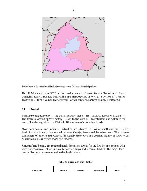
<strong>Tokologo</strong> is located within Lejweleputswa District Municipality.<br />
The TLM area covers 9326 sq km and consists of three former Transitional Local<br />
Councils, namely Boshof, Dealesville and Hertzogville, as well as a portion of a former<br />
Transitional Rural Council (Moddervaal) which contained approximately 1480 farms.<br />
3.1 Boshof<br />
Boshof/Seretse/Kareehof is the administrative seat of the <strong>Tokologo</strong> Local Municipality.<br />
The town is located approximately 124km to the west of Bloemfontein and 53km to the<br />
east of Kimberley, along the R64 (old Bloemfontein/Kimberley Road).<br />
Most commercial and industrial activities are situated in Boshof itself and the CBD of<br />
Boshof can be broadly demarcated between Oranje, Fourie and Fontein streets. The business<br />
component of Seretse and Kareehof is weakly developed and consists mainly of lower order<br />
businesses such as corner shops and taverns.<br />
Kareehof and Seretse are predominantly dormitory towns for the low income groups with<br />
very few economic activities, save for corner shops and informal traders. The major land<br />
uses in Boshof are summarized in the Table below<br />
Table 4: Major land uses- Boshof<br />
Land Use Boshof Seretse Kareehof Total<br />
4