Ecosystem Guidelines for Environmental Assessment
Ecosystem Guidelines for Environmental Assessment
Ecosystem Guidelines for Environmental Assessment

Create successful ePaper yourself
Turn your PDF publications into a flip-book with our unique Google optimized e-Paper software.
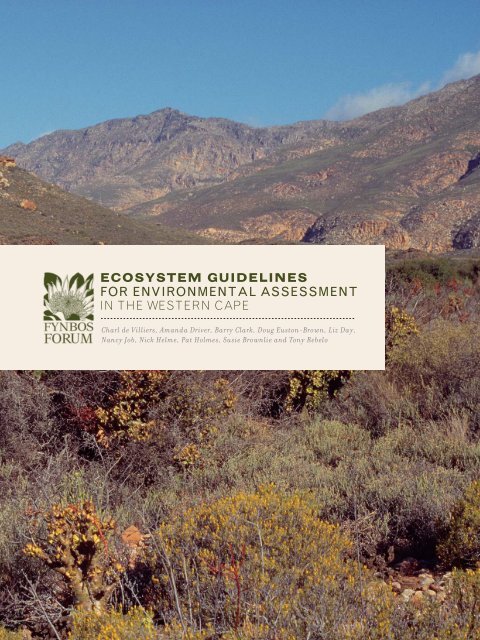
ECOSYSTEM GUIDELINES<br />
FOR ENVIRONMENTAL ASSESSMENT<br />
IN THE WESTERN CAPE<br />
Charl de Villiers, Amanda Driver, Barry Clark, Doug Euston-Brown, Liz Day,<br />
Nancy Job, Nick Helme, Pat Holmes, Susie Brownlie and Tony Rebelo
ECOSYSTEM GUIDELINES<br />
FOR ENVIRONMENTAL ASSESSMENT<br />
IN THE WESTERN CAPE<br />
Charl de Villiers, Amanda Driver, Barry Clark, Doug Euston-Brown, Liz Day,<br />
Nancy Job, Nick Helme, Pat Holmes, Susie Brownlie and Tony Rebelo
CHARL DE VILLIERS (EDITOR)<br />
Conservation Unit, Botanical Society of South Africa, Private Bag X10, Claremont 7735<br />
AMANDA DRIVER<br />
Conservation Unit, Botanical Society of South Africa, Private Bag X10, Claremont 7735<br />
BARRY CLARK<br />
Anchor <strong>Environmental</strong> Consultants cc, Zoology Department, University of Cape Town, Rondebosch 7701<br />
DOUG EUSTON-BROWN<br />
PO Box 44066, Scarborough 7975<br />
LIZ DAY<br />
The Freshwater Consulting Group, 6 Flamingo Crescent, Zeekoevlei 7941<br />
NANCY JOB<br />
Conservation Unit, Botanical Society of South Africa, Private Bag X10, Claremont 7735<br />
NICK HELME<br />
Nick Helme Botanical Surveys, PO Box 22652, Scarborough 7975<br />
PAT HOLMES<br />
Cape Ecological Services, 23 Dreyersdal Road, Bergvliet 7945<br />
SUSIE BROWNLIE<br />
deVilliers Brownlie Associates, 21 Menin Avenue, Claremont 7708<br />
TONY REBELO<br />
Protea Atlas Project, South African National Biodiversity Institute, Private Bag X7, Claremont 7735<br />
De Villiers CC, Driver A, Clark B, Euston-Brown DIW, Day EG, Job N, Helme NA, Holmes PM, Brownlie S and Rebelo AB (2005)<br />
Fynbos Forum <strong>Ecosystem</strong> <strong>Guidelines</strong> <strong>for</strong> <strong>Environmental</strong> <strong>Assessment</strong> in the Western Cape. Fynbos Forum and Botanical Society<br />
of South Africa, Kirstenbosch.<br />
Maps compiled by Sediqa Khatieb and Selwyn Willoughby, South African National Biodiversity Institute, Biodiversity-GIS Unit<br />
Design and layout by Penny Waterkeyn<br />
Cover photograph by Colin Paterson-Jones<br />
ISBN: 0-620-35258-2<br />
JOHN MANNING
The striking vigour of Gladiolus watsonius in flower sadly belies<br />
the precarious condition of many Western Cape lowland ecosystems.
CONTENTS<br />
7 :<br />
8 :<br />
10 :<br />
14 :<br />
22 :<br />
24 :<br />
38 :<br />
44 :<br />
FOREWORD<br />
PREFACE<br />
INTRODUCTION<br />
Purpose of the guidelines<br />
The drafting process<br />
Limitations of the guidelines<br />
Structure of the guidelines<br />
TAKING A PRO-ACTIVE APPROACH: INCLUDING BIODIVERSITY CONSIDERATIONS IN PRE-<br />
APPLICATION PROJECT PLANNING<br />
Why take a pro-active approach<br />
A step-by-step guide to pre-application biodiversity assessment<br />
1. Prepare <strong>for</strong> site visit<br />
2. The site visit: planning to avoid, minimise and remedy impacts on biodiversity<br />
3. Finding of “no significant impact”<br />
4. When significant impacts are unavoidable<br />
5. Contributing to conservation gains<br />
6. Biodiversity in<strong>for</strong>mants in environmental assessment reporting<br />
Public participation and authority review<br />
A NOTE ON FIRE<br />
1. COASTAL ECOSYSTEMS<br />
- ESTUARIES<br />
- SANDY BEACHES AND DUNE SYSTEMS<br />
- STRANDVELD, DUNE THICKET AND DUNE FYNBOS<br />
2. LOWLAND FYNBOS ECOSYSTEMS<br />
Incorporating Sand Fynbos and Limestone Fynbos<br />
3. MIDLAND and MOUNTAIN FYNBOS ECOSYSTEMS<br />
Incorporating Alluvial Fynbos; Granite, Ferricrete, Conglomerate and Silcrete Fynbos; Grassy<br />
Fynbos; and Sandstone Fynbos
52 :<br />
58 :<br />
62 :<br />
68 :<br />
78 :<br />
88 :<br />
4. RENOSTERVELD ECOSYSTEMS<br />
Incorporating Coast Renosterveld and Inland Renosterveld<br />
5. SUCCULENT KAROO ECOSYSTEMS<br />
Incorporating Vygieveld, Broken Veld and Quartz Patches<br />
6. MAINLAND THICKET ECOSYSTEMS<br />
Incorporating Thicket, Valley Thicket and Arid Thicket<br />
7. FRESHWATER ECOSYSTEMS<br />
- RIVERS<br />
- WETLANDS<br />
8. SPATIAL COMPONENTS OF ECOLOGICAL PROCESSES<br />
Overview of spatial components of ecological processes<br />
How much space do spatial components of ecological processes require<br />
Fixed and flexible spatial components of ecological processes<br />
Which spatial components of ecological processes have been mapped<br />
The conservation of important process areas<br />
<strong>Environmental</strong> assessment procedures <strong>for</strong> working in spatial components of ecological processes<br />
Land-use guidelines <strong>for</strong> spatial components of ecological processes<br />
REFERENCES and RESOURCES<br />
13 :<br />
17 :<br />
81 :<br />
84 :<br />
TABLES<br />
TABLE 1: Groups of ecosystems dealt with in these guidelines<br />
TABLE 2: Available systematic biodiversity plans<br />
TABLE 3: Scales at which ecological processes may function<br />
TABLE 4: Examples of spatial components of ecological processes and their location<br />
90 :<br />
APPENDICES<br />
Appendix 1<br />
Appendix 2<br />
South African vegetation types grouped according to ecosystems dealt with<br />
in these guidelines<br />
Recommended terms of reference <strong>for</strong> the consideration of biodiversity in<br />
environmental assessment and decision-making
“<strong>Environmental</strong> <strong>Assessment</strong> provides opportunities <strong>for</strong> all of us to<br />
participate in a process that enables wise choices about balancing the<br />
needs of nature with the needs of economic growth” - Richard Cowling
FOREWORD<br />
Richard Cowling - Nelson Mandela Metropolitan University<br />
The Western Cape Province of South Africa is undoubtedly one of the most biologically rich parts of<br />
the world. No other entire nation - let alone a province therein - is home to three globally recognised<br />
"hotspots" of nature. These hotspots are areas of great natural wealth that are also under extreme<br />
pressure from human endeavour. The Western Cape includes substantial parts of the Cape Floristic<br />
Region, Succulent Karoo and Maputaland-Pondoland-Albany hotspots. What a marvellous legacy! And<br />
what a great responsibility we all have <strong>for</strong> its safeguarding.<br />
The Western Cape is also a region of great scenic beauty and cultural diversity. Indeed, it is the<br />
birthplace of modern humans Homo sapiens. From this south-western corner of Africa, our species<br />
colonised the world. Early humans and their descendants - the San and the Khoe-Khoen - trod lightly<br />
on this captivating landscape. However, over the past 300 years the human footprint has become<br />
increasingly heavier, as a consequence of exponential increases in population size and consumption<br />
of goods and services. Sensible people agree that we cannot continue to compromise the prospects<br />
<strong>for</strong> healthy livelihoods of future generations by devouring our natural capital. Instead we must strive<br />
to identify and implement ways of living sustainably. This will require some difficult adjustments. At<br />
present our lifestyles are governed by the rhythm and run of market <strong>for</strong>ces, which invariable place<br />
great stead on short-term interests. Yet our future is dependent on our ability to adjust to a different<br />
rhythm - that dictated by patterns and flows of ecosystems.<br />
Making the transition to sustainable lifestyles is going to be a hard slog. But we must start now - and<br />
this document is, indeed, a great start. <strong>Environmental</strong> assessment provides opportunities <strong>for</strong> all of us<br />
to participate in a process that enables wise choices about balancing the needs of nature with the<br />
needs of economic growth. In the past, very poor decisions have been made and natural capital that<br />
could have served us indefinitely, has been needlessly degraded. We have witnessed the piecemeal<br />
destruction of beautiful landscapes of wild nature - death by a thousand cuts - that have provided<br />
short-term material benefits, largely <strong>for</strong> a privileged few. Many unwise decisions have been made<br />
simply out of ignorance of the requirements <strong>for</strong> maintaining ecosystem integrity and viable populations<br />
of plant and animal species. The publication of this document means that those involved in ecological<br />
assessment can no longer claim ignorance. These guidelines include the insights of a remarkable team<br />
of experts on all the Western Cape's sensitive and vulnerable ecosystems. The contributions are mindful<br />
of pattern, process, scale and context. In nature, everything is connected, and each of the contributions<br />
urges that this connectivity must be maintained.<br />
COLIN PATERSON-JONES<br />
Here we have the beginning of a process of mainstreaming the concerns <strong>for</strong> safeguarding wild nature<br />
into environmental assessment. While this may sound like a tautology, this is not the case. Hitherto,<br />
environmental assessment has seldom been in<strong>for</strong>med by the pattern and pace that underpin ecologically<br />
healthy landscapes. This process does not end with the publication of this document. It will need to be<br />
revised and refined many times in the future, as our collective experience and insight grows.<br />
So please, feed your comments back to the Fynbos Forum 1 (an extraordinarily effective institution) and<br />
let’s keep marching towards a sustainable future.<br />
1. The Fynbos Forum is a gathering of conservation scientists, managers, planners and non-governmental<br />
organisations working in the Cape Floristic Region, that has met annually since 1977. Besides providing a <strong>for</strong>um<br />
<strong>for</strong> presentations on research findings, projects, lessons and challenges, the Fynbos Forum has also initiated<br />
several working groups and projects, including the development of these guidelines.<br />
FOREWORD : 7
PREFACE<br />
Charl de Villiers<br />
These guidelines represent a first attempt at reducing the complexity and value of Western Cape<br />
ecosystems to a set of basic but reliable pointers that will guide responsible and appropriately in<strong>for</strong>med<br />
planning and decision-making about biodiversity in the province. A resource such as this is - and cannot<br />
but be - the product of a collective and inspired ef<strong>for</strong>t.<br />
The development of these guidelines is rooted in a clear consensus arising from the Fynbos Forum:<br />
environmental practitioners and decision-makers need reliable, basic guidance on the importance,<br />
composition and functioning of ecosystems in the Western Cape, urgently so.<br />
Biodiversity in the province is faced with a myriad coalescing threats - outright loss of critically<br />
important habitat, invasion by alien species, over-exploitation and degradation of natural capital and<br />
the impacts of increasingly unstable weather patterns due to accelerated climate change. By the same<br />
token, public awareness, progressive legislation and unprecedented international support <strong>for</strong> sustainable<br />
development have spurred a powerful surge of hope <strong>for</strong> biodiversity conservation in the region.<br />
A basic consideration remains, though: in order <strong>for</strong> biodiversity to persist where it occurs, in<strong>for</strong>med,<br />
accountable and effective intervention - on the part of developers and landowners, their advisers, the<br />
public and government - is a compelling task that can little af<strong>for</strong>d delay. Hence this collaborative ef<strong>for</strong>t<br />
at turning specialist knowledge and accumulated field experience into decisive, effective action <strong>for</strong><br />
biodiversity conservation in the Western Cape.<br />
This project would not have seen the light of day without the strategic insight and financial generosity<br />
of the Table Mountain Fund, an associated trust of WWF-South Africa; the contribution of the Trust to<br />
biodiversity conservation in the Cape Floristic Region is a hugely appreciated mainstay.<br />
Special appreciation is extended to Ms Julia Wood, Chairperson of the Fynbos Forum, <strong>for</strong> her and her<br />
committee's wholehearted and energetic support <strong>for</strong> this project.<br />
By being prepared to freely share their knowledge and expertise with a wide audience, the contributing<br />
ecologists have set a noteworthy example of how science can be turned to public benefit in the<br />
sphere of environmental governance in a global biodiversity "hotspot".<br />
Professor Richard Cowling of the Terrestrial Ecology Research Unit, Nelson Mandela Metropolitan<br />
University, is gratefully acknowledged <strong>for</strong> agreeing to write the Foreword to these guidelines; his unstinting<br />
championship of empowered, collaborative conservation action premised in rigorous science is without peer.<br />
Mr Jan Vlok, of Regalis <strong>Environmental</strong> Services, served as specialist reviewer. His scientific<br />
background, broad experience as applied ecologist and warm support <strong>for</strong> this project were indispensable<br />
to its execution.<br />
Dr Annelise Schutte-Vlok of CapeNature contributed important insights and valuable criticism.<br />
8 : PREFACE
One of the most significant aspects of current ef<strong>for</strong>ts to achieve enduring gains <strong>for</strong> biodiversity<br />
conservation in the Western Cape relates to the strong emphasis on planning <strong>for</strong> persistence - conserving<br />
those ecological and evolutionary processes that are essential <strong>for</strong> the maintenance of biodiversity<br />
pattern where it occurs in and across landscapes. In this regard, the individuals who participated in<br />
a workshop on devising practical guidelines <strong>for</strong> spatial components of ecological process at Kirstenbosch<br />
in March 2005 require special mention, viz:<br />
ANTON WOLFAARDT<br />
DON KIRKWOOD<br />
AMANDA DRIVER<br />
NANCY JOB<br />
NICK HELME<br />
PAT HOLMES<br />
PHILLIP DESMET<br />
SUSIE BROWNLIE<br />
VERNA BOWIE<br />
CapeNature<br />
CapeNature<br />
Botanical Society of South Africa, Conservation Unit<br />
Botanical Society of South Africa, Conservation Unit<br />
Nick Helme Botanical Surveys<br />
Cape Ecological Services<br />
Conservation planner<br />
De Villiers Brownlie Associates<br />
CapeNature<br />
All decisions pertaining to content, interpretation and style remain, however, the prerogative of the<br />
editor, who remains accountable as such.<br />
We trust that these ecosystem guidelines will be widely used, criticised and <strong>for</strong>ged into an indispensable<br />
reference <strong>for</strong> those who benefit from, regulate or simply appreciate the globally irreplaceable natural<br />
heritage of the Western Cape.<br />
Specialist knowledge is indispensable <strong>for</strong> ensuring that wise decisions are taken about<br />
the use and trans<strong>for</strong>mation of the Western Cape’s globally unique biodiversity.<br />
BOTANICAL SOCIETY OF SOUTH AFRICA<br />
PREFACE : 9
INTRODUCTION<br />
Susie Brownlie<br />
Purpose of the guidelines<br />
These ecosystem-specific guidelines have been prepared to assist all stakeholders in the Western Cape<br />
who are involved in land-use planning and environmental assessment to take biodiversity concerns<br />
into consideration.<br />
The guidelines aim to answer key questions about biodiversity that should be asked by a planner,<br />
environmental assessment practitioner and/or landowner embarking on a plan, project or activity,<br />
whether urban, industrial, agricultural or recreational. The guidelines should also add value to the<br />
deliberations of decision-makers on the environmental implications of development or land-use change.<br />
The guidelines deal separately with each of the following groups of Western Cape ecosystems:<br />
1. Coastal ecosystems<br />
2. Lowland fynbos ecosystems<br />
3. Midland and mountain fynbos ecosystems<br />
4. Renosterveld ecosystems<br />
5. Succulent karoo ecosystems<br />
6. Mainland thicket ecosystems<br />
7. Freshwater ecosystems<br />
8. Spatial components of ecological processes<br />
The guidelines adopt a broad landscape approach to biodiversity assessment, i.e. they aim to ensure<br />
that the ecological function of a site is considered within its landscape and regional context.<br />
These guidelines represent a first attempt at reducing the complexity and value of Western Cape<br />
ecosystems to a set of basic but reliable pointers that will guide responsible and appropriately in<strong>for</strong>med<br />
planning and decision-making about biodiversity in the province.<br />
The earlier in the planning process these guidelines are used, the better. Ideally, their use should in<strong>for</strong>m<br />
a plan or project, as described in the next section. Planning and the development of project proposals<br />
should strive to work within the opportunities and constraints of ecosystems, and to avoid potentially<br />
significant negative impacts. By so doing, the need <strong>for</strong> complex, costly and time-consuming environmental<br />
assessment could be minimized, and ecologically sustainable development, one of the main pillars of<br />
sustainable development, is more likely to be achieved.<br />
The drafting process<br />
The guidelines are the product of an inclusive process initiated by the Fynbos Forum in 2002. They draw<br />
on the experience and expertise of biodiversity specialists, environmental assessment practitioners<br />
and the Western Cape environmental and conservation authorities.<br />
COLIN PATERSON-JONES<br />
10 : INTRODUCTION
Undeveloped ecosystems can provide important direct<br />
benefits <strong>for</strong> people and the economy, as exemplified by the<br />
Flower Valley Conservation Trust.
The drafting process, which was co-ordinated by the Botanical Society's Conservation Unit, entailed:<br />
Identifying a range of important ecosystems and habitats within the Western Cape;<br />
Inviting more than 30 biodiversity specialists to contribute what they viewed as the most critical<br />
questions that should be asked when undertaking environmental assessments in each of these<br />
ecosystems or habitats;<br />
Collating these contributions and presenting them as a discussion document <strong>for</strong> further development<br />
and refining at a workshop hosted by the Fynbos Forum in 2004; and<br />
Refining the guidelines with further input from specialists.<br />
Limitations of the guidelines<br />
These guidelines are not intended to provide detailed instructions to land-use planners, environmental<br />
assessment practitioners or other users, or to substitute <strong>for</strong> scoping and/or the involvement of biodiversity<br />
(or other) specialists in the environmental assessment process when appropriate. Please refer to the<br />
Department of <strong>Environmental</strong> Affairs and Development Planning's (DEA&DP) Guideline <strong>for</strong> involving<br />
biodiversity specialists in EIA processes (Brownlie 2005) <strong>for</strong> additional in<strong>for</strong>mation on when, how, and<br />
from whom to obtain specialist input on biodiversity.<br />
Structure of the guidelines<br />
The ecosystem-specific guidelines comprise eight separate sections covering different ecosystems,<br />
as listed in Table 1. Each section gives the following in<strong>for</strong>mation:<br />
1. The main 'drivers' of the ecosystem, which determine its composition and structure.<br />
2. The main issues in, threats to, and vulnerabilities of the ecosystem.<br />
3. The 'bottom lines' or 'non-negotiables' <strong>for</strong> change in the ecosystem if its functioning and biodiversity<br />
are to be conserved.<br />
4. Considerations with regard to the most appropriate location or siting of infrastructure, activities<br />
and/or disturbance within the ecosystem, to minimize negative impacts.<br />
5. Best management within the ecosystem to promote its persistence.<br />
6. The use of appropriate indicators <strong>for</strong> monitoring change within the ecosystem.<br />
7. The probable reversibility of impacts on the ecosystem after disturbance, and the potential <strong>for</strong> restoration.<br />
8. Potential compensation or offsets <strong>for</strong> loss of biodiversity within the ecosystem.<br />
(left) Mountain fynbos complexes are mostly well-protected.<br />
(right) Cultivation has irreversibly trans<strong>for</strong>med many lowland ecosystems.<br />
CHARL DE VILLIERS<br />
MANDY BARNETT<br />
12 : INTRODUCTION
TABLE 1: GROUPS OF ECOSYSTEMS DEALT WITH IN THESE GUIDELINES<br />
COASTAL ECOSYSTEMS<br />
LOWLAND FYNBOS ECOSYSTEMS<br />
MIDLAND AND MOUNTAIN<br />
FYNBOS ECOSYSTEMS<br />
RENOSTERVELD ECOSYSTEMS<br />
SUCCULENT KAROO ECOSYSTEMS<br />
MAINLAND THICKET ECOSYSTEMS<br />
FRESHWATER ECOSYSTEMS<br />
SPATIAL COMPONENTS OF<br />
ECOLOGICAL PROCESSES<br />
Estuaries<br />
Sandy shores and dunes<br />
Strandveld, Dune Thicket and Dune Fynbos<br />
Limestone Fynbos<br />
Sand Fynbos<br />
Alluvial Fynbos<br />
Granite Fynbos<br />
Grassy Fynbos<br />
Sandstone Fynbos<br />
Coast Renosterveld<br />
Inland Renosterveld<br />
Vygieveld<br />
Broken Veld<br />
Quartz patches<br />
Thicket<br />
Valley Thicket<br />
Arid Thicket<br />
Rivers<br />
Wetlands<br />
Fixed components<br />
(ecological corridors and vegetation boundaries)<br />
Flexible components<br />
(gradients)<br />
The order of the eight ecosystem-specific sections broadly corresponds with two major terrestrial<br />
environmental gradients in the Western Cape:<br />
- An increase in altitude and variation in topography as one moves from the coast inland;<br />
- A shift towards wetter and more temperate conditions east of Cape Town, and drier ones in the<br />
western and northern parts of the province.<br />
See Appendix 1 <strong>for</strong> a suggested grouping of South African vegetation types (Mucina et al. 2004)<br />
in terms of the groups of ecosystems identified <strong>for</strong> the purpose of these guidelines.<br />
The scope of the guidelines is defined by the boundaries of the Western Cape province as administrative<br />
responsibilities relating to environmental decision-making are primarily vested in the provincial sphere<br />
of government. Forest and Nama Karoo ecosystems have not been included. Indigenous <strong>for</strong>ests are<br />
fully protected and there<strong>for</strong>e not viewed as vulnerable to development pressure. Nama Karoo, while<br />
not adequately protected, is not a threatened ecosystem in the Western Cape. Succulent Karoo ecosystems<br />
have, however, been included as many are experiencing degradation (such as over-grazing and<br />
erosion) which was not reflected in the National Spatial Biodiversity <strong>Assessment</strong> (NSBA) (Driver<br />
et al. 2005). The Succulent Karoo is also a global biodiversity “hotspot”.<br />
The next section provides the rationale and a step-by-step guide <strong>for</strong> taking biodiversity considerations<br />
into account in the pre-application, planning phase of projects. This is followed by a detailed section<br />
on each of the ecosystems in Table 1. The guidelines are rounded off with useful references and websites<br />
<strong>for</strong> obtaining biodiversity resources and support services.<br />
INTRODUCTION : 13
INCLUDING BIODIVERSITY CONSIDERATIONS IN PRE-APPLICATION PROJECT PLANNING<br />
TAKING A PRO-ACTIVE APPROACH<br />
Charl de Villiers<br />
Why take a pro-active approach<br />
Early reference to these ecosystem guidelines and to available systematic biodiversity plans (see Table 2)<br />
in the pre-application stage of project development can support in<strong>for</strong>med planning and decision-making<br />
while helping to timeously 'iron out' obstacles that might otherwise result in delays and additional<br />
costs to the project proponent. The pro-active emphasis on pre-application screening is consistent with<br />
the Western Cape Department of <strong>Environmental</strong> Affairs and Development Planning's (DEA&DP) Guideline<br />
<strong>for</strong> involving biodiversity specialists in EIA processes: Edition 1 (Brownlie 2005).<br />
Such a pro-active approach can:<br />
Show the decision-making authority that potential conflict between biodiversity priorities and other<br />
land-uses has been identified and resolved by well-in<strong>for</strong>med project planning;<br />
Allow the proponent to take an in<strong>for</strong>med decision about the biodiversity (and administrative and, by<br />
implication, financial) risks of proceeding with a particular project; and<br />
Identify the scope, type and intensity of environmental assessment that is likely to be required if an<br />
application were to proceed.<br />
This approach also supports best practice in environmental assessment and planning by:<br />
Ensuring that a project is consistent with the 'Duty of Care' principle (i.e. that the project proponent<br />
has taken reasonable measures to prevent significant degradation of the environment);<br />
Emphasising the fundamental role of alternatives in selecting the best practicable environmental<br />
option;<br />
Giving effect to the mitigation hierarchy, or the sequential avoidance, minimising and remedying of<br />
impacts that may result in loss of biodiversity or disturbance to ecosystems; and<br />
Supporting the principle that environmental management must pay specific attention to planning<br />
procedures pertaining to sensitive, vulnerable, highly dynamic or stressed ecosystems.<br />
The credibility of this approach is strictly premised on site visits as an essential component of preapplication<br />
biodiversity screening. Without ground-truthing and accurate reporting, biodiversity<br />
screening that relies solely on reference to biodiversity maps and plans must be viewed as incomplete<br />
and there<strong>for</strong>e inadequate <strong>for</strong> the purposes of in<strong>for</strong>med decision-making.<br />
<strong>Environmental</strong> assessment practitioners without the appropriate biodiversity expertise should not<br />
resort to the approach advocated here as a substitute <strong>for</strong> specialist knowledge and review. Early<br />
appointment of a knowledgeable biodiversity specialist is strongly advised, especially where projects<br />
may be undertaken in Critically Endangered, Endangered or Vulnerable ecosystems.<br />
There are several examples of pro <strong>for</strong>ma terms of reference or guidelines <strong>for</strong> dealing with biodiversity<br />
in environmental assessment and planning:<br />
The most recent is the DEA&DP's biodiversity guideline (Brownlie 2005), which should be seen as<br />
complementary to these guidelines.<br />
COLIN PATERSON-JONES<br />
14 : TAKING A PRO-ACTIVE APPROACH
Well-in<strong>for</strong>med planning can reduce conflict between contending land-uses.
UNEP's voluntary guidelines on biodiversity-inclusive impact assessment (UNEP 2006) reflect an<br />
international best practice perspective on how to integrate biodiversity within EIA procedures.<br />
CapeNature has developed streamlined terms of reference (ToR) <strong>for</strong> the consideration of biodiversity<br />
in environmental assessment procedures (see Appendix 2). These ToR are viewed as sufficient <strong>for</strong> a<br />
'first stab' at identifying and assessing potential biodiversity issues to in<strong>for</strong>m pre-application project<br />
planning. It is also assumed that a sufficiently experienced field ecologist can in many instances make<br />
qualitative judgements about the potential likelihood and significance of impacts without the need <strong>for</strong><br />
more in-depth investigation (Slootweg and Kolhoff 2003).<br />
If the biodiversity specialist has any doubt as to the type and scope of terms of reference to undertake<br />
a credible biodiversity evaluation, or more than one biodiversity-related discipline is deemed necessary<br />
to properly understand and evaluate potential impacts, it is the responsibility of the environmental<br />
assessment practitioner to ensure that a defensible environmental process is put in place.<br />
A step-by-step guide to pre-application biodiversity assessment<br />
Systematic biodiversity plans (see Table 2) and these ecosystem guidelines can be applied to preapplication<br />
project planning by pursuing the following steps:<br />
STEP 1 covers preparation <strong>for</strong> the site visit.<br />
STEP 2 deals with the site visit and how biodiversity considerations should in<strong>for</strong>m project planning.<br />
STEP 3 explains what to do if a project will not have a significant impact on biodiversity.<br />
STEP 4 suggests what to do if significant impacts on biodiversity cannot be avoided.<br />
STEP 5 emphasises the importance of identifying opportunities to conserve biodiversity.<br />
STEP 6 illustrates how biodiversity considerations can be written into recommendations .<br />
STEP 1: PREPARE FOR SITE VISIT<br />
(a) Consult the National Spatial Biodiversity <strong>Assessment</strong> (NSBA) (Driver et al. 2005) to establish the<br />
ecosystem status of the vegetation type that may be affected by the proposed development.<br />
The NSBA (Driver et al. 2005) is the first national assessment of spatial biodiversity priorities. The<br />
terrestrial component of the NBSA used the new South African vegetation map (Mucina et al. 2004) as<br />
a basis <strong>for</strong> defining terrestrial ecosystems, and determined the 'ecosystem status' of each vegetation type.<br />
<strong>Ecosystem</strong> status is a function of how much natural habitat has been lost in an ecosystem, in relation<br />
to a series of thresholds:<br />
THREATENED<br />
ECOSYSTEMS<br />
CRITICALLY ENDANGERED (CR) ecosystems have lost so much of their original natural habitat that ecosystem<br />
functioning has largely broken down and a significant proportion of species associated with that ecosystem<br />
has been lost or is likely to be lost.<br />
ENDANGERED (EN) ecosystems have lost significant amounts of their original natural habitat with the result<br />
that their functioning is compromised.<br />
VULNERABLE (VU) ecosystems have lost some of their original natural habitat and their functioning will be<br />
compromised if they continue to lose natural habitat.<br />
LEAST THREATENED (LT) ecosystems have lost only a small proportion of their original natural habitat and are largely intact<br />
(although they may be degraded to varying degrees).<br />
16 : TAKING A PRO-ACTIVE APPROACH
Being <strong>for</strong>ewarned about the ecosystem status of habitat that may be affected by a development holds<br />
a number of advantages:<br />
- It indicates the potential significance of biodiversity as a factor in decision-making;<br />
- It suggests the degree of ef<strong>for</strong>t that may be needed to find a suitable alternative to avoid significant<br />
loss of biodiversity or ecosystem function in a particular area; and<br />
- It highlights from the outset the potential need to appoint a biodiversity specialist during project<br />
planning and design.<br />
(b) Identify which systematic biodiversity plan or plans apply to the project area<br />
Table 2 provides a list of available biodiversity plans (also referred to as conservation plans), and the<br />
elements of each plan that are relevant <strong>for</strong> environmental assessment. Broad-scale biodiversity plans (e.g.<br />
1:250 000) provide in<strong>for</strong>mation that is less spatially accurate than fine-scale biodiversity plans (e.g. 1:50<br />
000). A spatial scale of 1:250 000 means that a point or line on the map may be out by up to approximately<br />
250 m on the ground; in<strong>for</strong>mation on a 1:50 000 map may be out by up to approximately 50 m on the ground.<br />
In general,<br />
- Select the most recent plan mapped at the finest scale <strong>for</strong> the ecosystem or vegetation type that<br />
may be affected by the proposed development;<br />
- If more than one plan applies, be guided by the highest ecosystem/conservation status in evaluating<br />
the potential significance of impacts on biodiversity;<br />
- Be clear about what you are looking <strong>for</strong> when using a biodiversity plan; and<br />
- Interrogate the supporting reports (Step 1c).<br />
Contact the South African National Biodiversity Institute’s Biodiversity GIS Unit <strong>for</strong> in<strong>for</strong>mation on<br />
biodiversity plans at Ph (021) 799 8794 or e-mail BGISHelp@sanbi.org or http://bgis.sanbi.org.<br />
TABLE 2: AVAILABLE SYSTEMATIC BIODIVERSITY PLANS<br />
BIODIVERSITY PLAN<br />
Cape Action Plan <strong>for</strong> the Environment (CAPE)<br />
1999<br />
1:250 000<br />
Succulent Karoo <strong>Ecosystem</strong> Plan (SKEP)<br />
2002<br />
1:250 000<br />
Sub-Tropical Thicket <strong>Ecosystem</strong> Plan (STEP)<br />
2003<br />
1:100 000<br />
Cape Lowlands Renosterveld Project<br />
2003<br />
1:50 000<br />
Little Karoo Vegetation Map*<br />
2005<br />
1:50 000<br />
SPATIAL PRODUCTS THAT CAN INFORM<br />
ENVIRONMENTAL ASSESSMENT<br />
- Irreplaceability (i.e. the likelihood that a land unit is<br />
required to meet a biodiversity target, or the likelihood<br />
that a target cannot be achieved if a land unit is lost)<br />
- Spatial components of ecological processes<br />
(e.g. edaphic interfaces, sand movement corridors,<br />
upland-lowland interfaces, riverine corridors)<br />
- Framework <strong>for</strong> action<br />
- Ecological processes<br />
- Areas of species richness & endemism<br />
- Conservation priorities<br />
- Vegetation types<br />
- Ecological processes<br />
- Megaconservancy Network<br />
- Coastal corridors<br />
- Conservation status<br />
- Vegetation remnants<br />
- Priority clusters<br />
- Special habitats<br />
- Ecological processes<br />
- Habitat types<br />
- Vegetation units<br />
- Trans<strong>for</strong>mation (urban development, alien infestation,<br />
cultivation, grazing)<br />
*(Note: this is not a biodiversity plan, as it does not prioritise areas in terms of their biodiversity<br />
significance. However, it provides much valuable in<strong>for</strong>mation <strong>for</strong> environmental assessment.)<br />
TAKING A PRO-ACTIVE APPROACH : 17
Breede River valley: CAPE and SKEP<br />
(c) Determine which reports are available to help you interpret biodiversity plans and maps.<br />
Besides providing a variety of maps, biodiversity plans also include reports with useful contextual in<strong>for</strong>mation<br />
dealing with aspects such as conservation assessment, ecological processes, pressures on biodiversity<br />
and biodiversity summaries. These reports can be obtained from the SANBI B-GIS unit at http://bgis.sanbi.org.<br />
(d) Refer to the relevant Fynbos Forum guideline (pp 24-87) <strong>for</strong> the ecosystem/s that may be affected by<br />
the proposed activity. Identify ecosystems by referring to the vegetation types listed in Appendix 1.<br />
(e) Decide whether to appoint a biodiversity specialist.<br />
If your preparation indicates that the site and/or the surrounding area may be a biodiversity priority<br />
area, invite an ecologist or biodiversity specialist to visit the site to verify the in<strong>for</strong>mation provided by<br />
the biodiversity plans.<br />
Consult the Guideline <strong>for</strong> involving biodiversity specialists in EIA processes (Brownlie 2005) if you are<br />
uncertain about the type of qualifications, skills and expertise that are required from a biodiversity<br />
specialist <strong>for</strong> a particular area or type of biodiversity attribute or issue. There is no one 'biodiversity<br />
specialist' and the term covers a range of expertise in the field of biodiversity.<br />
The biodiversity specialist may identify important biodiversity features on the site that were not<br />
highlighted by the biodiversity plan(s). If the specialist confirms that the site is of biodiversity<br />
significance, involve him or her in project planning (see Step 2).<br />
18 : TAKING A PRO-ACTIVE APPROACH
STEP 2: THE SITE VISIT - PLANNING TO AVOID, MINIMISE AND REMEDY IMPACTS ON BIODIVERSITY<br />
The search <strong>for</strong> the best practicable alternative should be guided by the primary objective of avoiding loss<br />
of biodiversity and disturbance to ecosystems, especially in threatened (CR, EN and VU) ecosystems.<br />
When undertaking pre-application project design, always seek to maximise the retention of intact<br />
natural habitat and ecosystem connectivity by selecting the most suitable project location, layout<br />
or scale.<br />
Avoid fragmentation of natural habitat and<br />
aim to maintain spatial components of ecological<br />
processes, i.e. ecological corridors and vegetation<br />
boundaries (see guideline 8, Spatial<br />
components of ecological processes).<br />
Minimise unavoidable impacts by reducing the<br />
project footprint on biodiversity pattern and<br />
ecological processes.<br />
Remedy habitat degradation and fragmentation<br />
through rehabilitation, especially in<br />
threatened ecosystems. Where possible, the goal<br />
of rehabilitation should be to reinstate predisturbance<br />
ecosystem<br />
Fine-scale biodiversity maps are an important planning tool.<br />
functioning.<br />
AMREI VON HASE<br />
STEP 3: FINDING OF “NO SIGNIFICANT IMPACT”<br />
Where appropriate, and with reference to the preceding steps, there may be situations in which a biodiversity<br />
specialist can confirm that project planning and design would result in avoiding, minimising or effectively<br />
remedying significant impacts on biodiversity in relation to:<br />
Threatened ecosystems<br />
Special habitats, or threatened or rare species<br />
Natural habitat in an ecological corridor or along a vegetation boundary.<br />
If a finding of 'no significant impact' is appropriate, the biodiversity specialist should confirm this in<br />
a brief report that:<br />
Records that reference was made to the relevant biodiversity plans and ecosystem guidelines;<br />
Describes the site visit;<br />
Covers aspects such as: the ecosystem status of the vegetation in the vicinity of the project and its<br />
various alternatives; the relevant biodiversity pattern and ecological process characteristics of the<br />
alternatives - including degradation and alien infestation; how the proposed project would impact on<br />
broader, landscape-scale biodiversity attributes in the vicinity; and in which season the site visit was<br />
undertaken (see Appendix 2 <strong>for</strong> an example of pro <strong>for</strong>ma terms of reference which can be adapted <strong>for</strong><br />
use in pre-application biodiversity screening).<br />
Includes a map or maps at a meaningful scale (preferably 1:10 000) and interpreted photographs to<br />
illustrate the biodiversity implications of the proposed project.<br />
The biodiversity specialist's report should be appended to the standard application <strong>for</strong>m and scoping<br />
checklist and submitted to the relevant authority, such as DEA&DP.<br />
TAKING A PRO-ACTIVE APPROACH : 19
STEP 4: WHEN SIGNIFICANT IMPACTS ARE UNAVOIDABLE<br />
When pre-application project planning has exhausted the preceding steps, and significant impacts on<br />
biodiversity cannot be avoided, minimised or remedied, advise the proponent that the following<br />
courses of action ought to be pursued:<br />
CR ecosystems: Potential 'show-stopper', there<strong>for</strong>e proceed at risk;<br />
EN and VU ecosystems: Proceed to scoping and include appropriate biodiversity terms of reference<br />
in the Plan of Study: Scoping; emphasise restoration and biodiversity offsets; or<br />
LT ecosystems: Go <strong>for</strong> authorisation on the basis of the application <strong>for</strong>m and scoping checklist,<br />
emphasising, where relevant, the maintenance of ecosystem functioning (i.e. retention of ecological<br />
corridors and vegetation boundaries) and the protection of critical habitats in project design,<br />
implementation and management.<br />
STEP 5: CONTRIBUTING TO CONSERVATION GAINS<br />
Always seek to take advantage of opportunities to conserve biodiversity when undertaking pre-application<br />
project planning.<br />
Conservation gains can include:<br />
Setting aside part of the land on the site to be<br />
managed <strong>for</strong> conservation, through a stewardship<br />
agreement or biodiversity off-set;<br />
Setting aside another site of equivalent or greater<br />
biodiversity significance to be managed <strong>for</strong><br />
conservation, through a stewardship agreement or<br />
biodiversity off-set;<br />
Clearing alien vegetation; and<br />
Rehabilitating or restoring land or aquatic ecosystems<br />
that have already been degraded (note that<br />
rehabilitating or restoring land or ecosystems that will<br />
be disturbed as a result of the development does not<br />
constitute a conservation gain).<br />
Consult CapeNature about identifying conservation<br />
opportunities on private land.<br />
CAPENATURE SHOULD BE CONSULTED ABOUT ANY<br />
OF THESE OPTIONS.<br />
Site-specific conservation measures may also be<br />
translated into broader conservation benefits by:<br />
Aligning environmental assessment procedures and<br />
project planning with regional conservation programmes<br />
(e.g. the Greater Cederberg Biodiversity Corridor); and<br />
Piggy-backing on the Western Cape agriculture<br />
department's LandCare Area-wide Planning<br />
programme, in<strong>for</strong>ming Spatial Development Frameworks<br />
or influencing industry 'greening' strategies<br />
(e.g. agricultural produce accreditation schemes).<br />
SUE WINTER<br />
20 : TAKING A PRO-ACTIVE APPROACH
STEP 6: BIODIVERSITY INFORMANTS IN ENVIRONMENTAL ASSESSMENT REPORTING<br />
Recommendations <strong>for</strong> project design and implementation should set out explicitly how biodiversity<br />
pattern and ecological processes have been taken into account, e.g. through:<br />
Determining the least damaging configurations/layouts of the proposed development and its<br />
accompanying infrastructure;<br />
Reducing the overall number of units to relieve pressure on natural habitat and ecological processes;<br />
Concentrating disturbance in degraded areas with little viability <strong>for</strong> natural regeneration or<br />
restoration of indigenous vegetation; and<br />
Recognising and taking advantage of opportunities <strong>for</strong> integrating in situ biodiversity conservation<br />
and management with the overall design and operation of the proposed development.<br />
Public participation and authority review<br />
This approach is not intended to supplant or side-track established good practice and legislated<br />
procedure in environmental assessment. Any application that has pursued the route outlined above<br />
will still enter the public domain <strong>for</strong> comment, and is equally subject to authority scrutiny.<br />
In<strong>for</strong>med public participation is a cornerstone of these guidelines.<br />
OWEN HENDERSON / CONSERVATION INTERNATIONAL<br />
TAKING A PRO-ACTIVE APPROACH : 21
A NOTE ON FIRE<br />
All fynbos types require periodic fires to stimulate recruitment and to retain maximum species richness.<br />
The different fynbos types do, however, differ vastly in terms of appropriate fire frequency.<br />
Non-sprouting Proteas are the best indicators of an appropriate fire frequency, which should allow at<br />
least 50% of these Protea plants to have flowered three times be<strong>for</strong>e they are burned again. The maximum<br />
interval between fires should not exceed the active reproductive period of these plants.<br />
Fire season is also vital to retain species richness, with late summer and autumn fires (December-<br />
April) giving the best recruitment results. Fire intensity is also important, with only 'clean' burns<br />
acceptable, where no fine material or unburned leaves remain after a fire.<br />
The last important aspect is the size of the fire, where block burns should preferably not be smaller<br />
than 100 ha (ideally 200-500 ha) in size. To ensure successful recruitment after a fire, grazing by domestic<br />
stock (or large numbers of game) should not be allowed within the first two years after a fire.<br />
Block burns in areas where two or more different vegetation types co-occur, e.g. Limestone Fynbos,<br />
Sand Fynbos or Dune Thicket, will need special planning. The fire frequency of the fastest growing<br />
vegetation unit (e.g. Sand Fynbos) is usually the most appropriate, but then only part of the slower<br />
growing vegetation types (e.g. Limestone Fynbos) should burn. Such 'patchy' burns will retain the<br />
natural fire frequency of the other units present. Fire season and size would, however, not differ from<br />
those noted above.<br />
Block burns in areas that are heavily infested by woody alien plants (e.g. Acacia cyclops) will also need<br />
special planning. Where high fuel loads are present the sites may have to be burned under cool, moist<br />
conditions.<br />
It is best to obtain specialist advice from CapeNature or a fynbos ecologist be<strong>for</strong>e implementing<br />
managed burns.<br />
COLIN PATERSON-JONES<br />
22 : A NOTE ON FIRE
Maintaining the correct frequency and seasonality<br />
of fires is a key factor in fynbos management.
COASTAL<br />
ESTUARIES<br />
COASTAL ECOSYSTEMS<br />
Barry Clark<br />
What are the key ecological “drivers” in terms of<br />
maintaining ecosystem function, pattern or structure<br />
Freshwater input - quantity and variability.<br />
Freshwater water quality - nutrients, contaminants.<br />
Sediment input - terrestrial and marine sources.<br />
Oceanographic conditions - wave action, currents, water temperature,<br />
nutrients.<br />
What are the key issues, vulnerabilities and threats<br />
The primary threat to estuaries relates to changes in freshwater input and/or quality through an<br />
increase/decrease in mean annual runoff, change in seasonality of flows, change in flood frequency<br />
and/or magnitude and change in water quality.<br />
Change in the freshwater input and/or quality has typically been linked to changes in catchments:<br />
Change in land use (agriculture, <strong>for</strong>estry, urbanisation etc).<br />
Poor land use practices (increased sediment input, nutrient enrichment, contaminant input).<br />
Water abstraction (altered flow regime).<br />
Inter-basin transfers (altered flow regime).<br />
Input of contaminants (sewage, stormwater, agricultural runoff, industrial waste water).<br />
Infestation by alien vegetation (reduced freshwater input), climate change (altered freshwater inputs).<br />
Secondary threats to estuaries include:<br />
Bank stabilisation.<br />
Canalisation and other flood control measures.<br />
Modification of mouth dynamics <strong>for</strong> maintenance of water level <strong>for</strong> recreation and other purposes.<br />
Encroachment by urban development and disturbance from human activities (e.g. power boating,<br />
water skiing or swimming).<br />
Exploitation of living resources (fish, invertebrates and estuarine vegetation).<br />
What are the “bottom lines” and non-negotiables<br />
Few generic rules can be applied in respect of maintenance of estuarine biodiversity as estuaries are<br />
typically unique systems, the health of which depends on a complex interaction of many factors. For<br />
example, it is not possible to define a generic minimum proportion of the mean annual runoff required<br />
<strong>for</strong> maintenance of health <strong>for</strong> all estuaries or even <strong>for</strong> specific classes of estuaries. A comprehensive<br />
reserve determination process has been established by the Department of Water Affairs and Forestry<br />
<strong>for</strong> determination of required inputs (primarily in respect of quality and quantity of freshwater) <strong>for</strong><br />
maintenance of estuarine health or <strong>for</strong> achieving a desired health status. Estuaries respond in a linear<br />
manner to anthropogenic disturbance over narrow tolerance ranges only, and generally respond in a<br />
ANDREW BROWN<br />
24 : ESTUARIES
Estuaries are complex, dynamic systems affected by<br />
changes across all marine and terrestrial spectra.<br />
COASTAL
COASTAL<br />
non-linear manner over wider tolerance ranges. For example, a<br />
gradual reduction in freshwater input to an estuary that has a<br />
mouth that is permanently open to the sea will elicit only a small<br />
reduction in biodiversity until it reaches a point where the mouth<br />
begins to close <strong>for</strong> periods of time, at which point biodiversity<br />
will decrease sharply. Other examples of non-linear responses<br />
include changes entailing sediment input, flood frequency or<br />
magnitude, or contaminant input.<br />
It is recommended that as a minimum the IUCN conservation<br />
guideline of conserving 20% be adopted <strong>for</strong> estuaries, but that<br />
this be directed at whole systems rather than portions of systems.<br />
Such an approach should take account of:<br />
Variations in estuarine importance (with respect to species<br />
richness, prioritising estuaries with higher importance scores).<br />
Representivity (biogeographic considerations and provision<br />
Tidal flats are highly productive<br />
of sufficient habitat <strong>for</strong> all species utilising estuaries).<br />
and irreplaceable habitats that should<br />
be left undisturbed.<br />
The overall health of the systems (giving priority to those<br />
that are in good condition).<br />
Ensuring links between systems (maximum viable distances between systems).<br />
ANDREW BROWN<br />
What broad spatial guidelines can be given with respect to<br />
the best approach to development and disturbance<br />
Estuaries lie at the interface between terrestrial and marine environments and are there<strong>for</strong>e affected<br />
by changes across all terrestrial and marine spectra. Estuaries there<strong>for</strong>e require whole systems<br />
management approaches that incorporate the "source to sea" philosophy. The only real spatial guideline<br />
would be to minimise development (including agriculture) in the catchments of priority estuaries and<br />
to establish appropriate setback lines <strong>for</strong> development around estuaries.<br />
In areas proximate to estuaries, tidal lagoons and tidal rivers, the Department of <strong>Environmental</strong> Affairs<br />
and Tourism 1 recommends that:<br />
Developments or activities should be set back behind a vegetated buffer strip. The width of the buffer<br />
strip should depend on the scale and type of the proposed development, the 1:50-year floodline, the<br />
likelihood of bank erosion, and the vegetation type used in the buffer strip.<br />
No permanent structures should be allowed below the 1:50-year floodline.<br />
Salt marshes should be protected and no activities allowed there.<br />
What are the critical things to maintain in terms of managing these<br />
systems <strong>for</strong> biodiversity, and ensuring its persistence<br />
Flow regimes as close to natural as possible (seasonality and flood frequency).<br />
Water quality (particularly quality of freshwater inputs).<br />
Mouth dynamics as close to natural as possible (opening and closure).<br />
Estuarine water quality (nutrients and contaminants).<br />
Good catchment management (e.g. appropriate land use practices and alien clearing).<br />
Sediment input (terrestrial and marine).<br />
26 : ESTUARIES 1. Department of <strong>Environmental</strong> Affairs and Tourism (1998) <strong>Guidelines</strong> <strong>for</strong> the Control and Management of Activities<br />
in Sensitive Coastal Areas, Document Two: <strong>Guidelines</strong> and Definitions. Department of <strong>Environmental</strong> Affairs and<br />
Tourism Coastal Management, Cape Town.
COASTAL<br />
What, if any, reliable indicators could be used in monitoring ecosystem<br />
health, as related to key vulnerabilities<br />
Freshwater input (quantity, quality and variability).<br />
Estuarine water quality (nutrients, heavy metals, hydrocarbons, pesticides, Chlorophyll A).<br />
Species richness and abundance (vegetation cover and composition, species composition and<br />
abundance of invertebrate, fish and bird fauna).<br />
How reversible are impacts over a 5 – 10-year period<br />
Once functional factors such as natural flow regimes, mouth dynamics and nutrient status have been<br />
re-established, and resource use brought within sustainable limits, estuarine biodiversity will normally<br />
recover rapidly.<br />
Recovery from the effects of habitat modification (e.g. canalisation or bank stabilisation) would take<br />
longer and be less certain.<br />
What are acceptable trade-offs, compensation or off-sets<br />
<strong>for</strong> biodiversity loss<br />
Estuaries represent unique habitats on which many plants, invertebrates, birds and fish rely <strong>for</strong> their<br />
continued existence. This is partly due to the paucity of marine habitat that is sufficiently sheltered<br />
from the effects of wave action. Few, if any, trade-offs can realistically be entertained.<br />
The health of an estuary is as good as that of the catchment that feeds it.<br />
ANTON WOLFAARDT<br />
ESTUARIES : 27
COASTAL<br />
SANDY BEACHES<br />
& DUNE SYSTEMS<br />
COASTAL ECOSYSTEMS<br />
Barry Clark and Charl de Villiers<br />
What are the key ecological “drivers” in terms of<br />
maintaining ecosystem function, pattern or structure<br />
The natural oceanic wave climate.<br />
Mobility of sand is critical, particularly between frontal dunes and the beach, as are the seasonal<br />
cycles of deposition (summer) and erosion (winter).<br />
The deposition and decomposition of organic material such as kelp and carrion at the high water<br />
mark and on the back beach allows terrestrial animals to export energy from the beach system inland<br />
to the dunes.<br />
Sand mobility corridors (e.g. inland-trending dune fields, headland bypass and climbing-falling dunes)<br />
promote diversification of terrestrial plant species. Sand mobility also helps drive vegetation structure<br />
and successional dynamics in dune systems.<br />
Coastal thicket vegetation, as occurs on frontal dunes, is critical <strong>for</strong> maintaining ecological<br />
processes and the major biogeographical gradients - both longitudinally and in relation to the major<br />
drainage systems.<br />
What are the key issues, vulnerabilities and threats<br />
Stabilisation of naturally dynamic dune systems and sediment corridors due to infestation by<br />
rooikrans Acacia cyclops or <strong>for</strong> the purposes of property and other development has a significant impact<br />
on the integrity of coastal processes.<br />
Resort and housing developments on primary dune systems (including hummock, primary dunes,<br />
dune slack and secondary dunes) are destroying highly sensitive dune systems in certain areas. Examples<br />
of this type of development pressure can be found at Wilderness, Keurboomstrand, Hartenbos,<br />
St Francis Bay, Dana Bay and Victoria Bay.<br />
Linked to development is the disturbance of natural dune vegetation cover due to trampling, driving<br />
or earth-moving operations. This results in erosion and degradation of primary and <strong>for</strong>edunes, and<br />
mobilisation of driftsand.<br />
Infrastructure that impedes longshore drift and inshore sediment dynamics.<br />
Mortality and disturbance of sensitive beach fauna by Off-road Vehicles (ORVs).<br />
Mining - particularly diamond mining on the West Coast but also sand mining which, in turn, can give<br />
rise to the type of "downstream" disturbances that are often associated with coastal property<br />
development.<br />
Altered erosion patterns can result from the hardening of adjacent shorelines (land reclamation) and<br />
the construction of breakwaters and groynes.<br />
There is an increasing risk of coastal erosion associated with rising sea levels (and particularly when<br />
there is a combination of spring high tides, storm surges and inadequate development setback lines<br />
and degraded primary and <strong>for</strong>edunes).<br />
Harvesting of drift kelp.<br />
COLIN PATERSON-JONES<br />
28 : SANDY BEACHES & DUNE SYSTEMS
Sandy beaches represent a highly dynamic and naturally unstable<br />
interface between the marine and terrestrial environments.<br />
COASTAL
COASTAL<br />
What are the “bottom lines” and non-negotiables<br />
No development should be allowed in sand movement corridors, frontal dunes or dynamic dune<br />
systems. Developments should be placed inland of secondary dunes.<br />
Mobile dunes must not be stabilised.<br />
Strict control should be maintained over the use of Off-road Vehicles (ORVs) on beaches. There must<br />
be a strictly en<strong>for</strong>ced ban (that includes management vehicles) against driving in dune systems and<br />
above the high water mark on beaches. Access to the beach must be controlled via designated access<br />
points.<br />
Provision should be made <strong>for</strong> rehabilitation of mined-out areas when mining ceases, and of<br />
historically mined areas.<br />
What broad spatial guidelines can be given with respect to<br />
the best approach to development and disturbance<br />
Infrastructure must be positioned to avoid damage from coastal processes and, where possible, to<br />
avoid the need <strong>for</strong> physical defences against potential damage resulting from coastal processes.<br />
No permanent infrastructure should be installed on sandy beaches and in dynamic or mobile dune<br />
systems.<br />
Development setback lines must be rigorously applied, taking into account the need to protect<br />
development from coastal processes by: absorption of the impacts of severe storm sequences; allowing<br />
<strong>for</strong> shoreline movement; allowing <strong>for</strong> global sea level rise; allowing <strong>for</strong> the fluctuation of natural coastal<br />
processes; and any combination of the above. 1<br />
Development setbacks must also take into account biodiversity and ecosystem requirements<br />
(especially in Dune Thicket systems), landscape, seascape, visual amenity, indigenous and cultural<br />
heritage, public access, recreation, and safety to lives and property (consult the guideline on Dune<br />
Thicket and Dune Fynbos p.32).<br />
Avoid the removal and fragmentation of indigenous vegetation in the frontal dune area. Maintain a<br />
buffer of contiguous indigenous vegetation between the inland boundary of the youngest fixed dune<br />
trough and the seaward boundary of the<br />
development (the exact setback will depend Certain bathing beaches may eventually disappear if sand<br />
movement via headland by-pass dunes is impeded by property<br />
on the biophysical characteristics and<br />
development and infestation by alien plants.<br />
requirements of the area, and the type and<br />
scale of development) 2 .<br />
There must be rigorous adherence to the<br />
precautionary principle when constructing<br />
fixed infrastructure below the high water<br />
mark.<br />
Driving on sandy beaches above the high<br />
water mark or in dune systems must be prohibited.<br />
The ban on driving should also be maintained<br />
at popular bathing beaches, on<br />
beaches that support important shorebird<br />
breeding, feeding or roosting sites, and in the<br />
coastal zone of coastal protected areas<br />
except on proclaimed roads.<br />
BOTANICAL SOCIETY OF SOUTH AFRICA<br />
30 : SANDY BEACHES & DUNE SYSTEMS 1. Western Australian Planning Commission (2003) Statement of Planning Policy No 2.6 - State Coastal<br />
Planning Policy. Prepared under Section 5AA of the Town Planning and Development Act 1928.<br />
2. Council <strong>for</strong> the Environment (1991) A policy <strong>for</strong> coastal zone management in the Republic of South<br />
Africa, Part 2: <strong>Guidelines</strong> <strong>for</strong> coastal land-use. Council <strong>for</strong> the Environment, Pretoria.
ANDREW BROWN<br />
COASTAL<br />
The biophysical dynamics associated with<br />
coastal land<strong>for</strong>ms need to be understood in<br />
development planning.<br />
What are the critical things to maintain in terms of managing these<br />
systems <strong>for</strong> biodiversity, and ensuring its persistence<br />
Avoid developments that may impede seasonal cycles of sediment deposition (summer) and erosion (winter).<br />
Maintain and restore, if invaded by rooikrans, unimpeded sand mobility corridors (including headland<br />
bypass and climbing-falling dunes).<br />
Indigenous vegetation structure and successional dynamics (including that of primary and <strong>for</strong>edunes,<br />
and in dune slacks) must be maintained.<br />
A functional corridor of indigenous vegetation must be retained along the coast to link inlandtrending<br />
river systems. This is crucial <strong>for</strong> the migration and dispersal of plants and fauna.<br />
Decomposition processes at the high water mark and on the back beach should be maintained by<br />
confining the removal of drift kelp and other organic material to popular bathing beaches.<br />
Minimise disturbance of shore birds by people and dogs at important breeding, feeding and roosting sites.<br />
What, if any, reliable indicators could be used in monitoring ecosystem<br />
health, as related to key vulnerabilities<br />
Mobility of the sand.<br />
Shore bird species composition and abundance.<br />
Shorebird breeding success (number of hatchlings fledged per annum).<br />
Species composition and abundance of intertidal beach macrofauna.<br />
Density and extent of indigenous and alien dune vegetation cover.<br />
How reversible are impacts over a 5 – 10-year period<br />
In the case of disturbance that does not result in fixed infrastructure, 80-100% <strong>for</strong> most sandy-beach<br />
and dune habitats (excluding sand <strong>for</strong>est communities).<br />
Damage is irreversible if coastal environments are destroyed as a result of developments.<br />
Rehabilitation of eroded areas as a result of destruction of vegetation can be expensive. Recovery<br />
is very slow as vegetation must go through several succesional phases to reach maturity. In most cases,<br />
recovery to the climax phase will take 10 years and longer.<br />
What are acceptable trade-offs, compensation or off-sets<br />
<strong>for</strong> biodiversity loss<br />
There are none.<br />
SANDY BEACHES & DUNE SYSTEMS : 31
COASTAL<br />
INCORPORATING WEST AND SOUTH COAST THICKET TYPES<br />
STRANDVELD, DUNE<br />
THICKET & DUNE FYNBOS<br />
COASTAL ECOSYSTEMS<br />
Nick Helme<br />
What are the key ecological “drivers” in terms of<br />
maintaining ecosystem function, pattern or structure<br />
Strandveld types and Dune Fynbos occur in typically sandy soils, ranging from coastal calcareous<br />
sands to inland neutral and acid sands (the latter support Sand Fynbos rather than Strandveld). Distance<br />
from the sea is an important variable, usually correlated with change in soil type. Variations in soil<br />
type (depth, moisture capacity, rockiness, mineral composition) are very important <strong>for</strong> micro-variation,<br />
as they are in most vegetation types. Some of the more localised Namaqualand <strong>for</strong>ms occur on sands<br />
rich in heavy minerals (titanium, ilmenite).<br />
In the West Coast region, annual rainfall is low (< 300 mm, decreasing to < 150 mm p.a. in Namaqualand)<br />
and occurs predominantly in winter. Rainfall is supplemented by heavy fogs, especially in autumn<br />
and spring. Altitudinal gradients are largely absent. Flowering and growth is thus highly seasonal<br />
(vegetation is mostly dormant November-April). The further north the more arid the system, and the<br />
fewer the species.<br />
Dune Thicket, in turn, is associated with spring-dominant bimodal rainfall patterns. Rainfall is also<br />
higher than on the West Coast, ranging from 400 mm - 900 mm p.a. between Cape Agulhas and Cape<br />
St Francis. Climax Dune Thicket can take on <strong>for</strong>est proportions in sheltered, fire-protected locations.<br />
High bird and animal densities are important <strong>for</strong> maintaining pollination and seed dispersal and Thicket<br />
has the highest proportion of fruit-producing plants <strong>for</strong> any vegetation type in the Fynbos Biome. Dispersal<br />
of berries and seed by frugivorous bird species is there<strong>for</strong>e a key "driver" of this system.<br />
In the more arid West Coast regions, fire is hardly ever a factor as fuel loads are too low. In more<br />
mesic coastal environments, however, fire fulfils an important functional role by helping maintain a<br />
mosaic-type vegetation pattern with fynbos. In Dune Thicket and Dune Fynbos mosaics, Dune Thicket<br />
occupies fire-protected sites (such as calcrete outcrops or the northern base of dunes) while the more<br />
combustible Dune Fynbos is often associated with fire-prone, usually wetter, locations. In the past this<br />
mosaic pattern was probably also maintained by impacts of large herbivores. In some areas, such as<br />
Goukamma Dune Fynbos, there are rare plant endemics associated with the Dune Fynbos that will<br />
disappear if the area is not periodically burnt. Left unburnt, Dune Fynbos is eventually replaced with<br />
Dune Thicket.<br />
In Dune Thicket, dune slack wetlands contribute to overall diversity of the system; water drainage is<br />
there<strong>for</strong>e an important driver of structure.<br />
Dune Thicket often acts as an important corridor <strong>for</strong> fauna (birds and mammals) along the coastal<br />
strip. In the South Cape, Dune Thicket in many instances provides the only remaining natural connectivity<br />
between inland-trending Valley Thicket remnants.<br />
What are the key issues, vulnerabilities and threats<br />
In the West Coast and Namaqualand regions, mining <strong>for</strong> heavy mineral sands and diamonds<br />
represents the greatest threat to Strandveld. Mining is mostly restricted to within 2 km of the coast.<br />
In the Sandveld region of the West Coast, agricultural trans<strong>for</strong>mation is a major problem, along with<br />
the over-utilisation of groundwater. Major crops are potatoes, rooibos tea and onions. West Coast<br />
COLIN PATERSON-JONES<br />
32 : STRANDVELD, DUNE THICKET & DUNE FYNBOS
A narrow belt of Strandveld represents a tenuous ecological link between the<br />
Cape Peninsula and the mountains that rim the eastern shores of False Bay.<br />
COASTAL
COASTAL<br />
Strandveld is also increasingly under pressure from urbanisation, especially southwards from<br />
Lambert’s Bay.<br />
There is a relatively low diversity of habitat endemics and rare species in West Coast Strandveld.<br />
Rare species tend to be concentrated in specific habitats (often in rocky areas) hence their vulnerability<br />
to mining and quarrying. Grazing is seldom of sufficient intensity to be a major threat. Wetland areas<br />
are very sensitive to lowered water tables, hence their vulnerability to over-utilisation of aquifers (see<br />
Guideline 7, Freshwater <strong>Ecosystem</strong>s p.68).<br />
In Strandveld, alien plant invasion is largely unimportant, except <strong>for</strong> old man saltbush Atriplex spp.<br />
However, in the southern and eastern coastal areas, disturbed Dune Thicket is very vulnerable to<br />
invasion by woody alien plant species such as rooikrans Acacia cyclops.<br />
Dune Thicket in the southern and south-eastern coastal regions usually supports high densities of<br />
small animals and birds, but few rare or local plant species.<br />
This vegetation type is very vulnerable to altered natural fire regimes, especially fire frequency. In<br />
the absence of fire, fynbos elements in dune thicket can become senescent and prone to colonisation<br />
by thicket vegetation.<br />
Strandveld and Dune Thicket close to settlements can be vulnerable to hunting and very few game<br />
species such as porcupine or antelope are left in these areas.<br />
Resort and urban development poses the main threat to Strandveld, along with associated impacts<br />
such as hunting, fires, dumping and trampling.<br />
Uncontrolled driving by off-road<br />
vehicles is a major problem in certain areas.<br />
Dune Thicket is one of the vegetation types<br />
most heavily impacted by rapidly expanding<br />
coastal developments, and its conservation<br />
status will have to be revised regularly.<br />
Coastal dune systems are vulnerable to<br />
“blowouts” when the vegetation cover is<br />
disturbed.<br />
Migration corridors of certain bird<br />
species can be fragmented when Dune<br />
Thicket is lost or a connective matrix of non-<br />
Thicket vegetation is trans<strong>for</strong>med.<br />
Once disturbed, Dune Thicket is prone to<br />
Ecological corridors should be at least 20 m wide in Dune Thicket,<br />
invasion by woody alien plants such as<br />
and development must be well set back from estuaries and wetlands.<br />
Acacia cyclops.<br />
ANDREW BROWN<br />
What are the “bottom lines” and non-negotiables<br />
In the West Coast and Namaqualand regions, it is important to keep coastal/ inland (west-east)<br />
gradients intact.<br />
In the south-western area (Cape Town-Lambert’s Bay), at least 80% of the remaining Strandveld<br />
should be retained. All special habitats should be conserved, e.g. unique mineral-rich dunes, Odysseadominated<br />
grasslands and rocky outcrops.<br />
Due to its aridity Strandveld is slow to recover after physical disturbance and fires. Physical<br />
disturbance and fires there<strong>for</strong>e should be limited to the minimum in Strandveld.<br />
As a general rule, connectivity must be maintained and fragmentation of habitat actively avoided.<br />
This is particularly relevant in Dune Thicket and Dune Fynbos. Remnants can be very small and remain<br />
34 : STRANDVELD, DUNE THICKET & DUNE FYNBOS
COASTAL<br />
fairly viable, but unless they have good connectivity (within a few hundred metres) they will have far<br />
fewer mammals and birds.<br />
Birds are more affected by patch size than by patch isolation. Since many of the plants are<br />
resprouters they can persist <strong>for</strong> centuries without pollinators.<br />
What broad spatial guidelines can be given with respect to<br />
the best approach to development and disturbance<br />
In the West Coast and Namaqualand regions, avoid all rocky outcrops and coastal dunes (this has<br />
important implications <strong>for</strong> quarrying and mining).<br />
Ideally, natural corridors should be kept intact along north-south as well as coast-inland gradients.<br />
This can mean retaining habitat corridors between or even within large mining developments.<br />
In general, avoid impacting on any wetland areas or riverine fringes. Estuarine systems are<br />
particularly important.<br />
In Dune Fynbos, nodal development is better as it makes it easier to maintain appropriate burning<br />
patterns. Fire is not necessary or desirable in Dune Thicket.<br />
In Dune Thicket and Dune Fynbos, retain corridors of intact natural vegetation (at least 20 m wide)<br />
to allow <strong>for</strong> movement of birds and animals between areas of undisturbed or contiguous habitat.<br />
Unbroken linear development is there<strong>for</strong>e not appropriate in these systems.<br />
Avoid developments that sever linkages between inland-trending Mainland (Valley) Thicket types and<br />
Dune Thicket along the coast, especially in the Southern Cape.<br />
Coastal development policy in the Western Cape discourages ribbon development.<br />
NICK HELME<br />
STRANDVELD, DUNE THICKET & DUNE FYNBOS : 35
What are the critical things to maintain in terms of managing these<br />
systems <strong>for</strong> biodiversity, and ensuring its persistence<br />
Maintain habitat connectivity and minimise disturbance. Predators are important <strong>for</strong> controlling<br />
fauna such as dassies, rodents and termites.<br />
Manage fire. As a general rule, fire must be kept out of West Coast and Namaqualand Strandveld and<br />
Dune Thicket. Dune Fynbos needs fire at appropriate intervals and seasons.<br />
Dune Fynbos is very prone to alien invasion by rooikrans A. cyclops and managers need to ensure<br />
that areas are kept free of alien vegetation. Woody plant invasives also increase the fuel load, resulting<br />
in more intense burns and there<strong>for</strong>e increased risk to the survival of indigenous seed banks.<br />
Birds and small animals should be present as they are important <strong>for</strong> dispersal.<br />
What, if any, reliable indicators could be used in monitoring ecosystem<br />
health, as related to key vulnerabilities<br />
The presence of rare and endemic plant species that appear to be reproducing.<br />
The diversity of habitat types, intact soil crusts and lichens, and no loss of species diversity.<br />
Functioning wetland systems and the maintenance of dune slack wetlands, especially where these<br />
have a high species diversity and are not dominated by bulrush Typha capensis.<br />
The presence of indigenous fauna e.g. rooikat, aardvark, mongoose, genets, porcupines, small<br />
antelope, and the presence and number of birds (frugivores and nectarivores in particular).<br />
The presence of intact vegetation, with associated understorey (often herbs), creepers, grasses, and<br />
Thicket (shrubby, spinescent and small tree) elements.<br />
The absence of alien invasive plants.<br />
L-R: NICK HELME; CITY OF CAPE TOWN; CAPE FLATS NATURE<br />
COASTAL<br />
(left) Maximise connectivity by avoiding wholesale clearing of vegetation when installing services.<br />
(centre) Urban sprawl is placing immense pressure on Strandveld ecosystems in the Cape Town Metropolitan Area.<br />
(right) Windswept sand is characteristic of areas stripped of Strandveld by alien-fuelled fire, trampling and clearance <strong>for</strong> habitation.<br />
How reversible are impacts over a 5 – 10-year period<br />
Ploughed lands are very unlikely to be restored after 5-10 years. In the more arid West Coast and<br />
Namaqualand regions, disturbances to the soil will normally take decades to recover, if ever. Recovery<br />
from fire and other disturbance is generally much slower in the drier, more seasonal West Coast areas.<br />
Rehabilitation of mined areas is more successful if areas are irrigated with freshwater <strong>for</strong> at least<br />
two years. Saltwater irrigation is not conducive to recovery of diversity. Rehabilitation should not use<br />
alien species such as rye grass as cover crops.<br />
36 : STRANDVELD, DUNE THICKET & DUNE FYNBOS
CAPE FLATS NATURE<br />
COASTAL<br />
Strandveld is adapted to withstand saltladen,<br />
desiccating winds, but sheltered and<br />
wetter patches can support populations<br />
of the arum lily Zantedeschia aethiopica.<br />
Dune Fynbos and Dune Thicket may be quick to reappear after disturbance such as fire or even bushcutting,<br />
especially in the bimodal or higher rainfall areas east of Cape Town.<br />
However, if Dune Thicket and Dune Fynbos are burnt too regularly (e.g. parts of the Cape Flats)<br />
recovery will be severely compromised, and may take centuries.<br />
Dune Thicket, if burnt at appropriate intervals or bush-cut, will recover well. But if bulldozed and<br />
underground rootstocks are destroyed, it will take centuries to recover. Although some of the larger<br />
trees, such as 'seegwarrie' Euclea racemosa and milkwood Sideroxylon inerme are capable of resprouting,<br />
they may be killed by very hot fires associated with dense stands of alien rooikrans.<br />
What are acceptable trade-offs, compensation or off-sets<br />
<strong>for</strong> biodiversity loss<br />
Certain key areas must be avoided along the West Coast and in Namaqualand. These include the<br />
titanium-rich dunes near Brand-se-Baai, the northernmost outliers of Sand Fynbos in the far North and<br />
parts of the north-western Sandveld. These rare and threatened habitats must be complemented with<br />
an appropriate increase in the extent of statutory conservation areas. Woody invasive alien plants must<br />
be cleared in Dune Thicket and Dune Fynbos - both in and around densely invaded areas - with clearance<br />
being prioritised in threatened ecosystems and ecological corridors.<br />
Corridors should be restored between remnants of Dune Thicket and Dune Fynbos and along the<br />
major biogeographical axes: usually coastal-inland, and parallel to coast, especially where Dune Thicket<br />
connects inland-trending Valley and Mainland Thicket.<br />
As a general rule, off-sets should be pursued when irreversible loss of habitat or ecosystem function<br />
cannot be avoided in threatened ecosystems.<br />
STRANDVELD, DUNE THICKET & DUNE FYNBOS : 37
LOWLAND FYNBOS<br />
INCORPORATING SAND FYNBOS AND LIMESTONE FYNBOS<br />
LOWLAND FYNBOS<br />
ECOSYSTEMS<br />
LOWLAND FYNBOS ECOSYSTEMS<br />
Nick Helme, Pat Holmes and Tony Rebelo<br />
What are the key ecological “drivers” in terms of<br />
maintaining ecosystem function, pattern or structure<br />
Limestone Fynbos and Sand Fynbos often occur in a matrix, and ecological processes that affect the<br />
one may be closely inter-related with the other.<br />
Fire frequency must ensure sufficient seed-set in slow-maturing species such as the Proteaceae.<br />
This can be up to 30 years in arid areas.<br />
The appropriate seasonal fire regime must be retained. Fire should occur in summer to early autumn<br />
(December to March).<br />
Under natural regimes fires are slow moving, ignition is extremely rare (most fires start "elsewhere")<br />
and fires burn unimpeded over large areas. End boundaries of fires are usually other vegetation types<br />
and young veld.<br />
Allow <strong>for</strong> sufficient seed-set in slow-maturing species.<br />
In Limestone Fynbos and Sand Fynbos, there can be a high incidence of species turnover along<br />
habitat or environmental gradients, i.e. beta diversity is high. Many edaphic gradients are found on<br />
edges of Limestone Fynbos and Sand Fynbos communities. Subtle edaphic variations, such as the depth<br />
of overlying sand, have a dramatic effect on community structure. There are also substantial unexplained<br />
variations in species richness, and concentration of rare and endemic plants, from area to area.<br />
Patch size and connectivity with other limestone outcrops may be important to retain certain species.<br />
Seasonal wetlands and seeps are important to retain certain distinct communities. Regional and<br />
local natural water drainage patterns are thus also important drivers of biodiversity pattern.<br />
Natural grazing and physical soil disturbance by fauna may be important to retain a high incidence<br />
of spring annuals, which is unusual in fynbos.<br />
What are the key issues, vulnerabilities and threats<br />
There can be a very high occurrence of rare and regionally endemic plant species in Limestone Fynbos<br />
and Sand Fynbos, many of which are very localised within what might appear to be fairly homogenous<br />
habitat. In Sand Fynbos, the incidence of rare and endemic plant species is particularly high in the<br />
South.<br />
Vulnerable habitats include wetlands, sink-depressions and moister soil facies. These ecotypes are<br />
at risk due to their higher agricultural potential.<br />
Both Limestone Fynbos and Sand Fynbos are vulnerable to changes in the natural fire regime (to<br />
promote grazing, <strong>for</strong> example) and invasion by alien plants.<br />
They are also at risk from veld clearance and ploughing, over-harvesting of species (flowers and<br />
whole plants), and changes in water availability due to abstraction of groundwater.<br />
Limestone Fynbos is highly susceptible to invasion by rooikrans Acacia cyclops, especially on deeper<br />
sands in valleys between rocky outcrops. However, in areas of severe invasion even the rocky pavements<br />
are affected. Besides being vulnerable to rooikrans, Sand Fynbos is also susceptible to invasion by<br />
Port Jackson Acacia saligna, Eucalyptus gomphocephala and Leptospermum laevigatum, and annual<br />
grasses (Avena, Briza).<br />
COLIN PATERSON-JONES<br />
38 : LOWLAND FYNBOS ECOSYSTEMS
Limestone Fynbos, Groot Hagelkraal<br />
LOWLAND FYNBOS
LOWLAND FYNBOS<br />
Veld clearance <strong>for</strong> rooibos tea and potato cultivation is particularly prevalent in Leipoldtville Sand<br />
Fynbos. Parts of the Sandveld region are also experiencing added pressure from excessive groundwater<br />
abstraction.<br />
The establishment of monocultures of indigenous species - such as rooibos tea, honeybush tea, buchu<br />
and protea orchards - also represents a significant threat to these vegetation types.<br />
Other potential impacts associated with agriculture include aeolian soil erosion in ploughed areas<br />
and changes in soil nutrient status due to enrichment by fertilizer run-off. Nutrient-enriched run-off<br />
can also result in the contamination of aquifers.<br />
The expansion and development of urban areas, resorts and small holdings is a major cause of habitat<br />
loss between Atlantis-Hopefield, Cape Town and the Overberg coast. Sand Fynbos and Limestone<br />
Fynbos are also under pressure from resort development and urban expansion in the Gourits-Mossel<br />
Bay region.<br />
What are the “bottom lines” and non-negotiables<br />
Fragmentation of Limestone Fynbos and Sand Fynbos should be avoided. Little in<strong>for</strong>mation is<br />
available on minimum patch size and the degree of connectivity required to retain species richness,<br />
but small remnants (< 100 ha) are likely to be vulnerable to a loss of species due to altered<br />
ecological processes, e.g. losses of pollinators, changes in fire frequency and edge effects which<br />
encourage alien invasion.<br />
Sand Fynbos is particularly vulnerable to disturbance resulting from nutrient enrichment (e.g.<br />
fertilizer run-off) or invasion by alien legumes (Acacia spp). Nutrient enrichment promotes competitive<br />
alien annual and indigenous grass species, resulting in an ecological equilibrium that excludes most<br />
fynbos species. It is not known if Sand Fynbos systems thus disturbed can easily be restored.<br />
Lowland fynbos seed banks are less persistent than those of mountain fynbos. This results in a rapid<br />
change in community structure following an alien or agricultural disturbance. Post-disturbance<br />
recovery is slow and dependent on the proximity of suitable seed sources (hence the importance of<br />
maintaining connectivity in these vegetation types).<br />
Habitats of threatened species must not be developed, and should be incorporated into conservation<br />
areas. These rare species “hotspots” can be identified by a detailed botanical survey.<br />
Biocontrol "reserves" (Acacia cyclops and A. saligna) must be maintained and monitored.<br />
Aquifers must be allowed to recover fully to natural levels during winter, otherwise woody<br />
components will go extinct and only restioid and annual elements will survive.<br />
The habitats of Critically Endangered and Endangered species must not be developed, and should be<br />
incorporated into conservation areas.<br />
What broad spatial guidelines can be given with respect to<br />
the best approach to development and disturbance<br />
Because Sand Fynbos and Limestone Fynbos are very prone to alien invasion, habitat fragmentation<br />
and disturbance of edges of patches must be avoided.<br />
In general, housing infrastructure is not compatible with conserving fynbos or any other fire-prone<br />
vegetation type. In order to allow burning, nodal or clustered development is preferable to a spreading,<br />
linear layout. To minimise the impacts of developments in fynbos, houses should be clustered within<br />
a fire-free zone and protected with an appropriate fire belt. Firebreaks must be cleared within the<br />
development footprint, not in adjacent veld. Building materials should be fire-resistant. Thatched roofs<br />
may there<strong>for</strong>e be inappropriate in developments adjacent to, or in, natural fynbos areas such as parts<br />
40 : LOWLAND FYNBOS ECOSYSTEMS
LOWLAND FYNBOS<br />
of the Cape Peninsula or Overberg coast. By contrast, a thatched house in <strong>for</strong>est or thicket may be<br />
more compatible with conservation.<br />
All further development of wetlands (pans, vleis, marshes, riverine areas, drainage lines), seeps or<br />
peaty soils should be avoided and preferably stopped. Wetlands must be buffered and links maintained<br />
with conservation areas.<br />
Most community patterns within Sand Fynbos and Limestone Fynbos are orientated parallel to the<br />
coast, with the exception of riparian communities. Spatial planning should ensure representation of<br />
sub-units perpendicular to riparian communities and, in non-riparian communities, perpendicular to<br />
the coast.<br />
The loss of Sand Fynbos within Limestone Fynbos must be mitigated with corridors perpendicular to<br />
the long axis of sand-filled depressions.<br />
No more agricultural expansion should be allowed in Leipoldtville, Atlantis, Cape Flats and Hangklip<br />
Sand Fynbos.<br />
Corridors in strip-ploughed Sand Fynbos should be at least 300 m wide.<br />
Most Limestone Fynbos types are slow growing and vulnerable to trampling. Remnant Limestone<br />
Fynbos within residential areas there<strong>for</strong>e should be safeguarded against physical disturbance.<br />
Intensive cultivation poses a major challenge to the persistence of<br />
lowland fynbos ecosystems such as Leipoldtville Sand Fynbos.<br />
COLIN PATERSON-JONES<br />
LOWLAND FYNBOS ECOSYSTEMS : 41
NICK HELME<br />
LOWLAND FYNBOS<br />
Leipoldtville Sand Fynbos, and Graafwater Sandstone Fynbos dominating the higher ground.<br />
What are the critical things to maintain in terms of managing these<br />
systems <strong>for</strong> biodiversity, and ensuring its persistence<br />
Manage these systems to maintain the appropriate fire regime and to prevent overgrazing, invasion<br />
by alien plant species and over abstraction of groundwater.<br />
Development should be avoided and strongly discouraged in habitat associated with Critically<br />
Endangered and Endangered ecosystems or species, particularly in corridors and vegetation boundaries.<br />
Maintain ecotones that bracket edaphic boundaries, e.g. the interfaces between limestone-sandstone<br />
or limestone-shale.<br />
What, if any, reliable indicators could be used in monitoring ecosystem<br />
health, as related to key vulnerabilities<br />
The density of alien invasives, i.e. there are no dense stands, isolated plants are being controlled,<br />
and biocontrols are present.<br />
The type, age and condition of indigenous plant cover, species richness and the presence of key guilds<br />
(serotiny, woody shrubs, winter annuals). Adherence to appropriate fire regimes can be reflected in<br />
senescence of indigenous vegetation in strip-ploughed lands (burns are too infrequent) or invasion by<br />
grasses and weedy species such as slangbos Stoebe spp. and Aspalathus spp. (burns that are too<br />
frequent, or unseasonal).<br />
The abundance and distribution of populations of Red and Orange List species.<br />
The maintenance of natural water tables, especially adequate winter recovery, should be monitored<br />
(ideally by the Department of Water Affairs and Forestry in vulnerable areas such as the Sandveld).<br />
42 : LOWLAND FYNBOS ECOSYSTEMS
LOWLAND FYNBOS<br />
How reversible are impacts over a 5 – 10-year period<br />
<strong>Environmental</strong> assessments should preferably be undertaken in spring when most annuals and bulbs<br />
are flowering.<br />
Search-and-rescue is important <strong>for</strong> all development, especially when development may result in the<br />
irreversible loss of rare or threatened plant populations. A specialist botanical report must provide<br />
recommendations on rescue techniques and CapeNature should endorse the sites to which these plants<br />
are translocated. Rehabilitation of rare or threatened plants should not be considered as adequate<br />
mitigation <strong>for</strong> loss of pristine habitat. In the case of sites that will be disturbed by development but<br />
later rehabilitated, search-and-rescue should, as a minimum, concentrate on saving bulbs and succulents.<br />
Bulbs should be marked in spring when they flower or are in leaf, but they should only be transplanted<br />
once their leaves have dried off. In all cases topsoil (upper 150 mm) should be removed be<strong>for</strong>e an area<br />
is disturbed and replaced after the construction phase. In the case of recently burned sites, the<br />
seedlings of most shrubs can be rescued by means of retaining soil sods (± 30 cm x 30 cm x 15 cm deep)<br />
in trays. Transplantation of rescued plants must take place in autumn (March-April).<br />
What are acceptable trade-offs, compensation or off-sets<br />
<strong>for</strong> biodiversity loss<br />
Certain areas should be treated as out-of-bounds to development if they are important corridors,<br />
represent important vegetation boundaries or support rare species.<br />
Alien clearance can be a very worthwhile mitigation measure.<br />
Biodiversity offsets may be appropriate in certain instances, assuming that standard mitigation has<br />
identified key areas as "no go" development areas. Where highly irreplaceable Sand Fynbos or Limestone<br />
Fynbos will be disturbed, a similar or larger area of the same vegetation type must be conserved.<br />
Leipoldtville Sand Fynbos, an Endangered ecosystem.<br />
ANTON WOLFAARDT<br />
LOWLAND FYNBOS ECOSYSTEMS : 43
MIDLAND & MOUNTAIN<br />
INCORPORATING ALLUVIAL FYNBOS, GRANITE, FERRICRETE,<br />
CONGLOMERATE & SILCRETE FYNBOS, GRASSY FYNBOS,<br />
AND SANDSTONE FYNBOS<br />
MIDLAND & MOUNTAIN<br />
FYNBOS ECOSYSTEMS<br />
MIDLAND & MOUNTAIN<br />
FYNBOS ECOSYSTEMS<br />
Nick Helme, Pat Holmes and Tony Rebelo<br />
What are the key ecological “drivers” in terms of<br />
maintaining ecosystem function, pattern or structure<br />
Fire is integral to the persistence of fynbos ecosystems, and naturally occurs during the hot, dry<br />
season, i.e. summer or early autumn.<br />
Generally, edaphic conditions - especially in terms of nutrient status, depth and water availability -<br />
largely determine the species composition of communities and the occurrence of rare species.<br />
In most Grassy Fynbos-Thicket mosaic vegetation types, biodiversity pattern is largely retained by<br />
a fine balance between fire and grazing regimes. To retain species richness, appropriate grazer-browser<br />
ratios and certain fire regimes must be retained. Fire frequency depends in part on degree and type<br />
of grazing applied. Little in<strong>for</strong>mation is available on the most appropriate fire season. Seasonality of<br />
fire can have a noted effect on community structure, with winter and spring fires generally favouring<br />
the grass component.<br />
In Granite Fynbos, and the other fynbos types associated with specific lithologies, young veld is<br />
characterised by dense stands of (early seral) pioneer plant species. These take 4-8 years to disappear<br />
and be replaced by typical fynbos.<br />
In most fynbos types, but specifically in Alluvial Fynbos, localised soil moisture gradients are<br />
important drivers of diversity. Seasonal wetlands and seeps exemplify environments where these<br />
gradients occur. Due to edaphic and other factors, Alluvial Fynbos is usually surrounded by other<br />
vegetation types, most commonly Mountain Fynbos on the upper side, and often with renosterveld<br />
below.<br />
Many Alluvial Fynbos areas are in alluvial fans where mountain rivers open out on to the flats or<br />
occur on old floodplains with meandering braided streams such as the upper Breede River and Slanghoek<br />
valleys. Deep, well-drained, sandy areas support a very different flora to that on poorly drained sands.<br />
Subsurface drainage is a key determinant of community structure and mosaic patterning in Alluvial<br />
Fynbos systems. The degree of rockiness (given similar moisture regimes) is also important - rocky<br />
sites often support a different community to that on deep sands.<br />
What are the key issues, vulnerabilities and threats<br />
Alien invasive species represent a key threat in fynbos ecosystems. Without natural enemies to<br />
control them, alien invasives out-compete indigenous plant species <strong>for</strong> space, nutrients and light. The<br />
enhanced biomass that results from dense stands of woody aliens increases the intensity and temperature<br />
of fires which, in turn, can destroy indigenous seed banks and change the physical structure and<br />
composition of soil. Fynbos is particularly prone to the spread of alien species after physical disturbance<br />
and unseasonal and too-frequent fires.<br />
Pines and hakea represent the predominant invasives affecting fynbos ecosystems inland. Longleafed<br />
wattle Acacia longifolia (and locally poplar) tends to invade seeps and gulleys in Sandstone<br />
Fynbos habitats, while the latter habitats are vulnerable to infestation by bramble Rubus in Granite,<br />
Shale, Ferricrete, Conglomerate and Silcrete Fynbos. Eucalyptus can be invasive on slopes in these<br />
ecosystems. Black wattle Acacia mearnsii can spread virulently in mountain streams.<br />
COLIN PATERSON-JONES<br />
44 : MIDLAND & MOUNTAIN FYNBOS ECOSYSTEMS
Mountain Fynbos, Groot-Winterhoek<br />
MIDLAND & MOUNTAIN
MIDLAND & MOUNTAIN<br />
Altered fire regimes can also be a major problem in fynbos ecosystems. Veld is either burnt too<br />
frequently to promote grasses <strong>for</strong> grazing potential, or fire is actively suppressed in fynbos abutting<br />
urban or peri-urban areas or smallholdings.<br />
Cultivation is by far the greatest land-use pressure on inland fynbos, especially <strong>for</strong> those fynbos<br />
vegetation types that occur in wetter or cooler areas. Vineyards, olives and deciduous fruit will continue<br />
to drive trans<strong>for</strong>mation, especially in cooler, ecotonal areas. Af<strong>for</strong>estation is also a problem.<br />
Conversion to monocultures of indigenous species such as buchu, rooibos tea, honeybush tea and<br />
protea orchards also represents a significant land-use pressure in certain areas.<br />
Over-harvesting of selected indigenous<br />
plant species such as buchu <strong>for</strong> flowers<br />
or even whole plants is a chronic threat,<br />
especially in the Groot-Winterhoek and<br />
Olifants River mountains.<br />
Water-dependent communities such as<br />
those of seeps, wetlands and riparian<br />
zones are vulnerable to changes in hydrological<br />
systems, including the abstraction<br />
of groundwater (see Guideline 7,<br />
Freshwater <strong>Ecosystem</strong>s p.74).<br />
Patches of seasonal wetlands within<br />
agricultural lands are often surrounded<br />
by drainage ditches designed to prevent<br />
flooding of adjacent fields, which can<br />
impact on groundwater processes.<br />
Wildflower orchards must be carefully located to avoid<br />
Quarrying <strong>for</strong> stone and gravel, especially<br />
in the upper Berg River area near<br />
hybridisation with related indigenous species.<br />
Paarl and Franschhoek, represents a<br />
threat to Alluvial Fynbos, which is a Critically Endangered ecosystem.<br />
In Grassy Fynbos, the higher nutrient status of the soils and relatively high rainfall often mean that<br />
these areas have been heavily trans<strong>for</strong>med <strong>for</strong> agriculture, or are targeted <strong>for</strong> golf course or housing<br />
estates.<br />
Reduced fire frequency associated with development means that many patches convert to thicket or<br />
<strong>for</strong>est. Heavy grazing after fire favours less palatable species which displace the more vulnerable species.<br />
In farming areas, changes in natural burning and grazing regimes have often altered edaphic<br />
condition and community structure to the point that much of the original beta diversity of Grassy<br />
Fynbos has been lost.<br />
Grassy communities may be an important habitat <strong>for</strong> certain bird species.<br />
In many fynbos types the introduction of alien fauna such as the Argentine ant Linepithema humile<br />
can displace vital dispersal and pollinating agents.<br />
Mountain tops and other sites at high altitudes are often used as locations <strong>for</strong> telecommunication<br />
masts. The natural vegetation of these sub-alpine areas is sensitive to disturbance and often rich in<br />
highly localised species.<br />
There has been a proliferation of 4x4 trails in mountainous areas. These tracks are often poorly<br />
designed and can result in the degradation of seeps, wetlands and watercourses, as well erosion of<br />
open slopes. They also increase the risk of localised invasion by alien plants.<br />
Mountain resorts with vehicular access may also increase the risk of fires, alien invasion, trampling<br />
and flower-picking in sensitive or rare habitats.<br />
NICK HELME<br />
46 : MIDLAND & MOUNTAIN FYNBOS ECOSYSTEMS
What are the “bottom lines” and non-negotiables<br />
MIDLAND & MOUNTAIN<br />
Alien plants and animals must be removed and prevented from spreading.<br />
Appropriate fire regimes must be maintained.<br />
Surface and underground hydrological systems and wetland habitats must be maintained.<br />
Small remnants of Alluvial Fynbos (
MIDLAND & MOUNTAIN<br />
What are the critical things to maintain in terms of managing these<br />
systems <strong>for</strong> biodiversity, and ensuring its persistence<br />
Manage fires correctly and, in Grassy Fynbos, maintain appropriate grazing regimes to retain<br />
maximum species richness in communities.<br />
The natural fire season is during the hot dry season (i.e. summer or early autumn).<br />
In Granite Fynbos, Ferricrete, Conglomerate and Silcrete Fynbos, hot burns are required to prevent<br />
over-dominance of weedy elements such as renosterbos Elytropappus rhinocerotis and Clif<strong>for</strong>tia spp.<br />
Hot-burning fires also allow recovery of large-seeded, early seral species which are very prominent in<br />
these communities.<br />
Sandstone Fynbos is inadequately mapped and comprises many sub-units which need to be<br />
considered - and preferably maintained - when assessing development. Habitats that require specific<br />
attention include high altitude and perched seeps and marshes) and sandy flats and perched sandy<br />
valleys (especially the lower reaches) which often contain significant wetland habitats.<br />
The maximum viable distance between patches of Alluvial Fynbos is unknown. Where possible,<br />
patches should be linked upslope to Mountain Fynbos along drainage lines; these corridors should be<br />
at least 100 m wide. Such linkages help prevent groundwater being polluted by fertilizers and pesticides.<br />
Subterranean and surface water movement is often altered by agricultural drainage, water<br />
abstraction, canalisation and dams. This can result in the drying up of seasonally wet areas, even if<br />
they have not been directly trans<strong>for</strong>med.<br />
Maintain buffer zones between drainage ditches and habitat remnants.<br />
Breede Shale Fynbos abutting higher-lying Winterhoek Sandstone Fynbos<br />
ANTON WOLFAARDT<br />
48 : MIDLAND & MOUNTAIN FYNBOS ECOSYSTEMS
Sedimentation and erosion into Alluvial Fynbos<br />
habitat from agricultural lands must be prevented.<br />
Alien species must be removed correctly.<br />
Seeps and marshes must be monitored to<br />
detect changes where surface water or groundwater<br />
is abstracted.<br />
No flowers, seeds or plants must be harvested<br />
in nature reserves and hybridisation from protea<br />
orchards must be monitored.<br />
Rubbish disposal should be carefully controlled<br />
and development footprints kept as small<br />
as possible to minimise the spread of invasive<br />
Argentine ants.<br />
Patch connectivity must be maintained and<br />
maximised to allow <strong>for</strong> movement of pollinators.<br />
Soils derived from quartz-rich sandstones are prone to erosion.<br />
CHARL DE VILLIERS<br />
MIDLAND & MOUNTAIN<br />
What, if any, reliable indicators could be used in monitoring ecosystem<br />
health, as related to key vulnerabilities<br />
The absence of alien invasives.<br />
The abundance and distribution of populations of Red and Orange List species.<br />
The type, age and condition of indigenous plant cover, species richness and the presence of key guilds<br />
(serotiny, woody shrubs, winter annuals).<br />
Monitoring should at least look out <strong>for</strong> serotinous overstorey proteas and large-nut overstorey<br />
Proteaceae (e.g. Mimetes and Leucospermum).<br />
Monitor biocontrol reserves.<br />
Monitor harvesting levels of wild plants.<br />
In Sandstone Fynbos, monitor Black Eagles, grey rhebok, baboon and leopard, In Granite Fynbos,<br />
Shale, Ferricrete, Conglomerate and Silcrete Fynbos, monitor <strong>for</strong> porcupine, duiker, baboon and caracal.<br />
Although most healthy Grassy Fynbos will have thicket patches, thicket should not be encroaching.<br />
The complete conversion to grassland indicates too-frequent, unseasonal fires.<br />
Richness of bird species is an important indicator of ecosystem health in Grassy Fynbos, as is the<br />
occurrence of palatable grass species, e.g. Themeda triandra, and relative abundance of unpalatable<br />
species, e.g. Aristida diffusa.<br />
How reversible are impacts over a 5 – 10-year period<br />
Reversibility of impacts and the time required <strong>for</strong> restoration depends on the extent and type of the<br />
proposed development, and the receiving environment, which means that general rules cannot readily<br />
be applied.<br />
Fynbos is fire-determined and complete regeneration will only commence after the next fire.<br />
A 5 - 10-year period is there<strong>for</strong>e not applicable. Partial recovery may commence if agricultural land is<br />
left fallow, or plantations or aliens are removed. If the topsoil and seed-banks remains intact, a large<br />
proportion of the species should recover following the next fire. This applies to alien infestation <strong>for</strong> up<br />
to three fire cycles after 90% alien canopy cover.<br />
If disturbance has altered soil characteristics and alien species have moved in, recovery is not<br />
guaranteed. Remove aliens. In most cases there is more than enough cover to promote fire, so vegetation<br />
MIDLAND & MOUNTAIN FYNBOS ECOSYSTEMS : 49
MIDLAND & MOUNTAIN<br />
will move in from neighbouring areas; recovery is possible within three fire cycles (20-120 years). For<br />
large areas, rates of recovery are 50 m from the edge per fire cycle (5-40 years) <strong>for</strong> serotinous species<br />
and 10 m per fire cycle <strong>for</strong> myrmecochorous species. If regeneration is insufficient to carry a fire,<br />
recovery will take much longer. Southern Cape areas with more regular rainfall will restore much faster<br />
than drier ones.<br />
If serotinous species are lost from the system (as happens under aliens or too-frequent burning),<br />
recovery takes about three fire cycles if remnant patches survive. Otherwise seeds should be broadcastsown<br />
after the first post-fire rains.<br />
Recovery of myrmecochorous species is slower and more labour-intensive (and costlier) than <strong>for</strong><br />
serotinous species.<br />
What are acceptable trade-offs, compensation or off-sets<br />
<strong>for</strong> biodiversity loss<br />
Habitat in threatened (Critically Endangered and Endangered) ecosystems, corridors and vegetation<br />
boundaries must be avoided, as must sensitive habitats such as wetlands and riparian fringes.<br />
For all types of development, footprints should be minimised. The focus should be on selecting<br />
alternatives that maximise the retention of indigenous habitat, species and ecological processes. This<br />
means, <strong>for</strong> example, seeking less destructive methods of cultivating buchu, using local indigenous<br />
plants species in landscaping and retaining wetland features as natural habitats and corridors.<br />
Many of the rare species are localised, and these populations can often be avoided by good<br />
environmental assessments and planning.<br />
There are no acceptable trade-offs <strong>for</strong> losing the habitat of Critically Endangered and Endangered<br />
species, or the species themselves.<br />
Large developments are not recommended.<br />
Search-and-rescue is important <strong>for</strong> all development, especially when development may result in the<br />
irreversible loss of rare or threatened plant populations. A specialist botanical report must provide<br />
recommendations on rescue techniques and CapeNature should endorse the sites to which these plants<br />
are translocated. Rehabilitation of rare or threatened plants should not be considered as adequate<br />
mitigation <strong>for</strong> loss of pristine habitat. In the case of sites that will be disturbed by development but<br />
later rehabilitated, search-and-rescue should, as a<br />
minimum, concentrate on saving bulbs and succulents. Frequent, high-intensity summer fires and overharvesting<br />
have reduced the Clanwilliam cedar<br />
Bulbs should be marked in spring when they flower or<br />
Widdringtonia cedarbergensis to remote sites in the<br />
are in leaf, but they should only be transplanted once higher-lying parts of the Cederberg.<br />
their leaves have dried off. In all cases topsoil (upper<br />
150 mm) should be removed be<strong>for</strong>e an area is disturbed<br />
and replaced after the operational phase. In the case<br />
of recently burned sites the seedlings of most shrubs<br />
can be rescued by means of retaining soil sods (± 30<br />
cm x 30 cm x 15 cm deep) in trays. Transplantation of<br />
rescued plants must take place in autumn (March-April).<br />
In threatened ecosystems, or where sensitive habitats<br />
or ecological corridors or vegetation boundaries may be<br />
trans<strong>for</strong>med, biodiversity off-sets must be considered<br />
after all standard mitigation has been carried out. The<br />
selected areas should support vegetation of the same<br />
or better quality than that found on the developed site.<br />
PIETER MALAN<br />
COLIN PATERSON-JONES<br />
50 : MIDLAND & MOUNTAIN FYNBOS ECOSYSTEMS
Property development in the Cape mountains must provide <strong>for</strong> management of<br />
woody alien species such as the aggressively invasive silky hakea Hakea sericea.<br />
MIDLAND & MOUNTAIN
RENOSTERVELD<br />
INCORPORATING COAST & INLAND RENOSTERVELD<br />
RENOSTERVELD<br />
ECOSYSTEMS<br />
RENOSTERVELD ECOSYSTEMS<br />
Nick Helme and Tony Rebelo<br />
What are the key ecological “drivers” in terms of<br />
maintaining ecosystem function, pattern or structure<br />
Periodic defoliation by fire and grazing is important to retain biodiversity richness in renosterveld<br />
types. The appropriate fire frequency ranges from 10-15 years in wetter areas, but in drier inland areas<br />
it can be much longer.<br />
Renosterveld occurs on relatively nutrient-enriched clay soils derived from shales or granite.<br />
Edaphic boundaries are the prime drivers of the fynbos/renosterveld ecotone, but fynbos can replace<br />
renosterveld on clay soils where rainfall exceeds 600 mm p.a.<br />
Little in<strong>for</strong>mation is currently available on how the fire-grazing balance should be retained, but it<br />
would differ in the different renosterveld types.<br />
Ideally both browsers and grazers should be maintained to prevent dominance of either grasses or<br />
overstorey shrubs respectively.<br />
Variations in edaphic conditions (soil type, depth, moisture capacity, rockiness and mineral<br />
composition) and water availability determine variation in plant communities and the occurrence of<br />
rare and threatened plant species. Community variation can be highly localised, especially when linked<br />
to special habitats such as seasonal wetlands or silcrete, ferricrete and quartz patches.<br />
Subsurface drainage is a key determinant of community structure and mosaic patterning in alluvial<br />
renosterveld systems.<br />
Patches of silcrete, ferricrete or quartz support concentrations of rare and endemic plant species,<br />
many of which are succulents. In the case of silcretes, shallow soils and clays on steep concave slopes<br />
support high concentrations of endemic succulents. Quartz patches are characterised by delicate soil<br />
crusts, and may also support numerous endemic succulents.<br />
Many renosterveld plant species are pollinated by specialised pollinators such as long-tongued flies.<br />
The requirements of these pollinators are poorly known.<br />
Periodic dominance by renosterbos Elytropappus rhinocerotis as an overstorey species is required to<br />
reset understorey plant-plant interactions (especially competitive ability of the grass component).<br />
Renosterveld harbours rare and threatened fauna such as the geometric tortoise Psammobates geometricus.<br />
Biogenic crust is important <strong>for</strong> the soil and damage to it could lead to large quantities of top soil<br />
loss and erosion.<br />
What are the key issues, vulnerabilities and threats<br />
Nearly half of renosterveld ecosystems are either Critically Endangered or Endangered. They harbour<br />
very high numbers of rare and localised species which are often associated with very specific edaphic<br />
or alluvial environments. Most renosterveld habitats should be treated as threatened.<br />
Agriculture is by far the most important and ongoing threat to renosterveld, especially in the West<br />
Coast <strong>for</strong>elands, Overberg, Rûens and Riversdale Coastal Plain. Past cultivation <strong>for</strong> crops such as<br />
wheat and oats accounted <strong>for</strong> the most widespread loss of habitat in renosterveld. Heavy grazing has<br />
also taken its toll. The production of wine and olives has replaced cereals as the main “driver” of<br />
trans<strong>for</strong>mation, especially in cooler ecotonal areas that are suitable <strong>for</strong> viticulture.<br />
COLIN PATERSON-JONES<br />
52 : RENOSTERVELD ECOSYSTEMS
Lowland Renosterveld is severely threatened: the remaining nine per cent has been<br />
reduced to 18 000 patches, of which more than 50% are less than one hectare in extent.<br />
RENOSTERVELD
RENOSTERVELD<br />
Urban expansion is a problem in some areas. Urban development in adjacent areas can have a<br />
negative impact on the maintenance of an appropriate fire regime. When fires start they are often put<br />
out and not allowed to burn (resulting in dominance by slower growing, woody species, to the detriment<br />
of bulbs, herbs, and grasses). In other cases, fires are often deliberately set, resulting in too-frequent<br />
burns; slower-growing reseeding species will be lost from the system.<br />
Drainage of seasonal wetlands destroys alluvial renosterveld habitat.<br />
Trampling, such as by livestock, can result in the irreversible trans<strong>for</strong>mation of silcrete, ferricrete<br />
and quartz patches.<br />
Spraying of crops with insecticides may lead to the killing of pollinators of specialised plant species.<br />
The introduction of ostriches and other extra-limital game species into renosterveld can alter grazing<br />
regimes and result in trampling and damage to the biogenic surface. Ostriches are often introduced<br />
after wheat fields have been harvested and they can utilize remnant renosterveld patches heavily.<br />
Changes in the natural fire and grazing regimes (and the fine balance between them) will alter the<br />
species richness of all renosterveld types.<br />
Fields are often burned to remove stubble. These fires may impact on adjacent renosterveld if burnt<br />
too frequently.<br />
Renosterveld types are susceptible to invasion by annual alien grasses that replace bulbs. This is<br />
probably due to a mixture of eutrophication and herbicides, coupled with inappropriate grazing, but<br />
the details of this are not understood.<br />
Most renosterveld types are prone to soil erosion; physical disturbance of remaining intact examples<br />
of renosterveld should be limited to the minimum.<br />
When crops are sprayed (especially by aeroplane), renosterveld patches and their insect populations<br />
can be exposed to drift of herbicides and insecticides.<br />
Many landowners do not burn remnant renosterveld patches due to fear that fires may spread.<br />
Managed burns must be carefully controlled.<br />
Many of the non-toxic geophytes and annuals are vulnerable to grazing pressure by domestic stock<br />
in the first two years after a fire.<br />
What are the “bottom lines” and non-negotiables<br />
No more trans<strong>for</strong>mation is desirable in areas with intact, high quality vegetation. Habitat conversion<br />
must be avoided and strongly discouraged in threatened renosterveld.<br />
Plans to trans<strong>for</strong>m renosterveld should always be preceded by a botanical evaluation. Small<br />
remnants (~1 ha) can be very important <strong>for</strong> the conservation of individual species and achieving some<br />
pattern targets. However, in order to be functionally viable,<br />
larger patches should be within 500 m of each other and The Endangered geometric tortoise Psammobates<br />
connected by pollinator-friendly terrain.<br />
geometricus: a renosterveld endemic.<br />
It is critical to maintain pollinator-plant associations and<br />
pollution by herbicides, fertilisers and insecticide spray<br />
must be minimised.<br />
Avoid perturbations (including grazing and all <strong>for</strong>ms of<br />
physical trans<strong>for</strong>mation) to silcrete, ferricrete and quartz<br />
patches.<br />
Appropriate fire regimes must be maintained.<br />
Alien species should be eradicated.<br />
Extra-limital game species should not be introduced to<br />
renosterveld.<br />
BOTANICAL SOCIETY OF SOUTH AFRICA<br />
54 : RENOSTERVELD ECOSYSTEMS
BOTANICAL SOCIETY OF SOUTH AFRICA<br />
RENOSTERVELD<br />
Geissorhiza radians<br />
What broad spatial guidelines can be given with respect to<br />
the best approach to development and disturbance<br />
Ideally a buffer of at least 30 m should be left between any development - especially agricultural<br />
lands - and core renosterveld conservation areas.<br />
Avoid further fragmentation of renosterveld. Systems are usually already highly fragmented, so<br />
connections between patches should be maintained. Where possible, habitat links could be rehabilitated.<br />
Fence off silcrete, ferricrete and quartz patches. Fencing should accommodate the movement of<br />
tortoises and small antelope species.<br />
What are the critical things to maintain in terms of managing these<br />
systems <strong>for</strong> biodiversity, and ensuring its persistence<br />
Maintain patch connectivity as much as possible to allow movement of pollinators.<br />
Burns should occur at the appropriate fire frequency, season and scale to prevent localized<br />
overgrazing. Grazing by domestic stock should not be allowed within the first two years after a fire.<br />
Renosterveld can be lightly grazed in late summer to autumn (January to early March). Grazing by<br />
livestock should not be allowed in the winter and spring flowering and growing seasons.<br />
Control alien invasive plants and encroachment by commercial cereals and associated weeds.<br />
Maintain bulb flora by preventing dominance by alien annual grasses. Planting of the alien invasive<br />
old man salt bush Atriplex spp. should be discouraged.<br />
Prevent exposure of renosterveld to fungicide, herbicide and insecticide spray.<br />
RENOSTERVELD ECOSYSTEMS : 55
RENOSTERVELD<br />
What, if any, reliable indicators could be used in monitoring ecosystem<br />
health, as related to key vulnerabilities<br />
The lack of alien invasives, especially invasive alien annual grasses.<br />
Stable populations and periodic reproduction of Red Data List and Orange List species.<br />
Indigenous plant cover and richness, especially bulbs, grasses (alien and indigenous) and palatable<br />
species; presence of healthy populations of longer lived reseeders and understorey bulbs and herbs.<br />
The presence (and reintroduction) of mammals such as aardvark, bat-eared fox, baboon, duiker and<br />
porcupine.<br />
How reversible are impacts over a 5 – 10-year period<br />
Renosterveld is fire-determined and complete regeneration will only commence after the next fire. A<br />
five to 10-year period is there<strong>for</strong>e not applicable. Partial recovery may commence if plantations or aliens<br />
are removed. If the topsoil and seedbank remains intact, a large proportion of the species should recover<br />
following the next fire. This applies to alien<br />
infestation <strong>for</strong> up to three fire cycles after<br />
90% alien canopy cover. However, if disturbance<br />
has altered soil characteristics and alien<br />
species have moved in, recovery is not<br />
guaranteed. Southern Cape areas with more<br />
regular rainfall will be restored much faster<br />
than drier (e.g. West Coast or inland) areas.<br />
Overgrazed areas which have lost their<br />
geophytes and grasses can be rested to<br />
recover the grasses, but bulbs appear to<br />
require lengthy periods (> 20 years) and active<br />
reintroduction to recover. No fertilizer should<br />
be used in restoration projects.<br />
Trans<strong>for</strong>mation of quartz and silcrete<br />
patch communities is practically irreversible<br />
due to the changes in soil and crust structure.<br />
If serotinous species are lost from the<br />
system (as happens under aliens or toofrequent<br />
burning), recovery takes about three<br />
fire cycles if remnant patches survive.<br />
Otherwise seeds should be broadcast-sown<br />
after the first post-fire rains.<br />
Recovery of myrmecochorous species is<br />
slower and more labour intensive (and<br />
costlier) than <strong>for</strong> serotinous species.<br />
It may be possible to restore renosterveld Sparaxis tricolor<br />
with a history of incorrect burning and grazing,<br />
but restoration is not possible <strong>for</strong> sites where<br />
the soil has been disturbed. Once invaded by high densities (> 80%) of alien annuals - mostly grasses<br />
- most species are lost and few can be restored; perhaps the only exception is renosterbos Elytropappus<br />
rhinocerotis.<br />
BOTANICAL SOCIETY OF SOUTH AFRICA<br />
56 : RENOSTERVELD ECOSYSTEMS
RENOSTERVELD<br />
What are acceptable trade-offs, compensation or off-sets<br />
<strong>for</strong> biodiversity loss<br />
No further conversion of threatened renosterveld habitat is recommended as most renosterveld<br />
ecosystems represent a national (and international) conservation priority due to threats. The achievement<br />
of conservation targets <strong>for</strong> half of the renosterveld vegetation types has already been irrevocably<br />
compromised by development. Instead, land should be obtained <strong>for</strong> rehabilitation and restoration,<br />
especially where there is potential <strong>for</strong> reconnecting isolated<br />
patches of natural habitat.<br />
For all types of development, footprints should be<br />
minimised. The focus should be on selecting alternatives that<br />
maximise the retention of indigenous habitat, species and<br />
ecological processes.<br />
Many of the rare species are localised (<strong>for</strong> example in<br />
wetter areas or ferricrete patches), and these populations<br />
can often be avoided by good environmental assessments<br />
and planning.<br />
There are no acceptable trade-offs <strong>for</strong> losing the habitat of<br />
Critically Endangered and Endangered species, or the species<br />
themselves.<br />
Search-and-rescue is important <strong>for</strong> all development,<br />
especially when development may result in the irreversible loss<br />
of rare or threatened plant populations. A specialist botanical<br />
report must provide recommendations on rescue techniques<br />
and CapeNature should endorse the sites to which these plants<br />
are translocated. Rehabilitation of rare or threatened plants<br />
should not be considered as adequate mitigation <strong>for</strong> loss of<br />
pristine habitat. In the case of sites that will be disturbed by<br />
development but later rehabilitated, search-and-rescue should,<br />
as a minimum, concentrate on saving bulbs and succulents.<br />
Bulbs should be marked in spring when they flower or are in<br />
leaf, but they should only be transplanted once their leaves<br />
have dried off. In all cases topsoil (upper 150 mm) should be<br />
removed be<strong>for</strong>e an area is disturbed and replaced after the<br />
operational phase. In the case of recently burned sites the<br />
seedlings of most shrubs can be rescued by means of retaining<br />
soil sods (± 30 cm x 30 cm x 15 cm deep) in trays. Transplantation<br />
of rescued plants must take place in autumn (March-April).<br />
<strong>Environmental</strong> assessments must preferably be undertaken<br />
(top - bottom) Newly cleared land encroaches<br />
in spring when the bulk of the annuals and bulbs are flowering, on the interface between renosterveld and<br />
and when the veld is between 4 and 12 years old.<br />
mountain fynbos; These koppies support<br />
Rûens Silcrete Renosterveld, a Critically<br />
If development is proposed in degraded examples of this Endangered ecosystem; Renosterveld is often<br />
vegetation type, biodiversity offsets should be investigated associated with specific edaphic or alluvial<br />
environments and should be treated with<br />
where equal-sized or larger areas of the same vegetation type utmost caution in project planning; To be<br />
are secured <strong>for</strong> conservation by funding from the developers. functionally viable, larger renosterveld patches<br />
should be within 500m of each other and<br />
These areas should support vegetation of the same or better<br />
connected by pollinator-friendly terrain.<br />
quality compared to that found on the site.<br />
(top - bottom) BOTANICAL SOCIETY OF SOUTH AFRICA; NICK HELME; BOTANICAL SOCIETY OF SOUTH AFRICA; ANTON WOLFAARDT<br />
RENOSTERVELD ECOSYSTEMS : 57
SUCCULENT KAROO<br />
INCORPORATING VYGIEVELD, BROKEN VELD & QUARTZ PATCHES<br />
SUCCULENT KAROO<br />
ECOSYSTEMS<br />
SUCCULENT KAROO<br />
Nick Helme<br />
What are the key ecological “drivers” in terms of<br />
maintaining ecosystem function, pattern or structure<br />
Variations in soil type (such as depth, moisture capacity, rockiness, mineral composition and acidity)<br />
largely determine plant community composition and occurrence of rare species. Many of the rare<br />
localised species are restricted to distinctive habitats such as quartz patches and rocky outcrops.<br />
Total rainfall, and rainfall seasonality, have important effects on community structure and diversity.<br />
Low but fairly reliable winter rainfall and hot, dry summers characterise the Succulent Karoo. Rainfall<br />
ranges from 20 to 290 mm p.a., with more than 40% of precipitation occurring in winter. Seaward-facing<br />
slopes and sites that catch the sea fogs are often very rich in localised endemics. Altitudinal gradients<br />
and topographic variation are very important in the Richtersveld and Kamiesberg, and along the<br />
Namaqualand escarpment.<br />
Small patches (~1 ha) could be viable <strong>for</strong> a long time, given that most succulents have very small<br />
dispersal distances (often no more than a few metres) and that many habitats (e.g. quartz patches)<br />
are naturally < 1 ha in extent.<br />
Maximum rain water infiltration is vital <strong>for</strong> plant growth and groundwater availability and its rate<br />
is largely determined by plant cover, plant litter and condition of biogenic soil crust (lichens and<br />
mosses).<br />
Termitaria (’heuweltjies’) often are an important feature in lower-lying areas with loamy soils.<br />
Besides supporting distinctive plant communities, they are important browsing "hotspots" <strong>for</strong> smaller<br />
fauna.<br />
Grazing, especially by small resident antelope, may be an important factor in regulating competitive<br />
interactions between plants.<br />
Certain species (especially Pteronia spp.) act as important "nursery" plants <strong>for</strong> smaller species. They<br />
are also important <strong>for</strong> successional development after disturbance.<br />
Tortoises and mammals such as the bat-eared fox are important seed dispersal agents.<br />
Fires occur in only a few of the wetter Succulent Karoo types and at very low frequencies (> 50 years),<br />
but are usually of a very high intensity. Annuals and Hermannia species dominate post-fire vegetation<br />
and some of them seem to be fire-dependent.<br />
What are the key issues, vulnerabilities and threats<br />
Rare species tend to be concentrated in small specific habitats, often in rocky areas, hence their<br />
pronounced vulnerability to mining and quarrying.<br />
Heavy grazing pressure (by both domestic stock and extra-limital game species) and trampling of<br />
the biogenic crust are a significant cause of habitat degradation. There are a number of invasive<br />
plant species that have infested Succulent Karoo habitats and ecosystems, such as Nerium oleander<br />
(mostly in watercourses abutting the Fynbos Biome), Mesquite (Prosopis spp.) prickly pear (Opuntia<br />
spp.) and saltbush (Atriplex spp.). Watercourses and drainage lines are particularly vulnerable to<br />
invasion. Agricultural trans<strong>for</strong>mation is a major threat along most of the major river and floodplain<br />
systems.<br />
COLIN PATERSON-JONES<br />
58 : SUCCULENT KAROO ECOSYSTEMS
Variations in soil types and topography largely determine<br />
the composition of Succulent Karoo plant communities.<br />
SUCCULENT KAROO
SUCCULENT KAROO<br />
Quarrying <strong>for</strong> granite ("dimension stone") is an increasing problem in the granite areas of Garies,<br />
Bitterfontein, Springbok and Pofadder, as is quarrying <strong>for</strong> gravel in the Saldanha Bay area. Climate<br />
change may have a substantial negative effect on many of the localised endemics.<br />
Certain succulent species are threatened by illegal collection.<br />
A proliferation of game fences in some areas may threaten faunal migration.<br />
What are the “bottom lines” and non-negotiables<br />
Physical disturbance of the vegetation should be limited to the minimum as most Succulent Karoo<br />
plant communities recover very slowly, if at all, after heavy grazing or other pressures.<br />
Grazing by domestic stock and game species should follow recommendations of the Department of<br />
Agriculture and CapeNature.<br />
Abstraction of ground and surface water should be controlled and carefully monitored.<br />
All concentrations of rare and endemic plant species should be considered as "no go" areas <strong>for</strong><br />
development. No viable populations of such species should be lost to development.<br />
What broad spatial guidelines can be given with respect to<br />
the best approach to development and disturbance<br />
Avoid all rocky outcrops, especially by mining or quarrying.<br />
Avoid quartz patches and ridges, particularly those regarded as being acidic.<br />
Avoid impacting on any wetland areas or riverine fringes.<br />
Limit development to disturbed environments such as old lands and heavily overgrazed sites.<br />
What are the critical things to maintain in terms of managing these<br />
systems <strong>for</strong> biodiversity, and ensuring its persistence<br />
Avoid disturbance to the biogenic crust and special habitats such as quartz patches. Generally<br />
minimise disturbance to natural vegetation.<br />
Prevent soil erosion as windblown sediments can smother sensitive areas such as quartz patches<br />
and small rocky outcrops. Retain indigenous fauna and their migration corridors.<br />
Retain natural vegetation in floodplains.<br />
The presence of rare and endemic species that are reproducing.<br />
(left) Avoid disturbing special habitats such as quartz patches and ridges as they cannot be rehabilitated once disturbed.<br />
(right) Rare species are often associated with specific habitats, such as the quartz patches of the Knersvlakte<br />
– a Succulent Karoo “hotspot”.<br />
ANTON WOLFAARDT<br />
ANTON WOLFAARDT<br />
60 : SUCCULENT KAROO ECOSYSTEMS
ANTON WOLFAARDT<br />
SUCCULENT KAROO<br />
Argyroderma delaetii is a habitat specialist associated with the quartz patches of the Knersvlakte.<br />
What, if any, reliable indicators could be used in monitoring ecosystem<br />
health, as related to key vulnerabilities<br />
The presence of palatable species and, especially on ‘heuweltjies’, absence of invasive plant species.<br />
The presence of predators and other native mammal species, such as aardvark.<br />
The presence of unbroken soil crust and lichens.<br />
How reversible are impacts over a 5 – 10-year period<br />
Disturbances to the soil will normally take decades to recover in these arid areas, if ever.<br />
Quartz patches cannot be rehabilitated once disturbed.<br />
In general, rehabilitation of sensitive habitats cannot be considered effective mitigation <strong>for</strong> habitat loss.<br />
What are acceptable trade-offs, compensation or off-sets<br />
<strong>for</strong> biodiversity loss<br />
Loss of undisturbed natural vegetation must be compensated <strong>for</strong> by an increase in the extent of<br />
statutory conservation areas in selected priority areas. If there is to be development, there should be<br />
a net gain <strong>for</strong> conservation.<br />
Search-and-rescue is important <strong>for</strong> all development, especially when development may result in the<br />
irreversible loss of rare or threatened plant populations. A specialist botanical report must provide<br />
recommendations on rescue techniques and CapeNature should endorse the sites to which these plants<br />
are translocated. Rehabilitation of rare or threatened plants should not be considered as adequate<br />
mitigation <strong>for</strong> loss of pristine habitat. In the case of sites that will be disturbed by development but<br />
later rehabilitated, search-and-rescue should, as a minimum, concentrate on saving bulbs and succulents.<br />
Bulbs should be marked in spring when they flower or are in leaf, but they should only be transplanted<br />
once their leaves have dried off. In all cases topsoil (upper 150 mm) should be removed be<strong>for</strong>e an area<br />
is disturbed and replaced after the operational phase. In the case of recently burned sites the seedlings<br />
of most shrubs can be rescued by means of retaining soil sods (± 30 cm x 30 cm x 15 cm deep) in trays.<br />
Transplantation of rescued plants must take place in autumn (March-April).<br />
SUCCULENT KAROO ECOSYSTEMS : 61
MAINLAND THICKET<br />
INCORPORATING THICKET, VALLEY THICKET & ARID THICKET<br />
MAINLAND THICKET<br />
ECOSYSTEMS<br />
MAINLAND THICKET<br />
Doug Euston-Brown<br />
What are the key ecological “drivers” in terms of<br />
maintaining ecosystem function, pattern or structure<br />
Herbivory is an integral part of thicket evolution and there<strong>for</strong>e function, pattern and structure.<br />
Thicket represents the backbone resource <strong>for</strong> browsing animals in Southern Africa: it is drought tolerant,<br />
reliable and enduring. Being further from the savannas and associated animals, thicket in the Western<br />
Cape may have been less influenced by herbivory than in the Eastern Cape. However, many animals<br />
such as kudu continue to make seasonal east-west migrations to escape winter droughts in the Eastern<br />
Cape and summer droughts in the Western Cape.<br />
Seed dispersal by animals (especially birds) results in the development of bush clumps around<br />
solitary perch sites such as pioneer trees and termite mounds. Bush clumps enlarge and, depending<br />
on local site conditions, eventually coalesce into dense thickets.<br />
Fires are important in maintaining thicket boundaries when they occur in the adjacent grassland and<br />
fynbos biomes. Thicket mosaics tend to develop in these boundary areas. Solid or uni<strong>for</strong>m thicket tends<br />
to be associated with topographically-determined fire refugia - such as deep kloofs, cliffs and scree<br />
- or climatically-determined fire refugia, i.e. areas too arid to support flammable vegetation. Heavy<br />
grazing can reduce fuel loads, which can retard the spread of fire and allow the establishment and<br />
spread of thicket clumps.<br />
Climate variability - droughts, floods and heat waves - has little impact on thicket vegetation.<br />
Relative to the other biomes in the Western Cape, thicket is probably the most resilient to climate<br />
change. Thicket is there<strong>for</strong>e critically important <strong>for</strong> the health and persistence of broader ecosystems.<br />
Arid Thicket is probably the most resilient to climate change, but is most vulnerable to disturbance<br />
resulting from heavy browsing or grazing.<br />
Winter versus summer rainfall ratios (≥ 20% annual rain in winter, April-August) strongly influence<br />
the distribution of thicket. The western limit of Mainland Thicket correlates closely with the transition<br />
to a higher proportion of winter rainfall, and dominance by the Fynbos or Succulent Karoo biomes.<br />
Coastal Thicket only penetrates inland in the Western Cape where the maritime influence on the climate<br />
ameliorates summer drought.<br />
Topography, geology and soil type also drive the distribution of thicket vegetation. Mainland Thicket<br />
in the Western Cape is usually associated with the base of, or valleys within, the Cape Fold Mountains.<br />
This correlates with a transition to a more arid climate and a change from sandstone to non-sandstone<br />
soils. Thus, thicket acts as a buffer or barrier between the Fynbos Biome on the mountains and the<br />
Succulent Karoo Biome on the drier hills and flats.<br />
What are the key issues, vulnerabilities and threats<br />
Overgrazing, especially by goats, in combination with drought has led to the demise of spekboom<br />
Portulacaria afra. Spekboom is an essential component of thicket, especially in the Western Cape, where<br />
it is often the dominant species at the base of north-facing sandstone slopes. It appears to be a pioneer<br />
species that may facilitate the establishment of other thicket species. Once spekboom is lost, many<br />
other thicket species also die, and the slope becomes barren and prone to erosion. Such areas do not<br />
JAN VLOK<br />
62 : MAINLAND THICKET ECOSYSTEMS
Spekboom Portulacaria afra (<strong>for</strong>eground) is an<br />
essential component of Mainland Thicket.<br />
MAINLAND THICKET
MAINLAND THICKET<br />
appear to recover naturally, and are invaded<br />
by exotic species or other non-thicket<br />
species.<br />
Over-grazing and wild fires in hot, dry<br />
conditions hold a significant threat to thicket.<br />
Although thicket is essentially a fire-proof<br />
vegetation, overgrazing of the succulent<br />
component results in the system being open<br />
to the invasion of shrubs and C4 grasses.<br />
Such areas may then become flammable,<br />
allowing fires to penetrate vegetation that<br />
otherwise never would have been exposed to<br />
fire in recent times. This can result in the<br />
elimination of many fire-intolerant thicket<br />
plants. Fires can also penetrate into Thicket<br />
and Valley Thicket in some situations, such<br />
Mosaic thicket depends on maintaining a fine balance<br />
as when areas are cleared <strong>for</strong> stock grazing.<br />
between grazing and fire.<br />
The occurrence of alien invasive acacias in<br />
fynbos increases the likelihood of fire<br />
penetrating thicket vegetation at the fynbos/thicket boundary.<br />
The loss of connectivity of thicket patches affects ecosystem function. Historically, thicket was more<br />
connected than it is now. Trans<strong>for</strong>mation has resulted in a fragmented pattern that reduces resilience<br />
to environmental change and causes isolation of gene pools and the loss of gene flow within and<br />
between patches. Isolation due to human-induced fragmentation may result in some species losing<br />
their adaptive potential, increasing the risk of species or varieties becoming extinct.<br />
Game fences prevent some animal and plant species from migrating, and may ultimately threaten<br />
their survival. The introduction of non-indigenous game also presents a threat to thicket vegetation.<br />
Due to historical trans<strong>for</strong>mation of adjacent, non-thicket habitat such as Coast Renosterveld or Dune<br />
Thicket may provide the only connectivity between Mainland Thicket types that occur in inland-trending<br />
valleys. Coastal development threatens to sever these surviving linkages.<br />
JAN VLOK<br />
What are the “bottom lines” and non-negotiables<br />
Avoid over-grazing in Valley or Arid Thicket - otherwise the system will disappear.<br />
Avoid the introduction of extra-limital, non-thicket game species.<br />
Avoid severing or fragmenting patches of intact thicket. Where this has occurred, set aside corridor<br />
areas to reconnect the patches.<br />
Avoid transitional or boundary areas where thicket abuts or <strong>for</strong>ms mosaics with vegetation<br />
associated with the adjacent biome. Such areas accommodate the highest levels of biodiversity and<br />
require special conservation measures.<br />
Many of the mosaic thicket vegetation types are maintained by a fine balance between specific fire<br />
and grazing regimes. Retain appropriate grazer-browser ratios in game species as well as the required<br />
fire regime.<br />
Avoid disturbance to riparian areas or steep slopes and valleys where thicket vegetation is present.<br />
Avoid disturbance to rocky outcrops, geological/soil type boundaries and islands where thicket<br />
vegetation is present.<br />
Never underestimate the restoration potential and importance of thicket in areas where it used to occur.<br />
64 : MAINLAND THICKET ECOSYSTEMS
JAN VLOK<br />
MAINLAND THICKET<br />
Avoid disturbing transitional areas between thicket and non-thicket vegetation types.<br />
What broad spatial guidelines can be given with respect to<br />
the best approach to development and disturbance<br />
Prevent further fragmentation of thicket and where possible reconnect thicket. Trans<strong>for</strong>mation of<br />
thicket habitat should never sever patches or connecting corridors. Corridor areas must be restored<br />
to reconnect Mainland Thicket types. Ensure dedicated rehabilitation of corridor areas through disturbed<br />
habitat.<br />
Boundaries between thicket and non-thicket biomes must be maintained.<br />
Grazing must be carefully monitored and co-ordinated with fire management, alien clearing and other<br />
types of land-use planning and management. This is critically important <strong>for</strong> effective thicket conservation.<br />
Any area where thicket does or used to occur needs a fire management plan. Alien clearing should<br />
also be prioritised. Properties in thicket areas must have uni<strong>for</strong>m fire management guidelines.<br />
Conservancies and other land management initiatives must be organised to incorporate the natural<br />
fire zone, or broader ecosystem or habitat unit <strong>for</strong> that particular region.<br />
No surface or ground water abstraction should be allowed if it may impact on thicket vegetation.<br />
Groundwater abstraction must also be monitored <strong>for</strong> impacts on biodiversity and ecosystem function.<br />
MAINLAND THICKET ECOSYSTEMS : 65
MAINLAND THICKET<br />
What are the critical things to maintain in terms of managing these<br />
systems <strong>for</strong> biodiversity, and ensuring its persistence<br />
Maintain all remaining intact fragments across the range of Mainland Thicket to help buffer against<br />
climate change.<br />
Corridors are especially effective <strong>for</strong> thicket because of bird-dispersed seed and herbivore migration.<br />
Rehabilitation of connecting corridors between isolated patches is critical.<br />
The minimum viable size and isolation of thicket patches, or the structure and maintenance of the<br />
mosaic pattern, all require detailed, on-site assessments. Only fine-scaled, detailed analysis of present<br />
and past thicket distribution patterns will determine mosaic patterns and minimum viable patch sizes.<br />
There must be integrated management of disturbances such as fire, grazing and drought.<br />
Certain patches of thicket, especially solid, non-mosaic units, require total protection from fire. Fire<br />
and alien plant invasions must there<strong>for</strong>e be managed in the adjacent, non-thicket, ecosystem. Never<br />
allow adjacent "fire biomes" to remain unburnt <strong>for</strong> longer than 30 years, or to become invaded. Degraded<br />
solid thicket should be prioritised <strong>for</strong> restoration.<br />
Maintain the appropriate fire regime in terms of fire frequency and seasonality in fire-prone thicket<br />
types. Farms should be organised into Fire Protection Associations to avoid unnecessary clearance of<br />
fire breaks.<br />
Keep patches and surrounds free of alien vegetation.<br />
What, if any, reliable indicators could be used in monitoring ecosystem<br />
health, as related to key vulnerabilities<br />
Most of the Arid and Valley Thicket types should have a relatively high cover percentage of spekboom.<br />
The absence of spekboom often indicates a trans<strong>for</strong>med state.<br />
If adult thicket trees die during drought periods, remove all stock and game and implement rehabilitation.<br />
If fire remains absent in mosaic types <strong>for</strong> longer than the prescribed period then targeted burning is<br />
required.<br />
If summer rainfall is below average, reduce stock density.<br />
If thicket clumps coalesce and displace plants of the adjacent biome, ensure that this only happens<br />
in prescribed areas where solid thicket once occurred and not in areas where mosaic types are found.<br />
How reversible are impacts over a 5 – 10-year period<br />
Where rainfall is higher - closer to the coast or topographically induced - impacts may be reversible,<br />
but restoration of thicket is a very slow and costly process. Almost no in<strong>for</strong>mation is available on<br />
thicket restoration techniques or recovery rates.<br />
In more arid types, impacts such as over-grazing or cultivation are probably irreversible at this time scale.<br />
What are acceptable trade-offs, compensation or off-sets<br />
<strong>for</strong> biodiversity loss<br />
Restoration of degraded thicket areas should be a mandatory condition of authorisation <strong>for</strong><br />
development activity in this threatened ecosystem.<br />
Trade-offs involving spatial planning and development authorisations should require detailed maps<br />
on biodiversity pattern and trans<strong>for</strong>mation so that proposals can be carefully assessed in accordance<br />
with current conservation targets <strong>for</strong> thicket.<br />
JAN VLOK<br />
66 : MAINLAND THICKET ECOSYSTEMS
Thicket acts as an ecological buffer between<br />
the Fynbos Biome and the Succulent Karoo.<br />
MAINLAND THICKET
FRESHWATER<br />
FRESHWATER<br />
ECOSYSTEMS: WETLANDS<br />
Liz Day and Nancy Job<br />
INWARD-DRAINING (ENDORHEIC) WETLANDS - many of these receive water directly from precipitation<br />
or groundwater seepage. The category is further divided into permanently and seasonally inundated<br />
basins, and includes salt pans and reed and sedge pans<br />
RIVERINE WETLANDS - including riparian fringes, seepage lines, floodplains and river source sponge areas<br />
LACUSTRINE (LAKE-LIKE) WETLANDS - including coastal lakes, permanent and temporary freshwater<br />
pans, blackwater lakelets<br />
PALUSTRINE WETLANDS - including seasonal and permanent marshes and swamps, springs, sedge,<br />
restio and reedbed marshes and Cape fynbos seasonal wetlands<br />
ARTIFICIAL WETLANDS - including dammed or drowned basins within river catchments<br />
ESTUARINE AND LAGOONAL WETLANDS - see Guideline 1, Coastal <strong>Ecosystem</strong>s p.24<br />
What are the key ecological “drivers” in terms of<br />
maintaining ecosystem function, pattern or structure<br />
Water quantity and flow regime, including surface and groundwater sources.<br />
Water quality.<br />
Geology and soil type and structure.<br />
Biological processes, affecting biotope quality and availability.<br />
What are the key challenges affecting management<br />
General lack of knowledge as to how many systems function, their biodiversity and their links to other<br />
systems.<br />
Inadequate implementation of existing laws and policies aimed at protecting wetland resources and<br />
ecosystems.<br />
Integration of social / political and economic imperatives with ecological ones.<br />
Maintenance of:<br />
- natural or near-natural hydrological regime - including hydrological linkages throughout the<br />
catchment and seasonal or permanent links with groundwater.<br />
- natural or near-natural water quality.<br />
- natural erosion and sedimentation processes.<br />
- function - e.g. water quality amelioration; infiltration; floodwater retention, provision of low flows<br />
to downstream users.<br />
- maintenance of biological connectivity in the catchment and in the broader system - including<br />
potential ecological linkages with terrestrial ecosystems (e.g. pollinators, seed dispersers).<br />
- specific habitat quality and availability (genetic integrity, including biodiversity).<br />
- maintenance of genetic integrity.<br />
Co-ordination of management interventions at a catchment scale so as to maximise the potential <strong>for</strong><br />
achieving and sustaining all of the above objectives.<br />
Integration of ecological and social objectives, so that improvement to one is not at the expense of<br />
the other.<br />
COLIN PATERSON-JONES<br />
68 : FRESHWATER ECOSYSTEMS - WETLANDS
Seasonal wetlands represent highly specialised<br />
- and vulnerable - habitats in Lowlands Renosterveld.<br />
FRESHWATER
FRESHWATER<br />
What are the key issues, vulnerabilities and threats<br />
Lack of knowledge of how systems function; their biodiversity and the nature of their links to other<br />
systems.<br />
Infilling/direct loss of aquatic habitats.<br />
Drainage of wetlands.<br />
Separation from up- and downstream systems - e.g. source areas, seepage lines, drainage corridors.<br />
Changes in water table (increases and decreases in level and changes in quality).<br />
Removal or degradation of indigenous vegetation in the system.<br />
Catchment hardening (loss of catchment habitat and ability to absorb flows, and increased<br />
stormwater runoff), encroachment, fragmentation/loss of corridors.<br />
Insufficient buffering between existing systems and developments.<br />
Over-abstraction from:<br />
- surface water<br />
- groundwater<br />
Impoundment, including deliberate trans<strong>for</strong>mation<br />
of wetland types to fulfil aesthetic or<br />
social demands, e.g. changing seasonal wetlands<br />
into open water habitat. As a general rule, the drier<br />
the wetland type, and the more seasonal it is, the<br />
more vulnerable it is to development impacts -<br />
particularly so as the drier seasonal wetlands may<br />
often be important habitats.<br />
Introduction to the system of:<br />
- terrestrial alien and invasive vegetation,<br />
including bulrush Typha capensis<br />
- aquatic alien vegetation<br />
- alien fish and other animals<br />
Pollution sources affecting water quality and<br />
water quantity (e.g. stormwater runoff, discharge<br />
from wastewater treatment works).<br />
Aesthetic degradation (e.g. litter) leading to generalised<br />
degradation (e.g. dumping of soil or rubble).<br />
Emphasis on development that compromises longterm<br />
ecosystem functioning.<br />
Wise use of farmland can support<br />
wetland conservation in the Western Cape.<br />
Unrealistic expectations, coupled with insufficient<br />
knowledge of how wetland systems function, that artificial wetlands can be created to off-set wetlands<br />
lost to development.<br />
Subjective expectations that eclipse knowledge of ecological function: e.g. trans<strong>for</strong>mation of<br />
seasonal wetlands into open water ponds or "lakes" to fulfil aesthetic, commercial or social imperatives.<br />
BOTANICAL SOCIETY OF SOUTH AFRICA<br />
What are the “bottom lines” and non-negotiables<br />
All wetlands have conservation significance, in terms of habitat type, and/or cumulative or singular<br />
functional value.<br />
Flow regimes must be able to maintain the wetland at its present extent and habitat quality, as well<br />
as downstream ecosystems.<br />
70 : FRESHWATER ECOSYSTEMS - WETLANDS
FRESHWATER<br />
Water quality must be controlled to allow management of wetlands in relation to specific objectives,<br />
e.g. some wetlands may be deemed suitable <strong>for</strong> improving water quality; others would need protection<br />
from pollutants to maintain particular habitat quality.<br />
Hydrological connections between systems should be preserved.<br />
Existing ecosystem linkages/connectivity must be maintained at an appropriate scale.<br />
Buffers (i.e. building setbacks, preferably natural vegetation) should:<br />
- protect wetland systems from specific identified threats, as relevant to each system<br />
- provide sufficient space to allow <strong>for</strong> future rehabilitation and buffering of that ecosystem<br />
- protect the ecosystem health and integrity of receiving ecosystems.<br />
What broad spatial guidelines can be given with respect to<br />
the best approach to development and disturbance<br />
Wetlands should be delineated prior to planning <strong>for</strong> development.<br />
Wetland delineation and assessment should take place during the wet season; the level of confidence<br />
attached to wetland identification and delineation in the dry season is very low <strong>for</strong> all wetlands other<br />
than permanent systems.<br />
Allow adequate buffering of rivers and drainage lines. Ideally, buffer areas should first make allowance<br />
<strong>for</strong> future rehabilitation of the channel - e.g. regrading and reshaping of hardened river banks - and then<br />
impose development setbacks from the theoretical edge of the rehabilitated river bank. The City of Cape<br />
Town's Floodplain Management <strong>Guidelines</strong> 1 should be used as broad guidelines <strong>for</strong> minimum setback<br />
areas. Additional evaluation of specific functional requirements of the buffer areas, on a site-specific<br />
basis, is needed (e.g. providing an appropriate buffer width <strong>for</strong> a system receiving treated effluent<br />
runoff, versus providing an adequate buffer against noise pollution or alien invasion).<br />
Spatial depiction of existing or past linkages between wetlands, drainage channels and rivers/streams<br />
(these should be maintained or restored wherever possible) is required.<br />
Small wetland fragments should be linked by areas of open space; existing drainage lines and<br />
corridors should be conserved; previously disturbed areas should be used, where ecologically appropriate,<br />
<strong>for</strong> per<strong>for</strong>ming "services" such as stormwater treatment, leaving less disturbed areas in a relatively<br />
unimpacted, more isolated condition.<br />
Wetland services usually require a minimum size be<strong>for</strong>e they are effective. Note however that<br />
multiple small systems may nevertheless have an important cumulative effect.<br />
Appropriate unhardened terrestrial open space areas should be used as buffers/interfaces between<br />
developments and wetlands, per<strong>for</strong>ming services such as initial filtration and sedimentation of runoff.<br />
The land-use permitted in these areas should be in accordance with this function. The width of these<br />
buffer areas should be determined with regard to their required functions. Land-uses that potentially<br />
would add nutrients instead of per<strong>for</strong>ming a filtering function would be less appropriate, e.g. grazing<br />
of livestock, development of feedlots or equestrian areas.<br />
What are the critical things to maintain in terms of managing these<br />
systems <strong>for</strong> biodiversity, and ensuring its persistence<br />
Flow regime, including seasonality, water quantity and links to the water table and groundwater system.<br />
Water quality.<br />
Plant communities and habitat structure and zonation - invasion by opportunistic plant species can<br />
occur rapidly and permanently alter habitat quality and availability. Active management against invasion<br />
by opportunistic weeds and other invasive plant species such as bulrush Typha capensis and various<br />
1. City of Cape Town (November 2000) Development Control <strong>Guidelines</strong> <strong>for</strong> Flood-prone Areas<br />
- Draft edition. CCT Catchment, Stormwater and River Management, Catchment Management<br />
Department, Cape Town.<br />
FRESHWATER ECOSYSTEMS - WETLANDS : 71
FRESHWATER<br />
exotic garden escapees is very important.<br />
Control over invasion by introduced exotic fish and other alien fauna.<br />
Habitat availability and accessibility.<br />
Maintenance of biological and hydrological linkages/connectivity in the catchment and in the broader<br />
system.<br />
Maintenance of genetic integrity and diversity.<br />
A buffer that protects the wetland habitat and its functions from encroachment and degradation.<br />
Hydrological connections between systems (surface or groundwater) should not be disrupted<br />
(includes the need to manage post-development high flow and low flow runoff volumes).<br />
Maintenance of a natural level of functions (e.g. water quality amelioration; infiltration; floodwater<br />
retention; provision of low flows to downstream systems). Note that even highly impacted wetlands,<br />
or wetlands that have been created as a result of human development, may contribute to biodiversity<br />
in terms of their functional roles.<br />
What, if any, reliable indicators could be used in monitoring ecosystem<br />
health, as related to key vulnerabilities<br />
Water quality, particularly nutrient status, pH and conductivity levels.<br />
Plant community zonation (this is done by mapping the extent of different plant communities in an<br />
area, over time; changes in zonation and extent suggest changes in moisture or water quality regime).<br />
Soil type.<br />
How reversible are impacts over a 5 – 10-year period<br />
This depends on the type of wetland - impacted reedbeds are usually easy to replicate or to restore.<br />
More complex (and ecologically important) habitats are very difficult to restore; impacts on these<br />
wetlands as a result of changes in water quality, water table and groundwater quality are probably<br />
irreversible in the medium term.<br />
Water quality impacts are reversible in the 5 - 10-year period, although they may be associated with<br />
long-term, practically irreversible impacts - e.g. domination of the wetland by bulrush Typha capensis.<br />
Invasion by alien species is often reversible if appropriate clearing methods are used; the potential<br />
ecological importance of alien-invaded wetlands should not be discounted.<br />
What are acceptable trade-offs, compensation or off-sets<br />
<strong>for</strong> biodiversity loss<br />
A wetland system should be conserved if:<br />
- it has functional value (i.e. per<strong>for</strong>ms services such as amelioration of water quality, flood retention,<br />
contribution to downstream perenniality)<br />
- it has conservation value in terms of the plant and/or animal communities that it supports (either<br />
on a community or on a species level)<br />
- it is threatened, rare or sensitive, or a wetland type that is difficult to replace.<br />
Loss of high quality or ecologically important habitat (even if not specifically valued <strong>for</strong> its rare or<br />
endangered species) should be avoided.<br />
Weighting of all potential off-sets should be viewed in light of the ecological significance of the<br />
affected habitat both locally and within the catchment/broader landscape.<br />
Requirements <strong>for</strong> off-sets or compensation are likely to be very case-specific and need to be handled<br />
72 : FRESHWATER ECOSYSTEMS - WETLANDS
ANDREW BROWN<br />
FRESHWATER<br />
Wetland buffers should constitute an outer “ecological” delimitation of the wetland,<br />
plus a 30m unhardened area where only low impact land-uses may occur.<br />
on a case-by-case basis. However, requirements generally involve the same key elements, such as area,<br />
wetland functions, replacement ratios, monitoring, maintenance, buffers, and permanent protection.<br />
Habitats that are of ecological significance in their own right should not be sacrificed to provide<br />
off-sets against losses of other habitat types.<br />
Where off-sets are considered, they should be realistically achievable in terms of habitat quality as<br />
well as area or volume. Off-sets should also be measurable. A baseline functional assessment should<br />
be undertaken, so that gains in area and ecological function can be assessed.<br />
Off-set areas must include buffers that protect the wetland habitat and its functions from encroachment<br />
and degradation. Future land use dictates the size and composition that is necessary <strong>for</strong> a buffer<br />
that protects the wetland and its functioning. When the site <strong>for</strong> conservation contains large, diverse<br />
buffers that provide exceptional habitat, portions of the buffer may be acceptable as part of the offset<br />
area.<br />
Where large areas of seasonal wetland are highly degraded, and are unlikely to be rehabilitated in<br />
the medium term (5-10 years) without the impetus of development, the loss or alteration of small areas<br />
of wetland could, in some cases, be considered effectively mitigated by the large-scale rehabilitation<br />
of the broader area.<br />
Usually, the kinds of habitats that give rise to important plant/animal communities cannot be<br />
successfully replicated. However, wetland functions can sometimes be replicated in slightly different<br />
locations within a development area without severe negative ecological impact. The off-set area should<br />
demonstrate a comparable increase in function, and the new "functional" area should ideally still treat<br />
water from the same source area that supplied the trans<strong>for</strong>med wetland habitat.<br />
Rehabilitation that restores the natural hydrologic regime or involves alien clearing that successfully<br />
moves a wetland and adjacent habitat into a lower density class might be an acceptable offset <strong>for</strong><br />
impeding the flow elsewhere (as long as it is still adequate to meet the Ecological Reserve) where<br />
trans<strong>for</strong>mation cannot be avoided.<br />
Tradeoffs in buffer width could be considered in response to changes in land use or landscaping of<br />
a development that are likely to result in decreased impacts on the wetland system.<br />
FRESHWATER ECOSYSTEMS - WETLANDS : 73
FRESHWATER<br />
INCORPORATING MINOR DRAINAGE LINES TO STREAMS AND LARGE<br />
RIVERS, AND EPHEMERAL, SEASONAL AND PERMANENT SYSTEMS<br />
FRESHWATER<br />
ECOSYSTEMS: RIVERS<br />
Liz Day and Nancy Job<br />
What are the key ecological “drivers” in terms of<br />
maintaining ecosystem function, pattern or structure<br />
Water quantity and flow regime - including surface and groundwater sources.<br />
Water quality.<br />
Geomorphological processes (erosion and sedimentation).<br />
Biological processes, affecting biotope quality and availability (e.g. algal abundance).<br />
Upstream/catchment processes.<br />
What are the key challenges affecting management<br />
Maintenance of hydrological regimes and the implementation of effective Instream Flow Requirements<br />
(IFR) <strong>for</strong> river systems. The limitations in terms of accuracy and methodology of the Department<br />
of Water Affairs and Forestry's present Ecological Reserve Determination should be clearly understood<br />
and reflected in a conservative approach to implementation of any particular reserve.<br />
Maintenance of natural or near-natural water quality, and improvement of water quality in degraded<br />
systems.<br />
Maintenance of natural (or sustainable, in an altered environment) erosion and sedimentation<br />
processes.<br />
Maintenance of biological and hydrological linkages throughout the catchment and seasonal or<br />
permanent links with groundwater and wetlands.<br />
Maintenance of specific habitat quality and availability.<br />
Maintenance of genetic integrity (including biodiversity).<br />
Co-ordination of management interventions at a catchment scale so as to maximise the potential <strong>for</strong><br />
achieving and sustaining all of the above objectives.<br />
Integration of ecological and social objectives, so that improvement in one sphere is not at the<br />
expense of the other.<br />
What are the key issues, vulnerabilities and threats<br />
Catchment hardening (loss of wetlands and natural drainage patterns; loss of natural habitat at a<br />
catchment level leading to increased volume and rate of runoff).<br />
Fragmentation/loss of biological corridors and natural connectivity through inter alia diversion and<br />
in-filling of riverine wetlands.<br />
Direct loss of aquatic habitats (including diversion, canalisation and dredging, and loss of associated<br />
floodplains) due to encroachment of developments.<br />
Removal or degradation of indigenous vegetation in the system.<br />
Over-abstraction from:<br />
- surface water<br />
- groundwater<br />
Impoundment.<br />
ANDREW BROWN<br />
74 : FRESHWATER ECOSYSTEMS - RIVERS
River health is closely related to that of catchments.<br />
FRESHWATER
FRESHWATER<br />
Introduction to the system of:<br />
- terrestrial alien and invasive vegetation<br />
- aquatic alien vegetation<br />
- alien fish and other animals<br />
Pollution sources affecting water quality - point and non-point sources.<br />
Pollution sources affecting water quantity (e.g. stormwater runoff; discharge from waste water<br />
treatment works).<br />
Inter-basin transfers.<br />
Emphasis on development that compromise long-term ecosystem functioning.<br />
What are the “bottom lines” and non-negotiables<br />
A flow regime that is adequate to maintain the river at a desired and attainable Management Class.<br />
Water quality that is adequate to maintain the river at a desired and attainable Management Class.<br />
Buffers that:<br />
- are adequate to protect from the threats identified below, as relevant to each system,<br />
- allow <strong>for</strong> future rehabilitation, and<br />
- protect the habitat integrity of the receiving watercourse.<br />
Maintenance of existing ecosystem linkages/connectivity at an appropriate scale.<br />
No new concrete canalisation or piping of river channels.<br />
What broad spatial guidelines can be given with respect to<br />
the best approach to development and disturbance<br />
Allow adequate buffering of rivers and drainage lines. Ideally, buffer areas should first make allowance<br />
<strong>for</strong> future rehabilitation of the channel e.g. regrading and reshaping of hardened river banks - and then<br />
impose development setbacks from the theoretical edge of the rehabilitated river bank. The City of Cape<br />
Town's Floodplain Management <strong>Guidelines</strong> 1 should be used as broad guidelines <strong>for</strong> minimum setback<br />
areas. Additional evaluation of specific functional requirements of the buffer areas, on a site-specific<br />
basis (e.g. providing an appropriate buffer width <strong>for</strong> a system receiving treated effluent runoff, versus<br />
providing an adequate buffer against noise pollution or alien invasion).<br />
Spatial depiction of existing or past linkages between wetlands, drainage channels and rivers/streams<br />
should be provided, including groundwater in<strong>for</strong>mation where applicable; these linkages should be<br />
maintained where possible, and restored where feasible and ecologically desirable.<br />
What are the critical things to maintain in terms of managing these<br />
systems <strong>for</strong> biodiversity, and ensuring its persistence<br />
Flow regime, including seasonality, water quantity and links to the water table and groundwater system.<br />
Water quality.<br />
Bank slope and stability.<br />
Maintenance of natural erosion and sedimentation processes.<br />
Plant community structure and zonation.<br />
Habitat availability and accessibility.<br />
Instream biotope quality and availability.<br />
Control over invasion by opportunistic weeds and other invasive plant species.<br />
Control over invasion by introduced exotic fish and other alien fauna.<br />
76 : FRESHWATER ECOSYSTEMS - RIVERS 1. City of Cape Town (November 2000) Development Control <strong>Guidelines</strong> <strong>for</strong> Flood-prone<br />
Areas – Draft edition. CCT Catchment, Stormwater and River Management, Catchment<br />
Management Department, Cape Town.
FRESHWATER<br />
Maintenance of genetic integrity.<br />
A buffer that protects river habitat and functions from encroachment and degradation.<br />
As a minimum, the Ecological Reserve should be maintained in terms of water quantity and quality.<br />
Abstraction should be viewed as an issue covering both water quantity and water quality. Reserve<br />
Determinations should be dealt with cautiously due to the risk of methodological inaccuracy.<br />
Maintenance of biological and hydrological linkages/connectivity in the catchment and in the<br />
broader system.<br />
What, if any, reliable indicators could be used in monitoring ecosystem<br />
health, as related to key vulnerabilities<br />
Water chemistry as an indicator of water quality - particularly nutrient status, pH and conductivity levels.<br />
Algal communities.<br />
SASS5 2 bioassessments of water quality, using macroinvertebrates. See Chutter (1998) 3 and Dallas<br />
(1995) 4 <strong>for</strong> methodology; scoring system revised <strong>for</strong> the Western Cape by the River Health Programme.<br />
Habitat integrity assessments.<br />
How reversible are impacts over a 5 – 10-year period<br />
Water quantity impacts are probably reversible in the short-term, but may be associated with longerterm<br />
indirect and irreversible impacts. Such impacts may include decreases in water availability in the<br />
riparian fringe leading to death of long-lived riparian trees, or decreased flows and loss of floods<br />
leading to sedimentation of the river channel and stabilisation of instream sand bars by vegetation.<br />
Water quality impacts are reversible in the 5 - 10-year period, although they may be associated with<br />
long-term, practically irreversible impacts e.g. domination of the channel by bulrush Typha capensis.<br />
Invasion by alien plant species is often reversible if appropriate clearing methods are used. Note, however,<br />
that the invasion by alien fish and their impacts on indigenous fish populations are very difficult to reverse.<br />
What are acceptable trade-offs, compensation or off-sets<br />
<strong>for</strong> biodiversity loss<br />
In terms of the loss of flows, these issues should be viewed in the context of an IFR assessment and<br />
the desired Ecological Management Class 5 <strong>for</strong> the river.<br />
Weighting of all potential off-sets should be viewed in light of the ecological significance of the<br />
affected habitat both locally and within the catchment/broader landscape.<br />
Where off-sets are considered, they should be realistically achievable in terms of habitat quality as<br />
well as area or volume. Off-sets should also be measurable. A baseline functional assessment should<br />
be undertaken, so that gains in area and ecological function can be assessed.<br />
Rehabilitation that restores the natural hydrologic regime or involves alien clearing that successfully<br />
moves a water-course and adjacent habitat into a lower density class might be an acceptable offset <strong>for</strong><br />
impeding the flow elsewhere (as long as it is still adequate to meet the Ecological Reserve) where<br />
trans<strong>for</strong>mation cannot be avoided.<br />
2. South African Scoring System – a system <strong>for</strong> the rapid bioassessment of water quality of rivers using invertebrates<br />
3. Chutter FM (1998) Research on the rapid biological assessment of water quality impacts in streams and rivers – Final Report to the Water Research<br />
Commission. WRC Report 422/1/98, Pretoria.<br />
4. Dallas HF (1995) An evaluation of SASS (South African Scoring System) as a tool <strong>for</strong> the rapid bioassessment of water quality. Unpublished MSc Thesis,<br />
University of Cape Town.<br />
5. The Present Ecological Status Category <strong>for</strong> which the river will be managed. Criteria <strong>for</strong> selecting the River Management Class include (after DWAF 1999):<br />
- The sensitivity of the river to impacts of water use (whether due to ecological sensitivity, or the sensitivity of downstream water users)<br />
- The importance of the resource, in ecological, social/cultural or economic terms<br />
- What can be achieved towards improvement of resource quality, given that some prior impacts or modifications may not be practically reversible due<br />
to technical, social or economic constraints.<br />
FRESHWATER ECOSYSTEMS - RIVERS : 77
SCEPS<br />
SPATIAL COMPONENTS OF<br />
ECOLOGICAL PROCESSES<br />
Charl de Villiers, Susie Brownlie and Amanda Driver<br />
SYSTEMATIC CONSERVATION PLANS 1 HAVE IDENTIFIED A NUMBER OF SPATIAL SURROGATES<br />
FOR LANDSCAPE-SCALE ECOLOGICAL AND EVOLUTIONARY PROCESSES.<br />
These are referred to as "spatial components of ecological processes", i.e. environmental features<br />
such as river corridors or vegetation boundaries that are critical <strong>for</strong> the long-term persistence of<br />
biodiversity and can be identified on maps.<br />
This section covers:<br />
1. An overview of spatial components of ecological processes<br />
2. The scale at which spatial components of ecological processes can function<br />
3. Fixed and flexible spatial components of ecological processes<br />
4. Mapped spatial components of ecological processes<br />
5. The conservation of important ecological process areas<br />
6. <strong>Environmental</strong> assessment procedures <strong>for</strong> considering spatial components of ecological processes<br />
7. Land-use guidelines <strong>for</strong> spatial components of ecological processes<br />
8. Background resources<br />
I<br />
Overview of spatial components of ecological processes<br />
Biodiversity conservation is guided by two interdependent objectives: representation and persistence.<br />
"Representation" means securing a representative example of biodiversity composition and<br />
structure, or biodiversity pattern.<br />
"Persistence" is about maintaining those ecological and evolutionary processes that underpin this<br />
distribution and variety, without which biodiversity cannot survive in the long term. 2<br />
It is important to note that the conservation of ecological processes requires a significantly larger<br />
proportion of the landscape than is needed to represent biodiversity pattern. However, without conserving<br />
sufficient habitat to maintain ecological processes, biodiversity pattern will be lost in the medium to<br />
long term.<br />
For example, to ensure representation of 75% of our plant species would need some 16-36% of our<br />
landscape; to ensure persistence would require more or less double this area. It is clearly not realistic<br />
to aim to secure some 60% of our total landscape in protected areas. However, we must strive to manage<br />
natural or semi-natural areas outside <strong>for</strong>mally protected areas in such a way as to allow ecological<br />
processes to persist. Fortunately, maintenance of ecological functioning is often consistent with a<br />
wide range of low impact land and resource uses.<br />
If biodiversity is to be adequately addressed in project planning and assessment, both biodiversity<br />
pattern and ecological processes must be considered by environmental assessment practitioners and<br />
COLIN PATERSON-JONES<br />
78 : SPATIAL COMPONENTS OF ECOLOGICAL PROCESSES 1. The terms "conservation plan" and "biodiversity plan" are interchangeable, but<br />
represent a shift in emphasis from planning that identifies priorities <strong>for</strong> expanding<br />
<strong>for</strong>mal reserve networks to identifying biodiversity features that require special<br />
attention in land-use planning and management. 2. The term "ecological and<br />
evolutionary processes" is shortened to "ecological processes" in these guidelines.
Undeveloped land in servitudes and road reserves can provide<br />
critically important ecological refugia in highly fragmented ecosystems.<br />
SCEPS
JAN VLOK<br />
SCEPS<br />
Quartz patches can support a wide array of succulents, such as<br />
Gibbaeum pubescens, Astroloba sp. and Glottiphyllum depressum.<br />
biodiversity specialists. Limiting an environmental investigation to one or the other means that the full<br />
range of potential impacts on biodiversity has not been considered. The findings of such an assessment<br />
would be incomplete, which can have negative ramifications <strong>for</strong> project planning and authorisation.<br />
What complicates matters, though, is that ecological processes are seldom easy to see - take, <strong>for</strong><br />
example, pollination, seasonal migration or seed dispersal - and can occur with great temporal and<br />
spatial variation.<br />
Nevertheless, some ecological processes can be effectively represented by spatial surrogates -<br />
mappable environmental features that serve as area-specific substitutes <strong>for</strong> the actual processes that<br />
need to be maintained.<br />
Spatial components of ecological process include physical linkages, boundaries and gradients in the<br />
landscape, such as:<br />
- River corridors,<br />
- The interface between different soil types, or between flat areas and slopes, or<br />
- Altitudinal changes in temperature and precipitation.<br />
Spatial components of ecological processes can thus be defined as mappable environmental features<br />
that are required to maintain specific ecological processes.<br />
80 : SPATIAL COMPONENTS OF ECOLOGICAL PROCESSES
SCEPS<br />
2<br />
How much space do spatial components of ecological processes require<br />
The Framework <strong>for</strong> a Conservation Plan <strong>for</strong> the Cape Floristic Region (Cowling et al. 1999) presented a wide<br />
range of spatial components of ecological processes that occur at different scales, and require significantly<br />
different areas of natural habitat <strong>for</strong> their persistence. Some examples are given below (see Table 3).<br />
TABLE 3: SCALES AT WHICH ECOLOGICAL PROCESSES MAY FUNCTION<br />
ECOLOGICAL PROCESS<br />
SPATIAL COMPONENTS (NATURAL HABITAT)<br />
Specialist pollinator relationships<br />
Small (5-1000 ha) fragments<br />
Regular, whole-patch fires<br />
Small (ca 500-1000 ha) fragments<br />
Predator-prey processes involving smaller<br />
to larger predators<br />
Large (50 000-100 000 ha) areas to mega-sized<br />
(250 000-1 000 000 ha) areas<br />
Diversification of plant lineages in relation to macroclimatic<br />
and fine-scale geographical gradients<br />
Large (50 000-100 000 ha) areas<br />
that encompass maximal heterogeneity<br />
Plant herbivore processes involving<br />
megaherbivores<br />
Mega-sized (250 000-1 000 000 ha) areas<br />
Faunal seasonal migration<br />
Areas spanning lowland-upland gradients<br />
Diversification of plant lineages in relation to<br />
lowland-upland gradients<br />
Areas spanning lowland-upland gradients<br />
Resilience to climate change<br />
Large and steep climatic gradients along north-south<br />
and east-west axes in lowland and upland regions<br />
3<br />
Fixed and flexible spatial components of ecological processes<br />
Systematic conservation planning recognises two categories of spatial components of ecological<br />
processes: those that are spatially fixed, and those that are spatially flexible. Both are described below.<br />
SPATIALLY FIXED COMPONENTS OF ECOLOGICAL PROCESSES<br />
Spatially fixed components of ecological processes capture processes associated with clearly defined,<br />
physical features in the landscape. There are no alternative corridors or vegetation boundaries <strong>for</strong><br />
accommodating them, so they are unique and require special attention. An example is plant diversification<br />
along soil interfaces, which can occur at varying scales. The spatial component (the interface) can<br />
consist of a strip just a few metres wide where contrasting soils or rock types meet and where plant<br />
speciation is known to occur. In other situations, the interface can extend over wide areas such as<br />
SPATIAL COMPONENTS OF ECOLOGICAL PROCESSES : 81
SCEPS<br />
those characterised by mosaic thicket types. Vegetation boundaries associated with mosaic vegetation<br />
units often contain locally adapted endemic species.<br />
Spatially fixed components of ecological processes include:<br />
- Soil (edaphic) interfaces,<br />
- Upland-lowland interfaces,<br />
- Sand movement corridors, or<br />
- Riverine corridors.<br />
SPATIALLY FLEXIBLE COMPONENTS OF ECOLOGICAL PROCESSES<br />
Spatially flexible components of ecological processes capture ecological processes that can persist<br />
in various spatial configurations, such as the migration of plants and animals along upland-lowland<br />
gradients where the precise migration route is not well defined. In such cases, several spatial options<br />
could exist, especially where there are still large tracts of substantially intact habitat.<br />
Spatially flexible components of ecological processes include:<br />
- Upland-lowland gradients, and<br />
- Macro-climatic gradients (east-west and north-south) between upland and lowland areas.<br />
In general, the less natural habitat there is across a landscape, the fewer options exist <strong>for</strong> meeting the<br />
spatial requirements of flexible ecological processes.<br />
The functions of spatial components of ecological processes can be summarised as:<br />
SPATIAL COMPONENT<br />
ECOLOGICAL FUNCTION<br />
SOIL INTERFACES<br />
Drive ecological plant diversification<br />
FLEXIBLE FIXED<br />
ENTIRE SAND MOVEMENT<br />
CORRIDORS<br />
WHOLE RIVERINE CORRIDORS<br />
UPLAND-LOWLAND INTERFACES<br />
UPLAND-LOWLAND GRADIENTS<br />
MACRO-CLIMATIC GRADIENTS<br />
Promote plant species diversification<br />
Facilitate animal movement and plant dispersal across<br />
inland-coastal gradient<br />
Ecological diversification of plant and animal lineages;<br />
support seasonal migration<br />
Support seasonal movement of animals and local-scale<br />
adjustment of plant species distribution to climate change<br />
Important <strong>for</strong> diversification of animal and plant lineages,<br />
dispersal events, species distribution adjustment in response<br />
to climate change<br />
82 : SPATIAL COMPONENTS OF ECOLOGICAL PROCESSES
SCEPS<br />
4<br />
Which spatial components of ecological processes have been mapped<br />
For reasons of scale and prioritisation of regional conservation actions, not all spatial components of<br />
ecological processes are mapped in biodiversity plans.<br />
In general, only those large-scale ecological processes deemed to be important <strong>for</strong> achieving biodiversity<br />
targets at the broad, biome level have been mapped; numerous ecological corridors or vegetation<br />
boundaries that represent more localised but equally important processes at the scale of landscapes<br />
and catchments have not been mapped in most biodiversity plans.<br />
Spatial components of ecological processes have been mapped as follows:<br />
The C.A.P.E. plan mapped selected fixed processes, e.g. edaphic interfaces, sand movement corridors<br />
and riverine corridors. Flexible processes, such as upland-lowland gradients and macro-climatic<br />
gradients, were mapped by finding the most efficient routes or paths <strong>for</strong> these gradients through intact<br />
natural habitat.<br />
The STEP Conservation Priority Map captures fixed processes as "Process areas" and flexible processes<br />
as "Conservation paths" that provide the core areas <strong>for</strong> the proposed Mega-conservancy Network.<br />
The SKEP project mapped a separate layer of fixed processes, which includes quartz and gravel<br />
patches, sand movement corridors, and soil interfaces. Flexible processes are shown as arrows<br />
representing upland-lowland gradients and climatic gradients.<br />
The Cape Lowlands Renosterveld Plan mapped a number of ecological processes at 1:50 000 scale,<br />
namely soil type transitions, river corridors, upland-lowland gradients, upland-lowland transitions<br />
(interfaces) and coast-interior gradients.<br />
5<br />
Table 4 (see overleaf) summarises the fixed<br />
processes recognised by the CAPE and STEP<br />
projects and provides some examples of their<br />
location. The majority of spatial components of<br />
ecological processes can be mapped either as an<br />
ecological corridor, or as a boundary between two<br />
ecosystems or vegetation types. We suggest that<br />
<strong>for</strong> the purposes of environmental assessment, it<br />
may be more useful to think in terms of "ecological<br />
corridors and vegetation boundaries" rather than<br />
"spatial components of ecological processes",<br />
which can be difficult to conceptualise.<br />
Spatial components of ecological processes are surrogates<br />
<strong>for</strong> depicting ecological processes such as pollination.<br />
The conservation of important ecological corridors and vegetation boundaries<br />
At landscape level, environmental assessment practitioners, biodiversity specialists and spatial planners<br />
need to:<br />
BOTANICAL SOCIETY OF SOUTH AFRICA<br />
Refer to existing systematic biodiversity plans in order to determine which important fixed or flexible<br />
ecological processes have been identified and mapped in the affected area. Where these areas have<br />
been mapped, it is essential to ensure that sufficient habitat is set aside and/or managed to support<br />
those ecological processes <strong>for</strong> which each spatial component was identified.<br />
SPATIAL COMPONENTS OF ECOLOGICAL PROCESSES : 83
TABLE 4: EXAMPLES OF SPATIAL COMPONENTS OF ECOLOGICAL PROCESSES AND THEIR LOCATION<br />
TYPE<br />
OBJECTIVES & CHARACTERISTICS<br />
SCALE AT WHICH SPATIAL COMPONENTS<br />
OF ECOLOGICAL PROCESSES FUNCTION<br />
- To maintain migration and exchange between inland and coastal<br />
biotas (and also between lowland and upland biotas) by protecting<br />
riverine habitats that function as ecological corridors<br />
- Riverine corridors in many lowland areas retain some of the last<br />
remaining semi-continuous patches of natural vegetation and<br />
thus have special significance in terms of providing ecological<br />
connectivity between areas<br />
- Migration of plant species along riverine corridors has resulted<br />
in species diversification<br />
- Riverine corridors may also serve as fire refugia. The lower<br />
frequency of fire results in a different plant and animal community<br />
- Riverine corridors also serve as refugia from drought and have<br />
provided refugia <strong>for</strong> mesic species during major climatic events<br />
in the past<br />
- Ecological processes can function at a very wide scale in the<br />
case of riverine systems that breach the Cape Fold Belt and link<br />
the Karoo basin with the coastal <strong>for</strong>elands<br />
- The scale is reduced with single drainage basins – and even more<br />
so with individual tributaries – on the coastal plain<br />
EXAMPLES<br />
VEGETATION BOUNDARIES<br />
ECOLOGICAL CORRIDORS<br />
UPLAND-LOWLAND<br />
INTERFACES AND<br />
BIOME BOUNDARIES<br />
(THICKET-FYNBOS)<br />
SOIL INTERFACES<br />
SAND MOVEMENT<br />
CORRIDORS<br />
RIVER CORRIDORS<br />
- The inland movement of marine sands represents a dynamic<br />
process that drives ecosystem functioning and determines<br />
biodiversity patterns.<br />
- Sand deposits create a complex sequence of sediments of various<br />
ages and chemistries associated with unique, soil-specific plant<br />
assemblages and diversification of species.<br />
- Sediment corridors can also be important links <strong>for</strong> coastal thicket<br />
- Sediment corridors can be important links in the seasonal<br />
replenishment of sand <strong>for</strong> bathing beaches<br />
- The entire system, i.e. from source (input) to core and sink<br />
(outgoing) areas and adjacent habitat. These systems are often<br />
in the <strong>for</strong>m of headland bypass dunes (i.e. cross a peninsula or<br />
headland that cuts across the prevailing wind direction)<br />
- Certain dune plumes may be as small as 10 ha, but many cover<br />
hundreds or even thousands of hectares<br />
- In the STEP planning domain, sand movement corridors were<br />
considered functional if less than 50% of each section had been<br />
trans<strong>for</strong>med by agriculture and urbanisation. Dense alien stands<br />
can ‘choke off’ the movement of sediments between source and<br />
sink areas<br />
- Maintain ecological diversification of plant and animal lineages<br />
in response to fine-scale gradients<br />
- For the CAPE conservation planning programme, fine-scale<br />
edaphic gradients entailed ca.1 000 ha areas of juxtaposed and<br />
strongly contrasting edaphic habitats<br />
- These interfaces may be visible on the ground over a few metres,<br />
often as a staggered mosaic rather than as a purely linear divide,<br />
and are often marked by a change in topography, such as a break<br />
of slope<br />
- To maintain ecological diversification of plant and animal lineages.<br />
- To support faunal seasonal migration.<br />
- Areas spanning upland-lowland gradients.<br />
- In STEP planning domain, identified as a 500 m wide buffer of<br />
untrans<strong>for</strong>med habitat along interfaces between solid thicket<br />
and vegetation of the adjacent biome<br />
- These boundaries can also correspond with ecotones such as<br />
between sandstone fynbos-renosterveld-succulent karoo, or<br />
shale renosterveld-granite renosterveld-granite fynbos<br />
The Gouritz River corridor (widescale; links Nama Karoo-Succulent<br />
Karoo to the Indian Ocean coast)<br />
Coastal plain section of the Gouritz River (Riversdale Plain)<br />
Olifants-Doring (links Tankwa Karoo with Sand Fynbos of West<br />
Coast <strong>for</strong>elands)<br />
Goukou River (links Langeberg mountains to the Indian Ocean<br />
coastline)<br />
Breede River (links Fynbos and Succulent Karoo biomes with coast)<br />
All rivers that are not irreversibly degraded should be included in<br />
biodiversity networks to assist in conserving ecological processes<br />
across landscapes<br />
West Coast: Atlantis, south of Langebaan, north of Eland’s Bay,<br />
extensive areas north of Lambert’s Bay<br />
Cape Peninsula: Hout Bay-Sandy Bay (now largely destroyed),<br />
Witsand, Buffels Bay, Strandfontein coastline<br />
South Coast: Betty’s Bay-Hanglip, Walker Bay, Quoin Point,<br />
Agulhas, Waenhuiskrans–De Hoop, Gouriqua, Kanon-Vleesbaai,<br />
Goukamma, Robberg Peninsula.<br />
There are numerous examples, e.g.:<br />
West Coast: Saldanha Strandveld (limestone or granite) abutting<br />
Atlantis, Cape Flats and Leipoldtville Sand Fynbos (acid sands);<br />
also between various Renosterveld types (alkaline shales,<br />
occasionally granites) and Sand Fynbos and Sandstone Fynbos<br />
types (acid sands)<br />
De Hoop: De Hoop Limestone Fynbos (limestone) and Potberg<br />
Sandstone Fynbos (acidic sands) and Rûens Shale Renosterveld<br />
(clay)<br />
Riversdale Plain: Canca Limestone Fynbos (limestone and calcrete),<br />
Mossel Bay Shale Renosterveld (clay), and Swellendam Silcrete<br />
Fynbos (silcrete) and Albertinia Sands Fynbos (acid sands)<br />
Upland-lowland vegetation boundaries, e.g.:<br />
Coastal plain/coastal mountain range (e.g. Riversdale Plain-<br />
Langeberg)<br />
Coastal range/interior basins (e.g. Langeberg-Little Karoo)<br />
Inland range/interior basins (e.g. Klein Swartberg-<br />
Moordenaarskaroo<br />
Inland range/Karoo basin (e.g. Roggeveld-Great Karoo)<br />
Biome boundaries: Interface of solid thicket and fynbos, grassland,<br />
succulent karoo or Nama karoo biomes.<br />
SCEPS<br />
84 : SPATIAL COMPONENTS OF ECOLOGICAL PROCESSES
SCEPS<br />
Look <strong>for</strong> obvious landscape features that may serve as ecological corridors or vegetation boundaries<br />
(e.g. watercourses, ridges or juxtaposed soil types). Aim to accommodate such corridors or vegetation<br />
boundaries in development plans, and manage them soundly to ensure their persistence.<br />
Look <strong>for</strong> opportunities to:<br />
- secure topographical and habitat linkages both between and within different ecosystems, vegetation<br />
types and ecological communities;<br />
- accommodate these corridors and vegetation boundaries within a spatial plan or project proposal;<br />
- minimize fragmentation of natural habitat - in general, small isolated patches of natural habitat<br />
are much less able to support ecological functioning than larger areas of natural habitat that<br />
remain connected to each other.<br />
Refer to the relevant ecosystem guidelines and determine what the “drivers” of the systems are (e.g.<br />
floods, pollination, edaphic variation, sand movement, fire or animal disturbance). Ensure that these<br />
drivers are identified and addressed in the planning phase of developments.<br />
In the long term, effective conservation of spatial components of ecological processes would be<br />
enhanced by:<br />
Accurate mapping and delineation of ecological corridors and/or vegetation boundaries at a scale<br />
that is practical <strong>for</strong> land-use planning and decision-making;<br />
Setting targets <strong>for</strong> the conservation of habitat within spatial components of ecological processes<br />
that have been mapped;<br />
Explicit incorporation of mapped corridors and vegetation boundaries in Spatial Development<br />
Frameworks;<br />
Integrating biodiversity priorities, including spatial components of ecological processes, in LandCare<br />
Area Wide Planning; and, where appropriate,<br />
Assigning appropriate management status to ecological corridors and/or vegetation boundaries (e.g.<br />
through stewardship agreements or proclamation as Protected Environments).<br />
To this end, guidance is given on environmental assessment procedures <strong>for</strong> working in spatial components<br />
of ecological processes, and land-use guidelines <strong>for</strong> development within ecological corridors and<br />
vegetation boundaries.<br />
6<br />
<strong>Environmental</strong> assessment procedures <strong>for</strong> working in spatial components<br />
of ecological processes<br />
As a broad yardstick <strong>for</strong> ensuring an appropriate approach, and level of rigour, <strong>for</strong> environmental<br />
assessment in spatial components of ecological processes, it is suggested that:<br />
Further loss of habitat within mapped spatial components of ecological processes should be avoided.<br />
Where irreversible loss of habitat cannot be avoided or mitigated, off-sets should emphasised.<br />
Generally, think in terms of functional networks: where there are clear opportunities in the natural<br />
landscape <strong>for</strong> linking fragments of the same ecosystem, and/or linking different ecosystems (e.g.<br />
coastal renosterveld to mountain fynbos, or a river system to associated wetlands or lowland vegetation);<br />
these opportunities should be accommodated within a spatial plan or project proposal. Setting aside<br />
natural habitat on one site with no connection to other natural or semi-natural areas could have limited<br />
value to biodiversity conservation.<br />
Consult the relevant ecosystem guidelines <strong>for</strong> the pattern and functional requirements of specific<br />
SPATIAL COMPONENTS OF ECOLOGICAL PROCESSES : 85
SCEPS<br />
ecosystems (e.g. Granite Fynbos, Limestone<br />
Fynbos-Sand Fynbos mosaics or wetlands) when<br />
undertaking environmental assessments <strong>for</strong><br />
projects that may impact on spatial components<br />
of ecological processes.<br />
Prioritise restoration and alien clearance in<br />
degraded habitat linkages that would otherwise<br />
be lost if neglected.<br />
Attempt to align trans<strong>for</strong>med areas "with the<br />
grain" of the ecological corridor or vegetation<br />
boundary that is being conserved, i.e. avoid<br />
severing habitat linkages in ecological corridors<br />
or destroying indigenous vegetation along the<br />
entire front of a soil interface.<br />
Where there are obvious vegetation boundaries<br />
which reflect soil interfaces, upland-lowland<br />
interfaces or, in the Thicket Biome, solid thicketnon<br />
thicket boundaries, these interfaces should Aim to accommodate vegetation boundaries and ecological<br />
corridors within projects.<br />
be maintained and accommodated within a spatial<br />
plan or project proposal.<br />
Similarly, riverine corridors and sand movement corridors should be buffered, conserved and<br />
accommodated within a spatial plan or project proposal.<br />
Consult CapeNature <strong>for</strong> input into environmental assessments or biodiversity studies in spatial<br />
components of ecological processes.<br />
JAN VLOK<br />
7<br />
Land-use guidelines <strong>for</strong> spatial components of ecological processes<br />
The following low-intensity land-uses may, subject to the appropriate biodiversity assessments and<br />
environmental management, be compatible with maintaining healthily functioning ecological corridors<br />
and vegetation boundaries:<br />
- Biodiversity conservation<br />
- Recreational infrastructure (hiking, mountain biking, horse trails, 4X4 tracks)<br />
- Game farming<br />
- Grazing<br />
- Ecologically sustainable harvesting of natural vegetation<br />
- Cultivation that avoids irreversible impairment of ecosystem functioning (e.g. strip cultivation<br />
rather than centre-pivot irrigation).<br />
Sprawling urban and township development and resorts should be discouraged, especially alienation<br />
of land units through any <strong>for</strong>m of subdivision, sectional title, share block or similar schemes.<br />
CONSULT THE RELEVANT ECOSYSTEM GUIDELINES FOR MORE DETAILED<br />
RECOMMENDATIONS ABOUT DEVELOPMENT PLANNING IN SPECIFIC ECOSYSTEMS<br />
COLIN PATERSON-JONES<br />
86 : SPATIAL COMPONENTS OF ECOLOGICAL PROCESSES
Planning must endeavour to maintain functional ecological corridors that link<br />
fragments of similar ecosystems, as well as different habitats and ecosystems.<br />
SCEPS
REFERENCES & RESOURCES<br />
There is a wealth of scientific and other in<strong>for</strong>mation about the ecology and management of ecosystems in the Western<br />
Cape, far too much to be listed here.<br />
References cited in these guidelines are presented below, as well as a number of suggested readings and websites that<br />
can serve as useful points of departure <strong>for</strong> contextualising, and understanding the complexity and conservation requirements<br />
of, biodiversity in the Western Cape.<br />
REFERENCES<br />
Brownlie S (2005) Guideline <strong>for</strong> involving biodiversity specialists in EIA processes: Edition 1. CSIR Report No ENV-S-C<br />
2005 053 C. Republic of South Africa, Provincial Government of the Western Cape, Department of <strong>Environmental</strong><br />
Affairs & Development Planning, Cape Town.<br />
Cowling RM, Lombard AT, Rouget M, Kerley GIH, Wolf T, Sims-Castley R, Knight A, Vlok JHJ, Pierce SM, Boshoff AF and<br />
Wilson SC (2003) A Conservation Plan <strong>for</strong> the Subtropical Thicket Biome. TERU Report 43. Terrestrial Ecology Research<br />
Unit, University of Port Elizabeth.<br />
Cowling RM, Pressey RL, Lombard AT, Heijnis CE, Richardson DM and Cole N (1999) Framework <strong>for</strong> a conservation plan<br />
<strong>for</strong> the Cape Floristic Region, South Africa. IPC Report 9902, prepared <strong>for</strong> WWF-SA.<br />
Desmet P (In press) Targeting ecological processes - a top-down approach.<br />
Driver A, Maze K, Rouget M, Lombard AT, Nel J, Turpie JK, Cowling RM, Desmet P, Goodman P, Harris J, Jonas Z, Reyers<br />
B, Sink K & Strauss T (2005) National Spatial Biodiversity <strong>Assessment</strong> 2004: Priorities <strong>for</strong> biodiversity conservation<br />
in South Africa. Strelitzia 17. South African National Biodiversity Institute, Pretoria.<br />
Margules CR and RL Pressey (2000) Systematic conservation planning. Nature 405, 243-253.<br />
Mucina L, Ruther<strong>for</strong>d MC and Powrie LW (eds) (2005) Vegetation map of South Africa, Lesotho and Swaziland.<br />
1:1 000 000 scale sheet maps. South African National Biodiversity Institute, Pretoria.<br />
Mucina L, Ruther<strong>for</strong>d MC and Powrie LW (eds)(2004) Vegetation map of South Africa, Lesotho and Swaziland: Shapefiles<br />
of basic "mapping units". Beta version 4.0, February 2004, National Botanical Institute, Cape Town. Obtainable from<br />
SA National Biodiversity Institute, Ph (021) 799 8800 or parenzee@sanbi.org. Conditions apply.<br />
Pressey RL, Cowling RM and Rouget M (2003) Formulating conservation targets <strong>for</strong> biodiversity pattern and process in<br />
the Cape Floristic Region, South Africa. Biological Conservation 112, 99-127.<br />
Rouget M, Cowling RM, Pressey RL and Richardson DM (2003) Identifying spatial components of ecological and evolutionary<br />
processes <strong>for</strong> regional conservation planning in the Cape Floristic Region, South Africa. Diversity and Distribution<br />
9, 191-210.<br />
Rouget M, Reyers B, Jonas Z, Desmet P, Driver A, Maze K, Egoh B and Cowling RM (2004) South African National Spatial<br />
Biodiversity <strong>Assessment</strong> 2004: Technical Report. Volume 1: Terrestrial Component. South African National Biodiversity<br />
Institute, Pretoria.<br />
Slootweg R and Kolhoff A (2003) A generic approach to integrate biodiversity considerations in screening and scoping<br />
<strong>for</strong> EIA. <strong>Environmental</strong> Impact <strong>Assessment</strong> Review 23: 657-681.<br />
United Nations Environment Programme (UNEP) (2006) Voluntary guidelines on biodiversity-inclusive impact assessment.<br />
Conference of Parties to the Convention on Biological Diversity, Eight Meeting, Curitiba, Brazil, 20-31 March 2006.<br />
USEFUL READINGS<br />
Restoration<br />
Burke A (2005) Best practice guidelines <strong>for</strong> minimising impacts on the flora of the southern Namib. EnviroScience and<br />
Namibia Nature Foundation, Windhoek.<br />
Holmes PM (2000) <strong>Guidelines</strong> <strong>for</strong> indigenous vegetation restoration following invasion by alien plants. Prepared <strong>for</strong> the<br />
Working <strong>for</strong> Water Programme. CSIR Report No ENV-S-C-2000-144. Division <strong>for</strong> Water, Environment and Forestry<br />
Technology, CSIR, Stellenbosch.<br />
88 : REFERENCES & RESOURCES
Vegetation and regional ecology<br />
Cowling RM (ed) (1992) The Ecology of Fynbos: Nutrients, Fire and Diversity. Ox<strong>for</strong>d University Press, Ox<strong>for</strong>d.<br />
Cowling RM, Richardson DM and Pierce SM (eds) (1997) Vegetation of Southern Africa. Cambridge University Press,<br />
Cambridge.<br />
Department of <strong>Environmental</strong> Affairs and Tourism (2003) Nomination of the Cape Floral Region of South Africa <strong>for</strong> inclusion<br />
on the World Heritage List: By the Government of the Republic of South Africa. DEAT, Pretoria.<br />
Esler KJ, Milton SJ and Dean WRJ (eds) (2005) Karoo Veld: Ecology and Management. Briza Publications, Arcadia.<br />
Low AB and Rebelo AG (1998) Vegetation of South Africa, Lesotho and Swaziland. Department of <strong>Environmental</strong> Affairs<br />
and Tourism, Pretoria.<br />
Vlok JHJ and Euston-Brown DIW (2002) The patterns within, and the ecological processes that sustain, the subtropical<br />
thicket vegetation in the planning domain <strong>for</strong> the Subtropical Thicket <strong>Ecosystem</strong> Planning (STEP) project. Terres tr ial<br />
Ecology Research Unit, University of Port Elizabeth, Report No 40. UPE, Port Elizabeth.<br />
Western Cape Nature Conservation Board (2002) Biodiversity of the Western Cape. WCNCB Scientific Services, Jonkershoek.<br />
Other biodiversity plans and biodiversity planning<br />
Driver A, Cowling RM and Maze K (2003) Planning <strong>for</strong> Living Landscapes: Perspectives and lessons from South Africa.<br />
Centre <strong>for</strong> Applied Biodiversity Science, Washington DC, and Botanical Society of South Africa, Cape Town.<br />
Driver A, Desmet P, Rouget M, Cowling R and Maze K (2003) Succulent Karoo <strong>Ecosystem</strong> Plan: Biodiversity component<br />
technical report - Executive Summary. Cape Conservation Unit, Report No CCU 1/03. Botanical Society of South<br />
Africa, Kirstenbosch.<br />
Von Hase A, Rouget M, Maze K, Helme N (2003) A Fine-Scale Conservation Plan <strong>for</strong> Cape Lowlands Renosterveld. Report<br />
No. CCU 2/03. Botanical Society of South Africa.<br />
Freshwater ecological assessment<br />
Chutter FM (1998) Research on the rapid biological assessment of water quality impacts in streams and rivers - Final Report<br />
to the Water Research Commission. WRC Report 422/1/98, Pretoria.<br />
Dallas HF (1995) An evaluation of SASS (South African Scoring System) as a tool <strong>for</strong> the rapid bioassessment of water<br />
quality. Unpublished MSc Thesis, University of Cape Town.<br />
Groundwater-related ecological assessment<br />
Saayman I (2005) Guideline <strong>for</strong> involving hydrogeologists in EIA processes: Edition 1. CSIR Report No ENV-S-C 2005 053<br />
D. Republic of South Africa, Provincial Government of the Western Cape, Department of <strong>Environmental</strong> Affairs &<br />
Development Planning, Cape Town.<br />
<strong>Ecosystem</strong> services and biodiversity offsets<br />
Scholes RJ and Biggs R (eds) (2004) <strong>Ecosystem</strong> Services in Southern Africa: A Regional <strong>Assessment</strong>. A contribution to<br />
the Millennium <strong>Ecosystem</strong> <strong>Assessment</strong>, prepared by the regional-scale team of the Southern African Millennium<br />
<strong>Ecosystem</strong> <strong>Assessment</strong>. Council <strong>for</strong> Scientific and Industrial Research, South Africa.<br />
ten Kate K, Bishop J and Bayon R (2004). Biodiversity offsets: Views, experience, and the business case. IUCN, Gland,<br />
Switzerland and Cambridge, UK and Insight Investment, London UK.<br />
USEFUL WEBSITES<br />
www.botanicalsociety.org.za (Botanical Society of SA Conservation Unit)<br />
www.capeaction.org.za (Cape Action <strong>for</strong> People and the Environment)<br />
www.skep.org (SKEP)<br />
www.parks-sa.co.za (South African National Parks)<br />
www.zoo.upe.ac.za (TERU, STEP)<br />
http://bgis.sanbi.org (SA National Biodiversity Institute GIS Unit)<br />
http://www.capegateway.gov.za/eng/your_gov/406<br />
(Department of <strong>Environmental</strong> Affairs and Development Planning provincial EIA guidelines)<br />
http://www.capenature.co.za/index.phpfSectionId=37<br />
(CapeNature Scientific Services - Western Cape State of Biodiversity reports)<br />
http://www.biodiv.org/programmes/socio-eco/impact/search.aspx (Convention on Biological Diversity)<br />
REFERENCES & RESOURCES : 89
APPENDIX 1<br />
SOUTH AFRICAN VEGETATION TYPES GROUPED<br />
ACCORDING TO ECOSYSTEMS DEALT WITH IN THESE GUIDELINES<br />
COASTAL ECOSYSTEMS<br />
MIDLAND-UPLAND FYNBOS ECOSYSTEMS<br />
Arid Estuarine Salt Marshes<br />
Blombos Sand Strandveld<br />
Cape Coastal Lagoons<br />
Cape Estuarine Saltmarshes<br />
Cape Flats Dune Strandveld<br />
Cape Seashore Vegetation<br />
Groot Brak Dune Strandveld<br />
Lambert’s Bay Strandveld<br />
Langebaan Dune Strandveld<br />
Namaqualand Seashore Vegetation<br />
Namaqualand Strandveld<br />
Overberg Dune Strandveld<br />
Saldanha Flats Strandveld<br />
Saldanha Granite Strandveld<br />
Saldanha Limestone Strandveld<br />
Southern Cape Dune Fynbos<br />
Southern Coastal Forest<br />
LOWLAND FYNBOS ECOSYSTEMS<br />
Agulhas Limestone Fynbos<br />
Agulhas Sand Fynbos<br />
Albertinia Sand Fynbos<br />
Atlantis Sand Fynbos<br />
Breede Sand Fynbos<br />
Canca Limestone Fynbos<br />
Cape Flats Sand Fynbos<br />
Cape Lowland Alluvial Vegetation<br />
Cape Lowland Freshwater Wetlands<br />
Cape Vernal Pools<br />
De Hoop Limestone Fynbos<br />
Elim Ferricrete Fynbos<br />
Freshwater Lakes<br />
Hangklip Sand Fynbos<br />
Hopefield Sand Fynbos<br />
Kynsna Sand Fynbos<br />
Leipoldtville Sand Fynbos<br />
Namaqualand Sand Fynbos<br />
Southern Coastal Forest<br />
VU<br />
LT<br />
N/A<br />
VU<br />
EN<br />
LT<br />
EN<br />
VU<br />
VU<br />
LT<br />
LT<br />
LT<br />
EN<br />
EN<br />
EN<br />
LT<br />
LT<br />
LT<br />
VU<br />
VU<br />
EN<br />
EN<br />
LT<br />
CR<br />
CR<br />
VU<br />
CR<br />
LT<br />
EN<br />
N/A<br />
VU<br />
EN<br />
EN<br />
EN<br />
LT<br />
LT<br />
Bokkeveld Sandstone Fynbos<br />
Boland Granite Fynbos<br />
Breede Alluvium Fynbos<br />
Cape Inland Salt Pans<br />
Cape Winelands Shale Fynbos<br />
Cederberg Sandstone Fynbos<br />
Central Coastal Shale Band Vegetation<br />
Central Inland Shale Band Vegetation<br />
Breede Quartzite Fynbos<br />
Breede Shale Fynbos<br />
Ceres Alluvium Fynbos<br />
Eastern Coastal Shale Band Vegetation<br />
Eastern Inland Shale Band Vegetation<br />
Elgin Shale Fynbos<br />
Garden Route Granite Fynbos<br />
Garden Route Shale Fynbos<br />
Greyton Shale Fynbos<br />
Graafwater Sandstone Fynbos<br />
Grootrivier Quartzite Fynbos<br />
Haweqas Sandstone Fynbos<br />
Kamiesberg Mountains Shrubland<br />
Kango Conglomerate Fynbos<br />
Klawer Sandy Shrubland<br />
Kogelberg Sandstone Fynbos<br />
Kouebokkeveld Shale Fynbos<br />
Kouga Sandstone Fynbos<br />
Loerie Conglomerate Fynbos<br />
Lourens<strong>for</strong>d Alluvium Fynbos<br />
Matjiesfontein Quartzite Fynbos<br />
Matjiesfontein Shale Fynbos<br />
Montagu Shale Fynbos<br />
North Hex Sandstone Fynbos<br />
North Kammanassie Sandstone Fynbos<br />
North Langeberg Sandstone Fynbos<br />
North Outeniqua Sandstone Fynbos<br />
North Rooiberg Sandstone Fynbos<br />
North Sonderend Sandstone Fynbos<br />
North Swartberg Sandstone Fynbos<br />
Northern Shale Band Vegetation<br />
Olifants Sandstone Fynbos<br />
Overberg Sandstone Fynbos<br />
Peninsula Granite Fynbos<br />
Peninsula Sandstone Fynbos<br />
Piketberg Sandstone Fynbos<br />
Potberg Ferricrete Fynbos<br />
Potberg Sandstone Fynbos<br />
Robertson Granite Fynbos<br />
South Hex Sandstone Fynbos<br />
LT<br />
EN<br />
EN<br />
EN<br />
EN<br />
LT<br />
LT<br />
LT<br />
LT<br />
VU<br />
EN<br />
EN<br />
LT<br />
CR<br />
EN<br />
EN<br />
VU<br />
VU<br />
LT<br />
LT<br />
LT<br />
LT<br />
LT<br />
LT<br />
EN<br />
LT<br />
LT<br />
CR<br />
LT<br />
LT<br />
LT<br />
LT<br />
LT<br />
LT<br />
LT<br />
LT<br />
LT<br />
LT<br />
LT<br />
LT<br />
LT<br />
EN<br />
LT<br />
LT<br />
EN<br />
LT<br />
LT<br />
LT<br />
South Kammanassie Sandstone Fynbos<br />
South Langeberg Sandstone Fynbos<br />
South Outeniqua Sandstone Fynbos<br />
South Rooiberg Sandstone Fynbos<br />
South Sonderend Sandstone Fynbos<br />
South Swartberg Sandstone Fynbos<br />
Southern Afrotemperate Forest<br />
Swartberg Altimontane Sandstone Fynbos<br />
Swartberg Shale Fynbos<br />
Swartland Alluvium Fynbos<br />
Swartruggens Quartzite Fynbos<br />
Swellendam Silcrete Fynbos<br />
Tsitsikamma Sandstone Fynbos<br />
Western Altimontane Sandstone Fynbos<br />
Western Coastal Shale Band Vegetation<br />
Winterhoek Sandstone Fynbos<br />
LT<br />
LT<br />
VU<br />
LT<br />
LT<br />
LT<br />
LT<br />
LT<br />
LT<br />
CR<br />
LT<br />
EN<br />
VU<br />
LT<br />
LT<br />
LT<br />
90 : APPENDIX 1
RENOSTERVELD ECOSYSTEMS<br />
SUCCULENT KAROO ECOSYSTEMS<br />
THICKET ECOSYSTEMS<br />
Baviaanskloof Shale Renosterveld<br />
Breede Alluvium Renosterveld<br />
Breede Shale Renosterveld<br />
Cape Vernal Pools<br />
Central Mountain Shale Renosterveld<br />
Central Rûens Shale Renosterveld<br />
Ceres Shale Renosterveld<br />
Eastern Rûens Shale Renosterveld<br />
Humansdorp Shale Renosterveld<br />
Kango Renosterveld<br />
Langkloof Shale Renosterveld<br />
Matjiesfontein Shale Renosterveld<br />
Montagu Shale Renosterveld<br />
Mossel Bay Shale Renosterveld<br />
Namaqualand Granite Renosterveld<br />
Nieuwoudtville Shale Renosterveld<br />
Nieuwoudtville-Roggeveld<br />
Dolerite Bulb Veld<br />
Peninsula Shale Renosterveld<br />
Robertson Granite Renosterveld<br />
Roggeveld Shale Renosterveld<br />
Rûens Silcrete Renosterveld<br />
Swartberg Shale Renosterveld<br />
Swartland Alluvium Renosterveld<br />
Swartland Shale Renosterveld<br />
Swartland Silcrete Renosterveld<br />
Uniondale Shale Renosterveld<br />
Vanrhynsdorp Shale Renosterveld<br />
Western Rûens Shale Renosterveld<br />
Swartland Granite Renosterveld<br />
Hantam Plateau Dolerite Bulb Veld<br />
LT<br />
EN<br />
VU<br />
CR<br />
LT<br />
CR<br />
VU<br />
CR<br />
EN<br />
LT<br />
EN<br />
LT<br />
LT<br />
EN<br />
LT<br />
EN<br />
LT<br />
CR<br />
LT<br />
LT<br />
CR<br />
LT<br />
EN<br />
CR<br />
CR<br />
LT<br />
LT<br />
CR<br />
CR<br />
LT<br />
Agter-Sederberg Succulent Shrubland<br />
Central Knersvlakte Vygieveld<br />
Citrusdal Vygieveld<br />
Doringrivier Succulent Karoo<br />
Eastern Little Karoo<br />
Hantam Karoo<br />
Kamiesberg Mountains Shrubland<br />
Knersvlakte Dolomite Vygieveld<br />
Knersvlakte Quartz Vygieveld<br />
Knersvlakte Shale Vygieveld<br />
Koedoesberg-Moordenaars<br />
Succulent Karoo<br />
Little Karoo Quartz Vygieveld<br />
Muscadel Alluvial Vegetation<br />
Namaqualand Arid Grassland<br />
Namaqua Heuweltjieveld<br />
Namaqualand Blomveld<br />
Namaqualand Inland Duneveld<br />
Namaqua Klipkoppe Shrubland<br />
Namaqualand Riviere<br />
Namaqualand Spinescent Grassland<br />
Northern Knersvlakte Vygieveld<br />
Platbakkies Succulent Shrubland<br />
Prince Albert Succulent Karoo<br />
Robertson Karoo<br />
Roggeveld Karoo<br />
Rooiberg Quartz Vygieveld<br />
Rosyntjieberge Mountain<br />
Succulent Shrubland<br />
Swartruggens Sandstone Karoo<br />
Tanqua Escarpment<br />
Succulent Shrubland<br />
Tanqua Karoo<br />
Tanqua Riviere<br />
Vanrhynsdorp Gannabosveld<br />
Western Gwarrieveld<br />
Western Little Karoo<br />
Piketberg Quartz Succulent Shrubland<br />
LT<br />
LT<br />
VU<br />
LT<br />
LT<br />
LT<br />
LT<br />
LT<br />
LT<br />
LT<br />
LT<br />
LT<br />
EN<br />
LT<br />
LT<br />
LT<br />
LT<br />
LT<br />
LT<br />
LT<br />
LT<br />
LT<br />
LT<br />
LT<br />
LT<br />
LT<br />
LT<br />
LT<br />
LT<br />
LT<br />
LT<br />
VU<br />
LT<br />
LT<br />
CR<br />
Gamka Thicket<br />
Groot Thicket<br />
Eastern Gwarrieveld<br />
LT<br />
LT<br />
LT<br />
APPENDIX 1 : 91
APPENDIX 2<br />
RECOMMENDED TERMS OF REFERENCE FOR<br />
THE CONSIDERATION OF BIODIVERSITY<br />
IN ENVIRONMENTAL ASSESSMENT AND DECISION-MAKING<br />
Botanical Society of SA Conservation Unit, Private Bag X10, Claremont, 7735<br />
Tel: 27-21-799-8824 Fax: 27-21-761-5983<br />
Inquiries: Paisley@botanicalsociety.org.za<br />
1. Provide a general overview of the affected area in terms of connectivity, corridors, and ecological<br />
viability of the affected area.<br />
2. In terms of biodiversity pattern, identify or describe:<br />
2.1 Community and ecosystem level<br />
a. The main vegetation type 1 , its aerial extent and interaction with neighbouring types, soils<br />
or topography.<br />
b. The types of plant communities that occur in the vicinity of the site.<br />
c. Threatened or vulnerable ecosystems (cf. new SA vegetation map/National Spatial<br />
Biodiversity <strong>Assessment</strong> 2 , conservation plans http://cpu.uwc.ac.za, WCNCB State of<br />
Biodiversity Report.http://www.capenature.org.za).<br />
d. The types of animal communities (fish, invertebrates, avian, mammals, reptiles, etc).<br />
2.2 Species level<br />
a. Red Data Book species (give location, if possible using GPS).<br />
b. The viability of and estimated population size of the RDB species that are present (include<br />
the degree of confidence in prediction based on availablitiy of in<strong>for</strong>mation and specialist<br />
knowledge, i.e. High=70-100% confident, Medium 40-70% confident, low 0-40% confident).<br />
c. The likelihood of other RDB species, or species of conservation concern, occurring in the<br />
vicinity (include degree of confidence).<br />
2.3 Other pattern issues<br />
a. Any significant landscape features or rare or important vegetation/faunal associations<br />
such as seasonal wetlands, alluvium, seeps, quartz patches or salt marshes in the vicinity.<br />
b. The extent of alien plant cover of the site, and whether the infestation is the result of prior<br />
soil disturbance such as ploughing or quarrying (alien cover resulting from disturbance is<br />
generally more difficult to restore than infestation of undisturbed sites).<br />
c. The condition of the site in terms of current or previous land uses.<br />
92 : APPENDIX 2<br />
1. Mucina L, Ruther<strong>for</strong>d MC and Powrie LW (eds)(2004) Vegetation map of South Africa, Lesotho and Swaziland:<br />
Shapefiles of basic "mapping units". Beta version 4.0, February 2004, National Botanical Institute, Cape Town.<br />
Obtainable from SA National Biodiversity Institute, Ph (021) 799 8800 or parenzee@sanbi.org. Conditions apply.<br />
2. Go to "Incoming", go to "NSBA Vol 1 Terrestrial Component Oct 04 Appendix A&B.pdf"
3. In terms of biodiversity process, identify or describe:<br />
a. The key ecological "drivers" of ecosystems on the site and in the vicinity, such as fire.<br />
b. Any spatial component of an ecological process that may occur at the site or in its vicinity<br />
(i.e. corridors such as watercourses, upland-lowland gradients, migration routes, coastal<br />
linkages or inland-trending dunes, and vegetation boundaries such as edaphic interfaces,<br />
upland-lowland interfaces or biome boundaries).<br />
c. Any possible changes in key processes, e.g. increased fire frequency or drainage/artificial<br />
recharge of aquatic systems.<br />
d. The condition and functioning of rivers and wetlands (if present) in terms of: possible<br />
changes to the channel, flow regime (surface and groundwater) and naturally-occurring<br />
riparian vegetation.<br />
e. Would the conservation of the site lead to greater viability of the adjacent ecosystem by<br />
securing any of the functional factors listed in (1)<br />
4. Would the site or neighbouring properties potentially contribute to meeting regional conservation<br />
targets <strong>for</strong> both biodiversity pattern and ecological processes<br />
For in<strong>for</strong>mation on conservation and biodiversity targets, contact the SANBI B-GIS Unit,<br />
or http://bgis.sanbi.org or the CapeNature Land Use Advisory Unit, Ph (021) 866-8000.<br />
5. Is this a potential candidate site <strong>for</strong> conservation stewardship<br />
Contact CapeNature at Ph (028) 314-0173 <strong>for</strong> in<strong>for</strong>mation on the stewardship programme.<br />
6. What is the significance of the potential impact of the proposed project, alternatives and related<br />
activities - with and without mitigation - on biodiversity pattern and process (including spatial components<br />
of ecological processes) at the site, landscape and regional scales<br />
7. Indicate on a topographical map or orthomap (preferably at a scale ≥ 1:10 000):<br />
- The area that would be impacted by the proposed development;<br />
- The location of vegetation, habitat and spatial components of ecological processes that should<br />
not be developed or otherwise trans<strong>for</strong>med; and<br />
- Areas, including the site and surrounds, that must remain intact as corridors or ecological<br />
"stepping stones" to maintain ecosystem functioning, including fires in fire-prone systems.<br />
8. Recommend actions that should be taken to prevent or, if prevention is not feasible, to mitigate impacts and<br />
restore disturbed vegetation or ecological processes. Indicate how preventative and remedial actions will be<br />
scheduled to ensure long-term protection, management and restoration of affected ecosystems and biodiversity.<br />
9. Indicate limitations and assumptions, particularly in relation to seasonality.<br />
10. Indicate how biodiversity considerations have been used to in<strong>for</strong>m socio-economic aspects of the<br />
proposed project, e.g. through changes to the location or layout of infrastructure, or retaining public<br />
access to biodiversity-related amenities or resources such as beaches or grazing.<br />
APPENDIX 2 : 93
SALDANHA<br />
CAPE TOWN<br />
VANRHYNSDORP<br />
CERES<br />
OUDTSHOORN<br />
MOSSEL BAY<br />
BEAUFORT WEST<br />
PLETTENBERG BAY<br />
ECOSYSTEM STATUS<br />
FOR THE WESTERN CAPE<br />
MARCH 2007<br />
LEGEND<br />
ECOSYSTEM STATUS<br />
CRITICALLY ENDANGERED<br />
ENDANGERED<br />
VULNERABLE<br />
LEAST THREATENED<br />
PROTECTED AREAS<br />
ROADS