abstracts of oral and poster presentations - Pacific Seabird Group
abstracts of oral and poster presentations - Pacific Seabird Group
abstracts of oral and poster presentations - Pacific Seabird Group

Create successful ePaper yourself
Turn your PDF publications into a flip-book with our unique Google optimized e-Paper software.
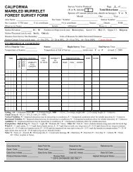
Lake National Wildlife Refuges during 2002–2003. Pre-winter sampling occurred during early October; postwinter<br />
sampling occurred during early March. SAV biomass ranged from 294 to 620 kg/ha. Over-winter<br />
depletion <strong>of</strong> roots <strong>and</strong> tubers ranged from 0 to 66% <strong>and</strong> was positively correlated with pre-winter biomass. We<br />
used energetic modeling with estimates <strong>of</strong> metabolizable energy <strong>of</strong> SAV to estimate carrying capacity <strong>of</strong> this<br />
habitat for waterfowl.<br />
BEACHED-BIRD SURVEYS WITHIN THE WADDEN SEA TRILATERAL MONITORING AND<br />
ASSESSMENT PROGRAM (TMAP)<br />
David M. Fleet (fleet@nationalparkamt.de); Schleswig–Holstein Wadden Sea National Park Authority,<br />
Toenning GERMANY, <strong>and</strong> Common Wadden Sea Secretariat (CWSS), Wilhelmshaven GERMANY<br />
Beached-bird surveys have been carried out on southern North Sea coasts since the 1970s in The<br />
Netherl<strong>and</strong>s <strong>and</strong> since the mid 1980s in Germany <strong>and</strong> Denmark. The TMAP, which was established in 1994, is<br />
carried out in the framework <strong>of</strong> the Trilateral Cooperation on the Protection <strong>of</strong> the Wadden Sea, which includes<br />
Denmark, Germany, <strong>and</strong> The Netherl<strong>and</strong>s. Its objective is an integrated monitoring <strong>and</strong> assessment <strong>of</strong> the<br />
Wadden Sea ecosystem. Beached-bird surveys use trilateral st<strong>and</strong>ardized procedures <strong>and</strong> are assessed <strong>and</strong><br />
evaluated as part <strong>of</strong> the TMAP. The results are published at regular intervals in Wadden Sea Quality Status<br />
Reports by the CWSS. The results <strong>of</strong> the surveys within the Wadden Sea <strong>and</strong> adjoining regions show steady<br />
declines in pollution levels since the mid 1980s. Oil rates-the proportion <strong>of</strong> beached birds that are oiled-<strong>of</strong><br />
especially pelagic <strong>and</strong> <strong>of</strong>fshore species are, however, still high on southern North Sea coasts. An Ecological<br />
Quality Objective (EcoQO) “proportion <strong>of</strong> oiled Common Guillemots Uria aalge among those found dead or<br />
dying on beaches” is being developed within the OSPAR Convention on the Protection <strong>of</strong> the Marine<br />
Environment <strong>of</strong> the North East Atlantic. Present oil rates for this species in the southern North Sea are still<br />
much higher than the proposed 10% <strong>of</strong> the EcQO.<br />
USING LONG-TERM BEACH MONITORING DATA IN OIL-SPILL DAMAGE ASSESSMENTS<br />
R. Glenn Ford (eci@teleport.com); R.G. Ford Consulting, Portl<strong>and</strong>, OR USA<br />
An important rationale for beached-bird monitoring programs is that they provide data that are useful in<br />
assessing oil-spill damages to seabirds. The primary use <strong>of</strong> these data so far has been to help measure the extent<br />
to which normal or ambient deposition is elevated by an oil-spill incident. Ideally, these monitoring data can be<br />
used to establish a baseline <strong>of</strong> natural carcass deposition. The rate <strong>of</strong> baseline deposition is subtracted from the<br />
deposition rate observed during a spill response, <strong>and</strong> the difference is assumed to be a measure <strong>of</strong> the effect <strong>of</strong><br />
the oil spill. But monitoring data are generally collected using protocols that result in much higher estimates <strong>of</strong><br />
the deposition rate than protocols used during a spill response. This results from several factors, the most<br />
important <strong>of</strong> which is the interval between searches. If interpreted incorrectly, the monitoring data can suggest<br />
that the effect <strong>of</strong> the oil spill was minimal or that the spill in fact decreased the ambient deposition rate. The<br />
usefulness <strong>of</strong> beach monitoring data in oil-spill damage assessment could be increased by making the search<br />
protocols <strong>of</strong> monitoring programs <strong>and</strong> oil-spill response agencies more directly comparable.<br />
BYCATCH OF WATERBIRDS IN MID-ATLANTIC COASTAL ANCHORED GILLNETS ESTIMATED<br />
FROM BEACHED-BIRD SURVEYS<br />
Doug Forsell (doug_forsell@fws.gov); USFWS, Chesapeake Bay Field Office, Annapolis, MD USA<br />
The U.S. Fish <strong>and</strong> Wildlife Service conducted a study <strong>of</strong> bird mortality in anchored gillnets in the<br />
nearshore ocean waters from New Jersey through Virginia during the spring <strong>of</strong> 1998. Beached-bird surveys <strong>and</strong><br />
live-bird counts were important components <strong>of</strong> the study. Beached-bird surveys were conducted repeatedly<br />
from vehicles at 20 locations along the 565-km shoreline. Two hundred <strong>and</strong> ten (210) dead diving birds were<br />
found on 1,732 km <strong>of</strong> surveyed beach. Approximately ten times more dead birds were found on beaches within<br />
2 km <strong>of</strong> gillnets than on beaches without nets. A minimal mortality estimate based on the beached-bird surveys<br />
is 1,265 diving birds/season. Ninety-two percent <strong>of</strong> 27 marked Red-throated Loons remained on the beaches<br />
less than 24 hours or one tidal cycle. Beached-bird surveys on beaches with steep banks may underestimate the<br />
mortality <strong>of</strong> medium-sized birds in areas with numerous large scavenging gulls. Experienced observers can also<br />
count gulls <strong>and</strong> shorebirds on beaches <strong>and</strong> count the birds in the near shore waters to 400 m providing additional