abstracts of oral and poster presentations - Pacific Seabird Group
abstracts of oral and poster presentations - Pacific Seabird Group
abstracts of oral and poster presentations - Pacific Seabird Group

You also want an ePaper? Increase the reach of your titles
YUMPU automatically turns print PDFs into web optimized ePapers that Google loves.
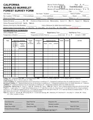
BREEDING-SEASON SPATIAL REQUIREMENTS OF GREAT LAKES PIPING PLOVERS<br />
Catherine D. Haffner* 1 (haff0020@umn.edu) <strong>and</strong> Francesca J. Cuthbert 2 ; 1 Conservation Biology Graduate<br />
Program, University <strong>of</strong> Minnesota, St. Paul, MN USA; 2 Department <strong>of</strong> Fisheries, Wildlife, & Conservation<br />
Biology, University <strong>of</strong> Minnesota, St. Paul, MN USA<br />
The population <strong>of</strong> Piping Plovers in the Great Lakes region is endangered at state <strong>and</strong> federal levels. To<br />
protect nesting habitat adequately, it is important to underst<strong>and</strong> spatial <strong>and</strong> temp<strong>oral</strong> movements <strong>of</strong> breeding<br />
individuals. We determined home-range sizes <strong>and</strong> linear shoreline length traversed for 35 individually colorb<strong>and</strong>ed<br />
breeders from May to August, 2003 <strong>and</strong> 2004. We examined relationships between spatial movement<br />
<strong>and</strong> nest stage (incubation vs. chick-rearing), sex, age, predominant substrate type, public-beach use, <strong>and</strong><br />
nearest-nest distance. Mean home range size was 0.35 km 2 , <strong>and</strong> mean linear distance traversed was 0.64 km.<br />
Individual home-range sizes <strong>and</strong> linear-distances traveled varied between individuals, sites, <strong>and</strong> years. No<br />
significant relationships were found between nest stage, sex, age, substrate type, <strong>and</strong> home-range size or linear<br />
distances. Home-range size for plovers nesting on high-public-use beaches was greater than those nesting on<br />
medium- or low-public-use beaches in 2003 (P < 0.05). Linear distance traveled increased as proximity to other<br />
plover nests increased (P < 0.05) in 2004. These results indicate that individual breeders use different amounts<br />
<strong>of</strong> space <strong>and</strong> that extrinsic factors such as number <strong>of</strong> plover pairs in the area or public-beach use may influence<br />
spatial movements.<br />
USE OF MOLECULAR MARKERS IN WATERBIRD RESEARCH AND CONSERVATION<br />
Susan Haig; USGS Forest <strong>and</strong> Rangel<strong>and</strong> Ecosystem Science Center, Corvallis, OR USA<br />
[No abstract was received.]<br />
UNDERSTANDING SEABIRD INDIVIDUAL MOVEMENT PATTERNS TO ASSESS VULNERABILITY<br />
TO BYCATCH IN GILLNET FISHERIES<br />
Nathalie Hamel* (nhamel@u.washington.edu) <strong>and</strong> Julia Parrish; School <strong>of</strong> Aquatic <strong>and</strong> Fishery Sciences,<br />
University <strong>of</strong> Washington, Seattle, WA USA<br />
<strong>Seabird</strong> bycatch has been reported in coastal gillnet fisheries in Washington <strong>and</strong> British Columbia. As<br />
is typical for long-lived species with low reproductive output, seabird populations are very sensitive to slight<br />
increases in adult mortality. Common Murres (Uria aalge) compose 75% <strong>of</strong> the reported annual bycatch both in<br />
WA <strong>and</strong> BC. However, there is no information on the provenance <strong>of</strong> these birds, i.e., whether they migrated<br />
from Washington or Oregon, where colony attendance may differ by up to two orders <strong>of</strong> magnitude. We<br />
assessed whether Common Murres from Tatoosh Isl<strong>and</strong>-the largest colony in WA <strong>and</strong> the closest to the<br />
fisheries-are vulnerable to bycatch <strong>and</strong>, if so, to quantify their vulnerability. A vulnerability index, based on the<br />
degree <strong>of</strong> spatio-temp<strong>oral</strong> overlap between murres <strong>and</strong> the fisheries abundance <strong>and</strong> distribution, is attributed to<br />
both individuals <strong>and</strong> fishery management units. To gain insight about how to build the best index models, I am<br />
quantitatively describing individual bird movements, derived from radio-telemetry data. In what direction are<br />
they going Is speed constant over time Do they travel through fisheries areas, <strong>and</strong> at the right time to be at<br />
risk <strong>of</strong> bycatch These models will help gain insight about whether mortality in gillnets represents a<br />
conservation issue for Common Murres on Tatoosh Isl<strong>and</strong>.<br />
MARINE RADAR AS A TOOL FOR MONITORING XANTUS’S MURRELET POPULATIONS<br />
Thomas E. Hamer 1 (hamert@aol.com), Sarah M. Schuster 1 , <strong>and</strong> Douglas Meekins 2 ; 1 Hamer Environmental<br />
L.P., Mount Vernon, WA USA; 2 Campbell Timberl<strong>and</strong> Management, Fort Bragg, CA USA<br />
Xantus’s Murrelets (Synthliboramphus hypoleucus) are one <strong>of</strong> the seabird species most vulnerable to<br />
imminent extinction due in part to high mortality rates from introduced ground predators at nesting colonies.<br />
Black Rats (Rattus rattus) were eradicated from Anacapa Isl<strong>and</strong>, California, in an effort to restore seabird<br />
populations. Using a modified marine radar system mounted on a boat, we conducted nocturnal surveys <strong>and</strong><br />
counted the numbers <strong>of</strong> birds flying into or out <strong>of</strong> potential nesting habitats at Anacapa Isl<strong>and</strong> during the April–<br />
May breeding season from 2000 to 2003. In 2000, we sampled from dusk to dawn, allowing us to determine the<br />
periods <strong>of</strong> the night <strong>and</strong> zones <strong>of</strong> activity to sample that yielded the lowest variation in counts. We used these