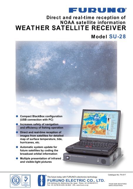
WEATHER SATELLITE RECEIVER Model SU-28
WEATHER SATELLITE RECEIVER Model SU-28
WEATHER SATELLITE RECEIVER Model SU-28

You also want an ePaper? Increase the reach of your titles
YUMPU automatically turns print PDFs into web optimized ePapers that Google loves.
R<br />
Direct and real-time reception of<br />
NOAA satellite information<br />
<strong>WEATHER</strong> <strong>SATELLITE</strong> <strong>RECEIVER</strong><br />
<strong>Model</strong> <strong>SU</strong>-<strong>28</strong><br />
●<br />
●<br />
●<br />
●<br />
●<br />
Compact BlackBox configuration<br />
(USB connection with PC)<br />
Increases safety of navigation<br />
and efficiency of fishing operation<br />
Direct and real-time reception of<br />
images from satellites for detailed<br />
map of surface temperature, tide,<br />
hurricanes, etc.<br />
Automatic system update for<br />
future satellites by coding the<br />
broadcast orbital information<br />
Multiple presentation of infrared<br />
and visible-light pictures<br />
R<br />
The future today with FURUNO's electronics technology.<br />
FURUNO ELECTRIC CO., LTD.<br />
9-52 Ashihara-cho, Nishinomiya City, Japan Phone: +81 (0)798 65-2111<br />
Fax: +81 (0)798 65-4200, 66-4622 URL: www.furuno.co.jp<br />
Catalogue No. FX-617<br />
TRADE MARK REGISTERED<br />
MARCA REGISTRADA
Display of satellite-sensed data of<br />
Visible-light or infrared picture as c<br />
The FURUNO <strong>SU</strong>-<strong>28</strong> is a new weather satellite<br />
receiver designed for a variety of vessels engaged in<br />
fishery, transoceanic cruise, oceanographic survey.<br />
The <strong>SU</strong>-<strong>28</strong> standard system consists of Antenna,<br />
Receiver, and application software to show images<br />
on a Windows 98, 2000, ME and XP based on PC.<br />
The receiver decodes the data received from the<br />
NOAA satellites and displays tide, clouds, hurricanes,<br />
sea surface temperature distribution, and other data<br />
coming from the satellites. The information is<br />
displayed as color maps or shades of gray.<br />
Some fish, such as Tuna and Skipjack gather in<br />
water of high temperatures (it is said the most<br />
inhabitable temperatures are 14 to 19 °C for Bluefin<br />
Tuna, 20 to 24 °C for Skipjack, 23 to <strong>28</strong> °C for<br />
Yellowfin Tuna), while salmon and herring prefer low<br />
temperatures (6 to 8 °C for salmon, 4 to 7 °C for<br />
herring). "Current Rip" where warm current and cold<br />
current come together is a good fishing ground since<br />
abundant baitfish are usually found. Temperature<br />
may be judged intuitively from the map displayed.<br />
The visible-light camera on the satellites provides<br />
bird's-eye views of the earth. Typhoons, hurricanes or<br />
other extreme weather anomalies are recognizable<br />
from such charts. They will assist navigators to select<br />
a course free from those anomalies.<br />
The straightforward<br />
display structure<br />
gives stable<br />
operation under<br />
tough environment<br />
such as roll/pitch<br />
condition.<br />
Function buttons<br />
allows for easy<br />
access and control of<br />
frequently-used<br />
functions.<br />
Infrared (IR) Picture<br />
Ship's data<br />
Time/Date<br />
Picture legend<br />
Color bar<br />
Cursor Information<br />
Predict (forecast)<br />
Function buttons<br />
Zoom<br />
Visible-Light Picture<br />
Zoom operation is assigned on the<br />
function button. Moving the cross<br />
cursor enlarges the picture.<br />
Zoom (VIS)
water temperature, tides, clouds.<br />
aptured by the NOAA satellites.<br />
Antenna Unit<br />
The NOAA (National Oceanic<br />
and Atmospheric Administration)<br />
weather-sensing satellites (two are currently<br />
used) are in near polar, sun-synchronous orbits,<br />
between 800 to 900 km in altitude. They transmit<br />
earth surface temperature distribution by measuring<br />
infrared radiation levels, and also transmit visible-light<br />
pictures captured by the vidicon camera. The satellite<br />
system is configured so that each satellite is viewed by an<br />
earthbound observer twice a day, wherever he is.<br />
Combination of IR/VIS<br />
Orbital Information<br />
Data can be recalled at any time from<br />
memory stored in the hard disk of PC.<br />
IR and VIS pictures can be displayed<br />
side by side for comparison and close<br />
analysis.<br />
The satellite orbital<br />
information is calculated and<br />
updated automatically, when<br />
the PC access to NOAA's web<br />
site via INMARSAT. The<br />
information can be displayed<br />
as a graph or table.<br />
Display color changes<br />
The presentation color and<br />
temperature range can be<br />
changed at your disposal.
POWER<br />
ON<br />
<strong>WEATHER</strong> <strong>SATELLITE</strong> <strong>RECEIVER</strong> <strong>SU</strong>-<strong>28</strong><br />
OFF - +<br />
VOL<br />
SPECIFICATIONS OF <strong>SU</strong>-<strong>28</strong><br />
General<br />
Picture<br />
Number of color<br />
Picture Storage area<br />
L/L Grid<br />
NOAA, infrared and visible<br />
18 colors or black and white in<br />
16 tones<br />
3,000 km (E-W) x 3,200 km (N-S)<br />
Every degree<br />
(5° steps for x 0.5 pictures)<br />
Receiver Unit<br />
<strong>SU</strong>-<strong>28</strong>1<br />
3.6 kg 7.9 lb<br />
240 9.5"<br />
335 13.2"<br />
Antenna Unit<br />
Type<br />
2-element turnstile<br />
Frequency Range 137 to 138 MHz<br />
Polarization<br />
Right-hand circular<br />
Impedance<br />
50 ohms<br />
Beamwidth ± 40°<br />
Gain<br />
5 dBi<br />
340 13.4"<br />
360 14.2"<br />
322 12.7"<br />
13 0.5"<br />
32.5 1.3"<br />
Receiver Unit<br />
Frequency Range<br />
Number of Channels<br />
Frequency Stability<br />
Sensitivity<br />
Bandwidth<br />
136 to 138 MHz<br />
2 NOAA channels<br />
137.5 and 137.62 MHz<br />
5 ppm<br />
-2 dBµ at SINAD 20 dB<br />
More than 45 kHz at -3 dB<br />
Less than 100 kHz at -60 dB<br />
Antenna Unit<br />
150-2CY006<br />
2.4 kg 5.3 lb<br />
1114 43.9"<br />
86 3.4"<br />
50 2.0"<br />
380 15.0" 57<br />
2.2"<br />
Interface<br />
Input<br />
POWER <strong>SU</strong>PPLY<br />
115/230 VAC<br />
GGA, GLL, MTW, RMA, RMC<br />
1226 48.3"<br />
MAST<br />
MOUNTING CLAMP<br />
5D-2V(L=3000)<br />
875 34.5"<br />
MINIMAL SYSTEM REQUIREMENTS FOR PC<br />
OS:<br />
Windows 98, 2000, ME or XP<br />
CPU:<br />
Celeron 400 MHz or more<br />
RAM:<br />
64 MB or more<br />
Resolution:<br />
1024 x 768 pixels or more<br />
Interconnection Diagram<br />
Antenna<br />
150-2CY006<br />
ENVIRONMENTAL CONDITIONS<br />
EMC, Vibration,<br />
Climatic: Complies with IEC 60945<br />
EQUIPMENT LIST<br />
Standard<br />
1. Receiver Unit <strong>SU</strong>-<strong>28</strong>1 1 unit<br />
2. Antenna Unit 150-2CY006 1 unit<br />
3. Installation Materials with<br />
application software<br />
1 set<br />
Optional<br />
1. Preamplifier <strong>SU</strong>-<strong>28</strong>2<br />
2. Antenna Unit (heavy duty) FAB-137T<br />
GPS<br />
Temperature<br />
Indicator<br />
Preamp<br />
<strong>SU</strong>-<strong>28</strong>2<br />
Receiver Unit<br />
<strong>SU</strong>-<strong>28</strong>1<br />
30 m max<br />
USB<br />
2 m<br />
PC<br />
Color Printer<br />
INMARSAT<br />
115/230 VAC<br />
To be procured locally<br />
Option<br />
SPECIFICATIONS <strong>SU</strong>BJECT TO CHANGE WITHOUT NOTICE<br />
FURUNO U.S.A., INC.<br />
Camas, Washington, U.S.A.<br />
Phone: +1 360-834-9300 Telefax: +1 360-834-9400<br />
FURUNO (UK) LIMITED<br />
Denmead, Hampshire, U.K.<br />
Phone: +44 2392-230303 Telefax: +44 2392-230101<br />
FURUNO FRANCE S.A.<br />
Bordeaux-Mérignac, France<br />
Phone: +33 5 56 13 48 00 Telefax: +33 5 56 13 48 01<br />
FURUNO ESPANA S.A.<br />
Madrid, Spain<br />
Phone: +34 91-725-90-88 Telefax: +34 91-725-98-97<br />
FURUNO DANMARK AS<br />
Hvidovre, Denmark<br />
Phone: +45 36 77 45 00 Telefax: +45 36 77 45 01<br />
FURUNO NORGE A/S<br />
Ålesund, Norway<br />
Phone: +47 70 102950 Telefax: +47 70 127021<br />
FURUNO SVERIGE AB<br />
Västra Frölunda, Sweden<br />
Phone: +46 31-7098940 Telefax: +46 31-497093<br />
FURUNO <strong>SU</strong>OMI OY<br />
Helsinki, Finland<br />
Phone: +358 9 341 7570 Telefax: +358 9 3417 5716<br />
02025SS Printed in Japan