Sodiri_preliminary report_1
Sodiri_preliminary report_1
Sodiri_preliminary report_1

Create successful ePaper yourself
Turn your PDF publications into a flip-book with our unique Google optimized e-Paper software.
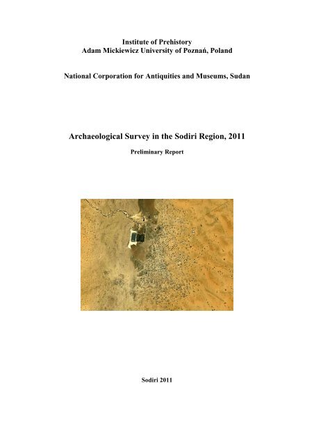
Institute of Prehistory<br />
Adam Mickiewicz University of Poznań, Poland<br />
National Corporation for Antiquities and Museums, Sudan<br />
Archaeological Survey in the <strong>Sodiri</strong> Region, 2011<br />
Preliminary Report<br />
<strong>Sodiri</strong> 2011
1. Introduction<br />
The Kurdufan region of the Sudan is not very well recognized from archaeological point of<br />
view. Very few systematic archaeological projects have been carried out there before. So the<br />
knowledge about the archeological remains in the region is very limited. As part of the Polish-<br />
Sudanese project the idea appeared to carry out a <strong>preliminary</strong> survey in some selected areas.<br />
The field work of the joint project run from February 3 rd till February 7 th , 2011.<br />
2. The aim of the project<br />
The main aim of the project was to identify and record archaeological sites in the area of<br />
<strong>Sodiri</strong>. The purpose of it was to get information about archaeological remains in the region,<br />
recognize the potential for future research as well as to get a knowledge about the state of<br />
preservation of archaeological heritage.<br />
3. Method<br />
The field-walking was the main method applied for the survey. Both the aim as well as timing<br />
of the project allowed only for very quick survey. The team was divided into two persons<br />
groups which investigated the area. Each group recorded the path using GPS as well as<br />
precisely individual features: grinding stones, iron slag, sherds of pottery, graves, tumuli,<br />
boundaries of sites, buildings, etc. For three survey areas we used satellite images (from<br />
Google Earth) as a basic maps. The fourth area (Al-Nurein) was out of the range of preprepared<br />
satellite images but all data was also recorded using GPS.<br />
Most of archeological features recorded were documented by using digital photographs.<br />
All data got cross-checking references and will allow to identify within space. Written<br />
description of was also a part of documentation. As part of the documentation information<br />
about the threats of sites and features were recorded.<br />
Photo 1. Photographic documentation of the damaged archaeological feature (natural process).
As a result of survey and analysis of collected data a spatial database will be created.<br />
An ethnographic survey was also included as part of the project to get wider view on<br />
approach of local societies to past remains (see below).<br />
4. The team<br />
The joint project was organized by Institute of Prehistory Adam Mickiewicz<br />
University in Poznań (Poland) and National Corporation for Antiquities and Museums in<br />
Khartoum (Sudan). The team consisted of:<br />
a. Ali Elmirghani Ahmed, MA, project coordinator<br />
b. Mariusz Drzewiecki, MA<br />
c. Piotr Maliński, MA<br />
d. Łukasz Banaszek, MA<br />
e. Adam Adamski<br />
f. Adrian Chlebowski<br />
g. Włodzimierz Rączkowski, Professor – scientific advisor<br />
During the field work the above team was joined by two representatives of the local<br />
government authorities: Miss Aisha Alnour and Mr Mohamed Adam Alzpir. Two drivers,<br />
Agaad and Hameed were also important members of the team during the field work.<br />
5. Survey areas<br />
Photo 2. Team members in the field<br />
Four sample areas have been selected as sample areas for survey. They are catchments of<br />
jebels: Al Baklai, Al-Nurein, Souni al-Songor and Al-Grian.
Photo 3. Areas of survey in the <strong>Sodiri</strong> Region: 1 – Al Baklai, 2 – Hilat al-Nurein, 3 – Suoni al-<br />
Songor, 4 – Gebel al-Grian<br />
6. Results<br />
Al Baklai<br />
On the plateau at the top of the mountain there are more then 40 water containers or<br />
collectors. They are cut in the bedrock. The biggest one reach about 7 m in depth and is about<br />
4 m wide. Some of the collectors are surrounded by small stone walls which function<br />
probably was to direct the water flouting down the slope to the collectors. In the south west<br />
part of the plateau there are about 15 stone features (about 90 cm in diameter). Their direct<br />
function is not determined.<br />
Moreover at the bottom of the mountain there are located graveyards. Different types<br />
of graves were registered (stone tumuli, flat graves covered by stones, earth barrows). Some<br />
amounts of pottery sherds can be noticed on the surface.
Photo 4. Distribution of sites recorded during field survey in Al Baklai area<br />
Photo 5. Early Islamic grave in Eastern part of the mountain
Photo 6. One of the cistern still filled by water on the top of the mountain<br />
Hilat al_Nurein<br />
On the plateau at the top of the mountain there is located a settlement of dimensions<br />
approximately 700x500 meters. It’s central point is an extended (ca. 100x50 meters) water<br />
collector (Hafir). Borders of the collector are constructed by stone walls covered with the mud<br />
taken from the inside. Moreover there are ca. 70-80 rounded stone huts, partially preserved up<br />
to 1.3 meter high. Some of the huts are clustered and remind in shape cell-structures. In<br />
addition between the huts one can spot rounded stone structures of undetermined function.<br />
Also water containers cut in bedrock are present at the site. From the West the settlement is<br />
limited by a stone wall, with a potentially 1 gate/entrance. Massive amounts of pottery sherds<br />
and few flint tools can be noticed on the surface.<br />
Photo 7. Remains of the settlement in Al-Nurein
Photo 8. The wall and gate of the settlement<br />
Photo 9. Example of tumuli in Al-Nurein
Moreover there is a second smaller settlement with similar huts and water collectors<br />
located West from the first one.<br />
It is a common feature that at the bottom of the mountains of the region there are<br />
located graveyards. Different types of graves were registered (stone tumuli, flat graves<br />
covered by stones, earth barrows). In addition, in the West part of surveyed area there is a<br />
historical Islamic graveyard for children.<br />
Suoni al- Songor<br />
In this area no settlement was identified. However at the bottom of the mountains of<br />
the region enormous number of graveyards is present. Different types of graves were<br />
registered (stone tumuli, flat graves covered by stones, earth barrows). Some amounts of<br />
pottery sherds can be noticed on the surface. Moreover there were also identified iron slag,<br />
which might be the evidence for local iron melting.<br />
Photo 10. Distribution of recorded archaeological features in the area of Souni al-Songor and Gebel al-<br />
Grian
Photo 11. Example of very common form of tumuli in Suoni al-Songor<br />
Gebel al-Grian<br />
In this area no settlement was identified. However at the bottom of the mountains of<br />
the region enormous number of graveyards is present. Different types of graves were<br />
registered (stone tumuli, flat graves covered by stones, earth barrows). Some amounts of<br />
pottery sherds can be noticed on the surface. Moreover there were also identified iron slag,<br />
which might be the evidence for local iron melting. In the South part of the surveyed area<br />
there is located historical Islamic graveyard, which could be still in use.
Photo 12. “Aerial” view on a complex of tumuli in Eastern part of the studied area<br />
7. Ethnographic research<br />
Photo 13. Example of tumuli in the studied area<br />
The ethnographical research conducted during the fieldwork was an integral part of the<br />
interdisciplinary research project. The contemporary socio-cultural context of the
archaeological sites was the main subject of research. Methodological assumption concerned<br />
the efficiency of using research tools characteristic for ethnography. Within the fieldwork, an<br />
ethnological observations were applied as well as open interviews with local communities<br />
members. Research results were documented by means of recordings and digital photographs.<br />
Research was conducted both in Al-Nurein village, inhabited by the Bedariya tribe, as<br />
well as in Souni Al-Songor village, inhabited by the Kawahla tribe.<br />
According to interviews results, villagers have got knowledge about locations of<br />
material remains of the past in these localities. Such kind of information could help<br />
archaeologists to find new sites. Moreover, local people can easy recognize and distinguish<br />
settlements and cemeteries. Oral tradition states that both were build by ‘Anag – legendary<br />
race (or tribe) of giants. These ancient people are also called Abu Qonaan. Some local<br />
inhabitants regard them as pagans, another think that ‘Anag (Abu Qonaan) were Christians.<br />
Photo 14. Inhabitant of Al-Nurein village shows location of the site to member of the mission.<br />
During the fieldwork, few information about structures of tumuli, their contents (grave<br />
goods) and even position of burials were recorded. Villagers could get this knowledge from<br />
three kind of sources:<br />
• from observation of certain places where water, flowing down from hills during rains,<br />
destroyed tumuli;<br />
• from direct contact with archaeological remains during traditional earthwork (for example<br />
agriculture and building);<br />
• from grave-robbing activity, as traces of illegal excavations are clearly visible at some tumuli<br />
cemeteries.
Photo 15. Grave-robbing shaft in tumuli near Souni Al-Songor.<br />
There are also sites where tumuli and recent Muslim graves existed together as one cemetery.<br />
Some of Muslim graves are probably burials of local Sheikhs and there are some traces of<br />
present-day traditional customs (for example taking out soil from graves, which is believed to<br />
content baraka). Events of such type could constitute an evidence for reinterpretation of<br />
holiness of burial places apart from time-induced cultural changes, appearance of new<br />
religions or ethnic groups. On the other hand, such phenomenon could be interpreted as<br />
symbolic seizure of area which ‘belongs to the past’ and its adaptation to the contemporary<br />
religious system.<br />
Photo 16. Muslim graves and tumuli located together at one cemetery near Souni Al-Songor.<br />
It should to be mentioned here that also traditional material culture of the Bedariya and<br />
Kawahla tribes was the subject of research. For example inhabitants of Al-Nurein village
demonstrate traditional pottery jars of huge size. Analysis of their form and decoration could<br />
be useful for comparative studies on pottery from archaeological sites.<br />
Photo 17. Villagers from Al-Nurein demonstrate traditional forms of pottery.<br />
In Souni Al-Songor local people demonstrate traditional grinding-stones (such<br />
artifacts are widely known also from archaeological sites). Many objects made of leather,<br />
wool and wood were recorded as well. According to traditional customs of the Kawahla tribe,<br />
a set of these objects constitute dowry of the bride.<br />
Photo 18. The Kawahla woman demonstrates traditional way of grinding sorghum.
Photo 19. Set of traditional objects in Souni Al-Songor village.<br />
Photo 20. Member of the Kawahla tribe demonstrates traditional drums.<br />
Results of fieldwork proved that traditional culture of tribes inhabiting Northern<br />
Kordofan is an interesting subject of ethnographical research. Due to limited time in this<br />
season, some of cultural phenomena were registered only, but without doubt they need<br />
further, detailed and methodical research. There is, therefore, a wide perspective of continuing<br />
ethnographical field studies in the next seasons. Effects of such work can be used for<br />
promotion of local folklore as one of region’s tourist attraction.
8. Conclusions<br />
The very rapid survey proved huge potential of the region from archaeological point of<br />
view. There were found a number of archaeological remains, mostly graves. The<br />
differences in construction of them suggest that the area was occupied by long time in the<br />
past.<br />
Most of sites are well preserved and well visible in the landscape. However some<br />
natural and cultural processes were identified which create threats for the archaeological<br />
heritage. There are erosion, agriculture (especially in Eastern part of Souni Al-Songor)<br />
and looting among them.