

EUHeritageTOUR-TourGuide-Basic-EN
EUHeritageTOUR-TourGuide-Basic-EN
EUHeritageTOUR-TourGuide-Basic-EN

You also want an ePaper? Increase the reach of your titles
YUMPU automatically turns print PDFs into web optimized ePapers that Google loves.
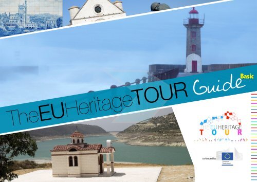
The<strong>EUHeritageTOUR</strong> Guide<br />
<strong>Basic</strong><br />
co-funded by
Colophon<br />
© The <strong>EUHeritageTOUR</strong> Consortium —<br />
The Coordinator: X23 Ltd, Rome - Italy<br />
Giuseppe Laquidara 1 , M. Mazzi Boém 1 , M. Colombani 1 ,<br />
F. Marano 2 , Jill Cousins 3 , N. Emmenegger 3 , M. Ioannides 4 ,<br />
J. Portugal 5 , E. Perez Babo 5 , J. Santos 6 , G. Ablasser 7 ,<br />
P. König 7 , M. Socratous 8<br />
1 X23 Ltd., Consortium Coordinator<br />
Giuseppe Laquidara, PhD - CEO - Giuseppe.Laquidara@x-23.org<br />
Artificial intelligence, Physics and Cybernetics, Non-linear Systems<br />
via del Consolato, 6 00186 Rome, Italy<br />
5 uaternaire Portugal Ltd.<br />
Rua Tomàs Ribeiro, 412 - 2°, 4450-295 Matasinhos, Morada, Portugal<br />
6 Alentejo Tourism ERT<br />
Praça da Repùblica, 12 1°, Apartado 355, 7800-427 Beja, Portugal<br />
7 City of Graz<br />
Rathous, Hauptplatz 1, 8010 Graz, Austria<br />
8 Cyprus Tourism Organization<br />
2 University of Salerno<br />
DSCPS - Department of Communication, Social Sciences and Politics Sciences<br />
DI - Department of Informatics<br />
Scientific Campus — Fisciano, Salerno<br />
viale Giovanni Paolo II, 84084 Salerno<br />
19, Lemesos Avenue - 2112 Aglantzia, Nicosia, Cyprus<br />
3 Europeana Foundation<br />
National Library of the Netherlands<br />
PO Box 90407 2509 LK The Hague<br />
4 Cyprus University of Technology<br />
Department of Electrical Eng, Computer Eng. and Informatics<br />
Digital Heritage Research Laboratory<br />
Arch. Kyprianou 31, CY 3036 Limassol, Cyprus<br />
_______________<br />
This Tour Guide is organized within the European project <strong>EUHeritageTOUR</strong><br />
funded under European Commission, DG Enterprise and Industry.<br />
This publication reflects the views only of the authors, and the Commission cannot be<br />
held responsible for any use which may be made of the information contained therein.<br />
co-funded by
Table of Contents<br />
Spiritual p. 5 ~ 46<br />
Makers of the History p. 47 ~ 78<br />
Hedonism p. 79 ~ 96<br />
Genius p. 97 ~ 129<br />
Urban Cities p. 130 ~ 155<br />
Small Towns Gems p. 156 ~ 174<br />
co-funded by
Introduction<br />
The <strong>EUHeritageTOUR</strong> Consortium is happy to introduce you the first issue of the<br />
<strong>EUHeritageTOUR</strong> Guide.<br />
<br />
The Guide — now in a “basic release” — will provide the visitors with inspirational insights into<br />
the cultural route across the most impressive World Heritage sites disseminated in Europe.<br />
The <strong>EUHeritageTOUR</strong> cultural route offers 6 outstanding, innovative and engaging thematic<br />
itineraries, linking together the World Heritage sites in the different participant countries<br />
according to unusual narrative logics.<br />
Discover the true European cultural identity in each World Heritage site: from the ancient<br />
painted churches in the Troodos Region, to the great fortifications in the city of Elvas; from the<br />
timeless glam of small towns such as Spoleto (Italy) to the restless urban cities such as Amsterdam<br />
and Brussels; from the great masterpieces of the Rupestrian Churches in Matera (Italy) to the prehistoric<br />
art in Coa Valley (Portugal); from the wise traditions in producing the Porto wine in the<br />
Alto Douro Region, to the secrets of the trappist beer in Belgium, or to the excellence in the wine<br />
production of the Collio Valley in Cividale del Friuli (Italy).<br />
This is the Beauty of Multiplicity, this is your inspirational trip.<br />
The journey is an experience of life.<br />
Live it.<br />
As, You Are Where You Have Been.<br />
co-funded by
Spiritual…
Introducing the<br />
itinerary<br />
Spiritual<br />
Chasing the true Spirit<br />
of Europe, to find mine
Cyprus<br />
Painted<br />
Churches<br />
Troodos Region<br />
This region is characterized by one of the largest groups<br />
of churches and monasteries of the former Byzantine<br />
Empire. The complex of 10 monuments included on the<br />
World Heritage List, all richly decorated with murals,<br />
provides an overview of Byzantine and post-Byzantine<br />
painting in Cyprus. They range from small churches<br />
whose rural architectural style is in stark contrast to their<br />
highly refined decoration, to monasteries such as that of<br />
St John Lampadistis.<br />
Histortical Background<br />
The Troodos mountain region of Cyprus contains one of<br />
the largest groups of churches and monasteries of the<br />
former Byzantine Empire. The ten monuments included<br />
on the World Heritage List, all richly decorated with<br />
murals, provide an overview of Byzantine and post-<br />
Byzantine painting in Cyprus and bear testimony to the<br />
variety of artistic influences affecting Cyprus over a<br />
period of 500 years. The structures display elements<br />
that were specific to Cyprus and were determined by<br />
its geography, history and climate, including steeppitched<br />
wooden roofs with flat hooked tiles, in some<br />
cases providing a second roof over Byzantine masonry<br />
domes and vaulted forms, while exhibiting Byzantine<br />
metropolitan art of the highest quality. The architecture<br />
of these churches is unique, confined to the Troodos<br />
range and almost certainly of indigenous origin. They<br />
range from small churches whose rural architectural<br />
style is in stark contrast to their highly refined<br />
decoration, to monasteries such as that of St John<br />
Lampadistis. They also contain a wealth of dated<br />
inscriptions, an uncommon feature in the Eastern<br />
Mediterranean during the Middle Ages, which makes<br />
them particularly important for recording the<br />
chronology of Byzantine painting.<br />
Important examples of the 11th century iconography<br />
survive in the churches of St. Nicholas of the Roof and<br />
Panagia Phorbiotissa of Nikitari. Within Panagia tou<br />
Arakou in Lagoudera and St. Nicholas of the Roof are<br />
found important wall paintings from the Comnenian era,
with the first being of exceptional artistic quality attributed to<br />
Constantinopolitan masters. The 13th century, the early<br />
period of Latin (western) rule in Cyprus, is well represented in<br />
the wall paintings of St. John Lampadistis in Kalopanagiotis<br />
and in Panagia in Moutoulla, which reflect the continuing<br />
Byzantine tradition and new external influences. The 14th<br />
century wall paintings at Panagia Phorbiotissa, Timios<br />
Stavros at Pelendri and St. John Lampadistis also display<br />
both local and Western influences, and to a certain degree,<br />
the revived art of Paleologan Constantinople. In the late 15th<br />
century iconography at Timios Stavros Agiasmati and<br />
Archangelos Michael, Pedoulas exhibits once again the<br />
harmonious combination of Byzantine art with local painting<br />
tradition, as well as some elements of Western influence,<br />
which are different, however, from the earlier series of St.<br />
John Lampadistis that was painted by a refugee from<br />
Constantinople. The Venetian rule, which began in 1489 was<br />
reflected in the development of the Italo-Byzantine school,<br />
and the most sophisticated examples can be found in<br />
Panagia Podhithou and the north chapel of St. John<br />
Lampadistis, both successful examples of Italian<br />
Renaissance art and Byzantine art fusion. Finally, the wall<br />
paintings of the Church of the Transfiguration of the Savior in<br />
Palaichori form part of the Cretan school of the 16th century.<br />
The ten churches included in the serial inscription are:<br />
➡ Ayios Nikolaos tis Stegis (St. Nicholas of the Roof)<br />
Kakopetria;<br />
➡ Ayios Ioannis (St. John) Lambadhistis Monastery,<br />
Kalopanayiotis;<br />
➡ Panayia (The Virgin) Phorviotissa (Asinou),<br />
Nikitari;<br />
➡ Panayia (The Virgin) tou Arakou, Lagoudhera;<br />
➡ Panayia (The Virgin), Moutoullas;<br />
➡ Archangelos Michael (Archangel Michael),<br />
Pedhoulas;<br />
➡ Timios Stavros (Holy Cross), Pelendria;<br />
➡ Panayia (The Virgin) Podhithou, Galata;<br />
➡ Stavros (Holy Cross) Ayiasmati, Platanistasa,<br />
➡ the Church of Ayia Sotira (Transfiguration of the<br />
Savior), Palaichori.<br />
Of the ten churches nine are situated in the District of<br />
Nicosia and one, Timios Stavros (Holy Cross), Pelendria<br />
is in the District of Limassol.<br />
Source: UNESCO/CLT/WHC; byzantinecyprus.com;
Italy<br />
Matera,<br />
Benevento,<br />
Foggia,Trevi,<br />
Assisi, Brescia<br />
The Sassi and the Park<br />
of the Rupestrian<br />
Churches in Matera<br />
This is the most outstanding, intact example of a<br />
troglodyte settlement in the Mediterranean region,<br />
perfectly adapted to its terrain and ecosystem. The first<br />
inhabited zone dates from the Palaeolithic, while later<br />
settlements illustrate a number of significant stages in<br />
human history. Matera is in the southern region of<br />
Basilicata.<br />
Description<br />
The Sassi of Matera and their park are an outstanding<br />
example of a rock-cut settlement, adapted perfectly to<br />
its geomorphological setting and its ecosystem and<br />
exhibiting continuity over more than two millennia. They<br />
represent an outstanding example of a traditional human<br />
settlement and land use showing the evolution of a<br />
culture that has maintained over time a harmonious<br />
relationship with its natural environment.<br />
The Matera region has been inhabited by man since the<br />
Palaeolithic period. Permanent defended village<br />
settlements grew up after the last Ice Age, based on<br />
agriculture. Deforestation of the area led to serious<br />
erosion and created problems of water management.<br />
The gradual invasion of fields by garrigue and maquis<br />
led to a change from agriculture to pastoral<br />
transhumance. Matera's development was due to its<br />
geological setting. A belt of soft tufo is located between<br />
350 m and 400 m above the valley bed, and this also<br />
contains two natural depressions (grabialioni ); in<br />
consequence, it was here that the settlement grew up.<br />
The clay plateau above was reserved for agriculture and<br />
pastoralism. The advent of better tools with the Metal<br />
Ages made it easier to dig into the soft calcareous tufo<br />
rocks exposed in the gravine (gorges or canyons) and<br />
there is evidence from the<br />
Bronze Age of the creation of underground cisterns and<br />
tombs, and in particular of underground dwellings<br />
opening out of a central space (jazzi ). The excavated<br />
tufo blocks were used for the construction of walls and<br />
towers. This process was easiest on the sides of ravines,<br />
where the softer strata of tufo were exposed. Greek<br />
colonization led to the introduction of higher technology<br />
and political structures, under the influence of the<br />
Pythagorean School. The earlier dispersed settlements
coalesced into urban centres of government, under their<br />
own kings (i Re Pastori), leading eventually to the<br />
creation of true towns. The harsh landscape resulted in<br />
the growth of a spirit of sturdy independence which was<br />
resistant to successive waves of invaders after the<br />
Byzantine period. The area was also very attractive to<br />
monastic and utopian communities.<br />
This structure remained intact until the 18th century. It<br />
was the expansion and interventions of the 19th and<br />
20th centuries that rejected the ancient principle of land<br />
management based on water supply and drainage and<br />
spread to the clays of the plateau above.<br />
The earliest house form was a simple cave in the tufo with<br />
a closing wall formed from the excavated blocks. This<br />
developed into a vaulted room (lamione ) built out into the<br />
open space, and was then available for considerable<br />
adaptation and extension. Groups of dwellings round a<br />
common courtyard evolved into the social structure of the<br />
vicinato, with shared facilities such as a cistern. In<br />
between the two sassi was established the fortified centre<br />
of the town (cività ), within which the cathedral was sited.<br />
Workshops and granaries were set up outside the cività,<br />
which was connected with the sassi by narrow lanes and<br />
steps. The water supply was highly organized, being<br />
collected on the plateau above and brought down by<br />
gravity for distribution to the community. As the town grew,<br />
more houses were excavated and built, climbing the<br />
hillside; the roofs of some houses often acted as streets<br />
for the houses above them. The houses became more<br />
grandiose, and terraces were built out in the Renaissance<br />
period for gardens.<br />
Historical Background<br />
The Matera region has been inhabited by man since the<br />
Palaeolithic period. Permanent defended village<br />
settlements grew up after the last Ice Age, based on<br />
agriculture. Deforestation of the area led to serious<br />
erosion and created problems of water management.<br />
The gradual invasion of fields by garricue and maauis<br />
led to a change from agriculture to pastoral<br />
transhumance. The advent of better tools with the Metal<br />
Ages made it easier to dig into the soft calcareous tufo<br />
rocks exposed in the gravine (gorges or canyons) and<br />
there is evidence from the Bronze Age of the creation of<br />
underground cisterns and tombs, and in particular of<br />
underground dwellings opening out of a central space<br />
(iazzi). The excavated tufo blocks were used for the<br />
construction of walls and towers. This process was<br />
easiest on the sides of ravines, where the softer strata of<br />
tufo were exposed.<br />
Greek colonization led to the introduction of higher<br />
technology and political structures, under the influence<br />
of the Pythagorean school. The earlier dispersed<br />
settlements coalesced into urban centres of government,<br />
under their own kings (i Re Pastori), leading eventually to<br />
the creation of true towns. The harsh landscape resulted<br />
in the growth of a spirit of sturdy independence which<br />
was resistant to successive waves of invaders after the<br />
Byzantine period. The area was also very attractive to<br />
monastic and utopian communities.<br />
Matera's development was due to its geological setting.<br />
A belt of soft tufo is located between 350 and 400 m<br />
above the valley bed, and this also contains two natural<br />
depressions (arabialioni); in consequence, it was here<br />
that the settlement grew up. The clay plateau above was<br />
reserved for agriculture and pastoralism. This structure<br />
remained intact until the 18th century. It was the<br />
expansion and interventions of the 19th and 20th<br />
centuries that rejected the ancient principle of land<br />
management based on water supply and drainage and<br />
spread to the clays of the plateau above. The original<br />
urban fabric degenerated to the point where Matera,<br />
Idrisi as hailed by the 12th century geographer El<br />
"magnificent and splendid", was seen by Carlo Levi in<br />
his famous novel Cristo si B fermato ad Eboli (Christ<br />
stopped at Eboli), published in 1945, life in southern<br />
Italy. as the symbol of the misery of peasant As a result<br />
of the Italian Government's concern about this situation,<br />
legislation passed in 1952 led to the rehousing of the<br />
dwellers of the old quarters in new buildings and the<br />
desertion of the ancient centre in the 1950s.<br />
Source: UNESCO/CLT/WHC
How to get there<br />
Matera is located in the Basilicata region and it can be<br />
reached by using the following transportation:<br />
By plane<br />
The nearest airport is the Bari Palese airport , just 50 Km<br />
away. Bari Palese airport is well connected with the major<br />
Italian cities such as Milan, Rome, Verona, Turin, Venice,<br />
Trapani, Bergamo, Bologna and also to international<br />
destinations such as London (Stansted and Gatwick) ,<br />
Paris, Barcelona , Brussels , Cologne, Bucharest, Tirana ,<br />
Stuttgart, Monaco, Timisoara.<br />
A shuttle service from and to the airport is available.<br />
By train<br />
Matera is connected to Bari from Lucania Appulo FAL<br />
Railways<br />
By bus<br />
You can reach Matera by bus using the following<br />
companies:<br />
- Marino Bus .<br />
- Marozzi Bus .<br />
- Bus Smooth .<br />
By car<br />
From the Tyrrhenian coast: Take the Salerno - Reggio<br />
Calabria highway. Follow the signs to Potenza. Then<br />
continue along the SS 407 for Metaponto " Basentana "<br />
until you see signs near Matera Ferrandina.<br />
From the Adriatic coast: Take the highway Bologna-<br />
Taranto, take the gate Bari Nord. Continue to the industrial<br />
area, Altamura - Matera , along the SS 96 and SS 99.<br />
From Calabria and Sicily: Take the Salerno - Reggio<br />
Calabria highway. Take the Sibari Gate and take the SS<br />
106 Taranto. Exit at Matera, near Metaponto.<br />
From Salento: The easiest way to reach Matera is to<br />
surmont Taranto, and take the SS 106 until exit near<br />
Metaponto Matera .<br />
And the nearby Other outstanding<br />
cultural places<br />
National Archaelogical Museum "Domenico Ridola",<br />
Via Ridola, 24 - Tel. e Fax +39 0835 310058The National<br />
Museum "Ridola", established February 9, 1911, was<br />
realized thanks to the donation of the collection of<br />
archaeological finds, collected by Senator Ridola, during<br />
his research. The first nucleus of the museum was<br />
installed in the seventeenth-century convent of the Poor<br />
Clares and contained materials from the Paleolithic to<br />
the Bronze Age, displyed in the windows of wood. In the<br />
mid-'50s new rooms were added to the Museum and, in<br />
1976, with the opening of a new environment dedicated<br />
to the findings of the various areas of Matera, there was<br />
a further expansion of the museum itself. With the<br />
expansion of his collection, the museum has a new<br />
structural change in 1985 with the building of new<br />
offices, workshops and warehouses. Currently they are<br />
stored inside the building of the prehistoric artifacts<br />
collected by Ridola along with recent and important<br />
discoveries of Trasano, including a rare oven datable to<br />
the Neolithic.<br />
National Museum of Medieval and Modern Art of<br />
Basilicata, Piazza Pascoli , 1 ( at the Palazzo<br />
Lanfranchi )<br />
Opened on May 6, 2003 at the Palazzo Lanfranchi in<br />
Matera, the National Museum of Medieval and Modern<br />
Art in the Basilicata region is divided into three sections.<br />
The first collects paintings, stone sculptures, wood<br />
carvings, silver and paintings from all over the region.<br />
There are more than 100 works of art displayed in this<br />
section, from the Middle Ages to the eighteenth century.<br />
The second section is devoted to the D'Errico Collection:<br />
70 paintings are displayed, available thanks to the<br />
donation by the homonymous non-profit organization,<br />
located in Palazzo S. Gervasio. In the third and final<br />
section is foreseen the exhibition of 44 works by Carlo<br />
Levi. The building hosting the museum is also provided<br />
by two churches: the Santa Maria De Armenis soon open<br />
to the public, while the Madonna del Carmine one, to be<br />
used as an auditorium, is currently being restored.
MUSMA - Museum of Contemporary Sculpture in<br />
Matera, Palace Pomarici , Ward Sassi<br />
The Museum of Contemporary Sculpture - Matera ,<br />
original ' cave museum ' run by the cooperative<br />
Synchronos since 2011, is located in the suggestive<br />
setting of the seventeenth century Palazzo Pomarici. It is<br />
considered a unique museum for the perfect symbiosis<br />
between the sculptures and some of the most<br />
characteristic places carved in the heart of the Sassi: the<br />
museum spaces, in fact, cover not only the built-up<br />
areas of the building, but also the vast tombs carved,<br />
where the works displayed are regenerated by the<br />
power of suggestion oft the surrounding rocky<br />
environments.<br />
Useful links<br />
http://www.comune.matera.it/<br />
Official Website of the Matera Municipality<br />
http://www.provincia.matera.it/Provincia<br />
Official Website of the Province of Matera<br />
http://www.basilicatanet.it/<br />
Official Website of the Basilicata Region
Bed&Breakfast<br />
Nice,<br />
comfortable<br />
...why not<br />
B&B Al Borgo, Via Tagliamento, 2 -<br />
Borgo La Martella 75100 - Matera<br />
(MT)<br />
B&B Al Convento, Via Purgatorio<br />
Vecchio n. 3 - Ponte San Pietro<br />
Caveoso n. 25/30 75100 - Matera (MT);<br />
Ph.: +39 0835 314099<br />
Fax 0835 314099<br />
B&B All'Annunziata Vecchia<br />
Recinto Annunziata Vecchia, 13<br />
75100 - Matera (MT)<br />
Mobile: +39 330 364753<br />
B&B Giolitti, Via D. Nelli, 26<br />
75100 - Matera (MT)<br />
Mobile: +39 328 3295447<br />
B&B I Sassi Viale Paladino, 6 75100<br />
Matera (MT)<br />
Mobile: +39 328 4623037<br />
Fax +39 0835 333321<br />
B&B Angolo Felice, Via Ungheria, 8 Borgo<br />
Venusio Vecchio 75100 - Matera (MT)<br />
Ph.: +39 0835 259152<br />
Fax +39 0835 259152<br />
B&B Centrale, Vico IV Novembre, 7 75100 -<br />
Matera (MT)<br />
Mobile: +39 340 1523988<br />
B&B Alla Dolce Vita, Rione Malve, 51<br />
75100 - Matera (MT)<br />
Ph.: +39 0835 310324<br />
Fax +39 0835 310324<br />
B&B Alle Malve, Via Bruno Buozzi,<br />
102 75100 - Matera (MT); Ph.: +39<br />
0835 312816 Fax +39 0835 312816<br />
B&B Agorà, Via Sant'Angelo, 29<br />
75100 - Matera (MT)<br />
Mobile: +39 329 341413<br />
B&B L'Albero di Eliana, Via Gradoni<br />
Municipio, 14 75100 - Matera (MT);<br />
Mobile: +39 320 3929330
Rooms Rental<br />
Agli Archi - Dimore Storiche<br />
Rione Pianelle, 3-4-5-6<br />
Gradelle San Pietro Caveoso<br />
75100 - Matera (MT)<br />
Mobile: +39 334 6111735<br />
Ai Terrazzini<br />
Via D'Addozio, 141 75100 -<br />
Matera (MT)<br />
Mobile: +39 329 5344368<br />
Casastella, Via Casalnuovo, 257<br />
75100 - Matera (MT)<br />
Ph.: +39 0835 310272<br />
Fax +39 0835 310272<br />
All'Annunziata Vecchia<br />
Recinto Annunziata Vecchia, 13<br />
75100 - Matera (MT)<br />
Mobile: +39 330 364753<br />
Casa di Ele, Via San Biagio, 26<br />
75100 - Matera (MT)<br />
Mobile: +39 389 0117392<br />
Corte San Pietro, Via B. Buozzi, 97/B<br />
75100 - Matera (MT)<br />
Ph.: +39 0835 310813<br />
Fax +39 0835 312582<br />
Torretta ai Sassi, Vico I Casalnuovo,<br />
31 75100 - Matera (MT)<br />
Ph.: +39 0835 310732
Home Holidays<br />
Casa Contini, Via B. Buozzi, 81/83<br />
75100 - Matera (MT)<br />
Ph.: +39 0835 388399<br />
Fax +39 0835 388399<br />
Casa del Sole<br />
Via San Pietro Caveoso, 5/6<br />
75100 - Matera (MT)<br />
Ph.: +39 0835 337421<br />
Agriturismo Colle Igino, C.da Igino, snc<br />
75100 - Matera (MT)<br />
Ph.: +39 0835 307137<br />
Fax +39 0835 307137<br />
Agritourism Country Houses<br />
Az. Agr. Le Matinelle, C.da Matinelle<br />
75100 - Matera (MT)<br />
Ph.: +39 0835 307343<br />
Fax +39 0835 307343<br />
Ai Foggiali, Via San Biagio, 46<br />
75100 - Matera (MT)<br />
Mobile: +39 388 4881610<br />
Casa Natalì, Via Pentasuglia, 21-23<br />
75100 - Matera (MT)<br />
Mobile: +39 328 3287858<br />
Az. Agr. Masseria del Parco<br />
S.P. Matera-Grassano km. 5,420<br />
Loc. Ponte Timmari 75100 Matera (MT)<br />
Ph.: +39 0835 302801<br />
Fax +39 0835 302801<br />
Az. Agr. Torre Spagnola<br />
C.da Torre Spagnola 75100 Matera (MT)<br />
Ph. +39 . 0835 339214<br />
Fax +39 0835 339214<br />
Masseria del Pantaleone<br />
C.da Chiancalata, 27 75100 - Matera<br />
Ph.: +39 0835 335239<br />
Fax +39 0835 240021<br />
Tempa Bianca, C.da Rifeccia<br />
75100 - Matera (MT)<br />
Ph.: +39 0835 302964<br />
Fax 0835 302964
Italy<br />
Matera,<br />
Benevento,<br />
Foggia,Trevi,<br />
Assisi, Brescia<br />
Longobards and the<br />
Places of the Power. St.<br />
Sofia Church, Benevento<br />
Description<br />
The CHURCH OF SANTA SOFIA is one of the most<br />
complex and best preserved structures of the period of<br />
Arechi II, Duke of Benevento. The Church was built<br />
around 760 as a personal chapel and natio¬nal<br />
Sanctuary by the Duke, for redemption of his soul and<br />
salvation of his people and nation.<br />
The interior space of the characteristic central structure<br />
is divided by columns and pillars laid out to form an<br />
hexagon and a concentric decagon; the columns re-use<br />
capitals from the classical era, placed upside down to<br />
form bases. The Church, with its star layout, is extremely<br />
original and is the result of a blend of Roman-Hellenist<br />
and Byzantine tradition (the characteristic eastern<br />
architecture with a centred plan from the 5th and 6th<br />
centuries) align with the tendency to experiment that was<br />
part of Longobard culture, and in this building it comes<br />
through once again by the intentional use of recycled<br />
spolia.The ancient Church also shows the renewed<br />
interest in buildings with centred plans that spread<br />
especially in northern Europe from the Carolingian<br />
period and mainly for palace chapels. In the two minor<br />
apses there are the most important fragments of the wall<br />
paintings dedicated to stories of the life of Christ, which<br />
pro¬bably covered the entire interior surface of the<br />
Church, the highest evidence of the pittura beneventana,<br />
an art movement parallel to the scriptura beneventana<br />
phenomenon, the national script of the Longobards in<br />
Southern Italy, also used in Monasteries to tran¬scribe<br />
works from antiquity. A female Convent was annexed to<br />
the church of Santa Sofia, whose extraordinary<br />
CLOISTER, rebuilt in Romanesque times, re-uses a<br />
some elements from the original Longobard construction<br />
The complex is the maximum expression of the ideology<br />
of power, having been founded by duke Arechi ii to<br />
serve as a national temple and votive chapel for the<br />
Longobard people. Its original purpose was the<br />
maximum expression of Longobard sovereignty and of<br />
the link with local christian élites, which was also behind<br />
the dedication in line with that of St. Sophia in<br />
Constantinople.<br />
Source: UNESCO/CLT/WHC
How to get there<br />
By plane:<br />
Naples Airport (Capodichino) - 80 km from Benevento.<br />
Bari Airport - 230 Km from Benevento.<br />
Rome Airport (Fiumicino) Airport - 275 Km from Benevento.<br />
By train:<br />
Rail links to Avellino, Campobasso, Foggia - Bari, Caserta,<br />
Naples, Rome.<br />
By car:<br />
For cars coming from Rome, take the A1 Napoli - Milano,<br />
exit at Caianello and take road 372 "Telesina"<br />
For vehicles coming from highway A14 (Bologna - Bari),<br />
exit at Termoli and take road 88 The Two Princes<br />
(Campobasso - Termoli)<br />
For vehicles coming from highway A16 (Naples - Bari), exit<br />
at Benevento<br />
For vehicles coming from Naples and Caserta, follow road<br />
7 - Appia<br />
By bus:<br />
Links Benevento - Avellino and vice versa<br />
A.IR. Car services Irpini - Via Fasano - ZI - Loc.<br />
Pianodardine - 83100 Avellino - tel. 0825 204250<br />
Bartolini Tourism - Via Baccanico , 43 - 83100 Avellino -<br />
tel. 0825 26416 / 0825 34855<br />
Links Benevento - Italy and vice versa :<br />
Car services E.T.A.C. LTD - Via S. Cosimo - Benevento -<br />
tel. 0824 28321 / 0824 47081<br />
EAV Campania - Via Munanzio Plancus - Benevento<br />
tel. 0824 1900314<br />
Email: infobus@enteautonomovolturno.it<br />
Mot.Tam S.r.l. - Via Pentri , 27 - Benevento<br />
tel. 0824 21804<br />
Email: mottamautoservizi@libero.it<br />
Links Benevento - Salerno and vice versa :<br />
Car services E.T.A.C. LTD - Via S. Cosimo - Benevento -<br />
tel. 0824 28321 / 0824 47081<br />
Links Benevento - Rome and vice versa :<br />
Bus Caputo - Via Pescara , 39 Nucleo Industriale - Conza<br />
of Campania (AV) - tel. 0827 39527<br />
Marozzi Bus - Via Buozzi , 36 - Bari - tel. 080 5790111 /<br />
06 4742801<br />
Group Di Maio - Via Pittoli , 188-83045 Calitri (AV) - tel.<br />
0827 34117 / 0827 34991<br />
And the nearby Other outstanding<br />
cultural places and events<br />
Arco Traiano<br />
Teatro Romano<br />
Area Archeologica del Sacramento<br />
Museo Arcos<br />
Chiesa di S. Ilario e Museo dell'Arco<br />
Ponte Leproso<br />
Rocca dei Rettori<br />
Chiesa e Chiostro di S. Sofia<br />
Mura longobarde<br />
Duomo ed Ipogeo<br />
Palazzo Paolo V<br />
Basilica di S. Bartolomeo<br />
Basilica della Madonna delle Grazie<br />
Hortus Conclusus<br />
Scipionyx Samniticus<br />
ArTelesia Film Festival - Evento dedicato alle Scuole e<br />
alle Università - VARIE LOCALITÀ<br />
See more at: http://www.eptbenevento.it/<br />
archivio_eventi_mostre_benevento.html#sthash.stGbWp<br />
Ec.dpuf<br />
Symbolum - Festival della Fede - B<strong>EN</strong>EV<strong>EN</strong>TO<br />
www.comune.benevento.it<br />
Useful links<br />
http://www.comune.matera.it/<br />
Official Website of the Matera Municipality<br />
http://www.provincia.matera.it/Provincia<br />
Official Website of the Province of Matera<br />
http://www.basilicatanet.it/<br />
Official Website of the Basilicata Region
Agritourism or Country Houses<br />
Nice,<br />
comfortable<br />
...why not<br />
Cancelleria, Contrada Cancelleria;<br />
Ph.: +39 0824 779022<br />
347 5636121<br />
info@agriturismocancelleria.it<br />
www.agriturismocancelleria.it<br />
Fattoria Imperiale<br />
Contrada S. Marco<br />
Mobile: +39 338 9945591<br />
fattoriaimperiale@virgilio.it<br />
www.fattoriaimperiale.com<br />
La Francesca, Contrada Francesca<br />
Ph.: +39 0824 311426 - 334 8661629<br />
p.barricelli@tin.it<br />
www.agriturismolafrancesca.it<br />
La Minarola,<br />
Contrada Ciofani, 23<br />
Ph.: +39 0824 47825 - 333 1153435<br />
Fax: +39 0824 47825<br />
info@laminarola.com<br />
www.laminarola.com<br />
Le Stanze del Sogno - Maison de Charme<br />
Piazzetta De Martini, 3<br />
Ph.: +39 0824 43991 - 338 4603359<br />
Fax: +39 0824 29875<br />
lestanzedelsogno@katamail.com<br />
Rooms Rental<br />
Masseria Olivola, Contrada Olivola<br />
Ph.: +39 0824 776226 - 328 5922938<br />
info@olivola.it; www.masseriaolivola.it<br />
Pinus Rooms, Contrada San Vitale<br />
info@pinusrooms.it
Bartolomeo<br />
Via Bartolomeo Camerario, 64<br />
Ph.: +39 0824 50801 - 349 7062060<br />
angel.carl@live.it<br />
Bed&Breakfast<br />
Dietro l'Angolo, Via T. Bucciano, 43<br />
Ph.: +39 0824 51386 - 339 6707580<br />
Fax: +39 0824 5118 info@bbdietrolangolo.it<br />
www.bbdietrolangolo.it<br />
Alta Collina, Via Lammia, 5<br />
Ph.: +39 0824776021 - 3477288641<br />
Fax: +39 0824776021<br />
info@agriturismoaltacollina.it<br />
www.agriturismoaltacollina.it<br />
Domus Traiani, Via Cupa S. Lucia, 7<br />
Ph.: +39 0824 1901213 - 347 5621812<br />
info@domustraiani.it<br />
www.domustraiani.it<br />
Il Noce, Via Mario La Vipera, 35<br />
Mobile: +39 329 1520597<br />
ilnoce@outlook.it<br />
A’ Murata, Località Le Murate<br />
Ph.: +39 0824 776480 - 347 5103098<br />
agriturismoamurata@libero.it<br />
www.agriturismoamurata.it<br />
Le Streghe, Via Mario La Vipera, 54<br />
Mobile.: +39 350 5026476<br />
info@bblestreghe.it<br />
www.bblestreghe.it
Italy<br />
Matera,<br />
Benevento,<br />
Foggia,Trevi,<br />
Assisi, Brescia<br />
Longobards and the<br />
Places of the Power.<br />
Sanctuary of St. Michael,<br />
Foggia<br />
Description<br />
After 650, the Longobards from Benevento widened the<br />
territory of the Duchy by means of annexing the Gargano<br />
region, where the cult of the Archangel Michael was<br />
established from the 5th century onwards; such cult<br />
proved to be congenial to the sensitivity of the<br />
Longobards, for it showed attributes and characteristics<br />
of the pagan Woden, considered the supreme God, the<br />
god of war, psychopomp, protector of heroes and<br />
warriors.From the 7th century, the Gargano Sanctuary<br />
became the national Sanctuary of the Longobards and<br />
the most important place of worship of Saint Michael,<br />
deeply influencing the spread of the devotion for St.<br />
Michael in the Western Europe and becoming a model for<br />
the hundreds of Sanctuaries dedicated all over Europe,<br />
including the most famous Mont Saint Michel on the<br />
border of Brittany. The cult of S. Michael the Archangel<br />
gave rise to a conspicuous heritage of faith, art and<br />
culture between the 6th and 8th centuries, leaving<br />
evidences in the folk traditions – still alive in the never<br />
ended devotion to the Angel – in the anthroponym, in the<br />
material culture. It was a heterogeneous environment from<br />
the social point of view, by ethnicity, by the pilgrims’<br />
provenance, that shows how central the role of the<br />
Apulian Sanctuary was, in relation to not only the<br />
Longobards.With the Longobards, however, it became<br />
one of the most important places of worship in<br />
Christendom and was an international destination of<br />
pilgrimage, one of the last stages on the road that lead to<br />
the Holy Land, coinciding with the ancient route of the<br />
Trajan Way in Southern Italy, which since then took the<br />
name of Via Sacra Langobardorum.The anthropic<br />
structures that redefined for liturgical reasons the natural<br />
cave and the exceptional epigraphical body on display on<br />
the Sanctuary’s columns and capitols, allow to reconstruct<br />
an extraordinary context, a meeting place of different<br />
realities. The main Longobard dynasties, the Dukes of<br />
Benevento but also those of Pavia and Brescia – as<br />
testified by inscription (graffiti) preserved in loco - gave<br />
life to vast monumental reconstruction works at the<br />
Sanctuary, to facilitate access to the primitive grotto and<br />
provide hospitality for pilgrims.The historical-cultural<br />
heritage that can be ascribed to the Longobard period –<br />
and today still living -represents a unique evidence in the<br />
definition of Longobard history.<br />
Source: UNESCO/CLT/WHC
How to get there<br />
By train<br />
Monte Sant'Angelo to reach by train it is advisable to stop<br />
at the station of Foggia. And ' possible to consult the<br />
timetables of trains from the site of the Ferrovie dello Stato.<br />
From Foggia railway station you can reach Monte<br />
Sant'Angelo by bus or taxi.<br />
For bus schedules you may refer to the sites of SITA and<br />
Ferrovie del Gargano .<br />
Taxi service is available near the train station.<br />
By Car<br />
To get to Monte Sant'Angelo in your car, you have to reach<br />
the A14 Bologna / Taranto. Continuing along this highway<br />
you can take:<br />
The exit of San Severo (Km 57). Take the road 272 in the<br />
direction of San Marco in Lamis proceed to San Giovanni<br />
Rotondo and Monte Sant'Angelo 24 km<br />
The exit of Foggia (Km 54). Take the SS 89 in the direction<br />
of Manfredonia in the Macchia divert to Monte Sant'Angelo<br />
By bus<br />
There are several ways by bus to reach Monte Sant'Angelo<br />
dalle major Italian cities.<br />
Among these are:<br />
Long-range Lines of Ferrovie del Gargano: daily connect<br />
several large Italian cities with common Gargano.<br />
National and International Lines of SAPS , in which case ,<br />
you get to Foggia and then use other local lines (eg<br />
Ferrovie del Gargano and SITA ) to Monte Sant'Angelo.<br />
By Plane<br />
Monte Sant'Angelo is reached by three airports in Apulia:<br />
* Airport "Gino Lisa" of Foggia<br />
* Airport " Palese " in Bari<br />
* Brindisi Airport<br />
The airport of Foggia is the closest to Monte Sant'Angelo.<br />
The flights to and from Foggia are offered by the company<br />
Myair. From Foggia airport you can reach the train station,<br />
with lines 18:19 ATAF. From the station to the local bus<br />
connections to the Ferrovie del Gargano and SITA are<br />
available. In any case, you should consult the website of<br />
the company which operates the airports of Puglia (Apulia<br />
Airports Spa) for information on flights and services offered.<br />
Useful links<br />
http://www.santuariosanmichele.it/<br />
Source: UNESCO/CLT/WHC
Agritourism or Country Houses<br />
Nice,<br />
comfortable<br />
...why not<br />
CASA FREDA, Foggia (FG) V. S. SEVERO<br />
KM. 2,00 - 71122<br />
Ph.: +39 0881711228 0881-718492<br />
Fax +39 08810740586<br />
www.casafreda.it - info@casafreda.it<br />
IL CACCIATORE, Foggia (FG)<br />
V. ARRIGOTTI 24 71100<br />
Ph.: +39 0881580661 Fax +39 0881771579<br />
www.albergodelcacciatore.it<br />
info@albergodelcacciatore.it<br />
AL CELONE AGRITURISMO, Foggia (FG)<br />
VIA S. SEVERO KM.4 - 71121<br />
Ph.: +39 0881206903<br />
Fax +39 0881206903<br />
www.alcelone.it - info@alcelone.it<br />
LA FATTORIA DI ARPINOVA, Foggia (FG)<br />
VIA S. MARCO IN LAMIS KM 2,5 - 71100<br />
Ph.: +39 0881700774<br />
zoppomichela@gmail.com<br />
T<strong>EN</strong>IM<strong>EN</strong>TO DI SAN GIUSEPPE<br />
Foggia (FG) VIA TRINITAPOLI<br />
KM.4 - 71100<br />
Mobile: +39 368549979<br />
www.tenimentosangiuseppe.it<br />
ped.ant@virgilio.it<br />
BELLA NAPOLI AFF., Foggia (FG)<br />
VIA CALLISTO AZZARITI, 26 - 71100<br />
Ph.: +39 0881-720916<br />
bellanapolibeb.com<br />
gianlucaderienzo@virgilio.it<br />
CASA DI CAMPO di G. Natale, Foggia (FG)<br />
Tratturo Castiglione KM 7 - 71100<br />
Mobile: +39 335-7446808 339-2638972<br />
casadicampo@interfree.it
Bed&Breakfast<br />
Nice,<br />
comfortable<br />
...why not<br />
CRISTINA, Foggia (FG)<br />
VIA BARLETTA, 16 - 71122<br />
www.bbgiordano.it<br />
bb.giordano@libero.it<br />
DA ROS.S, Foggia (FG)<br />
VIALE FORTORE, 11/U - 70121<br />
ross1961@gmail.com<br />
LE CAPRIATE, Foggia(FG)<br />
VIA TRINITAPOLI POD.201 O.N.C. - 71100<br />
Ph.: +39 0881682265<br />
leonardosmn@libero.it<br />
POSTA BASSI AZ. AGRITURISTICA<br />
Foggia(FG) V. Manfredonia<br />
Km 196.2 71122<br />
Ph.: +39 0881700155 Fax +39 0881700155<br />
www.postabassi.it - info@postabassi.it<br />
BELLA NAPOLI, Foggia (FG)<br />
V. C. AZZARITI, 28 - 71121<br />
Ph.: +39 0881720916<br />
gianlucaderienzo@virgilio.it<br />
C<strong>EN</strong>TRO STORICO, Foggia (FG)<br />
V. CIMAGLIA, 6 - 71121<br />
Mobile: 3471242462 - 360919391<br />
www.bebcentrostoricofoggia.it<br />
info@bebcentrostoricofoggia.it<br />
FEDERICO II, Foggia(FG)<br />
P.ZZA De Sanctis, 17 - 71122<br />
Ph.: +39 0881202863<br />
Fax +39 0881202863<br />
www.bedfedericosecondo.it<br />
info@bedfedericosecondo.it<br />
GIORDANO, Foggia(FG)<br />
P.zza C.Battisti, 27 - 71121<br />
www.bbgiordano.it<br />
bb.giordano@libero.it
Italy<br />
Matera,<br />
Benevento,<br />
Foggia,Trevi,<br />
Assisi, Brescia<br />
Longobards and the<br />
Places of the Power.<br />
Clitunno Tempietto,<br />
Trevi<br />
Description<br />
The Clitunno Tempietto - a small sacellum in the form of<br />
a tetrastyle Corinthian temple with two side porticoes in<br />
antis - represents a masterpiece of religious and<br />
commemorative architecture, destination of pilgrimages,<br />
a unique construction in terms of structure, decoration,<br />
and countryside, constituting a perfect synthesis<br />
between the construction and natural environment<br />
(Clitunno and the lucus sacro).<br />
The wealth of architectural sculpting is exceptional and<br />
unique and uses spolia and new works in a completely<br />
extraordinary harmonious way that has inspired<br />
international artists and intellectuals since Renaissance<br />
times. The façade features splen¬did columns covered<br />
in leaves from the portico, whose architrave bears an<br />
inscription in extraordinarily carved square Roman<br />
capital letters invoking God complementing the<br />
inscription on the side porticoes. This is one of the rare<br />
examples of monument epigraphs of the Early Middle<br />
Ages. Inside the temple, wall paintings of remarkable<br />
quality, which have been compared to the frescoes in<br />
the presbytery of Santa Maria Antiqua in Rome, fra¬med<br />
a small marble aedicule in the apse, which is also partly<br />
the product of the assemblage of re-used Roman<br />
material and deco¬rations designed for this purpose.<br />
The Clitunno Tempietto represents a remarkable<br />
manifestation of the heterogeneous culture of the<br />
Longobard age. The components of the extraordinary<br />
cultural tradition of Spoleto are perceivable in its<br />
palimpsest.This is one of the rare examples of<br />
monument epigraphs of the Early Middle Ages; the<br />
practice of placing monument inscriptions on the façade<br />
of a building had been abandoned in late antiquity and<br />
was not re-introduced until the 14th century when Leon<br />
Battista Alberti created one for the Malatesta Temple in<br />
Rimini. The general style of the Tempietto, and the<br />
extraordinarily classicizing aspect constituted by reused<br />
materials and ornamentation designed and executed for<br />
the project suggest that the patrons were members of<br />
the ducal family, proclaiming their social status by<br />
connecting themselves to the grandeur of Rome.<br />
Source: UNESCO/CLT/WHC
How to get there<br />
By car<br />
From the North:<br />
Taking the A1 highway towards Florence, exit Valdichiana,<br />
then take the S.S. 75 Perugia-Foligno, then S.S. n3<br />
Foligno-Spoleto and follow the signs for Campello sul<br />
Clitunno<br />
From South:<br />
Taking the A1 highway, exit Orte, then taking the motorway<br />
Terni-Spoletp<br />
By train<br />
From Rome: railway line Rome-Ancoma<br />
From Ancona: railway line Ancona-Rome<br />
From Bologna and Florence: railway Bologna-Florence-<br />
Terentola-Perugia-Foligno-Spoleto<br />
By plane<br />
Regional airport St. Egidio<br />
Amerigo Vespucci Airport, Peretola, Florence<br />
Leonardo da Vinci International airport, Fiumicino, Rome<br />
Useful links<br />
http://www.campelloweb.com/
Italy<br />
Matera,<br />
Benevento,<br />
Foggia,Trevi,<br />
Assisi, Brescia<br />
Source: UNESCO/CLT/WHC<br />
The Basilica of ST.<br />
Francesco and other<br />
Francescan places, Assisi<br />
Description<br />
Assisi, a medieval city built on a hill, is the birthplace of<br />
Saint Francis, closely associated with the work of the<br />
Franciscan Order. Its medieval art masterpieces, such as<br />
the Basilica of San Francesco and paintings by Cimabue,<br />
Pietro Lorenzetti, Simone Martini and Giotto, have made<br />
Assisi a fundamental reference point for the development<br />
of Italian and European art and architecture.<br />
The extraterritorial properties of the Holy See that make up<br />
this World Heritage site comprise a series of unique artistic<br />
achievements - Santa Maria Maggiore, St John Lateran and<br />
St Paul Outside the Walls. These properties exerted<br />
considerable influence on the development of architecture<br />
and monumental arts throughout the centuries in a large<br />
part of the Christian world. The Lateran Treaty concluded in<br />
1929 between Italy and the Holy See established that a<br />
number of properties termed 'extraterritorial' and situated<br />
on Italian soil remained the exclusive property of the Holy<br />
See. In addition to the three great churches, there are<br />
several remarkable palaces: the Cancelleria (1483-1517),<br />
the Palazzo Maffei, the Palazzo di San Callisto and lastly,<br />
the Palazzo di Propaganda Fide, renovated by Bernini and<br />
Borromini. The Basilica di Santa Maria Maggiore is one of<br />
the four greater basilicas of Rome, of greatest artistic<br />
importance, religious and urban planning. In papal Rome it<br />
became one of the fulcrums of the urban plan of Sixtus V.<br />
The basilica of Santa Maria Maggiore, with its typical bell<br />
tower and the cupolas, is a characteristic element of the<br />
Roman scene. Characteristic of the basilica is the quality<br />
and the abundance of the mosaics: those of the nave (36<br />
panels) and those of the arch dated back to the 5th<br />
century, while those of the apse have been finished in<br />
1295. The beautiful rear facade, the work of Carl Rainaldi<br />
(1673), is one of the most solemn realizations of the<br />
Baroque architecture.<br />
San Giovanni in Laterano was the first cathedral of Rome,<br />
where Emperor Constantine allowed the pope to set up the<br />
episcopal chair after 312. Popes lived in the Lateran<br />
Palace until Clement V (1305-14) transferred the papal seat<br />
to Avignon. The present name is a result of the importance<br />
of the baptistry in the church, and of the presence of a
Benedictine monastery dedicated to saints John the<br />
Baptist and John the Evangelist. It had five naves; the<br />
exterior was simple, but the interior was lavishly decorated.<br />
The first major restoration was ordered by Pope Saint<br />
Sergius (687-701). Pope Sergius III (904-11) had the<br />
basilica completely rebuilt because of the earthquake<br />
damage. The old foundations were used, and it was built<br />
within the old perimeter. It was after this rebuilding that it<br />
was formally dedicated to St John the Baptist. The<br />
additional dedication to St John the Evangelist was made<br />
by Pope Lucius II (1144-45). In 1646, the basilica was in<br />
danger of collapsing. Pope Innocent X gave the task of<br />
restoring it to Borromini, in preparation for the Holy Year of<br />
1650. It was during Borromini's restoration that the church<br />
was given its Baroque appearance.<br />
San Paolo fuori le Mura is one of the four patriarchal<br />
basilicas of Rome built at the request of Constantine in 314<br />
and later enlarged. In 1823, after being almost completely<br />
destroyed by fire, it was rebuilt by the architect Poletti and<br />
finished in 1854. The interior of the current basilica has 80<br />
monolithic columns of Montorfano granite divided into five<br />
naves. On the upper part of the walls closed by slabs of<br />
Egyptian alabaster between big windows there are 36<br />
frescoes with the scenes from the life of St Paul.<br />
Underneath the wall the frieze extends to the entire<br />
medium aisle. Against the internal wall of the facade there<br />
are six large alabaster columns presented by the Viceroy of<br />
Egypt to Gregory XVI.<br />
Historical Background<br />
The Roman plan of the city is based on the set of terraces,<br />
the construction of which started in the north-eastern part<br />
of the town (close to San Rufino), then extending toward<br />
the west. Culturally, the region belonged to Umbria but was<br />
on the border with Etruria. Abundant archaeological<br />
evidence, in fact, shows that the city's foundation relates to<br />
the Umbrian phase, being later taken over by the Romans.<br />
The Roman monuments include the Temple of Minerva<br />
dating from the 1st century BCE to the time of Augustus, as<br />
part of an important sanctuary in the forum area, as well as<br />
theatres, bath-houses, and other public buildings. The<br />
ancient city walls were about 2300m long, enclosing some<br />
55ha with vast green areas. The extent of the settlement<br />
and the fact that it was granted the status of municipium in<br />
89 BCE demonstrate not only its role as a religious centre<br />
but also its political and economic significance. From the<br />
3rd century CE, the city shows little evidence of<br />
construction until the beginning of the new millennium.<br />
Even so, the site continues being associated with religion,<br />
and the development and diffusion of Christianity are<br />
elements that deeply characterize the scenario, also<br />
closely associated with the ancient rituals and therapeutic<br />
treatments linked with water. The first Christian martyrs<br />
were killed in water, according to a legend, Bishop Rufino<br />
being one of them. After the period of the barbarian<br />
invasions, which caused a considerable reduction in<br />
population, the regional layout of Assisi is characterized<br />
with the affirmation of Christianity, involving ancient sites<br />
associated with water and martyrdom.<br />
Water in fact becomes the symbol of life after death and its<br />
control takes on a liturgical nature. The territory is marked<br />
by the linkages between monastic and religious centres,<br />
settlements (eg San Vittorino, San Benedetto), and<br />
hermitages (eg Le Carceri). The region was subject to<br />
profound changes from the 11th and 12th centuries with<br />
the change of land ownership from important patrons to the<br />
classes of artisans and merchants. It also meant new types<br />
of cultivation and deforestation in view of new dynamism in<br />
development. A series of castles were built on the margins<br />
of the valley, and others were developed as centres of<br />
pastoral culture in the mountain region. In addition, there<br />
were new rural settlements, including the characteristic<br />
Umbrian building type of tower house, which remains a<br />
feature of all Assisi iconography until the present day.<br />
Through the period from the 11th to the 14th centuries, the<br />
ancient town of Assisi was subject to important changes.<br />
The development focused on four main points: Piazza del<br />
Mercato, Murorupto, Santa Maria Maggiore, and San<br />
Rufino. The market becomes the centre of noble families,<br />
as well as having various churches (San Nicolo, San Paolo,<br />
Sant'Agata). The bishop's citadel was built close to the<br />
ancient cathedral of Santa Maria Maggiore, and San Rufino<br />
became the new cathedral in the 11th century, rebuilt in the<br />
13th century. The walled area was enlarged in 1260 and<br />
1316, showing an increase in population.
The most important event in the history of medieval Assisi<br />
was undoubtedly the life and work of Francis of Assisi<br />
(1182-1226), who initiated the Franciscan Order, one of the<br />
most influential monastic orders in the Christian world, and<br />
who was canonized in 1228. Francis was born in Assisi<br />
and, although he travelled a great deal, some of the key<br />
references to his faith are in Assisi, including the grottoes<br />
of Le Carceri, San Damiano, and the Porziuncola, where he<br />
died. His companion, Clare, later canonized, founded the<br />
sister order to the Franciscans. After the canonization of<br />
Saint Francis, it was decided to build a monumental church<br />
in his honour, involving the Church of Rome as well as the<br />
City of Assisi. This construction was followed by the<br />
Basilica of Santa Chiara to honour Saint Clare. The<br />
construction of the Basilicas of San Francesco and Santa<br />
Chiara represented a new input to the urban form of the<br />
town, and gave the relatively small medieval settlement a<br />
completely new physiognomy. This included the<br />
development of the main square over the former forum<br />
area with the Temple of Minerva. The construction of the<br />
Basilica of San Francesco, in particular, changed the<br />
earlier Franciscan symbol of humility into an exaltation of<br />
the figure of the saint, and the order thus affirmed its<br />
mission in the world. The city walls were once again<br />
enlarged in the 14th century, when also the fort, La Rocca,<br />
on the top of the hill was rebuilt as part of a series of<br />
castles to protect the interests of the papacy in the region.<br />
The social and political events from the 15th to the 18th<br />
century left their traces in Assisi, in the form of new<br />
construction and improvements in management and<br />
draining of arable land. In the 14th and 15th centuries,<br />
Assisi was involved in wars with Perugia and in conflicts<br />
with Guelphs and Ghibellines, and the city suffered from<br />
sacks and fires. Through this period, however, the symbolic<br />
importance of Assisi in relation to Saint Francis continued.<br />
The first detailed town plan that has survived till today<br />
dates from 1599, by Giacomo Lauro, indicates Assisi as<br />
the patria of Saint Francis. In the late 15th century the most<br />
important urban project was the construction of the public<br />
squares in front of the Basilica of San Francesco,. In the<br />
16th century Galeazzo Alessi designed the large basilica<br />
of Santa Maria degli Angeli down in the valley, and it<br />
became a shelter for the Porziuncola of Saint Francis. He<br />
also restructured the cathedral of San Rufino and designed<br />
the tabernacle for the lower church of the Basilica of San<br />
Francesco. In the 17th and 18th centuries the city<br />
continued developing and a number of noble families built<br />
their palaces in the Baroque style. This period also<br />
included the church of San Francesco Converso by<br />
Giacomo Giorgetti in the 17th century.<br />
In the 19th century, the discovery of the bodies of Saint<br />
Francis and Saint Clare gave new vigour to construction<br />
activities, including the restructuring of the convents of S.<br />
Damiano and S. Maria di Rivotorto. There were also some<br />
changes in the centre of Assisi, including the new postal<br />
offices in the Piazza del Comune. After World War II the<br />
renewed interest in Assisi provided an incentive for the<br />
protection of the historic town and its surroundings. In<br />
1954, Assisi received the first conservation master plan in<br />
post-war Italy. At the same time, the entire municipal area<br />
became subject to nature protection.<br />
How to get there<br />
by Plane<br />
Airport Saint Francis of Assisi: located halfway between<br />
Perugia and Assisi, Umbria International Airport - Perugia St.<br />
Francis of Assisi is the main connection to and from the<br />
Green Heart of Italy - www.airport.umbria.it<br />
by Car<br />
Coming from the North:<br />
Highway A14 Adriatica- Exit Cesena (150 km from Assisi) and<br />
continue to Perugia (E 45) to the exit for Assisi. A1 highway<br />
del Sole - Exit: Valdichiana to reach Perugia, continue to<br />
Cesena (E45), until the exit for Assisi.<br />
Coming from the South:<br />
Highway A14 Adriatica - Exit Civitanova Marche continuation<br />
Foligno - Perugia to Assisi exit A1 highway del Sole - Exit at<br />
Orte, continue on the E45 towards Perugia - Cesena and exit<br />
at Assisi.<br />
by Bus<br />
Bus Service, Company Perugina mobility S.p.A. (APM)<br />
by Train<br />
Railway station ( FS line Foligno - Terontola)<br />
Santa Maria degli Angeli - Piazza Dante Alighieri
And the nearby Other outstanding<br />
cultural places<br />
Museum of Rocca Maggiore<br />
Massive medieval fortress, it was built in 1365 by Cardinal<br />
Egidio Albornoz, then engaged in the subjugation of the major<br />
cities of the peninsula. It is tradition that the top of the hill was<br />
occupied by an acropolis since the oldest, but it was<br />
destroyed in 545 by the Gothic king Totila. The fortress was<br />
rebuilt for the first time following the conquest of Assisi by the<br />
imperial army led by Christian of Mainz (1174), to be knocked<br />
down again (1198) to prevent it from falling into the hands of<br />
a papal governor. The fortress built by Albornoz was enlarged<br />
several times with the addition of bastions, but was<br />
devastated by the population as a result of the unification of<br />
Italy (1859). The beautiful halls host reconstructions themes<br />
inspired by medieval life.<br />
Museum of Contemporary Art Happy Father Rossetti<br />
At the Hotel Domus Pacis of Santa Maria degli Angeli was<br />
exposed in 2006 an important collection of paintings and<br />
sculptures, assembled from the Minor Conventual Father<br />
Felice Rossetti thanks to the generosity of some artists. The<br />
museum is divided into five rooms and contains works by<br />
Piccolos, Ferrata, Ferrero, Slaves, Joppa, De Chirico,<br />
Mastroianni, Bruschi, Foxes, and many others. The<br />
destination of the collection is to pay homage to St. Francis,<br />
which has inspired countless works of art, and to witness the<br />
use of art as an instrument of evangelization by the Friars<br />
Minor. The initiative of Father Felice Rossetti has a similar<br />
museum in the convent of San Francesco in Viterbo.<br />
The Roman amphitheater of Assisi<br />
It is located in the district of Port Perlici (one of the eight gates<br />
to the city). The construction of the amphitheater dates from<br />
the first half of the first century AD The artifact was developed<br />
in two rows of bleachers in cement work, still partially<br />
preserved and visible. The original elliptical amphitheater is<br />
still visible between the garden wall that delimits the area of <br />
ancient and medieval buildings made from the auditorium.<br />
Ultimately, the Roman amphitheater is important because it is<br />
one of the most significant examples of reuse - in the Middle<br />
Ages - a structure of ancient Rome.<br />
Calendimaggio<br />
The Origins of May Day are lost in timeand linked in pagan<br />
customs celebrating with different rituals but all marked by<br />
the joy, the return of spring and then the renewal of the cycle<br />
of life. Demonstrations were born from the feeling of the<br />
ancient Umbrian people. The spirit with which conformed the<br />
spring festival was a hymn to love and newfound zest for life<br />
after the harsh and cold winter days. We danced and drank<br />
the wine of the previous year after the due period of rest, they<br />
sang. Remains were authentic poetic ones that were recited<br />
to pay homage to the season of flowers. Carnival of<br />
Wonders: The Association Assicity presents "Carnival of<br />
Wonders", a carnival for children and for all who the child is<br />
still in spite of the age. After the huge success of the first<br />
edition, the Association organizes floats for toddlers but not<br />
limited to, that go through the streets of the historic center,<br />
only to end up in the Town Square, where of course the party<br />
continues. Each track is driven by orchestras and masked<br />
groups matched to the subject of the wagon, are organized<br />
skill games, workshops for making masks with paper and<br />
other recycled materials, with the presence of expert makeup<br />
artists to give a touch of style the same masks.<br />
Useful links<br />
Useful Links:<br />
http://www.comune.assisi.pg.it<br />
Official website of the Assisi Municipality<br />
http://www.sitiunesco.it<br />
Official Website of the Italian UNESCO Heritage City
Hostels<br />
Nice,<br />
comfortable<br />
...why not<br />
AGRICOLA NIZZI, Costa di Trex, 65<br />
Ph.: +39 075 813378 - www.nizzi.com<br />
AGR.SMO CIANETTI<br />
Via Tescio, S.M. Angeli<br />
Mobile: +39 338 1444824; fax 075 8001180<br />
agriturismo.cianetti@gmail.com<br />
Agritourism, Country Houses<br />
AGR.SMO LA MORA, V. Fonte Citerna 7<br />
S.M.Angeli – Ph/fax +39 075 8041164<br />
www.agriturismolamora.com<br />
agriturismolamora@gmail.com<br />
AGRITURISMO LE CASE<br />
Voc. Le Case, 42 S. Maria di Lignano<br />
Ph.: +39 075 802431 – fax +39 0759480244<br />
www.assisiresort.com<br />
lecase@assisiresort.com<br />
AGRITURISMO PONTE ROSSO<br />
Via Tescio S.M. Angeli<br />
Mobile:3+39 38 1444824<br />
fax +39 075 8001180<br />
ALL’ANTICA MATTONATA, v, Francesca 1<br />
Ph.: +39 348 3126363 – fax 075 813403<br />
www.allanticamattonata.com<br />
allanticamattonata@gmail.com<br />
AZ. AGR IT. TORDONI DANIELA<br />
Via del Paduletto – Capodacqua<br />
Ph.: +39 075 8065810 – fax 075 8064986<br />
info@valledelsubasio.it<br />
ASSISI GARD<strong>EN</strong>, v. S. Pietro Campagna 154<br />
Ph.: +39 075 812328 – fax 075 8155300<br />
www.assisigarden.it
OSTELLI DELLA GIOV<strong>EN</strong>TU’ DELLA PACE<br />
v. di Valecchie 4 – Ph/fax: +39 075 816767<br />
www.assisihostel.com<br />
assisi.hostel@tiscalinet.it<br />
FONTEMAGGIO, v. Eremo delle Carceri 24<br />
Ph.: +39 075 813636 – fax +39 075 813749<br />
www.fontemaggio.it – info@fontemaggio.it<br />
Rooms Rental<br />
ALLA MADONNA DEL PIATTO, v. Petrata 37<br />
Pieve S. Nicolò – Ph.: +39 075 8199050<br />
letizia.mattiacci@libero.it<br />
AL CASALE DI FRATELLO ASINO<br />
Via Madre Terra, 21<br />
Mobile: +39 328 8912112<br />
www.alcasaledegliulivi.it<br />
Bed&Breakfast<br />
ANTONELLA di Paoletti Patrizio<br />
v. Tiberio d’Assisi 12 – Ph.: 075 802431<br />
prenotazioni@assisiresort.com<br />
LA CASA DELLE FATE<br />
v. Metastasio 24<br />
Ph.: +39 075 813739 - info@itrearchi.it<br />
ADALGISA, v. Lorenzo Perosi, 33<br />
Ph.: +39 075 813378 - agricola@nizzi.com<br />
AL CASALINO, Via S. Rufino, 2<br />
Mobile: +39 347 6123213<br />
www.alcasalino.it – alcasalino@alice.it<br />
ASSISI GLAMOUR COUNTRY<br />
Via S. Margherita Campagna, 22<br />
Ph.: +39 075 812348 – fax 075 7823114<br />
www.assisiglamour.com<br />
info@assisiglamour.it<br />
CARFAGNA SANDRO<br />
v. Campiglione 1 Loc. Molinella<br />
Ph./fax +39 075 812266<br />
www.carfagnasandrocamere.it<br />
info@carfagnasandrocamere.it
CASTELLO DI PETRATA, v. Petrata 25<br />
Ph.: +39 075 815451 – fax 075 8043026<br />
www.castellopetrata.com<br />
info@castellopetrata.com<br />
AS EASY – AS IT SOUNDS<br />
v. Carducci 5/a – S. Maria degli Angeli<br />
Mobile +39 388 6545969<br />
www.aseasy.it<br />
info@aseasy.it<br />
ARCO DEL V<strong>EN</strong>TO<br />
v. S. Maria d. Rose 1<br />
Ph./fax +39 075 813605<br />
www.arcodelvento.com<br />
B & B CHIARA<br />
Via P. Uber, 10 – Petrignano<br />
Ph.: +39 075 8039611<br />
www.bbchiara.it<br />
info@bbchiara.it<br />
AL PIAN D’ASSISI<br />
Via S. Martino, 14<br />
Ph. and fax +39 075 816362<br />
www.alpiandassisi.it<br />
info@alpiandassisi.it<br />
ANTICO BORGO ASSISI<br />
Via Petrata, 21 – Pieve S. Nicolò<br />
Ph. and fax +39 075 816392<br />
www.anticoborgoassisi.it<br />
info@anticoborgoassisi.it<br />
ARTE STUDIO GINESTRELLE<br />
Loc. Ginestrelle, 11<br />
S. Maria di Lignano<br />
Ph.: +39 075 802336;<br />
www.artestudioginestrelle.com<br />
marina.merli@alice.it<br />
B & B IN ASSISI<br />
Via Cimabue, 31 – S. Maria degli Angeli<br />
Ph.: +39 075 8040282<br />
www.bbassisi.it - info@bbassisi.it
Italy<br />
Matera,<br />
Benevento,<br />
Foggia,Trevi,<br />
Assisi, Brescia<br />
Monumental Area and<br />
the monastic complex<br />
of St. Salvatore and<br />
St. Giulia, Brescia<br />
Description<br />
The area for which a nomination is being submitted<br />
includes the vast Monumental area with Monastic<br />
complex of San Salvatore–Santa Giulia, where the traces<br />
of Longobard presence in Brescia are most evident.<br />
Here, the evergetism of the royal family came to<br />
expression in the architectural grandeur of the<br />
Monastery of Santa Giulia-San Salvatore and in the<br />
refinement of its decorative apparatus.Both the<br />
Monumental area and the Monastic complex looked<br />
back to architectural and decorative examples that had<br />
already been developed in the capital at Pavia, and then<br />
at Cividale del Friuli, it was adopted here by secular and<br />
ecclesiastical patrons as the model for their buildings of<br />
restige.The decorations are of outstanding importance;<br />
the stucco ceiling panels in the side-aisles can be seen<br />
as an illustrious antecedent of the renaissance coffered<br />
ceiling. in the overall arrangements it is possible to<br />
recognise the traditions of northern european (British<br />
and Germanic), the Mediterranean (Ravenna, Rome),<br />
and the East.Nominated property comprises the<br />
Longobard Church and the Crypt of San Salvatore, built<br />
at the behest of Desiderius and Ansa, and incorporated<br />
with other artefacts by later additions to the convent<br />
(including the church of Santa Giulia, the Church of<br />
Santa Maria in Solario, the nuns’ choir, three cloisters<br />
and a courtyard) and other remains from the Longobard<br />
period in the area to the West of the Monastery, built over<br />
the extraordinary remains of the roman buildings.<br />
Monumental area<br />
To the West of the monastic complex lies an Monumental<br />
archaeological area closely linked to the events affecting<br />
San Salvatore-Santa Giulia at the time between Late<br />
Antiquity period and early Middle Ages. The<br />
Archaeological area includes the area to the north of the<br />
Forum, namely, the heart of the ancient roman city,<br />
where all main functions were concentrated, be they<br />
Source: UNESCO/CLT/WHC
eligious, commercial, political or relating to the law. The<br />
public buildings, used to overlook the decumanus<br />
maximus, the ancient city’s main street. A section of the<br />
street’s original paving is still visible today, and shares<br />
the same route with today’s Via dei Musei, which<br />
constitutes the southern boundary of the San Salvatore-<br />
Santa Giulia complex.<br />
The Republican Santuary<br />
The most ancient religious building dates back to the<br />
second quarter of the 1st century A.D., thus to<br />
Republican times. Archaeological campaigns carried out<br />
since 1823 to the present have made it possible to<br />
define the building’s overall plan. The building<br />
comprised four halls, flanking each other, covered with a<br />
barrel vault and placed on a podium, each with its<br />
independent monumental access. The interior of each<br />
hall was decorated with hellenistic style frescoes, which<br />
can be compared to the frescoes in Pompei showing a<br />
transitional style, showing elements belonging to both<br />
the so-called first and second style. The high quality of<br />
these works suggests these were workmen possibly<br />
coming from Rome itself or from the area surrounding<br />
the Vesuvius.<br />
The Capitolium<br />
The Capitolium, built in 73 A.C., was dedicated to<br />
emperor Vespasian and dedicated to the cult of the socalled<br />
Capitoline Triad (Jove, Juno and Minerva).The<br />
building is characterized by a high podium; the<br />
prominent pronaos is conceived as a continuation of the<br />
lateral portico which act as boundaries of the Temple’s<br />
terrace, the same portica on the southern side, crossed<br />
the decumanus maximus and stretched out this way to<br />
surround the open space constituted by the Forum and<br />
the basilica, the southernmost building in the Forum<br />
complex.The Capitolium, whose architectural elements<br />
belong to the corinthian order, was built using local<br />
limestone; for the paving of the halls imported<br />
polychrome marble was used. The resulting sectilia<br />
floorings, work of great quality and luxury are visible in<br />
the central and in the Western cell. The building was<br />
excavated between 1823 and 1830; its elevation was<br />
partly reconstructed and the Museo Patrio, the city’s first<br />
museum, was placed inside.<br />
The Roman Theater<br />
To the east of Temple lie the remains of the Roman<br />
Theatre, a building used for public spectacles. Here, an<br />
early phase, dating back to the time of Augustus, was<br />
followed by an enlargement during the Flavian period,<br />
which went hand in hand with the erection of the nearby<br />
Capitolium. The cavea held spectators’ seating, and<br />
vaulted corridors to reach the various sectors, and was<br />
built to ensure the hill behind acted as a support.<br />
Between the cavea and the decumanus maximus the<br />
frons scenae was built. This acted as the backdrop<br />
against which the dramatic action unfolded; the lower<br />
levels of the frons scenae, which must have been quite<br />
imposing, still survive to this day thanks to a quantity of<br />
architectural fragments and precious decorations, which<br />
can be dated to the severan period (end of the 2nd<br />
beginning of the 3rd century AD), when this part of the<br />
building was modified and enriched.<br />
After Rome<br />
Except the Republican Sanctuary, which was<br />
superseded by the Capitolium of 73 A.D., all the Forum<br />
buildings remained in use probably up to the 4th century<br />
A.D. As in the case of many other cities, Brescia looses<br />
its function and importance and a long period of<br />
degradation begins. The roman city has originally been<br />
divided according to functions into different sectors, but<br />
now this distinction disappears. As also occurred in the<br />
San Salvatore-Santa Giulia area, here too the total<br />
promiscuity of buildings, burials, and craftsmenlike<br />
activities are in evidence. The single buildings had a<br />
slightly different fate, which partly depended on their<br />
original function and on their monumental form. The<br />
signs indicating a change of function and use are mostly<br />
visible in the western portico of the Capitolium.The<br />
Theatre, on account of its less direct link to the pagan<br />
religion and for its same shape was used to contain<br />
large numbers of people at least up to the Late Medieval<br />
period, and was used as a place for public meetings.<br />
This public meetings area was however quite small<br />
compared to the roman building’s size. The building’s<br />
abandoned areas and neighbouring buildings were thus<br />
deprived of their stone, marble and brick masonry. The<br />
result of these demolitions are large
dumps of debris which archaeological surveys have<br />
identified in the whole area. over this layer, as in the<br />
nearby temple, a brick firing plant datable between the<br />
Late Antique and the early Longobard period has been<br />
found.<br />
Burial Ground<br />
Another area of the same theatre was used as a burial<br />
ground which surely dates from the Longobard period. It<br />
includes four rectangular burials bordered by small<br />
stone walls and capuchin-type coverings, as well as 19<br />
later tombs, associated in a building composed of<br />
“roughly squared blocks” whose function has not been<br />
identified yet. In the area of the frons scenae there are<br />
also levels which were freed and regularized to<br />
accomodate simple habitations, where levels of use and<br />
hearths are documented. In particular in the area to the<br />
west traces of fires and degradation, pits for pole<br />
supports and fire hearths used for habitation purposes<br />
have been found and are related to the levels of the<br />
burial and with the ones comprising Longobard<br />
ceramics. A relatively high number of productive<br />
structures are present in the area of the Capitolium and<br />
in the Theatre, and seem to indicate these could be<br />
under the control of public authority. Surely such<br />
authority should be identified as a royal representative,<br />
who lived at the royal court (corresponding today to the<br />
area of the Monastery of San Salvatore-Santa Giulia),<br />
from whom this area of the city actually depended.<br />
How to get there<br />
By Car<br />
Brescia is located in a strategic position, just a short<br />
distance from Milan and Venice and at the intersection of<br />
major European corridors that connect France to Austria<br />
(from west to east) and Germany and Central Europe in<br />
Rome (from North to South).<br />
From Turin and Milan A4 highway exit Brescia Centro (the<br />
city). Alternatively, take the A21 highway from Turin.<br />
From Venice or Verona A4 highway towards Milan and exit<br />
at Brescia Centro.<br />
From Bologna, Florence or Rome, take the A1 to Modena,<br />
continue on the A22 to Verona and then the A4 to Brescia<br />
Centro.<br />
From Genoa and Liguria in Tortona take the A7 highway<br />
and continue on the A21 to the destination.<br />
By bus<br />
Brescia and the main tourist resorts can be reached by bus<br />
from Italy and Europe. The bus station is located in<br />
Brescia, close to the train station. Here are a few<br />
operators:<br />
www.eurolines.com<br />
www.autostradale.it<br />
An efficient network of buses internal to the province of<br />
Brescia then allows you to reach all the main towns.<br />
www.trasportibrescia.it<br />
By Train<br />
Brescia is the midpoint of a circuit of cities such as Verona,<br />
Trento, Bergamo, Milan, Mantua and Cremona. Brescia<br />
and its lakes thus become the perfect place to stay and<br />
from which to these destinations, shopping or attend<br />
concerts. The geographical location, landscape aspects,<br />
the historical, artistic, cultural, but also the food and wine,<br />
events, infrastructure make the province of Brescia, an<br />
area with high tourist vocation.<br />
Line Brenner Modena<br />
Milan-Venice line<br />
Line Brescia Parma<br />
www.trenitalia.it<br />
www.trenord.it<br />
By plane<br />
Verona Villafranca<br />
Valerio Catullo (50 km)<br />
www.aeroportoverona.it<br />
Brescia Montichiari<br />
G. D' Annunzio (15 miles)<br />
www.aeroportobrescia.it<br />
Bergamo Orio al Serio ( 60 km)<br />
www.sacbo.it<br />
Milan Linate and Malpensa (100 km)<br />
www.sea- aeroportimilano.it<br />
Venice Marco Polo Airport (180 km)<br />
www.veniceairport.it
And the nearby Other outstanding<br />
cultural places<br />
CASTLES IN THE PROVINCE OF BRESCIA. The Castle<br />
of Brescia, first of all, and that in defense of the medieval<br />
town of Sirmione: romantic, scenic, majestic. And then the<br />
fortresses of Breno and Padenghe and Padernello and<br />
those that dot the hills of Franciacorta. Ancient fortresses<br />
that now houses private homes or prestigious wineries that<br />
produce and sell to the public the great wines of<br />
Franciacorta. Places to visit and to dream.<br />
THE GREAT THEATRE OF BRESCIA. The current hall of<br />
the Grand Theatre was built in 1810 by architect Luigi<br />
Canonica and was decorated in 1862 by the hand of<br />
Girolamo Magnani. Remarkable is also the ceiling of the<br />
hall of today Reduced, with faux balustrade overlooking the<br />
sky animated by numerous figures of the Olympian gods .<br />
The Grand Foyer , opened in 1772, is one of the most<br />
remarkable examples of eighteenth-century architectural<br />
splendor applied to a structure of the show. Trivia: Madama<br />
Butterfly by Puccini was greeted enthusiastically at the<br />
Teatro Grande in Brescia on May 28, 1904 , after the failure<br />
of the first performance at La Scala . From there he began<br />
his luck. the billboard of the theater, between tradition and<br />
modernity , ranging between performances of opera ,<br />
dance, music and cultural events. The great theater also<br />
hosts every year in spring the International Piano Festival of<br />
Brescia and Bergamo , one of the world's largest events<br />
on the piano www.teatrogrande.it - www.festivalpianistico.it<br />
ART GALLERIES. Along with a strong tradition of public<br />
institutions, the province of Brescia is a land of important<br />
private galleries. The Galleria Massimo Minini from 1973 is<br />
among the most important in the world and is home to<br />
artists such as Anish Kapoor, Sol Lewitt, Jan Fabre,<br />
Maurizio Cattelan, Vanessa Beecroft, just to name a few.<br />
Next to it in recent years has developed a thriving market<br />
of galleries of contemporary art and p h o t o g r a p h y ,<br />
concentrated particularly in the quadrangle between Tybalt<br />
Brusato Square, Via Museums, Piazza Duomo and Via<br />
Tosio in Brescia.<br />
THE MUSEUM OF THE CITY. The city is home to the<br />
Museum of the Benedictine monastery of San Salvatore -<br />
Santa Giulia, founded in 753 AD by the Lombard king<br />
Desiderius. It occupies the north-eastern area of the<br />
ancient city , where, over the centuries , have overlapped<br />
and layered significant archaeological and monumental.<br />
Santa Giulia City Museum - Via Museums, 81 / b - 25121<br />
Brescia Tel 030 297 7833 / 7834 Fax 030 297 8222<br />
www.bresciamusei.com<br />
INTERNATIONAL PIANO FESTIVAL OF BRESCIA AND<br />
BERGAMO. The International Piano Festival of Brescia<br />
and Bergamo is considered one of the world's most<br />
important festival dedicated to the piano. In 1986 he was<br />
awarded the Premio Abbiati Italian Music Critics and<br />
awarded the Liszt Medal of the Hungarian Ministry of<br />
Culture. Since 1988 belongs to the Association<br />
Européenne des Festivals. Co-Founder Federfestival (now<br />
Italiafestival), is placed under the High Patronage of the<br />
President of the Italian Republic, and on the occasion of<br />
the presentation of the XXIX in Strasbourg has obtained the<br />
patronage of the President of the European Parliament.<br />
Born in 1964 as a tribute to the great pianist Arturo<br />
Benedetti Michelangeli in Brescia birth, on the initiative of<br />
the Master Augustine Orizio - who is still the artistic director<br />
- w a s q u i c k l y e x t e n d e d t o B e r g a m o . I n f o :<br />
www.festivalpianistico.it<br />
Gardone: FESTIVAL OF VITTORIALE. "A marble basin<br />
under the stars" is how the poet Gabriele d'Annunzio<br />
imagined the ideal theater to represent their shows, of<br />
course nestled in the frame splendia Vittoriale example of<br />
one of Wagner in Bayreuth. Should have been called<br />
"Parlaggio". It was the poet himself who chose the place :<br />
a vantage point of the park, where you can admire the<br />
Isola del Garda, Monte Baldo, the peninsula of Sirmione<br />
and , above all, the impressive Rock of Manerba - where<br />
Goethe seems to recognize the profile of Dante. In 1931<br />
the poet 's work entrusted to the architect of the Vittoriale,<br />
Gian Carlo Maroni, who sent in Pompeii because he<br />
thought the new construction on the example of the<br />
Roman world's oldest. Work began between '34 and '35,<br />
but were soon interrupted due to financial difficulties,<br />
exacerbated the beginning of the war and the death of the<br />
poet. Taken by the will of the Foundation twenty years later,<br />
in '52 , they finished the following year, to the architect<br />
Mario Moretti and Italo Maroni , brother of Gian Carlo. On 8<br />
August 1953, the theater was solemnly opened with a<br />
concert by the Orchestra of the Teatro alla Scala<br />
conducted by Carlo Maria Giulini. Today it houses a season<br />
with international stars of music, theater, dance. Info:<br />
www.anfiteatrodelvittoriale.it<br />
Useful links: http://www.bresciatourism.it/
Belgium<br />
Belfries of<br />
Belgium and<br />
France<br />
and also…<br />
Mechelen,<br />
Gent, Leuven,<br />
Brugge<br />
Belfries of Belgium and<br />
France<br />
Description<br />
Belfries are outstanding representatives of civic and<br />
public architecture in Europe. Through the variety of their<br />
'functional' forms and the changes they have undergone<br />
they have been a vital aspect of civic architecture in<br />
Europe since the 13th century. They are unique<br />
constructions reflecting the development of civil authority<br />
that marked the history of Flanders (in its historical sense)<br />
from the Middle Ages onwards. Referring originally to<br />
mobile wooden towers used in siege warfare, the term<br />
was later applied to the wooden watchtowers mounted on<br />
the palisades surrounding the ports or pre-urban centres.<br />
It was to be applied in particular to those housing bells or<br />
standing next to the bell tower. Palisades, bells and the<br />
right to possess bells are all closely associated with the<br />
development of urban life.<br />
The 31 belfries in Flanders and Wallonia and the 23 in<br />
north-eastern France, invariably found in an urban<br />
setting, are imposing bell towers of medieval origin,<br />
generally attached to the town hall and occasionally to a<br />
church. In addition to their outstanding artistic value, the<br />
belfries are potent symbols of the transition from<br />
feudalism to the mercantile urban society that played a<br />
vital role in the development of late medieval Europe.<br />
The belfries are both civic buildings and symbols, and<br />
highly significant tokens of the achievement of civil<br />
liberties acquired through the dissolution the abbeys that<br />
had remained sovereign since the high Middle Ages.<br />
The early belfries of the 13th and early 14th centuries are<br />
strongly reminiscent of the seigniorial keep, from which<br />
they take their massive square form, elevations showing<br />
sparing use of openings, and rising stories built on or<br />
designed for vaulting. The main shaft is topped by a wall<br />
walk and parapet running between bartizans: the central<br />
spire features a slate campanile roof and variations on a<br />
number of forms. The finials of the corner and central<br />
turrets are decorated with animals or symbolic<br />
characters protecting the commune. The 13th-century<br />
belfry of Ieper (Ypres) is a fine example of this type,<br />
although it forms part of the market hall complex later to<br />
include the town hall, construction of which continued<br />
down to the 17th century. Most of the examples<br />
Source: UNESCO/CLT/WHC
concerned cover the periods of the 14th-15th and<br />
16th-17th centuries, thereby offering an illustration of the<br />
transition in style from Norman Gothic to later Gothic,<br />
which then mingles with Renaissance and Baroque<br />
forms. In the 14th and 15th centuries, the belfries<br />
abandoned the model of the keep in favor of finer, taller<br />
towers, such as those of Dendermonde, Lier and Aalst.<br />
The subsequent addition to the top of the shaft of a<br />
narrower, different shape to serve as the base for the<br />
campanile would give the desired monumental effect,<br />
and the roof itself would take on more bulbous,<br />
sometimes extended lines, as in the case of Veurne<br />
(17th century). When the market halls and belfries grew<br />
too small to function as a meeting-place for the<br />
aldermen, a new type of building was required, the Hôtel<br />
de Ville (town hall), clearly designed in accordance with<br />
the administrative organization and, from the 15th and<br />
16th centuries onwards, assuming an obvious<br />
representative role achieved by incorporating the<br />
symbolic belfry, as in the examples of Brussels and<br />
Oudenaarde. Their construction often took place in<br />
several stages, but they have always been maintained in<br />
good overall order. Some, damaged by war, have been<br />
rebuilt, generally in identical form. All are listed as<br />
historic monuments, either in isolation or as part of an<br />
edifice, a square, or an urban site.<br />
How to get there<br />
The most accessible belfries in Flanders are located in the<br />
five art cities: Antwerpen, Brugge, Gent, Leuven, and<br />
Mechelen. The other sites can be visited equally, but it is<br />
rather difficult to reach them using public transport. If you<br />
wish to visit several belfries in smaller cities, it is<br />
recommended to rent a car.<br />
Flanders by plane. Train shuttle service is located on the<br />
lower level of Brussels International Airport and connects to<br />
the city of Brussels in 20 minutes and to Antwerp in 35<br />
minutes. Buy your ticket before getting on the train to avoid<br />
a surcharge fee. Busses are located on level 0. Every hour<br />
the Brussels Airport - Antwerp Express takes you to the<br />
city center of Antwerp in 45 minutes. On weekdays and<br />
Saturdays the first departure is at 5:00 a.m., the last<br />
departure at 12 midnight. On Sundays the first departure is<br />
at 7:00 a.m. and the last at 12 midnight. Taxi service is also<br />
available from the airport.<br />
Flanders by train. Getting to Flanders is easy. Brussels is<br />
the heart of Europe. London, Paris and Amsterdam are all<br />
less than two hours away. In the US, contact Rail Europe<br />
for more information on international train services. London<br />
The Eurostar train links London and Brussels in 1h51<br />
minutes. Trains depart/arrive at the Brussels South Station<br />
(Bruxelles Midi/Brussel Zuid) and depart/arrive at the<br />
London St. Pancras International Terminal. Up to 9 daily<br />
departures. Reserve your Eurostar seat in advance: Rail<br />
Europe or B-Europe.<br />
Paris. The Thalys train links Paris and Brussels in 85<br />
minutes. There are 25 Thalys trains departing daily. Trains<br />
depart/arrive at the Brussels South Station (Bruxelles Midi/<br />
Brussel Zuid) and depart/arrive at the Paris North Station<br />
(Paris Nord) or at the Charles De Gaulle Airport.<br />
Amsterdam. The Thalys also links Brussels to Amsterdam<br />
in 1h52 minutes. Reserve your Thalys seat in advance: Rail<br />
Europe or B-Europe. Domestic Train Travel Seat<br />
reservations are not available on Belgian trains (except for<br />
groups). The first train leaves at approximately 5:00 am and<br />
the last one departs at approximately 11:00 pm. For<br />
amenities, visit: http://www.belgianrail.be/en/Default.aspx<br />
The Belgian Rail offers different specials and passes. To<br />
find out what the right ticket is for you, visit: http://<br />
www.belgianrail.be/en/travel-tickets/which-is-the-rightticket-for-me.aspx<br />
And the nearby Other outstanding<br />
cultural places<br />
MECHEL<strong>EN</strong>. HANSWIJK PROCESSION. After the<br />
successful jubilee celebration of Hanswijk - with the 12th<br />
Hanswijk cavalcade - now a completely renewed Hanswijk<br />
procession. Giving a positive answer to many questions of<br />
life, giving a "Yes" answer to God. All these answers were<br />
given to questions asked through the ages : Where do<br />
people go What are we on earth for Dynamics, sounds<br />
and colors, dances and words, beauty and artisticity. An<br />
attractive procession with about 2.000 actors and a lot of<br />
fellow workers. Come and see! Sunday 18 May 2014;<br />
Grote Markt, Mechelen
MECHEL<strong>EN</strong> HEARS VOICES. Enchantment, adventure<br />
and memorable encounters. Never-to-be-forgotten<br />
concerts of music for a modern-day audience. For three<br />
whole weeks some of the best voices will be in Mechelen<br />
for your pleasure. More than at any other time, you will<br />
hear classical vocal music outside the concert halls. Voices<br />
will tap you on the shoulder when you are least expecting<br />
it. And if we are in a concert hall, it will feed the music and<br />
intensify the magic between musician and audience. April-<br />
May; various locations. USE-IT Get the map http://<br />
www.use-it.be/mechelen/<br />
GH<strong>EN</strong>T. GH<strong>EN</strong>T FESTIVITIES / G<strong>EN</strong>TSE FEEST<strong>EN</strong>.<br />
After more than 160 years of existence, the Ghent<br />
Festivities have become one of the best festivals in Europe.<br />
Four international festivals take place there over a period of<br />
ten days, with free music on 10 squares, children’s<br />
entertainment at various different locations in the city and<br />
hundreds of indoor and outdoor activities. In 2014, for the<br />
first time, the festival will start on Friday evening and end<br />
on Sunday evening. From Friday, July 18, 2014 to Sunday,<br />
July 27, 2014; inner city of Ghent<br />
FILM FEST GH<strong>EN</strong>T. Every year Ghent film festival<br />
presents some 200 feature films and short films from<br />
around the globe. The festival enjoys an excellent<br />
international reputation and is quite unique in focusing on<br />
the impact of music on film. The International Film Festival<br />
of Flanders Ghent is also the organizer and driving force<br />
behind the World Soundtrack Academy. The awards<br />
ceremony is inevitably the high point of the festival. Every<br />
year the festival also organizes concerts of film music and<br />
exhibitions which have a link with film. From Tuesday,<br />
October 14, 2014 to Saturday, October 25, 2014; various<br />
movie theatres and locations in Ghent<br />
LIGHT FESTIVAL GH<strong>EN</strong>T. In recent years the City of<br />
Ghent has invested heavily in scenic lighting for the city<br />
centre. The Ghent lighting plan has also received<br />
international awards. The Light Festival wishes to highlight<br />
this lighting plan and give visitors the opportunity to catch a<br />
glimpse of Ghent’s unique hidden charm. The next edition<br />
of the Light Festival in Ghent will be in spring 2015. From<br />
that moment on it will be a festival that takes place every<br />
three years on various locations in the city.<br />
MID-L<strong>EN</strong>T FUN FAIR. Young and old meet to enjoy the<br />
colourful whirlwind of fairground attractions: luna parks,<br />
roller coasters, merry- go-rounds and dodgems. How can<br />
you resist! End of March, beginning of April; Sint-<br />
Pietersplein, Ghent.<br />
ODE GAND / G<strong>EN</strong>T FESTIVAL. OdeGand is a<br />
celebration of music on and along Ghent’s canals. Travel<br />
by boat from one concert to the next and enjoy concerts of<br />
all genres (flamenco, jazz, classical music,...). One ticket<br />
grants you access to all boats as well as to over 50<br />
concerts. Don’t miss our breath-taking musical happening<br />
at Graslei and Korenlei later that night. September 2014;<br />
various locations in the city. USE-IT GH<strong>EN</strong>T Get the map at<br />
http://www.use-it.be/ghent/<br />
LEUV<strong>EN</strong>. LEUV<strong>EN</strong> JAZZ. Concerts, exhibitions, lectures,<br />
free podium. A mixture of young talents and great artists.<br />
March; various locations<br />
INTERNATIONAL DOCUM<strong>EN</strong>TARY FILM FESTIVAL<br />
DOCVILLE. Enjoy a selection of the best national and<br />
international documentaries in various locations throughout<br />
the city. All films are in English or with English subtitles.<br />
April-May; various locations<br />
BEER FESTIVAL. During the last weekend of April,<br />
Leuven will demonstrate why it's known as the beer<br />
capital. The city will open all the taps during this<br />
unforgettable beer weekend. Enhoy tastings, brewery<br />
visits, workshops and delicious beer- based dishes.<br />
Leuven's hotels also offer various beer packages. Last<br />
weekend of April; various locations, Leuven<br />
BELEUV<strong>EN</strong>ISS<strong>EN</strong>. In 2014, this free music festival is<br />
organised for the 26th year running, with concerts in four<br />
locations in the historic city centre. On the programme:<br />
national and international music in open air in Grote Markt,<br />
Oude Markt, Vismarkt and Mathieu de Layensplein. 3<br />
Fridays in July and August; various locations<br />
M-IDZOMER. Unique summer festival in the atmospheric<br />
enclosed garden of MMuseum Leuven with concerts,<br />
comedy, performance, dance, spoken word and visual art.<br />
August; MMuseum, Leuven
PLAYGROUND. Festival in which renowned international<br />
artists present their most fascinating performances and<br />
exhibitions. November; STUK, Leuven<br />
INTERNATIONAL SHORT FILM FESTIVAL LEUV<strong>EN</strong><br />
IKL. The International Short Film Festival presents a wide<br />
selection of excellent short films, including fiction and<br />
animation, documentaries, experimental films and video<br />
clips. The emphasis is on the Flemish and European short<br />
film competitions. In addition, the International Short Film<br />
Festival Leuven spares no expense on children’s films,<br />
retrospective programmes and specials every year. All films<br />
are either in English or subtitled. The entire programme is<br />
available starting in early November at<br />
www.kortfilmfestival.be Beginning of December; various<br />
locations. USE-IT Get the free map at http://www.useit.be/leuven/<br />
BRUGGE. JAZZ BRUGGE. Biannual Jazz Festival when<br />
Bruges becomes the Mecca of European Jazz. Always<br />
flirting with adventurous and contemporary jazz, thereby<br />
striving for top quality, the Jazz Festival treats us to a<br />
carefully thought-out selection of some twenty European<br />
ensembles from all over the old continent over the period<br />
of four days. From Thursday, October 2, 2014 to Sunday,<br />
October 5, 2014; various venues in Bruges<br />
KLINKERS. Klinkers sets the tone for the Bruges summer!<br />
For two weeks, Bruges city centre forms the backdrop for<br />
musical and other fireworks. B<strong>EN</strong><strong>EN</strong>WERK – BALLROOM<br />
BRUGEOISE is the icing on the cake of the Bruges city<br />
festival Klinkers. Every year, this festive 14-day event is<br />
concluded in true style with a large, free dance party. With<br />
eleven indoor and outdoor stages, showing many types of<br />
dance music all over the historical city centre, Klinkers<br />
seeks to break the record of largest dance floor in<br />
Flanders. From Friday, July 25, 2014 to Saturday, August<br />
9, 2014; Markt, Bruges<br />
HOLY BLOOD PROCESSION. The Procession of the<br />
Holy Blood, which certainly dates back to 1304, is held<br />
every year on Ascension Day. Despite the changes that the<br />
procession has undergone throughout the centuries, the<br />
most profound spirituality prevails through the memory of<br />
the suffering of Jesus Christ. Following the Jubilee (2000)<br />
the procession has been renewed and updated. From<br />
Thursday, May 29, 2014 to Thursday, May 29, 2014;<br />
Basilica of St Basil, Burg Square, Markt Square and streets<br />
in the center of Bruges<br />
CACTUS FESTIVAL. Cactus is a festival on a human<br />
scale, in a relaxed atmosphere, which deliberately<br />
dissociates itself from the trends towards 'more' and<br />
'bigger'. You will not suffer any agonising dilemmas, as<br />
Cactus opts for one stage, which means the audience can<br />
watch the programme from start to finish. An atmospheric<br />
festival that manages to titillate the senses off-stage too,<br />
with fresh animation and appropriate decoration. A venue<br />
where reputed musicians, musical innovators of the future<br />
and a musically open-minded audience come together.<br />
From Friday, July 11, 2014 to Sunday, July 13, 2014 ;<br />
Minnewaterpark, Bruges. USE-IT BRUGGE Get the map at<br />
http://www.use-it.be/bruges/<br />
MARKTROCK. Three days of rock and festival in the city.<br />
Around 15 August; various lcocations
Mechelen<br />
Nice,<br />
comfortable<br />
...why not<br />
Youth hostel De Zandpoort;<br />
Zandpoortvest 70, 2800 Mechelen<br />
http://www.mechelen-hostel.com<br />
mechelen@vjh.be +32 15 27 85 39<br />
B&B ’t Plein<br />
Gijsbeekstraat 61, 2811 Mechelen<br />
http://www.tplein.be<br />
tplein1@telenet.be<br />
+32 15 43 11 22<br />
B&B Dusk Till Dawn<br />
Onze-Lieve-Vrouwestraat 81, 2800<br />
Mechelen http://www.dusktilldawn.be<br />
info@dusktilldawn.be +32 15 43 29 22<br />
B&B Fran Van Buggenhout<br />
Straatje zonder Einde 3, 2800<br />
Mechelen http://www.rentrooms.be<br />
fran.ronny@skynet.be +32 15 43 05 99<br />
Guesthouse Komzo<br />
Stuivenbergbaan 240, 2800 Mechelen<br />
http://www.komzo.be<br />
B&B Jan Bol<br />
Jan Bolstraat 23, 2800 Mechelen<br />
http://www.janbol.be info@janbol.be<br />
+32 15 34 40 99
Gent<br />
Nice,<br />
comfortable<br />
...why not<br />
B&B Au contraire<br />
Monterreystraat 38-40, 9000 Gent<br />
http://www.aucontraire.be<br />
info@aucontraire.be +32 92211080<br />
B&B Goeiemorgen<br />
Stropstraat 126, 9000 Gent<br />
http://www.goeiemorgen.eu<br />
elsplyson@hotmail.com +32 92210354<br />
B&B Fred & Breakfast<br />
Coupure Links 645, 9000 Gent<br />
http://www.fredandbreakfast.be<br />
info@fredandbreakfast.be<br />
B&B Portus Ganda<br />
Keizer Karelstraat 97, 9000 Gent<br />
ro.dewaele@skynet.be<br />
+32 9 223 97 73<br />
B&B Betracie & Marcus<br />
Wolterslaan 183, 9040 Gent<br />
marcus_hoogveld@scarlet.be<br />
+32 9 238 10 65<br />
B&B Faja Lobi, Tarbotstraat 31<br />
9000 Gent http://www.fajalobi.be -<br />
fajalobigent@telenet.be<br />
+32 9 223 55 33<br />
Hostel De Draecke<br />
Sint-Widostraat 11, 9000 Gent<br />
roger.van.kelst@vjh.be +3292327218<br />
KaBa Hostel<br />
Filips van Arteveldestraat 35, 9000<br />
Gent http://www.kabahostel.be<br />
info@kabahostel.be +3292335333
Hostel De Blauwput<br />
Martelarenlaan 11, 3010 Leuven<br />
http://www.jeugdherbergen.be<br />
yannic.ulens@gmail.com +3216639092<br />
Leuven<br />
B&B De Kapel Baron August de Becker<br />
Remyplein 51, 3010 Leuven<br />
http://www.dekapelleuven.be<br />
an.smout@telenet.be +32 16 23 53 61<br />
Bauhaus Hostel (St. Christopher’s Hostel)<br />
Langestraat 133, 8000 Brugge<br />
http://www.bauhaus.be<br />
ludo@bauhaus.be +32 50 34 10 93<br />
Brugge<br />
International Youth Hostel Europa<br />
Baron Ruzettelaan 143, 8310 Brugge<br />
(Assebroek)brugge@vjh.be +32 50 352679<br />
B&B Ardewolf, Oost-Proosse 9, 8000<br />
Brugge info@ardewolf.be +32 50 33 83 6<br />
B&B Christiane Blondeel<br />
Sint-Clarastraat 47, 8000 Brugge<br />
christiane.blondeel@telenet.be<br />
+32 50 67 83 65<br />
B&B La Maison Zenasni<br />
Riddersstraat 10 8000 Brugge<br />
info@lamaison-zenasni.be<br />
+32 478 23 21 07<br />
B&B Marie-Paule Gesquiere<br />
Oost-Proosse 14, 8000 Brugge<br />
mariepaulegesquiere@hotmail.com<br />
+32 50 33 92 46<br />
B&B St. Jacobs<br />
Oude Zak 20, 8000 Brugge<br />
+32 50 67 73 99<br />
Snuffel Backpackers Hoste<br />
Ezelstraat 47-49, 8000 Brugge<br />
info@snuffel.be +32 50 333133
The Netherlands<br />
Amsterdam<br />
Source: UNESCO/CLT/WHC<br />
Seventeenth-<br />
Century Canal<br />
Ring Area of<br />
Amsterdam inside<br />
the Singelgracht<br />
Description<br />
The historic urban ensemble of the canal district of<br />
Amsterdam was a project for a new ‘port city’ built at the<br />
end of the 16th and beginning of the 17th centuries. It<br />
comprises a network of canals to the west and south of the<br />
historic old town and the medieval port that encircled the<br />
old town and was accompanied by the repositioning inland<br />
of the city’s fortified boundaries, the Singelgracht. This was<br />
a long-term programme that involved extending the city by<br />
draining the swampland, using a system of canals in<br />
concentric arcs and filling in the intermediate spaces.<br />
These spaces allowed the development of a homogeneous<br />
urban ensemble including gabled houses and numerous<br />
monuments. This urban extension was the largest and<br />
most homogeneous of its time. It was a model of largescale<br />
town planning, and served as a reference throughout<br />
the world until the 19th century. The Amsterdam Canal<br />
District illustrates exemplary hydraulic and urban planning<br />
on a large scale through the entirely artificial creation of a<br />
large-scale port city. The gabled facades are characteristic<br />
of this middle-class environment, and the dwellings bear<br />
witness both to the city’s enrichment through maritime<br />
trade and the development of a humanist and tolerant<br />
culture linked to the Calvinist Reformation. In the 17th and<br />
18th centuries, Amsterdam was seen as the realization of<br />
the ideal city that was used as a reference urban model for<br />
numerous projects for new cities around the world.<br />
The Begijnhof (Begijnhof 30, Amsterdam). The Begijnhof<br />
was built in the 14th century as a residence for the<br />
Begijntes (Beguines), a Catholic order of unmarried or<br />
widowed women who wished to live a pious life of service<br />
without becoming nuns. The Beguines received free<br />
lodging in return for caring for the sick and the educating<br />
the poor of Amsterdam. One resident, Cornelia Arens, so<br />
loved the Begijnhof that she humbly asked to be buried in<br />
the gutter in 1654. She lies under the slab of red granite on<br />
the walkway on the left side of De Engelse Kerk. The last<br />
Beguine here died in the 1970s. As part of the "Alteration"
of 1578, the main church in the courtyard was confiscated<br />
from the Catholic Begijns for Protestant use. It was given to<br />
the Pilgrim Fathers during their brief stay in Amsterdam in<br />
1607. The Beguines went without a church for a century,<br />
but in 1671 began construction on their own Catholic<br />
chapel in the Begijnhof. The "secret" chapel was actually<br />
authorized by the Protestant authorities, but its exterior had<br />
to be hidden from public view.<br />
The Portuguese Synagoge. Sephardic Jews fleeing Spain<br />
and Portugal during the persecutions of the 16th and early<br />
17th centuries settled in an eastern Amsterdam<br />
neighborhood that became known as the Jewish Quarter.<br />
In light of the ongoing conflict between the Dutch Republic<br />
and Spain, the community referred to themselves as<br />
"Portuguese Jews." In 1665, the Portuguese Jewish<br />
Community commissioned the Portugees-Israëlietische<br />
Synagoge, an elegant brick structure within an existing<br />
courtyard. Construction took place from 1671 to 1675<br />
under Elias Bouwman and Danield Stalpaer, and once<br />
completed it was the largest synagogue in the world.<br />
Today, there are 15-20,000 Jews living in Amsterdam and<br />
the Portuguese Jewish Community has around 600<br />
contributing members.<br />
The Jewish Museum. The Jewish Museum is housed in a<br />
complex of four Ashkenazi synagogues dating from the<br />
17th and 18th centuries. In the 17th century, Ashkenazi<br />
Jews began fleeing the pogroms in Central and Eastern<br />
Europe and many found refuge in the tolerant Dutch<br />
Republic. The Museum documents the 400-year history of<br />
the Jewish people in Amsterdam and the Netherlands,<br />
covering themes such as Jewish identity, religion and<br />
culture as well as Jewish history in the Netherlands.<br />
The Nieuwe kerk. the New Church was begun in the 14th<br />
century and sponsored by the middle-class merchants of<br />
Amsterdam. They tried very hard to outdo the Oude Kerk,<br />
which was recognized by the Bishop of Utrecht. At one<br />
point the Oude Kerk boasted a whopping 38 pulpits<br />
against the Nieuwe Kerk's 36, but Nieuwe Kerk wins the<br />
quality-over-quantity prize for its still-existing pulpit<br />
sculpted by Albert Vinckenbrinck, which took him 19 years<br />
to complete.<br />
How to get there<br />
Amsterdam is a world-class international transport hub so are<br />
countless the ways of getting into the city. Many travellers fly<br />
into the award-winning Amsterdam Airport Schiphol, but also<br />
the train is a great option – convenient and cost effective, the<br />
rail network in the Netherlands is second to none. The road<br />
network provides easy access to Amsterdam for those keen<br />
to travel by car or coach.<br />
Amsterdam by train. If arriving in Amsterdam by train, it's<br />
likely that your journey will terminate at Amsterdam Central<br />
Station. From there it is simple to complete your journey with<br />
public transport or taxi. If you are travelling from another<br />
station in the Netherlands, it's possible that you can choose<br />
another Amsterdam train station nearer your accommodation.<br />
Amsterdam by car. Each year, about one million visitors arrive<br />
in Amsterdam by car. While the city is very hospitable to<br />
drivers, the inner city is quite an enclosed area. Before arriving,<br />
it is advisable to learn about the city's motorways, roads and<br />
parking options in order to make the most of your trip.<br />
Amsterdam by boat. Amsterdam is a major hub for<br />
transport and travel and still continues to receive millions of<br />
visitors each year who arrive by boat. Considering that the<br />
Dutch have been a sea-faring nation for centuries, this is quite<br />
an appropriate gateway to the city. Whether you're<br />
disembarking from a cruise ship or private sail boat, find out<br />
how to best reach the city from the water.<br />
And the nearby Other outstanding<br />
cultural places<br />
Amsterdam is home to many of the world's most famous<br />
museums. No trip to the city is complete without (at least) a<br />
visit to the Rijksmuseum, Van Gogh Museum, Stedelijk<br />
Museum or Anne Frank House.<br />
The city also has a multitude of treasures outside of the<br />
Museum District. From unusual museums about cats to an<br />
amazing collection of handbags, plus photography,<br />
archaeology and more, Amsterdam has museums and<br />
galleries to suit every type of interest. Check out I<br />
amsterdam’s selection of current exhibitions, museums and<br />
galleries below.
Makers of the History…
Introducing the<br />
itinerary<br />
Makers of<br />
the History<br />
Chasing the true Spirit<br />
of Europe, to find the path<br />
to the history…<br />
<br />
<br />
<br />
<br />
<br />
<br />
<br />
<br />
<br />
<br />
Netherlands<br />
<br />
<br />
<br />
<br />
<br />
<br />
<br />
Portugal,<br />
Italy,<br />
<br />
<br />
Austria,
Portugal<br />
Elvas and its fortifications<br />
The site, extensively fortified from the 17th to 19th<br />
centuries, represents the largest bulwarked dry-ditch<br />
system in the world. Within its walls, the town contains<br />
barracks and other military buildings as well as<br />
churches and monasteries. While Elvas contains remains<br />
dating back to the 10th century ad, its fortification began<br />
when Portugal regained independence in 1640. The<br />
fortifications designed by Dutch Jesuit padre Cosmander<br />
represent the best surviving example of the Dutch school of<br />
fortifications anywhere. The site also contains the Amoreira<br />
aqueduct, built to enable the stronghold to withstand lengthy<br />
sieges.<br />
Guarding the key border crossing between Portugal’s capital<br />
Lisbon and Spain’s capital Madrid, in an undulating, riverine<br />
landscape, the Garrison Town of Elvas was fortified extensively from<br />
the 17th to the 19th centuries to become the largest bulwarked dry<br />
ditch system in the world, with outlying forts built on surrounding hills<br />
to accommodate the changing needs of defensive warfare.<br />
The town was supplied with water by the 7km-long Amoreira Aqueduct,<br />
built in the late 16th and early 17th centuries and a key feature enabling the<br />
stronghold to withstand a lengthy siege. Within the walls, the town contains<br />
extensive barracks and other military buildings, as well as churches and<br />
monasteries, some adapted to military functions. The property includes seven<br />
components: the Historic Centre, the Amoreira Aqueduct, the Fort of Santa<br />
Luzia, and the covered way linking it to the Historic Centre, the Fort of Graça,<br />
and the Fortlets of São Mamede, São Pedro and São Domingos.<br />
The historic centre with its castle, remnant walls and civil and religious buildings<br />
demonstrate the development of Elvas as three successive walled towns from the<br />
10th to the 14th century and its subsequent incorporation into the major fortification<br />
works of the Portuguese War of the Restoration period (1641-68), when a wide range<br />
of military buildings were built for its role as a garrison town.<br />
The bulwarked fortifications of the town and the outlying Fort of Santa Luzia and Graça<br />
and fortlets of São Mamede, São Pedro and São Domingos reflect the evolution of the<br />
Dutch system of fortification into an outstanding dry-ditch defence system.<br />
These surviving fortifications were begun in 1643 and<br />
comprise twelve forts inserted in an irregular polygon,<br />
roughly centred on the castle and making use of a<br />
landscape of hills. The bulwarks are battered, surrounded<br />
by a dry ditch and counterscarp and further protected by<br />
a number of ravelins. The fortifications were designed by<br />
the Dutch Jesuit Cosmander, based on the treaties of<br />
fortification engineer Samuel Marolois, whose work<br />
together with that of Simon Stevin and Adam Fritach<br />
launched the Dutch school of fortification worldwide.<br />
Cosmander applied the geometric theory of Marolois to<br />
the irregular topography of Elvas, to produce a defensive<br />
system considered a masterpiece of its time.<br />
In the 18th century the Fort of Graça was constructed in<br />
response to the development of longer-range artillery, as<br />
well as four fortlets to the west.<br />
As the remains of an enormous war fortress, Elvas is<br />
exceptional as a military landscape with visual and<br />
functional relationships between its fortifications,<br />
representing developments in military architecture and<br />
technology drawn from Dutch, Italian, French and English<br />
military theory and practice. Elvas is an outstanding<br />
demonstration of Portugal’s desire for land and<br />
autonomy, and the universal aspirations of European<br />
nation States in the 16th-17th centuries.<br />
Historical Background<br />
The fortifications of the city of Elvas have their origins in<br />
the Arab period; these were substantially upgraded<br />
during the Christian period up until the 16 th century.<br />
From this medieval military architectural period all that<br />
remains is the castle and the two city walls, known as the<br />
“Muslim” walls. In the 17 th century, and as a<br />
consequence of the War of the Restoration (1641-1668),<br />
a third medieval wall, the “Fernandina”, constructed in the
period between 1340 and 1369 -- and of which<br />
we have as testimony the beautiful drawings by<br />
Duarte de Armas (circa 1509) - was demolished to<br />
provide building material for the imposing bulwarked<br />
fortification of the historic centre (construction:<br />
1643-1653).<br />
The advances in artillery and actual experience with the<br />
Battle of the Lines of Elvas (1659) demanded that all<br />
risings that surrounded the city be strategically occupied<br />
by forts and fortlets, thus forcing the enemy that lay siege to<br />
the city to considerably disperse its forces and not directly<br />
threaten the city in its first approach-trench. Whence the<br />
creation of the entrenchment field which is still in existence<br />
today (Fig. 2.a.3), also known as the Lines of Elvas – since the<br />
aforementioned battle. This system is further fortified by the<br />
fortifications of the historic centre, which also includes the Fort of<br />
Santa Lúzia (construction: 1641-1648), the Fort of Graça<br />
(construction: 1763 – beginning of the 19th century) and three of the<br />
four fortlets that were built in the beginning of the 19th century, in the<br />
form that they present today: Fortlet of São Mamede, Fortlet of São<br />
Pedro and Fortlet of São Domingos or of Piedade.<br />
In addition to the fortified system, the historic centre presents a<br />
monumental richness in buildings that are mainly of a military function and<br />
attest to the uniqueness of this city. The complete urban fabric of the city<br />
was designed as an enormous garrison that defended the main natural entry<br />
point into Portuguese territory.<br />
Elvas is one of the rare cities about which an abundant historical literature exists.<br />
It has been written ever since the 17 th century, but has been particularly<br />
extensive since the first half of the 20 th. The histories of the city and its<br />
fortifications have been mixed together, and we will henceforth concentrate on the<br />
city's relationship with the frontier, a pairing that is fundamental to an understanding<br />
of the country's main battle site.<br />
The history of Elvas is indeed indelibly marked by a sequence of events which have each in<br />
its turn left a clear division between the city before and after, all of them directly or indirectly<br />
connected with its frontier location, at the natural point of entry onto Portuguese territory.<br />
How to get there<br />
People with their own transport will have no difficulty in<br />
moving around and orientating themselves within the<br />
Alentejo. Cyclists should be aware that there are no cycle<br />
lanes or tracks except for small sections close to urban<br />
centres. There is a good network of roads, with rapid<br />
transit along the principal routes: motorways (signalled by<br />
"A”) and main roads (signalled by "IP”). If you use the<br />
motorways you will need to pay tolls. Once you are in the<br />
Region, you should choose to travel by secondary and<br />
"municipal” roads. The latter are the best, since they are<br />
simply the oldest asphalted routes through the<br />
countryside and carry little traffic, thus offering the best<br />
means of enjoying the landscape, of getting to know<br />
traditional ways of living and working, of coming across<br />
the most hidden cultural heritage and of making contact<br />
with a people who are naturally courteous and<br />
welcoming. When planning to travel by public transport,<br />
you should note that the timetables are designed to cater<br />
for residents and are not always best suited for the<br />
purposes of tourist travel. Information: www.redeexpresso.pt;<br />
www.cp.pt; www.rodalentejo.pt. There are<br />
taxi services in almost every locality.<br />
And the nearby Other outstanding<br />
cultural places<br />
Museu de (A) Brincar de Arronches<br />
39.1234474,-7.2825732<br />
Largo da Restauração<br />
7340-006 ARRONCHES - Arronches<br />
Museu de Arte Sacra de Estremoz<br />
38.837189,-7.585819<br />
Igreja do Convento dos Congregados Rossio Marquês de<br />
Pombal 7100-513 ESTREMOZ - Estremoz<br />
Source: UNESCO/CLT/WHC
Nice,<br />
comfortable<br />
...why not<br />
Torre de Palma Wine Hotel<br />
Herdade de Torre de Palma<br />
7450-250 Monforte - Monforte<br />
T +351 245038890<br />
reservas@torredepalma.com<br />
Hotel Santa Beatriz<br />
Av. dos Combatentes da Grande Guerra<br />
7370-075 Campo Maior<br />
T +351 268680040 | F +351 268688109<br />
hotel.s.beatriz@mail.telepac.pt<br />
Alentejo Marmoris Hotel & Spa<br />
Largo Gago Coutinho<br />
7160 Vila Viçosa - Vila Viçosa<br />
T +351 268887010 / 964 512 761<br />
info@alentejomarmoris.com<br />
www.alentejomarmoris.com<br />
Água d'Alte - Herdade de Água d'Alte -<br />
Aldeia da Serra, 14<br />
7170-120 REDONDO - Redondo<br />
T +351 266989170 / 961695637<br />
F +351 266989179 e@aguadalte.com<br />
Monte Branco<br />
Herdade do Monte Branco, Rio de Moinhos<br />
7150 BORBA - Borba<br />
T +351 214830834 +351 962988099<br />
montebranco@gmail.com<br />
Casa de Borba<br />
Rua da Cruz, 5 Ap 46<br />
7150-125 BORBA - Borba<br />
T +351 268894528 | F +351 268841448<br />
casadeborba@hotmail.com<br />
www.casadeborba.com<br />
Pousada de Estremoz<br />
Largo de D. Diniz<br />
7100-509 ESTREMOZ - Estremoz<br />
T +351 268332075<br />
F +351 268332079<br />
guest@pousadas.pt<br />
www.pousadas.pt<br />
Herdade da Barbosa<br />
Estrada Nacional 504 Estremoz/Sotileira<br />
São Bento do Cortiço<br />
7100-078 ESTREMOZ - Estremoz<br />
T +351 268324510 +351 966305900<br />
F +351 268333675<br />
herdadedabarbosa@gmail.com<br />
www.herdadedabarbosa.blogspot.com
Portugal<br />
Historic Centre of<br />
Guimaraes<br />
The historic town of Guimarães is associated with the<br />
emergence of the Portuguese national identity in the<br />
12th century. An exceptionally well-preserved and<br />
authentic example of the evolution of a medieval<br />
settlement into a modern town, its rich building typology<br />
exemplifies the specific development of Portuguese<br />
architecture from the 15th to 19th century through the<br />
consistent use of traditional building materials and<br />
techniques. The early history of Guimarães is closely<br />
associated with the establishment of Portuguese national<br />
identity and the Portuguese language in the 12th century.<br />
Guimarães is of considerable significance by virtue of the fact that<br />
specialized building techniques developed there in the Middle Ages<br />
were transmitted to Portuguese colonies in Africa and the New<br />
World, becoming their characteristic feature. It is an exceptionally<br />
well-preserved town illustrating the evolution of particular building<br />
types from the medieval settlement to the present-day city, and<br />
particularly in the 15th-19th centuries. Guimarães dominates the fertile<br />
plain that extends towards the sea. It is situated on the most important<br />
medieval communication routes connecting Monçao and Braga with Viseu<br />
and Caminha, the seat of the Portuguese Counts from the 10th century.<br />
This urban settlement developed as a result of two forces, a monastery in the<br />
south valley, and a fort on the north hill, surrounded by two rivers, until they<br />
were brought together within a single enclosure. The historic centre is formed<br />
by a large number of stone constructions (950-1498). The period from<br />
Renaissance to neoclassicism is characterized by noble houses and the<br />
development of civic facilities, city squares, etc. The eclectic and industrial periods<br />
and modern expansion (1926 until today) include some changes, although the<br />
town has maintained its medieval urban layout. The systems and building types have<br />
evolved over time. The residential buildings are characterized by the use of two<br />
construction techniques, one dating from before the 16th century (taipa de rodízio ), a<br />
half-timbered structure, which mixed granite with a structure in timber and a filling of<br />
sun-dried brick, using clay mortar. The other (taipa de fasquio ), which came into use in<br />
the 19th century and is still practised today, was entirely in timber. From here this<br />
technology was exported to other parts of the world. The monuments include the medieval<br />
castle, built on the site of the first fort of the 10th century. The present construction was built<br />
from stone, begun at the time of Afonso I and continued with various modifications in the<br />
following centuries. The building is an austere crenellated<br />
structure with towers, designed for defence. Part of it<br />
was demolished in the 18th century and since then it has<br />
been subject to restorations. Close to the castle, there is<br />
a small Romanesque church, São Miguel do Castelo,<br />
ruined in the 19th century and restored in the 1920s. The<br />
church of Nossa Senhora da Oliveira was founded in the<br />
12th century on the site where the first monastery had<br />
existed some three centuries earlier. It was completely<br />
renovated from 1387 to 1413, with three naves and a<br />
wooden roof structure, according to the Portuguese<br />
Gothic model. The cloister was added in the 16th century<br />
and the present sanctuary to the church in the 17th. The<br />
Palace of the Dukes of Bragança is a large complex built<br />
from stone down the hill from the castle. The first<br />
construction dates from 1420-22, most probably under<br />
French influence. The building was conceived as a<br />
symbol of the pride of the Bragança family. The building<br />
underwent various vicissitudes, serving as a military<br />
headquarters in the late 19th century. The Town Hall, in<br />
the square in front of the church of Nossa Senhora, dates<br />
mainly from the 16th and 17th centuries. The palace,<br />
primarily in stone, has one main floor with large doors<br />
opening to a balcony along the main facade. The ground<br />
floor is characterized by open arcades. In the same<br />
square, in front of the church, there is also a 14th-century<br />
Gothic arch, a monument commemorating the victory of<br />
Dom Afonso IV in the battle of Padrão do Salado. The<br />
bourgeois houses of the 16th century have a ground floor<br />
in granite and the upper floors are built using the halftimbered<br />
structure of taipa de rodízio . The houses of<br />
noble families have often been an modification of a<br />
previous structure, and generally have their elevations<br />
built from granite as a sign of distinction. The typical<br />
houses of the 17th century continued using the same<br />
construction technique (granite in the ground floor and<br />
half-timbered structure in the upper floors - usually three).<br />
Another type of house of the same century was built with<br />
a peristyle and arcaded ground floor, and is usually found<br />
in public squares.<br />
Source: UNESCO/CLT/WHC
How to get there<br />
It is possible to reach Guimarães using a variety of<br />
forms of transportation, including the following:<br />
By plane:<br />
the International Airport Francisco Sá Carneiro is about<br />
50 km from the city center of Guimarães, by car. It's also<br />
possible to make this connection by metro to the city<br />
center of Porto and then by train.<br />
By train:<br />
the railway station, located near the city center of Guimarães,<br />
makes a direct connection to the city center of Oporto<br />
By bus:<br />
There are several bus companies that connects (directly or not)<br />
Guimarães to any point in Portugal.<br />
By car:<br />
From the current network of motorways, Guimarães arrives at the Porto<br />
in about 30 minutes (through A3 and A7), Braga 15 minutes (A11), Vigo<br />
(Spain) in 90 minutes (A3 and A7) and Lisbon 180 minutes (A3, A7 and A1).<br />
There are companies offering rent a car in Guimaraes and Porto.<br />
Within the historical center of Guimarães, tourists and visitors can easily get<br />
around on foot. For longer trips within the municipality of Guimarães, it is<br />
possible to travel by car or bus using the Transurbanos Guimaraes (TUG).<br />
And the nearby Other outstanding cultural places<br />
Alberto Sampaio Museum, Vila Flor Palace and Cultural Center Cultural; Arts and<br />
Creativity Platform; Martins Sarmento Archaeological Museum; Center for Art and<br />
Architecture Affairs (Centro para os Assuntos da Arte e da Arquitectura); Paço dos<br />
Duques de Bragança (Room José de Guimarães); Laboratory of Arts; Convent Santo<br />
António dos Capuchos (Museological Route); Archaeological Nucleus of the Guimarães’<br />
Commercial and Industrial Association.<br />
Most important regular events<br />
Throughout the year it take place across in Guimaraes<br />
(noth in the city and in the rural parishes) several parties,<br />
festivals and other events rooted in popular and religious<br />
tradition.<br />
However, in Guimarães the flagship popular events are<br />
surely the Gualterianas City Festivities (happen on the first<br />
weekend of August) and the Nicolinas or Students<br />
Festivities (happen on the night of 29 November).<br />
It is also important to highlight the Joanina Fair (it happens<br />
at the end of September), a historical recreation of a<br />
Market of the times of King D. John I (1357-1457) in which<br />
participates various cultural associations Guimarães.<br />
Among the many cultural events that take place regularly<br />
in Guimarães, we highlight the following festivals:<br />
Guimarães Jazz; Festivals Gil Vicente (dedicated to<br />
theater), of Guimaraes Music International Meeting<br />
(dedicated to classical music), Manta (dedicated to pop,<br />
rock and electronic contemporary music), Guidance -<br />
International Festival of Contemporary Dance.<br />
Relevant classified heritage inserted within the area<br />
classified by UNESCO<br />
Heritage classified as a “National Monument”: Guimarães<br />
Castle; Guimarães Wall; Paço dos Duques de Bragança;<br />
Church of São Domingos (cloisters); Church of São<br />
Miguel do Castelo; Former City Hall; Church of Nossa<br />
Senhora da Oliveira; Pattern of D. João I; Cruise of<br />
Senhora da Guia.<br />
Heritage classified as a “Public Interest Property”: Church<br />
of São Francisco; Church of São Domingos; Building at<br />
Rua Egas Moniz, No. 113; Building of Misericórdia de<br />
Guimarães; D. João I Street; Chapel of Santa Cruz; Casa<br />
dos Lobos Machados; Church of Convento das<br />
Capuchinhas ou da Madre de Deus; Church of Nossa<br />
Senhora da Consolação.
Nice,<br />
comfortable<br />
...why not<br />
Hostel Palmeiras<br />
Youth Hostel in Guimarães<br />
Hostel Vimaranes<br />
TMHostel 1 and 2; Hostel Prime<br />
My Hostel<br />
Hostel Oficinas de São José<br />
• Casa dos Cedros<br />
• Quinta Eira do Sol<br />
• Quinta do Carvalho<br />
• Alojamento Local Porta 51<br />
• Casa da Espinhosa<br />
• Casa do Arco<br />
• Alojamento Local F&B<br />
• 1720 Quinta da Cancela<br />
• Alojamento Local FA<br />
• Guest House Vimaranes<br />
• Guimarães Studios Lounge<br />
• Quinta das Corujeiras<br />
(classified as “Country House”)<br />
• Quinta do Pinhô (CH)<br />
• Casa da Moreira (CH)<br />
• Quinta Pedras de Baixo<br />
(classified as “Agritourism”)<br />
• Villa Hotel Guimarães (****)<br />
• Casa de Sezim;<br />
• Casa dos Pombais;<br />
• Casa de Cima de Eiriz<br />
• Paradise Hill (****)<br />
• Parque de campismo da Penha<br />
• Parque de campismo<br />
de Caldas das Taipas.<br />
• Hotel Penha (**)<br />
• Guimarães Hotel (****)<br />
• Hotel Founder (***)<br />
• Hotel D. John IV (**)<br />
• Hotel Ibis Guimarães (**)<br />
• Hotel Villa Marita (**)<br />
• Hotel Mestre de Avis (**)<br />
• Mamede Hotel (*)<br />
• Hotel Golden Tulip (****)<br />
• Hotel das Taipas (***)
Italy<br />
The Necropolis of<br />
Cerveteri and Tarquinia<br />
These two large Etruscan cemeteries reflect different<br />
types of burial practices from the 9th to the 1st<br />
century BC, and bear witness to the achievements of<br />
Etruscan culture. Which over nine centuries developed<br />
the earliest urban civilization in the northern<br />
Mediterranean. Some of the tombs are monumental, cut in<br />
rock and topped by impressive tumuli (burial mounds).<br />
Many feature carvings on their walls, others have wall<br />
paintings of outstanding quality. The necropolis near Cerveteri,<br />
known as Banditaccia, contains thousands of tombs organized<br />
in a city-like plan, with streets, small squares and<br />
neighbourhoods. The site contains very different types of tombs:<br />
trenches cut in rock; tumuli; and some, also carved in rock, in the<br />
shape of huts or houses with a wealth of structural details. These<br />
provide the only surviving evidence of Etruscan residential<br />
architecture. The necropolis of Tarquinia, also known as Monterozzi,<br />
contains 6,000 graves cut in the rock. It is famous for its 200 painted<br />
tombs, the earliest of which date from the 7th century BC. The<br />
necropolises of Tarquinia and Cerveteri constitute a unique and<br />
exceptional testimony to the ancient Etruscan civilization, the only urban<br />
civilization in pre-Roman Italy. Moreover, the depiction of daily life in the<br />
frescoed tombs, many of which are replicas of Etruscan houses, is a unique<br />
testimony to this vanished culture. Many of the tombs represent types of<br />
buildings that no longer exist in any other form. The cemeteries, replicas of<br />
Etruscan town planning schemes, are some of the earliest existing in the<br />
region. The necropolis of Cerveteri (Banditaccia) developed from the 9th century<br />
BC. It expanded from the 7th century onwards, following a precise plan. The<br />
ancient history and development of the Tarquinia (Monterozzi) necropolis is similar.<br />
The Etruscans lived in west-central Italy from the 9th century BC onwards. Their<br />
culture reached its height in the 6th century BC. There is no definite answer to the<br />
question of the origins of these people. It is certain that no community of the same<br />
ethnic and social characteristics occurred elsewhere in Europe or Asia. They spoke a<br />
non-Indo-European language of unknown origin. Each of these cemeteries is different in<br />
the characteristics of the tombs and therefore covers together the Etruscan burial<br />
culture. Thousands of tombs exist in the vast cemetery of Cerveteri: they are organized in<br />
a city-like plan, with 'streets', small squares and 'neighbourhoods'. The tombs are of<br />
different types depending on period, family status and other criteria. The earliest known are<br />
series of rock-cut trenches holding pottery ossuaries containing the ashes of the deceased.<br />
Most famous are the tumuli - tombs often containing more than one tomb under an imposing<br />
mound. A famous example is known as the 'Hut Shaped<br />
Tomb', from the 4th century. It presents an excellent rockcut<br />
hut with all structural and building elements, such as<br />
gabled roof, main crossbeam, wood and straw roofing<br />
materials as well as stone couches next to the walls. This<br />
tomb and others, imitating houses, are the best and only<br />
evidence of the residential architecture of the Etruscans.<br />
The 6th-century Tomb of the Greek Vases is accessible<br />
through a rock-cut dromos (corridor) that imitates an<br />
Etruscan temple. The Tomb of the Moulding (cornice) has<br />
two thrones with footstools, cut in the rock, at the sides<br />
of its door. It also imitates a contemporary domestic<br />
interior. The Tomb of the Capitals has an imitation<br />
wooden floor on its ceiling. The most famous among the<br />
thousands of the Banditaccia tombs is the 'Tomb of<br />
Reliefs'. This 4th-century tomb is accessible via a long<br />
rock-cut stairway leading to a large hall with a ceiling<br />
supported by two columns with Aeolic capitals. It<br />
includes 13 double funerary niches and additional place<br />
for 34 bodies on a specially carved ledge. The 13 niches<br />
have double cushions with red painted stucco. Many<br />
objects are depicted on the stuccoed walls, including<br />
weapons and domestic and religious ones. The other<br />
cemetery, known as Monterozzi or the necropolis of<br />
Tarquinia, is famous for its painted tombs. The tombs are<br />
all cut in the rock and accessible via sloping or stepped<br />
corridors. Most of them were made for a single couple<br />
and constitute one burial chamber. The earliest painted<br />
tombs are from the 7th century but only in the 6th century<br />
were they fully developed and completely covered with<br />
painting. The 4th-century Tomb of the Lionesses consists<br />
of a small chamber with gabled roof. The painting depicts<br />
flying birds and dolphins and scenes from the life of the<br />
Etruscan aristocracy. The 6th-century Tomb of the<br />
Hunting Pavilion shows the view seen through the<br />
transparent fabric of the pavilion. The Hunting and Fishing<br />
Tomb is composed of two chambers. In the first, there is<br />
a depiction of Dionysian dancing in a sacred wood, and<br />
in the second, a hunting and fishing scene and portraits<br />
of the tomb owners. The painted tombs of the<br />
aristocracy, as well as more simple ones, are<br />
extraordinary evidence of what objects cannot show:<br />
daily life, ceremonies and mythology as well as artistic<br />
abilities.
La Banditaccia, Cerveteri<br />
The most famous attraction of Cerveteri is the<br />
Necropoli della Banditaccia, which has been declared<br />
by UNESCO a World Heritage Site together with the<br />
necropoleis in Tarquinia. It covers an area of 400 ha, of<br />
which 10 ha can be visited, encompassing a total of<br />
1,000 tombs often housed in characteristic mounds. It is<br />
the largest ancient necropolis in the Mediterranean area.<br />
The name Banditaccia comes from the leasing (bando) of<br />
areas of land to the Cerveteri population by the local<br />
landowners. The tombs date from the 9th century BC<br />
(Villanovan culture) to the late Etruscan age (3rd century BC).<br />
The most ancient ones are in the shape of a pit, in which the<br />
ashes of the dead were housed; also simple potholes are<br />
present. From the Etruscan period are two types of tombs: the<br />
mounds and the so-called "dice", the latter being simple square<br />
tombs built in long rows along "roads". The visitable area contains<br />
two such "roads", the Via dei Monti Ceriti and the Via dei Monti della<br />
Tolfa (6th century BC). The mounds are circular structures built in tuff,<br />
and the interiors, carved from the living rock, house a reconstruction of<br />
the house of the dead, including a corridor (dromos), a central hall and<br />
several rooms. Modern knowledge of Etruscan daily life is largely<br />
dependent on the numerous decorative details and finds from such tombs.<br />
The most famous of these mounds is the so-called Tomba dei Rilievi (Tomb<br />
of the Reliefs, 3rd century BC), identified from an inscription as belonging to<br />
one Matunas and provided with an exceptional series of frescoes, bas-reliefs<br />
and sculptures portraying a large series of contemporary life tools. The most<br />
recent tombs date from the 3rd century BC. Some of them are marked by<br />
external “cippi”, which are cylindrical for men, and in the shape of a small house<br />
for women. A large number of finds excavated at Cerveteri are in the National<br />
Etruscan Museum, Rome, with others in the Vatican Museums and many other<br />
museums around the world. Others, mainly pottery, are in the Archaeological<br />
Museum at Cerveteri itself.<br />
How to get there<br />
Cerveteri is only 40 km from Rome and 35 from<br />
Civitavecchia, in between the sea and the hills; the town is in<br />
fact located at 81 mt. on the sealevel.It is possible to reach<br />
Cerveteri from the Via Aurelia and from the Rome-<br />
Civitavecchia ( A/12 ). The connections with Rome ,<br />
Civitavecchia and Ladispoli , are insured by the bus services<br />
CO.TRA.L. and by train (Trenitalia)It is possible to reach<br />
Cerveteri using a variety of forms of transportation, including<br />
the following<br />
By car.<br />
From the North: taking the A1 highway towards the south,<br />
then taking the exit for Roma Nord and taking the gatewat n.<br />
10 of the GRA and continue on - Cassia Flaminia. Take exit 1<br />
towards Civitavecchia and continue to Cerveteri.<br />
From the South: Take the A1 highway towards Rome,<br />
continue along the gateway n. 19 of the GRA towards Aurelia<br />
Cassia, take exit n. 30 towards Fiumicino and continue in the<br />
direction of Civitavecchia. Leave the highway at Cerveteri -<br />
Ladispoli and continue to the town.<br />
By train / bus<br />
From the Roma Termini railway central station take any train to<br />
Pisa, Civitavecchia or Grossto; get of at Marina di Cerveteri stop.<br />
By plane<br />
The nearest airport to Cerveteri is the Leonardo Da Vinci<br />
airport , Rome-Fiumicino. To reach the airport you can take<br />
the FM1 train to Fara Sabina (departures every 30 minutes),<br />
get off at Trastevere in Rome. From there take any train to<br />
Civitavecchia or to Grosseto and Pisa, get off at Marina di<br />
Cerveteri stop. To reach Cerveteri from ' Ciampino airport,<br />
take the bus shuttle TERRAVISION Roma Termini (departures<br />
every 20-30 minute); from there take any train to<br />
Civitavecchia or to Grosseo direction and Pisa and get of at<br />
Marina di Cerveteri stop.<br />
Source: UNESCO/CLT/WHC
And the nearby Other<br />
outstanding cultural places<br />
The Museum of Cerveteri, opened in 1967 and<br />
hosted in the castle Ruspoli , is located in the historic<br />
center of the town and still retains some of the findings<br />
that emerged from the excavations of the necropolis of<br />
Cerveteri and the area of the town. The visit proceeds<br />
from the lower to the upper floor and should be started<br />
on the right side of the entrance: in this section, the<br />
showcases display a few items relevant to Villanovan tenure<br />
of the territory, with particular reference to the kits from the<br />
burial of Sorbo. Also in the first room, important are the small<br />
urn with the reproduction of the couple at a banquet depicted<br />
on the cover (copy draft of the more well-known " sarcophagus<br />
" stored at the Villa Giulia ), and the crater of the Painter '<br />
Eptacordo ( picture below ), an artist working in Caere in the early<br />
decades of the seventh century BC. The upper room is instead<br />
enriched by a series of Hellenistic sarcophagi found in the Tomb and<br />
the Tomb of Tasmie Coffin , both located outside the enclosure of the<br />
necropolis of Banditaccia, in the so-called Tombs of the City. Alongside<br />
these artifacts, the section presents a series of painted plates by socalled<br />
Temple of Hera and a beautiful statue of Charon from the<br />
necropolis of Sant'Angelo. In the same room , on the ground, are then<br />
stored and some other anatomical votive terracottas function Templar.<br />
There are several events throughout the year, but it is in the summer period<br />
that a few interesting events could be found, such as:<br />
- Last Sunday on May: the so-called “Infiorata in Honor of the Virgin Mary”<br />
July/ August: Series of events under the label “Estate Cerite”, including: the<br />
"Etruria Jazz Festival" and the "Etruria Eco Festival", an event featureing musical<br />
and artistic events of national and international significance. The event has the<br />
ambitious aim of combining the promotion of artistic and cultural heritage with the<br />
promotion of all the issues related to the environment and the protection of the territory.<br />
Inspiring itineraries in the Necropolis:<br />
Area of the Great Barrows<br />
Main stops of the itinerary. Mound of the Shields and<br />
Chairs, Tomb of the Lions Paintings: it includes three tombs,<br />
the oldest being the Tomb of the Lions Paintings located to<br />
NW. The grave is marked by a long dromos access (m. 12)<br />
with steps ending with two bedrooms at the side, each one<br />
with the same plant, accessible through two arched<br />
doorways. Both of the bedrooms, equipped with two beds<br />
and a central quay, had a painted decoration in red, black<br />
and white directly on the walls, with a representation of a<br />
man between two lions, the latest in a line moving from the<br />
side walls. The complex has two main rooms lined preceded<br />
by a sort of vestibule with pitched ceiling, curve, and beams<br />
that are arranged radially with respect to a central disk.<br />
Mound of the Shields and Chairs, Tomb of the Shields and<br />
Seats: The tomb, oriented to NE, has a plant similar to that of<br />
Tombs of the Capitals and of the Frame, reproducing the<br />
aristocratic house of the sixth century. BC: a short dromos,<br />
two bedrooms side, a large hall in which there are three<br />
coaxial chambers. To highlight the care with which the<br />
carvings were made, and the stylistic details of the<br />
furnishings. Standing on either side of the door at the back of<br />
the hall, two seats with backs bent carved into the tufo and<br />
along the walls, a series of shields hung. These elements<br />
gave the name to the tomb and its mound. Mound of the<br />
Painted Animal: founded in the mid-seventh century BC, the<br />
Mound of the Painted Animal includes four chamber tombs.<br />
Of these, the oldest is the Tomb of the Painted Animals facing<br />
to NW. The plant is of the type with a long dromos access<br />
steps, which ends with three arched doors, introduting side<br />
into as many rooms, while the bottom provides access to a<br />
series of coaxial environments (total length m. 14): a vestibule<br />
elliptical, with traces of paint on the walls (annals decoration),<br />
and a large room divided into three by four pillars; at the walls<br />
of the central environment, there are two beds, one shaped<br />
like an ark and the other in kline.
Inspiring itineraries in the<br />
Necropolis:<br />
The Way to the Underworld<br />
The Way to the Underworld, cleaned up at the end of<br />
the last century thanks to the intervention of the GAR in<br />
consultation with the Superintendent, is deeply<br />
embedded in the tuff and surrounded by natural<br />
vegetation, sometimes wild. The Way departed from a port<br />
on the northern side of the city, passed over the “Fosso of<br />
truncheons” and was, in its western fork, the original internal<br />
path to the Necropolis of Banditaccia. In the initial section, in<br />
the Area of the Fence, you come to the Tomb of the Doric<br />
Columns; then the road continues up to a crossroads: on the<br />
left, lead to the Live Bridge, while on the right to the ancient city.<br />
In this section, characterized by the presence of numerous small<br />
squares, is a continuation of a series of graves at different heights<br />
and different eras.<br />
To the right of the highway and parallel to it, in the direction of the city,<br />
the Way of Burial continues to run from the Fence to the western area of<br />
the Necropolis. Here you find the area of the Tombs of the City,<br />
discovered for the most part in the nineteenth century excavations. These<br />
tombs of the fourth century B.C. bordering on squares and square<br />
embedded in the tuff which are placed in an area of the cemetery reserved<br />
for aristocratic families that dominated Caere in the period of the alliance with<br />
Rome. Of particular note the Tomb of the Alcove , the Tomb of the Inscriptions<br />
(known for more than 50 inscriptions painted or engraved indicating the names<br />
of the dead), the Tomb of the Triclinium, the Tomb Coffin (who has returned four<br />
sarcophagi of white marble, three of which are preserved in the Museum of<br />
Cerveteri and one in the Gregorian Etruscan Museum ) and the Tomb of the<br />
Tamnsie (with two marble sarcophagi, painted white, both preserved in the local<br />
museum ). This area was also affected by the geophysical surveys conducted by the<br />
Lerici Foundation.
Nice,<br />
comfortable<br />
...why not<br />
El Paso Hotels<br />
v. Settevene Palo n. 293 Ph.&Fax +39<br />
06.9943582 mobile. +39 333.4991485<br />
Motel "WHITE HOUSE”<br />
via Furbara Sasso n. 94<br />
zakioil@libero.it<br />
www.whitehousemotel.it<br />
Ph. 06.9903994 mob: 329.5913786<br />
GLI ULIVI, Via Doganale 149<br />
Borgo S. Martino; Ph: +39 06.99207119<br />
mobile: +39 333.2866589<br />
www.agriturismogliulivi.com<br />
gliulivi@email.it<br />
Agritourism / Country Houses<br />
LA VALLE DI CERI v. Piancerese 30<br />
ph: +39 06.99207007<br />
mobile: +39 329.9213624;<br />
www.lavallediceri.it;<br />
agriturismo@lavallediceri.it<br />
CASALE DEI POZZI<br />
Via Monte li Pozzi n. 21 – Due Casette<br />
info@casaledeipozzi.com<br />
Ph: +39 06.89524433<br />
mobile: +39 327.6198348<br />
LA CAMPAGNOLA<br />
Via Fosso del Cecio n. 24<br />
Ph.: +39 06.99206763<br />
mobile: +39 333.2203503;@:<br />
info@agriturismolacampagnola.it<br />
T<strong>EN</strong>UTA MONTE LA GUARDIA<br />
Via Monte La Guardia<br />
info@agriturismomontelaguardia.com<br />
Ph.: +39 06.81171185<br />
mob.: +39 348.5326787<br />
Agriturismo Oliveto dei Monti<br />
v. della Mortella (zona Necropoli)<br />
Mobile: +39 328.7072537<br />
info@olivetodeimonti.it<br />
www.olivetodeimonti.it
B & B IL GIARDINO DEI FLISTONES<br />
v. Quarto di Montelungo n. 19 - Cerveteri<br />
Mobile: +39 3404731718, +39 3476811747<br />
Bed and Breakfast<br />
B&B A CASA DI ANNA<br />
Largo della Boccetta 5/6 - Cerveteri<br />
Ph.. +39 338-7508548; +39 347-9859672<br />
BORGO CERI B&B, P.za dell'Immacolata<br />
19-21 Ceri; Ph.. +39 06-99207208<br />
info@borgoceri.it www.borgoceri.it<br />
B & B ELISA (Ass. Il Cerchio Etrusco)<br />
Via F. Donnini 3 - Cerveteri<br />
Ph.: +39 06-9951182 +39 334.120558<br />
bbelisa@hotmail.it www.bbelisacerveteri.it<br />
B&B IPPOCAMPO (Ass. Il Cerchio<br />
Etrusco), Via Sasso Ippocampo 6<br />
Cerenova mob: +39 333.9390732<br />
www.ippocampobb.it<br />
CASA DEL SOLE B&B, M.nte Tosto 10<br />
Sasso; Ph : +39 06-99079261<br />
mob: +39 333.9165590<br />
www.casadelsole.lazio.it silv368@libero.it<br />
ETRURIA B&B (Ass. Il Cerchio Etrusco)<br />
Via M. Clementi 8 - Valcanneto<br />
Ph.: +39 06-9908144<br />
mob: +39 347.1515150<br />
romualdomz@teletu.it<br />
www.etruria-bb.it www.cerveteribb.it<br />
CASA ROSITA (Ass. Il Cerchio Etrusco)<br />
v. Fosso Sassetara 10 –Loc. Due Casette<br />
Cerveteri; Mobile: +39 339/2940126<br />
rosita@guestinrome.it<br />
LE CASCATELLE (Ass. Il Cerchio Etrusco)<br />
Via Fosso del Norcino n. 22 - Cerveteri<br />
Ph.: +39 06.9942917 mob: +39 338.2006831<br />
bb.lecascatelle@gmail.com;<br />
www.bblecascatelle.it<br />
THE GRE<strong>EN</strong> GARD<strong>EN</strong>, v. A. Corelli, 223<br />
Valcanneto - Ph.: +39 06.99206258<br />
mobile: +39 3472545639<br />
bb.valcanneto@libero.it<br />
www.webalice.it/bb.valcanneto<br />
LA VILLA DI JUDIGHES<br />
Via Furbara Sasso n. 100 - Cerveteri<br />
Mob.: +39 338.6474543 +39 333.6430031<br />
www.judighes.it
AZI<strong>EN</strong>DA AGRICOLA SINISI<br />
Via del Sepolcro n. 2 - Cerveteri<br />
Mob: +39 347.4103385 +39347.8703453<br />
vincenzo.sinisi-abcd@poste.it<br />
www.aziendagricolasinisi.it<br />
DOMUS FABII Via A. Salvioni n. 15<br />
Cerveteri; Mobile.: +39 339.4351960<br />
bbdomusfabii@gmail.com<br />
www.bbdomusfabii.com<br />
LA MIA CASA PER TUTTI<br />
Via della Piscina n. 17 - Cerveteri<br />
Mob. +39 333.4203082, +39 3355696283<br />
lamiacasapertutti@libero.it<br />
www.lamiacasapertutti.it<br />
B & B CONTROV<strong>EN</strong>TO<br />
Via Fontana Morella n. 70 - Cerveteri<br />
Ph.: +39 06.9953290<br />
Mobile: +39 3493511564<br />
controventobeb@hotmail.com<br />
B & B LA LOCANDINA<br />
Via Domenico De Santis 126 - Cerveteri<br />
Ph. e fax +39 0645559372<br />
lalocandinacerveteriroma@gmail.com;<br />
www.lalocandinacerveteriroma.it<br />
Home Holidays<br />
B & B CASALE MAREMMA<br />
Via del Sasso n. 86/E - Cerveteri<br />
Mob +39 3384365303@:<br />
casalemaremma@virgilio.it;<br />
www.casalemaremma.it<br />
CASA IL MARE D’INVERNO<br />
Via Renato Pastore n. 41 P int. 10 -<br />
Cerenova Mob.: +39 338.3411058<br />
guanna17@libero.it<br />
www.ilmaredinverno.com<br />
Villa Francesca POGGIO DEGLI ULIVI<br />
V. Furbara Sasso n. 137 B - Cerveteri<br />
Mob: +39. 380.9070800<br />
francesca@villafrancescasasso.com<br />
www.villafrancescasasso.com<br />
CERI VACANZE CASA DELLA<br />
POLVERIERA, P.zza Immacolata 21/22<br />
mob +39 328.4222294<br />
Ph.: +39 06.99207208<br />
info@borgoceri.it; www.borgoceri.it<br />
LA CASINA SUL PEPE ROSA<br />
Via Furbara Sasso n. 72 Cerveteri<br />
+39 335.5856164; @:<br />
info@lacasinasulpeperosa.com;<br />
www.lacasinasulpeperosa.com
CORTE DODET B&B, Largo Ceri 19<br />
Cerveteri; Mob: +39 347.4003820<br />
aledodet@gmail.com aledodet@hotmail.it<br />
SINATRA’S GATE<br />
Via Gabriele Marini 5 int. 9<br />
Mob.: +39 349.6873409<br />
tonysinatra@virgilio.it<br />
CASALE DI GRICCIANO, v di Gricciano 16<br />
Ph: +39 06.9941358 +39 338.6440553<br />
+39 338.6440553<br />
www.casaledigricciano.com<br />
L’ISOLA DI ROSA v. del Grano 20<br />
Cerveteri +39 06.99552819<br />
mob + 39 335.5355448<br />
www.isoladirosa.com<br />
Camera con Vista Via Etruria 23<br />
Cerveteri; Mob: +39 338.4365303<br />
cameraconvistacerveteri@virgilio.it<br />
CASALE SASSO, v. Monte li Pozzi 17<br />
Cerveteri - Ph.: +39 348.2849809<br />
www.casalesasso.com<br />
I QUATTRO RICCI<br />
Via del Casalone – Borgo San Martino<br />
Ph.: +39 06.99207118 +39 335.6149066<br />
info@agriturismoi4ricci.it<br />
www.agriturismo4ricci.it<br />
Rooms Rental<br />
BORGO DELL’ASCHETTO<br />
v. Fosso della Cerqueta 30<br />
Ph.: +39 06.9953140<br />
mob: +39 338.3850420<br />
info@borgodellaschetto.it
Italy<br />
Castelseprio Torba, Varese<br />
The CASTRUM, destroyed by the Visconti in the late<br />
13th century - with the exception of buildings of<br />
worship - still keeps the impo¬sing ring-wall, the<br />
housing system and the main worship com¬plex of San<br />
Giovanni Evangelista, with Basilica and annexed<br />
octa¬gonal Baptistery, completely reconstructed by the<br />
Longobards in the 7th century and used internally and<br />
externally for the burial of important local personages.A<br />
particularly significant example of military architecture is the<br />
TORBA TOWER which, in late Longobard times, was used as<br />
a nuns’ Convent. The Church of Santa Maria foris portas,<br />
outside the walls where the burg developed in the Early Middle<br />
Ages, was erected as a private ari¬stocratic building with<br />
annexed cemetery.It preserves one of the finest pictorial texts of<br />
the whole Early Middle Ages; the scenes dedicated to the story of<br />
the childhood of Christ are presented in the central apse of the small<br />
triple-apse structure, enriched with an inlaid marble floor. The series<br />
of figures is complex and dense with episodes and references,<br />
alternated with symbolic images. The complex as a whole represents<br />
an extraordinary example of castrensian settlement which stands out for<br />
its spatial organization, monumentality and typological variety of its<br />
buildings.The great number of worship buildings, characterized by different<br />
functions, public and private, is a proof of the influential relationship of the<br />
Longobard élites with the Church, to the extent of creating a “new” model of<br />
settlement where the sacred places played a primary role in the power<br />
strategies. Due to its marked double function of both defensive and demic<br />
structure, the complex represent a fundamental reference for the most typical<br />
medieval settlement: the “castle”. The lack of continuity in the utilization of the<br />
area contributed to preserve the habitat, which still today enables to appreciate all<br />
the geo-morphological features that since the ancient times made it an eligible<br />
place for the foundation of a castrum. The articulated functional organization of the<br />
spaces and structures as well as the high standard of the decorations express the<br />
social prestige of the commission, of direct royal emanation. In particular, the plurality<br />
of the cultural traditions that contributed to the construction and definition of a such<br />
exceptional site outlines an attentive social environment open to the consolidated<br />
experiences coming from the Byzantine and Roman worlds in the painting and<br />
architectonic models, but also active in the experimentation in the urban field and military<br />
architecture. While Cividale and Brescia, like Benevento, demonstrate the settlement<br />
methods of the Longobards within the most important cities<br />
in the urban system created by the Romans, Castelseprio-<br />
Torba is an excellent testimony of how high altitude fortified<br />
systems, which developed during the late Roman era<br />
following the first Barbarian invasions, were re-used.<br />
The Castrum. Destroyed by the Visconti in the late 13th<br />
century with the exception of buildings of worship) and<br />
following its abandonment, the castrum retained the<br />
fundamental features that characterised it: the imposing wall<br />
circuit, a place of shelter for the inhabitants in times of peril,<br />
the high quality of the housing system and of the main<br />
worship complex of San Giovanni Evangelista, with Basilica<br />
and annexed octagonal Baptistery, completely reconstructed<br />
by the Longobards in the 7th century and used internally and<br />
externally for the burial of important local personages.A<br />
particularly significant example of military architecture is the<br />
Torba Tower, placed at the summit of the fortified site of<br />
Castelseprio, which led down to Valle dell’Olona, and which,<br />
in late Longobard times, was used as a female convent. The<br />
imposing perimeter wall which enclosed the castrum, of<br />
which some visible sections are well preserved. It appears to<br />
have a variable thickness of between 1.30 and 2.20 metres;<br />
its masonry is constituted of courses of small schistose stone<br />
blocks and of pebbles, both intact and broken up, with a<br />
nucleus of pebbles mixed with mortar.The walls which taper<br />
upwards are lightened by the presence of wide niches on the<br />
easternside and by blind arches in the sections to Torba. Reworked<br />
elements - such as architectural fragments,<br />
dedications and funeral inscriptions, stone funerary urns - are<br />
often used in the walls and in the square-plan towers placed<br />
at almost regular intervals along the western side. The<br />
complex of Torba which is an extension of the fortified site of<br />
Castelseprio, currently consists of a Tower, a Church<br />
dedicated to Santa Maria, a 15th century building next to the<br />
Tower and the boundary wall. The Tower is placed on the<br />
southern tip of the fortified annex which went down from the<br />
castrum, and is a rare example of 5th-6th century defence<br />
architecture in Northern ItalyThe Tower today stands 18<br />
metres high, its upper sections having been rebuilt at different<br />
times after the Longobard period.
Italy<br />
It is built according to a square plan, its sturdy<br />
walls gradually tapering upwards (the sides<br />
measure 8.85 m at the base and 7.90 at the top).<br />
The three sides facing towards the valley are<br />
reinforced at the corners and in the centre by mighty<br />
buttresses. Below there are embrasures and on the<br />
second floor there are windows with the characteristic<br />
“mushroom” shape (i.e. with arch wider than the span of<br />
the window opening).In the 8th century, still during the<br />
Longobard era, the Tower lost its military function, and<br />
was incorporated into a nuns’ convent. The first floor was<br />
thus used as a cemetery for aristocrats, and abbesses, as<br />
testified by the arcosolia type of burials. The frescoes and<br />
painted inscriptions show us the faces, names and role of the<br />
nuns buried in the tower, including that of Aliperga, whose<br />
Longobard name flanks the portrait in yellow ochre paint. The<br />
name was later substituted by a new inscription in white paint,<br />
mentioning Casta, a nun like Aliperga.The only traces of this<br />
portrait visible today are the hands, as it was later overpainted. This<br />
later layer included a figure of a bishop, recognizable by his<br />
vestments, the only surviving fragment. A niche in the southern wall<br />
still preserves a dark red cross with curved arms, from which hang two<br />
small chains bearing the Greek letters alpha and omega, symbols of the<br />
beginning and the end, and a fragmentary funerary inscription. The style<br />
features of all the inscriptions point to the 8th century, on account of the<br />
style, which many researchers date back to the Longobard period. On the<br />
second floor a chapel was built for the nuns, with an altar entirely frescoed<br />
with religious images. Here too an inscription of a didascalic type, only partly<br />
legible, recalls the style in vogue in the scriptoria of the Longobard period. To a<br />
time, that is, before Charlemagne’s introduction of the Caroline reform.On the<br />
Western wall, to the right of the window, as in the Tempietto Longobardo in<br />
Cividale del Friuli, two orders of female figures are represented in an intercession<br />
scene: a group of female saints above and, below, a procession of eight nuns<br />
painted frontally, with one hand open as a sign of prayer and a cross in the other. On<br />
the Eastern wall is a beardless blessing Christ, placed in the centre, and seated on a<br />
throne flanked by two angels, with the Virgin Mary on one side (no longer visible) and<br />
Saint John the Baptist on the other; at the base are depicted six velaria of different<br />
shapesand decorations. On the Southern wall on the left can be seen fragments of<br />
several characters, probably martyrs, while on the right dominate the figure of the<br />
Madonna and Child, surrounded by Saints, bishops and a woman bearing offerings. Other<br />
wall decorations and frescoes are attributed to refurbishment work subsequent to the<br />
Longobard period.<br />
Church of Santa Maria<br />
The original phase of the church dedicated to Santa Maria is<br />
also attributed to the Early Middle Ages, erected as part of<br />
the same Monastery complex opposite the Tower.<br />
Excavations have demonstrated the chronological sequence<br />
of construction work over four main phases, with successive<br />
reconstructions due to the sinking of the southern perimeter<br />
wall, imprudently founded on an unstable mass of puddingstone.The<br />
current building with a single chamber and truss<br />
roof, built with river cobblestones and despoiled stone, is<br />
mainly attributed to the 11th century, while the apse section,<br />
made from large pebbles and bricks and decorated with<br />
hanging arches, which shows a more mature architectural<br />
approach, is fully romanesque and attributable to the 13th<br />
century. A number of scholars believe that the first early<br />
mediaeval church had a single chamber, equipped with an<br />
ambulatory crypt, with access via two side stairways, partly<br />
dug out from the rock, partly built from recycled material.<br />
Excavations have uncovered the crypt of this first structure,<br />
together with the stairwells and a number of fragments of 8th<br />
century frescoes. Other painted fragments, attributable to the<br />
same period of the Early Middle Ages were found in the<br />
archaeological digs carried out there and currently being<br />
studied. The remains of frescoes that are still present in the<br />
inner walls of the church testify that all construction phases<br />
were matched by a new series of paintings: remains of<br />
scenes painted in the 11th century on the long walls to the<br />
south and to the north still remain today and were probably<br />
set out in two tiers (other fragments from the same period<br />
were found during excavations). In the apse there are<br />
fragments of a painting from the 13th century, perhaps<br />
depicting a martyr with a palm branch. Fragments of painted<br />
decorations have also been found on the inner wall of the bell<br />
tower, which was reconstructed in the 9th century from an<br />
existing tower that was probably in the more ancient<br />
boundary wall. Among the remains of frescoes there is a<br />
particularly interesting fragment which can be traced to the<br />
11th century, depicting a male figure accompanied by the<br />
writing “K(a)im”, and identified as Saint Joakim or perhaps<br />
Cain.
Italy<br />
The Baptistery<br />
The Baptistery, has an hexagonal floor plan with a<br />
south-West little apse, and is similar to the ones in<br />
Grado and Cividale; the original construction phase<br />
dates back to the 5th-6th century. The building<br />
includes a baptismal font for total immersion, also<br />
covered in marble, which does not stand in the center of<br />
the building. The floor is executed in opus sectile,<br />
including marble encrustations of hexagonal and triangular<br />
geometrical forms cut out of white marble from Musso and<br />
black marble from Varenna; the wall module of the elements<br />
composing the main body of the church varies as to size and<br />
texture from the one employed in the apse of the same<br />
Baptistery. The original faux marble decoration on the walls was<br />
replaced during the Longobard era by a ornamental geometric<br />
pattern painted on the rose-coloured base of the plaster. During<br />
the Longobard era, the common christian practice of burying the<br />
dead in and around churches is attested by numerous earth burials<br />
dating from the 7th-8th century, and which also cover the area to the<br />
east and south of the worship complex.<br />
Maria Foris Portas<br />
The Church of Santa Maria foris portas, a private aristocratic building with<br />
annexed cemetery, is famous for its triple apse plan and for the series of<br />
Early Mediaeval frescoes which constitute a cycle which a unique example of<br />
its type. The building is placed in the area of the burg which developed<br />
westwards of the castrum. Its façade is preceded by an atrium and has a triple<br />
apse plan: a short rectangular chamber with three apses which use the walls of<br />
the central area as supports. The three apses connect to the central area by<br />
means of three triumphal arches. The apses are equipped with windows for<br />
illumination and strengthened on the outside by buttresses. The Church preserves<br />
one of the finest pictorial texts of the whole of the Early Middle Ages; the scenes<br />
dedicated to the story of the childhood of Christ are presented in the central apse of<br />
the small triple-apse structure enriched with an inlaid marble floor. The series of figures<br />
is complex and dense with episodes and references, alternated with symbolic images;<br />
the style is free and animated which renews and revitalizes the expressiveness and<br />
Hellenistic pictorial quality and is unequalled by other creations of the time.<br />
The Architecture<br />
The shape of the structure is reminiscent of Late roman and<br />
Byzantine buildings, and a large number of comparisons can<br />
be made with examples in the Middle East and in North<br />
Africa. On the other hand though, the type of masonry<br />
technique, using small units, is similar to the Basilica of San<br />
Giovanni, inside the castrum. This is why many scholars have<br />
dated the original building to a time ranging from the 7th to<br />
the 8th century, in spite of many restorations and remodelling.<br />
This idea is based on analysis which were made a long time<br />
ago, but are nonetheless reliable. This study analized: three<br />
brick fragments found in the underfloor preparation area;<br />
eight tiles crowning the secondary façade of the church; one<br />
ceiling truss belonging to the main apse.<br />
On the southern façade of the building is found a service<br />
area, perhaps used for liturgical purposes; now only its plan<br />
remains visible. The flooring is partially preserved in the<br />
central chamber, as in the Basilica of San Giovanni and in its<br />
Baptistery and consists of hexagonal and triangular white and<br />
black marble tiles of white marble from Musso and black<br />
marble from Varenna. Both the building and the frescoes<br />
which cover the apse are unique pieces, architecturally and<br />
artistically. It is well-known that Castelseprio was part of the<br />
orbit of the royal court, as attested by its central role at a<br />
local level both during the Longobard and during the<br />
carolingian period, when it was able to maintain this role as<br />
the centre of a county partly based on the structure of the<br />
Giudicaria which it had supplanted. Thanks to these relations<br />
it necessarily was affected by the main contemporary art<br />
styles, which at the time were active and elaborating new<br />
models at the new royal courts present at pavia and in the<br />
city of Milan. Its aristocracy enjoyed remarkable economic<br />
power, which attracted artisans and artists, and exercised its<br />
role by commissioning high quality art work.<br />
Source: UNESCO/CLT/WHC
How to get there<br />
Castelseprio is served by buses, connecting with<br />
trains at the railway station of Varese and Gallarate.<br />
From the station is 5 Km North of Tradate<br />
Once in town, the archaeological park is reached via a<br />
paved road that leads up to the house of the Keepers where<br />
there is ample parking.<br />
From Varese: it is easily reachable in twenty minutes along the<br />
A8 (Autostrada dei Laghi), coming out in Solbiate Arno and<br />
continuing for Carnforth, until you get to Castelseprio.<br />
From Milan: take the highway Lakes (A8) and exit at Busto Arsizio,<br />
continuing to Cairate Castelseprio is reached.<br />
Italy
Nice,<br />
comfortable<br />
...why not<br />
Agriturismo La Pömeta<br />
v. Fabiasco 3bis Fraz. Castendallo<br />
Montegrino Valtravaglia (Va)<br />
Ph:+39 0332.589.700 +39 340.683.54.77<br />
www.agriturismolapometa.com<br />
Agriturismo Villa Brugolta<br />
v. Pradaccio 3 Cadegliano Viconago (Va)<br />
Mob. +39 3493213907<br />
www.agriturismobrugolta.it<br />
Agriturismo Il Pascolo, Strada Vicinale dei<br />
Boschetti, 4 - 21050 Cairate (Va)<br />
+39 328.252.25.39 ilpascolo.cairate@alice.it<br />
Agritourism / Country Houses<br />
Agriturismo Alpe dei Fiori, Via Prov.le<br />
perMarzio Loc. Costebelle Marchirolo (Va);<br />
+39 0332.727.957 +39 348.782.19.68<br />
www.alpedeifiori.altervista.org<br />
Agriturismo Terra Libera, Via Campi<br />
Lunghi, 1 - 21030 Azzio (Va); Mobile.: +39<br />
320.85.75.378; @: naliyoga@gmail.com;<br />
www.terralibera.it<br />
Bed and Breakfast la Riva degli Alpaca<br />
Via Mulino di Sotto, 3 - 21050 Clivio (Va);<br />
Ph: +39 0332.359.550 Mob: +39 3775065910<br />
info@larivadeglialpaca.it<br />
www.larivadeglialpaca.it<br />
Bed&Breakfast<br />
Bed and Breakfast Melosempre<br />
Via Prato, 25/B - 21032 Caravate (Va)<br />
Mob..: +39 349.308.90.30<br />
info@melosempre.com<br />
www.melosempre.com
Italy<br />
Cividale del Friuli, Udine<br />
The boundaries of the nominated properties are the<br />
“Gastaldaga area with the so-called Tempietto<br />
Longobardo” and the “Episcopal complex with the<br />
Palazzo Patriarcalebelow the National Archaeological<br />
Museum”. Both the Gastaldaga and the Episcopal<br />
complex (insula episcopalis) correspond to the heart of<br />
the Longobard city. That of Cividale del Friuli – the first<br />
Longobard Duchy in Italy - is an emblematic example of the<br />
urban culture of the Longobard period, which brings together<br />
in one place the most important centres of power in the city.<br />
In the GASTALDAGA area - the royal court inside the Duchy -<br />
stands the Tempietto longobardo (Oratorio of Santa Maria in<br />
Valle), one of the most complex and original buildings of<br />
Longobard architecture. The Tempietto, together with the palatine<br />
Church of San Giovanni. The complex is included in the Monastery<br />
of Santa Maria in Valle. The Episcopal complex (insula episcopalis),<br />
renovated and extended by the Patriarch Callisto, consisted of a set<br />
of communicating buildings which included the Basilica of Santa Maria<br />
Assunta, the Baptistery of Saint John and the Patriarchal Palace below<br />
the actual National Archaeological Museum. From the Baptistery come<br />
two of the most important works of Longobard sculpture, currently<br />
preserved in the Museo Cristiano e Tesoro del Duomo: the Callisto's<br />
"Tegurium" - an octagonal aedicule which covered the baptismal font - and<br />
the Altar commissioned by King Ratchis, the only sculptural piece from the<br />
Longobard era featuring a biblical narrative theme.The 16th century<br />
transcription of a diploma of Berengarius i (889-890 or 917-918 A.D.) states<br />
that in the place known as Valle there was the Gastaldaga, or seat of the<br />
gastaldus regis, the administrative officer in charge of the fiscal estate and of the<br />
possessions of the Longobard King in Cividale and in the Duchy of Friuli. The low<br />
lying area called Valle – which occupies the south-eastern area of the city, close to<br />
the walls, not far from an ancient city gate, called porta Brossana – is an area with its<br />
own particular atmosphere, overlooking the craggy chasm in which the river Natisone<br />
flows, in a place which is both impervious and picturesque, capable of evoking the<br />
prestigious medieval past of this ducal city. Possibly, this area had already assumed a<br />
central function within the urban structure under the domination of the Goths. This<br />
situation conditioned the development of monuments in the area around the church of<br />
San Giovanni, the city’s most important and oldest religious building, second only to the<br />
cathedral, and in the area of the a small building known as the Tempietto Longobardo<br />
(literally, “the little Longobard Temple”), a work of<br />
unparalleled splendor dating from the late Longobard<br />
period, which can be considered a royal building. It is in<br />
this context, probably still during the Longobard period,<br />
that the Monastery of Santa Maria incorporated older<br />
buildings, and became the core of a new building<br />
complex. Because the Monastery was considerably<br />
developed during subsequent periods and right up to<br />
today, it is not easy to identify the surviving traces of the<br />
ancient palace settlement.<br />
After Hjilmar Torp had completed his investigations,<br />
remnants of the Early Middle Ages Palace of gastaldus<br />
were identified in archaeological structures came to light<br />
within the church of San Giovanni, in a space that<br />
connects the cloister to the narthex. Here it can be seen<br />
that in the rebuilding of this church and the south-western<br />
arm of the Monastery, the orientation of the earlier<br />
structure was respected and adhered to, in both cases.<br />
Recent stratigraphic tests of the wall construction further<br />
confirm that on each occasion when the Monastery<br />
complex was reorganised over the centuries, the intention<br />
was always to respect the older building, and to replicate<br />
a space that had particular architectural significance<br />
within the overall arrangement. Other elements brought to<br />
light during the 2008 archaeological excavations, in a<br />
small courtyard located between the apse of San<br />
Giovanni and the southern perimeter of the Tempietto,<br />
can be identified as parts of the original layout of the<br />
valley site. Investigations carried out here in 1962 had<br />
previously found evidence of the first phase of<br />
frequentation of the site as a series of interconnecting<br />
rectangular rooms, paved in mosaic, that extended below<br />
the sacristy of the Tempietto. The 2008 investigations<br />
clearly demonstrated that these structures, which can<br />
now be visited by the public visit, were partly reused in<br />
construction of the religious buildings for the Longobard<br />
palace, which in fact seem to have been well integrated<br />
with those pre-existing structures.<br />
Source: UNESCO/CLT/WHC
How to get there<br />
Cividale del Friuli is located in the Friuli Venezia Giulia<br />
Region and it can be reached with the following<br />
transportation:<br />
By car<br />
Taking the highway A23-Udine or taking the State Road 54<br />
(Udine - Cividale) Cividale is just 23 km far away from Udine ;<br />
30 km from Gorizia and 65 Km from Trieste<br />
By bus<br />
It is possible to reach Cividale del Friuli with the bus company S.A.F.<br />
http://www.saf.ud.it/<br />
By train<br />
Trenitalia<br />
http://www.trenitalia.it<br />
Railway Udine Cividale<br />
http://www.ferrovieudinecividale.it<br />
Italy
Nice,<br />
comfortable<br />
...why not<br />
Affittacamere di Picotti Eugenio<br />
S.ta S. Valentino 14; Ph.: + 39 0432.731489<br />
info@alpomodoro.com www.almpomodoro.com<br />
Affittacamere di Bardus Ivano & C.<br />
Via Carraria 100 - Ph: +39 0432 730201<br />
Affittacamere di Roiatti Mauro, C.so<br />
Mazzini, 15/1, Mobile: + 39 349 0765288<br />
+ 39 349 3248997- info@lacjasedaitoscans.it<br />
www.lacjasedaitoscans.it<br />
Bed&Breakfast<br />
Rooms Rental<br />
Agriturismo Alla Pineta (Spessa)<br />
S.da di Sant'Anna, 40/A - +39 0432 716009<br />
www.allapineta.it<br />
Agriturismo Casa Fiorata (Spessa)<br />
S.da di Spessa 23 +39 0432 716094<br />
Mob +39 333 8643852 casafiorata@libero.it<br />
Azienda Agrituristica Case Gortani<br />
(Sanguarzo) v. S.Floreano 89<br />
+39 0432 733775 +39 328 8458882<br />
waltercudis@alice.it<br />
Agriturismo Ai Casali (Sanguarzo)<br />
S.da di Guspergo 19; Ph. 39 0432 701498<br />
Mobile: +39 339 1123330<br />
www.aicasali.it - info@aicasali.it<br />
Alloggi Agrituristici Borgo Soravilla<br />
(Sanguarzo), v. Valli del Natisone 112<br />
Ph.: +39 0432 709995 - soravi@alice.it<br />
Azienda Agricola "Gildo"(Spessa) S.da<br />
Colli Megaluzzi 8/4 - Ph.: +39 0432 716060<br />
www.gildovini.com - gildo@gildovini.com
Casa Luis (Sanguarzo) S.da di Guspergo 83<br />
Ph. +39 0432/701700 Mob.: 328 0677750<br />
info@casaluis.it - www.casaluis.it<br />
Il Roncal (Fornalis) v. Fornalis 148<br />
Cividale del Friuli Ph.: +39 0432 730138<br />
www.ilroncal.it @: info@ilroncal.it<br />
Ronco Albina, S.da Sant'Anna 50<br />
Ph.: + 39 0432716418<br />
@:info@roncoalbina.it; www.roncoalbina.it<br />
Agr.smo Chamir S.da Gradois 19<br />
Sanguarzo Ph.: +39 0432 732483<br />
www.agriturismo-chamir.it<br />
Agr.smo Al Bosco Romagno (Spessa),<br />
Strada di Spessa, 21 Ph.: +39 0432 716189<br />
www.boscoromagno.it<br />
Affittacamere Casa Galante<br />
via Zorutti 19 Cividale del Friuli (UD)<br />
39 366 3162709 www.casagalante.it<br />
Agriturismo La Magnolia<br />
Via Cormons, 169 Ph.: 0432/716262<br />
info@vinilamagnolia.it<br />
www.vinilamagnolia.it<br />
Hotels<br />
Agriturismo Ronchi Via Fornalis, 181<br />
Ph.: +39 0432 730790<br />
trattoriaalliron@gmail.it<br />
Agriturismo Borgo dei Sapori (Spessa)<br />
S.da di Planez 60 + 39 0432 732477<br />
+39 338 7440352 info@borgodeisapori.net<br />
Hotel Roma ***, P.zza Picco Alberto 14a<br />
Ph.: +39 0432 731871<br />
info@hotelroma-cividale.it<br />
www.hotelroma-cividale.it<br />
Locanda al Pomo D'Oro ***<br />
P.tta S. Giovanni 20<br />
Ph.: +39 0432 731489<br />
info@alpomodoro.com<br />
www.alpomodoro.com
Austria<br />
City of Graz, Austria<br />
The City of Graz – Historic Centre and Schloss<br />
Eggenberg bear witness to an exemplary model of<br />
the living heritage of a central European urban<br />
complex influenced by the secular presence of the<br />
Habsburgs and the cultural and artistic role played by<br />
the main aristocratic families. They are a harmonious<br />
blend of the architectural styles and artistic movements<br />
that have succeeded each other from the Middle Ages until<br />
the 18th century, from the many neighbouring regions of<br />
Central and Mediterranean Europe. They embody a diversified<br />
and highly comprehensive ensemble of architectural,<br />
decorative and landscape examples of these interchanges of<br />
influence. The historic centre of the city of Graz reflects artistic<br />
and architectural movements originating from the Germanic<br />
region, the Balkans, and the Mediterranean, for which it served as a<br />
crossroads for centuries. The greatest architects and artists of these<br />
different regions expressed themselves forcefully here and thus<br />
created brilliant syntheses. The urban complex forming the historic<br />
centre of the city is an exceptional example of a harmonious integration<br />
of architectural styles from successive periods. Each age is represented<br />
by typical buildings, which are often masterpieces. The urban<br />
physiognomy faithfully tells the story of its historic development. The first<br />
traces of continuous human settlement go back to the Neolithic period. The<br />
site was not a Roman settlement, even though crossed by a few roads. After<br />
the fall of the Roman Empire, it was invaded, successively by Avars,<br />
Hungarians, and finally by German settlers. Graz was included in the March of<br />
Carinthia and mentioned for the first time in an official deed of 1128-29. Around<br />
this time an open market began to flourish, leading to urban development with<br />
the immigration of Bavarian settlers. After the Treaty of Neuberg (1379) and the<br />
first division of the Habsburg heritage, Graz came under the rule of the line<br />
established by Leopold III. The 16th century was marked by constant threats from<br />
the Turks, as well as religious turmoil. The medieval fortifications were modernized<br />
according to Renaissance principles. In 1564, Graz became the capital of Inner<br />
Austria, despite the danger of Turkish invasions and the advances made by the<br />
Reformation. When elected Emperor in 1618, Ferdinand, son of Archduke Charles II,<br />
transferred his court to Vienna, and Graz underwent a relative economic recession. When<br />
the danger from the Turks was finally averted the economy boomed once again.<br />
Aristocrats and bourgeoisie competed with each other in<br />
their aspirations for honours and culture, and several<br />
mansions were built in Renaissance or early Baroque<br />
style. Among the hundreds of buildings of great historic<br />
and architectural interest, a few particularly remarkable<br />
edifices are worthy of note. Of the original castle where<br />
Emperor Frederick III resided, all that remains is a Gothic<br />
hall, a late Gothic chapel, and a double spiral staircase<br />
going back to 1499. The wing constructed by Archduke<br />
Charles in 1570 has remained largely intact. Frederick III<br />
built the present cathedral in late Gothic style (1438-64)<br />
alongside a Romanesque church dedicated to St<br />
Aegidius. It contains admirable frescoes such as the<br />
'Scourges of God', attributed to Thomas von Villach<br />
(1480). Following the transfer of the bishopric from<br />
Seckau to Graz, the church of St Aegidius, used for 200<br />
years as a centre for the Counter-Reformation, became<br />
the cathedral of the new diocese in 1786. The<br />
Mausoleum of Emperor Ferdinand II, started in 1614 by<br />
Giovanni de Ponis, was only consecrated in 1714 when<br />
the interior decoration, entrusted to Johann Bernhard<br />
Fischer von Ehrlach, was completed. The facade in<br />
particular reflects the transition from the Renaissance to<br />
the Baroque style and is an original synthesis between a<br />
powerful architecture topped by light domes. The<br />
Seminary (former Jesuit College): unlike other colleges,<br />
this impressive complex, started in 1572, was not<br />
remodelled in the Baroque style and is therefore an<br />
important illustration of the severe Renaissance<br />
architecture adopted by the order when it was first<br />
established in the German province. After the dissolution<br />
of the order in 1773, the Jesuit University came under<br />
public control. In order to safeguard its collection, the<br />
library was installed in the old magna aula and in the<br />
theatre, on the orders of Empress Maria Theresa. Its<br />
decoration and furnishings make it a significant<br />
manifestation of the transition from the Rococo to the<br />
classical style, and it now serves as a show case for the<br />
Styrian Archives.<br />
Source: UNESCO/CLT/WHC
How to get there<br />
The city of Graz has only short distances. Therefore<br />
the most suitable way to learn more about Graz is to<br />
walk along the small lanes and streets. An excellent<br />
network of bus and tram will bring you to the sites out<br />
of the centre. But you can also rent a bike to explore the<br />
city and its countryside.<br />
By car<br />
Graz is situated at the crossing of the highways A2 and A9. If<br />
passengers want to use the Austrian highways, they need a<br />
“vignette” troll sticker for all.<br />
By plane<br />
In the last years the airport of Graz has become more and more a<br />
major transport hub. Since the airport of Graz is very close to the city<br />
centre with good transport connections, a lot of people use this mode<br />
of transport to get to Graz.<br />
Currently there are direct flights operating from Berlin, Stuttgart, Frankfurt,<br />
Düsseldorf, Palma de Mallorca, Zürich – as well as from Vienna. By the airhubs<br />
Munich, Frankfurt and Vienna, you can easily reach Graz.<br />
By train<br />
And the nearby Other outstanding<br />
cultural places and must events<br />
- Kunsthaus (contemporary art adjoined to historic<br />
architecture /iron house)<br />
- Island in the Mur<br />
- Shopping centre Kastner & Öhler: new renovated shop with<br />
a splendid shopping-hall and a terrace on the roof (“sky<br />
walk”)<br />
- WHE-festival<br />
- Long Night of museums (1. Saturday in October)<br />
- “Schloßbergfest” (family event on the Schloßberg / hill in the<br />
middle of Graz)<br />
- Advent in Graz<br />
- Thematic tours in Graz at special week-ends (offered by<br />
Graz-Guides)<br />
Austria<br />
The railway station in Graz is very close located to the city centre – passengers<br />
can reach it by tramlines in a few minutes. There are a lot of direct trains that<br />
connect Graz with national railway stations, for example from Vienna, Salzburg,<br />
Linz, Innsbruck and Klagenfurt. Furthermore there are also direct connections to<br />
international railway stations for example from Munich, Stuttgart, Saarbrücken,<br />
Frankfurt, Zagreb, Prague, Ljubljana and Maribor. It is possible to reach Cividale del<br />
Friuli with the bus company S.A.F. http://www.saf.ud.it/
Nice,<br />
comfortable<br />
...why not<br />
Hotel Daniel<br />
Low-Budget Hotel<br />
Europaplatz 1, 8020 Graz<br />
T +43 (0)316 711 080-0<br />
www.hoteldaniel.com/de/graz.html<br />
Jugend- und Familiengästehaus<br />
Youth-hostel<br />
Idlhofgasse 74, 8020 Graz<br />
Tel: +4357083210<br />
http://www.jufa.eu/<br />
Hotels<br />
Hotel Bed and Breakfast Graz<br />
Hotel and B&B<br />
Annenstraße 60, 8020 Graz<br />
Tel: +43 664 73 679 117<br />
www.hotelbb.at<br />
A&O Graz Hauptbahnhof<br />
Youth hostel, B&B<br />
Eggenberger Straße 7, 8020, Graz<br />
Tel: +43 316 570 162 37 00<br />
www.aohostels.com/de/graz/grazhauptbahnhof<br />
Ibis Graz Low-Budget Hotel<br />
Europaplatz 12, Lend, 8020 Graz<br />
Tel: +43 316 7780
Netherlands<br />
Amsterdam,<br />
The Defance Line<br />
Extending 135 km around the city of Amsterdam, this<br />
defence line (built between 1883 and 1920) is the only<br />
example of a fortification based on the principle of<br />
controlling the waters. Since the 16th century, the people<br />
of the Netherlands have used their expert knowledge of<br />
hydraulic engineering for defence purposes. The centre of<br />
the country was protected by a network of 45 armed forts,<br />
acting in concert with temporary flooding from polders and an<br />
intricate system of canals and locks. The Stelling van<br />
Amsterdam is of outstanding universal value as it is an<br />
exceptional example of an extensive integrated defence system<br />
of the modern period that has survived intact and well conserved<br />
since it was created in the later 19th century. It is also notable for<br />
the unique way in which the Dutch genius for hydraulic engineering<br />
has been incorporated into the defences of the nation's capital city. It<br />
is an excellent illustration of how the Netherlands defended itself<br />
against attack by water. In this country from time immemorial dykes,<br />
sluices and canals nave been built to drain the land; temporary flooding<br />
of the land forms the basis of the defensive system. This principle was<br />
first applied in the 16th century. The introduction of the new defensive<br />
system laid down in the 1874 Vestingwet (law on the use of fortresses)<br />
meant that a number of old fortified towns were relieved of their defensive<br />
role and so could expand outside their ramparts, which largely dated from the<br />
17th century. Under the terms of the Vestingwet, the Netherlands would be<br />
protected by nine defensive systems, most already in existence. This defensive<br />
line was almost complete in the mid-19th century, but it was partly superseded<br />
by the Stelling. It was based on flooding, using the intricate polder system of the<br />
western part of the Netherlands. The decision was taken to build the forts along the<br />
main defence line in non-reinforced concrete, an early application of this material. In<br />
1892 the northern end of the Nieuwe Hollandse Waterlinie was transferred to the<br />
Stelling, to form the eastern part of the defensive system. Certain modifications were<br />
carried out to the forts, in line with current military thinking. In the first phase forts were<br />
built at the mouths of the main watercourses leading into Amsterdam: a coastal fort at<br />
the mouth of the Noordzeekanaal, near Ijmuiden, and an island fort and two coastal<br />
batteries in the IJ east of the city where it joined the former Zuyder Zee. The standard forts<br />
on the Stelling were built in two stages. Between 1897 and 1906, 18 forts were built, and<br />
10 more, built to a modified design, were added between 1908 and 1914. The entire Stelling<br />
was manned throughout the First World War, even though<br />
the Netherlands was neutral in that conflict. During this<br />
period construction work continued, to be completed in<br />
1920. Two years later the government revised its<br />
defensive plan and decided to build the Holland Vesting,<br />
which included part of the Stelling, made obsolete with<br />
the introduction of aircraft into warfare. Part of the<br />
flooding was activated when Germany invaded the<br />
Netherlands in May 1940, but no fighting took place. The<br />
early forts were not abandoned until some time after the<br />
end of the Second World War; some structures are still in<br />
use by the Ministry of Defence. The defensive line is<br />
roughly circular, on a radius of approximately 15 km from<br />
the city centre, and extends over two provinces. The<br />
main defence line is some 135 km long and comprises 45<br />
forts, with a number of ancillary works. The soil is largely<br />
peat and clay, with sand in places. The sites of the forts<br />
are directly linked with the existing infrastructure of roads,<br />
waterways, dykes and settlements. The main defence line<br />
runs mainly along pre-existing dykes. The specific<br />
qualities of the landscape through which the line passes<br />
determined the character of the constructions; there are<br />
six main zones. The northern sector provides excellent<br />
facilities for flooding because of the large polders and<br />
reclaimed land, and so the forts here were only added in<br />
the final phase. The north-western sector runs over<br />
existing dykes, adapted for military use. The flooding<br />
capacity of the western sector was limited because of the<br />
city of Haarlem outside the Stelling and the higher ground<br />
behind the dunes; as a result there is a relatively larger<br />
number of forts, that at Spaarndam being the main one.<br />
I n t h e s o u t h - w e s t e r n s e c t o r, c o v e r i n g t h e<br />
Haarlemmermeerpolder (reclaimed in 1848-52), it was<br />
necessary to build a complete new defensive line with<br />
closely linked forts. The southern and south-eastern<br />
defences run through a region of inaccessible peat bog<br />
and link with the earlier Nieuwe Hollandse Watelinie<br />
System. Finally, the eastern sector, running along the<br />
coast of the former Zuyder Zee, was primarily defended<br />
by marines operating offshore; however, two batteries<br />
and the Pampus Island fort were built to close the<br />
entrance to Amsterdam harbour.<br />
Source: UNESCO/CLT/WHC
How to get there<br />
Amsterdam is a world-class international transport hub<br />
so are countless the ways of getting into the city. Many<br />
travellers fly into the award-winning Amsterdam Airport<br />
Schiphol but also the train is a great option convenient<br />
and cost effective, the rail network in the Netherlands is<br />
second to none. The road network provides easy access to<br />
Amsterdam for those keen to travel by car or coach.<br />
By plane<br />
Amsterdam is very easy to reach by plane, train, car or even<br />
boat. Here's a selection of up-to-date information and useful tips<br />
to make your journey as easy as possible, no matter which mode<br />
of transportation you choose.<br />
By train<br />
If arriving in Amsterdam by train, it's likely that your journey will terminate<br />
at Amsterdam Central Station. From there it is simple to complete your<br />
journey with public transport or taxi. If you are travelling from another<br />
station in the Netherlands, it's possible that you can choose another<br />
Amsterdam train station nearer your accommodation.<br />
And the nearby Other outstanding<br />
cultural places<br />
Amsterdam is home to many of the world's most famous<br />
museums. No trip to the city is complete without (at least) a<br />
visit to the Rijksmuseum, Van Gogh Museum, Stedelijk<br />
Museum or Anne Frank House.<br />
The city also has a multitude of treasures outside of the<br />
Museum District. From unusual museums about cats to an<br />
amazing collection of handbags, plus photography,<br />
archaeology and more, Amsterdam has museums and<br />
galleries to suit every type of interest. Check out I<br />
amsterdam’s selection of current exhibitions, museums and<br />
galleries below.<br />
By car<br />
Each year, about one million visitors arrive in Amsterdam by car. While the city is<br />
very hospitable to drivers, the inner city is quite an enclosed area. Before arriving,<br />
it is advisable to learn about the city's motorways, roads and parking options in<br />
order to make the most of your trip.<br />
Netherlands<br />
By boat<br />
Amsterdam is a major hub for transport and travel and still continues to receive millions<br />
of visitors each year who arrive by boat. Considering that the Dutch have been a seafaring<br />
nation for centuries, this is quite an appropriate gateway to the city. Whether you're<br />
disembarking from a cruise ship or private sail boat, find out how to best reach the city from<br />
the water.
Nice,<br />
comfortable<br />
...why not<br />
Bed & Breakfast den Boer<br />
Stationsweg 7<br />
1471 CL KWADIJK<br />
0299 621 212<br />
Bed & Breakfast Fort Amsterdam<br />
Geldersekade 70<br />
1012 BK AMSTERDAM<br />
06 20710332 info@fortamsterdam.com<br />
http://www.fortamsterdam.com<br />
Amsterdam CityMundo<br />
Schinkelkade 47<br />
1075 VK AMSTERDAM<br />
020 470 5705<br />
amsterdam@citymundo.com<br />
www,amsterdam.citymundo.com<br />
Hotels<br />
B & B De Bedstede<br />
Laan 26<br />
1151 AB BROEK IN WATERLAND<br />
020 403 1509<br />
bedstede@hotmail.com<br />
http://www.bedstede.nl<br />
Aalsmeerderweg 281a<br />
1432 CN AALSMEER<br />
0297 322 639<br />
Avvie B&Bs Amsterdam<br />
Kloveniersburgwal 55<br />
1011 JX AMSTERDAM
Hedonism…
Feeding my Soul<br />
and much more…<br />
<br />
Introducing the<br />
Hedonism<br />
itinerary<br />
<br />
<br />
<br />
Introducing the<br />
Hedonism<br />
<br />
itinerary<br />
onism
Alto Douro<br />
Wine Region<br />
Wine has been produced by traditional landholders in the Alto Douro region for some 2,000<br />
years. Since the 18th century, its main product, port wine, has been world famous for its<br />
quality. This long tradition of viticulture has produced a cultural landscape of outstanding<br />
beauty that reflects its technological, social and economic evolution. The Alto Douro Region<br />
has been producing wine for some 2,000 years and its landscape has been moulded by<br />
human activities. The components of the landscape are representative of the full range of<br />
activities association with winemaking - terraces, quintas (wine-producing farm complexes),<br />
villages, chapels and roads. Protected from the harsh Atlantic winds by the Marão and<br />
Montemuro mountains, the property is located in the north-east of Portugal, between<br />
Barqueiros and Mazouco, on the Spanish border. The terraces, by blending into infinity with<br />
the curves of the countryside, endow this property with its unique character. The Douro and<br />
its principal tributaries, the Varosa, Corgo, Távora, Torto and Pinhão, form the backbone of<br />
the nominated property, itself defined by a succession of watersheds. The boundaries<br />
correspond to identifiable natural features of the landscape - watercourses, mountain<br />
ridges, roads and paths. The landscape in the Demarcated Region of the Douro is formed<br />
by steep hills and boxed-in valleys that flatten out into plateaux above 400 m.<br />
How to get there<br />
It’s possible to reach Douro Region using a<br />
variety of forms of transportation, including<br />
the following:<br />
By plane:<br />
the International Airport Francisco Sá<br />
Carneiro is about 100 km (A4) from the city<br />
center of the most important city of region,<br />
Vila Real, and , 99 km (A4, N101 and N108)<br />
from the city centre of the most vineyard city,<br />
Peso da Régua, by car.<br />
By train:<br />
the railway station, located at the city center<br />
of Peso da Régua, makes a direct<br />
connection to the city center of Oporto.<br />
Douro’s railway cross the World Heritage Site<br />
between Porto de Rei (municipality of Mesão<br />
Frio) and Pocinho (municipality of Vila Nova<br />
de Foz Côa), just about 120km.<br />
By bus:<br />
There are several bus of different companies<br />
that connects (directly or not) Vila Real, Peso<br />
da Régua and Lamego, the main cities of<br />
Douro region, with Porto and Lisboa (and<br />
other citys of Portugal).<br />
By car:<br />
From the current network of motorways:<br />
Peso da Régua arrives at the Porto in about<br />
1 hour and 18 minutes (through A4, N101<br />
and N108), Braga 1 hour and 20 minutes<br />
(A24 and A7), Salamanca (Spain) in 2 hours<br />
and 53 minutes (A25 and A-62 Autovia de<br />
Castilla) and Lisbon 3 hours and 24 minutes<br />
(A24, IP3 and A1); Vila Real arrives at the<br />
Porto in about 1 hour and 7 minutes<br />
(through A4), Braga 1 hour and 11 minutes<br />
(A7), Salamanca (Spain) in 3 hours and 8<br />
minutes (A24, A25 and A-62 Autovia de<br />
Castilla) and Lisbon 3 hours and 39 minutes<br />
(A24, IP3 and A1); There are companies<br />
offering rent a car in Peso da Régua, Vila<br />
Real and Porto.<br />
By boat: From Oporto it’s possible to arrive<br />
at Peso da Régua by boat and it’s also<br />
possible to make Douro’s cruises of different<br />
places – Peso da Régua, Pinhão, Barca de<br />
Alva and different time (between 2 and 8<br />
days). There are different companies that<br />
offer those cruise services.<br />
Portugal
The Douro valley is now water-filled behind dams. Soil is almost non-existent, which is why<br />
walls were built to retain the manufactured soil on the steep hillsides. It has been created<br />
literally by breaking up rocks and is known as 'anthroposoil'. The most dominant feature of<br />
the landscape is the terraced vineyards that blanket the countryside. Throughout the<br />
centuries, row upon row of terraces have been built according to different techniques. The<br />
earliest, employed pre-Phylloxera (pre-1860), was that of the socalcos , narrow and<br />
irregular terraces buttressed by walls of schistous stone that were regularly taken down and<br />
rebuilt, on which only one or two rows of vines could be planted. The long lines of<br />
continuous, regularly shaped terraces date mainly from the end of the 19th century when<br />
the Douro vineyards were rebuilt, following the Phylloxera attack. The new terraces altered<br />
the landscape, not only because of the monumental walls that were built but also owing to<br />
the fact that they were wider and slightly sloping to ensure that the vines would be better<br />
exposed to the sun. Furthermore, these terraces were planted with a greater number of<br />
rows of vines, set more widely apart, in order to favour the use of more technical equipment<br />
such as mule-drawn ploughs. Transforming the natural environment, clearing the land, and<br />
restructuring the hillsides required a great of labour that was brought in from outside. The<br />
more recent terracing techniques, the patamares , and the vertical planting that began in<br />
the 1970s, have greatly altered the appearance of this built landscape. Large plots of<br />
slightly sloping earth-banked land, usually planted with two rows of vines, were laid out to<br />
facilitate mechanization of the vineyard. Trials of other systems are continuing with a view to<br />
finding alternatives to the patamares and to minimize the impact of the new methods on<br />
the landscape. Among the expanse of vineyards remain areas, nevertheless, which have<br />
survived untouched since the days of Phylloxera, abandoned socalcos known as<br />
mortórios . These have become overrun with native scrub or olive trees. More continuous,<br />
regular olive groves have been planted on either side of the land under vine. In the Upper<br />
Douro, olive and almond trees represent the dominant crops, although these are slowly<br />
being replaced by vines. Along the lower banks of the Douro or on the edges of<br />
watercourses on the hillsides are groves of orange trees, sometimes walled. On the<br />
heights, above the altitude at which vines can grow, the land is covered with brushwood<br />
and scrub and rare coppices. During the long, hot, dry summers of the region, water used<br />
to be collected in underground catchments located on the hills or even within a vineyard.<br />
Above, characteristically white-walled villages, medieval in origin, and casais are usually<br />
located midway up the valley sides. Around an 18th-century parish church, rows of houses<br />
open directly on to the street to form a web of narrow winding roads with notable examples<br />
of vernacular architecture. The Douro quintas are major landmarks, easily identified by the<br />
groups of farm buildings around the main house. No churches or shrines of any significant<br />
value lie in the World Heritage site, although the landscape is dotted with small chapels<br />
located high on the hills or next to manor houses.<br />
And the nearby Other outstanding cultural places and must<br />
events<br />
Barcos - On the slopes of the river Távora lies Barcos, a wine producing village in the<br />
municipality of Tabuaço. It is believed that the village of Barcos had a medieval castle, built<br />
as a defense to the Moorish invasions. Other authors reported that the former parish of<br />
Santa Maria de Sabroso, prior to the formation of the country, have given rise to Barcos,<br />
during the fourteenth and fifteenth centuries. In this village there a place called Santo<br />
Aleixo, where are placed several farms, such as Quinta do Serro, narrated in the tale "O<br />
Cerro", from the work "Mulheres da Beira", wrote by Abel Botelho and published in 1829.<br />
The church of Barcos, one of the most valuable monuments of the village, was built during<br />
the XIII/ XIV centuries, and it was classified as a National Monument, in 1922.Rural areas |<br />
Tabuaço; Favaios - The origins of Favaios, one of the six wine producing villages of<br />
Portugal, go back to the Iron Age, when people lived in fortified villages, forts, with strategic<br />
positions. There are still remains of walls of this constructions. It is believed that its name<br />
derives from the word "Flavia", name of the second dinasty of the Roman Empire, which<br />
also ruled in the area. In 1211, Favaios received its first charter, given by the king Afonso III.<br />
In the village of Favios homemade bread and the wine Moscatel delight any visitor. At the<br />
Museum of Bread and Wine the importance of these two regional products is very clear, as<br />
the evolution of the population over the centuries is portrayed.Rural areas | Favaios, Alijó;<br />
Provesende - Wine producing village with rural characteristics. The pilory, the fountain, the<br />
church of the 18th century, the chapel of Santa Marinha, the luso-romano cemetery at<br />
Quinta da Relva and several manorial houses, such as Calçada, Fojo, Fundo da Vila, Praça<br />
and Santo, are the most relevant heritage sites.<br />
Rural areas. Provesende, Sabrosa; Salzedas - Salzedas, which means "salgueiral" in<br />
Latin, an abundant vegetation that can be found on the banks of the river Varosa, is one of<br />
the six wine producing villages of Portugal. Since the fifth and sixth centuries, who passed<br />
by Lusitan, Roman, Swabians, Visigoths ans Muslims, those in the eight century. There are<br />
signs indicating that the "Bairro do Quelho" was, probably, inhabited by Jews. However, it<br />
was only after the twelfth century that the town has emerged as Salzedas, after the king<br />
Afonso Henriques donate the Couto of Algeriz to Teresa Afonso, the widow of Egas Moniz<br />
in 1163. A few years later the Cistercians monks settled in the area and built the Monastery<br />
of Santa Maria de Salzedas.Rural areas | Salzedas, Tarouca; Trevões - Located in the<br />
municipality of São João da Pesqueira, Trevões was a municipality between 1159 and the<br />
mid-nineteenth century, encompassing the parishes of Penela, Póvoa de Penela, Chestnut,<br />
Espinhosa, Paredes, Riodades, Valongo, Várzea and Pereiro. Trevões is one of the six<br />
portuguese wine producing villages. In addition to wine production, Trevões has several<br />
cultures, such as the olive oil, fruits and vegetables, in addition to wood such as pine and<br />
eucalyptus. Trevões is placed on a plateau, full of tilled fields, and surrounded by terraces<br />
filled with vineyards, interrupted by more mountainous areas, where the forest stands<br />
out.Rural areas | São João da Pesqueira.<br />
Ucanha - Wine producing village built on more than 450 meters of altitude, on the slopes<br />
of the mountain range Serra de Santa Helena, which descends towards the river Varosa.<br />
Around the town stands out several crops, like corn or olive. At Ucanha's entrance rises a<br />
bridge, surmounted by a tower, at one of its ends. The Tower of Ucanha marked the<br />
entrance to the old Monastery of Salzedas, and the passage was granted, only after paying<br />
a toll.Rural areas | Ucanha, Tarouca; Route of the Wine-Producing Villages - In the slopes of<br />
Douro there are six wine producing villages that stand out for the cultural richness and<br />
unique landscapes. Barcos Favaios, Provesende, Salzedas, Trevões and Ucanha must be<br />
visited, because they offer unique experiences through their heritage, gastronomy and<br />
surrounding nature.Tematic routes | Alijó.<br />
Source: UNESCO/CLT/WHC
Nice,<br />
comfortable<br />
...why not<br />
• Douro Palace Hotel Resort & SPA****<br />
• Santa Cruz do Douro, Baião<br />
• Hotel Aquapura Douro Valley*****,<br />
Samodães, Lamego<br />
• Agua Hotels Douro Scala*****, Mesão<br />
Frio<br />
• Delfim Douro Hotel****, Samodães,<br />
Lamego<br />
• Hotel Douro*, Pinhão, Alijó; Hotel Casa<br />
do Tua**, Tua<br />
• Hotel Lamego****, Lamego<br />
• Hotel Miracorgo****, Vila Real<br />
• Hotel Rural - Casa Viscondes da<br />
Várzea, Várzea de Abrunhais, Lamego<br />
• Hotel Rural de Penedono, Penedono<br />
• Hotel Rural da Quinta do Silval, Vale de<br />
Mendiz, Pinhão, Alijó<br />
Hotels<br />
• Hotel Porto Antigo****<br />
Oliveira do Douro, Cinfães<br />
• Pousada do Barão de Forrester***<br />
Alijó<br />
• Hotel Rural Quinta Nova de Nª<br />
Senhora do Carmo, Quinta Nova,<br />
Covas do Douro, Sabrosa<br />
• Hotel Rural Solar dos Marcos****,<br />
Bemposta, Mogadouro<br />
• Hotel Régua Douro****, Peso da<br />
Régua<br />
• Hotel Vintage House *****,<br />
Pinhão, Alijó<br />
• Solar dos Canavarros Hotel<br />
Douro***, Sabrosa
Enotourism and Rural accommodations<br />
• Casa de Canilhas, Banjuda,<br />
Mesão Frio<br />
• Casa Cimeira, Valença do Douro,<br />
Tabuaço<br />
• Casa da Quinta da Calçada,<br />
Oliveira do Douro, Cinfães<br />
• Casa da Cisterna, Castelo<br />
Rodrigo, Casa da Ermida,<br />
Ermida, Baião<br />
• Casa das Pipas, Celeirós do<br />
Douro, Sabrosa<br />
• Casa de Sto António de Britiande,<br />
Britiande, Lamego; Casa dos<br />
Varais, Cambres, Lamego<br />
• Casa de Vilarinho; Vilarinho<br />
de S. Romão<br />
• Casal de Tralhariz, Tralhariz,<br />
Carrazeda de Ansiães<br />
• Quinta da Barroca,<br />
Queimada, Armamar<br />
• Moínhos da Tia Antoninha,<br />
Lugar do Cabeço de Lebrais,<br />
Leomil, Moimenta da Beira<br />
• Monte de S. Sebastião, Quinta de<br />
S. Sebastião, Murça<br />
• Outros Tempos, Arícera,<br />
Armamar, Quinta da Boa<br />
Passagem, Porto de Rei, Mesão<br />
Frio<br />
• Quinta das Herédias, Granjinha,<br />
Tabuaço<br />
• Quinta da Azenha, Folgosa,<br />
Armamar<br />
• Quinta do Ervedal, Santa Marinha<br />
do Zêzere, Baião<br />
• Quinta de Marnotos, Sta<br />
Marinha, Baião<br />
• Casa Agrícola de Cevêr, Stª<br />
Marta de Penaguião<br />
• Quinta de S. Martinho,<br />
Mateus, Vila Real<br />
• Quinta de Santo António,<br />
Adorigo, Tabuaço<br />
• Quinta do Terreiro, Lalim,<br />
Lamego<br />
• Quinta da Timpeira,<br />
Lamego<br />
• Quinta do Vallado<br />
dos Freires, Peso da Régua<br />
• Vila Hostilina, Turismo de<br />
Habitação - Lamego<br />
• Quinta de Tourais, Cambre,<br />
Lamego
Flemish<br />
Beguinages<br />
The Béguines were women who dedicated their lives to God without retiring from the world.<br />
In the 13th century they founded the béguinages , enclosed communities designed to meet<br />
their spiritual and material needs. The Flemish béguinages are architectural ensembles<br />
composed of houses, churches, ancillary buildings and green spaces, with a layout of<br />
either urban or rural origin and built in styles specific to the Flemish cultural region. They are<br />
a fascinating reminder of the tradition of the Béguines that developed in north-western<br />
Europe in the Middle Ages. The Flemish Béguinages demonstrate outstanding physical<br />
characteristics of urban and rural planning and a combination of religious and traditional<br />
architecture in styles specific to the Flemish cultural region. They bear exceptional witness<br />
to the cultural tradition of independent religious women in north-western Europe in the<br />
Middle Ages. They also constitute an outstanding example of an architectural ensemble<br />
associated with a religious movement characteristic of the Middle Ages associating both<br />
secular and conventual values.<br />
The Béguines were women who dedicated their lives to God without retiring from the world.<br />
In the 13th century they founded the Béguinages, enclosed communities designed to meet<br />
their spiritual and material needs.<br />
How to get there<br />
IThe most accessible belfries in Flanders are<br />
located in the five art cities: Antwerpen,<br />
Brugge, Gent, Leuven, and Mechelen. The<br />
other sites can be visited equally, but it is<br />
rather difficult to reach them using public<br />
transport. If you wish to visit several belfries<br />
in smaller cities, it is recommended to rent a<br />
car.<br />
by plane<br />
Train shuttle service is located on the lower<br />
level of Brussels International Airport and<br />
connects to the city of Brussels in 20<br />
minutes and to Antwerp in 35 minutes. Buy<br />
your ticket before getting on the train to<br />
avoid a surcharge fee. Busses are located on<br />
level 0. Every hour the Brussels Airport -<br />
Antwerp Express takes you to the city center<br />
of Antwerp in 45 minutes. On weekdays and<br />
Saturdays the first departure is at 5:00 a.m.,<br />
the last departure at 12 midnight. On<br />
Sundays the first departure is at 7:00 a.m.<br />
and the last at 12 midnight. Taxi service is<br />
also available from the airport.<br />
by train<br />
Getting to Flanders is easy. Brussels is the<br />
heart of Europe. London, Paris and<br />
Amsterdam are all less than two hours away.<br />
In the US, contact Rail Europe for more<br />
information on The international Flemish train Béguinages are architectural<br />
services.The ensembles Thalys also links composed Brussels to of houses, churches,<br />
For amenities,<br />
ancillary<br />
visit: http://<br />
buildings and green spaces, with a layout<br />
www.belgianrail.be/en/Default.aspx<br />
of either urban or rural<br />
The<br />
origin and built in styles<br />
Belgian Rail<br />
specific<br />
offers different<br />
to the<br />
specials<br />
Flemish<br />
and<br />
cultural region. They are a<br />
passes. To find<br />
fascinating<br />
out what the<br />
reminder<br />
right ticket<br />
of<br />
is for<br />
the tradition of the<br />
you, visit: http://www.belgianrail.be/en/<br />
Béguines that developed in north-western Europe<br />
travel-tickets/which-is-the-right-ticket-forme.aspx<br />
in the Middle Ages.<br />
The spontaneous emergence of the Béguine<br />
Belgium<br />
Mechelen<br />
Leuven<br />
Gent<br />
Brugge
movement around 1200 reflects the current of religious renewal which swept Western<br />
Europe at the beginning of the 13th century and in which women played an important role.<br />
In addition to the many women who entered the religious life by way of the convents,<br />
others developed an original 'semi-religious' way of life in which they could dedicate<br />
themselves to God without withdrawing entirely from the world. Among these mulieres<br />
religiosæ, neither nuns nor simple laïty, of northern Europe, the Béguines began to lead an<br />
individual or community life devoted to prayer, caring for the sick and manual labour.<br />
Established for the most part in urban communities, they occupied houses near the<br />
hospitals and leper hospitals. Unmarried or widowed, they took no vows and were free to<br />
come and go in society and to withdraw from the community at will. The Béguinage was<br />
supervised by a Béguine, commonly known as the Grande Dame, who was elected for a<br />
limited term and was in many béguinages assisted by a council. Whereas the life of the<br />
béguinages was characterized by simplicity and humility, this by no means ruled out<br />
personal possessions: wealthier Béguines built or rented their own houses, others lived in<br />
community houses, and the poorest lived in the infirmary. In all cases, each had to provide<br />
for her own keep, and many worked in the textile industry. They are not all preserved in<br />
their entirety. Many have been partially dismantled (Antwerp, Hasselt, Petit Béguinage of<br />
Leuven, Petit Béguinage of Mecheln, Herentals, Aarschot) or largely incorporated into the<br />
urban fabric of the vicinity (Grand Béguinage of Gent). Certain suffered damage during<br />
either the First or the Second World War (the Béguinage of Dixmude was rebuilt during the<br />
1920s; Aarschot, partially rebuilt after 1944, still has four of its original houses; and the<br />
church of Hasselt was destroyed in 1944).<br />
The Béguinages formed miniature towns, enclosed by walls or surrounded by ditches, with<br />
gates opening to the 'world' during the day. They were organized according to one of two<br />
models: one, the city type, reflecting on a smaller scale the model of a medieval city, with a<br />
plot set aside for the cemetery, or the square where the church is built; the other, the<br />
courtyard type, with a central area, varying in shape and often consisting of a lawn planted<br />
with trees, where the church is located, and around which the houses are aligned. A third<br />
or mixed type, the result of certain extensions in the 17th and 18th centuries, combines<br />
both layouts.<br />
And the nearby Other outstanding cultural places<br />
MECHEL<strong>EN</strong><br />
HANSWIJK PROCESSION<br />
After the successful jubilee celebration of Hanswijk - with the 12th Hanswijk cavalcade -<br />
now a completely renewed Hanswijk procession. Giving a positive answer to many<br />
questions of life, giving a "Yes" answer to God. All these answers were given to questions<br />
asked through the ages : Where do people go What are we on earth for Dynamics,<br />
sounds and colors, dances and words, beauty and artisticity.... An attractive procession<br />
with about 2.000 actors and a lot of fellow workers. Come and see! Sunday 18 May 2014;<br />
Grote Markt, Mechelen<br />
MECHEL<strong>EN</strong> HEARS VOICES<br />
Enchantment, adventure and memorable encounters. Never-to-be-forgotten concerts of<br />
music for a modern-day audience. For three whole weeks some of the best voices will be in<br />
Mechelen for your pleasure. More than at any other time, you will hear classical vocal music<br />
outside the concert halls. Voices will tap you on the shoulder when you are least expecting<br />
it. And if we are in a concert hall, it will feed the music and intensify the magic between<br />
musician and audience. April-May; various locations USE-IT Get the map http://www.useit.be/mechelen/<br />
G<strong>EN</strong>T<br />
GH<strong>EN</strong>T FESTIVITIES / G<strong>EN</strong>TSE FEEST<strong>EN</strong><br />
After more than 160 years of existence, the Ghent Festivities have become one of the best<br />
festivals in Europe. Four international festivals take place there over a period of ten days,<br />
with free music on 10 squares, children’s entertainment at various different locations in the<br />
city and hundreds of indoor and outdoor activities. In 2014, for the first time, the festival will<br />
start on Friday evening and end on Sunday evening. From Friday, July 18, 2014 to Sunday,<br />
July 27, 2014; inner city of Ghent<br />
FILM FEST G<strong>EN</strong>T<br />
Every year Ghent film festival presents some 200 feature films and short films from around<br />
the globe. The festival enjoys an excellent international reputation and is quite unique in<br />
focusing on the impact of music on film. The International Film Festival of Flanders Ghent is<br />
also the organizer and driving force behind the World Soundtrack Academy. The awards<br />
ceremony is inevitably the high point of the festival. Every year the festival also organizes<br />
concerts of film music and exhibitions which have a link with film. From Tuesday, October<br />
14, 2014 to Saturday, October 25, 2014; various movie theatres and locations in Ghent<br />
LIGHT FESTIVAL GH<strong>EN</strong>T<br />
In recent years the City of Ghent has invested heavily in scenic lighting for the city centre.<br />
The Ghent lighting plan has also received international awards. The Light Festival wishes to<br />
highlight this lighting plan and give visitors the opportunity to catch a glimpse of Ghent’s<br />
unique hidden charm. The next edition of the Light Festival in Ghent will be in spring 2015.<br />
From that moment on it will be a festival that takes place every three years on various<br />
locations in the city.<br />
Source: UNESCO/CLT/WHC
MID-L<strong>EN</strong>T FUN FAIR<br />
Young and old meet to enjoy the colourful whirlwind of fairground attractions: luna parks,<br />
roller coasters, merry- go-rounds and dodgems. How can you resist! End of March,<br />
beginning of April; Sint-Pietersplein, Ghent<br />
ODE GAND / G<strong>EN</strong>T FESTIVAL<br />
OdeGand is a celebration of music on and along Ghent’s canals. Travel by boat from one<br />
concert to the next and enjoy concerts of all genres (flamenco, jazz, classical music,...).<br />
One ticket grants you access to all boats as well as to over 50 concerts. Don’t miss our<br />
breath-taking musical happening at Graslei and Korenlei later that night. September 2014;<br />
various locations in the city. USE-IT GH<strong>EN</strong>T Get the map at http://www.use-it.be/ghent/<br />
LEUV<strong>EN</strong><br />
LEUV<strong>EN</strong> JAZZ<br />
Concerts, exhibitions, lectures, free podium. A mixture of young talents and great artists.<br />
March; various locations<br />
INTERNATIONAL DOCUM<strong>EN</strong>TARY FILM FESTIVAL DOCVILLE<br />
Enjoy a selection of the best national and international documentaries in various locations<br />
throughout the city. All films are in English or with English subtitles. April-May; various<br />
locations<br />
BEER FESTIVAL<br />
During the last weekend of April, Leuven will demonstrate why it's known as the beer<br />
capital. The city will open all the taps during this unforgettable beer weekend. Enhoy<br />
tastings, brewery visits, workshops and delicious beer- based dishes. Leuven's hotels also<br />
offer various beer packages. Last weekend of April; various locations, Leuven<br />
BELEUV<strong>EN</strong>ISS<strong>EN</strong><br />
In 2014, this free music festival is organised for the 26th year running, with concerts in four<br />
locations in the historic city centre. On the programme: national and international music in<br />
open air in Grote Markt, Oude Markt, Vismarkt and Mathieu de Layensplein. 3 Fridays in<br />
July and August; various locations.<br />
M-IDZOMER<br />
Unique summer festival in the atmospheric enclosed garden of MMuseum Leuven with<br />
concerts, comedy, performance, dance, spoken word and visual art. August; MMuseum,<br />
Leuven.<br />
MARKTROCK<br />
Three days of rock and festival in the city. Around 15 August; various lcocations<br />
PLAYGROUND<br />
Festival in which renowned international artists present their most fascinating performances<br />
and exhibitions. November; STUK, Leuven<br />
INTERNATIONAL SHORT FILM FESTIVAL LEUV<strong>EN</strong> IKL<br />
The International Short Film Festival presents a wide selection of excellent short films,<br />
including fiction and animation, documentaries, experimental films and video clips. The<br />
emphasis is on the Flemish and European short film competitions. In addition, the<br />
International Short Film Festival Leuven spares no expense on children’s films, retrospective<br />
programmes and specials every year. All films are either in English or subtitled. The entire<br />
programme is available starting in early November at www.kortfilmfestival.be Beginning of<br />
December; various locations. USE-IT Get the free map at http://www.use-it.be/leuven/<br />
LEUV<strong>EN</strong> IN SCÈNE<br />
High quality emotional and magical performances. July; various locations
BRUGGE. JAZZ BRUGGE<br />
Biannual Jazz Festival when Bruges becomes the Mecca of European Jazz. Always flirting<br />
with adventurous and contemporary jazz, thereby striving for top quality, the Jazz Festival<br />
treats us to a carefully thought-out selection of some twenty European ensembles from all<br />
over the old continent over the period of four days. From Thursday, October 2, 2014 to<br />
Sunday, October 5, 2014; various venues in Bruges<br />
KLINKERS<br />
Klinkers sets the tone for the Bruges summer! For two weeks, Bruges city centre forms the<br />
backdrop for musical and other fireworks. B<strong>EN</strong><strong>EN</strong>WERK – BALLROOM BRUGEOISE is the<br />
icing on the cake of the Bruges city festival Klinkers. Every year, this festive 14-day event is<br />
concluded in true style with a large, free dance party. With eleven indoor and outdoor<br />
stages, showing many types of dance music all over the historical city centre, Klinkers<br />
seeks to break the record of largest dance floor in Flanders. From Friday, July 25, 2014 to<br />
Saturday, August 9, 2014; Markt, Bruges<br />
HOLY BLOOD PROCESSION<br />
The Procession of the Holy Blood, which certainly dates back to 1304, is held every year<br />
on Ascension Day. Despite the changes that the procession has undergone throughout the<br />
centuries, the most profound spirituality prevails through the memory of the suffering of<br />
Jesus Christ. Following the Jubilee (2000) the procession has been renewed and updated.<br />
From Thursday, May 29, 2014 to Thursday, May 29, 2014; Basilica of St Basil, Burg<br />
Square, Markt Square and streets in the center of Bruges<br />
CACTUS FESTIVAL<br />
Cactus is a festival on a human scale, in a relaxed atmosphere, which deliberately<br />
dissociates itself from the trends towards 'more' and 'bigger'. You will not suffer any<br />
agonising dilemmas, as Cactus opts for one stage, which means the audience can watch<br />
the programme from start to finish. An atmospheric festival that manages to titillate the<br />
senses off-stage too, with fresh animation and appropriate decoration. A venue where<br />
reputed musicians, musical innovators of the future and a musically open-minded audience<br />
come together. From Friday, July 11, 2014 to Sunday, July 13, 2014 ; Minnewaterpark,<br />
Bruges. USE-IT BRUGGE Get the map at http://www.use-it.be/bruges/
Nice,<br />
comfortable<br />
...why not<br />
Youth hostel De Zandpoort<br />
Zandpoortvest 70, 2800 Mechelen<br />
www.mechelen-hostel.com<br />
mechelen@vjh.be +32 15 27 85 39<br />
B&B ’t Plein<br />
Gijsbeekstraat 61, 2811 Mechelen<br />
www.tplein.be<br />
tplein1@telenet.be<br />
+32 15 43 11 22<br />
Hotels<br />
MECHEL<strong>EN</strong><br />
Guesthouse Komzo<br />
Stuivenbergbaan 240, 2800 Mechelen<br />
http://www.komzo.be<br />
B&B Jan Bol<br />
Jan Bolstraat 23, 2800 Mechelen<br />
www.janbol.be<br />
info@janbol.be<br />
+32 15 34 40 99<br />
B&B Dusk Till Dawn<br />
Onze-Lieve-Vrouwestraat 81, 2800<br />
Mechelen www.dusktilldawn.be<br />
info@dusktilldawn.be +32 15 43 29 22<br />
B&B Fran Van Buggenhout<br />
Straatje zonder Einde 3, 2800<br />
Mechelen www.rentrooms.be<br />
fran.ronny@skynet.be<br />
32 15 43 05 99
Nice,<br />
comfortable<br />
...why not<br />
Hostel De Draecke<br />
Sint-Widostraat 11, 9000 Gent<br />
www.jeugdherbergen.be/gent<br />
roger.van.kelst@vjh.be<br />
+3232327218<br />
KaBa Hostel<br />
Filips van Arteveldestraat 35<br />
9000 Gent<br />
www.kabahostel.be<br />
info@kabahostel.be<br />
+3292335333<br />
B&B Au contraire<br />
Monterreystraat 38-40, 9000 Gent<br />
www.aucontraire.be - info@aucontraire.be<br />
+32 9 221 10 80<br />
G<strong>EN</strong>T<br />
B&B Goeiemorgen<br />
Stropstraat 126, 9000 Gent<br />
www.goeiemorgen.eu<br />
elsplyson@hotmail.com<br />
+32 9 221 03 54<br />
B&B Betracie & Marcus<br />
Wolterslaan 183, 9040 Gent<br />
www.bedandbreakfast-gent.be/_nl/<br />
ggg_detail.phpid=15<br />
marcus_hoogveld@scarlet.be<br />
+32 9 238 10 65<br />
B&B Faja Lobi<br />
Tarbotstraat 31 - 9000 Gent<br />
www.fajalobi.be<br />
fajalobigent@telenet.be<br />
+32 9 223 55 33<br />
• B&B Fred & Breakfast<br />
Coupure Links 645, 9000 Gent<br />
www.fredandbreakfast.be<br />
info@fredandbreakfast.be<br />
• B&B Portus Ganda<br />
Keizer Karelstraat 97, 9000 Gent<br />
sites.google.com/site/bbportusganda/<br />
kamerenontbijt<br />
ro.dewaele@skynet.be<br />
+32 9 223 97 73
Nice,<br />
comfortable<br />
...why not<br />
Hostel De Blauwput<br />
Martelarenlaan 11, 3010 Leuven<br />
www.jeugdherbergen.be<br />
yannic.ulens@gmail.com<br />
+3216639092<br />
B&B De Kapel<br />
Baron August de Becker Remyplein 51<br />
3010 Leuven<br />
www.dekapelleuven.be<br />
an.smout@telenet.be<br />
+32 16 23 53 61<br />
Bauhaus Hostel (St. Christopher’s Hostel)<br />
Langestraat 133, 8000 Brugge<br />
www.bauhaus.be - ludo@bauhaus.be<br />
+32 50 34 10 93<br />
BRUGGE, LEUV<strong>EN</strong><br />
International Youth Hostel Europa Baron<br />
Ruzettelaan 143, 8310<br />
Brugge (Assebroek)<br />
brugge@vjh.be +32 50 352679<br />
Snuffel Backpackers Hostel<br />
Ezelstraat 47-49, 8000 Brugge<br />
info@snuffel.be +32 50 333133<br />
B&B Ardewolf; Oost-Proosse 9<br />
8000 Brugge http://www.ardewolf.be<br />
info@ardewolf.be +32 50 33 83 6<br />
B&B Christiane Blondeel<br />
Sint-Clarastraat 47, 8000 Brugge<br />
www.bedandbraekfastbruge.be<br />
christiane.blondeel@telenet.be<br />
+32 50 67 83 65<br />
B&B La Maison Zenasni<br />
Riddersstraat 10, 8000 Brugge<br />
www.lamaison-zenasni.be<br />
info@lamaison-zenasni.be<br />
+32 478 23 21 07<br />
B&B Marie-Paule Gesquiere<br />
Oost-Proosse 14, 8000 Brugge<br />
www.gastenkamermariepaule.be<br />
mariepaulegesquiere@hotmail.com<br />
+32 50 33 92 46<br />
B&B St. Jacobs<br />
Oude Zak 20, 8000 Brugge<br />
www.stjacobs.be info@stjacobs.be<br />
+32 50 67 73 99
Cividale<br />
del Friuli<br />
The boundaries of the nominated properties are the “Gastaldaga area with the so-called<br />
Tempietto Longobardo” and the “Episcopal complex with the Palazzo Patriarcalebelow the<br />
National Archaeological Museum”. Both the Gastaldaga and the Episcopal complex (insula<br />
episcopalis) correspond to the heart of the Longobard city. That of Cividale del Friuli – the<br />
first Longobard Duchy in Italy - is an emblematic example of the urban culture of the<br />
Longobard period, which brings together in one place the most important centres of power<br />
in the city. In the GASTALDAGA area - the royal court inside the Duchy - stands the<br />
Tempietto longobardo (Oratorio of Santa Maria in Valle), one of the most complex and<br />
original buildings of Longobard architecture. The Tempietto, together with the palatine<br />
Church of San Giovanni. The complex is included in the Monastery of Santa Maria in Valle.<br />
The Episcopal complex (insula episcopalis), renovated and extended by the Patriarch<br />
Callisto, consisted of a set of communicating buildings which included the Basilica of Santa<br />
Maria Assunta, the Baptistery of Saint John and the Patriarchal Palace below the actual<br />
National Archaeological Museum. From the Baptistery come two of the most important<br />
works of Longobard sculpture, currently preserved in the Museo Cristiano e Tesoro del<br />
Duomo: the Callisto's "Tegurium" - an octagonal aedicule which covered the baptismal<br />
font - and the Altar commissioned by King Ratchis, the only sculptural piece from the<br />
Longobard era featuring a biblical narrative theme.<br />
How to get there<br />
Cividale del Friuli is located in the Friuli<br />
Venezia Giulia Region and it can be reached<br />
with the following transportation:<br />
By bus<br />
It is possible to reach Cividale del Friuli with<br />
the bus company S.A.F. http://<br />
www.saf.ud.it/<br />
By train<br />
Trenitalia<br />
http://www.trenitalia.it<br />
Railway Udine Cividale<br />
Italy<br />
By car<br />
http://www.ferrovieudinecividale.it<br />
Taking the highway A23-Udine or taking the<br />
State Road 54 (Udine - Cividale) Cividale is<br />
just 23 km far away from Udine ; 30 km from<br />
Gorizia and 65 Km from Trieste
The 16th century transcription of a diploma of Berengarius i (889-890 or 917-918 A.D.)<br />
states that in the place known as Valle there was the Gastaldaga, or seat of the gastaldus<br />
regis, the administrative officer in charge of the fiscal estate and of the possessions of the<br />
Longobard King in Cividale and in the Duchy of Friuli.<br />
The low lying area called Valle – which occupies the south-eastern area of the city, close to<br />
the walls, not far from an ancient city gate, called porta Brossana – is an area with its own<br />
particular atmosphere, overlooking the craggy chasm in which the river Natisone flows, in a<br />
place which is both impervious and picturesque, capable of evoking the prestigious<br />
medieval past of this ducal city. Possibly, this area had already assumed a central function<br />
within the urban structure under the domination of the Goths.<br />
This situation conditioned the development of monuments in the area around the church of<br />
San Giovanni, the city’s most important and oldest religious building, second only to the<br />
cathedral, and in the area of the a small building known as the Tempietto Longobardo<br />
(literally, “the little Longobard Temple”), a work of unparalleled splendor dating from the late<br />
Longobard period, which can be considered a royal building.<br />
Other elements brought to light during the 2008 archaeological excavations, in a small<br />
courtyard located between the apse of San Giovanni and the southern perimeter of the<br />
Tempietto, can be identified as parts of the original layout of the valley site.<br />
Investigations carried out here in 1962 had previously found evidence of the first phase of<br />
frequentation of the site as a series of interconnecting rectangular rooms, paved in mosaic,<br />
that extended below the sacristy of the Tempietto.<br />
The 2008 investigations clearly demonstrated that these structures, which can now be<br />
visited by the public visit, were partly reused in construction of the religious buildings for the<br />
Longobard palace, which in fact seem to have been well integrated with those pre-existing<br />
structures.<br />
It is in this context, probably still during the Longobard period, that the Monastery of Santa<br />
Maria incorporated older buildings, and became the core of a new building complex.<br />
Because the Monastery was considerably developed during subsequent periods and right<br />
up to today, it is not easy to identify the surviving traces of the ancient palace settlement.<br />
After Hjilmar Torp had completed his investigations, remnants of the Early Middle Ages<br />
Palace of gastaldus were identified in archaeological structures came to light within the<br />
church of San Giovanni, in a space that connects the cloister to the narthex. Here it can be<br />
seen that in the rebuilding of this church and the south-western arm of the Monastery, the<br />
orientation of the earlier structure was respected and adhered to, in both cases.<br />
Recent stratigraphic tests of the wall construction further confirm that on each occasion<br />
when the Monastery complex was reorganised over the centuries, the intention was always<br />
to respect the older building, and to replicate a space that had particular architectural<br />
significance within the overall arrangement.<br />
Source: UNESCO/CLT/WHC
Affittacamere di Qualizza Paolo, B.go S.<br />
Pietro, 91; Ph.: + 39 0432 700246<br />
Nice,<br />
comfortable<br />
...why not<br />
Affittacamere di Picotti Eugenio, S.tta S.<br />
Valentino, 14; Ph.: + 39 0432 731489;<br />
FAX: + 39 (0) 432 701257; @:<br />
info@alpomodoro.com;<br />
www.almpomodoro.com<br />
Affittacamere di Bardus Ivano & C. s.n.c.,<br />
Via Carraria, 100<br />
Ph: +39 0432 730201<br />
Bed&Breakfast<br />
+<br />
Rooms Rental<br />
Affittacamere di Roiatti Mauro<br />
C.so Mazzini 15<br />
Mob: + 39 349 0765288 + 39 349 3248997<br />
info@lacjasedaitoscans.it<br />
roiattimauro@libero.it<br />
www.lacjasedaitoscans.it<br />
Affittacamere Casa Galante<br />
via Zorutti 19 Cividale del Friuli (UD)<br />
Ph.: + 39 366 3162709<br />
www.casagalante.it<br />
Agriturismo Alla Pineta (Spessa)<br />
Strada di Sant'Anna, 40/A<br />
Ph: +39 0432 716009<br />
www.allapineta.it<br />
Agriturismo Casa Fiorata (Spessa)<br />
Via Strada di Spessa,23<br />
Ph: +39 0432 716094; Mobile: +39 333<br />
8643852 casafiorata@libero.it<br />
Azienda Agrituristica Case Gortani di<br />
Cudis Walter (Sanguarzo)<br />
Via San Floreano, 89 + 39 0432 733775<br />
+39 328 8458882 waltercudis@alice.it<br />
Agriturismo Ai Casali (Sanguarzo)<br />
Strada di Guspergo, 19<br />
Ph. 39 0432 701498<br />
+39 339 1123330<br />
www.aicasali.it - info@aicasali.it<br />
Alloggi Agrituristici Borgo Soravilla<br />
(Sanguarzo), via Valli del Natisone, 112<br />
Loc. Sanguarzo; Ph.: +39 0432 709995<br />
soravi@alice.it<br />
Azienda Agricola "Gildo"(Spessa)<br />
Strada Colli Megaluzzi, 8/4<br />
Ph.: +39 0432 716060<br />
www.gildovini.com - gildo@gildovini.com
Casa Luis (Sanguarzo)<br />
S.da di Guspergo, 83<br />
Ph. +39 0432/701700<br />
Mob.: 328 0677750<br />
info@casaluis.it - www.casaluis.it<br />
Il Roncal (Fornalis), Via Fornalis, 148<br />
Cividale del Friuli - Ph.: +39 0432 730138<br />
www.ilroncal.it - info@ilroncal.it<br />
Ronco Albina<br />
Strada Sant'Anna, 50<br />
Ph.: + 39 0432 716418<br />
info@roncoalbina.it<br />
www.roncoalbina.it<br />
Agriturismo Chamir<br />
Strada Gradois, 19 loc. Sanguarzo<br />
Ph.: +39 0432 732483<br />
info@agriturismo-chamir.it<br />
www.agriturismo-chamir.it<br />
Agriturismo Al Bosco Romagno<br />
Strada di Spessa, 21<br />
Ph.: +39 0432 716189<br />
info@boscoromagno.it<br />
www.boscoromagno.it<br />
Agriturismo La Magnolia<br />
Via Cormons, 169<br />
Ph.: 0432/716262 - info@vinilamagnolia.it<br />
www.vinilamagnolia.it<br />
Agriturismo Ronchi di Fornalis<br />
Via Fornalis, 181 - Ph.: +39 0432 730790<br />
trattoriaalliron@gmail.it<br />
Hotels<br />
Agriturismo Borgo dei Sapori (Spessa)<br />
Strada di Planez, 60<br />
Ph.: + 39 0432 73247 +39 338 7440352<br />
www.borgodeisapori.net<br />
info@borgodeisapori.net<br />
Hotel Roma ***<br />
Piazza Picco Alberto, 14/A<br />
Ph.: +39(0)432 731871<br />
info@hotelroma-cividale.it<br />
www.hotelroma-cividale.it<br />
Locanda al Pomo D'Oro ***<br />
P.tta S. Giovanni 20<br />
Ph.: +39(0)432 731489<br />
info@alpomodoro.com<br />
www.alpomodoro.com
Genius…
Introducing the<br />
itinerary<br />
Genius<br />
Finding the routes<br />
of mankind
Painted Chuches<br />
This region is characterized by one of the largest groups of churches and<br />
monasteries of the former Byzantine Empire. The complex of 10 monuments<br />
included on the World Heritage List, all richly decorated with murals,<br />
provides an overview of Byzantine and post-Byzantine painting in Cyprus.<br />
They range from small churches whose rural architectural style is in stark<br />
contrast to their highly refined decoration, to monasteries such as that of St<br />
John Lampadistis.<br />
Histortical Background<br />
The Troodos mountain region of Cyprus contains one of the largest groups<br />
of churches and monasteries of the former Byzantine Empire. The ten<br />
monuments included on the World Heritage List, all richly decorated with<br />
murals, provide an overview of Byzantine and post-Byzantine painting in<br />
Cyprus and bear testimony to the variety of artistic influences affecting<br />
Cyprus over a period of 500 years. The structures display elements that<br />
were specific to Cyprus and were determined by its geography, history and<br />
climate, including steep-pitched wooden roofs with flat hooked tiles, in some<br />
cases providing a second roof over Byzantine masonry domes and vaulted<br />
forms, while exhibiting Byzantine metropolitan art of the highest quality. The<br />
architecture of these churches is unique, confined to the Troodos range and<br />
almost certainly of indigenous origin. They range from small churches whose<br />
rural architectural style is in stark contrast to their highly refined decoration,<br />
to monasteries such as that of St John Lampadistis. They also contain a<br />
wealth of dated inscriptions, an uncommon feature in the Eastern<br />
Mediterranean during the Middle Ages, which makes them particularly<br />
important for recording the chronology of Byzantine painting.<br />
Cyprus,<br />
Troodos<br />
Region
Important examples of the 11th century iconography survive in the churches of St.<br />
Nicholas of the Roof and Panagia Phorbiotissa of Nikitari. Within Panagia tou Arakou<br />
in Lagoudera and St. Nicholas of the Roof are found important wall paintings from the<br />
Comnenian era, with the first being of exceptional artistic quality attributed to<br />
Constantinopolitan masters. The 13th century, the early period of Latin (western) rule<br />
in Cyprus, is well represented in the wall paintings of St. John Lampadistis in<br />
Kalopanagiotis and in Panagia in Moutoulla, which reflect the continuing Byzantine<br />
tradition and new external influences. The 14th century wall paintings at Panagia<br />
Phorbiotissa, Timios Stavros at Pelendri and St. John Lampadistis also display both<br />
local and Western influences, and to a certain degree, the revived art of Paleologan<br />
Constantinople. In the late 15th century iconography at Timios Stavros Agiasmati and<br />
Archangelos Michael, Pedoulas exhibits once again the harmonious combination of<br />
Byzantine art with local painting tradition, as well as some elements of Western<br />
influence, which are different, however, from the earlier series of St. John Lampadistis<br />
that was painted by a refugee from Constantinople. The Venetian rule, which began<br />
in 1489 was reflected in the development of the Italo-Byzantine school, and the most<br />
sophisticated examples can be found in Panagia Podhithou and the north chapel of<br />
St. John Lampadistis, both successful examples of Italian Renaissance art and<br />
Byzantine art fusion. Finally, the wall paintings of the Church of the Transfiguration of<br />
the Savior in Palaichori form part of the Cretan school of the 16th century.<br />
The ten churches included in the serial inscription are:<br />
➡ Ayios Nikolaos tis Stegis (St. Nicholas of the Roof) Kakopetria;<br />
➡ Ayios Ioannis (St. John) Lambadhistis Monastery, Kalopanayiotis;<br />
➡ Panayia (The Virgin) Phorviotissa (Asinou), Nikitari;<br />
➡ Panayia (The Virgin) tou Arakou, Lagoudhera;<br />
➡ Panayia (The Virgin), Moutoullas;<br />
➡ Archangelos Michael (Archangel Michael), Pedhoulas;<br />
➡ Timios Stavros (Holy Cross), Pelendria;<br />
➡ Panayia (The Virgin) Podhithou, Galata;<br />
➡ Stavros (Holy Cross) Ayiasmati, Platanistasa,<br />
➡ the Church of Ayia Sotira (Transfiguration of the Savior), Palaichori.<br />
Of the ten churches nine are situated in the District of Nicosia and one, Timios<br />
Stavros (Holy Cross), Pelendria is in the District of Limassol.<br />
How to get there<br />
By Car<br />
Visitors who wish to bring their car to Cyprus can do so for a period up to three months<br />
provided the vehicle has a valid registration licence from its country of origin. This period<br />
may be extended, provided the motorist is considered to be a visitor by the Department<br />
of Customs and Excise.<br />
Visitors from any of the European Union Member States, Switzerland, Croatia, Iceland<br />
and Norway, who bring motor vehicles with a registration plate of one of these countries<br />
to Cyprus will not be required to show proof of insurance cover at their point of entry, as<br />
it is assumed they are covered in their own country. If this is not the case, the<br />
International Insurance Bureau of the motorist's country will be required to compensate<br />
any claims under the Guarantee Agreement in force (Unified Agreement or Internal<br />
Regulations). Foreign visitors who bring a motor vehicle with a registration plate not<br />
belonging to one of the above European countries will be required to show a valid Green<br />
Card to Cypriot authorities. Foreign visitors may take out a valid Green Card even if their<br />
country of origin is not a member of the Green Card system. Foreign visitors with a valid<br />
“frontier insurance” issued in one of the European Economic Area countries, can use this<br />
cover in Cyprus until its expiry date. Motorists may have a valid Green Card, even if their<br />
car has European registration plates. In such cases, the registration plate prevails over<br />
the Green Card agreement. This means police should allow the vehicle to enter Cyprus<br />
without checking the Green Card.<br />
Source: UNESCO/CLT/WHC
Foreign motorists who do not have a registration plate belonging to one of the European<br />
Economic Area countries, or a valid Green Card covering Cyprus, are not allowed to<br />
drive their car here and must first secure insurance cover with a Cypriot insurer for the<br />
period of their stay. The granting of such insurance cover is at the absolute discretion of<br />
insurance companies who may decline. It is therefore advisable for non-European<br />
motorists to secure a Green Card before entering Cyprus . As Russia is not a member of<br />
the Green Card system, Russian motorists should take note of this requirement so as to<br />
avoid possible inconvenience.<br />
Rural service operates in village areas and can only be hired from and to their base<br />
station. These taxis are not equipped with taximeters and charging is based on<br />
kilometre/tariff rate.<br />
Urban service is a 24hours service provided in all cities. Taxis can be booked or hired on<br />
the street. Urban taxis are obligatory provided with taximetres and charging commences<br />
upon the entering of a passenger in the taxi.<br />
By Bus<br />
There are four types of buses in Cyprus that can help you move around:<br />
- Transurban buses that link all towns on a daily basis and with frequent routes<br />
- Rural buses that link almost all villages with the nearest city but with limited frequency<br />
once or twice daily except Sundays.<br />
Cruises<br />
A number of short cruises sail from Cyprus with trips lasting typically between two-to-five<br />
days on board large and comfortable ships. You can either book while on holiday in<br />
Cyprus or through tour operators abroad who feature the cruises in their holiday<br />
brochures.There are also many short boat trips from and to various destinations around<br />
the island sailing from almost all marinas and fishing shelters.<br />
- Urban buses that link different areas within the cities and operate frequently during<br />
daytime. In certain tourist areas, during summer period, their routes are extended till late<br />
in the evening.<br />
- Buses for airport transfers.<br />
By Taxi<br />
There are three types of taxi services available, covering the entire island:<br />
- Transurban service which offers the opportunity to share a taxi with 4 - 7 other<br />
passengers. It provides connection between all major cities of Cyprus, every half an hour,<br />
from Monday to Friday starting at 06:00 in the morning until 18:00 in the evening. On<br />
Saturdays and Sundays the service finishes an hour earlier at 17:00. Seats can be<br />
booked by phone or online from the providing companies.
Nice,<br />
comfortable<br />
...why not<br />
<strong>EN</strong>IPNION - 66<br />
Palaias Kakopetrias Street 2800,<br />
Kakopetria - Ph.: +357 22 924 500 501<br />
www. enipnion.com.cy<br />
Mgr: Mr. Vasos Violaris<br />
LER<strong>EN</strong>A, 2800, Kakopetria<br />
+357 22 923 161<br />
TO SPITI TOU X<strong>EN</strong>I<br />
2827, Galata, Ph.: +357 22 922 391<br />
MARITSA LODGE<br />
2810, Kakopetria, Ph.: +357 22 754 727<br />
PANDOCHEIO LINOS, 34, Palias<br />
Kakopetrias Street 2800, Kakopetria,<br />
www.linos-inn.com.cy<br />
Ph.:+357 22 923 161<br />
ANTIGONE'S HOUSE; 2841, Spilia -<br />
Ph.: +357 99 176 839<br />
Apartments and hotels<br />
JUBILEE 2*, 4800, Troodos,<br />
www.jubileehotel.com, Ph.: +357 25<br />
420 107<br />
ARCHONTIKO ROUSIAS, 9, Ioanni<br />
Makrigianni Street, 2740, Palaichori,<br />
www.archontikorousias.com, +357 99<br />
947 143
The Sassi and<br />
the Park of the<br />
Rupestrian Churches<br />
This is the most outstanding, intact example of a troglodyte settlement in the<br />
Mediterranean region, perfectly adapted to its terrain and ecosystem. The first<br />
inhabited zone dates from the Palaeolithic, while later settlements illustrate a<br />
number of significant stages in human history. Matera is in the southern region<br />
of Basilicata.<br />
Description<br />
The Sassi of Matera and their park are an outstanding example of a rock-cut<br />
settlement, adapted perfectly to its geomorphological setting and its ecosystem<br />
and exhibiting continuity over more than two millennia. They represent an<br />
outstanding example of a traditional human settlement and land use showing<br />
the evolution of a culture that has maintained over time a harmonious<br />
relationship with its natural environment. The Matera region has been inhabited<br />
by man since the Palaeolithic period. Permanent defended village settlements<br />
grew up after the last Ice Age, based on agriculture. Deforestation of the area<br />
led to serious erosion and created problems of water management. The gradual<br />
invasion of fields by garrigue and maquis led to a change from agriculture to<br />
pastoral transhumance. Matera's development was due to its geological setting.<br />
A belt of soft tufo is located between 350 m and 400 m above the valley bed,<br />
and this also contains two natural depressions (grabialioni ); in consequence, it<br />
was here that the settlement grew up. The clay plateau above was reserved for<br />
agriculture and pastoralism. The advent of better tools with the Metal Ages<br />
made it easier to dig into the soft calcareous tufo rocks exposed in the gravine<br />
(gorges or canyons) and there is evidence from the<br />
Matera,<br />
Italy
Bronze Age of the creation of underground cisterns and tombs, and in particular of<br />
underground dwellings opening out of a central space (jazzi ). The excavated tufo<br />
blocks were used for the construction of walls and towers. This process was easiest<br />
on the sides of ravines, where the softer strata of tufo were exposed. Greek<br />
colonization led to the introduction of higher technology and political structures,<br />
under the influence of the Pythagorean School. The earlier dispersed settlements<br />
coalesced into urban centres of government, under their own kings (i Re Pastori),<br />
leading eventually to the creation of true towns. The harsh landscape resulted in the<br />
growth of a spirit of sturdy independence which was resistant to successive waves of<br />
invaders after the Byzantine period. The area was also very attractive to monastic<br />
and utopian communities. This structure remained intact until the 18th century. It was<br />
the expansion and interventions of the 19th and 20th centuries that rejected the<br />
ancient principle of land management based on water supply and drainage and<br />
spread to the clays of the plateau above.<br />
The earliest house form was a simple cave in the tufo with a closing wall formed from<br />
the excavated blocks. This developed into a vaulted room (lamione ) built out into the<br />
open space, and was then available for considerable adaptation and extension.<br />
Groups of dwellings round a common courtyard evolved into the social structure of<br />
the vicinato, with shared facilities such as a cistern. In between the two sassi was<br />
established the fortified centre of the town (cività ), within which the cathedral was<br />
sited. Workshops and granaries were set up outside the cività, which was connected<br />
with the sassi by narrow lanes and steps. The water supply was highly organized,<br />
being collected on the plateau above and brought down by gravity for distribution to<br />
the community. As the town grew, more houses were excavated and built, climbing<br />
the hillside; the roofs of some houses often acted as streets for the houses above<br />
them. The houses became more grandiose, and terraces were built out in the<br />
Renaissance period for gardens.<br />
Historical Background<br />
The Matera region has been inhabited by man since the Palaeolithic period.<br />
Permanent defended village settlements grew up after the last Ice Age, based on<br />
agriculture. Deforestation of the area led to serious erosion and created problems of<br />
water management. The gradual invasion of fields by garricue and maauis led to a<br />
change from agriculture to pastoral transhumance. The advent of better tools with the<br />
Metal Ages made it easier to dig into the soft calcareous tufo rocks exposed in the<br />
gravine (gorges or canyons) and there is evidence from the Bronze Age of the<br />
creation of underground cisterns and tombs, and in particular of underground<br />
dwellings opening out of a central space (iazzi). The excavated tufo blocks were<br />
used for the construction of walls and towers. This process was easiest on the sides<br />
of ravines, where the softer strata of tufo were exposed. Greek colonization led to the<br />
introduction of higher technology and political structures, under the influence of the<br />
Pythagorean school. The earlier dispersed settlements coalesced into urban centres<br />
of government, under their own kings (i Re Pastori), leading eventually to the creation<br />
of true towns. The harsh landscape resulted in the growth of a spirit of sturdy<br />
independence which was resistant to successive waves of invaders after the<br />
Byzantine period. The area was also very attractive to monastic and utopian<br />
communities. Matera's development was due to its geological setting. A belt of soft<br />
tufo is located between 350 and 400 m above the valley bed, and this also contains<br />
two natural depressions (arabialioni); in consequence, it was here that the settlement<br />
grew up. The clay plateau above was reserved for agriculture and pastoralism. This<br />
structure remained intact until the 18th century. It was the expansion and<br />
interventions of the 19th and 20th centuries that rejected the ancient principle of land<br />
management based on water supply and drainage and spread to the clays of the<br />
plateau above. The original urban fabric degenerated to the point where Matera,<br />
Idrisi as hailed by the 12th century geographer El "magnificent and splendid", was<br />
seen by Carlo Levi in his famous novel Cristo si B fermato ad Eboli (Christ stopped at<br />
Eboli), published in 1945, life in southern Italy. as the symbol of the misery of peasant<br />
As a result of the Italian Government's concern about this situation, legislation<br />
passed in 1952 led to the rehousing of the dwellers of the old quarters in new<br />
buildings and the desertion of the ancient centre in the 1950s.<br />
Source: UNESCO/CLT/WHC
How to get there<br />
Matera is located in the Basilicata region and it can be reached by using the following<br />
transportation:<br />
By plane<br />
The nearest airport is the Bari Palese airport , just 50 Km away .<br />
Bari Palese airport is well connected with the major Italian cities such as Milan, Rome,<br />
Verona, Turin, Venice, Trapani, Bergamo, Bologna and also to international destinations<br />
such as London (Stansted and Gatwick), Paris, Barcelona , Brussels , Cologne,<br />
Bucharest, Tirana , Stuttgart, Monaco, Timisoara. A shuttle service from and to the<br />
airport is available.<br />
By train<br />
Matera is connected to Bari from Lucania Appulo FAL Railways<br />
By bus<br />
You can reach Matera by bus using the following companies:<br />
- Marino Bus.<br />
- Marozzi Bus .<br />
- Bus Smooth .<br />
By car<br />
From the Tyrrhenian coast: Take the Salerno - Reggio Calabria highway. Follow the signs<br />
to Potenza. Then continue along the SS 407 for Metaponto " Basentana " until you see<br />
signs near Matera Ferrandina .<br />
From the Adriatic coast: Take the highway Bologna-Taranto, take the gate Bari Nord.<br />
Continue to the industrial area, Altamura - Matera , along the SS 96 and SS 99.<br />
From Calabria and Sicily: Take the Salerno - Reggio Calabria highway. Take the Sibari<br />
Gate and take the SS 106 Taranto. Exit at Matera, near Metaponto.<br />
From Salento: The easiest way to reach Matera is to surmont Taranto, and take the SS<br />
106 until exit near Metaponto Matera .<br />
And the nearby Other outstanding cultural places<br />
National Archaelogical Museum "Domenico Ridola", Via Ridola, 24 - Tel. e Fax +39<br />
0835 310058The National Museum "Ridola", established February 9, 1911, was<br />
realized thanks to the donation of the collection of archaeological finds, collected by<br />
Senator Ridola, during his research. The first nucleus of the museum was installed in<br />
the seventeenth-century convent of the Poor Clares and contained materials from the<br />
Paleolithic to the Bronze Age, displyed in the windows of wood. In the mid-'50s new<br />
rooms were added to the Museum and, in 1976, with the opening of a new<br />
environment dedicated to the findings of the various areas of Matera, there was a<br />
further expansion of the museum itself. With the expansion of his collection, the<br />
museum has a new structural change in 1985 with the building of new offices,<br />
workshops and warehouses. Currently they are stored inside the building of the<br />
prehistoric artifacts collected by Ridola along with recent and important discoveries<br />
of Trasano, including a rare oven datable to the Neolithic.<br />
National Museum of Medieval and Modern Art of Basilicata, Piazza Pascoli, 1<br />
(at the Palazzo Lanfranchi)<br />
Opened on May 6, 2003 at the Palazzo Lanfranchi in Matera, the National Museum of<br />
Medieval and Modern Art in the Basilicata region is divided into three sections. The<br />
first collects paintings, stone sculptures, wood carvings, silver and paintings from all<br />
over the region. There are more than 100 works of art displayed in this section, from<br />
the Middle Ages to the eighteenth century.
The second section is devoted to the D'Errico Collection: 70 paintings are displayed,<br />
available thanks to the donation by the homonymous non-profit organization, located<br />
in Palazzo S. Gervasio. In the third and final section is foreseen the exhibition of 44<br />
works by Carlo Levi. The building hosting the museum is also provided by two<br />
churches: the Santa Maria De Armenis soon open to the public, while the Madonna<br />
del Carmine one, to be used as an auditorium, is currently being restored.<br />
MUSMA - Museum of Contemporary Sculpture in Matera, Palace Pomarici , Ward<br />
Sassi<br />
The Museum of Contemporary Sculpture - Matera , original ' cave museum ' run by<br />
the cooperative Synchronos since 2011, is located in the suggestive setting of the<br />
seventeenth century Palazzo Pomarici. It is considered a unique museum for the<br />
perfect symbiosis between the sculptures and some of the most characteristic places<br />
carved in the heart of the Sassi: the museum spaces, in fact, cover not only the builtup<br />
areas of the building, but also the vast tombs carved, where the works displayed<br />
are regenerated by the power of suggestion oft the surrounding rocky environments.<br />
Useful links<br />
http://www.comune.matera.it/<br />
Official Website of the Matera Municipality<br />
http://www.provincia.matera.it/Provincia<br />
Official Website of the Province of Matera<br />
http://www.basilicatanet.it/<br />
Official Website of the Basilicata Region
Nice,<br />
comfortable<br />
...why not<br />
Alla Dolce Vita<br />
Rione Malve, 51 75100 - Matera (MT)<br />
Ph.: +39 0835 310324<br />
Fax +39 0835 310324<br />
Alle Malve B&B<br />
Via Bruno Buozzi, 102 - Matera (MT)<br />
Ph.: +39 0835 312816<br />
Fax +39 0835 312816<br />
B&B Agorà<br />
Via Sant'Angelo, 29 Matera (MT)<br />
Mobile: +39 329 3414131 +39 0835 307084<br />
B&B Angolo Felice<br />
Via Ungheria, 8 - Borgo Venusio Vecchio<br />
Matera (MT); Ph.: +39 0835 259152<br />
Fax +39 0835 259152<br />
Bed&Breakfast<br />
B&B Centrale<br />
Vico IV Novembre, 7 75100<br />
Matera (MT)<br />
Mobile: +39 340 1523988<br />
B&B Giolitti<br />
Via D. Nelli, 26 75100 - Matera (MT);<br />
Mobile: +39 328 3295447<br />
B&B I Sassi Viale Paladino, 6<br />
75100 - Matera (MT)<br />
Mobile: +39 328 4623037<br />
Fax +39 0835 333321<br />
B&B L'Albero di Eliana<br />
Via Gradoni Municipio, 14 - Matera (MT)<br />
Mobile: +39 320 3929330<br />
B&B Al Borgo, Via Tagliamento, 2<br />
Borgo La Martella 75100 - Matera (MT)<br />
B&B Al Convento<br />
Via Purgatorio Vecchio 3 - Ponte S.Pietro<br />
Caveoso n. 25/30 Matera (MT)<br />
Ph.: +39 0835 314099 Fax 0835 314099<br />
B&B All'Annunziata Vecchia<br />
Recinto Annunziata Vecchia, 13<br />
Matera (MT)<br />
Mobile: +39 330 364753
Agli Archi - Dimore Storiche<br />
Rione Pianelle, 3-4-5-6<br />
Gradelle S. Pietro Caveoso - Matera (MT)<br />
Mobile: +39 334 6111735<br />
Rooms Rental<br />
Ai Terrazzini<br />
Via D'Addozio, 141 - Matera (MT)<br />
Mobile: +39 329 5344368<br />
Casastella<br />
Via Casalnuovo, 257 - Matera (MT)<br />
Ph.: +39 0835 310272<br />
Casa di Ele<br />
Via San Biagio, 26<br />
Matera (MT)<br />
Mobile: +39 389 0117392<br />
Corte San Pietro<br />
Via B. Buozzi, 97/B - Matera (MT)<br />
Ph.: +39 0835 310813<br />
Fax +39 0835 312582<br />
Torretta ai Sassi<br />
Vico I Casalnuovo, 31 Matera (MT)<br />
Ph.: +39 0835 310732
Ai Foggiali, Via S. Biagio, 46 Matera (MT)<br />
Mobile: +39 388 4881610<br />
Casa Contini, Via B. Buozzi, 81/83<br />
Matera (MT); Ph.: +39 0835 388399<br />
Fax +39 0835 388399<br />
Home Holidays<br />
Casa del Sole<br />
Via S. Pietro Caveoso, 5/6 Matera (MT)<br />
Ph.: +39 0835 337421<br />
Casa Natalì, Via Pentasuglia, 21-23<br />
Matera (MT); Mobile: +39 328 3287858<br />
Agriturismo Colle Igino<br />
C.da Igino, S.n.c. 75100 - Matera (MT)<br />
Ph.: +39 0835 307137<br />
Agritourism Country Houses<br />
Az. Agr. Le Matinelle<br />
C.da Matinelle 75100 - Matera (MT)<br />
Ph.: +39 0835 307343<br />
Fax +39 0835 307343<br />
Az. Agr. Masseria del Parco<br />
S.P. Matera-Grassano km. 5,420<br />
Loc. Ponte Timmari 75100 - Matera (MT)<br />
Ph.: +39 0835 302801<br />
Fax +39 0835 302801<br />
Az. Agr. Torre Spagnola<br />
C.da Torre Spagnola - Matera (MT)<br />
Ph. +39 . 0835 339214<br />
Fax +39 0835 339214<br />
Masseria del Pantaleone<br />
C.da Chiancalata, 27 Matera (MT)<br />
Ph.: +39 0835 335239<br />
Fax +39 0835 240021<br />
Tempa Bianca<br />
C.da Rifeccia Matera (MT)<br />
Ph.: +39 0835 302964<br />
Fax 0835 302964
Prehistoric Rock<br />
Art Sites in the<br />
Côa Valley and<br />
Siega Verdes<br />
The two Prehistoric Rock Art Sites in the Côa Valley (Portugal) and Siega Verde (Spain) are<br />
located on the banks of the rivers Agueda and Côa, tributaries of the river Douro, documenting<br />
continuous human occupation from the end of the Paleolithic Age. Hundreds of panels with<br />
thousands of animal figures (5,000 in Foz Côa and around 440 in Siega Verde) were carved over<br />
several millennia, representing the most remarkable open-air ensemble of Paleolithic art on the Iberian<br />
Peninsula.<br />
Côa Valley and Siega Verde provide the best illustration of the iconographic themes and organization of<br />
Paleolithic rock art, using the same modes of expression in caves and in the open air, thus contributing to a<br />
greater understanding of this artistic phenomenon. Together they form a unique site of the prehistoric era, rich in<br />
material evidence of Upper Paleolithic occupation.<br />
The Upper Palaeolithic rock art of the Côa valley is an outstanding example of the sudden flowering<br />
of creative genius at the dawn of human cultural throws light on the social, economic, and spiritual<br />
life on the life of the early ancestor of humankind in a wholly exceptional manner.<br />
The earliest evidence for recurrent human occupation by a small group, possibly on a seasonal<br />
basis, in the Alto Douro region is from the Lower Palaeolithic period. There is a concentration of<br />
rock-art and settlement sites along the main rivers, the Douro and its tributaries, the Côa and the<br />
Aguiar. In the Côa valley the known settlements are located in the short section between Quinta da<br />
Barca and Salto do Boi, but this does not reflect the situation in early prehistory, owing to the<br />
differences in lithology between this area and that further downstream. More intensive cultivation in<br />
recent years has also destroyed many settlement sites without record.<br />
Portugal,<br />
Coa Valley
The settlements are characterized by pavements of river pebbles and large schist slabs, on which were found thick deposits of the waste from making and trimming stone tools; the acid<br />
soil conditions militate against the survival of organic materials such as wood or bone. The activities carried out on these sites were the processing of animal carcasses and the working of<br />
hide, bone, wood, and stone. The sources of the stones used indicate that these groups would have moved over a large territory more than 200 km in extent. This form of huntergatherer<br />
economy ended in the Magdalenian phase of the Upper Palaeolithic period. The region appears to have been devoid of human occupation until the 6th millennium BC, when<br />
incoming groups brought a sedentary Neolithic farming culture to the north-west of the Iberian Peninsula. From then on there was continuous occupation through to the present day.<br />
Rock art began with the Upper Palaeolithic in the Iberian Peninsula, but the Côa material is not all Upper Palaeolithic; certain groups or panels are of later date, from the Neolithic to the<br />
early modern period, while many are palimpsests. The rock art of the Côa valley occurs in three clearly defined clusters, separated by empty stretches. Furthest south is the small group<br />
of granite rock-shelter sites at Faia. Some 8 km further downstream is the cluster on either side of the river at Quinta da Barca and Penascosa, where the rock is schist. Finally, there is a<br />
cluster consisting of a series of occurrences starting at Ribeira de Piscos and continuing down the Côa to its confluence with the Douro. It is postulated, however, that the gap between<br />
Faia and Quinta da Barca/Penascosa may be artificial, the Palaeolithic rock art on the soft stone in this stretch not having been capable of resisting natural weathering. In all 214<br />
decorated panels have been found in 22 separate groups. The species represented are aurochs, horses, red deer, ibex and fish (with one apparent human caricature at Ribeira de<br />
Piscos). The proportions of each species represented vary from panel to panel and site to site. There is no example of any unequivocally domestic animals such as sheep or chickens,<br />
which were absent from the Pleistocene fauna of the Iberian Peninsula. The conventions used are also identical - size, invariable lateral views, twisted rendering of horns, distended<br />
bellies, absence of ground lines, etc. One convention unique to this group is the frequent use of single bodies with two or three heads, in an attempt to convey a sensation of movement.<br />
This is usually associated with horse figures. The Palaeolithic artists used several different engraving techniques: fine-line incision using a hard resistant tool, pecking, with direct or indirect<br />
percussion, abrasion of the surface, and scraping, a technique for producing colour differentiation by the selective removal of surface layers. In cases where only outlines of figures can be<br />
discerned, it is suggested that these may originally have been painted with mineral and vegetable pigments. The number of engravings outlined by pecking and incision is almost<br />
identical. The Côa engravings represent a fully outdoor art (with the exception of those in the Faia rock shelters). This is usually the case in later prehistory, but it is almost unknown in the<br />
Palaeolithic. The engraved panels are always on vertical rock faces, but the possibility of their having disappeared from horizontal or inclined surfaces cannot be ruled out. Following the<br />
Palaeolithic tradition, surface variations of the rock itself is used effectively in order to impart relief to the figures.<br />
How to get there<br />
By plane: the International Airport Francisco Sá Carneiro is about 225 km (A4, IC5 and IP2) from the Prehistoric Rock-Art Site of the Côa Valley, by car.<br />
By train: the railway station, located at Pocinho (municipality of Vila Nova de Foz Côa), makes a direct connection to the city center of Oporto, and is about 29 km from the Prehistoric<br />
Rock-Art Site of the Côa Valley, by car.<br />
By bus: There are several bus of different companies that connects (directly or not) Vila Nova de Foz Côa with Porto and Lisboa (and other citys of Portugal).<br />
By car: From the current network of motorways Prehistoric Rock-Art Site of the Côa Valley arrives at the Porto in about 2 hours and 49 minutes (through A4, IC5 and IP2), Braga 2 houra<br />
and 44 minutes (A7, IC5 and IP2), Salamanca (Spain) in 2 hours and 25 minutes (A -62 Autovia de Castilla) and Lisbon 3 hours and 47 minutes (IP2, A23 and A1).There are companies<br />
offering rent a car in Vila Nova de Foz Côa.<br />
Source: UNESCO/CLT/WHC
And the nearby Other outstanding cultural places<br />
In addition to the rock art sites open to the public there are other archaeological sites worth visiting:<br />
Within the area of the Côa Valley Archaeological Park: Castelo Melhor (Vila Nova de Foz Côa): ruins of a medieval castle (www.cm-fozcoa.pt); Chãs/Muxagata (Vila Nova de Foz<br />
Côa); Quinta de Ervamoira Site Museum, which includes an exhibition on the roman and medieval archaeological site that was excavated in the estate (www.ramospinto.pt).<br />
Within the municipalities of the Archaeological Park but outside its limits: Freixo de Numão (Vila Nova de Foz Côa): Castelo Velho and Castanheiro do Vento ruins dating from<br />
the Copper Age/Bronze Age, and the Prazo, Rumansil and Museu da Casa Grande Roman sites which integrate the Freixo de Numão archaeological itineraries (www.acdrfreixo.pt/<br />
and www.igespar.pt).<br />
Numão (Vila Nova de Foz Côa): well preserved ruins of the fortified village of Numão, an important medieval settlement (www.cm-fozcoa.pt);<br />
Marialva (Mêda): important roman settlement and medieval fortified village, ancient head of the municipality during the Middle Ages and the Modern Period. It is integrated in<br />
Portugal’s Historical Villages Route (www.visitportugal.com);<br />
Coriscada (Mêda): ruins of a Roman villa featuring vestiges of mosaics, located at Vale do Mouro (www.cm-meda.pt/);<br />
Longroiva (Mêda): ruins of a Knights Templar castle located in a village founded in Roman times due to its therapeutic thermal waters, still used today (www.cm-meda.pt/);<br />
Almofala (Figueira de Castelo Rodrigo): ruins of an imposing Roman temple (www.visitportugal.com);<br />
Castelo Rodrigo (Figueira de Castelo Rodrigo): ancient medieval village integrated in Portugal’s Historical Villages Route (www.visitportugal.com);<br />
Pinhel: ancient castle located in the town’s historic center (www.cm-pinhel.pt);<br />
Museu do Côa – Fundação Côa Parque<br />
Centro Cultural de vila Nova de Foz Côa; Auditório Municipal<br />
Festival Internacional de Cinema de Vila Nova de Foz Côa; Côa Criativo;<br />
Useful Links<br />
http://www.cm-fozcoa.pt/ Official Website of Vila Nova de Foz Côa Municipality — http://www.arte-coa.pt/ Official Website of the Côa Park Foundation<br />
http://www.siegaverde.es/ Official Website of the Archaeological site of Siega Verde<br />
http://www.coasiegaverde.com/lang=pt Official Website of the Archaeological Park of the Côa Valley (Portugal) and the Archaeological site of Siega Verde (Spain)<br />
http://fozcoafriends.blogspot.pt/ Blog of the Foz do Côa Friends Association — http://www.dourovalley.eu/ Official Website of Douro Valley Project<br />
http://www.douro-turismo.pt/ Official Website of the Douro Tourism Department — http://www.culturanorte.pt/ Official Website of the Directorate of Culture for the Northern Region
Nice,<br />
comfortable<br />
...why not<br />
Hospedaria Messias<br />
Touça, Quinta da Pedra Escrita<br />
Vila N. F. Côa<br />
Douro Fluvina Yachts & Chalets<br />
São João da Pesqueira<br />
Bairro do Casal<br />
Turismo d'Aldeia, Murça do Douro<br />
Vila Nova de Foz Côa<br />
Rural Accomodation<br />
+<br />
Quinta do Chao D'Ordem<br />
Vila Nova de Foz Côa<br />
Local Accomodation<br />
Aveleiras<br />
Torre de Moncorvo<br />
Casa Da Avo<br />
Torre de Moncorvo<br />
Quinta da Terrincha<br />
Torre de Moncorvo<br />
Casa de Santa Cruz<br />
Rua Cimo do Lugar, 1<br />
Felgar, Torre de Moncorvo<br />
Casas Do Coro<br />
Marialva<br />
Casa do Pedrão<br />
Coriscada, Marialva
Plantin-Moretus<br />
House-Workshops-<br />
Museum Complex<br />
The Plantin-Moretus Museum is a printing plant and publishing house dating from the<br />
Renaissance and Baroque periods. Situated in Antwerp, one of the three leading cities of<br />
early European printing along with Paris and Venice, it is associated with the history of the<br />
invention and spread of typography. Its name refers to the greatest printer-publisher of the second<br />
half of the 16th century: Christophe Plantin (c. 1520–89). The monument is of outstanding<br />
architectural value. It contains exhaustive evidence of the life and work of what was the most prolific<br />
printing and publishing house in Europe in the late 16th century. The building of the company, which<br />
remained in activity until 1867, contains a large collection of old printing equipment, an extensive library,<br />
invaluable archives and works of art, among them a painting by Rubens.<br />
Through the publications of the Officina Plantiniana, the Plantin-Moretus complex bears witness to the major role<br />
played by this important centre of 16th-century European humanism in the development of science and culture.<br />
The Plantinian Archives, including the business archives of the Officina, the books of commercial accounts and the<br />
correspondence with a number of world-renowned scholars and humanists, provide an outstanding<br />
testimony to a cultural tradition of the first importance.<br />
As an outstanding example of the relationship between the living environment of a family during the 16th,<br />
17th and 18th centuries, the world of work and the world of commerce, the Plantin-Moretus Complex is of<br />
unrivalled documentary value relating to significant periods of European history - the Renaissance, the<br />
Baroque era and Classicism. The Plantin-Moretus complex is tangibly associated with ideas, beliefs,<br />
technologies and literary and artistic works of outstanding universal significance.<br />
Belgium,<br />
Antwerp
The old town of Antwerp (Antwerpen in Flemish) developed on the right bank of the Schelde River, at the foot of a fortress with a tollgate for the control of river transport, dating back to<br />
the 9th century. After being substantially extended during the 13th and 14th centuries, Antwerp asserted its position, at the expense of Bruges (Brugge), as:<br />
• a centre of monetary transactions;<br />
• an international marketplace (including an art market);<br />
• a meeting place for humanists and artists;<br />
• a hub of European cultural exchanges, importing in particular the key elements of the Italian Renaissance which were to inspire the Flemish Renaissance.<br />
The booming vitality of Antwerp from 1500 onwards was conducive to the development of printing. By the mid-16th century, some 140 printers, publishers and booksellers were working<br />
in the town, where the book market took on an increasingly international dimension. Antwerp thus became the centre of the book businesses for all regions north of the Alps, and (with<br />
Venice and Paris) one of the three capitals of European typography, thanks primarily to the activity of Christopher Plantin between 1555 and 1589.<br />
It was in the setting of the metropolis of Antwerp, which in the mid-16th century had a population of over 100,000 that Plantin set up his printing and publishing firm, the Officina<br />
Plantiniana with a complex of workshops adjoining a patrician residence. The Officina at that time was quite easily the largest typographical company in Europe. On the death of Plantin in<br />
1589, his son-in-law Jan Moretus I (1543-1610) took over at the head of the best equipped company in Europe, and it was thanks to the Moretus family that the continuity of the<br />
production activities of the firm was maintained until 1867. This continuity refers to the same functions carried out in the same place. This explains the homogeneity of the plan of the<br />
building, which is reflected in the present-day museum. In all, the historic building in its current state comprises 35 rooms (including the drawing room dedicated to the memory of the<br />
jurist René Vandevoir (1892-1966), a benefactor of the museum, and of the French-speaking Flemish writer, Emile Verhaeren (1855-1916).<br />
How to get there<br />
The museum is walking distance from the Groenplaats. There you can take busses 22, 25 and 26 or trams 3, 9 and 15.<br />
And the nearby Other outstanding cultural places<br />
During Contemporary Fashion Days, in April and October, bargain fever takes over the city as designers slash prices on garments from the previous season. Let the event’s app<br />
guide you to the studios of such Belgian design pioneers as Dries Van Noten and Ann Demeulemeester, two of the Antwerp Six, who helped put the city on the world style map.<br />
April and October; various locations in Antwerp<br />
LAUNDRY DAY. With 65.000 visitors, 11 stages and more than 120 DJs, Laundry Day claims its spot between Belgium's biggest festivals. Laundry Day traditionally takes place on<br />
the first Saturday of September and celebrates its seventeenth birthday in 2014. The line up combines national and international artists from the world of electronic dance music. 6<br />
September 2014; festival site Nieuw Zuidkaai, 2020 Antwerp<br />
Source: UNESCO/CLT/WHC
SUMMERFESTIVAL. Summerfestival is... The best way to start your summer! The yearly event takes place every last weekend of June in Antwerp, BE. The line up consists of the<br />
biggest national and international names in electronic music. Visitors can stay overnight at a beautiful camping, where all necessary facilities are provided. Summerfestival is...<br />
The best way to start your summer! 27 June 2014 – 29 June 2014<br />
JAZZ MIDDELHEIM. The Jazz Middelheim festival is a fixture on the national and international jazz scene. In August Antwerp’s beautiful Den Brandt Park becomes the meeting<br />
place for a wide audience that appreciates good jazz. The place to be if you enjoy music in a pleasant atmosphere. The splendid location is thrown in as a little extra. 14 August<br />
2014- 17 August 2014<br />
THIS IS ANTWERP. Free app for iPhone and Android with the best restaurants, local hangouts, shops and events. USE-IT ANTWERP Get the map at http://www.use-it.be/antwerp<br />
Useful Links<br />
• http://www.museumplantinmoretus.be/Museum_PlantinMoretus_<strong>EN</strong> — Official website of the Plantin-Moretus Museum<br />
• http://www.visitantwerpen.be/Bezoekerssite-<strong>EN</strong>/Visitors/to-do/to-do-highlights/to-do-highlights-must-sees/to-do-highlights-must-sees-Museum-Plantin-MoretusPrints-<br />
Room-.html —<br />
• Local tourism agency Antwerp<br />
• http://www.antwerpen.be/ — Official website of the city of Antwerp
Nice,<br />
comfortable<br />
...why not<br />
Alias Youthhostel Antwerp<br />
Provinciestraat 256, 2018 Antwerpen<br />
www.aliasyouthhostel.com<br />
info@aliasyouthhostel.com<br />
+32 3 230 05 22<br />
Pulcinella<br />
Bogaardeplein 1, 2000 Antwerpen<br />
www.jeugdherbergen.be/antwerpen<br />
antwerpen@vjh.be<br />
+32 3 234 0314<br />
B&B Because The Night<br />
Verschansingstraat 55, 2000 Antwerpen<br />
www.bbantwerp.be<br />
ANTWERP, Hostels and B&B<br />
B&B Bed, bad en brood<br />
Justitiestraat 43, 2018 Antwerpen<br />
www.bbantwerp.com<br />
mail@bbantwerp.com<br />
+32 3 248 15 39<br />
B&B Borze<br />
Borzestraat 1, 2000 Antwerpen<br />
www.RoomInAntwerp.be<br />
info@RoomInAntwerp.be<br />
+32 3 232 12 56<br />
B&B Urban Dreams<br />
Veemarkt 26, 2000 Antwerpen<br />
www.urbandreams.be<br />
info@antigonehotel.be<br />
+32 3 231 66 77<br />
B&B Marnix<br />
Welvaartstraat 16, 2000 Antwerpen<br />
www.bbmarnix.be info@bbmarnix.be<br />
+32 3 238 79 91
Major Town<br />
Houses of the<br />
architect Victor<br />
Horta and<br />
Stoclet House<br />
The four major town houses - Hôtel Tassel, Hôtel Solvay, Hôtel van Eetvelde, and Maison &<br />
Atelier Horta - located in Brussels and designed by the architect Victor Horta, one of the<br />
earliest initiators of Art Nouveau, are some of the most remarkable pioneering works of<br />
architecture of the end of the 19th century. The stylistic revolution represented by these works is<br />
characterised by their open plan, the diffusion of light, and the brilliant joining of the curved lines of<br />
decoration with the structure of the building.<br />
When banker and art collector Adolphe Stoclet commissioned this house from one of the leading<br />
architects of the Vienna Secession movement, Josef Hoffmann, in 1905, he imposed neither aesthetic nor<br />
financial restrictions on the project. The house and garden were completed in 1911 and their austere<br />
geometry marked a turning point in Art Nouveau, foreshadowing Art Deco and the<br />
Modern Movement in architecture. Stoclet House is one of the most accomplished<br />
and homogenous buildings of the Vienna Secession, and features works by<br />
Koloman Moser and Gustav Klimt, embodying the aspiration of creating a ‘total<br />
work of art' (Gesamtkunstwerk). Bearing testimony to artistic renewal in European<br />
architecture, the house retains a high level of integrity, both externally and internally<br />
as it retains most of its original fixtures and furnishings.<br />
Belgium,<br />
Brussels
The appearance of Art Nouveau in the closing years of the 19th century marked a decisive stage in the evolution of architecture, making possible subsequent developments, and the four<br />
town houses of Victor Horta in Brussels (Hôtel Tassel, Hôtel Solvay, Hôtel van Eetvelde, Maison et Atelier Horta) bear exceptional witness to its radical new approach. They brilliantly<br />
illustrate the transition from the 19th to the 20th centuries in art, thought and society. The stylistic revolution represented by these works is characterized by their open plan, the diffusion<br />
of light, and the brilliant joining of the curved lines of decoration with the structure of the building. The Hôtel Tassel can be considered the founding work of Art Nouveau. Commissioned<br />
by Professor Emile Tassel in 1893, it was the first work in which Horta was able to realize his original conception of architecture. The house was finished in 1894, but Horta continued<br />
designing the furniture for some years. After the Second World War, the house was split into small flats so that little of the decoration remained visible. In 1976 the street facade and the<br />
main doors were restored and the building was adapted as prestige offices. The street facade, built from stone, is remarkably integrated into its context. Above the entrance there is a<br />
two-storey bow window in an innovative steel structure. On the street site the building has the entrance floor, a mezzanine, first and second floor, and an attic. These levels are shifted<br />
towards the garden side by way of a central staircase.<br />
Commissioned by Armand Solvay, the Hôtel Solvay was built from 1895 to 1898, with furniture completed in 1903. In 1957 the building became the seat of a fashion house; in 1980 the<br />
owners started the restoration of the building, including the restitution of the glass roofs of the main staircase, cooling of the interior decoration, and restoring the facade. It is the best<br />
preserved of all Horta's house and still maintains its interior intact, including original art objects and the utilities in functional order.<br />
The Stoclet House is an outstanding testimony to the creative genius of the Wiener Werkstätte. It was designed and built in Brussels from 1905 to 1911 by one of the founders of the<br />
movement, the Austrian architect Josef Hoffmann, of whose work it is the masterpiece. The Vienna Secession movement bears witness to a profound conceptual and stylistic renewal of<br />
Art Nouveau. Ever since its creation the Stoclet House has been and remains one of the most consummate and emblematic realisations of this artistic movement, characterising the<br />
aesthetic research and renewal of architecture and decoration in the west at the start of the 20th century. The Stoclet House decoration was the work of a very large number of artists<br />
from the Wiener Werkstätte, including Koloman Moser, Gustav Klimt, Frantz Metzner, Richard Luksch, and Michael Powolny. They worked under the guidance of Hoffmann to achieve a<br />
Gesamtkunstwerk (‘total work of art’), which is expressed simultaneously in every dimension – interior and exterior architecture, decoration, furniture, functional objects, and the gardens<br />
and their flower beds. From its creation the House inspired many architects in Belgium and other countries. It heralded Art Deco and the Modern Movement in architecture. It bears<br />
witness to the influence of the Vienna Secession, and the dissemination of its ideas in Europe at the start of the 20th century. It bears witness to a monument of outstanding aesthetic<br />
quality and richness, intended as an ideal expression of the arts. A veritable icon of the birth of modernism and its quest for values, its state of preservation and conservation are<br />
remarkable.<br />
How to get there<br />
(general information on how to get to Brussels – see Grand Place).<br />
Maison & Atelier Horta (The Horta Museum) can be reached by trams 81, 91, 92 and 97 (place Janson). Hotel Tassel and Hotel Solvay are within walking distance. Maison Van Eetvelde is<br />
at walking distance from the metro stops Maalbeek and Schuman (lines 1 and 5).<br />
Source: UNESCO/CLT/WHC
And the nearby Other outstanding cultural places<br />
BELGIAN BEER WEEK<strong>EN</strong>D In the days when Brussels did its own thing, every village around the city had its own brewery and, although there aren’t as many of them today, the<br />
masters of the brewer’s oar still form a respected brotherhood. And to celebrate this brewing tradition with the pomp and ceremony worthy of the occasion, the lagers, the white<br />
beers, the amber ones, the fruity ones and the strong beers, all these daughters of the hop parade on the Grand-Place for a weekend of (preferably sensible) enjoyment. – From<br />
Friday, September 5, 2014 to Sunday, September 7, 2014; Grand-Place, Brussels<br />
BRUSSELS DESIGN MARKET Founded in 2002, the Brussels Design Market is a flea market exclusively dedicated to design and, in particular, to output ranging from the fifties<br />
to the early eighties. A hundred or so exhibitors, from the trade and amateurs and from all over Europe display furniture and objects in a relaxed spirit of a big second-hand<br />
market. Two weekends in April and September; Tour&Taxis, Havenlaan 86C, Brussels<br />
BRUSSELS INTERNATIONAL FANTASTIC FILM FESTIVAL The organisers of the Brussels International Fantastic Film Festival definitely have an eye for tracking down<br />
cinematographic nuggets of horror, science fiction and thrillers of all kinds. Far removed from Internet piracy and illicit copies, the BIFFF is an oasis of good films which get your<br />
adrenalin pumping. The program includes: a body- painting and fantasy make-up competition, a manga market, a zombie parade and a vampires’ball. We’re not scared at all...<br />
honest! Two weeks in April; Ravensteinstraat 23 1000 Brussel<br />
BRUSSELS SUMMER FESTIVAL When Manneken-Pis picks up his guitar, everyone starts rocking’n’rolling in Brussels during the BSF! This one-of-a- kind festival takes over the<br />
city, which has a great time in all kinds of ways and at great prices. A giant stage beneath the windows of the Royal Palace and another at Mont des Arts as well as more than 30<br />
indoor concerts and after-parties. From Friday, August 8, 2014 to Sunday, August 17, 2014; different locations<br />
COMIC STRIP FESTIVAL As centre of the 9th art, Brussels decided to celebrate it and, so, every year, lays on a wonderful feast and has a great time with its favourite heroes.<br />
Markets, tours, a parade: on the walls or in 3D in the sky when they’re infl ated with helium, the characters descend on the city. And to end on a high note: a gigantic sound and<br />
light show which turns Place Royale into a comic strip panel for one fantastic evening. Highly recommended to children from 7 to 77. From Friday, September 5, 2014 to Sunday,<br />
September 7, 2014; various locations<br />
COULEUR CAFÉ A colourfully mixed, altruistic, tropical and spicy festival! A cocktail of music from here and elsewhere with more than 50 concerts in 3 marquees. Couleur Café<br />
is, above all, a gigantic fiesta with all the brass bands, dance competitions, creative workshops, themed exhibitions, souks, restaurants and exotic cocktails you could wish for. A<br />
multicultural and off -the-wall ambience, just like Brussels itself. We’ll “zouk” until the morning. Every last weekend of June; Tour&Taxis, Havenlaan 86C, Brussels<br />
DESIGN SEPTEMBER This platform for Belgian and foreign designers to meet up generates a hundred or so events around the world of design. Accessories, furniture, cars,<br />
graphic design and architecture, this industrial art concerns nearly every field and is of interest to a wide public. Plenty to please with visits to workshops, city walks and flea<br />
markets. Every September; various locations<br />
BRUSSELS BEACH Brussels Beach (Bruxelles les Bains) opens its urban beach from 4 July to 10 August 2014, from Tuesday till Sunday, at the Quai des Péniches near the Place<br />
Sainctelette. There will be lots of events and activities for young and old. The programme will be announced shortly.<br />
LES NUITS BOTANIQUE A unique location, au coeur de Bruxelles, with a line-up to die for! A festival that makes discovering and reinforcing musical careers its top priority. Want<br />
a proof Take a look at the eclectic line-up, open to all the new trends with quality! Every year there is one ‘Nuit Belge’ focusing on the hottest Belgian bands in town. Last two<br />
weeks of May; Botanique and other venues, Brussels
NATIONAL STORE Your Pop-Up Vitrine On Belgian Talent: Fashion, Design, Cinema, Music, Publishing, Visual Arts, Dance & Gastronomy. 25% Internationally renowned Belgian<br />
talents presenting their selection of 75% up-and-coming & inspiring Belgian talents. Every year, the Nationa(a)l Store wants to offer a selection of the highest quality and most<br />
inspiring creations from the country. Two weeks in May (9-25 May 2014); changing venues, the 2014 edition will take place in the former Solvay library, 44, Prince Albert Street,<br />
Ixelles (Brussels)<br />
USE-IT Get the free map : http://www.use-it.be/brussels/<br />
Useful Links<br />
http://online.wsj.com/news/articles/SB10001424052970204616504577172941334034970 — On the complexity of the Stoclet estate<br />
http://www.klimt.com/en/gallery/stoclet-frieze/klimt-stocletfries-real.ihtml — rare pictures of the interior of the Stoclet House<br />
http://www.hortamuseum.be/en/Welcome — Museum installed in the Horta house and atelier<br />
http://visitbrussels.be/bitc/BE_en/content/2791/victor-horta-and-brussels.do — Website of the Brussels tourist organization with focus on Victor Horta’s legacy<br />
http://www.visitbelgium.com/index.php/cultural-belgium/art-nouveau-brussels — Website with highlights of the Art Nouveau
Nice,<br />
comfortable<br />
...why not<br />
Sleep well youth hostel<br />
Rue du Damier, 23<br />
Bruxelles / Brussel<br />
+ 32 2 218 50 50<br />
info@sleepwell.be<br />
www.sleepwell.be<br />
Gite Auberge Jacques Brel<br />
Rue de la Sablonnière 30 Bruxelles<br />
+ 32 2 218 01 87<br />
brussels.brel@laj.be<br />
www.gitesdetape.be<br />
Auberge generation Europe<br />
Rue de l'Eléphant 4 - Bruxelles<br />
+ 32 2 410 38 58 brussels.europe@laj.be<br />
www.lesaubergesdejeunesse.be<br />
Brussels, Hostels<br />
Vincent Van Gogh (CHAB)<br />
Rue Traversière 8, 1210 - Bruxelles<br />
+ 32 2 217 01 58 info@chab.be<br />
www.chab.be<br />
Auberge des 3 fontaines<br />
Chausée de Wavre 2057<br />
1160 - Bruxelles<br />
+ 32 (0)2 663 24 32<br />
contact@auberge3fontaines.be<br />
www.auberge3fontaines.be<br />
Jeugdherberg Bruegel<br />
Rue Saint-Esprit 2 - Bruxelles<br />
+32 2 511 04 36<br />
brussel@vjh.be<br />
www.jeugdherbergen.be
Rietveld<br />
Schröder House<br />
The Rietveld Schröder House in Utrecht was commissioned by Ms Truus<br />
Schröder-Schräder, designed by the architect Gerrit Thomas Rietveld, and built in<br />
1924. This small family house, with its interior, the flexible spatial arrangement, and<br />
the visual and formal qualities, was a manifesto of the ideals of the De Stijl group of<br />
artists and architects in the Netherlands in the 1920s, and has since been considered<br />
one of the icons of the Modern Movement in architecture.<br />
The Rietveld Schröderhuis in Utrecht was commissioned by Ms Truus Schröder-Schräder,<br />
designed by the architect Gerrit Thomas Rietveld, and built in 1924. This small one-family<br />
house, with its flexible interior spatial arrangement, and visual and formal qualities, was a<br />
manifesto of the ideals of the De Stijl group of artists and architects in the Netherlands in the<br />
1920s, and has since been considered one of the icons of the Modern Movement in architecture.<br />
The house is in many ways unique. It is the only building of its type in Rietveld’s output, and it also<br />
differs from other significant buildings of the early modern movement, such as the Villa Savoye by Le<br />
Corbusier or the Villa Tugendhat by Mies van der Rohe. The difference lies in particular in the treatment of<br />
architectural space and in the conception of the functions of the building. Many contemporary architects were<br />
deeply influenced by the Schröder house and this influence has endured up to the<br />
present.<br />
The quality of the Rietveld Schröderhuis lies in its having produced a synthesis of the<br />
design concepts in modern architecture at a certain moment in time. Part of the<br />
quality of the house is the flexibility of its spatial arrangement, which allows gradual<br />
changes over time in accordance with changes in functions. At the same time the<br />
building has also many artistic merits, and its visual image has strongly influenced<br />
building design in the second half of the 20th century. The interiors and furniture are<br />
an integral part of its design and should be given due recognition.<br />
Netherlands,<br />
Utrecht
The Rietveld Schröderhuis was located on the edge of the city of Utrecht close to the countryside, at the end of a 20th century row of houses. It was built against the wall of the adjacent<br />
brick house. The area beyond the house remained undeveloped, because it contained 19th century Dutch defence lines, which were still in use at the time.<br />
How to get there<br />
By car: From the Ring Utrecht follow the signs to centrum into the city center. You will then automatically enter the city via the main roads. It is wise to follow the main roads as long as<br />
possible. This is faster than driving through neighborhoods and residential areas. The parking places are indicated near by the center.<br />
By train: The station area is undergoing a ‘facelift’ with the ultimate goal to combine the station and the old city centre. Inconvenience is limited as much as possible and Utrecht remains<br />
easily accessible. Stop trains and intercity trains have one thing in common. In Utrecht all trains stop! No hassle with parking and within walking distance from the city centre. Amsterdam<br />
and Schiphol Airport are just 30 minutes by train; Rotterdam and The Hague at 45 minutes. Daily international trains from and to Brussels (2 hours), Cologne (2.5 hours) and Paris (3,5<br />
hours). For more info, go to www.ns.nl or www.nshighspeed.nl.<br />
And the nearby Other outstanding cultural places<br />
The Dom Tower and Dom Church just might be the best-known objects of interest in Utrecht, but there are many more interesting churches and listed buildings, such as the<br />
Janskerk church, the modern Rietveld Schröderhuis or Kasteel de Haar castle and the fortresses of the New Dutch Water Defence Line just outside Utrecht. Below is an overview<br />
of popular places of interest in and around Utrecht!<br />
St. Willibrord Church. One of the most beautiful neo-gothic churches of the Netherlands. The hidden treasure of Utrecht. Hidden in the historic city centre of Utrecht lies the St<br />
Willibrordkerk. The church’s wealth of decorations, unique to The Netherlands, will astonish you. Admire the colourful stained-glass windows, the beautiful woodcarvings and the<br />
lavishly painted walls and ceilings. The neo-gothic St Willibrordkerk offers the opportunity to experience a characteristic church atmosphere at the time of the Middle Ages.<br />
Opening hours for visiting friday 13:30-16:00 en saturday 11:00-16:00. During Kerken Kijken Utrecht (late June to early September): tues.– sat. 11:00-17:00. Entrance is free. A<br />
contribution to the collection box for the upkeep of the church is appreciated.<br />
Treasure Domplein. Explore 2000 years of history with a guided tour on, under, and around the Domplein square. The Domplein is a real treasury, from the remains of the Roman<br />
castellum a few metres under the ground to the St Martin wind vane on the 112-metre high Dom Tower. The Domplein treasury is an exploratory expedition which takes in these<br />
visible and invisible traces from the past. Young and old learn about the history of Utrecht and the Domplein in particular in a fun and informative way.<br />
Useful Links<br />
http://www.visit-utrecht.com/<br />
Source: UNESCO/CLT/WHC
Nice,<br />
comfortable<br />
...why not<br />
B&B Het gekroonde visje<br />
E-mail: info@hetgekroondevisje.nl<br />
Phone: +31 (0)6 12 96 87 76<br />
De Willigen Lodging<br />
E-mail: info@dewilligenlogies.nl<br />
Phone: +31 (0)6 517 980 45<br />
West Kinderdijk 361<br />
2953 XV Alblasserdam<br />
Zuid-Holland - Nederland<br />
Paul en Lettie`s B&B<br />
Phone: +31 (0)34 628 21 54<br />
Mobile: +31 (0)6 48 36 92 89<br />
Bed aan de Nieuwegracht<br />
E-mail: info@bedaandegracht.nl<br />
Utrecht<br />
Het wapen van Alblasserdam<br />
Dam 24, 2952AB Alblasserdam<br />
ph. 078 - 691 47 11<br />
info@wapenvanalblasserdam.nl<br />
Dales Gast-en-Verblijf<br />
E-mail: info@gast-en-verblijf.nl<br />
Phone: +31 (0)30 231 56 05<br />
Chez Cho<br />
E-mail: n.j.bosma@casema.nl<br />
Phone: +31 (0)30 251 59 15<br />
In het Voorhuis<br />
E-mail: info@inhetvoorhuis.nl<br />
Phone: +31 (0)6 207 792 67<br />
van Haver tot Gracht<br />
E-mail: info@vanhavertotgracht.nl<br />
Phone: +31 (0)6 417 330 68<br />
Website: Van Haver tot Gracht
Mill Network<br />
at Kinderdijk-<br />
Elshout<br />
The outstanding contribution made by the people of the Netherlands to the<br />
technology of handling water is admirably demonstrated by the installations in the<br />
Kinderdijk-Elshout area. Construction of hydraulic works for the drainage of land for<br />
agriculture and settlement began in the Middle Ages and have continued uninterruptedly to<br />
the present day. The site illustrates all the typical features associated with this technology –<br />
dykes, reservoirs, pumping stations, administrative buildings and a series of beautifully preserved<br />
windmills.<br />
The Kinderdijk-Elshout mill network is an outstanding man-made landscape that bears powerful<br />
testimony to human ingenuity and fortitude over a millennium in draining and protecting an area by the<br />
development and application of hydraulic technology. It is located in the north-western comer of the<br />
Alblasserwaard. It drained the internal drainage districts of De Overwaard and De Nederwaard until 1950,<br />
when the mills were closed. The 19 mills that form this group of monuments are all in operating condition. The<br />
Alblasserwaard is bounded by the rivers Lek to the north,<br />
Merwede to the south, and Noord to the south. The<br />
properties consist of discharge sluices, Water Board<br />
Assembly Houses, pumping stations, and brick and wooden<br />
mills. Owing to changed technical requirements, the discharge<br />
sluices were reduced to two and reconstructed in the<br />
mid-1980s. The Water Board Assembly Houses of De<br />
Overwaard and De Nederwaard survive intact. The former was<br />
built in 1581 and purchased by the Water Board in 1595 to<br />
house the Elshout lockmaster.<br />
Netherlands,<br />
Kinderdijk-Elshout
It was used for several other purposes until 1648, when it became the headquarters of the Water Board. It is a two-storeyed brick structure on a rectangular floor plan with a hipped roof.<br />
When it became the Water Board Assembly House the modifications included provision of a meeting room, addition of a stone door-arch decorated with coats of arms of the reeve and<br />
board members, new windows, and bedrooms in the attic for members. It underwent drastic alterations in 1918 when the dyke there was raised and widened: 3 m was removed from<br />
the front of the house and a new facade built. It was restored in 1981-83. The assembly house of De Nederwaard is a plain rectangular two-storeyed building of the 18th century with a<br />
hipped roof. The Wisbom pumping station was originally an auxiliary steam-driven pumping station for De Overwaard, built in 1868 with four scoop water-wheels on the exterior of the<br />
engine house. It was converted to electricity in 1924. At this time some modifications were carried out to the plain gabled brick structure. The Van Haaften pumping station, built for De<br />
Nederwaard, also dates from 1868. It was converted to diesel operation in 1927 and the scoop wheels were replaced by Archimedean screws. It was partly demolished in 1971-72 when<br />
the J.U. Smit pumping station was built.<br />
The most characteristic features of this landscape are the windmills, used to pump water from the polders using internal or external scoops into reservoirs, on two levels. At one time<br />
there were more than 150 in the Alblasserwaard and Vijfheerenlanden area; this had dropped to 78 in the 1870s but today the total is only 28, of which 16 are in the Kinderdijk area. The<br />
eight mills that survive on De Nederwaard were all built in 1738. They are bonnet mills (in which only the top section revolves with the wind), built from brick and with large sails that come<br />
within 30 cm of the ground, hence their name, 'ground sailers'. Eight mills are also in place on De Overwaard. All date from 1740 (although one was reconstructed in the 1980s). They are<br />
bonnet mills and ground sailers but, unlike those on De Nederwaard, they are octagonal in plan and built from wood on brick substructures. The internal iron scoop wheels are slightly<br />
larger than those on De Nederwaard, as are the spans of the sails. In addition to the mills on De Nederwaard and De Overwaard; the World Heritage site contains two mills from the<br />
Nieuw-Lekkerland polder and one from the Alblasserdam polder. Both of the former are of the same type as on De Overwaard, but De Hoge Molen (The High Mill) has an internal steel<br />
Archimedean screw for raising water, rather than a scoop wheel. The De Blokker mill on the Alblasserdam polder is the only example in this area of the earlier form of mill, the hollow post<br />
mill, in which the upper part of the structure that revolves with the wind is considerably larger than that of the bonnet mill. The date of its original construction is unknown, but records<br />
show that there has been a mill here since the late 15th century. Although they went out of use in the late 1940s, all 19 mills are still maintained in operating condition, because they<br />
function as fall-back mills in case of failure of the modern equipment. So far as the landscape is concerned, the other most striking feature is the evidence that still survives in two areas of<br />
the medieval land-tenure system, based on long thin strip fields. This is a landscape that has not changed significantly for centuries.<br />
How to get there<br />
As Kinderdijk is in a rural area, getting there with public transport can be a time-consuming process. The easiest way to get there is to first take a train to railway station Rotterdam<br />
Lombardijen. This station is easily accessible from the major cities. You will have to continue your way by bus. When leaving the railway station, cross the street and tram lines to get to<br />
the bus stop. Arriva operates two bus connections that serve bus stop Kinderdijk, Molenkade: Bus 90 operates hourly, 7 days a week, and has Utrecht CS as its final destination. The<br />
ride takes about 45 minutes. Bus 190 is a special bus that operates infrequently. It only seems to reach Kinderdijk during morning rush hours. If you're not sure when to get off, ask the<br />
bus driver to tell you when he's there. You can plan your trip ahead from 9292.nl. As both bus lines depart from metro station Rotterdam Zuidplein, you could alternatively take the bus<br />
from there.<br />
Source: UNESCO/CLT/WHC
By car<br />
There are many ways to get to Kinderdijk by motorway. If you're coming from Rotterdam, drive south along motorway A16 in the direction to Dordrecht. At the junction, get onto the A15<br />
that goes in eastward direction to Gorinchem. Get off at exit 22 and follow the signs to Kinderdijk.<br />
If you're coming from Amsterdam or Utrecht, drive south along motorway A2. At the junction Everdingen, get onto motorway A27 that goes to Gorinchem in southwestern direction. At<br />
the junction Gorinchem, get onto motorway A15 that goes to Rotterdam in westwards direction. Get off at exit 22 and follow the signs to Kinderdijk. The ride is about 100 km from<br />
Amsterdam.<br />
By boat<br />
You can also take the Waterbus ferry from Rotterdam (under the Erasmus bridge) or from Dordrecht (on Merwekade). Take Route 20 and get off at Ridderkerk (De Schans). There you<br />
have to transfer to a smaller ferry to Kinderdijk. This transfer is seamless as both ferries' timetables are synchronized with one another. Though delays are rare, connecting services will<br />
generally wait at Ridderkerk to guarantee a connection.<br />
A single trip should take you around 35 minutes from Rotterdam and an hour from Dordrecht.<br />
The connecting service from Ridderkerk to Kinderdijk starts at 12:30 (11:30 from May to September) and the last connection from Kinderdijk back to Ridderkerk departs at 17:35.<br />
There is only weekend service from May to September. The first connection to Kinderdijk is at 11:00 and the last return connection is at 17:10.<br />
Ticket prices vary depending on the ticket type. However, waterbus offers a special day ticket, valid on both ferries and also grants free entrance to the Museum mill and the Wisboom<br />
pumping station. The price of this ticket is €12,95 per person for adults and €9,00 for children (ages 4 to 11) and seniors (65 and older). Children under the age of 4 travel free of charge.<br />
Tickets available from the Waterbus staff (cash only).
Urban Cities…
Making my own way<br />
into a multifaceted world<br />
<br />
<br />
<br />
<br />
<br />
Introducing the<br />
Urban Cities<br />
itinerary
Portugal,<br />
Porto<br />
Historical Centre<br />
of Porto<br />
The city of Oporto, built along the hillsides overlooking the mouth of the<br />
Douro river, is an outstanding urban landscape with a 2,000-year history. Its<br />
continuous growth, linked to the sea (the Romans gave it the name Portus, or port), can be<br />
seen in the many and varied monuments, from the cathedral with its Romanesque choir, to<br />
the neoclassical Stock Exchange and the typically Portuguese Manueline-style Church of Santa<br />
Clara. Oporto is of outstanding universal value as the urban fabric and its many historic buildings<br />
bear remarkable testimony to the development over the past 1,000 years of a European city that<br />
looks outward to the West for its cultural and commercial links.<br />
The historic centre of is a townscape of high aesthetic value, with evidence of urban development<br />
from the Roman, medieval, and Almadas periods. The rich and varied civil architecture of the historic<br />
centre expresses the cultural values of succeeding periods - Romanesque, Gothic, Renaissance,<br />
Baroque, neoclassical and modern. The active social and institutional tissue of the town ensures its<br />
survival as a living historic centre. Military, commercial, agricultural, and demographic interests converged<br />
here to shelter a population capable of building the city. It is a collective work, not accomplished at a<br />
particular moment but the result of successive contributions. One of the most relevant aspects of Oporto is<br />
its scenic character, resulting from the complexity of the landform, the harmonious articulation of its roads,<br />
and the dialogue with the river. It also represents a successful interaction between the social and<br />
geographical environments. There has been human occupation on the site of modern Oporto, at the mouth of<br />
the Douro River, since the 8th century BC. There the Romans established a town under the name of Portus.<br />
With the arrival in the early 5th century of the barbarians, the town became very important as an administrative<br />
and trading centre. By the early 11th century, it was firmly established as part of the Castilian realm. The first<br />
period of expansion came with the construction in 1374 of a new town wall protecting the two urban nuclei - the<br />
original medieval town and the hitherto extramural harbour area.
Oporto lent support to the expeditions organized by Henry the Navigator (who was born in the town) in the early 15th century. English entrepreneurs invested in the vineyards of the<br />
Douro valley, to supply the huge English market, and Oporto, as the port for the export of these wines, benefited greatly, as the wealth of Baroque buildings in the town attests. The<br />
citizens reacted against Pombal's creation of the Companhia do Alto Douro, designed to end the English monopoly. Oporto was the birthplace of the Liberal Revolution in 1820,<br />
which led to the adoption by the monarchy of the Seminal Constitution of 1822. During the 19th century, the town centre moved from the banks of the river to the new<br />
developments around the Praça da Liberdade: Gustav Eiffel designed the railway bridge across the river (1875), and many new buildings were constructed.<br />
The historic centre is enclosed within the enceinte of the 14th-century Fernandine walls, together with some smaller areas that retain their medieval characteristics. This area<br />
conserves to a large extent the medieval town plan and urban fabric, with some later monumental insertions. Remains of the 12th-century ramparts that survive in place were<br />
erected on Roman foundations. Only two sections of the Fernandine walls, initiated by Dom Afonso IV in 1336 but named after his successor, Dom Fernando, in whose reign they<br />
were completed in 1376, are still standing. The massive crenellated stone walls were strengthened with many bastions and square towers. In this area there are many important<br />
ecclesiastical building, such as the Romanesque core of the cathedral. Among the many fine Gothic churches are São Francisco, São Lourenço dos Grillos, in the Mannerist style,<br />
Santa Clara in the Gothic Manueline style with later classical Renaissance elements, Nossa Senhora da Vitória, the early Baroque lgreja da Misericórdia, and lgreja dos Clérigos of<br />
Niccolò Nazzoni. Oporto also has a number of outstanding public buildings: the São<br />
João Theatre, the Palácio da Batalha, the Palácio das Sereias and the former Prison da Relação. Among the important later structures are the neo-Palladian Hospital Sant'António,<br />
the imposing Alfándega, and the Palace da Bolsa in neoclassical style, the Ferreira Borges Market, the São Bento railway station and the Paços do Concelho.<br />
How to get there<br />
It is possible to reach Oporto using a variety of forms of transportation, including the following:<br />
By plane. The International Airport Francisco Sá Carneiro is about 17 km from the city center of Oporto, by car. It's also possible to make this connection by metro or bus.<br />
By train. The railway station, located in the city center of Oporto, connects (directly or not) the city to several points in Portugal and also makes a direct connection to Spain (Vigo).<br />
By bus. There are several bus companies that connects (directly or not) Oporto to any point in Portugal.<br />
By car. The current network of motorways connects Porto to the major cities in the Northern Region (Guimarães, Braga, Viana do Castelo, Vila Real, Peso da Régua), but also to<br />
Vigo (Spain) and Lisbon. There are companies offering rent a car in Porto.<br />
By boat. Oporto has one international cruise terminal, located in the Port of Leixões (in the city of Matosinhos, next to Oporto). The city also has three marinas for recreational<br />
boating: the Douro Marina, the Marina do Freixo and the Marina Porto Atlântico (the last one also in the city of Matosinhos).<br />
Within the historical center of Oporto, tourists and visitors can easily get around on foot or bicycle (some hotels, hostels and specialized companies rent bikes by hour, day or week).<br />
For longer trips within the municipality of Oporto and the Great Oporto Metropolitan Area, it is possible to travel by car, by bus (Serviço de Transportes Colectivos do Porto – STCP)<br />
or by metro (Metro do Porto).<br />
Source: UNESCO/CLT/WHC
And the nearby Other outstanding cultural places<br />
Museums:<br />
The Northern Heritage Space (former Monastery of Santo Agostinho da Serra do Pilar);<br />
Casa do Infante – Museum; Treasure of the Cathedral; Guerra Junqueiro House-Museum;<br />
Maria Isabel Guerra Junqueiro and Luís Pinto de Mesquita Carvalho Foundation;<br />
Archaeosite (Rua D. Hugo, no. 5); Sacred Art and Archaeology Museum;<br />
Oporto Puppet Theatre;<br />
Museum Centre of Santa Casa da Misericórdia do Porto;<br />
Tram Museum; Transports and Communications Museum;<br />
Soares dos Reis National Museum;<br />
Portuguese Centre for Photography; Port Wine Museum;<br />
Marta Ortigão Sampaio House Museum; Serralves Museum of Contemporary Art;<br />
Romantic Museum of Quinta da Macieirinha; Museum of Paper Money and a Congress and Exhibition Centre;<br />
Natural History Museum of the Porto University; Museum of Anatomy of the Faculty of Medicine of the University of Porto;<br />
Faculty of Fine Arts Museum of the University of Porto; Fernando de Castro House Museum;<br />
António Carneiro House and Workshop; Pharmacy Museum; among others.<br />
The Oportos most emblematic popular event ais surely the São João festivities (happen on the night of night of 23 June), a party that mixes sacred and profane traditions.
Among the many cultural events that take place regularly in Oporto, we highlight the following festivals: “Serralves em Festa” 40 Hours Non-Stop Festival (multidisciplinary<br />
contemporary arts festival); FITEI - International Festival of Iberian Expression Theatre (dedicated to contemporary theatre in Spanish and Portuguese); Fantasporto (fantasy,<br />
horror and weird films festival); Ritual Rock Nights (dedicated to alternative portuguese contemporary music bands); Primavera Sounds (dedicated to international alternative<br />
avant-garde, rock and electronic contemporary music).<br />
Useful Links<br />
http://www.cm-porto.pt/ — Official Webstie of Oporto Municipality<br />
http://www.portovivosru.pt/ — Official Webstie of the Porto Vivo, SRU - Urban Rehabilitation Society for the Oporto’s Downtown<br />
http://www.portoturismo.pt/ — Official Website of the Oporto Tourism Department<br />
http://www.unesco.pt/ — Official Website of the Portuguese UNESCO (currently suspended)<br />
http://www.culturanorte.pt/ — Official Website of the Directorate of Culture for the Northern Region
Nice,<br />
comfortable<br />
...why not<br />
• HF Ipanema Park (*****)<br />
• Sheraton Porto Hotel &<br />
Spa (*****)<br />
• Porto Palácio Congress<br />
Hotel & Spa (*****); Tiara<br />
Park Atlantic Porto (*****)<br />
• Hotel Intercontinental<br />
Porto (*****)<br />
• Hotel Infante Sagres<br />
(*****)<br />
• Pestana Porto Hotel (****)<br />
• Freixo Palace Hotel<br />
Hotels<br />
+<br />
Hostels<br />
• Pousada de Juventude<br />
• Pilot Hostel<br />
• Wine Hostel<br />
• Oporto City Hostel<br />
• Oporto Invictus Hostel<br />
• Andarilho Hostel<br />
• Porto Lounge Hostel & Guesthouse<br />
• Porto Downtown Hostel<br />
• Tattva Design Hostel<br />
• Casa das Taipas; GZ Hostel<br />
• Magnólia Porto Hostel<br />
• Porto Spot Hostel<br />
• Oporto Excentric Hostel
Nice,<br />
comfortable<br />
...why not<br />
• Cristo Rei<br />
• D'Ouro<br />
• Peninsular<br />
• Santa Luzia<br />
• Vivacity Porto<br />
• Universal<br />
• Porto Rico<br />
• Oporto House;<br />
• O Escondidinho<br />
• França<br />
• Portuguesa<br />
• Pensão Favorita<br />
Lusitana<br />
• Tropical<br />
• Aviz<br />
Local Accomodations<br />
• Porto Madrid<br />
• Xangô<br />
• Campo Lindo<br />
• Lunar<br />
• Duas Nações<br />
• Cristal<br />
• Grande Oceano<br />
• VitóriaVillage<br />
• ROSA ET AL Townhouse<br />
• Cosme Guesthouse<br />
• 4Rooms - Guest House<br />
• Boavista Guest House<br />
• Guest House Douro<br />
• 6Only - Guest House<br />
• PortoRiad Guest House<br />
• O'Porto Seven-Guest House<br />
• The White Box<br />
House<br />
• inPátio Guest<br />
House<br />
• Cale Guest<br />
House<br />
• Álvares Cabral<br />
Guest House<br />
• Antiqua<br />
• Santa Clara<br />
• Mira Norte<br />
• Astória<br />
• Estrela da Noite<br />
• Henrique VIII<br />
• Mirandesa<br />
• Curaçau<br />
• Santa Catarina<br />
• Porto Novo<br />
• Visconde<br />
• Borsalino<br />
• Lis
Italy,<br />
Brescia<br />
Monumental<br />
Area and the<br />
monastic<br />
complex of<br />
St. Salvatore<br />
and St. Giulia<br />
The area for which a nomination is being submitted includes the vast Monumental<br />
area with Monastic complex of San Salvatore–Santa Giulia, where the traces of<br />
Longobard presence in Brescia are most evident. Here, the evergetism of the royal<br />
family came to expression in the architectural grandeur of the Monastery of Santa Giulia-<br />
San Salvatore and in the refinement of its decorative apparatus.Both the Monumental area<br />
and the Monastic complex looked back to architectural and decorative examples that had<br />
already been developed in the capital at Pavia, and then at Cividale del Friuli, it was adopted<br />
here by secular and ecclesiastical patrons as the model for their buildings of restige.<br />
The decorations are of outstanding importance; the stucco ceiling panels in the side-aisles can<br />
be seen as an illustrious antecedent of the renaissance coffered ceiling. in the overall<br />
arrangements it is possible to recognise the traditions of northern european (British and<br />
Germanic), the Mediterranean (Ravenna, Rome), and the East.<br />
Nominated property comprises the Longobard Church and the Crypt of San Salvatore, built at the<br />
behest of Desiderius and Ansa, and incorporated with other artefacts by later additions to the<br />
convent (including the church of Santa Giulia, the Church of Santa Maria in Solario, the nuns’ choir,<br />
three cloisters and a courtyard) and other remains from the Longobard period in the area to the West of<br />
the Monastery, built over the extraordinary remains of the roman buildings.
Monumental area. To the West of the monastic complex lies an Monumental<br />
archaeological area closely linked to the events affecting San Salvatore-Santa<br />
Giulia at the time between Late Antiquity period and early Middle Ages.<br />
The Archaeological area includes the area to the north of the Forum, namely, the<br />
heart of the ancient roman city, where all main functions were concentrated, be<br />
they religious, commercial, political or relating to the law.<br />
The public buildings, used to overlook the decumanus maximus, the ancient<br />
city’s main street. A section of the street’s original paving is still visible today, and<br />
shares the same route with today’s Via dei Musei, which constitutes the<br />
southern boundary of the San Salvatore-Santa Giulia complex.<br />
The Republican Santuary. The most ancient religious building dates back to<br />
the second quarter of the 1st century A.D., thus to Republican times.<br />
Archaeological campaigns carried out since 1823 to the present have made it<br />
possible to define the building’s overall plan. The building comprised four halls,<br />
flanking each other, covered with a barrel vault and placed on a podium, each<br />
with its independent monumental access.<br />
The interior of each hall was decorated with hellenistic style frescoes, which can<br />
be compared to the frescoes in Pompei showing a transitional style, showing<br />
elements belonging to both the so-called first and second style. The high quality<br />
of these works suggests these were workmen possibly coming from Rome itself<br />
or from the area surrounding the Vesuvius.<br />
The Capitolium. The Capitolium, built in 73 A.C., was dedicated to emperor<br />
Vespasian and dedicated to the cult of the so-called Capitoline Triad (Jove, Juno<br />
and Minerva).The building is characterized by a high podium; the prominent<br />
pronaos is conceived as a continuation of the lateral portico which act as<br />
boundaries of the Temple’s terrace, the same portica on the southern side,<br />
crossed the decumanus maximus and stretched out this way to surround the<br />
open space constituted by the Forum and the basilica, the southernmost<br />
building in the Forum complex.The Capitolium, whose architectural elements<br />
belong to the corinthian order, was built using local limestone; for the paving of<br />
the halls imported polychrome marble was used. The resulting sectilia floorings,<br />
work of great quality and luxury are visible in the central and in the Western cell.<br />
The building was excavated between 1823 and 1830; its elevation was partly reconstructed<br />
and the Museo Patrio, the city’s first museum, was placed inside.<br />
The Roman Theater. To the east of Temple lie the remains of the Roman Theatre, a<br />
building used for public spectacles. Here, an early phase, dating back to the time of<br />
Augustus, was followed by an enlargement during the Flavian period, which went hand in<br />
hand with the erection of the nearby Capitolium. The cavea held spectators’ seating, and<br />
vaulted corridors to reach the various sectors, and was built to ensure the hill behind acted<br />
as a support. Between the cavea and the decumanus maximus the frons scenae was built.<br />
This acted as the backdrop against which the dramatic action unfolded; the lower levels of<br />
the frons scenae, which must have been quite imposing, still survive to this day thanks to a<br />
quantity of architectural fragments and precious decorations, which can be dated to the<br />
severan period (end of the 2nd beginning of the 3rd century AD), when this part of the<br />
building was modified and enriched.<br />
After Rome. Except the Republican Sanctuary, which was superseded by the Capitolium of<br />
73 A.D., all the Forum buildings remained in use probably up to the 4th century A.D. As in<br />
the case of many other cities, Brescia looses its function and importance and a long period<br />
of degradation begins. The roman city has originally been divided according to functions into<br />
different sectors, but now this distinction disappears. As also occurred in the San Salvatore-<br />
Santa Giulia area, here too the total promiscuity of buildings, burials, and craftsmenlike<br />
activities are in evidence. The single buildings had a slightly different fate, which partly<br />
depended on their original function and on their monumental form. The signs indicating a<br />
change of function and use are mostly visible in the western portico of the Capitolium.The<br />
Theatre, on account of its less direct link to the pagan religion and for its same shape was<br />
used to contain large numbers of people at least up to the Late Medieval period, and was<br />
used as a place for public meetings. This public meetings area was however quite small<br />
compared to the roman building’s size. The building’s abandoned areas and neighbouring<br />
buildings were thus deprived of their stone, marble and brick masonry. The result of these<br />
demolitions are large dumps of debris which archaeological surveys have identified in the<br />
whole area. over this layer, as in the nearby temple, a brick firing plant datable between the<br />
Late Antique and the early Longobard period has been found.<br />
Source: UNESCO/CLT/WHC
Burial Ground<br />
Another area of the same theatre was used as a burial ground which surely<br />
dates from the Longobard period. It includes four rectangular burials bordered<br />
by small stone walls and capuchin-type coverings, as well as 19 later tombs,<br />
associated in a building composed of “roughly squared blocks” whose function<br />
has not been identified yet. In the area of the frons scenae there are also levels<br />
which were freed and regularized to accomodate simple habitations, where<br />
levels of use and hearths are documented. In particular in the area to the west<br />
traces of fires and degradation, pits for pole supports and fire hearths used for<br />
habitation purposes have been found and are related to the levels of the burial<br />
and with the ones comprising Longobard ceramics. A relatively high number of<br />
productive structures are present in the area of the Capitolium and in the<br />
Theatre, and seem to indicate these could be under the control of public<br />
authority. Surely such authority should be identified as a royal representative,<br />
who lived at the royal court (corresponding today to the area of the Monastery of<br />
San Salvatore-Santa Giulia), from whom this area of the city actually depended.<br />
How to get there<br />
By Car<br />
Brescia is located in a strategic position, a short distance from Milan and Venice,<br />
at the intersection of major European corridors connecting France to Austria<br />
(from W to E) and Germany and Central Europe in Rome (from North to South).<br />
From Turin and Milan A4 highway exit Brescia Centro (the city). Alternatively, take<br />
the A21 highway from Turin.<br />
From Venice or Verona A4 highway towards Milan and exit at Brescia Centro.<br />
From Bologna, Florence or Rome, take the A1 to Modena, continue on the A22<br />
to Verona and then the A4 to Brescia Centro.<br />
From Genoa and Liguria in Tortona take the A7 highway and continue on the<br />
A21 to the destination.<br />
By bus<br />
Brescia and the main tourist resorts can be reached by bus from Italy and Europe. The bus<br />
station is located in Brescia, close to the train station.<br />
Here are a few operators: www.eurolines.com — www.autostradale.it<br />
An efficient network of buses internal to the province of Brescia then allows you to reach all<br />
the main towns. www.trasportibrescia.it<br />
By Train<br />
Brescia is the midpoint of a circuit of cities such as Verona, Trento, Bergamo, Milan, Mantua<br />
and Cremona. Brescia and its lakes thus become the perfect place to stay and from which<br />
to these destinations, shopping or attend concerts.<br />
The geographical location, landscape aspects, the historical, artistic, cultural, but also the<br />
food and wine, events, infrastructure make the province of Brescia, an area with high tourist<br />
vocation.<br />
Line Brenner Modena. Milan-Venice line. Line Brescia Parma — www.trenitalia.it<br />
— www.trenord.it<br />
By plane<br />
Verona Villafranca, Valerio Catullo ( 50 km) — www.aeroportoverona.it<br />
Brescia Montichiari, G. D' Annunzio (15 miles) — www.aeroportobrescia.it<br />
Bergamo Orio al Serio ( 60 km) — www.sacbo.it<br />
Milan Linate and Malpensa (100 km) — www.sea-aeroportimilano.it<br />
Venice Marco Polo Airport (180 km) — www.veniceairport.it
And the nearby Other outstanding<br />
cultural places<br />
CASTLES IN THE PROVINCE OF BRESCIA. The Castle of Brescia, first of<br />
all, and that in defense of the medieval town of Sirmione: romantic, scenic,<br />
majestic. And then the fortresses of Breno and Padenghe and Padernello<br />
and those that dot the hills of Franciacorta. Ancient fortresses that now<br />
houses private homes or prestigious wineries that produce and sell to the<br />
public the great wines of Franciacorta. Places to visit and to dream.<br />
THE GREAT THEATRE OF BRESCIA. The current hall of the Grand Theatre<br />
was built in 1810 by architect Luigi Canonica and was decorated in 1862 by<br />
the hand of Girolamo Magnani. Remarkable is also the ceiling of the hall of<br />
today Reduced, with faux balustrade overlooking the sky animated by<br />
numerous figures of the Olympian gods . The Grand Foyer , opened in 1772,<br />
is one of the most remarkable examples of eighteenth-century architectural<br />
splendor applied to a structure of the show. Trivia: Madama Butterfly by<br />
Puccini was greeted enthusiastically at the Teatro Grande in Brescia on May<br />
28, 1904 , after the failure of the first performance at La Scala . From there he<br />
began his luck. the billboard of the theater, between tradition and modernity ,<br />
ranging between performances of opera , dance, music and cultural events.<br />
The great theater also hosts every year in spring the International Piano<br />
Festival of Brescia and Bergamo , one of the world's largest events on the<br />
piano. www.teatrogrande.it, www.festivalpianistico.it<br />
ART GALLERIES. Along with a strong tradition of public institutions, the<br />
province of Brescia is a land of important private galleries. The Galleria<br />
Massimo Minini from 1973 is among the most important in the world and is<br />
home to artists such as Anish Kapoor, Sol Lewitt, Jan Fabre, Maurizio<br />
Cattelan, Vanessa Beecroft, just to name a few. Next to it in recent years has<br />
developed a thriving market of galleries of contemporary art and<br />
photography, concentrated particularly in the quadrangle between Tybalt<br />
Brusato Square, Via Museums, Piazza Duomo and Via Tosio in Brescia.<br />
THE MUSEUM OF THE CITY. The city is home to the Museum of the<br />
Benedictine monastery of San Salvatore - Santa Giulia, founded in 753 AD by<br />
the Lombard king Desiderius. It occupies the north-eastern area of the<br />
ancient city, where, over the centuries , have overlapped and layered<br />
significant archaeological and monumental.<br />
Santa Giulia City Museum — Via Museums, 81 / b - 25121 Brescia<br />
Tel 030 297 7833 / 7834 — Fax 030 297 8222 — www.bresciamusei.com<br />
INTERNATIONAL PIANO FESTIVAL OF BRESCIA AND BERGAMO. The International<br />
Piano Festival of Brescia and Bergamo is considered one of the world's most important<br />
festival dedicated to the piano. In 1986 he was awarded the Premio Abbiati Italian Music<br />
Critics and awarded the Liszt Medal of the Hungarian Ministry of Culture. Since 1988<br />
belongs to the Association Européenne des Festivals. Co-Founder Federfestival (now<br />
Italiafestival), is placed under the High Patronage of the President of the Italian Republic,<br />
and on the occasion of the presentation of the XXIX in Strasbourg has obtained the<br />
patronage of the President of the European Parliament. Born in 1964 as a tribute to the<br />
great pianist Arturo Benedetti Michelangeli in Brescia birth, on the initiative of the Master<br />
Augustine Orizio - who is still the artistic director - was quickly extended to Bergamo.<br />
Info: www.festivalpianistico.it<br />
Gardone: FESTIVAL OF VITTORIALE. A marble basin under the stars " is how the poet<br />
Gabriele d'Annunzio imagined the ideal theater to represent their shows, of course<br />
nestled in the frame splendia Vittoriale example of one of Wagner in Bayreuth. Should<br />
have been called " Parlaggio ." It was the poet himself who chose the place : a vantage<br />
point of the park, where you can admire the Isola del Garda , Monte Baldo , the<br />
peninsula of Sirmione and , above all, the impressive Rock of Manerba - where Goethe<br />
seems to recognize the profile of Dante. In 1931 the poet 's work entrusted to the<br />
architect of the Vittoriale , Gian Carlo Maroni , who sent in Pompeii because he thought<br />
the new construction on the example of the Roman world's oldest. Work began between<br />
'34 and '35, but were soon interrupted due to financial difficulties, exacerbated the<br />
beginning of the war and the death of the poet. Taken by the will of the Foundation<br />
twenty years later, in '52 , they finished the following year, to the architect Mario Moretti<br />
and Italo Maroni , brother of Gian Carlo. On 8 August 1953, the theater was solemnly<br />
opened with a concert by the Orchestra of the Teatro alla Scala conducted by Carlo<br />
Maria Giulini.<br />
Today it houses a season with international stars of music, theater, dance. Info:<br />
www.anfiteatrodelvittoriale.it<br />
Useful Links<br />
http://www.bresciatourism.it/
Nice,<br />
comfortable<br />
...why not<br />
B&B CÀ DEL GANDO A BRESCIA<br />
Via Dei Musei, 75 - 25121 - Brescia (BS)<br />
Ph.: +39 340 6753630<br />
cadelgando@yahoo.it<br />
www.cadelgando.it<br />
B&B LA F<strong>EN</strong>ICE A BRESCIA<br />
Via Corsica, 18 - 25122 - Brescia (BS)<br />
Ph. +39 340 3745199<br />
info@lafenicebrescia.com<br />
www.lafenicebrescia.com<br />
Home Holidays<br />
+<br />
B&B IL LEONCINO A BRESCIA<br />
Viale Italia 19 - 25126 - Brescia (BS)<br />
Ph.: +39 030 8080235<br />
mob. +39 349/4569031<br />
bedandbreakfastilleoncino@gmail.com<br />
Bed&Breakfast<br />
B&B LA TERRAZZA A BRESCIA<br />
Viale Stazione, 33 - 25100 - Brescia (BS)<br />
Ph. +39 03040134, +39 338 2268132<br />
info@bresciabedandbreakfast.it<br />
www.bresciabedandbreakfast.it<br />
B&B LA CHIOCCIOLA DI MORIANA<br />
Via Ancona, 50 - 25125 - Brescia (BS)<br />
Ph.: +39 030 3541632, +39 348 2866257<br />
info@lachioccioladimoriana.it<br />
www.lachioccioladimoriana.it<br />
L'ALTANA CITY HOUSE A BRESCIA<br />
Contrada delle Cossere 2 - Brescia (BS)<br />
Ph.: +39 389 5698 968<br />
laltana.cityhouse@gmail.com<br />
GESTIONI PLUS A BRESCIA<br />
Vicolo della Stazione 31 - 25100 - Brescia<br />
Ph.: +39 0306155504, +39 03047772<br />
info@appartahotel.it - www.appartahotel.it<br />
RES. CASCINA COSTALUNGA A BRESCIA<br />
Via Val Barbisona, 15/a - 25123 - Brescia<br />
Ph.: +39 030 3385360<br />
info@residencecostalunga.it<br />
www.residencecostalunga.it
Austria,<br />
Graz<br />
City of Graz –<br />
Historic Centre<br />
and Schloss<br />
Eggenberg<br />
The City of Graz – Historic Centre and Schloss Eggenberg bear witness<br />
to an exemplary model of the living heritage of a central European urban complex<br />
influenced by the secular presence of the Habsburgs and the cultural and artistic role<br />
played by the main aristocratic families. They are a harmonious blend of the architectural<br />
styles and artistic movements that have succeeded each other from the Middle Ages until<br />
the 18th century, from the many neighbouring regions of Central and Mediterranean<br />
Europe. They embody a diversified and highly comprehensive ensemble of architectural,<br />
decorative and landscape examples of these interchanges of influence. The historic centre<br />
of the city of Graz reflects artistic and architectural movements originating from the Germanic<br />
region, the Balkans, and the Mediterranean, for which it served as a crossroads for centuries.<br />
The greatest architects and artists of these different regions expressed themselves forcefully<br />
here and thus created brilliant syntheses. The urban complex forming the historic centre of the<br />
city is an exceptional example of a harmonious integration of architectural styles from successive<br />
periods. Each age is represented by typical buildings, which are often masterpieces. The urban<br />
physiognomy faithfully tells the story of its historic development. The first traces of continuous<br />
human settlement go back to the Neolithic period. The site was not a Roman settlement, even<br />
though crossed by a few roads. After the fall of the Roman Empire, it was invaded, successively by<br />
Avars, Hungarians, and finally by German settlers. Graz was included in the March of Carinthia and<br />
mentioned for the first time in an official deed of 1128-29. Around this time an open market began to<br />
flourish, leading to urban development with the immigration of Bavarian settlers. After the Treaty of<br />
Neuberg (1379) and the first division of the Habsburg heritage, Graz came under the rule of the line<br />
established by Leopold III.
.<br />
The 16th century was marked by constant threats from the Turks, as well as<br />
religious turmoil. The medieval fortifications were modernized according to<br />
Renaissance principles. In 1564, Graz became the capital of Inner Austria, despite<br />
the danger of Turkish invasions and the advances made by the Reformation.<br />
When elected Emperor in 1618, Ferdinand, son of Archduke Charles II, transferred<br />
his court to Vienna, and Graz underwent a relative economic recession. When the<br />
danger from the Turks was finally averted the economy boomed once again.<br />
Aristocrats and bourgeoisie competed with each other in their aspirations for<br />
honours and culture, and several mansions were built in Renaissance or early<br />
Baroque style. Among the hundreds of buildings of great historic and architectural<br />
interest, a few particularly remarkable edifices are worthy of note. Of the original<br />
castle where Emperor Frederick III resided, all that remains is a Gothic hall, a late<br />
Gothic chapel, and a double spiral staircase going back to 1499. The wing<br />
constructed by Archduke Charles in 1570 has remained largely intact. Frederick III<br />
built the present cathedral in late Gothic style (1438-64) alongside a Romanesque<br />
church dedicated to St Aegidius. It contains admirable frescoes such as the<br />
'Scourges of God', attributed to Thomas von Villach (1480). Following the transfer<br />
of the bishopric from Seckau to Graz, the church of St Aegidius, used for 200<br />
years as a centre for the Counter-Reformation, became the cathedral of the new<br />
diocese in 1786. The Mausoleum of Emperor Ferdinand II, started in 1614 by<br />
Giovanni de Ponis, was only consecrated in 1714 when the interior decoration,<br />
entrusted to Johann Bernhard Fischer von Ehrlach, was completed. The facade in<br />
particular reflects the transition from the Renaissance to the Baroque style and is<br />
an original synthesis between a powerful architecture topped by light domes. The<br />
Seminary (former Jesuit College): unlike other colleges, this impressive complex,<br />
started in 1572, was not remodelled in the Baroque style and is therefore an<br />
important illustration of the severe Renaissance architecture adopted by the order<br />
when it was first established in the German province. After the dissolution of the<br />
order in 1773, the Jesuit University came under public control. In order to<br />
safeguard its collection, the library was installed in the old magna aula and in the<br />
theatre, on the orders of Empress Maria Theresa. Its decoration and furnishings<br />
make it a significant manifestation of the transition from the Rococo to the<br />
classical style, and it now serves as a show case for the Styrian Archives.<br />
How to get there<br />
The city of Graz has only short distances. Therefore the most suitable way to learn<br />
more about Graz is to walk along the small lanes and streets. An excellent<br />
network of bus and tram will bring you to the sites out of the centre<br />
Graz by plane. In the last years the airport of Graz has become more and more a major<br />
transport hub. Since the airport of Graz is very close to the city centre with good transport<br />
connections, a lot of people use this mode of transport to get to Graz. Currently there are<br />
direct flights operating from Berlin, Stuttgart, Frankfurt, Düsseldorf, Palma de Mallorca, Zürich<br />
– as well as from Vienna. By the air-hubs Munich, Frankfurt and Vienna, you can easily reach<br />
Graz.<br />
Graz by train. The railway station in Graz is very close located to the city centre – passengers<br />
can reach it by tramlines in a few minutes. There are a lot of direct trains that connect Graz<br />
with national railway stations, for example from Vienna, Salzburg, Linz, Innsbruck and<br />
Klagenfurt. Furthermore there are also direct connections to international railway stations for<br />
example from Munich, Stuttgart, Saarbrücken, Frankfurt, Zagreb, Prague, Ljubljana and<br />
Maribor.<br />
Graz by car. Graz is situated at the crossing of the highways A2 and A9. If passengers want<br />
to use the Austrian highways, they need a “vignette” troll sticker for all.<br />
And the nearby Other outstanding cultural<br />
places<br />
Kunsthaus (contemporary art adjoined to historic architecture /iron house). Island in the<br />
Mur. Shopping centre Kastner & Öhler: new renovated shop with a splendid shopping-hall<br />
and a terrace on the roof (“sky walk”). WHE-festival. Long Night of museums (1. Saturday<br />
in October). “Schloßbergfest” (family event on the Schloßberg / hill in the middle of Graz).<br />
Advent in Graz. Thematic tours in Graz at special week-ends (offered by Graz-Guides).<br />
Useful Links<br />
www.graz.atOfficial website of the City of Graz — http://www.museum-joanneum.at/de/<br />
schloss_eggenberg Official website of Schloss Eggenberg — http://www.graztourismus.at/<br />
de Official website of the tourism in Graz — http://whc.unesco.org/en/list/931/ Website of<br />
the UNESCO Heritage City Graz<br />
Source: UNESCO/CLT/WHC
Nice,<br />
comfortable<br />
...why not<br />
A&O Graz Hauptbahnhof<br />
Youth hostel, B&B<br />
Eggenberger Straße 7, Graz<br />
Tel: +43 316 570 162 37 00<br />
www.aohostels.com/de/graz/grazhauptbahnhof/<br />
Ibis Graz<br />
Low-Budget Hotel<br />
Europaplatz 12, Lend, 8020 Graz<br />
Tel: +43 316 7780<br />
Hotel Bed and Breakfast Graz<br />
Hotel and B&B<br />
Annenstraße 60, 8020 Graz<br />
Tel: +43 664 73 679 117<br />
www.hotelbb.at<br />
Hotels<br />
Hotel Daniel<br />
Low-Budget Hotel<br />
Europaplatz 1, 8020 Graz<br />
T +43 (0)316 711 080-0<br />
www.hoteldaniel.com/de/graz.html<br />
Jugend- und Familiengästehaus<br />
Youth-hostel<br />
Idlhofgasse 74, 8020 Graz<br />
Tel: +4357083210<br />
www.jufa.eu/
Belgium,<br />
Brussels<br />
La Grand-<br />
Place, Brussels<br />
La Grand-Place in Brussels is a remarkably homogeneous body<br />
of public and private buildings, dating mainly from the late 17th<br />
century. The architecture provides a vivid illustration of the level of<br />
social and cultural life of the period in this important political and<br />
commercial centre. The Grand-Place is an outstanding example of<br />
the eclectic and highly successful blending of architectural and artistic<br />
styles that characterizes the culture and society of this region. Through the<br />
nature and quality of its architecture and of its outstanding quality as a public open<br />
space, it illustrates in an exceptional way the evolution and achievements of a highly<br />
successful mercantile city of northern Europe at the height of its prosperity.<br />
The earliest written reference to the Nedermarckt (Lower Market), as it was originally<br />
known, dates from 1174. The present name came into use in the last quarter of the 18th<br />
century. It is located on former marshland on the right bank of the River Senne, to the east<br />
of the castellum, a defensive outwork of the castle built around 977 by Charles of France,<br />
Duke of Lower Lotharingia. The marsh was drained in the 12th century. The present<br />
rectangular outline of the Grand'Place has developed over the centuries as a result of<br />
successive enlargements and other modifications, and did not take up its definitive form until<br />
after 1695. It has, however, always had seven streets running into it. In the 13th and 14th<br />
centuries the market-place was surrounded by haphazardly disposed steenen (the stone-built<br />
Cloth, Bread, and Meat Halls or Markets) and timber-framed houses, separated by yards, gardens,<br />
or ambiti (passages serving as fire-breaks). During the 15th century the houses on the south side<br />
were replaced by the east and west wings of the City Hall (1401-44) and its bell tower (1449). A new<br />
Bread Hall was built on the north side in 1405. The Bread Hall was demolished in 1512-13 and<br />
replaced by a large building that was given the name 'the King's House' (La Maison du Roi). During<br />
the course of the 16th century many of the houses were rebuilt with new facades in Renaissance or<br />
Baroque style. On 14 August 1695 Louis XIV of France ordered Marshal Villeroy to bombard the city as a<br />
reprisal following the destruction of French coastal towns and ports by Dutch and English warships.
Despite the severity of the bombardment, reconstruction was rapid, thanks to<br />
the action taken by the City authorities and the generous support of other towns<br />
and provinces. In a remarkable ordinance promulgated in 1697 by the City<br />
Magistrate, all proposals for the reconstruction of facades had to be submitted<br />
to the authorities for approval, so as to preserve the harmony of the square. In<br />
four years the Grand-Place had been completely restored to its original layout<br />
and appearance..<br />
The Hôtel de Ville (City Hall), which covers most of the south side of the<br />
Grand'Place, consists of a group of buildings around a rectangular internal<br />
courtyard. The part facing on to the square is from the 15th century, consisting<br />
of two L-shaped buildings. The entire facade is decorated with statues dating<br />
from the 19th century. The southern part of the complex is a restrained classical<br />
building that closes the U-shaped plan of the Gothic structures, built in the 18th<br />
century. Facing the City Hall across the square is its other main feature, the<br />
Maison du Roi (King's House), now used as the City Museum. In 1873 the City<br />
Council decided that its state of conservation was so bad that it should be<br />
demolished and rebuilt. The reconstruction was based on the original. The result<br />
is a three-storey brick building with an arcaded facade, saddleback roof and<br />
centrally placed tower with lantern.<br />
Each of the houses around the Grand'Place, which vary considerably in size,<br />
has its own name: Les Ducs de Brabant, Le Roi de l'Espagne, Le Cornet, Le<br />
Cygne, the Maison des Brasseurs, Le Cerf, La Maison des Tailleurs. The degree<br />
of conservation of original features inside the houses around the Grand'Place is<br />
somewhat variable. In some cases almost no changes have been made since<br />
the early 18th century, whereas in others there has been radical conversion and<br />
modernization. In a number of cases the ground floors have been converted for<br />
use as shops, restaurants, or cafes.<br />
How to get there<br />
Right in the heart of Europe, Brussels has superb air, road and rail connections.<br />
More than 60 million Europeans live within 300km of Brussels, less than two<br />
hours by high-speed train. For those who fly in, it takes only 20 minutes from the<br />
airport to the city centre. And when you have arrived, it's easy to move around<br />
the compact city, by public transport or on foot.<br />
Train Stations in Brussels<br />
Société nationale des Chemins de Fer belges (SNCB) — There are five main stations serving<br />
the Brussels-Capital Region, all interlinked. For all information concerning passenger<br />
transport in Belgium and abroad, T (0)2 528 28 28<br />
National traffic: 7 a.m. -9.15 p.m. International traffic and reservations, Eurostar; TGV, Thalys<br />
Info: 8 a.m. - 8 p.m.; WE: 9 a.m. - 5.30 p.m.) www.sncb.be<br />
The main stations:<br />
Central Station (at walking distance from the Grand Place) Carrefour de l'Europe 2 - 1000<br />
South Station rue de France 2 - 1070 For London: Eurostar, For Paris: Thalys, For France:<br />
TGV<br />
North Station rue du Progrès 85 - 1210 For Amsterdam<br />
Luxembourg Station place du Luxembourg - 1040 For Luxembourg<br />
Schuman Station Rond-point Schuman - 1040 Serves European institutions.<br />
Airport in Brussels<br />
Brussels Airport<br />
Brussels International Airport is at Zaventem, 14 km from the city centre. Information can be<br />
obtained by phone: Tel (0)2 753 42 21 / (0)2 723 31 11 Flight information: Tel (0)900 70<br />
000 (7 a.m. - 10 p.m.) www.brusselsairport.be<br />
Services at Brussels Airport Timetable at Brussels Airport (complete)<br />
How to reach the city-centre from Brusels Airport:<br />
STIB Airport line A bus assures connection between the Centre and Brussels National<br />
Airport Info: Tel (0)70 23 2000 B 12 (express bus) Centre to Airport : rue Ducale,<br />
Luxembourg, Rond Point Schuman, Evere, Airport First departure: 5 a.m. ; last departure:<br />
11 p.m. (September to June: 12 p.m.) ; every 30 minutes<br />
A SPECIAL TRAIN: It assures connections between the city and the airport. The journey<br />
lasts about 30 minutes. Info: Tel (0)2 753 24 40 or (0)2 528 28 28<br />
City - Airport:<br />
North Station: Frequent connections; first train: 4.53 am; last train: 11.21 pm<br />
Central Station: Frequent connections: first train: 4.48 am; last train: 11.16 pm<br />
South Station Frequent connections: - first train: 4.44 am - last train: 11.12 pm<br />
Airport - City All trains stop at the North Station, Central Station and South Station.<br />
Source: UNESCO/CLT/WHC
Frequent connections; first train: 5.32 a.m. - last train: 0.20 a.m. Tickets are on<br />
sale in the stations (it is also possible to buy a ticket in the train, but there is a<br />
considerable price supplement). 4,30€ (1st class); 2,60 € (2nd class).<br />
Brussels South Airport (Charleroi)<br />
Situated to the south of Brussels, approximately 60 km away, Brussels-South<br />
Charleroi airport mainly houses low- cost airlines. http://www.charleroiairport.com/<br />
How to get to the centre of Brussels<br />
By bus A bus links Charleroi Brussels-South and the Gare du Midi railway<br />
station in Brussels more than 20 times a day. The timetables are organised to<br />
coincide with Ryanair airline flights. Brussels to Charleroi: The shuttle departure<br />
point is situated at the junction of rue de France and rue de l'Instruction (follow<br />
"Thalys" exit at the Gare du Midi station). Charleroi to Brussels: shuttle departs<br />
30 minutes after the Ryanair airline flight arrives at the airport. One-way ticket<br />
fare: 13.00 € (tickets are sold inside the shuttle)<br />
By train<br />
A bus route (route A) permanently links the Charleroi Brussels-South airport with<br />
Charleroi railway station. You can then take the train very easily to Brussels.<br />
(Combined ticket 10.00 € )<br />
By taxi<br />
The set price linking Brussels to Charleroi airport is 85.00 €<br />
By car<br />
It takes around 45 minutes to drive from the airport to the centre of Brussels by<br />
car via the A54.<br />
Carpooling<br />
Feel like a holiday Do you want to travel through Europe at a lower cost<br />
Eurostop is a platform of cheap carpool offers for journeys all over Europe. More<br />
info on www.eurostop.be<br />
Public transports<br />
Most public transport in the Brussels-Capital Region is organized by the STIB<br />
(Société des Transports intercommunaux bruxellois). The network includes<br />
metro lines which connect the eastern and western districts. Pre-metro lines<br />
(trams in the tunnels) complete the metro service. A great many metro lines also have above<br />
ground bus and tram connections. Timetables: 6 a.m. - midnight - consult the timetables<br />
shown at the stops. Check STIB's website Maps of the network are available free of charge<br />
Villo: Rent a bike everywhere in the city — www.villo.be<br />
On foot: Quartier Louise - Grand-Place : 15 minutes Grand-Place - European district : 25<br />
minutes Marolles - Grand-Place : 10 minutes Grand-Place - Sablon : 10 minutes<br />
Taxis: Three elements make up the price of a taxi ride: the price per km (1,66 € or 2,70 €<br />
depending on whether the journey is inside or outside the 19 districts of Brussels); fixed<br />
charge: 2,40 € (4,40 € at night) ; the waiting time: 30,00 € per hour; certain companies<br />
charge reduced fares for journeys to the airport. Tips and service are included in the price of<br />
the journey as shown on the meter, but a small extra tip is always well- received. For all<br />
complaints, first of all note the registration number of the taxi, its make and colour. Brussels<br />
Taxi Companies: Autolux : Tel. (0)2 411 41 42 Taxis Bleus : Tel. (0)2 268 00 00 Taxis<br />
Orange : Tel. (0)2 349 43 43 Taxis Verts : Tel. (0)2 349 49 49<br />
And the nearby Other outstanding<br />
cultural places<br />
BELGIAN BEER WEEK<strong>EN</strong>D In the days when Brussels did its own thing, every village<br />
around the city had its own brewery and, although there aren’t as many of them today,<br />
the masters of the brewer’s oar still form a respected brotherhood. And to celebrate this<br />
brewing tradition with the pomp and ceremony worthy of the occasion, the lagers, the<br />
white beers, the amber ones, the fruity ones and the strong beers, all these daughters of<br />
the hop parade on the Grand-Place for a weekend of (preferably sensible) enjoyment. –<br />
From Friday, September 5, 2014 to Sunday, September 7, 2014; Grand-Place, Brussels<br />
BRUSSELS DESIGN MARKET Founded in 2002, the Brussels Design Market is a flea<br />
market exclusively dedicated to design and, in particular, to output ranging from the<br />
fifties to the early eighties. A hundred or so exhibitors, from the trade and amateurs and<br />
from all over Europe display furniture and objects in a relaxed spirit of a big secondhand<br />
market. Two weekends in April and September; Tour&Taxis, Havenlaan 86C,<br />
Brussels
BRUSSELS INTERNATIONAL FANTASTIC FILM FESTIVAL The organisers<br />
of the Brussels International Fantastic Film Festival definitely have an eye for<br />
tracking down cinematographic nuggets of horror, science fiction and thrillers<br />
of all kinds. Far removed from Internet piracy and illicit copies, the BIFFF is<br />
an oasis of good films which get your adrenalin pumping. The program<br />
includes: a body- painting and fantasy make-up competition, a manga<br />
market, a zombie parade and a vampires’ball. We’re not scared at all...<br />
honest! Two weeks in April; Ravensteinstraat 23 1000 Brussel<br />
BRUSSELS SUMMER FESTIVAL When Manneken-Pis picks up his guitar,<br />
everyone starts rocking’n’rolling in Brussels during the BSF! This one-of-akind<br />
festival takes over the city, which has a great time in all kinds of ways<br />
and at great prices. A giant stage beneath the windows of the Royal Palace<br />
and another at Mont des Arts as well as more than 30 indoor concerts and<br />
after-parties. From Friday, August 8, 2014 to Sunday, August 17, 2014;<br />
different locations<br />
COMIC STRIP FESTIVAL As centre of the 9th art, Brussels decided to<br />
celebrate it and, so, every year, lays on a wonderful feast and has a great<br />
time with its favourite heroes. Markets, tours, a parade: on the walls or in 3D<br />
in the sky when they’re infl ated with helium, the characters descend on the<br />
city. And to end on a high note: a gigantic sound and light show which turns<br />
Place Royale into a comic strip panel for one fantastic evening. Highly<br />
recommended to children from 7 to 77. From Friday, September 5, 2014 to<br />
Sunday, September 7, 2014; various locations<br />
COULEUR CAFÉ A colourfully mixed, altruistic, tropical and spicy festival! A<br />
cocktail of music from here and elsewhere with more than 50 concerts in 3<br />
marquees. Couleur Café is, above all, a gigantic fiesta with all the brass<br />
bands, dance competitions, creative workshops, themed exhibitions, souks,<br />
restaurants and exotic cocktails you could wish for. A multicultural and off -<br />
the-wall ambience, just like Brussels itself. We’ll “zouk” until the morning.<br />
Every last weekend of June; Tour&Taxis, Havenlaan 86C, Brussels<br />
DESIGN SEPTEMBER This platform for Belgian and foreign designers to meet up<br />
generates a hundred or so events around the world of design. Accessories, furniture,<br />
cars, graphic design and architecture, this industrial art concerns nearly every field and<br />
is of interest to a wide public. Plenty to please with visits to workshops, city walks and<br />
flea markets. Every September; various locations<br />
BRUSSELS BEACH Brussels Beach (Bruxelles les Bains) opens its urban beach from 4<br />
July to 10 August 2014, from Tuesday till Sunday, at the Quai des Péniches near the<br />
Place Sainctelette. There will be lots of events and activities for young and old. The<br />
programme will be announced shortly.<br />
LES NUITS BOTANIQUE A unique location, au coeur de Bruxelles, with a line-up to die<br />
for! A festival that makes discovering and reinforcing musical careers its top priority.<br />
Want a proof Take a look at the eclectic line-up, open to all the new trends with quality!<br />
Every year there is one ‘Nuit Belge’ focusing on the hottest Belgian bands in town. Last<br />
two weeks of May; Botanique and other venues, Brussels<br />
NATIONAL STORE Your Pop-Up Vitrine On Belgian Talent: Fashion, Design, Cinema,<br />
Music, Publishing, Visual Arts, Dance & Gastronomy. 25% Internationally renowned<br />
Belgian talents presenting their selection of 75% up-and-coming & inspiring Belgian<br />
talents. Every year, the Nationa(a)l Store wants to offer a selection of the highest quality<br />
and most inspiring creations from the country. Two weeks in May (9-25 May 2014);<br />
changing venues, the 2014 edition will take place in the former Solvay library, 44, Prince<br />
Albert Street, Ixelles (Brussels)<br />
USE-IT Get the free map : http://www.use-it.be/brussels/<br />
Useful Links<br />
http://www.brussels.be — Official Website of the city of Brussels<br />
http://www.brussels.be/artdet.cfm/6820 — Website with general information and the<br />
management plan for the Grand-Place<br />
http://www.brussels.be/artdet.cfm/4664 — Webcam with live footage of the Grand-Place<br />
http://visitbrussels.be — Communication agency for tourism in Brussels
Nice,<br />
comfortable<br />
...why not<br />
Sleep well youth hostel<br />
Rue du Damier, 23<br />
Dambordstraat, 23, 1000<br />
Bruxelles / Brussel<br />
+ 32 2 218 50 5o<br />
info@sleepwell.be<br />
www.sleepwell.be<br />
Gite Auberge Jacques Brel<br />
Rue de la Sablonnière 30/Zavelput 30<br />
1000 - Bruxelles / Brussel<br />
+ 32 2 218 01 87<br />
brussels.brel@laj.be<br />
www.gitesdetape.be<br />
Brussels Hostels<br />
Jeugdherberg Bruegel<br />
Rue Saint-Esprit 2<br />
Heilige Geeststraat 2 1000<br />
Bruxelles - Brussel<br />
+32 2 511 04 36<br />
brussel@vjh.be<br />
www.jeugdherbergen.be<br />
Auberge des 3 fontaines<br />
Chausée de Wavre 2057<br />
Waversesteenweg 2057, 1160<br />
Bruxelles / Brussel<br />
+ 32 (0)2 663 24 32<br />
contact@auberge3fontaines.be<br />
www.auberge3fontaines.be<br />
Auberge generation Europe<br />
Rue de l'Eléphant 4 / Olifantstraat 4<br />
1000 Bruxelles / Brussel<br />
+ 32 2 410 38 58<br />
brussels.europe@laj.be<br />
www.lesaubergesdejeunesse.be<br />
Vincent Van Gogh (CHAB)<br />
Rue Traversière 8 / Dwarsstraat 8,<br />
1210 - Bruxelles / Brussel<br />
+ 32 2 217 01 58<br />
info@chab.be - www.chab.be
Netherlands,<br />
Amsterdam<br />
Seventeenth-<br />
Century Canal<br />
Ring Area<br />
of Amsterdam<br />
inside the<br />
Singelgracht<br />
The historic urban ensemble of the canal district of Amsterdam was a project for a<br />
new ‘port city’ built at the end of the 16th and beginning of the 17th centuries. It<br />
comprises a network of canals to the west and south of the historic old town and the<br />
medieval port that encircled the old town and was accompanied by the repositioning<br />
inland of the city’s fortified boundaries, the Singelgracht. This was a long-term<br />
programme that involved extending the city by draining the swampland, using a system<br />
of canals in concentric arcs and filling in the intermediate spaces. These spaces allowed<br />
the development of a homogeneous urban ensemble including gabled houses and<br />
numerous monuments. This urban extension was the largest and most homogeneous of its<br />
time. It was a model of large-scale town planning, and served as a reference throughout the<br />
world until the 19th century. In the 13th century Amsterdam was a small fishing village on the<br />
banks of the Amstel River and its mouth on the IJ, an arm of the Zuiderzee inlet. The name<br />
comes from the combination of Amstel and Dam, the latter word indicating a dyke or dam built<br />
to hold back the sea. This earth levee was also used to carry traffic and was extended by a<br />
bridge over the Amstel, made toll-free by a decision of the Count of Holland, Floris V. Amsterdam<br />
was proclaimed a city in 1306, and by the end of the Middle Ages it had become an important<br />
centre for maritime trade in northern Holland as its port developed on the river mouth. It mainly<br />
traded with the Hanseatic League, which it joined in 1369; but it was Antwerp that still dominated<br />
the maritime trade of The Netherlands and the North Sea.
Protected behind its dyke, the city grew around the port and Damplein, but the<br />
marshy soil had first to be drained and many houses built on piles. At that time it<br />
was restricted inside an initial semi-circular canal, the Singel, designed both for<br />
drainage and for military defence. In 1452 a fire destroyed almost all the city's<br />
timber-framed buildings, and brick became the most common material for<br />
rebuilding the city. The city built fortifications along the Singel at the end of the<br />
15th century. The Netherlands passed under Spanish rule in 1515 with the<br />
accession of Charles V. The country rose in revolt in the 16th century in defence<br />
of public freedom and religious tolerance, since much of the population had<br />
espoused the Reformation. After a period of wars and compromises, the seven<br />
provinces of the northern Netherlands formed the independent United Provinces<br />
in 1581. This situation attracted rich Jewish families, Antwerp traders, and<br />
French Huguenots in particular to Amsterdam, the largest city in this relatively<br />
dispersed federation without any prince regent. It became a land of refuge and<br />
of free-thinking. For two decades the military situation, the naval in particular,<br />
with Spain remained tense; there were many conflicts, but maritime trade and<br />
warehousing activities developed quickly. The Dutch East India Company (VOC,<br />
1602) and the Dutch West India Company (WIC, 1621) were created to trade<br />
with the Indian Ocean and the Americas respectively. The 17th century was a<br />
particularly flourishing period for the United Provinces, whose sovereignty,<br />
economic importance, and cultural uniqueness were fully recognised by the<br />
Treaty of Westphalia (1648). At the end of the 16th century, Amsterdam<br />
developed very rapidly and the port-city soon ran out of space within the<br />
medieval confines of the Singel. A vast project, for defence and urban growth,<br />
was carried out in the 16th and 17th centuries. The new line of defence based<br />
on a new boundary canal, the Singelgracht, designed by Daniel Stalpaert,<br />
extended the city outwards by around 800m. The Singel was then transformed<br />
into an inland port (1601-1603). The positioning between the latter and the<br />
Singelgracht opened up space for a new urban area that still had to be drained<br />
and backfilled. The project, conceived by Hendrick Jacobszoon Staets, led to<br />
the construction of a new port and trading city, built along a network of three<br />
new main canals which made it possible for trading vessels to dock. They were<br />
in the form of a series of concentric arcs, parallel to the Singel and adopting the<br />
same hydraulic morphology. They were dug simultaneously starting from the IJ,<br />
towards the south. The two first sections took the work as far as the<br />
Leidsegracht radial canal, allowing backfilling and building to begin; the third<br />
section extended the work to the Amstel around 1620. Following exactly the<br />
same principles, a fourth section was undertaken beyond the river towards the<br />
'eastern islands' in the mid-17th century.<br />
However, regular planning following the annular canals stopped at the outermost edge of the<br />
three, the Prinsengracht. In its western section, between it and the new Singelgracht<br />
defence line, the Jordaan district followed the old plot boundaries of the gardens after which<br />
it is named, breaking with the rectilinear pattern of the initial plans. This district, which was<br />
originally more working class and inhabited by immigrants, is the only part of the nominated<br />
property at its urban boundary with the Prinsengracht Canal.<br />
This planned extension of Amsterdam is the work of the mercantile middle class that ran the<br />
city. It managed the projects financially, supervised the drafting of the plans, coordinated the<br />
work, issued building regulations, and supervised their application. In meeting the needs of<br />
trade, practical functionality and hydraulic and military safety were the driving forces for the<br />
project. The general rise in wealth of the city and its inhabitants in the 17th century made it<br />
possible for this ambitious urban and port extension to be completed in accordance with the<br />
initial project.<br />
Amsterdam's growth made it one of the great European capitals, and its port became the<br />
most important for international maritime trade. In 1685 the city's per capita income was<br />
four times that of Paris, allowing the quantity and quality of the real-estate development<br />
along the canals throughout the century. Amsterdam continued to develop its tradition as a<br />
mercantile, middle-class, humanist, and tolerant city. It continued to welcome<br />
immigrants, notably the French Huguenots after the revocation of the Edict of Nantes and<br />
more generally the free-thinkers of Europe. In this way, it enriched its economic and artistic<br />
elite, but also its expertise with the arrival of highly skilled craftsmen. At that time Amsterdam<br />
was one of the cultural capitals of Europe and among the most brilliant and most dynamic,<br />
notable for its printers, whose products were sold throughout the world.<br />
The orderly growth of the city's new districts along its canals became a reference urban<br />
model, an image of the ideal city that would be adopted and repeated right across 18th<br />
century Europe. The example of this city, enriched by its maritime trade, defended by its<br />
canals, dykes, and locks, and never flooded throughout its entire history, attracted the<br />
attention of all the great European builders of the day. It directly influenced civil engineering<br />
and town planning in England, Sweden, and Russia, where Peter the Great recruited its<br />
craftsmen and engineers to create Saint Petersburg, in similar swampy land on the banks of<br />
an estuary. The end of the 18th century and the beginning of the 19th century saw the<br />
prosperity of the city and its port decline. Wars against France and England undermined its<br />
maritime trade. The renewal of the port would come in the 19th century as a result of the<br />
creation of canals - the North Holland canal in 1825, followed by the direct connection with<br />
the North Sea in 1876. Its traffic is still, however, less than that of Rotterdam, close to the<br />
mouths of the Rhine and the Meuse.<br />
Source: UNESCO/CLT/WHC
A trend towards converting the warehouses into apartments began in the 18th<br />
century and gathered pace as time passed, in response to the growing urban<br />
population, and then to the city's role as a capital demanding greater services.<br />
In the 19th and early 20th centuries office buildings were erected, in harmony<br />
with the old context in terms of scale, architecture, and materials. However, the<br />
arrival of the railway and the central station on the banks of the IJ cut the city off<br />
from its direct contact with the inlet.<br />
In the 20th century Amsterdam became an important administrative and<br />
financial centre. It shares the role of political capital of the Kingdom of The<br />
Netherlands with The Hague. In World War II around 100,000 Amsterdam Jews<br />
were deported, the majority of whom lived in the canal districts. The material<br />
damage caused by the war was relatively minor.<br />
Retail shops and growing tourism are reflected in the city's changes in the<br />
second half of the 20th century.<br />
How to get there<br />
Amsterdam is a world-class international transport hub so are countless the<br />
ways of getting into the city. Many travellers fly into the award-winning<br />
Amsterdam Airport Schiphol, but also the train is a great option – convenient<br />
and cost effective, the rail network in the Netherlands is second to none. The<br />
road network provides easy access to Amsterdam for those keen to travel by<br />
car or coach.<br />
Amsterdam by car. Each year, about one million visitors arrive in Amsterdam by car. While<br />
the city is very hospitable to drivers, the inner city is quite an enclosed area. Before arriving,<br />
it is advisable to learn about the city's motorways, roads and parking options in order to<br />
make the most of your trip.<br />
Amsterdam by boat. Amsterdam is a major hub for transport and travel and still continues<br />
to receive millions of visitors each year who arrive by boat. Considering that the Dutch have<br />
been a sea-faring nation for centuries, this is quite an appropriate gateway to the city.<br />
Whether you're disembarking from a cruise ship or private sail boat, find out how to best<br />
reach the city from the water.<br />
And the nearby Other outstanding<br />
cultural places<br />
Amsterdam is home to many of the world's most famous museums. No trip to the city is<br />
complete without (at least) a visit to the Rijksmuseum, Van Gogh Museum, Stedelijk Museum<br />
or Anne Frank House.<br />
The city also has a multitude of treasures outside of the Museum District. From unusual<br />
museums about cats to an amazing collection of handbags, plus photography, archaeology<br />
and more, Amsterdam has museums and galleries to suit every type of interest. Check out I<br />
amsterdam’s selection of current exhibitions, museums and galleries below.<br />
Amsterdam by plane. Amsterdam is very easy to reach by plane, train, car or<br />
even boat. Here's a selection of up-to-date information and useful tips to make<br />
your journey as easy as possible, no matter which mode of transportation you<br />
choose.<br />
Amsterdam by train. If arriving in Amsterdam by train, it's likely that your<br />
journey will terminate at Amsterdam Central Station. From there it is simple to<br />
complete your journey with public transport or taxi. If you are travelling from<br />
another station in the Netherlands, it's possible that you can choose another<br />
Amsterdam train station nearer your accommodation.
Nice,<br />
comfortable<br />
...why not<br />
Aalsmeerderweg 281a<br />
1432 CN AALSMEER<br />
0297 322 639<br />
Avvie B&Bs Amsterdam<br />
Kloveniersburgwal 55<br />
1011 JX AMSTERDAM<br />
Bed & Breakfast den Boer<br />
Stationsweg 7<br />
1471 CL KWADIJK<br />
0299 621 212<br />
Amsterdam<br />
Bed & Breakfast Fort Amsterdam<br />
Geldersekade 70<br />
1012 BK AMSTERDAM<br />
06 20710332<br />
info@fortamsterdam.com<br />
www.fortamsterdam.com<br />
Amsterdam CityMundo<br />
Schinkelkade 47<br />
1075 VK AMSTERDAM<br />
020 470 5705<br />
amsterdam@citymundo.com<br />
amsterdam.citymundo.com<br />
B & B De Bedstede<br />
Laan 26<br />
1151 AB BROEK IN WATERLAND<br />
020 403 1509 bedstede@hotmail.com<br />
www.bedstede.nl
Small Towns Gems…
Open the door to<br />
a timeless world<br />
<br />
<br />
Introducing the<br />
Small towns Gems<br />
itinerary
Historic Cénter of<br />
Evora<br />
This museum-city, whose roots go back to Roman times, reached its golden age in the 15th century,<br />
when it became the residence of the Portuguese kings. Its unique quality stems from the whitewashed<br />
houses decorated with azulejos and wrought-iron balconies dating from the 16th to the 18th century. Its<br />
monuments had a profound influence on Portuguese architecture in Brazil.<br />
Évora is the finest example of a city of the golden age of Portugal after the destruction of Lisbon by the<br />
earthquake of 1755. The cityscape of Évora demonstrates the influence exerted by Portuguese architecture<br />
in Brazil, in sites such as Salvador de Bahia.<br />
It is the capital of Alentejo Province and one of the tourist attractions of the south. In spite of sharp population<br />
growth which has led to the construction of new quarters to the west, south and east, this museum city has<br />
retained all of its traditional charm inside the Vauban-style wall built in the 17th century according to the plans of<br />
Nicolas de Langres, a French engineer. The rural landscape to the north has remained virtually unchanged.<br />
Évora has been shaped by some 20 centuries of history, going as far back as Celtic times. It fell under Roman<br />
domination, when it was called Liberalitas Julia and, among other ruins, still retains those of the Temple of Diana.<br />
During the Visigothic period, the Christian city occupied the surface area surrounded by the Roman wall, which was<br />
then reworked. Under Moorish domination, which came to an end in 1165, further improvements were made to the<br />
original defensive system as shown by a fortified gate and the remains of the ancient Kasbah. Moreover, the toponymy is<br />
indicative of the Maghreb population, which remained after the reconquest in the La Mouraria quarter of the north-east.<br />
Portugal,<br />
Evora
There are a number of buildings<br />
from the medieval period, the<br />
b e s t k n o w n o f w h i c h i s<br />
unquestionably the cathedral,<br />
begun in 1186 and essentially<br />
completed in the 13th-14th<br />
centuries. It was in the 15th<br />
century, however, when the<br />
Portuguese kings began living<br />
there on an increasingly regular<br />
basis, that Évora 's golden age<br />
began. At that time, convents<br />
and royal palaces sprang up<br />
everywhere: St Claire Convent,<br />
the royal church and convent of<br />
São Francisco, not far from the<br />
royal palace of the same name,<br />
Os Lóios Convent with the São<br />
João Evangelista Church. These<br />
splendid monuments, which<br />
were either entirely new buildings<br />
or else constructed within<br />
already existing establishments,<br />
a re c h a r a c t e r i z e d b y t h e<br />
Manueline style which survived in<br />
the major creations of the 16th<br />
century: Palace of the Counts of<br />
Basto, built on the site of the<br />
Alcazar, and the Church of the<br />
Knights of Calatrava, the<br />
convents of Carmo and da<br />
Graça, Santo Antão, Santa<br />
Helena do Monte Calvario, etc.<br />
The 16th century was a time of<br />
m a j o r u r b a n p l a n n i n g a s<br />
demonstrated by the ancient<br />
style: Agua da Prata aqueduct<br />
built in 1537 by Francisco de<br />
Arruda and the many fountains that remain<br />
(la Praça do Geraldo is the best known). It<br />
also marked the beginning of Évora's<br />
intellectual and religious influence. The<br />
University of the Holy Spirit, where the<br />
Jesuits taught from 1553, played a role in the<br />
south which was comparable to that of<br />
Coimbra in the north of the kingdom.<br />
Moreover, Évora began a rapid decline<br />
following the expulsion of the Company of<br />
Jesus by the Minister, Pombal, in 1759.<br />
Évora is also interesting for reasons other<br />
than its monumental heritage related to<br />
significant historic events and royal orders.<br />
This interest also goes beyond the many<br />
16th-century patrician houses (Cordovil<br />
house, the house of Garcia de Resende). In<br />
fact, the unique quality of the city arises from<br />
the coherence of the minor architecture of<br />
the 16th, 17th and 18th centuries, which<br />
finds its overall expression in the form of<br />
myriad low whitewashed houses, covered<br />
with tile roofs or of terraces which line narrow<br />
streets whose layout is of medieval<br />
configuration in the old city centre and which<br />
in other areas bears witness to the<br />
concentric growth of the town until the 17th<br />
century.<br />
Wrought iron and azulejo decoration, which<br />
is splendid in the convents and palaces and<br />
very charming in the most humble dwellings,<br />
serves to strengthen the fundamental unity of<br />
a type of architecture which is perfectly<br />
adapted to the climate and the site.<br />
How to get there<br />
People with their own transport will have no<br />
difficulty in moving around and orientating<br />
themselves within the Alentejo. Cyclists<br />
should be aware that there are no cycle lanes<br />
or tracks except for small sections close to<br />
urban centres. There is a good network of<br />
roads, with rapid transit along the principal<br />
routes: motorways (signalled by "A”) and<br />
main roads (signalled by "IP”). If you use the<br />
motorways you will need to pay tolls. Once<br />
you are in the Region, you should choose to<br />
travel by secondary and "municipal” roads.<br />
The latter are the best, since they are simply<br />
the oldest asphalted routes through the<br />
countryside and carry little traffic, thus<br />
offering the best means of enjoying the<br />
landscape, of getting to know traditional<br />
ways of living and working, of coming across<br />
the most hidden cultural heritage and of<br />
making contact with a people who are<br />
naturally courteous and welcoming. When<br />
planning to travel by public transport, you<br />
should note that the timetables are designed<br />
to cater for residents and are not always best<br />
suited for the purposes of tourist travel.<br />
Information: www.rede-expresso.pt;<br />
www.cp.pt; www.rodalentejo.pt There are<br />
taxi services in almost every locality.<br />
And the nearby<br />
Other outstanding<br />
cultural places<br />
Castelo de Portel 38.3092346,-7.7025962<br />
Portel<br />
Castelo de Arraiolos<br />
38.7251968,-7.9878759 Arraiolos<br />
Museu de Arte Sacra de Estremoz<br />
38.837189,-7.585819<br />
Igreja do Convento dos Congregados Rossio<br />
Marquês de Pombal<br />
7100-513 ESTREMOZ - Estremoz<br />
Castelo de Terena 38.6211967,-7.4070601<br />
Terena<br />
Rocha dos Namorados<br />
38.445522,-7.475739<br />
Situa-se a 6 Kms a NE de Reguengos de<br />
Monsaraz, 500 metros além da povoação de<br />
São Pedro do Corval, a Norte da estrada que<br />
liga esta povoação da vila de Monsaraz.<br />
Useful Links<br />
www.monumentos.pt/Site/APP_PagesUser/<br />
Default.aspx Direcção Geral dos Edifícios e<br />
Monumentos Nacionais; http://www.cmevora.pt/<br />
— Câmara municipal de Évora<br />
Source: UNESCO/CLT/WHC
Nice,<br />
comfortable<br />
...why not<br />
Monte da Serralheira<br />
38.533561,-7.908267<br />
Monte da Serralheira<br />
Estrada do Bairro de Almeirim<br />
7005-797 ÉVORA - Évora<br />
Monte do Chora Cascas<br />
38.632797,-8.245936<br />
Apartado 296<br />
7050-013 MONTEMOR-O-NOVO<br />
Montemor-O-Novo<br />
Monte da Serralheira<br />
38.533561,-7.908267<br />
Monte da Serralheira<br />
Estrada do Bairro de Almeirim<br />
7005-797 ÉVORA - Évora<br />
Evora<br />
Ecork Hotel<br />
Suites & Spa<br />
38.5525, -7.969722<br />
Évora<br />
Imani Country House<br />
38.569257, -8.041501<br />
Quinta do Montemuro – Guadalupe<br />
7000-223 ÉVORA - Évora<br />
Albergaria Vitória<br />
38.56421,-7.91232<br />
Rua Diana de Lis 5<br />
7005-413 ÉVORA - Évora<br />
Herdade dos Coelheiros<br />
Sociedade Agricola, S.A<br />
38.729382, -7.878851<br />
Monte dos Coelheiros<br />
7040-202 IGREJINHA -<br />
Arraiolos<br />
Évora Hotel<br />
38.563611,-7.933056<br />
Av. Túlio Espanca Ap 93<br />
7002-502 ÉVORA - Évora
Garrison Border Town<br />
of Elvas and its<br />
Fortifications<br />
The site, extensively fortified from the 17th to 19th centuries, represents the largest bulwarked dryditch<br />
system in the world. Within its walls, the town contains barracks and other military buildings as<br />
well as churches and monasteries. While Elvas contains remains dating back to the 10th century ad, its<br />
fortification began when Portugal regained independence in 1640. The fortifications designed by Dutch<br />
Jesuit padre Cosmander represent the best surviving example of the Dutch school of fortifications<br />
anywhere. The site also contains the Amoreira aqueduct, built to enable the stronghold to withstand<br />
lengthy sieges.<br />
Guarding the key border crossing between Portugal’s capital Lisbon and Spain’s capital Madrid, in an<br />
undulating, riverine landscape, the Garrison Town of Elvas was fortified extensively from the 17th to the 19th<br />
centuries to become the largest bulwarked dry ditch system in the world, with outlying forts built on surrounding<br />
hills to accommodate the changing needs of defensive warfare. The town was supplied with water by the 7kmlong<br />
Amoreira Aqueduct, built in the late 16th and early 17th centuries and a key feature enabling the stronghold to<br />
withstand a lengthy siege. Within the walls, the town contains extensive barracks and other military buildings, as<br />
well as churches and monasteries, some adapted to military functions. The property includes seven components:<br />
the Historic Centre, the Amoreira Aqueduct, the Fort of Santa Luzia, and the covered way linking it to the Historic<br />
Centre, the Fort of Graça, and the Fortlets of São Mamede, São Pedro and São Domingos.<br />
The historic centre with its castle, remnant walls and civil and religious buildings demonstrate the development of Elvas<br />
as three successive walled towns from the 10th to the 14th century and its subsequent incorporation into the major<br />
fortification works of the Portuguese War of the Restoration period (1641-68), when a wide range of military buildings were<br />
built for its role as a garrison town.<br />
Portugal,<br />
Elvas
The bulwarked fortifications of<br />
the town and the outlying Fort of<br />
Santa Luzia and Graça and<br />
fortlets of São Mamede, São<br />
Pedro and São Domingos reflect<br />
the evolution of the Dutch<br />
system of fortification into an<br />
outstanding dry-ditch defence<br />
system.<br />
These surviving fortifications<br />
were begun in 1643 and<br />
comprise twelve forts inserted in<br />
an irregular polygon, roughly<br />
centred on the castle and<br />
making use of a landscape of<br />
hills. The bulwarks are battered,<br />
surrounded by a dry ditch and<br />
c o u n t e r s c a r p a n d f u r t h e r<br />
protected by a number of<br />
ravelins.<br />
The fortifications were designed<br />
by the Dutch Jesuit Cosmander,<br />
b a s e d o n t h e t re a t i e s o f<br />
fortification engineer Samuel<br />
Marolois, whose work together<br />
with that of Simon Stevin and<br />
Adam Fritach launched the<br />
Dutch school of fortification<br />
worldwide. Cosmander applied<br />
the geometric theory of Marolois<br />
to the irregular topography of<br />
Elvas, to produce a defensive<br />
s y s t e m c o n s i d e r e d a<br />
masterpiece of its time.<br />
longer-range artillery, as well as four fortlets<br />
to the west. As the remains of an enormous<br />
war fortress, Elvas is exceptional as a military<br />
landscape with visual and functional<br />
relationships between its fortifications,<br />
representing developments in military<br />
architecture and technology drawn from<br />
Dutch, Italian, French and English military<br />
theory and practice.<br />
Elvas is an outstanding demonstration of<br />
Portugal’s desire for land and autonomy, and<br />
the universal aspirations of European nation<br />
States in the 16th-17th centuries.<br />
How to get there<br />
People with their own transport will have no<br />
difficulty in moving around and orientating<br />
themselves within the Alentejo. Cyclists<br />
should be aware that there are no cycle lanes<br />
or tracks except for small sections close to<br />
urban centres.<br />
There is a good network of roads, with rapid<br />
transit along the principal routes: motorways<br />
(signalled by "A”) and main roads (signalled<br />
by "IP”). If you use the motorways you will<br />
need to pay tolls.<br />
Once you are in the Region, you should<br />
choose to travel by secondary and<br />
"municipal” roads.<br />
offering the best means of enjoying the<br />
landscape, of getting to know traditional<br />
ways of living and working, of coming across<br />
the most hidden cultural heritage and of<br />
making contact with a people who are<br />
naturally courteous and welcoming.<br />
When planning to travel by public transport,<br />
you should note that the timetables are<br />
designed to cater for residents and are not<br />
always best suited for the purposes of tourist<br />
travel. Information: www.rede-expresso.pt;<br />
www.cp.pt; www.rodalentejo.pt<br />
There are taxi services in almost every<br />
locality.<br />
And the nearby<br />
Other outstanding<br />
cultural places<br />
Museu de (A) Brincar de Arronches<br />
39.1234474,-7.2825732<br />
Largo da Restauração<br />
7340-006 ARRONCHES - Arronches<br />
Museu de Arte Sacra de Estremoz<br />
38.837189,-7.585819<br />
Igreja do Convento dos Congregados Rossio<br />
Marquês de Pombal<br />
7100-513 ESTREMOZ - Estremoz<br />
Useful Links<br />
www.monumentos.pt/Site/APP_PagesUser/<br />
Default.aspx — Direcção Geral dos Edifícios<br />
e Monumentos Nacionais ; http://www.cmevora.pt/<br />
— Câmara municipal de Évora<br />
In the 18th century the Fort of<br />
Graça was constructed in<br />
response to the development of<br />
The latter are the best, since they are simply<br />
the oldest asphalted routes through the<br />
countryside and carry little traffic, thus<br />
Source: UNESCO/CLT/WHC
Nice,<br />
comfortable<br />
...why not<br />
Torre de Palma Wine Hotel<br />
Herdade de Torre de Palma<br />
7450-250 Monforte - Monforte<br />
T +351 245038890<br />
reservas@torredepalma.com<br />
www.torredepalma.com<br />
Hotel Santa Beatriz<br />
Av. dos Combatentes da Grande Guerra<br />
7370-075 CAMPO MAIOR - Campo Maior<br />
T +351 268680040 | F +351 268688109<br />
hotel.s.beatriz@mail.telepac.pt<br />
www.guianet.pt/hotelsantabeatriz<br />
Monte Branco<br />
Herdade do Monte Branco<br />
Rio de Moinhos, 7150 BORBA - Borba<br />
T +351 214830834 +351 962988099<br />
montebranco@gmail.com<br />
herdademontebranco@gmail.com<br />
Elvas<br />
Casa de Borba<br />
Rua da Cruz, 5 Ap 46<br />
7150-125 BORBA - Borba<br />
T +351 268894528 | F +351 268841448<br />
casadeborba@hotmail.com<br />
www.casadeborba.com<br />
Alentejo Marmoris Hotel & Spa<br />
Largo Gago Coutinho<br />
7160 Vila Viçosa - Vila Viçosa<br />
T +351 268887010 / 964 512 761<br />
E-mail: info@alentejomarmoris.com<br />
www.alentejomarmoris.com<br />
Água d'Alte<br />
Herdade de Água d'Alte<br />
Aldeia da Serra, 14<br />
7170-120 REDONDO - Redondo<br />
T +351 266989170 / 961695637<br />
F +351 266989179 www.aguadalte.com<br />
herdade@aguadalte.com<br />
Herdade da Barbosa<br />
Estrada Nacional 504<br />
Estremoz / Sotileira - São Bento do Cortiço<br />
7100-078 ESTREMOZ - Estremoz<br />
T +351 268324510 +351 966305900<br />
F +351 268333675 E-mail:<br />
herdadedabarbosa@gmail.com<br />
www.herdadedabarbosa.blogspot.com<br />
Pousada de Estremoz<br />
Largo de D. Diniz<br />
7100-509 ESTREMOZ - Estremoz<br />
T +351 268332075 | F +351 268332079<br />
guest@pousadas.pt<br />
www.pousadas.pt
Historic Centre of<br />
Guimarães<br />
The historic town of Guimarães is associated with the emergence of the Portuguese national identity<br />
in the 12th century. An exceptionally well-preserved and authentic example of the evolution of a<br />
medieval settlement into a modern town, its rich building typology exemplifies the specific development<br />
of Portuguese architecture from the 15th to 19th century through the consistent use of traditional<br />
building materials and techniques. The early history of Guimarães is closely associated with the<br />
establishment of Portuguese national identity and the Portuguese language in the 12th century. Guimarães<br />
is of considerable significance by virtue of the fact that specialized building techniques developed there in<br />
the Middle Ages were transmitted to Portuguese colonies in Africa and the New World, becoming their<br />
characteristic feature. It is an exceptionally well-preserved town illustrating the evolution of particular building<br />
types from the medieval settlement to the present-day city, and particularly in the 15th-19th centuries.<br />
Guimarães dominates the fertile plain that extends towards the sea. It is situated on the most important<br />
medieval communication routes connecting Monçao and Braga with Viseu and Caminha, the seat of the<br />
Portuguese Counts from the 10th century. This urban settlement developed as a result of two forces, a monastery<br />
in the south valley, and a fort on the north hill, surrounded by two rivers, until they were brought together within a<br />
single enclosure. The historic centre is formed by a large number of stone constructions (950-1498). The period from<br />
Renaissance to neoclassicism is characterized by noble houses and the development of civic facilities, city squares,<br />
etc. The eclectic and industrial periods and modern expansion (1926 until today) include some changes, although the<br />
town has maintained its medieval urban layout. The systems and building types have evolved over time. The residential<br />
buildings are characterized by the use of two construction techniques, one dating from before the 16th century (taipa de<br />
rodízio ), a half-timbered structure, which mixed granite with a structure in timber and a filling of sun-dried brick, using clay<br />
mortar. The other (taipa de fasquio ), which came into use in the 19th century and is still practised today, was entirely in<br />
timber. From here this technology was exported to other parts of the world.<br />
Portugal,<br />
Guimarães
The monuments include the<br />
medieval castle, built on the site<br />
of the first fort of the 10th<br />
c e n t u r y . T h e p r e s e n t<br />
construction was built from<br />
stone, begun at the time of<br />
Afonso I and continued with<br />
various modifications in the<br />
following centuries. The building<br />
i s a n a u s t e re c re n e l l a t e d<br />
structure with towers, designed<br />
for defence. Part of it was<br />
demolished in the 18th century<br />
and since then it has been<br />
subject to restorations. Close to<br />
the castle, there is a small<br />
Romanesque church, São Miguel<br />
do Castelo, ruined in the 19th<br />
century and restored in the<br />
1920s. The church of Nossa<br />
Senhora da Oliveira was founded<br />
in the 12th century on the site<br />
where the first monastery had<br />
existed some three centuries<br />
earlier. It was completely<br />
renovated from 1387 to 1413,<br />
with three naves and a wooden<br />
roof structure, according to the<br />
Portuguese Gothic model. The<br />
cloister was added in the 16th<br />
c e n t u r y a n d t h e p r e s e n t<br />
sanctuary to the church in the<br />
17th. The Palace of the Dukes of<br />
Bragança is a large complex built<br />
from stone down the hill from the<br />
castle. The first construction<br />
dates from 1420-22, most<br />
probably under French influence.<br />
The building was conceived as a<br />
symbol of the pride of the<br />
Bragança family. The building underwent<br />
various vicissitudes, serving as a military<br />
headquarters in the late 19th century. The<br />
Town Hall, in the square in front of the church<br />
of Nossa Senhora, dates mainly from the<br />
16th and 17th centuries. The palace,<br />
primarily in stone, has one main floor with<br />
large doors opening to a balcony along the<br />
m a i n f a c a d e . T h e g ro u n d fl o o r i s<br />
characterized by open arcades. In the same<br />
square, in front of the church, there is also a<br />
14th-century Gothic arch, a monument<br />
commemorating the victory of Dom Afonso<br />
IV in the battle of Padrão do Salado. The<br />
bourgeois houses of the 16th century have a<br />
ground floor in granite and the upper floors<br />
are built using the half-timbered structure of<br />
taipa de rodízio . The houses of noble<br />
families have often been an modification of a<br />
previous structure, and generally have their<br />
elevations built from granite as a sign of<br />
distinction. The typical houses of the 17th<br />
century continued using the same<br />
construction technique (granite in the ground<br />
floor and half-timbered structure in the upper<br />
floors - usually three). Another type of house<br />
of the same century was built with a peristyle<br />
and arcaded ground floor, and is usually<br />
found in public squares.<br />
How to get there<br />
It is possible to reach Guimarães using a<br />
variety of forms of transportation, including<br />
the following:<br />
By plane: the International Airport Francisco<br />
Sá Carneiro is about 50 km from the city<br />
center of Guimarães, by car. It's also<br />
possible to make this connection by metro to<br />
the city center of Porto and then by train.<br />
By train: the railway station, located near the<br />
city center of Guimarães, makes a direct<br />
connection to the city center of Oporto<br />
By bus: There are several bus companies<br />
that connects (directly or not) Guimarães to<br />
any point in Portugal.<br />
By car: From the current network of<br />
motorways, Guimarães arrives at the Porto in<br />
about 30 minutes (through A3 and A7),<br />
Braga 15 minutes (A11), Vigo (Spain) in 90<br />
minutes (A3 and A7) and Lisbon 180 minutes<br />
(A3, A7 and A1). There are companies<br />
offering rent a car in Guimaraes and Porto.<br />
Within the historical center of Guimarães,<br />
tourists and visitors can easily get around on<br />
foot. For longer trips within the municipality of<br />
Guimarães, it is possible to travel by car or<br />
bus using the Transurbanos Guimaraes<br />
(TUG).<br />
And the nearby<br />
Other outstanding<br />
cultural places<br />
Alberto Sampaio Museum, Vila Flor Palace<br />
and Cultural Center Cultural; Arts and<br />
Creativity Platform; Martins Sarmento<br />
Archaeological Museum; Center for Art and<br />
Architecture Affairs (Centro para os<br />
Assuntos da Arte e da Arquitectura); Paço<br />
dos Duques de Bragança (Room José de<br />
Guimarães); Laboratory of Arts; Convent<br />
S a n t o A n t ó n i o d o s C a p u c h o s<br />
(Museological Route); Archaeological<br />
Nucleus of the Guimarães’ Commercial and<br />
Industrial Association.<br />
Most important regular events.<br />
Throughout the year it take place across in<br />
Guimaraes (noth in the city and in the rural<br />
parishes) several parties, festivals and<br />
other events rooted in popular and religious<br />
tradition. However, in Guimarães the<br />
flagship popular events are surely the<br />
Gualterianas City Festivities (happen on the<br />
first weekend of August) and the Nicolinas<br />
or Students Festivities (happen on the night<br />
of 29 November). It is also important to<br />
highlight the Joanina Fair (it happens at the<br />
end of September), a historical recreation<br />
of a Market of the times of King D. John I<br />
(1357-1457) in which participates various<br />
cultural associations Guimarães. Among<br />
the many cultural events that take place<br />
regularly in Guimarães, we highlight the<br />
following festivals: Guimarães Jazz;<br />
Festivals Gil Vicente (dedicated to theater),<br />
of Guimaraes Music International Meeting<br />
(dedicated to classical music), Manta<br />
(dedicated to pop, rock and electronic<br />
contemporar y music), Guidance -<br />
International Festival of Contemporary<br />
Dance.<br />
Useful Links<br />
http://www.cm-guimaraes.pt/PageGen.aspx<br />
Official Website of Guimarães Municipality<br />
www.guimaraesturismo.comOfficial Website<br />
o f G u i m a r ã e s To u r i s m D e p a r t m e n t<br />
www.unesco.pt Official Website of the<br />
Portuguese UNESCO (currently suspended)<br />
www.culturanorte.pt/ Official Website of the<br />
Directorate of Culture for the Northern<br />
Region www.portoenorte.pt Official Website<br />
of the Regional Entity for Tourism in Oporto<br />
and Northern Portugal<br />
Source: UNESCO/CLT/WHC
Nice,<br />
comfortable<br />
...why not<br />
• Villa Hotel Guimarães (****)<br />
• Hotel Penha (**)<br />
• Guimarães Hotel (****)<br />
• Hotel Founder (***)<br />
• Hotel D. John IV (**)<br />
• Hotel Ibis Guimarães (**)<br />
• Hotel Villa Marita (**)<br />
• Hotel Mestre de Avis (**<br />
• Mamede Hotel (*)<br />
• Hotel Golden Tulip (****)<br />
• Hotel das Taipas (***)<br />
Hotels<br />
+<br />
• Hostel Palmeiras<br />
• Youth Hostel in Guimarães<br />
• Hostel Vimaranes<br />
• TMHostel 1 and 2<br />
• Hostel Prime<br />
• My Hostel<br />
• Hostel Oficinas de São José<br />
Hostels<br />
Local Accommodations<br />
• Casa dos Cedros<br />
• Quinta Eira do Sol<br />
• Quinta do Carvalho<br />
• Alojamento Local Porta 51<br />
• Casa da Espinhosa<br />
• Casa do Arco<br />
• Alojamento Local F&B<br />
• 1720 Quinta da Cancela<br />
• Alojamento Local FA<br />
• Guest House Vimaranes<br />
• Guimarães Studios Lounge
The Basilica of St.<br />
Salvatore<br />
The basilica of S. Salvatore in Spoleto is an outstanding edifice designed using classical Roman style<br />
features. San Salvatore is an absolute masterpiece of religious architecture, an unique building from<br />
both a structural and an aesthetic point of view which is original due to the type and quality of the<br />
architectural sculpture as well as the reuse of spolia. It bears also witness to an extraordinary use of old<br />
spolia with new architectural bearings and reliefs in imitation of the old ones and combined in an original<br />
and unprecedented unicum. That’s why the very uniqueness of the Basilica of San Salvatore had been a<br />
magnet for great architects and artists since the Renaissance. On the façade and inside, there are re-used<br />
spolia and sculpted ornament works of medieval craftsmen, realized in a spirit of emulation of classical style.<br />
The building, which probably had funerary function originally, has a three-aisle basilica floor plan, with presbytery<br />
divided into three parts, and central vaulted covering with octagonal base. One characteristic element on<br />
the interior, which has lost almost all of its pictorial and stucco decorations, is the rich entablature with Doric<br />
frieze set on Doric columns in the nave and Corinthian columns in the presbytery. Of the original rich decorations<br />
of the façade, alternated by pillars and divided into two orders by a cornice, which must have terminated with a<br />
triangular fronton, remain the window cornices and three portals with skillfully elaborate classical motifs. The<br />
Basilica is an early architectural evidence of the Longobard period which expressed the ideologies of the power élites<br />
and became a model for wide range religious architecture in the Middle Ages. Its sculptural (architectural) apparatus –<br />
and above all the façade – had been one of the benchmarks for the romanesque style as well as for a number of<br />
architectural styles of the Renaissance and later centuries. The Longobard building is the original fruit of different trends<br />
combined: Roman-Hellenistic, Byzantine, Longobard, local. Therefore the Basilica of S. Salvatore was the early<br />
incarnation of cultural pluralism, which was the hallmark of the Early Middle Ages in all its expressions and would become<br />
the underlying principle of medieval Europe. From a religious point of view the Basilica is a relevant evidence of the<br />
Longobards’ conversion to Christianity and the exchange between immigrant power groups and the local religious authority,<br />
Italy,<br />
Spoleto
• Via dell’Arringo<br />
• Via dei Duchi<br />
How to get<br />
there<br />
By plane.<br />
International Airport "Leonardo<br />
Da Vinci" Fiumicino Rome<br />
164Km away from Spoleto<br />
International Airport "G.B.<br />
Pastries" Ciampino ( Rome)<br />
144Km away from Spoleto<br />
International Airport of Umbria "<br />
St. Francis of Assisi" - Perugia -<br />
57Km away from Spoleto<br />
By car.<br />
Highway "del Sole" A1: Milan, Florence ,<br />
Rome, Naples. Coming from the North - exit<br />
Valdichiana. Coming from the South - exit<br />
Orte.<br />
Highway " Adriatica " A14 Bologna, Taranto.<br />
For those coming from the north gate:<br />
Cesena or Fano or Ancona. For those<br />
coming from the south exit of San Benedetto<br />
del Tronto.<br />
Highway E45 Cesena, Orte (longitudinally<br />
through the whole of Umbria)<br />
- Output on the SS 75 towards Assisi<br />
Information: Umbria Mobility<br />
Phone +39 0759637001<br />
www.umbriamobilita.it<br />
From the main towns and some towns of<br />
Piedmont, Lombardy, Veneto, Emilia<br />
Romagna, Tuscany, Marche, Abruzzo, Sicily:<br />
Information: BALTOUR / S<strong>EN</strong>A /<br />
EUROLINES Ph. +39 08611991900 -<br />
www.baltour.it<br />
From the main towns with some places in<br />
Puglia: Soc MARINE Srl - Tel 080 31 12 335<br />
www.marinobus.it, info@marinobus.it.<br />
• Tempio Romano<br />
• Fonte di Piazza del Mercato<br />
• Arco di Druso e Germanico<br />
• R. B. Fuller (Spoletosphere)<br />
• Portico della Madonna di Loreto<br />
• Porta San Matteo<br />
• Ponte Sanguinario<br />
• Complesso dell’Anfiteatro Romano<br />
• Torre dell’Olio<br />
• Sculture nella città_1962<br />
Airport "Raffaello Sanzio"<br />
Falconara (Ancona)143Km away<br />
from Spoleto.<br />
Airport "Amerigo Vespucci"<br />
airport Peretola (Florence)<br />
227Km away from Spoleto<br />
By Train.<br />
• Rome - Ancona<br />
• Rome - Foligno - Perugia -<br />
Terontola - Florence<br />
From the square of the railway<br />
station (Piazza Polvani) you can<br />
use the city bus line<br />
MANAGEM<strong>EN</strong>T C<strong>EN</strong>TER.<br />
Tickets can be purchased at the<br />
Bar of the station. State Railways<br />
www.trenitalia.com<br />
- Output Acquasparta, then SS 418<br />
- Exit Terni, then SS 3<br />
By bus.<br />
Umbria Mobility. Services local and regional<br />
bus service navigation sul Trasimeno,<br />
alternative mobility management (escalators<br />
and elevators, funicular in Orvieto, Perugia<br />
minimetrò). Road Saint Lucia 4, Perugia -<br />
Phone 075 96 37 001 - Fax 075 500 45 30<br />
www.umbriamobilita.it<br />
Daily links: from Perugia to Rome, Florence,<br />
Milan and Naples. Soc. Sulga: Phone +39<br />
075 500 964 www.sulga.it<br />
From Rome Cascia: Umbria Mobility.<br />
Phone 0743 212 208 www.umbriamobilita.it<br />
info@umbriamobilita.it Perugia - Fano -<br />
Senigallia. From late June to early September<br />
(Saturday and Sunday).<br />
And the nearby<br />
Other outstanding<br />
cultural places<br />
• Palazzo Mauri e mosaico del VI secolo<br />
• Casa Romana<br />
• Rocca Albornoziana, Ponte delle Torri<br />
e Fortilizio dei Molini<br />
• Palazzo Collicola e le collezioni d’arte<br />
• Teodelapio<br />
• Palazzo Ancaiani<br />
• Palazzo Racani Arroni<br />
• Palazzo Leti Sansi<br />
• Palazzo Comunale<br />
• Villa Redenta<br />
Most important regular events<br />
• International Dance Week, 7-12 April<br />
• Worldwide Wine, 31 May – 2 june 2014<br />
• Colourful Spoleto, April/May<br />
• FANTACITY, 4-5-6 April<br />
• Pianistic festival, May<br />
• Festival of the 2 Worlds, 27 June /13<br />
July<br />
• LA MAMA SPOLETO OP<strong>EN</strong>, June/July<br />
Useful Links<br />
http://www.comunespoleto.gov.it/<br />
informazioni-turistiche/<br />
• Fontana del Mascherone<br />
Source: UNESCO/CLT/WHC
Nice,<br />
comfortable<br />
...why not<br />
OSTELLO DI VILLA RED<strong>EN</strong>TA<br />
Via di Villa Redenta 1<br />
Ph.: +39 0743 224 936<br />
F 0743 202 399<br />
info@villaredenta.com<br />
www.villaredenta.com<br />
C<strong>EN</strong>TRO CITTÀ<br />
Vicolo dei Tintori 16<br />
Ph.: +39 328 392 604 4<br />
Mobile: +39 339 869 760 1<br />
r.scarabottini@virgilio.it<br />
www.bed-and-breakfast.it<br />
BELVEDERE ATTIVOLI<br />
Loc. Colle Attivoli 9<br />
Ph.: +39 0743 40 296<br />
belvedere.attivoli@alice.it<br />
Hotels<br />
+<br />
Bed&Breakfast<br />
CASALETTO DEGLI OLMI<br />
Fraz. Uncinano 64 (km 10)<br />
Mobile: +39 348 641 052<br />
casalettodegliolmi@gmail.com<br />
www.casalettodegliolmi.wordpress.com<br />
L’AURA Piazza Torre dell’Olio 5<br />
Ph.: +39 0743 44 643<br />
aura_bedandbreakfast@alice.it<br />
IL CASINETTO<br />
Fraz. Bazzano inferiore (km 8)<br />
Loc. Oriolo, via Bazzanese<br />
Mobile: +39 349 161 314 7<br />
info@ilcasinetto.it<br />
www.ilcasinetto.it<br />
LA CASA DEGLI ARTISTI<br />
Piazza Sansi 5; Ph.: +39 0743 221 694<br />
Mobile: +39 333 699 644 6; @:<br />
bblacasadegliartisti@gmail.com;<br />
www.bblacasadegliartisti.it<br />
LE RONDINELLE, Loc. S. Martino in<br />
Trignano (km 7,5) V.le Cerquestrette 198<br />
Ph.: +39 0743 53 253<br />
lerondinellebb@libero.it<br />
www.lerondinelle.info<br />
PETITE MAISON<br />
Loc. Madonna di Lugo, Via S. Pertini 51<br />
Ph.: +39 0743 44 479 – 333 110 678 3<br />
petitemaison@teletu.it<br />
www.petitemaison.eu<br />
PICCOLA PARIGI<br />
Fraz. S. Giacomo (km 8) C.so Flaminio 53<br />
Ph.: +39 0743 520 306 – 335 430 695<br />
info@bbpiccolaparigi.it<br />
www.bbpiccolaparigi.it
Gastaldaga and the<br />
Episcopal Complex<br />
From the Baptistery come two of the most important works of Longobard sculpture, currently<br />
preserved in the Museo Cristiano e Tesoro del Duomo: the Callisto's "Tegurium" - an octagonal<br />
aedicule which covered the baptismal font - and the Altar commissioned by King Ratchis, the only<br />
sculptural piece from the Longobard era featuring a biblical narrative theme.The 16th century<br />
transcription of a diploma of Berengarius i (889-890 or 917-918 A.D.) states that in the place known as<br />
Valle there was the Gastaldaga, or seat of the gastaldus regis, the administrative officer in charge of the<br />
fiscal estate and of the possessions of the Longobard King in Cividale and in the Duchy of Friuli. The low<br />
lying area called Valle – which occupies the south-eastern area of the city, close to the walls, not far from an<br />
ancient city gate, called porta Brossana – is an area with its own particular atmosphere, overlooking the<br />
craggy chasm in which the river Natisone flows, in a place which is both impervious and picturesque, capable<br />
of evoking the prestigious medieval past of this ducal city. Possibly, this area had already assumed a central<br />
function within the urban structure under the domination of the Goths. This situation conditioned the development<br />
of monuments in the area around the church of San Giovanni, the city’s most important and oldest religious<br />
building, second only to the cathedral, and in the area of the a small building known as the Tempietto Longobardo<br />
(literally, “the little Longobard Temple”), a work of unparalleled splendor dating from the late Longobard period, which<br />
can be considered a royal building. It is in this context, probably still during the Longobard period, that the Monastery<br />
of Santa Maria incorporated older buildings, and became the core of a new building complex. Because the Monastery<br />
was considerably developed during subsequent periods and right up to today, it is not easy to identify the surviving<br />
traces of the ancient palace settlement.<br />
Italy,<br />
Cividale<br />
Source: UNESCO/CLT/WHC
After Hjilmar Torp had completed his investigations, remnants of the Early Middle<br />
Ages Palace of gastaldus were identified in archaeological structures came to light<br />
within the church of San Giovanni, in a space that connects the cloister to the<br />
narthex. Here it can be seen that in the rebuilding of this church and the southwestern<br />
arm of the Monastery, the orientation of the earlier structure was<br />
respected and adhered to, in both cases. Recent stratigraphic tests of the wall<br />
construction further confirm that on each occasion when the Monastery complex<br />
was reorganised over the centuries, the intention was always to respect the older<br />
building, and to replicate a space that had particular architectural significance<br />
within the overall arrangement.<br />
Other elements brought to light during the 2008 archaeological excavations, in a<br />
small courtyard located between the apse of San Giovanni and the southern<br />
perimeter of the Tempietto, can be identified as parts of the original layout of the<br />
valley site. Investigations carried out here in 1962 had previously found evidence<br />
of the first phase of frequentation of the site as a series of interconnecting<br />
rectangular rooms, paved in mosaic, that extended below the sacristy of the<br />
Tempietto.<br />
How to get there<br />
Cividale del Friuli is located in the Friuli Venezia Giulia Region and it can be reached with the<br />
following transportation:<br />
By car. Taking the highway A23-Udine or taking the State Road 54 (Udine - Cividale) Cividale<br />
is just 23 km far away from Udine; 30 km from Gorizia and 65 Km from Trieste<br />
By bus. It is possible to reach Cividale del Friuli with the bus company S.A.F www.saf.ud.it<br />
By train. Trenitalia www.trenitalia.it Railway Udine Cividale. www.ferrovieudinecividale.it<br />
The 2008 investigations clearly demonstrated that these structures, which can<br />
now be visited by the public visit, were partly reused in construction of the<br />
religious buildings for the Longobard palace, which in fact seem to have been well<br />
integrated with those pre-existing structures.
Nice,<br />
comfortable<br />
...why not<br />
Affittacamere di Qualizza Paolo<br />
B.go S. Pietro, 91; Ph.: + 39 0432 700246<br />
Affittacamere di Picotti Eugenio<br />
S.tta S. Valentino, 14<br />
Ph.: + 39 0432 731489<br />
FAX: + 39 (0) 432 701257<br />
info@alpomodoro.com<br />
www.almpomodoro.com<br />
Affittacamere di Bardus Ivano & C. snc<br />
Via Carraria, 100 Ph: +39 0432 730201<br />
Rooms Rental<br />
+<br />
Bed&Breakfast<br />
Affittacamere di Roiatti Mauro<br />
C.so Mazzini, 15/1<br />
Mobile: + 39 349 0765288<br />
+ 39 349 3248997<br />
info@lacjasedaitoscans.it<br />
roiattimauro@libero.it<br />
www.lacjasedaitoscans.it<br />
Affittacamere "Casa Galante"<br />
di Galante Marco e Galante Luisa snc<br />
via Zorutti, 19 Cividale del Friuli (UD)<br />
Ph.: + 39 366 3162709<br />
www.casagalante.it<br />
Agriturismo Alla Pineta (Spessa)<br />
Strada di Sant'Anna, 40/A<br />
Ph: +39 0432 716009 www.allapineta.it<br />
Agriturismo Casa Fiorata (Spessa)<br />
Via Strada di Spessa, 23<br />
Ph: +39 0432 716094<br />
Mobile: +39 333 8643852<br />
casafiorata@libero.it<br />
Azienda Agrituristica Case Gortani<br />
(Sanguarzo) Via San Floreano, 89<br />
Ph + 39 0432 733775<br />
Mob: +39 328 8458882 waltercudis@alice.it<br />
Agriturismo Ai Casali (Sanguarzo)<br />
Strada di Guspergo, 19<br />
Ph. & FAX: + 39 0432 701498<br />
Mobile: +39 339 1123330 .<br />
www.aicasali.it info@aicasali.it<br />
Alloggi Agrituristici Borgo Soravilla<br />
(Sanguarzo), via Valli del Natisone, 112<br />
Ph.: +39 0432 709995 — soravi@alice.it<br />
Azienda Agricola Gildo (Spessa)<br />
Strada Colli Megaluzzi, 8/4<br />
Ph.: +39 0432 716060<br />
www.gildovini.com<br />
gildo@gildovini.com
Casa Luis (Sanguarzo)<br />
Strada di Guspergo, 83 - Loc. Sanguarzo<br />
Ph. +39 0432/701700 Mob. 328 0677750<br />
info@casaluis.it; www.casaluis.it<br />
Il Roncal di Moreale Martina (Fornalis)<br />
Via Fornalis, 148 - Cividale del Friuli<br />
Ph.: 0432/730138 www.ilroncal.it<br />
info@ilroncal.it<br />
Ronco Albina<br />
Strada Sant'Anna, 50<br />
Ph.: + 39 0432 716418<br />
info@roncoalbina.it<br />
www.roncoalbina.it<br />
Agriturismo Chamir<br />
Strada Gradois, 19 loc. Sanguarzo<br />
Ph.: +39 0432 732483<br />
info@agriturismo-chamir.it<br />
www.agriturismo-chamir.it<br />
Agriturismo Al Bosco Romagno<br />
(Spessa) Strada di Spessa, 21<br />
Ph.: +39 0432 716189<br />
info@boscoromagno.it<br />
www.boscoromagno.it<br />
Agriturismo La Magnolia<br />
Via Cormons, 169<br />
Ph.: 0432/716262 info@vinilamagnolia.it<br />
www.vinilamagnolia.it<br />
Agriturismo Ronchi<br />
Via Fornalis, 181<br />
Ph.: +39 0432 730790<br />
trattoriaalliron@gmail.it<br />
Agriturismo Borgo dei Sapori (Spessa),<br />
Strada di Planez, 60 Loc. Spessa<br />
Ph.: + 39 0432 732477 Mob.:338/7440352<br />
www.borgodeisapori.net<br />
@borgodeisapori.net<br />
Hotel Roma ***<br />
Piazza Picco Alberto, 14/A<br />
Ph.: +39(0)432 731871<br />
info@hotelroma-cividale.it<br />
www.hotelroma-cividale.it<br />
Locanda al Pomo D'Oro ***<br />
P.tta S. Giovanni 20<br />
Ph.: +39(0)432 731489<br />
Fax: +39(0)432 701257<br />
info@alpomodoro.com<br />
www.alpomodoro.com
Thank you!<br />
<br />
<br />
X23 Ltd, Italy<br />
(Coordinator)<br />
Europeana<br />
Foundation<br />
(The Netherlands)<br />
Quaternaire<br />
(Portugal)<br />
Tourist office of<br />
Cyprus<br />
Tourist office of<br />
Alentejo<br />
(Portugal)<br />
City of Graz<br />
(Austria)<br />
Co-fundend by the
The<strong>EUHeritageTOUR</strong> Guide<br />
Work Street Work City,<br />
Work State Work ZIP<br />
T: Work Phone, F: Work Fax Phone<br />
Work Email, Work URL<br />
co-funded by<br />
<strong>Basic</strong>