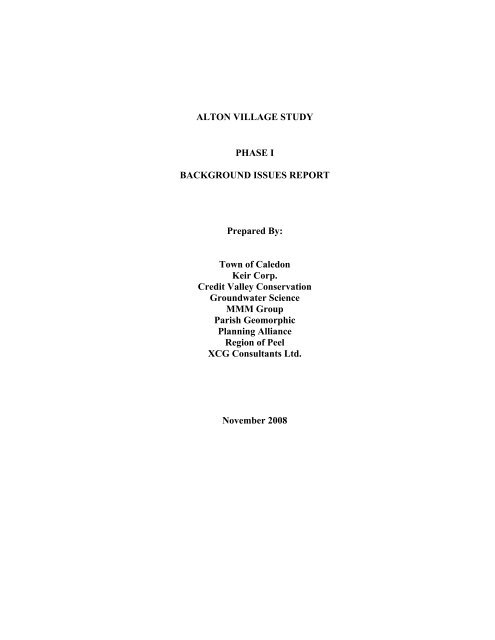
Alton Village Study Draft Phase 1 Background ... - Town of Caledon
Alton Village Study Draft Phase 1 Background ... - Town of Caledon
Alton Village Study Draft Phase 1 Background ... - Town of Caledon

Create successful ePaper yourself
Turn your PDF publications into a flip-book with our unique Google optimized e-Paper software.
ALTON VILLAGE STUDY<br />
PHASE I<br />
BACKGROUND ISSUES REPORT<br />
Prepared By:<br />
<strong>Town</strong> <strong>of</strong> <strong>Caledon</strong><br />
Keir Corp.<br />
Credit Valley Conservation<br />
Groundwater Science<br />
MMM Group<br />
Parish Geomorphic<br />
Planning Alliance<br />
Region <strong>of</strong> Peel<br />
XCG Consultants Ltd.<br />
November 2008
TABLE OF CONTENTS<br />
1.0 INTRODUCTION........................................................................................................... 1<br />
1.1 <strong>Study</strong> Approach ..................................................................................................................2<br />
1.2 Servicing <strong>Study</strong> and Class Environmental Assessment for Water and Wastewater<br />
Servicing for the <strong>Village</strong>s <strong>of</strong> <strong>Alton</strong> and <strong>Caledon</strong> ..............................................................4<br />
1.3 <strong>Study</strong> Area ...........................................................................................................................4<br />
1.4 Community Consultation ...................................................................................................5<br />
1.5 <strong>Study</strong> Process.......................................................................................................................5<br />
1.6 <strong>Study</strong> Management .............................................................................................................8<br />
2.0 POLICY CONTEXT .................................................................................................. 9<br />
2.1 Provincial Policy/Legislation/Guidelines ..........................................................................9<br />
2.1.1 Provincial Policy Statement (PPS) ................................................................................... 9<br />
2.1.2 The Greenbelt Plan .........................................................................................................11<br />
2.1.3 Growth Plan for the Greater Golden Horseshoe.............................................................15<br />
2.1.4 Planning Act Reform .....................................................................................................18<br />
2.1.5 Environmental Assessment Act.....................................................................................18<br />
2.1.6 Ontario Water Resources Act, Environmental Protection Act and Related<br />
Regulations .....................................................................................................................19<br />
2.1.7 Clean Water Act ............................................................................................................21<br />
2.1.8 Local Improvement Act..................................................................................................21<br />
2.2 Region <strong>of</strong> Peel ....................................................................................................................21<br />
2.2.1 Region <strong>of</strong> Peel Strategic Plan and Official Plan (ROP)..................................................21<br />
2.2.2 Region <strong>of</strong> Peel Water Protection Strategy and Guidelines for the Provision <strong>of</strong><br />
Communal Sewage Disposal Systems............................................................................22<br />
2.2.3 Design Standards ............................................................................................................22<br />
2.3 <strong>Town</strong> <strong>of</strong> <strong>Caledon</strong> Official Plan.........................................................................................24<br />
2.3.1 Principles, Strategic Direction and Goals.......................................................................24<br />
2.3.2 <strong>Village</strong> Studies................................................................................................................25<br />
2.3.3 Population and Employment...........................................................................................25<br />
2.3.4 Land Use Plan.................................................................................................................26<br />
2.3.5 Environmental Policies...................................................................................................29<br />
2.3.6 Mineral Resources ..........................................................................................................29<br />
2.3.7 Wellhead Protection........................................................................................................29<br />
2.3.8 Cultural Heritage ............................................................................................................32<br />
2.4 Credit Valley Conservation (CVC)..................................................................................32<br />
2.4.1 Conservation Authorities Act .........................................................................................32<br />
2.4.2 Fisheries Act (Federal Legislation) ................................................................................33<br />
2.4.3 Watercourse and Valley Land Protection Policies .........................................................33<br />
2.4.4 Flood Plain Management Policies ..................................................................................34<br />
2.5 CVC Studies ......................................................................................................................35<br />
2.5.1 Credit River Water Management Strategy Update (CRWMSU)....................................35<br />
2.5.2 Subwatershed Studies .....................................................................................................36<br />
2.5.3 Integrated Watershed Monitoring Program ...................................................................38<br />
3.0 COMMUNITY PLANNING COMPONENT ........................................................ 39<br />
3.1 Existing Conditions...........................................................................................................39<br />
3.1.1 Location and History ......................................................................................................39<br />
3.1.2 Historical Growth Pattern...............................................................................................40<br />
3.1.3 Cultural Heritage Resources ...........................................................................................47<br />
i
3.1.4 Existing Land Uses.........................................................................................................49<br />
3.1.5 Undeveloped Land and Development Interest................................................................56<br />
3.1.6 Socio-Economic Characteristics.....................................................................................59<br />
3.1.7 Infrastructure, Facilities and Community Services........................................................63<br />
3.1.8 Transportation.................................................................................................................70<br />
3.2 Community Character......................................................................................................72<br />
3.2.1 Introduction ....................................................................................................................72<br />
3.2.2 General Description........................................................................................................72<br />
3.2.3 Rural Landscapes............................................................................................................73<br />
3.2.4 <strong>Village</strong> Landscape ..........................................................................................................79<br />
3.2.5 Socio-Economic Influences............................................................................................95<br />
3.2.6 Infrastructure ..................................................................................................................96<br />
3.2.7 Public Facilities ..............................................................................................................99<br />
3.2.8 Community Services.....................................................................................................100<br />
3.3 Summary <strong>of</strong> Issues/Next Steps .......................................................................................100<br />
4.0 ENVIRONMENTAL COMPONENT................................................................... 101<br />
4.1 Introduction.....................................................................................................................101<br />
4.2 Hydrogeology Characterization.....................................................................................101<br />
4.2.1 Introduction ..................................................................................................................101<br />
4.2.2 Topography and Drainage ............................................................................................104<br />
4.2.3 Physiography ................................................................................................................104<br />
4.2.4 Quaternary Geology......................................................................................................107<br />
4.2.5 Bedrock Geology..........................................................................................................108<br />
4.2.6 Bedrock Topography .................................................................................................... 110<br />
4.2.7 Hydrostratigraphy.........................................................................................................110<br />
4.2.8 Groundwater Flow........................................................................................................112<br />
4.2.9 Recharge and Discharge Areas.....................................................................................115<br />
4.2.10 Hydrostratigraphy ........................................................................................................115<br />
4.2.11 Cross- Sections ............................................................................................................117<br />
4.2.12 Groundwater Quality ...................................................................................................118<br />
4.2.13 Summary <strong>of</strong> Conceptual Hydrogeologic Model..........................................................126<br />
4.2.14 Sensitivity <strong>of</strong> the Groundwater System .......................................................................127<br />
4.2.15 Next Steps....................................................................................................................130<br />
4.3 Hydrology Characterization ..........................................................................................131<br />
4.3.1 Introduction ..................................................................................................................131<br />
4.3.2 Work Completed...........................................................................................................131<br />
4.3.3 Next Steps.....................................................................................................................143<br />
4.4 Terrestrial........................................................................................................................144<br />
4.4.1 Introduction..................................................................................................................144<br />
4.4.2 Work Completed...........................................................................................................145<br />
4.4.3 Next Steps.....................................................................................................................166<br />
4.5 Fluvial Geomorphology Characterization ....................................................................167<br />
4.5.1 Introduction ..................................................................................................................167<br />
4.5.2 Review <strong>of</strong> Existing Information ...................................................................................167<br />
4.5.3 Controlling and Modifying Factors ..............................................................................167<br />
4.5.4 Reach Delineation and Stream Corridor Characterization............................................170<br />
4.5.5 Historical Assessments .................................................................................................173<br />
4.5.6 Detailed Field Work - 1999 ..........................................................................................176<br />
4.5.7 Detailed Field Work for IWMP - 1999 to 2004............................................................178<br />
4.5.8 Detailed Field Work – 2003 .........................................................................................178<br />
ii
4.5.9 Detailed Field Work - 2005 ..........................................................................................182<br />
4.5.10 Identification <strong>of</strong> Data Gaps..........................................................................................184<br />
4.5.11 Present Field Assessment.............................................................................................185<br />
4.6 Fisheries Characterization .............................................................................................188<br />
4.6.1 Introduction ..................................................................................................................188<br />
4.6.2 Work Completed...........................................................................................................188<br />
4.6.3 Next Steps.....................................................................................................................199<br />
4.7 Benthic Macroinvertebrates...........................................................................................200<br />
4.7.1 Introduction ..................................................................................................................200<br />
4.7.2 Work Completed...........................................................................................................200<br />
4.7.3 Next Steps.....................................................................................................................204<br />
4.8 Water Quality Characterization....................................................................................205<br />
4.8.1 Introduction ..................................................................................................................205<br />
4.8.2 Methodology.................................................................................................................208<br />
4.8.3 Interpretation <strong>of</strong> Existing Data .....................................................................................209<br />
4.8.4 Water Temperature Results ..........................................................................................228<br />
4.8.5 Sediment Chemistry Sampling .....................................................................................233<br />
4.8.6 Next Steps.....................................................................................................................233<br />
4.9 Septic System Impact Assessment .................................................................................234<br />
4.9.1 Introduction ..................................................................................................................234<br />
4.9.2 Information Review......................................................................................................235<br />
4.9.3 Level II <strong>Study</strong> ...............................................................................................................236<br />
5.0 EXISTING SERVICING CONDITIONS ................................................................ 239<br />
5.1 Introduction.....................................................................................................................239<br />
5.1.1 <strong>Background</strong>...................................................................................................................239<br />
5.1.2 Servicing Component ...................................................................................................239<br />
5.1.3 Class Environmental Assessment Process....................................................................240<br />
5.2 Description <strong>of</strong> Existing Servicing Infrastructure .........................................................243<br />
5.2.1 Description <strong>of</strong> Existing Water Supply System .............................................................243<br />
5.2.2 Wastewater Servicing ...................................................................................................250<br />
5.3 Problem Statement..........................................................................................................251<br />
5.3.1 Preliminary List <strong>of</strong> Water Servicing Alternatives ........................................................252<br />
5.3.2 Preliminary List <strong>of</strong> Wastewater Servicing Alternatives ...............................................252<br />
5.4 <strong>Background</strong> Information and Data Requirements ......................................................253<br />
5.4.1 Planning Information....................................................................................................253<br />
5.4.2 Environmental Information ..........................................................................................253<br />
5.4.3 Servicing Information...................................................................................................254<br />
5.4.4 Summary <strong>of</strong> Information Required and Methods for Data Collection .........................255<br />
6.0 TRANSPORTATION............................................................................................. 257<br />
6.1 Introduction.....................................................................................................................257<br />
6.2 Existing Road Network...................................................................................................257<br />
6.3 Existing Traffic................................................................................................................258<br />
6.3.1 Average Annual Daily Traffic (AADT) .......................................................................258<br />
6.3.2 Truck Traffic.................................................................................................................258<br />
6.3.3 Existing Intersection Level <strong>of</strong> Service..........................................................................259<br />
6.4 <strong>Background</strong> Traffic Growth Forecasts – Regional Road 136..................................... 259<br />
6.5 Issues, Conclusions and Next Steps ..............................................................................264<br />
6.5.1 Issues ............................................................................................................................264<br />
6.5.2 Conclusions <strong>of</strong> <strong>Phase</strong> 1................................................................................................. 264<br />
6.5.3 Next Steps.....................................................................................................................265<br />
iii
7.0 DRAFT GOAL, OBJECTIVES AND PRELIMINARY COMMUNITY DESIGN<br />
PRINCIPLES ...................................................................................................................... 266<br />
7.1 Introduction.....................................................................................................................266<br />
7.2 <strong>Draft</strong> Goal ........................................................................................................................266<br />
7.3 <strong>Draft</strong> Objectives ..............................................................................................................266<br />
7.3.1 <strong>Draft</strong> Planning Objectives.............................................................................................266<br />
7.3.2 <strong>Draft</strong> Environmental Objectives ...................................................................................267<br />
7.3.3 <strong>Draft</strong> Servicing Objectives ...........................................................................................267<br />
7.4 Preliminary Community Design Principles..................................................................268<br />
7.5 Next Steps ........................................................................................................................269<br />
8.0 COMMUNITY CONSULTATION........................................................................... 270<br />
8.1 <strong>Background</strong> .....................................................................................................................270<br />
8.2 A Community Vision for the <strong>Village</strong> <strong>of</strong> <strong>Alton</strong> ..............................................................271<br />
8.3 Summary <strong>of</strong> Issues ..........................................................................................................272<br />
9.0 NEXT STEPS .............................................................................................................. 273<br />
9.1 <strong>Phase</strong> 2 Introduction.......................................................................................................273<br />
GLOSSARY......................................................................................................................... 274<br />
REFERENCES.................................................................................................................... 276<br />
ENVIRONMENTAL COMPONENT APPENDICES (Under Separate Cover)<br />
Appendix A Terrestrial<br />
Appendix B Geomorphology<br />
Appendix C Fisheries<br />
Appendix D Water Quality<br />
Appendix E Hydrogeology/Septic Impact <strong>Study</strong><br />
LIST OF FIGURES<br />
FIGURE 1.3.1 ALTON VILLAGE STUDY AREA...........................................................................................6<br />
FIGURE 1.5.1 ALTON VILLAGE STUDY PROCESS.....................................................................................7<br />
FIGURE 2.1.1 GREENBELT PLAN DESIGNATIONS..................................................................................13<br />
FIGURE 2.3.1 CALEDON OFFICIAL PLAN LAND USE DESIGNATIONS...............................................27<br />
FIGURE 2.3.2 CALEDON OPA 179 LAND USE DESIGNATIONS .............................................................28<br />
FIGURE 2.3.3 SCHEDULE L CHPMARA......................................................................................................30<br />
FIGURE 2.3.4 WELLHEAD PROTECTION AREAS.....................................................................................31<br />
FIGURE 2.5.1 SHAWS CREEK STUDY STATIONS ....................................................................................37<br />
FIGURE 3.1.1 ALTON STUDY AREA: GEORGE R. TREMAINE MAP 1859 ............................................41<br />
FIGURE 3.1.2 ALTON STUDY AREA: HISTORICAL ATLAS OF PEEL COUNTY 1877.........................42<br />
FIGURE 3.1.3 ALTON VILLAGE PLAN: GEORGE R. TREMAINE MAP 1857.........................................43<br />
FIGURE 3.1.4 ALTON VILLAGE PLAN: HISTORICAL ATLAS OF PEEL COUNTY 1877 .....................44<br />
FIGURE 3.1.5 ALTON VILLAGE PATTERN OF LAND SUBDIVISION PLAN ........................................46<br />
FIGURE 3.1.6 ALTON VILLAGE AND STUDY AREA ASSESSED LAND USES ....................................50<br />
FIGURE 3.1.7 MAJOR LAND USES AND SIGNIFICANT FEATURES IN STUDY AREA.......................51<br />
FIGURE 3.1.8 COMMUNITY FACILITIES AND FEATURES....................................................................52<br />
FIGURE 3.1.9 AGRICULTURAL CAPABILITY ..........................................................................................57<br />
FIGURE 3.1.10 UNDEVELOPED LAND AND AREAS OF DEVELOPMENT INTEREST.........................58<br />
FIGURE 3.1.11 STORM SEWERS AND CURBS............................................................................................65<br />
FIGURE 3.1.12 SIDEWALKS...........................................................................................................................66<br />
FIGURE 3.1.13 TRAILS AND PUBLIC OPEN SPACE ..................................................................................68<br />
FIGURE 3.2.1 AIR PHOTO OF ALTON STUDY AREA.............................................................................75<br />
iv
FIGURE 3.2.2 RURAL LANDSCAPE: NATURAL AND WORKING.........................................................76<br />
FIGURE 3.2.3 TOPOGRAPHIC ANALYSIS .................................................................................................77<br />
FIGURE 3.2.4 WOODLANDS AND WATERCOURSES .............................................................................78<br />
FIGURE 3.2.5 BUILDING AGE ANALYSIS.................................................................................................81<br />
FIGURE 3.2.6 BUILT FORM QUADRANTS ................................................................................................83<br />
FIGURE 3.2.7 VILLAGE LANDSCAPE AREA 1: VARIOUS STREETS....................................................84<br />
FIGURE 3.2.8 VILLAGE LANDSCAPE AREA 1: VARIOUS STREETS....................................................85<br />
FIGURE 3.2.9 VILLAGE LANDSCAPE AREA 2: MAIN STREET.............................................................86<br />
FIGURE 3.2.10 VILLAGE LANDSCAPE AREA 2: MAIN STREET.............................................................87<br />
FIGURE 3.2.11 VILLAGE LANDSCAPE AREA 2: QUEEN ST. EAST .......................................................88<br />
FIGURE 3.2.12 VILLAGE LANDSCAPE AREA 2: QUEEN ST. WEST .......................................................89<br />
FIGURE 3.2.13 VILLAGE LANDSCAPE AREA 2: QUEEN ST. WEST .......................................................90<br />
FIGURE 3.2.14 VILLAGE LANDSCAPE AREA 2: ALTON MILL AND MILLCROFT INN......................91<br />
FIGURE 3.2.15 VILLAGE LANDSCAPE AREA 2: JAMES AND BRIDGE STREETS ...............................92<br />
FIGURE 3.2.16 VILLAGE LANDSCAPE AREA 3: MAIN STREET NORTH (EAST SIDE).......................93<br />
FIGURE 3.2.17 VILLAGE LANDSCAPE AREA 4: MAIN STREET NORTH (WEST SIDE) ......................94<br />
FIGURE 3.2.18 HISTORIC CORE....................................................................................................................97<br />
FIGURE 3.2.19 ALTON ESTATES SUBDIVISION........................................................................................98<br />
FIGURE 4.1.1 ALTON IN THE CREDIT RIVER WATERSHED………………………….......................102<br />
FIGURE 4.1.2 THE ALTON ENVIRONMENTAL STUDY AREA .............................................................103<br />
FIGURE 4.2.1 GROUND SURFACE TOPOGRAPHY ................................................................................105<br />
FIGURE 4.2.2 SURFICIAL GEOLOGY........................................................................................................106<br />
FIGURE 4.2.3 BEDROCK GEOLOGY .........................................................................................................109<br />
FIGURE 4.2.4 BEDROCK TOPOGRAPHY..................................................................................................111<br />
FIGURE 4.2.5 SHALLOW POTENTIOMETRIC SURFACE.......................................................................113<br />
FIGURE 4.2.6 DEEP POTENTIOMETRIC SURFACE ................................................................................114<br />
FIGURE 4.2.7 VERTICAL HYDRAULIC POTENTIAL..............................................................................116<br />
FIGURE 4.2.8 CROSS SECTION; ALTON A – A’.......................................................................................119<br />
FIGURE 4.2.9 CROSS SECTION; ALTON C – C’ .......................................................................................120<br />
FIGURE 4.2.10 CROSS SECTION ALTON E – E’.........................................................................................121<br />
FIGURE 4.2.11 STREAM FLOW MEASUREMENT LOCATIONS.............................................................124<br />
FIGURE 4.2.12 GROUNDWATER SENSITIVITY AREAS .........................................................................128<br />
FIGURE 4.3.1 FLOW GAUGE AND SPOT FLOW MONITORING STATIONS ......................................133<br />
FIGURE 4.3.2 STREAM STATUS AND REGIONAL STORM FLOODLINE...........................................134<br />
FIGURE 4.3.3 MAP OF FLOOD FLOW ESTIMATE POINTS OF INTEREST............................................136<br />
FIGURE 4.3.4 SHAWS CREEK RETURN PERIOD FLOWS BASED ON SUBWATERSHED 17 MODEL<br />
SIMULATION (1960-2005)..................................................................................................137<br />
FIGURE 4.3.5 LOW FLOW POINTS OF INTEREST FOR THE CREDIT RIVER AND SHAWS CREEK.139<br />
FIGURE 4.4.1 NATURAL COMMUNITIES AND EXISTING LAND USE – SUM OF AREA (HA) BY<br />
TYPE . .................................................................................................................................................145<br />
FIGURE 4.4.2 ALTON ELC, EXISTING LAND USE AND FIELD SITES ..................................................148<br />
FIGURE 4.4.3 ESAS AND PROVINCIALLY SIGNIFICANT WETLANDS................................................151<br />
FIGURE 4.4.4 CORE SUPPORTIVE AND NODE NATURAL AREA .........................................................155<br />
FIGURE 4.4.5 VALLEY LANDS ....................................................................................................................158<br />
FIGURE 4.4.6 VALLEY AND STREAM CORRIDOR SENSITIVITY.........................................................162<br />
FIGURE 4.5.1 ALTON GEOMORPHOLOGY REACH LOCATIONS AND FIELD SITES .......................168<br />
FIGURE 4.5.2 ALTON GEOMORPHOLOGY CHANNEL GRADIENTS ...................................................171<br />
FIGURE 4.5.3 HISTORIC CHANNEL PLANFORM (PARISH GEOMORPHIC, 2004)..............................176<br />
FIGURE 4.5.4 AREA FOR EROSION ASSESSMENT FROM PARISH GEOMORPHIC (2004) ................179<br />
FIGURE 4.6.1 FISH SAMPLING STATIONS ................................................................................................190<br />
FIGURE 4.6.2 FISH COMMUNITY CLASSIFICATION..............................................................................191<br />
FIGURE 4.6.3 SPAWNING REDDS SURVEY LOCATIONS<br />
……………………………………………………………………... ........................................................198<br />
FIGURE 4.7.1 BENTHIC MACROINVERTEBRATES MONITORING LOCATIONS. .............................201<br />
FIGURE 4.8.1 WATER QUALITY AND CONTINUOUS WATER TEMPERATURE MONITORING<br />
LOCATIONS............................................................................................................................................207<br />
v
FIGURE 4.8.2 MONTHLY 75TH PERCENTILE VALUES OF TP CONCENTRATION ..........................210<br />
FIGURE 4.8.3 MONTHLY 75TH PERCENTILE VALUES OF NITRATE-NITROGEN CONCENTRATION<br />
212<br />
FIGURE 4.8.4 MONTHLY 75TH PERCENTILE VALUES OF UNIONIZED AMMONIA NH3 ...............213<br />
FIGURE 4.8.5 MONTHLY 75TH PERCENTILE VALUES OF TKN CONCENTRATION .......................214<br />
FIGURE 4.8.6 MONTHLY 75TH PERCENTILE VALUES OF BOD5 CONCENTRATION .....................215<br />
FIGURE 4.8.7 DIURNAL MONITORING AT SHAWS CREEK AT BRUCE TRAIL.................................217<br />
FIGURE 4.8.8 DISSOLVED OXYGEN CONCENTRATIONS AT FOUR SUB 17 SITES .........................217<br />
FIGURE 4.8.9 MONTHLY 75TH PERCENTILE VALUES OF ALUMINUM CONCENTRATION .........221<br />
FIGURE 4.8.10 MONTHLY 75TH PERCENTILE VALUES OF COPPER CONCENTRATION ................221<br />
FIGURE 4.8.11 MONTHLY 75TH PERCENTILE VALUES OF IRON CONCENTRATION .....................222<br />
FIGURE 4.8.12 MONTHLY 75TH PERCENTILE VALUES OF ZINC CONCENTRATION ......................222<br />
FIGURE 4.8.13 MONTHLY GEOMEAN VALUES OF E. COLI CONCENTRATION ................................224<br />
FIGURE 4.8.14 MONTHLY 75TH PERCENTILE VALUES OF TSS CONCENTRATION ........................226<br />
FIGURE 4.8.15 MONTHLY 75TH PERCENTILE VALUES OF CHLORIDE CONCENTRATION ...........228<br />
FIGURE 4.8.16 MILLCROFT DAM.................................................................................................................229<br />
FIGURE 4.8.17 FACING DOWNSTREAM TOWARDS ALTON MILL DAM .............................................230<br />
FIGURE 4.8.18 WATER TEMPERATURE IN SHAWS CREEK UPSTREAM .............................................231<br />
FIGURE 4.8.19 WATER TEMPERATURE IN SHAWS CREEK UPSTREAM .............................................231<br />
FIGURE 4.9.1 SEPTIC IMPACT SITE LOCATIONS AND SETTING .........................................................237<br />
FIGURE 5.1.1 STUDY AREA WELLS AND STAND PIPE ..........................................................................241<br />
FIGURE 5.1.2 MUNICIPAL CLASS EA PLANNING AND DESIGN PROCESS........................................242<br />
FIGURE 5.2.1 ALTON WATER SUPPLY SYSTEM .....................................................................................245<br />
FIGURE 5.2.2 HISTORICAL WATER USE FOR ALTON VILLAGE (1990 TO 2006)...............................247<br />
FIGURE 6.3.1 REGIONAL ROAD 136 AND QUEEN STREET – EXISTING TRAFFIC............................261<br />
FIGURE 6.4.1 REGIONAL ROAD 136 AND QUEEN STREET – 2011 FORECASTED TRAFFIC ...........262<br />
FIGURE 6.4.2 REGIONAL ROAD 136 AND QUEEN STREET – 2021 FORECASTED TRAFFIC ...........263<br />
LIST OF TABLES<br />
TABLE 2.1.1 ONTARIO POLICIES, GUIDELINES AND PROCEDURES.................................................20<br />
TABLE 2.2.1 DESIGN STANDARDS FOR WATER USE AND WASTEWATER GENERATION...........23<br />
TABLE 2.2.2 MINISTRY OF ENVIRONMENT DESIGN GUIDELINES....................................................23<br />
TABLE 3.1.1 RESIDENTIAL BUILDING PERMITS ISSUED IN ALTON 1981 – 2007 ............................47<br />
TABLE 3.1.2 POPULATION BY AGE GROUP – STATISTICS CANADA 2001 .......................................60<br />
TABLE 3.1.3 ALTON EMPLOYMENT CHARACTERISTICS ....................................................................61<br />
TABLE 3.1.4 ALTON SHOPPING PATTERNS ............................................................................................63<br />
TABLE 3.2.1 DESCRIPTION OF BUILT FORM AREAS, VILLAGE OF ALTON.....................................82<br />
TABLE 4.2.1 HYDROSTRATIGRAPHY OF THE ALTON AREA............................................................117<br />
TABLE 4.2.2 SPOT BASEFLOW MEASUREMENTS SUMMARY TABLE.............................................123<br />
TABLE 4.2.3 SPOT BASEFLOWS FOR CREDIT RIVER AND SHAWS CREEK 1999-2008 .................126<br />
TABLE 4.3.1 RETURN EVENT FLOWS (M 3 /S) FOR POINTS OF INTEREST .......................................135<br />
TABLE 4.3.2 7-DAY AVERAGE LOW FLOW ESTIMATES (M 3 /S) FOR THE CREDIT RIVER...........138<br />
TABLE 4.3.3 7-DAY AVERAGE LOW FLOW ESTIMATES FOR SHAWS CREEK (M 3 /S)...................138<br />
TABLE 4.3.4 WATER BALANCE SUMMARY FOR SHAWS CREEK SUBWATERSHED (1960-2005).<br />
140<br />
TABLE 4.3.5 STORMWATER MANAGEMENT IN THE ALTON AREA................................................142<br />
TABLE 4.4.1 FOREST AND SUCCESSIONAL COMMUNITIES WITHIN THE ALTON AREA...........149<br />
TABLE 4.4.2 WOODED COMMUNITIES VISITED IN ALTON AREA....................................................149<br />
TABLE 4.4.3 ............... WETLAND COMMUNITIES WITHIN THE ENVIRONMENTAL STUDY AREA<br />
150<br />
TABLE 4.4.4 WETLAND COMMUNITIES VISITED IN ALTON AREA BY TYPE ................................152<br />
vi
TABLE 4.4.5 FLORA OF REGIONAL SIGNIFICANCE WITHIN THE CREDIT RIVER AT ALTON ESA<br />
153<br />
TABLE 4.4.6 WILDLIFE SPECIES DOCUMENTED DURING 1999 FIELD WORK................................161<br />
TABLE 4.4.7 BIRD SPECIES RECORDED AT THE GRANGE PROPERTY ............................................163<br />
TABLE 4.4.8 EXISTING LAND USE WITHIN THE ALTON AREA.........................................................165<br />
TABLE 4.5.1 GENERAL REACH CHARACTERISTICS FOR THE ENVIRONMENTAL STUDY AREA<br />
(CVC, 1999)..............................................................................................................................................172<br />
TABLE 4.5.2 HISTORICAL ASSESSMENT OF REACHES NEAR ALTON VILLAGE (CVC, 1999) .....174<br />
TABLE 4.5.3 GENERAL PROPERTIES AT SHAWS CREEK FIELD SITES (CVC, 1999).......................177<br />
TABLE 4.5.4 DETAILED BANKFULL CHANNEL AND EROSION THRESHOLD PARAMETERS.....181<br />
TABLE 4.5.5 KEY TO NAMING SCHEMES FROM 1999 AND 2007 FIELD WORK. .............................182<br />
TABLE 4.5.6 GENERAL REACH CHARACTERISTICS FROM THE SUBWATERSHED 17 STUDY<br />
(CVC, 2007)..............................................................................................................................................183<br />
TABLE 4.5.7 SUMMARY OF RAPID ASSESSMENT RESULTS AND CHANNEL CLASSIFICATIONS<br />
(CVC, 2007)..............................................................................................................................................183<br />
TABLE 4.5.8 SUMMARY OF 2005 REACH CONDITIONS (CVC, 2007) .................................................184<br />
TABLE 4.5.9 FIELD OBSERVATIONS OF REACHES...............................................................................186<br />
TABLE 4.5.10 RESULTS OF RAPID GEOMORPHIC ASSESSMENTS ......................................................187<br />
TABLE 4.6.1 FISH SPECIES AND SENSITIVITY RATINGS AT SAMPLING SITES .............................189<br />
TABLE 4.6.2 COMPARISON OF 1981-1985 AND 1999 SPAWNING REDDS..........................................197<br />
TABLE 4.7.1 DEFINITIONS OF METRICS AND THEIR RESPECTIVE DIRECTIONAL RESPONSE..202<br />
TABLE 4.7.2 BIOLOGICAL CRITERIA USED TO ESTABLISH IMPACT...............................................203<br />
TABLE 4.7.3 AVERAGE RESULTS FROM BENTHIC MACROINVERTEBRATE SAMPLING<br />
IMPAIRMENT. ........................................................................................................................................203<br />
TABLE 4.8.1 PARAMETERS OF CONCERN ..............................................................................................205<br />
TABLE 4.8.2 EXISTING LONG TERM WATER CHEMISTRY MONITORING STATIONS ..................208<br />
TABLE 4.8.3 SUMMARY STATISTICS OF NUTRIENT PARAMETERS OF CONCERN.......................211<br />
TABLE 4.8.4 SUMMARY STATISTICS OF OXYGEN RELATED PARAMETERS OF CONCERN.......215<br />
TABLE 4.8.5 SUMMARY STATISTICS OF METALS PARAMETERS OF CONCERN...........................220<br />
TABLE 4.8.6 SUMMARY STATISTICS OF MICROBIOLOGICAL PARAMETERS OF CONCERN .....223<br />
TABLE 4.8.7 SUMMARY STATISTICS OF PHYSICAL AND CHLORIDES PARAMETERS OF<br />
CONCERN ...............................................................................................................................................225<br />
TABLE 4.8.8 CONTINUOUS WATER TEMPERATURE SUMMARY STATISTICS...............................232<br />
TABLE 5.2.1 DESCRIPTION OF EXISTING PRODUCTION WELLS ......................................................244<br />
TABLE 5.2.2 ALTON VILLAGE WATER CONSUMPTION DATA..........................................................246<br />
TABLE 5.4.1 INFORMATION REQUIREMENTS AND COLLECTION METHODS ...............................256<br />
TABLE 6.3.1 HISTORICAL AADTS ON REGIONAL ROAD 136 .............................................................258<br />
TABLE 6.3.2 PERCENTAGE OF TRUCKS (AM PEAK PERIOD) .............................................................259<br />
TABLE 6.4.1 FORECAST BACKGROUND TRAFFIC ON REGIONAL ROAD 136 USING HISTORICAL<br />
AADTS 259<br />
vii
1.0 INTRODUCTION<br />
The <strong>Town</strong> <strong>of</strong> <strong>Caledon</strong>, the Region <strong>of</strong> Peel and Credit Valley Conservation are jointly<br />
undertaking a series <strong>of</strong> studies for <strong>Caledon</strong>’s villages as directed by the <strong>Town</strong> <strong>of</strong> <strong>Caledon</strong><br />
Official Plan and the Region <strong>of</strong> Peel’s Water Protection Strategy. These <strong>Village</strong> Studies<br />
consist <strong>of</strong> a comprehensive process designed to address planning, environmental and servicing<br />
implications <strong>of</strong> new development and the maintenance and enhancement <strong>of</strong> the existing village<br />
in an integrated manner.<br />
A key aspect <strong>of</strong> the <strong>Village</strong> Studies is the examination <strong>of</strong> Communal Sewage Disposal<br />
Systems (CSDS) and additional Communal Water Supply Systems as directed by provincial<br />
and regional policies. These policies identify CSDS as the preferred form <strong>of</strong> sanitary servicing<br />
for new development in rural communities where full municipal servicing is not available.<br />
The <strong>Alton</strong> <strong>Village</strong> <strong>Study</strong> is the third <strong>Village</strong> <strong>Study</strong> to be undertaken in <strong>Caledon</strong>. The<br />
Inglewood <strong>Village</strong> <strong>Study</strong> was completed in 1999 and was adopted by <strong>Caledon</strong> Council as<br />
Official Plan Amendment 155. The Cheltenham <strong>Village</strong> <strong>Study</strong> is currently in <strong>Phase</strong> 4 and soon<br />
to be complete.<br />
<strong>Alton</strong> has a significant amount <strong>of</strong> vacant land within the existing settlement boundary that is<br />
eligible for development, including an approved <strong>Draft</strong> Plan <strong>of</strong> Subdivision. There is also<br />
development interest on the part <strong>of</strong> landowners outside the current boundary. The <strong>Alton</strong><br />
<strong>Village</strong> <strong>Study</strong> is a community-based study that will result in a Community Plan, a Servicing<br />
Plan and an Environmental Management Plan to guide changes and development in the<br />
community to 2021.<br />
As described in Section 1.5, <strong>Study</strong> Process, the <strong>Study</strong> is being undertaken in four phases.<br />
• <strong>Phase</strong> 1: Collection and analysis <strong>of</strong> background information to determine existing<br />
Conditions <strong>of</strong> the <strong>Study</strong> Area.<br />
• <strong>Phase</strong> 2: Development and evaluation <strong>of</strong> community planning and servicing<br />
alternatives.<br />
• <strong>Phase</strong> 3: Preparation <strong>of</strong> conceptual Community, Servicing and Environmental<br />
Management Plans.<br />
• <strong>Phase</strong> 4: Finalization <strong>of</strong> the Recommended Community, Servicing and Environmental<br />
Management Plans.<br />
This <strong>Background</strong> Issues Report documents the findings <strong>of</strong> the <strong>Phase</strong> 1 work and has been<br />
updated since a preliminary draft in July 2002. Since originally produced, the draft report<br />
was not finalized due to delays in the project resulting from the community’s request to<br />
complete a visioning exercise. Due to delays in the project and the need to include additional<br />
updated background information, some phase elements may be undertaken concurrently.<br />
Much <strong>of</strong> the report content has not changed, but for the Environmental Component section<br />
there was extensive updating required. Much information related to the characterization <strong>of</strong><br />
the natural environment within the study area was based on data collected in 1999 and<br />
- 1 -
earlier. Significant data collection has been undertaken by CVC and other agencies for<br />
projects within the <strong>Alton</strong> area, in the decade since the original data was collected.<br />
CVC staff has conducted a comprehensive review <strong>of</strong> information to identify critical data gaps<br />
and perform a targeted update. This review included a thorough examination <strong>of</strong> data<br />
contained within the report to:<br />
a) screen-out which elements <strong>of</strong> the Environmental Component section would be subject<br />
to change in the time that has elapsed since its collection;<br />
b) establish which new data collected by CVC and other agencies would suffice as<br />
acceptable data to be added as an update; and<br />
c) identify further data collection requirements to be undertaken to close outstanding<br />
data gaps.<br />
The projects <strong>of</strong> key importance, as a source <strong>of</strong> more recent data, are the Subwatershed 17<br />
Shaws Creek Subwatershed <strong>Study</strong> and the CVC Integrated Watershed Monitoring Program<br />
discussed more in Chapter 4.<br />
1.1 <strong>Study</strong> Approach<br />
The <strong>Village</strong> <strong>Study</strong> process incorporates three interrelated components: the Community<br />
Planning Component; the Environmental Component and the Servicing Component. This<br />
process was developed in response to the Region <strong>of</strong> Peel’s Water Protection Strategy and<br />
Guidelines for the Provision <strong>of</strong> Communal Sewage Disposal Systems (CSDS) that was<br />
adopted by Regional Council in 1997. The Water Protection Strategy directs that<br />
comprehensive Servicing and Settlement Master Plans (SSMPs), also known as <strong>Village</strong><br />
Studies examine the feasibility <strong>of</strong> CSDS where growth is to be planned in communities<br />
without full municipal servicing.<br />
The Community Planning Component <strong>of</strong> the study will address planning issues such as<br />
population and settlement boundary, density, staging <strong>of</strong> growth, land use compatibility and<br />
the protection <strong>of</strong> resources such as agricultural land and aggregates and conformity with<br />
Provincial policies and plans. The intent <strong>of</strong> this component is to develop a long term plan<br />
(2021) to guide the evolution <strong>of</strong> the village and ensure that the character and quality <strong>of</strong> life is<br />
maintained and enhanced.<br />
Integral to the realization <strong>of</strong> this objective is the Community Design sub-component. It will<br />
make recommendations regarding community form and character, and internal and external<br />
linkages. An essential part <strong>of</strong> the process is the study <strong>of</strong> the existing community character<br />
undertaken in the first phase <strong>of</strong> the <strong>Village</strong> <strong>Study</strong>. An understanding <strong>of</strong> <strong>Alton</strong>’s character is<br />
vital to developing a Community Plan that respects and enhances these characteristics, while<br />
also allowing the community to evolve and change in an appropriate and desired direction.<br />
Community Design and Architectural Design Guidelines will be prepared to ensure that the<br />
character <strong>of</strong> new development and redevelopment in the commercial core and new residential<br />
areas is compatible with the existing character. Chapter 3 <strong>of</strong> this report outlines the existing<br />
conditions and character within the <strong>Alton</strong> <strong>Village</strong> <strong>Study</strong> Area.<br />
- 2 -
The <strong>Village</strong> <strong>of</strong> <strong>Alton</strong> is located on Shaws Creek near the confluence with the main stem <strong>of</strong><br />
the Credit River. The Environmental Component is a science-based study supported by<br />
technical assessments in the areas <strong>of</strong> hydrogeology, hydrology and hydraulics, terrestrial<br />
(species, habitats and communities), geomorphology, water quality, benthic<br />
macroinvertebrates and fisheries.<br />
Key issues to be addressed in the Environmental Component include: the protection <strong>of</strong><br />
groundwater and surface water, an understanding <strong>of</strong> terrestrial ecosystems and related<br />
environmental functions, and the background water quality in the Credit River and Shaws<br />
Creek. A detailed description <strong>of</strong> the environment in the vicinity <strong>of</strong> the <strong>Alton</strong> <strong>Village</strong> <strong>Study</strong><br />
Area is provided in Chapter 4, Environmental Component. The findings <strong>of</strong> the environmental<br />
characterization are summarized to give an overall understanding <strong>of</strong> the key environmental<br />
features, functions and linkages in the study area. The identification <strong>of</strong> environmental<br />
limitations and sensitivities will be the key outcome <strong>of</strong> this analysis.<br />
The Environmental Component includes a Septic System Impact <strong>Study</strong> which was undertaken<br />
as part <strong>of</strong> this component to:<br />
• Provide a detailed assessment <strong>of</strong> local groundwater/surface water conditions and<br />
relationships both within the existing development area and within areas <strong>of</strong> potential<br />
future development;<br />
• Characterize the current level <strong>of</strong> impact to groundwater and surface water resources<br />
near <strong>Alton</strong> related to individual septic systems; and,<br />
• Based on this characterization, provide an assessment <strong>of</strong> the expected impacts related<br />
to future development on individual septic systems within <strong>Alton</strong>.<br />
The hydrological and geomorphic work to be completed as part <strong>of</strong> the Environmental<br />
Component will provide the basis for the identification <strong>of</strong> a preferred stormwater<br />
management option. Additional work to develop a stormwater management plan and the<br />
design <strong>of</strong> stormwater management systems will be undertaken in later phases <strong>of</strong> the study or<br />
through the development review process, as appropriate.<br />
The environmental considerations including environmental limitations and sensitivity<br />
information will be integrated into the planning and servicing components <strong>of</strong> the study and<br />
an Environmental Management Plan will be developed.<br />
The Servicing Component will examine existing water and sewage disposal infrastructure,<br />
assess potential servicing options in consideration <strong>of</strong> the planning scenarios, environmental<br />
management, cost and operational concerns and identify preferred servicing solutions. This<br />
component will result in a Community Servicing Plan. The Servicing Component work<br />
program has been structured to satisfy the process requirements <strong>of</strong> the Environmental<br />
Assessment Act. This will ensure that an application under the Environmental Assessment<br />
Act for future infrastructure will be supported by a study that addresses the requirements <strong>of</strong><br />
the Act. These requirements are discussed in the following chapter in Section 2.1.5. The<br />
Servicing Component will also address transportation issues.<br />
- 3 -
1.2 Servicing <strong>Study</strong> and Class Environmental Assessment for Water and<br />
Wastewater Servicing for the <strong>Village</strong>s <strong>of</strong> <strong>Alton</strong> and <strong>Caledon</strong><br />
The <strong>Phase</strong> 1 report <strong>of</strong> the Servicing Component as originally set out in the Terms <strong>of</strong><br />
Reference is contained in Chapter 5 <strong>of</strong> this report. The Servicing Component is designed to<br />
be part <strong>of</strong> a separate servicing study document to support an application under the<br />
Environmental Assessment Act for water and wastewater system improvements. Due to the<br />
need for a stand-alone document, there will be some duplication in this <strong>Background</strong> Report<br />
between Chapter 1, the introductory chapter and Chapter 5 Existing Servicing Conditions. In<br />
addition, Chapter 5 will refer to phases within the Servicing Component work program.<br />
These phases are based on the process outlined in the Environmental Assessment Act shown<br />
on Figure 5.1.2, and should not be confused with the four phases <strong>of</strong> the overall <strong>Village</strong> <strong>Study</strong><br />
work program shown in Figure 1.5.1.<br />
During the course <strong>of</strong> the preliminary <strong>Phase</strong> 1 work, a number <strong>of</strong> issues arose outside <strong>of</strong> the<br />
<strong>Alton</strong> <strong>Village</strong> <strong>Study</strong> Area that made the need for a broader scale review <strong>of</strong> servicing<br />
apparent. These issues resulted in the Region initiating a Water and Wastewater Servicing<br />
Class Environmental Assessment for the <strong>Village</strong>s <strong>of</strong> <strong>Alton</strong> and <strong>Caledon</strong> and the Intervening<br />
Lands. The study looked at a range <strong>of</strong> joint village water and wastewater alternatives. These<br />
options were presented to the public at two Public Information Centres held on February 26 th<br />
and June 17, 2004. Following these meetings, the Region determined that there was no<br />
immediate need to provide wastewater servicing to <strong>Caledon</strong> <strong>Village</strong> and the intervening lands<br />
and did not proceed to implement the preferred joint wastewater servicing alternative for<br />
<strong>Alton</strong> <strong>Village</strong> and <strong>Caledon</strong> <strong>Village</strong>.<br />
With respect to water supply, the Region identified a need for improved water servicing for<br />
both <strong>Village</strong>s <strong>of</strong> <strong>Alton</strong> and <strong>Caledon</strong> to provide flexibility, reliability and security and increase<br />
the water supply. The interconnection <strong>of</strong> the water supply systems <strong>of</strong> <strong>Alton</strong> and <strong>Caledon</strong><br />
<strong>Village</strong>s was recommended as part <strong>of</strong> the Class EA for North Peel Groundwater System<br />
Upgrades (<strong>Alton</strong>, Inglewood, and <strong>Caledon</strong> <strong>Village</strong>). The Environmental Screening<br />
Document (ESD) that documented the planning and decision making processes for the<br />
project was released for public review on August 11, 2004. The review period expired on<br />
November 8, 2004.<br />
1.3 <strong>Study</strong> Area<br />
The <strong>Study</strong> Area for the <strong>Alton</strong> <strong>Village</strong> <strong>Study</strong> is shown on Figure 1.3.1. The <strong>Study</strong> Area<br />
includes a large rural area outside the existing settlement to recognize the relationship <strong>of</strong> the<br />
<strong>Village</strong> with the surrounding areas <strong>of</strong> influence. External factors such as adjacent land uses,<br />
site conditions and environmental features and functions, groundwater resources,<br />
transportation systems, and aggregate resources will be considered in the study. The<br />
surrounding properties will also be examined regarding any potential adjustments to the<br />
settlement area boundary in the context <strong>of</strong> existing Provincial policies and plans.<br />
- 4 -
Although not part <strong>of</strong> the study area for planning purposes, the Environmental and Servicing<br />
Components may consider lands outside <strong>of</strong> the <strong>Study</strong> Area depicted in Figure 1.3.1 for<br />
analysis <strong>of</strong> impacts.<br />
1.4 Community Consultation<br />
Opportunities for residents and other stakeholders to participate will be provided throughout<br />
the <strong>Alton</strong> <strong>Village</strong> <strong>Study</strong> process to ensure that the study recognizes the aspirations and<br />
priorities <strong>of</strong> the community. Community consultation will include community meetings and<br />
workshops with members <strong>of</strong> the <strong>Alton</strong> <strong>Village</strong> Association Inc. a residents’ association<br />
known as the Liaison Group. The role <strong>of</strong> the Liaison Group is to exchange information with<br />
the <strong>Study</strong> Team, discuss issues and ideas related to planning and contribute their ideas and<br />
advice regarding community consultation. The Liaison Group may interact with the wider<br />
community as they feel is appropriate. Some <strong>of</strong> the <strong>Village</strong> Association representatives are<br />
both residents and business operators in <strong>Alton</strong> while others represent development interests.<br />
Consultation with other landowners and local business owners will also occur at appropriate<br />
points in the study process. The sequence <strong>of</strong> the community meetings and Liaison Group<br />
meetings is shown on Figure 1.5.1 the diagram <strong>of</strong> the <strong>Study</strong> Process. During the course <strong>of</strong><br />
<strong>Phase</strong> 1 <strong>of</strong> the <strong>Study</strong>, additional meetings were held with the Liaison Group and the<br />
Community. The <strong>Phase</strong> 1 Public Consultation process is described further in Chapter 8.<br />
1.5 <strong>Study</strong> Process<br />
As set out in Section 1, the <strong>Village</strong> <strong>Study</strong> is being carried out in four phases. The activities<br />
<strong>of</strong> the three components in each phase are shown on Figure 1.5.1, the <strong>Study</strong> Process flow<br />
chart. Meetings to date are reviewed more fully in Chapter 8.<br />
<strong>Phase</strong> 1 <strong>of</strong> the study consisted <strong>of</strong> the collection and analysis <strong>of</strong> background information to<br />
determine the existing conditions within the <strong>Study</strong> Area. Where data gaps have been<br />
identified, the Work Program was supplemented to obtain the additional information. The<br />
additional work related to the servicing component is explained in Section 1.2. <strong>Draft</strong> Goals<br />
and Objectives for planning, servicing and environmental protection were developed and<br />
preliminary Community Design Principles were established for discussion with the public.<br />
The findings <strong>of</strong> <strong>Phase</strong> 1 are documented in this <strong>Background</strong> Issues Report.<br />
<strong>Phase</strong> 2 will identify and evaluate various community planning and servicing alternatives in<br />
the context <strong>of</strong> the environmental and servicing considerations. Based on the evaluation <strong>of</strong><br />
the alternatives and the community consultation undertaken as part <strong>of</strong> this phase, a preferred<br />
Community Plan and Servicing Alternative will be selected. As noted in Section 1.2, the<br />
consideration <strong>of</strong> servicing alternatives will occur in the context <strong>of</strong> the Water and Wastewater<br />
Servicing <strong>Study</strong>/Class EA as a standalone document. This study forms the Servicing<br />
Component <strong>of</strong> the <strong>Alton</strong> <strong>Village</strong> <strong>Study</strong>, but the timing <strong>of</strong> the <strong>Phase</strong> 2 work will not<br />
necessarily correspond to the timing <strong>of</strong> the <strong>Phase</strong> 2 work for the Planning Component.<br />
- 5 -
- 6 -
- 7 -
In <strong>Phase</strong> 3 the recommendations <strong>of</strong> the previous phase will be developed as a Conceptual<br />
Community Plan and <strong>Draft</strong> Environmental Management Plan. These plans will be further<br />
reviewed with the community. The <strong>Draft</strong> Servicing Plan originally anticipated in the Terms<br />
<strong>of</strong> Reference will be provided through the preferred alternative as part <strong>of</strong> the Class<br />
Environmental Assessment.<br />
In <strong>Phase</strong> 4 the recommended Community, Servicing and Environmental Management Plans<br />
will be finalized. An Official Plan Amendment will be drafted for adoption by <strong>Caledon</strong><br />
Council. A formal Public Meeting will be held prior to Council’s adoption <strong>of</strong> the Official<br />
Plan Amendment. The Environmental <strong>Study</strong> Report prepared for the Environmental<br />
Assessment as part <strong>of</strong> the Servicing Component will be presented to Regional Council and<br />
submitted to the Ministry <strong>of</strong> the Environment for approval under the Environmental<br />
Assessment Act. The Environmental Management Plan will be presented to the Board <strong>of</strong> the<br />
Credit Valley Conservation for adoption. The delay in the project restart may require some<br />
consolidation <strong>of</strong> tasks within phases for purposes <strong>of</strong> completing the project by spring <strong>of</strong><br />
2009.<br />
1.6 <strong>Study</strong> Management<br />
The <strong>Alton</strong> <strong>Village</strong> <strong>Study</strong> is a joint initiative <strong>of</strong> the <strong>Town</strong> <strong>of</strong> <strong>Caledon</strong>, the Region <strong>of</strong> Peel and<br />
Credit Valley Conservation, with each agency being responsible for its area <strong>of</strong> expertise.<br />
Each <strong>of</strong> the three study partners has retained consultants to assist with specific tasks. The<br />
<strong>Town</strong> has retained Keir Corp. to manage the planning component and coordinate the three<br />
interrelated components <strong>of</strong> the study. In addition, the Planning Alliance was retained to<br />
undertake the preliminary Community Design work and this initial work has been reviewed<br />
and updated by MMM Group. The Region <strong>of</strong> Peel is managing the Servicing Component,<br />
and has retained XCG Consultants Ltd. to complete the Water and Wastewater Servicing<br />
<strong>Study</strong>/Class EA. Credit Valley Conservation (CVC) is the manager <strong>of</strong> the Environmental<br />
Component. CVC retained Groundwater Science to complete the Septic System Impact <strong>Study</strong><br />
and Parish Geomorphic for the fluvial geomorphology assessment.<br />
Mark Sraga, Director, Strategic Initiatives, <strong>Town</strong> <strong>of</strong> <strong>Caledon</strong> is the overall manager <strong>of</strong> the<br />
<strong>Alton</strong> <strong>Village</strong> <strong>Study</strong> for the <strong>Town</strong> and principal liaison with other public agencies and<br />
community interests.<br />
- 8 -
2.0 POLICY CONTEXT<br />
2.1 Provincial Policy/Legislation/Guidelines<br />
The <strong>Alton</strong> <strong>Village</strong> <strong>Study</strong> is being undertaken in the context <strong>of</strong> a range <strong>of</strong> policies and<br />
legislation at the Provincial, Regional and Municipal levels. The <strong>Village</strong> <strong>Study</strong> Process must<br />
recognize and respond to the requirements <strong>of</strong> the applicable legislation and policies. Since<br />
the <strong>Alton</strong> <strong>Village</strong> <strong>Study</strong> commenced, the Province has undertaken a number <strong>of</strong> new policy<br />
initiatives and these are set out below.<br />
2.1.1 Provincial Policy Statement (PPS)<br />
The Province <strong>of</strong> Ontario issued a new Provincial Policy Statement (PPS) in 2005 which is<br />
intended to provide policy direction on planning matters related to issues <strong>of</strong> provincial<br />
interest. The current PPS came into effect on March 1, 2005 and replaces the former 1997<br />
PPS. Changes to the Planning Act require that all decisions affecting planning matters “shall<br />
be consistent with” the PPS and will be complemented by locally generated policies<br />
regarding matters <strong>of</strong> local interest.<br />
The Provincial Policy Statement sets out three key principles concerning the long term<br />
economic prosperity, environmental health and social well-being <strong>of</strong> Ontario, and provides<br />
policy directions in the following subject areas: Efficient, cost effective development and<br />
land use patterns; Wise use and management <strong>of</strong> resources; and Protecting public health and<br />
safety.<br />
Section 1.1 - Developing Strong Communities addresses planning issues such as costeffectiveness<br />
<strong>of</strong> development; land requirements and land use patterns, and long term<br />
economic prosperity. The policies focus growth in Settlement areas (1.1.3.1) and promote<br />
intensification, redevelopment (1.1.3.3) and compact form to allow for the efficient use <strong>of</strong><br />
land, infrastructure and public service facilities (1.1.3.7). Settlement area boundaries can<br />
only be expanded at a time <strong>of</strong> comprehensive review and only where sufficient opportunities<br />
for growth are not available through intensification, redevelopment and designated growth<br />
areas to accommodate projected needs in addition to other criteria. (1.1.3.9)<br />
Section 1.4 - Housing provides direction on planning matters such as housing mix, densities,<br />
land supply and intensification. Subsection 1.4.3 states that:<br />
“Planning authorities shall provide for an appropriate range <strong>of</strong> housing types and<br />
densities to meet projected requirements <strong>of</strong> current and future residents <strong>of</strong> the<br />
regional market area…”<br />
- 9 -
Regional market area is defined as:<br />
“...an area, generally broader than a lower tier municipality, that has a high degree<br />
<strong>of</strong> social and economic interaction. In southern Ontario, the upper tier or single-tier<br />
municipality will normally serve as the regional market area”<br />
This is to be done, among other things, by “establishing and implementing minimum targets<br />
for the provision <strong>of</strong> housing which is affordable to low and moderate income households”<br />
and permitting and facilitating all forms or residential intensification and redevelopment<br />
(1.4.3)<br />
Section 1.5 – Public Spaces, Parks and Open Space promotes healthy, active communities<br />
through the provision <strong>of</strong> public spaces, parks and open spaces.<br />
Section 1.6 - Infrastructure and Public Service Facilities sets out the provincial policy<br />
direction regarding water and sewage systems, transportation systems and corridors,<br />
infrastructure corridors, airports and waste management. Subsection 1.6.4.2 expresses the<br />
preference for full municipal servicing for settlement areas, and communal servicing only if<br />
full servicing cannot be provided. Individual on-site systems would only be appropriate if<br />
full or communal systems are not feasible. Partial services (e.g. communal water, private<br />
septic systems) will be discouraged except where necessary to address failed services, or<br />
because <strong>of</strong> physical constraints.<br />
Section 1.8 – Energy and Air Quality supports energy efficiency and improved air quality<br />
through appropriate land use and development patterns.<br />
Section 2.1 - Natural Heritage contains policies to protect natural heritage features and areas<br />
from incompatible development. Subsection 2.1.2 outlines the provincial interest in<br />
maintaining, restoring or, where possible, improving the diversity and connectivity <strong>of</strong> natural<br />
features and areas, and the long-term ecological function and biodiversity <strong>of</strong> natural heritage<br />
systems. Subsection 2.1.3 lists features within which development and site alteration is not<br />
permitted and Subsection 2.1.4 lists features where development and site alteration may be<br />
permitted if “it has been demonstrated that there will be no negative impacts on the natural<br />
features or their ecological functions …”. Subsection 2.1.5 identifies that development and<br />
site alteration are not permitted within fish habitat except in accordance with provincial and<br />
federal requirements. Subsection 2.1.6 permits development and site alteration on adjacent<br />
lands if “it has been demonstrated that there will be no negative impacts on the natural<br />
features or on their ecological functions”.<br />
Section 2.2 –Water contains policies for the protection, improvement and restoration <strong>of</strong><br />
quality and quantity <strong>of</strong> water including the restriction <strong>of</strong> development and site alteration in or<br />
near sensitive surface and groundwater features.<br />
Section 2.3 - Agricultural Policies are designed to protect Prime Agricultural Areas. These<br />
areas can only be re-designated for the expansion <strong>of</strong> settlement areas, subject to need and an<br />
examination <strong>of</strong> alternatives, among others. The agricultural land in the <strong>Alton</strong> area does not<br />
- 10 -
meet the definition <strong>of</strong> Prime Agricultural Areas in the Provincial Policy Statement, and<br />
therefore would not apply to a potential expansion <strong>of</strong> the settlement boundary if it would<br />
meet the other tests under the Provincial policies and plans.<br />
Section 2.5 – Mineral Aggregate Resources contains policies to protect mineral aggregate<br />
resources from activities that would preclude or hinder future extraction. Aggregate<br />
resources exist within the study area, including a licensed pit. <strong>Caledon</strong> Official Plan (OPA<br />
161) contains policies and identification mapping for protecting the aggregate resources<br />
which are discussed in Section 2.3.6.<br />
Section 2.6 - Cultural Heritage and Archaeology provides policy direction requiring the<br />
conservation <strong>of</strong> significant built heritage, significant cultural heritage landscapes and<br />
significant archaeological resources.<br />
Section 3 - Public Health and Safety directs development away from natural and humanmade<br />
hazards. As portions <strong>of</strong> the <strong>Alton</strong> Settlement Area are located within the Shaws Creek<br />
flood plain which is based on the Regional Storm, these policies will have to be addressed.<br />
2.1.2 The Greenbelt Plan<br />
The Greenbelt Plan took effect December 16, 2004 and identified where urbanization should<br />
not occur. The Greenbelt Plan includes lands already included within the Niagara<br />
Escarpment Plan, the Oak Ridges Moraine Conservation Plan, the Parkway Belt West Plan,<br />
and identifies Protected Countryside which includes an Agricultural System (Prime<br />
Agricultural and Rural Areas designated in municipal Official Plans), a Natural Heritage<br />
System and Settlement Areas.<br />
The Natural Heritage System is comprised <strong>of</strong> the Natural Heritage System, Water Resource<br />
System and key natural heritage features and key hydrologic features. The Natural Heritage<br />
System acts as an overlay to the underlying municipal designations (prime agricultural and/or<br />
rural) and may provide further constraints. Where there are conflicts with the municipally<br />
defined and designated natural heritage features, those <strong>of</strong> the Greenbelt Plan take precedence.<br />
Boundaries <strong>of</strong> the Natural Heritage System may be refined at the time <strong>of</strong> municipal<br />
conformity in accordance with the Natural Heritage Policies <strong>of</strong> the Plan.<br />
<strong>Alton</strong> <strong>Village</strong> is designated as a <strong>Town</strong>/<strong>Village</strong> within the Greenbelt Plan and is subject to the<br />
detailed delineation <strong>of</strong> the settlement boundary and the designations and permissions as set<br />
out in the <strong>Caledon</strong> Official Plan. <strong>Alton</strong> is surrounded by the Protected Countryside<br />
designation <strong>of</strong> the Greenbelt Plan containing large areas <strong>of</strong> Natural Heritage System around<br />
much <strong>of</strong> the village particularly to the north and east.<br />
Section 3.4 deals with Settlement Area policies which state that <strong>Village</strong>s such as <strong>Alton</strong><br />
continue to be governed by municipal Official Plans. It also states that:<br />
“Municipalities are encouraged to continue their efforts to support the long-term<br />
vitality <strong>of</strong> these settlements through appropriate planning and economic development<br />
- 11 -
approaches which seek to maintain, intensify and/or revitalize these communities.<br />
This includes modest growth that is compatible with the long-term role <strong>of</strong> these<br />
settlements as part <strong>of</strong> the Protected Countryside and the capacity to provide locally<br />
based sewage and water services.”<br />
Policy 3.4.4, Additional Policies for Settlement Area Expansion, deals with municipally<br />
initiated settlement area expansion proposals:<br />
“1. Where a municipality has initiated the consideration <strong>of</strong> a settlement expansion<br />
prior to the date this Plan came into effect, such an expansion may be considered<br />
through the municipality’s exercise to bring its <strong>of</strong>ficial plan into conformity with this<br />
Plan as described in the municipal implementation policies <strong>of</strong> section 5.2. The<br />
proposed expansion shall:<br />
a) Prior to December 16, 2003, be supported by:<br />
i) A council resolution authorizing consideration <strong>of</strong> such an expansion; and,<br />
ii) substantial completion <strong>of</strong> background studies or reports by municipal staff or<br />
planning consultants, or the expenditure <strong>of</strong> municipal funds on the consideration<br />
<strong>of</strong> such expansion.<br />
b) Not extend into the Natural Heritage System;<br />
c) Not extend into specialty crop areas; and,<br />
d) Maintain the rural and /or existing character <strong>of</strong> the settlement area.”<br />
Criterion a) above has been satisfied through Council resolution August 28, 2000 to<br />
undertake the <strong>Alton</strong> <strong>Village</strong> <strong>Study</strong> and a number <strong>of</strong> background studies were complete since<br />
2002, although not necessarily public. Any municipally initiated settlement expansion can<br />
only be considered in the context <strong>of</strong> bringing the Official Plan into conformity with the<br />
Greenbelt Plan. This exercise is currently underway and scheduled for June 2009. Further a<br />
settlement boundary cannot extend into the Natural Heritage System or specialty crop areas<br />
and must maintain the rural and /or existing character <strong>of</strong> the settlement area. Much <strong>of</strong> the<br />
land surrounding the village, particularly north and east, is within the Natural Heritage<br />
System <strong>of</strong> the Greenbelt as depicted in Figure 2.1.1. Compliance with the Growth Plan is<br />
discussed in Section 2.1.3 below.<br />
Lands within the <strong>Alton</strong> area are generally designated Rural to the north and Agricultural to<br />
the south to coincide with better soil capability to the south and poorer soil capability to the<br />
north as discussed further in Section 2.3 with no Prime Agricultural Areas in the vicinity<br />
(OPA 179). All <strong>of</strong> the lands surrounding <strong>Alton</strong> are within the Greenbelt and designated<br />
Protected Countryside.<br />
- 12 -
- 13 -
For lands falling within the Rural Area <strong>of</strong> the Protected Countryside they permit: “a range <strong>of</strong><br />
recreational, tourism, institutional and resource-based commercial/industrial uses..”<br />
Settlement area expansions are permitted into rural areas subject to policies <strong>of</strong> the Greenbelt<br />
Plan. Other uses subject to the Plan may also be permitted including those related to<br />
renewable and non-renewable resources.<br />
“New multiple units or multiple lots for residential dwellings (e.g. estate residential<br />
subdivisions and adult lifestyle or retirement communities), whether by plan <strong>of</strong><br />
subdivision, condominium or severance, shall not be permitted in rural areas.”<br />
Municipal Official Plans, however, may be more restrictive with respect to residential<br />
severances and shall provide guidance for the creation <strong>of</strong> lots in the rural area. New lots shall<br />
not be created if it would extend or promote strip development.<br />
Existing, expanded and new infrastructure is permitted in the Protected Countryside subject<br />
to conditions set out in Section 4.2 Infrastructure including the following:<br />
“4.2.2.2 Where settlements do not currently have Great Lake or Lake Simcoe based<br />
water and sewage services, extensions to or expansions <strong>of</strong> existing Great Lake or<br />
Lake Simcoe based services to such settlements is not permitted, unless such servicing<br />
is required to address failed individual on-site sewage or water services or to ensure<br />
the protection <strong>of</strong> public health where is has been determined by a medical <strong>of</strong>ficer <strong>of</strong><br />
health (or other health authority) that there is a public health concern associated<br />
with existing services within the settlement. The capacity <strong>of</strong> the services provided in<br />
these circumstances will be restricted to that required to service the affected existing<br />
settlement plus the capacity for potential development within the settlement boundary<br />
as it existed on the date this Plan came into effect.”<br />
“4.4.4 Where settlement area expansions are contemplated by a municipality, the<br />
environmental assessment in support <strong>of</strong> expanded sewage and water services must be<br />
completed or approved prior to amending the boundaries <strong>of</strong> the settlement within the<br />
municipal <strong>of</strong>ficial plan. The expansion must not extend into the Natural Heritage<br />
System or the specialty crop area.”<br />
“4.2.2.6 New or expanded partial servicing, where site conditions are suitable for the<br />
long-term provision <strong>of</strong> such services, is only permitted in the following<br />
circumstances:<br />
a) Where such servicing is necessary to address failed individual on-site sewage or<br />
water services serving existing development; or<br />
b) To allow for infilling and intensification within settlement areas served by partial<br />
services as <strong>of</strong> the date this Plan came into effect.”<br />
Section 4.3 outlines policies related to Natural Resources. Activities related to the use <strong>of</strong><br />
renewable resources are permitted in the Protected Countryside:<br />
- 14 -
“Renewable resources are those non-agricultural-based natural resources that<br />
support uses and activities such as forestry, water taking, fisheries, conservation, and<br />
wildlife management.”<br />
Activities related to the use <strong>of</strong> non-renewable resources are permitted in the Protected<br />
Countryside, subject to some restrictions for mineral aggregate operations, wayside pits and<br />
quarries and subject to all other applicable legislation, regulations and municipal Official<br />
Plan policies. Non-renewable resources are those non-agricultural-based natural resources<br />
that have a finite supply, including mineral aggregate resources.<br />
All legal existing uses before the Greenbelt Plan came into force are permitted as are single<br />
dwellings permitted on legal lots <strong>of</strong> record zoned prior to the Greenbelt Plan coming into<br />
force. In addition lot creation is permitted in the Protected Countryside for the permitted<br />
uses in addition to some other circumstances as described in the Plan, such as minor lot<br />
adjustment or boundary additions, provided they do not create a separate lot for a residential<br />
dwelling in specialty crop or prime agricultural areas and there is no increased fragmentation<br />
<strong>of</strong> a key natural heritage feature or key hydrologic function.<br />
Any Council decision relating to <strong>Alton</strong> will have to conform to the Greenbelt Plan and any<br />
decisions regarding a settlement boundary expansion must meet the provisions <strong>of</strong> sections<br />
3.4.4 and 4.2 and be done at the time <strong>of</strong> the municipality’s conformity exercise which is<br />
currently underway and anticipated to be completed by the <strong>Caledon</strong> Planning Department in<br />
June 2009. The village study would have to be essentially completed prior to this time in<br />
order to meet the <strong>Town</strong>’s conformity schedule and the provisions <strong>of</strong> the Greenbelt Plan.<br />
2.1.3 Growth Plan for the Greater Golden Horseshoe<br />
The Growth Plan for the Greater Golden Horseshoe was approved by Cabinet to take effect<br />
on June 16, 2006. The Growth Plan is a provincially approved plan as referred to in the PPS.<br />
Any Council decision related to <strong>Alton</strong> must also conform to the Growth Plan. The Growth<br />
Plan includes all <strong>of</strong> the Greenbelt Plan lands and areas beyond as defined by the Act.<br />
The Guiding Principles <strong>of</strong> the Growth Plan provide for compact, vibrant and complete<br />
communities, planned and managed growth, conservation <strong>of</strong> resources and optimization <strong>of</strong><br />
existing infrastructure.<br />
The Growth Plan envisages increasing intensification <strong>of</strong> build-up areas with a focus on urban<br />
growth centres, intensification corridors, major transit station areas among others. All<br />
intensification areas are intended to attract a significant proportion <strong>of</strong> population and<br />
employment growth, support vibrant neighbourhoods, provide high quality public open<br />
spaces, support transit, walking and cycling, achieve higher densities than the surrounding<br />
areas and provide an appropriate transition in built form to adjacent areas. Growth is to be<br />
managed through the building <strong>of</strong> compact, pedestrian friendly, transit supportive<br />
environments, complete communities with a balance <strong>of</strong> jobs and houses and directing major<br />
growth to settlements with full municipal services and limiting growth in settlement areas<br />
- 15 -
that are serviced by other forms <strong>of</strong> water and wastewater services. It also prohibits the<br />
establishment <strong>of</strong> new settlements.<br />
The general intensification policies <strong>of</strong> the Plan provide for a minimum <strong>of</strong> 40% <strong>of</strong> all<br />
residential development occurring annually by the year 2015 and each year thereafter to be<br />
within built-up areas. The designated Greenfield area <strong>of</strong> the Region <strong>of</strong> Peel is required to<br />
achieve a minimum density target <strong>of</strong> not less than 50 residents and jobs combined overall in<br />
the Region including the three constituent municipalities <strong>of</strong> Mississauga, Brampton and<br />
<strong>Caledon</strong>.<br />
The urban growth centres identified in the Growth Plan in Peel Region include Downtown<br />
Brampton and Mississauga City Centre. There are no urban growth centres in <strong>Caledon</strong>.<br />
The Region <strong>of</strong> Peel provides for a projected 1,640,000 population and 870,000 employees in<br />
2031 up from 1,030,000 population and 530,000 employees in 2001. This represents an<br />
increase <strong>of</strong> 37% in population and 64% in employment over 30 years.<br />
New development taking place in designated Greenfield areas will be planned, designated<br />
and zoned in a manner that contributes to creating complete communities, creates street<br />
configurations, densities and an urban form that supports walking, cycling and the early<br />
integration and sustained viability <strong>of</strong> transit services.<br />
The vacant and undeveloped lands within <strong>Alton</strong>’s settlement boundaries are considered to<br />
contribute toward intensification targets as this settlement does not have a defined built<br />
boundary (undelineated built-up areas)<br />
The applicable Growth Plan policies for Settlement Area Boundary Expansions are set out in<br />
Section 2.2.8 as follows:<br />
“2. A settlement area boundary expansion may only occur as part <strong>of</strong> a municipal<br />
comprehensive review where it has been demonstrated that –<br />
a) sufficient opportunities to accommodate forecasted growth contained in Schedule 3,<br />
through intensification and in designated greenfield areas, using the intensification<br />
target and density targets are not available:<br />
i. within the regional market area, as determined by the upper- or single tier<br />
municipality, and<br />
ii. within the applicable lower-tier municipality to accommodate the growth<br />
allocated to the municipality pursuant to this plan<br />
b) the expansion makes available sufficient lands for a time horizon not exceeding 20<br />
years based on the analysis provided for in Policy 2.2.8.2 (a)<br />
- 16 -
c) the timing <strong>of</strong> the expansion and the phasing <strong>of</strong> development within the designated<br />
greenfield area will not adversely affect the achievement <strong>of</strong> the intensification target and<br />
density targets, and other policies <strong>of</strong> this Plan<br />
d) where applicable, the proposed expansion will meet the requirements <strong>of</strong> the<br />
Greenbelt, Niagara Escarpment and Oak Ridges Moraine Conservation Plans.<br />
e) the existing or planned infrastructure required to accommodate the proposed<br />
expansion can be provided in a financially and environmentally sustainable manner…”<br />
f) impacts from expanding settlement areas on agricultural operations which are<br />
adjacent or close to the settlement areas are mitigated to the extent feasible.<br />
g) in determining the most appropriate location for expansions to the boundaries <strong>of</strong><br />
settlement areas, the policies <strong>of</strong> Sections 2 (Wise Use and Management <strong>of</strong> Resources) and<br />
3 (Protecting Public Health and Safety) <strong>of</strong> the PPS , 2005 are applied.”<br />
The Regional conformity exercise is yet to be complete and approved by the Province<br />
confirming the population and employment allocations for each area municipality in Peel<br />
Region and will not be completed until June 2009 after the scheduled completion <strong>of</strong> the village<br />
study.<br />
Other than minor rounding out, the settlement boundary expansion for any settlement area<br />
within the <strong>Town</strong>, including the <strong>Village</strong> <strong>of</strong> <strong>Alton</strong>, would have to demonstrate, among the other<br />
criteria listed above, that sufficient opportunities to accommodate the forecasted growth<br />
contained in the Growth Plan for Peel Region are not available through either the regional<br />
market or elsewhere within the <strong>Town</strong> overall. The <strong>Town</strong>-wide population and employment<br />
review (OPA 203) has resulted in municipal comprehensive reviews <strong>of</strong> both Bolton South<br />
Albion and Mayfield West to accommodate projected growth in these settlements. As well the<br />
village study process is the framework for establishing individual village populations from the<br />
<strong>Town</strong>’s overall allocation for <strong>Village</strong>s to 2021 in the context <strong>of</strong> provincial policies and plans.<br />
The determination <strong>of</strong> lands needs within the regional market as part <strong>of</strong> the Region’s<br />
conformity exercise with the Growth Plan will not likely be known until after completion <strong>of</strong><br />
the proposed <strong>Alton</strong> <strong>Village</strong> <strong>Study</strong>. The Regional conformity exercise will require a Regional<br />
OPA to be approved by the Province prior to Regional approval <strong>of</strong> any conformity amendment<br />
arising from any local comprehensive reviews in the <strong>Town</strong> <strong>of</strong> <strong>Caledon</strong>.<br />
The Growth Plan also delineates a general east west alignment through south <strong>Caledon</strong>/north<br />
Brampton as a Future Transportation Corridor that ultimately links up with Guelph. This<br />
proposed corridor is similar to that indicated east <strong>of</strong> Toronto for the Highway 407 East<br />
Extension. Given the limited possibilities to locate such a corridor in Brampton because <strong>of</strong><br />
development commitments, a future alignment is likely to be located within the <strong>Town</strong> <strong>of</strong><br />
<strong>Caledon</strong>. These options are currently being studied by the Ontario Ministry <strong>of</strong><br />
Transportation and will ultimately improve the regional accessibility <strong>of</strong> those living and<br />
working in <strong>Caledon</strong> and strengthen the <strong>Town</strong>’s overall growth strategy with the primary<br />
focus on both South Albion Bolton and Mayfield West settlement areas.<br />
- 17 -
2.1.4 Planning Act Reform<br />
Various Planning Act amendments have taken place in recent years that could influence the<br />
<strong>Alton</strong> <strong>Village</strong> <strong>Study</strong>. The Strong Communities Act (Bill 26) was given Royal Assent on<br />
November 30, 2004. The legislation introduced longer appeal periods and removed the right <strong>of</strong><br />
appeal to the OMB for applications to expand settlement areas that are not supported by the<br />
municipality. This provision is retroactive to December 15, 2003. Planning decisions have to<br />
be consistent with policy statements issued by the Minister. Bill 51amendments to the<br />
Planning Act and consequential amendments to other Acts received Royal Assent on October<br />
19, 2006. It expanded a list <strong>of</strong> provincial interests to include the promotion <strong>of</strong> development<br />
that is sustainable, supports public transit and is pedestrian oriented. Approval authorities and<br />
the OMB have to have regard for the planning decisions made by municipal Councils.<br />
Planning decisions must be consistent with and conform with provincial policy statements and<br />
plans at the time <strong>of</strong> Council decisions. Enhanced public notice provisions and expanded scope<br />
<strong>of</strong> community improvement plan and clarification <strong>of</strong> municipal powers to regulate minimum<br />
and maximum heights and densities were among other changes to legislation.<br />
The key implication for the <strong>Alton</strong> <strong>Village</strong> <strong>Study</strong> is conformity with Provincial plans including<br />
the Greenbelt Plan and Places to Grow as well as consistency with the PPS. This will provide<br />
a basis against which scenarios may be evaluated.<br />
2.1.5 Environmental Assessment Act<br />
Ontario’s Environmental Assessment Act (EA Act) was passed in 1975 and proclaimed in<br />
1976. The EA Act requires proponents to examine and document the environmental effects<br />
that might result from major projects or activities and their alternatives. Municipal<br />
undertakings became subject to the Act in 1981.<br />
The EA Act sets a framework for a systematic, rational and replicable environmental planning<br />
process that is based on five key principles, as follows:<br />
1. Consultation with affected parties.<br />
2. Consideration <strong>of</strong> a reasonable range <strong>of</strong> alternatives.<br />
3. Identification and consideration <strong>of</strong> the effects <strong>of</strong> each alternative on all aspects <strong>of</strong> the<br />
environment.<br />
4. Systematic evaluation <strong>of</strong> alternatives in terms <strong>of</strong> their advantages and disadvantages<br />
to determine their net environmental effects.<br />
5. Provision <strong>of</strong> clear and complete documentation <strong>of</strong> the planning process followed, to<br />
allow “traceability” <strong>of</strong> decision-making with respect to the project.<br />
- 18 -
The Municipal Class Environmental Assessment (September 2007) prepared by the Municipal<br />
Engineers Association (MEA) outlines the procedures to be followed to satisfy EA<br />
requirements for water, wastewater and storm water management facilities. Public and agency<br />
consultations are integral to the Class EA planning process.<br />
The Class EA includes three schedules <strong>of</strong> projects as follows:<br />
• Schedule A: Pre-approved projects limited in scale. These projects may be processed<br />
without following the Class EA process.<br />
• Schedule B: Projects with limited environmental impacts, such as new water<br />
distribution mains to connect to existing systems and expanding treatment facilities<br />
up to approved capacity. <strong>Phase</strong> 1 and 2 <strong>of</strong> the Class EA process are required to<br />
screen alternatives.<br />
• Schedule C: Projects that have potential for significant environmental impacts, such<br />
as new treatment plants or expansion beyond existing approved capacity, new<br />
wastewater collection systems, new water supply systems, etc.<br />
2.1.6 Ontario Water Resources Act, Environmental Protection Act and Related<br />
Regulations<br />
The Ontario Water Resources Act (OWRA) defines the authority <strong>of</strong> the Ontario Ministry <strong>of</strong><br />
Environment (MOE) to regulate the supply <strong>of</strong> water and the disposal <strong>of</strong> wastewater to the<br />
environment. The Ontario Environmental Protection Act (EPA) defines the requirement for a<br />
Certificate <strong>of</strong> Approval to discharge wastewater to the environment, and Permit To Take<br />
Water from the environment.<br />
A number <strong>of</strong> policies, guidelines and procedures have been set out by the MOE to support or<br />
assist in making decisions related to the OWRA and EPA. Important documents that may<br />
affect the applicability and design <strong>of</strong> water and wastewater servicing options for <strong>Alton</strong> <strong>Village</strong><br />
are summarized in Table 2.1.1.<br />
- 19 -
Table 2.1.1 Ontario Policies, Guidelines and Procedures Related to the Ontario<br />
Water Resources Act and Environmental Protection Act<br />
Name Subject Applicability to <strong>Study</strong><br />
Provincial water quality<br />
objectives (PWQO) for<br />
surface water and<br />
groundwater protection<br />
Water Management<br />
Policies, Guidelines,<br />
Provincial Water<br />
Quality Objectives<br />
(July, 1994)<br />
Deriving Receiving-<br />
Water Based, Point-<br />
Source Effluent<br />
Requirements for<br />
Ontario Waters<br />
(September 1993)<br />
Procedures F-5-1, F-5-<br />
3, F-8-1 (April 1994)<br />
Procedure B-7-1<br />
(April 1994)<br />
Ontario Drinking<br />
Water Quality<br />
Objectives –<br />
Procedure B-5-1<br />
(1994)<br />
Procedures B-13-3<br />
(April 1994)<br />
Ontario Drinking<br />
Water Quality<br />
Standards, O. Reg.<br />
169/03 (Amended to<br />
O. Reg. 268/03)<br />
Procedure for<br />
Disinfection in<br />
Ontario (2003),<br />
Referenced in O. Reg.<br />
170/03 (Amended to<br />
O. Reg. 269/03)<br />
Guidelines for determining<br />
point source effluent limits<br />
to surface water<br />
Minimum level <strong>of</strong><br />
treatment required for<br />
municipal wastewater<br />
treatment facilities.<br />
Technical basis for<br />
evaluating reasonable use<br />
for subsurface disposal <strong>of</strong><br />
wastewater.<br />
Drinking water quality<br />
objectives (DWQO)<br />
Minimum level <strong>of</strong><br />
treatment required for<br />
municipal water supply.<br />
Ontario drinking water<br />
quality standards<br />
(ODWQS)<br />
Minimum level <strong>of</strong><br />
treatment required for<br />
municipal water supply.<br />
Defines policies for release <strong>of</strong> wastewater<br />
discharge to surface water to ensure protection<br />
<strong>of</strong> the environment.<br />
Defines policies for taking <strong>of</strong> water from<br />
groundwater and surface water sources.<br />
Effluent limits for wastewater treatment options<br />
with a surface water discharge will need to be<br />
determined, so that the level <strong>of</strong> treatment may<br />
be determined.<br />
Defines minimum effluent requirements for<br />
BOD 5 , suspended solids, phosphorus and<br />
disinfection for wastewater discharges to<br />
receiving water. Site specific requirements may<br />
be more stringent.<br />
Defines acceptable levels <strong>of</strong> contaminants<br />
impinging on adjacent properties and methods<br />
for assessing suitability <strong>of</strong> contaminant<br />
attenuation zone.<br />
Defines health related and aesthetic objectives<br />
for drinking water. Procedure defines<br />
requirement to meet DWQO. Will determine<br />
level <strong>of</strong> treatment required for <strong>Alton</strong> <strong>Village</strong>.<br />
Defines requirement for disinfection <strong>of</strong><br />
groundwater supplies.<br />
Defines health related and aesthetic standards<br />
for drinking water. Procedure defines<br />
requirement to meeting DWQO. Will determine<br />
level <strong>of</strong> treatment required for water supply/<br />
Defines requirement and disinfection <strong>of</strong> surface<br />
water, groundwater and groundwater under the<br />
influence <strong>of</strong> surface water (GUDI) supplies.<br />
- 20 -
2.1.7 Clean Water Act<br />
The Clean Water Act was enacted in 2006. Source Protection has now been established and<br />
a Committee for the Region is in place. The CTC Source Protection Region consists <strong>of</strong> the<br />
Credit Valley Source Protection Area (CVSPA), the Toronto Region Source Protection Area<br />
(TRSPA), and the Central Lake Ontario Source Protection Area (CLOSPA). As per the<br />
requirements <strong>of</strong> the Clean Water Act, technical leads representing each Source Protection<br />
Area (SPA), working in consultation with municipal stakeholders, recently finalized Terms<br />
<strong>of</strong> Reference for the preparation <strong>of</strong> an Assessment Report and Source Protection Plan to the<br />
satisfaction <strong>of</strong> the CTC Committee. Next steps include commencing public consultation for<br />
the Terms <strong>of</strong> Reference, seeking Ministerial Approval for Terms <strong>of</strong> Reference, and<br />
completing both the Assessment Report and Source Protection Plan. Once the Source<br />
Protection Plan has been reviewed by the public and approved by the Minister, the provisions<br />
<strong>of</strong> the plan will be implemented and affected municipalities must bring their respective<br />
planning documents and by-laws into conformity.<br />
2.1.8 Local Improvement Act<br />
The Local Improvement Act defines local government’s role in undertaking, administrating<br />
and managing requests by property owners for municipal services. The Local Improvement<br />
Act sets out a process for individual property owners and/or communities to extend Regional<br />
water supply or sanitary sewers so that they can connect to the system under a cost sharing<br />
program. For example, if existing property owners in <strong>Alton</strong> wish to be connected to a<br />
Communal Sewage Disposal System, they would submit a petition under the Local<br />
Improvement Act to the Region <strong>of</strong> Peel. The petition must be signed by the owners <strong>of</strong> at<br />
least 67% <strong>of</strong> all the affected properties, representing at least one half <strong>of</strong> the assessed property<br />
value. The funding must be approved by Regional Council. Once this is done, a portion <strong>of</strong><br />
the total improvement costs are assessed to each property, and the remainder is funded by the<br />
Region <strong>of</strong> Peel.<br />
2.2 Region <strong>of</strong> Peel<br />
2.2.1 Region <strong>of</strong> Peel Strategic Plan and Official Plan (ROP)<br />
The goals <strong>of</strong> the Strategic Plan <strong>of</strong> the Region <strong>of</strong> Peel include assessing and managing all<br />
aspects <strong>of</strong> growth that affect Peel, preserving, protecting and enhancing the natural<br />
environment and resources, and leading in the provision and co-ordination <strong>of</strong> Regional<br />
services.<br />
Policies in the Region <strong>of</strong> Peel Official Plan (ROP) regarding Rural Settlements specify criteria<br />
that the <strong>Town</strong> must include in its Official Plan for reviewing proposals to expand settlement<br />
boundaries, including among them the need and demand for development. The ROP policies<br />
also provide a context for the <strong>Alton</strong> <strong>Village</strong> <strong>Study</strong> in terms <strong>of</strong> both water resources protection<br />
and the provision <strong>of</strong> water and wastewater services. The ROP recognizes that the sustained<br />
social, economic and environmental well being <strong>of</strong> the Region is dependent on the proper<br />
protection, enhancement, management and conservation <strong>of</strong> Peel’s water resources and related<br />
- 21 -
natural systems. Therefore, the policies direct that studies be undertaken through partnerships<br />
to ensure that the quantity and quality <strong>of</strong> both ground water and surface water resources are<br />
maintained or enhanced.<br />
Furthermore, the ROP directs that in the rural settlements, communal sewage disposal and<br />
municipal water supply systems will be the preferred means <strong>of</strong> servicing multiple new lots<br />
where site conditions are suitable over the long term, and that the financial, operational and<br />
environmental impacts <strong>of</strong> these systems must be addressed.<br />
2.2.2 Region <strong>of</strong> Peel Water Protection Strategy and Guidelines for the Provision <strong>of</strong><br />
Communal Sewage Disposal Systems<br />
In order to implement the broad policy directions contained in the Regional Strategic Plan and<br />
Official Plan, the Region convened a Task Force on Water Protection and Communal Sewage<br />
Disposal Systems. The Task Force developed a Water Protection Strategy that recommended<br />
a community-based development review process. The servicing <strong>of</strong> rural communities is to be<br />
addressed in a comprehensive manner through a Servicing and Settlement Master Plan<br />
(SSMP), otherwise known <strong>of</strong> as a “<strong>Village</strong> <strong>Study</strong>”. The Water Protection Strategy was<br />
adopted by Regional Council on March 10, 1997.<br />
The Water Protection Strategy also contains Guidelines for the Provision <strong>of</strong> Communal<br />
Sewage and Disposal Systems (CSDS). The Guidelines state that the Region will be<br />
responsible for the design, tender, construction, operation and maintenance <strong>of</strong> communal<br />
disposal systems, including the Class EA requirements necessary for approval under the<br />
Environmental Assessment Act.<br />
2.2.3 Design Standards<br />
The size requirements for new water supply and sewage treatment systems or expansion to<br />
existing systems need to be developed based on design criteria and standards. The following<br />
sections present the design basis for determining wastewater generation rates and water<br />
consumption rates, and determining capacity requirements for water and wastewater facilities.<br />
Criteria and guidelines for design <strong>of</strong> facilities are also presented.<br />
Water and Wastewater Per Capita Unit Rates<br />
The Region <strong>of</strong> Peel Design Criteria specify the per capita water use and wastewater design<br />
flow rates specified in Table 2.2.1. Water and wastewater servicing options will be sized to<br />
provide average and peak flow capacity based on the water use and wastewater generation<br />
rates, and the projected population growth to the year 2021.<br />
- 22 -
Table 2.2.1<br />
Design Standards for Water Use and Wastewater Generation<br />
Wastewater Generation 1<br />
Average day generation: 302.8 L/cap.day<br />
Average infiltration 2 : 90 L/cap.day<br />
Average day flow: Average day generation +<br />
Infiltration allowance<br />
Peak generation factor: 1+14/(4+population 0.5 )<br />
Peak infiltration allowance:0.0002 m 3 /s/ha<br />
(2,160 m 3 /d based on 125 ha within <strong>Village</strong> boundary)<br />
Peak flow: Peak factor x average day generation +<br />
Peak infiltration allowance<br />
Notes:<br />
1. Region <strong>of</strong> Peel Design Criteria except where noted.<br />
2. MOE Design Guideline (1984).<br />
3. Based on MOE Design Guideline (1984) for a population <strong>of</strong> 1,000 to 2,000.<br />
System Design Criteria and Guidelines<br />
Water Use<br />
Average day use (residential) 1 : 450<br />
L/cap. day<br />
Peak day use: Peak factor x<br />
Average day use<br />
Peak factor 3 : 2.5<br />
The Regional Municipality <strong>of</strong> Peel has a set <strong>of</strong> Design Criteria for sanitary sewers, water<br />
mains, small groundwater supply systems and sewage pumping stations. These criteria will be<br />
used in the conceptual sizing <strong>of</strong> servicing options for <strong>Alton</strong> <strong>Village</strong>.<br />
The Ontario Ministry <strong>of</strong> Environment has Guidelines for the design <strong>of</strong> water and sewage<br />
treatment works as outlined in Table 2.2.2. These guidelines will be considered in the<br />
evaluation <strong>of</strong> existing on-site septic systems and the conceptual design <strong>of</strong> water and<br />
wastewater servicing options for new systems.<br />
Table 2.2.2 Ministry <strong>of</strong> Environment Design Guidelines<br />
Document<br />
Manual <strong>of</strong> Policy, Procedures and<br />
Guidelines for Onsite Sewage Systems<br />
(May 1982)<br />
Guidelines for the Design <strong>of</strong> Water<br />
Treatment Works (1984)<br />
MOE Procedure B-1-5 Deriving<br />
Receiving- water based, point-source<br />
effluent requirements for Ontario waters<br />
1994<br />
Guidelines for the Design <strong>of</strong> Sewage<br />
Treatment Works (1984)<br />
Relevant Topics<br />
Class 4 (Septic Tank) Sewage Systems<br />
Class 6 (Proprietary Aerobic) Sewage Systems<br />
Leaching Beds (for Septic Tanks and Aerobic<br />
Systems)<br />
Ground water and surface water treatment<br />
plants.<br />
Wastewater point source effluent requirements<br />
for Ontario Receiving Waters<br />
Wastewater treatment plant and sludge systems.<br />
- 23 -
2.3 <strong>Town</strong> <strong>of</strong> <strong>Caledon</strong> Official Plan<br />
The <strong>Town</strong> <strong>of</strong> <strong>Caledon</strong> Official Plan contains a series <strong>of</strong> principles, goals, objectives and<br />
policies which are intended to guide future land use, physical development and change, and<br />
the effects on the social, economic and natural environment within the <strong>Town</strong>. The Official<br />
Plan was first approved in 1979 and certain sections, including Strategic Direction,<br />
Settlements (OPA 114) and the Environmental Policies (OPA 124) as they apply in<br />
Settlement Areas, were updated and approved in 1997. The Mineral Resources policies<br />
(OPA 161) and Environmental policies (OPA 124) as they apply in rural areas were approved<br />
in 2003. The Heritage Impact Statement (OPA 173) policies were approved in 2004.<br />
2.3.1 Principles, Strategic Direction and Goals<br />
The Official Plan recognizes that <strong>Caledon</strong>, due to its size, diversity <strong>of</strong> communities, extent <strong>of</strong><br />
natural resources, composition, and relationship to the Region <strong>of</strong> Peel and the Greater<br />
Toronto Area is subject to diverse and <strong>of</strong>ten competing forces. Chapter 2 <strong>of</strong> the Official Plan<br />
sets out the Principles, Strategic Direction and Goals <strong>of</strong> the <strong>Town</strong> in dealing with these <strong>of</strong>ten<br />
competing and constantly evolving forces. Three primary concepts are established in this<br />
section:<br />
a) Stewardship <strong>of</strong> Resources - A key strategy <strong>of</strong> the Official Plan is to protect land<br />
resources including landscape features and systems, important ecological functions and<br />
resources that provide economical or recreational opportunities.<br />
b) Settlement Patterns - A hierarchy <strong>of</strong> settlements will be maintained which reinforces<br />
the concept <strong>of</strong> <strong>Caledon</strong> being a “community <strong>of</strong> communities”. This approach is vital to<br />
maintaining the social fabric <strong>of</strong> the <strong>Town</strong> because the historic settlement pattern has left<br />
a legacy <strong>of</strong> individual communities each with special characteristics. Although these<br />
communities all now fall within one administrative jurisdiction, the strategy is to<br />
maintain their individuality while allowing the <strong>Town</strong> to grow. Within this hierarchy,<br />
new development will be concentrated in Bolton, <strong>Caledon</strong> East and Mayfield West, the<br />
three communities with full municipal water and sewer services, and where the major<br />
commercial and public facilities are located. The <strong>Village</strong>s and Hamlets will only<br />
experience moderate growth during the Plan period.<br />
c) Managing Growth - The <strong>Town</strong> intends to manage growth in a manner consistent with<br />
the Principles <strong>of</strong> the Official Plan. This means that the rate and type <strong>of</strong> growth<br />
permitted in some communities may be different from that which would otherwise be<br />
dictated by the market.<br />
The Official Plan also sets out a series <strong>of</strong> <strong>Town</strong>-wide Goals, Objectives and detailed policies<br />
which implement the Strategic Direction. Specific goals and objectives for <strong>Alton</strong> will be<br />
developed through the <strong>Alton</strong> <strong>Village</strong> <strong>Study</strong>. The draft goals and objectives developed in<br />
<strong>Phase</strong> 1 and are listed in Chapter 7 <strong>of</strong> this report.<br />
- 24 -
2.3.2 <strong>Village</strong> Studies<br />
Section 5.10.5 <strong>of</strong> the Official Plan sets out specific policies for the <strong>Village</strong>s, and indicates<br />
that at a <strong>Town</strong>-wide level, the <strong>Village</strong>s serve two primary functions:<br />
a) “to provide an alternative lifestyle to the Rural Service Centres (Bolton, <strong>Caledon</strong><br />
East and Mayfield West), Hamlets and Rural Areas; and,<br />
b) to provide local convenience goods and services within the <strong>Village</strong> and to the<br />
surrounding area which complement the wider range <strong>of</strong> goods and services available<br />
in the Rural Service Centres.”<br />
This section (5.10.5.2.5) also states that a study will be undertaken for each <strong>of</strong> the <strong>Village</strong>s<br />
and sets out a number <strong>of</strong> specific issues that are to be considered by the study:<br />
“a) growth management and related fiscal impacts;<br />
b) settlement boundary;<br />
c) settlement population;<br />
d) development density;<br />
e) impact <strong>of</strong> development on environmental and heritage resources;<br />
f) community facilities and services;<br />
g) servicing and transportation;<br />
h) applications for development;<br />
i) relationship <strong>of</strong> development to surrounding uses and designations;<br />
j) other matters, as appropriate.”<br />
The <strong>Alton</strong> <strong>Village</strong> <strong>Study</strong> is designed to address this policy.<br />
<strong>Alton</strong> is one <strong>of</strong> six <strong>Village</strong>s identified in the Plan, the others being Inglewood, <strong>Caledon</strong><br />
<strong>Village</strong>, Cheltenham, Mono Mills and Palgrave.<br />
2.3.3 Population and Employment<br />
Chapter 4 <strong>of</strong> the Official Plan - Population and Employment establishes population and<br />
employment forecasts and provides policy direction on these matters. Table 4.2 in the<br />
Official Plan sets out overall population allocations by settlement category and Table 4.4 sets<br />
out population allocations for the <strong>Village</strong>s.<br />
It is noted in Section 4.3.3.3 <strong>of</strong> the Official Plan that the population numbers for the <strong>Village</strong>s<br />
represent an interim budget population allocation only, pending completion <strong>of</strong> a <strong>Village</strong><br />
<strong>Study</strong>. The <strong>Village</strong> <strong>Study</strong> will determine the actual population allocation for each <strong>of</strong> these<br />
communities. Until each <strong>Village</strong> <strong>Study</strong> is completed and the appropriate Official Plan<br />
amendments are approved, the historically established population for each <strong>Village</strong> will be<br />
used to regulate the population to be accommodated in these communities.<br />
- 25 -
The historically established population for <strong>Alton</strong> <strong>Village</strong> is 1,530. This number was<br />
established based on the assumption that development within approved settlement area<br />
boundaries would continue to be serviced by private septic systems, therefore requiring low<br />
density, large lot estate residential type development.<br />
OPA 203 was prepared in response to the Region <strong>of</strong> Peel’s growth projections in the Places<br />
to Grow Plan addressing the 2031 planning horizon. Although not approved, the analysis<br />
determined that a <strong>Town</strong>-wide population <strong>of</strong> 108,000 for the 2031 planning horizon was most<br />
appropriate while retaining the <strong>Town</strong>-wide population for 2021 <strong>of</strong> 84,444. The proposed<br />
population allocation for <strong>Alton</strong> is the current Official Plan population for 2021 <strong>of</strong> 1,530 with<br />
the policies stating that the 2021 and 2031 population allocations for all <strong>of</strong> the <strong>Village</strong>s (at<br />
10,462) represent interim allocations pending completion <strong>of</strong> the <strong>Village</strong> Studies and the<br />
determination <strong>of</strong> the 2021 population allocations for these communities. OPA 203 proposes<br />
to reduce the overall <strong>Village</strong> allocation from its current 2021 combined population <strong>of</strong> 10,462<br />
to 8,000 and reinstate the combined <strong>Village</strong> populations <strong>of</strong> 10,462 from 2021 to 2031. OPA<br />
203 was endorsed by Council on August 1, 2006 and adopted on November 6, 2007.<br />
2.3.4 Land Use Plan<br />
Schedule A, the <strong>Town</strong> <strong>of</strong> <strong>Caledon</strong> Land Use Plan shows the land use designations that<br />
determine where uses may or may not be permitted to locate. The current boundaries <strong>of</strong> the<br />
settlements are designated on Schedule A. Uses such as residential, commercial and<br />
industrial are expected to locate within these boundaries and are restricted in the Rural,<br />
Agricultural and Environmental Policy Area (EPA) designations. Figure 2.3.1 is an<br />
enlargement <strong>of</strong> the <strong>Caledon</strong> Land Use Designations for the area surrounding <strong>Alton</strong> and<br />
shows the approved <strong>Alton</strong> Settlement Area boundary. Through secondary plans, such as the<br />
<strong>Village</strong> Studies, detailed Land Use Plans are prepared for specific communities. These plans<br />
specify the locations <strong>of</strong> various land uses within the community.<br />
Lands in the study area are largely designated Agricultural Area to the south and west,<br />
Environmental Policy Area to the east and north, and also Rural to the north. The Osprey<br />
lands south <strong>of</strong> the village and east <strong>of</strong> Regional Road 136 (Main Street) are designated Open<br />
Space Policy Area and Open Space and Hazard Land (OPA 133). The lands east <strong>of</strong> the<br />
railway permit a resort conference centre including 36 hole golf course facilities and related<br />
amenities and 300 guest room lodge and private wastewater treatment facility.<br />
Figure 2.3.2 depicts the proposed <strong>Caledon</strong> OPA 179 Land Use Designations. Although not<br />
approved, this amendment has been adopted by Council and depicts the lands in the vicinity<br />
<strong>of</strong> <strong>Alton</strong> as Rural Area to the north and General Agricultural Area to the south, east and west.<br />
Prime Agricultural Areas are located in the south part <strong>of</strong> <strong>Caledon</strong>, generally south <strong>of</strong> Old<br />
Base Line Road. There are no Prime Agricultural Areas within the <strong>Alton</strong> <strong>Study</strong> Area in<br />
accordance with Council adopted OPA 179 currently being reviewed by the <strong>Town</strong> in<br />
compliance with the 2005 PPS.<br />
- 26 -
- 27 -
- 28 -
2.3.5 Environmental Policies<br />
The Official Plan identifies environmental features and functions that are to be protected and<br />
enhanced. Core Woodlands, all wetlands, Life Science Areas <strong>of</strong> Natural and Scientific<br />
Interest (ANSIs), Environmentally Significant Areas (ESAs), habitats <strong>of</strong> Vulnerable,<br />
Threatened and Endangered Species, Core Fishery Resource Areas, and all Valley and<br />
Stream Corridors are included in the Environmental Policy Area (EPA) designation. Most<br />
forms <strong>of</strong> development are prohibited in this designation. The Environmental Policies include<br />
Performance Measures for development in relation to other features and functions such as<br />
groundwater resources, steep slopes and Other Woodlands.<br />
2.3.6 Mineral Resources<br />
The <strong>Town</strong> <strong>of</strong> <strong>Caledon</strong> Official Plan contains Mineral Resources policies regarding the<br />
establishment <strong>of</strong> pits and quarries and the protection <strong>of</strong> aggregate resources. The <strong>Town</strong><br />
adopted a new set <strong>of</strong> policies in 2000 (Official Plan Amendment 161) and they were<br />
approved by the Ontario Municipal Board in 2003. OPA 161 identifies the <strong>Caledon</strong> High<br />
Potential Mineral Aggregate Resource Area (CHPMARA). CHPMARA in the <strong>Alton</strong> area is<br />
shown on Figure 2.3.3. As directed by the Provincial Policy Statement and the Regional<br />
Plan, land uses that would hinder or preclude aggregate extraction are prohibited within and<br />
adjacent to the CHPMARA. Within the CHPMARA, Aggregate Resource Lands are areas<br />
where new pits and quarries are encouraged to locate as they have been determined to be<br />
suitable for aggregate extraction. Applications for pits and quarries in Aggregate Reserve<br />
Lands are subject to additional criteria and study requirements. Although outside <strong>of</strong> the <strong>Study</strong><br />
Area, there is an existing application for expansion <strong>of</strong> Olympia Sand and Gravel.<br />
2.3.7 Wellhead Protection<br />
A Wellhead Protection Area (WHPA) program was initiated by the Region <strong>of</strong> Peel in 1992.<br />
This was part <strong>of</strong> the management strategy to protect groundwater quality in rural<br />
communities in <strong>Caledon</strong> that rely on municipal groundwater sources for their water supply.<br />
Based on a hydrogeological study, the Region delineated Wellhead Protection Areas for<br />
municipal wells and wellfields and developed a monitoring program and Management Plan<br />
to minimize the risk <strong>of</strong> groundwater contamination within the wells’ recharge areas.<br />
The land use restrictions set out in the Region’s Management Plan are implemented through<br />
the <strong>Town</strong> <strong>of</strong> <strong>Caledon</strong> Official Plan and Zoning By-law. On October 30, 2000, <strong>Caledon</strong><br />
Council adopted Official Plan Amendment 165. This amendment identified Wellhead<br />
Protection Areas around Regional water supply wells in <strong>Caledon</strong>, and provided the policy<br />
basis and direction to use the Zoning By-law to regulate land uses that could potentially pose<br />
a risk to the groundwater within these areas. There are two categories <strong>of</strong> Wellhead<br />
Protection Areas shown in the Zoning By-law, based on a 5 year travel time and 10 year<br />
travel time for groundwater. The provisions <strong>of</strong> the Zoning By-law prohibit certain uses<br />
within these areas provided a mechanism for permitting certain uses, and address existing<br />
uses. Zone Map 3 as shown in Figure 2.3.4 <strong>of</strong> this report outlines the Wellhead Protection<br />
Areas for <strong>Alton</strong> and surrounding area.<br />
- 29 -
- 30 -
- 31 -
2.3.8 Cultural Heritage<br />
The <strong>Town</strong> <strong>of</strong> <strong>Caledon</strong> adopted a new set <strong>of</strong> cultural heritage policies in 2002 (Official Plan<br />
Amendment 173) which were approved by the Ontario Municipal Board in 2004. OPA 173<br />
addresses the preparation <strong>of</strong> Cultural Heritage Planning Statements, where the concentration<br />
and/or significance <strong>of</strong> cultural heritage resources in an area requires that detailed guidance be<br />
provided to conserve and enhance the cultural heritage <strong>of</strong> the area. Cultural Heritage<br />
Planning Statements will be incorporated by amendment to the Official Plan or through the<br />
secondary plan process and will address the following:<br />
a) historical development context <strong>of</strong> the area;<br />
b) existence <strong>of</strong> cultural heritage resources and their significance;<br />
c) priorities as to the conservation <strong>of</strong> these cultural heritage resources;<br />
d) redevelopment concerns;<br />
e) improved public access to the area or individual site;<br />
f) the inclusion <strong>of</strong> areas <strong>of</strong> open space;<br />
g) the provision <strong>of</strong> interpretive devices such as plaques and displays;<br />
h) architectural design guidelines; and ,<br />
i) streetscape guidelines.<br />
Although not received by Council, the <strong>Town</strong> has completed inventories <strong>of</strong> both cultural<br />
heritage landscapes and built resources that will assist policy development with regard to<br />
cultural heritage issues within the village.<br />
2.4 Credit Valley Conservation (CVC)<br />
2.4.1 Conservation Authorities Act<br />
Section 20 <strong>of</strong> the Act addresses the objects <strong>of</strong> an Authority as:<br />
The objects <strong>of</strong> an authority are to establish and undertake, in the area over which it has<br />
jurisdiction, a program designed to further the conservation, restoration, development<br />
and management <strong>of</strong> natural resources other than gas, oil, coal and minerals.<br />
R.S.O.1990.c.C.27,s.20.<br />
Section 21 <strong>of</strong> the Act describes the powers <strong>of</strong> Conservation Authorities as follows:<br />
For the purposes <strong>of</strong> accomplishing its objects, as an authority has power,<br />
(a) to study and investigate the watershed and to determine a program whereby the<br />
natural resources <strong>of</strong> the watershed may be conserved, restored, developed and<br />
managed;…<br />
(b) to cause research to be done;….<br />
- 32 -
Section 28 describes the Conservation Authority Regulation under that section as described<br />
below:<br />
Each <strong>of</strong> Ontario's 36 conservation authorities was required to bring their former 'Fill,<br />
Construction and Alteration to Waterways' Regulation into conformity with 'Ontario<br />
Regulation 97/04: Development, Interference with Wetlands and Alterations to Shorelines<br />
and Watercourses', referred to as the 'Generic Regulation', by May 1, 2006.<br />
CVC's Generic Regulation, Ontario Regulation 160/06: Development, Interference with<br />
Wetlands and Alterations to Shorelines and Watercourses (under 97/04) was approved by the<br />
Minister <strong>of</strong> Natural Resources on May 4, 2006 and posted on e-Laws May 8, 2006. Ontario<br />
Regulation 160/06 is now in effect and has replaced Ontario Regulation 146. The main<br />
objective <strong>of</strong> Ontario Regulation 160/06 is to ensure public safety with regards to natural<br />
hazards through issuance <strong>of</strong> permits for works within or in proximity to lakes, rivers, streams<br />
or wetlands, as may be required.<br />
Conformity with the Generic Regulation was a direct requirement <strong>of</strong> the amendments made<br />
to the Conservation Authorities Act by the province in 1997. The amendments, which were<br />
the result <strong>of</strong> the Ontario government's Red Tape Reduction initiative, were intended to<br />
streamline the regulatory framework for development approvals. The Generic Regulation is<br />
consistent with the policy direction <strong>of</strong> the 2005 Provincial Policy Statement to manage<br />
resources in a sustainable way and protect public health and safety.<br />
Under the Generic Regulation, CVC regulates a broader scope <strong>of</strong> natural features and<br />
activities, including development within regulated areas and any interference or alteration to<br />
watercourses, wetlands and shorelines. CVC hosted a series <strong>of</strong> public information sessions<br />
throughout the jurisdiction between December 2005 and April 2006 to present the updated<br />
regulation and mapping.<br />
2.4.2 Fisheries Act (Federal Legislation)<br />
Section 35(1) <strong>of</strong> the Act states:<br />
No person shall carry on any work or undertakings that result in the harmful alteration,<br />
disruption or destruction <strong>of</strong> fish habitat.<br />
CVC has entered into partnership with the Department <strong>of</strong> Fisheries and Oceans to provide<br />
review services to assess whether a proposed undertaking will result in a harmful alteration,<br />
disruption or destruction <strong>of</strong> fish habitat.<br />
2.4.3 Watercourse and Valley Land Protection Policies<br />
CVC implements policies to ensure that environmental integrity in the Credit River<br />
watershed is maintained. To fulfill these objectives, and in support <strong>of</strong> the policies <strong>of</strong> our<br />
member municipalities, CVC provides planning advisory and technical review services for<br />
development applications made under the Planning Act, the Niagara Escarpment Planning<br />
- 33 -
and Development Act, and other municipal, provincial and federal legislation. In addition to<br />
requirements under the Development, Interference with Wetlands and Alterations to<br />
Shorelines and Watercourses Regulation, development applications are also screened for<br />
conformity to CVC's Watercourse and Valley Land Protection Policies.<br />
These policies identify the principles and methodologies for determining the most<br />
appropriate development setbacks from watercourses, valleys and ravines, wetlands,<br />
woodlands and other significant environmental features. Development applications made to<br />
your municipality for lands located within or adjacent to a CVC Area <strong>of</strong> Interest, may be<br />
forwarded to CVC for review and comment. CVC then reviews development applications<br />
with regard to specific objectives and requirements designed to ensure long-term<br />
environmental protection and conservation. For proposed development located within or<br />
adjacent to a CVC Area <strong>of</strong> Interest, an environmental impact study may be required to<br />
further investigate impacts and where feasible, identify measures to mitigate and minimize<br />
impacts. Where development proposals indicate an unacceptable environmental impact,<br />
CVC does not support their approval.<br />
All applications received under the Planning and Environmental Approvals Program will be<br />
reviewed with regard to existing and future stability <strong>of</strong> the valley slope and channel bank,<br />
nature <strong>of</strong> the Regulatory Flood Plain, natural heritage features and functions, and the<br />
maintenance <strong>of</strong> natural environmental integrity. Erosion is a natural process which is<br />
recognized through the policies and the use <strong>of</strong> structure erosion control measures is not<br />
supported in view <strong>of</strong> the potential for long-term downstream impacts.<br />
2.4.4 Flood Plain Management Policies<br />
CVC’s policies on Flood Plain management support the Provincial Policy Statement and<br />
provide further clarification for ease <strong>of</strong> interpretation. These policies promote the<br />
preventative and proactive management <strong>of</strong> the flood plain as the preferred approach to<br />
addressing health and safety matters and land use and environmental planning, and are used<br />
for plan input and review <strong>of</strong> issues related to flood plain matters.<br />
Flood plain management in Ontario is a matter <strong>of</strong> Provincial Policy interest and the CVC is<br />
the lead implementing agency for flood plain policies within the Credit River watershed.<br />
The orderly planning <strong>of</strong> land use (e.g. through applications made under the Planning Act)<br />
and the regulations <strong>of</strong> development (e.g. through applications made under the Conservation<br />
Authorities Act) represent the preventative or proactive approach to flood plain<br />
management.<br />
Under this preventative approach, the primary objectives are to prevent the loss <strong>of</strong> life and to<br />
minimize property damage. These objectives are met through a combination <strong>of</strong> three<br />
measures:<br />
1. Prevention: Land use planning and regulation <strong>of</strong> development;<br />
2. Protection: Flood-pro<strong>of</strong>ing and acquisition; and,<br />
3. Emergency Response: Flood forecasting, warnings and disaster relief.<br />
- 34 -
Provincial Policy on Flood Plain Planning outlines the following principles and standards<br />
which are reflected in the CVC Regulations and Policies:<br />
• All land use planning and resource management bodies within the Province have<br />
regard to the implications <strong>of</strong> their actions with respect the creation <strong>of</strong> new, or the<br />
aggravation <strong>of</strong> existing flood plain management problems.<br />
• The flood standard used to define flood plain limits for regulation purposes is the<br />
flood resulting from the Hurricane Hazel Storm (based the amount <strong>of</strong> precipitation<br />
which fell during this event) as the 100 Year Flood, whichever is greater.<br />
• One Zone flood plain management prohibits or restricts new development within<br />
the flood plain<br />
• Two Zone flood plain management may conditionally allow for development<br />
within the flood fringe, where it can be protected to the Regulatory Flood (applies<br />
to designated areas in Orangeville only).<br />
• Any new development permitted in the flood plain must be protected by acceptable<br />
flood pro<strong>of</strong>ing actions and measures, where feasible.<br />
• Entrance and exit to buildings for vehicles and pedestrians should not be prevented<br />
during times <strong>of</strong> flooding.<br />
2.5 CVC Studies<br />
2.5.1 Credit River Water Management Strategy Update (CRWMSU)<br />
The recommended management strategy contained in the CRWMSU integrates urban form<br />
(how we build our communities) and stormwater infrastructure (how we manage stormwater)<br />
to support the hydrologic function <strong>of</strong> the watershed. In areas where development will take<br />
place, this includes minimizing impervious cover by reducing the extent <strong>of</strong> roads and<br />
building footprints, and preserving natural areas. It includes use <strong>of</strong> a broad range <strong>of</strong><br />
stormwater management practices to reduce stormwater run<strong>of</strong>f by treating it at source,<br />
infiltrating it into the ground, and ensuring that discharge into streams is clean and at a<br />
volume and rate that preserves stream function. The recommended strategy also includes<br />
measures designed to improve water quality, reduce erosion and protect fish and other<br />
aquatic species.<br />
The recommended approach in the CRWMSU is two-pronged, and involves:<br />
• Taking a more aggressive approach to stormwater management and stream restoration<br />
in developing areas; and<br />
• Placing more emphasis on stormwater management throughout the watershed (i.e.,<br />
incorporate sustainable practices in areas where land use is not changing).<br />
In addition to aggressive management <strong>of</strong> stormwater, the CRWMSU encourages the use <strong>of</strong><br />
an integrated approach for development that:<br />
• Is founded on a systems approach;<br />
• Regards the environmental context <strong>of</strong> the site within the larger landscape;<br />
- 35 -
• Recognizes the interrelated functions that contribute to the sustainability <strong>of</strong> natural<br />
heritage features and systems; and<br />
• Has regard for the features, functions and systems that are situated beyond the limits<br />
<strong>of</strong> the site.<br />
In practical terms, this change in how planning is done would preserve open space and work<br />
with the key features, functions and linkages <strong>of</strong> the natural resources. It would incorporate<br />
natural areas (such as forests and wetlands) into community designs and would protect their<br />
features and functions. The key conclusion <strong>of</strong> the CRWMSU update study is that current<br />
development and stormwater management practices are not sustainable over the long term.<br />
We need to change how we do things if we want to continue to grow and maintain or<br />
enhance environmental conditions in the Credit River watershed.<br />
2.5.2 Subwatershed Studies<br />
Subwatershed studies are undertaken by CVC. Environmental studies are undertaken to<br />
obtain a detailed understanding <strong>of</strong> the subwatershed ecosystem. Then, based on this<br />
knowledge, a subwatershed plan is developed that makes recommendations regarding the<br />
management <strong>of</strong> the ecosystem. The subwatershed plan does not set out land uses, but<br />
information derived from the subwatershed plan is incorporated into planning documents as<br />
the basis for environmentally sound land use designations and development policies.<br />
<strong>Alton</strong> is located in Subwatershed 17 (Shaws Creek Subwatershed <strong>Study</strong>) within the Credit<br />
River watershed. This study focuses on the investigation <strong>of</strong> environmental conditions,<br />
natural resource values, current land uses and future development scenarios within the Shaws<br />
Creek Subwatershed (Subwatershed 17). It includes an analysis <strong>of</strong> groundwater and surface<br />
water hydrology, water quality, stream geomorphology, fisheries, terrestrial features and<br />
habitats, and interactions among components. The goal is to achieve a good understanding <strong>of</strong><br />
ecosystem linkages and functions and how they may be impacted by changes in land use and<br />
land use practices. <strong>Study</strong> findings will help inform municipal land use and resource<br />
development decision-making and aid in the development <strong>of</strong> management strategies that will<br />
achieve a balance among economic, social and environmental needs <strong>of</strong> watershed<br />
communities.<br />
Extensive data collection occurred throughout the Shaws Creek Subwatershed, and several<br />
locations are within or near the <strong>Study</strong> Area that are depicted in Figure 2.5.1.<br />
- 36 -
- 37 -
2.5.3 Integrated Watershed Monitoring Program<br />
CVC’s Integrated Watershed Monitoring Program began in 1999 to detect environmental<br />
changes (both spatially and temporally) within the watershed over time, by tracking<br />
indicators <strong>of</strong> ecosystem health. Integrating expertise from such disciplines as meteorology,<br />
hydrogeology, hydrology, terrestrial, geomorphology, water quality and biology allows for<br />
many facets <strong>of</strong> the environment to be simultaneously analyzed. CVC has established over<br />
150 monitoring stations throughout the watershed, which establish baseline conditions<br />
against which we can compare future findings.<br />
There are several monitoring locations within the Environmental <strong>Study</strong> Area, which is larger<br />
for the Environmental Component when compared to general <strong>Alton</strong> <strong>Study</strong> Area as discussed<br />
further in Section 4:<br />
• Shaws Creek at MNR Trail (continuous flow, monthly water quality, seasonal water<br />
temperature, annual sediment chemistry)<br />
• Shaws Creek upstream Highway 136 (fisheries, benthic invertebrates and fluvial<br />
geomorphology)<br />
• Shaws Creek at Mississauga Road (fisheries)<br />
• Credit River at Highway 24 (fisheries, benthic invertebrates, fluvial geomorphology,<br />
flow and monthly water quality)<br />
- 38 -
3.0 COMMUNITY PLANNING COMPONENT<br />
3.1 Existing Conditions<br />
3.1.1 Location and History<br />
<strong>Alton</strong> is located in the northwest corner <strong>of</strong> the <strong>Town</strong> <strong>of</strong> <strong>Caledon</strong>, in what was originally<br />
<strong>Caledon</strong> <strong>Town</strong>ship. The village is approximately 8 km south <strong>of</strong> Orangeville and 65 km<br />
northwest <strong>of</strong> Toronto. Regional Road 136 passes through the settlement area. The <strong>Alton</strong><br />
branch <strong>of</strong> the Credit River, known as Shaws Creek, flows easterly through the village north<br />
<strong>of</strong> Queen Street, crossing Regional Road 136 and meandering southward along the eastern<br />
boundary <strong>of</strong> the settlement area to where it converges with the main branch <strong>of</strong> the Credit<br />
River. North <strong>of</strong> Shaws Creek is a large morainic hill known locally as the ‘Pinnacle’, a<br />
prominent topographical feature which influenced the shape and physical development <strong>of</strong> the<br />
settlement area.<br />
The Credit River is known to have been part <strong>of</strong> Aboriginal trading routes between Lake<br />
Ontario and Lake Huron. Though no substantive archaeological survey has yet been<br />
undertaken for this area, the Credit River valley would almost certainly have been occupied<br />
by Aboriginal peoples, at least seasonally for fishing and hunting. The stretch <strong>of</strong> Shaws<br />
Creek through the settlement area originally contained a long set <strong>of</strong> rapids (approximately<br />
one mile) with a combined fall <strong>of</strong> about 108 feet, making it attractive for both Native fishing<br />
and Euro-Canadian mill sites. The provincial archaeological database indicates that the<br />
closest know archaeological sites are found 3 kilometres east <strong>of</strong> the village.<br />
<strong>Caledon</strong> <strong>Town</strong>ship was surveyed in 1818-1819, and opened for settlement in 1820. Recent<br />
archival research credits Martin Middaugh Jr. as being the first to settle in the area, and the<br />
first to harness the water power <strong>of</strong> Shaws Creek. In 1816, Middaugh, as the son <strong>of</strong> United<br />
Empire Loyalists, had received a 200 acre UEL grant, being Lot 23, Concession 4 WHS,<br />
through which Shaws Creek runs. In 1820, following completion <strong>of</strong> the township survey, a<br />
Ticket <strong>of</strong> Location was issued to Middaugh and he arrived on the lot soon thereafter. Records<br />
indicate he had erected a saw mill on the banks <strong>of</strong> Shaws Creek before an accident forced<br />
him to return to family in Flamborough <strong>Town</strong>ship, where he died in 1827.<br />
More substantive settlement <strong>of</strong> the area began in the mid-1830s, with the water power <strong>of</strong><br />
Shaws Creek again being the primary catalyst for growth. By the late 1840s, an urban node<br />
had formed around a growing number <strong>of</strong> saw and grist mills. A road (Queen Street) was laid<br />
out on the south side <strong>of</strong> the river to accommodate expanding commercial and residential<br />
needs associated with the fledgling mill sites. Its intersection with the concession road that<br />
eventually became Main Street established the main commercial node <strong>of</strong> the new settlement.<br />
Although originally known as Williamstown, the village was <strong>of</strong>ficially named ‘<strong>Alton</strong>’ with<br />
the opening <strong>of</strong> a post <strong>of</strong>fice in 1854. Continuing disputes over mill privileges resulted in a<br />
formal survey in 1857, by which time the village had taken on the form still recognizable<br />
today.<br />
- 39 -
During the latter half <strong>of</strong> the nineteenth century <strong>Alton</strong> became a thriving industrial centre,<br />
with flour, grist, saw and woolen mills, tanneries, axe and furniture factories, a carriage<br />
works and an iron foundry operating along the river. By the mid-1870s its growth supported<br />
three churches, a two-roomed school, and numerous stores and hotels. The arrival <strong>of</strong> two<br />
railways in the 1870s reinforced the village’s economic success. In 1871, a station was built<br />
on the Toronto Grey & Bruce Railway, routed just one concession east <strong>of</strong> <strong>Alton</strong> adjacent to a<br />
quarry operation. In 1879, the Credit Valley Railway was routed closer to the village along<br />
its eastern edge, and became the favoured <strong>of</strong> the two railways for freight and passenger<br />
traffic. Both lines came under Canadian Pacific Railway ownership in 1884.<br />
By the late nineteenth century two woolen mills, known as the ‘Upper Mill’ and the ‘Lower<br />
Mill’ (now Millcr<strong>of</strong>t Inn and <strong>Alton</strong> Mill respectively), had become the village’s dominant<br />
industries and remained so until their closure in the 1930s. The latter was subsequently<br />
converted to rubber manufacturing and remained in operation until 1982. Although <strong>Alton</strong><br />
thrived during the age <strong>of</strong> water-powered industry, with changing technology its role as an<br />
industrial centre went into decline. The railways, which had been important economic<br />
generators for <strong>Alton</strong> in the late nineteenth century, were not able to sustain the local<br />
industrial economy in the twentieth century. The former TG&B line was abandoned in 1932,<br />
and service on the former CVR line gradually declined. The <strong>Alton</strong> station burned down in<br />
1952 and was not replaced. The latter line was purchased by the Orangeville-Brampton<br />
Railway in 2000 and remains active, but the <strong>Alton</strong> station stop has not been reinstated.<br />
Despite its initial economic and industrial vitality, <strong>Alton</strong> currently has only one small<br />
industry, an auto body shop.<br />
3.1.2 Historical Growth Pattern<br />
The land in the <strong>Alton</strong> <strong>Study</strong> Area, like much <strong>of</strong> southern Ontario, was originally surveyed in<br />
a grid pattern using the double-front system. The common unit in this system is the almostsquare<br />
100 acre half-lot, with each half-lot fronting on a different concession road.<br />
Concessions run essentially north-south in the area, intersected every five lots by a sideroad.<br />
This survey pattern and early property ownership are shown on two nineteenth century maps,<br />
George R. Tremaine’s 1859 Map <strong>of</strong> the County <strong>of</strong> Peel (Figure 3.1.1 <strong>Alton</strong> <strong>Study</strong> Area:<br />
George R. Tremaine Map 1859) and the 1877 Historical Atlas <strong>of</strong> the County <strong>of</strong> Peel (Figure<br />
3.1.2 <strong>Alton</strong> <strong>Study</strong> Area: Historical Atlas <strong>of</strong> Peel County 1877). Both maps show the form<br />
<strong>of</strong> land division and development around <strong>Alton</strong>, with the latter including the routing <strong>of</strong> the<br />
two railways.<br />
The <strong>Alton</strong> village site was originally laid out on a grid pattern, centred on the historic<br />
commercial core located at the intersection <strong>of</strong> Queen Street and Main Street. Again, we have<br />
two snapshots in time <strong>of</strong> the <strong>Alton</strong> <strong>Village</strong> plan. The 1857 village plan prepared by<br />
provincial land surveyor Charles J. Wheelock, which is shown unchanged on Figure 3.1.3<br />
<strong>Alton</strong> <strong>Village</strong> Plan: George R. Tremaine Map <strong>of</strong> 1857, indicates the layout <strong>of</strong> streets and<br />
lots, and the location <strong>of</strong> numerous buildings. The standard street width was 66 feet, although<br />
some <strong>of</strong> the minor streets were narrower, and the village lots were ¼ acre in size.<br />
- 40 -
- 41 -<br />
Figure 3.1.1<br />
<strong>Alton</strong> <strong>Study</strong> Area:<br />
George R. Tremaine<br />
Map 1859
- 42 -<br />
Figure 3.1.2<br />
<strong>Alton</strong> <strong>Study</strong> Area:<br />
Historical Atlas <strong>of</strong><br />
Peel County
- 43 -<br />
Figure 3.1.3<br />
<strong>Alton</strong> <strong>Village</strong> Plan:<br />
George R. Tremaine<br />
Map 1857
- 44 -<br />
Figure 3.1.4<br />
<strong>Alton</strong> <strong>Village</strong> Plan:<br />
Historical Atlas <strong>of</strong><br />
Peel County 1877
The 1859 plan shows the layout <strong>of</strong> a sizeable residential neighbourhood east and west <strong>of</strong><br />
Main Street on the north side <strong>of</strong> the river. While residential development has occurred along<br />
some <strong>of</strong> the streets in this area, many have never been developed, possibly due to<br />
topographic constraints. The 1859 plan also shows William, Emeline, Credit and Bridge<br />
Streets extending north across the river to small residential subdivisions. These areas were<br />
never developed either, possibly due to topographic constraints or expansion <strong>of</strong> the lower<br />
mill pond.<br />
In the 1877 Historical Atlas, the <strong>Alton</strong> village plan includes the Station Street–Edmund Street<br />
neighbourhood as shown in Figure 3.1.4 <strong>Alton</strong> <strong>Village</strong> Plan: Historical Atlas <strong>of</strong> Peel<br />
County 1877. Obviously added sometime after 1859, it is laid out in the traditional grid<br />
pattern. The area developed gradually, however, and the present lot pattern is somewhat<br />
altered from that shown on the 1877 map. Some <strong>of</strong> the long narrow 50 foot lots were<br />
consolidated into 75 or 100 foot frontages and split down the middle to form more regular<br />
rectangular lots. The lot sizes in this neighbourhood now vary from about 0.20 acre to about<br />
½ acre.<br />
No further lots or streets were added until two subdivisions, known as <strong>Alton</strong> <strong>Village</strong> Estates,<br />
were registered in 1978 (38 lots) and 1986 (91 lots). These plans, which expanded the<br />
original village settlement to the south west, generally maintained a grid pattern as shown on<br />
Figure 3.1.5 <strong>Alton</strong> <strong>Village</strong> Pattern <strong>of</strong> Land Subdivision, the current pattern <strong>of</strong> land<br />
subdivision. The lots are at least 1/3 acre in size, as required in the <strong>Town</strong> <strong>of</strong> <strong>Caledon</strong> Zoning<br />
By-law for rural residential development. No further subdivisions have been registered in<br />
<strong>Alton</strong>.<br />
A <strong>Draft</strong> Plan <strong>of</strong> Subdivision on the Thomas Farm property south <strong>of</strong> Queen Street and east <strong>of</strong><br />
Mississauga Road was approved by the Ontario Municipal Board in 1989. This plan<br />
consisted <strong>of</strong> 119 lots, ¾ acres in size. The layout was a hybrid <strong>of</strong> the traditional grid pattern<br />
and the curvilinear patterns more common in the 1970s and 1980s, introducing some<br />
curvilinear streets and cul-de-sac. This subdivision has not developed.<br />
Table 3.1.1 Residential Building Permits in <strong>Alton</strong> 1981-2007, indicates the development<br />
activity in the <strong>Village</strong> between 1981 and 2007. Virtually all new building activity in <strong>Alton</strong><br />
during this period was residential, although there was one building permit issued for a new<br />
commercial building in 1983 and one in 1990 for the library/recreation centre. The majority<br />
<strong>of</strong> growth occurred between 1985 and 1988, primarily as a result <strong>of</strong> the development <strong>of</strong> the<br />
<strong>Alton</strong> Estates Subdivision. Pinnacle View, a 29 unit seniors' apartment complex was<br />
constructed in 1990. Since 1990 the village has experienced little development.<br />
- 45 -
- 46 -
TABLE 3.1.1 Residential Building Permits Issued in <strong>Alton</strong> 1981 – 2007<br />
Year # permits Year # permits<br />
1981 0 1995 2<br />
1982 1 1996 0<br />
1983 0 1997 1<br />
1984 0 1998 3<br />
1985 38 1999 1<br />
1986 20 2000 0<br />
1987 62 2001 1<br />
1988 22 2002 0<br />
1989 4 2003 0<br />
1990 1 * 2004 3<br />
1991 1 2005 0<br />
1992 3 2006 1<br />
1993 1 2007 0<br />
1994 1 Total 166<br />
Note: *Seniors apartment complex (29 units)<br />
3.1.3 Cultural Heritage Resources<br />
<strong>Alton</strong> was, in its heyday, one <strong>of</strong> the most important industrial centres in the former <strong>Caledon</strong><br />
<strong>Town</strong>ship. Today, the village’s wealth <strong>of</strong> built heritage resources and remnant industrial<br />
landscape features remain an important legacy <strong>of</strong> that milling heritage. The original village<br />
plan remains readily discernible on the landscape, characterized by surviving historic fabric<br />
from the milling era <strong>of</strong> c.1850-c.1930.<br />
Development centred along Queen and Main Streets and directly along the river, and it is<br />
within this core that the surviving historic resources are concentrated. Other built heritage<br />
resources are found on the side streets, but there the historic fabric is much more fragmented.<br />
<strong>Alton</strong>’s heritage resources represent the village’s water-powered industrial heritage,<br />
associated mill workers’ and mill owners’ housing, and various institutional and commercial<br />
buildings which anchored community life in the nineteenth and early twentieth centuries. The<br />
Pinnacle continues to serve as an important feature and physical backdrop to community life.<br />
There are 111 historic properties identified within <strong>Alton</strong> on the <strong>Town</strong>’s draft Built Heritage<br />
Resources inventory.<br />
Disastrous fires figure prominently in <strong>Alton</strong>’s nineteenth and twentieth century history, and<br />
have certainly impacted its historic industrial and commercial building stock. In fact, <strong>Alton</strong><br />
suffered more losses from fire than any other village in the area. While its many early frame<br />
buildings were easy targets for fire, later brick and stone buildings were not immune. Fires<br />
hit hard at the industrial heart <strong>of</strong> the village, destroying several <strong>of</strong> its water-powered mills<br />
- 47 -
including the West End Roller Mills (1891), the McCutcheon flour mill (1895), Petherick’s<br />
Chopping Mill (1962) and the <strong>Caledon</strong> Chopping Mill (1963); both the Wards-Dod Mill and<br />
Algie woolen mills were rebuilt in stone after being ravaged by fires in 1875 and 1908,<br />
respectively. Similarly, the Boggs & Rowcliffe (later Barber Brothers) Carriage Works was<br />
rebuilt in stone after it burned in 1892. This building stood on the southwest corner <strong>of</strong> Queen<br />
and Victoria Streets until demolished in 1994. The Dominion Foundry, another prominent<br />
stone building on Queen Street, was gutted by fire in 1901 and again in 1951, after which it<br />
had to be knocked down. In 1937 and 1938, two fires destroyed six small businesses,<br />
including a butcher shop, garage, bakery, grocery store, hardware store and a barbershop.<br />
The village’s remnant industrial landscape, featuring the two c.1880s stone woolen mills<br />
(Millcr<strong>of</strong>t and <strong>Alton</strong> Mill) and their associated outbuildings, ponds and residences, is<br />
remarkably complete. Preservation <strong>of</strong> this important milling heritage has, and is occurring<br />
through adaptive re-use <strong>of</strong> the properties. In the late 1970s the Wards-Dods Mill was<br />
converted to a successful hotel/conference operation. Similarly, the <strong>Alton</strong> Mill is being<br />
revitalized through on-going restoration and adaptive re-use as an arts and heritage centre<br />
with rental studio space.<br />
Prominent historic buildings remaining in the commercial core include the Palmer House (a<br />
former hotel at the southwest corner <strong>of</strong> Main and Queen Streets), the Mechanics’ Institute<br />
and double commercial buildings on Queen Street West, the United Church on Queen Street<br />
East, the former <strong>Town</strong> Hall on the southeast corner <strong>of</strong> Main and Edmund Streets, and the<br />
schoolhouse which anchors the south end <strong>of</strong> Main Street. The historic <strong>Alton</strong> Cemetery on<br />
Main Street South is a significant open space feature within the village. <strong>Alton</strong>’s historic<br />
residential building stock is characterized by a solid mix <strong>of</strong> frame, stone and brick<br />
construction <strong>of</strong> largely vernacular styling.<br />
<strong>Alton</strong> has the second greatest number <strong>of</strong> properties designated under Part IV <strong>of</strong> the Ontario<br />
Heritage Act <strong>of</strong> any village in <strong>Caledon</strong> and includes:<br />
• Algie-Hall House (1869) 1334 Queen Street<br />
• Former <strong>Alton</strong> Baptist Church (1926) 19695 Main Street<br />
• Former <strong>Alton</strong> Congregational Church (c.1877) 19739 Main Street<br />
• <strong>Alton</strong> Mechanics Institute and Library (1882) 1456 Queen Street<br />
• <strong>Alton</strong> Mill (1881) 1402 Queen Street<br />
• Dods-Long House (c. 1876) 1422 Queen Street<br />
• Fead-Fenley House (c.1875) 56 Charles Street<br />
• Millcr<strong>of</strong>t Inn and Conference Centre (1881) 55 John Street<br />
• Ward Dods Millcr<strong>of</strong>t House (now part <strong>of</strong> the hotel) (c.1877) 55 John Street<br />
• Wright-Didd House (c. 1860) 1565 Queen Street East<br />
- 48 -
3.1.4 Existing Land Uses<br />
There are a number <strong>of</strong> different methods for identifying existing land uses, including<br />
assessment information, community survey and air photo and satellite data interpretation.<br />
For the purpose <strong>of</strong> the Planning Component <strong>of</strong> the study, the existing land uses identified for<br />
the <strong>Study</strong> Area on Figure 3.1.6 <strong>Alton</strong> <strong>Village</strong> and <strong>Study</strong> Area Assessed Land Uses are<br />
provided by the Ontario Ministry <strong>of</strong> Finance and are current to April 2008. A general<br />
description <strong>of</strong> the land uses in the <strong>Alton</strong> <strong>Study</strong> Area follows. Some <strong>of</strong> the specific land uses,<br />
facilities and points <strong>of</strong> interest are shown on Figure 3.1.7, Major Land Uses and Significant<br />
Features in the <strong>Study</strong> Area and Figure 3.1.8, Community Facilities and Features.<br />
Residential<br />
A large portion <strong>of</strong> the <strong>Alton</strong> Settlement Area is residential. In 2006 there were an estimated<br />
326 residential units in <strong>Alton</strong>, primarily <strong>of</strong> a single detached nature. A building permit for 29<br />
seniors’ apartments was issued in 1990 and is in an apartment form. There were no building<br />
permits issued in 2007.<br />
There are no estate residential subdivisions in the <strong>Alton</strong> <strong>Study</strong> Area, but there are a small<br />
number <strong>of</strong> severed lots along Mississauga Road, Main Street north <strong>of</strong> <strong>Alton</strong> and Regional<br />
Road 136 east <strong>of</strong> <strong>Alton</strong>.<br />
Retail and Service Commercial and Commercial/Residential<br />
Historically, there were a significant number <strong>of</strong> commercial enterprises in <strong>Alton</strong> located<br />
primarily along the south side <strong>of</strong> Queen Street West. The business area now extends<br />
southward along Main Street and eastward along Queen Street East. Apartments are located<br />
in the upper stories <strong>of</strong> some <strong>of</strong> the commercial buildings along Queen Street and behind the<br />
former Palmer House Hotel at the corner <strong>of</strong> Queen Street and Main Street.<br />
A general store, bakery and service station are located in the <strong>Village</strong> to serve the local<br />
population, but <strong>Alton</strong> residents must travel to Orangeville for grocery, financial, and medical<br />
services.<br />
<strong>Alton</strong> is starting to become a centre for art and antiques, with antique shops in and around the<br />
<strong>Village</strong>, and the art and craft studios in the <strong>Alton</strong> Mill.<br />
- 49 -
- 50 -
- 51 -
- 52 -
List <strong>of</strong> Businesses in and near <strong>Alton</strong><br />
(Sources: 2008 Business Directory amended by Directory Assistance and Field Studies)<br />
A Decorating<br />
Touch<br />
19619 Main St. Fred’s Old’en<br />
Day Treasures<br />
Able<br />
40 Mary St. Gallery Gemma<br />
Construction &<br />
Inc. (<strong>Alton</strong> Mill)<br />
Home<br />
Maintenance<br />
<strong>Alton</strong> Auto Body 19684 Main St. Headwaters Arts<br />
Festival (<strong>Alton</strong><br />
Mill)<br />
Bartlett Gallery<br />
(<strong>Alton</strong> Mill)<br />
Botanix <strong>Alton</strong><br />
Greenhouse<br />
Boddam Custom<br />
Hockey<br />
Bryant’s General<br />
Store<br />
<strong>Caledon</strong><br />
Concrete Service<br />
CEM Printing &<br />
Graphics<br />
Creative Events<br />
Management<br />
(<strong>Alton</strong> Mill)<br />
Country<br />
Treasures<br />
Antiques<br />
19739 Main<br />
Street<br />
1402 Queen St.<br />
W.<br />
1402 Queen St.<br />
W.<br />
1402 Queen St. W. JAG Ro<strong>of</strong>ing Inc. 19775 Main St.<br />
19598 Main St. Jim Stewart – The<br />
Painted Turtle Art<br />
Studio (<strong>Alton</strong><br />
Mill)<br />
1402 Main St. W.<br />
1430 Beech Grove Osprey Valley 18821 Main St.<br />
Resorts<br />
19785 Main St Ray’s Bakery 1475 Queen St.<br />
W.<br />
19831 Main Street RJC Home 19767 Main St.<br />
1380 Queen Street<br />
W.<br />
Service<br />
Tracy Smith and<br />
Janet Sweet<br />
Original Fine Art<br />
Painting (<strong>Alton</strong><br />
Mill)<br />
1402 Queen St.<br />
W.<br />
1402 Queen St. W. Whatnot Shop 19781 Main St.<br />
19695 Main Street<br />
- 53 -
Commercial Recreation, Conference Centres, and Accommodation<br />
The Millcr<strong>of</strong>t Inn is located in the former Ward-Dods Knitting Mill on Shaws Creek. The<br />
Inn <strong>of</strong>fers fine dining, a spa, conference centre and guest accommodation. There are 52 guest<br />
rooms in two heritage buildings and two chalet style cr<strong>of</strong>ts, and the main mill has 22 guest<br />
rooms. The Manor House, formerly the mill owners’ house, has 10 rooms. The Millcr<strong>of</strong>t<br />
property which includes part <strong>of</strong> Pinnacle Hill is 45 hectares (100 acres) in size. Various<br />
outdoor recreational activities are available including walking/skiing trails.<br />
Osprey Valley Golf Course is located south <strong>of</strong> the village on the east side <strong>of</strong> Regional Road<br />
136. The operation includes 3 golf courses: the original Scottish links style course called the<br />
Heathlands, and two new courses opened in 2001 called the Royal Hoot and the Royal Toot.<br />
A golf club house and a resort is planned including, an inn with 75 guestrooms and<br />
restaurant, 48 self-contained villa units, and 2 large meeting rooms. The Osprey West lands<br />
are proposed for two additional golf courses located on the west side <strong>of</strong> Regional Road 136.<br />
A Centre for Well Being is planned on the east side <strong>of</strong> the Credit River, south <strong>of</strong> Beech<br />
Grove Sideroad, and will <strong>of</strong>fer spa facilities, tennis courts, lawn bowling, croquet, swimming<br />
pools and fishing ponds.<br />
Just north <strong>of</strong> the <strong>Study</strong> Area boundary on the northwest corner <strong>of</strong> Regional Road 136 and<br />
High Point Sideroad is the SGI conference centre. This Japanese cultural centre has<br />
education, recreational and dining facilities, walking trails and place <strong>of</strong> worship.<br />
Industrial<br />
<strong>Alton</strong>’s sole industrial use, <strong>Alton</strong> Auto Body is located on the west side <strong>of</strong> Main Street<br />
(Highway 136), south <strong>of</strong> the cemetery. A substantial addition was constructed in 1993.<br />
Extractive Industrial<br />
A licensed gravel pit owned by <strong>Alton</strong> Sand and Gravel is located north east <strong>of</strong> <strong>Alton</strong> on the<br />
west side <strong>of</strong> Regional Road 136. The licensed area is 27 hectares. In 1998 a site plan<br />
amendment was granted by the Ministry <strong>of</strong> Natural Resources to permit extraction below the<br />
water table. One <strong>of</strong> the conditions <strong>of</strong> this amendment was that wetlands forming part <strong>of</strong> the<br />
Credit River at <strong>Alton</strong> Wetlands that were originally within the area to be extracted will not be<br />
disturbed by the extractive operations. The proposed use after rehabilitation is a pond and<br />
private recreational site.<br />
Institutional<br />
The building housing the <strong>Alton</strong> Library and the Optimist Hall is located on Station Street<br />
and the Fire Station is at the corner <strong>of</strong> McClellan Street and Main Street. The <strong>Alton</strong> Public<br />
School is across the street on Main Street. Further north on the south east corner <strong>of</strong> Edmund<br />
Street and Main Street is the former <strong>Alton</strong> <strong>Town</strong> Hall which is now used for commercial<br />
purposes. The Post Office which was formerly located on the south side <strong>of</strong> Queen Street,<br />
west <strong>of</strong> Highway 136 is now closed.<br />
- 54 -
There is only one active church in <strong>Alton</strong>; the <strong>Alton</strong> United Church located on the north side<br />
<strong>of</strong> Highway 136 east <strong>of</strong> Main Street. The former <strong>Alton</strong> Baptist Church located at the corner<br />
<strong>of</strong> Station Street and Main Street is now an antique shop. The <strong>Alton</strong> Cemetery is located<br />
across the street from the former Baptist Church.<br />
Region <strong>of</strong> Peel water pumping stations are located on Station Street and the north side <strong>of</strong><br />
Queen Street East. The Royal Canadian Legion is on the western outskirts <strong>of</strong> the developed<br />
area on Queen St. West.<br />
The Region <strong>of</strong> Peel operates the Peel Living Seniors Residence a 29 unit housing complex<br />
for seniors located on the southwest corner <strong>of</strong> Main Street and McClellan Road near the<br />
south end <strong>of</strong> the village.<br />
Parks and Open Space<br />
A park with a ball diamond and a washroom/snack bar is located behind the <strong>Alton</strong> Memorial<br />
Community Centre on Station Street. Play equipment is located nearby on school property.<br />
There is also a neighbourhood park on Emeline Street in the <strong>Alton</strong> Estates subdivision. This<br />
park has a set <strong>of</strong> playground equipment.<br />
The <strong>Alton</strong> Integrated Resource Management Area, known as the Grange is a 140 hectare<br />
(350 acre) property along the Credit River between Regional Road 136 in the north and<br />
Beech Grove Sideroad in the south. The property was purchased by the Province from Mr.<br />
E.R. Grange in 1974 and is managed by the <strong>Alton</strong> Grange Association (AGA) a non-pr<strong>of</strong>it<br />
group, in partnership with the Ministry <strong>of</strong> Natural Resources. The Integrative Resource<br />
Management Plan for the property outlines the objectives <strong>of</strong> providing outdoor education,<br />
recreational opportunities and limited resource use. The public uses the site for fishing,<br />
hiking, horseback riding and cross-country skiing.<br />
Agricultural and Rural Land<br />
Agricultural operations are generally located to the south and west <strong>of</strong> <strong>Alton</strong>. This is the area<br />
<strong>of</strong> higher capability agricultural land as shown in Figure 3.1.9 <strong>Alton</strong> Agricultural Capability<br />
and is reflected in the Agricultural designation in the <strong>Caledon</strong> Official Plan. (Figure 2.3.1<br />
<strong>Town</strong> <strong>of</strong> <strong>Caledon</strong> Land Use Designations and <strong>Study</strong> Area). In addition to crop lands, there<br />
are two racehorse training tracks and a beef cattle operation on Mississauga Road to the<br />
southwest <strong>of</strong> <strong>Alton</strong>. An orchard is located south <strong>of</strong> <strong>Alton</strong> on the west side <strong>of</strong> Regional Road<br />
136.<br />
To the north, agriculture is limited by hilly topography and the land is designated Rural. The<br />
primary use is rural residential. The Pinnacle is a hill located just north <strong>of</strong> the <strong>Alton</strong><br />
Settlement Area. Trails wind through the mid-twentieth century pine plantation on this<br />
prominent landscape feature.<br />
- 55 -
The main Credit River corridor is located to the east <strong>of</strong> <strong>Alton</strong>. This area is designated<br />
Environmental Policy Area in the <strong>Caledon</strong> Official Plan. The corridor is largely forested and<br />
includes the Credit River at <strong>Alton</strong> wetland complex. The environmental features <strong>of</strong> the Credit<br />
River corridor are described in detail in Chapter 4, as part <strong>of</strong> the Environmental Component.<br />
3.1.5 Undeveloped Land and Development Interest<br />
Within <strong>Alton</strong>, there are a number <strong>of</strong> undeveloped land parcels, some <strong>of</strong> which are the subject<br />
<strong>of</strong> development applications. The total area <strong>of</strong> the vacant land, outside the Environmental<br />
Policy Area designation is approximately 56 hectares (138 acres) within the settlement<br />
boundaries.<br />
Development applications, undeveloped lands and areas where an interest in development<br />
has been expressed are shown on Figure 3.1.10 Undeveloped Land and Development<br />
Interest. The Thomas Farm, a 35.52 hectare (88 acre) parcel in the southwest corner <strong>of</strong><br />
<strong>Alton</strong> is the largest vacant property and has an approved draft plan <strong>of</strong> subdivision (DA86086)<br />
as noted in Section 3.1.2. The “Robb” Property is a 4.04 hectare (10 acre) vacant property<br />
located within the existing developed area south <strong>of</strong> Queen Street West.<br />
The <strong>Alton</strong> Mill is a historic stone mill complex on a 3.4 hectare (8.5 acre) site on the north<br />
bank <strong>of</strong> Shaws Creek in the heart <strong>of</strong> the village. Built as the Beaver Knitting Mill in 1881,<br />
with later additions dating to the early twentieth century, the east wing <strong>of</strong> the historic mill is<br />
occupied by artisan workshops and studios. The west wing has recently completed<br />
renovation for main floor retailing (art-oriented), studios with <strong>of</strong>fice space on the second<br />
floor, and café and event space on the ground floor (formerly RZ 99-15). The total area <strong>of</strong><br />
the main mill is approximately 2,137 m 2 (23,000 SF) <strong>of</strong> which approximately one third is<br />
currently occupied. Further renovations and restorations are underway to the Annex and<br />
Livery buildings for additional complementary facilities including a proposed assembly<br />
space/event venue with seating capacity for approximately 225 persons and additional<br />
workshop space and <strong>of</strong>fices for creative pr<strong>of</strong>essionals.<br />
A 5.99 hectare (14.8 acre) property on the east side <strong>of</strong> the Pinnacle is forested and located<br />
within the settlement boundaries. This property was the subject <strong>of</strong> an application for a draft<br />
plan <strong>of</strong> subdivision for 27 residential units filed in 1987 known as Pinnacle Estates. This<br />
application has been closed due to inactivity (21T-87047C).<br />
An application for a rezoning was filed in 1989 (RZ 89-48) on Regional Road 136 east <strong>of</strong> the<br />
railway to permit an expansion <strong>of</strong> an existing landscaping and contracting yard to include a<br />
garden centre and retail outlet. This application has not been actively pursued. A letter dated<br />
April 2008 from the property owner has requested consideration for legalizing the existing<br />
triplexes on the property in addition to permitting the landscaping yard as legal uses.<br />
- 56 -
- 57 -
- 58 -
There are three parcels <strong>of</strong> vacant/undeveloped land within the settlement boundary where<br />
there are no existing development applications. One is a small linear parcel along Edmund<br />
Street and a similar sized parcel just to the north which combined total 2.06 ha (5.1 acres)<br />
There is also a farm parcel north <strong>of</strong> Queen Street West and east <strong>of</strong> Mississauga Road known<br />
as the Reynolds property comprising approximately 8.96 ha (22.1 acres) within the<br />
settlement boundaries outside <strong>of</strong> the designated EPA lands which bisect the property.<br />
Although no development interest has been expressed by the owners, these lands would be<br />
considered as development potential within the plan period as they are already within the<br />
existing settlement boundaries.<br />
3.1.6 Socio-Economic Characteristics<br />
Information Sources<br />
The information provided in this section is based on: the 2001 Census and updates and a<br />
Household Survey completed by the <strong>Town</strong> <strong>of</strong> <strong>Caledon</strong> in 1992. The Household Survey was<br />
undertaken as part <strong>of</strong> the Rural Service Centres <strong>Study</strong>, which has since been superseded by<br />
the <strong>Village</strong> <strong>Study</strong> process. It involved a door to door survey <strong>of</strong> six villages conducted by<br />
<strong>Town</strong> <strong>of</strong> <strong>Caledon</strong> staff and trained volunteers. Approximately 85% <strong>of</strong> the households in<br />
<strong>Alton</strong> were surveyed. Although outdated, some <strong>of</strong> the information presented specifically for<br />
the <strong>Village</strong> is based on that survey which may be <strong>of</strong> use in determining the sociodemographic<br />
pr<strong>of</strong>ile <strong>of</strong> the community.<br />
Population and Household Size<br />
The 2006 population for the <strong>Village</strong> <strong>of</strong> <strong>Alton</strong> (inside the settlement boundary) is estimated at<br />
approximately 990 within 326 residential dwellings with an average persons per unit <strong>of</strong><br />
approximately 3. The number <strong>of</strong> units was derived from the 2001 Census data and<br />
cumulative occupancy permits since that time to December 2006. The <strong>Town</strong> <strong>of</strong> <strong>Caledon</strong> had<br />
a population <strong>of</strong> 57,050 in 2006 with a persons per unit <strong>of</strong> 3.1. The <strong>Alton</strong> EA, described<br />
below, had a 2001 Census population <strong>of</strong> 1,100 living in 380 households for an average<br />
household size <strong>of</strong> approximately 2.9 persons per unit. In 2001 <strong>Caledon</strong> had a population <strong>of</strong><br />
50,595 with 3.036 persons per unit. No building permits were issued in <strong>Alton</strong> in 2007 and<br />
only 10 building permits have been issued in the last 10 years.<br />
Information from Census is based on 2001 data which pertains to an area larger than the<br />
<strong>Alton</strong> Settlement, but smaller than the <strong>Village</strong> <strong>Study</strong> Area. The Census Enumeration Area<br />
(<strong>Alton</strong> EA) is bounded on the north by Highpoint Road, on the east by Regional Road<br />
136/Porterfield Road, on the south by Beech Grove Sideroad and on the west by Mississauga<br />
Road. It does not include the East Half <strong>of</strong> Concession 5, WHS which is part <strong>of</strong> the <strong>Village</strong><br />
<strong>Study</strong> Area. Comparable 2006 Census data for the <strong>Alton</strong> EA are not available as the<br />
boundaries have changed.<br />
Since the population for the <strong>Alton</strong> EA is not a great deal larger than the population for the<br />
<strong>Village</strong>, the Census information from 2001 is be used to present the socio-demographic<br />
pr<strong>of</strong>ile along with the <strong>Village</strong> survey completed in 1992.<br />
- 59 -
Age Distribution<br />
As shown on Table 3.1.2 Population by Age Group, the largest age groups within the area<br />
are those aged 25-44 (32%) and 45-54 (15%) and 5-14 (15%). This would indicate that there<br />
is a large proportion <strong>of</strong> families with children. Residents over the age <strong>of</strong> 65 represent<br />
approximately 9% <strong>of</strong> the population. This is below the provincial average <strong>of</strong> 13%, although<br />
it exceeds the <strong>Caledon</strong> average <strong>of</strong> 8%.<br />
The area population represents a fairly similar age distribution pattern to that <strong>of</strong> the <strong>Town</strong><br />
overall with slightly more seniors and young children under 5 and slightly fewer young<br />
adults ages 20-24. These populations would have aged 5 years since the 2001 census to<br />
reflect the next age cohorts, meaning older children and more mature families.<br />
The age distribution in a community may be a reflection <strong>of</strong> the housing supply, which is<br />
largely single family dwellings and perhaps more affordable to young families than some<br />
other villages, like Inglewood, with larger estate residential developments.<br />
The higher proportion <strong>of</strong> older adults and seniors (65-75) may be the fact that seniors are<br />
perhaps able to stay in their homes in the village longer than average in <strong>Caledon</strong> either<br />
because <strong>of</strong> their form or the general support from the community and neighbours. Although<br />
there is a seniors’ residence in the village, the proportion <strong>of</strong> elder seniors is no different than<br />
in the <strong>Town</strong> overall.<br />
In 2001 the median age in the Province was 37 somewhat higher than in <strong>Caledon</strong> at 36. This<br />
median age increased to 39 in the Province in 2006 and just under 38 in <strong>Caledon</strong>.<br />
Comparable data for <strong>Alton</strong> are not available but it is assumed that the population is also<br />
aging in a similar manner.<br />
Table 3.1.2 Population by Age Group – Statistics Canada 2001<br />
Age Group EA Total 2001 % <strong>Caledon</strong> Total 2001 %<br />
0-4 85 8 3624 7<br />
5-14 170 15 7975 16<br />
15-19 80 7 3530 7<br />
20-24 40 4 2665 5<br />
25-44 355 32 16390 32<br />
45-54 160 15 7580 15<br />
55-64 105 10 4835 10<br />
65-74 70 6 2525 5<br />
75-84 20 2 1110 2<br />
85+ 15 1 365 1<br />
Total Pop. 1,100 100 50,595 100<br />
Employment<br />
- 60 -
According to the 2001 Census, 575 or 70% <strong>of</strong> the area residents over age 15 are in the labour<br />
force.<br />
As shown on Table 3.1.3 <strong>Alton</strong> Employment Characteristics, according to the 1992<br />
household survey, 90% <strong>of</strong> the employed survey respondents worked full time, while 10%<br />
worked part time. Of the full time employees, approximately 62% worked in the Region <strong>of</strong><br />
Peel and 42% <strong>of</strong> these were employed in Brampton. Despite the proximity <strong>of</strong> <strong>Alton</strong> to<br />
Orangeville, only 10.6% <strong>of</strong> the employed full time survey respondents worked in that<br />
community.<br />
The 2001 Census gives more up to date information on the type <strong>of</strong> occupations <strong>Alton</strong><br />
residents are engaged in, as shown on the second frame <strong>of</strong> Table 3.1.3 Occupation by<br />
Industry. The most common occupations are manufacturing and retail and trade. Top jobs<br />
by classification on the third frame Table 3.1.3 Top Occupations are in Sales and Service<br />
and Business Finance and Administration.<br />
Table 3.1.3 <strong>Alton</strong> Employment Characteristics<br />
Source: Household Survey, Summer 1992<br />
Full Time/Part Time<br />
Total<br />
Full Time %<br />
Part<br />
%<br />
Work<br />
Time<br />
389 349 89.72 40 10.28<br />
Employment Location<br />
Community Full Time %<br />
Part<br />
Time<br />
%<br />
<strong>Caledon</strong> 61 17.48 21 53.85<br />
Toronto 58 16.62 0 0.00<br />
Orangeville 37 10.60 13 33.33<br />
Mississauga 61 17.48 2 5.13<br />
Brampton 93 26.65 3 7.69<br />
Other 39 11.17 0 0.00<br />
Total 349 100 39 100<br />
- 61 -
Table 3.1.3 <strong>Alton</strong> Employment Characteristics cont’d<br />
Occupation by Industry<br />
Source: Statistics Canada 2001<br />
Occupation Number % Occupation Number %<br />
Manufacturing 80 13.9 Educational Services 35 6.1<br />
Retail Trade 70 12.2 Agricultural and 25 4.3<br />
Related Services<br />
Transportation &<br />
Warehousing<br />
50 8.7 Construction 25 4.3<br />
Administration<br />
and support<br />
50 8.7 Public<br />
Administration<br />
25 4.3<br />
Health Care and<br />
social assistance<br />
50 8.7 Pr<strong>of</strong>essional,<br />
scientific, technical<br />
20 3.5<br />
Wholesale Trade 45 7.8 Real Estate 10 1.7<br />
Finance and<br />
Insurance<br />
Accommodation,<br />
Food and<br />
Beverage<br />
40 7 Other Service 10 1.7<br />
40 7 Total 575 100<br />
Top Occupations<br />
Source: Statistics Canada 2001<br />
Occupation Number % Occupation Number %<br />
Sales and<br />
Service<br />
150 26 Trades, transport and<br />
equipment operators<br />
and related<br />
occupations<br />
50 9<br />
Business Finance<br />
and<br />
Administration<br />
Management 85 15<br />
90 16 Primary Industry 40 7<br />
- 62 -
Shopping Patterns<br />
The numbers in Table 3.1.4 <strong>Alton</strong> Shopping Patterns indicate that a majority <strong>of</strong> those<br />
surveyed in the 1992 Household Survey (92.2%) did their grocery shopping in Orangeville.<br />
This is a function <strong>of</strong> distance and availability <strong>of</strong> services. Similarly, a large number <strong>of</strong><br />
households shopped for Department Store Type Merchandise (DSTM) in Orangeville<br />
(52.4%), while a significant number also shopped in Brampton (32.8%). This is due to<br />
proximity to Orangeville, as well as the availability <strong>of</strong> shopping centres in Brampton. Some<br />
<strong>of</strong> those who shopped in Brampton may be former Brampton residents who have maintained<br />
their previous shopping patterns.<br />
Table 3.1.4 <strong>Alton</strong> Shopping Patterns<br />
Source: Household Survey, Summer 1992<br />
Grocery<br />
DSTM (Department Store Type<br />
Merchandise)<br />
Location Households % Location Households %<br />
Local 3 1 <strong>Caledon</strong> 2 3<br />
<strong>Caledon</strong> 7 3 Brampton 82 3<br />
Brampton 8 3 Mississauga 8 0<br />
Mississauga 1 0 Orangeville 131 92<br />
Orangeville 238 92 Toronto 14 5<br />
Other 1 0 Other Ont. 9 3<br />
Total 258 100 US 4 2<br />
Total 250 100<br />
3.1.7 Infrastructure, Facilities and Community Services<br />
Water Supply and Sewage Treatment<br />
The existing water supply and wastewater treatment infrastructure is described in detail in<br />
Chapter 5 Existing Servicing Conditions <strong>of</strong> this report. In general, <strong>Alton</strong> is serviced by a<br />
communal water supply system operated by the Region <strong>of</strong> Peel and wastewater is treated by<br />
individual septic systems.<br />
Storm Drainage<br />
<strong>Alton</strong> is serviced by storm sewers as shown on Figure 3.1.11 Storm Sewers and Curbs and<br />
in some <strong>of</strong> the older areas by open ditches. A stormwater management facility serving the<br />
- 63 -
<strong>Alton</strong> Estates Subdivision is located north <strong>of</strong> McClellan Road between Agnes Street and<br />
Main Street. This facility does not have quality control.<br />
The following is a list <strong>of</strong> streets that either have open ditches or no storm sewers:<br />
Queen Street west <strong>of</strong> John Street<br />
Highway 136 south <strong>of</strong> McClellan Road<br />
Bridge Street<br />
Credit Street<br />
Nicholas Street<br />
Edmund Street<br />
Charles Street<br />
<strong>Caledon</strong> Street<br />
Victoria Street<br />
Station Street<br />
Cardwell Street<br />
John Street North<br />
Amelia Street<br />
Margaret Street<br />
King Street North<br />
Agnes Street, north King to Queen<br />
Mary Street<br />
James Street<br />
Roads, Curb and Gutter<br />
The roads and streets in the <strong>Alton</strong> Settlement Area are paved except for:<br />
• Mississauga Road north <strong>of</strong> Queen St. West<br />
• Mary Street<br />
• Nicholas Street<br />
Curbs and gutters are found only in the <strong>Alton</strong> Estates Subdivision and along Queen Street<br />
and Main Street. (Figure 3.1.11 Storm Sewers and Curbs)<br />
Sidewalks<br />
The settlement area has no definite standard for sidewalks. Many lengths <strong>of</strong> sidewalk consist<br />
<strong>of</strong> both asphalt and concrete sections (Figure 3.1.12 Sidewalks). The following areas have<br />
no sidewalks:<br />
Main Street south from McClellan Road<br />
Station Street from <strong>Caledon</strong> Street to Cardwell Street<br />
Queen Street west <strong>of</strong> James Street<br />
Main Street north <strong>of</strong> Margaret Street<br />
Davis Drive<br />
Edmund Street<br />
Credit Street<br />
Charles Street<br />
Amelia Street<br />
Thomas Street<br />
<strong>Caledon</strong> Street<br />
Cardwell Street<br />
King Street North<br />
Victoria Street<br />
James Street<br />
Margaret Street<br />
Nicholas Street<br />
John Street North<br />
Bridge Street<br />
Mary Street<br />
- 64 -
- 65 -
- 66 -
Trails, Park and Recreation Facilities<br />
Figure 3.1.13 Trails and Public Open Space shows the trails, parks, conservation areas and<br />
forest conservation areas in <strong>Alton</strong> and surrounding area. <strong>Alton</strong> is connected to the Bruce<br />
Trail by the <strong>Alton</strong> Side Trail extending north from Forks <strong>of</strong> the Credit Provincial Park along<br />
the McLaren Road/Porterfield Road right-<strong>of</strong>-way. The Bruce Trail connects with the Elora-<br />
Cataract Trailway in the Park. <strong>Alton</strong> is the terminus <strong>of</strong> the Grand Valley Trail originating at<br />
Lake Erie. The section in the Credit River watershed is predominantly road based, used by<br />
equestrians. There a trail network within the Grange property has been developed that<br />
connects to the <strong>Alton</strong> Side Trail.<br />
Figure 3.1.9 identifies the parks and recreation facilities in the <strong>Alton</strong> settlement area. The<br />
park adjacent to the <strong>Alton</strong> Memorial Community Centre is a ballpark containing a lighted<br />
ball diamond with bleachers, concession stand, and washrooms. A picnic shelter is also<br />
located on the site. The <strong>Alton</strong> Public School has a playground and open space in this area for<br />
passive recreational use. The Emeline Street Parkette is a small neighbourhood park in the<br />
southwest quadrant <strong>of</strong> the settlement containing a playground, park bench and pathways.<br />
The <strong>Town</strong> intends to provide additional local parkland on the adjacent Thomas Farm<br />
property through the development approval process.<br />
The Ministry <strong>of</strong> Natural Resources, in partnership with the <strong>Alton</strong> Grange Association,<br />
operates a day use park called the "Grange Property" on the outskirts <strong>of</strong> the settlement. The<br />
park has hiking and cross country ski trails.<br />
The Optimist Hall in the Library building is used for community functions and indoor<br />
recreation. The Royal Canadian Legion Hall is also available for social functions.<br />
There are a number <strong>of</strong> social and community organizations within the community including<br />
Horizons Unlimited (a seniors club), Boy Scouts, Block Parents, Ratepayers Association, and<br />
the Women's Institute. The United Church also provides a recreational and social focus.<br />
Many residents have commented on the deficiency <strong>of</strong> community meeting space, and the lack<br />
<strong>of</strong> a gymnasium at the school. The community room in the Library may be able to<br />
accommodate some <strong>of</strong> the future community needs, but is limited due to its small size. The<br />
Legion facility may also be able to accommodate growth in demand for indoor activities,<br />
although this is a private hall and the Legion's activities take precedence.<br />
The <strong>Town</strong> currently owns 2 hectares <strong>of</strong> undeveloped park land adjacent to the ball park on<br />
Station Street for which there are no current plans as set out in the <strong>Town</strong>’s Parks and<br />
Recreation master Plan. This may accommodate the need for additional active outdoor<br />
recreational activities as required. Any additional parkland requirements in <strong>Alton</strong> may be<br />
acquired either through the 5% land dedication or cash-in-lieu provisions <strong>of</strong> the Planning Act<br />
in accordance with Council policy.<br />
- 67 -
- 68 -
Library Facilities<br />
The library in <strong>Alton</strong> was constructed in 1991. It is a 4,500 square foot facility that is open 3<br />
days a week for a total <strong>of</strong> approximately 24 hours. Additional special library programs<br />
amount to 8 hours per week.<br />
The existing facility is designed to support a larger population, although, hours <strong>of</strong> service<br />
will may have to be increased to accommodate higher usage.<br />
Schools<br />
The <strong>Alton</strong> Public School was opened in 1875 as a one-room schoolhouse, with a second<br />
schoolroom added in 1876. The building was remodeled under the current ro<strong>of</strong>line in 1908,<br />
with the rear two rooms added in 1928 as the Continuation School (high school). It is<br />
currently a junior public school which has kindergarten to Grade 6. In March 2008 the<br />
enrolment at the school was 142, with a capacity in the main building <strong>of</strong> 72. There are five<br />
portables on the site. The school serves the rural area surrounding <strong>Alton</strong> and 28 <strong>of</strong> the<br />
students are bused in. The School Board will be deliberating a staff recommendation in<br />
September 2008 to rebuild a new junior public school in <strong>Alton</strong> <strong>Village</strong>. Plans for the<br />
disposition <strong>of</strong> the existing school building by the Board are not known at this time. If<br />
approved, proposed construction is anticipated to be complete by September 2010.<br />
Grade 7 and 8 students attend the <strong>Caledon</strong> Central Public School in <strong>Caledon</strong> <strong>Village</strong>. In June<br />
2008, its enrolment was 612, and there were 3 portables in use. The school capacity is 615<br />
students.<br />
Public high school students are bused to Mayfield Secondary School. In April 2008 the<br />
enrolment at Mayfield was 1,959 students and there were 24 portables in use.<br />
Separate school students in junior kindergarten to Grade 8 attend St. Peter's in Orangeville<br />
which has an enrolment <strong>of</strong> 397 with a capacity or 440 with projected enrolment expected to<br />
decline to 356 in September 2008. Secondary School students attend Robert F. Hall<br />
Secondary School in <strong>Caledon</strong> East. Robert F. Hall’s enrolment is approximately 1,949 with<br />
22 portables on site and a capacity <strong>of</strong> 1,272 with a projected enrolment in September 2008 <strong>of</strong><br />
2,034. A 26 room addition was opened in September 2001. Plans to construct a new<br />
secondary school in north Bolton by 2010 will alleviate some <strong>of</strong> the capacity issues at Robert<br />
F. Hall.<br />
Social and Medical Services<br />
Seniors are well provided with a number <strong>of</strong> services such as Meals-on-Wheels, visiting<br />
nursing agencies and Red Cross Homemakers. These services are provided directly to the<br />
seniors within their homes. The Pinnacle View seniors residence <strong>of</strong>fers supportive housing<br />
with 24 hour on-site assistance provided with medication, food, dressing and personal care.<br />
- 69 -
Services for families and youth are more limited. The <strong>Caledon</strong> Community Services operates<br />
a program to assist people in getting <strong>of</strong>f social assistance. The program provides<br />
employment workshops once a month at the <strong>Alton</strong> Library. <strong>Caledon</strong> Community Services<br />
also <strong>of</strong>fers crisis support. The Peel Children's Centre <strong>of</strong>fers counseling and treatment within<br />
<strong>Alton</strong>. Children's Aid provides services to <strong>Alton</strong> and some youth support services in<br />
Orangeville such as the shelter are available to <strong>Alton</strong> residents. Transportation can be a<br />
problem, particularly for single parents.<br />
Transportation and access can be a problem for other groups as well. The lack <strong>of</strong> and<br />
condition <strong>of</strong> sidewalks in <strong>Alton</strong> makes it difficult for residents to walk in the community.<br />
Lack <strong>of</strong> public transportation limits the ability <strong>of</strong> young people to obtain access to services<br />
and entertainment, since the existing facilities in <strong>Alton</strong> are limited.<br />
Seniors and the disabled are well provided with transportation services. <strong>Caledon</strong> Community<br />
Services operates a bus to Orangeville twice a week for shopping and any day for medical<br />
appointments. If seniors are unable to travel to shop, the IGA in Orangeville will deliver to<br />
<strong>Alton</strong>. Transportation is also available to the seniors centre in Bolton. Transportation for the<br />
disabled is available for any reason and to a broad range <strong>of</strong> destinations.<br />
Visiting nurses agencies and the Red Cross provide services to the area, but there is no<br />
medical practice within the community. Residents use medical services in Orangeville<br />
including the Headwaters Health Centre. There is also a medical centre in Erin. There are<br />
two dentists in <strong>Caledon</strong> <strong>Village</strong>.<br />
<strong>Caledon</strong> Community Services has indicated that population growth in <strong>Alton</strong> will undoubtedly<br />
increase the demand for community services. Senior citizens' needs can be met with existing<br />
services, since they are currently well provided for. However, pressure will increase for the<br />
provision <strong>of</strong> some family services, which are not available or are limited within the<br />
community.<br />
Fire Services<br />
There is a fire hall in <strong>Alton</strong> that operates with volunteer staff.<br />
3.1.8 Transportation<br />
The community <strong>of</strong> <strong>Alton</strong> is served by one major road facility, Regional Road 136. A local<br />
and collector road network serves the residential areas. There are no signalized intersections<br />
in <strong>Alton</strong>. The main intersection at Main Street and Queen Street (Regional Road 136) has<br />
stop signs for four directions.<br />
A detailed description <strong>of</strong> existing traffic conditions has been prepared by the Region <strong>of</strong> Peel<br />
and is provided in Chapter 6. This study also examines the expected growth in background<br />
traffic that can be expected over time.<br />
- 70 -
The Transportation <strong>Study</strong> found that the traffic at the Queen Street/Main Street intersection<br />
was primarily going southbound during the peak morning period and northbound during the<br />
afternoon peak period. Based on the recorded turning movements at the intersection, the<br />
majority <strong>of</strong> the traffic is externally generated.<br />
Regional Road 136 within the settlement is operating below capacity and is functioning at an<br />
acceptable level <strong>of</strong> service. The main intersection is also functioning at an acceptable level <strong>of</strong><br />
service.<br />
In 2000 the <strong>Town</strong> <strong>of</strong> Orangeville bought 55km <strong>of</strong> CPR’s Owen Sound Subdivision running<br />
from Mississauga to Orangeville following the announcement in 1995 that the rail line would<br />
be abandoned. The Orangeville-Brampton Railway (OBRY) as it became known was run by<br />
a short line operator Cando Contracting which provides regular freight service for the<br />
industries along the line including those in the <strong>Town</strong> <strong>of</strong> Orangeville and uses the line for the<br />
popular tourist train operated as the Credit Valley Explorer. In April <strong>of</strong> 2008, the <strong>Town</strong><br />
announced it would sell the railway to Highland Railway Group (HRG) a private investor<br />
group. HRG intends to provide for the continued use <strong>of</strong> the railway for shipment <strong>of</strong> goods<br />
and for tourism. The railway is a key component <strong>of</strong> HRG’s vision <strong>of</strong> creating a long-term<br />
and viable north-south rail transportation corridor joining Georgian Bay and Lake Ontario.<br />
The line crosses Regional Road 136 and passes through the village. The Community Vision<br />
for <strong>Alton</strong> sees the nearby train as an “unmatched opportunity to reach out to a much broader<br />
population by increasing day trips to the area.”<br />
- 71 -
3.2 Community Character<br />
3.2.1 Introduction<br />
This Community Character <strong>Study</strong> forms part <strong>of</strong> the first phase <strong>of</strong> the <strong>Village</strong> <strong>Study</strong> and is an<br />
important part <strong>of</strong> the Community Planning Component <strong>of</strong> the overall <strong>Study</strong>. Understanding<br />
<strong>Alton</strong>'s community character is an essential part <strong>of</strong> the <strong>Village</strong> <strong>Study</strong> process. An<br />
understanding <strong>of</strong> <strong>Alton</strong>'s character is vital to developing a Community Plan that embodies a<br />
vision for the future <strong>of</strong> the community that respects and enhances these characteristics, while<br />
also allowing the community to evolve and change in an appropriate and desired direction.<br />
In a way a community can be seen as the sum total <strong>of</strong> all the effort put in by every resident<br />
who has ever lived or worked in the community along with the natural landscape into which<br />
it has been placed. It is a continually evolving thing with each new generation building upon<br />
the foundation laid by their predecessors. These evolutions reflect the changing needs and<br />
values <strong>of</strong> the community’s inhabitants, including changes in technologies and changing<br />
global and local economies. No two communities have exactly the same character because no<br />
two communities were built by the same set <strong>of</strong> people even if they are built at the same time<br />
in similar landscapes. The current character <strong>of</strong> the <strong>Village</strong> <strong>of</strong> <strong>Alton</strong> is the sum total <strong>of</strong> all its<br />
past and current resident’s efforts and is the foundation on which all future evolutions will be<br />
built.<br />
The Community Planning Component <strong>of</strong> the <strong>Study</strong> is intended to develop a long term plan to<br />
guide the evolution <strong>of</strong> <strong>Alton</strong> over the next decades and to ensure that the character <strong>of</strong> the<br />
<strong>Village</strong> and its quality <strong>of</strong> life is maintained and enhanced. To this end, the creation and<br />
maintenance <strong>of</strong> strong linkages between old and new areas <strong>of</strong> development and the retention<br />
<strong>of</strong> traditional rural character will be emphasized in the Community Planning Component <strong>of</strong><br />
the <strong>Study</strong>.<br />
3.2.2 General Description<br />
The north west part <strong>of</strong> <strong>Caledon</strong> in which <strong>Alton</strong> is located is part <strong>of</strong> a larger area known as<br />
"Headwaters Country," containing the headwaters <strong>of</strong> four major watercourses including the<br />
Nottawasaga, Credit, Humber and Grand Rivers. A tributary <strong>of</strong> the Credit River - Shaw<br />
Creek - tumbles through <strong>Alton</strong> carving a narrow gorge through the rock as it flows down to<br />
the Credit River Valley which lies just east <strong>of</strong> the village. Surrounding <strong>Alton</strong> to the south and<br />
west are gently rolling hills, with agricultural fields, hedgerows and century-old woodlots. To<br />
the north <strong>of</strong> <strong>Alton</strong> is the Pinnacle, one <strong>of</strong> the highest points <strong>of</strong> land in the <strong>Caledon</strong> Hills.<br />
This traditional working agricultural landscape is also intermingled with open space<br />
recreational uses such as golf courses, and with industrial uses such as aggregate resource<br />
extraction. While the latter is <strong>of</strong>ten shielded from view by large berms, the topography can<br />
increase visibility. The <strong>Alton</strong> Sand and Gravel operation can be seen from Main Street at<br />
certain locations. The scale and location <strong>of</strong> aggregate operations are important in defining<br />
the physical structure and setting in and around the <strong>Alton</strong> <strong>Study</strong> Area.<br />
- 72 -
<strong>Alton</strong> was originally founded at this location because <strong>of</strong> the great energy potential that Shaw<br />
Creek presented. Not surprisingly, the historic core <strong>of</strong> the contemporary <strong>Village</strong>, most <strong>of</strong><br />
which was developed between 1850 and 1900, is located adjacent to the creek. A number <strong>of</strong><br />
mills or remains <strong>of</strong> mills, and dams and floodways are still found along the creek. There are<br />
also a number <strong>of</strong> mill ponds still existing where the flowing water has been tamed. Queen<br />
Street, which runs parallel to the creek also served as the main commercial street <strong>of</strong> the<br />
community and there are still a few excellent examples <strong>of</strong> 19 th century commercial buildings<br />
located along the south side.<br />
It appears that <strong>Alton</strong> evolved relatively slowly and consistently between the 1850’s and the<br />
1970’s. Houses on the original grid-pattern street range in age and style along almost every<br />
street. In the early 1980’s the <strong>Village</strong> experienced a great expansion to the south with the<br />
development <strong>of</strong> <strong>Alton</strong> Estates.<br />
These landscapes – the rural natural, rural working, and village settlement - are all evident on<br />
Figure 3.2.1, Air Photo <strong>of</strong> <strong>Study</strong> Area and are described in more detail below. They are<br />
fundamental in defining the community character <strong>of</strong> the <strong>Village</strong> <strong>of</strong> <strong>Alton</strong>.<br />
3.2.3 Rural Landscapes<br />
Views <strong>of</strong> the Rural Landscape Natural and Working in the <strong>Alton</strong> area are shown on Figure<br />
3.2.2.<br />
Rural Natural Landscape<br />
<strong>Alton</strong>’s natural setting is discussed in considerable detail in Chapter 4 Environmental<br />
Component. The natural setting has had, and will continue to have, a pr<strong>of</strong>ound influence on<br />
the form <strong>of</strong> the <strong>Village</strong>.<br />
The topographic variation in the <strong>Alton</strong> <strong>Study</strong> Area is evident on Figure 3.2.3 Topographic<br />
Analysis. The hills and valleys in the <strong>Alton</strong> <strong>Study</strong> Area are glacial features. The Orangeville<br />
Moraine located immediately north west <strong>of</strong> the <strong>Village</strong> is hummocky with numerous<br />
depressions. The Pinnacle is part <strong>of</strong> this feature. To the south west and north east <strong>of</strong> the<br />
<strong>Village</strong> are the rolling hills <strong>of</strong> the Guelph Drumlin Field till plain. The Credit River Valley<br />
follows a glacial spillway between the hills.<br />
<strong>Alton</strong> grew up around the mills built on Shaws Creek, a tributary <strong>of</strong> the Credit River that runs<br />
through the <strong>Village</strong> and is feed by a series <strong>of</strong> headwaters lakes located about four kilometres<br />
north <strong>of</strong> the <strong>Village</strong>. <strong>Alton</strong> is also surrounded by several significant woodlands, primarily<br />
related to nearby watercourses that serve as the headwaters to the Credit River, one <strong>of</strong> the<br />
best cold-water fisheries within the Greater Toronto Area. Figure 3.2.4 Woodlands and<br />
Watercourses shows the tree cover and watercourses that define the natural systems within<br />
the <strong>Study</strong> Area.<br />
The Shaws Creek and Credit River subwatersheds and the dramatic “divides” that separate<br />
them (highlighted by “The Pinnacle”) are the important elements that define the rural natural<br />
- 73 -
setting in which <strong>Alton</strong> is situated and has evolved over the past 150 years. While these<br />
watercourses have been altered by human activity, they continue to play a role within the<br />
natural framework <strong>of</strong> the area. They also continue to define the form <strong>of</strong> the <strong>Village</strong>, with its<br />
historic core located adjacent to Shaws Creek, and the undeveloped areas to the east located<br />
within the floodplain <strong>of</strong> Shaws Creek and the Credit River.<br />
The streams, ponds and wooded areas bring natural corridors right into the heart <strong>of</strong> the<br />
community. Views <strong>of</strong> the surrounding countryside can be seen from the Pinnacle and at<br />
many places around the outskirts <strong>of</strong> the village. These features and the accessibility <strong>of</strong> the<br />
trails <strong>of</strong> the Grange and the Pinnacle create a sense <strong>of</strong> connection with the broader natural<br />
setting and are a major factor in forming the rural character <strong>of</strong> the <strong>Village</strong> <strong>of</strong> <strong>Alton</strong>.<br />
Rural Working Landscape<br />
<strong>Caledon</strong> is one <strong>of</strong> the most rural areas remaining within the Greater Toronto Area and <strong>Alton</strong><br />
is typical <strong>of</strong> many villages and hamlets that dot the municipality. Despite the open, natural<br />
appearance <strong>of</strong> the landscape, it is important to remember that the pattern <strong>of</strong> existing<br />
landscape elements – including woodlands, hedgerows, farm fields and drains – that define<br />
the working landscape surrounding the <strong>Village</strong> was created largely by human intervention.<br />
The changes associated with European settlement were superimposed on the pre-existing<br />
natural landscape.<br />
Figure 3.1.2 shows a portion <strong>of</strong> Map <strong>of</strong> <strong>Caledon</strong> <strong>Town</strong>ship taken from the Historical Atlas <strong>of</strong><br />
Peel County (1877). It illustrates the historic rural working landscape within which <strong>Alton</strong><br />
was, and still is, located.<br />
As noted in Section 3.1.2 Historical Growth Pattern, the land was organized for European<br />
settlement through the original layout <strong>of</strong> a grid <strong>of</strong> lots and concessions. The land was<br />
generally subdivided into square parcels 100 acres in size. The straight lines <strong>of</strong> the grid were<br />
superimposed on the natural landscape and did not deviate to recognize natural features such<br />
as steep slopes, rivers, streams, or wetlands. Due to physical constraints, some <strong>of</strong> the roads<br />
were never constructed and continue to exist as unopened road allowances.<br />
- 74 -
- 75 -
- 76 -
- 77 -
- 78 -
Agriculture put its stamp on the landscape with the clearing <strong>of</strong> the land, and the layout <strong>of</strong><br />
farm fields, hedgerows, laneways and farmsteads. Farm fields were generally rectilinear,<br />
except where a natural feature that could not be cultivated was encountered. Although the<br />
trees were cleared on the hummocky area north <strong>of</strong> <strong>Alton</strong>, the pattern <strong>of</strong> rectilinear fields and<br />
farmsteads is not evident. Here winding driveways <strong>of</strong> estate properties follow the<br />
topography.<br />
Even some <strong>of</strong> the wooded areas are the products <strong>of</strong> human intervention. Their boundaries<br />
have been shaped and squared <strong>of</strong>f by cultivation. Some have been planted. Aside from the<br />
major wooded corridors along Shaws Creek and the Credit River, the woodlands are<br />
fragmented remnants within the rural working landscape. Viewed collectively, these<br />
elements symbolize <strong>Alton</strong>’s human history and like its natural systems, need to be considered<br />
for retention and reinforcement.<br />
3.2.4 <strong>Village</strong> Landscape<br />
Historic <strong>Village</strong> Plan<br />
<strong>Alton</strong> was first settled by Thomas Russell, who located there in 1834. He owned much <strong>of</strong> the<br />
land on which the historic <strong>Village</strong> stood. In 1837, several more families joined him. The first<br />
church – The Congregational Church – was erected in 1847 – and the Methodist and<br />
Presbyterian churches were erected shortly thereafter. The first Grist Mill was built in 1851<br />
and a Post Office was established in 1855. The pride <strong>of</strong> the <strong>Village</strong> was the new School<br />
House that still stands on a one-acre lot located on Main Street (Regional Road 136).<br />
Initially, The Toronto Grey and Bruce Railway maintained a station for <strong>Alton</strong>, east <strong>of</strong> the<br />
<strong>Village</strong> proper, but this was rendered redundant when the Credit Valley Railway passed<br />
closer to the core <strong>of</strong> the <strong>Village</strong> in the 1870s.<br />
Figure 3.1.4 from the Historical Atlas <strong>of</strong> Peel County presents the plan <strong>of</strong> the <strong>Village</strong> in<br />
1877. This shows a grid form, crossroads community built around the intersection <strong>of</strong> Queen<br />
Street, running parallel with the Lot Line between Lots 22 and 23 and Shaws Creek, and<br />
Main Street, which was located in the original road allowance between Concessions 3 and 4,<br />
West <strong>of</strong> Hurontario Street. These happen to intersect very close to the Creek, which meant<br />
that the north west and north east corners <strong>of</strong> the intersection remained undeveloped. The Plan<br />
also shows the alignment <strong>of</strong> the new Credit Valley Railway, which was under construction at<br />
that time, swinging south to run down the west side <strong>of</strong> the Credit River. This plan was<br />
composed <strong>of</strong> predominantly residential lots measuring one chain (66 feet) by 2½ chains (165<br />
feet), each thereby defining a typical lot area <strong>of</strong> 8,712 square feet (810 square metres) or 0.25<br />
acres. Certain larger lots were created for the schools and churches.<br />
- 79 -
Contemporary <strong>Village</strong> Plan<br />
The historic <strong>Village</strong> plan described above continues to form the majority <strong>of</strong> the contemporary<br />
<strong>Village</strong>. As noted in Section 3.1.2 Historical Growth Pattern, some areas in the historic plan<br />
have not developed. In other areas the lot pattern has changed over time, resulting in a<br />
diversity <strong>of</strong> lot sizes. Building has occurred gradually on the original and modified lots as<br />
shown on Figure 3.2.5 Building Age Analysis. This resulted in a mix and diversity <strong>of</strong><br />
building styles. A major new development, the <strong>Alton</strong> Estates subdivision was erected in the<br />
south west quadrant in the 1980s comprising 129 additional residential lots. The streets<br />
generally follow a grid pattern with some curvilinear portions, but the length <strong>of</strong> the blocks is<br />
much longer than the historic grid pattern <strong>of</strong> streets. The lots in this area are considerably<br />
larger than the historic lots in order to provide the required space for septic beds according to<br />
the regulations at that time. Average lot size in this area is approximately 75 feet by 210 feet<br />
deep, thereby defining a typical lot size <strong>of</strong> 15,750 square feet (1,463 square metres) or 0.36<br />
acres. Figure 3.2.5 Building Age Analysis presents a comparative analysis <strong>of</strong> typical lot<br />
sizes.<br />
Built Form<br />
Figure 3.2.6 shows the location <strong>of</strong> the four Built Form Areas defined by Queen and Main<br />
Streets. Figures 3.2.7 to 3.2.17 present photographs <strong>of</strong> generic building types and<br />
streetscapes found within each <strong>of</strong> the four quadrants.<br />
These quadrants are based on a combination <strong>of</strong> existing house types, date <strong>of</strong> establishment<br />
and built form or community design characteristics such as lot size and rights-<strong>of</strong>-way. As<br />
outlined in Table 3.2.1 Description <strong>of</strong> Built Form Areas, the quadrants can be characterized<br />
in the following manner:<br />
• Area One: this newer area <strong>of</strong> the village is primarily comprised <strong>of</strong> the <strong>Alton</strong> Estates<br />
subdivision and characterized by larger lots and setbacks, lower residential densities,<br />
wider rights-<strong>of</strong>-way, some curvilinear streets and a more suburban community<br />
character with garages fronting the street.<br />
• Area Two: this area is the most historic part <strong>of</strong> the village with the original lots <strong>of</strong><br />
the settlement. The area is characterized by both residential and commercial uses<br />
situated in many <strong>of</strong> <strong>Alton</strong>’s most significant historic buildings and located on a grid<br />
street pattern. Many <strong>of</strong> these lots also back on to Shaws Creek. With the addition <strong>of</strong><br />
newer infill development over time, there is a considerable mix and diversity <strong>of</strong><br />
housing types and lot sizes in this area <strong>of</strong> the village.<br />
• Area Three: this area is characterized by a mixture <strong>of</strong> historic and more<br />
contemporary residential development. The area’s larger lot sizes and setbacks give<br />
it a more rural character than other parts <strong>of</strong> the village.<br />
• Area Four: similar to area three, this area has a mixture <strong>of</strong> old and new residential<br />
development, but with a higher average lot size.<br />
- 80 -
- 81 -
Table 3.2.1: Description <strong>of</strong> Built Form Areas, <strong>Village</strong> <strong>of</strong> <strong>Alton</strong><br />
Area<br />
Description <strong>of</strong> Housing<br />
1 1980s bungalows and 2<br />
storey single family<br />
dwellings with garages<br />
2 1850s –1915, mostly<br />
Victorian on Queen and<br />
Main Sts. with areas <strong>of</strong><br />
1950 –1979 housing on<br />
the side streets, and some<br />
newer housing<br />
3 Housing from two eras:<br />
Victorian and some<br />
newer ranch-style<br />
housing<br />
4 Housing from two eras:<br />
Victorian, some newer<br />
ranch-style housing<br />
Land<br />
Average Lot<br />
Size (acres)<br />
.49 acres (with<br />
Emeline)<br />
.35 acres<br />
(without<br />
Emeline)<br />
.20 acre to<br />
about ½ acre<br />
.25 acre, .50<br />
acre to 1 acre or<br />
larger<br />
.25 acre to 1<br />
acre or larger<br />
Roads<br />
Average right<strong>of</strong>-way<br />
Average Road<br />
Width<br />
(metres/feet) (metres/feet)<br />
20.0 m or 66 ft 8.51 m or 27.9 ft<br />
20 m or 66 ft<br />
and 15m or 50<br />
ft<br />
20m or 66 ft<br />
and 15m or 50<br />
ft<br />
20m or 66 ft<br />
and 15m or 50<br />
ft<br />
6.5 m or 21.3 ft<br />
to 8m or 26 feet<br />
6m or 19.7 ft<br />
5.5m or 18 ft to<br />
6m or 19.7 ft<br />
- 82 -
- 83 -
- 84 -
- 86 -
- 87 -
- 88 -
- 89 -
- 90 -
- 91 -
- 92 -
- 93 -
- 94 -
3.2.5 Socio-Economic Influences<br />
<strong>Alton</strong>’s varying age groups, income levels and shopping habits can exert a significant<br />
influence on community character. Among others, demographic factors and consumption<br />
patterns help to shape housing types and choices, and the availability <strong>of</strong> community-based<br />
businesses and services. As communities evolve over time, so do the needs and priorities <strong>of</strong><br />
residents. For example, many seniors will need access to services that reduce the need for<br />
mobility.<br />
In this regard, it is conceivable that the aging <strong>of</strong> <strong>Alton</strong>’s population will place greater<br />
emphasis on pedestrian connections throughout the village as well as improved accessibility<br />
both on foot and by car to Main and Queen Streets and the commercial services located there.<br />
Coincidentally, this may facilitate and conveniently “dovetail” with improved access for<br />
weekend visitors to <strong>Alton</strong> and, in the longer run, create new commercial opportunities<br />
locally.<br />
It is also conceivable that <strong>Alton</strong> residents will generate new businesses to meet these and<br />
other demands – particularly the approximately 19% <strong>of</strong> <strong>Alton</strong> residents within the 30 to 39<br />
years <strong>of</strong> age bracket – the age pr<strong>of</strong>ile most likely to start up new businesses. It is also likely<br />
that some <strong>of</strong> these businesses will be home-based ones, relying on information and<br />
communications technology (i.e. computers, e-commerce, the Internet) to run businesses that<br />
are not location specific. At the same time, other new businesses are likely to be very “placebased”,<br />
trading on the historic charm <strong>of</strong> ex-urban areas such as <strong>Alton</strong> to differentiate<br />
themselves from the homogeneity <strong>of</strong> large chain stores in urban areas. An existing example<br />
<strong>of</strong> the latter is <strong>Alton</strong> Mill which takes advantage <strong>of</strong> its unique location within a historic<br />
setting to attract craftspeople and tourists alike to its design-intensive approach to business.<br />
In many respects, healthy communities possess a diversified age structure whereby there is<br />
some balance between labour force participants and retirees, and between young families and<br />
seniors. Among other benefits, this allows for age-specific community facilities such as<br />
schools to remain in continual demand as different households move through a series <strong>of</strong> life<br />
cycle choices revolving around education, employment, housing and leisure.<br />
To maintain varying age groups as part <strong>of</strong> its population base, however, <strong>Alton</strong> will need to<br />
<strong>of</strong>fer a variety <strong>of</strong> housing types to permit evolution such as aging to take place in-situ. One<br />
example <strong>of</strong> such housing is the 29-unit seniors residence currently located in <strong>Alton</strong>. It is also<br />
possible that the 30 to 39 age group in <strong>Alton</strong> will eventually be looking for housing upgrades.<br />
In this regard, a variety <strong>of</strong> housing types is important to ensuring community continuity, as<br />
well as accommodating the needs <strong>of</strong> different income levels. Other kinds <strong>of</strong> housing types<br />
that would help to achieve these goals include: semi-detached housing, row housing and, in<br />
some instances, estate housing. Through adherence to a common set <strong>of</strong> community design<br />
guidelines, it is possible to introduce a greater range <strong>of</strong> housing types while also maintaining<br />
the existing character <strong>of</strong> the village.<br />
- 95 -
3.2.6 Infrastructure<br />
The various public infrastructures that serve <strong>Alton</strong> define the public realm <strong>of</strong> the <strong>Village</strong>. In<br />
turn, the public space and the changes in standards for infrastructure play an important role in<br />
defining the overall village character.<br />
Streets and Roads<br />
The hierarchy <strong>of</strong> streets and roads in <strong>Alton</strong> is fairly straightforward. Main and Queen<br />
Streets, which are both 66 feet (20 metres) wide, continue to serve as the primary commercial<br />
streets serving the <strong>Village</strong>. Both streets have a combination <strong>of</strong> residential, commercial, retail<br />
and small-scale industrial land uses.<br />
Main Street was upgraded with curbs and gutters in 1986. In some areas the boulevards have<br />
been paved with asphalt. This provides a walkway and parking space, but does not have the<br />
character <strong>of</strong> a historic streetscape. Queen Street has a more historic cross section, with<br />
sidewalks on one side only. Both Queen and Main Streets are tree-lined in certain areas. (see<br />
Figures 3.2.9, 3.2.11 , 3.2.13)<br />
Some <strong>of</strong> the historic back streets such as Charles, Margaret, Thomas and Edmund are also 66<br />
feet (20 metres) wide but typically have much smaller pavements. These either have<br />
sidewalks or open ditches with unpaved shoulders. Many <strong>of</strong> these streets are tree-lined. The<br />
historic core has been developed incrementally over a long period and consequently the<br />
streetscape has great variety, with many different styles and sizes <strong>of</strong> buildings and different<br />
setbacks. The diversity, small scale, buildings close to the streets and the large trees create a<br />
sense <strong>of</strong> enclosure, intimacy and coziness. Interestingly, old photographs show a much more<br />
open atmosphere, as the historic core did not originally have the large trees evident today.<br />
The streetscapes resulting from the historic town plan and the new subdivision are quite<br />
distinct as evident on the air photos <strong>of</strong> the two areas, Figures 3.18 and 3.19. The <strong>Alton</strong><br />
Estates Subdivision reflects modern road design standards and zoning requirements developed<br />
to deal with septic systems and cars. Wider streets unbroken by intersections, larger lots and<br />
houses farther back from the road create a more open feel. The houses were mostly<br />
constructed within the space <strong>of</strong> three years are similar in style. Most <strong>of</strong> the streets have no<br />
street trees, and there are sidewalks on only one side.<br />
- 96 -
- 97 -
- 98 -
Storm Drainage<br />
In the historic core, storm drainage is relatively haphazard, and typically collected in open<br />
drains and ditches that ultimately fall into the open streams that run through the <strong>Village</strong>.<br />
These natural drainage ditches cross private properties in certain locations. While haphazard<br />
the open drains underline the rural character <strong>of</strong> the <strong>Village</strong>. Changes or improvements to the<br />
existing storm drainage system could lead to significant changes in village character. For<br />
example, in the <strong>Alton</strong> Estates subdivision, storm drainage has been designed into the plan.<br />
The lots are graded so that water is directed along the sides <strong>of</strong> the lots to ditches along the<br />
streets. At certain points the water drains into storm sewers or swales along the lot lines.<br />
There is no suggestion <strong>of</strong> a natural drainage pattern. Thus, appropriate storm drainage<br />
standards need to be established through the storm water master planning process.<br />
Wastewater Treatment<br />
As noted earlier, sewage in <strong>Alton</strong> is treated through individual private septic systems.<br />
Changing health standards have resulted in increased lot sizes. New approaches to wastewater<br />
treatment, such as communal sewage disposal systems, could provide more flexibility with<br />
regard to lot sizes, densities and development styles. The form <strong>of</strong> servicing selected will have<br />
a significant influence on the character <strong>of</strong> new development areas and could also affect the<br />
historic village if new wastewater services were to be extended to older parts <strong>of</strong> the<br />
community. For example, the area <strong>of</strong> a lot that could be redeveloped in the commercial core<br />
would be increased without the need for a septic system.<br />
3.2.7 Public Facilities<br />
The character <strong>of</strong> most <strong>of</strong> Ontario’s nineteenth century villages was defined to a great extent<br />
by the character <strong>of</strong> their public institutions – town halls, registry <strong>of</strong>fices, schools and<br />
churches – as well as by the public space surrounding these buildings. The same kind <strong>of</strong><br />
attention needs to be given to our contemporary institutions – arenas, libraries, community<br />
centers, nursing homes – if that strong sense <strong>of</strong> community character is to carry through the<br />
twenty-first century.<br />
Many <strong>of</strong> <strong>Alton</strong>’s historic public buildings – albeit some with new uses - remain in place and<br />
continue to make a strong contribution to the overall character <strong>of</strong> the <strong>Village</strong>. These include<br />
the original School House (still serving as a school), churches, and mills (see Figure 3.2.10).<br />
In turn, these have been supplemented by a number <strong>of</strong> more contemporary public buildings<br />
including the Fire Station, the Community Centre/Library and Pinnacle View Seniors’<br />
Residence.<br />
Greater emphasis needs to be placed on rendering these public facilities as accessible by foot<br />
as they are by automobile and to ensuring that they are well linked with each other as well as<br />
with the evolving network <strong>of</strong> public sidewalks, trails and parking areas.<br />
- 99 -
3.2.8 Community Services<br />
The various services available to current and future residents <strong>of</strong> <strong>Alton</strong> provide an indicator <strong>of</strong><br />
the quality <strong>of</strong> life. This could influence the type <strong>of</strong> resident that may be attracted to the<br />
community, and therefore, the type <strong>of</strong> development that may occur. Currently, <strong>Alton</strong> enjoys<br />
a relatively high level <strong>of</strong> service, provided from both within and outside <strong>of</strong> the community.<br />
This in turn is likely to attract a certain kind <strong>of</strong> resident, such as young families.<br />
The <strong>Village</strong> Plan must take into account the impacts that the planning scenarios may have on<br />
existing levels <strong>of</strong> service, and the increased demands for services that higher population<br />
levels could necessitate. In accommodating these needs, it will be important to consider<br />
“best practices” in planning, such as the sharing <strong>of</strong> space between different community<br />
facilities. For example, the provision <strong>of</strong> additional recreational space for a school may be<br />
combined with the expansion <strong>of</strong> recreational facilities connected with a local park. These<br />
kinds <strong>of</strong> solutions make strategic sense from both a planning and fiscal perspective, and<br />
produce a more compact and vibrant village core.<br />
3.3 Summary <strong>of</strong> Issues/Next Steps<br />
The analysis <strong>of</strong> the existing and key community characteristics is a necessary first step in<br />
developing an understanding <strong>of</strong> the physical and cultural environment <strong>of</strong> <strong>Alton</strong>.<br />
<strong>Alton</strong> began as rural service centre and typical milling and railway village, with a relatively<br />
dense historic core that was built out between 1850 and 1915. More recent development that<br />
has occurred predominantly in the south-west quadrant <strong>of</strong> the village, is less dense and<br />
contains a building stock that is significantly different than the historic settlement areas. This<br />
dichotomy <strong>of</strong> building styles – or “characters” – will be taken into account when developing<br />
a Community Plan for the <strong>Village</strong>.<br />
The information in this Section has assisted in developing the draft Community Planning<br />
Goal, Objectives and Preliminary Design Criteria presented in Chapter 7 <strong>of</strong> this Report. The<br />
survey <strong>of</strong> existing conditions, the community character analysis, and the draft goals,<br />
objectives and design criteria will be used to develop and then evaluate a series <strong>of</strong><br />
community planning scenarios in <strong>Phase</strong> 2 <strong>of</strong> the <strong>Study</strong>, and will also provide key input into<br />
the Servicing and Environmental Components <strong>of</strong> the <strong>Study</strong>.<br />
- 100 -
4.0 ENVIRONMENTAL COMPONENT<br />
4.1 Introduction<br />
The <strong>Village</strong> <strong>of</strong> <strong>Alton</strong> is located in the upper portion <strong>of</strong> the Credit River Watershed within<br />
Subwatershed 18 (main Credit River), Subwatershed 17 (Shaws Creek) and a small portion <strong>of</strong><br />
Subwatershed 15 (West Credit River). The <strong>Village</strong> <strong>of</strong> <strong>Alton</strong> is located at the confluence <strong>of</strong><br />
Shaws Creek and the Credit River. Figure 4.1.1 shows <strong>Alton</strong>’s location with respect to the<br />
Credit River Watershed and Figure 4.1.2 shows the larger Environmental <strong>Study</strong> Area. The<br />
study area for the Environmental Component covered in Chapter 4 encompasses both the<br />
<strong>Alton</strong> <strong>Village</strong> <strong>Study</strong> Area and surrounding areas that have potential environmental connections<br />
and linkages to the formal study area.<br />
The content <strong>of</strong> this chapter is divided into various environmental components for<br />
hydrogeology, hydrology, terrestrial, fluvial geomorphology, fisheries, benthic invertebrates<br />
and water quality. The projects <strong>of</strong> key importance, as a source <strong>of</strong> data, are the Subwatershed<br />
17 Shaws Creek Subwatershed <strong>Study</strong> and the CVC Integrated Watershed Monitoring Program.<br />
The hydrogeology component evaluates the groundwater resources and characterizes<br />
interactions with surface water. The hydrology component characterizes stream flows as well<br />
as assesses setbacks due to the presence <strong>of</strong> erosion. The fluvial geomorphological component<br />
evaluates the physical processes <strong>of</strong> the Credit River, Shaws Creek and tributaries to determine<br />
sensitivity to changes in flow or sediment regimes. The purpose <strong>of</strong> the terrestrial component is<br />
to characterize and evaluate the sensitivity <strong>of</strong> the system. The fisheries component will<br />
characterize the fish community and serve as the integrator <strong>of</strong> all the environmental<br />
components to determine the health <strong>of</strong> the ecosystem. The water quality component will assess<br />
the existing water quality conditions in all watercourses, including water temperature and<br />
sediment chemistry.<br />
4.2 Hydrogeology Characterization<br />
The hydrogeological characterization <strong>of</strong> the Environmental <strong>Study</strong> Area is based on a review<br />
and synthesis <strong>of</strong> existing data and reported interpretations, as well as the collection <strong>of</strong> field<br />
data by the CVC and others. The existing data available for the area includes published<br />
geologic reports, subwatershed studies, water well record data and site specific studies.<br />
Streamflow and spot baseflow measurements collected between 1996 and 1999 and in recent<br />
years as part <strong>of</strong> CVC’s ongoing monitoring programs were analyzed and incorporated into<br />
the discussion provided below.<br />
4.2.1 Introduction<br />
As noted above, the <strong>Village</strong> <strong>of</strong> <strong>Alton</strong> is located in the southeastern portion <strong>of</strong> the Shaws Creek<br />
Subwatershed, (also referred to as Subwatershed 17). The sections below outline the<br />
- 101 -
- 102 -
- 103 -
geologic and hydrogeologic understanding <strong>of</strong> the <strong>Alton</strong> area. For a broader regional<br />
discussion <strong>of</strong> the upper Credit River Watershed, refer to the CVC Interim Watershed<br />
Characterization Report (CVC, 2008).<br />
4.2.2 Topography and Drainage<br />
Ground surface topography in the Environmental <strong>Study</strong> Area ranges widely from 350 metres<br />
above mean sea level (mAMSL) along the Credit River southeast <strong>of</strong> <strong>Alton</strong> to 465 mAMSL<br />
on the Orangeville Moraine (Figure 4.2.1). A series <strong>of</strong> broad hills ranging in elevation from<br />
420 to 440 mAMSL lie south <strong>of</strong> <strong>Alton</strong>, and northeastern <strong>of</strong> the Credit River, at an elevation<br />
<strong>of</strong> 420 to 450 mAMSL. The Credit River and its floodplain form a topographic low across<br />
the <strong>Alton</strong> area, with a surface topography that slopes from approximately 395 mAMSL at the<br />
north east edge <strong>of</strong> the Environmental <strong>Study</strong> Area to 390 mAMSL near Highway 24<br />
(Charleston Sideroad).<br />
The two main branches <strong>of</strong> Shaws Creek flow into the Environmental <strong>Study</strong> Area; the western<br />
branch flows from the west and crosses Mississauga Road, and northern branch flows from<br />
the north and crosses at High Point Sideroad (Figure 4.2.1). The western branch <strong>of</strong> Shaws<br />
Creek drains <strong>Caledon</strong> Lake (located northwest <strong>of</strong> <strong>Alton</strong>), and flows south on the western side<br />
<strong>of</strong> the Orangeville Moraine, before flowing east towards <strong>Alton</strong>. The northern branch flows<br />
along the eastern edge <strong>of</strong> the Orangeville Moraine and joins with the western branch on the<br />
northeastern limits <strong>of</strong> the <strong>Village</strong>. The Credit River flows from the northeast and joins with<br />
Shaws Creek east <strong>of</strong> <strong>Alton</strong>; the Credit River at <strong>Alton</strong> Provincially Significant Wetland<br />
Complex lies at the confluence (Stantec, 2002). The wetland is described as treed with local<br />
pockets <strong>of</strong> standing water and it represents a discharge area east <strong>of</strong> the <strong>Village</strong> <strong>of</strong> <strong>Alton</strong>. The<br />
Credit River then flows southeastward toward Regional Road 24.<br />
4.2.3 Physiography<br />
North, west and northwest <strong>of</strong> <strong>Alton</strong> lies the Orangeville Moraine (Hillsburgh Sandhills;<br />
Chapman and Putnam, 1984; Figure 4.2.2), the most significant physiographic feature in the<br />
<strong>Alton</strong> area. The Moraine is an ice-contact moraine that formed when three glacial ice lobes<br />
came together during the last glaciation. The Moraine rises up to 40 m above the<br />
surrounding till plain, and consists <strong>of</strong> interbedded units <strong>of</strong> sands, gravels, with lesser units <strong>of</strong><br />
fine-grained tills, silts and clays.<br />
The Guelph Drumlin Field also lies within the Environmental <strong>Study</strong> Area, and it lies south <strong>of</strong><br />
the Orangeville Moraine, and southwest <strong>of</strong> <strong>Alton</strong>. There are only a few drumlins located<br />
near <strong>Alton</strong> with the closest being approximately 1.6 to 2 km southwest <strong>of</strong> the village.<br />
The Port Stanley Till Plain extends along the southern and western edges <strong>of</strong> the <strong>Village</strong>. The<br />
till plain has locally been dissected by meltwater channels, the most significant being the<br />
<strong>Alton</strong> Meltwater Channel, which coincides with the modern day Credit River (Figure 4.2.2).<br />
The <strong>Alton</strong> Meltwater Channel is infilled with sands and gravels and it broadens southward<br />
and eastward towards the village <strong>of</strong> Cataract.<br />
- 104 -
- 105 -
- 106 -
4.2.4 Quaternary Geology<br />
Quaternary aged overburden sediments in the <strong>Alton</strong> area provide a complex record <strong>of</strong> glacial<br />
and interglacial events that took place in the most recent glaciation (Wisconsinan Glaciation).<br />
The last major ice advance began approximately 25,000 years ago, and glacial ice retreated<br />
for the last time from the area approximately 10,000 years ago. Figure 4.2.2 illustrates the<br />
distribution <strong>of</strong> surficial deposits that exist in the <strong>Alton</strong> area. The following section outlines<br />
the conceptual understanding <strong>of</strong> the overburden sediments in the Environmental <strong>Study</strong> Area,<br />
and briefly describes the depositional environment under which these deposits were laid<br />
down.<br />
The oldest Quaternary sediments existing in the Environmental <strong>Study</strong> Area are found at the<br />
base <strong>of</strong> a deep buried bedrock valley that underlies the modern day Credit River. These<br />
deposits consist <strong>of</strong> interbeds <strong>of</strong> coarse-grained and fine-grained sediments that were mapped<br />
east <strong>of</strong> the <strong>Alton</strong> area in the Toronto area (Eyles and Eyles, 1983). There are no surficial<br />
exposures <strong>of</strong> these sediments within the <strong>Alton</strong> area, and there is a limited amount <strong>of</strong> deep<br />
borehole information within these deposits, and therefore, the distribution and extent <strong>of</strong> the<br />
sediments is poorly understood.<br />
‘Scarborough Sands’ Equivalent: It is interpreted that at the base <strong>of</strong> many <strong>of</strong> the buried<br />
bedrock valley lies a sand unit that overlies the bedrock surface. These sands may be<br />
equivalent to sands mapped in the Toronto area as the Scarborough Sands (see Kassenaar and<br />
Wexler, 2006). The unit is interpreted to have been deposited during the Early Wisconsinan<br />
glacial stage (80,000- 53,000 years ago; Berger and Eyles, 1994). Within the <strong>Alton</strong> area, the<br />
sand and gravel deposits found at the base <strong>of</strong> the bedrock valley are interpreted to be<br />
glaci<strong>of</strong>luvial deposits laid down as meltwater was funneled along these topographic lows in<br />
the bedrock.<br />
‘Sunnybrook Diamict’ Equivalent: Overlying the Scarborough Sands lies a bed <strong>of</strong> finegrained<br />
glaciolacustrine clay, or clay diamict referred to in the Toronto area, as the<br />
‘Sunnybrook Diamict’ (Kassenaar and Wexler, 2006). The fine-grained unit in the <strong>Alton</strong><br />
area is interpreted to have been laid down during this same time period when water levels in<br />
the valley were ponded, and fine-grained sediments were deposited.<br />
Thorncliffe Formation Equivalent: A unit <strong>of</strong> coarse-grained sands is interpreted to lie<br />
within the bedrock valley overlying the Sunnybrook Equivalent unit described above. This<br />
unit is mapped east <strong>of</strong> the area as the ‘Thorncliffe Formation’ and those sediments, as well as<br />
those in the <strong>Alton</strong> area, are interpreted to have been deposited during the Middle<br />
Wisconsinan (53,000 to 25,000 years ago; Berger and Eyles, 1994), when meltwater was<br />
channeled along the bedrock valleys.<br />
Northern Till: Approximately 25,000 to 18,000 years ago (Nissouri Stadial; Berger and<br />
Eyles, 1994), the Laurentide Ice Sheet advanced through southern Ontario depositing the<br />
Northern Till across much <strong>of</strong> southern Ontario. Within the <strong>Alton</strong> area, the till is buried and<br />
- 107 -
described as sandy silt till with coarse-grained lenses <strong>of</strong> stratified sands, and ranges in<br />
thickness from 10 to 30 m (Cowan, 1976).<br />
Port Stanley Till: The continental scale Laurentide Ice Sheet broke up into a series <strong>of</strong><br />
sublobes that advanced independently 15,000 to 14,000 years ago (Port Bruce Stadial; Berger<br />
and Eyles, 1994). The Port Stanley Till, a stony sandy-silt till was deposited subglacially<br />
across the <strong>Alton</strong> area (Figure 4.2.2; Cowan, 1976).<br />
Ice Contact Stratified Drift deposits north <strong>of</strong> <strong>Alton</strong> were laid down during the creation <strong>of</strong> the<br />
Orangeville Moraine at the end <strong>of</strong> the Port Bruce Stadial (Figure 4.2.2). These deposits are<br />
interbedded with the Port Stanley Till in places on the flanks <strong>of</strong> the Orangeville Moraine.<br />
Tavistock Till: The Tavistock Till was deposited at the same time as the Port Stanley Till,<br />
and it is mapped at surface near <strong>Alton</strong>. The till is less than 12 m thick, and is described as<br />
having a clayey silt matrix. It commonly underlies the Orangeville Moraine though in places<br />
along the margins <strong>of</strong> the moraine, Tavistock Till overlies sands and gravels <strong>of</strong> the Moraine,<br />
and contains thin sandy interbeds (Figure 4.2.2; Cowan, 1976).<br />
Mackinaw Interstadial and Post- Mackinaw Interstadial Sediments: The ice lobes melted<br />
and the climate warmed in the Mackinaw Interstade (14,000 to 13,200 years ago; Barnett,<br />
1992) leading to the deposition <strong>of</strong> outwash sand and gravels within the <strong>Alton</strong> area (Figure<br />
4.2.2) including the meltwater channel deposits present in the <strong>Alton</strong> area (<strong>Alton</strong> Meltwater<br />
Channel). These sediments are present at surface east <strong>of</strong> <strong>Alton</strong> along the Credit River, and<br />
are mapped as glaci<strong>of</strong>luvial sands and gravels (Figure 4.2.2). These coarse-grained deposits<br />
are considered a valuable aggregate source in the area, and gravel pits are commonly<br />
developed within these deposits.<br />
In addition to the meltwater channel deposits, recent alluvial sediments composed <strong>of</strong> sands,<br />
gravels, silts and clays have been eroded, transported and deposited by the Credit River and<br />
Shaws Creek over the Holocene period (last 10,000 years) and the location <strong>of</strong> these<br />
sediments are illustrated on Figure 4.2.2.<br />
4.2.5 Bedrock Geology<br />
The uppermost (youngest) bedrock unit across much <strong>of</strong> the Environmental <strong>Study</strong> Area is the<br />
Amabel Formation, a porous dolostone unit that acts as a productive groundwater aquifer<br />
throughout the region (Figure 4.2.3). The Amabel Formation, and the underlying bedrock<br />
units, slope gently to the west. The buried bedrock valley that underlies the Credit River<br />
eroded the surface <strong>of</strong> the Amabel Formation, beneath the eastern portions <strong>of</strong> the <strong>Village</strong> <strong>of</strong><br />
<strong>Alton</strong> and the area east and southeast <strong>of</strong> <strong>Alton</strong> (Figure 4.2.3). Bedrock outcrops at surface<br />
along Queen Street (west <strong>of</strong> Main Street) within <strong>Alton</strong>, and also along the banks <strong>of</strong> the Credit<br />
River at Highway 24 and the Credit River at Cataract Road (Figure 4.2.2).<br />
Stratigraphically underlying the Amabel Formation are the formations <strong>of</strong> the Clinton and<br />
Cataract Groups (Figure 4.2.3). The Clinton Group contains the Fossil Hill Formation<br />
dolostone, and the Cataract Group consists <strong>of</strong> (from youngest to oldest), the Cabot Head<br />
- 108 -
- 109 -
Formation shale, the Manitoulin Formation dolostone (with shale) and the Whirlpool<br />
Formation sandstone (Figure 4.2.3).<br />
The Queenston Formation shale underlies the entire area, but is deeply buried beneath much<br />
<strong>of</strong> the <strong>Alton</strong> area (Figure 4.2.3), and outcrops southeast <strong>of</strong> the <strong>Alton</strong> area near Cataract along<br />
the banks <strong>of</strong> the Credit River. The shale has a characteristic red colour and is easily<br />
weathered.<br />
4.2.6 Bedrock Topography<br />
Figure 4.2.4 illustrates the bedrock topographic surface <strong>of</strong> the <strong>Alton</strong> area. This map was<br />
created by interpolating bedrock surface elevations reported in bedrock wells (also illustrated<br />
on Figure 4.2.4). The bedrock surface was created using MOE water well records that are<br />
reported to have a reliability <strong>of</strong> their location less than or equal to 300 m. An initial surface<br />
was created using all the wells that intersect bedrock. Then, deep overburden wells were<br />
used to identify areas where the reported depth <strong>of</strong> overburden is greater than the first bedrock<br />
surface. These types <strong>of</strong> wells help identify the location <strong>of</strong> deep buried bedrock valleys. The<br />
bedrock surface is then updated using these deep overburden wells and bedrock wells using<br />
the ‘Natural Neighbour’ gridding algorithm at a 50 m grid spacing.<br />
As illustrated on Figure 4.2.4, the bedrock surface is highly irregular due to the presence <strong>of</strong> a<br />
buried bedrock valley that underlies the modern day Credit River. The valley is interpreted<br />
to have been eroded fluvially (or glaci<strong>of</strong>luvially) when drainage was focused along the<br />
bedrock for an extensive period <strong>of</strong> time, leading to the erosion <strong>of</strong> river valleys in the bedrock<br />
surface. Glacial processes may also have modified and enhanced the fluvial paleodrainage<br />
such that some local portions <strong>of</strong> the valley may be overdeepened. The buried bedrock valley<br />
trends from Orangeville in the north, towards Cataract in the south, and the base <strong>of</strong> the valley<br />
extends to a maximum reported depth <strong>of</strong> 80 m below ground surface (Figure 4.2.4).<br />
Outside these valley features, the bedrock lies at an elevation <strong>of</strong> approximately 410 to 435<br />
mAMSL and dips towards the Credit River to a reported low <strong>of</strong> approximately 330 mAMSL<br />
(near Credit River at Second Line West; Figure 4.2.4). Within the valley, the bedrock<br />
surface is poorly understood due to the limited borehole data; however, the bedrock surface<br />
is interpreted to be undulating and ranges from an elevation <strong>of</strong> 350 to 330 mAMSL.<br />
4.2.7 Hydrostratigraphy<br />
Hydrostratigraphy in the <strong>Alton</strong> area is highly variable with both overburden (sand and<br />
gravel) and bedrock (Amabel Formation) aquifers. Thick unconfined sand and gravel<br />
aquifers associated with the Orangeville Moraine dominate the topography west <strong>of</strong> <strong>Alton</strong>;<br />
however within the <strong>Village</strong>, overburden thins, or pinches out completely where bedrock<br />
outcrops at ground surface at Shaws Creek. The bedrock valley and the meltwater channel<br />
that runs beneath the modern day Credit River also plays host to overburden aquifers. Some<br />
<strong>of</strong> the aquifers in the area are confined, however most are semi-confined to unconfined.<br />
Along the Credit River, the regional till plains (e.g. Port Stanley Till) were eroded away by<br />
the<br />
- 110 -
- 111 -
edrock valley are unconfined to semi-confined in places where fine-grained (glacio)<br />
meltwater channel associated with the Credit River. As such, the aquifers within the buried<br />
lacustrine or organic material lies at surface.<br />
4.2.8 Groundwater Flow<br />
Groundwater flow in the Environmental <strong>Study</strong> Area is largely controlled by ground surface<br />
topography and the relative ease with which water can flow through the overburden and<br />
bedrock units. Shallow and deep groundwater flow contours (Figures 4.2.5 and 4.2.6) in the<br />
<strong>Alton</strong> area were developed to visualize groundwater flow through the Environmental <strong>Study</strong><br />
Area. These maps were created by interpolating static water levels reported in MOE water<br />
well records and higher quality monitoring and observation wells from the Region <strong>of</strong> Peel.<br />
The water levels reported on the MOE water well records correspond to water levels<br />
measured by well drillers after the well was drilled. The shallow potentiometric surface map<br />
was created by using wells that are completed at depths ranging from 0 to 25 m below<br />
ground surface, while the deep potentiometric surface map was created by using wells<br />
completed at depths greater than 25 m below ground surface. The deep potentiometric<br />
surface map was created by identifying water wells having a depth greater than 25 m. The<br />
reported water level elevation at each well was then gridded using Natural Neighbour<br />
interpolation at a 50m grid spacing.<br />
Stream elevation for all streams with a Strahler stream order classification greater than 2,<br />
were estimated from the digital elevation model (DEM) and these data were also included to<br />
create the shallow potentiometric surface map (Figure 4.2.5). While it is recognized that<br />
second order streams may not always be perennial, and therefore representative <strong>of</strong> the water<br />
table condition, it was assumed that those streams generally have interaction with<br />
groundwater at the subwatershed scale. Adding these data to the shallow potentiometric<br />
surface map was found to be helpful to better visualize the shallow groundwater flow system.<br />
The shallow potentiometric surface contours (Figure 4.2.5) generally follow topographic<br />
relief, with the highest water level elevations (450 mAMSL) located west, northwest and<br />
northeast <strong>of</strong> <strong>Alton</strong>, and they generally decline towards the Credit River (405 mAMSL), and<br />
Shaws Creek. South <strong>of</strong> <strong>Alton</strong> the shallow potentiometric surface declines in a southeastward<br />
direction towards the Niagara Escarpment.<br />
Similar trends are observed in the deep groundwater potentiometric surface map (Figure<br />
4.2.6). Deep groundwater flow is very similar to the shallow groundwater flow with<br />
groundwater moving from the west and east towards the Credit River and the underlying<br />
bedrock valley feature. The buried bedrock valley underlying the Credit River is interpreted<br />
to be infilled largely with coarse-grained sediments and some finer-grained material, and as<br />
such it is interpreted to have the ability to transmit significant volumes <strong>of</strong> water infiltrated<br />
from the upgradient areas that include the Orangeville Moraine, and surrounding areas.<br />
- 112 -
- 113 -
- 114 -
4.2.9 Recharge and Discharge Areas<br />
A FEFLOW groundwater flow model was created for the Credit River Watershed as part <strong>of</strong> a<br />
regional water budget initiative, and the model was used to examine the model predicted<br />
groundwater recharge and discharge within the <strong>Alton</strong> area (see AquaResource, 2008).<br />
Figure 4.2.7 illustrates the difference between the model predicted water table and shallow<br />
bedrock potentiometric surface in the <strong>Alton</strong> area. Areas identified in blue are portions <strong>of</strong> the<br />
Environmental <strong>Study</strong> Area where the water table elevation is at least 10 cm higher than the<br />
bedrock groundwater level surface and groundwater flow is directed downwards from<br />
overburden to the bedrock. Green areas illustrate areas where the water table elevation is at<br />
least 10 cm lower than the bedrock groundwater level surface, and groundwater flow is<br />
directed upwards. The white areas represent areas where the difference between the water<br />
table and bedrock groundwater level surface is less than 10 cm in either vertical direction.<br />
Only those areas that have a significant vertical difference in groundwater elevation are<br />
illustrated, to emphasize the vertical gradients within the Environmental <strong>Study</strong> Area.<br />
The most significant upward gradients occur along the Credit River, the <strong>Alton</strong> Meltwater<br />
Channel and the Credit River at <strong>Alton</strong> Provincially Significant Wetland complex located east<br />
<strong>of</strong> <strong>Alton</strong> along the floodplain <strong>of</strong> the Credit River. Upward gradients are also predicted along<br />
reaches <strong>of</strong> Shaws Creek, and isolated wetlands south and west <strong>of</strong> <strong>Alton</strong>.<br />
Downward gradients were simulated by the groundwater flow model to lie in areas across the<br />
Orangeville Moraine where the coarse-grained sediments rapidly transmit water downward to<br />
the underlying groundwater system (Figure 4.2.7). In areas where sands overlie lower<br />
permeability units in the stratified drift, groundwater flow is interpreted to be directed<br />
horizontally, toward local drainage features such as wetlands, creeks or rivers on the flanks<br />
or the base <strong>of</strong> the moraine. Where the sands <strong>of</strong> the Moraine overlie permeable bedrock, or<br />
are in direct contact with the bedrock valley system, more regional groundwater flow is<br />
likely to occur.<br />
4.2.10 Hydrostratigraphy<br />
Three-dimensional hydrostratigraphic interpretations include identification <strong>of</strong> the vertical and<br />
horizontal extent, continuity and connectivity <strong>of</strong> hydrogeologic units in the subsurface and<br />
their connectivity. Hydrostratigraphic units are derived from stratigraphic units based on<br />
their general hydrogeologic properties. Units that are primarily composed <strong>of</strong> coarser grained<br />
materials (e.g. sands, gravels and silts) are referred to as aquifers and units composed <strong>of</strong><br />
lower permeability units (e.g. clay, till) are referred to as aquitards. These units are not<br />
grouped solely on lithology as fracturing or weathering may increase the ability <strong>of</strong> a low<br />
permeability unit such as clay or shale to transmit modest amounts <strong>of</strong> groundwater such that<br />
it may be considered a weak aquifer.<br />
- 115 -
- 116 -
The following hydrostratigraphic units in Table 4.2.1 below were identified in the <strong>Alton</strong> area.<br />
Table 4.2.1: Hydrostratigraphy <strong>of</strong> the <strong>Alton</strong> Area<br />
Hydrostratigraphic Unit<br />
Zone<br />
Name<br />
Stratigraphic Units Represented<br />
Upper Aquifer Overburden Ice-Contact Drift, Mackinaw Interstadial sand and gravel<br />
Intermediate Till Aquitard Overburden Port Stanley, Tavistock, and Northern Till<br />
Intermediate Aquifer Overburden Sand/ gravel outwash; (Thorncliffe Equivalent)<br />
Basal Aquitard Overburden Fine-grained glaciolacustrine valley infill sediments; (Sunnybrook<br />
Drift or Equivalent)<br />
Basal Aquifer Overburden Coarse-grained (glacio) fluvial valley infill sediments<br />
(Scarborough Sands or Equivalent)<br />
Weathered Bedrock Bedrock Contact zone, upper 3-5 m <strong>of</strong> weathered bedrock outside valleys<br />
Guelph/ Amabel Aquifer Bedrock Guelph/ Amabel Formations<br />
Cabot Head Aquitard Bedrock Cabot Head Formation<br />
Manitoulin / Whirlpool Aquifer Bedrock Manitoulin / Whirlpool Formations<br />
Queenston Aquitard Bedrock Queenston Formation<br />
Georgian Bay Aquitard Bedrock Georgian Bay Formation<br />
The Amabel Formation is a highly transmissive bedrock aquifer resulting from significant<br />
secondary porosity features such as fractures, joints, and vugs (Singer et al, 2003). In some<br />
portions <strong>of</strong> the <strong>Alton</strong> area, overburden overlying the Amabel Formation is thin and the<br />
aquifer is susceptible to surficial sources <strong>of</strong> contamination.<br />
The Orangeville Moraine is a regionally significant overburden aquifer especially in the<br />
northwestern reaches <strong>of</strong> the <strong>Alton</strong> area. The geology <strong>of</strong> the moraine is very complex, and<br />
consists <strong>of</strong> interbedded aquifer and aquitard materials referred to as ‘stratified drift’.<br />
Similarly, the meltwater deposits located in the <strong>Alton</strong> area are also productive overburden<br />
aquifers for private water users; however the unconfined nature <strong>of</strong> the sands and gravels<br />
leaves them susceptible to surficial contamination.<br />
The buried bedrock valley in the <strong>Alton</strong> area is currently used by the <strong>Village</strong> <strong>of</strong> <strong>Alton</strong> for its<br />
water supply. The water supply wells derive their groundwater from an upper aquifer<br />
associated with the meltwater channel, as well as deeper sands and gravels potentially<br />
equivalent to the Thorncliffe or Scarborough Sands mapped east <strong>of</strong> the Environmental <strong>Study</strong><br />
Area in the Toronto area (Eyles and Eyles, 1983; Eyles et al., 1985).<br />
4.2.11 Cross- Sections<br />
Several cross-sections were prepared based on Ministry <strong>of</strong> the Environment water well<br />
record information and available high quality monitoring and observation data from the<br />
Region <strong>of</strong> Peel. The data stored within the water well records provides information<br />
regarding; depth to bedrock, overburden thickness, general geologic sequence, location <strong>of</strong><br />
- 117 -
water bearing units, and a static water level elevation at each well. These wells were used to<br />
construct cross-sections through the Environmental <strong>Study</strong> Area to develop an improved<br />
understanding <strong>of</strong> the connectivity and geometry <strong>of</strong> the overburden aquifers and aquitards,<br />
and the bedrock units in the area. The location <strong>of</strong> the cross-sections is illustrated on Figure<br />
4.2.6, and the cross-sections are illustrated on Figures 4.2.8 to 4.2.10. Additional crosssections<br />
through the <strong>Alton</strong> area were consulted and reviewed as part <strong>of</strong> this study (see<br />
AquaResource, 2007).<br />
Three local scale cross-sections were generated and interpreted within the <strong>Alton</strong> area to<br />
refine the local level understanding <strong>of</strong> the geology and hydrogeology. Cross-section A-A’<br />
(Figure 4.2.8) runs from northwest to southeast and this cross-section illustrates the broad<br />
range in overburden thickness and bedrock topography. Thick sand and gravel deposits <strong>of</strong><br />
the Orangeville Moraine are present in the northwest portion <strong>of</strong> the section, and interstadial<br />
sediments also appear at depth beneath the upper till (Port Stanley Till). Overburden thins<br />
dramatically along the cross-section and pinches out to less than 10 m in the southeast<br />
portion <strong>of</strong> the cross-section.<br />
Cross-section C-C’ (Figure 4.2.9) illustrates the presence <strong>of</strong> the buried bedrock valley<br />
intersected by the <strong>Caledon</strong> <strong>Village</strong> Well 4 production well, and the thin overburden overlying<br />
bedrock in areas west <strong>of</strong> the Credit River. There are very few boreholes intersecting the<br />
bedrock valley in this area for use in interpreting the infill <strong>of</strong> the buried valley, and as such,<br />
the nature <strong>of</strong> the aquifer and aquitard material infilling the valley remains poorly understood.<br />
Cross-sections E-E’ (Figure 4.2.10) obliquely intersects the <strong>Alton</strong> Meltwater Channel and<br />
the underlying buried bedrock valley. This cross-section illustrates the significant<br />
uncertainty associated with the valley infill sediments and the elevation <strong>of</strong> the bedrock<br />
topography in this area. There are very few wells in the valley that extend to depth, and<br />
those that penetrate to depth contain very general geologic descriptors such as well 4900907<br />
which contains 50 m <strong>of</strong> ‘sand’ (depth <strong>of</strong> 29 to 80.7 m below ground surface). It is likely that<br />
there are interbeds <strong>of</strong> finer grained material or changes in grain size over that 50 m segment;<br />
however, more detailed information was not available in the water well record.<br />
4.2.12 Groundwater Quality<br />
The <strong>Village</strong> <strong>of</strong> <strong>Alton</strong> is serviced by a municipal water supply system and individual septic<br />
systems. The municipal supply system consists <strong>of</strong> two twinned wells (1-2 and 3-4), both <strong>of</strong><br />
which have experienced water quality issues over the past 10 years relating to rising nitrate,<br />
sodium and chloride concentrations (AquaResource, 2007). The rising concentrations are<br />
attributed to the nearby septic systems within the <strong>Village</strong> and road salting practices. <strong>Alton</strong><br />
Wells 1-2 were taken <strong>of</strong>fline due to water quality concerns, and they currently act as<br />
emergency supply wells. The water quality concerns indicate that the <strong>Alton</strong> 3-4 municipal<br />
aquifer may also be susceptible to surficial contamination, and tritium analysis conducted on<br />
<strong>Alton</strong> 3-4 estimated the water in the municipal aquifer is relatively young (less than 30 years;<br />
Stantec, 2002).<br />
- 118 -
- 119 -
- 120 -
- 121 -
<strong>Caledon</strong> <strong>Village</strong> also obtains water for the <strong>Village</strong> from a well (Well 4) completed in the<br />
deep sand and gravel overburden aquifer within the buried bedrock valley east <strong>of</strong> <strong>Alton</strong>.<br />
Water quality in this municipal aquifer is good, and results from 1996 to 2001 show nitrate<br />
and sodium concentrations well below the Ontario Drinking Water Standards (ODWS). The<br />
only water quality exceedences are associated with iron, turbidity (interpreted to be<br />
associated with the elevated iron) and hardness. These elevated concentrations are likely to<br />
be associated with the bedrock aquifers (dolostone and shale), rather than surficial sources <strong>of</strong><br />
contamination.<br />
Streamflow Measurements<br />
CVC’s historical spot streamflow measurement locations are illustrated on Figure 4.2.11 and<br />
listed in Table 4.2.2. Historical spot flow measurements were collected at various locations<br />
in Subwatersheds 16 and 18 in 1996 and 1997 (see CVC, 1997 for additional information),<br />
and additional measurements were collected on July 7 and Nov. 10, 1999 and in the summer<br />
<strong>of</strong> 2005 in Subwatershed 17.<br />
The spot streamflow measurements were made using either the cross-sectional area-velocity<br />
technique or a direct measurement using a calibrated pail and stopwatch. Each <strong>of</strong> the<br />
measurement locations are near road crossings for ease <strong>of</strong> access. The area-velocity method<br />
represents a direct measurement <strong>of</strong> water velocity, channel width and channel depth at<br />
various points within a watercourse. The direct measurement method was used only where<br />
conditions permitted, such as for a relatively low flow exiting a raised culvert. Both methods<br />
were used to calculate volumetric flow within the channel at that location.<br />
- 122 -
Table 4.2.2: Spot Baseflow Measurements Summary Table<br />
Flow (L/s)<br />
Station<br />
ID<br />
Aug-<br />
1996<br />
Oct-<br />
1996<br />
Jul-<br />
1997<br />
Aug-<br />
1997<br />
7-Jul-<br />
1999<br />
10-Nov-<br />
1999<br />
6-Jun-<br />
2005<br />
20-Jun-<br />
2005<br />
11-Jul-<br />
2005<br />
8-Aug-<br />
2005<br />
1 449* 487* 820* 475* 383 364* 433 480 331 322<br />
2 -- -- -- -- 12 30 22 25 13 11<br />
3 -- -- -- -- -- -- 10 14 2 3<br />
4 -- -- -- -- -- -- 26 11 5 8<br />
5 -- -- -- -- -- -- -- -- -- --<br />
6 -- -- -- -- -- -- 269 286 200 196<br />
7 -- -- -- -- -- -- 35 44 27 30<br />
8 -- -- -- -- -- -- 260 270 189 191<br />
9 -- -- -- -- -- -- 304 271 241 199<br />
10 -- -- -- -- -- -- 69 67 53 50<br />
11 -- -- -- -- -- -- 382 405 296 291<br />
12 -- -- -- -- -- -- 77 78 49 46<br />
13 -- -- -- -- -- -- -- -- -- --<br />
14 -- -- -- -- -- -- 60 47 31 37<br />
15 -- -- -- -- -- -- -- -- -- --<br />
16a -- -- -- -- -- -- 130 134 123 118<br />
16b -- -- -- -- -- -- 167 174 150 99<br />
17 -- -- -- -- 349 487 471 474 318 306<br />
18 -- -- -- -- 363 610 † 417 462 294 347<br />
19 -- -- -- -- -- -- 80 77 53 42<br />
20 -- -- -- -- -- -- 73 73 50 45<br />
21 -- -- -- -- -- -- 65 72 54 42<br />
22 -- -- -- -- 3 16 12 12 8 6<br />
23 510 584 495 568 381 489 -- -- -- --<br />
24 5 4 7 3 1 2 -- -- -- --<br />
25 -- -- 0 0 0 0 -- -- -- --<br />
26 964 1075 1322 1046 784 855 -- -- -- --<br />
27 1323 1486 1459 1587 869 1316 -- -- -- --<br />
25-<br />
Jun-<br />
1996<br />
25-<br />
Oct-<br />
1996<br />
15-<br />
Jan-<br />
1997<br />
22-<br />
Apr-<br />
1997<br />
29-May-<br />
1997<br />
19-<br />
Jun-<br />
1997<br />
24-Jun-<br />
1997<br />
2-Jul-<br />
1997<br />
28 432 36 115 415 448 142 151 103 50<br />
-- = No data collected.<br />
* = Estimated by subtracting the sum <strong>of</strong> locations 23, 24, & 25 from 26.<br />
† = Suspected to be incorrect due to measurement error.<br />
XX = the lowest recorded measurements are bold underlined.<br />
6-Aug-<br />
1997<br />
- 123 -
- 124 -
The following comments are made with regard to the flow measurement results:<br />
• The flow in the north branch <strong>of</strong> Shaws Creek (north <strong>of</strong> <strong>Alton</strong> <strong>Village</strong>, from Station 22 to<br />
2) indicates there is significant groundwater discharge within this reach. The flow<br />
measurements at Highpoint Sideroad (Station 22) may be influenced by the pond located<br />
immediately north <strong>of</strong> Highpoint Sideroad. This reach is expected to receive groundwater<br />
recharged locally along the east edge <strong>of</strong> the ice contact deposit that is immediately<br />
adjacent to the stream. The rise in topography and hummocky topography associated<br />
with the Orangeville Moraine results in enhanced recharge and steady groundwater flow<br />
into this portion <strong>of</strong> Shaws Creek.<br />
• The west branch <strong>of</strong> Shaws Creek between Stations 17 and 18 loses and gains water in<br />
different times <strong>of</strong> the year depending on the elevation <strong>of</strong> the water table (see Table 4.2.2<br />
above). This portion <strong>of</strong> the creek flows through areas where bedrock lies very close to<br />
the ground surface; as such when the water table is high, discharge to Shaws Creek<br />
occurs, and when the water table is low (below the base <strong>of</strong> the creek), groundwater<br />
recharge from the creek to the groundwater system occurs.<br />
• The significant streamflows within Shaws Creek at Mississauga Road are likely due to<br />
similar recharge/ discharge relationship with the coarse-grained sediments located at the<br />
north edge <strong>of</strong> the Environmental <strong>Study</strong> Area. The topography suggests that some <strong>of</strong> the<br />
water discharged to this stream north <strong>of</strong> the Environmental <strong>Study</strong> Area is recharged<br />
within the Environmental <strong>Study</strong> Area.<br />
• The north branch <strong>of</strong> Shaws Creek from <strong>Caledon</strong> Lake to the main branch (Station 6 to 8)<br />
may also be losing a minor amount <strong>of</strong> surface water to the groundwater system in this<br />
area.<br />
Additional spot baseflows measurements were collected from 1999 to 2008, on the Credit<br />
River at Highway 24 (Station 27), and at the <strong>Alton</strong> gauge on Shaws Creek (Station 18, with<br />
exception <strong>of</strong> 2004), as outlined on Table 4.2.3.<br />
The streamflow data and the conceptual understanding <strong>of</strong> the hydrogeology and hydrology <strong>of</strong><br />
the area suggests the Credit River and portions <strong>of</strong> Shaws Creek act as local groundwater<br />
discharge features (see Figure 4.2.7).<br />
Local conditions existing along the Credit River may lead to isolated areas <strong>of</strong> locally<br />
significant groundwater discharge that have not been measured by this study. Local scale<br />
fisheries data may provide a better indication <strong>of</strong> local discharge conditions within the Credit<br />
River and Shaws Creek on a reach-by-reach basis.<br />
- 125 -
Table 4.2.3: Spot Baseflows for Credit River and Shaws Creek 1999-2008<br />
Flow (L/s)<br />
Date Credit River at Regional Rd 24<br />
Shaws Creek at <strong>Alton</strong> Gauge (Station 18)<br />
(Cataract; Station 27)<br />
28-Jul-1999 663 187<br />
12-Jul-2000 1161 434<br />
28-Aug-2000 1293 493<br />
7-Jun-2001 1879 763<br />
*Aug-2001 751 216<br />
2-Jul-2002 1103 415<br />
29-Aug-2002 672 268<br />
12-Sep-2002 699 203<br />
3-Jul-2003 797 287<br />
21-Aug-2003 656 243<br />
12-Sep-2003 529 267<br />
26-Jul-2004 943 --<br />
10-Aug-2004 909 --<br />
24-Aug-2004 869 --<br />
10-Jun-2005 1041 436<br />
24-Jun-2005 955 384<br />
13-Jul-2005 1000 360<br />
10-Aug-2005 828 318<br />
16-Jun-2006 1258 603<br />
6-Jul-2006 1209 470<br />
25-Jul-2006 1205 476<br />
22-Aug-2006 893 287<br />
15-Jun-2007 884 372<br />
26-Jul-2007 772 364<br />
16-Jul-2008 1150 412<br />
* - Credit River measurements were collected on Aug. 7, 2001 and Shaws Creek measurements were collected<br />
on Aug. 14, 2001.<br />
4.2.13 Summary <strong>of</strong> Conceptual Hydrogeologic Model<br />
The geology and hydrogeology <strong>of</strong> the <strong>Alton</strong> area was outlined in the previous sections, and<br />
the following represents a summary <strong>of</strong> the understanding <strong>of</strong> the hydrogeology <strong>of</strong> the <strong>Alton</strong><br />
area.<br />
• Groundwater recharge in the <strong>Alton</strong> area is moderate to high. Recharge rates within<br />
the till units will be generally lower, while rates through the Orangeville Moraine<br />
outside <strong>Alton</strong> will be much higher.<br />
• The Amabel Formation bedrock transmits water toward the Credit River and<br />
associated bedrock valley system as the underlying Cabot Head and Queenston<br />
Formation shales force water laterally towards groundwater discharge features.<br />
• A deep buried bedrock valley lies beneath the modern day Credit River. This valley<br />
is infilled with a variety <strong>of</strong> materials, but is largely permeable near the surface due to<br />
- 126 -
the presence <strong>of</strong> a coarse-grained meltwater channel that lies at surface. These<br />
permeable materials are interpreted to be hydraulically connected to the River.<br />
• Groundwater discharge to the Credit River varies seasonally, annually, or spatially<br />
along the length <strong>of</strong> the River. Based on the geologic setting and baseflow data<br />
collected on Shaws Creek and the Credit River in the <strong>Alton</strong> area, Shaws Creek and<br />
the Credit River have the potential to receive significant local and/or regional<br />
discharge.<br />
4.2.14 Sensitivity <strong>of</strong> the Groundwater System<br />
The sensitivity <strong>of</strong> the groundwater system was assessed based on the understanding the<br />
geology and hydrogeology <strong>of</strong> the <strong>Alton</strong> area. This includes an understanding <strong>of</strong> where<br />
groundwater originates (the source and distribution <strong>of</strong> recharge), where it discharges (the<br />
receptor), and the most prominent path it travels between these points. The sensitivity <strong>of</strong> the<br />
system to changes in these components is examined and outlined below. The Environmental<br />
<strong>Study</strong> Area was divided into several “areas <strong>of</strong> interest” based on geologic conditions, to<br />
highlight potential impacts that may arise due to changes in land use. These areas <strong>of</strong> interest<br />
are shown in Figure 4.2.12.<br />
Area 1 – Low to Moderate Sensitivity Zone<br />
Geologic Setting: Sandy silt Port Stanley Till overlying dolostone bedrock <strong>of</strong> the Amabel<br />
Formation.<br />
Primary Groundwater Function: Recharge through the Port Stanley Till Plain identified on<br />
Figure 4.2.12 is considered to be low to moderate; however, locally it may be enhanced by<br />
hummocky topography or limited till thickness. The high transmissivity <strong>of</strong> the underlying<br />
bedrock directs groundwater flow towards the Credit River (or locally to Shaws Creek).<br />
Groundwater recharging into this unit contributes to the groundwater discharge in the Credit<br />
River (and locally to Shaws Creek and the Credit River at <strong>Alton</strong> PSW).<br />
Potential Impacts- Water Quantity: A reduction in infiltration in this zone may lead to a<br />
reduction in baseflow into the Credit River, Shaws Creek, or the Credit River at <strong>Alton</strong> PSW;<br />
however, in localized areas where the till thickness is greater than 5 to 10 m, the recharge<br />
through the till (and subsequent baseflow contribution) is interpreted to be minor and as such<br />
the sensitivity in these areas will be lower than areas where the thickness <strong>of</strong> till is greater.<br />
Potential Impacts- Water Quality: Area 1 is identified as an area that may be able to accept<br />
septic effluent based on the overburden thickness; however, where the water table is high,<br />
and the till thickness is low, the groundwater flow system may be susceptible to<br />
contamination from septic effluent or other surficial sources. Site-specific studies should be<br />
conducted to characterize the conditions present at locations within this zone to confirm the<br />
nature <strong>of</strong> the overburden, water table elevation, and depth to bedrock.<br />
- 127 -
- 128 -
Area 2 – Moderate to High Sensitivity Zone<br />
Geologic Setting: Thick deposit <strong>of</strong> permeable materials associated with the Orangeville<br />
Moraine (sand, gravel) that are interbedded with finer-grained sediments. Topography is<br />
hummocky in places, and the underlying bedrock formation is the Amabel Formation<br />
dolostone and Cabot Head Shale.<br />
Primary Groundwater Function: The Orangeville Moraine represents a significant recharge<br />
area as the sediments lying at surface are permeable, and the hummocky topography<br />
enhances the recharge across the area. Local flow systems provide discharge to Shaws Creek<br />
(and its tributaries) and also to the regional groundwater flow system.<br />
Potential Impacts- Water Quantity: Areas that have permeable deposits lying at surface are<br />
important sources <strong>of</strong> local recharge and discharge. Reducing the infiltration on the<br />
Orangeville Moraine may decrease the baseflow contribution the Shaws Creek, the Credit<br />
River, or the several creeks, streams and wetlands located on the flanks <strong>of</strong> the moraine.<br />
Proposed land use changes within this zone should be assessed on a detailed site-specific<br />
basis.<br />
Potential Impacts- Water Quality: Based on the coarse-grained nature <strong>of</strong> the Orangeville<br />
Moraine deposits, and the transmissivity <strong>of</strong> the underlying bedrock, the addition <strong>of</strong> septic<br />
systems or other surficial sources <strong>of</strong> contamination (e.g. road salting) within this area has the<br />
potential to cause water quality related issues for residents living in this area and areas<br />
downgradient.<br />
Area 3 – High Sensitivity Zone<br />
Geologic Setting: This zone consists <strong>of</strong> a few geologic units that include the meltwater<br />
channel outwash and glaci<strong>of</strong>luvial deposits, as well as areas where bedrock (Amabel<br />
Formation) outcrops at ground surface. There are thick permeable outwash deposits (sand<br />
and gravel) situated along the Credit River valley and also beneath the Credit River within<br />
the buried bedrock valley system.<br />
Primary Groundwater Function: In areas <strong>of</strong> this zone where the water table lies below the<br />
ground surface the area will act as a local recharge area feeding water horizontally to the<br />
Credit River, Shaws Creek or other surface water features. Where the water table lies at or<br />
near ground surface (for example at the confluence <strong>of</strong> Shaws Creek and the Credit River)<br />
groundwater discharges and sustains the ecological integrity <strong>of</strong> the River/ Creek and PSW at<br />
this location.<br />
Potential Impacts- Water Quantity: Areas <strong>of</strong> permeable deposits (overburden or well<br />
fractured bedrock) that lie at ground surface are important sources <strong>of</strong> local recharge.<br />
Reduction in infiltration within this zone has a strong potential to reduce the baseflow in the<br />
Credit River, Shaws Creek or nearby surface water features and wetlands. Proposed land use<br />
changes within this zone should be assessed on a detailed site-specific basis.<br />
- 129 -
Potential Impacts- Water Quality: Based on the high transmissivity <strong>of</strong> the units and the<br />
proximity to the Credit River and Shaws Creek, contaminants released at the surface (e.g.<br />
fertilizers, road salting) or beneath the surface (e.g. septic systems) have the potential to<br />
impact the shallow water table aquifers, and also the water quality in the surface water<br />
features. Water quality impacts relating to septic systems within the <strong>Village</strong> <strong>of</strong> <strong>Alton</strong> have<br />
been reported by the Region <strong>of</strong> Peel.<br />
4.2.15 Next Steps<br />
The completion <strong>of</strong> the sensitivity analysis serves as the background from which additional<br />
interpretations regarding the sensitivity characterization <strong>of</strong> the <strong>Alton</strong> area to land use changes<br />
will be assessed. The assessment will be made in conjunction with the results <strong>of</strong> the<br />
hydrology, geomorphology, fisheries and assimilative capacity components.<br />
The next steps include the following:<br />
• Complete the receiving water assessment for each specified scenario and preferred<br />
alternative(s) by conducting mass balance analyses in conjunction with water quality<br />
specialists.<br />
• Determine if additional field work (beyond that outlined above) is needed. One<br />
specific investigation could be to define, through water quality sampling, what water<br />
quality impacts, on both the shallow groundwater and the Credit River, may be<br />
related to the <strong>Alton</strong> village septic effluent plume.<br />
• Consider new technologies and their efficiency in minimizing impacts on receiving<br />
bodies and natural features.<br />
• Prepare a <strong>Draft</strong> Environmental Management Plan in conjunction with fisheries, water<br />
quality, terrestrial and geomorphologic components.<br />
• Prepare an Environmental Management Plan based on the results <strong>of</strong> the first three<br />
phases <strong>of</strong> the <strong>Alton</strong> <strong>Village</strong> <strong>Study</strong>.<br />
- 130 -
4.3 Hydrology Characterization<br />
4.3.1 Introduction<br />
This component <strong>of</strong> the study includes:<br />
• Delineation <strong>of</strong> surface drainage patterns by interpretation <strong>of</strong> topographic and soils<br />
mapping<br />
• Inventory and characterization <strong>of</strong> the existing watercourses using field observations and<br />
air photo interpretation.<br />
• Inventory <strong>of</strong> the Floodlines with the use <strong>of</strong> existing Credit Valley Conservation (CVC)<br />
floodplain mapping studies<br />
• Research <strong>of</strong> existing studies to determine return event flows in the Environmental <strong>Study</strong><br />
Area<br />
• Water balance assessment<br />
• Research <strong>of</strong> existing Stormwater Management Reports to determine existing and<br />
proposed levels <strong>of</strong> stormwater control<br />
• Low flow statistics assessment<br />
Figures 4.3.1, 4.3.2 and 4.3.4 can be referenced for the mapping results <strong>of</strong> the above<br />
mentioned points. These points are discussed in detail below.<br />
4.3.2 Work Completed<br />
Surface Drainage<br />
There are three general soil types in the Environmental <strong>Study</strong> Area. The northwest portion <strong>of</strong><br />
the Environmental <strong>Study</strong> Area (west <strong>of</strong> Shaws Creek and north <strong>of</strong> the <strong>Alton</strong> Branch <strong>of</strong> Shaws<br />
Creek) is identified as part <strong>of</strong> the Orangeville Moraine, which is mainly sand. The area south<br />
<strong>of</strong> the <strong>Alton</strong> branch and west <strong>of</strong> the main branch is dominated by sandy silt to sandy till.<br />
The third broad area <strong>of</strong> floodplain and surrounding lands along the main branch <strong>of</strong> the Credit<br />
River is definable in two sub-reaches. The first is north <strong>of</strong> Beech Grove Sideroad [i.e. the<br />
MNR Grange property] which is a combination <strong>of</strong> organic deposits (peat and muck) and<br />
alluvium [gravel, sand, silt, clay, muck] closely associated with the river. South <strong>of</strong> Beech<br />
Grove Sideroad (i.e. Osprey Valley golf course) similar alluvium occurs, along the river, in<br />
addition to large glaci<strong>of</strong>luvial deposits (mainly gravel) at the edge and beyond the flood<br />
plain.<br />
The general soil conditions noted above create recharge characteristics for the Environmental<br />
<strong>Study</strong> Area ranging from medium to very high. The infiltration rates <strong>of</strong> these soils result in<br />
little surface run<strong>of</strong>f from frequent rain events, and surface drainage swales are not created.<br />
Consequently, the overall drainage density <strong>of</strong> watercourses is relatively low. The existing<br />
watercourses are largely a reflection <strong>of</strong> shallow groundwater input due to high infiltration<br />
and recharge.<br />
- 131 -
Watercourses and Monitoring Stations<br />
The main branches <strong>of</strong> the Credit River, Shaws Creek, and the <strong>Alton</strong> Branch <strong>of</strong> Shaws Creek,<br />
are the principal watercourses in the Environmental <strong>Study</strong> Area. Figure 4.3.1 illustrates the<br />
Water Survey Canada (WSC) stream gauges and CVC Spot flow monitoring stations in the<br />
Environmental <strong>Study</strong> Area.<br />
Floodplain mapping for these watercourses suggests that erosion constraints would be<br />
generally contained within the floodplain limits. Watercourses that have less significant<br />
floodplains and those which do not have existing floodplain mapping were inspected,<br />
reviewed on air photos, and characterized. The watercourses were defined as having<br />
intermittent or permanent flow conditions, and having existing erosion or having no erosion.<br />
Erosion was identified as observable channel bed, bank or valley contact erosion. Some<br />
intermittent watercourses have discontinuous channel forms due to areas where heavy<br />
vegetation dominates the drainage feature (e.g. cattails).<br />
Two notable historic mill ponds and dams exist as on-line features <strong>of</strong> the <strong>Alton</strong> Branch <strong>of</strong><br />
Shaws Creek. Other notable ponds include those on the Osprey Valley golf course. These<br />
ponds are a result <strong>of</strong> past gravel extraction activity and recent development.<br />
Floodplains<br />
Existing floodplain mapping for the Credit Rivers and Shaws Creek has been reviewed and<br />
scale reduced on Figure 4.3.2.<br />
Return Event Flows<br />
Recent hydrologic analysis in the Subwatersheds 16 (<strong>Caledon</strong> Creek), 17 (Shaws Creek) and<br />
18 (Upper Credit) Subwatershed Studies was reviewed and a summary <strong>of</strong> the return event<br />
flows, at key locations along the Credit River and Shaws Creek is presented here. The points<br />
<strong>of</strong> interest are illustrated on Figure 4.3.3. The return event flows were calculated using the<br />
three parameter log normal distribution fitted using the method <strong>of</strong> moments (LN3P MM) and<br />
are shown in Table 4.3.1 and in Figure 4.3.4. The streamflow data used to calculate these<br />
return event flows originates from two sources, including:<br />
• CVC Subwatershed 16 and 18 <strong>Study</strong> (GAWSER simulation); and<br />
• CVC Subwatershed 17 GAWSER simulation applied for this report.<br />
- 132 -
- 133 -
- 134 -
Table 4.3.1: Return Event Flows (m 3 /s) for Points <strong>of</strong> Interest on the Credit River,<br />
<strong>Caledon</strong> Creek and Shaws Creek (1960-2005)<br />
ID<br />
Point <strong>of</strong> Interest<br />
Credit River<br />
CR1 Credit River u/s <strong>of</strong> Shaws<br />
Return Period (Yr)<br />
2 5 10 25 50 100 Regional<br />
1<br />
3.7 9.1 14.6 19 21.7 26.7 75.8<br />
CR2 Credit River d/s Shaws<br />
Creek 1<br />
CR3 Credit River u/s <strong>Caledon</strong><br />
Creek 1<br />
CR4 Credit River d/s <strong>Caledon</strong><br />
Creek 1<br />
<strong>Caledon</strong> Creek<br />
CC1 <strong>Caledon</strong> Creek at the<br />
Credit River 1<br />
Shaws Creek<br />
SC1 Inflow to <strong>Caledon</strong> Lake 2 2.4 3.3 3.9 4.6 5.1 5.6 --<br />
SC2 Outflow from <strong>Caledon</strong><br />
Lake 2<br />
SC3<br />
Confluence <strong>of</strong> Upper and<br />
West Shaws Creek<br />
branches 2 5.7 8.1 9.6 11.3 12.5 13.7 --<br />
5.7 8.1 9.6 11.3 12.6 13.8 --<br />
6.2 8.8 10.3 12.2 13.6 14.9 --<br />
0.5 0.8 1.0 1.2 1.4 1.6 --<br />
SC4 Shaws Creek at<br />
gauge) 2<br />
Mississauga Road (<strong>Alton</strong><br />
SC5 Downstream <strong>of</strong> <strong>Alton</strong><br />
<strong>Village</strong> 2<br />
SC6 Orpen Lake Trib, u/s 2nd<br />
Line W. 2<br />
SC7 Outlet <strong>of</strong> Shaws Creek 2 6.9 9.8 11.6 13.9 15.5 17.1 --<br />
Sources:<br />
1 – Subwatershed 16 and 18 Report (Schroeter and Associates, 1999).<br />
2 – Subwatershed 17 Model Simulation (1960-2005) applied for this report.<br />
- 135 -
- 136 -
100<br />
SC1 - <strong>Caledon</strong> Lake Inflow<br />
SC2 - <strong>Caledon</strong> Lake Outflow<br />
SC3 - Upper and West Branches<br />
SC4 - <strong>Alton</strong> Gauge<br />
SC5 - D/S <strong>Alton</strong><br />
SC6 - Orpen Lake Trib<br />
SC7 - Outlet at Credit<br />
Shaw's Creek Return Event Flows<br />
10<br />
Flow (m 3 /s)<br />
1<br />
0.1<br />
1 10 100 1000<br />
Return Period (Years)<br />
Figure 4.3.4: Shaws Creek Return Period Flows based on Subwatershed 17 Model<br />
Simulation (1960-2005).<br />
Low Flows<br />
Low flows for the Credit River and Shaws Creek are needed to determine the assimilative<br />
capacity for each <strong>of</strong> these watercourses, which may potentially be receiving wastewater<br />
discharges from development in the Environmental <strong>Study</strong> Area. Low flows represent a<br />
reasonable 'worse case scenario' in terms <strong>of</strong> the watercourse having sufficient flow to<br />
effectively assimilate the material in a wastewater discharge.<br />
Low Flows - Credit River<br />
Low flow statistics were estimated at four locations on the Credit River (see Figure 4.3.4).<br />
Two locations were calculated using observed streamflows from Water Survey Canada (WSC)<br />
stream gauges and two locations were calculated using simulated daily streamflows from the<br />
CVC’s HSPF Watershed Hydrology Model (CVC and EBNFLO, 2008) for locations on the<br />
Credit River:<br />
• CR 1 – WSC 02HB013 – Credit River near Orangeville Gauge (also known as the<br />
Melville Gauge);<br />
• CR 2 – Credit River midway between the confluence <strong>of</strong> Shaws Creek and <strong>Caledon</strong><br />
Creek (CVC and EBNFLO, 2008);<br />
• CR 3 – Credit River at the confluence <strong>of</strong> <strong>Caledon</strong> Creek (CVC and EBNFLO, 2008);<br />
• CR 4 – WSC 02HB001 – Credit River near Cataract Gauge.<br />
- 137 -
The low flow estimations were calculated using a program called DFLOW version 3.1b, which<br />
was developed for the U.S. Environmental Protection Agency to determine stream design<br />
flows for waste load allocations (U.S. EPA, 2006). The program calculates Log Pearson Type<br />
III low flow statistics. The 7-day average low flow estimations for the Credit River are shown<br />
in Table 4.3.2 below.<br />
1961-2004 0.63 0.51 0.44 0.39 0.38 ---<br />
1967-2005 0.21 0.17 0.15 0.14 0.14 ---<br />
Table 4.3.2: 7-Day Average Low Flow Estimates (m 3 /s) for the Credit River<br />
Point <strong>of</strong> Interest<br />
Period <strong>of</strong> Return Period (yr)<br />
Record 2 5 10 20 25 50<br />
Credit River at <strong>Caledon</strong> Creek 1 1961-2004 0.71 0.56 0.49 0.44 0.42 ---<br />
Credit River between Shaws<br />
Creek and <strong>Caledon</strong> Creek 1<br />
Credit River at Cataract Gauge 2 1915-2005 0.64 0.47 0.39 0.33 0.32 0.28<br />
Credit River at Orangeville<br />
Gauge 2<br />
Sources:<br />
1 – HSPF Credit Valley Watershed Model applied for this report (CVC and EBNFLO, 2008).<br />
2 – WSC streamflow data applied for this report.<br />
Low Flows: Shaws Creek<br />
The second set <strong>of</strong> low flow estimates was completed for Shaws Creek. Since the period <strong>of</strong><br />
record <strong>of</strong> flows at the <strong>Alton</strong> gauge is less than eight years (1983-91), these estimates were<br />
generated using the computer model formulated for Shaws Creek Subwatershed <strong>Study</strong> (CVC,<br />
2008). This model is based on a 45-year meteorological dataset (1960-2005) and utilizes the<br />
Log Normal distribution method. Low flow estimates are shown in Table 4.3.3 for points <strong>of</strong><br />
interest on Shaws Creek as shown in Figure 4.3.5.<br />
Table 4.3.3: 7-Day Average Low Flow Estimates for Shaws Creek (m 3 /s).<br />
Return Period (yr)<br />
ID Point <strong>of</strong> Interest 1.25 2 5 10 20 25 50 100<br />
SC1 Inflow to <strong>Caledon</strong> Lake 0.16 0.15 0.14 0.14 0.14 0.14 0.14 0.13<br />
SC2 Outflow from <strong>Caledon</strong> Lake 0.15 0.14 0.13 0.12 0.12 0.12 0.11 0.11<br />
SC3<br />
Confluence <strong>of</strong> Upper and West Shaws<br />
Creek branches<br />
0.30 0.28 0.26 0.25 0.24 0.24 0.24 0.23<br />
SC4<br />
Shaws Creek at Mississauga Road<br />
(<strong>Alton</strong> gauge) 0.30 0.28 0.26 0.25 0.24 0.24 0.24 0.23<br />
SC5<br />
Downstream <strong>of</strong> <strong>Alton</strong> <strong>Village</strong>, above<br />
Lake Orpen Trib 0.34 0.32 0.30 0.29 0.28 0.28 0.27 0.27<br />
SC6 Orpen Lake Trib, u/s 2nd Line W. 0.06 0.05 0.05 0.05 0.05 0.05 0.05 0.05<br />
SC7 Outlet <strong>of</strong> Shaws Creek 0.42 0.40 0.38 0.37 0.36 0.35 0.35 0.34<br />
Source: Subwatershed 17 Model Simulation (1960-2005) applied for this report.<br />
- 138 -
- 139 -
Water Balance<br />
A water balance was calculated utilizing data output from the Subwatershed 17 GAWSER<br />
model for 1960-2005. The resulting water balance for Shaws Creek Subwatershed is shown<br />
on Table 4.3.4. A water balance can be expressed as:<br />
Precipitation = ET + Run<strong>of</strong>f + Baseflow +Losses<br />
In this equation, precipitation includes total rainfall and snowfall amounts, and ET is the total<br />
amount <strong>of</strong> evapotranspiration and sublimation. Run<strong>of</strong>f comprises <strong>of</strong> all water which has not<br />
infiltrated the soil or evapotranspired. Water which has infiltrated the soil is considered<br />
baseflow if it returns to the receiving stream. Losses would refer to additional water that<br />
would leave the system and not return as streamflow (where a negative loss is a gain to the<br />
system). As an example, a positive loss in the winter could be due to snow remaining on the<br />
ground surface, and a negative loss (i.e. a gain) could be due to water which has melted from<br />
a snowpack. In the summer, a positive loss could be water trapped as soil-water storage and<br />
a negative loss could be the release <strong>of</strong> soil-water storage. Over the course <strong>of</strong> the hydrologic<br />
year, a hydrologic gain may be realized as water enters the subwatershed as groundwater<br />
flow. The total streamflow is the sum <strong>of</strong> run<strong>of</strong>f and baseflow.<br />
Table 4.3.4: Water Balance Summary for Shaws Creek Subwatershed (1960-2005).<br />
Water Balance Quantities in (mm)<br />
Month<br />
Precipitation * ET Run<strong>of</strong>f Baseflow Losses Total Flow<br />
Jan 46.9 8.5 7.3 32.2 -1.2 39.5<br />
Feb 41.4 7.5 9.5 26.1 -1.6 35.6<br />
Mar 57.5 10.1 31.0 33.5 -17.1 64.5<br />
Apr 75.5 56.3 20.0 44.0 -44.7 64.0<br />
May 81.9 97.6 4.0 38.3 -58.0 42.3<br />
Jun 90.8 105.4 3.9 25.9 -44.4 29.8<br />
Jul 80.4 94.2 2.2 20.5 -36.5 22.7<br />
Aug 90.6 78.5 3.8 18.1 -9.8 21.9<br />
Sep 82.6 54.2 3.6 19.2 5.6 22.8<br />
Oct 75.2 39.1 5.8 23.7 6.7 29.4<br />
Nov 87.0 19.9 11.1 30.5 25.4 41.7<br />
Dec 62.3 8.0 9.1 34.9 10.2 44.1<br />
Total 872 579 111 347 -165 458<br />
Source: Subwatershed 17 Model Simulation (1960-2005) applied for this report.<br />
* Note: Precipitation reported here differs from the model input precipitation dataset <strong>of</strong> 924mm/year (Shand<br />
Dam AES climate station 1960-2005 average annual precipitation) due to differences in new snow density.<br />
According to Table 4.3.4, the average annual precipitation from 1960-2005 is approximately<br />
870 mm. Evapotranspiration and sublimation represent approximately 66% <strong>of</strong> precipitation.<br />
The total mean annual run<strong>of</strong>f is approximately 110 mm, <strong>of</strong> which 55% is generated during<br />
the months <strong>of</strong> February to April. Annual streamflow is approximately 460 mm, <strong>of</strong> which<br />
- 140 -
76% appears as baseflow. A total <strong>of</strong> 165mm <strong>of</strong> water is gained by the system annually as<br />
groundwater flows into the subwatershed from adjacent areas. This number is validated from<br />
groundwater flow modelling carried out in support <strong>of</strong> the Subwatershed 17 <strong>Study</strong><br />
(AquaResource, 2008).<br />
Stormwater Management<br />
Existing SWM reports were reviewed and a summary is provided in Table 4.3.5. Future<br />
phases <strong>of</strong> this study may require consideration <strong>of</strong> new SWM requirements.<br />
- 141 -
Table 4.3.5: Stormwater Management in the <strong>Alton</strong> Area<br />
Project<br />
CALEDON Centre<br />
for Wellbeing<br />
OPA 98001 1<br />
OSPREY Valley<br />
Conference<br />
Centre<br />
COBREN<br />
Investments<br />
Inc.(Thomas Farm<br />
Estates) 21T-<br />
86060/CA<br />
SWM<br />
Quantity<br />
100 year post<br />
to precontrol<br />
Confirm<br />
downstream<br />
capacity <strong>of</strong> the<br />
existing<br />
infrastructure<br />
and<br />
watercourses<br />
to safely<br />
convey<br />
Regional<br />
flows.<br />
Design<br />
pending<br />
100 yr. Post to<br />
10 year pre<br />
detention pond<br />
Confirm<br />
downstream<br />
capacity <strong>of</strong> the<br />
existing<br />
infrastructure<br />
and<br />
watercourses<br />
to safely<br />
convey<br />
Regional<br />
flows.<br />
SWM<br />
Quality<br />
Level 1<br />
Design<br />
pending<br />
None<br />
Infiltration/<br />
Base flow<br />
Protection/<br />
Water<br />
Balance<br />
LID Practices<br />
such as<br />
bioretention,<br />
open swales,<br />
infiltration<br />
trenches,<br />
vegetated<br />
buffers,<br />
permeable<br />
pavement, dry<br />
wells etc.<br />
Design Pending<br />
Possible adverse<br />
impacts (2 year<br />
post is less than<br />
the 2 year pre)<br />
SWM<br />
Controls<br />
for<br />
Erosion<br />
Maintaining/<br />
or reducing<br />
existing<br />
frequent<br />
flows<br />
Design<br />
Pending<br />
Overcontrol<br />
may provide<br />
erosion<br />
control<br />
Comments<br />
Preliminary stage is<br />
approved in principle,<br />
SWM<br />
Implementation<br />
outstanding<br />
Site area= 11.32ha<br />
Concepts reviewed,<br />
Must complement<br />
Golf course<br />
infrastructure/drainag<br />
e design.<br />
Site Area 36.75 ha<br />
<strong>Draft</strong> Approved by<br />
OMB, Outlet to<br />
Shaws Creek,<br />
Approved detailed<br />
engineering,<br />
Released for<br />
Registration, issued<br />
permits<br />
Potential retr<strong>of</strong>it <strong>of</strong><br />
SWM facility to<br />
address concerns<br />
noted for quality,<br />
baseflow protection<br />
and erosion control<br />
- 142 -
4.3.3 Next Steps<br />
Identify the extent <strong>of</strong> future planning scenarios that should be superimposed on the combined<br />
constraint mappings.<br />
In the identified planning scenario areas, the following impact assessments are required:<br />
• Inventoried watercourses will require updated or new floodplain mapping if development<br />
proceeds in or adjacent to those reaches.<br />
• Detailed slope stability and erosion assessment as per CVC Watercourse and Valley Land<br />
Protection Policies<br />
• Determine objectives and targets for stormwater management, based on downstream<br />
flooding, erosion, base flow protection, water quality and fisheries habitat<br />
• Short list stormwater management options applied to planning scenarios and drainage<br />
patterns to meet identified targets and objectives<br />
• Choose preferred stormwater management options and rough fit to planning scenarios<br />
and drainage patterns<br />
• Create implementation requirements for future development<br />
- 143 -
4.4 Terrestrial<br />
4.4.1 Introduction<br />
An integral part <strong>of</strong> the Terrestrial Component for the <strong>Alton</strong> <strong>Village</strong> <strong>Study</strong> has been the<br />
utilization <strong>of</strong> air-photo interpretation to identify, classify, and evaluate the natural and<br />
cultural features <strong>of</strong> the Environmental <strong>Study</strong> Area. The air photo analysis allowed a summary<br />
<strong>of</strong> natural communities and existing land use for the <strong>Alton</strong> area to be developed (see Figure<br />
4.4.1). The procedures for this interpretation are outlined in the Credit Watershed Natural<br />
Heritage Project Detailed Methodology (CVC, 1998). The application <strong>of</strong> the Ecological<br />
Land Classification (ELC) for southern Ontario (Lee et al., 1998) provided an understanding<br />
<strong>of</strong> natural vegetation patterns and relationships, and assisted in the identification <strong>of</strong><br />
significant communities within the <strong>Alton</strong> area. The terrestrial component includes natural<br />
communities (woodlands, successional communities and wetlands), existing land use,<br />
wildlife, Environmentally Significant Areas (ESA) and valley and stream corridors. This<br />
mapping and the updating <strong>of</strong> information on watercourses, lakes, and ponds within the<br />
Environmental <strong>Study</strong> Area will contribute to the identification <strong>of</strong> land use impacts on<br />
adjacent natural features, assist in determining the sensitivity <strong>of</strong> the terrestrial system and<br />
establishing priorities for protection, restoration and stewardship.<br />
The Environmental <strong>Study</strong> Area is located within a highly diverse physical and biological<br />
landscape. This diversity can be attributed to the glacial history and the deposits left behind<br />
after the last ice age approximately 10,000 years ago. Glacial deposits <strong>of</strong> the Environmental<br />
<strong>Study</strong> Area influence micro-climate, drainage patterns, and soil productivity; all <strong>of</strong> which<br />
determine land use patterns, and the distribution and composition <strong>of</strong> natural areas in the<br />
vicinity <strong>of</strong> the <strong>Alton</strong> <strong>Village</strong>. The majority <strong>of</strong> the Environmental <strong>Study</strong> Area is situated in a<br />
valley system formed by the erosive forces <strong>of</strong> glacial meltwater. Settlement <strong>of</strong> this valley<br />
system is characterized by the historic mills including the Millcr<strong>of</strong>t Inn, the <strong>Alton</strong> <strong>Village</strong>,<br />
and the Osprey Valley Resort Golf Course. Natural areas within these valleys are dominated<br />
by meadow marsh and swamps dominated by eastern white cedar (Thuja occidentalis),<br />
speckled alder (Alnus incana ssp. rugosa) and poplar (Populus sp.). The Credit River and<br />
Shaws Creek follow the path <strong>of</strong> these ancient meltwater channels and converge within the<br />
Environmental <strong>Study</strong> Area on the <strong>Alton</strong> Grange Property. Kame moraines (irregular hills <strong>of</strong><br />
sand and gravel) are found in the northern portion <strong>of</strong> the <strong>Alton</strong> <strong>Village</strong> Environmental <strong>Study</strong><br />
Area, and are characterized by its rolling topography and mosaic <strong>of</strong> wetlands, forest,<br />
plantation, and large old fields. The eastern portion <strong>of</strong> the Environmental <strong>Study</strong> Area is<br />
dominated by agriculture and is situated on a drumlinized till plain. Drumlins are elongated<br />
hills <strong>of</strong> glacial till (i.e. an unsorted mixture <strong>of</strong> clay, silt, sand, gravel and boulders) that have a<br />
shape similar to a spoon turned upside down with a steep sloped side and a gentle sloping<br />
side. The long axis <strong>of</strong> the drumlin indicates the direction <strong>of</strong> movement <strong>of</strong> the glacier.<br />
- 144 -
4.4.2 Work Completed<br />
<strong>Background</strong><br />
Considerable data gathering and analysis occurred through the preparation <strong>of</strong> the<br />
Subwatershed 15 (West Credit) and Subwatershed 18 (Credit River – Melville to the Forks)<br />
Studies. The main valley corridor <strong>of</strong> the Credit River from Regional Road 136 to Highway<br />
24, between the CPR tracks and 2 nd Line West was included in the current Environmental<br />
<strong>Study</strong> Area. The study also includes a small portion <strong>of</strong> the West Credit Subwatershed located<br />
in the vicinity <strong>of</strong> Mississauga Road and Beech Grove Sideroad. Although portions <strong>of</strong> the<br />
Environmental <strong>Study</strong> Area are located within the Shaws Creek Subwatershed (17), no<br />
additional field work was conducted within the <strong>Alton</strong> <strong>Village</strong> Environmental <strong>Study</strong> Area as<br />
part <strong>of</strong> the Shaws Creek Subwatershed <strong>Study</strong>.<br />
250.0<br />
200.0<br />
150.0<br />
100.0<br />
50.0<br />
0.0<br />
Active aggregate<br />
Aquatic<br />
Coniferous forest<br />
Coniferous plantation<br />
Coniferous swamp<br />
Cultural meadow<br />
Cultural savanna<br />
Cultural thicket<br />
Cultural woodland<br />
Deciduous forest<br />
Deciduous swamp<br />
Inactive aggregate<br />
Intensive agriculture<br />
Manicured open space<br />
Marsh<br />
Mixed forest<br />
Mixed swamp<br />
Non-intensive agriculture<br />
Rural development<br />
Thicket swamp<br />
Urban<br />
Figure 4.4.1: Natural Communities and Existing Land Use – Sum <strong>of</strong> Area (ha) by Type<br />
Accordingly, the relevant portions <strong>of</strong> the Subwatershed Studies have been integrated within<br />
this study. However, to be consistent with the balance <strong>of</strong> the current Environmental <strong>Study</strong><br />
Area, some adjustments have been made related to the Credit River portion. This was<br />
necessary due different criteria being used in the analysis, and more up-to-date land cover<br />
information.<br />
Assessment for this <strong>Study</strong><br />
Mapping <strong>of</strong> natural communities, existing land use and the aquatic system was prepared and<br />
is discussed in detail below. Reconnaissance level fieldwork was used to update the<br />
watercourse information and detailed terrestrial field data was collected in four general areas,<br />
representing 50 individual communities that were assessed. This information was then<br />
combined with the mapping <strong>of</strong> corridors to determine the sensitivity <strong>of</strong> these features.<br />
- 145 -
Woodlands<br />
Woodlands have been defined by the Province as treed areas that provide environmental and<br />
economic benefits to both the private landowner and the general public, such as erosion<br />
prevention, hydrological and nutrient cycling, provision <strong>of</strong> clean air and the long-term storage<br />
<strong>of</strong> carbon, provision <strong>of</strong> wildlife habitat, outdoor recreational opportunities, and the sustainable<br />
harvest <strong>of</strong> a wide variety <strong>of</strong> woodland products (Provincial Policy Statement, 2005).<br />
However, despite the benefits provided by woodlands, they continue to be under threat from<br />
land use changes within the watershed. This is especially true <strong>of</strong> those located on upland sites.<br />
Woodland communities within the Environmental <strong>Study</strong> Area have been air-photo interpreted,<br />
classified, and mapped at a 1:10,000 scale to the Community Series Level <strong>of</strong> the Ecological<br />
Land Classification for southern Ontario. This mapping identifies and classifies all natural and<br />
culturally influenced communities that are 0.5 hectare or larger. Limited field reconnaissance<br />
was utilized to verify or correct community classifications and boundaries. Additional detailed<br />
fieldwork was carried out in several focused areas where the communities were classified to<br />
the ELC Vegetation Type (Figure 4.4.2).<br />
The Environmental <strong>Study</strong> Area is located within Site Region 6E, the Lake Simcoe - Rideau<br />
Site Region as defined by Hills (Hills, 1959); or what Rowe called the Great Lakes – St.<br />
Lawrence Forest Region. This area is characterized by mixed forests <strong>of</strong> White Pine and Red<br />
Pine, Eastern Hemlock, Sugar Maple, Red Maple, Yellow Birch, Red Oak, Basswood and<br />
White Elm. Other wide-ranging species include Eastern White Cedar, Largetooth Aspen,<br />
Beech, White Oak, Butternut and White Ash (Lee et. al, 1998). The Environmental <strong>Study</strong><br />
Area straddles the boundary <strong>of</strong> Site District 6E-7 (Uxbridge) and Site District 6E-1 (Stratford<br />
North).<br />
Site District 6E-7 is a zone which is influenced by the Niagara Escarpment in this area, and<br />
described by Hills as consisting <strong>of</strong> deep, very high lime sand and gravel, overlain by very high<br />
lime clay silt and loam. Site District 6E-1 is a zone above the Niagara Escarpment and is<br />
characterized by smooth clay areas and gently rolling loam moraines (Jalava et. al, 1997). The<br />
variability <strong>of</strong> topographic features and soil characteristics at the boundary <strong>of</strong> these two Site<br />
Districts results in a rather high diversity <strong>of</strong> community types.<br />
Forested communities represent the largest natural system within the Environmental <strong>Study</strong><br />
Area at 325.8 hectares (39% <strong>of</strong> the natural area) followed closely by successional or ‘old<br />
field’ communities at 286.3 hectares (34.3% <strong>of</strong> the natural area). The high component <strong>of</strong><br />
successional communities reflects the trend away from agricultural production to rural nonfarm<br />
uses typical <strong>of</strong> the <strong>Caledon</strong> landscape.<br />
Despite the large natural area contained within <strong>Alton</strong>, the average size <strong>of</strong> the communities is<br />
small. Ranging in average size from 0.8 hectare to 6 hectares with an overall average <strong>of</strong> just<br />
2.5 hectares suggests a high degree <strong>of</strong> community fragmentation. This fragmentation may be<br />
due to cultural influences over time, or a reflection <strong>of</strong> the diversity <strong>of</strong> topography and<br />
drainage contained within the Environmental <strong>Study</strong> Area. (The largest non-plantation<br />
forested community is only 9.6 hectares in size.)<br />
- 146 -
Reforestation has been quite extensive in the <strong>Alton</strong> area with 146.7 hectares being planted<br />
primarily in conifers. Half <strong>of</strong> the forest within the Environmental <strong>Study</strong> Area is made up <strong>of</strong><br />
plantation. With the exception <strong>of</strong> the planting which has occurred on the Grange Property,<br />
the majority <strong>of</strong> the reforestation has been carried out through arrangements between the<br />
landowners and CVC.<br />
While a substantial portion <strong>of</strong> the natural area is in successional communities, which do<br />
contain some woody species (and will likely become forest over the long term), the removal<br />
<strong>of</strong> the existing plantations would result in a significant impact on the remaining terrestrial<br />
habitat. Good forest management, on the other hand, will eventually result in the plantations<br />
becoming diversified woodland communities.<br />
As noted in Tables 4.4.1 and 4.4.2, coniferous forest communities are very well represented.<br />
This is indicative <strong>of</strong> the more northern climate <strong>of</strong> the <strong>Alton</strong> area and the mixed forests found<br />
in Site Region 6E. In particular, White Cedar and Hemlock are much more common here<br />
than in more southern localities <strong>of</strong> the watershed.<br />
- 147 -
- 148 -
Table 4.4.1: Forest and Successional Communities within the <strong>Alton</strong> Area<br />
COMMUNITY TYPE Number <strong>of</strong> Total Percent Average Largest<br />
(Community Series Level) Patches Area (ha) (%) Area (ha) Patch (ha)<br />
FOREST<br />
Coniferous forest 38 91.3 5.9 2.4 8.4<br />
Deciduous forest 27 55.8 3.6 2.1 9.6<br />
Mixed forest 22 31.9 2.1 1.5 6.3<br />
Coniferous plantation 56 146.7 9.5 2.6 25.5<br />
SUCCESSIONAL<br />
Cultural meadow 33 196.4 12.7 6.0 77.4<br />
Cultural savanna 21 46.8 3.0 2.2 6.7<br />
Cultural woodland 18 42.4 2.7 2.4 11.8<br />
Cultural thicket 1 0.8 0.1 0.8 0.8<br />
TOTAL 216 612 39.6 N/A N/A<br />
Table 4.4.2: Wooded Communities Visited in <strong>Alton</strong> Area<br />
Vegetation Type Designation<br />
Number <strong>of</strong><br />
Occurrences<br />
FOREST<br />
DRY-FRESH POPLAR DECIDUOUS FOREST 1<br />
DRY-FRESH SUGAR MAPLE DECIDUOUS FOREST 2<br />
DRY-FRESH SUGAR MAPLE-IRONWOOD DECIDUOUS FOREST 1<br />
DRY-FRESH SUGAR MAPLE-WHITE BIRCH-POPLAR DECIDUOUS FOREST 1<br />
DRY-FRESH WHITE CEDAR CONIFEROUS FOREST 1<br />
FRESH-MOIST WHITE CEDAR-HEMLOCK CONIFEROUS FOREST 1<br />
FRESH-MOIST WHITE CEDAR CONIFEROUS FOREST 7<br />
FRESH-MOIST WHITE CEDAR-BALSAM FIR CONIFEROUS FOREST 2<br />
FRESH-MOIST HEMLOCK CONIFEROUS FOREST 1<br />
DRY-FRESH SUGAR MAPLE-HEMLOCK MIXED FOREST 1<br />
FRESH-MOIST SUGAR MAPLE-HEMLOCK MIXED FOREST 1<br />
FRESH-MOIST WHITE CEDAR-HARDWOOD MIXED FOREST 2<br />
FRESH-MOIST WHITE CEDAR-SUGAR MAPLE MIXED FOREST 1<br />
RED PINE CONIFEROUS PLANTATION 1<br />
TOTAL 23<br />
SUCCESSIONAL<br />
SUGAR MAPLE-WHITE ASH CULTURAL WOODLAND 1<br />
WHITE CEDAR CULTURAL WOODLAND 2<br />
WHITE CEDAR-BLACK CHERRY MINERAL CULTURAL WOODLAND 1<br />
WHITE CEDAR-POPLAR CULTURAL WOODLAND 1<br />
TOTAL 5<br />
- 149 -
Floral and faunal lists have been compiled as part <strong>of</strong> the fieldwork for the study. This<br />
fieldwork identified kidney-leaved violet, which is considered to be locally rare, in a “Moist<br />
to Fresh White Cedar – Hardwood Mixed Forest” located west <strong>of</strong> Mississauga Road and<br />
north <strong>of</strong> Beech Grove Sideroad. All flora and faunal list related to fieldwork, ESAs, and<br />
Evaluated Wetlands have been documented in the CVC Natural Heritage Database.<br />
Wetlands<br />
Wetlands are considered to be among the most productive ecosystems in the world. Within<br />
the Credit Watershed they play a critical role in the hydrologic system and also provide<br />
habitat for many <strong>of</strong> our significant flora and fauna.<br />
Wetland communities within the Environmental <strong>Study</strong> Area have been air-photo interpreted,<br />
classified, and mapped at a 1:10,000 scale to the Community Series Level <strong>of</strong> the Ecological<br />
Land Classification for southern Ontario. This mapping identifies and classifies all wetland<br />
communities which are 0.5 hectare or larger (see Figure 4.4.3 and Table 4.4.3 below).<br />
Wetland mapping was also checked against the previously mapped wetland communities<br />
identified under the Ontario Wetland Evaluation System, and appropriates refinements made.<br />
Table 4.4.3: Wetland Communities within the Environmental <strong>Study</strong> Area<br />
Number <strong>of</strong><br />
Patches<br />
Total<br />
Area (ha)<br />
Percent<br />
(%)<br />
Average<br />
Area (ha)<br />
COMMUNITY TYPE<br />
(Community Series Level)<br />
WETLAND<br />
Coniferous swamp 22 96.5 6.2 4.4 40.6<br />
Deciduous swamp 16 15.5 1.0 1.0 2.5<br />
Mixed swamp 12 27.3 1.8 2.3 11.4<br />
Thicket swamp 27 21.0 1.6 1.1 3.5<br />
Marsh 29 27.1 1.8 1.0 3.5<br />
TOTAL 106 199.1 12.9 N/A N/A<br />
Largest<br />
Patch (ha)<br />
A good diversity <strong>of</strong> wetland types is present within the Environmental <strong>Study</strong> Area (from<br />
marsh to thicket to treed) providing a large range <strong>of</strong> habitats. Wetlands are a prominent<br />
component <strong>of</strong> the natural system, representing 199.1 hectares or 23.8 percent <strong>of</strong> the natural<br />
communities; much <strong>of</strong> which has also been recognized as being <strong>of</strong> significance (see<br />
evaluated wetlands below). Some <strong>of</strong> these wetland communities have also been further<br />
refined to the Ecosite or Vegetation Type level <strong>of</strong> the Ecological Land Classification based<br />
on detailed field investigations (see Table 4.4.4).<br />
- 150 -
- 151 -
Table 4.4.4: Wetland Communities Visited in <strong>Alton</strong> Area by Type<br />
Vegetation Type Designation<br />
Number <strong>of</strong><br />
Occurrences<br />
WETLAND<br />
BIRCH-CONIFER ORGANIC MIXED SWAMP 1<br />
POPLAR-CONIFER ORGANIC MIXED SWAMP 1<br />
WHITE CEDAR-CONIFER ORGANIC CONIFEROUS SWAMP 5<br />
RED OSIER DOGWOOD ORGANIC THICKET SWAMP 2<br />
WILLOW ORGANIC THICKET SWAMP 1<br />
SILKY DOGWOOD THICKET SWAMP 1<br />
ALDER MINERAL THICKET SWAMP 1<br />
ALDER ORGANIC THICKET SWAMP 4<br />
REED CANARY GRASS ORGANIC MEADOW MARSH 3<br />
NARROW-LEAVED SEDGE ORGANIC MEADOW MARSH 3<br />
TOTAL 22<br />
The <strong>Alton</strong>-Hillsburgh Complex is a Provincially Significant Wetland located northwest <strong>of</strong><br />
the <strong>Village</strong> <strong>of</strong> <strong>Alton</strong>. This 411 hectare complex consists <strong>of</strong> a high diversity <strong>of</strong> riverine and<br />
headwater community types, the majority <strong>of</strong> which are swamp wetland with a small<br />
component <strong>of</strong> marsh. The wetlands provide habitat for a variety <strong>of</strong> flora and fauna including<br />
a number <strong>of</strong> regionally significant species. Watershed rare species include Northern Beech<br />
Fern, Thin-Leafed Cotton Grass, Round Leafed Sundew, Watermeal, Brook Lobelia,<br />
Mountain Fly Honeysuckle and Running Clubmoss (CVC Vascular Plants <strong>of</strong> the Credit<br />
Valley Watershed, 2002). Hydrologically, the complex provides flow stabilization, water<br />
quality improvement and erosion control.<br />
The provincially significant Credit River at <strong>Alton</strong> wetland is located east <strong>of</strong> the <strong>Village</strong>.<br />
This 172 hectare series <strong>of</strong> wetland communities consists primarily <strong>of</strong> swamp with a small<br />
area <strong>of</strong> marsh. The wetlands provide habitat for a high diversity <strong>of</strong> wildlife and in particular<br />
a regionally significant Brook Trout fishery. Credit Valley Watershed rare species include<br />
pinesap (Indian-pipe) (Ibid.). The wetlands also provide the stabilization <strong>of</strong> stream flows,<br />
water quality enhancement and erosion control.<br />
Environmentally Significant Areas (ESA)<br />
The <strong>Alton</strong> Swamp ESA is an 890 hectare undisturbed coniferous swamp located on Shaws<br />
Creek upstream <strong>of</strong> the <strong>Village</strong> <strong>of</strong> <strong>Alton</strong> (see Figure 4.4.3). The area provides discharge to<br />
Shaws Creek and temporary storage during peak precipitation events. The E.S.A. contains<br />
unusual sphagnum bog habitat and several species <strong>of</strong> flora and fauna which are uncommon or<br />
rare in the watershed and in the province. In particular the area contains One-flowered<br />
Wintergreen, Trailing Arbutus, Pink Lady’s Slipper and Mountain Fly Honeysuckle, all <strong>of</strong><br />
which are rare within the watershed and the Greater Toronto Area. The E.S.A. fulfills 7 <strong>of</strong><br />
the 10 possible criteria for selection (hydrological functions, rare species, significant species,<br />
- 152 -
high diversity <strong>of</strong> species, habitat for rare or endangered species, large/extensive habitat, and<br />
maintains biological systems beyond its boundaries).<br />
The Credit River at <strong>Alton</strong> ESA is a significant reach <strong>of</strong> wooded river valley, which<br />
provides flood plain storage capacity and discharge to the Credit River. The 323 hectare area<br />
provides habitat for diverse floral and faunal species, and contains an important cold-water<br />
brook trout fishery. The area is home to flora <strong>of</strong> regional significance (see Table 4.4.5). The<br />
area fulfilled 6 <strong>of</strong> a possible 10 criteria for selection (hydrological function, rare species,<br />
significant species, habitat for rare or endangered species, large/extensive habitat, and<br />
maintains biological systems beyond its boundaries).<br />
Table 4.4.5: Flora <strong>of</strong> Regional Significance within the Credit River at <strong>Alton</strong> ESA<br />
Common Name<br />
Latin Name<br />
Peel Rarity<br />
Bristly greenbrier Smilax hispida Muhlenb. ex Torr. Uncommon<br />
Cinnamon-fern Osmunda cinnamomea L. Uncommon<br />
European Beggar-ticks Bidens tripartita L. No Records for 20 yrs.<br />
Greenland labrador-tea Ledum groenlandicum Oeder Uncommon<br />
Hairy honeysuckle Lonicera hirsuta Eaton Rare<br />
Lily-<strong>of</strong>-the-valley Maianthemum trifolium (L.) Sloboda Uncommon<br />
Mad-dog skullcap Scutellaria lateriflora L. Uncommon<br />
Montane blue-eyed grass Sisyrinchium montanum Greene Uncommon<br />
Mountain holly Nemopanthus mucronatus (L.) Loeske Uncommon<br />
New York Fern Thelypteris noveboracensis (L.) Uncommon<br />
Nieuwl.<br />
Red ash/Green ash Fraxinus pennsylvanica Marshall Uncommon to Common<br />
Showy lady's slipper Cypripedium reginae Walter Uncommon<br />
Skunk currant Ribes glandulosum Grauer Rare<br />
Stiff Clubmoss Lycopodium annotinum L. Uncommon<br />
Three-parted coral-root Corallorhiza trifida Châtel Uncommon<br />
Tuckerman's sedge Carex tuckermanii Dewey Uncommon<br />
Twinflower<br />
Linnaea borealis L. ssp. longiflora Uncommon<br />
(Torr.) Hultén<br />
Velvet-leaf blueberry Vaccinium myrtilloides Michx. Uncommon<br />
White spruce Picea glauca (Moench) Voss Uncommon<br />
Yellow sedge Carex flava L. Uncommon<br />
- 153 -
Core Natural Areas, Supportive Natural Areas and Nodes<br />
Core Natural Areas (see Figure 4.4.3) are based on lands that are designated as<br />
Environmentally Significant Areas (ESA), Provincially Significant Wetlands, Biological Areas<br />
<strong>of</strong> Natural and Scientific Interest (ANSI) and/or areas associated with forest interior habitat<br />
(i.e. minimum 100 metre forested buffer. Interior habitats are generally free from the <strong>of</strong>ten<br />
negative effects found in edge habitats such as increased predation, competition, pollution, and<br />
wind.) Supportive Natural Areas are natural communities that are contiguous to core natural<br />
areas. They provide an essential role, both directly and indirectly, in maintaining the<br />
ecological form and function <strong>of</strong> Core Areas. Natural Area Nodes are generally the smaller and<br />
usually more degraded and fragmented patches <strong>of</strong> common natural communities. They are not<br />
directly connected to core natural areas, but may be situated along a watercourse and valley<br />
land corridor that connects to core natural areas upstream and/or downstream.<br />
The extensive Environmentally Significant Areas, Areas <strong>of</strong> Natural and Scientific Interest and<br />
Provincially Significant Wetlands and interior habitat create large areas <strong>of</strong> Core Natural Area<br />
within the Environmental <strong>Study</strong> Area (Figure 4.4.4). The majority <strong>of</strong> the natural communities<br />
within the Credit River corridor and Shaws Creek west <strong>of</strong> the <strong>Village</strong> are recognized as being<br />
highly significant.<br />
Virtually all <strong>of</strong> the natural communities north <strong>of</strong> Beech Grove Side Road provide a supportive<br />
function to the Core and are designated accordingly. The areas identified as Nodes are<br />
generally confined to the area in and around the Osprey Valley Golf Course.<br />
A number <strong>of</strong> recent changes have resulted in adjustments to the mapping <strong>of</strong> <strong>Alton</strong> Core,<br />
Supportive and Node Natural Areas (Figure 4.4.4). The Ontario Ministry <strong>of</strong> Natural<br />
Resources (MNR) has recently updated the wetland evaluation for the Credit River at <strong>Alton</strong><br />
wetland and has designated the wetland as “Provincially Significant”. As a result, the lands<br />
associated with the wetland have been reclassified as “Core Natural Area”. In addition, the<br />
West Credit Subwatershed <strong>Study</strong> identified a mixed forest located west <strong>of</strong> Mississauga Road<br />
and north <strong>of</strong> Beech Grove Sideroad as “High Priority”. The designation <strong>of</strong> this forest has<br />
been changed from “Supportive Natural Area” in the initial draft <strong>of</strong> this report (<strong>Phase</strong> 1<br />
Environmental Component Report December 1999) to “Core Natural Area” to reflect the<br />
significance <strong>of</strong> the forest at a subwatershed scale.<br />
- 154 -
- 155 -
Aquatic – Watercourses, Lakes and Ponds<br />
The Aquatic System within the Ecological Land Classification is defined as permanently<br />
flooded sites <strong>of</strong> shallow or deep standing or flowing waters with little or no emergent<br />
vegetation (Lee et al., 1998). A watercourse is defined as an identifiable depression in the<br />
ground in which a flow <strong>of</strong> water regularly or continuously occurs. Reconnaissance surveys<br />
were carried out on a number stream features by several study teams. This information was<br />
consolidated and used as the basis from which the base mapping has been updated.<br />
A lake is defined as an extensive body <strong>of</strong> water lying in a depression that is 2 ha. in size or<br />
greater. A lake can be completely enclosed by land or can have either or both an in-flowing<br />
or out-flowing stream. A lake can also be formed by interrupting the normal flow <strong>of</strong> a<br />
watercourse with a dam (CVC, 1998). A pond is an area <strong>of</strong> still water between 0.5 and 2 ha.<br />
lying in a natural or man-made depression. It can be completely enclosed by land or have<br />
either or both, an inflowing or outflowing stream (CVC, 1998).<br />
A total <strong>of</strong> 20 Aquatic Systems were mapped at a landscape level, totaling an area <strong>of</strong> just over<br />
24 hectares. These areas would include ponds, lakes and portions <strong>of</strong> river or stream systems<br />
that form a polygon <strong>of</strong> 0.5 hectare or larger (versus those that would be represented by a line<br />
on the mapping). A number <strong>of</strong> lakes and ponds are located within the Osprey Valley Golf<br />
Course property along the Credit River and in the area <strong>of</strong> the Millcr<strong>of</strong>t Inn, <strong>Alton</strong> Mill along<br />
Shaws Creek.<br />
Valley and Stream Corridors<br />
Valleylands<br />
The character <strong>of</strong> a valley system is determined by the geology, topography, climate, land use<br />
and natural vegetation <strong>of</strong> the watershed. Valleys are dynamic due to the erosion and<br />
deposition processes associated with the drainage system contained within the valley system.<br />
Human encroachment on the natural processes creates hazard lands which may result in<br />
losses or damages to life and property, as well as the potential degradation <strong>of</strong> the natural<br />
ecosystem. On highly urbanized or intensive agricultural landscapes, valleylands may<br />
represent the bulk <strong>of</strong> the remaining natural areas and wildlife habitat, forming the backbone<br />
<strong>of</strong> a natural heritage system for a watershed.<br />
Valleylands contain important environmental, economic, and social resources critical to the<br />
maintenance <strong>of</strong> healthy and sustainable communities and ecosystems. Important ecological<br />
functions provided by valleylands influence the quality <strong>of</strong> life for communities living in and<br />
around valleys. These ecological functions and processes include:<br />
• the conveyance and attenuation <strong>of</strong> water;<br />
• erosion, sediment transport and deposition;<br />
• nutrient transport;<br />
• groundwater recharge and discharge (critical to maintenance <strong>of</strong> stream flow,<br />
wetlands, and water quality);<br />
- 156 -
• influence on micro-climate (through the effects <strong>of</strong> elevation, aspect, vegetation and<br />
drainage);<br />
• natural buffers between adjacent land uses and hydrologic features;<br />
• maintenance <strong>of</strong> biological diversity;<br />
• linkage between natural areas and ecosystems;<br />
• wildlife and fish habitat; and,<br />
• corridors for wildlife and fish migration.<br />
These functions and processes influence our quality <strong>of</strong> life as they correlate to quality,<br />
quantity, and distribution <strong>of</strong> surface and groundwater water, are associated with natural<br />
hazard lands, influence local climate, determine the quality and quantity <strong>of</strong> biological<br />
resources (e.g. agricultural and natural food production, wood products, etc.), and provide<br />
quality recreational opportunities.<br />
Valleys have been identified based on the presence <strong>of</strong> crest <strong>of</strong> slope, steep valley slopes<br />
(slopes 3:1 or greater), meander belts natural or seasonal flood plain, and watercourses (see<br />
Figure 4.4.5). These valley features within the <strong>Alton</strong> <strong>Village</strong> Environmental <strong>Study</strong> Area has<br />
been defined based on air photo and map interpretation, and the results <strong>of</strong> applicable flood and<br />
erosion studies. Although these ‘map able’ characteristics are related to natural hazard lands,<br />
the main objective <strong>of</strong> identifying the valley system is to protect its natural form and function.<br />
Steep Valley Slopes<br />
Steep Valley Slopes are constituted where the slope is 3:1 or greater. While these features are<br />
considered to be potentially hazardous, they are also important due to their function in<br />
providing groundwater and surface water to watercourses, the creation <strong>of</strong> microclimates and<br />
the passage <strong>of</strong> wildlife. A digital elevation model (DEM) and digital orthorectified aerial<br />
photography was used to identify areas with a slope <strong>of</strong> 3:1 or greater. Due in part to its<br />
location within the Credit’s headwaters above the Escarpment, no steep valley slopes were<br />
found within the Environmental <strong>Study</strong> Area.<br />
Crest <strong>of</strong> Slope is the interpreted line that defines the transition between tableland and sloping<br />
ground at the top <strong>of</strong> a valley slope associated with a watercourse. Crest <strong>of</strong> Slope was mapped<br />
throughout the Environmental <strong>Study</strong> Area from digital elevation model (DEM) and digital<br />
orthorectified aerial photography. Defined crests <strong>of</strong> slope have been identified along the<br />
majority <strong>of</strong> the Credit River and Shaws Creek.<br />
Meander Belts<br />
The meander belt is determined for riverine systems where the watercourse is not contained<br />
within an apparent, and the flow <strong>of</strong> water is free to shift across the shallower land. The<br />
meander belt identifies areas where the river system is likely to shift. The lands associated<br />
with meander belts are considered hazardous due to their dynamic nature. In the<br />
Environmental <strong>Study</strong> Area meander belts are associated with most <strong>of</strong> the Credit River valley<br />
- 157 -
- 158 -
and portions <strong>of</strong> Shaws Creek within the <strong>Alton</strong> settlement area boundary and near Mississauga<br />
Road.<br />
Flood Plains<br />
Flood plains provide many important ecological services, including flood storage, surface<br />
water quality protection, groundwater recharge/discharge, and wildlife habitat. Flood plains<br />
are dynamic due to the flooding, erosion and deposition processes associated with the<br />
watercourse. Human encroachment on these natural processes creates hazard lands which<br />
may result in losses or damages to life and property. Flood plains have been identified for the<br />
Credit River, Shaws Creek and its tributaries.<br />
Stream Corridors<br />
Stream or watercourse corridors can function as habitat or as ecological conduits. For<br />
purposes <strong>of</strong> this study they are generally associated with “ill-defined valleys”. Important<br />
functions <strong>of</strong> corridors are that they connect habitat fragments, which facilitates more complex<br />
and diverse ecological interactions between these fragments. In addition, corridors permit<br />
these fragments to function as part <strong>of</strong> a larger whole, which enhances ecosystem integrity and<br />
maintains biological diversity. The use <strong>of</strong> corridors is species specific. The quality <strong>of</strong> the<br />
corridor is dependent upon its continuity, width, length, and vegetation development. In<br />
addition, corridors are important energy, water, chemical and nutrient pathways. Watercourse<br />
corridors can be important linkages through areas where terrestrial and wetland communities<br />
have been removed as a result <strong>of</strong> human activity (i.e. urban centers and agriculture fields).<br />
The Province <strong>of</strong> Ontario (1995) defined corridors to include narrow, linear naturally<br />
vegetated areas that link or border natural area and provide ecological functions such as<br />
habitat, passage, hydrological flow, connection or buffering from adjacent impacts.<br />
Movement <strong>of</strong> wildlife is restricted in a linear motion due to the proximity to the edge with<br />
adjacent land uses. Given the fragmented nature <strong>of</strong> the Environmental <strong>Study</strong> Area, corridors<br />
will follow aquatic system features (i.e. watercourses, lakes, and ponds) and therefore have a<br />
strong link to riparian system functions. As a result, and for purposes <strong>of</strong> this study, we have<br />
generally assumed that the natural or seasonal flood plain is contained within the corridor.<br />
The functions <strong>of</strong> riparian buffers are to protect and enhance aquatic habitat by regulating water<br />
temperatures, adding essential nutrients, remove sediment and excessive nutrients, and to<br />
facilitate wildlife movement along the watercourse (Environment Canada, Ontario Ministry <strong>of</strong><br />
Natural Resources, and Ontario Ministry <strong>of</strong> Environment, 1998). That portion <strong>of</strong> the corridor<br />
and riparian area that is seasonally flooded also provides unique habitat characteristics for<br />
plants and animals. A corridor which is 100 metres in total width, (minimum 50 metres on<br />
each side) will also facilitate the movement <strong>of</strong> forest interior species (Daigle and Havinga,<br />
1996).<br />
- 159 -
Current Condition: Impacts, Connectivity and Sensitivity<br />
In combination, crest <strong>of</strong> slope and stream corridor define the limits <strong>of</strong> the corridors within the<br />
Environmental <strong>Study</strong> Area. Details on the analysis carried out for these functions and the<br />
accompanying figures can be found in the Terrestrial Appendix A.<br />
Typical <strong>of</strong> a fragmented landscape, the valley and stream corridors play a very significant role<br />
in maintaining connectivity between habitats within the <strong>Alton</strong> area. The main Credit Valley<br />
provides a very significant function as a regional or “Macro Corridor” (CVC, 1998) linking<br />
important natural areas to the north and south, as well as systems that extend beyond the<br />
watershed (see the Terrestrial Appendix A). Shaws Creek and Orpen Lake tributary are also<br />
major corridors, providing connections between ESAs, ANSIs, wetlands and interior habitats.<br />
The current condition <strong>of</strong> these corridors, based on a landscape scale analysis, appears to be<br />
good as all the primary reaches are designated low impact (see the Terrestrial Appendix A).<br />
No areas <strong>of</strong> low sensitivity have been identified within the Environmental <strong>Study</strong> Area.<br />
However, two areas <strong>of</strong> moderate sensitivity were determined along the Credit River within the<br />
Osprey Valley Golf Course. The largest <strong>of</strong> these is located around the perimeter <strong>of</strong> the<br />
adjoining large ponds. Corridors or buffers around these ponds should be enhanced in the<br />
future.<br />
Overall, when the corridor analysis is combined, the main Credit River Valley, Shaws Creek<br />
and the Orpen Lake tributary are all considered to be <strong>of</strong> high sensitivity (Figure 4.4.6). As a<br />
result, these valley corridors warrant a high level <strong>of</strong> protection and enhancement (where<br />
necessary).<br />
Wildlife and Vulnerable, Threatened and Endangered Species<br />
No records <strong>of</strong> Vulnerable Threatened or Endangered Species exist for the Environmental<br />
<strong>Study</strong> Area (MNR, 1999). Previous data on wildlife has been limited to the wetland<br />
evaluation records. The <strong>Alton</strong>-Hillsburgh Wetland Complex was noted for raccoon, beaver,<br />
mink, northern harrier and brook trout. The Credit River at <strong>Alton</strong> Wetland contains bullfrog,<br />
snapping turtles, raccoon, beaver, rabbit, fox, white tailed deer and brook trout. Based on<br />
fieldwork carried out for this and other studies, however, information on wildlife in the area<br />
has increased considerably (see Table 4.4.6).<br />
The Grange Property has been part <strong>of</strong> a long-term bird monitoring station operated by<br />
researchers at Wilfrid Laurier and Guelph Universities with some support from CVC. This<br />
property provides deep interior forest habitat (see Subwatershed 18 <strong>Study</strong>), and subsequently<br />
supports a high diversity <strong>of</strong> avian species (see Table 4.4.7). Forty-seven percent (34 species)<br />
<strong>of</strong> the seventy-three documented species listed are recognised as a “Credit Watershed Bird<br />
Species <strong>of</strong> Conservation Concern”. The Credit Watershed Birds <strong>of</strong> Conservation Concern is<br />
a short list <strong>of</strong> birds in the watershed that meet at least one <strong>of</strong> five criteria established by a<br />
working group consisting <strong>of</strong> Naturalist Clubs, Government agencies, universities and<br />
consulting firms. These criteria were established to break the long list <strong>of</strong> 244 bird species<br />
into a smaller list <strong>of</strong> species that were <strong>of</strong> a higher management priority. The 110 species<br />
listed on the short list met at least one <strong>of</strong> the following criteria: species with Provincial<br />
- 160 -
designation (VTE’s), species ranked as Endangered, Threatened, Vulnerable or Rare by<br />
MNR or COSEWIC Extremely Rare or Very Rare by the NHIC, species which are research<br />
priorities due to limited breeding evidence or downward trends at Long Point Bird<br />
Observatory or species for which there is a lack <strong>of</strong> breeding evidence, and species that are<br />
considered to be Area Sensitive.<br />
Table 4.4.6: Wildlife Species Documented During 1999 Field Work<br />
BIRDS HERPETOFAUNA INVERTIBRATES MAMMALS<br />
American Crow Eastern American Toad Aphrodite Fritillary Beaver<br />
American Goldfinch Green Frog Black Swallowtail Coyote<br />
American Robin Mink Frog Cabbage White Eastern Chipmunk<br />
Black-capped Chickadee Northern Spring Peeper Eastern Tiger Swallowtail Eastern Cottontail<br />
Black-crowned Night Heron* Wood Frog Monarch Gray Squirrel<br />
Blue Jay Grey Treefrog ++ White Admiral Porcupine<br />
Blue-winged Warbler*<br />
Raccoon<br />
Brown-headed Cowbird<br />
Red Squirrel<br />
Chestnut-sided Warbler<br />
Striped Skunk<br />
Chipping Sparrow<br />
White-tailed Deer<br />
Common Grackle*<br />
Common Yellowthroat<br />
Downy Woodpecker<br />
Eastern Kingbird*<br />
Eastern Wood-Pewee*<br />
Field Sparrow<br />
Gray Catbird*<br />
Great Crested Flycatcher<br />
Herring Gull<br />
Mourning Dove<br />
Northern Cardinal<br />
Northern Flicker<br />
Ovenbird*<br />
Pileated Woodpecker*<br />
Red-breasted Nuthatch*<br />
Red-eyed Vireo<br />
Ruffed Grouse*<br />
* Bird designated as a Credit Watershed Species <strong>of</strong> Conservation Concern (CVC, 1998)<br />
++ (Bennett and Milne, 2000)<br />
- 161 -
- 162 -
Table 4.4.7: Bird Species Recorded at the Grange Property<br />
COMMON NAME EVIDENCE 1 SCIENTIFIC NAME<br />
SPECIES OF<br />
CONSERVATION<br />
CONCERN<br />
Great Blue Heron Ardea herodias X<br />
Canada Goose (B) Branta canadensis<br />
Wood Duck (B) Aix sponsa<br />
Mallard (B) Anas platyrhynchos<br />
Red-tailed Hawk (B) Buteo jamaicensis<br />
Sharp-shinned Hawk Accipter striatus X<br />
Ruffed Grouse (B) Bonasa umbellus X<br />
Killdeer (A)(B) Charadrius vociferus X<br />
Spotted Sandpiper<br />
Actitis macularia<br />
American Woodcock<br />
Scolopax minor<br />
Mourning Dove (B) Zenaida macroura<br />
Black-billed Cuckoo (B) Coccyzus erythropthalmus<br />
Belted Kingfisher (B) Ceryle alcyon X<br />
Downy Woodpecker (B) Picoides pubescens<br />
Hairy Woodpecker (B) Picoides villosus X<br />
Northern Flicker (B) Colaptes auratus<br />
Pileated Woodpecker (B) Dryocopus pileatus X<br />
Least Flycatcher (B) Empidonax minimus X<br />
Eastern Phoebe (B) Sayornis phoebe<br />
Great Crested Flycatcher (B) Myiarchus crinitus<br />
Yellow-bellied Flycatcher<br />
Empidonax flaviventris<br />
Eastern Kingbird (A)(B) Tyrannus tyrannus X<br />
Tree Swallow (A) Tachycineta bicolor<br />
North. Rough-winged Swal. (A) Stelgidopteryx serripennis<br />
Barn Swallow (A) Hirundo rustica X<br />
Blue Jay (B) Cyanocitta cristata<br />
American Crow (B) Corvus brachyrhynchos<br />
Black-capped Chickadee (B) Parus atricapillus<br />
White-breasted Nuthatch (B) Sitta carolinensis<br />
Red-breasted Nuthatch (B) Sitta canadensis X<br />
Brown Creeper (B) Certhia americana X<br />
House Wren (B) Troglodytes aedon<br />
Winter Wren (B) Troglodytes troglodytes X<br />
Golden-crowned Kinglet (B) Regulus satrapa X<br />
Ruby-crowned Kinglet<br />
Regulus calendula<br />
American Robin (B) Turdus migratorius<br />
Gray Catbird umetella carolinensis X<br />
Cedar Waxwing (B) Bombycilla cedrorum<br />
Red-eyed Vireo (A) Vireo olivaceus<br />
- 163 -
Table 4.4.7: Bird Species Recorded at the Grange Property Cont’d<br />
COMMON NAME EVIDENCE 1 SCIENTIFIC NAME<br />
SPECIES OF<br />
CONSERVATION<br />
CONCERN<br />
Nashville Warbler (B) Vermivora ruficapilla X<br />
Pine Warbler (B) Dendroica pinus X<br />
Magnolia Warbler Dendroica magnolia X<br />
Yellow-rumped Warbler (B) Dendroica coronata X<br />
Black-throated Green Warb. (B) Dendroica virens X<br />
Blackburnian Warbler (B) Dendroica fusca X<br />
Black-and-white Warbler (B) Mniotilta varia X<br />
Ovenbird (B) Seiurus aurocapillus X<br />
Northern Waterthrush (B) Seiurus noveboracensis X<br />
Mourning Warbler (B) Oporornis philadelphia X<br />
Common Yellowthroat (B) Geothlypis trichas<br />
Canada Warbler Wilsonia canadensis X<br />
Northern Cardinal (B) Cardinalis cardinalis<br />
Rose-breasted Grosbeak (B) Pheucticus ludovicianus<br />
Indigo Bunting (B) Passerina cyanea<br />
American Tree Sparrow<br />
Spizella arborea<br />
Chipping Sparrow (B) Spizella passerina<br />
Clay-colored Sparrow (A)(B) Spizella pallida X<br />
Field Sparrow (A)(B) Spizella pusilla<br />
Vesper Sparrow (A)(B) Pooecetes gramineus<br />
Song Sparrow (B) Melospiza melodia X<br />
White-throated Sparrow (B) Zonotrichia albicollis X<br />
White-crowned Sparrow<br />
Zonotrichia leucophrys<br />
Dark-eyed Junco Junco hyemalis X<br />
Red-winged Blackbird (B) Agelaius phoeniceus<br />
Eastern Meadowlark (A)(B) Sturnella magna X<br />
Common Grackle (B) Quiscalus quiscula X<br />
Brown-headed Cowbird (B) Molothrus ater<br />
Northern Oriole (B) Icterus galbula<br />
House Finch (B) Carpodacus mexicanus<br />
Purple Finch (B) Carpodacus purpureus X<br />
Pine Grosbeak<br />
American Goldfinch (B) Carduelis tristis<br />
1(B) breeding season record (possible - confirmed)<br />
(A) in area but not on property<br />
Source: (Milne and Bennett, 1997)<br />
- 164 -
Existing Land Use<br />
Agriculture at 330.6 hectares (21.4%) and manicured open space at 194.8 hectares (12.6%)<br />
represent the majority <strong>of</strong> the existing land use (Table 4.4.8). The significant area covered by<br />
manicured open space reflects the existence <strong>of</strong> the Osprey Valley Golf and Conference<br />
Centre south <strong>of</strong> Beech Grove Side Road, between the Credit River and the CPR line (Figure<br />
4.4.1).<br />
Table 4.4.8: Existing Land Use within the <strong>Alton</strong> Area<br />
EXISTING<br />
TYPE 1 Number<br />
Patches<br />
<strong>of</strong> Total Area Percent <strong>of</strong><br />
(ha) <strong>Study</strong><br />
Area<br />
LAND USE<br />
(%)<br />
Average<br />
Area<br />
(ha)<br />
Largest<br />
Patch<br />
(ha)<br />
Active aggregate 1 14.9 1.0 14.9 14.9<br />
Inactive aggregate 1 0.1 0.0 0.1 0.1<br />
Intensive agriculture 9 147.4 9.5 16.4 57.7<br />
Manicured open space 9 194.8 12.6 21.6 88.3<br />
Non-intensive agriculture 19 180.2 11.7 9.5 46.1<br />
Rural development 28 32.5 2.1 1.2 3.4<br />
Urban 6 137.2 8.9 22.9 77.5<br />
Wet meadow 1 3.0 0.2 3.0 3.0<br />
TOTAL 74 710.0 45.9 N/A N/A<br />
1 The definitions for “Existing Land Use” are from the Credit Watershed Natural Heritage Project Detailed<br />
Methodology (CVC, 1998)<br />
The <strong>Alton</strong> Grange Property<br />
The Grange Property, also referred to as the <strong>Alton</strong> Integrated Resource Management Area, is<br />
located between Queen Street East and Beech Grove Side Road on the Credit River. This<br />
property is also contained within a Provincially Significant Wetland and Environmentally<br />
Significant Area (see above). The land is provincially owned and has been part <strong>of</strong> a longterm<br />
bird monitoring station operated by researchers at Wilfrid Laurier and Guelph<br />
Universities with some support from CVC. This property represents a significant area <strong>of</strong><br />
deep interior forest habitat (see Subwatershed 18 <strong>Study</strong>), and a Core Natural Area, containing<br />
a high diversity <strong>of</strong> avian species (see Table 4.4.7). Forty-seven percent (34 species) <strong>of</strong> the<br />
seventy-three documented species listed are recognised as a “Credit Watershed Bird Species<br />
<strong>of</strong> Conservation Concern”.<br />
The Grange Property is very important to the integrity <strong>of</strong> the Credit watershed’s natural<br />
heritage system, as it contains the confluence <strong>of</strong> Shaws Creek with the Credit River. It is on<br />
the Grange Property that the natural heritage systems <strong>of</strong> the Credit River and Shaws Creek<br />
intersect and interact with one another. These interactions include the migration <strong>of</strong> flora and<br />
fauna to between these two systems, which increases.<br />
- 165 -
The <strong>Alton</strong> Grange Property contains a number <strong>of</strong> significant natural heritage features and<br />
functions. These include:<br />
• Credit River and Shaws Creek;<br />
• Credit River at <strong>Alton</strong> Provincially Significant Wetland;<br />
• Credit River at <strong>Alton</strong> Environmentally Significant Area;<br />
• fish habitat;<br />
• interior forest habitat;<br />
• high diversity <strong>of</strong> vegetation communities and wildlife;<br />
• flood plain;<br />
• groundwater recharge and discharge;<br />
• surface water quality protection; and<br />
• a key natural area and corridor <strong>of</strong> the Credit River natural heritage<br />
system<br />
Data Gaps<br />
Since Project iniation, the Environmental <strong>Study</strong> Area for the <strong>Alton</strong> <strong>Village</strong> SSMP has been<br />
extended to include other lands associated with the Osprey Valley Golf and Conference<br />
Centre (Osprey Valley GCC). In 1996, Credit Valley Conservation conducted biological<br />
inventories on lands adjacent to the Credit River that are now part <strong>of</strong> the Osprey Valley<br />
GCC. However, adjacent lands on west side <strong>of</strong> Hwy 136 associated with Osprey Valley GCC<br />
have not been inventoried. These lands are located on Lots 16 & 17, Concession 4 WHS.<br />
This property is primarily agricultural with portions <strong>of</strong> three woodlands with some potential<br />
wetland in the northwest corner <strong>of</strong> the property. The natural features should be inventoried to<br />
assess their significance and to guide the planning <strong>of</strong> any potential development activities.<br />
4.4.3 Next Steps<br />
The assessment <strong>of</strong> the terrestrial system, as described above, must be combined with the<br />
other component studies to determine the overall sensitivity <strong>of</strong> the features, functions and<br />
linkages within the <strong>Alton</strong> area. This analysis will form the basis for the assessment <strong>of</strong><br />
potential impacts from future land use changes and servicing.<br />
- 166 -
4.5 Fluvial Geomorphology Characterization<br />
4.5.1 Introduction<br />
The fluvial geomorphological component <strong>of</strong> the environmental characterization for the <strong>Village</strong><br />
<strong>of</strong> <strong>Alton</strong> comprises an evaluation <strong>of</strong> the form and function <strong>of</strong> the Credit River, Shaws Creek<br />
and other associated tributaries. The geomorphologic assessments completed identified<br />
reaches in which natural channel function had been impaired, and determined sensitivity to<br />
changes in flow or sediment regimes.<br />
The assessments included the following tasks:<br />
• Compilation and review <strong>of</strong> background information, including previously completed<br />
geomorphologic reports, detailed topographic mapping and historic aerial<br />
photographs;<br />
• Reconnaissance <strong>of</strong> the Environmental <strong>Study</strong> Area including rapid geomorphic<br />
assessment <strong>of</strong> reaches previously not assessed;<br />
• Summary <strong>of</strong> detailed field data applying various analytical methods to determine<br />
erosion thresholds.<br />
The following is a summary <strong>of</strong> the original materials provided from the 1999 draft <strong>of</strong> the<br />
<strong>Alton</strong> Settlement and Servicing Management Plan, <strong>Phase</strong> I – Environmental Component<br />
(Credit Valley Conservation (CVC), 1999), with the addition <strong>of</strong> more recent findings from an<br />
erosion assessment <strong>of</strong> the Credit River near <strong>Alton</strong> (Parish Geomorphic, 2004), the Integrated<br />
Watershed Management Program (IWMP) (CVC, 2004), and data collected as part <strong>of</strong> the<br />
Shaws Creek Subwatershed <strong>Study</strong> (CVC, 2007). This review is followed by an identification<br />
<strong>of</strong> the gaps in the existing data, as well as present field data collected in October 2008 to<br />
address these gaps and verify the relevance and consistency <strong>of</strong> past observations with<br />
existing conditions.<br />
4.5.2 Review <strong>of</strong> Existing Information<br />
A thorough characterization and understanding <strong>of</strong> the surface watercourses and surrounding<br />
areas was attained through analyses completed at different temporal and spatial resolutions.<br />
This section outlines the existing background and fluvial geomorphologic information<br />
available for the Environmental <strong>Study</strong> Area.<br />
4.5.3 Controlling and Modifying Factors<br />
A background review was completed using topographic mapping (scale 1:10,000), surficial<br />
geology mapping, aerial photographs and reports to understand existing and historic channel<br />
and valley form (Figure 4.5.1). The form and function <strong>of</strong> fluvial systems are to some extent<br />
dependent on the underlying bedrock <strong>of</strong> the catchment and surrounding landscape, hence<br />
existing information on geology and topography is assessed. Climatic conditions, and<br />
especially the hydrological cycle, also govern the moisture balance <strong>of</strong> a region. This section<br />
presents fluvial geomorphological assessments which include the following examinations <strong>of</strong><br />
local geology, climate, and topography.<br />
- 167 -
- 168 -
Geology<br />
The geology that characterizes an area exerts a dominant control on local channel form and<br />
function. For example, the underlying geology influences the rate <strong>of</strong> channel change (e.g.<br />
migration), the sediment input (i.e. amount and type), and channel geometry. Geology also<br />
influences the spatial distribution <strong>of</strong> water across a landscape, including drainage patterns<br />
and the configuration <strong>of</strong> watercourses, as well as the rate at which water is transmitted<br />
through a drainage network. The surficial geology within the Environmental <strong>Study</strong> Area<br />
consists <strong>of</strong> glacial till, glacial outwash, sand and gravel. A more detailed discussion on the<br />
local geology is provided in the hydrogeological section <strong>of</strong> this report.<br />
According to the more recent reports by Parish Geomorphic (2004) and CVC (2007), the<br />
Credit River in the Environmental <strong>Study</strong> Area reworks its own alluvial deposits which are<br />
dominated by sand and gravel. The alluvium is deposited over, and is the product <strong>of</strong><br />
reworking <strong>of</strong>, larger glacial outwash deposits that are dominated by sand-gravel and sand-silt<br />
deposits (Cowan and Sharpe, 1973). These deposits provide a source <strong>of</strong> bed materials as the<br />
channel migrates across the floodplain. Near the confluence <strong>of</strong> Shaws Creek with the Credit<br />
River, bog deposits again dominate (Cowan and Sharpe, 1973). The variability <strong>of</strong> sediment<br />
sizes produces a similar variation in geomorphic channel responses such as migration rates,<br />
gradient, and sinuosity.<br />
Climate<br />
Climatic conditions supply the energy to facilitate physical changes in the environment. The<br />
climate <strong>of</strong> southern Ontario is characterized by warm summers, mild winters, a long growing<br />
season, and generally reliable rainfall events. However, across this region <strong>of</strong> the province,<br />
these climatic conditions are spatially and temporally variable. For example, spatial<br />
variations are related to the local topography, exposure to the prevailing winds, and<br />
proximity to the Great Lakes.<br />
The Environmental <strong>Study</strong> Area is situated in a region that receives approximately 890 mm <strong>of</strong><br />
precipitation per year, <strong>of</strong> which 18% is snowfall. The distribution <strong>of</strong> rainfall near<br />
Orangeville is influenced by the region’s proximity to both the Niagara Escarpment, as well<br />
as Lake Ontario. August, September and November are typically the wettest months, while<br />
January and February are typically the driest. A net deficit in the water-balance equation<br />
occurs in summer. Frozen ground typically persists between mid-November and late March.<br />
Although the most precipitation is measured in late summer, maximum streamflow usually<br />
occurs in March or April due to snowmelt and/or rain-on-snow precipitation events. When<br />
accounting for the breadth <strong>of</strong> the drainage basins within the Environmental <strong>Study</strong> Area and<br />
its fluvial features such as the main branches <strong>of</strong> the Credit River and Shaws Creek, it can be<br />
expected that spring snowmelt would be the driving mechanism for water levels, stream<br />
discharge, and channel adjustment, as compared to lower-magnitude surges related to<br />
sporadic thunderstorm activity.<br />
- 169 -
Topography<br />
In addition to investigating the local geology and climate, an assessment <strong>of</strong> the local<br />
topography <strong>of</strong> surface channels was completed. This involved an identification and<br />
characterization <strong>of</strong> all channel segments, or reaches. Descriptions <strong>of</strong> the processes used for<br />
reach delineation and naming are detailed in a later section <strong>of</strong> this report.<br />
The gradients <strong>of</strong> each channel segment were measured, and are shown in Figure 4.5.2.<br />
Using broad gradient classes at 1% increments, most <strong>of</strong> the surface channels within the<br />
Environmental <strong>Study</strong> Area appear to be fairly flat. Thus main surface channels, such as main<br />
branches <strong>of</strong> the Credit River and Shaws Creek, are large fluvial features which respond more<br />
gradually to changes in water supply by run<strong>of</strong>f or land use change. However, lower gradient<br />
channels with fine substrate, such as sand-bed channels, are very sensitive to changes in flow<br />
or sediment regime, which <strong>of</strong>ten accompany land use change.<br />
4.5.4 Reach Delineation and Stream Corridor Characterization<br />
Channel form is a product <strong>of</strong> three principle variables: flow regime, type and availability <strong>of</strong><br />
sediment. In order to account for these factors, channels are separated into reaches. Each reach<br />
displays similarity with respect to its physical characteristics. Delineation <strong>of</strong> a reach<br />
considers: planform, gradient, hydrology, local surficial geology, physiography and<br />
vegetative/land cover control (Montgomery et al, 1997; Richards et al, 1997).<br />
In 1999, every watercourse situated in the Environmental <strong>Study</strong> Area was assigned a letter.<br />
Watercourses that flowed into the Credit River were further subdivided into tributaries and<br />
channel segments between nodes (e.g. points <strong>of</strong> convergence with another channel) along the<br />
main channel (Figure 4.5.1). For each reach, general morphometric properties (e.g. sinuosity,<br />
channel gradient) and surficial geology were identified to characterize the channel. At a<br />
coarse scale, this information may be used to identify watercourse tendencies and processes.<br />
To examine channel form and function at a fine scale, the channel segments were grouped<br />
according to similarity in controls (e.g. geology, gradient) and planform configuration (e.g.<br />
sinuosity). From these groupings, representative channel segments were selected in which<br />
detailed geomorphic work was completed.<br />
Thirty-two reaches were identified within the area <strong>of</strong> current interest (Figure 4.5.1). General<br />
reach characteristics are provided in Table 4.5.1. All reaches within the Environmental <strong>Study</strong><br />
Area except for those where access was limited, were field assessed for this study. Some<br />
corrections have been made and some reaches along the eastern boundary <strong>of</strong> the study area<br />
have been shortened to reflect sections <strong>of</strong> channel walked during this study. It should be noted<br />
that this is a desktop study with gradient derived from topographic mapping and sinuosity<br />
derived from the watercourse layer. Some sinuosities have been labelled as NA if recent field<br />
assessments did not identify a defined channel.<br />
- 170 -
- 171 -
Table 4.5.1: General Reach Characteristics for the Environmental <strong>Study</strong> Area (CVC,<br />
1999).<br />
Reach Length (m) Gradient (%) Sinuosity<br />
A1 955 0.89 1.14<br />
A2 1030 1.76 1.13<br />
B1 222 1.57 1.07<br />
C1 781 1.84 1.11<br />
E1 200 0.00 NA<br />
F1 114 1.32 1.04<br />
H1 420 0.57 NA<br />
I1 170 1.24 1.05<br />
K1 260 2 1.34<br />
L1 150 0.93 1.04<br />
M1 426 0.89 NA<br />
M2 591 NA NA<br />
N1 250 0.72 1.07<br />
N1A 143 0.07 NA<br />
N2 187 0.8 1.18<br />
N3 82 0.12 1.49<br />
N4 683 0.78 1.37<br />
N5 91 0.44 1.11<br />
N7 628 0.16 1.18<br />
N8 425 2.2 1.23<br />
N9 337 0.36 1.11<br />
N10 414 0.39 1.23<br />
N11 212 0.33 1.07<br />
O1 259 1.00 1.52<br />
O2 100 2.50 1.02<br />
O3 910 0.82 1.07<br />
O4 430 3.49 1.10<br />
O6 70 1.43 1.17<br />
O7 730 0.00 1.14<br />
P1 1069 0.32 1.29<br />
Q1 4412 0.14 1.44<br />
R1 1012 0.51 1.49<br />
- 172 -
4.5.5 Historical Assessments<br />
Changes in land cover and planform adjustment were identified and examined using historic<br />
and recent black and white aerial photographs <strong>of</strong> the <strong>Alton</strong> region. Historical analyses from<br />
previous CVC work in 1999 and Parish Geomorphic (2004) provided insight into the degree <strong>of</strong><br />
natural fluvial activity and human impacts, such as channel straightening or changes in land<br />
use. Summaries <strong>of</strong> the original information obtained in these two analyses are presented<br />
below.<br />
Historical Assessment (1999)<br />
This examination completed by CVC focused specifically on identifying historic channel<br />
patterns and changes in land use along the main channels in the Environmental <strong>Study</strong> Area,<br />
including the northeastern and southwestern branches <strong>of</strong> Shaws Creek and the Credit River.<br />
Analog data examined for this exercise included aerial photographs from the years 1949 (scale<br />
1:12,000), 1977 (scale 1:10,000), and 1999 (scale 1:8,000). Table 4.5.2 identifies salient<br />
characteristics and changes in land use and/or channel configuration.<br />
The Shaws Creek tributaries and Credit River near <strong>Alton</strong> had forested riparian zones,<br />
surrounded by agriculture. In the time period between 1949 and 1999 there was a slight<br />
increase in residential dwellings east <strong>of</strong> Mississauga Rd. and downstream <strong>of</strong> Regional Road<br />
136. In 1977, gravel pit operations appeared to be in progress downstream <strong>of</strong> Beech Grove<br />
Sideroad. In this same area, an increase in floodplain ponds was observed between 1949 and<br />
1999.<br />
Several changes in planform configuration were observed by CVC within the timeline <strong>of</strong> their<br />
historic analysis. For example, between 1949 and 1999, an island situated in the online pond<br />
east <strong>of</strong> Mississauga Rd within the SW branch <strong>of</strong> Shaws Creek, became elongated. Another<br />
island in this branch <strong>of</strong> Shaws Creek, situated east <strong>of</strong> Regional Road 136, also became larger<br />
and caused the channel to split around it. Evidence <strong>of</strong> meander development and migration<br />
was observed in reach Q1. Approximately 98 m downstream <strong>of</strong> 20 Sideroad, translation and<br />
rotation <strong>of</strong> the meander bend took place between 1949 and 1999. Immediately downstream, a<br />
mid-channel bar formed between 1977 and 1999 and additional meander bend development<br />
was also observed (140 m downstream <strong>of</strong> Beech Grove Sideroad).<br />
Deposition was observed in Shaws Creek upstream <strong>of</strong> its confluence with the Credit River, and<br />
also in the Credit River downstream <strong>of</strong> Porterfield Road. The latter was observed in 1977 but<br />
not during any <strong>of</strong> the other imaged years. These deposits may have been temporary and<br />
removed through fluvial transport or may have been a function <strong>of</strong> water stage at the time <strong>of</strong><br />
photo exposure. Both <strong>of</strong> the 1977 and 1999 photos were taken in April.<br />
- 173 -
Table 4.5.2: Historical Assessment <strong>of</strong> Reaches near <strong>Alton</strong> <strong>Village</strong> (CVC, 1999)<br />
Reach Land use Channel Configuration<br />
A1: SW Shaws<br />
Creek – Upstream<br />
Mississauga Rd to<br />
confluence with<br />
NE Shaws Creek<br />
tributary<br />
P1: Confluence <strong>of</strong><br />
NE and SW Shaws<br />
Creek tributaries to<br />
confluence with<br />
Credit River<br />
Boundary <strong>of</strong> N1,<br />
N3, N7<br />
Q1: confluence <strong>of</strong><br />
Shaws Creek and<br />
Credit River to<br />
upstream<br />
REGIONAL RD<br />
24<br />
R1: upstream<br />
Regional Rd 24 to<br />
downstream<br />
Regional Rd 24<br />
Forest, surrounded by<br />
agriculture<br />
‘54 – ‘99 – slight increase in<br />
buildings east <strong>of</strong> Mississauga<br />
Rd<br />
Dense forest surrounds channel,<br />
railway and agriculture in West,<br />
agriculture in East<br />
‘77 – some homes built<br />
‘99 – no change<br />
Dense forest surrounds channel<br />
Dense forest surrounds channel,<br />
agriculture<br />
‘77 – gravel pit<br />
Agriculture<br />
Portions <strong>of</strong> channel are obstructed by<br />
trees<br />
W. <strong>of</strong> Mississauga Rd – island in<br />
channel – no change<br />
E. <strong>of</strong> Mississauga Rd – 2 online ponds,<br />
island in pond becomes elongated<br />
between ‘54 and ‘99<br />
W. <strong>of</strong> HWY 136 – online pond –<br />
mentioned only in ‘54 – nothing said in<br />
‘77 or ‘99<br />
E. <strong>of</strong> HWY 136 – online pond decr. In<br />
size between ‘54 – ‘99; island incr. in<br />
size<br />
‘54 – forest obscures channel<br />
‘77 – deposition between 2 meander<br />
bends<br />
‘99 – no change in channel shape; no<br />
deposition observed<br />
Meandering channel<br />
‘77 – observe deposit in bend<br />
‘99 – no change<br />
‘54 – forest obscures channel<br />
‘77 – ponds adjacent to channel, point<br />
bar by left bank, upstream <strong>of</strong> Queen St<br />
‘99 – more ponds, two ponds are joined<br />
and crossed by bridge; addition <strong>of</strong><br />
building; point bar no longer present<br />
‘54 – ‘99 – some meander bend<br />
development; island growth in channel<br />
between ‘77 and ‘99<br />
‘54 – ‘77 – change in planform<br />
configuration observed upstream <strong>of</strong><br />
Regional Rd 24<br />
CVC also measured lateral and down-valley migration rates for the applicable reaches within<br />
the Environmental <strong>Study</strong> Area. Most <strong>of</strong> the migration was negligible or less than 0.10 m/yr,<br />
which is fairly typical for stable channels in southern Ontario. The maximum migration rate<br />
calculated was in reach A1, with a maximum lateral migration rate <strong>of</strong> 0.32 m/yr, and a downvalley<br />
rate 0.40 m/yr. Measurements were also made <strong>of</strong> average channel width and sinuosity.<br />
- 174 -
Historical Assessment (2003)<br />
This historical assessment completed in 2003 by Parish Geomorphic (2004) involved an<br />
examination <strong>of</strong> historical land use and channel changes for the Credit River and its floodplain<br />
downstream <strong>of</strong> Quarry Road. This channel segment was located immediately downstream <strong>of</strong><br />
the boundary <strong>of</strong> the 1999 <strong>Alton</strong> study, and therefore had not been previously assessed.<br />
Historic aerial photographs were analyzed from 1944 (scale 1:12.000), 1977 (scale 1:10,000),<br />
and 2002 (scale 1:10,000) and revealed little change in land use and planform for this<br />
Environmental <strong>Study</strong> Area (Figure 4.5.3). According to Parish Geomorphic (2004), a small<br />
tree corridor comprised the riparian vegetation visible in 1944, which itself was surrounded by<br />
agricultural land. A bypass for Highway 24 had been created north <strong>of</strong> the original road by<br />
1977 (Figure 4.5.3). Also, a large landfill operation had developed on the left bank <strong>of</strong> the<br />
Credit River, downstream <strong>of</strong> Quarry Road (Figure 4.5.3). Land use in 2002 was similar to that<br />
in the 1997 aerial photograph, although the riparian corridor appeared denser in the later photo.<br />
The Credit River planform saw little change over the 58 years examined by Parish<br />
Geomorphic (2004) (Figure 4.5.3). Extensive depositional features (e.g., bare point bars)<br />
developed downstream <strong>of</strong> Quarry Road between 1977 and 1944. These features were still<br />
visible in the 2002 aerial photographs. Parish Geomorphic (2004) proposed several activities<br />
to explain the increase in the amount <strong>of</strong> sediment in the channel after 1944. For example, this<br />
sediment may have been mobilized during large storm events after 1944 or, more likely,<br />
floodplain alluvium was activated by historic aggregate operations and farming practices that<br />
previously removed riparian vegetation upstream. These practices may have created sediment<br />
pulses that slowly migrated through the system.<br />
Using the same aerial photos and observations from this historical assessment, Parish<br />
Geomorphic (2004) measured migration rates for meander bends upstream <strong>of</strong> Quarry Road.<br />
Between 1994 and 2002 the meanders upstream <strong>of</strong> Quarry Road migrated at a rate <strong>of</strong> 0.03<br />
m/yr. This rate was considered to be relatively low compared to other streams <strong>of</strong> its size.<br />
Migration rates were negligible along the section <strong>of</strong> channel downstream <strong>of</strong> Quarry Road.<br />
- 175 -
Figure 4.5.3: Historic Channel Planform (Parish Geomorphic, 2004)<br />
4.5.6 Detailed Field Work - 1999<br />
Initial detailed field work was completed in 1999 to provide in-depth information regarding<br />
channel form, significant processes, and systematic adjustments. This information was also<br />
used to verify characteristics obtained in the background review process, and in the<br />
establishment <strong>of</strong> a baseline for comparison with future monitoring results.<br />
The data was collected by CVC during the summer under base flow or low flow conditions,<br />
and included bankfull channel dimensions, descriptions <strong>of</strong> substrate and bank materials, bank<br />
properties and channel bed morphology. The summarized data as well as general photos for<br />
each site are contained in the Geomorphology Appendix B.<br />
The detailed field sites were selected based on the dominant stream-class groupings<br />
determined through the reach characterization process. Detailed field work was completed<br />
along both the north and south branches <strong>of</strong> Shaws Creek, surrounding the village <strong>of</strong> <strong>Alton</strong><br />
(Figure 4.5.1). Sites were not selected along the Credit River or in the lower portion <strong>of</strong> the<br />
Environmental <strong>Study</strong> Area, as these reaches had been recently characterized through the<br />
<strong>Caledon</strong> Creek and Credit River Subwatershed <strong>Study</strong> (CVC, 2003).<br />
The pertinent field data and analytical results from CVC are presented in Table 4.5.3.<br />
Subsequent geomorphic and hydraulic analyses were performed on this data to determine<br />
erosion thresholds for three reaches within the Environmental <strong>Study</strong> Area (Table 4.5.3).<br />
Generally, the sites along Shaws Creek were shown to be fairly stable, based on their<br />
gradients, substrate and cross-sectional dimensions. However, all sites demonstrated<br />
- 176 -
susceptibility to bank erosion as evidenced by low torvane values, a high percentage <strong>of</strong><br />
undercuts, and the comparison <strong>of</strong> relative bank height to rooting depth.<br />
According to Table 4.5.3, only site O7 was categorized as highly sensitive. This<br />
categorization was due mainly to the fine and easily-scoured substrate comprising this reach.<br />
The A1 reach was categorized as sensitive, due in part to the amount <strong>of</strong> channel change<br />
observed over time, as well as the presence <strong>of</strong> dams and several on-line ponds that affect<br />
sediment transport.<br />
Table 4.5.3: General Properties at Shaws Creek Field Sites (CVC, 1999)<br />
Reach<br />
Mississauga Rd. SW<br />
Shaws Creek<br />
(A1)<br />
Upstream<br />
HWY 136, SW<br />
Shaws Creek<br />
(A2)<br />
Upstream HWY<br />
136, NE<br />
Shaws Creek<br />
(O7)<br />
Length surveyed (m) 345 248 > 137<br />
Date August 23, 1999 August 20, 1999 August 18, 1999<br />
Channel gradient (%) 1.09 0.57 0.32<br />
Average bankfull width<br />
(m)<br />
Average bankfull depth<br />
(m)<br />
11.12 9.82 2.46<br />
0.43 0.43 0.33<br />
Bankfull Discharge (m 3 /s) 5.457 5.651 0.627<br />
Substrate (cm):<br />
D 50<br />
D 84<br />
7.11<br />
18.53<br />
4.58<br />
10.05<br />
0.00675<br />
0.5532<br />
Bank height (m) 0.70 0.70 0.60<br />
Rooting depth (m) 0.11 0.12 0.10<br />
Dominant bank material Silt/very fine sand Fine sand/silt Clay/silt<br />
Average Torvane<br />
(kg⋅cm 2 )<br />
0.148 0.164 0.164<br />
Undercuts (%) 30 60 60<br />
Bank protected by<br />
vegetation (%)<br />
52 77 81<br />
Entrenchment ratio 3.11 4.21 11.11<br />
Stream Power (W/m 2 ) 52.21 31.88 7.99<br />
Main Process<br />
Some bed morphology<br />
changes – minor<br />
erosion<br />
Development <strong>of</strong> bed<br />
morphology<br />
(erosion)<br />
Minor deposition<br />
- 177 -
According to the <strong>Caledon</strong> Creek and Credit River Subwatershed <strong>Study</strong> (CVC, 2003) the<br />
section <strong>of</strong> the Credit River adjacent to the Osprey Valley Golf Course was undergoing<br />
adjustment, attributed to historic land use practices. The channel form was not indicative <strong>of</strong><br />
the substrate and bed morphology, and as a result, this portion <strong>of</strong> the river was categorized as<br />
sensitive. This area was at one time adjacent to an aggregate operation and the riparian<br />
vegetation that lined the channel at the time <strong>of</strong> this study was pioneering. These facts<br />
suggested to CVC that this portion <strong>of</strong> the river may have been cleared <strong>of</strong> vegetation at one<br />
time. Continuing further downstream along the Credit River, the channel appeared to be quite<br />
stable and fairly resilient to land use change.<br />
4.5.7 Detailed Field Work for IWMP - 1999 to 2004<br />
Three <strong>of</strong> the field sites identified as part <strong>of</strong> the Integrated Watershed Management Program<br />
(IWMP) (CVC, 2004) were located within or nearby the <strong>Alton</strong> area <strong>of</strong> current interest. These<br />
sites include ‘Shaws Creek d/s <strong>of</strong> <strong>Town</strong>line’, ‘Shaws Creek u/s HWY 136’, and ‘Credit River<br />
d/s Regional Road 24’. Field data collection across these sites took place at varied intervals<br />
within a five-year time period beginning in 1999. Comparisons <strong>of</strong> the fluvial<br />
geomorphological summaries from these sites across multiple years are shown in the<br />
Geomorphology Appendix B.<br />
4.5.8 Detailed Field Work – 2003<br />
In July 2003, an erosion assessment was conducted by Parish Geomorphic (2004) for the<br />
Credit River downstream <strong>of</strong> <strong>Alton</strong>, south <strong>of</strong> Highway 24, immediately downstream <strong>of</strong> Quarry<br />
Road and east <strong>of</strong> the CN Railway (Figure 4.5.4). This site was located immediately<br />
downstream <strong>of</strong> the boundary <strong>of</strong> the Environmental <strong>Study</strong> Area. Photos <strong>of</strong> this 2003 field<br />
work site are shown in the Geomorphology Appendix B.<br />
- 178 -
Figure 4.5.4: Area for Erosion Assessment from Parish Geomorphic (2004)<br />
This erosion study included field reconnaissance for completion <strong>of</strong> geomorphic and stability<br />
assessments (e.g. Rapid Geomorphic Assessment and the Rapid Stream Assessment<br />
Technique) along each reach, as well as detailed data collection and analyses to identify<br />
corresponding erosion thresholds.<br />
The Rapid Geomorphic Assessment (RGA) documents prepared by Parish Geomorphic<br />
(2004) observed indicators <strong>of</strong> channel instability by quantifying observations using an index<br />
that identifies channel sensitivity (MOE, 2003). Sensitivity is based on evidence <strong>of</strong><br />
aggradation, degradation, channel widening and planimetric form adjustment. The index<br />
produces values that indicate whether the channel is stable/in regime (score 0.41). The 2003 RGA score<br />
<strong>of</strong> 0.18 for this channel indicated that it was in regime or stable. Evidence <strong>of</strong> aggradation or<br />
degradation was not noted, however, substantial evidence <strong>of</strong> channel widening was observed.<br />
Such indicators included leaning and fallen trees, presence <strong>of</strong> large organic debris in and<br />
around the channel, exposed tree roots, basal scour on both banks <strong>of</strong> riffles, and the<br />
formation <strong>of</strong> chutes and islands. This section <strong>of</strong> the Credit River was also characterized by<br />
well-defined riffle-pool sequences, moderately vegetated banks, and minor bank erosion<br />
and/or slumping observed throughout the site. Upstream <strong>of</strong> Quarry Road Bridge, a large<br />
woody debris jam was observed. Downstream <strong>of</strong> the same bridge were concrete abatements<br />
on each bank, likely remnants <strong>of</strong> an old road crossing (see Plates 1 to 4 in Geomorphology<br />
Appendix B).<br />
The Rapid Stream Assessment Technique (RSAT) provides a broader view <strong>of</strong> the system by<br />
extending consideration to the ecological functioning <strong>of</strong> the stream (Galli, 1996). This<br />
technique includes observations <strong>of</strong> water quality, riparian conditions, instream habitat, and<br />
- 179 -
iological indicators. Semi-quantitative measures <strong>of</strong> channel disturbance, bankfull channel<br />
dimensions, type <strong>of</strong> substrate, and vegetative cover are also assessed by the RSAT approach.<br />
RSAT scores rank the degree <strong>of</strong> stream health maintained within a channel as low (35). The RSAT score for this channel was 33.5, which suggests<br />
the system was moderately healthy in 2003.<br />
Detailed data collection completed by Parish Geomorphic (2004) included measurements <strong>of</strong><br />
bankfull flow conditions as well as general channel and bank characteristics. Standard<br />
protocols and known field indicators were used to quantify the bankfull cross-sectional<br />
dimensions <strong>of</strong> the reaches. Channel bed substrate materials were characterized using a<br />
modified Wolman (1954) pebble count. Sediment samples <strong>of</strong> the bank were collected, an in<br />
situ shear stress test was performed on bank materials, and bank characteristics such as<br />
height and composition were noted. In 2003, these measurements were completed at five<br />
cross-sections chosen within the detailed site. A level survey provided a measure <strong>of</strong> the local<br />
energy gradient. Measurements from the detailed site studied by Parish Geomorphic (2004)<br />
are summarized in the Geomorphology Appendix B. Table 4.5.4 presents bankfull<br />
characteristics, specifically.<br />
Determination <strong>of</strong> Erosion Thresholds<br />
Erosion thresholds determine the magnitude <strong>of</strong> flows required to potentially entrain and<br />
transport sediment in the channel. Erosion assessments were completed by Parish<br />
Geomorphic (2004) using the information they collected in the detailed assessment.<br />
The calculations performed to determine critical discharge were based on formulas for<br />
critical bed shear stress (Chow, 1959; Miller et al., 1977), and a range <strong>of</strong> shear stress and<br />
threshold velocity models were considered (e.g. Chow, 1959; Neill, 1967; Komar, 1987;<br />
Fischenich, 2001). The median grain size (D 50 ) is normally used in erosion threshold<br />
determination to represent the bank materials.<br />
Thresholds were also determined for the bank material. The bank thresholds were found to<br />
be lower than the bed threshold and this limiting value was used as the critical threshold.<br />
Threshold values were converted to a discharge for a typical cross section and shown in<br />
Table 4.5.4 as critical discharge. Parish Geomorphic (2004) note that this is a conservative<br />
value as it does not take into account added strength from riparian vegetation or the presence<br />
<strong>of</strong> coarser sediment.<br />
- 180 -
Table 4.5.4: Detailed Bankfull Channel and Erosion Threshold Parameters (Parish<br />
Geomorphic, 2004)<br />
Bankfull gradient (%) 0.46<br />
Average bankfull width (m) 14.07<br />
Average bankfull depth (m) 0.69<br />
Bedrock Exposure/Control<br />
Bed Material (m):<br />
D 50<br />
D 84<br />
No<br />
0.036719<br />
0.13522<br />
Bank Materials<br />
ms/cs/si/p/fs/cl<br />
plus some coarser materials<br />
Manning’s n at Bankfull* 0.041<br />
Average Bankfull Velocity (ms -1 ) 1.04<br />
Average Bankfull Discharge (m 3 s -1 ) 13.08<br />
Flow competence (ms -1 ) @ D 50 1.04<br />
Flow competence (ms -1 ) @ D 84 1.89<br />
Tractive Force at Bankfull (Nm -2 ) 31.06<br />
Critical Shear (Nm -2 ) @ D 50 26.75<br />
Critical Shear (Nm- 2 ) @ D 84 98.49<br />
Bank Shear (Nm -2 )<br />
4.79 &<br />
Stream Power (Wm -1 ) 589.78<br />
Critical Discharge (m 3 s -1 ) 0.90<br />
Critical Depth (m) 0.16<br />
Critical Velocity (ms -1 ) 0.50<br />
Method Chow, 1959<br />
* Manning’s ‘n’ based on Limerinos (1970), & compact sand loam<br />
- 181 -
4.5.9 Detailed Field Work – 2005<br />
Field assessments (RGAs and the RSAT) were completed in 2005 by CVC (2007), and field<br />
work was conducted for six reaches identified in the Subwatershed 17 study, which were also<br />
located within the <strong>Alton</strong> area <strong>of</strong> current interest. The names and division boundaries <strong>of</strong> these<br />
channel segments were not consistent between the 1999 CVC draft report and the 2007<br />
Subwatershed 17 study, however, so Table 4.5.5 provides a key for matching the naming<br />
schemes when referring to either report. Throughout the remainder <strong>of</strong> this section, the reaches<br />
<strong>of</strong> interest will be referred to using the CVC (1999) reach naming scheme.<br />
Table 4.5.5: Key to naming schemes from 1999 and 2007 field work.<br />
1999<br />
Reach Name<br />
A1<br />
A2<br />
O1<br />
O2<br />
O3<br />
O4<br />
O5<br />
O6<br />
O7<br />
P1<br />
2007<br />
Reach Name<br />
R5b, R6<br />
R4, R5a<br />
R2<br />
n/a<br />
n/a<br />
n/a<br />
R2<br />
R1<br />
In 2005, the stream gradient was observed to increase along Shaws Creek through reaches A2<br />
and A1, and bed material was relatively coarse (e.g. gravel to cobble). In these areas, the<br />
channel bed was generally more resistant to erosion than the banks, and the channels typically<br />
adjusted to stress by moving laterally. Downstream <strong>of</strong> the confluence <strong>of</strong> reaches O7 and A2,<br />
the gradient was low allowing the channel to function as a deposition zone. Beaver activity<br />
was common within these reaches. Reach P1 was predominantly comprised <strong>of</strong> fine-grained<br />
materials (i.e., sand, silt) reflecting underlying geology and channel gradient.<br />
The fluvial geomorphology summary completed by CVC (2007) for reach A1 (reach 6) is<br />
shown in the Geomorphology Appendix B. This assessment was completed in June 2007 as<br />
an addendum to the previous field work completed in 2005. Bankfull cross-sections are also<br />
shown in the Geomorphology Appendix B for 2005 field sites. The following Tables 4.5.6 to<br />
4.5.8 provide general information about the studied reaches.<br />
- 182 -
Table 4.5.6: General Reach Characteristics from the Subwatershed 17 <strong>Study</strong> (CVC,<br />
2007)<br />
1999<br />
Reach<br />
Name<br />
2005<br />
Reach<br />
Name<br />
Stream Order<br />
(Strahler, 1952)<br />
Reach Length<br />
(m)<br />
Gradient<br />
(%)<br />
Sinuosity<br />
P1 R1 5 1069 0.09 1.29<br />
O1, O2,<br />
O3, O7<br />
R2 3 2245 0.49 1.38<br />
A2 R4 5 1076 1.86 1.14<br />
A2 R5a 5 808 0.00 1.06<br />
A1 R5b 5 748 2.21 1.16<br />
A1 R6 5 1590 0.47 1.18<br />
Table 4.5.7: Summary <strong>of</strong> rapid assessment results and channel classifications (CVC,<br />
2007)<br />
1999<br />
Reach<br />
Name<br />
2005<br />
RGA<br />
RSAT<br />
Reach<br />
Name Score Condition Score Condition<br />
P1 R1 0.22 In transition 30 Good<br />
O1, O2, O3,<br />
O7<br />
R2 0.21 In transition 26 Good<br />
A2 R4 0.25 In transition 32 Good<br />
A2 R5a 0.13 In regime 38 Excellent<br />
A1 R5b 0.13 In regime 38 Excellent<br />
A1 R6 0.04 In regime 29 Good<br />
- 183 -
Table 4.5.8: Summary <strong>of</strong> 2005 Reach Conditions (CVC, 2007)<br />
1999<br />
Reach<br />
Name<br />
2005<br />
Reach<br />
Name<br />
Bankfull<br />
Width (m)<br />
Bankfull<br />
Depth (m)<br />
Pool<br />
Substrate<br />
Riffle<br />
Riparian<br />
Vegetation<br />
Notes<br />
P1 R1 7-15 0.5-1.0 Sand<br />
Sandgravel<br />
Trees;<br />
grasses;<br />
wetland<br />
vegetation<br />
Woody<br />
debris;<br />
debris jams<br />
O1, O2,<br />
O3, O7<br />
R2 1-2 0.2-0.5 Sand<br />
Sandgravel<br />
Grasses;<br />
shrubs<br />
Woody<br />
debris;<br />
beaver dam<br />
A2 R4 8-15 0.2-1.5 Gravel<br />
Sm-lrg<br />
cobble<br />
Trees;<br />
shrubs;<br />
grasses<br />
Woody<br />
debris;<br />
railway and<br />
road<br />
crossings<br />
A2 R5a 5-15 0.4-1.0<br />
Sm-lrg<br />
cobble<br />
Med-lrg<br />
cobble<br />
Trees;<br />
grasses<br />
Woody<br />
debris;<br />
debris jams<br />
A1 R5b 5-15 0.4-1.0<br />
Sm-lrg<br />
cobble<br />
Med-lrg<br />
cobble<br />
Trees;<br />
grasses<br />
Woody<br />
debris;<br />
debris jams<br />
A1 R6 4-7 0.3-0.7 Gravel<br />
Med-lrg<br />
cobble<br />
Trees;<br />
grasses<br />
Rapid flow<br />
4.5.10 Identification <strong>of</strong> Data Gaps<br />
Geomorphic Assessments including RGA and RSAT were performed during the Subwatershed<br />
17 study (CVC, 2007) on all reaches <strong>of</strong> Shaws Creek within the study area. There have also<br />
been several detailed geomorphic assessments on portions <strong>of</strong> Shaws Creek within the study<br />
area and on the Credit River downstream <strong>of</strong> the study area. Reaches <strong>of</strong> the Credit River and its<br />
tributaries within the study area have not been recently assessed. Therefore, these reaches<br />
were the target <strong>of</strong> rapid geomorphic assessments completed in October 2008 for this current<br />
study.<br />
- 184 -
4.5.11 Present Field Assessment<br />
Field observations were made in October 2008 to address the identified data gaps, verify the<br />
previous desktop assessment, identify active geomorphological processes and assess the<br />
stability and sensitivity <strong>of</strong> the reaches. Each reach was assessed using a RGA and the RSAT.<br />
Additionally, semi-quantitative measures <strong>of</strong> bankfull channel dimensions, type <strong>of</strong> substrate,<br />
vegetative cover, and channel disturbance were performed. Photographs were taken for a<br />
visual inventory <strong>of</strong> creek processes and are included in the Geomorphology Appendix B.<br />
Field observations <strong>of</strong> the newly assessed reaches are provided in Table 4.5.1. It can be seen<br />
that many <strong>of</strong> the smaller reaches had poorly defined channels or channels were not present.<br />
These reaches were generally marsh or wet meadow areas. In many cases where there were<br />
channels, the channels had poorly defined pools and ripples. This is common when channels<br />
flow through wet meadows or cedar forests where pool and ripple sequences <strong>of</strong>ten do not<br />
evolve naturally. This is especially the case when the substrate is mainly sandy.<br />
Results <strong>of</strong> the rapid assessments are shown in Table 4.5.10. Many <strong>of</strong> the reaches could not be<br />
assessed using the RGA or RSAT because they either did not contain a channel or the channels<br />
were poorly defined. Most assessable channels were ‘In regime’, however some were ‘In<br />
transition’ showing evidence <strong>of</strong> widening. These reaches were generally in reaches along the<br />
Credit River dominated by cedar trees and contained many fallen trees and debris jams. It<br />
should be noted that this is common in cedar lined channels and does not necessarily indicate<br />
that the channel is unnaturally stressed. RSAT scores were all ‘Good’. Higher scores were<br />
generally limited by the lack <strong>of</strong> well defined pools and riffles or the presence <strong>of</strong> the golf course<br />
near the creek.<br />
- 185 -
Table 4.5.9: Field Observations <strong>of</strong> Reaches<br />
Reach<br />
Bankfull<br />
Width (m)<br />
Bank-full<br />
Depth (m)<br />
Pool<br />
Riffle<br />
Notes<br />
No channel or evidence <strong>of</strong> flow. A pond is located by golf course with no<br />
obvious inlet/outlet<br />
D1<br />
N/A (no channel)<br />
Grasses,<br />
herbaceous,<br />
E1<br />
N/A (no channel)<br />
trees, shrubs Wet area by road, culvert under road, marsh, short poorly defined channel<br />
F1<br />
N/A (no access)<br />
No access, private property<br />
Grasses, Downstream reach break moved to downstream edge <strong>of</strong> woods; reach is<br />
H1<br />
N/A (no channel)<br />
herbaceous marsh/swamp; no channel<br />
Small indistinct channel widening to 2 - 3 m at confluence with Credit<br />
I1 0.5-3 0.1-0.25 Silt, sand, organics Cedar River; no flow until downstream end; no defined pools or riffles;<br />
Multiple channels through meadow, multiple outlets to main channel;<br />
aquatic vegetation in largest channel; areas <strong>of</strong> standing water; cedar forest<br />
K1 < 2.0 0.4 sand Grasses, trees by main channel; no defined pools or riffles<br />
Grasses,<br />
L1 N/A (poorly defined channel) herbaceous<br />
M1 N/A (no channel)<br />
Forest No channel, forest<br />
M2 2 0.2<br />
Substrate<br />
grasses<br />
Riparian<br />
Vegetation<br />
Grasses,<br />
herbaceous<br />
Short section <strong>of</strong> poorly defined channel; meadow with multiple channels<br />
and saturated areas between channels upstream <strong>of</strong> the short channel<br />
Golf course ponds with dam; ~20 long ditch with small amount <strong>of</strong> flow<br />
between dam and Credit River; no pools or riffles<br />
N1 7.0 - 8.0 0.75<br />
N1a 0.3 0.1<br />
N2 2 0.3<br />
N3 7.0 - 8.0 0.8<br />
N4 1.0 - 1.5 0.2 - 0.35 Sand, silt<br />
N5 0.5-1.5 0.15-0.25<br />
sand<br />
grasses/sand<br />
sand<br />
sand<br />
Sand,<br />
gravel<br />
sand/organics<br />
Grasses, trees, More trees on banks than downstream reach, grassy mounds in channel,<br />
herbaceous slumping near road bridge (Porterfield Rd), Poorly defined pools and riffles<br />
Grasses, Short wet meadow channel, culvert under old road, wetland upstream <strong>of</strong><br />
herbaceous culvert<br />
Culvert under RR 136; Upstream, marsh and small channel through private<br />
Grasses, property; Downstream, marsh and small defined channel at downstream end<br />
herbaceous by confluence<br />
Grasses, Narrower than Q1, bed irregular with branches and logs, poorly defined<br />
herbaceous pools and riffles<br />
Wetland at upstream side <strong>of</strong> road and wide pond/swamp; two culverts under<br />
road; small tributary on right side near downstream end; Woody debris,<br />
Grasses, trees vegetated banks, meadow channel<br />
Grasses, Short wet meadow channel; widens to 1.5 m at confluence with 0.25 m<br />
herbaceous bankfull depth<br />
N7 7.0 - 10.0 0.8<br />
Sand<br />
Cedar, grasses,<br />
herbaceous<br />
Narrower than Q1, poorly defined pools and riffles, dense woody debris on<br />
bed and debris jams, many fish<br />
N8 1.5 0.2 sand/gravel Trees<br />
Upstream <strong>of</strong> Porterfield Rd: dry, woody debris, sand and gravel on bed,<br />
short section <strong>of</strong> well defined channel, forest opens to meadow, defined<br />
valley, one valley wall contact; Downstream: scour pool at culvert, dry,<br />
valley opens up, vegetation gets denser and channel becomes indistinct<br />
N9 7.0 - 10.0 0.8<br />
N10<br />
N11 7.0 - 10.0 0.8 Sand<br />
Cedar<br />
Gravel,<br />
sand,<br />
cobble,<br />
some<br />
large Forest, golf<br />
Q1 10.0 - 12.0 0.75 - 1.0<br />
cobble course<br />
R1 13.5 0.75<br />
Sand,<br />
gravel<br />
Sand,<br />
silt,<br />
gravel<br />
Sand<br />
N/A (poorly defined channel)<br />
Cobble,<br />
gravel<br />
Cedar, grasses, Bruce Trail crosses channel via footbridge, poorly defined riffle/pool<br />
herbaceous sequence, many deep pools<br />
Grasses,<br />
herbaceous, Small defined channel at Bruce Trail crossing, but no visible outlet to main<br />
trees channel <strong>of</strong> Credit River<br />
Cedar, grasses,<br />
herbaceous<br />
Poorly defined riffle/pool sequence, cedar forest, exposed roots and<br />
undercuts (up to ~0.5m)<br />
Golf course up to channel, thin cedar buffer; fallen trees at bank, some<br />
slumping, steeper than R1, more cover than R1, valley wall contact,<br />
upstream becomes sandier substrate with more pools; some cobbles at<br />
confluence with P1, but does not continue far DS <strong>of</strong> confluence<br />
Poorly defined pools and riffles, well vegetated banks, aquatic vegetation,<br />
woody debris near banks<br />
- 186 -
Table 4.5.10: Results <strong>of</strong> Rapid Geomorphic Assessments<br />
Reach<br />
D1<br />
E1<br />
F1<br />
H1<br />
I1<br />
K1<br />
L1<br />
M1<br />
M2<br />
N1 0.24<br />
N1a<br />
N2<br />
RGA<br />
RSAT<br />
Dominate<br />
Systematic<br />
Score Condition Adjustment Score Condition Limiting Feature(s)<br />
N/A (no channel or evidence <strong>of</strong> flow)<br />
N/A (marsh and poorly defined short channel)<br />
N/A (No access, private property)<br />
N/A (Marsh/swamp, no channel)<br />
N/A (Small, indistinct channel with no flow until downstream end)<br />
N/A (meadow, multiple channels)<br />
N/A (Short section <strong>of</strong> defined channel, meadow with multiple channels and saturated ground)<br />
N/A (No channel near confluence with Q1)<br />
N/A (Golf course ponds with ~20m long ditch between dam and river)<br />
In<br />
Transition/<br />
Stress Widening 27 Good Riparian Habitat Conditions<br />
N/A (Small tributary, culvert with wetland u/s)<br />
N/A (Marsh, small defined channel)<br />
Planimetric<br />
Form<br />
N3 0.07 In Regime Adjustment 25 Good Riparian Habitat Conditions<br />
N4 0.04 In Regime Widening 26 Good Physical Instream Habitat<br />
N5<br />
N/A (Short, wet meadow channel)<br />
N7 0.27<br />
In<br />
Transition/<br />
Stress Widening 25.5 Good<br />
Channel Scouring/ Sediment<br />
Deposition/ Riparian Habitat<br />
Conditions<br />
N8 0.11 In Regime Degradation<br />
N/A: Dry<br />
N9 0.27<br />
In<br />
Transition/<br />
Stress Widening 25 Good<br />
Channel Scouring/ Sediment<br />
Deposition/ Riparian Habitat<br />
Conditions<br />
N10 N/A (No outlet visible at main channel; small poorly defined channel across Bruce Trail)<br />
In<br />
Transition/<br />
Stress Widening 25 Good<br />
Channel Stability/ Channel<br />
Scouring/Sediment Deposition<br />
N11 0.3<br />
Q1 0.09 In Regime Widening 28 Good Riparian Habitat Conditions<br />
R1 0.12 In Regime Widening 30 Good Riparian Habitat Conditions<br />
- 187 -
4.6 Fisheries Characterization<br />
4.6.1 Introduction<br />
The objective <strong>of</strong> this study component is to identify and characterize the fish communities<br />
throughout the Environmental <strong>Study</strong> Area that provide integrative environmental indicators<br />
<strong>of</strong> the health <strong>of</strong> their respective subwatersheds. The sensitivity <strong>of</strong> the fishery needs to be<br />
understood, including habitat requirements, in order to prevent any degradation as stipulated<br />
by the Federal Fisheries Act. Specifically, hydrological linkages between land use changes<br />
and servicing and fish need to be documented in order to predict potential impacts based on<br />
future scenarios and planning applications. In particular, potential degradation relating to<br />
sewage treatment and disposal has been identified as one issue.<br />
4.6.2 Work Completed<br />
Fish Sampling Results<br />
Fish collection records have been compiled for the Environmental <strong>Study</strong> Area since 1995.<br />
Sampling locations are illustrated in Figure 4.6.1 along with those sampled for biomass from<br />
1999 to 2006. (see Fish Productivity). No new species have been found in this Evironmental<br />
study area, but have been elsewhere in the Shaws Creek subwatershed (e.g. crappie, pearl<br />
dace). These records are useful in determining the presence <strong>of</strong> fish species that are listed in<br />
Table 4.6.1. Each species has a different set <strong>of</strong> habitat requirements based on life stages and<br />
behavioral traits (e.g. feeding strategies, cover, water quality and temperature, swimming<br />
adaptations, etc.) that reflects the conditions and health <strong>of</strong> the waters sampled. Detailed<br />
information on each species as it relates to preferred habitat conditions are available from<br />
literature sources and have been conveniently summarized as high, moderate and low<br />
environmental sensitivities in Table 4.6.1.<br />
Fish Community Classification<br />
Based on fish species presence and their sensitivities, stream reaches have been classified<br />
into the following categories that are depicted in Figure 4.6.2.<br />
- 188 -
Table 4.6.1: Fish Species and Sensitivity Ratings at Sampling Sites<br />
Fish Species<br />
*Fish<br />
Sensitivity<br />
Credit<br />
River<br />
Shaws<br />
Creek<br />
Orpen<br />
Tributary<br />
2nd Line<br />
Tributary<br />
Blacknose dace (Rhinichthys atratulus) 1 X X X X<br />
Bluntnose minnow (Pimphales notatus) 1 X X X<br />
Brassy minnow (Hybognathus hankinsoni) 2 X<br />
Brook stickleback (Culaea inconstans) 1.5 X X X<br />
Brook trout (Salvelinus fontinalis) 3 X X X <br />
Brown bullhead (Ictalurus nebulosus) 1 X<br />
Central mudminnow (Umbra limi) 1 X <br />
Common shiner (Luxilus cornutus) 2 X X <br />
Creek chub (Semotilus atromaculatus) 1 X X X X<br />
Fathead minnow (pimephales promelas) 1 X X<br />
Iowa darter (Etheostoma exile) 2 X X X<br />
Longnose dace (Rhinichthys cataractae) 2 X X <br />
Largemouth bass (micopterus salmoides) 2 X<br />
Northern hog sucker (Hypentelium<br />
nigricans)<br />
3<br />
Northern pike (Esox lucius) 2 X X<br />
Northern redbelly dace (Phoxinos eos) 1 X X<br />
Pumpkinseed sunfish (Lepomis gibbosus) 2 X X<br />
Rock bass (Ambloplites rupestris) 2 X X<br />
White sucker (Catostomus commersoni) 1 X X X<br />
* 1= Low, 2=Moderate and 3=High Sensitivity<br />
- 189 -
- 190 -
- 191 -
Resident Coldwater<br />
These communities contain self-reproducing populations <strong>of</strong> resident brook trout. This species<br />
relies on significant groundwater contributions to incubate over-wintering eggs and to<br />
maintain summer temperatures, preferably not exceeding 20°C for extended periods.<br />
It should be noted that the numbers <strong>of</strong> brook trout found in some sections <strong>of</strong> the main river and<br />
Shaws Creek are very low indicating that populations are stressed. These areas are further<br />
identified as low productivity areas in Figure 4.6.2. Historical records do suggest the<br />
populations on the main river were more abundant at one time. Potential impacts may include<br />
municipal well pumping, high groundwater nitrate levels, golf course construction and the<br />
introduction <strong>of</strong> northern pike in the area. Other impacts on water quantity and quality may<br />
also originate from areas upstream, particularly Orangeville.<br />
It should also be noted that the coldwater tributary passing under Porterfield Road was<br />
designated as such given its permanent flowing nature and ability to provide coldwater refuge.<br />
There has also been a questionablefish collection report indicating the presence <strong>of</strong> brook trout.<br />
Main channel through <strong>Alton</strong><br />
The warm outlet channel from <strong>Caledon</strong> Lake (upstream <strong>of</strong> the Environmental <strong>Study</strong> Area)<br />
meets the cold southern tributaries (Highpoint Rd) to form the main branch. The main branch<br />
has limited wetlands and discharge conditions. Land use and the presence <strong>of</strong> two dams may<br />
also explain only the occasional trout. Trout in this reach could also represent migrating<br />
“drop downs”. There are more reports <strong>of</strong> trout and historical spawning activity further<br />
downstream at the confluence with the Credit where the main river <strong>of</strong>fers additional habitat<br />
and possibly another source <strong>of</strong> trout. The main river population however is still recognized as<br />
limited compared to healthy populations found nearer the confluence with <strong>Caledon</strong> Creek.<br />
It should be noted that the numbers <strong>of</strong> brook trout found in the lower sections below <strong>Alton</strong><br />
are poor or absent indicating that populations are stressed or limited by other natural<br />
conditions. Historical records do suggest that spawning populations on the lower reaches<br />
were more abundant at one time. Potential impacts may include municipal well pumping,<br />
high groundwater nitrate levels from septics, land use practices and the introduction <strong>of</strong><br />
northern pike in the area.<br />
Habitat conditions are also characterized by a lack <strong>of</strong> coarser substrates and aerating riffles.<br />
Based on monitoring recorders deployed water temperatures are also stressful and there is very<br />
little indication <strong>of</strong> spawning activity after repeated surveys. Recently this area was the focus <strong>of</strong><br />
some major stream rehabilitation efforts. Some results may not be apparent for years to come<br />
such as the effects <strong>of</strong> planted buffers and the mitigation or eventual removal <strong>of</strong> dams in <strong>Alton</strong><br />
and Melville. The main river does not <strong>of</strong>fer good refuge habitat until nearer to its confluence<br />
with <strong>Caledon</strong> Creek where abundant groundwater discharges.<br />
- 192 -
Orpen Lake Tributary<br />
This tributary has also been suggested as the source <strong>of</strong> trout found in the lower reaches <strong>of</strong><br />
Shaws Creek given the presence <strong>of</strong> spawning activity and many young <strong>of</strong> year trout during<br />
electr<strong>of</strong>ishing surveys. Water temperatures also <strong>of</strong>fer coldwater refuge from lower Shaws<br />
Creek. The headwaters <strong>of</strong> this tributary are affected by dams and on-line ponds, the largest<br />
being Orpen Lake.<br />
Given that brook trout can generally be found throughout the Shaws Creek subwatershed and<br />
that physiographic mapping <strong>of</strong> potential or historical habitat also indicate surface or subsurface<br />
linkages and contributing habitats, the entire subwatershed has been designated as a Coldwater<br />
Management Zone in the Credit River Fisheries Management Plan and is supported by this<br />
subwatershed study. It should be noted that even warmwater reaches mapped in this<br />
subwatershed context may have historically or are seasonally or very infrequently used by<br />
brook trout. This will still be reflected in the overall Management Zone in both this<br />
Subwatershed Plan and the CRFMP. All contributing waters to coldwater reaches need to be<br />
managed in the same terms <strong>of</strong> buffers and other “contributing” factors to the more sensitive<br />
downstream reaches.<br />
Tolerant Warmwater<br />
This community is usually made up <strong>of</strong> only a few species that are not habitat “specialists” and<br />
are adaptable to a variety <strong>of</strong> environmental conditions. These species although found in other<br />
communities will dominate small warmer water tributaries. They <strong>of</strong>ten utilize intermittent<br />
tributaries when flows are sufficient and can survive in refuge pools, ponds and wetlands.<br />
When a more diverse assemblage <strong>of</strong> “minnow” species that may include larger predators is<br />
found, a more sensitive warmwater designation is assigned. Such communities were not<br />
documented in this Environmental <strong>Study</strong> Area.<br />
It should be noted that although these communities are predominantly classified according to<br />
preferred thermal regimes as the names imply other habitat factors also play an important role.<br />
These other factors are <strong>of</strong>ten correlated with temperature including dissolved oxygen, nutrient<br />
status, turbidity and siltation, riparian conditions and stream size.<br />
Fish Productivity<br />
Further information on fish abundance can provide data that can be correlated with other<br />
study components such as geomorphology and water quality. Such data, however, must be<br />
collected under more scientific and quantifiable protocols than are usually employed in fish<br />
collections. A protocol developed by the Ministry <strong>of</strong> Natural Resources was used on the<br />
Credit River and Shaws Creek in this study and is indicated as the Fish Biomass Stations in<br />
Figure 4.6.1. At this location a repeatable procedure using electr<strong>of</strong>ishing equipment was<br />
used over a measurable area <strong>of</strong> habitat with fish species recorded by total weight or biomass<br />
in order to estimate biological productivity in terms <strong>of</strong> grams <strong>of</strong> fish per square metre. These<br />
results permit comparisons with other similar stations throughout the watershed and more<br />
importantly provide baseline data for long term monitoring <strong>of</strong> changes in the fish community.<br />
- 193 -
Fish biomass data are presented in Fisheries Appendix C. Total productivity and species<br />
diversity (number <strong>of</strong> species) recorded at the downstream main river site does not represent<br />
conditions found upstream that are considered stressed as noted earlier.<br />
In terms <strong>of</strong> at-a-station trends over time. The following regression equations for IBI scores (n<br />
/ Y=mX + b / R2 and +-SD) have been calculated where Y is the average IBI score over the<br />
number <strong>of</strong> years (n) sampled. R2 represents the strength or accuracy <strong>of</strong> the trend in time with<br />
values approaching 1 being the most predictable. The Standard Deviation (SD) best<br />
represents the amount <strong>of</strong> “scatter”. M is the slope indicating whether the trend over time<br />
represents degradation in health (indicated by a negative value) or improvement (positive<br />
value). Stations remaining relative stable in health will exhibit a value nearer to zero<br />
(positive or negative).<br />
Shaws Creek d/s Mississauga Rd. (7 yrs / 9.97 = -1.6x + b / R2=0.21 +- 8.4)<br />
In 2006 this site reached an all time low and has been in the fair category in the last 3<br />
samples compared to good and excellent ratings in the first 4 years <strong>of</strong> sampling. The land use<br />
<strong>of</strong> Shaws Creek upstream <strong>of</strong> <strong>Alton</strong> has been stable and includes many protected wetlands.<br />
White sucker and the predatory rock bass have widely fluctuated over the years and may take<br />
up seasonal residence in the headpond downstream which has been filling with sediment.<br />
Longnose dace, a riffle specialist has experienced a decline.<br />
Shaws Creek u/s Hwy 136 (6 yrs / 10.9 = -1.1x + b / R2=0.16 +- 4.9)<br />
This site has alternated between excellent scores to fair stream health each year. This<br />
variability may relate to being downstream <strong>of</strong> <strong>Alton</strong> and two dams and experiences some<br />
fishing pressure. Brook trout are absent from the sample 1/3 rd <strong>of</strong> the time. Chub, shiners, rock<br />
bass and white sucker dominate the community and are considered more tolerant <strong>of</strong> impacts.<br />
Credit River at Beech Grove Sideroad (5 yrs / 3.4 = -0.1x + b / R2=0.16 +- 7.4)<br />
This site has been consistently poor with no sign <strong>of</strong> improvement despite good pool-riffle<br />
habitat for brook trout. Extensive reaches above and below this site are slow with siltier<br />
sediments and were targeted for restoration in the past.<br />
Credit River d/s <strong>of</strong> Regional Rd 24 (5 yrs / 28.1 = -1.9x + b / R2=0.06 +- 18.8)<br />
The excellent health at this site is not surprising to anglers who have always valued this reach<br />
as the most productive brook trout waters under catch and release regulations. The abundant<br />
groundwater upwelling in the area also supports an important spawning and refuge area for<br />
this most sensitive coldwater species. The last sample taken in 2005 represents a new<br />
minimum score but still within an excellent rating. No overall trend is evident.<br />
Credit River at <strong>Caledon</strong> Landfill (2yrs / 14.6)<br />
In 2006 the IBI score was about half <strong>of</strong> that originally sampled in 2001. This site is just<br />
downstream <strong>of</strong> Regional Rd 24 where station health has more consistently ranked excellent.<br />
It is recommended that all monitoring sites be further updated to include 2007 to 2008 data.<br />
- 194 -
Fish Habitat<br />
Fish species and abundance are determined by a variety <strong>of</strong> habitat factors as referred to<br />
above. Observations were made during a complete walk up the main river as they relate to<br />
fish including pool-riffle ratios, riparian conditions, woody cover, aquatic plants and<br />
substrate. More accurate measurements and characterizations are provided in the<br />
geomorphology component. The water quality component also documents water chemistry<br />
and in particular dissolved oxygen as it relates to aquatic plants and fish.<br />
Ideally a ratio <strong>of</strong> 40% pool has been suggested in the literature to provide ideal fish habitat in<br />
river systems. The Environmental <strong>Study</strong> Area reach appeared to have sufficient pool<br />
habitats. The Credit River actually tended to be deficient in quality riffle reaches along the<br />
upstream half <strong>of</strong> the Environmental <strong>Study</strong> Area.<br />
Woody cover appeared sufficient throughout the study reach on average. A few areas do<br />
lack cover and another reach may even be considered to have excess debris if further studies<br />
indicate sediment transport or other functions are affected.<br />
The growth <strong>of</strong> aquatic plants and algae was commonly observed along the river and<br />
tributaries. Rooted aquatic plants can benefit fish communities by providing cover and food.<br />
In excess, however, plant growth may result in low oxygen supplies during night time<br />
respiration, especially for trout requiring high dissolved oxygen when warm waters approach<br />
their thermal thresholds which may occur in the reaches identified as having stressed trout<br />
populations. It should be noted that the apparent lack <strong>of</strong> riffles may fail to re-oxygenate<br />
waters in the upper half <strong>of</strong> the Environmental <strong>Study</strong> Area.<br />
As part <strong>of</strong> the water quality study component temperature data was collected on Shaws Creek<br />
in relation to two on-line impoundments. The results confirm that brook trout populations are<br />
stressed with temperatures regularly exceeding a 20C target above and below the dams. Other<br />
temperature studies were also conducted in the <strong>Caledon</strong> Creek and Credit River Subwatershed<br />
<strong>Study</strong> (1999). Likewise stressful temperatures were recorded in the Credit River and were<br />
related to slower moving areas lacking canopy cover. The most stable thermal regimes<br />
providing important refuge and spawning habitat are found in the Orpen Lake tributary and<br />
<strong>Caledon</strong> Creek. The main river also appears to get cooler downstream <strong>of</strong> the <strong>Caledon</strong> Creek<br />
confluence and especially downstream <strong>of</strong> Regional Rd 24 outside the Environmental <strong>Study</strong><br />
Area.<br />
Temperature, as part <strong>of</strong> the past water quality assessment, was collected on Shaws Creek in<br />
relation to two on-line impoundments. The results confirm that brook trout populations are<br />
stressed with temperatures regularly exceeding a 20°C target above and below the dams. The<br />
most stable thermal regimes providing important refuge and spawning habitat are found in the<br />
Orpen Lake tributary entering Shaws Creek at RR 136. Comparative temperature data<br />
throughout the subwatershed was collected in 2005 following the Rapid Assessment Protocol<br />
<strong>of</strong> MNR. Maximum temperatures are recorded on Table 4.8.8.<br />
- 195 -
The main channel then rises an additional 2°C with waters from the Cedar Falls dam and<br />
upstream from <strong>Caledon</strong> Lake. Temperatures then reach a maximum <strong>of</strong> 28°C below <strong>Alton</strong> and<br />
are lethal to trout without access to refuge pockets. Also temperatures at the outflow <strong>of</strong><br />
Orpen Lake were also critical at 28°C. How far down this excludes trout is unknown but the<br />
lower reaches, however, are known to recover as they pass through swamps. Temperatures<br />
can become lethal to all fish life when combined with low oxygen associated with excess<br />
plant (wetland) growth or nutrient enrichment (i.e. dammed impoundments).<br />
Instream barriers mostly in the form <strong>of</strong> dams with impoundments alter stream habitats<br />
significantly for fish and further shift the community towards more wetland and lake adapted<br />
species. The impoundment act as nutrient traps and further depresses oxygen levels. Waters<br />
typically warm up in the impounded waters and exclude trout for a distance downstream. As<br />
sediment traps they only pass fines in suspension. The loss <strong>of</strong> the coarser bedloads gives<br />
added power to water downstream <strong>of</strong> the dam that erode channels downstream. Often the<br />
greatest impact is the isolation <strong>of</strong> populations from spawning or refuge areas and the long<br />
term exchange <strong>of</strong> genetic material with other populations until stresses lead to their<br />
premature extirpation. A Dam Inventory conducted by CVC has identified about 45 dams or<br />
online ponds. Many are located on spring sources <strong>of</strong> many small headwaters and isolate<br />
relatively short reaches upstream but may significantly impact water temperatures<br />
cumulatively. The most significant barriers from a watershed perspective and more<br />
effectively places populations at genetic risk are those beginning downstream in <strong>Alton</strong>,<br />
followed by Cedar Falls. One other dam was recently removed between Cedar Falls and<br />
<strong>Caledon</strong> Lake. The Orpen Lake dam and another upstream <strong>of</strong> 19th Line on a coldwater reach<br />
with a significant drainage area is also <strong>of</strong> concern.<br />
Substrates provide important fish habitats. The interstitial spaces amongst gravel riffles also<br />
provide habitat for macroinvertebrates utilized as food. Many fish species including mottled<br />
sculpin, longnose dace and darters live and feed within these interstitial spaces. Of greatest<br />
importance are those areas used to deposit and incubate trout eggs that are free <strong>of</strong> siltation<br />
that can smother fish eggs. A lack <strong>of</strong> gravel riffles has been observed in the upper two thirds<br />
<strong>of</strong> the Credit River and the lower one third <strong>of</strong> Shaws Creek in the Environmental <strong>Study</strong> Area.<br />
These areas are dominated by sand and silt that likely limit fish production. It should be<br />
investigated whether this is a natural limitation and whether preventative or rehabilitative<br />
actions are even warranted.<br />
Streamside vegetation provide important functions related to fish habitat including shade for<br />
temperature regulation, overhanging and instream cover, bank stability and erosion<br />
protection, water quality improvement through sediment trapping and nutrient uptake and as<br />
buffer from adjacent land uses. Observations in this Environmental <strong>Study</strong> Area were<br />
variable and can be better characterized from land use mapping and the assessment <strong>of</strong> valley<br />
and stream corridors in the Terrestrial component.<br />
For more detailed mapping <strong>of</strong> fish habitat features and recommendations for rehabilitation<br />
consult the Upper Credit Rehabilitation Project reports and Subwatershed <strong>Study</strong>.<br />
- 196 -
Spawning Surveys<br />
Spawning nests or “redds” were investigated in this study as they represent critical habitats<br />
that <strong>of</strong>ten are the single limiting factor to fish production for specialized species such as trout<br />
and salmon.<br />
Figure 4.6.3 summarizes concentrations <strong>of</strong> spawning redds surveyed over the last 10 years<br />
along the main river and in 1999 for tributaries in the Environmental <strong>Study</strong> Area. Extremely<br />
dense concentrations are found at the lower end <strong>of</strong> the Environmental <strong>Study</strong> Area and extend<br />
further downstream with similar densities noted in <strong>Caledon</strong> Creek. It is also suspected that<br />
high densities <strong>of</strong> spawning redds exist along the Orpen tributary given the availability <strong>of</strong><br />
spawning habitat and collection <strong>of</strong> young <strong>of</strong> the year trout. A survey in 1999 did confirm a<br />
number <strong>of</strong> redds in the lower reaches that were surveyed. Spawning surveys have not been<br />
historically done in this tributary and Shaws Creek to accurately assess redd densities. Due<br />
to natural variability in brook trout numbers, weather conditions and observer error it is<br />
recommended that surveys be continued in this tributary and Shaws Creek, if any potential<br />
impacts are predicted.<br />
Of particular concern is the lower number <strong>of</strong> redds recorded in the main river given the<br />
historical data available. Table 4.6.2 compares redd densities from 1981 to 1985 and 1999.<br />
There appears to be a decrease in spawning activities overall, although it is only statistically<br />
significant upstream <strong>of</strong> the Environmental <strong>Study</strong> Area (to Melville) which may still impact<br />
trout populations that migrate. The potential stresses on these populations were discussed<br />
earlier.<br />
Table 4.6.2: Comparison <strong>of</strong> 1981-1985 and 1999 Spawning Redds<br />
River Reach<br />
Sauriol Exchange<br />
Lands<br />
Osprey Lands to<br />
Beechgrove S.R.<br />
MNR Grange to<br />
Porterfield Rd.<br />
Porterfield Rd. to<br />
Melville Dam<br />
1981-1985 Mean<br />
Number <strong>of</strong> Redds<br />
1981-1985<br />
Standard<br />
Deviation<br />
5.40 3.51 6<br />
21.60 20.45 7<br />
24.20 21.74 11<br />
91.80 68.76 4<br />
1999 Redd Numbers<br />
Only one redd was found along the main branch upstream <strong>of</strong> <strong>Alton</strong> in the Subwatershed<br />
<strong>Study</strong> update. These areas should be surveyed again before any further conclusions are drawn<br />
along with other priority areas still not surveyed to date as indicated.<br />
- 197 -
- 198 -
4.6.3 Next Steps<br />
Having characterized the fisheries <strong>of</strong> the Environmental <strong>Study</strong> Area the next step will be to<br />
discuss the sensitivities <strong>of</strong> each fish community and the spawning areas <strong>of</strong> brook trout in<br />
relation to proposed impacts. This information should be provided as different scenarios in<br />
order to predict at what level impacts may occur or if the distribution <strong>of</strong> land use impacts or<br />
point sources can be mitigated. Impacts that cannot be avoided or mitigated will be<br />
forwarded to the Department <strong>of</strong> Fisheries and Oceans for further input and review.<br />
Although at least two <strong>of</strong> the fish biomass monitoring sites are likely to be re-sampled on a<br />
regular basis as part <strong>of</strong> a watershed wide monitoring program and spawning survey may<br />
continue as part <strong>of</strong> a rehabilitation program, further studies and monitoring may be<br />
recommended following an impact analysis.<br />
Stewardship activities, including instream rehabilitation and educational programs will also<br />
be recommended and integrated with local and subwatershed initiatives. Reference with the<br />
Credit River Fisheries Management Plan will also be done.<br />
- 199 -
4.7 Benthic Macroinvertebrates<br />
4.7.1 Introduction<br />
Benthic macroinvertebrates are larger-than-microscopic invertebrate animals that live on a<br />
stream bottom. They include aquatic insects, snails, worms, crayfish, and other related<br />
organisms. Benthic macroinvertebrates are commonly used as indicators <strong>of</strong> aquatic<br />
environmental conditions. Because they have relatively short life spans (about one year) and<br />
are limited in their mobility, benthic macroinvertebrates respond quickly to changes in the<br />
local environment, thus being able to identify point source impacts. A change in the benthic<br />
community can also act as an early warning indicator to a potential change in the fish<br />
community.<br />
The objective <strong>of</strong> this study component is to characterize the benthic macroinvertebrate<br />
community throughout the Environmental <strong>Study</strong> Area. Available data will be used to<br />
identify existing impacts as well as sensitive areas that may be influenced by land use<br />
change.<br />
4.7.2 Work Completed<br />
Benthic macroinvertebrate data are available through CVC’s Integrated Watershed<br />
Monitoring Program (IWMP) (CVC 2001, 2002, 2003, 2004). Within the <strong>Alton</strong> <strong>Village</strong><br />
Environmental <strong>Study</strong> Area, two stations are sampled annually during the summer (i.e. July<br />
and August) as part <strong>of</strong> the IWMP as shown in Figure 4.7.1. Stations 501170001 (Shaws<br />
Creek at Hwy 136) and 501180003 (Credit River at Regional Rd 24) have been sampled<br />
since 1999 and 2000, respectively. In addition to the annual sampling, both stations were<br />
sampled as part <strong>of</strong> a study examining temporal trends in the macroinvertebrate community<br />
throughout the ice-free season in 2006. Bi-weekly sample collection for this study resulted<br />
in 15 sampling events per station from April to November. CVC collects benthic<br />
macroinvertebrates using a kick and sweep protocol proposed by Reynoldson et al (1999).<br />
Organisms are identified by an independent taxonomist to lowest practical taxonomic level,<br />
usually genus or species.<br />
Results <strong>of</strong> the macroinvertebrate sampling were summarized according to a variety <strong>of</strong> metrics<br />
commonly used to identify impacts on the benthic community. These metrics along with<br />
their directional response to disturbance (i.e. whether the index increases or decreases in<br />
response to an impact) are described in Table 4.7.1<br />
- 200 -
- 201 -
Table 4.7.1 Definitions <strong>of</strong> metrics and their respective directional response to<br />
disturbance<br />
Index Definition Direction <strong>of</strong> Response<br />
to Disturbance<br />
Taxa Richness Number <strong>of</strong> taxa represented in the sample Decrease<br />
Number <strong>of</strong> EPT<br />
Taxa<br />
Number <strong>of</strong> Ephemeroptera (mayfly),<br />
Plecoptera (stonefly) and Trichoptera<br />
(caddisfly) taxa. These taxa are generally<br />
considered to be sensitive to pollution<br />
% EPT Proportion <strong>of</strong> the sample represented by<br />
EPT taxa<br />
Diversity (H’) A measure <strong>of</strong> diversity that takes into<br />
account number <strong>of</strong> taxa and evenness<br />
HBI<br />
A measure <strong>of</strong> organic enrichment based<br />
on species tolerance values<br />
% Oligochaeta Proportion <strong>of</strong> the sample represented by<br />
oligochaete worms<br />
% Chironomidae Proportion <strong>of</strong> the sample represented by<br />
chironomid taxa (midge flies)<br />
% Isopoda Proportion <strong>of</strong> the sample represented by<br />
isopod taxa (sow bugs)<br />
Diversity (Shannon’s H’) was calculated as follows:<br />
H’ = -Σ p i log 2 p i<br />
Decrease<br />
Decrease<br />
Decrease<br />
Increase<br />
Increase<br />
Increase<br />
Increase<br />
Where p i is the fraction <strong>of</strong> animals in a sample belonging to taxon i. Shannon H’ values tend<br />
to decrease with increasing impairment.<br />
The Hilsenh<strong>of</strong>f (1987) biotic index was calculated as follows:<br />
∑tini<br />
HBI =<br />
n<br />
∑<br />
i<br />
Where t i is the tolerance <strong>of</strong> taxon i to organic enrichment and n i is the number <strong>of</strong> taxon i in<br />
the sample. Hilsenh<strong>of</strong>f’s index was originally designed to reflect nutrient status with values<br />
ranging between 1 (pollution-sensitive taxa dominant) and 10 (pollution-tolerant taxa<br />
predominate). It is also used as a general screening-level index <strong>of</strong> impairment with low<br />
values indicating an unimpaired system and higher numbers indicating impairment. Taxa<br />
tolerance values used in this assessment were taken from Bode et al. (2002).<br />
- 202 -
The number <strong>of</strong> taxa is normally high in waters with good water quality, as is the percentage<br />
<strong>of</strong> the community dominated by EPT taxa. Percent Oligochaeta, Chironomidae, and Isopoda<br />
(all relatively tolerant groups) tend to be higher in watercourses with degraded water quality.<br />
Table 4.7.2 lists the typical range expected for each index for an impaired, possibly impaired,<br />
and unimpaired site. An impaired site typically has low richness, few or no EPT taxa, low %<br />
EPT and diversity, and a high HBI. Impaired sites tend to be dominated by oligochaete<br />
worms, chironomids, and isopods.<br />
Table 4.7.2 Biological criteria used to establish impact<br />
Index Impaired Possibly Impaired Unimpaired Source<br />
Barton (1996),<br />
Taxa Richness 20 Griffiths (1998)<br />
Number <strong>of</strong> EPT<br />
Barton (1996)<br />
Taxa 0 1 to 3 >3<br />
% EPT 10 David et al (1998)<br />
Diversity (H’) 3<br />
Wilm and Dorris<br />
(1968)<br />
HBI >8 6 to 8 30 10 to 30 40 10 to 40 5 1 to 5
Metrics calculated above (Table 4.7.3) generally indicate unimpaired conditions at both<br />
stations, both in the annual sampling and in the April to November 2006 bi-weekly sampling.<br />
In general, indices calculated for the annual summer sampling suggest somewhat worse<br />
conditions than the April to November sampling although this is to be expected given that<br />
benthic communities tend to be most stressed during summer, thus reflecting a more<br />
degraded state in comparison to the rest <strong>of</strong> the year. Nonetheless, both stations appear to be<br />
in relatively good health according to the macroinvertebrate community. The benthic<br />
communities at both stations have a high diversity with a significant proportion <strong>of</strong> EPT taxa<br />
and a low Hilsenh<strong>of</strong>f Biotic Index indicating low organic enrichment.<br />
None <strong>of</strong> the indices calculated suggested impaired conditions, although both stations had a<br />
relatively high proportion <strong>of</strong> Chironomids represented in the benthic community. Annual<br />
sampling <strong>of</strong> the Credit River at Regional Rd 24 also revealed a relatively high proportion <strong>of</strong><br />
Isopods, suggesting there may be some source <strong>of</strong> impact but this should not be <strong>of</strong> great<br />
concern given that all other metrics indicate unimpaired conditions.<br />
4.7.3 Next Steps<br />
In support <strong>of</strong> the <strong>Alton</strong> <strong>Village</strong> Environmental <strong>Study</strong>, next steps with respect to the benthic<br />
macroinvertebrate component should include the following:<br />
1. Compare results with any available water quality information. Specifically, it should<br />
be determined if the relatively high proportion <strong>of</strong> Chironomids can be related to any<br />
water chemistry observations. Results should also be integrated with other disciplines<br />
where appropriate.<br />
2. Conduct supplemental benthic surveys in areas where there is a lack <strong>of</strong> information.<br />
In particular, the Credit River between the confluences with Shaws Creek and<br />
<strong>Caledon</strong> Creek (e.g. at Beechgrove Sideroad) should be sampled. Additional data<br />
should also be obtained on the Credit River upstream <strong>of</strong> Shaws Creek. Results from<br />
the sampling conducted through the IWMP in 2008 at the Upper Credit Conservation<br />
Area could fill this gap and should be interpreted in the context <strong>of</strong> this study once<br />
results become available.<br />
3. Conduct further benthic sampling upstream and downstream <strong>of</strong> proposed impacts to<br />
determine baseline conditions.<br />
- 204 -
4.8 Water Quality Characterization<br />
4.8.1 Introduction<br />
For the purposes <strong>of</strong> <strong>Alton</strong> SSMP <strong>Study</strong>, water quality will be defined as the chemical,<br />
microbiological and physical condition <strong>of</strong> water and sedmient. This section will provide an<br />
introduction to indicators <strong>of</strong> water quality, document available water quality data within the<br />
<strong>Alton</strong> SSMP environmental study, present results <strong>of</strong> analysis for longer term water quality data<br />
collected to end <strong>of</strong> 2007 within the <strong>Alton</strong> SSMP area at the confluence <strong>of</strong> Shaws Creek to the<br />
Credit River, and make recommendations where further data is required to characterize the<br />
water quality conditions.<br />
Through the work on the Water Quality Strategy <strong>Phase</strong> I Report (CVC et al., 2003),<br />
Parameters <strong>of</strong> Concern (POCs) have been identified on a watershed scale for the Credit<br />
River. These parameters had to be associated with the major watershed-scale issues and<br />
relevant to defining cumulative and long-term impacts. The watershed POCs were used as<br />
indicators for characterization <strong>of</strong> the study area. In addition, a number <strong>of</strong> other parameters<br />
were identified as potential POCs, based on results <strong>of</strong> the previous <strong>Alton</strong> <strong>Village</strong> study<br />
(CVC, 2002). Table 4.8.1 presents the parameters that were chosen for further analysis and<br />
the current relevant Provincial Water Quality Objectives (PWQO), Canadian Council <strong>of</strong> the<br />
Ministers <strong>of</strong> the Environment (CCME) and Canadian Water Quality Guideline (CWQG) or<br />
literature-based effect level.<br />
Table 4.8.1: Parameters <strong>of</strong> Concern<br />
Category Parameters <strong>of</strong> Concern Objective Objective<br />
Reference<br />
Nutrients Total Phosphorus 0.03 mg/L PWQO (MOE, 1994)<br />
Nutrients Nitrate Nitrogen 2.93 mg/L CCME, 2003<br />
Nutrients Ammonia un-ionized 20 μg/L PWQO (MOE, 1994)<br />
Nutrients Total Kjeldahl Nitrogen N/A<br />
Oxygen Related<br />
Biochemical Oxygen Demand<br />
(BOD)<br />
DO > 5 mg/L PWQO (MOE, 1994)<br />
Dissolved Oxygen (DO)<br />
Metals Aluminum 75 μg/L PWQO (MOE, 1994)<br />
Metals Copper 5 μg/L PWQO (MOE, 1994)<br />
Metals Iron 300 μg/L PWQO (MOE, 1994)<br />
Metals Zinc 20 μg/L PWQO (MOE, 1994)<br />
Physical<br />
Water Temperature<br />
Absolute Maximum<br />
Summer Water<br />
Temperature<br />
Daily Maximum<br />
Summer Average Water<br />
Temperature<br />
26 C (coldwater)<br />
28 C (mixed water)<br />
30 C (warm water)<br />
20 C (coldwater)<br />
23 C (mixed water)<br />
26 C (warmwater)<br />
OMNR ,CVC CRFMP<br />
(2002), & DF0<br />
Physical Total Suspended Solids 25 mg/L CWQG, 1999<br />
Other Chlorides 250 mg/L CEPA, 1999<br />
Microbiological Escherichia coli 100 CFU/100mL PWQO (MOE, 1994)<br />
- 205 -
Existing Information and Data<br />
Existing water quality data is available from a both short term sampling and longer term<br />
monitoring programs. This includes:<br />
• Long-Term Water Chemistry Data available at two Provincial Water Quality<br />
Monitoring Network (PWQMN) stations;<br />
• Water Chemistry Data available at two CVC Integrated Watershed Monitoring<br />
Program (CVC IWMP) water quality stations (since 2002);<br />
• Sediment Chemistry Data available at one CVC Integrated Watershed Monitoring<br />
Program (CVC IWMP) water quality station (2002 -2005);<br />
• Shaws Creek Subwatershed <strong>Study</strong> (CVC, draft 2008) data including Local 2005<br />
field water chemistry, Continuous water quality data, sediment chemistry and<br />
continuous and water temperature;<br />
• <strong>Alton</strong> <strong>Village</strong> <strong>Study</strong> (CVC, 2002). 1999 field water chemistry and Continuous water<br />
quality data;<br />
• Continuous water temperature from CVC’s IWMP (CVC 2001, 2002, 2003, 2004)<br />
including four stations within or surrounding the <strong>Alton</strong> SSMP Environmental <strong>Study</strong><br />
Area.<br />
Short term water quality sampling data is available from the Shaws Creek Subwatershed<br />
<strong>Study</strong> sampled in 2005 and <strong>Alton</strong> <strong>Village</strong> <strong>Study</strong> in 1999. Basic nutrient, biological and<br />
physical information was collected during the 2005 and 1999 field season at numerous<br />
locations in the vicinity <strong>of</strong> the study area (Figure 4.8.1). A summary <strong>of</strong> the short term<br />
sampling is presented in the Water Quality Appendix D.<br />
The long-term water chemistry data available at two Provincial Water Quality Monitoring<br />
Network (PWQMN) stations and two CVC Integrated Watershed Monitoring Program (CVC<br />
IWMP) stations within or surrounding the <strong>Alton</strong> SSMP study area were used as background<br />
information from which to build understanding <strong>of</strong> water quality. The stations are located on<br />
the Credit River: at Melville Dam (upstream <strong>of</strong> study area), at Beechgrove SdRd and<br />
downstream Regional Rd 24 (downstream <strong>of</strong> study area); and on the Shaws Creek at MNR<br />
Bruce Trail <strong>Alton</strong> (upstream <strong>of</strong> confluence <strong>of</strong> Shaws Creek to the Credit River) as shown in<br />
Figure 4.8.1. Water quality samples have been taken and analyzed on a monthly basis for a<br />
typical suite <strong>of</strong> water quality parameters. A provincial water quality database is owned and<br />
managed by the MOE and provided to CVC for use in its data library. The station names and<br />
ID numbers are listed in Table 4.8.2.<br />
- 206 -
- 207 -
Table 4.8.2: Existing Long Term Water Chemistry Monitoring Stations<br />
Monitoring PWQMN CVC Station<br />
Station Name<br />
Program Station ID ID<br />
Credit River atMelville Dam PWQMN 6007602302 501190006<br />
Shaws Creek at MNR Bruce IWMP /<br />
6007605102 501170005<br />
Trail <strong>Alton</strong><br />
PWQMN<br />
Credit River at Beech Grove<br />
PWQMN 6007601802 501180005<br />
Sideroad<br />
Credit River d/s Regional Rd CVC IWMP<br />
N/A 501180003<br />
24<br />
Note: for the station Shaws Creek at MNR Bruce Trail <strong>Alton</strong> the Additional/CVC PWQMN program have been<br />
changed to the PWQMN program from March 2007.<br />
4.8.2 Methodology<br />
Water quality measurements represent only a brief snapshot <strong>of</strong> the water quality conditions at<br />
the time <strong>of</strong> sampling. However, over a longer time period <strong>of</strong> sampling, general trends and<br />
patterns can emerge from the data sets. Averaged or summarized data can be compared<br />
against typical values and guidelines, such as those from the Canadian Council <strong>of</strong> Minister <strong>of</strong><br />
the Environment (CCME, 1999) and PWQOs (MOE, 1999). CCME guidelines and PWQOs<br />
have been specifically developed based on long-term threshold water quality conditions.<br />
Therefore, median values for parameters should not exceed their respective guidelines or<br />
objectives. Occasional samples that exceed the objectives or guidelines are not problematic<br />
as long as levels are not high enough to be acutely toxic. Under MOE’s Policy 2 statement,<br />
the MOE will permit no further for a parameter that exceeds its PWQO (MOE, 1999). For<br />
those parameters that are below their PWQO, some minimal degree <strong>of</strong> degradation may be<br />
accepted; however, degradation beyond the PWQO is not acceptable. This approach is<br />
outlined in Policy 1 (MOE, 1999). Typically, a 75 th percentile value is used for comparison<br />
against the PWQO as it represents a conservative, ‘worse than average’ condition <strong>of</strong> the<br />
water body. This section describes the background water quality and gives input information<br />
into the assimilative capacity assessment <strong>of</strong> Shaws Creek at <strong>Alton</strong> and the Credit River in the<br />
vicinity <strong>of</strong> <strong>Alton</strong>.<br />
Basic statistics and time series analyses were completed for twelve indicator parameters<br />
presented in the Table 4.8.1 (characterization <strong>of</strong> the Water Temperature provided in the<br />
Table 4.8.8). Mean value (arithmetic) and five percentiles (10th, 25th, 50th, 75th and 90th)<br />
were calculated for all parameters except for E. coli, where a geomean was calculated due to<br />
E. coli logarithmic growth patterns. The calculated statistics were compared to either<br />
provincial objectives or federal guidelines; or standards recommended from the literature.<br />
Table 4.8.1 presents the standard value (objective) used for comparison with the statistical<br />
result for each parameter. The twelve parameters were evaluated equally against their<br />
respective guideline or standard to determine the percent <strong>of</strong> violations that occurred.<br />
- 208 -
Additionally, monthly distribution <strong>of</strong> mean/geomean value and five percentiles (10th, 25th,<br />
50th, 75th and 90th) were calculated for each <strong>of</strong> 12 parameters. 75th percentile monthly<br />
values were used for comparison against the PWQO. The uses <strong>of</strong> the water need to be<br />
established in order to apply the appropriate Provincial Water Quality Objective (PWQO) or<br />
Ontario Drinking Water Objective (ODWO). For parameters without provincial objectives,<br />
federally adopted objectives were applied, such as the Canadian Environmental Quality<br />
Guidelines (CCME, 1999). There are no known surface water takings for the purpose <strong>of</strong><br />
water supply in this location and therefore, in most cases the PWQO for relevant parameters<br />
were adopted.<br />
4.8.3 Interpretation <strong>of</strong> Existing Data<br />
An analysis <strong>of</strong> the MOE PWQMN and CVC IWMO data provides a baseline assessment <strong>of</strong><br />
water quality conditions in the <strong>Alton</strong> <strong>Study</strong> Area.<br />
Nutrients<br />
All nutrient parameters had higher mean and 75 th percentile values in the Credit River at<br />
Melville compared to downstream reaches at Beech Grove Sideroad and Regional Rd 24 and<br />
in the Shaws Creek at MNR Bruce Trail <strong>Alton</strong>. More eutrophic conditions at Melville may be<br />
due to a combination <strong>of</strong> nutrient sources from the Orangeville Sewage Treatment plant and<br />
the Orangeville Marsh, both which are located just a few kilometers upstream <strong>of</strong> the Melville<br />
station.<br />
Total phosphorus is used for assessing the degree <strong>of</strong> nutrient enrichment for most freshwater<br />
aquatic systems, as it is <strong>of</strong>ten the limiting macronutrient for the growth <strong>of</strong> aquatic plants. The<br />
contribution <strong>of</strong> total phosphorus to the stretch <strong>of</strong> the Credit River downstream <strong>of</strong> Melville<br />
includes both point sources and non-point sources, such as Orangeville Sewage Treatment<br />
plant effluent discharges, run<strong>of</strong>f from urban and rural land uses.<br />
Tables 4.8.3 and Figure 4.8.2, (Appendix Figures D1-D4) present the characteristics <strong>of</strong> total<br />
phosphorus concentration for full dataset available for three Credit River stations and for<br />
single Shaws Creek station in the <strong>Alton</strong> SSMP study area.<br />
The total phosphorus concentrations in the Credit River at Melville Dam and at Beechgrove<br />
SdRd are above PWQO (0.03 mg/L) at the median level and obviously at 75 th percentile. The<br />
phosphorus levels both at Beechgrove SdRd and even more so at Melville, significantly<br />
exceed PWQO with percent <strong>of</strong> violation 42.9 and 93.7 respectively. This allows designating<br />
the Credit River through this stretch as Policy 2, with respect to Total Phosphorus. Trend<br />
analysis shows slight increase in phosphorus concentrations during period <strong>of</strong> observation at<br />
Melville Dam and medium rate <strong>of</strong> decrease at Beechgrove SdRd (Figure D1 and D2).<br />
Analysis <strong>of</strong> monthly 50 th and 75 th percentile concentrations <strong>of</strong> total phosphorus indicates<br />
significant exceedance the PWQO guideline at Melville Dam (already at median level for<br />
each month) and exceedance the PWQO at Beechgrove SdRd (at 75 th percentile level for<br />
each month). The maximum monthly 50 th and 75 th percentile values <strong>of</strong> total phosphorus<br />
concentration appeared in summer months (Figures 4.8.2).<br />
Analysis <strong>of</strong> total phosphorus long-term data for the Credit River downstream Regional Rd 24<br />
and Shaws Creek at Bruce Trail indicates that this reach <strong>of</strong> the Credit River and specifically<br />
- 209 -
Shaws Creek is not a Policy 2 watercourses with respect to Total Phosphorus, as annual 75th<br />
percentile and monthly 75th percentile concentrations fell below the PWQO set by MOE<br />
(excepting May, July and November values for Regional Rd 24: Figure 4.8.2). The percent<br />
<strong>of</strong> violation <strong>of</strong> the PWQO is 18.8% for the Credit River d/s Regional Rd 24 and 9.5% for the<br />
Shaws Creek at Bruce Trail. Trend analysis demonstrates slight decrease in phosphorus<br />
concentrations during period <strong>of</strong> observation at Regional Rd 24 and no trend for the Shaws<br />
Creek at Bruce Trail (Appendix Figure D3 and D4).<br />
0.14<br />
0.12<br />
0.10<br />
TP, mg/L<br />
0.08<br />
0.06<br />
0.04<br />
0.02<br />
0.00<br />
Jan Feb Mar Apr May Jun Jul Aug Sep Oct Nov Dec<br />
Credit River at Melville<br />
Credit River d/s Hwy 24<br />
PWQO<br />
Credit River at Beech Grove sdrd<br />
Shaw's Cr at Bruce Trail<br />
Figure 4.8.2: Monthly 75th percentile values <strong>of</strong> TP concentration for the <strong>Alton</strong> <strong>Study</strong><br />
- 210 -
Table 4.8.3: Summary Statistics <strong>of</strong> Nutrient Parameters <strong>of</strong> Concern<br />
Credit River Credit<br />
at Beech River d/s<br />
Credit River at Grove Regional<br />
Station<br />
Melville Dam Sideroad Rd 24<br />
Parameter Total Phosphorus, mg/L (PWQO=0.03 mg/L)<br />
Shaws<br />
Creek at<br />
MNR Bruce<br />
Trail <strong>Alton</strong><br />
Time Period 1979-2007 1975-2007 2002-2007 2002-2007<br />
# <strong>of</strong> Samples 1044 350 64 68<br />
Mean 0.103 0.042 0.022 0.015<br />
50th Percentile 0.064 0.031 0.019 0.014<br />
75th Percentile 0.088 0.048 0.024 0.018<br />
Exceedance (%) 93.7 42.9 18.8 9.5<br />
Parameter Nitrate Nitrogen, mg/L (PWQO=2.93 mg/L)<br />
Time Period 1994-2007 1994-2007 2002-2007 2002-2007<br />
# <strong>of</strong> Samples 465 147 64 68<br />
Mean 1.44 1.33 1.62 0.98<br />
50th Percentile 1.38 1.07 1 0.91<br />
75th Percentile 1.88 1.35 1.2 1.1<br />
Exceedance (%) 3.0 0.0 1.6 0.0<br />
Parameter Ammonia un-ionized, ug/L (PWQO=20 ug/L)<br />
Time Period<br />
1994-1998, 2001-<br />
2007 2001-2007 2002-2007 2002-2007<br />
# <strong>of</strong> Samples 119 67 57 64<br />
Mean 1.92 0.773 0.943 1.18<br />
50th Percentile 0.76 0.44 0.543 0.585<br />
75th Percentile 1.78 0.85 0.89 1.34<br />
Exceedance (%) 0.8 0.0 0.0 0.0<br />
Parameter Total Kjeldahl Nitrogen (TKN), mg/L<br />
Time Period 1979-2007 1975-2007 2002-2007 2002-2007<br />
# <strong>of</strong> Samples 1045 345 69 68<br />
Mean 0.676 0.515 0.492 0.441<br />
50th Percentile 0.62 0.48 0.48 0.415<br />
75th Percentile 0.76 0.56 0.55 0.5<br />
Exceedance (%) N/A N/A N/A N/A<br />
- 211 -
Nitrate is a dissolved nitrogen species that acts as a nutrient to stimulate aquatic plant growth<br />
and may be toxic to aquatic biota at elevated levels. Excessive aquatic plant growth can lead<br />
to an unhealthy dissolved oxygen regime, since nighttime DO levels will be reduced by plant<br />
respiration. The CCME approved a CWQG for nitrate-nitrogen <strong>of</strong> 2.93 mg/L for the<br />
protection <strong>of</strong> aquatic biota in freshwater systems (CCME, 2003).<br />
Results <strong>of</strong> statistical analysis <strong>of</strong> historical series <strong>of</strong> Nitrate-Nitrogen concentration for the<br />
four stations in the <strong>Alton</strong> SSMP study area are shown in Table 4.8.3 and Figures D5-D8. 75 th<br />
percentile nitrate-nitrogen values for all mentioned stations were below the criteria <strong>of</strong> 2.93<br />
mg/L NO 3 -N, with low or zero percent <strong>of</strong> violation the CCME guideline. Trend analysis<br />
indicates slight decreasing trend in nitrates for the Credit River Melville and Regional Rd 24<br />
stations and slight increasing trend at Beechgrove SdRd and the Shaws Creek stations.<br />
The long-term nitrate data from the PWQMN station on Shaws Creek indicated the mean and<br />
75 th percentile were below the criteria <strong>of</strong> 2.93 mg/L NO 3 -N set by CCME (CCME, 2003).<br />
There are no major variations in seasonal / monthly 75 th percentile values. However, summer<br />
appeared to have the lowest nitrate concentrations which may be the result <strong>of</strong> uptake by<br />
aquatic plants (Figure 4.8.3).<br />
3.00<br />
2.50<br />
Nitrate, mg/L<br />
2.00<br />
1.50<br />
1.00<br />
0.50<br />
0.00<br />
Jan Feb Mar Apr May Jun Jul Aug Sep Oct Nov Dec<br />
Credit River at Melville<br />
Credit River d/s Hwy 24<br />
PWQO<br />
Credit River at Beech Grove sdrd<br />
Shaw's Cr at Bruce Trail<br />
Figure 4.8.3: Monthly 75th percentile values <strong>of</strong> Nitrate-nitrogen concentration for the<br />
<strong>Alton</strong> <strong>Study</strong><br />
Un-ionized fraction <strong>of</strong> the total ammonia (NH 3 ) was considered as one <strong>of</strong> indicator<br />
parameters, since NH 3 can be toxic to aquatic life. Therefore, the PWQO is based on unionized<br />
ammonia (20 ug/l), which is a positively related to the water temperature and pH.<br />
The concentration <strong>of</strong> un-ionized ammonia increases with pH and water temperature rising.<br />
- 212 -
The value <strong>of</strong> un-ionized ammonia was calculated by Emerson equation based on Total<br />
Ammonia, Water Temperature and pH data (MOE, 1996).<br />
Un-ionized fraction <strong>of</strong> the total ammonia (Ammonia NH 3 was calculated based on<br />
temperature and pH. Results indicate that levels <strong>of</strong> Ammonia NH 3 in the <strong>Alton</strong> study area<br />
for period <strong>of</strong> observation were well below the PWQO for ammonia un-ionized (20 ug/L).<br />
Table 4.8.3 and Figures 4.8.4, Appendix Figures D9-D12 present the characteristics <strong>of</strong><br />
Ammonia NH 3 concentration for full dataset available for the four stations in the <strong>Alton</strong> study<br />
area.<br />
6.00<br />
5.00<br />
4.00<br />
NH3, ug/L<br />
3.00<br />
2.00<br />
1.00<br />
0.00<br />
Jan Feb Mar Apr May Jun Jul Aug Sep Oct Nov<br />
Credit River at Melville<br />
Credit River d/s Hwy 24<br />
Credit River at Beech Grove sdrd<br />
Shaw's Cr at Bruce Trail<br />
Figure 4.8.4: Monthly 75th percentile values <strong>of</strong> Unionized Ammonia NH3<br />
concentrations for the <strong>Alton</strong> <strong>Study</strong> (PWQO=20 ug/L)<br />
Total Kjeldahl Nitrogen or TKN is the sum <strong>of</strong> organic nitrogen; ammonia (NH3) and<br />
ammonium (NH4+). This parameter usually is used in assessment <strong>of</strong> water quality in regards<br />
to biological wastewater treatment and doesn’t have an approved PWQO or CCME standard.<br />
Table 4.8.3 and Figure 4.8.5, Appendix Figures D13-D16 depict historical series <strong>of</strong> TKN<br />
concentration in the Credit River and Shaws Creek in the vicinity <strong>of</strong> <strong>Alton</strong> for the full dataset<br />
available. Values <strong>of</strong> TKN concentration vary from 0.2 to 3.2 mg/L with highest level <strong>of</strong><br />
concentration at Melville, which could be explained a combination <strong>of</strong> nutrient sources from<br />
the Orangeville Sewage Treatment plant and the Orangeville Marsh.<br />
Trend analysis demonstrates a medium rate <strong>of</strong> increase in TKN levels during period <strong>of</strong><br />
observation in the Credit River at Melville Dam and in the Shaws Creek at Bruce Trail<br />
(Figures D13, D16); and lack <strong>of</strong> trend for the downstream Credit River stations: Beechgrove<br />
SdRd and Regional Rd 24 (Appendix Figures D14, D15).<br />
- 213 -
1.00<br />
0.80<br />
TKN, mg/L<br />
0.60<br />
0.40<br />
0.20<br />
0.00<br />
Jan Feb Mar Apr May Jun Jul Aug Sep Oct Nov Dec<br />
Credit River at Melville<br />
Credit River d/s Hwy 24<br />
Credit River at Beech Grove sdrd<br />
Shaw's Cr at Bruce Trail<br />
Figure 4.8.5: Monthly 75th percentile values <strong>of</strong> TKN concentration for the <strong>Alton</strong> <strong>Study</strong><br />
Oxygen Related Paramters<br />
Biochemical Oxygen Demand (BOD) is a measure <strong>of</strong> the amount <strong>of</strong> oxidizable organic<br />
substances in a water sample that can lower dissolved oxygen (DO). The standard oxidation<br />
(or incubation) test period for BOD is 5 days at 20 degrees Celsius (BOD 5 ). Determining<br />
how organic matter affects the concentration <strong>of</strong> dissolved oxygen (DO) in a stream or lake is<br />
integral to water-quality management. PWQO or CCME standards for BOD 5 are not<br />
available at present time. However, the U.S. Environmental Protection Agency (EPA, 2001)<br />
enforces the water quality guideline <strong>of</strong> < 4 mg/L for fisheries.<br />
Table 4.8.4 and Figure 4.8.6 and Appendix Figures D17-D20 depict the statistical<br />
characteristics and historical series <strong>of</strong> BOD 5 concentration in the Credit River and Shaws<br />
Creek in the vicinity <strong>of</strong> <strong>Alton</strong> (two PWQMN stations and two CVC IWMP stations) for the<br />
full dataset available. Throughout the years (2002-2007) no BOD value has exceeded 4 mg/L<br />
in the Credit River at Regional Rd 24 and Shaws Creek at Bruce Trail sites. The long-term<br />
BOD data for all four stations indicated the 75 th percentile were below the criteria <strong>of</strong> 4 mg/L<br />
BOD5 set by EPA. There are no major variations in seasonal / monthly 75 th percentile values.<br />
However, summer appeared to have the slightly higher BOD concentrations (Figure 4.8.6).<br />
- 214 -
Table 4.8.4: Summary Statistics <strong>of</strong> Oxygen Related Parameters <strong>of</strong> Concern<br />
Credit River at Credit River Shaws Creek<br />
Credit River at Beech Grove d/s Regional at MNR Bruce<br />
Station<br />
Melville Dam Sideroad Rd 24 Trail <strong>Alton</strong><br />
Parameter<br />
Biochemical Oxygen Demand (BOD5), mg/L<br />
Time Period 1979-2007 1975-2007 2002-2007 2002-2007<br />
# <strong>of</strong> Samples 995 337 68 67<br />
Mean 1.39 1.03 1.02 1.28<br />
50th Percentile 1.2 0.9 0.65 1.2<br />
75th Percentile 1.6 1.2 1.6 2<br />
Exceedance (%) N/A N/A N/A N/A<br />
2.50<br />
2.00<br />
BOD5, mg/L<br />
1.50<br />
1.00<br />
0.50<br />
0.00<br />
Jan Feb Mar Apr May Jun Jul Aug Sep Oct Nov Dec<br />
Credit River at Melville<br />
Credit River d/s Hwy 24<br />
Credit River at Beech Grove sdrd<br />
Shaw's Cr at Bruce Trail<br />
Figure 4.8.6: Monthly 75th percentile values <strong>of</strong> BOD5 concentration for the <strong>Alton</strong><br />
<strong>Study</strong><br />
- 215 -
Diurnal Monitoring<br />
Two sets <strong>of</strong> diurnal monitoring tests for dissolved oxygen, pH, conductivity and water<br />
temperature were completed at two stations in the Environmental <strong>Study</strong> Area (Figure 4.8.1),<br />
one test in late June 2005 and one in late August 2005. During these sampling periods, the<br />
dissolved oxygen did not fall below the PWQO <strong>of</strong> 5 mg/l for coldwater fisheries, which<br />
indicates a relatively healthy dissolved oxygen regime.<br />
It is important to capture maximum and minimum water temperatures in order to detect<br />
variances in dissolved oxygen. Warm water is less capable <strong>of</strong> holding DO therefore in order<br />
to catch worst-case scenarios for fisheries habitat diurnal sampling must be conducted. All<br />
sites portray healthy fish habitat with no violations <strong>of</strong> dissolved oxygen concentrations below<br />
5 mg/L.<br />
Also measured in diurnal monitoring is conductivity which is the water’s ability to carry an<br />
electrical current. Conductivity is affected by dissolved solids found in the water such as<br />
chloride, nitrate, sulfate, and phosphate anions (negatively charged ions) and sodium,<br />
magnesium, calcium, iron, and aluminum cations (positively charged ions). Another factor<br />
affecting conductivity is water temperature which has higher conductivity at higher<br />
temperatures.<br />
pH is the measurement <strong>of</strong> acidity or alkalinity <strong>of</strong> the water and is another measure for<br />
assessing fish habitat quality. pH is rated on a logarithmic scale (from 0-14) meaning a small<br />
change in 1 unit represents a 10 fold change in the hydrogen ion concentration. pH is affected<br />
by plant and animal respiration, plant photosynthesis and geologic features such as limestone<br />
which has a natural buffering capacity in many watercourses. Values within the range <strong>of</strong> 6.5 –<br />
9 are considered acceptable fish habitat. No violations were recorded in either <strong>of</strong> our diurnal<br />
surveys for 2005. As with dissolved oxygen, diurnal monitoring is needed in order to capture<br />
fluctuations as is illustrated in Figure 4.8.7.<br />
A time series analysis <strong>of</strong> dissolved oxygen concentrations was conducted with the diurnal<br />
monitoring data from two stations across the Environmental <strong>Study</strong> Area. DO concentrations<br />
are depicted over the five days <strong>of</strong> Hydrolab deployment and all concentrations surpassed the<br />
minimum DO objective <strong>of</strong> 5 mg/L at all sites (Figure 4.8.8).<br />
- 216 -
25<br />
505<br />
500<br />
20<br />
495<br />
15<br />
10<br />
5<br />
0<br />
11:00:00<br />
15:30:00<br />
20:00:00<br />
23:00:00<br />
1:00:00<br />
6:00:00<br />
12:00:00<br />
18:00:00<br />
23:00:00<br />
1:00:00<br />
6:00:00<br />
12:00:00<br />
18:00:00<br />
23:00:00<br />
1:00:00<br />
6:00:00<br />
12:00:00<br />
18:00:00<br />
23:00:00<br />
1:00:00<br />
6:00:00<br />
10:00:00<br />
Water Temp(°C), DO (mg/L), pH<br />
490<br />
485<br />
480<br />
475<br />
470<br />
Conductivity (uS/cm)<br />
465<br />
460<br />
8/29/2005 8/30/2005 8/31/2005 9/1/2005 9/2/2005<br />
Date / Time<br />
Figure 4.8.7: Diurnal monitoring at Shaws Creek at Bruce Trail for dissolved oxygen<br />
(▬), DO PWQO (▬), pH (▬), conductivity (▬) and water temperature (▬).<br />
14<br />
12<br />
10<br />
D.O. (mg/L)<br />
8<br />
6<br />
4<br />
2<br />
0<br />
12:00 PM<br />
12:00 AM<br />
12:00 PM<br />
12:00 AM<br />
12:00 PM<br />
12:00 AM<br />
12:00 PM<br />
12:00 AM<br />
12:00 PM<br />
20-Jun-05 21-Jun-05 21-Jun-05 22-Jun-05 22-Jun-05 23-Jun-05 23-Jun-05 24-Jun-05<br />
Figure 4.8.8: Dissolved oxygen concentrations (mg/L) at all four Sub 17 sites in June<br />
2005. Site 8 (▬) Site 16 (▬) Site 2 (▬) Bruce Trail (▬) and the DO Guideline (▬).<br />
- 217 -
Compared to the DO results from the Credit River, there appears to be significant noise in the<br />
DO data for Shaws Creek, which would not be unusual for a smaller watercourse. The<br />
greatest daily fluctuations are noticed at Shaw’s Creek Mississauga Road. The dissolved<br />
oxygen regime at this location is heavily influenced by the inputs <strong>of</strong> low DO stream flow<br />
from near-by <strong>Caledon</strong> Lake. In any case, the lowest DO value for Shaws Creek occurring<br />
during both surveys was at a DO concentration <strong>of</strong> about 5.5 mg/l, above the PWQO for<br />
dissolved oxygen <strong>of</strong> 5 mg/l.<br />
Site 2 has a large amount <strong>of</strong> aquatic plant growth with the majority being Watercress.<br />
Dissolved oxygen rates vary with water temperature and plant respiration. Groundwater<br />
inputs typically lower the overall temperature <strong>of</strong> the tributary and watercress commonly<br />
thrives around groundwater upwellings. With water temperatures being lowered by the<br />
groundwater inputs and plant respiration being high the results <strong>of</strong> these fluctuations are not<br />
surprising.<br />
Metals<br />
Average total metal concentrations for a suite <strong>of</strong> commonly analyzed metals including<br />
aluminum, copper, iron and zinc, were calculated based on 1996 to 2007 data. Elevated total<br />
metal levels may be occurred from urban run<strong>of</strong>f and are usually attached to suspended solids.<br />
Also, groundwater sources can increase iron concentrations in surface water.<br />
The summary statistics <strong>of</strong> total metal concentrations are shown in the Table 4.8.5. The 75 th<br />
percentile values <strong>of</strong> copper and zinc concentrations are less their respective PWQO for each<br />
<strong>of</strong> the four stations in the <strong>Alton</strong> SSMP study area with lowest 75 th percentile levels at Bruce<br />
Trail Shaws Creek site and highest 75 th percentile levels at Melville station, but still well<br />
below the PWQO. The violation occurrence percentage ranges from 0% to 9.5%, indicating<br />
that exceedance may be linked to precipitation events.<br />
Figures 4.8.7-4.8.10 and Appendix Figures D21-D36 depict the historical series <strong>of</strong> total<br />
metal concentrations in the <strong>Alton</strong> SSMP study area (two PWQMN stations and two CVC<br />
IWMP stations) included in a suite <strong>of</strong> CVC Parameters <strong>of</strong> Concern.<br />
Aluminum is associated with clay particles which form part <strong>of</strong> suspended solids. As the<br />
samples were not filtered before analysis, it is supposed that many <strong>of</strong> high concentrations<br />
violated the PWQO were due to clay particles in sample. However aluminum appear to<br />
significantly exceed its PWQO (75 ug/L) from the analyzed data set for the Credit River at<br />
Melville Dam and slightly exceed at Regional Rd 24, i.e. both <strong>of</strong> these sites are considered a<br />
Policy 2 in regards to aluminum concentrations. Percent <strong>of</strong> violation for Melville station is<br />
high (63%). Possible sources <strong>of</strong> aluminum are alum treatment for phosphorus removal at the<br />
Orangeville WPCP, urban and agricultural run<strong>of</strong>f, and naturally high aluminum in<br />
groundwater.<br />
Trend analysis indicates a slight increasing trend at Melville station and similar rate <strong>of</strong><br />
decreasing at Beechgrove SdRd station; lack <strong>of</strong> trend at Regional Rd 24 site and from<br />
medium to significant decreasing rate in the Shaws Creek at Bruce Trail (Appendix Figures<br />
D21-D24).<br />
- 218 -
There are major variations in monthly 75 th percentile values with highest concentrations <strong>of</strong><br />
Aluminum in the winter and fall months, which exceeded PWQO for Aluminum especially at<br />
Melville Dam and Regional Rd 24 sites (Figure 4.8.9).<br />
Copper is acutely toxic metal to most forms <strong>of</strong> aquatic life at relatively low concentrations.<br />
The PWQO for copper unfiltered total is 5 ug/L. The present potential anthropogenic sources<br />
<strong>of</strong> copper in the <strong>Alton</strong> SSMP study area include industrial and urban run<strong>of</strong>f (Orangeville<br />
WPCP, <strong>Alton</strong> <strong>Village</strong>). The violations <strong>of</strong> PWQO occurred only three times during period <strong>of</strong><br />
observation from 1996 to 2007 in area <strong>of</strong> concern and probably could be associated with high<br />
flow events. Trend analysis indicates a slight increasing trend at Beechgrove SdRd and<br />
Regional Rd 24 stations, and lack <strong>of</strong> trend at Melville and Bruce Trail stations (Appendix<br />
Figures D25-D28). Variations <strong>of</strong> monthly 75 th percentile values <strong>of</strong> copper concentration are<br />
shown in the Figure 4.8.10.<br />
Iron is a naturally presented metal in groundwater and also happens in urban run<strong>of</strong>f. The<br />
PWQO <strong>of</strong> 300 ug/L is for the protection <strong>of</strong> aquatic life. Iron 75 th percentile levels are highest<br />
at Melville station and slightly exceed its PWQO (300 ug/L), i.e. Melville site is considered a<br />
Policy 2 in regards to iron concentrations. Percent <strong>of</strong> violation for Melville station is<br />
moderately high (29%). For other three stations in the <strong>Alton</strong> SSMP study area Iron 75 th<br />
percentile values <strong>of</strong> concentrations are less than PWQO, with lowest 75 th percentile levels at<br />
Bruce Trail Shaws Creek site.<br />
Trend analysis shows from slight to medium increasing rate <strong>of</strong> iron levels at Melville and<br />
Regional Rd 24 sites and similar rate <strong>of</strong> decreasing at Beechgrove SdRd and Bruce Trail<br />
stations (Appendix Figures D29-D32) during period <strong>of</strong> observation. There is a range <strong>of</strong><br />
moderate to major variations in monthly 75 th percentile values with peaks concentrations <strong>of</strong><br />
Iron distributed for all year around, which slightly exceeded PWQO for Iron at Melville Dam<br />
(Figure 4.8.11).<br />
Zinc is acutely and chronically toxic metal to aquatic organisms, particularly for fish. The<br />
PWQO for zinc unfiltered total is 20 ug/L. The present potential anthropogenic sources <strong>of</strong><br />
Zinc in the <strong>Alton</strong> SSMP study area include industrial and urban run<strong>of</strong>f (Orangeville STP,<br />
<strong>Alton</strong> <strong>Village</strong>), and agriculture (fertilizers and pesticides). The violations <strong>of</strong> PWQO occurred<br />
4 times at Melville site, 3 times at Regional Rd 24 site and 6 times at Bruce Trail site during<br />
period <strong>of</strong> observation from 2002 to 2007 and probably could be associated with high flow<br />
events.<br />
Trend analysis demonstrates a decreasing trend for each <strong>of</strong> four stations (Appendix Figures<br />
D33-D36) in the <strong>Alton</strong> SSMP study area with rate <strong>of</strong> decreasing from slight (at Melville and<br />
Beechgrove SdRd sites to significant (for Shaws Creek at Bruce Trail). Possible explanations<br />
are due to decrease in agricultural activity and impact <strong>of</strong> improved fertilizer/pesticide<br />
management and stormwater management practices.<br />
There are from moderate to major variations in monthly 75 th percentile values with highest<br />
concentrations <strong>of</strong> Zinc in the winter and fall months, which slightly exceeded PWQO for<br />
Zinc at Melville Dam (Figure 4.8.12).<br />
- 219 -
Table 4.8.5: Summary Statistics <strong>of</strong> Metals Parameters <strong>of</strong> Concern<br />
Credit Credit River Credit Shaws<br />
River at at Beech River d/s Creek at<br />
Station<br />
Melville<br />
Dam<br />
Grove<br />
Sideroad<br />
Regional<br />
Rd 24<br />
MNR Bruce<br />
Trail <strong>Alton</strong><br />
Parameter Aluminum, ug/L (PWQO=75 ug/L)<br />
Time Period 2002-2007 1996-2007 2002-2007 2002-2007<br />
# <strong>of</strong> Samples 62 124 69 68<br />
Mean 112 46.1 70.6 42.5<br />
50th Percentile 91.6 37.5 49 30.5<br />
75th Percentile 151.8 56.3 78 55.2<br />
Exceedance (%) 62.9 14.5 25.0 11.1<br />
Parameter Copper, ug/L (PWQO=5 ug/L)<br />
Time Period 2002-2007 1996-2007 2002-2007 2002-2007<br />
# <strong>of</strong> Samples 62 125 69 68<br />
Mean 2.56 0.947 1.87 1.11<br />
50th Percentile 2.44 0.902 1.0 0.9<br />
75th Percentile 3.23 1.544 1.5 1.0<br />
Exceedance (%) 1.6 0 1.6 1.6<br />
Parameter Iron, ug/L (PWQO=300 ug/L)<br />
Time Period 2002-2007 1996-2007 2002-2007 2002-2007<br />
# <strong>of</strong> Samples 62 124 68 68<br />
Mean 260 121 144 105<br />
50th Percentile 215 106 110 91<br />
75th Percentile 314 140 170 122<br />
Exceedance (%) 29.0 3.2 6.3 1.6<br />
Parameter Zinc, ug/L (PWQO=20 ug/L)<br />
Time Period 2002-2007 1996-2007 2002-2007 2002-2007<br />
# <strong>of</strong> Samples 62 125 67 68<br />
Mean 12.6 4.93 12.3 10.2<br />
50th Percentile 13.3 4.7 7.0 5.0<br />
75th Percentile 15.5 5.75 9.5 5.0<br />
Exceedance (%) 6.5 0 4.8 9.5<br />
- 220 -
Aluminum, ug/L<br />
200<br />
180<br />
160<br />
140<br />
120<br />
100<br />
80<br />
60<br />
40<br />
20<br />
0<br />
Jan Feb Mar Apr May Jun Jul Aug Sep Oct Nov<br />
Credit River at Melville<br />
Credit River d/s Hwy 24<br />
PWQO<br />
Credit River at Beech Grove sdrd<br />
Shaw's Cr at Bruce Trail<br />
Figure 4.8.9: Monthly 75th percentile values <strong>of</strong> Aluminum concentration for the <strong>Alton</strong><br />
<strong>Study</strong><br />
5.0<br />
4.5<br />
4.0<br />
3.5<br />
Copper, ug/L<br />
3.0<br />
2.5<br />
2.0<br />
1.5<br />
1.0<br />
0.5<br />
0.0<br />
Jan Feb Mar Apr May Jun Jul Aug Sep Oct Nov<br />
Credit River at Melville<br />
Credit River d/s Hwy 24<br />
PWQO<br />
Credit River at Beech Grove sdrd<br />
Shaw's Cr at Bruce Trail<br />
Figure 4.8.10: Monthly 75th percentile values <strong>of</strong> Copper concentration for the <strong>Alton</strong><br />
<strong>Study</strong><br />
- 221 -
450<br />
400<br />
350<br />
300<br />
Iron, ug/L<br />
250<br />
200<br />
150<br />
100<br />
50<br />
0<br />
Jan Feb Mar Apr May Jun Jul Aug Sep Oct Nov<br />
Credit River at Melville<br />
Credit River d/s Hwy 24<br />
PWQO<br />
Credit River at Beech Grove sdrd<br />
Shaw's Cr at Bruce Trail<br />
Figure 4.8.11: Monthly 75th percentile values <strong>of</strong> Iron concentration for the <strong>Alton</strong> <strong>Study</strong><br />
25<br />
20<br />
Zinc, ug/L<br />
15<br />
10<br />
5<br />
0<br />
Jan Feb Mar Apr May Jun Jul Aug Sep Oct Nov<br />
Credit River at Melville<br />
Credit River d/s Hwy 24<br />
PWQO<br />
Credit River at Beech Grove sdrd<br />
Shaw's Cr at Bruce Trail<br />
Figure 4.8.12: Monthly 75th percentile values <strong>of</strong> Zinc concentration for the <strong>Alton</strong> <strong>Study</strong><br />
- 222 -
Microbiological Parameters<br />
Escherichia Coli (E. coli) is a bacterium found in the intestinal tracts <strong>of</strong> humans, birds, and<br />
other mammals. It therefore indicates the presence <strong>of</strong> fecal matter and nitrogenous waste in<br />
the water and has been used to estimate the likelihood <strong>of</strong> the existence <strong>of</strong> pathogenic bacteria<br />
in a water body. Furthermore, E. coli levels can be considered as a secondary indicator for<br />
fisheries and aquatic health. E. coli is the only microbiological parameter with a PWQO <strong>of</strong><br />
100 counts/100ml, which is set for recreational uses <strong>of</strong> the watercourse. Since the drinking<br />
water objective for E. coli is zero, no natural water body should be considered suitable for<br />
drinking water without disinfection. In addition, the PWQO is meant to be compared to the<br />
geometric mean <strong>of</strong> samples. E. coli geometric mean values are used for describing average<br />
values for microbiological data because <strong>of</strong> the exponential growth <strong>of</strong> bacteria.<br />
Main sources <strong>of</strong> bacteria in the Credit River and Shaws Creek within the <strong>Alton</strong> study area are<br />
livestock, wildlife/pets, septic systems, urban run<strong>of</strong>f and treated and untreated sewage.<br />
Geometric mean values <strong>of</strong> E. coli appear to be less than PWQO for each <strong>of</strong> four stations in<br />
the area <strong>of</strong> concern, with E. coli level at Melville station slightly higher than in downstream<br />
Beechgrove SdRd and Regional Rd 24 stations (Table 4.8.6). However, highest Geomean<br />
value <strong>of</strong> E. coli concentration have been extracted from the E. coli dataset for the Shaws<br />
Creek at Bruce Trail site and equals to 60 counts/100ml. Percent <strong>of</strong> exceedance the PWQO<br />
guideline varies from 18 % at Regional Rd 24 site to 34% and 36% at Melville and Bruce<br />
Trail stations respectively. High levels that occur occasionally at each <strong>of</strong> four stations are<br />
likely due to high run<strong>of</strong>f events.<br />
Table 4.8.6: Summary Statistics <strong>of</strong> Microbiological Parameters <strong>of</strong> Concern<br />
Credit Credit River Credit Shaws<br />
River at at Beech River d/s Creek at<br />
Station<br />
Melville<br />
Dam<br />
Grove<br />
Sideroad<br />
Regional<br />
Rd 24<br />
MNR Bruce<br />
Trail <strong>Alton</strong><br />
Parameter Escherichia coli (E. coli), (PWQO=100 CFU/100mL)<br />
Time Period 1988-2007 1994-2007 2002-2007 2002-2007<br />
# <strong>of</strong> Samples 182 146 61 66<br />
Mean 49.2 45.7 35.8 60.6<br />
50th Percentile 52.0 56.0 38.0 66.5<br />
75th Percentile 143 115 83.0 120<br />
Exceedance (%) 36.1 28.3 18.0 34.4<br />
Figures D45-D48 in Appendix D depicts the historical series <strong>of</strong> E. coli concentrations within<br />
the <strong>Alton</strong> study area (two PWQMN and two CVC IWMP stations) during period <strong>of</strong><br />
observation. Trend analyses demonstrate an increasing trend for three <strong>of</strong> four stations<br />
(excepting Beechgrove SdRd: no trend) during period <strong>of</strong> observation. Rate <strong>of</strong> increase <strong>of</strong> E.<br />
coli levels at Melville and Regional Rd 24 varies from slight to medium, however for Shaw’s<br />
Creek at Bruce Trail site the rate <strong>of</strong> increase should be considered as significant. Additional<br />
examination is required to make certain conclusion on the cause <strong>of</strong> this increase.<br />
- 223 -
There are significant variations in the long term monthly Geomean value <strong>of</strong> E. coli<br />
concentration (Figure 4.8.13). The maximum monthly Geomean concentrations appeared in<br />
summer months and September with highest Geomean value <strong>of</strong> E. coli in September for each<br />
<strong>of</strong> stations in the <strong>Alton</strong> SSMP area. As shown in the Figure 4.8.13 and Table D1 in<br />
Appendix D, Geomean values <strong>of</strong> E. coli concentration in September for each <strong>of</strong> stations<br />
considerably exceed the PWQO guideline with values vary from 202 counts/100ml at<br />
Melville site to 310 counts/100ml at Bruce Trail site. It could be associated with increased at<br />
summer time recreational and biological activity from such sources as waterfowl, domestic<br />
animals and livestock occurring in and around watercourses in the area <strong>of</strong> concern.<br />
350<br />
300<br />
E. coli, 100 counts/100 ml<br />
250<br />
200<br />
150<br />
100<br />
50<br />
0<br />
Jan Feb Mar Apr May Jun Jul Aug Sep Oct Nov Dec<br />
Credit River at Melville<br />
Credit River d/s Hwy 24<br />
PWQO<br />
Credit River at Beech Grove sdrd<br />
Shaw's Cr at Bruce Trail<br />
Figure 4.8.13: Monthly Geomean values <strong>of</strong> E. coli concentration for the <strong>Alton</strong> <strong>Study</strong><br />
- 224 -
Physical Parameters<br />
Total Suspended Solids (TSS) are defined as undissolved particles that vary in size from<br />
approximately 10 nm to 0.1 mm in diameter, containing both biotic and abiotic components.<br />
Elevated total suspended solid concentrations are usually associated with precipitation events<br />
and urban run<strong>of</strong>f due to the lack <strong>of</strong> stormwater management in this watershed. Urban run<strong>of</strong>f<br />
contributes dust and dirt collected on impervious surfaces. Also the increased rate <strong>of</strong> run<strong>of</strong>f<br />
from urban areas due to the impervious surfaces and construction <strong>of</strong> efficient collection<br />
system <strong>of</strong> roadside curbs and gutters, catch basins and sewers can increase channel erosion in<br />
natural stream banks and add to the TSS in streams during run<strong>of</strong>f events.<br />
Table 4.8.7: Summary Statistics <strong>of</strong> Physical and Chlorides Parameters <strong>of</strong> Concern<br />
Credit<br />
River at Credit River at<br />
Credit<br />
River d/s<br />
Shaw’s<br />
Creek at<br />
Melville Beech Grove Regional MNR Bruce<br />
Station<br />
Dam Sideroad<br />
Rd 24 Trail <strong>Alton</strong><br />
Parameter Total Suspended Solids (TSS), mg/L (CWQG=25 mg/L)<br />
Time Period<br />
1975-1981, 1994-<br />
1979-2007 2007 2002-2007 2002-2007<br />
# <strong>of</strong> Samples 996 198 64 68<br />
Mean 9.56 7.27 6.1 22.6<br />
50th Percentile 7.50 4.50 4.0 3.0<br />
75th Percentile 11.5 8.15 8.2 5.3<br />
Exceedance (%) 3.3 2.4 3.1 3.2<br />
Parameter Chloride, mg/L (PWQO=250 mg/L)<br />
Time Period 1979-2007 1975-2007 2002-2007 2002-2007<br />
# <strong>of</strong> Samples 1044 353 63 66<br />
Mean 124 59.8 96.7 26.7<br />
50th Percentile 108 50.4 94.6 26.0<br />
75th Percentile 162 82.0 108.5 28.0<br />
Exceedance (%) 4.2 0.4 0 0<br />
There is no PWQO for suspended solids but it is recognized that high levels can clog critical<br />
spawning areas for fish, increase sediment oxygen demand (SOD) which can deplete<br />
dissolved oxygen levels, and results in poor water clarity for recreational uses. The CWQG<br />
for suspended solids suggests that during clear flow conditions, suspended solids levels<br />
should not increase from anthropogenic activities to over 25 mg/L <strong>of</strong> background levels for a<br />
24-hr period and 5 mg/L for period <strong>of</strong> longer-term exposure (24-hr to 30 d) (CWQG, 1999).<br />
The Credit River and Shaw’s Creek within the <strong>Alton</strong> SSMP area meet this CWQG as they<br />
have a long term 75 th percentile concentration (for full dataset available) well below the<br />
criteria <strong>of</strong> 25 mg/L, with low percent <strong>of</strong> violation the CCME guideline (from 2.2% to 3.3%<br />
- 225 -
<strong>of</strong> sampling occasions) as shown in Table 4.8.7. Exceedance the 25 mg/L criteria most likely<br />
coincided with precipitation events.<br />
Figures 4.8.14 and D37-D40 in Appendix D depicts historical series <strong>of</strong> TSS concentration in<br />
the Credit River and Shaw’s Creek within the <strong>Alton</strong> study area (two PWQMN and two CVC<br />
IWMP stations) for the full dataset available. The trend analysis demonstrates a medium rate<br />
<strong>of</strong> increase in TSS levels during period <strong>of</strong> observation for the Credit River stations at<br />
Melville and Hwy 24, a similar rate <strong>of</strong> decrease at Beechgrove SdRd site and slight increase<br />
<strong>of</strong> TSS concentrations in the Shaw’s Creek at the Bruce Trail. For last station the trend<br />
analysis was performed excluding outlying value <strong>of</strong> 1200 mg/, which was observed on June<br />
29, 2005, since this value was much higher than all other readings taken over 6 years.<br />
There are moderate variations in monthly 75 th percentile values with highest concentrations<br />
<strong>of</strong> TSS in March, but still well below the CWQG guideline, which can be associated with<br />
spring run<strong>of</strong>f events (Figure 4.8.14).<br />
25<br />
20<br />
TSS, mg/L<br />
15<br />
10<br />
5<br />
0<br />
Jan Feb Mar Apr May Jun Jul Aug Sep Oct Nov Dec<br />
Credit River at Melville<br />
Credit River d/s Hwy 24<br />
PWQO<br />
Credit River at Beech Grove sdrd<br />
Shaw's Cr at Bruce Trail<br />
Figure 4.8.14: Monthly 75th percentile values <strong>of</strong> TSS concentration for the <strong>Alton</strong> <strong>Study</strong><br />
- 226 -
Chlorides are typically a good indicator <strong>of</strong> urban development and tend to show an increasing<br />
trend throughout the Credit River watershed. Sources <strong>of</strong> chlorides include loadings from STP<br />
effluents and road salting practices for ice in the winter and as a dust suppressant on dirt<br />
roads in the summer. There is no PWQO for chloride, and CVC has adopted an interim<br />
objective <strong>of</strong> 250 mg/L for evaluating surface water quality, which is consistent with the<br />
Ontario Drinking Water Objective (ODWO) for aesthetic reasons (250 mg/L).<br />
Table 4.8.6 and Figures 4.8.15 and Appendix Figures D41-D-44 depict the statistical<br />
characteristics and historical series <strong>of</strong> chlorides concentration in the Credit River and Shaws<br />
Creek within the <strong>Alton</strong> SSMP (two PWQMN and two CVC IWMP stations) for the full<br />
dataset available. The chloride concentrations in study area are below interim CVC Objective<br />
(250 mg/L) at long term annual 75 th percentile for each <strong>of</strong> four stations with highest 75 th<br />
percentile level at Melville station (162 mg/L) and lowest 75 th percentile level in the Shaw’s<br />
Creek (28 mg/L). The percent exceeding <strong>of</strong> CVC Objective is low and varying from 0% at<br />
Hwy 24 and Bruce Trail sites to 4.2% at Melville.<br />
Trend analyses demonstrate a significant increase in chloride levels during period <strong>of</strong><br />
observation (1976 2007) for the Credit River at Melville station and at Beechgrove SdRd<br />
(Appendix Figures D41 and D42). It could be associated with winter run<strong>of</strong>f and salting<br />
practices, as well as Orangeville WWTP discharge <strong>of</strong> chloride from the use <strong>of</strong> water<br />
s<strong>of</strong>teners in the residential areas <strong>of</strong> Orangeville. However data for period <strong>of</strong> time from 2002<br />
to 2007 for each <strong>of</strong> four stations shows or slight increase in chloride levels (Beechgrove<br />
SdRd and Regional Rd 24 stations) or slight decrease (Melville station) or lack <strong>of</strong> trend for<br />
the Shaw’s Creek at Bruce Trail site. It could be associated with improved road salt<br />
management practices.<br />
There are moderate or low variations in monthly 75 th percentile values with highest<br />
concentrations <strong>of</strong> chlorides in February, January and March, but below the CVC interim<br />
guideline (excluding long term monthly 75 th percentile value <strong>of</strong> 269 mg/L for the Credit<br />
River at Melville station in February; Figure 4.8.15). This type <strong>of</strong> monthly distribution <strong>of</strong><br />
75 th percentile chloride levels can be associated with road salt management practices.<br />
- 227 -
300<br />
250<br />
Chloride, mg/L<br />
200<br />
150<br />
100<br />
50<br />
0<br />
Jan Feb Mar Apr May Jun Jul Aug Sep Oct Nov Dec<br />
Credit River at Melville<br />
Credit River d/s Hwy 24<br />
PWQO<br />
Credit River at Beech Grove sdrd<br />
Shaw's Cr at Bruce Trail<br />
Figure 4.8.15: Monthly 75th percentile values <strong>of</strong> Chloride concentration for the <strong>Alton</strong><br />
<strong>Study</strong><br />
4.8.4 Water Temperature Results<br />
Introduction<br />
Stream temperature is an important aspect <strong>of</strong> water quality due to its influence on the<br />
survival <strong>of</strong> aquatic biota. Increased water temperatures in the summer cause dissolved<br />
oxygen levels to decrease while at the same time increasing the metabolic rate <strong>of</strong> the fish.<br />
Coldwater species <strong>of</strong> fish are particularly sensitive to changes in water temperature. In the<br />
summer, water temperature may increase from thermal pollution such as warmer run<strong>of</strong>f<br />
water, decreases in cooler groundwater upwellings, and ponds, which increase the area <strong>of</strong><br />
surface water contact with the air. In the winter, groundwater upwellings help to maintain<br />
ice-free conditions in areas where fish spawn. Without these upwellings, air temperatures<br />
below freezing would cause the watercourse to freeze over and potentially kill over-wintering<br />
eggs. The Credit River Fisheries Management Plan (CRFMP) (OMNR and CVC, 2002) has<br />
established fish habitat management zones throughout the Credit River watershed. These<br />
categories set targets for the management <strong>of</strong> habitats based on specific temperature<br />
requirements <strong>of</strong> fish species associated with their respective communities. Streams within<br />
the Environmental <strong>Study</strong> Area have been identified as coldwater habitat through the CRFMP.<br />
The target temperatures for coldwater fish habitat are 20ºC and 26 ºC for average daily<br />
summer maximum and overall summer maximum, respectively.<br />
- 228 -
Work Completed<br />
The two main ponds on Shaws Creek are located upstream <strong>of</strong> the Millcr<strong>of</strong>t and <strong>Alton</strong> Mill as<br />
shown in the following two photos (Figures 4.8.16 and 4.8.17). To address this concern,<br />
temperature loggers were installed upstream and downstream <strong>of</strong> the ponds within Shaws<br />
Creek, as illustrated in Figure 4.8.1. Results from diurnal studies in July and August 1999<br />
are presented in Figures 4.8.18 and 4.8.19.<br />
Figure 4.8.16: Millcr<strong>of</strong>t dam<br />
(facing upstream to first pond) on Shaws Creek<br />
- 229 -
Figure 4.8.17: Facing downstream towards <strong>Alton</strong> Mill dam<br />
(at second pond) on Shaws Creek<br />
- 230 -
30<br />
28<br />
26<br />
Mississauga Rd. (u/s ponds)<br />
Milcr<strong>of</strong>t Inn (d/s 1st pond)<br />
<strong>Alton</strong> Inn (d/s 2nd pond)<br />
Water Temperature (oC)<br />
24<br />
22<br />
20<br />
18<br />
16<br />
14<br />
12<br />
8/6/99 12:00<br />
AM<br />
8/8/99 12:00<br />
AM<br />
8/10/99 12:00<br />
AM<br />
8/12/99 12:00<br />
AM<br />
8/14/99 12:00<br />
AM<br />
8/16/99 12:00<br />
AM<br />
8/18/99 12:00<br />
AM<br />
8/20/99 12:00<br />
AM<br />
Time and Date<br />
Figure 4.8.18: Water Temperature in Shaws Creek upstream<br />
(Station 1) and downstream (Stations 2 and 3) <strong>of</strong> the ponds<br />
29<br />
27<br />
Air Tempeature (oC)<br />
25<br />
23<br />
21<br />
19<br />
17<br />
Water Temperature Upstream <strong>of</strong> Ponds<br />
Water Temperature Downstream <strong>of</strong> Ponds<br />
15<br />
7/14/99 0:00 7/15/99 0:00 7/16/99 0:00 7/17/99 0:00 7/18/99 0:00 7/19/99 0:00 7/20/99 0:00 7/21/99 0:00<br />
Date and Time<br />
Figure 4.8.19: Water temperature in Shaws Creek upstream<br />
(Station 1) and downstream (Station 4) <strong>of</strong> the ponds<br />
- 231 -
In general, these results indicate that during warm weather the ponds increase water<br />
temperatures in the creek by approximately 1 or 2 o C. This may be a significant concern to<br />
the fisheries because <strong>of</strong> increased respiration rates in fish requiring more oxygen and the<br />
decreased capacity <strong>of</strong> the warmer water to hold dissolved oxygen. While the average daily<br />
maximum summer temperature cannot be determined from the datasets (because only partial<br />
summer temperatures are available), the July survey indicated an exceedance <strong>of</strong> the overall<br />
summer maximum temperature target both upstream and downstream <strong>of</strong> the ponds. Because<br />
<strong>of</strong> this exceedance, further investigation <strong>of</strong> the ponds' impacts on water temperature should<br />
be considered.<br />
Continuous water temperature data have also been collected through CVC’s Intergrated<br />
Watershed Monitoring Program (IWMP) (CVC 2001, 2002, 2003, 2004) including four<br />
stations within or surrounding the <strong>Alton</strong> SSMP Environmental <strong>Study</strong> Area. Additional data<br />
were collected at Shaws Creek at Hwy 136 in 2005 and 2006 as part <strong>of</strong> the Shaws Creek<br />
Subwatershed <strong>Study</strong> (CVC, in progress). Data were collected at half-hourly intervals during<br />
the summer period (June to September) using deployed temperature loggers. The data<br />
collected from each <strong>of</strong> the stations were summarized according to the overall maximum<br />
summer temperature and the average daily maximum summer temperature and compared<br />
with the respective targets established for coldwater habitat through the CRFMP. Results<br />
from these stations are presented in Table 4.8.8.<br />
Table 4.8.8: Continuous Water Temperature summary statistics<br />
2004-2007 within <strong>Alton</strong> Environmental <strong>Study</strong> Area.<br />
Results in bold indicate a violation <strong>of</strong> the target temperature for coldwater fish habitat.<br />
Mean Overall<br />
Station ID Station Name Years <strong>of</strong> Data<br />
Summer Max (ºC)<br />
(Target: 26 ºC)<br />
Mean Average Daily<br />
Summer Max (ºC)<br />
(Target: 20ºC)<br />
501190006 Credit River at Melville Dam 2004-2007 28.2 22.0<br />
501180005 Credit River at Beechgrove SdRd 2004-2007 26.9 20.9<br />
501180003 Credit River at Regional Rd 24 2004-2007 24.6 19.1<br />
501170005 Shaws Creek at Bruce Trail 2004-2007 27.3 21.2<br />
501170001 Shaws Creek at Hwy 136 2005-2006 28.4 21.3<br />
Results from the table above indicate that with one exception all stations had violations <strong>of</strong> the<br />
targets for both the overall summer maximum temperature and the average daily summer<br />
maximum temperature. Only the Credit River at Regional Rd 24 has remained below both<br />
target temperatures for coldwater fish habitat. The highest overall summer maximum<br />
temperatures are reported from the Credit River at Melville Dam and Shaws Creek at Hwy<br />
136. As indicated previously, ponds tend to have a warming effect on stream temperature<br />
and this appears to also be a factor at the Melville Dam. Moving downstream in the Credit,<br />
- 232 -
however, there is a reduction in temperature as noted at Beechgrove Sideroad followed by<br />
the Credit at Highway 24.<br />
4.8.5 Sediment Chemistry Sampling<br />
Sediment chemistry monitoring was conducted in the 2004 and 2005 field season at the Shaws<br />
Creek at Bruce Trail site and 2 sites in the Shaws Creek Subwatershed <strong>Study</strong> in 2005 (Figure<br />
4.8.1). These sites were chosen in the downstream stream vicinity <strong>of</strong> <strong>Alton</strong> and major<br />
tributaries <strong>of</strong> Shaws Creek. This analysis allows a deeper look into the historical chemical<br />
compounds employed, their mobility and ability to bioaccumulate. Bioaccumulation occurs in<br />
the sediments which are consumed by benthic macroinvertebrates. These benthic invertebrates<br />
are then consumed by larger predators such as fish that are then consumed by carnivorous<br />
animals and humans. The study tested for a broad range <strong>of</strong> contaminates including: metals,<br />
Polychlorinated Biphenyls (PCBs), Phenanthrene (PAHs), and Organo-Chlorides (OC). All<br />
data indicate very low levels or non-detect levels for most <strong>of</strong> the tested sediment contaminants.<br />
4.8.6 Next Steps<br />
Now that the background data has been gathered and reviewed, the next step is to fill in any<br />
information gaps and complete the impact assessment. The steps required to fulfill these<br />
tasks are as follows:<br />
• use population numbers, effluent criteria, 7Q20 and background water quality data<br />
(i.e. 75 th percentile) to conduct mass balance calculations for both the Credit River<br />
and Shaws Creek near <strong>Alton</strong> for comparison for Assimiative Capacity <strong>Study</strong>;<br />
• If required, use DO-ECOL to predict the impacts <strong>of</strong> effluent TP and other<br />
contaminants in municipal wastewater on Shaws Creek compared to the Credit River.<br />
• Predict impacts <strong>of</strong> wastewater effluent on stream temperature within the<br />
Environmental <strong>Study</strong> Area (e.g. through modeling)<br />
• Determine whether any additional temperature surveys are required based on<br />
potential locations <strong>of</strong> a wastewater outfall.<br />
• investigate potential sources <strong>of</strong> high aluminum levels in the Credit River near <strong>Alton</strong>;<br />
- 233 -
4.9 Septic System Impact Assessment<br />
It has identified that there is reported evidence that the existing individual septic system<br />
effluent within <strong>Alton</strong> currently degrades the local groundwater system. The extent <strong>of</strong> the<br />
current shallow groundwater impact has not been quantified. Similarly, the extent <strong>of</strong> the<br />
associated impact on the local surface water resources, including any potential localized<br />
impacts, has not been identified to date.<br />
The surface water resources that occur near <strong>Alton</strong> include the Credit River and wetland<br />
system. Potential in-stream impacts include a degradation <strong>of</strong> fisheries habitat, either through<br />
nitrate or phosphorus loading to the river or through degradation <strong>of</strong> the quality <strong>of</strong> upwelling<br />
groundwater in localized spawning areas. There have been concerns expressed as to the<br />
appropriate type <strong>of</strong> servicing for <strong>Alton</strong> and technical information required for informed<br />
planning decisions in this situation.<br />
As a result a work plan was developed to assess the current septic system related impacts on<br />
local groundwater and surface water resources, and to provide technical information for<br />
future planning purposes.<br />
4.9.1 Introduction<br />
The purpose <strong>of</strong> this study is to determine the impacts <strong>of</strong> existing septic systems and the<br />
potential impacts <strong>of</strong> approved development on septic systems, specifically with respect to the<br />
impact on the Credit River and assess the technical feasibility <strong>of</strong> development on individual<br />
septic systems if servicing by a communal sewage disposal system is not feasible.<br />
The overall study is designed to:<br />
• Provide a detailed assessment <strong>of</strong> local groundwater / surface water conditions and<br />
relationships both within the existing development area and within areas <strong>of</strong> potential<br />
future development;<br />
• Characterize the current level <strong>of</strong> impact to groundwater and surface water resources near<br />
<strong>Alton</strong> related to individual septic systems; and,<br />
• Based on this characterization, provide an assessment <strong>of</strong> the expected impacts related to<br />
future development on individual septic systems within <strong>Alton</strong>, if it has been determined<br />
that a centralized water pollution Control Plant is not feasible.<br />
Approach<br />
In order to complete the overall septic impact assessment, the local water table configuration,<br />
the current shallow groundwater quality and the groundwater / surface water interaction must<br />
be defined. The study examined recharge relationships, aquifer-aquitard configurations,<br />
groundwater flow patterns and fluxes and groundwater discharge relationships. This work is<br />
- 234 -
intended to identify the current presence and configuration <strong>of</strong> any septic system impacted<br />
“plume” within the groundwater system and the interaction <strong>of</strong> this impacted groundwater<br />
with the surface water system.<br />
The study approach is based on the known issues and information resources for the <strong>Alton</strong><br />
area. The background review has identified that considerable historical information exists<br />
with regard to septic system impacts to the groundwater system.<br />
In order to fully utilize historical information, the study approach divided the assessment into<br />
two general Levels. Level I is a detailed information review and preliminary field survey.<br />
Level II l consists <strong>of</strong> a detailed groundwater / surface water field program and completion <strong>of</strong><br />
the assessment. The Level I background review integrates the existing information and<br />
defines the extent <strong>of</strong> Level II.<br />
This report is the result <strong>of</strong> the Level I &II work completed, and presents the findings <strong>of</strong> the<br />
background review and field survey and summarizes results and recommendations.<br />
Level I Objectives<br />
The following objectives were identified for the Level I study:<br />
1. Obtain, review and integrate existing information from a detailed groundwater / surface<br />
water interaction perspective.<br />
2. Identify data “gaps” (such as the possible lack <strong>of</strong> phosphorus data or local groundwater<br />
level and flow monitoring locations or data).<br />
3. Arrange access to, and confirm the location / condition, <strong>of</strong> any wells that may be<br />
available for monitoring purposes.<br />
4. Determine the extent <strong>of</strong> detailed field-work / monitoring needed to complete the<br />
assessment.<br />
4.9.2 Information Review<br />
For this assessment all available information was obtained and reviewed. Consultants’<br />
Reports and other additional information were obtained with the cooperation <strong>of</strong> Credit Valley<br />
Conservation, the <strong>Town</strong> <strong>of</strong> <strong>Caledon</strong> and the Region <strong>of</strong> Peel. The list <strong>of</strong> reports were<br />
reviewed as part <strong>of</strong> this Level I study are presented in Appendix E.<br />
In addition, pumping reports for 2000 and historical Nitrate levels at <strong>Alton</strong> wells No.1 and 2<br />
were provided by the Region <strong>of</strong> Peel. As part <strong>of</strong> the background review a detailed regional<br />
cross-section was developed, based on MOE water well records augmented by information<br />
compiled by the background review.<br />
- 235 -
Review Summary<br />
The groundwater flow system is relatively well defined within the village area. The village<br />
represents a local recharge area and most <strong>of</strong> this groundwater is expected to travel east<br />
toward the Credit River or northeast toward Shaws Creek, and to discharge into the river /<br />
wetland system.<br />
Historical and current water quality sampling indicates that the groundwater system within<br />
the village was impacted by the older (poorly constructed or undersized) septic systems and<br />
potentially by some (or all) <strong>of</strong> the individual septic systems that were constructed since the<br />
early 1980’s (<strong>Alton</strong> Estates). The overburden appears to be quite thin through this area,<br />
which likely results in decreased attenuation and increased nitrate impacts. It is known that<br />
nitrate impacted groundwater is present at the east edge <strong>of</strong> the village, at <strong>Alton</strong> wells No. 1<br />
and 2 (Figure 4.9.1). This is essentially the eastern edge <strong>of</strong> the dolomite bedrock aquifer<br />
(Amabel Formation). No information regarding the potential for this nitrate impact to<br />
migrate further east toward the Credit River or North toward Shaws Creek through the<br />
overburden sediments was located during the background review.<br />
4.9.3 Level II <strong>Study</strong><br />
The purpose <strong>of</strong> the Level II Septic Impact <strong>Study</strong> was to determine the impacts <strong>of</strong> existing<br />
septic systems and the potential impacts <strong>of</strong> approved development on septic systems,<br />
specifically with respect to the impact on the Credit River system and assess the technical<br />
feasibility <strong>of</strong> development on individual septic systems if servicing by a communal sewage<br />
disposal system (CSDS) is not feasible. The full report can be found in Appendix E with a<br />
summary <strong>of</strong> the study purpose and results presented below.<br />
The overall study is designed to:<br />
• Provide a detailed assessment <strong>of</strong> local groundwater / surface water conditions and<br />
relationships both within the existing development area and within areas <strong>of</strong> potential<br />
future development;<br />
• Characterize the current level <strong>of</strong> impact to groundwater and surface water resources<br />
near <strong>Alton</strong> related to existing development serviced by individual septic systems;<br />
• Based on this characterization, provide an assessment <strong>of</strong> the expected impacts related<br />
to future development on individual septic systems within <strong>Alton</strong>, if it has been<br />
determined that CSDS is not feasible.<br />
- 236 -
- 237 -
Summary <strong>of</strong> Septic Impact Results and Conclusions<br />
The effects <strong>of</strong> continued development on individual septic systems within the study area can<br />
be considered on several levels, with respect to the potential impact on the municipal wells,<br />
with respect to impacts at the creek system and with respect to whether or not the use <strong>of</strong> the<br />
riparian zone system to treat septic system impacts is appropriate.<br />
The focus <strong>of</strong> this study is on the impact to the creek system, therefore implication <strong>of</strong> the<br />
potential impact to the municipal wells will not be examined in detail, other than to<br />
recommend that the Region carefully review any such proposed development directly<br />
upgradient <strong>of</strong> the identified capture areas.<br />
With respect to the riparian zone systems, CVC does not support the use <strong>of</strong> the riparian zone<br />
to polish septic system effluent to acceptable levels. Continued development within the study<br />
area at existing densities and using conventional individual septic systems will increase the<br />
areal extent and mass <strong>of</strong> nitrate in the overall system. This could lead to an increased<br />
reliance in riparian zone denitrification and an increased potential for localized impacts in<br />
any areas where dilution and denitrification processes are not fully effective or have a limited<br />
life-span (as carbon is consumed). Increased localized impacts could take the form <strong>of</strong><br />
increase nitrate concentrations at existing impacted locations or the development <strong>of</strong><br />
additional impact locations (spot discharges) as the overall impact area expands north or<br />
south along the creek. Based on current approval processes, proponents <strong>of</strong> specific<br />
developments using individual septic systems are typically required to provide a risk<br />
assessment calculation (Reasonable Use Assessment) to show that the average nitrate<br />
concentration would likely be less than a specified limit at a specified receptor. To date the<br />
specified limits have commonly been the drinking water guideline <strong>of</strong> 10 mg/L at the<br />
development property boundary (the receptor being <strong>of</strong>f-site groundwater and/or wells). The<br />
assessment usually determines the potential density <strong>of</strong> this type <strong>of</strong> development. The results<br />
<strong>of</strong> this study indicate that any risk assessment for new development or construction in the<br />
<strong>Alton</strong> area should be based on the Canadian water quality guideline for the nitrate ion for<br />
protection <strong>of</strong> aquatic life (<strong>of</strong> about 2.93 mg/L) at the development property boundary and/or<br />
surface water discharge (specifically Shaws Creek or the Credit River).<br />
- 238 -
5.0 EXISTING SERVICING CONDITIONS<br />
5.1 Introduction<br />
5.1.1 <strong>Background</strong><br />
The <strong>Village</strong> <strong>of</strong> <strong>Alton</strong> is located at the confluence <strong>of</strong> Shaws Creek and the Credit River in the<br />
<strong>Town</strong> <strong>of</strong> <strong>Caledon</strong>, within the Region <strong>of</strong> Peel (Region <strong>of</strong> Peel). Figure 5.1.1 shows the <strong>Alton</strong><br />
<strong>Village</strong> <strong>Study</strong> Area, including the groundwater wells and other important features <strong>of</strong> the area.<br />
The <strong>Alton</strong> <strong>Village</strong> <strong>Study</strong> was initiated to address the planning, environmental and servicing<br />
implications <strong>of</strong> growth to the year 2021 in a comprehensive and integrated manner. The study<br />
includes three distinct but interrelated components: Community Planning Component,<br />
Servicing Component and Environmental Management Component.<br />
This section presents the <strong>Phase</strong> 1 report for the Servicing Component.<br />
5.1.2 Servicing Component<br />
The Servicing Component <strong>of</strong> the <strong>Alton</strong> <strong>Village</strong> <strong>Study</strong> will be conducted in accordance with the<br />
Municipal Engineers Association (MEA) Class Environmental Assessment (Class EA)<br />
document (September 2007) for municipal water and wastewater projects. This approach<br />
ensures that the requirements <strong>of</strong> the Ontario Environmental Assessment Act are fulfilled at the<br />
completion <strong>of</strong> the Servicing Component <strong>of</strong> the study.<br />
Within the scope <strong>of</strong> the Class EA process, the Servicing Component <strong>of</strong> the study will examine<br />
water and wastewater issues pertaining to the Community <strong>of</strong> <strong>Alton</strong>. Specifically, the Servicing<br />
Component will include:<br />
• an evaluation <strong>of</strong> existing water and wastewater servicing infrastructure;<br />
• an assessment <strong>of</strong> alternatives for servicing the potential growth scenarios;<br />
• the identification <strong>of</strong> the preferred servicing alterative; and<br />
• the development <strong>of</strong> water and wastewater servicing plans for the community to the<br />
year 2021.<br />
The objectives <strong>of</strong> the water and wastewater servicing plans are as follows:<br />
• to provide water and wastewater servicing capacity to service planned growth in an<br />
uninterrupted and orderly manner to the year 2021;<br />
• to ensure that development <strong>of</strong> the Servicing Component meets the requirements <strong>of</strong> the<br />
Class Environmental Assessment process;<br />
• to provide wastewater servicing by municipal or communal systems, if feasible, rather<br />
than individual on-site systems;<br />
- 239 -
• to ensure adequate wastewater treatment to meet provincial regulations and other<br />
environmental standards and policies for protection <strong>of</strong> groundwater (subsurface) and<br />
surface water (surface);<br />
• to ensure the reliability and flexibility <strong>of</strong> the water supply and provide adequate water<br />
supply to service future populations;<br />
• to provide adequate water treatment to ensure that drinking water quality meets the<br />
Ontario Drinking Water Quality Standards (ODWS) and disinfection requirements;<br />
• to size the water and wastewater systems based on Regional Design Criteria, and<br />
consideration <strong>of</strong> Ministry <strong>of</strong> the Environment (MOE) design guidelines and<br />
standards;<br />
• to locate new water and wastewater facilities appropriately, in consideration <strong>of</strong><br />
minimizing environmental impacts, existing land uses and land use policies, and the<br />
recommended Community Plan and Environmental Management Plan; and,<br />
• to develop a staging and implementation plan and cost recovery mechanism for the<br />
preferred servicing alternatives.<br />
• As part <strong>of</strong> the Servicing Component, separate Class EA documents will be prepared<br />
for the water and wastewater systems.<br />
5.1.3 Class Environmental Assessment Process<br />
Ontario’s Environmental Assessment Act requires both public and private 2 proponents to<br />
examine and document the environmental effects that might result from major projects or<br />
activities and their alternatives. Municipal undertakings became subject to the Act in 1981.<br />
The servicing component will be completed in accordance with Municipal Engineers<br />
Association Class Environmental Assessment (September 2007).<br />
The process is based on five key principles, namely:<br />
1. consultation with affected parties;<br />
2. consideration <strong>of</strong> a reasonable range <strong>of</strong> alternatives;<br />
3. identification and consideration <strong>of</strong> the effects <strong>of</strong> each alternative on all aspects <strong>of</strong> the<br />
environment;<br />
4. systematic evaluation <strong>of</strong> alternatives in terms <strong>of</strong> their advantages and disadvantages,<br />
to determine their net environmental impacts; and,<br />
5. provision <strong>of</strong> clear and complete documentation <strong>of</strong> the planning process followed, to<br />
allow “traceability” <strong>of</strong> decision-making with respect to the project.<br />
2 In June 1993 private sector developers were made subject to the Class EA process. A<br />
phase-in period <strong>of</strong> one year was provided, until June 30, 1994.<br />
- 240 -
- 241 -
- 242 -
The Class EA process involves a thorough, systematic and reproducible evaluation <strong>of</strong><br />
alternatives for servicing and their impacts on the environment. Public and agency<br />
consultations are integral to the Class EA process.<br />
This project is defined as a Schedule C project in the Class EA. The Class EA process for<br />
municipal water and wastewater projects is a five phased planning process. <strong>Phase</strong> 1 represents<br />
the development <strong>of</strong> the problem statement that is to be addressed through subsequent phases.<br />
In <strong>Phase</strong> 2, alternative solutions to the problem are identified and evaluated in terms <strong>of</strong> their<br />
impact on the environment. Review agencies and the public are consulted in <strong>Phase</strong> 2 to solicit<br />
input and comment. In <strong>Phase</strong> 3, possible design concepts that might be utilized to implement<br />
the preferred solution identified in <strong>Phase</strong> 2 are evaluated. A second public consultation occurs<br />
in <strong>Phase</strong> 3 at which point the preferred design concept is presented for comment. <strong>Phase</strong> 4<br />
represents the culmination <strong>of</strong> the planning and design process in which all activities<br />
undertaken in <strong>Phase</strong>s 1 through 3 are summarized in an Environmental <strong>Study</strong> Report (ESR).<br />
The ESR is placed on the public record for at least 30 calendar days for review by the public<br />
and the public is notified through issuance <strong>of</strong> a Notice <strong>of</strong> Completion. At this point in the<br />
process, there is an opportunity for objectors to request that the Minister <strong>of</strong> the Environment<br />
issue a Part II Order for an individual environmental assessment. If there are no objections or<br />
if any objections are resolved in <strong>Phase</strong> 4, the project can proceed to final design and<br />
construction. Figure 5.1.2 presents the Class EA process schematically.<br />
5.2 Description <strong>of</strong> Existing Servicing Infrastructure<br />
This section presents a review <strong>of</strong> the existing water and wastewater servicing infrastructure<br />
in <strong>Alton</strong> <strong>Village</strong>.<br />
5.2.1 Description <strong>of</strong> Existing Water Supply System<br />
The <strong>Alton</strong> water supply system provides water servicing to most <strong>of</strong> the residents <strong>of</strong> <strong>Alton</strong><br />
<strong>Village</strong>. It consists <strong>of</strong> a communal well water supply system with four groundwater<br />
production wells, two chlorination facilities, a standpipe and distribution system. Of the four<br />
groundwater production wells, two are currently out <strong>of</strong> service as water does not meet the<br />
Ontario Drinking Water Standards. The main components <strong>of</strong> the water supply system are<br />
illustrated in Figure 5.2.1.<br />
Source <strong>of</strong> Supply<br />
The existing source <strong>of</strong> drinking water for the <strong>Village</strong> <strong>of</strong> <strong>Alton</strong> is a well system consisting <strong>of</strong><br />
two wells. <strong>Alton</strong> Wells No. 3 and No. 4 are located at 1640 Queen Street, near the intersection<br />
<strong>of</strong> Regional Road 136 and the CPR railroad, to the northeast <strong>of</strong> <strong>Alton</strong>, north <strong>of</strong> Shaws Creek,<br />
next to each other at 51 Station Street on the south side beside the CPR railroad, to the southeast<br />
<strong>of</strong> <strong>Alton</strong> <strong>Village</strong>. Wells No. 3 and No.4 are each equipped with pumps to provide a<br />
capacity <strong>of</strong> 11.7L/s at a TDH <strong>of</strong> 91.5m.<br />
In 2006, construction <strong>of</strong> a 300mm diameter watermain between the distribution systems <strong>of</strong><br />
<strong>Caledon</strong> and <strong>Alton</strong> was completed. The watermain was designed to provide security <strong>of</strong> supply<br />
- 243 -
for <strong>Alton</strong> during emergency conditions (fire or watermain break). A pressure reducing valve<br />
(PRV) allows water to flow from <strong>Caledon</strong> <strong>Village</strong> to <strong>Alton</strong> during periods <strong>of</strong> low pressure.<br />
The watermain was sized so that it could carry the maximum day water demand from <strong>Caledon</strong><br />
<strong>Village</strong> to <strong>Alton</strong>.<br />
The supply capacities <strong>of</strong> production wells for the <strong>Village</strong> <strong>of</strong> <strong>Alton</strong> as per the MOE permit to<br />
take water (PTTW No. 5446-6E9SJ5) are summarized in Table 5.2.1. It is important to note<br />
that the capacities <strong>of</strong> Wells No. 1 and 2 are not included in the current PTTW as these wells<br />
are currently out <strong>of</strong> service.<br />
Table 5.2.1 Description <strong>of</strong> Existing Production Wells (2000 Data (1) )<br />
Well Number<br />
MOE Permit<br />
to Take Water<br />
(92-P-3072)<br />
(L/s)<br />
Nominal<br />
Pump<br />
Capacity<br />
(L/s)<br />
Average<br />
Day Flow<br />
(L/s)<br />
Maximum<br />
Day Flow<br />
(L/s)<br />
Firm Production<br />
(m 3 /d)<br />
<strong>Alton</strong> No. 3 12.1 11.7 1.2 6.2 11.7<br />
<strong>Alton</strong> No. 4 (2) 12.1 11.7 1.1 5.4 11.7<br />
Total 24.2 23.4 2.3<br />
Notes:<br />
1. Source: First Engineers’ Report, Region <strong>of</strong> Peel, <strong>Town</strong> <strong>of</strong> <strong>Caledon</strong> <strong>Alton</strong> System<br />
(KMK, November 2000).<br />
2. <strong>Alton</strong> Wells No. 3 and 4 can only be pumped alternatively.<br />
<strong>Alton</strong> Wells No. 3 and No. 4, drilled in 1986, are relatively shallow with depths <strong>of</strong> 27 and 25<br />
metres, respectively. These wells obtain water from the unconfined shallow aquifer zone. The<br />
wellheads for these production wells were visually inspected on October 18, 2000 for the<br />
November 2000 Engineers’ Reports for the <strong>Alton</strong> System prepared by KMK Consultants Ltd.<br />
and were observed to be in sound condition. Both wells are housed within the same brick<br />
building. Land use in the vicinity <strong>of</strong> <strong>Alton</strong> No. 3 and No. 4 includes undeveloped lands to the<br />
east and north. A residence was noted to the south, across Queen Street. The residence is<br />
assumed to be serviced with municipal water and an individual septic system.<br />
- 244 -
- 245 -
The current permit to take water (PTTW) allows for a maximum water taking <strong>of</strong> 12.1 L/s or<br />
1,047 m 3 /day during non-emergency conditions. In 2005, the average day production <strong>of</strong> the<br />
two wells was 4.1 L/s or 254 m 3 /day. The combined pumping capacity <strong>of</strong> Wells #3 and 4 is<br />
23.4 L/s, which is marginally lower tha the PTTW during non-emergency conditions. Since<br />
the wells are located beside each other, they can only be pumped alternatively. The <strong>Alton</strong><br />
Wells are classified as groundwater under direct influence <strong>of</strong> surface water with adequate<br />
filtration.<br />
Water Demand<br />
The MOE Design Guidelines specify the design factor to obtain maximum day flow as 2.50,<br />
and the factor to obtain peak hour flow as 3.75. Water consumption data for 1990 to 2005 for<br />
the <strong>Village</strong> <strong>of</strong> <strong>Alton</strong> are summarized in Table 5.2.2. Figure 5.2.2 shows a graphical<br />
presentation <strong>of</strong> the historical water use data. Equivalent population data, also shown in Table<br />
5.2.2, were obtained from the <strong>Alton</strong> Well Pumping Station Annual Production Reports.<br />
Equivalent population is the sum <strong>of</strong> the actual population <strong>of</strong> the <strong>Village</strong> and a population<br />
component to account for industrial, commercial and institutional (ICI) water demand. The<br />
most important ICI components in <strong>Alton</strong> are the Millcr<strong>of</strong>t Inn and the <strong>Alton</strong> Public School.<br />
From these data, the average daily per capita flow can be estimated at 368 Lpcd with a<br />
maximum day factor <strong>of</strong> 2.70. No data were available to determine the peak hour factor, and so<br />
the MOE Design Guideline <strong>of</strong> 3.75 is used<br />
Table 5.2.2 <strong>Alton</strong> <strong>Village</strong> Water Consumption Data (1)<br />
Year<br />
Average Day Maximum Day<br />
Peak Hour<br />
(L/s) Factor Total (L/s) Factor 2 Total (L/s)<br />
1990 3.98 1.94 7.73 3.75 15.0<br />
1991 4.29 2.78 12.0 3.75 16.1<br />
1992 3.67 2.21 8.12 3.75 13.8<br />
1993 3.88 1.68 6.54 3.75 14.6<br />
1994 4.79 2.36 11.3 3.75 18.0<br />
1995 4.43 3.07 13.6 3.75 16.6<br />
1996 4.22 2.93 12.4 3.75 15.8<br />
1997 4.37 3.07 13.4 3.75 16.4<br />
1998 6.03 4.27 25.8 3.75 22.6<br />
1999 6.50 2.63 17.1 3.75 24.4<br />
2000 4.05 2.76 11.2 3.75 15.2<br />
2001 4.35 2.76 12.1 3.75 16.3<br />
2002 4.08 2.69 10.97 3.75 15.3<br />
2003 4.84 2.41 11.66 3.75 18.1<br />
2004 3.85 2.65 10.47 3.75 14.8<br />
2005 4.12 2.88 11.86 3.75 15.5<br />
Average 2.68 3.75<br />
Notes:<br />
1. Source: <strong>Alton</strong> <strong>Village</strong> Well Pumping Station Annual Production Reports. 1995-2005.<br />
2. The peak hour factor was obtained from the MOE Design Guidelines.<br />
- 246 -
Figure 5.2.2 Historical Water Use for <strong>Alton</strong> <strong>Village</strong> (1990 to 2006)<br />
2200<br />
2000<br />
1800<br />
Average Day Water Use (m3/day)<br />
1600<br />
1400<br />
1200<br />
1000<br />
800<br />
600<br />
400<br />
200<br />
0<br />
Jan-<br />
00<br />
May-<br />
00<br />
Sep-<br />
00<br />
Jan-<br />
01<br />
May-<br />
01<br />
Sep-<br />
01<br />
Jan-<br />
02<br />
May-<br />
02<br />
Sep-<br />
02<br />
Jan-<br />
03<br />
May-<br />
03<br />
Sep-<br />
03<br />
Jan-<br />
04<br />
May-<br />
04<br />
Sep-<br />
04<br />
Jan-<br />
05<br />
May-<br />
05<br />
Sep-<br />
05<br />
Jan-<br />
06<br />
May-<br />
06<br />
Sep-<br />
06<br />
Month<br />
- 247 -
The maximum flow under the current PTTW No. 5446-6E9SJ5) is 12.1 L/s or 1,047 m 3 /d.<br />
However the current system hydraulic capacity is limited by pump size to a maximum flow <strong>of</strong><br />
approximately 11.7 L/s (1,010 m 3 /d), and the firm pumping capacity with the largest<br />
production well <strong>of</strong>f-line is 11.7 L/s (1,010 m 3 /d) per well. During emergency conditions, the<br />
PTTW maximum flow is 2,014 m 3 /d. Based on the firm pumping capacity <strong>of</strong> 1,010 m 3 /d, the<br />
serviceable population <strong>of</strong> the <strong>Alton</strong> wells is 1,135 persons. The serviceable population is<br />
defined as the population that could be serviced with existing infrastructure and is intended to<br />
indicate servicing constraint and opportunities. The serviceable population is calculated based<br />
on using current average day flow factors and prorated historical maximum day factors for the<br />
existing population component, and using the MOE/Peel guideline values for the future<br />
development component.<br />
The serviceable population based on the PTTW is 1,171 persons.<br />
Additional water supply could be obtained from <strong>Caledon</strong> <strong>Village</strong> through the existing 300mm<br />
diameter watermain that interconnects the water distribution systems <strong>of</strong> <strong>Alton</strong> and <strong>Caledon</strong>.<br />
Based on the firm pumping capacity at the <strong>Caledon</strong> Wells, the total serviceable population <strong>of</strong><br />
the <strong>Caledon</strong> Wells is 4,230 people. The current service population <strong>of</strong> the <strong>Caledon</strong> Wells is<br />
estimated to be 2,922 persons.<br />
Distribution System<br />
A network <strong>of</strong> 150-mm, 200-mm, 250-mm and 300-mm diameter water mains distribute water<br />
to <strong>Alton</strong> <strong>Village</strong> (Figure 5.1.3). Only one pressure zone is currently required. Should the<br />
community grow towards the south-west, a second pressure zone will likely be required. A<br />
standpipe is located north <strong>of</strong> <strong>Alton</strong> <strong>Village</strong> to provide fire and emergency storage, as well as<br />
maintenance <strong>of</strong> system pressure. The existing system analysis, conducted by KMK<br />
Consultants Ltd. as part <strong>of</strong> the Interconnection Feasibility <strong>Study</strong> 3 (1997), indicated that under<br />
peak hour flows, most locations within the service area have acceptable pressures between 275<br />
kPa (40 psi) and 690 kPa (100 psi). A localized low area at the east end <strong>of</strong> the <strong>Village</strong> on<br />
Highway 136 has a slightly higher pressure <strong>of</strong> 730 kPa (103 psi).<br />
Hydraulic modelling also indicates that the distribution system is capable <strong>of</strong> handling fire<br />
demands at various locations without system pressures dropping below the minimum standard<br />
pressure under emergency conditions <strong>of</strong> 140 kPa (20 psi). Fire demands were simulated at six<br />
locations: Queen Street and John Street, Queen Street and Agnes Street, Margaret Street and<br />
Thomas Street, Main Street and McClellan Road, Dod’s Drive and Emeline Street, and on<br />
Highway 136 at <strong>Alton</strong> Wells No. 1 and No. 2. No significant constraints were noted with the<br />
existing distribution system.<br />
3 The purpose <strong>of</strong> the Interconnection Feasibility <strong>Study</strong> was to investigate the practicality <strong>of</strong><br />
connecting certain <strong>Village</strong> groundwater supplies in <strong>Caledon</strong> for improved water supply<br />
quality and security.<br />
- 248 -
Water Storage and Fire Flow<br />
Storage for the <strong>Alton</strong> system is provided by a standpipe located north <strong>of</strong> <strong>Alton</strong> <strong>Village</strong> at the<br />
end <strong>of</strong> a 300-mm diameter main on Credit Street. The standpipe is designed to provide fire<br />
reserves and emergency storage, as well as maintenance <strong>of</strong> system pressure.<br />
The existing standpipe has a usable volume <strong>of</strong> approximately 1,195 m 3 out <strong>of</strong> the total volume<br />
<strong>of</strong> 2,727 m 3 . The usable volume refers to the volume <strong>of</strong> water above the low water level at<br />
which the residual pressures throughout the system will be greater than 245 kPa (35 psi). A<br />
usable storage volume <strong>of</strong> 949 m 3 is required to meet requirements for equalization, fire storage<br />
and emergency storage. Therefore, the standpipe capacity is sufficient to meet the current<br />
requirements for the <strong>Village</strong> <strong>of</strong> <strong>Alton</strong>, with 246 m 3 <strong>of</strong> excess storage volume.<br />
The serviceable population based on the available storage volume is 1,570 persons. The<br />
serviceable population is defined as the population that could be serviced with existing<br />
infrastructure and is intended to indicate servicing constraints and opportunities.<br />
Water Quality and Treatment<br />
The Region <strong>of</strong> Peel publishes quarterly water quality reports for all <strong>of</strong> its surface water and<br />
groundwater supply systems. The latest water quality report available for <strong>Alton</strong> <strong>Village</strong><br />
demonstrates that the <strong>Alton</strong> water supply system meets the Ontario Drinking Water<br />
Standards (ODWQS). These reports are also available on the internet at<br />
http://www.region.peel.on.ca/pw/water/quality/alton1.htm.<br />
Wellhead Protection<br />
During the 1990s, the Region <strong>of</strong> Peel established a Wellhead Protection Area (WHPA)<br />
program, which encompasses all municipal supply wells in the <strong>Town</strong> <strong>of</strong> <strong>Caledon</strong>, including the<br />
community <strong>of</strong> <strong>Alton</strong> wells. The program involved delineating wellhead protection areas for all<br />
existing municipal wells, carrying out an inventory <strong>of</strong> land uses and potential contaminant<br />
sources within the wells’ groundwater contribution zones, development <strong>of</strong> policies for land use<br />
within the WHPAs, establishing ‘early warning’ monitoring network for the purpose <strong>of</strong> landuse<br />
related water quality monitoring within the WHPA contribution zones; and establishing a<br />
well abandonment program. The land policy matrix was established and incorporated into the<br />
<strong>Caledon</strong> Official Plan in early 2000s. The Zoning By-law has also been amended to reflect all<br />
new approved policies concerning the WHPAs. The Region’s well abandonment program has<br />
been underway since 1999, and the “early warning” monitoring program has been ongoing<br />
since 2004. The latest annual water level and water quality report for <strong>Alton</strong> was completed in<br />
March 2008 (Beatty & Associates, 2008). The annual monitoring reports are submitted to the<br />
MOE as part <strong>of</strong> the PTTW monitoring compliance.<br />
Since 2006, the Region has been carrying additional studies and reviews concerning wellhead<br />
protection refinements, vulnerability assessments, and Tier 1 Risk Assessments in association<br />
- 249 -
with the drinking source water protection studies. The results <strong>of</strong> this new work will be part <strong>of</strong><br />
the future Drinking Source Water Assessment Report.<br />
Water Servicing Capacity <strong>of</strong> Existing Infrastructure<br />
Serviceable populations were calculated for <strong>Alton</strong> Wells # 3 and # 4, the PTTW, and the<br />
existing storage. The serviceable population is defined as the population that could be<br />
serviced with existing infrastructure and is intended to indicate servicing constraints and<br />
opportunities. The serviceable population is calculated based on using current average day<br />
flow factors and prorated historical maximum day factors for the existing population<br />
component, and using the MOE/Peel guideline values for the future development component.<br />
Based on the firm pumping capacity <strong>of</strong> 1,010 m 3 /d for <strong>Alton</strong> Wells # 3 and #4, the serviceable<br />
population <strong>of</strong> the <strong>Alton</strong> wells is 1,135 persons.<br />
The serviceable population based on the PTTW is 1,171 persons.<br />
Additional water supply could be obtained from <strong>Caledon</strong> <strong>Village</strong> through the existing 300mm<br />
diameter watermain that interconnects the water distribution systems <strong>of</strong> <strong>Alton</strong> and <strong>Caledon</strong>.<br />
Based on the firm pumping capacity at the <strong>Caledon</strong> Wells, the total serviceable population <strong>of</strong><br />
the <strong>Caledon</strong> Wells is 4,230 people. The current service population <strong>of</strong> the <strong>Caledon</strong> Wells is<br />
estimated to be 2,922 persons.<br />
The serviceable population based on the available storage volume is 1,570 persons.<br />
In summary, the existing <strong>Alton</strong> water supply system has a serviceable population <strong>of</strong> 1,135<br />
persons based on the firm pumping Stations <strong>of</strong> <strong>Alton</strong> Wells # 3 and # 4. A population increase<br />
above 1,135 persons would require the development <strong>of</strong> new water supplies and/or a revised<br />
PTTW in <strong>Alton</strong> or additional water supply from <strong>Caledon</strong> through the existing 300mm diameter<br />
watermain that interconnects the two systems. A population increase above 1,570 persons<br />
would require the provision <strong>of</strong> additional water storage capacity.<br />
5.2.2 Wastewater Servicing<br />
<strong>Alton</strong> <strong>Village</strong> is currently serviced by private sewage disposal systems. Information on the<br />
age, condition and design <strong>of</strong> the systems relative to current standards has not been compiled.<br />
The impact <strong>of</strong> the existing septic systems on the groundwater and surface water resources<br />
within the <strong>Alton</strong> <strong>Study</strong> Area has been undertaken by CVC. Based on the work completed to<br />
date by CVC, there is evidence that the existing individual septic system effluent within <strong>Alton</strong><br />
<strong>Village</strong> currently degrades the local groundwater system. Elevated nitrate concentrations in<br />
the water supply aquifer were observed at <strong>Alton</strong> Wells No. 1 and No.2. A <strong>Phase</strong> I Level II<br />
study (Appendix E) was initiated to quantify the impacts <strong>of</strong> the existing septic systems and the<br />
approved developments on septic systems on current groundwater and local surface water<br />
resources. Field testing results indicated the following conclusions (Groundwater Science,<br />
2003):<br />
- 250 -
• Private septic systems within <strong>Alton</strong> <strong>Village</strong> are currently impacting the groundwater<br />
system beneath the <strong>Village</strong> and downgradient to the northeast;<br />
• The impact takes the form <strong>of</strong> elevated nitrate concentrations, generally between 3 and<br />
10 mg/L at the locations sampled for the study. Elevated sodium and chloride<br />
concentrations are also associated with the main village plume;<br />
• Nitrate concentrations in the 3mg/L range, due to the flow <strong>of</strong> groundwater from the<br />
village northeast towards the creek system, are present at some locations in the<br />
groundwater system near Shaws Creek. The lower concentration downgradient <strong>of</strong> the<br />
village are likely due to a combination <strong>of</strong> groundwater mixing and denitrification.<br />
• Based on the identified overburden groundwater flow system and the water quality<br />
sampling results, the groundwater impacted by septic systems flows towards and<br />
enters Shaws Creek between Highway 136 and the confluence with the main branch<br />
<strong>of</strong> the Credit River. Further south, other land use may also include nitrate loading<br />
from fertilizer use.<br />
• At most locations along the creek, denitrification reduced nitrate concentrations in the<br />
groundwater that is discharging to the lake to below 1 mg/L. However, at one<br />
location, the nitrate concentration is likely higher (up to 3 mg/L), which is slightly<br />
above the Canadian Council <strong>of</strong> Ministers <strong>of</strong> the Environment (CCME) water quality<br />
guideline for the protection <strong>of</strong> aquatic life <strong>of</strong> 2.95 mg/L nitrate as N.<br />
The same report investigated the expected impacts <strong>of</strong> continued development on septic<br />
systems by studying the Thomas Farm property and the Pinnacle Estates Property. If<br />
development proceeds on the Thomas Farm property using septic systems, an increase in<br />
nitrate concentration in the groundwater system within the bedrock is expected, along with an<br />
increase in nitrate concentrations at <strong>Alton</strong> Wells No. 1 and No.2. The study also predicted<br />
increased nitrate levels at <strong>Alton</strong> Wells No. 3 and No. 4 with the development <strong>of</strong> the Pinnacle<br />
Estates property. It is noted that the full development <strong>of</strong> Pinnacle Estates property is not<br />
anticipated due to the environmental constraints.<br />
There are no existing wastewater systems available to service new development beyond the<br />
existing population. Therefore, any new development would require additional wastewater<br />
servicing capacity, either through development <strong>of</strong> a communal wastewater disposal system or<br />
through other alternatives discussed in Section 5.3.<br />
5.3 Problem Statement<br />
The Water and Wastewater Servicing Component <strong>of</strong> the <strong>Alton</strong> <strong>Village</strong> <strong>Study</strong> has been initiated<br />
to develop a servicing plan for the <strong>Village</strong> <strong>of</strong> <strong>Alton</strong> to the year 2021. This study does not<br />
consider stormwater management issues as they will be addressed in the Environmental<br />
Management Plan.<br />
Preliminary lists <strong>of</strong> water and wastewater servicing alternatives have been developed for this<br />
<strong>Phase</strong> 1 report, so that information required to define conceptual design requirements and<br />
evaluate environmental impacts for each alternative can be identified. The following section<br />
- 251 -
presents a preliminary list <strong>of</strong> servicing alternatives to be evaluated in <strong>Phase</strong>s 2 and 3 <strong>of</strong> the<br />
Servicing Component <strong>of</strong> the study. The following list <strong>of</strong> servicing alternatives may be<br />
expanded based on input from the public consultation process.<br />
5.3.1 Preliminary List <strong>of</strong> Water Servicing Alternatives<br />
Potential alternatives for meeting the objectives for water servicing to the year 2021 include<br />
the following:<br />
• do nothing;<br />
• improvements to the water supply capacity <strong>of</strong> the <strong>Village</strong> including improvements to<br />
Wells #3 and # 4 or a new well;<br />
• water conservation; and<br />
• construction <strong>of</strong> a water main to the South Peel water system.<br />
The above water servicing alternatives alone or in combination will be evaluated using a set <strong>of</strong><br />
evaluation criteria to select a preferred alternative.<br />
5.3.2 Preliminary List <strong>of</strong> Wastewater Servicing Alternatives<br />
Potential alternatives for meeting the objectives for wastewater servicing to the year 2021<br />
population include the following:<br />
• do nothing;<br />
• maintain the use <strong>of</strong> individual on-site sewage disposal systems for some or all <strong>of</strong> the<br />
existing developed areas in <strong>Alton</strong> and use individual on-site sewage disposal systems<br />
with advanced treatment, for new development areas in <strong>Alton</strong>;<br />
• communal wastewater treatment facility for <strong>Alton</strong> <strong>Village</strong>;<br />
• construct a new communal collection system and wastewater treatment plant for<br />
<strong>Alton</strong> <strong>Village</strong> to service all new development and some or all <strong>of</strong> existing developed<br />
areas (currently using septics) with either a subsurface discharge or a surface water<br />
discharge to the Credit River;<br />
• construct a new communal collection system and wastewater treatment plant for each<br />
new subdivision in <strong>Alton</strong> <strong>Village</strong> with either a subsurface discharge or a surface<br />
water discharge to the Credit River;<br />
• construct a collection system for new development and some or all <strong>of</strong> existing<br />
development in <strong>Alton</strong> <strong>Village</strong> and connect to the South Peel system for treatment; and<br />
upgrade existing individual sewage disposal systems in <strong>Alton</strong> <strong>Village</strong> to meet current<br />
Provincial, Regional and CVC regulations.<br />
The above wastewater servicing alternatives alone or in combination will be evaluated using a<br />
set <strong>of</strong> evaluation criteria to select a preferred alternative.<br />
The Class EA process requires that a full range <strong>of</strong> alternatives to resolve a problem be<br />
reviewed in the preliminary stages <strong>of</strong> the study, including those that are clearly unacceptable<br />
for reasons <strong>of</strong> health and safety, economics, or non-compliance with pre-existing policies.<br />
- 252 -
For example, the alternative <strong>of</strong> the use <strong>of</strong> individual septic systems for new development is<br />
against Provincial and Regional policies, unless it is found that a communal sewage system is<br />
not feasible. The “do-nothing” alternative is carried throughout the study process as it<br />
provides a base-line comparison for the other alternatives being evaluated.<br />
5.4 <strong>Background</strong> Information and Data Requirements<br />
The following sections define the information requirements to screen the servicing alternatives<br />
presented in Sections 5.3.1 and 5.3.2, to develop feasible water and wastewater servicing<br />
alternatives, and to evaluate and select a preferred servicing alternative for <strong>Alton</strong> <strong>Village</strong>.<br />
Methods to fill data gaps are also presented.<br />
5.4.1 Planning Information<br />
Projected population scenarios to the year 2021 will be required to determine the capacity<br />
requirements for water and wastewater servicing to the year 2021.<br />
Planning information that will also be considered in evaluating alternatives for servicing will<br />
include lot density, land use and development patterns. Lot density is an important<br />
consideration in determining the economic feasibility <strong>of</strong> communal servicing. Land uses are<br />
important when considering potential sites for new wastewater treatment facilities, and the<br />
aesthetics <strong>of</strong> those facilities, so that potential impacts on existing and future land use and on<br />
adjacent residents may be evaluated. Also, development patterns are required to determine<br />
communal system piping layouts and water main routes.<br />
Specifically, a number <strong>of</strong> development planning proposals are being considered within the<br />
study area in addition to all vacant lands within the current settlement boundaries. Planning<br />
applications and expressions <strong>of</strong> interest are described and mapped in the Planning Component<br />
Section 3.1.5 as well as remaining vacant lands. The ultimate number <strong>of</strong> units, density and<br />
form <strong>of</strong> servicing for the development areas will be determined through the <strong>Alton</strong> <strong>Village</strong><br />
<strong>Study</strong>.<br />
5.4.2 Environmental Information<br />
An essential component <strong>of</strong> evaluating the feasibility <strong>of</strong> the servicing alternatives is a detailed<br />
understanding <strong>of</strong> their impact on the environment, and their ability to fit within the regulatory<br />
and policy framework. This section discusses the environmental background information that<br />
will be required to evaluate water and wastewater servicing alternatives for the Servicing<br />
Component <strong>of</strong> the study. Compilation and development <strong>of</strong> environmental background<br />
information is included in the Environmental Component <strong>of</strong> the study which has conducted by<br />
CVC.<br />
Assimilative Capacity <strong>of</strong> the Credit River<br />
The MOE regulatory and policy framework defines conditions for which a point source<br />
wastewater effluent may be discharged, and how effluent limits may be determined. The<br />
- 253 -
assimilative capacity is defined as the ability <strong>of</strong> a receiving water body to accept and process<br />
wastewater material without damage to the aquatic, biota, and human uses <strong>of</strong> the water. Once<br />
determined, the assimilative capacity can be used to determine the allowable discharges from a<br />
wastewater treatment facility.<br />
To evaluate the feasibility <strong>of</strong> surface water discharge for <strong>Alton</strong> and the effluent quality<br />
required, there is a need to define the assimilative capacity <strong>of</strong> the Credit River. As part <strong>of</strong> the<br />
Environmental Component, a detailed review <strong>of</strong> water quality and flows <strong>of</strong> the Credit River is<br />
being undertaken. As part <strong>of</strong> the Servicing Component, the assimilative capacity <strong>of</strong> the Credit<br />
River will be assessed. Further analysis <strong>of</strong> the Credit River data are required to enable<br />
evaluation <strong>of</strong> wastewater discharges from existing and future development:<br />
• An evaluation <strong>of</strong> the impact from existing individual on-site sewage disposal systems;<br />
• Population numbers and effluent criteria for background water quality data;<br />
description, in general terms <strong>of</strong> what the available assimilative capacity is for<br />
additional ammonia, nitrate, TSS, BOD and phosphorus loads;<br />
• potential for a continuous wastewater discharge (discharge options that have minimal<br />
effect on background concentrations during non-algae growing seasons, will also be<br />
considered);<br />
• potential for seasonal discharges during peak flow periods; and,<br />
• potential for flow proportioned discharges where equalization storage is used to<br />
control discharge rate and dilution.<br />
Using this background flow and quality information, alternative effluent limit scenarios, in<br />
terms <strong>of</strong> effluent concentrations, wastewater flows and discharge strategies may be evaluated<br />
in the Servicing Component <strong>of</strong> the <strong>Study</strong>.<br />
Soils and Hydrogeological Information- Subsurface Discharge<br />
Wastewater servicing alternatives involving a subsurface discharge will be considered. In<br />
order to evaluate the feasibility <strong>of</strong> a subsurface discharge, the soil hydraulic loading capacity<br />
and potential impact on groundwater quality must be determined. This will require an<br />
understanding <strong>of</strong> soil characteristics in areas being considered, as well as the hydrogeology.<br />
Hydrogeological information is developed in the Environmental Component <strong>of</strong> the <strong>Alton</strong><br />
<strong>Village</strong> <strong>Study</strong>. Some soil characterization has been completed for the study area. Additional<br />
soil sampling may be required to supplement existing data so that alternative locations for a<br />
subsurface discharge may be evaluated.<br />
5.4.3 Servicing Information<br />
Condition <strong>of</strong> Existing Septic Systems<br />
The Region’s wastewater servicing policy indicates a strong preference for communal<br />
servicing over private sewage disposal systems. Communal servicing <strong>of</strong> existing development<br />
- 254 -
currently using septic systems will therefore be considered as a wastewater servicing<br />
alternative for <strong>Alton</strong> <strong>Village</strong>. In order to examine the environmental benefits and economics<br />
<strong>of</strong> this alternative, an understanding <strong>of</strong> the impacts <strong>of</strong> existing septic systems is required.<br />
Information on the Septic System Impact <strong>Study</strong> for <strong>Alton</strong> <strong>Village</strong> is contained in Appendix E<br />
and Section 4.9 <strong>of</strong> this report. The results will be reported in <strong>Phase</strong> 2 <strong>of</strong> this study.<br />
Groundwater<br />
An understanding <strong>of</strong> the potential for increasing the water taking capacity will be required to<br />
evaluate alternatives for servicing to 2021.<br />
The groundwater flow system is relatively well defined within the village area. The village<br />
represents a local recharge area and most <strong>of</strong> this groundwater is expected to travel east towards<br />
the Credit River or north-east toward Shaws Creek, and to discharge into the river/wetland<br />
system. Groundwater recharge in the <strong>Alton</strong> study area is moderate to high.<br />
The dolostone bedrock (Amabel) formation will transmit water toward the Credit River and<br />
bedrock valley system. The underlying shale units force this lateral water movement. There is<br />
no detailed groundwater level information along the river systems adjacent to <strong>Alton</strong>. The local<br />
water table contours do indicate that there is potential for discharge along most <strong>of</strong> the surface<br />
water features. As part <strong>of</strong> the Region’s ongoing WHPA and PTTW related monitoring<br />
programs, the Region established a number <strong>of</strong> drive point piezometers along Shaw’s Creek<br />
and in local wetlands in 2004. The Environmental Component <strong>of</strong> the report discusses the<br />
potential for groundwater discharge to be assessed by using stream-bed piezometers.<br />
5.4.4 Summary <strong>of</strong> Information Required and Methods for Data Collection<br />
Information required to evaluate alternatives for water and wastewater servicing for the <strong>Alton</strong><br />
<strong>Village</strong> Servicing <strong>Study</strong> was reviewed. Significant information is available to support an<br />
evaluation <strong>of</strong> the feasibility <strong>of</strong> alternatives and their environmental impacts. However, some<br />
specific data gaps were identified, and approaches to collecting the data recommended. Table<br />
5.4.1 summarizes the information requirements, method for information collection and<br />
suggested Component <strong>of</strong> the <strong>Alton</strong> <strong>Village</strong> <strong>Study</strong> responsible for collecting the information.<br />
- 255 -
Table 5.4.1<br />
Information Required<br />
Information Requirements and Collection Methods<br />
Planning information including<br />
population projections, lot density,<br />
land uses, and development patterns<br />
Flow and water quality data for the<br />
Credit River<br />
Allowable discharge to Credit River<br />
Assessment <strong>of</strong> impact <strong>of</strong> individual<br />
septic systems on groundwater and<br />
surface water bodies<br />
Method for Acquiring<br />
Information<br />
To be developed in Planning<br />
Component <strong>Phase</strong>s 2 and 3<br />
To be defined in Environmental<br />
Component <strong>Phase</strong> 1<br />
Flow and water quality data to be<br />
used to evaluate impacts <strong>of</strong> various<br />
discharge strategies on the Credit<br />
River. Allowable effluent limits to<br />
be discussed with MOE.<br />
<strong>Phase</strong> 2 septic system survey<br />
<strong>Study</strong><br />
Component<br />
Responsibility<br />
Planning<br />
Environmental<br />
<strong>Phase</strong> 2<br />
Servicing<br />
Environmental<br />
- 256 -
6.0 TRANSPORTATION<br />
6.1 Introduction<br />
<strong>Alton</strong> is located in the north west <strong>of</strong> the <strong>Town</strong> <strong>of</strong> <strong>Caledon</strong>, and south <strong>of</strong> the <strong>Town</strong> <strong>of</strong><br />
Orangeville. Regional Road 136 (formerly Highway 136) serves as the main arterial through<br />
the <strong>Village</strong> <strong>of</strong> <strong>Alton</strong>, connecting Regional Road 24 (formerly Highway 24) to Orangeville in<br />
the north. It is typically used for access into/out <strong>of</strong> the Settlement Area. An internal local<br />
and collector road network serves as access within the Settlement Area.<br />
As part <strong>of</strong> the <strong>Alton</strong> <strong>Village</strong> <strong>Study</strong>, the Region <strong>of</strong> Peel has completed the following traffic<br />
analysis. This analysis describes the existing traffic conditions within the <strong>Village</strong> <strong>Study</strong><br />
Area, outlines the transportation related issues in the <strong>Village</strong> and gives an indication <strong>of</strong> the<br />
ability <strong>of</strong> the road system to accommodate increases in traffic in the future.<br />
6.2 Existing Road Network<br />
The <strong>Alton</strong> <strong>Village</strong> <strong>Study</strong> Area is indicated in Figure 1.3.1. It is generally bounded by Beech<br />
Grove Sideroad and Charleston Sideroad to the south, Porterfield Road/Regional Road 136 to<br />
the east, one half a concession west <strong>of</strong> Mississauga Road to the west, and Highpoint Sideroad<br />
to the north. Both Queen Street (running east/west), and Regional Road 136 (running<br />
north/south) serve as the main road access for the Settlement Area.<br />
Regional Road 136 is a two lane rural highway. It is identified as a Major Road in the<br />
Regional Plan and a High Capacity Arterial in the <strong>Caledon</strong> Official Plan. Within the <strong>Village</strong>,<br />
the north/south section is called Main Street. At the intersection with Queen Street it turns<br />
east and becomes Queen Street East. From there it runs east to Porterfield Road. The only<br />
signal on Regional Road 136 is located south <strong>of</strong> the <strong>Village</strong> at the intersection with Regional<br />
Road 24, known as Charleston Sideroad.<br />
The critical intersection in the Settlement Area is at Regional Road 136 and Queen Street<br />
where it is a 4-leg unsignalized cross-section with stop controls in all directions. The posted<br />
speed along Regional Road 136 is 40/50 KM/hr. within the settlement and 80KM/hr. outside<br />
the Settlement Area.<br />
Queen Street West runs east/west and serves as a minor collector road within the Settlement<br />
Area, connecting Mississauga Road to Regional Road 136. Within the built-up area <strong>of</strong> the<br />
<strong>Village</strong>, Queen Street West has a historical character, with large street trees, a sidewalk on<br />
one side and some buildings located close to the road. The posted speed limit on Queen<br />
Street West is 40 KM/hr. The <strong>Town</strong> <strong>of</strong> <strong>Caledon</strong> Public Works and Engineering Department<br />
has indicated that its capacity is approximately 500 vehicles per hour, per lane, based on the<br />
current engineering standards. Queen Street West is a <strong>Town</strong> <strong>of</strong> <strong>Caledon</strong> road and is<br />
identified as a Local Road in the <strong>Town</strong> <strong>of</strong> <strong>Caledon</strong> Official Plan. The function <strong>of</strong> Collector<br />
Roads is to serve low to moderate volumes <strong>of</strong> short distance traffic and provide individual<br />
property access.<br />
- 257 -
Beech Grove Sideroad is an unpaved road running east/west, intersecting with Regional<br />
Road 136 south <strong>of</strong> <strong>Alton</strong>. There are two-way stop signs on Beech Grove Sideroad. Beech<br />
Grove Sideroad ends west <strong>of</strong> Regional Road 136.<br />
Highpoint Sideroad is an unpaved road running east/west, with access to Regional Road 136<br />
and Mississauga Road north <strong>of</strong> <strong>Alton</strong>.<br />
Porterfield Road south <strong>of</strong> Regional Road 136 is an unpaved road running north/south to<br />
Beech Grove Sideroad. The traffic at the intersection with Regional Road 136 is controlled<br />
by a stop sign on Porterfield Road for northbound traffic. Porterfield Road ends south <strong>of</strong><br />
Beech Grove Sideroad.<br />
Mississauga Road is a paved road running north/south just east <strong>of</strong> the western boundary <strong>of</strong><br />
the <strong>Village</strong> <strong>of</strong> <strong>Alton</strong> as far north as Queen Street West and is unpaved from Queen Street<br />
West northerly to Lot 27.<br />
6.3 Existing Traffic<br />
6.3.1 Average Annual Daily Traffic (AADT)<br />
The existing and historical Average Annual Daily Traffic (AADTs) on Regional Road 136<br />
servicing the <strong>Alton</strong> community is summarized in Table 6.3.1 below:<br />
TABLE 6.3.1 Historical AADTs on Regional Road 136<br />
Location 2003 2004 2005 2006 2007<br />
Regional Road 136 (0.5KM north <strong>of</strong><br />
20 th Sideroad/Beech Grove Road) 3,798 3,872 3,465 3,193 3,488<br />
(South <strong>of</strong> <strong>Alton</strong>)<br />
Regional Road 136 (1 KM north <strong>of</strong><br />
Queen St. W. /3 rd Line W.)<br />
(East <strong>of</strong> <strong>Alton</strong>)<br />
3,850 3,259 3,027 3,376 3,467<br />
6.3.2 Truck Traffic<br />
Truck traffic volumes within and passing through the <strong>Village</strong> <strong>of</strong> <strong>Alton</strong> were determined using<br />
Cordon Count data for 2006. Truck volume is highest during the AM peak period and reflects<br />
approximately 6% trucks. Table 6.3.2 below summarizes the truck percentages from 1991 to<br />
2006.<br />
- 258 -
Table 6.3.2 – Percentage <strong>of</strong> Trucks (AM Peak Period)<br />
Year<br />
Total Vehicle<br />
Trucks Percentage <strong>of</strong><br />
Trucks<br />
1991 578 29 5%<br />
1993 792 39 5%<br />
1995 590 26 4%<br />
1998 829 41 5%<br />
2001 916 26 3%<br />
2006 1064 66 6%<br />
6.3.3 Existing Intersection Level <strong>of</strong> Service<br />
The turning movements at the intersection <strong>of</strong> Regional Road 136 (Main Street South) and<br />
Queen Street are controlled by a 4 way stop. The highest turning movement volumes at this<br />
intersection in the AM peak hour is westbound to southbound (121-left turns) and<br />
northbound to eastbound (156 right turns) in the PM peak hour. The year 2008 intersection<br />
turning movement volumes for the Regional Road 136 and Queen Street are summarized in<br />
Figure 6.3.1. This intersection is currently operating at an acceptable Level <strong>of</strong> Service B.<br />
6.4 <strong>Background</strong> Traffic Growth Forecasts – Regional Road 136<br />
<strong>Background</strong> traffic growth rates were calculated from historical Average Annual Daily<br />
Traffic counts (AADTs) and intersection turning movement counts (TMCs) provided by the<br />
Region <strong>of</strong> Peel Traffic Operations Group. <strong>Background</strong> traffic volumes do not include any<br />
new development traffic. The analysis indicates an average annual growth (compounded) <strong>of</strong><br />
1.0 % on the east and 1.0 % on the south <strong>of</strong> the <strong>Alton</strong> community for the year (2001-2011),<br />
and an average annual growth (compounded) <strong>of</strong> 1.0 % on the east and 1.0 % on the south <strong>of</strong><br />
the <strong>Alton</strong> community for the year (2011-2021). The forecast growth for Regional Road 136<br />
is summarized in Table 6.4.1. These volumes are well within the capacity <strong>of</strong> a two lane<br />
roadway and at acceptable level <strong>of</strong> service.<br />
Table 6.4.1 Forecast <strong>Background</strong> Traffic on Regional Road 136 Using Historical<br />
AADTs<br />
Location<br />
Regional Road 136 (0.5KM<br />
west <strong>of</strong> Porterfield Road)<br />
(East <strong>of</strong> <strong>Alton</strong>)<br />
Regional Road 136 (0.3KM<br />
south <strong>of</strong> McClellan Road)<br />
(South <strong>of</strong> <strong>Alton</strong>)<br />
Growth<br />
rate<br />
(2011)<br />
2011<br />
Volume<br />
Forecast<br />
Growth<br />
rate<br />
(2021)<br />
2021<br />
Volume<br />
Forecast<br />
1.0% 3630 1.0% 4010<br />
1.0% 3608 1.0% 3986<br />
- 259 -
“Note: AADTs from 2001-2006 for both Regional Road 136 (0.5 km west <strong>of</strong> Porterfield<br />
Road) and Regional Road 136 (0.3 km south <strong>of</strong> McClellan Road) were used for forecasting<br />
growth rate.”<br />
The background turning movements in the AM and PM peak hours at the intersection <strong>of</strong><br />
Regional Road 136 and Queen Street for the year 2011 and 2021 were developed by taking the<br />
existing turning movement counts and applying the growth rate developed for each approach<br />
at the intersection. The background traffic growth at the Regional Road 136 and Queen Street<br />
intersection for 2011 and 2021 are shown in Figure 6.4.1 and Figure 6.4.2 respectively.<br />
Based on these forecasts, this intersection will be operating at an acceptable Level <strong>of</strong> service B<br />
for 2011 and 2021.<br />
- 260 -
FIGURE 6.3.1 REGIONAL ROAD 136 AND QUEEN STREET – EXISTING<br />
TRAFFIC<br />
- 261 -
FIGURE 6.4.1 REGIONAL ROAD 136 AND QUEEN STREET – 2011 FORECASTED<br />
TRAFFIC<br />
- 262 -
FIGURE 6.4.2 REGIONAL ROAD 136 AND QUEEN STREET – 2021 FORECASTED<br />
TRAFFIC<br />
- 263 -
6.5 Issues, Conclusions and Next Steps<br />
6.5.1 Issues<br />
Currently there is excess capacity in the road system that services <strong>Alton</strong>.<br />
Through the initial public consultation program undertaken in <strong>Phase</strong> 1 <strong>of</strong> the <strong>Alton</strong> <strong>Village</strong><br />
<strong>Study</strong>, at particularly at meetings held on December 5, 2001 and June 18, 2002, <strong>Alton</strong><br />
residents and businesses raised the following issues:<br />
• Increased traffic on Regional Road 136 and the rural roads due to growth on the west side<br />
<strong>of</strong> Orangeville.<br />
• Some rural roads, notably Main Street North, are not maintained to a standard in keeping<br />
with the level <strong>of</strong> traffic using them.<br />
• The three-way stop at Main Street and Queen Street is perceived to be hazardous and a<br />
four-way stop has been requested and now exists.<br />
• Some sidewalks are in poor condition.<br />
• The potential for growth-related traffic to create congestion.<br />
• Traffic exceeding the posted speed.<br />
• Lack <strong>of</strong> parking in the downtown area.<br />
From the meeting held June 24, 2008, traffic and truck traffic in particular remain village<br />
concerns, including a desire to see truck restrictions on Regional Road 136.<br />
Growth is likely to occur mainly on the west side <strong>of</strong> <strong>Alton</strong>, as the Thomas Farm currently has<br />
approval for a draft plan <strong>of</strong> subdivision, and there are other vacant properties within the<br />
settlement area. Traffic generated by the Thomas Farm would have access to Queen Street<br />
West and Mississauga Road, which has been upgraded. There is no longer proposed access to<br />
Dod’s Drive. Although Queen Street and the Queen St./Main St. intersection have the<br />
physical capacity to accommodate increased traffic, its impact on the historic core and<br />
residential character along Queen Street must also be considered.<br />
Since the initial public comments, the condition <strong>of</strong> the sidewalks has been addressed to some<br />
extent however there are still missing links to provide a true pedestrian oriented community<br />
with continuity throughout the village.<br />
6.5.2 Conclusions <strong>of</strong> <strong>Phase</strong> 1<br />
The analysis described in this chapter indicates that Regional Road 136 in <strong>Alton</strong> can<br />
accommodate the projected increase in background traffic to 2011 and 2021, as well as an<br />
increase in traffic from future development in <strong>Alton</strong>, while maintaining an acceptable level <strong>of</strong><br />
service. The precise amount <strong>of</strong> development that can be accommodated while maintaining an<br />
acceptable level <strong>of</strong> service will require further traffic analysis and understanding <strong>of</strong> future<br />
development issues.<br />
- 264 -
6.5.3 Next Steps<br />
Alternative planning scenarios will be generated in <strong>Phase</strong> 2 <strong>of</strong> the <strong>Alton</strong> <strong>Village</strong> <strong>Study</strong>. These<br />
scenarios will explore various options for density, number and type <strong>of</strong> units, and options for<br />
directing traffic flow. Traffic resulting from these different scenarios will be forecasted and<br />
the potential impacts on the road system and the community will be analyzed. <strong>Phase</strong> 2 will<br />
identify whether various levels and forms <strong>of</strong> growth can be accommodated by the existing road<br />
system and what road improvements may be needed.<br />
<strong>Phase</strong> 2 will also explore options for parking in the downtown area.<br />
- 265 -
7.0 DRAFT GOAL, OBJECTIVES AND PRELIMINARY COMMUNITY DESIGN<br />
PRINCIPLES<br />
7.1 Introduction<br />
In order to develop and evaluate planning and servicing scenarios for <strong>Alton</strong>, it is important to<br />
first develop a set <strong>of</strong> goals and objectives for the <strong>Village</strong> Plan. Given the importance <strong>of</strong> built<br />
form and community character, it is also necessary to develop a set <strong>of</strong> preliminary<br />
community design principles that can be used subsequently to evaluate the alternative<br />
scenarios. The Goal, Objectives and Design Principles identified below will work together in<br />
a mutually supportive fashion and will guide all three study components in an integrated<br />
manner.<br />
The <strong>Caledon</strong> Official Plan contains overall goals for planning within the <strong>Town</strong>, as well as<br />
detailed objectives regarding specific topics, such as ecosystem planning and management.<br />
These <strong>Town</strong>-wide goals and objectives establish an overall framework which will guide the<br />
<strong>Alton</strong> <strong>Village</strong> <strong>Study</strong>, and the resultant Community Plan, Servicing Plan and Environmental<br />
Management Plan. Also applicable are the broad policy directions contained in the Region<br />
<strong>of</strong> Peel Official Plan and the PPS.<br />
The following are draft <strong>Alton</strong> specific goals and objectives which build on, and complement<br />
those found in the <strong>Caledon</strong> Official Plan.<br />
7.2 <strong>Draft</strong> Goal<br />
To develop a comprehensive and integrated Community Plan, Servicing Plan and<br />
Environmental Management Plan for the <strong>Village</strong> <strong>of</strong> <strong>Alton</strong> to guide the evolution <strong>of</strong> the<br />
<strong>Village</strong> to the year 2021 in a manner that is consistent with and complies with Provincial<br />
policies and Plans, conforms to the Region <strong>of</strong> Peel and <strong>Town</strong> <strong>of</strong> <strong>Caledon</strong> Official Plans, and<br />
recognizes and strengthens the unique characteristics <strong>of</strong> the <strong>Alton</strong> community.<br />
7.3 <strong>Draft</strong> Objectives<br />
7.3.1 <strong>Draft</strong> Planning Objectives<br />
To develop a Community Plan that meets the following objectives:<br />
1. To preserve and enhance distinctive community characteristics.<br />
2. To identify and protect, as appropriate, cultural heritage and archaeological resources.<br />
3. To recognize and strengthen the open space and trail system, including links to the<br />
Bruce Trail, and the Grand Valley Trail.<br />
4. To ensure that new development and servicing protects and enhances the natural<br />
environment <strong>of</strong> the Credit River watershed.<br />
5. To enhance the vitality <strong>of</strong> the Commercial Core and maintain the Core as a focal<br />
point for the community.<br />
- 266 -
6. To ensure pedestrian connections between new development, the Core and the open<br />
space and trail systems.<br />
7. To identify and address transportation-related problems, including parking within the<br />
Core area.<br />
8. To enhance streetscapes and promote development that is pedestrian-oriented.<br />
9. To continue to provide an appropriate distribution <strong>of</strong> community facilities and<br />
services.<br />
10. To establish population levels for the <strong>Village</strong> which recognizes its role within<br />
<strong>Caledon</strong>’s “community <strong>of</strong> communities” thus allowing for moderate growth while<br />
protecting the quality <strong>of</strong> life <strong>of</strong> existing residents.<br />
11. To provide for a range <strong>of</strong> housing types that are compatible with the existing<br />
character <strong>of</strong> the <strong>Village</strong> and consistent with the existing public policy framework.<br />
12. To establish appropriate mechanisms to manage the rate and phasing <strong>of</strong> growth as<br />
established through the <strong>Village</strong> Plan, in a manner that is compatible with the existing<br />
<strong>Village</strong>.<br />
7.3.2 <strong>Draft</strong> Environmental Objectives<br />
To develop an Environmental Management Plan that meets the following objectives:<br />
1. To adhere to the Ecosystem Planning and Management Objectives contained in the<br />
<strong>Caledon</strong> Official Plan.<br />
2. To assess the assimilative capacity <strong>of</strong> the Credit River and ensure that development and<br />
servicing does not exceed this assimilative capacity.<br />
3. To ensure that all new water services do not negatively impact groundwater and surface<br />
water resources and related biological communities<br />
4. To identify measures to enhance the local natural environment.<br />
5. To promote awareness and stewardship <strong>of</strong> the local natural environment to seek<br />
opportunities for residents to become involved in stewardship activities.<br />
7.3.3 <strong>Draft</strong> Servicing Objectives<br />
To develop a Servicing Plan for <strong>Alton</strong> <strong>Village</strong> to the year 2021 that will meet the following<br />
objectives:<br />
1. To provide water and wastewater servicing capacity to service planned growth in an<br />
uninterrupted and orderly manner to the year 2021.<br />
2. To ensure that the development <strong>of</strong> the Servicing Component meets the requirements <strong>of</strong><br />
the Class Environmental Assessment process.<br />
3. To develop communal water and wastewater servicing options, rather than individual onsite<br />
systems in accordance with the approved public policy framework.<br />
4. To ensure adequate wastewater treatment to meet provincial regulations and policies and<br />
the Environmental Management Plan for protection <strong>of</strong> the groundwater (subsurface) and<br />
surface water, and to protect aquatic ecosystems.<br />
5. To provide adequate water treatment to ensure that water quality meets the Ontario<br />
Drinking Water Quality Objectives (ODWO).<br />
- 267 -
6. To size water and wastewater systems based on Regional Design Criteria, and<br />
consideration <strong>of</strong> extending services to existing residents if required.<br />
7. To locate new water and wastewater facilities appropriately, in consideration <strong>of</strong> existing<br />
land uses and land use policies, and recommended Community Plan and Environmental<br />
Management Plan.<br />
8. To develop a staged implementation plan for the preferred servicing alternative.<br />
7.4 Preliminary Community Design Principles<br />
Based on the community character analysis contained in Chapter 3 <strong>of</strong> this report, and the goal<br />
and objectives listed above, preliminary community design principles have been identified as<br />
follows:<br />
Community Form – the form <strong>of</strong> all new development should have respect for the existing<br />
community and the natural environment. It should be connected to and support the existing<br />
community in a positive symbiotic way.<br />
Land Use – should encourage a mix <strong>of</strong> residential and employment land use types to<br />
encourage a range <strong>of</strong> housing types and allow for local economic development activities.<br />
Lot size/Density – a variety <strong>of</strong> lot sizes should be considered, with provisions for future<br />
infill. A range <strong>of</strong> densities should be permitted that are compatible with the surrounding<br />
community, and allow for an efficient use <strong>of</strong> land and cost-effective provision <strong>of</strong> services in<br />
accordance with the PPS and provincial Growth Plan.<br />
Lot Development – setbacks, building heights, building coverage, accessory uses, and<br />
parking provision should reflect those within the historic <strong>Village</strong>.<br />
Housing and Building Design – should encourage a variety <strong>of</strong> house forms that are<br />
compatible in scale and design with the character <strong>of</strong> a rural village. It should also encourage<br />
a range <strong>of</strong> accommodation for a variety <strong>of</strong> households, including families, singles, retirees,<br />
etc.<br />
Streets and Roads – should provide for a balance <strong>of</strong> vehicular and pedestrian movement,<br />
parking (where appropriate), and recreational modes <strong>of</strong> movement (e.g. hiking, cross country<br />
skiing bicycling, horse-back riding, etc.). Existing streetscapes should be enhanced and new<br />
streetscapes should reflect the heritage characteristics <strong>of</strong> the core.<br />
Natural Areas – should be incorporated into the community structure as open spaces and<br />
green corridors with appropriate set-backs.<br />
Community Facilities – existing facilities should be maintained and improved, as necessary<br />
to meet the needs <strong>of</strong> planned growth and should be accessible on foot, by bicycle, as well as<br />
by car.<br />
- 268 -
Views – important views <strong>of</strong> the Credit River Valley, the Pinnacle, and other significant<br />
natural and built features, should be identified and protected.<br />
Recreation Areas and Corridors – the existing recreational open space and trails should be<br />
protected and enhanced to strengthen the role <strong>of</strong> the community as an important recreational<br />
node and to recognize the potential economic and social benefits <strong>of</strong> this role.<br />
7.5 Next Steps<br />
The draft Goal, Objectives and Design Principles will be refined and finalized in <strong>Phase</strong> 2 <strong>of</strong><br />
the <strong>Study</strong>. This will be done through additional review and consultation with the Liaison<br />
Group and other village residents and landowners, <strong>Caledon</strong> Council, development<br />
proponents, key agencies such as the Ontario Ministry <strong>of</strong> the Environment, and other<br />
interested parties (e.g.: other providers <strong>of</strong> community services, recreation groups and the<br />
<strong>Caledon</strong> Environmental Advisory Committee).<br />
The Goal, Objectives and Design Principles will be used, in conjunction with the overall<br />
goals, objectives and policies set out in the <strong>Caledon</strong> Official Plan and the Regional and<br />
Provincial policies and plans, to develop and evaluate Community Planning and Servicing<br />
alternatives for <strong>Alton</strong>, and ultimately to assist in selecting the preferred Community Plan,<br />
Servicing Plan and Environmental Management Plan for the <strong>Village</strong>.<br />
- 269 -
8.0 COMMUNITY CONSULTATION<br />
8.1 <strong>Background</strong><br />
The <strong>Alton</strong> <strong>Village</strong> <strong>Study</strong> was initiated in 2000 with the approval <strong>of</strong> the Terms <strong>of</strong> Reference<br />
by Council. Community meetings were held on December 5, 2001 and June 18, 2002. On<br />
October 19, 2004, a planning scenario for future development <strong>of</strong> the village was presented to<br />
the <strong>Alton</strong> <strong>Village</strong> <strong>Study</strong> Liaison Group by <strong>Town</strong> Councillors and staff. The planning scenario<br />
consisted <strong>of</strong> a list <strong>of</strong> principles that suggested that there would be no expansion to the<br />
settlement boundary and that development would be based on the historic model <strong>of</strong> ¼ acre<br />
lots. This would result in a total village population <strong>of</strong> approximately 2,500 compared to the<br />
current population <strong>of</strong> approximately 990.<br />
Members <strong>of</strong> the Liaison Group indicated that they needed to consult with the broader<br />
community before they could respond to the principles presented by the <strong>Town</strong> and a series <strong>of</strong><br />
meeting was subsequently held with residents and business people (referred to as the <strong>Alton</strong><br />
<strong>Study</strong> Group). On January 19, 2005, the <strong>Alton</strong> <strong>Study</strong> Group made a request to suspend the<br />
study process to allow them to complete an independent study <strong>of</strong> community design and<br />
other issues to be considered in the <strong>Alton</strong> <strong>Village</strong> <strong>Study</strong>. Subsequently in February 2005 the<br />
Planning Department sent letters to the Region and the Conservation Authority advising <strong>of</strong><br />
the suspension <strong>of</strong> the study pending completion <strong>of</strong> the community design exercise undertaken<br />
by the villagers. Based on public input received at 2 visioning workshops on September 15<br />
and 17, 2005, the <strong>Study</strong> Group completed a report titled “A Community Vision for the<br />
<strong>Village</strong> <strong>of</strong> <strong>Alton</strong>: A Plan to Capitalize on <strong>Alton</strong>’s Unique Character” dated April 2006. This<br />
report was presented to Council on September 2006 and is summarized below in Section 8.2.<br />
Council resolved that the submission be received as input into the study and directed the<br />
ongoing involvement <strong>of</strong> the <strong>Study</strong> Group in the <strong>Alton</strong> <strong>Village</strong> <strong>Study</strong>. On June 5, 2007,<br />
Heritage <strong>Caledon</strong> responded to the heritage aspects <strong>of</strong> the <strong>Study</strong> Group report.<br />
In addition to the meetings noted above, the Region has completed <strong>Phase</strong>s 1 and 2 <strong>of</strong> the<br />
Environmental Assessment and has held Public Information Centres (PIC) on February 26,<br />
2004 and June 17, 2004.<br />
With commitments <strong>of</strong> Planning staff on other <strong>Caledon</strong> priorities, it was decided to hire a<br />
planning consultant as Project Manager to assist with the planning component and integrate<br />
all three components <strong>of</strong> the study. Keir Corp., the planning consultant was retained in<br />
February 2008 and the project was reinitiated.<br />
Since that time a Liaison Group meeting (<strong>Alton</strong> Resident’s Association Executive) was held<br />
on May 5, 2008 in <strong>Alton</strong> and a Liaison Group/Community meeting on June 24, 2008 in <strong>Alton</strong><br />
as part <strong>of</strong> the <strong>Alton</strong> Resident’s Association annual general meeting. Subsequently the<br />
<strong>Alton</strong><strong>Village</strong> Association provided a summary <strong>of</strong> its concerns which included:<br />
• Diversity <strong>of</strong> lots, heights and buildings styles<br />
• No major expansion <strong>of</strong> the settlement boundaries at this time<br />
- 270 -
• Environmental concerns regarding water quality and sewers along Queen and main<br />
Streets<br />
• Traffic calming and enforcement<br />
• Creation <strong>of</strong> a village green or square<br />
Additional correspondence was received in the summer <strong>of</strong> 2008 from the Millcr<strong>of</strong>t Inn and<br />
Spa expressing interest in a possible expansion to the inn and requesting a portion <strong>of</strong> the site<br />
(approximately 11 acres) be included within the village boundaries.<br />
Based on an advertisement placed in the Orangeville Banner in September 2008, the <strong>Town</strong><br />
requested thoughts and opinions from residents, and property owners regarding such things<br />
as:<br />
• Ultimate population for the village<br />
• Type and extent <strong>of</strong> municipal servicing<br />
• Possible village boundary expansion<br />
• Types and areas <strong>of</strong> possible new development along with the look and form <strong>of</strong><br />
development and redevelopment<br />
• Any other thoughts or opinions about how <strong>Alton</strong> should progress and /or develop<br />
from its current state.<br />
A follow up letter in the fall <strong>of</strong> 2008 by the <strong>Alton</strong> <strong>Village</strong> Association indicated a summary<br />
<strong>of</strong> surveyed members emphasized the following:<br />
• <strong>Village</strong> history and heritage properties<br />
• Small town character<br />
• Fear <strong>of</strong> uncontrolled development and preference for low density , detached dwellings<br />
• Retention <strong>of</strong> the school<br />
• Restoration <strong>of</strong> the pond and environmental health <strong>of</strong> the river.<br />
In addition, <strong>Alton</strong> Mills prepared a submission that consideration be given to a settlement<br />
boundary expansion to accommodate a retirement community and that heritage preservation,<br />
community sustainability, creation <strong>of</strong> community focal point and intensification <strong>of</strong> lands<br />
within the settlement area also be priorities.<br />
8.2 A Community Vision for the <strong>Village</strong> <strong>of</strong> <strong>Alton</strong><br />
In April 2006 a report entitled “A Community Vision for The <strong>Village</strong> <strong>of</strong> <strong>Alton</strong>” was<br />
produced which was “A Plan to Capitalize on <strong>Alton</strong>’s Unique Character”. The study,<br />
prepared by Maurice Nellischer <strong>of</strong> the University <strong>of</strong> Guelph Landscape Architecture School,<br />
was undertaken on behalf <strong>of</strong> the <strong>Alton</strong> Residents’ <strong>Study</strong> Group in response to the <strong>Alton</strong><br />
<strong>Village</strong> <strong>Study</strong>.<br />
The report documents the results <strong>of</strong> an extensive public process <strong>of</strong> two day workshops<br />
including over 200 attendees. The results <strong>of</strong> the workshops were used as the foundations for<br />
a vision for the village which was principally focused on maintaining the unique character <strong>of</strong><br />
<strong>Alton</strong>. In order to maintain the unique village character, the near future growth was<br />
- 271 -
determined to be in the range <strong>of</strong> 200-250 homes utilizing existing vacant lands and some<br />
infilling. This was based on allowing approximately a 20%+/- increase in population which<br />
was felt would not jeopardize the character <strong>of</strong> <strong>Alton</strong> if done over 2-3 years. Other suggested<br />
initiatives included: new Main Street streetscaping, a village green/commons, a historic<br />
district along Queen Street West, exposure <strong>of</strong> the creek and an integrated path system,<br />
slowing vehicles and reducing truck traffic on Main St., gateway features and reconnecting to<br />
the train.<br />
The issue <strong>of</strong> primary importance indicated at the community meetings was retention <strong>of</strong><br />
<strong>Alton</strong>’s village character defined by its natural and cultural heritage and distinctive assets<br />
including the <strong>Alton</strong> Mill and pond as a major feature and a new <strong>Village</strong> Green as the village<br />
centre and gathering place. Concerns were expressed that sewer services will attract too<br />
much growth and development and result in a loss <strong>of</strong> village character. However, many<br />
support new changes in the village that require full municipal services and most are willing<br />
to accept new development if it is property executed and integrated into and reflects the<br />
existing fabric <strong>of</strong> the community.<br />
The Strengths, Weaknesses, Opportunities and Threats (SWOTs) analysis indicated the top<br />
strength <strong>of</strong> the <strong>Village</strong> was the <strong>Town</strong>’s history and heritage properties and greatest weakness<br />
the lack <strong>of</strong> support for youth. The greatest opportunity was noted to be the restoration <strong>of</strong> the<br />
pond area and the greatest threat uncontrolled development.<br />
8.3 Summary <strong>of</strong> Issues<br />
Based on the earlier consultations and those since the project resumed in 2008, residents<br />
concerns include the following:<br />
• Impacts <strong>of</strong> haul trucks through the village for aggregate extraction<br />
• Impacts <strong>of</strong> new development/boundary expansions<br />
• <strong>Village</strong> character and heritage preservation<br />
• Environmental sustainability<br />
• Servicing – where is it going and who is paying<br />
- 272 -
9.0 NEXT STEPS<br />
9.1 <strong>Phase</strong> 2 Introduction<br />
<strong>Phase</strong> 2 Development and Evaluation <strong>of</strong> Community Planning Scenarios and Servicing<br />
Alternatives and Selection <strong>of</strong> Preferred Alternatives(s) <strong>of</strong> the study will involve the<br />
generation <strong>of</strong> development scenarios and their evaluation and the finalization <strong>of</strong> the<br />
community goal, objectives and community design principles. These will form the basis for<br />
evaluation criteria against which to evaluate the various development alternatives.<br />
Alternative development scenarios will represent a range <strong>of</strong> density, population and land use<br />
options with appropriate phasing based on a 2021 Plan period.<br />
Potential impacts <strong>of</strong> the alternative planning scenarios will be identified on such things as<br />
community form, function and character, ecosystem, economic potential, transportation and<br />
water and wastewater services. <strong>Phase</strong> 2 also provides for 2 meetings with the Liaison Group<br />
and 2 Community Meetings in order to arrive at a preferred planning scenario to carry<br />
forward for the preparation <strong>of</strong> the Conceptual <strong>Village</strong> Plan.<br />
<strong>Phase</strong> 3 involves the preparation <strong>of</strong> a draft Community Plan. <strong>Draft</strong> Servicing Plan and <strong>Draft</strong><br />
Environmental Management Plan based on the preferred alternative selected in <strong>Phase</strong> 2.<br />
In the final <strong>Phase</strong>, <strong>Phase</strong> 4, the recommended Community, Servicing and Environmental<br />
Management Plans will be finalized and brought forward for approval by Council as well as<br />
any related amendments to the <strong>Caledon</strong> Official Plan. <strong>Phase</strong>s 3 and 4 will also involve<br />
additional consolation with the community, relevant agencies and stakeholders.<br />
- 273 -
GLOSSARY<br />
Aquifer. A natural underground layer <strong>of</strong> porous, water-bearing materials (e.g., sand, gravel)<br />
usually capable <strong>of</strong> yielding a large supply <strong>of</strong> water.<br />
Assimilative Capacity. The ability <strong>of</strong> a receiving water to accept and process wastewater<br />
material without damage to the aquatic, biota, and human uses <strong>of</strong> the water. Once determined,<br />
the assimilative capacity can be used to determine the allowable discharges from a wastewater<br />
treatment facility.<br />
Average Day Flow. The total annual quantity <strong>of</strong> water production for a community divided<br />
by 365.<br />
Class Environmental Assessment (EA). A planning process approved under the EA act, for<br />
a class or group <strong>of</strong> undertakings. Projects included in the Class EA may be implemented<br />
without further approval under the EA Act provided the approved Class EA planning process<br />
is followed.<br />
Contact Time. The duration <strong>of</strong> time that the disinfectant is in contact with water in the<br />
disinfection segment <strong>of</strong> the treatment process. This parameter is used to ensure that adequate<br />
time is allowed for the disinfectant (e.g., chlorine) to kill pathogenic organisms.<br />
Credit Valley Conservation (CVC). A partnership <strong>of</strong> the municipalities within the Credit<br />
River Watershed, responsible for ensuring a clean supply <strong>of</strong> water for human and<br />
environmental needs.<br />
Detention Time. Average length <strong>of</strong> time that water is resident in a storage facility. This<br />
measure is commonly used to ensure adequate disinfection <strong>of</strong> water supplies.<br />
Disinfection. The process designed to kill or inactivate most micro-organisms in water,<br />
including essentially all pathogenic (i.e., disease-causing) bacteria. There are several ways to<br />
disinfect, with chlorine being most frequently used in water treatment.<br />
Drinking Water Protection Regulation. Part <strong>of</strong> Operation Clean Water, which is a<br />
comprehensive action plan to give Ontario residents the most reliable and safest drinking water<br />
in Canada.<br />
Engineers’ Report. The objectives <strong>of</strong> these reports are to assess the potential for<br />
microbiological contamination <strong>of</strong> the water works and to identify operational and physical<br />
improvements necessary to mitigate this potential. In addition, a monitoring regime for the<br />
entire water works will be identified to ensure compliance with the ODWS and the Drinking<br />
Water Protection Regulation.<br />
Equalization Storage. This storage is used to enable the source and pumping facilities to<br />
operate at a predetermined rate, without having to fluctuate output to meet changing demand.<br />
Equivalent Population. The sum <strong>of</strong> the actual population <strong>of</strong> a community and a population<br />
allowance for water demand from institutional, commercial and industrial (ICI) uses.<br />
Fire Reserves. Fire storage requirements are based on the need for water to supplement the<br />
capacity <strong>of</strong> the water supply such that it can provide fire flow while still meeting maximum<br />
daily demand.<br />
Flow Proportioned Discharges. Discharge <strong>of</strong> wastewater treatment plant effluent where<br />
storage is used to control the discharge rate and dilution level.<br />
Maximum Day Demand. The highest water demand <strong>of</strong> the year during any 24-hour period.<br />
Ministry <strong>of</strong> the Environment (MOE). The Ontario Government ministry responsible for<br />
protecting the environment <strong>of</strong> Ontario by regulating human activity within the Province that<br />
has an impact on the environment.<br />
- 274 -
Ontario Drinking Water Standards (ODWS). The water supply system operating authority,<br />
municipal or private, is responsible for monitoring the drinking water to ensure that it satisfies<br />
standards for specific parameters under the ODWS.<br />
Peak Hour Demand. The highest water demand <strong>of</strong> the year during any 1-hour period.<br />
Peaking Factors. The increase above average annual demand, experienced during a specified<br />
time period. Peaking factors are customarily used as multipliers <strong>of</strong> average day demand to<br />
express maximum day and peak hour demands.<br />
Permit to Take Water (PTTW). A permit issued by the MOE specifying the maximum daily<br />
volume <strong>of</strong> water that can be taken from a surface water or groundwater source for drinking<br />
water supply.<br />
Piezometers. Small wells used to calculate groundwater flow directions, water levels, and to<br />
sample water quality at different depths <strong>of</strong> an aquifer.<br />
Pressure Zones. Zones within a water distribution system with different operating pressure<br />
limits to ensure that very high and very low pressures are modified. A system with a largely<br />
flat topography will generally only require a single pressure zone, whereas a system with large<br />
elevation changes between different sections will require multiple pressure zones.<br />
South Peel. The communal water distribution and wastewater collection infrastructure<br />
servicing the southern portion <strong>of</strong> the Region <strong>of</strong> Peel, including Mississauga, Brampton and<br />
parts <strong>of</strong> <strong>Caledon</strong>.<br />
Standpipe. A tank that is generally cylindrical in shape with a height greater than its<br />
diameter, used to store drinking water for a community.<br />
Unconfined Aquifer. An aquifer containing water that is not under pressure; the water level<br />
in a well is the same as the water table outside the well. Due to the absence <strong>of</strong> an overlying<br />
impermeable layer, an unconfined aquifer is susceptible to surface water contamination.<br />
- 275 -
REFERENCES<br />
Chapter 2 Policy Context<br />
<strong>Town</strong> <strong>of</strong> <strong>Caledon</strong> (August 1, 1997) <strong>Town</strong> <strong>of</strong> <strong>Caledon</strong> Official Plan Consolidation December<br />
31, 2004<br />
<strong>Town</strong> <strong>of</strong> <strong>Caledon</strong> (August 11, 1997) Planning Report 97-27: Prioritizing Settlements for<br />
Servicing and Settlement Master Plans and <strong>Village</strong>s <strong>Study</strong> Resolution<br />
<strong>Town</strong> <strong>of</strong> <strong>Caledon</strong> Zoning By-Law No 2006-50 (Comprehensive Zoning By-law)<br />
Province <strong>of</strong> Ontario. (Revised 2005) Provincial Policy Statement<br />
Province <strong>of</strong> Ontario. Greenbelt Plan 2005.<br />
Province <strong>of</strong> Ontario. Places to Grow Growth Plan for the Greater Golden Horseshoe 2006.<br />
Province <strong>of</strong> Ontario. Built Boundary for the Growth Plan for the Greater Golden Horseshoe,<br />
2006, 2008.<br />
Province <strong>of</strong> Ontario. Planning Act, RSO 1990, Office Consolidation amended to 2006. June<br />
5, 2007.<br />
Region <strong>of</strong> Peel (March 10, 1997) Water Protection and the Provision <strong>of</strong> Communal<br />
Wastewater Services in the Rural System in Peel<br />
Region <strong>of</strong> Peel (1998) Region <strong>of</strong> Peel Official Plan<br />
Region <strong>of</strong> Peel (Undated) Watermain and Sanitary Sewer Projects: Owner Initiated Local<br />
Improvement Process Information Sheet<br />
Chapter 3 Community Planning Component<br />
<strong>Caledon</strong> Community Services: Susan Cameron, pers. communication April 24, 2002 and<br />
updated May 13, 2008<br />
<strong>Town</strong> <strong>of</strong> <strong>Caledon</strong>, Craig Campbell, Director <strong>of</strong> Public Works2008.<br />
<strong>Town</strong> <strong>of</strong> <strong>Caledon</strong>, Brain Baird, Manager <strong>of</strong> Parks, 2008.<br />
<strong>Town</strong> <strong>of</strong> <strong>Caledon</strong> Public Library, Bill Manson, Chief Librarian, May 13, 2008.<br />
<strong>Town</strong> <strong>of</strong> <strong>Caledon</strong> (1992) Rural Service Centres <strong>Study</strong>: Survey Results<br />
- 276 -
<strong>Town</strong> <strong>of</strong> <strong>Caledon</strong> (June 23, 1994) Rural Service Centres <strong>Study</strong>: Open House/Public Meeting<br />
for <strong>Alton</strong> Information Package<br />
<strong>Town</strong> <strong>of</strong> <strong>Caledon</strong> (August 28, 2000) Planning and Development Report 2000-43 re:<br />
Proposed Official Plan Amendment and Rezoning Beacon Hall Limited Northeast Half <strong>of</strong><br />
Lot 20, Concession 3 WHS <strong>Town</strong> <strong>of</strong> <strong>Caledon</strong> File Nos. POPA 98-01 and RZ 98-01<br />
<strong>Town</strong> <strong>of</strong> <strong>Caledon</strong> (May 16, 2006) Planning and Development Report 2006-36 as amended re:<br />
<strong>Town</strong> <strong>of</strong> <strong>Caledon</strong> Population and Employment Forecasts and Allocations.<br />
<strong>Town</strong> <strong>of</strong> <strong>Caledon</strong> (February 19, 2008) Planning and Development Report 2008-12 as<br />
amended re: Comments on the Proposed Final Built Boundary for the Growth Plan for the<br />
Greater Golden Horseshoe<br />
<strong>Town</strong> <strong>of</strong> <strong>Caledon</strong> Business Directory (2008)<br />
<strong>Town</strong> <strong>of</strong> <strong>Caledon</strong> (2008) Building Permits Issued 1981 – 2007<br />
<strong>Town</strong> <strong>of</strong> <strong>Caledon</strong> 2004 Recreation and Parks Masterplan.<br />
Cobren Investments Inc. (1986) <strong>Draft</strong> Plan <strong>of</strong> Subdivision 21T-86060C<br />
Dufferin-Peel Catholic District School Board, Stephanie Cox, May 13, 2008.<br />
Falby Candaras & Associates Ltd. (1987) Pinnacle Estates: Application for <strong>Draft</strong> Plan <strong>of</strong><br />
Subdivision 21T-87047C<br />
Glen Schnarr & Associates Inc. (1999) Former Thomas Farm Development Concept Plan<br />
Glen Schnarr & Associates Inc. (2000) Planning Justification Reports <strong>Town</strong> <strong>of</strong> <strong>Caledon</strong><br />
Zoning By-law Amendment Applications Osprey Valley West Golf Course Part <strong>of</strong> East Half<br />
<strong>of</strong> Lots 16,17 & 18 Concession 4, <strong>Town</strong> <strong>of</strong> <strong>Caledon</strong><br />
Millcr<strong>of</strong>t Inn (2008) www.millcr<strong>of</strong>t.com<br />
Ontario Ministry <strong>of</strong> Natural Resources (1985) <strong>Alton</strong> Integrated Resource Management Area<br />
<strong>Draft</strong> Plan<br />
Peel District School Board, Phillip Sousa, Planning Officer (2008)<br />
www.peel.edu.on.ca/schools/<br />
Peel Living: Ivy France, pers. Communication April 12, 2002<br />
Region <strong>of</strong> Peel Planning Department, 2008.<br />
Statistics Canada: 2001 Census<br />
Toronto Star (July 5, 2001) <strong>Caledon</strong> Links a Hoot to Play<br />
- 277 -
Chapter 4 Environmental Component<br />
AquaResource, 2007. Region <strong>of</strong> Peel WHPA <strong>Study</strong> for Municipal Residential Groundwater<br />
Systems Located within Credit River Watershed, Regional Municipality <strong>of</strong> Peel. April 2007.<br />
AquaResource Inc. 2008. <strong>Draft</strong> Groundwater Modeling Results for Shaws Creek<br />
Subwatershed <strong>Study</strong>. In Progress.<br />
Barton, D.R. 1996. The use <strong>of</strong> percent model affinity to assess the effects <strong>of</strong> agriculture on<br />
benthic invertebrate communities in headwater streams <strong>of</strong> southern Ontario, Canada.<br />
Freshwater Biology, 36:397-410.<br />
Beak Consultants, Aquafor Engineering Limited and Donald G. Weatherbe Associates<br />
Inc. 1992. Credit River Management Strategy. pg 5.1.<br />
Bennett L., and R. Milne. 2000. Amphibian Road Call Count and Field Survey for West<br />
Credit - Subwatershed 15. Unpublished Report Number 2000-01. Credit Valley<br />
Conservation. 61 pgs.<br />
Berger, G., and Eyles, N. 1994. Thermoluminescence chronology <strong>of</strong> Toronto-area<br />
Quaternary sediments and implications for the extent <strong>of</strong> the mid-continent ice sheet(s).<br />
Geology, 22: 31-34.<br />
Bode, R.W., M.A. Novak, L.E. Abele, E.L. Heitzman, and A.J. Smith. 2002. Quality<br />
assurance workplan for biological stream monitoring in New York State. Stream<br />
Biomonitoring Unit, Bureau <strong>of</strong> Monitoring and Assessment, Division <strong>of</strong> Water, NYS<br />
Department <strong>of</strong> Environmental Conservation, Albany, NY.<br />
Canadian Council <strong>of</strong> Ministers <strong>of</strong> the Environment (CCME) (1999) Canadian Environmental<br />
Quality Guidelines.<br />
Chapman, L.J., and Putnam, D.F. 1984. The Physiography <strong>of</strong> Southern Ontario: Ontario<br />
Geological Survey, Special Volume 2.<br />
Chow, V.T., 1959. Open Channel Hydraulics. McGraw Hill, Boston.<br />
Cowan, W.R. and Sharpe, D.R., 1973. Orangeville – Southern Ontario – Quaternary<br />
Geology, MNR, Ontario Division <strong>of</strong> Mines, Map 2326, Scale 1:50,000.<br />
Cowan, W.R., 1976. Quaternary Geology <strong>of</strong> the Orangeville Area, Southern Ontario.<br />
Ontario Division <strong>of</strong> Mines, Ministry <strong>of</strong> Natural Resources, Geoscience Report 141.<br />
- 278 -
Credit Valley Conservation, 1997. Credit Watershed Natural Heritage Project - Detailed<br />
Methodology for Identifying, Mapping and Collecting Field Data at a Watershed and<br />
Subwatershed Scale.<br />
Credit Valley Conservation, 1998. Credit Watershed Natural Heritage Project – Bird Species<br />
<strong>of</strong> Conservation Concern. Unpublished document available through CVC.<br />
Credit Valley Conservation, 1999. DRAFT: <strong>Alton</strong> Settlement and Servicing Management<br />
Plan, <strong>Phase</strong> I – Environmental Component.<br />
Credit Valley Conservation, 2001. Integrated Watershed Monitoring Program 2000<br />
Summary Report.<br />
Credit Valley Conservation, 2002. Integrated Watershed Monitoring Program 2001<br />
Summary Report.<br />
Credit Valley Conservation, 2003. <strong>Caledon</strong> Creek and Credit River Subwatershed <strong>Study</strong>,<br />
<strong>Phase</strong> I Characterization – Stream Morphology Component.<br />
Credit Valley Conservation, 2003. Integrated Watershed Monitoring Program 2002<br />
Summary Report.<br />
Credit Valley Conservation, 2004. Integrated Watershed Monitoring Program 2003<br />
Summary Report.<br />
Credit Valley Conservation, 2004. Integrated Watershed Monitoring Program, Fluvial<br />
Geomorphology Summaries.<br />
Credit Valley Conservation, 2007. Shaws Creek Subwatershed <strong>Study</strong>, <strong>Phase</strong> I<br />
Characterization – Stream Morphology Component.<br />
Credit Valley Conservation, 2007. Interim Watershed Characterization for the Credit River<br />
Watershed. Unpublished report.<br />
Credit Valley Conservation. 2008. Hydrology Impact Assessment Model - Shaws Creek<br />
Subwatershed <strong>Study</strong> - <strong>Phase</strong> II and III - Impact Assessment Report. Prepared for Credit<br />
Valley Conservation. Prepared by John Perdikaris. June 2008.<br />
Credit Valley Conservation and EBNFLO Environmental. 2008. Water Quality Strategy –<br />
<strong>Phase</strong> II. Watershed Model Development and Application to Future Management Scenarios<br />
– <strong>Draft</strong> Report. Unpublished report.<br />
Credit Valley Conservation, Environmental Water Resources Group, Parish Geomorphic,<br />
Blackport Hydrogeologic and Water Systems Analysts. 1998. <strong>Caledon</strong> Creek and Credit<br />
River Subwatershed <strong>Study</strong> <strong>Background</strong> Report (Subwatersheds 16 and 18). Prepared by<br />
Credit Valley Conservation.<br />
- 279 -
Credit Valley Conservation. Shaws Creek Subwatershed <strong>Study</strong> Characterization<br />
Report, In Progress.<br />
Daigle, J-M., Havinga, D.J. 1996. Restoring Nature’s Place: A Guide to Naturalizing<br />
Ontario Parks and Greenspace. Ecological Outlook and Ontario Parks Assoc. 226 pp.<br />
David, S.M., K.M. Somers, R.A. Reid, R.J. Hall and R.E. Girard. 1998. Sampling<br />
protocols for the rapid bioassessment <strong>of</strong> streams and lakes using benthic<br />
macroinvertebrates. 2 nd edition. Dorset Environmental Sciences Centre, Aquatic Science<br />
Section, Ontario Ministry <strong>of</strong> the Environment, Dorset, Ontario.<br />
Donald G, Weatherbe Associates Inc. (1998) Assimilative Capacity <strong>of</strong> the Credit River at<br />
Inglewood (Inglewood Waste Assimilation <strong>Study</strong>).<br />
Environment Canada - Canadian Wildlife Service, Ontario Ministry <strong>of</strong> Natural Resources<br />
And Ontario Ministry <strong>of</strong> Environment and Energy. 1996. A <strong>Draft</strong> Framework for Guiding<br />
Habitat Rehabilitation in Great Lakes Areas <strong>of</strong> Concern - Version 2. 35 pp.<br />
Eyles, C.H., and Eyles, N. 1983. Sedimentation in a large lake: A reinterpretation <strong>of</strong> the late<br />
Pleistocene stratigraphy at Scarborough Bluffs, Ontario, Canada. Geology, 11: 146-152.<br />
Eyles, N.,Clark, B.M.,Kaye, B.G., Howard, K.W.F., and Eyles, C.H., 1985. The application<br />
<strong>of</strong> basin analysis techniques to glaciated terrains: an example from the Lake Ontario Basin,<br />
Canada. Geoscience Canada, v. 12, p. 22-31.<br />
Fischenich, C., 2001. Stability thresholds for stream restoration materials. USACE<br />
Research and Development. Technical note SR-29. 10pp.<br />
Galli, J., 1996. Rapid stream assessment technique, field methods. Metropolitan Washington<br />
Council <strong>of</strong> governments. 36pp.<br />
Griffiths, R.W. 1998. Sampling and evaluating the water quality <strong>of</strong> streams in southern<br />
Ontario. A how to manual. Ministry <strong>of</strong> Municipal Affairs and Housing, Planning and<br />
Policy Branch, Toronto, Ontario.<br />
Hills, G. A. 1959. A Ready Reference to the Description <strong>of</strong> the Land <strong>of</strong> Ontario and its<br />
Productivity. Ontario Departments <strong>of</strong> Lands and Forests.<br />
Hilsenh<strong>of</strong>f, W.L. 1987. An improved biotic index <strong>of</strong> organic stream pollution. Great<br />
Lakes Entomologist, 20:31-39.<br />
Hunter and Associates (1999) Hydrogeological <strong>Background</strong> <strong>Study</strong>: <strong>Town</strong> <strong>of</strong> <strong>Caledon</strong><br />
<strong>Village</strong>s<br />
Jalava, J.V., Riley, J.L., Cuddy, D.G., and Crins, W.J. 1997. Natural Heritage Resources<br />
- 280 -
Of Ontario: Revised Site Districts in Ecological Site Regions 6E and 7E, Part I: Rationale<br />
And Methodology. Natural Heritage Information Centre, Ministry <strong>of</strong> Natural Resources,<br />
Peterborough. 17 pp.<br />
Kassenaar, J.D.C., and Wexler, E.J, 2006. Groundwater Modeling <strong>of</strong> the Oak Ridges<br />
Moraine Area. CAMC/YPDT Technical Report Number 01-06.<br />
Komar, P.D., 1987. Selective gravel entrainment and the empirical evaluation <strong>of</strong> flow<br />
competence. Sedimentology, 34: 1165-1176.<br />
Lee, H., Bakowsky, W., Riley, J. Bowles, J., Puddister, M., Uhlig, P., McMurray, S.,<br />
1998. Ecological Land Classification for Southern Ontario: First Approximation and its<br />
Application. 225 pp.<br />
Limerinos, J.T., 1970. Determination <strong>of</strong> Manning coefficient from measured bed<br />
roughness in natural channels. USGS Water Supply Paper 1898B.<br />
Miller, M.C., McCave I.N., and Komar, P.D., 1977. Threshold <strong>of</strong> sediment motion under<br />
unidirectional currents. Sedimentology, 24, 507-27.<br />
Milne, R., Bennett, L.1997. Seasonal Avian Patterns at Forks <strong>of</strong> the Credit Provincial<br />
Park and the Grange Property, Credit Valley. 16 pp.<br />
Ministry <strong>of</strong> Environment. 1994. Deriving Receiving-Water Based, Point-Source Effluent<br />
Requirements for Ontario Waters.<br />
Ministry <strong>of</strong> Environment. 1999. Water Management: Policies, Guidelines, and<br />
Provincial Water Quality Objectives <strong>of</strong> the Ontario Ministry <strong>of</strong> the Environment.<br />
Ministry <strong>of</strong> Environment, 2003. Ontario Ministry <strong>of</strong> Environment. Stormwater<br />
Management Planning and Design Manual.<br />
Ministry <strong>of</strong> Natural Resources. 1999. Memorandum from Michael McMurtry, District<br />
Ecologist, Aurora District. Aurora. 3 pp.<br />
Ministry <strong>of</strong> Natural Resources and Credit Valley Conservation, 2002. Credit River<br />
Fisheries Management Plan.<br />
Montgomery, D.R., and Buffington, J.M., 1997. Channel-reach morphology in mountain<br />
drainage basins. Geological Society <strong>of</strong> America Bulletin, 109 (5): 596-611.<br />
Parish Geomorphic Ltd., 2004. <strong>Alton</strong> – Credit River Assessment. Submitted to Credit<br />
Valley Conservation. Dated January 26, 2004.<br />
Province <strong>of</strong> Ontario. 1997. Provincial Policy Statement. Queen’s Printer, Toronto. 18 pp.<br />
- 281 -
Province <strong>of</strong> Ontario. 1999. Natural Heritage Reference Manual for Policy 2.3 <strong>of</strong> the<br />
Provincial Policy Statement. 127 pp.<br />
Reynoldson, T.B., C. Logan, R. Pascoe and S.-A.P. Thompson. 1999. Methods manual: I.<br />
The creation <strong>of</strong> reference-condition data bases for benthic invertebrate community<br />
structure. NWRI Contribution No. 99-211.<br />
Richards, C., Haro, R.J., Johnson, L.B., and Host, G.E., 1997. Catchment and reach-scale<br />
properties as indicators <strong>of</strong> macroinvertebrate species traits. Freshwater biology, 37: 219-<br />
230.<br />
Rouse, J.D., Bishop, C.A. and J. Struger (1999) Nitrogen Pollution: An Assessment <strong>of</strong> Its<br />
Threat to Amphibian Survival Environmental Health Perspectives Volume 107, Number<br />
10, pgs 799 to 803.<br />
Schroeter and Associates (1999) Hydrology Technical Appendix <strong>of</strong> the <strong>Caledon</strong> Creek<br />
and Credit River Subwatershed <strong>Study</strong> (Subwatersheds 16 and 18).<br />
Singer, S.N., Cheng, C.K., and Scafe, M.G., 2003. The Hydrogeology <strong>of</strong> Southern Ontario,<br />
Second Edition. Hydrogeology <strong>of</strong> Ontario Series, Report 1. Ministry <strong>of</strong> the Environment,<br />
Toronto, 200p.<br />
Strahler, A.N., 1952. Dynamic basis <strong>of</strong> geomorphology. Geological Society <strong>of</strong> America<br />
Bulletin, 63: 1117-42.<br />
<strong>Town</strong> <strong>of</strong> <strong>Caledon</strong>, Region <strong>of</strong> Peel and Credit Valley Conservation (1999) Inglewood<br />
<strong>Village</strong> <strong>Study</strong>.<br />
U.S. Army Corps <strong>of</strong> Engineers. 2008. HEC-SSP Statistical S<strong>of</strong>tware Package. Users<br />
Manual. Version 1.0. August 2008. Available online at:<br />
http://www.hec.usace.army.mil/s<strong>of</strong>tware/hec-ssp/<br />
U.S. Environmental Protection Agency. 2006. DFLOW 3.1. Available online at:<br />
http://www.epa.gov/waterscience/models/dflow/<br />
White, O.L., 1975. Quaternary Geology <strong>of</strong> the Bolton Area, Southern Ontario, Map<br />
2275. Ministry <strong>of</strong> Natural Resources. Geological Report 117.<br />
Wilm, J.L and T.C. Dorris. 1968. Biological parameters for water quality criteria.<br />
Bioscience, 18:477-481.<br />
Wolman, M.G., 1954. A method <strong>of</strong> sampling coarse riverbed material. Transactions <strong>of</strong><br />
The American Geophysical Union, 35 (6): 951-956.<br />
- 282 -
Chapter 5<br />
Existing Servicing Conditions<br />
CVC, <strong>Town</strong> <strong>of</strong> <strong>Caledon</strong>, Region <strong>of</strong> Peel, <strong>Alton</strong> <strong>Village</strong> <strong>Study</strong>, Environmental Component,<br />
<strong>Background</strong> Report (<strong>Draft</strong>). December 1999.<br />
KMK Consultants Ltd., Region <strong>of</strong> Peel, Engineers’ Report: <strong>Alton</strong> System. November 2000.<br />
KMK Consultants Ltd., Region <strong>of</strong> Peel, <strong>Caledon</strong> Water Distribution Systems:<br />
Interconnection Feasibility <strong>Study</strong>. March 1997.<br />
Chapter 8<br />
Community Consultation<br />
Maurice Nellischer, University <strong>of</strong> Guelph, School <strong>of</strong> Landscape Architecture, A Community<br />
Vision for the <strong>Village</strong> <strong>of</strong> <strong>Alton</strong>, A Plan to Capitalize on <strong>Alton</strong>’s Unique Character, April<br />
2006.<br />
- 283 -