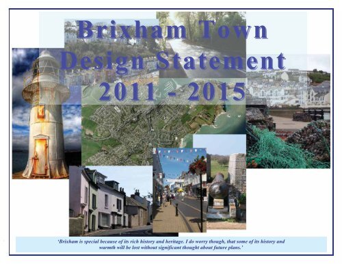
Brixham Town Design Statement 2011 - 2015 - Torbay Council
Brixham Town Design Statement 2011 - 2015 - Torbay Council
Brixham Town Design Statement 2011 - 2015 - Torbay Council

Create successful ePaper yourself
Turn your PDF publications into a flip-book with our unique Google optimized e-Paper software.
<strong>Brixham</strong> <strong>Town</strong><br />
<strong>Design</strong> <strong>Statement</strong><br />
<strong>2011</strong> - <strong>2015</strong><br />
‘<strong>Brixham</strong> is special because of its rich history and heritage. I do worry though, that some of its history and<br />
warmth will be lost without significant thought about future plans.’<br />
<strong>Brixham</strong> <strong>Town</strong> <strong>Design</strong> <strong>Statement</strong> 2010 - <strong>2015</strong> Page 0
Contents<br />
Page<br />
Page<br />
Introduction 2 Road Infrastructure 21<br />
An Overview of <strong>Brixham</strong> today 2 Parking 23<br />
How History has shaped <strong>Brixham</strong> 7 Street and Pavement maintenance 24<br />
What makes <strong>Brixham</strong> Special 12 Future Development in <strong>Brixham</strong> 24<br />
The Conservation Area 13 <strong>Town</strong>scape Analysis - Area by Area 25<br />
<strong>Brixham</strong>’s Main Issues 14 Conclusion 35<br />
Housing 14 About this <strong>Design</strong> <strong>Statement</strong> 36<br />
Cemetery 16 Appendix 1 – Listed Buildings 37<br />
Preservation of Green Spaces 17 Appendix 2 – Geopark 44<br />
Cleanliness of the <strong>Town</strong> and Harbour 19 Appendix 3 – Public Parks in <strong>Brixham</strong> 49<br />
Tourism 19<br />
Employment 20<br />
<strong>Brixham</strong> <strong>Town</strong> <strong>Design</strong> <strong>Statement</strong> 2010 - <strong>2015</strong> Page 1
Introduction<br />
The purpose of a town design statement is to set out the community’s aspirations for the design of future development of a town based on an<br />
analysis of its character. (See Countryside Agency 1993; <strong>Town</strong> <strong>Design</strong> <strong>Statement</strong>s).<br />
The <strong>Town</strong> <strong>Design</strong> <strong>Statement</strong> is produced by and for the community. The intention is it will be adopted by the local planning authority as a<br />
Supplementary Planning Document that will inform and amplify the policies within the LDF (Local Development Framework). If this can be<br />
secured it means that the <strong>Town</strong> <strong>Design</strong> <strong>Statement</strong> will be used by the <strong>Torbay</strong> <strong>Council</strong> in coming to decisions on planning applications in<br />
<strong>Brixham</strong>.<br />
This statement is a commitment to the future of <strong>Brixham</strong> and in adopting this document <strong>Torbay</strong> <strong>Council</strong> demonstrates its support for the<br />
community.<br />
The <strong>Town</strong> <strong>Design</strong> <strong>Statement</strong> will also form part of the <strong>Town</strong> plan that is being produced by the <strong>Town</strong> <strong>Design</strong> Panel.<br />
An Overview of <strong>Brixham</strong> today<br />
<strong>Brixham</strong> is defined by its geographical restrictions, the river Dart, cliffs,<br />
a steep sided coomb and its location on the coast. Set on a<br />
peninsula, at the southern end of <strong>Torbay</strong>, it is isolated from the towns<br />
of Paignton and Torquay.<br />
2009 Map of <strong>Brixham</strong><br />
View of Churston Cove from Battery Gardens<br />
<strong>Brixham</strong> <strong>Town</strong> <strong>Design</strong> <strong>Statement</strong> 2010 - <strong>2015</strong> Page 2
<strong>Brixham</strong> is the most important fishing port in England and Wales, measured by the value of catch landed.<br />
Other industries in the town are tourism, including hotels, B&B’s, tourist attractions and Holiday Camps,<br />
catering, many quality fish restaurants, a pharmaceutical company (AstraZeneca, who employ 80 people),<br />
marine related engineering companies, a retail mix of small to medium size retail stores, with some High<br />
Street names, a foundry, small businesses and home working or internet based companies.<br />
AstraZeneca building<br />
Development of the town commenced around the harbour<br />
area and separately at St Mary’s, but has since worked<br />
progressively away from the inlet, up steep sided hills and<br />
has amalgamated to become one town. Modern development<br />
consists of two to three bedroom town houses and a great<br />
number of bungalows catering for the retired and elderly.<br />
There are also upmarket apartments used as second homes.<br />
Current development trends are leading towards gardens<br />
being used as building plots and Holiday Camps being<br />
changed into housing estates.<br />
Sharkham Estate, formerly Dolphin Holiday Camp<br />
According to the 2001 census there were 17,457 residents in <strong>Brixham</strong>. There are five Primary Schools, with Nursery provision in the town.<br />
There is a medium sized 11yr to 16yr Secondary Education School (<strong>Brixham</strong> College), which is also used by South Devon College to provide<br />
Adult and Community Education. The campus also provides accessibility for people with disabilities. Health provision is covered by three<br />
medical centres (Doctors Surgeries), an expanding Cottage Hospital (non emergency), several Dentists and numerous Residential Care Homes.<br />
Transport links are buses to the rest of <strong>Torbay</strong>, Kingswear and Newton Abbot and ferry services to Torquay. The town is broadband enabled.<br />
<strong>Brixham</strong> <strong>Town</strong> <strong>Design</strong> <strong>Statement</strong> 2010 - <strong>2015</strong> Page 3
The vast majority of the population are white British,<br />
with a large volume being of <strong>Brixham</strong> origins. In 2004<br />
there were 2,652 all pensioner households in <strong>Brixham</strong><br />
and one third of the population was over sixty (Office of<br />
National Statistics, Age Structure (KS02)) and the town<br />
also has pockets of deprivation.<br />
Settlement Profile Exeter & <strong>Torbay</strong> Strategic Housing Market Assessment 2007<br />
<strong>Brixham</strong> <strong>Town</strong> <strong>Design</strong> <strong>Statement</strong> 2010 - <strong>2015</strong> Page 4
There are large regeneration projects under consideration, which include proposals for a new town centre superstore and the development of<br />
Oxen Cove and Freshwater Quarry. The development and expansion of the Fish Market section of the regeneration project is close to<br />
completion.<br />
There is a mix of residents, marine based workers, second homeowners, retired, single parent families, affluent residents, impoverished,<br />
employed, unemployed, low waged and small business owners. The majority of employment opportunities are located out of town and the road<br />
network is insufficient for the present levels of usage.<br />
Historic Landscape Characterisation. Devon County <strong>Council</strong> 2008<br />
Available at: http://gis.devon.gov.uk/basedata/viewer.aspDCCService=hlc<br />
<strong>Brixham</strong> <strong>Town</strong> <strong>Design</strong> <strong>Statement</strong> 2010 - <strong>2015</strong> Page 5
There is a Site of Special Scientific Interest (SSSI) and Areas of Outstanding Natural Beauty within the boundary of the town. This is defined as<br />
a precious landscape whose distinctive character and natural beauty are so outstanding that it is in the nation's interest to safeguard. It covers<br />
Sharkham Point to Berry Head. Berry Head is <strong>Torbay</strong>'s most important wildlife site and one of England's 200 National Nature Reserves; it also<br />
has UNESCO (United Nations Educational, Scientific and Cultural Organization) Geo park status; there are only 64 Geo parks in existence<br />
globally.<br />
Sharkham Point<br />
<strong>Brixham</strong> <strong>Town</strong> <strong>Design</strong> <strong>Statement</strong> 2010 - <strong>2015</strong> Page 6
How History has shaped <strong>Brixham</strong><br />
<strong>Brixham</strong> is an important fishing town on the south coast of Devon. It is divided roughly in to the following areas: <strong>Town</strong> & Harbour area, Berry<br />
Head, Furzeham, St Mary’s and Summercombe.<br />
Battery Gardens<br />
Furzeham<br />
<strong>Town</strong> & Harbour<br />
Berry Head<br />
<strong>Brixham</strong>’s rich history and heritage dates back to<br />
Saxon times, or possibly even earlier, when two<br />
separate settlements developed – Lower <strong>Brixham</strong>,<br />
known then as Fishtown, where the fishermen lived,<br />
which is now the harbour area; and Higher <strong>Brixham</strong>,<br />
known then as Cowtown, occupied by farmers,<br />
where St Mary’s Church was, and is, at the heart.<br />
By 1535 it had established itself as a highly<br />
successful fishing port, with the low lying sheltered<br />
harbour area being protected by the surrounding<br />
Devonian limestone hills.<br />
St Mary’s<br />
The unique geography of <strong>Brixham</strong> led to its major<br />
importance in defence of the southern coastline of<br />
Britain. <strong>Brixham</strong> has two sites of major historical<br />
importance – Battery Gardens and Berry Head.<br />
Summercombe<br />
The site of Battery Gardens was used as a gun<br />
battery during the Spanish Armada (1588) and in<br />
many subsequent battles, because of its ideal, lowlevel<br />
vantage point across the bay. Most of the<br />
features seen at Battery Gardens today are those of<br />
WW2. The site is of National Importance and is<br />
listed by English Heritage, and recognised as ‘…one<br />
of the best preserved of its kind in the UK.’<br />
<strong>Brixham</strong> <strong>Town</strong> <strong>Design</strong> <strong>Statement</strong> 2010 - <strong>2015</strong> Page 7
In 1688 William Prince of Orange with his Dutch Army<br />
stepped ashore in <strong>Brixham</strong> and the Prince travelled<br />
onwards to change the course of English history, and<br />
become King William III of England. <strong>Brixham</strong><br />
commemorates this historic day with a statue on The<br />
Strand.<br />
The Napoleonic wars enabled the <strong>Brixham</strong> fishing fleet<br />
to prosper while their European counterparts suffered,<br />
thanks to the protection by Royal Navy ships in <strong>Torbay</strong>.<br />
Berry Head House (now the Berry Head Hotel,) was<br />
built at this time as a military hospital to care for the<br />
casualties of war.<br />
<strong>Brixham</strong> Harbour 1868<br />
Semaphore signalling equipment was used on Berry Head in the 1800’s, acting as the<br />
Lloyds Signal Station for <strong>Torbay</strong>. A lighthouse was built on Berry Head in 1906, which is<br />
still fully functional, but has been modernised internally over the years. Berry Head is now a<br />
National Nature Reserve, and falls within the South Devon Area of Outstanding Natural<br />
Beauty.<br />
<strong>Brixham</strong> underwent significant development in the 1800’s, All Saints Church was built in<br />
1816 (where ‘Abide with Me’ composer, Reverend Henry Francis Lyte, was the<br />
incumbent), closely followed by the opening of Upham’s Shipyard. Significant housing<br />
stock was also added to <strong>Brixham</strong> during these years, typically classic Victorian style<br />
terraces, which can still be seen throughout the town.<br />
Prehistoric caverns at Windmill Hill were discovered later in the century, and <strong>Brixham</strong><br />
Seamen’s Boys Home was opened. A railroad into <strong>Brixham</strong> by 1868 meant that the port<br />
could continue to thrive and in 1889, Furzeham School was opened.<br />
William Prince of Orange<br />
<strong>Brixham</strong> <strong>Town</strong> <strong>Design</strong> <strong>Statement</strong> 2010 - <strong>2015</strong> Page 8
In 1793 two forts were erected on Berry Head, (built on top of pre-existing Iron Age forts), to protect against the threatened invasion by France.<br />
In 1803 (during the Napoleonic Wars) the fortifications were strengthened with limestone, and the gun batteries were added. The artillery house<br />
still stands and now displays details of the history of the area, its wildlife, and how it became an important strategic point.<br />
Limestone, iron ore and ochre were extensively mined during this era, which was a massive boost to the economy. Iron ore was discovered on<br />
Sharkham Point, and limestone was mined at Berry Head (these quarries are still evident today). Ochre, discovered in the Furzeham area, was a<br />
mineral which had massive importance – its use in producing a rust resistant paint (invented in <strong>Brixham</strong> in 1845) was a world first, it played a<br />
major part in the industrial revolution, which led to huge demand and to the founding of the <strong>Torbay</strong> Paint Company. The mineral was also<br />
painted on the sails of trawlers (giving them their characteristic red/brown hue), which protected the canvas from seawater. There is now little<br />
evidence of the iron & ochre mines and their significance in shaping <strong>Brixham</strong> and the <strong>Torbay</strong> Paint Company closed in 1961.<br />
In 1866, the Great Storm caused major loss of life and prompted the<br />
acquisition of <strong>Brixham</strong>’s first lifeboat. Since then, there has always been<br />
an all weather lifeboat in <strong>Brixham</strong>, which to this day has been manned<br />
by volunteer crews from the town. The Great Storm also triggered the<br />
start of the formation of the Breakwater as a sea defence for <strong>Brixham</strong><br />
harbour.<br />
By 1894, Fishtown and Cowtown merged and formed <strong>Brixham</strong> Urban<br />
District <strong>Council</strong>. By this time, <strong>Brixham</strong>’s population was over 8000.<br />
The outbreak of World War One saw a decline in the fishing industry,<br />
and brought a halt to the prosperity and development of the Victorian<br />
era. In 1916 the breakwater was completed, and a lighthouse was<br />
erected at the end.<br />
<strong>Brixham</strong> Fish Market<br />
Immediately post WW1, the region started to gain in prosperity again<br />
<strong>Brixham</strong> Fish Market<br />
and led to another significant increase in housing stock all over town.<br />
The bay fronted semi detached properties with their front pitched gables and red brick porches were typical of this era, and filled in a lot of gaps<br />
between existing housing.<br />
The outer harbour main slipway and hard area, known as Breakwater hard, was built by American troops in 1943 and is now a rare example of<br />
WW2 D-Day landing craft loading ramps. English Heritage Grade II listed the hard and slipway, stating that "....it was one of the best examples<br />
of its kind left in the UK".<br />
<strong>Brixham</strong> <strong>Town</strong> <strong>Design</strong> <strong>Statement</strong> 2010 - <strong>2015</strong> Page 9
Immediately post war, <strong>Brixham</strong> capitalised on its idyllic location, history and heritage, to become a popular holiday location. Pontins invested<br />
heavily in the area, at one time operating five holiday parks. The town also offered an abundance of hotel accommodation and camping sites,<br />
with many of the larger properties in town converted to Bed and Breakfast’s.<br />
<strong>Brixham</strong> Environmental Laboratory came to <strong>Brixham</strong> in 1948 as a testing station for ICI paints, bringing with it some employment<br />
opportunities. It is now part of the AstraZeneca organisation.<br />
<strong>Brixham</strong> next altered significantly in the 1960’s and 70’s, with the widening of Middle Street. The fish quay (together with associated facilities)<br />
was moved from the covered area on The Quay to the front of the Seaman’s Mission (Overgang) and changed the shape of the harbour<br />
dramatically. The old Gas Works was demolished, along with old cottages and buildings to make way for a new multi-storey car park in the<br />
centre of town and the Fire and Police stations were also moved out of the town centre. Several high-rise blocks (steel framed with cast<br />
concrete) appeared during these years, with a generally unappealing architecture, with more emphasis on housing needs rather than build<br />
quality.<br />
1963 saw the closure of the railway branch line into <strong>Brixham</strong> as part of the<br />
infamous Beaching cuts.<br />
An area of Furzeham was also developed with mainly low-level bungalows,<br />
often detached, which were brick built, and part tile hung, with tiled roofs.<br />
These were well spaced, with adequate gardens front and rear. By the midlate<br />
70’s, Summercombe (Higher <strong>Brixham</strong>) had been developed with a<br />
mixture of bungalows and houses using similar build techniques.<br />
<strong>Brixham</strong> Railway 1948<br />
<strong>Brixham</strong> <strong>Town</strong> <strong>Design</strong> <strong>Statement</strong> 2010 - <strong>2015</strong> Page 10
As <strong>Brixham</strong> moved towards new fishing methods, using diesel driven vessels and more modern fishing techniques, traditional boat building<br />
waned and Upham’s shipyard finally closed its doors in 1984. The area was developed creating the existing marina with walkway and its<br />
associated facilities, a new coastguard station, and a private housing development with prime waterfront location.<br />
<strong>Brixham</strong> Boys Home also closed in the mid 80’s, and the building is<br />
now used as an outdoor adventure centre, which overlooks the Marina.<br />
By 1991 more improvements and extension to the Fish Quay,<br />
including the addition of Southern Quay were completed. This<br />
provided extra berthing and landing facilities for the fishing industry,<br />
which hit an all time peak in 1992. A walkway between the town and<br />
Oxen Cove was also created, which links in to the pathway along the<br />
outer harbour, then on to the steps at Battery Gardens.<br />
Old Multi-storey Car Park<br />
Upham’s Yard – 1960’s<br />
The last few years have seen the demolition of the town’s central car park, which<br />
although an architectural eyesore, was important to the prosperity of local shops<br />
with poor provision of other transport links into town.<br />
The large scale development of the St Mary’s area (formerly the Dolphin<br />
Holiday Camp, now Sharkham housing estate) has substantially increased<br />
housing stock in that area, but has poor road access for the number of vehicles<br />
using it.<br />
In 2007, the <strong>Torbay</strong> area was given Geopark status by UNESCO, recognising its rich geological, historical and cultural heritage. Five particular<br />
sites of interest in <strong>Brixham</strong> were noted: Berry Head to Sharkham point, Breakwater Quarry, <strong>Brixham</strong> Cavern, Churston Cove & Point,<br />
Shoalstone.<br />
<strong>Brixham</strong> <strong>Town</strong> <strong>Design</strong> <strong>Statement</strong> 2010 - <strong>2015</strong> Page 11
What makes <strong>Brixham</strong> Special<br />
‘<strong>Brixham</strong> is special because of<br />
its rich history and heritage. I<br />
do worry though, that some of<br />
its history and warmth will be<br />
lost without significant thought<br />
about future plans.’<br />
Chris, 64, Berry Head.<br />
‘I love Busy Bee’s, Wizz Kids and Jingle Bells on the<br />
Quay at Christmas!’<br />
Lilly, 3, Furzeham<br />
‘<strong>Brixham</strong> has a unique coastal and countryside landscape,<br />
with an amazing history. My family have lived here for many<br />
generations so it will always be special to me. I would like it<br />
taken care of for the sake of future generations’<br />
Kerry, 62, Berry Head.<br />
‘<strong>Brixham</strong> is special to me<br />
because it is a safe place to<br />
bring up my children, and has<br />
a friendly, close-knit<br />
community.’<br />
Michele, 37. <strong>Town</strong> Centre.<br />
‘I love the fact that we have so many small<br />
independent retailers in the town. This should be<br />
encouraged so that <strong>Brixham</strong> retains its character<br />
and remains different to other small towns.’<br />
Simone, 39, Summercombe.<br />
.<br />
The top five things that people liked about living in <strong>Brixham</strong> according to the ‘Who Plans <strong>Brixham</strong> for<br />
the future’ survey, taken in 2008, were the neighbours, the people, amenities and shops,<br />
the natural beauty and the fact that people had friends and family living in the town.<br />
<strong>Brixham</strong> <strong>Town</strong> <strong>Design</strong> <strong>Statement</strong> 2010 - <strong>2015</strong> Page 12
The Conservation Area<br />
The conservation area of the town, reflecting ribbon<br />
developments was created from the 1970’s and<br />
covers the harbour area, town centre, Bolton Street,<br />
Milton Street and St Mary’s Square.<br />
There are approximately<br />
315 Listed Buildings in <strong>Brixham</strong> (Appendix I)<br />
The Inner Harbour<br />
<strong>Brixham</strong> <strong>Town</strong> <strong>Design</strong> <strong>Statement</strong> 2010 - <strong>2015</strong> Page 13
<strong>Brixham</strong>’s Main Issues<br />
Housing<br />
Housing need is one of the main issues in the town in the 2008 survey ‘Who Plans <strong>Brixham</strong> for the future’ 25% of those surveyed expressed<br />
the perception that affordable housing was needed. 21% felt that local authority owned rental properties were required, with a priority for local<br />
young people and key workers. These points also had a large amount of support in the 2009 open event. Also at the <strong>Town</strong> Plan open event held<br />
in September 2009 there was overwhelming support for <strong>Brixham</strong> <strong>Town</strong> <strong>Council</strong> being asked to carry out a ‘housing needs’ survey to ascertain a<br />
true picture of the issue in <strong>Brixham</strong>.<br />
Property types Exeter & <strong>Torbay</strong> Strategic Housing Market Assessment 2007<br />
New development should not intrude upon the existing skyline of the town and so any high rise buildings should be set in low lying areas and<br />
be of a height to not affect that skyline. The main social Housing provider is Sanctuary Housing with just under 5,000 housing stock in <strong>Torbay</strong><br />
with a bay wide waiting list of 5,221 (Sources: DCLG's Housing Strategy Statistical Appendix return). In the Housing Needs Survey of 2003<br />
there were high numbers of disabled people in unsuitable homes with an average waiting time 31 weeks to receive an adaptation. In the 2001<br />
census 2.4% of the houses in <strong>Brixham</strong> were vacant and 5.5% were holiday homes, of these some would be short let holiday accommodation.<br />
The emerging Local Development Framework aims to provide for an appropriate range of housing types and tenures. This includes marketable<br />
and affordable housing, to meet the requirements of everyone including key workers. This is to ensure everyone has the opportunity of a decent<br />
home, to ensure that all new dwellings are sustainable in design and construction and to minimise the use of energy and natural resources and<br />
emphasis should be on low scale development sites.<br />
<strong>Brixham</strong> <strong>Town</strong> <strong>Design</strong> <strong>Statement</strong> 2010 - <strong>2015</strong> Page 14
Development within the conservation area should be limited, in keeping with the surrounding structures and be sympathetic to the area. Any<br />
development within the Area Of Outstanding Natural Beauty should be severely limited and be sympathetic to the surroundings. It must also<br />
enhance its value as Area Of Outstanding Natural Beauty so that the level of enjoyment of the area is not diminished and can still be<br />
appreciated by all who visit.<br />
A primary consideration should be the scale of any proposed building. Scale is the relative dimensions and proportions of the elements of a<br />
building compared with each other and with other buildings nearby and the surrounding environment. <strong>Brixham</strong> has buildings in a wide variety<br />
of sizes and it is important that the scale of any new building suits its surroundings. For instance, in a large development of bungalows<br />
dwellings should be of a similar size. A house would look completely at odds with the surrounding properties, as would a large block of flats<br />
amongst a row of conventional houses. Scale relates not only to a<br />
building, but also to the space between it and its neighbours. New<br />
buildings should have the same impression of space around them as<br />
the existing, surrounding ones.<br />
Scale is also relevant to extensions to buildings as it would be<br />
inappropriate if the original building was dwarfed by the new extension.<br />
The interaction between any new developments sites and the road<br />
infrastructure should be taken into account at the design stage. New<br />
streets created on new development sites should be named by<br />
residents of the town through the <strong>Brixham</strong> <strong>Town</strong> <strong>Council</strong> in order to<br />
ensure that the heritage and history of the town is acknowledged and<br />
made more relevant by being linked with new developments.<br />
<strong>Town</strong> Centre Mews Development<br />
<strong>Brixham</strong> <strong>Town</strong> <strong>Design</strong> <strong>Statement</strong> 2010 - <strong>2015</strong> Page 15
Cemetery<br />
<strong>Torbay</strong> <strong>Council</strong> makes provision for cemeteries across <strong>Torbay</strong> through its<br />
Bereavement Services department, which provides the following services:-<br />
The <strong>Council</strong> provides cemeteries at the following locations:<br />
• Provision of burials<br />
• Provision of cremations<br />
• Maintenance of grounds of Cemeteries and Crematorium<br />
• Maintenance of 5 closed churchyards for which the Local<br />
Authority has responsibility<br />
• Issuing of memorial permits<br />
• Torquay Cemetery, Hele Road, Torquay<br />
• Torquay Cemetery, Barton Road, Torquay<br />
• Paignton Cemetery, Ailescombe Road, Paignton<br />
• Paignton Cemetery, Colley End Road, Paignton<br />
There is a need for cemetery in <strong>Brixham</strong> and this has been recognised by <strong>Brixham</strong> <strong>Town</strong> <strong>Council</strong>. In 2009 the <strong>Town</strong> <strong>Council</strong> Regeneration<br />
Committee met with the Westerleigh Group, who manage the cemetery provision on behalf of <strong>Torbay</strong> <strong>Council</strong> to discuss provision and<br />
subsequently a questionnaire was placed in the <strong>Brixham</strong> Signal on the issue which returned the response that the majority of people felt there was<br />
a need for a cemetery in <strong>Brixham</strong>.<br />
<strong>Torbay</strong> Local Plan states:<br />
CF4 New Cemeteries in <strong>Torbay</strong> <strong>Council</strong><br />
New Cemeteries are proposed in the<br />
following locations:-<br />
(1) Collaton St Mary, Paignton; and<br />
(2) Mathill Road, <strong>Brixham</strong>.<br />
<strong>Brixham</strong> <strong>Town</strong> <strong>Design</strong> <strong>Statement</strong> 2010 - <strong>2015</strong> Page 16
7.39 The future provision of cemeteries within <strong>Torbay</strong> has been addressed through the <strong>Council</strong>’s Cemeteries Working Party. There is<br />
recognition that an urgent need now exists to provide additional burial space to complement existing provision. As a consequence, sites are<br />
proposed at Collaton St Mary, Paignton and at Mathill Road, <strong>Brixham</strong>. Surveys indicate that ground conditions are appropriate in both<br />
locations. It is clear that suitable sites are not available elsewhere within the urban area.<br />
7.40 Research carried out indicates that the site in <strong>Brixham</strong> should be given the priority in the development of burial facilities. The Mathill<br />
Road site is currently designated as an Area Of Outstanding Natural Beauty (Policy L1) AND Countryside Zone (Policy l4).<br />
7.42 In the view of the landscape qualities of each site, careful consideration will need to be given to layout, access and car parking<br />
arrangements. It is envisaged that no small buildings will be erected on these sites other than very small scale structures required for basic<br />
maintenance purposes.<br />
There would be a number of issues to take into account when considering a detailed planning application for a cemetery. These include access<br />
and car parking arrangements, the design of any buildings that may be required, landscaping proposals, ground conditions and flooding issues<br />
and the Environment Agency will need to be involved. The <strong>Brixham</strong> <strong>Town</strong> <strong>Council</strong> is continuing to make cemetery provision in <strong>Brixham</strong> a<br />
reality in the next few years and this action is supported as such provision is seen as an intrinsic part of a viable community.<br />
Preservation of green spaces<br />
The principle of using infill sites in gardens is acknowledged but such development should<br />
be constrained in <strong>Brixham</strong> to preserve the character of the town, for recreation and to<br />
support wildlife. Where such infill is detrimental to the quality of, and fails to enhance the<br />
immediate area or the town, it should not be supported. The cumulative effect with other<br />
infill additions is detrimental to the town as a whole as is high density out-of-scale<br />
development, these too will not be supported.<br />
The removal of mature and healthy trees on any proposed development is to be discouraged<br />
and Tree Preservation Orders (TPOs) should be enforced with agreed landscaping plans as<br />
conditions of planning approval where appropriate.<br />
Wishings Field<br />
<strong>Brixham</strong> <strong>Town</strong> <strong>Design</strong> <strong>Statement</strong> 2010 - <strong>2015</strong> Page 17
New developments of over six dwellings should have green space provision as part of the design and family homes should have adequate<br />
garden space as part of the design.<br />
Existing parks and open spaces should be retained and developed as part of the tourism offering, as stated in the <strong>Torbay</strong> Community plan 2007.<br />
<strong>Brixham</strong> has a large amount of Area of Outstanding Natural Beauty and Berry Head is a National Nature Reserve and Country Park.<br />
It is home to the rare Greater Horseshoe bats, the UK's most southerly Guillemot colony and a variety of rare or threatened flora and fauna.<br />
The headland is occupied by Ancient Monuments in the form of some of the UK's best-preserved Napoleonic Fortifications. <strong>Brixham</strong> also is<br />
within the <strong>Torbay</strong> Geopark and has recognized areas of Geopark (Appendix 2). Geoparks aims to protect geo-diversity and to promote<br />
geological heritage to the general public as well as to support sustainable economic development of Geopark territories primarily through the<br />
development of geological tourism.<br />
Map Source <strong>Torbay</strong> Wildlife Sites Review (1998) and the Devon Biodiversity Records Centre DBRC).<br />
The map is based upon Ordnance Survey material with the permission of Ordnance Survey on behalf of the<br />
Controller of HMS Office Crown copyright.<br />
<strong>Brixham</strong> <strong>Town</strong> <strong>Design</strong> <strong>Statement</strong> 2010 - <strong>2015</strong> Page 18
Cleanliness of the town and harbour<br />
<strong>Torbay</strong> <strong>Council</strong> is responsible for street cleaning and on their website state they will clean town centres daily, remove accumulations of rubbish<br />
from <strong>Council</strong> land, empty litter bins and help with locally organised clean-ups. 30% of people in <strong>Brixham</strong> who responded to the <strong>Torbay</strong><br />
<strong>Council</strong> Place Survey of 2009 said that clean streets are important in making a place feel good to live in.<br />
Floral displays enhance the look of the town during the summer months<br />
and for the last two years <strong>Brixham</strong> has been entered in the Britain in<br />
Bloom contest winning silver guilt on both occasions. Comments from<br />
the Britain in Bloom judges for 2009 was ‘The standard of the entry was<br />
very good and the community has obviously pulled together to achieve<br />
fantastic results.’ With areas for improvement highlighted as ‘Floral<br />
content a bit light’ with the choice of planting in hanging baskets being<br />
‘questionable subjects’. <strong>Torbay</strong> <strong>Council</strong>, who provides the hanging<br />
baskets and street planting, should improve the plant provision and local<br />
businesses should be encouraged to support the floral displays. <strong>Brixham</strong><br />
<strong>Town</strong> <strong>Council</strong> should also become more involved with supporting the<br />
floral provision in the town in a similar way that they provide the<br />
Christmas lights.<br />
Tourism<br />
In the <strong>Torbay</strong> Local Plan 1995 to <strong>2011</strong>, adopted in 2004, it states that in<br />
<strong>Brixham</strong> three-quarters of paying holiday visitors stay in holiday<br />
View from Freshwater Quarry<br />
camps/holiday parks. These proportions have grown in recent years and<br />
the importance of this type of accommodation in these areas and the facilities that they offer to tourists is self-evident. Any significant losses of<br />
sites to other uses by redevelopment would be unacceptable, both to the tourist industry and the local economies of their surrounding areas.<br />
<strong>Brixham</strong> <strong>Town</strong> <strong>Design</strong> <strong>Statement</strong> 2010 - <strong>2015</strong> Page 19
The emerging 2010 Local Development Framework has the objectives ‘to support the modernisation and enhancement of the tourist industry,<br />
through the upgrading and provision of new accommodation and facilities. To allow a reduction in the supply of poorly located and outdated<br />
accommodation, in order to achieve an overall modernisation and enhancement of the <strong>Torbay</strong>’s tourism offer. To improve the quality of<br />
recreational, leisure and tourist facilities available, including high quality active seafronts, family-oriented attractions, and Geopark based<br />
attractions to promote <strong>Torbay</strong> as a year round destination’.<br />
<strong>Brixham</strong>’s remaining holiday parks should not be used for residential development but be improved to provide quality tourist accommodation<br />
facilities. A mix of family orientated and top end tourism provision should be encouraged. The decline of use of a holiday park caused through<br />
the long term lack of investment in it should not be seen as a reason to allow development of such sites.<br />
Provision of Employment<br />
Industrial development that would encourage employment opportunity would be welcome with adequate provision of entrance and exit ways,<br />
so that expansion and development of businesses are not unduly limited due to access problems. The use of the existing industrial units also<br />
needs to be monitored and reviewed before any more such units are proposed.<br />
Facilities to encourage employment for those living in the town are seen as a<br />
vital part of making a viable community and an integral part of any<br />
development scheme. The survey results put boat building and repair as the<br />
main type of business that would benefit <strong>Brixham</strong> (58%), closely followed<br />
by provision of small business workspace units (54%).<br />
Marine related industry should be encouraged in the development of any<br />
new employment areas. 66% of those businesses that responded to the<br />
questionnaire work within the local community and identified traffic<br />
congestion and road infrastructure as the main factor in restricting business<br />
growth. In 2009 the expansion of the capacity of broadband provision in the<br />
town was identified as being of benefit to improving employment prospects<br />
in the town.<br />
The building of the new Fish Market 2010<br />
<strong>Brixham</strong> <strong>Town</strong> <strong>Design</strong> <strong>Statement</strong> 2010 - <strong>2015</strong> Page 20
Road infrastructure<br />
Traffic congestion was a big concern both at the open event and in the survey. Many locations and reasons for Traffic Control Orders were<br />
identified, with Bank Lane/ Bolton Cross area being the most mentioned problem area. Most of the businesses (50%) responding to the 2008<br />
survey put improved traffic flow and road infrastructure as the one thing that would help to establish or further develop a business.<br />
The transport network from the M5 to <strong>Torbay</strong><br />
The major road route into the South West from the rest of the UK is the M5. This motorway is linked to Newton Abbot by dual carriageway<br />
(A38/A380). At Penn Inn roundabout problems begin with regard to delivering reliable and efficient transport networks and reducing emissions<br />
of CO 2 .<br />
The Western Corridor<br />
Access into <strong>Brixham</strong> becomes problematic from the start of<br />
Hamelin Way along the Western Corridor (A380), known as the<br />
ring road, to Windy Corner. There are no less than 7 sets of<br />
traffic lights from Spruce Way to Windy Corner. It restricts the<br />
flow of traffic along the Western Corridor, leading to more<br />
congestion and greater CO 2 emissions. Additionally, where<br />
Hamelin Way (A3022) meets Riviera Way (A380), traffic on the<br />
northbound carriageway of Hamelin Way is often backed up at<br />
busy times since traffic from Torquay has priority unless<br />
intercepted by traffic from Kingskerswell turning up Hamelin<br />
Way.<br />
Windy Corner<br />
<strong>Brixham</strong> <strong>Town</strong> <strong>Design</strong> <strong>Statement</strong> 2010 - <strong>2015</strong> Page 21
The A3022 from Windy Corner to <strong>Brixham</strong> is probably the most difficult of the road links considered so far. This is the only main access route<br />
into <strong>Brixham</strong> and also to Kingswear (via A379), which at the current time have a combined population of over 20,000. This road is frequently<br />
congested, as a result of morning and evening rush hour, summer holiday traffic, utility and other works.<br />
The only other road to <strong>Brixham</strong> from Windy Corner, avoiding all but a short stretch of the A3022, is Bascombe Road/Copythorne Road. This is<br />
a country lane, which in many places is single track. Consequently, it is unsuitable for large vehicles and should there be problems with main<br />
road (A3022), it is quickly congested because of its numerous bottleneck points and is prone to flooding.<br />
In recent times, planning permission in <strong>Brixham</strong> has been granted for over 200 houses at Sharkham estate, 64 houses at the old Cricket Club<br />
ground, and there are proposed developments of 200 houses at Churston Golf Club, 300 houses at Wall Park Holiday Camp, with possibly other<br />
schemes at Riviera Holiday Camp and Freshwater Quarry/Oxen Cove to come in the future. Any development of Oxen Cove/Freshwater<br />
Quarry to create jobs would generate a greater degree of commercial traffic. This number would surely cause more strain on the road network<br />
and should be accounted for in any planned road network improvements. The Department For Transport Bulletin on Transport Statistics 2008<br />
gives the average number of trips per person per year as 992 this is equates to 19 trips per week or 2.5 trips per day. If each house had two<br />
occupants this would equate to an increase of 5 trips per day and for 200 houses gives one thousand trips per day.<br />
Old Cricket Club Housing Development 2010<br />
Dept. of Transport<br />
Transport Statistics Bulletin 2008<br />
<strong>Brixham</strong> <strong>Town</strong> <strong>Design</strong> <strong>Statement</strong> 2010 - <strong>2015</strong> Page 22
The narrowness of both Monksbridge Road and Burton Street which form the major through routes in <strong>Brixham</strong> for those coming from the Wall<br />
Park, Ranscombe Road, Gillard Road and Rea Barn directions is of concern. Frequently, on Monksbridge Road, vehicles have to mount the<br />
pavement to avoid large lorries, buses, etc.<br />
Burton Street is another narrow road with many house doors opening right onto this busy main route. Again, safety aspect would seem a<br />
problem and in the case of this road, there appears to be no option of widening it.<br />
Bolton Cross has a pollution issue due to standing traffic held up at the traffic lights and this could be alleviated by the widening of the junction<br />
as it would enable traffic to flow two ways through Market St instead of one way, as at present.<br />
The favoured method of achieving this is to remove the building forming the corner between Fore St and Bank Lane, which would also allow a<br />
wider footway to be created.<br />
This would replace the current hazardous narrow footway that also doubles as a waiting area for the pedestrian crossing and often pedestrians<br />
are forced to step out into the road to negotiate this corner.<br />
Parking<br />
A permanent park and ride site with proper provision for users would be a<br />
good part a solution of the problem of parking in the town and reduce traffic<br />
flow into the town. The park and ride should have dedicated bus provision and<br />
not rely upon existing services. This should be more than just a park and ride<br />
but also contain transfer facilities for larger lorries to offload into smaller<br />
vehicles (or vice versa) to limit the size of vehicle requiring access to the<br />
narrow streets of <strong>Brixham</strong>. A timed town entry schedule on specified roads to<br />
facilitate vehicles unable to use a transfer station would also be of benefit.<br />
<strong>Town</strong> Centre Car Park<br />
Any development of the central car park and ‘<strong>Town</strong> Square’, including the<br />
proposed increase in parking provision and a supermarket, should be in<br />
character with the surrounding buildings and enhance the area. The existing<br />
conflict between buses and vehicles exiting the existing car park should be<br />
resolved.<br />
In the event that the development proposed as part of the regeneration scheme does not take place increased parking provision and a coach drop<br />
off and pick up point (in the town square location) is required.<br />
<strong>Brixham</strong> <strong>Town</strong> <strong>Design</strong> <strong>Statement</strong> 2010 - <strong>2015</strong> Page 23
Street and pavement maintenance<br />
<strong>Torbay</strong> <strong>Council</strong>, as the Highway Authority, has responsibility for the maintenance of the highway and this includes pavements and footways.<br />
<strong>Torbay</strong> <strong>Council</strong> recognize ‘trip hazards’ on pavements as a key concern; trip hazards and other defects on pavements are addressed in the an<br />
order of priority with the highest being:<br />
• Slab movement, uneven ironwork, and potholes with a trip exceeding 20mm in busy urban area.<br />
• Depression greater than 25mm deep and less than 600mm in plan.<br />
• Cracking with a gap wider and deeper than 15mm.<br />
Potholes should be repaired to an adequate standard so that the repair is not eroded away with in a short period of time.<br />
Pavement repairs should not be made solely in tar macadam, especially where the pavement is slabs or cobbles. Reinstatement of the existing<br />
pavement surface is preferable to ensure the town to retain the character of its streets, steps and alleys. Areas of ‘decorative’ road surface, such<br />
as Fore Street, should be repaired by use of replacement bricks of the same colour and pattern as the existing.<br />
Future Development in <strong>Brixham</strong><br />
Acknowledging that development will happen this document sets out criteria for<br />
that development with the aim that <strong>Brixham</strong> is not ‘spoiled’ by its growth but is<br />
enhanced and benefits from that growth.<br />
The incursion of development into the Area Of Outstanding Natural Beauty is a<br />
cause for concern and where ever possible use of this land should be avoided.<br />
Any future development in this area should be in keeping with the surrounding<br />
aesthetics and should not make a visual impact on the area or its skyline.<br />
For future development in <strong>Brixham</strong> it would be preferable to utilise existing<br />
brown field sites before green field options are explored. A brown field site is<br />
previously developed land that has the potential for being redeveloped. The use<br />
of brown field sites is a core component of the UK Sustainable Development<br />
Strategy, integrating a wide range of economic, social and environmental<br />
objectives and <strong>Brixham</strong> upholds this strategy.<br />
Fishcombe Cove<br />
<strong>Brixham</strong> <strong>Town</strong> <strong>Design</strong> <strong>Statement</strong> 2010 - <strong>2015</strong> Page 24
<strong>Town</strong>scape Analysis – Area by Area<br />
<strong>Town</strong> Centre<br />
Fore Street<br />
Development in this area<br />
With awareness of current planning guidelines with regard to town centre development parking requirements it is recommended that all<br />
developments in this area should have adequate parking provision for at least one vehicle per property as a part of each planning application.<br />
New development in this area should reflect and retain the character of the town centre.<br />
The retail provision within the town centre through Middle Street, Fore Street, The Quay and The Strand is a major part of the town’s economy.<br />
Individual, unique small shops should be encouraged and retained within this area.<br />
<strong>Brixham</strong> <strong>Town</strong> <strong>Design</strong> <strong>Statement</strong> 2010 - <strong>2015</strong> Page 25
Harbour Area<br />
Development in this area<br />
The harbour area of <strong>Brixham</strong> is renowned for being quaint and picturesque as well as being a busy working fishing port, with modern fishing<br />
industry demands.<br />
Housing development should be limited, as it is a conservation area and any dwellings that are developed should reflect the qualities of the<br />
surrounding terraced houses.<br />
The fishing industry attracts tourists and the demands of both these industries should be dovetailed together in any infrastructure improvements<br />
to enhance and facilitate both. Improved provision should be made to enable tourists to view the working of the fishing harbour and market<br />
area. Footfall from both these industries makes navigation along the quay a hazardous environment for both pedestrians and vehicles. It is<br />
therefore essential that adequate provision is made to enhance the daily routine for the tourist, resident and worker in this part of the town.<br />
The Harbour<br />
<strong>Brixham</strong> <strong>Town</strong> <strong>Design</strong> <strong>Statement</strong> 2010 - <strong>2015</strong> Page 26
When developing or renewing the infrastructure and street furniture consideration should be given to making the harbour area friendlier to those<br />
with disabilities and this should not be exclusively for wheel chair users. At present the boarding facilities are not adequate and provision for an<br />
accessible and dignified embarkation and disembarkation pontoon for people with all disabilities is needed.<br />
A pedestrian crossing along the quay road would have a massive impact enabling pedestrians to cross the road safely in a clearly marked place,<br />
which would also help people with disabilities. The benefit from this would also alert vehicle drivers of a potential hazard and could have a<br />
calming effect on the road.<br />
The town receives a large number of tourists via the <strong>Brixham</strong> - Torquay Ferry link. Local residents also like to use the ferry to cross the bay and<br />
this has a significant impact on reducing carbon emissions in <strong>Brixham</strong>. The ferry link between Torquay and <strong>Brixham</strong> has a vital part to play in<br />
the economy of <strong>Brixham</strong>, lowering road usage level and demand for parking spaces.<br />
The Greenway Ferry<br />
<strong>Brixham</strong> <strong>Town</strong> <strong>Design</strong> <strong>Statement</strong> 2010 - <strong>2015</strong> Page 27
Furzeham<br />
Development in this area<br />
The character of the immediate surrounding area and the impact of any development on it should be taken into consideration. Any proposed<br />
development should be similar to the neighbouring environment and have the same proportion of garden space. With a high density of<br />
dwellings in this area there is little scope for large scale development. None should impact on the open space of Furzeham Green, consisting of<br />
three component parts, higher, middle and lower green, and its leisure facilities or on the two statutory allotment gardens in this area.<br />
The Middle Green - Furzeham<br />
<strong>Brixham</strong> <strong>Town</strong> <strong>Design</strong> <strong>Statement</strong> 2010 - <strong>2015</strong> Page 28
Pillar Avenue & Copythorne<br />
Development in this area<br />
North Boundary Road<br />
This area consists of a mix of modern terraced bungalows, semi and detached bungalows, houses and one industrial estate. If development is to<br />
take place here modern style designs would be acceptable in this area of the town, but provision is required for more and better<br />
play space facilities and public open space in the immediate vicinity. There is little scope for large scale development in this area as it is<br />
surrounded by green spaces.<br />
<strong>Brixham</strong> <strong>Town</strong> <strong>Design</strong> <strong>Statement</strong> 2010 - <strong>2015</strong> Page 29
New Road<br />
Development in this area<br />
New Road<br />
New Road is the main arterial road into the town centre of <strong>Brixham</strong> and carries the majority of vehicles that need to access the fish quay,<br />
several industrial estates and brings tourists into the town. There is a wide mix of development in this area ranging from blocks of flats to a<br />
design icon building, designed by Mervyn Seal. New Road is mainly commercial with several B&Bs along a seemingly residential street<br />
leading into retail and industrial areas. Housing in the streets beyond New Rd consist of modern estates of bungalows, houses and can be<br />
terraced, semi detached or detached. Any development in this area would largely be infill and as there is only one open space in this area the<br />
integrity of this space should not be compromised. The aspect of significant buildings in this area should not be compromised by new<br />
developments, conversions or extensions.<br />
<strong>Brixham</strong> <strong>Town</strong> <strong>Design</strong> <strong>Statement</strong> 2010 - <strong>2015</strong> Page 30
Higher <strong>Brixham</strong><br />
Development in this area<br />
The existing development is of close-knit estates with some individual dwellings of recent construction. The area is situated in a round end<br />
valley and has only two points of exit. It is likely that the topography of the area would limit any further expansion and any development<br />
would likely be limited to infill. The area is predominantly inhabited by families and therefore provision for play space and open ground is<br />
essential and the existing open spaces should not be developed for housing or industry.<br />
Milton Street<br />
<strong>Brixham</strong> <strong>Town</strong> <strong>Design</strong> <strong>Statement</strong> 2010 - <strong>2015</strong> Page 31
St Mary’s<br />
Development in this area<br />
St Mary’s is an older part of town with several listed buildings in the<br />
area and is included in the conservation area in the Milton Street vicinity.<br />
The integrity of the existing character of this area should be preserved.<br />
Due to the restricted access to this area of town further large scale<br />
development should not be allowed without investment in an expanded<br />
road network. Holiday parks in the area have been the subject of<br />
development and the existing open spaces should be conserved. Any<br />
dwellings that are developed in this area should closely reflect the<br />
qualities of the surrounding buildings and garden space.<br />
St Mary’s Square<br />
<strong>Brixham</strong> <strong>Town</strong> <strong>Design</strong> <strong>Statement</strong> 2010 - <strong>2015</strong> Page 32
Rea Barn and St Mary’s Bay<br />
Development in this area<br />
There is a mix of industrial units, modern housing, dense estates and older<br />
individual houses with open public areas in the form of playing fields,<br />
sports grounds, coastal path and parkland. The road infrastructure restricts<br />
much further development in the area, but any further major developments<br />
here should make ample provision for play space and open space as this is<br />
much needed. An area of ground is in the process of an application to<br />
make it a village green in order to preserve open space from development,<br />
proving the strong feeling of residents with regard to the need for play<br />
area. Development along the coastal fringe should not be considered as<br />
this is an Area of Outstanding Natural Beauty and part of the infrastructure<br />
that supports the local bat colonies.<br />
Rea Barn Road<br />
<strong>Brixham</strong> <strong>Town</strong> <strong>Design</strong> <strong>Statement</strong> 2010 - <strong>2015</strong> Page 33
Berry Head<br />
Development in this area<br />
At a public meeting to discuss the future of the Berry Head to<br />
Sharkham Point area, which was held in February 2010 in<br />
<strong>Brixham</strong>, it was clear that residents would support limited<br />
development in this area. Any development should however take<br />
into account the Local Development Framework and should not be<br />
intrusive or of high density. Tourist accommodation provision is a<br />
priority in this area and existing tourist sites should be enhanced<br />
and improved rather than be used for housing or have the densities<br />
of holiday park sites increased.<br />
Berry Head Fort and Visitors Centre<br />
It is important to preserve the remaining open spaces and also maintain<br />
public access to these open spaces and the coastal path. The environment<br />
and ecology of this area is of high importance as it is within an Area of<br />
Outstanding Natural Beauty and has archaeological importance with<br />
features such as the Napoleonic fort and natural caves, which have<br />
provided evidence of man’s existence alongside now extinct animals.<br />
<strong>Brixham</strong> <strong>Town</strong> <strong>Design</strong> <strong>Statement</strong> 2010 - <strong>2015</strong> Page 34
Conclusion<br />
In a town wholly enclosed by and partly contained within an Area of Outstanding Natural<br />
Beauty, <strong>Brixham</strong> needs to pursue what Gordon Cullen, in his book ‘<strong>Town</strong>scape’, calls the ‘Art of<br />
the Environment’. This concerns itself with the right relationship between buildings, spaces,<br />
trees and other features, creating a pleasant place for people to live. It is not just some esoteric<br />
concept to be analysed and defined by experts, it is at the very heart of good planning. The<br />
people of <strong>Brixham</strong>, by their responses to the <strong>Town</strong> Plan workshop, showed that they understand<br />
this, and manifested a desire that the ‘Art of the Environment’ should be put into practice in any<br />
future development of the town. It is not enough to make narrow ad-hoc decisions on individual<br />
planning applications, these should all be viewed in relation to their neighbours, the preservation<br />
of the essential character of the town and its unique place in the Area of Outstanding Natural<br />
Beauty.<br />
<strong>Brixham</strong> Lifeboat<br />
All planning applications will be viewed in the context of the preservation of the essential character of the town. This will only be possible if<br />
the development actually enhances the environment, is sensitive to the neighbouring dwellings and open spaces and recognises the importance<br />
of trees in creating the natural beauty of the town. <strong>Brixham</strong> will welcome good design, interesting variety and the use of sustainable<br />
construction techniques and traditional materials in any new building.<br />
New projects should include an adequate supply of affordable housing of the size<br />
and type, which allows local first-time buyers to remain in their home town. It is<br />
recognised that buyers looking for a holiday home (non letting) in <strong>Brixham</strong> poses<br />
a problem that affects the town’s vitality and the viability of local business.<br />
It is proposed that a group continues to operate as a revising and updating<br />
committee to monitor the effect of this <strong>Design</strong> <strong>Statement</strong>. It should encourage<br />
partnership working between residents, the <strong>Town</strong> <strong>Council</strong> and developers to<br />
improve the quality, design, construction and sustainability of proposed projects.<br />
New development should avoid the destruction of the mix of buildings and open<br />
areas, which have emerged over the last 400 years or more years.<br />
Battery Gardens<br />
<strong>Brixham</strong> <strong>Town</strong> <strong>Design</strong> <strong>Statement</strong> 2010 - <strong>2015</strong> Page 35
About this <strong>Design</strong> <strong>Statement</strong><br />
The draft design statement was published<br />
for consultation in 2010.<br />
The membership of the <strong>Town</strong> design<br />
panel that produced this document<br />
Residents of <strong>Brixham</strong>:<br />
Jackie Stockman – Chairman<br />
Paul Addison<br />
Will Baker<br />
Lucy Burnell<br />
Joe Cloutman<br />
Olive Farnham<br />
Brian Harland<br />
Rebecca McPartlan – Morey<br />
Mike Morey<br />
Helen Meacock<br />
and<br />
Ki Barnes (<strong>Brixham</strong> <strong>Town</strong> Clerk)<br />
Road Map images:<br />
Copyright <strong>Brixham</strong> <strong>Town</strong> <strong>Council</strong><br />
<strong>Brixham</strong> <strong>Town</strong> <strong>Design</strong> <strong>Statement</strong> 2010 - <strong>2015</strong> Page 36
Appendix 1 – Listed Buildings<br />
Street/Road<br />
Property<br />
Source - http://www.imagesofengland.org.uk. Accessed October 2009<br />
Bakers Hill<br />
Berry Head Road<br />
2 including front terrace wall and gate<br />
3<br />
4<br />
12 - 42 (even numbers) including front area wall and railing<br />
Berry Head Hotel<br />
Lime Kiln at SX 9390 5665,<br />
Wolborough House<br />
Gateway to Wolborough House GV II<br />
Gun Battery Approx 10m W of the battery, now converted to cottage and garage<br />
HM Coastguard rescue station, including walls, piers and railings at front<br />
Bolton Street<br />
<br />
<br />
<br />
<br />
<br />
<br />
<br />
Congregational Chapel<br />
36-42 including front area railings<br />
20 Thor House<br />
Bolton Hotel<br />
24 & 26 Church House<br />
34 Drake House including front area railings and shoe scraper<br />
62 & 64 including front area railings<br />
Burton Street Parkham Villa, 11<br />
19<br />
31<br />
Nos.5, 7 & 9 Beams Cottage<br />
Burton Villa<br />
Castor Road Castor House and Castor Stores<br />
<strong>Brixham</strong> <strong>Town</strong> <strong>Design</strong> <strong>Statement</strong> 2010 - <strong>2015</strong> Page 37
Cavern Road 2 & 4<br />
Church Street All Saints Church<br />
1, 3 & 5<br />
2 including short retaining wall abutting left side wall<br />
4<br />
Dashpers No.3 Aylmer House<br />
Drew Street Waterman's Arms<br />
Non-conformist chapel<br />
St Mary’s Church<br />
Bell Inn<br />
100-106 (Even)<br />
110,112 & 114<br />
St Kilda House, 15<br />
17 & 19 including front garden<br />
The Skipper Public House, 57<br />
60-66<br />
61<br />
68 & 70<br />
69<br />
71<br />
82 & 84<br />
87 & 89<br />
91, 93 & 96<br />
98 Pomeroy Cottage<br />
Cemetary chapel<br />
Gatehouse and gates St Mary's Church<br />
<strong>Brixham</strong> <strong>Town</strong> <strong>Design</strong> <strong>Statement</strong> 2010 - <strong>2015</strong> Page 38
Doctors Row Dovecote base approx. 45m west of Eveleigh House<br />
Eveleigh House<br />
Front garden wall and gate to north-east of Eveleigh<br />
Fore Street Methodist Chapel<br />
61 The Globe Inn<br />
Heath Road 1,2 & 3<br />
Harbour King's Quay<br />
Walls and Quays on all four sides of harbour extending from New Pier to King's Quay<br />
Retaining wall on SE side of Southern Quay<br />
Coastguard station<br />
Higher Street Manor Inn<br />
1 & 1A Cobblers Cottage<br />
27 & 29 formerly <strong>Brixham</strong> museum (was a pilchard cellar)<br />
12 & 14<br />
16 & 18<br />
20 & 22<br />
25, 27 & 29 including building adjoining no. 29<br />
3-9 (Odd)<br />
30 & 32<br />
48 & 50<br />
56 & 58 Chandlers Cottage<br />
60<br />
Horsepool Street Hill House<br />
15 Rose Cottage<br />
Brookdale including garden wall on street frontage<br />
<strong>Brixham</strong> <strong>Town</strong> <strong>Design</strong> <strong>Statement</strong> 2010 - <strong>2015</strong> Page 39
21<br />
25 Greenover Farmhouse<br />
Horsepool Street (continued) 25A Greenover Orchard<br />
8 -16 evens<br />
Former stable immediately NE of No.25<br />
The Goat House<br />
Kiln Path 2 lime kilns at SX 9247 5562<br />
King Street Quayside Hotel<br />
Maritime Inn<br />
Harbour View Hotel<br />
14 & 16<br />
29 & 31<br />
33<br />
51 & 53<br />
57 & 59<br />
Hole in the Wall Public House, 6, 8 & 10<br />
69 Kings House<br />
75 & 77<br />
Waterloo House<br />
83 & 85<br />
Torfrey, 95<br />
Coastguard Station<br />
Market Street 1<br />
<strong>Brixham</strong> <strong>Town</strong> <strong>Design</strong> <strong>Statement</strong> 2010 - <strong>2015</strong> Page 40
Middle Street<br />
22<br />
24 & 26 Mayflower Court<br />
74<br />
76<br />
Milton Street 81-87 (odds)<br />
Norton House<br />
1 & 3<br />
101 Milton Cottage<br />
103, 105 & 107 April Cottage<br />
109, 111 & 113<br />
141<br />
17 Black Cottage<br />
18 Trosbie Cottage<br />
19 Friars Pardon<br />
The Lodge & The Lilacs, 20 &22<br />
23, 25, 24 & 26 Pound Cottage<br />
39<br />
Hearthstone & Hearthstone East, 40 & 42<br />
47<br />
5 & 7<br />
58 Nut Tree House<br />
60 & 63<br />
69 & 71<br />
9-15 (Odd)<br />
Aylmer, 61<br />
Coach house 4.6m north-west of Aylmer<br />
Milton House<br />
Premises of Wellhouse Pottery Ltd<br />
Monksbridge Road Tollgate House<br />
<strong>Brixham</strong> <strong>Town</strong> <strong>Design</strong> <strong>Statement</strong> 2010 - <strong>2015</strong> Page 41
New Road 1 & 3 Grosvenor House<br />
85 & 85A<br />
<strong>Brixham</strong> <strong>Town</strong> Hall and Market Hall<br />
Museum<br />
Corner House<br />
New Road (continued) Lime Kiln<br />
Bolton Hotel<br />
Overgang No.1 The Old Custom House<br />
11-14 (Consecutive)<br />
35 Castle Cottage<br />
Retaining wall to path fronting Custom House<br />
Paradise Place 1<br />
Pump Street 1 Paradise Place<br />
Quay 1 – 7<br />
Rising Sun<br />
Jackman's tobacconist<br />
10<br />
23 Crown and Anchor<br />
24 Sprat and Mackerel<br />
27 & 27A<br />
28 & 28A<br />
Strand Prince of Orange statue<br />
Old Market House<br />
<strong>Brixham</strong> <strong>Town</strong> <strong>Design</strong> <strong>Statement</strong> 2010 - <strong>2015</strong> Page 42
Park Avenue 1 Sunpark<br />
Prings Court 1,3,4,6 ,6a & 6b<br />
Rea Barn Rd 2<br />
Ranscombe Rd 1-5 consecutive<br />
10 Crabbers Cottage<br />
12, 14, 16, 18 & 20<br />
31, 33 & 35<br />
39-49 (Odd)<br />
Ranscombe House Hotel<br />
St Mary's Road<br />
1, 2 & 3<br />
1-5 consecutive<br />
St Peter's Hill 22 & 23<br />
Station Hill Furzeham Court House<br />
Gate piers approx. 35m SE of Furzeham Court<br />
Temperance Place Steps<br />
6 & 8<br />
Coffin House<br />
7-29 (Odd)<br />
The Strand The Market House<br />
<strong>Brixham</strong> <strong>Town</strong> <strong>Design</strong> <strong>Statement</strong> 2010 - <strong>2015</strong> Page 43
Upton Manor Rd Pair of gate piers at entrance to drive of Upton Manor<br />
Victoria Rd Gun Battery immediately N of 'Round Top'<br />
Appendix 2 Geopark<br />
Windmill Hill Rd Windmill<br />
25 Windmill Cottage<br />
Berry Head to Sharkham point<br />
<strong>Design</strong>ations<br />
SSSI, Proposed CGS/RIGS<br />
Massively quarried limestone headland, a National Nature Reserve, stands 60 metres (200foot) above<br />
sea level guarding the Bay. High sea levels during the Quaternary cut this high level marine platform<br />
whilst later extensive marine caves developed. Within the quarry sandstone filled fissures (dykes) cut<br />
into the limestone evidence of deposition in the Permian. The site provides an excellent viewpoint from<br />
which to view <strong>Torbay</strong>.<br />
GCR block / key theme<br />
Marine Devonian, Mineralogy, Variscan structures of southwest England, Quaternary of south-west England, Caves and Karst.<br />
Associated SSSI<br />
Berry Head to Sharkham Point SSSI<br />
Geological / geomorphological features<br />
[Provisional] Marine Devonian: The coastline and adjacent disused quarries between Sharkham Point and Shoalstone Point on the north-west<br />
side of Berry Head, show a key section through the changing Facies of the Middle Devonian ‘<strong>Brixham</strong> High', including stratotypes for the<br />
Sharkham Point and Berry Head members of the <strong>Brixham</strong> Limestone Formation and the St. Mary's Bay Member of the Nordon Formation.<br />
The Sharkham Point Member (early mid Eifelian) at its type locality includes slaty mudstones with thin beds of shelly crinoidal limestone<br />
below, passing upwards through levels with interbedded tuff to thin bedded limestones with abundant stromatoporoids. The Berry Head<br />
<strong>Brixham</strong> <strong>Town</strong> <strong>Design</strong> <strong>Statement</strong> 2010 - <strong>2015</strong> Page 44
limestone sequence is then interrupted by a wedge of dark slaty mudrocks of the St. Mary's Bay Member of the Nordon Formation (late<br />
Eifelian-late Givetian), which at its type locality - St. Mary's Bay itself - includes thin seams and lenticles of limestone with a shelly fauna<br />
including brachiopods, small solitary corals and rare trilobites and cephalopods. Carbonate sedimentation resumes with the Berry Head Member<br />
of the <strong>Brixham</strong> Limestone Formation, well exposed around the Berry Head itself, its type locality, which, although locally showing signs of<br />
tectonic distortion, includes a range of facies including bioclastic and stromatoporoid rich levels indicating a reeflike biogenic bank complex.<br />
Structural geology<br />
The cliffs on the south side of Berry Head show spectacular structures in the Middle Devonian, Berry Head Member of the <strong>Brixham</strong><br />
Limestone Formation, revealing several phases of deformation. These include gently inclined, northward verging, tight D1folds refolded by<br />
steeply inclined D2 folds.<br />
Quaternary of south-west England, Caves and Karst<br />
The Devonian limestones of Berry Head include a remarkably sequence of caves with associated deposits, some of which lie below present sea<br />
level, ranging form -15 OD to +29 OD. The caves provide a unique record of marine transgression with 3 levels of horizontal passage<br />
development, at -2 to +2 m, +5 to 9 m and 22 to 29 m OD, clearly related to former sea level stands. The morphology of the caves is also<br />
typical of passage development at the boundary between fresh and saline waters. Cave sediments are extensive and speleothems have been<br />
dated using Uranium series methods, indicating ages between around 107,000 and 332,000 years for the caves.<br />
Shoalstone Beach, to the west of Berry Head Quarry, where most of the caves have been recorded, includes a raised beach platform at +8.5 m<br />
O.D., clearly related to the intermediate level of cave development on Berry Head. The beach is marked by a cobble deposit suggesting an<br />
ancient storm deposit.<br />
Reasons for proposal as a RIGS sites: Marine Devonian<br />
The area is of prime importance for Middle Devonian stratigraphy and sedimentology, showing the development of carbonate facies (a facies is<br />
a distinctive rock unit that forms under certain conditions of sedimentation, reflecting a particular process or environment) associated with the<br />
‘<strong>Brixham</strong> High'. It includes stratotypes for the <strong>Brixham</strong> Limestone Formation and three lithostratigraphical members: The Sharkham Point<br />
Member and Berry Head Member of the former formation and the St. Mary's Bay Member of the Nordon Formation. Accessible exposures, in<br />
particular in St Mary's Bay and around Shoalstone Point give the site a high educational value in addition to its scientific importance. [<strong>Brixham</strong><br />
<strong>Brixham</strong> <strong>Town</strong> <strong>Design</strong> <strong>Statement</strong> 2010 - <strong>2015</strong> Page 45
High: <strong>Brixham</strong> Limestone Formation, including Sharkham Point Member and Berry Head Member; Nordon Formation, St. Mary's Bay<br />
Member]<br />
Structural geology<br />
Although not easily accessible, these spectacular folds can be viewed from the south side of the Berry Head Fort, although binoculars are<br />
recommended. In this way the site can be incorporated into educational visits to the headland. The features exposed, however, are some of the<br />
most dramatic and important structural features in the district.<br />
Quaternary of south-west England, Caves and Karst: The site is unique in the region, and similar features related to cave development under the<br />
influence of changes in sea level in the Plymouth limestone are either inaccessible or have now been largely destroyed by development. The<br />
scientific value of the site is potentially national, although educational use is limited by health and safety considerations too viewing openings<br />
form a safe distance.<br />
Breakwater Quarry, <strong>Brixham</strong><br />
<strong>Design</strong>ations CGS/RIGS<br />
Middle Devonian limestones from the quarry were used to build <strong>Brixham</strong> Breakwater<br />
GCR block / key theme: Permian-Triassic<br />
Associated SSSI: Not applicable<br />
Geological / geomorphological features<br />
"Middle Devonian limestone, mainly massive and micritic but bioclastic in part. Bedding is obscure; the dip is steep to the SE. Cleavage seen in<br />
places dips about 20° NW. The limestone has an irregular palaeokarst surface and is penetrated by deep narrow fissures filled with brown<br />
Permian sandstone, which contains angular limestone fragments in places, some of large size. Pleistocene/Holocene solution fissures in the<br />
limestone are associated with coatings of flowstone. Engineering geological applications include the use of rock bolts for the large scale<br />
stabilisation of rock faces in association with steel mesh to prevent falls of smaller rock fragments."<br />
Reasons for registration as a RIGS sites<br />
<strong>Brixham</strong> <strong>Town</strong> <strong>Design</strong> <strong>Statement</strong> 2010 - <strong>2015</strong> Page 46
"The quarry provides an excellent demonstration of pre-Permian solution fissures in the Devonian limestone (palaeokarst) with later, Permian,<br />
sandstone and limestone fragment infilling. The vertical extent of the fissure is particularly notable. Other useful aspects included structural<br />
features and solution fissures with flowstone in the limestone; also engineering application of rock bolts to stabilise faces and the use of mesh to<br />
prevent falls of smaller material."<br />
<strong>Brixham</strong> Cavern<br />
<strong>Design</strong>ations<br />
Proposed CGS/RIGS<br />
The Cave was discovered in 1858 and subsequent excavation revealed important vertebrate remains e.g. mammoth, woolly rhinoceros and cave<br />
lion. (Not open to the public)<br />
GCR block / key theme<br />
Quaternary of south-west, England and Pleistocene Vertebrata<br />
Associated SSSI<br />
Not applicable<br />
Geological / geomorphological features<br />
[Provisional] Quaternary: <strong>Brixham</strong> Cavern is a historically important source of Pleistocene vertebrate remains, indicating an assemblage similar<br />
to that known from Kent's Cavern. The site is a Scheduled Ancient Monument and was formerly operated as a show cave. The cave was<br />
discovered in 1858 and subsequently excavated, yielding mammoth, horse, woolly rhinoceros, deer, cave lion, hyena, bear, amongst other<br />
remains.<br />
Reasons for proposal as a CGS / RIGS sites<br />
<strong>Brixham</strong> Cavern is a key historical site in <strong>Torbay</strong>, a former source of rich Pleistocene vertebrate faunas. Access is currently restricted and the<br />
cave is privately owned - use is therefore likely to be primarily for research purposes.<br />
<strong>Brixham</strong> <strong>Town</strong> <strong>Design</strong> <strong>Statement</strong> 2010 - <strong>2015</strong> Page 47
Sharkham Iron Mine<br />
<strong>Design</strong>ations<br />
SSSI, Proposed CGS/RIGS<br />
The former mine workings reveal a form of mineralisation that is virtually unique to the region<br />
GCR block / key theme<br />
Mineralogy<br />
Associated SSSI<br />
Berry Head to Sharkham Point SSSI<br />
Geological / geomorphological features<br />
[Provisional] Sharkham Iron Mine is a remarkable but little known geological site. The deposit is characterised by hematite replacement of<br />
Devonian lime stones, associated with limestone breccias and localised developments of botryoidal goethite, limonite and hematite. Some<br />
surfaces show patches and radiating crystals of white and pink barite. The source of the iron was almost certainly from Permian ‘red beds' in the<br />
area, probably via circulating hot fluids migrating along fractures. The process of replacement is likely to be similar to that known in South<br />
Wales, where iron minerals replace zones in Lower Carboniferous lime stones close to an unconformity with Triassic red-beds. Although the<br />
former opencast workings are largely filled in, good exposures remain in the coastal slope.<br />
Reasons for proposal as a CGS / RIGS sites<br />
The former mine workings reveal a form of mineralisation that is virtually unique in the region, and which postdates the better known Variscan<br />
phase of metallogenesis in south-west England. An important site with an associated cultural significance, although requiring improvements to<br />
access to realise its full educational potential.<br />
Shoalstone<br />
<strong>Design</strong>ations: GCR (No: 1494), SSSI<br />
GCR block / key theme: Permian - Triassic<br />
<strong>Brixham</strong> <strong>Town</strong> <strong>Design</strong> <strong>Statement</strong> 2010 - <strong>2015</strong> Page 48
Associated SSSI: Berry Head to Sharkham Point SSSI<br />
GCR <strong>Statement</strong> of Interest<br />
The wave cut platform here exposes two sets of red sandstone filled fissures (dykes). Some of the fissures are lined by large sparry calcite<br />
crystals. The fissure cut into the Devonian Torquay Limestone and they mark the initial stages of continental deposition in the Permo-Triassic<br />
basin of south-west England on a basement of much older Palaeozoic rocks.<br />
Appendix 3 – Public Parks in <strong>Brixham</strong><br />
Astley Park<br />
Battery Gardens<br />
Bonsey Gardens<br />
Churchill Memorial Gardens<br />
Furzeham Green<br />
Furzeham Middle Green<br />
Furzeham Lower Green<br />
Land at Summercourt Way<br />
Monksbridge Skate Park<br />
North Boundary Playground<br />
Parkham Field<br />
Rowan Way Playground<br />
St Mary’s Park<br />
Battery Gardens<br />
<strong>Brixham</strong> <strong>Town</strong> <strong>Design</strong> <strong>Statement</strong> 2010 - <strong>2015</strong> Page 49