News & Views for Southern Sailors - Southwinds Magazine
News & Views for Southern Sailors - Southwinds Magazine
News & Views for Southern Sailors - Southwinds Magazine

You also want an ePaper? Increase the reach of your titles
YUMPU automatically turns print PDFs into web optimized ePapers that Google loves.
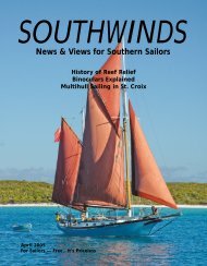
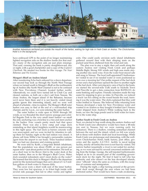
Another Adventure anchored just outside the mouth of the harbor, waiting <strong>for</strong> high tide in Fresh Creek on Andros. The Chickcharnies<br />
Hotel is in the background.<br />
have embraced GPS to the point of no longer maintaining<br />
lighted navigation aids on the shallow banks (<strong>for</strong> that matter—many<br />
of the navigation aids are just plain missing).<br />
That said, crossing the bank is pretty straight<strong>for</strong>ward, day<br />
or night, with a good chartplotter and a copy of the Explorer<br />
Chartbook. We needed two books <strong>for</strong> this voyage: The Near<br />
Bahamas and The Exumas.<br />
Morgan’s Bluff on Andros Island<br />
After transferring Echo back onboard <strong>for</strong> a dawn departure,<br />
our second hop took us through the North West Passage<br />
where we turned south to Morgan’s Bluff on the northeastern<br />
tip of Andros (the North West Channel is not to be confused<br />
with New Providence Channel, located farther north).<br />
Alternatively, we could have turned left to Chub Cay and<br />
cleared customs, as both are a day’s sail from Nassau. We<br />
chose Andros, the largest island of the Bahamas, because<br />
we’d never been there and it is not heavily visited (most<br />
guides ignore this interesting island), and we were well<br />
ahead of schedule—time to explore. The Morgan’s Bluff outer<br />
harbor was easy to find at the end of a well-marked ship<br />
channel, and by 2 p.m., we were entering the outer harbor.<br />
The outer harbor is wide open to NNW through NE<br />
winds, so we threaded the short narrow passage past colorful<br />
Regatta Park to the very small inner harbor—so small<br />
the only anchoring was a bowline to a tree and stern anchor<br />
in the harbor. Four vessels pretty much had that space<br />
claimed. There was also a ferry ramp and cargo dock<br />
reminding us that island freighters would be maneuvering<br />
in this tight space. The fuel dock (a barren concrete wall)<br />
was unoccupied, and we were invited by islanders to raftup<br />
there <strong>for</strong> Sunday night as the fuel station was closed. A<br />
phone call from Willie’s bar brought a personable customs<br />
agent from the airport to our boats. Three hundred dollars<br />
later we had our clearance and cruising permit.<br />
We were told by Keith, a long-time British inhabitant,<br />
that the population was about 25,000, or one person per<br />
square mile—just about perfect in his estimation. He took us<br />
on a short tour in his Rover; first to the water dock at the<br />
outer harbor, then on to the Morgan’s Bluff Caves. Water<br />
dock sounded redundant; aren’t most docks on the water<br />
We learned that this dock in Morgan’s Bluff is the departure<br />
point <strong>for</strong> the motorized barges that carry about 4.5- to 5-million<br />
gallons of fresh water to Nassau daily.<br />
The caves were a short walk east of the inner harbor.<br />
They were low but spacious, 6- to 8-feet high inside with<br />
several side passages that led to other rooms and tighter<br />
exits. One could easily envision early island inhabitants<br />
gathered around fires with their sleeping mats on the<br />
packed sand floor, sheltered from the wind and rain.<br />
The plan was to stay a night, then sail south along the<br />
eastern Andros reef visiting Fresh Creek and perhaps<br />
Middle Bight. Strong NW winds and high seas made staying<br />
another day seem wise. Even the water boat stayed safe<br />
and snug in Nassau. The local (self-appointed) harbormaster<br />
visited to see if we needed water or were positioned so<br />
as to owe a mooring fee Our polite request of the fuel dock<br />
owner and a fuel purchase opened the door to another night<br />
at the fuel dock. After carrying jerry cans of fuel to the boats,<br />
we started the several-mile walk south to Nicholls Town<br />
and Pineville to get a data connection from BATELCO, do<br />
some banking and explore. Friendly islanders made the trip<br />
easier by stopping to give us rides. In Pineville, we noticed<br />
a truck van box sitting on the round beside the road, learning<br />
it was the water store. The clerk explained that they sold<br />
water bottled in Nassau. She believed folks returning from<br />
Nassau developed a taste <strong>for</strong> New Providence water and<br />
wanted it on Andros so they bought it bottled (isn’t Nassau<br />
water shipped from Andros) While walking back to the<br />
boats, we saw the large ponds used to hold water <strong>for</strong> transfer<br />
to the water ship.<br />
Farther South to Fresh Creek on Andros<br />
Next, we elected to hop south along the eastern Andros reef<br />
to Fresh Creek (our alternative would have been a 48-mile<br />
run east to Nassau, but we were running early <strong>for</strong><br />
Junkanoo). There is a shallow, winding unmarked channel<br />
between the reef and the island, which we felt was wisely<br />
left to those with shallow draft and local knowledge. While<br />
Fresh Creek was picturesque and interesting, with the wellworn<br />
Chickcharnies Hotel, batik factory, post office, groceries<br />
and the nearby A.U.T.E.C. facility (a naval testing<br />
facility, strictly off limits) the town is not heavily visited. The<br />
narrow harbor (essentially a river) is not suited <strong>for</strong> anchoring,<br />
as we were advised by several concerned residents calling<br />
from the bridge. George, the self-reputed harbormaster,<br />
helped us tie to an unused part of the crumbling government<br />
dock <strong>for</strong> the night. We find it hard to tell who has<br />
authority and who doesn’t on the less developed islands,<br />
since “officials” dress the same as civilians, with the exception<br />
of customs and immigration.<br />
During the night, a ship turning around at the government<br />
dock swept through the area where we had been<br />
anchored earlier. That would have been a rude awakening.<br />
<strong>News</strong> & <strong>Views</strong> <strong>for</strong> <strong>Southern</strong> <strong>Sailors</strong> SOUTHWINDS November 2011 45