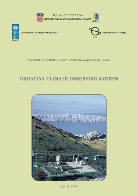
CROATIAN CLIMATE OBSERVING SYSTEM
CROATIAN CLIMATE OBSERVING SYSTEM
CROATIAN CLIMATE OBSERVING SYSTEM

Create successful ePaper yourself
Turn your PDF publications into a flip-book with our unique Google optimized e-Paper software.
REPUBLIC OF CROATIA<br />
METEOROLOGICAL AND HYDROLOGICAL SERVICE<br />
United Nations Development Programme<br />
Global Enviroment Facility<br />
Croatia<br />
GEF<br />
Project: UNDP/GEF CRO/03/G31/A/1G/99: Climate Change Enabling Activities - Phase II<br />
<strong>CROATIAN</strong> <strong>CLIMATE</strong> <strong>OBSERVING</strong> <strong>SYSTEM</strong><br />
Zagreb, 2005.
REPUBLIC OF CROATIA<br />
METEOROLOGICAL AND HYDROLOGICAL SERVICE<br />
United Nations Development Programme<br />
Global Enviroment Facility<br />
Croatia<br />
GEF<br />
<strong>CROATIAN</strong> <strong>CLIMATE</strong><br />
<strong>OBSERVING</strong> <strong>SYSTEM</strong><br />
Capacity building for participation in systematic<br />
observation networks in Croatia<br />
Zagreb, November 2005.
PROJECT<br />
UNDP/GEF CRO/03/G31/A/1G/99: Climate Change Enabling Activities - Phase II<br />
COMMISSIONED BY<br />
The Ministry of Environmental Protection, Physical Planning and Construction<br />
PUBLISHED BY<br />
The National Meteorological and Hydrological Service (MHS)<br />
MANAGING EDITOR<br />
Ivan »aËiÊ, Director MHS-a<br />
EDITOR IN CHIEF<br />
Zvonimir Katuπin<br />
TRANSLATED BY<br />
Valnea Bressan<br />
GRAPHIIC DESIGN<br />
Ivan Lukac<br />
COMPILATION<br />
Ivan Lukac<br />
TISAK:<br />
The views expressed in this publication are those of the authors and<br />
do not necessarily represent those of UNDP<br />
CIP - Katalogizacija u publikaciji<br />
Nacionalna i sveuËiliπna knjiænica - Zagreb<br />
UDK 551.501(497.5)<br />
KATU©IN, Zvonimir<br />
Croatian climate observing system :<br />
capacity building for participation in<br />
systematic observation networks in Croatia<br />
/ . - Zagreb :<br />
The National Meteorological and Hydrological Service, 2005<br />
Izv. stv. nasl.: Hrvatski klimatski<br />
motriteljski sustav : razvijanje moguÊnosti<br />
za provoappleenje motrenja u sustavnim motriteljskim mreæama<br />
klimatskog sustava Republike Hrvatske<br />
ISBN 953-96631-7-2<br />
I. Meteoroloπka mjerenja -- Hrvatska<br />
II. Klimatske promjene -- Meteoroloπka mjerenja<br />
451128161<br />
Front cover ilustration: main meteorologocal station Zaviæan (1594 m), MHS
C O N T E N T<br />
Preface ......................................................................................................................... 5<br />
1 Introduction ..................................................................................................... 7<br />
2. Global Climate Observing System ..................................................................... 7<br />
2.1 Global Climate Observing System - purpose and tasks ..................................... 7<br />
2.2 GCOS at global, regional and national level, and GEOSS................................. 10<br />
3. GCOS Climate monitoring principles .............................................................. 10<br />
4. Assessment of the current status of national climate observing programmes... 12<br />
4.1 Atmospheric Domain - station types and number, activities and organisation . 12<br />
4.1.1 Surface stations - activities and organisation ................................................. 13<br />
4.1.2 Upper-air stations - activities and organisation ............................................... 17<br />
4.1.3 Atmosphere-composition stations, activities and organisation ........................ 18<br />
4.2 Oceanic Domain - station types and number, activities and organisation ....... 19<br />
4.2.1 Ship meteorological observations, activities and organization ......................... 20<br />
4.2.2 Sea surface temperature, activities and organisation ...................................... 21<br />
4.2.3 Sea level, activities and organisation .............................................................. 21<br />
4.2.4 Sea state (waves), activities and organisation ................................................. 21<br />
4.2.5 Oceanographic observations in situ ................................................................. 21<br />
4.2.5.1 In situ coastal automatic oceanographic and meteorological stations ............. 21<br />
4.2.5.2 In situ moored-bouy automatic oceanographic and meteorological stations .... 21<br />
4.2.6 Research ship observations, description and organisation .............................. 21<br />
4.3 Terrestrial domain - station types and number, activities and organisation .... 23<br />
4.3.1 Hydrology, activities and organisation ............................................................ 24<br />
4.3.2 Glaciology, activities and organisation ............................................................ 25<br />
4.3.3 Soil and vegetation, activities and organisation .............................................. 26<br />
5. Space-based (satellite) observation programme ............................................... 27<br />
5.1 Space-based observation programmes used in Croatia and<br />
Croatia's participation in related international programmes ........................... 27<br />
6. Observing system deficiencies in Croatia ........................................................ 29<br />
6.1 Atmospheric domain ...................................................................................... 29<br />
6.2 Oceanic domain .............................................................................................. 29<br />
6.3 Terrestrial domain .......................................................................................... 29
6.4 Space-based observations - space (satellite) programmes ............................... 29<br />
7. Difficulties met by the climate observing systems in Croatia ........................... 30<br />
7.1 Main difficulties .............................................................................................. 30<br />
7.2 Institutions responsible for the different climate system networks in Croatia . 30<br />
7.3 Observations performed under different authority (institutions) in Croatia ..... 31<br />
a) National Meteorological and Hydrological Service ........................................ 31<br />
b) Ministry of the Sea, Tourism, Transport and Development<br />
(airports and road traffic) ............................................................................... 32<br />
c) Ministry of Environmental Protection, Physical Planning<br />
and Construction (Environmental Protection Agency) ..................................... 32<br />
d) Ministry of Health and Social Welfare<br />
(Medical Research Institute and Public Health Institute) ................................. 33<br />
e) Institute of Oceanography and Fishery ....................................................... 33<br />
f) Hydrographic Institute ................................................................................ 34<br />
g) Ruappleer BoπkoviÊ Institute (Sea Research Centre, Rovinj) .............................. 34<br />
h) Geophysical Institute, Department of Geophysic, Faculty of Science .......... 34<br />
8. Ongoing plans for systematic observations ..................................................... 35<br />
9. Possible projects for improving systematic observations in Croatia ................. 36<br />
10. Suggestions and recommendations ................................................................. 38<br />
Acronims .................................................................................................................... 39<br />
Literature ................................................................................................................... 40
Preface<br />
Observations within a global climate observing system are performed over a wide area<br />
(atmosphere, water, land) and require constant cooperation, because observations in one<br />
field are frequently used for research in another. As diverse data are required from the<br />
same location, oceanographic buoys very often measure meteorological variables, besides<br />
purely oceanographic ones. The same applies to stations measuring atmosphere composition<br />
(pollution). Meteorological stations, where possible, measure also oceanographic<br />
variables, air pollution, soil temperature, etc. Therefore it is impossible to draw a strict<br />
line between the different climate system domains and continuing cooperation is essential,<br />
at least at data level, to keep everybody informed of what is done and how, and to<br />
make possible the exchange of data.<br />
This is an initial analysis of the elements necessary for the coordination of observations<br />
within the Croatian climate observing system. Continuous updating of this information<br />
with changes in the observing systems will ensure better planning of future observations<br />
and pave the way for participation in national and international projects aimed at improving<br />
observations. Participation in international projects such as GCOS and GEOSS raises<br />
awareness also at national level.<br />
Natural sciences are based on data (observation systems) and, therefore, data should<br />
be given adequate importance and the collection of data should follow scientific principles<br />
and be carried out according to the latest technological developments.<br />
I would like to thank the following persons for helping me with information on the<br />
organisation of observing systems and the number of measurement sites:<br />
Branka Grbec, Ph.D., Oceanographic Institute, Split; Nenad Leder, Ph.D., Hydrographic<br />
Institute, Split; Nenad Smodlaka, Ph.D., Ruappleer BoπkoviÊ Institute, Sea Research Centre,<br />
Rovinj; Antun Marki, Ph.D., Andrija MohoroviËiÊ Geophysical Institute, Department of<br />
Geophysics, Faculty of Science, Zagreb; Jasenka NeÊak, B.Sc., Ministry of Environmental<br />
Protection, Physical Planning and Construction, Zagreb; Predrag Hercog, B.Sc., The City<br />
of Zagreb Public Health Institute, Zagreb; Miroslav JelaËiÊ,B.Sc., Ministry of the Sea,<br />
Tourism, Transport and Development, Department of Aviation Meteorology, Zagreb;<br />
Ivan »aËiÊ, M. Sc., Viπnja ©ojat, M. Sc., Milan Zupan, B.Sc., Tadija Grgas, B.Sc.,<br />
Draæen KauËiÊ M.Sc., Marko VuËetiÊ, B.Sc., Æeljko LonËar, B.Sc., Kreπo PandæiÊ, Ph.D.,<br />
Branko Cividini, B.Sc., Zvonko Æibrat, B.Sc., Krunoslav Premec, B.Sc., National<br />
Meteorological and Hydrological Service, Zagreb; Milan HodæiÊ, Ph.D., Sanda BritviÊ-<br />
PejkoviÊ, B.Sc., Capt. Æeljko ©ore, Marine Meteorological Centre, National Meteorological<br />
and Hydrological Service, Split.<br />
Editor-in-Chief
<strong>CROATIAN</strong> <strong>CLIMATE</strong> <strong>OBSERVING</strong> <strong>SYSTEM</strong> 7<br />
1. Introduction<br />
Under the contract ruling the execution of the UNDP/GEF project<br />
CRO/03/G31/A/1G/99, Expedited Financing of Climate Change Enabling Activity -<br />
Phase II, signed by the Ministry of Environmental Protection, Physical Planning and<br />
Construction, Ulica Republike Austrije 20, 10000 Zagreb, and the National Meteorological<br />
and Hydrological Service, GriË 3, 10000 Zagreb, the Executor has agreed to carry out<br />
research and prepare a study on the Croatian climate observing system in accordance<br />
with the project document and the UNDP National Execution Guidelines.<br />
The contract was signed and delivered to the Executor in early February 2005.<br />
All available documents on observation networks and all available GCOS documents,<br />
together with consultations with experts from different institutions responsible for different<br />
climate system domain observations and measurements (atmospheric, oceanic, terrestrial<br />
domains and satellite measurements) have been used to complete the project.<br />
This is an initial analysis which will help to further identify all the subjects involved in<br />
observation activities and all data users with a view to co-ordinating all existing observing<br />
systems in Croatia. It will also be a starting point in the execution of regional and international<br />
projects. This study has been prepared by Zvonimir Katuπin, National<br />
Meteorological and Hydrological Service.<br />
2. Global Climate Observing System<br />
2.1 Global Climate Observing System - purpose and tasks<br />
The Global Climate Observing System comprises observations of all climate system<br />
components (atmosphere, oceans/seas, land), and its objective is to define and encompass<br />
all the needs for observations in the climate system, including space-based (satellite)<br />
observations of all climate system variables, at world, regional and national level, and to<br />
establish the conditions for observation improvements.<br />
The goals stated in the Second Report on the Adequacy of the Global Observing Systems<br />
for Climate are to:<br />
• determine what progress has been made in implementing climate observing networks<br />
and systems since the First Adequacy Report in 1998;<br />
• determine the degree to which these networks meet with scientific requirements and<br />
conform with associated observing principles; and<br />
• assess how well existing systems, together with new and emerging methods of observation,<br />
will meet the needs of UNFCC.<br />
The GCOS Steering Committee recommended the following action plan:<br />
Intergovernmental agencies, GCOS, GOOS, GTOS, need to develop guidelines, standards<br />
and rules for performing terrestrial observations which do not exist at this level. For<br />
atmospheric (WMO) and oceanic (GOOS) observations, all these regulations exist. All<br />
countries need to maintain continuous observations and data exchange at the level of<br />
essential climate variables.<br />
ATMOSPHERIC VARIABLES (above land, sea and ice)
8 <strong>CROATIAN</strong> <strong>CLIMATE</strong> <strong>OBSERVING</strong> <strong>SYSTEM</strong><br />
Surface (2m above land, sea and ice): air temperature, precipitation, air pressure, surface<br />
radiation budget, wind speed and direction, water vapour.<br />
Upper-air: earth radiation budget (including solar irradiance), upper-air temperature<br />
(including MSU radiances), wind speed and direction, water vapour, cloud properties.<br />
Composition: carbon dioxide, methane, ozone, other long-lived greenhouse gases,<br />
aerosol properties.<br />
OCEANIC VARIABLES:<br />
Surface: sea-surface temperature, sea-surface salinity, sea level, sea state, sea ice, currents,<br />
ocean colour (for biological activity), carbon dioxide partial pressure.<br />
Sub-surface: temperature, salinity, currents, nutrients, carbon, ocean thresholds, phytoplankton.<br />
TERRESTRIAL VARIABLES:<br />
river discharge, water use, ground water, lake levels, snow cover, glaciers and ice caps,<br />
permafrost and seasonally-frozen ground, albedo, land cover (including vegetation types),<br />
fractions of absorbed photosynthetically active radiation, leaf area index, biomass, fire disturbance.<br />
Countries have to prepare observation plans at national level for all domains, including<br />
those which can be received from satellite observations.<br />
Domain<br />
Atmospheric<br />
(over land,<br />
seas and oceans)<br />
Oceanic<br />
Terrestrial<br />
Variables largely dependent upon satellite observations<br />
precipitation, earth radiation budget (including solar<br />
irradiance), upper-air temperature (including MSU radiances),<br />
wind speed and direction (especially over the oceans), water<br />
Vapour, cloud properties, carbon dioxide, ozone,<br />
aerosol properties.<br />
sea-surface temperature, sea level, sea ice, ocean colour<br />
(for biological activity).<br />
snow cover, glaciers and ice caps, albedo, land cover<br />
(including vegetation types), fractions of absorbed<br />
photosintheticaly active radiation (FAPAR), fire disturbance.<br />
The GCOS Steering Committee has forwarded the following proposal for priority<br />
actions:<br />
• Complete implementation of the relevant observing systems,<br />
• Historical data retrieval and development of meta-data documentation,<br />
• Free and unrestricted exchange of data and the forwarding of data to international<br />
data centres,<br />
• Development of national plans for systematic observations,<br />
• Development and implementation of regional action plans for climate observing systems,<br />
• Specification of the special requirements of developing countries and countries in<br />
transition, in particular of the least developed countries and small island developing<br />
states,<br />
• Use of climate data as a basis in the decision-taking process.
<strong>CROATIAN</strong> <strong>CLIMATE</strong> <strong>OBSERVING</strong> <strong>SYSTEM</strong> 9<br />
There are serious deficiencies in the existing Global Climate Observing System:<br />
• Atmospheric networks have still not met the targeted global coverage and quality<br />
requirements,<br />
• Oceanic networks do not satisfy the required global coverage and observations are not<br />
performed systematically,<br />
• Global terrestrial networks have yet to be defined.<br />
A suggestion to start a donor fund to help developing countries and certain countries<br />
in transition has been accepted as a measure leading to further development and better<br />
operation of the whole system.<br />
GCOS has agreed on the sequence of regional workshops where,<br />
together with GEF, projects will be defined to help improve the global<br />
climate observing system. GCOS will continue to monitor improvements<br />
in observations through the national reports submitted to the<br />
GCOS Secretariat.<br />
Note: Croatia plans to continue working on the project with the objective of identifying<br />
observations carried out in all three climate system domains and prepare a report on the<br />
current situation and possible future developments of the climate observing system.<br />
GCOS is partner to the Global Earth Observation System of Systems - GEOSS, which<br />
is trying to co-ordinate all existing observing systems.<br />
SPACE<br />
Net solar<br />
(short-wave)<br />
radiation<br />
Net terrestrial<br />
(long-wave)<br />
radiation<br />
Snow and ice<br />
Absorption<br />
Reflection<br />
Emission<br />
SEA ATMOSPHERE<br />
Precipitation<br />
Air-ice<br />
interactions<br />
Sea ice<br />
Clouds<br />
Ice-ocean<br />
interactions<br />
Currents<br />
Wind<br />
Air-sea<br />
interactions<br />
Lakes and rivers<br />
Volcanic gases<br />
and particulates<br />
Land surface<br />
processes<br />
Runoff<br />
Human<br />
activities<br />
Schematic of the Climate System
10 <strong>CROATIAN</strong> <strong>CLIMATE</strong> <strong>OBSERVING</strong> <strong>SYSTEM</strong><br />
2.2 GCOS at global, regional and national level, and GEOSS<br />
GCOS has been defined, for global requirements, to ensure data from all domains of the<br />
climate system. A network of high-resolution stations has been defined for the monitoring<br />
of global climate changes, which means that a number of countries have not even one<br />
global GCOS station although they are actively involved in the GCOS process.<br />
Actually, regional- and national-scale climate observations and study require a much<br />
denser station network. Networks exist and they should be used to support the global network.<br />
This relationship should be clearly defined in the next phases because the way networks<br />
are connected in the different domains of the climate system (at least at the level of<br />
data and records) is very important for the development of the entire system and the use<br />
and exchange of data.<br />
The Global Earth Observation System of Systems (GEOSS), officially introduced in<br />
February 2005, is meant to encompass a still wider observation area and refers to observations<br />
to be used in the following areas: natural catastrophies, human health, energy<br />
resources, climate, water resources, weather, ecosystems, agriculture, biodiversity and for<br />
public use. Emphasis has been placed on space-based observations (satellite observations).<br />
With this comprehensive approach, GEOSS includes individual member countries<br />
and all international agencies and organisations active in this field. GCOS is member of<br />
GEOSS and will contribute to the definition and implementation of the 10-year GEOSS<br />
plan.<br />
3. GCOS Climate Monitoring Principles<br />
Effective monitoring systems for climate should adhere to the following principles:<br />
1. The impact of new systems or changes to existing systems should be assessed prior<br />
to implementation,<br />
2. A suitable period of overlap for new and old observing systems should be required,<br />
3. The results of calibration, validation and data homogeneity assessments, and<br />
assessments of algorithm changes, should be treated with the same care as data,<br />
4. A capacity to routinely assess the quality and homogeneity of data on extreme<br />
events, including high-resolution data and related descriptive information, should<br />
be ensured,<br />
5. Consideration of environmental climate monitoring products and assessments,<br />
such as IPCC assessments, should be integrated into national, regional, and global<br />
observing priorities,<br />
6. Uninterrupted station operations and observing systems should be maintained,<br />
7. A high priority should be given to additional observations in data-poor regions and<br />
regions sensitive to changes,<br />
8. Long-term requirements should be specified to network designers, operators and<br />
instrument engineers at the outset of new system design and implementation,<br />
9. The carefully-planned conversion of research observing systems to long-term operations<br />
should be promoted,<br />
10. Data management systems that facilitate access, use and interpretation should be<br />
included as essential elements of climate monitoring systems.<br />
Furthermore, satellite systems for monitoring climate need to:<br />
a) Take steps to make radiance calibration, calibration-monitoring and satellite-to-
<strong>CROATIAN</strong> <strong>CLIMATE</strong> <strong>OBSERVING</strong> <strong>SYSTEM</strong> 11<br />
The World Meteorological Organization Global Observing System (WMO GOS)<br />
satellite cross-calibration of the full operational constellation a part of the operational<br />
satellite system; and<br />
b) Take steps to sample the Earth system in such way that climate-relevant (diurnal,<br />
seasonal, and long-term interannual) changes can be resolved.<br />
Thus, satellite systems for climate monitoring should adhere to the following specific<br />
principles:<br />
11. Constant sampling within the diurnal cycle (minimizing the effects of orbital decay<br />
and orbit drift) should be maintained,<br />
12. A suitable period of overlap for new and old satellite systems should be ensured for<br />
a period adequate to determine inter-satellite biases and maintain the homogeneity<br />
and consistency of time series observations,<br />
13. Continuity of satellite measurements (i.e. elimination of gaps in the long-term<br />
record) through appropriate launch and orbital strategies should be ensured,<br />
14. Rigorous pre-launch instrument characterisation and calibration, including radiance<br />
confirmation against an international radiance scale provided by a national<br />
metrology institute, should be ensured,<br />
15. On-board calibration adequate for climate system observations should be ensured<br />
and associated instrument characteristics monitored,<br />
16. Operational production of priority climate products should be sustained and peerreviewed;<br />
new products should be introduced as appropriate,<br />
17. Data systems needed to facilitate user access to climate products, meta-data and<br />
raw data, including key data for delay-mode analysis, should be established and<br />
maintained,<br />
18. Use of functioning baseline instruments that meet the calibration and stability<br />
requirements stated above should be maintained for as log as possible, even when<br />
these exist on de-commissioned satellites,
12 <strong>CROATIAN</strong> <strong>CLIMATE</strong> <strong>OBSERVING</strong> <strong>SYSTEM</strong><br />
19. Complementary in situ baseline observations for satellite measurements should be<br />
maintained through appropriate activities and cooperation,<br />
20. Random errors and time-dependent biases in satellite observations and derived<br />
products should be identified.<br />
4. Assessment of the current status of national climate observing<br />
programmes<br />
Croatia has a long tradition of monitoring variables in all domains of the climate system.<br />
This chapter lists the status and number of stations in Croatia (regardless under<br />
what authority) for each domain of the climate system and describes their activities and<br />
organisation. Each description is followed by an adequacy assessment or a note, if the situation<br />
is not clear.<br />
4.1 Atmospheric domain - station types and number, activities and organisation<br />
Station type<br />
Number of stations<br />
4.1.1 Surface meteorological stations 651<br />
4.1.1.1 Surface main meteorological stations 38<br />
4.1.1.2 Aeronautical (airport) meteorological stations 5<br />
4.1.1.3 Climatological stations 109<br />
4.1.1.4 Precipitation stations and storage rain-gauges 326<br />
4.1.1.5 Automatic meteorological stations transferring data<br />
to the MHS IT system<br />
58 (32GMP,26INV,)<br />
4.1.1.6 Automatic meteorological stations outside the > 115<br />
MHS IT system<br />
Main meteorological station Zadar, MHS, Croatia
<strong>CROATIAN</strong> <strong>CLIMATE</strong> <strong>OBSERVING</strong> <strong>SYSTEM</strong> 13<br />
4.1.2 Upper-air meteorological stations 11<br />
4.1.2.1 Radiosonde stations 2<br />
4.1.2.2 Pilot-balloon stations 1<br />
4.1.2.3 Radar stations 8<br />
4.1.3 Atmosphere composition (pollution) stations 50 + > 250<br />
4.1.3.1 Ozone stations 3<br />
4.1.3.2 Sulphur dioxide and collocated measurements 25<br />
- By daily precipitation sample analysis 19<br />
- Automatic stations 6<br />
4.1.3.3 Nitrogen dioxide and collocated measurements 16<br />
- By analysing daily air flow through a solution 12<br />
- Automatic stations 4<br />
4.1.3.4 Smoke and aerosol property measurements 3<br />
4.1.3.5 Greenhouse gases measurements 4<br />
4.1.3.6 Measurements of pollution parameters at local level > 250<br />
These are all the stations monitoring atmospheric parameters as of 31 December 2004.<br />
The number of observations under 4.1.1.6 (Automatic meteorological stations outside the<br />
MHS IT system) and 4.1.3.6 (Measurements of pollution parameters at local level) are<br />
approximate because not all institutions with measurement sites serving their own needs<br />
have been covered.<br />
4.1.1. Surface stations - activities and organisation<br />
- Surface main meteorological stations are stations with 2 to 5 professional observers<br />
and enclosed premises (usually a detached building), which perform observations or register<br />
all meteorological variables 24 hours a day in accordance with the regulations of the<br />
World Meteorological Organisation and the National Meteorological and Hydrological<br />
Service. Data are forwarded via meteorological messages to the WMO global telecommu-<br />
Main meteorological station PloËe, MHS, Croatia
14 <strong>CROATIAN</strong> <strong>CLIMATE</strong> <strong>OBSERVING</strong> <strong>SYSTEM</strong><br />
nication system. Most stations are equipped with automatic weather stations measuring<br />
one or more meteorological variables 24 hours a day and are part of the MHS information<br />
system. These stations undergo operative data processing, completeness control, consistency<br />
control and space control. All data, including automatic station data, are stored in<br />
computer processing media. User programmes make possible the delivery of data for various<br />
purposes.<br />
Station spatial distribution is satisfactory and meets WMO requirements. Station altitude<br />
distribution should be improved.<br />
- Aeronautical (airport) meteorological stations are meteorological stations with professional<br />
observers and enclosed premises, located at airports, which perform observations<br />
mainly for air traffic purposes. As a rule, they should act as main meteorological stations.<br />
Data are delivered to the WMO and ICAO telecommunication system. All stations are<br />
equipped with automatic weather stations. Weather station data are not subsequently<br />
controlled nor stored. Observation logs are stored with MHS.<br />
After the data are stored into the MHS computer, data checks are performed at climate<br />
observing level (7, 14, 21 hrs mean local time).<br />
Station spatial distribution and siting meet the requirements of airports and ICAO standards.<br />
Meteorological station Palagruæa, MHS, Croatia
<strong>CROATIAN</strong> <strong>CLIMATE</strong> <strong>OBSERVING</strong> <strong>SYSTEM</strong> 15<br />
Meteorological and Aerological Observatory, Zagreb-Maksimir<br />
with automatic and conventional observations, MHS, Croatia<br />
- Climatological (standard meteorological) stations carry out observations at 07, 14 and<br />
21 hrs mean local time and monitor meteorological phenomena during the day.<br />
Observations are performed by non-professional observers and the stations are usually<br />
situated on private land. Some of these stations forward public information data by phone,<br />
once or twice a day. At the end of each month, observation logs are forwarded by mail to<br />
MHS, where the data are entered into computers, controlled and stored. These data are<br />
used directly or via user programmes.<br />
Station spatial distribution meets WMO requirements.<br />
- Precipitation stations measure precipitation amounts at 7h a.m. (Mean European<br />
Time) every day (for preceded 24 h) and make weather phenomena observation during 24<br />
h. Observation are performed by non profesional observers and the stations are situated<br />
on private land. At the end of each month, observation logs are forwarded by mail to<br />
MHS, where the data are entered into computers, controlled and stored. This data are<br />
used directly or via user programmes.<br />
- Storage rain-gauges are rain gauges collecting precipitation over longer periods. They<br />
are usually located in inaccessible areas, away from human settlements, and are emptied<br />
once a year.<br />
Spatial distribution does not meet the necessary requirements and needs improving.<br />
- Automatic meteorological stations transferring data to the MHS IT system have been set<br />
up at all surface main meteorological stations and at other locations required by users,<br />
and are part of the MHS IT system. They measure one or more variables, depending on<br />
available funds and user requirements. Data from these stations are available for operational<br />
use and are regularly controlled and stored.<br />
In the future, the meteorological station network should be further automated.
16 <strong>CROATIAN</strong> <strong>CLIMATE</strong> <strong>OBSERVING</strong> <strong>SYSTEM</strong><br />
Automatic precipitation measurement, Jankovac, MHS, Croatia<br />
Automatic upper air radiosonding station Zadar, DHMZ, Croatia
<strong>CROATIAN</strong> <strong>CLIMATE</strong> <strong>OBSERVING</strong> <strong>SYSTEM</strong> 17<br />
Meteorological radar station, Bilogora, MHS, Croatia<br />
- Automatic meteorological stations not linked to the MHS IT system are set up individually<br />
or to serve different systems (e.g. roads, agriculture, forestry, the power industry,<br />
tourism, etc.). Besides air temperature, humidity and pressure, precipitation and weather<br />
type (current weather) they measure a number of additional variables, e.g. road-surface<br />
state (dry, wet, dry with salt, wet with salt, moist, covered by ice, black ice or frost and<br />
cover depth), oceanographic variables, air pollution elements, plant disease development<br />
conditions etc. Such stations are usually located at sites not representative of the area and<br />
are used for operative application in different user fields.<br />
4.1.2 Upper-air stations - activities and organisation<br />
- Radio-sonde stations perform measurements of upper-level air pressure, temperature<br />
and humidity and wind speed and direction in the 0-35 km layer. At the Zagreb-Maksimir<br />
radio-sonde station, measurements are carried out twice a day (00 and 12 UTC) by the<br />
Vaisala Digi Cora II automatic device and using the NAVAID LORAN C system to define<br />
wind speed and direction. The balloons are manually prepared, inflated and launched by<br />
professional observers. At the Zadar radio-sonde station, measurements are performed<br />
twice a day (00 and 12 UTC) by the completely automated Vaisala AUTOSONDE able to<br />
handle 12 radio-sonde measurement. A GPS is used to define wind velocity and direction.<br />
The balloons are inflated and launched automatically. Balloons are replaced and hydrogen<br />
checked once a week. Data are controlled within their own algorithm and are automatically<br />
stored in computerised form.<br />
Spatial distribution meets WMO requirements<br />
- Pilot-balloon stations measure wind velocity and direction by optical theodolite twice a<br />
day, at 06 and 18 UTC, if weather conditions permit. Data are recorded in observation<br />
logs.
18 <strong>CROATIAN</strong> <strong>CLIMATE</strong> <strong>OBSERVING</strong> <strong>SYSTEM</strong><br />
Automatic atmosphere composition (pollution) station, Zagreb, MEPPC<br />
Two measurement sites should be upgraded with up-to-date devices.<br />
- Radar meteorological stations use radar to continuously monitor atmospheric phenomena.<br />
Northern Croatia is covered by digital radar display, which enables radar pictures to<br />
be delivered to users electronically. Data (pictures) are forwarded for international<br />
exchange and are regularly stored in databases. Since 2000, Croatia (MHS) has joined the<br />
OPERA EUMETNET project to harmonise and standardise radar products to develop a<br />
common radar picture of Europe.<br />
For fully covering Croatian area, Croatia need more radars.<br />
4.1.3 Atmosphere-composition (pollution) stations - activities and organisation<br />
Ozone stations measure surface ozone concentrations. Data are stored in computers.<br />
Sulphur dioxide measurements:<br />
Analyses of daily precipitation samples identify: PH, electric conductivity, sulphates,<br />
nitrates, chlorides, ammonia, calcium, potassium, sodium, magnesium;<br />
Automatic stations identify: sulphur dioxide, nitrogen compounds, carbon monoxide,<br />
hydrogen sulfide, ammonia and floating particles.
<strong>CROATIAN</strong> <strong>CLIMATE</strong> <strong>OBSERVING</strong> <strong>SYSTEM</strong> 19<br />
Nitrogen dioxide measurements:<br />
Analyses of daily air flow though a solution identify daily concentrations;<br />
Automatic stations identify nitrogen dioxide concentrations.<br />
Smoke and aerosol properties (floating particles) are registered by automatic stations.<br />
Greenhouse gases - carbon monoxide is registered by automatic stations at 4 sites.<br />
Measurements of pollution parameters at local level are performed to meet he needs of<br />
different institutes, offices, industrial plants etc. both automatically and by classical<br />
methods.<br />
The spatial distribution of these stations should be brought into line with national regulations.<br />
4.2 Oceanic domain - station types and number, activities and organisation<br />
Type of station/measurements<br />
Number<br />
4.2.1 Ship meteorological observations 15 to 60<br />
(Ship meteorological stations)<br />
4.2.2 Sea Surface temperature 16<br />
4.2.3 Sea level - fixed marigraphs 7<br />
4.2.4 Sea state - assessment (waves) 21<br />
4.2.5 In situ measurements 3<br />
4.2.5.1 In situ coastal automatic oceanographic and 2<br />
meteorological stations<br />
- sea temperature<br />
- salinity<br />
- sea level<br />
- wave height and period<br />
- heat and humidity flow at the border between sea and land<br />
- air temperature<br />
- air pressure<br />
- relative air humidity<br />
- wind direction and speed<br />
- albedo<br />
- precipitation<br />
4.2.5.2 In situ moored-buoy automatic oceanographic and meteorological stations<br />
- sea temperature<br />
- salinity<br />
- sea level<br />
- wave height and period<br />
- heat and humidity flow at the border between sea and land<br />
- air temperature<br />
- air pressure<br />
- relative air humidity<br />
- wind direction and speed<br />
- short-wave solar radiation
20 <strong>CROATIAN</strong> <strong>CLIMATE</strong> <strong>OBSERVING</strong> <strong>SYSTEM</strong><br />
- albedo<br />
- precipitation<br />
4.2.6 Research ship observations, activities and organisation<br />
4.2.6.1 Sea physical parameters no. of institutions<br />
4.2.6.1.1 Sea depth 2<br />
4.2.6.1.2 Mixing depth 2<br />
4.2.6.1.3 Sea current parameters 1<br />
4.2.6.1.4 Sea temperature depth profile 1<br />
4.2.6.1.5 Wave period, direction and height 1<br />
4.2.6.2 Sea chemical parameters<br />
a) in water column<br />
4.2.6.2.1 Dissolved oxygen 2<br />
4.2.6.2.2 pH 2<br />
4.2.6.2.3 Salt (ortophosphates, total phosphorus, nitrates,<br />
ammonia, total nitrogen, suspended load)<br />
b) in sediment<br />
4.2.6.2.4 Granulometry, carbonates, redox potential,<br />
heavy metals, total nitrogen, organic carbon,<br />
organic matter, inorganic and organic phosphorus 1<br />
c) in biosphere<br />
4.2.6.2.5 Heavy metals, carbonates 1<br />
4.2.6.3 Sea biological parameters<br />
4.2.6.3.1 Phytoplankton, zooplankton, bacterioplankton,<br />
phytobentos, zoobentos, chlorophyll, primary production,<br />
bacteriological production, phytotoxins,<br />
poisonous phytoplankton species, sanitary quality of sea<br />
and sea organisms (shells),<br />
4.2.6.3.2 Deep-sea fish, sea-bottom fish, molluscs, spawn (standard data);<br />
dynamics and population of parasites in cages and free-living in the<br />
sea, genetic structure of the fish and shell population.<br />
This is a list of the type of oceanic measurements performed continually or periodically<br />
showing the situation on 31 December 2004. At local or scientific levels there might<br />
exist measurements which are not included in this analysis.<br />
Observations in the oceanic domain of the climate system are varied and spread quite<br />
heterogenously. An optimal spatial distribution should be defined by analysing and coordinating<br />
all institutions maintaining measurement systems.<br />
4.2.1 Ship meteorological observations (ship meteorological stations), activities<br />
and organization<br />
These observations include all meteorological parameters. Passenger and cargo ship<br />
officers are trained to perform meteorological observations and forward data. Data are<br />
entered in a log which is delivered to the MHS Marine Meteorological Centre at the end of<br />
each journey. Where possible, data are passed on via radio or VHF transmissions. Data<br />
are then checked, entered in the computer and used for different purposes (in modelling<br />
and sea and ocean climatology). Ship meteorological stations can be selected ships, sup-
<strong>CROATIAN</strong> <strong>CLIMATE</strong> <strong>OBSERVING</strong> <strong>SYSTEM</strong> 21<br />
plementary ships or auxiliary ships, depending on their instrument equipment and the<br />
activities performed on board a particular ship.<br />
4.2.2 Sea surface temperature, activities and organisation<br />
Sea surface temperature is measured by the station network covering the coast and the<br />
islands. Measurements are performed by non-professional (where possible, at main meteorological<br />
stations by professional) observers three times a day (7, 14, 21 local time)<br />
according to the MHS Marine Meteorological Department guidelines. Observation logs are<br />
forwarded by mail at the end of each month. Data are entered into the computer, checked<br />
and stored. At certain locations a sea temperature sensor has been added to automatic<br />
meteorological stations to continually measure sea temperature.<br />
4.2.3 Sea level, activities and organisation<br />
Sea level is measured continually by marigraphs. Data are collected and processed.<br />
4.2.4 Sea state (waves), activities and organisation<br />
Sea state is defined at surface main meteorological stations located along the coast,<br />
visually, according to the sea state scale. Data are transferred via SYNOP messages to the<br />
WMO telecommunication system.<br />
4.2.5 Oceanographic observations in situ<br />
In situ measurements are performed at regular intervals at fixed land and sea locations.<br />
4.2.5.1 In situ coastal automatic oceanographic and meteorological stations, activities<br />
These stations measure sea temperature, salinity, sea level, heat and humidity flow at<br />
the boundary between the sea and land. They also measure basic meteorological parameters<br />
in the atmosphere.<br />
4.2.5.2 In situ moored-bouy automatic oceanographic and meteorological stations,<br />
activities<br />
These stations register sea state (wave height and direction), sea surface temperature,<br />
salinity, sea level, heat and humidity flow at the boundary between the sea and land.<br />
4.2.6 Research ship observations, activities and organisation<br />
Research ship observations along the Adriatic Sea are performed periodically and last<br />
from a couple of days to a month. During the cruise, physical, chemical and biological<br />
parameters are measured. Measurements are performed at fixed points and, if a denser<br />
network is required, also at supplementary points. The measurements include all the regular<br />
programme parameters and specific tests. Samples and data are processed during<br />
and after cruising and are used to form a database and in professional or scientific<br />
research.
22 <strong>CROATIAN</strong> <strong>CLIMATE</strong> <strong>OBSERVING</strong> <strong>SYSTEM</strong><br />
Research ship ”Bios”,<br />
Institute of Oceanography and Fishery,<br />
Split, Croatia<br />
Research ship ”Vila Velebita”,<br />
Ruappleer BoπkoviÊ Institute, Sea Research<br />
Centre, Rovinj, Croatia<br />
Research ship ”Palagruæa”<br />
Hydrographic Institute, Split, Croatia<br />
Research ship ”Hidra”<br />
Hydrographic Institute, Split, Croatia
<strong>CROATIAN</strong> <strong>CLIMATE</strong> <strong>OBSERVING</strong> <strong>SYSTEM</strong> 23<br />
In situ moored-buoy automatic oceanographic<br />
and meteorological station, Middle Adriatic Sea,<br />
Institut of Oceanography and Fisheries,<br />
Split, Croatia<br />
In situ moored-buoy automatic station for sea<br />
temperature measurement<br />
Umag, MHS, Croatia<br />
Observations in the oceanic domain of the climate system are quite heterogenously<br />
spread. An optimal frequency and spatial distribution of regular measurements (stations)<br />
should be defined by analysing and coordinating all institutions providing measurements.<br />
4.3 Terrestrial domain - station types and number, activities and<br />
organisation<br />
Station/measurement type<br />
number of stations/measurements<br />
4.3.1 Hydrology<br />
4.3.1.1 River flow 450<br />
4.3.1.2 Water level of rivers and lakes 500<br />
4.3.1.3 Runoff 450<br />
4.3.1.4 Current speed 450<br />
4.3.1.5 Ground water level 1000<br />
4.3.2 Glaciology (snow)<br />
4.3.2.1 Snow cover (amount of soil covered) 483<br />
4.3.2.2 Snow cover depth 483<br />
4.3.2.3 Snow precipitation 483<br />
4.3.2.4 Snow density 25<br />
4.3.2.5 Amount of frozen soil (assessment) 483
24 <strong>CROATIAN</strong> <strong>CLIMATE</strong> <strong>OBSERVING</strong> <strong>SYSTEM</strong><br />
4.3.3 Soil and vegetation<br />
4.3.3.1 Soil temperature 50<br />
4.3.3.2 Soil moisture 1<br />
4.3.3.3 Soil type 30<br />
4.3.3.4 Albedo 2<br />
4.3.3.5 Plant phenology 57<br />
4.3.3.6 Vegetation cover types 3<br />
4.3.3.7 Leaf surface index 2<br />
4.3.3.8 Fire index distribution 30<br />
4.3.3.9 Evaporation measurements 21<br />
4.3.3.10 Biomass change -<br />
4.3.3.11 Change in soil use -<br />
4.3.3.12 Paleoclimatology -<br />
Terrestrial measurements (4.3.1 Hydrology, 4.3.2 Glaciology and 4.3.3 Soil and vegetation,<br />
items 4.3.3.1, 4.3.3.2, 4.3.3.4, 4.3.3.5, 4.3.3.8 and 4.3.3.9) are performed at MHS.<br />
Measurements under 4.3.3.3, 4.3.3.6, 4.3.3.7, 4.3.3.10, 4.3.3.11 and 4.3.3.12 are occasionally<br />
carried out as part of scientific or professional projects at different institutes and<br />
faculties.<br />
4.3.1 Hydrology, activities and organisation<br />
River discharge is determined at regular time periods, and, when necessary, in emergency<br />
situations, by currentmeter and field measurements. Data are entered into the computer,<br />
checked and stored. Automatic devices are being introduced, directly and continuously<br />
transferring data to the IT system<br />
The water level of rivers and lakes is determined by water-level staff. Data are read by<br />
non-professional observers, entered into the observation log and when measurements are<br />
completed the log is sent to the MHS Hydrological Department by mail. The levels are<br />
Water - level recorder, plitviËka jezera, MHS, Croatia
<strong>CROATIAN</strong> <strong>CLIMATE</strong> <strong>OBSERVING</strong> <strong>SYSTEM</strong> 25<br />
Water level measurement,GoriËan, MHS, Croatia<br />
entered into the computer, checked and stored. Automatic devices are being introduced,<br />
connected to the IT system and used for flood prevention activities and data collection.<br />
Runoff is determined by calculation and is used for operational purposes and analyses.<br />
Current speed is determined by instruments and calculations from field measurements.<br />
Data are entered into the computer, checked, stored and used for operational purposes<br />
and subsequent analyses. Continuous measurements are performed by automatic devices<br />
connected to the IT system.<br />
Ground water level is measured from wells. Observers measure the level three times a<br />
day and record it in the log. At the end of each month, the log is forwarded to MHS by<br />
mail; data are entered into the computer, checked and stored. Automatic devices connected<br />
to the IT system are used, continuously measuring ground water level. Data are used<br />
for operative and other purposes.<br />
4.3.2 Glaciology (snow), activities and organisation<br />
Snow cover extent (amount of soil covered) is determined at all MHS meteorological stations.<br />
Data are recorded in observation logs and subsequently entered into the computer.<br />
User programmes determine the number of days with snow, the start and end of snow<br />
appearance on the ground etc.<br />
Snow cover depth is determined by snow stake at all MHS meteorological stations. From<br />
the main meteorological stations data are transferred as meteorological messages to be<br />
used in national and international data exchange. Data are entered into the computer,<br />
checked and stored. Automatic stations ensure constant monitoring of snow depth by<br />
laser sensors.
26 <strong>CROATIAN</strong> <strong>CLIMATE</strong> <strong>OBSERVING</strong> <strong>SYSTEM</strong><br />
Climatological station Zalesina, MHS, Croatia<br />
Snow precipitation is determined by Hellmann's rain gauge at all MHS meteorological<br />
stations.<br />
Snow density is determined by spring scales at particular stations.<br />
The extent of frozen soil is assessed at all MHS meteorological stations (soil condition).<br />
Frozen soil depth is determined by measurements at a single spot. Data are entered into<br />
the computer, checked and stored.<br />
4.3.3 Soil and vegetation - activities and organisation<br />
Soil temperature is determined at standard depths up to 1 m, three times a day, at particular<br />
meteorological stations. Data are entered into the computer, checked and stored.<br />
At a number of points in the vicinity of automatic stations additional sensors are used to<br />
continually record soil temperature at standard depths.<br />
Soil moisture is determined by physical methods, dehydrating samples every 10 days.<br />
Soil type is determined by pedologic methods.<br />
Albedo is measured at stations equipped with instruments measuring solar irradiation<br />
(the ratio between reflected and incoming solar radiation). Other solar irradiation components<br />
are also determined (global, diffuse) as well as insolation duration.<br />
Plant phenology - phenophases are observed on phenological objects throughout the<br />
year. Observations are carried out by non-professional observers and the observation logs<br />
are forwarded by mail at the end of each month.<br />
Vegetation cover types are determined occasionally as part of scientific projects.
<strong>CROATIAN</strong> <strong>CLIMATE</strong> <strong>OBSERVING</strong> <strong>SYSTEM</strong> 27<br />
Soil temperature measurement, Zadar, MHS, Croatia<br />
Leaf surface index is determined occasionally as part of scientific projects.<br />
Fire index distribution is determined indirectly from meteorological data. There is a plan<br />
to periodically define the necessary parameters by burning sample at a defined location.<br />
Evaporation measurements are determined at chosen meteorological stations, mainly<br />
potential evaporation, by class A evaporation pan.<br />
Biomass change is determined occasionally as part of scientific projects.<br />
Change in soil use is determined occasionally as part of scientific projects<br />
Paleoclimatology is carried out periodically as part of scientific projects in forestry, geology,<br />
geography and meteorology.<br />
Observations in the soil and vegetation domain of the climate system are not systematic<br />
or are quite heterogenously spread. An optimal spatial distribution should be defined<br />
by additional analysis and by co-ordinating all institutions involved in measurements.<br />
5. Space-based (satellite) observation programmes<br />
5.1 Space-based observation programmes used in Croatia and Croatia's participation<br />
in related international programmes<br />
The first experimental meteorological satellite, TIROS-1, was launched in the USA on 1<br />
April 1960. It circled the Earth at an altitude of 700 km, in approximately a polar orbit.<br />
This event, together with the event of large computers, opened the path to huge opportunities<br />
and development because all phenomena in the earth's climatic system (atmos-
28 <strong>CROATIAN</strong> <strong>CLIMATE</strong> <strong>OBSERVING</strong> <strong>SYSTEM</strong><br />
phere, oceans, land) could now be monitored and measured from space.<br />
The Croatian forecasting operations service has been using satellite pictures since<br />
1986. Until mid-1995 a SDUS, Secondary Data User Station, was used to receive pictures<br />
from the METEOSAT satellite and the NOAA polar satellites in analog form. A PDUS,<br />
Primary Data User Station, has been used since November 1995 to receive METEOSAT<br />
digital pictures, NOAA satellite analog data and forecasting charts via the Meteorological<br />
Data Distribution (MDD) system. The introduction of the PDUS system has improved<br />
meteorological information quality, visualisation and processing.<br />
Today, forecasting operations use METEOSAT pictures. The satellite, data processing<br />
and distribution are managed by EUMETSAT, the European Organisation for the<br />
Exploration of Meteorological Satellites, and data are visualised and processed in three<br />
spectral areas: visual (0.4 - 1.0 mm), infrared (10.5 - 12.5 mm) and the water vapour<br />
absorption band (5.7 - 7.1 mm). Meteorological practice mostly uses a combination of pictures<br />
in all three spectres. Atmospheric, oceanic and terrestrial satellite data have a number<br />
of other applications. In January 2002, Croatia became associate member of EUMET-<br />
SAT and was thus given the possibility of using satellite data for different purposes. The<br />
second generation satellites are technically and substantially more sophisticated requiring<br />
the users to adapt to a number of new possibilities.<br />
In Croatia, satellite data are used by a number of scientific institutes and research<br />
organisations. At the moment they are mainly used in atmospheric climate system operations<br />
(meteorology, weather forecasting) while in the other two climate system domains<br />
they are still not used in operations.<br />
Since 2005, Croatia has been member of the Global Earth Observation System of<br />
Systems (GEOSS) and has accepted its 10-year implementation plan. This provides the<br />
possibility of acquiring data for a wide area and defines observations to be used in the following<br />
areas: natural catastrophies, human health, energy resources, climate, water<br />
The Space - based segment of the Global Observing System
<strong>CROATIAN</strong> <strong>CLIMATE</strong> <strong>OBSERVING</strong> <strong>SYSTEM</strong> 29<br />
resources, weather, ecosystems, agriculture, biodiversity and public use, with particular<br />
emphasis on space-based observations (satellite observations). Considering such a comprehensive<br />
approach, the use of data in all three climate system domains and all user<br />
areas defined by GEOSS should be defined also at national level.<br />
6. Observing system deficiencies in Croatia<br />
6.1 Atmospheric domain<br />
- Surface stations - insufficient automation (only 58 out of 478 meteorological stations<br />
are partially automatic),<br />
- Upper-air stations - existing radiosonde systems need modernising<br />
- there are no wind profiler measurements of the vertical crosssection<br />
of flow, temperature and humidity in the atmosphere,<br />
- the Adriatic coast and Southern Croatia are not covered by<br />
meteorological radar picture.<br />
- Atmosphere-composition stations - insufficient coordination of institutions involved<br />
in observations and insufficient coverage of certain<br />
areas.<br />
6.2 Oceanic domain - the operational fixed network of oceanographic and<br />
Oceanographic-meteorological stations and moored buoys is not sufficiently dense to<br />
cover all the Adriatic. Oceanographic and hydrographic institutes perform periodical<br />
measurements mainly by research ships. A better co-ordination of institutions involved in<br />
observations is required.<br />
6.3 Terrestrial domain<br />
- Hydrology - insufficient automation, inadequate spatial coverage in some<br />
parts of the country.<br />
- Glaciology - insufficient automation, observations organised within surface<br />
meteorological stations.<br />
- Soil and vegetation - some observations (biomass change, change in soil use, paleoclimatology)<br />
are only sporadic, for scientific project purposes and<br />
are not defined as an operational network.<br />
6.4 Space-based (satellite) programmes<br />
- Atmospheric domain - satellite data are not stored for subsequent use in climate<br />
research, modelling etc., the latest methods of using data<br />
have not been adopted.<br />
- Oceanic domain - satellite data are used for scientific purposes but are rarely<br />
systematically used for operational purposes.
30 <strong>CROATIAN</strong> <strong>CLIMATE</strong> <strong>OBSERVING</strong> <strong>SYSTEM</strong><br />
- Terrestrial domain - no programmes have been developed which would operationally<br />
safeguard and use satellite data.<br />
7. Difficulties met in the setting up and development of operations<br />
in the climate observing systems in Croatia and institutions<br />
responsible for the different observing networks in<br />
Croatia<br />
7.1 Main difficulties<br />
- Lack of coordination at national level among networks in different climate system<br />
domains or even within particular climate system domains.<br />
- No focal point at national level where all stakeholders (users, related institutions, the<br />
public) could receive information on who is responsible for the maintenance of a particular<br />
network, how is maintenance carried out, what data are available, how can<br />
data be accessed and at what conditions.<br />
- In some domains (particularly in oceanic and terrestrial programmes) measurements<br />
are not systematically approached and are performed as part of a project, which<br />
means they are carried out only as long as the project is funded.<br />
7.2 Institutions responsible for the different climate system networks in<br />
Croatia<br />
There are many reasons affecting changes in the existing climate system observing networks:<br />
professional, user, political, historical and other. Changes are also influenced by<br />
technological development and by extraordinary events, most often natural catastrophies<br />
(e.g. tsunami - at global level) calling for new observing systems and the improvement of<br />
existing ones. It would be useful to precisely know, at least at data level, what observing<br />
systems exist, what they do, how data can be accessed and under what conditions. This<br />
would prevent monopolising and the duplication of observing systems as well as help the<br />
planning of new systems and the use of data from the existing systems.<br />
In Croatia, several institutions perform observations within national networks. In some<br />
areas and for some activities, specific-purpose, user-related observing networks have been<br />
set up.<br />
It is certainly important to differentiate national observation networks providing data<br />
for public use, from user networks, set up in defined areas to solve a technological or<br />
security problem.<br />
For historical, user, political, professional and implementation reasons, there is actually<br />
no operative organisation of climate system domains (atmospheric, oceanic, terrestrial)<br />
observing networks in Croatia. The MHS observing system, besides atmospheric and<br />
hydrological observations, performs a considerable number of observations of the oceanic<br />
and terrestrial climate domains. This is because of the historical conditions ruling the<br />
setting up of networks, the possibility of cheaper implementation at already existing stations<br />
with observers and the necessary infrastructure, the concentration of adequate staff<br />
for infrastructure and system maintenance etc.
<strong>CROATIAN</strong> <strong>CLIMATE</strong> <strong>OBSERVING</strong> <strong>SYSTEM</strong> 31<br />
Institutions maintaining observing systems in the atmospheric, oceanic and terrestrial<br />
climate domains in Croatia:<br />
a) National Meteorological and Hydrological Service<br />
b) Ministry of the Sea, Tourism, Transport and Development (airports and road traffic)<br />
c) Ministry of Environmental Protection, Physical Planning and Construction<br />
d) Ministry of Health and Social Welfare (Medical Research Institute, Public Health<br />
Institute)<br />
e) Institute of Oceanography and Fishery<br />
f) Hydrographic Institute<br />
g) Ruappleer BoπkoviÊ Institute (Sea Research Centre, Rovinj)<br />
h) Geophysical Institute Andrija MohorovËiÊ - Geophysical Department, Faculty of Science<br />
Besides these institutions, a number of institutes and departments run observing systems<br />
or individual stations for their own use. The Croatian Water Authority, Croatian<br />
Electricity and Croatian Roads have a permanent (yearly renewable) agreement with MHS<br />
for meteorological and hydrological observations.<br />
7.3 Observations performed under different authority (institutions)<br />
a) National Meteorological and Hydrological Service<br />
- has been performing meteorological observations since 1851, verifying and storing<br />
data. Nowadays, in accordance with WMO regulations and recommendations, it operates<br />
the following observing systems (listed in Chapter 4):<br />
4.1 Atmospheric domain<br />
4.1.1 Surface meteorological stations 651<br />
4.1.1.1 Surface main meteorological stations 38<br />
4.1.1.3 Climatological stations 109<br />
4.1.1.4 Precipitation stations with storage rain-gauges 326<br />
4.1.1.5 Automatic meteorological stations transferring data<br />
to the MHS IT system<br />
58 (32GMP, 26INV,)<br />
4.1.2 Upper-air meteorological stations 11<br />
4.1.2.1 Radiosonde stations 2<br />
4.1.2.2 Pilot-balloon stations 1<br />
4.1.2.3 Radar stations 8<br />
4.1.3 Atmosphere composition (pollution) stations 50 + > 250<br />
4.1.3.1 Ozone stations 3<br />
4.1.3.2 Sulphur dioxide and collocated measurements 25<br />
- By daily precipitation sample analysis 19<br />
- Automatic stations 6<br />
4.1.3.3 Nitrogen dioxide collocated measurements 16<br />
- By analysing daily air flow though a solution 12<br />
- Automatic stations 4<br />
4.2 Oceanic domain<br />
4.2.1 Ship meteorological observations 15 to 60<br />
4.2.2 Sea Surface temperature 16<br />
4.2.3 Sea level - fixed marigraphs 7<br />
4.2.4 Sea state (waves) 21
32 <strong>CROATIAN</strong> <strong>CLIMATE</strong> <strong>OBSERVING</strong> <strong>SYSTEM</strong><br />
4.3 Terrestrial domain<br />
4.3.1 Hydrology<br />
4.3.1.1 River flow 450<br />
4.3.1.2 Water level of rivers and lakes 500<br />
4.3.1.3 Runoff 450<br />
4.3.1.4 Current speed 450<br />
4.3.1.5 Ground water level 1000<br />
4.3.2 Glaciology<br />
4.3.2.1 Snow cover (amount of soil covered) 483<br />
4.3.2.2 Snow cover depth 483<br />
4.3.2.3 Snow precipitation 483<br />
4.3.2.4 Snow density 25<br />
4.3.2.5 Amount of frozen soil (assessment) 483<br />
4.3.3 Soil and vegetation<br />
4.3.3.1 Soil temperature 50<br />
4.3.3.2 Soil moisture 1<br />
4.3.3.4 Albedo (global + diffuse solar radiation) 2<br />
Global solar radiation 4<br />
Short-wave (UVB) radiation 3<br />
4.3.3.5 Plant phenology 57<br />
4.3.3.8 Fire index distribution 30<br />
4.3.3.9 Evaporation measurements 21<br />
5.1 Satellite data - MHS represents Croatia in EUMETSAT and GEOSS. Satellite pictures<br />
and data are regularly used for forecasting and further analyses.<br />
b) Ministry of the Sea, Tourism, Transport and Development (airports and road traffic)<br />
- performs meteorological (aeronautical) observations at airports for air traffic purposes<br />
and maintains a network of automatic meteorological stations along roads which,<br />
besides meteorological variables, provide pavement condition information. These stations<br />
are located at traffic-relevant points.<br />
4.1 Atmospheric domain<br />
4.1.1.2 Aeronautical (airport) meteorological stations 5<br />
(at airports) used for air traffic purposes<br />
4.1.1.6 Automatic meteorological stations at airports (5) and 105<br />
along roads, used for traffic purposes. Data are not stored<br />
c) Ministry of Environmental Protection, Physical Planning and Construction<br />
(Environmental Protection Agency) - maintains a national network of automatic stations<br />
monitoring atmosphere composition. Four stations are in operation, measuring mean<br />
daily concentrations of sulphur dioxide, nitrogen dioxide, smoke and aerosol properties<br />
(floating particles), carbon monoxide, hydrogen sulfide and ammonia. Surface ozone concentration<br />
is also measured at one location. In addition to chemical sensors (4 sites) each<br />
station has meteorological sensors for measuring temperature, relative air humidity and<br />
wind speed and direction.<br />
In accordance with the current law, Offices of the Ministry of Environmental Protection,<br />
Physical Planning and Construction organise the monitoring of air and sea pollution components<br />
at local level.<br />
4.1 Atmospheric domain<br />
4.1.1.6 Automatic meteorological stations outside the MHS IT system > 115<br />
4.1.3 Atmosphere composition (pollution) stations 50 + > 250<br />
4.1.3.1 Ozone stations 3
<strong>CROATIAN</strong> <strong>CLIMATE</strong> <strong>OBSERVING</strong> <strong>SYSTEM</strong> 33<br />
4.1.3.2 Sulphur dioxide 25<br />
By daily precipitation sample analysis 19<br />
Automatic stations 6<br />
4.1.3.3 Nitrogen dioxide 16<br />
By analysing daily air flow though a solution 12<br />
Automatic stations 4<br />
4.1.3.4 Smoke and aerosol property (floating particles) 3<br />
4.1.3.5 Carbon monoxide 4<br />
- hydrogen sulfide<br />
- ammonia<br />
4.1.3.6 Measurements of pollution parameters at local level > 100<br />
4.2 Oceanic domain<br />
4.2.5.5 Sea quality chemical parameters <br />
4.3 Terrestrial domain <br />
d) Ministry of Health and Social Welfare (Medical Research Institute and the Public Health<br />
Institute of the City of Zagreb)<br />
4.1.3.6 Measurements of air pollution at local level, user-oriented, for 1<br />
issuing warnings and for studying the impact of pollution on health.<br />
e) Institute of Oceanography and Fishery<br />
- carries out oceanographic research (sea level) on moored buoys and research ships.<br />
Moored buoys are equipped with sensors monitoring meteorological variables.<br />
4.1. Atmospheric domain<br />
4.1.1.6 Automatic meteorological stations outside the 3<br />
MHS IT system (see items 4.2.5 and 4.2.5.2)<br />
4.2 Oceanic domain<br />
4.2.3 Sea level - fixed marigraphs 1<br />
4.2.5.1 In situ coastal automatic oceanographic and meteorological 2<br />
stations<br />
- sea temperature<br />
- salinity<br />
- sea level<br />
- heat and humidity flow at the border between sea and land<br />
- air temperature<br />
- air pressure<br />
- relative air humidity<br />
- wind direction and speed<br />
- solar short-wave radiation<br />
- albedo<br />
- precipitation<br />
4.2.5.2 In situ moored-buoy automatic oceanographic 1 + 2 planned<br />
and meteorological stations (same variables as under 4.2.5.1)<br />
4.2.6 Research ship observations (2 ships) over 20 sailings lasting<br />
2 to 30 days<br />
4.2.6.1 Sea physical parameters<br />
4.2.6.1.1 Sea depth<br />
4.2.6.1.2 Mixing depth<br />
4.2.6.1.3 Sea current parameters<br />
4.2.6.1.4 Sea temperature depth profile<br />
4.2.6.2 Sea chemical parameters<br />
a) in water column
34 <strong>CROATIAN</strong> <strong>CLIMATE</strong> <strong>OBSERVING</strong> <strong>SYSTEM</strong><br />
4.2.6.2.1 Dissolved oxygen<br />
4.2.6.2.2 pH<br />
4.2.6.2.3 Salt<br />
b) in sediment<br />
4.2.6.2.4 Granulometry, carbonates, redox potential, heavy metals, total nitrogen,<br />
organic carbon, organic matter, inorganic and organic phosphorus<br />
c) in biosphere<br />
4.2.6.2.5 Heavy metals, carbonates<br />
4.2.6.3 Sea biological parameters<br />
4.2.6.3.1 Phytoplankton, zooplankton, bacterioplankton, phytobentos, zoobentos,<br />
chlorophyll, primary production, bacteriological production, phytotoxins,<br />
poisonous phytoplankton species, sanitary quality of sea<br />
and sea organisms (shells),<br />
4.2.6.3.2 Deep-sea fish, sea-bottom fish, molluscs, spawn (standard data);<br />
dynamics and population of parasites in cages and free-living in the<br />
sea, genetic structure of the fish and shell population.<br />
f) Hydrographic Institute Split<br />
- carries out hydrographic, sea level and sea state (waves) research as well as measurements<br />
from research ships.<br />
4.2 Oceanic domain<br />
4.2.3 Sea level - fixed marigraphs 5<br />
4.2.6 Research ship observations, 10 sailings x 30 days annually<br />
4.2.6.1 Sea physical parameters<br />
4.2.6.1.1 Sea depth<br />
4.2.6.1.2 Mixing depth<br />
4.2.6.1.3 Sea current parameters<br />
4.2.6.1.4 Sea temperature depth profile<br />
4.2.6.1.5 Wave period, direction and height<br />
4.2.6.2 Sea chemical parameters<br />
4.2.6.2.1 Dissolved oxygen<br />
4.2.6.2.2 pH<br />
4.2.6.2.3 Salt<br />
g) Ruappleer BoπkoviÊ Institute (Rovinj Sea Research Centre)<br />
- carries out oceanographic research in the Northern Adriatic.<br />
4.2 Oceanic domain<br />
4.2.5.2 In situ moored-buoy automatic oceanographic and meteorological 1<br />
stations (in cooperation with the IOF, Split)<br />
4.2.6 Research ship observations occasional cruises<br />
Several of the physical and chemical parameters<br />
listed under 4.2.6 are measured.<br />
h) Geophysical Institute, Department of Geophysics, Faculty of Science, Zagreb<br />
4.1 Atmospheric domain<br />
4.1.1.6 Automatic meteorological stations outside the MHS IT system 1<br />
4.2 Oceanic domain<br />
4.2.3 Sea level (marigraph) 1<br />
4.3 Terrestrial domain<br />
4.3.3.4 Global and diffused solar irradiation (data forwarded 2<br />
to the Petersbug WMO centre), UVB radiation
<strong>CROATIAN</strong> <strong>CLIMATE</strong> <strong>OBSERVING</strong> <strong>SYSTEM</strong> 35<br />
8. Ongoing plans for systematic observations<br />
At GCOS level, plans have been developed for improving observation system activities.<br />
Their basic requirements, when organising observations, are to ensure data homogeneity<br />
and adherence to the GCOS Climate Monitoring Principles, which ensures data integration<br />
in both time and space. The existing observing systems in Croatia still need improvement<br />
(Chapter 6) and cooperation (Chapter 7). Substantial coordination, cooperation and<br />
persistency will be required to win user, government and public support and to secure the<br />
means to upgrade all observing systems. While some of the systems are already at a<br />
remarkably high level with regard to planning, operations and management, others have<br />
still to be integrated and new ones set up. In planning its future observing systems,<br />
Croatia should apply the following guidelines:<br />
- To actively and steadily participate in the GCOS observing system and its related systems<br />
WMO Global Observing System - WMO GOS, Global Ocean Observing System -<br />
GOOS, Global Terrestrial System - GTrS and Global Earth System of Systems -<br />
GEOSS, cooperating in systematic monitoring activities and the development of data<br />
archives in all climate system domains (atmospheric, oceanic, terrestrial),<br />
- To foster cooperation with all observing networks at national level,<br />
- To plan activities leading to the collection, exchange and use of data, extending their<br />
use to meet local, regional and international demand,<br />
- To raise the quality of observations, equipment maintenance, validation and archiving<br />
in the existing climate system networks,<br />
- To upgrade the existing observing networks and restore or start observations not currently<br />
in progress,<br />
Schematic of Global Ocean Observing System (GOOS)
36 <strong>CROATIAN</strong> <strong>CLIMATE</strong> <strong>OBSERVING</strong> <strong>SYSTEM</strong><br />
- To upgrade the existing climate data banks and develop a system allowing better<br />
access to data, their use and exchange,<br />
- To constantly work on recovering historical data and the restoration of old records, to<br />
enter them into computer processing media, to validate, process and archive them,<br />
- To develop strategies for the implementation of space-based (satellite observations in<br />
all climate system domains (atmospheric, oceanic, terrestrial).<br />
9. Possible projects for improving systematic observations in<br />
Croatia<br />
GCOS has organised regional workshops to define possible projects leading to the<br />
improvement of observing systems in all climate system domains. Specific needs have<br />
been detected at national level, depending on the organisation and degree of development<br />
of particular observing systems.<br />
Atmospheric Domain<br />
Surface meteorological stations requirements<br />
- Upgrading of surface main meteorological station and climatological stations by introducing<br />
automation; upgrading and renovation of the precipitation station network to<br />
the required spatial distribution pattern,<br />
- Upgrading and development of network density by introducing self-contained automatic<br />
meteorological stations, particularly in scarcely populated areas (along the<br />
coast, on the islands and the highlands),<br />
- IT system upgrading (both hardware and software) for data collection, processing and<br />
storing,<br />
- Ensuring all the necessary conditions for the maintenance and calibration of equipment<br />
and instruments,<br />
- Upgrading and standardisation of the meta-data module for all stations,<br />
- Collecting and recovering historical data,<br />
- Entering historical data into computer media (presently, only 30% has been entered).<br />
Upper-air stations requirements<br />
- Upgrading and alignment of two radio-sonde devices,<br />
- Provision of one or two backup radio-sonde devices,<br />
- Implementation of measurements by wind profiler of atmospheric flow vertical crosssection,<br />
temperature and humidity, at one or two locations,<br />
- Complete radar coverage of the country by renovating three radars for the continental<br />
area and purchasing three radars for the coastline,<br />
- Entering of radio-sonde data into computer processing media for the period preceding<br />
1970 (RS Zagreb-Maksimir, period 1955-1970 and RS Split-Lazarica, period 1955-<br />
1965).<br />
Atmosphere composition stations requirements<br />
- Coordination of existing air composition networks at data and planning level,<br />
- Development of the WMO GAW network of stations measuring pollution in accordance<br />
with the required spatial distribution,<br />
- Implementation of a denser network for monitoring greenhouse gases,<br />
- Procurement of adequate equipment (automatic stations) to monitor atmosphere composition,
<strong>CROATIAN</strong> <strong>CLIMATE</strong> <strong>OBSERVING</strong> <strong>SYSTEM</strong> 37<br />
- Equipment and upgrading of the chemical laboratory.<br />
Oceanic domain<br />
- Coordination of the existing measurement networks at data and planning level,<br />
- Achievement of an adequate spatial distribution and upgrading of existing networks<br />
by automation (sea surface temperature, sea level, sea state),<br />
- Increasing the number of moored buoys equipped with all the necessary automated<br />
sensors (oceanographic, wave recorder, meteorological etc.).<br />
- Ensuring proper condition for research ship operations.<br />
Terrestrial domain<br />
Hydrology<br />
- Organisation of a common hydrologic IT-supported observing system covering the<br />
whole country,<br />
- Optimising the hydrological station network and supplying the existing networks with<br />
automatic electronic devices,<br />
- Covering chosen experimental small river basins with electronic instruments and<br />
devices required to monitor all water balance components.<br />
- Upgrading of the IT system for monitoring, controlling, archiving and use of hydrological<br />
data.<br />
Glaciology<br />
- Gradual upgrading of snow measurements by introducing automatic electronic<br />
devices,<br />
- Upgrading of the Zaviæan main meteorological station (1594 m) to the status of mountain<br />
meteorological observatory, with particular emphasis on snow and cloud monitoring,<br />
- Setting up a special data bank for the study of snow and ice variables.<br />
Soil and vegetation<br />
- Upgrading of measurements and the collection, processing, archiving and use of data<br />
(soil temperature and humidity) by introducing electronic sensors at both existing and<br />
planned stations,<br />
- Upgrading of solar irradiation stations and implementation of continuous measurements<br />
at existing and planned stations,<br />
- Upgrading of evaporation measurements by introducing electronic recording devices<br />
and linking them to the IT system,<br />
- Operational monitoring of the fire hazard index through calculations and experimental<br />
implementation of research into the burning and fire hazard index for Croatia,<br />
- Upgrading of phenological data collection by setting up a computer data base and a<br />
programme for the verification and use of data,<br />
- Implementing operative monitoring of soil types, vegetation cover types and changes<br />
in the use of soil,<br />
- Implementing operative monitoring of leaf area index and biomass change.<br />
Satellite programmes:<br />
- Upgrading of existing computer programmes and securing new ones for surface stations<br />
of the new generation for satellite data reception,<br />
- Implementation of the latest methods of satellite data use,<br />
- Introduction of satellite data for monitoring climate, supplemented by surface station<br />
data,<br />
- Implementation of an operational data base with all the options, possibilities and conditions<br />
for the use of satellite products for all climate system domains,
38 <strong>CROATIAN</strong> <strong>CLIMATE</strong> <strong>OBSERVING</strong> <strong>SYSTEM</strong><br />
- Improvement of climatological satellite information and product applications for public<br />
use.<br />
10. Suggestions and recommendations<br />
- Consider the possibility of coordinating all observing networks at national level, by<br />
setting up a permanent or ad-hoc focal point for coordination,<br />
- Working on the coordination and cooperation among the departments and agencies<br />
involved in observations in particular climate system domains,<br />
- The observing networks are not actually divided according to particular climate system<br />
domains. It is more economical to maintain particular observing networks<br />
attached to the existing structure to avoid infrastructure and maintenance system<br />
duplication,<br />
- This survey of the situation, drawbacks and difficulties met by observing systems can<br />
be used for planning and action plans at national and international level,<br />
- The use of satellite data should be given more attention by joining satellite measurement<br />
organisations at international level and training professionals for satellite data<br />
application in all climate system domains,<br />
- It should be taken into consideration that the implementation of new monitoring<br />
methods in most cases does not exclude existing methods and that such measurements<br />
are usually complementary, which results in an increase in data amount and<br />
quality,<br />
- The National Meteorological and Hydrological Service carries out over 75% of all<br />
observations and measurements in Croatia, in all climate system domains, and has<br />
the longest historical time sequences of systematic observations and data (since<br />
1851).
<strong>CROATIAN</strong> <strong>CLIMATE</strong> <strong>OBSERVING</strong> <strong>SYSTEM</strong> 39<br />
Acronyms<br />
EUMETSAT The European Organization for the Exploration of<br />
Meteorological Satellites<br />
EUMETNET The Network of European Meteorological Services<br />
GCOS Global Climate Observing System<br />
GEF Global Environment Facility<br />
GEOSS Global Earth Observation System of Systems<br />
GOOS Global Ocean Observing System<br />
GPS Global Position System<br />
GTOS Global Terrestrial Observing System<br />
GTrS Global Terrestrial System<br />
ICAO International Civil Aviation Organization<br />
IOF Institute of Oceanography and Fishery<br />
IPCC Intergovernmental Panel on Climate Change<br />
IT<br />
Information Transfering (System)<br />
MHS Meteorological and Hydrological Service<br />
METEOSAT Meteorological Satellite<br />
NOAA National Oceanic and Atmospheric Administration<br />
NMS national Meteorological Service<br />
OPERA Operational Programme for the Exchange of Weather Radar<br />
Informations<br />
PDUS Primary Data User Station<br />
RS Radiosounding Station<br />
SDUS Secondary Data User Station<br />
UNDP United Nations Development Programme<br />
UNFCCC United Nations Framework Climate Change Convention<br />
UTC United Time Central<br />
WMO World Meteorological Organization<br />
WMO GAW WMO Global Atmosphere Watch<br />
WMO GOS WMO Global Observing System
40 <strong>CROATIAN</strong> <strong>CLIMATE</strong> <strong>OBSERVING</strong> <strong>SYSTEM</strong><br />
Bibliography<br />
Katuπin Z., 1993.: Croatian Climate Programme; Projects Rewiew 1991 - 2000; National<br />
Meteorological and Hydrological Service, Zagreb, Croatia<br />
Katuπin Z., 1994.: Meteorological Stations Network in Croatia and Wars; Croatian<br />
Meteorological Journal, Vol. 29, Croatian Meteorological Society, Zagreb,<br />
Croatia<br />
Katuπin Z., 2001: Systematic Monitoring within the Global Observing System for the<br />
Climate Observing System (GCOS); The First National Communication of<br />
the Republic of Croatia to the United Nations Framework Convention on<br />
Climate Change (UNFCCC); Ministry of Environmental Protection and<br />
Physical Planning, Zagreb, Croatia<br />
GCOS 2003: Second Report on the Adequacy of Global Observing Systems for Climate in<br />
Support of UNFCCC; GCOS-82; (WMO/TD No. 1143), Geneva, Switzerland<br />
UNFCCC; SBSTA 19 2003: Priorities for actions arising from the second adequacy report,<br />
with particular reference to the Global Climate Observing System steering<br />
committee report to the Subsidiary Body for Scientific and Technological<br />
Advice at its eighteenth session; Submissions from Parties; PAPER NO. 4:<br />
CROATIA<br />
Mason P. and others, 2004: Implementation Plan for the Global Observing System for<br />
Climate in Support of the UNFCCC; GCOS - 92 (ES); (WMO/TD No 1244),<br />
Geneva, Switzerland<br />
GCOS 2004: GCOS Regional Action Plan for Central Asia; Geneva, Switzerland<br />
GCOS 2005: Report of the GCOS Regional Workshop for Central Asia on Improving<br />
Observing Systems for Climate; GCOS - 94 (WMO/TD No. 1248), Geneva,<br />
Switzerland<br />
GCOS 2005: A Framework Document to Assist in the Preparation of a Regional GCOS<br />
Action Plan for Eastern and Central Europe, Leipzig, Germany<br />
GCOS 2005: Report of the GCOS Regional Workshop for Eastern and Central Europe on<br />
improving Observing Systems for Climate; Leipzig, Germany, 26 - 28 April<br />
2005; GCOS-100; (WMO/TD No. 1283)<br />
GEOSS 2005: The Global Earth Observation System of Systems (GEOSS): 10-Year<br />
Implementation Plan; Earth Observation Summit; Brussels, Belgium