Rio del Oro Specific Plan Project - Sacramento District - U.S. Army
Rio del Oro Specific Plan Project - Sacramento District - U.S. Army
Rio del Oro Specific Plan Project - Sacramento District - U.S. Army

Create successful ePaper yourself
Turn your PDF publications into a flip-book with our unique Google optimized e-Paper software.
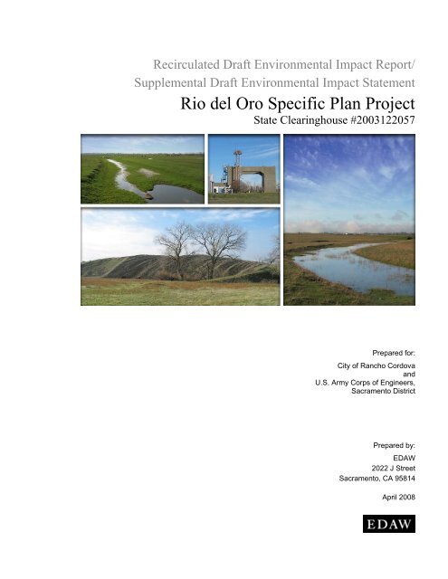
Recirculated Draft Environmental Impact Report/<br />
Supplemental Draft Environmental Impact Statement<br />
<strong>Rio</strong> <strong>del</strong> <strong>Oro</strong> <strong>Specific</strong> <strong>Plan</strong> <strong>Project</strong><br />
State Clearinghouse #2003122057<br />
SCH#<br />
Prepared for:<br />
City of Rancho Cordova<br />
and<br />
U.S. <strong>Army</strong> Corps of Engineers,<br />
<strong>Sacramento</strong> <strong>District</strong><br />
Prepared by:<br />
EDAW<br />
2022 J Street<br />
<strong>Sacramento</strong>, CA 95814<br />
April 2008
Recirculated Draft Environmental Impact Report/<br />
Supplemental Draft Environmental Impact Statement<br />
<strong>Rio</strong> <strong>del</strong> <strong>Oro</strong> <strong>Specific</strong> <strong>Plan</strong> <strong>Project</strong><br />
State Clearinghouse #2003122057<br />
SCH#<br />
Prepared for:<br />
City of Rancho Cordova<br />
2729 Prospect Park Drive<br />
Rancho Cordova, CA 95670<br />
Attn: Patrick Angell<br />
916/361-8384<br />
U.S. <strong>Army</strong> Corps of Engineers,<br />
<strong>Sacramento</strong> <strong>District</strong><br />
Regulatory Branch<br />
1325 J Street, Room 1480<br />
<strong>Sacramento</strong>, CA 95814-2922<br />
Attn: Kathleen Dadey<br />
916/557-7253<br />
Prepared by:<br />
EDAW<br />
2022 J Street<br />
<strong>Sacramento</strong>, CA 95814<br />
Contact:<br />
Francine Dunn<br />
<strong>Project</strong> Manager<br />
916/414-5800<br />
April 2008<br />
P 3T089.01
TABLE OF CONTENTS<br />
Section<br />
Page<br />
1 INTRODUCTION ................................................................................................................................... 1-1<br />
1.1 Background and Purpose of the Recirculated Draft Environmental Impact Report/<br />
Supplemental Draft Environmental Impact Statement................................................................. 1-1<br />
1.2 Content of the Recirculated DEIR/Supplemental DEIS............................................................... 1-3<br />
1.3 Relationship to the DEIR/DEIS ................................................................................................... 1-4<br />
3.5 UTILITIES AND SERVICES SYSTEMS—WATER SUPPLY...................................................... 3.5-1<br />
3.5.1 Affected Environment ............................................................................................................... 3.5-1<br />
3.5.2 Regulatory Framework............................................................................................................ 3.5-30<br />
3.5.3 Thresholds of Significance...................................................................................................... 3.5-31<br />
3.5.4 Analysis Methodology ............................................................................................................ 3.5-32<br />
3.5.5 Impact Analysis and Mitigation Measures .............................................................................. 3.5-33<br />
3.5.6 Residual Significant Impacts................................................................................................... 3.5-95<br />
3.10 BIOLOGICAL RESOURCES .......................................................................................................... 3.10-1<br />
3.10.1 Affected Environment ............................................................................................................. 3.10-1<br />
3.10.2 Regulatory Framework.......................................................................................................... 3.10-17<br />
3.10.3 Environmental Consequences ............................................................................................... 3.10-21<br />
3.10.4 Residual Significant Impacts................................................................................................. 3.10-72<br />
5 REFERENCES AND ORGANIZATIONS AND PERSONS CONSULTED .................................... 5-1<br />
6 REPORT PREPARERS ......................................................................................................................... 6-1<br />
7 INDEX ...................................................................................................................................................... 7-1<br />
Appendices<br />
N<br />
O<br />
P<br />
Q<br />
R<br />
<strong>Project</strong> Consistency with City of Rancho Cordova General <strong>Plan</strong> Utilities and Services Systems Policies<br />
That Relate to Water Supply<br />
Air Quality Mo<strong>del</strong>ing Golden State Water Company Pipeline<br />
<strong>Project</strong> Consistency with City of Rancho Cordova Biological Resources Policies<br />
Draft Wetland Mitigation Monitoring <strong>Plan</strong><br />
Draft Valley Elderberry Longhorn Beetle Mitigation <strong>Plan</strong><br />
<strong>Rio</strong> <strong>del</strong> <strong>Oro</strong> <strong>Specific</strong> <strong>Plan</strong> <strong>Project</strong> Recirculated DEIR/Supplemental DEIS<br />
EDAW<br />
City of Rancho Cordova and USACE i Table of Contents
Exhibits<br />
Page<br />
3.5-1 Proposed GSWC Water Line and Booster Pump Station..................................................................... 3.5-43<br />
2-9a On-Site Water Supply Facilities........................................................................................................... 3.5-69<br />
2-9b Off-Site Water Supply Facilities, Full <strong>Project</strong> Build-out ..................................................................... 3.5-75<br />
2-9c Off-Site Water Supply Facilities, Phase 1............................................................................................ 3.5-77<br />
3.5-2 <strong>Rio</strong> <strong>del</strong> <strong>Oro</strong> Nonpotable-Water System................................................................................................ 3.5-86<br />
3.10-1 Habitat Types at the <strong>Rio</strong> <strong>del</strong> <strong>Oro</strong> <strong>Project</strong> Site ...................................................................................... 3.10-3<br />
3.10-2 CNDDB Special-Status Wildlife Occurrences................................................................................... 3.10-15<br />
3.10-3 Proposed Preserves at the <strong>Rio</strong> <strong>del</strong> <strong>Oro</strong> <strong>Project</strong> Site............................................................................ 3.10-23<br />
3.10-4 Drainage Flows from Rancho Cordova Parkway............................................................................... 3.10-29<br />
3.10-5 Drainage to Water Quality Basin at Americanos Boulevard.............................................................. 3.10-31<br />
3.10-6 <strong>Project</strong>s in the Vicinity of <strong>Rio</strong> <strong>del</strong> <strong>Oro</strong>............................................................................................... 3.10-70<br />
Table<br />
ES-1 Summary of the Program and <strong>Project</strong> Level (Phase 1) Impacts and Mitigation Measures<br />
Proposed <strong>Project</strong> and Alternatives under Consideration ...........................................................................1-6<br />
3.5-1 Current and <strong>Project</strong>ed Water Demands for SCWA Zone 40.................................................................. 3.5-8<br />
3.5-2 Water Supplies for SCWA Zone 401 ..................................................................................................... 3.5-9<br />
3.5-3 Existing and Proposed Supplies of Surface Water for SCWA Zone 40............................................... 3.5-10<br />
3.5-4 Existing and <strong>Project</strong>ed Average Groundwater Supply in Zone 40....................................................... 3.5-12<br />
3.5-5 Past, Current, and <strong>Project</strong>ed Water Demands for GSWC’s Cordova System ...................................... 3.5-20<br />
3.5-6 Sources of Current and Future Water Supplies for GSWC’s Cordova System.................................... 3.5-21<br />
3.5-7 <strong>Project</strong>ed Groundwater Pumping Volumes in GSWC’s Cordova System ........................................... 3.5-22<br />
3.5-8 Water Demands for <strong>Rio</strong> <strong>del</strong> <strong>Oro</strong> Phase 1A........................................................................................... 3.5-34<br />
3.5-9 GSWC’s Available Water Supply Compared to Water Demand Associated with the<br />
Phase 1A Tentative Map ...................................................................................................................... 3.5-35<br />
3.5-10 Water Demands for <strong>Rio</strong> <strong>del</strong> <strong>Oro</strong> Remaining Phase 1 Development .................................................... 3.5-38<br />
3.5-11 GSWC’s Options A and B Water Supply Compared to Water Demand Associated with the<br />
Remaining Phase 1 Development......................................................................................................... 3.5-39<br />
3.5-12 Summary of Mo<strong>del</strong>ed Worst-Case Temporary, Short-Term Emissions Generated Daily by the<br />
<strong>Project</strong> during Construction.................................................................................................................. 3.5-44<br />
3.5-13 Summary of Program Level Land Use and Water Demands—Proposed <strong>Project</strong> Alternative ............. 3.5-59<br />
3.5-14 Summary of Program Level Land Use and Water Demands—High Density Alternative ................... 3.5-59<br />
3.5-15 Summary of Program Level Land Use and Water Demands—Impact Minimization Alternative....... 3.5-60<br />
3.5-16 Summary of Program Level Land Use and Water Demands—No Federal Action Alternative........... 3.5-60<br />
EDAW<br />
<strong>Rio</strong> <strong>del</strong> <strong>Oro</strong> <strong>Specific</strong> <strong>Plan</strong> <strong>Project</strong> Recirculated DEIR/Supplemental DEIS<br />
Table of Contents ii City of Rancho Cordova and USACE
Tables (Continued)<br />
Page<br />
3.5-17 Reliability of SCWA Zone 40 Water Supplies for 2030 ...................................................................... 3.5-61<br />
3.5-18 Normal-Year Comparison of Water Supply and Demand.................................................................... 3.5-62<br />
3.5-19 Dry-Year Comparison of Water Supply and Demand.......................................................................... 3.5-62<br />
3.5-20 Summary of Program Level Land Uses and Demands for Nonpotable Water—<br />
Proposed <strong>Project</strong> Alternative................................................................................................................ 3.5-83<br />
3.5-21 Summary of Program Level Land Uses and Demands for Nonpotable Water—<br />
High Density Alternative...................................................................................................................... 3.5-83<br />
3.5-22 Summary of Program Level Land Uses and Demands for Nonpotable Water—<br />
Impact Minimization Alternative ......................................................................................................... 3.5-84<br />
3.5-23 Summary of Program Level Land Uses and Demands for Nonpotable Water—<br />
No Federal Action Alternative ............................................................................................................. 3.5-84<br />
3.10-1 Special-Status <strong>Plan</strong>t Species Known to Occur or with Potential to Occur on the <strong>Project</strong> Site ............ 3.10-8<br />
3.10-2 Special-Status Wildlife Species Known to Occur or with Potential to Occur on the <strong>Project</strong> Site ..... 3.10-10<br />
3.10-3 Summary of Wetland Impacts and Proposed Mitigation Acreage ..................................................... 3.10-34<br />
3.10-4 Wetlands at <strong>Project</strong>s in the Vicinity of <strong>Rio</strong> <strong>del</strong> <strong>Oro</strong>........................................................................... 3.10-69<br />
3.10-5 Acreage of Potential Special-Status Species Habitats that Could be Directly Affected by the<br />
City of Rancho Cordova General <strong>Plan</strong> Land Use and that also Occur at the <strong>Project</strong> Site.................. 3.10-72<br />
<strong>Rio</strong> <strong>del</strong> <strong>Oro</strong> <strong>Specific</strong> <strong>Plan</strong> <strong>Project</strong> Recirculated DEIR/Supplemental DEIS<br />
EDAW<br />
City of Rancho Cordova and USACE iii Table of Contents
ACRONYMS AND ABBREVIATIONS<br />
2006 DEIR/DEIS <strong>Rio</strong> <strong>del</strong> <strong>Oro</strong> <strong>Specific</strong> <strong>Plan</strong> <strong>Project</strong> Draft Environmental Impact Report/Draft<br />
Environmental Impact Statement<br />
Aerojet<br />
Aerojet-County Agreement<br />
af<br />
afy<br />
BACT<br />
BMP<br />
BO<br />
Cal-Am<br />
CALVIN<br />
CEQ<br />
CEQA<br />
CESA<br />
CFR<br />
City<br />
City General <strong>Plan</strong><br />
CNDDB<br />
CNPS<br />
CNPS Inventory<br />
CO<br />
County<br />
CRAM<br />
CSCGMP<br />
CVP<br />
CWA<br />
dBA<br />
dbh<br />
DEIR<br />
DEIS<br />
Delta<br />
DFG<br />
DPH<br />
Aerojet General Corporation<br />
Agreement Between <strong>Sacramento</strong> County, The <strong>Sacramento</strong> County Water Agency,<br />
and Aerojet General Corporation with Respect to Groundwater and Related<br />
Issues within the Eastern Portion of <strong>Sacramento</strong> County<br />
acre-feet<br />
acre-feet per year<br />
best available control technology<br />
best management practices<br />
biological opinions<br />
Cal-American Water Company<br />
California Value Integrated Network<br />
Council on Environmental Quality<br />
California Environmental Quality Act<br />
California Endangered Species Act<br />
Code of Federal Regulations<br />
City of Rancho Cordova<br />
Rancho Cordova General <strong>Plan</strong><br />
California Natural Diversity Database<br />
California Native <strong>Plan</strong>t Society<br />
Inventory of Rare and Endangered Vascular <strong>Plan</strong>ts of California<br />
carbon monoxide<br />
<strong>Sacramento</strong> County<br />
California Rapid Assessment Method<br />
Central <strong>Sacramento</strong> County Groundwater Management <strong>Plan</strong><br />
Central Valley <strong>Project</strong><br />
Clean Water Act<br />
A-weighted decibels<br />
diameter at breast height<br />
Draft Environmental Impact Report<br />
Draft Environmental Impact Statement<br />
<strong>Sacramento</strong>–San Joaquin Delta<br />
California Department of Fish and Game<br />
California Department of Public Health<br />
EDAW<br />
<strong>Rio</strong> <strong>del</strong> <strong>Oro</strong> <strong>Specific</strong> <strong>Plan</strong> <strong>Project</strong> Recirculated DEIR/Supplemental DEIS<br />
Table of Contents iv City of Rancho Cordova and USACE
DTSC<br />
DWR<br />
EBMUD<br />
EIR<br />
EIS<br />
EPA<br />
ESA<br />
California Department of Toxic Substances Control<br />
California Department of Water Resources<br />
East Bay Municipal Utility <strong>District</strong><br />
environmental impact report<br />
environmental impact statement<br />
U.S. Environmental Protection Agency<br />
federal Endangered Species Act<br />
Fazio water Central Valley <strong>Project</strong> Water [Public Law 101-514]<br />
FEIR<br />
FEIS<br />
FRWA<br />
FRWP<br />
GET<br />
GIS<br />
gpm<br />
GSWC<br />
HD<br />
IGSM<br />
IM<br />
IPCC<br />
IS<br />
lb/day<br />
L eq<br />
LiDAR<br />
MBTA<br />
MDC<br />
MDC-County Agreement<br />
mgd<br />
MMP<br />
MND<br />
MOA<br />
MSA<br />
msl<br />
Natomas Mutual<br />
final environmental impact report<br />
final environmental impact statement<br />
Freeport Regional Water Authority<br />
Freeport Regional Water <strong>Project</strong><br />
groundwater extraction and treatment<br />
geographic information systems<br />
gallons per minute<br />
Golden State Water Company<br />
High Density Alternative<br />
Integrated Groundwater Surface Water Mo<strong>del</strong><br />
Impact Minimization Alternative<br />
Intergovernmental Panel on Climate Change<br />
initial study<br />
pounds per day<br />
equivalent noise level<br />
Light Detection and Ranging<br />
Migratory Bird Treaty Act<br />
McDonnell Douglas Corporation<br />
Agreement Between <strong>Sacramento</strong> County, The <strong>Sacramento</strong> County Water Agency,<br />
and McDonnell Douglas Corporation with Respect to Groundwater and Related<br />
Issues within the Eastern Portion of <strong>Sacramento</strong> County<br />
million-gallon-per-day<br />
mitigation monitoring plan<br />
mitigated negative declaration<br />
memorandum of agreement<br />
Master Settlement Agreement<br />
mean sea level<br />
Natomas Central Mutual Water Company<br />
<strong>Rio</strong> <strong>del</strong> <strong>Oro</strong> <strong>Specific</strong> <strong>Plan</strong> <strong>Project</strong> Recirculated DEIR/Supplemental DEIS<br />
EDAW<br />
City of Rancho Cordova and USACE v Table of Contents
NEPA<br />
NF<br />
NMFS<br />
NO X<br />
NP<br />
NPDES<br />
NSAPP<br />
NWP<br />
O&M<br />
OCAP<br />
PCM<br />
PL<br />
PM 10<br />
Porter-Cologne Act<br />
POU<br />
PP<br />
Reclamation<br />
ROG<br />
RWQCB<br />
RWSP<br />
SACOG<br />
SB<br />
SCWA<br />
SMAQMD<br />
SRCSD<br />
SRWTP<br />
SSCHCP<br />
SSWD<br />
State CEQA Gui<strong>del</strong>ines<br />
SWP<br />
SWRCB<br />
TAC<br />
T-BACT<br />
TNC<br />
UPA<br />
USACE<br />
National Environmental Policy Act<br />
No Federal Action Alternative<br />
National Marine Fisheries Service<br />
oxides of nitrogen<br />
No <strong>Project</strong> Alternative<br />
National Pollutant Discharge Elimination System<br />
North Service Area Pipeline <strong>Project</strong><br />
nationwide permit<br />
operations and management<br />
Operations Criteria and <strong>Plan</strong><br />
parallel climate mo<strong>del</strong><br />
Public Law<br />
diameter smaller than 10 microns<br />
Porter-Cologne Water Quality Control Act<br />
Place of Use<br />
Proposed <strong>Project</strong> Alternative<br />
U.S. Bureau of Reclamation<br />
reactive organic gases<br />
Regional Water Quality Control Board<br />
Replacement Water Supply <strong>Project</strong><br />
<strong>Sacramento</strong> Area Council of Governments<br />
Senate Bill<br />
<strong>Sacramento</strong> County Water Agency<br />
<strong>Sacramento</strong> Metropolitan Air Quality Management <strong>District</strong><br />
<strong>Sacramento</strong> Regional County Sanitation <strong>District</strong><br />
<strong>Sacramento</strong> Regional Water Treatment <strong>Plan</strong>t<br />
South <strong>Sacramento</strong> County Habitat Conservation <strong>Plan</strong><br />
<strong>Sacramento</strong> Suburban Water <strong>District</strong><br />
California Environmental Quality Act Gui<strong>del</strong>ines<br />
State Water <strong>Project</strong><br />
State Water Resources Control Board<br />
toxic air contaminants<br />
best Available Control Technology for Toxics<br />
The Nature Conservancy<br />
Urban Policy Area<br />
U.S. <strong>Army</strong> Corps of Engineers<br />
EDAW<br />
<strong>Rio</strong> <strong>del</strong> <strong>Oro</strong> <strong>Specific</strong> <strong>Plan</strong> <strong>Project</strong> Recirculated DEIR/Supplemental DEIS<br />
Table of Contents vi City of Rancho Cordova and USACE
USB<br />
USFWS<br />
USGS<br />
UWMP<br />
VELB<br />
WFA<br />
WSA<br />
WSMP<br />
WTP<br />
WWR<br />
Zone 41 UWMP<br />
Urban Services Boundary<br />
U.S. Fish and Wildlife Service<br />
U.S. Geological Survey<br />
Urban Water Management <strong>Plan</strong><br />
valley elderberry longhorn beetle<br />
Water Forum Agreement<br />
Water Supply Assessment<br />
Water Supply Master <strong>Plan</strong><br />
water treatment plant<br />
watershed-to-wetland ratio<br />
2005 Zone 41 Urban Water Management <strong>Plan</strong><br />
<strong>Rio</strong> <strong>del</strong> <strong>Oro</strong> <strong>Specific</strong> <strong>Plan</strong> <strong>Project</strong> Recirculated DEIR/Supplemental DEIS<br />
EDAW<br />
City of Rancho Cordova and USACE vii Table of Contents
1 INTRODUCTION<br />
1.1 BACKGROUND AND PURPOSE OF THE RECIRCULATED DRAFT<br />
ENVIRONMENTAL IMPACT REPORT/SUPPLEMENTAL DRAFT<br />
ENVIRONMENTAL IMPACT STATEMENT<br />
In December 2006, the City of Rancho Cordova (City) and the U.S. <strong>Army</strong> Corps of Engineers (USACE)<br />
published the <strong>Rio</strong> <strong>del</strong> <strong>Oro</strong> <strong>Specific</strong> <strong>Plan</strong> <strong>Project</strong> Draft Environmental Impact Report/Draft Environmental Impact<br />
Statement (<strong>Rio</strong> <strong>del</strong> <strong>Oro</strong> DEIR/DEIS), which is a joint document that meets the requirements of both the California<br />
Environmental Quality Act (CEQA) and the National Environmental Policy Act (NEPA). The City is the lead<br />
agency under CEQA, and USACE is the lead agency under NEPA. The DEIR/DEIS assessed the potential<br />
environmental impacts of implementing the proposed <strong>Rio</strong> <strong>del</strong> <strong>Oro</strong> development project. The project/action<br />
proposes a specific plan that would permit a mixed-use development on approximately 3,828 acres in Rancho<br />
Cordova, California, in eastern <strong>Sacramento</strong> County. Elliott Homes and GenCorp are co-project applicants<br />
requesting overall development entitlements from the City. Elliott Homes is seeking specific development<br />
entitlements on approximately 1,100 acres (e.g., tentative subdivision maps and other specific entitlements for<br />
immediate, short-term development) as part of the project. GenCorp is seeking overall development entitlements<br />
on the remaining 2,728 acres, but has not proposed tentative subdivision maps or other specific development<br />
entitlements necessary for immediate or short-term development as part of this proposal. Both applicants are<br />
requesting authorization of a Department of the <strong>Army</strong> permit under Section 404 of the Clean Water Act for<br />
impacts on approximately 27.9 acres of waters of the United States, as well as other federal authorizations<br />
(e.g., Section 7 of the federal Endangered Species Act and Section 106 of the National Historic Preservation Act)<br />
as part of the proposed project.<br />
Buildout of the project would be split into five phases and is anticipated to occur over a 25- to 30-year period.<br />
The project provides for construction of approximately 11,601 residential dwelling units in three residential land<br />
use classifications on 1,920 acres. Commercial land uses would include Village Commercial, Local Town Center,<br />
and Regional Town Center (totaling 133 acres of shopping centers); Business Park (86 acres); and Industrial Park<br />
(282 acres). Various neighborhood parks totaling 63 acres would be developed. There would also be 54 acres of<br />
Private Recreation land uses, 9.5 acres of Public/Quasi Public Use, 44 acres of Landscape Corridor, and 50 acres<br />
of Greenbelt land uses. Two elderberry preserve areas, consisting of 10 acres and 14 acres, respectively, have<br />
been designated on the project site in areas with the greatest concentration of elderberry shrubs. In addition to<br />
155 acres of drainage parkways, 39 acres of stormwater detention basins would be created in three separate<br />
locations. A 507-acre wetland preserve area is also proposed in the southern portion of the project site. Designated<br />
school uses include a combined high school/middle school (78 acres) with an adjacent 87-acre community park, a<br />
separate middle school (20 acres), and six elementary schools (54 acres). The project also includes new water,<br />
sewer, electrical, natural gas, and communications services. Approximately 227 acres of roadways and associated<br />
landscaping, along with a network of bicycle and pedestrian trails, would be constructed. In addition, the project<br />
includes various improvements to on- and off-site infrastructure and roadways to support the project.<br />
The DEIR/DEIS was circulated for public review and comment for a period of 60 days that ended on February 5,<br />
2007. At the end of the public review period, comments were received on the DEIR/DEIS. The City and USACE<br />
reviewed those comments to identify specific environmental concerns and determine whether any additional<br />
environmental analysis would be required to respond to issues raised in the comments. The City and USACE<br />
subsequently determined that the biology and water-supply portions of the DEIR/DEIS should be recirculated,<br />
as discussed below.<br />
<strong>Rio</strong> <strong>del</strong> <strong>Oro</strong> <strong>Specific</strong> <strong>Plan</strong> <strong>Project</strong> Recirculated DEIR/Supplemental DEIS<br />
EDAW<br />
City of Rancho Cordova and USACE 1-1 Introduction
1.1.1 RECIRCULATION OF THE DEIR PURSUANT TO CEQA<br />
The recirculation of an environmental impact report (EIR) is governed by Section 21092.1 of the Public<br />
Resources Code. This section states that:<br />
When significant new information is added to an environmental impact report after notice has<br />
been given pursuant to Section 21092 and consultation has occurred pursuant to Sections 21104<br />
and 21153, but prior to certification, the public agency shall give notice again pursuant to<br />
Section 21092, and consult again pursuant to Sections 21104 and 21153 before certifying the<br />
environmental impact report.<br />
Significant new information is defined in Section 15088.5(a) of the State CEQA Gui<strong>del</strong>ines:<br />
As used in this section, the term “information” can include changes in the project or<br />
environmental setting as well as additional data or other information. New information added to<br />
an EIR is not “significant” unless the EIR is changed in a way that deprives the public of a<br />
meaningful opportunity to comment upon a substantial adverse environmental effect of the<br />
project or a feasible way to mitigate or avoid such an effect (including a feasible project<br />
alternative) that the project's proponents have declined to implement.<br />
“Significant new information” requiring recirculation includes, for example, a disclosure showing that:<br />
(1) A new significant environmental impact would result from the project or from a new<br />
mitigation measure proposed to be implemented.<br />
(2) A substantial increase in the severity of an environmental impact would result unless<br />
mitigation measures are adopted that reduce the impact to a level of insignificance.<br />
(3) A feasible project alternative or mitigation measure considerably different from others<br />
previously analyzed would clearly lessen the environmental impacts of the project, but the<br />
project's proponents decline to adopt it.<br />
(4) The Draft EIR was so fundamentally and basically inadequate and conclusory in nature that<br />
meaningful public review and comment were precluded.<br />
1.1.2 CIRCULATION OF A SUPPLEMENTAL EIS PURSUANT TO NEPA<br />
The Council on Environmental Quality (CEQ) Gui<strong>del</strong>ines require a supplemental environmental impact statement<br />
(EIS) when:<br />
►<br />
►<br />
The agency makes substantial changes in the proposed action that are relevant to<br />
environmental concerns; or,<br />
There are significant new circumstances or information relevant to environmental concerns<br />
and bearing on the proposed action or its impacts, or,<br />
► When the agency determines that the purposes of NEPA will be furthered by doing so (40<br />
Code of Federal Regulations [CFR] Section 1502.9[c]).<br />
The regulations governing preparation of a supplemental EIS function to maintain a transparent record of the<br />
information supporting a lead agency’s decision. The CEQ regulations defining NEPA’s purpose state that<br />
“NEPA procedures must insure that environmental information is available to public officials and citizens before<br />
EDAW<br />
<strong>Rio</strong> <strong>del</strong> <strong>Oro</strong> <strong>Specific</strong> <strong>Plan</strong> <strong>Project</strong> Recirculated DEIR/Supplemental DEIS<br />
Introduction 1-2 City of Rancho Cordova and USACE
decisions are made and before actions are taken” (40 CFR Section 1500.1[b]). This public and agency review of<br />
NEPA defines the purposes of the statute for application of 40 CFR Section 1502.9(c).<br />
1.1.3 RESPONSES TO COMMENTS ON THE DEIR/DEIS<br />
As required by Section 15088 of the State CEQA Gui<strong>del</strong>ines, the City and USACE will evaluate and respond to<br />
all comments that have been received on the 2006 DEIR/DEIS, and any new comments that are received on the<br />
sections included in the Recirculated DEIR/Supplemental DEIS. The City and USACE are required to respond<br />
only to comments on the Recirculated DEIR/Supplemental DEIS that relate to the areas of analysis in the<br />
recirculated document: biology and water supply. All comments and responses will be included in the final<br />
environmental impact report (FEIR)/final environmental impact statement (FEIS).<br />
1.2 CONTENT OF THE RECIRCULATED DEIR/SUPPLEMENTAL DEIS<br />
This Recirculated DEIR/Supplemental DEIS includes a revised water-supply analysis that describes the various<br />
sources of water for the project, including short-term sources for development Phase 1 and long-term water<br />
supplies for all phases of development (development phases 1–5) and impacts from providing water to the project.<br />
The revised water-supply analysis addresses the elements set forth in the case of Vineyard Area Citizens for<br />
Responsible Growth, Inc. v. City of Rancho Cordova, 40 Cal. 4th 412 (2007), which was decided after the 2006<br />
DEIR/DEIS was released. These elements include the reasonable likelihood of the water sources proving<br />
available; identification and quantification of water demand from project and cumulative development; reasonable<br />
likelihood of identified water supply meeting the demands of project and cumulative development; analysis of<br />
alternative sources of water and project contingencies (including curtailment) if water-supply sources are not<br />
reasonably likely; and impacts of water-supply infrastructure. The revised water-supply analysis includes<br />
consideration of potentially significant impacts that could result from constructing a new water conveyance<br />
pipeline and booster pump station, as well as potentially significant impacts that could occur from curtailment of<br />
development. These impacts were not discussed as part of the previously released 2006 DEIR/DEIS.<br />
The revised water-supply analysis contains “significant new circumstances or information relevant to<br />
environmental concerns and bearing on the proposed action or its impacts under the NEPA process” (40 CFR<br />
Section 1502.9[c]). Because the revised water-supply analysis contains a new in-depth discussion of water supply<br />
and certainty, this information forms part of the record supporting decision making under NEPA. Accordingly,<br />
this record should be made public because per the goals of NEPA as discussed above and at 40 CFR Section<br />
1500.1(b).<br />
The Recirculated DEIR/Supplemental DEIS also contains a revised biological resources section and additional<br />
analysis of project consistency with the biological resources goals in the City’s general plan. Although this<br />
analysis does not necessarily meet the CEQA standards for recirculation, the City wishes to provide the public<br />
with an opportunity to review and comment on this new information and analysis. The revised biological<br />
resources analysis also incorporates information that responds to comments raised during the DEIR/DEIS public<br />
review period to ensure that the analysis considers significant, relevant public comments. Additionally, this<br />
section contains new information related to additional biological resource studies that have been performed by the<br />
applicants since the DEIR/DEIS was circulated, and some of the mitigation measures have been expanded or<br />
clarified. The expanded mitigation measures do not result in new significant impacts.<br />
Consistent with the requirements of Section 15088.5(c) of the State CEQA Gui<strong>del</strong>ines, this Recirculated<br />
DEIR/Supplemental DEIS contains only those sections of the previously released 2006 DEIR/DEIS in which<br />
significant new information is provided (i.e., biological resources and water supply), and associated information.<br />
The Recirculated DEIR/Supplemental DEIS consists of the chapters and sections described below.<br />
Chapter 1, “Introduction”: Chapter 1 describes the purpose and organization of the Recirculated<br />
DEIR/Supplemental DEIS.<br />
<strong>Rio</strong> <strong>del</strong> <strong>Oro</strong> <strong>Specific</strong> <strong>Plan</strong> <strong>Project</strong> Recirculated DEIR/Supplemental DEIS<br />
EDAW<br />
City of Rancho Cordova and USACE 1-3 Introduction
Executive Summary, Table ES-1: The table summarizing the impacts and mitigation measures has been revised<br />
to reflect changes made to the biological resources and water-supply sections.<br />
Section 3.5, “Utilities and Service Systems—Water Supply”: Only the water-supply portion of this section is<br />
being recirculated/supplemented.<br />
Section 3.10, “Biological Resources”: This section updates the biological resources section, as described above.<br />
Chapter 5, “References”: This chapter sets forth a comprehensive listing of all sources of information used in<br />
the preparation of the Recirculated DEIR/Supplemental DEIS.<br />
Chapter 6, “Report Preparers”: This chapter identifies the authors and other preparers of the Recirculated<br />
DEIR/Supplemental DEIS.<br />
1.3 RELATIONSHIP TO THE DEIR/DEIS<br />
Consistent with the requirements of the CEQA gui<strong>del</strong>ines and regulations, this Recirculated DEIR/Supplemental<br />
DEIS is being made available on April 15, 2008, for a CEQA public review period of 45 days. The CEQA publicreview<br />
period ends on May 30, 2008. During this period, the general public, agencies, and organizations may<br />
submit written comments on the Recirculated DEIR/Supplemental DEIS to the lead agencies as follows:<br />
Patrick Angell<br />
City of Rancho Cordova<br />
2729 Prospect Park Drive, Suite 220<br />
Rancho Cordova, CA 95670<br />
Fax: (916) 361-1574<br />
Email: PAngell@PMCWorld.com<br />
Kathleen Dadey<br />
U.S. <strong>Army</strong> Corps of Engineers, Regulatory Branch<br />
1325 J Street, Room 1480<br />
<strong>Sacramento</strong>, CA 95814-2922<br />
Fax: (916) 557-6877<br />
E-mail: Kathleen.a.Dadey@spk01.usace.army.mil<br />
Consistent with the requirements of the NEPA gui<strong>del</strong>ines and regulations, the Recirculated DEIR/Supplemental<br />
DEIS will be made available for a 60-day NEPA public review period that will start immediately following<br />
publication of the Notice of Intent in the Federal Register.<br />
Pursuant to procedures set forth in Section 15088.5(f)(2) of the State CEQA Gui<strong>del</strong>ines, reviewers should limit<br />
their comments to the materials contained in this Recirculated DEIR/Supplemental DEIS. The City and USACE<br />
are not required to respond to comments that do not relate to materials contained in this Recirculated<br />
DEIR/Supplemental DEIS.<br />
As required under Sections 15087 and 15088.5(d) of the State CEQA Gui<strong>del</strong>ines, the City has sent a notice of<br />
availability to all those who submitted comments on the DEIR, and to all organizations and members of the public<br />
who were on the City’s distribution list for the DEIR. As required under NEPA, USACE has also published a<br />
notice of availability in the Federal Register.<br />
After close of the comment period, the City and USACE will consider all comments received on this Recirculated<br />
DEIR/Supplemental DEIS, prepare responses as required, and prepare the FEIR/FEIS. The FEIR/FEIS will<br />
consist of comments on the previously released 2006 DEIR/DEIS, comments on the Recirculated DEIR/<br />
EDAW<br />
<strong>Rio</strong> <strong>del</strong> <strong>Oro</strong> <strong>Specific</strong> <strong>Plan</strong> <strong>Project</strong> Recirculated DEIR/Supplemental DEIS<br />
Introduction 1-4 City of Rancho Cordova and USACE
Supplemental DEIS, responses to comments, and any text changes, and will be circulated for a period of 30 days<br />
pursuant to NEPA regulations. The EIR will be considered by the City Council for certification if it is determined<br />
that the EIR has been completed in compliance with CEQA. Similarly, the EIS will be considered by USACE for<br />
adoption it if is determined that the EIS has been prepared in compliance with NEPA. After the EIR is certified,<br />
the City Council will consider the project for approval. After the EIS is adopted, USACE will consider the<br />
proposed project for approval, and will publish a Record of Decision explaining the course of action it has chosen<br />
to pursue.<br />
<strong>Rio</strong> <strong>del</strong> <strong>Oro</strong> <strong>Specific</strong> <strong>Plan</strong> <strong>Project</strong> Recirculated DEIR/Supplemental DEIS<br />
EDAW<br />
City of Rancho Cordova and USACE 1-5 Introduction
EDAW <strong>Rio</strong> <strong>del</strong> <strong>Oro</strong> <strong>Specific</strong> <strong>Plan</strong> <strong>Project</strong> Recirculated DEIR/Supplemental DEIS<br />
Introduction 1-6 City of Rancho Cordova and USACE<br />
Table ES-1<br />
Summary of the Program and <strong>Project</strong> Level (Phase 1)<br />
Impacts and Mitigation Measures Proposed <strong>Project</strong> and Alternatives under Consideration<br />
Impact<br />
3.5 UTILITIES AND SERVICE SYSTEMS—WATER SUPPLY<br />
Program Level<br />
Alternatives<br />
Mitigation PP HD IM NF NP<br />
3.5-1: Need for Initial Water Supplies for Development Phase 1A. <strong>Project</strong><br />
implementation would result in a need for an initial water supply to the project site for<br />
development Phase 1A until the SCWA facilities (the Vineyard Surface WTP, the FRWP,<br />
and the NSAPP) have been constructed and are online.<br />
PP, HD, IM, NF, NP: No mitigation measures are required.<br />
3.5-2: Need for Initial Water Supplies for the Remaining Phase 1 Development.<br />
<strong>Project</strong> implementation would result in a need for an initial water supply to the project site<br />
for the remaining Phase 1 development until the SCWA facilities (Vineyard Surface WTP,<br />
the FRWP, and the NSAPP) have been constructed and are online.<br />
PP, HD, IM, NF: Mitigation Measure 3.5-2: Submit Proof of Water Supply Availability<br />
Direct &<br />
LTS, No<br />
Indirect<br />
Direct & S,<br />
No Indirect<br />
Direct &<br />
LTS, No<br />
Indirect<br />
Direct & S,<br />
No Indirect<br />
Direct &<br />
LTS, No<br />
Indirect<br />
Direct & S,<br />
No Indirect<br />
Direct &<br />
LTS, No<br />
Indirect<br />
Direct & S,<br />
No Indirect<br />
No Direct,<br />
No Indirect<br />
No Direct,<br />
No Indirect<br />
The following shall be required for all legislative-level development projects, including community plans, general plan amendments, specific plans, rezonings, and<br />
other plan-level discretionary entitlements, but excluding tentative subdivisions maps, parcel maps, use permits, and other project-specific discretionary land-use<br />
entitlements or approvals:<br />
► Proposed water supplies and <strong>del</strong>ivery systems shall be identified at the time of development project approval to the satisfaction of the City. The water agency or<br />
company proposing to provide service (collectively referred to as “water provider”) to the project may provide several alternative methods of supply and/or<br />
<strong>del</strong>ivery, provided that each is capable individually of providing water to the project. The project applicant or water provider shall make a factual showing prior<br />
to project approval that the water provider or providers proposing to serve the development project has or have legal entitlements to the identified water supplies<br />
or that such entitlements are reasonably foreseeable by the time of subsequent, project-specific discretionary land-use entitlements or approvals. This factual<br />
showing shall also demonstrate that the water provider’s identified water supply is reasonably reliable over the long term (at least 20 years) under normal,<br />
single-dry and multiple-dry years.<br />
The following shall be required for project-specific discretionary land-use entitlements and approvals including, but not limited to, all tentative subdivision maps,<br />
parcel maps, or use permits:<br />
Note: PP = Proposed <strong>Project</strong> Alternative; HD = High Density Alternative; IM = Impact Minimization Alternative; NF = No Federal Action Alternative; NP = No <strong>Project</strong> Alternative.<br />
For impacts labeled B, LTS, NI, No Direct, and/or No Indirect, no mitigation measures are required. B = Beneficial, LTS = Less than significant, LTS(m) = Less than significant with<br />
mitigation, NI = No Impact, PS = Potentially Significant, S = Significant, SU = Significant and Unavoidable, SU(m) = Significant and Unavoidable with mitigation
<strong>Rio</strong> <strong>del</strong> <strong>Oro</strong> <strong>Specific</strong> <strong>Plan</strong> <strong>Project</strong> Recirculated DEIR/Supplemental DEIS EDAW<br />
City of Rancho Cordova and USACE 1-7 Introduction<br />
Table ES-1<br />
Summary of the Program and <strong>Project</strong> Level (Phase 1)<br />
Impacts and Mitigation Measures Proposed <strong>Project</strong> and Alternatives under Consideration<br />
Impact<br />
Alternatives<br />
Mitigation PP HD IM NF NP<br />
► An assured water supply and <strong>del</strong>ivery system shall be available or reasonably foreseeable at the time of project approval. The water agency providing service to<br />
the project may provide several alternative methods of supply and/or <strong>del</strong>ivery, provided that each is capable individually of providing water to the project.<br />
► The project applicant, water agency (or agencies), or water company (or companies) providing water service to the project site shall make a factual showing<br />
consistent with, or the City shall impose conditions similar to, those required by Government Code section 66473.7 in order to ensure an adequate water supply<br />
for development authorized by the project. Prior to recordation of any final subdivision map, or prior to City approval of any similar project-specific<br />
discretionary land use approval or entitlement required for nonresidential uses, the project applicant or water provider shall demonstrate the availability of a<br />
long-term, reliable water supply for the amount of development that would be authorized by the final subdivision map or project-specific discretionary nonresidential<br />
approval or entitlement. This assurance of water supply shall identify that the water provider has legal entitlement to the water source and that the<br />
water source is reasonably reliable (at least 20 years) under normal, dry and multiple dry years. Such demonstration shall consist of a written certification from<br />
the water provider that either existing sources are available or that needed improvements will be in place prior to occupancy.<br />
Timing: Before approval of project-specific discretionary land-use entitlements and approvals, including all final small-lot maps; or for nonresidential projects,<br />
before issuance of use permits, building permits, or other entitlements.<br />
Enforcement: City of Rancho Cordova <strong>Plan</strong>ning Department.<br />
Implementation of Mitigation Measure 3.5-2 would reduce significant impacts related to the need for initial water supplies to serve the remaining Phase 1<br />
development under the under the Proposed <strong>Project</strong>, High Density, Impact Minimization, and No Federal Action Alternatives to a less-than-significant level<br />
because the City would require written certification verifying the availability of a long-term, reliable water supply for the project or that needed improvements will<br />
be in place prior to occupancy.<br />
If water supply for remaining Phase 1 development is not available because of unknown or unforeseeable events after approval and construction of the remaining<br />
Phase 1 development begins, implementation of Mitigation Measure 3.5-2 would result in the curtailment of development, resulting in a partially built-out project.<br />
Impacts associated with the curtailment of development are evaluated below in Impact 3.5-4.<br />
NP: No mitigation measures are required.<br />
3.5-3: Need for Initial Off-Site Water Conveyance Facilities. Because permanent water<br />
conveyance facilities would not be available until completion of the NSAPP, initial<br />
conveyance facilities would be required to supply and convey water to the project site.<br />
Air Quality LTS LTS LTS LTS No Direct,<br />
No Indirect<br />
Note: PP = Proposed <strong>Project</strong> Alternative; HD = High Density Alternative; IM = Impact Minimization Alternative; NF = No Federal Action Alternative; NP = No <strong>Project</strong> Alternative.<br />
For impacts labeled B, LTS, NI, No Direct, and/or No Indirect, no mitigation measures are required. B = Beneficial, LTS = Less than significant, LTS(m) = Less than significant with<br />
mitigation, NI = No Impact, PS = Potentially Significant, S = Significant, SU = Significant and Unavoidable, SU(m) = Significant and Unavoidable with mitigation
EDAW <strong>Rio</strong> <strong>del</strong> <strong>Oro</strong> <strong>Specific</strong> <strong>Plan</strong> <strong>Project</strong> Recirculated DEIR/Supplemental DEIS<br />
Introduction 1-8 City of Rancho Cordova and USACE<br />
Table ES-1<br />
Summary of the Program and <strong>Project</strong> Level (Phase 1)<br />
Impacts and Mitigation Measures Proposed <strong>Project</strong> and Alternatives under Consideration<br />
Impact<br />
Alternatives<br />
Mitigation PP HD IM NF NP<br />
Biological Resources LTS LTS LTS LTS No Direct,<br />
No Indirect<br />
Cultural Resources<br />
Drainage, Hydrology, and Water Quality<br />
Direct &<br />
PS<br />
Direct &<br />
PS<br />
Environmental Justice No Direct /<br />
Indirect<br />
Geology, Soils, and Mineral Resources<br />
Direct &<br />
LTS<br />
Hazards and Hazardous Materials No Direct /<br />
Indirect<br />
Land Use<br />
Noise<br />
Paleontological Resources<br />
Parks and Recreation<br />
Direct &<br />
LTS<br />
Direct &<br />
LTS<br />
Direct &<br />
LTS<br />
Indirect &<br />
LTS<br />
Direct &<br />
PS<br />
Direct &<br />
PS<br />
No Direct /<br />
Indirect<br />
Direct &<br />
LTS<br />
No Direct /<br />
Indirect<br />
Direct &<br />
LTS<br />
Direct &<br />
LTS<br />
Direct &<br />
LTS<br />
Indirect &<br />
LTS<br />
Direct &<br />
PS<br />
Direct &<br />
PS<br />
No Direct /<br />
Indirect<br />
Direct &<br />
LTS<br />
No Direct /<br />
Indirect<br />
Direct &<br />
LTS<br />
Direct &<br />
LTS<br />
Direct &<br />
LTS<br />
Indirect &<br />
LTS<br />
Direct &<br />
PS<br />
Direct &<br />
PS<br />
No Direct /<br />
Indirect<br />
Direct &<br />
LTS<br />
No Direct /<br />
Indirect<br />
Direct &<br />
LTS<br />
Direct &<br />
LTS<br />
Direct &<br />
LTS<br />
Indirect &<br />
LTS<br />
No Direct,<br />
No Indirect<br />
No Direct,<br />
No Indirect<br />
No Direct,<br />
No Indirect<br />
No Direct,<br />
No Indirect<br />
No Direct,<br />
No Indirect<br />
No Direct,<br />
No Indirect<br />
No Direct,<br />
No Indirect<br />
No Direct,<br />
No Indirect<br />
No Direct,<br />
No Indirect<br />
Note: PP = Proposed <strong>Project</strong> Alternative; HD = High Density Alternative; IM = Impact Minimization Alternative; NF = No Federal Action Alternative; NP = No <strong>Project</strong> Alternative.<br />
For impacts labeled B, LTS, NI, No Direct, and/or No Indirect, no mitigation measures are required. B = Beneficial, LTS = Less than significant, LTS(m) = Less than significant with<br />
mitigation, NI = No Impact, PS = Potentially Significant, S = Significant, SU = Significant and Unavoidable, SU(m) = Significant and Unavoidable with mitigation
<strong>Rio</strong> <strong>del</strong> <strong>Oro</strong> <strong>Specific</strong> <strong>Plan</strong> <strong>Project</strong> Recirculated DEIR/Supplemental DEIS EDAW<br />
City of Rancho Cordova and USACE 1-9 Introduction<br />
Population, Employment, and Housing<br />
Public Services<br />
Traffic and Transportation<br />
Utilities and Service Systems<br />
Visual Resources<br />
Table ES-1<br />
Summary of the Program and <strong>Project</strong> Level (Phase 1)<br />
Impacts and Mitigation Measures Proposed <strong>Project</strong> and Alternatives under Consideration<br />
Impact<br />
Alternatives<br />
Mitigation PP HD IM NF NP<br />
Indirect &<br />
LTS<br />
Direct &<br />
PS<br />
No Direct<br />
or Indirect<br />
Indirect &<br />
LTS<br />
Direct &<br />
LTS<br />
Indirect &<br />
LTS<br />
Direct &<br />
PS<br />
No Direct<br />
or Indirect<br />
Indirect &<br />
LTS<br />
Direct &<br />
LTS<br />
Indirect &<br />
LTS<br />
Direct &<br />
PS<br />
No Direct<br />
or Indirect<br />
Indirect &<br />
LTS<br />
Direct &<br />
LTS<br />
Indirect &<br />
LTS<br />
Direct &<br />
PS<br />
No Direct<br />
or Indirect<br />
Indirect &<br />
LTS<br />
Direct &<br />
LTS<br />
No Direct,<br />
No Indirect<br />
No Direct,<br />
No Indirect<br />
No Direct,<br />
No Indirect<br />
No Direct,<br />
No Indirect<br />
No Direct,<br />
No Indirect<br />
PP, HD, IM, NF: Mitigation Measure 3.5-3: Submit Proof of an Off-Site and On-Site Infrastructure Delivery System or Assure that Adequate Financing is<br />
Secured.<br />
The following shall be required for all legislative-level development projects, including community plans, general plan amendments, specific plans, rezonings, and<br />
other plan-level discretionary entitlements, but excluding tentative subdivisions maps, parcel maps, use permits, and other project-specific discretionary land-use<br />
entitlements or approvals:<br />
► All required water treatment and <strong>del</strong>ivery infrastructure for the project shall be in place at the time of subsequent, project-specific discretionary land-use<br />
entitlements or approvals, or shall be assured prior to occupancy through the use of bonds or other sureties to the City’s satisfaction. Water infrastructure may be<br />
phased to coincide with the phased development of large-scale projects.<br />
The following shall be required for project-specific discretionary land-use entitlements and approvals including, but not limited to, all tentative subdivision maps,<br />
parcel maps, or use permits:<br />
► Off-site and on-site water infrastructure sufficient to provide adequate water to the subdivision shall be in place prior to the issuance of building permits or their<br />
financing shall be assured to the satisfaction of the City prior to the approval of the Final Map, consistent with the requirements of the Subdivision Map Act, or<br />
prior to the issuance of a similar, project-level entitlement for nonresidential land uses.<br />
Note: PP = Proposed <strong>Project</strong> Alternative; HD = High Density Alternative; IM = Impact Minimization Alternative; NF = No Federal Action Alternative; NP = No <strong>Project</strong> Alternative.<br />
For impacts labeled B, LTS, NI, No Direct, and/or No Indirect, no mitigation measures are required. B = Beneficial, LTS = Less than significant, LTS(m) = Less than significant with<br />
mitigation, NI = No Impact, PS = Potentially Significant, S = Significant, SU = Significant and Unavoidable, SU(m) = Significant and Unavoidable with mitigation
EDAW <strong>Rio</strong> <strong>del</strong> <strong>Oro</strong> <strong>Specific</strong> <strong>Plan</strong> <strong>Project</strong> Recirculated DEIR/Supplemental DEIS<br />
Introduction 1-10 City of Rancho Cordova and USACE<br />
Table ES-1<br />
Summary of the Program and <strong>Project</strong> Level (Phase 1)<br />
Impacts and Mitigation Measures Proposed <strong>Project</strong> and Alternatives under Consideration<br />
Impact<br />
Alternatives<br />
Mitigation PP HD IM NF NP<br />
► Off-site and on-site water distribution systems required to serve the subdivision shall be in place and contain water at sufficient quantity and pressure prior to<br />
the issuance of any building permits. Mo<strong>del</strong> homes may be exempted from this policy as determined appropriate by the City, and subject to approval by the<br />
City.<br />
Timing: Before the approval of project-specific, discretionary land-use entitlements and approvals, including all final small-lot maps, or for nonresidential<br />
projects, before the issuance of use permits, building permits, or other entitlements.<br />
Enforcement: City of Rancho Cordova <strong>Plan</strong>ning Department.<br />
Implementation of Mitigation Measure 3.5-3 would reduce direct, potentially significant impacts under the Proposed <strong>Project</strong>, High Density, Impact Minimization,<br />
and No Federal Action Alternatives related to off-site water conveyance facilities to a less-than-significant level, because off-site water conveyance facilities<br />
sufficient to convey water supplies to subdivisions or nonresidential uses would be in place before recordation of any final small-lot subdivision map, or before the<br />
City approves any similar project-specific, discretionary approval or entitlement required for nonresidential uses. Implementation of Mitigation Measures 3.4-3,<br />
3.6-1, and 3.9-3 from the 2006 DEIR/DEIS would reduce indirect significant impacts under the Proposed <strong>Project</strong>, High Density, Impact Minimization, and No<br />
Federal Action Alternatives related to off-site water conveyance facilities to a less-than-significant level, because adverse impacts on cultural resources would be<br />
avoided, appropriate BMPs would be implemented to control erosion, and a traffic plan would be developed and implemented during construction activities.<br />
NP: No mitigation measures are required.<br />
3.5-4: Temporary Curtailment of <strong>Project</strong> Development. Implementation of Mitigation<br />
Measure 3.5-2 (for initial supplies) would result in the temporary curtailment of<br />
development during the period of time when the project would be dependent on the initial<br />
water supplies, resulting in a partially built-out project.<br />
Land Use Direct & S Direct & S Direct & S Direct & S No Direct,<br />
No Indirect<br />
Population, Employment, and Housing<br />
Environmental Justice<br />
Direct &<br />
LTS<br />
Direct &<br />
LTS<br />
Direct &<br />
LTS<br />
Direct &<br />
LTS<br />
Direct &<br />
LTS<br />
Direct &<br />
LTS<br />
Direct &<br />
LTS<br />
Direct &<br />
LTS<br />
No Direct,<br />
No Indirect<br />
No Direct,<br />
No Indirect<br />
Note: PP = Proposed <strong>Project</strong> Alternative; HD = High Density Alternative; IM = Impact Minimization Alternative; NF = No Federal Action Alternative; NP = No <strong>Project</strong> Alternative.<br />
For impacts labeled B, LTS, NI, No Direct, and/or No Indirect, no mitigation measures are required. B = Beneficial, LTS = Less than significant, LTS(m) = Less than significant with<br />
mitigation, NI = No Impact, PS = Potentially Significant, S = Significant, SU = Significant and Unavoidable, SU(m) = Significant and Unavoidable with mitigation
<strong>Rio</strong> <strong>del</strong> <strong>Oro</strong> <strong>Specific</strong> <strong>Plan</strong> <strong>Project</strong> Recirculated DEIR/Supplemental DEIS EDAW<br />
City of Rancho Cordova and USACE 1-11 Introduction<br />
Drainage, Hydrology, and Water Quality<br />
Utilities and Service Systems<br />
Public Services<br />
Geology, Soils, and Mineral Resources<br />
Paleontological Resources<br />
Cultural Resources<br />
Biological Resources<br />
Table ES-1<br />
Summary of the Program and <strong>Project</strong> Level (Phase 1)<br />
Impacts and Mitigation Measures Proposed <strong>Project</strong> and Alternatives under Consideration<br />
Impact<br />
Alternatives<br />
Mitigation PP HD IM NF NP<br />
Direct &<br />
PS<br />
Indirect &<br />
S<br />
Direct &<br />
PS<br />
Direct &<br />
PS<br />
Direct &<br />
PS<br />
Direct &<br />
PS<br />
Indirect &<br />
S<br />
Direct &<br />
PS<br />
Indirect &<br />
S<br />
Direct &<br />
PS<br />
Direct &<br />
PS<br />
Direct &<br />
PS<br />
Direct &<br />
PS<br />
Indirect &<br />
S<br />
Direct &<br />
PS<br />
Indirect &<br />
S<br />
Direct &<br />
PS<br />
Direct &<br />
PS<br />
Direct &<br />
PS<br />
Direct &<br />
PS<br />
Indirect &<br />
S<br />
Direct &<br />
PS<br />
Indirect &<br />
S<br />
Direct &<br />
PS<br />
Direct &<br />
PS<br />
Direct &<br />
PS<br />
Direct &<br />
PS<br />
Indirect &<br />
S<br />
No Direct,<br />
No Indirect<br />
No Direct,<br />
No Indirect<br />
No Direct,<br />
No Indirect<br />
No Direct,<br />
No Indirect<br />
No Direct,<br />
No Indirect<br />
No Direct,<br />
No Indirect<br />
No Direct,<br />
No Indirect<br />
Visual Resources Direct & S Direct & S Direct & S Direct & S No Direct,<br />
No Indirect<br />
Parks and Recreation<br />
Hazards and Hazardous Materials<br />
Direct &<br />
PS<br />
Direct &<br />
PS<br />
Direct &<br />
PS<br />
Direct &<br />
PS<br />
Direct &<br />
PS<br />
Direct &<br />
PS<br />
Direct &<br />
PS<br />
Direct &<br />
PS<br />
No Direct,<br />
No Indirect<br />
No Direct,<br />
No Indirect<br />
Note: PP = Proposed <strong>Project</strong> Alternative; HD = High Density Alternative; IM = Impact Minimization Alternative; NF = No Federal Action Alternative; NP = No <strong>Project</strong> Alternative.<br />
For impacts labeled B, LTS, NI, No Direct, and/or No Indirect, no mitigation measures are required. B = Beneficial, LTS = Less than significant, LTS(m) = Less than significant with<br />
mitigation, NI = No Impact, PS = Potentially Significant, S = Significant, SU = Significant and Unavoidable, SU(m) = Significant and Unavoidable with mitigation
EDAW <strong>Rio</strong> <strong>del</strong> <strong>Oro</strong> <strong>Specific</strong> <strong>Plan</strong> <strong>Project</strong> Recirculated DEIR/Supplemental DEIS<br />
Introduction 1-12 City of Rancho Cordova and USACE<br />
Table ES-1<br />
Summary of the Program and <strong>Project</strong> Level (Phase 1)<br />
Impacts and Mitigation Measures Proposed <strong>Project</strong> and Alternatives under Consideration<br />
Impact<br />
Alternatives<br />
Mitigation PP HD IM NF NP<br />
Traffic and Transportation Direct & S Direct & S Direct & S Direct & S No Direct,<br />
No Indirect<br />
Air Quality Direct & S Direct & S Direct & S Direct & S No Direct,<br />
No Indirect<br />
Noise<br />
Direct &<br />
PS<br />
Direct &<br />
PS<br />
Direct &<br />
PS<br />
Direct &<br />
PS<br />
No Direct,<br />
No Indirect<br />
PP, HD, IM, NF: Mitigation Measure: Implement the same mitigation measures called for in the 2006 DEIR/DEIS and in this Recirculated DEIR/Supplemental<br />
DEIS, as specifically set forth in Table ES-1.<br />
Implementation of the same mitigation measures called for in the 2006 DEIR/DEIS would reduce potentially significant and significant impacts related to<br />
curtailment of development for the same reasons elaborated in each section of Chapter 3, “Affected Environment, Environmental Consequences, and Mitigation<br />
Measures” of the 2006 DEIR/DEIS.<br />
NP: No mitigation measures are required.<br />
3.5-5: Increased Demand for Permanent Water Supplies. <strong>Project</strong> implementation<br />
would increase demand on the existing water supply.<br />
PP, HD, IM, NF, NP: No mitigation measures are required.<br />
3.5-6: Need for Water Conveyance Facilities to Deliver Long-Term Water Supplies.<br />
<strong>Project</strong> implementation would require construction of on-site water conveyance facilities<br />
to <strong>del</strong>iver water from SCWA’s off-site conveyance facilities to the project site. The<br />
permanent long-term water supplies cannot be <strong>del</strong>ivered to the project site until off-site<br />
water conveyance facilities identified in the Zone 40 WSMP (i.e., the Vineyard Surface<br />
WTP, the FRWP, and the NSAPP) have been constructed and are online.<br />
PP, HD, IM: Mitigation Measure: Implement Mitigation Measure 3.5-3.<br />
Direct &<br />
LTS. No<br />
Indirect<br />
Direct &<br />
PS<br />
Direct &<br />
LTS. No<br />
Indirect<br />
Direct &<br />
PS<br />
Direct &<br />
LTS. No<br />
Indirect<br />
Direct &<br />
PS<br />
Direct &<br />
LTS. No<br />
Indirect<br />
Indirect<br />
and Direct<br />
SU<br />
No Direct,<br />
No Indirect<br />
No Direct,<br />
No Indirect<br />
Note: PP = Proposed <strong>Project</strong> Alternative; HD = High Density Alternative; IM = Impact Minimization Alternative; NF = No Federal Action Alternative; NP = No <strong>Project</strong> Alternative.<br />
For impacts labeled B, LTS, NI, No Direct, and/or No Indirect, no mitigation measures are required. B = Beneficial, LTS = Less than significant, LTS(m) = Less than significant with<br />
mitigation, NI = No Impact, PS = Potentially Significant, S = Significant, SU = Significant and Unavoidable, SU(m) = Significant and Unavoidable with mitigation
<strong>Rio</strong> <strong>del</strong> <strong>Oro</strong> <strong>Specific</strong> <strong>Plan</strong> <strong>Project</strong> Recirculated DEIR/Supplemental DEIS EDAW<br />
City of Rancho Cordova and USACE 1-13 Introduction<br />
Table ES-1<br />
Summary of the Program and <strong>Project</strong> Level (Phase 1)<br />
Impacts and Mitigation Measures Proposed <strong>Project</strong> and Alternatives under Consideration<br />
Impact<br />
Alternatives<br />
Mitigation PP HD IM NF NP<br />
Implementation of Mitigation Measure 3.5-3 would reduce direct, potentially significant impacts under the Proposed <strong>Project</strong>, High Density, and Impact<br />
Minimization Alternatives related to on-site and off-site water conveyance facilities to a less-than-significant level, because water conveyance facilities sufficient<br />
to convey water supplies to subdivisions or nonresidential uses would be in place before recordation of any final small-lot subdivision map, or before City<br />
approval of any similar project-specific, discretionary approval or entitlement required for nonresidential uses. If on-site or off-site water conveyance facilities are<br />
<strong>del</strong>ayed or not constructed, implementation of Mitigation Measure 3.5-3 would cause project development to be permanently curtailed because existing water<br />
supplies may not be available to meet the demands of the project. Impacts associated with permanent curtailment of development are discussed in Impact 3.5-7.<br />
Regarding expansion of Zone 40 water supply facilities and infrastructure, implementation of mitigation measures to reduce impacts is the responsibility of Zone<br />
40. Such measures would be implemented in accordance with the certified Zone 40 EIR prepared by SCWA. Impacts on seven issue areas would remain<br />
significant and unavoidable after implementation of mitigation.<br />
Similarly, implementation of mitigation measures to reduce impacts related to the expansion of the FRWP water supply facilities and infrastructure is the<br />
responsibility of SCWA and EBMUD. Such measures would be implemented in accordance with the certified FRWP EIR/EIS prepared by FRWA. Impacts on six<br />
issue areas would remain significant and unavoidable after implementation of mitigation.<br />
NF: Mitigation Measure: Implement Mitigation Measure 3.5-3.<br />
Implementation of Mitigation Measure 3.5-3 would reduce direct potentially significant impacts under the No Federal Action Alternative related to off-site water<br />
conveyance facilities because the construction and financing of water conveyance facilities sufficient to convey water supplies to subdivisions or nonresidential<br />
uses would be reasonably foreseeable before recordation of any final small-lot subdivision map, or before City approval of any similar project-specific,<br />
discretionary approval or entitlement required for nonresidential uses. However, impacts would not be reduced to a less-than-significant level.<br />
Implementation of Mitigation Measure 3.5-3 under the No Federal Action Alternative would result in indirect off-site impacts related to water supply to<br />
surrounding development in Rancho Cordova, as follows:<br />
► Construction of new off-site alternative alignments of water conveyance facilities would be necessary to serve surrounding development. These alternative<br />
alignments would require separate CEQA review; therefore, the full extent of impacts cannot be determined. However, it is assumed that implementation of<br />
alternative pipeline alignments would result in significant impacts on biological resources, as well as significant construction-related impacts (i.e., constructionrelated<br />
traffic, air-quality emissions, water quality, and noise impacts).<br />
► If new water conveyance facilities with alternative alignments could not be constructed off-site, temporary or permanent curtailment of planned development in<br />
the surrounding area could result from a lack of necessary water conveyance facilities. Curtailing planned off-site development could result in its own set of<br />
potentially significant impacts, including a lack of funding that might be necessary to implement infrastructure (e.g., roads, sewer, and water) required on a<br />
regional or local level.<br />
Note: PP = Proposed <strong>Project</strong> Alternative; HD = High Density Alternative; IM = Impact Minimization Alternative; NF = No Federal Action Alternative; NP = No <strong>Project</strong> Alternative.<br />
For impacts labeled B, LTS, NI, No Direct, and/or No Indirect, no mitigation measures are required. B = Beneficial, LTS = Less than significant, LTS(m) = Less than significant with<br />
mitigation, NI = No Impact, PS = Potentially Significant, S = Significant, SU = Significant and Unavoidable, SU(m) = Significant and Unavoidable with mitigation
EDAW <strong>Rio</strong> <strong>del</strong> <strong>Oro</strong> <strong>Specific</strong> <strong>Plan</strong> <strong>Project</strong> Recirculated DEIR/Supplemental DEIS<br />
Introduction 1-14 City of Rancho Cordova and USACE<br />
Table ES-1<br />
Summary of the Program and <strong>Project</strong> Level (Phase 1)<br />
Impacts and Mitigation Measures Proposed <strong>Project</strong> and Alternatives under Consideration<br />
Impact<br />
Alternatives<br />
Mitigation PP HD IM NF NP<br />
Identification of alternative water supply pipeline alignments would fall under the jurisdiction of the County and SWCA; therefore, neither the City nor the project<br />
applicant(s) could guarantee approval of these alternative pipeline alignments. Additionally, it is possible that these alternative alignments would be inconsistent<br />
with SWCA’s WSMP and would be subject to separate CEQA compliance. For these reasons, this impact would remain significant and unavoidable. If the<br />
County, SWCA, and other potentially affected agencies cooperate in allowing the improvements to move forward, the impact would be classified as significant in<br />
the short term but eventually could be reduced to a less-than-significant level in the long term, depending on the outcome of the separate CEQA evaluation (if<br />
needed).<br />
Regarding expansion of Zone 40 water supply facilities and infrastructure, implementation of mitigation measures to reduce impacts is the responsibility of Zone<br />
40. Such measures would be implemented in accordance with the certified Zone 40 EIR prepared by SCWA. Impacts on seven issue areas would remain<br />
significant and unavoidable after implementation of mitigation.<br />
Similarly, implementation of mitigation measures to reduce impacts related to the expansion of the FRWP’s water-supply facilities and infrastructure is the<br />
responsibility of SCWA. Such measures would be implemented in accordance with the certified FRWP EIR/EIS prepared by SCWA. Impacts on six issue areas<br />
would remain significant and unavoidable after implementation of mitigation.<br />
If on-site or off-site water conveyance facilities are <strong>del</strong>ayed or not constructed, implementation of Mitigation Measure 3.5-3 would cause project development to<br />
be curtailed. Impacts associated with the curtailment of development are discussed in Impact 3.5-7.<br />
NP: No mitigation measures are required<br />
3.5-7: Permanent Curtailment of <strong>Project</strong> Development. Water supplies would be<br />
available to meet the project’s long-term water demands once the long-term water supply<br />
conveyance facilities identified in the Zone 40 WSMP (i.e., Vineyard Surface WTP,<br />
FRWP, and NSAPP) have been constructed and are online. While there is a reasonable<br />
likelihood that SCWA has water to supply the project in the long term, there is uncertainty<br />
regarding whether the infrastructure necessary to <strong>del</strong>iver the long-term water supplies<br />
needed to serve the project would successfully be implemented, and a permanent<br />
curtailment in project development could occur.<br />
PP, HD, IM, NF, NP: No mitigation measures are required.<br />
Direct &<br />
LTS. No<br />
Indirect<br />
Direct &<br />
LTS. No<br />
Indirect<br />
Direct &<br />
LTS. No<br />
Indirect<br />
Direct &<br />
LTS. No<br />
Indirect<br />
No Direct,<br />
No Indirect<br />
Note: PP = Proposed <strong>Project</strong> Alternative; HD = High Density Alternative; IM = Impact Minimization Alternative; NF = No Federal Action Alternative; NP = No <strong>Project</strong> Alternative.<br />
For impacts labeled B, LTS, NI, No Direct, and/or No Indirect, no mitigation measures are required. B = Beneficial, LTS = Less than significant, LTS(m) = Less than significant with<br />
mitigation, NI = No Impact, PS = Potentially Significant, S = Significant, SU = Significant and Unavoidable, SU(m) = Significant and Unavoidable with mitigation
<strong>Rio</strong> <strong>del</strong> <strong>Oro</strong> <strong>Specific</strong> <strong>Plan</strong> <strong>Project</strong> Recirculated DEIR/Supplemental DEIS EDAW<br />
City of Rancho Cordova and USACE 1-15 Introduction<br />
Table ES-1<br />
Summary of the Program and <strong>Project</strong> Level (Phase 1)<br />
Impacts and Mitigation Measures Proposed <strong>Project</strong> and Alternatives under Consideration<br />
Impact<br />
Alternatives<br />
Mitigation PP HD IM NF NP<br />
3.5-8: Use of Nonpotable-Water Supplies and Infrastructure. <strong>Project</strong> implementation<br />
could result in the use of nonpotable-water supplies and infrastructure to provide<br />
landscaping and open space irrigation. Initially, the demands for nonpotable water would<br />
be met by the project’s potable-water supplies. In the long term, it is assumed that future<br />
supplies of nonpotable water would be provided by SRCSD or by GET-Remediated Water<br />
facilities, when a sufficient supply of nonpotable water is available to meet project<br />
demands.<br />
PP, HD, IM, NF, NP: No mitigation measures are required.<br />
3.5-9: Effects of Global Climate Change on Surface-Water and Groundwater<br />
Supplies. <strong>Project</strong> implementation would increase demand for water. Supplies of surface<br />
water and groundwater in California could be affected by global climate change.<br />
PP, HD, IM, NF, NP: No mitigation measures are required.<br />
<strong>Project</strong> Level (Phase 1)<br />
3.5-10: Need for Initial Water Supplies for Development Phase 1A. <strong>Project</strong><br />
implementation would result in a need for an initial water supply to the project site for<br />
development Phase 1A until the SCWA facilities (i.e., the Vineyard Surface WTP, the<br />
FRWP, and the NSAPP) have been constructed and are online.<br />
PP, HD, IM, NF, NP: No mitigation measures are required.<br />
3.5-11: Need for Initial Water Supplies for the Remaining Phase 1 Development.<br />
<strong>Project</strong> implementation would result in a need for an initial water supply to the project site<br />
for the remaining Phase 1 development until the SCWA facilities (i.e., the Vineyard<br />
Surface WTP, the FRWP, and the NSAPP) have been constructed and are online.<br />
Direct &<br />
LTS. No<br />
Indirect<br />
Direct &<br />
LTS. No<br />
Indirect<br />
Direct &<br />
LTS, No<br />
Indirect<br />
Direct & S,<br />
No Indirect<br />
PP, HD, IM, NF: Implement Mitigation Measure 3.5-2: Submit Proof of Water Supply Availability<br />
Direct &<br />
LTS. No<br />
Indirect<br />
Direct &<br />
LTS. No<br />
Indirect<br />
Direct &<br />
LTS, No<br />
Indirect<br />
Direct & S,<br />
No Indirect<br />
Direct &<br />
LTS. No<br />
Indirect<br />
Direct &<br />
LTS. No<br />
Indirect<br />
Direct &<br />
LTS, No<br />
Indirect<br />
Direct & S,<br />
No Indirect<br />
Direct &<br />
LTS. No<br />
Indirect<br />
Direct &<br />
LTS. No<br />
Indirect<br />
Direct &<br />
LTS, No<br />
Indirect<br />
Direct & S,<br />
No Indirect<br />
No Direct,<br />
No Indirect<br />
No Direct,<br />
No Indirect<br />
No Direct,<br />
No Indirect<br />
No Direct,<br />
No Indirect<br />
Note: PP = Proposed <strong>Project</strong> Alternative; HD = High Density Alternative; IM = Impact Minimization Alternative; NF = No Federal Action Alternative; NP = No <strong>Project</strong> Alternative.<br />
For impacts labeled B, LTS, NI, No Direct, and/or No Indirect, no mitigation measures are required. B = Beneficial, LTS = Less than significant, LTS(m) = Less than significant with<br />
mitigation, NI = No Impact, PS = Potentially Significant, S = Significant, SU = Significant and Unavoidable, SU(m) = Significant and Unavoidable with mitigation
EDAW <strong>Rio</strong> <strong>del</strong> <strong>Oro</strong> <strong>Specific</strong> <strong>Plan</strong> <strong>Project</strong> Recirculated DEIR/Supplemental DEIS<br />
Introduction 1-16 City of Rancho Cordova and USACE<br />
NP: No mitigation measures are required.<br />
Table ES-1<br />
Summary of the Program and <strong>Project</strong> Level (Phase 1)<br />
Impacts and Mitigation Measures Proposed <strong>Project</strong> and Alternatives under Consideration<br />
Impact<br />
Alternatives<br />
Mitigation PP HD IM NF NP<br />
3.5-12: Need for Initial Off-Site Water Conveyance Facilities. Implementation of<br />
development Phase 1 would result in increased demand for water conveyance facilities.<br />
Because permanent water conveyance facilities would not be available until completion of<br />
the NSAPP, initial conveyance facilities would be required to supply and convey water to<br />
the project site.<br />
PP, HD, IM, NF, NP: No mitigation measures are required.<br />
3.5-13: Temporary Curtailment of <strong>Project</strong> Development. Implementation of Mitigation<br />
Measure 3.5-2 (for initial supplies) would result in the temporary curtailment of<br />
development during the period of time when the project would be dependent on the initial<br />
water supplies, resulting in a partially built-out project.<br />
PP, HD, IM, NF, NP: No mitigation measures are required.<br />
3.5-14: Increased Demand for Permanent Water Supplies. Implementation of<br />
development Phase 1 would increase demand on the existing water supply.<br />
PP, HD, IM, NF, NP: No mitigation measures are required.<br />
3.5-15: Need for Water Conveyance Facilities to Deliver Long-Term Water Supplies.<br />
<strong>Project</strong> implementation would require construction of on-site water conveyance facilities<br />
to <strong>del</strong>iver water from SCWA’s off-site conveyance facilities to the project site. The<br />
permanent long-term water supplies cannot be <strong>del</strong>ivered to the project site until off-site<br />
water conveyance facilities identified in the Zone 40 WSMP (i.e., the Vineyard Surface<br />
WTP, the FRWP, and the NSAPP) have been constructed and are online.<br />
Refer to Impact 3.5-3 for further discussion of this impact.<br />
Refer to Impact 3.5-4 for further discussion of this impact.<br />
Direct &<br />
LTS. No<br />
Indirect<br />
Direct &<br />
PS<br />
Direct &<br />
LTS. No<br />
Indirect<br />
Direct &<br />
PS<br />
Direct &<br />
LTS. No<br />
Indirect<br />
Direct &<br />
PS<br />
Direct &<br />
LTS. No<br />
Indirect<br />
Indirect<br />
and Direct<br />
SU<br />
No Direct,<br />
No Indirect<br />
No Direct,<br />
No Indirect<br />
Note: PP = Proposed <strong>Project</strong> Alternative; HD = High Density Alternative; IM = Impact Minimization Alternative; NF = No Federal Action Alternative; NP = No <strong>Project</strong> Alternative.<br />
For impacts labeled B, LTS, NI, No Direct, and/or No Indirect, no mitigation measures are required. B = Beneficial, LTS = Less than significant, LTS(m) = Less than significant with<br />
mitigation, NI = No Impact, PS = Potentially Significant, S = Significant, SU = Significant and Unavoidable, SU(m) = Significant and Unavoidable with mitigation
<strong>Rio</strong> <strong>del</strong> <strong>Oro</strong> <strong>Specific</strong> <strong>Plan</strong> <strong>Project</strong> Recirculated DEIR/Supplemental DEIS EDAW<br />
City of Rancho Cordova and USACE 1-17 Introduction<br />
Table ES-1<br />
Summary of the Program and <strong>Project</strong> Level (Phase 1)<br />
Impacts and Mitigation Measures Proposed <strong>Project</strong> and Alternatives under Consideration<br />
Impact<br />
Alternatives<br />
Mitigation PP HD IM NF NP<br />
Impact 3.5-16: Permanent Curtailment of <strong>Project</strong> Development. Water supplies would<br />
be available to meet the project’s long-term water demands once the long-term water<br />
supply conveyance facilities identified in the Zone 40 WSMP (i.e., Vineyard Surface<br />
WTP, FRWP, and NSAPP) have been constructed and are online. While there is a<br />
reasonable likelihood that SCWA has water to supply the project in the long term, there is<br />
uncertainty regarding whether the infrastructure necessary to <strong>del</strong>iver the long-term water<br />
supplies needed to serve the project would successfully implemented, and a permanent<br />
curtailment in project development could occur.<br />
Impact 3.5-17: Use of Nonpotable-Water Supplies and Infrastructure. <strong>Project</strong><br />
implementation could result in the use of nonpotable-water supplies and infrastructure to<br />
provide landscaping and open space irrigation. Initially, the demands for nonpotable water<br />
would be met by the project’s potable-water supplies. In the long term, it is assumed that<br />
future supplies of nonpotable water would be provided by SRCSD or by GET-Remediated<br />
Water facilities, when a sufficient supply of nonpotable water is available to meet project<br />
demands.<br />
Impact 3.5-18: Effects of Global Climate Change on Surface-Water and<br />
Groundwater Supplies. Implementation of development Phase 1 would increase demand<br />
for water supply. Supplies of surface water and groundwater in California could be<br />
affected by global climate change.<br />
Direct &<br />
LTS. No<br />
Indirect<br />
Direct &<br />
LTS. No<br />
Indirect<br />
Direct &<br />
LTS. No<br />
Indirect<br />
Direct &<br />
LTS. No<br />
Indirect<br />
Direct &<br />
LTS. No<br />
Indirect<br />
Direct &<br />
LTS. No<br />
Indirect<br />
Direct &<br />
LTS. No<br />
Indirect<br />
Direct &<br />
LTS. No<br />
Indirect<br />
Direct &<br />
LTS. No<br />
Indirect<br />
Direct &<br />
LTS. No<br />
Indirect<br />
Direct &<br />
LTS. No<br />
Indirect<br />
Direct &<br />
LTS. No<br />
Indirect<br />
No Direct,<br />
No Indirect<br />
No Direct,<br />
No Indirect<br />
No Direct,<br />
No Indirect<br />
Note: PP = Proposed <strong>Project</strong> Alternative; HD = High Density Alternative; IM = Impact Minimization Alternative; NF = No Federal Action Alternative; NP = No <strong>Project</strong> Alternative.<br />
For impacts labeled B, LTS, NI, No Direct, and/or No Indirect, no mitigation measures are required. B = Beneficial, LTS = Less than significant, LTS(m) = Less than significant with<br />
mitigation, NI = No Impact, PS = Potentially Significant, S = Significant, SU = Significant and Unavoidable, SU(m) = Significant and Unavoidable with mitigation
EDAW <strong>Rio</strong> <strong>del</strong> <strong>Oro</strong> <strong>Specific</strong> <strong>Plan</strong> <strong>Project</strong> Recirculated DEIR/Supplemental DEIS<br />
Introduction 1-18 City of Rancho Cordova and USACE<br />
3.10 BIOLOGICAL RESOURCE<br />
Program Level<br />
Table ES-1<br />
Summary of the Program and <strong>Project</strong> Level (Phase 1)<br />
Impacts and Mitigation Measures Proposed <strong>Project</strong> and Alternatives under Consideration<br />
Impact<br />
Alternatives<br />
Mitigation PP HD IM NF NP<br />
3.10-1: Loss and Degradation of Jurisdictional Wetlands and Other Waters of the<br />
United States, and Waters of the State. Implementation of the project would result in the<br />
placement of fill material into jurisdictional waters of the United States, including<br />
wetlands subject to USACE jurisdiction under the federal Clean Water Act, and the<br />
substantial loss and degradation of nonjurisdictional wetland habitats protected under state<br />
and local regulations. Wetlands and other waters of the United States that would be<br />
affected by project implementation include vernal pools, seasonal wetland swales, ponds,<br />
and seasonal drainages.<br />
Direct &<br />
Indirect S<br />
Direct &<br />
Indirect S<br />
Direct LTS<br />
& Indirect<br />
S.<br />
Indirect S<br />
& SU<br />
PP, HD, IM: Mitigation Measure 3.10-1a: Secure Clean Water Act Section 404 Permit and Implement All Permit Conditions, and Ensure No Net Loss of<br />
Wetlands, Other Waters of the United States, and Associated Functions and Values.<br />
No Direct,<br />
No Indirect<br />
Before the approval of grading and improvement plans and before any groundbreaking activity associated with each distinct project phase, the project applicant(s)<br />
for each project phase requiring the fill of wetlands or other waters of the United States or waters of the state shall obtain all necessary permits under Sections 401<br />
and 404 of the CWA or the State’s Porter-Cologne Act for the respective phase. The project applicant(s) shall commit to replace, restore, or enhance on a “no net<br />
loss” basis (in accordance with USACE, the Central Valley RWQCB, and the Natural Resources Element of the City General <strong>Plan</strong>) the acreage of all wetlands and<br />
other waters of the United States subject to USACE jurisdiction and waters of the state subject to RWQCB jurisdiction and the City General <strong>Plan</strong> that would be<br />
removed, lost, and/or degraded with implementation of project plans for that phase. Wetland habitat shall be restored, enhanced, and/or replaced at an acreage and<br />
location and by methods agreeable to USACE, the Central Valley RWQCB, and the City, as appropriate depending on agency jurisdiction, and as determined<br />
during the Section 401 and Section 404 permitting processes.<br />
To accomplish this mitigation, the project applicant(s) shall take the following steps:<br />
► The project applicant(s) shall conduct an assessment of representative portions of the proposed wetland preserves within the <strong>Rio</strong> <strong>del</strong> <strong>Oro</strong> property and any<br />
other proposed preserve areas using the California Rapid Assessment Method (CRAM) for Wetlands. Data shall be used to evaluate current conditions and<br />
serve as a baseline for future monitoring. The following requirements apply to the assessment of the proposed wetland preserves:<br />
• The field assessment shall be conducted during the flowering period for plant species associated with vernal pools, typically March through June.<br />
• The investigation shall define and evaluate assessment areas. Such areas shall be analyzed using 17 different metrics organized into four main attributes<br />
Note: PP = Proposed <strong>Project</strong> Alternative; HD = High Density Alternative; IM = Impact Minimization Alternative; NF = No Federal Action Alternative; NP = No <strong>Project</strong> Alternative.<br />
For impacts labeled B, LTS, NI, No Direct, and/or No Indirect, no mitigation measures are required. B = Beneficial, LTS = Less than significant, LTS(m) = Less than significant with<br />
mitigation, NI = No Impact, PS = Potentially Significant, S = Significant, SU = Significant and Unavoidable, SU(m) = Significant and Unavoidable with mitigation
<strong>Rio</strong> <strong>del</strong> <strong>Oro</strong> <strong>Specific</strong> <strong>Plan</strong> <strong>Project</strong> Recirculated DEIR/Supplemental DEIS EDAW<br />
City of Rancho Cordova and USACE 1-19 Introduction<br />
Table ES-1<br />
Summary of the Program and <strong>Project</strong> Level (Phase 1)<br />
Impacts and Mitigation Measures Proposed <strong>Project</strong> and Alternatives under Consideration<br />
Impact<br />
Alternatives<br />
Mitigation PP HD IM NF NP<br />
developed for vernal pool systems (California Rapid Assessment Method for Wetlands Depressional Field Book, Version 5.0, September 2007). Those<br />
attributes are: buffer and landscape context, hydrology, physical structure, and biotic structure.<br />
• CRAM scores shall be calculated for each assessment area by adding up the component metrics of each attribute and converting the sum into a percentage<br />
of the maximum score possible for that attribute.<br />
• The CRAM analysis shall also include a discussion of potential stressors associated with human activities within or surrounding the wetlands assessed,<br />
which may provide qualitative information regarding the CRAM scores.<br />
The data collected during the initial assessment shall serve as the baseline (preproject condition), to which data collected during future monitoring efforts shall be<br />
compared.<br />
► As part of the Section 404 permitting process, a draft wetland MMP has been developed for the project (Appendix D) by ECORP Consulting on behalf of the<br />
project applicant(s). Before any ground-disturbing activities that would adversely affect wetlands and before engaging in mitigation activities associated with<br />
each phase of development, the project applicant(s) shall submit the draft wetland MMP to USACE, the Central Valley RWQCB, and the City for review and<br />
approval of those portions of the plan over which they have jurisdiction. Once the MMP is approved and implemented, mitigation monitoring will continue for<br />
a minimum of 5 years from completion of mitigation, or human intervention (including recontouring and grading), or until the performance standards identified<br />
in the approved MMP have been met, whichever is longer.<br />
The plan shall be prepared to the satisfaction of the City, in accordance with the City’s Grading and Erosion Control Ordinance, as well as to the satisfaction of<br />
those agencies with jurisdiction over all or portions of the plan.<br />
► In conjunction with preparation and implementation of an approved wetland MMP, the project applicant(s) shall prepare and submit plans for the creation of<br />
jurisdictional waters of the United States, including wetlands, at an adequate mitigation ratio to offset the aquatic functions and values that would be lost at the<br />
project site, account for the temporal loss of habitat, and contain an adequate margin of safety to reflect anticipated success. The MMPs must demonstrate how<br />
the aquatic functions and values that would be lost through project implementation will be replaced. The habitat MMP for jurisdictional wetland features will<br />
need to be consistent with USACE’s December 30, 2004, Habitat Mitigation and Monitoring Proposal Gui<strong>del</strong>ines. The wetland MMP shall also mitigate<br />
impacts on vernal pool and seasonal wetland habitat, and shall describe specific method(s) to be implemented to avoid and/or mitigate any off-site projectrelated<br />
impacts. The wetland creation section of the habitat MMP shall include the following:<br />
• target areas for creation;<br />
• a complete biological assessment of the existing resources in the target areas, including a CRAM analysis conducted during the wet season to establish<br />
baseline conditions;<br />
• specific creation and restoration plans for each target area;<br />
Note: PP = Proposed <strong>Project</strong> Alternative; HD = High Density Alternative; IM = Impact Minimization Alternative; NF = No Federal Action Alternative; NP = No <strong>Project</strong> Alternative.<br />
For impacts labeled B, LTS, NI, No Direct, and/or No Indirect, no mitigation measures are required. B = Beneficial, LTS = Less than significant, LTS(m) = Less than significant with<br />
mitigation, NI = No Impact, PS = Potentially Significant, S = Significant, SU = Significant and Unavoidable, SU(m) = Significant and Unavoidable with mitigation
EDAW <strong>Rio</strong> <strong>del</strong> <strong>Oro</strong> <strong>Specific</strong> <strong>Plan</strong> <strong>Project</strong> Recirculated DEIR/Supplemental DEIS<br />
Introduction 1-20 City of Rancho Cordova and USACE<br />
Table ES-1<br />
Summary of the Program and <strong>Project</strong> Level (Phase 1)<br />
Impacts and Mitigation Measures Proposed <strong>Project</strong> and Alternatives under Consideration<br />
Impact<br />
Alternatives<br />
Mitigation PP HD IM NF NP<br />
• performance standards for success that will illustrate that the compensation ratios are met; and<br />
• a monitoring plan, including schedule and annual report. As requested by EPA, the monitoring plan shall incorporate CRAM analysis and the following<br />
elements:<br />
– intensive monitoring of hydrology early on (this can be phased out as created wetlands are achieving target standards);<br />
– CRAM analysis conducted annually for 5 years after any construction adjacent to assessment areas to determine whether these areas are retaining<br />
functions and values;<br />
– analysis of CRAM data, including assessment of potential stressors, to determine whether any remedial activities may be necessary;<br />
– corrective measures if performance standards are not met;<br />
– monitoring of vegetation communities and targeted special-status species as success criteria for hydrologic function have become established and the<br />
creation site “matures” over time;<br />
– reference locations for comparison to compensatory vernal pools to document success;<br />
– adaptive management measures to be applied if performance standards are not being met;<br />
– responsible parties for monitoring and preparing reports; and<br />
– responsible parties for receiving and reviewing reports and for verifying success or prescribing implementation or corrective actions.<br />
• An operations and management plan for the Preserve shall be prepared and submitted to USACE and USFWS for review and approval. The plan shall<br />
include detailed information on the habitats present within the target area, the long-term management and monitoring of these habitats, legal protection for<br />
the target area (e.g., conservation easement, declaration of restrictions), and funding mechanism information (e.g., endowment).<br />
► For each phase of development, including off-site project-related impacts, the project applicant(s) shall secure the permits and regulatory approvals described<br />
below and shall implement all permit conditions. For each respective phase, all permits, regulatory approvals, and permit conditions for effects on wetland<br />
habitats shall be secured before implementation of any grading activities within 250 feet of waters of the United States or wetland habitats, including waters of<br />
the state, that potentially support federally listed species. The setback may be reduced to a distance approved by the City and USFWS if a wetland avoidance<br />
plan is developed and implemented by a qualified biologist. The wetland avoidance plan must be approved by USFWS and the City and shall demonstrate that<br />
all direct and indirect impacts on wetlands will be avoided. <strong>Project</strong> phases in upland areas with no wetlands or waters of the United States within 250 feet, and<br />
no overland hydrologic flow patterns, the disturbance of which may affect such waters, may begin construction before these particular permits are obtained.<br />
Buffers around wetlands that do not support federally listed species shall be a minimum of 50 feet from the edge of these features in accordance with<br />
conditions of the National Pollutant Discharge Elimination System (NPDES) permit and associated best management practices (BMPs). See Section 3.4,<br />
Note: PP = Proposed <strong>Project</strong> Alternative; HD = High Density Alternative; IM = Impact Minimization Alternative; NF = No Federal Action Alternative; NP = No <strong>Project</strong> Alternative.<br />
For impacts labeled B, LTS, NI, No Direct, and/or No Indirect, no mitigation measures are required. B = Beneficial, LTS = Less than significant, LTS(m) = Less than significant with<br />
mitigation, NI = No Impact, PS = Potentially Significant, S = Significant, SU = Significant and Unavoidable, SU(m) = Significant and Unavoidable with mitigation
<strong>Rio</strong> <strong>del</strong> <strong>Oro</strong> <strong>Specific</strong> <strong>Plan</strong> <strong>Project</strong> Recirculated DEIR/Supplemental DEIS EDAW<br />
City of Rancho Cordova and USACE 1-21 Introduction<br />
Table ES-1<br />
Summary of the Program and <strong>Project</strong> Level (Phase 1)<br />
Impacts and Mitigation Measures Proposed <strong>Project</strong> and Alternatives under Consideration<br />
Impact<br />
Alternatives<br />
Mitigation PP HD IM NF NP<br />
“Drainage, Hydrology, and Water Quality,” of the 2006 DEIR/DEIS for a further discussion of the NPDES.<br />
• Authorization to place dredged or fill material into waters of the United States shall be secured from USACE through the CWA Section 404 permitting<br />
process before any fill is placed in jurisdictional wetlands or other waters of the United States. USACE has determined that the project will require an<br />
individual permit. In its final stage and once approved by USACE, the proposed MMP for the project is expected to detail proposed wetland restoration,<br />
enhancement, and/or replacement activities that would ensure no net loss of aquatic functions and values in the project vicinity. Approval and<br />
implementation of the wetland MMP shall fully mitigate all impacts on jurisdictional waters of the United States, including jurisdictional wetlands. In<br />
addition to USACE approval, approval by the City and the Central Valley RWQCB, as appropriate depending on agency jurisdiction, and as determined<br />
during the Section 401 and Section 404 permitting processes, will also be required. To satisfy the requirements of the City and the Central Valley RWQCB,<br />
mitigation of impacts on nonjurisdictional wetlands beyond the jurisdiction of USACE shall be included in the same MMP. All mitigation requirements<br />
determined through this process shall be implemented before grading plans are approved. Wetland mitigation must be approved before any impacts on<br />
wetlands commence.<br />
• Water quality certification pursuant to Section 401 of the CWA will be required before issuance of a Section 404 permit. Before construction in any areas<br />
containing wetland features, the project applicant(s) shall obtain water quality certification for the applicable phase of the project. Any measures required as<br />
part of the issuance of water quality certification shall be implemented.<br />
If Section 401 and 404 permit requirements ensure no net loss of all wetland features, including vernal pools, and these requirements are addressed before any<br />
ground-disturbing activities, no additional mitigation will be required by the City. Written approval from the City indicating that these requirements fulfill all nonet-loss<br />
obligations must be obtained before the approval of grading or improvement plans or any ground-disturbing activities in any project phase containing<br />
wetland features.<br />
Timing: Before the approval of grading or improvement plans or any ground-disturbing activities for any project development phase containing wetland features.<br />
The MMP must be approved before any impact on wetlands can occur. Mitigation shall be implemented on an ongoing basis throughout and after construction, as<br />
required.<br />
Enforcement: U.S. <strong>Army</strong> Corps of Engineers, <strong>Sacramento</strong> <strong>District</strong>; Central Valley Regional Water Quality Control Board; and City of Rancho Cordova <strong>Plan</strong>ning<br />
Department, as appropriate depending on agency jurisdiction, and as determined during the Section 401 and Section 404 permitting processes and in compliance<br />
with the City’s Grading and Erosion Control Ordinance.<br />
NF: The project applicant(s) for all project phases shall commit to replace, restore, or enhance on a “no net loss” basis (in accordance with the Central Valley<br />
RWQCB and the Natural Resources Element of the City General <strong>Plan</strong>) the acreage of all waters of the state. Waters of the state include all nonjurisdictional<br />
wetlands that would be removed, lost, and/or degraded with implementation of project plans for that phase that require permitting from the resource agencies.<br />
Wetland habitat shall be restored, enhanced, and/or replaced at an acreage and location and by methods agreeable to the Central Valley RWQCB and the City.<br />
Note: PP = Proposed <strong>Project</strong> Alternative; HD = High Density Alternative; IM = Impact Minimization Alternative; NF = No Federal Action Alternative; NP = No <strong>Project</strong> Alternative.<br />
For impacts labeled B, LTS, NI, No Direct, and/or No Indirect, no mitigation measures are required. B = Beneficial, LTS = Less than significant, LTS(m) = Less than significant with<br />
mitigation, NI = No Impact, PS = Potentially Significant, S = Significant, SU = Significant and Unavoidable, SU(m) = Significant and Unavoidable with mitigation
EDAW <strong>Rio</strong> <strong>del</strong> <strong>Oro</strong> <strong>Specific</strong> <strong>Plan</strong> <strong>Project</strong> Recirculated DEIR/Supplemental DEIS<br />
Introduction 1-22 City of Rancho Cordova and USACE<br />
NP: No mitigation measures are required.<br />
Table ES-1<br />
Summary of the Program and <strong>Project</strong> Level (Phase 1)<br />
Impacts and Mitigation Measures Proposed <strong>Project</strong> and Alternatives under Consideration<br />
Impact<br />
Alternatives<br />
Mitigation PP HD IM NF NP<br />
PP, HD, IM, NF: Mitigation Measure 3.10-1b: Include in Drainage <strong>Plan</strong>s All Wetlands that Remain On-Site.<br />
A mo<strong>del</strong>-based watershed analysis was conducted by ECORP Consulting (Appendix D) to determine hydrologic effects on wetlands within the 507-acre preserve.<br />
The long-term viability of the preserve was analyzed using all of the following factors:<br />
► the size of the preserve,<br />
► the amount of watershed area required to support the wetlands within the preserve,<br />
► the potential impacts from the construction of Rancho Cordova Parkway and Americanos Boulevard,<br />
► the construction of the mitigation wetlands within the preserve, and<br />
► the watershed area needed to support the hydrologic function of each mitigation wetland.<br />
The proposed construction design includes measures to reduce interference with the hydrology that sustains vernal pools on-site, including the use of con-span<br />
bridge systems (Exhibits 2-7 and 2-8 in the 2006 DEIR/DEIS) as natural substrate span crossings over Morrison Creek. Rancho Cordova Parkway and Americanos<br />
Boulevard would cross Morrison Creek with a clear span of the <strong>del</strong>ineated wetlands within the channel bank, so no construction would occur within the channel<br />
and no fill or modification of the channel would be required.<br />
GIS analysis of a LiDAR-derived topographic mo<strong>del</strong> (Appendix D) and wetland <strong>del</strong>ineation data were used to determine the watershed-to-wetland ratio (WWR)<br />
for the wetlands within the preserve. It was found that the proposed configuration of the preserve conserves almost 100% of the original watershed area and would<br />
not negatively affect the hydrologic function of the vernal pools. GIS analysis calculated the mean watershed ratio of existing vernal pools in the preserve at<br />
7.14:1. This WWR would be maintained for all existing vernal pools, except that the WWR of one small pool (0.053 acre) would be reduced to 6.62:1. The<br />
adverse effect on this vernal pool should not be considered significant because pools of this size class require a WWR of only 3.26:1 to maintain functionality.<br />
To minimize indirect effects on water quality and wetland hydrology, the project applicant(s) of each project phase shall include drainage plans in their<br />
improvement plans and shall submit the drainage plans to the City Public Works Department for review and approval. Before approval of these improvement<br />
plans, the project applicant(s) for all project phases shall commit to implement all measures in their drainage plans to avoid and minimize erosion and runoff into<br />
Morrison Creek and all wetlands that would remain on-site. Appropriate runoff controls such as berms, storm gates, detention basins, overflow collection areas,<br />
filtration systems, and sediment traps shall be implemented to control siltation and the potential discharge of pollutants. For runoff during construction, see Section<br />
3.4, “Drainage, Hydrology, and Water Quality,” of the 2006 DEIR/DEIS for a further discussion of the NPDES (Stormwater Pollution Prevention <strong>Plan</strong>).<br />
The project shall result in no net change to peak flows into Morrison Creek and associated tributaries. The project applicant(s) shall establish a baseline of<br />
conditions for drainage on-site. The baseline-flow conditions shall be established for 2-, 5-, 10-, and 20-year storm events. These baseline conditions shall be used<br />
to develop monitoring standards for the stormwater system on the project site. The baseline conditions, monitoring standards, and a monitoring program shall be<br />
submitted to USACE and the City for their approval. The engineered channel and detention basins shall be designed and constructed to ensure that the<br />
Note: PP = Proposed <strong>Project</strong> Alternative; HD = High Density Alternative; IM = Impact Minimization Alternative; NF = No Federal Action Alternative; NP = No <strong>Project</strong> Alternative.<br />
For impacts labeled B, LTS, NI, No Direct, and/or No Indirect, no mitigation measures are required. B = Beneficial, LTS = Less than significant, LTS(m) = Less than significant with<br />
mitigation, NI = No Impact, PS = Potentially Significant, S = Significant, SU = Significant and Unavoidable, SU(m) = Significant and Unavoidable with mitigation
<strong>Rio</strong> <strong>del</strong> <strong>Oro</strong> <strong>Specific</strong> <strong>Plan</strong> <strong>Project</strong> Recirculated DEIR/Supplemental DEIS EDAW<br />
City of Rancho Cordova and USACE 1-23 Introduction<br />
Table ES-1<br />
Summary of the Program and <strong>Project</strong> Level (Phase 1)<br />
Impacts and Mitigation Measures Proposed <strong>Project</strong> and Alternatives under Consideration<br />
Impact<br />
Alternatives<br />
Mitigation PP HD IM NF NP<br />
performance standards, which are described in Section 3.4, “Drainage, Hydrology, and Water Quality,” of the 2006 DEIR/DEIS are met. The discharge site into<br />
Morrison Creek and associated tributaries shall be monitored to ensure that preproject conditions are being met. Stormwater runoff from Rancho Cordova Parkway<br />
would be discharged out of the wetland preserve to the north and south, and runoff from the central portion of the road would drain into a water quality treatment<br />
swale before being discharged into the wetland preserve (Exhibit 3.10-4). Runoff from Americanos Boulevard would be directed into a water quality treatment<br />
basin before being discharged into Morrison Creek (Exhibit 3.10-5). The water quality swale and treatment basins would be designed according to the Stormwater<br />
and Water Quality Design Manual for the <strong>Sacramento</strong> and South Placer Regions (<strong>Sacramento</strong> Stormwater Quality Partnership 2007) and shall meet the<br />
performance standards described in Section 3.4, “Drainage, Hydrology, and Water Quality,” of the 2006 DEIR/DEIS. Corrective measures shall be implemented<br />
as necessary. The mitigation measures will be satisfied when the monitoring standards are met for 5 consecutive years without undertaking corrective measures to<br />
meet the performance standard.<br />
Timing: Before approval of improvement and drainage plans, and on an ongoing basis throughout and after project construction, as required for all project phases.<br />
Enforcement: U.S. <strong>Army</strong> Corps of Engineers, <strong>Sacramento</strong> <strong>District</strong>; and City of Rancho Cordova Public Works and <strong>Plan</strong>ning Departments.<br />
NP: No mitigation measures are required.<br />
3.10-2: Loss and Degradation of Sensitive Natural Communities. Implementation of<br />
the project would result in the substantial loss and degradation of riparian habitat and other<br />
natural communities considered sensitive by state and local resource agencies and<br />
requiring consideration under CEQA. Sensitive natural communities that would be<br />
affected by implementation of the Proposed <strong>Project</strong> Alternative or the High Density<br />
Alternative include willow scrub, mixed riparian scrub, elderberry savanna, willow<br />
woodland, cottonwood woodland, and cottonwood–willow riparian forest.<br />
Direct &<br />
Indirect<br />
LTS<br />
Direct &<br />
Indirect<br />
LTS<br />
PP, HD, IM: Mitigation Measure 3.10-2a: Secure and Implement Section 1602 Streambed Alteration Agreement.<br />
Direct &<br />
Indirect<br />
LTS<br />
Direct &<br />
Indirect<br />
LTS<br />
No Direct,<br />
No Indirect<br />
A Section 1602 streambed alteration agreement from DFG will be required for construction affecting the bed and bank of Morrison Creek. As a condition of<br />
issuance of the streambed alteration agreement, the project applicant(s) for all project phases shall prepare a habitat MMP. The draft wetland MMP shall address<br />
impacts on the stream channel of Morrison Creek and shall include mitigation of impacts on riparian habitats to the satisfaction of DFG, subject to limitations on<br />
its authority set forth in Fish and Game Code Section 1600 et seq. The MMP shall include performance standards and success criteria to ensure that mitigation<br />
habitat would be successfully maintained.<br />
Any conditions of issuance of the streambed alteration agreement shall be implemented as part of project construction activities that adversely affect the bed and<br />
bank and current and historic riparian habitat associated with Morrison Creek that is within the area subject to DFG jurisdiction. The agreement shall be executed<br />
Note: PP = Proposed <strong>Project</strong> Alternative; HD = High Density Alternative; IM = Impact Minimization Alternative; NF = No Federal Action Alternative; NP = No <strong>Project</strong> Alternative.<br />
For impacts labeled B, LTS, NI, No Direct, and/or No Indirect, no mitigation measures are required. B = Beneficial, LTS = Less than significant, LTS(m) = Less than significant with<br />
mitigation, NI = No Impact, PS = Potentially Significant, S = Significant, SU = Significant and Unavoidable, SU(m) = Significant and Unavoidable with mitigation
EDAW <strong>Rio</strong> <strong>del</strong> <strong>Oro</strong> <strong>Specific</strong> <strong>Plan</strong> <strong>Project</strong> Recirculated DEIR/Supplemental DEIS<br />
Introduction 1-24 City of Rancho Cordova and USACE<br />
Table ES-1<br />
Summary of the Program and <strong>Project</strong> Level (Phase 1)<br />
Impacts and Mitigation Measures Proposed <strong>Project</strong> and Alternatives under Consideration<br />
Impact<br />
Alternatives<br />
Mitigation PP HD IM NF NP<br />
by the project applicant(s) and DFG before the approval of any grading or improvement plans or any construction activities in any project phase that could<br />
potentially affect the bed and bank of Morrison Creek and its associated current and historic riparian habitat.<br />
Timing: Before the approval of grading or improvement plans or any construction activities (including clearing and grubbing) that affect the bed and bank or<br />
current and historic riparian habitat associated with Morrison Creek.<br />
Enforcement: California Department of Fish and Game.<br />
NF: No mitigation measures are required because the No Federal Action Alternative would not result in alteration to the bed or bank of Morrison Creek.<br />
Therefore, a streambed alteration agreement from DFG would not be needed as it would under the action alternatives.<br />
NP: No mitigation measures are required.<br />
PP, HD, IM: Mitigation Measure 3.10-2b: Preserve, Restore, or Create Riparian Habitat at Satisfactory Ratio to Fulfill Local <strong>Plan</strong>ning Framework Requirements.<br />
Goal NR.1, Policy NR 1.9 of the City General <strong>Plan</strong> calls for the protection and preservation of the diverse wildlife and plant habitats in Rancho Cordova and<br />
incorporation of “large interconnected wooded open space corridors in new development areas to provide movement corridors, and nesting sites for migratory<br />
songbirds and raptors.” Portions of the on-site riparian habitat such as the 57 acres of cottonwood willow riparian woodland and 4 acres of willow scrub have been<br />
determined to provide important habitat for wildlife, both at present and in the long term, because of existing conditions that support the perpetuation of these<br />
habitats. To implement Goal NR.1, a habitat MMP shall be developed and implemented to replace the 57 acres of cottonwood willow riparian woodland and 4<br />
acres of willow scrub at no-net-loss acreage to preserve the overall habitat functions and values. Elements of the habitat MMP may include habitat preservation onsite,<br />
enhancement of on-site riparian habitat types, or enhancement or protection of habitat off-site. The specific ratios of habitat lost to habitat created shall be<br />
determined by the City in consultation with DFG as a trustee agency protecting the wildlife resources of the state. The ratios shall be consistent with the City’s<br />
policy and shall be adequate to protect and preserve the diverse resources in the City.<br />
Any conditions of issuance of the riparian MMP shall be implemented as part of project construction activities that adversely affect riparian habitat. The riparian<br />
habitat MMP shall be developed by the project applicant(s) and submitted to the City before the approval of any grading or improvement plans or any construction<br />
activities in any project phase that could potentially affect the cottonwood willow riparian woodland and willow scrub on-site. The cottonwood–willow riparian<br />
forest habitat and willow woodland shall be either preserved or replaced on- or off-site on a no-net-loss basis because it provides functioning riparian habitat that is<br />
self-sustaining at the present time. If preservation of this on-site habitat type is chosen, the hydrology that supports this habitat must also be preserved to ensure the<br />
long-term viability of this habitat type.<br />
The remainder of the riparian habitat on the project site consists mostly of old senescent trees and shrubs and does not appear to be regenerating. It is likely that<br />
portions of these communities would not persist at the site under the current environmental conditions even without project implementation. Because of the poor<br />
quality of the majority of the riparian habitat on the project site, the project mitigation for this riparian habitat shall be limited to the replacement and/or restoration<br />
Note: PP = Proposed <strong>Project</strong> Alternative; HD = High Density Alternative; IM = Impact Minimization Alternative; NF = No Federal Action Alternative; NP = No <strong>Project</strong> Alternative.<br />
For impacts labeled B, LTS, NI, No Direct, and/or No Indirect, no mitigation measures are required. B = Beneficial, LTS = Less than significant, LTS(m) = Less than significant with<br />
mitigation, NI = No Impact, PS = Potentially Significant, S = Significant, SU = Significant and Unavoidable, SU(m) = Significant and Unavoidable with mitigation
<strong>Rio</strong> <strong>del</strong> <strong>Oro</strong> <strong>Specific</strong> <strong>Plan</strong> <strong>Project</strong> Recirculated DEIR/Supplemental DEIS EDAW<br />
City of Rancho Cordova and USACE 1-25 Introduction<br />
Table ES-1<br />
Summary of the Program and <strong>Project</strong> Level (Phase 1)<br />
Impacts and Mitigation Measures Proposed <strong>Project</strong> and Alternatives under Consideration<br />
Impact<br />
Alternatives<br />
Mitigation PP HD IM NF NP<br />
of its current function and value (which consists of nesting and foraging habitat for raptors and other birds, as well as foraging habitat and shelter for numerous<br />
common wildlife species) as determined acceptable to the City in consultation with DFG as a trustee agency.<br />
Timing: Before the approval of grading or improvement plans or any construction activities and before removal of any riparian vegetation as required for any<br />
project phase.<br />
Enforcement: City of Rancho Cordova <strong>Plan</strong>ning Department in consultation with California Department of Fish and Game.<br />
NF: No mitigation measures are required because the No Federal Action Alternative would not result in adverse effects on riparian habitat in addition to those<br />
habitats protected and addressed under City policy.<br />
NP: No mitigation measures are required.<br />
3.10-3: Loss of Oak Woodland and Individual Oak Trees. <strong>Project</strong> implementation<br />
would result in the loss of 3 acres of oak woodland habitat and would include the removal<br />
of 47 individual native oak trees with a diameter at breast height (dbh) of 6 inches or<br />
greater.<br />
Direct & S.<br />
No indirect<br />
Direct & S.<br />
No indirect<br />
Direct & S.<br />
No indirect<br />
Direct & S.<br />
No indirect<br />
No Direct,<br />
No Indirect<br />
PP, HD, IM, NF: Mitigation Measure 3.10-3: Perform Tree Survey and Avoid or Replace Native Oak Trees and Other Native Trees Scattered Throughout the<br />
<strong>Project</strong> Site.<br />
Before the approval of any development in areas identified to contain trees, the City shall require that a determinate survey of tree species and size be performed. If<br />
any native oaks or other native trees of 6 inches or greater dbh, multitrunk native oaks or native trees of 10 inches or greater dbh, or nonnative trees of 18 inches or<br />
greater dbh that have been determined by a qualified professional to be in good health are found to exist in the development area, such trees shall be avoided if<br />
feasible. If such trees cannot feasibly be avoided, the project applicant(s) for all project phases containing trees shall implement one of the following measures:<br />
► All such trees that will be removed or otherwise damaged by project implementation shall be replaced at an inch-for-inch ratio. A replacement tree planting<br />
plan shall be prepared by a qualified professional or licensed landscape architect and shall be submitted to the City for approval before removal of trees; OR<br />
► The project applicant(s) shall submit a mitigation plan that provides for complete mitigation of the removal of such trees in coordination with the City by a<br />
method comparable to an inch-by-inch replacement. The mitigation plan shall be subject to City approval.<br />
► The tree planting or mitigation plan shall include monitoring requirements and success criteria, as determined by a qualified professional, to ensure that<br />
replacement trees survive to maturity and can be reasonably expected to persist for the normal life span of the particular species being monitored. Monitoring<br />
of replacement trees shall continue for a period of five years following planting and trees that do not survive or meet the success criteria shall be replaced.<br />
Note: PP = Proposed <strong>Project</strong> Alternative; HD = High Density Alternative; IM = Impact Minimization Alternative; NF = No Federal Action Alternative; NP = No <strong>Project</strong> Alternative.<br />
For impacts labeled B, LTS, NI, No Direct, and/or No Indirect, no mitigation measures are required. B = Beneficial, LTS = Less than significant, LTS(m) = Less than significant with<br />
mitigation, NI = No Impact, PS = Potentially Significant, S = Significant, SU = Significant and Unavoidable, SU(m) = Significant and Unavoidable with mitigation
EDAW <strong>Rio</strong> <strong>del</strong> <strong>Oro</strong> <strong>Specific</strong> <strong>Plan</strong> <strong>Project</strong> Recirculated DEIR/Supplemental DEIS<br />
Introduction 1-26 City of Rancho Cordova and USACE<br />
Table ES-1<br />
Summary of the Program and <strong>Project</strong> Level (Phase 1)<br />
Impacts and Mitigation Measures Proposed <strong>Project</strong> and Alternatives under Consideration<br />
Impact<br />
Alternatives<br />
Mitigation PP HD IM NF NP<br />
Loss of trees mitigated through implementation of mitigation measures associated with riparian habitat impacts shall not be subject to this mitigation measure. If<br />
the City adopts a tree preservation ordinance at any time in the future, any future development activities shall be subject to that ordinance instead.<br />
Timing: Before the approval of any development in any project phase that contains areas that have been identified to contain trees.<br />
Enforcement: City of Rancho Cordova <strong>Plan</strong>ning Department.<br />
NP: No mitigation measures are required.<br />
3.10-4: Loss and Degradation of Habitat for Special-Status Wildlife. Implementation<br />
of the project would result in the loss and degradation of habitat for a number of specialstatus<br />
wildlife species, including vernal pool invertebrates, VELB, western spadefoot toad,<br />
Swainson’s hawk, and other raptors.<br />
Direct &<br />
Indirect S<br />
Direct &<br />
Indirect S<br />
Direct &<br />
Indirect S<br />
Indirect S<br />
PP, HD, IM: Mitigation Measure 3.10-4a: Secure Take Authorization for Federally Listed Vernal Pool Invertebrates and Implement Permit Conditions.<br />
No Direct,<br />
No Indirect<br />
No project construction shall proceed in areas supporting potential habitat for federally listed vernal pool invertebrates, or within adequate buffer areas (250 feet or<br />
lesser distance deemed sufficiently protective by a qualified biologist with approval from USFWS), until a BO has been issued by USFWS and the project<br />
applicant(s) have abided by conditions in the BO (including conservation and minimization measures) intended to be completed before on-site construction.<br />
Conservation and minimization measures shall include preparation of supporting documentation describing methods to protect existing vernal pools during and<br />
after project construction, a detailed monitoring plan, and reporting requirements.<br />
A revised draft wetland MMP was developed by ECORP Consulting in September 2007 and is the applicant’s proposed plan for addressing project impacts on<br />
habitats that potentially support federally listed vernal pool invertebrates. The draft MMP, included in Appendix D to this document, is subject to review and<br />
approval by the appropriate regulatory agencies. <strong>Project</strong> implementation would result in the fill of 33.9 acres of habitat that could potentially support federally<br />
listed vernal pool invertebrates. This habitat consists of 17.5 acres of vernal pools, 4.2 acres of seasonal wetland swale, and 12.2 acres of seasonal wetlands.<br />
Indirect impacts on an additional 2.2 acres of vernal pools would also result from project implementation.<br />
Proposed mitigation in the draft MMP includes a combination of on-site preservation and compensatory mitigation (i.e., creation of vernal pools), as well as offsite<br />
mitigation through purchase of a 160-acre property, known as the Cook Property, and credit purchase in the Clay Station Mitigation Bank. The Cook Property<br />
mitigation proposal would preserve 21.7 acres of existing wetland habitat, including 2.7 acres of vernal pools, 2.6 acres of seasonal wetland swale, and 9.9 acres of<br />
seasonal wetland within the Mather Core Recovery Area that could potentially support federally listed branchiopods. Surveys in the vicinity of the Cook Property<br />
have identified vernal pool fairy shrimp and vernal pool tadpole shrimp, and the property is contiguous with other conservation properties that support vernal pool<br />
habitat. The Clay Station Mitigation Bank would provide compensatory mitigation in the form of 13 acres of created vernal pool habitat that has been monitored<br />
for approximately 10 years and currently supports both vernal pool fairy shrimp and vernal pool tadpole shrimp. Proposed on-site mitigation consists of<br />
Note: PP = Proposed <strong>Project</strong> Alternative; HD = High Density Alternative; IM = Impact Minimization Alternative; NF = No Federal Action Alternative; NP = No <strong>Project</strong> Alternative.<br />
For impacts labeled B, LTS, NI, No Direct, and/or No Indirect, no mitigation measures are required. B = Beneficial, LTS = Less than significant, LTS(m) = Less than significant with<br />
mitigation, NI = No Impact, PS = Potentially Significant, S = Significant, SU = Significant and Unavoidable, SU(m) = Significant and Unavoidable with mitigation
<strong>Rio</strong> <strong>del</strong> <strong>Oro</strong> <strong>Specific</strong> <strong>Plan</strong> <strong>Project</strong> Recirculated DEIR/Supplemental DEIS EDAW<br />
City of Rancho Cordova and USACE 1-27 Introduction<br />
Table ES-1<br />
Summary of the Program and <strong>Project</strong> Level (Phase 1)<br />
Impacts and Mitigation Measures Proposed <strong>Project</strong> and Alternatives under Consideration<br />
Impact<br />
Alternatives<br />
Mitigation PP HD IM NF NP<br />
designation of a 507-acre wetland preserve in the southern portion of the project site. A total of 20.4 acres of existing vernal pools would be retained in the<br />
proposed preserve and an additional 17.9 acres would be restored and created in the preserve under the proposed MMP. The proposed preserve also contains 2.5<br />
acres of seasonal wetland swale, 3.3 acres of seasonal wetland, 0.6 acre of pond, and 1.9 acres of ephemeral drainage. All of these features, as well as that portion<br />
of Morrison Creek that is within the 507-acre wetland preserve, would be preserved. In addition, the proposed draft MMP proposes creation of 20.8 acres of<br />
seasonal wetlands within the drainage parkways that would be developed for the project.<br />
In summary, the project would directly or indirectly affect 36.1 acres of potential vernal pool branchiopod habitat; the proposed MMP would preserve 41.4 acres<br />
of potential habitat and would create 51.6 acres of potential habitat. This would result in a preservation ratio of 1.15:1 and a compensatory mitigation ratio of<br />
1.43:1, which would result in no net loss of vernal pool or seasonal wetland habitat that could potentially support federally listed vernal pool invertebrates. The<br />
details of the MMP are still being developed and reviewed by USACE, and the September 2007 draft is not the final, approved version.<br />
The project applicant(s) shall complete and implement a habitat MMP that will result in no net loss of acreage, function, and value of affected vernal pool habitat.<br />
The final habitat MMP shall be consistent with guidance provided in Programmatic Formal Endangered Species Act Consultation on Issuance of 404 Permits for<br />
<strong>Project</strong>s with Relatively Small Effects on Listed Vernal Pool Crustaceans within the Jurisdiction of the <strong>Sacramento</strong> Field Office, California (USFWS 1996) and<br />
the SSCHCP (if adopted) or shall provide an alternative approach that is acceptable to the City, USACE, and USFWS and accomplishes no net loss of habitat.<br />
The project applicant(s) for all project phases shall ensure that there is sufficient upland habitat within the target areas for creation and restoration of vernal pools<br />
and vernal pool complexes to provide ecosystem health. A watershed analysis of the hydrologic function of the wetland preserve was conducted by ECORP<br />
Consulting on behalf of the project applicant(s) (Appendix D). GIS analysis of a hydrologic mo<strong>del</strong> created from LiDAR-derived topography and wetland<br />
<strong>del</strong>ineation data was used to determine the minimum watershed area required to support hydrologic function of the wetlands within the preserve. It was found that<br />
the proposed configuration of the preserve would conserve almost 100% of the original watershed area and would not negatively affect the hydrologic function of<br />
existing vernal pools. The land used to satisfy this mitigation measure shall be protected through a conservation easement acceptable to USACE, the City, and<br />
USFWS.<br />
The project applicant(s) for all project phases shall identify the extent of indirectly affected vernal pool and seasonal wetland habitat, either by identifying all such<br />
habitat within 250 feet of project construction activities or by providing an alternative technical evaluation. If a lesser distance is pursued, this distance shall be<br />
approved by USFWS. The project applicant(s) shall preserve acreage of vernal pool habitat for each wetted acre of any indirectly affected vernal pool habitat at a<br />
ratio approved by USFWS at the conclusion of the Section 7 consultation. This mitigation shall occur before the approval of any grading or improvement plans for<br />
any project phase that would allow work within 250 feet of such habitat, and before any ground-disturbing activity within 250 feet of the habitat. The project<br />
applicant(s) will not be required to complete this mitigation measure for direct or indirect impacts that have already been mitigated to the satisfaction of USFWS<br />
through another BO or mitigation plan.<br />
A standard set of BMPs shall be applied to construction occurring in areas within 250 feet of off-site vernal pool habitat, or within any lesser distance deemed<br />
adequate by a qualified biologist (with approval from USFWS) to constitute a sufficient buffer from such habitat. Refer to Section 3.4, “Drainage, Hydrology, and<br />
Note: PP = Proposed <strong>Project</strong> Alternative; HD = High Density Alternative; IM = Impact Minimization Alternative; NF = No Federal Action Alternative; NP = No <strong>Project</strong> Alternative.<br />
For impacts labeled B, LTS, NI, No Direct, and/or No Indirect, no mitigation measures are required. B = Beneficial, LTS = Less than significant, LTS(m) = Less than significant with<br />
mitigation, NI = No Impact, PS = Potentially Significant, S = Significant, SU = Significant and Unavoidable, SU(m) = Significant and Unavoidable with mitigation
EDAW <strong>Rio</strong> <strong>del</strong> <strong>Oro</strong> <strong>Specific</strong> <strong>Plan</strong> <strong>Project</strong> Recirculated DEIR/Supplemental DEIS<br />
Introduction 1-28 City of Rancho Cordova and USACE<br />
Table ES-1<br />
Summary of the Program and <strong>Project</strong> Level (Phase 1)<br />
Impacts and Mitigation Measures Proposed <strong>Project</strong> and Alternatives under Consideration<br />
Impact<br />
Alternatives<br />
Mitigation PP HD IM NF NP<br />
Water Quality,” of the 2006 DEIR/DEIS for the details of BMPs to be implemented.<br />
Timing: Before the approval of any grading or improvement plans, before any ground-disturbing activities within 250 feet of said habitat, and on an ongoing basis<br />
throughout construction as applicable for all project phases as required by the mitigation plan, BO, and/or BMPs.<br />
Enforcement: U.S. <strong>Army</strong> Corps of Engineers, <strong>Sacramento</strong> <strong>District</strong>; U.S. Fish and Wildlife Service; and City of Rancho Cordova <strong>Plan</strong>ning Department.<br />
NF: The project applicant(s) for all project phases shall obtain an incidental take permit under Section 10(a) of ESA. No project construction shall proceed in areas<br />
supporting potential habitat for federally listed vernal pool invertebrates, or within adequate buffer areas (250 feet or lesser distance deemed sufficiently protective<br />
by a qualified biologist with approval from USFWS), until a BO has been issued by USFWS and the project applicant(s) have abided by conditions in the BO<br />
(including all conservation and minimization measures). Conservation and minimization measures are likely to include preparation of supporting documentation<br />
describing methods to protect existing vernal pools during and after project construction.<br />
Under the No Federal Action Alternative, interagency consultation under Section 7 of ESA would not occur; therefore, the project applicant(s) would be required<br />
to develop a habitat conservation plan to mitigate impacts on federally listed vernal pool invertebrates, or participate in the SSCHCP, if available. The project<br />
applicant(s) shall complete and implement, or participate in, a habitat conservation plan that shall compensate for the loss of acreage, function, and value of<br />
affected vernal pool habitat. The habitat conservation plan shall be consistent with the goals of the Recovery <strong>Plan</strong> for Vernal Pool Ecosystems of California and<br />
Southern Oregon (USFWS 2005) and must be approved by USFWS.<br />
The project applicant(s) for all project phases shall ensure that there is sufficient upland habitat within the target areas for creation and restoration of vernal pools<br />
and vernal pool complexes to provide ecosystem health. The land used to satisfy this mitigation measure shall be protected through a fee title or conservation<br />
easement acceptable to the City and USFWS.<br />
The project applicant(s) for all project phases shall identify the extent of indirectly affected vernal pool and seasonal wetland habitat, either by identifying all such<br />
habitat within 250 feet of project construction activities or by providing an alternative technical evaluation in support of a lesser indirect impact distance. If a lesser<br />
distance is pursued, this distance shall be approved by USFWS. The project applicant(s) shall preserve 2 wetted acres of vernal pool habitat for each wetted acre of<br />
any indirectly affected vernal pool habitat. This mitigation shall occur before the approval of any grading or improvement plans for any project phase that would<br />
allow work within 250 feet of such habitat, and before any ground-disturbing activity within 250 feet of the habitat. The project applicant(s) will not be required to<br />
complete this mitigation measure for direct or indirect impacts that have already been mitigated to the satisfaction of USFWS through another BO or mitigation<br />
plan.<br />
A standard set of BMPs shall be applied to construction occurring in areas within 250 feet of off-site vernal pool habitat, or within any lesser distance deemed<br />
adequate by a qualified biologist (with approval from USFWS) to constitute a sufficient buffer from such habitat. Refer to Section 3.4, “Drainage, Hydrology, and<br />
Water Quality,” of the 2006 DEIR/DEIS for the details of BMPs to be implemented.<br />
Note: PP = Proposed <strong>Project</strong> Alternative; HD = High Density Alternative; IM = Impact Minimization Alternative; NF = No Federal Action Alternative; NP = No <strong>Project</strong> Alternative.<br />
For impacts labeled B, LTS, NI, No Direct, and/or No Indirect, no mitigation measures are required. B = Beneficial, LTS = Less than significant, LTS(m) = Less than significant with<br />
mitigation, NI = No Impact, PS = Potentially Significant, S = Significant, SU = Significant and Unavoidable, SU(m) = Significant and Unavoidable with mitigation
<strong>Rio</strong> <strong>del</strong> <strong>Oro</strong> <strong>Specific</strong> <strong>Plan</strong> <strong>Project</strong> Recirculated DEIR/Supplemental DEIS EDAW<br />
City of Rancho Cordova and USACE 1-29 Introduction<br />
Table ES-1<br />
Summary of the Program and <strong>Project</strong> Level (Phase 1)<br />
Impacts and Mitigation Measures Proposed <strong>Project</strong> and Alternatives under Consideration<br />
Impact<br />
Alternatives<br />
Mitigation PP HD IM NF NP<br />
Timing: Before the approval of any grading or improvement plans, before any ground-disturbing activities within 250 feet of said habitat, and on an ongoing basis<br />
throughout construction as applicable for all project phases as required by the habitat conservation plan, BO, and/or BMPs.<br />
Enforcement: U.S. Fish and Wildlife Service and City of Rancho Cordova <strong>Plan</strong>ning Department.<br />
NP: No mitigation measures are required.<br />
PP, HD, IM: Mitigation Measure: Implement Mitigation Measures 3.10-1a and 3.10-1b.<br />
Mitigation Measures 3.10-1a and 3.10-1b are discussed above under Impact 3.10-1.<br />
NF, NP: No mitigation measures are required.<br />
PP, HD, IM: Mitigation Measure 3.10-4b: Obtain Incidental Take Permit for Impacts on Valley Elderberry Longhorn Beetle.<br />
No project construction shall proceed in areas containing VELB habitat (i.e., elderberry shrubs) until a BO has been issued by USFWS, and the project applicant(s)<br />
for all project phases have abided by all pertinent conditions in the BO relating to the proposed construction, including conservation and minimization measures,<br />
intended to be completed before on-site construction. Conservation and minimization measures are likely to include preparation of supporting documentation that<br />
describes methods for relocation of existing shrubs and maintaining existing shrubs and other vegetation in the preserve.<br />
Relocation of existing elderberry shrubs and planting of new elderberry seedlings shall be implemented on a no-net-loss basis. Detailed information on monitoring<br />
success of relocated and planted shrubs and measures to compensate (should success criteria not be met) would also likely be required in the BO. Ratios for<br />
mitigation of VELB habitat will ultimately be determined through the ESA Section 7 consultation process with USFWS, but shall be a minimum of “no net loss.”<br />
Although Section 7 consultation for the project is ongoing, a draft VELB mitigation plan has been developed by ECORP Consulting (Appendix E). Because the<br />
proposed MMP is in draft form and a final BO has not been issued by USFWS, the proposed MMP may be modified in the future. Details from this draft plan are<br />
provided under the impact discussion above. The plan includes creation of two on-site preserve areas, transplanting of all existing shrubs to the on-site preserve<br />
areas, planting of 2,997 elderberry seedlings in the proposed preserve areas and drainage parkways, and purchase of 154.2 credits in a USFWS-approved<br />
mitigation bank. Implementation of this plan would satisfy mitigation requirements for the removal of elderberry savanna, a sensitive habitat as identified by DFG,<br />
as well as single elderberry shrubs. A copy of the USFWS-approved mitigation plan shall be submitted to the City before the approval of any grading or<br />
improvement plans or any ground-disturbing activities within 100 feet of VELB habitat for all project phases.<br />
Should <strong>del</strong>isting of VELB occur, a mitigation plan that would compensate for the removal of elderberry savanna, a sensitive habitat as identified by DFG, would<br />
still be required. The mitigation plan shall be submitted to and approved by DFG and the City before the approval of any grading or improvement plans or any<br />
ground-disturbing activities that would affect elderberry savanna for all project phases.<br />
Note: PP = Proposed <strong>Project</strong> Alternative; HD = High Density Alternative; IM = Impact Minimization Alternative; NF = No Federal Action Alternative; NP = No <strong>Project</strong> Alternative.<br />
For impacts labeled B, LTS, NI, No Direct, and/or No Indirect, no mitigation measures are required. B = Beneficial, LTS = Less than significant, LTS(m) = Less than significant with<br />
mitigation, NI = No Impact, PS = Potentially Significant, S = Significant, SU = Significant and Unavoidable, SU(m) = Significant and Unavoidable with mitigation
EDAW <strong>Rio</strong> <strong>del</strong> <strong>Oro</strong> <strong>Specific</strong> <strong>Plan</strong> <strong>Project</strong> Recirculated DEIR/Supplemental DEIS<br />
Introduction 1-30 City of Rancho Cordova and USACE<br />
Table ES-1<br />
Summary of the Program and <strong>Project</strong> Level (Phase 1)<br />
Impacts and Mitigation Measures Proposed <strong>Project</strong> and Alternatives under Consideration<br />
Impact<br />
Alternatives<br />
Mitigation PP HD IM NF NP<br />
Timing: Before the approval of any grading or improvement plans or any ground-disturbing activity within 100 feet of VELB habitat as applicable for all project<br />
phases, and on an ongoing basis as required by the mitigation plan and/or BO.<br />
Enforcement: U.S. <strong>Army</strong> Corps of Engineers, <strong>Sacramento</strong> <strong>District</strong>; U.S. Fish and Wildlife Service; California Department of Fish and Game (if VELB <strong>del</strong>isted);<br />
and City of Rancho Cordova <strong>Plan</strong>ning Department.<br />
NF: As long as VELB remains a species protected under ESA, the project applicant(s) shall obtain an incidental take permit under Section 10(a) of ESA for<br />
VELB. No project construction shall proceed in areas containing VELB habitat (i.e., elderberry shrubs) until a BO has been issued by USFWS, and the project<br />
applicant(s) for all project phases have abided by all pertinent conditions in the BO relating to the proposed construction, including all conservation and<br />
minimization measures. Conservation and minimization measures are likely to include preparation of supporting documentation that describes methods for<br />
relocation of existing shrubs and maintaining existing shrubs and other vegetation in the preserve.<br />
Under the No Federal Action Alternative, interagency consultation under Section 7 of ESA would not occur; therefore, the project applicant(s) would be required<br />
to develop a habitat conservation plan to mitigate impacts on VELB, or participate in the SSCHCP, if available. If participation in the SSCHCP is not available or<br />
not chosen, the project applicant(s) shall complete and implement, or participate in, a habitat conservation plan that will compensate for the loss of VELB habitat.<br />
Relocation of existing elderberry shrubs and planting of new elderberry seedlings shall be implemented on a no-net-loss basis. Detailed information on monitoring<br />
success of relocated and planted shrubs and measures to compensate (should success criteria not be met) would also likely be required in the BO. Ratios for<br />
mitigation of VELB habitat will ultimately be determined through the ESA Section 10(a) consultation process with USFWS, but shall be a minimum of “no net<br />
loss.” Based on the current (dated) knowledge of the number of shrubs on-site and the latest VELB preservation gui<strong>del</strong>ines, it is expected that approximately 3,088<br />
seedlings would need to be planted over an area of approximately 25 acres to fulfill VELB mitigation requirements and no net loss of habitat.<br />
Should <strong>del</strong>isting of VELB occur, a mitigation plan that would compensate for the removal of elderberry savanna, a sensitive habitat as identified by DFG, would<br />
still be required. The mitigation plan shall be submitted to and approved by DFG and the City before the approval of any grading or improvement plans or any<br />
ground-disturbing activities that would affect elderberry savanna for all project phases.<br />
Timing: Before the approval of any grading or improvement plans or any ground-disturbing activity within 100 feet of VELB habitat as applicable for all project<br />
phases, and on an ongoing basis as required by the habitat conservation plan and/or BO.<br />
Enforcement: California Department of Fish and Game (if VELB <strong>del</strong>isted), U.S. Fish and Wildlife Service, and City of Rancho Cordova <strong>Plan</strong>ning Department.<br />
NP: No mitigation measures are required.<br />
Note: PP = Proposed <strong>Project</strong> Alternative; HD = High Density Alternative; IM = Impact Minimization Alternative; NF = No Federal Action Alternative; NP = No <strong>Project</strong> Alternative.<br />
For impacts labeled B, LTS, NI, No Direct, and/or No Indirect, no mitigation measures are required. B = Beneficial, LTS = Less than significant, LTS(m) = Less than significant with<br />
mitigation, NI = No Impact, PS = Potentially Significant, S = Significant, SU = Significant and Unavoidable, SU(m) = Significant and Unavoidable with mitigation
<strong>Rio</strong> <strong>del</strong> <strong>Oro</strong> <strong>Specific</strong> <strong>Plan</strong> <strong>Project</strong> Recirculated DEIR/Supplemental DEIS EDAW<br />
City of Rancho Cordova and USACE 1-31 Introduction<br />
Table ES-1<br />
Summary of the Program and <strong>Project</strong> Level (Phase 1)<br />
Impacts and Mitigation Measures Proposed <strong>Project</strong> and Alternatives under Consideration<br />
Impact<br />
Alternatives<br />
Mitigation PP HD IM NF NP<br />
PP, HD, IM, NF: Mitigation Measure 3.10-4c: Conduct Preconstruction Surveys for Nesting Raptors and, if Found, Establish Appropriate Buffers.<br />
To mitigate impacts on Swainson’s hawk and other raptors (including burrowing owl) for all project phases, the project applicant(s) shall retain a qualified<br />
biologist to conduct preconstruction surveys and to identify active nests on and within 0.5 mile of the project site and active burrows on the project site. The<br />
surveys shall be conducted before the approval of grading and/or improvement plans (as applicable) and no less than 14 days and no more than 30 days before the<br />
beginning of construction for all project phases. To the extent feasible, gui<strong>del</strong>ines provided in Recommended Timing and Methodology for Swainson’s Hawk<br />
Nesting Surveys in the Central Valley (Swainson’s Hawk Technical Advisory Committee 2000) shall be followed. If no nests are found, no further mitigation is<br />
required.<br />
If active nests are found, impacts on nesting Swainson’s hawks and other raptors shall be avoided by establishment of appropriate buffers around the nests. No<br />
project activity shall commence within the buffer area until a qualified biologist confirms that any young have fledged and the nest is no longer active. DFG<br />
gui<strong>del</strong>ines recommend implementation of 0.25- or 0.5-mile buffers, but the size of the buffer may be adjusted if a qualified biologist and the City, in consultation<br />
with DFG, determine that such an adjustment would not be likely to adversely affect the nest. Monitoring of the nest by a qualified biologist during and after<br />
construction activities will be required if the activity has potential to adversely affect the nest.<br />
If active burrows are found, a mitigation plan shall be submitted to the City for review and approval before any ground-disturbing activities. The City shall consult<br />
with DFG. The mitigation plan may consist of installation of one-way doors on all burrows to allow owls to exit, but not reenter, and construction of artificial<br />
burrows within the project vicinity, as needed. If active burrows contain eggs and/or young, no construction shall occur within 50 feet of the burrow until young<br />
have fledged. Once it is confirmed that there are no owls inside burrows, these burrows may be collapsed.<br />
Timing: Before the approval of grading and improvement plans, before any ground-disturbing activities, and during project construction as applicable for all<br />
project phases.<br />
Enforcement: City of Rancho Cordova <strong>Plan</strong>ning Department.<br />
NP: No mitigation measures are required.<br />
PP, HD, IM, NF: Mitigation Measure 3.10-4d: Prepare and Implement a Swainson’s Hawk Mitigation <strong>Plan</strong>.<br />
The project applicant(s) for all project phases shall implement one of the following measures:<br />
► Before the approval of grading and improvement plans or before any ground-disturbing activities, whichever occurs first, the project applicant(s) shall<br />
preserve, to the satisfaction of the City, suitable Swainson’s hawk foraging habitat to ensure 1:1 mitigation of habitat value for Swainson’s hawk foraging<br />
habitat lost as a result of the project, as determined by the City after consultation with DFG and a qualified biologist.<br />
Note: PP = Proposed <strong>Project</strong> Alternative; HD = High Density Alternative; IM = Impact Minimization Alternative; NF = No Federal Action Alternative; NP = No <strong>Project</strong> Alternative.<br />
For impacts labeled B, LTS, NI, No Direct, and/or No Indirect, no mitigation measures are required. B = Beneficial, LTS = Less than significant, LTS(m) = Less than significant with<br />
mitigation, NI = No Impact, PS = Potentially Significant, S = Significant, SU = Significant and Unavoidable, SU(m) = Significant and Unavoidable with mitigation
EDAW <strong>Rio</strong> <strong>del</strong> <strong>Oro</strong> <strong>Specific</strong> <strong>Plan</strong> <strong>Project</strong> Recirculated DEIR/Supplemental DEIS<br />
Introduction 1-32 City of Rancho Cordova and USACE<br />
Table ES-1<br />
Summary of the Program and <strong>Project</strong> Level (Phase 1)<br />
Impacts and Mitigation Measures Proposed <strong>Project</strong> and Alternatives under Consideration<br />
Impact<br />
Alternatives<br />
Mitigation PP HD IM NF NP<br />
The 1:1 habitat value shall be based on Swainson’s hawk nesting distribution and an assessment of habitat quality, availability, and use within the City’s planning<br />
area. If specific data for Rancho Cordova’s Swainson’s hawk habitat are not available at the time that this mitigation measure is being implemented, the mitigation<br />
ratio shall be consistent with the 1994 DFG Swainson’s Hawk Gui<strong>del</strong>ines included in the Staff Report Regarding Mitigation for Impacts to Swainson’s Hawks<br />
(Buteo swainsoni) in the Central Valley of California. Such mitigation shall be accomplished through either the transfer of fee title or perpetual conservation<br />
easement. The mitigation land shall be located within the known foraging area and within <strong>Sacramento</strong> County. The City, after consultation with DFG, will<br />
determine the appropriateness of the mitigation land.<br />
Before approval of such proposed mitigation, the City shall consult with DFG regarding the appropriateness of the mitigation. If mitigation is accomplished<br />
through conservation easement, then such an easement shall ensure the continued management of the land to maintain Swainson’s hawk foraging values, including<br />
but not limited to ongoing agricultural uses and the maintenance of all existing water rights associated with the land. The conservation easement shall be<br />
recordable and shall prohibit any activity that substantially impairs or diminishes the land’s capacity as suitable Swainson’s hawk habitat.<br />
The project applicant(s) shall transfer said Swainson’s hawk mitigation land, through either conservation easement or fee title, to a third-party, nonprofit<br />
conservation organization (Conservation Operator), with the City and DFG named as third-party beneficiaries. The Conservation Operator shall be a qualified<br />
conservation easement land manager that manages land as its primary function. Additionally, the Conservation Operator shall be a tax-exempt nonprofit<br />
conservation organization that meets the criteria of Civil Code Section 815.3(a) and shall be selected or approved by the City, after consultation with DFG. The<br />
City, after consultation with DFG and the Conservation Operator, shall approve the content and form of the conservation easement. The City, DFG, and the<br />
Conservation Operator shall each have the power to enforce the terms of the conservation easement. The Conservation Operator shall monitor the easement in<br />
perpetuity to assure compliance with the terms of the easement.<br />
The project applicant(s), after consultation with the City, DFG, and the Conservation Operator, shall establish an endowment or some other financial mechanism<br />
that is sufficient to fund in perpetuity the operation, maintenance, management, and enforcement of the conservation easement. If an endowment is used, either the<br />
endowment funds shall be submitted to the City to be distributed to an appropriate third-party nonprofit conservation agency, or they shall be submitted directly to<br />
the third-party nonprofit conservation agency in exchange for an agreement to manage and maintain the lands in perpetuity. The Conservation Operator shall not<br />
sell, lease, or transfer any interest of any conservation easement or mitigation land it acquires without prior written approval of the City and DFG.<br />
If the Conservation Operator ceases to exist, the duty to hold, administer, manage, maintain, and enforce the interest shall be transferred to another entity<br />
acceptable to the City and DFG. The City <strong>Plan</strong>ning Department shall ensure that mitigation habitat is properly established and is functioning as habitat by<br />
conducting regular monitoring of the mitigation site(s) for the first 10 years after establishment of the easement. OR<br />
► The project applicant(s) may participate in a future City Swainson’s Hawk Foraging Habitat Ordinance (once adopted) as an alternative to the measure above.<br />
OR<br />
► The project applicant(s) may participate in a future habitat conservation plan (once adopted) as an alternative to the above measures.<br />
Note: PP = Proposed <strong>Project</strong> Alternative; HD = High Density Alternative; IM = Impact Minimization Alternative; NF = No Federal Action Alternative; NP = No <strong>Project</strong> Alternative.<br />
For impacts labeled B, LTS, NI, No Direct, and/or No Indirect, no mitigation measures are required. B = Beneficial, LTS = Less than significant, LTS(m) = Less than significant with<br />
mitigation, NI = No Impact, PS = Potentially Significant, S = Significant, SU = Significant and Unavoidable, SU(m) = Significant and Unavoidable with mitigation
<strong>Rio</strong> <strong>del</strong> <strong>Oro</strong> <strong>Specific</strong> <strong>Plan</strong> <strong>Project</strong> Recirculated DEIR/Supplemental DEIS EDAW<br />
City of Rancho Cordova and USACE 1-33 Introduction<br />
Table ES-1<br />
Summary of the Program and <strong>Project</strong> Level (Phase 1)<br />
Impacts and Mitigation Measures Proposed <strong>Project</strong> and Alternatives under Consideration<br />
Impact<br />
Alternatives<br />
Mitigation PP HD IM NF NP<br />
Timing: Before the approval of grading, improvement, or construction plans and before any ground-disturbing activity in any project development phase that<br />
would affect Swainson’s hawk foraging habitat.<br />
Enforcement: City of Rancho Cordova <strong>Plan</strong>ning Department.<br />
NP: No mitigation measures are required.<br />
PP, HD, IM, NF: Mitigation Measure: Implement Mitigation Measures 3.10-1a, 3.10-1b, and 3.10-4a to Reduce Impacts on Western Spadefoot Toad.<br />
Measures 3.10-1a and 3.10-1b are discussed above under Impact 3.10-1. Mitigation Measure 3.10-4a was discussed previously under this impact (Impact 3.10-4).<br />
These measures would ensure no net loss of western spadefoot habitat.<br />
Timing: Before the approval of grading, improvement, or construction plans and before any ground-disturbing activity in any project development phase that<br />
contains vernal pools or other seasonal wetland habitats.<br />
Enforcement: City of Rancho Cordova <strong>Plan</strong>ning Department.<br />
NP: No mitigation measures are required.<br />
3.10-5: Loss and Degradation of Special-Status <strong>Plan</strong>ts and Habitat for Potential<br />
Special-Status <strong>Plan</strong>ts. Implementation of the project would result in direct and/or indirect<br />
impacts on three populations of Greene’s legenere and in the removal of vernal pool<br />
grassland, seasonal wetland, and riparian habitat on the project site that have the potential<br />
to support special-status plant species.<br />
Direct S Direct S Direct PS LTS No Direct,<br />
No Indirect<br />
PP, HD, IM: Mitigation Measure 3.10-5: Incorporate Measures to Protect Greene’s Legenere in the Mitigation Monitoring <strong>Plan</strong>.<br />
Direct impacts on the population of Greene’s legenere located within the wetland preserve shall be avoided to the maximum extent feasible.<br />
An MMP for Greene’s legenere is being developed on behalf of the project applicant(s) by ECORP Consulting. Before the approval of grading plans or any<br />
ground-breaking activity within 250 feet of any Greene’s legenere population, the mitigation plan shall be submitted to the City for review and approval. The plan<br />
shall be submitted concurrently to DFG and USFWS for review and comment, and the City may consult with these entities before approval of the plan. The plan is<br />
required to maintain viable plant populations on-site and shall include avoidance measures for the existing population to be retained and mitigation measures for<br />
the populations to be directly affected. Possible avoidance measures include fencing of the population before construction and exclusion of project activities from<br />
the fenced-off areas, and construction monitoring by a qualified botanist to keep construction crews away from the population. Indirect impacts (i.e., changes in<br />
hydrology) shall be minimized by placing culverts to the vernal pool where this population occurs, if necessary. Possible mitigation for the two populations of<br />
Note: PP = Proposed <strong>Project</strong> Alternative; HD = High Density Alternative; IM = Impact Minimization Alternative; NF = No Federal Action Alternative; NP = No <strong>Project</strong> Alternative.<br />
For impacts labeled B, LTS, NI, No Direct, and/or No Indirect, no mitigation measures are required. B = Beneficial, LTS = Less than significant, LTS(m) = Less than significant with<br />
mitigation, NI = No Impact, PS = Potentially Significant, S = Significant, SU = Significant and Unavoidable, SU(m) = Significant and Unavoidable with mitigation
EDAW <strong>Rio</strong> <strong>del</strong> <strong>Oro</strong> <strong>Specific</strong> <strong>Plan</strong> <strong>Project</strong> Recirculated DEIR/Supplemental DEIS<br />
Introduction 1-34 City of Rancho Cordova and USACE<br />
Table ES-1<br />
Summary of the Program and <strong>Project</strong> Level (Phase 1)<br />
Impacts and Mitigation Measures Proposed <strong>Project</strong> and Alternatives under Consideration<br />
Impact<br />
Alternatives<br />
Mitigation PP HD IM NF NP<br />
Greene’s legenere that would be removed during construction of the drainage parkway includes the collection of seeds from the existing populations and<br />
inoculation of the collected seeds into existing or compensatory vernal pools within the wetland preserve.<br />
The mitigation plan proposes that the best option for the successful germination of seeds would be to inoculate existing pools that are similar in size and depth and<br />
hydration period, and with similar associated species as the pools that currently support Greene’s legenere. Mitigation for the populations of legenere proposed to<br />
be directly affected shall commence before the approval of any plans for, or any ground-breaking activities near, the locations of such legenere populations.<br />
Monitoring of the existing population of Greene’s legenere and the seeded populations shall be conducted in conjunction with monitoring of vernal pools for a<br />
minimum period of 5 years, as specified in Mitigation Measure 3.10-1.<br />
Timing: Before the approval of grading or improvement plans or any ground-breaking activity within 250 feet of any Greene’s legenere population, including<br />
grubbing and clearing, for any project development phase. Ongoing monitoring shall occur for a minimum of 5 years following the completion of all construction<br />
activities.<br />
Enforcement: City of Rancho Cordova <strong>Plan</strong>ning Department.<br />
NF, NP: No mitigation measures are required.<br />
3.10-6: Cumulative Biological Resources Impacts. Implementation of the project<br />
together with past, present, and reasonably foreseeable future projects would result in a<br />
cumulatively significant loss of biological resources in the region. The project’s<br />
incremental contribution to this significant cumulative impact is cumulatively<br />
considerable.<br />
SU SU SU SU No Direct,<br />
No Indirect<br />
Note: PP = Proposed <strong>Project</strong> Alternative; HD = High Density Alternative; IM = Impact Minimization Alternative; NF = No Federal Action Alternative; NP = No <strong>Project</strong> Alternative.<br />
For impacts labeled B, LTS, NI, No Direct, and/or No Indirect, no mitigation measures are required. B = Beneficial, LTS = Less than significant, LTS(m) = Less than significant with<br />
mitigation, NI = No Impact, PS = Potentially Significant, S = Significant, SU = Significant and Unavoidable, SU(m) = Significant and Unavoidable with mitigation
3.5 UTILITIES AND SERVICE SYSTEMS—WATER SUPPLY<br />
This section is structured in a manner to make clear to agencies, decision-makers, and the public that water for the<br />
initial and long-term potable-water needs of the proposed project would come from different sources and would<br />
require different conveyance systems. To provide additional clarification for the reader, the discussion of the<br />
affected environment is presented first and includes a brief summary of regional and local water supply planning.<br />
The regulatory background is presented next; followed by the thresholds of significance, which includes a<br />
description of the relationship of the project to recent decisions in applicable California case law along with the<br />
applicable thresholds based on Appendix G of the California Environmental Quality Act Gui<strong>del</strong>ines (State CEQA<br />
Gui<strong>del</strong>ines); and then the methodology used to analyze potential project impacts related to water supply is<br />
presented. Finally, the potential impacts of project implementation on initial and long-term water supplies and<br />
conveyance facilities are analyzed; where appropriate, mitigation measures are provided to avoid or minimize<br />
impacts to the extent feasible.<br />
To fully evaluate the specific impacts associated with water supply demand and conveyance facilities, this<br />
recirculated draft environmental impact report (DEIR)/supplemental draft environmental impact statement (DEIS)<br />
separates the initial water supply demands and conveyance facilities and the long-term water supplies and water<br />
conveyance facilities into separate impacts at both the program level and the project level. Other available<br />
alternatives are identified for both initial and long-term water supplies in the event that the proposed initial or<br />
long-term water supplies are <strong>del</strong>ayed or never provided.<br />
3.5.1 AFFECTED ENVIRONMENT<br />
WATER FORUM AGREEMENT<br />
The Water Forum process brought together a diverse group of stakeholders that included water managers,<br />
business and agricultural leaders, environmentalists, citizen groups, and representatives of local governments to<br />
evaluate available water resources and the future water needs of the <strong>Sacramento</strong> metropolitan area. The coequal<br />
objectives of the Water Forum are (1) to provide a reliable and safe water supply for the region’s economic health<br />
and planned development through the year 2030; and (2) to preserve the fishery, wildlife, recreational, and<br />
aesthetic values of the lower American River. The first objective will be met by additional diversions of surface<br />
water for the conjunctive use of surface water and groundwater, expanded water demand management programs,<br />
and use of recycled water. The second objective will be met by regulating American River flow patterns<br />
(or “modifying” American River flow) to improve instream fish habitat (spawning/hatching/rearing), as well as<br />
implementation of the Habitat Management Element of the Water Forum Agreement (WFA).<br />
Demand management/water conservation is essential to meeting the coequal objectives of the WFA. Conservation<br />
will reduce the amount of groundwater and surface water (including water from the American River) required for<br />
future growth. As a signatory to the WFA and as a water contractor under the U.S. Bureau of Reclamation’s<br />
(Reclamation’s) Central Valley <strong>Project</strong> (CVP), the <strong>Sacramento</strong> County Water Agency (SCWA) is committed to<br />
implementing the water conservation best management practices (BMPs) defined in the Water Conservation<br />
Element of the WFA. Technical studies prepared in support of the WFA indicate that implementation of the<br />
BMPs (most notably the provision for water meter retrofits and demand pricing) will result in a demand factor<br />
reduction of 25.6% relative to the 1990 baseline by the year 2030.<br />
The 1999 Water Forum EIR evaluated SCWA’s water supply needs in combination with other water supply needs<br />
in the region. SCWA agreed to a series of actions and commitments related to diversions of surface water, dryyear<br />
supplies, fishery flows, habitat management, water conservation, and groundwater management. The 2030<br />
demand and water supplies identified in the Water Forum EIR were used by <strong>Sacramento</strong> County (County) (in its<br />
role as a land use agency) to describe an area of development that could be served by these supplies. The Water<br />
Forum EIR evaluated the provision of water for a 30-year planning period based on land use projections. The<br />
2005 Zone 40 Water Supply Master <strong>Plan</strong> (WSMP) relied on the County of <strong>Sacramento</strong> General <strong>Plan</strong> to identify<br />
<strong>Rio</strong> <strong>del</strong> <strong>Oro</strong> <strong>Specific</strong> <strong>Plan</strong> <strong>Project</strong> Recirculated DEIR/Supplemental DEIS<br />
EDAW<br />
City of Rancho Cordova and USACE 3.5-1 Utilities and Service Systems—Water Supply
where urban development would occur within the county, consistent with WFA purveyor-specific agreements for<br />
water service to those areas.<br />
In <strong>Sacramento</strong> County, three groundwater subbasins—the North Area (the area north of the American River),<br />
Central Area (roughly the area between the American and Cosumnes Rivers), and South Area (generally the area<br />
south of the Cosumnes River)—have been identified. Zone 40 lies entirely within the Central Area. Technical<br />
studies conducted in support of the WFA provided a basis for defining the negotiated sustainable yield for each of<br />
the three <strong>Sacramento</strong> County subbasins. Based on negotiated levels of acceptable impacts associated with<br />
operating the basins at specified extraction volumes, the WFA negotiated a sustainable long-term average annual<br />
yield for the Central Area of 273,000 acre-feet per year (afy), including groundwater pumping in the Central<br />
Basin.<br />
SACRAMENTO COUNTY WATER AGENCY<br />
SCWA undertook a comprehensive update of its water supply planning process in response to the requirements of<br />
the WFA through the Zone 40 WSMP, which was adopted in February 2005 (SCWA 2005a). The purpose of the<br />
Zone 40 WSMP was to identify available water and the infrastructure necessary to <strong>del</strong>iver water to a subarea<br />
within Zone 40 known as the 2030 Study Area. The 2030 Study Area encompasses approximately 46,600 acres<br />
(including portions of the cities of Elk Grove and Rancho Cordova) where development of industrial, commercial,<br />
office, and residential land uses is expected to occur and where demand for water is expected to be concentrated<br />
during the planning horizon of the WSMP (i.e., 2030).<br />
As a signatory to the WFA, SCWA has agreed to ensure that water conservation and demand management—<br />
necessary steps to achieve WFA objectives—are integrated into future growth and water planning activities in its<br />
service area. The Zone 40 WSMP provides a flexible plan of water management options that can be implemented<br />
and modified if conditions that affect the availability and feasibility of water supply sources change in the future.<br />
The goal of the Zone 40 WSMP is to carry out a conjunctive-use program, which is defined as the coordinated<br />
management of surface water and groundwater supplies to maximize the yield of available water resources.<br />
The conjunctive-use program for Zone 40 includes the use of groundwater, surface water, remediated water, and<br />
recycled water supplies. It also includes a financing program for the construction of a new surface-water diversion<br />
structure; surface-water treatment plant; water conveyance pipelines; and groundwater extraction, treatment, and<br />
distribution facilities. The Zone 40 WSMP evaluates several options for facilities to <strong>del</strong>iver surface water and<br />
groundwater to development within Zone 40, as well as the financing mechanisms to provide water to the 2030<br />
Study Area.<br />
During development of the Zone 40 WSMP, the general plans for the newly incorporated Cities of Elk Grove and<br />
Rancho Cordova were not available; therefore, the County of <strong>Sacramento</strong> General <strong>Plan</strong> (County of <strong>Sacramento</strong><br />
1993) was the planning document used to project growth and development anticipated to occur within an area<br />
defined as the Urban Policy Area (UPA). The County’s UPA is defined as the area anticipated to build out with<br />
urban development within the planning horizon of the general plan (year 2024). This area is known as the 2030<br />
Study Area. The southern boundary of the 2030 Study Area generally coincides with the County’s UPA.<br />
The 2030 Study Area was <strong>del</strong>ineated based on the County’s identified growth areas and the area of land that was<br />
planned to be served by the negotiated firm water supply identified in the WFA. Because of the time frame of the<br />
Zone 40 WSMP and the likelihood that the UPA would be expanded during the next general plan update<br />
(currently under way), SCWA identified four likely areas outside the UPA where urban expansion was logical and<br />
could occur; however, SCWA acknowledges that it is not a land use agency and is not responsible for approving<br />
growth and development within its service area, and it identified <strong>Sacramento</strong> County, the City of Rancho<br />
Cordova, and the City of Elk Grove as the lead agencies responsible for such decisions. The areas included in the<br />
2030 Study Area were selected based on their adjacency to the UPA. The 2030 Study Area also captured active<br />
projects and included the newly incorporated City of Rancho Cordova.<br />
EDAW<br />
<strong>Rio</strong> <strong>del</strong> <strong>Oro</strong> <strong>Specific</strong> <strong>Plan</strong> <strong>Project</strong> Recirculated DEIR/Supplemental DEIS<br />
Utilities and Service Systems—Water Supply 3.5-2 City of Rancho Cordova and USACE
SCWA prepared a DEIR to analyze the impacts of implementing the Zone 40 WSMP. The environmental analysis<br />
included an evaluation of how environmental conditions would be expected to change as a result of the Zone 40<br />
WSMP, which includes implementation of a conjunctive-use program of groundwater, surface-water, and<br />
recycled-water supplies, as well as a financing program for the construction of a new surface-water diversion<br />
structure; surface-water treatment plant; water conveyance pipelines; groundwater extraction, treatment, storage,<br />
and distribution facilities; and recycled-water storage and distribution facilities. The DEIR was prepared and<br />
circulated for public review in November 2003 (SCH #95082041), and the final environmental impact report<br />
(FEIR) was certified and the master plan was approved in 2005. Because there was no legal challenge to the<br />
WSMP and its EIR, the EIR is deemed as a matter of law to be adequate under CEQA for its intended purposes.<br />
(Public Resources Code, Section 21167.2.)<br />
The <strong>Rio</strong> <strong>del</strong> <strong>Oro</strong> project site lies wholly within Zone 40 and partially within the 2030 Study Area. Although the<br />
2030 Study Area does not cover the entire project site, a portion of the water supply demand (1,500 afy) for this<br />
area, identified in the Zone 40 WSMP as the Security Park area, has been included within the Zone 40 WSMP.<br />
Related Water Supply <strong>Project</strong>s<br />
Since approval of the Zone 40 WSMP (SCWA 2005a), SCWA has pursued and is in various stages of planning<br />
several projects that would implement specific elements of the WSMP. These projects are briefly summarized<br />
below.<br />
Freeport Regional Water <strong>Project</strong><br />
The Freeport Regional Water Authority (FRWA) was created by exercise of a joint-powers agreement between<br />
SCWA and the East Bay Municipal Utility <strong>District</strong> (EBMUD). FRWA’s basic purpose is to increase the reliability<br />
of water service for customers, reduce rationing during droughts, and facilitate conjunctive use of surface-water<br />
and groundwater supplies in central <strong>Sacramento</strong> County. The FRWA developed the Freeport Regional Water<br />
<strong>Project</strong> (FRWP) to meet the objectives of SCWA and EBMUD.<br />
The FRWP involves construction of a 185-million-gallon-per-day (mgd) intake facility and pumping plant located<br />
on the <strong>Sacramento</strong> River, a reservoir and water treatment plant (WTP), a terminal facility located at the point of<br />
<strong>del</strong>ivery to the Folsom South Canal, a canal pumping plant located at the terminus of the Folsom South Canal, an<br />
aqueduct pumping plant and pretreatment facility near the Mokelumne Aqueducts/Camanche Reservoir area, and<br />
pipelines to <strong>del</strong>iver water from the intake facility to the Zone 40 Vineyard Surface WTP and to the Mokelumne<br />
Aqueduct. (Freeport Regional Water Authority 2003.)<br />
A DEIR/DEIS was prepared and circulated for public review in July 2003 (SCH #2002032132), and the FEIR<br />
was certified in April 2004. No legal challenge was filed under CEQA or NEPA. FRWA subsequently completed<br />
federal Endangered Species Act (ESA) compliance in fall 2004, leading to Reclamation’s issuance of the record<br />
of decision in January 2005. Minor adjustments to the project were made after certification of the FEIR, and a<br />
supplemental initial study/mitigated negative declaration (IS/MND) was prepared and circulated for public review<br />
in February 2006. The supplemental IS/MND was adopted in March 2006.<br />
The project is currently under construction and estimated to be operation in late 2009 or early 2010. Once<br />
operational, the FRWP will provide SCWA with up to 85 mgd of surface water from the <strong>Sacramento</strong> River that<br />
would be conveyed by FRWA to SCWA’s Vineyard Surface WTP. The remaining 100 mgd of the 185 mgd<br />
diverted from the <strong>Sacramento</strong> River would be conveyed past the Vineyard Surface WTP by EBMUD to the<br />
Folsom South Canal, which would convey the water to the Mokelumne Aqueduct for use within EBMUD’s<br />
service area during dry years.<br />
<strong>Rio</strong> <strong>del</strong> <strong>Oro</strong> <strong>Specific</strong> <strong>Plan</strong> <strong>Project</strong> Recirculated DEIR/Supplemental DEIS<br />
EDAW<br />
City of Rancho Cordova and USACE 3.5-3 Utilities and Service Systems—Water Supply
Vineyard Surface Water Treatment <strong>Plan</strong>t<br />
SCWA will construct the Vineyard Surface WTP (previously referred to as the Central Surface WTP) and<br />
associated water supply facilities to provide potable water to existing and approved future development within the<br />
SCWA Zone 40 area. The Vineyard Surface WTP would be located west of the intersection of Florin and<br />
Excelsior Roads, at the northeast corner of Florin and Knox Roads in <strong>Sacramento</strong> County.<br />
The objective of constructing the Vineyard Surface WTP is to provide capacity for treating 100 mgd of raw<br />
surface water and remediated groundwater, and to serve approved land uses in the Zone 40 service area. Water<br />
would be diverted from the <strong>Sacramento</strong> River via the FRWP facilities and conveyed to the Vineyard Surface<br />
WTP for treatment and <strong>del</strong>ivery to SCWA Zone 40. After the water is treated at the Vineyard Surface WTP, it<br />
would be <strong>del</strong>ivered to the project site through the North Service Area Pipeline <strong>Project</strong> (NSAPP).<br />
The environmental impacts of the construction and operation of the Vineyard Surface WTP were analyzed at a<br />
programmatic level in the Zone 40 WSMP, and at a project-level in an IS/MND (SCH #20047092050), which was<br />
circulated for public review in September 2004. The IS/MND was adopted by the County on October 10, 2004.<br />
SCWA awarded a contract for construction of the Vineyard Surface WTP in January 2008. Construction is<br />
estimated to begin in spring 2008 and the plant is anticipated to be operational in 2011, with full buildout by 2029<br />
(SCWA 2007b).<br />
Eastern County Replacement Water Supply <strong>Project</strong><br />
The SCWA is proposing the Eastern County Replacement Water Supply <strong>Project</strong> (RWSP) in eastern <strong>Sacramento</strong><br />
County. The RWSP would consist of a system of conveyance facilities (i.e., pipelines and pump stations) to<br />
transport remediated water from groundwater extraction and treatment (GET) facilities to surface streams with<br />
discharge points along the American River. The GET-remediated water would be diverted at Reclamation’s<br />
Folsom South Canal, the City of <strong>Sacramento</strong>’s Fairbairn WTP diversion, and the FRWP intake structure<br />
(currently under construction) on the <strong>Sacramento</strong> River, downstream of the American River confluence. Diverted<br />
GET-remediated water would be <strong>del</strong>ivered to the Golden State Water Company (GSWC) and the Cosumnes River<br />
via the Folsom South Canal, Cal-American Water Company (Cal-Am) via the Fairbairn diversion, and SCWA<br />
wholesale and retail customers via the FRWP intake structure. No new diversion facilities are part proposed as<br />
part of the RWSP. Under the proposed RWSP, water for SCWA users would be diverted at the FRWP and treated<br />
at the Vineyard Surface WTP. As discussed above, those facilities have already undergone CEQA environmental<br />
review and are under construction.<br />
The DEIR (SCH #2004042122) for the RWSP was circulated for public review in October 2006. The DEIR<br />
comment period has closed, but currently there is no date scheduled for consideration of approval and certification<br />
of a FEIR. As more discussed below, SCWA does not anticipate implementing the RWSP in its entirety as<br />
described in the DEIR and will be seeking changes to the current Aerojet-County Agreement, discussed below.<br />
North Service Area Pipeline <strong>Project</strong><br />
Water would be conveyed from the Vineyard Surface WTP to the North Service Area via the NSAPP.<br />
The preferred alignment would begin at the Vineyard Surface WTP and continue east along Florin Road. At the<br />
intersection of Florin Road and Eagles Nest Road, the pipeline would head north along Eagles Nest Road, which<br />
transitions into Zinfan<strong>del</strong> Road at the intersection of Douglas Road. The pipeline continues north along Zinfan<strong>del</strong><br />
Road to a storage tank and pump station just north of Douglas Road and adjacent to the east side of the Folsom<br />
South Canal. In addition to providing water supplies to the project (including the Cal-Am portion where<br />
wholesale Zone 40 water supplies would be <strong>del</strong>ivered), the NSAPP would also serve the Mather, Sunrise<br />
Corridor, Sunrise Douglas, and Westborough areas.<br />
A proposed North Service Area pipeline alignment was identified in the 2005 Zone 40 WSMP EIR, and the<br />
environmental impacts of the construction of the pipeline were analyzed at a programmatic level in the Zone 40<br />
EDAW<br />
<strong>Rio</strong> <strong>del</strong> <strong>Oro</strong> <strong>Specific</strong> <strong>Plan</strong> <strong>Project</strong> Recirculated DEIR/Supplemental DEIS<br />
Utilities and Service Systems—Water Supply 3.5-4 City of Rancho Cordova and USACE
WSMP. The NSAPP has not undergone project-level CEQA review, but SCWA expects that an EIR for the<br />
NSAPP will be prepared in 2008. The date that this pipeline would be in service is currently unknown, but is<br />
estimated at 2014.<br />
Related Water Supply <strong>Plan</strong>ning Documents<br />
In addition to the Zone 40 WSMP, SCWA has adopted other comprehensive water supply planning documents<br />
intended to work together to form the planning basis for the Zone 40 service area. These documents are briefly<br />
summarized below.<br />
Central <strong>Sacramento</strong> County Groundwater Management <strong>Plan</strong><br />
The Central <strong>Sacramento</strong> County Groundwater Forum was initiated in 2002 by the Water Forum Successor Effort<br />
to carry out a portion of the Water Forum’s mission to develop a groundwater management program to protect the<br />
health and viability of the central <strong>Sacramento</strong> County groundwater basin for both current users and future<br />
generations.<br />
The Central <strong>Sacramento</strong> County Groundwater Forum developed the Central <strong>Sacramento</strong> County Groundwater<br />
Management <strong>Plan</strong> (February 2006) (CSCGMP), which sets forth objectives for managing the groundwater basin<br />
underlying Zone 40 and establishes parameters for monitoring the performance of the management strategies.<br />
The CSGGMP is intended to adapt to changing conditions within the groundwater basin and to be updated and<br />
refined to reflect progress made in achieving the CSCGMP objectives.<br />
Zone 40 Groundwater Management <strong>Plan</strong><br />
SCWA prepared a groundwater management plan (SCWA 2004b) for Zone 40. Although groundwater<br />
management plans are typically prepared for entire groundwater basins (in this case the Central Basin), SCWA’s<br />
groundwater management plan addresses only the boundaries of Zone 40, which encompasses most but not all of<br />
the Central Basin. The goal of the plan is to ensure a viable groundwater resource for beneficial uses, including<br />
water for adjacent purveyors; and agricultural, residential, industrial, and municipal supplies that support the<br />
WFA’s coequal objectives of providing a reliable and safe water supply and preserving the fishery, wildlife,<br />
recreational, and aesthetic values of the lower American River. In addition, the plan promotes the enhancement of<br />
maintaining ecological flows in the Cosumnes River. The Zone 40 groundwater management plan is now<br />
superseded by the CSCGMP. However, before the CSCGMP, groundwater management within Zone 40 by<br />
SCWA was based on the Zone 40 groundwater management plan.<br />
2005 Zone 41 Urban Water Management <strong>Plan</strong><br />
The 2005 Zone 41 Urban Water Management <strong>Plan</strong> (Zone 41 UWMP) (SCWA 2005b) was prepared by SCWA<br />
and adopted by the SCWA Board of Directors on December 6, 2005. The plan addresses water supply and<br />
demand issues, water supply reliability, water conservation, water shortage contingencies, and recycled-water<br />
usage for the areas within <strong>Sacramento</strong> County where Zone 41 provides retail water services, including the Zone<br />
40 service area and other areas outside of Zone 40 where Zone 41 has contracts to provide water (e.g., Zone 50,<br />
<strong>Sacramento</strong> Suburban Water <strong>District</strong>). Zone 41 is responsible for the operations and maintenance of all the water<br />
supply facilities within the defined service area and retails and wholesales water to its defined service area and to<br />
agencies where agreements are in place to purchase water from SCWA. The water demands for the proposed<br />
project, which were identified in the Zone 40 WSMP, are included in the Zone 41 UWMP.<br />
Because SCWA’s conjunctive-use groundwater program would be implemented only within Zone 40, the Zone 41<br />
UWMP presents information about projected water supply and demand separately for areas within Zone 40 and<br />
areas outside of Zone 40. However, the Zone 41 UWMP does not specifically describe how projected future water<br />
supplies would be allocated within the Zone 40 region (e.g., how water would be allocated to the city of Rancho<br />
Cordova).<br />
<strong>Rio</strong> <strong>del</strong> <strong>Oro</strong> <strong>Specific</strong> <strong>Plan</strong> <strong>Project</strong> Recirculated DEIR/Supplemental DEIS<br />
EDAW<br />
City of Rancho Cordova and USACE 3.5-5 Utilities and Service Systems—Water Supply
Zone 40 Water System Infrastructure <strong>Plan</strong><br />
To build on the 2005 Zone 40 WSMP, SCWA prepared the Zone 40 Water System Infrastructure <strong>Plan</strong> (November<br />
2006) (Zone 40 WSIP) that addresses how identified 2030 water supplies addressed in both the Zone 41 Urban<br />
Water Management <strong>Plan</strong> (UWMP) and the Zone 40 WSMP would be allocated among users within its service<br />
area. The WSIP provides the most up-to-date information on Zone 40’s water supplies, demands, and<br />
infrastructure; provides project-level detail that is necessary for implementation of the preferred pipeline<br />
alignment alternatives; and it also fills in the gaps of associated smaller infrastructure requirements, including a<br />
description of facility construction and phasing as well as operational requirements from existing conditions<br />
through ultimate buildout of the water system. As such, it is not a document that is formally adopted, and the plan<br />
is not required to go through environmental review pursuant to CEQA.<br />
The Zone 40 WSIP divides the Zone 40 service area into three major subareas for planning purposes. From east to<br />
west, these areas are identified as the North Service Area, the Central Service Area, and the South Service Area.<br />
A portion of the City’s planning area, including the project site and areas identified as Mather, Sunrise Corridor,<br />
Sunrise Douglas, and Westborough, are located within the boundary of the North Service Area.<br />
Related Water Supply Agreements<br />
In addition to the Zone 40 WSMP, SCWA has entered into agreements that require <strong>del</strong>ivery of water to purveyors<br />
and for beneficial uses. These agreements are briefly summarized below.<br />
GET Remediated Water and the Agreement between <strong>Sacramento</strong> County, the <strong>Sacramento</strong><br />
County Water Agency, and Aerojet General Corporation<br />
Aerojet General Corporation (Aerojet) currently extracts and treats contaminated groundwater at various GET<br />
facilities at or near its property in eastern <strong>Sacramento</strong> County. The GET facilities are operated under one or more<br />
directives from the U.S. Environmental Protection Agency (EPA), the Central Valley Regional Water Quality<br />
Control Board (RWQCB), and the California Department of Toxic Substances Control (DTSC). The directives<br />
require extraction of contaminated groundwater, treatment of the groundwater, and appropriate discharge of<br />
treated groundwater, principally to the American River. The GET facilities currently extract, treat, and discharge<br />
to the American River approximately 15,000 afy of GET-Remediated Water, and these facilities are being<br />
expanded under government oversight over the next several years to extract, treat, and discharge more than<br />
26,000 afy. Additionally, there are two other GET facilities (also under environmental agency oversight) that<br />
presently discharge to Morrison Creek, but can, through construction of new pipelines, discharge to the American<br />
River. One of the GET facilities discharging to Morrison Creek is operated by McDonnell Douglas Corporation<br />
(MDC)/Boeing, which, along with Aerojet, is obligated to remediate groundwater migrating from portions of<br />
property formerly owned by MDC/Boeing and currently owned by Aerojet. Upon completion of all planned GET<br />
facilities, and if the water currently discharging to Morrison Creek is redirected to the American River through<br />
pipelines, more than 35,000 afy of treated groundwater would be discharged to the American River.<br />
GET-Remediated Water is currently discharged to the American River and is available for diversion at the FRWP<br />
on the <strong>Sacramento</strong> River under agreement between Aerojet and SCWA authorizing that diversion. The agreement,<br />
which was entered in 2003, grants to SCWA the GET-Remediated Water discharged to the American River.<br />
In exchange for this water, among other matters, SCWA agreed to provide replacement water to GSWC and Cal-<br />
Am through a replacement water supply project and to provide water for development for the Aerojet properties<br />
(including <strong>Rio</strong> <strong>del</strong> <strong>Oro</strong>) in excess of the replacement water-supply obligations. (Agreement Between <strong>Sacramento</strong><br />
County, The <strong>Sacramento</strong> County Water Agency, and Aerojet General Corporation with Respect to Groundwater<br />
and Related Issues within the Eastern Portion of <strong>Sacramento</strong> County [August 27, 2003]) (Aerojet-County<br />
Agreement).<br />
The Aerojet-SCWA Agreement allowed either party to terminate the agreement if SCWA has not certified the<br />
FEIR and approved the RWSP by a specified date. The specified date has now passed. Neither party has yet acted<br />
EDAW<br />
<strong>Rio</strong> <strong>del</strong> <strong>Oro</strong> <strong>Specific</strong> <strong>Plan</strong> <strong>Project</strong> Recirculated DEIR/Supplemental DEIS<br />
Utilities and Service Systems—Water Supply 3.5-6 City of Rancho Cordova and USACE
to terminate the Aerojet-County Agreement and it currently remains in effect; however, SCWA has informed<br />
Aerojet that it will require changes to the Aerojet-County Agreement and that it does not anticipate<br />
implementation of the RWSP in its entirety as currently described in the RWSP DEIR.<br />
SCWA also entered into an agreement with MDC/Boeing under which SCWA would be granted GET-<br />
Remediated Water allocable to MDC/Boeing from the facility that MDC/Boeing operates (Agreement Between<br />
<strong>Sacramento</strong> County, The <strong>Sacramento</strong> County Water Agency, and McDonnell Douglas Corporation with Respect<br />
to Groundwater and Related Issues within the Eastern Portion of <strong>Sacramento</strong> County [August 29, 2003]) (MDC-<br />
County Agreement). The MDC-County Agreement contained a different termination clause, and that agreement<br />
has been terminated because SCWA had not approved the RWSP by a date specified in that agreement. The water<br />
that was contemplated under this MDC-County Agreement is not necessary for the <strong>Rio</strong> <strong>del</strong> <strong>Oro</strong> project.<br />
Approval and implementation of the RWSP by SCWA as described in the RWSP DEIR is not required for GET-<br />
Remediated Water to be available to SCWA to meet <strong>Rio</strong> <strong>del</strong> <strong>Oro</strong>’s demand in addition to SCWA’s existing and<br />
other projected future demands. The GET-Remediated Water is already being discharged to the American River at<br />
quantities sufficient to meet this increased demand from <strong>Rio</strong> <strong>del</strong> <strong>Oro</strong> and could be made available to SCWA at<br />
FRWP through implementation of the Aerojet-County Agreement, a modified agreement, or a new agreement.<br />
Golden State Water Company Agreement<br />
Aerojet and GSWC entered in a Master Settlement Agreement (MSA) under which both parties agreed to<br />
Aerojet’s obligations to provide replacement water, as needed, for supply lost as a result of groundwater<br />
contamination from past activities by Aerojet. The MSA contains a contingency plan under which Aerojet and<br />
GSWC have reached agreement on certain actions, and which provides for a mechanism to resolve disputes if<br />
changes in the contingency plan are required. GSWC entered into a water supply agreement with <strong>Sacramento</strong><br />
County and SCWA concurrent with the MSA. The water supply agreement assists with the implementation of the<br />
MSA, and the Aerojet-County Agreement by establishing the terms and conditions under which SCWA would be<br />
responsible for providing replacement groundwater to GSWC. The agreements provide a negotiated solution to<br />
sharing the groundwater resources in this portion of <strong>Sacramento</strong> County. The water supply agreement requires<br />
that the County approve a replacement water supply project (as such the County has circulated the RWSP DEIR).<br />
Should the RWSP be approved, the water supply agreement requires SCWA to make replacement water available<br />
to GSWC, the SCWA would be required to <strong>del</strong>iver 5,000 afy of replacement water to GSWC’s intake facilities on<br />
the Folsom South Canal. GSWC’s need for additional replacement water (i.e., water amounts greater than<br />
5,000 afy) would be determined annually in a meet-and-confer session with SCWA. Regardless of demonstrated<br />
need, GSWC’s total maximum allocation of replacement water supply in any year could not exceed 15,200 acrefeet<br />
(af) (i.e., 5,000 afy <strong>del</strong>ivered to GSWC at the Folsom South Canal plus a maximum of 10,200 afy through<br />
FRWP facilities). (City of Rancho Cordova 2006b, Golden State Water Company 2005.)<br />
Cal-Am Agreement<br />
Currently, no separate replacement water supply agreement exists between SCWA and Cal-Am. To the extent that<br />
the County is obligated to provide replacement water to Cal-Am under the Aerojet-County Agreement<br />
(or modified agreement), it is the intent of SCWA to negotiate such an agreement. SCWA has been working<br />
cooperatively with the City of <strong>Sacramento</strong> to investigate ways to <strong>del</strong>iver Place of Use (POU) surface water<br />
(or replacement water in dry years) to Cal-Am’s service area, which lies within the POU (this includes up to<br />
5,000 afy of either POU or replacement water). This would allow groundwater currently being extracted in the<br />
POU area to be imported into areas affected by groundwater contamination within Zone 40. (City of Rancho<br />
Cordova 2006b.)<br />
Lower Cosumnes River Environmental and Water Management MOA<br />
The Memorandum of Agreement for the Management for Water and Environmental Resources Associated with<br />
the Lower Cosumnes River has been entered into by SCWA, the Southeast <strong>Sacramento</strong> County Agricultural Water<br />
<strong>Rio</strong> <strong>del</strong> <strong>Oro</strong> <strong>Specific</strong> <strong>Plan</strong> <strong>Project</strong> Recirculated DEIR/Supplemental DEIS<br />
EDAW<br />
City of Rancho Cordova and USACE 3.5-7 Utilities and Service Systems—Water Supply
Authority, and The Nature Conservancy (TNC). The goal of the memorandum of agreement (MOA) is to restore<br />
and maintain key functions of the Cosumnes River corridor while furthering conjunctive use in the agricultural<br />
areas between the American and Cosumnes Rivers and from the Cosumnes River to the southern boundary of<br />
<strong>Sacramento</strong> County. The signatories to the MOA seek to ensure the viability of both the agricultural economic<br />
base and ecosystems associated with the Cosumnes River. Through the MOA, the signatories are committed to<br />
working together to enhance conjunctive use within the region to reduce groundwater pumping and improve flow<br />
conditions in the Cosumnes River. The proposed project would make available approximately 5,000 afy to<br />
SCWA, which would make the water available to TNC. TNC would need to obtain the necessary agreements to<br />
divert the water from Folsom South Canal to the Cosumnes River for supplemental flows on a schedule that is<br />
beneficial for fisheries enhancement and groundwater recharge.<br />
Existing and <strong>Project</strong>ed Water Demands for SCWA Zone 40<br />
As part of the Zone 40 WSMP, water demand was calculated for various land uses within the 2030 Study Area.<br />
Table 3.5-1 identifies existing and projected land uses and water demands for 2000 and 2030 within SCWA’s<br />
Zone 40 2030 Study Area.<br />
Land Use Category<br />
Table 3.5-1<br />
Current and <strong>Project</strong>ed Water Demands for SCWA Zone 40<br />
Year 2000 Land Use<br />
Year 2030 Water Demand<br />
and Water Demand<br />
Unit Water<br />
Demand Factors<br />
(af/ac/yr)<br />
Land Use<br />
(acres)<br />
Water<br />
Demand<br />
(afy)<br />
Unit Water<br />
Demand Factors<br />
(af/ac/yr)<br />
Land Use<br />
(acres)<br />
Water<br />
Demand<br />
(afy)<br />
Rural Estates 1.57 304 477 1.33 718 955<br />
Single-Family 3.40 3,387 11,516 2.89 14,867 42,966<br />
Multifamily—Low Density 4.36 285 1,243 3.70 1,173 4,340<br />
Multifamily—High Density 4.85 0 0 4.12 0 0<br />
Commercial 3.24 254 823 2.75 1,042 2,866<br />
Industrial 3.19 1,257 4,010 2.71 2,395 6,490<br />
Industrial—Unutilized 0.00 0 0 0.00 1,463 0<br />
Public 1.22 692 844 1.04 4,349 4,523<br />
Public Recreation 4.08 400 1,632 3.46 2,865 9,913<br />
Mixed Land Use 2.95 840 2,478 2.51 12,985 32,592<br />
Developed Land Use 7,419 23,023 41,857 104,645<br />
Right-of-Way 0.25 726 182 0.21 2,526 530<br />
Water Use Subtotal 23,205 105,175<br />
Water System Losses (7.5%) 1,740 7,888<br />
Zone 40 Water Production 24,945 113,063<br />
Urban and rural areas not<br />
currently being served by Zone 40<br />
5,127 NA 0 NA<br />
Vacant 27,583 NA 2,225 NA<br />
Agriculture 5,766 NA 12 NA<br />
Total Land and Water Use 46,621 24,945 46,620 113,063<br />
Notes: af/ac/yr = acre-feet per acre per year; afy = acre-feet per year; NA = not applicable; SCWA = <strong>Sacramento</strong> County Water Agency.<br />
SCWA Zone 40 does not supply water to meet agricultural demand within its Zone 40 service area. Agricultural water demand within Zone<br />
40 would be in addition to urban water demand.<br />
Minor discrepancies in acreage totals are a result of rounding in land use data.<br />
Source: SCWA 2005a<br />
EDAW<br />
<strong>Rio</strong> <strong>del</strong> <strong>Oro</strong> <strong>Specific</strong> <strong>Plan</strong> <strong>Project</strong> Recirculated DEIR/Supplemental DEIS<br />
Utilities and Service Systems—Water Supply 3.5-8 City of Rancho Cordova and USACE
The project site lies wholly within Zone 40, and a portion (1,505 acres) of the project site lies within the 2030<br />
Study Area. <strong>Specific</strong>ally, this portion falls within what SCWA identified in the Zone 40 WSMP as the Security<br />
Park area, where a water demand of 1,500 afy was assumed. (The Security Park region of the WSMP includes<br />
both the Security Park and lands immediately surrounding it, and therefore includes some of the lands that are<br />
located within the project site. However, the Security Park itself is not part of the project site.) The remaining<br />
water demand for the project site would be met with GET-Remediated Water and infrastructure made available<br />
through the FRWP and NSAPP.<br />
Water Supply Sources for SCWA Zone 40<br />
The Water Forum has defined conjunctive use as “the planned joint use of surface and groundwater to improve<br />
overall water supply reliability.” Since its formation, Zone 40 has had as its goal the development of a<br />
conjunctive-use water supply system. As such, the areas inside Zone 40 are served conjunctively with<br />
groundwater (pumped from the Central Basin), surface water, recycled water, and remediated water (GET-<br />
Remediated Water). Available surface-water supplies would be maximized in wet years; groundwater supplies<br />
would be maximized in dry years through increased pumping at SCWA’s groundwater facilities. In all<br />
consecutive dry years, water-demand management programs would be implemented to a higher degree<br />
(e.g., greater conservation, reduced outdoor use) to reduce the potential impacts from increased extraction of<br />
groundwater.<br />
Table 3.5-2 summarizes SCWA’s Zone 40 current and planned water supplies for normal water years (i.e., years<br />
when rainfall and water supply represent the long-term average). The following discussion identifies and<br />
characterizes the water supply sources that will be used to meet projected demands within Zone 40 (not including<br />
GET-Remediated Water).<br />
Table 3.5-2<br />
Water Supplies for SCWA Zone 40 1<br />
Component of Water Supply<br />
Average Annual Supply (afy)<br />
Surface Water 2 68,637<br />
Groundwater 40,900<br />
Recycled Water 4,400<br />
Total Supplies 113,937<br />
Notes:<br />
afy = acre-feet per year; SCWA = <strong>Sacramento</strong> County Water Agency<br />
1<br />
This table presents Zone 40 water supply sources only. It does not account for any available groundwater extraction and treatment (GET)–<br />
Remediated Water supply.<br />
2<br />
The total estimated average annual supply of surface water is the sum of existing entitlements and proposed future entitlements.<br />
Sources: SCWA 2005a, 2005b<br />
SURFACE-WATER SUPPLIES FOR SCWA ZONE 40<br />
SCWA surface-water supplies come from the American and <strong>Sacramento</strong> Rivers. The components of the surfacewater<br />
supply in Zone 40 are shown in Table 3.5-3 and described below. SCWA’s total estimated long-term<br />
average annual supply of surface water (existing entitlements and proposed future entitlements) is 68,637 afy.<br />
<strong>Rio</strong> <strong>del</strong> <strong>Oro</strong> <strong>Specific</strong> <strong>Plan</strong> <strong>Project</strong> Recirculated DEIR/Supplemental DEIS<br />
EDAW<br />
City of Rancho Cordova and USACE 3.5-9 Utilities and Service Systems—Water Supply
Component<br />
Table 3.5-3<br />
Existing and Proposed Supplies of Surface Water for SCWA Zone 40<br />
Water Source<br />
Existing or<br />
Proposed Future<br />
Supply<br />
Entitlement Amount<br />
(afy)<br />
Estimated Long-<br />
Term Average<br />
Supply (afy)<br />
SMUD Assignment American River Existing 30,000 26,000<br />
“Fazio” Water (PL 101-514) American River Existing 15,000 13,551<br />
Appropriative Water Supplies <strong>Sacramento</strong> River <strong>Plan</strong>ned 1 Undetermined 14,586<br />
Other Transfer-Water Supplies American River <strong>Plan</strong>ned Undetermined 5,200<br />
City of <strong>Sacramento</strong> Wholesale Water<br />
Agreement to Supply that Portion of<br />
Zone 40 within the City’s American<br />
River POU<br />
American River <strong>Plan</strong>ned 1 9,300 9,300<br />
Total Surface Water 68,637<br />
Notes:<br />
afy = acre-feet per year; PL = Public Law; POU = Place of Use; SCWA = <strong>Sacramento</strong> County Water Agency; SMUD = <strong>Sacramento</strong> Municipal<br />
Utility <strong>District</strong>;<br />
1<br />
Per SCWA, final agreement for this water is expected to be negotiated by spring 2008.<br />
Sources: SCWA 2005a, 2005b; Coppola, pers. comm., 2008<br />
Existing Central Valley <strong>Project</strong> Water Supply Entitlements for SCWA Zone 40<br />
SMUD Assignment<br />
Under the terms of a three-party agreement (SCWA, <strong>Sacramento</strong> Municipal Utility <strong>District</strong> [SMUD], and the<br />
City of <strong>Sacramento</strong>), the City of <strong>Sacramento</strong> provides surface water to SMUD for use at two of SMUD’s<br />
cogeneration facilities. SMUD, in turn, has assigned 15,000 afy of its CVP contract water to SCWA for municipal<br />
and industrial use. Each of these contracts remains in effect until they expire in 2010.<br />
SMUD’s WFA purveyor-specific agreements directs SMUD to assign a second 15,000 afy of surface water to<br />
SCWA for municipal and industrial uses, and to enable SCWA to construct groundwater facilities to provide<br />
water needed to meet SMUD’s demand of up to 10,000 afy at its cogeneration facility during water shortages in<br />
dry years.<br />
Central Valley <strong>Project</strong> Water (Public Law 101-514 [“Fazio Water”])<br />
In April 1999, SCWA executed a CVP water-service contract pursuant to Public Law 101-514 (referred to as<br />
“Fazio water”) that provides a permanent water supply of 22,000 afy, with 15,000 afy allocated to SCWA and<br />
7,000 afy allocated to the City of Folsom. The U.S. Fish and Wildlife Service (USFWS) and the National Marine<br />
Fisheries Service (NMFS) issued biological opinions (BOs) on the contract in accordance with the federal ESA.<br />
Reclamation issued a record of decision on the water service contracts on April 7, 1999. The BO issued by NMFS<br />
limited the water diversion amount to 7,200 afy until new fish screens were installed at the City of <strong>Sacramento</strong>’s<br />
<strong>Sacramento</strong> River water treatment plant. Construction of a fish screen was completed in 2004 for the City of<br />
<strong>Sacramento</strong>’s municipal intake facility along the <strong>Sacramento</strong> River, and now the full contract amount of<br />
15,000 afy is available and authorized through the contract. This screen protects outmigrating spring-, fall-, and<br />
winter-run chinook salmon; Central Valley steelhead; Delta smelt; <strong>Sacramento</strong> splittail; and resident game and<br />
nongame fish from entrainment. SCWA began taking <strong>del</strong>ivery of the Fazio water in 1999 at the City of<br />
EDAW<br />
<strong>Rio</strong> <strong>del</strong> <strong>Oro</strong> <strong>Specific</strong> <strong>Plan</strong> <strong>Project</strong> Recirculated DEIR/Supplemental DEIS<br />
Utilities and Service Systems—Water Supply 3.5-10 City of Rancho Cordova and USACE
<strong>Sacramento</strong>’s Franklin connection through a long-term wheeling agreement with the City of <strong>Sacramento</strong>.<br />
This contract remains in effect until it expires in 2024.<br />
SCWA’s <strong>Plan</strong>ned Entitlements to Surface-Water Supply<br />
Appropriative Water Supplies<br />
SCWA has submitted an application to the State Water Resources Control Board (SWRCB) for appropriation of<br />
water from the <strong>Sacramento</strong> River (the County Board of Supervisors authorized submittal of this application on<br />
June 13, 1995). This water is considered “intermittent water” that typically would be available during normal<br />
years or wet years (i.e., years when rainfall, and hence water supply, are greater than average). This water could<br />
be used to meet system demand, and it could possibly be used for future groundwater recharge through rechargepercolating<br />
groundwater basins or direct injection of surface water into the aquifer. The maximum, minimum, and<br />
average annual use of appropriative water is 71,000 af, 0 af, and 21,700 af, respectively. In close to 30% of the<br />
years, 12,000 af or less of appropriative water is used. The FRWP and Vineyard Surface WTP would be used to<br />
<strong>del</strong>iver the surface water. SCWA expects that final agreement for this water will be negotiated by spring 2008<br />
(Coppola, pers. comm., 2008).<br />
City of <strong>Sacramento</strong>’s American River Place of Use Agreement<br />
SCWA is pursuing an agreement under which the City of <strong>Sacramento</strong> would wholesale American River water to<br />
SCWA for use in a portion of the SCWA 2030 Study Area that lies within the City of <strong>Sacramento</strong>’s American<br />
River POU. The estimated long-term average volume of water that would be used by SCWA within this POU<br />
would be approximately 9,300 afy. SCWA expects that final agreement for this water will be negotiated by spring<br />
2008 (Coppola, pers. comm., 2008).<br />
Other Transfer Supplies<br />
SCWA is pursuing purchase and transfer agreements with other entities north of its service area in the <strong>Sacramento</strong><br />
River basin. SCWA’s estimated long-term average use of these water supplies would be approximately 5,200 afy.<br />
This water would be purchased only in dry and critically dry years. None of these agreements have been executed<br />
at this time; they are still in the preliminary negotiation stage.<br />
Surface-Water Supplies for Dry Years<br />
In wet and normal water years, SCWA would divert surface water from the American and <strong>Sacramento</strong> Rivers<br />
consistent with the entitlement contracts described above. The underlying groundwater basin would be<br />
replenished in wet years as a result of this reliance on surface water. In dry water years, SCWA’s surface water<br />
could be reduced based on recommended dry-year cutback volumes outlined in the WFA—those volumes that<br />
purveyors have agreed to not divert from the American River during dry years. During dry years, SCWA would<br />
increase groundwater pumping so that it could continue to meet customers’ water demand, and it would<br />
implement a water-shortage contingency plan that would result in a 28% reduction in water demand (SCWA<br />
2005b).<br />
Groundwater within SCWA Zone 40<br />
The Central Area groundwater subbasin (i.e., the Central Basin) corresponds to the South American Sub-Basin<br />
(California Department of Water Resources [DWR] Basin Number 5-21.65) and is located between the American<br />
River and the Cosumnes River. Zone 40 is located within the Central Basin.<br />
Groundwater in the Central Basin is classified as occurring in a shallow aquifer zone or in an underlying deeper<br />
aquifer zone. Within Zone 40, the shallow aquifer extends to approximately 200–300 feet below the ground<br />
surface; in general, the water quality in this zone is considered good, except for the occurrence of low levels of<br />
<strong>Rio</strong> <strong>del</strong> <strong>Oro</strong> <strong>Specific</strong> <strong>Plan</strong> <strong>Project</strong> Recirculated DEIR/Supplemental DEIS<br />
EDAW<br />
City of Rancho Cordova and USACE 3.5-11 Utilities and Service Systems—Water Supply
arsenic in some locations. The shallow aquifer is typically used for private domestic wells and requires no<br />
treatment unless naturally occurring arsenic is encountered.<br />
The deep aquifer is semiconfined by and separated from the shallow aquifer by a discontinuous clay layer.<br />
The base of the deep aquifer averages approximately 1,400 feet below the ground surface. Water at the base of the<br />
deep aquifer has higher concentrations of total dissolved solids. Iron and manganese typically found in the deep<br />
aquifer are at levels requiring treatment. Groundwater used in Zone 40 is supplied from both the shallow and<br />
deeper aquifer systems.<br />
Recharge to the aquifer system occurs along river and stream channels where extensive sand and gravel deposits<br />
exist, particularly along the American, Cosumnes, and <strong>Sacramento</strong> River channels. Additional recharge occurs<br />
along the eastern boundary of <strong>Sacramento</strong> County at the transition point from the consolidated rocks of the Sierra<br />
Nevada.<br />
Groundwater elevations through much of the Central Basin generally declined from the 1950s to about 1980 by<br />
about 20–30 feet. From 1980 to 1983, water levels recovered by about 10 feet and remained stable until 1987,<br />
which was the beginning of the 1987–1992 drought. From 1987 to 1995, water levels declined by about 15 feet.<br />
From 1995 to 2003, most water levels recovered to higher levels than before the 1987–1992 drought. Much of this<br />
recovery can be attributed to increased use of surface water in the Central Basin and the fallowing of previously<br />
irrigated agricultural lands for development of urban uses.<br />
Groundwater Supplies in SCWA Zone 40<br />
SCWA currently exercises and will continue to exercise its rights as a groundwater appropriator and will extract<br />
water from the Central Basin for the beneficial use of its customers. As a signatory to the WFA, SCWA is<br />
committed to adhering to the long-term average sustainable yield of the Central Basin (i.e., 273,000 afy)<br />
recommended in the WFA. Total groundwater pumping (i.e., urban and agricultural pumping) within the Central<br />
Basin is approximately 248,500 afy, of which approximately 59,700 afy is pumped within Zone 40 (agricultural<br />
demand, 21,900 afy; urban demand, 37,800 afy) (SCWA 2005a). The remaining groundwater is pumped by the<br />
City of <strong>Sacramento</strong>, Elk Grove Water Service, Cal-Am, GSWC, and private and agricultural pumpers. <strong>Project</strong>ed<br />
groundwater pumping volumes from the Central Basin in 2030 would range from 235,000 afy to 253,000 afy for<br />
urban and agricultural demands (SCWA 2005a). Of that amount, it is projected that SCWA Zone 40 would pump<br />
an average of 40,900 afy to meet urban water demand within Zone 40 through 2030 (Table 3.5-4).<br />
Water Source<br />
Groundwater extracted from the Central<br />
Basin pursuant to the Zone 40 WSMP<br />
Table 3.5-4<br />
Existing and <strong>Project</strong>ed Average Groundwater Supply in Zone 40<br />
Estimated Maximum Use<br />
(afy)<br />
Estimated Long-Term<br />
Average Use (afy)<br />
Reliability<br />
69,900 40,900 High 1<br />
Notes: afy = acre-feet per year; Central Basin = Central Area groundwater subbasin; SCWA = <strong>Sacramento</strong> County Water Agency; WSMP =<br />
Water Supply Master <strong>Plan</strong>.<br />
1<br />
The reliability of this water source is considered “high” because SCWA is a groundwater appropriator and existing and projected future<br />
pumping scenarios would not exceed the sustainable yield of the Central Basin.<br />
Source: SCWA 2005a<br />
EDAW<br />
<strong>Rio</strong> <strong>del</strong> <strong>Oro</strong> <strong>Specific</strong> <strong>Plan</strong> <strong>Project</strong> Recirculated DEIR/Supplemental DEIS<br />
Utilities and Service Systems—Water Supply 3.5-12 City of Rancho Cordova and USACE
Potential Future Groundwater Supplies in SCWA Zone 40<br />
Additional Groundwater Pumping<br />
The Zone 40 WSMP evaluated a suite of options for the conjunctive-use water supply system, including surfacewater<br />
entitlements, groundwater, and GET-Remediated Water from the Aerojet and MDC/Boeing properties.<br />
Within the suite of groundwater and surface-water supplies contemplated in the EIR for the Zone 40 WSMP,<br />
SCWA evaluated the impacts of groundwater extraction that would occur as a result of remediation activities by<br />
Aerojet and MDC/Boeing. At the time the EIR for the Zone 40 WSMP was being prepared (2003–2004),<br />
groundwater extraction volumes at the Aerojet and MDC/Boeing properties totaled an estimated 18,664 afy.<br />
Based on existing agreements at that time, the WSMP EIR projected that groundwater extraction rates would<br />
increase to an estimated 35,890 afy by 2030 (see Table 6.3 of Appendix F of the EIR for the Zone 40 WSMP).<br />
These projected future groundwater-extraction volumes for the Aerojet and MDC/Boeing properties were<br />
evaluated to determine whether these volumes, when combined with other groundwater pumping in Zone 40 and<br />
other groundwater pumping in the Central Basin, would exceed the negotiated sustainable yield of the Central<br />
Basin (i.e., 273,000 afy) as determined through the WFA stakeholder process. (See Alternatives 2a, 2b, 2c, and 3<br />
in Appendix F of the EIR for the Zone 40 WSMP.) The EIR for the Zone 40 WSMP concluded that under various<br />
scenarios contemplating different levels of reuse of the estimated 35,890 afy of remediated groundwater,<br />
groundwater extraction volumes within the Central Basin would be slightly less than the negotiated sustainable<br />
yield, and groundwater levels would be higher than the minimum levels determined by the WFA. At the time the<br />
EIR for the Zone 40 WSMP was prepared, remaining groundwater-pumping capacity within the Central Basin<br />
varied from 20,000 afy to 40,000 afy. In the future, groundwater extraction rates at the Aerojet and MDC/Boeing<br />
facilities may exceed the estimated 2030 extraction rate (i.e., 35,890 afy) because of the need to better contain<br />
plumes. Going forward, the parties will determine whether this additional remediated groundwater be available to<br />
serve new development within the SCWA service area. In addressing this question, the parties will make inquiries<br />
regarding whether the additional pumping volumes would be within remaining sustainable-yield pumping<br />
capacity, whether these volumes would cause total groundwater pumping volumes within the Central Basin to<br />
exceed the negotiated sustainable yield, and whether these extraction rates would have greater impacts on<br />
groundwater hydrology (e.g., elevations, cone of depression) within Zone 40. Additional pumping to supply new<br />
development would occur only if it was within the sustainable yield.<br />
Improved Sustainability of Groundwater<br />
An opportunity may exist to investigate the sensitivity of the Central Basin’s negotiated sustainable yield and<br />
determine whether any additional pumping capacity may exist without causing the basin to become overdrafted.<br />
The sustainable yield for the Central Basin was negotiated by a variety of stakeholders through the Water Forum<br />
process. The City of Rancho Cordova would need to coordinate with the Water Forum successor effort—the<br />
Central <strong>Sacramento</strong> County Groundwater Forum—and other groundwater appropriators to scientifically and<br />
comprehensively evaluate whether the Central Basin could support a higher yield (more than 273,000 afy) while<br />
still maintaining the objectives of the WFA.<br />
If it is determined that a higher yield could be supported, there may be additional long-term water supplies that<br />
could serve new development within the Central Basin. A portion of these supplies may be available to serve the<br />
project. However, the feasibility of this water supply source and the volume of available water supply are<br />
currently unknown and cannot be determined with any certainty based on the analysis provided in existing<br />
environmental documents (e.g., the EIRs for the WFA and the Zone 40 WSMP). The impacts of additional<br />
pumping would need to be evaluated through a separate environmental review process. This option would be<br />
utilized only if the additional pumping necessary to supply the project is within the sustainable yield. The <strong>Rio</strong> <strong>del</strong><br />
<strong>Oro</strong> project area does not depend on this supply and is not intending to rely on this supply as others are more<br />
certain and readily available.<br />
<strong>Rio</strong> <strong>del</strong> <strong>Oro</strong> <strong>Specific</strong> <strong>Plan</strong> <strong>Project</strong> Recirculated DEIR/Supplemental DEIS<br />
EDAW<br />
City of Rancho Cordova and USACE 3.5-13 Utilities and Service Systems—Water Supply
GET-Remediated Groundwater<br />
Aerojet currently extracts and treats groundwater for contaminants at various GET facilities at or near its property<br />
in Eastern <strong>Sacramento</strong> County. The GET facilities are operated under one or more directives from the EPA, the<br />
Central Valley RWQCB, and DTSC. These directives require extraction of contaminated groundwater, treatment<br />
of the groundwater, and appropriate discharge of treated groundwater, principally to the American River.<br />
The GET facilities currently extract, treat, and discharge to the American River approximately 15,000 afy of<br />
GET-Remediated Water; the facilities are being expanded under government oversight over the next several years<br />
to extract, treat, and discharge more than 26,000 afy. Additionally, there are two other GET facilities (also under<br />
environmental agency oversight) that presently discharge to Morrison Creek, but that can discharge to the<br />
American River if new pipelines are constructed. One of the GET facilities discharging to Morrison Creek is<br />
operated by Boeing/MDC. (MDC/Boeing and Aerojet are obligated to remediate groundwater migrating from<br />
portions of property formerly owned by MDC/Boeing and currently owned by Aerojet.) Upon completion of all<br />
planned GET facilities, and if the water currently discharging to Morrison Creek is redirected to the American<br />
River through pipelines, more than 35,000 afy of treated groundwater would be discharged to the river.<br />
Approximately 15,000 afy of GET-Remediated Water is currently discharged to the American River and is<br />
currently available for diversion at the FRWP on the <strong>Sacramento</strong> River under the terms of an agreement between<br />
Aerojet and SCWA.<br />
Reasonable Likelihood of Zone 40 Water Supplies<br />
The sufficiency of the “firm” Zone 40 WSMP groundwater supplies to supply all users in the Zone 40 area is<br />
illustrated by the hydrologic mo<strong>del</strong>ing in the 2005 Zone 40 WSMP. As detailed in the <strong>Rio</strong> <strong>del</strong> <strong>Oro</strong> Water Supply<br />
Assessment (WSA) (SCWA 2006a), the hydrologic effects of implementing the 2005 Zone 40 WSMP were<br />
analyzed using the <strong>Sacramento</strong> County Integrated Groundwater Surface Water Mo<strong>del</strong> (IGSM) (WRIME 2003).<br />
The IGSM was originally developed in the early 1990s to analyze the impacts of different water supply planning<br />
scenarios on the groundwater resources of <strong>Sacramento</strong> County. Based on its theoretical foundation, past<br />
applications, and sensitivity testing, the IGSM mo<strong>del</strong> was determined by SCWA to be the appropriate tool for<br />
assessing the impacts of the Zone 40 WSMP. The IGSM mo<strong>del</strong> runs performed to analyze the effects of the Zone<br />
40 WSMP evaluated the 2030 Study Area, as well as surrounding areas, to assess the overall impacts on the<br />
groundwater basin under existing conditions as well as 2030 conditions for different combinations of surface<br />
water and groundwater use. The IGSM mo<strong>del</strong> evaluated two basic scenarios: the 2000 Baseline Condition and the<br />
2030 Condition.<br />
The 2000 Baseline Condition represents the long-term effect of water demand and supply conditions at the 2000<br />
level of development, held constant over a 74-year period of historical hydrology. The 2030 Condition represents<br />
the long-term effects of the 2030 level of development over the 74-year period of historical hydrology. The 2030<br />
Condition assumes development of approved specific plans and associated reductions in agricultural acreage and<br />
water demand in Zone 40 and increases in surface-water supplies to satisfy the increased urban demand.<br />
Groundwater pumping would still be used to supplement water supplies for urban areas and to meet agricultural<br />
demand.<br />
The mo<strong>del</strong> runs for the 2030 Condition were conducted to illustrate potential effects related to all of the<br />
following:<br />
►<br />
►<br />
►<br />
►<br />
groundwater pumping locations (pumping within the subarea of use, pumping concentrated in the northern<br />
portion of Zone 40, pumping concentrated in the southern portion of Zone 30, and a uniform pumping<br />
scenario),<br />
variable volumes of reuse of remediated groundwater,<br />
increases in surface water from availability of appropriative water, and<br />
enhancement of Cosumnes River flows.<br />
EDAW<br />
<strong>Rio</strong> <strong>del</strong> <strong>Oro</strong> <strong>Specific</strong> <strong>Plan</strong> <strong>Project</strong> Recirculated DEIR/Supplemental DEIS<br />
Utilities and Service Systems—Water Supply 3.5-14 City of Rancho Cordova and USACE
The mo<strong>del</strong>ing evaluated projected pumping within the groundwater basin by SCWA as well as all other water<br />
users, including those for agriculture. The results of the groundwater mo<strong>del</strong> indicate that in 2030, approximately<br />
74,000 afy of groundwater is expected to be pumped by SCWA and private urban and agricultural water users for<br />
use in the Zone 40 2030 Study Area.<br />
This volume, combined with other pumping in the Central Basin (including pumping for groundwater<br />
remediation), would be less than the WFA sustainable-yield recommendation of 273,000 afy for all mo<strong>del</strong>ed<br />
scenarios that assume some level of reuse of remediated groundwater. Assuming such reuse, average groundwater<br />
levels in the northern Zone 40 area would increase by about 4 feet, while those in the southern Zone 40 area<br />
would decrease by about 1 foot. (WSMP, Appendix F, p. 6-21.) Stabilized groundwater elevations at the Central<br />
Basin’s cone of depression under the mo<strong>del</strong>ed scenarios would range from approximately 50 feet below mean sea<br />
level (msl) to 84 feet below msl, which are all substantially higher than the WFA projected level of 116 feet<br />
below msl to 130 feet below msl.<br />
Groundwater pumping associated with the Zone 40 WSMP would not cause sustainable-yield recommendations<br />
to be exceeded. Therefore, groundwater levels at the Central Basin cone of depression are projected to be higher<br />
than those determined to be acceptable to the Water Forum, and this impact was considered less than significant<br />
in the EIR for the Zone 40 WSMP.<br />
With implementation of the Zone 40 WSMP, Zone 41 UWMP, and Zone 40 WSIP, SCWA Zone 40 would be<br />
served with reliable, long-term groundwater supplies. SCWA has secured (and is in the process of securing<br />
additional) surface water entitlements that would allow SCWA to meet its projected 2030 water demands. SCWA<br />
intends to continue to extract groundwater to meet its customer demands within the limits of the negotiated<br />
sustainable yield of the Central Basin. In addition, SCWA has the transfer of ownership rights of GET<br />
Remediated Water discharged by Aerojet for beneficial use within Zone 40. Therefore, SCWA’s groundwater<br />
supplies are considered reliable, as are those surface water supplies for which SCWA enjoys existing CVP<br />
contracts (the SMUD and Fazio supplies), and there is reasonable likelihood that these water supplies will<br />
continue to be available.<br />
Circumstances Affecting the Likelihood of Long-Term Water Supplies<br />
Competing Users<br />
Because Zone 40 water is allocated on a first-come, first-served basis, the water available to the project under the<br />
Zone 40 WSMP and the Zone 41 UWMP could be affected by rapid development in other portions of Zone 40 or<br />
by expansion of the City of Elk Grove’s urban services area. Neither scenario has occurred or is anticipated to<br />
occur in the immediate future. As development occurs, SCWA will track service demands in relation to available<br />
supplies. <strong>Specific</strong> projects that are planned for in the future would be served with water supplies as the necessary<br />
conveyance and treatment facilities to <strong>del</strong>iver water to the newly developing areas are developed.<br />
Endangered Species Act Clearance for CVP Water at the Freeport Intake Facility<br />
The surface water that SCWA receives from the CVP is supplied by Reclamation, which operates its CVP system<br />
in coordination with DWR’s operation of the State Water <strong>Project</strong> (SWP). These two public agencies prepared an<br />
updated document for the Operations Criteria and <strong>Plan</strong> (OCAP) governing ongoing operation of the joint federalstate<br />
system. The federal interagency “Section 7 consultation” required for ESA compliance, as conducted in<br />
2004 by USFWS, has been found to be legally insufficient, as described below. There is a possibility that, due to<br />
this problem, diversion of CVP surface waters (including SCWA’s surface water entitlements), could be subject<br />
to future curtailment to satisfy new requirements developed through a new Section 7 consultation; thus there is<br />
some uncertainty about these long-term supplies. However, these waters are not likely to be curtailed, and thus<br />
they are sufficiently secure to satisfy the degree of certainty required for water supply in the court’s ruling in<br />
Vineyard Area Citizens for Responsible Growth, Inc. v. City of Rancho Cordova (2007, 40 Cal. 4th 412). In short,<br />
the CVP supplies are “reasonably likely” supplies within the meaning of the legal discussion in that court case.<br />
<strong>Rio</strong> <strong>del</strong> <strong>Oro</strong> <strong>Specific</strong> <strong>Plan</strong> <strong>Project</strong> Recirculated DEIR/Supplemental DEIS<br />
EDAW<br />
City of Rancho Cordova and USACE 3.5-15 Utilities and Service Systems—Water Supply
On May 25, 2007, a court order was filed in the U.S. Eastern <strong>District</strong> Court in Fresno in the matter of NRDC v.<br />
Kempthorne (Case No. 1:05-CV-01207) (Order). Issued by Judge Oliver W. Wanger, the Order holds that<br />
USFWS violated the federal ESA in preparing its BO for Delta smelt for the OCAP, by which Reclamation and<br />
DWR jointly operate the CVP and the SWP. The OCAP outlines the joint operation of the CVP and SWP<br />
systems, including the pumps in the <strong>Sacramento</strong>–San Joaquin Delta (Delta) that send water to the San Joaquin<br />
Valley and Southern California.<br />
Along with the OCAP, Reclamation included the FRWP and several other pending water-related projects in the<br />
ESA Section 7 consultation to avoid having to do separate consultations for these water projects. Prepared by<br />
USFWS in response to a request from Reclamation, the BO evaluated how the OCAP, together with the FRWP<br />
and these other water projects, could adversely affect the Delta smelt, a species listed as threatened under ESA,<br />
under various projected future conditions, including increased pumping from the Delta pumps. The BO concluded<br />
that, with certain “reasonable and prudent measures” to mitigate adverse impacts, the OCAP and the water<br />
projects would not jeopardize the continued existence of the Delta smelt or adversely modify or destroy its critical<br />
habitat. The federal court found, however, that the “no jeopardy” finding in the 2005 BO was arbitrary,<br />
capricious, and contrary to law (see page 119 of the Order).<br />
The implication of this federal order is that the OCAP and the operation of its constituent parts, including the<br />
FRWP, are left without a valid BO and, thus, are not compliant with the ESA with respect to the Delta smelt.<br />
Importantly, the actual construction of the FRWP is not affected by this federal order, as the OCAP Section 7<br />
consultation and 2005 BO expressly excluded examination of the impacts of the construction associated with the<br />
FRWP (see page 113 of the Order). The FRWP was issued a separate BO for its construction and facilities<br />
footprint, and the facility is scheduled to be completed and operational by 2010. On December, a final written<br />
order by Judge Wanger was issued that puts in place a decision he initially made on August 31 regarding remedies<br />
and will curtail Delta pumping to protect the threatened Delta smelt. The Order will primarily affect export<br />
pumping between January and June, when juvenile Delta smelt are at greatest risk of entrainment in pumps.<br />
The actual impact on water supply will depend on a number of factors including the locations where adult smelt<br />
spawn and offspring hatch, levels of precipitation for the year, and water temperatures affecting how quickly the<br />
fish migrate.<br />
Despite this court order and the need for USFWS to undertake a new Section 7 consultation for the OCAP (and<br />
the FRWP), SCWA’s existing CVP supplies should continue to be reliable sources of water for customers within<br />
Zone 40. As described above, SCWA Zone 40 currently has the right to use, but is not yet using, 30,000 afy of<br />
SMUD water. SCWA also has a right to use, and is using some of, the 15,000 afy of “Fazio” water, which is<br />
currently diverted at a City of <strong>Sacramento</strong> diversion and wheeled through the City of <strong>Sacramento</strong>’s piping system<br />
into the unincorporated areas of <strong>Sacramento</strong> County. Despite the inclusion of the FRWP in the OCAP Section 7<br />
consultation, these CVP supplies are not expected to be adversely affected by Judge Wanger’s decision. The focus<br />
of Judge Wanger’s decision is on the OCAP itself, and in particular on federal and state pumps in the Delta,<br />
which have directly killed Delta smelt. SCWA’s CVP supplies are small components of the overall subject of the<br />
Section 7 consultations, and involve relatively modest amounts of water in the context of the overall CVP. It is the<br />
supplies south of the Delta that have been, and will continue to be, adversely affected by this decision; the<br />
relatively small diversions north of the Delta are not thought to be problematic for Delta smelt.<br />
Furthermore, it is new diversions of CVP water that may be adversely affected by Judge Wanger’s decision,<br />
whereas SCWA’s CVP water at issue—a total of 45,000 afy—has been the subject of past CVP contracts, and<br />
thus would not represent water being diverted for consumptive uses for the first time. Since 1999, SCWA has<br />
been a signatory to a contract with Reclamation for the “Fazio” water, and is the assignee of SMUD with respect<br />
to the SMUD CVP contracts. Each of these contracts remains in effect until it expires, which will be in 2010 for<br />
the two SMUD CVP contracts assigned to SCWA and 2024 for the Fazio contracts.<br />
EDAW<br />
<strong>Rio</strong> <strong>del</strong> <strong>Oro</strong> <strong>Specific</strong> <strong>Plan</strong> <strong>Project</strong> Recirculated DEIR/Supplemental DEIS<br />
Utilities and Service Systems—Water Supply 3.5-16 City of Rancho Cordova and USACE
Because the CVP water for SCWA Zone 40 is planned to be diverted at the FRWP, which is subject to Judge<br />
Wanger’s order, a new BO will need to be issued by USFWS for SCWA to enter into new long-term (40-year)<br />
contracts with Reclamation for these supplies. In the meantime, however, the FRWP should be able to operate<br />
even under a reasonable worst-case scenario. Even in the unlikely event that USFWS does not prepare a new BO<br />
for OCAP/FRWP before the expiration of the SMUD CVP contracts, it is extremely unlikely that Reclamation<br />
would disallow diversions of SCWA’s CVP water at the FRWP. Based on past practices and provisions of federal<br />
law related to Reclamation, Reclamation may enter into short-term (up to 10 years) contracts with SCWA for<br />
these supplies until the long-term contracts can be renewed. Many municipalities in California rely in whole or in<br />
part on CVP contract water; and, when the time for long-term renewals is imminent but, for various reasons, longterm<br />
commitments cannot be made, Reclamation enters into short-term contract extensions for such supplies until<br />
the long-term contracts can be renewed. Such short-term contracts avoid unacceptable scenarios in which the<br />
primary water supplies to existing developed areas are cut off. In other words, the federal government realizes<br />
that, having agreed to supply water for municipal uses, it cannot very well refuse to do so in the future, as the<br />
homes and businesses supplied with federal water have relied in good faith on those supplies. The City and<br />
SCWA expect that Reclamation will take the same approach with respect to the Fazio and SMUD CVP contracts.<br />
SCWA also anticipates that by the time the FRWP is operational (approximately 2011), USFWS and Reclamation<br />
will have completed the necessary steps, including obtaining a new BO for OCAP/FRWP, to allow SCWA to<br />
divert all of its current CVP contract supplies and to enter into long-term contract renewals when such renewals<br />
are needed. Although Judge Wanger has required a considerable amount of work to fashion a new BO, USFWS<br />
still has 3 years or more to accomplish that task. Past experience indicates that this is a sufficient amount of time.<br />
USFWS, moreover, has strong incentives to complete its task in a timely fashion, as south-of-Delta water users<br />
will suffer as long as current pumping restrictions remain in place.<br />
Regardless of the remedy ordered in the above-described federal litigation, and despite the theoretical possibility<br />
that the FRWP supplies might be affected by protracted problems with the Delta smelt, SCWA should<br />
nevertheless be able to provide the <strong>Rio</strong> <strong>del</strong> <strong>Oro</strong> project with a separate, reliable long-term supply of surface<br />
water—GET-Remediated Water. Because the federal order implicates only diversions of CVP water, it will not<br />
affect the construction of the FRWP. Diversion and distribution of the GET- Remediated Water (up to 15,500 afy)<br />
by the FRWP for the project would be unaffected even under an extremely unlikely scenario in which diversion of<br />
CVP water is held up by Delta smelt problems. Aerojet has rights under its contracts with SCWA to use GET-<br />
Remediated Water, which is sufficient to serve all of the project under a scenario in which CVP supplies are<br />
temporarily reduced in magnitude. This GET-Remediated Water is not associated with Reclamation’s CVP<br />
system, and thus is not affected by the federal court litigation mentioned above. Importantly, the water at issue<br />
already exists, and is in fact already being discharged to the American River, from which it flows downstream,<br />
without being diverted, all the way to the Pacific Ocean. The only details to be worked out have to do with<br />
infrastructure, not the availability of the water for diversion and eventual <strong>del</strong>ivery to the project site. This water is<br />
therefore “certain” or “likely” within the meaning of the Vineyard Area Citizens ruling. Because the possibility of<br />
any problems with diversion of the CVP supplies at the FRWP is remote, the FRWP’s CVP supplies are<br />
reasonably likely within the meaning of the Vineyard Area Citizens, ruling as well.<br />
This is not to say that the City claims to predict the future with absolute certainty, or that the CVP supplies might<br />
not be affected by future events that cannot be foreseen. Virtually all water supplies in California suffer from<br />
some uncertainty because of a combination of evolving environmental factors. One such factor is possible future<br />
species listings under the ESA and its state analogue, the California Endangered Species Act. Such listings could<br />
affect both CVP and SWP operations, as well as the timing and extent of other water diversions throughout<br />
California.<br />
Consistent with the obligation under the California Supreme Court’s Vineyard Area Citizens decision to address<br />
possible sources of uncertainty for anticipated water supplies, the City notes several principles of California water<br />
law that create some amount of uncertainty for virtually any post-1914 surface-water supply based on<br />
appropriative water rights, regardless of how firm the underlying appropriative water rights may be. Taken<br />
<strong>Rio</strong> <strong>del</strong> <strong>Oro</strong> <strong>Specific</strong> <strong>Plan</strong> <strong>Project</strong> Recirculated DEIR/Supplemental DEIS<br />
EDAW<br />
City of Rancho Cordova and USACE 3.5-17 Utilities and Service Systems—Water Supply
together, these principles provide that water supplies can, in effect, be reallocated over time, from human uses to<br />
environmental uses, from relatively inefficient or wasteful human uses to more efficient and less wasteful human<br />
uses, from agricultural uses to municipal and industrial uses, and from Southern California to Northern California.<br />
Notably, some of these principles could ultimately favor the urban customers of a Northern California supplier<br />
such as SCWA.<br />
First, the California Constitution and the California Water Code prohibit wasteful or unreasonable use of water<br />
(see Article X, Section 2 of the California Constitution and Section 100 of the Water Code). Article X, Section 2<br />
of the California Constitution states: “[T]he general welfare requires that the water resources of the State be put to<br />
beneficial use to the fullest extent of which they are capable, and that the waste or unreasonable use … of water<br />
be prevented …” Case law has interpreted this provision as follows: “What may be a reasonable beneficial use,<br />
where water is present in excess of needs, would not be a reasonable beneficial use in an area of great scarcity and<br />
great need. What is a beneficial use at one time may, because of changed conditions, become a waste of water at a<br />
later time” (Tulare Irrigation Dist. v. Lindsay-Strathmore Irrigation Dist. [1935] 3 Cal.2d 489, 547).<br />
A second, and related, principle is that the limited availability of water for use in California means that those<br />
water resources that are available must be applied to the maximum beneficial use of which they are capable<br />
(Water Code Section 100, 23 California Code of Regulations Sections 659–672). As with the constitutional<br />
provisions discussed immediately above, the statutes and regulations embodying this latter principle recognize<br />
that societal notions of efficiency and beneficial use evolve over time, as the state’s increasing population requires<br />
all water users to use their water supplies more wisely.<br />
Third, there are priorities related to the watershed of origin and county of origin (Water Code Sections 1215.6 and<br />
1216). These priorities were put in place primarily to assure Northern California and rural interests that the CVP<br />
and SWP, by sending water southward from the Delta, would not foreclose their eventual use of water as their<br />
demands for such water increased over time. The legal basis for the watershed-of-origin and county-of-origin<br />
priorities derives from specific statutes or from conditions and reservations attached to appropriative rights issued<br />
by the SWRCB. For example, in 1927, pursuant to statute, the State of California sought and obtained permits that<br />
reserved large amounts of water from watersheds such as the American River watershed for eventual assignment<br />
to water users within such watersheds.<br />
Fourth, provisions of the California Water Code provide that in times of water shortage, municipal and industrial<br />
water users should have priority over agricultural users (Water Code Section 106 et seq.). Although there is little<br />
case law on the subject, Water Code Section 106.5 is thought to express the policy that municipalities are exempt<br />
from the due diligence requirement generally applicable to perfecting an appropriative right. Coupled with the<br />
interim appropriation permits issued under Sections 1203 and 1462 of the Water Code, it is argued that the<br />
exemption strikes a balance between the needs of municipalities to secure a reliable water supply and the<br />
constitutionally mandated requirement that water be placed for beneficial use to the maximum extent feasible<br />
(California Constitution Article X, Section 2). Another policy consideration at work here is the pragmatic notion<br />
that, while agricultural lands can be temporarily fallowed during drought conditions, houses and businesses<br />
cannot be similarly deprived of the minimum amounts of water needed for public health and safety purposes<br />
related to domestic water usage.<br />
A final legal principle with the potential to require periodic adjustments of water allocations between human and<br />
environmental purposes is the public-trust doctrine, which has historically been defined in relationship to the<br />
federal and state governments’ sovereign ownership of navigable waters, ti<strong>del</strong>ands, and submerged lands of<br />
navigable waters. In the early 1980s, the California Supreme Court adopted an expanded interpretation of trust<br />
uses. The court held that state sovereign ownership was not limited to the traditional triad (commerce, navigation,<br />
and fishing), but is rather an evolving legal doctrine designed to accommodate the public’s needs as they change<br />
over time; as a result, the SWRCB, in administering post-1914 appropriative water rights, must now account for<br />
environmental considerations (see National Audubon Society v. Superior Court [1983] 33 Cal.3d 419, 434–445).<br />
EDAW<br />
<strong>Rio</strong> <strong>del</strong> <strong>Oro</strong> <strong>Specific</strong> <strong>Plan</strong> <strong>Project</strong> Recirculated DEIR/Supplemental DEIS<br />
Utilities and Service Systems—Water Supply 3.5-18 City of Rancho Cordova and USACE
Recycled-Water Component<br />
Approximately 4,400 afy of recycled water is currently provided to SCWA by the <strong>Sacramento</strong> Regional County<br />
Sanitation <strong>District</strong> (SRCSD). This water is used within the Zone 40 service area to offset demand by parks and for<br />
other nonpotable uses. “Recycled water” refers to wastewater treated to a tertiary level—filtration and disinfection<br />
(Title 22, unrestricted use)—and is used for nonpotable uses such as landscape irrigation at parks, schools, and<br />
rights-of-way.<br />
North Service Area<br />
The Zone 40 WSIP, prepared in April 2004 and revised in November 2006, provides the most up-to-date<br />
information on Zone 40’s water supplies, demands, and infrastructure; provides project-level detail that is<br />
necessary for implementation of the preferred pipeline alignment alternatives; and it also fills in the gaps of<br />
associated smaller infrastructure requirements, including a description of facility construction and phasing as well<br />
as operational requirements from existing conditions through ultimate buildout of the water system. The project<br />
site is located in the northern portion of Zone 40 identified in the Zone 40 WSIP as the North Service Area.<br />
Water would be conveyed from the Vineyard Surface WTP to the North Service Area via the NSAPP.<br />
The preferred alignment would begin at the Vineyard Surface WTP and continue east along Florin Road. At the<br />
intersection of Florin Road and Eagles Nest Road, the pipeline would head north along Eagles Nest Road, which<br />
transitions into Zinfan<strong>del</strong> Road at the intersection of Douglas Road. The pipeline continues north along Zinfan<strong>del</strong><br />
Road to a storage tank and pump station just north of Douglas Road and adjacent to the east side of the Folsom<br />
South Canal. In addition to providing water supplies to the project (including the Cal-Am portion where<br />
wholesale Zone 40 water supplies would be <strong>del</strong>ivered), the NSAPP would also serve the Mather, Sunrise<br />
Corridor, Sunrise Douglas, and Westborough areas.<br />
A proposed North Service Area pipeline alignment was identified in the 2005 Zone 40 WSMP EIR, and the<br />
environmental impacts of the construction of the pipeline were analyzed at a programmatic level in the Zone 40<br />
WSMP. The NSAPP has not undergone project-level CEQA review, but SCWA expects that an EIR for the<br />
NSAPP will be prepared in 2008. The date that this pipeline would be in service is currently unknown, but is<br />
estimated at 2014.<br />
Golden State Water Company<br />
Permanent long-term water supplies cannot be <strong>del</strong>ivered to the <strong>Rio</strong> <strong>del</strong> <strong>Oro</strong> project site until the water supplies<br />
and conveyance facilities identified in the Zone 40 WSMP (i.e., the Vineyard Surface WTP, the NSAPP, and the<br />
FRWP) have been constructed and are online. Pending completion of these facilities, the initial water for the<br />
project would be supplied to SCWA by GSWC (formerly known as Southern California Water Company), a<br />
privately owned retail purveyor regulated by the California Public Utilities Commission. The following<br />
discussion provides an overview of GSWC’s existing and projected demands and water supply sources, as well as<br />
the reliability of supplies to meet projected demands within GSWC’s service area.<br />
GSWC generally serves the northeastern portion of Rancho Cordova. Its service area is generally bounded by<br />
Sunrise Boulevard and Hazel Avenue to the east, Mather Air Force Base to the south, Mather Field Road to the<br />
west, and the American River to the north. GSWC owns and operates the Cordova System, which includes the<br />
Coloma WTP and Pyrites WTP, six water storage tanks, and a conveyance system. GSWC relies on both surface<br />
water and groundwater to meet water demands and is projecting buildout within its service area by 2020.<br />
Existing and <strong>Project</strong>ed GSWC Water Demands<br />
<strong>Project</strong>ions of the existing and projected future water demands within GSWC’s service area were calculated for<br />
the years 2005–2030 in 5-year increments. Future water demands were estimated based on population projections<br />
prepared by the <strong>Sacramento</strong> Area Council of Governments. Similarly, employment growth projections were used<br />
<strong>Rio</strong> <strong>del</strong> <strong>Oro</strong> <strong>Specific</strong> <strong>Plan</strong> <strong>Project</strong> Recirculated DEIR/Supplemental DEIS<br />
EDAW<br />
City of Rancho Cordova and USACE 3.5-19 Utilities and Service Systems—Water Supply
to determine growth for commercial, industrial, landscape, agricultural, and other land uses. Billing data for<br />
metered water connections from 1999–2004 were analyzed to obtain unit water-use factors (i.e., the average water<br />
use per land use) for various land use categories within GSWC’s service area.<br />
To provide an accurate projection of total water demand, other water uses (e.g., sales) and any water lost during<br />
conveyance (e.g., evaporation, leaks) have been incorporated in the total projections of water demand. “Lost<br />
water” is defined as the difference between annual production and supply and annual sales. Included in the lost<br />
water are system losses (from leaks, reservoir overflows, or inaccurate meters) and water used in operations<br />
(e.g., system flushing). Because the Cordova System is not completely metered, the percentage of unaccountedfor<br />
water for the metered accounts was used for both metered and unmetered areas. From 1999 through 2004,<br />
unaccounted-for water averaged 3.25% of the total production for the metered connections (Golden State Water<br />
Company 2005). Table 3.5-5 summarizes the past, current, and projected water sales; water system losses; and<br />
total water demand through the year 2030.<br />
Table 3.5-5<br />
Past, Current, and <strong>Project</strong>ed Water Demands for GSWC’s Cordova System<br />
Year Water Sales (afy) Water System Losses (afy) Total Water Demand (afy)<br />
2000 15,880 533 16,413<br />
2005 17,528 588 18,116<br />
2010 18,885 633 19,518<br />
2015 19,833 665 20,499<br />
2020 20,139 675 20,814<br />
2025 20,153 676 20,829<br />
2030 20,153 676 20,829<br />
Notes: afy = acre-feet per year; GSWC = Golden State Water Company<br />
Source: City of Rancho Cordova 2006b<br />
GSWC’s Water-Supply Sources<br />
GSWC’s water supply for the Cordova System consists of surface water from the American River, groundwater<br />
extracted from the Central Basin, Aerojet replacement water via the Folsom South Canal, and other future Aerojet<br />
replacement water. Table 3.5-6 summarizes current and future water supplies available to GSWC for the Cordova<br />
System, as identified in GSWC’s 2005 UWMP, which would meet the projected water demands in normal water<br />
years. Surface water from the American River, the SMUD water transfer, and Aerojet replacement water diverted<br />
through the Folsom South Canal accounts for approximately 50% of GSWC’s water supplies; the remainder is<br />
provided by groundwater pumping and Aerojet replacement water.<br />
GSWC’s Surface-Water Supplies<br />
American River Water Supplies<br />
GSWC possesses a pre-1914 appropriative right to divert up to 10,000 afy from the American River via the<br />
Folsom South Canal at a maximum withdrawal rate of 13 mgd. Appropriative surface-water rights initiated before<br />
1914 are not subject to the Water Commission Act and successor laws relating to water right permitting<br />
requirements, and thus do not require a permit from the SWRCB. In 1994, GSWC entered into an “Agreement for<br />
Reallocation of Water under Co-Tenancy Agreement” with the City of Folsom to indefinitely lease 5,000 afy of<br />
its water rights to the city. GSWC diverts the remaining 5,000 afy of water from the Folsom South Canal for use<br />
within the Cordova System. During the last 20 years, GSWC has used as much as 4,784 afy of this entitlement.<br />
EDAW<br />
<strong>Rio</strong> <strong>del</strong> <strong>Oro</strong> <strong>Specific</strong> <strong>Plan</strong> <strong>Project</strong> Recirculated DEIR/Supplemental DEIS<br />
Utilities and Service Systems—Water Supply 3.5-20 City of Rancho Cordova and USACE
Table 3.5-6<br />
Sources of Current and Future Water Supplies for GSWC’s Cordova System (afy)<br />
Source<br />
Year<br />
2005 2010 2015 2020 2025 2030<br />
Surface Water from the American River 1 5,000 5,000 5,000 5,000 5,000 5,000<br />
SMUD Water Transfer 2 5,000 0 0 0 0 0<br />
Aerojet Replacement Water via the Folsom South Canal 3 0 5,000 5,000 5,000 5,000 5,000<br />
GSWC Groundwater 4 13,250 7,450 4,500 4,500 4,500 4,500<br />
Other Aerojet Replacement Water 5 0 10,200 10,200 10,200 10,200 10,200<br />
Total Supplies 23,250 27,650 24,700 24,700 24,700 24,700<br />
Total Demand 16,413 18,116 19,518 20,499 20,829 20,829<br />
Difference (Supply minus Demand) +6,837 +9,534 +5,182 +4,201 +3,871 +3,871<br />
Notes:<br />
afy = acre-feet per year; GSWC = Golden State Water Company; SMUD = <strong>Sacramento</strong> Municipal Utility <strong>District</strong><br />
1<br />
GSWC American River rights.<br />
2<br />
The agreement between GSWC and SMUD expired on July 29, 2007. GSWC and SMUD are currently working with the U.S. Bureau of<br />
Reclamation to extend the water agreement for an additional 5 years. GSWC plans to use only 5,000 afy of this entitlement because of<br />
limited surface-water treatment capacity and its desire to maintain its groundwater rights through the Aerojet replacement water operations. It<br />
should be noted that at this time, GSWC has adequate water supplies without the SMUD water, which would not necessarily be required for<br />
base supply.<br />
3<br />
Aerojet’s and SCWA’s agreement with GSWC requires <strong>del</strong>ivery of 5,000 afy of replacement water supplies via discharge to the American<br />
River system and conveyed within the Folsom South Canal to existing GSWC intake facilities. The RWSP DEIR describes the alternatives for<br />
<strong>del</strong>ivery of water using GET Remediated Water.<br />
4<br />
GSWC’s maximum annual extractions before 2005 were equal to 13,250 afy. GSWC has projected that by 2015, all but two of GSWC’s wells<br />
would experience contamination levels that may cause their inactivation. The two remaining wells are not expected to be affected by<br />
contamination until at least 2032 and have a combined production capacity of 4,500 afy.<br />
5<br />
To the extent replacement water is required and not available through the SCWA system (e.g., wellhead treatment), GET Remediated Water<br />
could be made available, up to an additional 10,200 afy of remediated groundwater to GSWC via the Freeport Regional Water <strong>Project</strong>, which<br />
is anticipated to be operational by late 2009 or early 2010, and the Vineyard Surface Water Treatment <strong>Plan</strong>t, which is anticipated to be<br />
completed by 2011.<br />
Sources: Golden State Water Company 2005, City of Rancho Cordova 2006b<br />
SMUD Water Transfer<br />
GSWC also entered into a temporary water transfer agreement with SMUD to allow GSWC to divert up to an<br />
additional 10,000 afy from the Folsom South Canal under SMUD’s CVP contract entitlement. SMUD has a water<br />
service contract with Reclamation (Contract No. 12-06-200-5198A) for <strong>del</strong>ivery of as much as 30,000 afy of<br />
surface water to SCWA for municipal and industrial uses.<br />
The agreement between GSWC and SMUD expired on July 29, 2007. GSWC and SMUD are currently working<br />
with Reclamation to extend the water agreement for an additional 5 years. GSWC plans to use only 5,000 afy of<br />
this entitlement because of limited surface-water treatment capacity and its desire to maintain its groundwater<br />
rights through the Aerojet replacement-water operations. It should be noted that at this time, the SMUD water,<br />
while currently used as part of the base supply because of the provisions in the MSA between Aerojet and GSWC,<br />
is in excess of current needs and can be replaced by groundwater, and thus would not necessarily be required for<br />
base supply (Gisler, pers. comm., 2007).<br />
<strong>Rio</strong> <strong>del</strong> <strong>Oro</strong> <strong>Specific</strong> <strong>Plan</strong> <strong>Project</strong> Recirculated DEIR/Supplemental DEIS<br />
EDAW<br />
City of Rancho Cordova and USACE 3.5-21 Utilities and Service Systems—Water Supply
GSWC’s Groundwater Supplies<br />
GSWC pumps groundwater for the Cordova System from 15 production wells located in the Central Basin.<br />
The Cordova System has a total maximum capacity of 31,500 afy in normal years. Since 1995, GSWC has<br />
extracted a long-term average of 11,753 afy of groundwater from the Central Basin. GSWC’s highest historical<br />
production occurred in 2001 when 13,257 afy was pumped. Portions of the basin are severely impaired by<br />
groundwater contamination, caused primarily by past operations at Aerojet, which is located immediately east of<br />
the Cordova System. This contamination has caused GSWC to suspend operation of several groundwater wells.<br />
However, decommissioning the wells has not lowered GSWC’s overall system production capacity because<br />
GSWC has expanded its surface-water treatment and has increased extraction of noncontaminated groundwater.<br />
It has been predicted that by 2015, all but two of GSWC’s wells will experience contamination levels that may<br />
cause their inactivation. The two remaining wells are not expected to be affected by contamination until at least<br />
2032. These two wells have a combined production capacity of 4,500 afy (Table 3.5-7). Because of existing<br />
groundwater contamination, and the anticipation that these wells would be removed from service by 2032,<br />
groundwater pumped by GSWC is considered to have a moderate reliability of being <strong>del</strong>ivered.<br />
Water Source<br />
Table 3.5-7<br />
<strong>Project</strong>ed Groundwater Pumping Volumes in GSWC’s Cordova System (afy)<br />
Year<br />
2005 2010 2015 2020 2025 2030<br />
Central Basin 8,116 7,450 4,500 4,500 4,500 4,500<br />
Notes: afy = acre-feet per year; GSWC = Golden State Water Company<br />
Source: Golden State Water Company 2005<br />
Table 3.5-7 presents the projected groundwater pumping volumes by GSWC’s Cordova System. As a result of<br />
changes in groundwater quality, the groundwater supply for GSWC’s Cordova System is potentially expected to<br />
decrease between 2005 and 2015.<br />
Aerojet Replacement Water<br />
Aerojet and GSWC entered in a MSA under which both parties agreed to Aerojet’s obligations to provide<br />
replacement water, as needed, for supply lost as a result of groundwater contamination from past activities by<br />
Aerojet. The MSA contains a contingency plan under which Aerojet and GSWC have reached agreement on<br />
certain actions, and which provides for a mechanism to resolve disputes if changes in the contingency plan are<br />
required. GSWC entered into a waster supply agreement with <strong>Sacramento</strong> County and SCWA concurrent with the<br />
MSA. The water supply agreement assists with the implementation of the MSA, and the Aerojet-County<br />
Agreement by establishing the terms and conditions under which SCWA would be responsible for providing<br />
replacement groundwater to GSWC. The agreements provide a negotiated solution to sharing the groundwater<br />
resources in this portion of <strong>Sacramento</strong> County. The water supply agreement requires that the County approve a<br />
replacement water supply project (as such the County has circulated the RWSP DEIR). Should the RWSP be<br />
approved, the water supply agreement requires SCWA to make replacement water available to GSWC.<br />
Therefore, SCWA’s would <strong>del</strong>iver 5,000 afy of replacement water supplies from Aerojet GET facilities via<br />
discharge to the American River system and conveyance within the Folsom South Canal to GSWC’s existing<br />
intake facilities. GSWC’s need for additional replacement water (i.e., water amounts greater than 5,000 afy)<br />
would be determined annually in a meet-and-confer session with SCWA. Based on GSWC’s current UWMP,<br />
GSWC has conservatively projected that it may require up to 6,329 afy of replacement water in addition to the<br />
5,000 afy from the Folsom South Canal (for a total of 11,329 afy in replacement water supplies). Up to an<br />
additional 10,200 afy of remediated groundwater could be <strong>del</strong>ivered to GSWC via the FRWP, which is<br />
EDAW<br />
<strong>Rio</strong> <strong>del</strong> <strong>Oro</strong> <strong>Specific</strong> <strong>Plan</strong> <strong>Project</strong> Recirculated DEIR/Supplemental DEIS<br />
Utilities and Service Systems—Water Supply 3.5-22 City of Rancho Cordova and USACE
anticipated to be operational in late 2009 or early 2010, and the Vineyard Surface WTP, which is anticipated to be<br />
completed in 2011. Regardless of demonstrated need, GSWC’s total maximum allocation of replacement water<br />
supply in any year could not exceed 15,200 af (i.e., 5,000 afy <strong>del</strong>ivered to GSWC at the Folsom South Canal plus<br />
a maximum of 10,200 afy <strong>del</strong>ivered through FRWP facilities).<br />
The County would be responsible for construction and operation of facilities necessary to <strong>del</strong>iver the remaining<br />
replacement water to GSWC at the <strong>del</strong>ivery points identified in the agreement. The County’s obligation to provide<br />
replacement water to GSWC is also limited to an appropriate share of the total amount of remediated water<br />
conveyed by Aerojet to the County. As discussed above, the County’s obligation to provide GSWC with<br />
replacement water depends on the approval of a replacement water approval project.<br />
Reasonable Likelihood of GSWC’s Water Supplies<br />
The certainty of GSWC’s water supplies for the Cordova System depends on the reliability of the surface-water<br />
rights, groundwater production, and replacement water supplied via the MSA between GSWC, Aerojet, and<br />
SCWA.<br />
The American River is considered a reliable source of water supply because appropriative rights are granted by<br />
priority based on the year of initiation and GSWC possesses an early priority date (pre-1914). With respect to<br />
groundwater supply, GSWC has projected that by 2015, all but two of GSWC’s wells will experience<br />
contamination levels that may cause their inactivation. The two remaining wells are projected by GSWC not to be<br />
affected by contamination until at least 2032 and have a combined production capacity of 4,500 afy; therefore,<br />
this groundwater supply is considered moderately reliable.<br />
However, the MSA establishes a contingency plan for actions to be taken, including specific actions such as<br />
blending and wellhead treatment, to manage short-term well impacts, and GSWC has advised the EPA that such<br />
actions are adequate. In addition, the current WSA provides additional assurance that necessary actions to meet<br />
GSWC’s long-term projected water supply demands through 2030 will be met, should additional wells be shut<br />
down.<br />
GSWC’s Water-Supply Conveyance and Treatment<br />
The GSWC Cordova System’s distribution facilities have been designed with several interconnections to<br />
neighboring water purveyors for emergency purposes. GSWC maintains three 6-inch interconnections with<br />
Cal-Am’s distribution system on the west side of the Cordova System and a 12-inch interconnection with the City<br />
of Folsom’s distribution system at the eastern edge of the Cordova System. In addition, the Cordova System has<br />
six water storage reservoirs with a total capacity of 14.5 million gallons.<br />
American River water is withdrawn from the Folsom South Canal, which extends through the Cordova System’s<br />
service area, and is treated at the Coloma WTP and the Pyrites WTP. The maximum reliable daily treatment<br />
capacities of the Coloma WTP and the Pyrites WTP are approximately 7,140 gallons per minute (gpm) and<br />
3,150 gpm, respectively. Collectively, the Coloma WTP and the Pyrites WTP provide sufficient capacity for<br />
treatment of more than 17,000 afy (10,290 gpm) of surface water diverted from the Folsom South Canal.<br />
No GSWC water conveyance facilities are located on or adjacent to the <strong>Rio</strong> <strong>del</strong> <strong>Oro</strong> project site. A 5.0-mgd water<br />
storage tank and 16-inch conveyance pipeline are located southwest of the project site, west of Sunrise Boulevard.<br />
CITY OF RANCHO CORDOVA<br />
City of Rancho Cordova Water Supply Evaluation<br />
The City conducted a water supply evaluation for the City General <strong>Plan</strong> (City of Rancho Cordova 2006b).<br />
The evaluation included information about all of the following:<br />
<strong>Rio</strong> <strong>del</strong> <strong>Oro</strong> <strong>Specific</strong> <strong>Plan</strong> <strong>Project</strong> Recirculated DEIR/Supplemental DEIS<br />
EDAW<br />
City of Rancho Cordova and USACE 3.5-23 Utilities and Service Systems—Water Supply
►<br />
►<br />
►<br />
►<br />
►<br />
►<br />
►<br />
the regulatory and planning environment with regard to the regional water supply;<br />
water purveyors that currently provide water service within Rancho Cordova;<br />
water demands associated with buildout of the City’s corporate limits, including the demand from the <strong>Rio</strong> <strong>del</strong><br />
<strong>Oro</strong> project (which is estimated to build out by 2030) and larger planning area (which is assumed to build out<br />
by 2050);<br />
existing available water supplies that could meet a portion of the City’s projected buildout water demands<br />
(e.g., buildout of the planning area);<br />
the area within the City’s corporate limits for which long-term water supplies have been secured<br />
(e.g., approved and planned projects, including the <strong>Rio</strong> Del <strong>Oro</strong> project, and existing development);<br />
potential future sources of water to meet remaining buildout water demands; and<br />
a brief summary of the potential environmental impacts associated with <strong>del</strong>ivering future water supplies to<br />
Rancho Cordova.<br />
The City’s water supply evaluation concluded that water supplies are currently available to meet the water<br />
demands associated with buildout of the City’s corporate limits, including the demand from the <strong>Rio</strong> <strong>del</strong> <strong>Oro</strong><br />
project (which is estimated to build out by 2030), but to meet water demands from land uses in the expanded 2050<br />
planning area. The City would be required to secure additional water supplies to meet its projected 2050 demands.<br />
Increased water demands could result in increased groundwater pumping, an increased demand for new surfacewater<br />
supplies, an increased demand for recycling and water conservation programs, and/or an increased demand<br />
for local water purveyors to expand their service areas. Potential projects to secure additional supplies could<br />
include the negotiation of new water right transfers; construction of new diversion structures; expansion or<br />
construction of new water treatment plants; and construction of new potable-water and recycled-water distribution<br />
facilities. (City of Rancho Cordova 2006b.)<br />
City of Rancho Cordova’s Recycled-Water Supplies<br />
SRCSD is responsible for the collection, treatment, disposal, and reuse (of recycled water) of up to 5 mgd of<br />
wastewater throughout most of the urbanized areas of <strong>Sacramento</strong> County, including the majority of the SWCA<br />
retail service areas. SRCSD implemented a water recycling program on the <strong>Sacramento</strong> Regional Water<br />
Treatment <strong>Plan</strong>t (SRWTP) site, which began service to communities in southern <strong>Sacramento</strong> County in 2003.<br />
Through an agreement between SCWA and SRCSD, SCWA has successfully implemented a water recycling<br />
program. Approximately 4,400 afy of recycled water is currently provided to SCWA by SRCSD and used within the<br />
Zone 40 service area. This program provides recycled water for SRCSD’s on-site uses and for large commercial<br />
irrigation customers within Zone 40 (e.g., commercial uses, industrial uses, right-of-way landscaping, schools,<br />
and parks). Because of its high reliability and its independence of hydrologic conditions in any given year,<br />
recycled water is a desirable source of water for a community’s outdoor irrigation demands—parks, schools,<br />
street medians, landscaping of residential front and back yards, and public open space. It is also desirable for<br />
industrial uses such as cooling water. In addition, recycled water is commonly used for environmental purposes<br />
such as wetlands and habitat restoration. SRCSD is working in partnership with SCWA to serve areas in Zone 40,<br />
including Rancho Cordova. The expanded water-recycling facility and new water-recycling service areas will be<br />
called Phase II of the SRCSD Water Recycling Program. Phase II construction will be timed with the need for the<br />
higher capacity and is currently expected to be in service in five to ten years.<br />
The City emphasizes the use of recycled water for nonpotable uses, such as landscape irrigation, wherever<br />
feasible. The City adopted a Citywide Recycled Water Distribution Ordinance (Resolution No. 11-2006) on<br />
February 6, 2006, stating that new development should install a “purple pipe” recycled-water distribution system<br />
EDAW<br />
<strong>Rio</strong> <strong>del</strong> <strong>Oro</strong> <strong>Specific</strong> <strong>Plan</strong> <strong>Project</strong> Recirculated DEIR/Supplemental DEIS<br />
Utilities and Service Systems—Water Supply 3.5-24 City of Rancho Cordova and USACE
(City of Rancho Cordova 2006c). Because of the City’s commitment to the use of recycled water, SCWA and<br />
SRCSD are investigating the feasibility of providing recycled-water service.<br />
SCWA has indicated that the expanded use of recycled water for nonpotable purposes could reduce demands for<br />
potable water by as much as 10%–50%, depending on the level of reuse that is prescribed. Using recycled water<br />
for public areas such as medians and park strips would reduce demands for potable water by approximately 10%–<br />
15%, and using recycled water for public area and residential outdoor areas (e.g., residential landscaping) could<br />
reduce overall demands for potable water by as much as 50%. (City of Rancho Cordova 2006b.)<br />
Expanded Use of Recycled Water<br />
The water recycling program on the SRWTP site was designed and constructed to be readily expandable from<br />
5 mgd to 10 mgd in accordance with SRCSD’s Master Reclamation Permit (WDR #97-146). To plan for water<br />
recycling projects beyond 2010, a planned plant expansion of the water recycling facility from 5 mgd to 10 mgd<br />
could serve new areas of planned and expected growth and public open space areas. The increased use of recycled<br />
water within Zone 40 would increase the total volume of supplies available to SCWA to meet its projected<br />
demands within Zone 40.<br />
SRCSD has prepared a Water Recycling Opportunities Study (SRCSD 2007) to study the feasibility of meeting its<br />
goal to increase water recycling throughout the <strong>Sacramento</strong> region on the scale of 30–40 mgd over the next 20<br />
years. The study serves to:<br />
►<br />
►<br />
►<br />
►<br />
identify potential opportunities for water recycling throughout the <strong>Sacramento</strong> region and SRCSD service<br />
area;<br />
engage potential water-recycling partners and stakeholders;<br />
develop, assess, and prioritize potential water-recycling projects; and<br />
provide a strategy to further develop and implement the projects initially selected to move forward in<br />
achieving the stated goals of the large-scale water-recycling program.<br />
The study also ranks potential projects based on water demand, feasibility of implementation, costs, and other<br />
factors to prioritize projects for implementation. Implementation of a large-scale Water Recycling Program would<br />
be required to undergo a comprehensive review of the program elements to satisfy CEQA requirements.<br />
The Water Recycling Opportunities Study provides technical information to support a programmatic-level EIR.<br />
Future projects to provide recycled water to Rancho Cordova include diversion of wastewater from the<br />
Bradshaw/Folsom Interceptor System and require construction of a new wastewater treatment plant, an<br />
aboveground storage tank, a pump station, and new infrastructure to convey recycled water. (SRCSD 2007.)<br />
Future expansion and use of recycled water within Zone 40 would increase the total volume of supplies available<br />
to SCWA to meet its projected demands within Zone 40. However, it unknown what portion of the expanded<br />
recycled water supplies would be available to Zone 40.<br />
GLOBAL CLIMATE CHANGE AND WATER SUPPLY LINKAGES<br />
Theories about climate change and global warming existed as early as the late 1800s. It was not until the late<br />
1900s that understanding of Earth’s atmosphere had advanced to the point where many atmospheric and climate<br />
scientists began to accept that Earth’s climate is changing (IPCC 2001a, 2001b; DWR 2006).<br />
In recent years, the scientific consensus has broadened to consider increasing concentrations of greenhouse gases,<br />
attributable to anthropogenic (human) activities, as a primary cause of global climate change. The United Nations<br />
<strong>Rio</strong> <strong>del</strong> <strong>Oro</strong> <strong>Specific</strong> <strong>Plan</strong> <strong>Project</strong> Recirculated DEIR/Supplemental DEIS<br />
EDAW<br />
City of Rancho Cordova and USACE 3.5-25 Utilities and Service Systems—Water Supply
Intergovernmental Panel on Climate Change (IPCC) predicts that changes in Earth’s climate will continue<br />
through the 21st century and that the rate of change may increase significantly in the future because of human<br />
activity (IPCC 2001b, 2007).<br />
Today, the issue of global climate change has begun to play an increasing role in scientific and policy debates<br />
over multiple issue areas, such as land use planning, transportation planning, energy production, habitat and<br />
species conservation, use of ocean resources, and agricultural production. Of particular concern are the existing<br />
and potential future effects of global climate change on hydrologic systems and water management (e.g., domestic<br />
water supply, agricultural water supplies, flood control, and water quality). There is evidence that global climate<br />
change has already had an effect on California’s hydrologic system; for example, historical data indicate a trend<br />
toward declining volumes of spring and summer runoff from the Sierra Nevada.<br />
California water planners and managers have been among the first groups in the nation to seriously consider the<br />
implications of statewide and regional climate change (rather than global-scale changes) on the reliability and<br />
safety of their systems. Initial research and analysis on climate risks facing California water resources began in<br />
the early 1980s; by the end of the decade, state agencies such as the California Energy Commission had prepared<br />
the first assessments of state greenhouse gas emissions and possible impacts on a wide range of sectors. The<br />
California Water <strong>Plan</strong> (Bulletin 160) first briefly addressed climate change in 1993 (DWR 1993). More recently,<br />
DWR and the Public Interest Energy Research program of the California Energy Commission expanded and<br />
refined the analysis of climate change effects in California in the 2005 update of the California Water <strong>Plan</strong>, which<br />
explores a wide range of climate impacts and risks, including risks to water resources (Kiparsky and Gleick 2005,<br />
Roos 2005). The 2005 update also describes efforts that should be taken to quantitatively evaluate climate change<br />
effects for the next update of the California Water <strong>Plan</strong> (DWR 2005). DWR has also followed up on these issues<br />
with a technical memorandum report that specifically discusses progress on mo<strong>del</strong>ing climate change in the state,<br />
characterizes the effects of climate change, and incorporates climate change into planning and management of<br />
California’s water resources (DWR 2006).<br />
The following discussion briefly describes the current state of the science surrounding climate change and<br />
associated effects. It discusses projections that have application to Delta waterways and the <strong>Rio</strong> <strong>del</strong> <strong>Oro</strong> project,<br />
as well as projected future changes and the accuracy and variability of mo<strong>del</strong>ing results, and identifies results<br />
presumed to be too speculative for meaningful conclusive analysis.<br />
Variability in Regional Mo<strong>del</strong>ing of Climate Change<br />
Much of the available trend data and mo<strong>del</strong>ing and many of the projections related to climate change are on a<br />
global scale. <strong>Project</strong>ing impacts of climate change often relies on general circulation mo<strong>del</strong>s, which develop<br />
large-scale scenarios of changing climate parameters, usually comparing scenarios with different concentrations<br />
of greenhouse gases in the atmosphere. This information is typically at too coarse a scale to make accurate<br />
regional assessments. As a result, more effort has recently been put into reducing the scale and increasing the<br />
resolution of climate mo<strong>del</strong>s through various techniques such as “downscaling” or integrating regional mo<strong>del</strong>s<br />
into the global mo<strong>del</strong>s (Kiparsky and Gleick 2005, Roos 2005, DWR 2006). However, the level of uncertainty<br />
related to regional climate change is generally higher than that related to global projections because downscaling<br />
and similar activities add uncertainty.<br />
Variability in the results of climate change mo<strong>del</strong>ing is based in large part on which global climate mo<strong>del</strong> is used,<br />
what inputs are selected for the mo<strong>del</strong> (e.g., increases in the world’s population and emissions of greenhouse<br />
gases), and how the mo<strong>del</strong> is downscaled to provide region-specific data. For example, in DWR’s report Progress<br />
on Incorporating Climate Change into Management of California’s Water Resources, Technical Memorandum<br />
Report (DWR 2006), four scenarios projecting regional climate change were selected, consisting of combinations<br />
of two different global climate mo<strong>del</strong>s and two different emissions scenarios. These four scenarios provided<br />
temperature results ranging from weak warming to relatively strong warming, and precipitation results ranging<br />
from modest reductions to weak increases (DWR 2006).<br />
EDAW<br />
<strong>Rio</strong> <strong>del</strong> <strong>Oro</strong> <strong>Specific</strong> <strong>Plan</strong> <strong>Project</strong> Recirculated DEIR/Supplemental DEIS<br />
Utilities and Service Systems—Water Supply 3.5-26 City of Rancho Cordova and USACE
It should be remembered that results of climate change mo<strong>del</strong>ing, particularly for regional mo<strong>del</strong>s, should not be<br />
considered as specific quantified predictions. There is a significant amount of uncertainty about the magnitude of<br />
climate change that will occur during this century. It is unlikely that this level of uncertainty will diminish<br />
significantly in the foreseeable future (Dettinger 2005). Therefore, effects on the environment anticipated under<br />
various climate change mo<strong>del</strong>s should be considered as general projections of potential future conditions, with<br />
actual environmental effects likely falling within the range of results provided by a variety of mo<strong>del</strong> outputs.<br />
Water-Supply Status and Trends<br />
Several recent studies have shown that existing water-supply systems are sensitive to climate change (Wood and<br />
Palmer 1997). Potential impacts of climate change on water supply and availability could directly and indirectly<br />
affect a wide range of institutional, economic, and societal factors (Gleick 1986). Much uncertainty remains,<br />
however, with respect to the overall impact of global climate change on future water supplies. For example,<br />
mo<strong>del</strong>s that predict drier conditions (i.e., the parallel climate mo<strong>del</strong> [PCM]) suggest that reservoir inflows,<br />
reservoir storage, and river flows will also decrease relative to current conditions. By comparison, mo<strong>del</strong>s that<br />
predict wetter conditions (i.e., HadCM2) project increased reservoir inflows, reservoir storage, and river flows<br />
(Brekke et al. 2004). Both projections are equally probable based on which mo<strong>del</strong> is chosen for the analyses<br />
(Brekke et al. 2004). Much uncertainty also exists with respect to how climate change will affect future demand<br />
on water supply (DWR 2006). Still, changes in water supply are expected to occur, and many regional studies<br />
have shown that large changes in the reliability of water yields from reservoirs could result from only small<br />
changes in inflows (Kiparsky and Gleick 2005, Cayan et al. 2006).<br />
Little work has been performed on the effects of climate change on specific groundwater basins or groundwater<br />
recharge characteristics (Kiparsky and Gleick 2005). Changes in rainfall and changes in the timing of the<br />
groundwater recharge season would result in changes in groundwater recharge. Warmer temperatures could<br />
increase the period when water is on the ground by reducing soil freeze. Conversely, warmer temperatures could<br />
lead to higher evaporation or shorter rainfall seasons, which could mean that soil deficits would persist for longer<br />
time periods, shortening recharge seasons. Warmer, wetter winters would increase the amount of runoff available<br />
for groundwater recharge. This additional winter runoff, however, would be occurring at a time when some<br />
basins, particularly in Northern California, are being recharged at their maximum capacity. Reductions in spring<br />
runoff and higher evapotranspiration, on the other hand, could reduce the amount of water available for recharge.<br />
However, the specific extent to which various meteorological conditions will change and the impact of that<br />
change on groundwater are both unknown. A reduced snowpack, coupled with increased rainfall, could require a<br />
change in the operating procedures for California’s existing dams and conveyance facilities (Kiparsky and Gleick<br />
2005).<br />
Water Supply <strong>Project</strong>ions<br />
DWR’s 2006 report focused on climate change impacts on CVP and SWP operations and on the Delta. The results<br />
of that analysis suggest several impacts of climate change on overall CVP and SWP operations and <strong>del</strong>iveries.<br />
In three of the four climate scenarios simulated, CVP reservoirs north of the Delta experienced shortages during<br />
droughts. DWR (2006) recommends that future studies examine operational changes that could avoid these<br />
shortages. At present, DWR concludes, it is not clear whether such operational changes would be insignificant or<br />
substantial. Changes in annual average CVP <strong>del</strong>iveries south of the Delta ranged from increases of about 2.5% for<br />
the wetter scenario to decreases of up to 10% for drier scenarios. Future studies will have to address how<br />
shortages north of the Delta could affect CVP <strong>del</strong>iveries south of the Delta. Carryover storage (i.e., water from<br />
one year stored into the next year) for the CVP was negatively affected in the drier scenarios and beneficially<br />
affected (slightly increased) in the wetter scenario.<br />
Tanaka et al. (2006) explored the ability of California’s water supply system to adapt to long-term climatic and<br />
demographic changes using the California Value Integrated Network (CALVIN), a statewide economicengineering<br />
optimization mo<strong>del</strong> of water supply management. The results show that agricultural water users in the<br />
<strong>Rio</strong> <strong>del</strong> <strong>Oro</strong> <strong>Specific</strong> <strong>Plan</strong> <strong>Project</strong> Recirculated DEIR/Supplemental DEIS<br />
EDAW<br />
City of Rancho Cordova and USACE 3.5-27 Utilities and Service Systems—Water Supply
Central Valley are the most sensitive to climate change, particularly under the driest and warmest scenario<br />
(i.e., PCM 2100), predicting a 37% reduction of agricultural water <strong>del</strong>iveries in the Central Valley and a rise in<br />
Central Valley water scarcity costs by $1.7 billion. Although the results of the study are only preliminary, they<br />
suggest that California’s water-supply system appears “physically capable of adapting to significant changes in<br />
climate and population, albeit at a significant cost.” Such an adaptation would entail changes in California’s<br />
groundwater storage capacity, water transfers, and adoption of new technology.<br />
VanRheenen et al. (2004) studied the potential effects of climate change on the hydrology and water resources of<br />
the <strong>Sacramento</strong>–San Joaquin River basin using five PCM scenarios. The study concluded that most mitigation<br />
alternatives examined satisfied only 87% to 96% of environmental targets in the <strong>Sacramento</strong> system, and less than<br />
80% in the San Joaquin system. Therefore, modifications and improvements to system infrastructure could be<br />
necessary to accommodate the volumetric and temporal shifts in flows predicted to occur with future climates in<br />
the <strong>Sacramento</strong>–San Joaquin River basin.<br />
Zhu, Jenkins, and Lund (2005) studied impacts of a warming climate on water availability. Impacts were derived<br />
from mo<strong>del</strong>ed climate and warming streamflow estimates for six index California basins and on distributed<br />
statewide changes in temperatures and precipitation for 12 climate scenarios. The index basins provide broad<br />
information for spatial estimates of the overall response of California’s water supply and the potential range of<br />
impacts. The results identify a statewide trend of increased winter and spring runoff and decreased summer<br />
runoff. Approximate changes in water availability are estimated for each scenario, though without operations<br />
mo<strong>del</strong>ing. Even most scenarios with increased precipitation result in a decrease in available water, because of the<br />
inability of current storage systems to catch increased winter streamflow to offset reduced summer runoff.<br />
Me<strong>del</strong>lin et al. (2006) used the CALVIN mo<strong>del</strong> under a high-emissions “worst-case” scenario called a drywarming<br />
scenario. The study found that climate change would reduce water <strong>del</strong>iveries by 17% in the year 2050.<br />
The reduction in <strong>del</strong>iveries was not equally distributed between urban and agricultural areas, however;<br />
agricultural areas would see their water <strong>del</strong>iveries drop by 24% while urban areas would see a reduction of only<br />
1%. There was also a geographic difference: urban scarcity was almost absent outside of Southern California.<br />
In 2003, the California Energy Commission’s Public Interest Energy Research program established the California<br />
Climate Change Center to conduct climate-change research relevant to the state. Executive Order S-3-05 called<br />
for the California Environmental Protection Agency to prepare biennial science reports on the potential impact of<br />
continued climate change on certain sectors of California’s economy; the agency entrusted the Public Interest<br />
Energy Research program and its California Climate Change Center to lead this effort. The analysis of climate<br />
change contained in the resulting first biennial science report concluded that major changes in water management<br />
and allocation systems could be required to adapt to the change. As less winter precipitation falls as snow, and<br />
more as rain, water managers would have to balance the need to construct reservoirs for water supply with the<br />
need to maintain reservoir storage for winter flood control. Additional storage could be developed, but at high<br />
environmental and economic costs.<br />
Lund et al. (2003) examined the effects of a range of estimates of climate warming on the long-term performance<br />
and management of California’s water system. The study estimated changes in California’s water availability,<br />
including effects of forecasted changes in year-2100 urban and agricultural water demands, using a modified<br />
version of the CALVIN mo<strong>del</strong>. The main conclusions are summarized as follows:<br />
►<br />
►<br />
Methodologically, it is useful and realistic to include a wide range of hydrologic effects, changes in<br />
population and water demands, and changes in system operations in studies of climate change.<br />
A broad range of climate-warming scenarios show significant increase in wet-season flows and significant<br />
decreases in spring snowmelt. The magnitude of effects of climate change on water supplies is comparable to<br />
increases in water demand from population growth in the 21st century.<br />
EDAW<br />
<strong>Rio</strong> <strong>del</strong> <strong>Oro</strong> <strong>Specific</strong> <strong>Plan</strong> <strong>Project</strong> Recirculated DEIR/Supplemental DEIS<br />
Utilities and Service Systems—Water Supply 3.5-28 City of Rancho Cordova and USACE
►<br />
►<br />
►<br />
►<br />
►<br />
California’s water system would be able to adapt to the severe population growth and climate change<br />
mo<strong>del</strong>ed. This adaptation would be costly, but it would not threaten the state’s fundamental prosperity,<br />
although it could have major impacts on the agricultural sector. The water management costs represent only a<br />
small proportion of California’s current economy.<br />
Under the driest climate-warming scenarios, agricultural users in the Central Valley could be quite vulnerable<br />
to climate change. Wetter hydrologies could increase water availability for these users. The agricultural<br />
community would not be compensated for much of its loss under the dry scenario. The balance of effects of<br />
climate change on agricultural yield and water use is unclear. Although higher temperatures could increase<br />
evapotranspiration, longer growing seasons and higher carbon dioxide concentrations could increase crop<br />
yield.<br />
In Southern California, population growth is expected to be more problematic than climate change.<br />
Population growth, conveyance limits on imports, and the high economic value of water in Southern<br />
California could lead to high levels of wastewater reuse and substantial use of desalinated seawater along the<br />
coast.<br />
Under some wet-warming-climate scenarios, flooding problems could be substantial. In certain cases, major<br />
expansions of downstream floodways and alterations in floodplain land use could become desirable.<br />
California’s water system could economically adapt to all the climate-warming scenarios examined in the<br />
study. California can adapt to population growth and global climate change by using new technologies for<br />
efficiency of water supply, treatment, and water use; implementing water transfers and conjunctive use;<br />
coordinating operation of reservoirs; and improving flow forecasting. The cooperation of the federal, state,<br />
regional, and local governments can also be helpful. Even if these strategies are implemented, however, the<br />
costs of water management are expected to be high and there is likely to be less “slack” in the system than<br />
under current operations and expectations.<br />
Summary of Global Climate Change on Water Supply<br />
As described by the projections above, overall, climate change is expected to have a greater effect in Southern<br />
California and on agricultural users than on urban users in the Central Valley, which includes both the<br />
<strong>Sacramento</strong> and San Joaquin Valleys. For example, for year-2020 conditions, where optimization is allowed<br />
(i.e., using the CALVIN mo<strong>del</strong>), scarcity is essentially zero in the <strong>Sacramento</strong> Valley for both urban and<br />
agricultural users, and generally zero for urban users in the San Joaquin and Tulare basins. Rather, most water<br />
scarcity will be felt by agricultural users in Southern California, although urban users in Southern California,<br />
especially those in the Coachella Valley, will also experience some scarcity. By the year 2050, urban water<br />
scarcity will remain almost entirely absent north of the Tehachapi Mountains, although agricultural water scarcity<br />
in the <strong>Sacramento</strong> Valley could increase to about 2% (Me<strong>del</strong>lin et al. 2006; see also Tanaka et al. 2006 and Lund<br />
et al. 2003 for further discussion of impacts of global climate change on agricultural uses).<br />
Based on the conclusions of current literature regarding California’s ability to adapt to global climate change, it is<br />
reasonably expected that, over time, the state’s water system will be modified to be able to handle the projected<br />
climate changes, even under dry and/or warm climate scenarios (DWR 2006). Although coping with climate<br />
change effects on California’s water supply could come at a considerable cost, based on a thorough investigation<br />
of the issue, it is reasonably expected that statewide implementation of some, if not several, of the wide variety of<br />
adaptation measures available to the state will likely enable California’s water system to reliably meet future<br />
water demands. For example, traditional reservoir operations may be used, in conjunction with other adaptive<br />
actions, to offset the impacts of global warming on water supply (Me<strong>del</strong>lin et al. 2006; see also Tanaka et al. 2006<br />
and Lund et al. 2003). Other adaptive measures include better water-use efficiency practices by urban and<br />
agricultural users, conjunctive use of surface water and groundwater, desalination, and water markets and<br />
portfolios (Me<strong>del</strong>lin et al. 2006; see also Lund et al. 2003 and Tanaka et al. 2006). More costly statewide<br />
<strong>Rio</strong> <strong>del</strong> <strong>Oro</strong> <strong>Specific</strong> <strong>Plan</strong> <strong>Project</strong> Recirculated DEIR/Supplemental DEIS<br />
EDAW<br />
City of Rancho Cordova and USACE 3.5-29 Utilities and Service Systems—Water Supply
adaptation measures could include construction of new reservoirs and enhancements to the state’s levee system<br />
(CEC 2003). As described by Me<strong>del</strong>lin et al. 2006, with adaptation to the climate, water <strong>del</strong>iveries to urban<br />
centers are expected to decrease by only 1%, with Southern California shouldering the brunt of this decrease.<br />
3.5.2 REGULATORY FRAMEWORK<br />
FEDERAL PLANS, POLICIES, REGULATIONS, AND LAWS<br />
There are no federal plans, policies, regulations, or laws related to utilities and service systems (water supply) that<br />
are applicable to the proposed project or alternatives under consideration.<br />
STATE PLANS, POLICIES, REGULATIONS, AND LAWS<br />
Senate Bills 610 and 221<br />
The State of California has enacted legislation that is applicable to the consideration of larger projects under<br />
CEQA. Senate Bill (SB) 610 (Chapter 643, Statutes of 2001; Section 21151.9 of the Public Resources Code and<br />
Section 10910 et seq. of the Water Code) requires the preparation of “water supply assessments” for large<br />
developments (i.e., more than 500 dwelling units or nonresidential equivalent), such as the <strong>Rio</strong> <strong>del</strong> <strong>Oro</strong> <strong>Specific</strong><br />
<strong>Plan</strong>. These assessments, prepared by “public water systems” responsible for serving project areas (here, SCWA),<br />
address whether existing and projected water supplies are adequate to serve the project while also meeting<br />
existing urban and agricultural demands and the needs of other anticipated development in the service area in<br />
which the project is located. If the most recently adopted UWMP accounted for the projected water demand<br />
associated with the project, the public water system may incorporate the requested information from the UWMP.<br />
If the UWMP did not account for the project’s water demand, or if the public water system has no UWMP, the<br />
project’s WSA shall discuss whether the system’s total projected water supplies (available during normal, singledry,<br />
and multiple-dry water years during a 20-year projection) would meet the project’s water demand in addition<br />
to the system’s existing and planned future uses, including agricultural and manufacturing uses.<br />
Where a WSA concludes that insufficient supplies are available, the public water system must provide to the city<br />
or county considering the development project (here, the City of Rancho Cordova [City]) its plans for acquiring<br />
and developing additional water supplies. Based on all the information in the record relating to the project,<br />
including all applicable WSAs and all other information provided by the relevant public water systems, the city or<br />
county must determine whether sufficient water supplies are available to meet the demands of the project, in<br />
addition to existing and planned future uses. Where a WSA concludes that insufficient supplies are available, the<br />
WSA must lay out the steps that would be required to obtain the necessary supply. The WSA is required to<br />
include (but is not limited to) identification of the existing and future water supplies over a 20-year projection<br />
period. This information must be provided for average normal, single-dry, and multiple-dry years. The absence of<br />
an adequate current water supply does not preclude project approval, but it does require a lead agency to address a<br />
water supply shortfall in its project findings.<br />
If the project is approved, additional complementary statutory requirements, created by 2001 legislation known as<br />
SB 221 (Government Code Section 66473.7), would apply to the approval of tentative subdivision maps for more<br />
than 500 residential dwelling units. This statute requires cities and counties to include, as a condition of approval<br />
of such tentative maps, the preparation of a “water supply verification.” The verification, which must be<br />
completed by no later than the time of approval of final maps, is intended to demonstrate that there is a sufficient<br />
water supply for the newly created residential lots. The statute defines sufficient water supply as follows:<br />
... the total water supplies available during normal, single-dry, and multiple-dry years within a<br />
20-year projection period that would meet the projected demand associated with the proposed<br />
subdivision, in addition to existing and planned future uses, including, but not limited to, agricultural<br />
and industrial uses.<br />
EDAW<br />
<strong>Rio</strong> <strong>del</strong> <strong>Oro</strong> <strong>Specific</strong> <strong>Plan</strong> <strong>Project</strong> Recirculated DEIR/Supplemental DEIS<br />
Utilities and Service Systems—Water Supply 3.5-30 City of Rancho Cordova and USACE
A number of factors must be considered in determining the sufficiency of projected supplies:<br />
►<br />
►<br />
►<br />
►<br />
the availability of water supplies over a historical record of at least 20 years;<br />
the applicability of an urban-water-shortage contingency analysis that includes action to be undertaken by the<br />
public water system in response to water supply shortages;<br />
the reduction in water supply allocated to a specific water-use sector under a resolution or ordinance adopted<br />
or a contract entered into by the public water system, as long as that resolution, ordinance, or contract does<br />
not conflict with statutory provisions giving priority to water needed for domestic use, sanitation, and fire<br />
protection; and<br />
the amount of water that the water supplier can reasonably rely on receiving from other water supply projects,<br />
such as conjunctive use, reclaimed water, water conservation, and water transfer, including programs<br />
identified under federal, state, and local water initiatives.<br />
REGIONAL AND LOCAL PLANS, POLICIES, REGULATIONS, AND LAWS<br />
Rancho Cordova General <strong>Plan</strong><br />
An updated analysis of the proposed project’s and alternatives’ consistency with applicable goals and policies<br />
from the Rancho Cordova General <strong>Plan</strong> (City General <strong>Plan</strong>) relating to utilities and service systems (water<br />
supply) are provided in Appendix N of this Recirculated DEIR/Supplemental DEIS.<br />
3.5.3 THRESHOLDS OF SIGNIFICANCE<br />
The water supply analysis in a CEQA document is governed by California case law that requires the lead agency<br />
to consider both the relative certainty of new water supplies that a project would require and the impacts that<br />
could result from the use of those new water supplies. The following discussion introduces the principles<br />
governing water supply analyses in CEQA documents and distinguishes between the analysis of the certainty of<br />
supplies and the impact of providing those supplies. These principles are as follows:<br />
1. An environmental impact report (EIR) may not assume a solution to problem of water supply, but must<br />
instead present sufficient facts to evaluate the pros and cons of supplying the required water. (Santiago<br />
County Water <strong>District</strong> v. Orange [1981] 118 Cal.App.3d 818, 829.)<br />
2. The water supply analysis for large, multiphase projects may not be limited to the first few years or phases.<br />
Furthermore, the first or programmatic document for such a project may not defer analysis to future phases,<br />
but must analyze reasonably foreseeable impacts of supplying required water. The tiering principle does not<br />
allow deferral to future studies or documents. (Santa Clarita Organization for <strong>Plan</strong>ning the Environment v.<br />
County of Los Angeles [2003] 106 Cal. App. 4th 715, 723.)<br />
3. An EIR evaluating a planned land use project must assume that all phases of the project will eventually be<br />
built and will need water. The EIR for such a project must analyze the impacts of supplying water to the entire<br />
project. (Stanislaus Natural Heritage <strong>Project</strong> v. County of Stanislaus [1996] 48 Cal.App.4th 182, 206.)<br />
4. Future water supplies for a project must bear a reasonable likelihood of proving to be available. While<br />
absolute certainty is not required, water supplies must be identified with more specificity as projects progress<br />
from general to specific phases (Vineyard Area Citizens for Responsible Growth, Inc. v. City of Rancho<br />
Cordova [2007] 40 Cal. 4th, 412, 434). “Where, despite a full discussion, it is impossible to confidently<br />
determine that anticipated water sources will be available, CEQA requires some discussion of possible<br />
replacement sources or alternative to use of the anticipated water, and of the environmental consequences of<br />
<strong>Rio</strong> <strong>del</strong> <strong>Oro</strong> <strong>Specific</strong> <strong>Plan</strong> <strong>Project</strong> Recirculated DEIR/Supplemental DEIS<br />
EDAW<br />
City of Rancho Cordova and USACE 3.5-31 Utilities and Service Systems—Water Supply
those contingencies.” (Vineyard Area Citizens for Responsible Growth, Inc. v. City of Rancho Cordova [2007]<br />
40 Cal. 4th 412, 432.)<br />
5. Although much of the case law focuses on the issue of certainty, the ultimate issue under CEQA is not<br />
whether an EIR establishes a likely source of water, but whether the document adequately analyzes the<br />
reasonably foreseeable impacts of supplying water to the project. (Vineyard Area Citizens for Responsible<br />
Growth, Inc. v. City of Rancho Cordova [2007] 40 Cal. 4th, 412, 434.)<br />
The discussion of water supply in this section follows these principles. Accordingly, this analysis looks at both the<br />
certainty of selected water supplies and the impacts that would result from those supplies. An impact is<br />
considered significant if the project or a phase of the project would result in a water shortage or another<br />
significant adverse physical impact on the environment. Alternate sources of water and the impacts associated<br />
with those sources are also discussed in this analysis because, in some limited instances, there is not complete<br />
certainty that selected water supplies would be available.<br />
The significance thresholds for this analysis are also based on Appendix G of the State CEQA Gui<strong>del</strong>ines. A water<br />
supply impact is considered significant if implementation of the project or alternatives under consideration would do<br />
any of the following:<br />
►<br />
►<br />
require or result in the construction of new water treatment facilities or expansion of existing facilities, the<br />
construction of which could cause significant environmental effects; or<br />
have insufficient water supplies available to serve the project from existing or permitted entitlements and<br />
resources, or require new or expanded entitlements.<br />
Section 15126.4(a)(1)(D), of the State CEQA Gui<strong>del</strong>ines states that if a mitigation measure would cause one or<br />
more significant environmental effects in addition to those that would be caused by the project, the effects of the<br />
mitigation measure must be discussed, but in less detail that the significant effects of the project.<br />
3.5.4 ANALYSIS METHODOLOGY<br />
Impacts of project implementation on initial and permanent water supplies and conveyance facilities were<br />
identified by comparing existing service capacity and facilities with future demand associated with project<br />
implementation. Where possible, a quantitative comparison was used to determine impacts of the project on future<br />
demands. Potential demands for water and impacts on infrastructure were evaluated based on a review of the<br />
following documents pertaining to the project site and surrounding area. In accordance with Section 15150 of the<br />
State CEQA Gui<strong>del</strong>ines, the following documents are incorporated by reference in this Recirculated DEIR/<br />
Supplemental DEIS, and relevant portions of these documents are summarized herein where their analysis has<br />
been relied on in this Recirculated DEIR/Supplemental DEIS:<br />
►<br />
►<br />
►<br />
►<br />
►<br />
Final Environmental Impact Report for the City of Rancho Cordova General <strong>Plan</strong> (State Clearinghouse<br />
[SCH] #2005022137) (City of Rancho Cordova 2006a),<br />
City of Rancho Cordova Water Supply Evaluation for the City of Rancho Cordova General <strong>Plan</strong> (City of<br />
Rancho Cordova 2006b),<br />
<strong>Rio</strong> <strong>del</strong> <strong>Oro</strong> <strong>Plan</strong> Area Water Supply Master <strong>Plan</strong> (Wood Rodgers 2004, 2007a),<br />
<strong>Rio</strong> <strong>del</strong> <strong>Oro</strong> <strong>Specific</strong> <strong>Plan</strong> Non-Potable Water Study (Wood Rodgers 2007b),<br />
<strong>Sacramento</strong> County Water Agency Amended Water Supply Assessment for the <strong>Rio</strong> <strong>del</strong> <strong>Oro</strong> <strong>Project</strong> (SCWA<br />
2006a),<br />
EDAW<br />
<strong>Rio</strong> <strong>del</strong> <strong>Oro</strong> <strong>Specific</strong> <strong>Plan</strong> <strong>Project</strong> Recirculated DEIR/Supplemental DEIS<br />
Utilities and Service Systems—Water Supply 3.5-32 City of Rancho Cordova and USACE
►<br />
►<br />
►<br />
►<br />
►<br />
►<br />
Zone 40 Water Supply Master <strong>Plan</strong> Final Environmental Impact Report (SCH #95082041) (SCWA 2004a),<br />
<strong>Sacramento</strong> County Water Agency Groundwater Management <strong>Plan</strong> (SCWA 2004b),<br />
<strong>Sacramento</strong> County Water Agency Zone 40 Central Surface and Groundwater Treatment <strong>Plan</strong>t, Pipelines and<br />
Corporation Yard Mitigated Negative Declaration (SCH #2004092050) (SCWA 2004c),<br />
<strong>Sacramento</strong> County Water Agency 2005 Zone 40 Water Supply Master <strong>Plan</strong> (SCWA 2005a),<br />
<strong>Sacramento</strong> County Water Agency 2005 Zone 41 Urban Water Management <strong>Plan</strong> (SCWA 2005b),<br />
<strong>Sacramento</strong> County Water Agency Zone 40 Water System Infrastructure <strong>Plan</strong> (SCWA 2006b),<br />
► Eastern County Replacement Water Supply <strong>Project</strong> Draft Environmental Impact Report (SCH #2004042122)<br />
(SCWA 2007a),<br />
►<br />
►<br />
►<br />
Final Environmental Impact Report for the Water Forum Proposal (SCH #95082041) (<strong>Sacramento</strong> City-<br />
County Office of Metropolitan Water <strong>Plan</strong>ning 1999),<br />
Golden State Water Company 2005 Urban Water Management <strong>Plan</strong>—Cordova (Golden State Water<br />
Company 2005), and<br />
Final Environmental Impact Report/Environmental Impact Statement for the Freeport Regional Water<br />
<strong>Project</strong> (SCH #2002032132) (Freeport Regional Water Authority 2003).<br />
These documents are available for review at the City of Rancho Cordova <strong>Plan</strong>ning Department, located at 2729<br />
Prospect Park Drive, Rancho Cordova, CA 95670.<br />
The permanent long-term water supply for the project cannot be <strong>del</strong>ivered until the conveyance facilities<br />
identified in the Zone 40 WSMP and FRWP have been constructed and are online. The EIR for the Zone 40<br />
WSMP was certified in 2005, and the FRWP EIR/EIS was certified in March 2006. Because these facilities and<br />
their impacts have been analyzed in other EIRs by SCWA, these facilities are not evaluated in further in this<br />
Recirculated DEIR/Supplemental DEIS. However, a summary of their environmental impacts have been<br />
incorporated by reference and are summarized in this section as they relate to the project.<br />
3.5.5 IMPACT ANALYSIS AND MITIGATION MEASURES<br />
Effects that would occur as a result of implementation of each alternative development scenario are identified as<br />
follows: PP (Proposed <strong>Project</strong>), HD (High Density), IM (Impact Minimization), NF (No Federal Action), and NP<br />
(No <strong>Project</strong>). The impacts for each alternative are compared relative to the PP at the end of each impact<br />
conclusion (i.e., similar, greater, lesser). Thresholds used to determine the significance of impacts under each<br />
scenario are described in Section 3.5.3, “Thresholds of Significance.”<br />
Impacts related to water supply, at both the program and project level, are presented in the following order:<br />
► Need for Initial Water Supplies for Development Phase 1A (Impacts 3.5-1 and 3.5-10)<br />
► Need for Initial Water Supplies for the Remaining Phase 1 Development (Impacts 3.5-2 and 3.5-11)<br />
► Need for Initial Off-Site Water Conveyance Facilities (Impacts 3.5-3 and 3.5-12)<br />
► Temporary Curtailment of <strong>Project</strong> Development (Impacts 3.5-4 and 3.5-13)<br />
► Increased Demand for Permanent Water Supplies (Impacts 3.5-5 and 3.5-14)<br />
► Need for Water Conveyance Facilities to Deliver Long-Term Water Supplies (Impacts 3.5-6 and 3.5-15)<br />
► Permanent Curtailment of <strong>Project</strong> Development (Impacts 3.5-7 and 3.5-16)<br />
► Use of Nonpotable-Water Supplies and Infrastructure (Impacts 3.5-8 and 3.5-17)<br />
► Effects of Global Climate Change on Surface-Water and Groundwater Supplies (Impacts 3.5-9 and 3.5-18)<br />
<strong>Rio</strong> <strong>del</strong> <strong>Oro</strong> <strong>Specific</strong> <strong>Plan</strong> <strong>Project</strong> Recirculated DEIR/Supplemental DEIS<br />
EDAW<br />
City of Rancho Cordova and USACE 3.5-33 Utilities and Service Systems—Water Supply
PROGRAM LEVEL IMPACTS AND MITIGATION MEASURES<br />
Impact 3.5-1: Need for Initial Water Supplies for Development Phase 1A. <strong>Project</strong> implementation would result in a need<br />
for an initial water supply to the project site for development Phase 1A until the SCWA facilities (the Vineyard Surface WTP,<br />
the FRWP, and the NSAPP) have been constructed and are online.<br />
Applies to: PP, HD, IM, NF.<br />
The permanent long-term water supply cannot be <strong>del</strong>ivered to the project site until the SCWA facilities (Vineyard<br />
Surface WTP, the FRWP, and the NSAPP) have been constructed and are online; therefore, project<br />
implementation would result in the need for an initial water supply for development of Phase 1A. The project<br />
applicant(s) have discussed the availability of an initial water supply with SCWA and GSWC and have identified<br />
a potential water supply for providing initial water for development of Phase 1A to the project site. Existing<br />
GSWC water that exceeds current projected maximum-day system demand could be <strong>del</strong>ivered to the project as<br />
initial water supply. GSWC has indicated that it would have an adequate water supply to serve the initial phases<br />
of development up to 600 dwelling units (Gisler, pers. comm., 2005). County Improvement Standards (2006)<br />
assume 1 gpm per dwelling unit; therefore, 600 dwelling units would be equal to a maximum water supply of<br />
600 gpm (968 afy). These water supplies would be provided until long-term water facilities have been constructed<br />
by SCWA (Gisler, pers. comm., 2005).<br />
The project applicant(s) have submitted to the City a tentative map for Phase 1A, and it is expected that Phase 1A<br />
would require water beginning in spring/summer 2009. Phase 1A water-supply demands are based on the<br />
proposed land uses in the tentative map and were projected by applying the water-demand factor in the Zone 40<br />
WSMP to each proposed land use. The water demands associated with Phase 1A of the High Density, Impact<br />
Minimization, and No Federal Action Alternatives are similar to or less than those of the Proposed <strong>Project</strong><br />
Alternative because the land uses proposed under those alternatives would involve an amount of development<br />
similar to or less than that of the Proposed <strong>Project</strong> Alternative. Table 3.5-8 below summarizes the average-day,<br />
maximum-day, and peak-hour water demands for Phase 1A.<br />
Land Use<br />
Dwelling<br />
Units 1<br />
Acres<br />
Table 3.5-8<br />
Water Demands for <strong>Rio</strong> <strong>del</strong> <strong>Oro</strong> Phase 1A<br />
Unit Water<br />
Demand Factor 2<br />
(af/ac/yr)<br />
Average Annual<br />
Water Demand<br />
(afy)<br />
Maximum Annual<br />
Water Demand<br />
(afy)<br />
Average-<br />
Day Demand<br />
(gpm)<br />
Maximum-<br />
Day Demand<br />
(gpm)<br />
Peak-Hour<br />
Demand<br />
(gpm)<br />
Single-Family 485 97 2.89 280.3 560.6 173.8 347.6 695.2<br />
Multifamily— 136 17 3.70 62.9 125.8 39.0 78.0 156.0<br />
Low Density<br />
Multifamily— 240 12 4.12 49.4 98.8 30.7 61.3 122.6<br />
High Density<br />
Public<br />
– 6 3.46 20.8 41.6 12.9 25.7 51.5<br />
Recreation<br />
Right-of-Way – 30.4 0.21 6.4 12.8 3.9 7.8 15.6<br />
Total 861 162.4 – 419.8 839.6 260.3 520.6 1,041.2<br />
7.5% system loss 31.5 63 19.5 39 78<br />
Total Demand 451.3 902.6 279.8 559.6 1,119.2<br />
Notes: af/ac/yr = acre-feet per acre per year; afy = acre-feet per year; gpm = gallons per minute<br />
1<br />
Total numbers of dwelling units based on 5 dwelling units per acre (du/ac) for single-family residential, 8 du/ac for medium-density residential, and 20<br />
du/ac for high-density residential. Actual dwelling units may vary.<br />
2<br />
The unit water demand factors provided in this table are consistent with the unit water demand factors used in the Zone 40 Water Supply Master <strong>Plan</strong><br />
and the 2000 Water Forum Agreement.<br />
Source: Wood Rodgers 2007a<br />
EDAW<br />
<strong>Rio</strong> <strong>del</strong> <strong>Oro</strong> <strong>Specific</strong> <strong>Plan</strong> <strong>Project</strong> Recirculated DEIR/Supplemental DEIS<br />
Utilities and Service Systems—Water Supply 3.5-34 City of Rancho Cordova and USACE
Table 3.5-8 shows that the total projected maximum annual water demand is 902.6 afy for the Proposed <strong>Project</strong><br />
Alternative. Table 3.5-9 compares water supply available from GSWC (968 afy) to Phase 1A water-supply<br />
demands (902.6 afy) to determine whether a reliable water supply would be available to serve Phase 1A. As<br />
shown in Table 3.5-9, GSWC has adequate water supplies to meet projected water demands under Phase 1A of<br />
the Proposed <strong>Project</strong> Alternative. Because the water demands associated with Phase 1A of the High Density,<br />
Impact Minimization, and No Federal Action Alternatives are similar to or less than those of the Proposed <strong>Project</strong><br />
Alternative, this analysis assumes that adequate water supplies would be available to meet projected water<br />
demands for Phase 1A associated with theses alternatives. As noted above, this water supply would be provided<br />
until long-term water facilities have been constructed by SCWA (Vineyard Surface WTP, the FRWP, and the<br />
NSAPP). The remaining initial development of Phase 1 would require other sources of water supply (see Impact<br />
3.5-2 below).<br />
Table 3.5-9<br />
GSWC’s Available Water Supply Compared to Water Demand<br />
Associated with the Phase 1A Tentative Map<br />
Average Annual<br />
Water Demand<br />
(afy)<br />
Maximum Annual<br />
Water Demand<br />
(afy)<br />
Average-Day<br />
Demand (gpm)<br />
Maximum-Day<br />
Demand (gpm)<br />
GSWC Available Water Supply 484 968 300 600<br />
Phase 1A Tentative Map Water Demand 451.3 902.6 279.8 559.6<br />
Surplus 32.7 47.4 20.2 40.4<br />
Notes: afy = acre-feet per year; gpm = gallons per minute; GSWC = Golden State Water Company<br />
Source: Data compiled by EDAW in 2007<br />
GSWC would supply water to SCWA, and new GSWC water conveyance infrastructure would be required to<br />
convey initial water to SCWA’s existing infrastructure in White Rock Road (see Impact 3.5-3 below). Any<br />
<strong>del</strong>ivery of an initial water supply would require an agreement with SCWA that must describe capital<br />
improvements required to <strong>del</strong>iver the water, the source of funding for any such improvements, the price of initial<br />
water, and a commitment of the initial supply. Other existing agreements that address water supply in this area<br />
may need to be amended. It is expected that GSWC could begin <strong>del</strong>ivery of water supplies within 6–12 months<br />
after execution of a wholesale water <strong>del</strong>ivery agreement with SCWA. The project applicant(s) are currently<br />
working with GSWC and SCWA to secure any necessary agreements to provide initial water supplies to the<br />
project (Gisler, pers. comm., 2005).<br />
Because GSWC has indicated that it would have an adequate water supply to serve Phase 1A, and that this water<br />
would be available until the SCWA facilities (Vineyard Surface WTP, the FRWP, and the NSAPP) have been<br />
constructed and are online, this water supply is considered a reliable source of potable water. Therefore, there is a<br />
reasonable likelihood that initial water supplies needed to serve Phase 1A would be available, and this impact is<br />
considered direct and less than significant. No indirect impacts would occur. [Similar]<br />
Based on the above analysis, there is a reasonable likelihood that initial water supplies needed to serve Phase 1A<br />
would be available. Therefore, no mitigation measures are required. In addition, under Vineyard, the identification<br />
and analysis of alternate sources of water and contingencies (including curtailment of development) for the<br />
project if water supply does not become available are not legally required. Although no mitigation is required, the<br />
City General <strong>Plan</strong> Infrastructure, Services, and Finance Element Actions ISF 2.4.1 and 2.4.2 requires verification<br />
that existing water supplies are available before approval of Phase 1A (see Mitigation Measures 3.5-2 and<br />
3.5-3 below). If due to unknown or unforeseeable events, proof of water supply for Phase 1A cannot be shown<br />
upon approval per ISF 2.4.1 and 2.4.2 Actions, then development of Phase 1A would not commence and the<br />
impacts would be the same as the No <strong>Project</strong> Alternative, discussed below. Furthermore, in the event that, due to<br />
<strong>Rio</strong> <strong>del</strong> <strong>Oro</strong> <strong>Specific</strong> <strong>Plan</strong> <strong>Project</strong> Recirculated DEIR/Supplemental DEIS<br />
EDAW<br />
City of Rancho Cordova and USACE 3.5-35 Utilities and Service Systems—Water Supply
unknown or unforeseeable events after development of Phase 1A commences, and water for Phase 1A is not<br />
available, then the analysis of alternative supplies and impacts of curtailment under Impact 3.5-2 for the<br />
remaining development of Phase 1 (see below) would apply to Phase 1A. That analysis is incorporated herein by<br />
reference.<br />
Mitigation Measure: No mitigation measures are required.<br />
Applies to: NP.<br />
Under the No <strong>Project</strong> Alternative, mining activities at the project site, which are not part of the <strong>Rio</strong> <strong>del</strong> <strong>Oro</strong><br />
project, would continue under existing conditional use permits—one originally issued by the County, and the<br />
other issued by the City—and possibly under one or more future individual implementation permits expected to<br />
be issued by the City. Mining activities would not require the provision of an initial or permanent water supply.<br />
Because no development would occur under the No <strong>Project</strong> Alternative, initial water supplies would not be<br />
required; thus, no direct or indirect impacts would occur. [Lesser]<br />
Mitigation Measure: No mitigation measures are required.<br />
Impact 3.5-2: Need for Initial Water Supplies for the Remaining Phase 1 Development. <strong>Project</strong> implementation would<br />
result in a need for an initial water supply to the project site for the remaining Phase 1 development until the SCWA facilities<br />
(Vineyard Surface WTP, the FRWP, and the NSAPP) have been constructed and are online.<br />
Applies to: PP, HD, IM, NF.<br />
The permanent long-term water supply cannot be <strong>del</strong>ivered to the project site until the SCWA facilities (Vineyard<br />
Surface WTP, the FRWP, and the NSAPP) have been constructed and are online. The project applicant(s) have<br />
discussed the availability of an initial water supply with SCWA and GSWC and have identified a potential water<br />
supply for providing initial water to development Phase 1A (see Impact 3.5-1 above). That water supply would be<br />
provided until long-term water facilities have been constructed by SCWA (Gisler, pers. comm., 2005).<br />
The remaining development within Phase 1 would require other sources of initial water supply, and the project<br />
applicant(s) have discussed the availability of other initial water supplies with SCWA and GSWC. The following<br />
water supply options have been identified as potential sources of water for the remaining portions of development<br />
Phase 1.<br />
Sources of Initial Water for Remaining Development within Phase 1<br />
Option A<br />
Option A would use existing GSWC wells that have been decommissioned as a result of groundwater<br />
contamination. Wellhead treatment could be provided to remove contaminants from one or more wells that<br />
contain low concentrations of contaminants. Although these wells are potentially above the action levels,<br />
wellhead treatment could be provided either for currently shut-down wells or for future additional wells that<br />
exceed regulatory criteria. Wellhead treatment would require the approval of the California Department of Public<br />
Health (DPH). DPH has approved wellhead treatment similar to that proposed under Option A at other locations<br />
in California, but has not yet approved such a facility in <strong>Sacramento</strong>. If these wells were brought back online,<br />
approximately 929 gpm (1,500 afy) of water supply could be available, thereby providing GSWC’s system excess<br />
capacity that could serve as an initial water supply for the project. Implementation of Option A could potentially<br />
result in water quality and other health and safety impacts from the treatment of groundwater.<br />
EDAW<br />
<strong>Rio</strong> <strong>del</strong> <strong>Oro</strong> <strong>Specific</strong> <strong>Plan</strong> <strong>Project</strong> Recirculated DEIR/Supplemental DEIS<br />
Utilities and Service Systems—Water Supply 3.5-36 City of Rancho Cordova and USACE
Option A has been discussed with GSWC, and GSWC has indicated it could begin installation of wellhead<br />
treatment on select wells after DPH approval (Gisler, pers. comm., 2006). GSWC would supply water to SCWA,<br />
and new GSWC water conveyance infrastructure would be required to convey the initial water to SCWA’s<br />
existing infrastructure in White Rock Road. Any <strong>del</strong>ivery of an initial water supply under Option A would require<br />
an agreement with SCWA that must describe capital improvements required to <strong>del</strong>iver the water, the source of<br />
funding for any such improvements, the price of initial water, and a commitment of the initial supply. Other<br />
existing agreements that address water supply in this area may need to be amended. Impacts resulting from water<br />
conveyance infrastructure required for Option A could include, but are not limited to, short-term impacts on air<br />
quality associated with construction, potential impacts on special-status plants and wildlife or sensitive habitats;<br />
potential disturbance of known or unknown cultural or paleontological resources; short-term increases in erosion<br />
and stormwater runoff; and short-term increases in construction noise levels.<br />
GSWC must reach agreement on providing the water. Its willingness to do so would depend on its evaluation of<br />
the need to <strong>del</strong>iver water to connections within its own service area. If this option were implemented, and if<br />
SCWA does not implement actions necessary to provide long-term water, the water generated could remain<br />
available for as long as needed to serve the project, as long as the candidate wells do not become necessary to<br />
meet GSWC’s base supply for its current customers.<br />
Option B<br />
Option B would pipe groundwater treated at an Aerojet GET facility (e.g., GET J facility) to the nearby<br />
Coloma/Pyrites WTP, where it would then be blended with treated groundwater and other potable surface-water<br />
supplies. This blended water would provide excess capacity that would then be diverted to GSWC’s existing<br />
customers as well as to the project on an initial basis. This option would require DPH approval, and the permitting<br />
associated with use of GET J water under Option B are considered more substantial than Option A. This option<br />
would also require an evaluation of the appropriateness of blending, including the ratio of GET water to non-GET<br />
water. Assuming a 1:1 ratio, which is possible given that the GET water is treated to drinking-water standards<br />
before blending, up to approximately 3,903 gpm (6,300 afy) could be available to serve as an initial water supply<br />
for the project. Option B could also require modifications to the GET treatment operations to meet DPH<br />
requirements. Implementation of Option B could potentially result in water quality and other health and safety<br />
impacts from the treatment of groundwater.<br />
GSWC would supply water to SCWA, and new GSWC water conveyance infrastructure would be required to<br />
convey initial water to SCWA’s existing infrastructure in White Rock Road Any <strong>del</strong>ivery of an initial water<br />
supply under Option B would require an agreement with SCWA that must describe capital improvements required<br />
to <strong>del</strong>iver the water, the source of funding for any such improvements, the price of initial water, and a<br />
commitment of the initial supply. Other existing agreements that address water supply in this area may need to be<br />
amended. Impacts resulting from water conveyance infrastructure required for Option B could include, but are not<br />
limited to, short-term impacts on air quality associated with construction; potential impacts on special-status<br />
plants and wildlife or sensitive habitats; potential disturbance of known or unknown cultural or paleontological<br />
resources; short-term increases in erosion and stormwater runoff; and short-term increases in construction noise<br />
levels.<br />
GSWC must reach agreement on providing the water. Its willingness to do so would depend on its evaluation of<br />
the need to <strong>del</strong>iver water to connections within its own service area. If this option were implemented, and if<br />
SCWA does not implement actions necessary to provide long-term water, the water generated could remain<br />
available for as long as needed to serve the project, as long as the candidate wells do not become necessary to<br />
meet GSWC’s base supply for its current customers.<br />
<strong>Rio</strong> <strong>del</strong> <strong>Oro</strong> <strong>Specific</strong> <strong>Plan</strong> <strong>Project</strong> Recirculated DEIR/Supplemental DEIS<br />
EDAW<br />
City of Rancho Cordova and USACE 3.5-37 Utilities and Service Systems—Water Supply
Initial Water for Remaining Development within Phase 1 Water Demands<br />
The remaining Phase 1 development water-supply demands are based on the proposed land uses minus the Phase<br />
1A land uses shown in Table 3.5-8 above and were projected by applying the water-demand factor in the Zone 40<br />
WSMP to each proposed land use. The water demands associated with the remaining Phase 1 development of the<br />
High Density, Impact Minimization, and No Federal Action Alternatives are similar to or less than those of the<br />
Proposed <strong>Project</strong> Alternative because the land uses proposed under those alternatives would involve an amount of<br />
development similar to or less than that of the Proposed <strong>Project</strong> Alternative. Table 3.5-10 below summarizes the<br />
average-day, maximum-day, and peak-hour water demands for the remaining Phase 1 development.<br />
Land Use<br />
Dwelling<br />
Units 1<br />
Table 3.5-10<br />
Water Demands for <strong>Rio</strong> <strong>del</strong> <strong>Oro</strong> Remaining Phase 1 Development<br />
Acres<br />
Unit Water<br />
Demand Factor 2<br />
(af/ac/yr)<br />
Average Annual<br />
Water Demand<br />
(afy)<br />
Maximum Annual<br />
Water Demand<br />
(afy)<br />
Average-<br />
Day Demand<br />
(gpm)<br />
Maximum-<br />
Day Demand<br />
(gpm)<br />
Peak-Hour<br />
Demand<br />
(gpm)<br />
Single-Family 965 193 2.89 557.8 1,115.6 345.6 691.2 1,382.4<br />
Multifamily— 768 96 3.70 355.2 710.4 207.7 415.4 830.8<br />
Low Density<br />
Multifamily—<br />
High Density<br />
400 20 4.12 82.4 164.8 51.1 102.2 204.4<br />
Commercial – 139 2.75 382.3 764.6 236.9 473.8 947.6<br />
Industrial – 188 2.71 509.5 1,019 315.7 631.4 1262.8<br />
Public – 92 1.04 95.7 191.4 59.3 118.6 237.2<br />
Public<br />
Recreation<br />
– 67 3.46 231.8 463.6 143.6 287.2 574.4<br />
Right-of-Way – 47.6 0.21 10 20 6.2 12.4 24.8<br />
Vacant – – 0 0 0 0 0 0<br />
Total 861 162.4 – 2,224.7 4,449.4 1,366.1 2732.2 5,464.4<br />
7.5% system loss 166.9 333.8 102.5 205 410<br />
Total Demand 2,057.8 4,115.6 1,263.6 2,527.2 5,055.4<br />
Notes: af/ac/yr = acre-feet per acre per year; afy = acre-feet per year; gpm = gallons per minute<br />
1<br />
Total numbers of dwelling units based on 5 dwelling units per acre (du/ac) for single-family residential, 8 du/ac for medium-density residential, and 20<br />
du/ac for high-density residential. Actual dwelling units may vary.<br />
2<br />
The unit water demand factors provided in this table are consistent with the unit water demand factors used in the Zone 40 Water Supply Master <strong>Plan</strong><br />
and the 2000 Water Forum Agreement.<br />
Source: Wood Rodgers 2007a<br />
Table 3.5-10 shows that the total projected maximum annual water demand is 4,115.6 afy for the Proposed<br />
<strong>Project</strong> Alternative. Option A (3,903 gpm or 6,300 afy) could potentially be used in combination with water<br />
supplies provided under Option B (929 gpm or 1,500 afy). If water supplies from both Options A and B became<br />
available, the total combined water supply from these sources would be approximately 4,832 gpm (7,800 afy).<br />
Table 3.5-11 compares water supply available from Options A and B (7,800 afy) to the remaining Phase 1<br />
development water-supply demands (4,115.6 afy) to determine whether a reliable water supply would be available<br />
to serve the remaining Phase 1 development. As shown in Table 3.5-11, Options A and B combined would have<br />
adequate water supplies to meet projected water demands under the remaining Phase 1 development of the<br />
EDAW<br />
<strong>Rio</strong> <strong>del</strong> <strong>Oro</strong> <strong>Specific</strong> <strong>Plan</strong> <strong>Project</strong> Recirculated DEIR/Supplemental DEIS<br />
Utilities and Service Systems—Water Supply 3.5-38 City of Rancho Cordova and USACE
Proposed <strong>Project</strong> Alternative. Because the water demands associated with the remaining Phase 1 development of<br />
the High Density, Impact Minimization, and No Federal Action Alternatives are similar to or less than those of<br />
the Proposed <strong>Project</strong> Alternative, this analysis assumes that adequate water supplies would be available to meet<br />
projected water demands associated with theses alternatives.<br />
Option<br />
Table 3.5-11<br />
GSWC’s Options A and B Water Supply Compared to Water Demand<br />
Associated with the Remaining Phase 1 Development<br />
Average Annual<br />
Water Demand<br />
(afy)<br />
Maximum Annual<br />
Water Demand<br />
(afy)<br />
Average-Day Demand<br />
(gpm)<br />
Maximum-Day<br />
Demand (gpm)<br />
Option A 750 1,500 464.5 929<br />
Option B 3,150 6,300 1,951.5 3,903<br />
Total 3,900 7,800 2,416 4,832<br />
Remaining Phase 1 Development 2,057.8 4,115.6 1,263.6 2,527.2<br />
Surplus 1,842.2 3,684.4 1,152.4 2,304.8<br />
Notes: afy = acre-feet per year; gpm = gallons per minute; GSWC = Golden State Water Company<br />
Source: Data compiled by MacKay and Somps in 2008 and EDAW in 2008<br />
Both options would require separate agreements with GSWC and SCWA and would require DPH approval. DPH<br />
has approved wellhead treatment similar to that proposed under Option A at other locations in California, but has<br />
not yet approved such a facility in <strong>Sacramento</strong>. The permitting associated with use of GET J water under Option<br />
B are considered more substantial than Option A. Therefore, there is not reasonable certainty that one or both<br />
options would be available to serve the long-term demands of the remaining Phase 1 development.<br />
Alternative Sources of Initial Water for Remaining Development within Phase 1<br />
If initial water supply is limited or unavailable under Options A or B above, alternate initial water supplies would<br />
be required to serve the remaining development within Phase 1. The North Vineyard Well Field and GSWC<br />
Deep-Well Replacement Water options, described in detail below, could potentially provide other sources of this<br />
water.<br />
North Vineyard Well Field<br />
The idle capacity of the North Vineyard Well Field could potentially provide initial water supplies to the project.<br />
The North Vineyard Well Field is located on both sides of Excelsior Road between Florin Road and Elder Creek<br />
Road, and includes a 30-inch water pipeline to convey water to the Anatolia WTP. The well field could provide<br />
for extraction of up to 10,000 afy of groundwater for replacement and/or new water supplies to serve existing<br />
and/or proposed development within Zone 40. The North Vineyard Well Field has been identified a source of<br />
near-term and long-term groundwater supplies for the Sunrise Douglas Community <strong>Plan</strong>/SunRidge <strong>Specific</strong> <strong>Plan</strong><br />
area. SCWA has allocated 7,273 afy to projects in the Sunrise Douglas Community <strong>Plan</strong>/SunRidge <strong>Specific</strong> <strong>Plan</strong><br />
area. The remaining 2,727 afy could provide capacity to meet the initial needs of the project.<br />
The first phase of the North Vineyard Well Field and Anatolia WTP (consisting of three of the wells and three of<br />
the filters) has been built, and this phase can produce and treat approximately 3,600 afy from the North Vineyard<br />
Well Field. At buildout, the Anatolia WTP will have the capacity to treat 7,300 afy and will include six filters<br />
treating water from seven wells (six operational and one emergency backup).<br />
<strong>Rio</strong> <strong>del</strong> <strong>Oro</strong> <strong>Specific</strong> <strong>Plan</strong> <strong>Project</strong> Recirculated DEIR/Supplemental DEIS<br />
EDAW<br />
City of Rancho Cordova and USACE 3.5-39 Utilities and Service Systems—Water Supply
Implementation of this alternative water supply would require expansion of the North Vineyard Well Field by<br />
SCWA, construction of new conveyance facilities from the North Vineyard Well Field to the project site, and<br />
construction of a new water treatment plant (Coppola, pers. comm., 2008).<br />
GSWC Deep-Well Replacement Water<br />
Initial water could be supplied by drilling a new deep-well replacement (well #24) for wells in the westernmost<br />
portions of GSWC’s service area (wells #3 and #4) that GSWC has taken out of service because of actual or<br />
anticipated contamination. Water pumped from this deep-well replacement would increase the water supplies<br />
available to GSWC by approximately 1,100 gpm. The additional water supply would serve the needs of the<br />
westernmost portions of the GSWC service area and would free capacity to serve other portions of the service<br />
area. This capacity could be allocated to the project until the completion of the Vineyard Surface WTP, the<br />
FRWP, the NSAPP, and other facilities required to provide the permanent long-term water supply.<br />
The deep-well replacement-water concept has been discussed with GSWC in the past; however, GSWC has not<br />
committed to providing water from these replacement wells to the project. Under this option, with agreement with<br />
GSWC, any <strong>del</strong>ivery of in initial water supply under the deep-well replacement-water option would require an<br />
agreement with SCWA that must describe capital improvements required to <strong>del</strong>iver the water, the source of<br />
funding for any such improvements, the price of initial water, and a commitment of the initial supply. Other<br />
existing agreements that address water supply in this area may need to be amended. In addition, this option would<br />
also require extending GSWC’s system to the project site and may require additional infrastructure within the<br />
system. This option would require DPH approval, and it must consider the current dimensions and migration of<br />
the contaminant plume of groundwater from the Aerojet property north of the project site and the potential that<br />
new wells could become contaminated in the future. No additional groundwater extraction would be likely to<br />
occur in this area until after GET operations upgradient from the location are online.<br />
Impact Conclusion<br />
To provide water supplies to the remaining development within Phase 1, the project applicant(s) have discussed<br />
the availability of other initial water supplies with SCWA and GSWC and have identified two potential water<br />
supply alternatives (Options A and B). Because both options would require separate agreements with GSWC and<br />
SCWA and would require DPH approval, this water supply is not considered a reliable source of potable water. If<br />
initial water supply under Options A or B became limited or unavailable, other sources of water would be<br />
required to provide initial water supplies for the project. These alternative sources of water have been identified<br />
and discussed above. Because there is not a reasonable likelihood that initial water supplies needed to serve<br />
remaining development in Phase 1 would be available, this impact is considered direct and significant. No<br />
indirect impacts would occur. [Similar]<br />
Mitigation Measure 3.5-2: Submit Proof of Water Supply Availability.<br />
Applies to: PP, HD, IM, NF.<br />
The following shall be required for all legislative-level development projects, including community plans, general<br />
plan amendments, specific plans, rezonings, and other plan-level discretionary entitlements, but excluding<br />
tentative subdivisions maps, parcel maps, use permits, and other project-specific discretionary land-use<br />
entitlements or approvals:<br />
►<br />
Proposed water supplies and <strong>del</strong>ivery systems shall be identified at the time of development project approval<br />
to the satisfaction of the City. The water agency or company proposing to provide service (collectively<br />
referred to as “water provider”) to the project may provide several alternative methods of supply and/or<br />
<strong>del</strong>ivery, provided that each is capable individually of providing water to the project. The project applicant or<br />
water provider shall make a factual showing prior to project approval that the water provider or providers<br />
EDAW<br />
<strong>Rio</strong> <strong>del</strong> <strong>Oro</strong> <strong>Specific</strong> <strong>Plan</strong> <strong>Project</strong> Recirculated DEIR/Supplemental DEIS<br />
Utilities and Service Systems—Water Supply 3.5-40 City of Rancho Cordova and USACE
proposing to serve the development project has or have legal entitlements to the identified water supplies or<br />
that such entitlements are reasonably foreseeable by the time of subsequent, project-specific discretionary<br />
land-use entitlements or approvals. This factual showing shall also demonstrate that the water provider’s<br />
identified water supply is reasonably reliable over the long term (at least 20 years) under normal, single-dry<br />
and multiple-dry years.<br />
The following shall be required for project-specific discretionary land-use entitlements and approvals including,<br />
but not limited to, all tentative subdivision maps, parcel maps, or use permits:<br />
►<br />
►<br />
An assured water supply and <strong>del</strong>ivery system shall be available or reasonably foreseeable at the time of<br />
project approval. The water agency providing service to the project may provide several alternative methods<br />
of supply and/or <strong>del</strong>ivery, provided that each is capable individually of providing water to the project.<br />
The project applicant, water agency (or agencies), or water company (or companies) providing water service<br />
to the project site shall make a factual showing consistent with, or the City shall impose conditions similar to,<br />
those required by Government Code section 66473.7 in order to ensure an adequate water supply for<br />
development authorized by the project. Prior to recordation of any final subdivision map, or prior to City<br />
approval of any similar project-specific discretionary land use approval or entitlement required for<br />
nonresidential uses, the project applicant or water provider shall demonstrate the availability of a long-term,<br />
reliable water supply for the amount of development that would be authorized by the final subdivision map or<br />
project-specific discretionary non-residential approval or entitlement. This assurance of water supply shall<br />
identify that the water provider has legal entitlement to the water source and that the water source is<br />
reasonably reliable (at least 20 years) under normal, dry and multiple dry years. Such demonstration shall<br />
consist of a written certification from the water provider that either existing sources are available or that<br />
needed improvements will be in place prior to occupancy.<br />
Timing: Before approval of project-specific discretionary land-use entitlements and approvals, including all final<br />
small-lot maps; or for nonresidential projects, before issuance of use permits, building permits, or other<br />
entitlements.<br />
Enforcement: City of Rancho Cordova <strong>Plan</strong>ning Department.<br />
Implementation of Mitigation Measure 3.5-2 would reduce significant impacts related to the need for initial water<br />
supplies to serve the remaining Phase 1 development under the under the Proposed <strong>Project</strong>, High Density, Impact<br />
Minimization, and No Federal Action Alternatives to a less-than-significant level because the City would require<br />
written certification verifying the availability of a long-term, reliable water supply for the project or that needed<br />
improvements will be in place prior to occupancy.<br />
If water supply for remaining Phase 1 development is not available because of unknown or unforeseeable events<br />
after approval and construction of the remaining Phase 1 development begins, implementation of Mitigation<br />
Measure 3.5-2 would result in the curtailment of development, resulting in a partially built-out project. Impacts<br />
associated with the curtailment of development are evaluated below in Impact 3.5-4.<br />
Applies to: NP.<br />
Under the No <strong>Project</strong> Alternative, mining activities at the project site, which are not part of the <strong>Rio</strong> <strong>del</strong> <strong>Oro</strong><br />
project, would continue under existing conditional use permits—one originally issued by the County, and the<br />
other issued by the City—and possibly under one or more future individual implementation permits expected to<br />
be issued by the City. Mining activities would not require the provision of an initial or permanent water supply.<br />
Because no development would occur under the No <strong>Project</strong> Alternative, initial water supplies would not be<br />
required; thus, no direct or indirect impacts would occur. [Lesser]<br />
<strong>Rio</strong> <strong>del</strong> <strong>Oro</strong> <strong>Specific</strong> <strong>Plan</strong> <strong>Project</strong> Recirculated DEIR/Supplemental DEIS<br />
EDAW<br />
City of Rancho Cordova and USACE 3.5-41 Utilities and Service Systems—Water Supply
Mitigation Measure: No mitigation measures are required.<br />
Impact 3.5-3: Need for Initial Off-Site Water Conveyance Facilities. Because permanent water conveyance facilities would<br />
not be available until completion of the NSAPP, initial conveyance facilities would be required to supply and convey water to<br />
the project site.<br />
Applies to: PP, HD, IM, NF.<br />
GSWC has indicated that it would have an adequate water supplies to meet projected water demands under Phase<br />
1A (see Impact 3.5-1 above) of the proposed project. Initial off-site water conveyance facilities would be<br />
constructed to <strong>del</strong>iver water from GSWC’s existing facilities to the project site. These facilities would include a<br />
new 16-inch water transmission main connecting an existing GSWC storage tank to an existing 16-inch SCWA<br />
transmission main and then to project facilities (Exhibit 3.5-1). The new pipeline would originate at an existing 5-<br />
million-gallon storage tank within the Villages at Zinfan<strong>del</strong> development southwest of the project site. The line<br />
would follow Baroque Drive north to Kilgore Road. The pipeline would then follow Baroque Drive north to<br />
Kilgore Road, north to White Rock Road, and then follow White Rock Road across the Folsom South Canal. The<br />
new transmission main would be placed underground parallel to an existing GSWC water transmission main<br />
within the existing road rights-of-way. The new transmission main would be suspended underneath the existing<br />
White Rock Road bridge crossing over the Folsom South Canal, and would connect with SCWA’s existing 16-<br />
inch transmission main at the intersection of Luyung Drive and White Rock Road. The water transmission main<br />
would require an in-line booster pump to drive water supplies along the intertie. The booster pump would be<br />
placed at one of four potential locations, as depicted in Exhibit 3.5-1.<br />
Although the new pipeline is needed to convey water from the GSWC system to the project on an initial basis, it<br />
would remain in use after the long-term water supplies for the project were constructed and online. The pipeline<br />
would then serve as an active intertie between GSWC’s existing system and the existing SCWA system. As such,<br />
the pipeline would provide redundancy to both systems and act as a conveyance mechanism for SCWA to provide<br />
replacement water to GSWC in the future.<br />
The new GSWC infrastructure described above that is required for initial water conveyance facilities necessary to<br />
serve the project has not been constructed, nor have final design plans and specifications been submitted or<br />
approved. These off-site water conveyance facilities have not been subject to CEQA or National Environmental<br />
Policy Act compliance; therefore, the following discussion analyzes environmental impacts associated with the<br />
construction of these facilities. The following impact analysis is site-specific, and the water supply pipeline would<br />
be placed in previously disturbed, existing road rights-of-way.<br />
Air Quality<br />
With respect to the temporary, short-term generation of criteria air pollutants (e.g., respirable particulate matter<br />
with a diameter smaller than 10 microns [PM 10 ]) and emissions of precursors (e.g., reactive organic gases [ROG]<br />
and oxides of nitrogen [NO X ]) during construction, the exact type and number of pieces of heavy-duty<br />
construction equipment, worker-commute and material-transport trips, and maximum daily acreage of disturbance<br />
required for the proposed pipe laying and construction of a pump station is not known at this time. However,<br />
temporary, short-term construction emissions of ROG and NO X were mo<strong>del</strong>ed using off- and on-road emission<br />
factors contained in the <strong>Sacramento</strong> Metropolitan Air Quality Management <strong>District</strong>’s (SMAQMD’s) Road<br />
Construction Emissions Mo<strong>del</strong> Version 5.2 (SMAQMD 2006) computer program, as recommended by<br />
SMAQMD for linear-type construction projects (refer to Table 3.5-12 and Appendix O). Mo<strong>del</strong>ing was based on<br />
default mo<strong>del</strong> settings and construction information obtained for two similar projects, the Courtland and Walnut<br />
Grove Sewer <strong>Project</strong>s (County of <strong>Sacramento</strong> 2006, 2007).<br />
EDAW<br />
<strong>Rio</strong> <strong>del</strong> <strong>Oro</strong> <strong>Specific</strong> <strong>Plan</strong> <strong>Project</strong> Recirculated DEIR/Supplemental DEIS<br />
Utilities and Service Systems—Water Supply 3.5-42 City of Rancho Cordova and USACE
Kilgore Road<br />
LEGEND<br />
Proposed Golden State Water<br />
Company (GSWC) 16” Water Line<br />
<strong>Sacramento</strong> County Water Agency<br />
(SCWA) Water Lines<br />
Proposed Locations for Booster<br />
Pump Station<br />
White Rock Road<br />
Sunrise Boulevard<br />
Fitzgerald Road<br />
RIO<br />
DEL<br />
ORO<br />
Folsom South Canal<br />
SCWA<br />
International Drive<br />
VILLAGES<br />
OF<br />
ZINFANDEL<br />
GSWC EXISTING 5 MG<br />
SSTORAGE STORAGE TANK<br />
G 03110089.06 027<br />
Source: Wood Rodgers 2007<br />
Proposed GSWC Water Line and Booster Pump Station<br />
<strong>Rio</strong> <strong>del</strong> <strong>Oro</strong> <strong>Specific</strong> <strong>Plan</strong> <strong>Project</strong> Recirculated DEIR/Supplemental DEIS<br />
City of Rancho Cordova and USACE<br />
P 03110089.01 02/08<br />
NORTH<br />
EXHIBIT<br />
3.5-1
As shown in Table 3.5-12, construction of the proposed project would generate total unmitigated daily emissions<br />
of approximately 79 pounds per day (lb/day) of NO X , which would not exceed SMAQMD’s significance<br />
threshold of 85 lb/day. In addition, and according to SMAQMD, if a project’s mass emissions (lb/day) of NO X<br />
from mobile sources is determined to be less than the significance threshold using methodologies recommended<br />
by SMAQMD, then exhaust emissions of other pollutants (e.g., ROG, carbon monoxide [CO], nitrogen dioxide,<br />
and sulfur dioxide) from operation of construction equipment and worker commute would also be less than<br />
significant (SMAQMD 2004).<br />
Pipe Laying 1<br />
Table 3.5-12<br />
Summary of Mo<strong>del</strong>ed Worst-Case Temporary, Short-Term Emissions<br />
Generated Daily by the <strong>Project</strong> during Construction<br />
Source<br />
Emissions (lb/day)<br />
Exhaust from Diesel Mobile Equipment 32.0<br />
Employee and Material-Transport Trips 1.1<br />
Pump Station 2<br />
NOX<br />
Total Unmitigated (Pipe Laying) 33.1<br />
Exhaust from Diesel Mobile Equipment 45.3<br />
Employee and Material-Transport Trips 1.1<br />
Total Unmitigated (Pump Station) 46.3<br />
Maximum Daily Emissions Unmitigated (All Activities) 79.4<br />
SMAQMD Significance Threshold 85<br />
Notes:<br />
lb/day = pounds per day; NOX = oxides of nitrogen; SMAQMD = <strong>Sacramento</strong> Metropolitan Air Quality Management <strong>District</strong><br />
1<br />
Based on off- and on-road emission factors contained in the Road Construction Emissions Mo<strong>del</strong> Version 5.2 (SMAQMD<br />
2006) computer program, default mo<strong>del</strong> settings, and construction information obtained for similar projects (Courtland and<br />
Walnut Grove Sewer <strong>Project</strong>s [County of <strong>Sacramento</strong> 2006, 2007]). Exhaust from construction equipment includes the<br />
operation of one backhoe, one excavator, one loader, and one off-highway truck for 8 hours per day. Exhaust emissions from<br />
worker commute trips include 80 total daily one-way trips (i.e., two one-way trips per day for each of the 20 workers) of 20<br />
miles in length. Exhaust emissions from materials transport include two total daily round trips of 30 miles in length.<br />
2<br />
Based on off- and on-road emission factors contained in the Road Construction Emissions Mo<strong>del</strong> Version 5.2 (SMAQMD<br />
2006) computer program, default mo<strong>del</strong> settings, and construction information obtained for similar projects (Courtland and<br />
Walnut Grove Sewer <strong>Project</strong>s [County of <strong>Sacramento</strong> 2006, 2007]). Construction equipment exhaust includes the operation<br />
of 1 backhoe, one bore/drill rig, one compactor, one excavator, one grader, and one other piece of miscellaneous<br />
construction equipment for 8 hours per day. Exhaust emissions from worker trips include 80 total daily one-way trips (i.e., two<br />
one-way trips per day for each of the 20 workers) of 20 miles in length. Exhaust emissions from materials transport include<br />
two total daily round trips of 30 miles in length.<br />
Refer to Appendix O for all input assumptions and mo<strong>del</strong>ing results.<br />
Source: Data mo<strong>del</strong>ed by EDAW in 2007<br />
With respect to emissions of PM 10 , SMAQMD has developed screening-level values related to the maximum<br />
actively disturbed area of the project site (SMAQMD 2004). According to those levels, PM 10 emissions from<br />
projects in which less than 5 acres would be actively disturbed on any given day during construction are<br />
considered less than significant. Based on construction information obtained for similar projects (i.e., installation<br />
of 500 feet of pipeline per day, staging area of 30,000 square feet, and a booster pump station of approximately<br />
5,000 square feet), the project would not disturb more than 5 acres per day. Thus, the proposed water supply<br />
EDAW<br />
<strong>Rio</strong> <strong>del</strong> <strong>Oro</strong> <strong>Specific</strong> <strong>Plan</strong> <strong>Project</strong> Recirculated DEIR/Supplemental DEIS<br />
Utilities and Service Systems—Water Supply 3.5-44 City of Rancho Cordova and USACE
pipeline/pump station would result in a less-than-significant temporary, short-term construction-related impact<br />
because project-generated emissions would not exceed SMAQMD’s applicable thresholds (e.g., 85 lb/day for<br />
NO X and maximum disturbance area of 5 acres). No mitigation measures are required.<br />
The long-term operation of the proposed water supply pipeline/pump station would likely only require one<br />
additional employee for the operation and maintenance of the pump station. Vehicle commute trips from one<br />
employee would result in a negligible amount of mobile-source emissions (i.e., 0.1 lb/day or less of ROG, NO X ,<br />
and PM 10 ; and 1 lb/day of CO). Furthermore, construction of these facilities would not result in the operation of<br />
any major stationary emission sources; however, long-term operation of the pump station could include the<br />
installation of an emergency backup generator. According to SMAQMD, stationary sources of air-pollutant<br />
emissions that comply with applicable regulations pertaining to best available control technology (BACT) and<br />
offset requirements are not considered to have significant air quality impacts (SMAQMD 2004). In fact,<br />
SMAQMD does not require the inclusion of such emissions in CEQA analyses unless the operation of a stationary<br />
source results in surplus emissions in excess of BACT and offsets (SMAQMD 2004). Stationary sources proposed<br />
as part of this project would be subject to SMAQMD permitting and BACT requirements. Also, in accordance<br />
with SMAQMD guidance, because electrical generation facilities for the <strong>Sacramento</strong> region are either located<br />
outside the area or offset through pollution credits, emissions from energy use are would not affect this air basin<br />
and are not included in this assessment (SMAQMD 2004). Thus, the proposed water supply pipeline/pump station<br />
would result in a less-than-significant long-term operational impact on air quality on both a regional and local<br />
level (e.g., CO). No mitigation measures are required.<br />
With respect to the exposure of sensitive receptors to toxic air contaminants (TACs) and odors, construction of<br />
the project would result in short-term diesel exhaust emissions from on-site heavy-duty equipment. However, the<br />
use of such equipment would be temporary in terms of both the overall construction schedule and the fact the<br />
activities would move along the proposed pipeline route. In addition, project construction activities would not<br />
result in excessive materials transport or associated truck travel; and studies show a large drop-off (e.g., 70%) in<br />
diesel particulate matter 500 feet from the source (ARB 2005). Long-term operation of the pump station could<br />
include the installation of a diesel-fueled emergency backup generator that would operate for maintenance<br />
purposes and during actual interruption of power only. As discussed above, this, in addition to any other<br />
stationary sources that may emit TACs, would be subject to SMAQMD permitting and BACT for TACs (T-<br />
BACT) requirements. Thus, the proposed water supply pipeline/pump station would result in a less-thansignificant<br />
short- and long-term impact with respect to the exposure to sensitive receptors to emissions of TACs<br />
or odors. No mitigation measures are required.<br />
Lastly, construction of the proposed water supply pipeline would also result in the generation of emissions of<br />
greenhouse gases (e.g., carbon dioxide) from the use of on-site heavy-duty construction equipment and worker<br />
commute and material transport trips. However, such emissions would be finite in nature (e.g., only occurring<br />
during construction, not every year of operation); and based on project size and type would not be anticipated to<br />
result in a cumulatively considerable increase in greenhouse gases. In addition, as discussed above, the long-term<br />
operation of the proposed project would not result in any major sources of emissions. Thus, the proposed water<br />
supply pipeline/pump station would result in a less-than-significant impact with respect to the generation of<br />
greenhouse gases. No mitigation measures are required.<br />
Biological Resources<br />
The Folsom South Canal is a Reclamation water conveyance facility, and construction of the pipeline over the<br />
canal (underneath the existing roadway bridge) could require issuance of an encroachment permit from<br />
Reclamation. Consultation with this agency regarding the need for and authorization of an encroachment permit<br />
would therefore be required. Construction of the pipeline and booster pump would not result in adverse effects on<br />
biological resources, because the construction would occur in previously disturbed, existing roadways and<br />
developed areas that do not support special-status species or habitats, including wetlands. Therefore, the proposed<br />
<strong>Rio</strong> <strong>del</strong> <strong>Oro</strong> <strong>Specific</strong> <strong>Plan</strong> <strong>Project</strong> Recirculated DEIR/Supplemental DEIS<br />
EDAW<br />
City of Rancho Cordova and USACE 3.5-45 Utilities and Service Systems—Water Supply
water supply pipeline/pump station would result in a less-than-significant impact related to biological resources.<br />
No mitigation measures are required.<br />
Cultural Resources<br />
For purposes of this analysis, impacts on cultural resources are considered significant if they would adversely<br />
affect unique archaeological resources, as defined in Section 21083.2(g) of the Public Resources Code, or cause<br />
substantial adverse changes in the significance of historical resources as defined in Section 15064.5(a) of the State<br />
CEQA Gui<strong>del</strong>ines.<br />
To determine whether the water pipeline would affect recorded cultural resources, a records search was conducted<br />
at the North Central Information Center of the California Historical Resources Information System on November<br />
6, 2007. The records search revealed that the entire alignment for the proposed pipeline and booster pump station<br />
and the surrounding landscape was once covered in a deep pile of cobbles and rubble generated during historic<br />
gold mining and dredging along the American River. This large field of dredge tailings was designated with the<br />
unique identifier or “trinomial” CA-Sac-308-H. The U.S. Geological Survey 7.5-minute map of the Carmichael<br />
quadrangle from 1967 also indicates that the entire landscape surrounding the pipeline and booster pump station<br />
consisted of a field of dredge tailings. Despite the presence of this feature, several surveys have covered the<br />
majority of the alignment for the proposed intertie, revealing no cultural resources (County of <strong>Sacramento</strong> 1981,<br />
2004; U.S. <strong>Army</strong> Corps of Engineers 1995). Inspection of aerial photographs for the alignment and the vicinity<br />
reveals that the landform has been graded and developed, removing all traces of the dredge tailings. Because the<br />
dredge tailings have been completely removed, because the landform has been mechanically graded, and because<br />
subsequent pedestrian surveys found no resources, the proposed pipeline route and booster station locations<br />
evince an extremely low sensitivity for cultural resources. Furthermore, because the new water-supply pipeline<br />
would be placed parallel to an existing GSWC water transmission main in disturbed road rights-of-way, the<br />
sensitivity for undiscovered buried resources is low. However, there is always a possibility of encountering intact,<br />
unknown buried cultural resources or human remains, and this could result in direct, potentially significant<br />
impacts on cultural resources.<br />
Mitigation Measure: Implement 2006 DEIR/DEIS Mitigation Measure 3.9-3 (Provide Preconstruction Worker Education<br />
and Stop Potentially Damaging Work if Human Remains are Uncovered During Construction).<br />
Drainage, Hydrology, and Water Quality<br />
The proposed water-supply pipeline would be placed in the rights-of-way of existing roads, and the new watersupply<br />
pipeline has been designed to appropriately convey runoff from upstream, off-site areas and detain runoff<br />
generated by the project on-site. Therefore, the proposed water-supply pipeline would result in direct, less-thansignificant<br />
impacts related to increased total volume and the peak discharge rate of stormwater runoff, long-term<br />
impacts on water quality, and effects on groundwater recharge. No mitigation measures are required.<br />
The water-supply pipeline and pump station would incorporate the design criteria described in detail in the Master<br />
Drainage Study for <strong>Rio</strong> <strong>del</strong> <strong>Oro</strong> (Wood Rodgers 2005), which requires review and incorporation of hydrologic<br />
analyses of the entire area, including the Master Drainage Study for the Villages of Zinfan<strong>del</strong> (Wood Rodgers<br />
2003) where much of the pipeline alignment would be located. Therefore, the proposed water-supply pipeline<br />
would result in direct, less-than-significant impacts related to exposure of people or structures to significant<br />
flooding risk caused by failure of a levee. No mitigation measures are required.<br />
The proposed water-supply pipeline would result in temporary, short-term construction-related impacts. Such<br />
activities could result in soil erosion, stormwater discharges of suspended solids, and increased turbidity and<br />
potential mobilization of other pollutants from project construction sites to flow as contaminated runoff to<br />
drainage channels on-site and ultimately off-site. Many construction-related wastes have the potential to degrade<br />
existing water quality by altering the dissolved-oxygen content, temperature, pH, suspended-sediment and<br />
turbidity levels, or nutrient content, or by causing toxic effects on the aquatic environment. <strong>Project</strong> construction<br />
EDAW<br />
<strong>Rio</strong> <strong>del</strong> <strong>Oro</strong> <strong>Specific</strong> <strong>Plan</strong> <strong>Project</strong> Recirculated DEIR/Supplemental DEIS<br />
Utilities and Service Systems—Water Supply 3.5-46 City of Rancho Cordova and USACE
activities that are implemented without mitigation could violate water quality standards or cause direct harm to<br />
aquatic organisms. Therefore, construction-related activities could result in direct, potentially significant<br />
impacts on hydrology, drainage, and water quality.<br />
Mitigation Measure: Implement 2006 DEIR/DEIS Mitigation Measure 3.4-3 (Implement Measures or Best Management<br />
Practices to Reduce Water Quality Effects of Temporary Construction Activities).<br />
Environmental Justice<br />
The proposed water-supply pipeline would provide water supplies to new housing and other land uses identified<br />
for the proposed project. The proposed water-supply pipeline and pump station itself would not cause a<br />
disproportionately high and adverse impact on low-income populations or create a disproportionate placement of<br />
adverse environmental impacts on minority communities. Therefore, the water-supply pipeline and pump station<br />
would result in no direct or indirect impacts on environmental justice. No mitigation measures are required.<br />
Geology, Soils, and Mineral Resources<br />
Construction activities would result in the temporary, short-term disturbance of soil and would expose disturbed<br />
areas to winter storm events, which could result in soil runoff and localized erosion. A direct, potentially<br />
significant impact from soil erosion could result from construction activities.<br />
The project site has relatively flat topography and is not located in or near a landslide hazard area, and known<br />
active seismic sources are located within 30 miles of the pipeline and pump station installation area. Therefore,<br />
potential damage to structures from seismic activity and related geologic hazards would be a direct, less-thansignificant<br />
impact. No mitigation measures are required.<br />
Construction would take place on land that was originally composed of dredge tailings and the Red Bluff/Redding<br />
soil complex. Because of development that has occurred in the area, the soil is now a mixture of types that would<br />
fall under the soil description of “Urban Land.” This soil has a moderate stability and low to moderate shrinkswell<br />
potential; therefore, potential damage from construction on unstable soils would be a direct, less-thansignificant<br />
impact. No mitigation measures are required.<br />
The proposed water-supply pipeline and pump station would be located within the <strong>Sacramento</strong>-Fairfield<br />
Production-Consumption Region, a mineral resources area designated by California Division of Mines and<br />
Geology as regionally significant to satisfy future needs. Most of the development in the vicinity of the proposed<br />
water-supply pipeline and pump station was constructed in areas of dredge tailings (cobbles and silt) derived from<br />
mining activities conducted during the last 100 years. The nearby <strong>Rio</strong> <strong>del</strong> <strong>Oro</strong> project site has been and continues<br />
to be mined by aggregate companies. Any economically viable sand and gravel resources would not be affected<br />
by the placement of the proposed water-supply pipeline within the rights-of-way of existing roads. Because the<br />
area has been mined in the past, the loss of access to the approximately 40-foot by 50-foot pump station would not<br />
result in the loss of an economically viable local or regional mineral-resource recovery site. Therefore, the<br />
potential loss of mineral resources would be a direct, less-than-significant impact. No mitigation measures are<br />
required.<br />
Mitigation Measure: Implement 2006 DEIR/DEIS Mitigation Measure 3.4-3 (Implement Measures or Best Management<br />
Practices to Reduce Water Quality Effects of Temporary Construction Activities).<br />
Hazards and Hazardous Materials<br />
There is no known contaminated soil or groundwater at the locations where the water-supply pipeline and pump<br />
station are proposed. <strong>Project</strong> construction would involve the temporary, short-term storage, use, and transport of<br />
hazardous materials (e.g., asphalt, fuel, lubricants, and solvents) on local roadways. Transportation of hazardous<br />
materials on area roadways is regulated by the California Highway Patrol and the California Department of<br />
<strong>Rio</strong> <strong>del</strong> <strong>Oro</strong> <strong>Specific</strong> <strong>Plan</strong> <strong>Project</strong> Recirculated DEIR/Supplemental DEIS<br />
EDAW<br />
City of Rancho Cordova and USACE 3.5-47 Utilities and Service Systems—Water Supply
Transportation, and use of these materials is regulated by DTSC, as outlined in Title 22 of the California Code of<br />
Regulations. The project’s builders, contractors, and suppliers would be required to use, store, and transport<br />
hazardous materials in compliance with federal, state, and local regulations during project construction and<br />
operation of the pump station; therefore, the project would not create a significant hazard to the public or the<br />
environment. There are no schools serving kindergarten through 12th grade students within one-half mile of the<br />
project site. The project site is not located on the Cortese List of hazardous materials sites. Although the project<br />
site would be located within the area covered by the Mather Airport Land Use <strong>Plan</strong>, construction of the<br />
underground pipeline and the pump station would have no effect on safety related to the airport. Impacts related to<br />
implementation of emergency plans are addressed below under “Public Services.” Because the project site and<br />
vicinity are in an urban area that is already developed, there would be no impact related to wildfire hazards.<br />
Therefore, there would be no direct or indirect impacts related to hazards and hazardous materials. No<br />
mitigation measures are required.<br />
Land Use<br />
Because the proposed water-supply pipeline would be placed in the rights-of-way of existing roads, it would not<br />
divide an established community, and it would be consistent with the City General <strong>Plan</strong>, zoning designations, and<br />
other adopted land use plans, policies, and regulations. Therefore, the proposed water-supply pipeline and pump<br />
station would result in direct, less-than-significant impacts related to land use. No mitigation measures are<br />
required.<br />
Noise<br />
Noise levels from project construction activities could temporarily exceed applicable standards at nearby noisesensitive<br />
receptors. Typical noise levels attributable to heavy-construction equipment are listed in Table 3.16-8 of<br />
Chapter 16, “Noise,” in the 2006 DEIR/DEIS. Conservatively, it is predicted that the noise levels attributable to<br />
construction of the water-supply pipeline at a typical outdoor activity area adjacent to pipeline construction would<br />
be 72.8 A-weighted decibels (dBA) equivalent noise level (L eq ) at 65 feet. Existing 6-foot noise barriers line the<br />
roadways where construction would occur. The noise reduction provided by the noise barriers would be<br />
approximately 5 dBA, resulting in an outdoor noise level of approximately 68.1 dBA L eq at 65 feet relative to the<br />
first floor of existing residences. Interior noise levels at the second floor of residences (which are above the<br />
soundwall) would be expected to reach approximately 48 dBA L dn . Thus, construction noise levels would exceed<br />
the City’s standards for exterior and interior noise levels (at second-floor receptors only) of 60 dBA L dn and 45<br />
dBA L dn , respectively. However, the City’s noise ordinance provides that any construction occurring between the<br />
hours of 7 a.m. and 6 p.m. is exempt from the noise standards. Therefore, construction-generated noise would<br />
result in a direct, less-than-significant, temporary, short-term noise impact on nearby noise-sensitive land uses.<br />
No mitigation measures are required.<br />
Paleontological Resources<br />
According to the geologic map prepared by Wagner et al. (1987), the proposed water-supply pipeline would be<br />
constructed within the Laguna Formation. In its standard gui<strong>del</strong>ines for assessment and mitigation of adverse<br />
impacts on paleontological resources, the Society of Vertebrate Paleontology (1995) established three categories<br />
of sensitivity for paleontological resources: high, low, and undetermined. Areas where fossils have been found<br />
previously are considered to have high sensitivity and a high potential to produce fossils. In areas of high<br />
sensitivity that are likely to yield unique paleontological resources, full-time monitoring is typically<br />
recommended during any project-related ground disturbance. Areas that are not sedimentary in origin and that<br />
have not been known to produce fossils in the past typically are considered to have low sensitivity, and<br />
monitoring is usually not needed during project construction. In keeping with the significance criteria of the<br />
Society of Vertebrate Paleontology (1995), all vertebrate fossils are generally categorized as being of potentially<br />
significant scientific value. Sediments referable to the Laguna Formation are generally devoid of vertebrate<br />
fossils, and no previously recorded fossil sites from this formation are known from either the project site or the<br />
EDAW<br />
<strong>Rio</strong> <strong>del</strong> <strong>Oro</strong> <strong>Specific</strong> <strong>Plan</strong> <strong>Project</strong> Recirculated DEIR/Supplemental DEIS<br />
Utilities and Service Systems—Water Supply 3.5-48 City of Rancho Cordova and USACE
surrounding area. Thus, sediments that underlie the proposed water-supply pipeline and pump station are<br />
considered to be of low paleontological sensitivity. Therefore, the potential for project-related construction<br />
activities to affect unique paleontological resources would result in a direct, less-than-significant impact. No<br />
mitigation measures are required.<br />
Parks and Recreation<br />
The proposed water-supply pipeline would provide water supplies to new housing and other land uses identified<br />
for the proposed project. The proposed water-supply pipeline and pump station itself would not increase demand<br />
for parks and recreational facilities. Therefore, the water-supply pipeline and pump station would result in no<br />
direct impacts on parks and recreation. The construction of the proposed water-supply pipeline and pump station<br />
would result in indirect, less-than-significant impacts on parks and recreation facilities, and these impacts are<br />
addressed in Chapter 3.12, “Parks and Recreation,” of the DEIR/DEIS. No mitigation measures are required.<br />
Population, Employment, and Housing<br />
The proposed water-supply pipeline would provide water supplies to new housing and other land uses identified<br />
for the proposed project. The proposed water-supply pipeline and pump station itself would not increase<br />
population. Therefore, the water-supply pipeline and pump station would result in no direct impacts on these<br />
population, employment, and housing. The construction of the proposed water-supply pipeline and pump station<br />
would result in indirect, less-than-significant impacts on these public services, and these impacts are addressed<br />
in Chapter 3.2, “Population, Employment, and Housing,” of the DEIR/DEIS. No mitigation measures are<br />
required.<br />
Public Services<br />
The proposed water-supply pipeline would provide water supplies to new housing and other land uses identified<br />
for the proposed project. The proposed water-supply pipeline and pump station itself would not increase demand<br />
for fire protection facilities, services, and equipment; police protection facilities, services, and equipment; and<br />
school facilities and services. Therefore, the water-supply pipeline and pump station would result in no direct<br />
impacts on these public services. The construction of the proposed water-supply pipeline and pump station would<br />
result in indirect, less-than-significant impacts on these public services, and these impacts are addressed in<br />
Chapter 3.6, “Public Services,” of the DEIR/DEIS. No mitigation measures are required.<br />
Construction activities could result in temporary lane closures, increased truck traffic, and other roadway effects<br />
that could slow or stop emergency vehicles, temporarily increasing response times and impeding existing service.<br />
Therefore, the proposed water-supply pipeline and pump station would result in direct, potentially significant<br />
impacts related to the temporary obstruction of roadways during construction.<br />
Mitigation Measure: Implement 2006 DEIR/DEIS Mitigation Measure 3.6-1 (Prepare and Implement Traffic Control<br />
<strong>Plan</strong>s).<br />
Traffic and Transportation<br />
Short-term, temporary impacts of construction on traffic are addressed above under “Public Services.” Water<br />
supply pipeline and pump station installation would not result in permanent increases to roadway or intersection<br />
level of service standards or increases in peak hour traffic volumes. Therefore, the proposed water supply<br />
pipeline/pump station would result in no direct or indirect impacts related to traffic and transportation. No<br />
mitigation measures are required.<br />
<strong>Rio</strong> <strong>del</strong> <strong>Oro</strong> <strong>Specific</strong> <strong>Plan</strong> <strong>Project</strong> Recirculated DEIR/Supplemental DEIS<br />
EDAW<br />
City of Rancho Cordova and USACE 3.5-49 Utilities and Service Systems—Water Supply
Utilities and Service Systems<br />
The proposed water-supply pipeline would provide water supplies to new housing and other land uses identified<br />
for the proposed project. The proposed water-supply pipeline and pump station itself would not increase demand<br />
for water; wastewater service; solid-waste disposal, or electricity, natural gas, and communications services and<br />
systems. Therefore, the water-supply pipeline and pump station would result in no direct impacts on utilities and<br />
service systems. The construction of the proposed water-supply pipeline and pump station would result in<br />
indirect, less-than-significant impacts on utilities and services systems, and these impacts are addressed in<br />
Chapter 3.5, “Utilities and Service Systems,” of the DEIR/DEIS. No mitigation measures are required.<br />
Visual Resources<br />
Installation of the water-supply pipeline would occur within an existing urban area that is developed with<br />
residential, commercial, and industrial land uses; therefore, installation of the underground pipeline and a small<br />
aboveground pump station would not degrade the surrounding visual character. There are no state-designated<br />
scenic highway segments adjacent to the water-supply pipeline or pump station site. The areas where these<br />
facilities would be installed are not visible from any state- or County-designated scenic highways or roadways.<br />
Roadway disturbance during construction would be short-term, temporary, and of relatively short duration.<br />
Therefore, the proposed water-supply pipeline and pump station would result in direct, less-than-significant<br />
impacts on visual resources. No mitigation measures are required.<br />
Impact Conclusion<br />
Because the infrastructure required for initial water conveyance facilities necessary to serve the project has not<br />
been constructed, nor have final design plans and specifications been submitted, this impact is considered direct<br />
and potentially significant. In addition, as described above, environmental impacts associated with the<br />
construction of these facilities could result in indirect and significant impacts on cultural resources and indirect<br />
and potentially significant impacts on drainage, hydrology, and water quality; geology and soils; and public<br />
services. Mitigation measures for these indirect impacts are listed above. [Similar]<br />
Mitigation Measure 3.5-3: Submit Proof of an Off-Site and On-Site Infrastructure Delivery System or Assure that<br />
Adequate Financing is Secured.<br />
Applies to: PP, HD, IM, NF.<br />
The following shall be required for all legislative-level development projects, including community plans, general<br />
plan amendments, specific plans, rezonings, and other plan-level discretionary entitlements, but excluding<br />
tentative subdivisions maps, parcel maps, use permits, and other project-specific discretionary land-use<br />
entitlements or approvals:<br />
►<br />
All required water treatment and <strong>del</strong>ivery infrastructure for the project shall be in place at the time of<br />
subsequent, project-specific discretionary land-use entitlements or approvals, or shall be assured prior to<br />
occupancy through the use of bonds or other sureties to the City’s satisfaction. Water infrastructure may be<br />
phased to coincide with the phased development of large-scale projects.<br />
The following shall be required for project-specific discretionary land-use entitlements and approvals including,<br />
but not limited to, all tentative subdivision maps, parcel maps, or use permits:<br />
►<br />
Off-site and on-site water infrastructure sufficient to provide adequate water to the subdivision shall be in<br />
place prior to the issuance of building permits or their financing shall be assured to the satisfaction of the City<br />
prior to the approval of the Final Map, consistent with the requirements of the Subdivision Map Act, or prior<br />
to the issuance of a similar, project-level entitlement for nonresidential land uses.<br />
EDAW<br />
<strong>Rio</strong> <strong>del</strong> <strong>Oro</strong> <strong>Specific</strong> <strong>Plan</strong> <strong>Project</strong> Recirculated DEIR/Supplemental DEIS<br />
Utilities and Service Systems—Water Supply 3.5-50 City of Rancho Cordova and USACE
►<br />
Off-site and on-site water distribution systems required to serve the subdivision shall be in place and contain<br />
water at sufficient quantity and pressure prior to the issuance of any building permits. Mo<strong>del</strong> homes may be<br />
exempted from this policy as determined appropriate by the City, and subject to approval by the City.<br />
Timing: Before the approval of project-specific, discretionary land-use entitlements and approvals, including all<br />
final small-lot maps, or for nonresidential projects, before the issuance of use permits, building permits, or other<br />
entitlements.<br />
Enforcement: City of Rancho Cordova <strong>Plan</strong>ning Department.<br />
Implementation of Mitigation Measure 3.5-3 would reduce direct, potentially significant impacts under the<br />
Proposed <strong>Project</strong>, High Density, Impact Minimization, and No Federal Action Alternatives related to off-site<br />
water conveyance facilities to a less-than-significant level, because off-site water conveyance facilities sufficient<br />
to convey water supplies to subdivisions or nonresidential uses would be in place before recordation of any final<br />
small-lot subdivision map, or before the City approves any similar project-specific, discretionary approval or<br />
entitlement required for nonresidential uses. Implementation of Mitigation Measures 3.4-3, 3.6-1, and 3.9-3 from<br />
the 2006 DEIR/DEIS would reduce indirect significant impacts under the Proposed <strong>Project</strong>, High Density, Impact<br />
Minimization, and No Federal Action Alternatives related to off-site water conveyance facilities to a less-thansignificant<br />
level, because adverse impacts on cultural resources would be avoided, appropriate BMPs would be<br />
implemented to control erosion, and a traffic plan would be developed and implemented during construction<br />
activities.<br />
Applies to: NP.<br />
Under the No <strong>Project</strong> Alternative, mining activities at the project site, which are not part of the <strong>Rio</strong> <strong>del</strong> <strong>Oro</strong><br />
project, would continue under existing conditional use permits—one originally issued by the County, and the<br />
other issued by the City—and possibly under one or more future individual implementation permits expected to<br />
be issued by the City. Mining activities would not require the provision of new water conveyance facilities<br />
because mining activities would not create a need for new initial water supplies and conveyance facilities.<br />
Because no development would occur under the No <strong>Project</strong> Alternative, initial water supplies would not be<br />
required; thus, the initial water-supply infrastructure would not be required, and no direct or indirect impacts<br />
would occur. [Lesser]<br />
Mitigation Measures: No mitigation measures are required.<br />
Impact 3.5-4: Temporary Curtailment of <strong>Project</strong> Development. Implementation of Mitigation Measure 3.5-2 (for initial<br />
supplies) could result in the temporary curtailment of development during the period of time when the project would be<br />
dependent on the initial water supplies, resulting in a partially built-out project.<br />
Applies to: PP, HD, IM, NF.<br />
Because the long-term water supply cannot be <strong>del</strong>ivered to the project site until the SCWA facilities (the Vineyard<br />
Surface WTP, the FRWP, and the NSAPP) have been constructed and are online, the project applicant(s) have<br />
discussed the availability of an initial water supply and infrastructure with SCWA and GSWC. As a result of these<br />
discussions, the project applicant(s) have identified potential water-supply options and necessary off-site water<br />
conveyance facilities for providing initial water to the project site (see Impacts 3.5-1, 3.5-2, and 3.5-3 above for<br />
details). GSWC has indicated that it would have an adequate water supply to serve Phase 1A. This water supply is<br />
considered a reliable source of potable water; therefore, there is reasonable likelihood that initial water supplies<br />
needed to serve Phase 1A would be available. However, to meet the potable-water demand of the remaining<br />
development within Phase 1, the project applicant(s) have identified two additional water supply options (Options<br />
<strong>Rio</strong> <strong>del</strong> <strong>Oro</strong> <strong>Specific</strong> <strong>Plan</strong> <strong>Project</strong> Recirculated DEIR/Supplemental DEIS<br />
EDAW<br />
City of Rancho Cordova and USACE 3.5-51 Utilities and Service Systems—Water Supply
A and B). If neither of these water supply options is approved, water supplies may not be available to meet the<br />
demands of the remaining development within Phase 1.<br />
Implementation of Mitigation Measures 3.5-2 and 3.5-3 would require the City to make a factual showing that<br />
demonstrates the availability of a water supply from a public water system and adequate water conveyance<br />
facilities for the amount of development that would be authorized by the approval or entitlement at issue. If the<br />
initial water conveyance facilities are <strong>del</strong>ayed or not constructed, no Phase 1 development could be approved. If<br />
Options A and/or B water supplies necessary to serve the remaining development Phase 1 are <strong>del</strong>ayed or not<br />
constructed, or if all available initial water supply is allocated and no additional initial water supplies are<br />
available, or if long-term water supplies or conveyance facilities are <strong>del</strong>ayed or not available, implementation of<br />
these mitigation measures would cause project development to be curtailed, resulting in a project that is only<br />
partially constructed. The following analysis discusses the potential environmental effects of curtailing project<br />
development. Such curtailment also could result from climatic or other environmental conditions that are<br />
unforeseen and cannot be predicted or from unexpected regulatory or legal developments.<br />
Although curtailment would be most probable after the construction of Phase 1A, the analysis assumes<br />
curtailment of development could occur at any time. It is important to note that any effects of the curtailment are<br />
likely to be temporary and would be ameliorated upon receipt of the long-term water supply. In many respects,<br />
this is not dissimilar to what commonly occurs in the land development and construction business as a result of<br />
the cyclical nature of housing demand. <strong>Project</strong>s are often partially built and awaiting additional market-driven<br />
housing demand before they can be completed.<br />
Land Use<br />
Approval of final maps for each phase of development would be consistent with those currently identified in the<br />
land use plans evaluated in the 2006 DEIR/DEIS and would be consistent with the City General <strong>Plan</strong>’s land use<br />
designations and zoning. In addition, the project would be consistent with the <strong>Sacramento</strong> County Local Agency<br />
Formation Commission’s gui<strong>del</strong>ines and the Mather Airport Land Use <strong>Plan</strong>. Curtailment of development could<br />
result in conflicts between the project and the <strong>Sacramento</strong> Area Council of Governments’ <strong>Sacramento</strong> Region<br />
Blueprint. As explained in Section 3.1, “Land Use,” of the 2006 DEIR/DEIS, the Proposed <strong>Project</strong> Alternative<br />
and High Density Alternative would develop land uses similar to those shown in the Preferred Blueprint Scenario<br />
(see Exhibit 3.1-1 in Section 3.1 of the 2006 DEIR/DEIS) and be consistent with the <strong>Sacramento</strong> Area Council of<br />
Governments (SACOG) Blueprint. However, the Blueprint envisions a higher density of development on the<br />
project site than proposed under the Impact Minimization Alternative and No Federal Action Alternative and<br />
those alternatives would result in inconsistency with the <strong>Sacramento</strong> Region Blueprint and a significant and<br />
unavoidable impact. Therefore, to the extent curtailment would result in lower density development than that<br />
envisioned under the SACOG Blueprint, curtailment could result in a significant land use impacts due to<br />
inconsistency with the SACOG Blueprint. This impact, similar to the impact of the Impact Minimization and No<br />
Federal Action Alternative, would be significant and unavoidable.<br />
Population, Employment, and Housing<br />
<strong>Project</strong> implementation would result in the development of new residential units, which would cause a direct<br />
increase in population. Increases in population and housing would be proportional to the amount of development<br />
occurring on the project site. <strong>Specific</strong> indirect impacts (e.g., traffic congestion, air quality degradation, and noise<br />
generation) and direct impacts (e.g., land conversions, commitment of resources, and other mechanisms<br />
associated with the development needed to accommodate increased population) would be expected to temporarily<br />
decrease with curtailment of development. Population growth by itself is not considered a significant<br />
environmental impact. Development of housing, infrastructure, and facilities and services to serve this growth can<br />
have significant environmental impacts through land conversions, commitment of resources, and other<br />
mechanisms. Direct impacts associated with the development needed to accommodate increased population are<br />
EDAW<br />
<strong>Rio</strong> <strong>del</strong> <strong>Oro</strong> <strong>Specific</strong> <strong>Plan</strong> <strong>Project</strong> Recirculated DEIR/Supplemental DEIS<br />
Utilities and Service Systems—Water Supply 3.5-52 City of Rancho Cordova and USACE
evaluated in appropriate sections of the 2006 DEIR/DEIS. In this context, impacts related to population growth<br />
from curtailment of development would be less than significant, and no mitigation measures are required.<br />
Currently, the City’s strong employment base equates to a jobs/housing balance of 3:1, meaning that there are<br />
three job opportunities in Rancho Cordova for every one household and that Rancho Cordova has more jobs than<br />
employed residents. If development were curtailed, job opportunities associated with commercial and industrial<br />
development would be temporarily reduced. Other development projects in the city would include commercial<br />
and industrial uses, thus potentially providing employment opportunities that would otherwise be available on-site<br />
under a scenario without curtailment. Any such external effects, however, are not expected to be incrementally<br />
considerable or significant in and of themselves, and after project construction is reinitiated, job opportunities<br />
would continue to be developed. Therefore, impacts related to curtailment of development on employment would<br />
be the same as those described in Section 3.2, “Population, Employment and Housing,” of the 2006 DEIR/DEIS,<br />
and no new impacts would result from curtailment of development. No mitigation measures are required.<br />
Environmental Justice<br />
<strong>Project</strong> implementation would not cause a disproportionately high and adverse impact on low-income populations<br />
or create a disproportionate placement of adverse environmental impacts on minority communities. Therefore,<br />
impacts related to curtailment of development on environmental justice would be the same as those described in<br />
Section 3.3, “Environmental Justice,” of the 2006 DEIR/DEIS (less than significant), and no new impacts would<br />
result from curtailment of development. No mitigation measures are required.<br />
Drainage, Hydrology, and Water Quality<br />
<strong>Project</strong> implementation would result in an increased risk of flooding, construction-related and long-term impacts<br />
on water quality, and effects on groundwater recharge. These impacts would be proportional to the amount of<br />
development occurring on the project site; curtailing development would temporarily reduce some of the impacts<br />
associated with hydrology and water quality. Implementation of mitigation measures identified in Section 3.4,<br />
“Drainage, Hydrology, and Water Quality,” of the 2006 DEIR/DEIS would reduce impacts on drainage,<br />
hydrology, and water quality to a less-than-significant level. Because each phase of development would<br />
implement these mitigation measures, impacts related to curtailment of development on drainage, hydrology, and<br />
water quality would be the same as those described in Section 3.4 of the 2006 DEIR/DEIS, and no new impacts<br />
would result from curtailment of development. No new mitigation measures are required.<br />
Utilities and Service Systems<br />
Wastewater Treatment and Conveyance Facilities<br />
<strong>Project</strong> implementation would increase the demand for wastewater treatment and conveyance facilities. Impacts<br />
related to the increased demand for such facilities would be proportional to the amount of development occurring<br />
on the project site; curtailing development would temporarily reduce the need for additional wastewater treatment<br />
and conveyance facilities to serve the project. Development of any phase of the project would require construction<br />
of wastewater conveyance facilities. Each phase of development would implement these mitigation measures, and<br />
impacts related to curtailing development on demands for wastewater treatment and conveyance facilities would<br />
be the same as those described in Section 3.5, “Utilities and Service Systems,” of the 2006 DEIR/DEIS; no new<br />
impacts would result from curtailment of development. No new mitigation measures are required.<br />
Nonpotable-Water Supplies and Infrastructure<br />
<strong>Project</strong> implementation could result in the use of nonpotable-water supplies and infrastructure to provide<br />
landscaping and open space irrigation. Initially, the demands for nonpotable water would be met by the project’s<br />
potable water-supplies. In the long term, it is assumed that future supplies of nonpotable water would be provided<br />
by SRCSD or by GET-Remediated Water facilities, when a sufficient supply of nonpotable water is available to<br />
<strong>Rio</strong> <strong>del</strong> <strong>Oro</strong> <strong>Specific</strong> <strong>Plan</strong> <strong>Project</strong> Recirculated DEIR/Supplemental DEIS<br />
EDAW<br />
City of Rancho Cordova and USACE 3.5-53 Utilities and Service Systems—Water Supply
meet project demands. The on-site recycled-water conveyance facilities would follow the same alignment as, and<br />
would be installed at the same time as, the potable-water conveyance facilities. As explained in Section 3.5,<br />
“Utilities and Service Systems,” of the 2006 DEIR/DEIS and in this Recirculated DEIR/ Supplemental DEIS, the<br />
project would install a nonpotable-water system that would supply recycled water for the project site in the future<br />
when such water becomes available; therefore, the project would comply with the City’s recycled-water<br />
ordinance. No new impacts would result from curtailment of development. No new mitigation measures are<br />
required.<br />
Solid Waste Disposal<br />
<strong>Project</strong> implementation would increase generation of solid waste. The demand for these services would be<br />
proportional to the amount of development occurring on the project site; therefore, curtailment of development<br />
would temporarily reduce generation of solid waste. In addition, the project would be served by the Kiefer<br />
Landfill, which has available capacity to last for 40 years. This landfill has sufficient permitted capacity to<br />
accommodate the project’s needs for solid-waste disposal. Impacts would be less than significant and no<br />
mitigation measures are required. Therefore, impacts of curtailing development on generation of solid waste<br />
would be the same as those described in Section 3.5, “Utilities and Service Systems,” of the 2006 DEIR/DEIS,<br />
and no new impacts would result from curtailment of development. No new mitigation is required.<br />
Electrical, Natural Gas, and Communications Service and Infrastructure<br />
<strong>Project</strong> implementation would increase the demand for electricity, natural gas, and communications service and<br />
infrastructure. The demand for these services would be proportional to the amount of development occurring on<br />
the project site. Curtailment of development would temporarily reduce the need for additional electricity, natural<br />
gas, and communications service and infrastructure. In addition, electrical, natural gas, and communications<br />
service providers are able to provide service and infrastructure to the project site, and the increase in demand for<br />
these resources would not be substantial in relation to existing service needs. Impacts would be less than<br />
significant and no mitigation measures are required. Therefore, impacts of curtailing development on demand for<br />
electricity, natural gas, and communications service and infrastructure would be the same as those described in<br />
Section 3.5, “Utilities and Service Systems,” of the 2006 DEIR/DEIS, and no new impacts would result from<br />
curtailment of development. No mitigation measures are required.<br />
Public Services<br />
Fire Protection Services, Facilities, and Equipment<br />
<strong>Project</strong> implementation would result in a need for additional fire protection facilities and personnel to serve the<br />
project at full buildout. These impacts would be proportional to the amount of development occurring on the<br />
project site. Curtailment of development would temporarily reduce the need for additional fire protection services,<br />
facilities, and equipment to serve the project. The Fire Station Replacement Program includes a proposal to build<br />
a new station in the Sunrise Boulevard/Douglas Road area of Rancho Cordova, south of the project site to<br />
accommodate new development in the project area. Construction of this station has not yet begun (<strong>Sacramento</strong><br />
Metropolitan Fire <strong>District</strong> 2008). Curtailing development would reduce the need for this station in the short term.<br />
In addition, implementation of mitigation measures identified in Section 3.6, “Public Services,” of the 2006<br />
DEIR/DEIS would reduce impacts associated with demands for fire protection facilities, services, and equipment<br />
to a less-than-significant level. Because each phase of development would implement these mitigation measures,<br />
impacts of curtailing development on demands for fire protection facilities, services, and equipment would be the<br />
same as those described in Section 3.6 of the 2006 DEIR/DEIS, and no new impacts would result from<br />
curtailment of development. No new mitigation is required.<br />
EDAW<br />
<strong>Rio</strong> <strong>del</strong> <strong>Oro</strong> <strong>Specific</strong> <strong>Plan</strong> <strong>Project</strong> Recirculated DEIR/Supplemental DEIS<br />
Utilities and Service Systems—Water Supply 3.5-54 City of Rancho Cordova and USACE
Police Protection Services, Facilities, and Equipment<br />
<strong>Project</strong> implementation would result in a need for additional police protection facilities and personnel to serve the<br />
project at full buildout. These impacts would be proportional to the amount of development occurring on the<br />
project site. Curtailment of development would temporarily reduce the need for additional police protection<br />
services, facilities, and equipment to serve the project. Implementation of mitigation measures identified in<br />
Section 3.6, “Public Services,” of the 2006 DEIR/DEIS would reduce impacts associated with demands for police<br />
protection facilities, services, and equipment to a less-than-significant level. Because each phase of development<br />
would implement these mitigation measures, impacts of curtailing development on demands for police protection<br />
facilities, services, and equipment would be the same as those described in Section 3.6 of the 2006 DEIR/DEIS,<br />
and no new impacts would result from curtailment of development. No new mitigation measures would be<br />
required.<br />
Schools<br />
The project would increase the demand for school facilities and services. <strong>Project</strong> implementation would result in<br />
construction of six elementary schools and one middle/high school, with one elementary school and the<br />
middle/high school constructed as part of Phase 1 development. Curtailing the project could lead to <strong>del</strong>ays in the<br />
construction of Phase 1 schools within the project site and could cause additional busing and use of facilities by<br />
school districts until development reached the necessary trigger for school construction. However, as required by<br />
state law, the project applicant(s) would pay the state-mandated school impact fees to Folsom Cordova Unified<br />
School <strong>District</strong> to mitigate impacts on schools. The California Legislature has declared that the school impact fee<br />
is deemed to be full and adequate mitigation under CEQA. Therefore, impacts of curtailing development on<br />
demands for school services and facilities would be the same as those described in Section 3.6, “Public Services,”<br />
of the 2006 DEIR/DEIS, and no new impacts would result from curtailment of development. No mitigation is<br />
required.<br />
Geology, Soils, and Mineral Resources<br />
<strong>Project</strong> implementation could result in impacts associated with construction-related erosion and unstable soils.<br />
Although curtailing development would temporarily reduce the amount of land developed, the same impacts<br />
related to erosion and unstable soils would still occur. Implementation of mitigation measures identified in<br />
Section 3.7, “Geology, Soils, and Mineral Resources,” of the 2006 DEIR/DEIS would reduce impacts on geology,<br />
soils, and mineral resources to a less-than-significant level. Because each phase of development would implement<br />
these mitigation measures, impacts of curtailing development on geology, soils, and mineral resources would be<br />
the same as those described in Section 3.7 of the 2006 DEIR/DEIS, and no new impacts would result from<br />
curtailment of development. No new mitigation is required.<br />
Paleontological Resources<br />
<strong>Project</strong> implementation would not result in loss of or damage to previously unknown paleontological resources.<br />
Impacts would be less than significant and no mitigation measures are required. Therefore, impacts of curtailing<br />
development on paleontological resources would be the same as those described in Section 3.8, “Paleontological<br />
Resources,” of the 2006 DEIR/DEIS, and no new impacts would result from curtailment of development. No<br />
mitigation is required.<br />
Cultural Resources<br />
<strong>Project</strong> implementation could result in loss of or damage to known or as-yet-discovered cultural resources.<br />
Implementation of mitigation measures identified in Section 3.9, “Cultural Resources,” of the 2006 DEIR/DEIS<br />
would reduce impacts on cultural resources to a less-than-significant level. Because each phase of development<br />
would implement these mitigation measures, impacts of curtailing development on cultural resources would be<br />
<strong>Rio</strong> <strong>del</strong> <strong>Oro</strong> <strong>Specific</strong> <strong>Plan</strong> <strong>Project</strong> Recirculated DEIR/Supplemental DEIS<br />
EDAW<br />
City of Rancho Cordova and USACE 3.5-55 Utilities and Service Systems—Water Supply
the same as those described in Section 3.9 of the 2006 DEIR/EIS, and no new impacts would result from<br />
curtailment of development. No new mitigation is required.<br />
Biological Resources<br />
<strong>Project</strong> implementation could result in the loss and degradation of biological resources. These impacts would be<br />
proportional to the amount of development occurring on the project site; curtailing development would<br />
temporarily reduce some of the impacts on biological resources. As explained in Section 3.10, “Biological<br />
Resources,” of the 2006 DEIR/DEIS and in this Recirculated DEIR/Supplemental DEIS, several biological<br />
resources impacts—those related to jurisdictional wetlands and other waters of the United States, and waters of<br />
the state; the loss and degradation of sensitive natural communities; and the loss and degradation of habitat for<br />
special-status wildlife species—would be direct and less than significant with mitigation but would result in<br />
indirect significant and unavoidable impacts. Thus, curtailing development is unlikely to substantially increase the<br />
project’s already significant impacts on biological resources, and no new impacts would result from curtailment<br />
of development. No new mitigation is required.<br />
Visual Resources<br />
<strong>Project</strong> implementation would result in degradation of the visual character of the project site and would create<br />
light, glare, and skyglow; these impacts would be proportional to the amount of development occurring on the<br />
project site. Curtailing development would temporarily reduce some of the effects related to visual character,<br />
light, and glare. As explained in Section 3.11, “Visual Resources,” of the 2006 DEIR/DEIS, impacts on visual<br />
resources related to degradation of the project site’s visual character and increased skyglow effects are significant<br />
and unavoidable. Thus, curtailing development is unlikely to substantially increase the project’s already<br />
significant impacts on visual resources, and no new impacts would result from curtailment of development. No<br />
new mitigation is required.<br />
Parks and Recreation<br />
Increases in demand for parks and recreation facilities would be proportional to the amount of development<br />
occurring on the project site. Curtailment of development would temporarily reduce demands for these facilities.<br />
Implementation of mitigation measures identified in Section 3.12, “Parks and Recreation,” of the 2006<br />
DEIR/DEIS would reduce impacts associated with increased demand for parks and recreational facilities to a lessthan-significant<br />
level. Because each phase of development would implement these mitigation measures, impacts<br />
of curtailing development would be the same as those described in Section 3.12 of the 2006 DEIR/DEIS, and no<br />
new impacts would result from curtailment of development. No new mitigation is required.<br />
Hazards and Hazardous Materials<br />
<strong>Project</strong> implementation could expose construction workers and the public to hazardous materials associated with<br />
contaminated soil, building materials, and mining activities. Implementation of mitigation measures identified in<br />
Section 3.13, “Hazards and Hazardous Materials,” of the 2006 DEIR/DEIS would reduce impacts associated with<br />
hazards and hazardous materials to a less-than-significant level. Because each phase of development would<br />
implement these mitigation measures, impacts of curtailing development on hazards and hazardous materials<br />
would be the same as those described in Section 3.13 of the 2006 DEIR/DEIS, and no new impacts would result<br />
from curtailment of development. No new mitigation is required.<br />
Traffic and Transportation<br />
Increases in traffic are proportional to the amount of development occurring on the project site. There are a<br />
number of off-site roadway improvements for which the project applicant(s) would pay a fee. If project<br />
development were curtailed, those fees would not be paid until a water supply became available and development<br />
resumed. On the other hand, the project also would not generate traffic warranting the payment of the fee and,<br />
EDAW<br />
<strong>Rio</strong> <strong>del</strong> <strong>Oro</strong> <strong>Specific</strong> <strong>Plan</strong> <strong>Project</strong> Recirculated DEIR/Supplemental DEIS<br />
Utilities and Service Systems—Water Supply 3.5-56 City of Rancho Cordova and USACE
presumably, the improvement. It is recognized that a perfect match will not always exist between fees collected<br />
and the timing of roadway improvements, and that market conditions often similarly curtail projects and the<br />
payment of fees that might otherwise be expected. Thus, in some instances there may be insufficient fees (from<br />
the project and other projects competing for limited water supplies) to pay for needed improvements; in other<br />
instances, there may not be sufficient need for improvements for which some fees have been collected but not<br />
spent.<br />
The traffic projections assume that development of employment and retail centers would attract internal trips that<br />
would otherwise leave the project area, thus increasing external congestion; however, such attractants are a more<br />
significant consideration under buildout of the project, when roadways are fully loaded and employment and retail<br />
attractants actually exist. Such uses typically follow later in the buildout process, after “rooftops” have reached<br />
critical mass. Thus, it is possible that curtailment of development would cause project residents to have to leave<br />
the project area in their vehicles for jobs and retail opportunities that would otherwise be available on-site under a<br />
scenario without curtailment. However, because there would be less development, fewer total trips would be<br />
generated; therefore, curtailment is unlikely to significantly increase traffic congestion, based on the number of<br />
dwelling units expected before the long-term water supply and conveyance facilities are completed, and no new<br />
impacts would result from curtailment of development. No new mitigation is required.<br />
Air Quality<br />
Emissions are proportional to the amount of development occurring and trips generated during and after<br />
construction. Therefore, curtailing development would also temporarily curtail related emissions. As discussed<br />
above, retail and employment uses typically follow later in the buildout process, after “rooftops” have reached<br />
critical mass. Thus, it is possible that curtailing development would cause project residents to commute to out-ofarea<br />
jobs and to those commercial areas that would be available on-site under a scenario without curtailment.<br />
Longer vehicle trips would result in greater emissions, contributing to air quality impacts. However, an attempt to<br />
project at what point development might stop, and therefore how many residents there might be and where they<br />
would choose to drive, would be too speculative to arrive at a meaningful conclusion. Any air pollution increases<br />
from such external effects, however, are not expected to be incrementally considerable or significant in and of<br />
themselves; this is especially given that, as explained in Section 3.15, “Air Quality,” of the 2006 DEIR/DEIS, air<br />
quality effects from the project are significant and unavoidable. Thus, curtailing development is unlikely to<br />
substantially increase the project’s already significant air emissions, and no new impacts would result from<br />
curtailment of development. No new mitigation is required.<br />
Noise<br />
Noise impacts are related to construction-related activities, project-generated traffic and on-site land uses, and<br />
aircraft. As explained in Section 3.16, “Noise,” of the 2006 DEIR/DEIS, increases in noise levels from projectgenerated<br />
traffic, on-site land uses, and aircraft are significant and unavoidable. Increases in noise levels are<br />
proportional to the amount of development occurring, and curtailment of development would temporarily reduce<br />
noise-related impacts. Thus, curtailing development is unlikely to substantially increase the project’s already<br />
significant noise impacts from the project, and no new impacts would result from curtailment of development. No<br />
new mitigation is required.<br />
Impact Conclusion<br />
Based on the analysis of the resources discussed above, impacts associated with curtailment of project<br />
development would be the same as those identified in Table ES-1 of the executive summary of the 2006<br />
DEIR/DEIS. The temporary curtailment of development would not result in one or more significant environment<br />
effects in addition to those that would be caused by the project, which have already been analyzed in the 2006<br />
DEIR/DEIS. Direct impacts related to population, housing, and employment; and environmental justice would be<br />
less than significant. Direct impacts related to drainage, hydrology, and water quality; public services; geology,<br />
<strong>Rio</strong> <strong>del</strong> <strong>Oro</strong> <strong>Specific</strong> <strong>Plan</strong> <strong>Project</strong> Recirculated DEIR/Supplemental DEIS<br />
EDAW<br />
City of Rancho Cordova and USACE 3.5-57 Utilities and Service Systems—Water Supply
soils, and mineral resources; paleontological resources; cultural resources; parks and recreation; hazardous<br />
materials; and noise would be potentially significant. Direct impacts related to land use, utilities and service<br />
systems, biological resources, visual resources, traffic and transportation, and air quality would be significant.<br />
After implementation of mitigation measures already identified in the 2006 DEIR/DEIS, impacts on biological<br />
resources, visual resources, traffic and transportation, and air quality would remain significant and unavoidable,<br />
and the other impacts would be reduced to a less-than-significant level. Indirect significant impacts on utilities<br />
and service systems and biological resources would occur. [Similar]<br />
Mitigation Measure: Implement the same mitigation measures called for in the 2006 DEIR/DEIS and in this<br />
Recirculated DEIR/Supplemental DEIS, as specifically set forth in Table ES-1.<br />
Implementation of the same mitigation measures called for in the 2006 DEIR/DEIS would reduce potentially<br />
significant and significant impacts related to curtailment of development for the same reasons elaborated in each<br />
section of Chapter 3, “Affected Environment, Environmental Consequences, and Mitigation Measures” of the<br />
2006 DEIR/DEIS.<br />
Applies to: NP.<br />
Under the No <strong>Project</strong> Alternative, mining activities at the project site, which are not part of the <strong>Rio</strong> <strong>del</strong> <strong>Oro</strong><br />
project, would continue under existing conditional use permits—one originally issued by the County, and the<br />
other issued by the City—and possibly under one or more future individual implementation permits expected to<br />
be issued by the City. Mining activities would not require the provision of new water supply or conveyance<br />
facilities.<br />
Because no development would occur under the No <strong>Project</strong> Alternative, proposed development would not be<br />
curtailed; thus, no direct or indirect impacts would occur. [Lesser]<br />
Mitigation Measure: No mitigation measures are required.<br />
Impact 3.5-5: Increased Demand for Permanent Water Supplies. <strong>Project</strong> implementation would increase demand on the<br />
existing water supply.<br />
Applies to: PP, HD, IM, NF.<br />
The project would be served by SCWA Zone 40 through its conjunctive-use water supply system. SCWA has<br />
existing secured surface-water supplies, groundwater, and recycled water, as well as the right to GET-Remediated<br />
Water supplies pursuant to the Aerojet-County agreement, and is currently pursuing entitlements for appropriative<br />
water supplies (i.e., future planned water supplies).<br />
Proposed <strong>Project</strong>’s Water Demand<br />
In compliance with SB 610, a WSA has been prepared to determine whether the projected available water<br />
supplies would meet the project’s water demand, in addition to the existing and planned future uses. The SCWA<br />
Board of Directors adopted the <strong>Rio</strong> <strong>del</strong> <strong>Oro</strong> WSA in June 2006. For purposes of this analysis, it is assumed that<br />
the WSA also would reflect availability of water to meet demands associated with the High Density, Impact<br />
Minimization, and No Federal Action Alternatives, because the demands from those alternatives are similar to<br />
that of the Proposed <strong>Project</strong> Alternative. The following impact analysis summarizes the projected water supplies<br />
and demand.<br />
The project’s buildout water demands were estimated by applying a water-demand factor to each proposed land<br />
use. The land uses and water demands under the Proposed <strong>Project</strong> Alternative were identified in the <strong>Rio</strong> <strong>del</strong> <strong>Oro</strong><br />
EDAW<br />
<strong>Rio</strong> <strong>del</strong> <strong>Oro</strong> <strong>Specific</strong> <strong>Plan</strong> <strong>Project</strong> Recirculated DEIR/Supplemental DEIS<br />
Utilities and Service Systems—Water Supply 3.5-58 City of Rancho Cordova and USACE
<strong>Plan</strong> Area Water Supply Master <strong>Plan</strong> (Wood Rodgers 2004, 2007a) and are summarized in Table 3.5-13 below.<br />
The land uses and water demands under the High Density, Impact Minimization, and No Federal Action<br />
Alternatives are summarized in Tables 3.5-14, 3.5-15, and 3.5-16 below.<br />
Table 3.5-13<br />
Summary of Program Level Land Use and Water Demands—Proposed <strong>Project</strong> Alternative<br />
Land Use<br />
Area<br />
Unit Water-Demand Factor1 Water Demand<br />
(acres)<br />
(af/ac/yr)<br />
(afy)<br />
Single-Family 1,597 2.89 4,615<br />
Multifamily—Low Density 237 3.7 877<br />
Multifamily—High Density 86 4.12 354<br />
Commercial 293 2.75 806<br />
Industrial 282 2.71 764<br />
Public 161.5 1.04 168<br />
Public Recreation 170 3.46 588<br />
Right-of-Way 471 0.21 99<br />
Vacant 531 0 –<br />
Total 3,828.5 8,271<br />
System Losses (7.5%) 620<br />
Total Demand 8,891<br />
Notes:<br />
af/ac/yr = acre-feet per acre per year; afy = acre-feet per year<br />
1<br />
The unit water-demand factors provided in this table are consistent with the unit water-demand factors used in the Zone 40 Water Supply<br />
Master <strong>Plan</strong> and the 2000 Water Forum Agreement.<br />
Sources: Wood Rodgers 2004, 2007a<br />
Table 3.5-14 1<br />
Summary of Program Level Land Use and Water Demands—High Density Alternative<br />
Land Use<br />
Area<br />
Unit Water-Demand Factor 1 Water Demand<br />
(acres)<br />
(af/ac/yr)<br />
(afy)<br />
Single-Family 1,567 2.89 4,829<br />
Multifamily—Low Density 249 3.7 921<br />
Multifamily—High Density 104 4.12 428<br />
Commercial 293 2.75 806<br />
Industrial 282 2.71 764<br />
Public 161.5 1.04 168<br />
Public Recreation 170 3.46 588<br />
Right-of-Way 471 0.21 99<br />
Vacant 531 0 –<br />
Total 3,828.5 8,603<br />
System Losses (7.5%) 645<br />
Total Demand 9,248<br />
Notes:<br />
af/ac/yr = acre-feet per acre per year; afy = acre-feet per year<br />
1<br />
The unit water-demand factors provided in this table are consistent with the unit water-demand factors used in the Zone 40 Water Supply<br />
Master <strong>Plan</strong> and the 2000 Water Forum Agreement.<br />
Sources: Wood Rodgers 2004, 2007a<br />
<strong>Rio</strong> <strong>del</strong> <strong>Oro</strong> <strong>Specific</strong> <strong>Plan</strong> <strong>Project</strong> Recirculated DEIR/Supplemental DEIS<br />
EDAW<br />
City of Rancho Cordova and USACE 3.5-59 Utilities and Service Systems—Water Supply
Table 3.5-15 1<br />
Summary of Program Level Land Use and Water Demands—Impact Minimization Alternative<br />
Land Use<br />
Area<br />
Unit Water-Demand Factor 1 Water Demand<br />
(acres)<br />
(af/ac/yr)<br />
(afy)<br />
Single-Family 1,032.5 2.89 2,984<br />
Multifamily—Low Density 241 3.7 892<br />
Multifamily—High Density 173.5 4.12 642<br />
Commercial 286 2.75 787<br />
Industrial 261 2.71 707<br />
Public 152 1.04 158<br />
Public Recreation 167 3.46 578<br />
Right-of-Way 497 0.21 104<br />
Vacant 1,018.5 0 –<br />
Total 3,828 6,852<br />
System Losses (7.5%) 514<br />
Total Demand 7,366<br />
Notes:<br />
af/ac/yr = acre-feet per acre per year; afy = acre-feet per year<br />
1<br />
The unit water-demand factors provided in this table are consistent with the unit water demand factors used in the Zone 40 Water Supply<br />
Master <strong>Plan</strong> and the 2000 Water Forum Agreement.<br />
Sources: Wood Rodgers 2004, 2007a<br />
Table 3.5-16 1<br />
Summary of Program Level Land Use and Water Demands—No Federal Action Alternative<br />
Land Use<br />
Unit Water Demand<br />
Area<br />
Water Demand<br />
Factor<br />
(acres)<br />
(afy)<br />
(af/ac/yr)<br />
Single-Family 1,477 2.89 4,269<br />
Multifamily—Low Density 210 3.7 777<br />
Multifamily—High Density 85 4.12 350<br />
Commercial 238 2.75 655<br />
Industrial 232 2.71 629<br />
Public 152.5 1.04 159<br />
Public Recreation 182 3.46 630<br />
Right-of-Way 393 0.21 83<br />
Vacant 859 0 –<br />
Total 3,828 7,552<br />
System Losses (7.5%) 566<br />
Total Demand 8,118<br />
Notes:<br />
af/ac/yr = acre-feet per acre per year; afy = acre-feet per year<br />
1<br />
The unit water-demand factors provided in this table are consistent with the unit water-demand factors used in the Zone 40 Water Supply<br />
Master <strong>Plan</strong> and the 2000 Water Forum Agreement.<br />
Sources: Wood Rodgers 2004, 2007a<br />
Since the 2006 DEIR/DEIS was prepared, a Revised Draft Water Supply Master <strong>Plan</strong> has been prepared for the<br />
project (Wood Rodgers 2007a), and this master plan has determined that the project’s total estimated water<br />
demands are 8,800 afy. This is approximately 91 afy less than the 8,891 afy estimated by the draft WSMP<br />
prepared in 2004. This small change can be explained by the fact that some acreages of land uses have been<br />
modified slightly. For purposes of this Recirculated DEIR/Supplemental DEIS, the most conservative approach to<br />
EDAW<br />
<strong>Rio</strong> <strong>del</strong> <strong>Oro</strong> <strong>Specific</strong> <strong>Plan</strong> <strong>Project</strong> Recirculated DEIR/Supplemental DEIS<br />
Utilities and Service Systems—Water Supply 3.5-60 City of Rancho Cordova and USACE
the analysis was taken. As a result, this Recirculated DEIR/Supplemental DEIS evaluates a greater maximum<br />
water demand (8,891 afy) than the estimated water demand (8,800 afy) identified in the 2007 revised draft<br />
WSMP.<br />
The total projected water demands are 8,891 afy for the Proposed <strong>Project</strong> Alternative, 9,248 afy for the High<br />
Density Alternative, 7,366 afy for the Impact Minimization Alternative, and 8,118 afy for the No Federal Action<br />
Alternative. A portion (1,505 acres) of the project site lies within Zone 40’s 2030 Study Area. SCWA has planned<br />
for 1,500 afy of water supplies through the Zone 40 WSMP for these lands. The remaining demands under the<br />
Proposed <strong>Project</strong> Alternative (7,391 afy), the High Density Alternative (7,748 afy), the Impact Minimization<br />
Alternative (5,866 afy), and the No Federal Action Alternative (6,618 afy) would be met with GET-Remediated<br />
Water. More than 15,000 afy of GET-Remediated Water would be available to serve the project based on<br />
SCWA’s agreement with Aerojet. These water supplies would be available when the Vineyard Surface WTP, the<br />
FRWP, and the NSAPP are constructed and online.<br />
Reasonable Likelihood of Long-Term Water Supplies to Meet <strong>Project</strong> Demands<br />
SCWA Zone 40 Water Supplies<br />
Table 3.5-17 lists available water supplies in Zone 40 during normal, single dry, and multiple dry years. This table<br />
reflects a conjunctive-use pattern in Zone 40 in which groundwater use averages 39,000 afy in normal years. In<br />
dry years, when the availability of surface water is limited, projected groundwater use increases to 70,000 afy to<br />
make up for the reduction in surface water. In all consecutive dry years, water-demand management programs<br />
would be implemented to a higher degree (e.g., greater conservation, reduced outdoor use) to reduce the potential<br />
impacts from increased extraction of groundwater.<br />
Table 3.5-17<br />
Reliability of SCWA Zone 40 Water Supplies for 2030 (afy) 1<br />
Water Supply Sources<br />
Normal Water Single Dry Water<br />
Multiple Dry Water Years<br />
Year<br />
Year<br />
Year 1 Year 2 Year 3 Year 4<br />
Zone 40 Surface Water 69,567 34,683 26,106 26,106 23,183 20,909<br />
Zone 40 Groundwater 39,097 68,327 65,599 65,599 68,522 70,795<br />
Zone 40 Recycled Water 4,400 4,400 4,400 4,400 4,400 4,400<br />
Notes:<br />
afy = acre-feet per year; SCWA = <strong>Sacramento</strong> County Water Agency<br />
1<br />
This table presents only Zone 40 water supply sources as identified in the 2005 Zone 41 Urban Water Management <strong>Plan</strong>. It does not account<br />
for any available supplies of groundwater extraction and treatment (GET)–Remediated Water.<br />
Source: SCWA 2005b<br />
The project’s water demands under normal and dry-year conditions were compared to available water supplies<br />
from 2010 through 2030 to determine whether a reliable water supply is available to serve the project and existing<br />
water demands during normal and dry years (Tables 3.5-18 and 3.5-19).<br />
As shown in Tables 3.5-18 and 3.5-19, SCWA has adequate water supplies available to meet projected water<br />
demands under the Proposed <strong>Project</strong>, High Density, Impact Minimization, and No Federal Action Alternatives,<br />
even in critically dry years. SCWA has existing secured surface-water supplies, groundwater, and recycled water,<br />
as well as the right to GET-Remediated Water supplies pursuant to the Aerojet-County agreement (discussed<br />
below), and is currently pursuing entitlements for appropriative water supplies (i.e., future planned water<br />
supplies). In wet and normal water years, SCWA would divert surface water from the American and <strong>Sacramento</strong><br />
Rivers, consistent with the entitlement contracts described above. SCWA would meet dry-year demands by<br />
<strong>Rio</strong> <strong>del</strong> <strong>Oro</strong> <strong>Specific</strong> <strong>Plan</strong> <strong>Project</strong> Recirculated DEIR/Supplemental DEIS<br />
EDAW<br />
City of Rancho Cordova and USACE 3.5-61 Utilities and Service Systems—Water Supply
Supply<br />
Table 3.5-18<br />
Normal-Year Comparison of Water Supply and Demand (afy)<br />
Source 2010 2015 2020 2025 2030<br />
Zone 40 Surface Water 1 13,060 44,143 48,772 68,700 69,567<br />
Zone 40 Groundwater 1 34,125 28,837 40,470 31,324 39,097<br />
Zone 40 Recycled Water 1 4,400 4,400 4,400 4,400 4,400<br />
GET-Remediated Water 2 15,000 15,000 15,000 15,000 15,000<br />
Total Supplies 66,585 92,380 109,642 119,424 128,064<br />
Demand<br />
Zone 40 (<strong>Rio</strong> <strong>del</strong> <strong>Oro</strong> project not included) 50,085 75,880 92,142 102,924 111,564<br />
<strong>Rio</strong> <strong>del</strong> <strong>Oro</strong> project 8,891 8,891 8,891 8,891 8,891<br />
Total Demand 58,976 84,771 101,033 111,815 120,455<br />
Difference (Supply minus Demand) 7,609 7,609 7,609 7,609 7,609<br />
Notes: afy = acre-feet per year<br />
1<br />
These water supply sources for Zone 40 were identified in the 2005 Zone 41 Urban Water Management <strong>Plan</strong>.<br />
2<br />
Groundwater extraction and treatment (GET)–Remediated Water supply includes water for development for the Aerojet properties (including<br />
<strong>Rio</strong> <strong>del</strong> <strong>Oro</strong> and Westborbough).<br />
Source: SCWA 2005b, City of Rancho Cordova 2006b<br />
Supply<br />
Table 3.5-19<br />
Dry-Year Comparison of Water Supply and Demand (afy)<br />
Source 2010 2015 2020 2025 2030<br />
Zone 40 Surface Water 1 243 26,411 29,441 38,606 34,683<br />
Zone 40 Groundwater 1 44,362 42,700 55,120 56,197 68,327<br />
Zone 40 Recycled Water 1 4,400 4,400 4,400 4,400 4,400<br />
GET-Remediated Water 2 15,000 15,000 15,000 15,000 15,000<br />
Total Supply 64,005 88,511 103,961 114,203 122,410<br />
Demand<br />
Zone 40 (<strong>Rio</strong> <strong>del</strong> <strong>Oro</strong> project not included) 47,505 72,011 87,461 97,703 105,910<br />
<strong>Rio</strong> <strong>del</strong> <strong>Oro</strong> project 8,891 8,891 8,891 8,891 8,891<br />
Total Demand 56,396 80,902 96,352 106,594 114,801<br />
Difference (Supply minus Demand) 7,609 7,609 7,609 7,609 7,609<br />
Notes: afy = acre-feet per year<br />
1<br />
This water supply sources for Zone 40 were identified in the 2005 Zone 41 Urban Water Management <strong>Plan</strong>.<br />
2<br />
Groundwater extraction and treatment (GET)–Remediated Water supply includes water for development for the Aerojet properties (including<br />
<strong>Rio</strong> <strong>del</strong> <strong>Oro</strong> and Westborbough).<br />
Source: SCWA 2005b, City of Rancho Cordova 2006b<br />
EDAW<br />
<strong>Rio</strong> <strong>del</strong> <strong>Oro</strong> <strong>Specific</strong> <strong>Plan</strong> <strong>Project</strong> Recirculated DEIR/Supplemental DEIS<br />
Utilities and Service Systems—Water Supply 3.5-62 City of Rancho Cordova and USACE
increasing groundwater pumping from the Central Basin as outlined in the Zone 40 WSMP. The maximum<br />
groundwater pumping levels would not exceed the amount identified in the Zone 40 WSMP (69,900 afy) and<br />
would be below the sustainable yield for the Central Basin identified in the WFA (273,000 afy). SCWA has<br />
sufficient wells and treatment facilities available to meet these pumping levels. The underlying groundwater basin<br />
would be replenished in wet years as a result of this reliance on surface water. In dry water years, SCWA’s<br />
surface water could be reduced based on recommended dry-year cutback volumes outlined in the WFA. The dryyear<br />
cutback volumes are those volumes that purveyors have agreed not to divert from the American River during<br />
dry years. During dry years, SCWA would increase groundwater pumping so that it could continue to meet<br />
customers’ water demand.<br />
Circumstances that could affect the likelihood of long-term water supplies would include competition from other<br />
development in Zone 40, such as expansion of the City of Elk Grove’s urban services area, and the ESA clearance<br />
for the CVP water facilities at the Freeport intake facility. Neither of these scenarios is anticipated to affect longterm<br />
water supplies available for Zone 40. (see “Circumstances Affecting the Likelihood of Long-Term Water<br />
Supplies.”)<br />
GET-Remediated Groundwater<br />
Aerojet currently extracts and treats groundwater for contaminants at various GET facilities at or near its property<br />
in Rancho Cordova. The GET facilities are operated under one or more directives from the EPA, the Central<br />
Valley RWQCB, and DTSC, which requires extraction of contaminated groundwater, treatment of the<br />
groundwater, and appropriate discharge of treated groundwater, principally to the American River. The EIR for<br />
the Zone 40 WSMP, which was prepared by SCWA (2004a) and has been certified, discussed Aerojet’s treatment<br />
systems and fully evaluated the potential hazards associated with and future uses of this groundwater after<br />
treatment.<br />
GET- Remediated Water sufficient to meet the project’s water demands would be provided pursuant to agreement<br />
with Aerojet. Aerojet’s GET facilities currently extract, treat, and discharge to the American River approximately<br />
15,000 afy of GET- Remediated Water, and these facilities are being expanded under government oversight over<br />
the next several years to extract, treat, and discharge more than 26,000 afy. Additionally, there are two other GET<br />
facilities (also under environmental agency oversight) that presently discharge to Morrison Creek, but can,<br />
through construction of new pipelines, discharge to the American River. One of the GET facilities discharging to<br />
Morrison Creek is operated by MDC/Boeing, which, along with Aerojet, is obligated to remediate groundwater<br />
migrating from portions of property formerly owned by MDC/Boeing and currently owned by Aerojet. Upon<br />
completion of all planned GET facilities, and if the water currently discharging to Morrison Creek is redirected to<br />
the American River through pipelines, more than 35,000 afy of treated groundwater would be discharged to the<br />
American River.<br />
GET-Remediated Water is currently discharged to the American River and is available for diversion at the FRWP<br />
on the <strong>Sacramento</strong> River under agreement between Aerojet and SCWA authorizing that diversion. The agreement,<br />
which was entered in 2003, grants to SCWA the GET-Remediated Water discharged to the American River. In<br />
exchange for this water, among other matters, SCWA agreed to provide replacement water to GSWC and Cal-Am<br />
through a replacement water supply project and to provide water for development for the Aerojet properties<br />
(including <strong>Rio</strong> <strong>del</strong> <strong>Oro</strong>) in excess of the replacement water-supply obligations.<br />
As discussed above, the RWSP DEIR was circulated for public review in October 2006. The RWSP DEIR<br />
evaluates actions necessary for SCWA to receive 35,000 afy of GET-Remediated Water discharged to the<br />
American River and provide 10,000 afy of the water directly or through exchange to the Folsom South Canal. The<br />
RWSP DEIR also evaluates the environmental impact of permanent pipelines and water diverted at the Folsom<br />
South Canal for replacement-water supply for GSWC and enhancement of Cosumnes River flows. Finally, the<br />
RWSP DEIR describes 15,500 afy of GET-remediated water as being available for diversion at the FRWP. The<br />
<strong>Rio</strong> <strong>del</strong> <strong>Oro</strong> <strong>Specific</strong> <strong>Plan</strong> <strong>Project</strong> Recirculated DEIR/Supplemental DEIS<br />
EDAW<br />
City of Rancho Cordova and USACE 3.5-63 Utilities and Service Systems—Water Supply
comment period for the RWSP DEIR has closed, but no date has been scheduled for consideration of approval<br />
and certification of a FEIR.<br />
The Aerojet-SCWA Agreement allowed either party to terminate the agreement if SCWA has not certified the<br />
FEIR and approved the RWSP by a specified date. The specified date has now passed. Neither party has yet acted<br />
to terminate the Aerojet-County Agreement and it currently remains in effect; however, SCWA has informed<br />
Aerojet that it will require changes to the Aerojet-County Agreement and that it does not anticipate<br />
implementation of the RWSP in its entirety as currently described in the RWSP DEIR.<br />
Approval and implementation of the RWSP by SCWA as described in the RWSP DEIR is not required for GET-<br />
Remediated Water to be available to SCWA to meet the project’s water demand in addition to SCWA’s existing<br />
and other projected future demands. The GET-Remediated Water is already being discharged to the American<br />
River at quantities sufficient to meet the project’s demand and could be made available to SCWA at the FRWP<br />
through implementation of the Aerojet-County Agreement, a modified agreement, or a new agreement.<br />
Alternatives to Long-Term Water Supply<br />
As described above, SCWA has existing secured surface-water supplies, groundwater, and recycled water, as well<br />
as the right to GET-Remediated Water supplies pursuant to the Aerojet-County agreement, and is currently<br />
pursuing entitlements for appropriative water supplies (i.e., future planned water supplies). Because currently<br />
available water supplies for the project area (i.e., GET-Remediated Water, other existing groundwater supplies,<br />
and the SMUD and Fazio CVP contracts) are reasonably likely, the identification and analysis of alternate sources<br />
of water and the impacts associated with those sources are not required under Vineyard. However, although it is<br />
not legally required, a discussion of alternative sources is included below.<br />
GSWC Phase 1A Water Supplies<br />
As discussed in Impact 3.5-1 above, GSWC has indicated that it would have an adequate water supply to serve<br />
Phase 1A. Existing GSWC water that exceeds current projected maximum-day system demand could be <strong>del</strong>ivered<br />
to the project as initial water supply. GSWC has indicated that it would have a maximum water supply 968 afy.<br />
This water would be available until the SCWA facilities (Vineyard Surface WTP, the FRWP, and the NSAPP)<br />
have been constructed and are online. Therefore, there is a reasonable likelihood that initial water supplies needed<br />
to serve Phase 1A would be available and that this water supply would serve the long-term demands of Phase 1A<br />
of the project. Other water supply sources would be required to serve the remaining Phase 1 development and<br />
subsequent phases of development.<br />
GSWC Options A and B<br />
As discussed in Impact 3.5-2 above, GSWC Options A and B could potentially meet the project’s permanent<br />
long-term water demands, as these options are expected to result in capacity that exceeds the demands of<br />
GSWC’s current service area.<br />
Option A would use existing GSWC wells that have been decommissioned as a result of groundwater<br />
contamination. Wellhead treatment could be provided to remove contaminants from one or more wells that<br />
contain low concentrations of contaminants. Although these wells are potentially above the action levels,<br />
wellhead treatment could be provided either for currently shut-down wells or for future additional wells that<br />
exceed regulatory criteria. If these wells were brought back online, approximately 1,500 afy of water supply could<br />
be available, thereby providing GSWC’s system excess capacity that could serve as an initial water supply for the<br />
project.<br />
Option B would pipe groundwater treated at an Aerojet GET J facility (e.g., GET J facility) to the nearby<br />
Coloma/Pyrites WTP, where it would then be blended with treated groundwater and other potable surface water.<br />
This blended water would provide excess capacity that would then be diverted to GSWC’s existing customers as<br />
EDAW<br />
<strong>Rio</strong> <strong>del</strong> <strong>Oro</strong> <strong>Specific</strong> <strong>Plan</strong> <strong>Project</strong> Recirculated DEIR/Supplemental DEIS<br />
Utilities and Service Systems—Water Supply 3.5-64 City of Rancho Cordova and USACE
well as to the project. This option would also require an evaluation of the appropriateness of blending, including<br />
the ratio of GET to non-GET water. Up to approximately 6,300 afy could be available to serve as an initial water<br />
supply for the project.<br />
Option B could potentially be used in combination with water supplies provided under Option A. The total water<br />
available from Options A and B (7,800 afy) would not support the entire project at buildout (8,891 afy). If water<br />
supplies from both Options A and B became available, these supplies could potentially be used in combination<br />
with water supplies provided by GSWC for Phase 1A (968 afy). The total combined water supply from these<br />
sources would be 8,768 afy, and these combined water supplies would still not support the entire project at<br />
buildout.<br />
The total water available from Options A and B would not support the entire project at buildout. Both options<br />
would require separate agreements with GSWC and SCWA and would require DPH approval. DPH has approved<br />
wellhead treatment similar to that proposed under Option A at other locations in California, but has not yet<br />
approved such a facility in <strong>Sacramento</strong>. The permitting associated with use of GET J water under Option B are<br />
considered more substantial than Option A. Therefore, there is not reasonable certainty that these water supplies<br />
would be available to serve the long-term demands of the project.<br />
GSWC Deep-Well Replacement Water<br />
Under the GSWC deep-well replacement-water option, described in Impact 3.5-2 above, initial water could be<br />
supplied by drilling a new deep-well replacement (well #24) for wells in the westernmost portions of GSWC’s<br />
service area (wells #3 and #4) that GSWC has taken out of service because of actual or anticipated contamination.<br />
Water pumped from this deep-well replacement would increase the water supplies available to GSWC by<br />
approximately 1,100 gpm. The additional water supply would serve the needs of the westernmost portions of the<br />
GSWC service area and would free capacity to serve other portions of the service area.<br />
The deep-well replacement-water concept has been discussed with GSWC in the past; however, GSWC has not<br />
committed to providing water from these replacement wells to the project. Under this option, with agreement with<br />
GSWC, any <strong>del</strong>ivery of in initial water supply under the deep-well replacement-water option would require an<br />
agreement with SCWA that must describe capital improvements required to <strong>del</strong>iver the water, the source of<br />
funding for any such improvements, the price of initial water, and a commitment of the initial supply. Other<br />
existing agreements that address water supply in this area may need to be amended. In addition, this option would<br />
also require extending GSWC’s system to the project site and may require additional infrastructure within the<br />
system. This option would require DPH approval, and it must consider the current dimensions and migration of<br />
the contaminant plume of groundwater from the Aerojet property north of the project site and the potential that<br />
new wells could become contaminated in the future. No additional groundwater extraction would be likely to<br />
occur in this area until after GET operations upgradient from the location are online.<br />
Because this option would require separate agreements with GSWC and SCWA and would require DPH approval,<br />
water supplies identified under the GSWC deep-well replacement-water option are not considered a reliable<br />
source of potable water. Therefore, there is not reasonable certainty that these water supplies would be available<br />
to serve the long-term demands of the proposed project.<br />
Natomas Central Mutual Water Company<br />
Natomas Central Mutual Water Company (Natomas Mutual) primarily provides irrigation water to its<br />
shareholders for agriculture purposes. Natomas Mutual has historically provided water to more than 33,200 acres<br />
of land north and west of the city limits of <strong>Sacramento</strong> and its service area is bordered on the west by the<br />
<strong>Sacramento</strong> River and stretches into Sutter County to the north. Natomas Mutual has water rights for 120,000 afy<br />
of water from Reclamation and diverts this water from the <strong>Sacramento</strong> River.<br />
<strong>Rio</strong> <strong>del</strong> <strong>Oro</strong> <strong>Specific</strong> <strong>Plan</strong> <strong>Project</strong> Recirculated DEIR/Supplemental DEIS<br />
EDAW<br />
City of Rancho Cordova and USACE 3.5-65 Utilities and Service Systems—Water Supply
In March 2004, Natomas Mutual authorized its staff and consultants to finalize an operating agreement with<br />
GSWC to provide water and wastewater services to municipal and industrial users in the Natomas Basin via a<br />
separate conveyance system. As land is being converted from agricultural (predominantly rice) to residential land<br />
uses in Natomas Mutual’s service area, the total water demands in the service area has decreased (rice farming is a<br />
water intensive use). This has resulted in a potential surplus in Natomas Mutual’s available water supplies.<br />
Natomas Mutual has indicated that through the partnership with GSWC, they are pursuing opportunities to market<br />
(e.g., sell, transfer) their surplus water supply; however, information regarding the specific amount of available<br />
water supplies is not available. The sale or transfer of water from Natomas Mutual to purveyors within Rancho<br />
Cordova would require approval by the State Water Resources Control Board, Division of Water Rights and the<br />
preparation of necessary environmental documentation. Further, additional conveyance and treatment facilities<br />
would likely be required to <strong>del</strong>iver water from Natomas Mutual’s service area to the City. Therefore, there is not<br />
reasonable certainty that these water supplies would be available to serve the long-term demands of the proposed<br />
project.<br />
City of Folsom<br />
GSWC has entered into an agreement with the City of Folsom to transfer 5,000 afy to the City of Folsom pursuant<br />
to its agreement for replacement water supplies with Aerojet. Within the agreement there is the option for the City<br />
of Folsom to transfer the 5,000 afy to the SCWA for its use within its conjunctive use water supply system.<br />
However, the City does not anticipate the transfer of these supplies to SCWA would be likely. Therefore, there is<br />
not reasonable certainty that these water supplies would be available to serve the long-term demands of the<br />
proposed project.<br />
<strong>Sacramento</strong> Suburban Water <strong>District</strong><br />
GSWC currently has an intertie with <strong>Sacramento</strong> Suburban Water <strong>District</strong> (SSWD)’s water distribution system.<br />
The potential may exist for the acquisition of additional supplies to meet City demands; however, the City would<br />
need to coordinate with GSWC and SSWD to determine the feasibility of those supplies. If supplies are available,<br />
no substantial new infrastructure would need to be constructed because an intertie connection between these two<br />
agencies is already available. Additional distribution and treatment facilities may be required to convey the water<br />
from GSWC existing distribution to <strong>del</strong>iver these supplies. Because it is unknown if water supplies would be<br />
available from SSWD and because additional distribution and treatment facilities may be required, there is not<br />
reasonable certainty that these water supplies would be available to serve the long-term demands of the proposed<br />
project.<br />
Impact Conclusion<br />
According to the Zone 40 WSMP, Zone 41 UWMP, and the City’s WSA, reliable, long-term water supplies<br />
would be available to serve Zone 40 through 2030. SCWA has existing secured surface-water supplies,<br />
groundwater, and recycled water, as well as the right to GET-Remediated Water supplies pursuant to the Aerojet-<br />
County agreement, and is currently pursuing entitlements for appropriative water supplies (i.e., future planned<br />
water supplies Because SCWA is in the process of securing the appropriative water, transfer water and POU<br />
water supplies, SCWA does not currently control enough water to support build-out of all of Zone 40. SCWA<br />
does, however, currently control sufficient water to reliably serve the entire <strong>Rio</strong> <strong>del</strong> <strong>Oro</strong> project area. Although the<br />
<strong>Rio</strong> <strong>del</strong> <strong>Oro</strong> applicants may have to compete, on a first-come, first-served basis for existing firm supplies such as<br />
the Fazio and SMUD CVP contract supplies and groundwater pumped at levels no greater than the negotiated<br />
sustainable yield for the Central Basin as determined under the Water Forum Agreement, such supplies are<br />
considered reliable and, moreover, are only necessary to serve a small portion of the demand for the project<br />
(1,500 afy). The <strong>Rio</strong> <strong>del</strong> <strong>Oro</strong> project will receive the greater part of its water (7,391 afy) from the more than<br />
15,000 afy of GET Remediated Water available to serve the project based on SCWA’s agreement with Aerojet.<br />
Moreover, the unique legal limitations on SCWA’s use of GET water allow the “Aerojet lands” to make a claim<br />
EDAW<br />
<strong>Rio</strong> <strong>del</strong> <strong>Oro</strong> <strong>Specific</strong> <strong>Plan</strong> <strong>Project</strong> Recirculated DEIR/Supplemental DEIS<br />
Utilities and Service Systems—Water Supply 3.5-66 City of Rancho Cordova and USACE
on that water that other portions of the Zone 40 service area cannot make. SCWA’s water supplies for the <strong>Rio</strong> <strong>del</strong><br />
<strong>Oro</strong> project are therefore considered reliable, and there is reasonable certainty that these water supplies would be<br />
available for the project area. Therefore, there is reasonable certainty that permanent water supplies needed to<br />
serve the project at buildout would be available. This impact is considered direct and less than significant. No<br />
indirect impacts would occur. [Similar]<br />
Although there is a high degree of certainty that SCWA would be able to supply the project in the long term, there<br />
is a small amount of uncertainty about whether the infrastructure necessary to <strong>del</strong>iver the long-term water supplies<br />
needed to serve the project would be successfully implemented (see Impact 3.5-6 below). It is assumed that once<br />
these facilities are developed, the water supplies would continue to flow to SCWA without interruption, consistent<br />
with its existing water supply contracts, barring a major shift in climate or policy, or unless the California water<br />
law principles described earlier are applied in a significantly more restrictive manner. Therefore, SCWA would be<br />
able to supply the project in the long term.<br />
Mitigation Measure: No mitigation measures are required.<br />
Applies to: NP.<br />
Under the No <strong>Project</strong> Alternative, mining activities at the project site, which are not part of the <strong>Rio</strong> <strong>del</strong> <strong>Oro</strong><br />
project, would continue under existing conditional use permits—one originally issued by the County, and the<br />
other issued by the City—and possibly under one or more future individual implementation permits expected to<br />
be issued by the City. Mining activities would not require the provision of new long-term, permanent water<br />
supplies or conveyance facilities.<br />
Because no development would occur under the No <strong>Project</strong> Alternative, permanent water supplies and associated<br />
infrastructure would not be required; thus, no direct or indirect impacts would occur. [Lesser]<br />
Mitigation Measure: No mitigation measures are required.<br />
Impact 3.5-6: Need for Water Conveyance Facilities to Deliver Long-Term Water Supplies. <strong>Project</strong> implementation<br />
would require construction of on-site water conveyance facilities to <strong>del</strong>iver water from SCWA’s off-site conveyance facilities to<br />
the project site. The permanent long-term water supplies cannot be <strong>del</strong>ivered to the project site until off-site water conveyance<br />
facilities identified in the Zone 40 WSMP (i.e., the Vineyard Surface WTP, the FRWP, and the NSAPP) have been constructed<br />
and are online.<br />
Applies to: PP, HD, IM.<br />
A preliminary on-site water system has been designed as a looping system following the major street alignments<br />
(see revised 2006 DEIR/DEIS Exhibit 2-9a, attached to this Recirculated DEIR/Supplemental DEIS). The<br />
transmission system would incorporate mainline pipe sizes from 16 inches to 24 inches in diameter. The on-site<br />
distribution system would consist of 8- to 12-inch diameter pipes, with the 12-inch lines looping near sites that<br />
require higher fire flow requirements, such as commercial, industrial, and school sites. The on-site water system<br />
under the High Density and Impact Minimization Alternatives would be similar to the system under the Proposed<br />
<strong>Project</strong> Alternative. The internal water transmission system would be developed in phases, and the on-site<br />
distribution system would be adequately sized to accommodate project-related water demands and fire-flow<br />
demands.<br />
The project would be served by SCWA Zone 40 through its conjunctive-use water supply system. SCWA has<br />
entitlements to surface water, is a groundwater appropriator, and has entered into an agreement with Aerojet to<br />
beneficially reuse GET-Remediated Groundwater (see Impact 3.5-4 above). The GET-Remediated Water is<br />
already being discharged to the American River at quantities sufficient to meet this increased demand from <strong>Rio</strong><br />
<strong>del</strong> <strong>Oro</strong> and could be made available to SCWA at FRWP through implementation of the Aerojet-County<br />
<strong>Rio</strong> <strong>del</strong> <strong>Oro</strong> <strong>Specific</strong> <strong>Plan</strong> <strong>Project</strong> Recirculated DEIR/Supplemental DEIS<br />
EDAW<br />
City of Rancho Cordova and USACE 3.5-67 Utilities and Service Systems—Water Supply
Agreement, a modified agreement, or a new agreement. The permanent long-term water supply cannot be<br />
<strong>del</strong>ivered to the project site until water conveyance facilities identified in the Zone 40 WSMP (i.e., the Vineyard<br />
Surface WTP, the FRWP, and the NSAPP) have been constructed and are online. Water would be diverted from<br />
the <strong>Sacramento</strong> River via the FRWP facilities and conveyed to the Vineyard Surface WTP for treatment and<br />
<strong>del</strong>ivery to SCWA Zone 40. After the water is treated at the Vineyard Surface WTP, it would be <strong>del</strong>ivered to the<br />
project site through the NSAPP.<br />
The NSAPP would be required to convey water treated at the Vineyard Surface WTP to the project site. The<br />
NSAPP is still in the planning and design phase. The preferred alignment would begin at the Vineyard Surface<br />
WTP and continue east along Florin Road. At the intersection of Florin Road and Eagles Nest Road, the pipeline<br />
would head north along Eagles Nest Road, which transitions into Zinfan<strong>del</strong> Road at the intersection of Douglas<br />
Road. The pipeline would continue north along Zinfan<strong>del</strong> Road to a storage tank and pump station just north of<br />
Douglas Road and adjacent to the east side of the Folsom South Canal. Water would be conveyed from the pump<br />
station to Douglas Road, where the pipeline would turn east and follow Douglas Road to Sunrise Boulevard,<br />
where it would tie into the existing Zone 40 system near the southwest corner of the project site. This pipeline was<br />
identified in the 2005 Zone 40 WSMP EIR, and the environmental impacts of the construction of the pipeline<br />
were analyzed at a programmatic level in the Zone 40 WSMP. The NSAPP has not undergone CEQA review, but<br />
it is expected that an EIR for the project will be prepared in 2008. SCWA anticipates that this pipeline would not<br />
be in service until 2014. SCWA is securing necessary funding for the NSAPP. The project applicant(s) may enter<br />
into an advanced funding agreement with SCWA Zone 40 to expedite construction of the NSAPP. Impacts<br />
resulting from construction of the NSAPP could include, but are not limited to, short-term impacts on air quality<br />
associated with construction, potential short-term construction impacts on special-status plants and wildlife or<br />
sensitive habitats; potential disturbance of known or unknown cultural or paleontological resources, short-term<br />
increases in erosion and stormwater runoff, and short-term increases in construction noise levels.<br />
Because the water-supply and conveyance facilities identified in the Zone 40 WSMP (i.e., the Vineyard Surface<br />
WTP, the FRWP, and the NSAPP) must be constructed to serve the project at complete buildout along with other<br />
proposed development in the region, development of the project would contribute to the environmental impacts of<br />
the Zone 40 WSMP, as identified in the EIR for the Zone 40 WSMP, and the environmental impacts of the<br />
FRWP, as identified in the FRWP EIR/EIS. However, these impacts would occur even without development of<br />
the project because the water supplies and conveyance facilities identified in the Zone 40 WSMP are also required<br />
to serve regional development and are needed whether or not the project is implemented.<br />
Because there is a relationship between the project and the need for water supplies and conveyance facilities<br />
identified in the Zone 40 WSMP, approval of the project contributes indirectly to the related impacts. The<br />
environmental impacts associated with the construction of facilities identified in the Zone 40 EIR and the FRWP<br />
EIR/EIS are discussed below.<br />
Zone 40 Water Supply Master <strong>Plan</strong> EIR<br />
SCWA prepared a DEIR to analyze the impacts of implementing the Zone 40 WSMP. The DEIR was prepared<br />
and circulated for public review in November 2003 (SCH #95082041), and the FEIR was certified and the master<br />
plan was approved in 2005. As part of the Zone 40 WSMP, impacts from construction of the Vineyard Surface<br />
WTP and the NSAPP, which would serve the <strong>Rio</strong> <strong>del</strong> <strong>Oro</strong> project, were analyzed at the programmatic level.<br />
Because these facilities would need to be constructed to serve the project, the environmental impacts of these<br />
facilities are associated with development of the project. However, these impacts would also occur without<br />
development of the project because these facilities are required to serve regional development and would be<br />
needed whether or not the project is developed.<br />
Because there is a relationship between the project and the need for these water facilities, approval of the project<br />
contributes indirectly to the related impacts. As described in the Zone 40 EIR, construction of these water<br />
facilities would result in several environmental impacts, most of which would be reduced to a less-than-<br />
EDAW<br />
<strong>Rio</strong> <strong>del</strong> <strong>Oro</strong> <strong>Specific</strong> <strong>Plan</strong> <strong>Project</strong> Recirculated DEIR/Supplemental DEIS<br />
Utilities and Service Systems—Water Supply 3.5-68 City of Rancho Cordova and USACE
Source: Wood Rodgers 2007<br />
EXHIBIT<br />
On-Site Water Supply Facilities 2-9a<br />
<strong>Rio</strong> <strong>del</strong> <strong>Oro</strong> <strong>Specific</strong> <strong>Plan</strong> <strong>Project</strong> Recirculated DEIR/Supplemental DEIS<br />
City of Rancho Cordova and USACE<br />
P 3T089.01 01/08<br />
0 750<br />
FEET<br />
1600<br />
NORTH
significant level through implementation of mitigation by SCWA. Impacts that would remain significant or<br />
potentially significant after implementation of mitigation (i.e., significant and unavoidable), or for which no<br />
feasible mitigation is available to reduce impacts to a less-than-significant level, were identified as follows:<br />
►<br />
►<br />
►<br />
►<br />
►<br />
►<br />
►<br />
direct visual impacts associated with operation of new facilities;<br />
potential short-term impacts on air quality associated with construction of new facilities (because it was<br />
unknown whether mitigation measures would be adequate to reduce impacts);<br />
short-term noise impacts associated with construction of new facilities;<br />
potential long-term stationary-source noise impacts from operation of new facilities;<br />
potential short-term construction impacts and long-term operational impacts on special-status plants and<br />
wildlife, if any species are identified in the locations where specific facilities are constructed;<br />
potential short-term construction impacts and long-term operational impacts on sensitive habitats, if any are<br />
identified in the locations where specific facilities are constructed; and<br />
potential loss of habitat from development of facilities that would otherwise be included in the proposed<br />
South <strong>Sacramento</strong> County Habitat Conservation <strong>Plan</strong> (SSCHCP), if facilities are developed outside the 2030<br />
Study Area for the Zone 40 WSMP.<br />
Freeport Regional Water <strong>Project</strong> EIR/EIS<br />
The FRWP involves construction of intake facilities and pipelines to <strong>del</strong>iver water from the intake facility to Zone<br />
40’s Vineyard Surface WTP. A DEIR/DEIS was prepared and circulated for public review in July 2003 (SCH<br />
#2002032132), and the FEIR was certified in April 2004. Subsequently, FRWA completed ESA compliance in<br />
fall 2004, leading to Reclamation’s issuance of the record of decision in January 2005. Minor adjustments to the<br />
project were been made after the FEIR was certified, and a supplemental IS/MND was prepared and circulated for<br />
public review in February 2006. The supplemental IS/MND was adopted in March 2006. The project is currently<br />
under construction and estimated to be operation in late 2009 or early 2010.<br />
Because these facilities would need to be constructed to serve the project, the environmental impacts of these<br />
facilities are associated with development of the project. However, these impacts would also occur without<br />
development of the project because the FRWP is required to serve regional development and would be needed<br />
whether or not the project is developed.<br />
Because there is a relationship between the <strong>Rio</strong> <strong>del</strong> <strong>Oro</strong> project and the need for these water facilities, approval of<br />
the project contributes indirectly to the related impacts. As described in the FRWP EIR/EIS, construction of these<br />
water facilities would result in several environmental impacts, most of which would be reduced to a less-thansignificant<br />
level through implementation of mitigation by SCWA and EBMUD. Impacts that would remain<br />
significant or potentially significant after implementation of mitigation (i.e., significant and unavoidable), or for<br />
which no feasible mitigation is available to reduce impacts to a less-than-significant level, were identified as<br />
follows:<br />
►<br />
loss of whitewater boating on the upper Mokelumne River’s Electra Run,<br />
► loss of whitewater boating on the upper Mokelumne River between Middle Bar Bridge and the State Route 49<br />
Bridge,<br />
►<br />
short-term increases in construction noise levels during daytime hours,<br />
<strong>Rio</strong> <strong>del</strong> <strong>Oro</strong> <strong>Specific</strong> <strong>Plan</strong> <strong>Project</strong> Recirculated DEIR/Supplemental DEIS<br />
EDAW<br />
City of Rancho Cordova and USACE 3.5-71 Utilities and Service Systems—Water Supply
►<br />
►<br />
►<br />
exposure of noise-sensitive land uses to general construction noise at night,<br />
increase in noise levels from facility operation, and<br />
changes in visual resources from inundation of the area upstream of the existing Pardee Reservoir (upper<br />
Mokelumne River).<br />
Impact Conclusion<br />
Because the infrastructure required for water conveyance facilities necessary to serve the Proposed <strong>Project</strong>, High<br />
Density, and Impact Minimization Alternatives has not been constructed, nor have final design plans and<br />
specifications been submitted, this impact is considered direct and potentially significant. In addition, the project<br />
would contribute to indirect and direct significant and unavoidable impacts associated with the future<br />
construction of water supplies and conveyance facilities identified in the Zone 40 WSMP (i.e., Vineyard Surface<br />
WTP, the FRWP, and the NSAPP) that would be needed to serve the project and other regional development.<br />
[Similar]<br />
Mitigation Measure: Implement Mitigation Measure 3.5-3.<br />
Implementation of Mitigation Measure 3.5-3 would reduce direct, potentially significant impacts under the<br />
Proposed <strong>Project</strong>, High Density, and Impact Minimization Alternatives related to on-site and off-site water<br />
conveyance facilities to a less-than-significant level, because water conveyance facilities sufficient to convey<br />
water supplies to subdivisions or nonresidential uses would be in place before recordation of any final small-lot<br />
subdivision map, or before City approval of any similar project-specific, discretionary approval or entitlement<br />
required for nonresidential uses. If on-site or off-site water conveyance facilities are <strong>del</strong>ayed or not constructed,<br />
implementation of Mitigation Measure 3.5-3 would cause project development to be curtailed because existing<br />
water supplies may not be available to meet the demands of the project. Impacts associated with permanent<br />
curtailment of development are discussed in Impact 3.5-7. Impacts associated with temporary curtailment of<br />
development are discussed in Impact 3.5-4 above.<br />
Regarding expansion of Zone 40 water supply facilities and infrastructure, implementation of mitigation measures<br />
to reduce impacts is the responsibility of Zone 40. Such measures would be implemented in accordance with the<br />
certified Zone 40 EIR prepared by SCWA. Impacts on seven issue areas would remain significant and<br />
unavoidable after implementation of mitigation.<br />
Similarly, implementation of mitigation measures to reduce impacts related to the expansion of the FRWP water<br />
supply facilities and infrastructure is the responsibility of SCWA and EBMUD. Such measures would be<br />
implemented in accordance with the certified FRWP EIR/EIS prepared by FRWA. Impacts on six issue areas<br />
would remain significant and unavoidable after implementation of mitigation.<br />
Applies to: NF.<br />
Because the project applicant(s) would not be obtaining a permit from USACE under Section 404 of the Clean<br />
Water Act, they would not be able to install water-supply infrastructure in the southern portion of the project site<br />
that is also necessary to serve proposed areas of other urban development in Rancho Cordova. The project<br />
proposes a 24-inch water-supply pipeline that would be installed along Americanos Boulevard and pass through<br />
the Security Park (not part of the proposed <strong>Rio</strong> <strong>del</strong> <strong>Oro</strong> project); this pipeline is necessary to provide connectivity<br />
with Cal-Am’s storage and pumping facility at the corner of Douglas Road. Furthermore, infrastructure planning<br />
for future water supply requires that a water-supply pipeline be installed in a north-south direction through the <strong>Rio</strong><br />
<strong>del</strong> <strong>Oro</strong> project site because in the future, water for the Sunrise Douglas Community <strong>Plan</strong>, SunCreek <strong>Specific</strong><br />
<strong>Plan</strong>, <strong>Rio</strong> <strong>del</strong> <strong>Oro</strong> <strong>Specific</strong> <strong>Plan</strong>, Easton <strong>Specific</strong> <strong>Plan</strong>, and Westborough <strong>Specific</strong> <strong>Plan</strong> areas would be provided<br />
from the FWTP. Therefore, water-supply pipelines need to be installed along Jaeger Road south of Douglas Road,<br />
EDAW<br />
<strong>Rio</strong> <strong>del</strong> <strong>Oro</strong> <strong>Specific</strong> <strong>Plan</strong> <strong>Project</strong> Recirculated DEIR/Supplemental DEIS<br />
Utilities and Service Systems—Water Supply 3.5-72 City of Rancho Cordova and USACE
along Rancho Cordova Parkway (the extension of Jaeger Road) through the <strong>Rio</strong> <strong>del</strong> <strong>Oro</strong> project site, and<br />
continuing north across White Rock Road to provide future water service for planned area development.<br />
Under the No Federal Action Alternative, installation of water-supply pipelines on the project site would differ<br />
from those proposed for installation under the Proposed <strong>Project</strong>, High Density, and Impact Minimization<br />
Alternatives. The southern portion of the water supply pipeline that would otherwise be installed in a north-south<br />
direction through the <strong>Rio</strong> <strong>del</strong> <strong>Oro</strong> project site would be eliminated, potentially affecting the capacity of off-site<br />
infrastructure. Water conveyance facilities for the Sunrise Douglas Community <strong>Plan</strong>, SunCreek <strong>Specific</strong> <strong>Plan</strong>,<br />
Easton <strong>Specific</strong> <strong>Plan</strong>, and Westborough <strong>Specific</strong> <strong>Plan</strong> areas would be provided on the periphery of the project site<br />
through Sunrise Boulevard to the corner of Douglas Road. Therefore, water conveyance facilities planned for and<br />
approved in the Zone 40 WSMP for these roads would likely not have sufficient capacity to serve these<br />
developments and could require upgrades to provide an adequate level of service. Upgrades to these facilities<br />
could be inconsistent with SCWA’s WSMP; therefore, impacts associated with the No Federal Action Alternative<br />
would be greater than those of the other project alternatives.<br />
It is possible that water-supply pipelines could still be installed along what would have been the southern ends of<br />
Rancho Cordova Parkway and Americanos Boulevard, following the same alignment shown in the 2006<br />
DEIR/DEIS (see revised Exhibits 2-9a through 2-9c attached to this Recirculated DEIR/Supplemental DEIS).<br />
Other potential alignments for water-supply pipelines could be designed to head west from the southern portion of<br />
the project site to Sunrise Boulevard and/or head east to Douglas Road. This alignment would connect to existing<br />
infrastructure on Sunrise Boulevard and/or Douglas Road. No plans showing this proposed water-supply<br />
infrastructure have been developed or analyzed.<br />
Installation of water-supply pipelines through the designated Natural Resources areas would be required, using<br />
horizontal directional drilling techniques to avoid features considered jurisdictional by USACE in the southern<br />
portion of the project site. Horizontal directional drilling techniques require large construction areas to<br />
accommodate pipes and need additional construction equipment for tunneling or boring. Operation and<br />
maintenance of water conveyance facilities through the designated Natural Resources areas would be substantially<br />
more difficult and expensive because of a lack of access to the pipeline. Therefore, impacts associated with the No<br />
Federal Action Alternative would be greater than those of the other project alternatives.<br />
The project would be served by SCWA Zone 40 through its conjunctive-use water supply system. SCWA has<br />
entitlements to surface water, is a groundwater appropriator, and has entered into an agreement with Aerojet to<br />
beneficially reuse GET-Remediated Groundwater (see Impact 3.5-4 above). The permanent long-term water<br />
supply cannot be <strong>del</strong>ivered to the project site until water conveyance facilities identified in the Zone 40 WSMP<br />
(i.e., the Vineyard Surface WTP, the FRWP, and the NSAPP) have been constructed and are online. Water would<br />
be diverted from the <strong>Sacramento</strong> River via the FRWP facilities and conveyed to the Vineyard Surface WTP for<br />
treatment and <strong>del</strong>ivery to SCWA Zone 40. After the water is treated at the Vineyard Surface WTP, it would be<br />
<strong>del</strong>ivered to the project site through the NSAPP.<br />
The NSAPP would be required to convey water treated at the Vineyard Surface WTP to the project site. The<br />
NSAPP is still in the planning and design phase. The preferred alignment would begin at the Vineyard Surface<br />
WTP and continue east along Florin Road. At the intersection of Florin Road and Eagles Nest Road, the pipeline<br />
would head north along Eagles Nest Road, which transitions into Zinfan<strong>del</strong> Road at the intersection of Douglas<br />
Road. The pipeline would continue north along Zinfan<strong>del</strong> Road to a storage tank and pump station just north of<br />
Douglas Road and adjacent to the east side of the Folsom South Canal. Water would be conveyed from the pump<br />
station to Douglas Road, where the pipeline would turn east and follow Douglas Road to Sunrise Boulevard,<br />
where it would tie into the existing Zone 40 system near the southwest corner of the project site. This pipeline was<br />
identified in the 2005 Zone 40 WSMP EIR, and the environmental impacts of the construction of the pipeline<br />
were analyzed at a programmatic level in the Zone 40 WSMP. The NSAPP has not undergone CEQA review;<br />
however, SCWA expects that an EIR for the NSAPP will be prepared in 2008. The date when this pipeline would<br />
be in service is currently unknown. SCWA is securing necessary funding for the NSAPP. The project applicant(s)<br />
<strong>Rio</strong> <strong>del</strong> <strong>Oro</strong> <strong>Specific</strong> <strong>Plan</strong> <strong>Project</strong> Recirculated DEIR/Supplemental DEIS<br />
EDAW<br />
City of Rancho Cordova and USACE 3.5-73 Utilities and Service Systems—Water Supply
may enter into an advance-funding agreement with SCWA Zone 40 to expedite construction of the NSAPP.<br />
Impacts resulting from construction of the NSAPP could include, but are not limited to, short-term impacts on air<br />
quality associated with construction, potential short-term construction impacts on special-status plants and<br />
wildlife or sensitive habitats; potential disturbance of known or unknown cultural or paleontological resources,<br />
short-term increases in erosion and stormwater runoff, and short-term increases in construction noise levels.<br />
Because the water supplies and conveyance facilities identified in the Zone 40 WSMP (i.e., the Vineyard Surface<br />
WTP, the FRWP, and the NSAPP) will need to be constructed to serve the project at complete buildout along with<br />
other proposed development in the region, development of the <strong>Rio</strong> <strong>del</strong> <strong>Oro</strong> project would contribute to the<br />
environmental impacts of the Zone 40 WSMP, as identified in the EIR for the Zone 40 WSMP, and the<br />
environmental impacts of the FRWP, as identified in the FRWP EIR/EIS. However, these impacts would occur<br />
even without development of the project because the water-supply and conveyance facilities identified in the Zone<br />
40 WSMP and the FRWP are also required to serve regional development and are needed whether or not the<br />
project is implemented.<br />
Because there is a relationship between the project and the need for water supplies and conveyance facilities<br />
identified in the Zone 40 WSMP and the FRWP, approval of the No Federal Action Alternative contributes<br />
indirectly to the related impacts. As described in the EIR for the Zone 40 WSMP and the FRWP EIR/EIS,<br />
construction of these water facilities would result in several environmental impacts, most of which would be<br />
reduced to a less-than-significant level through implementation of mitigation. However, seven impacts were<br />
identified in the EIR for the Zone 40 WSMP and six impacts were identified in the FRWP EIR/EIS that would<br />
remain significant after implementation of mitigation.<br />
Because the infrastructure required for water conveyance facilities necessary to serve the No Federal Action<br />
Alternative has not been constructed, nor have final design plans and specifications been submitted, this impact is<br />
considered direct and potentially significant. In addition, the No Federal Action Alternative would contribute to<br />
indirect and direct significant and unavoidable impacts associated with the future construction of water<br />
supplies and conveyance facilities identified in the Zone 40 WSMP (i.e., the Vineyard Surface WTP, the FRWP,<br />
and the NSAPP) that would be needed to serve the project and other regional development. [Greater]<br />
Mitigation Measure: Implement Mitigation Measure 3.5-3.<br />
Implementation of Mitigation Measure 3.5-3 would reduce direct potentially significant impacts under the No<br />
Federal Action Alternative related to off-site water conveyance facilities because the construction and financing<br />
of water conveyance facilities sufficient to convey water supplies to subdivisions or nonresidential uses would be<br />
reasonably foreseeable before recordation of any final small-lot subdivision map, or before City approval of any<br />
similar project-specific, discretionary approval or entitlement required for nonresidential uses. However, impacts<br />
would not be reduced to a less-than-significant level.<br />
Implementation of Mitigation Measure 3.5-3 under the No Federal Action Alternative would result in indirect offsite<br />
impacts related to water supply to surrounding development in Rancho Cordova, as follows:<br />
►<br />
►<br />
Construction of new off-site alternative alignments of water conveyance facilities would be necessary to serve<br />
surrounding development. These alternative alignments would require separate CEQA review; therefore, the<br />
full extent of impacts cannot be determined. However, it is assumed that implementation of alternative<br />
pipeline alignments would result in significant impacts on biological resources, as well as significant<br />
construction-related impacts (i.e., construction-related traffic, air-quality emissions, water quality, and noise<br />
impacts).<br />
If new water conveyance facilities with alternative alignments could not be constructed off-site, temporary or<br />
permanent curtailment of planned development in the surrounding area could result from a lack of necessary<br />
water conveyance facilities. Curtailing planned off-site development could result in its own set of potentially<br />
EDAW<br />
<strong>Rio</strong> <strong>del</strong> <strong>Oro</strong> <strong>Specific</strong> <strong>Plan</strong> <strong>Project</strong> Recirculated DEIR/Supplemental DEIS<br />
Utilities and Service Systems—Water Supply 3.5-74 City of Rancho Cordova and USACE
Source: Wood Rodgers 2007<br />
EXHIBIT<br />
Off-Site Water Supply Facilities, Full <strong>Project</strong> Build-out 2-9b<br />
<strong>Rio</strong> <strong>del</strong> <strong>Oro</strong> <strong>Specific</strong> <strong>Plan</strong> <strong>Project</strong> Recirculated DEIR/Supplemental DEIS<br />
City of Rancho Cordova and USACE<br />
P 3T089.01 01/08<br />
0 2250<br />
FEET<br />
4500<br />
NORTH
Source: Wood Rodgers 2007<br />
EXHIBIT<br />
Off-Site Water Supply Facilities, Phase 1 2-9c<br />
<strong>Rio</strong> <strong>del</strong> <strong>Oro</strong> <strong>Specific</strong> <strong>Plan</strong> <strong>Project</strong> Recirculated DEIR/Supplemental DEIS<br />
City of Rancho Cordova and USACE<br />
P 3T089.01 01/08<br />
0 2250<br />
FEET<br />
4500<br />
NORTH
significant impacts, including a lack of funding that might be necessary to implement infrastructure (e.g.,<br />
roads, sewer, and water) required on a regional or local level.<br />
Identification of alternative water supply pipeline alignments would fall under the jurisdiction of the County and<br />
SWCA; therefore, neither the City nor the project applicant(s) could guarantee approval of these alternative<br />
pipeline alignments. Additionally, it is possible that these alternative alignments would be inconsistent with<br />
SWCA’s WSMP and would be subject to separate CEQA compliance. For these reasons, this impact would<br />
remain significant and unavoidable. If the County, SWCA, and other potentially affected agencies cooperate in<br />
allowing the improvements to move forward, the impact would be classified as significant in the short term but<br />
eventually could be reduced to a less-than-significant level in the long term, depending on the outcome of the<br />
separate CEQA evaluation (if needed).<br />
Regarding expansion of Zone 40 water supply facilities and infrastructure, implementation of mitigation measures<br />
to reduce impacts is the responsibility of Zone 40. Such measures would be implemented in accordance with the<br />
certified Zone 40 EIR prepared by SCWA. Impacts on seven issue areas would remain significant and<br />
unavoidable after implementation of mitigation.<br />
Similarly, implementation of mitigation measures to reduce impacts related to the expansion of the FRWP’s<br />
water-supply facilities and infrastructure is the responsibility of SCWA. Such measures would be implemented in<br />
accordance with the certified FRWP EIR/EIS prepared by SCWA. Impacts on six issue areas would remain<br />
significant and unavoidable after implementation of mitigation.<br />
If on-site or off-site water conveyance facilities are <strong>del</strong>ayed or not constructed, implementation of Mitigation<br />
Measure 3.5-3 would cause project development to be curtailed. Impacts associated with the curtailment of<br />
development are discussed in Impacts 3.5-4 and 3.5-7.<br />
Applies to: NP.<br />
Under the No <strong>Project</strong> Alternative, mining activities at the project site, which are not part of the <strong>Rio</strong> <strong>del</strong> <strong>Oro</strong><br />
project, would continue under existing conditional use permits—one originally issued by the County, and the<br />
other issued by the City—and possibly under one or more future individual implementation permits expected to<br />
be issued by the City. Mining activities would not require the provision of new utilities or service systems.<br />
Because no development would occur under the No <strong>Project</strong> Alternative, permanent water supplies and associated<br />
infrastructure would not be required; thus, no direct or indirect impacts would occur. [Lesser]<br />
Mitigation Measure: No mitigation measures are required.<br />
Impact 3.5-7: Permanent Curtailment of <strong>Project</strong> Development. Water supplies would be available to meet the project’s<br />
long-term water demands once the long-term water supply conveyance facilities identified in the Zone 40 WSMP (i.e.,<br />
Vineyard Surface WTP, FRWP, and NSAPP) have been constructed and are online. While there is a reasonable likelihood<br />
that SCWA has water to supply the project in the long term, there is uncertainty regarding whether the infrastructure<br />
necessary to <strong>del</strong>iver the long-term water supplies needed to serve the project would successfully be implemented, and a<br />
permanent curtailment in project development could occur.<br />
Applies to: PP, HD, IM, NF.<br />
According to the Zone 40 WSMP, the Zone 41 UWMP, and the City’s water-supply evaluation, water supplies<br />
would be available to meet the project’s water demands at build-out (see Impact 3.5-5). However, permanent<br />
long-term water supply cannot be <strong>del</strong>ivered to project until the long-term water supply conveyance facilities<br />
identified in the Zone 40 WSMP (i.e., Vineyard Surface WTP, FRWP, and NSAPP) have been constructed and<br />
<strong>Rio</strong> <strong>del</strong> <strong>Oro</strong> <strong>Specific</strong> <strong>Plan</strong> <strong>Project</strong> Recirculated DEIR/Supplemental DEIS<br />
EDAW<br />
City of Rancho Cordova and USACE 3.5-79 Utilities and Service Systems—Water Supply
are online. If the long-term conveyance facilities (i.e., Vineyard Surface WTP, FRWP, and NSAPP) are <strong>del</strong>ayed<br />
or not constructed, existing water supplies may not be available to meet the demands of the project. Under such a<br />
scenario, the <strong>Rio</strong> Del <strong>Oro</strong> project may not build out.<br />
Implementation of Mitigation Measures 3.5-2 and 3.5-3 would require the City to make a factual showing that<br />
demonstrates the availability of a water supply from a public water system and adequate water conveyance<br />
facilities for the amount of development that would be authorized by the approval or entitlement at issue. If the<br />
long-term conveyance facilities (i.e., Vineyard Surface WTP, FRWP, and NSAPP) are <strong>del</strong>ayed or not constructed,<br />
implementation of these mitigation measures would cause project development to be permanently curtailed.<br />
Although there is a very low likelihood that curtailment of the long-term water supply would occur due to needed<br />
infrastructure not being constructed, because uncertainties remain, the following analysis discusses the potential<br />
environmental effects of a permanent curtailment of development. Such curtailment could also result from<br />
climatic or other environmental conditions that are unforeseen and cannot be predicted or from unexpected<br />
regulatory or legal developments. Generally the potential impacts of a permanent curtailment can be grouped into<br />
three categories:<br />
►<br />
►<br />
►<br />
Infrastructure. Impacts associated with the construction of new infrastructure to meet increases in demand<br />
resulting from new development.<br />
Pattern of Development. Impacts associated with the pattern of development such as land use patterns that<br />
are discontinuous, and the effects such patterns may have on land use compatibility and other resources.<br />
Economic Considerations. CEQA documents typically do not include an analysis of economic impacts of a<br />
project, unless the economic impact would bring about physical changes to the environment (CEQA<br />
Gui<strong>del</strong>ines Section 15131). However, consistent with CEQA’s informational purpose, a brief discussion of<br />
such effects is provided below.<br />
Infrastructure<br />
New on-site infrastructure—water-supply infrastructure, wastewater conveyance facilities, and electrical, natural<br />
gas, and communications transmission lines—would be constructed only as necessary to meet the demands of<br />
each phase, or only as necessary to serve those areas with Zone 40 for which adequate long-term supplies are<br />
available. <strong>Specific</strong> impacts related to these utilities and service systems are discussed below. The following City<br />
entitlements are required to ensure, in part, that infrastructure is developed before any given phase of the project is<br />
developed.<br />
►<br />
►<br />
►<br />
Public Facilities Financing <strong>Plan</strong>. This plan would be prepared and included as part of the <strong>Rio</strong> <strong>del</strong> <strong>Oro</strong><br />
<strong>Specific</strong> <strong>Plan</strong> and would be adopted by the City Council on approval of the specific plan. The financing plan<br />
would define the specific mechanisms required to fund capital costs of all infrastructure necessary as a result<br />
of specific plan buildout. The plan would define funding for the maintenance of new infrastructure and public<br />
services needed by the future residents and businesses located within the project site.<br />
Public Facilities Infrastructure/Phasing <strong>Plan</strong>. This plan would be adopted by the City Council on approval<br />
of the specific plan. The plan would provide specific details about the phasing, sizing, alignment and location,<br />
cost estimates, and construction timing requirements for each phase of the project site.<br />
Development Agreement. The project applicant(s) and City intend to enter into a Development Agreement at<br />
the time the specific plan is adopted. Although the agreement is not yet drafted, the document in its final form<br />
will likely set forth many, if not all, of the applicants’ obligations to the City and other public agencies with<br />
regard to the project, including but not limited to construction, maintenance, and financial responsibilities.<br />
The agreement would also set forth the City’s other project obligations, including, but not limited to,<br />
processing of subsequent entitlement applications, formation of financing mechanisms (including Mello-Roos<br />
districts), and the vesting of development entitlements. In accordance with applicable provisions of the<br />
EDAW<br />
<strong>Rio</strong> <strong>del</strong> <strong>Oro</strong> <strong>Specific</strong> <strong>Plan</strong> <strong>Project</strong> Recirculated DEIR/Supplemental DEIS<br />
Utilities and Service Systems—Water Supply 3.5-80 City of Rancho Cordova and USACE
Government Code, both the City <strong>Plan</strong>ning Commission and City Council would hold public hearings on the<br />
proposed Development Agreement before the City Council takes any action.<br />
In addition, to move forward with a specific phase, the project applicant(s) would submit one or more tentative<br />
subdivision maps, with accompanying improvement plans, for each phase. At that time, the City would require<br />
the applicant(s) to comply with the performance standards described in the <strong>Rio</strong> <strong>del</strong> <strong>Oro</strong> <strong>Specific</strong> <strong>Plan</strong> and<br />
mitigation measures set forth in the EIR/EIS and incorporated into the specific plan for each tentative subdivision<br />
map/improvement plan, as conditions of approval and/or as a condition of the Development Agreement.<br />
Although a permanent decrease in available water would cause development to be curtailed, the City would not<br />
approve tentative maps or issue building permits for development phases without an available infrastructure in<br />
place to serve that phase. As a result, any existing project development constructed or under construction at the<br />
time of the curtailment would have adequate water-supply and other infrastructure and service; therefore,<br />
infrastructure-related impacts of long-term curtailment of development would be less than significant. No<br />
mitigation measures are required.<br />
Because the capacity of the regional infrastructure and the level of proposed development at some future time are<br />
unknown, the potential impacts on regional infrastructure are speculative. However, implementation of the<br />
requirements under Mitigation Measures 3.5-2 and 3.5-3 through City General <strong>Plan</strong> Actions ISF.2.4.1 and<br />
ISF.2.4.2 ensures approval of tentative and final subdivision maps for projects within the City and the Zone 40<br />
service area could only be approved based on proof of adequate water supplies and infrastructure to meet the<br />
demands created by new development. In addition to the City of Rancho Cordova, the City of Elk Grove and the<br />
County, both within the service area of Zone 40, implement similar general plan policies. These policies and<br />
actions would ensure infrastructure would not be constructed, then abandoned because of lack of water supplies<br />
for any proposed new development. Rather, infrastructure associated with approved subdivision maps would be<br />
constructed only if sufficient water supplies exist. For these reasons, the impacts of long-term curtailment of<br />
development on regional infrastructure would be less than significant. No mitigation measures are required.<br />
Pattern of Development<br />
Buildout of the project site would occur in a contiguous manner and would not result in a “checkerboard” pattern<br />
of development, which could result in developed land uses isolating undeveloped parcels. Therefore, it is not<br />
expected that developed land uses adjacent to undeveloped parcels would be converted to other uses because of<br />
curtailment in development, and impacts associated with patterns of development would be less than significant.<br />
Economic Considerations<br />
The long-term curtailment of water leading to the curtailment of development of the project site would be part of<br />
a Zone 40 curtailment in development, because reduction in the permanent water supply would not occur on a<br />
project-by-project basis. The reduction in the availability of water could result in a region-wide downturn in<br />
economic conditions. Lowered economic growth could have substantial impacts to local jurisdictions in the<br />
provision of services (e.g., reduced funding for police and fire protection services) and maintenance of existing<br />
service infrastructure (e.g., roads, transportation, water, stormwater, and sewage). The curtailment of water supply<br />
could serve as a catalyst for a revision in City population projections, with population growth shifting to areas<br />
with better water supplies, if such areas were to exist.<br />
While a reduced population and the curtailment in development would lessen the pressure for the potential<br />
conversion of farmland and wildlife habitat, constraints placed on development by the reduced level of available<br />
water could also place constraints on continued irrigated agricultural practices in the region. It would be<br />
speculative, however, to try to predict the level of impact that would occur as the remaining urban and agricultural<br />
interests vie for the available water supplies. In general, though, urban water users can typically afford to pay<br />
more for water than agricultural users, with the likely result that over time urban users would out-bid and outcompete<br />
agricultural users for limited supplies. This trend is already occurring throughout the Central Valley.<br />
<strong>Rio</strong> <strong>del</strong> <strong>Oro</strong> <strong>Specific</strong> <strong>Plan</strong> <strong>Project</strong> Recirculated DEIR/Supplemental DEIS<br />
EDAW<br />
City of Rancho Cordova and USACE 3.5-81 Utilities and Service Systems—Water Supply
Likewise, wildlife habitat would not be subject to development pressures; however, there would be pressure to<br />
divert water currently used to maintain biological resources to supply the region’s population. Even so, compared<br />
with the owners of agricultural lands, the entities managing habitat lands, and especially those preserving habitat<br />
for special-status species, might enjoy comparatively more legal protections that might allow them to compete on<br />
more favorable terms with urban uses than agricultural users are able to do.<br />
Absent more concrete cause and effect, the economic effects described above are not treated as significant effects<br />
on the environment, consistent with CEQA Gui<strong>del</strong>ines Section 15131. Any possible environmental effects that<br />
could result from economic effects are too speculative and attenuated to form the basis for concrete impact<br />
characterizations and mitigation measures.<br />
Because any existing project development at the time of curtailment would have adequate water supply<br />
infrastructure and service; because existing City of Rancho Cordova, County, and City of Elk Grove general plan<br />
policies require that new development within the Zone 40 service area can only be approved based on proof of<br />
adequate water supplies and infrastructure; and because development of the project site would occur in a<br />
contiguous manner and would not result in developed land uses isolating undeveloped parcels, impacts resulting<br />
from the permanent curtailment of development would be direct and less than significant. No indirect impacts<br />
would occur. [Similar]<br />
Applies to: NP.<br />
Under the No <strong>Project</strong> Alternative, mining activities at the project site, which are not part of the <strong>Rio</strong> <strong>del</strong> <strong>Oro</strong><br />
project, would continue under existing conditional use permits—one originally issued by the County, and the<br />
other issued by the City—and possibly under one or more future individual implementation permits expected to<br />
be issued by the City. Mining activities would not require the provision of new long-term, permanent water<br />
supplies or conveyance facilities.<br />
Because no development would occur under the No <strong>Project</strong> Alternative, permanent water supplies and associated<br />
infrastructure would not be required; thus, no direct or indirect impacts would occur. [Lesser]<br />
Mitigation Measure: No mitigation measures are required.<br />
Impact 3.5-8: Use of Nonpotable-Water Supplies and Infrastructure. <strong>Project</strong> implementation could result in the use of<br />
nonpotable-water supplies and infrastructure to provide landscaping and open space irrigation. Initially, the demands for<br />
nonpotable water would be met by the project’s potable-water supplies. In the long term, it is assumed that future supplies of<br />
nonpotable water would be provided by SRCSD or by GET-Remediated Water facilities, when a sufficient supply of<br />
nonpotable water is available to meet project demands.<br />
Applies to: PP, HD, IM, NF.<br />
The City adopted a Citywide Recycled Water Distribution Ordinance (Resolution No. 11-2006) stating that new<br />
development should install a “purple pipe” recycled-water distribution system. Therefore, while it may not occur<br />
for many years, the project includes a component to implement a recycled-water-use program. All major<br />
landscaping and open space areas within the project site would be irrigated via a recycled-water system that could<br />
be easily converted from a potable-water supply to a nonpotable-water at some future date.<br />
The draft <strong>Rio</strong> <strong>del</strong> <strong>Oro</strong> <strong>Specific</strong> <strong>Plan</strong> Non-Potable Water Study (Wood Rodgers 2007b) addressed the viability of<br />
providing supplies of nonpotable water to the project site, identified on- and off-site infrastructure needs, and<br />
evaluated designs for consistency with the existing WSMP (Wood Rodgers 2007a).<br />
EDAW<br />
<strong>Rio</strong> <strong>del</strong> <strong>Oro</strong> <strong>Specific</strong> <strong>Plan</strong> <strong>Project</strong> Recirculated DEIR/Supplemental DEIS<br />
Utilities and Service Systems—Water Supply 3.5-82 City of Rancho Cordova and USACE
Demands for nonpotable water were calculated based on land uses designated for commercial, school, park,<br />
public/quasi-public, and private recreation uses consistent with the Citywide Recycled Water Distribution<br />
Ordinance. The project’s demands for nonpotable water at buildout were determined by applying an irrigatedsurface-area<br />
factor to each proposed land use. The demands for nonpotable water under the Proposed <strong>Project</strong><br />
Alternative are summarized in Table 3.5-20 below. The demands for nonpotable water under the High Density,<br />
Impact Minimization, and No Federal Action Alternatives are summarized in Tables 3.5-21, 3.5-22, and 3.5-23<br />
below.<br />
Table 3.5-20<br />
Summary of Program Level Land Uses and Demands for Nonpotable Water—Proposed <strong>Project</strong> Alternative<br />
Land Use Area (acres) 1 Irrigated-Surface-<br />
Area Factor 2<br />
Site Area Irrigated<br />
(acres)<br />
Water Demand<br />
(afy) 3<br />
Commercial 239 0.5 119 431<br />
Schools 151 0.7 106 384<br />
Community/neighborhood parks 169 0.9 152 550<br />
Public/quasi-public/private recreation 64 0.5 32 116<br />
Greenbelt/landscape corridor 92 0.9 83 300<br />
Total 715 492 1,781<br />
Notes:<br />
afy = acre-feet per year<br />
1<br />
Total area includes the total surface area of each land use, including those areas that do not require nonpotable water for irrigation<br />
(i.e., structures, parking lots, sidewalks).<br />
2<br />
Site area irrigated is the amount of irrigated surface area assumed to require nonpotable water, as a percentage of the total area.<br />
3<br />
Annual water demand (afy) = total site area irrigated (acres) x 3.62 acre-feet per acre per year (annual irrigation demand for <strong>Sacramento</strong><br />
County).<br />
Sources: Wood Rodgers 2007b, data compiled by EDAW in 2007<br />
Table 3.5-21<br />
Summary of Program Level Land Uses and Demands for Nonpotable Water—High Density Alternative<br />
Land Use Area (acres) 1 Irrigated-Surface-<br />
Area Factor 2<br />
Site Area Irrigated<br />
(acres)<br />
Water Demand<br />
(afy) 3<br />
Commercial 239 0.5 119 431<br />
Schools 151 0.7 106 384<br />
Community/neighborhood parks 169 0.9 152 550<br />
Public/quasi-public/private recreation 64 0.5 32 116<br />
Greenbelt/landscape corridor 92 0.9 83 300<br />
Total 715 492 1,781<br />
Notes:<br />
afy = acre-feet per year<br />
1<br />
Total area includes the total surface area of each land use, including those areas that do not require nonpotable water for irrigation<br />
(i.e., structures, parking lots, sidewalks).<br />
2<br />
Site area irrigated is the amount of irrigated surface area assumed to require nonpotable water, as a percentage of the total area.<br />
3<br />
Annual water demand (afy) = total site area irrigated (acres) x 3.62 acre-feet per acre per year (annual irrigation demand for <strong>Sacramento</strong><br />
County).<br />
Sources: Wood Rodgers 2007b, data compiled by EDAW in 2007.<br />
<strong>Rio</strong> <strong>del</strong> <strong>Oro</strong> <strong>Specific</strong> <strong>Plan</strong> <strong>Project</strong> Recirculated DEIR/Supplemental DEIS<br />
EDAW<br />
City of Rancho Cordova and USACE 3.5-83 Utilities and Service Systems—Water Supply
Table 3.5-22<br />
Summary of Program Level Land Uses and Demands for Nonpotable Water—Impact Minimization Alternative<br />
Land Use Area (acres) 1 Irrigated-Surface-<br />
Area Factor 2<br />
Site Area Irrigated<br />
(acres)<br />
Water Demand<br />
(afy) 3<br />
Commercial 235 0.5 118 427<br />
Schools 142 0.7 99 358<br />
Community/neighborhood parks 167 0.9 150 543<br />
Public/quasi-public/private recreation 60 0.5 30 109<br />
Greenbelt/landscape corridor 89 0.9 80 290<br />
Total 693 477 1,727<br />
Notes:<br />
afy = acre-feet per year<br />
1<br />
Total area includes the total surface area of each land use, including those areas that do not require nonpotable water for irrigation<br />
(i.e., structures, parking lots, sidewalks).<br />
2<br />
Site area irrigated is the amount of irrigated surface area assumed to require nonpotable water, as a percentage of the total area.<br />
3<br />
Annual water demand (afy) = total site area irrigated (acres) x 3.62 acre-feet per acre per year (annual irrigation demand for <strong>Sacramento</strong><br />
County).<br />
Sources: Wood Rodgers 2007b, data compiled by EDAW in 2007<br />
Table 3.5-23<br />
Summary of Program Level Land Uses and Demands for Nonpotable Water—No Federal Action Alternative<br />
Land Use Area (acres) 1 Irrigated-Surface-<br />
Area Factor 2<br />
Site Area Irrigated<br />
(acres)<br />
Water Demand<br />
(afy) 3<br />
Commercial 199 0.5 100 362<br />
Schools 143 0.7 100 362<br />
Community/neighborhood parks 182 0.9 164 594<br />
Public/quasi-public/private recreation 48.5 0.5 25 91<br />
Greenbelt/landscape corridor 80 0.9 72 261<br />
Total 652.5 461 1,670<br />
Notes:<br />
afy = acre-feet per year<br />
1<br />
Total area includes the total surface area of each land use, including those areas that do not require nonpotable water for irrigation<br />
(i.e., structures, parking lots, sidewalks).<br />
2<br />
Site area irrigated is the amount of irrigated surface area assumed to require nonpotable water, as a percentage of the total area.<br />
3<br />
Annual water demand (afy) = total site area irrigated (acres) x 3.62 acre-feet per acre per year (annual irrigation demand for <strong>Sacramento</strong><br />
County).<br />
Sources: Wood Rodgers 2007b, data compiled by EDAW in 2007<br />
As shown above, the total projected demands for nonpotable water are 1,781 afy for the Proposed <strong>Project</strong><br />
Alternative, 1,781 afy for the High Density Alternative, 1,727 afy for the Impact Minimization Alternative, and<br />
1,670 afy for the No Federal Action Alternative. Initially, the demands for nonpotable water would be met by the<br />
project’s supplies of potable water, which were identified and evaluated in the WSA prepared for the project and<br />
discussed in Impact 3.5-5 above. Therefore, impacts associated with nonpotable-water supplies would be the same<br />
as those identified for the potable-water supplies (see Impact 3.5-5). In the long term, it is assumed that future<br />
EDAW<br />
<strong>Rio</strong> <strong>del</strong> <strong>Oro</strong> <strong>Specific</strong> <strong>Plan</strong> <strong>Project</strong> Recirculated DEIR/Supplemental DEIS<br />
Utilities and Service Systems—Water Supply 3.5-84 City of Rancho Cordova and USACE
supplies of nonpotable water would be provided by SRCSD or by GET-Remediated Water facilities, when a<br />
sufficient supply of nonpotable water is available to meet project demands.<br />
The on-site recycled-water conveyance facilities would follow the same alignment as, and would be installed at<br />
the same time as, the potable-water conveyance facilities. Several potential connections between the recycledwater<br />
system and the potable-water system have been proposed, but these connections are subject to change in the<br />
future after a source of nonpotable water has been identified and off-site infrastructure has been installed. After a<br />
supply of nonpotable water is available to serve the project site, the connections to the potable-water system<br />
would be closed (Exhibit 3.5-2).<br />
A planned expansion of the water recycling facility plant could serve new areas of planned and expected growth<br />
and areas of public open space, including Zone 40 and the city of Rancho Cordova. The expanded water-recycling<br />
facility and new water-recycling service areas will be called Phase II of the SRCSD Water Recycling Program.<br />
Phase II construction will be timed with the need for the higher capacity and is currently expected to be in service<br />
within five to ten years. Off-site facilities (i.e., infrastructure, storage tanks, and booster pumps), including those<br />
that would serve the proposed project, would be constructed by SRCSD through Phase II of the SRCSD Water<br />
Recycling Program.<br />
Because the project would install a nonpotable-water system that would supply recycled water to the project site<br />
in the future when such water becomes available, the project would comply with the City’s recycled-water<br />
ordinance; therefore, a direct, less-than-significant impact would occur. No indirect impacts would occur.<br />
[Similar]<br />
Applies to: NP.<br />
Under the No <strong>Project</strong> Alternative, mining activities at the project site, which are not part of the <strong>Rio</strong> <strong>del</strong> <strong>Oro</strong><br />
project, would continue under existing conditional use permits—one originally issued by the County, and the<br />
other issued by the City—and possibly under one or more future individual implementation permits expected to<br />
be issued by the City. Mining activities would not require new nonpotable-water systems and infrastructure to be<br />
provided.<br />
Because no development would occur under the No <strong>Project</strong> Alternative, nonpotable-water supplies and<br />
infrastructure would not be required; thus, no direct or indirect impacts would occur. [Lesser]<br />
Mitigation Measure: No mitigation measures are required.<br />
Impact 3.5-9: Effects of Global Climate Change on Surface-Water and Groundwater Supplies. <strong>Project</strong> implementation<br />
would increase demand for water. Supplies of surface water and groundwater in California could be affected by global climate<br />
change.<br />
Applies to: PP, HD, IM, NF.<br />
There are no formally adopted thresholds of significance for measuring effects of global climate change on a<br />
project. The primary purpose of a climate-change impact evaluation is to assess whether there are reasonably<br />
foreseeable consequences of global climate change that would result in substantial adverse environmental effects<br />
on the project, based both on the certainty or uncertainty of mo<strong>del</strong>ing results and on the physical nature of the<br />
effect.<br />
The current state of the science of global climate change as related to water supply is presented above in Section<br />
3.5.1, “Affected Environment.” Based on the conclusions of current literature regarding California’s ability to<br />
adapt to global climate change, it is reasonably expected that, over time, the state’s water system will be modified<br />
to be able to handle the projected climate changes, even under dry and/or warm climate scenarios (DWR 2006).<br />
<strong>Rio</strong> <strong>del</strong> <strong>Oro</strong> <strong>Specific</strong> <strong>Plan</strong> <strong>Project</strong> Recirculated DEIR/Supplemental DEIS<br />
EDAW<br />
City of Rancho Cordova and USACE 3.5-85 Utilities and Service Systems—Water Supply
Source: Wood Rogers 200702<br />
EXHIBIT<br />
<strong>Rio</strong> <strong>del</strong> <strong>Oro</strong> Non-Potable Water System 3.5-2<br />
<strong>Rio</strong> <strong>del</strong> <strong>Oro</strong> <strong>Specific</strong> <strong>Plan</strong> <strong>Project</strong> Recirculated DEIR/Supplemental DEIS<br />
City of Rancho Cordova and USACE<br />
P 3T089.01 06/05<br />
NORTH
Coping with climate change effects on California’s water supply could come at a considerable cost; however,<br />
based on a thorough investigation of the issue, it is reasonably expected that statewide implementation of some, if<br />
not several, of the wide variety of adaptation measures available to the state will likely enable California’s water<br />
system to reliably meet future water demands.<br />
The project’s water demands would be met through the conjunctive use of surface-water, groundwater, and<br />
remediated-water supplies identified in the Zone 40 WSMP. Although the Zone 40 WSMP does not address the<br />
effects of global climate change on the project’s water supply, the Zone 40 WSMP, together with the WSA<br />
prepared for the project, represent the best available information regarding the effects of single dry, multiple dry,<br />
and critically dry years on the project’s water supply. For that reason, this analysis relies on the Zone 40 WSMP<br />
and the project’s WSA in addition to the climate change studies described above.<br />
Zone 40 is located within the Central Basin. Preliminary studies indicate that the <strong>Sacramento</strong> Valley would<br />
experience only a small decline in groundwater levels as a result of global climate change, which would likely<br />
have little to no effect on available groundwater supplies that can be pumped from the Central Basin (Vicuña<br />
2006). Groundwater may be used to supplement surface water supply to meet the needs of all Zone 40 water<br />
users, including the project, during multiple dry years; however, such future groundwater pumping is not likely to<br />
exceed sustainable yield. Moreover, as a signatory to the WFA, SCWA is committed to adhering to the long-term<br />
average sustainable yield of the Central Basin (i.e., 273,000 afy) recommended in the WFA. Total groundwater<br />
pumping (i.e., urban and agricultural pumping) within the Central Basin is approximately 248,500 afy, of which<br />
approximately 59,700 afy is currently pumped within Zone 40 (agricultural demand, 21,900 afy; urban demand,<br />
37,800 afy). In wet and normal water years, SCWA would divert surface water from the American and <strong>Sacramento</strong><br />
Rivers, consistent with CVP surface-water entitlement contracts. The underlying groundwater basin would be<br />
replenished in wet years as a result of this reliance on surface water. In dry and critically dry water years, SCWA’s<br />
surface water could be reduced based on recommended dry-year cutback volumes outlined in the WFA.<br />
IGSM mo<strong>del</strong>ing evaluated projected groundwater pumping by SCWA and all water users within the groundwater<br />
basin, including those for agriculture. The results of the groundwater mo<strong>del</strong> indicate that in 2030, approximately<br />
74,000 afy of groundwater is expected to be pumped by SCWA and private urban and agricultural water users for<br />
use in Zone 40’s 2030 Study Area. This volume, combined with other pumping in the Central Basin (including<br />
pumping for groundwater remediation), would be below the WFA sustainable-yield recommendation of 273,000<br />
afy for all mo<strong>del</strong>ed scenarios that assume some level of reuse of remediated groundwater. Assuming such reuse,<br />
average groundwater levels in northern Zone 40 would increase by about 4 feet, while those in southern Zone 40<br />
area would decrease by about 1 foot under the Zone 40 WSMP. Stabilized groundwater elevations at the Central<br />
Basin’s cone of depression under the mo<strong>del</strong>ed scenarios would range from approximately 50 feet below msl to<br />
84 feet below msl, substantially higher than the WFA’s projected level of 116–130 feet below msl. Groundwater<br />
pumping associated with the Zone 40 WSMP would not cause sustainable-yield recommendations to be exceeded.<br />
Therefore, groundwater levels at the Central Basin’s cone of depression are projected to be higher than those<br />
determined to be acceptable to the Water Forum, and this impact was considered to be less than significant in the<br />
EIR for the Zone 40 WSMP.<br />
California could potentially experience an increased number of single dry, multiple dry, and critically dry years as<br />
a result of global climate change. There is a great deal of uncertainty about impacts of climate change on future<br />
water availability in California, in terms of whether and where effects will occur and what the timing and severity<br />
of any such potential effect will be. This uncertainty makes it impossible to draw a meaningful conclusion about<br />
significance without substantial speculation. However, because of SCWA’s extensive planning efforts in<br />
implementing the WFA, preparing the Zone 40 WSMP and Zone 41 2005 UWMP, and participating in the<br />
Central <strong>Sacramento</strong> County Groundwater Forum, SCWA has demonstrated that it has planned for both sufficient<br />
water supplies and the infrastructure necessary to meet Zone 40’s buildout water demand through the year 2030.<br />
The projected Zone 40 demand is estimated to be 113,064 afy, including a portion of the water demand associated<br />
with the <strong>Rio</strong> <strong>del</strong> <strong>Oro</strong> project. SCWA is a groundwater appropriator and intends to continue to extract groundwater<br />
to meet its customers’ demands, within the limits of the negotiated sustainable yield of the Central Basin. SCWA<br />
<strong>Rio</strong> <strong>del</strong> <strong>Oro</strong> <strong>Specific</strong> <strong>Plan</strong> <strong>Project</strong> Recirculated DEIR/Supplemental DEIS<br />
EDAW<br />
City of Rancho Cordova and USACE 3.5-87 Utilities and Service Systems—Water Supply
has CVP surface-water contracts and is securing additional appropriative entitlements to surface water and<br />
wholesale water agreements that would allow SCWA to meet its projected 2030 water demands. In addition,<br />
SCWA has entered into an agreement with Aerojet and is negotiating updated agreements for the transfer of<br />
ownership rights of remediated water discharged by Aerojet.<br />
As described above, SCWA intends to continue pumping groundwater, has secured most of its surface-water<br />
rights, has secured rights to beneficial reuse of remediated groundwater within its service area, and is proceeding<br />
with development of several water-supply treatment and conveyance facilities; therefore, SCWA’s water supplies<br />
are considered to have a high reliability of being <strong>del</strong>ivered, even considering the potential impacts on California’s<br />
water supplies that may be caused by global climate change.<br />
In addition, the project’s entitlements to supplies of surface water are unlikely to be affected by global climate<br />
change because, as indicated by preliminary results from DWR (2006), impacts of climate change on water<br />
supply would be largely reflected in reduced exports south of the Delta, while existing Delta water-quality<br />
requirements would continue to be satisfied. It is therefore reasonable to consider that global climate change may<br />
have relatively less effect on the project’s water supply because the project’s supplies of surface water are based<br />
on existing surface-water entitlements and contract entitlements for in-basin use above the Delta. Therefore, the<br />
impacts of global climate change on the project’s water supply would be direct and less than significant. No<br />
indirect impacts would occur. [Similar]<br />
Mitigation Measure: No mitigation measures are required.<br />
Applies to: NP.<br />
Under the No <strong>Project</strong> Alternative, mining activities at the project site, which are not part of the <strong>Rio</strong> <strong>del</strong> <strong>Oro</strong><br />
project, would continue under existing conditional use permits—one originally issued by the County, and the<br />
other issued by the City—and possibly under one or more future individual implementation permits expected to<br />
be issued by the City. Mining activities would not require new water supplies that could be affected by global<br />
climate change to be provided.<br />
Because no development would occur under the No <strong>Project</strong> Alternative, there would be no relationship between<br />
global climate change and the project. No direct or indirect impacts would occur. [Lesser]<br />
Mitigation Measure: No mitigation measures are required.<br />
PROJECT LEVEL (PHASE 1) IMPACTS AND MITIGATION MEASURES<br />
Impact 3.5-10: Need for Initial Water Supplies for Development Phase 1A. <strong>Project</strong> implementation would result in a need<br />
for an initial water supply to the project site for development Phase 1A until the SCWA facilities (i.e., the Vineyard Surface<br />
WTP, the FRWP, and the NSAPP) have been constructed and are online.<br />
Applies to: PP, HD, IM, NF, NP.<br />
Impacts would be the same under Phase 1 as under the program (entire project site) level analysis for all<br />
alternatives. Refer to Impact 3.5-1 for further discussion of this impact.<br />
Impact 3.5-11: Need for Initial Water Supplies for the Remaining Phase 1 Development. <strong>Project</strong> implementation would<br />
result in a need for an initial water supply to the project site for the remaining Phase 1 development until the SCWA facilities<br />
(i.e., the Vineyard Surface WTP, the FRWP, and the NSAPP) have been constructed and are online.<br />
EDAW<br />
<strong>Rio</strong> <strong>del</strong> <strong>Oro</strong> <strong>Specific</strong> <strong>Plan</strong> <strong>Project</strong> Recirculated DEIR/Supplemental DEIS<br />
Utilities and Service Systems—Water Supply 3.5-88 City of Rancho Cordova and USACE
Applies to: PP, HD, IM, NF, NP.<br />
Impacts would be the same under Phase 1 as under the program (entire project site) level analysis for all<br />
alternatives. Refer to Impact 3.5-2 for further discussion of this impact.<br />
Implementation of Mitigation Measure 3.5-2 would reduce significant impacts related to the need for initial water<br />
supplies to serve the remaining Phase 1 development under the under the Proposed <strong>Project</strong>, High Density, Impact<br />
Minimization, and No Federal Action Alternatives to a less-than-significant level because the City would require<br />
written certification verifying the availability of a long-term, reliable water supply for the project or that needed<br />
improvements will be in place prior to occupancy.<br />
If water supply for remaining Phase 1 development is not available because of unknown or unforeseeable events<br />
after approval and construction of the remaining Phase 1 development begins, implementation of Mitigation<br />
Measure 3.5-2 would result in the curtailment of development, resulting in a partially built-out project. Impacts<br />
associated with the curtailment of development are evaluated below in Impact 3.5-4.<br />
Impact 3.5-12: Need for Initial Off-Site Water Conveyance Facilities. Implementation of development Phase 1 would<br />
result in increased demand for water conveyance facilities. Because permanent water conveyance facilities would not be<br />
available until completion of the NSAPP, initial conveyance facilities would be required to supply and convey water to the<br />
project site.<br />
Applies to: PP, HD, IM, NF, NP.<br />
Impacts would be the same under Phase 1 as under the program (entire project site) level analysis for all<br />
alternatives. Refer to Impact 3.5-3 for further discussion of this impact.<br />
Implementation of Mitigation Measure 3.5-3 would reduce direct, potentially significant impacts under the<br />
Proposed <strong>Project</strong>, High Density, Impact Minimization, and No Federal Action Alternatives related to off-site<br />
water conveyance facilities to a less-than-significant level, because off-site water conveyance facilities sufficient<br />
to convey water supplies to subdivisions or nonresidential uses would be in place before recordation of any final<br />
small-lot subdivision map, or before the City approves any similar project-specific, discretionary approval or<br />
entitlement required for nonresidential uses. Implementation of Mitigation Measures 3.4-3, 3.6-1, and 3.9-3 from<br />
the 2006 DEIR/DEIS would reduce indirect significant impacts under the Proposed <strong>Project</strong>, High Density, Impact<br />
Minimization, and No Federal Action Alternatives related to off-site water conveyance facilities to a less-thansignificant<br />
level, because adverse impacts on cultural resources would be avoided, appropriate BMPs would be<br />
implemented to control erosion, and a traffic plan would be developed and implemented during construction<br />
activities.<br />
Impact 3.5-13: Temporary Curtailment of <strong>Project</strong> Development. Implementation of Mitigation Measure 3.5-2 (for initial<br />
supplies) would result in the temporary curtailment of development during the period of time when the project would be<br />
dependent on the initial water supplies, resulting in a partially built-out project.<br />
Applies to: PP, HD, IM, NF, NP.<br />
Impacts would be the same under Phase 1 as under the program (entire project site) level analysis for all<br />
alternatives. Refer to Impact 3.5-4 for further discussion of this impact.<br />
Implementation of the same mitigation measures called for in the 2006 DEIR/DEIS would reduce potentially<br />
significant and significant impacts related to curtailment of development for the same reasons elaborated in each<br />
section of Chapter 3, “Affected Environment, Environmental Consequences, and Mitigation Measures” of the<br />
2006 DEIR/DEIS.<br />
<strong>Rio</strong> <strong>del</strong> <strong>Oro</strong> <strong>Specific</strong> <strong>Plan</strong> <strong>Project</strong> Recirculated DEIR/Supplemental DEIS<br />
EDAW<br />
City of Rancho Cordova and USACE 3.5-89 Utilities and Service Systems—Water Supply
Impact 3.5-14: Increased Demand for Permanent Water Supplies. Implementation of development Phase 1 would increase<br />
demand on the existing water supply.<br />
Applies to: PP, HD, IM, NF, NP.<br />
Impacts would be the same under Phase 1 as under the program (entire project site) level analysis for all<br />
alternatives. Refer to Impact 3.5-5 for further discussion of this impact.<br />
Impact 3.5-15: Need for Water Conveyance Facilities to Deliver Long-Term Water Supplies. <strong>Project</strong> implementation<br />
would require construction of on-site water conveyance facilities to <strong>del</strong>iver water from SCWA’s off-site conveyance facilities to<br />
the project site. The permanent long-term water supplies cannot be <strong>del</strong>ivered to the project site until off-site water conveyance<br />
facilities identified in the Zone 40 WSMP (i.e., the Vineyard Surface WTP, the FRWP, and the NSAPP) have been constructed<br />
and are online.<br />
Applied to: PP, HD, IM.<br />
Impacts would be the same under Phase 1 as under the program (entire project site) level analysis for all<br />
alternatives. Refer to Impact 3.5-6 for further discussion of this impact.<br />
Implementation of Mitigation Measure 3.5-3 would reduce direct, potentially significant impacts under the<br />
Proposed <strong>Project</strong>, High Density, and Impact Minimization Alternatives related to on-site and off-site water<br />
conveyance facilities to a less-than-significant level, because water conveyance facilities sufficient to convey<br />
water supplies to subdivisions or nonresidential uses would be in place before recordation of any final small-lot<br />
subdivision map, or before City approval of any similar project-specific, discretionary approval or entitlement<br />
required for nonresidential uses. If on-site or off-site water conveyance facilities are <strong>del</strong>ayed or not constructed,<br />
implementation of Mitigation Measure 3.5-3 would cause project development to be permanently curtailed<br />
because existing water supplies may not be available to meet the demands of the project. Impacts associated with<br />
permanent curtailment of development are discussed in Impact 3.5-7.<br />
Regarding expansion of Zone 40 water supply facilities and infrastructure, implementation of mitigation measures<br />
to reduce impacts is the responsibility of Zone 40. Such measures would be implemented in accordance with the<br />
certified Zone 40 EIR prepared by SCWA. Impacts on seven issue areas would remain significant and<br />
unavoidable after implementation of mitigation.<br />
Similarly, implementation of mitigation measures to reduce impacts related to the expansion of the FRWP water<br />
supply facilities and infrastructure is the responsibility of SCWA and EBMUD. Such measures would be<br />
implemented in accordance with the certified FRWP EIR/EIS prepared by FRWA. Impacts on six issue areas<br />
would remain significant and unavoidable after implementation of mitigation.<br />
Applied to: NF.<br />
Impacts would be the same under Phase 1 as under the program (entire project site) level analysis for all<br />
alternatives. Refer to Impact 3.5-6 for further discussion of this impact.<br />
Implementation of Mitigation Measure 3.5-3 would reduce direct potentially significant impacts under the No<br />
Federal Action Alternative related to off-site water conveyance facilities because the construction and financing<br />
of water conveyance facilities sufficient to convey water supplies to subdivisions or nonresidential uses would be<br />
reasonably foreseeable before recordation of any final small-lot subdivision map, or before City approval of any<br />
similar project-specific, discretionary approval or entitlement required for nonresidential uses. However, impacts<br />
would not be reduced to a less-than-significant level.<br />
EDAW<br />
<strong>Rio</strong> <strong>del</strong> <strong>Oro</strong> <strong>Specific</strong> <strong>Plan</strong> <strong>Project</strong> Recirculated DEIR/Supplemental DEIS<br />
Utilities and Service Systems—Water Supply 3.5-90 City of Rancho Cordova and USACE
Implementation of Mitigation Measure 3.5-3 under the No Federal Action Alternative would result in indirect offsite<br />
impacts related to water supply to surrounding development in Rancho Cordova, as follows:<br />
►<br />
►<br />
Construction of new off-site alternative alignments of water conveyance facilities would be necessary to serve<br />
surrounding development. These alternative alignments would require separate CEQA review; therefore, the<br />
full extent of impacts cannot be determined. However, it is assumed that implementation of alternative<br />
pipeline alignments would result in significant impacts on biological resources, as well as significant<br />
construction-related impacts (i.e., construction-related traffic, air-quality emissions, water quality, and noise<br />
impacts).<br />
If new water conveyance facilities with alternative alignments could not be constructed off-site, temporary or<br />
permanent curtailment of planned development in the surrounding area could result from a lack of necessary<br />
water conveyance facilities. Curtailing planned off-site development could result in its own set of potentially<br />
significant impacts, including a lack of funding that might be necessary to implement infrastructure (e.g.,<br />
roads, sewer, and water) required on a regional or local level.<br />
Identification of alternative water supply pipeline alignments would fall under the jurisdiction of the County and<br />
SWCA; therefore, neither the City nor the project applicant(s) could guarantee approval of these alternative<br />
pipeline alignments. Additionally, it is possible that these alternative alignments would be inconsistent with<br />
SWCA’s WSMP and would be subject to separate CEQA compliance. For these reasons, this impact would<br />
remain significant and unavoidable. If the County, SWCA, and other potentially affected agencies cooperate in<br />
allowing the improvements to move forward, the impact would be classified as significant in the short term but<br />
eventually could be reduced to a less-than-significant level in the long term, depending on the outcome of the<br />
separate CEQA evaluation (if needed).<br />
Regarding expansion of Zone 40 water supply facilities and infrastructure, implementation of mitigation measures<br />
to reduce impacts is the responsibility of Zone 40. Such measures would be implemented in accordance with the<br />
certified Zone 40 EIR prepared by SCWA. Impacts on seven issue areas would remain significant and<br />
unavoidable after implementation of mitigation.<br />
Similarly, implementation of mitigation measures to reduce impacts related to the expansion of the FRWP’s<br />
water-supply facilities and infrastructure is the responsibility of SCWA. Such measures would be implemented in<br />
accordance with the certified FRWP EIR/EIS prepared by SCWA. Impacts on six issue areas would remain<br />
significant and unavoidable after implementation of mitigation.<br />
If on-site or off-site water conveyance facilities are <strong>del</strong>ayed or not constructed, implementation of Mitigation<br />
Measure 3.5-3 would cause project development to be curtailed. Impacts associated with the curtailment of<br />
development are discussed in Impact 3.5-4.<br />
Impact 3.5-16: Permanent Curtailment of <strong>Project</strong> Development. Water supplies would be available to meet the project’s<br />
long-term water demands once the long-term water supply conveyance facilities identified in the Zone 40 WSMP (i.e.,<br />
Vineyard Surface WTP, FRWP, and NSAPP) have been constructed and are online. While there is a reasonable likelihood<br />
that SCWA has water to supply the project in the long term, there is uncertainty regarding whether the infrastructure<br />
necessary to <strong>del</strong>iver the long-term water supplies needed to serve the project would successfully implemented, and a<br />
permanent curtailment in project development could occur.<br />
Impacts would be the same under Phase 1 as under the program (entire project site) level analysis for all<br />
alternatives. Refer to Impact 3.5-7 for further discussion of this impact.<br />
Impact 3.5-17: Use of Nonpotable-Water Supplies and Infrastructure. <strong>Project</strong> implementation could result in the use of<br />
nonpotable-water supplies and infrastructure to provide landscaping and open space irrigation. Initially, the demands for<br />
nonpotable water would be met by the project’s potable-water supplies. In the long term, it is assumed that future supplies of<br />
<strong>Rio</strong> <strong>del</strong> <strong>Oro</strong> <strong>Specific</strong> <strong>Plan</strong> <strong>Project</strong> Recirculated DEIR/Supplemental DEIS<br />
EDAW<br />
City of Rancho Cordova and USACE 3.5-91 Utilities and Service Systems—Water Supply
nonpotable water would be provided by SRCSD or by GET-Remediated Water facilities, when a sufficient supply of<br />
nonpotable water is available to meet project demands.<br />
Applies to: PP, HD, IM, NF, NP.<br />
Impacts would be the same under Phase 1 as under the program (entire project site) level analysis for all<br />
alternatives. Refer to Impact 3.5-8 for further discussion of this impact.<br />
Impact 3.5-18: Effects of Global Climate Change on Surface-Water and Groundwater Supplies. Implementation of<br />
development Phase 1 would increase demand for water supply. Supplies of surface water and groundwater in California could<br />
be affected by global climate change.<br />
Applies to: PP, HD, IM, NF, NP.<br />
Impacts would be the same under Phase 1 as under the program (entire project site) level analysis for all<br />
alternatives. Refer to Impact 3.5-9 for further discussion of this impact.<br />
CUMULATIVE IMPACTS<br />
Future development in Rancho Cordova and <strong>Sacramento</strong> County would increase demand for water supplies and<br />
infrastructure in the city and the region. In particular, the cumulative development scenario would increase<br />
demand for initial water supplies and conveyance facilities, permanent long-term water supplies and conveyance<br />
facilities, and nonpotable-water supplies and conveyance facilities.<br />
Initial Water Supply and Conveyance Facilities<br />
Because the long-term water supplies cannot be <strong>del</strong>ivered to the project site until the SCWA facilities (i.e., the<br />
Vineyard Surface WTP, the FRWP, and the NSAPP) have been constructed and are online, the project<br />
applicant(s) have discussed the availability of an initial water supply and infrastructure with SCWA and GSWC.<br />
As a result of these discussions, the project applicant(s) have identified potential water-supply options and<br />
necessary off-site water conveyance facilities for providing initial water to the project site. GSWC has indicated<br />
that it would have an adequate water supply to serve Phase 1A. This water supply is considered a reliable source<br />
of potable water; therefore, there is reasonable certainty that initial water supplies needed to serve Phase 1A<br />
would be available.<br />
However, to provide water supplies to the remaining development within Phase 1, the project applicant(s) have<br />
identified two additional water supply options (Options A and B). If neither of these water supply options is<br />
approved, water supplies may not be available to meet the demands of the remainder of development Phase 1, and<br />
this water supply is not considered a reliable source of potable water. Implementation of Mitigation Measure<br />
3.5-2 would reduce significant impacts related to the need for initial water supplies to serve the remainder of<br />
Phase 1 development to a less-than-significant level, because the City would ensure that water supply and<br />
<strong>del</strong>ivery systems are available to meet the demand created by new development, or are guaranteed to be built by<br />
bonds or securities prior to approval of project entitlements.<br />
Off-site water conveyance facilities (e.g., pipelines and pump stations) would need to be constructed to <strong>del</strong>iver<br />
water from GSWC’s facilities to the project site, based on approved designs for initial water conveyance facilities.<br />
Although the new pipeline is needed to convey water from the GSWC system to the project on an initial basis, it<br />
would remain in use after the long-term water supplies for the project were constructed and online. The pipeline<br />
would then serve as an active intertie between GSWC’s existing system and the existing SCWA system. As such,<br />
the pipeline would provide redundancy to both systems and act as a conveyance mechanism for SCWA to provide<br />
replacement water to GSWC in the future to planned development. The proposed project would not result in a<br />
EDAW<br />
<strong>Rio</strong> <strong>del</strong> <strong>Oro</strong> <strong>Specific</strong> <strong>Plan</strong> <strong>Project</strong> Recirculated DEIR/Supplemental DEIS<br />
Utilities and Service Systems—Water Supply 3.5-92 City of Rancho Cordova and USACE
cumulatively considerable incremental contribution to this cumulatively significant impact from the <strong>Rio</strong> <strong>del</strong> <strong>Oro</strong><br />
project and related projects.<br />
Permanent Water Supply<br />
SCWA prepared and adopted its Zone 40 WSMP, which describes the facilities and the construction financing<br />
mechanism needed to implement a phased water-supply program to meet the region’s water needs into the<br />
foreseeable future, specifically the year 2030. The goal of the master plan is to define a conjunctive-use program<br />
of groundwater, surface-water, and recycled-water supplies as well as a financing program for the construction of<br />
a new surface-water diversion structure; surface-water treatment plant; water conveyance pipelines; and<br />
groundwater extraction, treatment, and distribution facilities. These facilities would be used for the production,<br />
conservation, transmission, and distribution of wholesale and retail water supplies into the year 2030.<br />
The project would be served by SCWA Zone 40 through its conjunctive-use water-supply system. SCWA has<br />
entitlements to surface water, is a groundwater appropriator, and has entered into an agreement with Aerojet to<br />
beneficially reuse GET-Remediated Water. As discussed in Impact 3.5-5 above, as required by SB 610, a WSA<br />
has been prepared and adopted by the SWCA Board of Directors for the project. The WSA evaluates the<br />
adequacy of existing and future water supplies to meet the water demand created by the <strong>Rio</strong> <strong>del</strong> <strong>Oro</strong> project in<br />
conjunction with existing development in Rancho Cordova and future related, reasonably foreseeable projects.<br />
As shown in Table 3.5-13 of this Recirculated DEIR/Supplemental DEIS, the total water demand under the<br />
Proposed <strong>Project</strong> Alternative is estimated to be 8,981 afy. As shown in Tables 3.5-17 through 3.5-19, SCWA has<br />
adequate water supplies available to meet projected water demands, even in critically dry years.<br />
GET-Remediated Water is available in sufficient quantities to meet the project’s water demands. GET-<br />
Remediated Water is currently discharged to the American River and is available for diversion at the FRWP on<br />
the <strong>Sacramento</strong> River under the terms of an agreement between Aerojet and SCWA. The agreement, which was<br />
entered in 2003, grants to SCWA the GET-Remediated Water discharged to the American River.<br />
According to the Zone 40 WSMP, the Zone 41 UWMP, and the City’s WSA, reliable, long-term water supplies<br />
would be available to serve Zone 40 through 2030. SCWA has secured (and is securing additional) water<br />
entitlements that would allow SCWA to meet its projected 2030 water demands. SCWA intends to continue to<br />
extract groundwater to meet its customers’ demands, within the limits of the negotiated sustainable yield of the<br />
Central Basin. However, because SCWA does not currently control the water supplies necessary to meet the water<br />
supply demands full build-out of Zone 40 (namely the appropriative water, transfer water and POU water<br />
supplies), these particular supplies cannot be considered “reasonably likely” under the Vineyards case (under a<br />
conservative analysis). Taking into consideration only those water supplies “reasonably likely” to be available to<br />
SCWA to supply Zone 40 demand other than Aerojet lands and replacement water demands (i.e., the Fazio and<br />
SMUD CVP contract supplies and groundwater pumped at levels no greater than the negotiated sustainable yield<br />
for the Central Basin as determined under the Water Forum Agreement), there would be a long-term shortfall,<br />
resulting in a significant cumulative impact associated with increased demand for water supply in Zone 40. While<br />
the <strong>Rio</strong> <strong>del</strong> <strong>Oro</strong> project would rely substantially on the water from the GET Remediated Water transferred to<br />
SCWA for use within Aerojet lands, the project would also utilize 1,500 afy from Zone 40 water supplies, thus<br />
making that water unavailable to other developing areas seeking water supplies after allocations have been made<br />
to <strong>Rio</strong>. Therefore, the <strong>Rio</strong> <strong>del</strong> <strong>Oro</strong> project’s reliance on a portion of the Zone 40 water supplies would result in a<br />
cumulatively considerable incremental contribution to the cumulatively significant impact of increased demand<br />
for water supply in Zone 40.<br />
Permanent Water Conveyance Facilities<br />
The permanent long-term water supply cannot be <strong>del</strong>ivered to the project site until water conveyance facilities<br />
identified in the Zone 40 WSMP (i.e., the Vineyard Surface WTP, the FRWP, and the NSAPP) have been<br />
constructed and are online.<br />
<strong>Rio</strong> <strong>del</strong> <strong>Oro</strong> <strong>Specific</strong> <strong>Plan</strong> <strong>Project</strong> Recirculated DEIR/Supplemental DEIS<br />
EDAW<br />
City of Rancho Cordova and USACE 3.5-93 Utilities and Service Systems—Water Supply
Because the facilities identified in the Zone 40 WSMP (i.e., the Vineyard Surface WTP, the FRWP, and NSAPP)<br />
would be constructed to serve the project and other development in the region, the environmental impacts of these<br />
facilities are associated with development of the project. The Zone 40 WSMP and the FRWP are required to serve<br />
regional development and would also occur without development of the project; because these facilities are<br />
required to serve regional development, they would be required whether or not the project is developed. Because<br />
there is a relationship between the project and the need for these water facilities, approval of the project<br />
contributes indirectly to the related impacts. Impacts resulting from construction of these water facilities were<br />
addressed in the EIR for the Zone 40 WSMP and the FRWP EIR/EIS As discussed under Impact 3.5-6,<br />
construction of these water facilities would result in several significant environmental impacts, most of which<br />
would be reduced to a less-than-significant level through implementation of mitigation identified in the EIR for<br />
the Zone 40 WSMP and the FRWP EIR/EIS. Impacts identified in the EIR for the Zone 40 WSMP that would<br />
remain significant or potentially significant after implementation of mitigation include direct visual impacts,<br />
potential direct impacts on a variety of biological resources, potential loss of habitat from development of<br />
facilities that would otherwise be included in the proposed SSCHCP, air-quality emissions of NO X during<br />
construction, noise during construction, and potential long-term stationary-source noise impacts. Impacts<br />
identified in the FRWP EIR/EIS that would remain significant or potentially significant after implementation of<br />
mitigation include loss of whitewater boating, noise impacts during construction, long-term stationary-source<br />
noise impacts, and changes in visual resources.<br />
Therefore, the <strong>Rio</strong> <strong>del</strong> <strong>Oro</strong> project and related projects would contribute to the indirect and direct significant<br />
impacts associated with the future construction of water facilities that would be needed to serve the project and<br />
other regional development. Cumulative impacts associated with increased demand for water conveyance<br />
facilities to <strong>del</strong>iver long-term water supplies to the project would result in a cumulatively considerable<br />
incremental contribution to this cumulatively significant impact from the <strong>Rio</strong> <strong>del</strong> <strong>Oro</strong> project and related projects.<br />
Nonpotable-Water Supplies and Infrastructure<br />
The City adopted a Citywide Recycled Water Distribution Ordinance (Resolution No. 11-2006) stating that new<br />
development should install a “purple pipe” recycled-water distribution system. Therefore, while it may not occur<br />
for many years, the project includes a component to implement a recycled-water-use program. Initially, the<br />
demands for nonpotable water would be met by the project’s supplies of potable water. In the long term, it is<br />
assumed that future supplies of nonpotable water would be provided by SRCSD or by GET-Remediated Water<br />
facilities, when a sufficient supply of nonpotable water is available to meet project demands.<br />
It is expected that related projects would install a purple-pipe system consistent with the Citywide Recycled<br />
Water Distribution Ordinance, and it is assumed that future supplies of nonpotable water would be provided to<br />
these related projects, when sufficient supplies are available to meet each project’s demands. Therefore,<br />
cumulative impacts related to nonpotable water are expected to be less than significant. The proposed project<br />
would not result in a cumulatively considerable incremental contribution to this cumulatively significant impact<br />
from the <strong>Rio</strong> <strong>del</strong> <strong>Oro</strong> project and related projects.<br />
Global Climate Change<br />
As described in detail above in Impact 3.5-8, the project’s entitlements to surface water supplies are unlikely to be<br />
affected by global climate change because, as indicated by preliminary results from DWR (2006), impacts of<br />
climate change on water supply would be largely reflected in reduced exports south of the Delta, while existing<br />
Delta water-quality requirements would continue to be satisfied. It is therefore reasonable to consider that global<br />
climate change may have relatively less effect on the project’s water supply because the project’s supplies of<br />
surface water are based on existing water rights and contract entitlements for in-basin use above the Delta.<br />
California could potentially experience an increased number of single dry, multiple dry, and critically dry years as<br />
a result of global climate change. Based on the conclusions of current literature about California’s ability to adapt<br />
EDAW<br />
<strong>Rio</strong> <strong>del</strong> <strong>Oro</strong> <strong>Specific</strong> <strong>Plan</strong> <strong>Project</strong> Recirculated DEIR/Supplemental DEIS<br />
Utilities and Service Systems—Water Supply 3.5-94 City of Rancho Cordova and USACE
to global climate change, it is reasonably expected that, over time, the state’s water system will be modified to be<br />
able to handle the projected climate changes, even under dry and/or warm climate scenarios (DWR 2006). Coping<br />
with the effects of climate change on California’s water supply could come at a considerable cost; however, based<br />
on a thorough investigation of the issue, it is reasonably expected that statewide implementation of some, if not<br />
several, of the wide variety of adaptation measures available to the state will likely enable California’s water<br />
system to reliably meet future water demands. However, there is a great deal of uncertainty about impacts of<br />
climate change on the future availability of water in California, in terms of whether and where effects will occur<br />
and what the timing and severity of any such potential effect will be. Therefore, this uncertainty makes it<br />
impossible to draw a meaningful conclusion about the cumulative significance of global climate change on<br />
surface water and groundwater for the proposed project and state-wide without substantial speculation.<br />
3.5.6 RESIDUAL SIGNIFICANT IMPACTS<br />
With implementation of the mitigation measures listed above, project implementation would not result in any<br />
direct residual significant impacts related to initial water supplies for the remaining Phase 1 development and<br />
initial water conveyance facilities. Regarding construction of water conveyance facilities to provide long-term<br />
water supplies (i.e., the Vineyard Surface WTP, the FRWP, and the NSAPP), the project would contribute to<br />
direct and indirect impacts in seven issue areas that were identified in the EIR for the Zone 40 WSMP and six<br />
issue areas identified in the FRWP EIR/EIS. Cumulative impacts associated with permanent water supply and<br />
construction of permanent water conveyance facilities would be significant. Therefore, project implementation<br />
would result in residual significant impacts related to water conveyance facilities to <strong>del</strong>iver long-term water<br />
supplies, and the long-term water supplies themselves.<br />
<strong>Rio</strong> <strong>del</strong> <strong>Oro</strong> <strong>Specific</strong> <strong>Plan</strong> <strong>Project</strong> Recirculated DEIR/Supplemental DEIS<br />
EDAW<br />
City of Rancho Cordova and USACE 3.5-95 Utilities and Service Systems—Water Supply
3.10 BIOLOGICAL RESOURCES<br />
3.10.1 AFFECTED ENVIRONMENT<br />
Gold mining activities that consisted of dredging alluvial deposits occurred on the project site from historic times<br />
through 1962. The dredging operations significantly altered the natural landscape of the site by creating massive<br />
piles of tailings that cover extensive portions of the site. These piles resulted in the creation of basins in between<br />
tailings that filled with water because of their low-lying locations on the landscape and because of mining-related<br />
manipulation of the site’s surface water and groundwater supplies. Further alterations to the natural landscape<br />
occurred when the site was used for development and testing of rocket engines. In recent years, large portions of<br />
the project site have been used mainly for grazing of livestock (horses and cattle).<br />
Reconnaissance-level surveys of the project site were conducted by EDAW biologists on December 13, 2004, and<br />
January 12 and 13, 2005. These surveys consisted of walking meandering transects throughout the project site.<br />
The purpose of the surveys was to characterize and map biological resources present on the project site in<br />
sufficient detail to support a determination of overall habitat quality. To provide a thorough characterization of the<br />
habitat types present, data were collected at 35 representative sampling points at the project site. Each habitat type<br />
present at the project site, as determined using aerial photographs, included at least one sampling point. At each<br />
sampling point the biologists surveyed an area within an approximately 100-foot radius of the point.<br />
The following protocol-level biological resource surveys have been conducted at the project site and were used as<br />
sources of information for this document:<br />
► Jurisdictional Delineation, <strong>Rio</strong> <strong>del</strong> <strong>Oro</strong> Property, <strong>Sacramento</strong> County, CA (Gibson & Skordal 1999);<br />
►<br />
►<br />
Wetland Delineation for <strong>Rio</strong> <strong>del</strong> <strong>Oro</strong>, <strong>Sacramento</strong> County, CA (ECORP Consulting 2004a);<br />
Elderberry Survey, <strong>Rio</strong> <strong>del</strong> <strong>Oro</strong> Property, <strong>Sacramento</strong> County, CA (Gibson & Skordal 2000a);<br />
► Listed Vernal Pool Branchiopods Wet Season Surveys (Gibson & Skordal 2000b, 2001);<br />
►<br />
<strong>Rio</strong> <strong>del</strong> <strong>Oro</strong>, Rancho Cordova, California—Rare <strong>Plan</strong>t Survey, <strong>Sacramento</strong> County, CA (ECORP Consulting<br />
2003);<br />
► Tree Inventory for <strong>Rio</strong> <strong>del</strong> <strong>Oro</strong> <strong>Project</strong>, <strong>Sacramento</strong> County, CA (Sierra Nevada Arborists 2003);<br />
►<br />
Late Season Special-Status <strong>Plan</strong>t Survey for <strong>Rio</strong> <strong>del</strong> <strong>Oro</strong>, <strong>Sacramento</strong> County, California (ECORP Consulting<br />
2006); and<br />
► Soil Investigation of <strong>Rio</strong> <strong>del</strong> <strong>Oro</strong> Wetlands Preserve prepared for ECORP Environmental Consultants (Davis 2<br />
Consulting Earth Scientists 2007).<br />
VEGETATION<br />
The landscape on the northern half of the project site is characterized by linear rows of dredge tailings interspersed<br />
with excavated basins. The tailings are sparsely vegetated with ruderal plant species that are also associated with the<br />
annual grassland vegetation on the project site. The basins are characterized by a variety of riparian plant<br />
communities including coyote brush scrub, willow scrub, mixed riparian scrub, elderberry savanna, willow<br />
woodland, cottonwood woodland, oak woodland, and cottonwood–willow riparian forest. The remainder of the<br />
project site is characterized by annual grassland habitat interspersed with vernal pools and seasonal wetlands.<br />
Morrison Creek, a seasonal drainage, traverses the southern half of the project site in an east-to-west direction.<br />
The project site also contains several roads and developed areas as well as the White Rock Dump site.<br />
<strong>Rio</strong> <strong>del</strong> <strong>Oro</strong> <strong>Specific</strong> <strong>Plan</strong> <strong>Project</strong> Recirculated DEIR/Supplemental DEIS<br />
EDAW<br />
City of Rancho Cordova and USACE 3.10-1 Biological Resources
Although the riparian vegetation associations described in this document are referred to as riparian habitat, they<br />
occur in isolated basins between tailings and are not associated with drainages characterized by a bed and bank.<br />
These riparian habitat types have evolved in response to the unique physical characteristics created on the project<br />
site by the historical dredging activities. Riparian vegetation throughout much of the project site is characterized<br />
by trees and shrubs that are old and senescent (i.e., in the growth phase in which the plant proceeds from full<br />
maturity to death), with little regeneration occurring. It appears that hydrologic conditions that allowed riparian<br />
vegetation to originally establish within the basins have changed and no longer support regeneration. A review of<br />
U.S. Geological Survey (µ) topographic maps of the area revealed that some water features that were present<br />
approximately 20 years ago no longer exist.<br />
More than 1,500 trees with a diameter at breast height (dbh) of 6 inches or greater have been documented on the<br />
project site (Sierra Nevada Arborists 2003); most of these are located on the northern half of the project site.<br />
The southern portion of the project site is characterized by a mosaic of annual grassland vegetation, interspersed<br />
with vernal pools and seasonal wetlands. Seasonal drainages, including Morrison Creek, also traverse this plant<br />
community.<br />
<strong>Plan</strong>t communities found on the project site are described below and depicted in Exhibit 3.10-1. <strong>Plan</strong>t community<br />
nomenclature and descriptions are based on Holland (1986) with some modifications to reflect local variation.<br />
Vernal pools and other wetlands are discussed in the “Sensitive Biological Resources” section below.<br />
Annual Grassland<br />
Annual grassland covers approximately 1,975 acres, half the project site, and is the most extensive plant community<br />
on the site. Annual grassland is found on the unmined portions of the site; it also characterizes the understory of the<br />
riparian communities. Annual grassland on the project site is characterized by a dense cover of nonnative grasses<br />
and forbs: ripgut brome (Bromus diandrus), soft chess (B. hordeaceus), Italian thistle (Carduus pycnocephalus),<br />
yellow starthistle (Centaurea solstitialis), dovefoot geranium (Geranium molle), medusa head (Taeniatherum caputmedusae),<br />
rose clover (Trifolium hirtum), and vetch (Vicia spp.). Ruderal annual grassland is found on the remnant<br />
soils of the tailing piles, where plant cover is sparse and yellow starthistle, an invasive weed, is common. Annual<br />
grassland outside of the mounds of tailings supports some native forbs such as California poppy (Eschscholzia<br />
californica) and narrow tarplant (Holocarpha virgata). In areas between tailing mounds, the annual grassland plant<br />
community frequently includes a high percentage of blessed milk thistle (Silybum marianum).<br />
Coyote Brush Scrub<br />
Approximately 23 acres of coyote brush scrub occur on the project site. This community is found between some<br />
of the smaller tailing mounds that are more wi<strong>del</strong>y spaced, such as those located in the northeastern quadrant of<br />
the project site. It also occurs as patchy thickets in the mixed riparian scrub understory. This is a medium-height<br />
shrub community dominated by coyote brush (Baccharis pilularis), with scattered Fremont cottonwood trees<br />
(Populus fremontii) and willow shrubs (Salix sp.). The annual grassland understory is less dense in this<br />
community because of the dense shrub cover.<br />
Willow Scrub<br />
Areas of willow scrub vegetation totaling approximately 16 acres occur in basins at the foot of tailing mounds at<br />
scattered locations on the project site. This plant community is characterized by relatively dense stands (at least<br />
50% cover) of willow with occasional cottonwood trees. No other trees or shrubs exist in this community. Areas<br />
<strong>del</strong>ineated as willow scrub habitat typically consist of even-aged shrubs of arroyo willow (Salix lasiolepis). This<br />
community consists almost exclusively of willows of similar size and shape, and willow regeneration is generally<br />
lacking because the hydrology required for such regeneration appears to be absent; as a result, structural diversity<br />
within this habitat type is low.<br />
EDAW<br />
<strong>Rio</strong> <strong>del</strong> <strong>Oro</strong> <strong>Specific</strong> Pl <strong>Project</strong> Recirculated DEIR/Supplemental DEIS<br />
Biological Resources 3.10-2 City of Rancho Cordova and USACE
Mixed Riparian Scrub<br />
Mixed riparian scrub is common in the basins interspersed on the northern half of the site. Approximately<br />
190 acres of this habitat type are present on the project site. Mixed riparian scrub consists of an open tree canopy<br />
characterized by Fremont cottonwood and moderate to dense shrub cover (15%–45%) characterized by willows<br />
and coyote brush.<br />
Scattered interior live oak (Quercus wislizenii) and walnut trees, as well as elderberry shrubs, often exist in this<br />
vegetation type. Structural diversity within this habitat type is good because of the variety of shrub sizes and<br />
shapes, and the fact that distribution patterns vary from dense shrub thickets to more open stands of shrubs.<br />
Although the diversity of plant species within this habitat type is greater than that within most of the habitat types<br />
at the project site, it is much lower than the diversity of typical mixed riparian habitats that are associated with<br />
streams, and an overall lack of tree and shrub regeneration was observed. The hydrologic conditions typically<br />
required for regeneration of riparian tree and shrub species appear to be absent.<br />
Elderberry Savanna<br />
Two small basin areas occupying approximately 16 acres in the southwest quadrant of the project site are<br />
dominated by elderberry savanna. This plant community is characterized by open stands of elderberry<br />
(Sambucus mexicana) with an understory of annual grassland. Few living elderberry shrubs remain in these areas<br />
and a high percentage of these are senescent, which may indicate a reduction in the shallow groundwater needed<br />
to promote growth and propagation of elderberry shrubs. No elderberry regeneration was observed. Total shrub<br />
cover in the elderberry savanna on-site is very low (2%–5%) and total tree cover is less than 1%. The majority of<br />
the elderberry shrubs observed in this community are dead. A few scattered cottonwood trees exist along the<br />
edges of this vegetation community.<br />
Willow Woodland<br />
A single area approximately 4 acres in size that is dominated by willow woodland is located between tailing<br />
mounds near White Rock Road in the northeast quadrant of the project site. This plant community is characterized<br />
by open stands of willow trees and shrubs; interior live-oak trees exist along the edges of the basin. Structural<br />
diversity is moderate because of the varying sizes and shapes of willows, but there are no really large trees<br />
(oaks on-site average 25 feet in height and 9 inches dbh) or dense shrub thickets in this area. Willows appear to be<br />
healthy and regenerating well in this habitat. Two large pools of water were observed in this habitat type during<br />
the time that surveys were conducted for the <strong>Rio</strong> <strong>del</strong> <strong>Oro</strong> Habitat Assessment (EDAW 2005) (Appendix E of the<br />
2006 draft environmental impact report/draft environmental impact statement [2006 DEIR/DEIS]) and were<br />
identified as seasonal wetlands during the wetland <strong>del</strong>ineation that was verified by the U.S. <strong>Army</strong> Corps of<br />
Engineers (USACE) in 2004 (ECORP Consulting 2004a).<br />
Cottonwood Woodland<br />
Cottonwood woodland, dominated by Fremont cottonwood, is the most common plant community in the basins<br />
between the mounds of tailings. Approximately 597 acres of mostly open cottonwood woodland are present on<br />
the project site. A sparse subcanopy consisting primarily of arroyo willow is often found, but it generally does not<br />
constitute more than 5% canopy cover. Dense cover, consisting of annual grasses and forbs in the understory,<br />
downed trees, and dead tree snags, is a common component of this community. In basins between tall, closely<br />
spaced tailing mounds such as those in the western half of the project site, the cottonwood trees and willows that<br />
exist in the area are distributed mostly along the basin edges, while open grassland is found on the basin floors.<br />
In the eastern half of the project site, where the tailing mounds are lower and more wi<strong>del</strong>y spaced, cottonwood<br />
trees are distributed more randomly. Structural diversity within this habitat type is low to moderate depending on<br />
whether willow shrubs exist in the area. Some seasonal wetlands were mapped within this habitat type,<br />
particularly in the eastern half of the project site, during the wetland <strong>del</strong>ineation that was verified by USACE in<br />
2004 (ECORP Consulting 2004a), but the hydrology that initially allowed cottonwood woodland to establish here<br />
<strong>Rio</strong> <strong>del</strong> <strong>Oro</strong> <strong>Specific</strong> <strong>Plan</strong> <strong>Project</strong> Recirculated DEIR/Supplemental DEIS<br />
EDAW<br />
City of Rancho Cordova and USACE 3.10-5 Biological Resources
was observed to be absent. Cottonwood trees throughout the cottonwood woodland on the project site appear old<br />
and senescent and no cottonwood regeneration was observed in any of this habitat.<br />
Oak Woodland<br />
Oak woodland on the project site is restricted to a 3-acre area located between tailing mounds near White Rock<br />
Road in the northeast quadrant. This plant community is characterized by an open tree canopy that consists of<br />
interior live oak with scattered foothill pine (Pinus sabiniana). The dense shrub layer is dominated by coyote<br />
brush with scattered willow and elderberry. A total of 47 oak trees greater than 6 inches dbh have been<br />
documented on the project site (Sierra Nevada Arborists 2003). Structural diversity in the oak woodland<br />
community is good because of the variety of species and tree and shrub sizes; however, because of the relative<br />
lack of larger diameter trees, the oak woodland on-site would not provide suitable nesting habitat for raptors.<br />
Cottonwood–Willow Riparian Forest<br />
Based on vegetation association, there are approximately 57 acres of cottonwood–willow riparian forest on the<br />
project site, primarily among tailing mounds in the southeast quadrant. Three smaller occurrences of this<br />
community type are present on the project site, two of which are located within fenced and developed areas that<br />
were used previously for rocket testing. The cottonwood–willow riparian forest on the project site is characterized<br />
by a dense canopy of Fremont cottonwood trees up to 60 feet tall and willow shrubs and trees up to 15 feet tall.<br />
Willow species present include arroyo willow, Pacific willow (Salix lucida ssp. lasiandra), and sandbar willow<br />
(S. exigua). Trees and shrubs are well distributed across the basins and the annual grassland understory is less<br />
dense because of the dense shrub and tree layers (tree cover averages 35%–40% and shrub cover averages 40%–<br />
50%). Areas supporting this plant community appear to be generally wetter than most of the other basins on-site<br />
and receive runoff from at least two seasonal drainages. Several areas of pooled water were observed in this<br />
community type by EDAW biologists in January 2005. The wet conditions of the site that created this vegetation<br />
association in the first place appear to be extant (i.e., still exist, have not been destroyed), and the cottonwood–<br />
willow riparian forest in the southeast quadrant would be expected to have a better chance of long-term survival<br />
than vegetation associations in other basins on the project site that appear drier.<br />
WILDLIFE<br />
The project site supports an abundant and diverse fauna. This large and mostly contiguous block of open space,<br />
dominated by natural plant communities, is particularly important to native grassland wildlife species. The project<br />
site provides habitat for both resident breeding and migratory raptors that prefer large tracks of open grassland for<br />
foraging. The fragmented and disturbed scrub and woodland communities are attractive to many of the common<br />
wildlife species in <strong>Sacramento</strong> County, as well as a few special-status wildlife species, which are discussed<br />
separately below under “Sensitive Biological Resources.” The site also enables wildlife movement through the<br />
area because of the large amount of open space and its continuous nature with adjacent undeveloped properties to<br />
the north and east.<br />
A few of the many common wildlife species expected to occur on the project site include red-tailed hawk (Buteo<br />
jamaicensis), coyote (Canis latrans), black-tailed hare (Lepus californicus), savannah sparrow (Passerculus<br />
sandwichensis), gopher snake (Pituophis melanoleucus), Say’s phoebe (Sayornis phoebe), western fence lizard<br />
(Sceloporus occidentalis), western meadowlark (Sturnella neglecta), and western kingbird (Tyrannus verticalis).<br />
SENSITIVE BIOLOGICAL RESOURCES<br />
Sensitive biological resources addressed in this section include those that are afforded special protection through<br />
the California Environmental Quality Act (CEQA), the California Fish and Game Code (including but not limited<br />
to the California Endangered Species Act [CESA]), federal Endangered Species Act (ESA), Clean Water Act<br />
EDAW<br />
<strong>Rio</strong> <strong>del</strong> <strong>Oro</strong> <strong>Specific</strong> Pl <strong>Project</strong> Recirculated DEIR/Supplemental DEIS<br />
Biological Resources 3.10-6 City of Rancho Cordova and USACE
(CWA), Porter-Cologne Water Quality Control Act (Porter-Cologne Act), and the Rancho Cordova General <strong>Plan</strong><br />
(City General <strong>Plan</strong>) (City of Rancho Cordova 2006a).<br />
Special-Status Species<br />
Special-status species are defined as species that are legally protected or otherwise considered sensitive by<br />
federal, state, or local resource agencies. Special-status species are species, subspecies, or varieties that fall into<br />
one or more of the following categories, regardless of their legal or protection status:<br />
►<br />
►<br />
►<br />
►<br />
►<br />
►<br />
species officially listed by the State of California or the federal government as endangered, threatened, or<br />
rare;<br />
candidates for state or federal listing as endangered, threatened, or rare;<br />
taxa (i.e., taxonomic categories or groups) that meet the criteria for listing, even if not currently included on<br />
any list, as described in Section 15380 of the State CEQA Gui<strong>del</strong>ines;<br />
species identified by the California Department of Fish and Game (DFG) as Species of Special Concern;<br />
species afforded protection under local planning documents; and<br />
taxa considered by the California Native <strong>Plan</strong>t Society (CNPS) to be “rare, threatened, or endangered in<br />
California.” The CNPS Inventory of Rare and Endangered Vascular <strong>Plan</strong>ts of California (CNPS Inventory)<br />
(CNPS 2005) includes five lists for categorizing plant species of concern, which are summarized as follows:<br />
• List 1A—<strong>Plan</strong>ts presumed to be extinct in California<br />
• List 1B—<strong>Plan</strong>ts that are rare, threatened, or endangered in California and elsewhere<br />
• List 2—<strong>Plan</strong>ts that are rare, threatened, or endangered in California but more common elsewhere<br />
• List 3—<strong>Plan</strong>ts about which more information is needed (a review list)<br />
• List 4—<strong>Plan</strong>ts of limited distribution (a watch list)<br />
<strong>Plan</strong>t inventories prepared by CNPS provide one source of substantial evidence that is used by lead agencies to<br />
determine what plants meet the definition of endangered, rare, or threatened species, as described in Section<br />
15380 of the State CEQA Gui<strong>del</strong>ines. For purposes of this document, the relevant inventories are List 1B (plants<br />
that are rare, threatened, or endangered in California and elsewhere) and List 2 (plants that are rare, threatened, or<br />
endangered in California but more common elsewhere). All plants listed in the CNPS Inventory (CNPS 2005) are<br />
considered “special plants” by DFG. The term “special plants” is a broad term used by DFG to refer to all of the<br />
plant taxa inventoried by the California Natural Diversity Database (CNDDB), regardless of their legal or<br />
protection status. Notation as a List 1B or 2 plant species does not automatically qualify the species as<br />
endangered, rare, or threatened within the definition of State CEQA Gui<strong>del</strong>ines Section 15380. Rather, CNPS<br />
designations are considered along with other available information about the status, threats, and population<br />
condition of plant species to determine whether a species warrants evaluation as an endangered, rare, or<br />
threatened species under CEQA. Other sources include consultation with biologists from federal, state<br />
responsible, and state trustee agencies with jurisdiction over natural resources of the project site and area;<br />
published and unpublished research; field survey records; local and regional plans adopted for the conservation of<br />
species (such as habitat conservation plans or natural community conservation plans), other CEQA or National<br />
Environmental Policy Act (NEPA) documents; or other relevant information. <strong>Plan</strong>ts on Lists 1A, 1B, and 2 of the<br />
CNPS Inventory may qualify for listing, and DFG recommends—and local governments may require—that these<br />
species be addressed in CEQA projects. However, a plant species need not be in the CNPS Inventory to be<br />
considered a rare, threatened, or endangered species under CEQA.<br />
Tables 3.10-1 and 3.10-2 below provide lists of special-status species known to occur or with potential to occur<br />
on the project site. This list was developed through a review of biological studies previously conducted on the<br />
<strong>Rio</strong> <strong>del</strong> <strong>Oro</strong> <strong>Specific</strong> <strong>Plan</strong> <strong>Project</strong> Recirculated DEIR/Supplemental DEIS<br />
EDAW<br />
City of Rancho Cordova and USACE 3.10-7 Biological Resources
project site and in the vicinity and observations made during field surveys conducted for this project.<br />
The CNDDB (2005) and CNPS database (CNPS 2005) were also reviewed for specific information on previously<br />
documented occurrences of special-status species in the Carmichael and Buffalo Creek USGS quadrangles.<br />
A number of special-status species have been documented elsewhere in <strong>Sacramento</strong> County but are not addressed<br />
in this DEIR/DEIS. These include species that occurred historically but are considered to be extirpated from the<br />
county; species that are restricted to higher elevations (i.e., foothill locations) in the county; and species that are<br />
restricted to habitats that are not present on the project site.<br />
Table 3.10-1<br />
Special-Status <strong>Plan</strong>t Species Known to Occur or with Potential to Occur on the <strong>Project</strong> Site<br />
Species<br />
Status 1<br />
USFWS DFG CNPS<br />
Habitat and Blooming<br />
Period<br />
Potential for Occurrence<br />
PLANTS<br />
Dwarf downingia<br />
Downingia pusilla<br />
Tuolumne button-celery<br />
Eryngium pinnatisectum<br />
Bogg’s Lake hedge<br />
hyssop<br />
Gratiola heterosepala<br />
Northern California<br />
black walnut<br />
Juglans hindsii<br />
Ahart’s dwarf rush<br />
Juncus leiospermus var.<br />
ahartii<br />
– – 2 Mesic sites in valley and<br />
foothill grassland, vernal<br />
pools.<br />
Blooms March–May<br />
– – 1B Mesic sites in cismontane<br />
woodland and lower<br />
montane coniferous forest,<br />
vernal pools.<br />
Blooms June–August<br />
– E 1B Marshes and swamps,<br />
vernal pools.<br />
Blooms April–August<br />
– – 1B Riparian scrub, riparian<br />
woodland.<br />
Blooms April–May<br />
– – 1B Mesic valley and foothill<br />
grassland.<br />
Blooms March–May<br />
Unlikely to occur; suitable habitat is<br />
present in vernal pools and swales, but<br />
this species was not found during specialstatus<br />
plant surveys conducted at the<br />
project site in 2003 (ECORP Consulting<br />
2003).<br />
Unlikely to occur; suitable habitat is<br />
present, but the project site is lower than<br />
the species’ known elevation range, and<br />
it was not found during special-status<br />
plant surveys conducted at the project<br />
site in 2003 (ECORP Consulting 2003).<br />
Unlikely to occur; suitable habitat is<br />
present in vernal pools and swales, but<br />
this species was not found during specialstatus<br />
plant surveys conducted at the<br />
project site in 2003 (ECORP Consulting<br />
2003). There is a known population<br />
approximately 3 miles from the project<br />
site.<br />
Known to occur; walnut trees were<br />
identified at the project site during the<br />
tree survey in 2003 (Sierra Nevada<br />
Arborists 2003); likely to be hybrids<br />
between Juglans hindsii and J. regia.<br />
Unlikely to occur; suitable habitat is<br />
present in vernal pools and swales, but<br />
this species was not found during specialstatus<br />
plant surveys conducted at the<br />
project site in 2003 (ECORP Consulting<br />
2003).<br />
EDAW<br />
<strong>Rio</strong> <strong>del</strong> <strong>Oro</strong> <strong>Specific</strong> Pl <strong>Project</strong> Recirculated DEIR/Supplemental DEIS<br />
Biological Resources 3.10-8 City of Rancho Cordova and USACE
Table 3.10-1<br />
Special-Status <strong>Plan</strong>t Species Known to Occur or with Potential to Occur on the <strong>Project</strong> Site<br />
Species<br />
Status 1<br />
USFWS DFG CNPS<br />
Habitat and Blooming<br />
Period<br />
Potential for Occurrence<br />
Greene’s legenere<br />
Legenere limosa<br />
Pincushion navarretia<br />
Navarretia meyersii ssp.<br />
Meyersii<br />
Slender Orcutt grass<br />
Orcuttia tenuis<br />
<strong>Sacramento</strong> Orcutt grass<br />
Orcuttia viscida<br />
Sanford’s arrowhead<br />
Sagittaria sanfordii<br />
– – 1B Vernal pools.<br />
Blooms April–June<br />
– – 1B Vernal pools.<br />
Blooms in May<br />
T E 1B Vernal pools.<br />
Blooms May–October<br />
E E 1B Vernal pools.<br />
Blooms April–July<br />
– – 1B Shallow freshwater<br />
marshes and swamps.<br />
Blooms May–October<br />
Known to occur; three populations were<br />
documented on the project site during<br />
special-status plant surveys conducted at<br />
the project site in 2003 (ECORP<br />
Consulting 2003).<br />
Unlikely to occur; suitable habitat is<br />
present in vernal pools and swales, but<br />
this species was not found during specialstatus<br />
plant surveys conducted at the<br />
project site in 2003 (ECORP Consulting<br />
2003).<br />
Unlikely to occur; suitable habitat is<br />
present in vernal pools and swales, but<br />
this species was not found during specialstatus<br />
plant surveys conducted at the<br />
project site in 2003 and 2006 (ECORP<br />
Consulting 2003, 2006).<br />
Unlikely to occur; suitable habitat is<br />
present in vernal pools and swales, but<br />
this species was not found during specialstatus<br />
plant surveys conducted at the<br />
project site in 2003 and 2006 (ECORP<br />
Consulting 2003, 2006).<br />
Unlikely to occur; suitable habitat may be<br />
present in seasonal wetlands and ponds, but<br />
this species was not found during specialstatus<br />
plant surveys conducted at the<br />
project site in 2003 and 2006 (ECORP<br />
Consulting 2003, 2006).<br />
Notes: CESA = California Endangered Species Act; CNPS = California Native <strong>Plan</strong>t Society; DFG = California Department of Fish and<br />
Game; ESA = Endangered Species Act; USFWS = U.S. Fish and Wildlife Service<br />
1<br />
Legal Status Definitions<br />
U.S. Fish and Wildlife Service:<br />
E Endangered (legally protected)<br />
T Threatened (legally protected)<br />
California Department of Fish and Game:<br />
T Threatened (legally protected)<br />
E Endangered<br />
California Native <strong>Plan</strong>t Society Categories:<br />
1B <strong>Plan</strong>t species considered rare or endangered in California and elsewhere<br />
(protected under CEQA, but not legally protected under ESA or CESA)<br />
2 <strong>Plan</strong>t species considered rare or endangered in California but more<br />
common elsewhere (protected under CEQA, but not legally protected under<br />
ESA or CESA)<br />
Sources: ECORP Consulting 2003, 2006; CNDDB 2004; CNPS 2004; data compiled by EDAW in 2005<br />
<strong>Rio</strong> <strong>del</strong> <strong>Oro</strong> <strong>Specific</strong> <strong>Plan</strong> <strong>Project</strong> Recirculated DEIR/Supplemental DEIS<br />
EDAW<br />
City of Rancho Cordova and USACE 3.10-9 Biological Resources
Table 3.10-2<br />
Special-Status Wildlife Species Known to Occur or with Potential to Occur on the <strong>Project</strong> Site<br />
BIRDS<br />
Species<br />
Cooper’s hawk<br />
Accipiter cooperii<br />
Sharp-shinned hawk<br />
Accipiter striatus<br />
Tricolored blackbird<br />
Agelaius tricolor<br />
Short-eared owl<br />
Asio flammeus<br />
Western burrowing owl<br />
Athene cunicularia<br />
hypugea<br />
Ferruginous hawk<br />
Buteo regalis<br />
Swainson’s hawk<br />
Buteo swainsoni<br />
Northern harrier<br />
Circus cyaneus<br />
White-tailed kite<br />
Elanus leucurus<br />
Merlin<br />
Falco columbarius<br />
Prairie falcon<br />
Falco mexicanus<br />
Loggerhead shrike<br />
Lanius ludovicianus<br />
MAMMALS<br />
American badger<br />
Taxidea taxus<br />
Listing Status 1<br />
Federal<br />
State<br />
Habitat<br />
– SC Forages in a variety of woodland<br />
and forest habitats<br />
– SC Forages in woodlands; nests in<br />
dense coniferous and riparian<br />
forest<br />
– SC Forages in agricultural land and<br />
grasslands; nests in marshes and<br />
other areas that support cattails or<br />
dense thickets<br />
– SC Forages and nests in grasslands<br />
and other open habitats<br />
– SC Forages and nests in grasslands,<br />
agricultural land, and open<br />
woodlands<br />
– SC Forages in grasslands,<br />
agricultural fields, and other open<br />
habitats; does not nest in<br />
California<br />
– T Forages in grasslands and<br />
agricultural land; nests in riparian<br />
and isolated trees<br />
– SC Forages and nests in grasslands,<br />
marshes, and agricultural areas<br />
– FP Forages in grasslands and<br />
agricultural fields; nests in<br />
riparian zones, oak woodlands,<br />
and isolated trees<br />
– SC Forages in a variety of open<br />
habitats; does not nest in<br />
California<br />
– SC Forages in grasslands and other<br />
dry, open habitats; nests on cliffs<br />
– SC Forages and nests in grasslands,<br />
shrublands, and open woodlands<br />
– SC Drier open shrub, forest, and<br />
herbaceous habitats with friable<br />
soils<br />
Potential for Occurrence<br />
Likely to occur September to<br />
April but not expected to nest onsite<br />
Likely to occur September to<br />
April but not expected to nest onsite<br />
Likely to occur year-round;<br />
suitable habitat present on-site<br />
Likely to occur September to<br />
April; suitable habitat present onsite<br />
Likely to occur year-round;<br />
suitable habitat present on-site<br />
Known to occur September to<br />
April; identified on-site during<br />
special-status wildlife surveys by<br />
EDAW biologists January 24,<br />
2005<br />
Likely to occur March to<br />
October; suitable nesting and<br />
foraging habitat present<br />
Likely to occur year-round;<br />
suitable habitat present on-site<br />
Known to occur year-round;<br />
identified on-site during specialstatus<br />
wildlife surveys by EDAW<br />
biologists January 12, 2005<br />
Likely to occur September to<br />
April; suitable foraging habitat<br />
present on-site<br />
Known to occur September to<br />
April; identified on-site by<br />
EDAW biologists January 24,<br />
2005<br />
Likely to occur year-round;<br />
suitable habitat present on-site<br />
Could occur year-round; suitable<br />
habitat present on-site<br />
EDAW<br />
<strong>Rio</strong> <strong>del</strong> <strong>Oro</strong> <strong>Specific</strong> Pl <strong>Project</strong> Recirculated DEIR/Supplemental DEIS<br />
Biological Resources 3.10-10 City of Rancho Cordova and USACE
Table 3.10-2<br />
Special-Status Wildlife Species Known to Occur or with Potential to Occur on the <strong>Project</strong> Site<br />
Species<br />
Listing Status 1<br />
Federal<br />
AMPHIBIANS AND REPTILES<br />
California tiger<br />
salamander<br />
Ambystoma californiense<br />
Northwestern pond turtle<br />
Clemmys marmorata<br />
marmorata<br />
Western spadefoot toad<br />
Scaphiopus hammondii<br />
Giant garter snake<br />
Thamnophis gigas<br />
INVERTEBRATES<br />
Conservancy fairy shrimp<br />
Branchinecta conservatio<br />
Longhorn fairy shrimp<br />
Branchinecta<br />
longiantenna<br />
Vernal pool fairy shrimp<br />
Branchinecta lynchi<br />
Valley elderberry<br />
longhorn beetle<br />
Desmocerus californicus<br />
dimorphus<br />
Vernal pool tadpole<br />
shrimp<br />
Lepidurus packardi<br />
State<br />
Habitat<br />
T SC Vernal pools and other seasonal<br />
ponds in valley and foothill<br />
grasslands<br />
– SC Freshwater marsh, ponds, lakes,<br />
and rivers<br />
– SC Vernal pools and other seasonal<br />
ponds in valley and foothill<br />
grasslands<br />
T T Freshwater marsh, sloughs, and<br />
slow-moving rivers<br />
E – Large vernal pools in valley<br />
grasslands<br />
E – Grassland vernal pools; endemic<br />
to the eastern margin of the<br />
Central Coast mountains in<br />
California<br />
T – Vernal pools in valley and<br />
foothill grasslands<br />
T – Elderberry bushes below 3,000<br />
feet in elevation<br />
E – Vernal pools in valley and<br />
foothill grasslands<br />
Potential for Occurrence<br />
Unlikely to occur; suitable habitat<br />
present on-site but outside of<br />
species’ known range (USFWS<br />
2004)<br />
Unlikely to occur; no suitable<br />
habitat present on-site<br />
Likely to occur year-round;<br />
suitable habitat present on-site<br />
Unlikely to occur; no suitable<br />
habitat present on-site<br />
Likely to occur; suitable habitat<br />
present on-site; within species<br />
range but not documented on-site<br />
during focused surveys (Gibson<br />
& Skordal 2000b, 2001)<br />
Unlikely to occur; outside of<br />
species’ known range<br />
Known to occur; suitable habitat<br />
present; documented on-site<br />
during focused surveys (Gibson<br />
& Skordal 2000b, 2001)<br />
Likely to occur; suitable habitat<br />
present and beetle exit holes<br />
identified on-site during focused<br />
surveys (Gibson & Skordal<br />
2000a)<br />
Known to occur; suitable habitat<br />
present; documented on-site<br />
during focused surveys (Gibson<br />
& Skordal 2000b)<br />
1<br />
Legal Status Definitions<br />
Federal:<br />
E Endangered (legally protected)<br />
T Threatened (legally protected)<br />
State:<br />
T Threatened (legally protected)<br />
SC Species of Special Concern (no formal protection)<br />
FP Fully Protected (legally protected)<br />
Sources: Gibson & Skordal 2000a, 2000b, 2001; CNDDB 2004; USFWS 2004; data compiled by EDAW in 2005; Hansen, pers. comm,<br />
2005<br />
<strong>Rio</strong> <strong>del</strong> <strong>Oro</strong> <strong>Specific</strong> <strong>Plan</strong> <strong>Project</strong> Recirculated DEIR/Supplemental DEIS<br />
EDAW<br />
City of Rancho Cordova and USACE 3.10-11 Biological Resources
Special-Status <strong>Plan</strong>ts<br />
Based on review of the CNDDB and CNPS database searches, previously prepared biological reports for the<br />
project, and field surveys conducted by EDAW, it was determined that the project site supports suitable habitat<br />
for dwarf downingia, Tuolumne button-celery, Bogg’s Lake hedge hyssop, Northern California black walnut,<br />
Ahart’s dwarf rush, Greene’s legenere, pincushion navarretia, slender Orcutt grass, <strong>Sacramento</strong> Orcutt grass, and<br />
Sanford’s arrowhead. Brief descriptions of these species and their potential to occur at the project site are<br />
provided in Table 3.10-1.<br />
Protocol-level special-status plant surveys of the project site were conducted on behalf of the applicant by<br />
ECORP Consulting during spring 2003; a late-season survey was also conducted in 2006. These surveys were<br />
conducted in accordance with the U.S. Fish and Wildlife Service’s (USFWS’s) Gui<strong>del</strong>ines for Conducting and<br />
Reporting Botanical Inventories for Federally Listed, Proposed and Candidate <strong>Plan</strong>ts, as well as the gui<strong>del</strong>ines<br />
contained in CNPS’s Inventory of Rare and Endangered <strong>Plan</strong>ts of California, Sixth Edition. The results of<br />
protocol-level special-status plant surveys are typically considered valid by the resource agencies for a period of<br />
approximately 5 years, given that circumstances of the site can be assumed to remain largely unchanged during<br />
this amount of time.<br />
During the protocol-level special-status plant surveys, ECORP Consulting biologists identified three populations<br />
of Greene’s legenere (Legenere limosa) on the project site. Occurrences of Greene’s legenere have also been<br />
documented in the CNDDB for the project site. No other special-status plant species occurrences were identified<br />
on the project site during the ECORP Consulting survey or via searches of the CNDDB and CNPS databases.<br />
Bogg’s Lake hedge hyssop, Ahart’s dwarf rush, slender Orcutt grass, <strong>Sacramento</strong> Orcutt grass, and Sanford’s<br />
arrowhead have all been documented within 3 miles of the project site. These species are associated with vernal<br />
pools, seasonal wetlands, or freshwater marshes. Despite known occurrences off-site in the project vicinity and<br />
the presence of suitable habitat on-site, these species are not expected to occur on this project site at this time<br />
because they were not detected during a special-status protocol-level plant survey conducted during the<br />
appropriate blooming periods (ECORP Consulting 2003, 2006).<br />
A tree survey conducted by Sierra Nevada Arborists (2003) identified Northern California black walnut, a CNPS<br />
List 1B species, at the project site. Although there are accounts of this species at the project site, native Northern<br />
California black walnut is believed to be extirpated from <strong>Sacramento</strong> County (CNPS 2001), and any specimens<br />
that have been identified may be hybrids between Northern California black walnut and another walnut species,<br />
such as English walnut (Juglans regia), Eastern black walnut (J. nigra), or Arizona walnut (J. major) (Kirk 2003,<br />
CNPS 1978). Specimens observed on the project site do not appear to be the species Juglans hindsii because they<br />
are branched from the base giving the trees a shrub-like appearance. Juglans hindsii does not typically form<br />
branches less than 9 feet above ground level (CNPS 1978). Only two native populations of J. hindsii are still in<br />
existence (in Napa and Contra Costa Counties), but the species has become wi<strong>del</strong>y naturalized in riparian areas<br />
throughout the Central Valley (Kirk 2003, CNPS 2001). Before 1850, black walnut was reported only from along<br />
the <strong>Sacramento</strong> River near Walnut Grove, Wooden Valley in Napa County, and in the Moraga area near Walnut<br />
Creek (Kirk 2003). In the 1860s settlers introduced Eastern black walnut and English walnut and began grafting<br />
these species onto the rootstocks of Northern California black walnuts by 1900. Hybrid species of J. hindsii are<br />
hardier than the native stock and genetic research suggests that naturalized populations of J. hindsii have a<br />
hybridized heritage and are not genetically pure J. hindsii (Kirk 2003).<br />
Special-Status Wildlife<br />
Based on review of the results of a search of DFG’s CNDDB, prior biological surveys conducted for the project<br />
site, and the reconnaissance-level survey conducted by EDAW, a list of special-status wildlife species with the<br />
potential to occur in the project area was compiled and is presented in Table 3.10-2. Several special-status wildlife<br />
species were identified on the project site during surveys performed by Gibson & Skordal and EDAW as noted in<br />
Table 3.10-2. On behalf of the project applicant(s), Gibson & Skordal conducted surveys of listed vernal pool<br />
EDAW<br />
<strong>Rio</strong> <strong>del</strong> <strong>Oro</strong> <strong>Specific</strong> Pl <strong>Project</strong> Recirculated DEIR/Supplemental DEIS<br />
Biological Resources 3.10-12 City of Rancho Cordova and USACE
anchiopods on an approximately 1,800-acre portion of the approximately 3,828-acre project site during the wet<br />
seasons of 2000 and 2001 (Gibson & Skordal 2000b, 2001). The southern portion, including the grassland<br />
surrounding Morrison Creek, and the extreme eastern portion of the project site were not included in the surveys.<br />
Federally listed branchiopod species identified during the 2000 survey included vernal pool fairy shrimp<br />
(Branchinecta lynchi) and vernal pool tadpole shrimp (Lepidurus packardi). Vernal pool fairy shrimp were<br />
identified in one seasonal depression and vernal pool tadpole shrimp were documented in three seasonal<br />
depressions and two seasonal ponds. California linderiella (Linderiella occidentalis), a federal species of concern,<br />
was also observed during the survey, documented from 83 of the survey pools including seasonal depressions,<br />
riparian wetlands, and pond habitats. Vernal pool fairy shrimp and California linderiella were again identified<br />
during the 2001 survey. The former was identified in only one seasonal depression while the latter was<br />
widespread in the survey area. The survey wetlands supporting vernal pool fairy shrimp and vernal pool tadpole<br />
shrimp are located in open grassland habitat adjacent to, but not within, the tailing piles (Gibson & Skordal<br />
2000b).<br />
An elderberry survey of the entire project site was also completed by Gibson & Skordal (2000a). Of the 329<br />
elderberry plants documented, 41 contained beetle exit holes, suggesting that valley elderberry longhorn beetle<br />
(VELB) (Desmocerus californicus dimorphus), a federally threatened species, exists on the project site. USFWS<br />
released a 5-year status review for VELB on October 2, 2006 (USFWS 2006), determining that this species is<br />
likely no longer in danger of extinction, and recommended that the species be <strong>del</strong>isted and removed from ESA<br />
protection. This recommendation is not a guarantee that the species will be <strong>del</strong>isted. Formal changes in the<br />
classification of listed species requires a separate USFWS rulemaking process distinct from the 5-year review.<br />
If VELB are removed from the ESA list, it will likely be more than 2 years before this decision is finalized.<br />
EDAW wildlife biologists identified three additional special-status species on the project site during<br />
reconnaissance-level surveys conducted in support of this analysis. A white-tailed kite (Elanus leucurus), a<br />
federal species of concern and DFG fully protected species, was observed foraging in annual grassland near the<br />
center of the project site. A ferruginous hawk (Buteo regalis) and prairie falcon (Falco mexicanus), both federal<br />
and California species of concern, were observed in the southern portion of the site, in the vicinity of the proposed<br />
wetland preserve.<br />
Special-status wildlife occurrences documented in the CNDDB within a 3-mile radius of the project site, plotted<br />
onto an aerial photograph, are shown in Exhibit 3.10-2. Based on CNDDB data, 17 special-status wildlife species<br />
in addition to those identified during surveys were evaluated for their potential to occur on the project site.<br />
The project site provides suitable habitat for numerous special-status birds. Potentially suitable nesting and<br />
foraging habitat for Swainson’s hawk, a species that is state listed as threatened, is present on the project site.<br />
Swainson’s hawks nest in riparian and isolated trees and forage in grasslands and agricultural lands. Cooper’s<br />
hawk, sharp-shinned hawk, tricolored blackbird, short-eared owl, and merlin could all potentially occur on the<br />
project site in the winter, as suitable foraging habitat is present. All of these species are California species of<br />
concern, and tricolored blackbird is also a federal species of concern. Cooper’s hawk has been documented within<br />
3 miles of the project site (Exhibit 3.10-2) (CNDDB 2004). Although tricolored blackbird is known to nest in this<br />
region of <strong>Sacramento</strong> County, no suitable nesting habitat is present on the project site for this species, which<br />
typically nests in marsh habitat or blackberry thickets. Grasslands and open woodlands on the project site provide<br />
suitable year-round habitat for western burrowing owl, northern harrier, and loggerhead shrike. Northern harrier is<br />
a California species of concern. Western burrowing owl and loggerhead shrike are both federal and California<br />
species of concern. Although no burrows, burrowing owls, or signs of burrowing owls were observed during<br />
reconnaissance surveys, this species is identified in several locations within 3 miles of the project site in the<br />
CNDDB and could move onto the project site before project implementation.<br />
American badger, a California species of concern, prefers open grassland habitats with friable soils, and an<br />
occurrence slightly south of the project site is identified in the CNDDB (Exhibit 3.10-2). Because there is suitable<br />
habitat for American badger on the project site, this species has the potential to occur on the site.<br />
<strong>Rio</strong> <strong>del</strong> <strong>Oro</strong> <strong>Specific</strong> <strong>Plan</strong> <strong>Project</strong> Recirculated DEIR/Supplemental DEIS<br />
EDAW<br />
City of Rancho Cordova and USACE 3.10-13 Biological Resources
California tiger salamander was recently federally listed as threatened throughout its range (USFWS 2004). This<br />
species uses vernal pools and other seasonal ponds for reproduction, and seemingly suitable habitat of this type is<br />
present on the project site. However, few burrows or crevices have been identified on the project site that would<br />
provide suitable habitat for tiger salamander. In addition, this species is only known to occupy the southern edge<br />
of <strong>Sacramento</strong> County, south of the Cosumnes River (USFWS 2004). Because some of the essential habitat<br />
requirements for the species are scarce on the project site, such as underground refuge (crevices and burrows), and<br />
the project site appears to be outside of the species range, California tiger salamander is not expected to occur on<br />
the project site.<br />
Western spadefoot toad is a federal and California species of concern also associated with vernal pools and other<br />
seasonal ponds. Multiple occurrences of western spadefoot toad south of the project site fall within the 3-mile<br />
radius shown in Exhibit 3.10-2. Given the presence of suitable habitat on the project site and the proximity of<br />
known occurrences of western spadefoot toad, this species may occur but has not been observed on the project<br />
site.<br />
Northwestern pond turtle is a federal and California species of concern. Northwestern pond turtle could occur<br />
around Mather Lake, southwest of the project site, and is documented north of the site within 3 miles (Exhibit<br />
3.10-2). However, there is no suitable aquatic habitat within the project boundary and pond turtles are unlikely to<br />
nest there.<br />
Giant garter snake is federally and state listed as threatened. Giant garter snake is not expected to occur because<br />
adequate emergent vegetation required for foraging habitat is lacking on the project site and the wetlands on the<br />
project site are likely to dry up before the start of the species’ active season (May 1–September 30). The nearest<br />
potentially suitable habitat for giant garter snake is Mather Lake, which is located approximately 0.5 mile<br />
downstream of the project site.<br />
The seasonal wetland depressions, riparian wetlands, vernal pools, and seasonal ponds on the project site could<br />
support vernal pool crustaceans that were not identified during the branchiopod surveys. It is important to note<br />
that these surveys did not cover the entire project site (Gibson & Skordal 2000b, 2001). The existing wetland<br />
areas provide suitable habitat for federally endangered conservancy fairy shrimp and midvalley fairy shrimp, a<br />
federal species of concern. Midvalley fairy shrimp are documented in the CNDDB as occurring near Mather Lake,<br />
slightly southwest of the project site and farther southwest of that point (Exhibit 3.10-2). Although longhorn fairy<br />
shrimp, a federally endangered species, was a target species of the branchiopod surveys (Gibson & Skordal<br />
2000b, 2001), it is unlikely to occur on the project site because it is endemic to the eastern margin of the Central<br />
Coast mountains in California and has not been documented in <strong>Sacramento</strong> County (Eriksen and Belk 1999).<br />
Sensitive Habitats<br />
Sensitive habitats include those that are of special concern to resource agencies or are afforded specific<br />
consideration through CEQA, Section 1602 of the California Fish and Game Code, Section 404 of the federal<br />
CWA, and the Porter-Cologne Act, as discussed under “Regulatory Framework” below. Sensitive natural habitat<br />
may be of special concern to these agencies and conservation organizations for a variety of reasons, including<br />
their locally or regionally declining status, or because they provide important habitat to common and specialstatus<br />
species. Many of these communities are tracked in DFG’s CNDDB, a statewide inventory of the locations<br />
and conditions of the state’s rarest plant and animal taxa and vegetation types. Habitat types on the project site<br />
that would be considered sensitive by regulatory agencies include willow scrub, mixed riparian scrub, elderberry<br />
savanna, willow woodland, cottonwood woodland, cottonwood–willow riparian forest, vernal pools, seasonal<br />
wetland swales, and seasonal wetlands. In addition, the City requires mitigation for oak trees larger than 6 inches<br />
or greater dbh or multitrunk native oaks or native trees of 10 inches or greater dbh that have been determined to<br />
be in good health (refer to Mitigation Measure 3.10-3).<br />
EDAW<br />
<strong>Rio</strong> <strong>del</strong> <strong>Oro</strong> <strong>Specific</strong> Pl <strong>Project</strong> Recirculated DEIR/Supplemental DEIS<br />
Biological Resources 3.10-14 City of Rancho Cordova and USACE
Wetlands and Other Waters of the United States<br />
A wetland <strong>del</strong>ineation conducted by ECORP Consulting in June 2004 and verified by USACE in September 2004<br />
identified a total of 56.632 acres of waters of the United States, including wetlands, on the project site. The site<br />
also contains 12.946 acres of wetland habitats, which USACE determined to be nonnavigable, isolated, and<br />
intrastate waters with no apparent interstate commerce connection (nonjurisdictional). Although these wetland<br />
habitats are not subject to USACE jurisdiction under Section 404 of the CWA, they are considered “waters of the<br />
state” under California’s Porter-Cologne Act, and as such are subject to regulation by the Central Valley Regional<br />
Water Quality Control Board (RWQCB).<br />
Wetlands on the project site that are subject to USACE jurisdiction include vernal pools, ponds, seasonal wetland<br />
swales, and seasonal wetlands. Other waters of the United States identified on the project site consist of seasonal<br />
drainages, including Morrison Creek. While these drainages have been described as ephemeral drainages in the<br />
wetland <strong>del</strong>ineation and previous reports and maps, the term “seasonal drainages” is used in this analysis to<br />
account for the fact that data on the typical flow periods for Morrison Creek and other drainages are not available<br />
at this time and it is, therefore, not known whether these drainages would best be classified as ephemeral or<br />
intermittent drainages. The locations of wetlands and other waters of the United States, as mapped by ECORP<br />
Consulting, have been included in Exhibit 3.10-1. The vast majority of the vernal pools and seasonal wetland<br />
swales and all of the seasonal drainages are concentrated within the annual grassland habitat in the southern<br />
portion of the project site, where approximately 507 acres of habitat are designated as wetland preserve as part of<br />
the Proposed <strong>Project</strong> and High Density Alternatives. The areas designated as wetland preserve under the Proposed<br />
<strong>Project</strong>, High Density, and Impact Minimization Alternatives are depicted in Exhibits 2-4, 2-16, and 2-17,<br />
respectively.<br />
Nonjurisdictional wetlands, including vernal pools, seasonal wetland swales, and seasonal wetlands, occur in<br />
scattered locations throughout the northern portion of the project site.<br />
3.10.2 REGULATORY FRAMEWORK<br />
Biological resources in California are protected and/or regulated by a variety of federal and state laws and<br />
policies. In addition, in many parts of California, there are local or regional habitat and species conservation<br />
planning efforts in which a project applicant may participate. Key regulatory and conservation planning issues<br />
applicable to the project and alternatives under consideration are discussed below.<br />
FEDERAL PLANS, POLICIES, REGULATIONS, AND LAWS<br />
Federal Endangered Species Act<br />
USFWS and the National Marine Fisheries Service (NMFS) have authority over projects that may result in take of<br />
a species listed as threatened or endangered under ESA (i.e., a federally listed species). In general, persons subject<br />
to ESA (including private parties) are prohibited from “taking” endangered or threatened fish and wildlife species<br />
on private property, and from “taking” endangered or threatened plants in areas under federal jurisdiction or in<br />
violation of state law. Under ESA, the definition of “take” is to “harass, harm, pursue, hunt, shoot, wound, kill,<br />
trap, capture, or collect, or to attempt to engage in any such conduct.” USFWS has also interpreted the definition<br />
of “harm” to include significant habitat modification that could result in take. If a project would result in take of a<br />
federally listed species, either an incidental-take permit, under Section 10(a) of ESA, or a federal interagency<br />
consultation, under Section 7 of ESA, is required before the take can occur. Such a permit typically requires<br />
various types of mitigation to compensate for or minimize the take.<br />
<strong>Rio</strong> <strong>del</strong> <strong>Oro</strong> <strong>Specific</strong> <strong>Plan</strong> <strong>Project</strong> Recirculated DEIR/Supplemental DEIS<br />
EDAW<br />
City of Rancho Cordova and USACE 3.10-17 Biological Resources
Section 404 of the Clean Water Act<br />
Section 404 of the federal CWA establishes a requirement for a project applicant to obtain a permit before<br />
engaging in any activity that involves any discharge of dredged or fill material into “waters of the United States,”<br />
including wetlands. Fill material means material placed in waters of the United States where the material has the<br />
effect of replacing any portion of a water of the United States with dry land; or changing the bottom elevation of<br />
any portion of a water of the United States. Examples of fill material include but are not limited to rock, sand,<br />
soil, clay, plastics, construction debris, wood chips, overburden from mining or other excavation activities, and<br />
material used to create any structure or infrastructure in waters of the United States. Waters of the United States<br />
include navigable waters of the United States; interstate waters; all other waters where the use, degradation, or<br />
destruction of the waters could affect interstate or foreign commerce; tributaries to any of these waters; and<br />
wetlands that meet any of these criteria or that are adjacent to any of these waters or their tributaries. Wetlands are<br />
defined as those areas that are inundated or saturated by surface water or groundwater at a frequency and duration<br />
sufficient to support, and that under normal circumstances do support, a prevalence of vegetation typically<br />
adapted for life in saturated soil conditions. Jurisdictional wetlands must meet three wetland <strong>del</strong>ineation criteria:<br />
hydrophytic vegetation, hydric soil types, and wetland hydrology. Many surface waters and wetlands in California<br />
meet the criteria for waters of the United States, including intermittent streams and seasonal lakes and wetlands.<br />
Under Section 404 of the CWA, USACE regulates and issues permits for activities that involve the discharge of<br />
dredged or fill materials into waters of the United States. Fill of less than one-half acre of nontidal waters of the<br />
United States for residential, commercial, or institutional development projects can generally be authorized under<br />
USACE’s nationwide permit (NWP) program, provided that the project satisfies the terms and conditions of the<br />
particular NWP. Fills that do not qualify for a NWP or regional general permit require an individual permit.<br />
Before USACE can issue a permit, it must determine that the project is in compliance with CWA Section<br />
404(b)(1), for which the U.S. Environmental Protection Agency (EPA) has issued gui<strong>del</strong>ines for assessing project<br />
alternatives. The Section 404(b)(1) gui<strong>del</strong>ines specifically require that “no discharge of dredged or fill material<br />
shall be permitted if there is a practicable alternative to the proposed discharge which would have less adverse<br />
impact on the aquatic ecosystem, so long as the alternative does not have other significant adverse environmental<br />
consequences” (Code of Federal Regulations [CFR] Title 40, Section 230.10[a] [40 CFR 230.10(a)]). Based on<br />
this provision, the applicant is required in every case to evaluate opportunities for use of nonaquatic areas and<br />
other aquatic sites that would result in less adverse impact on the aquatic ecosystem. A permit cannot be issued,<br />
therefore, in circumstances where a less environmentally damaging practicable alternative for the proposed<br />
discharge exists. An alternative is practicable if it is available and capable of being done after taking into<br />
consideration cost, existing technology, and logistics in light of the overall project purpose determined by<br />
USACE. If it is otherwise a practicable alternative, an area not presently owned by the project applicant(s) that<br />
could reasonably be obtained, used, expanded, or managed to fulfill the basic purpose of the proposed activity<br />
may be considered.<br />
Migratory Bird Treaty Act<br />
The Migratory Bird Treaty Act (MBTA), first enacted in 1918, provides for protection of international migratory<br />
birds and authorizes the Secretary of the Interior to regulate the taking of migratory birds. The MBTA provides<br />
that it shall be unlawful, except as permitted by regulations, to pursue, take, or kill any migratory bird, or any part,<br />
nest, or egg of any such bird. The current list of species protected by the MBTA can be found in 50 CFR 10.13.<br />
The list includes nearly all birds native to the United States. Loss of nonnative species, such as house sparrows,<br />
European starlings, and rock pigeons, is not covered by this statute.<br />
Executive Order 11990: Protection of Wetlands<br />
Executive Order 11990 established the protection of wetlands and riparian systems as the official policy of the<br />
federal government. It requires all federal agencies to consider wetland protection as an important part of their<br />
EDAW<br />
<strong>Rio</strong> <strong>del</strong> <strong>Oro</strong> <strong>Specific</strong> Pl <strong>Project</strong> Recirculated DEIR/Supplemental DEIS<br />
Biological Resources 3.10-18 City of Rancho Cordova and USACE
policies and take action to minimize the destruction, loss, or degradation of wetlands, and to preserve and enhance<br />
the natural and beneficial values of wetlands.<br />
Executive Order 11312: Invasive Species<br />
Executive Order 11312 directs all federal agencies to prevent and control introductions of invasive nonnative<br />
species in a cost-effective and environmentally sound manner to minimize their economic, ecological, and human<br />
health impacts. Executive Order 11312 established a national Invasive Species Council made up of federal<br />
agencies and departments and a supporting Invasive Species Advisory Committee composed of state, local, and<br />
private entities. The Invasive Species Council and Advisory Committee oversee and facilitate implementation of<br />
the Executive Order, including preparation of a National Invasive Species Management <strong>Plan</strong>.<br />
STATE PLANS, POLICIES, REGULATIONS, AND LAWS<br />
California Endangered Species Act<br />
Pursuant to CESA and Section 2081 of the California Fish and Game Code, a permit from DFG is required for<br />
projects that could result in the take of a state-listed threatened or endangered species (i.e., species listed under<br />
CESA), except that plants may be taken without a permit pursuant to the terms of the California Native <strong>Plan</strong>t<br />
Protection Act (California Fish and Game Code Section 1900 et seq.).<br />
Section 1602 of the California Fish and Game Code<br />
All diversions, obstructions, or changes to the natural flow or bed, channel, or bank of any river, stream, or lake in<br />
California that supports wildlife resources are subject to regulation by DFG under Section 1602 of the California<br />
Fish and Game Code. Under Section 1602, it is unlawful for any person to substantially divert or obstruct the<br />
natural flow or substantially change the bed, channel, or bank of any river, stream, or lake designated by DFG, or<br />
use any material from the streambeds, without first notifying DFG of such activity and obtaining a final<br />
agreement authorizing such activity. “Stream” is defined as a body of water that flows at least periodically or<br />
intermittently through a bed or channel having banks and that supports fish or other aquatic life. DFG’s<br />
jurisdiction within altered or artificial waterways is based on the value of those waterways to fish and wildlife.<br />
A DFG streambed alteration agreement must be obtained for any project that would result in an impact on a river,<br />
stream, or lake.<br />
Section 401 Water Quality Certification/Porter-Cologne Water Quality Control Act<br />
Under Section 401 of the CWA, an applicant for a Section 404 permit must obtain a certificate from the appropriate<br />
state agency stating that the intended dredging or filling activity is consistent with the state’s water quality standards<br />
and criteria. In California, the authority to grant water quality certification is <strong>del</strong>egated by the State Water Resources<br />
Control Board to the nine RWQCBs (regional boards). Each of the nine RWQCBs must prepare and periodically<br />
update basin plans for water quality control in accordance with the Porter-Cologne Act. Each basin plan sets forth<br />
water quality standards for surface water and groundwater, as well as actions to control nonpoint and point sources<br />
of pollution to achieve and maintain these standards. Basin plans offer an opportunity to protect wetlands through<br />
the establishment of water quality objectives. Under the Porter-Cologne Act, wetlands and drainages that are<br />
considered waters of the United States by USACE are often classified as waters of the state as well.<br />
More recently, the appropriate RWQCB has also generally taken jurisdiction over “waters of the state” that are<br />
not subject to USACE jurisdiction under the federal CWA, in cases where USACE has determined that certain<br />
features do not fall under its jurisdiction. Mitigation requiring no net loss of wetlands functions and values of<br />
waters of the state is typically required.<br />
<strong>Rio</strong> <strong>del</strong> <strong>Oro</strong> <strong>Specific</strong> <strong>Plan</strong> <strong>Project</strong> Recirculated DEIR/Supplemental DEIS<br />
EDAW<br />
City of Rancho Cordova and USACE 3.10-19 Biological Resources
California Fish and Game Code Section 3503.5 (Protection of Raptors)<br />
Section 3503.5 of the California Fish and Game Code states that it is unlawful to take, possess, or destroy any<br />
raptors (i.e., species in the orders Falconiformes and Strigiformes), including their nests or eggs. Typical<br />
violations include destruction of active raptor nests as a result of tree removal and failure of nesting attempts,<br />
resulting in loss of eggs and/or young, because of disturbance of nesting pairs by nearby human activity.<br />
California Department of Fish and Game Species Designations<br />
DFG maintains an informal list of species called “species of special concern.” These are broadly defined as plant<br />
and wildlife species that are of concern to DFG because of population declines and restricted distributions, and/or<br />
because they are associated with habitats that are declining in California. These species are inventoried in the<br />
CNDDB regardless of their legal status. Impacts on species of special concern may be considered significant.<br />
California Native <strong>Plan</strong>t Society Species Designations<br />
CNPS is a statewide nonprofit organization that seeks to increase understanding of California’s native flora and to<br />
preserve this rich resource for future generations. CNPS has developed and maintains lists of plants of special<br />
concern in California as described above under “Special-Status Species.” CNPS listed species have no formal<br />
legal protection, but the values and importance of these lists are wi<strong>del</strong>y recognized. CNPS List 1 and 2 species are<br />
considered rare plants pursuant to Section 15380 of CEQA, and it is recommended that they be fully considered<br />
during preparation of environmental documents relating to CEQA. The Natural Resources Element of the City<br />
General <strong>Plan</strong> also recognizes CNPS listed species as species warranting special status.<br />
REGIONAL AND LOCAL PLANS, POLICIES, REGULATIONS, AND LAWS<br />
Rancho Cordova General <strong>Plan</strong><br />
Goals and policies of the City General <strong>Plan</strong> relating to biological resources that the City has found to be<br />
applicable to the proposed project and alternatives under consideration are provided in Appendix P of this<br />
Recirculated DEIR/Supplemental DEIS.<br />
Proposed South <strong>Sacramento</strong> County Habitat Conservation <strong>Plan</strong><br />
The project site is located within the proposed South <strong>Sacramento</strong> County Habitat Conservation <strong>Plan</strong> (SSCHCP)<br />
area. The SSCHCP is intended to provide a regional approach to issues related to urban development, habitat<br />
conservation, agricultural production, and open-space planning (<strong>Sacramento</strong> County 2005). The SSCHCP would<br />
provide strategies to conserve habitat for nine special-status plants and 42 special-status wildlife species. The<br />
conservation strategy has four components: conservation (habitat acquisition), restoration, enhancement, and a<br />
limited amount of avoidance and minimization. If adopted, it would serve as a multispecies, multihabitat<br />
conservation plan addressing the biological impacts of future urban development within the Urban Services<br />
Boundary (USB) in the southern portion of the county. The emphasis of the SSCHCP is to secure large,<br />
interconnected blocks of habitat that focus on protecting intact subwatersheds while minimizing edge effects and<br />
maximizing heterogeneity. Habitat losses within the USB would be offset primarily through the establishment of<br />
large preserves outside the USB, but five major vernal pool preserves, including the proposed <strong>Rio</strong> <strong>del</strong> <strong>Oro</strong><br />
preserve, would be established inside the USB as part of the SSCHCP. Habitat mitigation for impacts resulting<br />
from a particular project must take place on the same geological formation as the impacted area. As currently<br />
conceived, land developers that convert habitat within the USB would pay a defined per-acre fee to mitigate<br />
impacts. These fees would be used to protect, restore, maintain, and monitor habitat. The process for developing<br />
the SSCHCP was initiated in 1992. The SSCHCP is not scheduled for completion and implementation until late in<br />
2010 or early 2011 (Radmacher, pers. comm., 2007).<br />
EDAW<br />
<strong>Rio</strong> <strong>del</strong> <strong>Oro</strong> <strong>Specific</strong> Pl <strong>Project</strong> Recirculated DEIR/Supplemental DEIS<br />
Biological Resources 3.10-20 City of Rancho Cordova and USACE
3.10.3 ENVIRONMENTAL CONSEQUENCES<br />
THRESHOLDS OF SIGNIFICANCE<br />
Appendix G of the State CEQA Gui<strong>del</strong>ines and the provisions under 40 CFR 1508.27, as used under NEPA,<br />
define what constitutes a significant biological resources impact. Appendix G of the State CEQA Gui<strong>del</strong>ines<br />
further defines what constitutes a significant biological resources impact. A biological resources impact is<br />
considered significant if implementation of the proposed project or alternatives under consideration would do any<br />
of the following:<br />
►<br />
►<br />
►<br />
►<br />
►<br />
►<br />
►<br />
►<br />
have a substantial adverse effect, either directly or through habitat modification, on any species identified as a<br />
candidate, sensitive, or special-status species in local or regional plans, policies, or regulations, or by DFG or<br />
USFWS;<br />
have a substantial adverse effect on any riparian habitat or other sensitive natural community identified in<br />
local or regional plans, policies, regulations, or by DFG or USFWS;<br />
have a substantial adverse effect on federally protected waters of the United States, including wetlands, as<br />
defined by Section 404 of the CWA through direct removal, filling, hydrological interruption, or other means;<br />
interfere substantially with the movement of any native resident or migratory wildlife species or with<br />
established native resident or migratory wildlife corridors, or impede the use of native wildlife nursery sites;<br />
conflict with any local policies or ordinances protecting biological resources, such as a tree preservation<br />
policy or ordinance;<br />
conflict with the provisions of an adopted habitat conservation plan, natural community conservation plan, or<br />
other approved local, regional, or state habitat conservation plan;<br />
substantially reduce the habitat of a fish or wildlife species; cause a fish or wildlife population to drop below<br />
self-sustaining levels; threaten to eliminate a plant or animal community; or substantially reduce the number<br />
or restrict the range of an endangered, rare, or threatened species; or<br />
result in a conversion of oak woodland that would have a significant effect on the environment.<br />
ANALYSIS METHODOLOGY<br />
This analysis of impacts on biological resources resulting from implementation of the proposed project and<br />
alternatives under consideration is based on data collected during reconnaissance-level field surveys, extensive<br />
review of existing documentation that addresses biological resources on or near the project site, geographic<br />
information systems (GIS) analysis, and data gathered during meetings with the project applicant(s)’ biological<br />
resources consultant to discuss specific aspects of the proposed mitigation in detail.<br />
Reconnaissance-level field surveys of the project site were conducted by EDAW biologists on December 13,<br />
2004, and January 12 and 13, 2005. The purpose of these surveys was to characterize and map biological<br />
resources present on the project site in sufficient detail to support a determination of overall habitat quality.<br />
Data collected during the field surveys was compiled in a technical report (EDAW 2005) and used in the<br />
development of the Impact Minimization Alternative for this project.<br />
The following documents were reviewed during preparation of this analysis:<br />
► Jurisdictional Delineation, <strong>Rio</strong> <strong>del</strong> <strong>Oro</strong> Property, <strong>Sacramento</strong> County, CA (Gibson & Skordal 1999);<br />
<strong>Rio</strong> <strong>del</strong> <strong>Oro</strong> <strong>Specific</strong> <strong>Plan</strong> <strong>Project</strong> Recirculated DEIR/Supplemental DEIS<br />
EDAW<br />
City of Rancho Cordova and USACE 3.10-21 Biological Resources
►<br />
►<br />
►<br />
►<br />
Wetland Delineation for <strong>Rio</strong> <strong>del</strong> <strong>Oro</strong>, <strong>Sacramento</strong> County, California (ECORP Consulting 2004a);<br />
Wetland Resource Assessment for <strong>Rio</strong> <strong>del</strong> <strong>Oro</strong>, <strong>Sacramento</strong> County, CA (ECORP Consulting 2004b);<br />
Updated Wetland Delineation Map for the <strong>Rio</strong> <strong>del</strong> <strong>Oro</strong> <strong>Project</strong> Site (ECORP Consulting 2004c);<br />
Elderberry Survey, <strong>Rio</strong> <strong>del</strong> <strong>Oro</strong> Property, <strong>Sacramento</strong> County, CA (Gibson & Skordal 2000a);<br />
► Listed Vernal Pool Branchiopods Wet Season Surveys (Gibson & Skordal 2000b, 2001);<br />
►<br />
►<br />
<strong>Rio</strong> <strong>del</strong> <strong>Oro</strong>, Rancho Cordova, California—Rare <strong>Plan</strong>t Survey, <strong>Rio</strong> <strong>del</strong> <strong>Oro</strong> Property (ECORP Consulting<br />
2003);<br />
Late Season Special-Status <strong>Plan</strong>t Survey for <strong>Rio</strong> <strong>del</strong> <strong>Oro</strong>, <strong>Sacramento</strong> County, California (ECORP Consulting<br />
2006);<br />
► Tree Inventory for <strong>Rio</strong> <strong>del</strong> <strong>Oro</strong> <strong>Project</strong>, <strong>Sacramento</strong> County, CA (Sierra Nevada Arborists 2003);<br />
► Soil Investigation of <strong>Rio</strong> <strong>del</strong> <strong>Oro</strong> Wetlands Preserve prepared for ECORP Environmental Consultants (Davis 2<br />
Consulting Earth Scientists 2007);<br />
►<br />
►<br />
Draft Wetland Mitigation Monitoring <strong>Plan</strong> for <strong>Rio</strong> <strong>del</strong> <strong>Oro</strong>, <strong>Sacramento</strong> County, CA (ECORP Consulting<br />
2007a) (Appendix Q of this Recirculated DEIR/Supplemental DEIS); and<br />
Draft Valley Elderberry Longhorn Beetle Mitigation <strong>Plan</strong> for <strong>Rio</strong> <strong>del</strong> <strong>Oro</strong>, <strong>Sacramento</strong> County, CA (ECORP<br />
Consulting 2007b) (Appendix R of this Recirculated DEIR/Supplemental DEIS).<br />
The impact analysis for biological resources was performed at the project level for the entire <strong>Rio</strong> <strong>del</strong> <strong>Oro</strong> <strong>Specific</strong><br />
<strong>Plan</strong> area (i.e., project site), because the Section 404 permit process for this project requires a detailed<br />
consideration of how the site could ultimately be subdivided. To the degree that subdivision boundaries could be<br />
revised in the future, they would need to be compared with the conclusions of this recirculated DEIR/<br />
supplemental DEIS to determine whether impacts have been sufficiently covered.<br />
The project includes the creation of a 507-acre wetland preserve in the southern portion of the project site and the<br />
establishment of two open-space preserves that would be used for elderberry mitigation (Exhibit 3.10-3). It also<br />
includes the creation of 197 acres of drainage parkways and open space and 39 acres of stormwater detention<br />
basins. The creation of the drainage parkway would entail alteration of the western portion of the current channel<br />
of Morrison Creek. The proposed drainage parkways would range from 200 feet to 300 feet in width and would<br />
consist of a meandering low-flow channel, adjacent wetlands, and riparian plantings (ECORP Consulting 2007a).<br />
Although development of the site would occur in distinct phases over time, ultimate buildout of the site would<br />
result in retention of little to no existing habitat in its current condition in those portions of the project site slated<br />
for urban development. Additionally, the scheduled closure and remediation of White Rock Dump Site No. 1,<br />
located within the open-space preserve, would also result in short-term loss of some existing habitat<br />
(i.e., elderberry shrubs) (ECORP Consulting 2005). The wetland preserve would be established before<br />
development of Phase 1 and the mitigation would occur as defined in the Section 404 permit. Compensatory<br />
mitigation would likely be tied to the various phases of development and would be phased in with project<br />
implementation.<br />
IMPACT ANALYSIS<br />
Effects that would occur as a result of implementation of each alternative development scenario are identified as<br />
follows: PP (Proposed <strong>Project</strong>), HD (High Density), IM (Impact Minimization), NF (No Federal Action), and NP<br />
EDAW<br />
<strong>Rio</strong> <strong>del</strong> <strong>Oro</strong> <strong>Specific</strong> Pl <strong>Project</strong> Recirculated DEIR/Supplemental DEIS<br />
Biological Resources 3.10-22 City of Rancho Cordova and USACE
(No <strong>Project</strong>). The impacts for each alternative are compared relative to the PP at the end of each impact<br />
conclusion (i.e., similar, greater, lesser).<br />
The analysis of impacts was conducted following the thresholds provided in Appendix G of the State CEQA<br />
gui<strong>del</strong>ines. <strong>Project</strong> impacts were assessed by comparing the postimplementation scenario of the project (and<br />
alternatives) with the existing conditions on-site as documented during various resource baseline studies and<br />
summarized above.<br />
Impacts and Mitigation Measures<br />
To provide a comprehensive approach to the impact analysis and ensure that impacts on resources of concern to<br />
more than one agency are discussed together, the impact analysis has been structured to include three broad impact<br />
categories: impacts on sensitive habitats, impacts on special-status wildlife, and impacts on special-status plants.<br />
The evaluation of impacts on sensitive habitats incorporates both quantitative and qualitative aspects. Impacts<br />
were evaluated by calculating the acreage of each sensitive habitat by land use designation. It is assumed that<br />
development in areas that would require grading would result in the elimination of all wetland and other sensitive<br />
habitats within that land use designation. Therefore, the only land use designations that would be expected to<br />
afford some level of protection for wetland and other sensitive habitats are Wetland Preserve and Open Space/<br />
Preserve (see Exhibit 3.10-3). Sensitive habitats that would be affected by implementation of the Proposed <strong>Project</strong><br />
Alternative or the High Density Alternative are vernal pool, pond, seasonal wetland and seasonal wetland swale,<br />
seasonal drainage, willow scrub, mixed riparian scrub, elderberry savanna, willow woodland, cottonwood<br />
woodland, cottonwood–willow riparian forest, and oak woodland. Implementation of the Impact Minimization<br />
Alternative would also affect these sensitive habitats, but to a lesser degree than implementation of the Proposed<br />
<strong>Project</strong> Alternative or the High Density Alternative, as discussed below.<br />
Impacts associated with the off-site improvement of infrastructure aspects of the Proposed <strong>Project</strong> Alternative and<br />
all other project alternatives are discussed in Section 3.5, “Utilities and Service Systems” of the 2006 DEIR/DEIS<br />
and have been addressed in previous CEQA documents. Off-site impacts associated with traffic improvements are<br />
discussed in Section 3.14, “Traffic and Transportation” of the 2006 DEIR/DEIS and have been addressed in the<br />
environmental document for the City General <strong>Plan</strong>, prepared separately from this Recirculated<br />
DEIR/Supplemental DEIS. The City General <strong>Plan</strong> was adopted on June 26, 2006.<br />
IMPACT<br />
3.10-1<br />
PP, HD<br />
Loss and Degradation of Jurisdictional Wetlands and Other Waters of the United States, and Waters<br />
of the State. Implementation of the project would result in the placement of fill material into jurisdictional<br />
waters of the United States, including wetlands subject to USACE jurisdiction under the federal Clean<br />
Water Act, and the substantial loss and degradation of nonjurisdictional wetland habitats protected under<br />
state and local regulations. Wetlands and other waters of the United States that would be affected by<br />
project implementation include vernal pools, seasonal wetland swales, ponds, and seasonal drainages.<br />
Overall Effects on Jurisdictional Waters of the United States<br />
A total of approximately 27.9 acres of USACE jurisdictional waters of the United States on the<br />
project site would be filled, including approximately 15.1 acres of vernal pools, 2.9 acres of<br />
pond, 3.6 acres of seasonal wetland swale, 3.1 acres of seasonal wetland, and 3.3 acres of<br />
seasonal drainages, including portions of Morrison Creek. In addition, the project would result in<br />
indirect impacts on approximately 2.2 acres of vernal pool habitat (assuming that all habitats<br />
within 250 feet of development are considered to be affected). The acreage numbers have<br />
changed slightly from the 2006 DEIR/DEIS because the 2.2 acres of vernal pool habitat that<br />
would be indirectly affected by project implementation were erroneously added twice in the<br />
acreage calculation for that document. The wetland preserve has been configured to minimize the<br />
alteration of hydrology to preserved vernal pools by maintaining a 250-foot buffer around<br />
<strong>Rio</strong> <strong>del</strong> <strong>Oro</strong> <strong>Specific</strong> <strong>Plan</strong> <strong>Project</strong> Recirculated DEIR/Supplemental DEIS<br />
EDAW<br />
City of Rancho Cordova and USACE 3.10-25 Biological Resources
existing pools (ECORP Consulting 2007a) and maintaining sufficient microwatersheds to support<br />
both preserved and created vernal pools and wetland features.<br />
The Proposed <strong>Project</strong> and High Density Alternatives would also result in the permanent loss of<br />
approximately 12.9 acres of nonjurisdictional wetlands, consisting of vernal pools, seasonal<br />
wetlands, and seasonal wetland swales. Although these wetlands are not subject to USACE<br />
jurisdiction, they are considered sensitive because they provide potential habitat for the federally<br />
listed vernal pool fairy shrimp and vernal pool tadpole shrimp and special-status plant species,<br />
provide important ecological values and functions, and are considered waters of the state subject<br />
to jurisdiction of the Central Valley RWQCB under the Porter-Cologne Act. Most of the<br />
wetlands over which USACE has disclaimed jurisdiction are not considered to support listed<br />
species (Gibson & Skordal 2000b, 2001). Seasonal wetlands are also protected under the Natural<br />
Resources Element of the City General <strong>Plan</strong>, which requires no net loss of vernal pools and other<br />
wetland habitats, acreage, values, and/or functions.<br />
Vernal Pools and Other Wetland Habitats within the Proposed Wetland Preserve<br />
Although a substantial loss of wetlands would occur, a portion of the highest quality and highest<br />
density vernal pools and seasonal wetlands, which are located in the southern portion of the project<br />
site, would be protected within the proposed 507-acre designated Wetland Preserve. The proposed<br />
wetland preserve would connect to the agency-proposed conservation area identified in A<br />
Conceptual-Level Strategy for Avoiding, Minimizing, & Preserving Aquatic Resource Habitat in<br />
the Sunrise-Douglas Community <strong>Plan</strong> Area (Foothill Associates and ECORP Consulting, June<br />
2004) adjacent to the east of the project site, just north of the proposed North Douglas Road. The<br />
<strong>Rio</strong> <strong>del</strong> <strong>Oro</strong> project site itself is outside the boundaries of the conceptual-level strategy. There are<br />
no other connections to preserves in the region, and there are no other opportunities for connections<br />
to other planned or existing preserves. The conceptual-level strategy does not propose any other<br />
preserves adjacent to the <strong>Rio</strong> <strong>del</strong> <strong>Oro</strong> project site other than the one to the east, nor does the City<br />
General <strong>Plan</strong> show other planned preserves in adjacent areas. Approved development plans to the<br />
south of Douglas Road do not include preserve areas that could connect to the proposed <strong>Rio</strong> <strong>del</strong><br />
<strong>Oro</strong> Wetland Preserve, and adjacent land to the west is already built out. Although preserves have<br />
been established or are proposed for developments to the south, such as the Anatolia projects, and<br />
these preserves include vernal pool habitat supporting federally listed vernal pool fairy shrimp, they<br />
are isolated from the <strong>Rio</strong> <strong>del</strong> <strong>Oro</strong> project site by residential and commercial development. Lack of<br />
connectivity between habitat on the project site and adjacent habitats is an existing condition<br />
because White Rock Road, Douglas Road, and Sunrise Boulevard bound the project site on its<br />
north, south, and west sides, respectively. The connection to Morrison Creek to the southwest of<br />
the project site would be maintained. There are no existing or proposed habitat preserves to the<br />
north of the project site. Vernal pools and other wetland habitat types within the wetland preserve<br />
and on adjacent parcels could be adversely affected by the effects of habitat fragmentation and<br />
resulting indirect impacts, including those resulting from the proposed construction of 17.9 acres of<br />
vernal pools (plus 2 acres for mitigation of vernal pools not under USACE jurisdiction) proposed as<br />
part of the project applicant(s)’ wetland mitigation monitoring plan (MMP) for this project<br />
(ECORP Consulting 2005). However, within the on-site preserve, hydrologic mo<strong>del</strong>ing analysis<br />
shows that creation of compensatory wetlands would not adversely affect existing wetlands. The<br />
current version of the project applicant(s)’ proposed wetland MMP developed by ECORP<br />
Consulting, which will be subject to USACE approval, is included in Appendix Q of this<br />
Recirculated DEIR/Supplemental DEIS. Appendix Q includes the hydrologic mo<strong>del</strong>ing analysis.<br />
The MMP is a revised draft plan proposed by the project applicant and is subject to review and<br />
approval by the regulatory agencies before adoption.<br />
EDAW<br />
<strong>Rio</strong> <strong>del</strong> <strong>Oro</strong> <strong>Specific</strong> Pl <strong>Project</strong> Recirculated DEIR/Supplemental DEIS<br />
Biological Resources 3.10-26 City of Rancho Cordova and USACE
Habitat fragmentation can result when development occurs within larger regions of natural habitat.<br />
The effects of habitat fragmentation can extend beyond the boundaries of an area proposed for<br />
development. Changes to the hydrologic pattern, including fragmentation of Morrison Creek, under<br />
the Proposed <strong>Project</strong> Alternative or High Density Alternative could adversely affect the wetlands<br />
within the wetland preserve and other off-site wetlands by altering hydration periods. Construction<br />
of the proposed extension of Rancho Cordova Parkway and other roadway improvements could<br />
disrupt or eliminate hydrologic connectivity that is important to support vernal pools and the plant<br />
and wildlife species that inhabit the pools. However, a hydrologic mo<strong>del</strong>ing analysis conducted for<br />
the proposed preserve using ArcGIS software tools and a Light Detection and Ranging (LiDAR)<br />
derived, fine-scale topographic mo<strong>del</strong> indicates that construction of Rancho Cordova Parkway and<br />
Americanos Boulevard would not jeopardize the hydrological integrity of vernal pools in the<br />
preserve because microwatersheds would be maintained, as described below. The hydrologic<br />
analysis also indicates that hydration periods within the preserve would not be altered because onsite<br />
microwatersheds would be maintained. Most storm drainage and summer runoff would be<br />
captured in drainage corridors and released into Morrison Creek downstream of the vernal pool<br />
preserve (two exceptions are discussed below) and proposed contours would slope away from the<br />
preserve beginning at the preserve boundary. The proposed construction design includes measures<br />
to reduce interference with the hydrology that sustains vernal pools on-site, including the use of<br />
con-span bridge systems (Exhibits 2-7 and 2-8 in the 2006 DEIR/DEIS) as natural substrate span<br />
crossings over Morrison Creek. Rancho Cordova Parkway and Americanos Boulevard would<br />
cross Morrison Creek with a clear span of the <strong>del</strong>ineated wetlands within the channel bank.<br />
These natural substrate span crossings would be sized to provide for wildlife movement (including<br />
invertebrate species that occur in the preserve) and minimize habitat fragmentation. Bridge design<br />
would include a large enough span area to provide movement corridors for terrestrial wildlife even<br />
during high flows (i.e., the entire span would not be inundated).<br />
The proposed residential development would include various design features characteristic of<br />
low-impact development, including water quality ponds, and retention or detention ponds for<br />
water quality, peak flow control, and volume control outside of the preserve. There are two<br />
instances where storm drainage and nuisance flows would be released within the preserve. One is at<br />
Rancho Cordova Parkway, where some runoff would drain into a vegetated water quality swale that<br />
would be constructed adjacent to the road within the preserve; treated water would be discharged<br />
from the water quality swale into the preserve (Exhibit 3.10-4). The second exception would occur<br />
adjacent to the east of Americanos Boulevard, where storm drainage and nuisance flows from a<br />
single-family residential area would be directed into a water quality basin, treated, and<br />
subsequently discharged into Morrison Creek at the upstream end of the preserve (Exhibit 3.10-5).<br />
The watershed analysis for the project indicates that the peak flows, runoff volumes, and runoff<br />
durations of the wetland preserve area would not be substantially altered because the residential<br />
area is relatively small in relationship to this watershed; because the project would modify only<br />
3% of the 1,830-acre watershed; and because low-impact development features, water quality<br />
ponds, and retention/detention ponds required by the local agencies would be incorporated into<br />
the project. All water quality treatment basins and swales would be designed to the standards of<br />
the Stormwater Quality Design Manual for the <strong>Sacramento</strong> and South Placer Regions<br />
(<strong>Sacramento</strong> Stormwater Quality Partnership 2007).<br />
The project is designed to direct flows to the drainage corridors that would be created throughout<br />
the project site. These drainage corridors include water quality treatment swales and basins to<br />
treat stormwater and nuisance flows before they are released into the proposed low-flow channels<br />
and adjacent wetland habitat that would be created. Increased flows caused by an increase in<br />
impervious surfaces would be directed to these drainage corridors and would not enter Morrison<br />
Creek anywhere within or upstream of the proposed vernal pool preserve, with the two<br />
exceptions noted previously for the Rancho Cordova Parkway bioswale and the water quality<br />
<strong>Rio</strong> <strong>del</strong> <strong>Oro</strong> <strong>Specific</strong> <strong>Plan</strong> <strong>Project</strong> Recirculated DEIR/Supplemental DEIS<br />
EDAW<br />
City of Rancho Cordova and USACE 3.10-27 Biological Resources
asin adjacent to the east of Americanos Boulevard. The portion of Morrison Creek that would<br />
receive increased runoff from the project drainage channels is downstream of the vernal pool<br />
preserve. The on-site vernal pool preserve would not receive any nuisance flows. The applicant<br />
proposes to construct detention basins to attenuate runoff flows to predevelopment levels.<br />
Because detention basins have been incorporated into the project design, peak flow rates would<br />
not increase; therefore, the inundation area would not change from preproject levels. Urban<br />
runoff would be treated as required by state and local and state stormwater quality standards in<br />
the detention basins and drainage channels proposed to be constructed within the project site.<br />
Incorporation of low-impact development features, along with the required water quality<br />
features, would aid in reducing flows to near natural conditions.<br />
The current depth to groundwater typically ranges between 50 feet and 160 feet below the current<br />
ground surface (ERM 2003). Groundwater levels underneath the project site are expected to be 6<br />
feet higher in the long term when compared with current conditions as a result of implementing<br />
the Proposed <strong>Project</strong> Alternative (WRIME 2005). Based on the hydrological evaluations<br />
described in Chapter 3.4, “Hydrology and Water Quality,” of the 2006 DEIR/DEIS, these<br />
estimated changes in the depth to groundwater would be minimal and well within the existing<br />
range of natural seasonal variations. Furthermore, there and would not be an appreciable change<br />
in hydrogeologic variables such as groundwater flow or direction.<br />
Mitigation Monitoring <strong>Plan</strong><br />
To reduce adverse effects on the aquatic environment, the project applicant(s) would need to<br />
implement an MMP approved by USACE, the Central Valley RWQCB, and the City. Each of these<br />
agencies would have to review and approve those portions of the MMP relevant to wetlands subject<br />
to their respective regulatory authorities.<br />
A revised draft wetland MMP was developed by ECORP Consulting in September 2007 and is the<br />
applicant’s proposed mitigation plan (ECORP Consulting 2007a). The revised draft MMP,<br />
included in Appendix Q to this document, is subject to review and approval by the appropriate<br />
regulatory agencies. Proposed mitigation in the revised draft MMP includes a combination of onsite<br />
preservation and compensatory mitigation (i.e., vernal pool creation), as well as off-site<br />
mitigation through purchase of the Cook Property (described below) and credit purchase in the<br />
Clay Station Mitigation Bank. Proposed on-site mitigation consists of designation of a 507-acre<br />
wetland preserve in the southern portion of the project site. A total of 20.4 acres of existing vernal<br />
pools are located in the proposed preserve, and restoration and creation of an additional 17.9 acres<br />
would occur in the preserve under the proposed MMP. The proposed preserve also contains<br />
2.5 acres of seasonal wetland swale, 3.4 acres of seasonal wetland, 0.6 acre of pond, and 1.9 acres<br />
of ephemeral drainage. All of these features, as well as that portion of Morrison Creek that is within<br />
the 507-acre wetland preserve, would be preserved. The details of the MMP are still being<br />
reviewed by USACE; the September 2007 draft is not the final, approved version. In compliance<br />
with City General <strong>Plan</strong> Policies, the wetland preserve would include wildlife-passable boundary<br />
fencing, and informational signage or kiosks would be erected along trails outside the preserve<br />
boundary to educate the public about the importance and benefit of wetlands.<br />
The 160-acre Cook Property is proposed by the project applicants for off-site mitigation<br />
involving preservation and no creation of naturally existing vernal pool and seasonal wetland<br />
habitat within the same core recovery area (i.e., the Mather Core Recovery Area as depicted in<br />
the vernal pool recovery plan [USFWS 2006]) as the <strong>Rio</strong> <strong>del</strong> <strong>Oro</strong> property. The Cook Property is<br />
bordered to the north and west by conservation properties, to the east by Eagles Nest Road, and<br />
to the south by Florin Road. The Cook Property is contiguous with a large conservation area that<br />
EDAW<br />
<strong>Rio</strong> <strong>del</strong> <strong>Oro</strong> <strong>Specific</strong> Pl <strong>Project</strong> Recirculated DEIR/Supplemental DEIS<br />
Biological Resources 3.10-28 City of Rancho Cordova and USACE
Source: Wood Rogers 2007<br />
EXHIBIT<br />
Drainage Flows from Rancho Cordova Parkway 3.10-4<br />
<strong>Rio</strong> <strong>del</strong> <strong>Oro</strong> <strong>Specific</strong> <strong>Plan</strong> <strong>Project</strong> Recirculated DEIR/Supplemental DEIS<br />
City of Rancho Cordova and USACE<br />
P 03110089.01 01/08<br />
0 175<br />
FEET<br />
350<br />
NORTH
Source: Wood Rogers 2007<br />
EXHIBIT<br />
Drainage to Water Quality Basin at Americanos Boulevard 3-10-5<br />
<strong>Rio</strong> <strong>del</strong> <strong>Oro</strong> <strong>Specific</strong> <strong>Plan</strong> <strong>Project</strong> Recirculated DEIR/Supplemental DEIS<br />
City of Rancho Cordova and USACE<br />
P 03110089.01 01/08<br />
0 150<br />
FEET<br />
300<br />
NORTH
provides connectivity to other vernal pool grassland habitat that currently supports listed<br />
branchiopod crustaceans. The Cook Property contains 22.3 acres of wetland habitat, including<br />
15.2 acres of vernal pools, seasonal marsh, and seasonal wetland swales and 0.58 acre of<br />
intermittent drainage (Frye Creek). Protocol-level branchiopod surveys have not been conducted<br />
on the Cook Property; however, it is likely that the vernal pools support vernal pool branchiopod<br />
crustaceans. Surveys in the immediate vicinity of the Cook Property have identified vernal pool<br />
fairy shrimp (Branchinecta lynchi), mid-valley fairy shrimp (B. mesovallensis), vernal pool<br />
tadpole shrimp (Lepidurus packardi), and California fairy shrimp (Linderiella occidentalis).<br />
An additional 13 acres of created seasonal wetland habitat are proposed to be purchased at the<br />
Clay Station Mitigation Bank. The Clay Station Mitigation Bank is located approximately<br />
15 miles south of the project site and is bounded by Clay Station Road to the east, Laguna Creek<br />
and associated riparian habitat to the west, farmland to the north, and Brown’s Creek to the<br />
south. Clay Station is adjacent to other large preserves, such as Gill Ranch, that provide habitat<br />
connectivity to a larger preserve area. The wetland habitat that would be purchased at the Clay<br />
Station Mitigation Bank has been monitored for several years and is fully functioning (ECORP<br />
Consulting 2000, 2004d). These created wetlands exhibit functions and values similar to those of<br />
the wetland habitat to be affected at the project site. In addition, these wetlands currently support<br />
vernal pool fairy shrimp and tadpole shrimp (ECORP Consulting 2004d, 2007a). Both the Cook<br />
Property and Clay Station Mitigation Bank are currently owned by one of the project applicants<br />
(i.e., Elliott Homes) and in its control (ECORP Consulting 2007a).<br />
Table 3.10-3 provides a summary of wetland impacts and proposed mitigation acreage as provided<br />
in the draft MMP (Appendix Q), which has not been approved by the regulatory agencies. <strong>Project</strong><br />
impacts include direct fill of 27.9 acres of jurisdictional waters of the United States, including<br />
wetlands; direct fill of 12.9 acres of isolated wetlands; and indirect effects on 2.2 acres of<br />
USACE jurisdictional wetlands. The draft MMP proposes to preserve 28.7 acres of waters of the<br />
United States, including wetlands, on-site and 22.3 acres of wetlands and waters of the United<br />
States off-site at the Cook Property. This would result in a preservation ratio of 1.25:1. The draft<br />
MMP also proposes to create and restore 47.0 acres of wetlands and low-flow channel on-site<br />
and provide 13 acres of created seasonal wetland purchased at the Clay Station Mitigation Bank.<br />
If approved by the regulatory agencies, this plan would result in a compensatory mitigation ratio<br />
of 1.5:1 of acres created or restored to acres filled and would ensure no net loss in the amount of<br />
wetland habitat in the region.<br />
The project applicant(s) would be required to begin construction of the mitigation habitats, in<br />
accordance with the MMP (when a final version has been approved by the appropriate regulatory<br />
oversight agencies), before the start of ground-disturbing activities that would adversely affect<br />
wetlands. Compensatory mitigation would likely continue to be constructed over time, as the<br />
various phases of the project affecting the aquatic environment are approved and move forward,<br />
and as specified in the MMP (when a final version has been approved). However, a temporal loss<br />
of aquatic functions is still expected to occur under the proposed MMP, as impacts on aquatic<br />
resources in some of the phases could occur before creation of some of the compensatory<br />
wetlands are created and before all of the created mitigation habitats reach their final success<br />
criteria and assume their full intended ecological functions. The applicant has purchased credits<br />
at the Clay Station Mitigation Bank to offset these temporal losses. The seasonal wetland habitat<br />
purchased at the Clay Station Mitigation Bank is fully functional and has met success criteria to<br />
be approved for sale by the Mitigation Banking Review Team.<br />
A hydrologic analysis of the topography of the proposed on-site preserve area was conducted to<br />
establish the preserve boundary, using hydrologic mo<strong>del</strong>ing tools in ESRI’s ArcGIS software and<br />
a LiDAR-derived topographic mo<strong>del</strong> of the project site. The analysis maintained a buffer of 250<br />
<strong>Rio</strong> <strong>del</strong> <strong>Oro</strong> <strong>Specific</strong> <strong>Plan</strong> <strong>Project</strong> Recirculated DEIR/Supplemental DEIS<br />
EDAW<br />
City of Rancho Cordova and USACE 3.10-33 Biological Resources
feet to the proposed development and maintained the watersheds necessary to support preserved<br />
habitat. Using the LiDAR technology, biologists, hydrogeomorphologists, and GIS technicians<br />
from ECORP Consulting mapped the microwatersheds of vernal pools and other wetlands within<br />
the proposed on-site preserve area. It was determined that the mean watershed size required for<br />
each acre of vernal pool at the project site is approximately 7.14 acres.<br />
Wetland Type<br />
Table 3.10-3<br />
Summary of Wetland Impacts and Proposed Mitigation Acreage<br />
Existing<br />
Acres<br />
Isolated<br />
Acres<br />
Direct<br />
Jurisdictional<br />
Acres<br />
Impacts<br />
Isolated<br />
Acres<br />
Indirect<br />
Jurisdictional<br />
Acres<br />
On-site<br />
Preservation<br />
Acres 1<br />
On-site<br />
Creation<br />
Acres 2<br />
Off-site<br />
Preservation<br />
Acres 3<br />
Vernal pool 35.485 2.414 15.072 2.414 2.179 20.413 17.867 2.67 0<br />
Pond 3.54 0.721 2.924 0.721 0 0.616 0 6.51 0<br />
Seasonal<br />
wetland swale<br />
Seasonal<br />
wetland<br />
Ephemeral<br />
drainages<br />
Channel/lowflow<br />
Off-site<br />
Creation<br />
Acres 4<br />
6.044 0.653 3.587 0.653 0 2.457 0 0 0<br />
6.418 9.158 3.064 9.158 0 3.354 20.785 12.53 13<br />
5.145 0 3.256 0 0 1.889 0 0.58 0<br />
0 0 0 0 0 0 8.402 0 0<br />
Total 56.632 12.946 27.903 12.946 2.179 28.729 47.054 22.29 13<br />
Acreage<br />
Total Impact: 43.028<br />
Total<br />
Preservation:<br />
Total<br />
Compensation:<br />
Ratio<br />
51.019 1.19:1<br />
60.054 1.40:1<br />
Notes:<br />
1<br />
Within 507 acres of on-site wetland preserve.<br />
2<br />
Vernal pool habitat is proposed within a 507-acre wetland preserve and all other habitat is proposed within drainage<br />
corridors.<br />
3<br />
Preliminary Assessment of wetland acreage to be preserved off-site at the Cook Property.<br />
4<br />
Seasonal wetland habitat to be purchased at a bank to replace mitigation previously proposed within detention basins<br />
that are no longer feasible.<br />
Source: ECORP Consulting 2007a.<br />
The hydrologic analysis suggests that project implementation would not decrease the watershed<br />
ratios below levels necessary to sustain existing depressional wetlands or the proposed 17.9 acres<br />
of compensatory vernal pools. According to the mo<strong>del</strong>, the proposed on-site wetland preserve<br />
could accommodate and support an additional 50 acres of vernal pool habitat without<br />
compromising the existing hydrology. In addition, soil analyses conducted by Davis 2 Consulting<br />
Earth Scientists indicate that soils on the site are still conducive to formation of vernal pools.<br />
Historic aerial photography of the project site shows the presence of vernal pools within the<br />
preserve area that are no longer visible and functioning on the site as a result of past land uses.<br />
Wetlands northwest of Security Park were filled between 1961 and 1971 as part of the<br />
EDAW<br />
<strong>Rio</strong> <strong>del</strong> <strong>Oro</strong> <strong>Specific</strong> Pl <strong>Project</strong> Recirculated DEIR/Supplemental DEIS<br />
Biological Resources 3.10-34 City of Rancho Cordova and USACE
footprints of these previously existing vernal pools whenever possible without compromising the<br />
minimum watershed of existing vernal pools. Further GIS analysis of LiDAR-derived<br />
topography, review of historic aerial topography, and results of the soil analyses would be used<br />
to refine the configuration of the compensatory wetlands to ensure that each wetland feature<br />
would contain an adequate watershed and that proposed wetlands would not compromise the<br />
microwatersheds of existing individual vernal pools. This strategy would provide optimal siting<br />
of compensatory pools and maximize the potential for successful creation.<br />
The GIS watershed analysis of the LiDAR-derived topographic mo<strong>del</strong> indicates that the proposed<br />
construction of Rancho Cordova Parkway through the wetland preserve would not compromise<br />
the watershed of any vernal pool to the point that it would not retain a watershed/wetland acreage<br />
ratio of 7.14:1, with the exception of one small vernal pool (0.053 acre). Although the mean<br />
watershed ratio for all vernal pools was calculated at 7.14:1, further analysis shows that wetlands<br />
of this size class require a watershed ratio of approximately 3.26:1. The proposed alignment of<br />
Rancho Cordova Parkway maintains a watershed ratio of 6.62:1 for this particular pool and<br />
greater than 7.14:1 for all other pools downstream of the road; therefore, the alignment of<br />
Rancho Cordova Parkway should not adversely affect existing or proposed vernal pool habitat.<br />
The draft operations and management (O&M) plan for the wetland preserve prepared by ECORP<br />
Consulting (2007c) establishes monitoring requirements for wetlands in the preserve area.<br />
<strong>Specific</strong> performance standards and success criteria, as agreed upon by the regulatory agencies,<br />
shall be specified in the MMP, once approved by the agencies. The draft O&M plan for the<br />
proposed wetland preserve states that biological inspections of the preserve would be performed<br />
by the monitoring biologist three times per year. Monitoring would include specific aspects of<br />
the preserve habitat as well as general wetland function, thatch accumulation, newly introduced<br />
invasive species, overall wetland preserve function, and potentially the grazing regime. The first<br />
inspection would focus on the hydrology and the presence of listed vernal pool crustaceans. The<br />
second inspection would focus on the different wetland habitats during the floristic season; the<br />
third inspection would look at the upland, problem areas, grazing regime, and the success of<br />
restoration efforts. General inspections should be arranged by the preserve manager to evaluate<br />
erosion, fire hazard reduction, fencing integrity, condition of signage, trash accumulation, and<br />
evidence of unauthorized use by motor vehicles. The monitoring biologist, along with the<br />
preserve manager, would prepare and submit an annual report to the preserve owner, USACE,<br />
and USFWS by December 31 of each year. The holder of the conservation easement would be<br />
identified during the processing of the CWA Section 404(b)(1) permit and through negotiation of<br />
an incidental take statement from USFWS. Elliott Homes has preliminarily contacted several<br />
preserve managers, including the <strong>Sacramento</strong> Valley Open Space Conservancy (Rutledge,<br />
undated pers. comm.), regarding management of the proposed preserve.<br />
The draft O&M plan prepared by ECORP Consulting (2007c) for the proposed open space<br />
corridors requires that biological inspections be conducted two times per year to ensure that<br />
existing conditions are maintained in perpetuity. Each biological inspection should monitor<br />
habitat function, thatch accumulation, presence of invasive species, and function of the open<br />
space preserve. General inspections should be arranged by the preserve manager to evaluate<br />
erosion, fire hazard reduction, fencing integrity, condition of signage, trash accumulation, and<br />
evidence of unauthorized use by motor vehicles. The monitoring biologist, along with the<br />
preserve manager, would prepare and submit an annual report to the preserve owner, USACE,<br />
and USFWS by December 31 of each year.<br />
After implementation of the MMP, long-term ownership of the proposed wetland preserve may<br />
be assumed by the City, the <strong>Sacramento</strong> Valley Conservancy, the Wildlife Heritage Foundation,<br />
or another mutually agreeable third-party organization. Management of the preserve would be<br />
<strong>Rio</strong> <strong>del</strong> <strong>Oro</strong> <strong>Specific</strong> <strong>Plan</strong> <strong>Project</strong> Recirculated DEIR/Supplemental DEIS<br />
EDAW<br />
City of Rancho Cordova and USACE 3.10-35 Biological Resources
conducted by a USACE-approved conservation-oriented organization in accordance with a<br />
USACE-approved conservation easement and operations and management plan. The project<br />
applicant(s) would be required to establish an endowment or some other financial mechanism<br />
that is sufficient to fund management of the preserve in perpetuity.<br />
Once a wetland MMP is approved by those agencies with jurisdiction over the plan, or portions<br />
of the plan (i.e., USACE, the Central Valley RWQCB, the City), successful implementation of<br />
the plan is expected to compensate for adverse effects on waters of the United States (30.328<br />
acres), on natural wetland resources as required by the Natural Resources Element of the City<br />
General <strong>Plan</strong>, and on nonjurisdictional wetlands, as required by the Central Valley RWQCB.<br />
As currently proposed, not all of the mitigation is directly in kind (i.e., 1 acre of a certain habitat<br />
created for 1 acre of the same type of habitat eliminated).To obtain USACE approval, the project<br />
applicant(s) would need to revise their mitigation proposal to include the creation or restoration<br />
of in-kind aquatic habitats at a sufficient ratio of created to affected aquatic habitat to offset the<br />
functions and values of the aquatic environment that would be lost initially and over time as a<br />
result of the project. The proposed mitigation ratio would also need to contain an adequate<br />
margin of safety to reflect anticipated success rates of created and restored aquatic habitats and to<br />
offset temporal loss of habitat functions. Given the substantial amount of wetland loss<br />
(approximately 36.8 acres [23.9 acres jurisdictional wetlands and 12.9 acres nonjurisdictional<br />
wetlands] of direct impacts and 2.2 acres of indirect impacts), these impacts would remain<br />
significant, as they would contribute to the overall loss and alteration of naturally occurring<br />
vernal pool habitat in the county.<br />
Consistency with the City General <strong>Plan</strong><br />
An analysis of the Proposed <strong>Project</strong>’s consistency with applicable goals and policies in the City<br />
General <strong>Plan</strong> was provided in Appendix F of the 2006 Draft EIR/EIS. The analysis for goals and<br />
policies in the Natural Resources Element is supplemented and set forth in a new Appendix P<br />
attached to this Recirculated DEIR/Supplemental DEIS.<br />
The following discussion supplements the analysis in new Appendix P to address the proposed<br />
<strong>Project</strong>'s consistency with General <strong>Plan</strong> Actions NR 1.1.3 and NR 1.7.1 in light of the Superior<br />
Court’s interpretation of these General <strong>Plan</strong> Actions in its decision in California Native <strong>Plan</strong>t<br />
Society v. City of Rancho Cordova (Case No. 06 CS 01311) (Preserve decision). The analysis of<br />
General <strong>Plan</strong> consistency in this document is in compliance with the requirements of CEQA. The<br />
City Council will adopt findings of General <strong>Plan</strong> consistency for the Proposed <strong>Project</strong> as part of<br />
any project approval in accordance with the standards under state law.<br />
In California Native <strong>Plan</strong>t Society v. City of Rancho Cordova, the California Native <strong>Plan</strong>t Society<br />
challenged the City’s certification of an environmental impact report for its approval of the<br />
“Preserve at Sunridge” project (“the Preserve <strong>Project</strong>”), which is part of the Sunrise Douglas<br />
Community <strong>Plan</strong>, claiming that the Preserve <strong>Project</strong> was inconsistent with Actions NR 1.1.3 and<br />
NR 1.7.1. The trial court ruled that substantial evidence did not support the City’s findings of<br />
General <strong>Plan</strong> consistency for the Preserve <strong>Project</strong>. For the Preserve <strong>Project</strong>, the City Council<br />
made General <strong>Plan</strong> consistency findings for the project, generally. But, the Council did not<br />
interpret or make specific General <strong>Plan</strong> consistency findings on these two Actions. The City does<br />
not agree with the trial court’s interpretation of City policies. The City and Real Parties have<br />
appealed the trial court decision. The appeal is pending.<br />
The facts supporting consistency of the Proposed <strong>Project</strong> with Actions NR.1.1.3 and NR 1.7.1 are<br />
set forth in Appendix P. However, under the reasoning and interpretation in the Preserve<br />
decision, the Proposed <strong>Project</strong> may be found potentially inconsistent with these policies. For the<br />
EDAW<br />
<strong>Rio</strong> <strong>del</strong> <strong>Oro</strong> <strong>Specific</strong> Pl <strong>Project</strong> Recirculated DEIR/Supplemental DEIS<br />
Biological Resources 3.10-36 City of Rancho Cordova and USACE
purposes of full disclosure under CEQA, the potential inconsistency of the Proposed <strong>Project</strong> with<br />
these policies under the Preserve decision’s interpretation (which the City disputes) is included in<br />
this document, since the case is pending. The following facts are identified as grounds for<br />
potential inconsistency of the Proposed <strong>Project</strong> with NR Action 1.1.3 based on the reasoning of<br />
the Preserve decision: (1) lack of connection to potential, off-site habitat areas; (2) inclusion of<br />
roadways that traverse the proposed <strong>Project</strong> preserve area; and (3) alteration of Morrison Creek<br />
outside the proposed <strong>Project</strong> preserve area. The following facts are identified as grounds for<br />
potential inconsistency of the Proposed <strong>Project</strong> with Action NR 1.7.1 based on the reasoning in<br />
the Preserve decision: the Proposed <strong>Project</strong> will result in a cumulatively considerable<br />
contribution to the significant cumulative impact of loss of certain types of habitat for species in<br />
the region.<br />
In addition to appealing the Preserve decision, the City has initiated amendments to policies and<br />
actions in its Natural Resources Element to clarify its intent under these policies (Amendments).<br />
The Natural Resources Element Amendments are being processed by the City. The Amendments<br />
include the addition of a definition of “feasible” (consistent with how that term is defined under<br />
CEQA) and revisions to the following Policies and Actions: NR Policies 1.10, 1.11, 2.2 and 3.2,<br />
and NR Actions 1.1.1, 1.1.3, and 1.7.1. The City has not adopted the Amendments at the time<br />
this document was completed. Although these are proposed Amendments, for the purposes of<br />
providing full information and disclosure in this Recirculated DEIR/Supplemental DEIS,<br />
Appendix P contains an analysis of the proposed project’s consistency with these proposed<br />
Amendments. Appendix P sets forth the language of the proposed Amendments. Further<br />
information on the processing of the proposed Amendments is available for review at the City<br />
<strong>Plan</strong>ning Department. The proposed project would be consistent with these amended Policies and<br />
Actions (if adopted) based on facts similar to those set forth in Appendix P for the existing<br />
Policies and Actions. The Amendments would not cause a change in the conclusion that the<br />
proposed project is consistent with the Natural Resources Element of the General <strong>Plan</strong>.<br />
Consistency with the South <strong>Sacramento</strong> County Habitat Conservation <strong>Plan</strong><br />
<strong>Project</strong> consistency with the SSCHCP is not required under CEQA because the SSCHCP has not<br />
been adopted. The SSCHCP is not scheduled for completion and implementation until late 2010<br />
or early 2011, and the exact scope and content of the SSCHCP is not known at this time.<br />
Therefore, a consistency determination for the project is not appropriate at this time.<br />
If the SSCHCP has been finalized and approved before commencement of mitigation pursuant to<br />
the MMP developed for the project, USACE, the Central Valley RWQCB, and the City may<br />
consider (if applicable) modifications to the MMP to be consistent with the SSCHCP.<br />
Consistency with the Recovery <strong>Plan</strong> for Vernal Pool Ecosystems<br />
The Recovery <strong>Plan</strong> for Vernal Pool Ecosystems of California and Southern Oregon (USFWS<br />
2005) was released by USFWS on December 15, 2005. This plan addresses 33 species of plants<br />
and animals that occur exclusively or primarily within vernal pool ecosystems, including the<br />
federally listed vernal pool fairy shrimp and tadpole shrimp. The plan outlines recovery priorities<br />
and provides goals, objectives, strategies, and criteria for recovery. One of the overall objectives<br />
of the recovery plan is to promote natural ecosystem processes and functions by protecting and<br />
conserving intact vernal pools and vernal pool complexes. Habitat protection under the recovery<br />
plan includes the protection of the topographic, geographic, and edaphic features that support<br />
hydrologically interconnected systems of vernal pools, swales, and other seasonal wetlands<br />
within an upland matrix that together form hydrologically and ecologically functional vernal pool<br />
<strong>Rio</strong> <strong>del</strong> <strong>Oro</strong> <strong>Specific</strong> <strong>Plan</strong> <strong>Project</strong> Recirculated DEIR/Supplemental DEIS<br />
EDAW<br />
City of Rancho Cordova and USACE 3.10-37 Biological Resources
complexes.<br />
Vernal pool habitat in the southern portion of the project site is within the Mather Core Area<br />
identified in the recovery plan. Core areas are the specific sites that USFWS has deemed<br />
necessary to recover federally endangered and threatened vernal pool species or to conserve<br />
federal species of concern, based on the premise that these areas represent viable populations or<br />
will contribute to habitat connectivity and therefore increase opportunities for dispersal and<br />
genetic exchange. Recovery efforts are to be focused on the core areas within each vernal pool<br />
region. Core areas are further ranked in Zone 1, 2, or 3 in order of their overall priority for<br />
recovery. The Mather Core Area is ranked in Zone 1, meaning that it has the highest priority for<br />
recovery. Protection of Zone 1 core areas has been designated as a Priority 1 action by USFWS<br />
biologists because they believe that within each Zone 1 core area, species occurrences and suitable<br />
vernal pool habitat must be protected to prevent extinction or irreversible decline of at least one<br />
species covered in the recovery plan.<br />
The recovery plan does not establish regulatory requirements; however, within Priority 1 areas,<br />
USFWS recommends that 85%–95% of the sustainable vernal pool habitat within the core area<br />
be protected. Furthermore, conversations with USFWS biologists about the proposed project<br />
have indicated that USFWS would attempt to achieve these preservation targets for each project<br />
site throughout the core area. Habitat to be protected includes both occupied and unoccupied<br />
suitable habitat that serves as corridors for dispersal, opportunities for metapopulation dynamics,<br />
reintroduction/introduction sites, and protection of undiscovered populations. <strong>Project</strong> consistency<br />
cannot be determined because accurate mapping is currently unavailable for the entire core area<br />
and the “core area” itself can only be projected onto project maps from the hard copies provided<br />
in the recovery plan, and because the vernal pool recovery plan is not mandated. However,<br />
USFWS would likely consider the recently released recovery plan during Section 7 consultation<br />
for the project. Mitigation currently proposed in the draft wetland MMP in Appendix Q would<br />
preserve approximately 70% of the on-site vernal pool habitat that appears to be within the<br />
Mather Core Area. However, the proposed mitigation plan would also provide preservation for<br />
15.2 acres of vernal pool and other wetland habitats at the Cook Property, which is also within<br />
the Mather Core Area.<br />
Summary<br />
The loss and degradation of USACE jurisdictional vernal pools and other wetland habitats under<br />
either the Proposed <strong>Project</strong> Alternative or the High Density Alternative constitutes a substantial<br />
adverse effect on federally protected waters of the United States, including wetlands, as defined by<br />
Section 404 of the CWA. Removal of nonjurisdictional wetlands on the project site under the<br />
Proposed <strong>Project</strong> Alternative or the High Density Alternative constitutes a substantial adverse<br />
effect on sensitive natural communities as identified by DFG and on waters of the state subject to<br />
Central Valley RWQCB jurisdiction. Even with creation of the wetland preserve and<br />
implementation of a USACE-approved wetland MMP, this is considered a direct and indirect<br />
significant impact. [Similar]<br />
IM<br />
Impacts on wetlands, waters of the United States, and waters of the state would be considerably<br />
less under the Impact Minimization Alternative than under the Proposed <strong>Project</strong> Alternative or<br />
the High Density Alternative because an additional 439.2 acres of grassland habitat that supports<br />
vernal pools would be incorporated into the wetland preserve. Approximately 13.5 acres of<br />
jurisdictional wetlands would be filled under the Impact Minimization Alternative. That is<br />
substantially less than under the Proposed <strong>Project</strong> Alternative or High Density Alternative, which<br />
would directly affect approximately 21.7 acres of jurisdictional wetlands and 5.5 acres of other<br />
waters of the United States (i.e., ponds and ephemeral drainage).<br />
EDAW<br />
<strong>Rio</strong> <strong>del</strong> <strong>Oro</strong> <strong>Specific</strong> Pl <strong>Project</strong> Recirculated DEIR/Supplemental DEIS<br />
Biological Resources 3.10-38 City of Rancho Cordova and USACE
Approximately 13 acres of nonjurisdictional wetlands would still be removed under the Impact<br />
Minimization Alternative, which is the same amount as under the Proposed <strong>Project</strong> and High<br />
Density Alternatives. Losses of both jurisdictional wetland and nonjurisdictional wetland acreage<br />
under the Impact Minimization Alternative would be compensated through the creation of seasonal<br />
wetlands and vernal pools within the wetland preserve. The proposed location and sizes of vernal<br />
pools to be created as mitigation would be designed to match the footprints of previously existing<br />
wetland features that are visible on historic aerial photographs of the project site. In addition, a total<br />
of 30 acres of wetland habitat would be preserved under the Impact Minimization Alternative.<br />
Implementation of USACE-approved wetland mitigation is expected to reduce impacts on both<br />
jurisdictional and nonjurisdictional wetlands to a less-than-significant level; therefore, a direct<br />
less-than-significant impact would occur.<br />
Indirect effects would be similar to those discussed above under the Proposed <strong>Project</strong> and High<br />
Density Alternatives; however, establishment of a larger wetland preserve would create a greater<br />
buffer area around some of the wetlands in the preserve, which would reduce but not eliminate<br />
disturbance to wetlands. Therefore, the Impact Minimization Alternative would result in indirect<br />
significant impacts. [Lesser]<br />
NF<br />
Implementation of the No Federal Action Alternative would not result in fill of jurisdictional<br />
waters of the United States, including wetlands, subject to USACE jurisdiction under the CWA.<br />
Therefore, the No Federal Action Alternative would result in no direct impacts on jurisdictional<br />
waters of the United States. In contrast, the Proposed <strong>Project</strong> and High Density Alternatives<br />
would result in fill of approximately 30.3 acres of jurisdictional waters of the United States, and<br />
the Impact Minimization Alternative would result in fill of approximately 13 acres of<br />
jurisdictional waters of the United States. Similar to the Impact Minimization Alternative, the No<br />
Federal Action Alternative would preserve a larger proportion of the vernal pool complex within<br />
the project site, further minimize the perimeter/area ratio reducing potential edge effects, provide a<br />
larger buffer to minimize impacts of adjacent land uses, and preserve a greater portion of upland<br />
habitat to support species that utilize both vernal pool and upland habitats and provide ecological<br />
services to vernal pool species. Unlike the other alternatives, the No Federal Action Alternative<br />
would eliminate the development of roads through the wetland preserve area. Under the Impact<br />
Minimization Alternative, however, the overall wetland preserve area would be greater<br />
(994.5 acres) than under the No Federal Action Alternative (871.5 acres) because a greater<br />
amount of surrounding upland habitat would be added to the preserve area, providing a larger<br />
buffer area around wetland habitats and providing greater habitat heterogeneity. The total<br />
wetland preserve area would be 507 acres under the Proposed <strong>Project</strong> and High Density<br />
Alternatives.<br />
The No Federal Action Alternative could result in indirect significant impacts on jurisdictional<br />
waters from the discharge of stormwater runoff directly into Morrison Creek and adjacent<br />
wetlands, because this alternative does not propose an adequate storm drainage design. As<br />
discussed above in Section 2.7.4, “Drainage, Hydrology, and Water Quality,” it might not be<br />
possible to construct the necessary drainage facilities in a way that would be practicable and<br />
feasible; because of this uncertainty, this indirect impact would remain significant and<br />
unavoidable.<br />
The No Federal Action Alternative would result in the filling of approximately 12.9 acres of<br />
nonjurisdictional wetlands, consisting of vernal pools, seasonal wetlands, and seasonal wetland<br />
swales considered waters of the state and subject to Central Valley RWQCB regulation.<br />
Implementation of the No Federal Action Alternative constitutes the same significant impacts on<br />
<strong>Rio</strong> <strong>del</strong> <strong>Oro</strong> <strong>Specific</strong> <strong>Plan</strong> <strong>Project</strong> Recirculated DEIR/Supplemental DEIS<br />
EDAW<br />
City of Rancho Cordova and USACE 3.10-39 Biological Resources
nonjurisdictional wetlands as the other action alternatives.<br />
NP<br />
Under the No <strong>Project</strong> Alternative, mining activities at the project site, which are not part of the<br />
<strong>Rio</strong> <strong>del</strong> <strong>Oro</strong> project, would continue under existing conditional use permits—one originally<br />
issued by the County, and the other issued by the City—and possibly under one or more future<br />
individual implementation permits expected to be issued by the City. Mining activities are<br />
proposed to avoid all wetlands and vernal pools.<br />
Because no development would occur under the No <strong>Project</strong> Alternative, there would be no projectrelated<br />
ground-disturbing activities that would affect USACE jurisdictional wetlands and other<br />
waters of the United States or other wetland habitats protected by state and local regulations; thus,<br />
no direct or indirect impacts would occur. [Lesser]<br />
Mitigation Measure 3.10-1a: Secure Clean Water Act Section 404 Permit and Implement All Permit Conditions, and<br />
Ensure No Net Loss of Wetlands, Other Waters of the United States, and Associated Functions and Values.<br />
PP, HD, IM<br />
Before the approval of grading and improvement plans and before any groundbreaking activity<br />
associated with each distinct project phase, the project applicant(s) for each project phase requiring<br />
the fill of wetlands or other waters of the United States or waters of the state shall obtain all<br />
necessary permits under Sections 401 and 404 of the CWA or the State’s Porter-Cologne Act for<br />
the respective phase. The project applicant(s) shall commit to replace, restore, or enhance on a “no<br />
net loss” basis (in accordance with USACE, the Central Valley RWQCB, and the Natural<br />
Resources Element of the City General <strong>Plan</strong>) the acreage of all wetlands and other waters of the<br />
United States subject to USACE jurisdiction and waters of the state subject to RWQCB jurisdiction<br />
and the City General <strong>Plan</strong> that would be removed, lost, and/or degraded with implementation of<br />
project plans for that phase. Wetland habitat shall be restored, enhanced, and/or replaced at an<br />
acreage and location and by methods agreeable to USACE, the Central Valley RWQCB, and the<br />
City, as appropriate depending on agency jurisdiction, and as determined during the Section 401<br />
and Section 404 permitting processes.<br />
To accomplish this mitigation, the project applicant(s) shall take the following steps:<br />
►<br />
The project applicant(s) shall conduct an assessment of representative portions of the<br />
proposed wetland preserves within the <strong>Rio</strong> <strong>del</strong> <strong>Oro</strong> property and any other proposed preserve<br />
areas using the California Rapid Assessment Method (CRAM) for Wetlands. Data shall be<br />
used to evaluate current conditions and serve as a baseline for future monitoring. The<br />
following requirements apply to the assessment of the proposed wetland preserves:<br />
• The field assessment shall be conducted during the flowering period for plant species<br />
associated with vernal pools, typically March through June.<br />
• The investigation shall define and evaluate assessment areas. Such areas shall be<br />
analyzed using 17 different metrics organized into four main attributes developed for<br />
vernal pool systems (California Rapid Assessment Method for Wetlands Depressional<br />
Field Book, Version 5.0, September 2007). Those attributes are: buffer and landscape<br />
context, hydrology, physical structure, and biotic structure.<br />
• CRAM scores shall be calculated for each assessment area by adding up the component<br />
metrics of each attribute and converting the sum into a percentage of the maximum score<br />
possible for that attribute.<br />
• The CRAM analysis shall also include a discussion of potential stressors associated with<br />
human activities within or surrounding the wetlands assessed, which may provide<br />
EDAW<br />
<strong>Rio</strong> <strong>del</strong> <strong>Oro</strong> <strong>Specific</strong> Pl <strong>Project</strong> Recirculated DEIR/Supplemental DEIS<br />
Biological Resources 3.10-40 City of Rancho Cordova and USACE
qualitative information regarding the CRAM scores.<br />
The data collected during the initial assessment shall serve as the baseline (preproject<br />
condition), to which data collected during future monitoring efforts shall be compared.<br />
►<br />
As part of the Section 404 permitting process, a draft wetland MMP has been developed for<br />
the project (Appendix Q) by ECORP Consulting on behalf of the project applicant(s). Before<br />
any ground-disturbing activities that would adversely affect wetlands and before engaging in<br />
mitigation activities associated with each phase of development, the project applicant(s) shall<br />
submit the draft wetland MMP to USACE, the Central Valley RWQCB, and the City for<br />
review and approval of those portions of the plan over which they have jurisdiction. Once<br />
the MMP is approved and implemented, mitigation monitoring will continue for a minimum<br />
of 5 years from completion of mitigation, or human intervention (including recontouring and<br />
grading), or until the performance standards identified in the approved MMP have been met,<br />
whichever is longer.<br />
The plan shall be prepared to the satisfaction of the City, in accordance with the City’s<br />
Grading and Erosion Control Ordinance, as well as to the satisfaction of those agencies with<br />
jurisdiction over all or portions of the plan.<br />
►<br />
In conjunction with preparation and implementation of an approved wetland MMP, the<br />
project applicant(s) shall prepare and submit plans for the creation of jurisdictional waters of<br />
the United States, including wetlands, at an adequate mitigation ratio to offset the aquatic<br />
functions and values that would be lost at the project site, account for the temporal loss of<br />
habitat, and contain an adequate margin of safety to reflect anticipated success. The MMPs<br />
must demonstrate how the aquatic functions and values that would be lost through project<br />
implementation will be replaced. The habitat MMP for jurisdictional wetland features will<br />
need to be consistent with USACE’s December 30, 2004, Habitat Mitigation and Monitoring<br />
Proposal Gui<strong>del</strong>ines. The wetland MMP shall also mitigate impacts on vernal pool and<br />
seasonal wetland habitat, and shall describe specific method(s) to be implemented to avoid<br />
and/or mitigate any off-site project-related impacts. The wetland creation section of the<br />
habitat MMP shall include the following:<br />
• target areas for creation;<br />
• a complete biological assessment of the existing resources in the target areas, including a<br />
CRAM analysis conducted during the wet season to establish baseline conditions;<br />
• specific creation and restoration plans for each target area;<br />
• performance standards for success that will illustrate that the compensation ratios are<br />
met; and<br />
• a monitoring plan, including schedule and annual report. As requested by EPA, the<br />
monitoring plan shall incorporate CRAM analysis and the following elements:<br />
⎯<br />
⎯<br />
⎯<br />
intensive monitoring of hydrology early on (this can be phased out as created<br />
wetlands are achieving target standards);<br />
CRAM analysis conducted annually for 5 years after any construction adjacent to<br />
assessment areas to determine whether these areas are retaining functions and<br />
values;<br />
analysis of CRAM data, including assessment of potential stressors, to determine<br />
<strong>Rio</strong> <strong>del</strong> <strong>Oro</strong> <strong>Specific</strong> <strong>Plan</strong> <strong>Project</strong> Recirculated DEIR/Supplemental DEIS<br />
EDAW<br />
City of Rancho Cordova and USACE 3.10-41 Biological Resources
whether any remedial activities may be necessary;<br />
⎯<br />
⎯<br />
⎯<br />
⎯<br />
⎯<br />
⎯<br />
corrective measures if performance standards are not met;<br />
monitoring of vegetation communities and targeted special-status species as success<br />
criteria for hydrologic function have become established and the creation site<br />
“matures” over time;<br />
reference locations for comparison to compensatory vernal pools to document<br />
success;<br />
adaptive management measures to be applied if performance standards are not being<br />
met;<br />
responsible parties for monitoring and preparing reports; and<br />
responsible parties for receiving and reviewing reports and for verifying success or<br />
prescribing implementation or corrective actions.<br />
• An operations and management plan for the Preserve shall be prepared and submitted to<br />
USACE and USFWS for review and approval. The plan shall include detailed<br />
information on the habitats present within the target area, the long-term management and<br />
monitoring of these habitats, legal protection for the target area (e.g., conservation<br />
easement, declaration of restrictions), and funding mechanism information (e.g.,<br />
endowment).<br />
►<br />
For each phase of development, including off-site project-related impacts, the project<br />
applicant(s) shall secure the permits and regulatory approvals described below and shall<br />
implement all permit conditions. For each respective phase, all permits, regulatory<br />
approvals, and permit conditions for effects on wetland habitats shall be secured before<br />
implementation of any grading activities within 250 feet of waters of the United States or<br />
wetland habitats, including waters of the state, that potentially support federally listed<br />
species. The setback may be reduced to a distance approved by the City and USFWS if a<br />
wetland avoidance plan is developed and implemented by a qualified biologist. The wetland<br />
avoidance plan must be approved by USFWS and the City and shall demonstrate that all<br />
direct and indirect impacts on wetlands will be avoided. <strong>Project</strong> phases in upland areas with<br />
no wetlands or waters of the United States within 250 feet, and no overland hydrologic flow<br />
patterns, the disturbance of which may affect such waters, may begin construction before<br />
these particular permits are obtained. Buffers around wetlands that do not support federally<br />
listed species shall be a minimum of 50 feet from the edge of these features in accordance<br />
with conditions of the National Pollutant Discharge Elimination System (NPDES) permit<br />
and associated best management practices (BMPs). See Section 3.4, “Drainage, Hydrology,<br />
and Water Quality,” of the 2006 DEIR/DEIS for a further discussion of the NPDES.<br />
• Authorization to place dredged or fill material into waters of the United States shall be<br />
secured from USACE through the CWA Section 404 permitting process before any fill is<br />
placed in jurisdictional wetlands or other waters of the United States. USACE has<br />
determined that the project will require an individual permit. In its final stage and once<br />
approved by USACE, the proposed MMP for the project is expected to detail proposed<br />
wetland restoration, enhancement, and/or replacement activities that would ensure no net<br />
loss of aquatic functions and values in the project vicinity. Approval and implementation<br />
of the wetland MMP shall fully mitigate all impacts on jurisdictional waters of the<br />
United States, including jurisdictional wetlands. In addition to USACE approval,<br />
EDAW<br />
<strong>Rio</strong> <strong>del</strong> <strong>Oro</strong> <strong>Specific</strong> Pl <strong>Project</strong> Recirculated DEIR/Supplemental DEIS<br />
Biological Resources 3.10-42 City of Rancho Cordova and USACE
approval by the City and the Central Valley RWQCB, as appropriate depending on<br />
agency jurisdiction, and as determined during the Section 401 and Section 404<br />
permitting processes, will also be required. To satisfy the requirements of the City and<br />
the Central Valley RWQCB, mitigation of impacts on nonjurisdictional wetlands beyond<br />
the jurisdiction of USACE shall be included in the same MMP. All mitigation<br />
requirements determined through this process shall be implemented before grading plans<br />
are approved. Wetland mitigation must be approved before any impacts on wetlands<br />
commence.<br />
• Water quality certification pursuant to Section 401 of the CWA will be required before<br />
issuance of a Section 404 permit. Before construction in any areas containing wetland<br />
features, the project applicant(s) shall obtain water quality certification for the applicable<br />
phase of the project. Any measures required as part of the issuance of water quality<br />
certification shall be implemented.<br />
If Section 401 and 404 permit requirements ensure no net loss of all wetland features, including<br />
vernal pools, and these requirements are addressed before any ground-disturbing activities, no<br />
additional mitigation will be required by the City. Written approval from the City indicating that<br />
these requirements fulfill all no-net-loss obligations must be obtained before the approval of grading<br />
or improvement plans or any ground-disturbing activities in any project phase containing wetland<br />
features.<br />
Timing: Before the approval of grading or improvement plans or any ground-disturbing activities for<br />
any project development phase containing wetland features. The MMP must be approved before any<br />
impact on wetlands can occur. Mitigation shall be implemented on an ongoing basis throughout and<br />
after construction, as required.<br />
Enforcement: U.S. <strong>Army</strong> Corps of Engineers, <strong>Sacramento</strong> <strong>District</strong>; Central Valley Regional Water<br />
Quality Control Board; and City of Rancho Cordova <strong>Plan</strong>ning Department, as appropriate<br />
depending on agency jurisdiction, and as determined during the Section 401 and Section 404<br />
permitting processes and in compliance with the City’s Grading and Erosion Control Ordinance.<br />
NF<br />
NP<br />
The project applicant(s) for all project phases shall commit to replace, restore, or enhance on a “no<br />
net loss” basis (in accordance with the Central Valley RWQCB and the Natural Resources Element<br />
of the City General <strong>Plan</strong>) the acreage of all waters of the state. Waters of the state include all<br />
nonjurisdictional wetlands that would be removed, lost, and/or degraded with implementation of<br />
project plans for that phase that require permitting from the resource agencies. Wetland habitat<br />
shall be restored, enhanced, and/or replaced at an acreage and location and by methods agreeable to<br />
the Central Valley RWQCB and the City.<br />
No mitigation measures are required.<br />
Mitigation Measure 3.10-1b: Include in Drainage <strong>Plan</strong>s All Wetlands that Remain On-Site.<br />
PP, HD, IM,<br />
NF<br />
A mo<strong>del</strong>-based watershed analysis was conducted by ECORP Consulting (Appendix Q) to<br />
determine hydrologic effects on wetlands within the 507-acre preserve. The long-term viability of<br />
the preserve was analyzed using all of the following factors:<br />
►<br />
►<br />
►<br />
the size of the preserve,<br />
the amount of watershed area required to support the wetlands within the preserve,<br />
the potential impacts from the construction of Rancho Cordova Parkway and Americanos<br />
<strong>Rio</strong> <strong>del</strong> <strong>Oro</strong> <strong>Specific</strong> <strong>Plan</strong> <strong>Project</strong> Recirculated DEIR/Supplemental DEIS<br />
EDAW<br />
City of Rancho Cordova and USACE 3.10-43 Biological Resources
Boulevard,<br />
►<br />
►<br />
the construction of the mitigation wetlands within the preserve, and<br />
the watershed area needed to support the hydrologic function of each mitigation wetland.<br />
The proposed construction design includes measures to reduce interference with the hydrology<br />
that sustains vernal pools on-site, including the use of con-span bridge systems (Exhibits 2-7 and<br />
2-8 in the 2006 DEIR/DEIS) as natural substrate span crossings over Morrison Creek. Rancho<br />
Cordova Parkway and Americanos Boulevard would cross Morrison Creek with a clear span of<br />
the <strong>del</strong>ineated wetlands within the channel bank, so no construction would occur within the<br />
channel and no fill or modification of the channel would be required.<br />
GIS analysis of a LiDAR-derived topographic mo<strong>del</strong> (Appendix Q) and wetland <strong>del</strong>ineation data<br />
were used to determine the watershed-to-wetland ratio (WWR) for the wetlands within the<br />
preserve. It was found that the proposed configuration of the preserve conserves almost 100% of<br />
the original watershed area and would not negatively affect the hydrologic function of the vernal<br />
pools. GIS analysis calculated the mean watershed ratio of existing vernal pools in the preserve at<br />
7.14:1. This WWR would be maintained for all existing vernal pools, except that the WWR of one<br />
small pool (0.053 acre) would be reduced to 6.62:1. The adverse effect on this vernal pool should<br />
not be considered significant because pools of this size class require a WWR of only 3.26:1 to<br />
maintain functionality.<br />
To minimize indirect effects on water quality and wetland hydrology, the project applicant(s) of<br />
each project phase shall include drainage plans in their improvement plans and shall submit the<br />
drainage plans to the City Public Works Department for review and approval. Before approval of<br />
these improvement plans, the project applicant(s) for all project phases shall commit to implement<br />
all measures in their drainage plans to avoid and minimize erosion and runoff into Morrison Creek<br />
and all wetlands that would remain on-site. Appropriate runoff controls such as berms, storm gates,<br />
detention basins, overflow collection areas, filtration systems, and sediment traps shall be<br />
implemented to control siltation and the potential discharge of pollutants. For runoff during<br />
construction, see Section 3.4, “Drainage, Hydrology, and Water Quality,” of the 2006 DEIR/DEIS<br />
for a further discussion of the NPDES (Stormwater Pollution Prevention <strong>Plan</strong>).<br />
The project shall result in no net change to peak flows into Morrison Creek and associated<br />
tributaries off-site or within the preserve. The project applicant(s) shall establish a baseline of<br />
conditions for drainage on-site. The baseline-flow conditions shall be established for 2-, 5-, 10-,<br />
and 20-year storm events. These baseline conditions shall be used to develop monitoring<br />
standards for the stormwater system on the project site. The baseline conditions, monitoring<br />
standards, and a monitoring program shall be submitted to USACE and the City for their<br />
approval. The engineered channel and detention basins shall be designed and constructed to<br />
ensure that the performance standards, which are described in Section 3.4, “Drainage, Hydrology,<br />
and Water Quality,” of the 2006 DEIR/DEIS are met. The discharge site into Morrison Creek and<br />
associated tributaries shall be monitored to ensure that preproject conditions are being met.<br />
Stormwater runoff from Rancho Cordova Parkway would be discharged out of the wetland<br />
preserve to the north and south, and runoff from the central portion of the road would drain into a<br />
water quality treatment swale before being discharged into the wetland preserve (Exhibit 3.10-4).<br />
Runoff from Americanos Boulevard would be directed into a water quality treatment basin<br />
before being discharged into Morrison Creek (Exhibit 3.10-5). The water quality swale and<br />
treatment basins would be designed according to the Stormwater and Water Quality Design<br />
Manual for the <strong>Sacramento</strong> and South Placer Regions (<strong>Sacramento</strong> Stormwater Quality<br />
Partnership 2007) and shall meet the performance standards described in Section 3.4, “Drainage,<br />
EDAW<br />
<strong>Rio</strong> <strong>del</strong> <strong>Oro</strong> <strong>Specific</strong> Pl <strong>Project</strong> Recirculated DEIR/Supplemental DEIS<br />
Biological Resources 3.10-44 City of Rancho Cordova and USACE
Hydrology, and Water Quality,” of the 2006 DEIR/DEIS. Corrective measures shall be<br />
implemented as necessary. The mitigation measures will be satisfied when the monitoring<br />
standards are met for 5 consecutive years without undertaking corrective measures to meet the<br />
performance standard.<br />
Timing: Before approval of improvement and drainage plans, and on an ongoing basis throughout<br />
and after project construction, as required for all project phases.<br />
Enforcement: U.S. <strong>Army</strong> Corps of Engineers, <strong>Sacramento</strong> <strong>District</strong>; and City of Rancho Cordova<br />
Public Works and <strong>Plan</strong>ning Departments.<br />
NP<br />
No mitigation measures are required.<br />
Implementation of Mitigation Measures 3.10-1a and 3.10-1b would reduce direct significant impacts on<br />
jurisdictional wetlands and other waters of the United States and waters of the state resulting from the Proposed<br />
<strong>Project</strong>, High Density, Impact Minimization, and No Federal Action Alternatives to a less-than-significant level.<br />
It is assumed that once a mitigation plan has been accepted by USACE and is implemented as required (including<br />
on-site preservation, on-site creation, purchase of off-site preservation areas, and purchase of credits at a<br />
mitigation bank), the direct impacts resulting from project implementation could be mitigated by providing<br />
“no net loss” of overall wetland acreage resulting from the project, as required by USACE conditions. The project<br />
applicant(s) has already purchased 13 acres of seasonal wetland habitat at the Clay Station Mitigation Bank and<br />
an additional 22.3 acres of wetland habitat at the 160-acre Cook property. The exact ratio of on site preservation<br />
versus on-site creation is currently being determined through consultation between USACE and the project<br />
applicant(s). Under the Impact Minimization and No Federal Action Alternatives, a much larger area of vernal<br />
pool habitat would be preserved. Under the No Federal Action Alternative, no waters of the United States or<br />
wetlands subject to USACE jurisdiction under the CWA would be filled. However, indirect impacts would<br />
remain significant and unavoidable for the proposed project and all alternatives under consideration, except for<br />
the No <strong>Project</strong> Alternative, for the following reasons:<br />
►<br />
►<br />
The extent of habitat loss and degradation is extensive and contributes significantly to the loss of this habitat<br />
type in the region, as discussed below in Impact 3.10-6, “Cumulative Biological Resources Impacts.”<br />
The GIS watershed analysis of the LiDAR-derived topographic mo<strong>del</strong> indicates that hydrology of vernal<br />
pools and other wetland habitats within the proposed on-site preserve would not be adversely affected by<br />
fragmentation. However, wetlands on parcels downstream of the project site in the Morrison Creek watershed<br />
could be adversely affected by increased flows in Morrison Creek resulting from project implementation and<br />
wetlands on adjacent parcels could be adversely affected by habitat fragmentation and other indirect impacts<br />
for which no additional feasible mitigation measures are available that would be sufficient to compensate for<br />
all impacts. Even though there are existing roadways separating the project site from adjacent parcels to the<br />
north, south, and southwest, hydrological connectivity is not cut off under existing conditions because<br />
roadside ditches and culverts allow flows to pass from one site to the next. The amount of impervious surface<br />
that would exist adjacent to wetlands on neighboring parcels would be greatly increased as a result of project<br />
implementation and this could have indirect adverse effects on the hydrology of those wetlands.<br />
IMPACT<br />
3.10-2<br />
Loss and Degradation of Sensitive Natural Communities. Implementation of the project would result in<br />
the substantial loss and degradation of riparian habitat and other natural communities considered sensitive<br />
by state and local resource agencies and requiring consideration under CEQA. Sensitive natural<br />
communities that would be affected by implementation of the Proposed <strong>Project</strong> Alternative or the High<br />
Density Alternative include willow scrub, mixed riparian scrub, elderberry savanna, willow woodland,<br />
cottonwood woodland, and cottonwood–willow riparian forest.<br />
<strong>Rio</strong> <strong>del</strong> <strong>Oro</strong> <strong>Specific</strong> <strong>Plan</strong> <strong>Project</strong> Recirculated DEIR/Supplemental DEIS<br />
EDAW<br />
City of Rancho Cordova and USACE 3.10-45 Biological Resources
PP, HD<br />
Riparian Habitat<br />
Riparian habitat that would be lost as a result of implementation of the Proposed <strong>Project</strong> Alternative<br />
or the High Density Alternative includes 16 acres of willow scrub, 190 acres of mixed riparian<br />
scrub, 4 acres of willow woodland, 597 acres of cottonwood woodland, and 57 acres of<br />
cottonwood–willow riparian forest. The majority of the riparian habitat acreage on the project site<br />
consists of trees and shrubs that have reached senescence (i.e., the growth phase in which the plant<br />
proceeds from full maturity to death) and do not exhibit regeneration of riparian vegetation.<br />
Small areas within these riparian habitats include seasonal wetlands and support healthy and<br />
vigorous riparian vegetation, but most of the riparian vegetation on the site is slowly dying off.<br />
The hydrology that supports regeneration of riparian vegetation is lacking from most of the<br />
riparian habitat areas, and the riparian vegetation is not associated with streambeds and banks as<br />
generally required for jurisdiction under Section 1602 of the California Fish and Game Code.<br />
Thus, impacts on a majority of this habitat are not considered significant. The exceptions are the<br />
willow woodland and cottonwood–willow riparian forest habitat. The cottonwood–willow<br />
riparian forest more closely resembles typical riparian habitats associated with streams. Some of<br />
the cottonwood–willow riparian forest habitat receives runoff from seasonal drainages, and<br />
several areas of pooled water, including some seasonal wetlands, were observed in this habitat<br />
type during winter 2004–2005. The 57 acres of cottonwood–willow riparian forest on the project<br />
site provide the highest habitat value and function of all of the riparian habitat types present.<br />
The 4 acres of willow woodland contained two large pools of water during surveys in January<br />
2005 and appeared to support growth and regeneration of willows. The willow woodland does<br />
not provide the same habitat value as the cottonwood–willow riparian forest because structural<br />
diversity is lower; it is a smaller, more isolated patch; and it is not supported by seasonal<br />
drainages.<br />
Although they are not directly associated with drainages on the project site, portions of the riparian<br />
habitats provide important functions and values for wildlife (e.g., nesting, foraging, and shelter),<br />
and DFG would likely consider these impacts on important wildlife habitat when it reviews the<br />
project as a trustee agency under CEQA. In addition, DFG would evaluate any riparian habitat<br />
associated with the historical floodplain of Morrison Creek when it evaluates project requirements<br />
resulting from issuance of a streambed alteration agreement under Section 1602 of the California<br />
Fish and Game Code for modifications to portions of Morrison Creek, including grading in the<br />
eastern open space tract to contain seasonal flows to an active channel and define the 100-year<br />
flood plain, construction of roadway crossings, and construction of an overbank detention basin in<br />
the southwest corner of the project site.<br />
The portion of Morrison Creek downstream of the vernal pool preserve would be reconfigured to<br />
connect hydrologically with the constructed drainages and to allow for gravity flows away from<br />
the project (no pumps). About 2,000 feet of Morrison Creek would be improved to connect the<br />
creek (from where it leaves the vernal pool preserve) to the proposed main drainage corridor.<br />
The improved channel would slope westerly at approximately 1% from elevation 175 feet to<br />
142 feet over a length of 2,000 feet. The downstream end of the improved channel would include<br />
erosion control materials (e.g., rip-rap) to reduce the velocity of erosive runoff. The runoff would<br />
then flow southwesterly in the main drainage corridor across Sunrise Boulevard at the upstream<br />
culvert, at an elevation of 135 feet. These improvements are necessary to provide sufficient<br />
runoff conveyance, to mitigate erosion, and to provide public safety for the future development.<br />
Riparian scrub, woodland, and forest communities are identified as sensitive natural communities<br />
by DFG because of their declining status statewide and because of the important habitat values they<br />
provide to both common and special-status plant and animal species. These habitat types are<br />
tracked in the CNDDB.<br />
EDAW<br />
<strong>Rio</strong> <strong>del</strong> <strong>Oro</strong> <strong>Specific</strong> Pl <strong>Project</strong> Recirculated DEIR/Supplemental DEIS<br />
Biological Resources 3.10-46 City of Rancho Cordova and USACE
Removal of riparian habitat is considered a significant impact, regardless of how the habitat was<br />
formed, because these riparian habitat types are dwindling native vegetation communities (Marr,<br />
pers. comm., 2005). Removal of functionally intact riparian habitat such as the cottonwood–willow<br />
riparian forest and the willow woodland (approximately 61 acres total) would be considered a<br />
significant impact. Goal NR.1 of the City General <strong>Plan</strong> calls for the protection and preservation of<br />
the diverse wildlife and plant habitats in Rancho Cordova and incorporation of “large<br />
interconnected wooded open space corridors in new development areas to provide movement<br />
corridors, and nesting sites for migratory songbirds and raptors.” Those portions of the on-site<br />
riparian habitat that provide important habitat for wildlife, both at present and in the long term,<br />
because of existing conditions that support the perpetuation of these habitats, would be subject to<br />
this policy.<br />
Most of the riparian habitat that would be affected by implementation of the Proposed <strong>Project</strong><br />
Alternative or the High Density Alternative has been subjected to varying degrees of disturbance<br />
from mining, cattle grazing, and other land uses over time. In some cases these uses may have<br />
diminished the overall value of these habitats to wildlife as well as their importance to some<br />
special-status species. However, these activities, particularly mining (which increased the site’s<br />
topographical relief and inundated low areas with water), promoted growth and expansion of<br />
these habitats on the project site in the first place. Regardless of how these habitats established,<br />
they currently provide habitat for a variety of common and special-status wildlife and possibly<br />
meet the criteria for protection under the California Fish and Game Code. Although the<br />
constructed drainage corridors would establish a substantial amount of riparian habitat from<br />
volunteer vegetation growth, the project applicant would plant and monitor, at a minimum, the<br />
amount of riparian habitat acreages required as established as mitigation through consultation<br />
with DFG as part of the streambed alteration agreement required for work on Morrison Creek.<br />
Removal of the riparian habitat present on the project site constitutes a substantial adverse effect<br />
on sensitive natural communities for purposes of CEQA. Thus, loss or disturbance of riparian<br />
habitat would be considered a direct and indirect significant impact. [Similar]<br />
Elderberry Savanna and Single Elderberry Shrubs Occurring at Isolated Locations Throughout the<br />
<strong>Project</strong> Site<br />
Implementation of the Proposed <strong>Project</strong> Alternative or the High Density Alternative would result in<br />
the loss of 16.5 acres of elderberry savanna. Elderberry savanna is considered a sensitive natural<br />
community as identified by DFG and is tracked in the CNDDB because elderberry shrubs are the<br />
host plant for VELB, a species that is federally listed as threatened. To minimize potential effects<br />
on VELB, two elderberry preserve areas, designated as Open Space/Preserve, would be established<br />
on the project site (Exhibit 3.10-3). The elderberry preserves would be located on land designated<br />
under the specific plan as Open Space/Preserve and would be maintained as such in perpetuity.<br />
There are currently 38 elderberry shrubs within the two 10- and 14-acre designated preserve areas.<br />
All 16 existing elderberry shrubs in the designated western preserve area would be preserved. The<br />
22 existing elderberry shrubs in the designated preserve area that currently contains White Rock<br />
Dump No. 1 would have to be replanted because the majority of the shrubs would be displaced<br />
because of dump closure activities. Closure of White Rock Dump No. 1 requires a cap of clean soil<br />
to a depth of 5 feet, requiring that all elderberry shrubs be removed. The elderberry shrubs located<br />
in areas proposed for development would be relocated to the elderberry preserve areas. Elderberry<br />
shrubs removed as part of the closure of White Rock Dump No. 1 would be replaced after the<br />
preserve is created. Elderberry seedlings and associated natives would be planted in the elderberry<br />
preserve areas and within the proposed drainage corridors.<br />
Although Section 7 consultation for the project is ongoing, a draft VELB mitigation plan has<br />
been developed by ECORP Consulting (2007b)(Appendix R). Details from this draft plan, which<br />
<strong>Rio</strong> <strong>del</strong> <strong>Oro</strong> <strong>Specific</strong> <strong>Plan</strong> <strong>Project</strong> Recirculated DEIR/Supplemental DEIS<br />
EDAW<br />
City of Rancho Cordova and USACE 3.10-47 Biological Resources
might be modified slightly as a result of the issuance of the final biological opinion (BO) for the<br />
project, are provided in Impact 3.10-4. Implementation of this plan, as discussed under<br />
Mitigation Measure 3.10-4b, would satisfy mitigation requirements for the removal of elderberry<br />
savanna, a sensitive habitat as identified by DFG, as well as single elderberry shrubs. Mitigation<br />
measures in the plan include on-site preservation, transplanting, and seedling plantings within the<br />
two proposed preserves at ratios agreed upon by USFWS. Implementation of the mitigation plan<br />
with such measures (once approved) is expected to reduce impacts on elderberry savanna and<br />
elderberry shrubs occurring throughout the site to a less-than-significant level; therefore, a direct<br />
and indirect less-than-significant impact would occur. [Similar]<br />
IM<br />
Riparian Habitat<br />
Impacts on riparian habitat under the Impact Minimization Alternative would be considerably<br />
less than those under the Proposed <strong>Project</strong> Alternative or the High Density Alternative because<br />
37.29 acres of cottonwood–willow riparian forest and 20.77 acres of cottonwood woodland<br />
located adjacent to annual grassland–vernal pool habitat would be incorporated into the wetland<br />
preserve. As discussed above, the cottonwood–willow riparian forest was determined to have the<br />
greatest overall biological value of all the riparian communities present at the project site<br />
(EDAW 2005).<br />
The areas added to the wetland preserve under the Impact Minimization Alternative were selected<br />
because they were identified as the most biologically valuable habitat on the project site based on<br />
several habitat assessment criteria: presence/absence of special-status species, relative level of<br />
disturbance, presence/absence of permanent or temporary surface water, size of habitat area,<br />
surrounding habitat types, and continuity with other natural communities and other areas proposed<br />
for preservation (EDAW 2005). Other riparian habitat types in the project site (willow scrub, mixed<br />
riparian scrub, willow woodland, and cottonwood woodland) are not considered as biologically<br />
valuable as the cottonwood–willow riparian forest. They are more isolated from other natural<br />
communities, structural diversity within these communities is relatively low, and supporting<br />
hydrology necessary for regeneration of riparian plant species appears to be lacking from most of<br />
the sites where these riparian communities are located.<br />
In general, riparian vegetation on the project site, with the exception of cottonwood–willow riparian<br />
forest included in the additional acreage proposed for incorporation into the wetland preserve under<br />
this alternative, consists mostly of old senescent trees and shrubs and does not appear to be<br />
regenerating. It is likely that portions of these communities would not persist at the site under the<br />
current environmental conditions even without project implementation.<br />
The Impact Minimization Alternative would result in impacts on willow scrub, mixed riparian<br />
scrub, and cottonwood woodland similar to the those of the Proposed <strong>Project</strong> and High Density<br />
Alternatives; however, under this alternative, 37.29 acres of the most biologically valuable riparian<br />
habitat on the project site would be added to the preserve in addition to the 12.3 acres of riparian<br />
habitat that would be created under the Proposed <strong>Project</strong> and High Density Alternatives. The<br />
combined total of riparian habitat acreage that would be restored or preserved on-site under the<br />
Impact Minimization Alternative is 49.59 acres (approximately 11.4 acres of impact would still<br />
require mitigation).<br />
Although the total acreage of riparian habitat that would be lost would not be reduced<br />
significantly under the Impact Minimization Alternative, the majority of riparian habitat that is<br />
still functioning and regenerating would be preserved. Incorporating this riparian community into<br />
the wetland preserve would increase the overall biological value of the preserve as a whole: It<br />
would provide a larger contiguous habitat patch, trees and shrubs that provide wildlife cover and<br />
EDAW<br />
<strong>Rio</strong> <strong>del</strong> <strong>Oro</strong> <strong>Specific</strong> Pl <strong>Project</strong> Recirculated DEIR/Supplemental DEIS<br />
Biological Resources 3.10-48 City of Rancho Cordova and USACE
nesting and roosting opportunities for raptors and other bird species would be adjacent to<br />
foraging habitat, and there would be greater buffer areas between urban development and wildlife<br />
habitat. Therefore, direct impacts would be less than significant.<br />
Indirect effects on habitat quality include isolation of remaining riparian habitat from other wooded<br />
open space, reduction of foraging habitat adjacent to nesting and roosting sites, and disturbances<br />
from urbanization adjacent to the north, east, and west. Potential disturbances include intrusion by<br />
domestic animals, noise, and light disturbances that could deter raptor nesting, and introduction of<br />
invasive species from adjacent residential landscaping. Although less than under the Proposed<br />
<strong>Project</strong> and High Density Alternatives, indirect impacts on sensitive habitats would be considered<br />
significant under this alternative. [Lesser]<br />
Elderberry Savanna and Single Elderberry Shrubs Occurring at Isolated Locations Throughout the<br />
<strong>Project</strong> Site<br />
Impacts on 16.5 acres of elderberry savanna and scattered elderberry shrubs throughout the site<br />
would remain the same under the Impact Minimization Alternative as under the Proposed <strong>Project</strong><br />
and High Density Alternatives. A VELB mitigation plan similar to that developed for the Proposed<br />
<strong>Project</strong> and High Density Alternatives would be developed for this alternative. As discussed above,<br />
implementation of the mitigation plan (once approved by USACE) is expected to reduce impacts<br />
on elderberry savanna and elderberry shrubs occurring throughout the site to a less-than-significant<br />
level; therefore, a direct and indirect less-than-significant impact would occur. [Similar]<br />
NF<br />
Riparian Habitat<br />
The No Federal Action Alternative would result in similar direct impacts on riparian habitat as<br />
the Proposed <strong>Project</strong> and High Density Alternatives. A small amount of riparian habitat that is<br />
within the 250-foot wetland buffer would be preserved under this alternative, including 2.93<br />
acres of cottonwood–willow riparian forest and 2.15 acres of cottonwood woodland. A much<br />
larger portion of the cottonwood–willow riparian forest habitat (37.29 acres) would be preserved<br />
under the Impact Minimization Alternative than under the No Federal Action Alternative.<br />
Preservation of a total of 5.08 acres of riparian habitat and creation of 12.3 acres of riparian<br />
habitat would partially compensate for the loss of biologically valuable riparian habitat under this<br />
alternative. Removal of the riparian habitat present on the project site constitutes a substantial<br />
adverse effect on sensitive natural communities for purposes of CEQA. Thus, loss or disturbance<br />
of riparian habitat would be considered a direct and indirect significant impact. [Similar]<br />
Elderberry Savanna and Single Elderberry Shrubs Occurring at Isolated Locations Throughout the<br />
<strong>Project</strong> Site<br />
Impacts on 16.5 acres of elderberry savanna and scattered elderberry shrubs throughout the site<br />
would remain the same under the No Federal Action Alternative as under the Proposed <strong>Project</strong>,<br />
High Density, and Impact Minimization Alternatives. Section 10 consultation with USFWS would<br />
be required for potential impacts on VELB habitat (i.e., elderberry shrubs), and the project<br />
applicant(s) would be required to develop a habitat conservation plan, or participate in the SSCHCP<br />
if available, to mitigate impacts on elderberry shrubs. Implementation of an independent habitat<br />
conservation plan, once approved by USFWS, or participation in the SSCHCP, is expected to<br />
reduce impacts on elderberry savanna and elderberry shrubs occurring throughout the site to a lessthan-significant<br />
level; therefore, a direct and indirect less-than-significant impact would occur.<br />
[Similar]<br />
<strong>Rio</strong> <strong>del</strong> <strong>Oro</strong> <strong>Specific</strong> <strong>Plan</strong> <strong>Project</strong> Recirculated DEIR/Supplemental DEIS<br />
EDAW<br />
City of Rancho Cordova and USACE 3.10-49 Biological Resources
NP<br />
Under the No <strong>Project</strong> Alternative, mining activities at the project site, which are not part of the<br />
<strong>Rio</strong> <strong>del</strong> <strong>Oro</strong> project, would continue under existing conditional use permits—one originally<br />
issued by the County, and the other issued by the City—and possibly under one or more future<br />
individual implementation permits expected to be issued by the City. Mining activities would<br />
avoid riparian habitat and other sensitive natural communities.<br />
Because no development would occur under the No <strong>Project</strong> Alternative, there would be no projectrelated<br />
ground-disturbing activities that would affect riparian habitats or other sensitive natural<br />
communities; thus, no direct or indirect impacts would occur. [Lesser]<br />
Mitigation Measure 3.10-2a: Secure and Implement Section 1602 Streambed Alteration Agreement.<br />
PP, HD, IM<br />
A Section 1602 streambed alteration agreement from DFG will be required for construction<br />
affecting the bed and bank of Morrison Creek. As a condition of issuance of the streambed<br />
alteration agreement, the project applicant(s) for all project phases shall prepare a habitat MMP.<br />
The draft wetland MMP shall address impacts on the stream channel of Morrison Creek and shall<br />
include mitigation of impacts on riparian habitats to the satisfaction of DFG, subject to limitations<br />
on its authority set forth in Fish and Game Code Section 1600 et seq. The MMP shall include<br />
performance standards and success criteria to ensure that mitigation habitat would be successfully<br />
maintained.<br />
Any conditions of issuance of the streambed alteration agreement shall be implemented as part of<br />
project construction activities that adversely affect the bed and bank and current and historic<br />
riparian habitat associated with Morrison Creek that is within the area subject to DFG jurisdiction.<br />
The agreement shall be executed by the project applicant(s) and DFG before the approval of any<br />
grading or improvement plans or any construction activities in any project phase that could<br />
potentially affect the bed and bank of Morrison Creek and its associated current and historic<br />
riparian habitat.<br />
Timing: Before the approval of grading or improvement plans or any construction activities<br />
(including clearing and grubbing) that affect the bed and bank or current and historic riparian<br />
habitat associated with Morrison Creek.<br />
Enforcement: California Department of Fish and Game.<br />
NF<br />
NP<br />
No mitigation measures are required because the No Federal Action Alternative would not result<br />
in alteration to the bed or bank of Morrison Creek. Therefore, a streambed alteration agreement<br />
from DFG would not be needed as it would under the action alternatives.<br />
No mitigation measures are required.<br />
Mitigation Measure 3.10-2b: Preserve, Restore, or Create Riparian Habitat at Satisfactory Ratio to Fulfill Local<br />
<strong>Plan</strong>ning Framework Requirements.<br />
PP, HD, IM<br />
Goal NR.1, Policy NR 1.9 of the City General <strong>Plan</strong> calls for the protection and preservation of the<br />
diverse wildlife and plant habitats in Rancho Cordova and incorporation of “large interconnected<br />
wooded open space corridors in new development areas to provide movement corridors, and<br />
nesting sites for migratory songbirds and raptors.” Portions of the on-site riparian habitat such as<br />
the 57 acres of cottonwood willow riparian woodland and 4 acres of willow scrub have been<br />
determined to provide important habitat for wildlife, both at present and in the long term, because<br />
of existing conditions that support the perpetuation of these habitats. To implement Goal NR.1, a<br />
habitat MMP shall be developed and implemented to replace the 57 acres of cottonwood willow<br />
EDAW<br />
<strong>Rio</strong> <strong>del</strong> <strong>Oro</strong> <strong>Specific</strong> Pl <strong>Project</strong> Recirculated DEIR/Supplemental DEIS<br />
Biological Resources 3.10-50 City of Rancho Cordova and USACE
iparian woodland and 4 acres of willow scrub at no-net-loss acreage to preserve the overall<br />
habitat functions and values. Elements of the habitat MMP may include habitat preservation onsite,<br />
enhancement of on-site riparian habitat types, or enhancement or protection of habitat offsite.<br />
The specific ratios of habitat lost to habitat created shall be determined by the City in<br />
consultation with DFG as a trustee agency protecting the wildlife resources of the state. The ratios<br />
shall be consistent with the City’s policy and shall be adequate to protect and preserve the diverse<br />
resources in the City.<br />
Any conditions of issuance of the riparian MMP shall be implemented as part of project<br />
construction activities that adversely affect riparian habitat. The riparian habitat MMP shall be<br />
developed by the project applicant(s) and submitted to the City before the approval of any grading<br />
or improvement plans or any construction activities in any project phase that could potentially<br />
affect the cottonwood willow riparian woodland and willow scrub on-site. The cottonwood–<br />
willow riparian forest habitat and willow woodland shall be either preserved or replaced on- or<br />
off-site on a no-net-loss basis because it provides functioning riparian habitat that is selfsustaining<br />
at the present time. If preservation of this on-site habitat type is chosen, the hydrology<br />
that supports this habitat must also be preserved to ensure the long-term viability of this habitat<br />
type.<br />
The remainder of the riparian habitat on the project site consists mostly of old senescent trees and<br />
shrubs and does not appear to be regenerating. It is likely that portions of these communities<br />
would not persist at the site under the current environmental conditions even without project<br />
implementation. Because of the poor quality of the majority of the riparian habitat on the project<br />
site, the project mitigation for this riparian habitat shall be limited to the replacement and/or<br />
restoration of its current function and value (which consists of nesting and foraging habitat for<br />
raptors and other birds, as well as foraging habitat and shelter for numerous common wildlife<br />
species) as determined acceptable to the City in consultation with DFG as a trustee agency.<br />
Timing: Before the approval of grading or improvement plans or any construction activities and<br />
before removal of any riparian vegetation as required for any project phase.<br />
Enforcement: City of Rancho Cordova <strong>Plan</strong>ning Department in consultation with California<br />
Department of Fish and Game.<br />
NF<br />
NP<br />
No mitigation measures are required because the No Federal Action Alternative would not result<br />
in adverse effects on riparian habitat in addition to those habitats protected and addressed under<br />
City policy.<br />
No mitigation measures are required.<br />
All of the riparian habitat present on the project site would be removed under the Proposed <strong>Project</strong> and High<br />
Density Alternatives. Most of the riparian habitat developed as a result of human alteration to the natural<br />
landscape, is likely not self-sustaining, and may not contain all the functions and values of naturally occurring,<br />
self-sustaining riparian habitat. However, the removal of riparian habitat under these alternatives would still<br />
constitute a significant loss of a sensitive habitat type that currently serves as habitat for numerous wildlife<br />
species. In its current (draft) version, the wetland mitigation plan currently being developed by ECORP<br />
Consulting on behalf of the project applicant(s) shall be expanded to address riparian and stream impacts to the<br />
satisfaction of the City and DFG, subject to limitations on its authority set forth in Section 1600 et seq. of the<br />
California Fish and Game Code. Although it is anticipated that a plan to compensate for the loss of some of the<br />
riparian habitat would be developed, the project would still result in a substantial net loss of cottonwood- and<br />
willow-dominated communities that currently provide habitat for nesting and foraging raptors, neotropical<br />
migrant land birds, and other birds, as well as other common wildlife species. Therefore, with implementation of<br />
<strong>Rio</strong> <strong>del</strong> <strong>Oro</strong> <strong>Specific</strong> <strong>Plan</strong> <strong>Project</strong> Recirculated DEIR/Supplemental DEIS<br />
EDAW<br />
City of Rancho Cordova and USACE 3.10-51 Biological Resources
Mitigation Measures 3.10-2a and 3.10-2b, the direct and indirect impacts under the Proposed <strong>Project</strong> and High<br />
Density Alternatives would remain significant and unavoidable. Under the Impact Minimization Alternative,<br />
direct impacts on riparian habitat would be reduced to a less-than-significant level with implementation of an<br />
adequate and successful mitigation plan, and the most biologically valuable riparian habitat would be preserved.<br />
Indirect impacts on riparian habitat under the Impact Minimization Alternative would result from isolation of<br />
remaining habitat from other similar habitat, reduction of adjacent foraging habitat, urbanization adjacent to north,<br />
east, and west and disturbances from domestic animals, light and noise disturbances, and potential introduction of<br />
invasive plant species from adjacent landscaping. The Impact Minimization Alternative would also result in a<br />
substantial net loss of cottonwood- and willow-dominated communities that currently provide habitat for nesting<br />
and foraging raptors, neotropical migrant land birds, and other birds, as well as other common wildlife species,<br />
even though the most valuable of these habitats would be preserved. Indirect impacts, therefore, would remain<br />
significant and unavoidable.<br />
IMPACT<br />
3.10-3<br />
PP, HD, IM,<br />
NF<br />
Loss of Oak Woodland and Individual Oak Trees. <strong>Project</strong> implementation would result in the loss of 3<br />
acres of oak woodland habitat and would include the removal of 47 individual native oak trees with a<br />
diameter at breast height (dbh) of 6 inches or greater.<br />
Under the Proposed <strong>Project</strong> Alternative, the High Density Alternative, or the Impact<br />
Minimization Alternative, 3 acres of oak woodland and a total of 47 native oak trees that qualify<br />
for protection or mitigation under the County Tree Ordinance (because they have a dbh of<br />
6 inches or greater) would be removed from the project site.<br />
The City has not yet established a tree ordinance under its current General <strong>Plan</strong> and defers to the<br />
County Tree Ordinance when addressing impacts on trees within the City’s sphere of influence<br />
(Amrhein, pers. comm., 2005). Goal NR.4 of the Natural Resources Element of the City General<br />
<strong>Plan</strong> calls for protection and preservation of tree resources. City Policies NR 4.1 and NR 4.2 call<br />
for preservation and protection of native oak habitats and native oak and landmark trees. Action<br />
NR 4.1.1 calls for establishment of gui<strong>del</strong>ines that require avoidance of oak habitat to the<br />
maximum extent feasible and mitigation that would result in preservation of in-kind habitat<br />
within the City’s sphere of influence where avoidance of oak habitat is not feasible. Action NR<br />
4.1.2 calls for adoption and maintenance of a City Tree Preservation Ordinance, but as mentioned<br />
above, such an ordinance has not yet been developed by the City.<br />
Without proper mitigation, removal of oak woodland habitat and individual oak trees would<br />
conflict with local ordinances, specifically the County Tree Ordinance. Therefore, a direct and<br />
significant impact would occur.<br />
No indirect impacts on oak woodland, native oak trees, or other native tree species are expected<br />
to occur as a result of implementation of the Proposed <strong>Project</strong> Alternative, No Federal Action<br />
Alternative, the High Density Alternative, or the Impact Minimization Alternative. [Similar]<br />
NP<br />
Under the No <strong>Project</strong> Alternative, mining activities at the project site, which are not part of the<br />
<strong>Rio</strong> <strong>del</strong> <strong>Oro</strong> project, would continue under existing conditional use permits—one originally<br />
issued by the County, and the other issued by the City—and possibly under one or more future<br />
individual implementation permits expected to be issued by the City. Mining activities would<br />
avoid the oak woodland habitat and most of the individual native trees on the project site.<br />
Because no development would occur under the No <strong>Project</strong> Alternative, there would be no projectrelated<br />
ground-disturbing activities that would affect oak woodland or individual native trees; thus,<br />
no direct or indirect impacts would occur. [Lesser]<br />
EDAW<br />
<strong>Rio</strong> <strong>del</strong> <strong>Oro</strong> <strong>Specific</strong> Pl <strong>Project</strong> Recirculated DEIR/Supplemental DEIS<br />
Biological Resources 3.10-52 City of Rancho Cordova and USACE
Mitigation Measure 3.10-3: Perform Tree Survey and Avoid or Replace Native Oak Trees and Other Native Trees<br />
Scattered Throughout the <strong>Project</strong> Site.<br />
PP, HD, IM,<br />
NF<br />
Before the approval of any development in areas identified to contain trees, the City shall require<br />
that a determinate survey of tree species and size be performed. If any native oaks or other native<br />
trees of 6 inches or greater dbh, multitrunk native oaks or native trees of 10 inches or greater dbh,<br />
or nonnative trees of 18 inches or greater dbh that have been determined by a qualified<br />
professional to be in good health are found to exist in the development area, such trees shall be<br />
avoided if feasible. If such trees cannot feasibly be avoided, the project applicant(s) for all project<br />
phases containing trees shall implement one of the following measures:<br />
►<br />
►<br />
►<br />
All such trees that will be removed or otherwise damaged by project implementation shall be<br />
replaced at an inch-for-inch ratio. A replacement tree planting plan shall be prepared by a<br />
qualified professional or licensed landscape architect and shall be submitted to the City for<br />
approval before removal of trees; OR<br />
The project applicant(s) shall submit a mitigation plan that provides for complete mitigation<br />
of the removal of such trees in coordination with the City by a method comparable to an inchby-inch<br />
replacement. The mitigation plan shall be subject to City approval.<br />
The tree planting or mitigation plan shall include monitoring requirements and success<br />
criteria, as determined by a qualified professional, to ensure that replacement trees survive to<br />
maturity and can be reasonably expected to persist for the normal life span of the particular<br />
species being monitored. Monitoring of replacement trees shall continue for a period of five<br />
years following planting and trees that do not survive or meet the success criteria shall be<br />
replaced.<br />
Loss of trees mitigated through implementation of mitigation measures associated with riparian<br />
habitat impacts shall not be subject to this mitigation measure. If the City adopts a tree<br />
preservation ordinance at any time in the future, any future development activities shall be subject<br />
to that ordinance instead.<br />
Timing: Before the approval of any development in any project phase that contains areas that have<br />
been identified to contain trees.<br />
Enforcement: City of Rancho Cordova <strong>Plan</strong>ning Department.<br />
NP<br />
No mitigation measures are required.<br />
Implementation of Mitigation Measure 3.10-3 would reduce the significant impact of loss of oak woodland and<br />
individual oak trees under the Proposed <strong>Project</strong>, High Density, Impact Minimization, and No Federal Action<br />
Alternatives to a less-than-significant level.<br />
IMPACT<br />
3.10-4<br />
PP, HD<br />
Loss and Degradation of Habitat for Special-Status Wildlife. Implementation of the project would result<br />
in the loss and degradation of habitat for a number of special-status wildlife species, including vernal pool<br />
invertebrates, VELB, western spadefoot toad, Swainson’s hawk, and other raptors.<br />
Development under the Proposed <strong>Project</strong> Alternative or the High Density Alternative would<br />
result in an increase in development and human population that would result in adverse effects on<br />
a number of special-status wildlife species. Special-status wildlife listed under ESA that could be<br />
substantially affected by the Proposed <strong>Project</strong> and High Density Alternatives include vernal pool<br />
fairy shrimp, vernal pool tadpole shrimp, conservancy fairy shrimp, and VELB. Significant<br />
<strong>Rio</strong> <strong>del</strong> <strong>Oro</strong> <strong>Specific</strong> <strong>Plan</strong> <strong>Project</strong> Recirculated DEIR/Supplemental DEIS<br />
EDAW<br />
City of Rancho Cordova and USACE 3.10-53 Biological Resources
impacts on Swainson’s hawk, listed under CESA as threatened, could also result. Impacts on<br />
these five listed species would be considered significant and are discussed in detail below.<br />
Impacts on nesting and foraging habitat for special-status raptors would also be considered<br />
significant. Impacts on all other special-status wildlife species would be considered less than<br />
significant.<br />
Federally Listed Vernal Pool Invertebrates<br />
Suitable habitat for three federally listed vernal pool invertebrates is present on the project site.<br />
The vernal pool fairy shrimp and vernal pool tadpole shrimp have been identified in vernal pools<br />
located along the outer edges of the project site. Potential habitat for conservancy fairy shrimp is<br />
also present on the project site. Vernal pool tadpole shrimp and conservancy fairy shrimp are<br />
federally listed as endangered. Vernal pool fairy shrimp is federally listed as threatened.<br />
The Recovery <strong>Plan</strong> for Vernal Pool Ecosystems of California and Southern Oregon (USFWS<br />
2005) was released by USFWS on December 15, 2005. This plan features 33 species of plants<br />
and animals that occur exclusively or primarily within vernal pool ecosystems, including the<br />
federally listed vernal pool fairy shrimp and tadpole shrimp. The plan outlines recovery priorities<br />
and provides goals, objectives, strategies, and criteria for recovery. One of the overall objectives<br />
of the recovery plan is to promote natural ecosystem processes and functions by protecting and<br />
conserving intact vernal pools and vernal pool complexes. Habitat protection under the recovery<br />
plan includes the protection of the topographic, geographic, and edaphic features that support<br />
hydrologically interconnected systems of vernal pools, swales, and other seasonal wetlands<br />
within an upland matrix that together form hydrologically and ecologically functional vernal pool<br />
complexes.<br />
Vernal pool habitat in the southern portion of the project site is within the Mather Core Area<br />
identified in the recovery plan. Core areas are the specific sites USFWS has deemed necessary to<br />
recover federally endangered and threatened vernal pool species or to conserve federal species of<br />
concern, based on the premise that these areas represent viable populations or will contribute to<br />
habitat connectivity and therefore increase opportunities for dispersal and genetic exchange.<br />
Recovery efforts are to be focused on the core areas within each vernal pool region. Core areas<br />
are further ranked in Zone 1, 2, or 3 in order of their overall priority for recovery. The Mather<br />
Core Area is ranked in Zone 1, meaning that it has the highest priority for recovery. Protection of<br />
Zone 1 core areas has been designated as a Priority 1 action by USFWS biologists because they<br />
believe that within each Zone 1 core area, protection of species occurrences and suitable vernal<br />
pool habitat is necessary to prevent extinction or irreversible decline of at least one species covered<br />
in the recovery plan.<br />
Core areas were identified as Zone 1 in cases where they were occupied by very narrowly<br />
endemic species (i.e., few populations and narrow or disjunct distributions that are known to be,<br />
or are likely to be, genetically or ecologically distinct) or where the core area supported a high<br />
diversity of the species covered by the plan. The Mather Core Area is listed as a Priority 1 area<br />
because of the presence of <strong>Sacramento</strong> Orcutt grass and a “high number of rare species in the<br />
area.” USFWS’s recovery plan lists <strong>Sacramento</strong> Orcutt grass, slender Orcutt grass, vernal pool<br />
fairy shrimp, and vernal pool tadpole shrimp as listed species in the area. Although the recovery<br />
plan does not establish regulatory requirements, within Priority 1 areas, USFWS recommends<br />
that 85%–95% of the sustainable vernal pool habitat within the core area be protected.<br />
Furthermore, conversations with USFWS biologists about the project have indicated that USFWS<br />
would be attempting to achieve project-by-project attainment of the 85%–95% preservation<br />
target throughout the core area. Habitat to be protected includes both occupied and unoccupied<br />
suitable habitat that serves as corridors for dispersal, opportunities for metapopulation dynamics,<br />
reintroduction/introduction sites, and protection of undiscovered populations. <strong>Project</strong> consistency<br />
EDAW<br />
<strong>Rio</strong> <strong>del</strong> <strong>Oro</strong> <strong>Specific</strong> Pl <strong>Project</strong> Recirculated DEIR/Supplemental DEIS<br />
Biological Resources 3.10-54 City of Rancho Cordova and USACE
cannot be determined because accurate mapping is currently unavailable for the entire core area<br />
and the “core area” itself can only be projected onto project maps from the hard copies provided<br />
in the recovery plan, and because the vernal pool recovery plan is not mandated. However,<br />
USFWS would likely consider the recently released recovery plan during Section 7 consultation<br />
for the project.<br />
The project would preserve approximately 70% of the vernal pools within that portion of the core<br />
recovery area that is located within the project site, which is below the recovery plan goal of<br />
85%–95% preservation. The proposed on-site wetland preserve would connect to a preserve area<br />
to the east that is shown in the City General <strong>Plan</strong> and is within the agency-proposed conservation<br />
area identified in A Conceptual-Level Strategy for Avoiding, Minimizing, & Preserving Aquatic<br />
Resource Habitat in the Sunrise-Douglas Community <strong>Plan</strong> Area (June 2004). The project<br />
applicant, in consultation with USFWS, has also secured an additional property—known as the<br />
Cook Property—and 13 acres of wetland habitat at the Clay Station Mitigation Bank for<br />
additional mitigation of impacts on vernal pools. The 160-acre Cook Property is also within the<br />
Mather Recovery <strong>Plan</strong> Core Area and contains an additional 22.3 acres of wetland habitat,<br />
including 15.2 acres of vernal pools and seasonal wetland and seasonal wetland swale habitat.<br />
The northeast portion of the Clay Station Mitigation Bank is within the Cosumnes/Rancho Seco<br />
Core Area. The site currently supports both vernal pool fairy shrimp and tadpole shrimp, is<br />
connected to other preserves, exhibits wetland functions and values similar to the wetlands to be<br />
filled at <strong>Rio</strong> <strong>del</strong> <strong>Oro</strong>, and has been authorized by the Mitigation Banking Review Team to sell<br />
mitigation credits in a service area that includes the <strong>Rio</strong> <strong>del</strong> <strong>Oro</strong> project site.<br />
Implementation of the Proposed <strong>Project</strong> or High Density Alternative would permanently remove<br />
approximately 21.7 acres of jurisdictional wetland and 12.9 acres of nonjurisdictional wetland<br />
considered potential habitat for federally listed vernal pool invertebrates. In addition to the direct<br />
removal of potential habitat, the Proposed <strong>Project</strong> and High Density Alternatives are expected to<br />
have indirect impacts on potential habitat for federally listed vernal pool invertebrates (see<br />
Impact 3.10-1 for a description of potential indirect impacts on vernal pools and other wetland<br />
habitats).<br />
The Proposed <strong>Project</strong> and High Density Alternatives include a 507-acre wetland preserve that<br />
would provide some level of protection to a portion of the project site that contains the highest<br />
quality and density of vernal pools and seasonal wetlands, as discussed under Impact 3.10-1,<br />
“Loss and Degradation of Jurisdictional Wetlands and Other Waters of the United States, and<br />
Waters of the State.” Wetland acreages within the wetland preserve that provide potential habitat<br />
for federally listed vernal pool invertebrates include 20.4 acres of vernal pools, 2.5 acres of<br />
seasonal wetland swale, and 3.3 acres of seasonal wetland. In addition, the Proposed <strong>Project</strong> and<br />
High Density Alternatives include creation of approximately 17.9 acres of vernal pools that could<br />
provide habitat for federally listed vernal pool invertebrates in the future, as well as off-site<br />
mitigation consisting of 22.3 acres at the Cook Property and 13 acres at Clay Station Mitigation<br />
Bank. The purpose of establishing the wetland preserve is to preserve and enhance existing<br />
wetland function and values; however, there are no assurances that this goal can be achieved, and<br />
given the large anticipated increase in urbanization on the adjacent land, indirect impacts on<br />
potential habitat for federally listed vernal pool invertebrates are expected. Therefore,<br />
implementation of the Proposed <strong>Project</strong> Alternative or the High Density Alternative would result<br />
in direct and indirect significant impacts on federally listed vernal pool invertebrates.<br />
Valley Elderberry Longhorn Beetle<br />
VELB is federally listed as threatened, although in October 2006 its “<strong>del</strong>isting” was proposed.<br />
It is not known whether the species occurs on the project site, but because the site is within the<br />
range of the species and suitable habitat is present (e.g., elderberry shrubs), it is assumed that the<br />
<strong>Rio</strong> <strong>del</strong> <strong>Oro</strong> <strong>Specific</strong> <strong>Plan</strong> <strong>Project</strong> Recirculated DEIR/Supplemental DEIS<br />
EDAW<br />
City of Rancho Cordova and USACE 3.10-55 Biological Resources
species could be present. A total of 329 elderberry shrubs were identified on the project site in<br />
2000 (Gibson & Skordal 2000a). A total of 292 elderberry shrubs would be directly affected by<br />
project implementation because they would be removed from their present locations. Exit holes,<br />
which may have been created by the beetle and suggest the presence of the beetle, were found on<br />
42 of the shrubs (ECORP Consulting 2007b).<br />
Although Section 7 consultation for the project is ongoing, an applicant-proposed Draft Valley<br />
Elderberry Longhorn Beetle Mitigation <strong>Plan</strong> has been developed by ECORP Consulting (2007b)<br />
and is included in Appendix R. The draft mitigation plan is subject to review and approval by<br />
USFWS. The following details are provided from this draft plan, which might be modified<br />
slightly when the final BO for the project is issued.<br />
Two elderberry preserve areas, designated as Open Space/Preserve, would be established on the<br />
project site (Exhibit 3.10-3). There are currently 37 elderberry shrubs within the two 10- and 12-<br />
acre designated preserve areas. All 19 existing elderberry shrubs in the designated western<br />
preserve area would be preserved. The 18 existing elderberry shrubs in the designated eastern<br />
preserve area would also be retained. These areas would be fenced off during construction with<br />
the recommended 100-foot buffer zone marked with colored pin-flags. The 292 elderberry shrubs<br />
located in areas proposed for development would be relocated to the elderberry preserve areas. In<br />
addition, 2,997 elderberry seedlings and 3,869 associated natives would be planted in the<br />
elderberry preserve areas and within the proposed drainage corridors. Furthermore, 154.2 VELB<br />
credits would be purchased at a USFWS-approved mitigation bank. The two preserves would be<br />
monitored over 10 consecutive years. The two preserve areas would be permanently fenced,<br />
protected by deed restrictions and conservation easements, and managed as wildlife habitat in<br />
perpetuity. A minimum of two field surveys would be conducted between February 14 and June<br />
30 by a qualified biologist and a written report prepared and submitted for each of the 10<br />
consecutive years.<br />
Although the presence of VELB on the project site is not known, relocating the shrubs to land<br />
designated as Open Space/Preserve would not be expected to result in any measurable benefit to<br />
the species because the conservation areas would eventually be surrounded by development and<br />
isolated from larger areas of potential habitat. Furthermore, there are no assurances that the open<br />
space/preserve land would promote the long-term viability of the habitat. Therefore, as long as<br />
VELB remains a species considered threatened under the ESA, implementation of the Proposed<br />
<strong>Project</strong> Alternative or the High Density Alternative would result in direct and indirect<br />
significant impacts on VELB. [Similar]<br />
Swainson’s Hawk and Other Raptors<br />
Swainson’s hawk, a species state listed as threatened, is one of a number of raptors expected to<br />
occur (could potentially nest and forage) on the project site. Swainson’s hawk is the only listed<br />
raptor species expected on the project site, but all raptors and their nests are protected under the<br />
California Fish and Game Code and some are considered California species of special concern.<br />
The Swainson’s hawk is a migratory species that can be found in the project area during the<br />
nesting season. It has not been documented nesting on the project site, but suitable nesting habitat<br />
is present. Other raptors that could nest on the project site include American kestrel, red-tailed<br />
hawk, red-shouldered hawk, white-tailed kite, northern harrier, western burrowing owl, great<br />
horned owl, and barn owl. The project site also provides potential foraging habitat for raptors that<br />
winter in the project vicinity. Raptors that are known to occur or expected to occur on the project<br />
site during winter months, but that are expected to be absent during the breeding season, include<br />
prairie falcon, sharp-shinned hawk, Cooper’s hawk, ferruginous hawk, merlin, and short-eared<br />
owl.<br />
EDAW<br />
<strong>Rio</strong> <strong>del</strong> <strong>Oro</strong> <strong>Specific</strong> Pl <strong>Project</strong> Recirculated DEIR/Supplemental DEIS<br />
Biological Resources 3.10-56 City of Rancho Cordova and USACE
Implementation of the Proposed <strong>Project</strong> Alternative or the High Density Alternative would have<br />
a substantial adverse effect on both foraging and nesting habitat for raptors. The 1,950 acres of<br />
grassland habitat present on the project site is considered foraging habitat for raptors.<br />
Implementing the Proposed <strong>Project</strong> Alternative or the High Density Alternative would not only<br />
remove foraging and nesting habitat; it would also fragment the remaining habitat in the vicinity<br />
of the project site. Large raptors generally require large areas of suitable foraging habitat. Thus,<br />
implementation of the Proposed <strong>Project</strong> Alternative or the High Density Alternative could<br />
eventually lead to the permanent displacement of some raptors from the project site. Therefore,<br />
the Proposed <strong>Project</strong> and High Density Alternatives would result in direct and indirect<br />
significant impacts on Swainson’s hawk and other raptors. [Similar]<br />
Western Spadefoot Toad<br />
Western spadefoot toad, a California species of special concern, breeds in vernal pools and other<br />
suitable seasonal wetlands during wet winter conditions and aestivates in adjacent grassland<br />
habitat after the pools have dried. This species has not been documented on the project site, but<br />
because suitable habitat is present and this species is known to occur in the project vicinity, it is<br />
assumed that western spadefoot could be present.<br />
Implementation of the Proposed <strong>Project</strong> or High Density Alternative would permanently remove<br />
approximately 21.7 acres of jurisdictional wetland and 12.9 acres of nonjurisdictional wetland<br />
that provide potential habitat for the western spadefoot toad. In addition to the direct removal of<br />
potential habitat, the Proposed <strong>Project</strong> and High Density Alternatives would be expected to have<br />
indirect impacts on potential habitat for western spadefoot toad. Indirect impacts on potential<br />
habitat for western spadefoot toad could include mortality related to an increase in vehicular use,<br />
and exposure to herbicides, pesticides, and other toxins. In addition, if present, western spadefoot<br />
toads could be killed during construction activities.<br />
Under the Proposed <strong>Project</strong> and High Density Alternatives, the proposed 507-acre wetland<br />
preserve would preserve 20.4 acres of vernal pools, 2.5 acres of seasonal wetland swale, and 3.3<br />
acres of seasonal wetland considered as potential habitat for western spadefoot toad. In addition,<br />
the Proposed <strong>Project</strong> and High Density Alternatives include creation of approximately 17.9 acres<br />
of vernal pools that could provide habitat for western spadefoot toad in the future, as well as offsite<br />
mitigation consisting of 22.3 acres at the Cook Property and 13 acres at the Clay Station<br />
Mitigation Bank. However, given the large anticipated increase in urbanization on the adjacent<br />
land and the potential for direct mortality during project implementation (if present on site),<br />
implementation of the Proposed <strong>Project</strong> Alternative or the High Density Alternative would result<br />
in direct and indirect significant impacts on western spadefoot toad.<br />
IM<br />
Impacts under the Impact Minimization Alternative would be reduced substantially from those<br />
under the Proposed <strong>Project</strong> and High Density Alternatives because the size of the wetland<br />
preserve would be increased to 994.5 acres under this alternative, as opposed to 507 acres under<br />
the Proposed <strong>Project</strong> and High Density Alternatives. The total wetland acreage in the wetland<br />
preserve would increase from 26.63 acres to 42.53 acres. Direct impacts on federally listed vernal<br />
pool invertebrates and western spadefoot toad would be reduced because land that is proposed<br />
under the Proposed <strong>Project</strong> and High Density Alternatives for single-family residential and other<br />
land uses resulting in the removal of existing habitat would be incorporated into the wetland<br />
preserve. The highest quality and highest density vernal pools and seasonal wetlands, which are<br />
located in the southern portion of the project site, would receive additional protection because the<br />
width of the buffer between urban development and the most important vernal pool and seasonal<br />
wetland habitat would increase. Impacts on VELB, Swainson’s hawk, and other raptors would<br />
also be reduced, but to a lesser extent. Although impacts would be reduced, implementation of<br />
<strong>Rio</strong> <strong>del</strong> <strong>Oro</strong> <strong>Specific</strong> <strong>Plan</strong> <strong>Project</strong> Recirculated DEIR/Supplemental DEIS<br />
EDAW<br />
City of Rancho Cordova and USACE 3.10-57 Biological Resources
the Impact Minimization Alternative would still result in direct and indirect significant impacts.<br />
[Lesser]<br />
NF<br />
NP<br />
Impacts under the No Federal Action Alternative would be reduced substantially from those<br />
under the Proposed <strong>Project</strong> and High Density Alternatives because the size of the wetland<br />
preserve (designated as Natural Resources) would be increased to 871.5 acres under this<br />
alternative, as opposed to 507 acres under the Proposed <strong>Project</strong> and High Density Alternatives.<br />
The total wetland acreage in the wetland preserve would increase from 26.63, under the Proposed<br />
<strong>Project</strong> and High Density Alternatives, acres to 56.63 acres under the No Federal Action<br />
Alternative. Direct impacts on federally listed vernal pool invertebrates and western spadefoot<br />
toad would be reduced because vernal pool habitat on land that is proposed under the other action<br />
alternatives for single-family residential and other land uses resulting in the removal of existing<br />
habitat would be incorporated into the Natural Resources area designated as wetland preserve<br />
under the Proposed <strong>Project</strong>, High Density, and Impact Minimization Alternatives. The highest<br />
quality and highest density vernal pools and seasonal wetlands, which are located in the southern<br />
portion of the project site, would receive additional protection because this alternative provides a<br />
250-foot buffer between urban development and the most important vernal pool and seasonal<br />
wetland habitat. The Impact Minimization Alternative would provide a larger wetland preserve<br />
area (994.5 acres) overall than the No Federal Action Alternative, but the total amount of wetland<br />
habitat preserved would increase by 14.1 acres under this alternative. Impacts on VELB under<br />
the No Federal Action Alternative would be similar to those under the Proposed <strong>Project</strong> and High<br />
Density Alternatives because elderberry shrubs on the project site are located primarily outside of<br />
the areas that would be included in the Natural Resources area. Under the No Federal Action<br />
Alternative a lesser (but still substantial) amount of nesting and foraging habitat for Swainson’s<br />
hawk and other raptors would be removed than under the Proposed <strong>Project</strong> and High Density<br />
Alternatives because of the increased size of the designated Natural Resources area. The Impact<br />
Minimization Alternative would preserve 123 acres more of nesting and foraging habitat than the<br />
No Federal Action Alternative. Implementation of the No Federal Action Alternative would<br />
result in direct and indirect significant impacts. [Lesser]<br />
Under the No <strong>Project</strong> Alternative, mining activities at the project site, which are not part of the<br />
<strong>Rio</strong> <strong>del</strong> <strong>Oro</strong> project, would continue under existing conditional use permits—one originally<br />
issued by the County, and the other issued by the City—and possibly under one or more future<br />
individual implementation permits expected to be issued by the City. The Grantline West<br />
Mitigated Negative Declaration (City of Rancho Cordova 2005) and the Aerojet Mining<br />
Amendment Mitigated Negative Declaration (City of Rancho Cordova 2004) contain mitigation<br />
measures that would reduce potentially significant impacts on VELB habitat and Swainson’s hawk<br />
habitat to a less-than-significant level.<br />
Because no development would occur under the No <strong>Project</strong> Alternative, there would be no projectrelated<br />
ground-disturbing activities that would affect sensitive species or habitats; thus, no direct or<br />
indirect impacts would occur. [Lesser]<br />
Mitigation Measure 3.10-4a: Secure Take Authorization for Federally Listed Vernal Pool Invertebrates and Implement<br />
Permit Conditions.<br />
PP, HD, IM<br />
No project construction shall proceed in areas supporting potential habitat for federally listed<br />
vernal pool invertebrates, or within adequate buffer areas (250 feet or lesser distance deemed<br />
sufficiently protective by a qualified biologist with approval from USFWS), until a BO has been<br />
issued by USFWS and the project applicant(s) have abided by conditions in the BO (including<br />
conservation and minimization measures) intended to be completed before on-site construction.<br />
Conservation and minimization measures shall include preparation of supporting documentation<br />
EDAW<br />
<strong>Rio</strong> <strong>del</strong> <strong>Oro</strong> <strong>Specific</strong> Pl <strong>Project</strong> Recirculated DEIR/Supplemental DEIS<br />
Biological Resources 3.10-58 City of Rancho Cordova and USACE
describing methods to protect existing vernal pools during and after project construction, a<br />
detailed monitoring plan, and reporting requirements.<br />
A revised draft wetland MMP was developed by ECORP Consulting in September 2007 and is the<br />
applicant’s proposed plan for addressing project impacts on habitats that potentially support<br />
federally listed vernal pool invertebrates. The draft MMP, included in Appendix Q to this document,<br />
is subject to review and approval by the appropriate regulatory agencies. <strong>Project</strong> implementation<br />
would result in the fill of 33.9 acres of habitat that could potentially support federally listed vernal<br />
pool invertebrates. This habitat consists of 17.5 acres of vernal pools, 4.2 acres of seasonal wetland<br />
swale, and 12.2 acres of seasonal wetlands. Indirect impacts on an additional 2.2 acres of vernal<br />
pools would also result from project implementation.<br />
Proposed mitigation in the draft MMP includes a combination of on-site preservation and<br />
compensatory mitigation (i.e., creation of vernal pools), as well as off-site mitigation through<br />
purchase of a 160-acre property, known as the Cook Property, and credit purchase in the Clay<br />
Station Mitigation Bank. The Cook Property mitigation proposal would preserve 21.7 acres of<br />
existing wetland habitat, including 2.7 acres of vernal pools, 2.6 acres of seasonal wetland swale,<br />
and 9.9 acres of seasonal wetland within the Mather Core Recovery Area that could potentially<br />
support federally listed branchiopods. Surveys in the vicinity of the Cook Property have identified<br />
vernal pool fairy shrimp and vernal pool tadpole shrimp, and the property is contiguous with other<br />
conservation properties that support vernal pool habitat. The Clay Station Mitigation Bank would<br />
provide compensatory mitigation in the form of 13 acres of created vernal pool habitat that has been<br />
monitored for approximately 10 years and currently supports both vernal pool fairy shrimp and<br />
vernal pool tadpole shrimp. Proposed on-site mitigation consists of designation of a 507-acre<br />
wetland preserve in the southern portion of the project site. A total of 20.4 acres of existing vernal<br />
pools would be retained in the proposed preserve and an additional 17.9 acres would be restored and<br />
created in the preserve under the proposed MMP. The proposed preserve also contains 2.5 acres of<br />
seasonal wetland swale, 3.3 acres of seasonal wetland, 0.6 acre of pond, and 1.9 acres of ephemeral<br />
drainage. All of these features, as well as that portion of Morrison Creek that is within the 507-acre<br />
wetland preserve, would be preserved. In addition, the proposed draft MMP proposes creation of<br />
20.8 acres of seasonal wetlands within the drainage parkways that would be developed for the<br />
project.<br />
In summary, the project would directly or indirectly affect 36.1 acres of potential vernal pool<br />
branchiopod habitat; the proposed MMP would preserve 41.4 acres of potential habitat and would<br />
create 51.6 acres of potential habitat. This would result in a preservation ratio of 1.15:1 and a<br />
compensatory mitigation ratio of 1.43:1, which would result in no net loss of vernal pool or seasonal<br />
wetland habitat that could potentially support federally listed vernal pool invertebrates. The details<br />
of the MMP are still being developed and reviewed by USACE, and the September 2007 draft is not<br />
the final, approved version.<br />
The project applicant(s) shall complete and implement a habitat MMP that will result in no net<br />
loss of acreage, function, and value of affected vernal pool habitat. The final habitat MMP shall<br />
be consistent with guidance provided in Programmatic Formal Endangered Species Act<br />
Consultation on Issuance of 404 Permits for <strong>Project</strong>s with Relatively Small Effects on Listed<br />
Vernal Pool Crustaceans within the Jurisdiction of the <strong>Sacramento</strong> Field Office, California<br />
(USFWS 1996) and the SSCHCP (if adopted) or shall provide an alternative approach that is<br />
acceptable to the City, USACE, and USFWS and accomplishes no net loss of habitat.<br />
The project applicant(s) for all project phases shall ensure that there is sufficient upland habitat<br />
within the target areas for creation and restoration of vernal pools and vernal pool complexes to<br />
provide ecosystem health. A watershed analysis of the hydrologic function of the wetland preserve<br />
<strong>Rio</strong> <strong>del</strong> <strong>Oro</strong> <strong>Specific</strong> <strong>Plan</strong> <strong>Project</strong> Recirculated DEIR/Supplemental DEIS<br />
EDAW<br />
City of Rancho Cordova and USACE 3.10-59 Biological Resources
was conducted by ECORP Consulting on behalf of the project applicant(s) (Appendix Q). GIS<br />
analysis of a hydrologic mo<strong>del</strong> created from LiDAR-derived topography and wetland <strong>del</strong>ineation<br />
data was used to determine the minimum watershed area required to support hydrologic function of<br />
the wetlands within the preserve. It was found that the proposed configuration of the preserve would<br />
conserve almost 100% of the original watershed area and would not negatively affect the hydrologic<br />
function of existing vernal pools. The land used to satisfy this mitigation measure shall be protected<br />
through a conservation easement acceptable to USACE, the City, and USFWS.<br />
The project applicant(s) for all project phases shall identify the extent of indirectly affected vernal<br />
pool and seasonal wetland habitat, either by identifying all such habitat within 250 feet of project<br />
construction activities or by providing an alternative technical evaluation. If a lesser distance is<br />
pursued, this distance shall be approved by USFWS. The project applicant(s) shall preserve<br />
acreage of vernal pool habitat for each wetted acre of any indirectly affected vernal pool habitat at<br />
a ratio approved by USFWS at the conclusion of the Section 7 consultation. This mitigation shall<br />
occur before the approval of any grading or improvement plans for any project phase that would<br />
allow work within 250 feet of such habitat, and before any ground-disturbing activity within<br />
250 feet of the habitat. The project applicant(s) will not be required to complete this mitigation<br />
measure for direct or indirect impacts that have already been mitigated to the satisfaction of<br />
USFWS through another BO or mitigation plan.<br />
A standard set of BMPs shall be applied to construction occurring in areas within 250 feet of off-site<br />
vernal pool habitat, or within any lesser distance deemed adequate by a qualified biologist (with<br />
approval from USFWS) to constitute a sufficient buffer from such habitat. Refer to Section 3.4,<br />
“Drainage, Hydrology, and Water Quality,” of the 2006 DEIR/DEIS for the details of BMPs to be<br />
implemented.<br />
Timing: Before the approval of any grading or improvement plans, before any ground-disturbing<br />
activities within 250 feet of said habitat, and on an ongoing basis throughout construction as<br />
applicable for all project phases as required by the mitigation plan, BO, and/or BMPs.<br />
Enforcement: U.S. <strong>Army</strong> Corps of Engineers, <strong>Sacramento</strong> <strong>District</strong>; U.S. Fish and Wildlife Service;<br />
and City of Rancho Cordova <strong>Plan</strong>ning Department.<br />
NF<br />
The project applicant(s) for all project phases shall obtain an incidental take permit under Section<br />
10(a) of ESA. No project construction shall proceed in areas supporting potential habitat for<br />
federally listed vernal pool invertebrates, or within adequate buffer areas (250 feet or lesser<br />
distance deemed sufficiently protective by a qualified biologist with approval from USFWS), until<br />
a BO has been issued by USFWS and the project applicant(s) have abided by conditions in the BO<br />
(including all conservation and minimization measures). Conservation and minimization measures<br />
are likely to include preparation of supporting documentation describing methods to protect<br />
existing vernal pools during and after project construction.<br />
Under the No Federal Action Alternative, interagency consultation under Section 7 of ESA would<br />
not occur; therefore, the project applicant(s) would be required to develop a habitat conservation<br />
plan to mitigate impacts on federally listed vernal pool invertebrates, or participate in the<br />
SSCHCP, if available. The project applicant(s) shall complete and implement, or participate in, a<br />
habitat conservation plan that shall compensate for the loss of acreage, function, and value of<br />
affected vernal pool habitat. The habitat conservation plan shall be consistent with the goals of the<br />
Recovery <strong>Plan</strong> for Vernal Pool Ecosystems of California and Southern Oregon (USFWS 2005)<br />
and must be approved by USFWS.<br />
EDAW<br />
<strong>Rio</strong> <strong>del</strong> <strong>Oro</strong> <strong>Specific</strong> Pl <strong>Project</strong> Recirculated DEIR/Supplemental DEIS<br />
Biological Resources 3.10-60 City of Rancho Cordova and USACE
The project applicant(s) for all project phases shall ensure that there is sufficient upland habitat<br />
within the target areas for creation and restoration of vernal pools and vernal pool complexes to<br />
provide ecosystem health. The land used to satisfy this mitigation measure shall be protected<br />
through a fee title or conservation easement acceptable to the City and USFWS.<br />
The project applicant(s) for all project phases shall identify the extent of indirectly affected vernal<br />
pool and seasonal wetland habitat, either by identifying all such habitat within 250 feet of project<br />
construction activities or by providing an alternative technical evaluation in support of a lesser<br />
indirect impact distance. If a lesser distance is pursued, this distance shall be approved by USFWS.<br />
The project applicant(s) shall preserve 2 wetted acres of vernal pool habitat for each wetted acre of<br />
any indirectly affected vernal pool habitat. This mitigation shall occur before the approval of any<br />
grading or improvement plans for any project phase that would allow work within 250 feet of such<br />
habitat, and before any ground-disturbing activity within 250 feet of the habitat. The project<br />
applicant(s) will not be required to complete this mitigation measure for direct or indirect impacts<br />
that have already been mitigated to the satisfaction of USFWS through another BO or mitigation<br />
plan.<br />
A standard set of BMPs shall be applied to construction occurring in areas within 250 feet of off-site<br />
vernal pool habitat, or within any lesser distance deemed adequate by a qualified biologist (with<br />
approval from USFWS) to constitute a sufficient buffer from such habitat. Refer to Section 3.4,<br />
“Drainage, Hydrology, and Water Quality,” of the 2006 DEIR/DEIS for the details of BMPs to be<br />
implemented.<br />
Timing: Before the approval of any grading or improvement plans, before any ground-disturbing<br />
activities within 250 feet of said habitat, and on an ongoing basis throughout construction as<br />
applicable for all project phases as required by the habitat conservation plan, BO, and/or BMPs.<br />
Enforcement: U.S. Fish and Wildlife Service and City of Rancho Cordova <strong>Plan</strong>ning Department.<br />
NP<br />
No mitigation measures are required.<br />
Mitigation Measure: Implement Mitigation Measures 3.10-1a and 3.10-1b.<br />
PP, HD, IM Mitigation Measures 3.10-1a and 3.10-1b are discussed above under Impact 3.10-1.<br />
NF, NP<br />
No mitigation measures are required.<br />
Mitigation Measure 3.10-4b: Obtain Incidental Take Permit for Impacts on Valley Elderberry Longhorn Beetle.<br />
PP, HD, IM<br />
No project construction shall proceed in areas containing VELB habitat (i.e., elderberry shrubs)<br />
until a BO has been issued by USFWS, and the project applicant(s) for all project phases have<br />
abided by all pertinent conditions in the BO relating to the proposed construction, including<br />
conservation and minimization measures, intended to be completed before on-site construction.<br />
Conservation and minimization measures are likely to include preparation of supporting<br />
documentation that describes methods for relocation of existing shrubs and maintaining existing<br />
shrubs and other vegetation in the preserve.<br />
Relocation of existing elderberry shrubs and planting of new elderberry seedlings shall be<br />
implemented on a no-net-loss basis. Detailed information on monitoring success of relocated and<br />
planted shrubs and measures to compensate (should success criteria not be met) would also likely<br />
be required in the BO. Ratios for mitigation of VELB habitat will ultimately be determined<br />
through the ESA Section 7 consultation process with USFWS, but shall be a minimum of “no net<br />
loss.” Although Section 7 consultation for the project is ongoing, a draft VELB mitigation plan<br />
<strong>Rio</strong> <strong>del</strong> <strong>Oro</strong> <strong>Specific</strong> <strong>Plan</strong> <strong>Project</strong> Recirculated DEIR/Supplemental DEIS<br />
EDAW<br />
City of Rancho Cordova and USACE 3.10-61 Biological Resources
has been developed by ECORP Consulting (Appendix R). Because the proposed MMP is in draft<br />
form and a final BO has not been issued by USFWS, the proposed MMP may be modified in the<br />
future. Details from this draft plan are provided under the impact discussion above. The plan<br />
includes creation of two on-site preserve areas, transplanting of all existing shrubs to the on-site<br />
preserve areas, planting of 2,997 elderberry seedlings in the proposed preserve areas and drainage<br />
parkways, and purchase of 154.2 credits in a USFWS-approved mitigation bank. Implementation<br />
of this plan would satisfy mitigation requirements for the removal of elderberry savanna, a<br />
sensitive habitat as identified by DFG, as well as single elderberry shrubs. A copy of the USFWSapproved<br />
mitigation plan shall be submitted to the City before the approval of any grading or<br />
improvement plans or any ground-disturbing activities within 100 feet of VELB habitat for all<br />
project phases.<br />
Should <strong>del</strong>isting of VELB occur, a mitigation plan that would compensate for the removal of<br />
elderberry savanna, a sensitive habitat as identified by DFG, would still be required. The<br />
mitigation plan shall be submitted to and approved by DFG and the City before the approval of<br />
any grading or improvement plans or any ground-disturbing activities that would affect elderberry<br />
savanna for all project phases.<br />
Timing: Before the approval of any grading or improvement plans or any ground-disturbing<br />
activity within 100 feet of VELB habitat as applicable for all project phases, and on an ongoing<br />
basis as required by the mitigation plan and/or BO.<br />
Enforcement: U.S. <strong>Army</strong> Corps of Engineers, <strong>Sacramento</strong> <strong>District</strong>; U.S. Fish and Wildlife Service;<br />
California Department of Fish and Game (if VELB <strong>del</strong>isted); and City of Rancho Cordova<br />
<strong>Plan</strong>ning Department.<br />
NF<br />
As long as VELB remains a species protected under ESA, the project applicant(s) shall obtain an<br />
incidental take permit under Section 10(a) of ESA for VELB. No project construction shall<br />
proceed in areas containing VELB habitat (i.e., elderberry shrubs) until a BO has been issued by<br />
USFWS, and the project applicant(s) for all project phases have abided by all pertinent conditions<br />
in the BO relating to the proposed construction, including all conservation and minimization<br />
measures. Conservation and minimization measures are likely to include preparation of<br />
supporting documentation that describes methods for relocation of existing shrubs and<br />
maintaining existing shrubs and other vegetation in the preserve.<br />
Under the No Federal Action Alternative, interagency consultation under Section 7 of ESA would<br />
not occur; therefore, the project applicant(s) would be required to develop a habitat conservation<br />
plan to mitigate impacts on VELB, or participate in the SSCHCP, if available. If participation in<br />
the SSCHCP is not available or not chosen, the project applicant(s) shall complete and implement,<br />
or participate in, a habitat conservation plan that will compensate for the loss of VELB habitat.<br />
Relocation of existing elderberry shrubs and planting of new elderberry seedlings shall be<br />
implemented on a no-net-loss basis. Detailed information on monitoring success of relocated and<br />
planted shrubs and measures to compensate (should success criteria not be met) would also likely<br />
be required in the BO. Ratios for mitigation of VELB habitat will ultimately be determined<br />
through the ESA Section 10(a) consultation process with USFWS, but shall be a minimum of “no<br />
net loss.” Based on the current (dated) knowledge of the number of shrubs on-site and the latest<br />
VELB preservation gui<strong>del</strong>ines, it is expected that approximately 3,088 seedlings would need to be<br />
planted over an area of approximately 25 acres to fulfill VELB mitigation requirements and no net<br />
loss of habitat.<br />
Should <strong>del</strong>isting of VELB occur, a mitigation plan that would compensate for the removal of<br />
elderberry savanna, a sensitive habitat as identified by DFG, would still be required. The<br />
EDAW<br />
<strong>Rio</strong> <strong>del</strong> <strong>Oro</strong> <strong>Specific</strong> Pl <strong>Project</strong> Recirculated DEIR/Supplemental DEIS<br />
Biological Resources 3.10-62 City of Rancho Cordova and USACE
mitigation plan shall be submitted to and approved by DFG and the City before the approval of<br />
any grading or improvement plans or any ground-disturbing activities that would affect elderberry<br />
savanna for all project phases.<br />
Timing: Before the approval of any grading or improvement plans or any ground-disturbing<br />
activity within 100 feet of VELB habitat as applicable for all project phases, and on an ongoing<br />
basis as required by the habitat conservation plan and/or BO.<br />
Enforcement: California Department of Fish and Game (if VELB <strong>del</strong>isted), U.S. Fish and Wildlife<br />
Service, and City of Rancho Cordova <strong>Plan</strong>ning Department.<br />
NP<br />
No mitigation measures are required.<br />
Mitigation Measure 3.10-4c: Conduct Preconstruction Surveys for Nesting Raptors and, if Found, Establish<br />
Appropriate Buffers.<br />
PP, HD, IM,<br />
NF<br />
To mitigate impacts on Swainson’s hawk and other raptors (including burrowing owl) for all<br />
project phases, the project applicant(s) shall retain a qualified biologist to conduct preconstruction<br />
surveys and to identify active nests on and within 0.5 mile of the project site and active burrows<br />
on the project site. The surveys shall be conducted before the approval of grading and/or<br />
improvement plans (as applicable) and no less than 14 days and no more than 30 days before the<br />
beginning of construction for all project phases. To the extent feasible, gui<strong>del</strong>ines provided in<br />
Recommended Timing and Methodology for Swainson’s Hawk Nesting Surveys in the Central<br />
Valley (Swainson’s Hawk Technical Advisory Committee 2000) shall be followed. If no nests are<br />
found, no further mitigation is required.<br />
If active nests are found, impacts on nesting Swainson’s hawks and other raptors shall be avoided<br />
by establishment of appropriate buffers around the nests. No project activity shall commence<br />
within the buffer area until a qualified biologist confirms that any young have fledged and the nest<br />
is no longer active. DFG gui<strong>del</strong>ines recommend implementation of 0.25- or 0.5-mile buffers, but<br />
the size of the buffer may be adjusted if a qualified biologist and the City, in consultation with<br />
DFG, determine that such an adjustment would not be likely to adversely affect the nest.<br />
Monitoring of the nest by a qualified biologist during and after construction activities will be<br />
required if the activity has potential to adversely affect the nest.<br />
If active burrows are found, a mitigation plan shall be submitted to the City for review and<br />
approval before any ground-disturbing activities. The City shall consult with DFG. The mitigation<br />
plan may consist of installation of one-way doors on all burrows to allow owls to exit, but not<br />
reenter, and construction of artificial burrows within the project vicinity, as needed. If active<br />
burrows contain eggs and/or young, no construction shall occur within 50 feet of the burrow until<br />
young have fledged. Once it is confirmed that there are no owls inside burrows, these burrows<br />
may be collapsed.<br />
Timing: Before the approval of grading and improvement plans, before any ground-disturbing<br />
activities, and during project construction as applicable for all project phases.<br />
Enforcement: City of Rancho Cordova <strong>Plan</strong>ning Department.<br />
NP<br />
No mitigation measures are required.<br />
<strong>Rio</strong> <strong>del</strong> <strong>Oro</strong> <strong>Specific</strong> <strong>Plan</strong> <strong>Project</strong> Recirculated DEIR/Supplemental DEIS<br />
EDAW<br />
City of Rancho Cordova and USACE 3.10-63 Biological Resources
Mitigation Measure 3.10-4d: Prepare and Implement a Swainson’s Hawk Mitigation <strong>Plan</strong>.<br />
PP, HD, IM,<br />
NF<br />
The project applicant(s) for all project phases shall implement one of the following measures:<br />
►<br />
Before the approval of grading and improvement plans or before any ground-disturbing<br />
activities, whichever occurs first, the project applicant(s) shall preserve, to the satisfaction of<br />
the City, suitable Swainson’s hawk foraging habitat to ensure 1:1 mitigation of habitat value<br />
for Swainson’s hawk foraging habitat lost as a result of the project, as determined by the City<br />
after consultation with DFG and a qualified biologist.<br />
The 1:1 habitat value shall be based on Swainson’s hawk nesting distribution and an<br />
assessment of habitat quality, availability, and use within the City’s planning area. If specific<br />
data for Rancho Cordova’s Swainson’s hawk habitat are not available at the time that this<br />
mitigation measure is being implemented, the mitigation ratio shall be consistent with the<br />
1994 DFG Swainson’s Hawk Gui<strong>del</strong>ines included in the Staff Report Regarding Mitigation<br />
for Impacts to Swainson’s Hawks (Buteo swainsoni) in the Central Valley of California. Such<br />
mitigation shall be accomplished through either the transfer of fee title or perpetual<br />
conservation easement. The mitigation land shall be located within the known foraging area<br />
and within <strong>Sacramento</strong> County. The City, after consultation with DFG, will determine the<br />
appropriateness of the mitigation land.<br />
Before approval of such proposed mitigation, the City shall consult with DFG regarding the<br />
appropriateness of the mitigation. If mitigation is accomplished through conservation<br />
easement, then such an easement shall ensure the continued management of the land to<br />
maintain Swainson’s hawk foraging values, including but not limited to ongoing agricultural<br />
uses and the maintenance of all existing water rights associated with the land. The<br />
conservation easement shall be recordable and shall prohibit any activity that substantially<br />
impairs or diminishes the land’s capacity as suitable Swainson’s hawk habitat.<br />
The project applicant(s) shall transfer said Swainson’s hawk mitigation land, through either<br />
conservation easement or fee title, to a third-party, nonprofit conservation organization<br />
(Conservation Operator), with the City and DFG named as third-party beneficiaries. The<br />
Conservation Operator shall be a qualified conservation easement land manager that manages<br />
land as its primary function. Additionally, the Conservation Operator shall be a tax-exempt<br />
nonprofit conservation organization that meets the criteria of Civil Code Section 815.3(a) and<br />
shall be selected or approved by the City, after consultation with DFG. The City, after<br />
consultation with DFG and the Conservation Operator, shall approve the content and form of<br />
the conservation easement. The City, DFG, and the Conservation Operator shall each have<br />
the power to enforce the terms of the conservation easement. The Conservation Operator<br />
shall monitor the easement in perpetuity to assure compliance with the terms of the easement.<br />
The project applicant(s), after consultation with the City, DFG, and the Conservation<br />
Operator, shall establish an endowment or some other financial mechanism that is sufficient<br />
to fund in perpetuity the operation, maintenance, management, and enforcement of the<br />
conservation easement. If an endowment is used, either the endowment funds shall be<br />
submitted to the City to be distributed to an appropriate third-party nonprofit conservation<br />
agency, or they shall be submitted directly to the third-party nonprofit conservation agency in<br />
exchange for an agreement to manage and maintain the lands in perpetuity. The Conservation<br />
Operator shall not sell, lease, or transfer any interest of any conservation easement or<br />
mitigation land it acquires without prior written approval of the City and DFG.<br />
EDAW<br />
<strong>Rio</strong> <strong>del</strong> <strong>Oro</strong> <strong>Specific</strong> Pl <strong>Project</strong> Recirculated DEIR/Supplemental DEIS<br />
Biological Resources 3.10-64 City of Rancho Cordova and USACE
If the Conservation Operator ceases to exist, the duty to hold, administer, manage, maintain,<br />
and enforce the interest shall be transferred to another entity acceptable to the City and DFG.<br />
The City <strong>Plan</strong>ning Department shall ensure that mitigation habitat is properly established and<br />
is functioning as habitat by conducting regular monitoring of the mitigation site(s) for the<br />
first 10 years after establishment of the easement. OR<br />
►<br />
►<br />
The project applicant(s) may participate in a future City Swainson’s Hawk Foraging<br />
Habitat Ordinance (once adopted) as an alternative to the measure above. OR<br />
The project applicant(s) may participate in a future habitat conservation plan (once<br />
adopted) as an alternative to the above measures.<br />
Timing: Before the approval of grading, improvement, or construction plans and before any<br />
ground-disturbing activity in any project development phase that would affect Swainson’s hawk<br />
foraging habitat.<br />
Enforcement: City of Rancho Cordova <strong>Plan</strong>ning Department.<br />
NP<br />
No mitigation measures are required.<br />
Mitigation Measure: Implement Mitigation Measures 3.10-1a, 3.10-1b, and 3.10-4a to Reduce Impacts on Western<br />
Spadefoot Toad.<br />
PP, HD, IM,<br />
NF<br />
Measures 3.10-1a and 3.10-1b are discussed above under Impact 3.10-1. Mitigation Measure<br />
3.10-4a was discussed previously under this impact (Impact 3.10-4). These measures would<br />
ensure no net loss of western spadefoot habitat.<br />
Timing: Before the approval of grading, improvement, or construction plans and before any<br />
ground-disturbing activity in any project development phase that contains vernal pools or other<br />
seasonal wetland habitats.<br />
Enforcement: City of Rancho Cordova <strong>Plan</strong>ning Department.<br />
NP<br />
No mitigation measures are required.<br />
Implementation of Mitigation Measures 3.10-4a, 3.10-4b, 3.10-4c, 3.10-4d, and 3.10-1a and 3.10-1b (listed<br />
previously) would lessen significant direct and indirect impacts on special-status wildlife resulting from the<br />
Proposed <strong>Project</strong>, High Density, Impact Minimization, and No Federal Action Alternatives; however, this impact<br />
would remain significant and unavoidable because the removal of approximately 3,300 acres of potential habitat<br />
for special-status wildlife and the associated fragmentation of surrounding potentially suitable habitat cannot be<br />
fully mitigated. The amount of habitat lost and the resulting fragmentation of habitat preserved could potentially<br />
contribute to the decline of vernal branchiopods, VELB, Swainson’s hawk, and western spadefoot toad<br />
populations in the region. This decline would constitute a substantial adverse effect under CEQA.<br />
The project by itself, however, would not be expected to cause a decline in numbers of any of these species to the<br />
point where their regional populations were no longer viable, which is the threshold stated in the City’s General<br />
<strong>Plan</strong> Policy.<br />
Impacts on special-status wildlife species could be fully mitigated only through a combination of habitat<br />
preservation and restoration in the vicinity of the project site. Parcels of similar habitat quality are currently<br />
present in the project vicinity, but these parcels would be of lesser value following development of the project<br />
because of the effects of habitat fragmentation and secondary impacts related to the project. Moreover, there<br />
would be a net loss of approximately 3,300 acres of potential habitat for special-status species regardless of the<br />
<strong>Rio</strong> <strong>del</strong> <strong>Oro</strong> <strong>Specific</strong> <strong>Plan</strong> <strong>Project</strong> Recirculated DEIR/Supplemental DEIS<br />
EDAW<br />
City of Rancho Cordova and USACE 3.10-65 Biological Resources
acreage preserved. Therefore, fully compensating for the impact by preserving existing habitat in the project<br />
vicinity is infeasible. The mitigation does include elements of habitat creation and enhancement that would<br />
increase the habitat value of preserved lands so that mitigation habitat could be of greater value than habitat lost<br />
and degraded, but there is not sufficient undeveloped land in the project vicinity to offset the effects of habitat<br />
fragmentation on special-status species, and thus, fully mitigate the impact.<br />
IMPACT<br />
3.10-5<br />
PP, HD<br />
Loss and Degradation of Special-Status <strong>Plan</strong>ts and Habitat for Potential Special-Status <strong>Plan</strong>ts.<br />
Implementation of the project would result in direct and/or indirect impacts on three populations of Greene’s<br />
legenere and in the removal of vernal pool grassland, seasonal wetland, and riparian habitat on the project<br />
site that have the potential to support special-status plant species.<br />
Three populations of Greene’s legenere were identified at the project site during protocol-level<br />
surveys conducted by ECORP Consulting in spring 2003. One population is located within the<br />
proposed wetland preserve, but it could potentially be affected by either removal or habitat<br />
modification from construction of Rancho Cordova Parkway, which would modify the east side<br />
of the vernal pool where this population occurs. The other two populations occur within seasonal<br />
wetland habitat along a portion of Morrison Creek that would be diverted into a constructed<br />
drainage channel. These populations would be directly affected (i.e., removed) by the<br />
construction of the drainage channel. Late-season special-status plant surveys were conducted by<br />
ECORP Consulting in June and July 2006. The targeted special-status species included<br />
<strong>Sacramento</strong> Orcutt grass, slender Orcutt grass, and Sanford’s arrowhead. No special-status plants<br />
were observed on-site during the late-season field surveys (ECORP Consulting 2006).<br />
The special-status plant surveys were conducted in accordance with the USFWS Gui<strong>del</strong>ines for<br />
Conducting and Reporting Botanical Inventories for Federally Listed, Proposed, and Candidate<br />
<strong>Plan</strong>ts (USFWS 2000), as well as the gui<strong>del</strong>ines contained in the CNPS Inventory of Rare and<br />
Endangered <strong>Plan</strong>ts of California, sixth edition (CNPS 2001). Protocol-level plant surveys are<br />
typically considered valid for 5 years.<br />
Other potential indirect impacts on Greene’s legenere include impacts caused by pollutants<br />
transported by urban runoff and other means, impacts caused by installation of piping and<br />
drainage and swale culverts, changes in vegetation as a result of changes in land use and<br />
management practices, impacts on site hydrology from the construction of Rancho Cordova<br />
Parkway, and the introduction of invasive species or noxious weeds from the surrounding<br />
development.<br />
As habitat areas become more fragmented, roads and other development encroach into habitat<br />
areas, and nonnative plants are used for landscaping in areas of new development, there are<br />
generally increased opportunities for the introduction of invasive plant species and noxious<br />
weeds. As a result, habitat for Greene’s legenere in the wetland preserve could be diminished<br />
compared to its current condition. It is assumed that no intrusion of humans or domestic animals<br />
would occur because the wetland preserve would be fenced. This indirect impact is considered<br />
significant. [Similar]<br />
No other special-status plant populations were found during the protocol-level surveys, so no<br />
additional direct impacts on special-status plant species are expected to result. Additional indirect<br />
impacts on special-status plants resulting from loss of suitable habitat such as vernal pool<br />
grassland, seasonal wetland, and riparian habitat are addressed through Mitigation Measures<br />
3.10-1a, 3.10-1b, 3.10-1b, 3.10-2a, and 3.10-2b, which address loss of sensitive habitats.<br />
Loss of Greene’s legenere through either direct removal or habitat modification constitutes a<br />
substantial adverse effect on a species identified as a special-status species in local or regional<br />
EDAW<br />
<strong>Rio</strong> <strong>del</strong> <strong>Oro</strong> <strong>Specific</strong> Pl <strong>Project</strong> Recirculated DEIR/Supplemental DEIS<br />
Biological Resources 3.10-66 City of Rancho Cordova and USACE
plans, policies, or regulations. Thus, loss of Greene’s legenere would be considered a direct<br />
significant impact. [Similar]<br />
IM<br />
Although a greater percentage of habitat that could support populations of Greene’s legenere<br />
would be preserved under the Impact Minimization Alternative than under the Proposed <strong>Project</strong><br />
and High Density Alternatives, impacts on the three populations that were documented during<br />
ECORP Consulting’s spring 2003 surveys would be the same because plans for construction of<br />
Rancho Cordova Parkway and the constructed drainage parkway are the same under all three<br />
alternatives. Loss of Greene’s legenere through either direct removal or habitat modification<br />
constitutes a substantial adverse effect on a species identified as a special-status species in local<br />
or regional plans, policies, or regulations. Thus, loss of Greene’s legenere would be considered a<br />
direct significant impact. [Similar]<br />
The potential for indirect impacts on Greene’s legenere would be reduced under the Impact<br />
Minimization Alternative because the width of the buffer between urban development and the<br />
habitat where Greene’s legenere populations were documented would increase. Indirect impacts<br />
are potentially significant, but to a lesser degree than under the Proposed <strong>Project</strong> and High<br />
Density Alternatives. [Lesser]<br />
NF<br />
NP<br />
The No Federal Action Alternative would result in no impacts on special-status plants or habitat<br />
for potential special-status plant species because known populations of and suitable habitat for<br />
Greene’s legenere would be preserved under this alternative. In contrast, significant impacts on<br />
Greene’s legenere would result from implementation of all of the other three action alternatives,<br />
but could be mitigated to a less-than-significant level by implementing avoidance, seed<br />
collection, and relocation measures in an MMP. [Lesser]<br />
Under the No <strong>Project</strong> Alternative, mining activities at the project site, which are not part of the<br />
<strong>Rio</strong> <strong>del</strong> <strong>Oro</strong> project, would continue under existing conditional use permits—one originally<br />
issued by the County, and the other issued by the City—and possibly under one or more future<br />
individual implementation permits expected to be issued by the City. Mining activities would not<br />
affect any special-status plants because these activities would not occur in areas that support<br />
special-status plant populations or special-status plant habitat.<br />
Because no development would occur under the No <strong>Project</strong> Alternative, there would be no projectrelated<br />
ground-disturbing activities that would affect special-status plants; thus, no direct or<br />
indirect impacts would occur. [Lesser]<br />
Mitigation Measure 3.10-5: Incorporate Measures to Protect Greene’s Legenere in the Mitigation Monitoring <strong>Plan</strong>.<br />
PP, HD, IM<br />
Direct impacts on the population of Greene’s legenere located within the wetland preserve shall<br />
be avoided to the maximum extent feasible.<br />
An MMP for Greene’s legenere is being developed on behalf of the project applicant(s) by<br />
ECORP Consulting. Before the approval of grading plans or any ground-breaking activity within<br />
250 feet of any Greene’s legenere population, the mitigation plan shall be submitted to the City<br />
for review and approval. The plan shall be submitted concurrently to DFG and USFWS for<br />
review and comment, and the City may consult with these entities before approval of the plan.<br />
The plan is required to maintain viable plant populations on-site and shall include avoidance<br />
measures for the existing population to be retained and mitigation measures for the populations to<br />
be directly affected. Possible avoidance measures include fencing of the population before<br />
construction and exclusion of project activities from the fenced-off areas, and construction<br />
monitoring by a qualified botanist to keep construction crews away from the population. Indirect<br />
impacts (i.e., changes in hydrology) shall be minimized by placing culverts to the vernal pool<br />
<strong>Rio</strong> <strong>del</strong> <strong>Oro</strong> <strong>Specific</strong> <strong>Plan</strong> <strong>Project</strong> Recirculated DEIR/Supplemental DEIS<br />
EDAW<br />
City of Rancho Cordova and USACE 3.10-67 Biological Resources
where this population occurs, if necessary. Possible mitigation for the two populations of<br />
Greene’s legenere that would be removed during construction of the drainage parkway includes<br />
the collection of seeds from the existing populations and inoculation of the collected seeds into<br />
existing or compensatory vernal pools within the wetland preserve.<br />
The mitigation plan proposes that the best option for the successful germination of seeds would<br />
be to inoculate existing pools that are similar in size and depth and hydration period, and with<br />
similar associated species as the pools that currently support Greene’s legenere. Mitigation for<br />
the populations of legenere proposed to be directly affected shall commence before the approval<br />
of any plans for, or any ground-breaking activities near, the locations of such legenere<br />
populations. Monitoring of the existing population of Greene’s legenere and the seeded<br />
populations shall be conducted in conjunction with monitoring of vernal pools for a minimum<br />
period of 5 years, as specified in Mitigation Measure 3.10-1.<br />
Timing: Before the approval of grading or improvement plans or any ground-breaking activity<br />
within 250 feet of any Greene’s legenere population, including grubbing and clearing, for any<br />
project development phase. Ongoing monitoring shall occur for a minimum of 5 years following<br />
the completion of all construction activities.<br />
Enforcement: City of Rancho Cordova <strong>Plan</strong>ning Department.<br />
NF, NP<br />
No mitigation measures are required.<br />
Implementation of Mitigation Measure 3.10-5 would reduce the significant impact from direct impacts and<br />
potential indirect impacts on Greene’s legenere under the Proposed <strong>Project</strong>, High Density, and Impact<br />
Minimization Alternatives to a less-than-significant level.<br />
CUMULATIVE IMPACTS AND MITIGATION MEASURES<br />
Cumulative impacts discussed in this section are based on existing, proposed, planned, and approved projects<br />
within the City’s planning area. For purposes of this section, the geographic extent of cumulative impacts on<br />
vernal pools and biological resources associated with wetlands and other waters of the United States includes the<br />
planning area for the City General <strong>Plan</strong> and surrounding areas that support biological resource values and<br />
functions similar to those of the project site. This area is expanded from the area described in the 2006<br />
DEIR/DEIS, which considered impacts only from projects within the extent of the Laguna geologic formation;<br />
it now also includes areas in the project vicinity that are beyond the Laguna Formation but support similar<br />
biological resources.<br />
Impacts<br />
IMPACT<br />
3.10-6<br />
Cumulative Biological Resources Impacts. Implementation of the project together with past, present, and<br />
reasonably foreseeable future projects would result in a cumulatively significant loss of biological resources<br />
in the region. The project’s incremental contribution to this significant cumulative impact is cumulatively<br />
considerable.<br />
Many projects near the <strong>Rio</strong> <strong>del</strong> <strong>Oro</strong> planning area have been implemented recently or are in<br />
various stages of planning and entitlement (see Exhibit 3.10-6). Some have already resulted in<br />
negative impacts on wetlands and other waters of the United States. Table 3.10-4 summarizes the<br />
impacts of the surrounding projects that were considered in the cumulative impact analysis for<br />
the <strong>Rio</strong> <strong>del</strong> <strong>Oro</strong> project.<br />
EDAW<br />
<strong>Rio</strong> <strong>del</strong> <strong>Oro</strong> <strong>Specific</strong> Pl <strong>Project</strong> Recirculated DEIR/Supplemental DEIS<br />
Biological Resources 3.10-68 City of Rancho Cordova and USACE
Anatolia<br />
<strong>Project</strong><br />
Table 3.10-4<br />
Wetlands at <strong>Project</strong>s in the Vicinity of <strong>Rio</strong> <strong>del</strong> <strong>Oro</strong><br />
Total Wetlands Acreage<br />
(Approximate)<br />
Initial wetland acreage unknown.<br />
Additional 0.217 acre of waters of the<br />
United States for Phase I of Sunrise<br />
Douglas Road Improvements, per<br />
December 21, 2004, request.<br />
Affected Acres of Waters of the United<br />
States (Approximate)<br />
Application not yet submitted.<br />
Arista <strong>del</strong> Sol 17.41 13.88<br />
Cordova Hills 63 a 18 a<br />
Capital Village Wetlands not found None<br />
Douglas 98 3.91 3.91<br />
Douglas 103 5.40 1.98<br />
Excelsior Estates 48 42<br />
Glenborough at Easton<br />
and Easton Place<br />
23.894 5.76<br />
Grantline 208 11.19 No net loss<br />
Heritage Falls 6.85 6.85<br />
Mather East 2.68 0.19<br />
Mather Field 138 a 30 a<br />
Montelena 16.66 10.605<br />
North Douglas 5.36 6.17<br />
North Douglas II 4.42 0.627<br />
Sunridge Lot J 2.99 2.99<br />
Sunridge Park 1.82 plus 1.06 acres of pond 1.8 directly, 1.58 indirectly<br />
The Preserve 20.24 15.65<br />
Villages of Zinfan<strong>del</strong> 1.15 1.15.<br />
Waegell (The Arboretum) 116.89 Application not yet submitted.<br />
Westborough 22.72 (20 acres are isolated wetlands) Application not yet submitted.<br />
Total (approximate, not<br />
including projects that<br />
have not submitted<br />
applications)<br />
513.644 161.56 plus 1.58 indirect<br />
Notes:<br />
a<br />
Taken from U.S. Environmental Protection Agency comment letter on the 2006 DEIR/DEIS (dated February 15, 2007).<br />
Source: Data provided by City of Rancho Cordova and USACE<br />
<strong>Rio</strong> <strong>del</strong> <strong>Oro</strong> <strong>Specific</strong> <strong>Plan</strong> <strong>Project</strong> Recirculated DEIR/Supplemental DEIS<br />
EDAW<br />
City of Rancho Cordova and USACE 3.10-69 Biological Resources
Source: City of Rancho Cordova 2007, Adapted by EDAW 2007<br />
EXHIBIT<br />
<strong>Project</strong>s in the Vicinity of <strong>Rio</strong> <strong>del</strong> <strong>Oro</strong> 3.10-6<br />
<strong>Rio</strong> <strong>del</strong> <strong>Oro</strong> <strong>Specific</strong> <strong>Plan</strong> <strong>Project</strong> Recirculated DEIR/Supplemental DEIS<br />
City of Rancho Cordova and USACE<br />
P 3T089.01 11/28/07<br />
NORTH
As indicated in Table 3.10-4, based on the data currently available, cumulative losses of vernal<br />
pools and other wetlands within the City’s planning area and surrounding areas supporting<br />
similar biological resources have been and are expected to be substantial. In addition, road<br />
improvements and roadway construction within the City’s planning area are estimated to result in<br />
direct impacts on an additional 25.1 acres of vernal pool and other wetland habitats that are not<br />
included in Table 3.10-4. These impacts were analyzed at a programmatic level in the City<br />
General <strong>Plan</strong> EIR (City of Rancho Cordova 2006b), and mitigation for these impacts is included<br />
in the Natural Resources Element of the General <strong>Plan</strong>.<br />
The <strong>Rio</strong> Del <strong>Oro</strong> project would result in degradation of wildlife habitat by developing new<br />
facilities that, when combined with other habitat impacts occurring from development within the<br />
region, would result in significant cumulative impacts. Despite the implementation of projectspecific<br />
biological resource mitigation measures identified previously in this section, there would<br />
be a temporal loss of wetlands and other waters of the United States during implementation of<br />
mitigation until performance standards are met. Within the project site there are 37.9 acres of<br />
existing vernal pools. Of these, 46% (17.5 acres) would be permanently destroyed by project<br />
implementation. It is estimated that 75% to 90% of the historic California vernal pool habitat has<br />
been lost. The project would contribute to a cumulative loss of vernal pools in the region. The<br />
project would also result in the permanent loss (fill) of 12.8 acres of wetlands and other waters of<br />
the United States other than vernal pools and 10.5 acres of other seasonal wetland habitats that<br />
are not waters of the United States (i.e., isolated wetlands). In addition to the direct loss of<br />
habitat, the project, in conjunction with the existing plans in the surrounding area, would result in<br />
the fragmentation of the regional wetland resources. Therefore, vernal pools and other wetlands<br />
would be confined to small geographic locations and would be more vulnerable to the effect of<br />
habitat fragmentation and other indirect impacts.<br />
The project would result in the loss of nearly 1,500 acres of annual grassland habitat, which serves<br />
as foraging habitat for raptors, including Swainson’s hawk. This loss would contribute significantly<br />
to the regional loss of this biological resource. Removal of large expanses (867 acres) of woodland<br />
and riparian habitat from the project site would contribute substantially to the regional loss of these<br />
habitat types that provide important functions and values to special-status plant and animal species.<br />
Woodland and riparian habitat within the region is rapidly declining and a large portion has already<br />
been lost to development and other land use modifications.<br />
As determined in the City’s General <strong>Plan</strong> EIR, land use as designated in the City’s General <strong>Plan</strong><br />
could result in direct impacts to 28,543.5 acres of habitat that are occupied or potential habitat for<br />
listed (special-status) plant or wildlife species (City of Rancho Cordova 2006b). This acreage<br />
represents the maximum acreage of habitats that could be directly affected; actual direct impacts<br />
may be less depending on the ultimate design of specific development plans, application of General<br />
<strong>Plan</strong> policies on a project specific basis, and project specific compliance with state and federal<br />
agency requirements (City of Rancho Cordova 2006b). Table 3.10-5 lists the acreage of each<br />
habitat type within the City planning area that could be directly affected by implementation of land<br />
uses designated in the City’s General <strong>Plan</strong> for all habitats that also occur at the <strong>Rio</strong> Del <strong>Oro</strong> project<br />
site. This table is included to demonstrate the overall potential loss of habitat in the City’s General<br />
<strong>Plan</strong> planning area. All of the habitats listed in table 3.10-5 provide potential habitat for specialstatus<br />
species as identified in the column “special-status species supported.” Each specific project<br />
plan within the General <strong>Plan</strong> planning area that has the potential to cause direct or indirect impacts<br />
on the environment would be subject to project-specific CEQA review and appropriate mitigation<br />
measures to avoid, minimize, and compensate for impacts on habitats and associated special-status<br />
species would be developed on a project by project basis. The table shows, nonetheless, that<br />
development of the City’s General <strong>Plan</strong> Land Use Map is expected to result in the loss and<br />
<strong>Rio</strong> <strong>del</strong> <strong>Oro</strong> <strong>Specific</strong> <strong>Plan</strong> <strong>Project</strong> Recirculated DEIR/Supplemental DEIS<br />
EDAW<br />
City of Rancho Cordova and USACE 3.10-71 Biological Resources
modification of large amounts of these habitat types in the region. Due to its size and large acreage<br />
of habitats that would be lost as a result of project implementation, the <strong>Rio</strong> Del <strong>Oro</strong> project would<br />
contribute substantially to this regional loss.<br />
When considered collectively, the existing, proposed, planned, and approved projects in the area<br />
would result in fragmentation of habitats and lead to the decline of regional biological resources<br />
including special-status species. These impacts are considered cumulatively significant.<br />
Table 3.10-5<br />
Acreage of Potential Special-Status Species Habitats that Could be Directly Affected by<br />
the City of Rancho Cordova General <strong>Plan</strong> Land Use and that also Occur at the <strong>Project</strong> Site<br />
Habitat Type Listed Species Supported Total Acreage in General <strong>Plan</strong> <strong>Plan</strong>ning Area<br />
Vernal Pool Grassland Swainson’s Hawk 20,728.8<br />
Grassland Swainson’s Hawk 637.5<br />
Vernal Pool<br />
Bogg’s Lake hedge-hyssop<br />
630.3<br />
Ahart’s dwarf rush<br />
Legenere<br />
Pincushion navarretia<br />
Slender Orcutt grass<br />
<strong>Sacramento</strong> Orcutt grass<br />
Sanford’s arrowhead<br />
Vernal pool fairy shrimp<br />
Vernal pool tadpole shrimp<br />
California linderiella<br />
Cottonwood Woodland Swainson’s Hawk 131.6<br />
Mixed Riparian Scrub<br />
Bank swallow<br />
Swainson’s Hawk<br />
21.0<br />
Notes:<br />
Source: Data provided by City of Rancho Cordova in 2007<br />
Mitigation Measures<br />
Implementation of Mitigation Measures 3.10-3 and 3.10-5 would reduce the direct project-specific impacts on<br />
protected trees and special-status plants to a less-than-significant level. Implementation of Mitigation Measures<br />
3.10-1a, 3.10-1b, 3.10-2, 3.10-4a, 3.10-4b, 3.10-4c, and 3.10-4d would reduce but not fully eliminate impacts on<br />
biological resources. Even with implementation of the proposed mitigation and regional enforcement of the<br />
USACE “no-net-loss” standard, the value of the region as it relates to the long-term viability of these resources<br />
would be substantially diminished. The <strong>Rio</strong> <strong>del</strong> <strong>Oro</strong> project would result in a cumulatively considerable<br />
incremental contribution to significant cumulative biological resources impacts, including the loss and<br />
degradation of sensitive habitats, habitat for special-status wildlife, and habitat for special-status plants; and loss/<br />
displacement of special-status wildlife. On a cumulative level, the direct and indirect impacts on biological<br />
resources would be considered significant and unavoidable.<br />
3.10.4 RESIDUAL SIGNIFICANT IMPACTS<br />
Implementation of the mitigation measures described in this section would reduce significant effects on sensitive<br />
biological resources, but not to less-than-significant levels. Impacts on sensitive habitats and special-status<br />
wildlife would remain significant and unavoidable even with implementation of the proposed wetland preserve<br />
and open-space preserve because habitat fragmentation and permanent loss/displacement of special-status wildlife<br />
would result.<br />
EDAW<br />
<strong>Rio</strong> <strong>del</strong> <strong>Oro</strong> <strong>Specific</strong> Pl <strong>Project</strong> Recirculated DEIR/Supplemental DEIS<br />
Biological Resources 3.10-72 City of Rancho Cordova and USACE
5 REFERENCES AND ORGANIZATIONS AND<br />
PERSONS CONSULTED<br />
CHAPTER 1, “INTRODUCTION”<br />
None.<br />
SECTION 3.5, “UTILITIES AND SERVICE SYSTEMS—WATER SUPPLY”<br />
ARB. See California Air Resources Board.<br />
Brekke, L. D., N. L. Miller, K. E. Bashford, N. W. T. Quinn, and J. A. Dracup. 2004. Climate Change Impacts<br />
Uncertainty for Water Resources in the San Joaquin River Basin, California. Journal of the American Water<br />
Resources 40(1):149–164.<br />
California Air Resources Board. 2005 (March). Air Quality and Land Use Handbook: A Community Health<br />
Perspective. <strong>Sacramento</strong>, CA.<br />
California Department of Water Resources. 1993. The California Water <strong>Plan</strong> Update. Bulletin 160-93.<br />
<strong>Sacramento</strong>, CA.<br />
———. 2005. California Water <strong>Plan</strong>, Update 2005 (Draft). Final Draft. <strong>Sacramento</strong>, CA.<br />
———. 2006. Progress on Incorporating Climate Change into <strong>Plan</strong>ning and Management of California’s Water<br />
Resources, Technical Memorandum Report. <strong>Sacramento</strong>, CA.<br />
California Energy Commission. 2003 (November). Climate Change and California. Staff report prepared in<br />
support of the 2003 Integrated Energy Policy Report Proceeding (Docket #02—IEP-01). <strong>Sacramento</strong>, CA.<br />
Cayan, D., A. L. Luers, M. Hanemann, G. Granco, and B. Croes. 2006 (February). Scenarios of Climate Change<br />
in California: An Overview. White Paper, CEC-500-2005-203-SF. California Climate Change Center,<br />
State of California. <strong>Sacramento</strong>, CA.<br />
CEC. See California Energy Commission.<br />
Central <strong>Sacramento</strong> County Groundwater Forum. 2006. Central <strong>Sacramento</strong> County Groundwater Management<br />
<strong>Plan</strong> (February 2006)<br />
City of Rancho Cordova. 2006a (June). Final Environmental Impact Report for the City of Rancho Cordova<br />
General <strong>Plan</strong>. (State Clearinghouse Number 2005022137.) Available:<br />
. Accessed January<br />
2008.<br />
———. 2006b (June). City of Rancho Cordova Water Supply Evaluation for the City of Rancho Cordova General<br />
<strong>Plan</strong>. Rancho Cordova, CA. Prepared by EDAW, Inc. <strong>Sacramento</strong>, CA. Available:<br />
. Accessed January<br />
2008.<br />
———. 2006c (February). Recycled Water Program Ordinance. Available: . Accessed January<br />
2008.<br />
<strong>Rio</strong> <strong>del</strong> <strong>Oro</strong> <strong>Specific</strong> <strong>Plan</strong> <strong>Project</strong> Recirculated DEIR/Supplemental DEIS<br />
EDAW<br />
City of Rancho Cordova and USACE 5-1 References and Organizations and Persons Consulted
Coppola, John. <strong>Sacramento</strong> County Water Agency, <strong>Sacramento</strong>, CA. January 17, 2008—meeting with Wendy<br />
Copeland and Jenifer King of EDAW to discuss changes to the draft Recirculated EIR/Supplemental EIS.<br />
County of <strong>Sacramento</strong>. 1981. Archaeological Investigations in <strong>Sacramento</strong> County California: Surveys Along<br />
Sunrise Boulevard. <strong>Sacramento</strong>, CA. Prepared by Dr. D. L. True, University of California, Davis. Davis,<br />
CA.<br />
———. 1993 (December). County of <strong>Sacramento</strong> General <strong>Plan</strong>. Adopted December 15, 1993, and revised<br />
May 2, 1997, including Policy Amendments per the Agricultural-Residential Study adopted on February<br />
11, 2004, by Resolution No. 2004-0174, Control No. 02-GPB-0379. <strong>Plan</strong>ning and Community<br />
Development Department. <strong>Sacramento</strong>, CA.<br />
———. 2004. Determinations of Eligibility and Effect for the Sunrise Douglas Road Improvements #1 <strong>Project</strong>,<br />
<strong>Sacramento</strong> County, California. <strong>Sacramento</strong>, CA. Prepared by M. A. Peak, Peak & Associates.<br />
———. 2006. Mitigated Negative Declaration for the Courtland Sewer <strong>Project</strong>. Department of Environmental<br />
Review and Assessment. <strong>Sacramento</strong>, CA.<br />
———. 2007. Mitigated Negative Declaration for the Walnut Grove Sewer <strong>Project</strong>. Department of<br />
Environmental Review and Assessment. <strong>Sacramento</strong>, CA.<br />
Dettinger, M. 2005 (March). Changes in Streamflow Timing in the Western United States in Recent Decades.<br />
U.S. Geological Survey Fact Sheet 2005–3018. March 2005. Available:<br />
. Accessed January 2008.<br />
DWR. See California Department of Water Resources.<br />
Freeport Regional Water Authority. 2003. Final Environmental Impact Report/Environmental Impact Statement<br />
for the Freeport Regional Water <strong>Project</strong>. (State Clearinghouse Number 2002032132.) <strong>Sacramento</strong>, CA.<br />
Available: . Accessed January 2008.<br />
Gisler, Ernest. Engineering and <strong>Plan</strong>ning Manager. Golden State Water Company (formerly Southern California<br />
Water Company). Rancho Cordova, CA. July 29, 2005—letter to Russell Davis of Elliott Homes<br />
regarding water supply; October 25, 2007—letter to Wendy Copeland of EDAW regarding contract<br />
negotiations with SMUD for water transfers.<br />
———. Golden State Water Company. 2006—telephone conversations with Gerry Swanick of Aerojet and Ken<br />
Giberson of MacKay & Somps regarding wellhead treatment of contaminated groundwater for potable<br />
use.<br />
———. Golden State Water Company. 2007—telephone conversation with Aerojet regarding the water supply<br />
ageement between Golden State Water Company and the <strong>Sacramento</strong> Municipal Utility <strong>District</strong>.<br />
Gleick, P. H. 1986. Methods for Evaluating the Regional Hydrologic Impacts of Global Climatic Changes.<br />
Journal of Hydrology 88:97–116.<br />
Golden State Water Company. 2005 (December). 2005 Urban Water Management <strong>Plan</strong>—Cordova. Rancho<br />
Cordova, CA. Prepared by CH2M Hill. Thousand Oaks, CA.<br />
Intergovernmental Panel on Climate Change. 2001a. Climate Change 2001: The Scientific Basis. Contribution of<br />
Working Group I to the Third Assessment Report of the Intergovernmental Panel on Climate Change.<br />
Cambridge University Press. Cambridge, UK.<br />
EDAW<br />
<strong>Rio</strong> <strong>del</strong> <strong>Oro</strong> <strong>Specific</strong> <strong>Plan</strong> <strong>Project</strong> Recirculated DEIR/Supplemental DEIS<br />
References and Organizations and Persons Consulted 5-2 City of Rancho Cordova and USACE
———. 2001b. Climate Change 2001: Synthesis Report. A Contribution of Working Groups I, II, and III to the<br />
Third Assessment Report of the Intergovernmental Panel on Climate Change. Cambridge University<br />
Press. Cambridge, UK.<br />
———. 2007. Climate Change 2007: The Physical Basis. Summary for Policymakers. A Contribution of Working<br />
Group I to the Fourth Assessment Report of the Intergovernmental Panel on Climate Change. Cambridge<br />
University Press, Cambridge, United Kingdom and New York, NY, USA.<br />
IPCC. See Intergovernmental Panel on Climate Change.<br />
Kiparsky, M., and P. H. Gleick. 2005. Climate Change and California Water Resources: A Survey and Summary<br />
of the Literature. Prepared for California Energy Commission, Public Interest Energy Research Program.<br />
Prepared by Pacific Institute for Studies in Development, Environment and Security. Oakland, CA.<br />
Lund, J. R., R. E. Howitt, M. W. Jenkins, T. Zhu, S. K. Tanaka, M. Pulido, M. Tauber, R. Ritzema, and I.<br />
Ferriera. 2003. Climate Warming and California’s Water Future. Center for Environmental and Water<br />
Resources Engineering Report No. 03-1. Department of Civil and Environmental Engineering, University<br />
of California, Davis. Davis, CA. Available: .<br />
Accessed June 2007.<br />
Me<strong>del</strong>lin, J., J. Harou, M. Olivares, J. Lund, R Howitt, S. Tanaka, M. Jenkins, K. Madani, and T. Zhu. 2006<br />
(March). Climate Warming and Water Supply Management in California. White Paper CEC-500-2005-<br />
195-SF. California Climate Change Center, State of California. <strong>Sacramento</strong>, CA.<br />
Roos, M. 2005. Accounting for Climate Change. In California Water <strong>Plan</strong> Update 2005. California Department<br />
of Water Resources. <strong>Sacramento</strong>, CA.<br />
<strong>Sacramento</strong> City-County Office of Metropolitan Water <strong>Plan</strong>ning. 1999 (January). Draft Environmental Impact<br />
Report for the Water Forum Proposal. (State Clearinghouse Number 95082041.) <strong>Sacramento</strong>, CA.<br />
<strong>Sacramento</strong> County Water Agency. 2004a. Zone 40 Water Supply Master <strong>Plan</strong> Final Environmental Impact<br />
Report. (State Clearinghouse Number 95082041.) Available: . <strong>Sacramento</strong>, CA. Prepared by EDAW, Inc. <strong>Sacramento</strong>, CA.<br />
———. 2004b. <strong>Sacramento</strong> County Water Agency Groundwater Management <strong>Plan</strong>. <strong>Sacramento</strong>, CA. Prepared<br />
by MWH Americas, Inc. Available: . Accessed January 2008.<br />
———. 2004c (September). Central Surface and Groundwater Treatment <strong>Plan</strong>t, Pipelines and Corporation Yard,<br />
Mitigated Negative Declaration. <strong>Sacramento</strong>, CA.<br />
———. 2005a (December). 2005 Zone 40 Water Supply Master <strong>Plan</strong>. <strong>Sacramento</strong>, CA.<br />
———. 2005b (December). Zone 41 Urban Water Management <strong>Plan</strong>. <strong>Sacramento</strong>, CA. Prepared by MWH<br />
Americas, Inc.<br />
———. 2006a. <strong>Sacramento</strong> County Water Agency Amended Water Supply Assessment for the <strong>Rio</strong> <strong>del</strong> <strong>Oro</strong><br />
<strong>Project</strong>. <strong>Sacramento</strong>, CA.<br />
———. 2006b (November). <strong>Sacramento</strong> County Water Agency Zone 40 Water Supply Infrastructure <strong>Plan</strong>.<br />
Available: . <strong>Sacramento</strong>, CA.<br />
<strong>Rio</strong> <strong>del</strong> <strong>Oro</strong> <strong>Specific</strong> <strong>Plan</strong> <strong>Project</strong> Recirculated DEIR/Supplemental DEIS<br />
EDAW<br />
City of Rancho Cordova and USACE 5-3 References and Organizations and Persons Consulted
———. 2007a. Eastern County Replacement Water Supply <strong>Project</strong> Draft Environmental Impact Report. (State<br />
Clearinghouse Number 2004042122.) <strong>Sacramento</strong>, CA. Prepared by EDAW, Inc. <strong>Sacramento</strong>, CA.<br />
———. 2007b. Vineyard Surface Water Treatment <strong>Plan</strong>t <strong>Project</strong>. Available:<br />
. Last updated December 21, 2007.<br />
<strong>Sacramento</strong> Metropolitan Air Quality Management <strong>District</strong>. 2004 (July). Guide to Air Quality Assessment in<br />
<strong>Sacramento</strong> County. <strong>Sacramento</strong>, CA.<br />
———. 2006. Roadway Construction Emissions Computer Mo<strong>del</strong> Version 5.2. Available:<br />
. Last updated 2006. Accessed December 10, 2007.<br />
<strong>Sacramento</strong> Metropolitan Fire <strong>District</strong>. 2008. <strong>Sacramento</strong> Metropolitan Fire <strong>District</strong>’s Fire Station Replacement<br />
Program. Available: . Accessed February 4, 2008.<br />
<strong>Sacramento</strong> Regional County Sanitation <strong>District</strong>. 2007. Water Recycling Opportunities Study. <strong>Sacramento</strong>, CA.<br />
Available: . Accessed January 2008.<br />
SCWA. See <strong>Sacramento</strong> County Water Agency.<br />
SMAQMD. See <strong>Sacramento</strong> Metropolitan Air Quality Management <strong>District</strong>.<br />
SMFD. See <strong>Sacramento</strong> Metropolitan Fire <strong>District</strong>.<br />
Society of Vertebrate Paleontology. 1995. Assessment and Mitigation of Adverse Impacts to Nonrenewable<br />
Paleontologic Resources—Standard Gui<strong>del</strong>ines. Society of Vertebrate Paleontology News Bulletin<br />
163:22–27.<br />
SRCSD. See <strong>Sacramento</strong> Regional County Sanitation <strong>District</strong>.<br />
Tanaka, S. K., T. Zhu, J. R. Lund, R. E. Howitt, M. W. Jenkins, M. A. Pulido, M. Tauber, R. S. Ritzema, and I. C.<br />
Ferreira. 2006 (June 10). Climate Warming and Water Management Adaptation for California. Climatic<br />
Change 76(3–4).<br />
U.S. <strong>Army</strong> Corps of Engineers. 1995. Archaeological Inventory Report, Lower American River Locality,<br />
American River Watershed Investigation, California. <strong>Sacramento</strong>, CA. Prepared by E. Nilsson et al.,<br />
Dames & Moore.<br />
VanRheenen, N. T., A. W. Wood, R. N. Palmer, and D. P. Lettenmaier. 2004. Potential Implications of PCM<br />
Climate Change Scenarios for <strong>Sacramento</strong>–San Joaquin River Basin Hydrology and Water Resources.<br />
Climatic Change 72:257–281.<br />
Vicuña, S. 2006. Predications of Climate Change Impacts on California Water Resources using Calsim II:<br />
A Technical Note. White Paper. California Energy Commission. <strong>Sacramento</strong>, CA.<br />
Wagner, D. L., C. W. Jennings, T. L. Bedrossian, and E. J. Bortugno. 1987. Geologic Map of the <strong>Sacramento</strong><br />
Quadrangle. California Division of Mines and Geology. Regional Geologic Map Series, Map No. 1A.<br />
Water Resources and Information Management Engineering, Inc. 2003. (September). Draft Hydrologic and<br />
Mo<strong>del</strong>ing Analysis for Zone 40 Water Supply Master <strong>Plan</strong>. Prepared for <strong>Sacramento</strong> County Department<br />
of Environmental Review and Assessment. <strong>Sacramento</strong>, CA.<br />
Wood Rodgers. 2003. Master Drainage Study for the Villages of Zinfan<strong>del</strong>. <strong>Sacramento</strong>, CA.<br />
EDAW<br />
<strong>Rio</strong> <strong>del</strong> <strong>Oro</strong> <strong>Specific</strong> <strong>Plan</strong> <strong>Project</strong> Recirculated DEIR/Supplemental DEIS<br />
References and Organizations and Persons Consulted 5-4 City of Rancho Cordova and USACE
———. 2004. Draft <strong>Rio</strong> <strong>del</strong> <strong>Oro</strong> Area Water Supply Master <strong>Plan</strong>. <strong>Sacramento</strong>, CA.<br />
———2005. Master Drainage Study for <strong>Rio</strong> <strong>del</strong> <strong>Oro</strong>. <strong>Sacramento</strong>, CA.<br />
———. 2007a (March). Revised <strong>Rio</strong> <strong>del</strong> <strong>Oro</strong> <strong>Plan</strong> Area Water Supply Master <strong>Plan</strong>. <strong>Sacramento</strong>, CA.<br />
———. 2007b (June). <strong>Rio</strong> Del <strong>Oro</strong> <strong>Specific</strong> <strong>Plan</strong> Non-Potable Water Study. <strong>Sacramento</strong>, CA.<br />
Wood, D. P., and R. N. Palmer. 1997. Assessing Climate Change Implications for Water Resources <strong>Plan</strong>ning.<br />
Climatic Change 37:203–228.<br />
WRIME. See Water Resources and Information Management Engineering, Inc.<br />
Zhu, T., M. W. Jenkins, and J. R. Lund. 2005 (October). Estimated Impacts of Climate Warming on California<br />
Water Availability Under Twelve Future Climate Scenarios. Journal of the American Water Resources<br />
Association, Paper No. 03139.<br />
SECTION 3.10, “BIOLOGICAL RESOURCES”<br />
Amrhein, Rochelle. City of Rancho Cordova <strong>Plan</strong>ning Department, Rancho Cordova, CA. October 5, 2005—<br />
telephone conversation with Tammie Beyerl of EDAW regarding the City’s tree ordinance.<br />
California Department of Fish and Game. 1994. Staff Report on Mitigation for Impacts to Swainson’s hawks<br />
(Buteo swainsoni) in the Central Valley of California. <strong>Sacramento</strong>, CA.<br />
California Native <strong>Plan</strong>t Society. 1978. Rare <strong>Plan</strong>t Status Report for Juglans californica var. hindsii, Juglans<br />
hindsii Jepson ex R. E. Smith, Northern California Black Walnut.<br />
———. 2001. Inventory of Rare and Endangered <strong>Plan</strong>ts of California (sixth edition). Rare <strong>Plan</strong>t Scientific<br />
Advisory Committee, D. P. Tibor, Convening Editor. <strong>Sacramento</strong>, CA.<br />
———. 2004. Sixth Electronic Inventory of Rare <strong>Plan</strong>ts. Online edition. Available:<br />
.<br />
———. 2005. Electronic Inventory of Rare and Endangered Vascular <strong>Plan</strong>ts of California. Available:<br />
. Last updated April 11, 2005. Accessed April 22,<br />
2005.<br />
California Natural Diversity Database. 2004 (October). Rarefind: A Database Application for the Use of the<br />
California Department of Fish and Game’s Natural Diversity Database. <strong>Sacramento</strong>, CA.<br />
———. 2005 (April). Results of electronic record search. California Department of Fish and Game, Wildlife and<br />
Habitat Data Analysis Branch. <strong>Sacramento</strong>, CA.<br />
City of Rancho Cordova. 2004 (May). Aerojet Mining Amendment Mitigated Negative Declaration. Rancho<br />
Cordova, CA.<br />
———. 2005 (May). Grantline West Mitigated Negative Declaration. Rancho Cordova, CA.<br />
———. 2006b (June). Final Environmental Impact Report for Rancho Cordova General <strong>Plan</strong>. Rancho Cordova,<br />
CA.<br />
———. 2006a (June 26). Rancho Cordova General <strong>Plan</strong> Land Use Element. Rancho Cordova, CA.<br />
<strong>Rio</strong> <strong>del</strong> <strong>Oro</strong> <strong>Specific</strong> <strong>Plan</strong> <strong>Project</strong> Recirculated DEIR/Supplemental DEIS<br />
EDAW<br />
City of Rancho Cordova and USACE 5-5 References and Organizations and Persons Consulted
CNDDB. See California Natural Diversity Database.<br />
CNPS. See California Native <strong>Plan</strong>t Society.<br />
Davis 2 Consulting Earth Scientists, Inc. 2007 (August 20). Soil Investigation of <strong>Rio</strong> Del <strong>Oro</strong> Wetland Preserve.<br />
Prepared for ECORP Consulting, Inc.<br />
DFG. See California Department of Fish and Game.<br />
ECORP Consulting, Inc. 2000. Clay Station Mitigation Bank 2000 Monitoring Report. Roseville, CA.<br />
———. 2003 (November 14). <strong>Rio</strong> <strong>del</strong> <strong>Oro</strong>, Rancho Cordova, California—Rare <strong>Plan</strong>t Survey, <strong>Sacramento</strong><br />
County, California. Roseville, CA. Prepared for Elliott Homes, Inc., Folsom, CA.<br />
———. 2004a (December 9). Wetland Delineation for <strong>Rio</strong> <strong>del</strong> <strong>Oro</strong>, <strong>Sacramento</strong> County, California. Roseville,<br />
CA. Prepared for Elliott Homes, Inc., Folsom, CA.<br />
———. 2004b. Wetland Resource Assessment for <strong>Rio</strong> <strong>del</strong> <strong>Oro</strong>. <strong>Sacramento</strong> County, California. Roseville, CA.<br />
Prepared for Elliott Homes, Inc., Folsom, CA.<br />
———. 2004c. Updated Wetland Delineation Map for the <strong>Rio</strong> <strong>del</strong> <strong>Oro</strong> <strong>Project</strong> Site. Roseville, CA. Prepared for<br />
Elliott Homes, Inc., Folsom, CA.<br />
———. 2004d. Clay Station Mitigation Bank 2003 Monitoring Report. Roseville, CA. Prepared for Elliott<br />
Homes, Inc., Folsom, CA.<br />
———. 2005 (June 2). Draft Mitigation and Monitoring <strong>Plan</strong>. Roseville, CA. Prepared for Elliott Homes, Inc.,<br />
Folsom, CA. Roseville, CA. Prepared for Elliott Homes, Inc., Folsom, CA.<br />
———. 2006 (August). Late Season Special-Status <strong>Plan</strong>t Survey for <strong>Rio</strong> <strong>del</strong> <strong>Oro</strong>, <strong>Sacramento</strong> County,<br />
California. Roseville, CA. Prepared for Elliott Homes, Inc., Folsom, CA.<br />
———. 2007a (September 11). Draft Wetland Mitigation and Monitoring <strong>Plan</strong> for <strong>Rio</strong> <strong>del</strong> <strong>Oro</strong>, <strong>Sacramento</strong><br />
County, California (includes LiDAR analysis). Roseville, CA. Prepared for Elliott Homes, Inc., Folsom,<br />
CA.<br />
———. 2007b (September 11). Draft Valley Elderberry Longhorn Beetle Mitigation <strong>Plan</strong> for <strong>Rio</strong> <strong>del</strong> <strong>Oro</strong>,<br />
<strong>Sacramento</strong> County, California. Roseville, CA. Prepared for Elliott Homes, Inc., Folsom, CA.<br />
———. 2007c (July). Draft Operations and Management <strong>Plan</strong> for the <strong>Rio</strong> <strong>del</strong> <strong>Oro</strong> Open Space Corridors,<br />
<strong>Sacramento</strong> County, California. Roseville, CA. Prepared for Elliott Homes, Inc., Folsom, CA.<br />
EDAW, Inc. 2005 (February 16). <strong>Rio</strong> <strong>del</strong> <strong>Oro</strong> Habitat Assessment. <strong>Sacramento</strong>, CA. Prepared for the City of<br />
Rancho Cordova and U.S. <strong>Army</strong> Corps of Engineers.<br />
Environmental Resources Management. 2003 (March). Revised Hazardous Materials Technical Study for the<br />
Inactive Rancho Cordova Test Site and Associated Lands. <strong>Project</strong> Number 5196.00. <strong>Sacramento</strong>, CA.<br />
Eriksen, C. H., and D. Belk. 1999. Fairy Shrimps of California’s Puddles, Pools, and Playas. Mad River Press,<br />
Inc. Eureka, CA.<br />
ERM. See Environmental Resources Management.<br />
EDAW<br />
<strong>Rio</strong> <strong>del</strong> <strong>Oro</strong> <strong>Specific</strong> <strong>Plan</strong> <strong>Project</strong> Recirculated DEIR/Supplemental DEIS<br />
References and Organizations and Persons Consulted 5-6 City of Rancho Cordova and USACE
Foothill Associates and ECORP Consulting. 2004 (June). Sunrise Douglas Community <strong>Plan</strong>ning Area. Map<br />
Including the Digitized Boundaries of the Agency Conservation Area set forth in “A Conceptual-Level<br />
Strategy for Avoiding, Minimizing, & Preserving Aquatic Resource Habitat in the Sunrise-Douglas<br />
Community <strong>Plan</strong> Area.”<br />
Gibson & Skordal. 1999. Jurisdictional Delineation, <strong>Rio</strong> <strong>del</strong> <strong>Oro</strong> Property. <strong>Sacramento</strong> County, CA. Prepared for<br />
Hunter, Richey, DiBenedetto & Brewer, <strong>Sacramento</strong>, CA.<br />
———. 2000a. Elderberry Survey—<strong>Rio</strong> <strong>del</strong> <strong>Oro</strong> Property, <strong>Sacramento</strong> County, CA. <strong>Sacramento</strong>, CA. Prepared<br />
for The Brewer Law Firm, <strong>Sacramento</strong>, CA.<br />
———. 2000b. Listed Vernal Pool Branchiopods Wet Season Survey, <strong>Rio</strong> <strong>del</strong> <strong>Oro</strong> Property, <strong>Sacramento</strong> County,<br />
CA. Prepared for The Brewer Law Firm, <strong>Sacramento</strong>, CA.<br />
———. 2001. Listed Vernal Pool Branchiopods 2001 Wet Season Survey, <strong>Rio</strong> <strong>del</strong> <strong>Oro</strong> Property, <strong>Sacramento</strong><br />
County, CA. <strong>Sacramento</strong>, CA. Prepared for The Brewer Law Firm, <strong>Sacramento</strong>, CA.<br />
Hansen, Eric. Consulting Herpetologist. <strong>Sacramento</strong>, CA. January 27, 2005—telephone conversation with Wendy<br />
Watson of EDAW regarding potential for occurrence of giant garter snake on the <strong>Rio</strong> <strong>del</strong> <strong>Oro</strong> project site.<br />
Holland, R. F. 1986. Preliminary Descriptions of the Terrestrial Natural Communities of California. California<br />
Department of Fish and Game, Non-game Heritage Division. <strong>Sacramento</strong>, CA.<br />
Kirk, P. K. 2003. Hybridization of Juglans hindsii in Riparian Forests of Northern California. Graduate Thesis.<br />
University of California Davis.<br />
Marr, Jenny. Staff environmental scientist. California Department of Fish and Game, Habitat Conservation<br />
Division. <strong>Sacramento</strong> Valley Central Sierra Region, Chico, CA. April 26, 2005—e-mail to with Petra<br />
Unger of EDAW regarding impacts on “riparian” tree species not associated with a drainage.<br />
Radmacher, Rich. <strong>Project</strong> Manager. <strong>Sacramento</strong> County <strong>Plan</strong>ning Department, <strong>Sacramento</strong>, CA. December 20,<br />
2007—telephone voice mail message to Petra Unger of EDAW regarding the anticipated schedule of<br />
completion for the South <strong>Sacramento</strong> County Habitat Conservation <strong>Plan</strong>.<br />
Rutledge, Aimee. Executive director. <strong>Sacramento</strong> Valley Conservancy, <strong>Sacramento</strong>, CA. Personal communication<br />
with Bjorn Gregerson of ECORP Consulting, Inc., regarding management of the <strong>Rio</strong> <strong>del</strong> <strong>Oro</strong> Preserve by<br />
<strong>Sacramento</strong> Valley Conservancy.<br />
<strong>Sacramento</strong> County. 2005. Draft South <strong>Sacramento</strong> Habitat Conservation <strong>Plan</strong> Conservation Strategy Chapter 7.<br />
Municipal Services Agency <strong>Plan</strong>ning and Community Development Department. [Online]. Available:<br />
. Accessed August 7, 2006.<br />
<strong>Sacramento</strong> Stormwater Quality Partnership. 2007. Stormwater Quality Design Manual for the <strong>Sacramento</strong> and<br />
South Placer Regions. Available: . Accessed<br />
January 11, 2008.<br />
Sierra Nevada Arborists. 2003 (February). Tree Inventory for <strong>Rio</strong> Del <strong>Oro</strong> <strong>Project</strong>, <strong>Sacramento</strong> County,<br />
California. Prepared for Elliott Homes, Inc., Folsom, CA.<br />
Swainson’s Hawk Technical Advisory Committee. 2000. Recommended Timing and Methodology for Swainson’s<br />
Hawk Nesting Surveys in California’s Central Valley.<br />
<strong>Rio</strong> <strong>del</strong> <strong>Oro</strong> <strong>Specific</strong> <strong>Plan</strong> <strong>Project</strong> Recirculated DEIR/Supplemental DEIS<br />
EDAW<br />
City of Rancho Cordova and USACE 5-7 References and Organizations and Persons Consulted
U.S. Fish and Wildlife Service. 1996 (February 28). Programmatic Formal Endangered Species Act Consultation<br />
on Issuance of 404 Permits for <strong>Project</strong>s with Relatively Small Effects on Listed Vernal Pool Crustaceans<br />
within the Jurisdiction of the <strong>Sacramento</strong> Field Office, California. <strong>Sacramento</strong>, CA. Letter report to U.S.<br />
<strong>Army</strong> Corps of Engineers Regulatory Branch, <strong>Sacramento</strong>, CA.<br />
———. 2000 (January). Gui<strong>del</strong>ines for Conducting and Reporting Botanical Inventories for Federally Listed,<br />
Proposed and Candidate <strong>Plan</strong>ts. Ventura, CA.<br />
———. 2004. Endangered and Threatened Wildlife and <strong>Plan</strong>ts; Determination of Threatened Status for the<br />
California Tiger Salamander; and Special Rule.<br />
———. 2005. Recovery <strong>Plan</strong> for Vernal Pool Ecosystems of California and Southern Oregon. Portland, OR.<br />
———. 2006 (September). Valley Elderberry Longhorn Beetle (Desmocerus californicus dimorphus) 5-Year<br />
Review: Summary and Evaluation. <strong>Sacramento</strong> Fish and Wildlife Office, <strong>Sacramento</strong>, CA.<br />
USFWS. See U.S. Fish and Wildlife Service.<br />
Water Resources and Information Management Engineering, Inc. 2005 (July). <strong>Rio</strong> <strong>del</strong> <strong>Oro</strong> Development <strong>Project</strong>,<br />
Groundwater Impact Evaluation Technical Memorandum. <strong>Sacramento</strong>, CA.<br />
WRIME. See Water Resources and Information Management Engineering, Inc.<br />
EDAW<br />
<strong>Rio</strong> <strong>del</strong> <strong>Oro</strong> <strong>Specific</strong> <strong>Plan</strong> <strong>Project</strong> Recirculated DEIR/Supplemental DEIS<br />
References and Organizations and Persons Consulted 5-8 City of Rancho Cordova and USACE
6 LIST OF PREPARERS<br />
CITY OF RANCHO CORDOVA (CO-LEAD AGENCY)<br />
Paul Junker .............................................................................................................................. City <strong>Plan</strong>ning Director<br />
B.S., 16 years of experience<br />
Patrick Angell, AICP..........................................................................................................City EIR <strong>Project</strong> Manager<br />
B.A., 16 years of experience<br />
Pam Johns, AICP................................................................................................................................. <strong>Project</strong> <strong>Plan</strong>ner<br />
B.S., 15 years of experience<br />
U.S. ARMY CORPS OF ENGINEERS, SACRAMENTO DISTRICT (CO-LEAD AGENCY)<br />
Lisa Clay, J.D. ............................................................................................................... USACE EIS Legal Reviewer<br />
Kathleen Dadey ............................................................................................................ USACE EIS <strong>Project</strong> Manager<br />
EDAW, INC.<br />
Gary Jakobs ................................................................................................................................................... Principal<br />
B.A., 26 years of experience<br />
Francine Dunn ................................................................................................................................... <strong>Project</strong> Manager<br />
B.A., 23 years of experience<br />
Wendy Copeland ................................................................................................................Assistant <strong>Project</strong> Manager<br />
B.S., M.S.; 9 years of experience<br />
Mike Aviña............................................................................................................ Water Supply; Cultural Resources<br />
B.A., J.D.; 12 years of experience<br />
Tammie Beyerl ...........................................................................................................Botany and Wetland Resources<br />
B.A., M.S.; 6 years of experience<br />
Jenifer King ............................................................................................................................................Water Supply<br />
B.S., 12 years of experience<br />
Chris Shields....................................................................................................................................................... Noise<br />
B.A., 4 years of experience<br />
Petra Unger.................................................................................................................Botany and Wetland Resources<br />
M.S., 14 years of experience<br />
Honey Walters................................................................................................................................. Air Quality/Noise<br />
B.S., M.S.; 10 years of experience<br />
<strong>Rio</strong> <strong>del</strong> <strong>Oro</strong> <strong>Specific</strong> <strong>Plan</strong> <strong>Project</strong> Recirculated DEIR/Supplemental DEIS<br />
EDAW<br />
City of Rancho Cordova and USACE 6-1 List of Preparers
EDAW, INC. (CONTINUED)<br />
Julie Nichols .................................................................................................................................... Technical Editing<br />
B.A., M.S.; 20 years of experience<br />
Christy Anderson........................................................................................................................................... Graphics<br />
B.A., 22 years of experience<br />
Lorrie Jo Williams......................................................................................................................................... Graphics<br />
B.S., 12 years of experience<br />
Deborah Jew ..............................................................................................................................Document Production<br />
A.A., 22 years of experience<br />
EDAW<br />
<strong>Rio</strong> <strong>del</strong> <strong>Oro</strong> <strong>Specific</strong> <strong>Plan</strong> <strong>Project</strong> Recirculated DEIR/Supplemental DEIS<br />
List of Preparers 6-2 City of Rancho Cordova and USACE
7 INDEX<br />
2030 Study Area..........................................................................................3.5-2, 3.5-3, 3.5-8, 3.5-9, 3.5-11, 3.5-14,<br />
3.5-15, 3.5-61, 3.5-71, 3.5-87<br />
Aerojet .........................................................................................3.5-6, 3.5-7, 3.5-13, 3.5-14, 3.5-15, 3.5-17, 3.5-20,<br />
3.5-21, 3.5-22, 3.5-37, 3.5-40, 3.5-62, 3.5-63,<br />
3.5-64, 3.5-65, 3.5-66, 3.5-73, 3.5-88, 3.5-93,<br />
3.10-58, 5-2, 5-5<br />
Aerojet General Corporation (Aerojet)................................................................................................................ 3.5-6<br />
Aerojet-County Agreement–see Agreement Between <strong>Sacramento</strong> County, The <strong>Sacramento</strong> County Water Agency,<br />
and Aerojet General Corporation with Respect to Groundwater and Related Issues within the Eastern<br />
Portion of <strong>Sacramento</strong> County.<br />
Agreement Between <strong>Sacramento</strong> County, The <strong>Sacramento</strong> County Water Agency,<br />
and Aerojet General Corporation with Respect to Groundwater and<br />
Related Issues within the Eastern Portion of <strong>Sacramento</strong> County ........................ 3.5-4, 3.5-6, 3.5-7, 3.5-22, 3.5-58,<br />
3.5-61, 3.5-64, 3.5-663.5-6<br />
Ahart’s dwarf rush (Juncus leiospermuas var. ahartii).........................................................3.10-8, 3.10-12, 3.10-72<br />
American badger (Taxidea taxus) ..................................................................................................... 3.10-10, 3.10-13<br />
Arroyo willow(Salix lasiolepis) ................................................................................................3.10-2, 3.10-5, 3.10-6<br />
Best Available Control Technology (BACT) (T-BACT).................................................................................. 3.5-45<br />
Best Management Practices (BMP)......................................3.5-1, 3.10-42, 3.5-47, 3.5-51, 3.5-89, 3.10-60, 3.10-61<br />
Biological Assessment (BA) .............................................................................................................3.10-41, 6-1, 6-2<br />
Biological Opinion (BO) ...............................................................3.5-10, 3.5-16, 3.5-17, 3.10-48, 3.10-56, 3.10-59,<br />
3.10-60, 3.10-61, 3.10-62, 3.10-63<br />
Black-tailed hare (Lepus californicus) .............................................................................................................. 3.10-6<br />
Blessed milk thistle (Silybum marianum).......................................................................................................... 3.10-2<br />
Blueprint–see <strong>Sacramento</strong> Regional Blueprint<br />
Bogg’s Lake hedge hyssop (Gratiola heterosepala)........................................................................... 3.10-8, 3.10-12<br />
Burrowing owl (Athene cunicularia)................................................................................................. 3.10-10, 3.10-63<br />
California-American Water Company (Cal-Am) .............. 3.5-4, 3.5-6, 3.5-7, 3.5-12, 3.5-23, 3.5-63, 3.5-72, 3.5-93<br />
California Department of Fish and Game (DFG)...................................... 3.10-7, 3.10-9, 3.10-20, 3.10-50, 3.10-51,<br />
3.10-62, 3.10-63, 5-5, 5-6, 5-7<br />
California Department of Public Health (DPH) ............................................... 3.5-36, 3.5-37, 3.5-39, 3.5-40, 3.5-65<br />
<strong>Rio</strong> <strong>del</strong> <strong>Oro</strong> <strong>Specific</strong> <strong>Plan</strong> <strong>Project</strong> Recirculated DEIR/Supplemental DEIS<br />
EDAW<br />
City of Rancho Cordova and USACE 7-1 Index
California Department of Water Resources (DWR)............................3.5-11, 3.5-15, 3.5-16, 3.5-25, 3.5-26, 3.5-27,<br />
3.5-29,5-33.5-85, 3.5-88, 3.5-94, 3.5-95, 5-1, 5-2<br />
California Endangered Species Act (CESA)................................................ 3.5-17, 3.10-6, 3.10-9, 3.10-19, 3.10-54<br />
California Environmental Protection Agency ................................................................................................... 3.5-28<br />
California Fish and Game Code .............................................................. 3.10-6, 3.10-14, 3.10-19, 3.10-20, 3.10-46,<br />
3.10-47, 3.10-52, 3.10-56<br />
California linderiella (Linderiella occidentalis)................................................................................ 3.10-13, 3.10-72<br />
California Native <strong>Plan</strong>t Society (CNPS) ........... 3.10-7, 3.10-8, 3.10-9, 3.10-12, 3.10-20, 3.10-36, 3.10-66, 5-5, 5-6<br />
California Natural Diversity Database (CNDDB)....................................... 3.10-7, 3.10-8, 3.10-9, 3.10-11, 3.10-12,<br />
3.10-13, 3.10-14, 3.10-15, 3.10-20, 3.10-47, 5-5, 5-6<br />
California poppy (Eschscholzia californica)..................................................................................................... 3.10-2<br />
California Rapid Assessment Method (CRAM)................................................................................ 3.10-40, 3.10-42<br />
California tiger salamander (Ambystoma californiense) ............................................................3.10-11, 3.10-14, 5-8<br />
California Value Integrated Network (CALVIN) mo<strong>del</strong>....................................................3.5-27, 3.5-28, 3.5-29, 5-3<br />
Central Basin .................................................................................3.5-2, 3.5-5, 3.5-9, 3.5-11, 3.5-12, 3.5-13, 3.5-15,<br />
3.5-22, 3.5-63, 3.5-66, 3.5-87, 3.5-93<br />
Central <strong>Sacramento</strong> County Groundwater Management <strong>Plan</strong> (CSCGMP).................................................. 3.5-5, 5-1<br />
City General <strong>Plan</strong> ..........................................................................3.5-23, 3.5-52, 3.10-7, 3.10-20, 3.10-25, 3.10-26,<br />
3.10-28, 3.10-36, 3.10-40, 3.10-43, 3.10-47,<br />
3.10-50, 3.10-52, 3.10-55, 3.10-68, 3.10-71, 3.10-72<br />
City of Rancho Cordova (City) .................................1-1, 1-3, 1-4, 3.5-2, 3.5-4, 3.5-5, 3.5-7, 3.5-10, 3.5-13, 3.5-15,<br />
3.5-16, 3.5-17, 3.5-20, 3.5-21, 3.5-23, 3.5-24, 3.5-28, 3.5-29,<br />
3.5-30, 3.5-31, 3.5-32, 3.5-33, 3.5-34, 3.5-35, 3.5-36, 3.5-37,<br />
3.5-39, 3.5-41, 3.5-48, 3.5-50, 3.5-51, 3.5-52, 3.5-53, 3.5-54,<br />
3.5-62, 3.5-64, 3.5-66,3.5-72, 3.5-73, 3.5-74, 3.5-79, 3.5-80,<br />
3.5-81, 3.5-82, 3.5-85, .5-89, 3.5-90, 3.5-91, 3.5-92, 3.5-94,<br />
3.10-7, 33.10-14, 3.10-20, 3.10-36, 3.10-37, 3.10-41, 3.10-42,<br />
3.10-43, 3.10-44,3.10-45, 3.10-51, 3.10-53, 3.10-58, 3.10-60,<br />
3.10-61, 3.10-62, 3.10-63, 3.10-64, 3.10-65, 3.10-67, 3.10-68,<br />
3.10-69, 3.10-71, 3.10-72, 5-1, 5-5, 5-6, 6-1<br />
Clean Water Act (CWA) ......................... 1-1, 3.5-72, 3.10-6, 3.10-14, 3.10-17, 3.10-18, 3.10-19, 3.10-21, 3.10-25,<br />
3.10-35, 3.10-38, 3.10-39, 3.10-40, 3.10-42, 3.10-43, 3.10-45<br />
Climate Change–see global climate change<br />
Commercial ......................................................................................1-1, 3.5-2, 3.5-8, 3.5-20, 3.5-24, 3.5-38, 3.5-50,<br />
3.5-53, 3.5-57, 3.5-59, 3.5-60, 3.5-67, 3.5-82,<br />
3.5-83, 3.5-84, 3.10-18, 3.10-26<br />
EDAW<br />
<strong>Rio</strong> <strong>del</strong> <strong>Oro</strong> <strong>Specific</strong> <strong>Plan</strong> <strong>Project</strong> Recirculated DEIR/Supplemental DEIS<br />
Index 7-2 City of Rancho Cordova and USACE
Conservancy fairy shrimp (Branchinecta conservatio).......................................................3.10-11, 3.10-14, 3.10-54<br />
Cooper’s hawk (Accipiter cooperii) ....................................................................................3.10-10, 3.10-13, 3.10-57<br />
Cordova System ............................................................................................................3.5-19, 3.5-20, 3.5-22, 3.5-23<br />
County of <strong>Sacramento</strong> General <strong>Plan</strong> ..................................................................................................3.5-1, 3.5-2, 5-2<br />
Coyote (Canis latrans) ...................................................................................................................................... 3.10-6<br />
Coyote brush (Baccharis pilularis) ...........................................................................................3.10-2, 3.10-5, 3.10-6<br />
Deep-well replacement-water option..................................................................................................... 3.5-40, 3.5-65<br />
Dovefoot geranium (Geranium molle) .............................................................................................................. 3.10-2<br />
Drainage ................................................1-1, 3.5-46, 3.5-47, 3.5-50, 3.5-53, 3.5-57, 3.10-1, 3.10-2, 3.10-6, 3.10-17,<br />
3.10-19, 3.10-22, 3.10-25, 3.10-27, 3.10-28, 3.10-29, 3.10-31, 3.10-33,<br />
3.10-34, 3.10-38, 3.10-39, 3.10-42, 3.10-43, 3.10-44, 3.10-45, 3.10-46,<br />
3.10-47, 3.10-48, 3.10-56, 3.10-59, 3.10-60, 3.10-61, 3.10-62, 3.10-66,<br />
3.10-67, 3.10-68, 5-5,5-7<br />
Dredge tailings ..........................................................................................................................3.5-46, 3.5-47, 3.10-1<br />
Dwarf downingia (Downingia pusilla)................................................................................................ 3.10-8, 3.10-12<br />
East Bay Municipal Utility <strong>District</strong> (EBMUD)...............................................................3.5-3, 3.5-71, 3.5-72, 3.5-90<br />
Eastern County Replacement Water Supply <strong>Project</strong> (RWSP)...........3.5-4, 3.5-6, 3.5-21, 3.5-22, 3.5-33, 3.5-63, 5-4<br />
Elderberry (Sambucus mexicana)...........................................1-1, 3.10-1, 3.10-5, 3.10-22, 3.10-6, 3.10-11, 3.10-13,<br />
3.10-14, 3.10-25, 3.10-45, 3.10-47, 3.10-48, 3.10-49,<br />
3.10-56, 3.10-58, 3.10-61, 3.10-62, 5-7, 5-8<br />
Elliott Homes, Inc............................................................................................................................................ 5-6, 5-8<br />
Entitlements........................................................................ 1-1, 3.5-9, 3.5-11,3.5-13, 3.5-15, 3.5-32, 3.5-40, 3.5-41,<br />
3.5-50, 3.5-51, 3.5-58, 3.5-61, 3.5-64, 3.5-66, 3.5-67,<br />
3.5-73, 3.5-80, 3.5-88, 3.5-92, 3.5-93, 3.5-94, 3.5-95<br />
Executive Order 11312: Invasive Species....................................................................................................... 3.10-19<br />
Executive Order 11990: Protection of Wetlands............................................................................................. 3.10-18<br />
Fazio Water ....................................................................................................................................................... 3.5-10<br />
Federal Clean Water Act ................................................................................................................................. 3.10-25<br />
Federal Endangered Species Act (ESA).........................................1-1, 3.5-3, 3.5-10, 3.5-15, 3.5-16, 3.5-17, 3.5-63,<br />
3.5-71,3.10-6, 3.10-9, 3.10-13, 3.10-17, 3.10-54,<br />
3.10-56, 3.10-60, 3.10-62, 3.10-63<br />
Ferruginous hawk (Buteo regalis) .......................................................................................3.10-10, 3.10-13, 3.10-57<br />
<strong>Rio</strong> <strong>del</strong> <strong>Oro</strong> <strong>Specific</strong> <strong>Plan</strong> <strong>Project</strong> Recirculated DEIR/Supplemental DEIS<br />
EDAW<br />
City of Rancho Cordova and USACE 7-3 Index
Flooding.....................................................................................................................................3.5-29, 3.5-46, 3.5-53<br />
Floodplain............................................................................................................................................ 3.5-29, 3.10-46<br />
Folsom South Canal ........................................................... 3.5-3, 3.5-4, 3.5-7, 3.5-8, 3.5-19, 3.5-20, 3.5-21, 3.5-22,<br />
3.5-23, 3.5-42, 3.5-45, 3.5-63, 3.5-68, 3.5-73<br />
Foothill pine (Pinus sabiniana)......................................................................................................................... 3.10-6<br />
Freeport Regional Water Authority (FRWA)..............................................3.5-3, 3.5-33, 3.5-71, 3.5-72, 3.5-90, 5-2<br />
Freeport Regional Water <strong>Project</strong> (FRWP).........................................3.5-3, 3.5-4, 3.5-6, 3.5-7, 3.5-9, 3.5-11, 3.5-14,<br />
3.5-16, 3.5-17, 3.5-19, 3.5-21, 3.5-22, 3.5-33,<br />
3.5-34, 3.5-35, 3.5-36, 3.5-40, 3.5-51, 3.5-61,<br />
3.5-63, 3.5-67, 3.5-71, 3.5-72, 3.5-74, 3.5-88,<br />
3.5-90, 3.5-91, 3.5-92, 3.5-93, 3.5-94, 3.5-95, 5-2<br />
Fremont cottonwood (Populus fremontii) .................................................................................3.10-2, 3.10-5, 3.10-6<br />
GenCorp Realty Investments (GenCorp) ............................................................................................................... 1-1<br />
geographic information systems (GIS)......................3.10-21, 3.10-27, 3.10-34, 3.10-35, 3.10-38, 3.10-42, 3.10-44,<br />
3.10-45, 3.10-54, 3.10-55, 3.10-56, 3.10-59, 3.10-60<br />
GET-Remediated Water ...................................................................3.5-4, 3.5-6, 3.5-7, 3.5-9, 3.5-13, 3.5-14,3.5-17,<br />
3.5-54, 3.5-58, 3.5-61,3.5-62, 3.5-63, 3.5-66,<br />
3.5-67, 3.5-82, 3.5-85, 3.5-92, 3.5-93, 3.5-94<br />
Giant garter snake (Thamnophis gigas)......................................................................................3.10-11, 3.10-14, 5-7<br />
Global Climate Change ...........................................................3.5-25, 3.5-26, 3.5-27, 3.5-28, 3.5-29, 3.5-33, 3.5-85,<br />
3.5-87, 3.5-88, 3.5-92, 3.5-94, 3.5-95, 5-1, 5-3, 5-4, 5-5<br />
Golden State Water Company (GSWC) .............. 3.5-4, 3.5-6, 3.5-7, 3.5-12, 3.5-19, 3.5-20, 3.5-21, 3.5-22, 3.5-33,<br />
3.5-34, 3.5-35, 3.5-36, 3.5-37, 3.5-39, 3.5-40, 3.5-42, 3.5-43,<br />
3.5-46, 3.5-51, 3.5-63, 3.5-64, 3.5-66, 3.5-92, 3.5-93, 5-2<br />
Gopher snake (Pituophis melanoleucus) ........................................................................................................... 3.10-6<br />
Grantline West Mitigated Negative Declaration ...................................................................................... 3.10-58, 5-6<br />
Greene’s legenere (Legenere limosa)......................................................................3.10-9, 3.10-12, 3.10-66, 3.10-67<br />
Groundwater..........................................................................................3.5-1, 3.5-2, 3.5-3, 3.5-4, 3.5-5, 3.5-6, 3.5-7,<br />
3.5-9, 3.5-10, 3.5-11, 3.5-12, 3.5-13, 3.5-14,<br />
3.5-19, 3.5-20, 3.5-21, 3.5-22, 3.5-23, 3.5-24,<br />
3.5-27, 3.5-28, 3.5-29, 3.5-33, 3.5-36, 3.5-37,<br />
3.5-39, 3.5-40, 3.5-46, 3.5-47, 3.5-53, 3.5-58,<br />
3.5-61, 3.5-62, 3.5-63, 3.5-64, 3.5-65, 3.5-66,<br />
3.5-67, 3.5-73, 3.5-85, 3.5-87, 3.5-88, 3.5-92,<br />
3.5-93, 3.5-95, 3.10-1, 3.10-5, 3.10-18,<br />
3.10-19, 3.10-28, 5-1, 5-2, 5-3, 5-8<br />
EDAW<br />
<strong>Rio</strong> <strong>del</strong> <strong>Oro</strong> <strong>Specific</strong> <strong>Plan</strong> <strong>Project</strong> Recirculated DEIR/Supplemental DEIS<br />
Index 7-4 City of Rancho Cordova and USACE
Groundwater extraction and treatment (GET)...................................................................3.5-4, 3.5-9, 3.5-61, 3.5-62<br />
Habitat Conservation <strong>Plan</strong>........................................................................ 3.5-71, 3.10-20, 3.10-21,3.10-37, 3.10-49,<br />
3.10-61, 3.10-62, 3.10-65, 5-7<br />
High Density Alternative (HD) ................................... 3.5-33, 3.5-36, 3.5-40, 3.5-42, 3.5-50, 3.5-51,3.5-52, 3.5-58,<br />
3.5-59, 3.5-61, 3.5-67, 3.5-79, 3.5-82, 3.5-83, 3.5-84,<br />
3.5-85, 3.5-88, 3.5-90, 3.5-92, 3.10-17, 3.10-22, 3.10-25,<br />
3.10-26, 3.10-27, 3.10-38, 3.10-39, 3.10-40, 3.10-43,<br />
3.10-45, 3.10-46, 3.10-47, 3.10-48, 3.10-50, 3.10-51,<br />
3.10-52, 3.10-53, 3.10-54, 3.10-55, 3.10-57, 3.10-59,<br />
3.10-61, 3.10-63, 3.10-64, 3.10-65, 3.10-66, 3.10-67<br />
Hydrology................................................................................3.5-13, 3.5-14, 3.5-28, 3.5-46, 3.5-47, 3.5-50, 3.5-53,<br />
3.5-57, 3.10-2, 3.10-5, 3.10-18, 3.10-25, 3.10-27,<br />
3.10-28, 3.10-34, 3.10-35, 3.10-39, 3.10-40, 3.10-41,<br />
3.10-42, 3.10-44, 3.10-45, 3.10-46, 3.10-48, 3.10-51,<br />
3.10-60,3.10-61, 3.10-66, 3.10-68, 5-2, 5-4<br />
Impact Minimization Alternative (IM)....................... 3.5-33, 3.5-52, 3.5-60, 3.5-61, 3.5-67, 3.5-72, 3.5-73, 3.5-84,<br />
3.5-90, 3.10-17, 3.10-21, 3.10-22, 3.10-25, 3.10-38,<br />
3.10-48, 3.10-49, 3.10-52, 3.10-58, 3.10-67, 3.10-68<br />
Integrated Groundwater Surface Water Mo<strong>del</strong> (IGSM)........................................................................ 3.5-14, 3.5-87<br />
Intergovernmental Panel on Climate Change (IPCC) ....................................................................3.5-25, 3.5-26, 5-3<br />
Interior live oak (Quercus wislizenii) .................................................................................................... 3.10-5, 3.10-6<br />
Italian thistle (Carduus pycnocephalus)............................................................................................................ 3.10-2<br />
Loggerhead shrike (Lanius ludovicianus) ......................................................................................... 3.10-10, 3.10-13<br />
Longhorn fairy shrimp (Branchinecta longiantenna) ....................................................................... 3.10-11, 3.10-14<br />
Master Settlement Agreement (MSA).............................................................................3.5-7, 3.5-21, 3.5-22, 3.5-23<br />
Mather Core Area.............................................................................................................................. 3.10-38, 3.10-54<br />
McDonnell Douglas Corporation (MDC)............................................................. 3.5-6, 3.5-7, 3.5-13, 3.5-14, 3.5-63<br />
MDC-County Agreement–see Agreement Between <strong>Sacramento</strong> County, The <strong>Sacramento</strong> County Water Agency,<br />
and Aerojet General Corporation with Respect to Groundwater and Related Issues within the Eastern<br />
Portion of <strong>Sacramento</strong> County<br />
Medusa head (Taeniatherum caput-medusae)................................................................................................... 3.10-2<br />
Memorandum of Agreement (MOA) ........................................................................................................ 3.5-7, 3.5-8<br />
Memorandum of Agreement for the Management for Water and<br />
Environmental Resources Associated with the Lower Cosumnes River............................................................. 3.5-7<br />
Merlin (Falco columbarius) ................................................................................................3.10-10, 3.10-13, 3.10-57<br />
<strong>Rio</strong> <strong>del</strong> <strong>Oro</strong> <strong>Specific</strong> <strong>Plan</strong> <strong>Project</strong> Recirculated DEIR/Supplemental DEIS<br />
EDAW<br />
City of Rancho Cordova and USACE 7-5 Index
Midvalley fairy shrimp (Branchinecta mesovallensis).................................................................................... 3.10-14<br />
Migratory Bird Treaty Act............................................................................................................................... 3.10-18<br />
Mineral Resources.....................................................................................................................3.5-47, 3.5-55, 3.5-58<br />
Mining ........................................................................ 3.5-36, 3.5-41, 3.5-46, 3.5-47, 3.5-51, 3.5-56, 3.5-58, 3.5-67,<br />
3.5-79, 3.5-82, 3.5-85, 3.5-88, 3.10-1, 3.10-13, 3.10-18,<br />
3.10-40, 3.10-47, 3.10-50, 3.10-52, 3.10-58, 3.10-67, 5-5<br />
Mitigation Monitoring <strong>Plan</strong>........................................................................... 3.10-22, 3.10-26, 3.10-28, 3.10-67, 5-6<br />
Mokelumne River.................................................................................................................................. 3.5-71, 3.5-72<br />
Morrison Creek....................................................................3.5-6, 3.5-14, 3.5-63, 3.10-1, 3.10-13, 3.10-17, 3.10-22,<br />
3.10-25, 3.10-26, 3.10-27, 3.10-37, 3.10-39, 3.10-44,<br />
3.10-46, 3.10-47, 3.10-50, 3.10-59, 3.10-66<br />
Narrow tarplant (Holocarpha virgata) .............................................................................................................. 3.10-2<br />
National Marine Fisheries Service (NMFS)........................................................................................ 3.5-10, 3.10-17<br />
National Pollutant Discharge Elimination System (NPDES)............................................................ 3.10-42, 3.10-44<br />
Natomas Central Mutual Water Company (Natomas Mutual).......................................................................... 3.5-65<br />
Nitrogen dioxide................................................................................................................................................ 3.5-44<br />
No Federal Action Alternative ................................................3.5-33, 3.5-34, 3.5-36, 3.5-38, 3.5-39, 3.5-40, 3.5-41,<br />
3.5-42, 3.5-50, 3.5-51, 3.5-52, 3.5-58, 3.5-59, 3.5-60,<br />
3.5-61, 3.5-72, 3.5-73, 3.5-74, 3.5-79, 3.5-82, 3.5-83,<br />
3.5-84, 3.5-85, 3.5-88, 3.5-89, 3.5-90, 3.5-91, 3.5-92,<br />
3.10-22, 3.10-39, 3.10-45, 3.10-43, 3.10-49, 3.10-50,<br />
3.10-51, 3.10-52, 3.10-53, 3.10-58, 3.10-60, 3.10-61,<br />
3.10-62, 3.10-63, 3.10-64, 3.10-65, 3.10-67, 3.10-68<br />
No <strong>Project</strong> Alternative.................................... 3.5-35, 3.5-36, 3.5-41, 3.5-51, 3.5-58, 3.5-67, 3.5-79, 3.5-82, 3.5-85,<br />
3.5-88, 3.10-40, 3.10-45, 3.10-50, 3.10-52, 3.10-58, 3.10-67<br />
North Service Area Pipeline <strong>Project</strong> (NSAPP)........................................3.5-4, 3.5-9, 3.5-19, 3.5-34, 3.5-35, 3.5-36,<br />
3.5-40, 3.5-42, 3.5-51, 3.5-61, 3.5-64, 3.5-67,<br />
3.5-68,3.5-72, 3.5-73, 3.5-79, 3.5-80, 3.5-88,<br />
3.5-89, 3.5-90, 3.5-91, 3.5-92, 3.5-94, 3.5-95<br />
North Vineyard Well Field................................................................................................................................ 3.5-39<br />
Northern California Black Walnut (Juglans hindsii) ........................................................... 3.10-8, 3.10-12, 5-5, 5-7<br />
Northern harrier (Circus cyaneus).......................................................................................3.10-10, 3.10-13, 3.10-56<br />
Northwestern pond turtle (Clemmys marmorata marmorata)........................................................... 3.10-11, 3.10-14<br />
Operations Criteria and <strong>Plan</strong> (OCAP) .......................................................................................3.5-15, 3.5-16, 3.5-17<br />
EDAW<br />
<strong>Rio</strong> <strong>del</strong> <strong>Oro</strong> <strong>Specific</strong> <strong>Plan</strong> <strong>Project</strong> Recirculated DEIR/Supplemental DEIS<br />
Index 7-6 City of Rancho Cordova and USACE
Pacific willow (Salix lucida ssp. lasiandra)...................................................................................................... 3.10-6<br />
Pincushion navarretia (Navarretia meyersii ssp. Meyersii)...................................................3.10-9, 3.10-12, 3.10-72<br />
Place of Use (POU) ............................................................................................ 3.5-7, 3.5-10, 3.5-11, 3.5-66, 3.5-93<br />
Porter-Cologne Water Quality Control Act......................................................................................... 3.10-7, 3.10-19<br />
Prairie falcon (Falco mexicanus).........................................................................................3.10-10, 3.10-13, 3.10-57<br />
Proposed <strong>Project</strong> Alternative (PP).................. 3.5-34, 3.5-38, 3.5-52, 3.5-58, 3.5-61, 3.5-67, 3.5-83, 3.5-84, 3.5-93,<br />
3.10-25, 3.10-27, 3.10-28, 3.10-38, 3.10-38, 3.10-45, 3.10-46,<br />
3.10-47, 3.10-48, 3.10-52, 3.10-54, 3.10-55, 3.10-56, 3.10-57<br />
Public Law 101-514 .......................................................................................................................................... 3.5-10<br />
Rancho Cordova General <strong>Plan</strong> .....................................................................3.5-31, 3.5-32, 3.10-7, 3.10-20, 5-1, 5-6<br />
Recycled Water ................................................................ 3.5-1, 3.5-2, 3.5-9, 3.5-19, 3.5-24, 3.5-25, 3.5-54, 3.5-58,<br />
3.5-61, 3.5-62, 3.5-64, 3.5-66, 3.5-82, 3.5-85, 3.5-94, 5-2<br />
Red-tailed hawk (Buteo jamaicensis).................................................................................................. 3.10-6, 3.10-56<br />
Regional Water Quality Control Board............................................................................................. 3.10-17, 3.10-43<br />
Ripgut brome (Bromus diandrus)...................................................................................................................... 3.10-2<br />
Rose clover (Trifolium hirtum).......................................................................................................................... 3.10-2<br />
<strong>Sacramento</strong> Area Council of Governments (SACOG).......................................................................... 3.5-19, 3.5-52<br />
<strong>Sacramento</strong> County Water Agency (SCWA) ................... 3.5-1, 3.5-2, 3.5-3, 3.5-4, 3.5-5, 3.5-6, 3.5-7, 3.5-8, 3.5-9,<br />
3.5-10, 3.5-11, 3.5-12, 3.5-13, 3.5-14, 3.5-15, 3.5-16, 3.5-17,<br />
3.5-18, 3.5-19, 3.5-21, 3.5-22, 3.5-24, 3.5-25, 3.5-32, 3.5-33,<br />
3.5-34, 3.5-35, 3.5-36, 3.5-37, 3.5-39, 3.5-40, 3.5-42, 3.5-51,<br />
3.5-58, 3.5-61, 3.5-62, 3.5-63, 3.5-64, 3.5-65, 3.5-66, 3.5-67,<br />
3.5-68, 3.5-71, 3.5-72, 3.5-73, 3.5-79, 3.5-87, 3.5-90, 3.5-91,<br />
3.5-92, 3.5-93, 5-2, 5-3<br />
<strong>Sacramento</strong> Municipal Utility <strong>District</strong> (SMUD) ............................................. 3.5-10, 3.5-15, 3.5-16, 3.5-17, 3.5-20,<br />
3.5-21, 3.5-58, 3.5-64, 3.5-66, 3.5-93, 5-2<br />
<strong>Sacramento</strong> Orcutt grass (Orcuttia viscida) ............................................. 3.10-9, 3.10-12, 3.10-54, 3.10-66, 3.10-72<br />
<strong>Sacramento</strong> Region Blueprint............................................................................................................................ 3.5-52<br />
<strong>Sacramento</strong> Regional County Sanitation <strong>District</strong> (SRCSD)............................ 3.5-19, 3.5-24, 3.5-25, 3.5-54, 3.5-82,<br />
3.5-85, 3.5-92, 3.5-94, 5-4<br />
<strong>Sacramento</strong> Regional Water Treatment <strong>Plan</strong>t (SRWTP)................................................................................... 3.5-24<br />
<strong>Sacramento</strong> Suburban Water <strong>District</strong> (SSWD) ....................................................................................... 3.5-5, 3.5-66<br />
<strong>Rio</strong> <strong>del</strong> <strong>Oro</strong> <strong>Specific</strong> <strong>Plan</strong> <strong>Project</strong> Recirculated DEIR/Supplemental DEIS<br />
EDAW<br />
City of Rancho Cordova and USACE 7-7 Index
Sandbar willow (Salix exigua)........................................................................................................................... 3.10-6<br />
Sanford’s arrowhead (Sagittaria sanfordii).............................................................3.10-9, 3.10-12, 3.10-66, 3.10-72<br />
Savannah sparrow (Passerculus sandwichensis)............................................................................................... 3.10-6<br />
Say’s phoebe (Sayornis phoebe) ....................................................................................................................... 3.10-6<br />
Section 404 Permit ................................................................................. 3.10-19, 3.10-22, 3.10-41, 3.10-40, 3.10-42<br />
Security Park ...................................................................................................................3.5-3, 3.5-9, 3.5-72, 3.10-35<br />
Sharp-shinned hawk (Accipiter striatus) .............................................................................3.10-10, 3.10-13, 3.10-57<br />
Short-eared owl (Asio flammeus) ........................................................................................3.10-10, 3.10-13, 3.10-57<br />
Slender Orcutt grass (Orcuttia tenuis)...................................................... 3.10-9, 3.10-12, 3.10-54, 3.10-66, 3.10-72<br />
Society of Vertebrate Paleontology............................................................................................................ 3.5-48, 5-4<br />
Soft chess (Bromus hordeaceus) ....................................................................................................................... 3.10-2<br />
Soils....................................................................... 3.5-47, 3.5-50, 3.5-55, 3.5-58, 3.10-2, 3.10-10, 3.10-13, 3.10-34<br />
South <strong>Sacramento</strong> County Habitat Conservation <strong>Plan</strong> ...................................................3.5-71, 3.10-20, 3.10-37, 5-7<br />
State Water Resources Control Board (SWRCB) .......................................... 3.5-11, 3.5-18, 3.5-20, 3.5-66, 3.10-19<br />
Stormwater ............................... 1-1, 3.5-37, 3.5-46, 3.5-68, 3.5-74, 3.5-81, 3.10-22, 3.10-27, 3.10-39, 3.10-44, 5-7<br />
Stormwater Pollution Prevention <strong>Plan</strong> ............................................................................................................ 3.10-44<br />
SunCreek <strong>Specific</strong> <strong>Plan</strong> ......................................................................................................................... 3.5-72, 3.5-73<br />
SunRidge <strong>Specific</strong> <strong>Plan</strong> ..................................................................................................................................... 3.5-39<br />
Sunrise Douglas Community <strong>Plan</strong>....................................................................... 3.5-39, 3.5-72, 3.5-73, 3.10-36, 5-7<br />
Surface water.............................................................. 3.5-1, 3.5-2, 3.5-3, 3.5-4, 3.5-7, 3.5-9, 3.5-10, 3.5-11, 3.5-12,<br />
3.5-14, 3.5-15, 3.5-17, 3.5-19, 3.5-20, 3.5-21, 3.5-23, 3.5-29,<br />
3.5-61, 3.5-62, 3.5-64, 3.5-67, 3.5-73, 3.5-85, 3.5-87, 3.5-88,<br />
3.5-92, 3.5-93, 3.5-95, 3.10-1, 3.10-18, 3.10-19, 3.10-48, 5-4<br />
Swainson’s hawk.....................................................................3.10-10, 3.10-13, 3.10-53, 3.10-56, 3.10-58, 3.10-58,<br />
3.10-63, 3.10-64, 3.10-65, 3.10-71, 3.10-72, 5-5, 5-8<br />
The Nature Conservancy (TNC) ......................................................................................................................... 3.5-8<br />
Tricolored blackbird (Agelaius tricolor) ........................................................................................... 3.10-10, 3.10-13<br />
Tuolumne button-celery (Eryngium pinnatisectum)............................................................................ 3.10-8, 3.10-12<br />
EDAW<br />
<strong>Rio</strong> <strong>del</strong> <strong>Oro</strong> <strong>Specific</strong> <strong>Plan</strong> <strong>Project</strong> Recirculated DEIR/Supplemental DEIS<br />
Index 7-8 City of Rancho Cordova and USACE
U.S. <strong>Army</strong> Corps of Engineers (USACE) ................. 1-1, 1-3, 1-4, 3.5-46, 3.5-72, 3.5-73, 3.10-5, 3.10-17, 3.10-18,<br />
3.10-19, 3.10-25, 3.10-26, 3.10-28, 3.10-33, 3.10-35,<br />
3.10-36, 3.10-37, 3.10-38, 3.10-39, 3.10-40, 3.10-41,<br />
3.10-42, 3.10-43, 3.10-44, 3.10-45, 3.10-49, 3.10-59,<br />
3.10-60, 3.10-62, 3.10-69,3.10-72, 5-4, 5-6, 5-8, 6-1<br />
U.S. Bureau of Reclamation.................................................................................................................... 3.5-1, 3.5-21<br />
U.S. Environmental Protection Agency (EPA) ............................................... 3.5-6, 3.5-14, 3.5-23, 3.5-63, 3.10-18,<br />
3.10-41, 3.10-69, 3.10-72<br />
U.S. Fish and Wildlife Service (USFWS) .............. 3.5-10, 3.5-15, 3.5-16, 3.5-17, 3.10-8, 3.10-9, 3.10-11, 3.10-12,<br />
3.10-13, 3.10-14, 3.10-17, 3.10-21, 3.10-28, 3.10-35, 3.10-37,<br />
3.10-38, 3.10-48, 3.10-49, 3.10-54, 3.10-56, 3.10-59,<br />
3.10-60, 3.10-61, 3.10-62, 3.10-63, 3.10-66, 3.10-67, 5-8<br />
Urban Policy Area (UPA) ................................................................................................................................... 3.5-2<br />
Urban Services Boundary (USB) .................................................................................................................... 3.10-20<br />
Urban Water Management <strong>Plan</strong> (UWMP) ..............................................3.5-5, 3.5-6, 3.5-15, 3.5-20, 3.5-22, 3.5-30,<br />
3.5-33, 3.5-66, 3.5-79, 3.5-87, 3.5-93, 5-2<br />
Utilities ...........................................................................................1-4, 3.5-1, 3.5-19, 3.5-30, 3.5-31, 3.5-50, 3.5-53,<br />
3.5-54, 3.5-58, 3.5-79, 3.5-803.10-25, 5-1<br />
Valley Elderberry Longhorn Beetle (VELB) ..........................3.10-13, 3.10-22, 3.10-47, 3.10-48, 3.10-49, 3.10-53,<br />
3.10-56, 3.10-58, 3.10-61, 3.10-62, 3.10-65, 5-6<br />
Vegetation .......................................................... 3.10-1, 3.10-2, 3.10-5, 3.10-6, 3.10-14, 3.10-18, 3.10-42, 3.10-46,<br />
3.10-47, 3.10-48, 3.10-51, 3.10-62, 3.10-62, 3.10-66<br />
Vernal pool fairy shrimp (Branchinecta lynchi).................................... 3.10-11, 3.10-13, 3.10-26, 3.10-33, 3.10-37,<br />
3.10-54, 3.10-55, 3.10-59, 3.10-72<br />
Vernal pool tadpole shrimp (Lepidurus packardi) .....3.10-11, 3.10-13, 3.10-26, 3.10-33, 3.10-54, 3.10-59, 3.10-72<br />
vernal pools ........................................... 3.10-1, 3.10-2, 3.10-8, 3.10-9, 3.10-11,3.10-12, 3.10-14, 3.10-17, 3.10-25,<br />
3.10-27, 3.10-28, 3.10-33, 3.10-34, 3.10-35, 3.10-37, 3.10-38, 3.10-39,<br />
3.10-40, 3.10-42, 3.10-43, 3.10-44, 3.10-45, 3.10-54, 3.10-55,<br />
3.10-57, 3.10-59, 3.10-60, 3.10-61, 3.10-65, 3.10-68, 3.10-71<br />
Vetch (Vicia spp.).............................................................................................................................................. 3.10-2<br />
Vineyard Area Citizens for Responsible Growth, Inc. v. City of Rancho Cordova................................... 1-3, 3.5-31<br />
Vineyard Surface Water Treatment <strong>Plan</strong>t.......................................................................................................... 3.5-21<br />
Water Forum Agreement............................................................3.5-1, 3.5-34, 3.5-38, 3.5-59, 3.5-60, 3.5-66, 3.5-93<br />
Water quality ...........................................................................3.5-11, 3.5-26, 3.5-36, 3.5-37, 3.5-46, 3.5-47, 3.5-50,<br />
3.5-53, 3.5-57, 3.5-74, 3.5-91, 3.10-19, 3.10-27,<br />
3.10-31, 3.10-39, 3.10-42, 3.10-44, 3.10-60, 3.10-61<br />
<strong>Rio</strong> <strong>del</strong> <strong>Oro</strong> <strong>Specific</strong> <strong>Plan</strong> <strong>Project</strong> Recirculated DEIR/Supplemental DEIS<br />
EDAW<br />
City of Rancho Cordova and USACE 7-9 Index
Water quality certification................................................................................................................. 3.10-19, 3.10-43<br />
Water Supply Assessment (WSA)........................ 3.5-14, 3.5-23, 3.5-30, 3.5-32, 3.5-58, 3.5-66, 3.5-84, 3.5-87, 5-3<br />
Water Supply Master <strong>Plan</strong>...............................3.5-1, 3.5-12, 3.5-32, 3.5-34, 3.5-38, 3.5-59, 3.5-60, 3.5-68, 5-3, 5-5<br />
Water Treatment <strong>Plan</strong>t (WTP).............................. 3.5-2, 3.5-3, 3.5-4, 3.5-10, 3.5-11, 3.5-19, 3.5-21, 3.5-23, 3.5-24,<br />
3.5-25, 3.5-33, 3.5-34, 3.5-35, 3.5-36, 3.5-37, 3.5-39,<br />
3.5-40, 3.5-51, 3.5-61, 3.5-64, 3.5-67, 3.5-68, 3.5-71,<br />
3.5-72, 3.5-73, 3.5-74, 3.5-79, 3.5-80, 3.5-88, 3.5-90,<br />
3.5-91, 3.5-92, 3.5-93, 3.5-94, 3.5-95, 5-3<br />
Watersheds .................................................................................3.5-18, 3.10-20, 3.10-26, 3.10-27, 3.10-34, 3.10-35<br />
Watershed-to-wetland ratio (WWR) ............................................................................................................... 3.10-44<br />
Western burrowing owl (Athene cunicularia hypugea).......................................................3.10-10, 3.10-13, 3.10-56<br />
Western fence lizard (Sceloporus occidentalis) ................................................................................................ 3.10-6<br />
Western kingbird (Tyrannus verticalis)............................................................................................................. 3.10-6<br />
Western meadowlark (Sturnella neglecta) ........................................................................................................ 3.10-6<br />
Western spadefoot toad (Scaphiopus hammondii) ................................. 3.10-11, 3.10-14, 3.10-53, 3.10-57, 3.10-65<br />
Wetland preserve............................................................................1-1, 3.10-13, 3.10-17, 3.10-22, 3.10-25, 3.10-27,<br />
3.10-28, 3.10-34, 3.10-36, 3.10-38, 3.10-39, 3.10-40,<br />
3.10-44, 3.10-48, 3.10-49, 3.10-55, 3.10-57, 3.10-58,<br />
3.10-59, 3.10-60, 3.10-66, 3.10-67, 3.10-72, 5-6<br />
Wetlands..................................................................................3.5-24, 3.5-45, 3.5-56, 3.10-1, 3.10-2, 3.10-5, 3.10-9,<br />
3.10-12, 3.10-13, 3.10-14, 3.10-17, 3.10-18, 3.10-19,<br />
3.10-21, 3.10-22, 3.10-25, 3.10-26, 3.10-27, 3.10-28,<br />
3.10-33, 3.10-34, 3.10-35, 3.10-36, 3.10-37, 3.10-38,<br />
3.10-38, 3.10-39, 3.10-39, 3.10-40, 3.10-41, 3.10-42,<br />
3.10-43, 3.10-43, 3.10-44, 3.10-45, 3.10-46, 3.10-54,<br />
3.10-55, 3.10-57, 3.10-58, 3.10-58, 3.10-59,<br />
3.10-60, 3.10-68, 3.10-69, 3.10-71<br />
White-tailed kite (Elanus leucurus).....................................................................................3.10-10, 3.10-13, 3.10-56<br />
Wildlife............................................................... 3.5-1, 3.5-5, 3.5-10, 3.5-37, 3.5-56, 3.5-68, 3.5-71, 3.5-74, 3.5-81,<br />
3.10-6, 3.10-9, 3.10-10, 3.10-12, 3.10-13, 3.10-15, 3.10-17, 3.10-19,<br />
3.10-20, 3.10-21, 3.10-25, 3.10-27, 3.10-28, 3.10-36, 3.10-46,<br />
3.10-47, 3.10-49, 3.10-50, 3.10-51, 3.10-53, 3.10-56, 3.10-60,<br />
3.10-61, 3.10-62, 3.10-63, 3.10-65, 3.10-71, 3.10-72, 5-5, 5-8<br />
Willow (Salix sp.)..............................................................3.10-1, 3.10-2, 3.10-5, 3.10-6, 3.10-14, 3.10-25, 3.10-45,<br />
3.10-46, 3.10-47, 3.10-48, 3.10-49, 3.10-51, 3.10-52<br />
Yellow starthistle (Centaurea solstitialis)......................................................................................................... 3.10-2<br />
EDAW<br />
<strong>Rio</strong> <strong>del</strong> <strong>Oro</strong> <strong>Specific</strong> <strong>Plan</strong> <strong>Project</strong> Recirculated DEIR/Supplemental DEIS<br />
Index 7-10 City of Rancho Cordova and USACE