Final Sacramento District Nationwide Permit Regional Conditions for ...
Final Sacramento District Nationwide Permit Regional Conditions for ...
Final Sacramento District Nationwide Permit Regional Conditions for ...
Create successful ePaper yourself
Turn your PDF publications into a flip-book with our unique Google optimized e-Paper software.
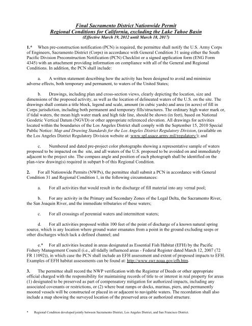
<strong>Final</strong> <strong>Sacramento</strong> <strong>District</strong> <strong>Nationwide</strong> <strong>Permit</strong><strong>Regional</strong> <strong>Conditions</strong> <strong>for</strong> Cali<strong>for</strong>nia, excluding the Lake Tahoe Basin(Effective March 19, 2012 until March 18, 2017)1.* When pre-construction notification (PCN) is required, the permittee shall notify the U.S. Army Corpsof Engineers, <strong>Sacramento</strong> <strong>District</strong> (Corps) in accordance with General Condition 31 using either the SouthPacific Division Preconstruction Notification (PCN) Checklist or a signed application <strong>for</strong>m (ENG Form4345) with an attachment providing in<strong>for</strong>mation on compliance with all of the General and <strong>Regional</strong><strong>Conditions</strong>. In addition, the PCN shall include:a. A written statement describing how the activity has been designed to avoid and minimizeadverse effects, both temporary and permanent, to waters of the United States;b. Drawings, including plan and cross-section views, clearly depicting the location, size anddimensions of the proposed activity, as well as the location of delineated waters of the U.S. on the site. Thedrawings shall contain a title block, legend and scale, amount (in cubic yards) and area (in acres) of fill inCorps jurisdiction, including both permanent and temporary fills/structures. The ordinary high water mark or,if tidal waters, the mean high water mark and high tide line, should be shown (in feet), based on NationalGeodetic Vertical Datum (NGVD) or other appropriate referenced elevation. All drawings <strong>for</strong> activitieslocated within the boundaries of the Los Angeles <strong>District</strong> shall comply with the September 15, 2010 SpecialPublic Notice: Map and Drawing Standards <strong>for</strong> the Los Angeles <strong>District</strong> Regulatory Division, (available onthe Los Angeles <strong>District</strong> Regulatory Division website at: www.spl.usace.army.mil/regulatory/); andc. Numbered and dated pre-project color photographs showing a representative sample of watersproposed to be impacted on the site, and all waters of the U.S. proposed to be avoided on and immediatelyadjacent to the project site. The compass angle and position of each photograph shall be identified on theplan-view drawing(s) required in subpart b of this <strong>Regional</strong> Condition.2. For all <strong>Nationwide</strong> <strong>Permit</strong>s (NWPs), the permittee shall submit a PCN in accordance with GeneralCondition 31 and <strong>Regional</strong> Condition 1, in the following circumstances:a. For all activities that would result in the discharge of fill material into any vernal pool;b. For any activity in the Primary and Secondary Zones of the Legal Delta, the <strong>Sacramento</strong> River,the San Joaquin River, and the immediate tributaries of these waters;c. For all crossings of perennial waters and intermittent waters;d. For all activities proposed within 100 feet of the point of discharge of a known natural springsource, which is any location where ground water emanates from a point in the ground excluding seeps orother discharges which lack a defined channel; ande.* For all activities located in areas designated as Essential Fish Habitat (EFH) by the PacificFishery Management Council (i.e., all tidally influenced areas - Federal Register dated March 12, 2007 (72FR 11092)), in which case the PCN shall include an EFH assessment and extent of proposed impacts to EFH.Examples of EFH habitat assessments can be found at: http://www.swr.noaa.gov/efh.htm.3. The permittee shall record the NWP verification with the Registrar of Deeds or other appropriateofficial charged with the responsibility <strong>for</strong> maintaining records of title to or interest in real property <strong>for</strong> areas(1) designated to be preserved as part of compensatory mitigation <strong>for</strong> authorized impacts, including anyassociated covenants or restrictions, or (2) where boat ramps or docks, marinas, piers, and permanentlymoored vessels will be constructed or placed in or adjacent to navigable waters. The recordation shall alsoinclude a map showing the surveyed location of the preserved area or authorized structure.* <strong>Regional</strong> Condition developed jointly between <strong>Sacramento</strong> <strong>District</strong>, Los Angeles <strong>District</strong>, and San Francisco <strong>District</strong>.
4. For all waters of the U.S. proposed to be avoided on a site, unless determined to be impracticable bythe Corps, the permittee shall:a. Establish and maintain, in perpetuity, a preserve containing all avoided waters of the U.S. toensure that the functions of the aquatic environment are protected;b. Place all avoided waters of the U.S. and any upland buffers into a separate parcel prior todischarging dredge or fill material into waters of the U.S., andc. Establish permanent legal protection <strong>for</strong> all preserve parcels, following Corps approval of thelegal instrument;If the Corps determines that it is impracticable to require permanent preservation of the avoided waters,additional mitigation may be required in order to compensate <strong>for</strong> indirect impacts to the waters of the U.S.5. For all temporary fills, the PCN shall include a description of the proposed temporary fill, includingthe type and amount of material to be placed, the area proposed to be impacted, and the proposed plan <strong>for</strong>restoration of the temporary fill area to pre-project contours and conditions, including a plan <strong>for</strong> the revegetationof the temporary fill area, if necessary. In addition, the PCN shall include the reason(s) whyavoidance of temporary impacts is not practicable.In addition, <strong>for</strong> all activities resulting in temporary fill within waters of the U.S., the permittee shall:a. Utilize material consisting of clean and washed gravel. For temporary fills within waters of theU.S. supporting anadromous fisheries, spawning quality gravel shall be used, where practicable, asdetermined by the Corps, after consultation with appropriate Federal and state fish and wildlife agencies;b. Place a horizontal marker (e.g. fabric, certified weed free straw, etc.) to delineate the existingground elevation of the waters temporarily filled during construction; andc. Remove all temporary fill within 30 days following completion of construction activities.6. In addition to the requirements of General Condition 2, unless determined to be impracticable by theCorps, the following criteria shall apply to all road crossings:a.* For all activities in waters of the U.S. that are suitable habitat <strong>for</strong> Federally-listed fish species,the permittee shall design all road crossings to ensure that the passage and/or spawning of fish is nothindered. In these areas, the permittee shall employ bridge designs that span the stream or river, includingpier- or pile-supported spans, or designs that use a bottomless arch culvert with a natural stream bed;b. Road crossings shall be designed to ensure that no more than minor impacts would occur to fishand wildlife passage or expected high flows, following the criteria listed in <strong>Regional</strong> Condition 6(a).Culverted crossings that do not utilize a bottomless arch culvert with a natural stream bed may be authorized<strong>for</strong> waters that do not contain suitable habitat <strong>for</strong> Federally listed fish species, if it can be demonstrated and isspecifically determined by the Corps, that such crossing will result in no more than minor impacts to fish andwildlife passage or expected high flows;c. No construction activities shall occur within standing or flowing waters. For ephemeral orintermittent streams, this may be accomplished through construction during the dry season. In perennialstreams, this may be accomplished through dewatering of the work area. Any proposed dewatering plansmust be approved, in writing, by the Corps prior to commencement of construction activities; andPage 2 of 6* <strong>Regional</strong> Condition developed jointly between <strong>Sacramento</strong> <strong>District</strong>, Los Angeles <strong>District</strong>, and San Francisco <strong>District</strong>.
d. All bank stabilization activities associated with a road crossing shall comply with <strong>Regional</strong>Condition 19.In no case shall stream crossings result in a reduction in the pre-construction bankfull width or depth ofperennial streams or negatively alter the flood control capacity of perennial streams.7.* For activities in which the Corps designates another Federal agency as the lead <strong>for</strong> compliance withSection 7 of the Endangered Species Act (ESA) of 1973 as amended, pursuant to 50 CFR Part 402.07,Section 305(b)(4)(B) of the Magnuson-Stevens Fishery Conservation and Management Act (EFH), pursuantto 50 CFR 600.920(b) and/or Section 106 of the National Historic Preservation Act (NHPA) of 1966, asamended, pursuant to 36 CFR 800.2(a)(2), the lead Federal agency shall provide all relevant documentationto the Corps demonstrating any previous consultation ef<strong>for</strong>ts, as it pertains to the Corps Regulatory permitarea (<strong>for</strong> Section 7 and EFH compliance) and the Corps Regulatory area of potential effect (APE) (<strong>for</strong>Section 106 compliance). For activities requiring a PCN, this in<strong>for</strong>mation shall be submitted with the PCN.If the Corps does not designate another Federal agency as the lead <strong>for</strong> ESA, EFH and/or NHPA, the Corpswill initiate consultation <strong>for</strong> compliance, as appropriate.8. For all NWPs which require a PCN, the permittee shall submit the following additional in<strong>for</strong>mationwith the compliance certificate required under General Condition 30:a. As-built drawings of the work conducted on the project site and any on-site and/or off-sitecompensatory mitigation, preservation, and/or avoidance area(s). The as-builts shall include a plan-viewdrawing of the location of the authorized work footprint (as shown on the permit drawings), with an overlayof the work as constructed in the same scale as the permit drawings. The drawing shall show all areas ofground disturbance, wetland impacts, structures, and the boundaries of any on-site and/or off-site mitigationor avoidance areas. Please note that any deviations from the work as authorized, which result in additionalimpacts to waters of the U.S., must be coordinated with the appropriate Corps office prior to impacts; andb. Numbered and dated post-construction color photographs of the work conducted within arepresentative sample of the impacted waters of the U.S., and within all avoided waters of the U.S. on andimmediately adjacent to the proposed project area. The compass angle and position of all photographs shallbe similar to the pre-construction color photographs required in <strong>Regional</strong> Condition 1(c) and shall beidentified on the plan-view drawing(s) required in subpart a of this <strong>Regional</strong> Condition.9. For all activities requiring permittee responsible mitigation, the permittee shall develop and submit tothe Corps <strong>for</strong> review and approval, a final comprehensive mitigation and monitoring plan <strong>for</strong> all permitteeresponsible mitigation prior to commencement of construction activities within waters of the U.S. The planshall include the mitigation location and design drawings, vegetation plans, including target species to beplanted, and final success criteria, presented in the <strong>for</strong>mat of the <strong>Sacramento</strong> <strong>District</strong>'s Habitat Mitigationand Monitoring Proposal Guidelines, dated December 30, 2004, and in compliance with the requirements of33 CFR 332.10.* The permittee shall complete the construction of any compensatory mitigation required by specialcondition(s) of the NWP verification be<strong>for</strong>e or concurrent with commencement of construction of theauthorized activity, except when specifically determined to be impracticable by the Corps. When mitigationinvolves use of a mitigation bank or in-lieu fee program, the permittee shall submit proof of payment to theCorps prior to commencement of construction of the authorized activity.11. The permittee is responsible <strong>for</strong> all authorized work and ensuring that all contractors and workers aremade aware and adhere to the terms and conditions of the permit authorization. The permittee shall ensurePage 3 of 6* <strong>Regional</strong> Condition developed jointly between <strong>Sacramento</strong> <strong>District</strong>, Los Angeles <strong>District</strong>, and San Francisco <strong>District</strong>.
that a copy of the permit authorization and associated drawings are available and visible <strong>for</strong> quick referenceat the site until all construction activities are completed.12. The permittee shall clearly identify the limits of disturbance in the field with highly visible markers(e.g. construction fencing, flagging, silt barriers, etc.) prior to commencement of construction activitieswithin waters of the U.S. The permittee shall maintain such identification properly until construction iscompleted and the soils have been stabilized. The permittee is prohibited from any activity (e.g. equipmentusage or materials storage) that impacts waters of the U.S. outside of the permit limits (as shown on thepermit drawings).13. For all activities in which a PCN is required, the permittee shall notify the appropriate district office ofthe start date <strong>for</strong> the authorized work within 10 days prior to initiation of construction activities.14. The permittee shall allow Corps representatives to inspect the authorized activity and any mitigationareas at any time deemed necessary to determine compliance with the terms and conditions of the NWPverification. The permittee will be notified in advance of an inspection.15. For all activities located in the Mather Core Recovery Area in <strong>Sacramento</strong> County, as identified in theU.S. Fish and Wildlife Service’s Recovery Plan <strong>for</strong> Vernal Pool Ecosystems of Cali<strong>for</strong>nia and SouthernOregon dated December 15, 2005, NWPs 14, 18, 23, 29, 39, 40, 42, 43 and 44 are revoked from use invernal pools that may contain habitat <strong>for</strong> Federally-listed threatened and/or endangered vernal pool species.16. For activities located in the Primary or Secondary Zone of the Legal Delta, NWPs 29 and 39 arerevoked.17. For all activities within the Secondary Zone of the Legal Delta, the permittee shall conductcompensatory mitigation <strong>for</strong> unavoidable impacts within the Secondary Zone of the Legal Delta.18. For NWP 12: <strong>Permit</strong>tees shall ensure the construction of utility lines does not result in the draining ofany water of the U.S., including wetlands. This may be accomplished through the use of clay blocks,bentonite, or other suitable material (as approved by the Corps) to seal the trench. For utility line trenches,during construction, the permittee shall remove and stockpile, separately, the top 6 – 12 inches of topsoil.Following installation of the utility line(s), the permittee shall replace the stockpiled topsoil on top and seedthe area with native vegetation. The permittee shall submit a PCN <strong>for</strong> utility line activities in the followingcircumstances:a. The utility line crossing would result in a discharge of dredged and/or fill material into perennialwaters, intermittent waters, wetlands, mudflats, vegetated shallows, riffle and pool complexes, sanctuariesand refuges or coral reefs;b. The utility line activity would result in a discharge of dredged and/or fill material into greaterthan 100 linear feet of ephemeral waters of the U.S.;c. The utility line installation would include the construction of a temporary or permanent accessroad, substation or foundation within waters of the U.S.; ord. The proposed activity would not involve the restoration of all utility line trenches to pre-projectcontours and conditions within 30 days following completion of construction activities.19. For NWP 13 and 14: All bank stabilization activities shall involve either the sole use of nativevegetation or other bioengineered design techniques (e.g. willow plantings, root wads, large woody debris,etc.), or a combination of hard-armoring (e.g. rip-rap) and native vegetation or bioengineered designPage 4 of 6* <strong>Regional</strong> Condition developed jointly between <strong>Sacramento</strong> <strong>District</strong>, Los Angeles <strong>District</strong>, and San Francisco <strong>District</strong>.
techniques, unless specifically determined to be impracticable by the Corps. The permittee shall submit aPCN <strong>for</strong> any bank stabilization activity that involves hard-armoring or the placement of any non-vegetated ornon-bioengineered technique below the ordinary high water mark or, if tidal waters, the high tide line ofwaters of the U.S. The request to utilize non-vegetated techniques must include in<strong>for</strong>mation on why the soleuse of vegetated techniques is not practicable.20. For NWP 23: The permittee shall submit a PCN <strong>for</strong> all activities proposed <strong>for</strong> this NWP, inaccordance with General Condition 31 and <strong>Regional</strong> Condition 1. The PCN shall include a copy of thesigned Categorical Exclusion document and final agency determinations regarding compliance with ESA,EFH and NHPA, in accordance with General <strong>Conditions</strong> 18 and 20 and <strong>Regional</strong> Condition 7.21. For NWP 27: The permittee shall submit a PCN <strong>for</strong> aquatic habitat restoration, establishment, andenhancement activities in the following circumstances:a. The restoration, establishment or enhancement activity would result in a discharge of dredgedand/or fill material into perennial waters, intermittent waters, wetlands, mudflats, vegetated shallows, riffleand pool complexes, sanctuaries and refuges or coral reefs; orb. The restoration, establishment or enhancement activity would result in a discharge of dredgedand/or fill material into greater than 100 linear feet of ephemeral waters of the U.S.22. For NWPs 29 and 39: The channelization or relocation of intermittent or perennial drainages is notauthorized, except when, as determined by the Corps, the relocation would result in a net increase infunctions of the aquatic ecosystem within the watershed.23.* Any requests to waive the 300 linear foot limitation <strong>for</strong> intermittent and ephemeral streams <strong>for</strong> NWPs21, 29, 39, 40, 42, 43, 44, 50, 51 and 52, or to waive the 500 linear foot limitation along the bank <strong>for</strong> NWP13, must include the following:a. A narrative description of the stream. This should include known in<strong>for</strong>mation on: volume andduration of flow; the approximate length, width, and depth of the waterbody and characteristics observedassociated with an Ordinary High Water Mark (e.g. bed and bank, wrack line or scour marks); a descriptionof the adjacent vegetation community and a statement regarding the wetland status of the adjacent areas (i.e.wetland, non-wetland); surrounding land use; water quality; issues related to cumulative impacts in thewatershed, and; any other relevant in<strong>for</strong>mation;b. An analysis of the proposed impacts to the waterbody, in accordance with General Condition 31and <strong>Regional</strong> Condition 1;c. Measures taken to avoid and minimize losses to waters of the U.S., including other methods ofconstructing the proposed activity(s); andd. A compensatory mitigation plan describing how the unavoidable losses are proposed to be offset,in accordance with 33 CFR 332.24. For NWPs 29, 39, 40, 42, and 43: The permittee shall establish and maintain upland vegetated buffersin perpetuity, unless specifically determined to be impracticable by the Corps, next to all preserved openwaters, streams and wetlands including created, restored, enhanced or preserved waters of the U.S.,consistent with General Condition 23(f). Except in unusual circumstances, as determined by the Corps,vegetated buffers shall be at least 50 feet in width.Page 5 of 6* <strong>Regional</strong> Condition developed jointly between <strong>Sacramento</strong> <strong>District</strong>, Los Angeles <strong>District</strong>, and San Francisco <strong>District</strong>.
25. For NWP 46: The discharge shall not cause the loss of greater than 0.5 acres of waters of the UnitedStates or the loss of more than 300 linear feet of ditch, unless specifically waived in writing by the Corps.26. All NWPs except 3, 6, 20, 27, 32, and 38 are revoked <strong>for</strong> activities in histosols, fens, bogs andpeatlands and in wetlands contiguous with fens. Fens are defined as slope wetlands with a histic epipedonthat are hydrologically supported by groundwater. Fens are normally saturated throughout the growingseason, although they may not be during drought conditions. For NWPs 3, 6, 20, 27, 32, and 38, thepermittee shall submit a PCN to the Corps in accordance with General Condition 31 and <strong>Regional</strong> Condition1. This condition does not apply to NWPs 1, 2, 8, 9, 10, 11, 24, 28, 35 or 36, as these NWPs either apply toSection 10 only activities or do not authorize impacts to special aquatic sites.Page 6 of 6* <strong>Regional</strong> Condition developed jointly between <strong>Sacramento</strong> <strong>District</strong>, Los Angeles <strong>District</strong>, and San Francisco <strong>District</strong>.


