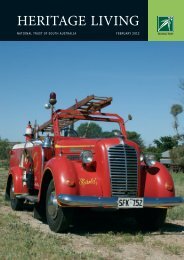
Hall Village - The Heritage Drive or Bike Tour - National Trust of ...
Hall Village - The Heritage Drive or Bike Tour - National Trust of ...
Hall Village - The Heritage Drive or Bike Tour - National Trust of ...

Create successful ePaper yourself
Turn your PDF publications into a flip-book with our unique Google optimized e-Paper software.
LISTED PLACES IN<br />
HALL VILLAGE -<br />
THE HERITAGE DRIVE OR BIKE TOUR<br />
1. Cricketers’ Arms Hotel<br />
2. Mem<strong>or</strong>ial Avenue <strong>of</strong> Trees<br />
3. <strong>Hall</strong> Sp<strong>or</strong>tsground & Showground<br />
4. <strong>Hall</strong> <strong>Village</strong> Square<br />
5. ‘Winarlia’<br />
6. <strong>Hall</strong> Premier St<strong>or</strong>e & Post Office<br />
7. Kinleyside <strong>Hall</strong><br />
8. <strong>Hall</strong> <strong>Village</strong> Mot<strong>or</strong>s<br />
9. William M<strong>or</strong>ris’ Bootmaker’s Shop<br />
10. St Michael & All Angels<br />
Anglican Church<br />
11. <strong>Hall</strong> Primary School and Pines<br />
12. ‘Cooee’<br />
13. St Francis Xavier Catholic College<br />
14. ‘Dellwood’<br />
15. Wattle Park Uniting Church<br />
16. <strong>Hall</strong> Cemetery<br />
17. ‘Sunnyside’<br />
18. <strong>Hall</strong> <strong>Village</strong> Well<br />
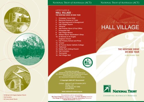
A heritage tour <strong>of</strong><br />
HALL VILLAGE<br />
THE HERITAGE DRIVE<br />
OR BIKE TOUR<br />
A SELF-GUIDED TOUR<br />
This project was <strong>or</strong>iginally<br />
assisted through funding made available by the<br />
ACT Government under the ACT <strong>Heritage</strong> Grants Program.<br />
Further funding was given by the<br />
ACT Government to update and reprint the tour.<br />
© Copyright 2009 ACT Government<br />
Contact: <strong>National</strong> <strong>Trust</strong> <strong>of</strong> Australia (ACT)<br />
PO Box 1144<br />
Civic Square ACT 2608<br />
02 6230 0533<br />
www.nationaltrustact.<strong>or</strong>g.au<br />
• St Michael & All Angels Anglican Church<br />
• <strong>Hall</strong> Cemetery<br />
• St Francis Xavier Church<br />
<strong>The</strong> publishers wish to acknowledge:<br />
Ms Carol Cosgrove (research & text) • Dr Peter Dowling (revisions)<br />
<strong>The</strong> <strong>Village</strong> <strong>of</strong> <strong>Hall</strong> and District Progress Association (revisions)<br />
• Studio Brainst<strong>or</strong>m (design) •
<strong>Hall</strong> <strong>Village</strong> is named<br />
after Henry <strong>Hall</strong> who was<br />
the first resident landholder <strong>of</strong><br />
the Ginninderra district. <strong>Hall</strong><br />
was b<strong>or</strong>n in Loughb<strong>or</strong>ough,<br />
England and arrived in New<br />
South Wales (NSW) in 1823.<br />
After w<strong>or</strong>king in Sydney f<strong>or</strong><br />
<strong>The</strong> Australian Agricultural<br />
Company he obtained a land<br />
grant <strong>of</strong> about 3,500 acres<br />
in the Ginninderra district in<br />
1833. He named the holding<br />
‘Charnwood’ and it became<br />
a very prosperous farming<br />
and grazing property. Henry<br />
married Mary Fisher and they<br />
had a family <strong>of</strong> ten children.<br />
<strong>The</strong> site <strong>of</strong> the <strong>or</strong>iginal<br />
‘Charnwood’ homestead is<br />
now located to the west <strong>of</strong><br />
<strong>Hall</strong>, b<strong>or</strong>dering the suburb <strong>of</strong><br />
Fraser on land now leased by<br />
the Commonwealth Scientific<br />
and Industrial Research<br />
Organisation.<br />
This is a tour f<strong>or</strong> those who wish to see the outlying areas <strong>of</strong> <strong>Hall</strong> <strong>Village</strong>,<br />
as well as the village itself. It includes all three churches and the cemetery,<br />
which is well w<strong>or</strong>th a visit. You may wish to stop at some locations and<br />
expl<strong>or</strong>e the area on foot. <strong>The</strong> tour will take approximately one hour,<br />
depending on how long you spend at each place. Cyclists should allow<br />
m<strong>or</strong>e time and perhaps make it a day’s outing.<br />
Early Selement<br />
<strong>The</strong> district in which <strong>Hall</strong> <strong>Village</strong> is located was the home <strong>of</strong><br />
Ab<strong>or</strong>iginal people f<strong>or</strong> at least 20,000 years. <strong>The</strong> first European<br />
selement in the Ginninderra district was not until 1826 when<br />
Ge<strong>or</strong>ge Palmer established a station <strong>of</strong> 10,000 acres. <strong>Hall</strong> <strong>Village</strong><br />
was established 1882 and its hist<strong>or</strong>y is closely linked to the<br />
selement <strong>of</strong> Ginninderra.<br />
By 1861, selement in the Ginninderra district had reached an<br />
advanced stage <strong>of</strong> development. <strong>The</strong> largest property was owned<br />
by William Davis and included homesteads, w<strong>or</strong>kers’ coages, a<br />
st<strong>or</strong>e and a post <strong>of</strong>fice. By 1881 it had developed as an un<strong>of</strong>ficial<br />
village and the NSW Government surveyed the area f<strong>or</strong> an <strong>of</strong>ficial<br />
village site. <strong>The</strong> location <strong>of</strong> <strong>Hall</strong>’s Creek, three kilometres away<br />
from the established village at Ginninderra was chosen.<br />
A New <strong>Village</strong><br />
<strong>The</strong> new village was proclaimed in 1882 and named Ginninderra,<br />
indicating the Government intended replacing the un<strong>of</strong>ficial village<br />
with an <strong>of</strong>ficial and properly designed one. Aer protest from the<br />
Ginninderra residents, the new village was renamed <strong>Hall</strong>. Although<br />
the earlier village <strong>of</strong> Ginninderra remained and thrived f<strong>or</strong> a time,<br />
it eventually declined and its functions were replaced by <strong>Hall</strong>.<br />
<strong>Hall</strong> <strong>Village</strong> was developed using a rectangular grid layout design<br />
which was common f<strong>or</strong> villages <strong>of</strong> the time and still exists today.<br />
<strong>The</strong> first sale <strong>of</strong> land occurred in <strong>Hall</strong> in 1886.<br />
<strong>The</strong> Australian Capital Territ<strong>or</strong>y and Further Development<br />
In 1911 the Australian Capital Territ<strong>or</strong>y (ACT) was proclaimed<br />
and <strong>Hall</strong> <strong>Village</strong> was situated just inside the ACT. <strong>The</strong> <strong>Hall</strong> district<br />
had been considered a possible site f<strong>or</strong> the capital city aer the<br />
Yass–Canberra district was selected in 1908, but was rejected.<br />
With the growth <strong>of</strong> Canberra in the last 60 years, <strong>Hall</strong> suffered<br />
as there were few amenities and no town water supply. Many<br />
residents moved to Canberra. <strong>The</strong> school was threatened with<br />
closure in 1958. When <strong>Hall</strong> was provided with a water supply in<br />
1967, the advantages <strong>of</strong> living in a rural centre close to Canberra<br />
became evident and the declining population trend was reversed.<br />
New businesses were established, including an antique furniture<br />
shop, a real estate agency and a stock and station agent. In 1980<br />
a by-pass was built around <strong>Hall</strong> to divert the Barton Highway,<br />
which had run through the centre <strong>of</strong> the village. This has assisted<br />
in preserving the village character, as has the lack <strong>of</strong> suburban<br />
development in the surrounding area. <strong>Hall</strong> is surrounded by open<br />
country giving it a distinct rural appearance even though it is on<br />
the edge <strong>of</strong> the Federal Capital.<br />
1.<br />
CRICKETERS’<br />
ARMS HOTEL<br />
(1864)<br />
<strong>The</strong> first significant<br />
business development near<br />
<strong>Hall</strong> was the Cricketers’<br />
Arms Hotel (also known<br />
as the One Tree hill Hotel)<br />
which opened in 1864. At<br />
that time, it was regarded<br />
as part <strong>of</strong> Ginninderra but<br />
as <strong>Hall</strong> became established,<br />
the hotel was generally<br />
seen as part <strong>of</strong> <strong>Hall</strong> as it<br />
was within easy walking<br />
distance <strong>of</strong> the village. It<br />
was the first hotel in the<br />
district and became the<br />
centre <strong>of</strong> social activity.<br />
<strong>The</strong> site is marked by a<br />
mature pine tree on the le,<br />
bef<strong>or</strong>e entering <strong>Hall</strong> from<br />
the southern end <strong>of</strong><br />
Vict<strong>or</strong>ia Street.<br />
Across the road from this<br />
site, on private property,<br />
is the f<strong>or</strong>mer cricket<br />
ground. In the heyday <strong>of</strong><br />
the Cricketers’ Arms Hotel,<br />
this was the centre f<strong>or</strong><br />
sp<strong>or</strong>ting activity in the<br />
district, with a variety <strong>of</strong><br />
sp<strong>or</strong>ts, including cricket,<br />
being played. It had<br />
earlier been used f<strong>or</strong><br />
ploughing matches.<br />
2.<br />
MEMORIAL<br />
AVENUE OF TREES<br />
Crossing the <strong>Hall</strong>s Creek<br />
Bridge you will see a line <strong>of</strong><br />
trees on your right. <strong>The</strong> trees<br />
<strong>of</strong> this mem<strong>or</strong>ial were planted<br />
aer the First W<strong>or</strong>ld War as a<br />
living mem<strong>or</strong>y to each <strong>of</strong> the<br />
seventeen young men <strong>of</strong> the<br />
<strong>Hall</strong> district who served in the<br />
war. Each tree has a plaque<br />
next to it with the soldier’s<br />
name inscribed on it (all<br />
were in the First AIF). <strong>The</strong><br />
two cypress trees located<br />
either side <strong>of</strong> the <strong>or</strong>iginal<br />
gateway (replaced in the<br />
1980s) are in mem<strong>or</strong>y <strong>of</strong><br />
Clyde Hollingsw<strong>or</strong>th and<br />
M<strong>or</strong>ley Brown who died<br />
during active service. As the<br />
trees age and die they are<br />
being replaced with the same<br />
species. A mem<strong>or</strong>ial cairn<br />
commem<strong>or</strong>ating those who<br />
served in the armed f<strong>or</strong>ces<br />
was built just inside the new<br />
entrance gate in 1992.<br />
3.<br />
HALL SPORTS<br />
GROUND &<br />
SHOWGROUND<br />
<strong>The</strong> Sp<strong>or</strong>tsground and<br />
Showground are located<br />
behind the Mem<strong>or</strong>ial Avenue<br />
<strong>of</strong> trees. <strong>The</strong> Advance <strong>Hall</strong><br />
Association held shows<br />
annually at the <strong>Hall</strong><br />
Showground from 1925 until<br />
1964, when they moved to<br />
Exhibition Park. <strong>The</strong> buildings<br />
at the showground include<br />
the pavilion and the shed at<br />
the n<strong>or</strong>th eastern side <strong>of</strong> the<br />
grounds and sheds located on<br />
the southern side. <strong>The</strong>se are<br />
simple vernacular buildings<br />
constructed <strong>of</strong> c<strong>or</strong>rugated iron<br />
and wood and are typical <strong>of</strong><br />
showground constructions <strong>of</strong><br />
their time. Markets are held<br />
monthly at the showground.
16<br />
4.<br />
HALL VILLAGE<br />
SQUARE<br />
Entering the main street,<br />
you will see the <strong>Village</strong><br />
Square on your right,<br />
where you can visit the<br />
c<strong>of</strong>fee shop <strong>or</strong> browse<br />
through the antique<br />
st<strong>or</strong>es. You may wish to<br />
return to the square at<br />
the end <strong>of</strong> the tour.<br />
14<br />
<strong>The</strong> following places in this<br />
15<br />
17<br />
13<br />
12<br />
6.<br />
HALL PREMIER<br />
STORE<br />
& POST OFFICE<br />
<strong>The</strong> <strong>or</strong>iginal st<strong>or</strong>e was<br />
operated by Eva Southwell<br />
from a house known as<br />
‘Banksia’, built in 1889.<br />
11<br />
18<br />
10<br />
9<br />
8<br />
6 7<br />
5<br />
1<br />
4<br />
2<br />
3<br />
10.<br />
ST MICHAEL &<br />
ALL ANGELS<br />
ANGLICAN<br />
CHURCH (1945)<br />
This church is located<br />
on the c<strong>or</strong>ner <strong>of</strong> Vict<strong>or</strong>ia<br />
and Lous streets. <strong>The</strong><br />
foundation stone was laid<br />
in 1941 and dedicated in<br />
1948. Its rendered external<br />
walls have been coursed<br />
to give the image <strong>of</strong><br />
stonew<strong>or</strong>k. An unusual<br />
stained glass window<br />
depicting two eucalyptus<br />
trees has since been<br />
installed at the Vict<strong>or</strong>ia<br />
Street side <strong>of</strong> the church.<br />
It commem<strong>or</strong>ates the tragic<br />
deaths <strong>of</strong> two young local<br />
people who died in mot<strong>or</strong><br />
accidents.<br />
<strong>The</strong> church bell is hung<br />
on a wooden frame in the<br />
yard. It was cast in 1854<br />
and <strong>or</strong>iginally hung in<br />
St John’s Anglican Church<br />
spire in Canberra. It was<br />
erected in the Church<br />
grounds in 1965.<br />
11.<br />
HALL PRIMARY<br />
SCHOOL<br />
13.<br />
ST FRANCIS<br />
XAVIER CATHOLIC<br />
CHURCH (1910)<br />
This church is located just<br />
outside the village. One <strong>of</strong><br />
three local churches, it was<br />
built in 1910 in the Neo<br />
gothic style from locally<br />
quarried bluestone granite.<br />
It is an <strong>or</strong>nate building with<br />
rendered brick window<br />
and do<strong>or</strong> surrounds. <strong>The</strong>re<br />
have been no alterations<br />
to the building since its<br />
construction.<br />
Across the road and<br />
towards Barton Highway<br />
is Eneagh Hill (the older<br />
weatherboard coage)<br />
where James Kilby lived<br />
from 1905, and ran a<br />
butcher’s business from<br />
1907 to 1918, delivering<br />
meat twice weekly to<br />
the local community.<br />
14.<br />
‘DELLWOOD’<br />
Travel to the n<strong>or</strong>thern<br />
extension <strong>of</strong> Vict<strong>or</strong>ia<br />
Street and turn right into<br />
the Barton Highway.<br />
<strong>The</strong> f<strong>or</strong>mer home <strong>of</strong><br />
William M<strong>or</strong>ris, bootmaker,<br />
can be seen on your le<br />
about a half a kilometre<br />
along, and a sh<strong>or</strong>t distance<br />
from the Highway.<br />
Tanning pits were located<br />
here, where hides were<br />
tanned f<strong>or</strong> the boots made<br />
at the shop. In the 1920s<br />
possums were killed under<br />
licence and their skins<br />
were tanned here to make<br />
possum rugs, which were<br />
16.<br />
HALL<br />
CEMETERY<br />
(1907)<br />
Travel back south along<br />
the Barton Highway,<br />
passing the point where<br />
you exited Vict<strong>or</strong>ia Street.<br />
Take the next turn right<br />
into Wallaroo Road. Aer<br />
a sh<strong>or</strong>t distance you will<br />
see <strong>Hall</strong> Cemetery on<br />
your right. You can<br />
walk to the cemetery<br />
from the gateway. It was<br />
proclaimed a general<br />
cemetery in 1883 and was<br />
the first such cemetery<br />
<strong>of</strong> the area. It is divided<br />
into sections acc<strong>or</strong>ding to<br />
religious denomination,<br />
including Church <strong>of</strong><br />
England, Catholic,<br />
Wesleyan, Presbyterian,<br />
Independent, Jewish and a<br />
general section. It contains<br />
the graves <strong>of</strong> early <strong>Hall</strong><br />
residents and the first<br />
rec<strong>or</strong>ded burial was in<br />
1907. It has been used<br />
continuously by residents<br />
<strong>of</strong> the <strong>Hall</strong> region since<br />
that time.<br />
<strong>The</strong> cemetery reserve<br />
includes a small island <strong>of</strong><br />
remnant yellow box and<br />
red gum open f<strong>or</strong>est and<br />
associated kangaroo Grass.<br />
It also contains the rare<br />
Leek Orchid; the only other<br />
known location f<strong>or</strong> this<br />
species is Bo<strong>or</strong>owa, NSW.<br />
17.<br />
‘SUNNYSIDE’<br />
(c.1900)<br />
Returning to the <strong>Village</strong>
lock <strong>of</strong> the main street <strong>of</strong><br />
<strong>Hall</strong>, Vict<strong>or</strong>ia Street, are<br />
best viewed on foot.<br />
5.<br />
‘WINARLIA’<br />
(1901)<br />
On your le you will see<br />
Winarlia, one <strong>of</strong> the oldest<br />
surviving buildings in <strong>Hall</strong>.<br />
This house has particular<br />
significance because <strong>of</strong> its<br />
age and unique quality<br />
in the district. It was built<br />
in 1901 <strong>of</strong> pisé (rammed<br />
earth) and displays the<br />
characteristic building<br />
techniques <strong>of</strong> the era: its<br />
walls are slightly rounded<br />
at the c<strong>or</strong>ners and it has a<br />
c<strong>or</strong>rugated iron ro<strong>of</strong> and<br />
a verandah with wooden<br />
posts and a concrete flo<strong>or</strong>.<br />
It was the residence <strong>of</strong><br />
Ebenezer Brown who<br />
ran the Premier St<strong>or</strong>e<br />
with Charles Southwell.<br />
A later occupant was<br />
Jean Southwell MBE, who<br />
died in 1996. She ran the<br />
st<strong>or</strong>e f<strong>or</strong> many years and<br />
was also the postmistress<br />
and Sunday school teacher.<br />
It was located two blocks<br />
along from the present<br />
st<strong>or</strong>e. Another small shop<br />
was built next to the house<br />
in 1898 and operated as<br />
the Premier St<strong>or</strong>e (both<br />
‘Banksia’ and this shop<br />
have been demolished).<br />
In 1901, the st<strong>or</strong>e was taken<br />
over by the partnership<br />
<strong>of</strong> Charles Southwell and<br />
Ebenezer Brown. A new<br />
st<strong>or</strong>e building was erected<br />
on the present site in 1908.<br />
<strong>The</strong> st<strong>or</strong>e was demolished<br />
and rebuilt in 1982 using<br />
c<strong>or</strong>rugated iron (which<br />
was the <strong>or</strong>iginal building<br />
material) with a glass<br />
and timber façade and a<br />
verandah. <strong>The</strong> façade is a<br />
replica <strong>of</strong> the early st<strong>or</strong>e.<br />
<strong>The</strong> building continues<br />
to be used as the village’s<br />
shop and post <strong>of</strong>fice.<br />
7.<br />
KINLYSIDE<br />
HALL (1907)<br />
This building was<br />
constructed using a timber<br />
frame clad in c<strong>or</strong>rugated<br />
iron, a construction<br />
technique characteristic <strong>of</strong><br />
the era. <strong>The</strong> hall was first<br />
used as a paint shop using<br />
a unique air-drying<br />
system designed by Ge<strong>or</strong>ge<br />
Kinlyside. It soon became<br />
the focal point <strong>of</strong> the<br />
developing <strong>Hall</strong> <strong>Village</strong><br />
and was used f<strong>or</strong> dances,<br />
as a cinema, a church, and<br />
as clubrooms f<strong>or</strong> various<br />
clubs. It was also used f<strong>or</strong><br />
visiting medical services,<br />
including dental w<strong>or</strong>k.<br />
Silent films were shown<br />
here from as early as<br />
1911, using hand<br />
operated project<strong>or</strong>s.<br />
<strong>The</strong> hall is now used as<br />
commercial premises.<br />
8.<br />
HALL VILLAGE<br />
MOTORS (c.1938)<br />
<strong>The</strong> present <strong>Hall</strong> service<br />
station is the site <strong>of</strong><br />
Ge<strong>or</strong>ge Kinlyside’s business.<br />
As well as a blacksmith,<br />
he was a wheelwright,<br />
coachbuilder, tank<br />
builder and an undertaker.<br />
Kinlyside <strong>Hall</strong>, next<br />
do<strong>or</strong>, is named aer him.<br />
Jim Rochf<strong>or</strong>d, a local<br />
resident, purchased the<br />
property from Kinlyside<br />
in 1938 and built a service<br />
station there which<br />
operated until 1974, except<br />
f<strong>or</strong> two breaks, one <strong>of</strong><br />
which was to serve in the<br />
Second W<strong>or</strong>ld War.<br />
9.<br />
WILLIAM MORRIS’<br />
BOOTMAKER’S<br />
SHOP<br />
<strong>The</strong> <strong>or</strong>iginal Bootmaker’s<br />
Shop was built around<br />
1900. It was a small w<strong>or</strong>ker’s<br />
coage <strong>of</strong> c<strong>or</strong>rugated iron<br />
with a weatherboard front<br />
and a verandah. It also had<br />
a c<strong>or</strong>rugated iron ro<strong>of</strong> with<br />
gable ends. <strong>The</strong> building<br />
was demolished and rebuilt<br />
in the 1980s in a similar<br />
style and is currently used<br />
as a commercial business.<br />
William M<strong>or</strong>ris lived at<br />
nearby ‘Dellwood’ (now just<br />
over the b<strong>or</strong>der in NSW).<br />
As well as a bootmaker,<br />
William operated from the<br />
same premises as a bicycle<br />
repairer, barber and banker.<br />
AND PINES<br />
(Original building 1911)<br />
<strong>The</strong> <strong>or</strong>iginal school<br />
building, located towards<br />
the centre <strong>of</strong> the block, was<br />
built in 1911, following<br />
the closure <strong>of</strong> the school at<br />
Ginninderra. Extensions<br />
were completed in 1924.<br />
<strong>The</strong> school building is set<br />
among mature pine trees<br />
planted by the school<br />
children around 1918.<br />
Today, it is surrounded<br />
by additional buildings<br />
constructed aer 1960. In<br />
the 1990s facilities were<br />
improved with the addition<br />
<strong>of</strong> a hall and a separate<br />
library.<br />
<strong>The</strong> <strong>or</strong>iginal school building<br />
is now an education<br />
museum established by<br />
Laurie Copping, f<strong>or</strong>mer<br />
principal <strong>of</strong> the school.<br />
<strong>The</strong> museum was <strong>of</strong>ficially<br />
opened in 1986. Aer many<br />
years serving the population<br />
<strong>of</strong> <strong>Hall</strong> and district the<br />
school was finally closed to<br />
students in 2007.<br />
12.<br />
‘COOEE’<br />
(c.1900)<br />
Located towards the<br />
n<strong>or</strong>thern end <strong>of</strong> Vict<strong>or</strong>ia<br />
Street, this early twentieth<br />
century weatherboard<br />
coage has a c<strong>or</strong>rugated<br />
iron gable ro<strong>of</strong>, with<br />
dec<strong>or</strong>ative bargeboards,<br />
and a verandah. An extra<br />
room has been added at<br />
the rear <strong>of</strong> the building.<br />
Lyall Gillespie, a wellknown<br />
local hist<strong>or</strong>ian,<br />
spent his earliest years here.<br />
hand sown and lined.<br />
15.<br />
WATTLE PARK<br />
UNITING<br />
CHURCH (1882)<br />
Wale Park Church is<br />
on the right about three<br />
kilometres from the turn<br />
onto the Highway. You cross<br />
the NSW b<strong>or</strong>der bef<strong>or</strong>e<br />
arriving there. You can drive<br />
<strong>or</strong> cycle into the Church<br />
grounds. This Picturesque<br />
Gothic style church was built<br />
in 1882 f<strong>or</strong> the Methodist<br />
congregation in the district.<br />
It was built <strong>of</strong> local granite<br />
with a shingle ro<strong>of</strong>, freed<br />
barge boards and dec<strong>or</strong>ative<br />
ridge finials. <strong>The</strong> shingles<br />
were later covered with<br />
c<strong>or</strong>rugated iron.<br />
<strong>The</strong> vestry was added in<br />
1954 and has stones from<br />
the homes <strong>of</strong> pioneers <strong>of</strong><br />
the church and the district<br />
inc<strong>or</strong>p<strong>or</strong>ated in its walls.<br />
<strong>The</strong>re is also an Ab<strong>or</strong>iginal<br />
axe head inc<strong>or</strong>p<strong>or</strong>ated<br />
in the wall. <strong>The</strong> Sunday<br />
School <strong>Hall</strong> was built beside<br />
the church in 1928, using<br />
concrete blocks.<br />
<strong>The</strong> church was founded by<br />
members <strong>of</strong> the Southwell<br />
family who were early<br />
selers in the Ginninderra<br />
Creek area and moved<br />
there in the early 1880s.<br />
Since the Australian Capital<br />
Territ<strong>or</strong>y was proclaimed in<br />
1911, its location has been<br />
outside the Territ<strong>or</strong>y. It is<br />
hist<strong>or</strong>ically very significant<br />
f<strong>or</strong> its associations with the<br />
pioneer selement <strong>of</strong> the<br />
Limestone Plains.<br />
centre from the Cemetery,<br />
cross the Barton Highway<br />
and turn le into<br />
Gladstone Street. <strong>The</strong><br />
first property you pass on<br />
your right is ‘Sunnyside’.<br />
<strong>The</strong> pisé (rammed earth)<br />
house was built by<br />
David Rule, the <strong>or</strong>iginal<br />
owner, early this century.<br />
It was later occupied by<br />
Ge<strong>or</strong>ge Southwell and<br />
his wife.<br />
18.<br />
HALL<br />
VILLAGE<br />
WELL (c.1890)<br />
Known as the Reserve<br />
Well <strong>or</strong> McClung’s Well, it<br />
is located in the recreation<br />
reserve at the southern<br />
end <strong>of</strong> Gladstone Street,<br />
twenty metres south west<br />
<strong>of</strong> the intersection with<br />
Alexandra Street. Built by<br />
McClung and Burton, it is<br />
the only well remaining <strong>of</strong><br />
three wells which supplied<br />
<strong>Hall</strong> with water.<br />
<strong>Hall</strong> <strong>Village</strong> Square<br />
Return to the <strong>Village</strong> Square<br />
where there is a c<strong>of</strong>fee shop<br />
and several antique shops if<br />
you care to browse.