Silviculture and Cinegetics Review - Societatea Progresul Silvic
Silviculture and Cinegetics Review - Societatea Progresul Silvic
Silviculture and Cinegetics Review - Societatea Progresul Silvic

You also want an ePaper? Increase the reach of your titles
YUMPU automatically turns print PDFs into web optimized ePapers that Google loves.
Forestry Policy<br />
Exceptional trees<br />
Natural regeneration<br />
Conservation of forest<br />
biodiversity<br />
Legislation<br />
Forest shelterbelts<br />
<strong><strong>Silvic</strong>ulture</strong> <strong>and</strong> <strong>Cinegetics</strong> <strong>Review</strong><br />
XVII/30/2012<br />
<strong>Societatea</strong> ”<strong>Progresul</strong> <strong>Silvic</strong>”<br />
www.progresulsilvic.ro<br />
Celebrities of forestry<br />
Forestry history<br />
Wildlife<br />
Agroforestry systems<br />
Forest Roads<br />
By-products<br />
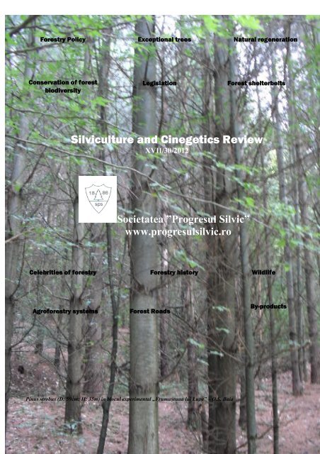
Pinus strobus (D: 59cm; H: 35m) în blocul experimental „Frumuşeaua lui Lupe” –O.S. Baia
CUPRINS REVISTA DE SILVICULTURĂ ŞI CINEGETICĂ XVII/30/2012<br />
Valentin Bolea<br />
Aurel Teuşan<br />
Maurice Bonneau<br />
Ioan Adam<br />
Nicolae Cadar<br />
Oliver Merce<br />
Ilie Cosmin Cântar<br />
Ioan Adam<br />
Traian Ivanschi<br />
Oliver Merce<br />
Daniel Turcu<br />
Nicolae Cadar<br />
Ilie Cântar<br />
Manole Greavu<br />
Mihaela Mănescu<br />
Salvatore Vals<br />
Vildan Feta<br />
Mariana Dogaru<br />
Ilie Muşat<br />
Cristinel Const<strong>and</strong>ache<br />
S<strong>and</strong>a Nistor<br />
Emil Untaru<br />
Cornel Costăchescu<br />
Florin Dănescu<br />
Marian Ianculescu<br />
Elena Mihăilă<br />
Dan Niţu<br />
Ioan Neşu<br />
ElenaMihăilă<br />
Corneliu Costăchescu<br />
Florin Dănescu<br />
Teodor Maruşca<br />
Valentin Bolea<br />
Dănuţ Chira<br />
Valentin Bolea<br />
Diana Vasile<br />
Cătălin Cojanu<br />
Katalin Péter<br />
Aliona Sava<br />
Nicolae Ovidiu Anţilă<br />
Nicolae Ovidiu Anţilă<br />
Editorial<br />
Editorial<br />
Reflecţii la finele Anului Internaţional al Pădurilor<br />
Reflections at the end of the International Year of the Forests<br />
Ocuparea pădurilor de către om<br />
Occupation of forests by humans<br />
Occupation des forêts par l’homme<br />
Fundamente ştiinţifice pentru crearea perdelelor forestiere de protecţie a culturilor agricole din<br />
Câmpia Banatulu<br />
Scientific foundation for creating field protection forest belts in the Banat Plain<br />
Înfiinţarea perdelelor forestiere de protecţieîn zona de câmpie a judeţului Mehedinţi<br />
Installation of protection forest belts in the plain area of Mehedinţi County<br />
Consideraţii privind proiectarea perdelelor forestiere de protecţie a câmpurilor şi a căilor de<br />
comunicaţie în Dobrogea şi Bărăganul de est<br />
Considerations on designing forest belts for the protection of field <strong>and</strong> communication ways in Dobrogea<br />
<strong>and</strong> East Bărăgan<br />
Principiile creării perdelelor forestiere de protecţie a căilor de comunicaţie şi modul de<br />
aplicare a lor în practica actuală de proiectare<br />
Principles of creating the communication ways protection forest belts <strong>and</strong> their<br />
implementation in the current design practice<br />
Cercetări privind comportarea unor specii de arbori şi arbuşti utilizate în compoziţia perdelelor<br />
forestiere de protecţie din sud – estul României<br />
Behavior of some species of trees <strong>and</strong> shrubs used in the composition of protection forest belts<br />
in South-Eastern Romania<br />
Technical solutions to set up networks of field protection forest belt in the Romanian Plain <strong>and</strong><br />
the Dobrogea Plateau<br />
Technical solutions to set up networks of field protection forest belt in the Romanian Plain <strong>and</strong><br />
the Dobrogea Plateau<br />
Perdelele forestiere de protecţie a culturilor agricole – o necesitate<br />
Crops protection forest belts - a necessity<br />
Sisteme agrosilvice<br />
Agroforestry systems<br />
Sistemul agrosilvopastoral durabil, în contextul încălzirii globale a climei<br />
Sustainable Agroforestry System, in the context of global climate warming<br />
Perdele forestiere de protecţie antifonică şi antipoluantă pe perimetrul Companiei Kronospan –<br />
Braşov<br />
Forest belts for acoustic <strong>and</strong> pollutant protection on the perimeter of Kronospan Romania<br />
SRL-Brasov<br />
Ierarhizarea exemplarelor de ulmi excepţionali din România<br />
Ranking of exceptional elm trees (Ulmus spp.) in Romania - Abstract<br />
Ulmul (Ulmus laevis Pall.) excepţional din localitatea Căpeni<br />
Giant white elm (Ulmus laevis Pall.) from Căpeni<br />
Abundenţa relativă a speciilor, indicator al biodiversităţii<br />
The study of abundance, as an indicator of species diversity<br />
Capacitatea de regenerare naturală a arboretelor de şleau cu gorun şi cer din Masivul<br />
Dognecea<br />
Natural regeneration capacity of mixed st<strong>and</strong> with sessile <strong>and</strong> Turkey oak in Dognecea Massif<br />
Consideraţii privind potenţialul de regenerare a gorunului în şleaul cu gorun şi cer din Masivul<br />
Dognecei<br />
Considerations on regeneration potential of sessile oak in mixed st<strong>and</strong>s of Dognecea Massif<br />
1
CUPRINS REVISTA DE SILVICULTURĂ ŞI CINEGETICĂ XVII/30/2012<br />
O privire actuală asupra punerii în valoare a pădurii. Partea a III a. Căile de transport, premiza<br />
punerii în valoare a pădurii<br />
Petre Bradosche Actual view on wood harvest. Part III. Transport routs, the premise for the enhancement of the<br />
forest<br />
Titlu<br />
Adrian Horia Enescu<br />
Drumurile sumar amenajate – alternativă viabilă pentru accesibilizarea pădurii<br />
Summary equipped roads – viable alternative to forest accessibility<br />
Lucian Dincă<br />
Maria Dincă<br />
Recoltarea trufelor<br />
Harvesting the truffles<br />
Sorin Geacu<br />
Adrian Rener<br />
Cerbul lopătar în pădurile luncii Mureşului inferior<br />
Fallow deer in lower Mureş floodplain forests<br />
Aurel Teuşan Ordonanţa europeană nr. 925/2010: O nouă pagină în materie de certificare <br />
Aurel Teuşan<br />
Cooperare sau confruntare<br />
Cooperation or confrontation<br />
Alex<strong>and</strong>rina Ilica<br />
Măsura 2.2.1. “Prima împădurire a terenurilor agricole“. Comentarii şi propuneri<br />
Measure 2.2.1. “First afforestation of agricultural l<strong>and</strong>“. Comments <strong>and</strong> suggestions<br />
Gheorghe Gavrilescu Din activitatea Societăţii ,,<strong>Progresul</strong> <strong>Silvic</strong>”<br />
Gheorghe Gavrilescu Scrisoare<br />
Valentin Bolea<br />
Sesiunea de comunicări privind Perdelele Forestiere de Protecţie din România<br />
Aurel Teuşan<br />
Biometria, Pădurea şi Omenia -<br />
Cu ocazia centenarului profesorului Mihail Prodan<br />
Ilie Muşat<br />
Ioan Z. Lupe - In memoriam<br />
Ioan Cotârlea<br />
Doctor docent Ioan Zeno Lupe - Pădurile satului natal, roua inimi sale<br />
Iovu Adrian Biruş A încetat din viaţă profesorul Marian Ianculescu<br />
Cristian D. Stoiculescu In memoriam Mircea Petrescu<br />
Marin Marcu<br />
La catafalcul colegului nostru inginer Vasile Botea<br />
Gheorghe Gavrilescu Din activitatea Societăţii ,,<strong>Progresul</strong> <strong>Silvic</strong>”<br />
Gheorghe Gavrilescu Scrisoare<br />
Valentin Bolea<br />
Sesiunea de comunicări privind Perdelele Forestiere de Protecţie din România<br />
Aurel Teuşan Biometria, Pădurea şi Omenia -<br />
Cu ocazia centenarului profesorului Mihail Prodan<br />
Ilie Muşat<br />
Ioan Z. Lupe - In memoriam<br />
Ioan Cotârlea<br />
Doctor docent Ioan Zeno Lupe - Pădurile satului natal, roua inimi sale<br />
Iovu Adrian Biruş A încetat din viaţă profesorul Marian Ianculescu<br />
Cristian D. Stoiculescu In memoriam Mircea Petrescu<br />
Marin Marcu<br />
La catafalcul colegului nostru inginer Vasile Botea<br />
2
EDITORIAL BOARD SILVICULTURE AND CINEGETICS REVIEW XVII/30/2012<br />
Comitetul de redacţie:<br />
1. CS I dr. ing. Valentin Bolea - Institutul de Cercetări şi<br />
Amenajări <strong>Silvic</strong>e (ICAS) - Staţiunea Braşov, redactor<br />
şef,<br />
2. CS I dr. ing. Dănuţ Chira - ICAS, redactor şef,<br />
responsabil Cercetare,<br />
3. CS III dr. ing. Eugen N. Popescu - ICAS Braşov,<br />
redactor şef adjunct, responsabil Producţie silvică,<br />
4. Conf. dr. ing. Ion Micu – Facultatea de <strong>Silvic</strong>ultură şi<br />
Exploatări Forestiere (FSEF), Universitatea Transilvania<br />
Braşov (UTBv), responsabil Cinegetică,<br />
5. Prof. dr. ing. Nicolae Şofletea - MA ASAS, FSEF,<br />
UTBv, responsabil Învăţământ silvic,<br />
6. CS I dr. ing. Stelian Radu - ICAS Simeria, responsabil<br />
Arii protejate.<br />
7. Dr. rer. nat. Aurel Teuşan - expert silvic - Soc. R+F &<br />
FCH, Ettenheim, GERMANIA<br />
8. Ing. Petre Bradosche, Toury-Lurcy, FRANŢA,<br />
9. Ing. Rudolf Rösler, Leitender Forstdirector, Regensburg,<br />
GERMANIA<br />
10. Prof. dr. ing. Ladislav Paule, Technical University in<br />
Zvolen, SLOVACIA,<br />
11. Ing. Fausto R. Morales Alfaro, COSTA RICA,<br />
12.Profesor asociat Sorin Popescu - Texas A&M<br />
University, USA<br />
Secretariat de redacţie:<br />
13. Teh. pr. Florentina Damian - ICAS Braşov, secretar,<br />
14. Filolog Roxana Munteanu - Traduceri<br />
15. Conf. dr. ing. Victor Păcurar - FSEF, UTBv, traduceri,<br />
16. Şef lucr. dr. ing. Tudor Stăncioiu - FSEF, UTBv,<br />
traduceri,<br />
17. Ing. Alina Curtu - Direcţia <strong>Silvic</strong>ă (DS) Braşov,<br />
traduceri<br />
Membri:<br />
18. Ing. Gheorghe Gavrilescu, Preşedinte <strong>Societatea</strong><br />
„<strong>Progresul</strong> <strong>Silvic</strong>” Bucureşti,<br />
19. Prof. dr. ing. Ion Florescu – membru titular (MT)<br />
ASAS, FSEF, UTBv,<br />
20. Prof. dr. ing. Ion Milescu - MT ASAS, Fac.<br />
<strong>Silvic</strong>ultură, Univ. Ştefan cel Mare Suceava,<br />
21. Prof. dr. ing. Iosif Leahu – membru corespondent (MC)<br />
ASAS, FSEF, UTBv,<br />
22. Prof. dr. ing. Ioan Vasile Abrudan - decan FSEF,<br />
UTBv,<br />
23. Conf. dr. ing. Ovidiu Ionescu - prodecan FSEF, UTBv,<br />
24. CS I dr. ing. Iovu - Adrian Biriş - ICAS Bucureşti,<br />
25. CS I dr. ing. Ioan Blada - ICAS Bucureşti, membru al<br />
Academiei de ştiinţe din New York<br />
26. IDT I ing. Ion Giurgiu - şef staţiune ICAS Braşov,<br />
27. CS II dr. ing. Vadim Le<strong>and</strong>ru - ICAS Bucureşti,<br />
28.Ing. Maria Munteanu - Preşedinte <strong>Societatea</strong><br />
”<strong>Progresul</strong> <strong>Silvic</strong>” Filiala Braşov - Covasna,<br />
29.Ing. Ilica Alex<strong>and</strong>rina - Preşedinte <strong>Societatea</strong><br />
”<strong>Progresul</strong> <strong>Silvic</strong>” Filiala Alba Iulia,<br />
30. Ing. Ion Cotârlea - DS Sibiu,<br />
31. Dr. ing. Marius Ureche - DS Sibiu,<br />
32. Ing. Costel Stan – şef ocol, O.S. Curtea de Argeş,<br />
Preşedinte <strong>Societatea</strong> „<strong>Progresul</strong> <strong>Silvic</strong>” Filiala Argeş<br />
33. Prof. dr. ing. Tatiana Şesan - MC ASAS, Fac.<br />
Biologie, Univ. Bucureşti,<br />
34. Dr. ing. Teodor Maruşca - director general Institutul<br />
C&D ot. Pajişti Braşov, membru asociat (MA) ASAS,<br />
34. Dr. ing. Teodor Maruşca – director ştiinţific Institutul<br />
C&D pt. Pajişti Braşov, membru asociat (MA) ASAS,<br />
35. Prof. dr. ing. Neculai Patrichi - director Institutul C&D<br />
Ecologie Acvatică, Pescuit şi Acvacultură - ICDEAPA<br />
Galaţi, Univ. Dunărea de Jos, Galaţi, MA ASAS,<br />
36. CSI Lector dr. ing Dana Malschi – Fac. Ştiinţa<br />
Mediului Univ. Babeş-Bolyai Cluj Napoca, MA ASAS,<br />
37. Dr. ing. Victor Ciochia – Institutul Naţional C&D pt.<br />
Cartof şi Sfeclă de Zahăr Braşov, MA ASAS,<br />
Notă:<br />
"Revista de <strong>Silvic</strong>ultură şi Cinegetică" nu cenzurează<br />
opiniile autorilor care, însă, îşi asumă întreaga<br />
responsabilitate tehnică, ştiinţifică sau juridică privind<br />
textele publicate.<br />
Revista de <strong>Silvic</strong>ultură şi Cinegetică<br />
<strong><strong>Silvic</strong>ulture</strong> <strong>and</strong> Cinegetic <strong>Review</strong><br />
ISSN-L 1583 – 2112<br />
ISSN 2284 – 7936 (on line)<br />
www.progresulsilvic.ro<br />
Braşov, Str. Cloşca nr. 13<br />
tel: 0268-419936<br />
fax.: 0268-415338<br />
e-mail: valentinbolea@yahoo.com<br />
Editura <strong>Silvic</strong>ă<br />
Editori:<br />
- <strong>Societatea</strong> „<strong>Progresul</strong> <strong>Silvic</strong>”,<br />
- Institutul de Cercetări şi Amenajări <strong>Silvic</strong>e - Staţiunea<br />
Braşov,<br />
- Facultatea de <strong>Silvic</strong>ultură şi Exploatări Forestiere, Braşov<br />
3
EDITORIAL SILVICULTURES AND CINEGETICS REVIEW XVII/30/2012<br />
Starting in 2012, The Journal of Forestry <strong>and</strong> Hunting<br />
will exp<strong>and</strong> the dissemination of progress in the<br />
science <strong>and</strong> technology of forestry <strong>and</strong> hunting from<br />
national to international level, recording the following<br />
changes:<br />
- Biannual occurrence, not only printed, but in<br />
electronic form on the website:<br />
www.progresulsilvic.ro<br />
- Publication in English of the main scientific <strong>and</strong><br />
technical articles, received written in Romanian,<br />
French, German or Spanish.<br />
- Completing the Editorial Board by inviting<br />
prestigious scientific personalities from Germany<br />
Aurel Teuşan <strong>and</strong> Rudof Rosler; from France Peter<br />
Bradoschi; from Czechoslovakia Professor Ladislav<br />
Paule, from the U.S. Professor Sorin Popescu, <strong>and</strong><br />
from Costa Rica Fausto D. Morales.<br />
- Orientation of topics towards global issues, to the<br />
resolution of which forestry <strong>and</strong> hunting play an<br />
important role. Below we illustrate some of these<br />
areas:<br />
- Effective management of key resources: water, soil,<br />
air <strong>and</strong> forest ecosystems. Rivers, lakes, erosion <strong>and</strong><br />
pollution protection forest belts. Detoxification of<br />
polluted rivers. Improvement of degraded soils.<br />
Ab<strong>and</strong>oned l<strong>and</strong> use. Detection, evaluation <strong>and</strong><br />
monitoring of pollution by foliar diagnosis. Tending<br />
operations in forest ecosystems, maintaining a good<br />
phytosanitary state, ecological restoration, natural<br />
regeneration <strong>and</strong> use of small wood.<br />
- Sustainable use of natural resources: research for the<br />
knowledge of: virgin forests, exceptional trees <strong>and</strong><br />
resource interdependence. Protection of natural<br />
resources through market instruments: taxation of tree<br />
harvesting <strong>and</strong> other activities affecting the<br />
environment (deforestation <strong>and</strong> injuries) <strong>and</strong> forest<br />
border care for. Sustainable use of forest ecosystems<br />
by promoting mixed st<strong>and</strong>s of native species <strong>and</strong> of<br />
local origin, natural regeneration of forests, avoiding<br />
grazing in the forest. Conservation <strong>and</strong> biodiversity<br />
monitoring.<br />
- Superior capitalization of wood: enhancing beech<br />
thinning. Promoting forestry in harmony with natural<br />
<strong>and</strong> potential productivity of forest; production of<br />
high quality thick wood; maximization of carbon<br />
storage in the forest <strong>and</strong> participates fully to the fight<br />
against climate change. Limiting exports of rough<br />
wood.<br />
- Raising environmental st<strong>and</strong>ards: better knowledge<br />
<strong>and</strong> implementation of environmental legislation.<br />
Information systems <strong>and</strong> monitoring of environmental<br />
EDITORIAL<br />
4<br />
Valentin Bolea<br />
quality. Use of partnerships. Public awareness <strong>and</strong><br />
campaigns for social <strong>and</strong> environmental behavior<br />
change. Models of best environmental practices in the<br />
urban life. Environmental exhibitions <strong>and</strong> forums.<br />
Prevention of environmental degradation (floods,<br />
heavy snow falls, drought <strong>and</strong> heat stroke <strong>and</strong><br />
excessive heat in cities) by creating the forest belts to<br />
protect the rivers, agricultural crops <strong>and</strong> roads, by<br />
creating urban forests <strong>and</strong> green belts, <strong>and</strong> by<br />
ecological design, impact studies <strong>and</strong> environmental<br />
balance of investment work.<br />
- Improving public forestry education by raising<br />
awareness of general public <strong>and</strong> youth regarding the<br />
role <strong>and</strong> wealth of the forest <strong>and</strong> respect towards the<br />
forest.<br />
Launching of conservation actions <strong>and</strong><br />
implementation of outst<strong>and</strong>ing research results, out of<br />
which we exemplify the below.<br />
For the protection of exceptional trees in Romania<br />
after the call issued by St. Radu <strong>and</strong> C. Co<strong>and</strong>ă "Let<br />
us save remarkable trees - endangered living<br />
treasures” (FCR 21/2005), have been written the<br />
following articles:<br />
- „Exceptional trees in the beech <strong>and</strong> fir forest of<br />
Şinca Veche” (Ţaga Mountains, Braşov) (V. Bolea, D.<br />
Chira, R. Munteanu, D. Vasile, C. Mantale, K. Péter,<br />
G. Roman, FCR 28/2011);<br />
- „Famous specimens of the Quercus robur L.<br />
species” (V. Bolea, D. Vasile, FCR no. 29/2011);<br />
- „King of oaks on the Homorod pastures” (D. Vasile,<br />
K. Péter, FCR 29/2011);<br />
- „Draft law on protection of exceptional trees in<br />
Romania” (V. Bolea, C. Balabaşciuc, I. Florescu, C.<br />
Stoiculescu, FCR 29/2011);<br />
-„King of spruce of Poiana Braşov” (V. Bolea, G.<br />
Ienăşoiu, FCR 29/2011);<br />
- „Elm hierarchy in Romania” (V. Bolea, FCR<br />
30/2012);<br />
- „Elm (Ulmus laevis Pall.) of Căpeni” (D. Vasile, C.<br />
Cojanu, K. Péter, FCR 30/2012).<br />
For the implementation in practice of the tradition of<br />
identification, publicity, evidence <strong>and</strong> protection of<br />
exceptional trees in Romania, the Brasov - Covasna<br />
Branch of "Forestry progress Society" has been<br />
carried out the following:<br />
- Sending the draft law on exceptional tree<br />
preservation in Romania to forestry engineers,<br />
members of the Romanian Parliament;<br />
- Launching of the action to save exceptional trees<br />
during the meeting of Brasov - Covasna Branch of<br />
Society "Forestry progress" on September 13, 2011,
EDITORIAL SILVICULTURES AND CINEGETICS REVIEW XVII/30/2012<br />
through presentation of V. Bolea followed by<br />
discussion;<br />
- Development of Awards for exceptional trees: the<br />
Silver fir tree of 58 m <strong>and</strong> the European beech of 51 m<br />
from Şinca Veche, the Norway spruce of 54 m from<br />
Poiana Braşov, the common oak of 2.93 m diameter<br />
<strong>and</strong> 900 years (large estimation) old from Homorod;<br />
- Ceremony of the coronation of the King of Norway<br />
spruce in Poiana Brasov with the participation of the<br />
President of “Forestry progress Society" - Gheorghe<br />
Gavrilescu, the President of Brasov - Covasna Branch<br />
- Maria Munteanu <strong>and</strong> the board of specialists from<br />
the production, research <strong>and</strong> higher education, the<br />
Environmental Protection Agency, the Environment<br />
Guard, the local television etc.<br />
To promote increment of CO 2 quantities sequestrated<br />
by the forests <strong>and</strong> trees outside forests there have been<br />
written the following articles:<br />
- Field protection forest belts from O.S. Buzău (D.<br />
Cârstian, FCR 22/2006);<br />
- Urban forest (V. Bolea, D. Vasile, FCR 23/2007);<br />
- Increasing CO 2 sequestrated capacity in trees (V.<br />
Bolea, D. Chira, D. Vasile, FCR 24/2008);<br />
- Green program for Romania (M. Ionescu, M.<br />
Sorescu, A. Ungur, V. Popovici, M. Ionescu, FCR<br />
24/2008);<br />
- Views on the afforestation of degraded l<strong>and</strong>s (A.<br />
Ilica, FCR 25/2009);<br />
- Cessation of attacks against the trees, the first step in<br />
the action to reduce the concentration of CO 2 in the air<br />
(G. Gavrilescu, V. Bolea, D. Vasile, FCR 26/2010);<br />
- From forest belts to agro-forestry systems (A.<br />
Teuşan, FCR 28/2011);<br />
- Evaluation of economic <strong>and</strong> ecological efficiency of<br />
field protection forest belts (I. Muşat, FCR 28/2011);<br />
- Creating "Urban Forest" in Baia Mare (V. Bolea,<br />
FCR 29/2011).<br />
Decrement of CO 2 quantity in the atmosphere was<br />
promoted in 2012 through organization by the Braşov<br />
- Covasna Branch of "Forestry progress Society", of<br />
the "Commemorative Scientific Session Ioan Lupe"<br />
with the following agenda:<br />
1. One hundred years from the birth of dr. habilitat<br />
Ioan Lupe, honorary member of A.S.A.S. (E.N.<br />
Popescu);<br />
2. Dr. habilitat Ioan Zeno Lupe. People of his native<br />
village, his heart's dew (I. Cotârlea);<br />
3. Scientific foundations for creating field protection<br />
forest belts in the Banat Plain (I. Adam, N. Cadar, O.<br />
Merce, I. Cântar);<br />
4. Installation of protection forest belts in the<br />
plain area of Mehedinţi County (I. Adam, T.<br />
Ivanschi, D. Turcu, N. Cadar, I. Cântar);<br />
5. Considerations on designing forest belts for the<br />
protection of field <strong>and</strong> communication ways in<br />
Dobrogea <strong>and</strong> Eastern Bărăgan (M. Greavu, M.<br />
Mănescu, S. Vals, V. Feta, M. Dogaru);<br />
6. Principles of creating the communication ways<br />
protection forest belts <strong>and</strong> their implementation in the<br />
current design practice (I. Muşat);<br />
7. Research on the behavior of some species of trees<br />
<strong>and</strong> shrubs used in the composition of protection<br />
forest belts in South-Eastern Romania (C.<br />
Const<strong>and</strong>ache, S. Nistor, E. Untaru);<br />
8. Technical solutions to set up networks of field<br />
protection forest belts in the Romanian Plain <strong>and</strong><br />
Dobrogea Plateau (C. Costăchescu, F. Dănescu, M.<br />
Ianculescu, E. Mihăilă, D. Niţu);<br />
9. Agricultural crop protection forest belts - a<br />
necessity (I. Neşu);<br />
10. Agro-forestry systems (E. Mihăilă, C.<br />
Costăchescu, F. Dănescu);<br />
11. Sustainable Agro-forestry System, in the context<br />
of global climate warming (T. Maruşca);<br />
12. Forest belts for acoustic <strong>and</strong> pollutant protection<br />
on the perimeter of Kronospan Romania S.R.L. (V.<br />
Bolea, D. Chira).<br />
The session was followed by a field trip to the forest<br />
belts for acoustic <strong>and</strong> pollutant protection on the<br />
perimeter of Kronospan factory of Stupini, Braşov.<br />
5
EDITORIAL SILVICULTURES AND CINEGETICS REVIEW XVII/30/2012<br />
Reflections at the end of the International Year of the Forests<br />
Aurel Teuşan<br />
1. The Forests of Europe: On the edge<br />
of the Ministerial Conference in Oslo<br />
1.1. Introduction<br />
„Our problems can only be solved globally“, so said<br />
Michael Prodan, Romanian professor during a speech<br />
held in October 1975 at the Faculty of Forestry of the<br />
University of Freiburg. At the same time he urged<br />
listeners to think in systems, entities that are mutually<br />
conditioned - a view that is endorsed in recent decades<br />
by the European Ministerial circles. During a first<br />
conference in Strasbourg (1990) an intra-European<br />
cooperation for common measures for the protection<br />
of forests has been established. The conference in<br />
Helsinki (1993) followed, the topic being the<br />
assurance of sustainability in matters of forest<br />
exploitation. In another conference (Lisbon 1998)<br />
were discussed the ways to meet the many functions<br />
incumbent to the forest. In Vienna (2003) the<br />
emphasis was on the responsibility of the partners <strong>and</strong><br />
in Warsaw (2009) on the qualitative aspect of forest<br />
resources. The cycle of conferences culminated during<br />
the International Year of the Forests with a statement<br />
in Oslo in June 2011 to which contributed several<br />
organizations, namely Forest Liaison Europe,<br />
UNECE, FAO <strong>and</strong> EFI (European Forest Institute).<br />
The topic, „State of Europe’s Forests“, is conclusive<br />
<strong>and</strong> it is conceivable as the new starting point to<br />
optimize the European forestry.<br />
The ultimate objective in the management <strong>and</strong><br />
exploitation of forests is defined as follows:<br />
- Ensuring biodiversity, productivity, natural<br />
regeneration <strong>and</strong> vitality.<br />
- Also transposing in the position that meets the socioeconomic<br />
<strong>and</strong> ecological requirements not only<br />
locally but nationally <strong>and</strong> globally. In short:<br />
sustainable management. Condition sine qua non:<br />
adjacent ecosystems are not affected. Wishing to<br />
emphasize the differences between regions, Europe<br />
was divided into six subunits, namely North, Central -<br />
West, Central - East, Russian Federation, South - East,<br />
South - West. The basic data come from the 46<br />
Member States <strong>and</strong> were obtained through both a<br />
questionnaire <strong>and</strong> the European statistics.<br />
The needed information was unavailable in some<br />
cases. The available data was divided into two<br />
chapters. These, in turn, have several subdivisions that<br />
we will briefly reproduce.<br />
1.2. Quantitative elements<br />
- Forested area in Europe amounts to 10.2 million km<br />
2 or 25% of the total world. In the last 20 years forest<br />
area increased in all 6 regions with 0.8 ha annually.<br />
- Wood reserves have increased over the same period<br />
by 8.6 billion cubic meters from where a gap between<br />
the increased surface <strong>and</strong> the reserves in wood.<br />
Europe has the second place after South America.<br />
Average per hectare varies between 158 m.c.<br />
(European Union) <strong>and</strong> 105 m.c. the rest of Europe.<br />
- Storage capacity of carbon dioxide. Between 2005<br />
<strong>and</strong> 2010 European forests have incorporated 870<br />
million tons annually, a figure equal to 10% of the<br />
total gas emissions.<br />
- Vitality of forest ecosystems. The main criterion is<br />
the tree crown. In 2009 one quarter of the control trees<br />
had thinning crown. The trees attacked by insects,<br />
fungi <strong>and</strong> animals in Europe amount to 11 million<br />
hectares or 1%. Sulfur deposits decreased by 30%<br />
over the past decade.<br />
- The balance between annual growth <strong>and</strong> exploitation<br />
is positive. In 1990 only 51% of the growth were<br />
exploited, a rate which in 2010 reached 62%.<br />
- Roundwood production. In this field, Europe is<br />
primus inter pares in the world. In the year 2010 over<br />
578 million cubic roundwood were collected, revenue<br />
amounted to 21.1 billion Euros.<br />
- Other products (Christmas trees, fruit, berries, bark).<br />
The reports obtained show a gain of 27 billion Euros.<br />
Other details are difficult to obtain.<br />
- The forest as workplace. Beginning with 2007 a<br />
constant annual income of 818 Euros was made.<br />
- Biological Diversity. Some methods of forest<br />
management, including promoting the natural<br />
regenerations <strong>and</strong> mixed forests, can help improve this<br />
sector.<br />
- Natural forests. At European level natural forests<br />
(26%) are found only in the mountain regions of<br />
northern <strong>and</strong> eastern Europe.<br />
- Forests with protective functions (soil, water) totalwithout<br />
Russia - 20%.<br />
6
EDITORIAL SILVICULTURES AND CINEGETICS REVIEW XVII/30/2012<br />
- The proportion of public / private forest. Except for<br />
Russia, half of Europe's forests are in the h<strong>and</strong>s of<br />
individuals, the latter are exp<strong>and</strong>ing.<br />
- Forest <strong>and</strong> wood are an important economic factor.<br />
Forest <strong>and</strong> its products, including pulp <strong>and</strong> paper<br />
industry provides almost 4 million people with a job,<br />
though it is true the trend is of decrease.<br />
Despite precautions, working in the forest is<br />
considered one of the most dangerous jobs.<br />
1.3. Qualitative elements: forest policy,<br />
institutions <strong>and</strong> instrumentation<br />
- National forest programs - in continuous<br />
improvement - are of primary importance. A goal<br />
achieved so far by 37 countries. It is desirable that in<br />
formulating them all partners be consulted. Starting<br />
with 2007 in two thirds of the European countries<br />
several massive reforms have taken place.<br />
- International <strong>and</strong> national political orientation has<br />
repercussions on national forest policies. Actually, the<br />
fact is that in this sector there are still many<br />
adjustments due, among other things, in science <strong>and</strong><br />
practice of forestry.<br />
2. Lack of wood: From Martin Luther<br />
to the International Year of the Forests<br />
2.1. All for the better<br />
In a letter to a friend, the reformer Martin Luther<br />
(1483-1546) complains about the lack of wood <strong>and</strong><br />
honest people. Today, the last shortcoming no longer<br />
concerns anyone. Only the lack of wood remained the<br />
constant of all ages, therefore as well in the<br />
International Year of the Forests. It is known,<br />
however, all evil is for good. Over the centuries, the<br />
above-mentioned lack of wood gave rise to forestry.<br />
The first guidelines (Sylvicultura Oeconomica, 1713)<br />
came from the Director of the Mines in Saxony named<br />
Carl von Carlowitz. The aim pursued was regulating<br />
cutting of forests, for a constant <strong>and</strong> sustainable<br />
supply of timber for the mines. Over time, forestry has<br />
become an occupation for which men of letters - once<br />
they have sensed the importance of the goal pursued -<br />
had words of praise. Take only the famous German<br />
poet Friedrich Schiller (1759-1805). Here's an episode<br />
described in the magazine Sylva of 1814.<br />
wild animals. But I see that you have great<br />
preoccupations, working with abnegation every day.<br />
The benefits of your work are not only for all of us,<br />
but also for future generations.<br />
"Indeed, German forestry was the European model for<br />
more than two centuries." In Germany, there is<br />
forestry ...", so said the head of a French forest<br />
district. Unfortunately, not in all cases for the benefit<br />
of the white fir (Abies alba), fact proven in the Black<br />
Forest, home of this forest species. The literature<br />
shows that in this region there were tree specimens<br />
unsurpassed in dimensions.<br />
One of them was 68 feet high, 380 cm in diameter <strong>and</strong><br />
produced timber of 140 cubic meters. Thwarted then<br />
in the grated cutting scheme, followed by plantations,<br />
the fir tree began to "suffer" (Tannensterben). The<br />
remedy successfully tested in mixed mountain forests<br />
(spruce / fir / beech) is the perennial forest, the forest<br />
gardening being its prototype.<br />
2.2. Evergreen forest: in the footsteps of<br />
Professor Michael Prodan (1912-2012)<br />
As he was head of the Frasin forest district between<br />
1937 <strong>and</strong> 1940, Prodan was destined to deepen the<br />
problem of perennial mountain forests, among others<br />
through biometric formulas. He was awarded his<br />
doctorate in Germany with a theme focused on forest<br />
gardening. A new comer to Germany, he did not<br />
master the language, so he supported his concepts<br />
with formulas. With the result that the holder of<br />
Forestry Department, Professor Röhrl, immediately<br />
offered him an assistantship.<br />
Later when appointed professor, he guided 41 papers<br />
<strong>and</strong> 26 degree thesis. His disciples have immortalized<br />
him by planting a fir tree near the paths beaten by the<br />
teacher during his free time. Why this fir tree Here's<br />
why: Freiburg is located at the foot of a hill<br />
dominating the town, hill that became a place of<br />
comfort for Professor Prodan in his spare time. One<br />
day he found at the edge of the path a young silver fir<br />
tree, lost among leafy seedlings, so with no chances to<br />
survive. Instinctively - maybe thinking about the trees<br />
in the Carpathians - he relieved it of its adversaries.<br />
Then he felt the need to jump in <strong>and</strong> help in the<br />
coming years. At first, a breeze ...<br />
Always looking for inspiration, Schiller met in a<br />
forest with a forest worker. After an exchange of<br />
views, Schiller exclaimed. "I thought you only killed<br />
7<br />
In time he needed tools. Until the news about the<br />
teacher‘s "weakness" spread out <strong>and</strong> the forest<br />
workers jumped to the rescue. In addition to the
EDITORIAL SILVICULTURES AND CINEGETICS REVIEW XVII/30/2012<br />
annual clearance they installed a bench with a tablet<br />
with the inscription: "Prodantanne (Prodan‘s silver<br />
fir tree) (photo 1).<br />
- A few years later (1999) another one follows,<br />
namely the Program for the Endorsement of Forest<br />
Certification Schemes (PEFC).<br />
- Various restrictive prescriptions regarding the<br />
international wood trade (FLEGT, EUTR).<br />
- In March 2013 is due to come into effect the<br />
European order no. 995/2010. As of this date, the<br />
trade in wood <strong>and</strong> wood products from unauthorized<br />
exploitation will definitively be put to an end.<br />
- The FSC <strong>and</strong> PEFC st<strong>and</strong>ards - currently voluntary –<br />
are slowly becoming the guide <strong>and</strong> also m<strong>and</strong>atory.<br />
For the wood products from forests already certified<br />
the Chain of Custody (CoC) st<strong>and</strong>ard is designed.<br />
Photo 1. „Prodan silver fir“ taking the reign of decidous<br />
trees<br />
One can not speak of Professor Prodan without<br />
emphasize his merits in promoting the perennial<br />
forests, hence the merits in combating illegal logging.<br />
One could even say that Prodan has sparked a flurry<br />
of measures, which currently are about to permanently<br />
block unauthorized cuts - condition sine qua non for<br />
the promotion of sustainable forestry. Let us take<br />
them one by one:<br />
- His speech in October 1975 at the Faculty of<br />
Forestry, University of Freiburg. The title:<br />
"Verpflichtung Forstwirtschaft und der der<br />
Forstwissenschaft" is also Prodan’s program.<br />
"Our graduates are preaching in vain urbi et orbi<br />
sustainable forestry, based on annual growth. In fact,<br />
in most countries around the world the practice is<br />
abusive exploitation. We are beholden to combat them<br />
wherever <strong>and</strong> whenever we can around the globe",<br />
said Professor Prodan.<br />
- The setting up of "Gesellschaft für Technische<br />
Zusammenarbeit" (GTZ) on January 1st, 1975. It is an<br />
initiative of the foresters formed by Prodan. The<br />
society aims to promote, in word <strong>and</strong> deed,<br />
sustainable activities both in forestry <strong>and</strong> other areas.<br />
It is present on all continents <strong>and</strong> is recently<br />
undergoing restructuring.<br />
- The International Conference in Rio (1992). The<br />
problem forest devastation becomes a global concern.<br />
- Pillaging of the forests concerns the NGOs as well.<br />
One such NGO from America, namely Stewardship<br />
Council (FSC) are developing a st<strong>and</strong>ard meant to<br />
stop illegal logging based on voluntary agreement<br />
with the owners of the forests (1993).<br />
8<br />
2.3. The forest <strong>and</strong> the timber in light of the<br />
International Year of the Forests<br />
From a series of contributions appearing in the 51-<br />
52/2011 issue of the publication Holz-Zentralblatt we<br />
should mention:<br />
- In the last 50 years the forested area in Germany<br />
increased by 11%. Therefore, it has a prominent place<br />
in Europe.<br />
- Encouraging aspects in the furniture industry,<br />
prefabricated wooden buildings, pulp <strong>and</strong> paper.<br />
- Certain trends such as removing from production<br />
forests by making them nature reserves, national<br />
parks, etc. are counterproductive, so combated.<br />
- The supply of wood from local forests still remains a<br />
primary goal.<br />
- The prospects are poor. Round wood availability is<br />
poor. Mills are confronted with issues of existential<br />
importance.<br />
- The need of a strategy for 2020.<br />
Theme discussed in the Parliament on November 17,<br />
2011. Partners are still far from common ground. In<br />
other words: we have the opportunity to return to this<br />
theme.<br />
3. The Lack of Wood: From Martin<br />
Luther to the International Year of the<br />
Forests<br />
3.1. Issues<br />
With the transition from forest curtains to agroforestry<br />
systems we have dealt on another occasion<br />
(see nr.28/2011, p 69). Meanwhile another step<br />
forward was made with regards to the proximity<br />
between the being that is the tree <strong>and</strong> the crown of<br />
Creation, the man. As man, caught by other things, is<br />
failing to reach to the forest for relaxation – physical
EDITORIAL SILVICULTURES AND CINEGETICS REVIEW XVII/30/2012<br />
<strong>and</strong> spiritual – it is the forest, the trees that approach<br />
the man. Not that the latter would feel better among<br />
men. On the contrary! The coexistence with the man<br />
is more of a punishment. Soil often inappropriate,<br />
roots ill-treated by digging, trunks injured by vehicles,<br />
branches amputated, tips shortened. Not tomention the<br />
harmful emissions <strong>and</strong> increasing aridity. The only<br />
good is that man started to become aware that his fate<br />
is inextricably linked to all that is green. Hence the<br />
promotion of green spaces in crowded urban areas<br />
focused on trees <strong>and</strong> forest vegetation. An advanced<br />
movement took place in Sweden <strong>and</strong> Finl<strong>and</strong>, where<br />
the arboristics became an interdisciplinary science <strong>and</strong><br />
a profession. The International Year of the Forests has<br />
incited the German forums to certain major actions.<br />
Let us take them one by one.<br />
3.2. Making the most of the vacant l<strong>and</strong><br />
At a meeting organized by Deutsche Stiftung für<br />
Umwelt (Foundation for Environmental Protection)<br />
between September 6 <strong>and</strong> 7, 2011 at Osnabrück it was<br />
presented a project focused on the theme of<br />
integration, namely the transformation of vacant<br />
spaces in urban forests. The project takes into account<br />
the environmental, economic, social <strong>and</strong> aesthetic<br />
requirements <strong>and</strong> it is based on several preliminary<br />
studies. The initiators are not satisfied with the a mere<br />
afforestation, but use the opportunity to acquaint<br />
townspeople with several forest types, namely forest<br />
grove, non managed dry forests, forest gardens <strong>and</strong><br />
parks. Of the over 700 objects examined were chosen<br />
10 locations with areas ranging between 0.7 <strong>and</strong> 16<br />
ha. The University of Dresden was committed to carry<br />
out the project. The partners are the cities of<br />
Würzburg, Hof <strong>and</strong> Kempten. Given the threat of<br />
v<strong>and</strong>alism, selected areas were originally surrounded<br />
by a fence of 1.80 m high.<br />
3.3. Species under examination<br />
Within a Bavarian decennial project called "Stadtgrün<br />
2021" (City with a greenery), project focused on the<br />
cities Würzburg, Kempten Hof, there are tested 20<br />
species of trees. The question is whether <strong>and</strong> what<br />
type of measures could meet the specific requirements<br />
of future urban agglomerations.<br />
The species, the selected varieties respectively, come<br />
from all continents. Another feature is that a<br />
symbiosis with the roots of different types of<br />
mushrooms was created, a way to mitigate the<br />
harmful effects (stress) caused by urban factors.<br />
Of the 72 species of trees proposed, there have been<br />
chosen the species <strong>and</strong> varieties listed below (table 1).<br />
Previously there was an exchange of views <strong>and</strong><br />
experiences with experts in Dendrology, with the tree<br />
nursery specialists <strong>and</strong> university institutes.<br />
Tale. 1. List of trees species tested decennial in „Stadtgrün 2021“ project<br />
Tree species, variety, origin<br />
Short description<br />
Symbiosis<br />
(type)<br />
Acer buergerianum, Japan, China Attractive species, small crown, resistant to drought. AM<br />
Acer monspessulanum, Mediterranean area Medium-sized tree, very heat resistant AM<br />
Alnus x spaethii, Späth, Berlin, 1908 Purple variety, well known in the Netherl<strong>and</strong>s. Wind resistant. EM<br />
Carpinus betulus, Frans Fontaine,<br />
The Netherl<strong>and</strong>s<br />
Has a permanently slender variety.<br />
EM<br />
Celtis australis, very common on the streets of Extremely resistant, a good alternative to Platanus sp. Interesting<br />
southern Europe<br />
examples in Germany.<br />
AM<br />
Fraxinus ornus, southern Europe, Asia Medium-sized, decorative. Mostly used for street decoration. AM/EM<br />
Fraxinus pennsylvanica Summit.<br />
Has a variety with pioneer features. Decorative during fall.<br />
America de Nord<br />
Successfully tested in southern France.<br />
AM/EM<br />
Ginkgo biloba, China<br />
Attractive <strong>and</strong> also resistant to extremes of climate <strong>and</strong> biotic<br />
pests. Varieties are less researched.<br />
AM<br />
Gleditsia triacanthos Skyline, North America Has a variety without thorns. AM<br />
Liquidambar styraciflua, America /West<br />
Spectacular tree during fall due to the red foliage. Less resistant<br />
to frost.<br />
AM<br />
Magnolia kobus, Japan Robust, frost resistant, positive results in Germany as well. AMP<br />
Ostrya carpinifolia, Europe/South, Asia Minor Variety adequate to sunny slopes. Promising tree. EM<br />
Parrotia persica, Iran, southern Rusia Highly adaptable tree. A rainbow of colors during fall AM/EM<br />
Quercus cerris, Europe, Asia Minor Promising tree, frost resistant, common in southern Europe EM<br />
Quercus frainetto Trump, Europe Asia,<br />
selection NAKB, NL, 1979<br />
Hungarian oak, suitable for arid l<strong>and</strong>s. Sometimes with problems EM<br />
Quercus x hispanica Wageningen, Europe; Spanish oak, bastard Q.cerris x Q. suber. Spread up to the<br />
selection , NL,1979<br />
Balkans. Prefers a calcareous soil.<br />
EM<br />
9
EDITORIAL SILVICULTURES AND CINEGETICS REVIEW XVII/30/2012<br />
Sophora japonica Regent,China, Korea. În Extremely resistant to drought <strong>and</strong> heat. The Regent variety is<br />
Europe selection NL,1979<br />
more slender.<br />
AM<br />
Tilia tormentosa Brabant, Europe/West, Asia Silver lime, a native of the Balkans, is one of the most important<br />
Minor<br />
trees in terms of climate extremes.<br />
AM/EM<br />
Ulmus ‘Lobel’, Europe, Wageningen, NL, 1973 An alternative in dealing with elm mortality. Wind resistant. AM/EM<br />
Zelkova serrata Green Vase,<br />
Japan, China, Korea; var. north-american, 1983.<br />
One of the most common species in Tokyo. Experimented<br />
successfully in Europe as well. The variety here named is<br />
distinguished by a slender crown, yellow to orange in color<br />
during fall.<br />
AM/EM<br />
The evolution of the species listed above is to be<br />
supervised every year until 2021. Their resistance<br />
towards freezing <strong>and</strong> dryness is very important.<br />
Bibliography<br />
Böll S., Schönfeld P., Körber K., Herrmann J.V., 2011:<br />
Stadtbäume im Zeichen des Klimaw<strong>and</strong>els. Projekt<br />
„Stadtgrün 2021“. AFZ – Der Wald 4/2011, 14-18.<br />
Ham A., 2011: Urbaner Wald und Urbane Forstwirtschaft<br />
im Jahr der Wälder. AFZ / Der Wald 20.<br />
Köhl M. 2011: Europäischer Waldbericht 2011: Bericht<br />
der 6. Ministerkonferenz zum Schutz der Wälder in<br />
Europa. AFZ, der Wald, B<strong>and</strong> 66, Heft 24, Seiten 10-13.<br />
Abstract<br />
Forested area in Europe amounts to 10.2 million km 2 or 25% of the earth. Wood reserves have increased in the last 20 years<br />
by 8.6 billion cubic meters from where a gap between the increased surface <strong>and</strong> the reserves in wood. Between 2005 <strong>and</strong><br />
2010 European forests have incorporated 870 million tons annually, a figure equal to 10% of the total gas emissions. In<br />
2009 one quarter of the control trees had thinning crown. In 1990 only 51% of the growth were exploited, a rate which in<br />
2010 reached 62%. In 578 million cubic meter round wood were collected, revenue amounted to 21.1 billion Euros.<br />
Keywords: forested area in Europe, storage capacity of CO 2 , vitality of forest ecosystems<br />
Translated by: Roxana Gabriela Munteanu<br />
10
FORESTRY POLICY SILVICULTURE AND CINEGETICS REVIEW XVII/30/2012<br />
Occupation of forests by humans<br />
Maurice Bonneau<br />
We often tend to consider that the spaces now<br />
occupied by forests have always been like that. This is<br />
very rough estimate <strong>and</strong> recent work in mainl<strong>and</strong><br />
France <strong>and</strong> French Guiana, have shown that our<br />
forests were to a large extent, in the past, cropl<strong>and</strong> or<br />
pastures.<br />
Since 1905, Henry, forest soil scientist who taught at<br />
the School of Forestry at Nancy, published a welldocumented<br />
work, "Forest soils". I read this book <strong>and</strong><br />
was surprised to find the assertion that nitrification of<br />
ammonium in the forest was always zero. I worked at<br />
the time on nitrogen mineralization in soils of the<br />
Vosges <strong>and</strong> Massif Central <strong>and</strong> I found, for my part,<br />
an active nitrification in most cases. Taking a closer<br />
look at Henry's book, I was assured that the<br />
characterization method of nitrate that he used was<br />
perfectly correct. So there was a problem somewhere<br />
<strong>and</strong> I was puzzled for years without finding the<br />
answer. I was wondering if, since 1905, the nitrifying<br />
microorganisms were contaminating forests starting of<br />
agricultural areas <strong>and</strong> if so how.<br />
The answer was given to me in the late 1980s as part<br />
of research on forest decline. One of my collaborators,<br />
Etienne Dambrine, sought to discover the relationship<br />
that might exist between decline <strong>and</strong> the early<br />
occupation of the current forest plots. This required<br />
consulting the ancient l<strong>and</strong> registers, but those of the<br />
Alsatian Vosges were written in Gothic German.<br />
Fortunately a German student, Waltraut Körner, one<br />
of the few who still know this writing, became<br />
interested in the problem <strong>and</strong> came to decipher the old<br />
records. In most cases, st<strong>and</strong>s that had been spared by<br />
the decline (characterized the loss of leaves or<br />
needles, <strong>and</strong> yellowing of those who remained) were<br />
located on l<strong>and</strong> parcels formerly used for agriculture,<br />
either as cropl<strong>and</strong>, either as a path to the cattle.<br />
Furthermore soils of these plots were the site of active<br />
nitrification, unlike areas where there were no signs of<br />
human occupation. This was later confirmed by<br />
laboratory incubations (Jussy, 2002).<br />
So I had finally the explanation of Henry's assertion in<br />
his book turn of the century. The old agricultural plots<br />
were afforested with spruce during the second half of<br />
the nineteenth century <strong>and</strong>, as usual at the time, at<br />
planting densities of about 10,000 seedlings per<br />
hectare (I recall on this occasion that the forest of<br />
Compiegne, near Paris, very excessively exploited<br />
during the Revolution <strong>and</strong> Empire, 1920-1930 was the<br />
object of active oak reforestation <strong>and</strong> forest<br />
administration required reforestation contractors, upon<br />
receipt of the work, the existence of 50,000 live oak<br />
saplings per hectare!). Henry, who in 1905 published<br />
the results of his research, had probably collected soil<br />
samples on which he worked five to ten years earlier<br />
<strong>and</strong>, most likely, it was impossible to take samples in<br />
spruce plantations that had at the time 20 or 30 years<br />
<strong>and</strong> included 10,000 stems / ha. Therefore its results<br />
corresponded to plots that had always been in the past<br />
forest st<strong>and</strong>s of beech <strong>and</strong> fir <strong>and</strong> in which, as Etienne<br />
Dambrine today, he did not find any nitrates.<br />
Etienne Dambrine did not stop here. At a meeting<br />
with a historian around Nancy, he found, in communal<br />
forests today in the form of coppice with st<strong>and</strong>ards of<br />
sessile oak <strong>and</strong> white beech, on limestone outcrops of<br />
the Jurassic, the remains of walls of huts, enclosures<br />
attesting that these forests were once spaces occupied<br />
by peasants. It probably dates back to the early<br />
centuries of the Christian era, when the Gallic<br />
villagers were expelled by the Romans who reserved<br />
the best l<strong>and</strong>, those of the plain of the Woëvre on<br />
Callovian or Oxfordian clays, to the legionaries<br />
released after their years of service.<br />
Taking advantage then of the development of Lidar, a<br />
device that can be embarked on an aircraft <strong>and</strong> can<br />
reproduce very precisely the relief of the ground even<br />
under tree cover, he came to the conclusion that a very<br />
large part of the forest of Haye, near Nancy, had also<br />
been heavily used by farmers.<br />
This ancient occupation is confirmed by soil analyzes<br />
showing that the l<strong>and</strong>s of these areas where you can<br />
now find remnants of occupation have lower C / N<br />
ratios are <strong>and</strong> richer in phosphorus than where the<br />
forest always existed. Similar findings in the Massif<br />
Central where many former pastures were afforested<br />
with spruce or Douglas fir or reclaimed spontaneously<br />
by birch or Scots pine (Prévosto, 2004) pending the<br />
return of beech <strong>and</strong> fir. Similarly, in Tronçais forest,<br />
in central France, several sites of Roman occupation<br />
were detected. The vegetation surveys carried out at<br />
increasing distances from the former agricultural<br />
buildings have shown that neutrophils or dem<strong>and</strong>ing<br />
nitrogen species were more <strong>and</strong> more frequent as we<br />
approached them.<br />
11
FORESTRY POLICY SILVICULTURE AND CINEGETICS REVIEW XVII/30/2012<br />
This requires that we recognize today that our forests<br />
have been formerly 70 or 75% occupied by farmers.<br />
We have now in metropolitan France 16 million<br />
hectares of forests, while at the end of the First<br />
Empire, the woodl<strong>and</strong>s were reduced to 7 or 8 million<br />
hectares, as a result of l<strong>and</strong> clearing that occurred<br />
during the Revolution, after the departure abroad of<br />
nobles loyal to the monarchy <strong>and</strong> sale as national<br />
property of the church l<strong>and</strong>s. 8 million hectares of<br />
forests today are former agricultural l<strong>and</strong> <strong>and</strong> half of<br />
the rest has been in the 4th or 5th century.<br />
In Guyana it is the research undertaken by INRAP<br />
(National Institute for Preventive Archaeological<br />
Research), which helped find many signs of human<br />
presence in the forest called virgin (Dambrine et<br />
Jérémie, 2010). These are very special soils, black <strong>and</strong><br />
containing numerous fragments of pottery. These are<br />
the terra firme found mainly on river banks. They<br />
clearly confirm the first descriptions, by Francisco de<br />
Orellana who went down the Amazon in the mid<br />
sixteenth century, of large villages extending over<br />
several kilometers, but that disappeared quickly,<br />
villagers being driven out by the Spanish or<br />
Portuguese conquerors or decimated by epidemics<br />
brought by Europeans. But there are many more<br />
convincing facts. We identified over 1,800 sites<br />
within the Guyanese forest where human presence is<br />
attested by the former presence of post holes,<br />
fragments of pottery, fragments of rock, <strong>and</strong> remains<br />
of workshops of shaping tools or of game cutting.<br />
More spectacular still, barred spurs, hills or<br />
promontories around which were dug deep trenches<br />
several meters wide, defensive sites, therefore at the<br />
center of which must have existed permanently<br />
occupied villages.<br />
This leads gradually to the idea of a forest heavily<br />
inhabited by Native Americans, permanently at least<br />
in some cases. This occupation may have played a<br />
role in the distribution of tree species, some more<br />
dem<strong>and</strong>ing or more light-dem<strong>and</strong>ing coming to<br />
reoccupy plots cleared for agriculture.<br />
We must therefore conclude that, in regions where we<br />
just mentioned, forests at all times untouched by<br />
human activity are rare. The human occupation has<br />
left traces still identifiable on soil properties <strong>and</strong><br />
composition of the herbaceous flora, probably also on<br />
the distribution of shrubs <strong>and</strong> trees. It is likely that the<br />
same applies in many areas where such signs are just<br />
waiting for the discoverers.<br />
Bibliography<br />
Dambrine E., Dupouey J.L., 2006: La mémoire des forêts.<br />
ONF, Rendez-vous techniques, n° 11, 45-50.<br />
Dambrine E. Dupouey J.L., Laut L., Humbert L.,<br />
Thinon M., Beaufils T., Richard H., 2007: Present<br />
forest biodiversity patterns in France related to former<br />
roman agriculture. Ecology, 88 (6), 1430-1439.<br />
Dambrine E., Jérémie S., 2010: Groupe couac. – Une<br />
forêt vierge par nature La fin d’un mythe. In : La forêt<br />
de Guyane française. M. Bonneau, l’Harmattan, Paris,<br />
331 p.<br />
Jussy J.H., Körner W., Dambrine E., Dupouey J.L.,<br />
2002: Benoît M. – Influence of former` agricultural l<strong>and</strong><br />
use on net nitrate production in forest soils. Euroean<br />
Journal of Soil Science, 53, 367-374.<br />
Prévosto B., Dambrine E., Moarès C., Curt T., 2004:<br />
Effects of volcanic ash chemistry <strong>and</strong> former agricultural<br />
use on the soil <strong>and</strong> vegetation of naturally regenerated<br />
woodl<strong>and</strong>s. Catena, 56, 239-261.<br />
Abstract.<br />
Recent work in metropolitan France <strong>and</strong> in French Guiana shows that most of the forests were previously agricultural<br />
cropl<strong>and</strong>s or pastures.<br />
In the book of 1905, ‘Forest Soils’ of the pedologist Henry he states that ammonium nitrification was always zero in the<br />
forest. This statement would contradict the active nitrification found in the majority of research conducted in soils in the<br />
Vosges or the Massif Central.<br />
The answer to this problem was found in late 1980 when Etienne Dambrine discovered that st<strong>and</strong>s unaffected by the drying<br />
(loss of their leaves or needles or yellowing) were located on plots of agricultural l<strong>and</strong> previously used for crops or grazing<br />
animals. Moreover soils of these plots were the site of an active nitrification unlike areas where they found traces of human<br />
occupation. Subsequently, this was confirmed by laboratory incubation (Jassy, 2002). So Henry, a graduate of the Forest<br />
School of Nancy, used perfectly accurate methods to characterize the nitrates, but collected soil samples from st<strong>and</strong>s of<br />
beech <strong>and</strong> fir <strong>and</strong> not spruce plantations installed on old agricultural plots in the second half of the nineteenth century with<br />
10,000 stems per hectare, which at that time were 20-30 years old.<br />
In these forests of beech <strong>and</strong> fir Henry (1905) as well as Dambriene Etienne (1980) found no nitrates.<br />
The same author, Etienne Dambriene using a Lidar device, loaded on a plane concluded that a large part of the grove of oak<br />
<strong>and</strong> hornbeam from Haye has been used extensively in the historical past by farmers. Soil analysis reveals a lower C / N<br />
ratio <strong>and</strong> is richer in phosphorus, the forests with agricultural use traces than in forests that have always existed.<br />
12
FORESTRY POLICY SILVICULTURE AND CINEGETICS REVIEW XVII/30/2012<br />
The same findings were made in the Massif Central, where numerous pastures, of the historic past have been afforested<br />
with spruce <strong>and</strong> Douglas or were recovered spontaneously by birch <strong>and</strong> Scots pine (Prevosto, 2004), awaiting resettlement<br />
of beech <strong>and</strong> fir.<br />
Also at Trancais in central France, were identified several locations of Roman occupation, observing that neutrophils<br />
species frequency or nitrogen dem<strong>and</strong>ing ones increased as it approached the old agricultural settlements.<br />
So, we may acknowledge that today's forests of France were occupied in the past by farmers, at a rate of 70-75%. Today<br />
there are in metropolitan France, 16 million hectares of forests, while at the end of the First Empire, the forest area was<br />
only of 7.8 million hectares as a result of deforestation during the Revolution, after the departure of nobles loyal to the king<br />
<strong>and</strong> following sale of church l<strong>and</strong>s as national property. Thus, 8 million hectares of forests in France today are wooded<br />
farml<strong>and</strong> <strong>and</strong> the other half came from the 4th <strong>and</strong> 5th century.<br />
In French Guiana, research conducted by National Institute of Preventive Agricultural Research revealed numerous<br />
indications of the human presence in the forest considered virgin (Dambrine <strong>and</strong> Jeremie, 2010). Here soils are black <strong>and</strong><br />
contain numerous fragments of pottery. They are the so called,, Terra Firma ", often encountered on the river banks by<br />
Francisca de Orellana, who dismounted in Amazoone in the sixteenth century <strong>and</strong> described the large establishments,<br />
which stretched for several kilometers, but quickly disappeared, the population being sold by the Portuguese <strong>and</strong> Spanish<br />
conquerors, or has been decimated by epidemics brought by Europeans. There were inventoried 1800 settlements inside the<br />
forests, evidenced by: the presence of wells, pillars, fragments of pottery, pieces of polished rocks, debris of tools<br />
workshops or processing animal pelts, the presence of permanent settlements surrounded by ditches.<br />
Thus was born the idea of permanently forests inhabited by Native Americans, who played a role in the distribution of tree<br />
species, more dem<strong>and</strong>ing or heliophilous who came to reoccupy areas cleared for cultivation.<br />
In conclusion, forests spared at all times by human activity are rare. Human occupations in forests have left traces still<br />
spotted on soil properties, on the composition of grass flora <strong>and</strong> likely on shrubs distribution. Probably in many areas<br />
indications are yet to be discovered.<br />
Keywords: occupation of forests, ammonium nitrification.<br />
Translated by: Roxana Gabriela Munteanu<br />
13
EDITORIAL SILVICULTURES AND CINEGETICS REVIEW XVII/30/2012<br />
Scientific Foundation for Creating Field Protection Forest Belts in the<br />
Banat Plain<br />
1. Introduction<br />
In the current conditions of reduction of the forest<br />
area <strong>and</strong> climate aridity (with trends of desertification<br />
in some areas), the field protection forest belts are<br />
again of interest in Romania. Their advantages are<br />
multiple. Among them we can list the following: wind<br />
speed slow down, with direct implications:<br />
evapotranspiration reduction; windblown snow<br />
accumulation; soil erosion reduction; crop damage<br />
reduction; agricultural production increase; local<br />
environment improvement; an additional contribution<br />
of wood to rural population; irrigation cost reduction;<br />
improvement of the habitat for game <strong>and</strong> birds useful<br />
to agriculture; l<strong>and</strong>scape embellishment.<br />
In our country, a favorable opinion towards the field<br />
protection belts was emerging after the droughts<br />
1928-1929 <strong>and</strong> 1933-1935, when the first plantations<br />
in Bărăgan (Neşu 1999) started. Up to the l<strong>and</strong> reform<br />
in 1945 there were created about 1100 ha of isolated<br />
forest belts, spread throughout the country.<br />
Nevertheless, their installation was made without<br />
having a systematic study as their basis.<br />
During the period 1943-1957 in the radius of ICAS<br />
Bărăgan, I.C.A.R. Mărculeşti <strong>and</strong> Mărculeşti<br />
Township there were created more consistent<br />
networks of forest belts. Subsequent preservation of<br />
these cultures was very limited (the same as in the<br />
case of forest belts created in certain areas of the<br />
Banat Plain), the majority of them having been<br />
deforested. The Bărăgan Forestry Experimental<br />
Station had as main objective the experimentation in<br />
the domain creation of field protection forest belts.<br />
The interest in installing field protection forest belts<br />
has increased significantly in recent years in Romania<br />
as well. The people has begun to realize their<br />
beneficial role, so many municipalities in Banat have<br />
started the installation of forest belts. Research on the<br />
beneficial role of field protection forest belts were<br />
made over time in different countries. Almost<br />
unanimously it was found that field protection forest<br />
belts create a good environment for crop development<br />
in the protected areas, therefore obtaining a crop<br />
growth compared with agricultural cultures in open<br />
field.<br />
In different countries the effect of the field protection<br />
Ioan Adam, Nicolae Cadar, Oliver Merce, Ilie Cântar<br />
.<br />
forest belts on different crops was studied, according<br />
to their interest, as follows: Germany (rye, wheat,<br />
barley, oats, potatoes, sugar beets, cabbage etc.),<br />
United States (wheat, corn, alfalfa, <strong>and</strong> cotton),<br />
Canada (wheat, corn), Hungary (wheat, strawberries),<br />
The Netherl<strong>and</strong>s (apples, pears, <strong>and</strong> rye), Czech<br />
Republic (wheat), Russia (rye, wheat, barley). In<br />
Canada such research were made over a period of 100<br />
years, their results being published in professional<br />
journals (Droze 1977, Easterling et al. 1997,<br />
Anonymous 2008).<br />
Other research focused on the effect of reducing wind<br />
speed by installing forest belts, such as those<br />
conducted in Russia (N.P. Adamov, A, Batsiev),<br />
Hungary (G. Marczel), Switzerl<strong>and</strong> (W. Nageli), <strong>and</strong><br />
Germany (Blenk). Studies that targeted modification<br />
of air temperature near the forest belt (Mitschelich /<br />
Germany, Van Eimern / The Netherl<strong>and</strong>s), soil<br />
temperature (Jensen <strong>and</strong> Aslyng – Norway,<br />
V<strong>and</strong>erberg / Russia) were also carried out.<br />
Certain countries (Canada, United States) have<br />
created centers that promote <strong>and</strong> offer technical<br />
assistance for the installation of field protection forest<br />
belts (Anonymous 1997, 2011, Br<strong>and</strong>le et al. 2000).<br />
2. Method<br />
In order to develop the paper, during the first stage<br />
there were collected a large number of data: climate<br />
(weather stations), water (Romanian Waters), soil<br />
(O.S.P.A. – Soil <strong>and</strong> Agrochemical Studies Office)<br />
<strong>and</strong> vegetation (D.S. Timiş, D.S. Caraş Severin,<br />
Agricultural University of Banat), <strong>and</strong> data from<br />
A.N.I.F. (National Agency for L<strong>and</strong> Development).<br />
Some aspects of these data were checked in the field.<br />
The Banat Plain is considered sub-humid zone. In<br />
order to determine the area of more accentuated<br />
drought specific to the Hungarian dry-plains, the<br />
drought index was calculated using three methods:<br />
1). The P.A.I. (Palfai Aridity Index) is a drought<br />
index used in the Pannonian Plain (Man 2007). The<br />
P.A.I. is obtained by multiplying the index P.A.I. 0<br />
with:<br />
- temperature correction coefficient;<br />
14
- correction factor of rainfall;<br />
- factor of influence of groundwater, where:<br />
tIV−<br />
VIII<br />
P. A.<br />
I.<br />
0<br />
= ⋅100<br />
PX<br />
−VIII<br />
[ o C/100 mm] , where<br />
t IV - VIII - average daily temperatures in the months IV<br />
- VIII [ 0 C]<br />
P X - VIII – monthly rainfall during the months X - VIII<br />
[mm]<br />
Precipitation values are multiplied by correction<br />
factors such as: 0.1 – for October; 0.4 – for<br />
November; 0.5 – for December to April; 0.8 – for<br />
May; 1.2 – for June; 0.6 – for July; 0.9 – for August.<br />
Below there are the correction coefficients of P.A.I.:<br />
a). for temperature the correction coefficient is<br />
calculated by:<br />
n + 1<br />
K = 6 t<br />
n + 1 , where<br />
n - number of days with temperatures ≥ 30 0 C during<br />
June-August<br />
n - the average "n" for a large number of years<br />
b). the correction coefficient for rainfall<br />
δ max<br />
K p<br />
=<br />
4<br />
δ<br />
δ<br />
max<br />
max<br />
, where:<br />
- longest period of rainfall between June-August<br />
[days]<br />
δ max<br />
- annual average of δ max .<br />
c).the correction coefficient for groundwater:<br />
H<br />
K gw<br />
=<br />
H , where:<br />
H - level (depth) of groundwater during November-<br />
August [m]<br />
H - annual average of "H"<br />
Thus, P.A.I. is given by:<br />
P . A.<br />
I.<br />
= Kt<br />
⋅ K<br />
p<br />
⋅ K<br />
gw<br />
⋅ P.<br />
A.<br />
I.<br />
o<br />
For P.A.I. values between:<br />
6 - 8 ===> moderate dryness;<br />
8 - 10 ===> dry<br />
10-12 ===> strong dryness<br />
> 12 ===> extreme dryness<br />
The two other drought indexes calculated (used in<br />
Romania) are:<br />
- the hydroclimatic index<br />
PVI−<br />
VIII<br />
I<br />
hc<br />
=<br />
ETPVI<br />
−VIII<br />
, where<br />
P VI-VIII – amount of rainfall during June-August<br />
ETP VI-VIII – potential evapotranspiration during June-<br />
August<br />
- the climate index<br />
PVI−<br />
VII<br />
IC<br />
=<br />
PVI−<br />
VII<br />
, where<br />
PVI<br />
− VII is the average monthly rainfall during June-<br />
August.<br />
Analyzing the determinant factors for the necessity of<br />
installing field protection forest belts in Banat Plain<br />
<strong>and</strong> their variation in different points, the areas were<br />
defined by emergency of placement. For the<br />
placement of the field protection forest belts were<br />
considered the directions of the wind in the Banat<br />
Plain <strong>and</strong> also the rich network of drainage <strong>and</strong><br />
irrigation canals <strong>and</strong> the main access roads.<br />
3. Results<br />
3.1. The analysis of the determinant factors for<br />
installation of plain protection forest belts in<br />
Banat Plain<br />
Banat Plain is the largest form of relief of this region,<br />
placed from north to south, as a strip between the<br />
western border of Romania <strong>and</strong> the hilly area to the<br />
east (figure1).<br />
15
Fiure 1. Emergency placement of forest belts in the Banat Plain<br />
On the eastern side the plain penetrates inside the<br />
mountain in the shape of stripes of different sizes. The<br />
slope decreases from east to west, fact also<br />
demonstrated by the direction of the rivers flowing<br />
through it.<br />
Altitude generally ranges between 100 - 200 m, with<br />
lower altitudes on the western side (80 - 95m). The<br />
Banat Plain covers an area of high piedmont plain<br />
with altitudes between 125 - 190 m.<br />
The high piedmont plain comprises the plains Oraviţa,<br />
Socol Tormac, Gătaia <strong>and</strong> Vinga. The Banat Plain<br />
also includes an area of low subsidence <strong>and</strong> digression<br />
plain with altitudes ranging between 80 <strong>and</strong> 100 m<br />
that consists of the plains: Aranca, Teremia – Lovrin –<br />
Pesac, Cena – Ionel <strong>and</strong> Banloc. The hydrographic<br />
network is represented by rivers, lakes <strong>and</strong> a network<br />
of drainage <strong>and</strong> irrigation canals (fig. 2). To be<br />
mentioned in this respect that on the range of Timis<br />
county the secondary canals are of a total of 11.167<br />
km length <strong>and</strong> an area of 12.287 ha. This network<br />
(mostly non-functional at present) is managed by<br />
A.N.I.F. The network of flowing waters that cross the<br />
Banat Plain south of the Mures River belong to the<br />
Danube basin <strong>and</strong> are Tisa’s direct affluents (Aranca,<br />
Bega) or Danube’s (Timiş) <strong>and</strong> they collect their<br />
waters exclusively from Banat.<br />
The density of the hydrographic network in the<br />
mountain area is 0.56 – 0.62 km/km 2 , <strong>and</strong> it decreases<br />
gradually, thus in the lower plain area it is almost<br />
nonexistent (0.1-0.2 km/km 2 ). In this area the river<br />
network is complemented by a drainage <strong>and</strong> irrigation<br />
canals network grouped in complex hydroameliorative<br />
systems. The most important rivers in the<br />
Banat Plain, with well defined basins, are: Aranca,<br />
Beregsau, Bega, Timiş, Bârzava, Moraviţa <strong>and</strong> Caraş<br />
(fig. 1). In the low Banat Plain the much reduced<br />
water drainage slope (0.4-1.0 m/km) generates<br />
frequent digressions trends, therefore, forming ponds<br />
<strong>and</strong> marshes. After 1717, in order to drain <strong>and</strong><br />
regulate the river flows, large hydro technical<br />
management works were executed on the lower <strong>and</strong><br />
mid Bega <strong>and</strong> between Bega <strong>and</strong> Timiş. Also, there<br />
were organized drainage systems <strong>and</strong> dams on the<br />
lower Birzava <strong>and</strong> Orava. The Mures River slows<br />
down when it enters the Western Plain, forming a<br />
large cone of dejection <strong>and</strong> presenting a series of<br />
16
phenomena of digression. In the subsidence plains the<br />
pedophreatic layer is situated at depths between 0.5-<br />
5.0 m. This intervenes directly in the process of<br />
pedogenesis. The pedophreatic water regimen is<br />
influenced by damming <strong>and</strong> drainage.<br />
In the piedmont plains the groundwater has a<br />
maximum depth ranging from 5 to 10 m.<br />
The climatic factors are to a large extent determined<br />
by the geographical location of the place taken into<br />
consideration (latitude <strong>and</strong> longitude). For the plain<br />
the exposure is of little effect.<br />
The Banat territory is located between 44 0 27’ - 46 0 48’<br />
north latitude <strong>and</strong> 20 0 15’- 22 0 52’ east longitude. For<br />
the area under study (fig.1) there could be defined,<br />
depending on thermal resource, the following altitude<br />
zones:<br />
- I. less than 100 m, average annual temperatures<br />
above 11.1 0 C;<br />
- II. 101-200 m, average annual temperatures between<br />
10.1 0 C-11.0 0 C.<br />
For the cold season (winter) must be noted that in the<br />
high plains (contact area between lowl<strong>and</strong>s <strong>and</strong> hills),<br />
frosts are more severe than in the lowest parts of the<br />
plain of digression. The number of frost days is often<br />
less than 90 days in the Banat Plain.<br />
In the Banat Plain, the nightly thermal threshold of<br />
16 0 C is the limit at which the warmth-loving plants<br />
can optimally grow <strong>and</strong> develop.<br />
Rainfall is distributed differently on the surface under<br />
study, as shown in tab.1, <strong>and</strong> like in the case of the<br />
temperatures, there can be defined two altitudinal<br />
zones relative to the annual rainfall:<br />
- I. under 100 m, average annual rainfall under 600<br />
mm;<br />
- II. 101-200 m, average annual rainfall between 601-<br />
700 mm.<br />
The number of days with annual precipitation in the<br />
subsidence <strong>and</strong> digression plain ranges from 105 days<br />
at Denta <strong>and</strong> 133.3 days at Lugoj. In the high plain the<br />
number of days with annual precipitation ranges from<br />
110 at the subsidence contact area to 130 days at the<br />
connection with the piedmont hills (in the center part<br />
120 days were recorded). Generally, the average<br />
precipitation ranges between 550-600 mm in the plain<br />
area. The humidity deficit is of about 234 mm. The De<br />
Martonne indexes have values between 25-27 <strong>and</strong><br />
even lower.<br />
The aridity indexes have aproximatively lower than<br />
30 values in the western side of the Banat Plain,<br />
direction Miniş (30.0), Timişoara (30.2), Denta (28.7).<br />
At Sinnicolaul Mare (25.8) <strong>and</strong> Jimbolia (27.2) they<br />
have lower values, <strong>and</strong> towards the hills area they<br />
have higher values (Făget 36.0, Caransebeş 36.3,<br />
Bocşa Montană 41.4 <strong>and</strong> Oraviţa 44.0).<br />
Yearly potential evapotranspiration calculated by the<br />
Thornthwaite method, for the period 1896-1955, is<br />
higher than the average annual precipitation at the<br />
following stations: Sânnicolaul Mare (P.m.a.-536;<br />
E.T.P.-696), Jimbolia (P.m.a.-569; E.T.P.-695),<br />
Timişoara (P.m.a.-570; E.T.P.-698) <strong>and</strong> Miniş<br />
(P.m.a.-632; E.T.P.-697) <strong>and</strong> lower at Lugoj (P.m.a.-<br />
605; E.T.P.-534).<br />
For the climate with a dry season, specific for the<br />
Banat Plain, the ground water reserves are being<br />
depleted gradually through evapotranspiration <strong>and</strong> its<br />
consumption by plants. The water loss is compensated<br />
by rainfall, but with the water supply depletion a net<br />
deficit of precipitation begins, the evapotranspirations<br />
consumes the current rainfall, leaving an extra<br />
dem<strong>and</strong> of the atmosphere, unsatisfied by these<br />
precipitations. The precipitations deficit of this period<br />
compared to the evapotranspiration expresses<br />
quantitatively the dry character of the climate <strong>and</strong> soil,<br />
resulting in a need for crop irrigation. In the Banat<br />
Plain, an amount of rainfall during May, June <strong>and</strong> July<br />
that is lower than 100 mm leads to a compromise of<br />
the crops. The results of calculations by the three<br />
methods of drought indexes (Wehry) for a period of 4<br />
years are presented in Table 1.<br />
From these calculations it results that out of the four<br />
years analyzed, three are dry, among them 1992 being<br />
very dry. The results demonstrate the need for<br />
irrigation <strong>and</strong> of installation of field protection forest<br />
belts in this area.<br />
Thus the P.A.I. curve drawn by the Hungarian<br />
researchers for the dry part of Hungary includes the<br />
Banat Plain as well (as part of Pannonian Field). This<br />
is confirmed by the results of calculations made using<br />
the indexes used in Romania, as shown in Table 1.<br />
The specific aspects of the steppe formation<br />
phenomena that are characteristic to the Banat Plain<br />
are a consequence of the reduction, in recent times, of<br />
the amount of precipitations, in conjunction with the<br />
lowering of the groundwater from hydro ameliorative<br />
works (sometimes oversized) <strong>and</strong> of the alternation of<br />
the air masses from different directions (as we shall<br />
see below) which, at certain wind speeds, increase<br />
evapotranspiration.<br />
To characterize the movement of the air in the plain<br />
17
area, the following meteorological stations were<br />
chosen: Timişoara, Sânnicolau Mare, Banloc <strong>and</strong><br />
Lugoj. Wind frequency analysis on the 8 directions<br />
shows that the main directions are S <strong>and</strong> SE as<br />
follows: Lugoj (23.7 % - SE), Banloc (17.8 % - S) <strong>and</strong><br />
Sânnicolau Mare (16.7 % - S); on the other h<strong>and</strong> at<br />
Timişoara it is NW (13.0 %). The predominant<br />
direction (S) at Sânnicolau Mare <strong>and</strong> Banloc, indicates<br />
a southern circulation in the plain area of Banat, <strong>and</strong><br />
the predominant direction at Lugoj (SE – 15.9 %) is<br />
explained by the placement of the village in the Timiş<br />
valley, which flows from SE to NW. The highest<br />
values for calm are recorded at Lugoj (44.9%) <strong>and</strong><br />
Timişoara (40.7%), which may be explained by the<br />
placement of the stations. Thus, the Lugoj<br />
meteorological station is situated on the Timiş valley,<br />
surrounded by the hills of Lugoj <strong>and</strong> Buziaş.<br />
Timişoara meteorological station is located near a<br />
forest (eastern side) <strong>and</strong> is surrounded by buildings on<br />
the other sides.<br />
Table 1. Drought indexes for 1990, 1992, 1993 <strong>and</strong> 1994 in different zones of the Banat Plain (by Wehry)<br />
P.A.I. Hydro climatic Index Climatic Index<br />
Crt.<br />
No.<br />
Year<br />
Kt Kp Kgw PAI0 PAI Characteristics Ich Characteristics Ic<br />
Characteristi<br />
cs<br />
0 1 2 3 4 5 6 7 8 9 10 11<br />
Sânnicolau Mare<br />
1 1990 1.00 1.10 1.10 6.84 8.9 Dryness 24.1 Very large deficit 0.54 Extreme dryness<br />
2 1992 1.11 1.24 1.06 9.20 13.4 Extreme dryness 25.9 Very large deficit 0.54 Very dry<br />
3 1993 1.09 0.96 1.09 7.67 8.8 Moderate dryness 26.2 Large deficit 0.61 Very dry<br />
4 1994 1.11 1.02 1.11 5.98 7.5 --- 31.8 Large deficit 0.77 Dry<br />
Timişoara<br />
1 1990 1.00 1.10 1.07 5.21 6.1 Moderate dryness 43.9 Large deficit 0.94 Normal<br />
2 1992 1.10 1.22 0.84 6.84 7.7 Moderate dryness 36.5 Large deficit 0.87 Slight dryness<br />
3 1993 1.06 1.00 1.09 7.13 8.2 Dryness 30.0 Large deficit 0.67 Very dry<br />
4 1994 1.10 1.03 1.22 5.36 7.5 Moderate dryness 46.0 Large deficit 1.07 Normal<br />
Banloc<br />
1 1990 1.04 1.09 1.22 5.26 7.3 Moderate dryness 39.8 Large deficit 0.85 Slight dryness<br />
2 1992 1.09 1.20 1.14 7.07 10.5 Extreme dryness 30.0 Large deficit 0.71 Dry<br />
3 1993 1.08 0.91 1.14 5.77 6.5 Moderate dryness 33.1 Large deficit 0.73 Dry<br />
4 1994 1.10 0.97 1.20 4.19 5.8 --- 54.8 Moderate deficit 1.23 Humid<br />
Lugoj<br />
1 1990 1.00 1.12 1.01 4.63 5.2 --- 52.4 Moderate deficit 1.00 Normal<br />
2 1992 1.07 1.10 0.99 3.95 4.6 --- 54.9 Moderate deficit 1.13<br />
Moderate<br />
humidity<br />
3 1993 1.06 0.91 0.99 5.14 5.0 --- 35.4 Large deficit 0.69 Very humid<br />
4 1994 1.07 1.02 0.97 4.17 4.4 --- 52.3 Moderate deficit 1.04 Normal<br />
Berini<br />
1 1990 0.93 1.09 1.15 6.75 7.87 Moderate dryness 35 Large deficit 0.65 Very dry<br />
2 1992 1.09 1.23 1.32 9.10 16.10 Extreme dryness 24 Very large deficit 0.48 Extreme dryness<br />
3 1993 1.06 0.98 1.27 5.79 7.64 Moderate dryness 41 Moderate deficit 0.77 Dry<br />
4 1994 1.13 1.05 1.36 3.94 6.36 Moderate dryness 60 Moderate deficit 1.11 Normal<br />
From the analysis of the data on average speed by<br />
direction it results that in the plain zone, the highest<br />
speed is recorded at Banloc (4.6m/s), this station<br />
being located in the plain, without major obstacles,<br />
<strong>and</strong> the lowest value is at Lugoj (1.6 m/s).<br />
In the most western side, at Beba Veche, the most<br />
frequent winds blow from NE / SE on winter<br />
(frequency 15% <strong>and</strong> speed 4-6 m/s), <strong>and</strong> on summer<br />
<strong>and</strong> spring from SE / NW (frequency 5-10% <strong>and</strong><br />
speed 4-6 m/s). To be mentioned as an example, that<br />
in this town there used to be a windmill producing<br />
flour <strong>and</strong> providing electricity for the mill <strong>and</strong> the<br />
owner’s household.<br />
The forest vegetation occupies small areas in the<br />
lowl<strong>and</strong>s. Thus, in Timiş county it occupies 923.600<br />
ha, that is 11% of the county surface (the percentage<br />
of afforestation in the country is of about 27%, at 40%<br />
being considered optimal).<br />
Each inhabitant thus has 0.15 ha of forest; the<br />
nationwide average is 0.39 ha.<br />
Of the total county forests, forests in the plain are at<br />
only 9% (in the following forest districts: O.S.<br />
Timişoara - 9%, O.S. Lunca Timiş - 3%, <strong>and</strong> O.S.<br />
Lugoj - 12%).<br />
Out of this percentage, 5% is the plain mixed<br />
hardwood forests with grayish oak <strong>and</strong> common oak,<br />
2% mixed grayish oak <strong>and</strong> common oak, <strong>and</strong> 2%<br />
mixed grayish oak <strong>and</strong> downy oak.<br />
Considering the entire surface of the Banat Plain,<br />
18
forest vegetation is distributed in a differentiated<br />
manner, depending on the pedohydroclimatic<br />
conditions.<br />
Thus, in the piedmont plain, with flat, low <strong>and</strong><br />
moderately wavy l<strong>and</strong>, with rainfall between 600 -<br />
700 mm, the dominant vegetation is represented by<br />
mesoxerophilous forests of Turkey oak, Hungarian<br />
oak <strong>and</strong> lime.<br />
In the subsidence <strong>and</strong> digression plain, where the<br />
forests have disappeared almost completely, the forest<br />
vegetation is represented by forests of grayish oak <strong>and</strong><br />
downy oak, in the form of clusters, within which often<br />
penetrate steppe elements, such as: associations of<br />
mesoxerophyte species (in wet areas) psammophyte<br />
(on s<strong>and</strong>) <strong>and</strong> halophyte (on salty soils). Closely<br />
related with the climate <strong>and</strong> vegetation variability, as<br />
well as with the diversity of the anthropogenic<br />
intervention, the soil in the Banat area has a high level<br />
of variability in type, subtype, variety, family <strong>and</strong><br />
species.<br />
In the high sector of the Banat Plain (Vinga Plain,<br />
Gătaia Plain) have developed mollic clay-lessive<br />
brown soils, <strong>and</strong> on smaller surfaces, vertisoils. At<br />
the confluence between Nera <strong>and</strong> the Danube (west to<br />
the Locva Mountains) there are cambric chernozems,<br />
which formed on a high loess field.<br />
In the low plain of Banat, although it is uniform in<br />
terms of relief, there are a variety of soils caused by<br />
the diverse lithology <strong>and</strong> groundwater level. Thus, in<br />
the digression lowl<strong>and</strong>s of the plain there are Humic<br />
Glay soils, gleyic soils <strong>and</strong> gleyied vertisoils mixed<br />
with halomorpheous soils. In the higher areas, covered<br />
with s<strong>and</strong>y deposits <strong>and</strong> loess material, have<br />
developed damp or gleyied chernozems. In the<br />
floodplain areas there are brown eu-mesobasic soils<br />
<strong>and</strong> alluvial soils, that are in different stages of<br />
gleyzation or swamp formation (which, following<br />
extensive improvement work in the area, are evolving<br />
away from the halomorpheous types).<br />
To be mentioned that the chernozems occupy the<br />
vastest agricultural surface in Banat. In the low plain,<br />
west of a Miniş - Timişoara – Denta direction, the<br />
chernozems occupy about 68% of the surface of the<br />
plain. In this area the soil water deficit ranges between<br />
100- 300 mm.<br />
It is characterized by a potential evapotranspiration<br />
between 670 - 730 mm, the annual precipitation<br />
deficit being of 100 - 300 mm. The aridity index is<br />
between 20-26.<br />
3.2. Delimitation of the zones by emergency of<br />
installation<br />
All the items listed above (temperature regimen,<br />
rainfall, wind, lack of forests, etc.) show the need to<br />
create field protection forest belts on the entire surface<br />
of the Banat Plain.<br />
Summarizing these considerations the following<br />
result:<br />
- the annual average temperatures are above 11.1 0 C in<br />
the low Banat Plain (below 100 m) <strong>and</strong> between 10.1-<br />
11.0 0 C in the high plain (101-200 m);<br />
- the annual average precipitations have values below<br />
600 mm in the low plain <strong>and</strong> between 601-700 mm in<br />
the high plain;<br />
- the aridity indexes have values lower than 30 in the<br />
western side of the Banat Plain on a Denta (28.7)<br />
Timişoara (30.2), Miniş (30.0) direction;<br />
- the drought indexes calculated by the three methods<br />
(P.A.I., I hc , I c ) characterize an area with stronger<br />
drought to the west of the Denta, Berini, Timişoara,<br />
Miniş direction;<br />
- the potential evapotranspiration is higher than the<br />
annual average precipitations wets of the Timişoara<br />
(P.m.a. - 570 mm, E.T.P. - 698 mm) – Miniş (P.m.a. -<br />
569 mm, E.T.P. - 695 mm) direction;<br />
- the chernozems occupy 68 % of the Banat Plain<br />
surface west of the Denta – Timişoara – Miniş<br />
direction; in this area the annual precipitations deficit<br />
ranges between 100 <strong>and</strong> 300 mm.<br />
Analysis of these factors leads to the conclusion that,<br />
as a first emergency, there is a need to install filed<br />
protection forest belts west to the Denta – Berini –<br />
Timişoara – Miniş direction (fig. 1).<br />
3.3. Planning <strong>and</strong> installation of the plain<br />
protection forest belts in the Banat Plain<br />
Protection forest belts planning involves considering<br />
the exiting requirements <strong>and</strong> the future needs. It has<br />
to take into account the positioning of the farms, the<br />
access roads, different types of terrain (marshes, etc.),<br />
railways, <strong>and</strong> country roads.<br />
Such a unitary planning gives a clear picture on the<br />
effect that protection forest belts can have <strong>and</strong><br />
eliminates the possibility of subsequent installation of<br />
other forest belts of low efficiency. In this respect,<br />
cadastral maps with full details are necessary.<br />
As previously shown (3.1), in the Banat Plain, in the<br />
majority of the areas the winds blow from all<br />
19
directions.<br />
The Banat Plain is crossed by a complex network of<br />
irrigation <strong>and</strong> drainage canals (3.1), in the Timiş<br />
county the secondary canals total 11.167 km in length<br />
<strong>and</strong> 12.287 ha in surface.<br />
Thus, we consider as advisable the installation of field<br />
protection forest belts along main <strong>and</strong> secondary<br />
canals <strong>and</strong> along some roads, in a closed circuit to<br />
delineate a surface of about 200 – 300 ha <strong>and</strong> that can<br />
provide good protection against winds from any<br />
direction.<br />
Research in Hungary show that if the forest belts are<br />
installed in angles different to the main wind direction<br />
their effect remains strong.<br />
In this respect, the backbone of protection consists of<br />
the following protection forest belts:<br />
- protection forest belts along main <strong>and</strong> secondary<br />
canals, of varying widths.<br />
- protection forest belts along the main <strong>and</strong> access<br />
roads.<br />
The field protection forest belts that are installed<br />
along the canals have to reconcile two requirements:<br />
- to be as close to the canal as possible so that the<br />
roots can use the infiltration water <strong>and</strong> to protect<br />
water against evaporation;<br />
- to allow their maintenance.<br />
Note that A.N.I.F. only manages the l<strong>and</strong> at a distance<br />
of 0.5 m from the edge of the canal, the rest belonging<br />
to the l<strong>and</strong>owners.<br />
For a good protection, it is considered sufficient that<br />
the protection forest belts cover 2-3% of the<br />
agricultural terrain’s surface.<br />
4. Conclusions<br />
The Banat Plain stretches between the western border<br />
of Romania <strong>and</strong> the hilly area at the east, where in<br />
some places penetrates inside the mountains in the<br />
shape of stripes of different sizes. It is the largest<br />
form of relief of this region. The slope of the plain<br />
decreases from east to west, <strong>and</strong> the altitude generally<br />
ranges between 100-200 m, with lower altitudes on<br />
the western side (80-95 m). The Banat Plain covers an<br />
area of high piedmont plain with altitudes between<br />
125-190 m <strong>and</strong> an area of digression with lower<br />
altitudes (90-100 m). This difference (altitude) is<br />
manifested in terms of thermal resource <strong>and</strong><br />
precipitations.<br />
The most important rivers in the Banat Plain (with<br />
well defined individual basins) are: Timis , Bega,<br />
Aranca, Beregsau, Bârzava, Moraviţa, <strong>and</strong> Caraş. The<br />
density of the hydrographic network is very low (0.1 –<br />
0.2km/km 2 ), which led to the creation of a network of<br />
drainage <strong>and</strong> irrigation canals that are grouped in<br />
hydro ameliorative complex systems. In Timiş county,<br />
the secondary canals totalize 11.167 km in length <strong>and</strong><br />
12.287 ha in surface.<br />
The climatic factors have specific characteristics in<br />
the Banat Plain.<br />
The yearly average temperatures are above 11.1 0 C in<br />
the lower area of Banat (below 100 m) <strong>and</strong> between<br />
10.1 <strong>and</strong> 11.0 0 C in the high plain area (101-200 m).<br />
The average precipitations are between 550-700mm<br />
(below 600 mm in the lower plain area <strong>and</strong> between<br />
601-700 mm in the high plain).<br />
For the plain area, the overall moisture deficit is of<br />
about 234mm.<br />
The aridity indexes have values lower than 30 in the<br />
western side of the Banat Plain on a Miniş (30.0),<br />
Timişoara (30.2), Denta (28.7) direction. At<br />
Sânnicolaul Mare (25.8) <strong>and</strong> Jimbolia (27.2) they<br />
have lower values, <strong>and</strong> towards the hill zone they have<br />
higher values (Făget 36.0, Caransebeş 36.3, Bocşa<br />
Montană 41.4 <strong>and</strong> Oraviţa 44.0).<br />
The drought indexes calculated by the three methods<br />
(P.A.I., I hc<br />
,<br />
I c ) characterize a stronger drought area<br />
west of the Denta, Berini Timişoara, Miniş direction.<br />
The annual potential evapotranspiration calculated by<br />
the Thornthwaite method is higher than the annual<br />
average precipitations at the stations: Sânnicolaul<br />
Mare (P.m.a.-536; E.T.P.-696), Jimbolia (P.m.a.-569;<br />
E.T.P.-695), Timişoara (P.m.a.-570; E.T.P.-698) <strong>and</strong><br />
Miniş (P.m.a.-632; E.T.P.-697) <strong>and</strong> lower at Lugoj<br />
(P.m.a.-605; E.T.P.-534).<br />
The specific aspects of the steppe formation<br />
phenomena that are characteristic to the Banat Plain<br />
are a consequence of the reduction, in recent times, of<br />
the amount of precipitations, in conjunction with the<br />
lowering of the groundwater from hydro ameliorative<br />
works, sometimes oversized <strong>and</strong> of the alternation of<br />
the air masses from different directions which, at<br />
certain wind speeds, increase evapotranspiration. The<br />
wind regime in the Banat Plain is determined by the<br />
peculiarities of the general circulation of the<br />
atmosphere <strong>and</strong> by the role of orographic barrier of<br />
the Banat Mountains.<br />
20
In Banat Plain winds blow from all directions but the<br />
main directions are: south <strong>and</strong> south-east (Lugoj<br />
23.7% SE, Banloc 17.8% S, Sânnicolaul Mare 16.0%<br />
S) or north-west (Timişoara 13.0% NW).<br />
The forest vegetation occupies small areas in the<br />
lowl<strong>and</strong>s. Thus, Timiş county, which has a surface of<br />
923.600 ha, has an area covered by forest of 105.803<br />
ha, that is 11% of the total surface of the county (the<br />
percentage of afforestation in the country is of about<br />
27%, the optimum being considered 40%). Each<br />
inhabitant thus has 0.15 ha of forest; the nationwide<br />
average is 0.39 ha.<br />
The soils in the Banat Plain exhibit a great variability<br />
in type, subtype, variety <strong>and</strong> species. Note that<br />
chernozems occupy the largest agricultural area of<br />
Banat. On a chernozem surface the annual<br />
precipitation deficit is of 100-300 mm.<br />
All the items listed above (temperature regimen,<br />
rainfall, wind, lack of forests, etc.) show the need to<br />
create field protection forest belts on the entire surface<br />
of the Banat Plain. As a first emergency, there is a<br />
need to install filed protection forest belts west to the<br />
Miniş, Timişoara, Berini, Denta direction. As second<br />
urgency, field protection forest belts will be installed<br />
in the rest of the Banat Plain. Because in the Banat<br />
Plain the winds blow from all directions <strong>and</strong> because<br />
it is crossed by a complex network of irrigation <strong>and</strong><br />
drainage canals, we consider as advisable the<br />
installation of field protection forest belts along main<br />
<strong>and</strong> secondary canals <strong>and</strong> along some roads, in a<br />
closed circuit to delineate a surface of about 200-300<br />
ha <strong>and</strong> that can provide good protection against winds<br />
from any direction.<br />
In this way high protection is provided by a forest belt<br />
which cover only 2-3 % of the agricultural l<strong>and</strong>.<br />
Bibliography:<br />
Br<strong>and</strong>le J.R., Hodges L., Wight B., 2000: Windbreak<br />
Practices. North American Agroforestry: An integrated<br />
science <strong>and</strong> practice 4: 79-118.<br />
Droze W.H., 1977: Trees, Prairies, <strong>and</strong> Peple: A history of<br />
tree planting in the Plains States. USDA For.Serv. <strong>and</strong><br />
Texas Woman’s Univ. Press, Denton, TX.<br />
Easterling W.E., Hays C.J., Easterling M.M., Br<strong>and</strong>le<br />
J.R., 1997: Modeling the effect of shelterbelts on maize<br />
productivity under climatic change. An application of the<br />
EPIC model. Agric. Ecosyst. Environ. 61: 163-176.<br />
Neşu I., 1999: Perdele forestiere de protecţie a câmpului.<br />
Ed. STARTIPP Slobozia.<br />
Rogobete Gh., Ţărău D., 1977: Solurile Banatului şi<br />
ameliorarea lor. Harta solurilor Banatului. Ed. Marineasa<br />
Timişoara.<br />
Man T. E., 2007: Hidroamelioraţii. Ed. Aprilia Print,<br />
Timişoara<br />
Wehry A., Man T. E., Orlescu M., Eles G., Teodorescu<br />
C., Udrişte N., 1997: Comparative analysis concerning<br />
the value for the aridity index using different methods, in<br />
the west part of Romania. In: Jaguer J.M. de, Vermes<br />
L.P., Ragab R. (eds). Actas del taller internac. De la<br />
ICID sobre el Riego Sostenible en Zonas de Escasez de<br />
Aqua y Sequía. Oxford Engl<strong>and</strong>, 221-228.<br />
***, 1997: The effect of shelterbelts on Cropping <strong>and</strong><br />
tillage practices. The Indian Head Agricultural Research<br />
Foundation. Saskatchewan, Agriculture <strong>and</strong> Agri-Food<br />
Canada. www.agriculture.gov.sk.ca.<br />
***, 2008: Shelterbelt program. Fish <strong>and</strong> Wildlife Division<br />
IOWA, USA. www.iowadnr.gov.<br />
***, 2011: Planning farm shelterbelts. PFRA Shelterbelt<br />
Centre Publications. Agriculture <strong>and</strong> Agri-Food Canada.<br />
www.4agr.gc.ca.<br />
Abstract<br />
Climatic <strong>and</strong> ecological data were collected <strong>and</strong> processed for scientific substantiation of the need to<br />
create field protection forest belts in the Banat Plain <strong>and</strong> establishing their emergency placement. Moisture deficit in the<br />
plains (ca. 234 mm), low aridity indexes <strong>and</strong> potential evapotranspiration greatly exceeding annual precipitation, lack<br />
of forests, lead to the conclusion that creation field protection forest belts all over the Banat Plain is needed.<br />
Following detailed analysis of the distribution of climate factors in the Banat Plain have emerged two distinct areas in<br />
terms of urgency for the installation of field protection forest belts. The area of first urgency includes the low plains of<br />
Banat, located west of the Denta - Timişoara – Miniş direction. Taking into account wind direction in the Banat<br />
Plain, complex network of irrigation <strong>and</strong> drainage canals, distribution of access roads, it was considered appropriate the<br />
installation of protection belts along the aforementioned, in closed circuit, to delineate 200 to 300 ha <strong>and</strong> that<br />
provide protection against winds from any direction. A network of forest belts covering 2-3% of the agricultural l<strong>and</strong> is<br />
considered enough to protect the field.<br />
Kaywords: forest belts, Banat Plain, climate, drought index.<br />
Transated by: Roxana Gabriela Munteanu<br />
21
FORESTRY POLICY SILVICULTURE AND CINEGETICS REVIEW XVII/30/2012<br />
Installation of Protection Forest Belts in the Plain Area<br />
of Mehedinţi County<br />
Ioan Adam, Traian Ivanschi, Oliver Merce, Daniel Turcu, Nicolae Cadar, Ilie Cântar<br />
1. Introduction<br />
Successive deforestation over the past century in the<br />
lowl<strong>and</strong>s of Mehedinţi County resulted in a forest<br />
share of 6% of the territory, well below the European<br />
average for such areas (15%). This led to droughts,<br />
which in recent decades have become – including as<br />
an effect of global climate change – more frequent<br />
<strong>and</strong> prolonged.<br />
Taking into account the role of forest vegetation in<br />
improving environmental conditions, <strong>and</strong> the radical<br />
changes in forest ecosystem structure, with<br />
installation of ecological imbalances difficult to<br />
control, there is an urgent need for ecological<br />
reconstruction measures. One of these measures is<br />
establishing a network of forest belts in the lowl<strong>and</strong>s<br />
of the county for farml<strong>and</strong> protection, combating<br />
excessive droughts, lasting improvement of<br />
environmental conditions, etc.<br />
The protection forest belts have a multifunctional role,<br />
with favorable effects on temperature, humidity, soil<br />
<strong>and</strong> crops. In addition, they are sources of timber (in a<br />
region where forests are very rare or absent),<br />
industrial <strong>and</strong> food products (fruit, mushrooms,<br />
medicinal products <strong>and</strong> beekeeping, etc.), they<br />
improve living conditions (purified air, softened<br />
climate <strong>and</strong> beautified l<strong>and</strong>scape) <strong>and</strong> increase the<br />
water regime.<br />
2. Materials <strong>and</strong> methods<br />
In order to draft the projects of protection forest belts<br />
installation in the plain area of Mehedinţi County first<br />
there were studied elements of natural environment –<br />
stationary.<br />
This, expressed by the environmental conditions for<br />
vegetation, generally includes elements of geological<br />
substrate, relief (geomorphologic), general- regional<br />
<strong>and</strong> topoclimate climatic conditions, influenced by<br />
terrain <strong>and</strong> rock, zonal vegetation as pedogenetic<br />
factor, existing floor of vegetation <strong>and</strong> the stationary<br />
as living environment - synthesis of the factors<br />
mentioned above.<br />
For the study of the natural environment was used, in<br />
the first phase, a series of works like Geographical<br />
Monograph of R.P.R. (Vol. 1), Geography Atlas,<br />
forest management plans, Soil Maps scale 1:200.000.<br />
During the field phase there was collected data from<br />
the meteorological stations, soil profiles were made<br />
(at 70-80 cm depth) in each area with a certain type of<br />
soil existing on the above mentioned map (2-3 profiles<br />
for each phytoclimatic zone).<br />
The soil samples were collected on diagnostic<br />
horizons establishing the soil type <strong>and</strong> sub-type with<br />
its limitative <strong>and</strong> compensative factors.<br />
During the laboratory phase (analysis were made at<br />
O.S.P.A. Timişoara) were determined: pH, humus<br />
content, carbonates, exchange bases (S B ), hydrolytic<br />
acidity (S H ), total nitrogen, soluble salts (chlorides,<br />
sulphates, sodium carbonate), <strong>and</strong> for some compact<br />
soils texture was determined (for the loose ones<br />
texture was determined organoleptically). During the<br />
office phase the data from the field <strong>and</strong> the laboratory<br />
was processed <strong>and</strong> the soil types <strong>and</strong> sub-types were<br />
defined.<br />
Analyzing stationary conditions that include edaphic<br />
<strong>and</strong> topoclimate conditions (influenced by relief in the<br />
case of the phytoclimatic floor) <strong>and</strong> the vegetation<br />
floors, stationary units were separated. The stationary<br />
units were designed as areas were stationary<br />
conditions are relatively uniform (vegetation floors,<br />
relief, micro relief, soil type <strong>and</strong> sub-type with all its<br />
attributes).<br />
An important role in establishing the stationary units<br />
have had the following limiting <strong>and</strong> compensatory<br />
stationary factors: summer soil humidity, trophicity,<br />
water retention capacity <strong>and</strong> compactness. In a<br />
stationary unit can be included several types of soil<br />
with some similar characteristics that will provide the<br />
same favorability for certain species. For the entire<br />
area of the Mehedinţi County provided with<br />
protection forest belts there were established 6<br />
stationary units. For their concise characterization it is<br />
indicated the form of relief, the soil type <strong>and</strong> sub-type,<br />
limiting <strong>and</strong> compensatory stationary factors <strong>and</strong> the<br />
favorability for certain species.<br />
For each stationary unit the afforestation compositions<br />
were established, recommending forest species<br />
according to their ecological requirements. The<br />
22
FORESTRY POLICY SILVICULTURE AND CINEGETICS REVIEW XVII/30/2012<br />
afforestation compositions were determined separately<br />
for the main <strong>and</strong> secondary forest belts.<br />
The main forest belts were designed perpendicular to<br />
prevailing wind direction. In areas were wind blows<br />
from one direction only there have not been installed<br />
protection forest belts. Distance between main forest<br />
belts was set at 250 m, except where in the area were<br />
investment objectives (canals, roads etc.), the forest<br />
belts being installed along them to avoid<br />
fragmentation of private property. The secondary<br />
forest belts (transversal) link the main ones,<br />
constituting together more or less regular geometrical<br />
shapes (fig. 1).<br />
The distance between the secondary forest belts was<br />
set at 500 m, except in the cases provided for the main<br />
ones. The protection forest belt network was designed<br />
by township. Measurements were made with G.P.S.,<br />
<strong>and</strong> numbering was done at locality level, on each lot,<br />
starting with 1-n. The main forest belts are 10 m wide,<br />
<strong>and</strong> the secondary ones are 8 m wide.<br />
For the designed forest belts there were provided<br />
management plan markings which will be placed in<br />
the field 4 / forest belt. Numbering was made starting<br />
from the southern side to the northern side <strong>and</strong> from<br />
the eastern side to the western side. The markings<br />
carry the same numbers as the forest belts they were<br />
placed in.<br />
3. Results<br />
The natural environment as habitat for vegetation<br />
contains elements of geological substrate, relief<br />
(geomorphology), hydrology (water sources),<br />
edaphic conditions, general-zonal climate <strong>and</strong><br />
topoclimate conditions influenced by relief <strong>and</strong><br />
rock, vegetation as pedogenetic factor <strong>and</strong> the<br />
stationary – synthesis of the above mentioned<br />
factors.<br />
The territory that is subject o this project belongs<br />
to the great structural unit „Moesian Platform”<br />
(Prebalcanic Platform), which north of the<br />
Danube embraces the Romanian Plain (Blahniţa<br />
Plain), encompassing the mostly the Quaternary<br />
<strong>and</strong> less the Pliocene, represented by loess <strong>and</strong><br />
s<strong>and</strong>s. In the studied area the loess <strong>and</strong> the<br />
alluvial s<strong>and</strong>s are predominant.<br />
Photo 1. Field protection forest belt network in the Cujmir<br />
<strong>and</strong> Salcia townships area<br />
As far as form of relief, the territory is located in the<br />
forest steppe <strong>and</strong> steppe floor (isl<strong>and</strong>, intrazonal), with<br />
a generally flat configuration, with slight bumps, but<br />
crossed by shallow valleys 2-3 m deep that me<strong>and</strong>er<br />
mainly on the south-east to north-west direction. Also,<br />
in the forest steppe <strong>and</strong> steppe, on small surfaces,<br />
there are positive forms: stabilized dunes (wavy<br />
terrain due to wind) oriented as above, the majority of<br />
them made of s<strong>and</strong>s <strong>and</strong> loess <strong>and</strong> here <strong>and</strong> there<br />
small portions of s<strong>and</strong>s only. In terms of altitude the<br />
territory is located between 40 <strong>and</strong> 160 m, <strong>and</strong> the<br />
wavy relief does not exceed 5-10 m in height.<br />
The territory subject to installation of protection forest<br />
belts in the forest steppe area has a small<br />
hydrographic network represented by the Blahniţa<br />
River <strong>and</strong> its tributaries. The supply of humidity is<br />
due to the liquid <strong>and</strong> solid precipitation, with<br />
hydrological regime of precipitation H 1 . In<br />
conclusion, the terrain subject to this project is in an<br />
arid area where the installation of protection forest<br />
belts is justified.<br />
After the Geographical Monograph of Romania (Vol.<br />
1) the territory subject to this project is within the<br />
C.f.a.x. climate province with:<br />
- Average annual temperature: 11.6 0 C;<br />
23
FORESTRY POLICY SILVICULTURE AND CINEGETICS REVIEW XVII/30/2012<br />
- Average annual precipitation: 615.5 mm/year;<br />
- Potential evapotranspiration: 732.5 mm/year;<br />
- Potential humidity deficit 127.0 mm/year;<br />
- Strong tendency to reduce average annual<br />
precipitation in the last years;<br />
- During summer appear warm air masses from the<br />
south-west that accelerate evapotranspiration <strong>and</strong><br />
produce a strong humidity deficit.<br />
In the forest steppe <strong>and</strong> steppe floor (isl<strong>and</strong>,<br />
intrazonal) predominate Turkey oak, Hungarian oak,<br />
common oak <strong>and</strong> mixed hardwood forests based<br />
mostly on Grayish oak, <strong>and</strong> in the intrazonal steppe<br />
the majority is represented by Turkey <strong>and</strong> Hungarian<br />
oak <strong>and</strong> less by common oak <strong>and</strong> Grayish oak.<br />
In the terrain subject to this project, the fundamental<br />
natural st<strong>and</strong>s represent about 70 % <strong>and</strong> the artificial<br />
ones 30 % in the northern part of the area <strong>and</strong> a report<br />
almost opposite in the south.<br />
In the studied terrain the vegetation has poor growing<br />
conditions, hence the necessity of settling them in<br />
stationary that are favorable to their ecological needs.<br />
The following is a description of soil types identified<br />
in the field with the physic-chemical (variation limits)<br />
resulted from the laboratory tests.<br />
In the forest steppe <strong>and</strong> steppe area (isl<strong>and</strong>-intrazonal)<br />
the following types of soil have been identified:<br />
Cambic Phaeozem (cambic chernozem) with a Am-<br />
Bv-C profile, formed on loess, on flat or slightly<br />
depressing terrain, with pH = 7.06-7.28, with humus<br />
content on the 20 cm thickness of 2.00-2.54 %,<br />
medium supplied with total nitrogen (0.16-0.23 g %),<br />
mesobasic on surface (V = 80-84 %), medium<br />
edaphic, suitable for culture of Grayish oak, Turkey<br />
oak, Hungarian oak, lime, locust, Tartarian maple etc.<br />
Typical Phaeozem (typical chernozem) with a Am-<br />
Ac-C profile, formed on s<strong>and</strong>s, on flat or slightly<br />
depressing terrain, it is basic with pH = 6.0-7.2 with<br />
humus content of 1.92-2.52 in the first 20 cm, medium<br />
to low supplied with total nitrogen (0.11-0.31 %)<br />
throughout the profile, the degree of base saturation V<br />
= 66-87 %, loamy to s<strong>and</strong>y-clay, medium-deep<br />
edaphic, suitable for culture of Turkey oak, Hungarian<br />
oak, locust, Turkestan elm, etc.<br />
Eutric Regosol (typical, s<strong>and</strong>y) with a Ao-C profile,<br />
formed on s<strong>and</strong>s <strong>and</strong> loess, on flat terrain or old, low,<br />
stable dunes, it is slightly acid with pH = 6.72-7.00,<br />
low humus, medium supplied with total nitrogen at<br />
the surface (0.48), eubasic at surface <strong>and</strong> mesobasic in<br />
depth, with s<strong>and</strong>y-loamy texture on the surface <strong>and</strong><br />
s<strong>and</strong>y-cohesive in depth, medium edaphic, suitable for<br />
culture of locust <strong>and</strong> honey locust (due to low water<br />
retention capacity <strong>and</strong> high evapotranspiration).<br />
In the forest plain area the following types of soils<br />
were identified:<br />
Psammyc Preluvosol (reddish brown clay-alluvial on<br />
s<strong>and</strong>y deposits) with a Ao-Bt-C profile, formed on<br />
s<strong>and</strong>y deposits, on flat or slightly depressing terrain, it<br />
is slightly acid with pH = 6.18-6.49, low content of<br />
humus on the 0-20 cm thickness of 1.26 %, low<br />
supplied with total nitrogen (0.19 %), mesobasic in<br />
Ao (63 %) <strong>and</strong> eubasic in Bt (75 %), s<strong>and</strong>y – loamy,<br />
medium edaphic, suitable for culture of Grayish oak,<br />
Turkey oak, Hungarian oak, locust, honey locust, field<br />
maple, lime, Tartarian maple, etc.<br />
Red Luvisol (reddish brown luvic typical), with a Ao-<br />
El-Bt-C profile, formed on loam <strong>and</strong> loess, on slightly<br />
depressing terrain, with pH = 6.0-7.6 , <strong>and</strong> humus<br />
content = 0.95-3.03 % on the 0-20 cm thickness,<br />
medium supplied with total nitrogen (0.18-0.39 g %)<br />
on the surface, mesobasic to eubasic, loamy to loamy<br />
– clay, medium edaphic, suitable for culture of<br />
Grayish oak, Turkey oak, Hungarian oak, ash, lime,<br />
elm, field maple, locust, honey locust, Tartarian<br />
maple, etc.<br />
Gleyic Cambic Chernozem (Humic glay soil) with a<br />
Am-Bv-Go-Gr profile, formed on loam <strong>and</strong> loess, on<br />
flat terrain, sometimes ab<strong>and</strong>oned meadows, with<br />
ground water near the surface, it is neutral to<br />
moderately alkaline with pH = 8.04, moderate content<br />
of humus on the 20 cm thickness of 2.46 %, very well<br />
supplied with total nitrogen on the surface (0.30 %)<br />
eubasic, loamy to loamy-clay, medium edaphic,<br />
suitable for culture of Grayish oak, Turkey oak,<br />
Hungarian oak, ash, lime, field maple, locust, honey<br />
locust, Tartarian maple, etc.<br />
The following are the site units <strong>and</strong> the main <strong>and</strong><br />
alternative afforestation compositions for the primary<br />
<strong>and</strong> secondary forest belts (Table 1).<br />
Stationary<br />
Units<br />
Table. 1 Site units<br />
Form of<br />
relief<br />
Soil types <strong>and</strong><br />
sub-types<br />
Stationary factors<br />
– limiting <strong>and</strong><br />
compensatory<br />
Composition of<br />
Surface<br />
afforestation - basic <strong>and</strong><br />
alternative ha %<br />
1 2 3 4 5 6 7<br />
24
FORESTRY POLICY SILVICULTURE AND CINEGETICS REVIEW XVII/30/2012<br />
U.s. 1<br />
U.s. 2<br />
U.s. 3<br />
U.s. 4<br />
U.s. 5<br />
U.s. 6<br />
Flat or<br />
slightly<br />
depressing<br />
terrain<br />
Terrain<br />
with wavy<br />
relief<br />
Terrain<br />
with wavy<br />
relief<br />
Flat or<br />
slightly<br />
depressing<br />
terrain<br />
Terrain<br />
with wavy<br />
relief<br />
Flat or<br />
slightly<br />
depressing<br />
terrain<br />
- red luvisol<br />
- gleyic cambic<br />
chernozem<br />
- typical phaeozem<br />
-typical phaeozem<br />
- psammyc cambic<br />
phaeozem<br />
- weak moisture deficiency in<br />
summer<br />
- medium trophicity<br />
- high water retention capacity<br />
- moderate compactness<br />
- severe moisture deficiency<br />
in summer<br />
- medium-high trophicity<br />
- high water retention<br />
capacity<br />
- moderate compactness<br />
- cambic phaeozem - severe moisture deficiency<br />
in summer<br />
- medium trophicity<br />
- high water retention<br />
capacity<br />
- low compactness<br />
- typical phaeozem - medium moisture<br />
deficiency in summer<br />
- medium-high trophicity<br />
- moderate water retention<br />
capacity<br />
- loose<br />
- cambic<br />
phaeozem<br />
-typical phaeozem<br />
- medium moisture<br />
deficiency in summer<br />
-medium trophicity<br />
- moderate water retention<br />
capacity<br />
- loose<br />
- very low moisture<br />
deficiency in summer<br />
- high trophicity<br />
- moderate water retention<br />
capacity<br />
- moderate compactness<br />
Main forest belt, 10 m wide<br />
20 Stb (Ce, Gî) 30 Fr (Te,<br />
Ju) 50 Arb.<br />
Secondary forest belt, 8 m<br />
wide<br />
25 Stb 25 Fr (Te, Ju, Ult)<br />
50Arb.<br />
Main forest belt, 10 m wide<br />
60 Sc (Gl) 20 Art (Ju, Cd,<br />
Zarz) 20 Arb.<br />
Secondary forest belt, 8 m<br />
wide 50 Sc (Gl) 25 Art (Ju,<br />
Păr, Cd, Zarz) 25Arb.<br />
Main forest belt, 10 m wide<br />
20 Ce (Gî, Gl) 25 Ult (Păr,<br />
Nun, Art) 50 Arb<br />
Secondary forest belt, 8 m<br />
wide 25Ce (Gî, Gl) 25Ult<br />
(Păr, Nun, Art) 50 Arb<br />
Main forest belt, 10 m wide<br />
20 Stb (Ce, Gî) 30 Te (Mj,<br />
Ju) 50 Arb.<br />
Secondary forest belt, 8 m<br />
wide 25 Stb (Ce, Gî) 25 Fr<br />
(Te, Ju, Ult) 50 Arb.<br />
Main forest belt, 10 m wide<br />
60 Sc (Gl) 20 Art (Ju, Cd,<br />
Zarz) 20 Arb<br />
Secondary forest belt, 8 m<br />
wide 50 Sc (Gl) 25 Art (Ju,<br />
Păr, Cd, Zarz) 25Arb<br />
Main forest belt, 10 m wide<br />
20 Stb (Ce, Gî) 30 Te (Mj,<br />
Ju) 50 Arb.<br />
Secondary forest belt, 8 m<br />
wide 25Stb 25Fr (Te, Ju,<br />
432.74 35<br />
128.92 10<br />
296.91 24<br />
199.90 16<br />
110.78 9<br />
72.72 6<br />
Ult) 50 Arb.<br />
Total 1241.97 100<br />
Stb: Quercus peduinculiflora; Ce: Quercus cerris; Gî: Quercus frainetto; Fr: Fraxinus excelsior; Te: Tilia cordata; Ju: Acer<br />
campestre; Mj: Fraxinus ornus; Ult: Ulmus pumila; Păr: Pyrus pyraster; Sl: Eleagnus angustifolia; Gl: Gleditsia triacanthos; Art:<br />
Acer tataricum; Nun: Juglans nigra; Cd: Prunus cerasifera; Zarz: Prunus armeniaca; Arb.: shrub species<br />
Table 2 shows the distribution by townships of the<br />
actual surfaces with filed protection forest belts. The<br />
total area provided for forest belts throughout the<br />
county is of 1241.97 ha, of which 880.12 ha main<br />
forest belts <strong>and</strong> 361.85 ha secondary forest belts.<br />
Table 2. Distribution of actual surfaces with filed protection forest belts in Mehedinţi County<br />
Township<br />
Main forest belts<br />
[ha]<br />
Secondary forest belts<br />
[ha]<br />
Total<br />
[ha]<br />
Gogoşu 56.93 20.88 77.81<br />
Vratu 64.36 - 64.36<br />
Punghina 69.15 - 69.15<br />
Corlăţel 41.08 - 41.08<br />
Pristol 59.04 23.48 82.52<br />
Gruia 27.88 21.85 49.73<br />
Devesel 9.19 5.82 15.01<br />
Burila Mare 55.20 33.87 89.07<br />
Gîrla Mare 124.35 76.62 200.97<br />
Obârşia de Câmp 52.17 27.87 80.04<br />
Salcia 68.98 44.33 113.31<br />
Pătulele 114.74 58.27 173.01<br />
Jiana 4.68 2.06 6.74<br />
25
FORESTRY POLICY SILVICULTURE AND CINEGETICS REVIEW XVII/30/2012<br />
Vînători 67.38 - 67.38<br />
Dîrvari 13.62 8.46 22.08<br />
Cujmir 51.37 38.34 89.71<br />
Total 880.12 361.85 1241.97<br />
4. Conclusion<br />
Specific conditions in the plains Mehedinţi County<br />
have required the preparation of projects for the<br />
location of forest belts for farml<strong>and</strong> protection <strong>and</strong><br />
improvement of environmental conditions.<br />
After a preliminary study of the natural environment<br />
(climatic conditions, soil map, forest planning) it was<br />
passed to the design phase, the first step being picking<br />
field data (analysis of soil, vegetation study, location<br />
of forest belts networks depending on wind direction,<br />
etc.).<br />
Depending on soil types <strong>and</strong> subtypes, on limiting <strong>and</strong><br />
compensatory stationary factors, there have been<br />
Bibliography:<br />
Haralamb A., 1956. Cultura speciilor forestiere. Ed. Agrosilvică,<br />
Bucureşti.<br />
Stănescu V., Şofletea N., Popescu D., 1997. Flora<br />
forestieră lemnoasă a României. Ed. Ceres, Bucureşti.<br />
Tîrziu D., 1997. Pedologie şi staţiuni forestiere. Ed. Ceres,<br />
Bucureşti.<br />
established six stationary units. For each stationary<br />
unit there were established main <strong>and</strong> alternative<br />
afforestation compositions, based on each unit’s<br />
favorability for certain species.<br />
The designed forest belts networks total an actual area<br />
of 1242 ha in the county, of which 880 ha are main<br />
forest belts <strong>and</strong> 362 ha secondary forest belts.<br />
We believe that by installing these forest belts the<br />
agricultural production will increase; the local climate<br />
will improve <strong>and</strong> will benefit from other advantages<br />
that protection forest belts bring (additional<br />
contribution of wood to the population, reducing the<br />
cost of irrigation, improve habitat for game <strong>and</strong> birds<br />
useful to agriculture, etc.).<br />
***, 1968: Clima R.S.R II. Date climatologice. Comitetul<br />
de Stat al Apelor, Institutul Meteorologic, Bucureşti.<br />
***, 2000: 1. Norme tehnice privind compoziţii, scheme şi<br />
tehnologii de regenerare a pădurilor şi de împădurire a<br />
terenurilor degradate. MMAP, 2000.<br />
Abstract<br />
The low share of forests in Mehedinti County (6% of the territory), the increasing occurrence of prolonged droughts in the<br />
last decades impose the placement of networks of field protection forest belts to protect farml<strong>and</strong> <strong>and</strong> improve<br />
environmental conditions.<br />
In the drafting of the projects for placement of protection forest belts were studied, in a first stage, the natural environment<br />
elements. During the field works the study of vegetation was done, soil samples were collected for analysis, <strong>and</strong><br />
measurements were made for mapping the networks of main <strong>and</strong> secondary protection forest belts by township (depending<br />
on the prevailing wind direction).<br />
During the office stage, after establishing the soil types <strong>and</strong> sub-types (indicating their favorability for some species) <strong>and</strong><br />
the analysis of the limiting <strong>and</strong> compensatory stationary factors, 6 stationary units were established. These were outlined on<br />
the maps.<br />
For each stationary unit, based on their phytocenosis aptitude, main <strong>and</strong> alternative afforestation compositions were<br />
established for the main <strong>and</strong> the secondary forest belts. The forest belts networks were designed in the area of 16<br />
townships, 1242 ha in total, of which 880 ha main forest belts <strong>and</strong> 362 ha secondary forest belts.<br />
Keywords: forest belts, Mehedinţi Country, stationary factors<br />
Translated by: Roxana Gabriela Munteanu<br />
26
FORESTRY POLICY SILVICULTURE AND CINEGETICS REVIEW XVII/30/2012<br />
Considerations on designing forest belts for the protection of fields <strong>and</strong><br />
communication ways in Dobrogea <strong>and</strong> East Bărăgan<br />
1. Introduction<br />
Manole Greavu, Mihaela Mănescu, Salvatore Vals, Vildan Feta,<br />
Mariana Dogaru<br />
The present communication takes into account the fact<br />
that during 2005 – 2006 the Research Group of<br />
I.C.A.S. Tulcea elaborated the feasibility studies <strong>and</strong><br />
technical project “Establishment of protection forest<br />
belts for communication ways (national roads <strong>and</strong><br />
railways) in the counties of Brăila, Constanţa, Tulcea<br />
<strong>and</strong> Ialomiţa (2005)” <strong>and</strong> “Substantiating study for the<br />
necessity of setting field protection forest belts in<br />
Tulcea County” (2006).<br />
In developing the above studies the following were<br />
considered: the law 289/2002 on protection curtains,<br />
G.D. no. 548/2003 concerning duties of the Ministry<br />
for Agriculture, Food <strong>and</strong> Forestry as coordinator of<br />
the implementation of the national system of forest<br />
belts, O.M.A.A.P. no. 636/2002, Sylvic Technical<br />
Guidelines for establishment, maintenance <strong>and</strong><br />
management of forest vegetation of forest belts,<br />
existing st<strong>and</strong>ards, technical notes of I.C.A.S. (Forest<br />
Research <strong>and</strong> Management Institute) etc.<br />
2. The design of forest belts for the<br />
protection of communication ways<br />
In the feasibility study have been covered 126.90 km<br />
of curtains located along the national roads in the<br />
counties of Brăila, Tulcea, Constanţa <strong>and</strong> 2.0 km<br />
along the railways in the counties of Constanţa <strong>and</strong><br />
Ialomiţa.<br />
The forest belts position was established by G.D. no.<br />
994/2004 starting from the need to protect the most<br />
vulnerable areas.<br />
Compared to the length of the forest belts originally<br />
planned, in the field there were shorter belts due to the<br />
overlap with buildable terrain of some localities or the<br />
emergence of new vineyards, orchards, etc.<br />
Following the stationary mapping, 15 types of<br />
stationary units were identified for which the same<br />
technology of forest vegetation installation was used.<br />
The assessment of the materials costs, labor <strong>and</strong><br />
equipment was made using existing normative acts in<br />
the forestry industry.<br />
The curtains has a total width of 30 m, they were<br />
placed at 20 m from the edge of the road, using a<br />
planting scheme of 2 x 1 m.<br />
A wide range of forest species was used: grayish oak<br />
(St.br – Quercus pedunculiflora), black locust (Sc –<br />
Robinia pseudoacacia), honey locust (glade) (Gl –<br />
Gleditsia triacanthos), black pine (Pin – Pinus nigra),<br />
Virginia juniper, Turkestan elm (Ul.t – Ulmus<br />
pumila), Tartar maple (Acer tataricum), sallow (Sl -<br />
Elaeagnus angustifolia), downy oak (St.p - Quercus<br />
pubescens), Wild Pear (Pr - Pyrus pyraster ), linden<br />
(Te.a – Tilia argentea), dog rose (Mc - Rosa canina),<br />
hawthorn (Pd – Crataegus sp.), wild privet (Lc -<br />
Ligustrum vulgare), smoke tree (Cotinus coggygria),<br />
hibiscus (Hibiscus sp.), spirit (Spiraea sp.) etc.<br />
3. The design of forest belts for the<br />
protection of fields<br />
The substantiation study had as objective the wide<br />
open fields, unprotected by the presence of vineyards,<br />
orchards or forests.<br />
All the curtains were considered main forest belts,<br />
with a width of 10 m.<br />
The existing operational roads around the lots were<br />
considered as location markers.<br />
No curtains have been placed on the sides adjacent of<br />
national, county or municipal roads.<br />
The total of field curtains expected to be installed in<br />
Tulcea is 1157 ha. The total number of belted lots is<br />
550 <strong>and</strong> they are situated in 35 administrative units<br />
(commune, city, municipality) out of a total of 51<br />
existing in the county.<br />
Assuming an average lot is about 40 ha (500 x 800 m)<br />
the total belted l<strong>and</strong> has about 23000 ha, out of the<br />
246099 ha arable l<strong>and</strong>, on the range of the 35<br />
administrative units.<br />
The placement of the curtains was made in the office<br />
based on the cadastral plans at scale 1 : 10.000; 1 :<br />
27
FORESTRY POLICY SILVICULTURE AND CINEGETICS REVIEW XVII/30/2012<br />
5.000 <strong>and</strong> 1 : 2.000, provided by O.C.O.T.A. <strong>and</strong> after<br />
revising the aerospace maps.<br />
It should be noted that, compared to the plot division<br />
used starting with 1991 (applying Law 18) there were<br />
some cases of total inconsistency with the recent<br />
satellite images, which led us to not placing of certain<br />
curtains, although the reality in the field would have<br />
requested it.<br />
Based on existing soil maps in this study were adapted<br />
three groups of measures (GM) to install curtains,<br />
overlapping three types of soil: chestnut steppe soil,<br />
typical chernozem, cambic chernozem (or argillic<br />
chernozem).<br />
The species used for the afforestation of the three<br />
types of soil are: 60 Sc, 20 Vi.t, 20 Pd on chernozem,<br />
60 Gl, 20 Ul.t, 20 Sl on chestnut steppe soil, 60 St.<br />
br, 20 Pr, 20 Mc on cambic chernozem (or argillic<br />
chernozem).<br />
For deep chernozem the black locust is preferred<br />
because, even is exploited according to the forestry<br />
regime or cut out of low, it has a high capacity to<br />
regenerate so the role of the curtain is fulfilled even<br />
the first years after exploitation.<br />
The honey locust (glad) <strong>and</strong> the Turkestan elm are<br />
proposed for afforestation of soils where the substrate<br />
consists of chestnut steppe soil with a high content<br />
of calcium carbonate present even in the A horizon.<br />
The plantations on l<strong>and</strong>s with soils of cambic<br />
chernozem or argillic chernozem, situated in the<br />
grassl<strong>and</strong>s <strong>and</strong> the transition to forest zone will have<br />
as main species the grayish oak or the downy oak<br />
together with secondary mixed st<strong>and</strong> species (Pr, Te.a,<br />
Ar.t) <strong>and</strong> shrubs (Mc).<br />
The planting scheme shall be 2 x 1 m with stem<br />
cutting-back of seedlings after planting.<br />
The beating up (filling the gaps) are expected to be of<br />
about 20 % in the first year <strong>and</strong> of 10 % in the second<br />
year, <strong>and</strong> maintenance will consist of soil mobilization<br />
for 3 years for the black locust / honey locust curtains<br />
<strong>and</strong> of a minimum of 5 years for the oak ones.<br />
There were planned 2-3 weedings <strong>and</strong> 3 defoliators’<br />
control treatments.<br />
4. Implementation of protection forest<br />
belt for which the documentation was<br />
developed during 2005 - 2006<br />
In the case of both the forest belts for the protection of<br />
communication ways <strong>and</strong> the ones for the protection<br />
of fields, in order to relieve the planting effort the<br />
planting machines can be used as a measure balance<br />
the lack of labor force.<br />
The required seedlings can be produced locally, in the<br />
existing nurseries of the RNP-Romsilva forest districts<br />
but also by increasing the production capacity of the<br />
private nurseries that already exist.<br />
For the afforestation of areas for forest belt settlement<br />
<strong>and</strong> other compact areas in the region, in addition to<br />
the I.C.A.S. existing staff, the central authority in<br />
charged with forestry has certified individuals <strong>and</strong><br />
companies to develop technical documentation<br />
(SF,PE, etc).<br />
For the execution of the works of l<strong>and</strong> <strong>and</strong> soil<br />
preparation, planting, maintenance, pest control there<br />
are operators licensed by the ministry.<br />
Both in the present <strong>and</strong> in the future for a lot of the<br />
areas dedicated to the afforestation with protection<br />
belts, irrigation may be applicable.<br />
We consider there is now a chance that the National<br />
Program of Afforestation with Protective Forest Belts<br />
might be put into practice.<br />
At the time of this communication none of the<br />
seedlings planned in the 2005-2006 documentation<br />
was planted. The main cause of this failure as follows:<br />
the failure to identify <strong>and</strong> contact all owners or heirs<br />
for obtaining agreement to plant the forest belts.<br />
Together with the municipalities were drawn lists of<br />
1744 owners of the l<strong>and</strong> designated for forest belts for<br />
the protection of communication ways <strong>and</strong> lists of<br />
24800 owners for the field protection forest belts.<br />
With significant demographic changes experienced by<br />
the population of Romania in recent years (about 3.0<br />
million Romanians working or living abroad) the<br />
project of afforestation was blocked at this phase.<br />
In all the years since the project was initiated many<br />
interventions to local <strong>and</strong> central authorities, to<br />
legislative bodies (Romanian parliament), academy<br />
(A.S.A.S.) or to various interested non-governmental<br />
organizations (<strong>Progresul</strong> <strong>Silvic</strong>) were made, with<br />
suggestions of ways to overcome this blockage.<br />
At present, the hope that the National Program of<br />
Afforestation with Protective Forest Belts will take<br />
effect is renewed. This expectation is related to the<br />
fact that on December 31st, 2011 parliament has<br />
28
FORESTRY POLICY SILVICULTURE AND CINEGETICS REVIEW XVII/30/2012<br />
modified the Forest Belts Law, clarifying all aspects<br />
of implementing the program, i.e., identifying <strong>and</strong><br />
contacting l<strong>and</strong>owners, setting the amount of<br />
compensation granted to citizens who do not accept<br />
the planting of forest belts, the expropriation to the<br />
benefit of the state procedure, etc. The only problem<br />
that remains is finding the funds for the project.<br />
Bibliography:<br />
Costăchescu C., Dănescu F., Mihăilă E., 2010: Perdele<br />
forestiere de protecţie. Ed. Tehnică, Bucureşti.<br />
Greavu M., Mănescu M., Vals S., Feta V., Dogaru M.,<br />
2005: Studiul de fezabilitatea şi Proiectul tehnic pentru<br />
„Înfiinţarea perdelelor forestiere de protecţie a căilor de<br />
comunicaţie în judeţele Brăila, Constanţa, Tulcea şi<br />
Ialomiţa”. ICAS/MAPDR.<br />
Greavu M., Mănescu M., Vals S., Feta V., Dogaru M.,<br />
2006: Studiu de fundamentare a necesităţii instalării<br />
perdelelor forestiere de protecţie a câmpului din jud.<br />
Tulcea. ICAS/MAPDR.<br />
Târziu D., Spârchez Gh., Dincă L., 2002: Solurile<br />
României. Ed. Pentru viaţă, Braşov.<br />
***, 1991: Legea 18. Legea fondului funciar (republicată<br />
1998).<br />
***, 2002: O.M.A.A.P. nr. 636.<br />
***, 2002: Legea 289 privind perdelele forestiere de<br />
protecţie Monitorul Oficial al României (MO), Partea I:<br />
382.<br />
***, 2003: Ord. MAAP nr. 636/2002 privind aprobarea<br />
Îndrumărilor tehnice silvice pentru înfiinţarea, îngrijirea şi<br />
conducerea vegetaţiei forestiere din perdelele forestiere de<br />
protecţie, MO, I: 104.<br />
***, 2003: HG nr. 548 privind atribuţiile Ministerului<br />
Agriculturii Alimentaţiei şi Pădurilor ca minister<br />
coordonator al programului de realizare a sistemului<br />
naţional al perdelelor forestiere de protecţie. MO, Partea I,<br />
365.<br />
***, 2004: HG nr. 994.<br />
***, 2010: Programul Naţional de Împădurire. MMP.<br />
***, 2011: Legea 213 pentru modificarea şi completarea<br />
Legii 289/2002 privind perdelele forestiere de protecţie.<br />
MO, I: 825.<br />
Abstract<br />
At present, the hope that the National Program of Afforestation with Protective Forest Belts will take effect is renewed.<br />
This expectation is related to the fact that on December 31st, 2011 the modified version of the Forest Belts Law took effect.<br />
This version clarifies all aspects of implementing the National Program of Afforestation with Protective Forest Belts, i.e.,<br />
identifying <strong>and</strong> contacting l<strong>and</strong>owners, setting the amount of compensation granted to citizens who do not accept the<br />
planting of forest belts, the expropriation to the benefit of the state procedure, etc.<br />
The only problem that remains is finding the funds for the project<br />
Keywords: forest belts, protection of fields <strong>and</strong> communication ways, Dobrogea, East Bărăgan.<br />
Tranlated by: Roxana Gabriela Munteanu<br />
29
FORESTRY BELTS SILVICULTURE AND CINEGETIC REVIEW XVII/30/2012<br />
Principles of creating the communication ways protection forest belts<br />
<strong>and</strong> their implementation in the current design practice<br />
1. Introduction<br />
Ilie Muşat<br />
The communication ways protection forest belts (we<br />
will call them hereinafter snow protection forest belts)<br />
form a separate chapter in the domain of protection<br />
forest belts.<br />
Their main characteristic is the great economic role<br />
which they play, they have to ensure unimpeded<br />
movement of vehicles, whether road or rail, heavy<br />
snow falls involving enormous expenditures for<br />
removing their consequences, consequences that may<br />
include even loss of lives. Hence the clear<br />
implications that lies in the appropriate design of this<br />
type of belts.<br />
In terms of weather, in a paper of 2006 I stated that<br />
heavy snow falls the most powerful <strong>and</strong> most<br />
frequently occur in the case of the combination of<br />
height the so called blizzards, when the snow<br />
transport takes place during its falling, with blizzards<br />
when it surface does not snows but, at wind speeds<br />
exceeding 4 m/s (the phenomenon reaches maximum<br />
intensity at speeds of 6-7 m/s), the already fallen snow<br />
is engaged <strong>and</strong> moved to the surface. Note that the<br />
involvement of the already fallen snow can occur even<br />
in clear but dry weather. Accumulation takes place in<br />
compact layers with high specific gravity. Once an<br />
obstacle is met deposit as drifts occurs. Their shape is<br />
characterized by asymmetry of slopes, more steep in<br />
the lee of the obstacle, the slope being more<br />
pronounced the more the obstacle, in our case the<br />
forest belt, will be wider.<br />
Between the width of the forest belt <strong>and</strong> the amount of<br />
snow retained there is, as expected, a close<br />
connection. Thus, if at a forest belt width of 30 m<br />
there is a deposit of up to 50 m 3 of snow at linear<br />
meter length, at a blizzard of the same strength, a<br />
forest belt of 70 m wide holds over 300 m 3 /m.<br />
Therefore for the design it is necessary to know, first,<br />
the amount of snow that can accumulate on the<br />
section of the studied passageway. For this, the<br />
authorities of our country that manage the various<br />
types of roads have maps of heavy snow falls on those<br />
roads.<br />
It should be noted, however that is not considered<br />
justified taking into account as an element of<br />
assessment of the width of the forest belt the<br />
maximum possible height of drifts. Such a solution<br />
would lead to production of large-scale snow breaks<br />
inside of the forest belt. To reduce, perhaps avoid this<br />
danger, it is recommended to consider the so-called<br />
"working height" regarded as being the one that does<br />
not lead to snow breaks within the forest belt.<br />
Research has concluded that the most intense snow<br />
breaks occur at a height over 3 m of the drifts at the<br />
age of 8-10 years of the of the forest belt.<br />
I.Z. Lupe considers necessary to be taken into account<br />
the elements of wind, namely his strength <strong>and</strong> speed.<br />
Another element that must necessarily be taken into<br />
account is the transverse profile of the passageway.<br />
From this point of view, various authors (Bodrov<br />
V.A., Sus N.I.) distinguish three categories of<br />
snowcapped routes:<br />
I - cuttings with a depth of 0.4 to 8.5 m, railway<br />
stations, l<strong>and</strong> with quota 0 compared to the<br />
passageway, but located on plateaus.<br />
II - cuttings with depth below 0.4 m <strong>and</strong> l<strong>and</strong> with<br />
quota 0.<br />
III - embankments with heights below 1.0 m <strong>and</strong><br />
highl<strong>and</strong> areas with height up to 1.0 m.<br />
Other categories of l<strong>and</strong> can be considered not<br />
snowcapped. We must draw attention that currently<br />
there are many roads that have on the edge shrub <strong>and</strong><br />
even tree vegetation, which changes the profile of the<br />
passageway <strong>and</strong> can build snow. It should also be<br />
considered the depth of the fallen snow that is evenly<br />
accumulated in the area <strong>and</strong> that changes the<br />
difference in level between the passageway’s platform<br />
<strong>and</strong> the neighboring l<strong>and</strong>.<br />
2. Width of snow protection forest belts<br />
The lack of special research in our country (though<br />
belts snow protection forests were planted in 1914-<br />
1916 <strong>and</strong> then again after the World War I); require<br />
the use of the same data of the mentioned foreign<br />
authors. According to our theme the width of the<br />
forest belt is determined by the ratio between the<br />
recorded maximum transverse surface of the drifts in<br />
30
FORESTRY BELTS SILVICULTURE AND CINEGETIC REVIEW XVII/30/2012<br />
the area given <strong>and</strong> working height. The working<br />
height depends on the conditions of vegetation, being<br />
reduced by the extent of their worsening. It is<br />
generally 2-3m.<br />
In the case when the calculated width exceeds 50 m<br />
(width less than 40 m are allowed only for sections<br />
with low snow falls), it is recommended the adoption<br />
of the system with two forest belts combined with an<br />
empty interval between them. Of the two forest belts,<br />
the one located towards the field (opposite the<br />
passageway) is wider (20 m), followed by an empty<br />
interval of variable width, then the forest belt next the<br />
passageway will be 10 m wide. Reduced width of both<br />
forest belts eliminates the danger of snow breaks.<br />
Note that the width of the interval between the two<br />
forest belts, variable as shown, depends on vegetation<br />
conditions, increasing by the extent of the worsening<br />
of these conditions, the interval serving as a source of<br />
improved soil moisture because the maximum snow<br />
accumulation occurs therein.<br />
Details concerning the influence of vegetation<br />
conditions on the width of the forest belts indicate the<br />
need for detailed soil surveys to locate areas for their<br />
installation.<br />
It is also necessary to specify that for the highways<br />
may be adopted smaller widths than for railways,<br />
since in their case the transverse profile it is often<br />
close to the 0 quota of the l<strong>and</strong>.<br />
3. Installation of snow protection forest<br />
belts<br />
I<br />
n agreement with foreign authors, I.Z. Lupe<br />
recommended the construction of impervious snow<br />
protection forest belts by creating a hedge on the field<br />
side that consists of two rows of small shrubs,<br />
preferably thorny, followed by two rows of higher<br />
size shrubs, of snow break resistant species, <strong>and</strong> then<br />
a second row of shrubs (5th from the edge from the<br />
field) high sized that can serve as help species (of<br />
thrust) for mixed or main species.<br />
In the interior are used shrub species good protectors<br />
of soil against weeds, also resistant to snow breaks.<br />
In the upper floors may be permitted a partial<br />
penetrability, creating is three-tiered profile of the<br />
forest belt.<br />
4. Species assortment<br />
Without going into details on the assortment of<br />
species, which varies widely depending on concrete<br />
conditions of vegetation, various authors (Bodrov,<br />
Discuţeanu, Lupe, Rubţov, Sus) make a series of<br />
recommendations to be taken into account. Thus,<br />
there is a general discussion on the use of oak (in<br />
favorable conditions) or locust. As mentioned<br />
disadvantage of oak is the slow growth <strong>and</strong> poor<br />
quality of supplied wood. As the main advantage is<br />
mentioned the longevity, plus the resistance to<br />
blizzard. For conditions generally of steppe there is no<br />
question of use of common oak but only of grayish<br />
oak.<br />
In regards to the locust, it is stressed that the rapid<br />
growth is an advantage, allowing the functionality of<br />
the forest belt shortly after planting. Reduced<br />
longevity (are recommended two courses of 20 years<br />
followed by clearing <strong>and</strong> replanting), is considered to<br />
be compensated by providing valuable timber for the<br />
southern territories of the country.<br />
Locust’s adversaries complain about:<br />
-late leafing;<br />
- rare <strong>and</strong> therefore poor foliage protection of soil<br />
against weeds, in addition, not forming a rich litter it<br />
does not improve the soil;<br />
- allows drying of soil;<br />
- high capacity of suckering, so not suitable for<br />
narrow forest belts (the case of plantations with two<br />
belts with empty interval between them);<br />
- is less resistant to snow breaks than oak;<br />
- favoring the spread of crop pests.<br />
There are contraindications as well on other species.<br />
So, for example, I.Z. Lupe does not recommend the<br />
introduction in the assortment of species of barberry<br />
<strong>and</strong> spindle-tree, although good species for soil<br />
protection, for marginal rows, because it favors<br />
propagation of wheat fungus it is also not<br />
recommended red dogwood (green lice host), warty<br />
spindle-tree (sugar beet lice host), <strong>and</strong> hawthorn<br />
where fruit tree species are grown. Species with high<br />
suckering capacity (black locust, tree of heaven, field<br />
elm, etc.) as well as the ones with rich lateral<br />
spreading roots (honey locust, indigo bush, etc.) that<br />
dry the soil around the forest belt should be avoided in<br />
marginal rows.<br />
In regards to the mixture of species, Şt. Rubţov does<br />
not recommend mixing black locust with honey locust<br />
<strong>and</strong> honey locust with elm.<br />
31
FORESTRY BELTS SILVICULTURE AND CINEGETIC REVIEW XVII/30/2012<br />
The increasing development of tourism raises<br />
particular problems to forestry vegetation along traffic<br />
routes, being called to contribute to the radical<br />
improvement of l<strong>and</strong>scape given by each passageway<br />
from an aesthetic <strong>and</strong> touristic point of view. Because,<br />
man spends many hours a day on various roads, these<br />
should meet the requirements not only of modern<br />
technology but also of spiritual dem<strong>and</strong>s of the driver.<br />
From here a new concept "the road must serve first<br />
the man <strong>and</strong> then the car." Roads must help man to<br />
know nature. In addition, forest vegetation along the<br />
passageways must ensure masking different<br />
unpleasant looking places (deposits of various<br />
materials, ab<strong>and</strong>oned construction debris etc) dressing<br />
the slopes of bridges embankments at crossings (see<br />
bridges of the A -1) etc. It is necessary to pursue<br />
enrichment <strong>and</strong> emphasizing edge contours, creating<br />
beautiful compositions, greater choice of colors to<br />
eliminate monotonous appearance of outskirts.<br />
Hence the need for foresters to broaden concerns in<br />
planting along traffic routes (both auto <strong>and</strong> rail),<br />
giving more attention to the choice of species for<br />
snow protection forest belts by considering: foliage<br />
appearance, manner of branching, size, resistance to<br />
blizzard (including to snow breaks), melliferous<br />
potential, fruit production, therapeutic products, etc.<br />
It should be noted that these issues were considered<br />
by our predecessors, for example I.Z. Lupe since 1952<br />
recommended the introduction of melliferous <strong>and</strong> fruit<br />
species among marginal rows of forest belts.<br />
5. Preparing ground for planting forest<br />
snow protection forest belts<br />
All authors referred to, without exception, recommend<br />
careful preparation of the ground before planting,<br />
preparation which must be all the more thorough with<br />
how much vegetation conditions, general of the area<br />
<strong>and</strong> particular of the planted section, are more<br />
difficult. The need for a proper preparation was<br />
underlined since 1937 C.D. Chiriţă <strong>and</strong> M.Petcuţ, <strong>and</strong><br />
I.Z. Lupe (1952) considers preparing the ground<br />
before planting as a base operation on which depends<br />
the success <strong>and</strong> further development of the forest belt.<br />
He believes that the preparation technique depends on<br />
the ground configuration, its condition before the<br />
work starts, on previous usage <strong>and</strong> it recommends:<br />
I – on ab<strong>and</strong>oned l<strong>and</strong>, fallow l<strong>and</strong>, leashes with<br />
brush, pastures, l<strong>and</strong> invaded by weeds, l<strong>and</strong> occupied<br />
by ancient forest cultures in a very advanced state of<br />
degradation:<br />
- cleaning ground of weeds, brush, wild sprouts etc;<br />
- clearing with plow if necessary;<br />
- deep-plowing (without removing the surface<br />
carbonates when present);<br />
-heavy harrowing with the heavy harrow;<br />
-black field in summer (July-August) with repeated<br />
harrowing, which will bring to the surface residue <strong>and</strong><br />
roots of weeds to be destroyed by heat; weed seeds<br />
left in the ground will germinate towards fall but will<br />
not start to fructify <strong>and</strong> will be destroyed by deep<br />
plowing in fall;<br />
- in fall, deep plowing (35-40 cm) with plow with<br />
jointer.<br />
In the absence of weeds black field is no longer<br />
necessary, after removal of brush <strong>and</strong> grubbing,<br />
passing to plowing in fall.<br />
II – on l<strong>and</strong> with a lot of couch-grass:<br />
- agricultural crops for 1-2 years, followed by 1 year<br />
black field (both for destruction of weeds <strong>and</strong> for<br />
accumulation of moisture in the soil).<br />
III – on destructured, dusty l<strong>and</strong>:<br />
- 2-3 years with mixed cultivation of legumes <strong>and</strong><br />
perennial grasses (70-30/100 proportion)<br />
-cultivation for a year of 2-3 rows on each side of the<br />
future forest belt with high agricultural plants (corn,<br />
sunflower, etc.) whose stems are not cut during the<br />
winter (for both snow accumulation to increase<br />
reserve of soil humidity <strong>and</strong> to reduce the danger of<br />
snow accumulation of the passageway until planting<br />
the forest belt;<br />
- drawing on both sides of the future forest belt of 2-3<br />
deep overlapping furrows, for additional accumulation<br />
of moisture for the future forest belt (the accumulation<br />
of snow in the ditches) <strong>and</strong> as a protection measure for<br />
the forest belt;<br />
- deep autumn plowing, desirable with plow for great<br />
depths (50 cm.).<br />
In all instances care should be taken in the case of pest<br />
infestation of the ground (larvae of beetles, etc.).<br />
6. Maintenance of snow protection<br />
forest belts<br />
It should be noted first that the maintenance of forest<br />
belts after planting is not confined to mobilizing the<br />
soil a certain number of years. Thus, the same Lupe<br />
recommends cultivation on spaces between rows, for<br />
2-3 years after planting, of 2-3 rows of large<br />
agricultural plants to reduce the influence of dry<br />
winds on the development of seedlings <strong>and</strong> to protect<br />
the passageway until the start of the functionality of<br />
the forest belt. In case of manual planting, the same<br />
32
FORESTRY BELTS SILVICULTURE AND CINEGETIC REVIEW XVII/30/2012<br />
author recommends, immediately after planting,<br />
mobilizing the soil between rows by light harrowing.<br />
An extremely useful recommendation makes Sus N.I.<br />
to increase the forest belt density <strong>and</strong> speed its entry<br />
into action namely:<br />
- cutting-back shrubs during the first 2 years after<br />
planting, especially the least developed specimens;<br />
- formation, after 2-3 years after planting, of the<br />
crown of main species, by practicing regular artificial<br />
pruning to:<br />
- removal of too developed lateral branches suffering<br />
a lot because of snow breaks;<br />
- improve growth <strong>and</strong> development of species;<br />
-gradual transition of rapidly growing aid species<br />
from the first floor to the second, after closing the<br />
mountain, for growth <strong>and</strong> development of key species<br />
<strong>and</strong> for height adjustment of snowdrifts;<br />
-immediate restoration of existing forest belts in the<br />
area, which are in a degraded state, on this occasion it<br />
will also be considered the introduction in their<br />
composition of fruit tree <strong>and</strong> decorative species<br />
(without resorting to some exotic species which may<br />
become a challenge on adaptation <strong>and</strong> maintenance).<br />
7. Regarding some design work on<br />
planting or restoration of snow<br />
protection forest belts<br />
The presented facts on the principles of creating<br />
communication ways protection forest belts do not<br />
exhaust the requirements posed by this type of forest<br />
belt to the business of design in this field. Although<br />
many of these principles are found, as shown, in the<br />
literature developed by reputed Romanian specialists,<br />
they are practically not found in the solutions<br />
contained in projects developed lately in this domain.<br />
Thus, there is no justification for forest belt widths<br />
adopted <strong>and</strong>, especially, there is no justification for<br />
the different widths adopted for sections close to the<br />
roads, the differences being sometimes significant.<br />
There is no justification for the distance of location of<br />
the forest belt compared to the limit of the<br />
passageway. It not shown is the situation before <strong>and</strong><br />
after sections of the areas the studied since the<br />
intervals with length less than 300 m between two<br />
designed forest belts should be also set for planting.<br />
Although the micro relief of the l<strong>and</strong> is a key element<br />
that determines the snow accumulation, no evidence is<br />
presented, but at most it is shown "easy cut" or, of its<br />
depth depends the degree of snow accumulation<br />
phenomenon.<br />
Characterization of stationary conditions is, in some<br />
cases, absolutely general, without any link with the<br />
subject of the project. Thus, for a section located in<br />
the area of Slobozia chemical unit, so south of the<br />
river Ialomiţa, it is located in the Călmăţui river<br />
valley, north of Ialomiţa <strong>and</strong> being part in fact of<br />
Buzău basin <strong>and</strong> not Ialomiţa. From many projects<br />
lacks specific analysis of soil conditions in the section<br />
itself, being presented the main characteristics of soil<br />
types <strong>and</strong> subtypes of the general physical <strong>and</strong><br />
geographical area, or presenting variations of soil type<br />
on a stretch of only 200 m in length. It cannot fail to<br />
arouse surprise the statement on the presence of "weak<br />
to moderate" erosion in conditions of a "horizontalplane<br />
l<strong>and</strong>" relief.<br />
Although it is hard to accept even low erosion under<br />
the conditions of such a relief, it is well known that<br />
the moderate erosion involves washing a layer 25-<br />
50% thick of the humus horizon, i.e. 50-100% of the<br />
horizon A.<br />
The same absolutely general presentation of the<br />
natural environment is made for a section located in<br />
the city Slobozia ring (although then mentioned<br />
"Slobozia railway station"), being presented the Buzău<br />
river hydrology.<br />
In regards to the construction of forest belts, contrary<br />
to recommendations on the composition of marginal<br />
rows of snow protection forest belts, in some projects<br />
it is provided for the introduction of mixed <strong>and</strong> even<br />
main species in marginal rows. No attention is paid to<br />
the use of fruit tree <strong>and</strong> ornamental species (in thcase<br />
of the section provided to be planted along the<br />
city ring of Slobozia, county residence, it is provided .<br />
pure white poplar plantation, although soils are<br />
presented as cambic, alluvial, <strong>and</strong> typical chernozem).<br />
8. Instead of conclusions<br />
The forest belts for protection of communication ways<br />
against heavy snow falls are of major economic <strong>and</strong><br />
social importance in the life of the country.<br />
Installation <strong>and</strong> maintenance investments are very<br />
large (in the any case, much lower than the costs for<br />
clearing snow every year). This requires a competent,<br />
responsible, very careful approach.<br />
"... The lack of documentation <strong>and</strong> incompetence can<br />
forever compromise the idea ..."<br />
33
FORESTRY BELTS SILVICULTURE AND CINEGETIC REVIEW XVII/30/2012<br />
Bibliography:<br />
Drăcea M., 1937: Perdelele forestiere de protecţie pentru<br />
propăşirea populaţiei din ţinuturile de stepă şi antestepă.<br />
Cuvântare la sărbătorirea centenarului Soc. <strong>Progresul</strong><br />
<strong>Silvic</strong>.<br />
Lupe I, 1947: Experienţe cu perdele forestiere în România<br />
în perioada 1937-1945. Referate şi Comunicări Institutul<br />
de Cercetări Forestiere al României. Seria II-a, nr 68.<br />
Lupe I., 1952: Perdele forestiere de protecţie şi cultura lor<br />
în câmpiile Republicii Populare Române. Ed. Academiei<br />
Republicii Populare Române.<br />
Lupe I., 1953: Perdele forestiere de protecţie a câmpului.<br />
ICES, Îndrumări tehnice, Seria III, nr. 43.<br />
Muşat I., 1998: Înzăpezirea căilor de comunicaţie nu este o<br />
fatalitate. Economistul, nr. 244 (1270).<br />
Muşat I., Guiman Gh., 2006: Perdelele forestiere-mijloc<br />
sigur de protecţie a căilorde comunicaţie împotriva<br />
înzăpezirilor. Rev. Pădurilor, 1, 121.<br />
Petcuţ M., Chiriţă C.D., 1937: Împăduririle în sprijinul<br />
agriculturii în Sudul Basarabiei. ICEF, Seria II, nr 17.<br />
Rubţov St., 1947: Contribuţiuni la problema perdelelor<br />
forestiere în România. Tg. Mureş.<br />
Sus N.I., 1956: Agrolesomelioraţia. Selhozgizdat.<br />
***, 1961: Îndrumări tehnice pentru îngrijirea şi<br />
conducerea perdelelor de protecţie. Min. Agric., EAS.<br />
Abstract<br />
The forest belts for protection of communication ways against heavy snow falls are of major economic <strong>and</strong> social<br />
importance in the life of the country. Installation <strong>and</strong> maintenance investments are very large (in the any case, much lower<br />
than the costs for clearing snow every year). This requires a competent, responsible, very careful approach.<br />
Keywords: ways protection forest belts, Principles of creating, implementation in practice.<br />
Translated by: Roxana Gabriela Munteanu<br />
34
FORESTRY BELTS SILVICULTURE AND CINEGETICS REVIEW XVII/30/2012<br />
Research on the behavior of some species of trees <strong>and</strong> shrubs used in<br />
the composition of protection forest belts in South-Eastern Romania<br />
Cristinel Const<strong>and</strong>ache, S<strong>and</strong>a Nistor, Emil Untaru<br />
1. Introduction<br />
In Romania, the first preoccupations on installation of<br />
protection forest belts have existed since the XIX th<br />
century. Ion Ghica, minister of interior in 1860, has<br />
promoted a law project on afforestation of parts of the<br />
public domain l<strong>and</strong> in the Ialomiţa <strong>and</strong> Brăila counties<br />
(steppe zone in East Danube Plain – Bărăgan Field).<br />
The first protection forest belts were created in 1880 in<br />
Ialomiţa, then in 1884 began the fixation of the s<strong>and</strong>s in<br />
Oltenia (West Danube Plain) with black locust (Neşu,<br />
1999).<br />
In 1904, the forester D.R. Rusescu, concerned about the<br />
insecurity of the crops in Bărăgan, prepares the first<br />
detailed study on the causes <strong>and</strong> measures for obtaining<br />
stable <strong>and</strong> increased agricultural crops. After the<br />
disasters caused by the droughts in 1929, 1933-1935,<br />
the opinion in favor of the protection forest belts in<br />
Bărăgan was unanimous, but mass actions were taken<br />
during 1937-1944. The works were executed without a<br />
scientific study; in the most cases the black locust being<br />
used.<br />
Research conducted by I. Lupe <strong>and</strong> I. Catrina, especially<br />
during 1950-1954, were focused on quantifying the<br />
influence of protection forest belts on agricultural<br />
production (Neşu, 1999). Unfortunately, these forest<br />
belts were not allowed to fulfill their functional role, in<br />
1961 being cleared. The concerns for the installation<br />
<strong>and</strong> preservation of these crops were further reduced,<br />
leading to their deterioration, most of them being<br />
cleared under the communist regime under the pretext<br />
of increasing arable l<strong>and</strong>.<br />
The research contributed to the establishment of species<br />
to have as main purpose the protection of agricultural<br />
crops against drought <strong>and</strong> less a role against the erosion<br />
or the protection of the communication paths (road /<br />
railway). Among the culture methods, the most often<br />
used was the corridor (pure lines of oak flanked by fast<br />
growing species). Subsequently, the scheme with<br />
principal <strong>and</strong> secondary forest belts was used in the<br />
most cases. I. Lupe (1953) mentions that choosing wood<br />
species resistant to limiting climate conditions is a<br />
concern especially in the steppe <strong>and</strong> forest steppe zones.<br />
He also recommended the results based on national<br />
experiments rather than recommendations of foreign<br />
literature which are contradictory <strong>and</strong> do not frequently<br />
meet the Romanian site conditions.<br />
Former national research projects have not definitively<br />
resolved the issue of the assortment of species, planting<br />
device <strong>and</strong> maintenance work, <strong>and</strong> especially the<br />
aspects of management, regeneration <strong>and</strong> restoring or<br />
improvement of the damaged forest belts structure, so<br />
they can meet to the fullest their protective role.<br />
The objective of the present research was to know the<br />
behavior <strong>and</strong> evolution of species in different forest<br />
belts previously installed in the south-east region of<br />
Romania, in various site conditions, in order to improve<br />
the belt installation <strong>and</strong> rehabilitation technologies<br />
(Order MAAP no. 636/2002).<br />
2. Method<br />
In various forest belts, have been recorded observations<br />
on the following aspects: behavior <strong>and</strong> efficiency of the<br />
existing forest belts; species used <strong>and</strong> their behavior <strong>and</strong><br />
state of vegetation; l<strong>and</strong> <strong>and</strong> soil preparation works;<br />
tending operations; relationship between species <strong>and</strong><br />
individuals; <strong>and</strong> measurements the biometric elements.<br />
Supplementary, on diverse itinerary, data on the site<br />
conditions, efficiency of the forest belts, etc. were<br />
collected.<br />
Territorial surveys were conducted in southeastern<br />
counties (Călăraşi, Brăila, Buzău, Vrancea, Galaţi, <strong>and</strong><br />
Vaslui).<br />
In order to survey the behavior <strong>and</strong> time evolution of<br />
the forest species <strong>and</strong> main protection forest belts types<br />
of various ages, made by applying different installation,<br />
care <strong>and</strong> management technologies, over 20<br />
experimental blocks have been placed in:<br />
- Field protection forest belts (Garoafa, Tătăranu <strong>and</strong><br />
Măicăneşti–Vrancea; ICAS Bărăganu station– Călăraşi;<br />
Râmnicelu–Brăila);<br />
- Erosion protection forest belts (CCDCES Perieni–<br />
Bârlad);<br />
35
FORESTRY BELTS SILVICULTURE AND CINEGETICS REVIEW XVII/30/2012<br />
- Communication (road / railway) protection forest belts<br />
(Mărăşeşti-Putna Seacă - Vrancea, Balta Albă–Buzău,<br />
Lacu Sărat-Făurei-Brăila interval).<br />
For covering a large number of species in different site<br />
conditions (a total of 39 species of trees <strong>and</strong> shrubs), the<br />
itinerary research were extended to 30 more different<br />
forest belts (in Vrancea, Galaţi, Brăila, Vaslui, <strong>and</strong><br />
Buzău counties). Information on the behavior of the<br />
main forest species in different types <strong>and</strong> compositions<br />
of protective forest belts, installed in various site<br />
conditions, have been completed <strong>and</strong> compared,<br />
whenever necessary, with data from literature.<br />
3. Results<br />
The management on ecological basis of the protection<br />
forest belts should be based on good knowledge of the<br />
forest species <strong>and</strong> sites, knowledge <strong>and</strong> application of<br />
the laws governing the lives of these ecosystems, the<br />
multiple relationships between human communities <strong>and</strong><br />
their natural environment.<br />
The successful installation of the protection forest belts<br />
needs, on one h<strong>and</strong>, a careful choice of species of trees<br />
<strong>and</strong> shrubs <strong>and</strong> their judicious grouping in mixing<br />
formulas <strong>and</strong> schemes, <strong>and</strong> on the other h<strong>and</strong> – adopting<br />
of techniques appropriate to the local conditions.<br />
Action to install protection forest belts in the past had<br />
mostly the desired effect <strong>and</strong> a multitude of the species<br />
introduced at the time vegetate quite well compared to<br />
the conditions of vegetation (black locust, oleaster, wild<br />
cherry, dog rose, etc.). Research on behavior <strong>and</strong><br />
evolution of species have led to the conclusion that the<br />
installation of protection forest belts should impose the<br />
introduction of a diverse assortment of forest species,<br />
both trees <strong>and</strong> shrubs, with a high resistance to drought<br />
during summer, <strong>and</strong> that in the shortest time can reach<br />
dense st<strong>and</strong> closure.<br />
Photo 1. Soil protection forest belts, Perieni - Bârlad<br />
Photo 2. Field protection forest belts, Focşani<br />
Carrying out the protection function with maximum<br />
efficiency is conditioned by their composition, structure<br />
<strong>and</strong> placement on terrain <strong>and</strong> by the natural factors in<br />
the analyzed region (Photo 1, 2).<br />
The main results of research on the behavior of forest<br />
species used in the composition of the analyzed<br />
protection forest belts are presented below.<br />
Greyish oak (Quercus pedunculiflora) was used as<br />
main species in the field protection belts installed at<br />
Bărăganu Station (Călăraşi County), in the erosion<br />
protection forest belts at Perieni Research Station<br />
(Vaslui County) as well as in the railways protection<br />
forest belts (Balta Albă – Buzău County, Traian Sat –<br />
Brăila County), in their central corridor, in intimate<br />
mixture with field elm, Norway maple, ash, Tartarian<br />
maple, field maple <strong>and</strong> shrubs (Photo 3, 4). Considering<br />
the climatic conditions, it proves to be resistant to soil<br />
<strong>and</strong> atmosphere dryness, being adapted to the moderate<br />
dry climate of the forest steppe, but more dem<strong>and</strong>ing to<br />
the edaphic conditions, vegetating well especially on<br />
cambic <strong>and</strong> clay chernozems of the forest steppe.<br />
It shows slow growth in the first years after planting,<br />
which becomes more active after reaching dense state.<br />
(7-10 years). At Perieni, in the erosion protection forest<br />
36
FORESTRY BELTS SILVICULTURE AND CINEGETICS REVIEW XVII/30/2012<br />
belts, in forest steppe site with cambic chernozem, aged<br />
over 50 years, greyish oak reached 40-50 cm diameter<br />
<strong>and</strong> approx. 22 m height. At Bărăgan Station (Călăraşi),<br />
on typical chernozem, mixed with lime, Norway maple,<br />
Tartarian maple, field maple <strong>and</strong> shrubs (privet, red<br />
dogwood), on 50-55 years it reached diameters between<br />
18 <strong>and</strong> 48 cm (on average 28 cm) <strong>and</strong> heights of 20-21<br />
m; but on 12-13 years, diameter of 14-20 cm <strong>and</strong> height<br />
of 8-9 m. Mixed with ash, which proved a strong<br />
competitor to the oak, both the maintaining <strong>and</strong> sizes<br />
were lower. Good results have been recorded in the<br />
railways protection forest belts (Traian Sat, Balta Albă),<br />
on typical chernozem, where aged over 50 years,<br />
grayish oak mixed with field elm reached diameter of<br />
30-40 cm <strong>and</strong> height of over 20 (24.5) m. The efficiency<br />
of forest belts with oak is high reaching a semipenetrable<br />
structure, determined by the large number of<br />
specimens <strong>and</strong> species <strong>and</strong> by their various dimensions.<br />
The species in the composition provide a high<br />
consistency regenerating naturally.<br />
Particularly valuable species from an economic point of<br />
view (the most valuable native tree in the forest steppe),<br />
of great longevity, its use in the protection forest belts is<br />
recommended especially in the case of cambic <strong>and</strong> clay<br />
chernozems, mainly in the central corridor of the field,<br />
communication paths <strong>and</strong> erosion protection forest<br />
belts. It has tap-root, using well the whole soil reserves.<br />
Photo 3. Greyish oak at the core of the soil protection<br />
forest belt (Perieni, Vaslui County - cambic chernozem, in<br />
forest steppe)<br />
Photo 4. Greyish oak mixed with field elm in the central<br />
corridor of the railway protection forest belt, on typical<br />
chernozem, in forest steppe (Balta Albă, Buzău County<br />
Black locust (Robinia pseudacacia) was the most used<br />
species in the field, erosion <strong>and</strong> road protection forest<br />
belts in the analyzed territory. Its shade-endurance is<br />
mainly of light. Its vigorous <strong>and</strong> rapid growth has led, in<br />
favorable vegetation conditions (in forest steppe stations<br />
with non-calcareous chernozem soils or with low carbon<br />
content) to achieve heights of approx. 5 m, at age 4-5<br />
years <strong>and</strong> the early exercise of the protective function<br />
(80% of the proposed parameters), in the case of snow<br />
protection belts.<br />
In the field belts (in Vrancea County at Tătăranu,<br />
Măicăneşti <strong>and</strong> Garoafa, <strong>and</strong> in Vaslui County at Fălciu<br />
37
FORESTRY BELTS SILVICULTURE AND CINEGETICS REVIEW XVII/30/2012<br />
<strong>and</strong> Găgeşti), in site conditions similar to the<br />
aforementioned, black locust reached height of approx.<br />
10 m, at age 9-15 years <strong>and</strong> a functionality of approx.<br />
70% of the proposed parameters (due to the absence of<br />
help species <strong>and</strong> shrubs on marginal lines). In favorable<br />
sites its growth is very active. Maximum diameter <strong>and</strong><br />
volume increment is between 12 <strong>and</strong> 20 years (in the<br />
same site conditions, aged 25 years its production is<br />
similar to the oak’s aged 40 years). Its longevity is over<br />
100 years, but after age 35-40 years, vitality weakening,<br />
drying <strong>and</strong> culture thinning was noticed (Photo 5).<br />
It sprouts <strong>and</strong> suckers strongly. It has lateral spreading<br />
roots on shallow soils, <strong>and</strong> tap-lateral spreading on deep<br />
soils, capitalizing very well the soil.<br />
The field protection belts installed after 1989, especially<br />
in the Siret Plain (at Măicăneşti, Tătăranu, Garoafa <strong>and</strong><br />
Doaga—Vrancea County), width of 8-12 m, were<br />
usually made of black locust, in the central corridor (2 x<br />
2 m scheme) <strong>and</strong> black locust, oleaster <strong>and</strong> dog rose (in<br />
equal proportions), in the outer lines (at 1 m/line). After<br />
the age of 10 years these forest belts become thin <strong>and</strong><br />
very penetrable (Photo 6), oleaster <strong>and</strong> dog rose (in the<br />
outer lines) are invaded by the black locust <strong>and</strong> even<br />
disappear, <strong>and</strong> the oleaster bends down a lot (4-6 m)<br />
disrupting neighboring crops.<br />
Photo 5. 50 years old Black locust, Perieni - Bârlad<br />
Photo 6. Black locust forest belt on cambic chernozem in<br />
silvosteppe, rare in lower part due to lack of bush <strong>and</strong><br />
secondary species (Garoafa, Vrancea)<br />
Consequently, since the black locust plantations grow<br />
thin <strong>and</strong> open with age, it is necessary on the outer lines<br />
locust no longer be used, but at most, some second size<br />
species (osage-orange, cherry-plum, Tartarian maple,<br />
field maple, oleaster, etc.), mixed with shrubs<br />
(hawthorn, dog rose, elder, red dogwood, privet, etc.).<br />
These may ensure regulation of the forest belt‘s<br />
penetrability <strong>and</strong> the soil’s protection. In this way it is<br />
also ensured both the belt protection against animals<br />
<strong>and</strong> the limitation of the locust’s <strong>and</strong> oleaster’s<br />
expansion / impact in the agricultural field. The shrubs<br />
gradually exp<strong>and</strong> through natural regeneration within<br />
the forest belt (under locust), with increasing degree of<br />
illumination at ground level with age.<br />
On compact, heavy or clay soils, or having a high<br />
content of calcium carbonate, those with temporary<br />
flood water, or salty soils, black locust did not give<br />
satisfactory results.<br />
Honey locust (Gleditschia triacanthos), was commonly<br />
used for the field <strong>and</strong> road protection belts, especially in<br />
the pre-marginal lines. Like the black locust, it has a<br />
pronounced open character. Although it prefers loose,<br />
wet soils, it grows satisfactorily on compact soils with<br />
calcium carbonates <strong>and</strong> even on those with a low degree<br />
of salinization (Photo 7). It led to good results on<br />
alluvial soils or protosoils, supporting well short floods.<br />
Its growth is rapid, although the first two years it is<br />
affected by sprout biting off produced by hare.<br />
38
FORESTRY BELTS SILVICULTURE AND CINEGETICS REVIEW XVII/30/2012<br />
Although it sprouts quite well (by cutting them one can<br />
make hedges impenetrable for animals), unlike the black<br />
locust it does not sucker, which is an advantage worthy<br />
of consideration, especially for field protection forest<br />
belts. Note its very good behavior in the forest belts<br />
with mixed role: erosion <strong>and</strong> field protection at Fălciu,<br />
Vaslui County. Here there were designed <strong>and</strong> installed<br />
with good results forest belts of 18 m width <strong>and</strong> 9 lines:<br />
five rows of locust in the central corridor of the forest<br />
belt, planted at 2x1 m scheme, one row of honey locust<br />
each (the post marginal row) <strong>and</strong> one of oleaster<br />
(marginal), at the same scheme on each side of the<br />
forest belt.<br />
Photo 7.Honey locust in pre-marginal rows, Tătăranu<br />
Vrancea<br />
Photo 8. Ash at the core of the forest belt, Bărăganu<br />
Station<br />
It has tap-lateral spreading roots, quite deep,<br />
capitalizing well the depth of soil.<br />
The longevity of this species is of over 100 years.<br />
Research has shown that over 40 years old it has a very<br />
active state of vegetation, maintaining their functional<br />
effectiveness. Compared to black locust, its growth is<br />
slower in the first 2-3 years after plantation, after which<br />
it becomes very active, reaching at 15 years old<br />
diameter of 10-14 cm <strong>and</strong> height of 9-10 m (Tătăranu -<br />
Vrancea) <strong>and</strong> at 40-45 years old 38-46 cm thick <strong>and</strong><br />
approx. 20 m high (in the railway protection forest belt -<br />
Traian Sat-Lacu Sărat interval, Brăila County).<br />
Field Elm (Ulmus campestris) was used in the central<br />
corridor of the communication belts, mixed with grayish<br />
oak, field maple, Tartarian maple, <strong>and</strong> shrubs (Photo 4).<br />
Its temperament is moderately open, <strong>and</strong> it can resist in<br />
slight shadow when young <strong>and</strong> on fertile soil. Quite<br />
resistant to drought <strong>and</strong> late frost, it presents a great<br />
adaptability to soil humidity. It proves very dem<strong>and</strong>ing<br />
in edaphic conditions, vegetating well on chernozem<br />
soils. Under favorable conditions its growth is quite<br />
robust, at 5 years old making the average height of 5 m.<br />
At Balta Albă in the cambic chernozem forest steppe<br />
site, mixed with grayish oak <strong>and</strong> other species, after age<br />
50 it reached diameter between 30 <strong>and</strong> 60 cm <strong>and</strong> height<br />
of over 22 m. It has tap-roots the first 10-15 years after<br />
39
FORESTRY BELTS SILVICULTURE AND CINEGETICS REVIEW XVII/30/2012<br />
which they spread laterally, showing numerous<br />
superficial fascicular roots when mature.<br />
It is very sensitive to the attacks of the cryptogamic<br />
agents, especially to the elm fungus (Ophiostoma ulmi,<br />
O. novo-ulmi). It sprouts <strong>and</strong> suckers quite weakly.<br />
Although it is an economically valuable species,<br />
because of the low resistance to Dutch elm disease, its<br />
use in protection belts developed in the forest steppe<br />
zones should be considered with caution.<br />
Turkestan Elm (Ulmus pumila var. pinnato-ramosa)<br />
was used mainly in the communication ways protection<br />
belts in the study area, but also in the central part of the<br />
field belts (Bărăganu Station), intimately mixed with<br />
shrubs or tree species like Tartarian maple, field maple,<br />
flowering ash, cherry-plum <strong>and</strong> even black locust. Its<br />
temperament is moderately open. Being resistant to<br />
drought <strong>and</strong> frost <strong>and</strong> having large amplitude of<br />
adaptation to edaphic conditions led to good results on<br />
heavy, compact soils, on soils with high content of<br />
calcium carbonates <strong>and</strong> even on those with a lower<br />
degree of salinization.<br />
It sprouts but does not suckers. When young, its growth<br />
is very fast (almost twice as fast as the growth of the<br />
field elm). Thus, in steppe stations on typical<br />
chernozem (Bărăganu Station), at 15 years old it reaches<br />
height of 12-13 m <strong>and</strong> core diameter between 12 <strong>and</strong> 24<br />
cm <strong>and</strong> at 55 years old, it reaches height of 17-18 m <strong>and</strong><br />
diameter between 30 <strong>and</strong> 52 cm (Traian Sat – Brăila,<br />
Balta Albă – Buzău).<br />
Its roots are tap-lateral spread, very well developed,<br />
both laterally <strong>and</strong> in depth, capitalizing well the soil.<br />
The crown is rich, with dense <strong>and</strong> regular branches that<br />
protect the soil <strong>and</strong> prevent grassing. An important<br />
quality is that it does not suffer from the Dutch elm<br />
disease.<br />
Being quite resistant to both site conditions <strong>and</strong> pests, it<br />
is recommended for field <strong>and</strong> communication protection<br />
belts, in arid vegetation conditions <strong>and</strong> even on salty<br />
soils.<br />
Common ash (Fraxinus excelsior) was used frequently<br />
in the road or field protection belts (Bărăganu Station),<br />
in their inner corridor, intimately mixed with shrubs or<br />
tree species (Photo 8). It shows great adaptability to<br />
climatic conditions but is dem<strong>and</strong>ing to edaphic<br />
characteristics, vegetating well on chernozem soils.<br />
When young, on fertile soils, it manifests as a shade<br />
species, but when mature it becomes very sensitive to<br />
shading, which puts it among the trees with an open<br />
temperament.<br />
Ash was invaded in the interior rows when mixed with<br />
elm, black locust, maple <strong>and</strong> oleaster (at 13 years old–<br />
Bărăganu Station), maintaining better on the postmarginal<br />
rows. When the oak was planted in the central<br />
rows <strong>and</strong> the ash in the post-marginal ones, at ages over<br />
50 years, the ash achieved a better resistance <strong>and</strong> greater<br />
dimensions than oak (core diameter up to 40 cm <strong>and</strong><br />
height up to 20-22 m), especially on the northern side of<br />
the forest belt (Bărăganu Station).<br />
It is sensitive to frost <strong>and</strong> insect outbreaks (Lytta<br />
vesicatoria, which causes defoliation, <strong>and</strong> Zeuzera<br />
pyrina, which attacks the sprouts <strong>and</strong> the young stems).<br />
It shows slow growth the first two years after plantation<br />
(cca. 20 cm high), after which it becomes more active<br />
(over 0.5 m/year), achieving the maximum between 30<br />
<strong>and</strong> 40 years old. It sprouts strongly.<br />
Although the most active growths are carried out in<br />
floodplains with fertile, eutrophic, slightly or<br />
moderately moist to humid soils, deep, permeable <strong>and</strong><br />
loose soils, ash also has an active vegetative state on<br />
less humid plain soils (argillic chernozem).<br />
Common ash is resistant to flooding <strong>and</strong> even stagnant<br />
water; it vegetates satisfactory on alluvial <strong>and</strong> even<br />
gleyied <strong>and</strong> pseudo-gleyied soils. It is one of the<br />
enduring species (over 200 years).<br />
The roots are strong, well branched <strong>and</strong> deep, with a<br />
dense network of shallow thin roots that capitalize<br />
strongly the soil <strong>and</strong> dry its upper horizons. Because of<br />
this, if intimately mixed with oak, the latter is strongly<br />
challenged by the highly efficient rooting of the ash.<br />
Particularly valuable species from an economical point<br />
of view, its use in the protection forest belts is<br />
recommended especially on soils well supplied with<br />
water, mainly in the central part of the field <strong>and</strong> road /<br />
railway protection forest belts.<br />
Pennsylvania ash (Fraxinus pennsylvanica) was found<br />
in the alluvial soils floodplains areas, in the central<br />
corridor of the river banks <strong>and</strong> road protection belts,<br />
intimately mixed with shrubs <strong>and</strong> tree species. Being a<br />
rustic species with high adaptability, less dem<strong>and</strong>ing to<br />
edaphic conditions, resistant to frost <strong>and</strong> drought, <strong>and</strong><br />
supporting satisfactory the floods, it gave good results<br />
on protocols <strong>and</strong> alluvial soils. It is less dem<strong>and</strong>ing to<br />
the fertility <strong>and</strong> soil humidity than the common ash.<br />
40
FORESTRY BELTS SILVICULTURE AND CINEGETICS REVIEW XVII/30/2012<br />
Its growth is quite rapid when young but weakens with<br />
age. It sprouts well. The roots are mainly shallow, <strong>and</strong><br />
can be grown with grayish oak.<br />
Although it has a lower economic value, its use in the<br />
protection forest belts is indicated mainly in poor<br />
alluvial soils <strong>and</strong> protocols, in the central corridor of the<br />
road / railway belts.<br />
Norway maple (Acer platanoides) was used less,<br />
especially in the erosion protection belts, intimately<br />
mixed with shrubs or tree species, with an average open<br />
temperament. It is resistant to drought <strong>and</strong> frost, but<br />
very dem<strong>and</strong>ing to the edaphic conditions, developing<br />
well on cambic <strong>and</strong> argillic chernozems.<br />
It has tap-spreading roots that are shallower than the ash<br />
ones; it mixes well oak. It is quite resistant to fungi <strong>and</strong><br />
insect attacks. Its temperament to light is medium.<br />
Its growth is quite rapid (3-4 m height in 5 years),<br />
which maintains for a long time - at Perieni, in cambic<br />
chernozem forest steppe site, mixed with grayish oak<br />
<strong>and</strong> other species, after 50 years it achieved diameter of<br />
30-40 cm <strong>and</strong> height of over 20 m. It sprouts well.<br />
Norway maple is recommended for use in the forest<br />
steppe <strong>and</strong> the hilly forest area, as a mixing species, in<br />
the central part of the field / road protection belts.<br />
Tartarian maple (Acer tataricum) <strong>and</strong> field maple<br />
(Acer campestre) were used mainly in the<br />
communication <strong>and</strong> anti-erosion belts, both in the<br />
central corridor <strong>and</strong> the periphery, intimately mixed<br />
with shrubs <strong>and</strong> other tree species (oak, ash, etc.).<br />
Being resistant to drought <strong>and</strong> frost <strong>and</strong> having large<br />
amplitude of adaptation to edaphic conditions, they had<br />
good results on heavy compact soils, on those with<br />
calcium carbonate <strong>and</strong> even on those with a lower<br />
degree of salinization. Their growth is quite vigorous in<br />
youth, but longevity is reduced. They sprout well <strong>and</strong><br />
have spreading roots, richly fascicular, teaming well<br />
with oak.<br />
They are quite resistant to pests, being frequently used<br />
in the field <strong>and</strong> road belts, in arid conditions of<br />
vegetation. Having mostly a shade temperament, they<br />
are indicated as support species in the oak forest belts,<br />
as it protects well the soil.<br />
Ash-leaf maple (Acer negundo) was used in the road<br />
protection belts. Being resistant to drought <strong>and</strong> having<br />
large amplitude of adaptation to edaphic conditions it<br />
led to good results on calcium carbonate compact soils,<br />
but preferring the light slightly moist soils.<br />
Growth is very active in youth, but longevity is reduced,<br />
rarely reaching 100 years old. It sprouts well. As a<br />
invasive plant, it has a remarkable capacity for natural<br />
expansion, through seeds, in the neighboring areas, but<br />
its crown is rather thin <strong>and</strong> suffering from breakage<br />
under the snow. It is heavily affected by the insects’<br />
attacks (caterpillars).<br />
In the absence of more valuable species it can be used in<br />
the communication belts on soils well supplied with<br />
water.<br />
Cherry-plum (Prunus cerasifera) was used mainly in<br />
the road belts, in the marginal <strong>and</strong> post marginal rows,<br />
but also in the central corridors, intimately mixed with<br />
shrubs <strong>and</strong> tree species like ash, elm, oak, Tartarian<br />
maple, field maple, flowering ash, honey locust, black<br />
locust, pea-tree, privet, dog rose, etc.<br />
Although it has an open temperament, it grew quite well<br />
in dense mixtures with other species. It achieves<br />
vigorous growth even on dry, poor soils, having deep<br />
roots, with many side branches <strong>and</strong> strong sprouts.<br />
Being resistant to drought <strong>and</strong> frost <strong>and</strong> having large<br />
amplitude of adaptation to edaphic conditions cherryplum<br />
had good results on heavy, compact soils <strong>and</strong> on<br />
those with calcium carbonate.<br />
Prunus cerasifera is also quite resistant to pests, which<br />
recommends it for field <strong>and</strong> road / railway protection<br />
forest belts, in arid vegetative conditions <strong>and</strong> on soils<br />
with high content of calcium carbonate, compressed <strong>and</strong><br />
dry. For the fruit production, it may be used as marginal<br />
– post marginal species, increasing interest among the<br />
l<strong>and</strong>owners towards the installation of protection belts.<br />
Wild cherry (Prunus avium) was used in small<br />
proportion in the field protection belts (Tataranu–<br />
Vrancea), in the marginal <strong>and</strong> post marginal rows,<br />
having an open temperament. It proved less dem<strong>and</strong>ing<br />
to edaphic conditions, supporting well heavy soils with<br />
calcium carbonate content. It is a heat <strong>and</strong> atmospheric<br />
humidity loving species that resists well to frost. Its<br />
growth is active in youth. It has tap-spreading roots,<br />
with long lateral branches, deeply rooted in the soil. It<br />
sprouts quite well. Its longevity rarely goes over 100<br />
years. Wild cherry use is recommended mainly in the<br />
case of soils well provided with water, mixed with<br />
shrubs, in the post marginal rows of the field <strong>and</strong> road<br />
protection forest belts.<br />
Mahaleb cherry (Prunus mahaleb) was used in the<br />
marginal <strong>and</strong> post marginal rows of the communication<br />
belts. It has an open temperament. Being less<br />
41
FORESTRY BELTS SILVICULTURE AND CINEGETICS REVIEW XVII/30/2012<br />
dem<strong>and</strong>ing to the edaphic conditions, it grows well on<br />
dry, shallow soils with high content of calcium<br />
carbonate; it shows resistance to drought <strong>and</strong> frost. It<br />
needs intensive summer heat. Growth is active in youth,<br />
at 5 years achieving heights of 2-3 m, but weakens with<br />
age. It has tap-spreading roots, with long lateral<br />
branches, deeply rooted, that are deeper <strong>and</strong> richer than<br />
the cherry’s. It sprouts <strong>and</strong> suckers weakly. Its use is<br />
recommended mainly in the case of shallow, coarse<br />
soils, with high content of calcium carbonate, in the<br />
marginal <strong>and</strong> post marginal rows of the field <strong>and</strong> road<br />
protection belts.<br />
White mulberry (Morus alba) was used in the railway<br />
protection belts (Brăila <strong>and</strong> Galalţi counties), intimately<br />
mixed with shrubs <strong>and</strong> tree species; it has a medium<br />
open temperament. Being resistant to drought <strong>and</strong><br />
winter frosts, it sometimes suffers because of the early<br />
frosts. It shows modest to edaphic conditions, growing<br />
even on compressed soils, having good results<br />
especially on cambic, argillic chernozems <strong>and</strong> alluvial<br />
soils. Mulberry resists rather well to insects <strong>and</strong> very<br />
well on fungi attacks. Growth is slow in the first year,<br />
then very active, at age 5 years achieving height of 2-3<br />
m, <strong>and</strong> its longevity is of approx. 150 years. It has tapspreading<br />
roots; it sprouts weakly. It reacts well to<br />
pruning, so it can be used to form hedges. It may be<br />
used in the steppe <strong>and</strong> forest steppe, in the central part<br />
of the field <strong>and</strong> communication protection belts.<br />
Osage-orange (Maclura aurantiaca), although this is<br />
an exotic species, was frequently used in the railway<br />
belts installed during 1950-1960, mainly in the marginal<br />
<strong>and</strong> post marginal rows, having a mid-shade<br />
temperament. Resistant to drought, it develops well on<br />
fertile soils, but it also led to good results on alluvial<br />
soils (Photo 9). It sprouts abundantly <strong>and</strong> it suckers<br />
well. It shows a dense crown, with rich foliage, which is<br />
particularly important to its use in the snow protection<br />
forest belts. Growth is quite rapid. It has deep, richly<br />
branched roots, being an option for the border of<br />
communication protection belts.<br />
Oleaster (Elaegnus angustifolia) was used mainly in<br />
the field <strong>and</strong> anti-erosion belts, in the marginal rows,<br />
having an open temperament. It has a large ecological<br />
amplitude <strong>and</strong> grows quite actively even on salty soils,<br />
but the best on more humid soils. It shows a great<br />
resistance to frost, but prefers a climate with warm<br />
summers.<br />
Its particular rusticity confers its quality of species<br />
recommended to hard situations of installation of forest<br />
vegetation, with poor soils (alluvial protosols <strong>and</strong> salty,<br />
but not too dry soils).<br />
Under favorable vegetative conditions, growth is very<br />
active (it reaches 2-3 m height three years after<br />
plantation - Vulturu-Vrancea experimental block). It has<br />
spreading roots; it sprouts <strong>and</strong> suckers.<br />
Research has shown that its introduction in black locust<br />
based field protection forest belts, in the outer rows, on<br />
chernozem soils, had poor results. Due to its strong<br />
open temperament <strong>and</strong> active growth, on the northern<br />
side of the forest belts, searching for light, oleaster<br />
developed asymmetrically (baggy), towards the exterior<br />
of the forest belt.<br />
Under the aforementioned conditions, in winters with<br />
abundant precipitation, snow crown accumulation has<br />
produced serious sharp bending <strong>and</strong> breakage of trunk<br />
<strong>and</strong> branches.<br />
On the other h<strong>and</strong>, its thin <strong>and</strong> flabby crown ensures a<br />
weak contribution to density regulation (i.e. to create a<br />
reduced penetration in the road protection belts), <strong>and</strong><br />
hinders the development of tree species in the<br />
immediate vicinity. Better results were obtained by<br />
using osage-orange or honey locust in similar site<br />
conditions.<br />
With all the disadvantages mentioned, oleaster is<br />
recommended for use in all types of protection forest<br />
belts, in hard to extreme site conditions, on poor <strong>and</strong><br />
even salty soils, on marginal <strong>and</strong> post marginal rows,<br />
mixed with shrubs (Photo10).<br />
Common walnut (Juglans regia) was analyzed based<br />
on research on some alignments installed along the<br />
roads (Mărăşeşti, Focşani) <strong>and</strong> on field protection forest<br />
belts (Bărăganu Station) or roadside (Suraia).<br />
Planted on chernozem soils <strong>and</strong> deep coluvisoils,<br />
strongly humiferous, walnut shows a good vegetative<br />
state, growth being active. It has tap, strongly developed<br />
roots <strong>and</strong> sprouts quite vigorously.<br />
However it was noted that where planting distance<br />
between trees was less than 5-6 m, their crowns show an<br />
asymmetric development, branches do not overlap but<br />
derange each other <strong>and</strong> fructification is weak.<br />
Furthermore, the sanitary cuts made in the crown have<br />
not led to expected effects, emphasizing their<br />
asymmetry. Instead, trees located at 8-10 m have a<br />
much better crown <strong>and</strong> trunk conformation, <strong>and</strong> a good<br />
fructification, due to walnut pronounced open<br />
temperament.<br />
42
FORESTRY BELTS SILVICULTURE AND CINEGETICS REVIEW XVII/30/2012<br />
In favorable vegetative conditions, growth is very rapid,<br />
at 10 years it can achieve 8-10 m height <strong>and</strong> 20 cm<br />
diameter, respectively 18-20 m / over 40 cm at over 40-<br />
50 years.<br />
Both the observations <strong>and</strong> experience show planting<br />
walnuts in alignments, at 6 m or less distance, even if it<br />
leads to the development of functional field protection<br />
forest belts (alley type), does not provide optimum fruit<br />
production or superior wood quality. Therefore,<br />
continuation of research for determination the most<br />
appropriate technical solutions to develop walnut based<br />
protection belts, in combination with other tree species<br />
or shrubs, <strong>and</strong> implementation in parallel of an optimal<br />
functionality of the forest belts <strong>and</strong> good fruit <strong>and</strong><br />
veneer wood production is necessary.<br />
Photo 9. Marginal area of the railway protection forest belt,<br />
with osage-orange predominance, on forest steppe alluvial soil,<br />
(Putna Seacă, Vrancea County)<br />
Photo 10. Oleaster marginal area of the Balta Albă<br />
(Buzău) forest belt, on salty soils<br />
Black pine (Pinus nigra) is a species less dem<strong>and</strong>ing to<br />
soil features. It thrives in conditions of hot summers <strong>and</strong><br />
dry climate, on medium deep soil, compact, with<br />
limestone bedrock or having a high content of calcium<br />
carbonate, having reduced dem<strong>and</strong>s to soil humidity.<br />
Due to its decorative quality, pine may be introduced,<br />
mixed with ornamental shrubs, in the marginal area of<br />
the road belt.<br />
Virginia juniper (Juniperus virginiana) is also a<br />
species less dem<strong>and</strong>ing to site conditions, developing<br />
well in dry climate with hot summers. Being a<br />
decorative species quality, juniper is used to border the<br />
road belt.<br />
Japanese acacia (Sophora japonica) was found in the<br />
Traian Village (Brăila County) area. Just like black<br />
locust, it has a pronounced open temperament. Acacia<br />
prefers warmer stations, protected from frost, with<br />
loose, deep, fertile <strong>and</strong> slightly humid soils. It led to<br />
good results on cambic, s<strong>and</strong>y-clay to clay chernozems.<br />
Its growth is slow in the early years. It has fairly deep<br />
roots, sprouts well, but does not sucker. Due to its<br />
decorative tree quality, it can be introduced, same as the<br />
black pine <strong>and</strong> Virginia juniper, in the marginal area of<br />
the road belts, but only in conditions favorable to its<br />
development, that is on fertile, light soils (cambic <strong>and</strong><br />
alluvial chernozems with s<strong>and</strong>y-clay to clay texture).<br />
Nettle-tree (Celtis australis) was found in the<br />
composition of the Bărăganu Station forest belts,<br />
introduced in the outer rows mixed with mahaleb<br />
cherry, field maple, Tratarian maple <strong>and</strong> shrubs. It is<br />
resistant to drought, on poor, s<strong>and</strong>y, salty soils, having a<br />
vigorous growth <strong>and</strong> forming fairly regular <strong>and</strong> rich<br />
crowns. These qualities recommend it for the protection<br />
forest belts in difficult site conditions.<br />
Shrubs species used for the road/railway protection<br />
belts that have been analyzed were: privet, red<br />
dogwood, hawthorn, dog rose, smoke tree, elder,<br />
spindle-tree, pea-tree, indigo bush, jasmine, etc. (Photo<br />
11–12). They serve primly to protect soil <strong>and</strong> adjust<br />
penetrability, to ensure an optimal functionality of these<br />
forest belts. The shrubs that were introduced in the<br />
43
FORESTRY BELTS SILVICULTURE AND CINEGETICS REVIEW XVII/30/2012<br />
marginal <strong>and</strong> post marginal rows (on the side of the<br />
road) with dual role of protection <strong>and</strong> l<strong>and</strong>scape were:<br />
elm leaved spirea, fly honeysuckle, lilac, jasmine, <strong>and</strong><br />
smoke tree. In the field belts the shrubs used were dog<br />
rose <strong>and</strong> hawthorn. Their behavior in different situations<br />
(types <strong>and</strong> composition of protection forest belts) is<br />
summarized below.<br />
Privet (Lygustrum vulgare) has been used mainly in the<br />
road belts, in marginal <strong>and</strong> post marginal rows, but in<br />
the central part as well, intimately mixed with principal<br />
tree species - oaks, maples, ashes. It develops well on a<br />
wide range of soils from chrnozems to alluvial soils,<br />
having an active growth. It forms rich shrubs that cover<br />
well the soil <strong>and</strong> contributes substantially to the<br />
adjustment of the penetrability of the forest belts. It has<br />
shallow roots, with many thin branches. This species<br />
sprouts, suckers <strong>and</strong> layer. With large ecological<br />
amplitude, resistant to drought <strong>and</strong> shade, it is the most<br />
recommended shrub species for the field <strong>and</strong><br />
communication forest belts, especially in their central<br />
core.<br />
Red dogwood (Cornus sanguinea) was used mainly in<br />
the communication paths <strong>and</strong> field protection belts at<br />
Bărăganu Station, showing similar qualities to privet. It<br />
forms rich shrubs that cover well the soil <strong>and</strong><br />
contributes substantially to the adjustment of the<br />
penetrability of the forest belts. It has shallow roots,<br />
with many thin branches. It sprouts <strong>and</strong> suckers.<br />
Supporting well the shading, it may be planted on the<br />
inner rows of the protection belts used in forest - steppe<br />
<strong>and</strong> forest zones.<br />
Photo 11.Călăraşi Red dogwood <strong>and</strong> privet in the marginal<br />
rows of the protection forest belts –Bărăganu Station, Călăraşi<br />
Photo 12. Red dogwood <strong>and</strong> privet in the marginal rows of<br />
the protection forest belts – Lacu Sărat, Brăila<br />
Cornel-tree (Cornus mas) was used rather rarely in the<br />
road protection belts, showing similar qualities to privet.<br />
It needs more heat <strong>and</strong> is more resistant to drought than<br />
privet, but it has a more open temperament than the<br />
latter. Its growth is very slow <strong>and</strong> it has very strong<br />
roots. It forms rich shrubs that cover well the soil <strong>and</strong><br />
contributes substantially to the adjustment of the<br />
penetrability of the forest belts. It sprouts vigorously<br />
<strong>and</strong> it suckers. Being a fructiferous species, it is<br />
recommended to be planted in the marginal <strong>and</strong> post<br />
marginal rows of the protection belts settled in forest<br />
steppe <strong>and</strong> forest area.<br />
Elder (Sambucus nigra) was used mainly in the road<br />
protection belts, in their central part, mixed with tree<br />
species (black locust). It develops well on chernozems,<br />
forming thinner shrubs than privet or red dogwood. It<br />
has deep <strong>and</strong> strong roots, reaching up to 8 m sideways;<br />
it sprouts well. Its mid-open temperament (less resistant<br />
to shading than privet <strong>and</strong> red dogwood), limits its use<br />
in the marginal, more open areas of the protection forest<br />
belts dominated by locust.<br />
Spindle tree (Euonimus europaeus) was also used in<br />
the communication protection belts, in their central<br />
corridor, mixed with the main tree species. It develops<br />
well on different soils, ranging from chernozems to<br />
44
FORESTRY BELTS SILVICULTURE AND CINEGETICS REVIEW XVII/30/2012<br />
alluvial soils. It forms rich shrubs that cover well the<br />
soil <strong>and</strong> contributes substantially to the adjustment of<br />
the penetrability of the forest belts. It has tap-spreading<br />
roots; it suckers vigorously. Having a large ecological<br />
amplitude, it is resistant to droughts, but more sensitive<br />
to shading than privet <strong>and</strong> red dogwood, being usefully<br />
in the border of the protection forest belts.<br />
Tartarian honeysuckle (Lonicera tatarica) was used<br />
mainly in the road protection belts, in their marginal <strong>and</strong><br />
post marginal rows. Being an unpretentious species to<br />
soil <strong>and</strong> climate, it develops well on chernozem soils,<br />
being resistant to drought, frost <strong>and</strong> smoke. It has a<br />
rather dem<strong>and</strong>ing temperament towards light. It forms<br />
rich shrubs that cover well the soil <strong>and</strong> contributes<br />
substantially to the adjustment of the penetrability of the<br />
forest belts. It has shallow roots, with many thin<br />
branches; it sprouts, suckers <strong>and</strong> layer. Due to the rich<br />
shrubs <strong>and</strong> decorative aspect, it can be used in the outer,<br />
brighter part of the road belts.<br />
Indigo bush (Amorpha fruticosa) was used in the<br />
communication belts, in their marginal <strong>and</strong> post<br />
marginal rows, developing well on chernozems, alluvial<br />
soils <strong>and</strong> slopes. Having large ecological amplitude, it<br />
resists quite well to drought, preferring warmer stations,<br />
with a long vegetative season. It forms rich shrubs that<br />
cover well the soil <strong>and</strong> contributes substantially to the<br />
adjustment of the penetrability of the forest belts. It has<br />
strongly developed roots, with many side branches; it<br />
sprouts <strong>and</strong> suckers abundantly, invading neighboring<br />
l<strong>and</strong>s. Due to its ornamental aspect, in absence of more<br />
valuable shrubs, it can be used in the marginal, more<br />
bright areas (as it has an open temperament) of the<br />
communication belts, <strong>and</strong> due to its sucker capacity in<br />
the anti-erosion belts.<br />
Blackthorn (Prunus spinosa) was found in the marginal<br />
rows of the road/railway protection belts, or on their<br />
slopes, generally occurred in a natural way. Being a<br />
xerophilous species, resistant to frost <strong>and</strong> less<br />
dem<strong>and</strong>ing to edaphic conditions, it develops well on<br />
dry, compact soils. Due to its high suckering capacity, it<br />
invades the ab<strong>and</strong>oned, uncultivated l<strong>and</strong>s, forming<br />
impenetrable thickets. Its rich shrubs cover well the soil<br />
<strong>and</strong> contribute substantially to the adjustment of the<br />
penetrability of the forest belts. It has deep roots, with<br />
many side branches, <strong>and</strong> its growth is slow; it suckers<br />
strongly. Supporting less shading, it is recommended for<br />
use in the marginal rows of communication <strong>and</strong> antierosion<br />
belts.<br />
Hawthorn (Crataegus monogyna) was mainly used in<br />
the road protection belts. Being a species less<br />
dem<strong>and</strong>ing to soil <strong>and</strong> climate, it develops well on a<br />
diverse range of soils, to the most dry <strong>and</strong> compact<br />
ones, improving soil through its rich litter. Growth is<br />
slow <strong>and</strong> rooting is deep <strong>and</strong> highly developed, with<br />
many side branches. Having a relatively dem<strong>and</strong>ing<br />
temperament to light, it is recommended its planting<br />
especially in the border rows of the communication <strong>and</strong><br />
anti-erosion belts.<br />
Dog rose (Rosa canina) was used mainly in the field<br />
protection belts, but also in the marginal rows of the<br />
railways belts. Being a species less dem<strong>and</strong>ing to soil<br />
<strong>and</strong> climate, it develops well on heavier, compact soils<br />
(degraded soils), improving it through its rich litter. It<br />
shows a dem<strong>and</strong>ing temperament to light, being<br />
recommended in the forest belt border.<br />
Pea-tree (Caragana arborescens) has large edaphic<br />
amplitude, developing well on chernozems, dry <strong>and</strong><br />
even salty soils. Its growth is quite rapid in youth. It has<br />
well developed roots, in dry steppe soils exceeding 2 m<br />
in depth. It sprouts, but does not sucker, having as well<br />
the quality of improving the soil through symbiosis with<br />
nitrogen fixing bacteria. It supports well shading, being<br />
found even within the forest belts, under massif (Traian<br />
Sat–Lacu Sărat interval). It is recommended in the outer<br />
rows of the protection forest belts.<br />
Five stamen tamarisk (Tamarix ramosisima) was used<br />
mainly in the communication protection belts. Being a<br />
species less dem<strong>and</strong>ing to soil <strong>and</strong> climate, it develops<br />
well on a wide range of soils to dry, compact <strong>and</strong> salty<br />
soils. It has roots well developed in depth. It has an<br />
open temperament <strong>and</strong> its growth is quite slow, being<br />
usefully to be planted in the exterior part of the forest<br />
belts.<br />
Gărdurariţa (Lycium halimifolium) was found in the<br />
outer rows of the communication protection belts,<br />
probably occurred in a natural way. In the railway belt<br />
at Ianca it formed on some portions a very compact<br />
border line of 2-4 m width <strong>and</strong> 2-3 m height. Being a<br />
xerophyte species, resistant to frost <strong>and</strong> less dem<strong>and</strong>ing<br />
to edaphic conditions, it develops well on dry soils, but<br />
poorly on the compact ones. Due to its high suckering<br />
capacity <strong>and</strong> active growth it exp<strong>and</strong>s on the<br />
neighboring l<strong>and</strong>s, forming impenetrable thickets. It<br />
does not support shading, being recommended for use<br />
only in the outer part of the protection belts, in the cases<br />
where it can not cause damage to the neighboring<br />
agricultural l<strong>and</strong> through its expansion by suckering.<br />
45
FORESTRY BELTS SILVICULTURE AND CINEGETICS REVIEW XVII/30/2012<br />
Lilac (Syringa vulgaris) is resistant to frost <strong>and</strong> grows<br />
on soils with high calcium carbonate content, suckering<br />
strongly. Taking into account the especially decorative<br />
aspect <strong>and</strong> the dense shrubs, it is recommended to be<br />
planted on the side of the road belts.<br />
Smoke tree (Cotinus coggygria) develops very well on<br />
dry soils <strong>and</strong> even on limestone substrates. Although it<br />
supports shading fairly well, it is recommended mainly<br />
for the marginal rows of the forest belts, having an<br />
especially decorative aspect.<br />
Elm leaved spiraea (Spiraea x vanhouttei) was used in<br />
the marginal <strong>and</strong> post marginal rows of the road belts. It<br />
is not dem<strong>and</strong>ing to soils <strong>and</strong> it is resistant to frost,<br />
developing well especially on chernozems <strong>and</strong> alluvial<br />
soils. It shows an open temperament. Due to its dense<br />
shrubs <strong>and</strong> ornamental aspect, it may be planted in<br />
marginal brighter areas (having an open temperament)<br />
of the communication belts.<br />
Jasmin (Philadelphus coronarius) was used with good<br />
results in the marginal <strong>and</strong> post marginal rows of the<br />
road belts. It developed well on chernozems <strong>and</strong> alluvial<br />
soils. It is not dem<strong>and</strong>ing to soil, with the condition that<br />
it is not too dry. It resists well to frost. Being a dense<br />
ornamental shrub, it is usefully for the outer part of the<br />
communication paths protection forest belts.<br />
4. Conclusions<br />
- Protection forest belts express their multiple influences<br />
on the environment by reducing wind speed,<br />
temperature amplitudes decrease, reducing<br />
evapotranspiration, precipitation water accumulation,<br />
improved soil fertility <strong>and</strong> conservation, earlier entry<br />
into vegetation of crops, providing wood to the<br />
population in the area, providing berries, beekeeping<br />
development, increase of game, creating better working<br />
conditions, agricultural production increase, etc.<br />
- Carrying out with maximum efficiency of the forest<br />
belts’ protection function is determined by the<br />
composition, structure <strong>and</strong> their installation on the l<strong>and</strong>,<br />
elements that are conditioned, in their turn, by the<br />
natural circumstances in the region: general physicgeographical<br />
<strong>and</strong> phytoclimatic conditions <strong>and</strong> the<br />
intensity <strong>and</strong> direction of action of the harmful factors<br />
or climate adversity over which the forest belts act; at<br />
the same time, while exercising multiple functions:<br />
ecological, social <strong>and</strong> educational, when properly cared<br />
for <strong>and</strong> managed, they represent a renewable source of<br />
wood, berries, herbs <strong>and</strong> more.<br />
- Field, communication paths <strong>and</strong> anti-erosion<br />
protection forest belts show, for the most part, a good<br />
vegetative state <strong>and</strong> have a special role in reducing<br />
harmful of wind speed, increasing soil humidity in the<br />
agricultural l<strong>and</strong> <strong>and</strong> protecting crops from frost. These<br />
forest belts were made, both in the past <strong>and</strong> in recent<br />
years, mostly of black locust; for the forest belts with<br />
dual protection role (field <strong>and</strong> anti-erosion) were used as<br />
main species: grayish oak, Norway maple <strong>and</strong> field elm.<br />
- In the field protection belts development of the<br />
oleaster <strong>and</strong> dog rose was strongly constrained by black<br />
locust; in order to confer a proper structure <strong>and</strong><br />
efficiency to the forest belts it is necessary to use only<br />
helping species in the marginal rows (Tartarian maple,<br />
Turkestan elm, cherry-plum, osage-orange, etc.) <strong>and</strong><br />
shrubs (dog rose, hawthorn), black locust should be<br />
introduced in the interior rows (central core of the forest<br />
belt).<br />
- Communication protection belts were installed after<br />
1940 by using a rich assortment of species, depending<br />
on site conditions; tree species most frequently used<br />
were: field elm, Turkestan elm, ash, grayish oak,<br />
Norway maple, black locust, honey locust, mulberry,<br />
cherry-plum, Tartarian maple, ash-leaf maple, field<br />
maple, mahaleb cherry, osage-orange. Shrub species<br />
most frequently used were: hawthorn, dog rose, indigo<br />
bush, pea-tree, red dogwood, spindle-tree, Tartarian<br />
honeysuckle, blackthorn, privet, five stamen tamarisk,<br />
etc. In the border rows, towards the roads, ornamental<br />
shrub species were used, such as: lilac, elm leaved<br />
spiraea <strong>and</strong> jasmin.<br />
- Protection forest belts of communication paths against<br />
heavy snows, by their exceptional functional value but<br />
also their richness <strong>and</strong> floristic diversity, even as they<br />
are now in an advanced state of decay, are of a special<br />
ecological, social <strong>and</strong> economical importance, which<br />
requires, case by case, for the most par of them, urgent<br />
measures of improvement or rehabilitation.<br />
- Analyzed anti-erosion protection forest belts have a<br />
good crop development <strong>and</strong> have a special role in<br />
dissipating surface leakage, increase infiltration of water<br />
in the soil <strong>and</strong> prevent soil erosion. These forest belts<br />
were made with basic species: grayish oak or black<br />
locust; mixture <strong>and</strong> help species: Norway maple, field<br />
elm, wild cherry field maple, Tartarian maple (<strong>and</strong> in<br />
the marginal rows cherry-plum); shrubs: hawthorn, dog<br />
rose, indigo bush, red dogwood.<br />
- For optimum efficiency throughout the entire period of<br />
their evolution, protection forest belts require close<br />
46
FORESTRY BELTS SILVICULTURE AND CINEGETICS REVIEW XVII/30/2012<br />
monitoring <strong>and</strong> interfering with specific forest works, in<br />
relation with their stage of evolution, species <strong>and</strong> site<br />
conditions in which they evolve.<br />
5. Recommendations<br />
Based on the results obtained there were formulated<br />
technical recommendations for the installation of<br />
protection forest belts, summarized below:<br />
- Introduction in the composition of species with<br />
multiple uses: (meliferous, fructiferous, medicinal,<br />
wood, etc.);<br />
- Rapidly growing species with shading form <strong>and</strong> rich<br />
roots shall not be planted in close proximity to the<br />
valuable species with slower growth, not to be invaded;<br />
- To increase forest belt resistance, lateral spreading<br />
roots species <strong>and</strong> tap-roots species shall be alternating.<br />
In the marginal rows planting of species with lateral<br />
spreading roots shall be avoided; on these rows shall be<br />
planted species with tap roots <strong>and</strong> more grouped<br />
fascicular roots in order to ensure increased resistance to<br />
wind;<br />
- Marginal rows shall be made of thorn species (honey<br />
locust, osage-orange, oleaster, dog rose, hawthorn,<br />
Christ’s thorn, etc.), to provide a shield against grazing<br />
or other illegal acts;<br />
- Suckering power of the trees <strong>and</strong> shrubs shall be taken<br />
into account, mixing species so as to better use all the<br />
layers of the soil;<br />
- Avoid introduction in the forest belt composition of<br />
tree species <strong>and</strong> shrubs which shelter pests of other<br />
forest or agricultural (crop, orchard, vineyard) species.<br />
For determining the composition of the protective forest<br />
belts, based on phytoclimatic <strong>and</strong> soil conditions, were<br />
recommended:<br />
1). Afforestation compositions based on oak mixing,<br />
help species, (elm, Norway maple, Tartarian maple,<br />
field maple) <strong>and</strong> shrubs:<br />
- Compositions with grayish oak, in the lowl<strong>and</strong>s forest,<br />
forest steppe, on cambic argillic chernozem;<br />
- Compositions with common oak, in the lowl<strong>and</strong>s<br />
forest area, or sessile oak in the lower hills area (more<br />
humid), on ash chernozem soils, clay soils (reddish<br />
brown etc.) <strong>and</strong> fertile alluvial soils without salts.<br />
2). Afforestation compositions with main species (black<br />
locust or honey locust), mixing species (field maple,<br />
Tartarian maple, pair, cherry-plum, osage-orange, <strong>and</strong><br />
oleaster) <strong>and</strong> shrubs (hawthorn, dog rose, smoke tree,<br />
privet, pea-tree, lilac, blackthorn), respectively:<br />
- Black locust in the lower hills – forest steppe areas<br />
(steppe) on light soils (chernozems, psammosoils)<br />
reduced carbon content;<br />
- Honey locust, in the forest steppe, steppe, lower hills<br />
areas on whitish soils, carbon chernozems <strong>and</strong> other<br />
heavy soils;<br />
3). Afforestation compositions based on elm (on carbon<br />
chernozems, light alluvial soils) or Turkestan elm (on<br />
poor, heavy soils with carbon <strong>and</strong> salts), from the steppe<br />
area to the forest;<br />
4). Afforestation compositions based on ash<br />
(Pennsylvania ash) in floodplains on alluvial soils,<br />
forest area <strong>and</strong> forest steppe Humic Glay soils;<br />
5). Afforestation compositions based on Turkestan elm,<br />
Simon poplar (Populus simonii) or oleaster on salty<br />
alluvial soils from the steppe to the forest area.<br />
Forest species that should be given further attention to<br />
be included into the composition of the field protection<br />
forest belts are: oaks, Norway maple, ash, walnut, wild<br />
cherry, flowering ash, elms, field maple, Tartarian<br />
maple, honey locust, osage-orange, cherry-plum, <strong>and</strong> of<br />
the shrubs: cornel-tree, red dogwood, hawthorn,<br />
blackthorn, red dogwood.<br />
A special economical interest, for all protection forest<br />
belt types, presents the introduction in their composition<br />
of fructiferous species like: walnut, wild cherry, wild<br />
apple <strong>and</strong> pear, sour cherry, mahaleb cherry, black<br />
cherry, cherry-plum, cornel-tree, hawthorn, black<br />
currant, golden currant, dog rose, blackthorn which, in<br />
order to bear fruits, have to be planted in the marginal<br />
rows of the forest belts. To these can be added the<br />
meliferous species like black locust, linden, oleaster,<br />
etc.<br />
Introduction of fructiferous <strong>and</strong> meliferous species in<br />
the protection forest belts would increase considerably<br />
their economical value contributing to the interest of<br />
small l<strong>and</strong>owners to install <strong>and</strong> protect against damage<br />
the protection forest belts in the plain area.<br />
47
FORESTRY BELTS SILVICULTURE AND CINEGETICS REVIEW XVII/30/2012<br />
Bibliography:<br />
Catrina I., 2005: Compoziţii optime şi scheme de plantare a<br />
perdelelor forestiere de protecţie. În Giurgiu V. (ed.)<br />
Compoziţii optime pentru pădurile României, Ed. Ceres,<br />
Bucureşti, 193 – 197.<br />
Ciortuz I., Păcurar V.D., 2004: Amelioraţii silvice. Ed. Lux<br />
Libris Braşov.<br />
Const<strong>and</strong>ache C., 2004-2006: Tehnologii de instalare şi<br />
reabilitare a perdelelor forestiere de protecţie în sud-estul<br />
ţării. Contract 1996 / 2004 – RELANSIN, Rapoarte de<br />
cercetare, ICAS.<br />
Const<strong>and</strong>ache C., 2007: Aspecte tehnologice privind<br />
instalarea şi reabilitarea perdelelor forestiere de protecţie în<br />
sud-estul ţării. Lucrările sesiunii ştiinţifice bienale cu<br />
participare internaţională, publicate în Volumul “Pădurea şi<br />
dezvoltarea durabilă”, Universitatea “Transilvania” din<br />
Braşov, 385-390.<br />
Const<strong>and</strong>ache C., Untaru E., 2008: Prevenirea şi<br />
combaterea eroziunii solului cu ajutorul culturilor şi<br />
perdelelor forestiere antierozionale. Dezbaterea<br />
transfrontalieră de interes regional „Perdelele forestiere de<br />
protecţie în contextul schimbărilor climatice” 22-23 mai,<br />
ASAS, Bucureşti.<br />
Costăchescu C., Dănescu Fl., Mihăilă E., 2011: Perdele<br />
forestiere de protecţie. Ed. <strong>Silvic</strong>ă, Bucureşti, 261 p.<br />
Ianculescu M., 2006: Perdelele forestiere de protecţie în<br />
contextul majorării suprafeţei pădurilor şi al modificărilor<br />
climatice. În: Pădurea şi modificările de mediu, Silvologie,<br />
vol. IVA, Ed. Academiei Române, 201 – 223.<br />
Ianculescu M., 2008: Dezbaterea transfrontalieră de interes<br />
regional pe tema ,,Perdelele forestiere de protecţie în<br />
contextul schimbărilor climatice”, Revista pădurilor, 3: 43-<br />
50.<br />
Ianculescu M., 2010: Aspecte privind realizarea de perdele<br />
forestiere de protecţie. Experienţe şi rezultate în România.<br />
Seminar TAIEX “Implementarea măsurilor din Programul<br />
Naţional de Dezvoltare Rurală 2007-2013 privind<br />
îmbunătăţirea mediului şi a spaţiului rural”, DADR Vaslui.<br />
Ionescu Al., Marcu Gh., 1953: Studiul condiţiilor de<br />
instalare a culturilor forestiere de protecţie pentru teritoriul<br />
dintre Ialomiţa şi Siret. Seria Studii şi Cercetări, sub<br />
îndrumarea dr.ing. I.Lupe, Institutul de Cercetări <strong>Silvic</strong>e,<br />
Bucureşti.<br />
Lupe I., 1953: Perdele forestiere de protecţie a câmpului.<br />
Îndrumări tehnice, Ed. de Stat, Redacţia Agronomie,<br />
Bucureşti.<br />
Lupe I., Rădulescu M., Voinea Fl., 1959: Tipuri de culturi<br />
forestiere pentru stepă şi silvostepă. Ed. Agro-<strong>Silvic</strong>ă de<br />
Stat, Bucureşti.<br />
Lupe I., 1981: Perdelele forestiere de protecţie. În Pădurile<br />
României, Ed.Academiei, Bucureşti;<br />
Muşat I., ş.a., 2006: Perdelele forestiere – mijloc sigur de<br />
protecţie a căilor de comunicaţie împotriva înzăpezirilor.<br />
Revista pădurilor nr. 1 / 2006.<br />
Neşu I., 1999: Perdele forestiere de protecţie a câmpului. Ed.<br />
Star Tipp, Slobozia.<br />
Popa N., Nistor D., 2005: Amenajarea si exploatarea<br />
terenurilor agricole degradate prin eroziune. Ghid practic,<br />
MAPDR, Tipografia Moldova, Iaşi.<br />
Popescu N. E., 2001: Consideraţii asupra istoriei perdelelor<br />
forestiere de protecţie în România în perioada 1960-2001.<br />
Revista de <strong>Silvic</strong>ultură nr. 13-14, Braşov.<br />
Popescu F., Popescu N. E.: Contribuţia perdelelor forestiere<br />
de protecţie la ameliorarea mediului înconjurător. Sesiunea<br />
ştiinţifică “Pădurile şi protecţia Mediului”, Universitatea<br />
Transilvania Braşov<br />
Rusescu D.R., 1906: Chestiunea împăduririlor artificiale în<br />
România. SOCEC et CO, Bucureşti.<br />
Untaru E., Const<strong>and</strong>ache C., 2008: Perdelele forestiere de<br />
protecţie a căilor de comunicaţie şi plantaţiile destinate<br />
consolidării taluzurilor. Dezbaterea transfrontalieră de<br />
interes regional „Perdelele forestiere de protecţie în<br />
contextul schimbărilor climatice” 22-23 mai, ASAS,<br />
Bucureşti.<br />
*** Anexa la Ord. MAAP nr. 636/2002: Norme tehnice<br />
silvice pentru înfiinţarea, îngrijirea şi conducerea vegetaţiei<br />
forestiere din perdelele forestiere de protecţie.<br />
*** Legea 289/2002 privind perdelele forestiere de protecţie,<br />
Monitorul Oficial al României, partea I, nr. 338.<br />
*** H.G. 548/2003 privind atribuţiile Ministerului<br />
Agriculturii, Alimentaţiei şi Pădurilor ca minister<br />
coordonator al Programului de realizare a Sistemului<br />
naţional al perdelelor forestiere de protecţie şi componenţa,<br />
modul de funcţionare şi atribuţiile com<strong>and</strong>amentelor<br />
judeţene de analiză a programului anual de înfiinţare a<br />
perdelelor forestiere de protecţie.<br />
*** H.G. 994/2004 pentru aprobarea înfiinţării perdelelor<br />
forestiere a căilor de comunicaţie împotriva înzăpezirii în<br />
toate zonele ţării, în conformitate cu Programul de<br />
înfiinţare a perdelelor forestiere de protecţie a căilor de<br />
comunicaţie împotriva înzăpezirii şi pentru aprobarea<br />
Studiului de fundamentare a necesităţii înfiinţării unei<br />
reţele de perdele forestiere de protecţie în judeţele<br />
Mehedinţi, Dolj, Olt şi Teleorman şi pe terenurile unităţilor<br />
de creştere şi exploatare a cailor de rasă, Monitorul Oficial<br />
al României, partea I, nr. 648.<br />
Abstract<br />
Research has been conducted as part of the research project „Technologies of Installation <strong>and</strong> Rehabilitation of the Protection<br />
Forest Belts in the South-East of the Country”, funded by Relansin Program (contract 1996/2004), aimed at solving issues<br />
determining the afforestation compositions (species assortments, planting device) for the installation <strong>and</strong> rehabilitation of<br />
protection forest belts. The research has followed the behavior <strong>and</strong> evolution of the forest species in the existing protection<br />
48
FORESTRY BELTS SILVICULTURE AND CINEGETICS REVIEW XVII/30/2012<br />
forest belts, in relation to the composition, manner of association of the species, executed works, but as well with the stationary<br />
conditions in which they vegetate. There were also discussed aspects of management, regeneration <strong>and</strong> restoring or improving<br />
the structure of degraded forest belts, so that they can fulfill their protective role.<br />
Based on the research results there were developed technical guidance on the composition <strong>and</strong> mixing schemes for the<br />
protection forest belts in the South- East area of the country.<br />
Carrying out with maximum efficiency of the forest belts’ protection function is determined by the composition, structure <strong>and</strong><br />
their installation on the l<strong>and</strong>, <strong>and</strong> these are determined by knowledge of the region’s natural factors. Forest Species are chosen<br />
<strong>and</strong> associated by case, taking into account their bioecological peculiarities, their dem<strong>and</strong>s to the stationary conditions, aiming<br />
to achieve the maximum protective effect in the shortest time <strong>and</strong> for the longest period of time.<br />
Keywords: protection forest belts, forest species, composition, mixing scheme<br />
Translated by: Roxana Gabriela Munteanu<br />
49
FORESTRY BELTS SILVICULTURE AND CINEGETICS REVIEW XVII/30/2012<br />
Technical solutions to set up networks of forest shelterbelts for farml<strong>and</strong><br />
protection in the Plain <strong>and</strong> the Dobrogea Plateau<br />
Cornel Costăchescu, Florin Dănescu, Marian Ianculescu, Elena Mihăilă, Dan Niţu<br />
1. Introduction<br />
As signatory of “Convention for Desertification<br />
Combat” from 1994, Romania should contribute to<br />
achieving its main objective of “combating<br />
desertification <strong>and</strong> mitigating the effects of drought in<br />
countries with serious problems of drought <strong>and</strong>/or<br />
desertification through efficient actions at all levels, in<br />
order to contribute to achieving sustainable<br />
development in the affected areas”.<br />
Romania is part of the 110 countries around the globe<br />
where there are potential affected areas by<br />
desertification, as a result of frequent long-lasting <strong>and</strong><br />
severe droughtness periods, mainly due to the<br />
imbalanced climatic characteristics, as well as severe<br />
reduction of the area covered with forest vegetation in<br />
the plains <strong>and</strong> low hilly regions.<br />
It is estimated that desertification, droughtness <strong>and</strong><br />
aridity have a temporary <strong>and</strong> spatial determination,<br />
being mainly caused by the climatic variations <strong>and</strong><br />
human activity. As a result, desertification or longlasting<br />
severe droughtness are accompanied by l<strong>and</strong>,<br />
soil, vegetation <strong>and</strong> hydrological resources<br />
degradation processes, even in the dry sub-humid<br />
areas.<br />
The forest crops <strong>and</strong> the forest shelterbelts, as<br />
defensive methods against climatic specific<br />
adversities, as soil protection methods against erosion<br />
<strong>and</strong> l<strong>and</strong>slides, as protection methods of socioeconomical<br />
objectives <strong>and</strong> communication ways were<br />
<strong>and</strong> are presently monitored by all agricultural<br />
developed countries where the crops, the soil <strong>and</strong> the<br />
dwellings suffer more or less of the harmful winds<br />
influence, droughtness <strong>and</strong> surface erosion<br />
(Ianculescu, 2005, 2007, 2008).<br />
Forest shelterbelts are forest vegetation structures, of<br />
different lengths <strong>and</strong> relatively narrow widths, located<br />
at a certain distance from each other or against a<br />
certain objective, aiming to protect against the effects<br />
of harmful factors, whose effects are manifested more<br />
intensely in terms of their integration into a much<br />
extended network.<br />
Are generally known the beneficial influences of those<br />
forest shelterbelts on crops <strong>and</strong> agricultural <strong>and</strong><br />
zootechny production, on soil <strong>and</strong> water, useful fauna,<br />
people’s health <strong>and</strong> human settlements, in brief on<br />
environment in the areas where they are installed.<br />
In summary, the main ecological, social <strong>and</strong><br />
economical effects of forest shelterbelts establishment<br />
consist of (Lupe, 1952, 1953; Popescu, 1954;<br />
Costăchescu et al., 2005):<br />
- improving the microclimatic conditions modifying<br />
the albedo, decreasing the air diurnal amplitude<br />
temperature by 1-4 0C <strong>and</strong> the annual one by 1-2 0C,<br />
decreasing the wind speed by 31-55% in the sheltered<br />
side <strong>and</strong> by 10-15% in the exposed side, reducing the<br />
unproductive evapo-transpiration by up to 30%,<br />
increasing the air humidity at the soil surface by 3-<br />
5%;<br />
- improving growth <strong>and</strong> development conditions of<br />
agricultural adjacent crops to a distance of 20-30<br />
times of the shelterbelt height at the leeward<br />
(sheltered) <strong>and</strong> by 5-12 times of the shelterbelt height<br />
in the wind one (exposed);<br />
- improving the fertility conditions <strong>and</strong> the soil<br />
conservation, reducing erosion <strong>and</strong> slopes runoff up to<br />
total stopping, increasing soil moisture, enriching the<br />
soil content in humus <strong>and</strong> other nutrients, <strong>and</strong><br />
modifying the soil pH due to the organic matter<br />
excess produced by leaves <strong>and</strong> roots;<br />
-increasing the wood biomass <strong>and</strong> accessory products;<br />
- increasing the areas covered with forest vegetation;<br />
-protecting socio-economical objectives <strong>and</strong><br />
communication ways;<br />
-creating favourable conditions for the local fauna<br />
development;<br />
- increasing the regional biodiversity;<br />
- improving carbon stock;<br />
- reconstruction <strong>and</strong> improvement of the l<strong>and</strong>scape.<br />
Therefore, the achievement of the forest shelterbelts<br />
networks has consequences not only for protecting<br />
<strong>and</strong> preserving environmental conditions, but also for<br />
increasing agricultural productions, or at least,<br />
maintaining them at a relatively constant level even<br />
under significant fluctuating climatic conditions.<br />
The necessity of forest shelterbelts has been revealed<br />
since 1860 by Ion Ionescu de la Brad, who achieved<br />
the first “wind overshadowing plantations” during<br />
1870-1872.
FORESTRY BELTS SILVICULTURE AND CINEGETICS REVIEW XVII/30/2012<br />
Although at the beginning of the 20th century our<br />
country, through the shelterbelt programme for<br />
Bărăgan, Ialomiţa <strong>and</strong> Brăila regions, was first<br />
worldwide ranked in this domain, after 1962, the<br />
political regime of that period decided to cut off most<br />
of forest shelterbelts. Only the forest shelterbelts<br />
established by the Romanian foresters in the<br />
Cadrilater (Southern part of the Dobrogea, ceded to<br />
Bulgaria in 1940), in the interwar period, have been<br />
maintained <strong>and</strong> remain functional.<br />
The question of forest shelterbelts in Romania was<br />
returned after 1989, <strong>and</strong> the Law no. 289/2002 create<br />
the legal frame for their establishment (Ianculescu,<br />
2001; ***, 2002a; ***, 2002b).<br />
The paper represents a synthesis of the research<br />
outcomes gathered in the field of the forest<br />
shelterbelts, of the gained experience also of<br />
designing <strong>and</strong> implementation of the forest<br />
shelterbelts, <strong>and</strong> has prevalently approached the<br />
Danube Plain <strong>and</strong> the Dobrogea Plateau, because in<br />
these regions there are signals of degrading processes<br />
of environmental conditions, especially the drying<br />
aspect (Costăchescu <strong>and</strong> Dănescu, 2005, 2006;<br />
Mihăilă, 2006; Dănescu <strong>and</strong> Costăchescu, 2009).<br />
This paper addresses to the experts in agriculture <strong>and</strong><br />
silviculture, the institutions responsible for fundament<br />
agriculture <strong>and</strong> forestry policies, <strong>and</strong> physical <strong>and</strong><br />
juridical person wishing to establish forest<br />
shelterbelts, presenting available solutions to achieve<br />
the forest shelterbelts networks at territorialadministrative<br />
level, based on current conditions:<br />
environmental, l<strong>and</strong> use <strong>and</strong> l<strong>and</strong> register.<br />
2. Materials <strong>and</strong> methods<br />
To establish the forest shelterbelts network at the level<br />
of geographical units discussed (the Danube Plain <strong>and</strong><br />
Dobrogea), based on the results of the previous<br />
research studies that became official by technical<br />
norms, only arable l<strong>and</strong>s <strong>and</strong> pastures were considered<br />
(by orthophotomaps vectorization at 1:5000 scale),<br />
being excluded from the beginning the orchards,<br />
vineyards, built settlements <strong>and</strong>, of course, the l<strong>and</strong>s<br />
covered by forest vegetation. Therefore, it resulted the<br />
total infield area considered for establishment of the<br />
forest shelterbelts network (2.806.989 ha in the<br />
Danube Plain <strong>and</strong> 679.958 ha in Dobrogea).<br />
2.1. Theoretical location of the forest shelterbelts<br />
network in the Danube Plain <strong>and</strong> Dobrogea<br />
In order to adopt the technical solutions to establish<br />
the shelterbelts, it was necessary to framing the<br />
ecological site conditions of the analyzed territory.<br />
During this stage an important phase was the<br />
establishment of the dominant soil types in all<br />
localities, mentioning that the preliminary<br />
classification was made based on the information<br />
provided by the pedological map scale 1:200 000,<br />
carried out by the RIPA (Research Institute of<br />
Pedology <strong>and</strong> Agrochemistry) (***, 1963-1986), over<br />
which were overlapped administrative boundaries of<br />
localities. For this purpose it was necessary the<br />
preliminary geo-reference of the soil map, using ortorectified<br />
aerial images.<br />
The afforestation solutions were established by soil<br />
types <strong>and</strong> soil types groups ecologically similar,<br />
linking the ecological requirements of species with the<br />
ecological soils characteristics. Transfer the<br />
afforestation solutions on the plans was, therefore,<br />
carried out by their association with the soils already<br />
highlighted on the working maps.<br />
Over these layers of diverse information<br />
(geographical, hydrological, pedological, afforestation<br />
solutions, administrative, infrastructure, etc.), was<br />
established the theoretical network of forest<br />
shelterbelts (Figure 1). The network consists of the<br />
main shelterbelts spaced at 600 m <strong>and</strong> secondary<br />
shelterbelts that intersect the main shelterbelts at a<br />
distance of 1200 m (this being the most frequent size<br />
of agriculture plots).<br />
Considering the direction <strong>and</strong> frequency of the<br />
prevailing winds, the main shelterbelts were northsouth<br />
oriented. For reasons related to the necessity to<br />
compensate the protective effect reduction due to the<br />
increasing distances between the shelterbelts (to<br />
distance optimal considered –1000 m x 500 m) by<br />
increasing the width of the secondary shelterbelts, <strong>and</strong><br />
the necessity to simplify the design <strong>and</strong> subsequent<br />
establishment of the network shelterbelts, for the<br />
shelterbelts a unique width of 10 m was adopted.<br />
The theoretical network of shelterbelts was interrupted<br />
in the crossing points with the main communication<br />
ways (railways, highways, national roads <strong>and</strong> county<br />
roads) <strong>and</strong> with the waters (rivers, lakes, ponds).<br />
The network shelterbelts area of localities, l<strong>and</strong> use<br />
categories <strong>and</strong> afforestation solutions were resulted of<br />
overlapping that network over the above-mentioned<br />
information layers, on that basis being further<br />
determined also the required quantity of afforestation<br />
stock.<br />
51
FORESTRY BELTS SILVICULTURE AND CINEGETICS REVIEW XVII/30/2012<br />
To achieve the GIS analysis of the existent<br />
information in order to assess the area to be planted<br />
with forest shelterbelts for field protection, but, also,<br />
to identify the corresponding areas for different<br />
afforestation solutions, the following information<br />
sources (data) were used:<br />
• Geomorphological map included in the atlas of<br />
Romania (Institute of Geography), printed in 1976,<br />
has been used to delineate the two geographical units<br />
(the Danube Plain <strong>and</strong> Dobrogea), carrying out the<br />
layers of polygons that highlights the two regions.<br />
• Ortophotoplans were used to accurately identify the<br />
arable l<strong>and</strong> <strong>and</strong> pastures. On the ortophotoplans the<br />
outlines of arable l<strong>and</strong>s <strong>and</strong> pastures were vectorized,<br />
to which was assigned the appropriate code (arable<br />
l<strong>and</strong> or pasture). Through this operation the areas<br />
which are not subject to the establishment of the forest<br />
shelterbelts network for field protection, have been<br />
eliminated from the very beginning (orchards,<br />
vineyards, social-economic objectives, built<br />
settlements, forest areas etc.).<br />
• Administrative maps at county level scale 1:100.000<br />
were scanned, georeferenced <strong>and</strong> used to vectorize the<br />
joint limits. After their vectorization corresponding<br />
attributes (commune name, Siruta code, <strong>and</strong> the<br />
county they belong to) have been introduced.<br />
Therefore, resulted the polygon layer with<br />
administrative units (communes, counties).<br />
• Soil maps 1:200.000 made by the Institute of<br />
Geology in 1969 have been scanned, georeferenced,<br />
<strong>and</strong> then vectorized, introducing the corresponding<br />
characteristics of each soil type <strong>and</strong> resulting thus a<br />
GIS data base of the studied area soils.<br />
At this stage, using the pedological criteria, the<br />
floodplains areas with alluvial soils (usually s<strong>and</strong>y)<br />
have been delineated, that have not been taken into<br />
consideration, because they are considered as<br />
wetl<strong>and</strong>s <strong>and</strong> the necessity of establishing forest<br />
shelterbelts is lower (also questionable) <strong>and</strong> also such<br />
areas show a low productive potential to agriculture<br />
(being more suitable for larger-scale afforestation).<br />
• GPS data were collected through field visits<br />
conducted in the s<strong>and</strong>y soil areas identified in the<br />
above-mentioned data base. Visiting some of such<br />
areas it was observed the fact that they have extended<br />
<strong>and</strong> their extending boundaries were marked (by<br />
points or continuously) using GPS Trimble equipment<br />
class GIS type GeoXT <strong>and</strong> Geo XM <strong>and</strong> the Trimble<br />
TerraSync software. For an easier identification georeferenced<br />
images were used (ortophotoplans with the<br />
limits of the s<strong>and</strong>y areas or the topographic maps)<br />
uploaded in the GPS.<br />
The GPS data were downloaded <strong>and</strong> processed at the<br />
office stage by the Trimble Pathfinder Office software<br />
<strong>and</strong> finally were integrated in the GIS system.<br />
Using the GPS data <strong>and</strong> the existent pedological data,<br />
has been assessed an estimation of the extension of<br />
the s<strong>and</strong>y soils areas <strong>and</strong> it has been materialized in<br />
this extended database.<br />
Based on this estimation, the areas with s<strong>and</strong>s <strong>and</strong><br />
s<strong>and</strong>y soils were delineated, that also were not taken<br />
into consideration, requiring a specific approach,<br />
different from the one used for the field forest<br />
shelterbelts, due to the low agricultural productivity<br />
<strong>and</strong> to the additional aridity determined by the<br />
extended s<strong>and</strong>s.<br />
2.2. Generation of shelterbelts network <strong>and</strong><br />
GIS analysis<br />
• The network of forest shelterbelts with theoretical<br />
dimensions of 600 m x 1200 m has been automatically<br />
generated for the entire country area, following that<br />
after the clipp type GIS analysis only the area which is<br />
the objective of this stage.<br />
• GIS Analysis. Finally, by using the GIS data layers<br />
could be carried out the specific spatial analysis. In<br />
pursuance of the spatial analysis have resulted the GIS<br />
data necessary to establish the areas corresponding to<br />
the afforestation solutions, on geographical units, l<strong>and</strong><br />
use categories <strong>and</strong> administrative-territorial units. For<br />
this purpose the GIS ArcGIS 9.2 software has been<br />
used.<br />
The main factors that have to be taken into account in<br />
the settlement or distribution of the forest shelterbelts<br />
on the administrative area of the localities in case of<br />
design the shelterbelts network at the localities level<br />
are: topography, surface shape, climate, soil <strong>and</strong><br />
bedrock, hydrologic conditions of the region<br />
(represented by groundwater, surface waters courses<br />
<strong>and</strong> the irrigation canals network), spontaneous <strong>and</strong><br />
cultivated woody vegetation, the work methods <strong>and</strong><br />
the machinery used in agriculture, as well as the<br />
railways, highway <strong>and</strong> roads of general use network.<br />
Depending on these factors the necessary basic<br />
elements for shelterbelts establishment are<br />
determined, as following: orientation, distance, width<br />
<strong>and</strong> openings between shelterbelts.<br />
For knowing of the l<strong>and</strong> shape the localities<br />
topographical plans at 1:10000 or 1:5000 scale are<br />
used, obtained from the specialised units (National<br />
Agency of Cadastre or county l<strong>and</strong> registration<br />
offices).<br />
52
FORESTRY BELTS SILVICULTURE AND CINEGETICS REVIEW XVII/30/2012<br />
Apart of the l<strong>and</strong> boundaries, several necessary details<br />
for forest shelterbelts settlement of these plans are<br />
used, such as:<br />
-watercourses, canals, ponds, polders, springs,<br />
(existent) retention basins;<br />
-terrain differentiation by l<strong>and</strong> use (agriculture,<br />
forests, forest shelterbelts, tree clumps, orchards <strong>and</strong><br />
.<br />
vineyards) <strong>and</strong> highlighting cadastral units (plots,<br />
parcels);<br />
-built settlements areas <strong>and</strong> various social <strong>and</strong><br />
economical objectives;<br />
-railways, highways, communal roads, plot roads,<br />
aerial lines (telephone, electric)<br />
Fig. 1. Different information layers overlapped in<br />
the GIS analysis framework<br />
After obtaining the topographic plan, it is compulsory<br />
a preliminary l<strong>and</strong> recognition in order to collect the<br />
general data, taking into consideration the followings:<br />
- soil data (identifying the type <strong>and</strong> the general<br />
characteristics);<br />
- data regarding the forms, degrees <strong>and</strong> extension<br />
erosion process on the corresponding territory;<br />
- data regarding the trees <strong>and</strong> shrubs forest species<br />
existent in the region (insisting on the vegetation<br />
status <strong>and</strong> the productivity achieved by the forest tree<br />
species);<br />
- data regarding the local possibilities to produce<br />
necessary seedlings for forest shelterbelts<br />
establishment;<br />
- data regarding the existent hydrological network <strong>and</strong><br />
the waterground availability.<br />
3. Results <strong>and</strong> discussion<br />
3.1. Recommended afforestation solutions under<br />
the soil <strong>and</strong> ecological site conditions reflected by<br />
the existent information<br />
The distribution <strong>and</strong> the combination method of the<br />
ecological site factors within the Danube Plain <strong>and</strong><br />
Dobrogea, determine also the diversity of<br />
afforestation solutions suitable for establishing the<br />
forest shelterbelts.<br />
To implement the technical solutions for shelterbelts<br />
achievement, it is necessary a general framing of<br />
ecological site conditions for the analyzed area,<br />
starting with the assumption that the soil type is a<br />
good enough indicator to frame it in the bioclimatic<br />
zonality. At this stage an important phase is to<br />
establish the dominant soil types at the level of all the<br />
administrative-territorial units (based on the<br />
information provided by the pedological map scale<br />
1:200000, carried out by the Research Institute for<br />
Pedology <strong>and</strong> Agrochemistry).<br />
The afforestation solutions are determined on soil<br />
types <strong>and</strong> soil types groups ecologically similar,<br />
linking the ecological requirements of species with<br />
the ecological soils characteristics, but taking also into<br />
consideration the fact that by their location in the open<br />
field <strong>and</strong> by their reduced dimensions the forest<br />
53
FORESTRY BELTS SILVICULTURE AND CINEGETICS REVIEW XVII/30/2012<br />
shelterbelts will not benefit from the forest<br />
microclimate, the component species being forced to<br />
grow in more severe aridity conditions than those<br />
normally reflected by the forest vegetation in the<br />
region (Chiriţă et al., 1977; Geambaşu <strong>and</strong> Dănescu,<br />
2004; Stănescu et al., 1997). To establish the<br />
afforestation compositions, the technical norms have<br />
been taken into consideration (***, 2000).<br />
Therefore, in case of forest shelterbelts, the species<br />
choice <strong>and</strong> their participation proportion for different<br />
types of afforestation solutions are made according to<br />
the bioclimatic framing <strong>and</strong> the corresponding soil<br />
<strong>and</strong> ecological site conditions (Antonescu et al., 1969;<br />
Coteţ, 1973; Mihăilescu, 1969; ***, 2005), taking into<br />
consideration especially the basic indigenous <strong>and</strong><br />
representative species that are part of fundamental<br />
natural forest types in these areas (pubescent oak –<br />
Quercus pubescens, greyish oak – Quercus<br />
pedunculiflora, common oak – Quercus robur,<br />
Turkish oak – Quercus cerris, Hungarian oak –<br />
Quercus frainetto), as well as other indigenous species<br />
(silver lime – Tilia tomentosa, plane maple – Acer<br />
platanoides, hedge maple – Acer campestre, manna<br />
ash – Fraxinus ornus, pear tree – Pirus pyraster,<br />
cherry plum – Prunus cerasifera, different shrubs) or<br />
even exotical (Turkestan elm – Ulmus pumila,<br />
Russian olive – Eleagnus angustifolia), well known as<br />
drought-resistant.<br />
In the Danube Plain <strong>and</strong> Dobrogea, the variation of<br />
the ecological site conditions (soil <strong>and</strong> climate) within<br />
the territory allows the identification (differentiation)<br />
of eight soil <strong>and</strong> site situations to which the following<br />
afforestation compositions correspond:<br />
In Dobrogea<br />
I. Areas with kastanozioms (kastanozems – WRB –<br />
SR, 1998) in the steppe area<br />
In order to fit into an appropriate ecological site the<br />
areas covered with kastanozioms in which will be<br />
placed forest shelterbelts the following site type is<br />
recommended: „Dobrogean plain steppe (Quercus<br />
pubescens ± Quercus pedunculiflora), low<br />
productivity, long low inclined slopes, blunt tops of<br />
the hill or flat l<strong>and</strong>s, kastanozioms, highly edaphic<br />
volumes, physiologically shallow-medium deep“.<br />
For the afore-mentioned ecological site situation the<br />
use of the following afforestation composition is<br />
recommended: 40Stp 20Ult 20Sl 20arb.<br />
II. Areas with calcaric <strong>and</strong> typical chernozems<br />
(calcaro-calcic <strong>and</strong> calcic chernozems – WRB – SR,<br />
1998) in the steppe area<br />
The steppe areas with chernozems can be framed<br />
under the following ecological site type: ”Dobrogean<br />
plain steppe (Quercus pedunculiflora, Quercus<br />
pubescens), low productivity, long low inclined<br />
slopes, blunt tops of the hill or flat l<strong>and</strong>s, calcaric <strong>and</strong><br />
typical chernozems, high edaphic volumes,<br />
physiologically medium deep”. The following<br />
afforestation composition is recommended: 20Stb<br />
20Stp 20Ult 20Sl 20arb.<br />
III. Areas with cambic chernozems (haplic<br />
chernozems – WRB – SR, 1998) in the silvosteppe<br />
area (plain) <strong>and</strong> depressions in the steppe area<br />
(saucers, very large saucers)<br />
To frame into ecological forest site the areas of steppe<br />
<strong>and</strong> silvosteppe with cambic cernozioms the following<br />
ecological site type is recommended: ”Dobrogean<br />
plain silvosteppe <strong>and</strong> depressions in the steppe<br />
(Quercus pedunculiflora - Quercus pubescens),<br />
medium to low productivity, long <strong>and</strong> slight slopes,<br />
blunt tops of the hill, flat terrains <strong>and</strong> depression<br />
zones, cambic chernozems, slightly decarbonated,<br />
highly edaphic, physiologically medium deep”. In this<br />
situation the following afforestation composition is<br />
recommended: 40Stb 20Mj(Pă) 20Sl 20arb.<br />
In the Danube Plain<br />
IV. Areas with calcaric <strong>and</strong> typical chernozems<br />
(calcaro-calcic <strong>and</strong> calcic chernozems – WRB – SR,<br />
1998) <strong>and</strong> kastanozioms (kastanozems – WRB – SR,<br />
1998) in the external silvosteppe <strong>and</strong> medium<br />
silvosteppe<br />
These areas are recommended to be framed in the<br />
following ecological forest site type: ”External <strong>and</strong><br />
medium silvosteppe, medium productivity (Quercus<br />
pedunculiflora), calcaric <strong>and</strong> typical chernozems <strong>and</strong><br />
kastanozioms on loess substatum, physiologically<br />
medium deep to shallow, highly edaphic, loamy,<br />
medium humus content, with carbonates in the first 50<br />
cm, rarely carbonatic under 50 cm (with Cca horizon<br />
under the depth of 50-70 cm)”.<br />
Recommended composition: 40Stb 20Ult 20Sl 20arb.<br />
V. Areas with cambic chernozems (haplic chernozems<br />
– WRB – SR, 1998) in the middle silvosteppe The<br />
following ecological forest site is recommended for<br />
framing this areas: ”Medium silvosteppe, mediumhigh<br />
productivity (Quercus pedunculiflora), cambic<br />
chernozems on loess substratum, physiologically very<br />
deep (rare deep), high edaphic volume, loamy -<br />
clayey-loamy to maximum clayey-loamy soils (rare<br />
entirely loamy), moderate content in humus (rare<br />
medium to weak humiferous), without carbonates in<br />
the first 70 cm”.<br />
54
FORESTRY BELTS SILVICULTURE AND CINEGETICS REVIEW XVII/30/2012<br />
In this situation the following composition is<br />
recommended: 40Stb 20Ult(Tea) 20Pă 20arb.<br />
VI. Areas with argic faeozioms <strong>and</strong> argic chernozems<br />
(luvic phaeozems <strong>and</strong> luvic chernozems – WRB – SR,<br />
1998) in the internal silvosteppe.<br />
In order to fit these areas into a ecological site<br />
framework it is recommended the following<br />
ecological site type: ”Internal silvosteppe, high<br />
productivity (Quercus pedunculiflora), argic<br />
faeozioms <strong>and</strong> argic chernozems on loessoid<br />
substratum, high edaphic volume, physiologically<br />
very deep, loamy to clayey-loamy soils, moderate<br />
humus content.<br />
Recommended composition: 40Stb 20Tea(Ju) 20Pă<br />
20arb.<br />
VII. Areas with typical preluvosols (haplic luvisols –<br />
WRB – SR, 1998), reddish preluvosols (chromic<br />
luvisols), reddish luvosols (chromic luvisols), typical<br />
luvosols (haplic luvisols) <strong>and</strong> albic luvosols (albic<br />
luvisols) from the forest plain.<br />
These areas can be framed in the following ecological<br />
forest site type: ”Forest plain, medium-high<br />
productivity (Quercus pedunculiflora, Quercus<br />
robur), typical preluvosols, reddish preluvosols,<br />
reddish luvosols, typical luvosols <strong>and</strong> albic luvosols<br />
on loamy or clayey-loamy substratum (± loessoid),<br />
physiologically very deep, high edaphic volume,<br />
loamy to clayey-loamy texture, low to moderate<br />
humus content”.<br />
According to this type of ecological forest site, the<br />
recommended composition is the following: 40Stb(St)<br />
20Pa(Tea) 20Cd 20arb.<br />
VIII. Areas with vertic preluvosols (vertic luvisols –<br />
WRB – SR, 1998) <strong>and</strong> reddish-vertic preluvosols<br />
(vertic-chromic luvisols) in complex with argic-vertic<br />
phaeozioms (verti-luvic phaeozems), vertic luvosols<br />
(vertic luvisols), albic-vertic luvosols (verti-albic<br />
luvisols), typical <strong>and</strong> vertic planosols (haplic <strong>and</strong><br />
vertic planosols) <strong>and</strong> vertosols (vertisols) on clayed<br />
substratum (± loessoid) in the forest plain<br />
The type of ecological site that fits these areas is<br />
”Forest plain, medium-low up to low productivity<br />
(Quercus cerris, Quercus frainetto), vertic preluvosols<br />
<strong>and</strong> reddish-vertic preluvosols in complex with argicvertic<br />
phaeozioms, vertic luvosols, albic-vertic<br />
luvosols, typical <strong>and</strong> vertic planosols <strong>and</strong> vertosols on<br />
clayed substratum (± loessoid), physiologically<br />
medium deep, with high edaphic volume, clayey<br />
texture, moderate humus content, compact to very<br />
compact soils”.<br />
Recommended composition: 40Ce(Gî) 30Pă 30arb.<br />
The significance of symbols used for the<br />
recommended forest species in the afforestation<br />
composition is the following: St – Quercus robur,<br />
Stb – Quercus pedunculiflora, Stp – Quercus<br />
pubescens, Ce – Quercus cerris, Gî – Quercus<br />
frainetto, Tea – Tilia tomentosa, Ju – Acer campestre,<br />
Pa – Acer platanoides, Ult – Ulmus pumila, Sl –<br />
Eleagnus angustifolia, Mj – Fraxinus ornus, Pă –<br />
Pirus pyraster, Cd – Prunus cerasifera, arb – shrubs.<br />
Setting up these types of soil <strong>and</strong> ecological forest site<br />
situations is being done by taking into consideration<br />
the principle of mutual partial compensation of the<br />
ecological factors.<br />
The presented afforestation solutions are basic<br />
solutions for establishing the forest shelterbelts in the<br />
Danube Plain <strong>and</strong> Dobrogea.<br />
For practical considerations, alternative solutions are<br />
required, which should be adopted only in the<br />
following situations:<br />
- lack or insufficient quantity of seedlings required by<br />
the basic solution, in the situation in which the<br />
execution stage is due to start soon;<br />
- decision (in case of state-owned l<strong>and</strong>s) or expressed<br />
wish (in case of privately-owned l<strong>and</strong>s) to benefit as<br />
quickly as possible from the protective effect of the<br />
shelterbelts.<br />
For the alternative solutions the main recommended<br />
species are black locust (on the noncarbonatic soils in<br />
the forest plain <strong>and</strong> in the sylvosteppe) <strong>and</strong> honey<br />
locust (on the carbonatic soils in the sylvosteppe <strong>and</strong><br />
steppe). The species that are part of these alternative<br />
solutions should be chosen by taking into<br />
consideration the following criteria: quick growth,<br />
abundance of afforestation material, as well as the<br />
drought resistance. These main species shall be<br />
accompanied by other species such as: Turkestan elm,<br />
nettle tree, cherry plum, Russian olive, shrubs.<br />
3.2. Establishing the necessary of forest shelterbelts<br />
<strong>and</strong> network location on l<strong>and</strong> use categories<br />
(arable or pasture)<br />
As previously mentioned the field forest shelterbelts<br />
network resulted from overlapping the theoretical<br />
model (600 m x 1200 m) over the surface already<br />
vectorized of the two categories of agricultural l<strong>and</strong><br />
under study (arable l<strong>and</strong> <strong>and</strong> pastures).<br />
Therefore is resulted the forest shelterbelts network<br />
corresponding to the two l<strong>and</strong> use categories <strong>and</strong><br />
55
FORESTRY BELTS SILVICULTURE AND CINEGETICS REVIEW XVII/30/2012<br />
taking into consideration the fact that the width<br />
established for the shelterbelts is of 10 m, the area<br />
covered with forest shelterbelts was determined within<br />
the two l<strong>and</strong> use categories. Thanks to the GIS work<br />
technique being applied, within the two geographical<br />
units the area corresponding to each l<strong>and</strong> use category<br />
was divided by solution types, counties <strong>and</strong><br />
administrative-territorial units, the results being<br />
presented in tables.<br />
It must be reminded the fact that during this stage the<br />
l<strong>and</strong> with s<strong>and</strong>s <strong>and</strong> s<strong>and</strong>y soils also the alluvial soils<br />
(generally s<strong>and</strong>y) within the two geographical units<br />
were not analyzed because they required a different<br />
approach. Based on punctual field investigations<br />
carried out, it resulted that the surface of terrains with<br />
s<strong>and</strong>s <strong>and</strong> s<strong>and</strong>y soils which in the actual records<br />
represent approximately 135000 ha, is in reality much<br />
higher – approximately 255000 ha – resulting an<br />
extension of 47%, that imposes the necessity to<br />
establish more precise (by modern methods applied in<br />
the field) the areas occupied by those. Regarding the<br />
alluvial soils, they cover an area of 640000 ha in the<br />
Danube Plain while in the Dobrogea the covered area<br />
is 92000 ha, totalizing an area of 732000 ha.<br />
Danube Plain<br />
In the Danube Plain resulted a total area of forest<br />
shelterbelts network of 70226 ha (2.5 %), which<br />
protects a total area of agricultural l<strong>and</strong> of 2806989<br />
ha. The network that protects the arable l<strong>and</strong> has<br />
67366 ha (2.5 % of the total of 2693655 ha), while the<br />
network that protects the permanent pastures has 2860<br />
ha (2.52 % of the total of 113334 ha).<br />
The surface covered by the network, its percentage<br />
<strong>and</strong> the total area protected within the permanent<br />
pasture l<strong>and</strong> use category, on the five solution types,<br />
is the following (Table 1):<br />
Table 1. Permanent pastures – area covered by the network of forest shelterbelts on solution types<br />
Solution type Network area - ha Total area - ha %<br />
IV 1.071,1481 42.630,8877 2,51<br />
V 643,1144 25.639,6133 2,51<br />
VI 133,7481 5.097,3864 2,62<br />
VII 893,6654 35.127,8903 2,54<br />
VIII 118,3502 4.838,1973 2,45<br />
The area covered by the network, its percentage <strong>and</strong><br />
the total protected area within the arable l<strong>and</strong> use<br />
category, on the five solution types, is the following<br />
(Table 2):<br />
Table 2. Arable terrain – area covered by the network of forest shelterbelts on solution types<br />
Solution type Network area - ha Total area - ha %<br />
4. 20.947,7488 835.797,4286 2,51<br />
5. 22.846,0206 915.369,083 2,50<br />
6. 6.027,2343 240.411,6749 2,51<br />
7. 14.281,5658 571.079,6509 2,50<br />
8. 3.263,1243 130.996,7334 2,49<br />
Within the permanent pasture l<strong>and</strong> use category the<br />
distribution of the area of shelterbelts network at the<br />
county level reflects a variation ranging from under 50<br />
ha (Vrancea) up to over 240 ha (Galaţi).<br />
Within the arable l<strong>and</strong> use category the distribution of<br />
the area of shelterbelts network at the county level<br />
reflects a variation ranging from under 1300 ha<br />
(Vrancea) up to over 8000 ha (Călăraşi).<br />
Dobrogea<br />
In Dobrogea resulted a total area of forest shelterbelts<br />
network having 16986 ha (2.5 %), that protects a total<br />
area of agriculture l<strong>and</strong> of 679958 ha. The network<br />
that protects the arable l<strong>and</strong> has 14998 ha (2.5 % of<br />
the total of 600109 ha), while the network that<br />
protects the permanent pastures has 1988 ha (2.49 %<br />
of the total of 79849 ha).<br />
The area covered by the network, its percentage <strong>and</strong><br />
the total protected area under the permanent pastures<br />
l<strong>and</strong> use category, on the three solution types, is the<br />
following (Table 3):<br />
Table 3. Permanent pastures – area covered by the network of forest shelterbelts, on solution types<br />
Solution type Network area - ha Total area - ha %<br />
I 488,3249 19.754,4540 2,47<br />
56
FORESTRY BELTS SILVICULTURE AND CINEGETICS REVIEW XVII/30/2012<br />
II 1.255,5915 50.267,1768 2,50<br />
III 244,3954 9.827,3362 2,49<br />
The area covered by the network, its percentage <strong>and</strong><br />
the total protected area within the arable l<strong>and</strong> use<br />
category, on the three solution types, is the following<br />
(Table 4):<br />
Table 4. Arable l<strong>and</strong> – area covered by the network of forest shelterbelts, on solution types<br />
Solution type Network area - ha Total area - ha %<br />
I 3.915,2717 156.450,0458 2,50<br />
II 9.301,5302 372.673,1402 2,50<br />
III 1.781,2027 70.986,2658 2,51<br />
Within the permanent pastures l<strong>and</strong> use category, the<br />
distribution of the area of shelterbelt network at the<br />
county level reflects a variation ranging from 800 ha<br />
(Tulcea) up to 1190 ha (Constanţa).<br />
Within the arable l<strong>and</strong> l<strong>and</strong> use category the<br />
distribution of the area of forest shelterbelt network at<br />
the county level reflects a variation ranging from<br />
under 4600 ha (Tulcea) up to above 10400 ha<br />
(Constanţa).<br />
From the distribution of the forest shelterbelt network<br />
by counties, localities <strong>and</strong> l<strong>and</strong> use categories, in the<br />
Danube Plain <strong>and</strong> Dobrogea, it can be noticed the fact<br />
that in the Danube Plain, in case of arable l<strong>and</strong> use<br />
category, the localities with the largest network areas<br />
are Perişoru (443 ha) <strong>and</strong> Dragalina (398 ha) in<br />
Călăraşi county. In Dobrogea, within the same l<strong>and</strong><br />
use category, the localities with the largest network<br />
area are Casimcea (357 ha) in Tulcea county, <strong>and</strong><br />
Cobadin (322 ha) in Constanţa county.<br />
In case of pasture l<strong>and</strong> use category, in the Danube<br />
Plain, the localities with the largest network area are<br />
Smârdan (65 ha) in Galaţi county, <strong>and</strong> Ianca (26 ha) in<br />
Brăila county. In Dobrogea, within the same l<strong>and</strong> use<br />
category the localities having the largest network area<br />
are Lipniţa (84 ha) in Constanţa county, <strong>and</strong> Cerna (76<br />
ha) in Tulcea county.<br />
3.3. Establishing the necessary seedling stock for<br />
setting up the forest shelterbelts in order to adjust<br />
the production capacity of the afforestation stock<br />
<strong>and</strong> its phasing<br />
Given data obtained relating to the areas covered with<br />
forest shelterbelts up to detail level, as well as the data<br />
regarding the shelterbelts characteristics (composition,<br />
schemas <strong>and</strong> densities) were used to assess the<br />
necessary afforestation stock on solution types,<br />
totalized <strong>and</strong> differentiated by species, both at a local<br />
level <strong>and</strong> at county ones, presented in a table form.<br />
Danube Plain<br />
In the Danube Plain resulted a total number of<br />
351128600 seedlings required to establish the network<br />
of forest shelterbelts, of which the basic species<br />
(greyish oak) represents almost 40%. The<br />
differentiation of this total required of seedlings by the<br />
two l<strong>and</strong> use categories is as follows: arable l<strong>and</strong> –<br />
336828468 seedlings (of which the basic species<br />
represents approximately 40%); permanent pastures –<br />
14300131 seedlings (of which the main species<br />
represents approximately 40%).<br />
The total number of seedlings necessary for setting up<br />
the network of shelterbelts within the permanent<br />
pasture l<strong>and</strong> use, on the five solution types, is the<br />
following (Table 5):<br />
Table 5. Permanent pastures – required quantity of seedlings to set up the network of forest shelterbelts on solution<br />
types<br />
Solution type Total seedlings Basic species (Quercus sp.)<br />
IV 535.5741 2.142.296<br />
V 321.5572 1.286.229<br />
VI 668.741 267.496<br />
VII 4.468.327 1.787.331<br />
VIII 591.751 236.700<br />
The total number of seedlings required to establish the<br />
network of shelterbelts within the arable l<strong>and</strong> use<br />
category, by the five solution types, is the following<br />
(Table 6):<br />
57
FORESTRY BELTS SILVICULTURE AND CINEGETICS REVIEW XVII/30/2012<br />
Table 6. Arable l<strong>and</strong> – required quantity of seedling to set up the network of forest shelterbelts on solution types<br />
Solution type Total seedlings Basic species (Quercus sp.)<br />
IV 104.738.744 41.895.498<br />
V 114.230.103 45.692.041<br />
VI 30.136.171 12.054.468<br />
VII 71.407.829 28.563.132<br />
VIII 16.315.621 6.526.248<br />
Within the permanent pasture l<strong>and</strong> use category, the<br />
distribution of the total seedling stock at the county<br />
level reflects a variation ranging from approximately<br />
240000 pieces (Vrancea) up to approximately<br />
2280000 pieces (Teleorman).<br />
Within the arable l<strong>and</strong> use category, the distribution of<br />
the total seedling stock at the county level reflects a<br />
variation ranging from approximately 6600000 pieces<br />
(Vrancea) up to approximately 51300000 pieces<br />
(Teleorman).<br />
Dobrogea<br />
In Dobrogea the total number of seedlings required to<br />
establish the forest shelterbelts network was of<br />
84931581, of which the basic species (greyish oak)<br />
represents approximately 40%. The differentiation of<br />
this total required quantity on the two l<strong>and</strong> use<br />
categories is the following: arable l<strong>and</strong> – 74990023<br />
seedlings (of which the basic species represents<br />
approximately 40%); permanent pastures – 9941559<br />
seedlings (of which the basic species represents<br />
approximately 40%).<br />
The total number of seedlings required for<br />
establishing the network of shelterbelts within the<br />
permanent pasture l<strong>and</strong> use category, on the three<br />
solution types, is the following (table 7):<br />
Table 7. Permanent pastures – required number of seedlings to set up the network of forest shelterbelts on solution types<br />
Solution type Total seedlings Basic species (Quercus sp.)<br />
I 2.441.624 976.650<br />
II 6.277.957 2.511.182<br />
III 1.221.977 488.791<br />
The total number of seedlings required to complete<br />
the forest shelterbelts network within the arable l<strong>and</strong><br />
use category, on the three solution types, is the<br />
following (Table 8):<br />
Table 8. Arable l<strong>and</strong> – required number of seedlings to set up the network of forest shelterbelt<br />
on solution types<br />
Solution type Total seedlings Basic species (Quercus sp.)<br />
I 19.576.359 7.830.544<br />
II 46.507.651 18.603.060<br />
III 8.906.013 3.562.405<br />
Within the permanent pasture l<strong>and</strong> use category the<br />
distribution of the total number of seedlings at the<br />
county level reflects a variation ranging from<br />
approximately 4000000 pieces (Tulcea) up to<br />
approximately 5930000 pieces (Constanţa).<br />
Within the arable l<strong>and</strong> use category the distribution of<br />
the total number of seedlings at the county level<br />
reflects a variation ranging from approximately<br />
22980000 pieces (Tulcea) up to approximately<br />
52000000 pieces (Constanţa).<br />
According to the distribution of the network of forest<br />
shelterbelts by counties, localities <strong>and</strong> l<strong>and</strong> use<br />
categories, in the Danube Plain <strong>and</strong> the Dobrogea, it<br />
can be noticed that in the Danube Plain in case of the<br />
arable l<strong>and</strong> use category, the localities with the largest<br />
required quantity of seedlings are Perişoru (2215000<br />
seedlings) <strong>and</strong> Dragalina (1990000 seedlings), in<br />
Călăraşi county. In Dobrogea, within the same l<strong>and</strong><br />
use category, the localities with the largest required<br />
quantity of seedlings are Casimcea (1785000<br />
seedlings), in Tulcea county, <strong>and</strong> Cobadin (1610000<br />
seedlings), in Constanţa county.<br />
In case of the pasture l<strong>and</strong> use category, in the<br />
Danube Plain, the localities with the largest required<br />
quantity of seedlings are Smârdan (325000 seedlings),<br />
in the Galaţi county, <strong>and</strong> Ianca (130000 seedlings), in<br />
Brăila county. In Dobrogea, within the same l<strong>and</strong> use<br />
category the localities with the largest required<br />
quantity of seedlings are Lipniţa (420000 seedlings),<br />
in Constanţa county, <strong>and</strong> Cerna (380000 seedlings), in<br />
Tulcea county.<br />
58
FORESTRY BELTS SILVICULTURE AND CINEGETICS REVIEW XVII/30/2012<br />
4. Conclusions<br />
Consequently, in order to set up the forest shelterbelts<br />
network at the level of the two main geographical<br />
units (totalizing 87212 ha <strong>and</strong> protecting a 3486947 ha<br />
area of agricultural l<strong>and</strong>) a quantity of 436000000<br />
seedlings is required. Even if the value has an<br />
orientation character (safe estimation) so far <strong>and</strong> is<br />
due to be finalised within the feasibility study stages<br />
<strong>and</strong> technical project, this is useful for the<br />
dimensioning <strong>and</strong> scheduling the production<br />
capacity of the afforestation stock.<br />
Taking into consideration the very large area subject<br />
to the afforestation work, the highly scattered<br />
character of works, <strong>and</strong> the very large quantity of<br />
afforestation stock which is required to be produced,<br />
such work is appreciated to be scheduled on a<br />
minimum 10 year period of time. Considering the<br />
above mentioned values regarding the area of the<br />
shelterbelts network, the total quantity of required<br />
seedlings, as well as this minimum time period for<br />
producing the afforestation stock, <strong>and</strong> for carrying out<br />
the work, it results the fact that the production of<br />
necessary afforestation seedlings can be finalized on<br />
a nursery surface of approximately 145 ha, that has to<br />
be available at least one year before the start of the<br />
setup works <strong>and</strong> has to be distributed relatively<br />
uniform at the level of the 19 involved county,<br />
proportionally with the shelterbelt area corresponding<br />
to each county.<br />
Accordingly, for producing the afforestation stock<br />
required by the setup of the forest shelterbelt network<br />
for field protection, the nursery area required at the<br />
county level has an average of approximately 7.6 ha.<br />
Bibliography:<br />
Antonescu C., Călinescu R., Bănărescu P., Botoşeneanu<br />
L, Coteţ P., Decu V., Doniţă N., Negrea Şt., Pleşa C,<br />
Tălpeanu M., 1969: Biogeografia României. Editura<br />
Ştiinţifică, Bucureşti.<br />
Chiriţă C., Vlad I., Păunescu C., Pătrăşcoiu N., Roşu C.,<br />
Iancu I., 1977: Staţiuni forestiere. Ed. Academiei RSR,<br />
Bucureşti.<br />
Păunescu C., Pătrăşcoiu N., Roşu C., Iancu I., 1977:<br />
Staţiuni forestiere. Ed. Academiei RSR, Bucureşti.<br />
Costăchescu C., Dănescu F., 2005: Înfiinţarea perdelelor<br />
forestiere de protecţie a câmpului în judeţul Teleorman<br />
(SF şi PT). Manuscris I.C.A.S. Bucureşti.<br />
Costăchescu C., Dănescu F., 2006: Studiu de<br />
fundamentarea a necesităţii instalării perdelelorforestiere<br />
de protecţie a câmpului din judeţul Constanţa. Manuscris<br />
I.C.A.S. Bucureşti.<br />
Coteţ P., 1973: Geomorfologia României. Editura Tehnică,<br />
Bucureşti. Dănescu F., Costăchescu C., 2009. Cercetări<br />
privind protecţia mediului în zone cu risc accentuat de<br />
degradare (din afara fondului forestier) prin instalarea<br />
vegetaţiei forestiere. Manuscris I.C.A.S. Bucureşti.<br />
Geambaşu N., Dănescu F., 2004: Cercetări privind<br />
cunoaşterea specificului staţional regional şiîmbunătăţirea<br />
tipologiei staţionale forestiere în vederea gestionării<br />
durabile a pădurilor. Manuscris I.C.A.S. Bucureşti.<br />
Ianculescu M., 2001: Legea perdelelor forestiere de<br />
protecţie - premisă pentru extinderea suprafeţeide pădure<br />
în România şi pentru asigurarea unui echilibru stabil la<br />
scară globală. Revista pădurilor, nr. 5.<br />
Ianculescu M., 2005: Perdelele forestiere de protecţie în<br />
contextulmajorării suprafeţei pădurilor şi al atenuării<br />
modificărilor climatice. În lucrarea „Pădurea şi<br />
modificările de mediu” (sub redacţia V. Giurgiu),<br />
Silvologie IV A, Ed. Academiei Române.<br />
Ianculescu M., 2007: Perdelele forestiere de protecţie –<br />
mijloc eficient pentru atenuareamodificărilor climatice şi<br />
de prevenire a deşertificării. În volumul ,,Dobrogea în<br />
contextul deşertificării”.<br />
Ianculescu M., 2008: Dezbaterea transfrontalieră:<br />
,,Perdelele forestiere de protecţie în contextulschimbărilor<br />
climatice”. Revista pădurilor, nr. 3.<br />
Lupe I., 1952: Perdele forestiere de protecţie şi cultura lor<br />
în Câmpiile Republicii Populare Române. Ed. Academiei<br />
Republicii Populare Române.<br />
Lupe I. ş.a., 1953: Perdele forestiere de protecţie a<br />
câmpului. I.C.S., Seria III, Îndrumări tehnice, nr. 43. Ed.<br />
de Stat, Redacţia Agronomie.<br />
Mihăilă E., 2006: Studiu de fundamentare a necesităţii<br />
instalării perdelelor forestiere de protecţie a câmpului din<br />
judeţul Ilfov. Manuscris I.C.A.S. Bucureşti.<br />
Mihăilescu V., 1969: Geografia Fizică a României. Editura<br />
Ştiinţifică, Bucureşti. Popescu, C.I., 1954. Condiţiile de<br />
instalare a perdelelor forestiere de protecţie a câmpului în<br />
Oltenia. Ed. Academiei Republicii Populare Române.<br />
Stănescu V., Şofletea N., Popescu O., 1997: Flora<br />
forestieră lemnoasă a României. Editura Ceres, Bucureşti.<br />
***, 1963-1986. Harta solurilor din România, scara<br />
1:200000 şi 1:1000000, ICPA.<br />
1963-1986. Harta solurilor din România, scara 1:200000 şi<br />
1:1000000, ICPA.<br />
***, 2000. Norme tehnice privind compoziţii, scheme şi<br />
tehnologii de regenerare a pădurilor. Ministerul Apelor,<br />
Pădurilor şi Protecţiei Mediului, Bucureşti.<br />
***, 2002 a). Legea nr. 289 privind perdelele forestiere de<br />
protecţie. Monitorul oficial, partea I, nr. 338.<br />
***, 2002 b). Anexa la Ord. MAAP nr. 636 privind<br />
aprobarea Îndrumărilor tehnice silvice pentru înfiinţarea,<br />
îngrijirea şiconducerea vegetaţiei forestiere din perdelele<br />
forestiere de protecţie.<br />
***, 2005. Geografia României, volumul V. Ed. Academiei<br />
Române.<br />
59
FORESTRY BELTS SILVICULTURE AND CINEGETICS REVIEW XVII/30/2012<br />
Abstract<br />
Although its long tradition in Romania, the activity of setting up forest shelterbelts has been neglected in the last four<br />
decades, due to circumstantial situations. By the Law no. 289 (May, 2002) concerning the establishments of forest<br />
shelterbelts, some premises have been created for a national system of forest shelterbelts to protect the agricultural l<strong>and</strong>s in<br />
the areas frequently affected by drought.<br />
The present paper addresses the aspect of designing the forest shelterbelts, starting with the location compulsory<br />
information <strong>and</strong> thus from the main factors that depend the location or the distribution of the forest shelterbelts on a certain<br />
area, determine the basic elements necessary to establish these protective cultivations: orientation, distance, width <strong>and</strong> the<br />
shelterbelts openings.<br />
The paper presents a brief characterization of specific ecological site conditions of two geographical units, because the<br />
distribution <strong>and</strong> the combination way of ecological site conditions factors within the Romanian Plain <strong>and</strong> Dobrogea<br />
determine the afforestation diversity solutions recommended for the establishment of forest shelterbelts.<br />
Regarding the installation of forest filed shelterbelts, the present paper sets the ecological site conditions on which the<br />
shelterbelts are required (using systematic review of ecological forest sites in the Romanian Plain <strong>and</strong> Dobrogea) <strong>and</strong><br />
recommends the tree <strong>and</strong> shrub species that can be included in the forest shelterbelts composition, the main features of<br />
forest shelterbelts (field location, orientation, width, distances, recommended species, planting drawing) <strong>and</strong> the<br />
afforestation solutions in the existent ecological site <strong>and</strong> soil conditions.<br />
The paper main objectives aimed on the theoretical location of the field forest shelterbelts network in the Romanian Plain<br />
<strong>and</strong> Dobrogea, the settlement of the compulsory forest shelterbelts <strong>and</strong> the location of that network by l<strong>and</strong> use categories<br />
(arable or pasture) <strong>and</strong> the estimation of the seedling stock needed to achieve these shelterbelts. The resulting information<br />
are useful for sizing <strong>and</strong> for timing of the afforestation stock production <strong>and</strong> they presently have only a background<br />
character at the regional level.<br />
Key words: forest shelterbelts network, crops protection, ecological site conditions, afforestation compositions.<br />
Translated by: Roxana Gabriela Munteanu<br />
60
FORESTRY BELTS SILVICULTURE AND CINEGETICS REVIEW XVII/30/2012<br />
Crops protection forest belts - a necessity<br />
Abstract<br />
Ioan Neşu<br />
It is important for this period that Law no. 289/2002 of the<br />
forest belts, republished in 2011, with all its pluses <strong>and</strong><br />
minuses begins its function.<br />
What happened in the southeast of the country in February<br />
2012 should not be repeated. Because the fault was not the<br />
amount of snow that fell, but it’s engaging by wind <strong>and</strong><br />
storage at the edge of the villages, where the houses have<br />
acted as protection belts.<br />
Keywords: forest belts, necessity, crops protection.<br />
Translated by: Roxana Gabriela Munteanu<br />
61
FORESTRY BELTS SILVICULTURE AND CINEGETICS REVIEW XVII/30/2012<br />
Agroforestry systems<br />
Mihăilă Elena, Costăchescu Corneliu, Dănescu Florin<br />
1. Introduction<br />
Although agroforestry systems refer to widespread<br />
<strong>and</strong> long applied practices, the science, the research<br />
regarding this is relatively new, the main boost being<br />
given by the presentation in 1977 of the study "Trees,<br />
food <strong>and</strong> people" by JG Bene, H.W. Beall <strong>and</strong> A.<br />
Cote, which emphasized the importance of research<br />
for improving agroforestry systems. A first <strong>and</strong><br />
immediate result of the debate on this research was<br />
the establishment of the International Council for<br />
Research on Agroforestry Systems (ICRAF), based in<br />
Nairobi, Kenya (MacDicken <strong>and</strong> Vergara, 1990).<br />
Specifically, agroforestry systems include all l<strong>and</strong> use<br />
systems in which forest species are deliberately<br />
maintained or introduced into agricultural or livestock<br />
production to benefit from the environmental <strong>and</strong><br />
economic interaction result. It is therefore a broad<br />
concept, which includes all forms of association<br />
between trees <strong>and</strong> / or shrubs, on the one h<strong>and</strong>, <strong>and</strong><br />
crops <strong>and</strong> / or animals, on the other h<strong>and</strong>.<br />
Agroforestry systems integrate trees with different<br />
crops <strong>and</strong> / or animals, with the main objective to<br />
reduce the possibility of certain risks (desertification,<br />
l<strong>and</strong> degradation, etc.) <strong>and</strong> to increase total<br />
production. Increased production (predictable) is a<br />
major goal for rural developers, but it is not the only<br />
expected benefit of agroforestry systems.<br />
In our country, the term agroforestry systems is a new<br />
concept, <strong>and</strong> often used with partial <strong>and</strong> inconclusive<br />
meaning, although the association of trees <strong>and</strong> / or<br />
shrubs with agricultural crops, pastures, animals has<br />
been practiced for a long time <strong>and</strong> in different ways.<br />
Associating components from different areas (forestry<br />
<strong>and</strong> agriculture) an interdisciplinary field is being<br />
shaped, divided equally between foresters <strong>and</strong><br />
agronomists. Thus, agroforestry systems must be<br />
analyzed each time, in two senses. The main purpose<br />
for which such agroforestry systems are established is<br />
getting additional productivity, diversified, of quality,<br />
<strong>and</strong> in terms of ensuring a high environmental <strong>and</strong><br />
economic stability. The interest shown is due to the<br />
effects of climate change <strong>and</strong> the degradation of<br />
ecosystems, agroforestry systems ensuring long-term<br />
increase of environmental quality <strong>and</strong> conservation of<br />
natural resources. In short term, they can maintain<br />
balance <strong>and</strong> ecosystem functionality, may increase<br />
their diversity, can mitigate greenhouse gas (by<br />
storing carbon) <strong>and</strong> have favorable socio-economic<br />
effects (providing jobs, varied production <strong>and</strong> of<br />
quality etc.).<br />
Therefore, in the current context agroforestry systems<br />
are not intended to replace stable, specialized <strong>and</strong><br />
productive systems, but to improve those undergoing<br />
degradation, unstable, in areas affected by drought,<br />
aridity etc. By integrating trees into agricultural<br />
systems it is ensured a more efficient use of light,<br />
water <strong>and</strong> nutrients than is generally possible in pure<br />
crops.<br />
Although the experience of other countries in the<br />
adoption of agroforestry systems cannot be accepted a<br />
priori, although the benefits of the association of<br />
forest <strong>and</strong> agricultural crops are evident, they may be<br />
at least a boost in the application of certain types of<br />
agroforestry systems in our country.<br />
2. Possibilities of associating forest<br />
vegetation with agricultural crops <strong>and</strong> /<br />
or animals<br />
In agroforestry systems there are three categories of<br />
items or components: woody species (trees <strong>and</strong><br />
shrubs), herbaceous species (crops <strong>and</strong> forage<br />
species) <strong>and</strong> animals. In any agroforestry system there<br />
must be the forest component (woody species - trees,<br />
bushes), without which there is no discussion about<br />
an agroforestry system.<br />
Forest vegetation association with agricultural crops<br />
<strong>and</strong> / or animals shall be different resulting in various<br />
agroforestry systems that can be classified in different<br />
ways. The main feature of agroforestry systems is that<br />
the combination of components is made<br />
simultaneously on the same field (Fig. 1).<br />
62
FORESTRY BELTS SILVICULTURE AND CINEGETICS REVIEW XVII/30/2012<br />
Agricultură<br />
(culturi agricole, animale)<br />
Agrosilvicultură<br />
<strong>Silvic</strong>ultură<br />
(arbori, arbuşti)<br />
Fig. 1 Schematic representation of agroforestry systems<br />
Agroforestry systems specific to agrosylviculture are composed of crops, animals <strong>and</strong> trees, bushes, which are associated<br />
on the same field at the same time.<br />
Table. 1. Main criteria for the classification of agroforestry systems <strong>and</strong> major agroforestry systems<br />
(adapted from Nair, 1985 cited by MacDicken <strong>and</strong> Vergara, 1990)<br />
Structure <strong>and</strong> function of agroforestry systems<br />
Spread <strong>and</strong> organization<br />
Structure<br />
(nature <strong>and</strong> arrangement of components, especially<br />
of wood component)<br />
Nature of components<br />
Agroforestry systems<br />
(crops <strong>and</strong> trees / shrubs)<br />
Forest-pastoral systems<br />
(pasture / animals <strong>and</strong><br />
trees)<br />
Agroforestry pastoral<br />
systems (crops, pasture /<br />
animals <strong>and</strong> trees)<br />
Other systems (multi<br />
functional clusters of trees,<br />
apiculture with trees etc.)<br />
Way of placement of<br />
components<br />
IN SPACE (SPACE)<br />
Dense mixed agroforestry<br />
systems (intimately mixed<br />
culture)<br />
Thin mixed agroforestry<br />
systems (grassl<strong>and</strong> with trees)<br />
Agroforestry systems in strips<br />
(protection forest belts,<br />
intercropping)<br />
Agroforestry systems with<br />
milestone trees (trees on the<br />
edge of plots or fields)<br />
IN TIME (TIME)<br />
Identical, common<br />
(intercropping, protection<br />
forest belts)<br />
Partially overlapping, crossed<br />
(intimately mixed culture)<br />
Consecutive (cyclic cultures to<br />
improve soil fertility)<br />
Function<br />
(role <strong>and</strong> / or benefits<br />
of components)<br />
PRODUCTIVE<br />
FUNCTION<br />
Food (intercropping)<br />
Forage (pasture with trees )<br />
Firewood (mixed cultures<br />
intimately, intercropping)<br />
Adjacent wood products<br />
(protection forest belts)<br />
Other products<br />
PROTECTIVE<br />
FUNCTION<br />
Against winds (protection<br />
forest belts)<br />
Shelter (protection forest<br />
belts)<br />
Soil conservation (grassl<strong>and</strong><br />
with trees , protection forest<br />
belts)<br />
Moisture conservation<br />
(protection forest belts)<br />
Shade for crops, animals<br />
<strong>and</strong> humans (protection<br />
forest belts, grassl<strong>and</strong> with<br />
trees )<br />
L<strong>and</strong> fund use<br />
IN THE FOREST<br />
FUND<br />
Intimately mixed cultures<br />
Sylvicultural access<br />
corridors - a source of<br />
forage mass<br />
IN AGRICULTURAL<br />
FUND<br />
Intercropping<br />
Protection forest belts<br />
Pasture with trees<br />
Agroforestry pastoral<br />
systems<br />
Socio-economic <strong>and</strong><br />
management level<br />
BASED ON THE<br />
DEGREE OF<br />
EXISTING<br />
TECHNOLOGIZATION<br />
Low productivity<br />
Average productivity<br />
High productivity<br />
BASED ON SOCIO-<br />
ECONOMIC ASPECTS<br />
Commercial<br />
Intermediate<br />
Subsistence<br />
The simplest <strong>and</strong> most general classification based on<br />
the three components is as follows: i) agroforestry<br />
systems in which forestry species are cultivated with<br />
agricultural species, ii) forest-pastoral systems that<br />
combine trees with forage species or animals; iii)<br />
agroforestry-pastoral systems in which forest species<br />
are associated both with animals <strong>and</strong> agricultural<br />
species.<br />
More specific classifications result if we take into<br />
account the structural characteristics of these<br />
associations (spatial <strong>and</strong> temporal arrangement of<br />
system components, main functions performed by<br />
63
FORESTRY BELTS SILVICULTURE AND CINEGETICS REVIEW XVII/30/2012<br />
system components, organization, socio-economic<br />
level <strong>and</strong> management) (Table 1).<br />
L<strong>and</strong> use is a classification criterion determined by<br />
use categories specific to our country <strong>and</strong> the type of<br />
management different in one category of use or the<br />
other. According to this criterion agroforestry systems<br />
are classified in: I) agroforestry systems in the forest<br />
fund, classified themselves in: i) intimately mixed<br />
cultures; ii) forestry corridors - source of animal feed<br />
mass; II) agroforestry systems in the agricultural<br />
fund, classified in: i) intercropping; ii) field protection<br />
forest belts, water course protection forest belts; iii)<br />
forest-pastoral systems (pastures with trees); iv)<br />
agroforestry-pastoral systems. This classification<br />
takes into account the different environmental<br />
conditions <strong>and</strong> priority production, forestry in the first<br />
case <strong>and</strong> agricultural in the second. The mentioned<br />
agroforestry systems are also the most common<br />
combinations of the three components. Some of<br />
them have been practiced in our country over<br />
time <strong>and</strong> continue to be practiced, although in a<br />
less organized manner, others, such as forestry<br />
corridors - source of animal feed mass <strong>and</strong><br />
intercropping in agroforestry sense, are news for<br />
our country.<br />
3. Characteristics of the main<br />
agroforestry systems<br />
3.1. Intimately mixed cultures<br />
Intimately mixed cultures are agroforestry systems,<br />
which consist of agricultural species growing among<br />
forest species rows of young plantations in order to<br />
achieve maintenance, diversification of production<br />
<strong>and</strong> improve soil properties (fig. 1). Therefore, in long<br />
term, the main objective of this agroforestry system is<br />
achieving timber production in less time <strong>and</strong> of better<br />
quality.<br />
Through the maintenance of crops forest cultures<br />
benefit from more maintenance than usual <strong>and</strong>, in<br />
some cases even additional water intake (when crops<br />
are irrigated). Also, by maintaining crops within the<br />
system <strong>and</strong> implicitly the forest cultures is resolved<br />
the issue of labor in forestry, difficult to procure for<br />
forestry work. Crop yields that are obtained in this<br />
agroforestry system can compensate labor costs, but<br />
also contributes to increasing rural incomes.<br />
Fig. 2. Eeuramerican poplar culture in intimate mixture with corn<br />
installed at D.S. Brăila (Mihăilă et al., 2010)<br />
Combination of agricultural species <strong>and</strong> the forest<br />
cultures is done from plantation installation until the<br />
latter reach their massive state. It is done in forest<br />
plantations installed in large planting schemes (from<br />
2.00 x 1.00 m to 7.00 x 7.00 m) to enable the<br />
mechanization of maintenance <strong>and</strong> / or harvesting of<br />
crops.<br />
64
FORESTRY BELTS SILVICULTURE AND CINEGETICS REVIEW XVII/30/2012<br />
The most effective <strong>and</strong> sustainable intimately mixed<br />
cultures are the ones that optimize space requirements<br />
<strong>and</strong> resources by avoiding competition between the<br />
two parts - trees <strong>and</strong> crops. It is necessary to consider<br />
the challenges involved in intimately mixed cultures:<br />
identification of installation difficulties <strong>and</strong> finding<br />
better ways to set up these agroforestry systems, using<br />
the most suitable compositions, namely the use of<br />
those agricultural species that are less competitive for<br />
forest cultures species than are weeds, knowledge of<br />
dynamics of plants in crop intimately mixed etc.<br />
Stationary conditions (soil <strong>and</strong> climate) may be<br />
limiting factors in achieving the intimate mixture of<br />
cultures. For example, in areas with depleted soil is<br />
not practiced this system, primarily because<br />
agricultural species contribute to a more pronounced<br />
depletion of the soil, then because forest species will<br />
be installed with difficulty in terms of competition<br />
with agricultural species.<br />
Forest species preferred for association with the<br />
agricultural ones this agroforestry system are usually<br />
the fast growing ones such as: hybrid poplars, black<br />
locust, Paulownia, but you can use also moderate<br />
growing species such as ash, walnut or even slow<br />
paced growing (oak species).<br />
Agricultural species used in this agroforestry system<br />
are: corn, sunflower, soybean, <strong>and</strong> medicinal herbs<br />
(lavender, mint, fennel etc.), species of vegetables etc.<br />
3.2. Intercropping<br />
Intercropping is another type of agroforestry<br />
system in which crops shall be installed <strong>and</strong> develop<br />
between the b<strong>and</strong>s (strips) of trees <strong>and</strong> / or shrubs<br />
(composed of one or two lines), situated at distances<br />
determined by the main production goals of the<br />
system (Fig. 3). The distance between the b<strong>and</strong>s varies<br />
therefore depending on the objectives <strong>and</strong> priorities<br />
established within the agroforestry system, being<br />
equal to the multiple of the width of machines used in<br />
maintenance <strong>and</strong> harvesting of crops (over 12 m<br />
distance). Distance between trees on the row ranges,<br />
at planting, from 0.75 m, if they have as their primary<br />
function protection against soil erosion, <strong>and</strong> 2 m, if it<br />
seeks production of wood or fruit.<br />
Fig. 3. Intercropping euramerican poplar - wheat.<br />
Experiment conducted in the European project SAFE<br />
(Sylvoarable Agroforestry for Europe). Vezenobres,<br />
France (Eichhorn et al., 2006)<br />
The purpose of achieving this system is to increase<br />
production of the main compound, which is the<br />
agricultural one, to diversify the overall production of<br />
the system (both long <strong>and</strong> short term) <strong>and</strong> to improve<br />
its quality.<br />
The presence of trees in agricultural crops contributes<br />
to soil stabilization, by stopping erosion <strong>and</strong> reducing<br />
l<strong>and</strong>slides helping soil water infiltration. Trees crowns<br />
protect crops against winds <strong>and</strong> reduce the effect of<br />
heavy rains. Moreover, the presence of trees aims to<br />
improve the circulation of nutrients, enhance<br />
diversity, <strong>and</strong> beautify l<strong>and</strong>scape.<br />
Under this agroforestry system crops coexist with<br />
trees simultaneously, the first providing annual<br />
production, while the trees grow, develop <strong>and</strong> mature<br />
in a longer period of time. Thus, it is diversified<br />
production on the same l<strong>and</strong> area <strong>and</strong> therefore<br />
income, which can come both from crops <strong>and</strong> from<br />
forestry. The presence of trees in the intercropping<br />
system may prevent any loss of production due to<br />
climatic excesses (heavy rain, strong winds etc.).<br />
Forest species used in intercropping are fruit trees,<br />
poplar, oak, ash, cherry, chestnut, pine, paulownia,<br />
walnut. To achieve a stable sustainable agroforestry<br />
system forest species must meet certain conditions, as<br />
follows: i) to be adapted to environmental <strong>and</strong> soil<br />
conditions where they are to be planted; ii) to be in<br />
relationships of low competitiveness with agricultural<br />
species; iii) to provide one or more high quality<br />
products (wood, bark, resin, leaves, flowers, fruit,<br />
tannins, etc..), <strong>and</strong> these products to be sold; iv) to be<br />
65
FORESTRY BELTS SILVICULTURE AND CINEGETICS REVIEW XVII/30/2012<br />
fast growers (there can be used trees with an average<br />
growth rate, but high value), so that they exercise as<br />
soon as possible production <strong>and</strong> protection functions;<br />
v) to present an optimal degree of shading of crops, so<br />
that their production does not reduce; vi) to have a<br />
root system developed in depth <strong>and</strong> less developed<br />
sidewise to facilitate nutrient flow, thus avoiding<br />
competition with species of agricultural crops; vii) not<br />
to produce chemicals inhibiting of crops growth <strong>and</strong><br />
development; viii) to attract <strong>and</strong> host species of birds /<br />
insectivorous <strong>and</strong> predators mammals useful to<br />
biological combat of agricultural pests, but not<br />
intermediate hosts of harmful crop pests <strong>and</strong> diseases.<br />
The categories of crops that can be used in<br />
intercropping are: i) basic crops - cereals, technical,<br />
vegetables (corn, wheat, barley, oats, sugar beet,<br />
potatoes, beans, peas); ii) forage grasses belonging to<br />
(wild oats, cocksfoot, fescue, obsiga, smooth,<br />
ryegrass, field grass, couch-grass, etc.) <strong>and</strong> legumes<br />
(clover, alfalfa, sainfoin, trefoil, melilot, etc..) (many<br />
feed species give high yields on shade of the trees in<br />
the intercropping system); iii) specialized crops<br />
(ornamental trees <strong>and</strong> shrubs, fruit trees, medicinal<br />
species like ginseng, etc.); iv) energy crops for<br />
biomass production (herbaceous species like Phalaris,<br />
Miscanthus, etc.).<br />
As with all agroforestry systems, the most effective<br />
<strong>and</strong> sustainable intercropping are those which avoid<br />
competition between the two parts - trees <strong>and</strong> crops.<br />
Intercropping system is a type of agroforestry system<br />
of less prevalence <strong>and</strong>, to some extent a novelty.<br />
However, where such cultures were installed they<br />
were an innovative method of l<strong>and</strong> use. Achieving<br />
these cultures, respecting the management plan<br />
resulted in crop protection, diversification, <strong>and</strong> thus in<br />
obtaining additional income. Experiments showed that<br />
this agroforestry system provides multiple benefits in<br />
terms of natural resources conservation.<br />
In our country there are no such cultures, although<br />
geographical conditions do not limit their installation.<br />
Restrictive factors, which have "prevented" their<br />
installation, are: (i) lack of information on<br />
intercropping; (ii) lack of projects in this area; (iii)<br />
lack of funds for implementation of this agroforestry<br />
system.<br />
3.3 Field protection forest belts<br />
Field protection forest belts are forest formations<br />
(strips of trees <strong>and</strong> / or shrubs) with relatively narrow<br />
widths <strong>and</strong> lengths, placed at some distance from each<br />
other or against a target in order to protect against the<br />
effects of harmful factors <strong>and</strong> improve the state of that<br />
objective (Fig. 4.).<br />
It represents one of the most popular types of<br />
agroforestry systems, in temperate zones.<br />
Fig. 4. Agricultural l<strong>and</strong> protected by protection forest<br />
belts (Manole et al., 2008)<br />
In addition to the protective function they hold<br />
(especially that of reduce wind speed) field protection<br />
forest belts improve crops growth <strong>and</strong> development<br />
conditions <strong>and</strong> hence agricultural production, while<br />
ensuring good quality forestry production (wood,<br />
accessories).<br />
The presence of trees in agricultural crops, in the form<br />
of protection forest belts leads to a number of<br />
advantages, presented in summary, below (Lupe 1952,<br />
Costăchescu et al. 2010), that translate into: i)<br />
improving the microclimate by changing albedo,<br />
reducing the amplitude of diurnal air temperature by 1<br />
- 40C <strong>and</strong> the annual by 1 - 20C, reducing wind speed<br />
by 31-55% on the sheltered side <strong>and</strong> 10 to 15% on the<br />
exposed one, retaining snow, reducing unproductive<br />
evapotranspiration up to 30%, increasing humidity at<br />
the soil surface with 3-5%; ii) increasing conditions of<br />
soil fertility <strong>and</strong> conservation, reducing erosion <strong>and</strong><br />
runoff on slopes, reducing to a halt deflation,<br />
increasing soil moisture, enriching soil in humus <strong>and</strong><br />
other nutrients <strong>and</strong> changing its pH, by decomposition<br />
of organic matter of leaves <strong>and</strong> roots; iii) improving<br />
conditions for growth <strong>and</strong> development of adjacent<br />
crop (reducing transpiration in plants, avoid<br />
uncovered crops <strong>and</strong> avoid dust storms), up to a<br />
distance of 20-30 times the height of the curtain, in<br />
the leeward (sheltered side) <strong>and</strong> 5-12 times the height<br />
of the curtain, in the upper wind (exposed one); iv)<br />
reducing water losses at soil surface, watercourses,<br />
lakes, ponds, etc.) v) increasing production of wood<br />
66
FORESTRY BELTS SILVICULTURE AND CINEGETICS REVIEW XVII/30/2012<br />
products <strong>and</strong> accessories; vi) increasing the surface<br />
area covered by forest; vii) economic <strong>and</strong> social<br />
protecting objectives <strong>and</strong> ways of communication<br />
(forest belts prevent the heavy snow falls by<br />
accumulation of snow in <strong>and</strong> near them); viii) creating<br />
favorable conditions for development of wildlife; ix)<br />
enhancing regional biodiversity; x) improving carbon<br />
stock; xi) conserving energy; xii) rebuilding <strong>and</strong><br />
improving l<strong>and</strong>scape.<br />
To achieve protection forest belts in order to result in<br />
a stable <strong>and</strong> sustainable agroforestry system there are<br />
some technical elements to be observed. Thus, the<br />
distance between forest belts should be 35 times the<br />
maximum height of tree species, averaging from 150<br />
to 150 m if necessary. For the effect of protection<br />
forest belts to be maximized it will be placed<br />
perpendicular to the main damaging winds. Protection<br />
forest belts width varies from 5-7 rows, when placed<br />
to improve microclimatic conditions, 7-8 (10) rows in<br />
areas with strong <strong>and</strong> dry winds, 4-5 lines in areas<br />
with less strong winds which have the role of snow<br />
accumulation <strong>and</strong> distribution (Lupe, 1952). Planting<br />
distance between rows of trees will be on average 2<br />
m, <strong>and</strong> between trees on the line will be 1 m. For<br />
maximum efficiency of the forest belt, its<br />
uninterrupted length should exceed the height, the<br />
ratio being at least 10: 1. In this way the influence of<br />
turbulence on its end it's reduced. Its continuity also<br />
influences the degree to which it shall function.<br />
Species that make up forest belts must meet at least<br />
three conditions, namely: i) should be resistant to<br />
adverse stationary conditions (climate, soil, <strong>and</strong><br />
groundwater); ii) should have high growth; iii) should<br />
ensure longevity of protection forest belt. For higher<br />
ameliorative effect, forest belts are composed of<br />
several species of trees <strong>and</strong> shrubs, arranged in a<br />
specific order to be as resistant as possible to various<br />
pests agents (wind, heat <strong>and</strong> / or excessive cold, etc.)<br />
<strong>and</strong> produce as many resources (wood <strong>and</strong><br />
accessories).<br />
Species of trees that make up a protection forest belt<br />
may be: i) main or basic species, trees that can reach<br />
large heights <strong>and</strong> diameters such as species of oak,<br />
black locust, honey locust, ash, elm, poplar, etc.; ii)<br />
secondary or help species, having a smaller size than<br />
the basic ones such as maple, field maple, lime, pear,<br />
flowering ash, Turkish cherry, etc.; iii) shrubs, small<br />
wood species, used for shading <strong>and</strong> soil protection,<br />
protection against the wind, soil improvement through<br />
litter they give, such as privet, hawthorn, blackthorn,<br />
oleaster, red dogwood, wild rose, smoke tree pea-tree,<br />
five stamen tamarisk etc.<br />
Although the main role of forest belts is the protection<br />
of crops, the resulting agroforestry system presents<br />
some important economic benefits, such as: i)<br />
increasing agricultural production <strong>and</strong> improving its<br />
quality; ii) diversification of production on the same<br />
l<strong>and</strong> area <strong>and</strong> therefore income diversification, which<br />
may originate from both crops <strong>and</strong> from the forest; iii)<br />
ensuring the sustainability of agricultural systems, by<br />
creating stable cultures in time <strong>and</strong> avoiding any loss<br />
of production.<br />
3.4. Water courses protection forest belts<br />
Water courses, lakes <strong>and</strong> ponds protection forest<br />
belts, are strips of trees of certain widths, which are<br />
planted between agricultural fields, pastures <strong>and</strong> water<br />
surface, or between existing levees along watercourses<br />
<strong>and</strong> surface for water quality protection, for the<br />
stabilization of banks <strong>and</strong> for flood prevention or<br />
mitigation, for improving the quality of agricultural<br />
l<strong>and</strong> <strong>and</strong> adjacent pastures (Fig. 5).<br />
In general, concerns about water protection forest<br />
belts were entered in the general issues related to<br />
forest belts. But watercourses forest belts protection<br />
have some characteristic features that distinguish them<br />
from other groups of forest belts, namely: i)<br />
watercourses protection forest belts extend over tens<br />
or even hundreds of kilometers, crossing <strong>and</strong> thus<br />
serving much larger areas than field protection forest<br />
belts; ii) width of these forest belts is usually much<br />
greater than the field protection forest belts; it can<br />
vary between 30 <strong>and</strong> 300 m <strong>and</strong> can be made from one<br />
or more b<strong>and</strong>s, up to 100 m wide, alternating with<br />
open corridors (Ionescu et al. 1960).<br />
Fig. 5. Watercourses <strong>and</strong> field protection forest belts<br />
(Bentrup, 2008)<br />
67
FORESTRY BELTS SILVICULTURE AND CINEGETICS REVIEW XVII/30/2012<br />
Making watercourses protection forest belts should be<br />
a priority in our country due to systematic removal of<br />
existing forest vegetation along watercourses, around<br />
lakes or ponds <strong>and</strong> l<strong>and</strong> use for agricultural l<strong>and</strong><br />
expansion or for community development. Along the<br />
main rivers, the area occupied by forest, on a corridor<br />
of 1.5 km on either side, range from 10.21% for the<br />
Siret River to 26.77% for Jiu River (Mihăilă et al.<br />
2010). Lack of vegetation adjacent to such waters<br />
increased risk of flooding <strong>and</strong> favored discharge of<br />
many residues in the water, erosion of banks,<br />
degradation of aquatic habitats <strong>and</strong> acceleration of<br />
sediment deposition in streams, lakes <strong>and</strong> ponds.<br />
Watercourses protection forest belts perform multiple<br />
functions, mainly of protection: (i) drought <strong>and</strong><br />
erosion protection; (ii) reduction in wind erosion; (iii)<br />
fixing of banks; (iv) reduction in evaporation of water<br />
from rivers; (v) ensuring as steady flow rates as<br />
possible; (vi) curb the strong air currents (extremely<br />
harmful), such as those that cause dust storms; (vii)<br />
moistening slopes, by accumulating large amounts of<br />
water <strong>and</strong> snow precipitation, by promoting<br />
infiltration <strong>and</strong> supplying underground leakage; (viii)<br />
reduce flood damage; (ix) protecting dams during<br />
large floods.<br />
The importance assigned to them, their spread on<br />
large tracts <strong>and</strong> the high expenditure they require,<br />
make that these forest belts can only be achieved in<br />
projects at national level <strong>and</strong> with funding provided<br />
by the state. Setting priorities in designing such<br />
protection forest belts is required as a first step to<br />
achieve these types of forest belts. Before determining<br />
what kind of forest belt shall be installed in an area it<br />
should be considered each watercourse, in terms of<br />
climate <strong>and</strong> stationary conditions, of presence or<br />
absence of forest vegetation <strong>and</strong> of the main features<br />
that must be met by these forest belts (stabilization of<br />
banks, filter pollutants from agriculture or industry,<br />
etc.). Because it is impossible to install protection<br />
forest belts along the length of a river's water network<br />
there must be chosen those places, which assure their<br />
maximum effectiveness.<br />
.<br />
Choosing the best forest belts installation solutions<br />
involves choosing species, in accordance with<br />
stationary conditions <strong>and</strong> location, taking into account<br />
the main disruptive factors.<br />
Making watercourse protection forest belts requires<br />
the existence on both sides of the watercourse, of<br />
three areas differently made <strong>and</strong> with different<br />
functions, presented below (Anonymous 1997) (Fig.<br />
6).<br />
- Zone I is located immediately beside the water <strong>and</strong><br />
corresponds to water banks. Recommended species<br />
for this area are fast growing trees <strong>and</strong> shrubs, which<br />
support long-term flooding.<br />
This b<strong>and</strong> of trees: i) consolidates the banks, ii)<br />
provides a moderating water temperature, iii)<br />
enhances aquatic activity, through contribution of<br />
organic matter, provided by forest vegetation, iv) is<br />
the last filter for pollutants that come from agriculture;<br />
v) reduces fluctuations in water flow.<br />
- Zone II, wider than the first, is located in the vicinity<br />
of zone I <strong>and</strong> is composed of fast growing species of<br />
trees <strong>and</strong> shrubs, tolerant of short-term stagnation of<br />
water.<br />
Forest vegetation performs the following functions: i)<br />
retains nutrients <strong>and</strong> absorbs them, ii) provides rain<br />
water infiltration, iii) enhances biodiversity; iv)<br />
provides multipurpose wood <strong>and</strong> non-wood products.<br />
It is important that in choice of species be considered<br />
the root system <strong>and</strong> crown shape. Roots of species are<br />
designed to transform pollutants that come adjacent<br />
from l<strong>and</strong> preventing them from reaching into the<br />
water.<br />
Shade which trees provide leads to lower water<br />
temperatures, conditions which reduce algae growth<br />
<strong>and</strong> improves the oxygen content of water.<br />
Installation of a forest belt, with impenetrable<br />
structure (trees <strong>and</strong> shrubs) is to slow the water flow<br />
on the surface <strong>and</strong> promote its infiltration.<br />
Forest belt density will be established according to its<br />
primary role <strong>and</strong> the size of the watercourse.<br />
68
FORESTRY BELTS SILVICULTURE AND CINEGETICS REVIEW XVII/30/2012<br />
Fig. 6. Structure by areas of watercourse protection forest belts according to the functions that they fulfill on certain<br />
portions (adapted from Anonymous 1997)<br />
- Zone III is located near crops or pastures <strong>and</strong> is<br />
composed of herbaceous species, perennial or forage,<br />
which are designed: i) to ensure water infiltration <strong>and</strong><br />
ii) to filter substances from agriculture. They may be<br />
perennial grass species existing in the area or can be<br />
grown. It is recommended, though that they have hard<br />
stems, strong <strong>and</strong> able to withst<strong>and</strong> flooding.<br />
The main role of herbaceous species is to cover the<br />
soil <strong>and</strong>, thus, slow down water flow rate, thus<br />
allowing its infiltration. This b<strong>and</strong> will be maintained<br />
through repeated sweeping to prevent deposit in thick<br />
layers of dead organic matter.<br />
The choice of species of trees, shrubs <strong>and</strong> herbaceous<br />
species from that area is better, because they are<br />
better adapted to local stationary conditions. But there<br />
may be also selected fast-growing exotic species,<br />
which provide wood <strong>and</strong> non-wood products with<br />
multiple uses. A forest belt made of a single forest<br />
species meets less functionality <strong>and</strong> is more<br />
vulnerable than one composed of different species.<br />
The most common tree species used to make these<br />
forest belts are poplar, willow, alder, ash, etc.<br />
To maintain a state of good growth of trees <strong>and</strong><br />
shrubs used in planting <strong>and</strong> the protection functions<br />
fulfillment in all aspects forest belts need care during<br />
their existence.<br />
By improving water quality, ensuring a constant flow<br />
of water, increasing soil productivity, providing<br />
favorable conditions for developing crops, beautifying<br />
l<strong>and</strong>scape, enhancing biodiversity, etc.., watercourse<br />
protection forest belts contribute to the achievement<br />
of agroforestry systems capable of meeting fairly the<br />
needs of all members of society, at local, regional,<br />
<strong>and</strong> globally level.<br />
3.5. Forest pastoral systems / Pastures with<br />
trees<br />
Forest pastoral systems define the use a piece of l<strong>and</strong>,<br />
in which forest species (trees, mainly, <strong>and</strong> shrubs)<br />
provide wood products <strong>and</strong> accessories, together with<br />
livestock breeding (Fig. 7). Initially, forest pastoral<br />
systems were simply grazing animals in the forest.<br />
Over time, the objectives set by practicing these<br />
systems ranged from wood production, fodder<br />
production <strong>and</strong> the / or livestock production.<br />
A forest belt capable of performing multiple functions<br />
must contain all three b<strong>and</strong>s of vegetation presented<br />
above <strong>and</strong> be parallel to the water. The wider the<br />
protection forest belt is it has greater effect <strong>and</strong> is<br />
more sustainable. Depending on local conditions its<br />
width may be larger or smaller along the watercourse<br />
or absent on certain sections. Depending on the<br />
configuration of the l<strong>and</strong>, a b<strong>and</strong> may lack. This is the<br />
case of wide riverbeds, nearly horizontal or very<br />
slightly inclined, with fine silt <strong>and</strong> gravel, surface<br />
erosion or depth-free.<br />
69
FORESTRY BELTS SILVICULTURE AND CINEGETICS REVIEW XVII/30/2012<br />
Fig. 7. Typical forest pastoral system (Spanish dehesa) -<br />
pasture, trees, animals<br />
(Olea <strong>and</strong> San Miguel- Ayanz, 2006)<br />
Therefore, if there is an association between forest<br />
species <strong>and</strong> the forage species (which are food for<br />
animals), it shall be deemed forest pastoral system. A<br />
forest belt, which protects a pasture or livestock farm,<br />
will be included in the category of forest pastoral<br />
systems as the pasture, as well as the livestock farm is<br />
made strictly for animals (growth, shelter, etc.).<br />
It is considered the most representative type of<br />
agroforestry system in Europe, with prevalence <strong>and</strong> of<br />
the long st<strong>and</strong>ing in Spain <strong>and</strong> Portugal. In any area<br />
these forest pastoral systems would develop, trees are<br />
those that define the l<strong>and</strong>scape <strong>and</strong> are essential in<br />
pastures functionality.<br />
Although grazing in the forest was practiced for a<br />
long period of time, should be noted that, in the sense<br />
current in our country, forest pastoral system<br />
(grassl<strong>and</strong> with trees) should not be confused with<br />
wooded pastures. In the first case there are trees,<br />
disparately scattered over a pasture on which animals<br />
are bread <strong>and</strong> the system lies with the farming fund,<br />
while the wooded pastures are those that have the<br />
consistency of greater or equal to 0.4 are included<br />
under the forest l<strong>and</strong> (Anonymous 2008) <strong>and</strong> where<br />
livestock breeding is not allowed.<br />
In a broad sense it can be considered that forest<br />
pastoral systems have three components: forest<br />
species, animals, <strong>and</strong> pastures. The most important<br />
type of agroforestry system, in terms of area occupied<br />
<strong>and</strong> their importance in terms of productivity is the<br />
pasture with trees.<br />
Forest species are located in the pastures unevenly,<br />
but also in groups or strips, consisting of a row of<br />
trees. The number of trees can vary from 10 to 100<br />
pieces per hectare (Eichhorn et al. 2006). The role of<br />
trees in forest pastoral systems is to provide animal<br />
shelter <strong>and</strong> protection, to increase the pastures<br />
productivity by altering microclimatic conditions,<br />
indirectly increasing meat <strong>and</strong> milk production<br />
provided the animal. They must develop a large<br />
crown to shelter animals on an area as large as<br />
possible <strong>and</strong> rare to allow grass species to grow under<br />
the crown. Also, trees on pastures explore a larger<br />
volume of soil, strengthen sloping l<strong>and</strong> against<br />
l<strong>and</strong>slides, reduce surface <strong>and</strong> depth soil erosion,<br />
decreases the amplitude of air <strong>and</strong> soil temperatures,<br />
protects herbaceous plants, feed <strong>and</strong> the animals of<br />
dehydration <strong>and</strong> heat stroke, wind, heavy rain, retain<br />
precipitation (snow melts slower), produce additional<br />
firewood, fruits <strong>and</strong> fodder, constitute a habitat for<br />
many species of birds, which in turn consume crops<br />
damaging insects, regulate the water <strong>and</strong> soil nutrients<br />
cycle <strong>and</strong> fix carbon, beautify the l<strong>and</strong>scape.<br />
Trees of forest pastoral systems are rustic species,<br />
resistant to adversities of climatic, edaphic,<br />
anthropogenic nature, able to exploit the productive<br />
potential of the stationary, such as: species of oak,<br />
walnut, wild pear.<br />
Although achieving pastures with trees are difficult<br />
<strong>and</strong> costly the development of forest pastoral systems<br />
in traditional Mediterranean countries, confirms their<br />
viability <strong>and</strong> productivity. An important issue in<br />
making pastures with trees is to protect trees from the<br />
planting until they reach great heights that can be<br />
done, as seedlings are small with tubes of growth<br />
(with heights of up to one meter), respectively<br />
protective nets of the stem, as the trees grow.<br />
Regarding the second component of forest pastoral<br />
systems, animals, the most common are cattle <strong>and</strong><br />
sheep, but can also be found horses, goats, <strong>and</strong> pigs.<br />
The type of pasture (meadow), the third component of<br />
forest pastoral systems, is an important element, its<br />
quality <strong>and</strong> its productivity being directly related to<br />
livestock production.<br />
Choosing high nutritional value forage species<br />
(Festuca sp., Agrostis sp., Carex sp., Poa sp., Bromus<br />
sp., etc.) as well as technological measures have a role<br />
in permanent pasture improvement through increasing<br />
production, its quality <strong>and</strong> possibly the development<br />
of grassy carpet. Technological measures include the<br />
following categories of work: (i) improvement works;<br />
(ii) regeneration of grassy carpet, through surface<br />
measures; (iii) total regeneration by seeding; (iv)<br />
70
FORESTRY BELTS SILVICULTURE AND CINEGETICS REVIEW XVII/30/2012<br />
erosion protection works (Anonymous 1987, 1984,<br />
2001, Burcea et al. 2007, Maruşca 2008).<br />
(i) Improvement works include, in turn, anti-erosion<br />
works, improvement of the air hydric regime through<br />
drainage, scarifying, removing unwanted woody<br />
vegetation etc., correction of soil acidity,<br />
improvement of saline soil characteristics <strong>and</strong> more.<br />
(ii) Regeneration of grassy carpet, through surface<br />
action is achieved by two groups of works:<br />
fertilization <strong>and</strong> overseeding. If fertilization (chemical<br />
<strong>and</strong> organic or by grazing) is carried out properly, in<br />
time it provide a grassy carpet regeneration,<br />
evidenced by increasing productive potential, but<br />
mainly through a favorable evolution direction. It is<br />
applied on pastures, where the soil has over 80%<br />
coverage with herbaceous vegetation <strong>and</strong> where<br />
valuable species have high participation (75%).<br />
Overseeding is recommended on areas where the soil<br />
has coverage of 60-80% with vegetation or when<br />
unworthy species have a shareholding of less than 25-<br />
30%. It also is recommended in situations where<br />
because of slope or soil the total seeding regeneration<br />
cannot be applied. In this case is performed deep soil<br />
plowing through partially destruction of sod, possibly<br />
preceded by fighting unworthy species (chemical or<br />
mechanical) <strong>and</strong> completing of the grassy carpet with<br />
valuable species, using appropriate methods.<br />
Sowing st<strong>and</strong>ard will be lower than the total st<strong>and</strong>ard<br />
used for regeneration by 25-30%.<br />
(iii) Total regeneration by seeding is applied to<br />
surfaces where the soil has less than 60% coverage<br />
with vegetation or the unworthy species have a<br />
greater than 25-30% participation, on flat or slightly<br />
sloping l<strong>and</strong>, with reduced difficulties of<br />
mechanization (slopes less than 140). Complete<br />
destruction of the grassy carpet is carried out <strong>and</strong><br />
sown meadows are set up, using specific technology.<br />
(iv) Erosion protection works are required on surfaces<br />
with large slopes (over 300), where the soil is poorly<br />
covered with vegetation or areas where intervention<br />
<strong>and</strong> exploitation works can trigger serious erosion<br />
processes.<br />
In all cases, determining the type of fertilizers <strong>and</strong><br />
amendments, of doses <strong>and</strong> ages of the application<br />
must be linked to agrochemical soil characteristics<br />
<strong>and</strong> with the mode of operation, the indicated doses<br />
for each typological unit being approximate.<br />
A successful forest pastoral system requires<br />
knowledge of growth characteristics of grass <strong>and</strong><br />
forage species, of timing, duration of grazing, grazing<br />
capacity <strong>and</strong> optimal loading with animals, to avoid<br />
degradation of pastures, through impoverishment <strong>and</strong><br />
deterioration of forage species <strong>and</strong> seedlings damage.<br />
Trees have a determining role in pastures increasing<br />
productivity <strong>and</strong> ensure better living conditions for<br />
livestock.<br />
There are many important elements justifying revival<br />
<strong>and</strong> development of forest pastoral systems in our<br />
country. Among them the fact that forest pastoral<br />
systems have a tradition in many countries, where<br />
they developed <strong>and</strong> improved, <strong>and</strong> bringing<br />
significant, ecological, economic <strong>and</strong> social benefits.<br />
4. Instead of conclusions<br />
Different agroforestry systems are traditionally used<br />
in many parts of the world, which shows that some of<br />
them have already passed the test of practical<br />
experiment. In the near future are expected to be<br />
adopted widely, such systems being easier to adapt to<br />
climate <strong>and</strong> / or technology changes in agriculture <strong>and</strong><br />
forestry (which includes the development of new<br />
technologies) or socio-economic <strong>and</strong> / or<br />
environmental changes.<br />
Advantages of agroforestry systems consist of<br />
complex l<strong>and</strong> use, both in terms of agriculture <strong>and</strong><br />
forestry, ensuring sustainable management of natural<br />
resources. They can provide products <strong>and</strong> services of<br />
the most diverse: food for humans, animal feed,<br />
wood, fruits <strong>and</strong> seeds of trees <strong>and</strong> shrubs, leaves for<br />
sericulture, flowers for apiculture, flowers, fruit <strong>and</strong><br />
bark for medicinal tea, tannin for industrial<br />
processing, mushrooms, plus the environmental<br />
benefits (improving the climate <strong>and</strong> soil carbon<br />
storage, l<strong>and</strong>scape beautifying etc.).<br />
However, without systematic research in terms of the<br />
pedo-climatic conditions of our country, the easiest<br />
way to test the utility of agroforestry systems is their<br />
practical application by l<strong>and</strong>owners. The reason why<br />
one should opt for agroforestry systems is that the<br />
mixing in time <strong>and</strong> space of forest species with<br />
agricultural ones may be, under certain conditions,<br />
more profitable, from an ecological, economic <strong>and</strong><br />
social point of view, than the separate cultivation of<br />
forest <strong>and</strong> agricultural species. To identify these<br />
conditions is necessary to know the biological<br />
interactions between the two cultures, on the one h<strong>and</strong><br />
<strong>and</strong> economic <strong>and</strong> social issues, posed by these<br />
culture systems, on the other h<strong>and</strong>, given that<br />
beneficial biological <strong>and</strong> economic interactions<br />
(whose effects are manifested in the long run) define<br />
71
FORESTRY BELTS SILVICULTURE AND CINEGETICS REVIEW XVII/30/2012<br />
the concept of sustainability of agroforestry systems.<br />
Although in most cases, agroforestry systems are<br />
applied in the specific conditions of subsistence<br />
economy (or survival); they can be tested <strong>and</strong> treated<br />
from the perspective of economic theory,<br />
emphasizing interaction of biological, economic <strong>and</strong><br />
social nature existing between the agroforestry system<br />
components.<br />
Bibliography:<br />
Bentrup G., 2008: Conservation buffers: design guidelines<br />
for buffers, corridors, <strong>and</strong> greenways. General Technical<br />
Report SRS-109.<br />
Burcea P., Marusca T., Neagu M., 2007: Pajiştile<br />
montane din Carpaţii României. Ed. Am<strong>and</strong>AEdit.<br />
Costăchescu C., Dănescu F., Mihăilă E., 2010: Perdele<br />
forestiere de protecţie. Editura <strong>Silvic</strong>ă, Bucureşti.<br />
Eichorn M.P., Paris P., Herzog F., Incoll L.D., Liagre F.,<br />
Mantzanas K., Mayus M., Moreno G., Papanastasis<br />
V.P., Pilbeam D.J., Pisanelli A. <strong>and</strong> Dupraz C., 2006:<br />
Silvoarable systems in Europe – past, present <strong>and</strong> future<br />
prospect. Agroforestry system 67.<br />
Ionescu A., Marcu Gh., Moisuc Gh., Lupe I., 1960:<br />
Cercetări privind necesitatea perdelelor de stat pe<br />
cursurile de ape din R.P.R. În: Studii şi Cercetări, vol.<br />
XXI. Editura Agro-<strong>Silvic</strong>ă.<br />
Lupe I., 1952: Perdele forestiere de protecţie şi cultura lor<br />
în Câmpiile Republicii Populare Române. Editura<br />
Academiei Republicii Populare Române.<br />
Manole D., Nicolaescu M., Neacşu M., Florea D., 2008:<br />
Dobrogea în contextul deşertificării. Dezbaterea<br />
transfrontalieră România – Bulgaria ”Perdele forestiere<br />
de protecţie în contextul schimbărilor climatice”.<br />
Maruşca T., 2008. Reconstrucţia ecologică a pajiştilor<br />
degradate. Editura Universităţii Transilvania, Braşov.<br />
Mihăilă E., Costăchescu C., Dănescu F., Drăgoi, S.,<br />
2010: Sisteme agrosilvice. Editura <strong>Silvic</strong>ă, Bucureşti.<br />
MacDicken K.G., Vergara N.T., 1990: Introduction to<br />
Agroforestry. In: MacDicken, K.G., Vergara, N.T. (eds.),<br />
Agroforestry: classification <strong>and</strong> management. A Wiley –<br />
Interscience Publication. New York, Toronto.<br />
Olea L., San Miguel-Ayanz A., 2006: The Spanish dehesa.<br />
A traditional Mediterranean silvopastoral system linking<br />
production <strong>and</strong> nature conservatio. 21st General Meeting<br />
of the European Grassl<strong>and</strong> Federation, Badajoz (Spain).<br />
Opening Paper.<br />
Anonymous, 1984: Studiul de amenajarea păşunilor în<br />
O.S. Caransebeş, I.J.S. Caraş Severin. Ministerul<br />
<strong>Silvic</strong>ulturii. I.C.A.S.<br />
Anonymous, 1987: Principalele tipuri de pajişti din R.S.<br />
România. Ministerul Agriculturii, A.S.A.S., I.C.P.C.P.<br />
Braşov. Redacţia de propag<strong>and</strong>ă tehnică agricolă.<br />
Anonymous, 1997: Riparian Forest Buffer. Natural<br />
Resources Conservation Service, USDA.<br />
Anonymous 2001: Studiu de amenajament silvopastoral.<br />
Primăria Oţelu Roşu. Judeţul-Severin. S.C. Quercus Silva<br />
S.R.L. Caransebeş.<br />
Anonymous, 2002: Legea perdelelor forestiere, nr. 289<br />
Anonymous, 2008: Legea 46 - Codul silvic.<br />
Abstract<br />
Different agroforestry systems are traditionally used in many parts of the world, which shows that some of them have<br />
already passed the test of practical experiment.<br />
Advantages of agroforestry systems consist of complex l<strong>and</strong> use, both in terms of agriculture <strong>and</strong> forestry, ensuring<br />
sustainable management of natural resources.<br />
However, without systematic research in terms of the pedo-climatic conditions of our country, the easiest way to test the<br />
utility of agroforestry systems is their practical application by l<strong>and</strong>owners.<br />
To identify these conditions is necessary to know the biological interactions between the two cultures, on the one h<strong>and</strong> <strong>and</strong><br />
economic <strong>and</strong> social issues, posed by these culture systems, on the other h<strong>and</strong>, given that beneficial biological <strong>and</strong><br />
economic interactions define the concept of sustainability of agroforestry systems.<br />
Keywords: agroforestry system, protective function, forest belts.<br />
Translated by: Roxana Gabriela Munteanu<br />
72
FORESTRY BELTS SILVICULTURE AND CINEGETICS REVIEW XVII/30/2012<br />
Sustainable Agroforestry System, in the Context of Global Climate<br />
Warming<br />
Teodor Maruşca<br />
1. Introduction<br />
Based on the latest projection of climate evolution on<br />
earth, general warming due to human activities<br />
(deforestation, industrialization, transportation, etc.)<br />
with increasing carbon dioxide emissions, melting ice<br />
caps <strong>and</strong> mountain glaciers, increase sea levels, floods,<br />
desertification, intensification of thunderstorms<br />
(hurricanes, typhoons, tornadoes, cyclones, etc.) will<br />
have a major impact on all humanity with unpredictable<br />
negative consequences (Al Gore, 2007).<br />
Forecasts of climate global warming will affect our<br />
country’s pastoral background. Average air temperature<br />
increase with 3 0 C, which is the forecast for 2070, will<br />
lead to deeper aridity <strong>and</strong> desertification of the plain <strong>and</strong><br />
hills area with major negative implications on plant <strong>and</strong><br />
animal production on natural pastures. One of the most<br />
effective measures to improve the negative factors of<br />
aridity <strong>and</strong> desertification, together with irrigation <strong>and</strong><br />
protection forest belts, is the introduction of the<br />
agroforestry system, where all the components: grass,<br />
animal, tree, habitat, biodiversity are in an ecologically<br />
<strong>and</strong> economically optimal balance. The agroforestry<br />
system is specific to the arid Mediterranean climate,<br />
known as „dehesa” <strong>and</strong> „montado” in Spain <strong>and</strong><br />
Portugal (Olea, San-Miguel, 2006), <strong>and</strong> also in the<br />
northwest USA, in Oregon state, known as<br />
„agroforestry” (Sharrow, 1994).<br />
In our country have been practiced in some areas<br />
different combinations of agriculture <strong>and</strong> woody<br />
vegetation such as: pasture – trees, hay-fields – fruit<br />
trees, arable crops – fruit trees or trees. The combination<br />
pasture – isolated trees is known in our country as<br />
”grove” resulting of the excluding from deforestation of<br />
pre-existing trees or planting of new ones in the pastures<br />
to ensure shadow for animals. Equipping with woody<br />
vegetation of existing pastures by the Iberian model<br />
„dehesa”, adapted to our „grove” or „open wood” can<br />
substantially alleviate the negative effects of aridisation<br />
<strong>and</strong> desertification that will occur in the future<br />
(Maruşca, 2006).<br />
Woody plant species have the advantage of exploring a<br />
larger volume of soil, they fix the slopes against<br />
l<strong>and</strong>slides, reduce surface <strong>and</strong> depth erosion, reduce<br />
amplitude of diurnal air <strong>and</strong> soil temperatures, protect<br />
grass plants <strong>and</strong> animals against sunburn <strong>and</strong><br />
dehydration, wind, heavy rain, retain slowly melting<br />
snow, produce additional timber <strong>and</strong> firewood, fruits<br />
<strong>and</strong> fodder, is a habitat for a lot of bird species, that , in<br />
their turn, consume insects pests of crops, <strong>and</strong> many<br />
other blessings including enhanced biodiversity <strong>and</strong><br />
l<strong>and</strong>scape beautification.<br />
Pastoral fund in our country, especially the communal<br />
green l<strong>and</strong>s, are almost devoid of shade for animals at<br />
pasture, reason why cow’s milk production can decrease<br />
by 20 – 40 % during periods of strong sun exposure.<br />
Planting of trees for shade, resistant to l<strong>and</strong> compression<br />
<strong>and</strong> accumulation in excess of manure in the animals’<br />
resting places, would fully address this issue. In<br />
addition to the variety of wood species adapted to these<br />
special stationary conditions it is necessary to apply<br />
special individual protection measures in the early years<br />
of growing for the seedlings, until they will withst<strong>and</strong><br />
the pressure from grazing animals. After this critical<br />
period, the plantation may live for decades or even<br />
centuries, as some species of oak in our country.<br />
These agroforestry technologies are to be applied as<br />
soon as possible so that the future tree <strong>and</strong> fruit tree<br />
plantations on pastures be well installed <strong>and</strong> developed<br />
in order to exert a protective influence on the grassy<br />
carpet <strong>and</strong> animals, before emphasizing in the future the<br />
aridisation <strong>and</strong> desertification phenomena.<br />
To achieve these goals complex interdisciplinary<br />
research is needed on some older agroforestry systems<br />
existing as woody vegetation (groves, outskirts,<br />
orchards, etc.), in combination with herbaceous<br />
vegetation of semi-permanent grassl<strong>and</strong>s used by<br />
grazing animals or as hay-fields.<br />
Results of this research will form the basis of future<br />
solutions for the action of „grove creation” on<br />
bioclimatic zones <strong>and</strong> floors of all grassl<strong>and</strong>s in our<br />
country as main measure of aridisation <strong>and</strong><br />
desertification combat, which will spread further as<br />
expected in the near future.<br />
73
FORESTRY BELTS SILVICULTURE AND CINEGETICS REVIEW XVII/30/2012<br />
Implementation <strong>and</strong> expansion of these combined<br />
systems of agriculture <strong>and</strong> forestry, in addition to the<br />
role of mitigation <strong>and</strong> balancing of extreme climatic<br />
factors, will surely bring undeniable economic <strong>and</strong><br />
social benefits by increasing productivity of grassl<strong>and</strong>s<br />
<strong>and</strong> animals, plus additional capitalization for different<br />
purposes of the woody vegetation scarce in the plain<br />
<strong>and</strong> hills areas. The agroforestry system contributes to<br />
combat of soil erosion <strong>and</strong> l<strong>and</strong>slides on the slopes,<br />
increasing the potential for carbon fixation per unit area<br />
<strong>and</strong> last but not least the beautification <strong>and</strong><br />
attractiveness of existing l<strong>and</strong>scapes.<br />
1.Forecasts of Climate Change<br />
1.1.Climate change <strong>and</strong> its consequences in<br />
Romania<br />
From the data from WMO (World Meteorological<br />
Organization) in Geneva, the average world temperature<br />
has risen between 1901 <strong>and</strong> 2000 by 0.6 0 C which is<br />
extremely high. For Romania, per INMH – Bucharest,<br />
this increase is of 0.3 0 C, higher in the south <strong>and</strong> east<br />
regions (0.8 0 C) <strong>and</strong> lower in the intra-Carpathian<br />
regions (0.1 0 C). Global warming was more<br />
pronounced after 1961 <strong>and</strong> especially after 2000 (2003,<br />
2005) when the frequency of tropical days (daily<br />
maximum > 30 0 C) increased alarmingly <strong>and</strong> the<br />
winter days (daily maximum < 0 0 C) decreased<br />
substantially. As a result many areas of our country are<br />
at high risk of drought <strong>and</strong> desertification in particular<br />
where the average annual temperature is above 10 0 C;<br />
the amount of annual rainfall is less than 350 – 550 mm;<br />
rainfall from April to October are under 200 – 350 mm<br />
<strong>and</strong> soil water reserves 0 – 100 cm on March 31 is less<br />
than 950 –1500 mc /ha.<br />
According to the United Nations Convention to Combat<br />
Desertification (UNCDD) the aridity index (annual<br />
amount of precipitation/ potential evapotranspiration–<br />
ETP) for arid areas, deserts is of 0,05 <strong>and</strong> 0,65 for dry<br />
sub-humid areas, the threshold above which a territory<br />
is considered to be close to normal. Under this<br />
agreement, ETP for steppe <strong>and</strong> forest steppe is of 400 –<br />
900 mm <strong>and</strong> for the mountain area is of 300 mm of<br />
water.<br />
In the fourth report (2007) of International Committee<br />
on Climate Change (ICCC) for 2020 – 2030 compared<br />
to 2000 in an optimistic variant it is expected an<br />
increase of the average global temperature by 0.5 0 C<br />
<strong>and</strong> in a more pessimistic one, by 1.5 0 C <strong>and</strong> in the<br />
period 2030 – 2100 the increase of the two variants<br />
ranges between 2.0 0 C <strong>and</strong> 5.0 0 C, which is extremely<br />
high. If we take the year 2070 with an increase of only 3<br />
0 C above current levels, than 68 % of Romanian<br />
territory below 500 m altitude will be subject to aridity<br />
<strong>and</strong> desertification, namely an area more than double<br />
the current mountain area (Table 1).<br />
Table 1. Percentage altitudinal distribution of the forms of<br />
relief on the Romanian territory (by ROMANIAN<br />
GEOGRAPHY vol.I, 1983)<br />
Altitudes<br />
(m)<br />
% of<br />
Romanian<br />
territory<br />
(237,5 K<br />
km 2 )<br />
Moun<br />
tains<br />
Of which:<br />
Hills<br />
Plai<br />
ns<br />
above 2000 1 3<br />
1500 - 2000 3 7<br />
1000 - 1500 6 19<br />
700 - 1000 12 36 3<br />
500 - 700 10 16 12<br />
300 - 500 18 12 38 1<br />
200 - 500 12 7 24 5<br />
100 - 200 18 18 35<br />
0 - 100 20 5 59<br />
Above 500 32 81 15<br />
m<br />
Under 500 68 19 85 100<br />
m *)<br />
*) territory affected by aridity <strong>and</strong> desertification in the case of an<br />
increase of average air temperature by 3 0 C, forecast until 2070.<br />
With the increase by 3 0 C of the air average<br />
temperature on the Romanian territory is expected that<br />
Dobrogea, the South of Moldova, the West of Ardeal,<br />
Banat, the South of Oltenia <strong>and</strong> a good part of the South<br />
of Romanian Plain, that is over 30 % of the country will<br />
undergo a process of desertification <strong>and</strong> the rest of<br />
approx. 38 % a process of advanced aridity, which will<br />
further include all our plains, up to 85 % of the surface<br />
of the hills <strong>and</strong> almost 20 % of the mountains of lower<br />
altitudes.<br />
1.2. Forecast of bioclimatic changes<br />
Forecasted climate changes will have a major impact on<br />
redistribution of current vegetation by zones <strong>and</strong><br />
altitudinal floors, which in their turn will have an<br />
impact on habitats <strong>and</strong> economic performance. Based<br />
on the projections for the years 2070 an increase by 3 0 C<br />
of the average air temperature in the mountain area by<br />
the current altitudinal gradients (-0.5 0 C / 100 m alt.) is<br />
74
FORESTRY BELTS SILVICULTURE AND CINEGETICS REVIEW XVII/30/2012<br />
expected an increase by 600 m of the allocation by<br />
altitude of current primary vegetation.<br />
For the mountain area of our country these bioclimatic<br />
changes by year 2070 are shown in Table 2.<br />
Table 2. Modifications of the bioclimatic <strong>and</strong> vegetation floors at an increase of average air temperature by 3 0 C (forecast<br />
year 2070) (by Maruşca, 2007)<br />
Current floors<br />
Average annual Annual PRECIPITATION Floors (areas)<br />
(areas)<br />
Altitude<br />
TEMPERATURE (mm)<br />
changed after<br />
(m)<br />
( 0 C)<br />
decades<br />
Current Level year 2070 Current Level year 2070<br />
Alpine 2200- 2400 - 1 2 1500 1250 Spruce<br />
Mountain pine 2000-2200 0 3 1450 1150 Spruce<br />
Mountain pine 1800-2000 1 4 1350 1050 Spruce + Beech<br />
Spruce 1600-1800 2 5 1250 950 Beech<br />
Spruce 1400-1600 3 6 1150 850 Beech<br />
Spruce + Beech 1200-1400 4 7 1050 800 Sessile oak<br />
Beech 1000-1200 5 8 950 700 Oaks<br />
Beech 800-1000 6 9 850 600 Forest steppe<br />
Sessile oak 600-800 7 10 800 500 Steppe<br />
(Oaks)<br />
GRADIENTS<br />
(Sub-humid – dry)<br />
(Forest steppe) for 100 m alt. -0.5 0 C -0.5 0 + 45<br />
C<br />
+ 45 mm<br />
(Steppe)<br />
mm<br />
(Semi-arid)<br />
(Arid - deserts)<br />
From these data it results that in the high mountains<br />
the alpine <strong>and</strong> sub-alpine (mountain pine) floors will<br />
disappear, being replaced by the spruce <strong>and</strong> beech<br />
forests floor.<br />
In parallel, the steppe zone will replace the high floor of<br />
the Sessile oak forests <strong>and</strong> the forest steppe will replace<br />
the inferior area of the beech forests floor. These major<br />
mutations in the altitude distribution of woody<br />
vegetation in the mountain area will lead to the natural<br />
reduction 40 – 70 % of the current forest areas, with<br />
dramatic consequences on water balance <strong>and</strong><br />
precipitation.<br />
1.3. Forecast of the changes of mountain soil<br />
Climate change will modify the physic-chemical<br />
properties of soil (Table 3).<br />
Thus, the thickness of soil over the next 60 – 70 years<br />
will be about the same as 1 cm of soil in the temperate<br />
zone forms in approx. 100 years. However, some<br />
agrochemical properties are subject to changes which<br />
term’s is hard to define until they reach a specific<br />
balance imposed by the temperature <strong>and</strong> precipitation<br />
forecasted for year 2070.<br />
Table 3. Modification of soil conditions at an increase of average air temperature by 3 0 C (forecast year 2070)<br />
Current floors<br />
Soil width (cm)<br />
Horizon A<br />
(zones)<br />
Altitude Actual Distant<br />
Water pH V %<br />
(m)<br />
future Actual Near Actual Near future<br />
future<br />
Alpine 2200- 2400 20 3,6 4,5 6 24<br />
Mountain pine 2000-2200 35 3,9 4,8 12 30<br />
Mountain pine 1800-2000 50 4,2 5,1 18 36<br />
Spruce 1600-1800 65 4,5 5,4 24 42<br />
Spruce 1400-1600 80 4,8 5,7 30 48<br />
Spruce + Beech 1200-1400 95 5,1 6,0 36 54<br />
Very slow growth<br />
(approx.1 cm every 100<br />
years)<br />
Beech 1000-1200 110 5,4 6,3 42 60<br />
Beech 800-1000 125 5,7 6,6 48 66<br />
Sessile oak 600-800 140 6,0 6,9 54 72<br />
(Oaks)<br />
GRADIENTS<br />
(Forest steppe)<br />
for<br />
- 7.5 mm<br />
- 0.15 - 0.15 - 3 % - 3 %<br />
75
FORESTRY BELTS SILVICULTURE AND CINEGETICS REVIEW XVII/30/2012<br />
(Steppe)<br />
100 m alt.<br />
Soil reaction (pH) <strong>and</strong> degree of base saturation (V%)<br />
will undergo corresponding changes with the rise in<br />
altitude of the bar of the bioclimatic indicators more<br />
active for vegetation (Maruşca, 2007).<br />
Changes much slower in the soil will cause the<br />
productivity of natural vegetation <strong>and</strong> crops to be quite<br />
low although more favorable conditions of heat will be<br />
in the future in higher elevations.<br />
1.4. Forecast of mountain grassl<strong>and</strong> productivity<br />
As a result of climate <strong>and</strong> soil physic-chemical<br />
properties changes, altitude grassl<strong>and</strong> productivity will<br />
change as to reach a maximum between 1600 <strong>and</strong> 1800<br />
m compared to the current 1000 -1200 m altitude, that is<br />
with 600 m higher (Table 4).<br />
In turn, level of productivity will be lower than the<br />
current one due to the reduction with approx. 45 cm of<br />
soil thickness <strong>and</strong> more pronounced acidity by 0.9 units.<br />
Table 4. Forecast of grassl<strong>and</strong> productivity at an increase of average air temperature by 3 0 C (year 2070)<br />
Possible<br />
Natural grassl<strong>and</strong> productivity<br />
floors<br />
Dry matter production Average Specific Livestock production<br />
(zones) Altitude<br />
(DM) t/ha<br />
grazing consumption weight increase (kg/ha)<br />
after (m) Unfertilized N 100 P 50 K 5 period kg DM/kg Unfertilized N 100 P 50 K 5<br />
decades<br />
0 (days) gain<br />
0<br />
kg/ha<br />
kg/ha<br />
Spruce 2200- 2400 1.8 4.8 100 30 60 160<br />
Spruce 2000-2200 2.3 6.0 115 28 80 220<br />
Spruce + 1800-2000 2.8 7.2 130 26 100 280<br />
Beech<br />
Beech 1600-1800 3.3 7.4 145 24 130 310<br />
Beech 1400-1600 2.8 6.8 160 22 120 310<br />
Sessile oak 1200-1400 2.3 6.2 175 20 110 310<br />
Oaks 1000-1200 1.8 5.6 160 18 100 310<br />
Forest 800-1000 1.3 5.0 130 16 80 310<br />
steppe<br />
Steppe 600-800 0.8 4.4 100 14 60 310<br />
Gradients for 100 m altitude<br />
1800-2400 - 0.25 - 0.6 - 7.5 + 1.0 - 10 - 30<br />
1200-1800 + 0.25 + 0.3 - 7.5 + 1.0 + 5 0<br />
600-1200 + 0.25 + 0.3 + 15.0 + 1.0 + 10 0<br />
Through organic – mineral fertilization with N 100 P 50 K 50<br />
kg/ha on the most productive grassl<strong>and</strong>s of 1600 –<br />
1800 m altitude production increases from 3.3 t/ha DM<br />
to 7.4 t/ha DM (224 %) where after conversion in<br />
animal products can be obtain 310 kg /ha gain in live<br />
weight in an average grazing period of 145 days.<br />
Grazing period ranges between 100 days at 600 - 800 m<br />
altitude due to the dry period, same on the 2200 – 2400<br />
m altitude corridor where there is a shorter vegetation<br />
period. The maximum grazing period of 175 days is<br />
reached at 1200-1400 m altitude. Due to altitude, the<br />
specific consumption per 1 kg gain increases by 1 kg<br />
DM for each 100 m altitude, <strong>and</strong> from 14 kg at 600 –<br />
800 m to 30 kg at 2200 – 2400 m altitude.<br />
Due to the decrease of active temperatures by altitude<br />
<strong>and</strong> the increase of precipitation it is created a heathumidity<br />
balance between 600 <strong>and</strong> 1800 m altitude,<br />
interval where grassl<strong>and</strong> productivity is expressed as<br />
live weight gain remaining constant at about 300 kg /ha<br />
on medium fertilized surfaces. Soil <strong>and</strong> climate<br />
conditions in the mountain area more adverse to<br />
traditional agricultural crops by altitude, requires the<br />
development of better grazing livestock on natural<br />
pastures <strong>and</strong> the practice on a larger scale of agro<br />
tourism, like the Alpine countries.<br />
2. The Iberian agroforestry system (Dehesa)<br />
2.1. Importance <strong>and</strong> evolution<br />
The most famous agroforestry system is the Spanish<br />
dehesa that was established since the Neolithic being<br />
76
FORESTRY BELTS SILVICULTURE AND CINEGETICS REVIEW XVII/30/2012<br />
mentioned for the first time in 924 AD, as a result of the<br />
thinning of oak forests by cutting, controlled fire <strong>and</strong><br />
grazing with goats. Trees were maintained in a certain<br />
proportion, so that from the same l<strong>and</strong> surface can be<br />
obtained the necessary wood, grass for grazing animals,<br />
cereal crops <strong>and</strong> others.<br />
complete ab<strong>and</strong>onment of transhumance, partial<br />
substitution of sheep with cattle due to lack of pastors,<br />
decrease in food stocks <strong>and</strong> grazing periods, allowed by<br />
the socio-economic adjustments of the agricultural<br />
politics are the most important factors for this situation<br />
(Olea, San Miguel, 2006).<br />
In time, goats were replaced by cattle, sheep, horses <strong>and</strong><br />
pigs. By maintaining optimum animal load per hectare<br />
throughout, this agroforestry system is kept under<br />
control <strong>and</strong> perfect ecological <strong>and</strong> economical balance<br />
for all its structural components:<br />
trees+pastures+animal+agricultural crops.<br />
2.2. Role of st<strong>and</strong> in the agroforestry system<br />
Dehesa is similar to African savannah (with dry<br />
summers, <strong>and</strong> not rainy like the typical savannah) where<br />
st<strong>and</strong> plays a fundamental role in the overall balance,<br />
<strong>and</strong> offering indirect services <strong>and</strong> goods. However, it<br />
contributes to the overall productivity of dehesa with<br />
acorns, sprouts, <strong>and</strong> supply of feed for animals, cork,<br />
mushrooms, pollen <strong>and</strong> many other resources.<br />
St<strong>and</strong> is an essential component in the dehesa, <strong>and</strong> as<br />
such management should be seen as integrated with the<br />
semi-natural pasture <strong>and</strong> animals.<br />
This is the most important approach to dehesa, since<br />
natural regeneration is poor or lacking. Almost<br />
Photo. 1. The role of st<strong>and</strong> in the agroforestry system<br />
In addition, the situation is even more difficult because<br />
of fewer trees due to the so-called “seca” (tree dryness<br />
due to attack of fungi dispersed by climatic, edaphic <strong>and</strong><br />
biological conditions) (Table 5).<br />
Table 5. Main characteristics of the Spanish dehesa st<strong>and</strong> <strong>and</strong> appropriate management type (by Olea <strong>and</strong> San Miguel,<br />
2006)<br />
Main role<br />
Stability: structure, l<strong>and</strong>scape, climate, reduce erosion, water <strong>and</strong> nutrients cycle, shelter,<br />
biodiversity, carbon fixation, culture etc. Perennial species can be considered as permanent<br />
forage species for livestock <strong>and</strong> wildlife.<br />
Species<br />
Quercus ilex rotundifolia ,(=Q.ilex ballota), Q suber (xerophytes <strong>and</strong> perennial), Quercus<br />
faginea, Q. pyreneica <strong>and</strong> other dominant species<br />
Density<br />
(15) 20- 100( 200) mature trees /ha<br />
Degree of crown coverage (5) 10-50 ( 70) %<br />
Degree of base coverage (stems)<br />
Production<br />
2-10 (15) m 2 /ha<br />
Firewood : 800-5000 kg/ha per one rotation (10-15 years)<br />
Acorn : (100) 200 – 600 (800) kg/ ha with differences between years<br />
Cork ( only Q. suber ) : 500 – 1500 (2000) kg/ha per one rotation (9-12 years)<br />
Branches from cutting: 400-1500 kg /ha/year.<br />
Planting seedlings is important in the colder climate dehesa where acorn production is lower.<br />
<strong>Silvic</strong>ultural rotation<br />
Treatments<br />
Areas of natural regeneration : st<strong>and</strong> senescence ( 150 years for Q. suber <strong>and</strong> 250-300 years<br />
for other species)<br />
Crown forming cuts in: 10-15 years<br />
Cork peeling in: 9-12 years<br />
The lack of st<strong>and</strong> natural regeneration in dehesa is by far the greatest threat to survival. In<br />
addition, “ seca” makes a lot of damages.<br />
2.3. The role of permanent pastures The most important managerial goal in a dehesa is<br />
extensive growth of animals. However, natural pastures,<br />
77
FORESTRY BELTS SILVICULTURE AND CINEGETICS REVIEW XVII/30/2012<br />
as main feed source for livestock, is an essential<br />
component of dehesa. Due to the Mediterranean<br />
climate, semi-natural pastures are used as well as<br />
natural temporary pastures. Perennial plants play a<br />
fundamental role in valley bottoms <strong>and</strong> especially in<br />
closed pastures, created <strong>and</strong> maintained by continual<br />
grazing, known as “majadales”. Management of natural<br />
grassl<strong>and</strong>s calls for maximizing the quality of feed<br />
(vegetable: protein, minerals), especially since biomass<br />
is not so important because of their great variability <strong>and</strong><br />
seasonal distribution of productivity. Nevertheless,<br />
management is based on three main objectives: rational<br />
grazing, presence of legumes <strong>and</strong> phosphorus. It is thus<br />
imposed an adequate management for improving the<br />
quality of natural grassl<strong>and</strong>s.<br />
Periods of crisis in obtaining green fodder cannot be<br />
avoided, so that sprouts of woody vegetation, fruits<br />
(especially acorns), <strong>and</strong> supplemental feed are<br />
absolutely necessary for livestock to successfully pass<br />
summer <strong>and</strong> winter. Shrubs are absent or isolated for<br />
grazing<br />
Photo 2. Permanent grassl<strong>and</strong><br />
Table 6. Main characteristics of dehesa pastures (by Olea <strong>and</strong> San Miguel, 2006)<br />
Role<br />
Supply of feed for domestic livestock<br />
Phytocenosis<br />
Usually temporary pastures: Helianthemetalia, Thero-Brometalia, Sisymbrietalia.<br />
Perennial edapho-hydrophilic associations ( Agrostietalia) live in the valley until midsummer. Normal<br />
grassl<strong>and</strong> community is represented by “majadal” (Poetalia bulbosae), a perennial pasture <strong>and</strong>/or<br />
annual, with high participation of legumes (high protein) created <strong>and</strong> maintained by intensive <strong>and</strong><br />
continuous grazing.<br />
Production<br />
1000-2700 kg/ha. “Majadal” pastures usually produce about 3000 kg/ha dry matter, with a growing<br />
season starting early in autumn to spring.<br />
Seasonal distribution of fodder Spring : 60-70%, Summer : 0%, Autumn: 15-25%, Winter : 5-15%<br />
Great variability due to changes in climatic conditions.<br />
Managerial goals<br />
Legumes are essential due to high concentration of protein but also because after wilt <strong>and</strong> drying their<br />
fodder value is enough to meet animal needs. Supplemental food can therefore be reduced or even<br />
avoided completely.<br />
Improvement<br />
Sustainable but intensive grazing to enhance pasture quality <strong>and</strong> limited nutrient recycling.<br />
Phosphorus fertilization (25 – 35 kg/ha P 2 O 5 during first vegetation season <strong>and</strong> 18-25 after) in order to<br />
promote legumes, even if their density is inappropriate at the moment. Available phosphorus<br />
concentration must also be appropriate: 8-12 ppm, after Olsen method. The product used is<br />
superphosphate, but natural phosphate (ecological product) is also usable.<br />
2.4. The role of agricultural crop<br />
Agricultural crop <strong>and</strong> implicitly sown pastures play a<br />
fundamental role in animal feeding, complementary to<br />
semi natural pastures, both with a seasonal distribution<br />
(summer <strong>and</strong> late winter). In addition, exploitation is<br />
done in cycles of several years (3-6) in order to prevent<br />
the invasion of shrubs. Some dehesa owners allow<br />
farmers to exploit these ecosystems free of charge when<br />
natural grassl<strong>and</strong> is invaded by cosmopolitan species<br />
like Cistus sp. (Table 7).<br />
Table 7. Characteristics of crops <strong>and</strong> sown pastures in dehesa (by Olea <strong>and</strong> San Miguel, 2006)<br />
Role<br />
Animal feed supplement obtained from semi natural pastures, both with a seasonal distribution.<br />
Types<br />
Cereals: barley, rye, oats. They supplement the feed obtained from natural pastures during regular harvest season (summer,<br />
late winter). And quality (energy value). Wheat is the most valuable product. It is usually harvested, but can also be obtained<br />
by normal grazing in summer; given the fact that transhumance is not practiced. Straw id gathered. Sometimes, it is practiced<br />
in late winter by foliar biomass harvesting followed by a recovery period until next summer comes.<br />
Sown pastures: are intended to be exploited by grazing or mowing. In the first case, legumes are essential, especially Trifolium<br />
subterraneum but also other legume species that reproduce by self <strong>and</strong> re-sowing being the main species in sown pastures.<br />
78
FORESTRY BELTS SILVICULTURE AND CINEGETICS REVIEW XVII/30/2012<br />
They supplement the normal feed obtained in natural pastures in quality (protein content), but for a longer period as well<br />
through seeds <strong>and</strong> dry biomass. In the second case, barley, oats, with a hay drying rate of 3:1, is usually the common solution.<br />
Lolium multiflorum <strong>and</strong> winter cereals are also an option.<br />
Hay is used as feed in summer <strong>and</strong> winter.<br />
Production<br />
Management<br />
Cereals production : wheat ( 1-3 tone/ha), straw ( 2-5 t/ha)<br />
Sown pastures: legume pastures : approx. 3 t / ha dry matter (DM)<br />
Mash: 3-6 t /ha DM as hay.<br />
Two or three tillage before sowing (late winter, early spring, early autumn). Sowing early autumn<br />
Fertilization:<br />
For cereals: N-P-K usually 200-300 kg/ha ( 8-28-8 or 15-151-15)<br />
Pastures rich in legumes: P ( at least 35-40 hg P 2 O 5 /ha before grazing)<br />
Mash : N-P-K usually 200-300 kg/ha with 8-24-8<br />
Permanent pastures rich in legumes have to be sown only when the semi natural pastures show a low density of legumes. In<br />
any other case, phosphorus fertilization is a better option.<br />
2.5. Characteristics of animals<br />
2.5.1. Domestic livestock<br />
Extensive growth of animals is one of the most<br />
important goals of dehesa, at the same time being an<br />
important role in the creation <strong>and</strong> improvement of<br />
natural pastures, in the seed dispersal <strong>and</strong> fertilization.<br />
Table 8. Characteristics of livestock in dehesa (by Olea <strong>and</strong> San Miguel, 2006)<br />
Role<br />
Most important product on the market – animal products<br />
Species<br />
Different species, but mostly breeds of cattle, sheep, pigs <strong>and</strong> horses<br />
Optimum load<br />
Management<br />
2.5.2. Wild animals<br />
Therefore, sustainable management of animal herds is<br />
an essential factor for dehesa <strong>and</strong> biodiversity<br />
conservation. This type of management should be<br />
consistent with silvotechnical measures <strong>and</strong> st<strong>and</strong><br />
regeneration, as sprouts are affected by animal grazing<br />
(in general up to a 12-15 cm diameter or up to 20-40<br />
years old, they being affected by grazing, especially if<br />
animals are fed concentrate including urea) Table 8.<br />
Cattle: 0.2-0.4 /ha<br />
Sheep : 2-4/ha<br />
Goats : 2-3/ha<br />
Pigs : 0.4-0.6/ha<br />
Traditional management is with only a few species, each optimally exploiting a certain category of natural<br />
resources.<br />
A certain distribution of animals is done to reduce damages on the st<strong>and</strong>, to increase grazing efficiency <strong>and</strong> to<br />
reduce parasites <strong>and</strong> pathogens pressure.<br />
Periods of increased food needs of livestock (prolonged gestation <strong>and</strong> lactation) must coincide with the periods<br />
when the amount of feed offered naturally by the dehesa in maximum.<br />
Cattle: The period from November to March. Lactation: 5-6 months<br />
Goats, sheep: two periods. One, period with lambs / year: spring or autumn (<strong>and</strong> the best prices). Three lambs<br />
/season/2 years. Lactation: 45 days<br />
Iberian pig: 2 births/season/year: spring <strong>and</strong> autumn. Fall born piglets are fed to satiety one year (until they reach<br />
90-110 kg) <strong>and</strong> then fed acorn <strong>and</strong> grass from October to January, thus gaining 0.7 kg/day ( until they reach 140-<br />
160 kg , live weight )<br />
Valuable hunting species were always present in the<br />
dehesa ecosystem, but at low density (except for hare),<br />
being considered only a complementary source of food.<br />
In the 60s the situation changed dramatically because of<br />
hunting which became a significant economic activity,<br />
at presents being the most important one in many<br />
dehesa. Wild ungulates, especially deer (Cervus elaphus<br />
hispanicus) <strong>and</strong> wild boar (Sus scrofa) are now seen as<br />
exp<strong>and</strong>ing renewable resources, because of them<br />
l<strong>and</strong>owners often put up fences.<br />
79
FORESTRY BELTS SILVICULTURE AND CINEGETICS REVIEW XVII/30/2012<br />
impact on woody vegetation <strong>and</strong> fauna, the appearance<br />
of pests <strong>and</strong> diseases in high density, which affect<br />
Photo 3. Wild ungulates<br />
The result was an alarming increase in ungulate density<br />
(sometimes up to 50 deer/km 2 ). This imbalance led to<br />
new problems relating to sustainability, due to the<br />
livestock, including humans, decreased genetic diversity<br />
etc., <strong>and</strong> new concepts of l<strong>and</strong> management. Hare<br />
densities have suffered a dramatic decline due to<br />
myxomatosis, a viral hemorrhagic disease, <strong>and</strong><br />
predators. It therefore became a major issue because<br />
wild hare is the main prey for many predators (including<br />
the Iberian imperial eagle <strong>and</strong> the lynx), <strong>and</strong> scavengers<br />
(black eagle). Partridge, another traditional hunting<br />
species, is endangered due to problems caused by the<br />
release of captive-bred populations (affected by pests,<br />
diseases <strong>and</strong> sometimes with different genetic fund) <strong>and</strong><br />
predators (wild boar). Finally, the number of wild<br />
pigeon populations increased, even if they compete<br />
with domestic animals (especially the Iberian pig) <strong>and</strong><br />
wild ungulates for acorns (Table 9).<br />
Table 9. Characteristics of wildlife species in dehesa (by Olea <strong>and</strong> San Miguel, 2006)<br />
Role<br />
Primary production in many cases<br />
Species<br />
Wild ungulates : red deer ( Cervus elaphus hispanicus), wild boar (Sus scrofa), deer( Capreolus capreolus) , roe<br />
deer (Dama dama), mouflon (Ovis ammon musimon), rabbit (Oryctolagus cuniculus), hare (Lepus granatensis),<br />
partridge ( Alectoris rufa), wild pigeon ( Columba palumbus), turtle dove (Streptopelia turtur), <strong>and</strong> many others<br />
Exploitation rate Ungulates: 10-20 ind/km 2 . Problems with overgrazing<br />
Hare: normal 10 ind/ha. It disappeared from many dehesa <strong>and</strong> now has much lower density.<br />
Partridge: variable density depending on food <strong>and</strong> shelter<br />
Wild pigeon: high density in autumn <strong>and</strong> winter, where there are acorns. L<strong>and</strong>owners often scare them away in<br />
order to keep the acorn reserve for wild animals <strong>and</strong> ungulates.<br />
Management Wild ungulates: usual practice is “monteria” (individuals are driven by hunters with dogs) <strong>and</strong> less common,<br />
feeders. Hunting solvency: 15-20% except wild boar (higher, sometimes 100%, or more).<br />
Hare <strong>and</strong> bird species: protected. Partridge is hunted by “ojeo” (individuals are being driven to fall within<br />
hunter’s fire range).<br />
2. 6. Environment protection<br />
Dehesa is an ecosystem protected by the law 92/43/EEC<br />
of the Directiva Habitate, <strong>and</strong> included in the Natura<br />
2000 network. In addition, it includes a variety of<br />
services or benefits to the environment: biodiversity,<br />
ecosystem resilience (erosion, climate, biogeochemical<br />
circuits, fire, etc.), l<strong>and</strong>scape, recreation, tourism,<br />
cultural heritage <strong>and</strong> more. Dehesa is at the same time<br />
habitat for many species of protected plants <strong>and</strong> animals<br />
<strong>and</strong> communities. As a consequence, despite the fact<br />
that it often lies on private property, environmental<br />
protection should be considered as a fundamental<br />
objective of all possible types of management.<br />
Environmental quality is a result of expansion of<br />
.<br />
integrated environmental management, <strong>and</strong> this<br />
management should be considered as a conservation<br />
tool. As an example of the importance of agroforestry<br />
management is the activity of the LIFE project whose<br />
purpose is to preserve the Iberian lynx, Iberian imperial<br />
eagle, black eagle <strong>and</strong> black stork. The conclusion is<br />
that this type of management, whose profitability is<br />
lower, must be supported by the European <strong>and</strong> Spanish<br />
governments. Coverage degree <strong>and</strong> distribution of<br />
st<strong>and</strong> proved to be a crucial factor in the determinism of<br />
population diversity <strong>and</strong> density of many animal groups<br />
of the dehesa ecosystem. It is well known its<br />
importance for domestic animal species, ungulates,<br />
micro-mammals <strong>and</strong> birds, also demonstrated for lizards<br />
<strong>and</strong> certain species of beetles<br />
80
FORESTRY BELTS SILVICULTURE AND CINEGETICS REVIEW XVII/30/2012<br />
Table 10. Important aspects of environment protection in dehesa (by Olea <strong>and</strong> San Miguel, 2006)<br />
Role<br />
The most important service offered, but one indirect one is environmental protection. It is required by society<br />
<strong>and</strong> considered a fundamental goal by public opinion (European Community, Spain, Autonomous<br />
Communities), even though most dehesa are private property. The so-called “environmental fee” of dehesa is<br />
high <strong>and</strong> growing.<br />
Protected species Iberian imperial eagle (Aquila adalberti), Hiera aetus fasciatus, Elanus caeruleus, Iberian lynx (Lynx pardinus),<br />
black eagle (Aegypius monachus), black stork (Ciconia nigra), crane (Grus grus), Cabrera mouse (Microtus<br />
cabrerae) <strong>and</strong> many other species, including invertebrates.<br />
Other services<br />
Biological <strong>and</strong> population diversity: α, β, γ<br />
Environmental stability: erosion, climate, biogeochemical cycles of water <strong>and</strong> nutrients, protection against fire<br />
etc.<br />
Genetic diversity: genetic fund for livestock, traditional varieties of the agrosystems characteristic species,<br />
ecotypes of pastures selected by grazing along the centuries.<br />
L<strong>and</strong>scape. Cultural heritage.<br />
3. Traditional agroforestry components<br />
The st<strong>and</strong> stability, as well as the percentage of area<br />
covered by natural or sown pasture ecosystems, or<br />
covered with shrubs, are directly related to erosion in<br />
the dehesa. The arrival of autumn rains brings with it<br />
the appearance of erosion, which is why the use of<br />
appropriate l<strong>and</strong> use contributes significantly to soils<br />
conservation.<br />
3.1. Woody vegetation influence on microclimate<br />
In a stationary of Vlădeasa Massif, at 1100 m altitude,<br />
on the Floroiu peak, at the floor of spruce-beech with<br />
Oxalis <strong>and</strong> secondary grassl<strong>and</strong>s of Agrostis tenuis with<br />
Festuca rubra, early ivaded by Nardus stricta, on<br />
brown podzolic soils, was determined the air <strong>and</strong> soil<br />
termic regime for the vegetation period (Table 11)<br />
Table 11. Average temperature (°C) of air <strong>and</strong> soil in the forest (Fr.) <strong>and</strong> grassl<strong>and</strong> (Gl.) during vegetation period at 1100 m<br />
altitude in Apuseni Mountains(By Maruşca <strong>and</strong> Filip, 1995)<br />
Thermometers location<br />
(cm)<br />
7 o’clock 13 o’clock<br />
Difference hours 13 - 7<br />
Fr. Gl. Diff. Fr. Gl. Diff. Fr. Gl.<br />
Air +200 9.3 10.7 -1.4 13.8 13.8 0.0 +4.5 +3.1<br />
+150 9.0 10.7 -1.7 13.7 15.2 -1.5 +4.7 +4.5<br />
+100 9.4 9.9 -0.5 13.7 15.4 -1.7 +4.3 +5.5<br />
+ 60 9.2 10.1 -0.9 13.4 16.6 -3.2 +4.2 +6.5<br />
+ 30 9.1 10.1 -1.0 13.4 17.6 -4.2 +4.3 +7.5<br />
0 8.9 9.1 -0.2 13.5 28.4 -14.9 +4.6 +19.3<br />
Average 9.1 10.1 -1.0 13.6 17.0 -4.2 +4.5 +7.7<br />
Soil<br />
-5 9.0 10.9 -1.9 9.9 17.0 -7.1 +0.9 +6.1<br />
-15 9.2 10.7 -1.5 9.5 12.4 -2.9 +0.3 +1.7<br />
-30 8.5 9.6 -1.1 8.8 10.9 -2.1 +0.3 +1.3<br />
-50 8.8 10.3 -1.5 9.2 11.1 -1.9 +0.4 +0.8<br />
-100 8.4 9.8 -1.4 8.6 10.8 -2.2 +0.2 +1.0<br />
-150 7.9 9.2 -1.3 8.2 10.4 -2.2 +0.3 +1.2<br />
Average 8.6 10.1 -0.5 9.0 12.1 -3.1 +0.4 +2.0<br />
Air-Soil Diff.<br />
+0.5 0.0 - +4.6 +5.7 - +4.1 +5.7<br />
These data were recorded during May-September, in<br />
three phases of 10-12 days, with average climate, on<br />
weather that was sunny, cloudy, rainy, calm atmosphere<br />
<strong>and</strong> wind, etc. There were made concurent (parallel)<br />
measurements, in forest <strong>and</strong> grassl<strong>and</strong>, evey 20 minutes,<br />
on temperatures at soil surface up to 2 m high <strong>and</strong> in<br />
soil up to 1.5 m deep.<br />
Air temperature measurements were made with ordinary<br />
thermometers, attached to a stadium, having the<br />
81
FORESTRY BELTS SILVICULTURE AND CINEGETICS REVIEW XVII/30/2012<br />
mercury containers shaded with paper cones, <strong>and</strong> the<br />
soil thermometers were provided with metal housing.<br />
The results in the table highlight the net differences<br />
between forest <strong>and</strong> grassl<strong>and</strong> temperatures, as well as<br />
between soils <strong>and</strong> air.<br />
Thus, at 7 AM, the average difference between forest<br />
<strong>and</strong> grassl<strong>and</strong> temperature is of 1°C in the air <strong>and</strong> of<br />
0.5°C in the soil, growing at 13 00 , up to 4.2°C in the air<br />
<strong>and</strong> 3.1°C in the soil on the grassl<strong>and</strong> compared to the<br />
forest.<br />
With the help of thermal micro-gradients it was<br />
possible to draw up temperature’s evolution from 10 to<br />
10 cm high in the air <strong>and</strong> deep in the soil. (Maruşca <strong>and</strong><br />
Filip, 1995) (Figure 1).<br />
The highest changes of the thermal micro-gradients<br />
were recorded on intervals of 0–40 cm in the air <strong>and</strong> soil<br />
especially in the grassl<strong>and</strong> where they are of -1.6°/10<br />
cm (17.2-14.0°C) in the air <strong>and</strong> -2.8°C (16.0-10.4°C) in<br />
the soil.<br />
In the forest the air <strong>and</strong> soil temperatures are more<br />
constant, being recorded subunit values for microgradients,<br />
confirming the protective role of woody<br />
vegetation compared with other ways of l<strong>and</strong> use.<br />
The thermal regime of air (0-200 cm high) <strong>and</strong> soil (0-<br />
150 cm deep) of woody vegetation is lower <strong>and</strong> more<br />
stable in comparison to that of herbacous vegetation<br />
during the growing season (May-September) at 1100 m<br />
altitude.<br />
The average thermal micro-gradients in the air are<br />
absent in the forest on the interval 50-200 cm high from<br />
the soil (11.5 0 C) <strong>and</strong> have a slight decrease in the<br />
grassl<strong>and</strong> of -0.04°C/10 cm (13.1-12.7 0 C) at the same<br />
height.<br />
In the soil, at a depth of 50-150 cm, the micro-gradients<br />
are equal, respectively -0.08°C/10 cm, but with the<br />
average limits of 8.7-8.3 0 in the forest <strong>and</strong> 10.3-9.9 0 C in<br />
the grassl<strong>and</strong>.<br />
These data show once again, if it’s needed, the<br />
thermoregulator role of forests in the mountain area<br />
climate.<br />
Fig. 1.Thermal micro gradient evolution of mountain forest<br />
<strong>and</strong> grassl<strong>and</strong> ecosystems during the growth season<br />
(Apuseni Mountains 1100 m altitude)<br />
3.2. Communal pastures with trees<br />
Given the characteristics of the more balanced<br />
microclimate of the forest compared to the extreme one<br />
of the open fields, for farming, since immemorial times,<br />
in our country as well were carried out works of<br />
thinning of existing forests in order to install the grassy<br />
in our country as well were carried out works of<br />
thinning of existing forests in order to install the grassy<br />
carpet of grassl<strong>and</strong>s for fodder, action called<br />
“dumbrăvire<br />
In areas where forest was completely cleared, on the<br />
resulting pastures solitary trees were then planted, in<br />
clusters <strong>and</strong>/or alignments for animals sunburn<br />
protection while also obtaining wood necessary for<br />
households.<br />
The action of “setting” the groves with planted<br />
seedlings can be called dumbrăvuire as the creation of<br />
forest belts on arable l<strong>and</strong> is called perdeluire<br />
(Ianculescu, 1990).<br />
Thus, using the two methods dumbrăvire <strong>and</strong><br />
dumbrăvuire related the well known groves or open<br />
82
FORESTRY BELTS SILVICULTURE AND CINEGETICS REVIEW XVII/30/2012<br />
woods, where the woody vegetation, the grassy carpet<br />
<strong>and</strong> the animals that use them live in harmony.<br />
The communal pastures before the collectivization of<br />
agriculture were mostly equipped with various species<br />
of trees for shading for the animals.<br />
The species of trees <strong>and</strong> sometimes fruit trees used<br />
mainly for shading, were chosen based on the stationary<br />
conditions: willow <strong>and</strong> poplar in floodplains, locust,<br />
oak, sessile oak, ash, wild pear, walnut, etc. in plains<br />
<strong>and</strong> hills, beech, fir, spruce <strong>and</strong> other species in the<br />
mountain area.<br />
Even now, the groves <strong>and</strong> secular oaks of Cristian,<br />
Hărman, Dăişoara, Fişer – BV, Reghin – MS, Ţigăneşti<br />
–BC, Remetea – BH, Poşmuş – BN, Dioşti – DJ <strong>and</strong><br />
others are here to bear witness. Among them st<strong>and</strong>s the<br />
secular oak of Păşmuş – Şieu which in 2006 reached the<br />
impressive age of 600 years, being probably the oldest<br />
tree in Romania (Maruşca, 2006).<br />
Unfortunately, many of these secular oaks were burned,<br />
cleared, v<strong>and</strong>alized, without plating anything in their<br />
place, the animals on the pastures now feeling the full<br />
effects of the summer sun <strong>and</strong> sunburn, with reduction<br />
of milk <strong>and</strong> meat production.<br />
3.3.The fruit trees system – grassl<strong>and</strong>s <strong>and</strong><br />
pastures<br />
In some areas of hills <strong>and</strong> depressions there are orchards<br />
with grass used as hay-fields or pastures for animals.<br />
The most common species are: plum, followed by<br />
apple, pear, walnut, etc., grown extensively <strong>and</strong> with<br />
uneven production from year to year.<br />
Thus, it was created a mixed management system,<br />
orchard-grassl<strong>and</strong>, which has proven efficiency both to<br />
produce fruit with minimum intervention, <strong>and</strong> used as<br />
hay-field, or by grazing animals. The latter benefit from<br />
the shadow <strong>and</strong> fruits attacked by pests <strong>and</strong> diseases are<br />
used as supplementary feed.<br />
In orchards located on steep slopes in the hilly area the<br />
fruit trees also have an anti-erosion role <strong>and</strong> stabilize the<br />
l<strong>and</strong> against l<strong>and</strong>slides<br />
A special case is the alignment of mulberry trees along<br />
the roads where the geese on pastures supplement their<br />
food with mulberries during July-August when grass<br />
becomes fewer. Many of these grassy orchard systems<br />
are derelict, only a few are still maintained in individual<br />
households of the Subcarpathians in the Vrancea,<br />
Buzău, Prahova, Argeş, Dâmboviţa <strong>and</strong> Vâlcea<br />
counties.<br />
3.4. The terrace system with arable l<strong>and</strong>, slope<br />
with hay-filed <strong>and</strong> row of fruit trees<br />
One of the most interesting complex systems of slope<br />
agricultural l<strong>and</strong> management is the terracing for arable<br />
crops, with grassed slopes, used as hay-field <strong>and</strong> a row<br />
of fruit trees on the upper edge of the slope, especially<br />
specific in southwestern Transylvania. For centuries this<br />
system has ensured grain crops, hay for livestock <strong>and</strong><br />
fruits for direct consumption or conservation, while<br />
protecting soil against surface or deep erosion on steep<br />
slopes. Unfortunately, this system too is largely<br />
ab<strong>and</strong>oned, being invaded by unworthy herbaceous or<br />
woody vegetation.<br />
Return to the old system of effective capitalization of<br />
the arable l<strong>and</strong>—hay-field—fruit trees terrains with<br />
modern means of mechanization, organic fertilizer from<br />
livestock in the households <strong>and</strong> other measures of<br />
biological agriculture <strong>and</strong> tourism, would have a great<br />
future in these defavorized areas with major natural<br />
h<strong>and</strong>icaps.<br />
3.5. Protection of traditional systems<br />
Photo 4. Orchard with grass<br />
In our country it is found that there were <strong>and</strong> still are in<br />
some form, different agroforestry systems that need to<br />
be better known <strong>and</strong> reconsidered in the future.<br />
83
FORESTRY BELTS SILVICULTURE AND CINEGETICS REVIEW XVII/30/2012<br />
Their studies have been marginalized, agronomists<br />
considering that it is the job of the foresters, <strong>and</strong><br />
foresters in their turn dealing with forests, <strong>and</strong> less with<br />
isolated trees on grassl<strong>and</strong>s, etc.<br />
While in Mediterranean countries strongly affected by<br />
periods of excessive heat <strong>and</strong> dryness, foresters <strong>and</strong><br />
agronomists have already taken concrete steps with<br />
awareness <strong>and</strong> generalization of the traditional<br />
agroforestry systems like the Spanish dehesa; in our<br />
country these systems have not yet been taken into<br />
account to extend them in order to prevent the negative<br />
effects of global warming. Therefore, it is considered<br />
necessary an inventory of all agroforestry systems in<br />
our country, by mixed teams, agronomists <strong>and</strong> foresters,<br />
followed by study of their functionality as a means to<br />
protect the grass carpet, arable crops, grazing animals,<br />
trees, fruit trees, etc., economical source of feed, animal<br />
products, cereals, fruits, wood, l<strong>and</strong>scape aesthetics <strong>and</strong><br />
others. After establishing the main functions of<br />
agroforestry systems we can move to the modernization<br />
of the maintenance <strong>and</strong> capitalization works of these<br />
complex resources, which can better adapt to future<br />
climate change.<br />
Photo 5.Grassl<strong>and</strong> with oaks<br />
Thus, the agroforestry system together with the<br />
afforestation of degraded l<strong>and</strong>, installation of protection<br />
forest belts, exp<strong>and</strong>ing irrigation <strong>and</strong> other measures,<br />
can help to complement the specific measures to<br />
combat aridity <strong>and</strong> desertification which will affect both<br />
pastoral <strong>and</strong> livestock fund.<br />
A complex agroforestry system could more easily pass a<br />
global warming regime than the current system with<br />
pastures <strong>and</strong> animals without trees, simple arable crops<br />
<strong>and</strong> others.<br />
4. Conclusions<br />
- In Romania, at an increase of the average air<br />
temperature of only 3 0 C by year 2070, according to<br />
prognosis, more than 30 % of the country will be<br />
affected by desertification <strong>and</strong> about 38% of increased<br />
aridity, which will encompass all our plains, up to 85 %<br />
of the hills <strong>and</strong> almost 20 % of the pre-mountain <strong>and</strong><br />
low mountain area;<br />
- The prognosis of global warming by 3 0 C in our<br />
country will create major disturbances in the<br />
distribution by altitude of the vegetation floors in the<br />
Carpathians, in the sense that the upper limit of the<br />
spruce will increase with 600 m, reaching 2400 m<br />
altitude, <strong>and</strong> the upper subalpine (mountain pine) <strong>and</strong><br />
alpine floors will slowly disappear. The maximum<br />
productivity of the forests <strong>and</strong> natural grassl<strong>and</strong>s located<br />
now at the 1000 – 1200 m raise to 1600 – 1800 m<br />
altitude;<br />
- The possibilities of increasing production of the<br />
grassl<strong>and</strong>s that will benefit from heat <strong>and</strong> humidity<br />
higher than at present, are seriously diminished by<br />
physical - chemical properties of the soil that will<br />
change more slowly than the climate, by the difficult<br />
access conditions due to relief energy, etc., reasons for<br />
which will be necessary to develop other related<br />
activities such as agroturism;<br />
- In Spain, with its Mediterranean climate, since the<br />
Neolithic an agroforestry system called "dehesa" has<br />
spread, with an oak trees density of 20-100 per hectare,<br />
150-300 years old, where every 10-15 years regular<br />
training cuts are made to the crown, cork is harvested<br />
every 9-12 years, the average acorn production is 200-<br />
600 kg/ ha /year, <strong>and</strong> there is the direct tree production,<br />
plus it provides protection for the grassy carpet lawns,<br />
shade for crops <strong>and</strong> grazing animals;<br />
- The extensive crop yields made in the dehesa<br />
system are of 1-3 t / ha grain to grain straw, 1-3 t / ha<br />
DM to natural meadows <strong>and</strong> sown with an optimal load<br />
0.2 to 0.4 LU / ha cattle, sheep, goats or pigs from 0.4 to<br />
0.6 ha in environmental conditions, maintaining<br />
the l<strong>and</strong>scape, intense sequestration of carbon <strong>and</strong> other<br />
advantages. The Iberian agroforestry is constantly<br />
exp<strong>and</strong>ing <strong>and</strong> improving with funds from the<br />
European Union, <strong>and</strong> is widely considered a viable<br />
solution to prevent desertification <strong>and</strong> aridisation of the<br />
current climate;<br />
- The thermal regime of the air (0-200 cm height) <strong>and</strong><br />
soil (0-150 cm depth) of woody vegetation is<br />
more constant <strong>and</strong> lower by about 2.2 ° C compared to<br />
temperatures recorded on permanent pasture during the<br />
84
FORESTRY BELTS SILVICULTURE AND CINEGETICS REVIEW XVII/30/2012<br />
growing season (May-September) at 1100 m altitude in<br />
the Carpathians, proving the role of thermostat of the<br />
forest;<br />
- The local agroforestry system is called grove, in<br />
the case of the presence on the grassl<strong>and</strong> of tree species,<br />
notably of oak trees <strong>and</strong> of rare orchards with tree<br />
species under which different herbs are growing <strong>and</strong> can<br />
be recovered by grazing or mowing. More detailed<br />
studies on these mixed production systems, extending<br />
them to areas already affected by aridity <strong>and</strong> their<br />
protection where they still exist are necessary to be<br />
carried out as soon as possible by teams of specialists in<br />
agriculture <strong>and</strong> forestry;<br />
- In the future, studies <strong>and</strong> complex research of the<br />
long-term stationary in the areas affected by<br />
desertification <strong>and</strong> aridisation are necessary, in which<br />
to monitor the main climate, edaphic <strong>and</strong> woody<br />
vegetation <strong>and</strong> grassl<strong>and</strong> productivity factors, the<br />
livestock <strong>and</strong> crops in the agroforestry systems, in<br />
order to better establish their evolution in time, data that<br />
can be the basis of projects of further development of<br />
the agroforestry system as an viable alternative in the<br />
context of global warming.<br />
Bibliography<br />
Geambaşu N., Doniţă N., Sin Gh., Verzea M., Picu<br />
I.,Maruşca T., 2002: Problematica deşertificării, degradării<br />
terenurilor şi secetei în România, Semicentenar ISPIF,<br />
Sesiunea Ştiinţifică Internaţională Aniversară.<br />
“Managementul dezastrelor: seceta – aridizare, inundaţii,<br />
alunecări de teren şi poluare”, 109-120, Bucureşti, 19-20<br />
decembrie.<br />
Gore Al., 2007: Un adevăr incomod – pericolul planetar<br />
reprezentat de încălzirea globală şi posibilele măsuri care<br />
pot fi luate, Ed. Rao International Publishing Company<br />
Ianculescu M., 1995: Acţiuni ale Ministerului<br />
Apelor,Pădurilor şi Protecţiei Mediului pe linia strategiei de<br />
protejare, conservare şi dezvoltare a pădurilor. Revista<br />
Pădurilor, 1: 2-9.<br />
Lupe I., 1952: Perdele forestiere de protecţie şi cultura lor în<br />
Câmpiile României, Ed. Academiei Române<br />
Lupe I., Catrina I., Marcu Gh., 1954 : Influenţa perdelelor<br />
forestiere de protecţie asupra umezelii solului din imediata<br />
lor apropiere, Buletin Ştiinţific nr.3, Bucureşti<br />
Maruşca T., 2001: Elemente de gradientică şi ecologie<br />
montană, Ed. Universităţii Transilvania din Brasov<br />
Maruşca T., 2002: Ce putem face pentru salvarea şeptelului<br />
în condiţii de secetă Agricultura României, XIII, 28<br />
(601), Bucureşti<br />
Maruşca T., 2004: S.O.S. Salvaţi stejarii seculari din<br />
păşunile comunale. Agricultura României, XV: 40 (717),<br />
Bucureşti<br />
Maruşca T., 2005: Importanţa stejarilor seculari din păşunile<br />
comunale. Centrul de informare în Ingineria şi<br />
Managementul din Agricultură şi Turism, 3: 32-33, Ed.<br />
Universităţii Transilvania, Braşov<br />
Maruşca T., 2006: Copacii din spaţiul rural. Lumea satului,<br />
II: 7 (12).<br />
Maruşca T., 2006: Dehesa iberică, un model<br />
agrosilvopastoral. Lumea satului, II: 13 (18).<br />
Maruşca T., 2006: Sistemul agrosilvopastoral şi avantajele<br />
lui. Ferma, VIII: 6 (44), Timişoara.<br />
Maruşca T., 2007: Efectul de seră asupra pajiştilor. Lumea<br />
satului, III: 10 (39).<br />
Maruşca T., 2007: Prevenirea şi atenuarea secetei excesive.<br />
Rev. Ferma, IX: 6 (50), Timişoara<br />
Maruşca T., 2007: Valorificarea fondului pastoral şi<br />
agroturistic montan în noul context al schimbărilor<br />
climatice din Carpaţi. Seminar national consacrat “Zilei<br />
internaţionale a Muntelui”, Schimbarile Climatice şi<br />
Muntii, 11 decembrie 2007, ASAS Bucureşti, 89-90.<br />
Maruşca T., 2008: Seceta, împăduririle şi agricultura. Lumea<br />
satului, IV: 1 (54), Bucureşti<br />
Maruşca T., 2008: Supravieţuirea în deşertul egiptean.<br />
Lumea satului, 14 (67), Bucureşti<br />
Maruşca T., 2008: Reconstrucţia ecologică a pajiştilor<br />
degradate, Ed. Universităţii Transilvania din Braşov<br />
Maruşca T., Filip F.N., 1995: Studii de microgradientică<br />
termică în ecosisteme forestiere şi praticole din Munţii<br />
Apuseni. Sesiunea ICAS, Staţiunea Braşov<br />
Maruşca T., Săbădeanu P., Neagu M., 2001: Fondul<br />
agrosilvopastoral şi creşterea animalelor. Lucrările celui de<br />
al XIX-lea Simpozion Naţional de istorie şi Retrologie<br />
Agrară din România (SIRAR), Ed. Universităţii<br />
“Transilvania” din Braşov<br />
McCreary D., Canellas I., 2004: Restoration of Oak<br />
Woodl<strong>and</strong>s in Mediterranean Ecosystems, Restoration of<br />
Boreal <strong>and</strong> Temperate Forests. Interogative Studies in<br />
Water Management <strong>and</strong> L<strong>and</strong> Development. CRC Press,<br />
pp. 253-266<br />
Masson P., 2002: Gestion sylvopastorale des subéraies en<br />
Nord Catalogne (France). Production de pastos, forrajes y<br />
cespedes. Ed. De la Univ. De Lleida, 565-570<br />
Neşu I., 2000: Perdelele forestiere de protecţie. Ed. Pod peste<br />
suflete, Slobozia<br />
Olea L., San Miguel-Ayanz A., 2006: The spanish dehesa. A<br />
traditional Mediterranean silvopastoral system linking<br />
production <strong>and</strong> natural conservation. 21 st . General Meeting<br />
of EGFPP, 3-13, Badajoz, Spain<br />
Puerto A., 1997: Investigation y Ciencia “La Dehesa”, 66-70<br />
Resmeriţă I., Texter D., 1956: Agrotehnica pajiştilor<br />
degradate. Ed. Academiei Române, Bucureşti<br />
85
FORESTRY BELTS SILVICULTURE AND CINEGETICS REVIEW XVII/30/2012<br />
Russo R.O., 1996: Agrosilvopastoral systems: a practical<br />
approach toward sustainable agricultura. J. Sust. Agric. 7<br />
(4), 5-17<br />
San Miguel A., Perez-Carral C., Roig S., 1999: Deer <strong>and</strong><br />
traditional agrosilvopastoral systems of Mediterranean<br />
Spain. A new problem of sustainability for a new concept<br />
of l<strong>and</strong> use. Options Mediterraneennes 39, pp:261-264<br />
Sharrow S.H., Flechter R.A., 1994: Trees <strong>and</strong> Pastures: 40<br />
years of agrosilvopastoral experience in Western Oregon.<br />
USA, Agroforesty Symposium, National Agroforesty.<br />
Abstract<br />
This paper presents a forecast possible due to the expected average temperature increase by 3°C until the 2070 when 68% of<br />
Romanian territory will be affected by desertification <strong>and</strong> aridity, with major consequences on bioclimatic <strong>and</strong> soil changes<br />
with influence on the productivity of grassl<strong>and</strong>s <strong>and</strong> animals in the mountain area.<br />
After a more detailed description of the dehesa agroforestry system in the Iberian peninsula with its indisputable advantages,<br />
are presented the mixed systems local named grove (trees + pasture) or extensive orchard (fruit trees + pasture or crops) that<br />
should be more carefully studied by agronomists <strong>and</strong> foresters to be extended on large areas, as an effective measure to limit the<br />
negative effects of global climate warming.<br />
The agroforestry system together with protective forest belts, afforestation <strong>and</strong> irrigation are a complementary solution to<br />
prevent desertification <strong>and</strong> aridisation effects on crop production <strong>and</strong> especially animals.<br />
Keywords: bioclimatic forecasting, production grassl<strong>and</strong>s, agroforestry system, grove, orchard<br />
Translated by: Roxana Gabriela Munteanu<br />
86
FORESTRY BELTS SILVICULTURE AND CINEGETICS REVIEW XVII/30/2012<br />
Forest belts for acoustic <strong>and</strong> pollution protection on the perimeter of<br />
Kronospan Romania SRL<br />
Valentin Bolea, Dănuţ Chira<br />
1. Study objective<br />
This study aims to achieve a protection forest belts<br />
with a polyfunctional role:<br />
-For fixing of the two earth walls (Photo 1 <strong>and</strong> 2)<br />
designed in order to mitigate the impact of pollution<br />
(noise, aesthetics, chemical). Branches <strong>and</strong> leaves of<br />
trees <strong>and</strong> shrubs of the forest belts intercept <strong>and</strong> slow<br />
down the rainwater that falls on the ground <strong>and</strong> their<br />
roots allow water retention <strong>and</strong> avoid the phenomenon<br />
of sliding, erosion <strong>and</strong> washing of the soil;<br />
Photo 1-2.Slip processes of the l<strong>and</strong> at the plateau edge <strong>and</strong> in the upper third of the eastern <strong>and</strong> western slope of the<br />
east ground wave<br />
– Noise reduction with 6 to 8 decibels (complete<br />
structure forest belts, provided by st<strong>and</strong> <strong>and</strong><br />
undergrowth, are sound barriers as effective as stone<br />
walls);<br />
– Retention of pollutants (PM 10) from the air (dust<br />
<strong>and</strong> noxious gases), trees <strong>and</strong> shrubs being known for<br />
their storage capacity or as metabolites of nuisances<br />
(Bolea <strong>and</strong> Chira, 2008 <strong>and</strong> 2009) <strong>and</strong> air purification<br />
(penetrable forest belts, perpendicular on the wind<br />
direction, can achieve a purification with 10% better<br />
(compared to free zones), on a width of 50-60 m<br />
before the forest belt <strong>and</strong> on a width of 200-250 m on<br />
l<strong>and</strong> located behind the forest belt;<br />
– Beautifying of the l<strong>and</strong>scape of Stupini<br />
neighborhood, contributing to the city's imageto the<br />
improvement of biodiversity <strong>and</strong> ensuring<br />
sustainability of urban areas (McPherson <strong>and</strong> Haig,<br />
1982);<br />
- Guarding of protected areas "Castle Hill – Lempeş",<br />
"Harman Swamp", "Prejmer Forest <strong>and</strong> Eutrophic<br />
Swamps" located relatively close of Kronospan plant;<br />
- Reduction of CO 2 content in the air, the annual<br />
consumption <strong>and</strong> storage in biomass reaching with<br />
trees maturity 40 t CO 2 / ha;<br />
- Air refreshing, because the release of oxygen will<br />
reach at the maturity of trees 30 t O 2 / ha;<br />
- Stopping the degradation of soil by grazing waves<br />
that destroys grass formation, accelerates erosion,<br />
causes soil compaction, spoils its structure, increasing<br />
surface runoff, especially when grazing on wet<br />
surfaces, early in spring or in late fall.<br />
87
FORESTRY BELTS SILVICULTURE AND CINEGETICS REVIEW XVII/30/2012<br />
2. Site planning <strong>and</strong> topographic studies<br />
Photo 3. Location of OSB plant of Kronospan Braşov, between E60 Braşov – Feldioara<br />
rail Braşov - Sighişoara, <strong>and</strong> between streets Baciului <strong>and</strong> Strunga Mieilor, of quarter Stupini<br />
The environmental protection forest belts limit the<br />
northern <strong>and</strong> western sides of SC KRONOSPAN<br />
Romania SRL Brasov (Photo 3).<br />
They are located in Bârsa Depression, a large plain at<br />
500-560 m altitude, slightly inclined to the north <strong>and</strong><br />
"guarded" on three sides by mountain peaks:<br />
Postavarul Massif (1799 m) with its abutments Tâmpa<br />
(960 m) <strong>and</strong> Warthe (1200 m), Bucegi Mountains<br />
(2509 m) <strong>and</strong> beyond the Olt valley, Perşani (1292<br />
m), Baraolt (1019 m) <strong>and</strong> Bodoc (Ciomatu, 1301 m)<br />
Mountains.<br />
Located on the north eastern edge of Stupini<br />
neighborhood, 3 km north of Bartolomeu, 2 km east<br />
of Sânpetru <strong>and</strong> 6 km south of Bod Colony, these<br />
green areas of 2.6 hectares, will have an important<br />
role in l<strong>and</strong>scape.<br />
The wave of l<strong>and</strong>, that had been planted with the<br />
forest belt, has a length of 1050 m, a height of 8 m,<br />
the top base of 5 m, the lower base of 25 m wide <strong>and</strong><br />
the horizontal area of 2.63 ha (fig. 1).<br />
88
FORESTRY BELTS SILVICULTURE AND CINEGETICS REVIEW XVII/30/2012<br />
Fig. 1.Dimensions <strong>and</strong> cross section of ground wave<br />
3. Characterization of soil in the ground<br />
waves<br />
The two waves of ground on which to install the<br />
protection forest belts, have resulted mainly from the<br />
storage of the earth stripped for the implementation of<br />
the factory <strong>and</strong>, therefore, contain mosaic mixtures<br />
from different horizons of levigated <strong>and</strong> rendzinic<br />
chernozems specific to the sector between Brasov <strong>and</strong><br />
Stupini (Chiriţă et al., 1967; Târziu et al., 2002),<br />
predominating the upper horizons (Photo 5), but there<br />
are also present parts of pseudopgleic <strong>and</strong> skeletal<br />
horizons (Photo 6).<br />
Photo 5. Soil sampling on the ground wave<br />
Thus, of the nine soil samples analyzed (Table 1)<br />
result the following defining characteristics of the<br />
waves of ground:<br />
Fig. 6. Mixed soil from the sloap<br />
- A loamy texture, with 1.6 to 4.6% s<strong>and</strong>, 71.0 to<br />
83.0% dust (loam) <strong>and</strong> from 14.4 to 28.8% clay;<br />
- A carbon content of 4.6 to 8.2 g / kg.;<br />
- A slightly alkaline pH between 7.8 to 8.1.<br />
89
FORESTRY BELTS SILVICULTURE AND CINEGETICS REVIEW XVII/30/2012<br />
Compared with the control sample, harvested from<br />
nearby agricultural field, the loan soil’s chemical<br />
characteristics, which formed the waves are similar,<br />
except for the carbon content, which is significantly<br />
higher (4.56 to 8.18 compared to 3.98). This<br />
difference, minimal in appearance, has, however, very<br />
important consequences in defining the environmental<br />
conditions, namely the choice of forest species that<br />
can best vegetate under these conditions.<br />
Tabelul 1 . Analytical data for soil samples collected from ground waves <strong>and</strong> zonal soil of Kronospan Braşov factory<br />
Chemical analysis<br />
Physical analysis<br />
No. pH CaCO 3 Humus N K Ca Mg Na Soluble salts Granulometry<br />
Cl - --<br />
SO 4 Na 2 CO 3 S<strong>and</strong> dust clay<br />
g/kg % g % mg/kg mg/kg mg/kg mg/kg me % me % me % % % %<br />
1 8.068 8.181 2.954 0.151 3436.1 74570 9639 1224 1.060 0.051 0.511 1.972 76.022 22.006<br />
2 7.952 8.180 3.566 0.183 4.571 73.300 22.129<br />
3 7.795 6.921 2.995 0.154 2150.5 47970 7563 1158 2.167 80.098 17.734<br />
4 7.942 7.356 1.765 0.091 1.886 77.266 20.848<br />
5 7.789 4.555 3.743 0.192 1642.7 26640 8322 1049 0.840 0.026 0.531 1.617 69.542 28.841<br />
6 7.872 6.041 1.992 0.102 1792.1 43320 7224 1600 0.560 0.051 0.354 1.940 71.002 27.058<br />
7 7.954 7.332 2.614 0.134 1405.1 54760 6489 1200 0.640 0.026 0.393 2.381 76.134 21.485<br />
8 7.910 6.506 1.296 0.066 2.536 83.027 14.437<br />
control 7.868 3.975 2.957 0.152 3392.7 10460 5548 1806 0.880 0.009 0.492 1.475 82.075 16.450<br />
Compared to humic-gleyic soil described in Prejmer<br />
(Chiriţă et al., 1967), it shows the following<br />
characteristics of the loan soil: very close pH, lower<br />
carbonate content (especially compared to deep<br />
horizons): 4.6 to 8.2 compared to 2.1 to 21.3 g/kg,<br />
much lower clay content (especially compared to deep<br />
horizons): 14.4 to 28.8%.<br />
4. Meteorological <strong>and</strong> topographical<br />
factors which determine the quality of<br />
air in the plains of Bârsa depression<br />
After Marcu M. (2004), the sector located in the<br />
plains of the Bârsa depression, does not pass the<br />
height of 560 m <strong>and</strong> includes the neighborhoods<br />
Bartolomeu, Tractorul, Triaj, Astra <strong>and</strong> has:<br />
• Wind regime actively involves polluted air masses<br />
from the west <strong>and</strong> north - west to the neighborhoods<br />
Tractorul, Triaj <strong>and</strong> Zizin;<br />
• Relatively poor rainfall regime (593.7 mm, annual<br />
average quantity) provides in a lesser extent selfpurification,<br />
decontamination <strong>and</strong> washing of<br />
sedentary powders atmosphere from the surface of the<br />
leaves, pavements <strong>and</strong> roads;<br />
• Great night radiative cooling capacity of the air <strong>and</strong><br />
intensification of heating process by sun exposure<br />
during the day, causing frequent temperature<br />
inversions, favors accumulation of pollutants near<br />
sources of pollution;<br />
• The phenomenon of thermal inversion layer is often<br />
accompanied by the radiative fog covering the<br />
topoclimate piedmont sectors, the intramontane<br />
valley, or the pre-mountain slopes up to 700-750 m;<br />
• The effects of sheltering against wind speeds are<br />
lower <strong>and</strong> the average speeds of over 6 m / s have a<br />
high enough frequency, especially in the<br />
neighborhoods Bartolomeu, Tractorul <strong>and</strong> Triaj;<br />
• Winds of a high <strong>and</strong> very high intensity have an<br />
increased frequency <strong>and</strong> atmospheric calm does not<br />
exceed 25% annually.<br />
5. Air quality in the neighborhoods<br />
Carierei - Bartolomeu <strong>and</strong> Stupini<br />
Spruce foliar analysis carried out in 2005 to a network<br />
of 55 spruce from different districts of Brasov (Bolea<br />
<strong>and</strong> Chira, 2005), revealed that in the Bartolomeu<br />
neighborhood (Carierei Street area - Bartolomeu<br />
Station), closest to Stupini, the level of foliar<br />
substances (which indicates the level of air pollution)<br />
was as follows:<br />
- Average sulfur pollution (below level of toxicity,<br />
PT: 1500 ppm): 1071.4 ppm;<br />
- Medium to high fluoride pollution (PT: 10-15 ppm):<br />
12.4 ppm;<br />
- High chlorine pollution: 1090 ppm;<br />
- Very high sodium (natrium) pollution (more than<br />
PT: 200 ppm): 706.1 ppm;<br />
- High lead pollution (slightly over PT: 10 ppm): 10.2<br />
ppm;<br />
- High copper pollution (over PT: 10 ppm): 16.23<br />
ppm;<br />
- Weak zinc pollution (as PT: 60 ppm): 19.4 ppm;<br />
- High iron pollution (over PT: 300 ppm): 550.7 ppm;<br />
90
FORESTRY BELTS SILVICULTURE AND CINEGETICS REVIEW XVII/30/2012<br />
- Level at the lower threshold of the optimum<br />
magnesium interval (below PT: 2500 ppm): 1090<br />
ppm;<br />
- Average nitrogen pollution (as PT: 17000 ppm):<br />
16240 ppm;<br />
- High calcium pollution (PT: 8000 ppm): 11972 ppm.<br />
Photo 7. Spruce (between houses -- str. Baciului nr. 8, Stupini<br />
– Braşov) where needles were collected for foliar analysis<br />
In March 2010, foliar analyzes conducted at the<br />
spruce trees located near the northern ground wave<br />
(Photo 7) (nearby Stupini belt - Brasov), indicates the<br />
following levels of substances (Table 2):<br />
- Sodium below the threshold of toxicity (PT 200<br />
ppm): 136 ppm;<br />
- Zinc below the threshold of toxicity (PT 60 ppm):<br />
42.9 ppm;<br />
Fig. 8 Lempes Hill saw of the ground wave (west slope)<br />
- Copper (pollution) little above the toxicity threshold<br />
(PT 10 ppm): 10.7 ppm;<br />
- Iron below toxicity threshold (PT 300 ppm): 232.8<br />
ppm;<br />
- Magnesium at the lower limit of the optimum level<br />
(optimum level: 1000-2500 ppm): 1034 ppm;<br />
- Very large excess of calcium (8000 ppm PT): 14,470<br />
ppm.<br />
Tabelul 2. Foliar analysis of spruce from the neighborhood of Kronospan Braşov factory (March 2010)<br />
Metal<br />
Quantity<br />
Optimum level /<br />
Range of tolerance<br />
Toxicity<br />
threshold<br />
MU Type of substance Level characterization<br />
Sodium 136 50-200 200 ppm nutrient/pollutant<br />
optimum / tolerance<br />
interval<br />
Zinc 42.91 15-60 60 ppm nutrient/pollutant<br />
optimum / tolerance<br />
interval<br />
Iron 232.8 40-300 300 ppm nutrient/pollutant<br />
optimum / tolerance<br />
interval<br />
Manganese 10.3 50-500 500 ppm nutrient/pollutant deficiency<br />
Potassium<br />
5037 ppm nutrient/pollutant<br />
optimum / tolerance<br />
interval<br />
Cadmium 0 - 0,5 ppm pollutant absence<br />
Lead 0 - 10 ppm pollutant absence<br />
Magnesium 1034 1000-2500 2500 ppm nutrient/pollutant (deficiency) optimum<br />
Calcium 14470 3500-8000 8000 ppm nutrient/pollutant excess<br />
Copper 10.67 4-10 10 ppm nutrient/pollutant excess<br />
6. Vegetation in the area<br />
6.1. The reserve Castle Hill-Lempes (Photo 8)<br />
The vegetation includes various xerophyte<br />
associations, steppe (the southern slopes on limestone<br />
bedrock), formed in postglaciar, <strong>and</strong> nemoral<br />
associations - different species forests (sessile oak,<br />
field maple, lime, hornbeam, field maple, beech, fir,<br />
hornbeam, plantations of black pine, with<br />
undergrowth of flowering ash, hawthorn, spindle-tree<br />
, warty spindle-tree, red dogwood, cornel tree, privet,<br />
walnut, ash, blackthorn, dwarf almond, etc.). Of the<br />
shrub vegetation it is noted the rare dwarf almond<br />
species (Mygdalus nana) <strong>and</strong> wild dwarf cherry<br />
(ground cherry, Cerasus / Prunus fruticosa).<br />
91
FORESTRY BELTS SILVICULTURE AND CINEGETICS REVIEW XVII/30/2012<br />
On sunny slopes, isl<strong>and</strong>s of steppe vegetation meet<br />
with elements naturally preserved of the xerophytes<br />
relict vegetation (some to the limit of their area). It is<br />
noted the species of steppe <strong>and</strong> calcofile like colilie<br />
(Stipa capillata <strong>and</strong> S. pulcherina), wood hairgrass<br />
(Festuca rupicola, F. valesiaca), dwarf sedge (Carex<br />
humilis), in association with other xerofile species<br />
(Koeleria gracilis, Stachis recta, Hyancithella<br />
leucophaea , Echium rubrum, etc.), continental steppe<br />
species like spring adonis (Adonis vernalis, a species<br />
typical heliofile) <strong>and</strong> other grassl<strong>and</strong> species - red<br />
snake eyes, irises, wild hyacinth, etc.<br />
6.2. The vegetation of the ground waves<br />
The ground waves are covered by a discontinuous<br />
blanket of grass, installed after their artificial sowing<br />
in 2009.<br />
Photo 9-10.Flora elements identifiin march 2010 on ground waves (Erodium cicutarium, Achillea millefolium)<br />
Photo 11-12. (Chrysanthemum corymbosum, Senecio jacobae)Flora elements<br />
identifiin march 2010 on ground waves<br />
In the sodded meshes were installed, in a natural way,<br />
the following species: d<strong>and</strong>elion (Taraxacum<br />
officinale), crane beak (Erodium cicutarium),<br />
primrose (Primula cousin), yarrow (Achillea<br />
millefolium) (Photo 10), three-spotted-siblings(Viola<br />
tricolor), wild clover (Trifolium pratense), shepherd's<br />
purse (Capsella bursa pastoris), Chrysanthemum<br />
corymbosum (Photo 11) <strong>and</strong> bird's-eye (Veronica<br />
Didyma), Senecio jacobae (Photo 12), Rumex alpinus,<br />
Cardus transilvanicus, Carlina acaulis, Euphorbia<br />
sp., ruderal plants, of common pastures or sown field,<br />
which appear very early in spring.<br />
On shadowed slopes were planted in 2009, large<br />
saplings of the species: spruce (Picea abies) (Photo<br />
92
FORESTRY BELTS SILVICULTURE AND CINEGETICS REVIEW XVII/30/2012<br />
13), pine (Pinus sylvestris) (Photo 14), common<br />
maple (Acer campestre), hornbeam (Carpinus<br />
betulus), beech (Fagus sylvatica), way faring tree<br />
(Viburnum lantana), red dogwood (Cornus<br />
sanguinea), hawthorn (Crataegus monogyna) etc.<br />
Photo 13-14. Ground waves vegetation: Norway spruce planted in 2009 (wester <strong>and</strong> norther slope<br />
<strong>and</strong>Scots pine planted in 2009 (wester <strong>and</strong> norther slope)<br />
Table 3.a. Species ecology<br />
Subareas of<br />
vegetation<br />
Relief<br />
Alt.<br />
Soil<br />
Texture pH Humid. SF Sk UF<br />
No. Species<br />
Qr Qp Fa Pl Pt H (m) H M L la Ca h dry<br />
0 1 2 3 4 5 6 7 8 9 10 11 12 13 14 15 16 17 18<br />
Main species<br />
1<br />
Pinus nigra var.<br />
150-<br />
X X X X X X<br />
austriaca<br />
1500<br />
X X X X X X X X X f<br />
2<br />
Ailanthus<br />
altissima<br />
X X X X X X X X X X f<br />
3 Prunus avium X X X X X
FORESTRY BELTS SILVICULTURE AND CINEGETICS REVIEW XVII/30/2012<br />
albus<br />
Relief: P-plain; Pt-plateau, H-hill, Texture: H-heavy, M-medium, L-light; pH: la-low acidity; Ca-carbonates; Humid.-humidity: h-humid, d-dry; Alt.-<br />
altitude; SF-Superficial; Sk- Skeleton; UF-unstable (fixator)<br />
Table 3.b. Species ecology<br />
No. Species Exp.<br />
Biological features<br />
Soil<br />
Prot.<br />
Closure<br />
massive<br />
state<br />
(year)<br />
Longevity<br />
H (m) Increm.<br />
Crw. Sistemul<br />
Leaves<br />
Temper.<br />
Dens. radicelar<br />
Cd Pers<br />
0 1 19 20 21 22 23 24 25 26 27 28 29<br />
Main species<br />
1 Pinus nigra var. austriaca S 30 medium dense high light - Pers. M 5-10 70(80) yr<br />
2 Ailanthus altissima S 15-20 fast rare rich light c H 3 low<br />
3 Prunus avium S 20-25 fast medium rich light c G 3 medium<br />
4 Fraxinus excelsior N 40 fast lighty high humid - light c L 3 high<br />
Secondary species<br />
5 Acer campestre E-V 15-20 medium dense rich half-shadow c H 3 100 yr<br />
6 Fraxinus ornus S 5-10 slow medium<br />
rich /<br />
high<br />
light c H 3 high<br />
7 Sorbus aucuparia E-V 5-10 medium medium rich half-light c H 3 high<br />
8 Salix capraea E-V 10 fast rară rich light c M 2 low<br />
High shrubs<br />
9 Eleagnus angustifolia S 7-8 fast rară rich light c H 3 high<br />
10 Hippophae rhamnoides S 2-3 fast rare very rich light c H 3-4 high<br />
11 Juniperus communis S 5 slow dense rich light Pers. H 3 high<br />
12 Corylus avellana N 4-5 fast dense rich half-light c H 3 high<br />
Small shrubs<br />
13 Prunus spinosa S 3-5) medium dense profound shadow c H 3 high<br />
14 Paliurus spina christi S 1-3 slow dense rich shadow c H 3-5 medium<br />
15 Cornus sanguinea E-V 3-4 medium dense rich half-shadow c H 8-10 medium<br />
16 Colutea arborescens S 4 slow dense rich light c M 3 medium<br />
17 Rosa rugosa S-V fast medium rich light c M 3 medium<br />
18 Symphoricarpus albus N medium dense rich light c M 3 medium<br />
Exp.: slope exposure; H: height; Incr: increment; Crw.dens: crown desity; Temp.: temperament; Cd: caducous; Pers: persistent; Soil Prot.: Soil protection<br />
(H-high, M-medium, L-low)<br />
Plant health of these species is inappropriate:<br />
- All species present valley inclines, even resinous<br />
anchored by pickets, due to padding ground<br />
movement;<br />
- Rare 3-4 m hight pine, planted before this study, has<br />
dyied in proportion of approx. 90%, due to adaptation<br />
problems typical for plantations with large seedlings<br />
(grown in special nurseries under controlled<br />
conditions of humidity) transplanted in very difficult<br />
conditions (in hot summer, in open field without<br />
shelter, without daily watering etc.); moreover this<br />
species of acidic soil does not correspond to the<br />
carbonated soils;<br />
- Rare 3-4 m hight Norway spruce planted in 2009 has<br />
dried only in proportion of approx. 10%, but its<br />
keeping is not certain, the needles are slightly wilted<br />
in March 2010, partially covered by black deposits (of<br />
uncertain origin, probably before planting because it is<br />
not present in other species); it still requires special<br />
attention (especially by maintaining soil moisture at<br />
an optimum level), because spruce do not preffer<br />
hydromorphic or compact carbonated soils.<br />
- The small to medium deciduous species are more<br />
resistant to planting, so it is expected that they will<br />
better survive; in March 2010, being out of the<br />
growing season, seedlings provide little indication of<br />
of their health status.<br />
7. Description of the stationary<br />
The ground waves are graded as "Regions of hills of<br />
the sessile oak <strong>and</strong> common oak subareas<br />
"stationary group GS 139 - embankment slopes<br />
consisting of mixtures of soil <strong>and</strong> rock, with s<strong>and</strong>yloamy<br />
to clay texture <strong>and</strong> variable content of skeleton<br />
(MAPPM, 2000 - technical st<strong>and</strong>ards for<br />
composition,schemes, <strong>and</strong> technology of forest<br />
regeneration <strong>and</strong> afforestation of degraded l<strong>and</strong>).<br />
On the waves of ground from Stupini erosion<br />
manifests itself as drops of water from rainfall <strong>and</strong><br />
water runoff on slopes.<br />
The classification by classes of degradation<br />
(Miulescu, Tăbăcaru, 1963), they fall in the<br />
moderatesecond degree erosion (E2), with rare<br />
runoffs, cracks <strong>and</strong> with superficial l<strong>and</strong>slides.<br />
The relatively small surface of the ground waves, the<br />
mosaic character of the soils used as fillers, the<br />
manifestation on reduced surfaces of runoffs <strong>and</strong><br />
94
FORESTRY BELTS SILVICULTURE AND CINEGETICS REVIEW XVII/30/2012<br />
subsidence do not allow the differentiation in the<br />
stationary complex of multiple stationary units.<br />
8. Polyfunctional species selection<br />
Species used for the afforestation of the ground wave<br />
from the factory Kronospan of Stupini, must meet<br />
properties enabling them the development in special<br />
stationary conditions:<br />
- resistance to dryness (season) of the soil - a<br />
necessary condition because species do not benefit<br />
from the contribution groundwater, slope gradient is<br />
large (45 g), with significant loss of water from<br />
precipitation through surface water runoff <strong>and</strong> runoffs,<br />
<strong>and</strong> on sunny slopes (southern <strong>and</strong> western) <strong>and</strong> the<br />
plateau, under loose soil <strong>and</strong> medium texture, this<br />
quality this becomes a very important requirement;<br />
- adaptation to skeletal soils with low physiological<br />
space - especially on the northern ground wave, where<br />
the amount of skeleton is variable <strong>and</strong> sometimes up<br />
to 25 to 30%;<br />
- to withst<strong>and</strong> an alkaline pH (7.8 to 8.2);<br />
- to be calcicole species, which support high soil<br />
carbon content (calcium: 14,740 ppm);<br />
- To support the content of salts of the soil (Cu: 10.67<br />
ppm <strong>and</strong> 12.44 ppm As);<br />
- Resistant to industrial pollution <strong>and</strong> road with<br />
fluoride (12.44 ppm);<br />
- Rapidly growing in youth to realize as quickly as<br />
possible the functions for which the protection forest<br />
belt was created;<br />
- to easily regenerate naturally, to spread later in the<br />
gaps created by the drying of seedlings after planting<br />
<strong>and</strong> to achieve impenetrable hedges;<br />
- To cover soil well <strong>and</strong> improve it through litter <strong>and</strong><br />
root associations;<br />
- to withst<strong>and</strong> the injuries caused by natural<br />
phenomena: wind (especially on the plateau <strong>and</strong> upper<br />
third), heavy rains (which can erode slopes), frost, ice<br />
etc.;<br />
- to have the opportunity of defense against aggression<br />
caused by domestic or wild animals (spinyspecies,<br />
inedible, which make impenetrable thickets or hedges)<br />
<strong>and</strong> to withst<strong>and</strong> grazing;<br />
- to possess rich <strong>and</strong> powerful rooting respectively the<br />
power to highly sprout <strong>and</strong> sucker, to secure unstable<br />
slopes, with active erosion <strong>and</strong> with a potentially<br />
burial of seedlings by l<strong>and</strong>slides, collapses <strong>and</strong> cracks.<br />
In the tables 3a <strong>and</strong> 3b were centralized woody<br />
species that simultaneously meet the characteristics of<br />
adaptation to pursued pedo-fluid conditions <strong>and</strong><br />
functionality.<br />
9. Afforestation formula <strong>and</strong> scheme<br />
Tree st<strong>and</strong>s of mixed resinous <strong>and</strong> deciduous are those<br />
that provide the best protection <strong>and</strong> soil improvement<br />
<strong>and</strong> the best use of degraded l<strong>and</strong> (Miulescu <strong>and</strong><br />
Tăbăcaru, 1963). In the hill regions, of the sessile oak<br />
area these species are:<br />
- on soils with mild to medium texture: ash, mountain<br />
maple, flowering ash, privet, red dogwood <strong>and</strong> cornel<br />
tree;<br />
- on semiskeletal soils: black pine, flowering ash,<br />
common maple, hawthorn, red dogwood etc.;<br />
- on soils with medium to heavy texture: black pine,<br />
ash, mountain maple, pear, red dogwood, spindle-tree,<br />
privet, Turkestan elm;<br />
- on calcareous soils: black pine, Turkestan elm,<br />
flowering ash, cherry, cherry-plum, privet, cornel tree,<br />
red dogwood;<br />
- on l<strong>and</strong> with fragmented soils: ash, oleaster, privet,<br />
sea buckthorn, red dogwood.<br />
Based on the specific stationary requirements <strong>and</strong> the<br />
compatibility of the species characteristics with these,<br />
the following formula for afforestation was used<br />
(Table 4): 30% Pi.n. 12% Pa.m. Fr. Ul.t. Gl. 31% Sl.<br />
Mj. 27% Pd. Mc. L.c.<br />
Applying this formula differs however in relation to<br />
the forms of relief (slopes of 45 gr. <strong>and</strong> plateau) the<br />
slopes exposure (sunny - SW - or shadow - NE), slope<br />
position (upper or lower third), or the portions of l<strong>and</strong><br />
that runoffs <strong>and</strong> l<strong>and</strong>slides are localized (Table 4a).<br />
The chosen planting scheme (Table 4a) (Option 1) is<br />
10,000 seedlings / ha (1 x 1 m) (otskirts / hedges are<br />
more dense: 1 x 0.5 m).<br />
On the plateau of the ground waves are planted:<br />
- Rows of edge, pure, of oleaster, with role of fixing<br />
securely the slope rim, where there are cracking <strong>and</strong><br />
l<strong>and</strong>slides phenomena.<br />
- 3 internal rows with black pine mixed with<br />
flowering ash (ailanthus <strong>and</strong> resistant shrub species.<br />
On the sunny slopes:<br />
- Mixture of black pine <strong>and</strong> xerophytes species -<br />
flowering ash (ailanthus) cherry-plum, Turkestan elm,<br />
resistant shrubs);<br />
- For the slope stability were introduced two pure<br />
lines of oleaster (at regular intervals compared to the<br />
edge <strong>and</strong> the basis of the slope);<br />
- At the edge, it was designed a hedge of honey locust.<br />
On the shadowed slopes:<br />
- Mixture of black pine <strong>and</strong> mesophilic species -<br />
maple, ash <strong>and</strong> mesophilic shrubs - at the bottom of of<br />
the slope;<br />
95
FORESTRY BELTS SILVICULTURE AND CINEGETICS REVIEW XVII/30/2012<br />
- Mixture of black pine <strong>and</strong> more xerophytes species -<br />
flowering ash (ailanthus) <strong>and</strong> resistant trees - at the<br />
top of of the slope;<br />
- oleaster was placed in pure bunches on the ruptures<br />
<strong>and</strong> l<strong>and</strong>slides on the eastern slope respectively as<br />
column, the largest slope line for fixing against<br />
runoffs;<br />
- For the slope stability it was introduced a line of<br />
pure of oleaster (mid-of the slope);<br />
- At the edge, it was designed a hedge of blackthorn<br />
(thorn).<br />
Option 2, of backup (Table 4 b):<br />
- Black pine may not be replaced with any other main<br />
species of coniferous in Romania, which cannot<br />
withst<strong>and</strong> high pH <strong>and</strong> carbonate in the soil;<br />
- Mixed mesophilic species, common ash <strong>and</strong><br />
mountain maple are interchangeable;<br />
- help xerophytes species - flowering ash (Ailanthus),<br />
Turkestan elm, cherry-plum, <strong>and</strong> oleaster - can be<br />
interchangeable or substitute with Turkish cherry or<br />
mulberry (oleaster is not good to be replaced);<br />
- sea buckthorn <strong>and</strong> blackthorn, red dogwood, privet,<br />
Christ's thorn can replace each other, in extreme cases<br />
can be substituted by hawthorn, wild rose or vinegar<br />
tree, but resistance to specific site conditions <strong>and</strong> their<br />
protective role is weaker;<br />
- juniper not only supports dry <strong>and</strong> carbonate soils,<br />
fixing <strong>and</strong> protecting well the soils, but remains<br />
green, like black pine in the season of vegetation <strong>and</strong><br />
can not be replaced with any other species;<br />
- For hedges honey locust, blackthorn <strong>and</strong> sea<br />
buckthorn can replace each other, in extreme cases<br />
can be substituted by dog rose or hawthorn.<br />
The environmental protection forest belt, by its multifunctions,<br />
will have a complex structure, both<br />
vertically <strong>and</strong> horizontally. Thus, on the vertical will<br />
be ensured:<br />
- a main basic species: black pine, ensuring<br />
continuity of protection functions both in the growing<br />
season <strong>and</strong> during winter;<br />
- The main mixture species: common ash <strong>and</strong><br />
mountain maple (at the bottom <strong>and</strong> middle of the<br />
shaded slope) <strong>and</strong> ailanthus, cherry-plum <strong>and</strong> elm of<br />
Turkestan (on the sunny plateau <strong>and</strong> slope);<br />
- the help species: flowering ash (on the plateau,<br />
sunny slope <strong>and</strong> upper shaded slope) <strong>and</strong> oleaster<br />
(pure lines, at a relatively steady intervals, on the<br />
plateau <strong>and</strong> slopes);<br />
- species of shrubs: blackthorn, sea buckthorn<br />
(hedges <strong>and</strong> sunny areas), red dogwood, common<br />
privet, Christ's thorn (shaded areas) (backup options:<br />
vinegar tree, hawthorn, dog rose);<br />
- species for hedges: honey locust at the the basis of<br />
the sunny slopes, towards the enclosure, respectively<br />
shrubs at the basis of shadowed slopes, towards the<br />
surrounding agricultural l<strong>and</strong>.<br />
Horizontally the distribution of the 10 species was<br />
made as follows:<br />
- 1 row of intimate mixture of black pine, shrubs <strong>and</strong><br />
the help species<br />
- 1 row of intimate mixture of black pine <strong>and</strong> shrubs<br />
followed by mixing main species with shrubs;<br />
- from place to place was interposed a row of pure<br />
oleaster for fixing of the slope;<br />
- at the edges of the slope was planted a row of<br />
pure honey locust, for hedges (20,000 seedlings /<br />
ha).<br />
Table 4a. Kronospan protection forest belt – main afforestation scheme<br />
Shadowed slopes (N,E) Plateau Sunny slope (S,V)<br />
G<br />
v1<br />
2 3 4 5 6 7 8 9 10 11 12 13 14 15 16 17 18 19 20 21 22 23 24 25<br />
1 Gl Ct Fr Ip Sâ Pin Ct Sl Por Pin Sl Pin Por Mj Sl Ct Mj Ip Ct Pin Por Sl Por Ip Ct Gl<br />
2 Gl Pam Sâ Ip Pin Por Mj Sl Pin Ct Sl Por Pin Ct Sl Pin Por Ip Pin Pd Mj Sl Pin Ip Ult Gl<br />
3 Gl Por Pin Ip Sâ Pin Por Sl Ct Pin Sl Mj Ct Pin Sl Por Pin Ip Por Pin Ct Sl Ct Ip Por Gl<br />
4 Gl Pam Sâ Ip Fr Ct Pin Sl Mj Por Sl Ct Mj Por Sl Pin Ct Ip Mj Ct Pin Sl Mj Ip Ult Gl<br />
5 Gl Ct Fr Ip Sâ Pin Ct Sl Por Pin Sl Pin Por Mj Sl Ct Mj Ip Ct Pin Por Sl Por Ip Ct Gl<br />
6 Gl Pam Sâ Ip Pin Por Mj Sl Pin Ct Sl Por Pin Ct Sl Pin Por Ip Pin Por Mj Sl Pin Ip Ult Gl<br />
7 Gl Por Pin Ip Sâ Pin Por Sl Ct Pin Sl Mj Ct Pin Sl Por Pin Ip Por Pin Ct Sl Ct Ip Por Gl<br />
8 Gl Pam Sâ Ip Fr Ct Pin Sl Mj Por Sl Ct Mj Por Sl Pin Ct Ip Mj Ct Pin Sl Mj Ip Ult Gl<br />
Pin: Pinus nigra, Gl: Gleditsia triacanthos, Pam: Acer pseudoplatanus, Fr: Fraxinus excelsior, Ip: Juniperus communis, Mj: Fraxinus ornus, Sl: Eleagnus<br />
angustifolia, Ult: Ulmus pumila, Por: Prunus spinosa, Ct: Hippophae rhamnoides , Sâ: Cornus sanguinea<br />
96
FORESTRY BELTS SILVICULTURE AND CINEGETICS REVIEW XVII/30/2012<br />
Table 4b. Kronospan protection forest belt – alternative afforestation scheme<br />
Shadowed slopes (N,E) Plateau Sunny slopes (S,W)<br />
G<br />
v1<br />
2 3 4 5 6 7 8 9 10 11 12 13 14 15 16 17 18 19 20 21 22 23 24 25<br />
1 Gl Mc Fr Mj Lc Pin Mc Sl Pd Pin Sl Pin Pd Mj Sl Mc Mj Sl Mc Pin Pd Sl Pd Mj Mc Gl<br />
2 Gl Pam Lc Mj Pin Pd Mj Sl Pin Mc Sl Pd Pin Mc Sl Pin Pd Sl Pin Pd Mj Sl Pin Mj Ult Gl<br />
3 Gl Pd Pin Mj Lc Pin Pd Sl Mc Pin Sl Mj Mc Pin Sl Pd Pin Sl Pd Pin Mc Sl Mc Mj Pd Gl<br />
4 Gl Pam Lc Mj Fr Mc Pin Sl Mj Pd Sl Mc Mj Pd Sl Pin Mc Sl Mj Mc Pin Sl Mj Mj Ult Gl<br />
5 Gl Mc Fr Mj Lc Pin Mc Sl Pd Pin Sl Pin Pă Mj Sl Mc Mj Sl Mc Pin Pd Sl Pd Mj Mc Gl<br />
6 Gl Pam Lc Mj Pin Pd Mj Sl Pin Mc Sl Pd Pin Mc Sl Pin Pd Sl Pin Pă Mj Sl Pin Mj Ult Gl<br />
7 Gl Pd Pin Mj Lc Pin Pd Sl Mc Pin Sl Mj Mc Pin Sl Pd Pin Sl Pd Pin Mc Sl Mc Mj Pd Gl<br />
8 Gl Pam Lc Mj Fr Mc Pin Sl Mj Pd Sl Mc Mj Pd Sl Pin Mc Sl Mj Mc Pin Sl Mj Mj Ult Gl<br />
Pin: Pinus nigra, Gl: Gleditsia triacanthos, Pam: Acer pseudoplatanus, Fr: Fraxinus excelsior, Mj: Fraxinus ornus, Sl: Eleagnus angustifolia, Ult: Ulmus pumila, Pd:<br />
Crataegus sp., Mc: Rosa canina , Lc: Ligustrum vulgare<br />
97
FORESTRY BELTS SILVICULTURE AND CINEGETICS REVIEW XVII/30/2012<br />
10. Afforestation technique<br />
Transport of seedlings was done rapidly <strong>and</strong> at night<br />
time or cool <strong>and</strong> wet weather, with saplings covered<br />
with tarpaulins that prevent their dehydration <strong>and</strong><br />
protect their roots.<br />
After the seedlings have reached the place of use, they<br />
were immediately placed in trenches, with a depth of<br />
30-40 cm <strong>and</strong> length as needed. The sheaves of<br />
seedlings were placed prone on the wall exposed to<br />
the wind, or southern, <strong>and</strong> then were covered with a<br />
layer of soil of 8 to 10 cm thick, which should cover<br />
the their roots <strong>and</strong> 4 to 5 cm of the stem; the earth was<br />
well tamped to prevent passage of air <strong>and</strong>, if<br />
necessary, it was watered.<br />
Seedlings were in the ditch until they were used.<br />
The instability of the l<strong>and</strong> imposed giving up the<br />
preparation of terraces <strong>and</strong> hearths in order to avoid<br />
weakening the filling soil fixation by the grassy<br />
carpet.<br />
Planting was done in pits of 40 x 40 x 30 cm, without<br />
further l<strong>and</strong> preparation.<br />
.<br />
Photo 15 Planting forest curtain in spring 2010<br />
11. Conclusions<br />
The installation of acoustic <strong>and</strong> environmental<br />
pollutant protection forest belts, in the factory<br />
premises <strong>and</strong> outside of OSB Kronospan Brasov<br />
(Stupini), is a remarkable event in several ways:<br />
Set on the wave of l<strong>and</strong> 8 feet high, with a complex<br />
vertical structure, comprising main basic species <strong>and</strong><br />
mixture, help <strong>and</strong> shrubs species, namely an original<br />
horizontal structure, with rows <strong>and</strong> biogroups for<br />
fixing the soil, with thorny species for outskirt<br />
protection <strong>and</strong> species adapted to alkaline, carbonate<br />
<strong>and</strong> exposed to drought soils, acoustic protection<br />
forest belts constitute a national first, aimed at<br />
reducing noise by approx. 6 to 8 decibels.<br />
Kronospan's concern to fund the planting of forest<br />
belts that are polyfunctional soundproofing, antipollution,<br />
ameliorative of microclimate, protective of<br />
the Castle Hill reserves - Lempes <strong>and</strong> Harman Swamp<br />
<strong>and</strong> creating an improved picturesque l<strong>and</strong>scape to<br />
Stupini neighborhood, is an example of concern for<br />
air <strong>and</strong> l<strong>and</strong>scape quality, <strong>and</strong> of the respect for<br />
national <strong>and</strong> international environmental legislation.<br />
Planting of the 29,000 saplings to create<br />
environmental protection forest belts, fall within the<br />
national concerns to stop climate change by reducing<br />
carbon dioxide in the atmosphere, since the three<br />
acres of forest will sequester over time approx. 15<br />
tons of CO 2 each year.<br />
For the personnel of Kronospan the effect of forest<br />
belts on the microclimate in the factory premises will<br />
be beneficial by diminishing winds <strong>and</strong> climate<br />
extremes, by the beneficent shade in hot days <strong>and</strong>,<br />
especially, the enlivenment of l<strong>and</strong>scape with intense<br />
black pine green with dog rose flowers (wildrose) <strong>and</strong><br />
hawthorn etc.<br />
98
FORESTRY BELTS SILVICULTURE AND CINEGETICS REVIEW XVII/30/2012<br />
Bibliography<br />
Bolea V., Chira D., în colab. cu: Bujilă M., Iacoban C.,<br />
Gamenţ E., Op’t Eyndt T., Gancz V., Popa M.,<br />
Mantale C., 2005: The atlas of pollution in Braşov. Ed.<br />
Silvodel, Braşov.<br />
Bolea V., Chira D., în colab. cu: Bujilă M., Chira F.,<br />
Vasile D., Merce, O., Lucaci D., Ionescu M., Iacoban<br />
C. Gamenţ E., Mantale C., 2008: Pollution indicator<br />
flora. Forestry Publishing House, Bucharest<br />
Bolea V., Chira D., în colab. cu: Chira F., Vasile D.,<br />
Ionescu M., Lucaci D., Iacoban C., Mantale C.,<br />
Budeanu M., Pepelea D., Cojan C., Ieremia C., Fabian<br />
S., 2009: Monitoring pollution through bioindicators. Ed.<br />
Cybela, Baia Mare<br />
Chiriţă C.D., Păunescu C., Traci D., 1967: Soils of<br />
Romania. Agro-Forestry Publishing House, Bucharest.<br />
Marcu M., 1981: Climate. In Brasov, Monography. Ed<br />
Sports - Tourism, Bucharest.<br />
Marcu M., 2004: Climate of Brasov - topoclimates <strong>and</strong><br />
microclimates. Forestry <strong>and</strong> Hunting magazine, no. 19 to<br />
20.<br />
Maruşca T., 2008: Reconstruction of degraded pastures.<br />
Edit. Transylvania University, Brasov.<br />
Miulescu I., Tăbăcaru I., 1963: Improvement of degraded<br />
l<strong>and</strong>s <strong>and</strong> correction of torrents. Agro-Forestry<br />
Publishing House, Bucharest.<br />
Moraru I., Ularu P., Ciochia V., 1971: What to protect in<br />
the nature of Brasov County<br />
Popescu E.N., 1993: Behavior of the main species of trees<br />
in the erosion protection forest belts network compared to<br />
the stationary conditions <strong>and</strong> type of crop. PhD thesis.<br />
ASAS Bucharest, Department of Forestry.<br />
Stănescu V., Şofletea Gh., Popescu O., 1997: Woody<br />
flora of Romania. Ceres Publishing House, Bucharest.<br />
Târziu D., Spârchez Gh., Dincă L., 2002: The soils Of<br />
Romania. Ed For life, Brasov.<br />
***, 1981: Braşov, Monography. Ed. Sports - Tourism,<br />
Bucharest.<br />
***, 1995: Technical Guidelines for mapping <strong>and</strong><br />
afforestation of degraded l<strong>and</strong>s. Ministry of Waters,<br />
Forests <strong>and</strong> Environmental Protection, 1995.<br />
***, 2000: Technical norms on the composition, scheme,<br />
<strong>and</strong> technology of forest regeneration <strong>and</strong> afforestation of<br />
degraded l<strong>and</strong>s. Vol 1. Ministry of Waters, Forests <strong>and</strong><br />
Environmental Protection, Ed Inter-Print, Bacau.<br />
***, 2002: Law no. 289/2002 on the protection forest belts.<br />
Official Gazette, Part I, no. 338/21 May 2002.<br />
Abstract<br />
The protection forest belts installed on the northern <strong>and</strong> western edge of SC Kronospan Brasov have a multifunctional role:<br />
to fixate the wave of l<strong>and</strong>, 8 m high, 24.75 m wide <strong>and</strong> 1050.6 m long; to reduce noise by 6 - 8 decibels, giving the<br />
sensation of decreased noise by 30-40%; to retain the particulate matter (PM 10) <strong>and</strong> noxious gases from the air; to beautify<br />
the l<strong>and</strong>scape of the Stupini neighborhood, contributing to the city's image; to care for the "Castle Hill - Lempes", "Harman<br />
Swamp", "Prejmer forest <strong>and</strong> eutrophic swamps," protected areas located relatively close to Kronospan plant; to reduce the<br />
CO2 content of the air; to refresh air with oxygen; to stop waves of l<strong>and</strong> degradation by erosion <strong>and</strong> grazing.<br />
Under the conditions of l<strong>and</strong> stripped for the building of the factory, consisting of a mosaic mixture of different horizons of<br />
levigated chernozems <strong>and</strong> Rendzina soils, characterized by 4.6 to 8.2 g / kg carbonate; pH 7.8 to 8.1 , loamy texture, with<br />
1.6 to 4.6% s<strong>and</strong>, 71-83% loam <strong>and</strong> 14.4 to 28.8 clay with variable skeleton content, up to 25-30% was planted in March<br />
2010: 30% Pi. n 12% pa. m Fr. Ul Gl. 31% SL. Mj. 27% Pd. Mk. L.c. by the scheme of 10,000 seedlings / ha.<br />
On the sunny slopes of 45 degrees. were planted black pine, flowering ash <strong>and</strong> hawthorn. L<strong>and</strong>slides <strong>and</strong> fractures were<br />
fixed by oleaster <strong>and</strong> the outskirts were consolidated by honey locust.<br />
Keywords: forest belts, degradation, erosion, soil, planted.<br />
Translated by: Roxana Gabriela Munteanu<br />
99
EXCEPTIONALLY TREES SILVICULTURE AND CINEGETICS REVIEW XVII/30/2012<br />
Hierarchy of exceptional elm specimens in Romania<br />
Abstract<br />
Valentin Bolea<br />
Data taken from the literature are not recent except the elm forest from Capeni <strong>and</strong> require verification of<br />
species determinations updating of biometric measurements <strong>and</strong> photos, <strong>and</strong> completion of descriptions. Only in<br />
this way may be included under 'EXCEPTIONAL TREE NATIONAL ALBUM’ <strong>and</strong> ‚THE GOLDEN BOOK<br />
OF EXCEPTIONAL TREES IN ROMANIA’<br />
Keywords: three hierarchy.<br />
Tranlated by: Roxana Gabriela Munteanu<br />
Photo 1.Giant elm in Calafat cit<br />
(foto dr. Cristian Stoiculescu)<br />
Photo. 2.Large root-swelling for a better stability of Ulmus laevis in<br />
wet sites.This adaptation occurred in many generation<br />
<strong>and</strong> become hereditary features for dry sites, too<br />
100
EXCEPTIONALLY TREES SILVICULTURE AND CINEGETICS REVIEW XVII/30/2012<br />
(după Andreas Rolof, 2004)<br />
101
EXCEPTIONALLY TREES SILVICULTURE AND CINEGETICS REVIEW XVII/30/2012<br />
White elm (Ulmus laevis Pall.) from Căpeni<br />
Abstract<br />
Diana Vasile, Cătălin Cojanu, Katalin Péter<br />
The typical habitat of the white elm is riparian<br />
decidous forest, where it can tolerate prolonged<br />
flooding for longer periods <strong>and</strong> lower temperaturs<br />
than the field elm (U. minor Mill), with wich it is<br />
often associated <strong>and</strong> often confused.. It prefers<br />
altitudes of less than 300 m therefore it is not found<br />
on mountain sites.<br />
Individual trees rarely live longer then 200 years, but<br />
some trees have been recorded as old as 300 – like<br />
Căpeni elm.<br />
This tree has 2,35 m diameter <strong>and</strong> 32 m height, <strong>and</strong> it<br />
was declared in 2011, 29 November, „The king of<br />
elms”.Giant white elm will be declared natural<br />
monument <strong>and</strong> will be registered in National Register<br />
of Exceptional Trees <strong>and</strong> in Gold Book of Exceptional<br />
Trees from Romanian Forests.<br />
Keywords: white elm, tree, forest, natural<br />
monument.<br />
Ulmul din Căpeni<br />
Photo. 1. Covasna county map – Baraolt city<br />
Photo 2. White elm on the river side<br />
Photo 3. White elm with 2,35 m diameter<br />
Photo 4. The height of white elm is 32 m<br />
102
EXCEPTIONALLY TREES SILVICULTURE AND CINEGETICS REVIEW XVII/30/2012<br />
Photo 5. The three branches of the white elm<br />
(Photo Péter K.)<br />
Photo6. Wooden boards near white elm<br />
(Photo Péter K.)<br />
103
CONSERVATION OF FOREST<br />
BIODIVERSITY<br />
SILVICULTURE AND CINEGETICS REVIEW<br />
XVII/30/2012<br />
The study of abundance, as an indicator of species diversity<br />
Abstract<br />
Aliona Sava<br />
There were studied two types of trees: pure beech,<br />
respectively mixed beech <strong>and</strong> coniferous (fir, spruce,<br />
pine, larch) that were considered middle-aged st<strong>and</strong>s<br />
(40-70 years) <strong>and</strong> old (95 - 150 years ). There were<br />
analyzed 24 experimental couples, each comprising two<br />
variants: one blank <strong>and</strong> one covered with works such as<br />
thinning or progressive cutting.<br />
When analyzing pairs of variables covered by the two<br />
types of works, thinning <strong>and</strong> progressive cutting can be<br />
observed an increasing trend of the variation coefficient<br />
with increasing number of species, especially for<br />
variants covered with progressive cuts, where the<br />
number of identified species is higher.<br />
Both abundance coefficient values <strong>and</strong> the degree of<br />
correlation, within the thinning is less than the st<strong>and</strong>s<br />
covered by progressive cutting, thanks to the fact that<br />
trees removed in smaller numbers, do not allow the<br />
development of a large number of herbaceous or shrub<br />
species, whereas the light that penetrates to the soil is<br />
limited by the openness of the canopy, the seedlings<br />
playing an important role.<br />
Both the for mesh opening cuttings as well as the ones<br />
of their widening, the soil, herbaceous stratum, seedling<br />
<strong>and</strong> shrub layer are affected, so that the number of<br />
species that are installed varies.<br />
Keywords: relative abundance, abundance ratio, species<br />
diversity, st<strong>and</strong>s.<br />
Fig. 1 The relationship between the variation coefficient<br />
abundance s%a <strong>and</strong> the number of species, for the control<br />
pure, young beech st<strong>and</strong>s<br />
Fig. 2. The relationship between the variation coefficient<br />
abundance s%a <strong>and</strong> the number of species, for the covered<br />
pure, young beech st<strong>and</strong>s<br />
Fig. 3. The relationship between the variation coefficient of<br />
abundance s%a <strong>and</strong> the number of species, for the control<br />
pure, old beech st<strong>and</strong>s<br />
Fig. 4. The relationship between the variation coefficient of<br />
abundance s%a <strong>and</strong> the number of species, for the covered<br />
pure, old beech st<strong>and</strong>s<br />
104
CONSERVATION OF FOREST<br />
BIODIVERSITY<br />
SILVICULTURE AND CINEGETICS REVIEW<br />
XVII/30/2012<br />
Fig. 5. The relationship between the variation coefficient of<br />
abundance s%a <strong>and</strong> the number of species, for the control<br />
mixed, young st<strong>and</strong>s<br />
Fig. 6. The relationship between the variation coefficient of<br />
abundance s%a <strong>and</strong> the number of species, for the covered<br />
mixed, young st<strong>and</strong>s<br />
Fig. 7. The relationship between the variation coefficient of<br />
abundance s%a <strong>and</strong> the number of species, for the control<br />
mixed, old, st<strong>and</strong>s<br />
Fig.8. The relationship between the variation coefficient of<br />
abundance s%a <strong>and</strong> the number of species, for the covered<br />
mixed, old, st<strong>and</strong>s<br />
Tranlated by: Roxana Gabriela Munteanu<br />
105
NATURAL REGENERATION SILVICULTURE AND CINEGETICS REVIEW XVII/30/2012<br />
Natural seed regeneration ability of mixed hardwood st<strong>and</strong>s with sessile<br />
oak <strong>and</strong> Turkey oak in the Dognecea Massif<br />
Abstract<br />
Nicolae Ovidiu Anţilă<br />
The research made in Dognecei Mountains in mix oak<br />
forest with Sessile oak <strong>and</strong> Turkey oak, established<br />
that in the open gaps from regenerating st<strong>and</strong>s are<br />
2.40 to 5.80 seedlings/m 2 . The seedlings are from<br />
characteristic species for mix oak forests: Sessile oak,<br />
Turkey oak, lime, as other species. It appears,<br />
therefore, that the regeneration preserved typical<br />
composition of the st<strong>and</strong>, even if the share of species<br />
is different.<br />
In some cases, the Turkey oak seedlings, low-value<br />
timber species, are much more numerous than those of<br />
Sessile oak, high-value timber species. From the<br />
economic point of view it is necessary to increase the<br />
proportion of Sessile oak <strong>and</strong> to reduce the proportion<br />
of Turkey oak, which can be achieved through a<br />
careful management of young st<strong>and</strong>s.<br />
Frequency indicator shows that seedlings of all<br />
species are distributed over the entire surface of the<br />
mesh.<br />
Seedlings of the characteristic species for this mix oak<br />
forest can occupy between 25-89% of the surface.<br />
sKeywords: sessile oak, turkey oak, natural<br />
regeneration, Dognecea Massif.<br />
Tranlated by:: Roxana Gabriela Munteanu<br />
106
NATURAL REGENERATION SILVICULTURE AND CINEGETICS REVIEW XVII/30/2012<br />
Considerations on sessile oak regeneration potential in mixed hardwood<br />
st<strong>and</strong> with sessile oak <strong>and</strong> Turkey oak in Dognecea Massif<br />
Abstract<br />
Nicolae Ovidiu Anţilă<br />
Prior research on natural regeneration capacity of<br />
sessile oak <strong>and</strong> Turkey oak mixed hardwood st<strong>and</strong>s in<br />
Dognecea Mountains show that, unlike other regions<br />
of the country, regeneration is achieved best in Banat.<br />
This is due to abundant rainfall, its distribution in the<br />
growing season that is more favorable to formation<br />
<strong>and</strong> development of seedlings, rich <strong>and</strong> beneficial<br />
experience of forestry staff in the area etc. It appears<br />
that the main species: sessile oak, Turkey oak,<br />
Hungarian oak, regenerate profusely <strong>and</strong> ensure their<br />
presence throughout the area in the future st<strong>and</strong>. It<br />
appears, however, that sessile oak, the most valuable<br />
species in the mixed hardwood st<strong>and</strong>, has a lower<br />
proportion in the number of seedlings in the gaps as<br />
well as the st<strong>and</strong> surrounding the gaps. Instead<br />
Hungarian oak <strong>and</strong> Turkey oak have a higher<br />
proportion. Sessile oak seedlings are still in sufficient<br />
numbers <strong>and</strong> with a good distribution on the surface<br />
so that through management works can be achieved<br />
the necessary increase of the participation of sessile<br />
oak in the aimed composition. It is found that the<br />
proportion of valuable mixture species (ash, maple) as<br />
well as culture mixing species (linden <strong>and</strong> hornbeam)<br />
is too small. There are necessary additions with these<br />
species. In the regeneration are missing other valuable<br />
species (cherry, mountain ash) to be introduced<br />
through planting.<br />
Keywords: regeneration potential, sessile oak, mixed<br />
hardwood st<strong>and</strong>, Dognecea Massif.<br />
Tranlated by: Roxana Gabriela Munteanu<br />
107
FOREST ROADS SILVICULTURE AND CINEGETIC REVIEW XVII/30/2012<br />
Fresh look at the enhancement of forests<br />
Part III: Inl<strong>and</strong> transport prerequisite for enhancement of forests<br />
Abstract<br />
Petre Bradosche<br />
The study reveals the constant gap between EU policy<br />
<strong>and</strong> programs <strong>and</strong> their implementation in Romania.<br />
Among others, two aspects are, particularly striking:<br />
incomplete perception of the sustainable forest<br />
management, reflected in the ab<strong>and</strong>onment of private<br />
forests (which are completely ignored by any concerns)<br />
<strong>and</strong> the State Administration inability to create, before<br />
accession, the necessary structures to benefit from the<br />
measures to develop rural economy <strong>and</strong> forestry<br />
provided by the EU after accession.<br />
SAPARD funds granted before 2007, for the formation<br />
of these structures were diverted or wasted <strong>and</strong> now<br />
Romania is not ready to provide the necessary<br />
.<br />
documentation <strong>and</strong> as a result, most of the funds<br />
(grants) allocated through the EAFRD are lost.<br />
Private forest management is not encouraged <strong>and</strong> the<br />
possibility of association of private owners in order to<br />
find ways to improve their forests management is not<br />
legislated <strong>and</strong> is therefore removed.<br />
Rules for drafting management plans are not adopted for<br />
sustainable management, as well as the ones for<br />
construction of collection roads, which remained at the<br />
level of the 1960’s.<br />
In the third part is presented the importance of<br />
collecting paths to achieve sustainable management <strong>and</strong><br />
how to access granted EU funds.<br />
Keywords: forest roads, EU fonds, management.<br />
Fig. 2 Trunk road built for an three owners association<br />
Fig. 1. Track for the tractor at Lurcy<br />
108
FOREST ROADS SILVICULTURE AND CINEGETIC REVIEW XVII/30/2012<br />
Fig. 4. Intermediary charge storage<br />
Fig. 3. Secondary forest road at Lurcy<br />
Fig. 5. Surfaces of return with intermediary storage<br />
Tranlated by: Roxana Gabriela Munteanu<br />
109
FOREST ROADS SILVICULTURE AND CINEGETIC REVIEW XVII/30/2012<br />
Summary equipped roads – viable alternative to forest accessibility<br />
Abstract<br />
Adrian Horia Enescu<br />
In this article, it’s a briefly description of the concept<br />
"summary arranged road" given the need to achieve full<br />
accessibility of the forest fund. This new category of<br />
forest road, is a viable alternative to reduce the<br />
economic effort involved in exp<strong>and</strong>ing the current<br />
network of forest with new roads, also have been<br />
presented the proposed consolidation options <strong>and</strong> their<br />
economic efficiency.<br />
Keywords: road, forest, forest fund.<br />
110
BY-PRODUCTS SILVICULTURE AND CINEGETICS REVIEW XVII/30/2012<br />
Harvesting the truffles<br />
Abstract<br />
Maria Dincă, Lucian Dincă<br />
Harvesting the truffles can imply some methods that are<br />
less precisely or even empirical, such as: barefoot,<br />
observing the cracks from the soil, beating it <strong>and</strong><br />
analyzing the obtained sound, with the help of the<br />
olfactory sense or the “electronic nose”, by observing<br />
the flight of some insects etc, but also through more<br />
exact <strong>and</strong> correct measures from an ecological point of<br />
view: by using pigs (even though they immediately eat<br />
the truffles) <strong>and</strong>, especially, with the help of specially<br />
trained dogs. This article will present the usable dog<br />
species, their work method, the harvesting ethic <strong>and</strong> its<br />
optimal periods.<br />
The annual truffle production is of approximately 140<br />
tons for Tuber aestivum/uncinatum <strong>and</strong> 30 tons for<br />
Tuber melanosporum.<br />
The truffles price ranges based on the type of species,<br />
the highest prices being for Tuber magnatum (1000-<br />
3000 Euro/kg) <strong>and</strong> Tuber melanosporum (300-600<br />
Euro/kg).<br />
Keywords: Truffles, Tuber melanosporum, Tuber<br />
aestivum, Tuber magnatum, harvesting, trained dogs,<br />
prices.<br />
Fig. 1. Suillia gigantea - presence index of mature truffle<br />
(Sursa: grossestruffes.com)<br />
111
BY-PRODUCTS SILVICULTURE AND CINEGETICS REVIEW XVII/30/2012<br />
Fig.2. Picking truffles with pig, yesterday <strong>and</strong> today<br />
()<br />
Fig. 3. Harvesting truffles with dogs (sursa www....)<br />
Fig.4. Production of blak truffle <strong>and</strong> whinter truffle of 1902-2001<br />
112
BY-PRODUCTS SILVICULTURE AND CINEGETICS REVIEW XVII/30/2012<br />
Fig.5. White truffle – 1,5 kg, record of 2007 Fig.6. White truffle of 900 g, record in 2010<br />
(sursa www.telegraph.co.uk)<br />
(sursa: wwww. italosearch.com/tag/piedmont)<br />
113
WILD LIFE SILVICULTURE AND CINEGETICS REVIEW XVII/30/2012<br />
Fallow deer in lower Mureş floodplain forests<br />
Abstract<br />
The only Mures river valley forests populated with<br />
fallow deer are west of Arad. Species colonization<br />
was achieved in 1963, when they brought 8 specimens<br />
(2 male <strong>and</strong> 6 hinds) from the park Şarlota (Timiş<br />
County). They were originally kept in an enclosure,<br />
<strong>and</strong> then, shortly have been released. If the first<br />
decade after colonization, fallow deer remained in the<br />
forests Bezdin <strong>and</strong> Rata-Vaida (initially on the<br />
Secusigiu-Mailat hunting fund, then falling under the<br />
Sânpetru German fund), then increasing the number,<br />
Sorin Geacu, Adrian Rener<br />
the species habitat extends north of Mures where in<br />
the forest Gheduş (Gheduş-Remeteag) appear the first<br />
specimens in 1972. In the spring of 2012 there were<br />
138 specimens, most of them (114) in forests Bezdin<br />
<strong>and</strong> Rata-Vaida <strong>and</strong> only 24 in the forest Gheduş. The<br />
first specimens were collected in 1977, <strong>and</strong> the most<br />
valuable trophy (195.59 CIC points) belonged to a<br />
bull hunted on Oct. 15, 2006.<br />
Keywords: fallow deer, Mureş valley, Arad County,<br />
Romania.<br />
Fig. 1. Fallow deer in agricultural l<strong>and</strong> nearby<br />
Bezdin-Raţa Vaida forest<br />
Fig. 2. Female affected by albinism <strong>and</strong> melanism in<br />
Sânpetru-Gheduş hunting territory<br />
Fig. 3. 170 CIC points trophy of 1988.<br />
114
WILD LIFE SILVICULTURE AND CINEGETICS REVIEW XVII/30/2012<br />
Fig. 4. 141 CIC points trophy of 2010.<br />
Fig. 5. Trophies of 156.9 (left) <strong>and</strong> 134.4 (wright) CIC<br />
points.<br />
Tranlated by: Roxana Gabriela Munteanu
LEGISLATION SILVICULTURE AND CINEGETICS REVIEW XVII/30/2012<br />
Cooperation or confrontation<br />
Abstract<br />
Aurel Teuşan<br />
Forest owners in Germany, faced with eating of stems<br />
<strong>and</strong> buds caused by deer in winter, were forced to<br />
resort to protection of natural regeneration of fir.<br />
Fences have failed, given the mountainous region rich<br />
in snow. Instead, individual protection with a repellent<br />
that is applied during fall <strong>and</strong> is weatherproof <strong>and</strong><br />
resistant to hungry cervids until spring, proved to be a<br />
practical solution.<br />
Keywords: Legislation in Germany, individual<br />
protection, repellent, cervides, natural regeneration.<br />
Fig.1. Individual protection with a repellent<br />
(Foto: A.Teuşan)<br />
.<br />
Fig. 2. Advantage of extended h<strong>and</strong>le ( Foto: I. Teusan)<br />
(Foto: St.M. Teuşan)<br />
Fig. 3. Procedure recommended from reduced surfaces<br />
<strong>and</strong> easily accessible l<strong>and</strong>s (Foto: St.M. Teuşan<br />
116
LEGISLATION SILVICULTURE AND CINEGETICS REVIEW XVII/30/2012<br />
Fig. 4. The most recommendable solution<br />
(Foto: I. Teusan)<br />
Forest owners in Germany, faced with eating of stems <strong>and</strong> buds caused by deer in winter, were forced to resort to<br />
protection of natural regeneration of fir. Fences have failed, given the mountainous region rich in snow. Instead, individual<br />
protection with a repellent that is applied during fall <strong>and</strong> is weatherproof <strong>and</strong> resistant to hungry cervids until spring,<br />
proved to be a practical solution.<br />
Keywords: Legislation in Germany, individual protection, repellent, cervides, natural regeneration.