The Protected Landscape Approach - Centre for Mediterranean ...
The Protected Landscape Approach - Centre for Mediterranean ...
The Protected Landscape Approach - Centre for Mediterranean ...

You also want an ePaper? Increase the reach of your titles
YUMPU automatically turns print PDFs into web optimized ePapers that Google loves.
IUCN<br />
World Commission<br />
on<br />
<strong>Protected</strong> Areas<br />
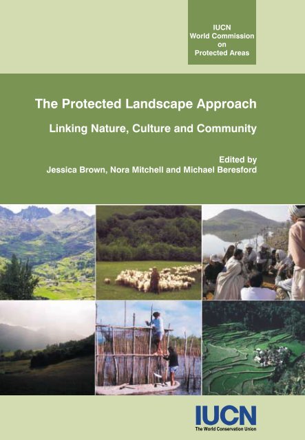
<strong>The</strong> <strong>Protected</strong> <strong>Landscape</strong> <strong>Approach</strong><br />
Linking Nature, Culture and Community<br />
Edited by<br />
Jessica Brown, Nora Mitchell and Michael Beres<strong>for</strong>d<br />
<strong>The</strong> World Conservation Union
<strong>The</strong> <strong>Protected</strong> <strong>Landscape</strong> <strong>Approach</strong><br />
Linking Nature, Culture and Community
<strong>The</strong> <strong>Protected</strong> <strong>Landscape</strong> <strong>Approach</strong><br />
Linking Nature, Culture and Community<br />
Edited by<br />
Jessica Brown, Nora Mitchell and Michael Beres<strong>for</strong>d<br />
IUCN – <strong>The</strong> World Conservation Union<br />
2005
<strong>The</strong> designation of geographical entities in this book, and the presentation of the material, do not<br />
imply the expression of any opinion whatsoever on the part of IUCN or any of the other<br />
supporting organizations concerning the legal status of any country, territory, or area, or of its<br />
authorities, or concerning the delimitation of its frontiers or boundaries.<br />
<strong>The</strong> views expressed in this publication do not necessarily reflect those of IUCN or any of the<br />
other supporting organizations.<br />
This publication has been made possible in part by funding from <strong>The</strong> Countryside Agency, the<br />
IUCN inter-commission <strong>The</strong>me on Indigenous and Local Communities, Equity, and <strong>Protected</strong><br />
Areas (TILCEPA) and QLF/Atlantic Center <strong>for</strong> the Environment, with additional support from<br />
the Conservation Study Institute of the U.S. National Park Service and the International <strong>Centre</strong> <strong>for</strong><br />
<strong>Protected</strong> <strong>Landscape</strong>s.<br />
Published by: IUCN, Gland, Switzerland and Cambridge, UK<br />
Copyright: © 2005 International Union <strong>for</strong> Conservation of Nature and Natural Resources<br />
Reproduction of this publication <strong>for</strong> educational or other non-commercial<br />
purposes is authorized without prior written permission from the copy right<br />
holder provided the source is fully acknowledged.<br />
Reproduction of this publication <strong>for</strong> resale or other commercial purposes is<br />
prohibited without prior written permission of the copyright holder.<br />
Citation: Brown, Jessica, Mitchell, Nora and Beres<strong>for</strong>d, Michael (Eds.) (2004). <strong>The</strong><br />
<strong>Protected</strong> <strong>Landscape</strong> <strong>Approach</strong>: Linking Nature, Culture and Community.<br />
IUCN, Gland, Switzerland and Cambridge, UK. xv + 270pp. plus 12 colour<br />
plates.<br />
ISBN: 2-8317-0797-8<br />
Cover design by: IUCN Publications Services Unit<br />
Cover photos: Front cover: El Parque de la Papa in the Sacred Valley of the Incas, southern<br />
Peruvian Andes, Alejandro Argumedo; Shepherd in Central Slovakia, Jessica<br />
Brown; Arvari River Parliament, Rajasthan, India, Ashish Kothari; White<br />
Carpathian <strong>Protected</strong> <strong>Landscape</strong> Area, Czech and Slovak Republics, Brent<br />
Mitchell; Fishermen, Mata Atlantica region, Brazil, Clayton F. Lino and <strong>The</strong><br />
Rice Terraces of the Philippine Cordilleras World Heritage Site, Adrian Phillips<br />
Back cover: Alinya Mountain Reserve, Catalonia, Spain, Fundació Territori i<br />
Paisatge<br />
Photo editor: Stephanie Tuxill<br />
Layout by: IUCN Publications Services Unit<br />
Produced by: IUCN Publications Services Unit<br />
Printed by: Page Bros (Norwich) Ltd.<br />
Available from: IUCN Publications Services Unit<br />
219c Huntingdon Road, Cambridge CB3 0DL<br />
United Kingdom<br />
Tel: +44 1223 277894, Fax: +44 1223 277175<br />
E-mail: books@iucn.org<br />
www.iucn.org/bookstore<br />
A catalogue of IUCN publications is also available<br />
<strong>The</strong> text of this book is printed on Fineblade Extra 90gsm made from low chlorine pulp
Dedication<br />
This publication is dedicated to the memory of PHC<br />
(Bing) Lucas who died in December 2000.<br />
Bing was a great advocate of the <strong>Protected</strong> Land -<br />
scape approach. He was the author of the first pub -<br />
lished guidance on <strong>Protected</strong> <strong>Landscape</strong>s in 1992<br />
and took a leading role in the early organisation and<br />
drafting of ideas <strong>for</strong> this book.<br />
Bing was an extraordinary man. His infectious<br />
enthusiasm, integrity and great kindness to all made<br />
him friends wherever he travelled around the world.<br />
He is greatly missed, but his memory is undimmed.<br />
v
Table of contents<br />
Preface, Jessica Brown, Nora Mitchell and Michael Beres<strong>for</strong>d<br />
About the authors<br />
ix<br />
xi<br />
Part I. Introduction and global overviews 1<br />
1. <strong>Protected</strong> landscapes: a conservation approach that links<br />
nature, culture and community 3<br />
Jessica Brown, Nora Mitchell and Michael Beres<strong>for</strong>d<br />
2. <strong>Landscape</strong> as a meeting ground: Category V <strong>Protected</strong><br />
<strong>Landscape</strong>s/Seascapes and World Heritage Cultural <strong>Landscape</strong>s 19<br />
Adrian Phillips<br />
3. World Heritage Cultural <strong>Landscape</strong>s: a global perspective 37<br />
Mechtild Rössler<br />
4. From pre-assumptions to a ‘just world conserving nature’:<br />
the role of Category VI in protecting landscapes 47<br />
Claudio C. Maretti in collaboration with Lucia H. O. Wadt,<br />
Daisy A. P. Gomes-Silva, Wanda T. P. de V. Maldonado,<br />
Rosely A. Sanches, Francisco Coutinho and Severino da S. Brito<br />
5. Conserving “unprotected” protected areas – communities can<br />
and do conserve landscapes of all sorts 65<br />
Edmund Barrow and Neema Pathak<br />
Part II. Case studies from around the world 81<br />
6. <strong>Landscape</strong> conservation initiatives in Nepal: opportunities and<br />
challenges 83<br />
Prabhu Budhathoki<br />
7. World Heritage inscription and challenges to the survival of<br />
community life in Philippine cultural landscapes 93<br />
Augusto Villalón<br />
8. Pastoralists, conservation and livelihoods in East and Southern<br />
Africa: reconciling continuity and change through the protected<br />
landscape approach 107<br />
Brian T.B. Jones, Moses Makonjio Okello and Bobby E.L. Wishitemi<br />
9. <strong>Protected</strong> landscapes in the United Kingdom 119<br />
Adrian Phillips and Richard Partington<br />
10. Sustaining rural landscapes and building civil society:<br />
experience from Central Europe 131<br />
Miroslav Kundrata and Blažena Hušková<br />
11. Cultural landscapes of the Andes: indigenous and colono culture,<br />
traditional knowledge and ethno-ecological heritage 147<br />
Fausto O. Sarmiento, Guillermo Rodríguez and Alejandro Argumedo<br />
vii
<strong>The</strong> <strong>Protected</strong> <strong>Landscape</strong> <strong>Approach</strong>: Linking Nature, Culture and Community<br />
12. Protecting landscapes and seascapes: experience from coastal<br />
regions of Brazil 163<br />
Clayton F. Lino and Marilia Britto de Moraes<br />
13. <strong>Protected</strong> landscapes and seascapes and their relevance to<br />
Small Island Developing States in the Caribbean: the case of<br />
Saint Lucia 179<br />
Giles Romulus<br />
14. Collaborative management of protected landscapes: experience<br />
in Canada and the United States of America 191<br />
Nora Mitchell, Jacquelyn Tuxill, Guy Swinnerton, Susan Buggey<br />
and Jessica Brown<br />
15. <strong>The</strong> evolution of landscape conservation in Australia: reflections<br />
on the relationship of nature and culture 205<br />
Jane L. Lennon<br />
Part III. <strong>The</strong> way <strong>for</strong>ward 219<br />
16. Building leadership and professionalism: approaches to<br />
training <strong>for</strong> protected landscape management 221<br />
Elizabeth Hughes<br />
17. Conclusions – the protected landscape approach: conservation<br />
<strong>for</strong> a sustainable future 233<br />
Nora Mitchell, Jessica Brown and Michael Beres<strong>for</strong>d<br />
References 247<br />
Appendix 1 263<br />
Appendix 2 264<br />
Appendix 3 265<br />
Appendix 4 266<br />
Appendix 5 267<br />
Appendix 6 268<br />
viii
Preface<br />
In every corner of the world can be found landscapes that have been shaped by the interactions<br />
of people and nature over time. <strong>The</strong>se landscapes have been created by traditional patterns of<br />
land use that have contributed to biodiversity and other natural values, have proven sustainable<br />
over centuries, and are living examples of cultural heritage. <strong>The</strong>y are rich in natural and<br />
cultural values not in spite of but because of the presence of people. Protecting these<br />
landscapes requires a conservation approach that recognises natural as well as cultural values,<br />
sustains traditional connections to the land, and engages people in stewardship of the places<br />
where they live and work.<br />
As countries worldwide move to expand and strengthen their national protected area<br />
systems, greater attention must be paid to protecting landscapes. By no means an alternative to<br />
strictly protected areas, protected landscapes are a complementary element and an essential part<br />
of any protected area system. <strong>The</strong>y are particularly appropriate in areas where biodiversity and<br />
cultural practices are linked, and where management practices must accommodate traditional<br />
uses, land ownership patterns, and the need to sustain local livelihoods. <strong>Protected</strong> landscapes<br />
can contribute to the viability of more strictly protected areas by rein<strong>for</strong>cing connectivity<br />
among areas and linkages within the broader landscape, especially in situations where con -<br />
servation objectives are being met over a large area of land.<br />
Our intention in this book is to introduce the protected landscape approach and demonstrate<br />
its relevance to the conservation challenges facing protected areas. While it draws especially<br />
from experience with IUCN Category V protected areas and the World Heritage Cultural<br />
<strong>Landscape</strong> designation, the protected landscape approach is broader than single protected area<br />
category or designation. We have chosen examples from around the world that illustrate how<br />
the protected landscape approach works in diverse settings. <strong>The</strong> authors who have contributed<br />
to this volume argue the importance of this approach and through their case-studies show how it<br />
is being adapted to different contexts. <strong>The</strong> experience presented here demonstrates the values<br />
and benefits of the protected landscape approach, and points the way toward meeting future<br />
challenges.<br />
This book is a project of the <strong>Protected</strong> <strong>Landscape</strong>s Task Force of IUCN’s World<br />
Commission on <strong>Protected</strong> Areas, and is part of a collection of publications produced by the<br />
Task Force over the last few years. An important companion volume is the Management<br />
Guidelines <strong>for</strong> IUCN Category V <strong>Protected</strong> Areas: <strong>Protected</strong> <strong>Landscape</strong>s/Seascapes (Phillips,<br />
2002) in the IUCN/Cardiff University series, which provides guidance in planning and<br />
managing protected landscapes. In addition, Task Force members have contributed to a recent<br />
issue of the journal PARKS on Category V <strong>Protected</strong> Areas (Beres<strong>for</strong>d, 2003), as well as an<br />
issue of George Wright Forum (Brown, Mitchell and Sarmiento, 2000), both of which brought<br />
out case-studies of current practice with <strong>Protected</strong> <strong>Landscape</strong>s and Seascapes.<br />
Many of the case-studies in this collection were presented at a workshop on <strong>Protected</strong><br />
<strong>Landscape</strong>s and Seascapes at the V th World Parks Congress (Durban, South Africa, 2003), and<br />
at an earlier meeting of the <strong>Protected</strong> <strong>Landscape</strong>s Task Force (Stow-on-Wold, UK, 2001). <strong>The</strong><br />
workshop at the World Parks Congress spanned three sessions within the Linkages in the<br />
<strong>Landscape</strong> and Seascape stream, and the cross-cutting theme on Communities and Equity, and<br />
ix
<strong>The</strong> <strong>Protected</strong> <strong>Landscape</strong> <strong>Approach</strong>: Linking Nature, Culture and Community<br />
was preceded by a panel focusing on the role of communities in sustaining landscapes. <strong>The</strong>se<br />
sessions at the World Parks Congress are discussed in more detail in the introductory chapter of<br />
this book.<br />
We are grateful to the Countryside Agency, UK, which has supported the production of this<br />
book as a publication of IUCN and its World Commission on <strong>Protected</strong> Areas. We thank also<br />
the organizations and working groups which have co-sponsored this publication: IUCN’s<br />
inter-commission <strong>The</strong>me on Indigenous and Local Communities, Equity and <strong>Protected</strong> Areas<br />
(TILCEPA); the Quebec-Labrador Foundation/Atlantic Center <strong>for</strong> the Environment (QLF); the<br />
Conservation Study Institute of the National Park Service; and the International <strong>Centre</strong> <strong>for</strong><br />
<strong>Protected</strong> <strong>Landscape</strong>s.<br />
As noted earlier, many of the chapters in this book grew out of presentations at a recent<br />
workshop and panel at the World Parks Congress. We thank Peter Bridgewater, who<br />
coordinated the stream on Linkages in the <strong>Landscape</strong> and Seascape, and Ashish Kothari and<br />
Grazia Borrini-Feyerabend, who coordinated the cross-cutting theme on Communities and<br />
Equity, <strong>for</strong> their support of these sessions.<br />
We thank the chapter authors who have contributed to this book. It has been a privilege to<br />
work with each of them. Special thanks are due to Adrian Phillips <strong>for</strong> his helpful guidance and<br />
review during development of the book, and Richard Partington <strong>for</strong> his support throughout this<br />
project. We are greatly indebted to Stephanie Tuxill <strong>for</strong> her work as Photo Editor, and <strong>for</strong> her<br />
many contributions to the production of this publication.<br />
We are pleased to have the opportunity to bring out the rich and diverse experience with the<br />
protected landscape approach that is presented in this collection.<br />
Jessica Brown<br />
Nora Mitchell<br />
Michael Beres<strong>for</strong>d<br />
x
About the authors<br />
Alejandro Argumedo is coordinator of the Sustaining Local Food Systems, Agricultural<br />
Biodiversity and Livelihoods Programme <strong>for</strong> Asociacion ANDES-IIED. ANDES (the<br />
Quechua-Aymara Association <strong>for</strong> Sustainable Livelihoods) is a Cusco-based indigenous<br />
peoples’ NGO working to protect and develop Andean biological diversity and the rights of<br />
indigenous peoples of Peru. Alejandro is also the international coordinator of the Indigenous<br />
Peoples’ Biodiversity Network (IPBN), a global coalition. He is member of IUCN’s World<br />
Commission on <strong>Protected</strong> Areas (WCPA), Commission on Environmental, Economic and<br />
Social Policy (CEESP) and Indigenous Peoples Ad Hoc Committee on <strong>Protected</strong> Areas.<br />
Edmund G.C. Barrow, Ireland, has been working with community-based approaches to<br />
natural resource management in Africa <strong>for</strong> nearly thirty years, with particular emphasis on<br />
social and equity issues, and on how natural resource management contributes to improved<br />
livelihood security, particularly in the drylands. Since 1997 he has coordinated the IUCN<br />
Eastern Africa Regional Office’s work in <strong>for</strong>est and dryland conservation, and on social policy<br />
and livelihood issues. He is a member of the core group of the IUCN inter-commission<br />
(WCPA/CEESP) <strong>The</strong>me on Indigenous and Local Communities, Equity and <strong>Protected</strong> Areas<br />
(TILCEPA).<br />
Michael Beres<strong>for</strong>d has been involved in <strong>Protected</strong> <strong>Landscape</strong> management <strong>for</strong> more than<br />
thirty years. Formerly Head of the Brecon Beacons National Park in Wales – a Category V<br />
<strong>Protected</strong> <strong>Landscape</strong> – he is the co-founder and director of the International <strong>Centre</strong> <strong>for</strong><br />
<strong>Protected</strong> <strong>Landscape</strong>s, Wales, UK. He is past co-chair of the <strong>Protected</strong> <strong>Landscape</strong>s Task Force<br />
of IUCN’s World Commission on <strong>Protected</strong> Areas (WCPA)<br />
Marilia Britto de Moraes is an architect, Master in <strong>Landscape</strong> Planning, and has worked in<br />
coastal management and zoning since 1989 at the Secretariat <strong>for</strong> the Environment of São Paulo<br />
State, Brazil. She has coordinated participatory planning <strong>for</strong> the northern and southern coasts,<br />
as well as <strong>for</strong> coastal Environmental Protection Areas (APAs), and currently works as Director<br />
of Ilhabela State Park, São Paulo, Brazil. As a member of IUCN’s WCPA-Brazil, she has<br />
coordinated the APAs working group since 1999 and serves on the WCPA <strong>Protected</strong><br />
<strong>Landscape</strong>s Task Force.<br />
Jessica Brown is Vice President <strong>for</strong> International Programs at the Quebec-Labrador<br />
Foundation/Atlantic Center <strong>for</strong> the Environment (QLF), a bi-national NGO working in rural<br />
areas of New England (USA) and eastern Canada. She is responsible <strong>for</strong> training, technical<br />
assistance, policy research and peer exchange programmes in regions including the Caribbean,<br />
Latin America, Central and Eastern Europe, and the Middle East, and conducts joint projects<br />
with the Conservation Study Institute of the US National Park Service. Her work focuses on<br />
landscape stewardship, private land conservation, and fostering community involvement in<br />
protected areas. She is co-chair of the WCPA <strong>Protected</strong> <strong>Landscape</strong>s Task Force, and a member<br />
of the core group of TILCEPA.<br />
Prabhu Budhathoki is currently doing PhD research on conservation governance at the<br />
International <strong>Centre</strong> <strong>for</strong> <strong>Protected</strong> <strong>Landscape</strong>s (ICPL), Wales, UK. He has twenty years of<br />
active experience in the field of <strong>for</strong>estry and integrated conservation and development in Nepal,<br />
xi
<strong>The</strong> <strong>Protected</strong> <strong>Landscape</strong> <strong>Approach</strong>: Linking Nature, Culture and Community<br />
including six years as National Programme Manager of the Park People Programme (under the<br />
UNDP), Department of National Parks and Wildlife Conservation.<br />
Susan Buggey is <strong>for</strong>mer Director of Historical Services, Parks Canada and now Adjunct<br />
Professor, School of <strong>Landscape</strong> Architecture, Université de Montréal, Canada. She has been<br />
active in research, evaluation, and writing on cultural landscapes <strong>for</strong> 25 years. Her research<br />
interests focus on the associative values of cultural landscapes and the meanings of landscapes<br />
in diverse cultures.<br />
Elizabeth Hughes is Executive Director of the International <strong>Centre</strong> <strong>for</strong> <strong>Protected</strong> <strong>Landscape</strong>s,<br />
Wales, UK. <strong>The</strong> <strong>Centre</strong> offers international academic and professional training programmes in<br />
protected landscape management and related topics; it also undertakes capacity-building,<br />
consultancy and advisory work on behalf of protected area agencies, governments, and NGOs<br />
around the world. Dr Hughes’ particular interests are in the fields of partnership-building,<br />
participatory approaches, and the role of civil society in protected area management.<br />
Blažena Hušková works as a private consultant and trainer and as a project manager <strong>for</strong> the<br />
Jizerske hory Public Benefit Organization, Czech Republic. Previously she was a landscape<br />
ecologist with the Jizerske hory Mountains <strong>Protected</strong> <strong>Landscape</strong> Area and was the founding<br />
director of the Foundation <strong>for</strong> the Rescue and Restoration of the Jizera Mountains. Past projects<br />
have focused on the revitalization of <strong>for</strong>est ecosystems affected by air pollution; more recently<br />
she has specialized in public participation in planning and decision-making processes, crosssectoral<br />
communication and cooperation, and the role of NGOs in the process of <strong>for</strong>mulating<br />
and implementing sustainable development strategies.<br />
Brian T. B. Jones is the Senior Community-based Natural Resource Management (CBNRM)<br />
Technical Adviser to USAID in Namibia. Formerly he was an independent consultant in the<br />
environment and development sector. For several years he was a Namibian government<br />
official, coordinating the CBNRM programme of the Namibian Ministry of Environment and<br />
Tourism. (<strong>The</strong> views expressed by him in this book do not necessarily represent the official<br />
position of USAID or the US Government).<br />
Miroslav Kundrata is the Director of Nadace Partnerství (the Czech Environmental<br />
Partnership Foundation), the Czech Republic’s most significant grant-making foundation<br />
active in the area of environment and sustainable development. As chairman of the Czech<br />
Donors Forum board, and a member of the Czech Governmental Council <strong>for</strong> NGOs (chair of<br />
the EU Committee), he is active in institution-building within the NGO sector, and in<br />
development and fundraising <strong>for</strong> various national and international programmes. He is<br />
chairman of the board of the Veronica Ecological Foundation, and founding member of the<br />
Traditions of the White Carpathians Association and of the Union <strong>for</strong> the Morava River.<br />
Jane L. Lennon is currently an adjunct professor at the Cultural Heritage <strong>Centre</strong> <strong>for</strong> Asia and<br />
the Pacific, Deakin University, Melbourne (Australia) specializing in cultural landscapes. She<br />
has over thirty years of experience in planning and management of national park and heritage<br />
places, including assessments <strong>for</strong> the Australian Heritage Commission and preparing cultural<br />
landscape management guidelines <strong>for</strong> UNESCO’s World Heritage <strong>Centre</strong>. She is a member of<br />
the Australian Heritage Council, and is a past president of Australia ICOMOS (International<br />
Council on Monuments and Sites).<br />
xii
About the authors<br />
Clayton F. Lino, Brazil, is an architect who specializes in Urban Environmental Patrimony<br />
and the Management of <strong>Protected</strong> Areas. He is also a photographer and speleologist, and has<br />
authored several books and technical-scientific texts about caves, the Mata Atlantica rain<strong>for</strong>est,<br />
and protected areas in Brazil. At present, he is president of the National Council of the Mata<br />
Atlantica Biosphere Reserve, coordinator of the Brazilian Network of Biosphere Reserves<br />
(linked to the UNESCO Man in the Biosphere programme), and a member of IUCN’s<br />
WCPA-Brazil.<br />
Claudio Maretti has more than twenty years experience working with environmental, regional<br />
and land-use planning, protected area management, and sustainable development including<br />
projects in natural resource use, and participatory approaches to working with local com -<br />
munities. He is currently in charge of the Amazon <strong>Protected</strong> Areas Programme <strong>for</strong> WWF-<br />
Brasil. He has been a member of the IUCN WCPA <strong>for</strong> almost a decade, mostly as Vice Chair<br />
<strong>for</strong> the Brazil Region, and is also a member of the CEESP Collaborative Management Working<br />
Group and the core group of the WCPA/CEESP TILCEPA.<br />
Nora Mitchell is adjunct faculty at the University of Vermont, USA, and the founding director<br />
of the Conservation Study Institute, established to enhance leadership in the field of<br />
conservation. In her 23-year career with the U.S. National Park Service (NPS), she has worked<br />
on both natural and cultural resource management of many national parks and has actively<br />
sought partnerships <strong>for</strong> accomplishing this work within the NPS and with academic and<br />
non-governmental organizations. Since 1988 she has been actively involved with the IUCN<br />
WCPA (and is a member of its <strong>Protected</strong> <strong>Landscape</strong>s Task Force), ICOMOS (International<br />
Commission on Monuments and Sites), and UNESCO’s World Heritage <strong>Centre</strong>.<br />
Moses Makonjio Okello is Associate Professor of Wildlife Management at the School <strong>for</strong><br />
Field Studies (SFS), Center <strong>for</strong> Wildlife Management Studies in Kenya. He taught at Moi<br />
University Department of Wildlife Management be<strong>for</strong>e joining the School <strong>for</strong> Field Studies as<br />
a resident faculty in 1999. Dr Okello teaches Wildlife Management and Conservation, and<br />
topics in biostatistics.<br />
Richard Partington is a landscape and rural affairs professional experienced in policy<br />
development and operational management, specializing in protected landscapes, sustainable<br />
tourism and recreation. He is a member of the Countryside Management Association, the IUCN<br />
WCPA and the EUROPARC Atlantic Isles executive committee. He has worked in national<br />
parks in New Zealand and England, been a consultant <strong>for</strong> many European countries, and has<br />
served <strong>for</strong> the past five years as senior advisor <strong>for</strong> the Countryside Agency, a government body<br />
providing a leading source of rural expertise in England, UK.<br />
Neema Pathak Broome has been a member of Kalpavriksh Environment Action Group, India,<br />
<strong>for</strong> the last ten years. During this time she has helped prepare a Status Report on the <strong>Protected</strong><br />
Areas of Maharashtra, worked on the issues of community involvement in wildlife manage -<br />
ment in South Asia, and studied the ef<strong>for</strong>ts of a tribal community in Mendha-Lekha village<br />
towards <strong>for</strong>est conservation. Neema is currently working on a national report on local rural<br />
communities’ ef<strong>for</strong>ts at biodiversity conservation. She is a member of the core group of the<br />
IUCN inter-commission (WCPA/CEESP) TILCEPA.<br />
Adrian Phillips is the Vice Chair <strong>for</strong> World Heritage of IUCN’s WCPA. Between 1994 and<br />
2000, he was chair of WCPA, and has been the Series editor of the IUCN Best Practice<br />
<strong>Protected</strong> Area Guidelines series. He is a member of the WCPA <strong>Protected</strong> <strong>Landscape</strong>s Task<br />
xiii
<strong>The</strong> <strong>Protected</strong> <strong>Landscape</strong> <strong>Approach</strong>: Linking Nature, Culture and Community<br />
Force. Formerly he was Professor in the Department of City and Regional Planning at Cardiff<br />
University, Wales; <strong>for</strong> 11 years the Director General of the Countryside Commission (UK); and<br />
be<strong>for</strong>e that an employee of IUCN and UNEP. He now serves in a voluntary capacity in support<br />
of several conservation NGOs in the UK.<br />
Guillermo E. Rodríguez-Navarro is a founding member of Fundación Pro-Sierra Nevada de<br />
Santa Marta, Colombia, now serving as its coordinator <strong>for</strong> fundraising and international<br />
relations. Together with his colleagues at the Foundation he has developed a complex manage -<br />
ment plan <strong>for</strong> the Sierra Nevada region, geared towards the creation of a participatory process<br />
involving all the groups that co-exist in that environment, and helping them define a shared<br />
interest in the region’s well-being. Current appointments include lecturer at the Jorge Tadeo<br />
Lozano University, president of the Fundacion Jardin Etnobotanico Villa Ludovica, and work<br />
with the Archaeological Museum Casa del Marques de San Jorge.<br />
Giles Romulus is the <strong>for</strong>mer Executive Director of the Saint Lucia National Trust and currently<br />
represents the island of Saint Lucia on UNESCO’s World Heritage Committee. He is a member<br />
of the IUCN WCPA and its <strong>Protected</strong> <strong>Landscape</strong>s Task Force, and the Caribbean Conservation<br />
Association. Currently he is the Programme Coordinator <strong>for</strong> the Global Environment Facility<br />
Small Grants Programme/United Nations Development Programme <strong>for</strong> Barbados and the<br />
Organisation of Eastern Caribbean States.<br />
Mechtild Rössler obtained her PhD in Geography from the University of Hamburg, Germany,<br />
in 1988 and joined UNESCO’s Division of Ecological Sciences in 1991 after a year at the<br />
Science Museum in La Villette, Paris, France, and as Visiting Professor at the geography<br />
department of University of Cali<strong>for</strong>nia-Berkeley, USA. She has been working <strong>for</strong> the<br />
UNESCO World Heritage <strong>Centre</strong> since its creation in 1992, mainly on natural heritage and<br />
cultural landscapes and is currently the Chief of Europe and North America (in charge of fifty<br />
countries and 385 World Heritage sites).<br />
Fausto O. Sarmiento, PhD, is director of the Office of International Education and Assistant<br />
Professor of Environmental Design at the University of Georgia, USA. His research focuses on<br />
restoration of neotropical montane landscapes. He is Regional Editor <strong>for</strong> Latin America <strong>for</strong> the<br />
journal Mountain Research and Development and is on the board of global organizations in<br />
favor of mountains. He has served as UNESCO/IUCN regional expert <strong>for</strong> topics related to<br />
cultural landscapes, biodiversity conservation and sustainable development, including the<br />
recent II Cultural Encounter of the Americas, where he spoke on Cultural <strong>Landscape</strong>s, Identity<br />
and Common Cultural Spaces in Latin America. He is a member of the IUCN WCPA <strong>Protected</strong><br />
<strong>Landscape</strong>s Task Force.<br />
Guy S. Swinnerton is Professor Emeritus, Parks and <strong>Protected</strong> Areas, in the Faculty of<br />
Physical Education and Recreation, University of Alberta, Canada. His nearly <strong>for</strong>ty years of<br />
both academic and professional experience with parks and protected areas has focused on<br />
policy and management issues in both the UK and Canada. He is particularly interested in<br />
land-use planning and management issues associated with lived-in landscapes. Currently, he is<br />
a member of the IUCN WCPA <strong>Protected</strong> <strong>Landscape</strong>s Task Force, and is a member of the<br />
Science Advisory Committee <strong>for</strong> Elk Island National Park and the Coordinating Committee <strong>for</strong><br />
the Beaver Hills Initiative in Alberta.<br />
Jacquelyn L. Tuxill has 25 years experience in conservation, most recently focused on<br />
building partnerships between the public and private sectors that encourage community-based<br />
xiv
About the authors<br />
conservation and landscape stewardship. Based in Vermont, USA, she works with QLF/<br />
Atlantic Center <strong>for</strong> the Environment and the National Park Service Conservation Study<br />
Institute, where she serves as its director <strong>for</strong> partnership programmes.<br />
Augusto Villalón has been involved in architecture and cultural heritage <strong>for</strong> over twenty years,<br />
with work completed in the Philippines, Asia and Latin America. His firm, A. Villalón<br />
Architects, won a UNESCO Asia-Pacific Heritage Award in 2003. He represented the<br />
Philippines on the UNESCO World Heritage Committee and is a Member of the Executive<br />
Committee of ICOMOS.<br />
Bobby E. L. Wishitemi, PhD, is Professor and Head of the Department of Tourism<br />
Management at Moi University, Kenya. He is co-chair of the IUCN WCPA <strong>Protected</strong><br />
<strong>Landscape</strong>s Task Force and a member of the European Union Project Advisory Board <strong>for</strong> the<br />
College of Africa Wildlife, Mweka, Moshi, Tanzania.<br />
xv
Part I<br />
Introduction and global overviews
1. <strong>Protected</strong> landscapes: a conservation<br />
approach that links nature, culture and<br />
community<br />
Jessica Brown, Nora Mitchell and Michael Beres<strong>for</strong>d<br />
Introduction<br />
This book is about an approach to protected areas that is gaining growing recognition and that<br />
offers the potential to meet many conservation challenges. <strong>The</strong> protected landscape approach<br />
links conservation of nature and culture, and fosters stewardship by people living in the<br />
landscape. While grounded in experience with Category V <strong>Protected</strong> <strong>Landscape</strong>s/ Seascapes, 1<br />
this approach is broader than a single protected area category or designation. Rather, it relies on<br />
different tools and designations to achieve protection, and on an array of processes and<br />
traditional systems to sustain people’s relationship to the land.<br />
<strong>Landscape</strong>s, the places where people and nature meet, are shaped by the inter-relationships<br />
between humans and their environment. In turn, the natural setting has shaped how people live,<br />
their settlement patterns, livelihoods, cultural practices and beliefs – indeed their very way of<br />
life. <strong>Landscape</strong>s encompass history and the present, the physical as well as the intangible. As<br />
Adrian Phillips writes in this volume, landscape can be seen as a meeting ground, between<br />
nature and people, between the past and the present, and between tangible and intangible<br />
values.<br />
<strong>Protected</strong> landscapes are cultural landscapes that have co-evolved with the human societies<br />
inhabiting them. <strong>The</strong>y are protected areas based on the interactions of people and nature over<br />
time. Living examples of cultural heritage, these landscapes are rich in biological diversity and<br />
other natural values not in spite of but rather because of the presence of people. It follows that<br />
their future relies on sustaining people’s relationship to the land and its resources.<br />
<strong>The</strong> traditional patterns of land use that have created many of the world’s cultural landscapes<br />
contribute to biodiversity, support ecological processes, provide important environmental<br />
services, and have proven sustainable over centuries. <strong>Protected</strong> landscapes serve as living<br />
models of sustainable use of land and resources, and offer important lessons <strong>for</strong> sustainable<br />
development.<br />
Shaped by cultural <strong>for</strong>ces, landscapes are central to the cultures of the world and, indeed, to<br />
our identity as people. In addition to their tangible physical qualities, they possess intangible or<br />
“associative” values – among them spiritual, cultural, and aesthetic values. As Mechtild<br />
Rössler writes in this volume, cultural landscapes “represent a tightly woven net of relation -<br />
ships that are the essence of culture and people’s identity.”<br />
<strong>The</strong> cultural and natural values of these landscapes are bound together. Cultural landscapes<br />
are at the interface between biological and cultural diversity, as Rössler observes. It is this<br />
complex mix of cultural and natural values, of tangible and intangible heritage, that makes<br />
1<br />
Category V in Guidelines <strong>for</strong> <strong>Protected</strong> Area Management Categories (IUCN, 1994).<br />
3
<strong>The</strong> <strong>Protected</strong> <strong>Landscape</strong> <strong>Approach</strong>: Linking Nature, Culture and Community<br />
protection of landscapes so vital, and at the same time so challenging. It requires an approach<br />
that is interdisciplinary, inclusive, and that engages people and communities.<br />
<strong>The</strong> protected landscape approach<br />
<strong>The</strong> concept of a protected landscape approach emerged in a workshop held at the V th World<br />
Parks Congress in Durban, South Africa (September 2003) and in discussions among members<br />
of the IUCN World Commission on <strong>Protected</strong> Areas (WCPA) <strong>Protected</strong> <strong>Landscape</strong>s Task<br />
Force. Participants found that, while Category V <strong>Protected</strong> <strong>Landscape</strong>s and Seascapes are the<br />
primary tool <strong>for</strong> creating these areas, strategies to protect landscapes are often broader than a<br />
single designation, typically drawing on a combination of protected area designations and<br />
tools. Importantly, these strategies must respond to the local context and its cultural, natural and<br />
social features.<br />
As places that have been shaped by the interactions between people and the land, protected<br />
landscapes rely on proces ses that sustain this relation ship. With that in mind, the term protected<br />
landscape approach is used in this vol ume, encompassing the diverse stra tegies needed to achieve<br />
this chal lenging goal, examples of which are presented in this book.<br />
<strong>The</strong> protected landscape approach recognises that the cultural and natural values of land scapes<br />
are inextricably linked, and that the communities liv ing in or near these landscapes are central to<br />
sustaining them. It embraces the central role of indigenous and local com munities as stewards of<br />
the land scape, and puts them at the heart of management of these protected areas, sharing in the<br />
benefits and responsi bilities of conservation. It is an inclus ive approach, relying on participatory<br />
<strong>The</strong> Sacred Valley of the Incas (Peru),<br />
whose agricultural landscape was<br />
shaped by pre-Colombian Inca cultures,<br />
today is managed by Quechua<br />
communities who have created El<br />
Parque de la Papa, or Potato Park. <strong>The</strong><br />
traditional patterns of land use that have<br />
created this cultural landscape<br />
contribute to biodiversity, support<br />
ecological processes, and have proven<br />
sustainable over centuries.<br />
Alejandro Argumedo<br />
4
1. <strong>Protected</strong> landscapes: a conservation approach that links nature, culture and community<br />
processes and partnerships that link a diverse array of stakeholders in steward ship and<br />
sustainability.<br />
<strong>The</strong> protected landscape approach takes a holistic and inter-disciplinary view of the environ -<br />
ment. It empha sises the integration of humans and nature, not the attempted isolation of one<br />
from the other. It presents an opportunity to understand better the relationship between people<br />
and nature, and to learn from these places where harmonious relationships can occur, and<br />
sustainable use can be modelled. It accommodates different concepts of nature conservation<br />
and strategies <strong>for</strong> protection. It recognises that to conserve biodiversity in many parts of the<br />
world, we must pay attention also to cultural diversity.<br />
<strong>The</strong> protected landscape approach can provide valuable models of how to integrate bio -<br />
diversity conservation, cultural heritage protection and sustainable use of resources. It is an<br />
approach that brings conservation “home” to the places where people live and work.<br />
An approach that emphasises lived-in landscapes should in no way be seen to diminish the<br />
importance of strictly protected areas, nor should it be viewed as a rejection of other conserva -<br />
tion models. Rather it is a complementary model, part of a range of strategies <strong>for</strong> achieving<br />
conservation objectives – and one that is particularly appropriate in settings where biodiversity<br />
and cultural practices are linked, and where management must accommodate traditional uses,<br />
land ownership patterns and the need to sustain local livelihoods.<br />
<strong>Protected</strong> landscapes can contribute to the viability of more strictly protected areas (such as<br />
Category Ia Strict Nature Reserves and Category II National Parks), by strengthening linkages<br />
within the broader landscape and connectivity among protected areas. Particularly when<br />
conservation objectives are to be met over a large area of land (often referred to as “landscapescale”<br />
conservation), strategies are needed that can accommodate different land uses, owner -<br />
ship patterns and management objectives. Typically this involves a variety of conservation<br />
tools and designations. In such a mosaic, protected area designations, such as Category V<br />
<strong>Protected</strong> <strong>Landscape</strong>s and Category VI Managed Resource <strong>Protected</strong> Areas, complement more<br />
strictly protected areas, and can enhance their impact.<br />
Several of the contributors to this book offer their perspectives on a protected landscape<br />
approach. Writing of pastoralist communities in Africa, Brian Jones, Moses Okello and Bobby<br />
Wishetimi call <strong>for</strong> conservation thinking that puts people back into the landscape. In a coda to<br />
their paper, Fausto Sarmiento, Guillermo Rodríguez and Alejandro Argumedo call <strong>for</strong> a “new<br />
approach of sustaining living landscapes <strong>for</strong> conservation in cooperation with the communities<br />
that have created and inhabit them”. In his chapter, Claudio Maretti proposes several elements<br />
<strong>for</strong> this approach.<br />
Stewardship<br />
Central to the protected landscape approach is the idea of stewardship, which is based on<br />
individual and community responsibility. <strong>Landscape</strong>s typically encompass a mosaic of land<br />
ownership: private, public and, in many countries, customary or communal ownership. It<br />
follows that protection of these landscapes inevitably must rely on fostering stewardship by<br />
those who own and/or live on the land.<br />
Stewardship means, simply, people taking care of the earth. In its broadest sense, it refers to<br />
the essential role individuals and communities play in the careful management of our common<br />
5
<strong>The</strong> <strong>Protected</strong> <strong>Landscape</strong> <strong>Approach</strong>: Linking Nature, Culture and Community<br />
A shepherd tends his flock<br />
in a mountainous region of<br />
Central Slovakia.<br />
Jessica Brown<br />
natural and cultural wealth <strong>for</strong> now and future generations. More specifically, it can be defined<br />
as “ef<strong>for</strong>ts to create, nurture and enable responsibility in landowners and resource users to<br />
manage and protect land and its natural and cultural heritage” (Brown and Mitchell, 1999).<br />
Stewardship taps our basic human impulse to care <strong>for</strong> our home and its surroundings – be it a<br />
parcel of land, a neighbourhood, or an historic monument, or the larger area of a watershed,<br />
mountain range or stretch of coast line. It builds on our sense of obligation to other people: our<br />
family, our community, and future generations. By fostering individual and community re spon si -<br />
bility, stewardship puts con ser vation in the hands of the people most affected by it.<br />
<strong>The</strong> protected landscape approach engages local com munities in stewardship of land scapes by<br />
rein<strong>for</strong>cing individ ual and community responsibility <strong>for</strong> resource management. It builds on<br />
existing institutional responsi bilities; and encourages flexible arrangements <strong>for</strong> management of<br />
resources, including collaborative management agreements and the range of private land<br />
stewardship tools.<br />
New directions in protected areas<br />
<strong>Protected</strong> areas are the cornerstone of conservation policy, an inter-generational legacy of the<br />
planet’s most valuable assets and special places. Covering over 10% of the earth’s surface, the<br />
global estate includes over 100,000 <strong>for</strong>mally protected areas. As eloquently expressed in the<br />
Durban Accord, a statement from the 3,000 participants in the V th World Parks Congress,<br />
protected areas are:<br />
Those places most inspirational and spiritual, most critical to the survival of species and<br />
ecosystems, most crucial in safeguarding food, air and water, most essential in stabiliz -<br />
ing climate, most unique in cultural and natural heritage and there<strong>for</strong>e most deserving of<br />
humankind’s special care.<br />
<strong>The</strong> roots of the protected area idea go back thousands of years – long be<strong>for</strong>e governments<br />
created national parks – to the conservation regimes that human societies have been devising<br />
6
1. <strong>Protected</strong> landscapes: a conservation approach that links nature, culture and community<br />
<strong>for</strong> millennia, among which are community-conserved areas (Borrini-Feyerabend, 2002).<br />
However, the modern foundation <strong>for</strong> protected areas was established in the late nineteenth<br />
century, with the designation of Yellowstone National Park in the United States.<br />
A major milestone in the history of environmental conservation, Yellowstone National Park<br />
shaped the perception of protected areas as uninhabited wilderness. Its creation marked the start<br />
of one of the greatest conservation achievements of the twentieth century, laying the foundation<br />
<strong>for</strong> the creation of a world-wide protected area network of national parks, nature reserves and<br />
other kinds of strictly protected areas. <strong>The</strong> “Yellowstone model” is seen as representing the<br />
preservation of large and wild areas by governments, where people are allowed as visitors, but<br />
not as residents. While in many places the public image of protected areas is still rooted in this<br />
national park model, in reality the protected area idea has evolved, moving beyond a single<br />
model to include many different kinds of protected areas.<br />
Today the world’s protected areas vary in almost every respect, including the purposes <strong>for</strong><br />
which they are managed, their size, the kind of places and resources they protect, and the<br />
management body responsible (Phillips, 2002). For this reason, IUCN – <strong>The</strong> World<br />
Conservation Union has created a category system, which identifies six categories of protected<br />
areas according to management objectives (IUCN, 1994; see Appendix 1). It defines protected<br />
areas as follows:<br />
An area of land and/or sea especially dedicated to the protection and maintenance of<br />
biological diversity and of natural and associated cultural resources and managed<br />
through legal or other effective means.<br />
<strong>The</strong> Alinya Mountain Reserve, the largest private reserve in Catalonia, Spain, is owned by<br />
the Fundació Territori i Paisatge - Caixa Catalunya. <strong>The</strong> rich agri-<strong>for</strong>estal mosaic of this<br />
mountainous landscape is characteristic of the region. Fundació Territori i Paisatge<br />
7
<strong>The</strong> <strong>Protected</strong> <strong>Landscape</strong> <strong>Approach</strong>: Linking Nature, Culture and Community<br />
Within this system are Category V <strong>Protected</strong> <strong>Landscape</strong>s/Seascapes – protected areas based<br />
on the interaction of people and nature, and the principal designation <strong>for</strong> lived-in landscapes.<br />
This category of protected areas, along with Category VI Managed Resource <strong>Protected</strong> Areas,<br />
is introduced briefly in the next section, and explored in more detail in this book’s chapters.<br />
Emerging trends in conservation and protected area management set the stage <strong>for</strong> a greater<br />
emphasis on protecting landscapes, and <strong>for</strong> a new approach that engages people in stewardship<br />
and embraces the interactions of people and nature.<br />
Conservation strategies are becoming increasingly bio-regional. <strong>The</strong> field of conservation<br />
biology has highlighted the pressing need to work on the scale of ecosystems and the wider<br />
landscape to conserve biological diversity. Worldwide, there is growing recognition that<br />
protected areas can no longer be treated as islands, but must be seen in a larger context. <strong>The</strong><br />
phenomenon of “paper parks”– protected areas in name only – has demonstrated <strong>for</strong>cefully that<br />
approaches that rely solely on regulation and en<strong>for</strong>cement are costly and too often meet with<br />
failure. Recognising that protected areas cannot be viewed in isolation from the communities<br />
within and near them, protected area managers are adopting inclusive models, in which<br />
collaborative management, partnerships and community-based approaches play a growing role<br />
(Brown and Mitchell, 2000a).<br />
An important trend, basic to the protected landscape approach articulated here, is a new<br />
understanding of the linkages between nature and culture: that healthy landscapes are shaped<br />
by human culture as well as the <strong>for</strong>ces of nature, that rich biological diversity often coincides<br />
with cultural diversity, and that conservation cannot be undertaken without the involvement of<br />
those people closest to the resources.<br />
In the chapter that follows this one, Adrian Phillips presents the elements of a new paradigm<br />
<strong>for</strong> protected areas.<br />
What are protected landscapes and seascapes<br />
<strong>Landscape</strong>s may be protected by a variety of designations and tools, including some that are not<br />
<strong>for</strong>mally recognised within national or international protected area systems, and yet play an<br />
important role in sustaining landscapes. Often protected landscapes are located adjacent to, or<br />
within, other categories of protected areas, as part of a mosaic of protection.<br />
As noted earlier, a primary tool is through <strong>for</strong>mal designation as a <strong>Protected</strong> <strong>Landscape</strong>/<br />
Seascape – Category V in the IUCN category system (see Appendix 2). According to the 1994<br />
IUCN Guidelines <strong>for</strong> <strong>Protected</strong> Area Management Categories, the definition of a Category V<br />
<strong>Protected</strong> <strong>Landscape</strong>/Seascape is:<br />
... an area of land, with coast and sea as appropriate, where the interaction of people and<br />
nature over time has produced an area of distinct character with significant aesthetic,<br />
ecological and/or cultural value, and often with high biological diversity. 2<br />
2<br />
For a comprehensive introduction to Category V protected areas, and guidance <strong>for</strong> managing these<br />
areas, refer to Management Guidelines <strong>for</strong> IUCN Category V <strong>Protected</strong> Areas: <strong>Protected</strong> <strong>Landscape</strong>s/<br />
Seascapes (Phillips, 2002).<br />
8
1. <strong>Protected</strong> landscapes: a conservation approach that links nature, culture and community<br />
<strong>The</strong> Category V designation explicitly recognises that “safeguarding the integrity of this<br />
traditional interaction is vital to the protection, maintenance and evolution of such an area”,<br />
making Category V <strong>Protected</strong> <strong>Landscape</strong>s both a designation and a process aimed at sustaining<br />
people’s relation ship to the landscape.<br />
In this book Adrian Phillips reviews experience with the Category V designation globally,<br />
and explores the relationship between Category V protected areas and those recognised as<br />
World Heritage Cultural <strong>Landscape</strong>s – another important designation in protecting landscapes<br />
globally. Since 1992 the UNESCO World Heritage Committee has recognised and protected<br />
Cultural <strong>Landscape</strong>s selected based on the outstanding value of the interaction between people<br />
and their environment. <strong>The</strong> Operational Guidelines <strong>for</strong> the Implementation of the World<br />
Heritage Convention, an international treaty, define Cultural <strong>Landscape</strong>s as:<br />
…illustrative of the evolution of human society and settlement over time, under the<br />
influence of the physical constraints and/or opportunities presented by their natural<br />
environment and of successive social, economic and cultural <strong>for</strong>ces, both external and<br />
internal and as a diversity of manifestations of the interaction between humankind and its<br />
natural environment (UNESCO, 1996). (See Appendix 4).<br />
In her chapter Mechtild Rössler discusses global experience with World Heritage Cultural<br />
<strong>Landscape</strong>s in the context of broader landscape linkages. She observes that cultural landscapes<br />
are a symbol of the growing recognition of the intrinsic links between communities and their<br />
past heritage, and between humankind and its natural environment. She notes the important role<br />
of these exceptional sites as a centrepiece of many protected area systems, and their ability to<br />
complement Category V sites, as well as those protected through other designations discussed<br />
in this book.<br />
Category V <strong>Protected</strong> <strong>Landscape</strong>s and World Heritage Cultural <strong>Landscape</strong>s share much<br />
common ground – especially their focus on landscapes where human relationships with the<br />
natural environment over time define their essential character. However, there are important<br />
distinctions between the two designations, in particular related to how they are selected. In<br />
Box 1.<br />
<strong>The</strong> protected landscape approach – appropriate to diverse<br />
settings<br />
<strong>The</strong> protected landscape approach can be appropriate to diverse settings, including those in de -<br />
veloping countries, because it:<br />
<br />
<br />
links people’s needs and biodiversity conservation;<br />
typically comprises a mosaic of land ownership patterns, including private and communally<br />
owned property;<br />
can accommodate diverse management regimes, including customary laws governing re -<br />
source management and traditional practices;<br />
<br />
<br />
<br />
has important specific objectives related to conservation of cultural heritage;<br />
seeks to bring benefits to local communities and contribute to their well-being, through the<br />
provision of environmental goods and services; and<br />
has proven to work well in certain indigenous territories where strict protected areas have<br />
failed.<br />
Sources: Brown and Mitchell, 2000a; Oviedo and Brown, 1999.<br />
9
<strong>The</strong> <strong>Protected</strong> <strong>Landscape</strong> <strong>Approach</strong>: Linking Nature, Culture and Community<br />
designation of Category V <strong>Protected</strong> <strong>Landscape</strong>s, the natural environment, biodiversity con -<br />
serva tion, and ecosystem integrity have been the primary emphases. In contrast, the emphasis<br />
in World Heritage Cultural <strong>Landscape</strong> designation has been on human history, continuity of<br />
cultural traditions, and social values and aspirations (Mitchell and Buggey, 2001). As Adrian<br />
Phillips further notes in his chapter, “outstanding universal value” is a fundamental criterion in<br />
recognising a World Heritage Cultural <strong>Landscape</strong>, while the emphasis in Category V <strong>Protected</strong><br />
<strong>Landscape</strong>s is on sites of national, or sub-national significance.<br />
Other protected area designations can play an important role in protecting landscapes,<br />
although their management objectives differ. One example is Category VI Managed Resource<br />
<strong>Protected</strong> Areas (see Appendix 3), which shares with Category V an emphasis on sustainable<br />
use of natural resources. However, they differ in that Category V protected areas involve<br />
landscapes that typically have been modified extensively by people over time, Category VI<br />
protected areas emphasise areas with predominantly unmodified natural systems, to be man -<br />
aged so that at least two-thirds remain that way (Phillips, 2002).<br />
Drawing on Brazil’s experience with extractive reserves, Claudio Maretti argues that<br />
landscape protection must be viewed in the local context – social, cultural and natural – and that<br />
<strong>for</strong> certain lived-in landscapes the Category VI designation may be more appropriate. In the<br />
Brazilian Amazon, <strong>for</strong> example, communities established Category VI extractive reserves in<br />
order to protect their lived-in, working landscapes.<br />
Another important example considered here is the Biosphere Reserve designation, an<br />
instrument of UNESCO’s Man in the Biosphere (MaB) programme, dedicated to sustainable<br />
development and the conservation of biodiversity, as well as the support of environmental<br />
education, research, and the monitoring of the most important natural areas of the world. <strong>The</strong><br />
chapter by Clayton F. Lino and Marilia Britto de Moraes considers experience from the Mata<br />
Atlantica Biosphere Reserve to explore how this designation supports large-scale conservation<br />
and, at the same time, helps to sustain traditional landscapes and seascapes in Brazil’s coastal<br />
zone.<br />
Central to the protected landscape approach, though not expressed in any <strong>for</strong>mal designa -<br />
tion, are the array of strategies that indigenous and local communities have been using <strong>for</strong><br />
millennia to protect land and natural and cultural resources important to them. Long ignored by<br />
governments, and not included in the accounting of official protected areas, communityconserved<br />
areas are now receiving growing attention in the protected areas field. In their<br />
chapter Edmund Barrow and Neema Pathak introduce community-conserved areas, which they<br />
define as<br />
…modified and natural ecosystems, whether human-influenced or not, and which contain<br />
significant biodiversity values, ecological services, and cultural values, that are vol -<br />
untarily conserved by communities, through customary laws and institutions.<br />
Community-conserved areas have long played a role in how communities all over the world<br />
care <strong>for</strong> the landscapes they inhabit (Borrini-Feyerabend, Kothari and Oviedo, 2004).<br />
Finally, private land conservation tools (such as conservation easements and management<br />
agreements) and public-private partnerships play an important role in protecting landscapes, as<br />
discussed in several of the chapters in this volume.<br />
10
1. <strong>Protected</strong> landscapes: a conservation approach that links nature, culture and community<br />
Some milestones in advancing protected landscapes and<br />
seascapes<br />
While <strong>Protected</strong> <strong>Landscape</strong>s have come relatively late to the protected area scene, they play a<br />
growing role in national systems of protected areas, and in regional and global conservation<br />
strategies. Significant progress has been made over the last 25 years, running parallel to broader<br />
trends in conservation and in new approaches to protected areas generally. Selected milestones<br />
in advancing this approach, with particular reference to Category V protected areas, are<br />
presented in Box 2.<br />
Box 2.<br />
<br />
<br />
<br />
<br />
<br />
<br />
<br />
<br />
Milestones in recognising and developing the protected<br />
landscape approach<br />
In 1978 IUCN, through its then Commission on National Parks and <strong>Protected</strong> Areas, published<br />
a report on “Categories, Objectives and Criteria <strong>for</strong> <strong>Protected</strong> Areas,” which established ten<br />
categories, including protected landscapes, <strong>for</strong>mally recognising the value of lived-in, work -<br />
ing landscapes as protected areas.<br />
In 1987 IUCN and the UK Countryside Commission co-hosted a symposium on <strong>Protected</strong><br />
<strong>Landscape</strong>s (Lake District, UK), which adopted the “Lake District Declaration,” a statement<br />
of principles underpinning the value of the protected landscape approach.<br />
In 1988 an IUCN General Assembly resolution recognised protected landscapes as “living<br />
models of sustainable use” and urged governments and others to give more attention to<br />
Category V protected areas.<br />
In 1990 the International <strong>Centre</strong> <strong>for</strong> <strong>Protected</strong> <strong>Landscape</strong>s was established in Aberystwyth,<br />
Wales, UK.<br />
In 1992 the first publication providing guidance on the protected landscapes approach was<br />
published. Written by the late P.H.C. (Bing) Lucas, and published by IUCN, the Guide on<br />
<strong>Protected</strong> <strong>Landscape</strong>s <strong>for</strong> Policy-makers and Planners was prepared as a contribution to the<br />
IVth World Congress on National Parks and <strong>Protected</strong> Areas, (Caracas, Venezuela).<br />
At the IVth World Congress on National Parks and <strong>Protected</strong> Areas (1992), following critical<br />
review of the IUCN protected area management categories, IUCN acknowledged the need to<br />
give more attention to protected area models based upon people living alongside nature.<br />
Also in 1992 the World Heritage Committee, after nearly a decade of debate, agreed that<br />
cultural landscapes could meet the criteria of “outstanding universal value” and revised the<br />
World Heritage Guidelines to include a Cultural <strong>Landscape</strong>s category, an important de -<br />
velopment in linking conservation of natural and cultural heritage.<br />
In 1994 IUCN published its Guidelines <strong>for</strong> <strong>Protected</strong> Area Management Categories, which<br />
put Category V areas – now <strong>for</strong>mally known as <strong>Protected</strong> <strong>Landscape</strong>s and Seascapes – on an<br />
equal footing with other categories of protected areas.<br />
In 1996 the first IUCN World Conservation Congress (Montreal, Canada), adopted a resolu -<br />
tion regarding conservation on privately owned land, with special reference to Category V<br />
protected areas.<br />
<br />
In 1999 the Conservation Study Institute (US National Park Service and QLF/Atlantic Center<br />
<strong>for</strong> the Environment), in cooperation with IUCN’s World Commission on <strong>Protected</strong> Areas,<br />
convened an international workshop on Stewardship of <strong>Protected</strong> <strong>Landscape</strong>s (Woodstock,<br />
Vermont, USA). As a result, the WCPA Steering Committee created a Commission Task<br />
Force on <strong>Protected</strong> <strong>Landscape</strong>s to draw together global expertise and promote the approach.<br />
Cont.<br />
11
<strong>The</strong> <strong>Protected</strong> <strong>Landscape</strong> <strong>Approach</strong>: Linking Nature, Culture and Community<br />
Box 2.<br />
<br />
<br />
Milestones in recognising and developing the protected<br />
landscape approach (cont.)<br />
<strong>The</strong> WCPA <strong>Protected</strong> <strong>Landscape</strong>s Task Force, working with partner organizations, has<br />
produced several publications (see examples below), convened international meetings (e.g.,<br />
working session and seminar, Stow-on-the-Wold, England, UK, 2001) and regional work -<br />
shops (e.g., Andean landscapes – Baeza, Ecuador, 2001), and led a workshop at the V th World<br />
Parks Congress.<br />
In 2002 IUCN published Management Guidelines <strong>for</strong> IUCN Category V <strong>Protected</strong> Areas:<br />
<strong>Protected</strong> <strong>Landscape</strong>s/Seascapes (Phillips, 2002), as part of the IUCN/Cardiff University<br />
series on best practice in protected area management. Other recent publications coming out of<br />
the work of the <strong>Protected</strong> <strong>Landscape</strong>s Task Force include an issue of the journal PARKS on<br />
Category V <strong>Protected</strong> Areas (Beres<strong>for</strong>d, Ed. 2003) and an issue of George Wright Forum on<br />
Stewardship of <strong>Protected</strong> <strong>Landscape</strong>s (Brown, Mitchell and Sarmiento, Eds. 2000).<br />
Recent international symposia have highlighted the importance of cultural landscapes, in -<br />
cluding a 2002 session on “Cultural <strong>Landscape</strong>s – the Challenges of Conservation,” convened<br />
by UNESCO on the occasion of the 30th anniversary of the World Heritage Convention<br />
(Ferrara, Italy, 2002); and “Learning from World Heritage” a US/ICOMOS symposium on<br />
cultural and ecological landscapes of global significance (Natchitoches, Louisiana, USA,<br />
2004).<br />
<br />
At the V th World Parks Congress (Durban, South Africa, 2003), the WCPA <strong>Protected</strong><br />
<strong>Landscape</strong>s Task Force convened a workshop on <strong>Protected</strong> <strong>Landscape</strong>s and Seascapes. A<br />
Congress workshop stream on Linkages in the <strong>Landscape</strong>/Seascape and cross-cutting themes<br />
on Local Communities and Equity and World Heritage, respectively, highlighted the im -<br />
portance of landscape-scale conservation, community involvement in protected areas, and<br />
cultural landscapes, points <strong>for</strong>malized in recommendations and in the Durban Accord.<br />
Sources: Phillips, 2002; Mitchell and Buggey, 2001.<br />
<strong>Protected</strong> landscapes at the V th World Parks Congress<br />
<strong>The</strong> topic of <strong>Protected</strong> <strong>Landscape</strong>s and Seascapes featured prominently at the V th World Parks<br />
Congress (WPC) in 2003, in venues that included workshops, panels, and debate.<br />
<strong>The</strong> World Parks Congress recognised the important role of indigenous and local com -<br />
munities in creating and managing protected areas. Far from being a side topic, the role of<br />
communities was a central part of the debate in Durban on protected areas and their future.<br />
Communities and Equity was a cross-cutting theme of the Congress, and was on the agenda as<br />
never be<strong>for</strong>e, integrated into each of the seven workshop streams, and addressed in plenary<br />
discussions and in Congress products such as the Durban Accord. This integration came about<br />
thanks to the vision of the WPC steering committee and the work of members of the <strong>The</strong>me on<br />
Indigenous and Local Communities, Equity and <strong>Protected</strong> Areas (TILCEPA), an inter- com -<br />
mission group of WCPA and the IUCN Commission on Environmental, Economic and Social<br />
Policy (CEESP). <strong>The</strong> participation of community and tribal leaders from around the world<br />
greatly enriched discussions at the Congress.<br />
Several sessions in WPC Stream 1 (Linkages in the <strong>Landscape</strong> and Seascape) focused on<br />
<strong>Protected</strong> <strong>Landscape</strong>s and Seascapes. <strong>The</strong> Linkages in the <strong>Landscape</strong> and Seascape stream<br />
focused on the challenge of designing new ecological networks <strong>for</strong> a better integration of<br />
12
1. <strong>Protected</strong> landscapes: a conservation approach that links nature, culture and community<br />
protected areas in the global landscape and seascape, investigating the application of the<br />
ecosystem approach to protected areas and the new governance mechanisms necessary to<br />
achieve this. It recognised that protected areas need to be connected or reconnected to the<br />
surrounding landscape in order to meet conservation goals, and to ensure effective land, water<br />
and marine ecosystem planning, and noted that good ecological science must be coupled with<br />
an understanding that cultural and biological diversity are inextricably linked. <strong>The</strong> Stream on<br />
Linkages in the <strong>Landscape</strong> and Seascape looked at five key elements of linkages to and from<br />
protected areas – ecological, economic, institutional, cultural, as well as the effectiveness of<br />
these linkages in benefiting protected areas. 3<br />
A panel on the <strong>The</strong> Role of Communities in Sustaining Linkages in the <strong>Landscape</strong> and<br />
Seascape highlighted the experience of traditional communities in managing landscapes, with<br />
special emphasis on that of mobile peoples. At a joint session of Stream 1 and the Stream on<br />
Governance (New Ways of Working Together), the panel explored the various institutional and<br />
management arrangements <strong>for</strong> environmental management at the community level in pastoral -<br />
ist societies, as well as some of the problems that face mobile communities in terms of lost<br />
power, lost access and lost mobility. One conclusion of the session was the need <strong>for</strong> a more<br />
holistic approach that integrates wider landscape requirements with those at the community<br />
level and which, in turn, requires a much greater understanding of the social aspects of<br />
conservation issues.<br />
Spanning three sessions, the workshop on Protecting <strong>Landscape</strong>s and Seascapes: IUCN<br />
Category V, World Heritage Cultural <strong>Landscape</strong>s and Other Designations sought to demon -<br />
strate how the <strong>Protected</strong> <strong>Landscape</strong>/Seascape concept can work effectively in different set -<br />
tings, using a variety of designations and other tools. Overview presentations set the context <strong>for</strong><br />
how designations such as Category V, Category VI, World Heritage Cultural <strong>Landscape</strong>s and<br />
Biosphere Reserves protect landscapes globally. Through case-study presentations and small<br />
group discussions, workshop participants explored the central role of communities in protected<br />
areas and in managing linkages in the landscape and seascape. Small group discussions<br />
explored experience and new opportunities in regions including Africa, Asia, Europe, Latin<br />
America and North America. <strong>The</strong> workshop included a debate on <strong>Protected</strong> <strong>Landscape</strong>s and the<br />
IUCN Category System, which considered the role of Category V and VI designations with<br />
respect to other categories of <strong>Protected</strong> Areas.<br />
Key points emerging from discussions in the workshop on Protecting <strong>Landscape</strong>s and<br />
Seascapes included:<br />
<br />
<br />
<strong>The</strong> important role of Categories V and VI within the IUCN system of protected areas<br />
management categories, noting their ability to complement other protected area cate -<br />
gories and maintain and restore biological diversity, while accommodating the relation -<br />
ship between people and nature.<br />
<strong>The</strong> role played by communities in conserving important ecological linkages in the<br />
broader landscape, such as watersheds and the terrestrial-marine interface, as well as<br />
biodiversity.<br />
3<br />
From report on the Linkages in the <strong>Landscape</strong> and Seascape Stream, posted at www.iucn.org/themes/<br />
wcpa/wpc2003/english/programme/workshops/linkages.htm<br />
13
<strong>The</strong> <strong>Protected</strong> <strong>Landscape</strong> <strong>Approach</strong>: Linking Nature, Culture and Community<br />
<br />
<br />
<strong>The</strong> value of an integrated approach drawing on all the protected area categories and<br />
using a mosaic of these designations in order to sustain linkages in the landscape and<br />
seascape.<br />
Workshop participants, who came from many different regions, noted that many of the<br />
world’s biodiversity hotspots are linked to places where the activities of humans over<br />
time have contributed to the biodiversity in the landscape. <strong>The</strong>y argued the need <strong>for</strong> a<br />
greater understanding of the link between cultural diversity and biodiversity. Finally,<br />
they found that Categories V and VI, and international designations such as World<br />
Heritage Cultural <strong>Landscape</strong>s and Biosphere Reserves, are particularly well suited to<br />
accommodate the particular conditions of landscapes shaped by people over time (see<br />
also Box 1).<br />
Most importantly, as discussed earlier in this chapter, workshop participants advocated a<br />
“landscape approach” and began to articulate the elements of such an approach.<br />
<strong>The</strong> World Parks Congress produced recommendations on a broad array of issues and<br />
challenges facing protected areas in the coming decade. A number of these focused on themes<br />
relevant to the protected landscapes approach, including recommendations on integrated<br />
landscape management, governance, indigenous and mobile peoples, World Heritage, and<br />
community-conserved areas.<br />
Experience from diverse regions of the world<br />
Drawing on experience from many countries and regions, the chapters in this book illustrate<br />
how the protected landscape approach can work in very different settings, addressing a variety<br />
of conservation objectives and challenges.<br />
Adrian Phillips and Mechtild Rössler, in their respective chapters, present case-studies of<br />
World Heritage Cultural <strong>Landscape</strong>s in the Philippines, Austria, Hungary, Portugal, Iceland,<br />
Italy, Lebanon, Nigeria, Russia and Lithuania. Rössler observes that the inclusion of Cultural<br />
<strong>Landscape</strong>s within the World Heritage Convention has contributed to the recognition of<br />
intangible values and the heritage of local and indigenous communities, and to the value of<br />
traditional land systems that represent the continuity of people working the land over centuries<br />
and millennia.<br />
Also in this volume, Augusto Villalón and Jane Lennon further explore experience with the<br />
World Heritage Cultural <strong>Landscape</strong> designation. In her discussion of two Australian cases –<br />
Uluru-Kata Tjuta National Park and Kosciuszko National Park – Lennon finds that World<br />
Heritage Cultural <strong>Landscape</strong> designation has brought public attention to Australian landscapes<br />
deemed of global importance. By enhancing the value placed on cultural heritage, including<br />
intangible values, and recognising the importance of management by indigenous people,<br />
Lennon observes that the Cultural <strong>Landscape</strong> designation has contributed to the evolution of<br />
heritage protection in Australia toward increasing integration of natural and cultural values.<br />
Writing about two continuing cultural landscapes in the Philippines, Villalón explores the<br />
challenges of balancing progress and tradition. For the Rice Terraces of the Philippines<br />
Cordilleras, the first continuing cultural landscape to be inscribed on the World Heritage list,<br />
the future depends on continuing the culture-based traditional practices that have created and<br />
14
1. <strong>Protected</strong> landscapes: a conservation approach that links nature, culture and community<br />
maintain the landscape. He describes a rich array of culture-nature connections, including<br />
intricate terracing and irrigation systems, the planting of <strong>for</strong>est parcels ringing each terrace<br />
group, and the spiritual practices of the Ifugao culture. <strong>The</strong> challenge, Villalón argues, is <strong>for</strong><br />
local communities to move <strong>for</strong>ward into the 21st century, while maintaining their culture and<br />
traditions.<br />
In Nepal, half of the country’s protected areas include settlements and farmlands, and all<br />
national parks are adjacent to areas with high populations. Prabhu Budhathoki writes that since<br />
the inception of its protected area system, Nepal has had to adopt a broad landscape approach,<br />
linking local people with resource conservation and directing the benefits of resource con -<br />
servation to them. He discusses the case of the Terai Arc <strong>Landscape</strong> Conservation Initiative, an<br />
ef<strong>for</strong>t to link 11 protected areas to protect critical habitat <strong>for</strong> many species, including tigers,<br />
rhino and elephants. Given the area’s mosaic of land use practices and the livelihood needs of<br />
mountain communities, Budhathoki observes that ef<strong>for</strong>ts to scale up conservation initiatives to<br />
a larger landscape level are relying on the principles of partnerships, inclusion and linkages.<br />
<strong>The</strong> challenges of protecting landscapes and seascapes in Brazil’s coastal zone are discussed<br />
in the chapter by Clayton Lino and Marilia Britto de Moraes. <strong>The</strong>y present the cases of the Mata<br />
Atlantica Biosphere Reserve, an international designation under the MaB programme, and the<br />
federally designated Cananéia-Iguape-Peruíbe Area de Proteção Ambiental (APA). A uniquely<br />
Brazilian model, the APA, or Environmental Protection Area, is well suited to management of<br />
working landscapes, the authors argue, given its emphasis on participatory and democratic<br />
approaches to management, reliance on stewardship by local communities, and ability to be<br />
flexible and adapt to different contexts. Comparing the APA and Biosphere Reserve models,<br />
Fernando de Noronha, in the Mata Atlantica Biosphere Reserve (Brazil). In Brazil’s coastal zone,<br />
complementary designations such as Biosphere Reserves and Areas de Proteção Ambiental<br />
(Environmental <strong>Protected</strong> Areas) work together to protect landscapes and seascapes. Clayton F. Lino<br />
15
<strong>The</strong> <strong>Protected</strong> <strong>Landscape</strong> <strong>Approach</strong>: Linking Nature, Culture and Community<br />
Lino and Britto de Moraes write that these designations are complementary, working in<br />
harmony with each other and with other kinds of protected areas, such as Category II National<br />
Parks, to manage natural resources in the coastal zone while involving local communities.<br />
Also drawing on the Brazilian experience, Claudio Maretti writes about the role of Category<br />
VI extractive reserves in protecting landscapes. <strong>The</strong> Chico Mendes extractive reserve<br />
(Brazilian Amazon) and the coastal Mandira extractive reserve (south-eastern Brazil) are<br />
examples of landscapes created by and belonging to local communities, he argues. Reflecting<br />
on the courage of these communities when in response to threats to these places they created<br />
extractive reserves, Maretti stresses that local communities and their activities related to natural<br />
resources present an opportunity, rather than a problem, in developing an overall nature<br />
conservation strategy.<br />
Giles Romulus explores the applicability of the various protected area management cate -<br />
gories to the situation of Small Island Developing States in the Caribbean. This chapter presents<br />
two cases from Saint Lucia: the Praslin <strong>Protected</strong> <strong>Landscape</strong> and the Soufriere Marine<br />
Management Area. Romulus argues that Categories V and VI are most appropriate to the needs<br />
of Small Island Developing States, and that effective management of natural and cultural<br />
resources should be based on the principles of equity, participation and sustainability. Also in<br />
that chapter, a box by Wil Maheia on the Maya Mountain Marine Corridor/Port Honduras<br />
Marine Reserve illustrates the role of an NGO working with local communities to create a<br />
protected area.<br />
North American experience with protected landscapes is described in the chapter by Nora<br />
Mitchell, Jacquelyn Tuxill, Guy Swinnerton, Susan Buggey and Jessica Brown. <strong>The</strong> authors<br />
observe a growing appreciation of the conservation values of lived-in landscapes in the United<br />
States and Canada, and a broadening of protected area systems in both countries to include a<br />
greater diversity of sites, and an array of management partnerships. <strong>The</strong>ir chapter presents<br />
examples from diverse settings in the United States and Canada, and documents a growing<br />
appreciation of the importance of partnerships, community engagement and participatory<br />
governance models. <strong>The</strong>y observe that the term “protected landscapes” refers not only to<br />
particular sites, but to a process that guides and accommodates change, and this represents a<br />
fundamental shift in thought and practice in the two countries.<br />
In the United Kingdom, with its long history of human settlement and dense population, and<br />
with almost all land and water in some <strong>for</strong>m of multiple use, conservation ef<strong>for</strong>t has always<br />
focused on lived-in landscapes. In this book Adrian Phillips and Richard Partington review the<br />
UK’s half-century of experience with Category V protected areas, which include National<br />
Parks, Areas of Outstanding Natural Beauty (AONBs), Regional Parks and National Scenic<br />
Areas. England, Wales, Scotland and Northern Ireland are adopting different strategies,<br />
illustrating a varied approach to pursuing social, economic and environmental aims within their<br />
protected landscapes. Phillips and Partington write that in the UK it is recognised that protected<br />
areas will not survive, nor achieve their aims, without local support – all the more necessary<br />
given that many people live in these Category V protected areas and play an active role in their<br />
management and protection.<br />
Case studies from Central Europe of two Czech <strong>Protected</strong> <strong>Landscape</strong>s – the Bílé Karpaty<br />
(southern Moravia) and the Jizersky hory (northern Bohemia) – demonstrate the contributions<br />
of the stewardship approach to rural economic development, community revitalization and<br />
16
1. <strong>Protected</strong> landscapes: a conservation approach that links nature, culture and community<br />
fostering civil society in the post-Communist societies of the region. In their discussion of<br />
innovative projects in the protected landscapes of these two mountainous regions, Miroslav<br />
Kundrata and Blažena Hušková observe that an approach that rein<strong>for</strong>ces local people’s<br />
relationship to nature, supports their resources and traditions, and encourages sensitive man -<br />
agement of the landscape can contribute to economic strengthening of rural areas. <strong>The</strong>y also<br />
note the important role played by NGOs in bringing new vision and innovation to traditionally<br />
conservative rural areas, and the value of international exchange in further advancing these<br />
community-based initiatives.<br />
In their chapter on community-conserved areas (CCAs) Edmund Barrow and Neema Pathak<br />
discuss the ef<strong>for</strong>ts of rural people to conserve areas of land and biodiversity through man -<br />
agement systems that have evolved over centuries. While the history of this kind of con -<br />
servation is much older than government-managed protected areas, Barrow and Pathak note<br />
that an emphasis on “official” protected areas has tended to overlook the contribution of CCAs.<br />
<strong>The</strong>y present examples of community-conserved areas from Asia, South America and Africa<br />
that illustrate the importance of cultural, utilitarian and sacred associations in protecting<br />
landscapes and biodiversity. <strong>The</strong>ir chapter highlights the importance of communities’ spiritual<br />
association with nature, and the contribution of sacred sites, such as sacred groves, to<br />
protecting landscapes.<br />
<strong>The</strong>se themes of spiritual associations with nature and sacred sites are explored in the<br />
chapter on Andean South America, a region rich in landscapes shaped by traditional land uses<br />
that have proven sustainable over centuries. Fausto Sarmiento, Guillermo Rodríguez and<br />
Alejandro Argumedo write of Andean landscapes that culture and nature are interlocked in a<br />
closely knit fabric where the resulting mosaics of land uses have provided diversity and<br />
stability to the ecology of mountain landscapes. <strong>The</strong>ir case-studies from Peru, Ecuador and<br />
Colombia illustrate the role of indigenous communities and colono communities in sustaining<br />
landscapes. <strong>The</strong>y argue the need <strong>for</strong> conservation based on traditional knowledge practices and<br />
innovation systems, in order to protect local landscapes while providing <strong>for</strong> livelihoods.<br />
In their chapter on experience from Kenya and Namibia, Brian Jones, Moses Okello and<br />
Bobby Wishitemi describe how pastoralist communities have <strong>for</strong> centuries been presiding over<br />
landscapes now recognised as important <strong>for</strong> biodiversity. <strong>The</strong> land-uses of these communities<br />
and the sustainable nature of their grazing management regimes have helped to preserve<br />
landscapes that still provide important habitat <strong>for</strong> wildlife. <strong>The</strong>y argue that the protected<br />
landscape model can offer a new vision <strong>for</strong> conservation and rural development in the region<br />
that does not displace people from their lands, nor cause them to lose access to resources<br />
important to their livelihoods.<br />
Because protected landscapes represent an integrated and holistic approach to conservation,<br />
they require special management styles and skills, according to Elizabeth Hughes. In her<br />
chapter on building leadership and professionalism, Hughes discusses a broad array of training<br />
needs to build the leadership qualities and skills required <strong>for</strong> management of protected<br />
landscapes. She presents case studies of programmes that include academic and professional<br />
training, international exchange, and partnerships between protected areas, and argues that<br />
building a high level of professionalism is critical if we are to achieve conservation of natural<br />
and cultural resources within a framework of sustainable development.<br />
17
<strong>The</strong> <strong>Protected</strong> <strong>Landscape</strong> <strong>Approach</strong>: Linking Nature, Culture and Community<br />
A final note on landscape<br />
As Phillips writes here, “[l]andscape is universal. It is found everywhere that people and nature<br />
have interacted”. At the same time, our cultural perspective shapes how we understand the idea<br />
of landscape, just as it shapes our view of the idea of wilderness. Writing from very different<br />
parts of the world, many of the authors here challenge us to broaden our view of landscape, and<br />
to consider that many seemingly “untouched” lands are, in fact, cultural landscapes.<br />
For example, the complex landscape heritage of Australia has been shaped over millennia by<br />
the Aboriginal and Torres Strait Islander peoples and over recent centuries by European<br />
occupation. Observing that the first Australians modified the environment through the use of<br />
fire and hunting, gave the landscape its creation stories, and left behind evidence of their culture<br />
in rock art and sacred sites, Lennon argues that the whole of Australia can be considered a<br />
cultural landscape.<br />
Jones et al. write about the “mind maps” of pastoralists in Africa, which shape their view of<br />
the landscapes they inhabit. <strong>The</strong>ir mind maps do not have fixed boundaries or specific land use<br />
designations, but rather reflect the pastoralists’ mobile way of life and flexible resource<br />
management regimes.<br />
Writing about Andean South America, Sarmiento et al. describe a view of the landscape in<br />
which “identity and ethnicity go hand-in-hand with mythical concepts of sacred hills,” and in<br />
which the mountain deities are seen as offering protection to the communities living below<br />
them.<br />
In his discussion of remote areas in the Amazon and coastal wetlands of Brazil, Maretti<br />
argues that even these places are living cultural landscapes. He writes:<br />
… [they] may not be ‘classical’ examples of cultural landscapes (or ‘European types’ of<br />
landscape) – <strong>for</strong> the marks are less visible to the ‘non-local’ and ‘untrained’ eye, which<br />
may not be prepared in these settings to see the long interactions between humans and<br />
nature over time ….. But what then are lands that are divided by paths, shaped by use,<br />
with their limits defined by customs and respected by local communities, (as, <strong>for</strong> example,<br />
with the significance of trees) if not landscapes – cultural landscapes – and there<strong>for</strong>e<br />
ideally managed through a landscape approach<br />
While the cultural features of a landscape may be hard <strong>for</strong> the outsider to discern, they are<br />
kept alive and understood well by those living closest to the place and its resources. As<br />
stewards, local communities bring their wealth of knowledge, traditional management systems,<br />
innovation and love of place to managing these landscapes. Maretti’s question prompts us to<br />
consider that the protected landscape approach may be an appropriate option in places where<br />
the assumption might have been otherwise. <strong>The</strong> rich array of experience presented in the<br />
coming chapters confirms the value of this approach in very different settings, offers guidance<br />
on how it can be tailored to new contexts, and highlights its potential to meet future conser -<br />
vation challenges.<br />
18
2. <strong>Landscape</strong> as a meeting ground: Category V<br />
<strong>Protected</strong> <strong>Landscape</strong>s/Seascapes and World<br />
Heritage Cultural <strong>Landscape</strong>s<br />
Adrian Phillips<br />
Introduction<br />
This chapter explores the relationship between the topic of this book – Category V <strong>Protected</strong><br />
<strong>Landscape</strong>s/Seascapes – and the category of Cultural <strong>Landscape</strong>s under the World Heritage<br />
Convention. It does this by:<br />
<br />
<br />
<br />
Identifying the shared context in which both ideas are attracting increasing attention: a<br />
growing interest in landscape, and the emergence of a new paradigm <strong>for</strong> protected areas;<br />
Analysing the relationship between Category V <strong>Protected</strong> <strong>Landscape</strong>s/Seascapes (as well<br />
other categories of protected area) and the 36 World Heritage Cultural <strong>Landscape</strong>s<br />
inscribed by 2003; and<br />
Examining four case studies of World Heritage Cultural <strong>Landscape</strong>s in order to explore<br />
aspects of this relationship in greater detail.<br />
An introduction to the idea of “landscape” 1<br />
<strong>The</strong> word comes from the Dutch – landschap 2 – and that tells us much that we need to know.<br />
Dutch artists painted scenes of broad skies, long, low horizons, water and trees, in which are set<br />
fishermen, cattle drovers and so <strong>for</strong>th: ordinary people in a countryside they had helped to<br />
make. Contrast this with the Italian renaissance landscape painting tradition in which the rural<br />
scene provides “the auxiliary setting <strong>for</strong> the familiar motifs of classical myth and sacred<br />
scripture” (Schama, 1995).<br />
Even though landscape painting may be thought of as a two-dimensional representation of<br />
the view, it is in fact much more than that since it embodies the artist’s interpretation. Similarly,<br />
landscape itself is much more than scenery, a passive object, which is just seen. This claim is<br />
made <strong>for</strong> several reasons.<br />
First, the impact of landscape is felt through all the senses: it is heard, smelt and felt too.<br />
Think of a cliff top walk on a windy day: the landscape presents itself as a combination of<br />
sights, sounds and the tang of the salt spray – with the feel of springy turf underfoot.<br />
Secondly, landscape has a two-way relationship with us. It has a power to shape and<br />
rein<strong>for</strong>ce our values, to inspire us, to reflect and rein<strong>for</strong>ce our sense of identity.<br />
1<br />
2<br />
<strong>The</strong>se introductory thoughts were developed in the course of preparing a presentation <strong>for</strong> an un -<br />
published keynote paper on landscape given at the ICOMOS/IUCN Conference on Future <strong>Landscape</strong>s<br />
(Ox<strong>for</strong>d, May, 2004).<br />
Landschap became landskip in seventeenth century England, and then – quite soon – landscape.<br />
19
<strong>The</strong> <strong>Protected</strong> <strong>Landscape</strong> <strong>Approach</strong>: Linking Nature, Culture and Community<br />
And it is more than scenery in another sense too. Because the landscape embodies the past<br />
record of human use of the land, it is what generations of people have made of the places in<br />
which we now live. Thus it both absorbs layers of history and embodies layers of meaning.<br />
<strong>The</strong>re<strong>for</strong>e we can see landscape as a meeting ground 3 between:<br />
<br />
<br />
<br />
Nature and people – and how these have interacted to create a distinct place;<br />
Past and present – and how there<strong>for</strong>e landscape provides a record of our natural and<br />
cultural history;<br />
Tangible and intangible values – and how these come together in the landscape to give us<br />
a sense of identity.<br />
Herein lie both the strength and the weakness of the idea of landscape. <strong>The</strong> strength of<br />
landscape is that it embodies many facets and appeals to us in all sorts of ways. Its weakness is<br />
that – just because it is a meeting ground – no single profession owns it or can champion it<br />
unaided: the proper understanding of landscape calls <strong>for</strong> contributions from many disciplines.<br />
Furthermore landscape is a cultural construct and often culturally contested: different groups<br />
will see it differently, and ideas about it are not constant but change over time. Thus an<br />
Australian aboriginal will read quite different things into the outback landscape than a farmer<br />
of European origin; and rugged Alpine scenery that eighteenth century travellers thought of as<br />
repugnant became the spiritual heartland of the Romantic movement. Finally, because many of<br />
the values of landscape cannot be quantified, they are open to challenge in a world where what<br />
cannot be measured is at risk.<br />
<strong>Landscape</strong> and policy 4<br />
<strong>The</strong>se various characteristics of landscape make it an elusive concept, and a difficult topic to<br />
embed in policy. Of course, love of landscape has driven public policy in many countries <strong>for</strong><br />
many years. It has also motivated millions of people to support powerful voluntary sector<br />
organisations like the National Trust in the UK or many of the Land Trusts of the US. But<br />
landscape has usually been seen as a second class member of the environmental club. “Lacking<br />
a coherent philosophy, thin on quantification and without a strong, unified disciplinary core, it<br />
has often been viewed as a ‘soft’ topic, to be swept aside in the rush to develop and exploit the<br />
environment, a trend that is justified by that trite commentary: ‘jobs be<strong>for</strong>e beauty’” (Phillips<br />
and Clarke, 2004). Compared to the wilderness movement in North America, and its equi -<br />
valents in Australia and other countries, the idea of taking an interest in lived-in, working<br />
landscapes was slow to emerge, and confined to relatively few countries <strong>for</strong> many years. In this<br />
it contrasts with the demands of wildlife conservation or pollution control. <strong>The</strong> protection,<br />
management and planning of landscape has generally been a less powerful movement, and has<br />
taken longer to emerge as a political <strong>for</strong>ce.<br />
<strong>The</strong> contrast is particularly evident at the international level. Some regional nature conser -<br />
vation agreements (e.g., that <strong>for</strong> the Western Hemisphere) and two global biodiversity-related<br />
3<br />
4<br />
<strong>The</strong> European <strong>Landscape</strong> Convention captures this in its definition of a landscape: “an area, as<br />
perceived by people, whose character is the result of the action and interaction of natural and/or human<br />
factors”.<br />
<strong>The</strong>se thoughts derive from Adrian Phillips and Roger Clarke: Our <strong>Landscape</strong> from a Wider<br />
Perspective in Bishop, K. and Phillips, A. 2004.<br />
20
2. <strong>Landscape</strong> as a meeting ground<br />
agreements, the Convention on Wetlands of International Importance (Ramsar) and the World<br />
Heritage Convention, were signed more than 30 years ago. In 1992, the Convention on<br />
Biological Diversity (CBD) was adopted at the Earth Summit. But until very recently, there<br />
were no international landscape agreements.<br />
<strong>Landscape</strong> comes in from the cold<br />
Things are changing now. This is because several of the characteristics of landscape are<br />
particularly relevant to the search <strong>for</strong> more sustainable ways of living. <strong>The</strong>se are:<br />
<br />
<br />
<br />
<br />
<strong>Landscape</strong> is universal. It is found everywhere that people and nature have interacted, in<br />
remote places, in farmed countryside, even in villages, towns and cities. It needs to be<br />
stressed that a concern <strong>for</strong> landscape should not be confined to what is conventionally<br />
considered as the most beautiful or “least spoilt” landscapes.<br />
It is dynamic. <strong>Landscape</strong>s inevitably change and evolve over time, in response to natural<br />
processes and to the changing needs and activities of people. <strong>Landscape</strong> cannot be<br />
‘frozen’.<br />
It is hierarchical. Like a Russian doll, a large landscape area contains smaller landscape<br />
units within it; they in turn contain still smaller ones; and so on.<br />
It is holistic – or it is nothing: any attempt to understand it as a wholly natural, wholly<br />
historic or entirely physical phenomenon is doomed. It cannot be understood or managed<br />
except through an integrated, multi-disciplinary approach, which embraces all its eco -<br />
logical, economic, cultural and social components.<br />
<strong>The</strong>se qualities are all very relevant to sustainable development, which can only be achieved<br />
by connecting (or reconnecting) people and nature, and which demands multi-disciplinary<br />
approaches. In this sense, landscape is not only an environmental resource in its own right but<br />
also a medium through which to pursue sustainable development.<br />
Such thinking is well expressed in the preamble to the world’s first landscape treaty, the<br />
European <strong>Landscape</strong> Convention (ELC), which came into <strong>for</strong>ce in March 2004. 5 It is also a<br />
driver behind the themes of this chapter, the growing importance given by IUCN to Category V<br />
protected areas – or <strong>Protected</strong> <strong>Landscape</strong>s/Seascapes – and the emergence of the ‘Cultural<br />
<strong>Landscape</strong>s’ category under the World Heritage Convention.<br />
<strong>The</strong> connection is very clear when we look at the types of landscape action that are at the<br />
core of the ELC. Indeed, the three-fold classification provided by Article 1 of the convention<br />
offers an excellent general typology that is relevant in all parts of the world:<br />
<br />
<br />
‘<strong>Landscape</strong> protection’, defined by the ELC as “actions to conserve and maintain the<br />
significant or characteristic features of a landscape justified by its heritage value derived<br />
from its natural configuration and/or human activity;”<br />
‘<strong>Landscape</strong> management’, meaning “from a perspective of sustainable development, to<br />
ensure the regular upkeep of all landscape, so as to guide and harmonise changes which<br />
are brought about by social, economic and environmental processes;”<br />
5<br />
See Council of Europe web site: http://conventions.coe.int/Treaty/EN/cadreprincipal.htm<br />
21
<strong>The</strong> <strong>Protected</strong> <strong>Landscape</strong> <strong>Approach</strong>: Linking Nature, Culture and Community<br />
<br />
‘<strong>Landscape</strong> planning’, meaning “strong <strong>for</strong>ward-looking action to enhance, restore or<br />
create landscape” (COE, 2002).<br />
Both Category V protected areas and World Heritage Cultural <strong>Landscape</strong>s are focused on<br />
the first task that the ELC seeks to promote: landscape protection.<br />
Category V <strong>Protected</strong> <strong>Landscape</strong>s/Seascapes – protecting<br />
biodiversity and other values<br />
<strong>Protected</strong> areas of all kinds are essential <strong>for</strong> biodiversity conservation, landscape protection<br />
and <strong>for</strong> many other aspects of conservation and sustainable development. IUCN has defined a<br />
protected area as “an area of land and/or sea especially dedicated to the protection and<br />
maintenance of biological diversity, and of natural and associated cultural resources, and<br />
managed through legal or other effective means” (IUCN, 1994).<br />
Within this broad definition, protected areas are managed <strong>for</strong> many different purposes in<br />
addition to biodiversity protection. To help improve understanding of protected areas, and to<br />
promote awareness of the range of protected area purposes, IUCN has developed a system <strong>for</strong><br />
categorizing protected areas by their primary management objective. It identifies six distinct<br />
categories (IUCN, 1994), which are set out in Appendix 1; the fifth of these is <strong>Protected</strong><br />
<strong>Landscape</strong>s/Seascapes. <strong>The</strong> categories system is being increasingly accepted by national<br />
governments as a framework to guide the establishment and management of protected areas.<br />
A growing number of countries have used it in domestic legislation or policy. 6 Its importance<br />
was confirmed at the V th World Parks Congress in Durban, South Africa in 2003. 7 In<br />
February 2004, the Seventh Conference of the Parties to the CBD (Kuala Lumpur, Malaysia)<br />
gave this IUCN system intergovernmental support. 8<br />
Looking at the history of IUCN’s involvement in protected areas, led by its World<br />
Commission on <strong>Protected</strong> Areas (WCPA), 9 it is possible to detect a progressive broadening of<br />
thinking among those working in protected area policy and practice. Thus, <strong>for</strong> many years the<br />
preoccupation at the international level was with pristine or near-pristine areas, that is national<br />
parks (in the Yellowstone model), and the categories of relatively strict protection (i.e. I–IV).<br />
However in the past 10–15 years or so, the importance of protected areas that focus on lived-in<br />
working landscapes has been increasingly recognised. This process can be dated to the 1987<br />
international symposium on protected landscapes which led to the Lake District Declaration<br />
(Foster, 1988), soon to be followed by the adoption of a resolution about the importance of<br />
Category V areas at the 1988 IUCN General Assembly. It continued with the publication of the<br />
late Bing Lucas’s guide to protected landscapes (Lucas, 1992). It was confirmed with the<br />
publication of the Guidelines <strong>for</strong> <strong>Protected</strong> Area Management Categories (IUCN, 1994).<br />
Further important steps were the publication of the Management Guidelines <strong>for</strong> IUCN<br />
6<br />
7<br />
8<br />
9<br />
For a fuller account, see the research project into the category system, “Speaking a Common<br />
Language” accessible at www.cf.ac.uk/cplan/sacl/<br />
See Workshop Recommendation 5.19, on the IUCN web site: www.iucn.org/themes/wcpa/wpc2003/<br />
english/outputs/recommendations.htm<br />
See CBD web site www.biodiv.org/<br />
Formerly the IUCN Commission on National Parks and <strong>Protected</strong> Areas (CNPPA).<br />
22
2. <strong>Landscape</strong> as a meeting ground<br />
Category V <strong>Protected</strong> Areas: <strong>Protected</strong> <strong>Landscape</strong>s/Seascapes (Phillips, 2002), and of a<br />
special issue of PARKS magazine on the topic (Beres<strong>for</strong>d, 2003).<br />
Every few years, the United Nations Environment Programme’s World Conservation<br />
Monitoring <strong>Centre</strong> (UNEP/WCMC) in Cambridge, UK and IUCN WCPA produce the socalled<br />
‘UN List of <strong>Protected</strong> Areas’. First called <strong>for</strong> by the United Nations, this is a global<br />
assessment of the extent and distribution of protected areas as defined above. <strong>The</strong> most recent<br />
published version of the UN list (Chape et al., 2003) was presented to the World Parks<br />
Congress held in Durban, South Africa in September 2003. This records no less than 102,102<br />
individual protected areas of all categories, totalling 18.8 million km 2 , the equivalent of 11.5%<br />
of the world’s total land area but less than 1% of the marine environment.<br />
Category V protected areas comprise quite a small proportion of all these protected areas,<br />
(6,555 or 6.4% of all protected areas). However, their significance lies as much in the great<br />
potential to establish new protected areas of this kind as in the coverage of those areas that has<br />
already been achieved. In the words of the IUCN President, Yolanda Kakabadse, who wrote a<br />
Preface to the Category V guidelines mentioned above:<br />
<strong>Protected</strong> areas should … include those lived-in, humanised landscapes where people<br />
and nature live in some kind of balance. <strong>The</strong>se places, and the communities that live in<br />
them, are important in themselves and <strong>for</strong> the lessons they can teach all of us about<br />
Volunteers mow a protected wet orchid meadow in the White Carpathian <strong>Protected</strong> <strong>Landscape</strong> Area<br />
(Czech Republic). Category V protected areas must be managed in close cooperation with local people.<br />
Radim Machu<br />
23
<strong>The</strong> <strong>Protected</strong> <strong>Landscape</strong> <strong>Approach</strong>: Linking Nature, Culture and Community<br />
sustainable living. This is the idea behind <strong>Protected</strong> <strong>Landscape</strong>s and Seascapes, or<br />
Category V in the IUCN system of protected area categorisation.<br />
<strong>The</strong> Category V approach is not a soft option: managing the interface between people<br />
and nature is just about the toughest challenge facing society, and Category V<br />
management is all about that. Nor are such places second class protected areas: rather<br />
they are an essential complement to more strictly protected ones. Indeed, <strong>Protected</strong><br />
<strong>Landscape</strong>s are an idea whose time has come, and IUCN is pleased to promote their<br />
wider use and higher management standards (Phillips, 2002).<br />
Category V and the new paradigm<br />
As Yolanda Kakabadse observed, Category V protected areas can teach us about sustainable<br />
living, a theme that was touched on in the general discussion on landscape above. Indeed, the<br />
growing interest in Category V protected areas reflects a wider process that has led to the<br />
emergence of a new paradigm <strong>for</strong> protected areas.<br />
Though the coverage of protected areas has grown impressively over the years, serious gaps<br />
remain. Moreover, many existing protected areas face serious threats. Indeed the crude total<br />
number and extent of protected areas tell us nothing about how well they are managed. Thus,<br />
even when these areas exist in law, they often suffer from encroachment, poaching, unregulated<br />
tourism, de<strong>for</strong>estation, desertification, pollution and so <strong>for</strong>th. Most protected areas lack<br />
management plans, yet such plans are essential if a national park or a nature reserve is to<br />
achieve its stated aims. Many protected area managers lack the necessary skills – business skills<br />
<strong>for</strong> example (see Hughes in this volume). Often these places are ignored in national and<br />
Participatory approaches and partnerships with diverse groups are part of a new paradigm <strong>for</strong> protected<br />
areas management. Clayton F. Lino<br />
24
2. <strong>Landscape</strong> as a meeting ground<br />
regional development planning, and in sectoral planning. Most important, everywhere local<br />
communities tend to be alienated from protected areas nearby or in which they live – yet<br />
without winning the “hearts and minds” of the people directly affected, conservation is at best a<br />
means of buying time.<br />
Moreover, threats will increase in future: rising numbers of people, increased demands <strong>for</strong><br />
resources of all kinds, pollution of many sorts (often novel and insidious), accelerating climate<br />
change, the effects of globalization – all these represent a new order of challenge to protected<br />
areas around the world.<br />
Table 1.<br />
Contrasting paradigms (from Phillips, 2003a)<br />
Topic As it was: protected areas were … As it is becoming: protected areas are …<br />
Objectives Set aside <strong>for</strong> conservation<br />
Run also with social and economic<br />
Established mainly <strong>for</strong> spectacular objectives<br />
wildlife and scenic protection<br />
Often set up <strong>for</strong> scientific, economic and<br />
Managed mainly <strong>for</strong> visitors and cultural reasons<br />
tourists<br />
Managed with local people more in mind<br />
Valued as wilderness<br />
Valued <strong>for</strong> the cultural importance of<br />
About protection<br />
so-called “wilderness”<br />
Also about restoration and rehabilitation<br />
Governance Run by central government Run by many partners<br />
Local people Planned and managed against<br />
people<br />
Managed without regard to local<br />
opinions<br />
Wider context Developed separately<br />
Managed as ‘islands’<br />
Perceptions Viewed primarily as a national<br />
asset<br />
Viewed only as a national concern<br />
<br />
<br />
<br />
<br />
<br />
<br />
Run with, <strong>for</strong> and, in some cases by local<br />
people<br />
Managed to meet the needs of local<br />
people<br />
Planned as part of national, regional and<br />
international systems<br />
Developed as ‘networks’ (strictly<br />
protected areas, buffered and linked by<br />
green corridors)<br />
Viewed also as a community asset<br />
Viewed also as an international concern<br />
Management<br />
techniques<br />
Managed reactively within short<br />
timescale<br />
Managed adaptively in long term<br />
perspective<br />
Managed in a technocratic way Managed with political considerations<br />
Finance Paid <strong>for</strong> by taxpayers Paid <strong>for</strong> from many sources<br />
Management<br />
skills<br />
<br />
<br />
Managed by scientists and natural<br />
resource experts<br />
Expert-led<br />
<br />
<br />
Managed by multi-skilled individuals<br />
Drawing on local knowledge<br />
<strong>Protected</strong> areas face ever-greater threats to their continued existence just when their values are<br />
growing in importance to humankind. If protected areas are indeed of growing value to society,<br />
but are nonetheless increasingly at risk, it would appear that there is something badly wrong in<br />
the way in which we plan and manage them. Only some of the answers, of course, are available<br />
to protected area managers themselves. Issues like the global patterns of trade, war and conflict,<br />
25
<strong>The</strong> <strong>Protected</strong> <strong>Landscape</strong> <strong>Approach</strong>: Linking Nature, Culture and Community<br />
demographic pressures and climate change are matters to be addressed by national govern -<br />
ments or the international community. But it is also widely recognised that a new approach is<br />
needed to the planning and management of protected areas themselves. <strong>The</strong> main elements of<br />
this have been captured in a “new paradigm” (see Table 1).<br />
<strong>The</strong> new paradigm provides support <strong>for</strong> Category V protected areas. In most respects, they<br />
match well the profile in the far right column of Table 1. For example, Category V protected<br />
areas must, by their nature, be run with a range of environmental, social and economic<br />
objectives in mind, and managed in close co-operation with local people.<br />
World Heritage Cultural <strong>Landscape</strong>s<br />
<strong>The</strong> World Heritage Convention was adopted in 1972 and is now one of the most widely<br />
supported international agreements on the environment. It provides <strong>for</strong> the identification and<br />
protection of the world’s heritage of outstanding universal value. <strong>The</strong> convention combines<br />
two ideas: cultural heritage and natural heritage, and in operating the convention two separate<br />
streams of activity have developed. <strong>The</strong> cultural one is served by ICOMOS (and ICCROM) and<br />
the natural one by IUCN. <strong>The</strong> result has been two sets of World Heritage sites: cultural ones and<br />
natural ones (there are also “mixed” sites, being those that were inscribed under both natural<br />
and cultural criteria).<br />
Over the years, the sharp separation and differentiation of these two approaches has been<br />
found less and less helpful in understanding the world’s heritage and its needs <strong>for</strong> protection<br />
and management. As the <strong>for</strong>egoing discussions on landscape and the development of the new<br />
paradigm of protected areas have made clear, the separation of the cultural and natural world –<br />
of people from nature – makes little sense. Indeed it makes it more difficult to achieve<br />
sustainable solutions to complex problems in the real world in which people and their<br />
environment interact in many ways. It ignores the well documented evidence that many<br />
so-called wilderness areas have in fact been modified by people over long periods of time. It<br />
ignores evidence that in many areas disturbance of natural systems can be good <strong>for</strong> nature; and<br />
that many rural communities have shown great respect <strong>for</strong> nature. It overlooks the rich genetic<br />
heritage of crops and livestock associated with farming in many parts of the world. Moreover,<br />
excluding people from the land (or water) on grounds of nature conservation often meets with<br />
resistance from local communities; collaborative approaches are needed instead. Finally,<br />
nature conservation has to be concerned with the lived-in landscape because it cannot be<br />
achieved sustainably within ‘islands’ of strict protection surrounded by areas of environmental<br />
neglect.<br />
As a result, IUCN, and the nature conservation movement generally, now recognise far more<br />
than they did only 10 or 20 years ago the importance of 1) the humanized, lived-in landscapes<br />
as well as ‘natural’ environments, and 2) the cultural dimension to the conservation of nature. It<br />
is thus easy to see in general terms why IUCN has taken an interest in the development and<br />
implementation of the World Heritage Cultural <strong>Landscape</strong>s, and in bringing the cultural and<br />
natural worlds closer together (see Rssler in this volume). Through a <strong>for</strong>mer Chair of its then<br />
Commission on National Parks and <strong>Protected</strong> Areas, the late Bing Lucas, IUCN helped to draw<br />
up the recommendations on Cultural <strong>Landscape</strong>s from La Petite Pierre which were adopted by<br />
the World Heritage Committee at Santa Fe in 1992 (see Appendix 4).<br />
26
2. <strong>Landscape</strong> as a meeting ground<br />
Since 1992, IUCN has worked with colleagues in ICOMOS to help implement the<br />
Operational Guidelines relating to Cultural <strong>Landscape</strong>s in several ways:<br />
<br />
<br />
<br />
by carrying out joint evaluations with ICOMOS of nominated Cultural <strong>Landscape</strong><br />
properties where there is an important nature conservation interest;<br />
by undertaking State of Conservation reporting and evaluation missions <strong>for</strong> inscribed<br />
World Heritage Cultural <strong>Landscape</strong> sites that are similarly important <strong>for</strong> nature conser -<br />
vation;<br />
by providing technical input to a number of global and regional meetings concerning the<br />
intellectual development of World Heritage Cultural <strong>Landscape</strong>s;<br />
by promoting the concept of Cultural <strong>Landscape</strong>s, and its interest in them, in its publi -<br />
cations, advice etc.;<br />
<br />
<br />
<br />
by demonstrating in particular the degree of shared experience between IUCN protected<br />
area management Category V (<strong>Protected</strong> <strong>Landscape</strong>s/Seascapes) and World Heritage<br />
Cultural <strong>Landscape</strong>s;<br />
by joining with ICCROM to advise the World Heritage Committee and World Heritage<br />
<strong>Centre</strong> on the revision of the Operational Guidelines, which incorporate a more integrated<br />
view of World Heritage values; and<br />
by developing guidance on how to identify the natural values of World Heritage Cultural<br />
properties.<br />
<strong>The</strong> guidance referred to in the last item above is set out in Appendix 5. It shows the various<br />
ways in which natural values of concern to IUCN may be a feature of Cultural <strong>Landscape</strong>s (and<br />
will be returned to in the last part of this chapter).<br />
World Heritage Cultural <strong>Landscape</strong>s and protected areas<br />
It is evident that the concept of World Heritage Cultural <strong>Landscape</strong>s (as spelt out in Appendix<br />
4) has a number of similarities with the thinking behind Category V protected areas. This is<br />
especially so in the common emphasis placed on human/nature interaction. As will become<br />
clear later, the overlap is greatest in respect of the continuing <strong>for</strong>m of organically evolved<br />
cultural landscape (type 2(b)), which acknowledges the value of landscape-related cultural<br />
traditions that continue to this day.<br />
However, there are also important differences. In protected landscapes, “the natural environ -<br />
ment, biodiversity conservation and ecosystem integrity have been the primary em phases. In<br />
contrast, the emphasis in Cultural <strong>Landscape</strong>s has been on human history, continuity of cultural<br />
traditions, and social values and aspirations” (Mitchell and Buggey, 2001). Moreover, World<br />
Heritage Cultural <strong>Landscape</strong>s include a designed type of landscape (type (1)) that is not<br />
reflected in the IUCN notion of a Category V protected area (though a protected landscape may<br />
include important designed features). Finally, the fundamental criterion <strong>for</strong> recognition of a<br />
World Heritage Cultural <strong>Landscape</strong> is that of “outstanding universal value”. <strong>The</strong>re is less stress<br />
27
<strong>The</strong> <strong>Protected</strong> <strong>Landscape</strong> <strong>Approach</strong>: Linking Nature, Culture and Community<br />
placed on outstanding qualities in the case of Category V protected areas, although the areas<br />
should certainly be nationally significant to merit protection 10 – see Table 2 below.<br />
Table 2. World Heritage Cultural <strong>Landscape</strong>s and Category V <strong>Protected</strong><br />
<strong>Landscape</strong>s/Seascapes<br />
Initiative<br />
Character of<br />
landscape<br />
affected<br />
Geographical<br />
scope of<br />
application<br />
Areas covered by<br />
the initiative<br />
Main aims<br />
World Heritage<br />
Convention Cultural<br />
<strong>Landscape</strong>s<br />
Outstanding<br />
universal value<br />
Global<br />
Any appropriate<br />
area<br />
Protect heritage<br />
values<br />
Category V protected<br />
areas: <strong>Protected</strong><br />
<strong>Landscape</strong>s/seascapes<br />
<strong>Landscape</strong>s/<br />
seascapes that<br />
deserve<br />
protection<br />
National and<br />
sub-national<br />
Areas largely<br />
unaffected by<br />
intensive<br />
development<br />
Integrate activities<br />
and enhance<br />
natural and cultural<br />
values<br />
Analysis of World Heritage Cultural <strong>Landscape</strong>s and protected<br />
areas<br />
In order to identify the degree of overlap between protected areas (and especially Category V<br />
protected areas) and World Heritage Cultural <strong>Landscape</strong>s, all 36 of the latter were examined to<br />
see how far these areas coincided with protected areas as defined by IUCN. It has not been<br />
possible in the time available to make the detailed boundary-by-boundary analysis that is<br />
required, only to provide an initial check of the names of World Heritage Cultural <strong>Landscape</strong>s<br />
against those in the UN List of <strong>Protected</strong> Areas. 11<br />
<strong>The</strong> results are set out in full in Appendix 6 and summarised in Table 3. <strong>The</strong>y must be treated<br />
with caution because the boundaries of the World Heritage site may vary considerably from<br />
those of the protected area carrying the same name. In some cases, only a part of the World<br />
Heritage Cultural <strong>Landscape</strong> is also a protected area; in other cases, the World Heritage<br />
Cultural <strong>Landscape</strong> contains several protected areas; in other cases again, the protected area<br />
will be significantly larger than the World Heritage site.<br />
10 For a fuller discussion of the relationship of Cultural <strong>Landscape</strong>s under the World Heritage<br />
Convention and <strong>Protected</strong> <strong>Landscape</strong>s/IUCN Category V, see Mitchell and Buggey, 2001.<br />
11 Further analytical work of this kind, to establish the details of the relationship between World Heritage<br />
Cultural <strong>Landscape</strong>s and protected areas, would be a possible task <strong>for</strong> UNEP-WCMC. Such research<br />
might also include a survey of the coincidence between protected areas and other World Heritage<br />
Cultural Properties that Prof. Fowler (Fowler, 2003) has identified as having the characteristics of<br />
Cultural <strong>Landscape</strong>s but which have not been so designated. He considers that there are at least another<br />
70 of these, maybe as many as 100 sites.<br />
28
2. <strong>Landscape</strong> as a meeting ground<br />
Table 3. World Heritage Cultural <strong>Landscape</strong>s and IUCN management<br />
categories of protected areas<br />
Number of WH Cultural<br />
<strong>Landscape</strong> Sites<br />
<strong>Protected</strong> Area Category of<br />
WH Cultural <strong>Landscape</strong><br />
8 II (includes three transboundary sites: two<br />
consist of two Category II <strong>Protected</strong> Areas,<br />
one is a Category II and a Category V site)<br />
2.5 IV (one is partly Category V) none<br />
8.5 V (one is partly Category IV and one is part<br />
of a transboundary site, the other part of<br />
which is Category II)<br />
3<br />
Number which are also<br />
WH Natural Sites<br />
none<br />
17 none none<br />
Total = 36 19 3<br />
Table 3 shows that many World Heritage Cultural <strong>Landscape</strong>s coincide in whole or in part<br />
with established protected areas. Three of these, Tongariro (New Zealand), Uluru (Australia)<br />
and Mt Perdu (France/Spain), contain natural values that are so important that they have been<br />
inscribed as World Heritage properties under both natural and cultural criteria. <strong>The</strong>se three<br />
areas, and another 16 of the 36 sites on the list, (see right hand column in Appendix 6) are<br />
recognised as national parks or designated as other kinds of protected area under national<br />
legislation. In other words, more than half of all World Heritage Cultural <strong>Landscape</strong>s<br />
currently inscribed on the UN List have natural values that are considered sufficiently<br />
important to merit their designation, by national or provincial authorities, as protected areas<br />
(in the sense defined above by IUCN).<br />
In addition, there are also other Cultural <strong>Landscape</strong>s where the country concerned has not<br />
yet taken action to identify and protect natural values in a <strong>for</strong>mal way at the site under protected<br />
area legislation, but where World Heritage measures should have the same effect. <strong>The</strong><br />
Philippines Rice Terraces is a case in point.<br />
Appendix 6 also relates the three categories of World Heritage Cultural <strong>Landscape</strong>s (see<br />
Appendix 4) to the six IUCN management categories of the associated protected areas (see<br />
Appendix 1). This in<strong>for</strong>mation is summarised in Table 4 below.<br />
Finally it is possible to combine the analyses above and in Tables 3 and 4, and Appendix 6, to<br />
attempt a typology of relationships as set out in Table 5 below. At this stage it should be<br />
regarded as a preliminary exercise only.<br />
<strong>The</strong> following general conclusions can be drawn from Tables 4 and 5:<br />
<br />
<br />
<strong>The</strong> most common category of Cultural <strong>Landscape</strong> is Category 2b (Continuing<br />
Organically Evolved Cultural <strong>Landscape</strong>);<br />
Most of these areas coincide with a protected area, most commonly one in Category II<br />
(National Park) and V (<strong>Protected</strong> <strong>Landscape</strong>/Seascape).<br />
It there<strong>for</strong>e follows that a fruitful partnership can be developed between those working on<br />
Category V protected areas and those engaged in work on World Heritage Cultural<br />
29
<strong>The</strong> <strong>Protected</strong> <strong>Landscape</strong> <strong>Approach</strong>: Linking Nature, Culture and Community<br />
<strong>Landscape</strong>s, especially those working with Continuing Organically Evolved Cultural<br />
<strong>Landscape</strong>s.<br />
Table 4. Cultural landscape categories and management categories of<br />
protected areas<br />
Category of WH<br />
Cultural<br />
<strong>Landscape</strong><br />
IUCN PA<br />
management<br />
category II<br />
IUCN PA<br />
management<br />
category IV<br />
IUCN PA<br />
management<br />
category V<br />
No IUCN PA<br />
management<br />
category<br />
Total<br />
Category 1 nil nil 1.0 4.5 5.5<br />
Category 2a nil nil 0.5 2.0 2.5<br />
Category 2b 6.5 2.5 6.5 6.0 21.5<br />
Category 3 2.0 nil nil 4.5 6.5<br />
Total 8.5 2.5 8.0 17.0 36.0<br />
Note – 0.5 indicates that the site in question is classified under two WH CL categories and/or under two<br />
IUCN protected area management categories<br />
Table 5. Suggested typology of relationships between World Heritage Cultural<br />
<strong>Landscape</strong>s and protected areas<br />
Type of relationship<br />
Mixed site<br />
CL with nationally<br />
important biodiversity<br />
values<br />
CL with nationally<br />
important landscape<br />
values<br />
Some coincidence of<br />
interest<br />
Characteristics of<br />
relationship<br />
Site is inscribed under both<br />
natural and cultural values<br />
Whole site or most of site has<br />
recognition at national level<br />
primarily <strong>for</strong> biodiversity<br />
conservation (Category II and<br />
IV)<br />
Whole or most of site has<br />
recognition at national level<br />
primarily <strong>for</strong> landscape<br />
conservation (Category V)<br />
Part of site is designated <strong>for</strong><br />
natural values<br />
World Heritage Cultural <strong>Landscape</strong>s<br />
(abbreviated title)<br />
Uluru, Pyrénées-Mont Perdu, Tongariro<br />
Fertö/Neusiedlersee (H), Viñales Valley,<br />
Hortobágy National Park, Rock Shelters of<br />
Bhimbetka, Curonian Spit, Mapungubwe,<br />
Matobo Hills<br />
Wachau, Loire Valley, Upper Middle Rhine<br />
Valley, Fertö/Neusiedlersee (A), Tokaj<br />
Wine Region, Cinque Terre, Cilento and<br />
Vallo di Diano, Sintra<br />
Hallstatt-Dachstein, Southern Öland<br />
30
2. <strong>Landscape</strong> as a meeting ground<br />
Þingvellir National Park (Iceland)<br />
was inscribed in 2004 as a World<br />
Heritage Cultural <strong>Landscape</strong> of<br />
unique significance to the<br />
Icelandic people. <strong>The</strong> area has<br />
impressive natural qualities that<br />
are an integral part of its value.<br />
Adrian Phillips<br />
Case studies<br />
In this final section, four case studies are briefly described to show the range of interests that<br />
IUCN has in Cultural <strong>Landscape</strong>s. In each instance the nominated site is analysed with the help<br />
of an IUCN paper IUCN’s Procedures <strong>for</strong> Identifying Natural Values in Cultural <strong>Landscape</strong>s,<br />
which is referred to in the new World Heritage Operational Guidelines (and reproduced in full<br />
in Appendix 5).<br />
<strong>The</strong> four case studies are:<br />
the Rice Terraces of the Philippine Cordilleras (inscribed 1995);<br />
Fertö/Neusiedlersee Cultural <strong>Landscape</strong>, Hungary and Austria (inscribed 2001);<br />
<strong>Landscape</strong> of the Pico Island Vineyard Culture, Azores, Portugal (inscribed 2004);<br />
Þingvellir, Iceland (inscribed 2004).<br />
All four of these sites were nominated as Cultural <strong>Landscape</strong>s, and two of them – Fertö/<br />
Neusiedlersee and Pico – were also nominated as natural properties. However, in every case the<br />
field evaluation of the nomination was undertaken jointly by IUCN and ICOMOS. In the case<br />
of the Philippine Rice Terraces, the two Advisory Bodies also undertook a joint state of<br />
conservation evaluation mission.<br />
<strong>The</strong> Rice Terraces of the Philippine Cordilleras<br />
<strong>The</strong> rice terraces were the first site to be included on the World Heritage Cultural <strong>Landscape</strong> list<br />
under the continuing organically evolved category, indeed they may almost be considered as a<br />
model example of this type of area (see Villalón in this volume). <strong>The</strong>y are dramatically<br />
beautiful, a superb physical creation and a living example of the close links between culture and<br />
nature. But they are also an exceptional demonstration of the sustainable use of natural<br />
resources (soil, water and vegetation) and of an enduring balance between people and nature.<br />
Indeed it is astonishing that the rice terraces have existed on very steep slopes <strong>for</strong> an estimated<br />
2,000 years in a region affected by landslips, earthquakes and typhoons. <strong>The</strong>re are lessons to be<br />
31
<strong>The</strong> <strong>Protected</strong> <strong>Landscape</strong> <strong>Approach</strong>: Linking Nature, Culture and Community<br />
<strong>The</strong> Rice Terraces of the Philippine Cordilleras, a World Heritage Cultural <strong>Landscape</strong>, demonstrate the<br />
sustainable use of natural resources and an enduring balance between people and nature. UNESCO<br />
/Spier-Donati<br />
learnt from such land management, underpinned by the cultural traditions of the Ifugao people,<br />
<strong>for</strong> wider application in the rice-growing tropics and beyond. Though the remaining conserved<br />
watershed <strong>for</strong>ests are important <strong>for</strong> the plants and animal life that survive there, more signi -<br />
ficant is the area’s agri-biodiversity: farmers use numerous land races of rice, each subtly<br />
adapted to local conditions in the relatively cool upland climate. <strong>The</strong> rice terraces are not<br />
recognised under national law as a protected area within the IUCN system, but in fact they<br />
manifest many of the characteristics of a Category V protected area; indeed they are given as a<br />
case study in IUCN’s published advice on this topic (Phillips, 2002).<br />
<strong>The</strong>re<strong>for</strong>e IUCN and ICOMOS together carried out the original assessment of the nomina -<br />
tion of the site in 1995. <strong>The</strong>y also undertook a joint state of conservation evaluation mission in<br />
2001, which led to their inscription on the In Danger List at the Helsinki meeting of the World<br />
Heritage Committee (December 2001), thus becoming the first Cultural <strong>Landscape</strong> to be so<br />
listed. IUCN will continue to take a close interest in the area. Strategies <strong>for</strong> its future<br />
management should draw on experience in the management of many Category V protected<br />
areas elsewhere in the world. Examples are: integration of rice-growing with ecotourism; the<br />
development of new markets <strong>for</strong> rice and rice wine from the region; and capacity-building<br />
among the local community based on traditional values.<br />
Fertö/Neusiedlersee cultural landscape<br />
<strong>The</strong> Fertö-Neusiedler Lake area, located on the Austrian-Hungarian border, is an unusual and<br />
diverse ecosystem, which has had a very long tradition of harmonious interaction between people<br />
and nature. <strong>The</strong> lake itself, which normally has no outlet, is the largest saline water body in Europe<br />
(309,000ha). <strong>The</strong> water surface and surrounding lands are subject to a variety of climatic effects,<br />
32
2. <strong>Landscape</strong> as a meeting ground<br />
and contain unique assemblages of species from different regions, as well as a number of rare plant<br />
endemics. It is a crucial habitat <strong>for</strong> many resident and migratory bird species. Adjoining the lake<br />
proper is Seewinkel, with its 80 or so shallow saline ponds that attract thousands of geese arriving in<br />
late autumn. Other natural habitats include saline grassland and marshlands, steppe-relicts, bogs<br />
and xerotherm oak stands; many of the modified habitats are also important <strong>for</strong> nature conservation,<br />
though this depends on maintaining traditional land management practices. <strong>The</strong> area is very<br />
beautiful, with contrasts between the lake and its reed beds, <strong>for</strong>ests, dry meadows, vineyards and<br />
orchards. Its cultural values are of many kinds: there are Roman stone quarries and villages of<br />
medieval origin which used the resources of the lake and adjoining lands; there is the Esterhazy<br />
palace where Joseph Haydn wrote much of his music and nearby the home of the hero of Hungarian<br />
independence, Count Istvan Szechenyi.<br />
<strong>The</strong> lake and surrounding lands are already protected under both Hungarian and Austrian law as<br />
protected areas, as a Category II site on the Hungarian side and as a complex of Category V, IV and<br />
II protected areas in Austria. <strong>The</strong> area is also an important wetland under the Ramsar Convention<br />
and a key site in the EU’s Natura 2000 system. <strong>The</strong> site was nominated both as a cultural landscape<br />
and as a natural site. In its joint evaluation with ICOMOS, IUCN recognised its great importance at<br />
the European scale but did not feel it was quite as diverse as other World Heritage sites in the region,<br />
such as the Danube Delta, nor as rich in birdlife as several other land-locked lakes in temperate<br />
latitudes. Although there<strong>for</strong>e it did not support the inscription of the site on natural grounds, it<br />
acknowledged its great regional and national importance, supported its inscription as a Cultural<br />
<strong>Landscape</strong> and indicated its continuing interest in the management of the site.<br />
<strong>Landscape</strong> of the Pico Island vineyard culture, Azores, Portugal<br />
<strong>The</strong> archipelago of the Azores is situated in the mid-Atlantic: Pico is the second largest of the<br />
nine islands, dominated by Pico Mountain volcano (2,351m). Two small coastal areas on the<br />
island were nominated in 2001 as both cultural and natural properties. Both have been<br />
significantly modified <strong>for</strong> agricultural use, as one is actively farmed <strong>for</strong> viticulture, and the<br />
other was <strong>for</strong>merly used <strong>for</strong> growing vines and figs but has since been abandoned. Both areas<br />
contain numerous very small fields (of a few square metres only), each surrounded by high lava<br />
walls, producing a unique humanized landscape.<br />
IUCN recognised the extraordinary achievement of farming in these barren areas of lava and<br />
the struggle between people and their environment that is represented by this farmed landscape.<br />
However, in terms of natural values the areas are far too small <strong>for</strong> recognition as World<br />
Heritage sites – and they exclude those parts of the island (such as the volcano) which would be<br />
of greatest interest. IUCN did not there<strong>for</strong>e recommend their inscription as natural properties<br />
and indeed would have only a limited interest in how these areas are managed, though it did<br />
indicate that there might be other parts of the archipelago which could merit inscription as a<br />
natural site. For its part, ICOMOS recognised that the area had the potential to be a cultural<br />
property but asked the State Party to consider renominating a somewhat larger area of the field<br />
system and made several other recommendations (a revised nomination was presented to the<br />
World Heritage Committee in 2004 and the site then inscribed on the World Heritage List as a<br />
Cultural <strong>Landscape</strong>).<br />
33
<strong>The</strong> <strong>Protected</strong> <strong>Landscape</strong> <strong>Approach</strong>: Linking Nature, Culture and Community<br />
Þingvellir, Iceland 12<br />
Þingvellir National Park (IUCN Management Category II) is strikingly situated on top of the<br />
Mid-Atlantic Ridge, which arises from the splitting of the North American and European<br />
tectonic plates. <strong>The</strong> site is bounded on two sides by parallel lines of faulted fissures, and on the<br />
other two by mountains and Lake Þingvallavatn, Iceland’s largest lake. Its physical setting<br />
helps to give the site its unusual and beautiful quality – as well as a distinct unity. <strong>The</strong>se<br />
qualities take on an added significance, as Þingvellir has been the place where nearly all the<br />
great events in Icelandic history have taken place <strong>for</strong> well over a thousand years. Its importance<br />
was recognised when it was made Iceland’s first national park as early as 1928 – one of the<br />
earliest parks in Europe. <strong>The</strong> area thus has a unique cultural significance to the Icelandic<br />
people: it is, in effect, a national shrine.<br />
Although Þingvellir was nominated only as a cultural site, it is remarkable too because of the<br />
very strong links between natural and cultural factors. Natural values are certainly higher than<br />
in most other Cultural <strong>Landscape</strong>s on the World Heritage List, and have been well documented.<br />
IUCN there<strong>for</strong>e took a close interest in the nomination, and made a number of recom -<br />
mendations, jointly with ICOMOS, on the management of the site, that were considered by the<br />
World Heritage Committee in June 2004. It concluded that the area had very impressive natural<br />
qualities that are an integral part of the site’s values and accordingly inscribed it as a Cultural<br />
<strong>Landscape</strong>. <strong>The</strong> site shows inter-continental rifting in a spectacular and readily understandable<br />
manner and is of great natural beauty, with an im pressive variety of land<strong>for</strong>ms. Also, there is a<br />
close interaction between natural and cultural/historical aspects of the site; and Lake<br />
Þingvallavatn is of great limnological interest. <strong>The</strong> site was inscribed on the World Heritage list<br />
as a Cultural <strong>Landscape</strong> in June 2004.<br />
While Þingvellir National Park was not nominated under natural criteria, the question<br />
whether it should be was raised during the evaluation and also by some reviewers. It seems that<br />
the Icelandic authorities would like to nominate Þingvellir as a natural site in due course.<br />
Without prejudice to the evaluation of any such future nomination, the case may be made<br />
stronger if Þingvellir were part of a serial nomination that illustrated the significance of the<br />
Mid-Atlantic ridge as a whole – a global feature that occurs in several islands or island groups<br />
other than Iceland (including the Azores, see above).<br />
Analysis<br />
In Table 6 below, each of these four sites has been analysed against the natural characteristics<br />
set out in Appendix 5. It shows that the natural qualities that they display are of several different<br />
kinds and that no one site is important in all respects. Indeed the natural qualities of the four<br />
sites are as varied as the cultural ones.<br />
12 ‘Þingvellir’ is pronounced Thingvellir.<br />
34
2. <strong>Landscape</strong> as a meeting ground<br />
Table 6. Natural characteristics of the four case studies<br />
Important natural characteristics (see also Appendix 5)<br />
World Heritage<br />
Cultural <strong>Landscape</strong><br />
Biodiversity<br />
Agribiodiversity<br />
Sustainable<br />
use<br />
Scenic<br />
beauty<br />
Ex-situ<br />
collection<br />
People/nature<br />
model<br />
Site of key<br />
findings<br />
Philippines Rice Terraces medium high very high very high no very high no<br />
Fertö/Neusiedlersee<br />
Cultural <strong>Landscape</strong><br />
Pico Island Vineyard<br />
Culture<br />
very high low medium high no high no<br />
low medium medium medium no high no<br />
Þingvellir, Iceland medium no low very high no low yes<br />
Conclusions<br />
This paper reports a recent shift in the direction of thinking on the part of IUCN towards greater<br />
engagement in the cultural dimension of conservation. It also shows that many individual<br />
World Heritage Cultural <strong>Landscape</strong>s contain a wide range of different kinds of natural values.<br />
<strong>The</strong> analysis of existing sites already inscribed as World Heritage Cultural <strong>Landscape</strong>s in<br />
relation to nationally designated protected areas as recognised by IUCN has revealed a<br />
significant overlap. This should set the stage <strong>for</strong> increased cooperation and partnership in the<br />
management of those sites, at the national level and among international organizations.<br />
35
3. World Heritage Cultural <strong>Landscape</strong>s: a global<br />
perspective<br />
Mechtild Rössler<br />
Introduction<br />
Cultural landscapes are at the interface between nature and culture, tangible and intangible<br />
heritage, biological and cultural diversity; they represent a tightly woven net of relationships<br />
that are the essence of culture and people’s identity. Cultural landscapes are a centrepiece of<br />
protected areas in a larger ecosystem context, and they are a symbol of the growing recognition<br />
of the intrinsic links between communities and their past heritage, and between humankind and<br />
its natural environment.<br />
World Heritage cultural landscapes are sites that are recognised and protected under the<br />
UNESCO World Heritage Convention <strong>for</strong> the outstanding value of the interaction between<br />
people and their environment. This paper looks at these exceptional sites in a global context and<br />
presents selected case studies from different regions of the world illustrating their value and the<br />
important role they play in a larger context of landscape linkages. <strong>The</strong>se linkages include other<br />
protected areas and conservation programmes, including Biosphere Reserves, IUCN Category<br />
V protected landscapes and seascapes (see Phillips in this volume), and Category VI sites (see<br />
Maretti in this volume). Considering the rapid social and economic changes, degradation and<br />
unregulated development that affect these areas, a number of challenges need to be addressed in<br />
holistic and interdisciplinary conservation approaches.<br />
<strong>The</strong> Convention Concerning the Protection of the World Cultural and Natural Heritage<br />
(generally referred to as the World Heritage Convention), adopted by the General Conference<br />
of UNESCO (United Nations Educational, Scientific and Cultural Organization) in 1972,<br />
establishes a unique international instrument that recognises and protects both the cultural and<br />
natural heritage of outstanding universal value. <strong>The</strong> World Heritage Convention’s definition of<br />
heritage provides an innovative and powerful opportunity <strong>for</strong> the protection of cultural<br />
landscapes as “combined works of nature and man”. 1 <strong>The</strong> Convention not only embodies<br />
tangible and intangible values <strong>for</strong> both natural and cultural heritage, it also acknowledges<br />
traditional management systems, customary laws and long-established customary techniques<br />
and knowledge as means <strong>for</strong> protecting heritage. Through these traditional protection systems,<br />
World Heritage sites also contribute to and illustrate sustainable local and regional de -<br />
velopment.<br />
Today, there are 178 States Parties that are signatories to the Convention and 754 (582<br />
cultural, 149 natural and 23 mixed) properties from a total of 129 countries included on the<br />
World Heritage List. Thus the Convention is a key international instrument and catalyst <strong>for</strong><br />
heritage conservation and plays an important role in promoting the recognition and manage -<br />
ment of heritage in many regions of the world. <strong>The</strong> landmark decision in 1992 to encompass<br />
1<br />
Article 1 of the Convention, which was used to introduce the cultural landscape concept into the<br />
Operational Guidelines <strong>for</strong> the Implementation of the World Heritage Convention.<br />
37
<strong>The</strong> <strong>Protected</strong> <strong>Landscape</strong> <strong>Approach</strong>: Linking Nature, Culture and Community<br />
landscapes as heritage has resulted in the designation of nearly 40 World Heritage Cultural<br />
<strong>Landscape</strong>s from all regions of the world and has had a considerable effect on many other<br />
programmes and constituencies, including conservation of protected areas not listed as World<br />
Heritage sites. A number of case studies in this book look at World Heritage sites designated <strong>for</strong><br />
their natural values, such as Royal Chitwan National Park in Nepal (see Budhathoki in this<br />
volume), or the Mata Atlantica in Brazil (see Lino and Britto de Moraes in this volume), from a<br />
landscape perspective. <strong>The</strong>se examples illustrate a shift in the conser vation paradigm from<br />
designating exceptional natural sites without people to recognising the value of natural heritage<br />
sites in a landscape context that includes people (Phillips, 2003 and in this volume). <strong>The</strong>re has<br />
also been a shift toward recognising and valuing the linkages between people and their<br />
communities and protection of World Heritage Cultural <strong>Landscape</strong>s, which are illustrated by<br />
examples from Australia 2 and the Philippines (see Villalón in this volume).<br />
<strong>The</strong>se changing concepts continue to influence the work of many States Parties around the<br />
world in identifying potential sites <strong>for</strong> World Heritage on their Tentative Lists. New Tentative<br />
Lists that have been prepared during the past ten years include numerous cultural landscapes, 3<br />
such as those from Kenya, the United Kingdom and Canada, to name a few. <strong>The</strong> revision of the<br />
Canadian Tentative List is a model case that reviewed more than one thousand sites proposed<br />
by communities, researchers, institutions and governmental agencies. Through this con -<br />
sultative process across the country, those sites that meet the World Heritage criteria and are of<br />
potential outstanding universal value were identified. <strong>The</strong> new Tentative List 4 clearly il -<br />
lustrates the emerging interest in nominating cultural landscapes and other manifestations of<br />
diverse cultural heritage.<br />
Cultural landscapes on the World Heritage List: a new<br />
approach<br />
In 1992 the World Heritage Convention became the first international legal instrument to<br />
recognise and protect cultural landscapes. This decision was based on years of intensive<br />
debates in the World Heritage Committee on how to protect sites where interactions between<br />
people and the natural environment are the key focus. <strong>The</strong> World Heritage Committee adopted<br />
three categories of cultural landscapes as qualifying <strong>for</strong> listing (see Appendix 4 <strong>for</strong> additional<br />
in<strong>for</strong>mation):<br />
<br />
clearly defined landscapes designed and created intentionally by humans, such as<br />
many gardens and parks, <strong>for</strong> example Versailles in France, Kew Gardens in the United<br />
Kingdom, or the extended designed area of the Lednice Valtice Cultural <strong>Landscape</strong> in the<br />
Czech Republic;<br />
2<br />
3<br />
4<br />
<strong>The</strong> renomination of Uluru Kata Tjuta as cultural landscape had a world-wide effect <strong>for</strong> other<br />
indigenous communities and is a model case <strong>for</strong> change in management structures and mechanisms,<br />
(see the article by Lennon in this book).<br />
Peter Fowler (2003) provided a complete overview on all World Heritage cultural landscapes and an<br />
analysis of all landscape categories included on official Tentative Lists submitted during the 1992–<br />
2002 period.<br />
It is suggested that this model be used <strong>for</strong> other regions of the world – see www.parkscanada.ca<br />
38
3. World Heritage Cultural <strong>Landscape</strong>s: a global perspective<br />
<br />
<br />
organically evolved landscapes which can be either relict landscapes or continuing<br />
landscapes. This type of landscape results from an initial social, economic, admin istrative<br />
and/or religious imperative and has developed its present <strong>for</strong>m by association with and in<br />
response to its natural environment. Such landscapes reflect that process of evolution in<br />
their <strong>for</strong>m and component features. <strong>The</strong>se include a number of agricultural landscapes<br />
ranging from the tobacco landscape of Viñales Valley in Cuba, the Rice Terraces of the<br />
Philippine Cordilleras or the Puszta pastoral landscape of Hortobagy National Park in<br />
Hungary; and<br />
associative cultural landscapes. <strong>The</strong> inclusion of such landscapes on the World<br />
Heritage List is justifiable by virtue of the powerful religious, artistic or cultural associ -<br />
ations of the natural element rather than material cultural evidence, which may be<br />
insignificant or even absent. This type is exemplified by Uluru Kata Tjuta in Australia,<br />
Sukur in Nigeria and Tongariro National Park in New Zealand.<br />
Many cultural landscapes – 36 from all regions of the world, as of 2003 – have been<br />
nominated and inscribed on the World Heritage List since the 1992 landmark decision (see<br />
Appendix 6 <strong>for</strong> a list). Cultural landscapes are inscribed on the World Heritage List on the basis<br />
<strong>The</strong> Lednice Valtice World<br />
Heritage Site (Czech Republic) is<br />
an example of a cultural landscape<br />
designed and created intentionally<br />
by people. Jessica Brown<br />
39
<strong>The</strong> <strong>Protected</strong> <strong>Landscape</strong> <strong>Approach</strong>: Linking Nature, Culture and Community<br />
of the cultural heritage criteria, but in a number of cases the properties are also recognised <strong>for</strong><br />
their outstanding natural values. An example is the transboundary site of Mont Perdu between<br />
France and Spain where no border exists in the ecological systems or the pastoral activities of<br />
the local communities, and which reflects an agricultural way of life once widespread in the<br />
upland regions of Europe, surviving now only in this part of the Pyrenees. This area provides<br />
exceptional insight into the past through its landscape of villages, farms, fields, upland pastures<br />
and mountain trails and is also on the World Heritage List <strong>for</strong> its natural values.<br />
<strong>The</strong> inclusion of cultural landscapes as part of the implementation of the World Heritage<br />
Convention has had a number of significant impacts on conservation. First, the category of<br />
associative cultural landscape has contributed substantially to the recognition of intangible<br />
values and to the heritage of local communities and indigenous people. For the first time these<br />
examples of cultural heritage have received worldwide recognition alongside the Taj Mahal in<br />
India or the Pyramids of Egypt, or the natural wonders of the Victoria Falls on the border of<br />
Zambia and Zimbabwe, and the Grand Canyon in the USA. <strong>The</strong> fundamental shift was the<br />
acceptance of the value of communities and their relation to their environment, including the<br />
link between landscapes and powerful religious, artistic or cultural associations even in the<br />
absence of material cultural evidence. <strong>The</strong>se landscapes are places with associative cultural<br />
values, some considered as sacred sites, which may be physical entities or mental images that<br />
are embedded in a people’s spirituality, cultural tradition, and practice. <strong>The</strong> category of sacred<br />
sites has an immense potential, as many of these areas have been protected primarily because<br />
they are sacred sites of high value to society. Long be<strong>for</strong>e the development of categories of<br />
protected areas such as national parks, nature reserves and protected landscapes, indigenous<br />
peoples have sheltered their sacred places. Through a diverse range of mechanisms they have<br />
con tributed to preserving cultural spaces and sites with biological diversity and transmitted<br />
them to future generations.<br />
Second, recognition of cultural landscapes gave value to land-use systems that represent the<br />
continuity of people working the land over centuries and sometimes millennia to adapt the<br />
natural environment and retain or enhance biological diversity. <strong>The</strong> key world crops were<br />
developed in the spectacular agricultural systems in the High Andes (e.g., potatoes, corn),<br />
terraced rice paddies in Asia (e.g., rice, fish and vegetables) or oasis systems in the Sahara (e.g.,<br />
dates). <strong>The</strong> global importance of these systems and the genetic varieties of these diverse<br />
cultural land scapes was acknowledged. At the same time, the building techniques, vernacular<br />
architecture, and ingenious schemes of these systems also received attention, as they often<br />
relate to complex social systems. Often these knowledge systems are intertwined with belief<br />
systems, rituals and ceremonials. Irrigation systems such as the mud channels in the steep<br />
terrain of the Philippine Cordilleras, the Quanat structures in Northern Africa, or the dry stone<br />
walls in the <strong>Mediterranean</strong> also show the interdependence of people in the cultural landscape. If<br />
the physical or the social structure collapses, the whole landscape and ecological system is<br />
threatened.<br />
Third, the inscription of sites as cultural landscapes on the World Heritage List has had<br />
important impacts on the interpretation, presentation and management of the properties. <strong>The</strong><br />
nomination process led to an increased awareness among the local communities, new pride in<br />
their own heritage, and often to the revival of traditions. In some cases new threats had to be<br />
faced with an increase in tourism and related developments. In other cases these landscapes<br />
40
3. World Heritage Cultural <strong>Landscape</strong>s: a global perspective<br />
became models <strong>for</strong> sustainable land-use and community stewardship, including the op por -<br />
tunities <strong>for</strong> marketing of specific agricultural products or traditional arts and crafts.<br />
Finally, the introduction of cultural landscapes into the World Heritage arena has made<br />
people aware that sites are not isolated islands, but that they are part of larger ecological<br />
systems and have cultural linkages in time and space beyond single monuments and strict<br />
nature reserves. Thus the cultural landscape concept has contributed to the evolution in<br />
environmental thought, protected area management strategies, and heritage conservation as a<br />
whole. <strong>The</strong>se impacts were recently demonstrated at the World Parks Congress in Durban in<br />
2003 (IUCN, 2003). Cultural landscapes also reflect the extraordinary development in the<br />
interpretation of the World Heritage Convention and the diversity of approaches and ex -<br />
periences in preservation and stewardship worldwide.<br />
Diverse footprints in the global landscape: Case studies from<br />
different regions<br />
Every cultural landscape has a unique complex of cultural and natural values, and is subject to<br />
different legal protection frameworks and diverse national management systems and insti -<br />
tutional arrangements. <strong>The</strong> following case studies illustrate the complexity of the values and<br />
protection systems and also the diverse set of management challenges. <strong>The</strong> case studies<br />
represent diverse conservation approaches <strong>for</strong> dynamic cultural landscapes, show communitymanaged<br />
systems and traditional national park management, as well as illustrate a range of<br />
different systems and management structures. This set of examples also demonstrates a key<br />
aspect of the future vision <strong>for</strong> stewardship of cultural landscapes – sharing responsibilities<br />
among the stakeholders, national and international, local and regional, community-based and<br />
park authority management. This collection of examples also reflects a variety of ways to<br />
address the linkages beyond the site itself – involvement of research institutions, training and<br />
educational centres and, first and <strong>for</strong>emost, paving the way <strong>for</strong> future partnerships to transmit<br />
knowledge and stewardship practices.<br />
Cinque Terre (Italy) 5<br />
Many of the agricultural heritage landscapes of the world are threatened both by the<br />
failure of traditional ways to maintain production in a world of changing interests and<br />
needs, and the demands of mass tourism, whose impacts threaten the very qualities that<br />
attract tourists. Cinque Terre, a World Heritage cultural landscape, exemplifies these<br />
dilemmas, but also offers hope that even in the most difficult situations, solutions may be<br />
at hand (De Marco and Stovel, 2003).<br />
<strong>The</strong> unique and diverse cultural land/seascape of wine-growing terraces and fishing villages<br />
has been created and maintained over centuries. Only since the 1970s have terraces been<br />
abandoned, creating adverse impacts on this complex integrated system, including the collapse<br />
of many dry stonewalls and, consequently, landslides that have been severe. <strong>The</strong> World<br />
Heritage inscription and this international recognition gave a boost to people’s pride in their<br />
heritage and their territorial identity as well as to tourism and increased value of local products<br />
such as a specialty wine of the area, Sciacchetrà. <strong>The</strong> designation brought direct economic<br />
5<br />
<strong>The</strong> name of the World Heritage site is “Portovenere, Cinque Terre, and the Islands (Palmaria, Tino<br />
and Tinetto)” and goes beyond the National Park of Cinque Terre.<br />
41
<strong>The</strong> <strong>Protected</strong> <strong>Landscape</strong> <strong>Approach</strong>: Linking Nature, Culture and Community<br />
benefits to the local people and attracted international funding including support from the<br />
World Monuments Fund <strong>for</strong> terrace restoration and re-use. One of the most important pro -<br />
gramme initiatives is a system of renting out terraces to people in the city to create a fund that is<br />
used to maintain the dry stone walls that support the steep terrain above the villages. Sub -<br />
sequently, a national park was created which covers most (but not all) of the World Heritage<br />
cultural landscape. <strong>The</strong> protection of the site was enhanced and research institutions such as the<br />
University of Genoa became involved in providing assistance in management planning. With<br />
the creation of the national park, a train transport system was developed along the seaside<br />
which allows visitors to move easily between the picturesque villages, the main tourist<br />
attractions, and to hike along the seaside trail. <strong>The</strong> system provides financial support <strong>for</strong> the<br />
park as each ticket is also an entry ticket into the site. Most important <strong>for</strong> the local economy is<br />
the development of specific value-added landscape products, including wine, olives, juice,<br />
marmalade and other agri cultural produce, which are proudly marketed by the locals using a<br />
Cinque Terre label that includes a World Heritage logo. Consumers of these place-specific<br />
products understand that by purchasing them they are supporting the preservation of a World<br />
Heritage cultural landscape, its communities, and their centuries-old land use traditions.<br />
<strong>The</strong> Rice Terraces of the Philippine Cordilleras<br />
<strong>The</strong> Rice Terraces of the Philippine Cordilleras were included in the World Heritage List in<br />
1995 and represent another agricultural landscape of particularly unique and dramatic scenic<br />
value of small terraces on steep mountainsides (see Villalón in this volume). This site<br />
represents an interaction between people and their natural environment over generations. In<br />
2001 the rice terraces were included on the World Heritage In Danger list despite ef<strong>for</strong>ts to<br />
safeguard the property by the Banaue Rice Terraces Task Force (BRTTF) and Ifugao Terraces<br />
Commission (ITC). <strong>The</strong> BRTTF lacks full government support and, to be effective, needs more<br />
resources, greater independence and an assurance of permanence. About 25–30% of the<br />
terraces are now abandoned, which has led to damage to some of the walls. This situation has<br />
arisen because sections of the irrigation system have been neglected, due to people leaving the<br />
area. Most of the site is privately owned and traditionally managed.<br />
<strong>The</strong> Qadisha Valley (Lebanon)<br />
<strong>The</strong> Qadisha Valley is a site mentioned in the Bible <strong>for</strong> its sacred cedars. It is an interesting<br />
cultural landscape example, as it was initially nominated as a natural property – <strong>The</strong> Cedar<br />
Forest of Lebanon – but was not recommended by the advisory body IUCN due to its small size<br />
and integrity issues. Subsequently the property was presented as a cultural landscape and<br />
inscribed in 1998 as a site of monastic settlements since the earliest years of Christianity,<br />
following a joint ICOMOS-IUCN evaluation mission to the site. It has currently no protected<br />
area status nationally but is located between two nature Reserves (Horsh Ehden and<br />
Tannourine Nature Reserves). A local association is working <strong>for</strong> improved protection of the<br />
site and the World Heritage Committee in June 2003 requested better legal protection,<br />
management coordination, establishment of a nature reserve and development of a manage -<br />
ment plan.<br />
42
3. World Heritage Cultural <strong>Landscape</strong>s: a global perspective<br />
<strong>The</strong> Sukur Cultural <strong>Landscape</strong> (Nigeria), the first cultural landscape from Africa to be inscribed on the<br />
World Heritage List, is a remarkably intact physical expression of a society and its spiritual and<br />
material culture. UNESCO<br />
Sukur Cultural <strong>Landscape</strong> (Nigeria)<br />
<strong>The</strong> first cultural landscape from Africa inscribed on the World Heritage List represents a site of<br />
traditional management and customary law. <strong>The</strong> Sukur Cultural <strong>Landscape</strong> encompasses the<br />
Hidi’s stone henge palace (i.e., the dwelling place of the spiritual-political paramountcy),<br />
dominating the villages below, the terraced fields and their sacred symbols with stone paved<br />
walkways that link the low land to the graduated plateaus. <strong>The</strong> landscape also features<br />
architectural elements including stone corrals <strong>for</strong> feeding domestic stock, graveyards, stone<br />
gates and vernacular stone settlement clusters with homestead farms, all in the midst of rare<br />
species of flora and fauna. It is a remarkably intact physical expression of a society and its<br />
spiritual and material culture.<br />
Curonian Spit (Lithuania/Russian Federation)<br />
This transboundary area is located at the shores of the Baltic Sea and features an unusual<br />
geomorphological phenomenon of a sandy peninsula constantly changed by waves and wind.<br />
Following a stakeholders’ and planning meeting, a joint management plan was produced and<br />
the area was nominated to the World Heritage List under both natural and cultural criteria.<br />
Human habitation of this elongated sand dune peninsula dates back to prehistoric times. Even<br />
today, unique traditions such as the production of krikstai – wooden grave markers – and<br />
traditional fishing farmsteads are still alive. <strong>The</strong> site was inscribed in 2000 as a cultural<br />
landscape and has benefited from the international recognition and also from financial assist -<br />
ance <strong>for</strong> its visitor centre. However, the case illustrates that protected areas are not islands, as an<br />
oil plat<strong>for</strong>m was constructed in the Baltic Sea by the Russian authorities and joint preventive<br />
protection measures have been difficult to create despite international meetings and UNESCO<br />
43
<strong>The</strong> <strong>Protected</strong> <strong>Landscape</strong> <strong>Approach</strong>: Linking Nature, Culture and Community<br />
Curonian Spit Cultural <strong>Landscape</strong>, Lithuania and Russia, was nominated to the World Heritage List<br />
under both natural and cultural criteria. Although the World Heritage Convention is based on shared<br />
responsibilities and collaboration, addressing conservation needs in a transboundary context is<br />
challenging. UNESCO<br />
missions and consultations. This case exemplifies the fragility of heritage landscapes and the<br />
need <strong>for</strong> collaborative approaches in management and risk prevention. Although the World<br />
Heritage Convention is based on shared responsibilities and international collaboration, ad -<br />
dres sing the needs in a transboundary context can be challenging. <strong>The</strong> site is also an example of<br />
the challenges associated with rapid economic development and exploitation of natural re -<br />
sources, while protecting the heritage assets <strong>for</strong> the benefit of present and future generations. In<br />
addition, the enlargement of the European Union in 2004 presents additional challenges, as the<br />
EU border crosses the site. 6 This situation makes the transfer from one side to the other more<br />
complicated, restricts visitor movement, and reduces the potential <strong>for</strong> col labora tion.<br />
Protecting and managing World Heritage cultural landscapes<br />
<strong>Protected</strong> landscapes are cultural landscapes, …[as they] have co-evolved with human<br />
societies. <strong>The</strong>y are areas where the natural landscape has been trans<strong>for</strong>med by human<br />
actions and the landscape qualities have shaped the way of life of the people. All<br />
management approaches to these areas must be based on a clear understanding of this,<br />
often complex, inter-relationship (Beres<strong>for</strong>d, 2003).<br />
6<br />
It is not the only World Heritage site with this problem; Bialowieza Forest between Poland and Belarus<br />
is another example.<br />
44
3. World Heritage Cultural <strong>Landscape</strong>s: a global perspective<br />
With the inclusion of the cultural landscapes cate gory in 1992, far-reaching changes were also<br />
made to the management and legal provisions and other paragraphs of the Operational<br />
Guidelines. It became possible to nominate a site after the guidelines were modified to<br />
recognise traditional protection or management mechanisms. <strong>The</strong> site was considered eligible<br />
if there were “adequate legal and/or traditional protection and management mechanisms to<br />
ensure the conservation of the nominated cultural properties or cultural landscapes. <strong>The</strong><br />
existence of protective legislation at the national, provincial or municipal levels and/or a well<br />
established contractual or traditional protection as well as of adequate management and/or<br />
planning control mechanisms is there<strong>for</strong>e essential…. Assurances of the effective imple -<br />
mentation of these laws and/or contractual and/or traditional protection as well as of these<br />
management mechanisms are also expected.” 7 In 1998 the Operational Guidelines were further<br />
modified to recognise traditional management mech anisms and customary law as acceptable<br />
<strong>for</strong>ms of protection <strong>for</strong> natural heritage. Subsequently, <strong>for</strong> the first time in the history of the<br />
Convention, a traditionally managed natural site, East Rennell (Solomon Islands), was in -<br />
scribed on the World Heritage List in 1998.<br />
In 1992, <strong>for</strong> the first time, the involvement of local people in the nomination process was<br />
recognised as necessary and changes were introduced accordingly into the Operational<br />
Guidelines. Paragraph 14 was changed to “Participation of local people in the nomination<br />
process is essential to make them feel a shared responsibility with the State Party in the<br />
maintenance of the site”. <strong>The</strong> involvement of local people was further strengthened in the new<br />
Operational Guidelines of 2004.<br />
For the first time the word “sustainable” appeared in the text of the Operational Guidelines<br />
with “sustainable land-use”. This addition was discussed at the World Heritage Committee<br />
meeting in December 1992 and the “spirit” of the Earth Summit, the Rio Conference, was<br />
evident in the debates. <strong>The</strong> conservation of World Heritage cultural landscapes can demon -<br />
strate the principles of sustainable land use and of the maintenance of local cultural and<br />
biological diversity, which should pervade the management of the surrounding environment.<br />
<strong>The</strong> management of cultural and natural World Heritage can be a standard-setter <strong>for</strong> the<br />
conservation of the environment as a whole, by establishing exemplars of what is required<br />
elsewhere. It can also help to rein<strong>for</strong>ce the standing of heritage conservation at national and<br />
local levels.<br />
Conclusions<br />
This review of the past thirty years of implementation of the World Heritage Convention<br />
reveals a broadened interpretation of heritage. <strong>The</strong> inclusion of cultural landscapes and, in<br />
particular, continuing and associative landscapes, has changed the perception and the practice<br />
of the Convention. This evolution in the interpretation of the World Heritage Convention<br />
represents only the beginning of recognition of the complexity and wealth of diverse values,<br />
including intangible values, in relation to protected areas, and in particular to sites of out -<br />
standing universal value. An inclusive approach is crucial <strong>for</strong> the designation and management<br />
of World Heritage sites in order to benefit people living in and around these sites, the<br />
conservation community, and humanity as a whole.<br />
7<br />
UNESCO 2002, paragraph 24; <strong>The</strong> new Operational Guidelines.<br />
45
<strong>The</strong> <strong>Protected</strong> <strong>Landscape</strong> <strong>Approach</strong>: Linking Nature, Culture and Community<br />
World Heritage sites generally are cornerstones of national and international conservation<br />
strategies. World Heritage cultural landscapes have provided a new interpretation of the<br />
“combined works of nature and man” in the World Heritage Convention. Adrian Phillips has<br />
traced the paradigm changes over the decades since the first World Parks Congress, and a<br />
parallel development has occurred in the implementation of the World Heritage Convention<br />
(Phillips, 2003a).<br />
Although much progress has been made, new challenges lie ahead and there are several<br />
opportunities to be considered including to:<br />
<br />
<br />
create new institutional linkages between international instruments and also networks<br />
among protected area agencies to fully explore the relationships between the different<br />
categories and protection systems. Such complementary relationships might be <strong>for</strong>mal -<br />
ized through close links between the World Heritage Convention and other international<br />
agreements such as the European <strong>Landscape</strong> Convention;<br />
enhance new partnerships, as recommended by the Venice celebration on thirty years of<br />
the World Heritage Convention (see UNESCO, 2003 and further discussion below);<br />
enlarge the circle to share in<strong>for</strong>mation about protected area systems and cultural land -<br />
scapes, in particular on achievements, success stories and model cases; and<br />
<br />
explore World Heritage best practice sites as cornerstones <strong>for</strong> sustainable local and<br />
regional development.<br />
World Heritage can be considered a role model paralleling the development of the IUCN<br />
Category V <strong>Protected</strong> <strong>Landscape</strong>/Seascape. In cultural landscapes specifically, the local com -<br />
munities are acknowledged with the (co-)responsibility in managing the sites. However, as we<br />
can see from the examples there are many challenges lying ahead as cultural landscapes are<br />
dynamic systems and have to be economically and socially viable to survive. Some of the<br />
challenges, however, go beyond the means of the local communities. <strong>The</strong> effects of EU<br />
enlargement on agricultural change and economic relations, the impacts of mining and oil<br />
exploration, the rapid social changes through continued urbanization and sprawl, pollution and<br />
environmental degradation require new collaborative ef<strong>for</strong>ts and partnerships. Even so, the<br />
catalytic effect of landscape designations cannot be underestimated, as they can have an<br />
immediate effect on cultural identity and pride, and on potential partnerships and innovative<br />
conservation approaches.<br />
<strong>The</strong> participants in the international workshop Cultural <strong>Landscape</strong>s – the Challenges of<br />
Conservation at the occasion of the 30 th anniversary of the World Heritage Convention in<br />
Ferrara (Italy, November 2002), concluded that “Cultural landscape management and conser -<br />
vation processes bring people together in caring <strong>for</strong> their collective identity and heritage, and<br />
provide a shared local vision within a global context. Local communities need there<strong>for</strong>e to be<br />
involved in every aspect of the identification, planning and management of the areas, as they<br />
are the most effective guardians of the landscape heritage. <strong>The</strong> outstanding landscapes are<br />
selected examples, which could offer stewardship models in effective management and<br />
excellence in conservation practices” (UNESCO, 2003).<br />
46
4. From pre-assumptions to a ‘just world<br />
conserving nature’: the role of Category VI<br />
in protecting landscapes 1<br />
Claudio C. Maretti in collaboration with Lucia H. O. Wadt,<br />
Daisy A. P. Gomes-Silva, Wanda T. P. de V. Maldonado,<br />
Rosely A. Sanches, Francisco Coutinho and Severino da S. Brito<br />
Introduction<br />
This chapter discusses the role of the protected area Category VI in the conservation of<br />
landscapes. It presents perspectives on the concept of landscape and different approaches to<br />
protection of landscapes. <strong>Landscape</strong> is a concrete and a representational reality. Broader than<br />
just nature conservation with an emphasis on the cultural values of a place, the protected<br />
landscape approach must include participatory processes and integration within regional<br />
planning and management.<br />
With a focus on Category VI, this chapter briefly reviews the evolution of protected areas –<br />
from isolated parks to systems of protected areas, and from strict protection to integration with<br />
sustainable development. Two case studies from Brazil are presented here to highlight the<br />
contribution of Category VI protected areas to landscape conservation. <strong>The</strong> Brazilian ex -<br />
perience with extractive reserves is discussed, given their special place in the history of<br />
Category VI protected areas.<br />
<strong>Landscape</strong><br />
During the Middle Ages ‘landscape’ was understood to mean an area of land controlled by a<br />
lord or inhabited by a social group. Late in the nineteenth century the sense of this term was “a<br />
portion of land or territory which the eye can comprehend in a single view” (Duncan, in<br />
Johnston et al., 2000). <strong>Landscape</strong>s may also be understood as ‘reduced models’, offering a<br />
notion of ensemble.<br />
Although concrete, landscapes are mostly processes, defined economically and culturally by<br />
people. <strong>Landscape</strong>s are located in the social consciousness – which observes, chooses, defines,<br />
delineates, builds. <strong>The</strong>re<strong>for</strong>e, they belong to the domain of representations – where choices are<br />
made (Di Méo, 1998). Different social groups may appropriate the ‘same’ space in different<br />
ways (Humphrey, 1995). <strong>Landscape</strong>s represent history, and are part of on-going living<br />
processes (Cosgrove, in Johnston et al., 2000; Hirsch, 1995). For a social group, the con -<br />
sciousness of its space is important – from that, and the exercise of power, a territory is<br />
accomplished (Claval, 1995; Santos, 1996; Maretti, 2002). <strong>Landscape</strong>s are one of the<br />
1<br />
From the IUCN Vision Statement (2000), which notes the importance of working toward “a just world<br />
that values and conserves nature.”<br />
47
<strong>The</strong> <strong>Protected</strong> <strong>Landscape</strong> <strong>Approach</strong>: Linking Nature, Culture and Community<br />
privileged expressions of territories – their image, live and real, sensorial, affective, symbolic<br />
and material.<br />
Some authors may take only the natural components to comprehend the ‘natural land -<br />
scapes,’ but ‘landscape ecology’ investigates relationships between its physical, ecological and<br />
cultural components, and interactions between the temporal and spatial aspects (Goudie, in<br />
Thomas and Goudie, 2000). It should not be <strong>for</strong>gotten that a landscape is, as well, a succession<br />
of cultural imprints and a representation. But, perhaps having gone sometimes too much into<br />
the semiotic qualities of landscapes, their ‘substantive’ aspects should not be allowed to<br />
disappear (Maretti, 2002). In fact, landscape should be expressed as a “polysemic term<br />
referring to the appearance of an area, the assemblage of objects used to produce that<br />
appearance, and the area itself” (Duncan, op. cit.).<br />
<strong>Landscape</strong> approaches<br />
<strong>The</strong> concept of landscape is used in environmental management, through its different mean -<br />
ings, and in various applications – though not always in a coherent way. <strong>Landscape</strong> is an<br />
expression of understanding the earth’s surface and ecological processes. <strong>The</strong>re is a function -<br />
ing of the landscape, a ‘landscape physiology’. In the permanent work of nature conservation,<br />
we tend to make an artificial separation between the social, cultural and natural elements and<br />
processes. <strong>Landscape</strong>, as a tool and a concept, helps us to understand the relationships among<br />
them. (Examples: Cormier-Salem, 1999; Maretti, 1989.)<br />
<strong>Landscape</strong>s and ‘areas-with-natural-values-and-human-use’ have been considered as im -<br />
portant by societies all over the world. Some experts claim that these kinds of landscapes do not<br />
contribute to ‘biodiversity preservation,’ while others claim their importance as part of an<br />
overall nature conservation strategy. (Phillips, 2003a; IUCN, 1994. Examples: UICN and<br />
Guinea-Bissau, 1993; Szabo and Smyth, 2003.) <strong>Landscape</strong>, as an outcome of interactions<br />
between humankind and nature, reflecting relations among social groups, the heritage of social<br />
history and all the values attributed, represents an interest of conservation. (Mujica Barreda,<br />
2002; UNESCO, 2002. Example: Britto de Moraes et al., 1997). 2<br />
<strong>The</strong> protected landscape approach also means that planning and management of protected<br />
areas must broaden the area considered beyond the area of conservation interest to include its<br />
surroundings (CBD, 1999; Miller and Hamilton, 1999; Crofts et al., 1999). <strong>The</strong> time may have<br />
come to consider nature, history, resources, culture, science, local communities’ knowledge,<br />
sustain able use techniques, and social welfare as all part of the ‘patrimony of humankind’ – and<br />
to integrate all these values into management methodologies, with specific emphasis according<br />
to particular conservation needs.<br />
<strong>Protected</strong> areas and the IUCN Categories<br />
<strong>The</strong> term ‘protected area’ may be commonly understood as any area protected in some way. But<br />
the stricto sensu definition used legally and among experts, and as it is considered here, has<br />
2<br />
<strong>The</strong> World Heritage Convention innovated in including cultural and natural values within the same<br />
international agreement. Natural and cultural values and sites were separated, but ‘cultural landscapes’<br />
came to light as a possible common approach – un<strong>for</strong>tunately still in theory.<br />
48
4. From pre-assumptions to a ‘just world conserving nature’<br />
objectives directed to nature conservation – including related cultural values (not dissociable<br />
from, but not replacing the natural ones). International agreements do not differ much in terms<br />
of protected area definitions; all consider the nature conservation objectives, specific measures<br />
<strong>for</strong> designation, regulation and management, and spatial definition of these areas. <strong>The</strong>y<br />
mention the importance of legal declaration and governmental management, but also accept<br />
other ‘effective means’ or ‘traditional’ management. (IUCN, 1994; CBD, 1992; UNESCO,<br />
1999; Chape et al., 2003.) 3<br />
Based on the orientation of the protected areas field over the last decades, it might appear<br />
that natural values are based only on biological diversity. Nevertheless, long be<strong>for</strong>e this<br />
concept was introduced, areas were protected with the intention of nature conservation, <strong>for</strong><br />
instance in national parks or in what are now being recognised as ‘community-conserved areas’<br />
(see the chapter by Barrow and Pathak in this volume). Indeed, most of the important protected<br />
areas of a certain age do not explicitly mention ‘biodiversity preservation’ – but today play an<br />
important role in contributing to this goal. Besides the protected areas that are explicitly<br />
designated and managed <strong>for</strong> this purpose, there are also many others that contribute and support<br />
it in important ways. Biological diversity should be taken as an important indicator of the<br />
natural values to be protected, but not as the only important value or the sole objective <strong>for</strong><br />
protection. Attention should be directed towards ecological processes and environmental<br />
services as well. <strong>Landscape</strong>s are important not only <strong>for</strong> their biological diversity values and<br />
related values, but also <strong>for</strong> their geographic features, paleontological contents and cultural<br />
heritage, among others. 4<br />
Although having neither clear criteria nor a classification system, the aesthetic values of<br />
landscapes are also significant, and should remain as a window <strong>for</strong> expressing cultural<br />
impressions and desires towards nature – the very meaning of heritage. And natural heritage<br />
should be considered as cultural appreciation of different natural elements and mani festations.<br />
It should lead to a better understanding and acceptance of the diverse ways that different<br />
cultures classify and attribute value to their landscapes. <strong>The</strong> landscape is an ideal common<br />
ground <strong>for</strong> this kind of intercultural cross-reference, which is needed to overcome cultural bias<br />
and domination, and to embrace the views of diverse social groups.<br />
Some stairs have been climbed in the evolving process of protected area systems and their<br />
management. From protection of specific and restricted sites (which has frequently led to the<br />
pitfall of these sites becoming ‘islands’ of conservation), protected areas have evolved to<br />
encompass new approaches. <strong>The</strong>se include: declaring larger protected areas; imposing re -<br />
strictions on activities on adjacent lands; extending their limits through buffer zones; diversi -<br />
fying objectives, and, accordingly, using distinct management categories; and managing the<br />
3<br />
4<br />
Examples of agreements, institutions or documents with international legitimacy include among<br />
others: IUCN World Commission on <strong>Protected</strong> Areas; United Nations List of <strong>Protected</strong> Areas;<br />
Convention on Biological Diversity; World Heritage Convention; and World Conservation<br />
Monitoring <strong>Centre</strong>.<br />
“<strong>The</strong> role of protected areas has become as much about the protection of processes – such as supply of<br />
water, prevention of erosion and maintenance of human lifestyles – as about the protection of species.<br />
[…] <strong>The</strong> full use of these six categories allows a more inclusive and flexible approach to designing<br />
protected areas systems at the national level. […] A wider definition of protected areas has a number of<br />
advantages. […] <strong>The</strong>y are likely to lead to new management options in a wide range of situations, and<br />
open up the possibility of innovative partnerships between conservationists and other interest groups,<br />
such as indigenous peoples, the tourism industry and small-scale agriculture.” (Dudley and Stolton et<br />
al., 1998).<br />
49
<strong>The</strong> <strong>Protected</strong> <strong>Landscape</strong> <strong>Approach</strong>: Linking Nature, Culture and Community<br />
protected areas <strong>for</strong> different values, including biological diversity, natural resources, environ -<br />
mental services, sustainable use, and landscapes with some degree of human use. <strong>The</strong>re is<br />
increasing emphasis on integration – into bioregions, mosaics of protected areas, ecological<br />
networks and conservation corridors, and individual protected areas considered as part of<br />
protected area systems. 5<br />
It is thus increasingly accepted that mechanisms and areas designated <strong>for</strong> landscape con -<br />
servation, with some degree of human use, and the direct sustainable use of natural resources,<br />
should be included as part of an overall nature conservation strategy. Another consequence has<br />
been increasing stakeholder participation and involvement. In particular, local communities,<br />
including indigenous peoples, have been playing an increasing role in col laborative manage -<br />
ment, and have seen their rights more respected – or claimed to be respected. 6<br />
In retrospect, it can also be observed that nature conservation objectives have moved from<br />
the protection of hunting grounds, landscape conservation, and the protection of resources,<br />
towards the conservation of beautiful scenery and national symbols, conservation of ecological<br />
processes, and protection of biological diversity, and then back to the consideration of<br />
landscapes and direct sustainable use of natural resources. <strong>The</strong>re<strong>for</strong>e, conservation of ‘areaswith-natural-values-and-human-use’<br />
– such as ‘landscapes with some degree of human use’<br />
and ‘areas with direct sustainable use of natural resources’– have been fitting in stricto sensu<br />
protected area categories <strong>for</strong> a long time. But this is also the case – and even more clearly so – in<br />
the many kinds of lato sensu protected areas that exist, such as community-conserved areas,<br />
and laws and mechanisms that many countries have <strong>for</strong> heritage protection. 7<br />
In considering the international management categories <strong>for</strong> protected areas – moving<br />
beyond what is written in manuals – it is important to understand the regional and social context<br />
in which the archetypes of these categories were developed. For instance, while Category II<br />
clearly has objectives related to nature conservation and tourism, it is important to realize that<br />
national parks were first established also as national symbols – meant to create or rein<strong>for</strong>ce the<br />
identity of a ‘nation’ and its territory. One can best understand the need <strong>for</strong> a subdivision such<br />
5<br />
6<br />
7<br />
Some definitions related to protected areas: A mosaic is a set of adjacent or close protected areas,<br />
potentially of different categories, and preferentially with common conservation goals or focus, whose<br />
management is integrated – <strong>for</strong> instance, by a sole administration or a common strategy, or through an<br />
integrated committee. An ecological network is a set of areas, not necessarily close to each other, but<br />
composing an ecologically important ensemble related to certain conservation goals – <strong>for</strong> instance, a<br />
series of nesting sites of a population of marine turtles, a series of resting sites in a route of migratory<br />
birds, or a series of sites showing the genetic diversity of a palm-tree species. <strong>The</strong> bioregional<br />
approach is regional management, considering different factors – <strong>for</strong> instance natural, social and<br />
institutional factors – but with emphasis on the conservation of biological elements. A conservation<br />
corridor (plausibly different from the traditional ecological corridor) represents a large area – usually,<br />
but not necessarily, longer in one direction then in the other – including protected areas as its core<br />
zones, but also other kind of uses and areas, and with an overall nature conservation agenda preferably<br />
with integrated management – <strong>for</strong> instance, through an integrated management committee.<br />
Phillips (2003a, among others) shows beautifully the evolution from the ‘classical model’ of protected<br />
areas into a ‘modern paradigm,’ with an emphasis on the stricto sensu protected areas.<br />
Latu sensu protected areas refer to areas outside of the official systems of stricto sensu protected areas.<br />
<strong>The</strong>se include areas where communities have a conservation interest, as well as those areas protected<br />
in some way under official law but not part of systems of stricto sensu protected areas.<br />
50
4. From pre-assumptions to a ‘just world conserving nature’<br />
as Category Ib when one considers the probable demand <strong>for</strong> recognising existing ‘wilderness<br />
areas’ in North America. A similar kind of influence applies also in the case of Categories V<br />
and VI. <strong>The</strong> Category V (<strong>Protected</strong> <strong>Landscape</strong>s/Seascapes) can best be understood by looking<br />
at the European context, where the majority of protected areas of this category is still found.<br />
Even outside this region, the original context dominates the model, while as Phillips (2002)<br />
writes, the “principles of Category V protected areas are, in fact, universal and potentially<br />
relevant in all regions of the world.” It is, there<strong>for</strong>e, important that we look beyond a European<br />
model of landscape to be protected, and consider the special charac teristics of the local context<br />
– social, cultural and natural – when applying this category in other regions.<br />
Category VI<br />
Originally, there were no plans to include Category VI in the most recent version of the IUCN<br />
protected area management categories (IUCN, 1994). Based on the so-called ‘technical<br />
recommendations,’ the system then under development included Categories I–V of the<br />
previous classification system. Category VI was not included, as it was not considered of<br />
enough importance <strong>for</strong> ‘biodiversity conservation’, even with the system also influenced by<br />
demands placed on IUCN – <strong>The</strong> World Conservation Union to take into account issues such as<br />
the interests of indigenous peoples, protected landscapes, and wilderness areas. What changed<br />
the situation were the events in the Amazon region, particularly in the Brazilian Amazon (see<br />
Box 1).<br />
It should be noted that the ‘hot’ happenings in the Brazilian Amazon occurred not long<br />
be<strong>for</strong>e and not far away from some of the meetings where the IUCN protected area manage -<br />
ment categories were being reviewed, and very likely influenced the demands to include a sixth<br />
category in the evolving new system. 8 Ultimately, a new category was introduced, based on the<br />
need to consider the kind of protected area that would be managed <strong>for</strong> the “long-term protection<br />
and maintenance of biological diversity,” and also the maintenance of “a sustainable flow of<br />
natural products and services to meet community needs” (IUCN, 1994) (see Appendix 1).<br />
But, in fact, the importance of this category – at least in the case of the ‘extractive reserves’<br />
of Brazil – is related not only to the “sustainable flow of products and services <strong>for</strong> the<br />
community” (IUCN, 1994). Category VI also highlights the key role played by local com -<br />
munities in conservation strategies, and there<strong>for</strong>e rein<strong>for</strong>ces recognition of the potential to join<br />
sustainable development with nature conservation. 9<br />
8<br />
9<br />
<strong>The</strong>se meetings included the IVth International Congress on National Parks and Other <strong>Protected</strong><br />
Areas, Caracas 1992; and the IUCN General Assembly, Buenos Aires 1994.<br />
It is interesting to note that, following the classification matrix (IUCN, 1994), Category VI is the most<br />
complete and is at the first level in terms of nature protection – defined through objectives related to<br />
the “preservation of species and genetic diversity” and “maintenance of environmental services” as<br />
well as the “sustainable use of resources from natural ecosystems.” But it is curious that, although the<br />
category origins and objectives are intrinsically linked to local communities, the maintenance of<br />
cultural or ‘traditional’ attributes is not considered a primary objective in that matrix.<br />
51
<strong>The</strong> <strong>Protected</strong> <strong>Landscape</strong> <strong>Approach</strong>: Linking Nature, Culture and Community<br />
Box 1. <strong>The</strong> Phylogeny of Extractive Reserves 10<br />
Peoples and the Amazon<br />
<strong>The</strong> Amazonian region has long been the habitat of several indigenous peoples. As studies continue to<br />
show, their marks on the landscape are seen throughout the jungle and other ecosystems of the<br />
Amazon. <strong>The</strong>se remote places, still very much the domain of indigenous peoples, attracted more<br />
attention – from ‘official society’ – <strong>for</strong> its new economic interest, with the growing exploitation of<br />
rubber over the last two centuries. Distinct waves of colonization, in the 19th and 20th centuries,<br />
increasing during the ‘global wars’, brought peasants to exploit rubber under the orders of conces -<br />
sionaires, which tended to expel the indigenous communities. But in between selling booms, these<br />
areas were abandoned by the concessionaires, leaving the previously recruited workers alone in the<br />
jungle.<br />
<strong>The</strong> rubber-tappers, who had since arrived, were in frequent dispute with the indigenous peoples,<br />
but became companions under the same conditions, and proposed alliances as ‘the <strong>for</strong>est peoples’.<br />
Besides living under the same jungle conditions, at that time the main threat to both groups came from<br />
outside the <strong>for</strong>est: the advancement of the agricultural frontier – threats from the general colonization<br />
trends and their related consequences of de<strong>for</strong>estation and land-taking. <strong>The</strong> rubber-tappers’ position<br />
was to face the de<strong>for</strong>estation process head-on. Through the so-called empates or resistance groups,<br />
workers, often with their families, stood in front of the ‘caterpillar’ tractors in order to prevent<br />
de<strong>for</strong>estation – and to keep the conditions of their life and work: the exploitation of rubber within the<br />
<strong>for</strong>est. 11<br />
<strong>The</strong> tragic event that brought international attention to the extractive reserves was the assas sination<br />
of Francisco ‘Chico’ Mendes in 1988. Coming from the labour movement, Chico Mendes was able to<br />
gain the attention, also, of those in the environmental movement. <strong>The</strong> evolution of this situation made<br />
possible an amalgam between the locally developed (i.e., within the jungle) ‘labour union spirit’,<br />
which was concerned with defending their work conditions, and ‘environmentalism’, at that time<br />
arising in cities, which was concerned with defending the tropical <strong>for</strong>ests and trying to understand<br />
better how to build positive linkages with local communities. Born from that synergy, a new concept<br />
was proposed: the extractive reserve.<br />
Cont.<br />
10 Its name comes from the Brazilian term extrativismo, meaning activities related to the collecting,<br />
gathering, harvesting or extracting of products – generally excluding mining. ‘Extractivism’, there -<br />
<strong>for</strong>e, expresses the activities of local communities in harvesting products associated with renewable<br />
natural resources. ‘Extractivists’ are those local communities or rural workers engaged in those<br />
activities.<br />
11 With the declining interest in Amazon rubber (because of growing production from farms in Southeast<br />
Asia, or less demand), and the subsequent fall in price and production, during the beginning of 20 th<br />
century and in between the world wars, many seringalistas decided to ‘sell’ ‘their’ areas (in fact, pass<br />
on their land or rubber exploitation concessions) to farmers. <strong>The</strong>se farmers were interested in cattlegrazing<br />
and agriculture, without any concern <strong>for</strong> the workers who lived there, tending to de<strong>for</strong>est the<br />
area and banish the collectors. Thus, many of these workers, backed up by the labour unions of rural<br />
workers, decided not to leave the area: they stood up against de<strong>for</strong>estation and expulsion from the land<br />
through the empates described above – getting involved in violent confrontations, resulting in the<br />
death of many leaders. <strong>The</strong> rubber tappers were not innocent about their living context (and the violent<br />
way of doing politics or social disputes there), but the actions were intended to be more symbolic,<br />
taking the <strong>for</strong>m of awareness-building and campaigns of non-violence, facing the signs of de -<br />
<strong>for</strong>estation. Never theless, they had to face violent reactions, including several assas sinations, of<br />
which those of Wilson de Souza Pinheiro and Francisco ‘Chico’ Mendes became the most famous and<br />
historically important ones. (If locally or nationally the confrontation of ‘free rubber-tappers’ was<br />
known after the death of Pinheiro in 1978, the un<strong>for</strong>tunate happening that brought international<br />
attention to the extractive reserves was the assassination of Mendes in 1988).<br />
52
4. From pre-assumptions to a ‘just world conserving nature’<br />
Box 1.<br />
<strong>The</strong> Phylogeny of Extractive Reserves (cont.)<br />
Reasons<br />
<strong>The</strong> aim of extractive reserves is to combine nature conservation with sustainable development <strong>for</strong><br />
local communities. Formal demands <strong>for</strong> the creation of such areas were first made in 1985, at the first<br />
national meeting of rubber-tappers, but within the context of agrarian re<strong>for</strong>m, with the aim of<br />
recognising land rights <strong>for</strong> the people that lived and used these lands. Some years later, in 1989, as<br />
the country’s rural labour union and the environmentalist movements grew closer, the Brazilian<br />
government included extractive reserves in its national policy <strong>for</strong> the environment, and subsequently<br />
enacted legislation enabling and regulating these areas.<br />
A primary reason <strong>for</strong> the extractive reserves’ existence (considered within the related legislation)<br />
was to maintain the area’s vegetation in conditions <strong>for</strong> sustainable use by the local communities –<br />
i.e., the extractivism conditions. In the case of the rubber-tappers, this meant to keep the <strong>for</strong>est<br />
standing and ready <strong>for</strong> rubber extraction, as well as possible extraction of non-timber <strong>for</strong>est products<br />
(e.g., Brazil nuts) and complementary activities such as small-scale agriculture.<br />
A sec ond point was re lated to the per ma nence on the land of those com mu ni ties that had used it<br />
<strong>for</strong> de cades and wanted to keep liv ing there and main tain their use of the nat u ral re sources. With the<br />
aban don ment of the com mu ni ties and rubber ex ploi ta tion by the ‘bosses’, the con di tions <strong>for</strong> their<br />
land or rub ber ex ploi ta tion con ces sions had le git i mately ex pired. <strong>The</strong> gov ern ment, <strong>for</strong> its part, pre -<br />
ferred to have the land un der its do main, in or der to avoid land com mer cia li zation and the de cline of<br />
the lo cal com mu ni ties, and to main tain the conditions <strong>for</strong> nature conservation.<br />
A third point was the need to create or maintain the conditions <strong>for</strong> nature conservation and<br />
sustainable use. According to the legislation, the declaration and establishment of an extractive<br />
reserve could only be done on an area ‘traditionally’ used by local communities and only after they<br />
had demanded it. <strong>The</strong> local communities needed to be organized and represented through <strong>for</strong>mal<br />
associations, so that management of the protected area could be done collaboratively by the<br />
government and the local communities. 12<br />
Cont.<br />
12 <strong>The</strong>re has been a debate on how to define ‘traditional’ in relation to communities, to ways of living, and<br />
to uses of resources. This debate has no final <strong>for</strong>mal positions or consensus, and not without problems<br />
the definitions have been considered in relation to time (some decades or generations – at least two),<br />
and in relation to the knowledge of nature, the use of natural resources, or to a non-environmentally<br />
degrading relationship between people and nature.<br />
An interesting point would be to imagine how the region would have been evolved without the<br />
extractive reserves. Certainly, without the resistance of the local communities, led by the rubber<br />
tappers’ labour union movement, there would immediately have been a significant increase in<br />
de<strong>for</strong>estation. This would have happened in connection with what one could call ‘bad agriculture’ <strong>for</strong><br />
the trend was to de<strong>for</strong>est areas in order to create pastures, establish land tenure and support cattle<br />
grazing, which was not very productive and which generated little employment. As a result, the <strong>for</strong>est<br />
would be cut down, the workers would be jobless, local communities would decline, and, last but not<br />
least, the local and national economy would lose, because the value of the <strong>for</strong>est and its products is<br />
higher than the income from this kind of agriculture. As well as social degradation, valuable<br />
knowledge of nature and natural resource management would be lost, along with the cultural heritage<br />
of the area. Within a few years, assuming environmentalism were to grow, demands on Amazon<br />
conservation possibly would have increased and some strict preservation protected areas might have<br />
been declared. With those social processes underway, a continuous increase in the social stress<br />
possibly might raise important political barriers to the effective social-political support <strong>for</strong> nature<br />
conservation, or activities might be pursued that directly undermine protected areas (such as poaching,<br />
<strong>for</strong>est fire-setting, etc.). Both social development and environmental conservation would have suffered<br />
and lost.<br />
53
<strong>The</strong> <strong>Protected</strong> <strong>Landscape</strong> <strong>Approach</strong>: Linking Nature, Culture and Community<br />
Box 1.<br />
<strong>The</strong> Phylogeny of Extractive Reserves (cont.)<br />
Characteristics<br />
Extractive reserves, combining nature conservation and sustainable use of natural resources by local<br />
communities, fit in with Category VI of the IUCN system of protected area management categories.<br />
<strong>The</strong>y were included in the Brazilian National System of <strong>Protected</strong> Areas, established in 2000. <strong>The</strong><br />
declaration of an extractive reserve is made following the demand of the local communities that have<br />
used the area <strong>for</strong> a long time (‘traditionally’). <strong>The</strong> government is the owner of the land, but the local<br />
communities maintain collective rights of use. <strong>The</strong> respective governmental department or agency<br />
(IBAMA, or the state environmental institution, or even the municipal one) is responsible <strong>for</strong> the<br />
management of the protected area, but this must be done in a collaborative manner with local<br />
communities. Nevertheless, more than ‘collaborative management’, the management of extractive<br />
reserves resembles that of a ‘community-conserved area’. 13<br />
<strong>The</strong> two first extractive reserves were declared in 1990: Alto Juruá, with around 506,000 hectares<br />
(ha); and Chico Mendes, with 971,000ha. By the beginning of 2004 there were 31 extractive reserves<br />
declared, with a total of 5,171,000ha, mostly in the Amazon. Obviously there are distinct levels of<br />
community organization, among other varying conditions – as happens with any other protected area<br />
or category. Today, governmental institutions and the rubber tappers’ organizations face new<br />
challenges. <strong>The</strong>se include the implementation of institutional structures and incentives <strong>for</strong> sus -<br />
tainable development, and the need to provide an adequate level of income to people in the <strong>for</strong>est –<br />
while maintaining the protection of tropical landscapes.<br />
Extractive reserves are <strong>for</strong>mal, people-centred protected areas. This kind of protected area is<br />
declared not despite people, but because of them. As an approach combining nature conservation and<br />
social development, extractive reserves are premised on, and legitimized by, the presence of local<br />
people and their social organizations, seeking their empowerment.<br />
Sources: Wadt et al., 2003; IBAMA, 2004; Pinzón Rueda, 2004; Maretti et al., 2003.<br />
How Category VI is Protecting <strong>Landscape</strong>s: Case-studies<br />
from Brazil<br />
Two case studies are presented here to exemplify the role of Category VI in protecting<br />
landscapes and seascapes. Because events in Brazil contributed significantly to the decision to<br />
include Category VI in the IUCN protected area classification system, and in a sense helped to<br />
define what the category is, two Brazilian cases were chosen. At the outset, the creation of<br />
extractive reserves in Brazil was related primarily to social organizations and nature in the<br />
Amazon region; the Chico Mendes Extractive Reserve was one of the first reserves to be<br />
declared. <strong>The</strong> idea then progressed towards the coastal zone, and the Mandira Extractive<br />
Reserve offers an example where more concrete work was done. 14<br />
13 After the Reservas Extravistas declaration, the local communities receive a ‘real use concession’– with<br />
rights to the land and natural resources – conditioned to a ‘plan of utilization’, proposed by the local<br />
communities. Once the plan was also approved by IBAMA, they became co-managers of the reserve.<br />
According to Brazilian laws, any governmental level (federal, state or municipal) of the federation<br />
may declare any of the protected area categories established with the national system.<br />
14 According to Brazilian law, there are other categories corresponding to the international Category VI –<br />
the ‘extractive reserve’ being the more interesting in terms of its origin in social movements.<br />
54
4. From pre-assumptions to a ‘just world conserving nature’<br />
<strong>The</strong> Chico Mendes Extractive Reserve, Brazilian Amazon<br />
As a typical example of the history that led to the creation of the category of extractive reserve,<br />
the Chico Mendes Extractive Reserve (Reserva Extrativista Chico Mendes – RECM), in the<br />
western part of the Brazilian Amazon, is very much a product of local communities resisting<br />
de<strong>for</strong>estation, in this case in opposition to the intentions of the <strong>for</strong>est colonizing latifundium<br />
farmers, as mentioned above. <strong>The</strong> resistance of the local communities in this area continued<br />
until their occupation of lands was consolidated.<br />
<strong>The</strong> Chico Mendes Extractive Reserve is located in Acre, 15 and represents an area of<br />
971,000ha, making it the largest extractive reserve in the country. According to Wadt et al.<br />
(2003), CNS (2004), and Costa (2004), among others, the dominant vegetation is tropical<br />
humid <strong>for</strong>est, which is relatively open, with areas of bamboo, palm-trees and lianas, and a small<br />
area of tropical humid dense <strong>for</strong>est. <strong>The</strong> topographical relief is gentle, with low hills pre -<br />
dominating. During the 1990s the estimated population of the area was 9,000 inhabi tants, in<br />
around 1,100 colocações.<br />
A seringal represents a whole area of rubber exploitation, made up of colocações, which, in<br />
turn, compose a community. A colocação is a family production unit with extractive activities,<br />
defined by the rubber paths – usually from 3–7 rubber paths in each colocação. <strong>The</strong>re are no<br />
pre-defined limits <strong>for</strong> a colocação, the customary rights are mostly related to tradi tional use and<br />
might be different depending on the uses of the land and natural resources. An estrada de<br />
seringa (rubber path) is made by the preparation and work on the trees <strong>for</strong> rubber exploitation.<br />
Usually this exploitation is associated with the collection of Brazil nuts. <strong>The</strong> rubber trees Hevea<br />
brasiliensis and Brazil nut trees Bertolletia excelsa define the limits to customary rights related<br />
to use of these two resources, but not necessarily those related to other natural resources.<br />
To facilitate its management, the Chico Mendes Extractive Reserve was subdivided into<br />
three areas, under the supervision of different local community associations of which<br />
AMOPREB is one, representing about 220 associated individuals, organized into 22 smaller<br />
groups. Currently there is a participatory management structure, with smaller groups meeting<br />
<strong>for</strong> specific decisions related to activities in the extractive reserve. In the RECM the utilization<br />
plan sets an upper limit of 10% of de<strong>for</strong>ested area per household, and this includes activities on<br />
lands such as residences, backyards, pastures, agricultural and abandoned fields and agro<strong>for</strong>estry<br />
plots. <strong>The</strong> plan also includes strict regulations on the ‘extraction’ of rubber and Brazil<br />
nuts and the development of management plans <strong>for</strong> new <strong>for</strong>est products. Timber ‘extraction’<br />
and hunting are restricted to the residents’ subsistence use.<br />
As of 1996, only 0.65% of the RECM area was de<strong>for</strong>ested, representing around 606ha.<br />
Although the areas with major de<strong>for</strong>estation are not usually chosen to be protected, the data<br />
demonstrate that in the chosen areas, the communities’ use, both be<strong>for</strong>e and after the existence<br />
of the RECM, did not damage the <strong>for</strong>est as much as happened outside of these areas – thus<br />
supporting the idea of nature conservation through a protected area “managed to provide also a<br />
sustainable flow of products and services <strong>for</strong> the community”.<br />
15 Acre is a small State (152,581.39km 2 ) byAmazonian standards, in the northwest part of the country,<br />
and with a unique history, because it was obtained from Bolivia due to the occupation of the <strong>for</strong>est by<br />
the rubber tappers. After a history of social conflicts, the current state government calls itself the<br />
‘government from the <strong>for</strong>est’.<br />
55
<strong>The</strong> <strong>Protected</strong> <strong>Landscape</strong> <strong>Approach</strong>: Linking Nature, Culture and Community<br />
A rubber tapper in the Chico<br />
Mendes Extractive Reserve, one<br />
of the first extractive reserves to<br />
be declared in Brazil. Extractive<br />
reserves combine nature conser -<br />
vation and sustainable use of<br />
natural resources by local people.<br />
Claudio Maretti<br />
Indeed, following Ferreira et al. (in press), studies have systematically shown that<br />
de<strong>for</strong>estation rates are significantly lower inside lato sensu protected areas (considering also<br />
indigenous lands) than outside them, even when the PAs are not well implemented in the field.<br />
In the Brazilian Amazon estimates <strong>for</strong> 2001 of the de<strong>for</strong>estation was approximately 10 times<br />
greater outside protected areas than within them – taking into account all categories. For<br />
example, in the State of Acre the de<strong>for</strong>ested area outside protected areas (all categories) was<br />
16.57% while inside these areas it was 1.26%. In the case of federally protected areas with<br />
management objectives related to sustainable use (mostly Categories V and VI), the area was<br />
only slightly higher, at 1.4%.<br />
We might then conclude that the communities’ use is not so damaging as other ones –<br />
referring mostly to activities in those areas proposed (and accepted) to become sustainable use<br />
protected areas. Those areas, even taking into account the communities’ uses be<strong>for</strong>e and after<br />
the declaration of the extractive reserve, were able to maintain lower de<strong>for</strong>estation rates than is<br />
the case outside their boundaries. <strong>The</strong>re<strong>for</strong>e, the declaration of this kind of area clearly<br />
represents a correct choice <strong>for</strong> nature conservation in comparison with non-declaration. Not to<br />
mention the social and related benefits, the communities’ use supports conservation results<br />
because it discouraged other more high-impact uses. <strong>The</strong> declaration of the extractive reserve<br />
helped to keep the local communities in place, and brought them assistance in improving their<br />
natural resources management towards better use, social benefits, and nature conservation. 16<br />
Social development within extractive reserves, including community facilities and services,<br />
are an essential part of meeting the extractive reserve’s objectives and providing the right<br />
conditions <strong>for</strong> the local communities to remain in the area. For those harvesting <strong>for</strong>est products,<br />
16 To the possible claim that strict preservation protected areas might have been declared in such places<br />
instead of these protected areas that accommodate sustainable use, two other points may be mentioned.<br />
It is not feasible to suppose that societies could accept the establishment of enormous areas of strict<br />
preservation PAs. And the reaction when established against local peoples could result in major<br />
damages. In several cases it can be seen that land conflicts have led to setting <strong>for</strong>est fires, <strong>for</strong> instance<br />
in West Africa (UICN and Guinea-Bissau, 1993), or other kinds of pressures or ‘illegal’ interference.<br />
Phillips (in Borrini-Feyerabend et al., 2002) was right to affirm “[…] the iron rule that no protected<br />
area can succeed <strong>for</strong> long in the teeth of local opposition.”<br />
56
4. From pre-assumptions to a ‘just world conserving nature’<br />
such as rubber and nuts, a primary goal of extractive reserves has been to obtain land and<br />
resource rights to improve their <strong>for</strong>est-based lifestyle. Another goal is to improve their<br />
well-being and that of their families by, <strong>for</strong> example, increasing their income through market -<br />
ing sustainable <strong>for</strong>est products and other activities, improving health care and obtaining better<br />
access to education and transportation. Nevertheless, the level of social organization within and<br />
among the reserves is extremely varied, depending on the history of each site. While in some<br />
areas local communities enthusiastically participate in the collective activities and oppor -<br />
tunities that social organizations provide, in other areas they are still caught in the expectation<br />
that somebody will supply their needs, and retain a degree of mistrust towards organizing. 17<br />
In this case, as in others, the economy of the extractive reserve is not a completely resolved<br />
issue. Although extractive reserves have led to political emancipation <strong>for</strong> these communities,<br />
the economic results are still insufficient, including at the family level. In some cases, instead of<br />
diversifying their use of non-timber <strong>for</strong>est products (NTFP), rubber-tappers are gradually<br />
abandoning them in favour of other <strong>for</strong>ms of land use, such as commercial agriculture,<br />
small-scale cattle-grazing and timber exploration, and are working <strong>for</strong> payment on other lands.<br />
Nevertheless, studies and management projects have been conducted on potential <strong>for</strong>est<br />
products, such as vegetal oils, palm-hearts, palm-fruit juices, <strong>for</strong>est seeds and medicinal plants,<br />
among others (e.g., copaíba Copaifera spp., açaí Euterpe precatoria, patauá Oenocarpus<br />
bataua, buriti Mauritia flexuosa, andiroba Carapa guianensis), which offer the potential, in<br />
the near future, to improve the income related to commercial harvest of NTFP.<br />
As with several other extractive reserves, the Chico Mendes Extractive Reserve is the result<br />
of the rubber tappers’ (seringueiros) claim of lands <strong>for</strong> extraction, but also of the fact that<br />
environment and land-tenure policies in Brazil have adopted new models. Along with its many<br />
social benefits, and its relevance <strong>for</strong> nature conservation, the extractive reserve is the most<br />
representative mechanism <strong>for</strong> a new development model <strong>for</strong> the Amazon. Not only does it offer<br />
tangible results in supporting labour opportunities, securing land tenure and conserving<br />
biological diversity, the model was built on the foundation of the cultural relationship between<br />
social groups and their natural space – in other words, their landscape. And, after the<br />
‘traditional’ use, the declaration of the Chico Mendes Extractive Reserve, a Category VI<br />
protected area, rein<strong>for</strong>ces the conditions <strong>for</strong> the area’s management in a way that meets nature<br />
conservation, as well as economic, objectives.<br />
Mandira Extractive Reserve, South-eastern Brazil<br />
In the rural villages of Cananéia, in south-eastern Brazil, marine-related activities are im -<br />
portant, along with small-scale agriculture and land extractivism, in a complementary re -<br />
lationship linked to natural cycles, natural resource availability and market conditions (see<br />
Maldonado (2002), Sales and Moreira (1994), São Paulo and IBAMA (1996), and Maretti<br />
(1989), among others). Fishing has a long history in the region, but oyster harvesting has been<br />
of economic importance <strong>for</strong> at least 30 years, and is mostly based on familial organization.<br />
Some areas of the estuary-lagoon region are particularly important in terms of their natural pro -<br />
ductivity.<br />
17 Some analysts may consider that those could be signs of the failure of sustainable use protected areas.<br />
Astonishingly, this kind of rigour is not used when considering other models, either more liberal or<br />
free market economic activities on the one hand, or the strict preservation protected areas on the other.<br />
Partial failure in some cases does not necessarily prove that the model is not valid.<br />
57
<strong>The</strong> <strong>Protected</strong> <strong>Landscape</strong> <strong>Approach</strong>: Linking Nature, Culture and Community<br />
Because the area is considered to be of high environmental importance, representatives of<br />
coastal local communities have participated in several <strong>for</strong>a and other activities related to<br />
regional conservation. In fact, they have been interested in maintaining the environmental<br />
conditions and quality of marine products that support their livelihoods. In certain areas, local<br />
communities claimed the responsibility <strong>for</strong> the management of natural resources or areas that<br />
were protected. 18<br />
Taking into account the local communities’ traditional management practices, and the initial<br />
recognition of the region’s importance in the 1970s and 80s, a starting point <strong>for</strong> the history of<br />
the Mandira Extractive Reserve (Reserva Extrativista do Mandira) might be the period from<br />
1984–1989, when a participatory process of coastal zone regional planning was conducted in<br />
the area. This initiative was rein<strong>for</strong>ced during 1994–1997 by the collaborative planning and<br />
zoning process <strong>for</strong> the Cananéia-Iguape-Peruíbe APA. (See chapter by Britto de Moraes and<br />
Lino <strong>for</strong> more on the Cananéia-Iguape-Peruíbe Environment <strong>Protected</strong> Area, or APA – área de<br />
proteção ambiental). A pilot project launched in 1994, described below, led ultimately to the<br />
creation of the Mandira Extractive Reserve.<br />
While most of the region’s local fishermen have a good understanding of natural processes,<br />
those in some communities, such as Mandira, have a deeper knowledge, stronger social<br />
organization, and live in and explore areas with more ecological importance. Those were<br />
among the reasons that the Mandira community was chosen <strong>for</strong> this pilot project – under the<br />
leadership of the São Paulo State environmental institutions, but with several other important<br />
partners. 19<br />
<strong>The</strong> Mandiras have been established in the area since the 18 th century, relying mostly on<br />
agriculture originally, but gradually shifting to seafood harvesting, due to changing economic<br />
conditions, pressures <strong>for</strong> land and environmental restrictions. Mandira is a quilombola com -<br />
munity – slave-descendants – having collective rights over the land. 20<br />
Be<strong>for</strong>e the project, the market chain <strong>for</strong> oysters was dominated by brokers, who paid little<br />
regard to legislation or to hygiene and health standards <strong>for</strong> shellfish processing. <strong>The</strong>re was<br />
overexploitation of some oyster stocks. Local communities felt ashamed of their work acti -<br />
vities. Also, outside workers tended to ‘invade’ the region in search of natural resources<br />
(including shellfish, crabs and fish), and with little regard <strong>for</strong> local conditions.<br />
18 <strong>The</strong> State of São Paulo is the wealthiest in the country, but the Ribeira Valley is today its poorest<br />
region. Composed of mountains, wetlands, islands and coastal ecosystems, and including important<br />
remnants of Atlantic Forest and mangroves, IUCN et al. (1980) considered the Iguape-Cananéia-<br />
Paranaguá estuary region to be a region of high importance <strong>for</strong> nature conservation in the world (see<br />
also Maretti, 1989).<br />
19 <strong>The</strong> institutions and persons that collaborated are too many to list here, but some examples or among<br />
the most important are: Forest Foundation of São Paulo (FF); the Fisheries Research Institute of the<br />
State of São Paulo (IP); Mandira local community association; COOPEROSTRA – the Cooperative of<br />
Oysters Producers from Cananéia, São Paulo; NUPAUB – USP (University of São Paulo) <strong>Centre</strong> <strong>for</strong><br />
Studies on Peoples and Wetlands; Gaia Ambiental; Secretariat <strong>for</strong> the Environment of the State of São<br />
Paulo (SMA-SP); Fisheries Pastoral Commission (CPP); Brazilian Ministry <strong>for</strong> the Environment<br />
(MMA); IBAMA-CNPT – IBAMA (the Brazilian environment federal agency) National Commission<br />
on Traditional Communities; Margaret Mee Botanical Foundation; Adolfo Lutz Institute; Ribeira<br />
Valley Inter-Municipal Development Consortium (CODIVAR); Shell; city of Cananéia; Ford<br />
Foundation; FUNBIO – the Brazilian Biodiversity Fund; World Vision; etc.<br />
20 This social group was officially recognised as slave-descendants (quilombolas) in Brazil in 2002.<br />
<strong>The</strong>re<strong>for</strong>e, following the 1988 National Constitution text, they received collective rights over their<br />
lands.<br />
58
4. From pre-assumptions to a ‘just world conserving nature’<br />
Fishermen tending nets, Brazil. For rural villages in the coastal region of Cananéia, in southeastern<br />
Brazil, maintaining environmental conditions and managing marine resources are essential <strong>for</strong> their<br />
livelihoods. Clayton F. Lino<br />
In response to those problems, the local communities and environmental institutions looked<br />
<strong>for</strong> solutions. <strong>The</strong> extractive reserve model was found to be good enough to face the degrading<br />
conditions, helped by other legal definitions. But the process <strong>for</strong> the Mandira Extractive<br />
Reserve participatory proposal and the oyster regulation procedure took a long time (1994–<br />
2002), as is usual when ensuring adequate involvment of local communities – even considering<br />
that it takes much less time and leads to better results when built on the com munities’<br />
knowledge and willingness. Among the necessary steps were the participatory discussion of<br />
regional problems, awareness-building within the main communities and on the part of lead<br />
people, debates on the recommended actions, and research to define appropriate solutions.<br />
Other steps included raising funds and finding other resources to put proposed actions into<br />
practice; solving legal problems, either by finding ways within the existing legal framework or<br />
elaborating new legal documents; and approaching and lobbying the authorities. It was also<br />
necessary to train local communities in new activities, search <strong>for</strong> markets, publicize the special<br />
characteristics and importance of sustainable production, and help them to begin selling the<br />
products themselves and managing these businesses.<br />
<strong>The</strong> local project in Mandira had two main components: to implement an extractive reserve<br />
in the Mandira mangrove area; and to organize a locally controlled production chain <strong>for</strong> the<br />
harvest, processing and marketing of local oysters. <strong>The</strong> project met with some unanticipated<br />
difficulties, including the prejudice of some toward an activity viewed as ‘primitive’ in a<br />
so-called ‘more developed’ region of Brazil. On the other hand, productive partnerships<br />
developed between several institutions responsible <strong>for</strong> the process, and this un expected<br />
response was important to the ultimate success of the project.<br />
59
<strong>The</strong> <strong>Protected</strong> <strong>Landscape</strong> <strong>Approach</strong>: Linking Nature, Culture and Community<br />
While the Mandira Extractive Reserve only achieved official designation in 2002, <strong>for</strong> about<br />
five years leading up that point the area was already de facto managed as an extractive reserve.<br />
As a coastal extractive reserve in Brazil’s Southeast, it is rather small – particularly when<br />
compared with its counterparts in the Amazonian region. <strong>The</strong> extractive reserve represents<br />
some 1,175ha, mostly composed of mangroves, which are used by some 100 dwellers, basing<br />
their activity mainly on the collection of mangrove oysters Crassostrea brasiliana.<br />
<strong>The</strong> project results include tangible benefits to the regional economy and the restoration of<br />
cultural values and environmental quality. Through the project, local communities that had<br />
been socially and economically oppressed and involuntarily had been provoking natural<br />
degradation, have become proud fishermen, who now take responsibility <strong>for</strong> their harvesting<br />
activities, working and environmental conditions, and the quality of their products. Also as a<br />
result, consumers have access to better and healthier products, while the harvesting and<br />
processing activities are now more environmentally sensitive. <strong>The</strong> local processing facility<br />
where the oysters are selected, cleaned and packed, now serves as the clearing-house not only<br />
<strong>for</strong> the products and <strong>for</strong> the overall production process, but <strong>for</strong> the social organization as well.<br />
<strong>The</strong> Mandiras are now widely seen as leaders in the Iguape-Cananéia estuary-lagoon region,<br />
building on their community’s traditional knowledge and organizations, and as pioneers in this<br />
more interesting way of working.<br />
A no less important result has been landscape conservation by the local communities –<br />
landscape as their own cultural reference, but also as beautiful scenery. This has not only<br />
permitted the maintenance and enhanced appreciation of their ‘traditional’ way of life, but also<br />
allowed mutually beneficial integration between seafood production and tourism, while main -<br />
taining the conditions <strong>for</strong> future generations to make their own choices.<br />
<strong>The</strong> approach presented here restores extractivism to its proper place: that the knowledge<br />
and management practices of local communities are neither ‘primitive’ nor ‘rudimentary’; they<br />
should not be despised, ignored nor idealized. <strong>The</strong> correct approach is one based on respecting,<br />
understanding and learning from them. Local communities are generally best able to improve<br />
the harvest and related production chains on which their livelihoods depend; they should be<br />
allowed to maintain control over these matters – and, consequently, over their own lives. At the<br />
same time, the need <strong>for</strong> capacity-building should not be neglected, as this can present new<br />
challenges. In fact, one of the major difficulties in the Mandira case was <strong>for</strong> the local<br />
communities to enter the market, and develop the entrepreneurial and administrative skills to<br />
create businesses and market their products. 21<br />
That is really what ‘sustainable development’ means, <strong>for</strong> it has its economic and ecological<br />
dimensions, but also its social and cultural ones – and, hopefully its political dimensions too –<br />
all integrated together and viewed from the perspective of long-term sustainability. Local<br />
communities’ knowledge and social organization are at the very core of these possibilities, but<br />
appropriate nature conservation methods – including the adequate understanding, con si -<br />
deration and use of protected area categories V and VI and mosaics – are also extremely<br />
important.<br />
21 This process and the community management was recognised by the Equator Initiative (UNDP) in<br />
2002 as one of the world’s best and presented at the World Summit on Sustainable Development in<br />
Johannesburg 2002.<br />
60
4. From pre-assumptions to a ‘just world conserving nature’<br />
Child with bird, Brazil. Clayton F. Lino<br />
<strong>The</strong> Iguape-Cananéia-Paranaguá estuary-lagoon region – and the Ribeira Valley region as a<br />
whole – have a comprehensive approach to regional planning and management. It includes<br />
national and state parks (Category II), federal and state ecological stations (Category Ia), as<br />
well as two major environment protection areas, or APAs, (Category V), the management of<br />
which relies on transboundary cooperation between states. A portion of these protected areas is<br />
within the Southeast Atlantic Forest World Heritage site. However, the acceptance of an<br />
extractive reserve (Category VI), and the fact that it is located within an APA (Category V),<br />
was an important break-through in the process of real and effective implementation of<br />
sustainable development within this region of Brazil.<br />
Closing remarks<br />
<strong>The</strong> cases discussed here show that, when appropriately addressed, local communities and their<br />
activities related to natural resources and sustainable development present an op portunity,<br />
rather than a problem, in developing an overall nature conservation strategy. When properly<br />
integrated, local communities are typically allies of nature conservation. However, simply<br />
relying on proposals to integrate local communities, zoning processes, or overly broad con -<br />
servation strategies, may not be enough. Not infrequently there is a need <strong>for</strong> sharper and more<br />
specific tools with enough legal and political strength and offering practical possibilities.<br />
Provided that legitimacy is built into the process – either through autonomous control by local<br />
communities, or through their engagement in participatory processes led by respected govern -<br />
mental institutions – these tools can be promoted. However, the institutional existence of<br />
protected areas is also important, con sidering, <strong>for</strong> instance, their operational, as well as<br />
conceptual and legal, conditions. <strong>The</strong>re<strong>for</strong>e, there is a need <strong>for</strong> protected area management<br />
61
<strong>The</strong> <strong>Protected</strong> <strong>Landscape</strong> <strong>Approach</strong>: Linking Nature, Culture and Community<br />
Box 2.<br />
Some ‘ingredients’ <strong>for</strong> a ‘landscape approach’; a preliminary<br />
summary<br />
<strong>The</strong> ‘landscape approach’ is a welcome concept to express a much needed overall sustainable<br />
development and nature conservation strategy, including and considering, inter alia:<br />
<br />
<br />
<br />
<br />
<br />
<br />
<br />
<br />
<br />
<br />
the concept of landscape as a concrete and a representational reality – with great importance<br />
paid to the comprehension of social and natural processes;<br />
an understanding of the proper place of natural and cultural elements and processes, and the<br />
interaction among them, in the building of landscapes – and an interest in their conservation<br />
and their importance in proposing visions, goals, objectives and management schemes;<br />
recognition of nature conservation as the major goal, always integrated within an overall<br />
sustainable development agenda – including biological diversity as one of the most important<br />
indicators of the natural values to be protected, but with conservation attention also directed<br />
towards ecological processes and environmental services, as well as landscapes, geographic<br />
features, geological and paleontological contents, and cultural heritage and related values;<br />
a foundation based on sound and up-to-date, but open-minded, science, the full use of the<br />
concepts and techniques from conservation biology, (physical and human) geography, social<br />
sciences (anthropology, history, sociology, etc.) along with other relevant disciplines –<br />
searching <strong>for</strong> the best understanding of ecological processes, of biodiversity (as defined by<br />
CBD) patterns and others, of processes and patterns of space appropriation and natural<br />
resource uses, among others;<br />
the consideration of larger areas (also called, perhaps narrowly, landscape-scale management)<br />
– including protected areas but also other kind of areas and uses, preferably all integrated<br />
within land-use zoning and planning schemes;<br />
the arrangement of protected areas within mosaics and networks, collaborating as the core<br />
zones of conservation corridors and within bioregional projects – including the correct<br />
consideration of buffer zones, the relationship of protected areas with surrounding areas, etc.;<br />
the consideration of institutional integration, and possibly of transboundary conservation<br />
agendas among countries or states;<br />
the full recognition of the major role of protected areas (as defined by IUCN-WCPA, CBD and<br />
UNESCO-WHC), and the complete understanding and the full use of protected area systems<br />
and categories – supposing not only a set of PAs, but also other components: the association<br />
and complementarity of different categories (i.e., diverse objectives); pro tected area systems<br />
governance and management, including the relationships among PAs, between PAs and their<br />
agency’s central office, and among the different levels of government (national/federal, state,<br />
local/municipal); capacity-building and training schemes; and the legal framework; etc.;<br />
a clear understanding of the social processes that influence nature conservation – considering<br />
the society’s (including stakeholders’) interests, recognising rights and promoting full parti -<br />
cipation in all processes, promoting local communities’ empowerment, and making room <strong>for</strong><br />
the culturally diverse manifestations of interest in nature; and<br />
a complete understanding and full use of the CBD ecosystem approach with its twelve<br />
principles and five operational guidance points.<br />
categories such as VI, as part of national or other levels of protected area systems, to address<br />
particular needs in specific conditions.<br />
62
4. From pre-assumptions to a ‘just world conserving nature’<br />
Along with improving the organization of local communities, support from other kinds of<br />
institutions is still needed – such as non-governmental organizations (NGOs), universities,<br />
research groups, governmental agencies responsible <strong>for</strong> environment, and international organi -<br />
zations. Only through partnership with local communities is it possible to seek the resources<br />
and means needed to improve the quality of life of local families.<br />
Today it is also clear that the only economically viable option <strong>for</strong> extractive reserves, and the<br />
local communities that inhabit them, is sustainable use of the many products of the <strong>for</strong>est and<br />
the potential of its natural ecosystems – a single product is not adequate to sustain the needed<br />
economic flow. As mentioned in international statements (CBD, 2000, Ecosystem <strong>Approach</strong>;<br />
inter alia), perverse incentives (economic and others) block the possibilities <strong>for</strong> local com -<br />
munities and extractivism. A ‘shared-in-common macro-economy’ (a global or general<br />
economy based on solidarity) is needed to reverse the situation. 22 This would involve nothing<br />
more than respecting the real conditions of economic internalities and externalities from the<br />
perspective of the global environment, and taking into account the views of local com munities<br />
living in the <strong>for</strong>ests, mangroves and other landscapes. What this means, in fact, is that there is a<br />
need to pay <strong>for</strong> the environmental and social services that the whole world uses, and that these<br />
ecosystems and the communities that inhabit them provide. And the landscape approach is a<br />
wonderful concept to include these needs.<br />
<strong>The</strong> cases presented here are examples of landscapes – socially, economically and culturally<br />
created by, and belonging to, local communities. <strong>The</strong>ir ties to these landscapes became so<br />
important that, in the case of the Amazon, the communities organized themselves to oppose<br />
de<strong>for</strong>estation, even at the risk of violence and death; and in the coastal case, fishermen dared to<br />
break the dominant commercial chains. <strong>The</strong> extractive reserves were established by the<br />
communities to protect their lived-in, working landscapes. <strong>The</strong> rubber-tappers led in the<br />
creation of a concept, now accepted worldwide as part of an overall sustainable development<br />
and nature conservation strategy, and the Mandiras are demonstrating an example capable of<br />
influencing their entire region.<br />
<strong>The</strong> cases discussed here may not be ‘classical’ examples of cultural landscapes (or<br />
‘European types’ of landscape) – <strong>for</strong> the marks are less visible to the ‘non-local’ and<br />
‘untrained’ eye, that may not be prepared in these settings to see the long interactions between<br />
humans and nature over time (<strong>for</strong> there are no rock-built castles, no stone walls, no completely<br />
remodelled mountains, no vegetation-trans<strong>for</strong>med fields…). To the visitor’s eye, and from the<br />
‘international perspective,’ those areas within the Amazon and the coastal wetlands may be<br />
seen only as tropical <strong>for</strong>ests, with some possible attention paid to the relationship between<br />
people and the <strong>for</strong>est and its value <strong>for</strong> nature conservation. But what then are lands that are<br />
divided by paths, shaped by use, with their limits defined by customs and respected by local<br />
communities, (as, <strong>for</strong> example, with the significance of trees) if not landscapes – cultural<br />
landscapes – and there<strong>for</strong>e ideally managed through a landscape approach<br />
22 <strong>The</strong> term, translated from economia solidária refers to an economy with solidarity in the sense of<br />
respecting collective rights and production that is managed cooperatively. A ‘solidary macroeconomy’<br />
(translated from macro-economia solidária) considers also the global equilibrium of costs<br />
and prices, and takes into account related costs. It internalizes (instead of externalizing) social and<br />
environmental costs so that, <strong>for</strong> example, prices paid <strong>for</strong> goods coming from the <strong>for</strong>ests or mangroves,<br />
could support proper sustainable exploitation of natural resources. It also considers the environmental<br />
(and social) values and services of natural habitats, ecosystems, protected areas and sustainable<br />
activities in order to be able to maintain them.<br />
63
<strong>The</strong> <strong>Protected</strong> <strong>Landscape</strong> <strong>Approach</strong>: Linking Nature, Culture and Community<br />
Acknowledgements<br />
This chapter was only possible with the direct or indirect collaboration of several colleagues,<br />
including Lucia H. O. Wadt, Daisy A. P. Gomes-Silva, Wanda T. P. de V. Maldonado, Rosely<br />
A. Sanches, Jessica Brown, Francisco Coutinho, Severino da S. Brito, Renato R. Sales, and<br />
Christiane Ehringhaus.<br />
It should be mentioned, as well, that this chapter was prepared based also on the following:<br />
the work done on the establishment of Mandira Extractive Reserve and COOPEROSTRA,<br />
mostly under the leadership of Renato Sales (<strong>for</strong>merly at FF), Francisco Coutinho (president of<br />
Mandira association and COOPEROSTRA) and Wanda Maldonado (FF), with other col -<br />
leagues from FF and other organizations; the description of the rise of extractive reserves and<br />
the Chico Mendes Extractive Reserve, by Lucia Wadt (EMBRAPA researcher), Christiane<br />
Ehringhaus, Daisy Gomes-Silva (associate researcher of EMBRAPA and fellow of CNPq), and<br />
Severino Brito (president of AMOPREB); 23 analysis of relationships among local com -<br />
munities and protected areas in Brazil, prepared <strong>for</strong> the World Parks Congress, with<br />
collaborators, mainly Rosely Sanches (ISA), 24 and in consultation with colleagues; work<br />
related to the APAs Cananéia-Iguape-Peruíbe and Ilha Comprida; the workshop on “Protecting<br />
<strong>Landscape</strong>s and Seascapes” at the WPC; and activities, on behalf of IUCN, related to the World<br />
Heritage Convention.<br />
23 EMBRAPA: the Brazilian Agency <strong>for</strong> Agricultural Research. CNPq: the [Brazilian] National Council<br />
of Scientific and Technology Development. Amopreb: the Association of Brasiléia Dwellers,<br />
Extractivists and Producers. WPC: IUCN-WCPA V th World Parks Congress, Durban 2003.<br />
24 ISA: Socio-Environmental Institute.<br />
64
5. Conserving “unprotected” protected areas –<br />
communities can and do conserve land -<br />
scapes of all sorts<br />
Edmund Barrow and Neema Pathak<br />
Introduction – hundreds of thousands of communityconserved<br />
areas across the globe<br />
During the last century, state designation and protection have been the main “official” tools <strong>for</strong><br />
the conservation of biodiversity. Formally recognised <strong>Protected</strong> Areas (PAs) have been<br />
broadly successful in conserving biodiversity but have also led to social inequity, as those who<br />
declare PAs are rarely impacted by the restrictions imposed, whereas those who are impacted<br />
have rarely been a part of the decision-making process regarding their creation or management.<br />
State-constituted PAs continue to be a dominant focus <strong>for</strong> conserving biodiversity. With over<br />
12% of the earth’s surface gazetted as PAs, one would think that a representative section of the<br />
planet’s biodiversity and ecosystems had been conserved! But often these PAs are not large<br />
enough to be viable; or lack the ecological connectivity to other parts of the ecosystem or<br />
landscape; or are inefficiently managed because of limitations of staff and resources; or face<br />
serious conflicts with hostile local human populations that have been <strong>for</strong>cefully denied their<br />
‘rightful’ access. In most biodiversity-rich countries, conventional PAs are ridden with internal<br />
conflicts, and are under threats from ever-expanding industry, hydro-electric projects,<br />
agricultural expansion, and growing urbanization and con sumerism. Under the circumstances<br />
it seems unlikely that these “pristine islands” would survive very long. As Kolmes (1999)<br />
mentions, PAs are often set aside <strong>for</strong> protection without in any way questioning the manner in<br />
which we use our natural resources in general, or altering how people think about the use of<br />
nature in a moral sense.<br />
In the emphasis on “official” protected areas, one aspect has been consistently overlooked,<br />
or not understood, namely that rural people conserve vast areas of land and biodiversity <strong>for</strong><br />
their own needs, whether utilitarian, cultural or spiritual. <strong>The</strong> history of this kind of conser -<br />
vation, or what we will be referring to as Community-Conserved Areas (CCAs), is much older<br />
than government-managed protected areas, or even the notion of the nation-state (Pathak et al.,<br />
2003). African, Asian, and Central and South American countries have a strong history of<br />
traditional systems of resource management <strong>for</strong> water, <strong>for</strong>ests and rangelands. Some of these<br />
systems have existed and evolved over hundreds of years, and have their origins in traditional<br />
common property resource management regimes of pastoralists, hunter-gatherers, fishing and<br />
agricultural societies. What is also common within the communities practising conservation<br />
systems is a history of alienation from these resources by colonial rulers. Governments (preand<br />
post-colonial) have generally ignored CCAs until recently. Yet these CCAs have long been<br />
central to how communities all over the world have cared <strong>for</strong> the land scapes they inhabit, and<br />
should be seen as an important element in the protected landscape approach.<br />
Estimates indicate that between 400–800 million hectares of <strong>for</strong>est are owned or admin -<br />
istered by local communities or indigenous people (Molnar and Scherr, 2003). In 18<br />
65
<strong>The</strong> <strong>Protected</strong> <strong>Landscape</strong> <strong>Approach</strong>: Linking Nature, Culture and Community<br />
developing countries with the largest <strong>for</strong>est cover, over 22% of the <strong>for</strong>ests are owned by or<br />
reserved <strong>for</strong> local communities and indigenous peoples (White and Martin, 2002). Not all, but a<br />
large part, of lands owned by communities are either protected as sacred or used in a regulated<br />
manner. Conservation by communities or indigenous peoples is not always restricted to lands<br />
owned by them. In most south and south-east Asian countries governments have taken over<br />
most of the land. In such situations indigenous peoples and local communities have often taken<br />
de facto control over the land and natural resources owned by the State to regulate management<br />
and use and protect them from external and internal threats (see <strong>for</strong> example Mendha-Lekha<br />
and Bhaonta-Kolyala).<br />
<strong>The</strong> cultural, utilitarian and sacred associations with surrounding ecosystems have played a<br />
significant role in conserving large landscapes and other elements of biodiversity. Un doubt -<br />
edly, a tremendous amount of biodiversity still survives in these CCAs, which are often outside<br />
of government-designated PAs, often <strong>for</strong>ming important corridors <strong>for</strong> the long-term viability of<br />
species. For example, a large percentage of wildlife in many countries still survives today<br />
because of the ef<strong>for</strong>ts of local communities as they recognise the importance of conservation as<br />
a core component of their livelihood strategies, through, <strong>for</strong> example, sacred <strong>for</strong>est groves, dry<br />
season grazing areas, wetland and water sources – all examples of community-conserved areas.<br />
Yet, while a lot of attention has been paid to threats faced by <strong>for</strong>mal protected areas, not enough<br />
attention or resources are being used to conserve areas outside of <strong>for</strong>mal PAs. And, in instances<br />
where CCAs and sacred sites fall within a PA, their relationship with the local communities and<br />
local systems of management are rarely taken into consideration while <strong>for</strong>mulating a<br />
management plan <strong>for</strong> the area.<br />
With increasing population and land pressures, it is clear that a whole range of conservation<br />
models will be needed, ranging from those prescribing strict preservation to those supporting<br />
sustainable use, and including a range of PAs, from those governed by the State (in situations<br />
where appropriate) to PAs completely managed by indigenous and local communities. Such a<br />
wide range of conservation approaches can only be devised by taking into account the<br />
importance of cultural and spiritual values related to our landscapes and biodiversity. For -<br />
tunately, many sacred, cultural and social values and associations have survived the in -<br />
creasingly utilitarian cultures, the mechanistic and scientific views of nature, and adverse laws,<br />
policies and attitudes.<br />
Many <strong>for</strong>mal religions have also ignored, or at best down-played, the importance of sacred<br />
natural sites and their role in conservation of culture and biodiversity. <strong>The</strong>y have tried either to<br />
substitute or subsume them and their practices into <strong>for</strong>mal religion, in a manner similar to how<br />
pre-Christian sacred yew trees and groves became part of Christian churches and graveyards<br />
across Europe. Another example is the increasing trend towards construction of cemented<br />
temples in the sacred groves of India, rather than celebrating the spiritual elements of nature <strong>for</strong><br />
which these groves were con stituted.<br />
A large number of community-conserved areas are indeed small and may not conserve<br />
critical elements of biodiversity by themselves; however they do <strong>for</strong>m a critical link between<br />
people, their conserved and protected landscapes, and the wider ecosystem. This interrelationship<br />
helps in creating the ecological connectivity that also maintains local cultures and<br />
associated livelihoods. In this paper we explore how rural people view the importance of such<br />
protected or conserved areas as key components of their landscapes, and how lessons from<br />
these areas could provide significant clues <strong>for</strong> effective management of PAs in general. We<br />
66
5. Conserving “unprotected” protected areas<br />
argue that, because of the sheer numbers of areas that communities conserve, these CCAs need<br />
to be more responsibly recognised at all levels and should take their rightful place in achieving<br />
livelihood improvement, creating connectivity within the landscape, and conserving species,<br />
biodiversity and ecosystems.<br />
Community-conserved areas<br />
In this section we discuss the ef<strong>for</strong>ts of indigenous, mobile or local communities towards<br />
conservation through community-conserved areas, which can be defined as “modified and<br />
natural ecosystems, whether human-influenced or not, and which contain significant bio -<br />
diversity values, ecological services, and cultural values, that are voluntarily conserved by<br />
communities, through customary laws and institutions” (Pathak et al., 2003). Such areas are<br />
important culturally or <strong>for</strong> livelihood sustenance and security, and can be initiated or achieved<br />
with or without outside support. <strong>The</strong> crucial criteria include that there are ef<strong>for</strong>ts to maintain or<br />
enhance the habitat and species therein, and that local communities are the major players in<br />
decision-making and implementation.<br />
<strong>The</strong> primary objectives of CCAs are not necessarily <strong>for</strong> biodiversity conservation. Some<br />
communities conserve to meet subsistence livelihood needs, or to arrest degradation of<br />
environment, or as cultural sites, <strong>for</strong> example:<br />
<br />
<br />
<br />
<br />
<br />
<br />
<br />
Village <strong>for</strong>ests and pastures are conserved to meet livelihood requirements <strong>for</strong> fuelwood,<br />
fodder and timber. <strong>The</strong>se include Joint Forest Management (JFM) and self-initiated<br />
community ef<strong>for</strong>ts to regenerate degraded <strong>for</strong>ests or manage standing <strong>for</strong>ests;<br />
Areas are conserved <strong>for</strong> their cultural/religious significance, such as sacred groves,<br />
sacred ponds and grasslands;<br />
Wetlands are conserved <strong>for</strong> drinking water or irrigation, though they may also shelter and<br />
protect important biodiversity, such as the traditionally protected heronries in India;<br />
Dry season grazing and <strong>for</strong>age reserved areas of the many pastoralists groups in Africa,<br />
<strong>for</strong> example the Loima and Loita <strong>for</strong>ests (both over 300km 2 in size) in Kenya are critical<br />
dry and drought time <strong>for</strong>age refuges, as well as being important culturally;<br />
Traditional agricultural systems, with diverse ecological niches, conserve not only the<br />
indigenous varieties of crop but also many wild species;<br />
Watersheds are conserved to ensure long-term availability of water; and<br />
Coastal areas are protected <strong>for</strong> traditional fishing to ensure continuous supply of fish, etc.<br />
(Pathak et al., 2003).<br />
Livelihood needs and political assertions: reasons to<br />
conserve<br />
<strong>The</strong> examples illustrated below indicate that community conservation can be initiated because<br />
of a wide range of reasons and that it is not necessarily a traditional practice. Some ef<strong>for</strong>ts may<br />
be continued traditional practices, others are either the revival of broken down traditions or the<br />
evolution of completely new systems, given contemporary contexts. A wide range of objectives<br />
67
<strong>The</strong> <strong>Protected</strong> <strong>Landscape</strong> <strong>Approach</strong>: Linking Nature, Culture and Community<br />
Gram sabha (village assembly) meeting in village Mendha-Lekha, India, where all decisions are taken<br />
on consensus. This has been one of the main reasons <strong>for</strong> the success of the movement towards adivasi<br />
(tribal community) self-rule. Vivek Gour-Broome<br />
and approaches used <strong>for</strong> conservation by the communities are illustrated by the following<br />
(Pathak et al., 2003):<br />
Mendha-Lekha <strong>for</strong>ests (India). In the 1970s, successful mobilization by indigenous (adivasi)<br />
people against a dam in the thickly <strong>for</strong>ested central highlands of India, united the communities<br />
into a campaign towards tribal self-rule. Villages began to be declared as small republics within<br />
the Constitution of India. Mendha-Lekha was one such village, with about 400 adivasis called<br />
Gonds. <strong>The</strong> move led to their re-establishing de facto control over about 1,800ha of <strong>for</strong>ests that<br />
had been taken over by the government in the 1960s (<strong>for</strong> revenue through logging, charcoalmaking<br />
and bamboo extraction). <strong>The</strong> crucial act was the establishment of the Gram Sabha<br />
(Village Assembly) including all adult residents, and other institutions including a Forest<br />
Protection Committee. Villagers declared that hence<strong>for</strong>th all major local initiatives required the<br />
permission of the Gram Sabha. Decisions in the Gram Sabha are taken unanimously and<br />
implemented through unwritten yet strong social rules. In<strong>for</strong>mal abhyas gats (study circles),<br />
where villagers gather and discuss in<strong>for</strong>mation with or without outsiders, help make in<strong>for</strong>med<br />
decisions in the Gram Sabha.<br />
By adopting transparent and open decision-making processes and assuming social and<br />
ecological responsibility, Mendha-Lekha’s residents have developed the capacity to deal with a<br />
range of natural resource issues. <strong>The</strong>y are documenting the local biodiversity, and are handling<br />
tedious financial dealings and official procedures. All logging and other commercial<br />
exploitation of <strong>for</strong>ests by outside agencies have been stopped. Non-timber <strong>for</strong>est products and<br />
bamboo are currently extracted in a strictly regulated manner (after a decade-long moratorium),<br />
68
5. Conserving “unprotected” protected areas<br />
jointly by the <strong>for</strong>est department and villagers. Most encroachment on <strong>for</strong>ests by the villagers<br />
and <strong>for</strong>est fires have been stopped. Women, youth and economically weaker members of<br />
society have equal status in the decision-making process. Through non-violence, strong<br />
relationships have been established with government officials, who in turn have helped the<br />
villagers at many crucial points. Livelihood security is assured through access to <strong>for</strong>est<br />
resources or employment opportunities.<br />
Bhaonta-Kolyala village in Rajasthan and the Arvari Sansad, or Arvari River Parliament<br />
(India). In the drought-prone area of Rajasthan in India, Bhaonta-Kolyala twin villages have<br />
revived their traditional system of water harvesting through small earthen dams and conserved<br />
catchment areas with the help of the NGO, Tarun Bharat Sangh. <strong>The</strong> villagers’ ef<strong>for</strong>ts have<br />
revived the river Arvari which had become seasonal. As a result of improved livelihood<br />
security, villagers no longer move out in search of employment any more (Shresth and Devidas,<br />
2001). Bhaonta-Kolyala are not the only villages in this region to have done so. Tens of villages<br />
along the catchment of River Arvari have conserved their <strong>for</strong>ests, regulating its internal use<br />
through social sanctions and protecting it from outsiders.<br />
A few years ago about 70 such villages met and decided to <strong>for</strong>m Arvari Sansad, or a people’s<br />
parliament, to oversee matters related to the river and its catchment. <strong>The</strong> sansad meets every<br />
year and takes decisions related to <strong>for</strong>est conservation, prohibition on hunting, regulated use of<br />
water and so on. This is an excellent example of a river landscape and associated biodiversity<br />
being managed and conserved by the local people.<br />
Coron Island (Philippines). <strong>The</strong> Tagbanwa people of the Phillipines inhabit a stunningly<br />
beautiful limestone island called Coron Island, <strong>for</strong> which they have established strict use<br />
regulations. <strong>The</strong> <strong>for</strong>est resources are to be used <strong>for</strong> domestic purposes only. All the freshwater<br />
lakes but one are sacred and entry there is strictly restricted, except <strong>for</strong> religious and cultural<br />
purposes. <strong>The</strong> only lake accessible <strong>for</strong> tourism is Lake Kayangan, albeit with strict regulations<br />
concerning garbage disposal, resource use, etc.<br />
Until recently, the Tagbanwas’ territorial rights were not legally recognised, leading to<br />
encroachment by migrant fishers, tourism operators, politicians seeking land deals and govern -<br />
ment agencies. This caused a number of problems, in particular the impoverishment of the<br />
marine resources essential <strong>for</strong> local livelihoods. In the mid-1980s, the islanders organized<br />
themselves into the Tagbanwas Foundation of Coron Island (TFCI) and applied <strong>for</strong> a<br />
Community Forest Stewardship Agreement (CFSA). In 1990, the stewardship agreement was<br />
granted over the 7,748ha of Coron island and a neighbouring island called Delian, but not over<br />
the marine areas. In 1998 the islanders managed to get a Certificate of Ancestral Domain Claim<br />
(CADC) <strong>for</strong> 22,284ha of land and marine waters, and in 2001, with the help of a high quality<br />
map and an Ancestral Land Management Plan (ALMP), obtained a Certificate of Ancestral<br />
Domain Title (CADT), which grants collective right to land.<br />
Despite successful community management, in 2001 the Tagnabwa CATD was put under<br />
review, as the national policies and systems were being restructured. A governmental proposal<br />
was advanced to add Coron Island to the National Integrated <strong>Protected</strong> Area System (NIPAS).<br />
<strong>The</strong> Tagbanwas resent these moves, as they fear that they will lead to the loss of control of their<br />
natural resources. From being owners and protectors of their territories, they would become<br />
only one of the management actors.<br />
69
<strong>The</strong> <strong>Protected</strong> <strong>Landscape</strong> <strong>Approach</strong>: Linking Nature, Culture and Community<br />
Alto Fragua-Indiwasi National Park (Colombia) and el Parque de la Papa (Peru). <strong>The</strong> Alto<br />
Fragua-Indiwasi national park was created in February 2002, after negotiations amongst the<br />
Colombian government, the Association of Indigenous Ingano Councils and the Amazon<br />
Conservation Team, an environmental NGO. <strong>The</strong> national park is located on the piedmont of<br />
the Colombian Amazon, part of a region that has the highest biodiversity in the country and is<br />
one of the top hotspots of the world. <strong>The</strong> site protects various ecosystems of the tropical Andes<br />
including highly endangered humid sub-Andean <strong>for</strong>ests, endemic species such as the<br />
spectacled bear (Tremarctos ornatus), and sacred sites of unique cultural value.<br />
Under the terms of the decree that created the national park, the Ingano are the principal<br />
actors in the design and management of the park. <strong>The</strong> area, whose name means ‘House of the<br />
Sun’ in the Ingano language, is a sacred place <strong>for</strong> the indigenous peoples. <strong>The</strong> creation of<br />
Indiwasi National Park is a part of the Ingano Life Plan (Plan de Vida), or long-term vision <strong>for</strong><br />
the entirety of their territory and the region. In addition, the creation of the park represents an<br />
historic precedent <strong>for</strong> the indigenous people of Colombia, as <strong>for</strong> the first time an indigenous<br />
community is the principal actor in the design and management of a PA fully recognised by the<br />
state. Similarly, the indigenous peoples of Australia are negotiating and constituting<br />
Indigenous PAs which would both conserve the biodiversity and indigenous cultures.<br />
In the highlands of Peru, six communities of the Quechua peoples have established a Potato<br />
Park (el Parque de la Papa) in a unique initiative to conserve domesticated and wild bio -<br />
diversity. Over 8,500 hectares of titled communal land are being jointly managed to conserve<br />
about 1,200 potato varieties (cultivated and wild) as well as the natural ecosystems of the<br />
Andes. Since this region is where the potato originated, the ef<strong>for</strong>t is of global significance.<br />
(This case is discussed in more detail in this volume in the chapter on Andean landscapes).<br />
<strong>The</strong> above examples indicate that livelihood needs and political assertions have been<br />
important reasons <strong>for</strong> landscape and seascape management and conservation by the local com -<br />
munities.<br />
Sacred groves: connecting the natural, social and spiritual<br />
Another important reason that has led to the conservation and protection of landscapes,<br />
seascapes, freshwater systems and a wide range of flora and fauna across many cultures has<br />
been the spiritual association of human communities with nature. Nature engenders positive<br />
feelings toward the environment, and where they give such harmony, trees and <strong>for</strong>est groves<br />
have often been conserved as part of the landscape. For example, the placement of groves of<br />
trees with relation to wind direction or water source protection has given rise to spiritual<br />
landscapes in China. This <strong>for</strong>med one of the bases <strong>for</strong> “Feng” (wind) “Shui” (water) in China,<br />
where, in many places such Feng Shui groves are the only samples of the original native<br />
vegetation. <strong>The</strong>re are many examples all over the world concerning the religious and spiritual<br />
importance of natural resources, which survive in spite of the dominance of mechanistic and<br />
scientific views of nature (Table 1). Trees and <strong>for</strong>ests play a particularly important role, due to<br />
their relative longevity. In rural societies where natural resources play an important role, there<br />
is often a strong culture, detailed knowledge, and institutional base relating to the spiritual<br />
values of flora and fauna.<br />
70
5. Conserving “unprotected” protected areas<br />
Table 1. Indication of the scale of numbers of sacred groves<br />
Country or area Number of sacred groves Source of in<strong>for</strong>mation<br />
Ghana 2,000 + (Ntiamoa-Baidu, 1995)<br />
Xishunghu region of S.W. China 400 (Shengji, 1999)<br />
Nepal 100s (Ingles, 1995)<br />
Kenya (Kayas, sacred groves in<br />
Mt. Kenya, Loita, Loima)<br />
20+ (Barrow, 1996; Brokensha and<br />
Castro, 1987; Loita Naimina<br />
Enkiyia Conservation Trust<br />
Company, 1994a; Robertson,<br />
1987)<br />
Zigna Group in Tanzania 660 (Mwihomeke et al., 1997)<br />
Coorg district of Karnatake State<br />
in India<br />
600+ (totalling over 4,000ha) (Chandrakanth and Romm,<br />
1991)<br />
India 100,000 to 150,000 (Jeanrenaud, 2001)<br />
Sacred <strong>for</strong>est groves range from being completely “no use” zones to areas contributing<br />
towards local livelihoods, though such use is strictly regulated by local customs (Boxes 1 and<br />
2). For example, in many sacred groves in the Western Ghats in India, many of which are over<br />
200 years old, people are allowed to collect fallen dry wood, fruit from the <strong>for</strong>est floor, honey<br />
and other products. In some areas cattle-grazing is allowed (Bharucha, 1999). For 15 groves<br />
which have been studied in detail, 223 species of trees and shrubs have been identified, and the<br />
species richness varied between 10 and 86 per grove. <strong>The</strong>se groves represent the least disturbed<br />
Sacred Kaya <strong>for</strong>est, Kenya. Many sacred groves contain a wide variety of biodiversity,<br />
including endemic species and relict populations of more ancient <strong>for</strong>est types.<br />
Grazia Borrini-Feyerabend<br />
71
<strong>The</strong> <strong>Protected</strong> <strong>Landscape</strong> <strong>Approach</strong>: Linking Nature, Culture and Community<br />
Box 1.<br />
<strong>The</strong> Sacred Forest Groves of Ghana<br />
Small patches of <strong>for</strong>est were set aside, as sacred lands that could not be touched, and were strictly<br />
protected by customary law. Such areas still exist in Ghana and are known as Abosompow or<br />
Asoneyeso (Shrine), Mpanyinpow (ancestral <strong>for</strong>ests) and Nsamanpow (burial grounds), and are<br />
collectively known as sacred or fetish groves. Many are small, often less than one hectare, patches of<br />
<strong>for</strong>est which were protected because they supported sacred, totem or tabooed species. <strong>The</strong> Boabeng-<br />
Fiema Monkey Sanctuary is an example of a grove protected because the <strong>for</strong>est supports the black<br />
and white colobus monkeys, which are considered sacred by the people of the two villages.<br />
Sacred groves are controlled by the traditional authority (fetish priest, chief or clan head), but the<br />
responsibility is vested in the entire community, with a select group having authority to en<strong>for</strong>ce the<br />
rules. For example Nkodurom grove, of approximately 5km 2 has been preserved <strong>for</strong> at least 300<br />
years, and is composed of primary <strong>for</strong>est. <strong>The</strong> final authority over this grove rests with the Ashanti<br />
king, though the functional authority is vested with the village chief. Taboos governing the grove<br />
include the prohibition of:<br />
<br />
<br />
<br />
<br />
all <strong>for</strong>ms of use, including farming, hunting and collection of any plant material;<br />
access, except to traditional authorities <strong>for</strong> the per<strong>for</strong>mance of customary rites or other<br />
authorized persons;<br />
access to all persons on Thursdays (as the spirits are believed to be resting on that day); and<br />
access to menstruating women.<br />
<strong>The</strong>re are traditional guards patrolling the grove who will arrest intruders. <strong>The</strong> grove has not been<br />
demarcated. <strong>The</strong>re are no written rules, and the grove has no legal basis. But the rules are strictly<br />
observed, and the traditional guards receive no payment. <strong>The</strong> sacred groves have survived because of<br />
the strong traditional beliefs upheld by the local people and the spiritual, religious and cultural<br />
attachments to the groves. <strong>The</strong> sacred groves in Ghana <strong>for</strong>m a matrix of biotic islands with the<br />
potential <strong>for</strong> conservation of remnant communities of flora and fauna. In many areas sacred <strong>for</strong>ests<br />
constitute the only remnant <strong>for</strong>est amidst severely degraded <strong>for</strong>est and farm lands. <strong>The</strong> survival of<br />
sacred groves is threatened by the erosion of traditional beliefs that have sustained the systems. <strong>The</strong><br />
number of sacred groves has gradually shrunk in size due to encroachment by surrounding farms,<br />
and a number have been lost to development projects. As a result, a possible management strategy <strong>for</strong><br />
the sacred groves of Ghana could include:<br />
<br />
<br />
<br />
a national inventory of the groves and the biological resources in them;<br />
legislation to rein<strong>for</strong>ce the traditional regulations regarding use and access; and<br />
provision of resources to improve local people’s capability to manage their groves.<br />
Source: Ntiamoa-Baidu (1995)<br />
islands of old growth in the region. <strong>The</strong> felling of trees is not allowed unless with the express<br />
permission of the deity (Jeanrenaud, 2001). In two sacred groves in Kerala, India, four<br />
threatened tree species were found (Nair and Mohanan, 1981). In Nepal, in one valley alone,<br />
sacred groves are storehouses of useful plants (up to 150 species) which are otherwise absent or<br />
rare in the rest of the valley (Mansberger, 1988). However, use may also be determined by the<br />
relative power of the deity. For example, in Nanhini village in Ghana no one is allowed to enter<br />
the sacred grove of the Goddess Numafoa, or ignore her taboos. But in the same village there is<br />
a lesser deity, and that deity’s taboos are less strictly adhered to (Jeanrenaud, 2001). In<br />
Venezuela, Maria Lionza is the <strong>for</strong>est Goddess, and depicted astride a tapir. <strong>The</strong> <strong>for</strong>est home of<br />
the <strong>for</strong>est goddess Maria Lionza is a 40,000ha tropical rain<strong>for</strong>est that has not been used <strong>for</strong><br />
72
5. Conserving “unprotected” protected areas<br />
Box 2.<br />
<strong>The</strong> Holy Hills of the Dai in South West China<br />
<strong>The</strong> Dai are an indigenous group in South West China in Xishuangbanna region in Yunnan Province<br />
with a long tradition of biodiversity conservation. This is characterized by the management of the<br />
Holy Hills, which they believe are the cradle of mankind. <strong>The</strong> holy hills or Nong are <strong>for</strong>ested hills<br />
where the Gods reside. <strong>The</strong> spirits of great and revered chieftains go to the holy hill to live. Holy hills<br />
can be found wherever one encounters a hill of virgin <strong>for</strong>est near a Dai village, and they are a major<br />
component of traditional Dai land management.<br />
In Xishuangbanna region there are approximately 400 hills of between 30 and 40,000ha. <strong>The</strong>re<br />
are two types of Holy Hill. Nong Man are naturally <strong>for</strong>ested hills of between 10–100ha and are<br />
worshipped by inhabitants of one village, while Nong merg occur where several villages <strong>for</strong>m a<br />
larger community and such areas maybe many hundreds of hectares in size. <strong>The</strong> Dai keep the<br />
sanctity of these hills, and also present regular offerings to please the Gods. Near the village of<br />
Mar-yuang-kwang, the holy hill covers an area of 53ha. <strong>The</strong>re are 311 plant species in this small area<br />
which makes a significant contribution to the conservation of biodiversity, and a large number of<br />
endemic or relic species of local flora have been conserved including 100 species of medicinal<br />
plants, and more than 150 economically useful plants.<br />
Traditionally holy hills were natural conservation areas, and founded with the help of the Gods.<br />
Gathering, hunting, wood chopping and cultivation were strictly prohibited. <strong>The</strong> trees on the Nong<br />
mountains cannot be cut. You cannot build houses on Nong hills, and you must not antagonise the<br />
spirits and the Gods – Buddha. Such a large number of <strong>for</strong>ested Holy Hills <strong>for</strong>m hundreds of green<br />
islands, and could provide the basis <strong>for</strong> creating connectivity through improved landscape manage -<br />
ment.<br />
Source: Shengji, 1999.<br />
slash and burn agriculture, because of the dire mis<strong>for</strong>tunes that befall any person who cuts or<br />
burns her trees. <strong>The</strong> <strong>for</strong>est was officially gazetted in 1960 as the Maria Lionza National<br />
Monument and is one of the best protected areas in Venezuela (Hamilton, 1998).<br />
<strong>The</strong> Mbeere people of south eastern Mt. Kenya have numerous sacred groves or matiiiri in<br />
the <strong>for</strong>ests. In the 1930s there were over 200 such groves, mainly on hill tops or along ridges,<br />
varying in size between 0.1 to 1.5ha, and comprised of large spreading trees. No cutting,<br />
clearing or cultivation was allowed, except of branches to propagate new sacred trees. <strong>The</strong><br />
Sacred prohibitions,<br />
Guinea Bissau. This com -<br />
plex construction around the<br />
trunk of a tree signals a set<br />
of sacred prohibitions,<br />
which are understood by<br />
residents of local com -<br />
munities.<br />
Grazia Borrini-Feyerabend<br />
73
<strong>The</strong> <strong>Protected</strong> <strong>Landscape</strong> <strong>Approach</strong>: Linking Nature, Culture and Community<br />
cultural significance of these practices is being eroded by new religious practices and privatiza -<br />
tion of land tenure (Brokensha and Castro, 1987). <strong>The</strong> Loita Forest (300km 2 ) in south west<br />
Kenya is considered sacred by the Loita and Purko Maasai, as the spiritual centre <strong>for</strong> their lives.<br />
Not only is the <strong>for</strong>est important <strong>for</strong> sacred rituals, it is also a source of medicines and dry season<br />
<strong>for</strong>age, and the springs and streams which emerge from the <strong>for</strong>est symbolise enduring hope.<br />
Kipumbwi village, along the coast of Tanzania, started be<strong>for</strong>e the arrival of the Arabs in the 18 th<br />
century. After a period of prolonged hardship, the village elders brought the spirits from their<br />
original home (Mombasa) to a sacred site in the mangrove <strong>for</strong>est, called Kwakibibi. Nobody<br />
may enter without the consent of the three elders (two men and one woman) responsible <strong>for</strong> the<br />
management of the site (Nurse and Kabamba, 1998).<br />
Table 2. Community-conserved areas and the IUCN <strong>Protected</strong> Area<br />
Categories – the fit<br />
Category and<br />
description<br />
Strict Nature Reserve and<br />
Wilderness area – managed<br />
<strong>for</strong> science and wilderness<br />
protection<br />
(Category I)<br />
National Park – managed<br />
mainly <strong>for</strong> ecosystem<br />
protection and recreation<br />
(Category II)<br />
National Monument –<br />
managed mainly <strong>for</strong><br />
conservation of specific<br />
natural features (Category<br />
III)<br />
Habitat/species management<br />
area – <strong>for</strong> conservation<br />
through management<br />
(Category IV)<br />
<strong>Protected</strong> <strong>Landscape</strong> or<br />
Seascape managed mainly <strong>for</strong><br />
landscape and seascape<br />
conservation and recreation<br />
(Category V)<br />
Managed Resource <strong>Protected</strong><br />
Areas – <strong>for</strong> the sustainable<br />
use of natural ecosystems<br />
(Category VI)<br />
CCA types<br />
Sacred or “no-use” groves,<br />
lakes, springs, mountains,<br />
islands etc. Main reason <strong>for</strong><br />
protection may be cultural or<br />
spiritual<br />
Watershed <strong>for</strong>ests above<br />
villages, community-declared<br />
conservation areas<br />
Natural monuments which<br />
are protected by communities<br />
<strong>for</strong> spiritual, cultural and<br />
other reasons<br />
Areas which are protected<br />
<strong>for</strong> cultural, spiritual and<br />
other reasons<br />
Traditional grounds of<br />
mobile and pastoralist<br />
peoples – including<br />
rangelands, water points and<br />
<strong>for</strong>est patches, and dry and<br />
drought time <strong>for</strong>age reserves<br />
Resource reserves (<strong>for</strong>ests,<br />
grasslands, water ways under<br />
restrict use (with rule and<br />
regulations) to assure use is<br />
sustainable<br />
Some examples<br />
<br />
<br />
<br />
<br />
<br />
<br />
<br />
<br />
<br />
<br />
<br />
<br />
<br />
<br />
<br />
<br />
<br />
<br />
<br />
<br />
<br />
Forole sacred mountain in northern Kenya<br />
Hundreds (thousands) of sacred <strong>for</strong>est groves<br />
and wetlands in India<br />
Sacred beaches and marine areas – Coron Island,<br />
Philippines<br />
Life Reserve of Awa people in Ecuador<br />
Safey <strong>for</strong>ests, Mizoram, India<br />
Forest catchment in Tinangol, Sabah, Malaysia<br />
Isidoro-Secure National Park, Bolivia<br />
Limestone Caves – Kanger Ghati National Park,<br />
India<br />
Sites of ancestor graves in Madagascar<br />
Mapu Lahual Network of indigenous protected<br />
areas in coastal range temperate rain<strong>for</strong>ests,<br />
Chile<br />
Kokkare Bellur, India (heronry)<br />
Migration territory of Kuhi nomads (Iran),<br />
including a community-protected wetland<br />
Maasai, Turkana and other pastoralist territories<br />
in Kenya (including important Loima and Loita<br />
<strong>for</strong>ests)<br />
Borana pastoral territory in Ethiopia<br />
Potato Park, Peru<br />
Coron Island, Philippines<br />
Island of Eigg, United Kingdom<br />
Jardhargaon, Mendha-Lekha, Arvari and<br />
hundreds of others in India (fodder, fuel, water,<br />
medicinals and other non-timber <strong>for</strong>est products)<br />
Com mu nity <strong>for</strong> ests in Val de Fiemme, Italy<br />
Takieta <strong>for</strong> est, Niger<br />
Mangrove<br />
Source: Pathak et al., 2003.<br />
74
5. Conserving “unprotected” protected areas<br />
<strong>The</strong>re is a great diversity of sacred <strong>for</strong>est groves, and they survive in spite of land and<br />
population pressures that would have resulted, under normal circumstances, in the conversion<br />
of these <strong>for</strong>ested lands. This is testament to their resilience, and also to their cultural and<br />
spiritual importance to local villages, communities and people. At an individual sacred grove<br />
level, they may not be extensive in conservation terms, though some are quite large (Box 2).<br />
More important is the sheer number of sacred groves in many different countries, in different<br />
ecosystems and managed under different conditions (Table 2). Many of these sacred groves<br />
contain a wide variety of biodiversity, some of which may be endemic, or are relict populations<br />
of more ancient <strong>for</strong>est types. As such, they are important <strong>for</strong>est conservation assets, even<br />
though the underlying rationale is their sacrality, <strong>for</strong> the following reasons:<br />
<br />
<br />
<br />
<br />
<br />
<strong>The</strong> sheer age and longevity of some of the groves is important; <strong>for</strong> instance, the sacred<br />
yew groves in Europe, very old sacred trees and groves in India, and the redwood or<br />
bristle cone pine groves in the USA;<br />
Some groves are managed so that they conserve important biodiversity as a direct<br />
by-product of their spiritual and religious values, <strong>for</strong> example the Boabeng-Fiema sacred<br />
grove in Ghana;<br />
Many sacred groves are examples of remnant communities of flora and fauna, and are<br />
important in a historical ecological sense. Such remnants may only be found surrounded<br />
by large areas of converted, or worse, degraded lands, as is found outside monastic <strong>for</strong>ests<br />
in Ethiopia;<br />
<strong>The</strong> traditional and religious management systems (institutions and organizations), while<br />
being important <strong>for</strong> the management of the sacred sites in a religious sense, are also<br />
important <strong>for</strong> the context of conservation;<br />
While usually not large in size, the number of sacred groves can create connectivity and<br />
could be a focus <strong>for</strong> natural <strong>for</strong>est and landscape restoration, as well as landscape<br />
management;<br />
Bhairondev public sanctuary, declared by the villagers of Bhaonta-Kolyala in India, is<br />
not an officially recognised protected area. However, villagers protect it zealously<br />
and follow the strict rules and regulations mentioned on this wall at the entrance of the sanctuary.<br />
Ashish Kothari<br />
75
<strong>The</strong> <strong>Protected</strong> <strong>Landscape</strong> <strong>Approach</strong>: Linking Nature, Culture and Community<br />
<br />
<br />
<strong>The</strong> sheer number and, by implication, area of the sacred sites found across the world is<br />
important of itself. <strong>The</strong>y are all protected areas, though few have <strong>for</strong>mal recognition; and<br />
<strong>The</strong>y can serve as as a key point of entry <strong>for</strong> linking rural livelihoods to conservation.<br />
Conserving against development threats<br />
<strong>The</strong>re are numerous examples of indigenous and local communities from Malaysia, India,<br />
Latin America, North America and Europe fighting and even laying down their lives to protect<br />
their land and seascapes from destructive logging, mining, and damming industries. <strong>The</strong>se<br />
examples clearly indicate that there is a much greater threat to biodiversity from external<br />
commercial and developmental pressures than from local communities themselves, as is the<br />
common belief among policy-makers. Local communities, in effect, have often been re -<br />
sponsible <strong>for</strong> saving such habitat from being engulfed by the ever-increasing developmental<br />
thirst of nations!<br />
<strong>Protected</strong> area authorities are often powerless to fight strong commercial and political<br />
<strong>for</strong>ces. In India, <strong>for</strong> example, such threats have resulted in the degazettement of parts of<br />
Narayan Sarovar Wildlife Sanctuary in Gujarat, Melghat Wildlife Sanctuary in Maharashtra<br />
and Darlaghat Sanctuary in Himachal Pradesh. While in Kenya and many other parts of Africa;<br />
in Malaysia and other South East Asian countries, important areas of indigenous <strong>for</strong>ests have<br />
been encroached on, converted and degazetted <strong>for</strong> other <strong>for</strong>ms of land use, such as logging,<br />
mining, hydro-electric power, and so on.<br />
On the other hand a strong local people’s movement against such <strong>for</strong>ces has been re -<br />
sponsible <strong>for</strong> saving areas like Sariska National Park in India from sandstone mining. In<br />
Nagarhole National Park in India the local tribal groups fought against a five star hotel being<br />
built adjacent to the National Park, and many villagers in the Kashipur district in Orissa, India<br />
have lost their lives opposing the extensive mining in their <strong>for</strong>ests and lands. Fisherfolk all<br />
along the coast of India are fighting against destructive trawling and violations of coastal zone<br />
regu lations all along the coast of India. Such movements have played and continue to play an<br />
important role in the conservation of areas of biodiversity significance.<br />
Many governments in Africa and Asia are developing programmes <strong>for</strong> the participatory<br />
management of natural resources. Joint <strong>for</strong>est management in India aims at the management of<br />
resources jointly by the government and the surrounding populations and sharing of benefits.<br />
Villages in Tanzania are now allowed to <strong>for</strong>mally reserve their own Village Forest Reserves<br />
(Barrow et al., 2002). In Ghana people have agreements with conservation authorities to allow<br />
them to use National Parks <strong>for</strong> certain cultural and spiritual customs, while in Uganda the<br />
Government has gone a step further and allowed people access, through collaborative manage -<br />
ment agreements, to harvest certain natural resources. Coastal Zone Management Plans in Sri<br />
Lanka aim to manage coastal areas with the involvement of surrounding communities, while<br />
there is participatory management of fisheries in Bangladesh (Pathak et al., 2003). However,<br />
not as much progress has been made towards participatory management of officially protected<br />
areas with the exceptions of Nepal and Uganda, where collaborative management agreements<br />
have become an important com ponent of protected area management.<br />
76
5. Conserving “unprotected” protected areas<br />
Communities conserving – achieving the ecosystem<br />
approach and improving livelihoods<br />
In the above sections we have tried to present evidence to support the argument that CCAs need<br />
greater attention and support as a conservation strategy and approach. However we also realize<br />
that not all communities conserve their natural resources or would be interested in doing so.<br />
Similarly, there are many successful official PA ef<strong>for</strong>ts that have responsibly integrated local<br />
needs. <strong>The</strong> point is, where local communities have been mobilized and responsibly involved,<br />
this has often helped save a PA, or other wildlife habitat, much more effectively than if the<br />
governments were to do it alone. Communities, in turn, have benefited from the protection<br />
offered to natural resources by PA authorities. Conservation ef<strong>for</strong>ts have often resulted in<br />
saving of traditional cultures and economies of sensitive communities from being swamped by<br />
external <strong>for</strong>ces. For example the tribal communities inside Melghat Wildlife Sanctuary in India<br />
enjoy a better health and nutritional status than the same communities residing outside the<br />
Sanctuary or in urbanized areas. But many incidental, yet important social benefits of PAs are<br />
often masked by negative attitudes towards communities and the conflicts thus generated.<br />
Un<strong>for</strong>tunately, little emphasis has so far been given to the importance of sacred groves and<br />
CCAs as repositories of important biodiversity that is fast being lost from the surrounding<br />
landscapes. However, it is clear that CCAs are a vital, but often hidden, component of<br />
biodiversity conservation and landscape management across the globe. <strong>The</strong> sheer number of<br />
CCAs is testament to this. Yet what makes <strong>for</strong> the success of CCAs, especially since they have<br />
received little <strong>for</strong>mal recognition <strong>The</strong>re are a range of attributes required which contribute to<br />
their success. Each on its own may not be enough, but together the social, institutional and<br />
conservation basis <strong>for</strong> such CCAs becomes stronger.<br />
This is not to say that all CCAs or sacred landscapes are perfect and can be replicated as it is<br />
in other PAs. Situations on the ground are often more complex than can be explained in this<br />
paper. However, gaining an understanding of what works and what does not work; the variety<br />
of social institutions, rules and regulations; reasons and objectives of CCAs, could provide<br />
important lessons <strong>for</strong> socially accepted, yet ecologically sound, landscape conservation<br />
strategies. Some of these lessons and emerging questions <strong>for</strong> further discussion include:<br />
1. Who bears the costs and why Whether community-based conservation is cheaper or more<br />
expensive than conventional conservation is debatable. Initially, it may be more ex pensive, but<br />
once the community has taken on its responsibilities, it would be cheaper as many costs are<br />
internalized by the communities. However this may not be the case <strong>for</strong> communities who<br />
border gazetted PAs, as they may bear significant costs related to wildlife and curtailed access.<br />
Experience in CCAs shows that people are ready to pay this price <strong>for</strong> conservation <strong>for</strong> the<br />
benefits that they envisage, such as long-term livelihood security; fulfilment of religious,<br />
traditional, social, cultural sentiments; and ecosystem functions. More importantly, these<br />
ef<strong>for</strong>ts can be expressions of their political identity and give them a sense of empowerment and<br />
belonging. True decision-making and implementing powers, social equity and wider re -<br />
cognition would help communities gain some of their objectives, thus creating a greater support<br />
<strong>for</strong> conservation.<br />
2. Whose rights and how secureAn understanding of CCAs clearly indicates that a sense of<br />
belonging or stewardship is crucial <strong>for</strong> a community to feel empowered to manage an area. This<br />
sense develops through the consumptive, economic, cultural and spiritual associations and<br />
77
<strong>The</strong> <strong>Protected</strong> <strong>Landscape</strong> <strong>Approach</strong>: Linking Nature, Culture and Community<br />
interactions people have within the wider landscape. <strong>The</strong>re<strong>for</strong>e security of tenure and access<br />
are key to ensuring responsible local management. Most successful CCAs occur where there is<br />
secure legal ownership over the area, or de facto control over the resources. Tenurial security<br />
will not necessarily lead to conservation, but such security makes conservation more feasible.<br />
3. Who manages – decentralization Uni<strong>for</strong>m models of development and conservation are<br />
not sustainable given the increasingly complex interactions between people and nature.<br />
Community initiatives are decentralized, site-specific and vary in their objectives and ap -<br />
proaches. Building greater flexibility into protected area management would involve more<br />
<strong>for</strong>mally recognising the management categories which promote community involvement<br />
(Table 2). It is encouraging to note that, in India, two new categories, Community Reserves<br />
(managed by local communities), and Conservation Reserves (<strong>for</strong> sustainable harvesting of<br />
certain resources), have been included in the revised Indian Wild Life (Protection) Act 2003.<br />
Although here, again, the mistake is being made to bring a whole range of community<br />
conservation ef<strong>for</strong>ts under a single institution that has been prescribed by the Act, ignoring the<br />
diversity of already existing institutions. In Tanzania, Community Wildlife Management Areas<br />
and Village Forest Reserves are <strong>for</strong>mally recognised in law.<br />
A typology of CCAs indicates that, depending on the sites, they could fit within a wide range<br />
of IUCN categories of PAs (see Table 2), although they are neither recognised nor designated<br />
as such.<br />
4. Role of outsiders . In many CCAs in India, <strong>for</strong> example, the people see a very important role<br />
being played by government or other outside agencies, but as guides and supporters rather than<br />
as their rulers. <strong>The</strong>y do realize that often internal and external complexities make it difficult <strong>for</strong><br />
them to conserve resources entirely on their own. Communities also feel the need <strong>for</strong> impartial<br />
and objective in<strong>for</strong>mation to help them take in<strong>for</strong>med decisions. <strong>The</strong>y often remain physically<br />
disconnected from the larger society and feel the need to create a link. In all of the above a<br />
supportive role is needed by many communities.<br />
5. Whose objectives and whose decisions count Communities may have differing objectives<br />
<strong>for</strong> conserving an area from those of a conservation authority. <strong>The</strong>se may be utilitarian, cultural<br />
or spiritual, albeit conservation may be an obvious outcome. Such objectives need to be<br />
recognised in national laws and policies, so that the responsible role that communities play in<br />
conservation is integrated into land-use, landscape and livelihood planning. If the decisions<br />
about conservation are taken by elites without consulting those who may be more dependent on<br />
the resources or affected by lost access, then such sections of society may suffer dis pro -<br />
portionately. For example, in Kailadevi wildlife sanctuary in India, men took a decision not to<br />
cut green trees, and regulate grass cutting. <strong>The</strong> women agreed in principle, but complained<br />
about the hardships that they had to face. This was especially serious <strong>for</strong> women-headed<br />
households who had to leave small children and other family responsibilities to collect natural<br />
resources they would have otherwise harvested from the sanctuary (Pathak, 2000).<br />
6. How does conservation benefit <strong>The</strong>re is a lot of biodiversity outside official PAs. If taken<br />
into account, CCAs can become an important aspect of landscape-level conservation planning,<br />
as they often <strong>for</strong>m important corridors between two areas of biodiversity significance. With<br />
increased land use and population densities it is increasingly difficult to designate new official<br />
PAs; here CCAs can play a significant role. CCAs can thus provide the key link between<br />
benefits to the community and conservation of important biodiversity. By adopting col labora -<br />
tive management approaches, PA authorities have been able to reduce their law en<strong>for</strong>cement<br />
78
5. Conserving “unprotected” protected areas<br />
costs; <strong>for</strong> instance in Kibale and Mt. Elgon National Parks in Uganda (Chhetri et al., 2004). <strong>The</strong><br />
diversity of conserved area types creates improved ecological connectivity, which increases the<br />
bio diversity value of a small official or community reserve within a much larger human-used<br />
and protected landscape.<br />
7. CCAs face many challenges. CCAs do still face serious challenges to their continued<br />
existence and growth. Many CCAs are disappearing because of inappropriate financial or<br />
developmental interventions, inappropriate educational models, intrusions of dominant and<br />
fundamentalist religions, and changing socio-economic and value systems. Often traditional<br />
institutions <strong>for</strong> managing CCAs have been undermined by centralized political systems, where<br />
governments or their representatives have taken over most of the relevant powers. Even<br />
decentralized policies and participatory schemes may end up sabotaging well-functioning<br />
community action by imposing new and uni<strong>for</strong>m institutional structures and unfamiliar rules,<br />
rather than building on existing systems and knowledge. CCAs are often encroached on or<br />
threatened by commercial users or by community members under the influence of market<br />
<strong>for</strong>ces. Because CCAs remain unrecognised in many countries, it hampers their struggle<br />
against powerful opponents and sometimes even neighbouring communities, and often they<br />
have little support from the government or the law.<br />
Community-conserved areas: international recognition<br />
<strong>The</strong> conservation of biodiversity can no longer be solely the purview of governments. CCAs<br />
are increasingly being recognised at national and international levels <strong>for</strong> a number of reasons<br />
including:<br />
<br />
<br />
<br />
<br />
<br />
<br />
CCAs allow <strong>for</strong> multiple approaches to conservation where “official” protected or<br />
reserved areas are now seen as components of much wider human-used and protected<br />
landscapes;<br />
CCAs acknowledge the importance of how people manage and conserve their land, and<br />
areas of conservation value;<br />
CCAs help in larger landscape- and waterscape-level planning by providing corridors,<br />
eco logical connectivity and linkages <strong>for</strong> animal and gene movement, and syner gistic<br />
links between agricultural biodiversity and wildlife;<br />
CCAs ensure that rural people are central to such integrated landscape management;<br />
CCAs make conservation meaningful at the livelihood level – either through direct use or<br />
through other cultural values; and, ultimately,<br />
CCAs raise the importance of conservation to that of being a critical element in livelihood<br />
security and poverty reduction.<br />
At the global level, this growing recognition of the importance of CCAs has led to their<br />
inclusion in:<br />
the key outputs of the 2003 World Parks Congress (Box 3);<br />
the CBD programme of work as part of the COP7 deliberations in Kuala Lumpur (Box 3);<br />
and<br />
the evolution of the IUCN protected area categories (Table 2).<br />
79
<strong>The</strong> <strong>Protected</strong> <strong>Landscape</strong> <strong>Approach</strong>: Linking Nature, Culture and Community<br />
Box 3.<br />
Community-based conservation – the international context<br />
Two key international events in 2003–2004 established the role of community-based approaches to<br />
protected area management and to conservation in general.<br />
<br />
<br />
Amongst the major outputs of the V th World Parks Congress (Durban, September 2003) were<br />
the Durban Accord and Action Plan, the Message to the CBD, and over 30 Recommendations<br />
on specific topics. <strong>The</strong>se outputs strongly stressed the need to move towards collaborative<br />
management of government-managed PAs, with a central role <strong>for</strong> indigenous and local<br />
communities (including mobile and nomadic peoples). This includes the recognition of<br />
customary and territorial rights, and the right to a central role in decision-making. <strong>The</strong> biggest<br />
breakthrough, however, was the recognition of CCAs as a valid and important <strong>for</strong>m of<br />
conservation. <strong>The</strong> Durban Action Plan and a specific recommendation on CCAs highlighted<br />
the need to incorporate and support CCAs as part of national PA systems (see www.iucn.org).<br />
<strong>The</strong> 7 th Conference of Parties to the CBD (Kuala Lumpur, February 2004) had, as one of its<br />
main outputs, a detailed and ambitious Programme of Work on <strong>Protected</strong> Areas. A crucial<br />
element of the Programme of Work relates to “Governance, Participation, Equity, and<br />
Benefit-sharing”, under which actions explicitly urge countries to move towards participatory<br />
conservation with the recognition of indigenous and local community rights. As in the case of<br />
the World Parks Congress, the Programme of Work also makes a major breakthrough in<br />
committing countries to identify, recognise and support CCAs (see www.biodiv.org).<br />
Source: Ashish Kothari.<br />
Models of, and approaches towards, conservation have had to adapt to contemporary local<br />
and national needs. Contemporary approaches to landscape management argue <strong>for</strong> a range of<br />
land-use types that will create the necessary balance between human use and ensuring the<br />
goods and services from the landscape, so that improved conservation connectivity can coexist<br />
with human use. <strong>Protected</strong> and conserved areas have a significant role to play in this. But<br />
managing the goods and services that conservation can supply requires a more people-based<br />
approach in order to increase the area under conservation, ensure that connectivity is main -<br />
tained or improved, and that people living on such landscapes are part of the solution, not the<br />
problem.<br />
80
Part II<br />
Case studies from around the world
6. <strong>Landscape</strong> conservation initiatives in Nepal:<br />
opportunities and challenges<br />
Prabhu Budhathoki<br />
Introduction<br />
In Nepal, half of the country’s protected areas include settlements and farmlands, and all<br />
national parks are adjacent to areas with high populations. As a result, the need <strong>for</strong> a broad<br />
landscape approach to conservation has been evident from the very beginning of protected area<br />
establishment. In fact, Nepal has been adopting a protected landscape approach to conservation<br />
in 78% of its protected areas, linking local people with resource conservation and directing the<br />
benefits of resource conservation to them. <strong>The</strong> expansion of conservation initiatives beyond<br />
protected area boundaries has received extra impetus through the 1996 enactment of Buffer<br />
Zone regulations that allow use of park revenue <strong>for</strong> community development within these<br />
zones. In addition, landscape biodiversity conservation initiatives have been envisioned that<br />
extend far beyond the periphery of parks and will create networks of protected areas, con -<br />
serving the core and corridor habitats required <strong>for</strong> the long-term survival of mega fauna such as<br />
elephant, tiger and rhinos. <strong>The</strong>se ambitious and complex initiatives have been adopting the<br />
principles of inclusion, partnership and linkages in order to manage large spatial coverage with<br />
varying land use practices.<br />
This chapter reviews landscape conservation initiatives in Nepal and explores the oppor -<br />
tunities and challenges they present <strong>for</strong> conservation, <strong>for</strong> the professionals and agencies<br />
engaged in this work, and <strong>for</strong> the general public.<br />
Background on Nepal and its conservation policies and<br />
practice<br />
Nepal, on the southern slopes of the Himalayas, has a landmass (147,181km 2 ) only slightly<br />
larger than England, yet the country contains over 2% of the world’s flowering plants, 8% of its<br />
birds and 4% of its mammals (Biodiversity Profiles Project, 1995). This biodiversity richness is<br />
a reflection of the country’s unique geographical position as well as its altitudinal and climatic<br />
variations, ranging from lowland tropical Terai to Mt. Everest, the highest mountain in the<br />
world. <strong>The</strong> country is also rich in ethnic diversity comprising more than 102 caste/ethnic<br />
groups with about 93 spoken languages (Central Bureau of Statistics, 2002). <strong>The</strong>se people have<br />
rich and diverse socio-cultural practices and possess a wealth of knowledge on the use and<br />
management of biodiversity. One study revealed that indigenous Tharu communities in the<br />
periphery of the Royal Chitwan National Park have been using more than 150 species of plants<br />
<strong>for</strong> various medicinal purposes (Pokhrel, 2002). This rich repository of natural and cultural<br />
diversity is a characteristic of Nepalese landscapes that has both national and international<br />
significance and is a key focus <strong>for</strong> conservation.<br />
In 1973, the country embarked on the modern era of conservation by establishing networks<br />
of protected areas. <strong>The</strong>re are now 16 protected areas of different IUCN categories covering<br />
83
<strong>The</strong> <strong>Protected</strong> <strong>Landscape</strong> <strong>Approach</strong>: Linking Nature, Culture and Community<br />
Nepal has been adopting a<br />
protected landscape approach<br />
in most of its protected areas,<br />
integrating conservation and<br />
traditional resource use<br />
practices.<br />
Elizabeth Hughes/ICPL<br />
about 18% of the total surface area of the country. Despite several problems and constraints,<br />
Nepal has achieved some significant successes in the protection and management of its<br />
biodiversity (HMG/MFSC, 2003). <strong>The</strong> populations of many endangered and globally sig -<br />
nificant species such as the greater one-horned rhinoceros, tiger and Indian bison have been<br />
revived. For example, government statistics suggest that the population of rhinos has increased<br />
five-fold in four years (from just over 100 in 1976, to 612 in 2000).<br />
<strong>The</strong> protected area systems not only protect biological diversity but also contribute to the<br />
conservation of cultural and religious heritage. <strong>The</strong>re are a number of centuries-old settlements<br />
and religious sites inside mountain national parks where various ethnic groups with rich and<br />
diversified cultural practices have been living in harmony with nature. For example, Sherpa,<br />
Bhote, Rai, Tamang and Gurung are the major ethnic groups in the mountain areas whereas<br />
Tharus – indigenous inhabitants of Terai – and hill migrants occupy the surrounding area of<br />
national parks and reserves in Terai. Annapurna Conservation Area is the home of eleven<br />
different ethnic peoples. Sherpa communities in Sagarmatha (Mt. Everest) National Park<br />
believe that animals, plants and even rocks have spirits, and as Buddhists, they follow traditions<br />
of non-violence that make hunting abhorrent to them (Stevens, 1997).<br />
<strong>The</strong>re are also many cultural, religious and archaeologically important sites in and around<br />
protected areas. Some of the important religious and cultural sites are Tengboche Gomba<br />
(Monastery) in Sagarmatha National Park, Shey Gomba in Shey Phoskunda National Park, Lo<br />
Monthang, a medieval walled city made of mudbrick in the trans-Himalayan region of Mustang<br />
in Annapurna Conservation Area, and Balmiki Ashram in Royal Chitwan National Park. <strong>The</strong><br />
Balmiki Ashram, which lies on the western side of the Royal Chitwan National Park, dates back<br />
to 300–200 BC and has been mentioned in the Ramayana epic (Paudel, 1997). Similarly, many<br />
mountain cave systems in Mustang are believed to be prehistoric. A recent discovery of<br />
approximately 30 naturally mummified bodies in one of these cave systems is believed to be<br />
from circa 400BC to 50AD (Alt et al., 2003).<br />
While Nepal is extremely rich in natural, cultural and spiritual wealth, it is also home to<br />
many poor mountain communities. Biodiversity conservation has been a challenging task as<br />
these poor people depend on biological resources <strong>for</strong> their subsistence. For example, <strong>for</strong>ests<br />
provide 81% of the total fuel and about 50% of the fodder requirements of households in Nepal<br />
(WECS, 1997). As a result, conservation in Nepal has been responsive to this social context and<br />
84
6. <strong>Landscape</strong> conservation initiatives in Nepal: opportunities and challenges<br />
has sought a balance between short-term human needs and long-term ecological integrity.<br />
Conservation approaches have shifted from a species focus to an ecosystem focus and are now<br />
more participatory, rather than protective, as in the past (Table 1). Table 1 also suggests that<br />
Nepal has adopted a more holistic, inclusive and decentralized conservation paradigm than in<br />
the past. <strong>The</strong> country has been a leading innovator in the establishment of indigenously<br />
inhabited and co-managed protected areas in the mountains (Stevens, 1997).<br />
Table 1. Change in conservation paradigms in Nepal<br />
<br />
<br />
<br />
<br />
<br />
Past<br />
Strict protection<br />
Species focus<br />
Control in resource use<br />
Island approach<br />
Centralized and governmentcontrolled<br />
<br />
<br />
<br />
<br />
<br />
Present<br />
People’s participation<br />
Ecosystem focus<br />
Resource-and revenue-sharing<br />
<strong>Landscape</strong> approach<br />
Decentralized and open to NGO and private sector<br />
involvement<br />
Nepal has been trying to balance protective and participatory approaches to resource<br />
conservation simultaneously. At one end of this continuum, there are strictly protected Terai<br />
national parks and reserves with no, or minimal, people’s participation in park protection and<br />
management. On the other hand, in the management of buffer zones (BZ) and conservation<br />
areas a participatory conservation approach with community access to the <strong>for</strong>est resources has<br />
been adopted. <strong>The</strong> Himalayan Parks, where local people are allowed to collect fuelwood,<br />
fodder and leaf-litter <strong>for</strong> domestic use, fall in the middle of this continuum (Figure 1).<br />
Fig. 1.<br />
Conservation continuum<br />
Recognising the role and importance of people and lived-in landscapes <strong>for</strong> the long-term<br />
conservation of biodiversity, Nepal has been adopting new models <strong>for</strong> conservation over the<br />
last decade and a half. Moreover, the country has been a leading innovator in the establishment<br />
of indigenously inhabited and co-managed protected areas in the mountains (Stevens 1997).<br />
<strong>The</strong> country uses a conservation area model (conservation with people) in creating new<br />
protected areas, and a buffer zone approach (conservation through people) in managing<br />
existing parks and reserves. Within three decades, Nepal’s protected area management<br />
85
<strong>The</strong> <strong>Protected</strong> <strong>Landscape</strong> <strong>Approach</strong>: Linking Nature, Culture and Community<br />
Fig. 2<br />
Shifting conservation paradigms: from island to networks<br />
strategies have changed from ‘island’ to ‘network’ approaches, which integrate various social<br />
as well as ecological dimensions (Figure 2).<br />
Development of the protected landscape approach and<br />
community-based conservation<br />
In Nepal, resource management strategies have been heavily influenced by the fact that the<br />
protection, maintenance and development of natural resources are neither possible nor practic -<br />
able through government ef<strong>for</strong>t alone (Budhathoki, 2001). <strong>The</strong>re has been a major shift in the<br />
management paradigm of protected areas from the protective to the collaborative, with the<br />
introduction of the conservation area and buffer zone concepts (Maskey, 2001). Since the<br />
mid-1980s, the approach to protected area management has recognised the existence of<br />
settlement and private farming rights within the protected area boundaries, initiated comanagement<br />
of natural resources, and supported initiatives <strong>for</strong> community development.<br />
<strong>The</strong> buffer zone concept was introduced in 1994 as a key strategy to conserve biodiversity<br />
by addressing both the impact of local people on protected areas, and the impact of protected<br />
areas on local people. In Nepal buffer zones are conceived as areas where land resources are<br />
managed and used within sustainable limits and where communities and conservation au -<br />
thorities work together to promote development which is not inimical to conservation (Sharma,<br />
2001). <strong>The</strong> buffer zones include a mosaic of <strong>for</strong>ests, agricultural lands, settlements, cultural<br />
heritage sites, village open spaces, and many other land-use types. <strong>The</strong> buffer zone regulations<br />
(1996) allow park authorities to invest 30–50% of the park’s income in community de -<br />
velopment in the buffer zone areas. <strong>The</strong> introduction and implementation of this buffer zone<br />
approach has been a landmark in protected area management, enabling the change from<br />
conventional park management to a more collaborative approach (Maskey, 2001).<br />
<strong>The</strong> Buffer Zone initiative also has served as a stepping stone to the empowerment of local<br />
people and has enhanced their involvement in conservation and provided <strong>for</strong> the distribution of<br />
86
6. <strong>Landscape</strong> conservation initiatives in Nepal: opportunities and challenges<br />
conservation benefits to local communities (Budhathoki, 2003). Since 1997, more than US$1.2<br />
million of park income has been recycled into the implementation of conservation and<br />
development activities in the buffer zone areas (DNPWC, 2003). To date more than 700,000<br />
people in 185 Village Development Committees (or VDCs), which are the lowest political unit,<br />
have directly or indirectly benefited from the programme.<br />
In Nepal, both conservation area and buffer zone management are now widely adopted and<br />
practised approaches to conservation. <strong>The</strong>re are three conservation areas, which altogether<br />
cover about 42% of the total area under protected area regimes. In addition, 11 of the 16<br />
protected areas in Nepal have been implementing a buffer zone management pro gramme. <strong>The</strong><br />
management of both conservation areas and buffer zones is based on a careful integration of<br />
conservation and development priorities, and incorporates all the key elements of the Category<br />
V protected landscape approach. According to Lucas (1992), the Annapurna Conservation<br />
Area, which <strong>for</strong> many years has been adopting integrated conservation concepts, is one of the<br />
best examples of protected landscape management in the developing world.<br />
Globally, it has been accepted that protected areas cannot exist as unique islands but as<br />
places in a land-use matrix (IUCN, 2003; Phillips, 2002). In Nepal also, the landscape-based<br />
conservation approach has been adopted as an opportunity to scale up conservation initiatives<br />
<strong>for</strong> long-term biodiversity conservation. Successful experiences of conservation area and<br />
buffer zone management programmes have been instrumental in the country’s ef<strong>for</strong>t to embark<br />
upon larger, landscape-level conservation initiatives. Nepal’s National Biodiversity Strategy<br />
(NBS) has identified these as a viable strategy, linking conservation with poverty alleviation.<br />
<strong>The</strong> NBS document prescribed the lowland Terai and Eastern Himal Areas as priority land -<br />
scape complexes <strong>for</strong> these initiatives. Various international conservation and development<br />
agencies such as IUCN – <strong>The</strong> World Conservation Union, the Worldwide Fund <strong>for</strong> Nature<br />
(WWF) and the United Nations Development Programme/Global Environment Facility<br />
(UNDP/GEF) have been collaborating with the government in implementing these projects.<br />
Fig. 3<br />
<strong>Landscape</strong> conservation complexes<br />
87
<strong>The</strong> <strong>Protected</strong> <strong>Landscape</strong> <strong>Approach</strong>: Linking Nature, Culture and Community<br />
One of the recent landscape conservation initiatives is the Terai Arc <strong>Landscape</strong> (TAL)<br />
programme, a very ambitious and long-term programme being undertaken by Nepali agencies<br />
with the support of WWF-Nepal (see Box 1). <strong>The</strong> Terai Arc <strong>Landscape</strong> initiative proposes to<br />
reconnect 11 protected areas in the territory between Nepal’s Parsa Wildlife Reserve and<br />
India’s Rajaji-Corbett National Parks into a single functioning landscape encompassing habitat<br />
critical <strong>for</strong> the long-term conservation of tiger, rhino and elephant (WWF-Nepal, 2003). <strong>The</strong><br />
TAL strategy plan, which was recently approved by the government, will help further in<br />
developing landscape-level conservation in Nepal. Similarly, the Himal initiative of IUCN has<br />
been proposing the Koshi River basin complex – one of the largest river basins in Nepal, which<br />
encompasses the Koshi river watershed, including the slopes of Mount Everest – as their<br />
landscape conservation complex. This indicates that conservation initiatives have been gaining<br />
momentum in both horizontal (Terai landscape), as well as vertical (Koshi watersheds)<br />
landscape complexes (Figure 3). Since Nepal has a long track record of implementation of<br />
successful participatory and co-management conservation initiatives, there are also high hopes<br />
<strong>for</strong> the successful implementation of these initiatives.<br />
Box 1.<br />
Case study. Terai Arc <strong>Landscape</strong> conservation initiative in Nepal<br />
<strong>The</strong> Terai Arc <strong>Landscape</strong> (TAL) Programme encompasses one of the most biologically diverse<br />
habitats on the earth and is a part of the Terai Duar Savannah and Grasslands Global 2000 eco-region.<br />
<strong>The</strong> programme is envisioned to restore and maintain critical <strong>for</strong>est corridors to connect 11 protected<br />
areas in Nepal and India. <strong>The</strong> reconnection of protected areas into one secure habitat would provide<br />
the opportunity <strong>for</strong> tigers, rhinos, elephants and other species to migrate and disperse their genes,<br />
increasing the chances of long-term population survival. This programme presents an ambitious<br />
opportunity to reverse the trend of fragmentation, which, if unaddressed, will leave South Asia’s<br />
rhinos, elephants and tigers in isolated habitats. <strong>The</strong> vision of the TAL programme stretches from 50<br />
to 100 years of biodiversity conservation.<br />
Available in<strong>for</strong>mation suggests that in India, the TAL programme is still in a dormant stage.<br />
However, in Nepal, it is being implemented jointly by the Department of Forests (DOF), the<br />
Department of National Parks and Wildlife Conservation (DNPWC), and the WWF-Nepal Program<br />
in collaboration with local communities and NGOs. Currently TAL Nepal covers an area of over<br />
22,288km 2 of protective and productive areas, including four protected areas – Parsa Wildlife<br />
Reserve, Royal Chitwan National Park, Royal Bardia National Park, and Royal Suklaphanta Wildlife<br />
Reserve. Approximately three million people, 50% of whom subsist below the poverty line, live in<br />
this landscape and depend on its resources <strong>for</strong> their livelihood.<br />
To date, the TAL programme focuses on five critical areas in the Khata (Bardia) and Basanta<br />
(Kailali) corridors and on three “bottleneck” sites (defined as narrow but important <strong>for</strong>est areas<br />
between two large <strong>for</strong>est blocks), namely Dovan VDC, Lamahi Area and Mahadevpuri VDC in<br />
Palpa, Dang and Banke respectively. <strong>The</strong> TAL programme includes various activities related to park<br />
management and species conservation, community <strong>for</strong>estry and habitat restoration, anti-poaching,<br />
awareness-raising, income generation and capacity-building of both staff and community organiza -<br />
tions. A community-based organization has been established and is playing a key role in the<br />
programme’s implementation. <strong>The</strong> TAL programme is using community <strong>for</strong>estry and buffer zone<br />
management approaches in the corridor <strong>for</strong>est areas and BZ areas respectively. It is piloting an<br />
integrated strategy that includes en<strong>for</strong>cement, incentives and education in order to balance the<br />
protection of mega fauna with meeting human needs.<br />
Cont.<br />
88
6. <strong>Landscape</strong> conservation initiatives in Nepal: opportunities and challenges<br />
Box 1.<br />
Case study. Terai Arc <strong>Landscape</strong> conservation initiative in Nepal<br />
(cont.)<br />
Some notable outputs of the programme are the establishment of agro-<strong>for</strong>estry nurseries with the<br />
capacity of producing 330,000 seedlings; plantations in 161.5ha of land; the hand-over of five<br />
community <strong>for</strong>ests to local communities; the <strong>for</strong>mation of 26 community <strong>for</strong>est user groups; and the<br />
removal of encroachers from 5,500ha of land in the Basanta Forest corridor. A total of 536ha of<br />
degraded land have been restored with the participation of local people, through plantation and<br />
natural regeneration. Other activities have been the management of 250ha of grassland, construction<br />
of five waterholes, and support <strong>for</strong> the operations of 17 anti-poaching units in the four protected areas<br />
of TAL. Likewise, ten rhinos were translocated from Chitwan to Royal Bardia National Park as part<br />
of the initiative to establish a second viable population in Bardia. Other achievements include<br />
conservation awareness activities including the <strong>for</strong>mation of 28 new Eco-clubs at various schools. A<br />
number of community development programmes such as biogas, community services, incomegeneration<br />
activities and awareness-raising programmes have been implemented in full partnership<br />
with local communities to engage them directly in conservation, enhance the income of local people,<br />
and encourage them to reduce the pressure on the <strong>for</strong>est.<br />
Moreover, TAL’s other major success has been in both community mobilization and building<br />
community institutions (termed institutionalization), which have given impetus to sustainable<br />
development and <strong>for</strong>est restoration. For the first time, community-based anti-poaching operations<br />
have been started in the <strong>for</strong>est corridors with the establishment of three community Anti-Poaching<br />
Units (APUs). It is also important to note that, despite the current insurgency problem, the local<br />
people as well as Community-Based Organizations (CBOs), Community Forest User Groups, and<br />
Community Forest Coordination Committees have endeavoured to ensure continuity in imple -<br />
menting TAL activities. <strong>The</strong> TAL programme has been able to gain the involvement of local people<br />
who have contributed voluntary labour and local materials valued at approximately 40% of the cost<br />
<strong>for</strong> <strong>for</strong>est conservation and management of corridors and bottlenecks. Recently, the government has<br />
approved the TAL strategic plan, which will be the main guiding document <strong>for</strong> planning and<br />
implementation of natural resource management projects and programmes in this region of Nepal.<br />
Sources: EcoCircular: Vol 9 No. 7 August 2002: www.wwfnepal.org.np accessed: 18/3/04;<br />
DNPWC, 2003.<br />
Scaling up conservation initiatives to a larger landscape level is not without its challenges.<br />
Biological diversity in Nepal is closely linked to the livelihoods of many people and their<br />
economic development. Among all the countries of the Himalayan region (the Himalayan part<br />
only), Nepal has the lowest percentage of <strong>for</strong>est cover and has the highest density of people and<br />
livestock per hectare of land. It also has the lowest availability of <strong>for</strong>est land per capita and<br />
grazing land per unit of livestock. Particularly in the Terai, it will be a daunting task to manage<br />
conservation initiatives at the landscape level as the human population has been growing and<br />
natural habitats have been shrinking and becoming more and more fragmented. Moreover,<br />
most of these <strong>for</strong>est frontier areas are inhabited by poor and economically marginalized<br />
communities. In this context, the issue of meeting basic survival needs is the single greatest<br />
challenge to the conservation of biological resources <strong>for</strong> the long-term survival of mega fauna<br />
such as elephants, tiger and rhinos. A study by Cracraft (1999) reveals that Nepal has the highest<br />
biodiversity-threat index and the lowest management capacity response index of all countries in<br />
South Asia. In this context, scaling up of conservation initiatives means a more complex and<br />
challenging task <strong>for</strong> conservation agencies.<br />
89
<strong>The</strong> <strong>Protected</strong> <strong>Landscape</strong> <strong>Approach</strong>: Linking Nature, Culture and Community<br />
Royal Chitwan National<br />
Park is one of the main<br />
sources of fodder <strong>for</strong><br />
many villagers living in<br />
the Park’s buffer zones.<br />
Prabhu Budhathoki<br />
Challenges of landscape-level conservation approaches<br />
<strong>The</strong> challenges of landscape-level conservation initiatives in Nepal could be summarised as<br />
follows:<br />
<br />
<br />
<br />
Communicating a novel approach and engaging the local communities. <strong>The</strong>re is a<br />
widespread suspicion among rural people that landscape conservation initiatives could be<br />
another way to extend protected areas and control over resource use. As described by<br />
Beres<strong>for</strong>d and Phillips (2000), turning the image of protected areas from one in which<br />
they are “planned against people” to “one in which they are planned with people and,<br />
often <strong>for</strong>, and by them” requires innovative strategies and greater ef<strong>for</strong>t.<br />
Difficulty in coordination between various stakeholders. Due to the nature and scale<br />
of landscape conservation programmes, the challenge of co-coordinating various stake -<br />
holders and government line agencies is obvious. <strong>The</strong>re exists inadequate horizontal<br />
communication between different sectors of government such as <strong>for</strong>estry, agriculture,<br />
local development as well as vertical communication between different tiers of govern -<br />
ment. <strong>The</strong> lack of co-ordination between these agencies has resulted in overlapping<br />
remits, inefficient spending of resources, and confusion among the stakeholders. A<br />
careful integration of national, regional and local interests in planning and management<br />
of landscape conservation is vital in order to fulfil the integrated objectives of landscapelevel<br />
conservation.<br />
Inadequate institutional capacity, human resources and necessary skills to deliver<br />
diverse responsibilities. <strong>Landscape</strong>-level conservation is much more complex and<br />
difficult than national park management. At the landscape level, a biodiversity conser -<br />
vation programme requires a business-like management approach. However, protected<br />
area managers in Nepal often lack many necessary skills and knowledge to deal with the<br />
diverse and complex social and economic issues associated with resource conservation.<br />
Many protected area staff are still making the transition from an insular approach to<br />
90
6. <strong>Landscape</strong> conservation initiatives in Nepal: opportunities and challenges<br />
<br />
<br />
<br />
conservation to a more inclusive and engaging approach. This change will be key to<br />
making landscape conservation initiatives successful.<br />
Programmes with high conservation focus that are driven by conservation agencies<br />
and involve less engagement of local people. Certain landscape conservation pro -<br />
grammes focused exclusively on specific conservation goals are led by park and <strong>for</strong>estry<br />
officials in collaboration with WWF and other conservation agencies. Programmes such<br />
as <strong>for</strong>est conservation, wildlife protection and habitat restoration give high priority to the<br />
eco logical dimensions, and communities often find these ef<strong>for</strong>ts less engaging and do not<br />
tend to participate. In contrast, the success of the protected landscape concept depends on<br />
serving both nature and people, and on cooperation and mutual commitment of people<br />
and authorities (Lucas,1992). To achieve the objective of conservation beyond bound -<br />
aries, according to Beres<strong>for</strong>d (2003) conservation professionals should develop new<br />
partnerships and think ‘out of the box.’<br />
External rather than internal funding sources. <strong>Landscape</strong> conservation programmes<br />
currently under implementation depend heavily, if not totally, on outside funding. <strong>The</strong><br />
sustainability of such programmes will be questionable if successful experiences have not<br />
been internalized and institutionalized within the regular government structure and<br />
programmes. Moreover, developing a “stewardship approach” that puts conservation in<br />
the hands of people most affected by it, and thereby integrates people with nature, as<br />
suggested by Brown and Mitchell (2000), could be an appropriate and sustainable<br />
landscape conservation strategy.<br />
Required policy and legislation are still not in place. For successful management of<br />
protected landscapes, a supportive legal framework is essential (Phillips, 2002). Cur -<br />
rently, Nepal does not have comprehensive legal and institutional frameworks to co -<br />
ordinate diverse and complex conservation interventions at the landscape level. In the<br />
absence of an umbrella policy framework and a coordinating institution, agencies work -<br />
ing according to different and sometimes conflicting legal mandates and priorities may<br />
compete or overlap with each other.<br />
Conclusion<br />
Conservation is essential and it happens only when people understand the reasons behind it and<br />
are actively engaged. In Nepal there is a growing understanding that <strong>for</strong> biodiversity<br />
conservation to be sustainable, appropriate socio-political as well as ecological landscapes are<br />
necessary. It is important to note that 78% of the country’s protected areas have been adopting a<br />
protected landscape approach to conservation and have tried to link people with resource<br />
conservation by empowering local communities to manage their resources and receive benefits<br />
from conservation.<br />
However, at the landscape scale, successful biodiversity conservation will depend not only<br />
on productive collaboration with local people but also on coordinated, integrated planning at<br />
provincial, regional and national levels. Additionally, sustainable management of both pro -<br />
tected and productive landscapes in collaboration with various interest groups is necessary <strong>for</strong><br />
the successful management of protected landscapes. Amid growing population and rampant<br />
poverty, the successes of ecological linkages will largely depend on careful integration of<br />
91
<strong>The</strong> <strong>Protected</strong> <strong>Landscape</strong> <strong>Approach</strong>: Linking Nature, Culture and Community<br />
ecological benefits with the socio-economic interests of the people. Last but not least, Nepal’s<br />
landscape conservation initiatives can only be truly successful when their managers and staff<br />
adopt a sensitive and supportive attitude to people, and when local communities are enabled to<br />
become more directly engaged in conservation.<br />
Acknowledgement<br />
I am grateful to Dr Liz Hughes, Executive Director, ICPL <strong>for</strong> her valuable feedback.<br />
92
7. World Heritage inscription and challenges to<br />
the survival of community life in Philippine<br />
cultural landscapes<br />
Augusto Villalón<br />
<strong>The</strong> 21st century continues to put pressure on the traditional practices that have always<br />
maintained the delicate balance between culture and nature in many continuing cultural<br />
landscapes in the Philippines. Balancing tradition and progress is the key issue that must be<br />
answered by the two most significant Philippine cultural landscapes, the Rice Terraces of the<br />
Philippine Cordilleras and the Batanes <strong>Protected</strong> <strong>Landscape</strong> and Seascape, in order <strong>for</strong> each to<br />
determine its own path towards the sustainable preservation of its culture and the distinctive<br />
landscape that it has produced.<br />
Continuing cultural landscapes are the result of a long and continued interaction between<br />
man and nature that persists to the present. <strong>The</strong> qualities that make each cultural landscape<br />
unique are the physical manifestations of the indelible imprint of humankind on the environ -<br />
ment. In other World Heritage cultural landscape categories, such as associative and relict, the<br />
human factor is absent. <strong>The</strong> interaction of man and nature is completed and life has long left the<br />
site. However, the preservation of organically evolved continuing cultural landscapes involves<br />
the sim ultaneous preservation of both tangible and intangible heritage (see excerpt from the<br />
WHC Operational Guidelines in Appendix 4). <strong>The</strong> process links the preservation of its resident<br />
culture whose lifestyle must keep weaving tradition with the present. <strong>The</strong> challenge <strong>for</strong><br />
continuing cultural landscapes is to avoid mummifying present human activity to a specific<br />
time in the past to protect the landscape. It requires finding a balance between the past, present<br />
and the future that assure sustainability <strong>for</strong> the site.<br />
Little awareness of cultural landscapes exists in the Philippines. Not many citizens know<br />
that the national government passed the National Integrated <strong>Protected</strong> Areas System Act<br />
(NIPAS) in 1992 to protect areas in the following categories: (a) strict nature reserve, (b)<br />
natural parks, (c) natural monuments, (d) wildlife sanctuaries, (e) protected landscapes and<br />
seascapes, (f) resource reserve, and (g) national biotic areas. Implementation of the NIPAS Act<br />
is the responsibility of the Department of the Environment and Natural Resources. Among the<br />
sites protected by the NIPAS Act is the Batanes <strong>Protected</strong> <strong>Landscape</strong> and Seascape, which was<br />
nominated to the World Heritage List as a continuing cultural landscape in 2004 and is<br />
currently under review. <strong>The</strong> out standing cultural landscapes in the Philippines are located in<br />
remote areas of the country that have by tradition experienced severe economic or environ -<br />
mental hardship due to their geo graphic isolation. Harsh conditions have contributed in<br />
preserving both culture and landscape, so it is understandable that, in the eyes of the residents,<br />
traditional landscape and vernacular architecture symbolise the economic deprivation that they<br />
have suffered <strong>for</strong> many generations. As soon as a rise in income occurs, their old houses are<br />
immediately replaced with new constructions of concrete walling roofed by galvanized iron<br />
sheets. Never mind that the new construction replaced a traditional house built of natural<br />
materials that was completely in tune with its environment and climate. It does not matter that<br />
the new low-pitched roofing turns houses into ovens during the summer or drives residents deaf<br />
93
<strong>The</strong> <strong>Protected</strong> <strong>Landscape</strong> <strong>Approach</strong>: Linking Nature, Culture and Community<br />
with the sound of monsoon rain falling heavily on the iron roofing. Totally unsuited to its<br />
environment and hostile to its natural surroundings, the new house is a symbol of modernity. It<br />
is a shining symbol of progress that everyone wants. It disregards everything traditional. It<br />
shows having crossed over into the 21 st century. <strong>The</strong> new house is symbolic of the principal<br />
issue at hand of finding a solution to maintaining what still remains relevant of cultural<br />
traditions while moving society towards modernity.<br />
Residents of cultural landscapes and heritage zones deserve to enjoy the full range of 21 st<br />
century benefits. <strong>The</strong> difficult issue that still goes unanswered is how to find a method to<br />
provide those benefits in a manner that sustains both traditional culture and its distinctive<br />
landscape. <strong>The</strong> local culture must determine its own path in moving towards the future as<br />
quickly as possible while maintaining one foot firmly in its past, a demanding challenge that<br />
must be handled with extreme care. <strong>The</strong>re are no precedents to follow <strong>for</strong> this process. Each<br />
culture proceeds at a pace of its own that is determined by the complex issues that each<br />
individual culture must identify and settle.<br />
<strong>The</strong> experience of two continuing cultural landscapes in the Philippines illustrates the<br />
challenges of balancing tradition and progress, and the importance of keeping local com -<br />
munities engaged in sustaining and protecting their landscapes. This chapter reviews two of the<br />
most outstanding continuing cultural landscapes in the Philippines: the Rice Terraces of the<br />
Philippine Cordilleras and the Batanes <strong>Protected</strong> <strong>Landscape</strong> and Seascape. <strong>The</strong> Rice Terraces<br />
of the Philippine Cordilleras was nominated to the UNESCO World Heritage List in 1994 and<br />
inscribed in 1995. <strong>The</strong> Batanes <strong>Protected</strong> <strong>Landscape</strong> and Seascape was nominated to the World<br />
Heritage List ten years later in 2004. Comparing the nomination strategies <strong>for</strong> the two sites<br />
shows the evolution of a more mature approach not only towards the preparation of the site <strong>for</strong><br />
World Heritage nomination, but also towards eliciting community involvement in custodian -<br />
ship and site management that is more attuned to local traditions and expectations.<br />
Rice Terraces of the Philippine Cordilleras<br />
<strong>The</strong> Rice Terraces of the Philippine Cordilleras were inscribed as the first continuing cultural<br />
landscape on the World Heritage List in 1995 with the justification that the site is “an<br />
outstanding example of living cultural landscapes. <strong>The</strong>y (the terraces) illustrate traditional<br />
techniques and a remarkable harmony between humankind and the natural environment.” 1 In<br />
2001 the property was the first cultural landscape to be inscribed on the “World Heritage In<br />
Danger” list, and this has led to renewed ef<strong>for</strong>ts to sustain and protect this landscape.<br />
Records show that rice has been cultivated in Asia <strong>for</strong> 7,000 years. During that long period,<br />
culture and cultivation have interwoven with each other. <strong>The</strong> rice-growing landscape interlocks<br />
agriculture, environment, and cultural practices that sustain traditional methods of site manage -<br />
ment. Instead of blending into the landscape, rice cultivation sculpts the landscape to suit the<br />
crop’s needs, creating an unmistakable landscape pattern. <strong>The</strong> paddy landscape is un question -<br />
ably a cultural landscape, the unifying visual and cultural icon that ties Southeast Asian<br />
countries together in the rice culture that they share.<br />
1<br />
UNESCO World Heritage Committee, Report of the 19 th Session of the Committee, Berlin, 1955<br />
94
7. WH inscription and challenges to the survival of community life in Philippine cultural landscapes<br />
<strong>The</strong> Rice Terraces of the Philippine<br />
Cordilleras was inscribed on the World<br />
Heritage list in 1995 as “an outstanding<br />
example of living cultural landscapes”.<br />
Augusto Villalón<br />
Augusto<br />
Villalón<br />
Among the Asian paddy landscapes, one stands out: the Rice Terraces of the Philippine<br />
Cordilleras. High in the remote areas of the Philippine Cordillera mountain range, mountain<br />
slopes are terraced and planted with rice. <strong>The</strong> majestic landscape shows the great length to<br />
which the Filipino, or the Asian <strong>for</strong> that matter, will go to plant rice. Terraced areas in widely<br />
varying states of conservation are spread over most of the 20,000km 2 land area (7% of the total<br />
land mass of the Philippines) principally centred in the provinces of Kalinga-Apayao, Abra,<br />
Benguet, and Ifugao. <strong>The</strong> improbable site is found at altitudes varying from 700–1,500m above<br />
sea level where terraces are sliced into mountainside contours that rise to a slope reaching a<br />
maximum of 70% (compared to the more gentle slopes of 40% in Bali).<br />
In contrast to the growing conditions common to Asian lowland rice agriculture, the rice<br />
terraces of the Cordilleras grow a special high-altitude strain of rice under extremely de -<br />
manding climatic and agricultural constraints, which is found only in the rice terraces area. This<br />
particular strain germinates under freezing conditions, and grows chest-high stalks of nonshattering<br />
panicles, unlike lowland rice that grows to knee height with easily shattering<br />
panicles. Traditionally, the rice is harvested by women while they are chanting the hud-hud, a<br />
chant that was proclaimed by UNESCO as one of the world’s 19 masterpeices of the Oral<br />
Intangible Heritage of Humanity in 2001. An example of the culture-nature connection is that<br />
the harvesters’ ability to stand erect while harvesting and simultaneously chanting the hud-hud<br />
would not have been possible without the waist-high highland variation in the rice strain, which<br />
is different from the lowland rice variety that requires bending to harvest the stalks. A second<br />
example of the connection is that of the non-shattering panicles, which makes it possible to<br />
95
<strong>The</strong> <strong>Protected</strong> <strong>Landscape</strong> <strong>Approach</strong>: Linking Nature, Culture and Community<br />
bundle the rice and transport the bundles manually on shoulder poles or on tops of heads <strong>for</strong><br />
storage in granaries.<br />
More culture-nature connections are evident. Terraces are commonly built in three ways.<br />
Walls are constructed completely of stone. <strong>The</strong> second method is by building walls of packed<br />
mud. <strong>The</strong> third variation mixes a foundation course of stone and packed mud wall above.<br />
Terraces rise in groups from valleys, climbing up the slopes stopping just below peaks<br />
continually covered with mist. Terraces normally face east, to assure a maximum of sunlight.<br />
A ring of private <strong>for</strong>ests (muyong) caps each terrace group. <strong>The</strong> management of the muyong<br />
are closely regimented through traditional tribal practices. <strong>The</strong> owners of the <strong>for</strong>est parcels are<br />
fully conscious that they are participating in a collective ef<strong>for</strong>t. <strong>The</strong>ir <strong>for</strong>ests are essential in<br />
maintaining ecological balance and each owner knows that any negative intervention brings<br />
disadvantage not only to him, but also to the other terrace owners.<br />
Water, the lifeline of the terraces, is equitably shared. No single terrace is allowed to obstruct<br />
the flow of water from his downhill neighbour. A complex system of dams, sluices, canals and<br />
bamboo pipes transfers the water from the highest terrace to the lowest, draining into a stream<br />
or river at the foot of the valley. Hydraulics has been traditionally used <strong>for</strong> construction.<br />
Temporary dams constructed around rocks are flooded to allow large rocks to be manually<br />
pushed or “floated” to their desired location. Terraces are filled with earth through hydraulics.<br />
After the walls are built, the enclosed area is flooded with mud that then becomes the subsoil <strong>for</strong><br />
the paddy.<br />
<strong>The</strong> terraced landscape illustrates the complexity of architecture in rice. It establishes<br />
architecture as one of the many elements in the totality of agricultural, engineering, environ -<br />
mental and cultural traditions that come together in the growing of rice. It sets architecture in<br />
the context of a cultural and environmental system.<br />
Of all Philippine monuments, the rice terraces are the best known throughout the country. In<br />
fact, most Filipinos regard the terraces as their greatest national symbol, an appropriate symbol<br />
because the site is not a single monument but a vast, living site that combines both the natural<br />
and cultural. It is also a significant monument because it was built voluntarily without any<br />
<strong>for</strong>ced labour. What makes the symbol even more appropriate is that the rice terraces combine<br />
architecture, engineering, and environmental management in a system that is still sustainable to<br />
this day, a fitting tribute to the traditional thinkers who set the management system centuries<br />
ago. <strong>The</strong> system has been orally handed down to allow their people to continue living on the site<br />
and <strong>for</strong> them to continue to grow rice.<br />
<strong>The</strong> cultural landscape of rice is a phenomenon that combines both natural and cultural<br />
concerns. It brings out that fact that the landscape of rice cannot be understood if its parts are<br />
studied individually. <strong>The</strong> architecture of rice, there<strong>for</strong>e, should be viewed in the context of the<br />
cultural landscape in which it exists. Although traditional knowledge orally handed down from<br />
generation to generation has guided the maintenance of the Rice Terraces of the Philippine<br />
Cordilleras, its contemporary maintenance history has always been tied into its status as a<br />
World Heritage site.<br />
<strong>The</strong> fragile site owes its preservation to the strong spiritual values of the Ifugao culture that<br />
has been guiding all aspects of daily life <strong>for</strong> over a thousand years, as some scholars maintain.<br />
Tradition has always been the source that determined all cultural and physical actions in the<br />
96
7. WH inscription and challenges to the survival of community life in Philippine cultural landscapes<br />
site. Until this day, rituals invoke spirits to commemorate individual or communal celebrations,<br />
to seek assistance <strong>for</strong> physical afflictions, to settle disputes among villagers, and to mark<br />
planting and harvesting during the yearly agricultural cycle. <strong>The</strong> spirit world of the tribal<br />
mountain culture is deeply rooted in the highland lifestyle and environment, expressed in a<br />
wealth of artistic output and in the traditional environmental management system that remains<br />
in place today. <strong>The</strong> history of the terraces, there<strong>for</strong>e, is intertwined with that of its people, their<br />
culture and beliefs, and in their traditional environmental management and agricultural<br />
practices.<br />
<strong>The</strong> site is one of the few living cultural landscapes that continue to exist in the con -<br />
temporary world. Its UNESCO inscription has given international recognition to the site. On<br />
the national level, maintaining the traditional values, whether spiritual or physical, is under<br />
severe threat due to the pressing demands of modernization, the urgent socio-economic needs<br />
of the community, and the lack of support from national authorities who are not aware that<br />
preservation of the physical and cultural aspects of the site must go hand in hand. Most national<br />
authorities believe that it is enough to grant assistance <strong>for</strong> the physical restoration of the<br />
terraces and disregard the preservation of the cultural values that rein<strong>for</strong>ce the continuation of<br />
the traditional agricultural system. Airports, highways, and tourism infrastructure are also<br />
national development priorities that will threaten the endangered site and its community even<br />
more.<br />
<strong>The</strong> balance between tradition and progress is the key issue that the Rice Terraces of the<br />
Philippine Cordilleras must answer in order to determine the path that it must take <strong>for</strong> the<br />
future. <strong>The</strong> difficult issue is to manage the <strong>for</strong>ward movement of the residents into the 21 st<br />
century while finding a means of maintaining their culture, traditional knowledge and their<br />
landscape in a sustainable manner. How can the local culture move towards the future without<br />
being mummified into the past<br />
Change is difficult to manage in the Philippine Cordilleras. <strong>The</strong> terraces follow the contours<br />
of the highest peaks of the mountain range. <strong>The</strong> narrow rice fields are built in clusters from<br />
stone and mud. Privately owned <strong>for</strong>ests that play an important part in maintaining the water<br />
cycle encircle terrace clusters. A traditionally designed hydraulic system with sluices and<br />
canals democratically delivers an unobstructed water supply starting from the highest terrace<br />
descending to the lowest. Change threatens the future of the terraces. Progress questions the<br />
sustainability of traditional agricultural practices; modern influences not only question the<br />
validity of traditional cultural practices but endanger the visual characteristics of the landscape.<br />
<strong>The</strong> management history of the site has been closely linked with its World Heritage status. In<br />
preparation <strong>for</strong> site nomination, a joint ef<strong>for</strong>t by the UNESCO National Commission of the<br />
Philippines, the ICOMOS Philippine Committee and local citizens resulted in the or ganization<br />
of the Ifugao Terraces Commission. Its first task was to prepare a Master Plan <strong>for</strong> the terrace<br />
clusters proposed <strong>for</strong> World Heritage inscription (located in the municipalities of Kiangan,<br />
Banaue, Hungduan and Mayoyao) that incorporated all development and man agement re -<br />
quirements to satisfy World Heritage requirements. As soon as nomination re quirements were<br />
in place, the dossier was prepared and submitted, and inscription happened in the following<br />
year. In hindsight, the process happened too quickly.<br />
<strong>The</strong> Master Plan recognised the need to continue the existing culture-based traditional<br />
practices to assure the maintenance of the site, focusing on cultural revival as the raison d’être<br />
97
<strong>The</strong> <strong>Protected</strong> <strong>Landscape</strong> <strong>Approach</strong>: Linking Nature, Culture and Community<br />
<strong>for</strong> the simultaneous educational, environmental, agricultural and reconstruction programmes<br />
being implemented by the national and local authorities. Other priorities were to: (a) set in place<br />
management units that correspond to the core management zones <strong>for</strong> terrace protection and<br />
rehabilitation as well as support zones <strong>for</strong> area-based and tourism development; (b) resolve the<br />
ownership and other policy issues impinging on the implementation of the plan; (c) set up the<br />
designs and mechanisms <strong>for</strong> resource generation and livelihood activities in support of the<br />
terraces; and (d) design and establish the monitoring and evaluation system <strong>for</strong> plan im -<br />
plementation. World Heritage requirements were included in the Master Plan, and the five<br />
terrace clusters became the nucleus <strong>for</strong> the World Heritage nomination.<br />
<strong>The</strong> Ifugao Terraces Commission was the advisory and monitoring body envisioned to carry<br />
through the Master Plan. Following components identified in the plan, other government<br />
agencies were mandated to cooperate with the Commission and to fund and carry out<br />
programmes that fell within their sector. However, the reality was that the agencies felt that this<br />
was an imposition on their priorities and budgets so no projects were completed. <strong>The</strong> funds<br />
allocated to the Ifugao Terraces Commission were minimal. Not surprisingly, few projects<br />
were completed and the terraces deteriorated rapidly, due to site mismanagement.<br />
Implementing the Master Plan was a difficult challenge. <strong>The</strong> community participated in<br />
preparing the Master Plan but did not feel any ownership towards it. Implementation was left to<br />
the Ifugao Terraces Commission staff. However, the Office of the President who had juris -<br />
diction over the Commission did not understand that site preservation went beyond re -<br />
habilitating its tangible qualities and that much of the intangible heritage had to be revived or<br />
preserved as well. National government then concluded that the Commission’s accomplish -<br />
ments fell short of expectations because it failed to comply with the indicators set to measure<br />
tangible rehabilitation actions. So it abolished the Ifugao Terraces Commission and organized<br />
the Banaue Rice Terraces Task Force as the replacement authority.<br />
<strong>The</strong> short-lived Banaue Rice Terraces Task Force faced the same setback of not being able to<br />
satisfy indicators <strong>for</strong> tangible rehabilitation set by the Office of the President. As a result it<br />
suffered severe budget cuts that crippled the agency until its ultimate abolition by the President,<br />
which led to its In Danger listing in 1999.<br />
<strong>The</strong> threats that face the Rice Terraces are complex. One threat is the apparent loss of<br />
manpower. Parents send their young to the lowlands <strong>for</strong> education. <strong>The</strong>y remain there <strong>for</strong><br />
employment opportunities not available in their traditional homes. <strong>The</strong>re are a few who return<br />
to the highlands of their own choice, preferring to continue the lifestyle and agricultural<br />
activities of their parents rather than live in the lowlands. An interesting theory exists that the<br />
carrying capacity of the site is so limited that it cannot accommodate the increased population.<br />
<strong>The</strong>re<strong>for</strong>e immigration relieves potential site pressure. Nevertheless, the actual reality is that<br />
maintenance of the terraces is now left to the older generation because the younger generation<br />
has chosen to live away from the site.<br />
Life on the terraces is extremely difficult. It is impossible to bring farm animals or machinery<br />
to the terraces because of limited access. <strong>The</strong>re<strong>for</strong>e planting, harvesting, maintenance of terrace<br />
walls and all other terrace activities must be done manually, without any mechanical aid. <strong>The</strong><br />
freezing weather, monsoon rains and typhoons, earthquakes and tremors are some of the<br />
unpredictable natural <strong>for</strong>ces that must be contended with.<br />
98
7. WH inscription and challenges to the survival of community life in Philippine cultural landscapes<br />
<strong>The</strong> irrigation system, a fine-tuned web of natural streams, catchments, ditches, sluices and<br />
bamboo pipes that deliver water downhill, providing water evenly to each terrace, has suffered<br />
extensive damage from the cyclical earthquakes that occur in the area. <strong>The</strong> frequent slight<br />
tremors are enough to misalign the distribution system. <strong>The</strong>re<strong>for</strong>e constant repair is necessary<br />
to keep the distribution system functional. <strong>The</strong> traditional system, constructed of natural<br />
materials that possessed a pliability that allowed the irrigation network to adjust to minor earth<br />
movements due to rain or slight earthquakes, was lost with recent experiments in repairing the<br />
system with rigid concrete. <strong>The</strong> mistaken rationale is that concrete pipes are cheaper and easier<br />
to lay when compared to a tediously constructed system built of natural materials that are no<br />
longer available.<br />
Architectural qualities are eroding as well. Clusters of villages with houses that had steep,<br />
pyramidal roofs of thatch were the most striking features of landscape. <strong>The</strong>y have practically<br />
disappeared in recent years. A programme is proposed to replant thatch material as a first step<br />
towards encouraging homeowners to re-thatch rather than replace thatch with gal vanized iron<br />
sheets.<br />
Since property ownership is reckoned on traditional practices, traditional boundaries still<br />
delineate the World Heritage terrace clusters. ICOMOS-IUCN and the World Heritage<br />
Committee accepted traditional boundaries when the nomination dossier was submitted.<br />
However, to rein<strong>for</strong>ce traditional knowledge with technology, a UNESCO-aided project is<br />
underway <strong>for</strong> GIS mapping of the site to generate the nonexistent baseline data needed <strong>for</strong> site<br />
management planning. <strong>The</strong> output of this project will fuse the traditional boundary system with<br />
mapping of the terraces site. It also will provide the first detailed inventory of the site.<br />
Since the In Danger inscription, national government through the National Commission <strong>for</strong><br />
Culture and the Arts has provided financial aid amounting to $1,000,000 <strong>for</strong> site rehabilitation<br />
programmes. Management of the site has been taken over by the Office of the Ifugao Provincial<br />
Governor, returning responsibility to the local community once again.<br />
<strong>The</strong> Governor recognises that <strong>for</strong> the future existence of the terraces, it is essential to<br />
continue the existing culture-based traditional practices that assure site maintenance. <strong>The</strong><br />
present focus at the Rice Terraces centres on cultural revival as the raison d’être <strong>for</strong> the<br />
simultaneous educational, environmental, agricultural and reconstruction programmes being<br />
implemented by national and local authorities. Furthermore, community participation has<br />
finally been seen as the most important element in assuring the conservation of the terraces. <strong>The</strong><br />
first activity to be funded by an Emergency Assistance Grant from UNESCO was the<br />
convening of a workshop to revisit and to update the Master Plan written by the Ifugao Terraces<br />
Commission and to assure community participation in the revision of the Master Plan.<br />
As a result of its inscription onto the In Danger list, the concerted preservation ef<strong>for</strong>t of the<br />
Rice Terraces of the Philippine Cordilleras is focused on community participation. <strong>The</strong> primary<br />
programme is to re-establish pride of place among the site residents and others who have<br />
migrated away from the area. <strong>The</strong>re are cultural revival programmes that introduce school<br />
children to the native culture and remind older residents of the traditional knowledge of their<br />
<strong>for</strong>ebears. To centralize all site in<strong>for</strong>mation, a GIS inventory is planned, with the preparation of<br />
a land-use plan among the outputs expected. Community members are participating in pre -<br />
paring a revised management plan <strong>for</strong> the site that will prioritize development projects that are<br />
to be undertaken in the near future.<br />
99
<strong>The</strong> <strong>Protected</strong> <strong>Landscape</strong> <strong>Approach</strong>: Linking Nature, Culture and Community<br />
Given its impact on the increased awareness of national government to the needs of the site,<br />
the In Danger inscription of the Rice Terraces of the Philippine Cordilleras can be looked upon<br />
as a positive action.<br />
Batanes <strong>Protected</strong> <strong>Landscape</strong> and Seascape<br />
<strong>The</strong> remote Batanes Archipelago, nominated <strong>for</strong> World Heritage inscription in 2004, is situated<br />
off the northernmost tip of the Philippines, close to the southern tip of Taiwan. Distance and<br />
unpredictable weather conditions isolate the islands most of the year. <strong>The</strong>re<strong>for</strong>e many of its<br />
cultural traditions, landscape and vernacular architecture have remained intact, safeguarded<br />
from erosion caused by outside influences. <strong>The</strong> nationally protected seascape and landscape of<br />
intense beauty is well known in the Philippines.<br />
<strong>The</strong> Batanes archipelago is designated by the National Integrated <strong>Protected</strong> Area System law<br />
as one of 11 <strong>Protected</strong> <strong>Landscape</strong>s and Seascapes of the Philippines. It is there<strong>for</strong>e a Category V<br />
protected area, protected by national legislation en<strong>for</strong>ced by the Department of the<br />
Environment and Natural Resources. Unlike the Rice Terraces, the protective legislation <strong>for</strong><br />
Batanes was already being implemented well be<strong>for</strong>e the time of World Heritage nomination.<br />
<strong>The</strong> entire area within the boundaries stipulated by the NIPAS Act as a Category V <strong>Protected</strong><br />
Area (Batanes <strong>Protected</strong> <strong>Landscape</strong> and Seascape) was nominated as a World Heritage Cultural<br />
<strong>Landscape</strong>. <strong>The</strong> site encompasses ten islands, the sea between them reaching to the marine<br />
boundary of the archipelago. Within the boundary is a cultural landscape composed of a series<br />
of 28 natural and cultural sites that combine to illustrate the unique story of the ten islands. It is<br />
a serial nomination within the NIPAS-designated boundaries of Batanes that serves as its buffer<br />
zone.<br />
In contrast to the nomination process <strong>for</strong> the Rice Terraces of the Philippine Cordilleras, <strong>for</strong><br />
the Batanes <strong>Protected</strong> <strong>Landscape</strong> and Seascape the process was slow and deliberate. From the<br />
start it was agreed that community participation was essential. All preparations were done over<br />
an eight-year period, initiated by the provincial government with the complete cooperation of<br />
the community. Batanes is a site that contains a series of outstanding natural properties that<br />
have shaped the unique landscape of the archipelago. It also contains an equally outstanding<br />
series of cultural properties that are milestones in the long evolutionary process of the unique<br />
Ivatan culture in its continual process of responding to its severe natural environment. <strong>The</strong><br />
series of natural and cultural properties interrelate to <strong>for</strong>m a system of unique natural and<br />
cultural manifestations whose survival is crucial <strong>for</strong> the continuation of Batanes as a distinct<br />
whole.<br />
<strong>The</strong> individual properties that compose this system of natural and cultural properties each<br />
represent one or more World Heritage criteria. When viewed in their entirety, the properties<br />
within the proposed World Heritage Site exhibit almost all of the natural and cultural criteria<br />
<strong>for</strong> universal value.<br />
Due to its geographic location, waves of external influences, both natural and cultural, have<br />
funnelled through the islands. Each influence has left an indelible imprint in the unique<br />
landscape and culture of the Ivatan archipelago, which can be seen in the series of properties<br />
being nomin ated. Each of the 26 properties in the series represents one significant chapter in the<br />
100
7. WH inscription and challenges to the survival of community life in Philippine cultural landscapes<br />
Augusto<br />
Villalon<br />
<strong>The</strong> Batanes archipelago of islands, located in the<br />
northern Philippines, has been nominated as a<br />
World Heritage Cultural <strong>Landscape</strong>. One of 11<br />
Category V <strong>Protected</strong> <strong>Landscape</strong>s and Seascapes<br />
in the country’s protected area system, it is rich in<br />
natural values, including many endemic species,<br />
as well as cultural values, such as its architecture,<br />
which is unique to the region. Augusto Villalón<br />
evo lutionary story of the Batanes archipelago. When viewed in their entirety, the series of<br />
properties tells the Ivatan story.<br />
<strong>The</strong> pre-history of Batanes begins with volcanic activity 8 million years ago that raised the<br />
islands from the sea, eventually permitting the development of endemic flora. Migratory birds,<br />
fishes and turtles followed, and finally humans, all funnelling through Batanes as the first step<br />
in their migratory journey from the Asian mainland to Southeast Asia, continuing onwards to<br />
the South Pacific. Archaeological evidence from the end of the Pleistocene documents the<br />
passing of humans through Batanes who originated from points north of the islands in their<br />
spread throughout Southeast Asia. Archaeological evidence proves that early Ivatans lived in<br />
citadel-villages carved into the highest mountain-tops <strong>for</strong> protection. Spanish colonists arrived<br />
in the 17 th century, converted the Ivatans to Christianity and replaced mountain villages with<br />
coastal towns. <strong>The</strong>y changed traditional grass architecture to mud and stone construction,<br />
finally introducing lime as a building material in the late 18 th century. <strong>The</strong>y also introduced<br />
western town planning to Batanes, the most remote location in the Philippines and the farthest<br />
flung outpost of the vast Spanish empire.<br />
<strong>The</strong> existing landscape and culture manifest the Ivatan response to this demanding environ -<br />
ment, as seen in outstanding natural <strong>for</strong>mations, endemic species and man-made interventions<br />
101
<strong>The</strong> <strong>Protected</strong> <strong>Landscape</strong> <strong>Approach</strong>: Linking Nature, Culture and Community<br />
such as typhoon-resistant architecture and hedgerows planted around farm plots to protect<br />
crops from wind damage. It is a landscape that continues bearing witness to a vanished culture<br />
whose response to its harsh environment has influenced the population’s present existence, a<br />
phenomenon that has evolved to the existing lifestyle that links past with present.<br />
<strong>The</strong> natural and cultural manifestations of the property demonstrate how living organisms<br />
and humans can prevail over what seem to be insurmountable environmental challenges and<br />
succeed in colonizing the most isolated areas of our planet. In Batanes that fragile but constant<br />
interaction between nature and humankind continues up to this day. Today’s Ivatan culture is<br />
the outcome of human response to severe environmental demands, which developed a<br />
landscape and culture distinctly showing the long and continuing interaction between nature<br />
and man.<br />
<strong>The</strong> Batanes landscape amazes. <strong>The</strong> rolling landscape is an emerald-green patchwork of<br />
hedgerows, a network of reeds planted in rows to <strong>for</strong>m living fences that mark farm boundaries,<br />
prevent erosion, and shield root crops from windburn. It is a volcanic landscape with high cliffs<br />
that dramatically drop into the sea. Shores are covered with round rocks dating back possibly<br />
thousands of years when they were once thrown into the sea by early volcanic eruptions.<br />
<strong>The</strong> National Museum has undertaken extensive studies on the flora of Batanes and has<br />
found that numerous indigenous species are shared with the Babuyanes Islands (south of<br />
Batanes), Lan Yu and Lu Tao Islands of southern Taiwan and the Riyuku Islands of south -<br />
western Japan (Madulid and Agoo, 2001). <strong>The</strong> Batanes Archipelago, being at the geographic<br />
centre of these islands, represents either the northern limit of the Malesian flora or the southern<br />
limit of East Asian flora, thus <strong>for</strong>ming a distinct phytogeographic area.<br />
<strong>The</strong> small islands of Batanes are a fragile habitat to numerous endemic plant species. Most of<br />
these species arrived in the islands earlier than human inhabitants and have evolved inde -<br />
pendently of human activities. <strong>The</strong> unique flora of Batanes are vulnerable to extinction because<br />
of their small population, restricted genetic diversity, narrow ranges prior to human coloni -<br />
zation, lack of adaptability to change, or because of human disturbance such as de<strong>for</strong>estation<br />
and fire, introduction of grazing animals, cultivation, and introduction of weedy plants.<br />
<strong>The</strong> Batanes landscape is unique, totally unlike any other in tropical Philippines, or in the<br />
rest of Asia. <strong>The</strong> Pacific Ocean and China Sea surround the islands, creating powerful and<br />
treacherous underwater currents. <strong>The</strong> surrounding water bodies, the distance from the main -<br />
land, the strong winds that blow throughout most of the year and frequent typhoons have kept<br />
the islands in isolation. Its average temperature is lower than that of the rest of the Philippines.<br />
<strong>The</strong> Batanes landscape still retains most of its original and authentic natural and cultural<br />
character.<br />
Archaeological discoveries in Batanes have been stunning. <strong>The</strong>re were ruins of pre-Spanish<br />
colonial citadels (ijang) on many Batanes mountaintops overlooking the sea where pottery,<br />
human and animal bones, and other artifacts were discovered. Basalt posts that once held down<br />
pre-Hispanic thatch dwellings against the strong wind that constantly battered ijang slopes<br />
were found. Boat-shaped stone markers in the shape of the tatayá, the traditional wooden boat<br />
still used today, were discovered. <strong>The</strong>se marked the graves of the early Ivatan (traditional<br />
residents of Batanes). <strong>The</strong> burial grounds, always facing the sea on slopes adjacent to an ijang,<br />
were testimony to the seafaring culture that believed the journey to the afterlife took place in a<br />
boat. <strong>The</strong> only other place where similar grave markers are found is in Scandinavia.<br />
102
7. WH inscription and challenges to the survival of community life in Philippine cultural landscapes<br />
Batanes was a series of astonishing discoveries, one after the other. Its archaeology speaks of<br />
an old civilization, probably one of the oldest in the Philippines, whose roots stretch back to the<br />
Austronesians who migrated from Southern Taiwan 3,500 years ago, using the Batanes islands<br />
as the first stepping-stone in their migratory wave through the Philippines that eventually<br />
reached Indonesia and Micronesia to the west and Madagascar to the east. Rein<strong>for</strong>cing the<br />
remoteness of the site, the islands were the farthest outposts of Spanish colonial rule from<br />
Manila that itself was the colonial capital city farthest from Madrid in the Spanish Empire.<br />
Within seaside towns laid out in the traditional Spanish grid of streets are still found plazas,<br />
Spanish colonial churches, parish houses, lighthouses and stone bridges.<br />
<strong>The</strong> Batanes house is unique to the islands. Unlike any other architecture found in the<br />
Philippines, low-slung, strong and sturdy Ivatan architecture responds to its severe environ -<br />
ment. <strong>The</strong> typical Philippine house of bamboo and thatch raised on stilts above the ground does<br />
not do <strong>for</strong> the harsh and windy Batanes environment where stone houses cluster tightly in<br />
villages, their steep thatched roofs aerodynamically deflecting the wind and resisting strong<br />
rain.<br />
<strong>The</strong> universal significance of Batanes was obvious, but the Ivatans could not see it. <strong>The</strong>y<br />
wanted to be like everyone else in the country, living in modern houses built of cement with<br />
galvanized iron roofs even if it was totally inappropriate <strong>for</strong> their climate. <strong>The</strong>y allowed their<br />
traditional houses to deteriorate and let their rolling hills erode. <strong>The</strong> Ivatans took their unique<br />
cultural beautiful landscape totally <strong>for</strong> granted.<br />
<strong>The</strong> Ivatans understandably wanted change, and the typical big city stereotype <strong>for</strong> progress<br />
was what they looked <strong>for</strong>: the old must give way to the new. Progress meant that the centre of<br />
their capital town of Basco should look exactly like other Philippine towns, to the point of even<br />
importing the urban blight and pollution that those towns suffer from. <strong>The</strong>y were looking at the<br />
wrong development models and taking nature <strong>for</strong> granted. Natural <strong>for</strong>mations and rocks were<br />
being mined <strong>for</strong> construction. Garbage was appearing in the once pristine landscape. Cows<br />
were grazing on archaeological sites, disturbing artifacts and kicking around stones that<br />
marked boat-shaped burial grounds.<br />
In the year 2000, a campaign to make the Ivatans understand the unique significance of their<br />
natural and cultural heritage was established by a member of Congress and the Governor. <strong>The</strong>y<br />
saw that without the preservation of Batanes heritage, the future growth of the province could<br />
not be sustainable. Since 2000, a series of consultations have been regularly held with the<br />
Batanes community. <strong>The</strong> first meetings were conducted with sceptical political authorities and<br />
with the community that refused to believe that the Batanes culture and landscape was unique in<br />
the Philippines and possibly in the world.<br />
A team of heritage and environmental consultants, led by the Congressman and Governor,<br />
kept on with a series of meetings with community leaders that lasted <strong>for</strong> a period of three years,<br />
eventually convincing them that Batanes was indeed special and that its heritage should be<br />
protected. A programme was then developed <strong>for</strong> community training in environmental and<br />
waste management, in architectural preservation, and in preserving local heritage traditions.<br />
Most importantly, government authorities and local residents agreed on a Management Plan<br />
that jointly empowered local government and the community to oversee the maintenance of<br />
both natural and cultural properties, guided by a provincial technical working group and the<br />
Department of Environment and Natural Resources. As part of the Management Plan, the team<br />
103
<strong>The</strong> <strong>Protected</strong> <strong>Landscape</strong> <strong>Approach</strong>: Linking Nature, Culture and Community<br />
of consultants produced a complete set of GIS maps of the entire province that inventory and<br />
classify each individual natural, archaeological, cultural and architectural area in the province.<br />
Provincial authorities have begun implementing very modest reconstruction programmes<br />
using strong community involvement to rebuild damaged vernacular architecture in the tradi -<br />
tional manner rather than using modern construction materials and techniques. A provincial<br />
survey has been completed to identify recipients who qualify <strong>for</strong> a grant <strong>for</strong> repair and<br />
rehabilitation of each qualified structure that the project shall finance. Assistance is limited to<br />
the purchase of stones, lime, steel rein<strong>for</strong>cement (if necessary), cogon (thatch) and other<br />
materials determined as necessary. In keeping with the local tradition of yaru (traditional<br />
volunteerism), all beneficiaries shall supply the labour <strong>for</strong> reconstruction as their counterpart.<br />
All the mechanisms to preserve the nature and culture of Batanes are in place, and both the<br />
provincial government and the local population are committed to the preservation of their<br />
natural and cultural heritage. What makes this case outstanding is that the Ivatan community<br />
has determined the management plan, and has pledged to implement the projects outlined in it.<br />
Because the community realizes that they are the custodians of their heritage, the system they<br />
have devised is bound to be successful.<br />
Conclusions<br />
<strong>The</strong> Rice Terraces of the Philippine Cordilleras and the Batanes Archipelago are two premier<br />
locations in the Philippines where the local residents realize that their unique traditions are the<br />
special quality that assures the continuation of the site as a living cultural landscape. For both<br />
sites to continue living, they must not only struggle to find the right balance between tradition<br />
and modernization, they also must make the national government authorities and the rest of the<br />
Philippine public realize that theirs is a culture and a landscape that is unique and that requires a<br />
preservation strategy different from one of simply conserving tangible heritage.<br />
Most importantly, the nomination process <strong>for</strong> the two sites shows that full community<br />
support is the crucial factor in assuring the maintenance of a continuing cultural landscape.<br />
Both sites show the failure of national government to understand the complexities of preserving<br />
cultural landscapes. In the Rice Terraces the failure has resulted in its inscription into the World<br />
Heritage In Danger List. In Batanes, on the other hand, local government has committed its<br />
support in the preservation of the tangible and intangible heritage of the province.<br />
Community participation is the most important lesson to be learned from the two case<br />
studies. <strong>The</strong> management of the Rice Terraces of the Philippine Cordilleras was initially a<br />
national government initiative that failed because of the minimal participation of the local<br />
stakeholders who were not made to feel that they were the custodians of their heritage. After<br />
inscription of the site on the In Danger List, national government handed over management to<br />
the stakeholders. With local government and residents joining ef<strong>for</strong>ts, there is now renewed<br />
involvement in site management. Preservation of the Batanes <strong>Protected</strong> <strong>Landscape</strong> and Seas -<br />
cape was always a programme of the local government, which involved local residents heavily<br />
in the planning and implementation of preservation programmes. Taking full ownership of the<br />
preservation of their cultural landscape, the local community has participated in all of the<br />
planning sessions, training seminars, and in the natural and cultural preservation projects that<br />
104
7. WH inscription and challenges to the survival of community life in Philippine cultural landscapes<br />
they have decided to implement. With local residents taking custodianship of their landscape<br />
and seascape, preservation in Batanes is a community ef<strong>for</strong>t.<br />
Both sites prove that tangible and intangible heritage must be preserved together to assure<br />
the sustaining of life, culture, and the physical attributes of the resident community in a cultural<br />
landscape. Without considering the nature-culture continuum, the continuing cultural land -<br />
scape dies and passes into a relict cultural landscape. However, without the participation of<br />
local residents, any preservation programme is doomed to failure. <strong>The</strong> most important lesson to<br />
be learned from the two case studies is that site preservation is impossible without government<br />
and community partnership.<br />
105
8. Pastoralists, conservation and livelihoods in<br />
East and Southern Africa: reconciling<br />
continuity and change through the protected<br />
landscape approach<br />
Brian T. B. Jones, Moses Makonjio Okello and Bobby E. L. Wishitemi<br />
Introduction<br />
Conservation of natural resources in Kenya and Namibia has <strong>for</strong> many years been based on the<br />
model of <strong>for</strong>mal protected areas owned and managed by the state. In many cases, the<br />
establishment of these protected areas has been characterized by the government identifying an<br />
area of land based on its resource endowment, displacing local people, outlawing human<br />
settlement and proclaiming a national park or game reserve. <strong>The</strong>re are 52 protected areas in<br />
Kenya covering about 8% of the total land. Namibia has 21 proclaimed parks and recreation<br />
areas covering about 13.6% of the land surface.<br />
However, there are important limits to the extent that the protected area networks can<br />
conserve biodiversity in these two countries. In Kenya most protected areas have become<br />
increasingly isolated and fragmented conservation entities that cannot guarantee conservation<br />
<strong>for</strong> posterity (Western, 1997; Western and Ssemakula, 1981; Soulé et al., 1979; Young and<br />
McClanahan, 1996). In Namibia large parts of the Namib Desert were designated as conser -<br />
vation areas largely because they were unsuitable <strong>for</strong> other <strong>for</strong>ms of land use. Meanwhile,<br />
important biomes are not represented in the protected area network (Barnard, 1998). Further,<br />
the protected area approach in both countries has in the past focused on protection through legal<br />
means of areas in which humans are separated from nature and are only allowed to be<br />
temporary observers. Few landscapes representing unique interactions between the environ -<br />
ment and culture and incorporating local management regimes that conserve biodiversity by<br />
means other than legal proclamation were recognised or legitimized. This bias in emphasis<br />
towards what constitutes a protected area led to parks and game reserves being synonymous<br />
with the exclusion of humans and their activities, with protection of wildlife and other natural<br />
resources and management en<strong>for</strong>ced by government through legal means.<br />
Yet in both countries pastoralist communities have <strong>for</strong> many centuries been presiding over<br />
landscapes now recognised as important <strong>for</strong> biodiversity. <strong>The</strong> land-uses of these communities<br />
and the sustainable nature of their grazing management regimes have helped to preserve<br />
landscapes that still provide important habitat <strong>for</strong> wildlife. This chapter considers the way in<br />
which pastoralists in Kenya and Namibia have sustained their landscapes in the past and are<br />
trying to cope with aspects of continuity and change in their societies. In some cases change has<br />
negative impacts on the way people are managing their land and resources. <strong>The</strong>ir ability to<br />
sustain their landscapes and the natural resource base on which they have always depended is<br />
being undermined. As a result, the conservation benefits that came from their management of<br />
the land are being lost. Formal protected area approaches that separate people from their land<br />
provide few solutions <strong>for</strong> these mobile people. This chapter argues that a protected landscape<br />
107
<strong>The</strong> <strong>Protected</strong> <strong>Landscape</strong> <strong>Approach</strong>: Linking Nature, Culture and Community<br />
approach combined with appropriate enabling frameworks can support the livelihood needs of<br />
mobile people as well as deliver positive conservation impacts.<br />
Maintaining wildlife dispersal areas and migration corridors<br />
in Kenya: protected landscapes and the Maasai<br />
Most national parks and reserves in Kenya are too small to be viable and many of them must<br />
depend on intervening private lands that serve as wildlife dispersal and migratory areas. With<br />
human encroachment and different land use priorities outside on private land, biodiversity loss<br />
outside protected areas, especially in migration corridors and dispersal areas, is inevitable<br />
(Mwale, 2000; Okello and Kiringe, 2004). Parks such as Nairobi and Nakuru are now severely<br />
affected by loss of dispersal areas (Western, 1997). This case study considers how a protected<br />
landscape approach could maintain wildlife dispersal areas and migration corridors on the land<br />
of Maasai pastoralists.<br />
<strong>The</strong> protected landscape character of Maasai communal lands<br />
<strong>The</strong> Maasai live in communally owned group ranches established in the early 1960s in the<br />
Olkuejado, Narok and Trans Mara districts of Kenya (Cheeseman, 2001). One of the areas<br />
inhabited by the Maasai is the Tsavo-Amboseli area, which is made up of six group ranches.<br />
This lived-in, working landscape represents one of the major remaining areas of wildlife in<br />
Kenya outside protected areas. It is rangeland of outstanding visual quality and beauty<br />
overlooked by the world famous Mount Kilimanjaro, and the scenic Chyulu Hills. <strong>The</strong> wildlife<br />
is free-ranging and abundant, moving between the protected areas of Tsavo and Amboseli<br />
<strong>The</strong> lived-in, working landscape of the<br />
Tsavo-Amboseli Ecosystem, inhabited by<br />
the Maasai, represents one of the major areas<br />
<strong>for</strong> wildlife in Kenya outside of protected<br />
areas. <strong>The</strong> Chyulu Hills (shown here) and<br />
Mt. Kilimanjaro greatly influence the ecology<br />
of the area. Moses M. Okello<br />
108
8. Pastoralists, conservation and livelihoods in East and Southern Africa<br />
<strong>The</strong> Tsavo-Amboseli Ecosystem has a diversity of free-ranging large mammals, which are the main<br />
attraction to tourists visiting the area. Securing their migration corridors and dispersal areas in lands<br />
outside Tsavo West, Chyulu Hills and Amboseli National Parks is critical, but poses a greater<br />
challenge. Moses M. Okello<br />
National Parks and the Maasai Group Ranches. It is still common to see herds of zebra,<br />
wildebeest and gazelles grazing harmoniously side by side with Maasai livestock. Wildlife<br />
lives and moves freely among the parks, group ranches, community wildlife sanctuaries and<br />
other dispersal areas in the ecosystem covering an area of about 6,000km 2 (Kimani and Picard,<br />
1998).<br />
An elected leadership that is mandated to regulate use of plant, water and land resources<br />
manages most group ranch affairs. <strong>The</strong>y also regulate human migration and settlement<br />
patterns. Wildlife and other natural resources are unharmed and allowed to share the land. This<br />
has long been the case <strong>for</strong> most pastoral communally owned lands in Kenya, and did not<br />
change with the evolution of community group ranches in the 1960s (Cheeseman, 2001).<br />
Most characteristics of the traditional Maasai management regime can con<strong>for</strong>m to the<br />
characteristics and objectives of the protected landscape model (Aichison and Beres<strong>for</strong>d,<br />
1998). Characteristics such as lived-in, working environments; harmonious existence between<br />
nature and culture through the protection of landscape; continuation of traditional land uses<br />
(such as pastoralism); social and cultural manifestations (such as Maasai artifacts, traditional<br />
homesteads (called bomas); maintaining and enhancing social lifestyle such as song, dance and<br />
dress code; land use practices that are compatible with nature (such as wildlife conservation<br />
and pastoralism); maintenance of biological diversity; provision of public enjoyment through<br />
recreation and tourism; and enhancing benefits from resources to local communities (as in<br />
cultural bomas where selling cultural artifacts, song and dance are presented to paying<br />
109
<strong>The</strong> <strong>Protected</strong> <strong>Landscape</strong> <strong>Approach</strong>: Linking Nature, Culture and Community<br />
tourists). <strong>The</strong>se characteristics will promote community welfare as well as conservation of<br />
natural resources.<br />
Continuity and change in the communal Maasai landscape<br />
<strong>The</strong>re is considerable continuity in the way in which the Maasai have managed their land since<br />
the introduction of group ranches. Movement of livestock is important to track rainfall and<br />
grazing in an area that receives less than 500mm of rain annually. Pastoralism is still integrated<br />
with the presence of wild herbivores. Leadership and age group structures are still of cultural<br />
importance and of significance in decision-making about land management. However, there<br />
are a number of changes taking place that threaten this interaction between culture and nature<br />
and which are driven by both internal and external <strong>for</strong>ces (Fratkin, 1997). <strong>The</strong> Maasai<br />
population in group ranches is slightly over the national average and there<strong>for</strong>e is placing<br />
increasing pressure on plant, animal and land resources. This is leading to serious decline of<br />
ground plant cover and hence degradation of the landscape.<br />
<strong>The</strong> collapse of the beef industry in Kenya and lack of expertise in livestock husbandry has<br />
continually eroded pastoralism as a means of economic livelihood among the Maasai. Without<br />
government incentives or a properly established beef industry to encourage efficient marketing<br />
and pricing <strong>for</strong> the Maasai livestock, alternative economic means, even though incompatible<br />
with cultural and natural resource conservation, have started to gain popularity. <strong>The</strong> im -<br />
poverishment of the Maasai is obvious and their daily struggle <strong>for</strong> survival so vivid that it is not<br />
surprising to see them start embracing agriculture in marginal rangelands, or convert wetland<br />
and riverine habitats into cultivation. <strong>The</strong> rivers and their scarce water resources are frequently<br />
diverted to irrigate horticulture farms that are providing more direct and significant household<br />
income than both pastoralism and conservation combined. A study on land use changes (Okello<br />
and Nippert, 2001) showed that over 89% of the local community in the Tsavo-Amboseli area<br />
now practise both pastoralism and agriculture, with only about 9% practising only pastoralism.<br />
Further, over 96% of local community members supported agricultural expansion as an<br />
alternative land use.<br />
Agricultural expansion not only destroys natural habitats and alters the character of the<br />
rangeland landscape, but will fuel the human-wildlife conflicts as wildlife destroys crops more<br />
frequently than it harms livestock. Over 40% of group ranch members experience crop<br />
damages annually by wildlife, compared to only about 21% who experience livestock losses<br />
(Okello and Nippert, 2001). <strong>The</strong> impacts on livelihoods are high, as over 64% of community<br />
members incur both crop and livestock losses annually. <strong>The</strong>se losses as well as human deaths,<br />
insecurity and human injury have reduced support <strong>for</strong> conservation. However, despite these<br />
changes the traditional interaction over the years has created great tolerance <strong>for</strong> wildlife among<br />
the Maasai, with over 62% of the community still thinking that wildlife should roam freely on<br />
their land, and 92% stating that wildlife conservation is important.<br />
Changes are taking place in Maasai society with regard to ownership of land. More than 80%<br />
of those surveyed demanded the subdivision of group ranches into individually owned land<br />
parcels. A number of group ranches have already been partially sub-divided, while others are in<br />
the process. More than 90% of group ranch members think that complete subdivision will soon<br />
occur, thereby permanently changing the character of Maasai landscapes as conservation and<br />
cultural entities (Okello and Nippert, 2001).<br />
110
8. Pastoralists, conservation and livelihoods in East and Southern Africa<br />
Despite the great opportunity costs to them of allowing wildlife on their lands, the Maasai<br />
continue to shoulder wildlife-related damages without compensation (banned in 1977) from the<br />
govern ment. Meanwhile, the government continues to draw large amounts of <strong>for</strong>eign income<br />
from parks (Tsavo and Amboseli) on Maasai traditional land that was taken away without<br />
compen sation or consultations. As international tourists enter and leave their backyard, all the<br />
Maasai can do is sell carvings, sing traditional songs and dance <strong>for</strong> meagre benefits while the<br />
government gains the lion’s share of the benefits.<br />
As a result of increasing human-wildlife conflicts and in the absence of greater involvement<br />
in and direct benefit from conservation, communities seem to be increasingly opting <strong>for</strong><br />
“separation” rather than “integration” of culture and nature in the landscape. Most people<br />
(78%) support the creation of “fenced in,” community-owned wildlife sanctuaries where they<br />
can benefit, yet be separated, from wildlife, so that they can practise other land uses such as<br />
pastoralism and agriculture (Okello and Nippert, 2001). Group ranches have voluntarily set<br />
aside, or are in the process of setting aside, a section of their land as exclusive wildlife<br />
sanctuaries or wildlife concession areas and are benefiting from the lucrative tourism industry<br />
in the area (Okello and Kiringe, 2004).<br />
<strong>The</strong>se changes to the landscape character where culture and natural resources were inte -<br />
grated in a working landscape are due to the economic impoverishment and lack of incentives<br />
within a framework of the changing socio-cultural and religious fabric of the Maasai people.<br />
<strong>The</strong> elements of continuity in Maasai land use and culture along with enduring ecological<br />
constraints to agriculture (low and unpredictable rainfall and poor soils) suggest that the<br />
protected landscape approach may still be a viable model in the Maasai traditional lands.<br />
Through such an approach the important wildlife dispersal areas and migration corridors can<br />
Kilimanjaro, Africa’s tallest and the world’s largest free-standing mountain. <strong>The</strong> diverse and<br />
spectacular landscapes of the Tsavo-Amboseli Ecosystem are important <strong>for</strong> tourism and people’s<br />
livelihoods, as well as biodiversity conservation. Moses M. Okello<br />
111
<strong>The</strong> <strong>Protected</strong> <strong>Landscape</strong> <strong>Approach</strong>: Linking Nature, Culture and Community<br />
remain open through continued interaction between humans and their landscape. However, the<br />
changes that are taking place suggest that new policies and mechanisms are required that<br />
significantly alter the current approach to conservation on pastoralist land.<br />
Limitations of existing conservation approaches<br />
Although Maasai communities are able to benefit from tourism in their wildlife sanctuaries, in<br />
the long-term these sanctuaries are likely to suffer from some of the same problems facing the<br />
national park system. <strong>The</strong> sanctuaries exclude human settlement and use of resources (Okello<br />
and Adams, 2002) by locals and livestock (especially when leased by tourism investors). As a<br />
result some community members are against the wildlife sanctuaries, or if they support their<br />
establishment, are against <strong>for</strong>eign investors leasing them <strong>for</strong> the tourism business (Okello and<br />
Nippert, 2001). Local residents still want to have access to wildlife sanctuaries <strong>for</strong> water,<br />
pasture, and plant resources. This confirms that even with emerging community wildlife<br />
sanctuaries, the characteristics of working protected landscapes with community members<br />
involved and benefiting economically are still strongly desired.<br />
Furthermore, the community sanctuaries are usually too small in area to be viable con -<br />
servation units. <strong>The</strong>y represent a fragment of the entire ecosystem and violate good design<br />
approaches based in principles of island biogeography (Soulé et al., 1979; Western and<br />
Ssemakula, 1981; Young and McClanahan, 1996). <strong>The</strong> fragmentation and isolation of wildlife<br />
populations in national parks is being replicated on the Maasai traditional land. <strong>The</strong> sanctuaries<br />
do not appear to be appropriate ways to maintain wildlife dispersal areas and wildlife corridors<br />
(Wishitemi and Okello, 2003).<br />
Under current conservation policy in Kenya, there are no mechanisms <strong>for</strong> communities to<br />
benefit directly from wildlife through controlled user rights or <strong>for</strong> them to gain the full benefits<br />
from the wildlife-based tourism industry.<br />
Putting the people back into the protected landscape<br />
<strong>The</strong> national park system in Kenya has excluded pastoral people from their <strong>for</strong>mer land and cut<br />
off their access to resources in the parks. National parks are becoming isolated islands and<br />
wildlife dispersal areas and migration corridors are under threat or disappearing. This situation<br />
is being replicated on Maasai land through the establishment of wildlife sanctuaries, the<br />
sub-division of group ranches and the conversion of land to agriculture. <strong>The</strong>re is an increasing<br />
shift towards separation of culture and nature in the Maasai landscape. An alternative vision <strong>for</strong><br />
conservation and rural development is needed that can meet livelihood and cultural needs as<br />
well as the maintenance of biodiversity. <strong>The</strong>re is a need to put people back into the protected<br />
landscape.<br />
<strong>The</strong> protected landscape model can provide this vision because it incorporates cultures,<br />
landscapes and biodiversity conservation. It does not involve displacement of people from their<br />
land and they do not lose access to resources important <strong>for</strong> their livelihoods. In order <strong>for</strong> this<br />
vision to be realized there needs to be <strong>for</strong>mal recognition by the state of the <strong>Protected</strong><br />
<strong>Landscape</strong> model as a framework <strong>for</strong> linking conservation and development. <strong>The</strong>n the in -<br />
centives can be introduced that can keep this landscape character intact. Such incentives<br />
include the provision of controlled user rights over wildlife to local communities and the<br />
mechanisms <strong>for</strong> them to benefit fully from tourism opportunities. Unless wildlife becomes an<br />
112
8. Pastoralists, conservation and livelihoods in East and Southern Africa<br />
important economic activity it is likely to be excluded in the evolving changes on the group<br />
ranches.<br />
If the necessary incentives are in place <strong>for</strong> maintaining wildlife as a land-use, then the<br />
protected landscape approach can be achieved and maintained through appropriate land-use<br />
planning that would identify areas where agricultural potential exists. Remaining rangeland<br />
would then be left <strong>for</strong> livestock and wildlife. <strong>The</strong> existing and emerging wildlife sanctuaries<br />
could be zoned in this land-use plan as localized core wildlife areas, but within and linked to a<br />
larger multi-use and multi-species system. Land-use planning would be based on the involve -<br />
ment of local communities. Such a land-use plan would provide <strong>for</strong> a combination of activities<br />
(agriculture, pastoralism and ecotourism) that are likely to optimize the use of land as well as<br />
economic benefits <strong>for</strong> the Maasai, while retaining the nature and character of the Tsavo-<br />
Amboseli landscape.<br />
Conservation and mobile people: conflicting paradigms and<br />
agendas in Namibia’s Kunene Region<br />
<strong>The</strong> protected landscape character of communal lands in<br />
north-west Namibia<br />
<strong>The</strong> communal lands of the Kunene Region are inhabited by a number of different ethnic<br />
groups. In the extreme north, Himba and Herero pastoralists dominate and to the south the<br />
Damara are the main group. <strong>The</strong>re are a few administrative centres where the government has<br />
provided a school and a clinic and some large settlements based around strong perennial<br />
springs, but <strong>for</strong> the most part, people are scattered in small settlements across a harsh and<br />
rugged landscape.<br />
Many of the communal lands in Kunene Region support considerable wildlife populations,<br />
including endangered species such as black rhino and Hartmann’s mountain zebra. Decimated<br />
by drought and poaching in the 1970s, wildlife numbers have increased again due to a<br />
combination of better rainfall, increased patrolling by conservation officials and NGOs and<br />
community involvement in conservation. Numbers of elephant and black rhino have also<br />
increased considerably since the early 1980s. That the last rhino poaching incident in the region<br />
was in the early 1990s is a testament to the success of community involvement. <strong>The</strong> escarpment<br />
that marks the descent from the central plateau to the desert margins in north-west Namibia is<br />
recognised as an important habitat <strong>for</strong> several endemic species. <strong>The</strong> central communal lands of<br />
the Kunene Region <strong>for</strong>m a wildlife dispersal area <strong>for</strong> the Etosha National Park to the east.<br />
Because large mammals such as elephant, black rhino, giraffe and lion occur well into the<br />
Namib Desert, and the area offers spectacular desert scenery, the communal lands of Kunene<br />
are a popular tourism destination.<br />
Community-based conservation has a long history in the region. In the mid-1980s, NGOs<br />
began working with local people in order to address the decline of wildlife. Community game<br />
guards were appointed and a pilot project was established to return some income from<br />
wildlife-based tourism to Himba pastoralists. In the mid-1990s, the Namibian Government<br />
passed legislation that gives rights over wildlife and tourism to local communities who <strong>for</strong>m<br />
common property resource management institutions called conservancies. In Kunene Region<br />
there are now 16 registered conservancies. <strong>The</strong> conservancies are multiple-use areas in which<br />
113
<strong>The</strong> <strong>Protected</strong> <strong>Landscape</strong> <strong>Approach</strong>: Linking Nature, Culture and Community<br />
residents continue with their usual land-use practices but combine them with wildlife. Some<br />
conservancies have set aside (unfenced) areas specifically <strong>for</strong> wildlife and tourism. Those<br />
conservancies with good wildlife resources and attractive scenery are able to generate con -<br />
siderable income and other benefits through consumptive and non-consumptive <strong>for</strong>ms of<br />
tourism, live sale of game, and hunting <strong>for</strong> meat.<br />
Continuity and change in the communal landscape<br />
Livestock farming <strong>for</strong>ms the main economic activity of most residents of the Kunene Region<br />
communal areas. In response to the arid and uncertain climatic conditions, mobility has evolved<br />
as the pastoralists’ main strategy <strong>for</strong> livestock management. <strong>The</strong> region can be divided into two<br />
main sub-areas in terms of communal livestock management. <strong>The</strong> Himba and Herero pastoral -<br />
ists of the northern area are still largely semi-nomadic. Despite the provision of waterpoints by<br />
government and development agencies, the pastoralists still move their livestock over large<br />
areas in search of grazing. However, according to Owen-Smith and Jacobsohn (1991) the<br />
provision of water points considerably disrupted the pastoralists’ traditional rotational grazing<br />
system and led to widespread degradation of the palatable shrub and perennial grass cover in<br />
the vicinity of natural springs and artificial water points. <strong>The</strong>re have also been considerable<br />
social changes among the Himba with young people looking to a <strong>for</strong>mal “western” education<br />
and wage labour in the towns as the way ahead in life. Many younger men have no desire to<br />
work as herders and this also affects the ability of people to maintain appropriate grazing<br />
management regimes.<br />
In some areas of Kunene however, pastoralist systems still appear to be working. Behnke<br />
(1997) <strong>for</strong> example reported on work carried out <strong>for</strong> a donor-funded livestock project. He<br />
concluded that grazing systems in the Etanga area were finely tuned to local environmental<br />
conditions and it was difficult to see how the project could technically improve on existing<br />
grazing management.<br />
<strong>The</strong> southern part of the Kunene communal lands is characterized by <strong>for</strong>mer freehold farms<br />
that were surveyed, fenced and given to white South Africans after the Second World War. In<br />
the 1960s these farms were bought up and allocated as part of the Damaraland homeland as part<br />
of South Africa’s apartheid plan <strong>for</strong> Namibia (then known as South West Africa and essentially<br />
a fifth province of South Africa). Typically a small group of people live on cattle posts on these<br />
farms where there are artificial water points and often the farm fences are maintained. Although<br />
people in this region are more sedentary than the Himba and Herero of further north, mobility is<br />
still important <strong>for</strong> them in times of drought, during which livestock are moved temporarily over<br />
considerable distances to find grazing.<br />
Some important features that are important <strong>for</strong> the success of pastoralism in northern<br />
Kunene have emerged from research in the region (e.g. Owen-Smith and Jacobsohn, 1991;<br />
Bollig, 1996; Sullivan, 1996; and Behnke, 1997). One of these features is access to<br />
“emergency” pasture, in other words, grazing that is still available in times of drought. In the<br />
north-west such grazing was available because of rotational grazing being applied, but in some<br />
instances herders needed to move their livestock far west into areas of the Namib Desert where<br />
there had been rainfall, and some grass production.<br />
Further, flexibility is a key feature of pastoralist management in north-west Namibia. It is not<br />
just necessary to be mobile, but to have the flexibility to move to different areas, and different<br />
114
8. Pastoralists, conservation and livelihoods in East and Southern Africa<br />
habitats that hold key resources. Thus it might be necessary in some years to move westwards<br />
towards the desert but in others to move eastwards to the escarpment. It is important that access<br />
options are kept open <strong>for</strong> the pastoralists of this region. Another key feature is the system of<br />
negotiation and reciprocity that governs access to grazing and water. Although certain<br />
resources might be deemed to be “owned” by a certain group of people, other people can gain<br />
access in times of need through negotiation or through having helped the owners in the past.<br />
Pastoralists and conservation in Kunene Region<br />
In Kunene Region a number of conservation activities have impacted on (or have the potential<br />
to impact on) pastoralist range management systems. Firstly the proclamation of a protected<br />
area, the Skeleton Coast Park, along the Atlantic seaboard and stretching some distance inland,<br />
has cut off areas that were available to pastoralists as emergency grazing. This experience made<br />
local leaders wary of later attempts in the early 1990s to establish a “contractual park” in the<br />
region. <strong>The</strong>y were concerned that the proposed contractual park would lead to similar re -<br />
strictions on residents’ access to key grazing areas and springs. Confusion over the distinction<br />
between the word “boundary” and the word “fence” in translation during negotiations led to the<br />
failure of local leaders to agree to the park.<br />
Despite the spread and success of community-managed areas in the <strong>for</strong>m of conservancies<br />
across the Kunene Region, some conservationists have remained strong proponents of govern -<br />
ment proclamation. A move to proclaim a “Contractual Peoples’ Park” was signalled in<br />
September 2002 when the Namibian Cabinet approved a proposal <strong>for</strong> a feasibility study to take<br />
place <strong>for</strong> the proclamation of an IUCN Category VI protected area. A Concept Plan was<br />
developed that included a vision statement and a number of objectives and strategies <strong>for</strong><br />
achieving the vision. Although the concept plan paid homage to the need <strong>for</strong> community<br />
involvement and benefit, the government would have controlled decision-making, with com -<br />
munities being “consulted”. <strong>The</strong> vision and objectives reflected the conservation objectives of<br />
the government and certain NGOs, but did not reflect the development objectives of local<br />
people who were not involved in developing the plan. At this writing these plans are somewhat<br />
in abeyance and government appears to be rethinking its approach.<br />
<strong>The</strong> attempts to promote <strong>for</strong>mal conservation in the Kunene Region of Namibia raise a<br />
number of key issues <strong>for</strong> conservation policies and strategies. Conservation approaches that are<br />
being applied rest very strongly on conventional western scientific approaches to land use<br />
planning. Units of land are identified and designated <strong>for</strong> specific purposes according to a<br />
<strong>for</strong>mal written plan, based largely on conservation criteria and an assumption that land use does<br />
not need to change over time. Thus the Skeleton Coast Park was proclaimed with the<br />
assumption that the land was not owned or used by anyone. <strong>The</strong> proposals <strong>for</strong> contractual and<br />
peoples’ parks are based on classic park management plan methodologies, and the objectives<br />
and strategies are largely pre-determined by wildlife officials and biologists be<strong>for</strong>e any<br />
community involvement. This approach represents a planning and management paradigm that<br />
conflicts strongly with the pastoralist planning and management paradigm.<br />
<strong>The</strong> likely impact on the mobile peoples of the Kunene Region of such approaches is that the<br />
key features of their rangeland management strategies ( e.g., mobility, flexibility, reciprocity<br />
and access to emergency grazing) are likely to be restricted. Boundaries (or “fences” in the<br />
local language) that are drawn on the map according to conservation criteria will cut across the<br />
existing “mind-maps” that people in these communities have of who owns what resources and<br />
115
<strong>The</strong> <strong>Protected</strong> <strong>Landscape</strong> <strong>Approach</strong>: Linking Nature, Culture and Community<br />
areas of key resources. Hardened boundaries, even if actually unfenced, are likely to make it<br />
more difficult to negotiate access to key resources when needed. Would people living outside<br />
the proclaimed area be able to move livestock into a zoned wilderness area, if they needed<br />
grazing there How would the zoning of the park <strong>for</strong> different land-use practices fit with local<br />
resource management practices that view the whole area as important <strong>for</strong> different reasons at<br />
different times of the year or in different years Much would depend upon the level of<br />
decision-making power of local communities compared to government officials.<br />
Similar problems are posed by the community conservancies that have been, and continue to<br />
be, established in the region. Based on the self-definition of specific social units living within<br />
identified geographical boundaries, the conservancies provide rights over wildlife and tourism.<br />
Conservancies do not provide land rights, but proponents of conservancies have argued<br />
strongly that local communities should have secure group tenure over the land, which is owned<br />
by the state. <strong>The</strong> need <strong>for</strong> such tenure arrangements is justified by the argument that it is<br />
difficult under existing arrangements <strong>for</strong> communities to exclude unwanted persons from using<br />
their grazing or water. Further, it is difficult <strong>for</strong> conservancies to exclude outsiders from<br />
moving on to land being zoned specifically <strong>for</strong> wildlife and tourism. However, the con -<br />
servancies are also possibly imposing a new set of boundaries over the existing network of<br />
reciprocal and negotiated relationships that govern access to resources. Following research in<br />
the southern communal lands of Kunene, Sullivan (1996) concluded that security of tenure to<br />
units of land would not ensure security of livelihood, unless options <strong>for</strong> movement between the<br />
units were retained. This means that sufficient flexibility must be retained to allow negotiated<br />
access to resources between one conservancy and another.<br />
Putting the people back into protected landscapes<br />
Community conservancies in northwestern Namibia have been successful in contributing to<br />
wildlife conservation. <strong>The</strong>re is no conservation crisis that requires state intervention. However,<br />
there is a need <strong>for</strong> cooperative management at a landscape/ecosystem level. Such cooperation<br />
needs to take place between the individual community conservancies, some of which could also<br />
be linked in partnerships with the Skeleton Coast Park, the Etosha National Park and in<strong>for</strong>mal<br />
conservation areas established by white freehold farmers bordering communal land.<br />
A protected landscape approach in this region of Namibia could promote such cooperation<br />
and integration of conservation areas under different <strong>for</strong>ms of land tenure and management<br />
regime. However, such an approach would need to put the pastoralists themselves at the<br />
<strong>for</strong>efront of decision-making concerning their own land. Planning across the greater landscape/<br />
ecosystem would need to take into account the holistic way in which people view the land and<br />
its resources. It would also need to be based on residents’ own in<strong>for</strong>mal, unwritten maps that<br />
record in the mind a system of tenure and access rights as well as knowledge of the location of<br />
specific resources. In this way it would ensure that the mobility, flexibility and reciprocity that<br />
have underpinned their successful range management in the past would continue into the<br />
future. At the same time people would have the opportunity to adapt to and manage some of the<br />
changes that the cash economy and links to broader Namibian society have brought to what was<br />
once a very isolated, localized society.<br />
116
8. Pastoralists, conservation and livelihoods in East and Southern Africa<br />
Maasai women. <strong>The</strong> elements of continuity<br />
in Maasai land use and culture suggest that<br />
the protected landscape approach may be a<br />
viable model in Maasai traditional lands.<br />
Edmund Barrow<br />
<strong>Protected</strong> landscapes, pastoralist livelihoods and the<br />
bottom line<br />
Pastoralists in both Kenya and Namibia occupy land that is important <strong>for</strong> biodiversity con -<br />
servation nationally and internationally. <strong>The</strong>ir land constitutes important habitat <strong>for</strong> wildlife<br />
outside of protected areas. If protected areas are not to become isolated islands in a sea of<br />
incompatible land uses these pastoralist lands need to be maintained as wildlife habitat. <strong>The</strong><br />
characteristics of the pastoralist landscapes in both countries reflect an interaction between<br />
culture and nature that in the past helped shape a landscape in which there was a place <strong>for</strong><br />
wildlife. However, this interaction is coming under increasing pressure in the modern world.<br />
Shifts to agriculture and the subdivision of land threaten the very fabric of pastoralism in<br />
Kenya. Increased sedentarism due to the provision of permanent water and the lure of wage<br />
labour in the town contribute to a breakdown of pastoralist grazing management systems in<br />
parts of Kunene Region in Namibia.<br />
<strong>The</strong> experience of the pastoralist communities of <strong>for</strong>mal conservation has been mixed. In the<br />
past they lost their land to national parks and game reserves and were denied access to<br />
important resources. <strong>The</strong> impacts of these losses have contributed to the pressure of change<br />
facing these societies. In more recent times, these communities have seen a different face to<br />
<strong>for</strong>mal conservation. <strong>The</strong> state and national and international NGOs have been promoting<br />
various <strong>for</strong>ms of community involvement in conservation. In Kenya the Maasai have <strong>for</strong>med<br />
117
<strong>The</strong> <strong>Protected</strong> <strong>Landscape</strong> <strong>Approach</strong>: Linking Nature, Culture and Community<br />
their own wildlife sanctuaries and the residents of Kunene Region have <strong>for</strong>med their con -<br />
servancies.<br />
In each case, however the “new” conservation exhibits several of the negative characteristics<br />
of the “old”. In Kenya the community wildlife sanctuaries appear to replicate the island nature<br />
of state-run protected areas. <strong>The</strong> ideology of people being separate from nature and observing it<br />
from the outside is transferred to a landscape in which people saw themselves as interacting<br />
with nature and part of an integrated system of people, land and natural resources which<br />
sustained their livelihoods. In Namibia, the new conservation has gone far in devolving rights<br />
over wildlife to local communities, but crucial aspects of the old thinking remain.<br />
Conservationists cloak the desire to impose their own control over the landscape with the<br />
language of community involvement. Formally zoned areas and conservancies based on the<br />
exclusive use of land and resources by a defined group do not necessarily fit well with<br />
pastoralist management systems.<br />
In both contexts the protected landscape approach appears to be an appropriate mechanism<br />
<strong>for</strong> meeting livelihood needs in changing socio-economic circumstances, at the same time as<br />
conserving biodiversity. However, both case studies point to some important lessons <strong>for</strong><br />
implementing such an approach. In the face of socio-economic changes, the right incentives are<br />
required <strong>for</strong> pastoralists to maintain land uses that support biodiversity conservation. This<br />
includes appropriate government land policies that recognise the flexible nature of the tenure<br />
and property rights that underpin pastoralist land and resource management. It means providing<br />
residents with user rights over wildlife so that wildlife can play a role in supporting local<br />
livelihoods.<br />
It is essential that ef<strong>for</strong>ts to establish protected areas that aim to incorporate the needs of<br />
mobile people be based on an understanding of the strategies and key factors that underlie the<br />
resource management regimes of these mobile people. <strong>The</strong>se strategies and factors include<br />
flexibility, reciprocity, negotiated access to resources and access to grazing reserves.<br />
Conventional conservation approaches to land use planning and zoning often conflict with the<br />
“mind maps” of local pastoralists. Planning should be carried out in a way that gives pro -<br />
minence to these “mind maps” and should recognise that pastoralists do not often work with<br />
fixed boundaries and units of land designated <strong>for</strong> specific <strong>for</strong>ms of land use only.<br />
Participatory approaches should be used that enable mobile people to map their land use and<br />
resource ownership patterns themselves and these patterns should be used as a basis <strong>for</strong><br />
planning. Any development of <strong>for</strong>mal protected areas or community conservancies that involve<br />
mobile people should be based on a full understanding by these people of the potential<br />
trade-offs brought by proclamation or zonation of community areas (e.g., loss of access to key<br />
resources or grazing reserves). Further, conservation areas need to be developed through true<br />
negotiation that enables the livelihood objectives of mobile people to be incorporated into the<br />
overall vision and objectives of the conservation area.<br />
<strong>The</strong> bottom line is putting people back into the landscape in terms of conservation thinking<br />
so that conservation initiatives help people to stay in the landscape where they are living. In this<br />
way livelihoods and biodiversity can continue to support each other and enable pastoralists to<br />
reconcile the impacts of continuity and change in their societies.<br />
118
9. <strong>Protected</strong> landscapes in the United Kingdom<br />
Adrian Phillips and Richard Partington<br />
Evolving protection<br />
Blessed by a relatively gentle climate and mostly fertile soils, the four countries of the United<br />
Kingdom (England, Wales, Scotland and Northern Ireland) have a long history of human<br />
settlement, and of the exploitation of land and natural resources. Its total population is about 60<br />
million, and England is one of the most densely populated parts of Europe. Scotland, in<br />
contrast, has some very wild and remote landscapes, but even here almost all land and water is<br />
in some <strong>for</strong>m of multiple use.<br />
Conservation ef<strong>for</strong>t in the UK has there<strong>for</strong>e focused upon lived-in landscapes. <strong>The</strong> IUCN<br />
List of <strong>Protected</strong> Areas currently features only two protected area management categories in the<br />
UK: IV (Managed Nature Reserves) and V (<strong>Protected</strong> <strong>Landscape</strong>/Seascapes). <strong>The</strong> British<br />
landscape is extraordinarily varied and rich in both natural and cultural interest. It is not<br />
surprising that there has been a system designed to protect the most beautiful and vulnerable<br />
parts – from the rugged Welsh mountains of Snowdonia, to the limestone dales in the<br />
Derbyshire Peak District, to the remote, wild beauty of the Scottish Highlands, to the pastoral<br />
vales and deep country lanes that are part of “Thomas Hardy’s” Dorset.<br />
<strong>The</strong> UK has more than a half-century of experience of Category V protected areas. However,<br />
arrangements in each country have taken a rather different course. England and Wales set up a<br />
system of National Parks and Areas of Outstanding Natural Beauty (AONBs) based on<br />
legislation of 1949. This has been strengthened since: <strong>for</strong> example, each National Park is now<br />
run by a freestanding authority, most Park funding comes from central government and new<br />
AONB legislation was passed in 2000. Scotland introduced legislation <strong>for</strong> Regional Parks in<br />
1967 and <strong>for</strong> National Scenic Areas (NSAs) in 1972. It has created its first two National Parks<br />
only in the last two years. In Northern Ireland, AONBs were first set up in 1965 and some were<br />
re-designated under 1985 legislation. In 2002, the Environment Minister commissioned re -<br />
search into possible National Parks in Northern Ireland, which concluded that the Mourne<br />
Mountains area would be the most appropriate starting point. <strong>The</strong> establishment of the New<br />
Forest national park in southern England was announced by the government during 2004 and<br />
work continues on the potential creration of a South Downs national park. Thus the develop -<br />
ment of the UK’s Category V protected areas continues to this day and, as new challenges<br />
emerge, there is a lively debate over <strong>Protected</strong> <strong>Landscape</strong>s in the UK.<br />
Lived-in landscapes<br />
<strong>The</strong> areas designated in the UK are characterised by their scenic beauty, <strong>for</strong> example, as<br />
mountain, hill, wetland and coastal scenery. <strong>The</strong>y are all lived-in landscapes: 289,000 people<br />
live in the UK’s National Parks according to 2001 figures (Office <strong>for</strong> National Statistics, 2001<br />
Census) and many more in the other Category V protected areas. Most land is privately owned,<br />
mainly by farmers and landowners but also by other public and private bodies, including that<br />
managed by conservation non-governmental organisations (NGOs), like the National Trust and<br />
119
<strong>The</strong> <strong>Protected</strong> <strong>Landscape</strong> <strong>Approach</strong>: Linking Nature, Culture and Community<br />
Map 1. United Kingdom protected landscapes.<br />
120
9. <strong>Protected</strong> landscapes in the United Kingdom<br />
wildlife trusts. Many designated areas are important <strong>for</strong> their traditional, less intensive land use<br />
patterns, biodiversity, history and archaeology, cultural significance and recreation. Indeed,<br />
since the outset, recreation and access to the countryside <strong>for</strong> urban populations have helped<br />
shape <strong>Protected</strong> <strong>Landscape</strong> policy in the UK, and there is still a strong social bias in their<br />
planning and management.<br />
In England and Wales, National Parks are a special kind of local authority, administered<br />
through a central/local government partnership, and subject to national guidance. In Scotland,<br />
they are non-departmental government bodies. But in all UK National Parks, the authorities are<br />
made up of (i) local government representatives, and (ii) appointees of the minister in England,<br />
of the National Assembly in Wales or of Scottish Ministers. In England, almost half the<br />
Minister’s appointees represent the parishes (the lowest tier of local government). In Scotland,<br />
direct elections by local communities contribute 20% of the members. If a National Park<br />
Authority is established in Northern Ireland, its composition will be decided afer consultation.<br />
<strong>The</strong> National Parks have powers to control land use, influence the management of land and<br />
water, and promote public understanding of the area and appropriate <strong>for</strong>ms of recreation. For<br />
this, they are well resourced and receive nearly all their net funding from central government<br />
(though they can ‘earn’ additional income through trading operations such as sales of books,<br />
maps and other merchandise in Visitor <strong>Centre</strong>s; and through fees <strong>for</strong> processing planning<br />
applications as well as rentals or concessions).<br />
AONBs and NSAs are run by local authorities (i.e., counties, districts or unitary authorities).<br />
<strong>The</strong>y too are subject to national guidance but receive less public financial support than the<br />
Box 1.<br />
Land use planning in the UK system of national parks<br />
All land in the UK, including the national parks, is covered by comprehensive land-use planning<br />
legislation, dating from 1947. All significant developments or changes in land-use are controlled by<br />
the local planning authority (LPA), which has to prepare a development plan <strong>for</strong> its area. In England<br />
and Wales (but not in Scotland) the national park authority (NPA) is the LPA.<br />
At the national level, policy advice on land use planning is provided by central government<br />
through <strong>for</strong>mal policy guidance. This guidance makes it clear that....major development should not<br />
take place in the National Parks....save in exceptional circumstances...proposals must be subject to<br />
the most rigorous examination.<br />
Development Plans are prepared to cover all national parks in the UK, either by the NPA alone or<br />
jointly with the local authority. Plans include both strategic policies <strong>for</strong> land use and development,<br />
and much more detailed policies reflecting local needs and circumstances. Development plans,<br />
which normally have a 10-year time horizon and are reviewed every five years, are usually adopted<br />
following a public inquiry.<br />
Once adopted, the plans guide the nature and location of development that is appropriate in the<br />
park. Implementation is mainly achieved through development control, that is the detailed system by<br />
which approval is sought <strong>for</strong> building, land use change, etc. Permission may be granted, refused or<br />
approved conditionally. <strong>The</strong>re is a right of appeal against the NPA’s decision.<br />
<strong>The</strong> National Park Management Plan is not <strong>for</strong>mally part of the land use system but it does<br />
provide a local framework <strong>for</strong> development plan and control policies.<br />
Source: Michael Beres<strong>for</strong>d.<br />
121
<strong>The</strong> <strong>Protected</strong> <strong>Landscape</strong> <strong>Approach</strong>: Linking Nature, Culture and Community<br />
View of Downham Hill in the Cotswolds Area of Outstanding Natural Beauty (AONB), England.<br />
Countryside Agency/Nick Turner<br />
parks. Unlike National Parks, these areas do not have land use planning powers, which remain<br />
with local authorities. Legislation now allows certain AONBs in England to set up<br />
Conservation Boards, which will be more akin to National Park authorities (though still without<br />
land-use planning powers). For more on land-use planning law in the UK National Parks refer<br />
to Box 1.<br />
With the exception of NSAs, all Category V protected areas in the UK are run with<br />
professional office and field staff support. <strong>The</strong> National Parks are generally far better supported<br />
in this way (about 1,000 staff in England and Wales); while Regional Parks and some AONBs<br />
may employ only a handful of staff.<br />
National agencies oversee the <strong>Protected</strong> <strong>Landscape</strong> systems of the UK: the Countryside<br />
Agency in England, the Countryside Council <strong>for</strong> Wales, and Scottish Natural Heritage. <strong>The</strong>se<br />
bodies play a major role in the establishment of such areas (the New Forest and South Downs<br />
are in the process of being designated as National Parks). <strong>The</strong>y also have continuing advisory,<br />
promotional and funding roles after the areas are set up, but their direct role in management is<br />
limited to a small number of National Nature Reserves. <strong>The</strong>y work closely with the respective<br />
government departments in England and the devolved administrations of Wales and Scotland.<br />
In Northern Ireland, responsibility <strong>for</strong> <strong>Protected</strong> <strong>Landscape</strong>s lies with the Environment and<br />
Heritage Service, an agency within the Department of the Environment (NI).<br />
Diversity in approaches<br />
<strong>The</strong> statutory purposes of the English and Welsh parks are to:<br />
<br />
<br />
conserve and enhance their natural beauty, wildlife and cultural heritage, and<br />
promote public understanding and enjoyment of their special qualities.<br />
122
9. <strong>Protected</strong> landscapes in the United Kingdom<br />
If these purposes cannot be reconciled, priority is given to conservation, according to a<br />
policy known as “the Sand<strong>for</strong>d principle” (established by <strong>The</strong> Rt Rev. Lord Sand<strong>for</strong>d, a<br />
Government Minister who undertook a review of national parks in 1974). <strong>The</strong> park authorities,<br />
in pursuing the two purposes, must foster the economic and social well being of local<br />
communities, but without incurring significant expenditure. <strong>The</strong> Norfolk and Suffolk Broads<br />
are regarded as part of the National Park family, but the enabling act gave the Broads Authority<br />
somewhat different purposes including one to protect navigation.<br />
AONBs and NSAs have neither an explicit recreation nor a socio-economic purpose. But<br />
where a Conservation Board is established <strong>for</strong> an AONB, it is required to help increase the<br />
public understanding and enjoyment of the area’s special qualities, apply the Sand<strong>for</strong>d prin -<br />
ciple and pursue a socio-economic duty mirroring that of National Park Authorities.<br />
In 1997, after many years of discussion, the Government sought advice on how National<br />
Parks <strong>for</strong> Scotland could best operate. <strong>The</strong>re was an extensive programme of fact-finding and<br />
consultation, including many meetings, seminars and conferences, which drew some 450 well<br />
argued responses from individuals, communities and organisations from across the country.<br />
<strong>The</strong> outcome of the debate was the seizing of an opportunity <strong>for</strong> rural communities, land<br />
managers and businesses to create a more effective national-local contract in the running of two<br />
new national parks. Loch Lomand and the Trossachs National Park to the north-west of<br />
Glasgow was created in April 2003. <strong>The</strong> Cairngorms National Park, located in the Highlands,<br />
followed six months later in October 2003.<br />
<strong>The</strong> four purposes of the newly established Scottish parks are to:<br />
<br />
<br />
<br />
<br />
conserve and enhance the natural and cultural heritage;<br />
promote sustainable use of the natural resources;<br />
promote understanding and enjoyment of the area’s special qualities; and<br />
promote sustainable social and economic development of the area’s communities.<br />
Scottish Park Authorities are required to pursue these aims in a collective and coordinated<br />
way, and have a range of powers to achieve this. If conflict arises between these aims the<br />
legislation gives priority to conservation. Similarly, some of Scotland’s Regional Parks have<br />
developed a social and economic role linked to their recreational function.<br />
<strong>The</strong>se differences between the countries of the UK illustrate a varied approach to the pursuit<br />
of social, economic and environmental aims within its <strong>Protected</strong> <strong>Landscape</strong>s. While some<br />
believe that a sustainable development agenda implies that these aims should be met in a<br />
mutually rein<strong>for</strong>cing manner within these areas, others fear this would compromise the special<br />
status of the <strong>Protected</strong> <strong>Landscape</strong>s.<br />
<strong>The</strong> new Scottish National Parks are there<strong>for</strong>e of particular interest. Though there is an<br />
over-riding duty to protect the parks and their resources, it remains to be seen if the ‘fourth aim’<br />
puts conservation objectives at risk, or if it helps secure local people’s commitment to the<br />
National Park, and its protection and management.<br />
<strong>The</strong> Scottish approach will be closely watched throughout the UK, particularly in Northern<br />
Ireland, as those tasked with moving towards designating the Mourne mountains seek a balance<br />
123
<strong>The</strong> <strong>Protected</strong> <strong>Landscape</strong> <strong>Approach</strong>: Linking Nature, Culture and Community<br />
between protection of the natural and cultural heritage and the social and economic purposes<br />
<strong>for</strong> those living and working in the area.<br />
Test beds<br />
<strong>The</strong> biggest challenge to management in Category V protected areas is to achieve conservation<br />
action that is fully integrated with all aspects of environmental, social and economic endeavour.<br />
<strong>The</strong>re are many examples of such pioneer work in the UK’s <strong>Protected</strong> <strong>Landscape</strong>s. <strong>The</strong><br />
government recently announced a funding programme to support innovative sustainable<br />
development projects in the National Parks of England and Wales, and in AONBs in Wales.<br />
This, and the pioneering fourth purpose in Scotland, show that serious interest is now being<br />
taken in such a role <strong>for</strong> Category V protected areas. Thus they are being seen not only as places<br />
worthy of protection in their own right, but also as test beds from which successful experience<br />
can be rolled out to the whole countryside.<br />
Two case studies from differing parts of the UK are presented below to illustrate innovative<br />
thinking and new ways of working. <strong>The</strong> Blackdown Hills AONB in south-west England is an<br />
example of how devolved decision-making increases local participation through community<br />
partnership, whereas the three Welsh national parks demonstrate a new paradigm of linking<br />
rural development and conservation to create sustainable futures.<br />
<strong>The</strong> Blackdown Hills – a model of community partnership<br />
<strong>The</strong> activity of the Blackdown Hills Rural Partnership is focused on the Blackdown Hills Area<br />
of Outstanding Natural Beauty (AONB). <strong>The</strong> Partnership seeks to safeguard the distinctive<br />
landscape, wildlife, historical and architectural character of the AONB whilst fostering the<br />
social and economic well being of the communities and the people that live and work there. <strong>The</strong><br />
Blackdown Hills AONB is in a relatively remote rural area based on an extensive outcrop of<br />
greensand, uplifted to <strong>for</strong>m a plateau that has been dissected by rivers to create a series of<br />
farmed ridges running north-south across the Devon and Somerset county boundary.<br />
Formed in the mid-1990s, the Partnership brings together public bodies, local organizations<br />
and voluntary groups with an active interest in the Hills. Members of the Partnership work<br />
co-operatively to an agreed five-year Management Plan and annual Business Plan, with the key<br />
funders being signatories to a six-year Memorandum of Agreement.<br />
<strong>The</strong> structure of the Partnership is designed so that local people, businesses and organisa -<br />
tions can share decision-making and project delivery with the public bodies and land managers.<br />
An annual Community Conference is held every March and Partnership Forums held every six<br />
months. Decisions about policy and use of resources are made by the Management Group,<br />
which consists of representatives of the seven key funders plus eight representatives drawn<br />
from the Partnership Forum. A Somerset County Councillor currently chairs the Partnership,<br />
and the small staff team is based at an office in the village of Hemyock in the heart of the<br />
Blackdowns AONB.<br />
<strong>The</strong> Partnership is funded by seven core-funding partners and draws in other resources from<br />
a wide variety of partner organisations and the community on a project-by-project basis. Core<br />
funders are the Countryside Agency, Devon County Council, East Devon District Council, Mid<br />
124
9. <strong>Protected</strong> landscapes in the United Kingdom<br />
Repairing hedgerows in the Blackdown Hills Area of Outstanding Natural Beauty (AONB), in<br />
southwest England. <strong>The</strong> Blackdown Hills Rural Partnership brings together public bodies, local<br />
organizations and voluntary groups to safeguard the distinctive landscape, wildlife, and historical and<br />
architectural character of the Blackdown Hills AONB. Countryside Agency/Pauline Rook<br />
Devon District Council, Taunton Deane Borough Council, South Somerset District Council<br />
and Somerset County Council.<br />
Working in partnership is essential and there are currently over 75 member organizations of<br />
the Partnership Forum. Local people are often best placed to identify and address local<br />
concerns. <strong>The</strong> Partnership is committed to encourage and support the input of local opinion and<br />
the active participation of local people in all initiatives, and over the past year they have<br />
actively helped to shape the design of major projects such as the Local Products Strategy, as<br />
well as the more detailed delivery of smaller projects.<br />
<strong>The</strong> special character of the Blackdown Hills landscape, its mosaic of wildlife habitats, the<br />
richness of its built environment and the distinctive history and culture of the Hills are<br />
important both <strong>for</strong> their own sake and as a means of maintaining the special identity of the area.<br />
<strong>The</strong> Blackdown Hills are not a significant tourist destination, yet there is the potential <strong>for</strong> lowimpact,<br />
appropriate tourism development that will have a significant impact on the local<br />
economy. Given the decline in agricultural employment in the area and the transitional nature<br />
of rural employment, the project has a key role in providing in<strong>for</strong>mation and supporting<br />
initiatives that will promote rural regeneration and employment diversification.<br />
One important partner in this regard is the Blackdown Hills Hedge Association. <strong>The</strong><br />
Association comprises an enthusiastic group of people working and living on the Blackdown<br />
Hills who are dedicated to preserving the craft of hedgelaying and other allied rural skills<br />
125
<strong>The</strong> <strong>Protected</strong> <strong>Landscape</strong> <strong>Approach</strong>: Linking Nature, Culture and Community<br />
Sheep grazing, East Devon Area of Outstanding Natural Beauty (AONB), England. Conservation<br />
ef<strong>for</strong>t in the UK has focused on lived-in landscapes. Countryside Agency/Ian Dalgleish<br />
associated with hedgerows in the area. This is achieved by running the annual Hedge Event, as<br />
well as providing training events and workshops aimed at promoting and educating people<br />
about rural skills and crafts using materials from hedgerows. As a defining feature of the British<br />
countryside over centuries, hedgerows have created the characteristic structure, pattern and<br />
living record of landscape history. <strong>The</strong>re are many local variations, with distinctive ecological<br />
and cultural associations, and they are an increasingly important habitat refuge <strong>for</strong> wildlife.<br />
In addition to running classes, the Hedge Association promotes its aims by taking displays to<br />
local and national events, becoming involved with the Blackdown Woodlands Pilot, and<br />
sharing their coppicing skills with others. Also, they have assisted with the creation of the Roe<br />
Deer Sculpture located on the roadside to signify the gateway to the Blackdown Hills.<br />
<strong>The</strong> Welsh National Parks – models of sustainable development<br />
<strong>The</strong> idea that <strong>Protected</strong> <strong>Landscape</strong>s could be the places where sustainable <strong>for</strong>ms of rural<br />
development are pioneered and promoted is in the IUCN guidelines on Category V protected<br />
areas: “Category V protected areas …could become pioneers in society’s search <strong>for</strong> more<br />
sustainable futures” (Phillips, 2002). What can be learnt about this idea from a recent report on<br />
the Welsh national parks<br />
<strong>The</strong>re are three national parks in Wales, Snowdonia, the Brecon Beacons and the<br />
Pembrokeshire Coast. Together they cover about 20% of the country and are home to only<br />
2.9% of the population. <strong>The</strong> legislation that set up the parks, last updated in 1995, established<br />
126
9. <strong>Protected</strong> landscapes in the United Kingdom<br />
them as Category V protected areas: that is as lived-in, working landscapes of great value <strong>for</strong><br />
their natural beauty, wildlife and cultural heritage.<br />
In 2000, many powers – including that of maintaining an oversight of the national park<br />
policy – which were previously undertaken in England, were devolved to Wales with the<br />
establishment of the Welsh Assembly. <strong>The</strong> assembly was given a specific mandate to promote<br />
sustainable development. In 2003, Welsh Ministers called <strong>for</strong> a review of the national parks,<br />
one purpose of which was to establish how these areas could contribute to the delivery and<br />
promotion of sustainable economic and social development.<br />
<strong>The</strong> review report was published in 2004 (Land Use Consultants, 2004). It concludes that the<br />
parks could indeed be managed as models of sustainable rural development. It describes some<br />
excellent existing examples of this kind of activity; projects include small-scale renewable<br />
energy, recycling initiatives, promotion of local foods, sustainable transport and green tourism.<br />
But if real progress is to be made – the report concludes – it will be necessary <strong>for</strong> the Welsh<br />
Assembly to give more encouragement and support to the national parks <strong>for</strong> this kind of work.<br />
But also the parks should be given a new purpose to “promote sustainable <strong>for</strong>ms of economic<br />
and community development which support the conservation and enhancement of the natural<br />
beauty, wildlife and cultural heritage of the areas.” While this would be subordinate to the other<br />
park purposes – conservation, and access and public understanding – it would represent an<br />
important step towards linking conservation and development.<br />
Making sense of such words will call <strong>for</strong> partnerships between the national park authorities<br />
and other bodies in the public, private and voluntary sectors. <strong>The</strong> report says “conservation and<br />
enhancement of the special qualities of the parks has to be a shared responsibility, requiring an<br />
integrated and purposeful approach to environmental conservation and enhancement, support<br />
<strong>for</strong> the land-based and wider rural economy (including tourism) and development of the park<br />
communities together.”<br />
To rein<strong>for</strong>ce partnerships <strong>for</strong> the park among bodies with responsibility <strong>for</strong> such services as<br />
roads, farming, tourism, jobs and housing, the report recommends that the law be changed so<br />
that all public bodies operating in the national parks would have a duty not only to “have<br />
regard to national park purposes” (as now), but to “contribute to” these purposes. This means<br />
that each and every scheme would have to be tested against the question – what will it do <strong>for</strong> the<br />
national park<br />
<strong>The</strong> report is now the subject of public debate and it is far from certain that these important<br />
proposals will be acted upon, as they will strengthen the standing of the national parks and thus<br />
may threaten some established interests. But even if the proposals are not quickly adopted, the<br />
review report on the parks in Wales offers a way <strong>for</strong>ward that could have application in other<br />
<strong>Protected</strong> <strong>Landscape</strong>s.<br />
So what can be learnt from the Welsh review that might have wider application That there<br />
are many practical examples of linking conservation and development in sensitive environ -<br />
ments; that it is possible to relate economic and social development to conservation purposes;<br />
and that this can be done through partnerships rein<strong>for</strong>ced by a legally binding obligation on all<br />
sectors to help deliver the purposes of the protected area.<br />
127
<strong>The</strong> <strong>Protected</strong> <strong>Landscape</strong> <strong>Approach</strong>: Linking Nature, Culture and Community<br />
Building local support<br />
In the UK, as in many other countries, it is recognised that protected areas will not survive, nor<br />
achieve their aims, without local support. Since many people live in the Category V protected<br />
areas and often play an important part in the management and protection of their natural and<br />
cultural resources, such support is all the more necessary.<br />
This means that local communities should feel that they are consulted and listened to, and<br />
have their concerns addressed. <strong>Protected</strong> <strong>Landscape</strong>s should be seen to bring social and<br />
economic benefits, or at least not unfairly disadvantage local people. <strong>The</strong>re is much debate in<br />
many Category V protected areas about how to provide jobs, incomes and af<strong>for</strong>dable housing<br />
in ways that are sustainable and support the protection, enhancement and enjoyment of the<br />
<strong>Protected</strong> <strong>Landscape</strong>. For example, one challenge is providing af<strong>for</strong>dable housing <strong>for</strong> local<br />
people, and doing this to high design standards that complement the landscape. Many <strong>Protected</strong><br />
<strong>Landscape</strong>s have pioneered schemes of this kind, frequently working in partnership with other<br />
bodies. Moreover, the quality of the natural environment is a key economic advantage: one in<br />
six Welsh jobs, <strong>for</strong> example, depend directly on it. Even so, some people still feel that the<br />
conservation policies of Category V protected areas can inhibit economic and social prospects,<br />
especially through restrictions imposed by land use planning.<br />
Of course, there have to be constraints, in particular to exclude large-scale economic<br />
investment that would be out of scale with the landscape: quarrying, large infrastructure<br />
projects and mass tourism, <strong>for</strong> example, and to check cumulative trends that erode the<br />
landscape (such as poor design). On the other hand, it is widely believed that Category V<br />
protected areas can support – indeed should attract – appropriately scaled, environmentally<br />
sustainable development.<br />
Governance is an important aspect of community involvement. As noted above, in most<br />
cases the local democratic interest is secured by the nomination of local authority members to<br />
the authorities that run the area. However these arrangements may still leave a “democratic<br />
deficit”. <strong>The</strong> arrangement under which a fifth of the members of the new Scottish National<br />
Parks will be directly elected is significant there<strong>for</strong>e.<br />
<strong>The</strong>re are also less <strong>for</strong>mal ways of involving local communities, e.g., through community<br />
<strong>for</strong>a, and all the <strong>Protected</strong> <strong>Landscape</strong>s authorities are required to consult widely over their<br />
plans. <strong>The</strong> governance of <strong>Protected</strong> <strong>Landscape</strong>s is likely to remain a continuing source of<br />
debate and innovation.<br />
Benefits <strong>for</strong> society<br />
<strong>The</strong> early history of National Parks in England and Wales, and of Regional Parks in Scotland,<br />
was largely driven by the need to provide urban populations with recreational space and beauty<br />
to offset the drudgery of industrial life. While the advent of cheap international tourism and<br />
other social developments complicate this argument, it is as important as ever to protect<br />
relatively wild places and unspoilt countryside, and make it accessible <strong>for</strong> public use. Some 100<br />
million visits are paid each year to UK National Parks. However, realizing their full potential<br />
<strong>for</strong> recreation and mental and physical well-being depends on greater social inclusion.<br />
128
9. <strong>Protected</strong> landscapes in the United Kingdom<br />
<strong>Protected</strong> <strong>Landscape</strong>s serve a far wider range of social purposes. Many Category V<br />
protected areas in the UK contain concentrations of important sites <strong>for</strong> biodiversity conser -<br />
vation, in cluding prime coastal, grassland, wetland, upland and woodland habitat. Some are of<br />
inter national significance, and some are Category IV protected areas, set within the wider area<br />
of landscape protection.<br />
Some <strong>Protected</strong> <strong>Landscape</strong>s are important catchment areas <strong>for</strong> water supply; while many are<br />
important <strong>for</strong> the protection of archaeology, historic buildings and vernacular architecture, and<br />
<strong>for</strong> sustaining living cultures – notably the Welsh language in much of rural Wales, and Gaelic<br />
in parts of Scotland. <strong>The</strong>ir educational value is well established, with many visitor centres and<br />
other educational and interpretative facilities.<br />
Working landscapes<br />
Farming and <strong>for</strong>estry of some kind are dominant land uses in most Category V protected areas<br />
in the UK, and have helped to shape much of the landscape which is now so valued nationally<br />
and by visitors. This is most notably the case in upland areas, whose scenic beauty is partly the<br />
creation of centuries of livestock rearing, as well as management <strong>for</strong> shooting and other country<br />
sports.<br />
When undertaken in a traditional manner, farming can help conserve the landscape, wildlife<br />
and historic heritage, support essential environmental services (like soil and water conser -<br />
vation), and can also be compatible with access and recreation. However, intensification (or<br />
sometimes abandonment) of farming can threaten such values, leading to, <strong>for</strong> example, the<br />
ploughing up or neglect of open country, the loss of wildlife or the removal of hedgerows or<br />
other traditional field boundaries. While this conflict is not confined to <strong>Protected</strong> <strong>Landscape</strong>s –<br />
Forest of Bowland Area of<br />
Outstanding Natural Beauty<br />
(AONB), England. Most of the<br />
land in these protected areas is<br />
privately owned by farmers and<br />
landowners, as well as other<br />
public and private bodies.<br />
Countryside Agency/Mike<br />
Williams<br />
129
<strong>The</strong> <strong>Protected</strong> <strong>Landscape</strong> <strong>Approach</strong>: Linking Nature, Culture and Community<br />
or even to the UK – it is particularly acute when it occurs in landscapes that are supposed to be<br />
nationally protected. But without external support, traditional farming cannot survive and its<br />
wider benefits to society will be lost.<br />
Various programmes, often supported through European Union (EU) funding, have been<br />
developed to support traditional land management that is compatible with the protection of<br />
wildlife, landscape and heritage, and encourages public access. Increasingly, too, farming in<br />
such areas aims to secure added value to products through an emphasis on quality, marketing<br />
and branding.<br />
Similar innovations occur in the <strong>for</strong>estry sector. Thus the planting of extensive coniferous<br />
monoculture is a thing of the past: the trend is towards support <strong>for</strong> traditional woodland<br />
practices, restoring and expanding native woodlands. Though these changes have been led by<br />
government or EU-funded agricultural and <strong>for</strong>estry programmes, the agencies responsible <strong>for</strong><br />
the management of the <strong>Protected</strong> <strong>Landscape</strong>s have also been closely involved.<br />
Conclusions<br />
<strong>The</strong> UK’s Category V protected areas represent a cross-section of the country’s finest land -<br />
scapes, but include, too, a cross-section of rural society. <strong>The</strong> diversity of approaches around the<br />
UK shows how adaptive the Category V approach can be in dealing with conservation aims, but<br />
also with social and economic ones – and doing so whilst also securing resources and<br />
commitment <strong>for</strong> the management of many of the UK’s most important natural and cultural<br />
heritage areas.<br />
But these areas do not stand apart and must be linked to the rest of society. So, while the<br />
historic purposes of landscape protection, recreation and access remain as relevant now as 50<br />
years ago, the UK is especially keen to share its experience as it tries to re-design Category V<br />
protected areas to be:<br />
<br />
<br />
<br />
models of sustainable development, integrating economic, social and environmental<br />
aims, and contributing to global environmental protection;<br />
exemplars of sustainable land use practices, showing how alternative economic activity<br />
can also sustain the areas’ viability and vitality; and<br />
relevant to society as a whole – thereby bringing wider social inclusive benefits.<br />
Acknowledgements<br />
Special thanks to <strong>The</strong> Council <strong>for</strong> National Parks, a national charity that works to protect and<br />
promote the National Parks of England (www.cnp.org.uk), in allowing the use of material<br />
contained within this chapter originally prepared <strong>for</strong> the World Parks Congress, 2003.<br />
130
10. Sustaining rural landscapes and building<br />
civil society: experience from Central Europe<br />
Miroslav Kundrata and Blažena Hušková<br />
Cultural landscapes can be preserved only if the local public is involved, and if the imple -<br />
mented tools work <strong>for</strong> the economic benefit of local communities.<br />
Introduction<br />
<strong>The</strong> year 2004 marks the 15th anniversary of the fall of the Iron Curtain. During the past<br />
decade-and a-half the societies in Central and Eastern Europe have experienced <strong>for</strong> themselves<br />
how exciting and also how difficult it is to shape their own destinies. <strong>The</strong>y have witnessed the<br />
many facets, paradoxes and challenges surrounding the rebirth of democracy in the region. <strong>The</strong><br />
environment was one of the leading factors driving the political changes of 1989. Looking<br />
back, there is little question that giving people a chance to play a direct role in democracybuilding<br />
and market re<strong>for</strong>ms was of critical importance in Central Europe. During this period,<br />
the emerging NGO sector started to play an important role in shaping new societies, including<br />
nature conservation policies.<br />
Map 1.<br />
<strong>The</strong> White Carpathian and Frýdlantsko regions in the Czech<br />
Republic<br />
131
<strong>The</strong> <strong>Protected</strong> <strong>Landscape</strong> <strong>Approach</strong>: Linking Nature, Culture and Community<br />
While the State continues to play a strong role in nature conservation in the Czech Republic,<br />
as evidenced by legislation enacted in the post-revolutionary period, 1 a review of history<br />
reveals a strong tradition of private conservation. For example, virgin <strong>for</strong>ests in the<br />
Novohradské hory and Šumava mountains were declared nature reserves by private land -<br />
owners a full century be<strong>for</strong>e the State established national parks. Under the first Czechoslovak<br />
Republic (1918–1939), all protected areas were established and owned by private conservation<br />
associations, which grew and flourished during this period. A recognition of these historical<br />
roots gives our current ef<strong>for</strong>ts to promote and develop land stewardship in the Czech Republic a<br />
stronger position from which to build public support, as we can draw not only on experience<br />
from abroad, but also from our own country.<br />
Today, there are 24 <strong>Protected</strong> <strong>Landscape</strong> Areas (PLA – Category V) in the Czech Republic,<br />
covering an area of 10,274km 2 (13% of the state territory) – all of them typical Central<br />
European cultural landscapes. <strong>The</strong> country’s protected area system also includes four National<br />
Parks, as well as Nature Reserves and Biosphere Reserves, all designated on the national level.<br />
In addition, designated at the local level, are <strong>Protected</strong> Areas, <strong>Landscape</strong> Parks and Registered<br />
<strong>Landscape</strong> Features. <strong>The</strong> well known Lednice-Valtice <strong>Landscape</strong> Park was inscribed as a<br />
World Heritage Cultural <strong>Landscape</strong> in 1996. An emerging land trust movement in the Czech<br />
Republic brings new methods <strong>for</strong> preservation of significant parts of the land scape, many of<br />
them within or near <strong>for</strong>mally protected areas.<br />
Key land conservation challenges in the Czech Republic during the current post-communist<br />
period include: i) the abandonment of extensive agricultural practices, leading to loss of<br />
landscape diversity and the depopulation of rural areas; ii) uncontrolled sprawl in suburban and<br />
recreational areas and along traffic corridors; iii) lack of a pro-active nature conservation policy<br />
to respond to new development pressures, resulting in a broadening gap between public<br />
opinion and the position of nature conservation authorities; iv) insufficient economic resources<br />
<strong>for</strong> nature conservation (e.g., protected area management, compensation of landowners and<br />
acqui si tion of new reserves); v) ongoing restitution of agricultural and <strong>for</strong>ested land; vi)<br />
continuing in consistency between agricultural and environmental governmental policies; and<br />
vii) limited capacity of NGOs <strong>for</strong> policy involvement and coordination, while they play an<br />
increasingly substantial role in management of protected areas.<br />
Influence of the European Union<br />
In May 2004, ten countries from Central and Eastern Europe joined the European Union (EU),<br />
bringing new energy to what will be a new Europe – reunited <strong>for</strong> the first time since World War<br />
II. Harmonization of national legal systems was a key condition <strong>for</strong> EU accession. For most of<br />
these countries, the nature conservation legislation enacted in the early 1990s holds up well in<br />
the context of the EU, as is the case <strong>for</strong> the Czech Nature Conservation Act of 1992. <strong>The</strong> EU<br />
directive, NATURA 2000, has become an important influence on State nature conservation<br />
policies in the accession countries and, to a great extent, is shaping the manage ment of<br />
Category V protected landscapes. In the Czech Republic, the main objectives of NATURA<br />
2000 are:<br />
1<br />
For example, the 1992 Act No. 114 on Nature and <strong>Landscape</strong> Conservation in the Czech and Slovak<br />
Federal Republic.<br />
132
10. Sustaining rural landscapes and building civil society<br />
<br />
<br />
<br />
<br />
protection of biodiversity by maintaining the most valuable natural sites within the EU<br />
territory;<br />
protection of strongly endangered botanical and zoological species and natural habitats<br />
and maintaining and/or improving these habitats;<br />
finding consensus between nature protection and environmentally friendly economic use;<br />
and<br />
incorporating these valuable natural sites in the Czech Republic into the system of<br />
European Natural Heritage.<br />
Sites to be included within the NATURA 2000 system will include <strong>Protected</strong> <strong>Landscape</strong><br />
Areas, National Parks and Nature Reserves; development plans within these sites must have<br />
approved Environmental Impact Assessments.<br />
Fostering Land Stewardship in Central Europe<br />
Land stewardship has become an increasingly important tool in tackling the challenges of<br />
managing protected landscapes in the Czech Republic. Many of the activities described here<br />
have been inspired, nurtured and developed with assistance from the Central European<br />
<strong>Landscape</strong> Stewardship programme developed by the Quebec-Labrador Foundation/Atlantic<br />
Center <strong>for</strong> the Environment (QLF), a US-Canadian NGO, and the Environmental Partnership<br />
<strong>for</strong> Central Europe (EPCE). <strong>The</strong>ir integrated programme of fellowships, study-tours, work -<br />
shops and technical assistance has involved hundreds of professionals and decision-makers as<br />
well as dozens of organizations from North America and Europe (Beckmann, 2000; Brown and<br />
Mitchell, 2002).<br />
Stewardship is a way of relating to the environment that is as old as human consciousness. It<br />
can be defined as ef<strong>for</strong>ts to create, nurture and enable responsibility in landowners and<br />
resource users to manage and protect land and its natural and cultural heritage (Brown and<br />
Mitchell, 2000). Caring <strong>for</strong> the earth is not new to Central Europe, where much of the landscape<br />
and its natural treasures have been shaped by centuries of human settlement. Only relatively<br />
recently has the long symbiosis between people and the environment in the region been<br />
strained.<br />
Since 1989, new techniques <strong>for</strong> landscape stewardship – many of them first developed in<br />
North America – have helped people in Central Europe restore their ties to the earth. <strong>Landscape</strong><br />
stewardship has provided powerful new tools <strong>for</strong> preserving landscape and heritage. It has also<br />
served as a valuable instrument <strong>for</strong> rural development and community revitalization. Perhaps<br />
most importantly, and somewhat unexpectedly, stewardship has proven effective in fostering a<br />
vital civil society in the post-Communist societies of the region (Beckmann, 2000; Mitchell and<br />
Brown, 2003).<br />
<strong>The</strong> case of two <strong>Protected</strong> <strong>Landscape</strong>s in the Czech Republic<br />
<strong>Protected</strong> <strong>Landscape</strong>s in the Czech Republic, similar to others in Central Europe, are cultural<br />
landscapes, with many important natural and cultural values, including high secondary<br />
biodiversity that has been conditioned by centuries of human influence. <strong>The</strong> two cases<br />
presented in this chapter illustrate these characteristics. Both are landscapes in border regions.<br />
133
<strong>The</strong> <strong>Protected</strong> <strong>Landscape</strong> <strong>Approach</strong>: Linking Nature, Culture and Community<br />
However, while the Jizera Mountains <strong>Protected</strong> <strong>Landscape</strong> Area and Frýdlantsko region are<br />
typical of Sudetenland regions in the Czech Republic, the White Carpathians region (on the<br />
Czech-Slovak border) did not experience such a drastic population shift in modern history. 2<br />
<strong>The</strong> clearances and resettlement of populations in Sudetenland regions such as Frýdlantsko<br />
during the middle of the twentieth century have had an impact on its landscape and social<br />
dynamics, and these pose special challenges to involving communities in stewardship.<br />
Through two case-studies of protected landscapes in the Czech Republic we explore<br />
differences and common features of landscapes with dramatically different post-war histories.<br />
<strong>The</strong> differences include continuity of settlement, social conditions and environmental chal -<br />
lenges. What these two cases have in common is that they are pioneering rural sustainability by<br />
testing various models of partnerships between local communities, land-owners, farmers,<br />
entrepreneurs, NGOs and state administration. In both regions, the role of NGOs has shifted<br />
significantly over the last decade from watchdog and nature conservation management to more<br />
proactive innovators and coalition-builders <strong>for</strong> sustainable development at the regional level.<br />
<strong>The</strong> landscape of the White Carpathians<br />
Stretched along the Czech-Slovak border at the western edge of the Carpathian Mountain<br />
range, the White Carpathians are a patchwork landscape of rolling mountains, fields, deciduous<br />
<strong>for</strong>ests, fruit orchards and flowering meadows. <strong>The</strong> area’s unique cultural and natural features<br />
have gained it international recognition as a UNESCO Biosphere Reserve (1986), and desig -<br />
nation at the national level as a <strong>Protected</strong> <strong>Landscape</strong> Area (1979–1980). Today (following the<br />
sep ara tion of the Czech and Slovak Federal Republic in 1992) the CHKO Bílé Karpaty/Biele<br />
Karpaty is a transboundary <strong>Protected</strong> <strong>Landscape</strong> Area, in keeping with a Category V desig -<br />
nation, and encompassing 435km 2 of cultural landscape on the Slovak side and 715km 2 on the<br />
Czech side.<br />
Centuries of human settlement and cultivation have shaped this region and its landscape,<br />
best known <strong>for</strong> its traditional hay meadows, 250 varieties of fruit trees, and over 30 rare species<br />
of orchids. <strong>The</strong> landscape and its features have, in turn, left a deep imprint on the lifestyles of<br />
the people in the area, shaping their livelihoods and their vibrant culture and traditions. Under<br />
Communism, part of the area was spared the social and ecological effects of the regime’s<br />
campaign <strong>for</strong> collectivization and industrial agriculture. Since 1989, accelerated changes in the<br />
region have led to the collapse of agriculture and local industry. Unemployment in many<br />
villages is high and, drawn by new opportunities elsewhere, young people are leaving the area.<br />
<strong>The</strong> two larger cities of the region, with their relatively low unemployment rates of around 8%,<br />
attract people from the poorer villages, but even this migration does not stop the net population<br />
loss from the region as a whole. Those who remain typically are not inclined to continue<br />
2<br />
<strong>The</strong> social situation of of the present-day Czech Republic has been strongly influenced by de -<br />
velopments after World War II. As a result of both international agreements and national decisions,<br />
most of the German citizens from border areas with a majority German population (the so-called<br />
Sudetenland) were <strong>for</strong>ced to leave their historical homes. New settlers came to live in the area, without<br />
any relations or roots there. <strong>The</strong> centuries-long continuity of families in these mostly rural areas was<br />
severed in a year, and still, almost 60 years later, there are significant differences between the<br />
Sudetenland regions and other regions of the Czech Republic, where continuity had not been<br />
interrupted.<br />
134
10. Sustaining rural landscapes and building civil society<br />
<strong>The</strong> orchid Dactylorhiza majalis, once<br />
common in the White Carpathian<br />
mountains (Czech Republic and<br />
Slovakia), is still found in upland<br />
meadows where traditional haymaking<br />
regimes are maintained.<br />
Veronica Archive<br />
traditional land management practices such as caring <strong>for</strong> fruit orchards or mowing the area’s<br />
flowering meadows (Beckmann, 2000).<br />
<strong>The</strong> role of NGOs in nature conservation<br />
Voluntary conservation organizations have a long history of working with natural resource<br />
preservation and with introducing land stewardship to the White Carpathians. <strong>The</strong> NGO<br />
Kosenka (a chapter of SOP, the Czech Union <strong>for</strong> Nature Conservation) was one of the first to<br />
respond to regional challenges by becoming involved in maintaining the region’s meadow<br />
ecosystems and orchids in the 1970s. <strong>The</strong> group gained national attention <strong>for</strong> organizing<br />
brigades of volunteers each year to mow the area’s flowering meadows, a management practice<br />
important to maintaining the biodiversity of the upland meadow ecosystems. <strong>The</strong> focus of<br />
Kosenka and other organizations active in the region expanded, particularly following the<br />
political changes of 1989, as they began to recognise the broader context <strong>for</strong> their conservation<br />
work. Miroslav Janík, Director of Kosenka, explained that, “We gradually realized that our<br />
ef<strong>for</strong>ts to save the orchids would be pointless over the long-term unless we took a more holistic<br />
approach that involved the interests of the people living in the area.”<br />
While continuing its ef<strong>for</strong>ts to maintain meadow ecosystems, Kosenka has begun to<br />
implement a vision that sustains local culture, cultivates a sense of regional pride and identity,<br />
and develops the community and region in a sustainable manner. For example, the traditional<br />
St Nicholas Day Fair that the group reestablished in 1994 has grown into a major annual event,<br />
attracting some 15,000 people from around the region and as far away as Prague or Vienna. In<br />
addition to providing an important focus <strong>for</strong> regional pride and identity, the fair is beginning to<br />
generate considerable economic benefits. Jobs and income-generation feature in a growing<br />
number of Kosenka’s initiatives, including cooperation with local farmers to reintroduce<br />
extensive sheep- and cattle-grazing to this traditional shepherding region. <strong>The</strong> NGO raises<br />
start-up funds <strong>for</strong> establishing the herds, which help restore and maintain the meadow eco -<br />
systems while generating income <strong>for</strong> area farmers.<br />
135
<strong>The</strong> <strong>Protected</strong> <strong>Landscape</strong> <strong>Approach</strong>: Linking Nature, Culture and Community<br />
In 1994 Kosenka organized an international <strong>Landscape</strong> Stewardship Exchange workshop, in<br />
cooperation with the Brno-based NGO Veronica, the Czech Environmental Partnership<br />
Foundation and the US-Canadian NGO, QLF/Atlantic Center <strong>for</strong> the Environment (see Box 1).<br />
<strong>The</strong> organization has since participated in other exchanges and training programmes organized<br />
by EPCE and QLF. In the decade since the <strong>Landscape</strong> Stewardship Exchange, Kosenka has<br />
become one of the most active promoters of the land stewardship concept in the Czech<br />
Republic, and a leading land trust, joining an emerging network that now includes 35 land trusts<br />
nation-wide.<br />
Box 1.<br />
Land scape Stew ard ship Ex changes in Cen tral and East ern Eu rope<br />
An important element in the joint programme of EPCE and QLF to foster land stewardship in Central<br />
Europe has been the <strong>Landscape</strong> Stewardship Exchange, a week-long community problem-solving<br />
exercise. Through the Exchange, an international team spends a week in a rural community or<br />
micro-region, at the invitation of local institutions, to learn about and advise on a problem identified<br />
by people in the community. <strong>The</strong> model relies on a combination of community organizing at the<br />
local level, and the outside perspective provided by the international team, to stimulate public<br />
participation and a dialogue among diverse stake-holders.<br />
Over the past decade, QLF and EPCE have conducted <strong>Landscape</strong> Stewardship Exchanges in ten<br />
rural sites in Central and Eastern Europe, most of which are in transboundary or border regions. <strong>The</strong><br />
model has proven highly effective in fostering dialogue among interest groups and is frequently<br />
referred to by local leaders as having been catalytic – a watershed event in their community/regional<br />
development ef<strong>for</strong>ts. <strong>The</strong>se sites include:<br />
1. Plava <strong>Protected</strong> <strong>Landscape</strong> Area, Czech Republic (1994) – Enlargement of the Pálava<br />
Biosphere Reserve<br />
2. White Carpathian Mountains, Czech Republic and Slovakia (1995) – Revitalization of rural<br />
communities in the Bílé/Biele Karpaty <strong>Protected</strong> Landsape Area<br />
3. Kvaany Valley, Slovakia (1995) – Alternatives to large-scale development <strong>for</strong> recreation<br />
near the High Tatra National Park<br />
4. Jizera Mountains/Frdlant, Czech Republic (1997) – Balancing tourism and recreation with<br />
nature conservation in a fragile mountainous landscape<br />
5. Morava River Floodplains, Czech Republic and Slovakia (1999) – Development options to<br />
reduce flood risks in the lower Morava River basin, a tributary of the Danube<br />
6. Zawoja/Babia Góra National Park, Poland (1999) – Building cooperation between Babia Góra<br />
National Park and surrounding communities in Poland and Slovakia<br />
7. Czech Karst <strong>Protected</strong> <strong>Landscape</strong> Area, Czech Republic (2000) – Sustainable development<br />
and growth management in the Czech Karst <strong>Protected</strong> <strong>Landscape</strong> Area<br />
8. Eastern Carpathians Greenway, Poland, Slovakia and Ukraine (2002) – Bridging Carpathian<br />
regions and their living heritage (Bieszczady region, home of the world’s only trilateral<br />
Biosphere Reserve)<br />
9. <strong>The</strong> Plounice River, Dín, Czech Republic (2004) – River basin management and flood<br />
prevention<br />
10. <strong>The</strong> White Carpathians <strong>Protected</strong> <strong>Landscape</strong> Area, Valaské Klobouky, Czech Republic<br />
(2004) – Marketing local products: A tool to support rural sustainability and landscape<br />
conservation<br />
Source: Brent Mitchell, Jessica Brown and Tomáš Ržika.<br />
136
10. Sustaining rural landscapes and building civil society<br />
A number of other NGOs in the region are playing an important role in sustaining the special<br />
landscape of the White Carpathian mountains. In Slavin the Piveka Foundation and SOP-<br />
Slavin are active in nature conservation, education and renewal of local traditions (e.g.,<br />
traditional local shoe production connected with revitalization of sheep-keeping). Not far from<br />
Valaské Klobouky, in the Kopanice area along the Slovak border, the In<strong>for</strong>mation Center <strong>for</strong><br />
the Development of Kopanice is working to promote and develop small-scale tourism as a<br />
means of supplementing local incomes as well as organic agriculture among farmers in the<br />
White Carpathians <strong>Protected</strong> <strong>Landscape</strong> Area. Organic agriculture is becoming an important<br />
driving <strong>for</strong>ce in managing protected landscapes in Central Europe. Toward the south, SOP<br />
Blé Karpaty has been working with the state administration of the White Carpathian <strong>Protected</strong><br />
<strong>Landscape</strong> Area to preserve the valuable meadow ecosystems of the southern White<br />
Carpathians and has collaborated with local landowners to manage the ertoryje reserve. This<br />
organization also initiated care of traditional varieties of fruit trees in the White Carpathians.<br />
<strong>The</strong>se ef<strong>for</strong>ts by Czech NGOs are paralleled on the other side of the border by the work of<br />
Slovak NGOs, such as the Society <strong>for</strong> Sustainable Living-Biele Karpaty, Koza, and others.<br />
Recognising the need <strong>for</strong> economic tools <strong>for</strong> underwriting nature conservation ef<strong>for</strong>ts and<br />
sustainable management of protected landscapes, the above-mentioned NGOs, producers and<br />
processors of fruit, and communities have established a joint association called “Traditions of<br />
the White Carpathians,” (Tradice Bílych Karpat) to facilitate the renewal of small-scale<br />
processing and marketing of products as a means of preserving the natural and cultural heritage<br />
of the White Carpathians. <strong>The</strong> juice and other local products, including mutton, dried fruit and<br />
traditional crafts, are sold under the “Traditions of the White Carpathians” marketing label. <strong>The</strong><br />
label is intended to help market high-quality products by associating them with the region and,<br />
at the same time, promote the region as a whole. In 2003 the non-profit association was<br />
trans<strong>for</strong>med into a business operation with the same mission and label.<br />
<strong>The</strong> role of nature conservation NGOs in the Czech Republic has shifted significantly from<br />
one of classical nature protection and serving a “watch dog” function during the 1980s and<br />
early 1990s to one serving as initiators and incubators of innovative approaches to regional<br />
development, respecting the principles of sustainability and local traditions. NGOs in the White<br />
Carpathians Biosphere Reserve have pioneered many new ideas in the Czech Republic and<br />
have become models <strong>for</strong> others (e.g., programmes to preserve local varieties of fruit trees by<br />
introducing fruit processing and marketing tools, reintroducing sheep and cattle to manage<br />
protected meadows, practising land stewardship and land trust concepts, and including biomass<br />
energy in the concept of sustainable landscape management). Several of these pilot projects are<br />
concentrated in the small village of Hosttn.<br />
<strong>The</strong> village of Hostetín – a model <strong>for</strong> rural sustainability<br />
^<br />
<strong>The</strong> small village of Hosttín (population 227), located in eastern Moravia near the Czech-<br />
Slovak border, has over the last decade been trans<strong>for</strong>med into a remarkable experiment in<br />
sustainable rural development. Its location within the boundaries of the CHKO Blé Karpaty, or<br />
the White Carpathians <strong>Protected</strong> <strong>Landscape</strong> Area (PLA), was one of the impetuses <strong>for</strong> this<br />
special development initiative. Here, the Brno-based NGO Veronica, SOP-Hosttn, together<br />
with the local government and the PLA administration, are cooperating to trans<strong>for</strong>m the village<br />
of Hosttn into a model <strong>for</strong> sustainable rural development.<br />
137
<strong>The</strong> <strong>Protected</strong> <strong>Landscape</strong> <strong>Approach</strong>: Linking Nature, Culture and Community<br />
Hosttn has managed to exploit <strong>for</strong> its own development what many other communities in<br />
the Czech Republic and in Central Europe more generally regard as a brake on their develop -<br />
ment. Over the past decade the community has realized a wide range of environmental projects,<br />
including a biological sewage treatment facility, solar collectors, biomass heating plant, a small<br />
juicing factory, and an educational centre, which have contributed to the environment and<br />
quality of life while producing three full-time, three part-time and eight seasonal jobs and<br />
strengthening the local economy.<br />
<strong>The</strong> projects described here have been developed by the community of Hosttn in partner -<br />
ship with the civic associations noted above, along with the District Government of Uherské<br />
Hradit and the administration of the White Carpathian <strong>Landscape</strong> <strong>Protected</strong> Area. More<br />
demanding projects have been developed in cooperation with a number of partners, both<br />
regional and <strong>for</strong>eign.<br />
Reed-bed wastewater treatment plant<br />
Poor river water quality caused by insufficient treatment is considered one of the largest<br />
environ mental problems <strong>for</strong> Czech communities. For smaller towns, especially in protected<br />
landscapes, a reed-bed sewage treatment plant is an optimal, low-cost solution to wastewater<br />
treatment. <strong>The</strong> reed-bed sewage treatment plant in Hosttn has been in constant use since July<br />
1997 and was the first facility of its kind in eastern Moravia. In contrast to conventional sewage<br />
treatment facilities, the reed beds and pond also provide an attractive and valuable biotope that<br />
is home to rare species of birds, insects, reptiles or frogs, including the tree frog. In<strong>for</strong>mation<br />
panels explain to visitors the functioning of the natural processes as well as the features of the<br />
biotope.<br />
Energy and the rural landscape<br />
Production of renewable energy and development of community self-sufficient energy policies<br />
is a must <strong>for</strong> the future of sustainable communities everywhere. In many countries of Europe,<br />
production of biomass <strong>for</strong> sustainable energy use is emerging as a viable alternative to<br />
agriculture and <strong>for</strong>est production. In most protected areas <strong>for</strong>estry together with energy crops<br />
can supply biomass <strong>for</strong> a broad range of technologies <strong>for</strong> heating or electricity generation.<br />
Biomass production and the related technologies present new options <strong>for</strong> cultivation of<br />
abandoned fields, new markets <strong>for</strong> waste wood from <strong>for</strong>estry and saw mill operations, and new<br />
employment opportunities <strong>for</strong> marginal rural landscapes. Solar technologies and new methods<br />
<strong>for</strong> energy-efficient building construction provide work opportunities <strong>for</strong> many innovative<br />
small entrepreneurs and skilled workmen.<br />
An important milestone in energy management in Hosttn came in October 2000 when a<br />
732kW central heating plant came into operation. <strong>The</strong> plant, which is fuelled by waste wood<br />
from nearby <strong>for</strong>ests and sawmills (500–600 tons of woodchips per year), produces heat <strong>for</strong> 90%<br />
of all homes and buildings in the community connected to the grid. Savings of CO 2 in the<br />
Hosttín biomass heating plant are calculated as 1,500 tons per year.<br />
Heating water with solar energy can also help rural communities to save money, create<br />
employment opportunities, and cope better with the environmental challenge of climate<br />
change. Ten of the 80 homes in Hosttn have been equipped with solar facilities <strong>for</strong> water<br />
heating since July 1997. <strong>The</strong> residents took an active part in mounting the solar panels<br />
138
10. Sustaining rural landscapes and building civil society<br />
themselves. Since 1998 a solar facilities-producing workshop has been operating in the village,<br />
as a part of the “Sun <strong>for</strong> the White Carpathians” programme developed by SOP Veronica.<br />
Preservation of traditional fruit varieties<br />
Since 1994 Hosttn has been one of the centres of “Traditions of the White Carpathians”, the<br />
initiative involving a variety of partners from throughout the region that is focused on<br />
preserving and using traditional varieties of fruit and supporting traditional extensive fruit<br />
growing through local processing and marketing of fruit products. <strong>The</strong> project connects fruit<br />
growers, small fruit processors, local governments, and consumers with the aim of reviving<br />
small-scale processing of fruit and preparing a marketing strategy <strong>for</strong> fruit products so that<br />
profit from sales can support preservation of the cultural landscape.<br />
One of the activities of the group that has combined both cultural and natural heritage<br />
preservation has been the reconstruction in 1998 of one of the last wooden fruit drying kilns in<br />
Hosttn. For hundreds of years the small kilns were ubiquitous, with several in every village<br />
and a total of some 3,000 dotting the White Carpathians as a whole. But the practice of fruit<br />
cultivation and drying has declined over recent decades, and the traditional fruit drying kilns<br />
have fallen into disuse and disrepair. <strong>The</strong> kiln in Hosttín, which is over 200 years old, was<br />
rebuilt with financial support from the Czech Environmental Partnership Foundation and is<br />
now used by small-scale local producers from Hosttn as well as neighbouring communities to<br />
dry some 4.5 tons of fresh fruit per year.<br />
Juice processing plant<br />
A more ambitious project, undertaken under the banner of the “Traditions of the White<br />
Carpathians”, was the construction of a juice processing plant in Hosttn in 1999/2000. <strong>The</strong><br />
small plant produces unfiltered fruit juice from local fruit varieties. In autumn 2000, the plant’s<br />
first season of operation, it purchased and processed 200 tons of apples and produced some<br />
140,000 litres of apple juice. A significant portion of the apples (c.43%) came from orchards<br />
with organic certification. Even in the first difficult year of operation, the plant endeavoured to<br />
pay local producers good prices <strong>for</strong> their apples. A premium was paid <strong>for</strong> apples produced with<br />
organic certification in order to motivate small-scale producers to introduce organic production<br />
to their orchards. During the 2001 and 2002 seasons, the production of organic juice grew to<br />
85%, making a net profit of more than US$10,000 in 2002.<br />
<strong>The</strong> plant, which was built by SOP Veronica with financial and technical support from the<br />
Luxembourg foundation Hëllef fir d’Natur, belongs to the Veronica Foundation and is operated<br />
by the “Traditions of the White Carpathians” Association. <strong>The</strong> project enjoyed strong support<br />
from the community and its citizens, without which it could not have been realized. <strong>The</strong><br />
intention is to diversify production (mixed organic apple juice and red beet juice was intro -<br />
duced to the market in 2002) and to focus on organic certified production.<br />
<strong>The</strong> juice plant has become a successful and important operation <strong>for</strong> the village. Its budget is<br />
about 10% of the total income of the local residents (including pensions and state benefits).<br />
Besides its influence on motivating local people to keep and enlarge their orchards as an<br />
important feature of a traditional landscape, it brings one permanent job, part-time employ -<br />
ment, and about eight seasonal jobs between September and November.<br />
139
<strong>The</strong> <strong>Protected</strong> <strong>Landscape</strong> <strong>Approach</strong>: Linking Nature, Culture and Community<br />
During the harvest season, the juice plant in<br />
Hosttín, Czech Republic, processes about 200 tons<br />
of apples from local orchards. <strong>The</strong> fruit-processing<br />
operation, which is an important source of<br />
employment in this rural village, is part of an<br />
initiative to encourage planting of traditional fruit<br />
trees. Petr Francán<br />
Land Trust<br />
A farm purchased by the Veronica Foundation in 1998 <strong>for</strong>ms the core of a 10-hectare land trust<br />
in Hosttn that is devoted to reviving and preserving the rich cultural landscape of the region,<br />
including its rich tapestry of fruit orchards, meadows and <strong>for</strong>ests. Fields and <strong>for</strong>ests are<br />
managed according to traditional – in fact ecological – practices, including organic and<br />
extensive agriculture and <strong>for</strong>estry, and with special care given to cultivating traditional local<br />
varieties of plants and trees.<br />
In 2001 the Veronica Land Trust began a pilot tree-planting project in the area of Jahodisko,<br />
<strong>for</strong>merly a traditional meadow and orchard pattern, which had been destroyed during the<br />
Communist period. In 2003 this work continued by planting a bio-corridor (a 15m wide belt of<br />
trees) dividing a large field and serving both as soil erosion control, biodiversity and land -<br />
scaping feature.<br />
Working in close cooperation with the Hosttn community, government as well as local<br />
landowners, the Veronica Land Trust has been responsible <strong>for</strong> the planting of some 700<br />
deciduous saplings and original large trunk varieties of apples, cherries, pears and also wild<br />
trees. This project has helped to renew the natural and cultural values that were lost especially<br />
in the 1970s due to insensitive interventions.<br />
Education – the Training <strong>Centre</strong> <strong>for</strong> Rural Sustainability<br />
A long-term aim of partners in the Hosttn project – particularly of the Veronica Ecological<br />
Institute, the Czech Environmental Partnership Foundation (Nadace Partnerství), and the<br />
Twente Energy Institute and Biomass Technology Group (BTG) – is the establishment of a<br />
<strong>Centre</strong> <strong>for</strong> Rural Sustainability in the village. <strong>The</strong> centre will further develop the community<br />
and also provide inspiration and practical education and training <strong>for</strong> undertaking similar<br />
140
10. Sustaining rural landscapes and building civil society<br />
initiatives elsewhere. Practical educational and training courses will be organized at the centre<br />
<strong>for</strong> public authorities, representatives of local government, craftsmen, small- and<br />
medium-sized businesses, students and the broader public. In contrast to traditional educational<br />
facilities, the centre will be able to draw on the numerous model projects within the community<br />
of Hosttín and in neighbouring communities of the White Carpathians, which offer an ideal<br />
laboratory <strong>for</strong> learning by doing.<br />
<strong>The</strong> facility, which will be located at the centre of the community next to the juice plant, will<br />
be constructed according to basic principles of ecological architecture, (concept of the passive<br />
house), with the construction phase serving as one of the training modules. <strong>The</strong> economic effect<br />
of the <strong>Centre</strong> on the village of Hosttn will be significant. While currently some 2,000 people<br />
visit the village of Hosttn each year, only a few stay <strong>for</strong> more than a day. It is anticipated that<br />
the <strong>Centre</strong> will attract visitors to the community <strong>for</strong> extended stays, during which they will<br />
spend money locally on accommodation, food and services.<br />
ˆ<br />
Hostetín – a model<br />
<strong>The</strong> aim of all of these projects has been first and <strong>for</strong>emost to support local development that<br />
responds both to the challenges, opportunities and risks of the 21 st century. <strong>The</strong>se projects<br />
provide a practical example of how rein<strong>for</strong>cing local people’s relationship to nature, supporting<br />
their resources and traditions, and encouraging sensitive management of the landscape can<br />
contribute to the economic strengthening of rural areas and produce employment.<br />
<strong>The</strong> following simplified table shows how these model ecological projects contribute to the<br />
local economy. Today, the pilot projects represent almost 16% of the estimated total income of<br />
the local population; following completion of the <strong>Centre</strong> this figure could grow to 33%, not<br />
counting the secondary effect of spending by visitors to the village.<br />
Table 1. Financial contribution to the local economy<br />
Project – income per year FTJ PTJ SJ CZK USD % *<br />
Total net income of the village<br />
(wages, benefits, pensions) **<br />
83 20,000,000 700,000 100<br />
Juicing plant (2002) 1 2 8 2,260,000 80,000 11.3<br />
Biomass heating plant (2002) 0 1 0 735,000 26,250 3.7<br />
Solar collectors 0 1 0 120,000 4,250 0.6<br />
Reed bed sewage water treatment<br />
plant<br />
0 1 0 56,000 2,000 0.3<br />
Future <strong>Centre</strong> 6 2 0 3,500,000 125,000 15.9<br />
Subtotal yearly benefit of projects<br />
today<br />
After completing the Training<br />
<strong>Centre</strong><br />
1 5 8 3,171,000 113,250 15.8<br />
7 7 8 6,671,000 238,250 33.4<br />
Key: FTJ – full-time job, PTJ – part-time job, SJ – seasonal job<br />
* % of total net income of the whole village, **estimate<br />
141
<strong>The</strong> <strong>Protected</strong> <strong>Landscape</strong> <strong>Approach</strong>: Linking Nature, Culture and Community<br />
Frýdlantsko and the Northern Jizerské hory Mountains<br />
<strong>The</strong> work of the Society <strong>for</strong> the Jizera Mountains, the Frýdlantsko Association and other civic<br />
associations illustrates the important role of NGOs in encouraging sustainable economic<br />
development within a protected landscape.<br />
<strong>The</strong> Jizera Mountains <strong>Protected</strong> <strong>Landscape</strong> (CHKO-Jizerské hory) is a protected area of<br />
368km 2 designated in 1967. <strong>The</strong> most valuable ecosystems preserved up until now are mixed<br />
beech <strong>for</strong>est on the steep northern slopes of the mountains, and also unique peat-bog remnants<br />
on the top plateau of the protected landscape (around 1000m above sea level). <strong>The</strong>re are some<br />
30 nature reserves, natural monuments and other designations of varying sizes within the pro -<br />
tected landscape. <strong>The</strong> area is rich in cultural as well as natural heritage. <strong>The</strong> mountain landscape<br />
is complemented by agricultural land-use in the foothills and by the unique local architecture.<br />
<strong>The</strong> Jizera Mountains <strong>Protected</strong> <strong>Landscape</strong> Area (PLA) is located in the Frýdlantsko region,<br />
in the northernmost tip of the Czech Republic, an area surrounded on three sides by the Polish<br />
border, with the German border not far away. <strong>The</strong> Jizerské hory Mountains act as an imposing<br />
natural barrier, which separates the region from the rest of the Czech Republic to the south.<br />
Frýdlantsko comprises the foothills of the most valuable part of Jizerské hory Mountains – the<br />
deep beech woodlands of the northern slopes – and opens out onto the Luice (Lausitzer)<br />
Lowlands.<br />
However, the area is threatened by environmental problems, including air pollution and acid<br />
rain due to burning brown coal in surrounding power plants in the Czech Republic, Poland and<br />
Germany. <strong>The</strong>se air quality problems, which date back to the 1950s, have had a devastating<br />
impact on the region’s <strong>for</strong>ests, and particularly its fragile montane ecosystems. A major portion<br />
of the <strong>for</strong>est ecosystems (originally mixed <strong>for</strong>est re-planted as spruce mono cultures during the<br />
18th century) have declined due to air pollution and acid rain. Other problems include depletion<br />
of soil and water quality due to agricultural chemicals, and flooding of rivers, as upland <strong>for</strong>ests<br />
are reduced. Today the quality of the region’s environment is slowly improving, with the<br />
shutting down of the neighbouring power plants.<br />
Restoration of the region’s dead and dying <strong>for</strong>ests is one of the major challenges facing the<br />
management of the <strong>Protected</strong> <strong>Landscape</strong> Area. Other challenges including maintaining ex -<br />
tensive agriculture in the buffer zones of the PLA and regulating tourism pressures.<br />
<strong>The</strong>re are 24,500 permanent residents living in 18 communities in the Frýdlantsko region,<br />
the largest of which is Frýdlant with about 8,000 inhabitants. In the past Frýdlantsko had been a<br />
rich region, with successful agriculture and a textile industry, benefiting from the easy<br />
connection to the Lužice region in the north. However, most of the original German inhabitants<br />
were <strong>for</strong>ced to leave after World War II in 1945 and the border became a barrier, with the result<br />
that the historical land-use patterns (e.g., agriculture and <strong>for</strong>estry) were interrupted. Today, the<br />
region faces many economic and social problems due to the closing of its textile factories, the<br />
collapse of agriculture, and a high unemployment rate (above 20% in some communities).<br />
Among much of the population, education levels, job training and employment qualifications<br />
are low, and many young people are leaving the region in search of new opportunities.<br />
Since 1989 many NGOs have emerged in the region, several of them focused on environ -<br />
mental issues. <strong>The</strong> Foundation <strong>for</strong> the Jizera Mountains, probably the most important of them,<br />
was established in 1993. <strong>The</strong> Foundation has worked in close cooperation with the PLA<br />
142
10. Sustaining rural landscapes and building civil society<br />
<strong>The</strong> fragile montane ecosystems of the Jizera Mountains <strong>Protected</strong> <strong>Landscape</strong> Area (Czech<br />
Republic) are threatened by air pollution and acid rain. Restoration of the region’s <strong>for</strong>ests is<br />
a major management challenge in this <strong>Protected</strong> <strong>Landscape</strong>. Siegfried Weiss<br />
administration since 1993 on projects to revitalize <strong>for</strong>est ecosystems within the Jizera<br />
Mountains <strong>Protected</strong> <strong>Landscape</strong>. By combining the financial resources of the Foundation with<br />
the legislative power and expertise of the PLA, significant progress has been made. <strong>The</strong><br />
Foundation has also been supporting the work of several local NGOs active in re<strong>for</strong>estation,<br />
nature and heritage protection.<br />
A rural community development initiative catalysed by international<br />
exchange<br />
<strong>The</strong> 1997 <strong>Landscape</strong> Stewardship Exchange that the Foundation <strong>for</strong> the Jizera Mountains<br />
helped organize in Frdlant, and a subsequent visit of New England community leaders to the<br />
region, proved to be an important turning point in the development of the foundation, and<br />
possibly of the region as well (see Box 1). <strong>The</strong> <strong>Landscape</strong> Stewardship Exchange focused on<br />
management of the Smd River, which had caused devastating floods in the foothills, and how<br />
the protected landscape can co-exist with local communities. <strong>The</strong> expert team that spent a week<br />
in the region meeting with local leaders included participants from New England, Poland,<br />
Slovakia and the Czech Republic. As a representative of a regional development agency<br />
observed:<br />
143
<strong>The</strong> <strong>Protected</strong> <strong>Landscape</strong> <strong>Approach</strong>: Linking Nature, Culture and Community<br />
People from completely different conditions came here and offered the local people a<br />
unique opportunity to talk about their problems. Our people got the chance to look at<br />
their region through the eyes of someone else. 3<br />
An important turning point in the exchange came when the visiting team met with a retired<br />
<strong>for</strong>ester, who recalled how when there were <strong>for</strong>ests in the catchments of the Smd River, it<br />
could rain <strong>for</strong> several days and the water level of the river would barely change. This came as a<br />
revelation to many local leaders, because, as one noted:<br />
Now, after two days people downstream have to watch <strong>for</strong> flooding or even evacuate their<br />
villages. I saw how people taking part in the workshop started making the connection.<br />
<strong>The</strong>y suddenly realized how much a person in Višnová, twenty kilometres from the Jizera<br />
Mountains, is affected by the condition of the mountain <strong>for</strong>ests. 4<br />
<strong>The</strong> workshops convinced the Foundation <strong>for</strong> the Jizera Mountains to expand their activities<br />
beyond re<strong>for</strong>estation in the mountains to include a broader range of projects focusing also on<br />
economic development and social and cultural concerns in surrounding communities. In<br />
addition to establishing new grant programmes focused on community development, the<br />
founda tion established a new organization, the Society <strong>for</strong> the Jizera Mountains, which has<br />
become the main motor <strong>for</strong> sustainable development initiatives in the Jizera Mountains area.<br />
<strong>The</strong> <strong>Landscape</strong> Stewardship Exchange also led to the establishment of the Frdlant<br />
Association by community leaders, businesspeople and NGOs, many of whom had come<br />
together at the workshop <strong>for</strong> the first time. One of their first steps was to take up the suggestion<br />
of their American visitors to use the river Smd as a potent symbol and an axis connecting the<br />
mountains and the communities below.<br />
<strong>The</strong> work of the Society <strong>for</strong> the Jizera Mountains and the Frýdlant<br />
Assocation<br />
<strong>The</strong> Frdlant Association has since developed a rich program of concerts, educational acti vities<br />
and special events focused on the river and mountains, and connecting the communities along<br />
its banks. Since 1999, the projects have been implemented by the Association <strong>for</strong> the Jizera<br />
Mountains (a public benefit corporation). <strong>The</strong>se projects have resulted in the development of a<br />
network of local leaders and experts, and the creation of new civic associations in the region.<br />
<strong>The</strong>y have fostered cooperation between NGOs and local leaders (such as mayors), as well as<br />
State agencies, in particular the <strong>Protected</strong> <strong>Landscape</strong> administration.<br />
Of the 18 communities in the Frdlantsko region, several have been very active, driven by<br />
charismatic local leaders. Many are engaged in projects to strengthen local sustainability,<br />
which include:<br />
<br />
<br />
<br />
a reedbed waste-water treatment plant in Viov;<br />
wind-power plants and a biomass heating plant in Jindichovice;<br />
biking trails as part of a regional soft tourism project;<br />
<br />
3<br />
4<br />
Katerina Lauermannová, Department <strong>for</strong> Regional Development, Liberec district.<br />
Dušan Richter of the Foundation <strong>for</strong> the Jizera Mountains.<br />
144
10. Sustaining rural landscapes and building civil society<br />
Box 2.<br />
Sheep-grazing and landscape stewardship in the Frýdlantsko region<br />
Pavel Mach, a 45 year-old farmer, lives with his wife and two children in the farmhouse that once<br />
belonged to his grandparents, who came to the Frýdlantsko region in 1945 during the resettlement of<br />
the Czech Sudetenlands. Most of his life Pavel worked in a textile factory. After the Czech<br />
Republic’s “Velvet Revolution” of 1989, he began to be active in local politics, and now works as a<br />
local government official in the community of Viov (population approximately 1,200).<br />
In 1999 Pavel Mach participated in a study-tour to the White Carpathians region that was<br />
conducted by the NGO Stewardship Network, (a project of the Environmental Partnership <strong>for</strong> Central<br />
Europe), where he was inspired by a project to maintain the upland meadows through sheep-grazing.<br />
He pursued a new-found interest in sheep-farming with guidance from farmers and NGOs in the<br />
White Carpathians and, in 2000, started his own project, grazing 15 sheep on a five-hectare area.<br />
Now, four years later, he manages a herd of 109 sheep, maintaining 27 hectares of meadows and<br />
pastures in an extensive, environmentally friendly way. He plans to expand this grazing area to 60<br />
hectares by 2005, much of it within the territory of the Jizera Mountains <strong>Protected</strong> <strong>Landscape</strong> Area.<br />
As a result of his model ef<strong>for</strong>t, the idea of sheep-farming in the region has snow-balled, with great<br />
benefit <strong>for</strong> the rural landscape. <strong>The</strong>re are now 15 sheep farmers in the Frýdlantsko region, main -<br />
taining together more than 600ha of land. <strong>The</strong>y help each other and learn from each other through a<br />
civic association they have established, the “Frýdlantsko Region Sheep Farmers’ Club”. Through the<br />
Rural Livelihoods Program (another EPCE project in the region), Pavel Mach, in cooperation with<br />
the Society <strong>for</strong> the Jizera Mountains, has already organized four seminars attended by 300 par -<br />
ticipants.<br />
Why is Pavel Mach so successful Apart from his strong relationship with the place where he<br />
lives, his hard-working character, ability to plan, and openness and willingness to share, he has<br />
benefited from the support of his community and PLA administration. Importantly, he was inspired<br />
by the success of other sheep farmers, through an exchange between his protected landscape and that<br />
of the White Carpathians, enabled by the NGO Stewardship Network. His cooperation with NGOs in<br />
the region fostered his access to new ideas and resources <strong>for</strong> implementation. Today, he and the other<br />
sheep farmers of the Frýdlantsko Region are making an invaluable contribution as stewards of the<br />
<strong>Protected</strong> <strong>Landscape</strong> Area.<br />
a transboundary partnership project linking Viov(on the Czech side) with com -<br />
munities on the German and Polish sides of the border; and<br />
sheep-farming in the <strong>Protected</strong> <strong>Landscape</strong> Area (see Box 2).<br />
<strong>The</strong>se results have been achieved thanks to close cooperation among local communities,<br />
NGOs, farmers and the PLA administration. <strong>The</strong> sustainability of the Frdlantsko region will<br />
depend on local economic development and new job opportunities, as well as on strengthening<br />
the region’s cultural and educational resources, soft tourism, agriculture and renewal energy<br />
production. <strong>The</strong> <strong>Protected</strong> <strong>Landscape</strong> Area is an important pillar in a sustainable development<br />
scenario <strong>for</strong> the region, and stewardship of the area’s landscape will be key to its future.<br />
Conclusions<br />
In spite of different historical and geographical conditions, the rural landscapes presented in<br />
this chapter have a lot in common. Both are Category V protected landscapes in marginal areas,<br />
they are in mountainous border regions, and they share the economic and social pressures of<br />
145
<strong>The</strong> <strong>Protected</strong> <strong>Landscape</strong> <strong>Approach</strong>: Linking Nature, Culture and Community<br />
present-day Europe. <strong>The</strong>ir future is driven by committed and competent local leaders who share<br />
a vision of sustainability, care <strong>for</strong> local heritage, are open to learning and to innovations, and<br />
are able and willing to cooperate with broader regional, national and international networks.<br />
<strong>The</strong> case-studies from the White Carpathians and Frdlantsko demonstrate the important<br />
role NGOs can play in bringing new vision, change and innovation to traditionally conservative<br />
rural areas while building on local roots and heritage. <strong>The</strong> land stewardship approach has<br />
emerged as a particularly powerful tool <strong>for</strong> implementing those visions locally. Its strength is<br />
that it is based on cooperation with land-owners, farmers, municipalities and small businesses.<br />
While people used to expect nature conservation to be the role only of the government, now<br />
they understand that it can be the role of other actors, too. Through land stewardship, the<br />
sophisticated concept of public-private partnership is being implemented in dozens of<br />
protected areas in Central Europe. This strengthened role <strong>for</strong> the NGO sector, and the growth in<br />
participatory and cross-sectoral approaches, contributes to developing civil society in the<br />
region.<br />
<strong>The</strong> Environmental Partnership <strong>for</strong> Central Europe, inspired by the work of international<br />
partners – such as QLF, the Antioch New England Institute (US), the International <strong>Centre</strong> <strong>for</strong><br />
<strong>Protected</strong> <strong>Landscape</strong>s (UK), Project <strong>for</strong> Public Spaces (US), and others – now aims to<br />
implement in the Czech Republic and in Central Europe a broader range of techniques <strong>for</strong><br />
participatory planning in communities. <strong>The</strong>y include, among others, methods <strong>for</strong>:<br />
<br />
<br />
<br />
interpretation of local heritage – an excellent tool <strong>for</strong> improving the often conflicting<br />
relations between nature conservation authorities and local people;<br />
community visioning – <strong>for</strong> use in communities where partners are ready <strong>for</strong> more<br />
sophisticated cooperation, where it can help to launch a participatory process of <strong>for</strong>mu -<br />
lating and implementing a community’s vision <strong>for</strong> its future sustainable development;<br />
and<br />
planning of public spaces – in towns and villages, as well as in protected landscapes.<br />
Public participation is a key condition <strong>for</strong> success in re<strong>for</strong>ming new democracies in Central<br />
Europe. Participatory approaches to conservation and sustainable development in protected<br />
areas, such as <strong>Protected</strong> <strong>Landscape</strong>s, are helping to foster civil society in the Czech Republic.<br />
Sharing experience in these methods through international exchange has helped to show a way<br />
<strong>for</strong>ward.<br />
146
11. Cultural landscapes of the Andes: indigenous<br />
and colono culture, traditional knowledge and<br />
ethno-ecological heritage<br />
Fausto O. Sarmiento, Guillermo Rodríguez and Alejandro Argumedo<br />
Introduction<br />
Intrinsic to the definition of culture – and, in many places, cherished as gods or demi-gods –<br />
mountainous cultural landscapes have evolved in ways that produce a symbiotic relation<br />
between nature and culture (von Droste et al., 1995). In the Andes mountains, identity and<br />
ethnicity go hand-in-hand with mythical concepts of sacred hills, isolated volcanoes or specific<br />
snow-capped summits. <strong>The</strong> so-called Apus (or mountain deities), acting as stewards of the<br />
communities living under their protection, appear to have human-like characters. It has been<br />
said that Apus are superior beings that know the fate of the people leaving in nearby valleys.<br />
Andean landscapes, hence, are the result of intellectual and spiritual constructs that are<br />
shaped by the traditional practices and the newer uses given to them by the diverse cultures that<br />
inhabit them. As components of managing the broader cultural landscape, novel approaches <strong>for</strong><br />
the conservation of sacred sites offer insights into the importance of human influence as the<br />
driver of global change, as well as the importance of maintaining and promoting local culture,<br />
traditional knowledge and spiritual fulfilment in contemporary society (Forman, 1995). Using<br />
Andean land-use management practices as models allows us to generalize notions that unify<br />
nature and culture as an integrative whole within a protected landscape, as well as to link<br />
biodiversity and human intervention as driving <strong>for</strong>ces behind the nature-culture interactions<br />
that produced the identities of Andean mountain societies at large (Brown and Mitchell, 1999;<br />
Gade, 1999; Brown, Mitchell and Sarmiento, 2000).<br />
<strong>The</strong> three main Andean regions along the continent-long cordillera (Northern Andes,<br />
Central Andes and Southern Andes) differ according to their altitude, humidity and topo -<br />
graphic features, being tropical evergreen in the north, dry and less vegetated in the centre, and<br />
temperate deciduous in the south. A key ecological feature in the Andes is the existence of slope<br />
and fragile lands, nested in young volcanic chains reaching several thousand metres in height.<br />
Steep slopes are prone to erosion potential, which is exacerbated when <strong>for</strong>est cover is removed<br />
by de<strong>for</strong>estation.<br />
<strong>The</strong>se mountainous lands are occupied by traditional cultures that have developed unique<br />
strategies to solve their needs <strong>for</strong> resources and survival. One of us has argued that even the<br />
name “Andes” provides a direct clue to understanding the cultural nature of Andean landscapes<br />
(Sarmiento, 2002). <strong>The</strong> built terracing system impressed the first Europeans visiting the region,<br />
who described the echelon-like construction along the sides of the mountains with Castilian<br />
shorthand as andenes, from which the word Andes was popularized to describe the whole<br />
cordillera.<br />
In the Andes, culture and nature are interlocked in a closely knit fabric where the resulting<br />
mosaics of land uses have provided diversity and stability to the ecology of mountain<br />
147
<strong>The</strong> <strong>Protected</strong> <strong>Landscape</strong> <strong>Approach</strong>: Linking Nature, Culture and Community<br />
El Chimborazo in the western<br />
cordillera of Ecuador. In the Andes,<br />
identity and ethnicity go hand-inhand<br />
with mythical concepts of<br />
sacred hills, isolated volcanoes or<br />
snow-capped summits, watched over<br />
by the Apus, or mountain deities.<br />
Jessica Brown<br />
landscapes. Small isolated mountain communities grew and established specific cultural traits.<br />
New species were created by domestication of palatable varieties that were kept with pride by<br />
the local inhabitants. New agricultural systems and the use of family- and community-owned<br />
recipes led to the unique agro-ecosystem of the Andes, producing plants such as potatoes,<br />
different types of corn, ocas, mellocos and other tubers, Tarwi, Quinoa, Amaranths and other<br />
grains. As Brown and Mitchell (2000b) note, Andean landscapes are rich with examples of<br />
traditional land use that have proven sustainable over centuries, contribute to biodiversity and<br />
other natural values, and are living examples of cultural heritage.<br />
We have discussed the cultural landscapes of the Andes, and strategies <strong>for</strong> their conservation<br />
in recent publications (Argumedo, 2001; Sarmiento et al., 2000; Rodriguez, 2000; Chaurette et<br />
al., 2003) and at recent regional and international workshops and conferences. In this chapter<br />
we present three case studies from Colombia, Ecuador and Peru, and we explore different<br />
criteria <strong>for</strong> stewardship of cultural landscapes. We discuss the collective ef<strong>for</strong>t to create the<br />
Ruta Sagrada del Cóndor-Wiracocha as a regional approach <strong>for</strong> conservation of cultural and<br />
natural heritage in the Andes. Finally, we argue <strong>for</strong> the need <strong>for</strong> stewardship of Andean<br />
landscapes, through the creation of Category V protected areas and other initiatives throughout<br />
South America.<br />
148
11. Cultural landscapes of the Andes<br />
Problematique<br />
Beres<strong>for</strong>d and Phillips (2000) call <strong>for</strong> a model <strong>for</strong> conservation in the 21 st century based on<br />
cultural landscapes. Green (1989) had already claimed the need to move into geo-ecological<br />
approaches, incorporating the lifestyle, practices and costumes particularly when dealing with<br />
rural landscapes, where the divide between the natural and the cultural has always being<br />
blurred. A few years earlier, the notion of <strong>Protected</strong> <strong>Landscape</strong>s was already instrumental<br />
within IUCN in allowing development of a new system of conservation categories, whereby the<br />
action of humans seemed to be conducive to maintaining, and as a matter of fact, creating<br />
biodiversity (Lucas, 2001). In a recent publication in the IUCN Best Practice Guidelines series,<br />
Phillips (2002) offers guidelines <strong>for</strong> the application of Category V <strong>Protected</strong> <strong>Landscape</strong>s<br />
worldwide.<br />
However, <strong>for</strong> the Andean region, or other areas in South America, the literature is scarce. In<br />
2002, the World Heritage <strong>Centre</strong> published a book on Cultural <strong>Landscape</strong>s of the Andes,<br />
followed by the 2002 publication of the Mesoamerican Cultural <strong>Landscape</strong>s, both publications<br />
as proceedings from regional meetings discussing the notion of world heritage and cultural<br />
landscapes.<br />
Until quite recently, countries of the Andean region adopted the “national park model” to<br />
create and manage protected areas. <strong>The</strong> preservation of large areas of “unspoiled nature”<br />
through ownership of land has often excluded local and indigenous people from planning and<br />
implementation processes, and has ignored the importance of their traditional practices in<br />
contributing to the great diversity of cultural landscapes found in the Andes, making clear the<br />
separation of societal and natural purposes <strong>for</strong> conservation of biological resources (Sarmiento<br />
et al., 2000). Typically, protected area authorities have emphasised the use of Western science<br />
and management practices and the involvement of <strong>for</strong>mally trained experts. In the process, the<br />
valuable knowledge and practices of indigenous peoples and other local communities in -<br />
habiting these landscapes have largely been ignored. Paraphrasing IUCN’s Programme on<br />
<strong>Protected</strong> Areas (Phillips, 2003b) a ‘protectionist’ mentality persists in the manage ment of<br />
protected areas in South America, and successful work with local communities has seldom<br />
been achieved. Systematic methodologies to bring about the efficient participation of local<br />
people have not yet been developed (Sarmiento, 2003).<br />
<strong>The</strong> Ruta Sagrada del Cóndor-Wiracocha initiative presents a new paradigm. It is being<br />
developed by a network of indigenous peoples from seven countries (Sarmiento et al., 2000).<br />
Indigenous communities will be in charge of protected area establishment and manage ment,<br />
within a regime that aims to conserve biological and cultural diversity through a more<br />
integrative approach. Incorporating the diverse ecosystems of the Andes, which are linked<br />
through historic and ecological attributes, the proposed route will extend from Venezuela to<br />
Chile, covering the historic pre-Hispanic Andean region, based on the ancient Wiracocha<br />
route. This pre-Hispanic route, which linked sacred sites, cities, areas of high biodiversity and<br />
ceremonial centres in a line spanning the Incan Empire, was devised by the wise man<br />
Wiracocha, according to Andean folk lore.<br />
<strong>The</strong> proposed Ruta Sagrada del Cóndor-Wiracocha will follow a network of cultural<br />
landscapes where traditional agriculture predominates, and where ef<strong>for</strong>ts are underway to<br />
achieve protection according to the principles of the IUCN category V designation. <strong>The</strong>se<br />
protected landscapes will link focal points along the route. For the purposes of this project,<br />
149
<strong>The</strong> <strong>Protected</strong> <strong>Landscape</strong> <strong>Approach</strong>: Linking Nature, Culture and Community<br />
“focal points” have been defined as being nodal conservation areas that have already been<br />
established, as well as other bio-culturally rich areas in need of conservation. <strong>The</strong> Ruta Sagrada<br />
del Cóndor’s focal points will include, among others:<br />
(a) Micro-centres of crop origin and diversity (e.g., Vavilov centres);<br />
(b) Areas of high biological diversity (including biodiversity “hot spots,” and critical and<br />
vulnerable areas);<br />
(c) Outstanding mountain ecosystems (including high-mountain wetlands, native <strong>for</strong>ests,<br />
and grasslands;<br />
(d) Cultural areas (including sacred sites, archaeological centres, World Heritage Sites and<br />
other cultural landmarks e.g., places where there is a strong craft tradition, such as<br />
pottery and weaving); and<br />
(e) Existing protected areas (including national parks, nature reserves, biosphere reserves).<br />
Some of the focal points have already been established by virtue of being part of the newly<br />
created regional network of Ethnobotanical Sister Gardens, which was endorsed by the<br />
International Society of Ethnobiology during the VII International Congress of Ethnobiology<br />
in 2000. An Ethnobotanical Garden is a specialized botanical collection that allows traditional<br />
knowledge and ancestral practices to be maintained in the growing of plants used with<br />
medicinal, economical or cultural purposes. Most of the varieties selected as domesticated<br />
plants in the Andes have indeed developed as heirloom plants.<br />
<strong>The</strong> Ruta Sagrada del Cóndor-Wiracocha will be implemented and managed by local<br />
communities themselves. Both the specific focal points and the larger protected landscapes<br />
making up the route will be based on the traditions and knowledge of the native peoples as well<br />
as experience from the network of Ethnobotanical Sister Gardens, the sister gardens being<br />
demonstration sites <strong>for</strong> cultural landscape conservation exercises. As some of the focal points<br />
of the route, the ethno-botanical gardens will offer examples of different conservation ap -<br />
proaches and management goals along the route. Linkages with the already established focal<br />
points will be made in collaboration with conservation authorities in each country and<br />
arrangements will include strategies to ensure effective participation of local people in the<br />
management of such areas (Sarmiento et al., 2000). <strong>The</strong> project will incorporate the goals of<br />
equity and poverty reduction of the indigenous peoples along the route. An ecotourism and<br />
indigenous tourism plan will be developed to provide economic incentives <strong>for</strong> conservation,<br />
especially by adding value to local biodiversity and landscape features.<br />
In the current debate, indigenous and traditional people have an important locus in the<br />
political agenda of sustainable development scenarios in Latin America. Beltrán (2000)<br />
analyses the relationship between indigenous and traditional peoples and protected areas,<br />
presenting the conflict between the goals of nature conservation and the needs and wants of the<br />
human population that depends on it, living within or around the protected area. <strong>The</strong> case<br />
studies that follow demonstrate conservation of natural and cultural heritage in three distinct<br />
settings, whose characteristics exemplify the diversity of communities and landscapes in the<br />
Andean region.<br />
150
11. Cultural landscapes of the Andes<br />
In the heart of the Pisac valley (Peru), six Quechua communities are working together with the NGO<br />
ANDES to create an Andean Community-Conserved Area, El Parque de la Papa (Potato Park), using<br />
an integrated landscape approach that links traditional agricultural landscapes with high mountain<br />
native <strong>for</strong>ests, grasslands and wetlands. Jessica Brown<br />
Empowering communities and safeguarding ethnoecological<br />
heritage in the Pisac Valley, Peru<br />
Community self-determination and safe-guarding traditional knowledge, practices and in -<br />
novation systems are central to an initiative to create a Community-Conserved Area in the<br />
Sacred Valley of the Incas in Pisac, in the southern Peruvian Andes. This ef<strong>for</strong>t is led by the<br />
Quechua-Aymara Association <strong>for</strong> Sustainable Livelihoods (ANDES), a Cusco-based in digen -<br />
ous NGO working on developing innovative landscape-based conservation models by adapt ing<br />
traditional management practices and indigenous knowledge systems into com prehensive and<br />
sui generis plans <strong>for</strong> the conservation of Andean biodiversity and ecosystems.<br />
Since Inca times, the character of the Sacred Valley landscape has remained essentially<br />
agricultural. <strong>The</strong> area (about 45km northeast of Cuzco) is a recognised micro-centre of origin<br />
<strong>for</strong> potatoes, with more than 2,300 cultivars of potato (from a global total of 4,000) being grown<br />
(Devaux and Thiele, 2002). At the heart of this cultural landscape, ANDES and six Quechua<br />
151
<strong>The</strong> <strong>Protected</strong> <strong>Landscape</strong> <strong>Approach</strong>: Linking Nature, Culture and Community<br />
Community self-determination and safe-guarding of traditional knowledge, practices,and innovation<br />
systems are central to El Parque de la Papa. By maintaining the character of this landscape the local<br />
communities hope to protect the area’s rich biodiversity and cultural sites, while strengthening local<br />
livelihoods and food systems. Jessica Brown<br />
communities 1 are working to create an Andean Community-Conserved Area 2 (CCA) called<br />
El Parque de la Papa, or Potato Park, using an integrated landscape conservation approach.<br />
Bordering areas of the park link the agricultural landscape with high mountain native <strong>for</strong>ests,<br />
grasslands and wetlands that play an important role by hosting a rich variety of endemic plant<br />
and animal species. By maintaining the character of this Andean landscape, the communities<br />
hope to protect the area’s rich biodiversity (including native plant genetic resources, as well as<br />
wild relatives of domesticated plant and animal species), habitats and cultural sites; strengthen<br />
local livelihoods and food systems; and articulate sound poverty alleviation strategies and<br />
policies to their conservation goals.<br />
<strong>The</strong> major problem confronting the conservation of Andean biodiversity and sustaining<br />
landscapes is the fragmentation and erosion of traditional systems of agriculture and resource<br />
management (Graves, 2000). Due to cultural erosion, migration to cities, environmental<br />
degradation and economic marginalization, Andean communities are losing their access to a<br />
1<br />
2<br />
Under this initiative, the 8,000 villagers of the communities of Amaru, Pampallacta, Cuyo Grande,<br />
Sacaca, Paruparu and Chahuaytire have agreed to bring together the 8,661ha in their six communal<br />
land titles and manage them jointly <strong>for</strong> their collective benefit.<br />
Proposed by TILCEPA, Community-Conserved Areas can be defined as modified and natural<br />
ecosystems, whether human-influenced or not, and which contain significant biodiversity values,<br />
ecological services, and cultural values, that are voluntarily conserved by communities, through<br />
customary laws and institutions (Pathak et al., 2003). <strong>The</strong>y are discussed in several other chapters in<br />
this volume.<br />
152
11. Cultural landscapes of the Andes<br />
diverse range of biological resources that have made high mountain agrarian societies sustain -<br />
able in the past. Loss of traditional knowledge and weakening of the local institutions that can<br />
assure steward ship and sustainable management of Andean ecosystems is a major factor<br />
leading to the declining use and presence of biodiversity in the Andes (Koziell, 2001). Further -<br />
more, national policies in food, agriculture and the environment have tended to ignore the value<br />
of indigenous institutions and the biodiversity over which they are the traditional stewards. A<br />
combination of these factors has led to the current situation where Andean crops and livestock<br />
are being replaced by other foods, crops and animals, and habitats are being converted to uses<br />
that are less sustainable and less amenable to local management. <strong>The</strong> cumulative impact is<br />
fewer livelihood choices and resources <strong>for</strong> the indigenous people of the Andes, and the erosion<br />
of a fragile habitat rich in biodiversity.<br />
Another important feature of the traditional agricultural system under peril is exchange and<br />
connectivity across landscapes and communities. Legends as well as historical, anthro po -<br />
logical and biological research confirm the importance that pre-Colombian Inca cultures gave<br />
to the movement and exchange of plants and other biological resources with conscious<br />
movement of materials and diversity from the northern to the southernmost extremes of the<br />
Andean zone. Especially important <strong>for</strong> domestication was the movement of plants and cultivars<br />
from tropical humid lowlands to mountain and high mountain landscapes and vice versa. This<br />
culturally managed gene flow has been much reduced; it is impeded by national borders and<br />
fragmented by different tenure regimes and monoculture production systems. <strong>The</strong> marginal -<br />
ization of indigenous cultures and the growth of national and global market systems have<br />
replaced traditional patterns of germplasm exchange.<br />
Established in 1998, the Potato Park has gained extensive national and international<br />
recognition <strong>for</strong> its innovative methods of conserving native genetic diversity as well as the<br />
knowledge associated with the sustainable use and management of genetic resources. <strong>The</strong><br />
scheme is conceived as a pilot <strong>for</strong> a larger initiative in landscape conservation in the Andes<br />
region: the Ruta Sagrada del Cóndor-Wiracocha (introduced in the preceding section of this<br />
chapter). <strong>The</strong> key element to this model is support to indigenous institutions <strong>for</strong> stewardship,<br />
community-based resource management and affirmation of local rights. Communities are<br />
organized into Local Learning Groups, which are local plat<strong>for</strong>ms <strong>for</strong> analysing and studying<br />
local phenomena. <strong>The</strong> structure of the plat<strong>for</strong>m is based on the <strong>for</strong>mat of traditional arrange -<br />
ments used by local people to discuss and analyse community affairs and make appropriate<br />
decisions. Traditional knowledge has been integrated into all conservation acti vities; this<br />
ensures that local people exercise leadership and control over the project and that any<br />
application of Western science and technology responds to cultural needs. Assessment of<br />
technological needs is based on the analysis of drivers affecting the Quechua culture and not on<br />
scientific abstractions.<br />
<strong>Landscape</strong> conservation based on traditional knowledge, practices and innovation systems<br />
is likely to have greater success in conserving the local landscape while providing <strong>for</strong><br />
livelihoods than those that rely solely on conventional conservation approaches. <strong>The</strong> six<br />
communities in the Potato Park have <strong>for</strong>med a park association (Asociacion de Comunidades<br />
del Parque de la Papa), a legal representative entity composed of the elected head of each<br />
community, which is in charge of the day-to-day governance of the park. ANDES and the Park<br />
authorities work hand-in-hand to develop alternative economic activities, based on sustainable<br />
use of the agro-ecosystem’s goods and services, including agro-ecotourism, marketing of<br />
153
<strong>The</strong> <strong>Protected</strong> <strong>Landscape</strong> <strong>Approach</strong>: Linking Nature, Culture and Community<br />
native crops as health foods, establishing local pharmacies and processing of medicinal plants.<br />
<strong>The</strong>y also work jointly on capacity-building in sustainable agriculture and CCA management,<br />
and on supporting local innovations to sustain livelihoods and protect Quechua peoples’<br />
traditional resource rights. <strong>The</strong>re is a strong emphasis on “learning by doing.”<br />
<strong>The</strong> experience of community participation in the establishment and management of a<br />
community-conserved area based on agro-biodiversity is providing valuable insight into the<br />
process of adapting traditional management practices and indigenous knowledge systems into a<br />
comprehensive and sui generis plan <strong>for</strong> the conservation of local biodiversity and the goods and<br />
services of mountain ecosystems. <strong>The</strong> Potato Park offers the elements to develop a model of<br />
sustainable agriculture that is based on the conservation and sustainable use of native crops and<br />
ecosystem goods and services in order to increase agricultural productivity and rural economy.<br />
An example of the above assertion is the agro-ecotourism concept being developed in the<br />
Park. Agro-ecotourism activities build upon extending the existing links between the tra -<br />
ditional Quechua agricultural system and the character of the Pisac landscape, particularly its<br />
cultural features, to non-traditional economic activities such as ecotourism in order to generate<br />
additional income <strong>for</strong> the local community while at the same time creating incentives <strong>for</strong> the<br />
conservation and sustainable use of biodiversity and the goods and services of the ecosystem.<br />
This model of ecotourism seeks to develop market niches <strong>for</strong> recreation activities based in<br />
landscape enjoyment, such as wildlife observation; gastronomic experiences based on unique<br />
native crops; and educational exchanges.<br />
<strong>The</strong> goals of sustaining local livelihoods and ecosystems are tied to strong promotion of the<br />
local Quechua culture. By focusing attention on the conservation of native crops, particularly<br />
on the potato, the Potato Park seeks to rein<strong>for</strong>ce traditional indigenous values and ensure that<br />
these coincide with today’s social, economic and technological issues. This is to ensure that the<br />
community-conserved area becomes a model <strong>for</strong> indigenous self-development that projects the<br />
Quechua culture into the future. Providing the means to ensure that Quechua cultural identity<br />
evolves with dignity in the face of present economic and technological challenges is there<strong>for</strong>e<br />
of great concern.<br />
Human wellbeing and cultural identity are central to the work of the Potato Park. Traditional<br />
Quechua values have been incorporated into all activities of the project, including the values of<br />
solidarity, equilibrium and duality, which are important to management of genetic resources<br />
and landscapes, and which are also the basis of customary laws. By linking CCA activities to<br />
Quechua values, actions acquire strong indigenous identity and there<strong>for</strong>e help to strengthen<br />
Quechua culture and achieve an authentic vision of being. <strong>The</strong> use of traditional knowledge in<br />
biodiversity and landscape management – <strong>for</strong> example in plant breeding, irrigation and weather<br />
<strong>for</strong>ecasting – ensures that Quechua culture survives. Indigenous culture reproduces itself<br />
through reference frameworks packaged as knowledge, practices and innovation systems,<br />
particularly those related to agriculture and food systems; there<strong>for</strong>e the viability of the Potato<br />
Park concept is inextricably linked to projecting these reference frameworks into the future. For<br />
Quechua farmers, reality comes into being through agriculture, and there<strong>for</strong>e having potatoes<br />
as their cultural symbol converges their being into reality.<br />
<strong>The</strong> activities and projects of the Potato Park deal with all aspects of the well-being of<br />
Andean peasants such as soil fertility, pastoral and <strong>for</strong>estry activities, materials <strong>for</strong> con -<br />
struction, firewood collection, and drinkable water supplies, as well as the development of<br />
154
11. Cultural landscapes of the Andes<br />
social assets, such as literacy and capacity-building. By understanding and supporting<br />
strategies that enable indigenous communities to recover and strengthen their traditional<br />
institutions and social mechanisms in the face of socio-economic and ecological changes, the<br />
six communities have made tangible livelihood improvements since the implementation of the<br />
Potato Park project. In addition, the Potato Park has provided another site and a new system <strong>for</strong><br />
conserving and restoring the rich genetic diversity of potatoes that is also of global importance.<br />
<strong>The</strong> Potato Park model is being established along with other community-conserved areas<br />
designed around a key agro-biodiversity resource as their primary livelihood. By facilitating<br />
connectivity between these areas, which include alpaca parks, sacred parks and Andean grain<br />
parks, the revitalization and creation of material and in<strong>for</strong>mation exchange that characterized<br />
the region be<strong>for</strong>e the Spanish conquest will not only strengthen indigenous identities but will<br />
improve the economic, nutritional and general social well-being of the local communities.<br />
Peruvian authorities and institutions, such as CONAM, INRENA, INIA and the<br />
International Potato Center (CIP), recognise the potential innovative value of the scheme and<br />
its implications <strong>for</strong> agro-biodiversity conservation of heirloom species. Through a joint pro -<br />
gramme, ANDES and the International Institute <strong>for</strong> Environment and Development (IIED)<br />
have established a working group composed of governmental and non-governmental insti -<br />
tutions to study legal options <strong>for</strong> the <strong>for</strong>mal recognition of the Potato Park. <strong>The</strong> International<br />
Potato Center is working with ANDES and the communities in an ambitious project of<br />
repatriation of potato varieties to the local terraces and echelons worked out in the slopes of the<br />
Potato Park. Through this initiative, indigenous peoples are learning of their rights to biological<br />
resources and of the potential benefits derived from their use.<br />
For the communities of the Potato Park, current legal designations, such as Reserva<br />
Paisajistica (<strong>Landscape</strong> Reserve), are not enough. <strong>The</strong>y have proposed that the current<br />
Peruvian <strong>Protected</strong> Area System be extended to include community-conserved areas with the<br />
name of Andean Community-Conserved Areas. This model would focus on the protection of<br />
Andean biodiversity and landscapes in a way that recognises the intricate role of people in the<br />
nurturing and maintenance of biological diversity, and that is in keeping with the traditions and<br />
techniques developed originally <strong>for</strong> the Andean agricultural systems and cultural needs.<br />
Embracing ancestral indigenous knowledge in the Sierra<br />
Nevada de Santa Marta, Colombia<br />
<strong>The</strong> work of the Fundación Pro-Sierra Nevada de Santa Marta (FPSN) provides an example of<br />
how local and indigenous Colombian communities can be engaged in sustainable de velopment<br />
and protection of mountain landscapes. Now in its 17 th year, this initiative reveals the<br />
complexity of interactions between culture and nature in this region, and the importance of<br />
indigenous ancestral practices in landscape management.<br />
In 1991 the FPSN initiated preparation of the Conservation Strategy <strong>for</strong> the Sierra Nevada<br />
de Santa Marta, inspired by Caring <strong>for</strong> the Earth, successor to the 1980 World Conservation<br />
Strategy. <strong>The</strong> development of the strategy was conceived as a participatory process that would<br />
increase the capability of stakeholders to stop the prevailing trend of environmental and social<br />
degradation. <strong>The</strong> Foundation worked with both indigenous and peasant communities, govern -<br />
ment and non-government agencies, the academic sector and representatives of private industry<br />
155
<strong>The</strong> <strong>Protected</strong> <strong>Landscape</strong> <strong>Approach</strong>: Linking Nature, Culture and Community<br />
to identify and analyse the causes and effects of environmental degradation in the Sierra<br />
Nevada and to develop solutions.<br />
As a result of this participatory process, the FPSN produced a Sustainable Development Plan<br />
<strong>for</strong> the Sierra Nevada (SDP), which was published with the endorsement of the National<br />
Planning Department, Ministry of Environment, Presidential Advisor <strong>for</strong> the Atlantic Coast,<br />
and three Governors of the region. <strong>The</strong> document presents a description of the physical and<br />
social characteristics and history of the region, the methodology used to prepare the strategy,<br />
the diagnosis carried out by stakeholders, and finally the plan itself.<br />
<strong>The</strong> Sierra Nevada de Santa Marta is the highest coastal mountain in the world, reaching<br />
5,775m elevation in a direct slope from the sea level. It is rich in biological and cultural<br />
diversity and critical to the region’s water supply. It has been designated a Biosphere Reserve<br />
covering 17,000km 2 , and contains two national parks and two indigenous reservations. Several<br />
indigenous groups, including the Kankuamos, the Wiwa, the Arhuacos and the Kogi inhabit the<br />
area (the last functioning pre-Colombian civilization), <strong>for</strong> whom the Sierra Nevada is a sacred<br />
mountain: “the heart of the world.” For the tribal communities living here, the <strong>for</strong>ests are vital,<br />
providing wildlife habitat and serving as sanctuaries <strong>for</strong> worship and religious cere monies. <strong>The</strong><br />
resources in the <strong>for</strong>ests also provide shelter, fuel, clothing, household utensils, medicines, food<br />
and materials <strong>for</strong> their artistic expression.<br />
<strong>The</strong> indigenous peoples living in the Sierra Nevada de Santa Marta believe that all native<br />
food plants have their “fathers” and “mothers” and that crop fertility has to be insured by<br />
offerings to these spiritual beings. Soil types such as clays, humus, etc. are ritually named, as<br />
are the categories of rains, winds and lagoons, along with the cardinal points to which they are<br />
associated. <strong>The</strong>se offerings are real evidence of indigenous knowledge, as ritual payment <strong>for</strong><br />
the use of a particular species of tree to build a bridge consists of clearing and feeding sacred<br />
food to saplings of the same species dispersed in the <strong>for</strong>est, favouring their survival (Rodríguez,<br />
2003).<br />
<strong>The</strong> intimate contact that these indigenous people have with natural phenomena gives them a<br />
clear sense of cycles that they have to maintain as environmental stewards. As a result, they<br />
have developed a unique, close connection with the mountain landscape in which they live, and<br />
have established distinct systems of knowledge. Innovation and practices relating to the uses<br />
and management of biological diversity on these lands and environments are the result of a<br />
complex system of offerings (pagamentos) as tributes in which each person of the community<br />
acts as steward of a sacred territory.<br />
<strong>The</strong> national policy <strong>for</strong> the Sierra Nevada began with the declaration of a Forestry Reserve in<br />
1959. In 1964 the government of Colombia declared part of the Sierra Nevada as a national<br />
park. In 1974 and 1982, the government declared two indigenous reservations that presently<br />
overlap the national park, returning part of the original territories to management by the<br />
traditional communities inhabiting the area. <strong>The</strong>se policies have had little effect on the<br />
conservation of the Sierra Nevada, which has remained a cultural, working landscape, more in<br />
keeping with Category V characteristics; while colonization pressures continue to affect its<br />
most fragile biomes it is necessary <strong>for</strong> the government to take advice from indigenous people,<br />
in order to protect the officially declared National Park.<br />
However, challenges remain related to public attitudes toward indigenous knowledge and<br />
the erosion of traditional cultures in the region. As the indigenous people of this region are<br />
156
11. Cultural landscapes of the Andes<br />
increasingly exposed to the influences of the dominant culture, they are losing their traditional<br />
values. <strong>The</strong>se factors include colonization of lands, the influence of evangelical churches on<br />
traditional religious practices, and integration into the cash economy, which is changing<br />
traditional power structures and encouraging many people to think of land as a commodity,<br />
leaving behind spiritual values.<br />
To achieve its mission, the FPSN promotes appropriate dissemination of in<strong>for</strong>mation to all<br />
stakeholders. Based on participation, an open dialogue and increasing awareness of the<br />
problems of the Sierra, the FPSN seeks to find social, cultural and environmentally feasible<br />
solutions to stop deterioration of this region. By focusing on water conservation as a common<br />
theme, the FPSN aims to overcome interests in conflict, limited understanding and resistance to<br />
change in the Sierra to reach required actions <strong>for</strong> its conservation with commitment and<br />
collaboration from the different sectors. In this context the FPSN promotes and stimulates the<br />
establishment of what we call the Conservation-Recuperation-Production Systems with the<br />
objective of involving small farmer communities in initiatives that include improvement of<br />
their quality of life, and environmental conservation respecting indigenous territories, customs<br />
and practices.<br />
<strong>The</strong> indigenous communities of this region sustain a world-view and practices that naturally<br />
protect resources, regulating consumptive land use and thereby allowing natural re-vegetation<br />
to occur. <strong>The</strong>ir “history” remains what the “ancient people” knew as “the sacred laws” they had<br />
established, and which continue to serve as guidelines <strong>for</strong> the communities’ present-day<br />
management of resources. <strong>The</strong>se cultural norms are based on the belief that every action is<br />
significant, because every action surges from a natural <strong>for</strong>ce that comes from those ancient<br />
beings who are present in each element of nature: the god of a particular stone, a river, a<br />
mountain, a tree, those who provide the energy necessary <strong>for</strong> life to follow its natural course.<br />
<strong>The</strong> indigenous people believe this <strong>for</strong>ce or motion is reflected in what they call “tradition”<br />
which, far from being static in time, moves along and reaffirms itself within the needs and<br />
opportunities that time brings. This traditional worldview selects its elements, comprehends a<br />
totality, and indicates the best paths to choose. As the indigenous community has become more<br />
open to “Western” ways, the project has opened the door <strong>for</strong> learning and exchange about the<br />
role of the indigenous communities in what we understand as conservation and sustainable use<br />
(Rodríguez, 2002).<br />
<strong>The</strong> indigenous management offers an alternative attitude towards the environment, and<br />
although it has changed from its original one, it is still being re-created and should be shared.<br />
“Recovering a watershed, is recovering life, heart, and people and it is through history that we<br />
can first do this recovery, (following Argumedo, 2001), by recovering history, laws and<br />
norms,” hopefully with plasticity to integrate the overall regulatory framework of the country.<br />
<strong>The</strong> FPSN believes in this priority and its relevance <strong>for</strong> territorial conservation. For the local<br />
population, its history should not be <strong>for</strong>gotten by the young indigenous people and should be<br />
shared and understood by western society, or “the little brothers”, 3 so that their management<br />
practices might serve as an example <strong>for</strong> other regions. In this way, a closer relationship with<br />
indigenous thinking could be established. Maybe <strong>for</strong> most of us the most important product of<br />
establishing a <strong>Protected</strong> <strong>Landscape</strong> will be the conserved and recovered <strong>for</strong>est; however, <strong>for</strong><br />
3<br />
<strong>The</strong> indigenous communities of this region view themselves as the elder brothers, since they were the<br />
area’s first inhabitants.<br />
157
<strong>The</strong> <strong>Protected</strong> <strong>Landscape</strong> <strong>Approach</strong>: Linking Nature, Culture and Community<br />
indigenous groups, history is a more significant issue, since this strong culture includes in its<br />
essence the protection of the environment, and this guides their conduct (Rodríguez, 2000).<br />
<strong>The</strong> de facto Category V management of some areas of the greater Sierra Nevada de Santa<br />
Marta conservation area should recognise the importance of becoming compliant with inter -<br />
national guidelines <strong>for</strong> <strong>Protected</strong> <strong>Landscape</strong>s. A regulatory and statutory conservation clas -<br />
sification inside Colombia should favour incorporating a de jure designation <strong>for</strong> Category V<br />
areas such as the Sierra Nevada, allowing <strong>for</strong> alternative management in the hands of in -<br />
digenous people, instead of relying on a park authority that has difficulty controlling the area.<br />
Facing the reality of traditional colono landscape<br />
management<br />
<strong>The</strong> Cumanda Ethnobotanical Reserve within the upper Quijos River valley near Baeza,<br />
Ecuador portrays a landscape that has been exposed to different management regimes, and that<br />
illustrates the impact of colono culture in the taming of montane wilderness in the equatorial<br />
mountains. <strong>The</strong> image of those tropical montane cloud <strong>for</strong>ests has always been confused with<br />
pristine and untouched virgin mountains in the headwaters of the Amazon River. However, the<br />
so-called pristine <strong>for</strong>ests hide the human imprint that people have left in many sites of the cloud<br />
<strong>for</strong>est belt and that just now are becoming known thanks to archaeological findings and new<br />
remote sensing technology that can detect built structures in the landscape. <strong>The</strong> Quijos valley<br />
<strong>The</strong> landscapes of the Quijos River Valley (Ecuador), a “gateway to the Amazon,” and surrounding<br />
valleys have been exposed to an array of management regimes. <strong>The</strong> Quijos Valley has the largest<br />
expanse of protected areas in Ecuador in three sites: Antisana Ecological Reserve, Cayambe-Coca<br />
Ecological Reserve, and Sumaco Napo-Galeras National Park and Biosphere Reserve. Jessica Brown<br />
158
11. Cultural landscapes of the Andes<br />
watershed constitutes one of only three main access routes into the Ecuadorian Amazon. This<br />
“gateway to the Amazon” has attracted consecutive waves of exploration and settlement: from<br />
early 16th century Spanish explorers, to the more recent incursions of colonos, colonists from<br />
other areas of Ecuador, particularly the provinces of Loja and Manabi, which followed the<br />
opening up of the valley in the 1970s with the construction of roads to reach oil fields lower in<br />
the Amazon <strong>for</strong>est. <strong>The</strong> most recent wave of exploration takes the <strong>for</strong>m of (eco)tourism,<br />
attracted here by the region’s spectacular rich biological and cultural diversity.<br />
In Ecuador public land management regimes are perhaps the most common approach to<br />
addressing tourism and resource management issues; typically these have followed the North<br />
American model <strong>for</strong> national parks. <strong>The</strong> Quijos Valley has the largest expanse of protected<br />
areas in Ecuador, with approximately 94% of the territory of the basin under official protection<br />
in three sites: Antisana Ecological Reserve; Cayambe-Coca Ecological Reserve; and Sumaco<br />
Napo-Galeras National Park and Biosphere Reserve. <strong>The</strong> rest of the territory is located in the<br />
centre of these three conservation areas, an arrangement that resembles a reversal of the<br />
Biosphere Reserve model in which the core is pristine, a buffer zone surrounds the centre and<br />
extensive usage occurs in the periphery. In the Quijos river valley, the core pristine areas<br />
surround the valley in the upper limits of the watershed, and the valley serves as a kind of buffer<br />
zone. <strong>The</strong> Cumanda Ethnobotanical Reserve is located in this area, flanked by a colonization<br />
front that has gone from timber exploitation, to the agricultural based naranjilla (Solanum<br />
quitoense) boom, dairy production, and most recently, adventure and ecotourism, including<br />
trout fishing, whitewater rafting, trekking and bird watching.<br />
<strong>The</strong> “reverse” Biosphere Reserve model of the Quijos river basin fits perfectly with the<br />
principles of a Category V protected landscape, because it helps consolidate a huge con -<br />
servation corridor (within what has been proposed by <strong>The</strong> Nature Conservancy as the Condor<br />
Bioreserve) and encompasses cultural features, such as the grasslands of the páramos and<br />
archaeological features of the indigenous cultures that lived in the area since be<strong>for</strong>e the Spanish<br />
conquest.<br />
In the páramo, land is held communally. In fact, decisions regarding access to the páramo<br />
and its use, and maintenance (through controlled burning and grazing) are taken by each<br />
community as a whole during assemblies, called Mingas, which are held periodically. A duty<br />
roster is also maintained, assigning, on a rotational basis, a member of the community to care<br />
<strong>for</strong> the cattle grazing on the páramo. As a typical Andean social structure, a group of<br />
neighbours in the comarca or a related extended family group or Ayllu meet together on the<br />
property of one of them. All work there <strong>for</strong> free with the understanding that, someday in the<br />
near future, their turn will come, so that the group will come to their own parcels or chacras and<br />
help with their work. This is particularly important <strong>for</strong> preparing the land <strong>for</strong> planting, <strong>for</strong><br />
removing fuelwood, <strong>for</strong> harvesting, and <strong>for</strong> other building necessities such as irrigation channel<br />
main tenance, terracing <strong>for</strong> soil erosion control, or the edification of storage rooms, or outlet<br />
stores on site. Mingas are frequently held to carry out various projects that benefit the whole<br />
community and also act to rein<strong>for</strong>ce reciprocal relations and ties in the communities. In this<br />
way, traditional Andean beliefs and customs that have survived the hacienda rule are still very<br />
much alive in the communities of Jamanco, Oyacachi and El Tambo, and are reflected in the<br />
surrounding landscape.<br />
All three of these communities are experimenting with tourism. Both Oyacachi and Jamanco<br />
have built rudimentary thermal bath resorts to attract visitors, while El Tambo offers guided<br />
159
<strong>The</strong> <strong>Protected</strong> <strong>Landscape</strong> <strong>Approach</strong>: Linking Nature, Culture and Community<br />
horseback excursions around the base of the Antisana volcano. Similar to cattle-ranching on the<br />
páramo, tourism initiatives in these communities are developed communally through mingas,<br />
with key decisions being taken by the community as a whole during assemblies. Ideally, this<br />
mechanism should ensure that tourism develops within the limits of acceptable change set by<br />
the communities involved. Un<strong>for</strong>tunately, the communities’ successes with tourism are mixed<br />
at best. <strong>The</strong>ir lack of cash resources, access to markets, business and language training (few of<br />
the local inhabitants speak English) means that tourists mostly opt <strong>for</strong> the better organized and<br />
publicized Private Reserves and “eco-lodges,” in other exotic Ecuadorian destinations better<br />
prepared to handle tourists, such as the downstream lowland Amazon, the coastal plains or the<br />
Galapagos islands. Moreover, the páramo on which these communities’ herds depend has also<br />
come under threat from large-scale water extraction projects in the area <strong>for</strong> which the<br />
communities have not received any compensation. <strong>The</strong> unique páramo ecosystem, its critical<br />
role as a natural water reservoir <strong>for</strong> Quito, and the ways of life of the pastoral communities that<br />
depend on it and maintain it, have come to the attention of national and international groups<br />
who are seeking to find new ways to protect and conserve the area’s natural and cultural<br />
heritage (Chaurette et al., 2003).<br />
Continual usage of slope-lands in the montane cloud <strong>for</strong>est belt makes this site a prime<br />
example of a living cultural landscape, which is evolving with the drives of the dominant<br />
culture, and which is already used in environmental education campaigns. Thus, the Cumanda<br />
Ethnobotanical Reserve can be seen as an organic landscape, in which colonization has left an<br />
important mark, and a site that is worth showing and protecting through stewardship. Some<br />
inaccessible areas have remained untouched and are in an excellent state of conservation,<br />
despite weak management and control, emphasising the intricate relations of nature at its best<br />
and culture at its worst.<br />
<strong>The</strong> intricate relation of nature and cultural traits in many places of highland Ecuador, makes<br />
these areas highly appropriate <strong>for</strong> the application of the new conservation model of Category V<br />
protected areas. As of 2004, the legal designation of “<strong>Protected</strong> <strong>Landscape</strong>s and Seascapes”<br />
exists in Ecuador mainly to cover the Seascape portion of the protected Galapagos archipelago.<br />
Including the socio-economic dimension in the new theoretical frames <strong>for</strong> cultural landscapes<br />
in the Andes mountains will place people as an integral part of the evolving landscape. We have<br />
argued that the Category V designation is the best management option available <strong>for</strong> sites like<br />
the Quijos River valley or other protected areas within the páramo (Sarmiento et al., 2000).<br />
Conclusions<br />
<strong>The</strong> new paradigm <strong>for</strong> protected areas is taking an interesting twist in Latin America, where<br />
ancient civilization relicts and traditional communities co-exist amongst the constructs of<br />
modernity. Implications <strong>for</strong> the conservation scenario are there<strong>for</strong>e challenging. In a rather<br />
unique approach, Latin Americans are embracing the notion that cultural landscapes exist as<br />
both agent and subject of ecological and cultural traits, in many cases working towards defining<br />
new models applicable to local realities. This interesting dilemma of considering the living<br />
landscape as the continent of livelihoods and as the content of evolving cultural traits, makes it<br />
possible to use <strong>Protected</strong> <strong>Landscape</strong>s as working laboratories <strong>for</strong> ethnoecological studies in<br />
biodiversity conservation and sustainable development.<br />
160
11. Cultural landscapes of the Andes<br />
<strong>The</strong> case studies from Colombia, Ecuador and Peru presented here illustrate different<br />
options available <strong>for</strong> landscape stewardship in the Andean region, and propose new pathways<br />
<strong>for</strong> development with conservation. Andean communities are particularly sensitive to en -<br />
dogenous alternatives that capture their identity, empower their social and economic progress,<br />
and reassess their value in the concert of global <strong>for</strong>ces affecting rural communities in the<br />
developing world.<br />
Ef<strong>for</strong>ts to further the protected landscape approach in the Andes should be based on a<br />
culturally sensitive organizational and planning strategy. In contrasting and comparing ex -<br />
periences from the region, including the three cases studies above, we find five characteristics<br />
that are common to the new conservation paradigm:<br />
Communicative: <strong>The</strong> potential of category V protected landscapes should be promoted<br />
through different media to community organizations, NGOs, local and national governments,<br />
and international agencies. <strong>The</strong> legal framework should be developed in each country to enable<br />
the use of conservation easements and demonstration sites established to provide living<br />
examples of how this conservation tool can work in the Andes.<br />
Inclusive and participatory: National consultations and regional workshops should be held,<br />
bringing together grass-roots organizations, urban-based advocates, government officials,<br />
local community leaders and all other interested parties. Indigenous and traditional people<br />
become protagonists of active conservation stewardship.<br />
Epistemographic: Semantics and the terminology of the highland/lowland dynamics of<br />
mountain ecosystems should be made clear within an Andean context, including notions of<br />
traditional knowledge and ethno-ecological heritage.<br />
Methodological: Experience with protected landscapes in each country should be documented<br />
and shared as lessons learned, aiming to develop best practices <strong>for</strong> sustainable development<br />
scenarios in Andean landscapes.<br />
Transcendental: Conservation of cultural landscapes should strive to offer lasting, sustainable<br />
options <strong>for</strong> biodiversity-based livelihoods in the Andes. Opportunities should be sought to<br />
unify and invigorate local cultures.<br />
Coda<br />
<strong>The</strong> much-needed preservation and strict protection of the remnant shreds of Andean <strong>for</strong>ests<br />
and local cultures is considered the highest priority in strategic scenarios <strong>for</strong> sustainable<br />
mountain development in the region. Precautionary measures should be placed in the policymaking<br />
process that affects water supply and watershed management to serve the ever-thirsty,<br />
growing Andean cities. <strong>The</strong> old approach of setting aside pristine páramos <strong>for</strong> conservation<br />
away from human interference (<strong>for</strong> example in National Parks, according to the so-called<br />
“Yellowstone model”) should yield to the new approach of sustaining living landscapes <strong>for</strong><br />
conservation in cooperation with the communities that have created and inhabit them (e.g., the<br />
approach known as the “Green Mountains model” from the mountains of Vermont (Chaurette<br />
et al., 2003).<br />
Out-dated generalizations about the pristine character of tropical ecosystems, especially<br />
about tropical mountains, should be avoided in light of new lessons <strong>for</strong> changing paradigms,<br />
modern technologies, and the increasingly sophisticated tools available to restore the degraded<br />
161
<strong>The</strong> <strong>Protected</strong> <strong>Landscape</strong> <strong>Approach</strong>: Linking Nature, Culture and Community<br />
mountains into healthy <strong>for</strong>ested ones and to keep cultural practices and beliefs alive. In dealing<br />
with National Parks and <strong>Protected</strong> Areas, we should abandon the “Yellowstone model,” that is,<br />
there should be an organized ef<strong>for</strong>t to re<strong>for</strong>est the highlands and to recreate the neotropical<br />
<strong>for</strong>ests that once were there, with the help of the people who inhabit the Andean mountains.<br />
Drawing on the traditions of indigenous and colono societies to meet the demands of bio -<br />
diversity conservation, the protected landscape concept of the Category V will bring practical<br />
tools <strong>for</strong> the stewardship of regional and national heritage amidst the globalization trends<br />
encroaching in the valley.<br />
Acknowledgements<br />
Insights into landscape stewardship and sacred site conservation discussed here were originally<br />
catalysed at an IUCN-WCPA International Working Session on Stewardship of <strong>Protected</strong><br />
<strong>Landscape</strong>s, which was held in Vermont, USA, by QLF/Atlantic Center <strong>for</strong> the Environment<br />
and the Conservation Study Institute of the US National Park Service. Further ef<strong>for</strong>ts were<br />
advanced in preparatory planning meetings held in Chivay (Peru), Guácimo (Costa Rica),<br />
Athens, Georgia (USA), Baeza (Ecuador), Abisko (Sweden), Stow-in-the-Wold (United<br />
Kingdom) and the World Parks Congress in Durban (South Africa). Meetings have been<br />
supported by the IUCN World Commission on <strong>Protected</strong> Areas, the UNESCO-World Heritage<br />
<strong>Centre</strong>, the Countryside Agency (UK), QLF/Atlantic Center <strong>for</strong> the Environment, and the<br />
Canadian International Development Agency. We thank the Andean Mountains Association<br />
<strong>for</strong> networking and the Fundación Pro-Sierra Nevada de Santa Marta, the Fundación para la<br />
Región Amazónica Ecuatoriana, the Indigenous Peoples Biodiversity Network and the<br />
Asociación Quechua-Aymara Andes <strong>for</strong> the case studies presented here. We thank Jessica<br />
Brown <strong>for</strong> substantive inputs into this chapter.<br />
162
12. Protecting landscapes and seascapes:<br />
experience from coastal regions of Brazil<br />
Clayton F. Lino and Marilia Britto de Moraes<br />
Introduction<br />
In this chapter, we review Brazil’s experience with protecting the landscapes and seascapes of<br />
its coastal zone, looking at two very different designations: one that is part of an international<br />
system and one that is unique to Brazil. We discuss the special conservation challenges of the<br />
coastal zone in Brazil, and introduce the national system of protected areas. We present two<br />
case-studies: the Mata Atlantica Biosphere Reserve, designated under UNESCO’s Man and the<br />
Biosphere Reserve Programme, and the Cananéia-Iguape-Peruíbe Area de Proteção Ambiental<br />
(APA), a federally designated Environmental Protection Area.<br />
<strong>The</strong>se two protected area designations play an important role in protecting the landscapes<br />
and seascapes of Brazil’s coastal zone. More than just compatible, these designations represent<br />
complementary approaches to protection that may work in harmony with each other and with<br />
other kinds of protected areas – such as Category II National/State Parks and Category VI<br />
extractive reserves – to manage natural resources in the coastal zone, while involving local<br />
communities and managing urban growth in densely populated areas.<br />
<strong>The</strong> Biosphere Reserve designation and the Environmental Protection Area – Area de<br />
Proteção Ambiental or APA – are introduced briefly below.<br />
Biosphere Reserves in Brazil<br />
Brazil today devotes nearly 15% of its national territory to Biosphere Reserves under the<br />
UNESCO Man and the Biosphere Programme, with at least one of these reserves in each of the<br />
large Brazilian biomes (Mata Atlantica, Cerrado, Pantanal, Amazon and Caatinga). UNESCO<br />
created the Man and the Biosphere (MaB) programme in 1971; one of the principal instruments<br />
involved the creation of “biosphere reserves,” dedicated to sustainable development and the<br />
conservation of biodiversity, as well as the support of environmental education, research, and<br />
the monitoring of the most important natural areas of the world. While Brazil is home to only<br />
six of the 440 Biosphere Reserves created under this programme, the combined area of these<br />
reserves is equivalent to approximately 1,300,000km 2 – more than half of the total area of all<br />
the biosphere reserves in the world. <strong>The</strong> first of Brazil’s biosphere reserves to be declared was<br />
the Mata Atlantica Biosphere Reserve, which is discussed later in this paper.<br />
<strong>The</strong> Area de Proteção Ambiental (APA): Brazil’s Category V<br />
designation<br />
Brazil’s Environmental Protection Areas – Areas de Proteção Ambiental or APAs – correspond<br />
with Category V <strong>Protected</strong> <strong>Landscape</strong>s and Seascapes. This designation was created in<br />
the 1980s as part of the legislation <strong>for</strong> Brazil’s Environmental Policy (Federal Law 6.902/81),<br />
and includes a strong emphasis on regional planning and management. <strong>The</strong> APAs are areas<br />
163
<strong>The</strong> <strong>Protected</strong> <strong>Landscape</strong> <strong>Approach</strong>: Linking Nature, Culture and Community<br />
<strong>The</strong> Praia landscape of Mata Atlantica, Brazil’s first Biosphere reserve. Created in 1991 to protect the<br />
remaining fragments of threatened <strong>for</strong>est areas, the Biosphere reserve spans the Atlantic Forest biome,<br />
passing through 15 Brazilian states and incorporating hundreds of core zones. Clayton Lino<br />
declared with the aim of preserving the welfare of urban populations and improving local<br />
ecological conditions, and within which restrictions may be imposed to avoid potentially<br />
polluting industries, substantial alteration of local ecological conditions, erosion processes, and<br />
any activity that threatens existing rare species of regional biota. Briefly, APAs must include<br />
zoning <strong>for</strong> ecological and economic activities; a wildlife zone; provisions to meet urban<br />
requirements (e.g., sewage systems; streets that follow the local topography; planting of native<br />
plant species); a Management Committee and a Management Plan. Federal APAs are managed<br />
by the federal government agency IBAMA, 1 attached to the Ministry <strong>for</strong> the Environment.<br />
<strong>The</strong> coastal zone: protecting landscapes and seascapes<br />
<strong>The</strong> importance of the coastal zone and its resources – natural and cultural – is undeniable.<br />
People are historically linked to these areas, accustomed to using the natural resources in a<br />
sustainable way <strong>for</strong> their subsistence and livelihoods. However, the pressures of modern life<br />
and emigration of people to Brazil’s coastal zones have resulted in uncontrolled urban growth<br />
and increased problems of poverty. On the other hand, the highest population densities are<br />
found precisely in this territory of Brazil, which creates special challenges <strong>for</strong> operational work<br />
in the field. <strong>The</strong>se challenges include: the complexity of land uses, the involvement of three<br />
levels of government – federal, state and municipal – and the specific legislation <strong>for</strong> each<br />
1<br />
Brazilian Institute <strong>for</strong> the Environment and Sustainable Use of Natural Resources.<br />
164
12. Protecting landscapes and seascapes: experience from coastal regions of Brazil<br />
different kind of protected area found in the region, which ranges from strict protection to<br />
sustainable use categories, as well as protected landscape/seascapes.<br />
Fortunately, despite several economic cycles of natural resources exploitation since the<br />
European colonists’ arrival, there still remains a significant area covered with vegetation.<br />
During the 20 th century, the concern <strong>for</strong> protecting the natural environment grew and reached<br />
more and more areas in Brazil, which resulted in the creation of national and state parks, among<br />
other protection tools, by federal and state authorities. While the latter part of the 20 th century<br />
was a period of increasing awareness of the consequences of environmental degradation, the<br />
century ended with fishing stocks declining, and local communities being <strong>for</strong>ced to move to<br />
large cities <strong>for</strong> a better quality of life, along with many other losses <strong>for</strong> the environment, culture<br />
and landscape/seascape of Brazil’s coastal zone.<br />
<strong>Protected</strong> by the Brazilian Federal Constitution, Brazil’s coastal zone is a fragile ensemble<br />
of ecosystems in a transitional zone, encompassing some of the first lands occupied in the<br />
country, where nature and native cultures have faced several threats over the centuries.<br />
Sustaining multiple uses along its more than 8,000km, the Brazilian coastal zone concentrates<br />
pollution effects, at the same time that migration into urban areas has taken traditional people<br />
from lands they have occupied <strong>for</strong> centuries or more, and where they had practiced fishing,<br />
hunting and cultivating. Brazil’s coastal zone is also where the greatest number of protected<br />
areas are concentrated.<br />
<strong>The</strong> Brazilian Institute <strong>for</strong> the Environment and Sustainable Use of Natural Resources,<br />
IBAMA, is the federal agency responsible <strong>for</strong> protected areas in Brazil and is in charge of the<br />
government’s environmental policies. In the Brazilian system of environmental protection,<br />
IBAMA is the executor of directives from the central government agency, the Ministry <strong>for</strong> the<br />
Environment. Generally each state has its Secretariat <strong>for</strong> the Environment and is able to keep<br />
protected areas under its responsibility; as, in turn, do municipalities. However, the basic rules<br />
are determined by federal legislation, and those imposed by state and municipal authorities may<br />
only be more restrictive.<br />
IBAMA is also the institution responsible <strong>for</strong> implementing Brazil’s National Coastal<br />
Management Plan, which dates from the 1980s, and which brought many new approaches at the<br />
outset. To date, the Coastal Management Plan, despite not achieving direct results such as<br />
zoning or the implementation of state regulations, has led to many indirect positive consequences<br />
<strong>for</strong> the planning and conserving of coastal resources. An important example is the<br />
development of coastal zoning and coastal management planning at the state level in Brazil.<br />
Moreover, concerns <strong>for</strong> the coastal zone and methods <strong>for</strong> planning have been adopted into<br />
legislation and policies by state and municipal administrations. Finally, a number of NGOs are<br />
actively working in Brazil’s coastal zone on issues related to fisheries management, protection<br />
of endangered and threatened species (e.g., the golden lion tamarin), conservation of <strong>for</strong>ests<br />
and other ecosystems, and the needs of local communities.<br />
Brazil’s national system of protected areas<br />
Since 2000 Brazil’s protected areas legislation, Sistema Nacional de Unidades de Conservação<br />
(SNUC) has divided the country’s national system of protected areas into two groups: Integral<br />
Protection and Sustainable Use. <strong>The</strong> first group of conservation units is comprised of IUCN<br />
165
<strong>The</strong> <strong>Protected</strong> <strong>Landscape</strong> <strong>Approach</strong>: Linking Nature, Culture and Community<br />
Categories I to IV, and the second group refers primarily to Categories V and VI; Biosphere<br />
Reserves, corridors and mosaics are also included as part of the system, recognised as special<br />
protected areas, which are complementary to the conservation units. <strong>The</strong> legislation defines a<br />
conservation unit (UC) as:<br />
…a territorial space and its environmental resources, including jurisdictional waters,<br />
with significant natural characteristics, legally instituted by Government, with defined<br />
purposes <strong>for</strong> conservation and limits as well, under a special regimen <strong>for</strong> its administration,<br />
on which appropriate warranties of protection are applied (Federal Law 9985/<br />
2000)<br />
<strong>The</strong> Integral Protection conservation units encompass several types of protected areas,<br />
including National Parks and State Parks. In most cases, Brazilian National Parks and State<br />
parks involve people within their limits, including traditional and rural communities and other<br />
groups that may need support in rein<strong>for</strong>cing their stewardship of the area’s heritage, and<br />
meeting sustainable development objectives. In the second group, Sustainable Use, the recent<br />
legislation has created new categories with a strong emphasis on sustainable development.<br />
<strong>The</strong>se include Extractive Reserves, which correspond with Category VI (refer to Maretti’s<br />
chapter in this volume <strong>for</strong> more on Extractive Reserves, and Brazil’s experience with this<br />
model), and the Environmental Protection Areas – Areas de Proteção Ambiental or APAs –<br />
which correspond with Category V. In the same law there is a separate chapter about Special<br />
<strong>Protected</strong> Areas, where the Biosphere Reserves are defined. Table 1 presents all the federal<br />
designations in Brazil’s national system of conservation units.<br />
Table 1. Brazil’s national system of protected areas – SNUC<br />
Integral<br />
protection<br />
Ecological<br />
Station<br />
Biological<br />
Reserve<br />
National<br />
Park (State,<br />
Local)<br />
Natural<br />
Monument<br />
Sylvan<br />
Wildlife<br />
Refuge<br />
Sustainable use Objectives Ownership Uses allowed<br />
Environmental Protection<br />
Area (large, with human<br />
occupation; cultural, aesthetic<br />
and biotic attractions)<br />
Nature preservation;<br />
scientific research<br />
Integral preservation;<br />
no human interference<br />
Preservation of natural<br />
ecosystems and scenic<br />
beauty<br />
Preservation of rare<br />
natural sites; great<br />
scenic beauty<br />
Natural environment<br />
protected <strong>for</strong> species<br />
reproduction or<br />
flora/fauna<br />
communities<br />
Protection of biological<br />
diversity; regulating<br />
occupation; ensuring<br />
the sustainability of<br />
natural resources;<br />
improving inhabitants’<br />
living conditions.<br />
Public property<br />
Public property<br />
Public property<br />
Public or private<br />
(expropriated)<br />
Public or private<br />
(expropriated)<br />
Scientific research;<br />
educational visits<br />
Scientific research;<br />
educational visits<br />
Scientific research;<br />
recreation; tourism;<br />
education<br />
Public access<br />
under authorization<br />
Public access<br />
under authorization<br />
Public or private Fed. law n.<br />
6938/81 and other<br />
regulations,<br />
according to<br />
objectives<br />
166
12. Protecting landscapes and seascapes: experience from coastal regions of Brazil<br />
Table 1. Brazil’s national system of protected areas – SNUC<br />
(cont.)<br />
Integral<br />
protection<br />
Sustainable use Objectives Ownership Uses allowed<br />
Relevant Ecological Interest<br />
Area (little or no occupation;<br />
extraordinary natural<br />
characteristics; regional biota)<br />
National Forest<br />
(predominance of native<br />
species)<br />
Extractive Reserve (used by<br />
indigenous people, who<br />
depend on it <strong>for</strong> subsistence)<br />
Fauna Reserve (natural area<br />
with native species, terrestrial<br />
or aquatic)<br />
Sustainable Development<br />
Reserve<br />
Private Natural Heritage<br />
Reserve<br />
Maintenance of natural<br />
eco-systems of regional<br />
importance; use<br />
regulated according to<br />
nature conservation<br />
requirements<br />
Sustainable multiple<br />
use of <strong>for</strong>est resources;<br />
scientific research into<br />
sustainable methods<br />
Protection of local<br />
people’s ways of life<br />
and culture; ensuring<br />
sustainable use of<br />
natural resources<br />
Technical and scientific<br />
studies about<br />
sustainable economical<br />
management of fauna<br />
resources<br />
Preserving nature and<br />
ensuring suitable<br />
conditions <strong>for</strong> species<br />
reproduction; to<br />
improve quality of life;<br />
permits resource use by<br />
indigenous people;<br />
supports traditional<br />
knowledge about<br />
resource management<br />
To conserve ecological<br />
diversity<br />
Public or private<br />
(possibility of<br />
expropriation)<br />
Public<br />
(expropriation)<br />
Public property;<br />
use conceded to<br />
traditional people:<br />
specific regulation<br />
by contract.<br />
Public or private<br />
(expropriation)<br />
Public private<br />
(expropriation)<br />
contract<br />
Private area<br />
protected in<br />
perpetuity in the<br />
public interest<br />
Under rules <strong>for</strong><br />
private land use,<br />
according to<br />
objectives<br />
Those of the<br />
indigenous<br />
population be<strong>for</strong>e<br />
the creation of the<br />
PA; scientific<br />
research allowed<br />
and encouraged<br />
Public access<br />
conducive to local<br />
interests;<br />
management plan;<br />
scientific research;<br />
sustainable<br />
exploitation of<br />
natural resources<br />
Public access<br />
under<br />
authorization;<br />
regulated<br />
commercial<br />
activity<br />
Use by indigenous<br />
people according<br />
to specific<br />
regulations,<br />
visiting allowed<br />
and encouraged;<br />
research allowed<br />
and encouraged;<br />
limits on numbers<br />
of occupants (or<br />
resident<br />
population);<br />
cultivation<br />
according to<br />
zoning<br />
Scientific research;<br />
tourism; recreation;<br />
education<br />
167
<strong>The</strong> <strong>Protected</strong> <strong>Landscape</strong> <strong>Approach</strong>: Linking Nature, Culture and Community<br />
Artisan, Mata Atlantica region. Protecting local cultural heritage and improving local people ’s living<br />
conditions are important goals <strong>for</strong> the Federal Environmental <strong>Protected</strong> Areas (APAs) in Brazil’s<br />
coastal zone. Clayton F. Lino<br />
<strong>The</strong> Mata Atlantic Biosphere Reserve<br />
Brazil’s first biosphere reserve, the Mata Atlantic Biosphere Reserve, was created in 1991 to<br />
protect and link the remaining fragments of threatened <strong>for</strong>est areas within the Atlantic Forest<br />
biome. It consists of a large corridor passing through 15 Brazilian states and incorporating<br />
hundreds of core zones. <strong>The</strong> fact that the Mata Atlantica Biosphere Reserve was not designated<br />
until 1991, almost two decades after Brazil had first established its national committee <strong>for</strong> the<br />
MaB programme, meant that planning of the reserve was able to take advantage of many<br />
conceptual advances in conservation during the 1970s and 1980s. <strong>The</strong>se include strategies such<br />
as ecological corridors, the creation of protected buffer zone areas surrounding parks, sustainable<br />
watershed management, urban green belts, private protected areas, and community<br />
participation in the management of protected areas. Moreover, in the 1980s, dozens of new<br />
parks and other protected areas were created in Brazil, many in the area of the Mata Atlantica,<br />
and these became core zones <strong>for</strong> the Biosphere Reserve.<br />
<strong>The</strong> creation of the Mata Atlantic Biosphere Reserve followed a period of great social and<br />
political mobilization in Brazil, linked to the re-democratization of the country and intense<br />
investment in environmental protection. Public awareness of environmental issues grew during<br />
this period, and people became aware of the problems of the preservation of the rain<strong>for</strong>ests of<br />
the Amazon and Mata Atlantica regions. Initially the Biosphere Reserve included only a few<br />
isolated areas in the states of Sao Paulo, Rio de Janeiro and Parana, but the involvement of<br />
environmental organizations, scientists and various communities in other states led to four<br />
enlargements of the reserve, duly presented to and approved by UNESCO, until today the<br />
168
12. Protecting landscapes and seascapes: experience from coastal regions of Brazil<br />
Map 1.<br />
Mata Atlantica Biosphere Reserve<br />
reserve has reached the scale of the entire biome, involving 15 of the 17 Brazilian states where<br />
parts of this biome are found, and covering an area of 350,000km 2 .<br />
<strong>The</strong> Mata Atlantica, or Atlantic Forest, which is the biome in which Brazil’s most urbanized<br />
and industrialized areas are located, has been reduced to nearly 7% of its original <strong>for</strong>est cover; 2<br />
moreover, what is left is fragmented and threatened by total destruction in certain areas,<br />
although it is one of the most important tropical rain<strong>for</strong>ests of the planet.<br />
In the Mata Atlantica, one finds great biodiversity and other aspects of special scientific and<br />
social interest, as well as scenery of overwhelming beauty and numerous cultural and tourist<br />
attractions. This <strong>for</strong>est provides protection <strong>for</strong> the soil and water resources, and prevents the<br />
erosion of hillsides; it regulates the climate and contributes to the reduction of the greenhouse<br />
effect through the binding of atmospheric carbon dioxide. It also provides sustainable eco-<br />
2<br />
According to the most recent report from SOS Mata Atlantic, an important NGO in the region, only 7%<br />
of the Atlantic Forest remains today, which indicates that the de<strong>for</strong>estation continues.<br />
169
<strong>The</strong> <strong>Protected</strong> <strong>Landscape</strong> <strong>Approach</strong>: Linking Nature, Culture and Community<br />
Rich in biodiversity, Brazil’s<br />
Mata Atlantica biome is one of<br />
the most important tropical<br />
rain<strong>for</strong>ests on the planet.<br />
However, the region’s<br />
remaining <strong>for</strong>est cover is<br />
fragmented and highly<br />
threatened in certain areas.<br />
Clayton F. Lino<br />
nomic alternatives, <strong>for</strong> hundreds of local communities and many of its products have great<br />
economic importance <strong>for</strong> the country.<br />
Since this first Brazilian Biosphere Reserve was so large, its creation presented a series of<br />
challenges. <strong>The</strong> first of these was the creation of a special autonomous system of management<br />
that would ensure institutional consolidation and the development of projects involving the<br />
conservation of biodiversity, the publicizing of relevant in<strong>for</strong>mation, and sustainable development.<br />
In 1993, the National Council of the Mata Atlantica Biosphere was created, complete<br />
with an executive secretary and its own independent staff, located in the city of Sao Paulo, and<br />
supported by the Sao Paulo State Secretary of the Environment. Throughout the years, various<br />
state committees and sub-committees <strong>for</strong> the Mata Atlantica Biosphere Reserve have been<br />
created, the most recent being the regional colleges to integrate the various actions taken.<br />
Special pilot areas have been defined as priority targets <strong>for</strong> the implementation of field<br />
projects, and Advanced Posts, which are institutions working as centres <strong>for</strong> the dissemination<br />
of in<strong>for</strong>mation about principles and projects of the reserve, have been established. <strong>The</strong> whole is<br />
a single comprehensive network of institutions working <strong>for</strong> the conservation of one of the<br />
biomes in Brazil. As a consequence, the Mata Atlantica Biosphere Reserve is more than a<br />
special protected area. <strong>The</strong>re are numerous protected areas in the MaB Biosphere Reserve<br />
programme, but this reserve in particular has become a very important institution.<br />
<strong>The</strong> management of this reserve follows strict principles of participation, decentralization,<br />
transparency, and a search <strong>for</strong> consensus with no overlap in functions with already existing<br />
institutions. On the other hand, this management is characterized by administrative flexibility<br />
and a lack of bureaucracy. All of the decision-making bodies are colleagues, and the process<br />
involves simultaneous and equal participation of governmental institutions (federal, state and<br />
local) and non-governmental participants (including NGOs, and members of the scientific<br />
community, the private sector and the local population).<br />
This first biosphere reserve coordinates a variety of technical and scientific programmes and<br />
demonstration projects in partnership with other entities, which include:<br />
<br />
<strong>The</strong> core zone conservation and research programme, which has already contributed<br />
widely to the creation and implementation of various protected areas.<br />
170
12. Protecting landscapes and seascapes: experience from coastal regions of Brazil<br />
<br />
<br />
<br />
<br />
<br />
<strong>The</strong> <strong>for</strong>estry resources programme, which has generated the most complete inventory<br />
of the ecological, economic and social aspects involved in the use of resources from the<br />
Mata Atlantica <strong>for</strong>est. It has implemented the first programme <strong>for</strong> environmental certification<br />
based on the international standards of the Forestry Stewardship Council; this<br />
was then awarded to a native resource, the erva mate (Ilex parguariensis), which is used<br />
in the preparation of mate tea and other products.<br />
<strong>The</strong> eco-tourism programme, which has trained more than 200 young adults to work as<br />
environmental monitors, as well as supporting the creation of various associations of<br />
tourist guides or the suppliers of tourist lodgings, and promoting exchange programmes;<br />
at present, this programme is collaborating with the elaboration of norms <strong>for</strong> certification<br />
related to sustainable tourism in Brazil.<br />
<strong>The</strong> water and <strong>for</strong>est programme, which integrates management policies with those <strong>for</strong><br />
conservation and the recovery of water and <strong>for</strong>estry resources in the Mata Atlantica.<br />
<strong>The</strong> Annual Mata Atlantica Update, which unites and synthesizes quality in<strong>for</strong>mation<br />
about the biome and makes it accessible to the general public.<br />
<strong>The</strong> public policy programme, which advocates the approval of laws and programmes<br />
of interest to the Mata Atlantica and other relevant areas, has had various proposals<br />
approved by the National Council <strong>for</strong> the Environment (CONAMA). Among these are<br />
the creation of a Mata Atlantica Day (May 27); the creation of regulations <strong>for</strong> the<br />
management of various native resources, including araucarias and the “palmito” (Euterpe<br />
edulis), which is the source of palm hearts; and the establishment of a national policy <strong>for</strong><br />
the Mata Atlantica.<br />
<strong>The</strong> international cooperation programme, which guarantees the participation of the<br />
National Council of the Mata Atlantica Biosphere Reserve Programme in many<br />
UNESCO working groups, on themes such as agro-biodiversity, emerging ecosystem<br />
management, landscapes and linkages, the Convention on Biological Diversity, and<br />
Quality Economy economic development.<br />
In addition, the Mata Atlantica Biosphere Reserve has had notable success in obtaining large<br />
international contributions <strong>for</strong> the protection of the Mata Atlantica from various sources<br />
(World Bank, Inter-American Development Bank, the German KfW cooperation bank, etc.), as<br />
well as in the recognition of World Heritage Sites in this biome. This biosphere reserve has also<br />
made a significant contribution to the cause of environmental education in Brazil through its<br />
publications (books, reports, and technical texts), as well as the dissemination of materials such<br />
as videos and posters.<br />
<strong>The</strong> Mata Atlantica Biosphere Reserve has become one of the main instruments <strong>for</strong> the<br />
conservation of the Mata Atlantica biome, and its success has paved the way <strong>for</strong> the establishment<br />
of other biosphere reserves in Brazil. It has provided the experience needed to develop a<br />
“Brazilian biosphere reserve model,” and to develop national policy regarding the MaB<br />
programme in Brazil. It is there<strong>for</strong>e contributing significantly to the conservation and sustainable<br />
development of critical areas in the country, as well as to an increase in international<br />
cooperation within the MaB programme.<br />
171
<strong>The</strong> <strong>Protected</strong> <strong>Landscape</strong> <strong>Approach</strong>: Linking Nature, Culture and Community<br />
<strong>The</strong> Cananéia-Iguape-Peruíbe Area de Proteção Ambiental<br />
<strong>The</strong> Cananéia-Iguape-Peruíbe APA is located on the southeastern coast of Brazil, in São Paulo<br />
State, and is part of the most important extension of remaining Atlantic Forest – the largest<br />
continuum in Brazil – including mangroves, estuaries and lagoons, rich fauna and flora.<br />
Established in 1984, it is situated within the Ribeira Valley, which is classified as part of the<br />
Mata Atlantica Biosphere Reserve and the World Heritage Site (Natural). <strong>The</strong> Mandira<br />
Extractive Reserve (see chapter in this volume by Maretti) is located within the Cananéia-<br />
Iguape-Peruíbe APA. Original communities still live in the region, maintaining many age-old<br />
traditions, an important asset in working toward sustainable management today. Table 2<br />
presents all the federally protected APAs in Brazil’s coastal zone; these represent almost half of<br />
the APAs in Brazil.<br />
Table 2. Federal Environmental Protection Areas (APAs) in Brazil’s coastal<br />
zone 3<br />
Name Region/state Creation Area (ha) Land/seascape Protection goals<br />
Anhatomirim South/Santa<br />
Catarina<br />
1992 3,000 Land, sea Sotalia fluviatis, Atlantic Forest,<br />
water resources <strong>for</strong> traditional<br />
fishermen<br />
Bacia do rio<br />
S.João/<br />
Mico-Leão<br />
-Dourado<br />
Baleia Franc<br />
Barra do Rio<br />
Mamanguape<br />
Cairuçu<br />
Costa dos<br />
Corais<br />
Southeast/<br />
Rio de<br />
Janeiro<br />
South/Santa<br />
Catarina<br />
Northeast/<br />
Paraíba<br />
Southeast/<br />
Rio de<br />
Janeiro<br />
Northeast/<br />
Alagoas,<br />
Pernambuco<br />
2002 150,700 Land, rivers Spring-water resources, Atlantic<br />
<strong>for</strong>est remnants, environmental and<br />
cultural heritage, Leontophitecus<br />
rosalia<br />
2000 156,100 Land, sea,<br />
islands<br />
1993 14,640 Land, marine<br />
and river waters<br />
1983 32,688 Continental<br />
lands, water,<br />
islands<br />
Eubalena australis, rational use of<br />
resources, occupation of water and<br />
land, tourist and recreational uses,<br />
research and traffic<br />
Trichechus manatus (peixe-boi<br />
marinho)and other endangered<br />
species, mangrove, Atlantic Forest<br />
and water resources, improvement of<br />
local peoples’ living conditions;<br />
promoting environmental education<br />
and ecological tourism<br />
Remarkable landscapes and<br />
seascapes, hydrological systems,<br />
traditional communities, natural<br />
environment and rare species<br />
1997 413,563 Land/sea Coral and sandstone reefs,<br />
Trichechus manatus, mangroves in<br />
estuaries, support existence of the<br />
local cultures and contribute to the<br />
revival of regional cultural diversity<br />
3<br />
Especially in some states, there is also a significant area of land contained within State Environmental<br />
Protection Areas; <strong>for</strong> example, in Bahia, where 28 state-level APAs cover more than 5% of the state<br />
territory totalling 3,069,787ha. Also, Sao Paulo State and Minas Gerais have important portions of<br />
territory protected by APAs, among others.<br />
172
12. Protecting landscapes and seascapes: experience from coastal regions of Brazil<br />
Table 2. Federal Environmental Protection Areas (APAs) in Brazil’s coastal<br />
zone (cont.)<br />
Name Region/state Creation Area (ha) Land/seascape Protection goals<br />
Cananéia-<br />
Iguape-<br />
Peruíbe<br />
Delta do<br />
Parnaiba<br />
Fernando de<br />
Noronha,<br />
Rocas,S.<br />
Pedro-S. Paulo<br />
Guapi-Mirim<br />
Southeast/<br />
São Paolo<br />
North/Piauí<br />
Ceará, MA<br />
Northeast/<br />
Pernambuco<br />
Southeast/<br />
Rio de<br />
Janeiro<br />
1984 234,000 Continental<br />
lands, waters,<br />
islands<br />
1996 313,800 Continental<br />
lands, water,<br />
islands<br />
Ecosystems – mangroves to<br />
mountains, bird nesting areas,<br />
archeological sites, water quality,<br />
Atlantic <strong>for</strong>est, maintenance of<br />
traditional communities’ standards<br />
River mouths and dunes, typical<br />
vegetation and threatened animal<br />
species: Trichechus manatus, fishes,<br />
shrimps and crabs; improvement of<br />
local people’s living conditions;<br />
preservation of local cultural<br />
traditions<br />
1986 93,000 Sea, islands Environmental quality and necessary<br />
conditions <strong>for</strong> survival of fauna and<br />
flora; searocks, atoll<br />
1984 13,961 Land, water Mangrove in Guanabara Bay,<br />
mouths of rivers<br />
Guaraqueçaba South/Paraná 1985 283,014 Continental<br />
areas, islands<br />
Jericoacoara<br />
Piacabuçu<br />
Northeast/<br />
Ceará<br />
Northeast/<br />
Alagoas<br />
1984 6,443 Continental<br />
lands<br />
1983 9,143 Continental<br />
lands<br />
Atlantic Forest, mangrove,<br />
traditional communities,<br />
archeological sites<br />
Dunes, beaches, mangrove, marine<br />
turtles, birds, maintenance of<br />
traditional communities’ activities<br />
Dunes, beaches, birds, turtles,<br />
surroundings of Ecological station<br />
Praia do Peba<br />
This region was (and still is) very productive in terms of aquatic life, thanks to a barrier<br />
island, Ilha Comprida (Long Island), which measures 70km by 3km and protects the estuaries<br />
of several rivers, <strong>for</strong>ming an estuary-lagoon system. <strong>The</strong> Ilha Comprida island is also important<br />
<strong>for</strong> its genetic material and as a stopping point <strong>for</strong> migratory birds. <strong>The</strong> ecosystems of the<br />
region, including naturally flooded areas, sandbanks and dunes are naturally dynamic, but also<br />
fragile and vulnerable to urban pressures.<br />
<strong>The</strong>re was, and still is, amazing evidence of prehistoric man, with several sambaquis 4 which<br />
provided whitewash <strong>for</strong> painting buildings along the coast in older times. <strong>The</strong> area was one of<br />
the principal Brazilian targets <strong>for</strong> settlement by the Portuguese in the 16 th century, and<br />
Cananéia village dates from 1531; along with Iguape, it is one of the oldest towns in Brazil. In<br />
the 18 th and 19 th centuries Ribeira Valley was important <strong>for</strong> rice production, with the advantage<br />
of a harbour allowing export and trade. However, canalization of the rivers led to silting up of<br />
the harbour and, as rice production moved to the interior of Brazil, economic development<br />
declined and the region was abandoned. This marginalization continued through the 19 th<br />
4<br />
Archeological protected heritage. Sambaquis look like small hills, covered with rich vegetation. <strong>The</strong>y<br />
are basically middens (domestic refuse heaps) and date from 10,000BP–5,000BP.<br />
173
<strong>The</strong> <strong>Protected</strong> <strong>Landscape</strong> <strong>Approach</strong>: Linking Nature, Culture and Community<br />
century, resulting in emigration to other parts of the state where economic development was<br />
flourishing.<br />
However, a local people named caiçaras – a blend of indigenous, African and European<br />
people – remained in the area, fishing, hunting and gathering products both from the <strong>for</strong>est and<br />
the mangrove, and practising subsistence agriculture. <strong>The</strong>y lived according to communal rules<br />
and natural cycles – expressing their culture through dance, music and religion. This picture<br />
was unchanged until the 1950s, when roads (and later highways) expanded in Brazil. Other<br />
communities – such as the quilombolas, descended from settlements of escaped slaves – also<br />
survived and lived in the area until today. At the same time, an antiquated political structure,<br />
based on a few family oligarchies, has also been preserved.<br />
<strong>The</strong> Cananéia-Iguape-Peruíbe APA was created during a wave of protected area establishment<br />
in Brazil in the 1980s, reflecting growing concern about environmental protection. <strong>The</strong><br />
Serro do Mar APA (also in the state of São Paulo) was established during the same period. An<br />
important aim <strong>for</strong> both APAs was conservation of the Atlantic Forest; their designation<br />
provided a way to create not only a vegetation corridor, but also to promote the linkage between<br />
the coastal and mountain eco-systems. In addition to the exceptional environmental resources<br />
and wildlife in the area, an important attribute to be protected by the Cananéia-Iguape-Peruíbe<br />
APA was the caiçara people’s way of life, which emerged as a strong motivating factor <strong>for</strong><br />
participatory involvement in management.<br />
<strong>The</strong> Cananéia-Iguape-Peruíbe APA encompasses seven municipalities in the Ribeira<br />
Valley, with a total area of about 234,000ha. <strong>The</strong> objectives of this APA are: a) to allow the<br />
local original people (caiçaras) to maintain their traditional activities according to historical<br />
patterns and techniques; b) to control erosion; c) to protect and preserve ecosystems ranging<br />
from mangroves to high-altitude vegetation, as well as to protect threatened species, nesting<br />
areas <strong>for</strong> marine and migratory birds, archeological sites, Atlantic Forest remnants and the<br />
quality of hydrological resources.<br />
A participatory process was undertaken in 1996 to develop a management plan <strong>for</strong> the<br />
Cananéia-Iguape-Peruíbe APA. Because the local context and people are fundamental to<br />
stewardship, during the stakeholder identification phase secondary data was used to provide<br />
basic in<strong>for</strong>mation about the local communities: who is who, individuals’ roles in the community,<br />
and what people were thinking about key issues. Following this phase, stakeholders<br />
were contacted and asked to become involved in the process. Based on two sub-regional<br />
meetings of stakeholders, it was possible to select those who should represent the different<br />
sectors in a five-day workshop.<br />
Meanwhile, other activities were underway, aimed at defining zones <strong>for</strong> Management Units<br />
within the <strong>Landscape</strong> Units, which overlaid the pre-existing coastal zoning in the region.<br />
Zoning of these Management Units also had to take into account the administrative and<br />
management factors, as well as the existing legal restrictions 5 and range of restricted protected<br />
areas in the region. <strong>The</strong> analysis determined that what the region really needed, instead of more<br />
restrictive rules, was the adequate use of its resources, based on efficient management and<br />
careful monitoring. <strong>The</strong> important goal, it was decided, was to promote sustainable development.<br />
5<br />
An Atlantic Forest Decree prohibits the cutting of this kind of vegetation.<br />
174
12. Protecting landscapes and seascapes: experience from coastal regions of Brazil<br />
With this in mind, the workshop designed a Management Plan, which proposed programmes<br />
and projects aimed at improving local citizens’ standard of living, by using natural resources<br />
according to principles and techniques of sustainability. In addition, health and education<br />
initiatives were developed, and the plan included strong emphasis on local/regional economy,<br />
through the implementation of a framework <strong>for</strong> ecotourism. In addition to programmes on<br />
health, education and eco-tourism, were those focusing on heritage conservation, environmental<br />
conservation, sustainable management of natural resources and agriculture.<br />
A Management Committee was established to steer and implement the programme, an<br />
approach that was very advanced at the time, although it has since become mandatory. Speakers<br />
from each of the 20 communities that had been visited were chosen <strong>for</strong> a second five-day<br />
workshop, which resulted in a new <strong>for</strong>mat <strong>for</strong> the Management Committee. This new<br />
governance structure included community members from each Management Unit, allowing<br />
decision-making processes to be closer to local problems, perceptions and wishes.<br />
A management system is important <strong>for</strong> raising funds to implement decisions, and may<br />
facilitate involving people in achieving the mission of development and conservation. <strong>The</strong><br />
inclusion of local people in a real development process, with clear opportunities to contribute to<br />
and participate in this process, can make a difference in fostering a stewardship approach to<br />
conserving the landscape and seascape.<br />
Final considerations<br />
<strong>The</strong>se case-studies demonstrate the important and complementary roles played by the<br />
Biosphere Reserve and the Environmental Protection Area (APA) designations in Brazil’s<br />
coastal zone.<br />
<strong>The</strong> Mata Atlantica Biosphere Reserve is playing an important role both in conservation of<br />
the Mata Atlantica biome and, as noted earlier, in the development of Brazil’s biosphere reserve<br />
programme. <strong>The</strong> Brazilian experience with Biosphere Reserves is a recent one, and the<br />
programme still faces constant challenges, including the consolidation of biosphere reserves to<br />
make them an effective instrument in the various biomes. In these areas it is necessary to create<br />
systems <strong>for</strong> permanent monitoring, reverse the degradation of the natural and cultural patrimony,<br />
and promote territorial organization and the sustainable use of natural resources, while<br />
fostering an improvement in the quality of life of the people. It is obvious that the creation of<br />
Biosphere Reserves alone cannot do all this, but they have certainly helped consolidate some of<br />
these objectives.<br />
<strong>The</strong> special characteristics of APAs – <strong>for</strong> example, their emphasis on participatory and<br />
democratic approaches to management, their reliance on stewardship by local communities,<br />
and their ability to be flexible and adapt to different contexts – make that protected area<br />
category a useful tool <strong>for</strong> the management of working landscapes and, more generally, rural<br />
lands. In a vast country such as Brazil, where planning and management are so often absent, the<br />
APA designation may be considered not only a protected area, but also an instrument <strong>for</strong><br />
environmental planning and management. <strong>The</strong> APA designation can be developed with a view<br />
toward accommodating another approach: the conservation of private lands through the<br />
promotion of stewardship and participatory processes.<br />
175
<strong>The</strong> <strong>Protected</strong> <strong>Landscape</strong> <strong>Approach</strong>: Linking Nature, Culture and Community<br />
Brazil’s coastal zone is traditionally an occupied area, with various and often contradictory<br />
typical uses, ranging from strict preservation to high-technology activities. Particularly needed<br />
in a region such as the Brazilian coastal zone are tools allowing landscapes and seascapes to be<br />
worked in a healthy and sustainable fashion, rather than those that rely on the land to be totally<br />
empty of people. Issues such as industrial-scale mariculture, overexploitation of fisheries, the<br />
impact of tourism on local cultures, loss of self-esteem by traditional peoples when <strong>for</strong>ced to<br />
leave their lands – all demand treatment by a coordinated management system that allows all<br />
sectors to be heard and respected.<br />
<strong>The</strong>re is still insufficient protected area coverage in the coastal zone and marine biome of<br />
Brazil; this is especially true <strong>for</strong> marine protected areas. Following the creation of a protected<br />
area, zoning is not enough to ensure its implementation; there must also be in place a<br />
management system, including a management committee and plan. <strong>The</strong>se should rely on<br />
participatory and inclusive approaches to management.<br />
While financial support is still a problem, it is not the only reason that protected areas are not<br />
successful. <strong>The</strong>re must be more emphasis on exemplifying through actions that will demonstrate<br />
the potential of protected areas and their ability to link elements in the landscape and<br />
seascape, both products and processes.<br />
Innovative legal tools are now available in Brazil, such as easements, shared management<br />
with NGOs, 6 and other possibilities currently available through the Brazilian System <strong>for</strong><br />
<strong>Protected</strong> Areas, including financial sponsorship and creating partnerships. <strong>The</strong>se innovative<br />
tools give real encouragement to conservation in a way that supports making linkages within<br />
the landscape, and between the landscape and people. <strong>The</strong>y require a new approach: learning<br />
by doing.<br />
<strong>The</strong> current challenge is to work with different protected area designations and tools, such as<br />
the two discussed in this chapter, and to link them through a land/seascape approach in a way<br />
that takes advantage of their strengths, linking people and nature <strong>for</strong> conservation. Brazil has<br />
great potential to demonstrate an alternative <strong>for</strong> development that supports quality of life.<br />
Coastal and marine protected areas are important elements that can contribute to this kind of<br />
sustainable development through eco-tourism, cultural and historical heritage, local handicrafts,<br />
fishing and aquaculture.<br />
<strong>The</strong> ideal approach is one in which these activities are conducted with a view toward<br />
maintaining a healthy and sustainable use of land and its resources. <strong>Protected</strong> areas contribute<br />
to this goal by conserving and managing cultural and natural heritage – in other words, our<br />
landscapes and seascapes.<br />
6<br />
Social Organization <strong>for</strong> Public Interest (OSCIP) Fed.Law 9790/99.<br />
176
Colour plates<br />
<strong>The</strong> terraced landscape of Cinque Terre (Italy) has been created and maintained over<br />
centuries. Marketing of value-added landscape products, such as olives, juice and wine,<br />
under a Cinque Terre label featuring the World Heritage logo is helping to support<br />
centuries-old land use traditions. UNESCO<br />
<strong>The</strong> Rice Terraces of the Philippine Cordilleras are the work of the Ifugao culture, and are<br />
believed to be 2,000 years old. This continuing cultural landscape, which was inscribed on<br />
the World Heritage List in 1995, illustrates the challenges of balancing tradition and<br />
progress, and the importance of keeping local communities engaged in sustaining their<br />
landscapes. Adrian Phillips<br />
Plate 1
<strong>The</strong> <strong>Protected</strong> <strong>Landscape</strong> <strong>Approach</strong>: Linking Nature, Culture and Community<br />
Maasai women, Kenya. In Eastern and Southern Africa pastoralist<br />
communities have been presiding <strong>for</strong> generations over landscapes<br />
now recognised as important <strong>for</strong> biodiversity. <strong>The</strong>ir land uses and<br />
growing management regimes have helped to preserve important<br />
habitat <strong>for</strong> wildlife; however, this relationship is coming under<br />
increasing pressure. Moses M. Okello<br />
Kilimanjaro, Africa’s tallest and the world’s largest free-standing<br />
mountain. <strong>The</strong> diverse and spectacular landscapes of the<br />
Tsavo-Amboseli Ecosystem in Kenya are important <strong>for</strong> tourism<br />
and people’s livelihoods, as well as biodiversity conservation.<br />
Edmund Barrow<br />
Plate 2
Colour plates<br />
Sagarmatha National Park. In<br />
Nepal, new landscape-scale<br />
conservation initiatives extend<br />
beyond the boundaries of<br />
parks to create networks of<br />
protected areas, and are<br />
adopting principles of<br />
inclusion, partnership, and<br />
linkages.<br />
Elizabeth Hughes/ICPL<br />
Conservation at the landscape<br />
level is key to long-term<br />
conservation of mega fauna,<br />
such as the greater one-horned<br />
rhinoceros (Rhinoceros<br />
unicornis). While the<br />
population of rhinos has<br />
increased substantially in<br />
recent years, poaching and<br />
loss of natural habitat continue<br />
to threaten this species.<br />
Henk Ruseler<br />
Fishing in the Park’s river<br />
is the main source of liveli -<br />
hood <strong>for</strong> the communities<br />
living in the buffer zone of<br />
Royal Chitwan National<br />
Park, Nepal.<br />
Prabhu Budhathoki<br />
Plate 3
<strong>The</strong> <strong>Protected</strong> <strong>Landscape</strong> <strong>Approach</strong>: Linking Nature, Culture and Community<br />
A public meeting with communities in the Mata Atlantica Biosphere Reserve (Brazil).<br />
<strong>The</strong> protected landscape approach is inclusive, relying on participatory processes and<br />
partnerships with diverse stakeholders. Clayton F. Lino<br />
Regeneration of catchment <strong>for</strong>ests by a few villages in the catchment of River Arvari in<br />
the drought-prone state of Rajasthan has turned this once seasonal river into a perennial<br />
river. Now nearly 90 villages have resolved to <strong>for</strong>m a River Parliament and protect the<br />
catchment of the river. Shown here are a traditional water-harvesting structure, the<br />
regenerating thorn <strong>for</strong>est in the background, and some of the villagers involved with the<br />
River Parliament. Ashish Kothari<br />
Plate 4
Colour plates<br />
Ebey’s Landing National<br />
Historical Reserve en -<br />
compasses 17,400 acres in the<br />
central part of Washington<br />
State’s Puget Sound. <strong>The</strong><br />
Reserve is managed through a<br />
partnership among the U.S.<br />
National Park Service, local<br />
and state government and the<br />
private sector. Rob Harbour<br />
Marsh-Billings-Rockefeller<br />
National Historical Park<br />
(Vermont, USA) protects a<br />
working landscape that<br />
includes a <strong>for</strong>est and farm.<br />
<strong>The</strong> 550-acre <strong>for</strong>est is a<br />
living exhibit of more than<br />
a century of <strong>for</strong>est<br />
stewardship activities, from<br />
historical techniques to<br />
current best practices.<br />
Barbara Slaiby<br />
Sahtu Dene continue traditional land use and<br />
lifestyle activities at Sahyoue/Edacho<br />
National Historic Site, Northwest Territories<br />
(NWT), Canada. Sahyoue/Edacho was the<br />
first protected area moved <strong>for</strong>ward under the<br />
NWT <strong>Protected</strong> Areas Strategy, developed<br />
collectively by First Nations organizations,<br />
governments, industry, and environmental<br />
groups. John McCormick<br />
Plate 5
<strong>The</strong> <strong>Protected</strong> <strong>Landscape</strong> <strong>Approach</strong>: Linking Nature, Culture and Community<br />
Kosciuszko National Park was the largest national park in Australia at the time of its<br />
establishment (1944). A new management plan, being developed in cooperation with<br />
neighbouring communities, will recognise the rich cultural heritage of the park’s landscape,<br />
including Aboriginal and non-Aboriginal values. New South Wales National Parks and<br />
Wildlife Service<br />
Uluru-Kata Tjuta National Park, re-inscribed as a Cultural <strong>Landscape</strong> on the World Heritage<br />
List in 1994, is managed jointly by traditional owners and the Australian government. For<br />
example, the traditional practice of selective vegetation burning (<strong>for</strong>eground), part of Anungu<br />
“caring <strong>for</strong> country”, has been adapted as a management tool in the park. Jane Lennon<br />
Plate 6
Colour plates<br />
Artisan, Mata Atlantica region of Brazil. <strong>The</strong><br />
UNESCO Biosphere Reserve designation is dedicated<br />
to sustainable development and the conservation of<br />
biodiversity, as well as environmental education,<br />
research and monitoring. Clayton F. Lino<br />
<strong>The</strong> Mata Atlantica Biosphere Reserve is rich in<br />
biodiversity, including species such as the Golden lion<br />
tamarin (Leontopithecus rosalia). Clayton F. Lino<br />
<strong>The</strong> Mata Atlantica Biosphere Reserve, covering an area of 350,000km 2 , encompasses core and buffer<br />
zones, ecological corridors, urban greenbelts, and many federal, state and private protected areas.<br />
Clayton F. Lino<br />
Plate 7
<strong>The</strong> <strong>Protected</strong> <strong>Landscape</strong> <strong>Approach</strong>: Linking Nature, Culture and Community<br />
Fishing boat, Brazil. In coastal zones,<br />
sustainable management of fisheries and other<br />
marine resources is important <strong>for</strong> conservation<br />
and local livelihoods. Clayton F. Lino<br />
<strong>The</strong> Pitons World Heritage Site (St. Lucia) overlooks the Soufriere Marine Management Area<br />
(SMMA). Planning and management of the SMMA is undertaken by a multi-stakeholder<br />
group. Saint Lucia National Trust<br />
Plate 8
Colour plates<br />
Forest of Bowland Area of Outstanding Natural Beauty (AONB), England. <strong>The</strong> UK has more than a<br />
half-century of experience with Category V <strong>Protected</strong> Areas. Countryside Agency/Charlie Hedley<br />
Sea kale growing on Cogden<br />
beach, Dorset AONB (England).<br />
In England and Wales the<br />
protected area system includes<br />
National Parks and Areas of<br />
Outstanding Natural Beauty.<br />
<strong>The</strong>se are lived-in landscapes,<br />
characterized by their scenic<br />
beauty. Countryside Agency/<br />
Ian Dalgleish<br />
Tin Mine engine house<br />
remains, Cornwall<br />
AONB. Many protected<br />
landscapes in the UK<br />
contain sites important<br />
<strong>for</strong> biodiversity<br />
conservation, as well as<br />
<strong>for</strong> protection of<br />
archaeology, historic<br />
buildings and other<br />
cultural heritage values.<br />
Countryside Agency/<br />
Paul Glendell<br />
Plate 9
<strong>The</strong> <strong>Protected</strong> <strong>Landscape</strong> <strong>Approach</strong>: Linking Nature, Culture and Community<br />
Indigenous village in the Sierra<br />
Nevada de Santa Marta<br />
(Colombia), a Biosphere<br />
Reserve. For the indigenous<br />
communities living in the area,<br />
the Sierra Nevada is a sacred<br />
mountain, “the heart of the<br />
world”, and their ancestral<br />
practices are key to managing<br />
the area’s landscape. Ricardo<br />
Rey-Cervantes/Fundacion Pro<br />
Sierra Nevada de Santa Marta<br />
<strong>The</strong> Sacred Valley of the Incas in southern Peru is a<br />
micro-centre of origin <strong>for</strong> potatoes, where more than<br />
2,300 cultivars of potatoes are grown. El Parque de<br />
la Papa (Potato Park) has been created by Quechua<br />
communities seeking to maintain their cultural<br />
landscape. Jessica Brown<br />
Video technology helps Quechua residents of this<br />
community-conserved area to record the diversity of<br />
cultivars. <strong>The</strong> project is adapting traditional knowledge<br />
and management practices into comprehensive and sui<br />
generis plans <strong>for</strong> the conservation of Andean biodiversity<br />
and ecosystems. Alejandro Argumedo<br />
Plate 10
Colour plates<br />
Fruit orchards are a traditional feature of<br />
the White Carpathian cultural landscape.<br />
A project to restore these orchards and<br />
encourage extensive agriculture includes<br />
planting of heritage cultivars of apples and<br />
other fruits. Veronica archive<br />
In the White Carpathians <strong>Protected</strong> <strong>Landscape</strong> Area<br />
(Czech Republic and Slovakia), an autumn festival<br />
celebrates the cultural traditions associated with the apple<br />
harvest. Veronica archive<br />
In Hosttín, Czech Republic, local residents use traditional methods <strong>for</strong><br />
drying apples and pears, and operate a processing plant that produces<br />
organic apple juice. <strong>The</strong>se dried fruit and juices are marketed under the<br />
logo of Tradice Bílých Karpat (Traditions of the White Carpathians) (see<br />
right). Regional branding and certification programmes are an important<br />
tool in marketing value-added landscape products. Petr Francan<br />
Plate 11
<strong>The</strong> <strong>Protected</strong> <strong>Landscape</strong> <strong>Approach</strong>: Linking Nature, Culture and Community<br />
<strong>The</strong> Jizera Mountains <strong>Protected</strong> <strong>Landscape</strong> Area<br />
(PLA) is one of 24 PLAs in the Czech Republic,<br />
and protects mixed beech <strong>for</strong>est and peat bogs in<br />
the upland areas. Local NGOs and civic<br />
associations are playing an important role in<br />
encouraging sustainable development in this<br />
protected landscape. Siegfried Weiss<br />
Pavel<br />
Kuca<br />
Meadows in the White Carpathian mountains (Czech and<br />
Slovak Republics) support rich biodiversity, particularly<br />
orchids such as Orchis mascula (see right). To maintain<br />
meadow ecosystems in the <strong>Protected</strong> <strong>Landscape</strong> Area, NGOs<br />
are working with local farmers to continue traditional<br />
haymaking practices and reintroduce sheep grazing.<br />
Brent Mitchell<br />
Plate 12
13. <strong>Protected</strong> landscapes and seascapes and<br />
their relevance to Small Island Developing<br />
States in the Caribbean: the case of Saint<br />
Lucia<br />
Giles Romulus<br />
Introduction<br />
For many years since their emergence from colonialism into independence, the small islands of<br />
the Caribbean have been searching <strong>for</strong> a development paradigm that responds to their strengths<br />
and vulnerabilities. Located in the Western Atlantic within the penumbra or immediate<br />
geopolitical and cultural sphere of influence of a “Hyper Power” (Tisdell, 1994), these islands<br />
were at one time the centres of the international economic system, providing raw materials to<br />
the factories of Europe at minimal rates and being sold manufactured products at high rates.<br />
Today, these islands exhibit all the characteristics of Small Islands Developing States (SIDS),<br />
in cluding small economic space, monocultural economies, large and growing populations, high<br />
poverty and indigence rates, growing international debts, high debt service ratios, high<br />
illiteracy rates, and, by virtue of their location, vulnerability to natural disasters. <strong>The</strong>se islands<br />
are not only vulnerable to natural disasters but also to slight variations in the global economic<br />
system because of the openness of their economies. <strong>The</strong> reality of existence in the Caribbean is<br />
usually distorted by the television and movies, which portray the area as a tropical paradise <strong>for</strong><br />
exotic vacations.<br />
Tourism and its related services are, in the minds of many, the only comparative advantage<br />
the islands possess in an era of globalization and trade liberalization. It is within this context<br />
that Caribbean people are rediscovering their natural and cultural heritage as a means <strong>for</strong><br />
sustainable development. <strong>The</strong> St. George’s Declaration of Principles <strong>for</strong> Environmental<br />
Sustainability in the OECS 1 captures in its preamble the new consensus <strong>for</strong> development in the<br />
Caribbean. <strong>The</strong> Declaration states that:<br />
… the effective management of environmental resources at local, national and inter -<br />
national levels is an essential component of sustainable social and economic de -<br />
velopment, including the creation of jobs, a stable society, a buoyant economy and the<br />
sustaining of viable natural systems on which all life depends. (OECS, 2000)<br />
This integrated approach to sustainable development as summarised in the St. George’s<br />
Declaration also means effective management of natural and cultural resources based on the<br />
principles of equity (access to natural and cultural resources and land); participation (in<br />
decision-making and in management of resources); and sustainability (optimal use of natural<br />
1<br />
<strong>The</strong> OECS are a group of islands in the Caribbean which include Antigua and Barbuda, Dominica,<br />
Grenada, Montserrat, St. Kitts and Nevis, St. Lucia, St. Vincent and the Grenadines, Anguilla and the<br />
British Virgin Islands. <strong>The</strong>se islands share a common currency and are slowly moving towards a single<br />
economic space and political union. <strong>The</strong> St. George’s Declaration was ratified by all the governments<br />
of the OECS.<br />
179
<strong>The</strong> <strong>Protected</strong> <strong>Landscape</strong> <strong>Approach</strong>: Linking Nature, Culture and Community<br />
and cultural resources without compromising the ability of future generations to do the same).<br />
It is there<strong>for</strong>e within this context that the Small Island Developing States of the Caribbean will<br />
closely examine any protected area category – i.e., will it take into consideration the needs,<br />
vulnerabilities and strengths of the islands and will lands be acquired from citizens<br />
<strong>The</strong> purpose of this paper is to illustrate how two protected areas in the Caribbean country of<br />
St. Lucia have used varying approaches to in situ management of natural ecosystems while still<br />
meeting the needs of people. Both sites offer examples of how the <strong>Protected</strong> <strong>Landscape</strong>/<br />
Seascape approach can work in the Caribbean, and both are, in effect, actualizing the spirit of<br />
the St. George’s Declaration.<br />
<strong>The</strong> proposed Praslin <strong>Protected</strong> <strong>Landscape</strong><br />
<strong>The</strong> Praslin <strong>Protected</strong> <strong>Landscape</strong> (PPL) is 874ha of coastline and sea on the east coast of St.<br />
Lucia. <strong>The</strong> area is comprised of mangroves, coral reefs, sea-grass beds, a delta, xerophytic<br />
vegetation, 17 archaeological sites, and natural beauty. A rapid inventory of flora and fauna in<br />
the area discovered 116 plant species, 38 bird species (of which three are endemics), eight<br />
species of reptiles (of which four are endemics), and two species of amphibians (Andrew and<br />
Anthony, 1997).<br />
<strong>The</strong> Praslin <strong>Protected</strong> <strong>Landscape</strong> is one of 27 management areas in St. Lucia’s protected area<br />
system. <strong>The</strong> St. Lucia National Trust is the country’s largest conservation, membership and<br />
non-profit organization charged with the responsibility to conserve St. Lucia’s natural and<br />
cultural heritage. Established by an Act of Parliament in 1975, the Trust is a statutory body that<br />
receives some support from government. In 1992 the Trust developed St. Lucia’s protected<br />
area plan following a four-year participatory planning process. <strong>The</strong> plan advocates conserva -<br />
tion as an indispensable basis <strong>for</strong> a <strong>for</strong>m of development that is “equitable, sustainable and<br />
harmonious.” It regards natural and cultural resources as the capital on which St. Lucia’s<br />
development strategy can be built, and defines protected areas as:<br />
Portions of the national territory … which are placed under special management status<br />
to ensure that the resources they contained are maintained and made accessible <strong>for</strong><br />
sustainable uses compatible with conservation requirements (Hudson et al., 1992).<br />
Living on the periphery of the Praslin <strong>Protected</strong> <strong>Landscape</strong> are the coastal communities of<br />
Praslin and Mamiku with a combined population of approximately 400. Historically, the<br />
communities have depended on fishing and small-scale farming, with bananas being the main<br />
cash crop prior to the 1990s. Over the last decade, St. Lucia, like many other SIDS and<br />
developing countries, has lost preferential markets in the United Kingdom, which has brought<br />
about a creeping economic depression in rural communities. This depression has caused the<br />
marginal survivors in these communities to become poor, and the poor in certain cases to<br />
become indigent.<br />
In 1989 when the St. Lucia National Trust (SLNT) began work in the area it was to preserve<br />
the biodiversity and the potential of the area as a Heritage Tourism Site. Be<strong>for</strong>e establishing the<br />
Frégate Islands Nature Reserve, which is one component of the Praslin <strong>Protected</strong> <strong>Landscape</strong>,<br />
the SLNT realized that the communities could not be ignored. Most of the land was in private<br />
ownership and the community depended on the area <strong>for</strong> fishing, cutting poles <strong>for</strong> their gardens,<br />
charcoal production, medicinal herbs, and some grazing. <strong>The</strong> environ mental problems at the<br />
180
13. <strong>Protected</strong> landscapes and seascapes and their relevance to SIDS in the Caribbean<br />
time included pollution caused by disposal of solid waste in small ravines and the presence of<br />
human waste in the fringing mangroves. A village census undertaken by the people of Praslin<br />
and Mamiku in 1994 discovered a total of 41 households with no toilets, which explained the<br />
pollution in the mangrove. <strong>The</strong>re was also a great need <strong>for</strong> improving the supply of potable<br />
water to the communities. In short, in the early 1990s there was little happening in the<br />
communities in terms of self-help, as people typically waited <strong>for</strong> the Government to make<br />
something happen, which never did.<br />
In 1994 the St. Lucia National Trust launched its ef<strong>for</strong>ts to create the Praslin <strong>Protected</strong><br />
<strong>Landscape</strong> through a participatory planning process, which produced a Strategic Plan <strong>for</strong> the<br />
Community. Within four to six years the SLNT and the local communities, with funding from<br />
the Global Environment Facility/Small Grants Programme, the Government of St. Lucia, the<br />
Caribbean Natural Resources Institute, the St. Lucia Rural Enterprise Project, the German GTZ<br />
and other donors, had made substantial progress. An important step was the establishment of<br />
the Praslin-Mamiku Development Committee (PMDC) as a coordinating group. <strong>The</strong> many<br />
achievements included: providing basic amenities like toilets to 37 households; establishing a<br />
garbage disposal system; improving the communities’ water supply through a US$30,000<br />
project; the construction of a jetty <strong>for</strong> marine tours with trained guides; and the engineering of<br />
the longest coastal nature trail in St. Lucia. Another important achievement was the re -<br />
establishment of a sea moss micro-industry that also included the construction of the first sea<br />
moss factory processing plant in St. Lucia. Training was also an integral part of the project and<br />
community members were trained in conservation and resource management, facilitation,<br />
managing meetings, conflict resolution, basic record-keeping and accounting, and under -<br />
standing the tourism industry.<br />
<strong>The</strong> majestic Pitons of St. Lucia. <strong>The</strong> Pitons Management Area, which includes terrestrial and marine<br />
components, was declared a World Heritage Site in 2004. Saint Lucia National Trust<br />
181
<strong>The</strong> <strong>Protected</strong> <strong>Landscape</strong> <strong>Approach</strong>: Linking Nature, Culture and Community<br />
While these benefits were tangible and obvious, there were other intangible benefits which<br />
were a result of the many interventions. <strong>The</strong>y included a greater awareness of impacts on the<br />
environment, increased knowledge of the natural and cultural heritage of the area, a growing<br />
sense of community pride, the discovery of community power in negotiating with Government,<br />
and the realization that with the appropriate mechanisms they could have a greater say in<br />
designing their future.<br />
In addition to all these achievements, the SLNT entered into an agreement with the PMDC<br />
and one of the landowners to transfer EC$1 (US$ 37 cents) <strong>for</strong> each adult tourist who visited the<br />
area and walked the trails and EC$ .50 (US$ 19 cents) <strong>for</strong> each child. This arrangement<br />
flourished <strong>for</strong> over four years until problems surfaced, caused primarily by the dominance of<br />
the PMDC by one individual and the reversion to a non-participatory mode of operations. This<br />
occurred in the aftermath of the withdrawal of the SLNT from the area, which was precipitated<br />
by a sudden and drastic reduction of its budget by 27%.<br />
Today, the Praslin <strong>Protected</strong> <strong>Landscape</strong> still exists in name but not in law. However, there is<br />
voluntary compliance and the managed area is still supported, even as the communities<br />
continue to struggle to survive, their situation exacerbated by an economic recession in St.<br />
Lucia and the Caribbean. What is critical to note here is that the establishment of the Praslin<br />
<strong>Protected</strong> <strong>Landscape</strong> focused attention on the socio-economic plight of the people of Praslin<br />
and Mamiku, which was alleviated to a significant extent (Romulus and Ernest, 2003) while<br />
addressing environmental problems.<br />
A sea moss farmer in Praslin Bay, Saint Lucia. For the communities of Praslin and<br />
Mamiku in the Praslin <strong>Protected</strong> <strong>Landscape</strong>, the re-introduction of sea moss<br />
cultivation and processing has made an important contribution to sustainable<br />
livelihoods. Saint Lucia National Trust<br />
182
13. <strong>Protected</strong> landscapes and seascapes and their relevance to SIDS in the Caribbean<br />
<strong>The</strong> case of the Soufriere Marine Management Area<br />
<strong>The</strong> Soufriere Marine Management Area (SMMA) remains St. Lucia’s most successful marine<br />
protected area, though it was born out of serious resource-use conflicts.<br />
Located on the south-west coast of the island of St. Lucia is one of the Caribbean’s and the<br />
world’s most outstanding areas of natural beauty. <strong>The</strong> area is part of the Soufriere Volcanic<br />
<strong>Centre</strong>, which experienced major volcanic activity 5–6 million years ago, with the most recent<br />
being a phreatic blast in the Sulphur Springs Area in AD1766. Offshore are St. Lucia’s best<br />
coral reefs, which attract many divers every year and two of the world’s most scenic volcanic<br />
mountains in Gros Piton (777m) and Petit Piton (743m). Many researchers and visitors<br />
consider these natural monuments among the best and most unique in the world and worthy of<br />
World Heritage designation. 2<br />
<strong>The</strong> area is inhabited by over 7,000 people who live in the Administrative Quarter of<br />
Soufriere and in the town of the same name. In the past they depended on agriculture, fishing,<br />
and coconut oil production <strong>for</strong> survival, all of which have been in a depression <strong>for</strong> some time. In<br />
more recent times, tourism has emerged as the saviour of the area, as Soufriere has become the<br />
most visited part of the island. <strong>The</strong> area is known not only <strong>for</strong> its scenic coastline but also <strong>for</strong> its<br />
very high unemployment, underemployment and poverty.<br />
In the early 1990s the use of offshore resources came under increasing pressure between<br />
different resource users. According to Wulf (1999), the Manager of the Soufriere Marine<br />
Management Area, there were many environmental problems which included the:<br />
<br />
<br />
<br />
<br />
<br />
“degradation of coastal water quality, with direct implications <strong>for</strong> human health and <strong>for</strong><br />
the protection of the reef system;<br />
depletion of the near-shore fisheries resources;<br />
loss of the economic, scientific and recreational potential of coral reefs, particularly in the<br />
context of diving tourism;<br />
degradation of landscapes and general environment quality, notably on or near beaches;<br />
and<br />
pollution generated by solid waste disposal in ravines or directly in the sea.”<br />
In addition to these environmental problems, the specific problems of resource management<br />
according to Wulf (ibid) manifested themselves in the <strong>for</strong>m of:<br />
<br />
<br />
<br />
<br />
“conflicts between commercial dive operators and fishermen over the use of, and the<br />
perception of impact on, the coral reefs;<br />
conflicts between yachts and fishermen because of anchoring in fishing areas;<br />
conflicts between the local community and hoteliers over the access to beaches;<br />
conflicts between fishermen and authorities at both the local and national levels over the<br />
location of a jetty in a fishing priority area; and<br />
2<br />
<strong>The</strong> Pitons Management Area, which includes a terrestrial and marine component, was declared a<br />
World Heritage Site at the 28 th session of UNESCO’s World Heritage Committee in Suzhov, China,<br />
June–July, 2004.<br />
183
<strong>The</strong> <strong>Protected</strong> <strong>Landscape</strong> <strong>Approach</strong>: Linking Nature, Culture and Community<br />
<br />
conflicts between fishermen and hoteliers over the use of the beaches <strong>for</strong> commercial<br />
fishing or recreational and tourism-oriented activities”.<br />
To address these issues, a planning process was facilitated which brought all the stake -<br />
holders to the table, and in boats, to undertake a participatory conflict resolution and planning<br />
exercise. <strong>The</strong> stakeholders took part in participatory mapping and zoning exercises and helped<br />
to design the institutional and legal arrangements. All stakeholders are now party to an<br />
agreement to manage the Soufriere Marine Management Area. Notwithstanding such an<br />
agreement, at various periods in the last five years there have been problems stemming from<br />
breaches of the agreement <strong>for</strong> various reasons. However, the adaptive and flexible nature of the<br />
planning and management process resulted in acceptable solutions to all stakeholders on each<br />
occasion. Such success has been recognised and crowned by various international awards.<br />
In a case study of the Soufriere Marine Management Area, Pierre-Nathoniel (2003) identi -<br />
fied several achievements of the planning process and the SMMA which include:<br />
<br />
<br />
a significant improvement in communications among all stakeholders which has reduced<br />
conflict;<br />
establishment of an institutional arrangement that enhances communications and allows<br />
conflicts to be addressed quickly;<br />
agreement on the management zones by all stakeholders (Map 1);<br />
<br />
<br />
<br />
<br />
<br />
<br />
<br />
<br />
<br />
<br />
improvement in the health of coral reefs and in fish stock in the marine reserves and the<br />
fishing priority areas;<br />
the approval of the site as a management area by the Cabinet of Ministers of St. Lucia and<br />
the legal establishment of the site under the Fisheries Act of 1984 as a Local Fisheries<br />
Management Area. <strong>The</strong> management authority was also designated a Local Fisheries<br />
Management Authority under the Fisheries Act, which resulted in the devolution of some<br />
authority to the newly named Soufriere Marine Management Association;<br />
increased awareness of environmental issues among stakeholders and the community;<br />
a better planned and implemented environmental monitoring and research programme;<br />
support to community projects;<br />
capacity-building of poorly organized stakeholders such as water and land taxi operators;<br />
generation of user fees;<br />
greater surveillance;<br />
the establishment of customs services to assist with the processing of visiting yachts; and<br />
international awards such as the 1997 British Airways Tourism <strong>for</strong> Tomorrow IUCN<br />
Special Award <strong>for</strong> National Parks and <strong>Protected</strong> Areas and a position in the top five<br />
marine management areas along with Algeria, USA, Spain and Canada <strong>for</strong> the 1997<br />
World Underwater Confederation (CMAS) International Marine Environmental Award.<br />
184
13. <strong>Protected</strong> landscapes and seascapes and their relevance to SIDS in the Caribbean<br />
Map 1.<br />
Management zones of the SMMA.<br />
185
<strong>The</strong> <strong>Protected</strong> <strong>Landscape</strong> <strong>Approach</strong>: Linking Nature, Culture and Community<br />
<strong>The</strong> Soufriere Marine Management Area remains one of the best-known dive sites in the<br />
Caribbean and, though there are problems, it has proven the success of multiple-use zoned<br />
areas where people can live with nature and where sustainable livelihoods can be generated.<br />
THE PPL AND THE SMMA: Comparing the Praslin <strong>Protected</strong> <strong>Landscape</strong> and the Soufriere<br />
Marine Management Area reveals a number of similarities and differences as summarised in<br />
Table 1.<br />
Table 1. Comparison of the PPL and the SMMA using selected planning and<br />
management variables<br />
VARIABLES Praslin <strong>Protected</strong> <strong>Landscape</strong> Soufriere Marine Management Area<br />
Land ownership Private and crown lands Crown (the sea)<br />
History and culture Studied and known Studied and known<br />
Planning process Participatory but hurried Participatory; evolving; adaptive and flexible<br />
Planning time Truncated Extended<br />
Decision making Participatory but later top-down Top-down but later participatory<br />
Political power Shared but later centralized Centralized but later shared<br />
Environmental<br />
education<br />
High priority<br />
High priority<br />
Communications Ad hoc A plan was developed<br />
Conflict resolution<br />
mechanism<br />
A structure and systems existed but<br />
are now dormant<br />
A structure and systems evolved<br />
Zoning Did not get to this stage Participatory mapping and demarcation of<br />
management zones<br />
Capacity building Limited Ongoing<br />
Legal Voluntary compliance Voluntary compliance and laws<br />
Institutional<br />
Established a new structure with<br />
community support as there was<br />
none<br />
Initially built on the existing structure but later<br />
developed a new structure which was twice<br />
modified<br />
Financing NGO; tours; grants; government NGO; tours; landing fees; mooring fees; grants and<br />
government<br />
Economic<br />
opportunities<br />
Sea moss cultivation; tour guiding;<br />
craft; and fishing<br />
Marine and land taxi operators; tour guiding; yacht<br />
services; fishing; and craft<br />
Marketing Intermittent Consistent by government and private sector<br />
Evaluation Summative evaluation Formative and summative evaluation<br />
Monitoring Inadequate Periodic and considered an integral part of the<br />
decision-making process<br />
RESULT<br />
A management area, which is<br />
recognised by the community,<br />
protects biodiversity and has brought<br />
some <strong>for</strong>m of community pride along<br />
with a modest impact on sustainable<br />
livelihoods. Insufficient time <strong>for</strong><br />
large-scale community learning.<br />
An effectively managed protected area with a legal<br />
and institutional mechanism <strong>for</strong> resolving conflicts,<br />
protecting biodiversity, building pride and creating<br />
sustainable livelihoods<br />
Community learning is an ongoing process.<br />
186
13. <strong>Protected</strong> landscapes and seascapes and their relevance to SIDS in the Caribbean<br />
Box 1. <strong>The</strong> Maya Mountain Marine Corridor and the Port Honduras<br />
Marine Reserve (Belize)<br />
<strong>The</strong> people of Monkey River Village, Punta Negra and Punta Gorda with a combined population of<br />
over 5,300 people are working closely with the Toledo Institute <strong>for</strong> Environment and Development<br />
(TIDE), founded in 1997, to conserve the rich biodiversity of the Toledo District of Belize. <strong>The</strong><br />
mission of TIDE is to assist in protected areas planning and management, and to lead the<br />
development of responsible tourism and other environmentally sustainable economic alternatives by<br />
providing training and support to local residents.<br />
<strong>The</strong> Toledo district is an area rich in tropical ecosystems ranging from mountain <strong>for</strong>est to lowland<br />
tropical rain<strong>for</strong>est and marine ecosystems comprising coral reefs, sea grass beds and mangroves.<br />
Among the many species found in the area are the jaguar, the West Indian Manatee, the American<br />
saltwater crocodile and the scarlet macaw. Prior to 1997 the Toledo Region was subjected to various<br />
environmental impacts including manatee poaching, illegal fishing, illegal logging and destructive<br />
farming practices.<br />
To address these problems TIDE, working closely with local communities, has created the Maya<br />
Mountain Marine Corridor, which comprises 1 million acres of land and approximately 1,000 square<br />
miles of sea. <strong>The</strong> Port Honduras Marine Reserve, which makes up the marine and coastal segment of<br />
the Corridor, comprises just over 50% of its sea area. Declared in 2000, the Port Honduras Marine<br />
Reserve encompasses six watersheds that empty directly into it, delivering freshwater, sediments and<br />
nutrients washed from the uplands into the rivers and carried to the coastal areas. <strong>The</strong>se drive the<br />
production of mangrove <strong>for</strong>est and sea grass beds, which in turn support the coastal fisheries. <strong>The</strong><br />
area is a rich nursery and recruitment ground <strong>for</strong> many of the commercial finfish and shellfish species<br />
caught in Belize; there<strong>for</strong>e protecting these functions has become an important part of its manage -<br />
ment.<br />
<strong>The</strong> primary management goals as stated in the management plan <strong>for</strong> the Maya Mountain Marine<br />
Corridor are to:<br />
<br />
<br />
<br />
<br />
<br />
protect the physical and biological resources of the reserve by creating a zoning plan <strong>for</strong><br />
preservation;<br />
provide educational and interpretive programmes and develop appropriate protocols <strong>for</strong><br />
researching and monitoring the resources;<br />
preserve the value of the area <strong>for</strong> fisheries and genetic resources by protecting habitat through<br />
patrolling and surveillance;<br />
develop recreational and tourism services that are sustainable; and<br />
strive <strong>for</strong> sustainable financing through user fees and other strategies.<br />
Recent achievements of this programme demonstrate the value of sustainable resource manage -<br />
ment in the Toledo District. <strong>The</strong>re is a vibrant environmental education programme, which uses<br />
meetings, workshops and even public radio to reach the resource-users. A community ranger<br />
programme has been introduced and is destined to integrate the resource-users into the resource<br />
management programme by building a sense of stewardship among them. Surveillance through<br />
patrolling is also ensuring that illegal activities in the management area are on the decline. To create<br />
options <strong>for</strong> survival, TIDE is working with <strong>The</strong> Nature Conservancy to introduce sport fishing, as<br />
well as fly fishing and tour-guiding.<br />
Elements in the success of the programme include:<br />
<br />
<br />
the involvement of a committed and vibrant NGO;<br />
community participation;<br />
Cont.<br />
187
<strong>The</strong> <strong>Protected</strong> <strong>Landscape</strong> <strong>Approach</strong>: Linking Nature, Culture and Community<br />
Box 1. <strong>The</strong> Maya Mountain Marine Corridor and the Port Honduras<br />
Marine Reserve (Belize) (cont.)<br />
<br />
<br />
<br />
<br />
<br />
environmental education;<br />
a management plan <strong>for</strong> the area with clear objectives;<br />
an integrated ecosystem approach with a conservation corridor linking the sources of major<br />
rivers to the marine environment;<br />
activities that help support sustainable livelihoods;<br />
and<br />
linkages with other organizations.<br />
<strong>The</strong> Maya Mountain Marine Corridor is an example<br />
of how developing countries and SIDS are working to<br />
find a new development paradigm, that ensures sustain -<br />
ability, includes people’s participation, and protects the<br />
natural resource base, while generating sustainable<br />
economic activity.<br />
Source: Wil Maheia.<br />
A careful examination of both case studies will illustrate the reasons why both examples met<br />
with so much support from inception. <strong>The</strong>se reasons include the:<br />
<br />
<br />
<br />
<br />
<br />
<br />
<br />
participation of local people and other stakeholders in the planning process;<br />
concerted ef<strong>for</strong>t that was made to generate sustainable livelihoods;<br />
facilitation role of various agencies and the attracting of co-financing;<br />
contribution of these protected areas to other developmental needs;<br />
use of a multiplicity of planning techniques;<br />
emergence of appropriate management structures; and<br />
integration of flexibility into the planning process, particularly in the case of the Soufriere<br />
Marine Management Area.<br />
Whereas both the Praslin <strong>Protected</strong> <strong>Landscape</strong> and the Soufriere Marine Management Area<br />
can be categorized as <strong>Protected</strong> <strong>Landscape</strong>s, they also fit Category VI of the IUCN classi -<br />
fication, i.e., Managed Resource Reserves (MRR). MRRs are mainly managed <strong>for</strong> the sustain -<br />
able use of ecosystems. In both the Praslin <strong>Protected</strong> <strong>Landscape</strong> and the Soufriere Marine<br />
Management Area the goal has been to protect the natural resources while simultaneously<br />
generating sustainable livelihoods. Within both sites can be found strict protection areas such<br />
as marine reserves and wildlife reserves, as well as areas where humans and nature can co-exist.<br />
Also in both cases there was no deprivation of people’s right to own land; rather there was a<br />
consensus to manage. Outside <strong>for</strong>est reserves, marine reserves, and wildlife reserves where<br />
strict preservation principles are applied, <strong>Protected</strong> <strong>Landscape</strong>s and Managed Resource<br />
Reserves are the most relevant protected areas categories <strong>for</strong> Small Island Developing States<br />
like St. Lucia.<br />
188
13. <strong>Protected</strong> landscapes and seascapes and their relevance to SIDS in the Caribbean<br />
Conclusion<br />
<strong>The</strong> thirst <strong>for</strong> land and the scarcity of such an essential asset in SIDS makes it impossible to<br />
adopt the traditional models of protected areas where public ownership of all land is considered<br />
a prerequisite. Caribbean people are aware of the need to conserve the natural and cultural<br />
heritage of their islands, <strong>for</strong> that is all they have in a hostile global environment, which is less<br />
friendly to their vulnerabilities. <strong>The</strong>ir unique historical circumstances also make land owner -<br />
ship a precondition to progress, and a <strong>for</strong>m of negation of an exploitive mode of production that<br />
relegated Caribbean people to “hewers of wood and drawers of water.” Land ownership is an<br />
affirmation of self and as Cesaire (1996) has told us:<br />
… and now we know that our land too is within the orbit of the sun, which shines on this<br />
little plot we have willed <strong>for</strong> ourselves, that without constraint we are free to move<br />
heaven, earth and the stars.<br />
A protected area category that deprives Caribbean people from owning land will never be<br />
acceptable, as it goes against their aspirations and realities. <strong>The</strong> <strong>Protected</strong> <strong>Landscape</strong>/Seascape<br />
and Managed Resource Reserve categories are there<strong>for</strong>e most relevant as they take into<br />
consideration the needs of Small Island Developing States.<br />
189
14. Collaborative management of protected<br />
landscapes: experience in Canada and the<br />
United States of America<br />
Nora Mitchell, Jacquelyn Tuxill, Guy Swinnerton, Susan Buggey<br />
and Jessica Brown<br />
Introduction<br />
This chapter explores some of the recent collaborative management experience with conserva -<br />
tion of protected landscapes in the United States and Canada. In both countries, national park<br />
systems – including natural areas, historical sites and culturally significant places – were<br />
created in the mid-nineteenth century. Both park systems began with a strategy of federal<br />
ownership and management of nationally important places in remote western areas and <strong>for</strong><br />
many years this government-based approach dominated the conservation agenda (<strong>for</strong> Canada<br />
see McNamee, 1994; MacEachern, 2001; <strong>for</strong> USA see Runte, 1979; Rettie, 1995; Sellars,<br />
1997). However, recent innovations have extended this approach to create more diverse<br />
protected area systems as well as a wide array of diverse management partnerships.<br />
In both countries conservation strategies now recognise multiple values, are more inclusive,<br />
encompass the interests of local communities and indigenous peoples, and craft collaborative<br />
management approaches that involve all key stakeholders. <strong>The</strong>se changes reflect a number of<br />
broader trends around the world, including an expanded understanding of the values of<br />
protected areas, both tangible and intangible (Harmon and Putney, 2003). In particular, re -<br />
cognition of the cultural value of landscapes has redefined the relationship of nature and<br />
culture, enhanced the conservation value of lived-in landscapes and broadened the potential<br />
stakeholder base <strong>for</strong> conservation ef<strong>for</strong>ts (Rössler, 2000; UNESCO, 2003). <strong>The</strong> concept of<br />
protected landscapes, IUCN Category V, and the concurrent evolution of a new paradigm <strong>for</strong><br />
conservation represent changes to protected areas thinking and practice (Beres<strong>for</strong>d and<br />
Phillips, 2000; Phillips, 2002; Phillips, 2003a; Beres<strong>for</strong>d, 2003).<br />
<strong>The</strong>re has also been a growing recognition of the importance of partnerships and community<br />
engagement – even in the oldest and most traditional parks (Tuxill, Mitchell, and Brown 2004;<br />
Tuxill and Mitchell 2001; Sonoran Institute, 1997). <strong>The</strong> idea of stewardship – engaging people<br />
in taking care of places they value – puts communities in a leadership role in conservation, often<br />
referred to as community-based conservation (Brown and Mitchell, 2000a). Concurrently, the<br />
stewards of conservation areas have become more diverse – ranging from different levels of<br />
government and non-governmental organizations (such as land trusts), to private landowners<br />
and communities. In some cases, community-centred conservation ef<strong>for</strong>ts include innovative<br />
place-based education initiatives that lead to involving youth and cultivating the next genera -<br />
tion of stewards. <strong>The</strong>se shifts represent fundamental changes in both the conceptual framework<br />
and conservation practice in the United States and Canada.<br />
191
<strong>The</strong> <strong>Protected</strong> <strong>Landscape</strong> <strong>Approach</strong>: Linking Nature, Culture and Community<br />
Experience with <strong>Protected</strong> <strong>Landscape</strong>s, IUCN Category V<br />
Beginning in the 1960s and 1970s, there has been an increasingly widespread recognition that<br />
although national parks and other publicly owned reserves are important contributors, they<br />
alone are not sufficient <strong>for</strong> heritage conservation. Within the last two decades, there has been a<br />
growing interest in IUCN Category V <strong>Protected</strong> <strong>Landscape</strong>s and Seascapes and its applicability<br />
in the Canadian and US context (<strong>for</strong> Canada see Munro and Willison, 1998; Swinnerton 2001;<br />
Turner and Wiken, 2002; <strong>for</strong> USA see Sonoran Institute, 1997; Tuxill, 2000; Machlis and<br />
Field, 2000; Tuxill and Mitchell, 2001; Brown, Mitchell and Tuxill, 2003).<br />
<strong>The</strong> 2003 United Nations List of <strong>Protected</strong> Areas reveals that the 765 Category V sites in<br />
Canada account <strong>for</strong> 14% of the total number of sites in IUCN’s database with a combined area<br />
of over 1 million hectares (Chape et al., 2003). <strong>The</strong> data <strong>for</strong> the USA are similar, as there are<br />
1,319 sites or approximately 17% of the sites listed, covering over 12 million hectares (Chape<br />
et al., 2003). Both of these percentages are double the 6.4% of the world’s 6,555 protected areas<br />
that are listed as Category V (Chape et al., 2003). Category V areas in Canada, that are included<br />
on the IUCN List, embrace a considerable diversity of designations including provincial parks,<br />
conservation authority areas, wildlife management areas, regional parks, recreation sites, and<br />
the National Capital Green Belt around Ottawa (Swinnerton and Buggey, 2004; Swinnerton in<br />
Phillips, 2002). <strong>The</strong> US sites included, as in Canada, are very diverse. To examine the<br />
experience with protected landscapes in both countries, the following set of case studies<br />
demonstrates the application of Category V in practice.<br />
<strong>The</strong>se case studies, drawn from many different regions, illustrate a range of approaches to<br />
landscape protection. Some of these places are listed as protected landscapes by IUCN in the<br />
United Nations List of <strong>Protected</strong> Areas database, while others are not but share many of these<br />
characteristics. While each has its own unique characteristics and responds to specific land -<br />
scape values and stakeholders, there are a number of commonalities in these successful<br />
examples of conservation. Taken together they illustrate participatory governance models and<br />
best practice tools being used today in Canada and the United States.<br />
John H. Chafee Blackstone River Valley National Heritage<br />
Corridor, Massachusetts and Rhode Island<br />
Designation of national heritage areas, geographically large regions with a distinctive identity,<br />
began in the US in 1984 and these areas now number twenty-four. 1 Today, heritage areas<br />
represent an important direction in conservation in the USA, with numerous proposals <strong>for</strong><br />
designation to Congress every year from communities across the country (Barrett and Mitchell,<br />
2003). This designation has been particularly effective in working on large-scale landscapes<br />
and estab lishing a framework to integrate strategies along ecosystem boundaries even when<br />
they cross political ones (see Box 1 on the proposed designation of the Champlain-Richelieu<br />
Valley). While the US National Park Service is involved in national heritage areas by providing<br />
technical and financial support, designation does not generally include any additional federal<br />
government landownership or management of resources.<br />
1<br />
See National Park Service Heritage Area web site www.cr.nps.gov/heritageareas/<br />
192
14. Collaborative management of protected landscapes<br />
Box 1. Proposed Champlain-Richelieu Valley International Heritage<br />
Corridor, United States and Canada – a Transboundary <strong>Protected</strong><br />
<strong>Landscape</strong><br />
This transboundary historic waterway, which since North American colonial times has <strong>for</strong>med a<br />
crucial historical link between the Upper Hudson River Valley and Canada’s St. Lawrence River,<br />
encompasses Lake Champlain and the Richelieu River, and associated cultural landscape. <strong>The</strong><br />
Champlain-Richelieu Valley (New York and Vermont in the USA; Quebec Province, Canada)<br />
consists of two regionally important watersheds. It is rich in cultural resources as well as natural<br />
resources and impressive scenery. Cultural resources include sites of aboriginal people, colonial<br />
settlements, <strong>for</strong>ts, naval battle sites and industrial development dating from Samuel de Champlain’s<br />
initial voyage to the area in 1603 through the Industrial Revolution. <strong>The</strong> landscapes and historical<br />
heritage record a <strong>for</strong>mative part of the history of the United States and Canada, as many major battles<br />
were fought along this corridor. Other sites reflect the relationships among early French and English<br />
explorers and settlers, First Nations peoples, and the history of the impact of human activity on the<br />
natural landscape (Drost 2001a). This cultural landscape has been shaped over the past two centuries<br />
by farming, <strong>for</strong>estry and transportation along its waterways. Much of the land is still under agriculture,<br />
with small dairy farms characterizing the region in Vermont and New York, and larger-scale crop<br />
production more typical of farmland in Quebec. Tourism is important to the local economy, and the<br />
area attracts visitors from the nearby urban centres of Montreal and Albany as well as more distant<br />
locations in the USA, Canada, and abroad.<br />
<strong>The</strong> Champlain-Richelieu Valley is being considered <strong>for</strong> designation as an international heritage<br />
corridor. This would involve designation in the United States as a National Heritage Corridor, and a<br />
comparable designation in Canada. On the US side, the National Park Service conducted a special<br />
resource study and held a series of workshops and public meetings to obtain input from a wide range of<br />
local stakeholders. Legislation establishing a national heritage area in the valley is currently be<strong>for</strong>e<br />
Congress. A parallel process is underway in Canada among the Canadian federal government, the<br />
Quebec provincial government, and regional governmental stakeholders.<br />
<strong>The</strong> Champlain-Richelieu Valley offers an important opportunity to test the Category V approach<br />
in a transboundary region where a Category II protected area would likely meet strong local<br />
resistance. <strong>The</strong>re are many challenges to achieving designa tion and a workable management plan <strong>for</strong> a<br />
transboundary area of this scale, encompassing two countries, two states and one province, and<br />
hundreds of local governments. <strong>The</strong> various political entities on either side of the border have different<br />
mandates, and this presents a significant challenge in creating effective administrative structures.<br />
Nevertheless, experience in the Champlain-Richelieu region demonstrates that public participation<br />
can help build local support <strong>for</strong> designation, enhance communication and foster mutual understanding<br />
among diverse communities across political boundaries. In the Champlain-Richelieu Valley, com -<br />
munities and residents have already begun voluntary approaches to protect natural and cultural<br />
resources, including private land conservation (e.g., conservation easements and agri cultural preser -<br />
vation re strictions) and public-private partnerships. This initiative is helping to protect the natural and<br />
cultural richness of the landscape, linking communities across political boundaries to their shared<br />
history and reminding local residents and visitors of the diverse cultures that have inhabited the region<br />
(Drost, 2001b; Drost et al., 2002).<br />
<strong>The</strong> John H. Chafee Blackstone River Valley National Heritage Corridor, listed by IUCN as<br />
Category V, was designated by the US Congress in 1986 to preserve and interpret <strong>for</strong> present<br />
and future generations the nationally significant values of the Blackstone Valley. <strong>The</strong> designa -<br />
tion encompasses nearly 400,000 acres located within central Massachusetts and northern<br />
Rhode Island, along 46 miles of the Blackstone River and includes 24 cities, towns, villages and<br />
almost one million people. <strong>The</strong> valley’s distinctive character was shaped by the American<br />
193
<strong>The</strong> <strong>Protected</strong> <strong>Landscape</strong> <strong>Approach</strong>: Linking Nature, Culture and Community<br />
<strong>The</strong> John H. Chafee Blackstone River<br />
Valley National Heritage Corridor<br />
(Rhode Island and Massachusetts) is<br />
one of 24 national heritage areas in<br />
the United States. <strong>The</strong> Valley’s<br />
distinctive character was shaped by<br />
the American Industrial Revolution.<br />
U.S. National Park Service<br />
Industrial Revolution, which trans<strong>for</strong>med the Blackstone Valley’s landscape. Linked by the<br />
Blackstone Canal, many historic features from this era still exist, including mill villages, roads,<br />
trails, dams and millponds. <strong>The</strong> Industrial Revolution also left behind dis tinctive living<br />
landscapes of neighbourhoods where ethnic traditions, languages and foods are still important<br />
parts of the culture. <strong>The</strong> Blackstone River Valley Corridor’s natural areas – hilltop vistas,<br />
glacial outcroppings, verdant valleys and fields, and abundant water bodies – provide habitat<br />
<strong>for</strong> indigenous and migrating wildlife species and recreational opportunities <strong>for</strong> residents and<br />
visitors (Blackstone River Valley National Heritage Corridor Commission, 1998).<br />
<strong>The</strong> heritage corridor designation has three broad purposes: to enhance and protect cultural<br />
landscapes and natural resource values, to improve public understanding and heritage appre -<br />
ciation, and to stimulate community and economic development. In the legislation establishing<br />
the heritage area, Congress established a Corridor Commission to provide a management<br />
framework to engage the National Park Service, the state governments of Massachusetts and<br />
Rhode Island, dozens of local municipalities, businesses, nonprofit historical and environ -<br />
mental organizations, educational institutions, and many private citizens in working together to<br />
protect the Valley’s special identity, develop and implement management programmes, and<br />
prepare <strong>for</strong> its future (Creasey, 2001).<br />
194
14. Collaborative management of protected landscapes<br />
Operating within a working landscape of strongly independent New England communities,<br />
the Commission leverages limited human and financial resources to carry out an extensive and<br />
geographically broad mission. Without authority to own land or powers to regulate land use,<br />
the Commission has had to be diligent and entrepreneurial in its outreach and ability to be<br />
responsive to opportunities. To this end it relies on a combination of public education,<br />
public-private partnerships and “targeted” investments. <strong>The</strong> Commission has been able to<br />
integrate issues related to the environment, community development and preservation, land-use<br />
planning, and economic development.<br />
<strong>The</strong> Commission has reached out to other institutions and built cooperative linkages to<br />
address management issues within the Blackstone River Heritage Corridor including partner -<br />
ships with local institutions such as Chambers of Commerce, tourism councils, and conser -<br />
vation NGOs. A good example is the creative approaches used to bring public attention to water<br />
quality problems along the river. According to the Corridor’s Superintendent, Michael<br />
Creasey, “We knew that a typical ‘Save our Watershed’ approach wouldn’t work here… so<br />
instead we brought people to the river to show them the potential benefits of the river to their<br />
communities and the local economy.” It takes local people out in canoes <strong>for</strong> tours and involves<br />
them in voluntary clean-up projects. It has built a 49-passenger boat to serve as a “river<br />
classroom,” is building a series of river landings along the historic canal, and is establishing a<br />
bicycle path. <strong>The</strong>se and other projects help to create connections among the many environ -<br />
mental, historical, and economic and community values of the landscape. As Creasey notes,<br />
“the success of the Heritage Corridor is based on creating a vision and engaging people so they<br />
place value on their region and on something that others might not readily see” (Creasey, 2001).<br />
Beaver Hills Ecosystem, Alberta<br />
<strong>The</strong> Beaver Hills ecosystem constitutes part of the last remaining natural habitat in east-central<br />
Alberta. Covering a large area, approximately 1,500 km 2 , the knob and kettle topography of the<br />
Cooking Lake Moraine rises 60m above the surrounding plains. <strong>The</strong> area, with abundant tree<br />
cover and numerous water bodies, is highly productive <strong>for</strong> wildlife – in particular, ungulates,<br />
waterfowl and migratory birds. Beaver Hills lies 45km east of Edmonton, one of the fastest<br />
growing metropolitan regions in Canada. <strong>The</strong> amenity value of the Beaver Hills landscape<br />
provides highly sought-after living and recreation space. Residential develop ment, infra -<br />
structure expansion, agricultural improvement, oil and gas development, and de mands <strong>for</strong><br />
outdoor recreation have fragmented the region’s traditional land-use mosaic.<br />
Protection of the Beaver Hills has a long history and over 25% is now in designated<br />
conservation areas. Elk Island National Park (194km 2 ) is the largest of these, but other<br />
significant protected areas include the Cooking Lake-Blackfoot Grazing, Wildlife and<br />
Provincial Recreation Area; the Ministik Bird Sanctuary; Miquelon Lake Provincial Park; the<br />
Strathcona Wilderness <strong>Centre</strong>; and a number of provincially designated natural areas. Some of<br />
the government-managed areas have integrated sophisticated community engagement into<br />
their management planning (see Box 2 on Cooking Lake-Blackfoot Grazing, Wildlife and<br />
Provincial Recreation Area). In addition, conservation initiatives involving private landowners<br />
have become increasingly important in recent years (Burak and Swinnerton, 1998; Kwasniak,<br />
1997).<br />
One recent partnership project, the Beaver Hills Initiative, has evolved to safeguard the<br />
area’s natural capital and the local quality of life. <strong>The</strong> need <strong>for</strong> a bioregional approach to protect<br />
195
<strong>The</strong> <strong>Protected</strong> <strong>Landscape</strong> <strong>Approach</strong>: Linking Nature, Culture and Community<br />
Box 2. Beaver Hills Ecosystem: Cooking Lake-Blackfoot Grazing, Wildlife<br />
and Provincial Recreation Area<br />
Cooking Lake-Blackfoot Grazing, Wildlife and Provincial Recreation Area (hereafter referred to as<br />
Blackfoot Recreation Area) covers 97km 2 of the Beaver Hills ecosystem and is listed as a Category V<br />
area on the UN List of <strong>Protected</strong> Areas. Integrated management of the area accommodates cattle<br />
grazing on 2,875ha, as well as wildlife management, trapping, hunting, industrial activity associated<br />
with natural gas wells, and a wide range of summer and winter recreation. Aboriginal hunting also<br />
occurs within the area.<br />
Although the Parks and <strong>Protected</strong> Areas Division of Alberta Community Development has<br />
overall management responsibility, cooperation with partners and stakeholders is extremely im -<br />
portant. Many of the concerns arising from conflicts between the various interests were successfully<br />
addressed during the development of the current management plan (Alberta Environmental<br />
Protection, 1997). A committee representing a cross section of community groups and stakeholders<br />
(referred to as CORE) identified issues and made recommendations <strong>for</strong> resolving concerns. Friends<br />
of Blackfoot, a not-<strong>for</strong>-profit society that was established as a direct outcome of the CORE process,<br />
has been instrumental in delivering the management plan and providing an important mechanism <strong>for</strong><br />
two-way communication between user groups and Provincial Recreation Area staff.<br />
<strong>The</strong> Blackfoot Recreation Area provides an innovative example of integrated-use management<br />
within the Alberta Parks and <strong>Protected</strong> Areas system. This experience demonstrates the applicability<br />
of the Category V approach to protecting representative biodiversity within a region that is<br />
experiencing significant land-use pressures and escalating demands <strong>for</strong> outdoor recreation. At the<br />
same time, the Blackfoot Area makes an important contribution to the local ranching economy. <strong>The</strong><br />
overall success of this Category V area is largely dependent on approval of the management plan that<br />
resulted from a transparent, multi-stakeholder planning process and its commitment to sustainable<br />
land-use practices (Swinnerton and Buggey, 2004).<br />
the Beaver Hills ecosystem has been advocated <strong>for</strong> a number of years (Burak and Swinnerton,<br />
1998; Kwasniak, 1997), with Parks Canada staff at Elk Island National Park taking the initial<br />
lead because of their concern over external threats to the park’s ecological integrity. Of parallel<br />
importance was a commitment to cooperate across management boundaries, partnering with<br />
local people and other stakeholders in seeking joint action to ensure the socio-economic<br />
viability and quality of life of local communities within the natural capacity of the Beaver Hills<br />
landscape (Swinnerton and Otway, 2003).<br />
<strong>The</strong> Beaver Hills Initiative, <strong>for</strong>malized in September 2002, was precipitated by the recent<br />
rapid growth and associated land use change within the Edmonton region. This initiative,<br />
created a coordinating committee with representatives from the five local municipal govern -<br />
ments, both federal and provincial governments, and non-government associations that re -<br />
present industry and environmental interests. <strong>The</strong>ir stated mission is to work <strong>for</strong> a sustainable<br />
region through shared initiatives and coordinated action. <strong>The</strong> Beaver Hills Initiative’s vision<br />
statement values the region’s natural beauty and quality of life, and supports cooperative ef<strong>for</strong>ts<br />
to sustain water, land, air, natural resources, and community development.<br />
Although the region is not <strong>for</strong>mally recognised as a <strong>Protected</strong> <strong>Landscape</strong> by IUCN, the<br />
Beaver Hills Initiative exhibits a number of the principles and concepts inherent in the<br />
management of Category V areas (Swinnerton, 2003; Swinnerton and Otway, 2003). <strong>The</strong><br />
process used to date is inclusive and characterized by collaboration and partnership. This<br />
196
14. Collaborative management of protected landscapes<br />
Box 3.<br />
<strong>The</strong> National Capital Greenbelt, Ottawa, Ontario<br />
Urbanization is invariably seen as being in marked contrast to nature conservation and the establish -<br />
ment of protected areas. However, within the diversified land-use mosaic of the urban fabric a variety<br />
of green spaces frequently exists that provides opportunities <strong>for</strong> nature conservation and outdoor<br />
recreation. One category of urban protected area is the urban greenbelt (see McNeely, 2001).<br />
Greenbelts, with their planning role of curtailing urban sprawl often involve both semi-natural areas<br />
and the lived-in landscape of a rural economy. <strong>The</strong> experience of the National Capital Greenbelt<br />
around Ottawa af<strong>for</strong>ds one such example where protection of a lived-in landscape is achieved<br />
through collaboration and partnership.<br />
Surrounding Canada’s capital to the south of the Ottawa River, the National Capital Greenbelt is a<br />
20,000ha green space and rural landscape that varies between two and eight kilometres wide.<br />
Recorded as a Category V area in the UN List of <strong>Protected</strong> Areas, it is a rural landscape of farmland,<br />
<strong>for</strong>ests, wetlands, recreational open space, small rural communities, and land used by public and<br />
private institutions.<br />
<strong>The</strong> National Capital Commission (NCC, a Federal Crown corporation) owns approximately<br />
16,000ha of the Greenbelt and the remainder is owned by Federal Government agencies. Lands<br />
owned by the NCC comprise approximately equal proportions of farmland, <strong>for</strong>estry and conser -<br />
vation areas. <strong>The</strong> Greenbelt serves as a significant setting <strong>for</strong> public activities that require a rural or<br />
natural environment. <strong>The</strong>se include a variety of nodal and linear sites <strong>for</strong> outdoor recreation, and<br />
educational and interpretive opportunities associated with the diverse biological and cultural heritage<br />
of the area. Specific sites are recognised through a Ramsar designation as well as class 1 provincial<br />
wetlands and a provincial historic site.<br />
Protection of the essential character of the Greenbelt is attained through the implementation of the<br />
Greenbelt Master Plan (National Capital Commission, 1996). This Plan represents a commitment by<br />
the NCC to serve as the custodian of the Greenbelt on behalf of the Canadian public. Two of the<br />
Greenbelt roles and their associated land designations are specifically relevant to its recognition as a<br />
Category V area. <strong>The</strong>se are: (1) the “Continuous Natural Environment,” which includes: “core<br />
natural area”, “natural buffer” and “natural area link” land designations; and (2) the “Vibrant Rural<br />
Community” role, which includes both “cultivated land” and “rural landscape” land designations. A<br />
Greenbelt Management Plan supports the implementation of the Greenbelt Master Plan.<br />
<strong>The</strong> success of the National Capital Greenbelt in protecting a rural landscape adjacent to a<br />
metropolitan area is largely due to collaborative partnerships that are evident in several ways (see<br />
Swinnerton in Phillips, 2002):<br />
1. <strong>The</strong> development and implementation of a Greenbelt Master Plan (1996) has been achieved<br />
through an open process involving all levels of government, the general public, and specific<br />
interest groups.<br />
2. Although the NCC is not subject to the laws and requirements of lower levels of government,<br />
the NCC complies from a policy perspective. <strong>The</strong> planning and management of the Greenbelt<br />
is a partnership involving federal, provincial and municipal levels of government. Land-use<br />
planning provisions mirror the NCC policy <strong>for</strong> the Greenbelt.<br />
3. <strong>The</strong> NCC, as the dominant landowner within the Greenbelt, encourages its tenant farmers to<br />
follow best management practices and promotes sustainable <strong>for</strong>estry.<br />
4. Protection of significant natural and cultural heritage resources within the Greenbelt depends<br />
on a variety of partnership arrangements.<br />
197
<strong>The</strong> <strong>Protected</strong> <strong>Landscape</strong> <strong>Approach</strong>: Linking Nature, Culture and Community<br />
<strong>The</strong> National Capital Commission Greenbelt (shown here with the Ottawa skyline in the<br />
background), in Ontario, Canada, encompasses farmland, <strong>for</strong>ests, wetlands, recreational open<br />
space, and small rural communities. <strong>The</strong> success of the Greenbelt in protecting a rural landscape<br />
adjacent to a metropolitan area is due to collaborative partnerships. Guy Swinnerton<br />
process also approaches planning as a social learning process, using participatory techniques to<br />
focus on task-oriented action.<br />
An evident strength of the Initiative is the commitment by municipal governments in the five<br />
counties in the Beaver Hills to play a central role in determining the patterns of growth and land<br />
use change across the broader landscape, and their elected officials provide a touchstone <strong>for</strong><br />
local opinion, concerns, and attitudes. One potentially important outcome of the Beaver Hills<br />
Initiative will be development of a regional plan that retains or enhances the connectivity<br />
between the region’s designated protected areas, and buffers these areas from inappropriate<br />
land uses and management practice. <strong>The</strong> Initiative views good stewardship as crucial to<br />
improving and restoring the ecological integrity of the Beaver Hills.<br />
Shorter-term targets with measurable outcomes (e.g., invasive alien species and weed<br />
management, fire protection, in<strong>for</strong>mation and data sharing, and watershed and landscape<br />
planning) complement the long-term goals <strong>for</strong> landscape protection and a sustainable quality of<br />
life <strong>for</strong> local residents. Short-term outcomes help to ensure ongoing commitment by the<br />
partners by providing important indicators of the benefits to be realized through the Initiative.<br />
<strong>The</strong> Beaver Hills Initiative demonstrates the applicability of the Category V approach to<br />
landscape management, environmental stewardship, and community development within the<br />
challenging environment of an urban-centred region.<br />
198
14. Collaborative management of protected landscapes<br />
Ebey’s Landing National Historical Reserve, Whidbey Island,<br />
Washington State<br />
Established by Congress in 1978, Ebey’s Landing National Historical Reserve encompasses<br />
17,400 acres in the central portion of Whidbey Island in Washington State’s Puget Sound. <strong>The</strong><br />
Reserve contains a landscape rich in cultural history and natural variety. <strong>The</strong> scenic views are<br />
spec tacular, whether looking west across Admiralty Inlet to the Olympic Mountains or toward<br />
the eastern horizon of the Cascade Mountains. Unlike the more traditional units of the US<br />
National Park System, this is a Category V landscape in which people live and work. In<br />
addition, the Reserve is managed through a partnership among the National Park Service, local<br />
and state government, and the private sector.<br />
Whidbey Island’s old glacial lakebeds contain some of the richest soils in the state, and have<br />
attracted people as far back as 1300, when Native Americans 2 cultivated these “prairies” <strong>for</strong><br />
growing favoured root crops. After the Donation Land Law of 1850 offered free land in the new<br />
Oregon Territory to any citizen who would homestead <strong>for</strong> four years, Colonel Isaac Ebey and<br />
other European-Americans filed claims on the prairies and shorelines of central Whidbey<br />
Island. Today, the old-field patterns, fence lines and farm buildings of the early homesteaders<br />
are still visible in the landscape. While there has been some loss of farmland to development<br />
within the Reserve (indeed, it was such development that led to Reserve designation), some of<br />
Box 4. Stewardship begins with people: an atlas of places, people,<br />
and hand-made products<br />
A Cooperative Project of the National Park Service’s Northeast Region, Marsh-Billings-<br />
Rockefeller National Historical Park, NPS Conservation Study Institute and Shelburne Farms<br />
National Historic Landmark (CSI, 2004)<br />
Stewardship begins with people. This atlas celebrates the personal stories of stewardship, while<br />
illustrating its broad, rich geography. Its inspiration comes from people taking care of special places.<br />
Dave Evans, a fifth-generation Pierce Point rancher at Point Reyes Seashore, Cali<strong>for</strong>nia is de -<br />
veloping innovative, sustainable approaches to keeping agriculture alive on the peninsula. Judy and<br />
Bill Carson and Kit Trubey, owners of Alta Pass Orchard in Spruce Pine, North Carolina, along the<br />
Blue Ridge Parkway, encourage local theatre and music, while growing heirloom apples. For more<br />
than 30 years, Mary Lee Begay has woven traditional Navajo rugs <strong>for</strong> Hubbell Trading Post National<br />
Historic Site in Ganado, Arizona. <strong>The</strong>se are faces of stewardship – friends, neighbours and<br />
communities in and around our national parks, heritage areas and national historic landmarks. <strong>The</strong>y<br />
preserve authentic traditional cultures and landscapes, demonstrating <strong>for</strong> local residents and visitors<br />
alike an enduring stewardship ethic and a commitment to sustainability.<br />
This is the beginning of an exploration of the connections between places, people and special<br />
products. <strong>The</strong> project has started with three initial case studies illustrating good stewardship, and<br />
highlighting traditions and innovations that advance conservation and sustainability. <strong>The</strong> Atlas of<br />
Places, People & Hand-Made Products will include more stories from more places. Ultimately, we<br />
plan to produce a series of regional travel guides <strong>for</strong> landscapes and special products, and build a<br />
network of park people and producers eager to share their knowledge and experiences.<br />
<strong>The</strong> pro ject ob jec tives are to:<br />
1. Recognise people practicing stewardship that sustains important landscapes and living<br />
cultures;<br />
Cont.<br />
2<br />
“Native American” is the generally preferred term used in the United States.<br />
199
<strong>The</strong> <strong>Protected</strong> <strong>Landscape</strong> <strong>Approach</strong>: Linking Nature, Culture and Community<br />
Box 4. Stewardship begins with people: an atlas of places, people,<br />
and hand-made products (cont.)<br />
2. Demonstrate the relationship between people, special products, and landscapes;<br />
3. Highlight the biodiversity value of cultural landscapes;<br />
4. Model sustainable behaviours to visitors and neighbors,<br />
de mon strating a commitment to community steward -<br />
ship of landscapes;<br />
5. Enhance relationships between parks and neighboring<br />
communities; and<br />
6. Build a network of people and organizations involved in<br />
this work.<br />
<strong>The</strong> concept <strong>for</strong> this atlas also draws inspiration from a<br />
series of exchanges between the U.S. National Park Service<br />
and the Italian Nature Conservation Service and Lazio<br />
Regional Park Agency under an international agreement to<br />
promote innovation and cooperation in the protection and<br />
management of national parks and protected areas. Through<br />
these exchanges park managers on both sides of the Atlantic<br />
shared ideas and experiences and discussed ways to “promote<br />
and market local products that enhance park operations, com -<br />
munity relations, local traditions and culture, and sustainable<br />
practices.” <strong>The</strong> Italian parks, in cooperation with Slow Food<br />
Italia, produced an atlas that highlights an extraordinary array<br />
of authentic traditional food products identified with the park<br />
areas in which they are grown or made.<br />
Diné (Navajo) weaver, Hubbell<br />
Trading Post National Historic Site,<br />
Arizona, USA. Jeff Roberts<br />
the land is still farmed today by descendant families of the early homesteaders. Many long-time<br />
residents feel deep ties to the land.<br />
But the story is much more than just farming history. Penn Cove, on Whidbey Island’s<br />
protected eastern shore, and the nearby abundance of tall timber in Whidbey’s <strong>for</strong>ests<br />
attracted sea captains and shipbuilders. Captain Thomas Coupe claimed the shoreline acres that<br />
eventually became the town of Coupeville, the main town within the reserve. Maritime trade<br />
along Penn Cove, combined with farming, made Coupeville a thriving commercial centre.<br />
Once water-borne transportation gave way to land-based transportation, Coupeville was no<br />
longer a hub of Puget Sound commerce. Coupeville’s prosperous past is reflected in the wide<br />
array of historic buildings that in 1972 were officially listed as the Central Whidbey Island<br />
Historic District. In addition, Whidbey’s strategic placement at the entrance to Puget Sound<br />
brought a military presence to the island in the late 1800s, which remains today. Aspects of this<br />
military past are also preserved and interpreted through the Reserve (Gilbert et al., 1984).<br />
<strong>The</strong> designation of Ebey’s Landing as a national reserve grew from a decade-long con -<br />
troversy sparked by the question of whether to allow development of Ebey’s Prairie, the most<br />
spectacular of the three major prairies and the heart of today’s Reserve. <strong>The</strong> end result, after<br />
many twists and turns over the ten-year period, was unusual <strong>for</strong> the USNPS at that time. Ebey’s<br />
Landing was the first unit of the National Park System intentionally set up to be managed<br />
collaboratively by a trust board of individuals representing the USNPS and state, county and<br />
local government. <strong>The</strong> Reserve is a “partnership park” in which the federal government’s role<br />
200
14. Collaborative management of protected landscapes<br />
is not as landowner, but as a partner with local residents and communities. This partnership<br />
works to protect a valued cultural landscape that visually documents the region’s history, while<br />
also ensuring the public right to recreational access and enjoyment of scenic views (McKinley,<br />
1993).<br />
From its establishment the Reserve has remained largely in private ownership. To fulfil the<br />
management goal of preserving the historic landscape of open space, farmland, and historic<br />
settlements has meant – and continues to mean – close cooperation with private landowners. To<br />
this end, partners have relied on the tools of private land conservation, including purchase or<br />
exchange of development rights, purchase of scenic easements, land donations, tax incentives,<br />
zoning, and local design review. In addition, to successfully sustain the working agricultural<br />
landscape, the partners are seeking ways to support the local economy and are evaluating the<br />
most effective strategies <strong>for</strong> this (Harbour, 2003; Rottle, 2004). In other similar areas, special<br />
traditional products associated with the cultural landscape are being branded with the place<br />
name and marketed so that consumers are aware that with their purchase they are supporting a<br />
landscape and a community that stewards it (see Box 4).<br />
Although today visitors to the reserve can hike trails and seaside bluffs, stroll beaches, walk<br />
through Coupeville’s historic district, and follow a driving tour outlined in an USNPS<br />
brochure, there is no large “park presence”. In the reserve, farms are still farmed, <strong>for</strong>ests are still<br />
logged, historic buildings are still used as homes and places of business. <strong>The</strong> work and the<br />
challenge of this partnership lie in guiding and managing change in a way that respects the<br />
cultural values and historic landscape. Ebey’s Landing will always represent a balancing act<br />
between the needs of the people and communities within the Reserve and the goal of preserving<br />
a historically important working rural landscape.<br />
Sahyoue/Edacho – <strong>Protected</strong> <strong>Landscape</strong>s and First Nations,<br />
Northwest Territories<br />
Protection of landscapes in Canada’s north begins with respect <strong>for</strong> the values, uses and<br />
behaviours of people associated with the landscape so that enduring relationships with the land<br />
continue. Integrating management of the landscape into the lifestyle of the community and<br />
using community traditions and practices <strong>for</strong> protection and presentation are essential to the<br />
long-term “health” of the landscape. To the Sahtu Dene people, the two peninsulas Sahyoue/<br />
Edacho on the western shores of Great Bear Lake in Canada’s Northwest Territories are sacred<br />
sites, used since time immemorial. This area of 5,587km 2 , also known as Grizzly Bear<br />
Mountain and Scented Grass Hills, “blend[s] the natural and cultural worlds of the Sahtu Dene<br />
Old fishing boats along part of the interpretive trail in<br />
the village of Hecla, located on the western shoreline<br />
of Lake Winnipeg in Hecla/Grindstone Provincial<br />
Park, Manitoba, Canada. Guy Swinnerton<br />
201
<strong>The</strong> <strong>Protected</strong> <strong>Landscape</strong> <strong>Approach</strong>: Linking Nature, Culture and Community<br />
and helps define them as a people.” <strong>The</strong> open boreal <strong>for</strong>est leading up from raised beach ridges<br />
is also an important wildlife area, including woodland caribou winter habitat, staging areas <strong>for</strong><br />
wildfowl, and a fish migration route. High landscape integrity and biodiversity have enabled<br />
the Sahtu Dene to continue their traditional land use and lifestyle activities of hunting, trapping,<br />
fishing, camping, gathering medicinal plants, and knowing the land.<br />
<strong>The</strong> fundamental relationship of the Sahtu Dene with the Sahyoue/Edacho peninsulas is<br />
expressed in the continuing cultural meaning, ecological integrity and biological diversity of<br />
the landscape. <strong>Landscape</strong> features and archaeological resources mark places significant in the<br />
history, cosmology, spiritual law, language, land use, and traditional lifestyles of the Sahtu<br />
Dene. Ancient tribal narratives related to Sahyoue/Edacho tell of giant animals whose bodies<br />
comprise specific features of the landscape as well as ancestral spirit beings and shamans<br />
whose heroic actions made the earth safer and sustaining <strong>for</strong> those who continue to practise<br />
behaviour respectful of the spirits (Hanks, 1996). Such traditional stories and associated place<br />
names, passed by Elders to youth from generation to generation, provide verbal maps by which<br />
people know the landscape. <strong>The</strong> association of place and story contained in the narratives<br />
sustain Sahtu Dene culture by transmitting language, prescribing behaviour, and identifying<br />
sacred sites (Buggey, 1999). Protection of these sacred sites and the associated story-telling are<br />
there<strong>for</strong>e essential to the continuity of Sahtu Dene culture and livelihood.<br />
First Nations 3 land claim agreements in Canada incorporate the values of the respective First<br />
Nations, their equitable involvement in decision-making, and First Nations ownership as key<br />
components in managing lands, waters, natural resources, and places related to culture and<br />
history. Under the Sahtu Dene and Metis Comprehensive Land Claim Agreement (1993), the<br />
Sahtu Heritage Places and Sites Joint Working Group was established to consider and make<br />
recommendations to appropriate governments and the Sahtu Tribal Council on Sahtu heritage<br />
places. As its report Rakekée Gok’é Godi: Places We Take Care Of states: “[o]ne of the most<br />
important themes in understanding Sahtu Dene and Metis history is the relationship between<br />
culture and landscape. Virtually all of Sahtu Dene and Metis history is written on the land. As<br />
such, places and sites that commemorate this relationship are an integral part of Sahtu Dene and<br />
Metis identity” (Sahtu, 2000).<br />
Two recent actions recognise the importance of this cultural landscape – designation of<br />
Sahyoue/Edacho as a national historic site (1996) and a Commemorative Integrity Statement,<br />
developed by the Deline Dene community and Elders with Parks Canada, that articulates the<br />
commemorative values, significant resources and considerations <strong>for</strong> management. Neither<br />
action, however, carries any legal or protective measures <strong>for</strong> the designated place.<br />
To af<strong>for</strong>d further protection to Sahyoue/Edacho, the Sahtu Dene community drew upon the<br />
powers and processes of the Northwest Territories <strong>Protected</strong> Areas Strategy (NWT PAS).<br />
Sahyoue/Edacho was the first protected area moved <strong>for</strong>ward under the NWT PAS (NWT,<br />
1999). Developed collectively by First Nations organizations, governments, industry and en -<br />
viron mental groups, the NWT PAS responds to intensifying threats to territorial lands from<br />
mining development and proposed pipelines with a framework <strong>for</strong> identifying and establishing<br />
protected areas. Guided by a set of principles, the PAS has an eight-step community-driven<br />
planning process that provides <strong>for</strong> analysis of options <strong>for</strong> identification, protection, designa tion<br />
and management of a proposed protected area.<br />
3<br />
“First Nations” is the generally preferred term used in Canada.<br />
202
14. Collaborative management of protected landscapes<br />
In 2000, strongly focused community action (with coordinated environmental group<br />
activity) pushed the federal Ministers of Canadian Heritage and Indian and Northern Affairs to<br />
withdraw land at Sahyoue/Edacho from development. <strong>The</strong> resulting five-year interim land<br />
withdrawal provides protection <strong>for</strong> Sahyoue/Edacho while stakeholders work towards an ef -<br />
fective mechanism <strong>for</strong> long-term safeguard and management consistent with its ecological and<br />
cultural values (CPAWS, 2001; Canada Department of Justice, 2001). Evaluations of eco -<br />
logical, cultural and economic values are now being completed toward <strong>for</strong>mal establishment of<br />
Sahyoue/Edacho as a protected area. <strong>The</strong> process should result in a plan <strong>for</strong> how the two<br />
peninsulas will be managed <strong>for</strong> long-term protection.<br />
Implementation of the NWT <strong>Protected</strong> Areas Strategy at Sahyoue/Edacho reflects the trend<br />
in Canada’s north to identify new protected areas which will protect cultural values, harvesting<br />
areas and traditional travel routes rather than focusing selection only on natural region<br />
representation, and recreation and tourism values (Stadel et al., 2002). In this region, landscape<br />
protection needs to be integrated – by means of a participatory process – with community<br />
priorities, local planning, economic development, tourism initiatives and their associated<br />
funding sources. Sahyoue/Edacho illustrates how many parties working from the community<br />
base may provide a model <strong>for</strong> cooperative action among First Nations peoples, NGOs, and<br />
levels of government in protecting such areas.<br />
Concluding remarks<br />
This diverse set of case studies demonstrates the wide applicability of the protected landscape<br />
concept throughout the US and Canada. <strong>The</strong> case studies range from bioregional planning in<br />
urban-centred regions, to the protection of cultural landscapes associated with indigenous<br />
peoples and rural working landscapes of European settlement, and the conservation of areas<br />
with high natural resource value. <strong>The</strong>se large-scale landscapes are cohesive units due to a<br />
regional identity, a shared history or culture, a watershed or other ecosystem boundary. <strong>The</strong>se<br />
are complex landscapes with multiple values where nature and culture live alongside human<br />
communities, often <strong>for</strong> many generations. In many cases, the value of the landscape is due to<br />
the interaction with people over time, and the protection of the landscape requires sustaining<br />
that relationship and the communities’ stewardship. <strong>The</strong> ownership of the land is mostly private<br />
with some limited public holdings. <strong>The</strong> threats facing these places are many and challenging<br />
and include changing economies and land uses, suburban growth from development and<br />
recreation, and extractive industries.<br />
It is within these complex and challenging settings that innovative approaches to conser -<br />
vation are being crafted. Although there is great diversity among the case studies presented,<br />
there are also similarities in approach. In each case, there is a management framework and an<br />
entity that serves as the <strong>for</strong>um <strong>for</strong> collaboration and as a venue <strong>for</strong> creating a collective vision of<br />
the future. Many of these large landscapes cross political boundaries, so some type of new<br />
entity is created to facilitate exchange and cooperation, overcoming the barriers of boundaries.<br />
Existing legal tools are employed in many instances, such as the national designation of parks<br />
or other protected areas, but there is innovation in the type of relationship between responsible<br />
government agencies and the communities within the area. Government agencies become<br />
catalysts and facilitators, working as partners with local communities and local people to<br />
develop strategies <strong>for</strong> effective conservation. Through a variety of participatory methods, the<br />
203
<strong>The</strong> <strong>Protected</strong> <strong>Landscape</strong> <strong>Approach</strong>: Linking Nature, Culture and Community<br />
communities and local organizations are involved in identifying the values, developing a<br />
vision, and often become the co-managers or managers of the designated area that is part of a<br />
larger conservation strategy. Importantly, this larger strategy encompasses socio-economic<br />
dimensions of community and regional vitality, as well as quality of life and access to<br />
resources. Education is an integral part of many of the strategies, engaging all sectors of the<br />
community as well as involving the younger generation to develop their leadership skills. <strong>The</strong><br />
key investment in the role of local communities is important both to successful conservation,<br />
but also to the sustainable future of conservation.<br />
<strong>The</strong>se case studies confirm that the term “protected landscapes” refers not only to particular<br />
large-scale landscapes with a human history and natural resource values, but also to a landscape<br />
management process that accommodates and guides change. This represents a fundamental<br />
shift in thought and practice in the USA and Canada and extends conservation into new areas.<br />
While the work of conservation becomes more challenging, these case studies demonstrate the<br />
effectiveness of a “protected landscape approach” <strong>for</strong> building a broad-based commitment to<br />
stewardship.<br />
204
15. <strong>The</strong> evolution of landscape conservation in<br />
Australia: reflections on the relationship of<br />
nature and culture<br />
Jane L. Lennon<br />
Introduction<br />
Australian landscapes represent wild nature, are the product of Indigenous 1 peoples, and have<br />
been extensively shaped by Europeans. This landscape heritage is complex, woven by the<br />
interaction of people and their environment over time. <strong>The</strong> development of Australia’s land -<br />
scape conservation has been influenced by changing perceptions of the relationship between<br />
nature and culture and has, <strong>for</strong> many years, placed a higher value on natural heritage. <strong>The</strong><br />
development of heritage protection has been dramatically altered by the World Heritage<br />
Convention, which ushered in many nominations of natural sites of global significance.<br />
Recognition of cultural landscapes in the guidelines <strong>for</strong> the implementation of the World<br />
Heritage Convention in 1992 enhanced the value placed on cultural sites, including those with<br />
intangible values and on the importance of recognising management by Indigenous people.<br />
This chapter examines the history of landscape protection and changing attitudes in three case<br />
studies – Uluru-Kata Tjuta, Kosciuszko National Park, Castlemaine Diggings National<br />
Heritage Park – and contributions from urban parks and the Landcare movement. <strong>The</strong>se<br />
examples illustrate an evolution of environmental thought and development of conservation<br />
strategies at the local, state and national level.<br />
National characteristics and their influence on shaping<br />
Australia’s landscape heritage<br />
Australian landscapes are the product of 80 million years of evolution of the land and its flora<br />
and fauna since separation of the current land mass from Gondwana, and of at least 60,000<br />
years of Indigenous occupation and more than 200 years of European occupation (Lennon et<br />
al., 2001). Australia, the only nation to occupy a whole continent, is biologically diverse and<br />
the undisputed world centre <strong>for</strong> marsupials and Eucalyptus vegetation.<br />
<strong>The</strong> first Australians, the Aboriginal and Torres Strait Islander peoples, modified the<br />
environment through the use of fire and hunting, changing the species composition of flora and<br />
fauna, and may have driven the Pleistocene megafauna to extinction as well (ASEC, 2001).<br />
<strong>The</strong>y also gave the landscape its creation stories and peopled it with heroic ancestors; and they<br />
created non-architectural but spectacular evidence of their culture in rock art, occupation sites<br />
and sacred landscapes. <strong>The</strong>y made the whole of Australia a cultural landscape, a fact not well<br />
recognised in heritage management practice in Australia.<br />
1<br />
<strong>The</strong> term “indigenous” is capitalized in this chapter to reflect conventional usage in Australia where it<br />
applies to Aboriginal and Torres Strait islander people.<br />
205
<strong>The</strong> <strong>Protected</strong> <strong>Landscape</strong> <strong>Approach</strong>: Linking Nature, Culture and Community<br />
<strong>The</strong> impact on the indigenous landscape of the waves of European migration since the 1788<br />
settlement of Sydney has been dramatic. Within a few generations, large tracts of the country<br />
were irreversibly modified by the introduction of sheep and cattle. Today, Australia’s popu -<br />
lation of 20 million is highly urbanized, with 62% living in the five largest cities and 85% living<br />
within 50km of the coastline.<br />
<strong>The</strong> Commonwealth of Australia was <strong>for</strong>med through the federation of the six separate<br />
British colonies in 1901. Under the constitution, the States and Territories are responsible <strong>for</strong><br />
management of the environment including national parks and heritage places while the<br />
Commonwealth is responsible <strong>for</strong> other national matters like defence, quarantine, taxation and<br />
matters associated with international treaties and conventions.<br />
History of protected area management<br />
From the 1860s, public lands were reserved from sale to protect scenic wonders such as<br />
waterfalls, volcanic features and lakes. In 1915, the Scenery Preservation Board was estab -<br />
lished in Tasmania, the first authority in Australia created specifically <strong>for</strong> the management of<br />
parks and reserves (Lennon, 2003a). For most of the last century landscape conservation was<br />
linked to the English ‘garden city’ movement or to the national parks and wildlife protection<br />
movements.<br />
Natural heritage was long considered separate from cultural heritage. This dichotomy has its<br />
origins in European philosophy imported with the settler society of the nineteenth century<br />
(Griffiths, 1996). Cultural heritage legislation was introduced in the 1960s, and the concept of<br />
heritage was broadened to recognise Indigenous places and sites significant to non-British<br />
Australians. <strong>The</strong>re were ef<strong>for</strong>ts to protect certain landscape types such as coastal scenery<br />
through State government and municipal planning scheme controls.<br />
Protection of natural resources was part of a much wider global movement. Following the<br />
adoption in 1972 by UNESCO of the Convention Concerning the Protection of the World<br />
Cultural and Natural Heritage, identifying landscapes with outstanding universal values and<br />
inscribing them on the World Heritage List became a priority <strong>for</strong> Australian nature con -<br />
servation agencies.<br />
In 1976, the Australian Heritage Commission was established to identify and conserve the<br />
National Estate, which was defined as:<br />
...those places, being components of the natural environment of Australia, or the cultural<br />
environment of Australia that have aesthetic, historic, scientific or social significance or<br />
other special value <strong>for</strong> future generations as well as <strong>for</strong> the present community (section 4<br />
(1), Australian Heritage Commission Act, 1975).<br />
Soon after, Australia ICOMOS developed its Charter <strong>for</strong> the Conservation of Places of<br />
Cultural Significance, the Burra Charter, to assist in assessing the significance of cultural<br />
heritage values present at a place (www.icomos.org/australia/charters). Creating the Register<br />
of the National Estate has kept Australians aware of heritage landscapes due to the many<br />
controversies about listing these places. Some places such as Uluru-Kata Tjuta have iconic<br />
status, but listing others has been very contested. Where States had inadequate land-use<br />
protection, conservation advocates used the listing process to draw attention to threatened<br />
206
15. <strong>The</strong> evolution of landscape conservation in Australia<br />
places ranging from potential World Heritage sites to local landscapes with remnant natural<br />
vegetation.<br />
In 1981, the Great Barrier Reef, the world’s largest living organism, was entered on the<br />
World Heritage List, as was Kakadu with its expansive wetlands and Aboriginal art, and<br />
Willandra Lakes, a series of <strong>for</strong>mer lakes and dunes containing the oldest documented human<br />
remains in Australia. This rein<strong>for</strong>ced the view that Australia’s large-scale landscapes had<br />
international value. In 1982 the Tasmanian Wilderness, occupying one quarter of the State, was<br />
added to the World Heritage List, despite complete opposition from the State government. A<br />
new Federal government had won the election on this issue of protection of wilderness using<br />
the external treaties power in the constitution and passed the World Heritage Properties<br />
Conservation Act in 1983, making Australia the only nation then to have legislation protecting<br />
World Heritage properties. World Heritage listing was used as an instrument to protect key<br />
Australian landscapes, especially in those States that had previously ignored conservation.<br />
This set the scene <strong>for</strong> some of the key elements of World Heritage management in Australia:<br />
the emphasis on universal as opposed to local values, the emphasis on natural as opposed to<br />
European heritage values, and the imposition of a centralist model of decision-making versus<br />
local involvement, a trend which is now being reversed. <strong>The</strong> problem of relying solely on<br />
external treaty power to prevent destructive land-uses is one of the reasons <strong>for</strong> the invention of<br />
the National List of Australian heritage places. <strong>The</strong> Council of Australian Governments<br />
reviewed the roles and responsibilities <strong>for</strong> heritage identification and environment protection,<br />
including the major gap between World Heritage and National Estate sites in their protection<br />
regimes. This review resulted in the Commonwealth’s new Environment Protection and<br />
Biodiversity Conservation Act 1999 (EPBC), which defines environment to include Australia’s<br />
natural and cultural heritage (see www.environment.gov.au/epbc). Amendments to the EPBC<br />
Act, enacted in January 2004, enable creation of a National Heritage List of natural, Indigenous<br />
and historic places with outstanding national heritage value. Under the new system, National<br />
Heritage will become “a matter of national environmental significance” protected by the EPBC<br />
Act. (www.deh.gov.au/heritage/law/heritageact/distictively/index.html).<br />
In 1968, only 1.2% of Australia’s land was devoted to parks and reserves (Warboys et al.,<br />
2001) but by 2002 this figure had risen to over 10% or 77,462,000ha managed <strong>for</strong> nature<br />
conservation in over 6,755 protected area reserves. However, only 172 (less than 3%) of these<br />
terrestrial reserves totalling 788,779ha are specifically classified as IUCN Category V, that is,<br />
protected landscapes (www.deh.gov.au/parks/nrs/capad/index.html). In 2000, a new category<br />
of Indigenous <strong>Protected</strong> Areas was established and 13 areas have been declared covering<br />
almost 13,500,000 million hectares ranging from Ngaanyatjarra (Western Australia) covering<br />
9,812,900ha to Chappell and Badger Islands (Tasmania) covering 1,270ha (www.deh.gov.au/<br />
indigenous/fact-sheets/ipa.html). Many of the 13,000 places currently enter ed in the Register<br />
of the National Estate are now covered by State, Territory and local government heritage<br />
legislation. National parks and other protected areas have become an integral part of the<br />
‘political landscape,’ as the result of the popular movement in urbanized Australia to save wild<br />
places.<br />
207
<strong>The</strong> <strong>Protected</strong> <strong>Landscape</strong> <strong>Approach</strong>: Linking Nature, Culture and Community<br />
Evolution of landscape concepts<br />
Changing perceptions of the Australian landscape are recorded in the work of painters, poets<br />
and writers, and in political rhetoric. <strong>The</strong> initial Register of the National Estate concentrated on<br />
archaeological sites, historic buildings and natural areas. <strong>The</strong> Commission registered modified<br />
landscapes such as historic precincts, townships and mining areas. However, the term cultural<br />
landscape was not used by the Commission until 1980 when the Tasman Peninsula was<br />
promoted as a cultural landscape as a means of linking all the historic convict sites and their<br />
surrounding landscapes. <strong>The</strong> cultural landscape concept has now become accepted in heritage<br />
agencies and represents a shift from valuing Eurocentric monumental heritage and areas of<br />
predominantly visual value, to also appreciating the expression of values relating to practices of<br />
cultures (AHC, 2000). <strong>The</strong> concept of ‘place’, linking natural heritage and cultural values, was<br />
applied by Australia ICOMOS in the Burra Charter (Australia ICOMOS, 2000). This concept<br />
enabled the idea of conserving extensive landscapes with cultural significance.<br />
In 1992, the World Heritage Committee of UNESCO revised the cultural heritage criteria <strong>for</strong><br />
nominations to include cultural landscapes (see Rössler and Phillips in this volume). This<br />
change recognised the role of hunter-gatherer societies in managing landscapes and ack -<br />
nowledged the intangible values of these landscapes to Indigenous peoples. In 1993 Tongariro<br />
National Park in New Zealand, already inscribed on the World Heritage List <strong>for</strong> its natural<br />
values, was included as a universally outstanding example of a landscape strongly associated<br />
with Maori beliefs (Titchen, 1994). This listing set a precedent <strong>for</strong> recognising cultural values<br />
in natural areas and living cultural values expressed in the landscape.<br />
Australians have traditionally perceived ‘nature’ and Aboriginal culture as the key types of<br />
heritage, which partly explains the absence of any historic place in the representation of<br />
Australia’s heritage of outstanding universal significance. 2 Initially the World Heritage<br />
Convention was used in Australia to protect large expanses of undisturbed natural environ -<br />
ment. This has delayed recognition of landscapes with cultural values, especially those with<br />
historic values. Despite extended research into the range of historic values in some natural areas<br />
like the Tasmanian Wilderness World Heritage Area, these values have not been officially<br />
recognised even though they <strong>for</strong>m the basis of popular tourist itineraries (Lennon, 2003b). This<br />
is repeated in other World Heritage areas such as the Wet Tropics and Fraser Island.<br />
World Heritage methodology has played a significant role in Australia in drawing attention<br />
to the obvious heritage evidence in the landscape especially following the 1992 amendments to<br />
the World Heritage criteria (see Rössler in this volume). <strong>The</strong>se amendments provided <strong>for</strong> the<br />
following cultural landscape categories: intentionally designed – as in gardens; relict – as in<br />
archaeological sites; organically evolving or continuing use with material evidence of its<br />
evolution; and associative landscapes with powerful religious, artistic or cultural associations<br />
of the natural element rather than material cultural evidence. <strong>The</strong>se categories have been<br />
applied by some managers at national park level and at local level in municipal planning<br />
schemes as a means of protecting diverse heritage values in their landscapes.<br />
<strong>The</strong> rest of this chapter discusses adoption of the cultural landscapes concept over the last ten<br />
years in three designated protected areas in many parts of Australia. <strong>The</strong> role of urban parks and<br />
the Landcare movement are also examined <strong>for</strong> their role in involving different con stituencies in<br />
conservation of human-modified landscapes (see Boxes 1 and 2).<br />
2<br />
<strong>The</strong> Royal Exhibition was added to the World Heritage List in June, 2004.<br />
208
15. <strong>The</strong> evolution of landscape conservation in Australia<br />
Box 1. <strong>Landscape</strong> conservation in urban parks: innovative financing<br />
scheme<br />
Large areas of public land set aside from sale have been a feature of Australian cities since the earliest<br />
days of colonial administration. Both Sydney and Melbourne have large Domains in the centre of<br />
their downtown areas providing open space, botanic gardens and cultural facilities like art galleries.<br />
<strong>The</strong>y are treasured places and protected through heritage legislation.<br />
Brisbane, the fast-growing capital of Queensland, supports more plants and animal species than<br />
any other Australian capital. <strong>The</strong>re are more than 1,900 parks within the city limits. Karawatha Forest<br />
of 840ha of bushland and coastal lowlands on the southern edge of Brisbane has over 200 species of<br />
native wildlife. Boondall Wetlands, Brisbane’s largest wetlands on the edge of Moreton Bay between<br />
Nudgee Beach and Shorncliffe, include more than 100ha of tidal flats, man groves, salt marshes,<br />
melaleuca wetlands, grasslands, open <strong>for</strong>est and woodlands. Moreton Bay is a Ramsar site and the<br />
birdlife at the wetlands is prolific; boardwalks provide access through these to hides on the bayside<br />
from where flocks of birds on their migratory journeys to and from the northern hemisphere may be<br />
observed.<br />
Brisbane supports these urban parks – purchasing and developing bushland areas throughout the<br />
city – with an innovative bushland levy of $30 per household on the annual rates paid by homeowners.<br />
Over the last decade, the levy totalling $60 million has helped to preserve almost 1700ha.<br />
This has included <strong>for</strong>ests, a green corridor linking new residential developments, koala habitat,<br />
scenic <strong>for</strong>ested ridge tops and bayside wetlands. <strong>The</strong>re are approximately 78,000ha of bushland<br />
throughout Brisbane, representing a little more than 30% of the city area.<br />
Uluru-Kata Tjuta National Park<br />
This case study describes the evolution of attitudes to landscape management through a series<br />
of four management plans, a name change from Ayers Rock-Mt Olga to Uluru-Kata Tjuta, and<br />
recognition of intangible Indigenous values and their protection through a joint management<br />
strategy with Indigenous values being paramount. <strong>The</strong> national publicity following the 1994<br />
re-inscription of Uluru-Kata Tjuta as a cultural landscape on the World Heritage List changed<br />
the popular view of Uluru as the ‘big rock in the <strong>Centre</strong>’. <strong>The</strong> park, covering about 1,325km 2 ,<br />
contains outstanding examples of rare desert flora and fauna as well as the major geological<br />
features of Uluru (a sandstone monolith some 9.4km in circumference and rising 314m above<br />
the plain) and Kata Tjuta (36 rock domes rising about 500m above the plain). It was designated<br />
an international biosphere reserve in 1977 and listed as World Heritage <strong>for</strong> its natural heritage<br />
values in 1987. But <strong>for</strong> the Anangu, the traditional owners of the park, there was a time when<br />
ancestral beings in the <strong>for</strong>m of humans, animals and plants travelled widely across the land<br />
per<strong>for</strong>ming remarkable feats of creation and destruction. <strong>The</strong> journeys of these beings are<br />
celebrated and the record of their activities exists today in the landscape. <strong>The</strong> Anangu have<br />
primary responsibility <strong>for</strong> maintaining these values by caring <strong>for</strong> the land using traditional<br />
methods.<br />
In 1982, the first management plan promulgated <strong>for</strong> the park gave priority to biodiversity<br />
and environmental protection. While cultural heritage was recognised, this management plan<br />
was a ‘classical’ Australian protected area plan based on bio-centric international models. This<br />
phase of park management protected cultural heritage as a few relatively small sites containing<br />
artefacts (such as rock paintings) dotted within a ‘sea’ of traditional national park management<br />
concerns.<br />
209
<strong>The</strong> <strong>Protected</strong> <strong>Landscape</strong> <strong>Approach</strong>: Linking Nature, Culture and Community<br />
After the park was handed back to the traditional owners and the Uluru-Kata Tjuta Board of<br />
Management was established, the priority given to cultural heritage increased substantially.<br />
<strong>The</strong> second management plan, which was prepared in 1986 after the park had been nominated<br />
<strong>for</strong> World Heritage listing <strong>for</strong> its natural values, clearly articulated the enormous cultural<br />
importance to Aboriginal peoples of the landscapes within the park, as well as identifying more<br />
traditional national park values and programmes.<br />
<strong>The</strong> third management plan, completed in 1991, contains an even more overt manifesto<br />
regarding the importance of cultural concerns (Uluru-Kata Tjuta Board of Management, 1991).<br />
It seems that the previous, subtle statements on cultural heritage had not resulted in appro -<br />
priate adjustment in either management practice, or perhaps more importantly, behaviour of<br />
other stakeholders such as tour operators or visitors in general. <strong>The</strong> 1991 plan, while<br />
superficially structured like any other protected area management plan, contained a major<br />
new section [2: Tjukurpa (law) as a guide to management (pp.11–26)]. This new section<br />
provided a renewed explicit priority <strong>for</strong> cultural heritage that was expressly designed to<br />
underpin all other manage ment. At about the same time, the park was also re-nominated <strong>for</strong><br />
World Heritage listing under the cultural landscape criteria in addition to its already recognised<br />
natural values.<br />
In 1994, Uluru-Kata Tjuta became the second cultural landscape on the World Heritage List.<br />
This honour provided international recognition of Tjukurpa as a major religious philo sophy<br />
linking the Anangu traditional owners to their environment and as a tool <strong>for</strong> caring <strong>for</strong> country.<br />
<strong>The</strong> listing represented years of work by Anangu to assert their role as custodians of their<br />
traditional lands. In addition, at the request of the Anangu, the lands of the Park were referred to<br />
by their traditional names Uluru and Kata Tjuta, rather than the non-Anangu names given by<br />
nineteenth century European explorers.<br />
<strong>The</strong> expansion of values by the World Heritage listing enabled a change in priorities at park<br />
level. This is reflected in the current management plan, which states that acknowledgement of<br />
the place as a cultural landscape is fundamental to the success of the joint management<br />
arrangement. This 2000 plan details how traditional owners and the Australian government<br />
work as partners by combining Anangu natural and cultural management skills with con -<br />
ventional park practices (Uluru-Kata Tjuta Board of Management and Parks Australia, 2000).<br />
For example, Aboriginal people learned how to patch burn the country from the Tjukurpa of<br />
lungkata, the blue tongue lizard. Although modern methods are now used, the practice of<br />
lighting small fires close together during the cool season continues to leave a mosaic of burnt<br />
and unburnt areas. This traditional knowledge and practice have been adopted as a major<br />
ecological management tool in the park. Tjukurpa also teaches about the care of rock holes and<br />
other water sources (Environment Australia, 1999). This 2000 plan is the first to recognise the<br />
primacy of cultural practice in land management by the traditional owners, and the bilingual<br />
presentation of the plan highlights the fundamental concern of ensuring joint management. It<br />
integrates cultural heritage concerns with natural heritage management. Monitoring will<br />
demonstrate whether this aim is achieved (Lennon, 2000).<br />
<strong>The</strong> 2001 Cultural Heritage Action Plan and Cultural <strong>Landscape</strong> Conservation Plan, which<br />
operates under the 2000 Plan of Management, provides a more detailed operational guide <strong>for</strong><br />
the implementation of cultural site and landscape management programmes. It was compiled<br />
through a series of community workshops in the park. This plan provides <strong>for</strong> the conservation<br />
of the cultural values of specific sites, storylines and story places, including sacred sites,<br />
210
15. <strong>The</strong> evolution of landscape conservation in Australia<br />
birthplaces, rock art, camping places, rockholes and places important in the recent Anangu and<br />
Piranpa (“white fella”) history of the area. Equally importantly, this plan also provides <strong>for</strong> the<br />
conservation of the cultural landscape in which these places exist and from which they are<br />
inseparable. It requires both physical conservation actions and attention to the maintenance of<br />
cultural heritage values that enliven it. This will be achieved through training of young Anangu,<br />
involvement of traditional owners who live outside the park, keeping the stories about places<br />
strong, providing privacy <strong>for</strong> ceremonies, explaining cultural restrictions to visitors, and<br />
recording oral history connected to people’s early experiences in the park including the<br />
struggle to win back their land. In addition to this park-wide cultural landscape plan, there are<br />
plans <strong>for</strong> specific sites, such as Mutitjulu Kapi (Mutitjulu waterhole), associated rock art sites<br />
and the physical features of the Kuniya and Liru stories, which require actions <strong>for</strong> managing<br />
visitor use as well as vegetation, fire, rock art, and restoration of trampled areas and the<br />
waterhole.<br />
<strong>The</strong> evolution and current practice of planning and management at Uluru-Kata Tjuta<br />
illustrates how cultural heritage has gained primacy in land management. It is an exciting<br />
example of traditional owners reclaiming their ways of living in the land, referred to as<br />
‘keeping country straight.’ It also represents reconciliation between Europeans whose practices<br />
often damaged the land and the Anangu whose traditional methods can restore the land to a new<br />
ecological balance. It is symbolic of what needs to be done throughout much of rangeland<br />
Australia.<br />
Kosciuszko National Park<br />
Kosciuszko National Park was the largest national park in Australia in the 1940s, and regarded<br />
by some as the ‘Yellowstone of Australia’. It illustrates the important role of acknowledging<br />
cultural values and involving neighbours in park planning. <strong>The</strong> Kosciuszko region in southeastern<br />
New South Wales has the highest altitude in Australia (2,228m), a large percentage of<br />
Alpine view in Kosciuszko National Park, Australia. Development of its new<br />
management plan illustrates the important role of acknowledging cultural<br />
values and involving neighbours in park planning. New South Wales National<br />
Parks and Wildlife Service<br />
211
<strong>The</strong> <strong>Protected</strong> <strong>Landscape</strong> <strong>Approach</strong>: Linking Nature, Culture and Community<br />
land above the snow line, rugged terrain, and a severe and unpredictable climate. Aboriginal<br />
people came to the region at least 21,000 years ago and to the area that is now national park<br />
4,000–5,000 years ago (Mulvaney and Kamminga, 1999). By the 1820s, pas toral ists were<br />
taking cattle and sheep into the higher alps. Payable gold was discovered at Kiandra in<br />
November 1859, creating the first alpine gold rush. Mining became more highly capitalized<br />
during the 1880s with the introduction of hydraulic sluicing and dredging, which remained in<br />
operation until the 1930s. <strong>The</strong> area was also used <strong>for</strong> logging of native timber, harvesting of<br />
eucalyptus oil, and establishing <strong>for</strong>estry plantations. Skiing, introduced by miners at Kiandra in<br />
the 1860s, has developed into a major industry, along with other types of outdoor recreation,<br />
especially bushwalking.<br />
Recognition of the unique qualities of Kosciuszko inspired research in many fields almost<br />
from the beginning of European exploitation of the area (Scougall, 1992). Two developments<br />
occurred in the 1940s – the creation of Kosciusko State Park (later expanded into Kosciusko<br />
National Park) and the initiation of the Snowy Mountains Hydro Electric Scheme – that<br />
brought great physical and social change to the area. Recent evidence indicating higher levels<br />
of Aboriginal use of the alpine country provides important in<strong>for</strong>mation about human adaptation<br />
to this ancient landscape. <strong>The</strong> traditional European emphasis on scientific (archaeological)<br />
research and on the role of men in Aboriginal society has left a legacy of biased recording and<br />
analysis of Aboriginal cultural heritage which has yet to be redressed. This bias led to<br />
misunderstanding and downplaying some aspects of Aboriginal culture in the park, and an<br />
emphasis on archaeological sites at the expense of broader landscapes (Lennon, 2002).<br />
Pastoralists used prior Aboriginal land use patterns and every explorer and squatter of note<br />
in the alpine district was assisted by at least one Aboriginal guide. By the early 1850s, most of<br />
the Australian Alps had been nominally occupied by pastoralists though the severe winters of<br />
the high country checked permanent occupation and grazing there (Sullivan and Lennon,<br />
2002). <strong>The</strong> sub-alpine landscape has been affected by this pastoral phase in national develop -<br />
ment and presents continuing evidence of this era in impressive cultural landscapes, vegetation<br />
change, a changed fire regime, the presence of wild horses and other introduced species, and<br />
distinctive erosion patterns. Much of this evidence constitutes damage to the pre-European<br />
environment, but it also has significant historic and scientific value. This is true also <strong>for</strong><br />
evidence of mining, timber-getting, water-harvesting and recreation.<br />
Concentration on nature conservation has also had its costs. Removal of stock from the high<br />
country has been demonstrated as an ecological necessity, but there was initially insufficient<br />
recognition of the loss of way of life and treasured traditions and the impact of severing strong<br />
emotional ties to the land, which resulted from the cessation of grazing in the high country<br />
excluding both pastoralists and Aborigines (Read, 1996). <strong>The</strong> zeal to restore a ‘pristine’<br />
environment initially ignored the long Aboriginal heritage of the park, and also led to the<br />
destruction or damaging neglect of valuable historic heritage fabric, most notoriously at<br />
Kiandra, the goldfields village. This in turn has led to protest, lobbying, and research by<br />
heritage conservationists, and a gradual revision of policies to better protect cultural heritage.<br />
Cultural landscape zones have not been <strong>for</strong>mally delineated even though management<br />
guidelines have been prepared <strong>for</strong> obvious areas such as Currango and Kiandra (Lennon and<br />
Mathews, 1996). Currango is of national historic significance, being the largest and most intact<br />
pastoral settlement above the snowline in Australia with 25 remaining buildings and ruins<br />
spanning 150 years of European occupancy (Sullivan and Lennon, 2000). <strong>The</strong> physical setting<br />
of pastoralism is of national aesthetic significance, having been used <strong>for</strong> over a century by<br />
212
15. <strong>The</strong> evolution of landscape conservation in Australia<br />
Former pastoralist settlements in Kosciuszko National Park (Australia) span<br />
150 years of history of European occupancy. Today, huts remaining from this<br />
area are managed <strong>for</strong> recreational uses, such as bushwalking and ski touring.<br />
New South Wales National Parks and Wildlife Service<br />
Australian artists to create works of literature and art now nationally celebrated and <strong>for</strong>ming<br />
part of the national psyche. <strong>The</strong> pastoral theme has strong social value, demonstrated in the<br />
active continuation of its traditions and respect <strong>for</strong> its physical remains including its land -<br />
scapes, wild horses and stock routes. <strong>The</strong> Man from Snowy River is an Australian cultural icon.<br />
<strong>The</strong> huts remaining from this era have been managed by agreement with the Kosciusko Huts<br />
Association (KHA) <strong>for</strong> bushwalking and ski touring (www.kosciuskohuts.org.au/the huts.<br />
html).<br />
As the largest and highest profile park in Australia at the time of its establishment in 1944,<br />
Kosciuszko has also played an important role in the evolution and development of the<br />
profession of park management. Like Uluru, it was designated an international biosphere<br />
reserve in 1977. Despite the extensive identification and assessment of cultural values in<br />
Australian alpine areas and official recognition of some on heritage registers, park managers<br />
still need to better weave the evidence of long-term historical processes into their management<br />
planning and to consider climate change, fire histories, and impacts of previous occupation.<br />
Importantly, the knowledge of this history can provide baseline data from which to measure<br />
change and provide frameworks <strong>for</strong> assessing the impacts of current landscape interventions<br />
(Lennon, 2002).<br />
<strong>The</strong> New South Wales National Parks and Wildlife Service (NPWS) is currently preparing a<br />
new management plan <strong>for</strong> Kosciuszko National Park which addresses many of these issues in<br />
the first major revision since 1982. In managing cultural heritage in the park, the Service has<br />
only recently fully recognised the importance of heritage artefacts to both the Aboriginal and<br />
non-Aboriginal people who generated them and the living nature of many cultural connections.<br />
Partnerships with local communities, families and individuals with strong connections to<br />
places not only acknowledge the legitimacy and authenticity of their histories, they also<br />
provide the best means of ensuring that the diversity of cultural values associated with the park<br />
survive. <strong>The</strong> new plan, developed with input from a community <strong>for</strong>um, an independent<br />
scientific committee and an Aboriginal working group, acknowledges that park management<br />
213
<strong>The</strong> <strong>Protected</strong> <strong>Landscape</strong> <strong>Approach</strong>: Linking Nature, Culture and Community<br />
Box 2. <strong>The</strong> Landcare movement: landscape conservation by private<br />
owners<br />
Landcare, a voluntary community group movement, began in Victoria in the late 1980s in response to<br />
land degradation from over-clearing. It is a locally based approach to addressing environmental<br />
problems and protecting the future of natural resources. <strong>The</strong>re are now more than 4,500 Landcare<br />
groups across Australia, and about one in every three farmers is a member of a Landcare group.<br />
Government-funded coordinators assist groups to plan work and obtain funding on a matching<br />
<strong>for</strong>mula. Work ranges from stock exclosures, fencing riparian vegetation, pest plant eradication to<br />
tree replanting. Landcare has been extremely successful and has heightened awareness of long-term<br />
conservation requirements. By changing public attitudes to land, water, vegetation and biodiversity<br />
management over the last decade, Landcare has cultivated a growing acceptance of constraints on<br />
resource use. <strong>The</strong>re has also been transfer of in<strong>for</strong>mation and knowledge to farmers, building<br />
capacity and social cohesion in the face of global changes economically and technologically. A<br />
review of the programme in 2003 showed that 91% of Landcare participants had been influenced to<br />
change farming practices by introducing no-till cropping to minimize soil erosion, stubble re ten tion,<br />
alley and phase farming, cell grazing and controlled track cropping (www.affa.gov.au/corporate_<br />
docs/publications/pdf/nrm/landcare/nlp_review_report_final.pdf).<br />
<strong>The</strong> Natural Heritage Trust was set up by the Australian Government in 1997 to help restore and<br />
conserve Australia’s environment and natural resources. As the largest enviro nmental rescue plan<br />
ever undertaken in Australia, the Australian Government recognised the importance of this onground<br />
work inspired by Landcare and the need to continue to support it. <strong>The</strong> $2.7 billion Natural<br />
Heritage Trust is the largest financial commitment to environmental action in Australia’s history.<br />
<strong>The</strong> Trust has invested much needed funds to help local com munities deliver cleaner beaches,<br />
healthier waterways, less air pollution, and more productive agricultural land and to save threatened<br />
species through Landcare, Bushcare, Coastcare, and Rivercare programmes (www.nht.gov.au/<br />
overview.html). To date, $1.4 billion has been invested in the Trust and related programmes <strong>for</strong> more<br />
than 11,900 projects around Australia. More im portantly, an estimated 400,000 Australians have<br />
been involved in these projects.<br />
Over the last decade, much practical conservation ef<strong>for</strong>t identifying and protecting remnant vege -<br />
tation has occurred at whole-farm and water catchment levels through the federally funded National<br />
Heritage Trust. Even so, there has been little ef<strong>for</strong>t at regional landscape protection or managing<br />
delineated cultural landscapes either on private property or in public land reserves. <strong>The</strong> historic<br />
components of the cultural landscape such as historic roads and fences, place names, gardens and<br />
plantations, and structures require identification as part of a whole landscape as well as funding <strong>for</strong><br />
conservation treatments. In the implementation of these major funding programmes, the natural<br />
heritage view has proven to dominant the cultural values in the landscape, with the exception of some<br />
scenic areas. <strong>The</strong> extension of funding <strong>for</strong> the National Heritage Trust to 2007 has resulted in a<br />
transition to a regional delivery model. <strong>The</strong> focus is on implementing the National Action Plan <strong>for</strong><br />
salinity reduction and improved water quality and this will tackle natural resource management<br />
issues at a landscape scale. Hopefully, the historical trends will also be assessed and cultural<br />
resources in those landscapes conserved as part of the overall strategy.<br />
will be based upon recognition that all elements of the landscape have been influenced by<br />
human activities to varying degrees. As part of its work programme, the cultural values of<br />
entire landscapes and natural elements of the landscape will be identified and assessed through:<br />
<br />
<br />
A systematic programme of Cultural <strong>Landscape</strong> Mapping exercises with appropriate<br />
Aboriginal and non-Aboriginal communities and individuals;<br />
Examination of the available documentary evidence; and<br />
214
15. <strong>The</strong> evolution of landscape conservation in Australia<br />
<br />
In<strong>for</strong>mation collected through oral histories through the Memories Project.<br />
Management of heritage places with shared histories across different phases of human land<br />
use and between different communities will ensure that:<br />
<br />
<br />
<br />
<br />
All aspects of the history of a place are identified, recorded and assessed;<br />
Both Aboriginal and non-Aboriginal cultural values are acknowledged at places where<br />
they co-exist;<br />
Management of the remaining physical evidence of one historical theme or story is not at<br />
the expense of that of another; and<br />
Visitor interpretation covers all aspects of the layered histories of such places.<br />
Those parts of the Park containing concentrations of material cultural heritage will be<br />
managed as discrete Heritage Precincts in which protection of historic features and landscapes<br />
will receive high priority (www.nationalparks.nsw.gov.au). <strong>The</strong>se new directions, in accord<br />
with National Parks and Wildlife Service policies, suggest that cultural heritage assessment<br />
work should use the following principles:<br />
<br />
<br />
An integrated, or whole-of-landscape, approach with regard to the identification and<br />
assessment of all cultural (both historic and pre-contact Aboriginal) and natural values;<br />
and<br />
A cultural landscape approach to understanding the values of the item within its wider<br />
environmental/biogeographic, historic and social setting (NPWS, 2002).<br />
This case study illustrates the current response of a management agency to the need <strong>for</strong> more<br />
cooperation with its neighbours by acknowledging their prior use of and associations with this<br />
large national park and its treasured landscapes.<br />
Castlemaine Diggings National Heritage Park<br />
<strong>The</strong> applicability of the World Heritage cultural landscape categories to the Central Victorian<br />
goldfields, a historic mining landscape, was tested as part of the 1996 State of Environment<br />
reporting process and found to be applicable to a range of landscapes (Lennon, 1997). <strong>The</strong>re is<br />
increasing interest in understanding heritage landscapes as a means of linking communities<br />
with these places (Cotter et al., 2001). In Victoria there is a heritage overlay in all local<br />
government planning schemes. State heritage agencies incorporated cultural landscapes into<br />
their categories of heritage places which cover private lands protected through planning<br />
scheme controls similar to those <strong>for</strong> English national parks. <strong>The</strong> expansion of Victoria’s<br />
Heritage Act 1995 allowed listing of landscapes (http://heritage.vic.gov.au/Heritage_<br />
<strong>Landscape</strong>s/).<br />
In 2003, the Castlemaine Diggings National Heritage Park of 7,442ha was listed. It had been<br />
gazetted in the 1970s as the Castlemaine-Chewton Historic Area (Regional Park) which<br />
contained historic mining relics and archaeological evidence of the original (1852) rush to the<br />
diggings. This area was re-examined as part of the Environment Conservation Council’s<br />
Box-Ironbark Forests and Woodlands Investigation. <strong>The</strong> Council recommended creating a new<br />
category of public land principally to protect and recognise outstanding cultural landscapes<br />
(ECC, 2001). This designation is a first <strong>for</strong> Australia. <strong>The</strong> Castlemaine Diggings are significant<br />
215
<strong>The</strong> <strong>Protected</strong> <strong>Landscape</strong> <strong>Approach</strong>: Linking Nature, Culture and Community<br />
An 1850s house site and grave in<br />
Castlemaine Diggings National<br />
Heritage Park, Australia. <strong>The</strong><br />
National Heritage Park designation<br />
brings high levels of recognition to<br />
cultural values, especially landscapes<br />
of exceptional value. D. Bannear<br />
at an Australian scale, in the extent to which their goldfields landscapes have been preserved.<br />
<strong>The</strong> importance of the Castlemaine Diggings is not just in the considerable sig nificance of the<br />
individual relics and sites themselves but in the cultural landscapes <strong>for</strong>med where large<br />
numbers of sites and relics persist in their original settings and demonstrate a range of cultural<br />
themes over several phases of human occupation.<br />
Existing historic parks are characterized by aggregations of cultural sites and relics, as<br />
opposed to cultural landscapes. In addition, recognition and protection of natural and other<br />
values is generally peripheral in historic parks. At the other end of the scale, the primary<br />
purpose of national and state parks is the recognition and protection of natural values and, as<br />
significant as they are, the natural values of the Castlemaine area are not of the order, nor does<br />
the area cover the range, which these categories warrant. What was essentially required was a<br />
category, similar to national park, <strong>for</strong> cultural values, and with the scope <strong>for</strong> appropriate<br />
recognition and protection of natural and other values of moderate to high significance.<br />
Accordingly, the Environment Conservation Council (ECC) envisaged a ‘national heritage<br />
park’ as a category that primarily brings high levels of recognition to cultural values, especially<br />
landscapes of exceptional quality. Protection will also be provided <strong>for</strong> other environmental<br />
values, especially natural values. As a result, harvesting of <strong>for</strong>est products and grazing by<br />
domestic stock will not generally be permitted. New surface mining and exploration will<br />
require approval under section 40 of the National Parks Act 1975 and the park would only be<br />
reserved to a depth of 100m. One of the most important requirements of national heritage park<br />
216
15. <strong>The</strong> evolution of landscape conservation in Australia<br />
status is heightened recognition, including promotion (where appropriate) of the cultural<br />
heritage it protects (ECC, 2001).<br />
This case study illustrates how a range of government agencies have redesignated a wellloved<br />
historic landscape to recognise the primacy of its heritage values which have been an<br />
inspiration <strong>for</strong> artists, tourists and field naturalists alike. <strong>The</strong> designation has also led to better<br />
protection of related heritage values on surrounding private lands. This cultural landscape has<br />
been nominated <strong>for</strong> the new National List of Australian Heritage Places.<br />
Conclusion<br />
Australians are proud of their protected landscapes – in national parks and reserves and in<br />
farmlands with sustainable new production techniques. Australian cultural landscapes such as<br />
Uluru and Kakadu are recognised as having universal associative cultural values through<br />
inclusion on the World Heritage List. <strong>The</strong>se sites are icons of Indigenous landscape manage -<br />
ment over millennia with intangible heritage as the driving <strong>for</strong>ce <strong>for</strong> current management by<br />
‘keeping country straight’. <strong>The</strong> case studies in this chapter demonstrate the importance of<br />
involving people living in or having connections to the place to incorporate their beliefs and<br />
practices into management of the landscape. Even so, the diffusion of this concept to other<br />
protected areas has been slow, at least in part due to the dominance of the natural heritage<br />
paradigm.<br />
<strong>The</strong> introduction of the new national heritage regime will create a National List which may<br />
assist Australians to appreciate all the values present in a place, as the debate about what<br />
constitutes national significance will lead to a greater realization of all the values present.<br />
Conflicting values and levels of significance will be exposed and whether those values are<br />
considered to meet the threshold <strong>for</strong> national listing will depend on public knowledge of history<br />
and ecology. Urban parks and Landcare schemes also play a role in cultivating conservation<br />
experiences among an urbanized population and among rural communities.<br />
<strong>The</strong> three levels of government in Australia have traditional roles in land management,<br />
which have evolved and changed as Australia’s constitution has been tested and interpreted<br />
through the courts over the last 30 years. Today Australia is at a new threshold, as individual<br />
owners and the State and Commonwealth governments realize the need to manage landscapes<br />
at local and regional scales <strong>for</strong> sustainable outcomes conserving all heritage values.<br />
217
Part III<br />
<strong>The</strong> way <strong>for</strong>ward
16. Building leadership and profes sionalism:<br />
approaches to training <strong>for</strong><br />
protected landscape management<br />
Elizabeth Hughes<br />
<strong>The</strong> nature and complexity of protected landscapes<br />
<strong>Protected</strong> <strong>Landscape</strong>s aim to conserve tangible and intangible landscape values that are the<br />
outcome of the interaction of people and nature. <strong>The</strong>se are lived-in, working landscapes,<br />
represented by Category V of IUCN’s category system of protected areas (IUCN, 1994). <strong>The</strong>y<br />
are constantly evolving through a combination of natural processes and human activities that<br />
are inextricably interwoven. <strong>The</strong> key feature of protected landscapes, there<strong>for</strong>e, is that by their<br />
very definition their conservation objectives are framed not only within the context of their<br />
biodiversity status, but also within a social, cultural and economic context. <strong>The</strong>y represent an<br />
holistic approach to conservation, and the management styles and skills that they require reflect<br />
this. It follows that they also offer test-beds <strong>for</strong> sustainability, the policies and practices of<br />
which can be transferred to the management of the wider landscape.<br />
Historically, protected landscapes have been regarded as a European model with limited<br />
application elsewhere, yet over the last decade a sea change has occurred such that this model is<br />
now recognised as widely applicable. This shift in perception has been both ethical and<br />
pragmatic, but has arisen largely from a new awareness and understanding that has come from<br />
the growing body of experience around the world, including:<br />
<br />
<br />
<br />
Recognition of a number of examples of protected areas around the world that have<br />
traditionally been managed according to more ‘exclusionary’ models – <strong>for</strong> example<br />
Categories I and II (IUCN, 1994) – where it is now clear that the landscape has been<br />
moulded by human activity and where this activity is an essential component of a healthy<br />
ecosystem (Keoladeo National Park and World Heritage Site in Rajasthan, India is a case<br />
in point (WWF, 1996)). Increasingly, management styles that characterize the protected<br />
landscape approach are being adopted to enhance the conservation of these areas.<br />
Strict protection measures alone are now recognised as being inadequate to secure the<br />
biodiversity values of protected areas. While strictly protected areas are of unequivocal<br />
importance to global conservation, there is a need to adopt alternative approaches to<br />
management, which re-engage with local communities and other stakeholders, thereby<br />
generating much greater support <strong>for</strong> conservation. It is evident that many of the pro -<br />
fessional skills and practices that characterize the management of protected landscapes<br />
can also be applied in these situations.<br />
In the wider landscapes surrounding or linking strictly protected areas, human activity is<br />
often dependent upon the natural resources or environmental services they provide. <strong>The</strong><br />
protected landscape approach is also appropriate here and is being widely adopted in this<br />
context. <strong>The</strong> Buffer Zone Programme of Nepal (see Budhathoki, 2003 and in this<br />
221
<strong>The</strong> <strong>Protected</strong> <strong>Landscape</strong> <strong>Approach</strong>: Linking Nature, Culture and Community<br />
volume) and the integrated conservation and development programmes of the African<br />
‘Heartlands’ (Muruthe, 2000) are good illustrations of this.<br />
Thus the protected landscape model has a very wide application, and is now recognised as<br />
reflecting the attributes of what has become known as the “new paradigm <strong>for</strong> protected areas in<br />
the twenty-first century” (Beres<strong>for</strong>d and Phillips, 2000, and see Phillips in this volume).<br />
However, the management approach it represents has yet to be universally acknowledged and<br />
professional development <strong>for</strong> this complex approach is still in its infancy.<br />
<strong>Protected</strong> landscape management<br />
<strong>Protected</strong> landscape management represents a strategic and integrated “package” of manage -<br />
ment activities, which aims to link local development needs to the sustainable use of resources<br />
and the conservation of cultural heritage and biological diversity. As argued by Beres<strong>for</strong>d and<br />
Phillips (2000), the management objectives of protected landscapes can only be achieved<br />
through an inclusive approach “where local communities are treated as central to the future of<br />
the area” and where its management “is directed at enabling them to share in both the<br />
responsibility and benefits of designation.” Furthermore, working at the individual level,<br />
building and supporting a sense of landscape stewardship among land-users may be as<br />
important in some cases as working at the community level. Multi-sectoral and multi-level<br />
partnerships are by implication essential to this inclusive approach.<br />
Thus, while necessarily visionary and strategic in its approach, protected landscape manage -<br />
ment is extremely complex and has also to be highly adaptive, and sufficiently flexible to meet<br />
the needs and priorities of each and every area to which it is applied.<br />
In the IUCN publication Management Guidelines <strong>for</strong> IUCN Category V <strong>Protected</strong> Areas:<br />
<strong>Protected</strong> <strong>Landscape</strong>s/Seascapes, Phillips (2002) has developed practical guidance <strong>for</strong><br />
protected landscape managers to help them in the application of this intricate web of concepts<br />
and principles. Certainly, never be<strong>for</strong>e has protected area management been so complex,<br />
embracing a wide range of disciplines, requiring multiple skills, involving many interest groups<br />
and often demanding a highly sensitive approach.<br />
It is clear, there<strong>for</strong>e, that one of the most critical issues <strong>for</strong> protected landscapes is building<br />
the new professionalism required <strong>for</strong> the effective implementation of this challenging conser -<br />
vation approach. Given that our landscapes are now under enormous pressure from the<br />
seemingly immutable pace of modern development, it is only by providing conservation<br />
profes sionals with the appropriate conceptual framework, tools and techniques, that we can<br />
hope to manage change and conserve the best of what we have, <strong>for</strong> generations to come.<br />
As long ago as 1993, Parks <strong>for</strong> Life: Action <strong>for</strong> <strong>Protected</strong> Areas in Europe (IUCN, 1993)<br />
highlighted the critical need <strong>for</strong> professional development of protected area staff in general. It<br />
argued that “staff are vital to the effective management of protected areas and their training<br />
should be a top priority” (IUCN, 1993). It recommended that “each country should prepare and<br />
implement a training programme to provide regular training to staff of protected areas” …and<br />
that “the programme should ensure that staff at every level (including volunteers) are well<br />
trained initially and that their skills are continually developed and updated.” More than a<br />
decade on, there has been relatively little progress in this regard and it is certainly true to say (as<br />
222
16. Building leadership and professionalism<br />
Conservation management<br />
training in the Pacific Island<br />
States. <strong>The</strong> management of<br />
<strong>Protected</strong> <strong>Landscape</strong>s today<br />
requires an array of management<br />
and specialist skills.<br />
Shaun Russell, ICPL<br />
in any sector), that when economies are stretched and budget constraints are introduced, staff<br />
training provision is often the first activity to be curtailed.<br />
<strong>The</strong> Durban Accord, an output of IUCN’s World Parks Congress 2003, again highlighted<br />
concerns about the “lack of access to technology, knowledge, lessons learned and best practice<br />
models <strong>for</strong> effective and adaptive management” experienced by many protected area practi -<br />
tioners around the world and urged a greater commitment to “building the capacity of protected<br />
area managers.”<br />
Training needs <strong>for</strong> protected landscape managers<br />
<strong>Protected</strong> area professionals, including protected landscape managers, have traditionally come<br />
from the natural science disciplines – they are likely to be, <strong>for</strong> example, <strong>for</strong>esters, ecologists,<br />
biologists or zoologists. <strong>The</strong>y are specialists in their own fields and clearly have a great deal to<br />
offer in terms of technical expertise. However, as described above, the management of<br />
protected landscapes today requires a much broader perspective, coupled with a range of new<br />
management skills, which were not <strong>for</strong>merly considered the realm of conservationists. An<br />
understanding of the conceptual framework of the protected landscapes approach and a wide<br />
range of both specialist and generic skills are important <strong>for</strong> managers to be effective. Specialist<br />
skills include, <strong>for</strong> example: policy development, management planning; biodiversity conser -<br />
vation; development control; heritage conservation; sustainable economic/social develop ment;<br />
agricultural liaison; visitor/tourism management; in<strong>for</strong>mation, education and inter pretation;<br />
landscape assessment; in<strong>for</strong>mation management; and financial management. <strong>The</strong> specialist<br />
skills embrace both natural and social sciences and, importantly, their practical and technical<br />
application within the philosophical framework of the protected landscape approach. <strong>The</strong>y are<br />
both scientific and technical; they concern economics, planning, multiple land-use, social<br />
processes, education and in<strong>for</strong>mation dissemination, and participatory plan ning and manage -<br />
ment.<br />
Generic skills – necessary <strong>for</strong> the implementation of the specialist activities identified above<br />
– include, <strong>for</strong> example: partnership-building; participatory approaches; collaborative leader -<br />
223
<strong>The</strong> <strong>Protected</strong> <strong>Landscape</strong> <strong>Approach</strong>: Linking Nature, Culture and Community<br />
ship; team skills; inter-personal skills; communication; presentation; facilitation; consensusbuilding;<br />
conflict resolution; monitoring and evaluation; networking; and business and ac -<br />
count ing. <strong>The</strong>se generic skills are just as essential to protected landscape management as the<br />
scientific/technical skills, as they provide the foundation <strong>for</strong> working with people in defining<br />
and accomplishing conservation goals. It is these skills that are critical to generating the<br />
political will and community support that are now regarded as essential <strong>for</strong> effective con -<br />
servation.<br />
In protected landscape management, the director’s role, in particular, is one of leadership<br />
and co-ordination of a very broad compass of management and planning functions that embrace<br />
many disciplines and involve a number of people from diverse levels and sections of society.<br />
He/she thus has to be a “specialist generalist”, with sufficient knowledge of each of the<br />
specialist functions to understand why, when, how and by whom, particular activities need to<br />
take place, and how they fit into the overall scheme of things. He/she also needs excellent<br />
leadership, team-building and organizational skills; negotiation skills; communication skills,<br />
conflict resolution and consensus-building skills. Critically, he/she also needs to build and to<br />
lead a highly skilled and committed team.<br />
Identifying training needs<br />
At both regional and international levels, a number of useful ef<strong>for</strong>ts have been, and continue to<br />
be made to identify training needs in protected area management. Significantly, these initiatives<br />
all identify as a priority those skills associated with the protected landscape approach. For<br />
example, in 1993, a <strong>Protected</strong> Area Conservation Strategy (PARCS) survey assessed and<br />
evaluated the training needs and opportunities of 200 protected area managers in 16 countries<br />
throughout Eastern, Central and Southern Africa. This assessment concluded that the greatest<br />
need expressed by protected area managers across the region was <strong>for</strong> organizational training in<br />
policy development techniques and procedures, business management skills, and programme/<br />
project evaluation skills and techniques (AWF, 1993). In 1997, the South Pacific Regional<br />
Environment Programme (SPREP) also made an assessment of skill and knowledge re -<br />
quirements within its region, <strong>for</strong> the purpose of capacity-building. Here again, a number of<br />
generic skills were identified as those of highest priority in terms of organizational training<br />
needs. <strong>The</strong>y include, <strong>for</strong> example, project design and proposal writing, personal planning and<br />
work programming, communication, facilitation, presentation, budgeting, financial manage -<br />
ment, marketing, monitoring and evaluation.<br />
In South-East Asia, the ASEAN <strong>Centre</strong> <strong>for</strong> Biodiversity Conservation (ARCBC) adopted an<br />
alternative approach to addressing concerns regarding the training needs and management<br />
capacities of protected areas in the region. In order to capture the diversity of experiences in the<br />
region, the <strong>Centre</strong> devised a system of occupational competencies (Appleton, 2002), based on a<br />
framework of 24 typical (<strong>for</strong> the region) protected area jobs. Within this framework, 16<br />
categories of protected area activities were identified (Figure 1), calling <strong>for</strong> a total of 291 skills<br />
(variously required in a range of contexts) and their associated knowledge-base. According to<br />
the skills and knowledge requirement, occupational standards were agreed <strong>for</strong> up to five<br />
staffing levels within each category.<br />
224
16. Building leadership and professionalism<br />
Fig. 1. Categories of protected area activities <strong>for</strong> which skills and knowledge<br />
were identified, <strong>for</strong> the purpose of setting occupational standards<br />
Universal “soft” skills<br />
Financial and resources management<br />
Staff development and training<br />
Communications<br />
Technology and in<strong>for</strong>mation<br />
Project development and management<br />
Field craft<br />
Natural resources assessment<br />
Conservation management of habitats and species<br />
Source: Appleton, 2002.<br />
Socio-economic and cultural assessment<br />
Sustainable development and communities<br />
<strong>Protected</strong> area planning and management<br />
Site management<br />
En<strong>for</strong>cement<br />
Recreation and tourism<br />
Awareness, education and public relations<br />
<strong>The</strong> potential use of such standards is wide-ranging but, in the context of this discussion, this<br />
system has a major role both as a tool <strong>for</strong> identifying the gaps in professional skills and<br />
expertise, and by implication the individual and organizational training needs in the region, and<br />
as a framework <strong>for</strong> curriculum/course development <strong>for</strong> training providers. Indeed, the World<br />
Parks Congress 2003 recommended that the World Commission on <strong>Protected</strong> Areas (WCPA)<br />
“agree generic global competency standards <strong>for</strong> protected area staff, which can be adapted at<br />
local, regional and national levels, and encourage and enable the use of standards and selfassessments<br />
to support improved effectiveness of protected area staff and training” (IUCN,<br />
2003).<br />
Interestingly, the skills and competencies listed in Figure 1 and the findings of the ASEAN<br />
study, both drawn from experience with the wider family of IUCN protected areas, reflect the<br />
inclusive and integrative approaches that are the key feature of protected landscape man -<br />
agement.<br />
Developing a training strategy: case studies from the field<br />
Strategic provision of staff training (at all levels) can be a highly effective approach <strong>for</strong><br />
building capacity and improving organizational per<strong>for</strong>mance. Critically, however, the chal -<br />
lenge in organizational training is to ensure that the knowledge and skills gained by individuals<br />
are “captured” by the organization, so that once something is learned it also becomes part of the<br />
institutional knowledge. Investment in training and staff development is futile (<strong>for</strong> the organi -<br />
zation) if staff members leave and take the knowledge and skills with them. Indeed, “there are<br />
too many cases in which organisations know less than their members. <strong>The</strong>re are even cases in<br />
which the organisation cannot seem to learn what every member knows” (Salafsky et al.,<br />
2001).<br />
Training there<strong>for</strong>e should be based on a clear strategy, so that members of the organization<br />
are aware of its direction and progression (McGahan and Bassett, 1999). It should also be<br />
subject to regular review and evaluation to ensure that it remains appropriate and responsive<br />
within what must necessarily be flexible and adaptive management systems.<br />
225
<strong>The</strong> <strong>Protected</strong> <strong>Landscape</strong> <strong>Approach</strong>: Linking Nature, Culture and Community<br />
Box 1 provides an example of the provision of academic and professional training pro -<br />
grammes <strong>for</strong> <strong>Protected</strong> <strong>Landscape</strong> Management that aims to deliver both the knowledge base<br />
and the range of professional skills and techniques required to effectively implement the<br />
approach. <strong>The</strong> International <strong>Centre</strong> <strong>for</strong> <strong>Protected</strong> <strong>Landscape</strong>s is an NGO based in Wales, UK.<br />
Established in 1990, the <strong>Centre</strong> advocates integrated approaches to the management of<br />
protected areas around the world, highlighting the inextricable linkage between the con -<br />
servation of natural and cultural resources, good governance, poverty alleviation and sustain -<br />
able development. <strong>The</strong> <strong>Centre</strong> promotes the “protected landscape approach” as a strategic<br />
management approach that can accommodate these complex and multi-dimensional relation -<br />
ships.<br />
Box 1. <strong>The</strong> International <strong>Centre</strong> <strong>for</strong> <strong>Protected</strong> <strong>Landscape</strong>s<br />
Status: Non-profit NGO<br />
Mission: To promote an international awareness of the protected landscape concept, recognising the<br />
crucial role that protected landscapes can play in achieving cultural and biological conservation<br />
within a development context.<br />
Programmes: ICPL focuses particularly on strategic approaches in academic and professional<br />
training <strong>for</strong> protected landscape management. Its global Master of Science programme in “<strong>Protected</strong><br />
<strong>Landscape</strong> Management: integrating conservation and development programmes” is structured to<br />
provide training in the planning and management of protected landscapes, built on a strong theoreti -<br />
cal and conceptual foundation. Offered by distance learning, the programme is designed <strong>for</strong> in-post<br />
practitioners at middle/senior management level. Many participants (most of whom are from<br />
developing countries) are managers of protected areas – not only Category V areas – where there is<br />
increasing recognition that principles and practices of the protected landscape model can be adapted<br />
and incorporated into management to enhance its effectiveness.<br />
<strong>The</strong> <strong>Centre</strong> is now working in partnership with regional institutions in order to build local training<br />
capacity and to offer more focused curricula. Current partners include, <strong>for</strong> example, Moi University<br />
in Kenya, the University of the South Pacific in Fiji, and La Molina Agricultural University in Peru. A<br />
new partnership with the <strong>Centre</strong> <strong>for</strong> Environment and Development at the University of Natal is under<br />
negotiation. In all these cases, vocational academic training in protected landscape manage ment is<br />
part of a package which also aims to establish facilities <strong>for</strong> continuing professional development,<br />
supported by resource centres and offering short-course professional training pro grammes. <strong>The</strong><br />
emphasis, however, is always on enabling national or regional institutions to offer a strategic and<br />
comprehensive approach to vocational education and training in this complex field.<br />
ICPL also works with protected areas and other conservation agencies to undertake training needs<br />
analyses and deliver organizational training programmes based on identified needs, with participant<br />
follow-up an integral part of the programme. An example of this approach is a recently completed<br />
programme in partnership with the South Pacific Regional Environment Programme (SPREP). In<br />
order to ensure the sustainability of this particular programme, ICPL focused on training trainers and<br />
produced a comprehensive ‘training manual’ <strong>for</strong> the benefit of local trainers and facilitators (Falzon,<br />
2002).<br />
<strong>The</strong> training ‘themes’ offered by ICPL reflect the breadth and complexity of the protected<br />
landscape approach. <strong>The</strong>se include:<br />
<br />
<br />
<strong>Protected</strong> Areas: IUCN designations; purposes; systems and networks;<br />
Land-use planning: the principles; <strong>for</strong>mulation of planning policy;<br />
Cont.<br />
226
16. Building leadership and professionalism<br />
Box 1. <strong>The</strong> International <strong>Centre</strong> <strong>for</strong> <strong>Protected</strong> <strong>Landscape</strong>s (cont.)<br />
<br />
<br />
<br />
<br />
<br />
<br />
<br />
<br />
<br />
<br />
<br />
<br />
Environmental management: designing environmental strategies and action plans; appraising<br />
and evaluating policy; environmental and social impact assessment; strategic environmental<br />
assessment; running Integrated Conservation and Development Projects;<br />
Management planning: from areas to sites; the preparation and presentation of plans;<br />
Business planning <strong>for</strong> protected area managers: financial planning; management systems and<br />
structures;<br />
Management skills: organisation; team, time and change management; assessing per <strong>for</strong>m ance;<br />
Generic skills training: interpersonal skills; communication, presentation and negotiation;<br />
Consensus-building and conflict resolution; building partnerships with communities;<br />
Collaborative management and participatory approaches;<br />
Education, in<strong>for</strong>mation and interpretation: the principles and purposes; planning interpretation<br />
programmes;<br />
Sustainable tourism: principles and application;<br />
Marketing <strong>for</strong> recreation and tourism: analysing visitor needs; strategic marketing;<br />
Visitor management: planning <strong>for</strong> recreation and tourism; evaluation of impacts; integrating<br />
the needs of conservation and recreation; and<br />
Training <strong>for</strong> trainers; planning and managing training programmes; skills and techniques;<br />
evaluation.<br />
Alternative approaches to professional development<br />
A variety of approaches to continuing professional development are currently being used in<br />
addition to in-service training, short courses and <strong>for</strong>mal education. <strong>The</strong> role of activities such as<br />
international exchanges, seminars and workshops should not be underestimated – all have a<br />
major part to play in this process. As noted by Jessica Brown and Brent Mitchell of the<br />
QLF/Atlantic Center <strong>for</strong> the Environment,<br />
…protected areas managers world-wide face new and increasingly complex challenges,<br />
[and thus] there is a growing need to learn from the experience of counterparts working<br />
in other regions of the world. Focused exchanges and partnerships, built on the principle<br />
of mutual learning, can make an important contribution to fostering innovative conser -<br />
vation strategies, building effective partnerships and coalitions, and strengthening the<br />
capacity of participating institutions (Brown and Mitchell, 2002).<br />
Box 2 illustrates an initiative by QLF/Atlantic Center <strong>for</strong> the Environment that has been highly<br />
successful in promoting landscape stewardship, using international exchange in parti cular as a<br />
means of professional development and organizational capacity-building.<br />
While historically the emphasis of protected area management in the USA has been on<br />
IUCN Category II national parks, including areas of ‘wilderness,’ with which its national park<br />
system is most closely associated, an increasing trend demonstrated by new designations is<br />
towards conserving privately owned or public/private partnership landscapes <strong>for</strong> their natural<br />
and cultural heritage value. <strong>The</strong>se are lived-in landscapes, and their conservation requires a<br />
protected landscape or “stewardship” approach to management.<br />
227
<strong>The</strong> <strong>Protected</strong> <strong>Landscape</strong> <strong>Approach</strong>: Linking Nature, Culture and Community<br />
Box 2.<br />
<strong>The</strong> Quebec-Labrador Foundation/Atlantic Center <strong>for</strong> the<br />
Environment (QLF)<br />
Status: private, non-profit organization, incorporated in the United States and Canada.<br />
Mission: to support the rural communities and environment of eastern Canada and New England<br />
(United States), and to create models <strong>for</strong> stewardship of natural resources and cultural heritage that<br />
can be applied worldwide.<br />
Programme: International Program on Land Conservation and Stewardship.<br />
Purpose: through this programme, QLF works with conservation practitioners and community<br />
leaders to develop leadership skills and new strategies <strong>for</strong> conservation of natural and cultural<br />
heritage.<br />
Activities: QLF works in partnership with local institutions; the programme links the organization’s<br />
domestic region of north-eastern North America with four target regions: Central Europe, Latin<br />
America, the Caribbean and, more recently, the Middle East. <strong>The</strong> programme relies on an array of<br />
methods <strong>for</strong> training, technical assistance, research and exchange, which are designed to rein<strong>for</strong>ce<br />
each other, and which are united under the broad theme of Stewardship. <strong>The</strong>se include: an annual<br />
fellowship programme in north-eastern North America; on-site workshops on stewardship topics;<br />
retreat meetings <strong>for</strong> fellowship alumni; partnership assignments with alumni; community problemsolving<br />
workshops; and study-tours <strong>for</strong> local leaders. Each of these projects is founded on the<br />
principle of true exchange – one in which learning can take place on both sides.<br />
Since the programme’s inception, several hundred conservation and community de velopment<br />
practitioners from their four target regions have participated in fellowships, workshops and peer<br />
exchanges. QLF’s growing cadre of alumni includes protected area managers, as well as leaders of<br />
NGOs, local and regional government agencies, and community organizations. <strong>The</strong> programme has<br />
evolved differently in each region, responding to the particular conditions affecting stewardship and<br />
the needs identified by our partners, and also reflecting geographic factors. Although distinct, QLF’s<br />
projects in each target region build on each other through the gathering of in<strong>for</strong>mation about common<br />
challenges and strategies.<br />
Now in its eleventh year, QLF’s Central European Stewardship Program encompasses an array of<br />
training, technical assistance, professional exchange and community-based planning projects. Its<br />
geographic focus to date has been the Czech Republic, Hungary, Poland and the Slovak Republic,<br />
with occasional participation from other countries in the region; there are now plans to extend the<br />
program to several Balkan countries. In conducting this programme over the past decade, QLF has<br />
worked in partnership with local NGOs and with the Environmental Partnership <strong>for</strong> Central Europe<br />
Consortium-EPCE (which is operating in Bulgaria, the Czech Republic, Hungary, Poland, Romania<br />
and Slovakia). A core element of QLF’s work in Central Europe is the annual fellowship, which<br />
brings 6–10 conservation practitioners to the New England region <strong>for</strong> an intensive month-long<br />
programme incorporating seminars, a study- tour, individual placements with host organiza tions and<br />
a group case-study project. Another key element is the <strong>Landscape</strong> Stewardship Exchange, a<br />
week-long community problem-solving exercise; many of these have been con ducted within<br />
Category V <strong>Protected</strong> <strong>Landscape</strong>s in Central Europe. (QLF’s and EPCE’s joint work to promote<br />
landscape stewardship in Central Europe is described further in the chapter by Hukov and<br />
Kundrata).<br />
Source: Jessica Brown and Brent Mitchell.<br />
<strong>The</strong> emergence of this new conservation model is reflected in the work of the Conservation<br />
Study Institute (CSI), established by the US National Parks Service to develop leadership and<br />
create a <strong>for</strong>um <strong>for</strong> discussing new directions in the field. A major role <strong>for</strong> CSI is that of raising<br />
228
16. Building leadership and professionalism<br />
At a recent workshop in Mexico, QLF Fellowship<br />
alumni discussed a regional strategy <strong>for</strong> land<br />
conservation. Brent Mitchell<br />
Box 3.<br />
Con ser va tion Study In sti tute (CSI)<br />
Status: Government sector – US National Park Service – operated in partnership with other<br />
organizations.<br />
Mission: <strong>The</strong> Conservation Study Institute serves the US National Park Service and the conservation<br />
community by creating opportunities <strong>for</strong> dialogue, inquiry, and lifelong learning to enhance the<br />
stewardship of parks, landscapes, and communities. <strong>The</strong> Institute was established by the US<br />
National Park Service to enhance leadership and to stay in<strong>for</strong>med of new developments in the field of<br />
conservation. Although a national program, the Institute is based at Marsh-Billings-Rockefeller<br />
National Historical Park in Woodstock, Vermont – a national park that tells the story of conservation<br />
and the evolving nature of land stewardship in America.<br />
Activities: Through a variety of programs, CSI assesses new directions in conservation, identifies<br />
best practices, and shares this in<strong>for</strong>mation through a publications series and website as well as<br />
seminars and workshops. For example, the experience of 50 national and international conservation<br />
practitioners is described in <strong>The</strong> <strong>Landscape</strong> of Conservation Stewardship (2000). <strong>The</strong> analysis of<br />
these case studies identifies three common threads of successful conservation stewardship: 1) a<br />
sense of place that is complex and multi-faceted; 2) community-based conservation that is com -<br />
prehensive, collaborative, respectful, and self-sustaining; and 3) a foundation of commitment and<br />
passion that works in concert with a sound scientific understanding to provide enduring inspiration.<br />
More recently, CSI was a co-sponsor of a national symposium on the future of conservation.<br />
Reconstructing Conservation: Finding Common Ground (2003), a book synthesising the findings of<br />
this symposium, describes conservation as encompassing a broad range of values, linking nature and<br />
culture, working at a larger scale across disciplines and political boundaries, and collaborating with a<br />
wide range of stakeholders.<br />
<strong>The</strong> Institute also works with partners to explore contemporary practice and examine key strategies<br />
such as partnerships and collaboration. For example, CSI and QLF/Atlantic Center <strong>for</strong> the<br />
Environment convened two workshops on partnerships to create the opportunity <strong>for</strong> practitioners to<br />
reflect on what they have learned and have a focused dialogue with their peers. Two CSI reports<br />
(Collaboration and Conservation, 2001 and 2004) document their insights and lessons learned. CSI<br />
and QLF have also cooperated on international exchange as a means to foster innovation and develop<br />
leadership. Through this program, colleagues from the US and other countries exchange experience,<br />
explore common challenges, and develop creative strategies <strong>for</strong> conservation. In 1999, CSI and QLF<br />
co-sponsored an International Working Session on the Stewardship of <strong>Protected</strong> <strong>Landscape</strong>s and one<br />
of the important outcomes was creation of the IUCN/World Commission on <strong>Protected</strong> Areas’s<br />
<strong>Protected</strong> <strong>Landscape</strong>s Task Force. This group provides a network <strong>for</strong> ongoing communication and,<br />
in particular, exchange of successful models <strong>for</strong> conservation of lived-in landscapes.<br />
Source: Nora Mitchell<br />
All references cited above can be found on the CSI web site: www/nps.gov/csi<br />
229
<strong>The</strong> <strong>Protected</strong> <strong>Landscape</strong> <strong>Approach</strong>: Linking Nature, Culture and Community<br />
A Conservation Study Institute workshop <strong>for</strong> educators in Vermont, USA.<br />
Kathleen Diehl/U.S. Forest Service<br />
awareness of the new approach and providing professional development <strong>for</strong> the National Park<br />
Service and other conservation organizations through a variety of means, as described in Box 3.<br />
<strong>Protected</strong> landscape partnerships<br />
Box 4 draws our attention to partnerships as an emerging feature of the management of<br />
protected areas that is also of value in professional development and organizational capacitybuilding.<br />
Partnerships can take many <strong>for</strong>ms and be established <strong>for</strong> a variety of purposes. <strong>The</strong><br />
Box 4. EUROPARC Federation<br />
Status: Federated membership NGO<br />
Programme: Partnership and Exchange Programme<br />
This programme (conducted between 1994 and 1998) facilitated partnerships <strong>for</strong> technical<br />
co-operation between protected areas in Europe, Asia and Latin America. <strong>The</strong> programme had<br />
financial support from the European Commission and helped to establish 15 long-term partnerships,<br />
which led to the sharing of in<strong>for</strong>mation and expertise, staff exchanges, joint workshops and seminars,<br />
and joint problem-solving. In an Expertise Exchange Programme (conducted from 2000–2001), the<br />
Federation used partnership-building as one tool to facilitate expertise exchange <strong>for</strong> sustainable<br />
nature protection. Through this programme, eight partnerships were established, including that<br />
between Snowdonia National Park in the UK (a protected landscape) and the Krkonoe (Czech<br />
Republic) and Karkonosze (Poland) National Parks, which together comprise a transfrontier<br />
Biosphere Reserve. In this example, the partnership “has already secured a strong and secure base <strong>for</strong><br />
the continuation of co-operation long into the future.” Activities have included staff exchanges, and<br />
joint situation analysis and problem-solving.<br />
Source: EUROPARC, 2001, 2004.<br />
230
16. Building leadership and professionalism<br />
role of multi-sectoral partnerships in enhancing management – particularly those between<br />
protected area agencies and NGOs – is now recognised and well documented. Indeed, in many<br />
instances, NGOs now play a fundamental role in management capacity – particularly so in<br />
protected landscapes, where the nature and compass of management necessarily demands the<br />
sharing of responsibility through partnership agreements.<br />
This example describes an initiative by the EUROPARC Federation to encourage and<br />
facilitate partnerships between protected areas as a means of facilitating professional de -<br />
velopment.<br />
<strong>The</strong> role of partnership brokers, such as that played by the EUROPARC Federation in this<br />
instance, is to facilitate partnerships that are purposeful, pro-active and mutually beneficial to<br />
all partners. Only then can partnerships be of value as frameworks <strong>for</strong> mutual learning,<br />
exchanging in<strong>for</strong>mation and expertise, broadening experience and perspectives, addressing<br />
common issues, and resolving common problems.<br />
<strong>The</strong> Durban Action Plan<br />
Recognising the importance of professional development in building the capacity of protected<br />
area management (particularly in relation to the demands of the ‘new paradigm’) and also the<br />
paucity of training opportunities to achieve this, the V th World Parks Congress proposed a<br />
number of actions to improve on the current situation. According to the Durban Action Plan<br />
(IUCN, 2003) these include:<br />
<br />
<br />
<br />
<br />
<br />
<br />
to encourage partnerships between training institutions;<br />
to establish regional networks of trainers and training institutions;<br />
to create a pool of learning sites as best practice models <strong>for</strong> training;<br />
to improve opportunities <strong>for</strong> non-conventional learning (<strong>for</strong> example, distance education,<br />
learning networks and practical on-the-job-training);<br />
to ensure that each protected area has recruitment, training and continuing professional<br />
development plans and programmes <strong>for</strong> managers and staff; and<br />
to develop the <strong>Protected</strong> Areas Learning Network (PALnet), an interactive, web-based<br />
knowledge management tool, through which stakeholders at all levels can acquire and<br />
share best practice.<br />
<strong>The</strong> actions (to be led by the IUCN WCPA Capacity Development Task Force) are chal -<br />
lenging and inevitably subject to many external influences, not least of which is funding.<br />
However, while little progress was made between 1993 and 2003 as alluded to earlier in this<br />
paper, it is to be hoped that the commitment to professional development is now greater and that<br />
more will be achieved in the coming decade.<br />
Conclusions<br />
Professional development <strong>for</strong> protected landscape managers is about building leadership<br />
qualities and the skills required to create management systems that are effective in conserving<br />
the natural and cultural heritage of the landscape within viable economic frameworks and<br />
231
<strong>The</strong> <strong>Protected</strong> <strong>Landscape</strong> <strong>Approach</strong>: Linking Nature, Culture and Community<br />
supportive social structures. It is about learning from “test beds” of sustainable development<br />
that can serve as models <strong>for</strong> the wider environment. It is also about a management paradigm<br />
that recognises people are at the heart of every conservation ef<strong>for</strong>t and its sustainability. It is<br />
clear, however, that professional development cannot be disassociated from the wider process<br />
of capacity-building and, as suggested by Beckmann (2000), “<strong>for</strong> training to be effective it has<br />
to be linked to other strategies that can support the capacity-building process.”<br />
<strong>The</strong> “ideal” protected landscape management team’s members have a keen awareness and<br />
appreciation of the theoretical and philosophical basis <strong>for</strong> their work. <strong>The</strong>y have a clear<br />
understanding of the natural and cultural resources of the landscape in which they work and are<br />
able to work with others to identify and analyse the range of tangible and intangible landscape<br />
values within their own context. <strong>The</strong>y work with others to craft and regularly review a<br />
management plan, based on a collective vision and a strategy <strong>for</strong> the area. Critically, the<br />
management plan highlights the need <strong>for</strong> multi-disciplinary and multi-sectoral co-operation<br />
and <strong>for</strong> collaboration between professionals and communities. <strong>The</strong> team works with a wide<br />
range of partners and is able to implement a variety of integrated participatory planning and<br />
management approaches. <strong>The</strong>re is a good working relationship with local communities and<br />
other stakeholders. <strong>The</strong> agency seeks feedback on its approaches and priorities; monitoring and<br />
evaluation of effectiveness are ongoing and management is responsive and adaptive. <strong>The</strong><br />
structure of the agency is based on this strategy, ensuring that staff expertise is comprehensive<br />
and complementary. <strong>The</strong> strategy is supported by specific policies, objectives and work<br />
programmes. All levels of staff are appraised on their per<strong>for</strong>mance, and staff training and<br />
development are a regular and integral part of the agency’s functions. <strong>The</strong> agency is part of a<br />
national and international network that exchanges in<strong>for</strong>mation and expertise.<br />
<strong>The</strong> demands of this protected landscape approach are clearly considerable and effective -<br />
ness can only be achieved with the support of rigorous training and professional skills<br />
development, focussed on improving the per<strong>for</strong>mance both of the individual and of the<br />
organization, within a strategic framework. <strong>The</strong> <strong>for</strong>egoing discussion reveals that while there<br />
are various tools <strong>for</strong> achieving this, there is a shortage of institutions <strong>for</strong> delivery. While some<br />
excellent initiatives have been illustrated, there is undoubtedly a need <strong>for</strong> further opportunities<br />
and these need to be made more accessible to staff at all levels. Fundamentally, building a high<br />
level of professionalism is critical if we are to achieve conservation of natural and cultural<br />
resources within a framework of sustainable development.<br />
232
17. Conclusions – the protected landscape<br />
approach: conservation <strong>for</strong> a sustainable<br />
future<br />
Nora Mitchell, Jessica Brown and Michael Beres<strong>for</strong>d<br />
“…we must ensure that national parks are trans<strong>for</strong>med – we need to break with<br />
traditional thinking, to catalyze a new vision, and to join hands in new partnerships.”<br />
Nelson Mandela, opening plenary at the World Parks Congress<br />
Durban, South Africa – September 2003<br />
This collection of case studies from many regions of the world illustrates the successful<br />
application of a protected landscape approach in a wide range of situations and circumstances.<br />
This approach has a diversity of expression since it is adaptable and is interpreted and defined<br />
by each place and its people – relying on their traditions as well as innovation and creativity –<br />
listening to the voices of elders and to those of the next generation. <strong>The</strong>se case studies<br />
demonstrate how the protected landscape approach has been crafted from experimentation and<br />
innovation over many years and in many places.<br />
This approach does not focus solely on the protection of nature and biodiversity but rather<br />
recognises the critical links between nature, culture, and community <strong>for</strong> long-term sustain -<br />
ability of conservation. As described in the introduction, a fundamental aspect of this approach<br />
is the complex meaning of the term “landscape”. In this context, landscape encompasses a<br />
mosaic of land uses from cultivated to wild lands over a large geographic area that has been<br />
shaped and influenced by human interaction over time. This multi-dimensional and dynamic<br />
definition of landscape is a foundation <strong>for</strong> the protected landscape approach. This approach<br />
confirms that stewardship depends on people and recognises the importance of an inclusive,<br />
participatory, and democratic process <strong>for</strong> accomplishing conservation.<br />
At the opening of the V th World Parks Congress in South Africa, Former President Nelson<br />
Mandela (as quoted above) challenged participants from around the globe to break with<br />
traditional thinking, embrace a new vision <strong>for</strong> protected areas, and create new partnerships.<br />
<strong>The</strong> protected landscape approach meets this challenge. While remaining intimately tied to<br />
Box 1.<br />
<strong>The</strong> Durban Accord – a new paradigm <strong>for</strong> protected areas<br />
In this changing world, we need a fresh and innovative approach to protected areas and their role in<br />
broader conservation and development agendas. This approach demands maintenance and enhance -<br />
ment of our core conservation goals, equitably integrating them with the interests of all affected<br />
people. In this way the synergy between conservation, the maintenance of life support systems and<br />
sustainable development is <strong>for</strong>ged. We see protected areas as vital means to achieve this synergy<br />
efficiently and cost-effectively. We see protected areas as providers of benefits beyond boundaries –<br />
beyond their boundaries on a map, beyond the boundaries of nation-states, across societies, genders<br />
and generations.<br />
Source: www.iucn.org/wpc2003<br />
233
<strong>The</strong> <strong>Protected</strong> <strong>Landscape</strong> <strong>Approach</strong>: Linking Nature, Culture and Community<br />
protecting nature and biodiversity, the protected landscape approach incorporates cultural<br />
heritage, respects the relationship between people and place, and creates a link with sustainable<br />
strategies that together represent the new conservation paradigm endorsed at the World Parks<br />
Congress in Durban (see Box 1).<br />
Key characteristics of the protected landscape approach<br />
<strong>The</strong>re is wide diversity in the application of the protected landscape approach evidenced in this<br />
volume as it represents a strategy <strong>for</strong> conservation of biological and cultural diversity linked to<br />
sustainable community development that is tailored to a particular place. Elizabeth Hughes has<br />
remarked on the diversity and complexity of this approach resulting from the need to be “highly<br />
adaptive, and sufficiently flexible to meet the needs and priorities of each and every area to<br />
which it is applied.” Similarly, Mechtild Rössler in her work with the World Heritage<br />
Convention has noted the “extraordinary development in the interpretation of the …<br />
Convention and the diversity of approaches and experiences in preservation and stewardship<br />
worldwide.”<br />
In spite of the adaptability and the diversity inherent in this approach, collectively these case<br />
studies offer seven key characteristics distilled from this breadth of experience. This synthesis<br />
draws on the point made by many contributors to this volume that it is important to include both<br />
the characteristics of place as well as characteristics of process. Together these two dimensions<br />
provide an operational framework <strong>for</strong> the protected landscape approach that is further explored<br />
in the sections below.<br />
Characteristics of place<br />
<strong>The</strong> focus of this conservation approach is, in general, on large-scale bioregional landscapes<br />
with interwoven natural and cultural resource values held by associated cultural groups who<br />
have interacted with the place over time.<br />
1. <strong>The</strong> protected landscape approach is bioregional in scale<br />
and represents a mosaic of designations and land uses.<br />
<strong>The</strong> scale of conservation, as many of the case studies in this book demonstrate, is large <strong>for</strong> a<br />
number of reasons. As discussed in the introduction, the field of conservation biology has<br />
highlighted the pressing need to work on the scale of ecosystems and the wider landscape to<br />
conserve biological diversity. Co-authors Brian Jones, Moses Okello and Bobby Wishitemi<br />
agree, and observe that many designated protected areas “are too small to be viable and depend<br />
on intervening private lands that serve as wildlife dispersal and migratory areas”. Edmund<br />
Barrow and Neema Pathak point out that “protected areas also lack the ecological connectivity<br />
to other parts of the ecosystem or landscape”. Consequently, the humanized, lived-in land -<br />
scapes have become an integral part of conservation <strong>for</strong> their contributions to biodiversity and<br />
also since, as Adrian Phillips has pointed out, “nature conservation …cannot be achieved<br />
sustainably within ‘islands’ of strict protection surrounded by areas of environmental neglect.”<br />
<strong>The</strong> recognition of cultural landscapes has added impetus to the ef<strong>for</strong>ts to increase the scale<br />
of conservation and pay more attention to lived-in landscapes. Rössler noted “the introduction<br />
234
17. Conclusions – the protected landscape approach<br />
of cultural landscapes into the World Heritage arena has made people aware that sites are not<br />
isolated islands, but that they are part of larger ecological systems and have cultural linkages in<br />
time and space beyond single monuments and strict nature reserves.” In this way, “the cultural<br />
landscape concept has contributed to the evolution in environmental thought, protected area<br />
management strategies, and heritage conservation as a whole.”<br />
<strong>The</strong> large scale <strong>for</strong> conservation requires consideration of a complex mosaic of designations<br />
and land use, and a diversity of landownership and management goals. Consequently, the<br />
geographic focus <strong>for</strong> conservation has shifted from isolated protected areas to networks and<br />
interconnected systems of protected areas, inclusive of rural settlements and urban areas. <strong>The</strong>se<br />
areas include a mixture of private and public land as well as designated protected areas and<br />
stewardship by owners and communities without <strong>for</strong>mal designations. Claudio Maretti reports<br />
an “…increasing emphasis on integration – into bioregions, mosaics of protected areas,<br />
ecological networks and conservation corridors, and individual protected areas considered as<br />
part of systems of protected areas.” In Nepal’s protected area system the designation of buffer<br />
zones and conservation areas, which are managed in cooperation with local communities,<br />
serves to reconnect the strictly protected areas into a network. Jones, Okello and Wishitemi<br />
note that the protected landscape approach can sustain wildlife dispersal areas and migration<br />
corridors on the land of Maasai pastoralists.<br />
2. <strong>The</strong> protected landscape approach embraces the<br />
interrelationship of nature and culture.<br />
Many authors discussed the critical recognition of social and cultural values in accomplishing<br />
natural resource conservation, the value of cultural heritage, and the connection between<br />
natural and cultural diversity. Rössler, in writing about cultural landscapes, observes that each<br />
is “a unique complex of cultural and natural values.” That biological diversity often coincides<br />
with cultural diversity has been widely documented (e.g., Harmon, 2002) and is illustrated by<br />
many of the case studies in this volume. Hughes describes landscapes as “constantly evolving<br />
through a combination of natural processes and human activities that are inextricably inter -<br />
woven.” <strong>The</strong> Philippine Rice Terraces, as Augusto Villalón writes, provide many examples of<br />
culture-nature connections, such as the management of muyong, private <strong>for</strong>ests that cap each<br />
terrace group and are managed as a collective ef<strong>for</strong>t through traditional tribal practices. This<br />
interrelationship is illustrated in Australia where “landscapes represent wild nature, are the<br />
product of Indigenous peoples, and have been extensively shaped by Europeans” as Jane<br />
Lennon writes. In both the US and Canada, recognition of the value of lived-in landscapes has<br />
increased, along with a growing appreciation <strong>for</strong> community engagement.<br />
<strong>The</strong>re are many areas around the world, including previously identified natural areas “ …<br />
where it is now clear that the landscape has been moulded by human activity and where this<br />
activity is an essential component of a healthy ecosystem”, according to Hughes. Phillips cites<br />
well documented evidence that some areas thought of previously as wilderness have, in fact,<br />
been modified by people over long periods of time (Phillips 1998). Rössler writes of the<br />
importance of recognising cultural land-use systems that represent continuity of people work -<br />
ing the land over centuries and sometimes millennia to adapt the natural environment and retain<br />
or enhance biological diversity. Miroslav Kundrata and Blaena Hukov use the term<br />
“secondary biodiversity” to describe species richness in areas that have been conditioned by<br />
centuries of human influence and where intervention now sustains many species. <strong>The</strong> sacred<br />
235
<strong>The</strong> <strong>Protected</strong> <strong>Landscape</strong> <strong>Approach</strong>: Linking Nature, Culture and Community<br />
<strong>for</strong>est groves in Western Ghats in India and in Nepal have been recognised as islands of natural<br />
biodiversity yet many are managed to accommodate some use <strong>for</strong> local livelihoods.<br />
Fausto Sarmiento, Guillermo Rodriguez and Alejandro Argumedo describe Andean land -<br />
scapes as “ … the result of intellectual and spiritual constructs that are shaped by traditional<br />
practices ... and the newer uses given to them by the diverse cultures that inhabit them”. <strong>The</strong>y<br />
note that this has led to the unique agro-ecosystems of the Andes, <strong>for</strong> example, a Potato Park<br />
with 2300 cultivars of potato. This biodiversity includes native plant genetic resources, such as<br />
wild relatives of domesticated plants and animal species. Other important world crops have<br />
been developed and this agro-biodiversity conserved in traditional agri cultural systems such as<br />
the terraced rice paddies in Asia (with rice, fish and vegetables), oasis systems in the Sahara<br />
(with dates), or livestock. <strong>The</strong> global importance of these systems and the genetic varieties<br />
supported by these diverse cultural landscapes have not always been recognised and included<br />
in conservation strategies.<br />
Michael Beres<strong>for</strong>d has written of the importance of developing a management approach<br />
“based on an understanding of this inter-relationship [between nature and culture]…[since] the<br />
landscape we see is the tip of the iceberg, underpinned by these unseen complex interactions,<br />
based on a series of past and on-going decisions.” Maretti concurs on the importance of<br />
understanding the relationships among social, cultural, and natural elements and processes<br />
since “landscapes are mostly process, defined economically and culturally by people.” Taghi<br />
Farvar, chair of IUCN’s Commission on Environmental, Economic and Social Policy, makes a<br />
cogent point when he observes that “…cultural and biological diversity are natural, powerful<br />
allies and it is this alliance that may eventually succeed in saving both” (in Borrini-Feyerabend,<br />
2002).<br />
3. <strong>The</strong> protected landscape approach recognises the relation ship<br />
between tangible and intangible values and the value of both.<br />
Tangible values – as described above – are usually the primary focus of conservation. Many<br />
authors in this volume, however, make a compelling case <strong>for</strong> more consideration of the<br />
intangible values of landscapes, and also explore the relationship with tangible values, chal -<br />
lenging the concept that one can be conserved without the other. Rössler describes a funda -<br />
mental shift in environmental thought and practice with the acceptance of the “value of<br />
communities and their relation to their environment, including the link between landscapes and<br />
powerful religious, artistic or cultural associations even in the absence of material cultural<br />
evidence… sacred sites, which may be physical entities or mental images that are embedded in<br />
a people’s spirituality, cultural tradition, and practice.”<br />
<strong>The</strong> IUCN World Commission on <strong>Protected</strong> Areas has a Task Force on Cultural and<br />
Spiritual Values that defines intangible heritage as “the intrinsic value of nature as well as that<br />
which enriches the intellectual, psychological, emotional, spiritual, cultural and/or creative<br />
aspects of human existence and well-being” (Harmon, 2004). David Harmon, Executive<br />
Director of the George Wright Society, an NGO, notes that while the focus of conservation is<br />
usually on biodiversity, it is these intangible values that motivate many people since “they lie at<br />
the heart of the protective impulse that drives the modern conservation movement.” Harmon<br />
and his co-author Allen D. Putney create a typology of eleven intangible values that include<br />
cultural and identity, spiritual, and aesthetic and artistic values among others (Harmon and<br />
236
17. Conclusions – the protected landscape approach<br />
Putney, 2003). This typology of intangible values complements a selected list of those<br />
identified by authors in this book (see Table 1).<br />
Table 1. Selected tangible and intangible values recognised in the protected<br />
landscape approach<br />
Environmental<br />
safeguard and enhance biological diversity.<br />
values<br />
safeguard vital environmental services, <strong>for</strong> example, clear water, clean<br />
air, soil fertility.<br />
attract and encourage beneficial developments.<br />
reduce or eliminate harmful developments.<br />
maintain the diversity and value of the visual landscape.<br />
provide sustainable development models <strong>for</strong> wider rural areas.<br />
Cultural values raise awareness of the cultural heritage and identity.<br />
safeguard and enhance traditional cultural resources and practices.<br />
protect unique landscapes and artifacts.<br />
inspire artists and writers.<br />
develop a heightened sense of place and promote appropriate<br />
recreational developments.<br />
maintain the interaction between nature and culture.<br />
Spiritual values safeguard places/areas of spiritual and sacred significance to local and<br />
national communities.<br />
secure and improve access and facilities <strong>for</strong> appropriate enjoyment of<br />
such places.<br />
Educational values provide in<strong>for</strong>mation and interpretation facilities to raise awareness and<br />
understanding.<br />
promote a greater understanding of the human/nature relationship.<br />
provide study and research facilities to increase understanding of the<br />
area.<br />
build wider support <strong>for</strong> sustainable use of the environment.<br />
Scientific values encourage scientific research.<br />
develop indicators to measure and evaluate change caused by human<br />
activity.<br />
Recreational values provide a wide range of opportunities <strong>for</strong> public enjoyment through<br />
recreation and tourism appropriate in type and scale to the essential<br />
qualities of the area.<br />
<strong>The</strong> list in this table is not intended to be comprehensive, but rather to draw examples from<br />
the case studies in this text to illustrate the wide range of values considered in the protected<br />
landscape approach. <strong>The</strong> tangible environmental and cultural values have been discussed<br />
previously, so included here are a few descriptions of intangible values. In the Andes, there is<br />
an important spiritual connection to landscapes where mountains are revered as apus, or<br />
mountain deities, and sacred sites are important landscapes based on spiritual constructs.<br />
Sarmiento, Rodriguez and Argumedo explain the spirtitual associations that indigenous<br />
peoples of the region have with the landscape, and the associated ritual naming of plants, soil<br />
types, water bodies, even types of weather.<br />
Villalón describes the importance of spiritual values in the Ifugao culture, such as the role of<br />
rice in rituals. Conservation of a landscape such as the rice terraces requires continuing the<br />
culture-based traditional practices that have created and maintained them. For this reason, he<br />
237
<strong>The</strong> <strong>Protected</strong> <strong>Landscape</strong> <strong>Approach</strong>: Linking Nature, Culture and Community<br />
argues “tangible and intangible heritage must be preserved together”. Similarly, Barrow and<br />
Pathak note that conservation is “intimately tied to social mores and ethics, and that the erosion<br />
of culture often leads to loss of natural systems”. <strong>The</strong>y cite the threat to the survival of sacred<br />
<strong>for</strong>est groves in Ghana posed by the erosion of traditional beliefs that have sustained the<br />
bio-rich systems <strong>for</strong> generations. Traditional knowledge systems are often intertwined with<br />
belief systems, rituals and ceremonials.<br />
Nora Mitchell, Jacquelyn Tuxill, Guy Swinnerton, Susan Buggey and Jessica Brown<br />
observe that the protected landscape approach recognises multiple values and encompasses the<br />
interests of local communities and indigenous peoples. From this foundation it crafts col -<br />
laborative management approaches that involve all key stakeholders. <strong>The</strong> next section de -<br />
scribes the importance and some of the characteristics of this type of process in conservation.<br />
Characteristics of process<br />
In describing the importance of the process of conservation, Hughes writes that conservation<br />
objectives are framed within a social, cultural and economic context. Working within this<br />
complex context requires an approach that integrates a number of key characteristics of process<br />
described in the sections below.<br />
4. <strong>The</strong> protected landscape approach is community-based,<br />
inclusive and participatory.<br />
<strong>The</strong> direct engagement of key stakeholders with an emphasis on local and indigenous people<br />
and communities is a theme that is present in all of the case studies. Many papers cite the<br />
involvement of local people and communities to enhance understanding and support <strong>for</strong><br />
conservation, to shape conservation that it is relevant, and to retain and build commitment and<br />
engagement in stewardship. Rössler notes that “…conservation processes bring people to -<br />
gether in caring <strong>for</strong> their collective identity and heritage, and provide a shared local vision<br />
within a global context [and] local communities need there<strong>for</strong>e to be involved in every aspect of<br />
Sherpa children in Nepal. Involving local communities in conservation of their landscapes is critical to<br />
sustaining their natural and cultural heritage <strong>for</strong> future generations. Paul Rogers/ICPL<br />
238
17. Conclusions – the protected landscape approach<br />
the identification, planning and management of the areas, as they are the most effective<br />
guardians of the landscape heritage” (UNESCO, 2003).<br />
Adrian Phillips and Richard Partington report an increase in local participation through<br />
community partnerships when the decision-making was devolved in the Blackdown Hills Area<br />
of Outstanding Natural Beauty in southwest England. Prabhu Budhathoki describes the<br />
enhanced empowerment of local people through their involvement in conservation and the<br />
distribution of conservation benefits to local communities. In Nepal’s innovative buffer zone<br />
and conservation area designations, the role and importance of people in lived-in landscapes<br />
are recognised as integral to the long-term conservation of biodiversity.<br />
In the Philippine Rice Terraces, the importance of self-determination by communities is<br />
critical to “balancing tradition and progress …<strong>for</strong> each [community or region] to determine its<br />
own path towards sustainable preservation of its culture and distinctive landscape.” In the<br />
Andes, community self-determination and safeguarding traditional knowledge and practices<br />
are central aspects of conservation strategies. In Australia, Lennon writes of the importance of<br />
involving the people living in, or having connections to, a place so that their beliefs and<br />
practices are incorporated into the management of the landscape. As noted in the introduction,<br />
fostering stewardship by those closest to the resource taps their wealth of knowledge, tra -<br />
ditional management systems, innovation and love of place. For protected areas to continue to<br />
be important <strong>for</strong> biodiversity conservation, they must <strong>for</strong>ge linkages with people based on<br />
equity, linked rights, and responsibilities.<br />
5. <strong>The</strong> protected landscape approach is based on cross-sectoral<br />
partnerships.<br />
<strong>The</strong> key stakeholders and stewards of conservation areas are diverse – ranging from different<br />
levels of government, non-governmental organizations, to private landowners and com muni -<br />
ties and, of course, youth, the next generation of stewards. Consequently, as Hughes observes,<br />
multi-sectoral and multi-level partnerships are essential to an inclusive and par ticipatory<br />
approach to conservation.<br />
As described above (in the previous section), the involvement of local communities is key.<br />
Barrow and Pathak note that “where local communities have been mobilized and responsibly<br />
involved, this has often helped save a protected area, or other wildlife habitat, much more<br />
effectively than if the governments were to do it alone.” Lennon also points out the importance<br />
of involving people living in or having connections to the place in order to incorporate their<br />
beliefs and practices into management of the landscape.<br />
In many parts of the world, the NGO sector is growing and providing another level of<br />
capacity <strong>for</strong> conservation. Several excellent examples from Central Europe illustrate the role of<br />
NGOs, as “proactive innovators and coalition-builders <strong>for</strong> sus tainable development at the<br />
regional level.” Kundrata and Hukov describe models of partnerships among local com -<br />
munities, NGOs and state administration that are pioneering projects of rural sustainability.<br />
In many countries, it is not possible nor practical nor preferable to accomplish resource<br />
management through government ef<strong>for</strong>t alone. Based on experience in the US and Canada,<br />
Mitchell, Tuxill, Swinnerton, Buggey and Brown note that the traditional role of governments<br />
is changing from land-owner and manager to one of partner, facilitator and catalyst, providing<br />
239
<strong>The</strong> <strong>Protected</strong> <strong>Landscape</strong> <strong>Approach</strong>: Linking Nature, Culture and Community<br />
Stage Cove in Conche, Newfoundland (Canada). Benefits of the protected landscape approach include<br />
those related to cultural traditions, community-building and economic improvement.<br />
Candace Cochrane<br />
the legal framework and often financial and technical support <strong>for</strong> others to develop strategies<br />
and implement effective conservation.<br />
6. <strong>The</strong> protected landscape approach is founded on planning<br />
and legal frameworks that create an environment of<br />
engagement through equity and governance <strong>for</strong> a diverse set<br />
of stake-holders.<br />
“[I]t is clear that a whole range of conservation models will be needed, ranging from those<br />
prescribing strict preservation to those supporting sustainable use, and including a range of<br />
PAs, from those governed by the State (in situations where appropriate) to PAs completely<br />
managed by indigenous and local communities”, according to Barrow and Pathak. It is often<br />
through the process of planning that agreements between key stakeholders can be crafted. In the<br />
Philippines, it was the management plan that served to jointly empower government and the<br />
communities in the conservation of the rice terraces. Budhathoki, in reflecting on his ex -<br />
perience in Nepal, noted that successful biodiversity conservation depends not only on<br />
“productive collaboration with local people but also on coordinated, integrated planning at<br />
provincial, regional and national levels”. In many cases, a legal and management framework<br />
creates a <strong>for</strong>um <strong>for</strong> collaboration and a venue <strong>for</strong> creating a collective vision of the future. In the<br />
US and Canada, and in England and Wales, partnership <strong>for</strong>a were created to bring together<br />
public bodies, local organizations, and volunteer groups <strong>for</strong> conservation of regional<br />
landscapes. A legal framework can shape the <strong>for</strong>m of governance and can provide recognition<br />
of traditional management systems and customary law.<br />
240
17. Conclusions – the protected landscape approach<br />
Several authors in this volume develop principles <strong>for</strong> planning and management that create<br />
an inclusive, participatory approach. Based on successful experience with the Mata Atlantica<br />
Biosphere Reserve serving as a coordinating institution, Clayton Lino and Marilia Britto de<br />
Moraes offer lessons <strong>for</strong> “strict principles of participation, decentralization, transparency, and a<br />
search <strong>for</strong> consensus…” combined with “administrative flexibility and a lack of bureau -<br />
cracy…[and a process that] involves simultaneous and equal participation of governmental<br />
institutions (federal, state, and local) and non-governmental participants (including NGOs, and<br />
members of the scientific community, the private sector and the local population)”. Other<br />
authors note that this proactive participatory management process proved effective in guiding<br />
landscape change.<br />
Some <strong>for</strong>m of national or international designation of protected areas can serve as an<br />
important tool and catalyst <strong>for</strong> conservation. Experience with World Heritage Site designation<br />
has illustrated the catalytic effect “on cultural identity and pride, and on potential partner ships<br />
and innovative conservation approaches”. Villalón reports the positive impact on conser vation<br />
action when the rice terraces were listed as a World Heritage Site “In Danger”.<br />
Overlapping designations can serve to create linkages among conservation areas across a<br />
landscape. In Brazil’s coastal zone, an international biosphere reserve by UNESCO and a<br />
national APA, are used as complementary designations with each other and with other kinds of<br />
PAs. Uluru-Kata Tjuta National Park in Australia is designated as an IUCN Category II and a<br />
Biosphere Reserve and is also listed as a World Heritage cultural landscape. This layering of<br />
designations has assisted in the recognition of the diverse set of values of this place.<br />
However, it is also noted by several authors that the emphasis on “official” protected areas<br />
tends to overlook that rural people conserve vast areas of land and bio diversity in<strong>for</strong>mally, and<br />
that conservation of these areas by community (CCAs) pre-dates government-managed pro -<br />
tected areas. Community-Conserved Areas and co-management systems illustrate the variety<br />
of ways communities are engaged in conservation from manage ment systems, land tenure, and<br />
legal instruments to the recognition and adaptation of traditional systems and traditional<br />
knowledge of conservation. An IUCN inter-Commission Working Group, the <strong>The</strong>me on<br />
Indigenous/Local Communities, Equity and <strong>Protected</strong> Areas (TILCEPA), has been in stru -<br />
mental in the recognition and continuing role of these communities in conserva tion.<br />
7. <strong>The</strong> protected landscape approach contributes to a<br />
sustainable society.<br />
A synthesis of environmental and social goals is fundamental to the protected landscape<br />
approach. Many authors stressed the importance of perceiving conservation as part of a<br />
“dynamic system” that needs to be “economically and socially viable to survive”, and stressed<br />
the importance of “innovative economies”. Budhathoki summarised these points as a “growing<br />
understanding that <strong>for</strong> biodiversity conservation to be sustainable, appropriate socio-political<br />
as well as ecological landscapes are necessary”. Giles Romulus demonstrates the importance of<br />
addressing community development and quality of life improvements alongside conservation<br />
in small island nations in the Caribbean. Successful experience in Kenya and Namibia also<br />
focused on “community welfare as well as conservation of natural resources”. In Nepal, the<br />
buffer zones and conservation areas proved to be effective by linking conservation with<br />
poverty alleviation. Maretti notes that IUCN’s Category VI “highlights the key role played by<br />
241
<strong>The</strong> <strong>Protected</strong> <strong>Landscape</strong> <strong>Approach</strong>: Linking Nature, Culture and Community<br />
<strong>The</strong> Liptov region in<br />
the High Tatra<br />
mountains of<br />
northern Slovakia.<br />
<strong>Protected</strong> landscapes<br />
can serve as models<br />
and test beds <strong>for</strong><br />
sustain able develop -<br />
ment.<br />
Brent Mitchell<br />
local communities in conservation strategies and rein<strong>for</strong>ces recognition of the potential to join<br />
sustainable development with nature conservation”.<br />
Many authors note the importance of the protected landscape approach as models and test<br />
beds <strong>for</strong> sustainable development. Phillips writes that these landscapes are “an environmental<br />
resource, also a medium through which to pursue sustainable development.” Rössler concurs<br />
that they can “illustrate sustainable local and regional development” and serve as “models of<br />
sustainable development – drawing on traditional practices of sustainable use of resources.”<br />
Phillips and Partington report on recent innovative policies in Wales using protected areas as<br />
places where sustainable <strong>for</strong>ms of rural development are pioneered and promoted, giving<br />
national parks a new purpose. <strong>The</strong>se conservation areas become “test beds from which<br />
successful experience can be rolled out into the whole countryside”.<br />
Benefits of the protected landscape approach<br />
A review of the case studies presented in this book reveals a range of benefits derived from<br />
using the protected landscape approach to safeguard and enhance special areas within viable<br />
programmes of social and economic development (see Table 2).<br />
This table is not meant to be all-inclusive but serves to illustrate the wide range of benefits<br />
experienced from this approach. <strong>The</strong> protection of ecological services and cultural heritage has<br />
already been discussed. It is, however, important to note the important civic engagement and<br />
educational benefits observed by several authors. In many cases, people and organizations not<br />
traditionally involved in conservation became engaged. Jones, Okello and Wishitemi credit the<br />
long history of community-based conservation in Kenya and Namibia and the level of<br />
community involvement with reducing wildlife poaching. Rössler emphasises the educational<br />
benefits of community engagement in the nomination of sites as cultural landscapes to the<br />
World Heritage List, which has increased awareness and instilled new pride among the local<br />
communities <strong>for</strong> their heritage and has often led to revival of their traditions.<br />
242
17. Conclusions – the protected landscape approach<br />
Table 2. Benefits from the protected landscape approach<br />
Ecological services retain biological diversity, both wild and cultivated;<br />
<strong>for</strong> example, protect soil and water resources, prevent erosion, regulate<br />
climate.<br />
Cultural traditions sustain and/or revive cultural traditions;<br />
support traditional management and governance;<br />
support community lifestyles which are in harmony with nature;<br />
encourage traditional products as part of an economic strategy;<br />
promote the continuation of traditional land uses and seeking new uses<br />
through innovative development.<br />
Civic engagement generates involvement and support of communities;<br />
engages new constituencies;<br />
promotes participation and inclusion;<br />
increases awareness of heritage;<br />
builds community pride;<br />
creates inclusive governance structures;<br />
fosters civil society.<br />
Community-building provides livelihood improvements and increased welfare through the<br />
development of natural products <strong>for</strong> example agriculture, horticulture,<br />
<strong>for</strong>estry, fisheries and through the provision of services;<br />
promotes community partnerships and benefit-sharing;<br />
generates opportunities <strong>for</strong> public agency and private sector<br />
partnerships;<br />
promotes a collaborative management approach, based on community<br />
welfare.<br />
Economic improvement alleviates poverty and improve quality of life;<br />
improves economic vitality and viability;<br />
promotes sustainable development initiatives;<br />
promotes diversification of local economies;<br />
identifies opportunities to develop new products and services and<br />
create new employment opportunities;<br />
promotes responsible tourism and leisure activities.<br />
Many authors also note the pursuit of innovative sustainable economies that market the place<br />
and its traditions and also support conservation (see also Phillips, 2002). Sarmiento, Rodriguez<br />
and Argumedo describe a model of ecotourism that develops market niches <strong>for</strong> recreation<br />
activites based on landscape enjoyment and education, such as wildlife observation, and also<br />
on gastromonic experiences using unique native crops. In Brazil’s coastal zone, Lino and Britto<br />
de Moraes cite examples of sustainable development through ecotourism, cultural and histori -<br />
cal heritage, fishing and aquaculture and marketing local handicrafts. Similarly, countries in<br />
Central Europe are pioneering rural sustainability by building on traditions of the region and<br />
experimenting with partnerships among landowners, NGOs and government to create business<br />
opportunities with the aim of supporting local economic development. <strong>The</strong> village of Hosttín<br />
in the White Carpathian <strong>Protected</strong> <strong>Landscape</strong> Area, <strong>for</strong> example, has become a model of rural<br />
sustainable development. Over the past decade this village has used innovative technologies<br />
such as biomass in a heating plant, solar collectors, and biological sewage treatment facility.<br />
Hosttín is also one of the centres of “Traditions of the White Carpathians”, an association<br />
focused on preserving traditional varieties of fruit, creating the infrastructure <strong>for</strong> traditional<br />
243
<strong>The</strong> <strong>Protected</strong> <strong>Landscape</strong> <strong>Approach</strong>: Linking Nature, Culture and Community<br />
local processing, and marketing of fruit products. <strong>The</strong> products are marketed under the<br />
“Traditions of the White Carpathians” label that helps market high-quality products by<br />
associating them with the region and, at the same time, promotes the region as a whole. In the<br />
USA, an Atlas of People, Places and Hand-made Products is being produced to celebrate<br />
stories of stewardship and explores the idea of consumer awareness through marketing<br />
products associated with place to support sustainable economies.<br />
Romulus cites intangible benefits from the participatory planning process that include<br />
“greater awareness of impacts on the environment, increased knowledge of natural and cultural<br />
heritage of the area, a growing sense of community pride, the discovery of community power in<br />
negotiating with the government, and the realization that with the appropriate mechanisms they<br />
could have a greater say in designing their future.” Kundrata and Hukov conclude that<br />
participatory approaches to conservation have been critical in fostering civil society and<br />
re<strong>for</strong>ming new democracies in Central Europe. Collectively, this range of benefits is compel -<br />
ling evidence of the effectiveness of the protected landscape approach as a positive <strong>for</strong>ce <strong>for</strong><br />
protection of natural and cultural heritage but also <strong>for</strong> community-building, social change and<br />
democracy.<br />
Challenges remaining<br />
Although this set of case studies demonstrates much success, challenges remain. Threats facing<br />
these places and their stewards are many, and highlight their vulner ability and a sense of<br />
urgency. In many parts of the world, changing economies and land uses, poverty as well as<br />
rapid growth from development and recreation, put these places and the inter relation ships<br />
between the environment and people at risk. According to Phillips and Partington, one of the<br />
largest challenges ahead is to integrate conservation fully with all aspects of social and<br />
economic endeavours.<br />
<strong>The</strong> need to change perceptions of conservation also presents a challenge. Beres<strong>for</strong>d writes<br />
that “the main challenges lie with creating or rein<strong>for</strong>cing a positive social perception of<br />
protected areas as positive assets <strong>for</strong> communities and building a broad constituency which<br />
includes local people, politicians, land owners and the business community.” Budhathoki<br />
agrees and cites the challenge of engaging local communities in Nepal, given the widespread<br />
suspicion among rural people towards conservation which appears to be another way to control<br />
their resource use.<br />
<strong>The</strong>se observations are mirrored in perceptions and in many cases, misperceptions of<br />
conservationists toward local communities and their stewardship. Many conservation profes -<br />
sionals resist the idea of community-based management and are distrustful of the possibility of<br />
creating sustainable economies compatible with conservation objectives. Maretti notes how<br />
important it is, in developing an overall nature conservation strategy, to view local com -<br />
munities and their activities related to natural resources and sustainable development as an<br />
opportunity rather than a problem. In the past, this suspicion of local stewardship has some -<br />
times resulted in overlooking the conservation value of existing cultural traditions and under -<br />
mining the social systems that were providing biodiversity protection. Clearly there is a need<br />
<strong>for</strong> a new image of conservation among diverse constituencies <strong>for</strong> the protected landscape<br />
approach to succeed.<br />
<strong>The</strong> effectiveness of the protected landscape approach is directly linked to its complexity.<br />
According to Hughes, “never be<strong>for</strong>e has protected area management been so complex, em -<br />
bracing a wide range of disciplines, requiring multiple skills, involving many different interest<br />
244
17. Conclusions – the protected landscape approach<br />
groups and often demanding a highly sensitive approach.” This approach involves un pre -<br />
cedented cooperation and partnerships across many sectors on a landscape and among many<br />
organizations at the local, regional, national and international levels. Working on large-scale<br />
landscapes relies on coordination among key stakeholders, across a diversity of land uses and<br />
land ownership, and often involving multiple types of designation and corresponding legis -<br />
lation.<br />
This approach to conservation also rests on managing – even embracing – change, since<br />
landscapes and associated societies are dynamic systems that rely on social and economic<br />
viability <strong>for</strong> survival. For many cultures, they are finding the balance between the past, present<br />
and future, between continuity and change, or as Villalón describes it “weaving tradition with<br />
the present.” <strong>The</strong> concept of adaptive management is applicable as the lessons learned can<br />
provide feedback <strong>for</strong> constant improvement based on experience (Phillips, 2002).<br />
<strong>The</strong> threats and challenges facing conservation are indeed myriad, yet the will of many who<br />
strive <strong>for</strong> a vision of a sustainable society is powerful. Ultimately, to meet these challenges,<br />
new approaches and new leadership are needed. It is through the type of innovation demon -<br />
strated by these case studies and the hope of these new directions that a way <strong>for</strong>ward <strong>for</strong><br />
conservation can be crafted.<br />
A way <strong>for</strong>ward<br />
<strong>The</strong> protected landscape approach is a “new face” <strong>for</strong> conservation. Most fundamentally, the<br />
goals <strong>for</strong> conservation are dramatically expanded from protection of nature and biodiversity to<br />
include a broader cultural context and social agenda. For it is within this broader context that a<br />
wide diversity of people can find their connection to biological and cultural heritage, and<br />
commit to stewardship. <strong>The</strong> protected landscape approach is a process that accommodates and<br />
guides change. This approach creates networks across the landscape and respects the relation -<br />
ships between people and place. <strong>The</strong>se large-scale landscapes are cohesive venues <strong>for</strong> con ser -<br />
vation due to their regional identity, shared history or culture, and shared ecosystem<br />
boundaries. <strong>The</strong>se are complex landscapes with multiple values where nature and culture exist<br />
alongside human communities, often <strong>for</strong> many generations. In many cases, the value of the<br />
landscape is intimately influenced by the interaction with people over time, and the protection<br />
of the landscape requires sustaining this relationship and associated stewardship.<br />
Langshaw field barn, North Pennines Area of Outstanding Natural Beauty, England. <strong>The</strong> protected<br />
landscape approach creates networks across the landscape, sustains cultural and natural values, and<br />
helps to guide change. Countryside Agency/Charlie Hedley<br />
245
<strong>The</strong> <strong>Protected</strong> <strong>Landscape</strong> <strong>Approach</strong>: Linking Nature, Culture and Community<br />
<strong>The</strong> characteristics of this approach are described in an earlier section of this chapter. <strong>The</strong>se<br />
together constitute a framework of principles and best practices <strong>for</strong> the protected landscape<br />
approach (Table 3). This framework, while drawn directly from this set of international case<br />
studies, has much in common with findings of other recent discussions on new directions in<br />
conservation (Minteer and Manning, 2003; Mitchell, Hudson and Jones, 2003; UNESCO,<br />
2003; WPC outputs such as the Durban Accord; Phillips, 2002; Stolton and Dudley, 1999).<br />
This contemporary body of work further rein<strong>for</strong>ces and validates this set of best practices and<br />
principles <strong>for</strong> the future of conservation.<br />
Table 3. Framework <strong>for</strong> the protected landscape approach<br />
Characteristics of place<br />
1. Bioregional with a mosaic of<br />
designations and land uses<br />
2. Interrelationship of nature and culture<br />
3. Relationship between tangible and<br />
intangible values<br />
Characteristics of process<br />
4. Community-based, inclusive and participatory<br />
5. Cross-sectoral partnerships<br />
6. Planning and legal frameworks <strong>for</strong> engagement<br />
through equity and governance<br />
7. Contributes to sustainable society<br />
Cultivating new leadership among key stakeholders is essential to implementing this<br />
approach more broadly. <strong>The</strong>re is a need <strong>for</strong> committed and competent leaders who share a<br />
vision of sustainability, are open to learning, and seek cooperation with regional, national and<br />
international networks. Hughes explores various models <strong>for</strong> leadership development and<br />
emphasises the role of exchange <strong>for</strong> learning and fostering new ideas. Kundrata and Huskova<br />
note the success of both regional and international exchange in inspiring inventiveness and<br />
conservation action. Both Phillips and Rössler describe the opportunities <strong>for</strong> creating new<br />
institutional linkages among international organizations and building networks among pro -<br />
tected area stewards as a means of sharing and advancing this protected landscape approach.<br />
Collectively, the experiences described in this volume show how the protected landscape<br />
approach can trans<strong>for</strong>m places through innovation and creativity. By using experimentation to<br />
meet new challenges and learning through adaptive management, these landscapes can serve as<br />
“seed beds” <strong>for</strong> developing new models of sustainability and strengthening civil society. IUCN<br />
President Yolanda Kakabadse, quoted in the chapter by Phillips, has written that the protected<br />
landscape approach “is not a soft option [since] managing the interface between people and<br />
nature is just about the toughest challenge facing society,” and is “an idea whose time has<br />
come”. It is an idea that people are at the heart of conservation and it is their commitment to<br />
stewardship that makes the stories presented here stories of hope. With a protected landscape<br />
approach, conservation has meaning in people’s lives, becomes more relevant to a larger<br />
constituency, and contributes to a sustainable future.<br />
246
References<br />
African Wildlife Foundation (AWF). 1993. <strong>Protected</strong> Area Conservation Strategy: Assessing<br />
the Training Needs of <strong>Protected</strong> Area Managers in Africa. In cooperation with World Wide<br />
Fund <strong>for</strong> Nature (WWF) and the Wildlife Conservation Society.<br />
Aichison, J. and Beres<strong>for</strong>d, M. 1998. <strong>Protected</strong> Area Systems and the <strong>Protected</strong> <strong>Landscape</strong><br />
Concept. Module Two. International <strong>Centre</strong> <strong>for</strong> <strong>Protected</strong> <strong>Landscape</strong>s, Aberystwyth,<br />
Wales, UK.<br />
Alberta Environmental Protection. 1997. Cooking Lake-Blackfoot Provincial Recreation,<br />
Wildlife and Grazing Area: Management plan. Alberta Environmental Protection, Natural<br />
Resources Service, Edmonton, Alberta, Canada.<br />
Alt, K.W., Burger, J., Simons, A., Schon, W., Grupe, G., Hummel, S., Grosskopf, B., Vach,<br />
W., Tellez, C.B., Fischer, C.H., Moller-Wiering, S., Shrestha, S.S., Pichler, S.L. and von<br />
den Driesch, A. 2003. Climbing into the past – first Himalayan mummies discovered in<br />
Nepal. Journal of Archaeological Science 30(11): 1529–1535.<br />
Andrew, M. and Anthony, D. 1997. A Survey of the Flora and Fauna in the Terrestrial Section<br />
of the Praslin <strong>Protected</strong> <strong>Landscape</strong>. Report prepared <strong>for</strong> the Saint Lucia National Trust,<br />
Saint Lucia.<br />
Appleton, M.R. 2002. Raising the Standard: <strong>The</strong> development of competence standards <strong>for</strong><br />
protected areas occupations in South East Asia. Unpublished MSc thesis. International<br />
<strong>Centre</strong> <strong>for</strong> <strong>Protected</strong> <strong>Landscape</strong>s, Aberystwyth, UK and University of Greenwich, UK.<br />
Argumedo, A. 2001. Agriculture and Working <strong>Landscape</strong>s in the Andes. In Conservation<br />
Study Institute, 2001. (qv).<br />
Australia ICOMOS. 2000. <strong>The</strong> Burra Charter: the Australia ICOMOS Charter <strong>for</strong> Places of<br />
Cultural Significance 1999, with associated Guidelines and Code on Ethics of<br />
Co-existence. Australia ICOMOS, Canberra, Australia.<br />
Australian Heritage Commission (AHC). 2000. Overview of the Identification, Assessment and<br />
Management of Cultural <strong>Landscape</strong>s. Prepared <strong>for</strong> the Australian Heritage Commission<br />
meeting 148, 13 June 2000.<br />
Australian State of Environment Committee (ASEC). 2001. Australia State of the<br />
Environment, 2001. CSIRO Publishing on behalf of the Department of Environment and<br />
Heritage, Canberra, Australia.<br />
Barnard, P. (Ed.) 1998. Biological Diversity in Namibia: a country study. Namibian National<br />
Biodiversity Task Force, Windhoek, Namibia.<br />
Barrett, B. and Mitchell, N. (Eds). 2003. Stewardship in Heritage Areas. George Wright Forum<br />
20(2): 5–7.<br />
Barrow, E., Clarke, J., Grundy, I., Kamugisha, J.R. and Tessema, Y. 2002. Analysis of<br />
Stakeholder Power and Responsibilities in Community Involvement in Forest Management<br />
in Eastern and Southern Africa. IUCN Regional Office <strong>for</strong> Eastern Africa, Nairobi, Kenya.<br />
Barrow, E.G.C. 1996. <strong>The</strong> Drylands of Africa: Local Participation in Tree Management.<br />
Initiatives Publishers, Nairobi, Kenya.<br />
Beckmann, A. 2000. Caring <strong>for</strong> the Land: A decade of promoting landscape stewardship in<br />
Central Europe. Commissioned by the Environmental Partnership <strong>for</strong> Central Europe<br />
247
<strong>The</strong> <strong>Protected</strong> <strong>Landscape</strong> <strong>Approach</strong>: Linking Nature, Culture and Community<br />
Consortium and the QLF/Atlantic Center <strong>for</strong> the Environment. NP Agentura, Stare Mesto,<br />
Czech Republic.<br />
Behnke, R. 1997. Range and Livestock Management in the Etanga Development Area, Kunene<br />
Region. Progress Report <strong>for</strong> the NOLIDEP Project. Ministry of Agriculture, Water and<br />
Rural Development, Windhoek, Namibia.<br />
Beltrán, J. (Ed.) 2000. Indigenous and Traditional Peoples and <strong>Protected</strong> Areas: Principles,<br />
Guidelines and Case Studies. IUCN, Gland, Switzerland and Cambridge, UK.<br />
Beres<strong>for</strong>d, M. and Phillips, A. 2000. <strong>Protected</strong> <strong>Landscape</strong>s: A Conservation Model <strong>for</strong> the 21 st<br />
Century. <strong>The</strong> George Wright Forum 17(1): 15–26.<br />
Beres<strong>for</strong>d, M. (Ed.) 2003. Category V <strong>Protected</strong> <strong>Landscape</strong>s/Seascapes – thematic issue of<br />
PARKS 13(2):1–2. IUCN, Gland, Switzerland.<br />
Bharuca, E. 1999. Cultural and spiritual values related to the conservation of biodiversity in the<br />
sacred groves of the Western Ghats in Maharashtra. In Posey, D.A. (Ed.), Cultural and<br />
Spiritual Values of Biodiversity – A Complementary Contribution to the Global<br />
Biodiversity Assessment. Intermediate Technology Publications and UNEP, London, UK<br />
and Nairobi, Kenya.<br />
Biodiversity Profiles Project. 1995. Biodiversity profiles of the Terai and Siwalik<br />
physiographic zone. Biodiversity Profiles Project publication No. 12. Department of<br />
National Parks and Wildlife Conservation, Kathmandu, Nepal.<br />
Bishop, K. and Phillips, A. 2004. Countryside Planning. Earthscan Publications, London, UK.<br />
Blackdown Hills Rural Partnership. Website: www.blackdown-hills.net<br />
Blackstone River Valley National Heritage Corridor Commission. 1998. “<strong>The</strong> Next Ten Years”<br />
An Amendment to the Cultural Heritage and Land Management Plan. Blackstone River<br />
Valley National Heritage Corridor Commission, Woonsocket, Rhode Island, USA.<br />
Bollig, M. 1996. Resource Management and Pastoral Production in the Epupa Project Area.<br />
Report <strong>for</strong> the Epupa Hydropower Feasibility Study. NAMANG, Windhoek, Namibia.<br />
Borrini-Feyerabend, G. (with Banuri, T., Farvar, T., Miller, K. and Phillips, A.) 2002.<br />
Indigenous and local communities and protected areas: rethinking the relationship. PARKS<br />
12(2): 5–15. IUCN, Gland, Switzerland.<br />
Borrini-Feyerabend, G., Kothari, A. and Oviedo, G. 2004. Indigenous and Local Communities<br />
and <strong>Protected</strong> Areas: Towards Equity and Enhanced Conservation. Guidance on policy<br />
and practice <strong>for</strong> Co-managed <strong>Protected</strong> Areas and Community Conserved Areas. IUCN,<br />
Gland, Switzerland and Cambridge, UK.<br />
BRASIL, República Federativa, 2000. Lei 9985, de 18 de julho de 2000: Sistema Nacional de<br />
Unidades de Conservação. Câmara Federal, Brasília, DF, Brazil.<br />
Britto de Moraes, M. 2000. Área de proteção Ambiental como Instrumento de Planejamento e<br />
Gestão: APA Cananéia-Iguape-Peruíbe, SP. Master <strong>The</strong>sis. São Paulo University, São<br />
Paulo, Brazil.<br />
Britto de Moraes, M. 2003. Protecting Seascapes: Brazil’s Experience with the APA<br />
Designation in Coastal Areas. Paper presented at the V th World Parks Congress, Durban,<br />
South Africa.<br />
Britto de Moraes, M. 2003. Linkages between protected areas and surrounding land uses.<br />
Report by IUCN WCPA-Brazil <strong>for</strong> Stream 1: Linkages in the landscape/seascape, V th<br />
World Parks Congress, Durban, South Africa, September 2003. Maretti C.C. (coord.),<br />
IUCN WCPA-Brazil.<br />
248
References<br />
Britto de Moraes, M. Maretti, C.C., Lima, W. and Arruda, M. 1997. APA<br />
Cananéia-Iguape-Peruíbe: proposta de regulamentação-convênio IBAMA/SMA. In Anais<br />
do Congresso Brasileiro de Unidades de Conservação. Volume II. IAP and Unilivre/<br />
RNPUC, Curitiba, Brazil.<br />
Brokensha, D. and Castro, A.H.P. 1987. Common Property Resources. Background paper<br />
presented February 1988, Bangalore, <strong>for</strong> the Expert Consultation on Forestry and Food<br />
Production/Security. FAO, Rome, Italy.<br />
Brown, J. and Kothari, A. (Eds.) 2002. Local Communities and <strong>Protected</strong> Areas – thematic<br />
issue of PARKS 12 (2).<br />
Brown, J. and Mitchell, B. 1999. Private initiatives <strong>for</strong> private protected areas in South<br />
America. In Stolton, S. and Dudley, N. (Eds), 1999.<br />
Brown, J. and Mitchell, B. 2000a. <strong>The</strong> stewardship approach and its relevance <strong>for</strong> protected<br />
landscapes. <strong>The</strong> George Wright Forum 17(1): 70–79.<br />
Brown, J. and Mitchell, B. 2002. Crossing boundaries to promote stewardship through<br />
international partnerships and exchange. In Harmon, D. (Ed.) Proceedings of the 11 th<br />
Conference on Research and Resource Management in Parks and on Public Lands. George<br />
Wright Society, Hancock, Michigan, USA.<br />
Brown, J. and Mitchell, N. 2000b. Culture and nature in the protection of Andean landscapes.<br />
Mountain Research and Development 20(3): 212–217.<br />
Brown, J., Mitchell, N. and Sarmiento, F.O. (Eds). 2000. <strong>Landscape</strong> stewardship: new<br />
directions in conservation of nature and culture. <strong>The</strong> George Wright Forum 17(1): 12–14.<br />
Brown, J., Mitchell, N. and Tuxill, J. 2003. Partnerships and lived-in landscapes: an evolving<br />
US system of parks and protected areas. PARKS 13(2): 31–41.<br />
Budhathoki, P. 2001. Participatory biodiversity conservation initiatives in Nepal. Paper<br />
presented at the Seminar on Regional Networking <strong>for</strong> Natural Resource Management,<br />
Forum of Natural Resource Managers (FONAREM). Kathmandu, Nepal, February 2001.<br />
Budhathoki, P. 2003. A Category V <strong>Protected</strong> <strong>Landscape</strong> approach to buffer zone<br />
management. PARKS 13(2): 22–30. IUCN, Gland, Switzerland.<br />
Buggey, S. 1999. An <strong>Approach</strong> to Aboriginal Cultural <strong>Landscape</strong>s. Parks Canada, Ottawa,<br />
Canada.<br />
Burak, P. and Swinnerton, G.S. 1998. An exploratory application of the biosphere reserve<br />
concept in the Aspen Parkland of Alberta. In Munro, N.W.P. and Willison, J.H.M. (Eds).<br />
Canada, Department of Justice. 2001. Order respecting the withdrawal from disposal of certain<br />
lands in the Northwest Territories (Sahyoue/Edacho (Grizzly Bear Mountain and Scented<br />
Grass Hills), N.W.T.), SI/2001-26. See: laws.justice.gc.ca/en/T-7/SI-2001-26 (accessed 22<br />
February 2004).<br />
Canadian Parks and Wilderness Society (CPAWS). 2001. Celebrating with people of Deline as<br />
Sahyoue/Edacho National Historic Site gets interim protection. Published electronically at<br />
www.cpaws.org/news/sahyoue-edacho-2001-0323.html (accessed 22 February 2004).<br />
Central Bureau of Statistics (CBS). 2002. Statistical pocket book – Nepal. HMG/NPCS/CSS,<br />
Kathmandu, Nepal.<br />
Chandrakanth, M.G. and Romm, J. 1991. Sacred <strong>for</strong>ests, secular <strong>for</strong>est policies and people’s<br />
actions. Natural Resources Journal 31: 741–755.<br />
249
<strong>The</strong> <strong>Protected</strong> <strong>Landscape</strong> <strong>Approach</strong>: Linking Nature, Culture and Community<br />
Chape, S., Blyth, S., Fish, L., Fox, P. and Spalding, M. (compilers). 2003. 2003 United Nations<br />
List of <strong>Protected</strong> Areas. IUCN, Gland, Switzerland and Cambridge, UK and<br />
UNEP-WCMC, Cambridge, UK.<br />
Chaurette, E., Sarmiento, F.O. and Rodríguez, J. 2003. A <strong>Protected</strong> <strong>Landscape</strong> candidate in the<br />
tropical Andes of Ecuador. PARKS 13(2): 42–51.<br />
Cheeseman, T. 2001. Conservation and the Maasai in Kenya: Tradeoff or Mutualism<br />
Published electronically by Cheesemans’ Ecology Safaris at www.environmentalaction.<br />
net/kenya/kenya_policy_failure.html<br />
Chhetri, P. B., Barrow, E.G.C. and Muhweezi, A. (Eds). 2004. Securing <strong>Protected</strong> Area<br />
Integrity and Rural People’s Livelihoods: Lessons from Twelve Years of the Kibale Semliki<br />
Conservation and Development Project. IUCN Regional Office <strong>for</strong> Eastern Africa,<br />
Nairobi, Kenya.<br />
Claval, P. 1995. La géographie culturelle. Nathan Université, Paris, France.<br />
Conklin, H.C. 1980. Ethnographic Atlas of Ifugao: A Study of Environment, Culture, and<br />
Society in Northern Luzon. Yale University Press, New Haven, USA.<br />
Conselho Nacional dos Seringueiros (CNS). 2004. Reserva Chico Mendes; in: Memorial Chico<br />
Mendes. Conselho Nacional dos Seringueiros. Published electronically at www.chicomendes.<br />
com.br/cmendes/cmendes.htm (accessed April 2004).<br />
Conservation Study Institute (CSI). 2004. Stewardship Begins with People: An Atlas of Places,<br />
People & Hand-made Products. Project update. See www.nps.gov/csi/pdf/Atlas.pdf<br />
Conservation Study Institute (CSI). 2001. <strong>Landscape</strong> Conservation: An International Working<br />
Session on the Stewardship of <strong>Protected</strong> <strong>Landscape</strong>s. Conservation and Stewardship Publi -<br />
cation No. 1. Conservation Study Institute, IUCN – <strong>The</strong> World Conservation Union, and<br />
QLF/Atlantic Center <strong>for</strong> the Environment, Woodstock, Vermont, USA.<br />
CBD. 1992. Convention on Biological Diversity, convention text. Secretariat of the Convention<br />
on Biological Diversity (CBD), United Nations Environment Programme (UNEP).<br />
CBD (SBSTTA). 1999. Ecosystem approach: further conceptual elaboration; note by the<br />
Executive Secretary. Fifth Meeting of the CBD Subsidiary Body on Scientific, Technical<br />
and Technological Advice, 31 January–4 February 2000, Montreal, Canada.<br />
UNEP/CBD/SBSTTA/5/11.<br />
CBD. 2000. Annex III: Decisions adopted […]. Fifth Meeting of the Conference of the Parties<br />
to the Convention on Biological Diversity, 15–26 May 2000, Nairobi, Kenya.<br />
UNEP/CBD/COP/5/23.<br />
Cormier-Salem, M.C. (Ed.) 1999. Rivières du Sud; sociétés et mangroves ouest-africaines.<br />
Two volumes. IRD, Paris, France.<br />
Costa, S.S.M. 2004. Reserva Extrativista Chico Mendes (Acre). UFSCar-Lapa. Published<br />
electronically at www.lapa.ufscar.br/portugues/index.html (accessed April 2004).<br />
Cotter, M., Boyd, W.E. and Gardiner, J. (Eds). 2001. Heritage <strong>Landscape</strong>s: Understanding<br />
Place and Communities. Southern Cross University Press, Lismore, Australia.<br />
Council of Europe (COE). 2002. European <strong>Landscape</strong> Convention, www: conventions.coe.int/<br />
Treaty/EN/cadreprincipal.htm<br />
Cracraft, J. 1999. Regional and global patterns of biodiversity loss and conservation capacity:<br />
predicting future trends and identifying needs. In Cracraft, J. and Grifo, F.T. (Eds). <strong>The</strong><br />
Living Planet: Biodiversity Science and Policy in Crisis. Colombia University Press, New<br />
York, USA.<br />
250
References<br />
Creasey, M. 2001. Case Study on the John H. Chafee Blackstone River Valley National<br />
Heritage Corridor. Submitted to the WPCA <strong>Protected</strong> <strong>Landscape</strong>s Task Force meeting,<br />
November 2001.<br />
Crofts, R., Maltby, E., Smith, R. and Maclean, L. (Eds). 1999. Integrated Planning:<br />
International Perspectives. Workshop on Integration Planning, April 1999, Battleby,<br />
Scotland, UK. IUCN UK National Committee and Scottish Natural Heritage.<br />
Das, P. 1997. Kailadevi Wildlife Sanctuary: Prospects <strong>for</strong> Joint Forest Management. In<br />
Kothari, A., Vania, F., Das, P., Christopher, K. and Jha, S. (Eds). Building Bridges <strong>for</strong><br />
Conservation: Towards Joint Management of India’s <strong>Protected</strong> Areas. Indian Institute of<br />
Public Administration, New Delhi, India.<br />
DNPWC. 2003. Annual report (2002–2003). Department of National Parks and Wildlife<br />
Conservation, Kathmandu, Nepal.<br />
De Marco, L. and Stovel, H. 2003. Cinque Terre: a landscape carved from stone. World<br />
Heritage Review 33: 54–65. UNESCO Publishing, Paris, France.<br />
Devaux, A. and Thiele, G. (Eds.) 2002. Compendio de Papa Andina. Logros y Experiencias de<br />
la Primera Fase. 1998–2002. Centro Internacional de la Papa (CIP), Lima, Peru.<br />
Di Méo, G. 1998. Géographie sociale et territoires. Nathan Université, Paris, France.<br />
Drost, A. 2001a. Establishing an International Heritage Corridor in the Champlain-Richelieu<br />
Valley. In International Concepts in <strong>Protected</strong> <strong>Landscape</strong>s: Exploring <strong>The</strong>ir Value <strong>for</strong><br />
Communities in the Northeast. Conservation and Stewardship Publication No. 2,<br />
Conservation Study Institute, Woodstock, Vermont, USA.<br />
Drost, A. 2001b. Case study on the proposed Champlain-Richelieu Heritage Corridor.<br />
Submitted to the WCPA <strong>Protected</strong> <strong>Landscape</strong> Task Force meeting, November 2001.<br />
Drost, A., Horn, T. and Huffman, P. 2002. Developing a Heritage Strategy <strong>for</strong> the<br />
Champlain-Richelieu-Upper Hudson Region. Report to the Lake Champlain Basin<br />
Program. Published electronically at www.lcbp.org/reports.htm<br />
Dudley, N. and Stolton, S. 1998. <strong>Protected</strong> areas <strong>for</strong> a new millennium; the implications of<br />
IUCN’s protected area categories <strong>for</strong> <strong>for</strong>est conservation. Joint IUCN/WWF discussion<br />
paper. WWF IUCN Forest Innovations Project, Gland, Switzerland.<br />
Environment Australia. 1999. Australia’s World Heritage. Department of Environment and<br />
Heritage, Canberra, Australia.<br />
Environment Conservation Council (ECC). 2001. Box-Ironbark Forests & Woodlands<br />
Investigation, Final Report. East Melbourne, Victoria, Australia.<br />
EUROPARC Federation. 2001. EUROPARC Expertise Exchange – Sustainable Nature<br />
Protection, Final Report 2000–2001. EUROPARC/Phare, Grafenau, Germany.<br />
EUROPARC Federation. 2004. Published electronically at www.europarc.org (accessed<br />
March 2004).<br />
Falzon, C. 2002. Community-Based Conservation Training <strong>for</strong> the Pacific Island States: A<br />
Manual <strong>for</strong> Trainers and Facilitators. Volumes I and II. International <strong>Centre</strong> <strong>for</strong> <strong>Protected</strong><br />
<strong>Landscape</strong>s and University of Wales, Aberystwyth, UK.<br />
Ferreira, L.V., Venticinque, E.M., Lemos de Sá, R. and Pinagé, L.C. [In press]. <strong>Protected</strong> areas<br />
or paper parks: <strong>The</strong> importance of protected areas in reducing de<strong>for</strong>estation in Rondônia,<br />
Brazil. WWF-Brasil and INPA-PDBFF.<br />
Forman, R.T. 1995. Land Mosaics: <strong>The</strong> Ecology of <strong>Landscape</strong>s and Regions. Cambridge<br />
University Press, Cambridge, UK.<br />
251
<strong>The</strong> <strong>Protected</strong> <strong>Landscape</strong> <strong>Approach</strong>: Linking Nature, Culture and Community<br />
Foster, J. 1988. <strong>Protected</strong> <strong>Landscape</strong>s – Summary Proceedings of an International Symposium.<br />
Countryside Commission, Cheltenham, UK.<br />
Fowler, P. 2003. World Heritage Cultural <strong>Landscape</strong>s 1992–2002. In UNESCO, 2003. (qv).<br />
Fratkin, E. 1997. Pastoralism: Governance and Development Issues. Annual Review of<br />
Anthropology 26: 235–261.<br />
Gade, D. 1999. Nature and Culture in the Andes. University of Wisconsin Press, Madison,<br />
Wisconsin, USA.<br />
Gilbert, C.A. with Luxenberg, G. and Comp, T.A. 1984. <strong>The</strong> Land, the People, the Place: An<br />
Introduction to the Inventory. National Park Service, Washington DC, USA. Published<br />
electronically at www.nps.gov/ebla/lpp/lpp.htm<br />
Gratz, R.B. 2001. A Frog, a Wooden House, a Stream and a Trail: Ten Years of Community<br />
Revitalization in Central Europe. A report <strong>for</strong> Rockefeller Brothers Fund in cooperation<br />
with the Conservation Fund, New York, USA.<br />
Graves, C. (Ed.) 2000. <strong>The</strong> Potato: Treasure of the Andes. Centro Internacional de la Papa<br />
(CIP), Lima, Peru.<br />
Green, B. 1989. Conservation in Cultural <strong>Landscape</strong>s. In Western, D. and Pearl, M. (Eds).<br />
Conservation in the Twenty-first Century. Ox<strong>for</strong>d University Press, New York, USA.<br />
Griffiths, J., Beckmann, A., Serafin, R., Vesely, M. and Kundrata, M. 2004. Rural Livelihoods<br />
<strong>for</strong> Sustainability: Stories of rural regeneration from Central Europe. Nadace Partnerství,<br />
Brno, Czech Republic.<br />
Griffiths, T. 1996. Hunters and Collectors: <strong>The</strong> Antiquarian Imagination in Australia.<br />
Cambridge University Press, Melbourne, Australia.<br />
Hamilton, L.S. 1998. Forest and Tree Conservation through Metaphysical Constraints. In<br />
Natural Sacred Sites: Cultural Diversity and Biological Diversity, Proceedings of the<br />
International Symposium. UNESCO, Paris, France, September 1998.<br />
Hanks, C. 1996. Narrative and landscape: Grizzly Bear Mountain and Scented Grass Hills as<br />
repositories of Sahtu Dene Culture. Unpublished report <strong>for</strong> Parks Canada, Ottawa, Canada.<br />
Harbour, R. Personal communication March 4, 2003. See also Ebey’s Landing National<br />
Historical Reserve website: www.nps.gov/ebla<br />
Harmon, D. 2002. In Light of Our Differences: How Diversity of Nature and Culture Makes Us<br />
Human.: Smithsonian Institution Press, Washington, DC.<br />
Harmon, D. (Ed.) 2004. Intangible Values of <strong>Protected</strong> Areas – thematic issue of the George<br />
Wright Forum 21(2): 9–22.<br />
Harmon, D. and Putney, A.D. (Eds). 2003. <strong>The</strong> Full Value of Parks: From Economics to the<br />
Intangible. Rowman and Littlefield Publishers, Lanham, Maryland, USA.<br />
Hirsch, E. 1995. <strong>Landscape</strong>: between place and space; introduction. In Hirsch, E. and<br />
O’Hanlon, M. (Eds). <strong>The</strong> anthropology of landscape: perspectives on place and space.<br />
Clarendon, Ox<strong>for</strong>d, UK.<br />
His Majesty Government/Ministry of Forests and Soil Conservation (HMG/MFSC). 2002.<br />
Nepal biodiversity strategy. MFSC/GEF/UNDP, Kathmandu, Nepal.<br />
Hornedo, F. 2000. Taming the Wind: Ethnocultural History on the Ivatan of the Batanes Isles.<br />
University of Santo Tomas Publishing House, Manila, Philippines.<br />
Hudson, L., Renard, Y. and Romulus, G. 1992. A System of <strong>Protected</strong> Areas <strong>for</strong> Saint Lucia.<br />
Saint Lucia National Trust, Saint Lucia.<br />
252
References<br />
Humphrey, C. 1995. Chiefly and shamanist landscapes in Mongolia. In Hirsch, E. and<br />
O’Hanlon, M. (Eds). <strong>The</strong> anthropology of landscape: perspectives on place and space.<br />
Clarendon, Ox<strong>for</strong>d, UK.<br />
IBAMA. 2004. Reservas extrativistas. In IBAMA web site. [Brasília], IBAMA, MMA.<br />
Published electronically at www2.ibama.gov.br/resex/resex.htm (accessed April 2004).<br />
IBAMA.www.ibama.gov.br<br />
Ifugao Terraces Commission. 1994. <strong>The</strong> Six-year Master Plan <strong>for</strong> the Restoration of the Ifugao<br />
Rice Terraces. Ifugao Terraces Commission, Baguio City, Philippines.<br />
Ingles, A.W. 1995. Religious Beliefs and Rituals in Nepal – <strong>The</strong>ir Influence on Forest<br />
Conservation. In Halladay, P. and Gilmour, D. (Eds). Conserving Biodiversity Outside<br />
<strong>Protected</strong> Areas: <strong>The</strong> Role of Traditional Agro-Ecosystems. IUCN, Gland, Switzerland and<br />
Cambridge, UK.<br />
Instituto Socioambiental (ISA). 2002. Unidades de Conservação Federais e Estaduais no<br />
Brasil. Unpublished paper. Instituto Socioambiental, São Paulo, Brazil.<br />
IUCN. 1993. Parks <strong>for</strong> Life: Action <strong>for</strong> <strong>Protected</strong> Areas in Europe. IUCN, Gland, Switzerland<br />
and Cambridge, UK.<br />
IUCN. 1994. Guidelines <strong>for</strong> <strong>Protected</strong> Area Management Categories. IUCN, Gland,<br />
Switzerland and Cambridge, UK.<br />
IUCN. 2003. Recommendations, Message to the Convention on Biological Diversity, Durban<br />
Action Plan, and the Durban Accord. V th World Parks Congress, Durban, South Africa,<br />
September 2003. Published electronically at www.iucn.org/themes/wcpa/wpc2003<br />
IUCN, WWF and UNEP. 1980. World Conservation Strategy. IUCN, WWF and UNEP,<br />
Gland, Switzerland and Nairobi, Kenya.<br />
Jeanrenaud, S. 2001. An international initiative <strong>for</strong> the protection of Sacred Natural Sites and<br />
other places of indigenous and traditional peoples with importance <strong>for</strong> biodiversity<br />
conservation. Concept paper. WWF International – People and Conservation, Gland,<br />
Switzerland.<br />
Johnston, R.J., Gregory, D., Pratt, G. and Watts, M. (Eds). 2000. <strong>The</strong> Dictionary of Human<br />
Geography. Blackwell Publishing, Ox<strong>for</strong>d, UK.<br />
Kimani, K. and Picard, J. 1998. Recent Trends and Implications of Group Ranch Sub-division<br />
and Fragmentation in Kajiado District, Kenya. <strong>The</strong> Geographical Journal 164(2): 202–<br />
219.<br />
Kolmes, S.A. 1999. Mental Cartography in a Time of Environmental Crisis. In Dempsey, C.J.<br />
and Butkus, R.A. (Eds). All Creation is Groaning: An Interdisciplinary Vision <strong>for</strong> Life in a<br />
Sacred Universe. Liturgical Press, Minnesota, USA.<br />
Koziell, I. 2001. Diversity not Adversity; Sustaining Livelihoods with Biodiversity.<br />
International Institute <strong>for</strong> Environment and Development, London, UK.<br />
Kwasniak, A.J. 1997. Reconciling ecosystem and political borders: A legal map.<br />
Environmental Law <strong>Centre</strong> Society, Edmonton, Alberta.<br />
Land Use Consultants. 2004. Review of the Welsh National Parks Authorities. Available from<br />
the Welsh Assembly Government, Cardiff, Wales, UK.<br />
Laughlin, I. 1996. <strong>The</strong> Outline of a Human Settlements <strong>Approach</strong> to Land Stewardship. In<br />
Proceedings of a Caribbean Land Stewardship Workshop, Gros Islet, 26 th to 30 th March,<br />
1996. Saint Lucia National Trust, Castries, St. Lucia.<br />
253
<strong>The</strong> <strong>Protected</strong> <strong>Landscape</strong> <strong>Approach</strong>: Linking Nature, Culture and Community<br />
Lennon, J. 1997. Case Study of the Cultural <strong>Landscape</strong>s of the Central Victorian Goldfields.<br />
Australia: State of the Environment Technical paper Series (Natural and Cultural Heritage),<br />
Commonwealth of Australia.<br />
Lennon, J. 2000. Cultural <strong>Landscape</strong>s: Conserving Cultural Heritage Values in Natural Areas.<br />
Historic Environment 14(5): 44–52.<br />
Lennon, J. 2002. <strong>The</strong> Cultural Significance of Australian Alpine Areas. In Celebrating<br />
Mountains – An International Year of Mountains Conference proceedings. Jindabyne,<br />
NSW, Australia. Edited version (2003) in Historic Environment 17(2): 14–18.<br />
Lennon, J. 2003a. Re-engaging with the Land, Designed Cultural <strong>Landscape</strong>s. Australian<br />
Garden History 15(5): 9–20.<br />
Lennon, J. 2003b. Values as the Basis <strong>for</strong> Management of World Heritage Cultural<br />
<strong>Landscape</strong>s. In UNESCO, 2003. (qv).<br />
Lennon, J. and Mathews, S. 1996. Cultural <strong>Landscape</strong> Management: Guidelines <strong>for</strong><br />
identifying, assessing and managing cultural landscapes in the Australian Alps national<br />
parks. Report <strong>for</strong> the Cultural Heritage Working Group, Australian Alps Liaison<br />
Committee, Canberra, Australia.<br />
Lennon, J., Pearson, M., Marshall, D., Sullivan, S., McConvell, P., Nicholls, W. and Johnson,<br />
D. 2001. Natural and Cultural Heritage: Australia State of the Environment Report 2001.<br />
<strong>The</strong>me Report. CSIRO Publishing on behalf of the Department of Environment and<br />
Heritage, Canberra, Australia. Also available electronically at www.ea.gov.au/soe/heritage<br />
Lino, C.F. 2003. Protecting our future: the Mata Atlantica Biosphere Reserve and the MaB<br />
Programme Experience in Brazil. Paper presented at the V th World Parks Congress,<br />
Durban, South Africa, September 2003.<br />
Loita Naimina Enkiyia Conservation Trust Company. 1994a. Forest of the Lost Child – Entim e<br />
Naimina Enkiyio – A Maasai Conservation Success Threatened by Greed. Nairobi, Kenya.<br />
Loita Naimina Enkiyia Conservation Trust Company. 1994b. Statement by the Loita Naimina<br />
Enkiyia Conservation Trust to the Second Session of the Intergovernmental Committee on<br />
the Convention on Biological Diversity. Forest, Trees and People Newsletter 25: 45.<br />
Lucas, P.H.C. 1992. <strong>Protected</strong> <strong>Landscape</strong>s: A guide <strong>for</strong> policy-makers and planners. IUCN<br />
and Chapman and Hall, London, UK.<br />
Lucas, P.H.C. 2001. New Ways with Special Places. In Conservation Study Institute, 2001.<br />
(qv).<br />
MacEachern, A. 2001. Natural Selections: National Parks in Atlantic Canada, 1935–1970.<br />
McGill-Queen’s University Press, Montreal and Kingston, Canada.<br />
Machlis, G.E. and Field, D.R. 2000. National Parks and Rural Development: Practice and<br />
Policy in the United States. Island Press, Washington DC, USA.<br />
Madulid, D. and Agoo, E. 2001. <strong>The</strong> Flora of Batanes: Its Conservation Significance and<br />
Potential. Paper presented at the Stakeholders Consultative Workshop on the Conservation<br />
and Management of the Batanes Archipelago and Ivatan Archaeological <strong>Landscape</strong>.<br />
Organized by the Provincial Government of the Batanes Islands and the Office of the<br />
UNESCO Regional Advisor <strong>for</strong> Culture in Asia, June 2001.<br />
Maldonado, W.T.P.V. 2002. Ordenamento da exploração de ostra do mangue no estuário de<br />
Cananéia, SP. Fundação Florestal, São Paulo, Brazil.<br />
254
References<br />
Mansberger, J.R. 1988. In Search of the Tree Spirit: Evolution of the Sacred Tree Ficus<br />
religiosa. In Daragavel, J., Dixon, K.E. and Semple, N. (Eds). Changing Tropical Forests.<br />
CRES, Australian National University, Canberra, Australia.<br />
Maretti, C.C. 1989. Exemplos de geologia aplicada ao planejamento ambiental costeiro:<br />
cartografia geológico-geotécnica da região estuarino-lagunar de Iguape e Cananéia e da<br />
ilha Comprida. MSc. dissertation. Depto. Geotecnia, EESC-USP, São Carlos, Brazil.<br />
Maretti, C.C. 2001. Comentários sobre a Situação das Unidades de Conservação no Brasil. São<br />
Paulo, Revista de Direitos Difusos, ano I, vol. 5, (Florestas e Unidades de Conservação), pp.<br />
633–52, fev. 2001.<br />
Maretti, C.C. 2002. Comunidade, natureza e espaço: Gestão territorial comunitária<br />
Arquipélago dos Bijagós, África Ocidental. PhD. thesis. Department of Geography,<br />
FFLCH-USP, São Paulo, Brazil.<br />
Maretti, C.C. [in press]. Conservação e valores: relações entre áreas protegidas e indígenas,<br />
possíveis conflitos e soluções. In Desafios socioambientais: sobreposições entre terras<br />
indígenas e unidades de conservação no Brasil. Instituto Socioambiental, São Paulo,<br />
Brazil.<br />
Maretti, C.C., Sanches, R.A. et al. 2003. <strong>Protected</strong> areas and indigenous and local communities<br />
in Brazil: lessons learned in the establishment and management of protected areas by<br />
indigenous and local communities. Paper presented at the V th World Parks Congress,<br />
Durban, South Africa, September 2003.<br />
Maskey, T.M. 2001. Biodiversity conservation in Nepal with reference to protected areas. In<br />
Proceedings of WCPA South Asia Regional Workshop on <strong>Protected</strong> Area Management, 22<br />
February–2 March, 2001, Kathmandu, Nepal.<br />
McGahan, P.G. and Bassett, J.A. 1999. Training Needs Analysis of Site Managers on the<br />
Participation of Local Communities in Natural World Heritage Site Management in<br />
South-East Asia, West Pacific, Australia and New Zealand. UNESCO World Heritage<br />
<strong>Centre</strong>, Paris, France.<br />
McKinley, L. 1993. An Unbroken Historical Record: An Administrative History of Ebey’s<br />
Landing National Historical Reserve. U.S. National Park Service, published electronically<br />
at www.nps.gov/ebla/adhi/adhi.htm<br />
McNamee, K. 1994. <strong>The</strong> National Parks of Canada. Key Porter Books, Toronto, Canada.<br />
McNamee, K. 2002. From wild places to endangered spaces. In Dearden, P. and Rollins, R.<br />
(Eds). Parks and protected areas in Canada: Planning and management. Second Edition.<br />
Ox<strong>for</strong>d University Press, Don Mills, Ontario, Canada.<br />
McNeely, J.A. (Ed.) 2001. Cities and protected areas: An oxymoron or a partnership PARKS<br />
11(3): 1–3. IUCN, Gland, Switzerland.<br />
Miller, K.R. and Hamilton, L.S. (Eds). 1999. Bioregional approach to protected areas. PARKS<br />
9(3):1–6. IUCN, Gland, Switzerland.<br />
Minteer, B.A. and Manning, R.E. (Eds). 2003 Reconstructing Conservation: Finding Common<br />
Ground. Island Press, Washington, DC, USA.<br />
Mitchell, B. and Brown, J. 2003. Stewardship and <strong>Protected</strong> Areas in a Global Context: Coping<br />
with Change and Fostering Civil Society. In Minteer, B.A. and Manning, R.E. (Eds). 2003.<br />
Mitchell, N. and Buggey, S. 2001. Category V <strong>Protected</strong> <strong>Landscape</strong>s in Relation to World<br />
Heritage Cultural <strong>Landscape</strong>s: Taking Advantage of Diverse <strong>Approach</strong>es. In Conservation<br />
Study Institute, 2001. (qv).<br />
255
<strong>The</strong> <strong>Protected</strong> <strong>Landscape</strong> <strong>Approach</strong>: Linking Nature, Culture and Community<br />
Mitchell, N. J., Hudson L. and Jones, D. (Eds). 2003. Speaking of the Future: A Dialogue on<br />
Conservation, Conservation Study Institute, Woodstock, Vermont, USA.<br />
Molnar, A. and Scherr, S. 2003. Who Conserves the World’s Forests Community Driven<br />
Strategies that Protect Forests and Respect Rights. Forest Trends, Washington DC, USA.<br />
Mujica Barreda, E. (Ed.) 2002. Paisajes culturales en los Andes. Report of the Expert Meeting,<br />
Arequipa y Chivay, Perú, May 1998. UNESCO, Lima, Perú.<br />
Mulvaney, D.J. and Kamminga, J. 1999. Prehistory of Australia. Allen and Unwin, Sydney,<br />
Australia.<br />
Munro, N.W.P. and Willison, J.H.M. (Eds). 1998. Linking protected areas with working<br />
landscapes conserving biodiversity. Science and Management of <strong>Protected</strong> Areas<br />
Association, Wolfville, Nova Scotia, Canada.<br />
Muruthe, P. 2000. African Heartlands: Recent Experience Integrating <strong>Landscape</strong> Conservation<br />
and Rural Livelihood <strong>Approach</strong>es in Africa. Paper presented to the Conference on African<br />
Wildlife Management in the New Millennium. Mweka, Tanzania, December 2000.<br />
Mwale, S. 2000. Changing Relationships: <strong>The</strong> history and future of wildlife conservation in<br />
Kenya. Swara 22(4): 11–17.<br />
Mwihomeke, S.T., Msangi, T.H. and Yihaisi, J. 1997. Quantity, distribution and current status<br />
of sacred <strong>for</strong>ests in the Ziqua Ethnic group, Handeni District. <strong>The</strong> Arc Journal (Tanzania) 6.<br />
Nair, N.C. and Mohanan, C.N. 1981. On the rediscovery of four threatened species from sacred<br />
groves in Kerala. Economic Taxonomy and Botany 2: 233–234.<br />
National Capital Commission. 1996. <strong>The</strong> National Capital Commission: Greenbelt Master<br />
Plan. National Capital Commission, Ottawa, Canada.<br />
National Park Service Heritage Area web site, published electronically at<br />
www.cr.nps.gov/heritageareas/<br />
New South Wales National Parks and Wildlife Service (NPWS). 2002. Cultural Heritage<br />
Conservation Policy. NSW National Parks and Wildlife Service, Hurstville, Australia.<br />
Northwest Territories <strong>Protected</strong> Areas Strategy Advisory Committee (NWT). 1999. NWT<br />
<strong>Protected</strong> Areas Strategy: A balanced approach to establishing protected areas in the<br />
Northwest Territories, 1999. Published electronically at www.gov.nt.ca/RWED/pas/pdf/<br />
strat&supp.pdf (accessed 20 February 2004).<br />
Ntiamoa-Baidu, Y. 1995. Indigenous vs. Introduced Biodiversity Conservation Strategies: the<br />
Case of <strong>Protected</strong> Area Systems in Ghana. WWF-Biodiversity Support Program,<br />
Washington DC, USA.<br />
Nurse, M. and Kabamba, J. 1998. Defining Institutions <strong>for</strong> Collaborative Mangrove<br />
Management: A Case Study from Tanga, Tanzania. Workshop on Participatory Resource<br />
Management in Developing Countries. Mansfield College, Ox<strong>for</strong>d, UK.<br />
Organisation of Eastern Caribbean States (OECS). 2000. <strong>The</strong> St. George’s Declaration of<br />
Principles <strong>for</strong> Environmental Sustainability in the OECS. OECS/Natural Resources<br />
Management Unit, Castries, Saint Lucia.<br />
Okello, M.M. and Adams, K.E. 2002. Criteria <strong>for</strong> Establishment of Kuku Community<br />
Conservation Area (KCCA), Kenya: Biological Endowment, Tourism Potential, and<br />
Stakeholder. SFS <strong>Centre</strong> <strong>for</strong> Wildlife Management Studies, Kenya.<br />
Okello, M.M. and Kiringe, J.W. 2004. Threats to biodiversity and the implications in protected<br />
and adjacent dispersal areas of Kenya. Journal <strong>for</strong> Sustainable Tourism 12(1).<br />
256
References<br />
Okello, M.M. and Nippert, H. 2001. <strong>The</strong> ecological and socio-economic potential of Kuku<br />
Community Conservation Area, Kenya. SFS <strong>Centre</strong> <strong>for</strong> Wildlife Management Studies,<br />
Kenya.<br />
Oviedo, G. and Brown, J. 1999. Building Alliances with Indigenous Peoples to Establish and<br />
Manage <strong>Protected</strong> Areas. In Stolton, S. and Dudley, N. (Eds), 1999. (qv).<br />
Owen-Smith, G. and Jacobsohn, M. 1991. Pastoralism in Arid and Semi-arid North-West<br />
Namibia. Paper presented at the Nordic Man and Biosphere meeting.<br />
Pathak, N. 2000. Joint Forest Management and Gender: Women’s Participation and Benefit<br />
Sharing in Joint Forest Management in India. Report prepared <strong>for</strong> ADITHI, Patna, India.<br />
Pathak, N., Hufeza, T. and Kothari, A. 2003. Community Conserved Areas: A Bold Frontier <strong>for</strong><br />
Conservation. CENESTA, Iran.<br />
Pathak, N., Islam, A., Ekaratne, S.U.K. and Hussain, A. 2002. Lessons learnt in the<br />
establishment and management of protected areas by indigenous and local communities in<br />
South Asia. Unpublished report. (South Asia regional report <strong>for</strong> the global synthesis on<br />
Lessons Learnt in the Establishment and Management of <strong>Protected</strong> Areas by Indigenous<br />
and Local Communities by Grazia Borrini-Feyerabend.)<br />
Paudel, B.H. 1997. Paryatan ka dristreele Chitwan: eak chinari (Chitwan in relation to tourism:<br />
an introduction). Sirjana 6. Chitwan, Nepal.<br />
Phillips, A. 1998. <strong>The</strong> nature of cultural landscapes – A nature conservation perspective.<br />
<strong>Landscape</strong> Research 23(1): 21–38.<br />
Phillips, A. 2002. Management Guidelines <strong>for</strong> IUCN Category V <strong>Protected</strong> Areas: <strong>Protected</strong><br />
<strong>Landscape</strong>s/Seascapes. IUCN, Gland, Switzerland and Cambridge, UK.<br />
Phillips, A. 2003a. Turning Ideas on <strong>The</strong>ir Head: <strong>The</strong> New Paradigm of <strong>Protected</strong> Areas. <strong>The</strong><br />
George Wright Forum 20(2): 8–32. (Republished in Jaireth, H. and Smyth, D. (Eds).<br />
Innovative governance: indigenous peoples, local communities and protected areas. Ane<br />
Books, New Delhi, India.)<br />
Phillips, A. 2003b. Cultural <strong>Landscape</strong>s: IUCN’s changing vision of protected areas. In<br />
UNESCO, 2003. (qv).<br />
Phillips, A. and Clarke, R. 2004. Our <strong>Landscape</strong> from a Wider Perspective. In Bishop, K. and<br />
Phillips, A. (Eds). (qv.)<br />
Pierre-Nathoniel, D. 2003. Towards the Strengthening of the Association: <strong>The</strong> Case of the<br />
Soufriere Marine Management Area (SMMA), Saint Lucia. Paper presented at the Second<br />
International Tropical Marine Ecosystem Management Symposium (ITMEME II). Passy<br />
City, Metro Manila, Philippines, March 2003.<br />
Pinzón Rueda, R. 2004. Evolução histórica do extrativismo. In IBAMA, Reservas extrativistas.<br />
IBAMA web site: www2.ibama.gov.br/resex/historia.htm (accessed April 2004).<br />
Pokhrel, D.R. 2002. Nikunja ra janatak bichko dwanda ra ekata (Park-people conflict and<br />
cooperation). Environmental Service <strong>Centre</strong>, Chitwan, Nepal.<br />
Read, P. 1996. Returning to Nothing: the meaning of lost places. Cambridge University Press,<br />
Melbourne, Australia.<br />
Rettie, D.F. 1995. Our National Park System, Caring <strong>for</strong> America’s Greatest Natural and<br />
Historic Treasures. University of Illinois Press, Urbana and Chicago, USA.<br />
Robertson, S.A. 1987. Preliminary Floristic Survey of Kaya Forests of Coastal Kenya. Report<br />
to the Director of Museums of Kenya. National Museums of Kenya, Nairobi, Kenya.<br />
257
<strong>The</strong> <strong>Protected</strong> <strong>Landscape</strong> <strong>Approach</strong>: Linking Nature, Culture and Community<br />
Rodríguez, G. 2000. Indigenous knowledge as an innovative contribution to the sustainable<br />
development of the Sierra Nevada de Santa Marta, Colombia. Ambio 29(7): 455–458.<br />
Rodríguez, G. 2002. Spiritual significance and environmental effects of offerings amongst the<br />
indigenous people of the Sierra Nevada de Santa Marta. In Mountain Agenda (Ed.)<br />
Community development: between subsidy, subsidiarity and sustainability. Symposium<br />
proceedings. Interlaken, Switzerland.<br />
Rodríguez, G. 2003. Los indígenas de la Sierra Nevada de Santa Marta. In Sarmiento, F.O.<br />
(Ed.) Las Montañas del Mundo: Una Prioridad Global con Perspectives<br />
Latinoamericanas. Editorial Abya-Yala, Quito, Ecuador.<br />
Romulus, G. and Ernest, P. 2003. Towards Environmental Action and Community Learning –<br />
A Case Study of the Praslin and Mamiku Communities on the Island of Saint Lucia. Saint<br />
Lucia National Trust, Saint Lucia.<br />
Rössler, M. 2000. World Heritage Cultural <strong>Landscape</strong>s. <strong>The</strong> George Wright Forum, 17(1):<br />
27–34.<br />
Rottle, N. 2004. Ebey’s Landing National Historic Reserve: An Analysis of Land Use Change<br />
and Cultural <strong>Landscape</strong> Integrity, report <strong>for</strong> the National Park Service, Columbia Cascades<br />
Region. Jones and Jones Architects and <strong>Landscape</strong> Architects, Seattle, Washington, USA.<br />
Runte, A. 1979. National Parks: <strong>The</strong> American Experience. University of Nebraska Press,<br />
Lincoln, USA.<br />
Sahtu Heritage Places and Sites Working Group. 2000. Rakekée Gok’é Godi: Places we take<br />
care of. Report of the Sahtu Heritage Places and Sites Working Group, Yellowknife,<br />
Northwest Territories, Canada. Available electronically at: pwnhc.learnnet.nt.ca/research/<br />
Places/execsum.html (accessed 20 February 2004).<br />
Salafsky, N., Margolius, R. and Red<strong>for</strong>d, K. 2001. Adaptive Management: A Tool <strong>for</strong><br />
Conservation Practitioners. Publication No. 112. <strong>The</strong> Biodiversity Support Program,<br />
Washington DC, USA.<br />
Sales, R.R. de and Moreira, A. de C.C. 1994. Estudo de viabilidade de implantação de reservas<br />
extrativistas no domínio da Mata Atlântica, município de Cananéia. Nupaub-USP,<br />
CNPT-IBAMA, FF and CPLA-SMA-SP, São Paulo, Brazil.<br />
Santos, M. 1996. A natureza do espaço; técnica e tempo, razão e emoção. HUCITEC, São<br />
Paulo, Brazil.<br />
São Paulo (Estado, SMA). 2001. Atlas de Unidades de Conservação No Estado de São Paulo.<br />
São Paulo, Brazil.<br />
São Paulo (Estado, SMA) and IBAMA. 1996. Regulamentação da APA<br />
Cananéia-Iguape-Peruíbe. Plano de gestão: Unidades de gestão. IBAMA and SMA, São<br />
Paulo, Brazil.<br />
Sarmiento, F.O. 2002. Anthropogenic landscape change in highland Ecuador. <strong>The</strong><br />
Geographical Review 92(2): 213–234.<br />
Sarmiento, F.O. 2003. <strong>Protected</strong> landscapes in the Andean context: worshiping the sacred in<br />
nature and culture. In Harmon, D. and Putney, A.D. (Eds). 2003. (qv).<br />
Sarmiento, F.O., Rodríguez, G., Torres, M., Argumedo, A., Munoz, M. and Rodríguez, J. 2000.<br />
Andean Stewardship: Tradition linking nature and culture in protected landscapes of the<br />
Andes. <strong>The</strong> George Wright Forum 17(1): 55–69.<br />
Schama, S. 1995. <strong>Landscape</strong> and Memory. Harper Collins, London, UK.<br />
258
References<br />
Scougall, B. (Ed.) 1992. Cultural Heritage of the Australia Alps. Proceedings of the<br />
symposium held at Jindabyne, New South Wales, 16–18 October 1991, Australia Alps<br />
Liaison Committee.<br />
Sellars, R.W. 1997. Preserving Nature in the National Parks: A History. Yale University Press,<br />
New Haven, USA.<br />
Sharma, U.R. 2001. Cooperative management and revenue sharing in communities adjacent to<br />
Royal Chitwan National Park. Bano Janakari 11(1): 3–8.<br />
Shengji, P. 1999. <strong>The</strong> Holy Hills of the Dai. In Posey, D.A. (Ed.) Cultural and Spiritual Values<br />
of Biodiversity: A Complementary Contribution to the Global Biodiversity Assessment.<br />
Intermediate Technology and UNEP, London, UK and Nairobi, Kenya.<br />
Shresth, S. and Devidas, S. 2001. Forest Revival and Water Harvesting: Community Based<br />
Conservation at Bhaonta-Kolyala, Rajasthan, India. Kalpavriksh and Indian Institute of<br />
Environment and Development, Pune, India.<br />
Sonoran Institute. 1997. National Parks and <strong>The</strong>ir Neighbors, Lessons from the Field on<br />
Building Partnerships with Local Communities. Sonoran Institute, Tucson, Arizona, USA.<br />
Soulé, M.E., Wilcox, B.A. and Holtby, C. 1979. Benign neglect: a model of faunal collapse in<br />
game reserves of East Africa. Biological Conservation 15: 259–272.<br />
Stadel, A., Taniton, R. and Heder, H. 2002. <strong>The</strong> Northwest Territories <strong>Protected</strong> Areas<br />
Strategy: How community values are shaping protection of wild spaces and heritage places.<br />
In Watson, A.E. et al. (Compilers). Wilderness in the circumpolar north: Searching <strong>for</strong><br />
compatibility in ecological, traditional, and ecotourism values. USDA Forest Service<br />
Proceedings RMRS-P-26.2002. Published electronically at: leopold.wilderness.net/pubs/<br />
466.pdf (accessed 19 February 2004).<br />
Stevens, S. 1997. Lessons and directions. In Stevens, S. (Ed.) Conservation through Cultural<br />
Survival: Indigenous Peoples and <strong>Protected</strong> Areas. Island Press, Washington DC, USA.<br />
Stolton, S. and Dudley, N. (Eds). 1999. Partnerships <strong>for</strong> Protection, New Strategies <strong>for</strong><br />
Planning and Management <strong>for</strong> <strong>Protected</strong> Areas. Earthscan Publications, London, UK.<br />
Sullivan, S. 1996. <strong>The</strong> ‘Communalisation’ of Former Commercial Farmland: Perspectives<br />
from Damaraland and Implications <strong>for</strong> Land Re<strong>for</strong>m. SSD Research Report No. 25. Social<br />
Sciences Division, Multi-Disciplinary Research <strong>Centre</strong>, University of Namibia, Windhoek,<br />
Namibia.<br />
Sullivan, S. and Lennon, J. 2002. Cultural Values. In Independent Scientific Committee, An<br />
Assessment of the Values of Kosciuszko National Park. Interim report. NSW National Parks<br />
and Wildlife Service, Australia.<br />
Swinnerton, G.S. 2001. <strong>Protected</strong> <strong>Landscape</strong>s in Canada: An examination of the use of IUCN<br />
Management Category V. Poster session presented at the George Wright Society Biennial<br />
Conference, Crossing boundaries in park management: On the ground, in the mind, among<br />
disciplines. Denver, Colorado, April 2001.<br />
Swinnerton, G.S. 2003. <strong>Protected</strong> areas and quality of life: Planning <strong>for</strong> sustainability at the<br />
regional level: Elk Island National Park and the Beaver Hills Partnership. Poster session<br />
presented at the George Wright Society Biennial Conference, Protecting our diverse<br />
heritage: <strong>The</strong> role of parks, protected areas, and cultural sites. San Diego, Cali<strong>for</strong>nia, April<br />
2003.<br />
Swinnerton, G.S. and Buggey, S. 2004. <strong>Protected</strong> <strong>Landscape</strong>s in Canada: Current practice and<br />
future significance. <strong>The</strong> George Wright Forum 21(2): 78–92.<br />
259
<strong>The</strong> <strong>Protected</strong> <strong>Landscape</strong> <strong>Approach</strong>: Linking Nature, Culture and Community<br />
Swinnerton, G.S. and Otway, S.G. 2003. Collaboration across boundaries – Research and<br />
practice: Elk Island National Park and the Beaver Hills, Alberta. Paper presented at the Fifth<br />
International Science and Management of <strong>Protected</strong> Areas Association Conference,<br />
Making ecosystem based management work: Connecting researchers and managers.<br />
Victoria, BC, Canada, May 2003.<br />
Szabo, S. and Smyth, D. 2003. Indigenous protected areas in Australia. In Jaireth, H. and<br />
Smyth, D. (Eds). Innovative governance: indigenous peoples, local communities and<br />
protected areas. Ane Books, New Delhi, India.<br />
Thomas, D.S.G. and Goudie, A. 2000. <strong>The</strong> Dictionary of Physical Geography. Blackwell<br />
Publishing, Ox<strong>for</strong>d, UK.<br />
Tisdell, C. 1994. Conservation, <strong>Protected</strong> Areas, and the Global Economic System: How Debt,<br />
Trade, Exchange Rates, Inflation, and Macroeconomic Policy Affect Biological Diversity.<br />
In Munasinghe, M. and McNeely, J. (Eds). <strong>Protected</strong> Areas Economics and Policy: Linking<br />
Conservation and Sustainable Development. World Bank and IUCN, Washington DC,<br />
USA and Gland, Switzerland.<br />
Titchen, S. 1994. Towards the inclusion of Cultural <strong>Landscape</strong>s of Outstanding Universal<br />
Value on the World Heritage List. ICOMOS <strong>Landscape</strong>s Working Group Newsletter<br />
7(March): 20–24.<br />
Tolles, R. and Beckmann, A. 2000. A Decade of Nurturing the Grassroots: <strong>The</strong> Environmental<br />
Partnership <strong>for</strong> Central Europe, 1991-2000. NP Agentura, Stare Mesto, Czech Republic.<br />
Turner, T. and Wiken, E. 2002. CCEA workshop 2001: IUCN classification of protected areas.<br />
Eco 14: 2–5.<br />
Tuxill, J.L. (Ed.) 2000. <strong>The</strong> <strong>Landscape</strong> of Conservation Stewardship: <strong>The</strong> Report of the<br />
Stewardship Initiative Feasibility Study. Marsh-Billings-Rockefeller National Historical<br />
Park, Conservation Study Institute, and <strong>The</strong> Woodstock Foundation, Inc., Woodstock,<br />
Vermont, USA. Published electronically at www.nps.gov/csi/pdf/feasibility.pdf<br />
Tuxill, J.L. and Mitchell, N.J. (Eds). 2001. Collaboration and Conservation: Lessons Learned<br />
in Areas Managed through National Park Service Partnerships. Conservation and<br />
Stewardship Publication No. 3. Conservation Study Institute, Woodstock, Vermont, USA.<br />
Tuxill, J.L., Mitchell, N.J. and Brown, J. 2004. Collaboration and Conservation: Lessons<br />
Learned from National Park Service Partnerships in the Western U.S. Conservation and<br />
Stewardship Publication No. 5. Conservation Study Institute, Woodstock, Vermont, USA.<br />
UICN and Guinea-Bissau (MDRA-DGFC). 1993. Planificação Costeira da Guiné-Bissau:<br />
relatório técnico. UICN and MDRA-DGFC, Gland, Switzerland and Bissau,<br />
Guinea-Bissau.<br />
Uluru-Kata Tjuta Board of Management. 1991. Uluru (Ayers Rock-Mount Olga) National Park<br />
plan of management. Australian National Parks & Wildlife Service, Canberra, Australia.<br />
Uluru-Kata Tjuta Board of Management and Parks Australia. 2000. Uluru-Kata Tjuta National<br />
Park Plan of Management. Commonwealth of Australia.<br />
UNESCO. 1995. Report of the 19 th Session of the Committee. UNESCO World Heritage<br />
Committee, Berlin, Germany.<br />
UNESCO. 1999. Directrices prácticas sobre la aplicación de la Convención para la<br />
Protección del Patrimonio Mundial. UNESCO World Heritage <strong>Centre</strong> (CPM-Centro del<br />
Patrimonial Mundial), Paris, France.<br />
260
References<br />
UNESCO. 2002. Operational Guidelines <strong>for</strong> the Implementation of the World Heritage<br />
Convention. UNESCO, Paris, France.<br />
UNESCO. 2003. Cultural <strong>Landscape</strong>s: the Challenges of Conservation. (Proceedings of an<br />
international workshop, Ferrara, Italy, November 2002.) World Heritage Papers, No. 7.<br />
UNESCO World Heritage <strong>Centre</strong>, Paris, France.<br />
UNESCO. 2004. Operational Guidelines <strong>for</strong> the World Heritage Convention. UNESCO, Paris,<br />
France.<br />
UNESCO, Provincial Government of Batanes, and the Batanes Heritage Foundation. 2001.<br />
Stakeholders Consultative Workshop on the Conservation and Management of the Batanes<br />
Archipelago and Ivatan Archaeological <strong>Landscape</strong>. Report by UNESCO, Provincial<br />
Government of Batanes, and the Batanes Heritage Foundation.<br />
Villalón, A.F. 1994. <strong>The</strong> Rice Terraces of the Philippine Cordilleras. World Heritage<br />
Nomination Dossier.<br />
Villalón, A.F. 2002. Lugar: Essays on Philippine Heritage and Architecture. Bookmark<br />
Publishing, Manila, Philippines.<br />
Villalón, A.F. 2003. <strong>The</strong> Batanes Archipelago and Ivatan Archaeological <strong>Landscape</strong>. World<br />
Heritage Nomination Dossier.<br />
Von Droste, B., Plachter, H. and Rössler, M. (Eds). 1995. Cultural <strong>Landscape</strong>s of Universal<br />
Value. Components of a Global Strategy. Gustav Fischer, Jena, Germany, in cooperation<br />
with UNESCO.<br />
Wadt, L.H.O., Ehringhaus, C., Gomes-Silva, D.A.P. and Brito, S. da S. 2003. Category VI<br />
protected areas: Brazil’s experience with extractive reserves, Acre, Brazil. Paper presented<br />
at the V th World Parks Congress, Durban, South Africa, September 2003.<br />
Warboys, G., Lockwood, M. and De Lacy, T. 2001. <strong>Protected</strong> Area Management: Principles<br />
and Practice. Ox<strong>for</strong>d University Press, Melbourne, Australia.<br />
Water and Energy Commission Secretariat (WECS). 1997. WECS Bulletin 8(2).<br />
WPC Durban Accord, www.iucn.org/wpc2003<br />
WWF. 1996. Conservation with a Human Face. Documentary film directed by P.V. Satheesh<br />
and produced by Development Perspectives <strong>for</strong> WWF.<br />
WWF-Nepal. 2003. Terai Arc <strong>Landscape</strong> programme. Published electronically at<br />
www.wwfnepal.org.np (accessed 18 March 2004).<br />
Western, D. 1997. Nairobi National Park is slowly being strangled by development. Swara<br />
19(6) and 20(1): 19–20.<br />
Western, D. and Ssemakula, J. 1981. <strong>The</strong> future of savanna ecosystems: ecological islands or<br />
faunal enclaves African Journal of Ecology 19: 7–19.<br />
White, A. and Martin, A. 2002. Who Owns <strong>The</strong> World’s Forests Forest Tenure and Public<br />
Forests in Transition. Forest Trends, Washington DC, USA.<br />
Wishitemi, B.E.L. and Okello, M.M. 2003. Application of the <strong>Protected</strong> <strong>Landscape</strong> model in<br />
southern Kenya. PARKS 13(2): 12–21.<br />
Wulf, K. 1999. Conflict Resolution and Participatory Planning: <strong>The</strong> Case of the Soufriere<br />
Marine Management Area. Unpublished paper. Soufriere Marine Management Area,<br />
Soufriere, Saint Lucia.<br />
Young, T.P. and McClanahan, T.R. 1996. Island Biogeography and Species Extinction. In<br />
Young, T.P. and McClanahan, T.R. (Eds). East African Ecosystems and <strong>The</strong>ir<br />
Conservation. Ox<strong>for</strong>d University Press, New York, USA.<br />
261
Appendix 1<br />
IUCN <strong>Protected</strong> Area Management Categories<br />
Category Ia: Strict Nature Reserve: protected area managed mainly <strong>for</strong> science – area of land<br />
and/or sea possessing some outstanding or re present ative ecosystems, geological or physio logical<br />
features and/or species, available primarily <strong>for</strong> scientific research and/or environmental monitoring.<br />
Category Ib: Wilderness Area: protected area managed mainly <strong>for</strong> wilderness protection – large<br />
area of unmodified or slightly modified land and/or sea, retaining its natural charac ter and influence,<br />
without permanent or significant habitation, which is protected and managed so as to preserve its<br />
natural condition.<br />
Category II: National Park: protected area managed mainly <strong>for</strong> ecosystem protection and<br />
recreation – natural area of land and/or sea designated to (a) protect the ecological integrity of one or<br />
more ecosystems <strong>for</strong> present and future generations, (b) exclude exploitation or occupation inimical<br />
to the purposes of designation of the area and (c) provide a foundation <strong>for</strong> spiritual, scientific,<br />
educational, recreational and visitor opportunities, all of which must be environmentally and<br />
culturally compatible.<br />
Category III: Natural Monument: protected area managed mainly <strong>for</strong> conservation of specific<br />
natural features – area containing one or more specific natural or natural/cultural feature of<br />
outstanding or unique value because of its inherent rarity, representative or aesthetic qualities or<br />
cultural significance.<br />
Category IV: Habitat/Species Management Area: protected area managed mainly <strong>for</strong> con -<br />
servation through management intervention – area of land and/or sea subject to active inter vention<br />
<strong>for</strong> management purposes so as to ensure the maintenance of habitats nd/or to meet the requirements<br />
of specific species.<br />
Category V: <strong>Protected</strong> <strong>Landscape</strong>/Seascape: protected area managed mainly <strong>for</strong> landscape/<br />
seascape conservation and recreation – area of land, with coast and sea as appropriate, where the<br />
interaction of people and nature over time has produced an area of distinct character with significant<br />
aesthetic, ecological and/or cultural value, and often with high biological diversity. Safeguarding the<br />
integrity of this traditional interaction is vital to the protection, maintenance and evolution of such an<br />
area.<br />
Category VI: Managed Resource <strong>Protected</strong> Area: protected area managed mainly <strong>for</strong> the<br />
sustainable use of natural ecosystems – area containing predominantly unmodified natural systems,<br />
managed to ensure long-term protection and maintenance of biological diversity, while providing at<br />
the same time a sustainable flow of natural products and services to meet community needs.<br />
Source: IUCN, 1994.<br />
263
Appendix 2<br />
Guidelines <strong>for</strong> Category V <strong>Protected</strong> Areas – (Extract from the IUCN<br />
Guidelines <strong>for</strong> <strong>Protected</strong> Area Management Categories)<br />
Category V: <strong>Protected</strong> <strong>Landscape</strong>/Seascape: protected area managed mainly <strong>for</strong> landscape/<br />
seascape conservation and recreation<br />
Definition: Area of land, with coast and sea as appropriate, where the interaction of people and nature<br />
over time has produced an area of distinct character with significant aesthetic, ecological and/or<br />
cultural value, and often with high biological diversity. Safeguarding the integrity of this traditional<br />
interaction is vital to the protection, maintenance and evolution of such an area.<br />
Objectives of Management<br />
to maintain the harmonious interaction of nature and culture through the protection of landscape<br />
and/or seascape and the continuation of traditional land uses, building practices and social and<br />
cultural manifestations;<br />
<br />
<br />
<br />
<br />
<br />
<br />
to support lifestyles and economic activities which are in harmony with nature and the<br />
preservation of the social and cultural fabric of the communities concerned;<br />
to maintain the diversity of landscape and habitat, and of associated species and ecosystems;<br />
to eliminate where necessary, and thereafter prevent, land uses and activities which are<br />
inappropriate in scale and/or character;<br />
to provide opportunities <strong>for</strong> public enjoyment through recreation and tourism appropriate in<br />
type and scale to the essential qualities of the areas;<br />
to encourage scientific and educational activities which will contribute to the long term<br />
well-being of resident populations and to the development of public support <strong>for</strong> the<br />
environmental protection of such areas; and<br />
to bring benefits to, and to contribute to the welfare of, the local community through the<br />
provision of natural products (such as <strong>for</strong>est and fisheries products) and services (such as clean<br />
water or income derived from sustainable <strong>for</strong>ms of tourism).<br />
Guidance <strong>for</strong> Selection<br />
<strong>The</strong> area should possess a landscape and/or coastal and island seascape of high scenic quality,<br />
with diverse associated habitats, flora and fauna along with manifestations of unique or<br />
traditional land-use patterns and social organisations as evidenced in human settlements and<br />
local customs, livelihoods, and beliefs.<br />
<br />
<strong>The</strong> area should provide opportunities <strong>for</strong> public enjoyment through recreation and tourism<br />
within its normal lifestyle and economic activities.<br />
Organisational Responsibility<br />
<strong>The</strong> area may be owned by a public authority, but is more likely to comprise a mosaic of private and<br />
public ownerships operating a variety of management regimes. <strong>The</strong>se regimes should be subject to a<br />
degree of planning or other control and supported, where appropriate, by public funding and other<br />
incentives, to ensure that the quality of the landscape/seascape and the relevant local customs and<br />
beliefs are maintained in the long term.<br />
Equivalent Category in 1978 System<br />
<strong>Protected</strong> <strong>Landscape</strong><br />
Source: IUCN, 1994:22.<br />
264
Appendix 3<br />
Guidelines <strong>for</strong> Category VI <strong>Protected</strong> Areas – (Extract from the IUCN<br />
Guidelines <strong>for</strong> <strong>Protected</strong> Area Management Categories)<br />
Category VI: Managed Resource <strong>Protected</strong> Area: protected area managed mainly <strong>for</strong> the<br />
sustainable use of natural ecosystems<br />
Definition<br />
Area containing predominantly unmodified natural systems, managed to ensure long term protection<br />
and maintenance of biological diversity, while providing at the same time a sustainable flow of<br />
natural products and services to meet community needs.<br />
Objectives of Management<br />
<br />
<br />
<br />
<br />
to protect and maintain the biological diversity and other natural values of the area in the long<br />
term;<br />
to promote sound management practices <strong>for</strong> sustainable production purposes;<br />
to protect the natural resource base from being alienated <strong>for</strong> other land-use purposes that<br />
would be detrimental to the area’s biological diversity; and<br />
to contribute to regional and national development.<br />
Guidance <strong>for</strong> Selection<br />
<br />
<br />
<strong>The</strong> area should be at least two-thirds in a natural condition, although it may also contain<br />
limited areas of modified ecosystems; large commercial plantations would not be appro priate<br />
<strong>for</strong> inclusion,<br />
<strong>The</strong> area should be large enough to absorb sustainable resource uses without detriment to its<br />
overall long-term natural values.<br />
Organizational Responsibility<br />
Management should be undertaken by public bodies with an unambiguous remit <strong>for</strong> con servation,<br />
and carried out in partnership with the local community; or management may be provided through<br />
local custom supported and advised by governmental or non-governmental agencies. Ownership<br />
may be by the national or other level of government, the community, private individuals, or a<br />
combination of these.<br />
Source: IUCN, 1994:23.<br />
265
Appendix 4<br />
Cul tural Land scapes un der the World Her i tage Con ven tion<br />
(Extract from the World Heritage Convention Operational Guidelines)<br />
<strong>The</strong> following are excerpts on Cultural <strong>Landscape</strong>s from Annex 3 of the Operational Guidelines to<br />
the World Heritage Convention, which govern the implementation of the convention<br />
“3. Cultural landscapes represent the “combined works of nature and of man” designated in<br />
Article 1 of the Convention. <strong>The</strong>y are illustrative of the evolution of human society and<br />
settlement over time, under the influence of the physical constraints and/or opportunities<br />
presented by their natural environment and of successive social, economic and cultural <strong>for</strong>ces,<br />
both external and internal. <strong>The</strong>y should be selected on the basis both of their outstanding<br />
universal value and of their representativity in terms of a clearly defined geo-cultural region and<br />
also <strong>for</strong> their capacity to illustrate the essential and distinct cultural elements of such regions.<br />
4. <strong>The</strong> term “cul tural land scape” em braces a di ver sity of man i fes ta tions of the in ter ac tion be -<br />
tween hu man kind and its nat u ral environment.<br />
9. Cultural landscapes often reflect specific techniques of sustainable land-use, considering the<br />
characteristics and limits of the natural environment they are established in, and a specific<br />
spiritual relation to nature. Protection of cultural landscapes can contribute to modern<br />
techniques of sustainable land-use and can maintain or enhance natural values in the land -<br />
scape. <strong>The</strong> continued existence of traditional <strong>for</strong>ms of land-use supports biological diversity<br />
in many regions of the world. <strong>The</strong> protection of traditional cultural landscapes is there<strong>for</strong>e helpful<br />
in maintaining biological diversity”.<br />
Three kinds of Cultural <strong>Landscape</strong> are recognised:<br />
(1) <strong>Landscape</strong>s designed and created intentionally by people: examples are gardens and<br />
parklands constructed <strong>for</strong> aesthetic reasons.<br />
(2) Organically evolved landscapes: these result from an interaction between a social,<br />
economic, administrative and or religious imperative and the natural environment. Two<br />
<strong>for</strong>ms exist:<br />
a) A relict or fossil landscape where the evolutionary process has ceased;<br />
b) A continuing landscape where the evolutionary processes continue to this day, with an<br />
active social role in contemporary society closely linked with the traditional way of<br />
life, at the same time exhibiting significant material evidence of its evolution over<br />
time.<br />
(3) Associative cultural landscapes: these are landscapes that are important by virtue of the<br />
powerful religious, artistic or cultural associations of the natural elements, rather than<br />
material cultural evidence.<br />
Source: UNESCO, 2004.<br />
266
Appendix 5<br />
Evaluation of Cultural <strong>Landscape</strong>s by IUCN<br />
(Extract from the draft revised Operational Guidelines to the World Heritage Convention that<br />
are expected to come into <strong>for</strong>ce by 2005)<br />
IUCN has an interest in many properties of cultural value, especially those nominated as<br />
cultural landscapes. For that reason, it will on occasion participate in joint field inspections<br />
to nominated cultural landscapes with ICOMOS (see Part C below). IUCN’s evaluation of<br />
such nominations is guided by an internal paper, “<strong>The</strong> Assessment of Natural Values in<br />
cultural landscapes”, available on the IUCN web site at www.iucn.org/themes/wcpa/<br />
wheritage/culturallandscape.htm<br />
17. In accordance with the natural qualities of certain cultural landscapes identified in Annex<br />
3, paragraph 9, IUCN’s evaluation is concerned with the following factors:<br />
(i)<br />
(ii)<br />
(iii)<br />
(iv)<br />
(v)<br />
(vi)<br />
(vii)<br />
Conservation of natural and semi-natural systems, and of wild species of fauna and<br />
flora<br />
Conservation of biodiversity within farming systems;<br />
Sustainable land use;<br />
Enhancement of scenic beauty;<br />
Ex-situ collections;<br />
Outstanding examples of humanity’s inter-relationship with nature;<br />
Historically significant discoveries<br />
<strong>The</strong> following table sets each of the above list in the context of the categories of cultural landscapes<br />
in Appendix 4, thereby indicating where each consideration is most likely to occur (the absence of a<br />
consideration does not mean that it will never occur, only that this is unlikely):<br />
Cultural <strong>Landscape</strong> type<br />
(see also Annex 3)<br />
Designed landscape<br />
Organically evolving<br />
landscape – continuous<br />
Natural considerations most likely to be relevant<br />
(see paragraph 16 above)<br />
(i) (ii) (iii) (iv)<br />
(v)<br />
Organically evolving<br />
landscape – fossil<br />
(i)<br />
(vi)<br />
Associative landscape<br />
(vii)<br />
Source: UNESCO, 2004.<br />
267
Appendix 6<br />
Preliminary Analysis of World Heritage Cultural <strong>Landscape</strong>s and IUCN<br />
<strong>Protected</strong> Areas; Categories of Cultural Land scapes and Management<br />
Categories of Associated <strong>Protected</strong> Areas<br />
Country<br />
Title of World<br />
Heritage Cultural<br />
<strong>Landscape</strong><br />
Date<br />
inscribed<br />
Category of<br />
Cultural<br />
<strong>Landscape</strong><br />
Associated<br />
protected<br />
area<br />
Management category of<br />
associated PA<br />
(see Appendix 1)<br />
Afghanistan<br />
Cultural <strong>Landscape</strong> and<br />
Archaeological Remains<br />
of the Bamiyan Valley<br />
2003 2a None<br />
Australia<br />
Uluru-Kata Tjuta<br />
National Park<br />
1987–1994 3 Uluru-Kata<br />
Tjuta National<br />
Park<br />
II (also inscribed as a natural<br />
WH site)<br />
Austria<br />
Hallstatt-Dachstein<br />
Salzkammergut Cultural<br />
<strong>Landscape</strong><br />
1997 2b Dachsteingebiet IV<br />
Wachau Cultural<br />
<strong>Landscape</strong><br />
2000 2b Wachau und<br />
Umgebung<br />
V<br />
Austria/<br />
Hungary<br />
Fertö/Neusiedlersee<br />
Cultural <strong>Landscape</strong><br />
2001 2b Ferto-tavi (H)<br />
Neusiedlersee<br />
und Umgebung<br />
(A)<br />
II<br />
V (also areas of II + IV)<br />
Cuba Viñales Valley 1999 2b Viñales National<br />
Park<br />
II<br />
Czech<br />
Republic<br />
France<br />
Archaeological<br />
<strong>Landscape</strong> of the First<br />
Coffee Plantations in the<br />
Southeast of Cuba<br />
Lednice-Valtice Cultural<br />
<strong>Landscape</strong><br />
Jurisdiction of<br />
Saint-Emilion<br />
2000 2b None<br />
1996 1 None<br />
1999 2b None<br />
<strong>The</strong> Loire Valley<br />
between Sully-sur-Loire<br />
and Chalonnes<br />
2000 2b Loire Anjou<br />
Touraine<br />
Regional Nature<br />
Park<br />
V<br />
France/Spain Pyrénées – Mont Perdu 1997–1999 2b Pyrénées<br />
Occidentales (F)<br />
Ordesa y Monte<br />
Perdido (S)<br />
II<br />
II (also inscribed as a natural<br />
WH site)<br />
Germany<br />
Garden Kingdom of<br />
Dessau-Wörlitz<br />
2000 1 None<br />
Upper Middle Rhine<br />
Valley<br />
2002 2b Several Nature<br />
Parks<br />
V<br />
Hungary<br />
Hortobágy National<br />
Park – the Puszta<br />
1999 2b Hortobágy<br />
National Park<br />
II<br />
Tokaj Wine Region<br />
Historic Cultural<br />
<strong>Landscape</strong><br />
2002 2b Tokaj-Bodrogzu<br />
g <strong>Landscape</strong><br />
Protection Area<br />
V<br />
268
Appendices<br />
Country<br />
Title of World<br />
Heritage Cultural<br />
<strong>Landscape</strong><br />
Date<br />
inscribed<br />
Category of<br />
Cultural<br />
<strong>Landscape</strong><br />
Associated<br />
protected<br />
area<br />
Management category of<br />
associated PA<br />
(see Appendix 1)<br />
India<br />
Italy<br />
Rock Shelters of<br />
Bhimbetka<br />
Portovenere, Cinque<br />
Terre, and the Islands<br />
(Palmaria, Tino and<br />
Tinetto)<br />
2003 2b Ratapani<br />
Wildlife Reserve<br />
1997 2b Bracco-Mesco<br />
Cinque Terre<br />
Montemarcello<br />
Regional Nature<br />
Park<br />
IV<br />
V<br />
Costiera Amalfitana 1997 2b None<br />
Cilento and Vallo di<br />
Diano National Park<br />
with the Archeological<br />
sites of Paestum and<br />
Velia, and the Certosa di<br />
Padula<br />
Sacri Monti of Piedmont<br />
and Lombardy<br />
1998 2a/2b Cilento and<br />
Vallo di Diano<br />
National Park<br />
2003 3 None<br />
V<br />
Lao People’s<br />
Democratic<br />
Republic<br />
Vat Phou and<br />
Associated Ancient<br />
Settlements within the<br />
Champasak Cultural<br />
<strong>Landscape</strong><br />
2001 3 None<br />
Lebanon<br />
Lithuania/<br />
Russian<br />
Federation<br />
Ouadi Qadisha (the Holy<br />
Valley) and the Forest of<br />
the Cedars of God<br />
(Horsh Arz el-Rab)<br />
1998 3 None<br />
Curonian Spit 2000 2b Kursiu Nerija<br />
National Park<br />
(L) Kurshskaja<br />
Kosa National<br />
Park (R)<br />
II<br />
Madagascar<br />
Royal Hill of<br />
Ambohimanga<br />
2001 3 None<br />
New<br />
Zealand<br />
Tongariro National Park 1990–1993 3 Tongariro<br />
National Park<br />
II (also inscribed as a natural<br />
WH site)<br />
Nigeria<br />
Sukur Cultural<br />
<strong>Landscape</strong><br />
1999 2b None<br />
Philippines<br />
Rice Terraces of the<br />
Philippine Cordilleras<br />
1995 2b None<br />
Poland<br />
Kalwaria<br />
Zebrzydowska: the<br />
Mannerist Architectural<br />
Park and <strong>Landscape</strong><br />
Complex<br />
1999 1 None<br />
Portugal<br />
Cultural <strong>Landscape</strong> of<br />
Sintra<br />
1995 1 Sintra-Cascais<br />
Nature Park<br />
V<br />
Alto Douro Wine<br />
Region<br />
2001 2b None<br />
South Africa<br />
Mapungubwe Cultural<br />
<strong>Landscape</strong><br />
2003 2b Mapungubwe<br />
National Park<br />
(proposed)<br />
II<br />
Spain<br />
Aranjuez Cultural<br />
<strong>Landscape</strong><br />
2001 1 None<br />
269
<strong>The</strong> <strong>Protected</strong> <strong>Landscape</strong> <strong>Approach</strong>: Linking Nature, Culture and Community<br />
Country<br />
Title of World<br />
Heritage Cultural<br />
<strong>Landscape</strong><br />
Date<br />
inscribed<br />
Category of<br />
Cultural<br />
<strong>Landscape</strong><br />
Associated<br />
protected<br />
area<br />
Management category of<br />
associated PA<br />
(see Appendix 1)<br />
Sweden<br />
United<br />
Kingdom<br />
Agricultural <strong>Landscape</strong><br />
of Southern Öland<br />
Blaenavon Industrial<br />
<strong>Landscape</strong><br />
2000 2b Several areas IV and V<br />
2000 2a None<br />
Kew Gardens 1 2003 1/3 None<br />
Zimbabwe Matobo Hills 2003<br />
2b<br />
Matobo Hills<br />
National Park<br />
II<br />
1<br />
Kew Gardens is a special case: though inscribed as a Designed Cultural <strong>Landscape</strong>, it has (in the rather<br />
understated words of the World Heritage Committee record) “contributed to advances in many<br />
scientific disciplines, particularly botany and ecology”. In that sense it may be said to be associative<br />
landscape as well. IUCN’s close and long standing interest in Kew Gardens arises from its central<br />
place in plant conservation, its world wide scientific standing, and the outstanding quality of its ex situ<br />
plant collection, even though the site is not a protected area in the strict IUCN meaning.<br />
270
IUCN – <strong>The</strong> World Conservation Union<br />
Founded in 1948, <strong>The</strong> World Conservation Union<br />
brings together States, government agencies and a<br />
diverse range of non-governmental organizations in a<br />
unique world partnership: over 1000 members in all,<br />
spread across some 150 countries.<br />
As a Union, IUCN seeks to influence, encourage<br />
and assist societies throughout the world to conserve<br />
the integrity and diversity of nature and to ensure that<br />
any use of natural resources is equitable and ecologically<br />
sustainable.<br />
<strong>The</strong> World Conservation Union builds on the<br />
strengths of its members, networks and partners to enhance<br />
their capacity and to support global alliances<br />
to safeguard natural resources at local, regional and<br />
global levels.<br />
IUCN World Commission on <strong>Protected</strong> Areas<br />
Rue Mauverney 28<br />
CH-1196 Gland, Switzerland<br />
Tel: + 41 22 999 00 00<br />
Fax: + 41 22 999 00 15<br />
E-mail: wcpa@iucn.org<br />
www.iucn.org/themes/wcpa<br />
IUCN Publications Services Unit<br />
219c Huntingdon Road<br />
Cambridge CB3 0DL, UK<br />
Tel: +44 1223 277894<br />
Fax: +44 1223 277175<br />
E-mail: books@iucn.org<br />
<strong>The</strong> World Conservation Union