14.01.2015 Views

MLA 35-88 - State of Arizona Department of Mines and Mineral ...

MLA 35-88 - State of Arizona Department of Mines and Mineral ...

MLA 35-88 - State of Arizona Department of Mines and Mineral ...

SHOW MORE
SHOW LESS

Create successful ePaper yourself

Turn your PDF publications into a flip-book with our unique Google optimized e-Paper software.

ii<br />

a<br />

!<br />

!11<br />

Ill<br />

<strong>Mineral</strong> L<strong>and</strong> Assessment<br />

Open File Report/19<strong>88</strong><br />

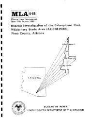
<strong>Mineral</strong> Investigation <strong>of</strong> a Part <strong>of</strong> the Mount<br />

Nutt Wilderness Study Area (AZo020-024),<br />

Mohave County, <strong>Arizona</strong><br />

Mount<br />

[~ Nutt<br />

study<br />

a<br />

@<br />

area<br />

ARIZON<br />

A<br />

III<br />

III<br />

!11<br />

/<br />

~ Y<br />

BUREAU OF MINES<br />

UNITED STATES DEPARTMENT OF THE INTERIOR


I<br />

I<br />

I<br />

I<br />

I<br />

I<br />

I<br />

I<br />

I<br />

I<br />

I<br />

I<br />

I<br />

I<br />

I<br />

I<br />

MINERAL INVESTIGATION OF A PART OF THE MOUNT NUTT WILDERNESS STUDY<br />

AREA (AZ-020-024), MOHAVE COUNTY, ARIZONA<br />

by<br />

Carl L. Almquist<br />

<strong>MLA</strong> <strong>35</strong>-<strong>88</strong><br />

19<strong>88</strong><br />

Intermountain Field Operations Center<br />

Denver, Colorado<br />

UNITED STATES DEPARTMENT OF THE INTERIOR<br />

Donald P. Hodel, Secretary<br />

BUREAU OF MINES<br />

T S Ary, Director<br />

........ & 1<br />

• ~C ~.S


I<br />

I<br />

i<br />

I<br />

I<br />

I<br />

I<br />

I<br />

I<br />

I<br />

I<br />

I<br />

I<br />

I<br />

I<br />

I<br />

PREFACE<br />

The Federal L<strong>and</strong> Policy <strong>and</strong> Management Act <strong>of</strong> 1976 (Public Law 94-59)<br />

requires the U.S. Geological Survey <strong>and</strong> the U.S. Bureau <strong>of</strong> <strong>Mines</strong> to conduct<br />

mineral surveys on certain areas to determine the mineral values, if any, that<br />

may be present. Results must be made available to the public <strong>and</strong> be submitted<br />

to the President <strong>and</strong> the Congress. This report presents the results <strong>of</strong> a<br />

mineral survey <strong>of</strong> a part <strong>of</strong> the Mount Nutt Wilderness Study Area (AZ-020-024),<br />

Mohave County, <strong>Arizona</strong>.<br />

This open-file report summarizes the results <strong>of</strong> a<br />

Bureau <strong>of</strong> <strong>Mines</strong> wilderness study. The report is<br />

preliminary <strong>and</strong> has not been edited or reviewed<br />

for conformity with the Bureau <strong>of</strong> <strong>Mines</strong> editorial<br />

st<strong>and</strong>ards. This study was conducted by personnel<br />

from the Branch <strong>of</strong> Resource Evaluation,<br />

Intermountain Field Operations Center, P. O. Box<br />

25086, Denver Federal Center, Denver, CO B0225.


![!:<br />

!:ii;<br />

I<br />

I<br />

i<br />

I<br />

I<br />

I<br />

I<br />

I<br />

I<br />

I<br />

I<br />

I<br />

I<br />

I<br />

I<br />

CONTENTS<br />

Summa ry .................................................................. 1<br />

Introduction ............................................................. 2<br />

Location <strong>and</strong> access ................................................. 3<br />

Previous studies .................................................... 3<br />

Method <strong>of</strong> investigation ............................................. 3<br />

Geographic <strong>and</strong> geologic setting ..................................... 5<br />

Mining history ...................................................... 6<br />

Oil <strong>and</strong> gas ......................................................... 7<br />

Appraisal <strong>of</strong> sites examined .............................................. 8<br />

Conclusions .............................................................. 9<br />

Recommendations for further study ........................................<br />

References ...............................................................<br />

Appendix ................................................................. 18<br />

Plate l,<br />

ILLUSTRATIONS<br />

Mine <strong>and</strong> prospect map <strong>of</strong> the Mount Nutt study area ..........<br />

Figure I. Index map <strong>of</strong> the Mount Nutt study area ...................... 4<br />

Table<br />

TABLES<br />

I. Data for samples from the Mount Nutt study area ............. 12<br />

Page<br />

lO<br />

II<br />

at<br />

back<br />

I<br />

ii


i<br />

I<br />

I<br />

UNIT OF MEASURE ABBREVIATIONS USED IN THIS REPORT<br />

ft foot<br />

in. inch<br />

mi mile<br />

ppb part per billion<br />

ppm part per million<br />

|<br />

!<br />

Ib<br />

st<br />

oz<br />

pound<br />

short ton<br />

troy ounce<br />

I<br />

I<br />

I<br />

l<br />

I<br />

!¸iLl!¸,¸¸<br />

I<br />

I<br />

iii


I<br />

I<br />

I<br />

I<br />

I<br />

I<br />

I<br />

I<br />

I<br />

I<br />

I<br />

I<br />

I<br />

I<br />

i<br />

I<br />

I<br />

I<br />

I<br />

MINERAL INVESTIGATION OF A PART OF THE MOUNT NUTT WILDERNESS STUDY<br />

AREA (AZ-020-024), MOHAVE COUNTY, ARIZONA<br />

by<br />

Carl L. Almquist, Bureau <strong>of</strong> <strong>Mines</strong><br />

SUMMARY<br />

In March 1987, the Bureau <strong>of</strong> <strong>Mines</strong> conducted a mineral investigation <strong>of</strong><br />

27,210 acres designated preliminarily suitable for wilderness within the Mount<br />

Nutt Wilderness Study Area, a 29,200 acre tract <strong>of</strong> public l<strong>and</strong> administered by<br />

the Bureau <strong>of</strong> L<strong>and</strong> Management in Mohave County, <strong>Arizona</strong>.<br />

This investigation<br />

was requested by the Bureau <strong>of</strong> L<strong>and</strong> Management <strong>and</strong> authorized by the Federal<br />

L<strong>and</strong> Policy <strong>and</strong> Management Act <strong>of</strong> 1976 (Public Law 94-579).<br />

Precambrian-age crystalline rocks <strong>and</strong> a sequence <strong>of</strong> Tertiary-age volcanic<br />

<strong>and</strong> intrusive rocks predominate in the part <strong>of</strong> the Black Mountains where the<br />

study area is located.<br />

Rock units in the Tertiary sequence host gold deposits<br />

in the Union Pass <strong>and</strong> Oatman mining districts, which include the northern <strong>and</strong><br />

southern parts <strong>of</strong> the study area, respectively.<br />

No metallic mineral resources were identified inside the study area, but<br />

a gold resource totalling about 56,000 oz has been identified by Fischer-Watt<br />

Gold Co., Inc. at two sites in Secret Pass that are less than I/2 mi from the<br />

northern boundary. This resource was identified by drilling on a fault that<br />

is traceable more than l mi into the study area.<br />

the Bureau from mine <strong>and</strong> prospect workings in<br />

contained gold, with concentrations<br />

as high as<br />

All 26 samples collected by<br />

the Secret Pass vicinity<br />

O.8BO oz/st,<br />

but deposit<br />

dimension data necessary for resource determinations could not be obtained by<br />

surface work.


A block <strong>of</strong> mining claims near the center <strong>of</strong> the study area was located<br />

for fire agate, a gem stone. H<strong>and</strong>-sorted specimens, valued at $30-$100 per<br />

Ib, are back-packed out from the remote site <strong>and</strong> sold in small quantities.<br />

Exceptional individual specimens reportedly sell for $1,000 or more. Based on<br />

a rough size estimate,<br />

current production methods, <strong>and</strong> site accessibility,<br />

this deposit will be a fire agate resource for the foreseeable future.<br />

The study area is rated by the USGS as having zero to low potential for<br />

the occurrence <strong>of</strong> petroleum, based on the prevalence <strong>of</strong> crystalline <strong>and</strong><br />

volcanic rocks.<br />

Inferred subeconomic resources <strong>of</strong> s<strong>and</strong> <strong>and</strong> gravel in the study area have<br />

no apparent superior qualities <strong>and</strong> represent only a small fraction <strong>of</strong> abundant<br />

supplies available from established sources located elsewhere, which makes<br />

development unlikely.<br />

No other industrial mineral commodities were identified.<br />

INTRODUCTION<br />

In March 1987, the Bureau <strong>of</strong> <strong>Mines</strong>, in cooperation with the U.S.<br />

Geological Survey (USGS), conducted a mineral investigation <strong>of</strong> 27,210 acres<br />

designated preliminarily suitable for wilderness by the U.S. Bureau <strong>of</strong> L<strong>and</strong><br />

Management (BLM) within the Mount Nutt Wilderness Study Area (WSA), Mohave<br />

County, <strong>Arizona</strong>.<br />

The WSA comprises 29,200 acres <strong>of</strong> public l<strong>and</strong> administered<br />

by the BLM, Phoenix District Office.<br />

"Study area" as used in this report,<br />

refers to the smaller acreage. The Bureau surveys <strong>and</strong> studies mines,<br />

prospects, <strong>and</strong> mineral occurrences to appraise reserves <strong>and</strong> identified<br />

subeconomic resources. The USGS assesses the potential for undiscovered<br />

mineral resources based on regional geological, geochemical, <strong>and</strong> geophysical<br />

surveys. This report presents the results <strong>of</strong> the Bureau's study, which was<br />

completed prior to the the USGS assessment; the USGS will publish the results<br />

2


<strong>of</strong> their studies.<br />

A joint USGS-Bureau report, to be published by the USGS,<br />

will integrate <strong>and</strong> summarize the results <strong>of</strong> these studies.<br />

Location <strong>and</strong> access<br />

The study area is in the Black Mountains 15 mi west-southwest <strong>of</strong> Kingman,<br />

<strong>Arizona</strong>, between <strong>State</strong> Highway 68 <strong>and</strong> old U.S. Highway 66 (fig. l).<br />

Maintained <strong>and</strong> unimproved roads connecting with these highways provide access<br />

to the study area boundary, <strong>and</strong> foot trails provide interior access.<br />

Oatman,<br />

the nearest community, is about l 1/2 mi south <strong>of</strong> the southern boundary.<br />

Previous studies<br />

Studies by Schrader (IgOg), Ransome (Ig23), <strong>and</strong> Lausen (Ig31) <strong>of</strong> mineral<br />

deposits <strong>and</strong> mining districts in the Black Mountains included the study area<br />

locality.<br />

A technical report, prepared by the Great Basin GEM Joint Venture<br />

(1983) under contract to the BLM, qualitatively assessed the favorability <strong>of</strong><br />

the study area for the occurrence <strong>of</strong> leasable, locatable, <strong>and</strong> salable mineral<br />

commodities.<br />

Method <strong>of</strong> investigation<br />

The Bureau's investigation included a review <strong>of</strong> literature, unpublished<br />

Bureau <strong>and</strong> 8LM files, mining claim, <strong>and</strong> l<strong>and</strong> status records; contact with<br />

mineral interest holders; a field examination <strong>of</strong> the study area <strong>and</strong> vicinity;<br />

<strong>and</strong> an evaluation <strong>of</strong> sample analyses.<br />

Two Bureau geologists spent nine days<br />

in the study area <strong>and</strong> collected g2 chip, grab, <strong>and</strong> select samples <strong>and</strong> l panned<br />

concentrate sample.<br />

The samples were analyzed by Chemex Labs, Inc., Sparks,<br />

Nevada. Gold was determined by fire assay <strong>and</strong> neutron activation. Silver,<br />

arsenic, antimony, bismuth, cadmium, gallium, tellurium, copper, lead, zinc,<br />

<strong>and</strong> molybdenum were determined by inductively coupled plasma/atomic emission<br />

spectrometry.<br />

3


II<br />

1<br />

!<br />

!<br />

!<br />

!<br />

!<br />

!<br />

!<br />

!<br />

II<br />

<strong>35</strong>000 '<br />

11<br />

I<br />

"t<br />

R. 2OW.<br />

Un/on<br />

Pass<br />

Oatmaw<br />

MAP LOCATION<br />

t'-<br />

r<br />

I<br />

MOUNT<br />

R. 19 W. 114015 ' R. 18 W. R, 17 W.<br />

4 //<br />

r-<br />

i-<br />

114Ol5 '<br />

Kinc<br />

0 5 I0 15mi<br />

P----I ~ t-----I I I -N-<br />

EXPLANATION<br />

INTERSTATE HIGHWAY<br />

T.<br />

21<br />

N.<br />

T.<br />

20<br />

N.<br />

11.<br />

19<br />

N.<br />

<strong>35</strong>o00 '<br />

1<br />

~ U.S. HIGHWAY<br />

STATE HIGHWAY<br />

• IMPROVED ROAD<br />

,'-~"-'--"<br />

5oe2~t A<br />

UNIMPROVED ROAD<br />

HORIZONTAL CONTROL STATION--Showing elevation in<br />

feet above sea level<br />

Figure<br />

1.--Index map <strong>of</strong> the Mount Nutt study area, Mohave County, <strong>Arizona</strong>.<br />

4


Geographic <strong>and</strong> geologic setting<br />

The study area is located in the Black Mountains, a narrow, rugged,<br />

northwest-trending, east-tilted fault-block range in the Mohave Block <strong>of</strong> the<br />

Basin <strong>and</strong> Range physiographic province.<br />

Two peaks in the study area, Nutt<br />

Mountain (5,216 ft) <strong>and</strong> Mount Nutt (5,062 ft),<br />

are the highest points in the<br />

range. These peaks are surrounded by benches <strong>and</strong> precipitous cliffs, crags,<br />

small mesas, rough slopes, <strong>and</strong> steep-walled canyons, which merge with gentler<br />

slopes <strong>and</strong> rounded hills at lower elevations in the study area.<br />

The lowest<br />

elevation is approximately 2,260 ft at a point on the northwest border.<br />

Basement rocks in the study area are an assemblage <strong>of</strong> Precambrian-age<br />

granite gneiss <strong>and</strong> schist.<br />

These rocks are unconformably overlain by a thick<br />

sequence <strong>of</strong> Tertiary-age rhyolitic to <strong>and</strong>esitic flows, tuffs, breccias, <strong>and</strong><br />

volcaniclastic sediments.<br />

Intrusive rocks include a quartz monzonite porphyry<br />

<strong>and</strong> rhyolite dikes cutting both the Precambrian <strong>and</strong> older Tertiary<br />

assemblages. A remnant <strong>of</strong> a late-Tertiary olivine basalt flow caps rocks<br />

along the southern boundary. (See Ransome, 1923; <strong>and</strong> Lausen, 1931.)<br />

Northwest-trending Tertiary faults are the dominant structural features<br />

in the part <strong>of</strong> the Black Mountains where the study area is located.<br />

Along the<br />

southwest boundary, faulting is related to a circular caldera system 5 mi in<br />

diameter that extends into the study area (Clifton <strong>and</strong> others, 1980).<br />

At the<br />

north end, two major detachment fault structures, the Union Pass <strong>and</strong> the<br />

Frisco Mine faults, are traceable into the study area <strong>and</strong> converge about l mi<br />

inside the boundary (F. L. Hillemeyer, Fischer-Watt Gold Co. Inc., Kingman,<br />

AZ, written commun., 19<strong>88</strong>).<br />

In both areas, gold-bearing veins are associated<br />

with these structures.


Mining history<br />

The Oatman mining district, <strong>Arizona</strong>'s third largest gold producer,<br />

I<br />

i<br />

I<br />

I<br />

1<br />

I<br />

,l<br />

I<br />

I<br />

I<br />

I<br />

i<br />

I<br />

i<br />

i<br />

I<br />

extends into the southwest part <strong>of</strong> the study area. In the early 1860's, a<br />

gold-bearing ore shoot was discovered in a prominent quartz vein outcrop 2 I/2<br />

mi west <strong>of</strong> the study area at the Moss Mine (pl. I). Shortly after this<br />

discovery, other gold-bearing veins were located nearby to the east <strong>and</strong><br />

southeast, but nearly 30 years passed before the major gold mines <strong>of</strong> the<br />

Oatman district were opened. In the early 1900's, development work was<br />

started at the Tom Reed, United Eastern, <strong>and</strong> Gold Road <strong>Mines</strong>, which were by<br />

far the most productive in the district. Ore production peaked in 1920 <strong>and</strong><br />

then sharply declined in 1924 as gold ore grades decreased. Mining activity<br />

stagnated in the late 1920's, was revived in 1933 when the gold price<br />

increased to $<strong>35</strong> per oz, <strong>and</strong> ceased in 1942. (See Ransome, 1923; Lausen,<br />

1931; <strong>and</strong> Ourning <strong>and</strong> Buchanan, 1984.) Recorded production, from IBTO to<br />

1980, is 1,966,000 oz <strong>of</strong> gold, 1,147,000 oz <strong>of</strong> silver, <strong>and</strong> 60,000 Ibs <strong>of</strong><br />

copper from 4,073,000 st <strong>of</strong> ore (Keith <strong>and</strong> others, 1983, p. 38-39). All <strong>of</strong><br />

the past-producing mines in the Oatman district are outside <strong>of</strong> the study area.<br />

Another concentration <strong>of</strong> gold-bearing veins occurs in the Union Pass<br />

mining district, which extends into the northern part <strong>of</strong> the study area at<br />

Secret Pass. Discoveries in the district followed the Moss Mine discovery at<br />

Oatman by about ten years, <strong>and</strong> mining activity coincided with the main period<br />

<strong>of</strong> activity at Oatman, but on a smaller scale. Recorded production for the<br />

district, from 1868 to 1943, is 128,000 oz <strong>of</strong> gold <strong>and</strong> 313,000 oz <strong>of</strong> silver<br />

from 704,000 st <strong>of</strong> ore (Keith <strong>and</strong> others, 1983, p. 52-53). The major<br />

past-producing mines in the district all are north <strong>and</strong> west <strong>of</strong> the study area,<br />

but there are numerous prospect pits, adits, <strong>and</strong> shallow shafts near the<br />

northern boundary.<br />

6


An unknown tonnage <strong>of</strong> gold ore, reportedly containing from 0.43-0.57<br />

oz/st, was produced from the Tin Cup Mine, which is less than 1/2 mi from the<br />

northern boundary (pl. 1)(Westervelt, 1987). Recent exploration work (1984-<br />

19<strong>88</strong>) by Santa Fe Pacific Mining, Inc. <strong>and</strong> Fischer-Natt Gold Company, Inc.,<br />

that included drilling in the Secret Pass area, resulted in the identification<br />

<strong>of</strong> gold deposits at two localities:<br />

approximately 460,000 st <strong>of</strong> ore with a<br />

grade <strong>of</strong> O.llO oz gold/st at the Tin Cup Mine site <strong>and</strong> approximately 108,000<br />

st <strong>of</strong> ore with a grade <strong>of</strong> 0.053 oz gold/st at the FM site (pl. 1), a total<br />

resource <strong>of</strong> about 56,000 oz gold (F.L. Hillemeyer, Fischer-Watt Gold Company,<br />

Inc., Kingman, AZ, oral comun., 19<strong>88</strong>).<br />

A recent mineral property evaluation<br />

<strong>of</strong> the Secret Pass area (Westervelt, 1987) concludes that exploration targets<br />

for additional gold deposits exist along both the Frisco Mine <strong>and</strong> Union Pass<br />

faults (pl. l). As <strong>of</strong> early 19<strong>88</strong>, Fischer-Watt Gold Company was continuing<br />

their exploration efforts in the Secret Pass area.<br />

Large blocks <strong>of</strong> unpatented mining claims, located on gold-bearing vein<br />

deposits in the Oatman <strong>and</strong> Union Pass mining districts, extend from the north,<br />

west, <strong>and</strong> south into the study area.<br />

Mining claims have also been located on<br />

a gem stone occurrence northeast <strong>of</strong> Mount Nutt, where fire agate was being<br />

mined at the time <strong>of</strong> the Bureau's investigation.<br />

Oil <strong>and</strong> gas<br />

Ryder (1983, p. C19) rated the study area as having zero to low potential<br />

for the occurrence <strong>of</strong> petroleum, based on the prevalence <strong>of</strong> Precambrian<br />

crystalline rocks <strong>and</strong> Tertiary volcanic rocks.<br />

Parts <strong>of</strong> the study area under<br />

lease for oil <strong>and</strong> gas at the time <strong>of</strong> the Bureau's investigation are shown on<br />

plate l.


• , . , . ,<br />

I<br />

I<br />

I<br />

I<br />

I<br />

i<br />

!<br />

I<br />

I<br />

l<br />

i<br />

I<br />

I<br />

I<br />

I<br />

I<br />

I<br />

APPRAISAL OF SITES EXAMINED<br />

Host rocks, structures, <strong>and</strong> some <strong>of</strong> the types <strong>of</strong> alteration associated<br />

with gold deposits in the Oatman mining district are present in the southern<br />

<strong>and</strong> western parts <strong>of</strong> the study area. These features inspired prospecting<br />

activity inside the boundary, but have not led to the discovery <strong>of</strong> any ore<br />

deposits. Element concentrations that would indicate the presence <strong>of</strong> metallic<br />

mineral resources were not detected in Bureau samples from prospect workings<br />

<strong>and</strong> altered outcrops inside the study area (table l <strong>and</strong> appendix), but these<br />

findings are not conclusive. In the Oatman mining district, most <strong>of</strong> the past<br />

productive ore shoots show no outcropping ore or vein material; their only<br />

surface expression is subtly altered volcanic rocks that give no distinct<br />

geochemical anomaly (Durning <strong>and</strong> Buchanan, 1984).<br />

Deposits that were mined on the Mossback, Gold Ore, <strong>and</strong> Gold Trail Mine<br />

veins (pl. l) are not traceable at the surface into the study area. The<br />

northwest-trending Mossback vein dips about BO ° to the southwest, <strong>and</strong> appears<br />

to be fault-terminated at a point near the boundary (pl. l, sample no. 69).<br />

The Gold Ore <strong>and</strong> Gold Trail Mine veins trend toward the study area, but their<br />

trace is obscured by volcanic cover.<br />

Gold deposits identified by Fischer-Watt Gold Company, Inc. at the FM <strong>and</strong><br />

Tin Cup Mine sites are approximately 1/2 mi <strong>and</strong> l mi, respectively, along<br />

strike from where the Frisco Mine fault enters the study area. The Union Pass<br />

fault is mineralized as well (table l, sample nos. 24-26), but no deposits<br />

have been delineated along it near Secret Pass. These structures have been<br />

traced for more than 1 mi into the north end <strong>of</strong> the study area (pl. I).<br />

Although gold was detected in all samples collected from workings in the<br />

Secret Pass area, with concentrations as high as O.BBO <strong>and</strong> 0.<strong>35</strong>4 oz/st


I<br />

I<br />

I<br />

I<br />

I<br />

I<br />

I<br />

I<br />

I<br />

I<br />

I<br />

I<br />

I<br />

I<br />

I<br />

I<br />

(table l, sample nos. 23 <strong>and</strong> II), no gold-bearing deposits were identified<br />

inside the study area.<br />

Two gem stone mining operations were active at the time <strong>of</strong> the Bureau's<br />

investigation on contiguous mining claims less than l mi northeast <strong>of</strong> Mount<br />

Nutt, roughly in the center <strong>of</strong> the study area (pl. l, sample localities 27-<br />

28). Claimants are removing fire agate from small open cuts primarily by<br />

h<strong>and</strong>, although a gas-powered portable drill was in use at one <strong>of</strong> the sites for<br />

drilling blast holes, <strong>and</strong> back-packing the agate out to vehicle-access<br />

. points. H<strong>and</strong>-sorted "mine run" specimens reportedly sell for $30-$I00 per lb<br />

<strong>and</strong> large, high quality individual specimens can sell for $I000 or more when<br />

cut <strong>and</strong> polished (Tom Dodge, claimant, oral commun., 1987). No production or<br />

sales figures are available; most <strong>of</strong> the fire agate apparently is sold either<br />

in small quantities by weight or piecemeal to individual dealers <strong>and</strong> at gem<br />

<strong>and</strong> mineral shows. Deposit dimensions cannot be determined from exposures in<br />

open cuts, but based on a rough size estimate, current production methods, <strong>and</strong><br />

site accessibility, this deposit will be a fire agate resource for the<br />

foreseeable future.<br />

Inferred subeconomic resources <strong>of</strong> s<strong>and</strong> <strong>and</strong> gravel in the study area have<br />

no apparent superior qualities <strong>and</strong> represent only a small fraction <strong>of</strong> abundant<br />

supplies available from established sources located elsewhere, which makes<br />

development unlikely. No other industrial mineral resources were identified.<br />

CONCLUSIONS<br />

No metallic mineral resources were identified in the study area, but it<br />

includes part <strong>of</strong> a major fault structure on which a gold resource <strong>of</strong> about<br />

56,000 oz has been identified at two sites less than I/2 mi from the northern<br />

boundary. Also in the study area are host rocks, structures, <strong>and</strong> some <strong>of</strong> the


" Z<br />

I<br />

I<br />

I<br />

I<br />

I<br />

I<br />

I<br />

I<br />

I<br />

I<br />

I<br />

I<br />

I<br />

I<br />

types <strong>of</strong> alteration directly associated with gold-bearing veins in the Oatman<br />

mining district, <strong>Arizona</strong>'s third largest gold-producing district. Surface<br />

sampling <strong>of</strong> mines, prospects, <strong>and</strong> alteration assemblages alone is not an<br />

adequate means <strong>of</strong> evaluating the study area for the occurrence <strong>of</strong> metallic<br />

mineral resources.<br />

The fire agate deposit located near the center <strong>of</strong> the study area will be<br />

a gem stone resource for the foreseeable future, based on a rough size<br />

estimate, current production methods, <strong>and</strong> site accessibility.<br />

No leasable or salable mineral resources were identified in the study<br />

a rea.<br />

RECOMMENDATIONS FOR FURTHER STUDY<br />

Host rocks, structures <strong>and</strong> alteration patterns in the study area,<br />

particularly at the north end <strong>and</strong> east <strong>of</strong> the Mossback vein, should be mapped<br />

in detail (l in. = I00 ft) for comparison with surface expressions <strong>of</strong> known<br />

gold-bearing veins in the region. Areas in the study area that compare<br />

favorably should be investigated by subsurface methods.<br />

10


I<br />

I<br />

I<br />

I<br />

I<br />

I<br />

I<br />

I<br />

I<br />

I<br />

I<br />

i<br />

I<br />

I<br />

|<br />

II<br />

I<br />

I<br />

REFERENCES<br />

Clifton, C. G., Buchanan, L. 3., <strong>and</strong> Durning, W. P., 19BO, Exploration<br />

procedure <strong>and</strong> controls <strong>of</strong> mineralization in the Oatman mining district,<br />

Oatman, <strong>Arizona</strong>: American Institute <strong>of</strong> Mining Engineers pre-print<br />

80-143, 38 p.<br />

Durning, W. P., <strong>and</strong> Buchanan, L. 3., 1984, The geology <strong>and</strong> ore deposits <strong>of</strong><br />

Oatman, <strong>Arizona</strong>; in Wilkins, 3oe, Jr., ed., Gold <strong>and</strong> silver deposits <strong>of</strong><br />

the Basin <strong>and</strong> Range Province western U.S.A.: <strong>Arizona</strong> Geological Society<br />

Digest, v. 15, p. 141-15B.<br />

Great Basin GEM Joint Venture, 19B3, Black Mountains south G-E-M resources<br />

area (GRA no. AZ-06) technical report (WSA AZ 020-024 <strong>and</strong> 020-028/029),<br />

unpublished administrative report prepared for the U.S. Bureau <strong>of</strong> L<strong>and</strong><br />

Management under contract YA-553-RFP2-1054, 38 p. <strong>and</strong> appendix.<br />

Keith, S. B., Gest, D. E., DeWitt, Ed., Toll, N. W., <strong>and</strong> Everson, B. A., 1983,<br />

Metallic mineral districts <strong>and</strong> production in <strong>Arizona</strong>: <strong>Arizona</strong> Bureau <strong>of</strong><br />

Geology <strong>and</strong> <strong>Mineral</strong> Technology Bulletin 194, 58 p.<br />

Lausen, C., 1931, Geology <strong>and</strong> ore deposits <strong>of</strong> the Oatman <strong>and</strong> Katherine<br />

districts, <strong>Arizona</strong>: <strong>Arizona</strong> Bureau <strong>of</strong> <strong>Mines</strong> Bulletin 131, 126 p.<br />

Ransome, F. L., 1923, Geology <strong>of</strong> the Oatman gold district, <strong>Arizona</strong>:<br />

Geological Survey Bulletin 743, 58 p.<br />

• -,<br />

U.S.<br />

Ryder, R. T., 19B3~ Petroleum potential <strong>of</strong> wilderness l<strong>and</strong>s in <strong>Arizona</strong>; i__nn<br />

Miller, B. W., ed., Petroleum potential <strong>of</strong> wilderness l<strong>and</strong>s in the<br />

western United <strong>State</strong>s: U.S. Geological Survey Circular 902 A-P, p.<br />

Cl-C21.<br />

Schrader, F. C., 1909, <strong>Mineral</strong> deposits <strong>of</strong> the Cerbat Range, Black Mountains,<br />

<strong>and</strong> Gr<strong>and</strong> Wash Cliffs, Mohave County, <strong>Arizona</strong>: U.S. Geological Survey<br />

Bulletin 397, 226 p.<br />

Westervelt, R. D., 1987, A summary review report on the Secret Pass property,<br />

Black Mountains, Mohave County, <strong>Arizona</strong>: unpublished mineral property<br />

review report prepared for International Prospector Corporation,<br />

Vancouver, B.C., 27 p.<br />

II


I<br />

I<br />

I<br />

I<br />

I<br />

I<br />

I<br />

I<br />

I<br />

I<br />

I<br />

I<br />

I<br />

I<br />

I<br />

I<br />

I<br />

I<br />

I<br />

no.<br />

Table l.--Oata for samples from the Mount Nutt study area, Mohave County,<br />

<strong>Arizona</strong>.<br />

Sample<br />

type<br />

Cna, not applicable;


I<br />

I<br />

I<br />

I<br />

I<br />

I<br />

I<br />

I<br />

I<br />

I<br />

I<br />

I<br />

I<br />

I<br />

I<br />

I<br />

I<br />

I<br />

I<br />

Table l.--Data for samples from the Mount Nutt study area, Mohave County,<br />

<strong>Arizona</strong>--Continued<br />

Sample Au Ag<br />

no. type ft ppb or oz/st ppm Remarks<br />

15 chip 3.2 52 0.3 55-ft-long adit, Precambrian quartz<br />

monzonite-Tertiary rhyolite() dike<br />

contact; silicification, limonite.<br />

16 do. l.O 37 3.6 Do.<br />

17 do. 1.0 87 2.8 Do.<br />

18 do. 2.9 12 .l Prospect adit, northwest-trending shear<br />

zone; propylitic alteration.<br />

19 do. 3.0 28 . l Do.<br />

20 do. 2.0 2,730 1.8 Do.<br />

21 grab na 528 .5 Dump material, rubble-filled shaft,<br />

northwest-trending shear zone;<br />

propylitic alteration.<br />

22 do. na 1,395 .l Dump material, 45-ft-deep shaft,<br />

northwest-trending shear zone;<br />

propylitic alteration•<br />

23 do. na 0.<strong>88</strong>0<br />

oz/st<br />

6.8 Dump material, prospect pit, northwesttrending<br />

shear zone; propylitic<br />

alteration.<br />

24 chip 1.5 1,125 .l Prospect pit, Union Pass fault,<br />

silicification, limonite.<br />

25 do. 3.3 828 2.4 Do.<br />

26 grab na 4,200 l.O Dump material, 75-ft-deep shaft, Union<br />

Pass fault; propylitic alteration,<br />

sericite.<br />

27 select na 4 .l Open-pit gem stone mining operation;<br />

claimants report gold concentrations<br />

in their samples.<br />

28 select na 3 • l Do.<br />

29 chip 4•6 26 .l Prospect pit; no obvious alteration.<br />

30 do. 4.2 7 .l Prospect pit, northwest-trending shear<br />

zone; weak propylitic alteration•<br />

13


Table l.--Data for samples from the Mount Nutt study area, Mohave County.<br />

<strong>Arizona</strong>--Continued<br />

Sample Au Ag<br />

no. type ft ppb or oz/st ppm Remarks<br />

31<br />

32<br />

chip 1 .l l I0.2<br />

do. 2.1 0.642 15.3<br />

oz/st<br />

Prospect pit, Gold Trail Mine vein;<br />

silicified breccia, limonite.<br />

Gold Trail Mine vein outcrop at shaft;<br />

silicified breccia, minor specular<br />

hematite, limonite.<br />

I<br />

I<br />

I<br />

I<br />

I<br />

I<br />

I<br />

I<br />

I<br />

I<br />

33 do. 2.6 24 .l<br />

34 do. 3.2 ll .l<br />

<strong>35</strong> do. 3.0 0.372 39.0<br />

oz/st<br />

36 select na 7,930 lO.l<br />

37 grab na 5 .l<br />

38 chip 3.5 2,700 7.8<br />

39 do. 1.5 18 .I<br />

40 grab na 3 . l<br />

41 do. na 3 . l<br />

42 do. na l . l<br />

43 chip 4.0 3 .l<br />

44 do. 3.8 lO .l<br />

45 grab na


I<br />

I<br />

I<br />

I<br />

I<br />

I<br />

I<br />

I<br />

I<br />

I<br />

I<br />

I<br />

I<br />

I<br />

I<br />

I<br />

Table l.--Oata for samples from the Mount Nutt study area, Mohave County,<br />

<strong>Arizona</strong>--Continued<br />

Sample Au A~<br />

no. type ft ppb or oz/st ppm Remarks<br />

47 chip 5.0


Table l.--Data for samples from the Mount Nutt study area, Mohave County.<br />

<strong>Arizona</strong>--Continued<br />

Sample Au Ag<br />

no. type ft ppb or oz/st ppm Remarks<br />

61 select na 379 4.6<br />

Dump material, Mossback Mine; white<br />

quartz, calcite, minor pyrite.<br />

62 grab na 893<br />

63 do. na 74<br />

l .9<br />

l .B<br />

Do.<br />

Do.<br />

I<br />

I<br />

I<br />

I<br />

I<br />

64 do. na 540<br />

l.O<br />

65 chip 3.0


I<br />

I<br />

I<br />

I<br />

I<br />

I<br />

I<br />

I<br />

I<br />

I<br />

I<br />

I<br />

I<br />

I<br />

I<br />

I<br />

I<br />

I<br />

Table l.--Data for samples from the Mount Nutt study area, Mohave County,<br />

<strong>Arizona</strong>--Continued<br />

Sample Au Ag<br />

no. type ft ppb or oz/st ppm Remarks<br />

80 grab na


I<br />

I<br />

I<br />

I<br />

I<br />

I<br />

I<br />

I<br />

I<br />

I<br />

I<br />

I<br />

I<br />

I<br />

I<br />

I<br />

Appendix--Selected element concentrations in samples from the Mount Nutt<br />

study area, Mohave County, <strong>Arizona</strong>.<br />

Analytical data<br />

Sample As Bi Cd Cu Ga Mo Pb Sb T1<br />

no.<br />

part per million<br />

l 17 O.l O.l 2 14 l 16 l .3 0.6<br />

2 12 .2 .l 4 17 33 50 l .5 1.4<br />

3 14 .2 .l 30 16 2 49 .9 3.8<br />

4 3 .l .l 3 13 l 21 l .2 .2<br />

5 2 .l .1 5 13 l 41 .9 .l<br />

6 6 .l .l 14 15 19 19 l .2 l .0<br />

7 5 .2 .1 4 16 27 27 1.6 .2<br />

B 12 .l .l 16 25 33 33 l .2 .2<br />

9 II .l .l 4 12 4 4 .4 .3<br />

lO 46 .2 .l 12 16 9 9 l .4 .6<br />

II llO .l .l 14 15 14 14 .9 .8<br />

12 7 .l .l 26 16 23 12 .7 .4<br />

13 6 .l .l 8 12 l 33 2.0 l .4<br />

14 320 .9 .1 27 9 6 45 .2 1.2<br />

15 12 .l .3 ll 36 1 27 1.4 .4<br />

16 120 4.7 .I 55 12 6 214 .4 3.2<br />

17 lO0 l .4 2.2 32 12 15 145 .7 .4<br />

18 3 .4 .l 2 23 l 43 l .2 .4<br />

19 3 .l .l l 14 l 24 l .6 .l<br />

20 9 .1 .1 3 19 5 34 1.8 .4<br />

21 14 .1 .l 13 19 48 25 1.5 .6<br />

22 4 .l .l 7 14 2 24 l .2 .4<br />

23 15 .1 .1 l 12 25 29 1.3 .6<br />

24 22 .1 .1 15 17 lO lO .6 .2<br />

25 46 .2 .1 12 16 9 9 1.4 .6<br />

26 19 .I .I 6 15 4l 41 2.1 l .4<br />

27 5 .l .2 30 l II II 14.0 l .0<br />

28 9 .2 .2 25 7 6 9 II .0 l .2<br />

29 l .l .l II 12 l 3 .5 .2<br />

30 2 .l .l 8 13 l 8 .4 .2<br />

31 6 .l .l 14 9 l 20 l .2 l .8<br />

32 3 .2 .l 19 II l 14 l .l 2.0<br />

33 12 .l .l 2 12 l 14 l .2 2.4<br />

34 7 .l .1 2 14 l 12 .3 6.2<br />

<strong>35</strong> 250 .l .l 60 7 16 15 II .l 6.8<br />

36 29 .l .l 20 5 3 II .5 2.4<br />

37 3 .l .l 7 14 l 6 .2 .2<br />

38 2 .l .l 6 4 l 4 .4 l .0<br />

39 2 .l .l 2 15 l ll .6 .3<br />

40 14 .l .l 21 12 l IB .4 .4<br />

41 9 .l .l 20 13 2 15 .3 .2<br />

42 6 .l .l 22 13 2 16 .3 .3<br />

43 15 .1 .l 4 13 l 3 .l .l<br />

18<br />

Zn<br />

34<br />

77<br />

80<br />

42<br />

52<br />

61<br />

54<br />

91<br />

53<br />

86<br />

85<br />

105<br />

47<br />

44<br />

161<br />

42<br />

730<br />

3"/<br />

31<br />

59<br />

59<br />

44<br />

52<br />

64<br />

86<br />

49<br />

28<br />

30<br />

33<br />

33<br />

23<br />

42<br />

43<br />

22<br />

34<br />

23<br />

45<br />

6<br />

16<br />

59<br />

57<br />

80<br />

24


Appendix--Selected element concentrations in samples from the Mount Nutt<br />

study area, Mohave County, <strong>Arizona</strong>--Continued<br />

I<br />

I<br />

I<br />

I<br />

I<br />

I<br />

I<br />

I<br />

I<br />

I<br />

I<br />

I<br />

I<br />

I<br />

Analytical data<br />

Sample As Bi Cd Cu Ga Mo Pb Sb Tl Zn<br />

no.<br />

part per million<br />

44 <strong>35</strong> O.l O.l 36 25 l 6 0.2 O.l<br />

45 2 .l .l 17 12 4 4 .l .2<br />

46 6 .l .l 13 15 3 3 .l .6<br />

47 29 .5 .I 13 13 7 7 .4 .6<br />

48 I0 .4 .I 7 4 2 2 .4 1 .I<br />

49 20 .l .l 8 II 5 5 7.6 2.3<br />

50 5 .I .I I0 II 5 5 .I .2<br />

51 30 .l .l 7 14 14 14 .l .2<br />

52 6 .l .l 13 15 20 20 .2 l .l<br />

53 7 .2 .1 9 23 7 7 .4 .1<br />

54 9 .1 .1 12 13 1 11 .2 .6<br />

55 23 2.7 .1 14 11 7 30 1.2 2.3<br />

56 6 2.1 .1 16 12 6 38 .2 1.7<br />

57 6 1.7 .1 14 1 1 11 .5 .6<br />

58 15 1.7 .9 21 II 4 24 .2 1.9<br />

59 17 1.1 .1 11 12 1 14 .8 1.1<br />

60 4 .1 .1 17 7 1 5 .2 .7<br />

61 14 .9 .I 28 2 B 25 1.6 .8<br />

62 12 .5 .8 20 7 7 15 1.0 .7<br />

63 20 .6 .1 16 12 5 21 1.6 .7<br />

64 6 .2 .I 22 2 5 II .4 .4<br />

65 l .l .l 12 lO l 4 .l .2<br />

66 2 .I .I 4 2 6 4 .I .I<br />

67 27 .5 .1 12 13 10 16 1.2 .9<br />

68 4 .1 .1 11 3 1 8 .1 .4<br />

69 14 .3 .1 32 13 4 10 .8 .8<br />

70 12 .2 .I 28 II 1 6 .2 .8<br />

71 4 .l .l 14 9 l 26 .l .2<br />

72 2 .1 .1 22 3 2 2 .l .l<br />

73 6 .2 .2 24 12 1 12 .2 .9<br />

74 24 .1 .l 12 l 5 3 .2 .2<br />

75 5 .l .2 6 2 l 3 .l .l<br />

76 II .l .l 22 14 l 20 .3 .9<br />

77 3 2.1 10.3 36 1 g 13 .I .6<br />

78 3 2.8 .I 13 13 2 13 .I 3.7<br />

79 32 .2 .I II 17 1 14 1.6 .5<br />

80 4 .l .l 40 8 l lO .l .3<br />

81 6 .l .l 30 12 l II .2 .2<br />

82 1 .3 .1 31 15 33 33 .3 .1<br />

83 5 .2 .1 20 12 1 8 .8 .2<br />

84 4 .I .I I0 12 1 3 .I .3<br />

85 70 .1 .l 34 16 lO l .l .l<br />

86 3 .l .l 32 17 2 5 .2 .l<br />

31<br />

64<br />

30<br />

15<br />

10<br />

21<br />

30<br />

14<br />

7<br />

55<br />

4<br />

56<br />

143<br />

11<br />

179<br />

65<br />

31<br />

27<br />

369<br />

65<br />

41<br />

13<br />

8<br />

48<br />

50<br />

g6<br />

73<br />

29<br />

36<br />

26<br />

27<br />

17<br />

54<br />

144<br />

29<br />

25<br />

52<br />

77<br />

510<br />

7O<br />

25<br />

24<br />

14<br />

19


F,<br />

I<br />

!!:!il<br />

Appendix--Selected element concentrations in samples from the Mount Nutt<br />

study area, Mohave County, <strong>Arizona</strong>--Continued<br />

Analytical data<br />

Sample As Bi Cd Cu Ga Mo Pb Sb T1 Zn<br />

no.<br />

part per million<br />

87 2 0.1 0.1 12 16 1 7 0.1 0.1 16<br />

<strong>88</strong> 3 .1 .1 14 6 1 4 .1 .1 9<br />

89 2 .1 .1 11 9 1 9 .2 .1 25<br />

90 2 .1 .1 3 1 1 4 .1 .1 8<br />

91 4 .1 .1 6 1 5 4 .1 .1 17<br />

92 3 .1 .1 10 2 5 3 .2 .6 28<br />

93 9 ,2 .1 9 2 3 10 ,2 1,0 34<br />

¸,<br />

I<br />

20

Hooray! Your file is uploaded and ready to be published.

Saved successfully!

Ooh no, something went wrong!