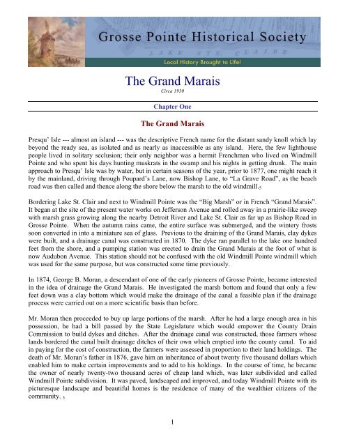
The Grand Marais - Grosse Pointe Historical Society
The Grand Marais - Grosse Pointe Historical Society
The Grand Marais - Grosse Pointe Historical Society

You also want an ePaper? Increase the reach of your titles
YUMPU automatically turns print PDFs into web optimized ePapers that Google loves.
<strong>The</strong> <strong>Grand</strong> <strong>Marais</strong><br />
Circa 1930<br />
Chapter One<br />
<strong>The</strong> <strong>Grand</strong> <strong>Marais</strong><br />
Presqu’ Isle --- almost an island --- was the descriptive French name for the distant sandy knoll which lay<br />
beyond the ready sea, as isolated and as nearly as inaccessible as any island. Here, the few lighthouse<br />
people lived in solitary seclusion; their only neighbor was a hermit Frenchman who lived on Windmill<br />
<strong>Pointe</strong> and who spent his days hunting muskrats in the swamp and his nights in getting drunk. <strong>The</strong> main<br />
approach to Presqu’ Isle was by water, but in certain seasons of the year, prior to 1877, one might reach it<br />
by the mainland, driving through Poupard’s Lane, now Bishop Lane, to “La Grave Road”, as the beach<br />
road was then called and thence along the shore below the marsh to the old windmill. 5<br />
Bordering Lake St. Clair and next to Windmill <strong>Pointe</strong> was the “Big Marsh” or in French “<strong>Grand</strong> <strong>Marais</strong>”.<br />
It began at the site of the present water works on Jefferson Avenue and rolled away in a prairie-like sweep<br />
with marsh grass growing along the nearby Detroit River and Lake St. Clair as far up as Bishop Road in<br />
<strong>Grosse</strong> <strong>Pointe</strong>. When the autumn rains came, the entire surface was submerged, and the wintery frosts<br />
soon converted in into a miniature sea of glass. Previous to the draining of the <strong>Grand</strong> <strong>Marais</strong>, clay dykes<br />
were built, and a drainage canal was constructed in 1870. <strong>The</strong> dyke ran parallel to the lake one hundred<br />
feet from the shore, and a pumping station was erected to drain the <strong>Grand</strong> <strong>Marais</strong> at the foot of what is<br />
now Audubon Avenue. This station should not be confused with the old Windmill <strong>Pointe</strong> windmill which<br />
was used for the same purpose, but was constructed some time previously.<br />
In 1874, George B. Moran, a descendant of one of the early pioneers of <strong>Grosse</strong> <strong>Pointe</strong>, became interested<br />
in the idea of drainage the <strong>Grand</strong> <strong>Marais</strong>. He investigated the marsh bottom and found that only a few<br />
feet down was a clay bottom which would make the drainage of the canal a feasible plan if the drainage<br />
process were carried out on a more scientific basis than before.<br />
Mr. Moran then proceeded to buy up large portions of the marsh. After he had a large enough area in his<br />
possession, he had a bill passed by the State Legislature which would empower the County Drain<br />
Commission to build dykes and ditches. After the drainage canal was constructed, those farmers whose<br />
lands bordered the canal built drainage ditches of their own which emptied into the county canal. To aid<br />
in paying for the cost of construction, the farmers were assessed in proportion to their land holdings. <strong>The</strong><br />
death of Mr. Moran’s father in 1876, gave him an inheritance of about twenty five thousand dollars which<br />
enabled him to make certain improvements and to add to his holdings. In the course of time, he became<br />
the owner of nearly twenty-two thousand acres of cheap land which, was later subdivided and called<br />
Windmill <strong>Pointe</strong> subdivision. It was paved, landscaped and improved, and today Windmill <strong>Pointe</strong> with its<br />
picturesque landscape and beautiful homes is the residence of many of the wealthier citizens of the<br />
community. 3<br />
1
<strong>The</strong> promontory projection of Presqu’ Isle was early recognized by the War Department as being a<br />
hindrance to navigation. In 1837, the government purchased three-quarters acres in addition to a<br />
roadway. On this land, a lighthouse was constructed which was fifty feet above the water line. On the<br />
lake side of the lighthouse a sea wall was built to protect the foundations. On the land side, a wooden<br />
fence was erected.<br />
Because of the increase in navigation, the lighthouse was re-built in 1875 about eighteen feet west of the<br />
original site. This old lighthouse, which is no longer used, may still be seen at the foot of Alter Road.<br />
Through the efforts of interested citizens, the War Department, in 1933, filled in more land and built a<br />
new lighthouse which is still in use and can be seen as far away as fourteen miles on a clear night.<br />
During the winter nights when the <strong>Grand</strong> <strong>Marais</strong> and the river shore were frozen, excellent opportunities<br />
were offered for the amusement of the younger generation and any of those others who were young in<br />
heart. Skating and ice boating were indulged in more than any of the other various sports which were<br />
played on the ice. On Saturdays and Sundays, during the cold winters, cutters (carioles) filled with gay<br />
young men and laughing girls might be seen gliding over the glassy surface on the ice-bound marsh and<br />
lake, or if there were snow, speeding along the old high road where now extends the broad and beautiful<br />
Jefferson Avenue, each finally landing its freight of life and beauty at the Hotel de <strong>Grand</strong> <strong>Marais</strong>.<br />
<strong>The</strong> seats of the carioles were always filled with mysterious baskets of food and packages which were<br />
speedily transferred to the long tables. After a toothsome lunch, the tables and benches were removed and<br />
dancing commenced to the inspiring strains of a cracked fiddle. Racing on the ice with their feet pacing<br />
or trotting French ponies was another favorite pastime.<br />
Fishing was a sport enjoyed both in summer and in winter. <strong>The</strong> sport was of such quality that the angler<br />
could catch a sizable string of bass, perch, and pickerel. Today, however, fishing is not the sport it used<br />
to be because the marsh and feeding grounds were removed, and there is no longer any great attraction for<br />
the fish.<br />
In the past, there have been many fisheries along the lake and river. In 1816, George McDougall received<br />
a parcel of property from Charles Poupard “--- during their lives the privilege of drawing a seine in copartnership<br />
with the said McDougall and assigns, on the beach at the fishing grounds on the premises<br />
bounding on the Detroit River.”<br />
A few years later, Joseph Spencer and Shradrach Gillet entered into a similar agreement by which<br />
Shradrach Gillet had the first commercial fishery at Windmill <strong>Pointe</strong>. This fishery was located next to the<br />
lighthouse extending west from Fox Creek and occupied 12.75 acres on the river front.<br />
About 1850, this property passed into the hands of Peter and John Duflo who continued to operate a<br />
fishery there until 1890. <strong>The</strong> fishery changed ownership several times after this until the enactment of the<br />
Warner-Crampton law which prohibited fishing on the Detroit River and in Lake St. Clair.<br />
2
Bibliography for Chapter One<br />
1. Belden, H. & C., “<strong>Historical</strong> Atlas of Wayne County”. –1875.<br />
2. Campbell, James V., “Outlines of the Political History of Michigan”. Page 38.<br />
3. Detroit News, December 6, 1915.<br />
4. French Records, Volume A., no. 120, original deed page 40.<br />
5. Hamlin, Marie Caroline, “Legends of Detroit”, pages 14-15, 50-51.<br />
6. Lothrop, Isabella G. B., “Detroit Saturday Night” November 11, 1922, page 59.<br />
7. Sheldon, E.M. “Early History of Michigan”, page 371.<br />
Chapter Two<br />
Indians and Indian Troubles<br />
Although no mention of an Indian settlement in <strong>Grosse</strong> <strong>Pointe</strong> is made by historians, the beautiful lake,<br />
St. Clair, was always a great attraction to the Indian, and was beloved by him. This district densely<br />
wooded and bordering the lake, was for years, the Indian hunting ground. Peche Island, just off <strong>Grosse</strong><br />
<strong>Pointe</strong> shore was selected by the great chieftain, Pontiac, for his summer home until his death in 1762.<br />
<strong>The</strong>re, he had a commanding view of the waterways and could visit the French farmers along the shore<br />
with out being discovered first.<br />
<strong>The</strong> Indians were a constant source of fear and annoyance to the early settlers of <strong>Grosse</strong> <strong>Pointe</strong>. <strong>The</strong>y<br />
used to land here when coming over from Canada and passing through the township would confiscate<br />
anything and everything which suit their fancy. Many cattle were driven off by them; horses, too, were<br />
driven off every year. <strong>The</strong> tribes were then so powerful that the settlers never dared to offer any<br />
resistance.<br />
A gravel pit was, at one time, located at what is now the foot of Lakepointe Avenue. It was known for<br />
many years as the graveyard of the Fox nation because of the great number of Indians who fell in battle<br />
there. Many years later, farmers, while hauling gravel to be used for supporting the plank road<br />
maintained by the Hendrie Toll Gate Company, unearthed many skeletons of those who were buried<br />
where they fell.<br />
“Through the intrigues of the English, the Iroquois planned to surprise and capture Fort Pontchartrain.<br />
This scheme was to be carried into effect through the efforts of the Ottagamies, known as the Fox, and the<br />
Mascontins, known as the Sacs from the Green Bay region.<br />
“<strong>The</strong>y arrived early in May while the friendly Hurons and Ottawas were out on a hunting trip. Swift<br />
runners were sent out to bring back the hunting parties who returned to rally to the aid of the post. <strong>The</strong><br />
3
Fox and Sacs, being greatly outnumbered, decamped on a dark night on the nineteenth day of the siege. A<br />
party of Frenchmen joined with the friendly Indians, and the fugitives were overtaken where they had<br />
entrenched themselves up the river at Presque-Isle, now known as Windmill <strong>Pointe</strong>.” 3<br />
<strong>The</strong> Church of Sainte Anne was close to the stockade and fearing that it might be set afire by blazing<br />
arrows and endanger the other buildings, the rattled commandant (pro-term), Du Buisson, burned it<br />
himself. <strong>The</strong> hostiles built a long breastwork within two hundred feet of the fort and fired hundreds of<br />
arrows tipped with blazing pitch into the roofs of the building. However, peltries in the warehouses were<br />
brought out, and the roofs were covered with wet skins which greatly reduced the danger of fire. After<br />
making an unsuccessful attempt to capture the fort and failing also to fire it, the Indians withdrew to the<br />
banks of Lake St. Clair, and commandant forthwith dispatched M. de Vincennes with a company of<br />
Frenchmen and an army of Indians to drive them away.<br />
Here, reports as to the methods of military strategy used differ. Quoting from two reports on military<br />
tactics, these differences in interpretation may be compared. Quoting first from the report of Du Buisson,<br />
commandant (pro-term) of Fort Pontchartrain of June 15, 1712, to the Marquis de Vaudreuil, Governor-<br />
General of New France, capital of which was at Montreal.<br />
“<strong>The</strong> pursuing (French) army stumbled unexpectedly into the entrenchments, and some twenty were killed<br />
or wounded.” In his report Du Buisson also stated that none of the ambushed Indians escaped. This was<br />
at Windmill <strong>Pointe</strong>, on the other side of the <strong>Grand</strong> <strong>Marais</strong>, where the Indians had thrown up hurried<br />
entrenchments. Here, the siege was renewed; guns, ammunition and food were supplied from the fort and<br />
were taken up the river in canoes. Du Buisson’s report continues; “<strong>The</strong> enemy held their position for four<br />
or five days, fighting with much courage; and, finally not being able to do any more, surrendered to our<br />
people who gave them no quarter. All were killed except the women and children whose lives were<br />
spared, and one hundred men who had been tied, but not escaped. All our allies returned to my fort with<br />
their prisoners. <strong>The</strong>ir amusement was to shoot four or five of them every day. <strong>The</strong> Hurons did not spare<br />
a single one of theirs.” 3<br />
According to “Landmarks of Detroit”, edited by Catlin and others, “<strong>The</strong> attacking party found the enemy<br />
entrenched behind fallen trees near the present Windmill <strong>Pointe</strong>. Instead of charging their breastworks<br />
and sacrificing many lives in the assault, the French and their allies erected high stagings along the front<br />
of the works, and taking positions on these, they compelled the Foxes to keep under cover. <strong>The</strong> latter<br />
were not permitted to resort to the lake shore for water and were finally compelled by the torments of<br />
thirst to break cover and fly. <strong>The</strong>y returned to their encampment at Green Bay.” 2<br />
“In this manner came an end to the two wicked nations who so sadly inflicted and troubled all the country.<br />
Our Indians lost sixty men, killed and wounded, thirty of whom were killed in the fort, and a Frenchman<br />
named Germain and five or six others who were wounded with arrows.” 3<br />
Years after the battle, a windmill was erected on this spot, thus changing its name from Presqu’ Isle to<br />
Windmill <strong>Pointe</strong>. This spot is now the foot of Lakepointe Avenue in <strong>Grosse</strong> <strong>Pointe</strong> Park. All evidences<br />
of the battlefield have long since been destroyed by the subdividing of the property and the building of<br />
many beautiful homes.<br />
Shortly after one of the Indian raids into Ohio, Mrs. Grant, the wife of an early settler of <strong>Grosse</strong> <strong>Pointe</strong>,<br />
Commodore Grant, heard that a band of Indians had encamped at Hog Island (Belle Isle). <strong>The</strong>y were to<br />
hold a “pow-wow” to celebrate their exploits and to torture and burn a young white captive whose mother<br />
they had killed. <strong>The</strong> commodore was away at the time, but his wife’s motherly instincts were aroused,<br />
4
and knowing the love and esteem of the Indians for her family, she determined to make an effort to save<br />
the boy from so terrible a fate. She paddled over to Hog Island, made her way into the camp and asked<br />
the amount of ransom demanded for the child. <strong>The</strong> Indians, who were making preparations for the<br />
horrible festivities, would not at first listen to her pleas. <strong>The</strong> courageous woman was not to be baffled and<br />
by threats that the Black Gown (priest) would bring some calamity to the Indians, she succeeded in her<br />
mission. <strong>The</strong> little boy was brought home and adopted by his humane deliverer who had a large family<br />
(ten daughters) of her own.<br />
Several objects of mystery were uncovered in 1926 on the estate of Edsel Ford on Gaulker’s <strong>Pointe</strong>,<br />
<strong>Grosse</strong> <strong>Pointe</strong> Shores. A silver bracelet encircled the bone of a human forearm; a silver cross and lower<br />
jaw-bone set with a full array of well formed teeth were nearby. <strong>The</strong> silver bracelet was about two inches<br />
wide and the thickness of paper; the cross was six inches in height and bore a peculiar inscription. Joseph<br />
van Ashe, one of the first settlers, was consulted in regard to the discovery and said that Gaulker’s <strong>Pointe</strong>,<br />
at the spot where the objects were unearthed, was under the water at the time of the early Indian arrivals.<br />
It has been a number of years since the water fell to a level that would allow any burials at the spot. <strong>The</strong><br />
silver cross and silver bracelet would indicate that it was a burial of an Indian princess. He also told of<br />
the great bands of Chippewa and Huron tribes who often stopped for weeks at Gaulker’s <strong>Pointe</strong> to camp<br />
and to make merry after having received their pension from the government at Detroit. <strong>The</strong>y would<br />
usually make this trip in the spring of the year in canoes laden with furs, the results of their trapping in the<br />
forest in the far north. We would see them coming, the chief, his wife, and his children in the large canoe<br />
which headed the fleet. After the families were settled in camp, the men would proceed toward the fort to<br />
do their trading. I have watched the Indians bury their dead at night and could even now point out their<br />
burial spots along the shore. We played with the Indian children and learned many word of their<br />
language. I loved them as brothers and spent many happy hours of my childhood with them. I know their<br />
customs, signs and their language.<br />
Another life long resident tells of the Indian trail in the rear of their farm on the shore and how the settlers<br />
were always just a little fearful and usually had some secret place or underground cave where they could<br />
escape should the Indians became menacing though the settlers were careful to provide them with a good<br />
meal should they make a friendly visit.<br />
Now, today, there is no sign or anything that would indicate that the red men considered <strong>Grosse</strong> <strong>Pointe</strong> his<br />
hunting ground. With the coming of the European and his different way of living, the Indian gradually<br />
retreated and left behind only memories.<br />
Bibliography for Chapter Two<br />
1. Hamlin, M. C. W. “Legends of le Detroit” page 235.<br />
2. Ross & Catlin, “Landmarks of Detroit” page 131.<br />
3. Utley, Henry M., “Michigan as a Province, Territory and State”, vol I, pages 188, 190, 248.<br />
4. Works Progress Administration “History of <strong>Grosse</strong> <strong>Pointe</strong> Park”.<br />
5
Chapter Three<br />
Old Familiar Landmarks<br />
Just beyond what is now Moran Road stood the Grant homestead, then known as Grant’s Castle. This<br />
home has an interesting history. In 1774, Alexander Grant, a retired officer in the British navy, married<br />
<strong>The</strong>rese Campau in Detroit. About a year later, Commodore Grant had constructed a mansion of<br />
considerable size on his property in <strong>Grosse</strong> <strong>Pointe</strong>. Although research has failed to bring to light any<br />
information concerning the size of the house, it must have been very spacious because it was the home of<br />
the family of twelve daughters and a son which the Commodore and Madame Grant had.<br />
<strong>The</strong> property, according to the various abstracts which have been presented, had a lake frontage of nine<br />
acres and a depth of about seventy-one acres. <strong>The</strong> estate, therefore, was about six hundred forty acres in<br />
area which was a large piece of property for those days even around Detroit.<br />
Another residence, rich in historical interest, was the home of Mrs. T. P. Hall whose ancestors, the<br />
Godfrey family, obtained an estate, by letters patent, from Louis XIV dated September 15, 1668. <strong>The</strong><br />
Godfreys named their estate “Tonnancouer”, and Mrs. Hall took this name for her estate on the shore of<br />
Lake St. Clair.<br />
It was on this estate that a grotto was constructed which commemorated the legend of the “Loup Garou”,<br />
an evil beast who pursued a French maiden to this spot. She throws herself at the feet of a statue of the<br />
Virgin imploring aid and protection. As the Loup Garou leaped upon the rocks, he immediately changed<br />
to stone by the Virgin who had heeded the maiden’s plea.<br />
<strong>The</strong> old windmill, from which Windmill <strong>Pointe</strong> received its name, was erected on a point of land which<br />
extended out into the lake at the foot of what is now Lakepointe Avenue. <strong>The</strong> mill, described as being<br />
operated by wind power, was round and about thirty feet high. <strong>The</strong> foundation was of cobble stones with<br />
limestone above; the exterior was covered with a mixture of sand and limestone. <strong>The</strong> stones came form<br />
the shore of Lake St. Clair near where the mill was constructed.<br />
Old French records show this mill, together with a house and barn, to have been on this property as early<br />
as 1759. <strong>The</strong> house was then occupied by Jean Baptiste Leduc, who, because of and proof to the contrary,<br />
might be considered the builder of the mill. Jean had a sister, Josette, who was slightly older than her<br />
brother and who eventually became half owner of the mill. One night, Josette died suddenly soon after<br />
having declared that she would leave her share of the mill to the devil. Many conflicting tales have grown<br />
up around this mill and about Josette and her brother. 3 Doubtless, there is more to this strange death of<br />
Josette than is recorded, but until any new bibliography concerning the tragic circumstances comes to<br />
light, the mystery remains essentially as it is recorded here.<br />
<strong>The</strong> mill itself was undoubtedly a crude affair, but it served the community and the farmers on both sides<br />
of the river with a means of grinding their grain. It performed the work more quickly and more efficiently<br />
than the hand method which was used before the mill was constructed. <strong>The</strong> fact that the Indians and<br />
farmers from the other side of the river crossed the lake in small boats loaded with grain would indicate a<br />
lack of grist mills on the river. <strong>The</strong> mill gave service until about 1800 when it was abandoned. About<br />
1848, Maglory Beaufait, then the owner of the property, improved the mill by building a log house and<br />
barn adjacent to the mill facing the lake. About 1865, William G. Moran, a son of George Moran,<br />
obtained possession of the property and decided to build a new home. He tore down what was left of the<br />
old mill and used the limestone blocks for the foundation of his new house.<br />
6
In 1876, William B. Moran, on the death of his father, Judge Charles Moran, inherited a sum of money<br />
which he used to acquire the land of William G. Moran, his cousin, which adjoined his property on the<br />
east. About four years later, William B. Moran formed a co-partnership with another cousin, Charles G.<br />
Moran, to form a realty company after having reclaimed some of the marsh land near the old mill. <strong>The</strong>y<br />
named this parcel of land after the old grist mill, the foundations of which still remained on the point of<br />
land extending out into the lake. <strong>The</strong>y named it the “Windmill <strong>Pointe</strong> Development Company”.<br />
In 1916, the Windmill <strong>Pointe</strong> Land Company was organized by a group which subdivided the property<br />
and developed the lake front by filling in both sides of the <strong>Pointe</strong> where the old mill had once ground the<br />
grain of the nearby farmers. This new improvement necessitated the removal of the foundations of the old<br />
mill which were still on the <strong>Pointe</strong>. This was the last of the old mill.<br />
<strong>The</strong> general philanthropic movement during the early decades of the twentieth century, no doubt, played a<br />
large part in Mary Manning’s inspiration when she planned and had erected in 1912 and 1913, thirty-two<br />
cement black cottages for the workingmen’s families who lived in the Village of <strong>Grosse</strong> <strong>Pointe</strong>. <strong>The</strong>y<br />
were built on property owned by her husband, Frederick H. Wadsworth and cost about fifteen hundred<br />
dollars apiece to construct. <strong>The</strong>y supplied the need which existed at the time in <strong>Grosse</strong> <strong>Pointe</strong> for better<br />
homes for the working classes.<br />
With an eye to the future, generous sized lots were plotted out; many were two hundred-fifty feet in depth<br />
thus allowing for ample garden and play space. <strong>The</strong> cottages were identical, being about 24 x 24 feet in<br />
size with six rooms and a bath. <strong>The</strong>y were built on posts sunk into the ground and had no basement; stove<br />
heat was used. This method of heating was very common at the time. <strong>The</strong> cottages rented for a small<br />
sum per month. Through the years, some of them have been torn down in order to make way for more<br />
substantial and large dwellings until now, only about twelve are still standing. With the construction of<br />
the higher class dwellings, and the transition from a rural community to an urban community during the<br />
past decade, the cottages which are still standing are used for purposes other than those originally<br />
intended.<br />
One, at the corner of Vernor Highway and St. Clair, was formally used by the Wayne County Library<br />
Commission and later by the <strong>Grosse</strong> <strong>Pointe</strong> Board of Education as a public library. It is now used as a<br />
small gift shop. Another dwelling across the street is still used a private home. <strong>The</strong> building on Maumee<br />
near St. Clair has been used for some time by the City of <strong>Grosse</strong> <strong>Pointe</strong> as a city hall, and the one next<br />
door was occupied by the “Thrift Shop” operated by the Neighborhood Club of <strong>Grosse</strong> <strong>Pointe</strong> before it<br />
was moved to the cottage on St. Clair and Vernor Highway.<br />
Near the corner of Oxford Road and Lake Shore Boulevard are three giant pear trees possibly two<br />
hundred years old, and for size and vigor, they are truly remarkable. <strong>The</strong> fruit is of about average<br />
dimensions and ripening about the end of August. <strong>The</strong> flesh is crisp, juicy, sweet and spicy. It seems<br />
rather unfortunate that so little should be known of the history of a tree of such extraordinary character.<br />
<strong>The</strong> memory of the oldest inhabitant is only traditional in regard to them. <strong>The</strong> prevailing theory, that<br />
these pear trees originated from seeds brought them from France, is based upon the supposition that<br />
nursery trees could not have withstood the long sea voyage of that period. Yet, this opinion cannot be<br />
accepted without hesitation. I know not by what fatality, but these old French pear trees seem destined to<br />
have not successor to their fame. No one has thought of continuing the species, or else, all attempts have<br />
failed. Only along the Detroit and Raisin rivers can this species of pear tree be found. Another half<br />
century will see the last of these magnificent trees which were once the pride of the early settlers of<br />
<strong>Grosse</strong> <strong>Pointe</strong>.<br />
7
In the park in front of the City of Detroit Waterworks on East Jefferson stands a magnificent pear tree,<br />
older than the memory of any man. It is the last of the “Mission Pears” which were so named, because of<br />
their numbers, after the twelve Apostles. All seedlings from this remnant of a proud race have refused to<br />
grow, therefore, it bids fair to have no successor to its glory. 5<br />
Hubbard, writing of a period now almost a century gone, characterizes them as “truly remarkable for size,<br />
vigor and productiveness. A bole of from six to eight feet in girth and a height of one hundred feet was<br />
common. Many showed a trunk circumference of eight of nine feet. <strong>The</strong>y bore uniform crops – thirty to<br />
fifty bushels being the product of a single tree.<br />
Another venerable old pear tree worth mentioning is one which was planted on the old Rivard farm, now<br />
on the estate of Dr. Fred. Murphy, in <strong>Grosse</strong> <strong>Pointe</strong> Farms. It stands about one hundred feet in height, and<br />
behind it are eleven old French apple trees which are called the “Apostles”; the pear tree which completes<br />
the number is named the “Judas” tree.<br />
<strong>The</strong>se pear trees have been the inspiration for poets. <strong>The</strong>se two verses were taken from the “History of<br />
Michigan” written by Silas Farmer. <strong>The</strong> first poem was written by J. L. Bates of which this is the last<br />
verse.<br />
“Many a thrifty Mission Pear yet o’erlooks the blue St. Clair.<br />
Like a veteran, faithful warden; and their branches gnarled and olden,<br />
Yield their juicy fruits and golden,<br />
In the ancient Jesuit garden.<br />
Still each year their blossoms dance,<br />
Scent and bloom of sunny France”.<br />
<strong>The</strong> second, taken from the same book, was written by W. H. Coyle of which the ninth and last verses are<br />
quoted here.<br />
“Where the white sailed ship now rides the waves,<br />
Ye have watched the bark canoe,<br />
And heard in the night the voyageurs’ songs,<br />
And the Indians’ shrill halloo.<br />
“Live on old trees, in your green age,<br />
Long, long may your shadows last<br />
With your blossomed boughs and golden fruit,<br />
Love emblems of the past”.<br />
Now, there are but few lone survivors among the old pear trees; the ravages of time have taken their toll.<br />
Soon, there will be nothing to remind us of those days when the fleur-de-lis gaily waved over the land<br />
which we now call <strong>Grosse</strong> <strong>Pointe</strong> except the legends and memories handed down to us by those who have<br />
passed on to a far and distant land.<br />
8
Bibliography for Chapter Three<br />
1. Chauvin, Mrs. Rose<br />
2. Farmer, “History of Detroit and Michigan”.<br />
3. Hamlin, Marie Caroline, “Legends of le Detroit”.<br />
4. Marden, Charles H., former Chief Engineer of <strong>Grosse</strong> <strong>Pointe</strong> Park, Michigan.<br />
5. Shelden, Mrs. H. D. “Gardens of Colony and State”.<br />
6. WPA “History of <strong>Grosse</strong> <strong>Pointe</strong>, Michigan”.<br />
Chapter Four<br />
Old Road Houses<br />
Near the site of the <strong>Grosse</strong> <strong>Pointe</strong> High School once stood Hudson’s House. In 1778, it served as both<br />
hotel and tavern for the community. It is claimed that Hudson’s House was the first tavern of its kind to<br />
be established in <strong>Grosse</strong> <strong>Pointe</strong>. 4 It was demolished during the eighteen fifties and was replaced by a<br />
brick establishment which later became known as Fisher’s Road House. Here, frog leg dinners were<br />
served to thousands of Detroiters who made the journey especially to partake of the delicious dinners for<br />
which Fisher’s House had then become famous.<br />
Fisher’s House was one of the most famous of the many road houses which operated in the township<br />
during the Civil War and post-Civil War period. During the early eighteen fifties, Merritt M. Fisher<br />
purchased the old Hudson property, then a part of the Ten Eyck farm in <strong>Grosse</strong> <strong>Pointe</strong> Farms, and built a<br />
new establishment on the property at the foot of Fisher’s Lane, now known as Fisher Road.<br />
Mr. Fisher had discovered a clay deposit about a half mile away, and there, he constructed a brick kiln and<br />
supplied the contractors with the necessary brick which was used in the construction of his tavern. <strong>The</strong><br />
hotel was three stories high with a frontage and depth of about one hundred feet. <strong>The</strong> full front veranda<br />
which ran along the front must have given the hotel an outstanding reputation in the country. Inside, were<br />
ten large guest rooms in addition to the family and servant’s quarters.<br />
<strong>The</strong> <strong>Grosse</strong> <strong>Pointe</strong> Democratic Club made the building its headquarters for many years, and during every<br />
Presidential campaign, the club members would cut a seventy-foot hickory tree from the nearby woods.<br />
After stripping it, they would plant the pole on the front lawn and fasten a broom at the top with a banner<br />
depicting an image and the name of the preferred presidential candidate. <strong>The</strong> pole raising was<br />
accompanied by a period of political stumping, and outstanding <strong>Grosse</strong> <strong>Pointe</strong> Democrats would make<br />
political speeches.<br />
<strong>The</strong> campaign of 1865 was a festive occasion still remembered by old <strong>Grosse</strong> <strong>Pointe</strong>rs. J. Logan<br />
Chipman, former city attorney, was a Congressional candidate. <strong>The</strong> hickory pole was elevated as usual,<br />
and Mr. Chipman made a few speeches on the front lawn. Mr. Chipman established his campaign<br />
headquarters at Fisher’s House, and, here, were held many gay parties which often lasted until the next<br />
morning.<br />
9
After Mr. Fisher’s death in 1861, Mrs. Fisher operated the established for some time until she leased it to<br />
Proctor Weaver who managed it until 1875 under the name of Fisher Hotel when he built his own road<br />
house he called Weaver House. <strong>The</strong> hotel was then leased to Frank Belisle who continued the name of<br />
Fisher Hotel until 1886. That year, Mrs. Fisher sold the property to about seven acres for $16,000 to a<br />
group of prominent <strong>Grosse</strong> <strong>Pointe</strong> citizens who organized the <strong>Grosse</strong> <strong>Pointe</strong> Club. <strong>The</strong>y erected a new<br />
club house on the property that same year. Later, however, the name was changed to the <strong>The</strong> Country<br />
Club. <strong>The</strong> building was of frame construction with three stories cupola on the roof and a full veranda<br />
which covered the front and one side.<br />
This property was later purchased by the late Horace Dodge about 1929, and his widow, the present Mrs.<br />
Hugh Dillman, erected her new <strong>Grosse</strong> <strong>Pointe</strong> home there in 1932. <strong>The</strong> Country Club was moved to a<br />
new brick house east of adjacent to the old site behind the <strong>Grosse</strong> <strong>Pointe</strong> Memorial Church on the shore of<br />
Lake St. Clair. 2<br />
Another of the famous road houses in <strong>Grosse</strong> <strong>Pointe</strong> was operated by John Neff. Erected in 1887, it was<br />
the gathering center for sportsmen and hunters. It was of frame construction two stories high and a<br />
frontage of about seventy-five feet with a depth of one hundred feet. It was located on the north side of<br />
Jefferson Avenue just west of Neff Road (then in <strong>Grosse</strong> <strong>Pointe</strong> Village).<br />
Prior to the opening of the annual deer hunting season, members of the <strong>Grosse</strong> <strong>Pointe</strong> Gun Club would<br />
gather here to improve their marksmanship by shooting from the lawn of the hotel toward the lake at a<br />
target made from old campaign posters and cards fastened to cedar posts sunk into the ground at regular<br />
intervals. <strong>The</strong> shooting matches took place every year from 1880 until 1906 when shooting became<br />
illegal because of the new homes which were springing up along the shore of the lake.<br />
<strong>The</strong> hotel was widely known for its frog legs and fresh fish dinners which attracted not only <strong>Grosse</strong><br />
<strong>Pointe</strong>rs, but many outsiders as well. If, after the rounds of card playing and other amusements were over,<br />
the guests were too tired to make the trip home, Mr. Neff would provide accommodations for them.<br />
After Mr. Neff’s retirement in 1908, August (Gus) Doerr purchased the Neff Hotel and operated it for six<br />
years under the name of Doerr’s Inn. Doerr seemed a bit more progressive than his predecessor and<br />
decided to cater to the younger generation of <strong>Grosse</strong> <strong>Pointe</strong> and Detroit. He engaged an orchestra and set<br />
off enough space on the ground floor for dancing. This was the beginning of a new era in the world of<br />
<strong>Grosse</strong> <strong>Pointe</strong> road houses. <strong>The</strong>y became scenes of nightly gayety, and later, floor shows were added to<br />
the entertainment.<br />
In 1920, Doerr retired and leased the place to Brake and Wagner who disbanded in 1921. <strong>The</strong> inn was<br />
then leased to Jim Hall and Will Rogers who operated it until 1925 on a restaurant permit under the name<br />
of Doerr’s Inn until the Bureau of Internal Revenue placed government padlocks on the doors because of<br />
the violation of the Eighteenth Amendment. Charles Postal had the padlocks removed and operated the<br />
place for about six months until he, too, gave it up. <strong>The</strong> place remained vacant until 1936 when it was<br />
torn down. 5<br />
Charles Veriden (Verheydan) opened the Veriden House on the north side of Lake Shore Drive at Cook<br />
Road. It was opened in 1886 and was operated until 1900. <strong>The</strong> place was noted for its cock fights as well<br />
as for its frog legs and chicken dinners. People came from far and near to witness the cock fights and to<br />
place wagers on the outcomes. Mr. Veriden sold the business to Phil van Asche who operated the inn<br />
until 1902 when it burned down.<br />
10
A new and larger frame building was erected with a full porch in front and dancing space for the use and<br />
enjoyment of those who wished to dance. It was operated by Frank Veriden, the brother of Charles, from<br />
1902 until 1910. In addition to the famous cock fights, week-end dancing parties were also held, and<br />
music was furnished by an orchestra. About 1910, Frank Veriden organized the <strong>Grosse</strong> <strong>Pointe</strong> Ice Boat<br />
Club in addition to operating the road house. In 1918, the Ice Boat Club was taken over by another group<br />
which formed the nucleus of the present <strong>Grosse</strong> <strong>Pointe</strong> Yacht Club which is now located at the foot of<br />
Vernier on Lake Shore Drive.<br />
In 1914, Frank Verhayden decided to open still another place on the northwest corner of Hillger and<br />
Goethe avenues, then in St. Clair Heights, <strong>Grosse</strong> <strong>Pointe</strong> Township now in Detroit. He operated this<br />
place until the beginning of prohibition in 1918. This place was known as the 101 Ranch, and because of<br />
the numerous brawls which took place there, it was also known as the “Bucket of Blood”.<br />
About this time, Frank Verhayden decided to open another place. This time, it was on Moross Road near<br />
Lake Shore Drive. It was named the “Dugout”. Verhayden operated it from 1920 until his death in<br />
1931. 4<br />
Still another of the road houses of the past was the Moran Road House which was erected by George<br />
Moran in 1870 at the foot of what is now Moran Road on the shore of Lake St. Clair, and the rear portion<br />
was constructed out over the lake. It was his idea to construct numerous small ponds where live fish were<br />
kept until needed to satisfy the appetite of a hungry guest. Here, too, were kept a number of live sturgeon<br />
for which people would dive and try to bring to the surface and thus win a prize. Mr. Moran operated this<br />
road house until it fell into the lake. 1<br />
No enumeration of bygone road houses would be complete without the mention of Castle House which<br />
was so named because of its style of architecture. It was a two-story frame building with a front of<br />
seventy-five feet in length and a depth of about fifty feet. <strong>The</strong> top section extended about twelve feet<br />
above the roof proper and it resembled a castle tower with an uneven top representing loop holes. <strong>The</strong><br />
balance of the roof also had a parapet with loop holes around the entire building. <strong>The</strong> place was built by<br />
Paul Rivard about 1900 on the Ferdinand Rivard estate on the north-west corner on University Place and<br />
Lake Shore Drive. Mr. Rivard never operated the road house personally, but he leased it to Henry<br />
Termott who operated it there until it was moved, about 1910, to its present location at 784 St. Clair<br />
Avenue. Termott sublet the saloon portion to John Mayton who also had charge of the old William Tell<br />
Archery Club. <strong>The</strong> road house was the gathering place for the Belgian families of <strong>Grosse</strong> <strong>Pointe</strong> who<br />
would congregate there on Sundays and pass the time away in gossiping and in other forms of<br />
amusement. Although the structure was moved quite some time ago to the present location on St. Clair<br />
Avenue, the original style of architecture has not been materially altered. 5<br />
<strong>The</strong> Weaver House was another of the many old road houses; it was located on the north- east corner of<br />
Notre Dame and Jefferson Avenues. <strong>The</strong> building was about sixty feet wide and extended back about<br />
fifty feet. It was erected in 1875 by Procter Weaver who had previously surrendered his lease of the<br />
Fisher House. <strong>The</strong> place was also known as Aunt Kate Weaver’s Hotel, and it was also famous for its<br />
frog leg dinners, its slot machines and other forms of amusement. <strong>The</strong> place was later taken over by John<br />
Marquette who operated from 1895 until 1901 under the original name. 5<br />
Henry Blondell then obtained possession of the premises in 1901. He was rather progressive and<br />
established a dance pavilion and installed a player piano to furnish the music. Blondell was one of the<br />
most popular resort keepers in <strong>Grosse</strong> <strong>Pointe</strong>. He was well known for his feats of strength and had<br />
11
previously traveled with a circus of strong men performing on a high platform, lifting horses and groups<br />
of people with harness over his shoulders. He would give nightly exhibitions of strength gratis for the<br />
entertainment of his many patrons, and the Weaver House was the most patronized place in the township.<br />
Patrons would come from long distances, brining with them such articles as telephone books and decks of<br />
playing cards for Blondell to tear into small pieces with his bare hands. He would also bend bars around<br />
his neck. It was a standing joke for him to bend currency of quarters and dimes before returning it to his<br />
customers. After the enforcement of the Eighteenth Amendment, the building was torn down. Mr.<br />
Blondell passed away in 1936 and was survived by his sons, Harry and Neil. 1<br />
Another road house of outstanding popularity was the Chauvin House. It was built in 1886 at the foot of<br />
Nottingham and Jefferson Avenues and operated until 1890 and specialized in chicken and frog leg<br />
dinners. A company of the Michigan National Guard, then known as the Montgomery Rifles, built a<br />
private shooting range behind the building where they held rifle practice. In 1898 the company was called<br />
up for active service in the Spanish-American War as Company M, thirty-second Michigan Volunteer<br />
Infantry, and the range came to an end. 3<br />
<strong>The</strong>re have been several other road houses which operated for various lengths of time during the decades<br />
of the “nineties”. <strong>The</strong>y all, sooner or later, went out of business for good after the Volstead Act became<br />
of part of the Constitution as the Eighteenth Amendment. Road houses are now a thing of the past, and<br />
their place is taken by the beer gardens and taverns of modern construction and along more modern ideas.<br />
All that is left as reminders of a past age are the memories of the old timers, and a few houses of an<br />
architecture of the last century which were, at one time, a part of that atmosphere known as the “Gay<br />
Nineties”.<br />
Bibliography for Chapter Four<br />
1. Blondell, Neil; 17150 Maumee Avenue.<br />
2. Fisher, William; 509 St. Clair Avenue.<br />
3. Korte, William; 1312 Lakepointe Avenue.<br />
4. May, Judge James; “<strong>Historical</strong> Atlas of Wayne County.<br />
5. Neff, Norbert P. City Clerk; 17150 Maumee.<br />
6. Rivard, Mrs. O.; 884 St. Clair Avenue.<br />
7. Verhayden, Charles; 7330 Mack Avenue.<br />
<strong>Grosse</strong> <strong>Pointe</strong> <strong>Historical</strong> <strong>Society</strong><br />
www.gphistorical.org<br />
12