C-MAP WeatherNav - Jeppesen Commercial Marine
C-MAP WeatherNav - Jeppesen Commercial Marine
C-MAP WeatherNav - Jeppesen Commercial Marine

Create successful ePaper yourself
Turn your PDF publications into a flip-book with our unique Google optimized e-Paper software.
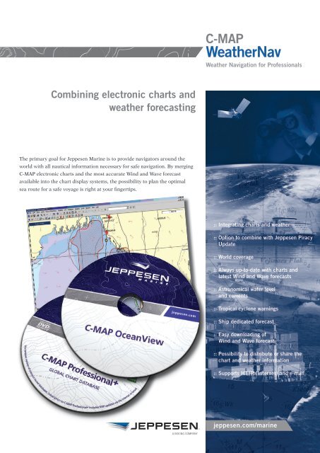
C-<strong>MAP</strong><br />
<strong>WeatherNav</strong><br />
Weather Navigation for Professionals<br />
Combining electronic charts and<br />
weather forecasting<br />
The primary goal for <strong>Jeppesen</strong> <strong>Marine</strong> is to provide navigators around the<br />
world with all nautical information necessary for safe navigation. By merging<br />
C-<strong>MAP</strong> electronic charts and the most accurate Wind and Wave forecast<br />
available into the chart display systems, the possibility to plan the optimal<br />
sea route for a safe voyage is right at your fingertips.<br />
:: Integrating charts and weather<br />
:: Option to combine with <strong>Jeppesen</strong> Piracy<br />
Update<br />
:: World coverage<br />
:: Always up-to-date with charts and<br />
latest Wind and Wave forecasts<br />
:: Astronomical water level<br />
and currents<br />
:: Tropical cyclone warnings<br />
:: Ship dedicated forecast<br />
:: Easy downloading of<br />
Wind and Wave forecast<br />
:: Possibility to distribute or share the<br />
chart and weather information<br />
:: Supports HTTP (Internet) and e-mail<br />
jeppesen.com/marine
C-<strong>MAP</strong><br />
<strong>WeatherNav</strong><br />
SUPPORTING APPLICATIONS<br />
ECDIS and ECS based on C-Map SDK 4.3. For latest<br />
overview of compatible ECDIS and ECS supporting<br />
SDK 4.3, please visit:<br />
http://www.c-map.no/ecdis.asp<br />
1<br />
OceanView 4.0<br />
A powerful chart viewer and planning software to<br />
provide an easy exchange of geo-referenced, nautical<br />
and weather information between multiple users.<br />
OceanView 4.3 supports the full range of C-Map<br />
Weather-Navigation and electronic charts, both<br />
C-Map Professional and ENCs.<br />
OceanView 4.x can also be used as a Weather<br />
application only, i.e. not having to subscibe for<br />
detailed electronic charts.<br />
3<br />
2<br />
1. Yellow line indicates route<br />
suggested by the automatic<br />
route planner; in this case a<br />
“NoGo area” will influence on<br />
suggested route.<br />
2. Details of a suggested route<br />
with waypoints in a narrow<br />
harbour/river. A red alarms<br />
leg is shown. Example from<br />
Hamburg.<br />
3. In case of a more complex -<br />
sailing pattern, the benefit<br />
of <strong>WeatherNav</strong> is even more<br />
obvious<br />
FACTS AND SPECIFICATIONS<br />
Global Met-Ocean Parameters<br />
Pressure, Wind, Temperature, Dew Point, Clouds,<br />
Precipitation, as well as Height, Direction and<br />
Period of Total Waves and Swell<br />
Additional Parameters<br />
Current, Sea Water level, Water temperature,<br />
Ice Concentration and Satellite Wind observations.<br />
Tropical Cyclone Warnings<br />
Official warnings from The World Meteorological<br />
Organisation as overlay and used in route planning.<br />
Historical data<br />
• Online access to three months of Historical<br />
Observations<br />
• Online access to three months of Historical<br />
Forecast<br />
Subscription Areas<br />
World, Large (6400 Sq. degrees), Medium (400<br />
Sq. degrees). The download area can be moved<br />
(follow ship) globally without restrictions.<br />
ADVANTAGES WITH C-<strong>MAP</strong> WEATHERNAV<br />
--<br />
An integrated solution suggesting a safe route taking into consideration information<br />
from C-<strong>MAP</strong> electronic charts and our premium quality weather service<br />
--<br />
Can be combined with <strong>Jeppesen</strong> Piracy Update and Automatic Route Planner<br />
--<br />
Astronomical water level and current vectors for all major ports<br />
--<br />
Tropical cyclone warnings shown as a map overlay, or integrated into the route<br />
planer. Updated every 30 minutes if new info is available<br />
--<br />
Ship dedicated forecast; by setting your own alarms for critical weather you will<br />
easily detect and plot severe weather along your route or as chart overlay<br />
--<br />
Easy downloading and browsing of Met-Ocean data -<br />
– a true One Click Download!<br />
--<br />
Highly compressed files for download using C-<strong>MAP</strong>’s CM-93/3 compression<br />
--<br />
Possibility to distribute or share the chart and weather information. Printing, saving<br />
and emailing have been made easy<br />
--<br />
Takes full advantage of C-Map’s global electronic charts, including ENC and the -<br />
C-<strong>MAP</strong> Chart Update Service, by Internet or Email<br />
--<br />
Always up-to-date with charts and latest wind and wave conditions<br />
--<br />
A user friendly and integrated communication module to facilitate download by HTTP<br />
(internet) or four E-Mail connections (File attachment, Defined in/out folder, SMTP/<br />
POP3 or <strong>MAP</strong>I)<br />
<strong>Jeppesen</strong> Marketing – May 2010 - 2.000<br />
PRODUCT SUPPORT<br />
For product support, please contact:<br />
safenav@jeppesen.com<br />
For prices, terms and conditions:<br />
info.marine@jeppesen.com<br />
FOR MORE INFORMATION<br />
<strong>Jeppesen</strong> Norway AS<br />
P.O.Box 212<br />
N-4379 EGERSUND<br />
Norway<br />
Telephone: + 47 51 46 47 00<br />
Telefax: + 47 51 46 47 01<br />
info.marine@jeppesen.com<br />
www.jeppesen.com/marine