Information Only - Waste Isolation Pilot Plant - U.S. Department of ...
Information Only - Waste Isolation Pilot Plant - U.S. Department of ...
Information Only - Waste Isolation Pilot Plant - U.S. Department of ...

Create successful ePaper yourself
Turn your PDF publications into a flip-book with our unique Google optimized e-Paper software.
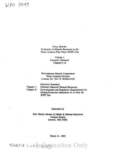
FINAL REpORT<br />
Evaluation <strong>of</strong> Mineral Resources at the<br />
<strong>Waste</strong> <strong>Isolation</strong> <strong>Pilot</strong> <strong>Plant</strong> (WIPP) Site<br />
Volume I<br />
Executive Summary<br />
Chapters I-II<br />
Westinghouse Electric Corporation<br />
<strong>Waste</strong> <strong>Isolation</strong> Division<br />
Contract No. PO-75-WJJ644145Z<br />
Chapter I .<br />
Chapter II -<br />
Executive Summary<br />
Potential Industrial Mineral Resources<br />
Environmental and Regulatory Requirements for<br />
Mining/Extraction Operations At or Near the<br />
WIPP Site<br />
Submitted by<br />
New Mexico Bureau <strong>of</strong> Mines & Mineral Resources<br />
Campus Station<br />
Socorro, NM 87801<br />
March 31. 1995<br />
<strong>Information</strong> <strong>Only</strong>
Certification<br />
_<br />
We certify under penalty <strong>of</strong> law that thIS document was prepared under our supervision<br />
for Westinghouse Electric Corporation, <strong>Waste</strong> <strong>Isolation</strong> Division, Wast"," <strong>Isolation</strong> <strong>Pilot</strong><br />
<strong>Plant</strong> by New Mexico Bureau <strong>of</strong> Mines and Mineral Resources, a divisIOn <strong>of</strong> New<br />
Mexico Institute <strong>of</strong> Mining & Technology. Based on our inquiry <strong>of</strong> me persons directly<br />
responsible for gathering the information, the information submitted is, to the best <strong>of</strong> our<br />
knowledge and belief, true, accurate, and complete.<br />
Charles E. Chapin, Principal Investigator<br />
Director and State Geologist<br />
New Mexico Bureau <strong>of</strong> Mines and<br />
Mineral Resources<br />
Clinton P. Richardson, P.E.<br />
Mining and Environmental Engineering<br />
New Mexico Institute <strong>of</strong><br />
Mining & Technology<br />
New Mexico Certification No. 11229<br />
Expires December 31, 1995<br />
<strong>Information</strong> <strong>Only</strong>
EXECUTIVE SUMMARY<br />
E-l<br />
The <strong>Waste</strong> <strong>Isolation</strong> <strong>Pilot</strong> <strong>Plant</strong> (WIPP) land withdrawal area occupies 16 mi 2 , on<br />
the southeastern edge <strong>of</strong> the Known Potash Leasing Area (administered by BLM), about<br />
30 miles southeast <strong>of</strong> Carlsbad, Eddy County, New Mexico. It is four miles on a side and<br />
is located in sees. 15 to 22 and 27 to 34 <strong>of</strong> T22S R3IE. This study includes an additional<br />
study area about one mile wide surrounding the WIPP site and containing an additional<br />
20 me. The combined study area comprises about 36 mj!.<br />
The amount and value <strong>of</strong> natural resources under the WIPP land withdrawal area<br />
have not been calculated for more than ten years. This report performs this calculation<br />
using current and projected prices, production, geologic data, and conditions. The need<br />
for recalculating the volume and value <strong>of</strong> mineral resources within the boundaries <strong>of</strong> the<br />
WIPP land withdrawal area stems from the discovery <strong>of</strong> oil and associated natural gas in<br />
adjacent lease tracts during the late 1980s and early 1990s, and the approach <strong>of</strong> potash<br />
mining.<br />
During the late 1980s and early 1990s oil was discovered in the lower parts <strong>of</strong> the<br />
Delaware Mountain Group (Permian: Cherry Canyon and Brushy Canyon Formations)<br />
along the eastern, southern, and western boundaries <strong>of</strong> the land withdrawal area. In the<br />
Delaware Basin as a whole, these formations were not generally recognized as exploratory<br />
and development targets until the late 1980s. Prior to that time, they were usually<br />
bypassed during drilling with little or no thought that they might contain economically<br />
recoverable oil resources. Although these two formations had been penetrated by<br />
thousands <strong>of</strong> wells throughout the Delaware Basin, few attempts were made to adequately<br />
test them.<br />
The main reason for bypassing these formations during drilling was a lack <strong>of</strong><br />
understanding <strong>of</strong> their reservoir production characteristics. Water saturations calculated<br />
from analysis <strong>of</strong> electric logs were <strong>of</strong>ten high and did not differentiate oil-productive<br />
sandstones from sandstones that would yield mostly water upon completion. However,<br />
recent developments in log analysis (Asquith and Thomerson, 1994) have made it possible<br />
to differentiate Delaware sandstones with a high percentage <strong>of</strong> movable hydrocarbons<br />
from those with a low percentage <strong>of</strong> movable hydrocarbons. This type <strong>of</strong> analysis, in<br />
conjunction with the discovery <strong>of</strong> several commercial oil pools in the Brushy Canyon<br />
Formation, set <strong>of</strong>f an oil drilling boom throughout the Delaware Basin that continues to<br />
the present. The Delaware play is currently the primary exploration and development play<br />
in the Permian Basin and is one <strong>of</strong> the most active oil plays in the United States. Of<br />
special note in the vicinity <strong>of</strong> WIPP was the discovery and development <strong>of</strong> commercial<br />
oil accumulations in the Brushy Canyon Formation at Cabin Lake, Livingston Ridge,<br />
Lost Tank, and Los Medaiios pools.<br />
During the last decade or so, potash mining has continued and the mining front is<br />
now much closer to the WIPP boundary. Mining by IMC has reached the edge <strong>of</strong> the<br />
<strong>Information</strong> <strong>Only</strong>
E-2<br />
additional stud:,lrea on the southwest ~ide<br />
there or on the north.<br />
<strong>of</strong> WIPP. Future mining may occur mainly<br />
The value <strong>of</strong> potash (sylvite and langbeinite) and p""o[eum (nil and gas) were<br />
calculated using iterative economic models commencing in 1996 anti .asting until 2031<br />
(potash), 2026 (petroleum), and 2038 (natural gas plus associated oil). The potash and<br />
petroleum resources produced over this ti;ne frame were calculated from estimates based<br />
on drill hole data and projections <strong>of</strong> data and geology as needed. The value calculation<br />
used these resource data and projections <strong>of</strong> historical cost, price, and other economic<br />
data.<br />
Potash Reserves<br />
The results <strong>of</strong> the potash resources and reserve calculation are:<br />
Resources and reserves <strong>of</strong> the 4th langbeinite ore zone (short tons in millions).<br />
Area. Type <strong>of</strong> Lease, and Scenario<br />
Entire study area<br />
In-place resource (>4% Kp & actual thickness)<br />
BLM Lease Grade reserve (> 4% Kp & 4 ft mining height)<br />
Minable reserve (>6.25% K,o & 6 ft mining height)<br />
Inside WIPP boundary<br />
In-place resource (> 4% Kp & actual thickness)<br />
BLM Lease Grade reserve (>4 % Kp & 4 ft mining<br />
height)<br />
Minable reserve (>6.25% K 2 0 & 6 ft mining height)<br />
Outside <strong>of</strong> the WIPP boundary (about one mile)<br />
In-place resource (>4% Kp & actual thickness)<br />
BLM Lease Grade reserve (> 4% K 2 0 & 4 ft mining height)<br />
Minable reserve (>6.25% K 2 0 & 6 ft mining height)<br />
Tons<br />
168.7<br />
166.5<br />
72.4<br />
47.0<br />
40.5<br />
18.0<br />
121.7<br />
126.0<br />
54.4<br />
Avg. %<br />
Kp<br />
8.02<br />
7.22<br />
7.95<br />
7.21<br />
6.99<br />
7.59<br />
8.33<br />
7.30<br />
8.07<br />
<strong>Information</strong> <strong>Only</strong>
E-3<br />
Resources and reserves <strong>of</strong> the 10th sylvite ore zone (short tons in millions).<br />
Area, Type <strong>of</strong> Lease, and Scenario<br />
Combined Area<br />
In-place resource (> 10% Kp & actual thickness)<br />
BLM Lease Grade reserve (> 10% K,Q & 4 ft mining height)<br />
Minable reserve (> 12.25% Kp & 4.5 ft mining height)<br />
WIPP Area<br />
In-place resource (> 10% K 2 0 & actual thickness)<br />
BLM Lease Grade reserve (> 10% K 2 0 & 4 ft mining height)<br />
Minable reserve (> 12.25 % Kp & 4.5 ft mining height)<br />
Additional Area ( - 1 mile around WIPP)<br />
In-place resource (> 10% K,O & actual thickness)<br />
BLM Lease Grade reserve (;" 10% Kp & 4 ft mining height)<br />
Minable reserve (> 12.25 % K 2 0 at 4.5 ft mining height)<br />
Tons<br />
168.2<br />
157.3<br />
107.8<br />
53.7<br />
52.3<br />
30.6<br />
114.5<br />
105.0<br />
77.2<br />
Avg. %<br />
K,Q<br />
14.61<br />
14.64<br />
15.33<br />
14.26<br />
13.99<br />
15.00<br />
14.77<br />
14.96<br />
15.46<br />
In-place resources for other potash ore zones (short tons in millions).<br />
Ore zone Combined Area WIPP Area Additional Area<br />
Tons %KP Tons %KP Tons % K 2 0<br />
2nd (Iangbeinite >4% K 2 O) 4.2 6.32 2.3 6.34 1.9 6.30<br />
3rd (equivalent langbeinite 16.2 5.93 8.9 6.20 7.3 5.60<br />
>4% K 2 O)<br />
5th (Iangbeinite >4% K 2 O) 17.8 6.81 4.9 5.74 12.9 7.22<br />
8th (Sylvite > 10% K,Q) 18.0 14.29 1.8 15.71 16.2 14.13<br />
. 9th (Sylvite > 10% K 2 O) 1.8 12.37 0.5 11.70 1.3 12.63<br />
11th (Sylvite> 10% K,Q)<br />
none<br />
<strong>Information</strong> <strong>Only</strong>
E-4<br />
Petroleum Reserves<br />
The results <strong>of</strong> the calculation <strong>of</strong> probable petroleum resources are:<br />
Oil and gas resources (probable)<br />
Primary Oil (million bbls)<br />
Secondary Oil (million bbls)<br />
Oil Subtotals (million bbls)<br />
Gas Subtotals (MCF)<br />
Combined Area WIPP Area Additional Area<br />
35.2<br />
12.3<br />
22.9<br />
20.2<br />
6.4<br />
13.8<br />
55.4<br />
18.7<br />
36.7<br />
354<br />
186<br />
168<br />
NOTE: In addition, there is an unknown but significant amount <strong>of</strong> possible oil and gas<br />
resources beneath the WIPP land withdrawal area and surrounc:':~ one-mile-wide<br />
additional area.<br />
Valuation <strong>of</strong> Oil and Gas<br />
The results <strong>of</strong> the net present value (NPV) calculations for petroleum are as<br />
follows:<br />
Present Values <strong>of</strong> taxes and royalties on oil production at a 15% Discount Rate<br />
(millions <strong>of</strong> dollars).<br />
Severance Tax State Tax Corporate Tax Royalties<br />
Combined Area 9.827 11.47 49.90 49.05<br />
Additional Area 6.493 7.66 32.87 32.29<br />
WIPP Area 3.378 3.91 17.04 16.70<br />
Present Values <strong>of</strong> taxes and royalties on gas production at a 5% Discount Rate<br />
(millions <strong>of</strong> dollars).<br />
Severance Tax State Tax Corporate Tax Rmuies<br />
Combined Area 5.044 10.22 43.62 25.20<br />
Additional Area 2.611 5.39 22.05 12.92<br />
WIPP Area 2.42 4.98 20.62 12.11<br />
<strong>Information</strong> <strong>Only</strong>
£-5<br />
Expected Net Present Values for oil and gas at a discount rate <strong>of</strong> 15% (millions <strong>of</strong><br />
dollars).<br />
Combined Area Wipp Area Additional Area<br />
Oil<br />
Gas<br />
37<br />
96<br />
13<br />
46<br />
24<br />
50<br />
Expected Net Present Value for oil and gas at a discount rate <strong>of</strong> 10% (millions <strong>of</strong><br />
dollars).<br />
Combined Area WIPP Area Additional Area<br />
Oil<br />
Gas<br />
74<br />
27<br />
133 64<br />
47<br />
69<br />
Expected revenue present values at a discount rate <strong>of</strong> 15% (rnilIions <strong>of</strong> dollars).<br />
Combined Area WIPP Area Additional Area<br />
Oil<br />
Gas<br />
390<br />
200<br />
130<br />
100<br />
260<br />
100<br />
Expected revenue present values at a discount rate <strong>of</strong> 10% (rnilIiODS <strong>of</strong> dollars).<br />
Combined Area WIPP Area Additional Area<br />
Oil<br />
Gas<br />
510<br />
270<br />
170<br />
130<br />
340<br />
140<br />
<strong>Information</strong> <strong>Only</strong>
E-6<br />
Valuation <strong>of</strong> Potash<br />
below.<br />
The results <strong>of</strong> the net present value (NPV) calculations for potash are tabulated<br />
The case parameters are:<br />
-<br />
Case 1: Mining height 6 feet; mine recovery 60%<br />
Case 2: Mining height 6 feet; mine recovery 80%<br />
Case 3: Mining height 4.5 feet; mine recovery 90%<br />
Expected revenue present values for mining sylvite at a discount rate <strong>of</strong> 15%<br />
(millions <strong>of</strong> dollars).<br />
Capital Cost<br />
Scenario<br />
Combined Area WIPP Area Additional Study area<br />
no development cost<br />
$5 million cost<br />
new plant<br />
230<br />
190<br />
140<br />
200<br />
170<br />
NR<br />
220<br />
190<br />
NR<br />
NR-Not run<br />
Expected revenue present values for mining langbeinite with DO new development<br />
cost at a discount rate <strong>of</strong> 15% (millions <strong>of</strong> dollars).<br />
Mining Scenario<br />
Combined Area<br />
WIPP Area<br />
Additional Study area<br />
Case I<br />
Case 2<br />
Case 3<br />
180<br />
180<br />
180<br />
140<br />
140<br />
170<br />
180<br />
180<br />
180<br />
Expected revenue present values for mining langbeinite with $5 million in new<br />
development cost at a discount rate <strong>of</strong> 15% (milIions <strong>of</strong> dollars).<br />
Mining Scenario<br />
Combined Area<br />
WIPP Area<br />
Additional Study area<br />
Case 1<br />
Case 2<br />
Case 3<br />
160<br />
160<br />
160<br />
120<br />
120<br />
150<br />
160<br />
160<br />
160<br />
<strong>Information</strong> <strong>Only</strong>
E-7<br />
Expected revenue present values for mining langbeinite with a new plant at a<br />
discount rate <strong>of</strong> 15% (millions <strong>of</strong> dollars).<br />
Mining Scenario<br />
Combined Area<br />
WIPP Area<br />
Additional Study area<br />
Case I<br />
Case 2<br />
Case 3<br />
120<br />
120<br />
120<br />
NR<br />
NR<br />
NR<br />
NR<br />
NR<br />
NR<br />
NR-Not run<br />
Expected net present values for mining sylvite at a discount rate <strong>of</strong> 15% (millions <strong>of</strong><br />
dollars).<br />
Capital Cost<br />
Scenario<br />
Combined Area<br />
WIPP Area<br />
Additional Study Area<br />
no development cost<br />
$5 million cost<br />
new plant<br />
NR-Not run<br />
50<br />
40<br />
-31<br />
31 47<br />
25 38<br />
NR<br />
NR<br />
Expect net present values for mining langbeinite with no new development costs and<br />
a discount rate <strong>of</strong> 15% (millions <strong>of</strong> dollars).<br />
Mining Scenario Combined Area WIPP Area Additional Study area<br />
Recovery 60%; Mine height 6 ft<br />
80%; Mine height 6 ft<br />
90%; Mine height 4.5 ft<br />
42<br />
39<br />
53<br />
42<br />
19<br />
46 53<br />
21<br />
43<br />
Expected net present values <strong>of</strong> mining langbeinite with $5 million in new development<br />
cost and a discount rate <strong>of</strong> 15% (millions <strong>of</strong> dollars).<br />
Mining Scenario<br />
Combined Area<br />
WIPP Area<br />
Additional Study area<br />
Case 1<br />
Case 2<br />
Case 3<br />
31<br />
33<br />
43<br />
13<br />
14<br />
34<br />
29<br />
32<br />
42<br />
<strong>Information</strong> <strong>Only</strong>
Expected net present values for mining langbeinite with a new plant and a discount<br />
rate <strong>of</strong> 15% (millions <strong>of</strong> dollars).<br />
E-8<br />
Mining Scenario<br />
Combined Area<br />
WlPP Area<br />
Additional Study area<br />
Case 1<br />
Case 2<br />
Case 3<br />
-28<br />
-26<br />
-13<br />
NR<br />
NR<br />
NR<br />
NR<br />
NR<br />
NR<br />
NR-Not run<br />
Additional Data<br />
Data supporting the above resource and valuation calculations and ancillary topics<br />
are in various chapters. These cover: previous work; overviews <strong>of</strong> potash and petroleum;<br />
future mining, drill, and processing technology; regulations and environmental impacls;<br />
and a traditional engineering economics analysis. The attached list <strong>of</strong> chapter contents<br />
highlight these data.<br />
<strong>Information</strong> <strong>Only</strong>
E-9<br />
VOLUME 1<br />
Chapter I<br />
POTENTIAL INDUSTRIAL MINERAL RESOURCES AND RESERVES<br />
by<br />
George S. Austin<br />
TABLE OF CONTENTS<br />
PREVIOUS WORK (by year) . . . . . . . . . . . . . . . . . . . . . . . . . . . . . . . . . . 1-2<br />
Netherland, Sewell, and Associates, 1974 1-2<br />
New Mexico Bureau <strong>of</strong> Mines & Mineral Resources, 1974 1-3<br />
Sipes, Williamson, and Aycock, 1976 1-3<br />
Lee Keeling and Associates, Inc., 1977a . . . . . . . . . . . . . . . . . . . . . . . 1-4<br />
Lee Keeling and Associates, Inc., 1977b 1-4<br />
Lee Keeling and Associates, Inc., 1977c . . . . . . . . . . . . . . . . . . . . . . . 1-5<br />
Sipes, Williamson, and Aycock, 1977 1-5<br />
Sandia National Laboratories, 1977a 1-6<br />
Sandia National Laboratories, 1977b 1-6<br />
U.S. Bureau <strong>of</strong> Mines, 1977 1-6<br />
U.S. Geological Survey, 1978a 1-7<br />
U.S. Geological Survey, 1978b 1-7<br />
New Mexico Bureau <strong>of</strong> Mines & Mineral Resources, 1978 1-8<br />
Agricultural and Industrial Minerals, Inc., 1978 1-9<br />
Sandia National Laboratories, 1978 1-10<br />
Sipes, Williamson, and Aycock, Inc., 1978 . . . . . . . . . . . . . . .. 1-10<br />
Sipes, Williamson, and Associates, 1979 . . . . . . . . . . . . . . . . . . . . .. 1-10<br />
Sipes, Williamson, and Aycock, Inc., 1979a 1-11<br />
Sipes, Williamson, and Aycock, Inc., 1979b 1-11<br />
Sipes, Williamson, and Aycock, Inc., 1979c 1-11<br />
Sipes, Williamson, and Associates, 1980a . . . . . . . . .. 1-11<br />
Sipes, Williamson, and Associates, 1980b .. . . . . . . . . . . . . . . . . . .. 1-12<br />
Sipes, Williamson, and Associates, 1980c 1-13<br />
U.S. <strong>Department</strong> <strong>of</strong> Energy, 1980 . . . . . . . . . . . . . . . . . . . . . . . . .. 1-13<br />
Weisner, Lemons, and Coppa, 1980 . . . . . . . . . . . . . . . . . . . . . . . .. 1-13<br />
Sipes, Williamson, and Associates, 1981 . . . . . . . . . . . . . . . . . . . . .. 1-14<br />
D'Appolonia Consulting Engineers, Inc., 1982 1-14<br />
Sandia National Laboratories, 1983 1-15<br />
Environmental Evaluation Group, New Mexico, 1983 . . . . . . . . . . . . .. 1-16<br />
Energy and Minerals <strong>Department</strong> (New Mexico), 1984 1-16<br />
Environmental Evaluation Group, New Mexico, 1994 1-17<br />
REFERENCES 1-18<br />
<strong>Information</strong> <strong>Only</strong>
TABLES<br />
Table I. Evaluation <strong>of</strong> mineral resources beneath WIPP . . . . . . . . . . 1-23<br />
Table 2. Significance <strong>of</strong> the resources and reserves at the WIPP Site . . 1-26<br />
Table 3. Effect <strong>of</strong> allowing the exploitation <strong>of</strong> hydrocarbons and potash<br />
in control zone IV . . . . . .. .. . . . . . . . . . . . . . . . . . 1-27<br />
FIGURE<br />
Figure 1. EvolutlGfl <strong>of</strong> the radioactive waste repository in SE New Mexico 1-28<br />
E-IO<br />
<strong>Information</strong> <strong>Only</strong>
E-11<br />
VOLUME 1<br />
Chapter II<br />
ENVIRONMENTAL AND REGULATORY REQUIREMENTS FOR<br />
MINlNGIEXTRACTION OPERATIONS AT<br />
OR NEAR THE WIPP SITE<br />
by<br />
Julie Wanslow<br />
TABLE OF CONTENTS<br />
ENVIRONMENTAL AND REGULATORY REQUIREMENTS FOR OIL<br />
AND GAS EXTRACTION AND POTASH MINING OPERATIONS<br />
AT OR NEAR THE WIPP SITE . . . . . . . . . . . . . . . . . . . . . . . . . . . ..<br />
II-I<br />
Federal statutes and regulations<br />
Clean Air Act . . . . . . . . . . . . . . . . . . . . . . . . . . . . . . . . . . II-I<br />
Clean Water Act . . . . . . . . . . . . . . . . . . . . . . . . . . . . . . .. II-2<br />
Comprehensive Enviromnental Response, Compensation, and<br />
Liability Act<br />
II-4<br />
Emergency Planning and Community-Right-to-Know Act<br />
II-S<br />
Endangered Species Act. . . . . . . . . . . . . . . . . . . . . . . . . . .. II-6<br />
Executive Order 11990: Protection <strong>of</strong> Wetlands<br />
II-6<br />
Federal Insecticide, Fungicide, and Rodenticide Act. . . . . . . . . .. II-7<br />
Federal Mine Safety and Health Administration<br />
II-7<br />
Migratory Bird Treaty Act . . . . . . . . . . . . . . . . . . . . . . . . .. 11-8<br />
Mineral and Leasing Act and Federal Land Policy and<br />
Management Act (Bureau <strong>of</strong> Land Management) . . . . . . . . . . .. II-9<br />
National Environmental Policy Act 11-10<br />
National Historic Preservation Act 11-11<br />
Occupational Safety and Health Act 11-12<br />
Protection <strong>of</strong> Bald and Golden Eagles Act<br />
II-B<br />
Resource Conservation and Recovery Act<br />
II-14<br />
RCRA Subtitle C - Hazardous <strong>Waste</strong><br />
II-14<br />
RCRA Subtitle D - Solid <strong>Waste</strong><br />
II-16<br />
RCRA Subtitle I - Underground Storage Tanks 11-16<br />
Safe Drinking Water Act 11-17<br />
Toxic Substances Control Act 11-18<br />
<strong>Waste</strong> <strong>Isolation</strong> <strong>Pilot</strong> <strong>Plant</strong> Land Withdrawal Act, the WIPP<br />
Land Management Plan, and the DOE-BLM Memorandum<br />
<strong>of</strong> Understanding<br />
II-19<br />
New Mexico statutes and regulations<br />
New Mexico Air Quality Control Act<br />
II-21<br />
<strong>Information</strong> <strong>Only</strong>
E-12<br />
New Mexico Culture} Properties Act .....<br />
New Mexico Endangered <strong>Plant</strong> Species Act , .<br />
New Mexico Environmental Improvement Act<br />
New Mexico Hazardous Chemicals <strong>Information</strong> Act .<br />
New Mexico Hazardous <strong>Waste</strong> Act ,<br />
Mine Registration 'orting, and Safeguarding:<br />
New Mexico El Mineral, and Natural Re~ YJrces <strong>Department</strong>,<br />
Minerals and Ml,,;:,g Division, Rule 89-1 ..<br />
New Mexico Mining Act .<br />
New Mexico Oil Conservation Division Regulations .<br />
New Mexico Pesticide Control Act<br />
New Mexico Solid <strong>Waste</strong> Act .<br />
New Mexico W",' Quality Act .<br />
New Mexico W,c,,,,le Conservation Act<br />
11-22<br />
11-23<br />
11-24<br />
11-25<br />
11-23<br />
11-27<br />
11-28<br />
11-29<br />
11-31<br />
1Ie'i,<br />
11-32<br />
11-35<br />
Impact levels <strong>of</strong> statutes and regulations on both existing or new oil,<br />
gas, and potash mining operations 11-37<br />
TABLES<br />
TABLE 1 - Level <strong>of</strong> impact <strong>of</strong> S",lutes and regulations on existing and new oil<br />
and gas extraction operations 11-38<br />
TABLE 2 - Level <strong>of</strong> impact <strong>of</strong> statutes and regulations on existing and new potash<br />
mining operations 11-41<br />
<strong>Information</strong> <strong>Only</strong>
E-13<br />
VOLUME 2<br />
Chapter III<br />
OVERVIEW OF THE CARLSBAD POTASH DISTRICT,<br />
NEW.MEXICO<br />
by<br />
James M. Barker<br />
George S. Austin<br />
TABLE OF CONTENTS<br />
OVERVIEW OF THE CARLSBAD POTASH DISTRICT, NEW MEXICO<br />
BRIEF HISTORY OF POTASH DEVELOPMENT<br />
ECONOMIC GEOLOGY<br />
McNutt Member<br />
SUMMARY OF POTASH-EVAPORITE ORIGIN<br />
MINING<br />
MILLING<br />
SUMMARY OF ECONOMIC FACTORS<br />
REFERENCES<br />
III-I<br />
III-2<br />
III-3<br />
III-4<br />
III-5<br />
III-7<br />
III-7<br />
III-8<br />
III-lO<br />
FIGURES<br />
Fig. 1. Location <strong>of</strong> the Carlsbad Potash District in the southwestern United States<br />
and its relation to the regional subsurface geology<br />
III-13<br />
Fig. 2. Active, inactive, and abandoned potash facilities in Eddy and Lea Counties,<br />
southeastern New Mexico showing general outline <strong>of</strong> the Potash Enclave<br />
(KPLA) as <strong>of</strong> 1984 . . . . . . . . . . . . . . . . . . . . . . . . . . . . . . . . .. III-14<br />
Fig. 3. Diagrammatic north-south cross-:;ection (A-A' on Fig. 2) and stratigraphic<br />
relationships <strong>of</strong> the northern edge <strong>of</strong> the Delaware Basin, southeastern<br />
New Mexico<br />
III-15<br />
Fig. 4 Regional stratigraphic column with expanded sections <strong>of</strong> the Ochoan<br />
Evaporite and McNutt Member <strong>of</strong> the Salado Fonnation<br />
III-16<br />
<strong>Information</strong> .. <strong>Only</strong>
E-14<br />
Fig. 5 Vertical cyclic sequences in the McNutt Member <strong>of</strong> the Salado Formation,<br />
with diagnostic sedimentary structures and textures and interpreted<br />
inflow waters<br />
III-17<br />
Fig. 6 Simplified potash flotation circuit<br />
Fig. 7. Simplified potash crystallization circuit<br />
TABLES<br />
Table 1. Evaporite minerals and rocks <strong>of</strong> the Carlsbad Potash District<br />
III-18<br />
III-19<br />
III-20<br />
Table 2.<br />
KIO equivalent wt. % <strong>of</strong> commercial potash minerals<br />
III-21<br />
Table 3. Particle-size grades <strong>of</strong> muriate <strong>of</strong> potas; \10P, muriate, sylvite),<br />
langbeinite (SOPM), and sulfate <strong>of</strong> potash (SOP) products<br />
Table 4. Potash statistics for calendar years 1980 to 1992<br />
III-22<br />
III-23<br />
Table 5. Changes in potash property ownership in the Carlsbad Potash District<br />
since the mid 1980's . . . . . .. . . . . . . . . . . . . . . . . . . . . . . .. III-24<br />
Table 6. General mineralogy and minability <strong>of</strong> ore zones with presently producing<br />
companies in the Carlsbad Potash District<br />
.. III-25<br />
Table 7. Active potash mines in New Mexico showing estimated capacity, average<br />
ore grade, and mine life at the average 1992 price <strong>of</strong> $89.44/t product. .. III-26<br />
<strong>Information</strong> <strong>Only</strong>
E-15<br />
VOLUME 2<br />
Chapter IV<br />
. FUTURE MINING TECHNOLOGY<br />
by<br />
George B. Griswold<br />
TABLE OF CONTENTS<br />
USING THE PAST TO PREDICT THE FUTURE<br />
IV-I<br />
DEVELOPMENTS THAT CAN BE EXPECTED IN THE FUTURE<br />
IV-3<br />
Mineral processing<br />
IV-3<br />
Underground mining . . . . . . . . . . . . . . . . . . . . . . . . . . . . . . . . . . IV-4<br />
DEVELOPMENTS THAT CAN BE EXPECTED IN THE FAR FUTURE<br />
References<br />
..... IV-4<br />
IV-5<br />
<strong>Information</strong> <strong>Only</strong>
E-I6<br />
VOLUME 2<br />
Chapter V<br />
POTASH PROCESSING TECHNOLOGY<br />
by<br />
Ibrahim Gundiler<br />
TABLE OF CONTENTS<br />
Introduction . . . . . . . . .<br />
Flotation chemistry .<br />
Insoluble slimes/carnallite flotation .<br />
Flotation technology . . . . . . . . . . . . . . . . . . . . . . . . . .<br />
<strong>Plant</strong> control .<br />
El . .<br />
ectrostatlc separation . . . . . . . . . . . . . . . . . . . . .<br />
Heavy-media separation .<br />
Solution mining, purification, crystallization .<br />
Discussion . . . . . . . . . . . . . . . . . . . . . . . . . . . . . . . .<br />
V-I<br />
V-2<br />
V-2<br />
V-2<br />
\t-3<br />
V-3<br />
V-3<br />
V-3<br />
V-4<br />
References V-4<br />
<strong>Information</strong> <strong>Only</strong>
E-17<br />
VOLUME 2<br />
Chapter VI<br />
MINING TECHNOLOGY<br />
by<br />
George B. Griswold<br />
TABLE OF CONTENTS<br />
OUTLINE OF MINING IN THE CARLSBAD POTASH DISTRICT<br />
VI-I<br />
The early years<br />
VI-I<br />
Current status ,..................................... VI-I<br />
Carlsbad in relation to other producing areas<br />
VI-2<br />
Outlook for the future<br />
VI-2<br />
CURRENT MINING METHODS<br />
VI-3<br />
Conventional mining . . . . . . . . . . . . . . . . . . . . . . . . . . . . . . . . . . VI-3<br />
Continuous mining using drum miners<br />
VI-4<br />
Mineral processing , VI-5<br />
ESTIMATION OF MINING, PROCESSING, AND CAPITAL COSTS<br />
VI-5<br />
4th ore zone .. . . . . . . . . . . . . . . . . . . . . . . . . . . . . . . . . . . . . . VI-6<br />
10th ore zone<br />
VI-6<br />
Market prices for products<br />
VI-6<br />
Estimate <strong>of</strong> capacity<br />
VI-7<br />
Estimate <strong>of</strong> development cost and time to bring into production . . . . . . . . VI-7<br />
Historical trend <strong>of</strong> mining and processing cost versus market price<br />
VI-7<br />
ENGINEERING ECONOMIC EVALUATION OF POTASH RESERVES<br />
Assignment <strong>of</strong> discount factor<br />
CONCLUSIONS<br />
Reserves within WIPP<br />
Additional study area . . . . . . . . . . . . . . . . . . . . . . . . . . . . . . . . . .<br />
Combined study area<br />
The effect <strong>of</strong> changes <strong>of</strong> mining and processing costs<br />
VI-8<br />
VI-8<br />
VI-8<br />
VI-9<br />
VI-9<br />
VI-9<br />
FIGURES<br />
Figure 1. Room & pillar mining . . . . . . . . . . . . . . . . . . . . . . . . .. VI-lO<br />
Figure 2. Continuous mining . . . . . . . . . . . . . . . . . . . . . . . . . . .. VI-ll<br />
Figure 3. Continuous mining with barrier pillars . . . . . . . . . .. VI-l2<br />
Figure 4. Mineral processing for mixed ore . . . . . . .. VI-13<br />
<strong>Information</strong> <strong>Only</strong>
E-18<br />
TABLES<br />
Table 1. Carlsbad potash production and productivity from 1932 to 1993 VI-14<br />
Table 2. Operating cumpanies and their capacities<br />
VI-IS<br />
Table 3. Salient potash statistics<br />
VI-16<br />
Table 4. Summary <strong>of</strong> operating and development factors<br />
VI-17<br />
Table 5. Case 1 - 4th ore zone cash flow (WIPP area) . . . . . . . . . . . VI-18<br />
Table 6. Case 2 - 4th ore zone cash flow (WIPP area) . . . . . . . . . . . VI-19<br />
Table 7. Case 3 - 4th ore zone cash flow (WIPP area) . . . . . . . . . . . .. VI-2D<br />
Table 8. Case 1 - 4th ore zone cash flow (additional area)<br />
VI-21<br />
Table 9. Case 2 - 4th ore zone cash flow (additional area)<br />
VI-22<br />
Table 10. Case 3 - 4th ore zone cash flow (additional area)<br />
VI-23<br />
Table 11. Case 1 - 4th ore zone cash flow (combined area) . . . . . . . _ VI-24<br />
Table 12. Case 2 - 4th ore zone cash flow (combined area) . . . . . . . . .. VI-25<br />
Table 13. Case 3 - 4th ore zone cash flow (combined area) _ . .. VI-26<br />
Table 14. Case 3 - 10th ore zone cash flow (WIPP area) . . . . . . . . . .. VI-27<br />
Table 15. Case 3 - 10th ore zone cash flow (additional area) . . . . . . . .. VI-28<br />
Table 16. Case 3 - 10th ore zone cash flow (combined area) . . . . . . . .. VI-29<br />
Table 17. Summary <strong>of</strong> engineering economic analysis <strong>of</strong> potash reserves .. VI-3D<br />
Table 18. Pr<strong>of</strong>it margin as a function <strong>of</strong> 0[(' grade . . . . . . . . . . . . . .. VI-31<br />
Table 19. Mining life versus cut-<strong>of</strong>f grade . . . . . . . . . . . . . . . . . . .. VI-32<br />
<strong>Information</strong> <strong>Only</strong>
E-19<br />
VOLUME 2<br />
Chapter VII<br />
METHOD OF POTASH RESERVE EVALUATION<br />
by<br />
George B. Griswold<br />
TABLE OF CONTENTS<br />
FORMULATION OF THE DRILL-HOLE DATABASE , VII-2<br />
Drill holes available for use in reserve calculations , VII-2<br />
Brief history <strong>of</strong> drill holes that constitute the database , VII-2<br />
Hole locations . . . . . . . . . . . . . . . . . . . . . . . . . . . . . . . . . . . .. VII-3<br />
Drill-hole elevations<br />
VII-3<br />
Formation and ore-zone depths , VII-3<br />
Calculated mineral content and K 2 0 percentage <strong>of</strong> ore minerals<br />
VII-3<br />
Ore intercepts<br />
VII-4<br />
Mixed ores , VII-4<br />
DEFINITIONS OF ORE RESERVES VERSUS ORE RESOURCES<br />
VII-5<br />
COMPUTATION OF ORE IN-PLACE RESOURCES ., , VII-6<br />
Brief review <strong>of</strong> previous estimates . . . . . . . . . . . . . . . . . . . . . . . .. VII-6<br />
Selection <strong>of</strong> a computer program to calculate in-place volumes and grades. VII-7<br />
Brief description <strong>of</strong> the MacGridzo program , VII-7<br />
Definition <strong>of</strong> the gridded (study) area , VII-8<br />
Separation <strong>of</strong> the WIPP area from the study area , VII-8<br />
Initial calculation <strong>of</strong> in-place resources , VII-8<br />
Adjustment <strong>of</strong> in-place resources to mining height<br />
VII-9<br />
RESULTS OF ORE RESOURCE AND RESERVE CALCULATIONS , VII-9<br />
4th ore zone . . . . . . . . . . . . . . . . . . . . . . . . . . . . . . . . . ., VII-9<br />
10th ore zone<br />
VII-ll<br />
Other ore zones . . . . . . . . . . . . . . . . . . . . . . . . . . . . . . . . . . . . VII-12<br />
REFERENCES<br />
TABLES<br />
Table 1. Ore zone data from USGS Open-file Report 78-828<br />
Table 2. Resources and reserves <strong>of</strong> the 4th langbeinite ore zone<br />
Table 3. Resources and reserves <strong>of</strong> the 10th sylvite ore zone<br />
Table 4. In-place resources for other ore zones. (Tons in millions.)<br />
VII-13<br />
VII-14<br />
VII-15<br />
VII-16<br />
VII-17<br />
<strong>Information</strong> <strong>Only</strong>
FIGURES<br />
Figure 1. Method <strong>of</strong> potasn reserve calculation .<br />
· . VII-18<br />
Figure 2. Thickness <strong>of</strong> the 4th ore zone .<br />
· . VII-19<br />
Figure 3. 4th ore zone-% K 2 0 as equivalent langbeinite<br />
· . VII-20<br />
Figure 4. 4th ore zone-% K 2 0 equivalent lang x thickness . · . VII-21<br />
Figure 5. 4th ore zone equivalent langbeinite reserves (in place) ... · . VII-22<br />
Figure 6. 4th ore zone equivalent langbeinite reserves adjusted for<br />
mining height <strong>of</strong> 4.0 feet for entire gridded area . . . . . . . . . . . . VII-23<br />
Figure 7. 4th ore zone equivalent langbeinite reserves adjusted<br />
for mining height <strong>of</strong> 4.5 feet for entire griaded area<br />
VII-24<br />
Figure 8. 4th ore zone equivalent langbeinite reserves adjusted<br />
for mining height <strong>of</strong> 5.0 feet for entire gridded area<br />
VII-25<br />
Figure 9. 4th ore zone equivalent langbeinite reserves adjusted<br />
for mining height <strong>of</strong> 5.5 feet for entire gr;,,:d area<br />
VII-26<br />
Figure 10. 4th ore zone equivalent langbeinite rest"ves adjusted<br />
for mining height <strong>of</strong> 6.0 feet for entire gndded area<br />
VII-27<br />
Figure 11. 4th ore zone equivalent langbeinite reserves adjusted<br />
for mining height <strong>of</strong> 6.5 fet;~ for entire gridded area VII-28<br />
Figure 12. 4th ore zone equivalent langbeinite reserves adjusted<br />
for mining height <strong>of</strong> 7.0 feet for entire gridded area<br />
VII-29<br />
Figure 13. 4th ore zone equivalent langbeinite reserves (in place)<br />
within WIPP boundary<br />
VII-30<br />
Figure 14. 4th ore zone equivalent iangbeinite reserves adjusted<br />
for mining height <strong>of</strong> 4.0 feet within WIPP boundary<br />
VII-31<br />
Figure 15. 4th ore zone equivalent langbeinite reserves adjusted<br />
for mining height <strong>of</strong> 4.5 feet within WIPP boundary<br />
VII-32<br />
Figure 16. 4th ore zone equivalent langbeinite reserves adjusted<br />
for mining height <strong>of</strong> 5.0 feet within WIPP boundary<br />
VII-33<br />
Figure 17. 4th Ofe zone equivalent langbeinite reserves adjusted<br />
for mining height <strong>of</strong> 5.5 feet within WIPP boundary<br />
VII-34<br />
Figure 18. 4th ore zone equivalent langbeinite reserves adjusted<br />
for mining height <strong>of</strong> 6.0 feet within WIPP boundary<br />
VII-35<br />
Figure 19. 4th ore zone equivalent langbeinite reserves adjusted<br />
for mining height <strong>of</strong> 6.5 feet within WIPP boundary<br />
VII-36<br />
Figure 20. 4th are zone equivalent langbeinite reserves adjusted<br />
for mining height <strong>of</strong> 7.0 feet within WIPP boundary<br />
VII-37<br />
Figure 21. 4th ore zone langbeinite reserves (reserve grade) for<br />
entire gn:.Ued area<br />
VII-38<br />
Figure 22. 4th ore zone langbeinite reserves (cut<strong>of</strong>f grade) for<br />
entire gridded area<br />
VII-39<br />
Figure 23. 4th ore zone langbeinite resefVes (reserve grade)<br />
within WIPP boundary<br />
VII-40<br />
Figure 24. 4th ore zone langbeinite reserves (cut<strong>of</strong>f grade)<br />
within WIPP boundary<br />
VII-41<br />
Figure 25. 4th ore zone-% K 2 0 as langbeinite only<br />
VII-42<br />
Figure 26. 4th ore zone-% Kp as sylvite only<br />
VII-43<br />
Figure 27. Structure <strong>of</strong> the top <strong>of</strong> the 4th ore zone<br />
VII-44<br />
<strong>Information</strong> <strong>Only</strong><br />
E-20
<strong>Information</strong> <strong>Only</strong><br />
E-21<br />
Figure 28. Thickness <strong>of</strong> the 10th ore zone<br />
VII-45<br />
Figure 29. 10th ore zone-% K 2 0 as equivalent sylvite . . . . . . . . .. . VII-46<br />
Figure 30. 10th ore zone-% K 2 0 equivalent syl x thickness<br />
VII-47<br />
Figure 31. 10th ore zone equivalent sylvite reserves (in place)<br />
for entire gridded area<br />
VII-48<br />
Figure 32. 10th ore zone equivalent sylvite reserves adjusted<br />
to mining height <strong>of</strong> 4.0 feet for entire gridded area<br />
VII-49<br />
Figure 33. 10th ore zone equivalent sylvite reserves adjusted<br />
to mining height <strong>of</strong> 4.5 feet for entire gridded area<br />
VII-50<br />
Figure 34. 10th ore zone equivalent sylvite reserves adjusted<br />
to mining height <strong>of</strong> 5.0 feet for entire gridded area<br />
VII-51<br />
Figure 35. 10th ore zone equivalent sylvite reserves adjusted<br />
to mining height <strong>of</strong> 5.5 feet for entire gridded area .. . . . . . . . . VII-52<br />
Figure 36. 10th ore zone equivalent sylvite reserves adjusted<br />
to mining height <strong>of</strong> 6.0 feet for entire gridded area<br />
VII-53<br />
Figure 37. 10th ore zone equivalent sylvite reserves adjusted<br />
to mining height <strong>of</strong> 6.5 feet for entire gridded area ., VII-54<br />
Figure 38. 10th ore zone equivalent sylvite reserves adjusted<br />
to mining height <strong>of</strong> 7.0 feet for entire gridded area<br />
VII-55<br />
Figure 39. 10th ore zone equivalent sylvite reserves (in place)<br />
within WIPP boundary<br />
VII-56<br />
Figure 40. 10th ore zone equivalent sylvite reserves adjusted<br />
to mining height <strong>of</strong> 4.0 feet within WIPP boundary<br />
VII-57<br />
Figure 41. 10th ore zone equivalent sylvite reserves adjusted<br />
to mining height <strong>of</strong> 4.5 feet within WIPP boundary<br />
VII-58<br />
Figure 42. 10th ore zone equivalent sylvite reserves adjusted<br />
to mining height <strong>of</strong> 5.0 feet within WIPP boundary<br />
VII-59<br />
Figure 43. 10th ore zone equivalent sylvite reserves adjusted<br />
to mining height <strong>of</strong> 5.5 feet within WIPP boundary<br />
VII-60<br />
Figure 44. 10th ore zone equivalent sylvite reserves adjusted<br />
to mining height <strong>of</strong> 6.0 feet within WIPP boundary<br />
VII-61<br />
Figure 45. 10th ore zone equivalent sylvite reserves adjusted<br />
to mining height <strong>of</strong> 6.5 feet within WIPP boundary<br />
VII-62<br />
Figure 46. 10th ore zone equivalent sylvite reserves adjusted<br />
to mining height <strong>of</strong> 7.0 feet within WIPP boundary<br />
VII-63<br />
Figure 47. 10th ore zone sylvite reserves (reserve grade) for<br />
entire gridded area . . . . . . . . . . . . . . . . . . . . . . . . . . . . . . VII-64<br />
Figure 48. 10th ore zone sylvite reserves (cut<strong>of</strong>f grade) for<br />
entire gridded area . . . . . . . . . . . . . . . . . . . . . . . . . . . . . . VII-65<br />
Figure 49. 10th ore zone sylvite reserves (reserve grade)<br />
within WIPP boundary , VII-66<br />
Figure 50. 10th ore zone sylvite reserves (cut<strong>of</strong>f grade)<br />
within WIPP boundary<br />
VII-67<br />
Figure 51. 10th ore zone-% Kp as sylvite only<br />
VII-68<br />
Figure 52. lOth ore zone-% K 2<br />
0 as langbeinite only<br />
VII-69<br />
Figure 53. Structure <strong>of</strong> the top <strong>of</strong> the 10th ore zone<br />
VII-70<br />
Figure 54. 2nd ore zone-% K 2<br />
0 langbeinite x thickness<br />
VII-7l
Figure 55. 3rd are zone-% Kp equivalent lang x thickness<br />
E-22<br />
VII-72<br />
VII-73<br />
Figure 56. 5th are zone-% Kp langbeinite x thickness<br />
Figure 57. 8th ore zone-% Kp sylvite x thickness. . VII-74<br />
Figure 58. 9th ore zone-% K,O sylvite x thickness<br />
VII-75<br />
Figure 59. 11th ore zone-% Kp sylvite x thickness. . . . . . . . . . VII-76<br />
Figure 60. 2nd are zone langbeinite reserves (in place) for<br />
entire gridded area .. . . . .. VII-77<br />
Figure 61. 3rd ore zone equivalent langbeinite reserves (in place)<br />
for entire gridded area . . . . . . . . . . . . . . . . . . . . . . . VII-78<br />
Figure 62. 5th ore zone langbeinite reserves (in place)<br />
for entire gridded area . . . . . . . . . . . . . . . . . . . . . . . . . . . . VII-79<br />
Figure 63. 8th ore zone sylvite reserves (in place)<br />
for entire gridded area . . . . . . . . . . . . . . . . . . . . . . . . . . . . VII-80<br />
Figure 64. 9th ore zone sylvite reserves (in place)<br />
for entire gridded area<br />
VII-81<br />
Figure 65. 11th ore zone sy,vite reserves (in place)<br />
for entire gridded area<br />
VII-82<br />
Figure 66. 2nd ore zone langbeinite reserves (in place)<br />
within WIPP boundary<br />
VIl-83<br />
Figure 67. 3rd ore zone langbeinite reserves (in place)<br />
within WIPP boundary<br />
VII-84<br />
Figure 68. 5th ore zone langbeinite reserves (in place)<br />
within WIPP boundary<br />
VII-85<br />
Figure 69. 8th ore zone sylvite reserves (in place)<br />
within WIPP boundary<br />
VII-86<br />
Figure 70. 9th ore zone sylvite reserves (in place)<br />
within WIPP boundary<br />
VII-87<br />
Figure 71. 11th ore zone sylvite reserves (in place)<br />
within WIPP boundary . VII-88<br />
Figure 72. Multiple ore zone in place reserves (reserve gr'.<br />
for entire gridded area . . . . . . . . . . . . . . . ..<br />
Figure 73. Multiple ore zone in place reserves (reserve grade)<br />
within WIPP area<br />
.. . . . . . . . VII-89<br />
VII-90<br />
PLATE<br />
Plate 1. Mineral resource dnL noles . . . . . . . . . . . . . . . . . . . . . . . . Pocket<br />
<strong>Information</strong> <strong>Only</strong>
E-23<br />
VOLUME 2<br />
Chapter VIII<br />
VALUATION OF POTASH RESERVES AT THE WIPP SITE,<br />
ADDITIONAL AREA, AND COMBINED AREA<br />
by<br />
Peter C. Anselmo<br />
TABLE OF CONTENTS<br />
SUMMARY<br />
RESULTS<br />
Simulation method<br />
Market prices<br />
Capital and operating costs<br />
Taxes and royalties . . . . . . . . . . . . . . . . . . . . . . . . . . . . . . . . . .<br />
Discount rate . . . . . . . . . . . . . . . . . . . . . . . . . . . . . . . . . . . . . .<br />
REFERENCES<br />
FIGURE 1. Potash Simulation Example<br />
TABLES<br />
Table 1. Potash simulation example.<br />
VIII-I<br />
VIII-I<br />
VIll-4<br />
VIII-5<br />
VIII-6<br />
VIII-7<br />
VIII-7<br />
VIII-8<br />
VIII-9<br />
VIII-IO<br />
Table 2. Expected revenue present values for mining sylvite at a discount rate <strong>of</strong><br />
15% , VIII-ll<br />
Table 3. Expected revenue present values for mining langbeinite with no new<br />
development cost at a discount rate <strong>of</strong> 15 %<br />
VIII-ll<br />
Table 4. Expected revenue present values for mining langbeinite with $5 million<br />
in new development cost at a discount rate <strong>of</strong> 15% . . . . . . . . . . . . .. VIII-ll<br />
Table 5. Expected revenue present values for mining langbeinite with a new plat<br />
at a discount rate <strong>of</strong> 15 %<br />
VIII-ll<br />
Table 6. Expected net present values for 'mining sylvite at a discount rate<br />
<strong>of</strong> 15%<br />
VIII-12<br />
Table 7. Expect net present values for mining langbeinite with no new development<br />
costs and a discount rate <strong>of</strong> 15%<br />
VIII-12<br />
<strong>Information</strong> <strong>Only</strong>
E-24<br />
Table 8. Expected net present values <strong>of</strong> mining langbeinite with $5 million in new<br />
development cost and a discount rate <strong>of</strong> 15%<br />
VIII-12<br />
Table 9, Expected net present values for mining langbeinite with a new plant and<br />
a discount rate <strong>of</strong> 15%<br />
, .. VIlI-12<br />
APPENDIX ..<br />
VIlI-13<br />
<strong>Information</strong> <strong>Only</strong>
E-25<br />
VOLUME 3<br />
Chapter IX<br />
REGULATIONS PERTAINING TO OIL AND GAS DRILLING<br />
by<br />
Joe D. Ramey<br />
TABLE OF CONTENTS<br />
REGULATIONS PERTAINING TO OIL AND GAS DRILLING<br />
Appendix A<br />
Appendix B<br />
Appendix C<br />
Appendix D<br />
Appendix E<br />
Appendix F<br />
IX-l<br />
IX-5<br />
IX-37<br />
IX-55<br />
IX-58<br />
IX-62<br />
IX·69<br />
<strong>Information</strong> <strong>Only</strong>
£-26<br />
VOLUME 3<br />
Chapter X<br />
THE PAST-DECADE DEVELOPMENTS AND FUTURE TRENDS IN<br />
OIL-WELL DRILLING, COMPLETION, AND STIMULATION, WITH<br />
SPECIAL APPLICATIONS TO DEVELOPMENTS<br />
AT THE WIPP SITE<br />
by<br />
Geir Hareland<br />
TABLE OF CONTENTS<br />
Introduction . . . . . . . . . . . . . . . . . . . . . . . . . . . . . . . . . . ... . . . , . X-I<br />
Technical development in drilling, completion and stimulation the past decade. . .. X-1<br />
Drilling ,....................................... X-1<br />
Directional and horizontal drilling . . . . . . . . . . . . . . . . . . . . . . . . .. X-1<br />
Drilling bits . ' _. X-2<br />
Measurement while drilling (MWD) and logging while drilling (LWD) .. _ X-3<br />
Down-hole motors X-4<br />
Drilling fluids - polymers . . . . . . . . . . . . . . . . . . . . . . . . . . . . . . _ X-4<br />
Coiled tubing ..,.................................., X-4<br />
Underbalanced drilling . . . . . . . . . . . . . . . . . . . . . . . . . . . . . . . .. X-5<br />
Optimization tools - $/ft s<strong>of</strong>tware , X-6<br />
3-D planning tools _ X-6<br />
Slimhole drilling ,.. X-7<br />
Drilling rigs .. . . . . . . . . . . . . . .. X-7<br />
Top drive ,.................. X-7<br />
Instrumentation . . . . . . . . . . . . . . . . . . . . . . . . . . . . . . . .. X-7<br />
Conclusions - Application to the WIPP discussion X-7<br />
Completion . . . . . . . . . . . . . .. X-8<br />
Horizontal wells . . . . . . . . . . . . . . . . . . . . . . . . . . . . . . . . . . , .. X-8<br />
Cement additives X-9<br />
Cement DllXmg X-9<br />
Perforation , , X-9<br />
Conclusions - Applications to WIPP discussion<br />
X-IO<br />
Stimulation<br />
_ . X-Il<br />
Hydraulic fracturing - proppant . . . . . , . . . . . . . . . . . . . . . .. . . . . . X-I0<br />
Horizontal wells . . . . . . . . . . . . . . . . . . . . . . . . . . . . . . . . . . . . _ X-Il<br />
In-situ stress pr<strong>of</strong>iling<br />
_ X-Il<br />
3-D hydraulic fracturing models X-12<br />
Real-time monitoring and analysis _.. X-12<br />
New fracturing products . . . . . . . . . . . . . . . . . . . . . . . . . _ . . . . . . X-12<br />
Hydraulic fracturing - acidizing : _ . _ X-13<br />
<strong>Information</strong> <strong>Only</strong>
M atnx · aCI'd"<br />
IZmg . . . . . . . . . . . . . . . . . . . . . . . . . .<br />
Real-time monitoring and optimization<br />
Quality control .<br />
Small-scale laboratory tests .. _ . __ .<br />
Diverting agents .... _... _ . _...<br />
Conclusions - Applications to WIPP discussion<br />
E-27<br />
........... X-13<br />
· .... X-13<br />
X-13<br />
· _ X-13<br />
· X-14<br />
· _ X-14<br />
Concluding remarks . .<br />
References<br />
X-IS<br />
X-16<br />
<strong>Information</strong> <strong>Only</strong><br />
. ,
E-28<br />
VOLUME 3<br />
Chapter XI<br />
OIL AND GAS RESOURCE ESTIMATES<br />
by<br />
Ronald F. Broadhead, Fang Luo, and Stephen W. Speer<br />
TABLE OF CONTENTS<br />
SUMMARY OF OIL AND GAS RESOURCES . XI-l<br />
INTRODUCTION . . . . . . . . . . . . . . . . . . . . . . . . . . . . . . . . . . . . . . . . XI-2<br />
Definitions . . . . . . . . . . . . . . . . . .. . . . . . . . . .. XI-4<br />
Methodology <strong>of</strong> resource estimation - primary recovery . . . . . . . . . . . . . XI-5<br />
OIL AND GAS RESOURCES AND PETROLEUM GEOLOGY OF WIPP SITE . XI-9<br />
Overview ......................•.................. XI-9<br />
History <strong>of</strong> oil and gas drilling in WIPP area . . . . . . . . . . . . . . . . . . . . XI-9<br />
Oil and gas drilling within WIPP land withdrawal area<br />
XI-lO<br />
DELAWARE MOUNTAIN GROUP. . . . . . . . . . . . . . . . . . Xl-11<br />
Depositional model <strong>of</strong> Delaware Mountain Group . . . . . . .. XI-12<br />
Livingston Ridge - Lost Tank pool<br />
XI-15<br />
Los Medanos - Sand Dunes - Ingle Wells complex (Los Medanos complex) XI-17<br />
Cabin Lake pool. . . . . . . . . . . . . . . . . . . . . . . . . . . . . . . . . . .. XI-19<br />
Quahada Ridge Southeast pool .. • . . . .. XI-21<br />
Economics and drilling for Delaware oil : . . . . . .. XI-23<br />
Secondary recovery in Delaware pools<br />
XI-24<br />
BONE SPRING FORMATION<br />
Los Medanos Bone Spring pool<br />
Secondary recovery in Bone Spring pools<br />
XI-27<br />
,......... XI-28<br />
XI-29<br />
WOLFCAMP GROUP . . . . . . . . . . . . . . . . . . . . . . . . . . . . . . . . . . .. XI-29<br />
STRAWN GROUP<br />
ATOKA GROUP<br />
MORROW GROUP . . . . . . . . . . . . . . . . . . . . . . . . . . . . . . . . . . . . ..<br />
ECONOMICS AND DRILLING FOR PENNSYLVANIAN GAS<br />
PRE·PENNSYLVANIAN SECTION<br />
XI-31<br />
XI-32<br />
XI-33<br />
XI-35<br />
XI-35<br />
<strong>Information</strong> <strong>Only</strong>
E-29<br />
PROJECTED FUTURE OIL AND GAS PRODUCTION<br />
ACKNOWLEDGMENTS .<br />
REFERENCES . . . . . . . . . . . . .<br />
LIST OF FIGURE CAPTIONS ...<br />
Figure 1a. Oil and natural gas resource categories .<br />
Figure lb. Schematic representation <strong>of</strong> categories <strong>of</strong> potential gas<br />
resources. . . . . . . . . . . . . . . . . . . . . . . . . . . . . . . . . . . . . . . ..<br />
XI-36<br />
XI-37<br />
XI-38<br />
XI-43<br />
XI-49<br />
XI-50<br />
Figure 2. The WIPP land withdrawal area, surrounding one-mile wide additional<br />
study area, nine-township project study area, and wells drilled for oil and gas in<br />
the mine township study area . . . . . . . . . . . . . . . . . . . . . . . . . . .. XI-51<br />
Figure 3. Relationship between a field and its constituent pools. . . . . . ..<br />
XI-52<br />
Figure 4. Typical time-dependent production plot for a well governed by linear<br />
production decline. . . . . . . . . . . . . . . . . . . . . . . . . . . . . . . . . .. XI-53<br />
Figure 5. Typical time-dependent production plot for a well governed by exponential<br />
production decline. . . . . . . . . . . . . . . . . . . . . . . . . . . . . . . .. XI-54<br />
Figure 6. Relationship <strong>of</strong> ultimate recovery to cumulative production at time t and<br />
reserves at time t. . . . . . . . . . . . . . . . . . . . . . . . . . . . . . . . . . .. XI-55<br />
Figure 7. Location <strong>of</strong> WIPP site in relation to outline <strong>of</strong> Delaware Basin, southeast<br />
New Mexico. . . . . . . . . . . . . . . . . . . . . . . . . . . . . . . . . . .. XI-56<br />
Figure 8. Stratigraphic column <strong>of</strong> Delaware Basin showing rock units productive<br />
<strong>of</strong> oil and gas in the vicinity <strong>of</strong> the WIPP site.<br />
XI-57<br />
Figure 9. North-south stratigraphic cross section A-A' through Abo and lower<br />
Yeso strata showing location <strong>of</strong> Abo reef at boundary between Northwest shelf<br />
and Delaware Basin.<br />
XI-58<br />
Figure 10. North-south cross section B-B' through GuadaIupian and Ochoan<br />
strata, showing Getaway, Goat Seep, and Capitan shelf-margin barrier complexes.<br />
. . . . . . . . . . . . . . . . . . . . . . . . . . . . . . . . . . . . . . . . . . . . .. XI-59<br />
Figure 11. Structure on top <strong>of</strong> Wolfcampian strata, southeast New Mexico.<br />
XI-60<br />
Figure 12. Annual number <strong>of</strong> oil and gas wells completed in nine-township study<br />
area centered on WIPP site.<br />
XI-61<br />
<strong>Information</strong> <strong>Only</strong>
E-30<br />
Figure 13. Time distribution <strong>of</strong> oil and gas wells by completion status for ninetownship<br />
study area.<br />
XI-62<br />
Figure 14 Designated oil pools in the Delaware Mountain Group within the study<br />
area, location <strong>of</strong> WIPP site and additional one-mile wide study area, and locations<br />
<strong>of</strong> stratigraphic cross section A-A, B-B, C-C, D-D, and E-E in Delaware<br />
Mountain Group.<br />
XI-63<br />
Figure 15. Outline <strong>of</strong> area in Delaware Basin in which productive Delaware<br />
reservoirs have been found ("Delaware Mountain basinal sandstone play"), and<br />
location <strong>of</strong> shelf edge during Abo deposition and during Capitan reef<br />
deposition. .. . . . . . . . . . . . . . . . . .. . . . . . . . . . . . . . . . . . .. XI-64<br />
Figure 16. Diagnostic characteristics <strong>of</strong> the principal associations <strong>of</strong><br />
turbidite facies.<br />
Figure 17. The Walker depositional and lith<strong>of</strong>acies model <strong>of</strong> submarine-fan<br />
sedimentation.<br />
XI-65<br />
XI-66<br />
Figure 18. Idealized stratigraphic sequence developed as a result <strong>of</strong><br />
progradation <strong>of</strong> a submarine fan. C-U represents thickening- and coarseningupward<br />
sequence.<br />
XI-67<br />
Figure 19. East-west stratigraphic cross section A-A' through Livingston Ridge<br />
Delaware pool.<br />
Pocket<br />
Figure 20. North-south stratigraphic cross section B-B' through Livingston Ridge<br />
Delaware pool.<br />
Pocket<br />
Figure 21. North-south stratigraphic cross section C-C' through Cabin Lake<br />
Delaware pool.<br />
Pocket<br />
Figure 22. East-west stratigraphic cross section D-D' through Cabin Lake<br />
Delaware pool Datum is..top <strong>of</strong> Brushy Canyon Formation. . Pocket<br />
Figure 23. East-west stratigraphic cross section E-E' through Los Medanos-Sand<br />
Dunes-Ingle Wells complex. . Pocket<br />
Figure 24. Isopach map <strong>of</strong> gross channel thickness <strong>of</strong> Livingston Ridge main<br />
pay zone<br />
XI-68<br />
Figure 25. Structure contour map <strong>of</strong> marker bed at top <strong>of</strong> lower Brushy Canyon<br />
Formation<br />
XI-69<br />
Figure 26. Areas <strong>of</strong> known and probable oil and gas resources within the WIPP<br />
land withdrawal area and one-mile wide additional study area for Delaware pools<br />
projected to extend under the WIPP land withdrawal area.<br />
XI-70<br />
<strong>Information</strong> <strong>Only</strong>
E-31<br />
Figure 27. Casing program <strong>of</strong> typical well producing from Livingston Ridge main<br />
pay , . . . . . . . . . . . . . . . . . . . . . . . . XI-71<br />
Figure 28. Isopach map <strong>of</strong> D zone <strong>of</strong> lower Brushy Canyon Formation.<br />
.. XI-72<br />
Figure 29. Average production decline curve for wells productive from Livingston<br />
Ridge main pay, Livingston Ridge and Lost Tank Delaware pools XI-73<br />
Figure 30. Sandstone isolith map <strong>of</strong> D zone, lower Brushy Canyon<br />
Formation. .. . . . . . . . . . . . . . . . . . . . . . . . . . . . . . . . . . . . .. XI-74<br />
Figure 31. Casing program <strong>of</strong> typical well producing from lower Brushy Canyon<br />
D zone in the Los Medanos complex<br />
XI-75<br />
Figure 32. Average production decline curve for wells productive from D zone <strong>of</strong><br />
lower Brushy Canyon Formation, Los Medanos complex<br />
XI-76<br />
Figure 33. Structure map <strong>of</strong> top <strong>of</strong> lower Brushy Canyon Formation, Cabin Lake<br />
pool, showing postulated oil-water contacts in main reservoirs . . . . . . XI-77<br />
Figure 34. Isopach map <strong>of</strong> B zone <strong>of</strong> lower Brushy Canyon Formation.<br />
.. XI-78<br />
Figure 35. Casing program <strong>of</strong> a typical well producing from B zone <strong>of</strong> lower<br />
Brushy Canyon Formation, Cabin Lake Delaware pool<br />
XI-79<br />
Figure 36. Casing program <strong>of</strong> a typical well producing from B zone <strong>of</strong> lower<br />
Brushy Canyon Formation, Quahada Ridge Southeast Delaware pool . . .. XI-80<br />
Figure 37. Historical monthly production <strong>of</strong> oil and gas, Phillips Petroleum<br />
Company No.2 James A well, Cabin Lake Delaware pool . . . . . . . . ..<br />
XI-81<br />
Figure 38. Annual production history <strong>of</strong> Paduca Delaware pool, with production<br />
curves for primary and secondary (waterflood) recovery projected into the future,<br />
and estimated ultimate oil recovery by primary and secondary means. . .. XI-82<br />
Figure 39. Annual production history <strong>of</strong> Indian Draw Delaware pool, with<br />
production curves for primary and secondary (waterflood) recovery projected into<br />
the future, and estimated oil recovery by primary and secondary means .. XI-83<br />
Figure 40. Stratigraphic column <strong>of</strong> the Bone Spring Formation in the Delaware<br />
Basin showing informal stratigraphic subdivisions and correlation with stratigraphic<br />
units on the Northwest shelf . . . . . . . . . . . . . . . . . . . . . . . . . .. XI-84<br />
Figure 41. Cumulative production from wells producing from Bone Spring<br />
Formation and boundaries <strong>of</strong> designated Bone Spring oil pools . . . . . . ..<br />
XI-85<br />
<strong>Information</strong> <strong>Only</strong>
E-32<br />
Figure 42. Structure on top <strong>of</strong> Wolfcamp Group and location <strong>of</strong> designated Bone<br />
Spring and Wolfcamp oil and gas pools. . . . . . . .. . _ . . . . . . . . .. XI-86<br />
Figure 43. Isopach map <strong>of</strong> pay zone at Los Medanos Bone Spring pool and<br />
projected extent <strong>of</strong> possible oil and associated gas resources under WIPP land<br />
withdrawal area and one-mile wide additional study area<br />
XI-87<br />
Figure 44. Isoporosity map <strong>of</strong> average root mean square <strong>of</strong> neutron and density<br />
porosities in pay zone, Los Medanos Bone Spring pool<br />
, XI-88<br />
Figure 45. Casing program <strong>of</strong> a typical well in Los Medanos Bone Spring<br />
pool , , . . . . . . . . . . . . . . XI-89<br />
Figure 46. Structure contour map <strong>of</strong> top <strong>of</strong> Strawn Group<br />
XI-90<br />
Figure 47. Cumulative oil, gas, and gas condensate production as <strong>of</strong> December<br />
31, 1993 for wells producing from pre-Permian reservoirs XI-91<br />
Figure 48. Typical gas production decline curve for wells producing from Strawn<br />
Group, WIPP site area. . . . . . . . . . . . . . . . . . . . . . . . . . . . . . .. XI-92<br />
Figure 49. Typical oil production decline curve for wells producing from Strawn<br />
Group, WIPP site area _ . . . . . .. . XI-93<br />
Figure 50. North-south stratigraphic cross section F-F' through Pennsylvanian<br />
strata, west side <strong>of</strong> WIPP land withdrawal area<br />
, . Pocket<br />
Figure 51. Areas <strong>of</strong> known and probable oil and gas resources within WIPP land<br />
withdrawal area and one-mile wide additional study area for Strawn pools projected<br />
to extend under the WIPP land withdrawal area. . . . . . . . . . . . . XI-94<br />
Figure 52. Sandstone isolith map, Atoka pay, WIPP site area .<br />
XI-95<br />
Figure 53. Casing program <strong>of</strong> a typical well producing from the Atoka or Morrow<br />
Groups, WIPP area . . . . . . . . . . . . . . . . . . . . . . . . . . . . . . . . .. XI-96<br />
Figure 54. Areas <strong>of</strong> known and probable oil and gas resources within WIPP land<br />
withdrawal area and one-mile wide additional study area for Atoka pools projected<br />
to extend under the WIPP land withdrawal area . . . . . . . . . . . . . . . . . Pocket<br />
Figure 55. Typical gas production decline curve for wells producing from Atoka<br />
Group, WIPP site area : . . . . . . . . . . . . . . . . . . . .. XI-98<br />
Figure 56. North-south stratigraphic cross section G-G' through Pennsylvanian<br />
strata, east side <strong>of</strong> WIPP land withdrawal area<br />
Pocket<br />
Figure 57. Structure contour map <strong>of</strong> top <strong>of</strong> Morrow clastic interval . . . ..<br />
XI-99<br />
<strong>Information</strong> <strong>Only</strong>
<strong>Information</strong> <strong>Only</strong><br />
E-33<br />
Figure 58. Typical gas production decline curve for wells producing from Morrow<br />
Group, WIPP area ,......................... XI-IOO<br />
Figure 59. Areas <strong>of</strong> known and probable oil and gas resources within WIPP land<br />
withdrawal area and one-mile wide additional study area for Morrow pools<br />
projected to extend under the WIPP land withdrawal area. . . . . . .. . XI-WI<br />
Figure 60. Wells that have penetrated pre-Mississippian strata within the study<br />
area . . . . . . . . . . . . . . . . . . . . . . . . . . . . . . . . . . . . . . . . .. XI-I02<br />
Figure 61. Projected future annual oil production from upper Brushy Canyon main<br />
pay, Livingston Ridge-Lost Tank pools for WIPP land withdrawal area and<br />
surrounding one-mile wide additional study area<br />
XI-103<br />
Figure 62. Projected future annual oil production from lower Brushy Canyon D<br />
zone, Los Medanos Delaware complex for WIPP land withdrawal area and<br />
surrounding one-mile wide additional study area<br />
XI-I04<br />
Figure 63. Projected future annual oil production from lower Brushy Canyon B<br />
zone, Cabin Lake Delaware pool for WIPP land withdrawal area and surrounding<br />
one-mile wide additional study area . . . . . . . . . . . . . . . . . . . . . .. XI-105<br />
Figure 64. Projected future annual oil production from lower Brushy Canyon B<br />
zone, Quahada Ridge Southeast pool for WIPP land withdrawal area and surrounding<br />
one-mile wide additional study area<br />
XI-I06<br />
Figure 65. Projected future annual oil production from Third Bone Spring sandstone,<br />
Los Medanos Bone Spring pool for WIPP land withdrawal area and<br />
surrounding one-mile wide additional study area<br />
XI-I07<br />
Figure 66. Projected future annual gas production from Strawn Group for WIPP<br />
land withdrawal area and one-mile wide additional study area<br />
XI-108<br />
Figure 67. Projected future annual gas production from Atoka Group for WIPP<br />
land withdrawal area and one-mile wide additional study area<br />
XI-I09<br />
Figure 68. Projected future annual gas production from Morrow Group for WIPP<br />
land withdrawal area and one-mile wide additional study area<br />
XI-110<br />
TABLES<br />
Table 1. Summary <strong>of</strong> probable natural gas, oil, and gas condensate<br />
resources . . . . . , . . . . . . . . . . . . . . . . . . . . . . . . . . . . . . . . . XI-Ill<br />
Table 2. Estimated ultimate primary recovery and probable oil and gas resources<br />
under WIPP land withdrawal area for pools projected to extend underneath the<br />
WIPP land withdrawal area . . . . . . . . . . . . . . . . . . . . . . . . . . .. XI-1l2
E-34<br />
Table 3. Estimated ultimate primary recovery and probable oil and gas resources<br />
recoverable by primary production , , " XI-113<br />
Table 4. Summary <strong>of</strong> probable oil and gas resourceS recoverable by primary<br />
production , ,...... XI-114<br />
Table 5. Oil and gas wells drilled within the boundaries <strong>of</strong> the WIPP land withdrawal<br />
area. . . . . . . . . . . . . . . .. ' .... , ..... ' '...... XI-115<br />
Table 6. Surface and bottom-hole locations <strong>of</strong> the eight wells proposed to be<br />
drilled deviated t;nder the WIPP land withdrawal area by Bass Enterprises XI-116<br />
Table 7. Active salt-water disposal (SWD, and injection (inj) wells in study area<br />
as <strong>of</strong> December 31,1993 , "., XI-I17<br />
Table 8. Cumulative production as <strong>of</strong> 12/31193 and 1993 annual production<br />
<strong>of</strong> oil, gas and water from oil and gas pools projected to extend underneath the<br />
WIPP land withdrawal area . . . . . . . . . . . . . . . . . . . . . . . . . . .. XI-1l8<br />
Table 9A. Approximate costs for ;;nlling, completing, and operating Delaware oil<br />
wells in the WIPP area, 1994 doHars .... . . . . . . . . . . . . . . . . XI-120<br />
Table 9B. Approximate costs for drilling and completing Strawn, Atoka. and<br />
Morrow wells in the WIPP area, 1994 dollars. . . . . . . . . . . . . . . .. XI-120<br />
Table 10. Oil pools in Delaware Mountain Group with water injection<br />
projects.<br />
XI-121<br />
Table 11. Estimated ultimate primary and secondary (waterflood oil recovery <strong>of</strong><br />
probable resources in oil reservoirs<br />
,.... XI-122<br />
Table 12. Estimated ultimate primary and secondary (waterflood) oil recovery <strong>of</strong><br />
probable resources in oil reservoirs<br />
,... XI-123<br />
Table 13. Estimated primary and secondary (waterflood) oil recovery <strong>of</strong> probable<br />
resources in oil reservoirs . . . . . . . . . . . . . . . . . . . . . . . . . . . .. XI-123<br />
Table 14. Production data for Wolfcamp oil and gas pools in study area.<br />
XI-124<br />
Table 15A. Livingston Ridge Delaware pool: projected future annual oil and gas<br />
production (primary recovery)<br />
XI-125<br />
Table 15B. Los Medanos Delaware complex. . . . . . . . . . . . . . . . ..<br />
XI-126<br />
Table 15C. Cabin Lake Delaware pool . ' - . XI-I27<br />
Table 150. Quahada Ridge Southeast Delaware pool .....<br />
<strong>Information</strong> <strong>Only</strong><br />
. ,<br />
XI-128
E-35<br />
Table 15E. Los Medanos Bone Spring pool<br />
Table ISF. Strawn reservoirs<br />
Table ISG. Atoka reservoirs<br />
Table ISH. Morrow reservoirs. . . . . . . . . . . . . . . . . . . . . . . . ..<br />
Table 16. Projected future annual oil production (due to waterflooding) for<br />
probable resources<br />
XI-129<br />
XI-l30<br />
XI-l32<br />
XI-l34<br />
XI-l35<br />
<strong>Information</strong> <strong>Only</strong>
E-36<br />
VOLUMf'<br />
Chapter XII<br />
VALUATION OF OIL AND GAS RESERVES AT THE WIPP SITE,<br />
ADDITIONAL AREA, AND COMBINED AREA<br />
by<br />
Peter C. Anselmo<br />
TABLE OF CO>TENTS<br />
SUMMARY<br />
RESULTS. . . . . . . . . . . . . . . . . . . . . . . . . . . . . . . . . . . . . . . . . . ..<br />
XII-I<br />
XII-I<br />
SIMULATION METHOD _ _ XII-3<br />
Market Prices _ _ . . . . . . . . . . . . . . . . . . . . . . . .. XII-4<br />
Capital and Operating Costs __ . . . . . . . . . . .. XII-5<br />
Taxes and Royalties<br />
XII-5<br />
Discount Rate . . . . . . . . . . . . . . . . . . . . . . . . . . . . . . . . . . . .. XII-6<br />
REFERENCES<br />
XII-6<br />
FIGURES<br />
Figure I. Combined Area Oil Revenues E(PV) . . . . . . . . . . . . . . . .. XII-8<br />
Figure 2. Combined Area Gas Revenues E(PV) . . . . . . . . . . . . . . . .. XII-9<br />
Figure 3. Combined Area Oil Revenues E(PV) _ XII-lO<br />
Figure 4. Combined Area Gas Revenues E(PV)<br />
XII-l1<br />
Figure 5. Combined Area Oil Cash Flow E(NPV)<br />
XII-12<br />
Figure 6. Combined Area Gas Cash Flow E(NPV)<br />
XlI-13<br />
Figure 7. Combined Area Oil Cash Flow E(NPV)<br />
XII-14<br />
Figure 8. Combined Are" Gas Cash Flow E(NPV)<br />
XII-15<br />
TABLES<br />
Table 1. Oil Simulation Example .<br />
............... XlI-17<br />
Table 2 Present Values <strong>of</strong> taxes and royalties on oil production at a 15% Discount<br />
Rate<br />
XlI-17<br />
Table 3 Present Values <strong>of</strong> taxes and royalties on gas production at a 5 % Discount<br />
Rate<br />
XlI-17<br />
Table 4. Expected Net Present Values for oil and gas at a discount rate<br />
<strong>of</strong> 15% . XII-17<br />
<strong>Information</strong> <strong>Only</strong>
E-37<br />
Table 5. Expected Net Present Value foroil and gas at a discount rate<br />
<strong>of</strong> 10%<br />
Table 6. Expected revenue present values at a discount rate <strong>of</strong> 15 %<br />
Table 7. Expected revenue present values at a discount rate <strong>of</strong> 10%<br />
APPENDIX .<br />
XII-17<br />
XII-18<br />
. XII-18<br />
. XII-19<br />
<strong>Information</strong> <strong>Only</strong><br />
..
E-38<br />
VOLUME 4<br />
OIL AND GAS PLATES<br />
<strong>Information</strong> <strong>Only</strong>
Evaluation <strong>of</strong> Mineral Resources at the<br />
<strong>Waste</strong> <strong>Isolation</strong> <strong>Pilot</strong> <strong>Plant</strong> (WIPP) Site<br />
Chapter I<br />
POTENTIAL INDUSTRIAL MINERAL RESOURCES AND RESERVES<br />
by<br />
George S. Austin<br />
Westinghouse Electric Corporation<br />
<strong>Waste</strong> <strong>Isolation</strong> Division<br />
Contract No. PO-75-WJJ644145Z<br />
Submitted by<br />
New Mexico Bureau <strong>of</strong> Mines and Mineral Resources<br />
Campus Station<br />
Socorro, NM 87801<br />
March 31. 1995<br />
<strong>Information</strong> <strong>Only</strong>
TABLE OF CONTENTS<br />
PREVIOUS WORK (by year) 1-2<br />
Netherland, Sewell, and Associates, 1974 1-2<br />
New Mexico Bureau <strong>of</strong> Mines & Mineral Resources, 1974 1-3<br />
Sipes, Williamson, and Aycock, 1976 _ _ . 1-3<br />
Lee Keeling and Assodates, Inc., 1977a _ . _ 1-4<br />
Lee Keeling and Assouates, Inc., 1977b . . . . . . . . . . . . . . . . . . . _ . . . 1-4<br />
Lee Keeling and Associates, Inc., 1977c 1-5<br />
Sipes, Williamson, and Aycock, 1977 1-5<br />
Sandia National Laboratories, 1977a 1-6<br />
Sandia National Laboratories, 1977b 1-6<br />
U.S. Bureau <strong>of</strong> Mines, 1977 1-6<br />
U.S. Geological Survey, 1978a 1-7<br />
U.S. Geological Survey, 1978b 1-7<br />
New Mexico Bureau <strong>of</strong> Mines & Mineral Resources, 1978 . . . . . . . . 1-8<br />
Agricultural and Industrial Minerals, Inc., 1978 - 1-9<br />
Sandia National Laboratories, 1978 1-10<br />
Sipes, Williamson, and Aycock, Inc., 1978 1-10<br />
Sipes, Williamson, and Associates, 1979 . . . . . . . . . . . . . . . . . . . . .. 1-10<br />
Sipes, Williamson, and Aycock, Inc., 1979a 1-11<br />
Sipes, Williamson, and Aycock, Inc., 1979b 1-11<br />
Sipes, Williamson, and Aycock, Inc., 1979c 1-11<br />
Sipes, Williamson, and Associates, 1980a 1-11<br />
Sipes, Williamson, and Associates, 1980b . . . . . . . . . . . .. 1-12<br />
Sipes, Williamson, and Associates, 1980c 1-13<br />
U.S. <strong>Department</strong> <strong>of</strong> Energy, 1980 . . . . . . . . . . . . . . . . . . . . . . . . .. 1-13<br />
Weisner, Lemons, and Coppa, 1980 . . . . . . . . . . . . . . . . . . . . . . . .. 1-13<br />
Sipes, Williamson, and Associates, 1981 . .. . . . . . . . . . . . . . . . 1-14<br />
D'Appolonia Consulting Engineers. Inc., 1982 1-14<br />
Sandia National Laboratories, 1983 1-15<br />
Environmental Evaluation Group, New Mexico, 1983 . . . . . . . . . . . . .. 1-16<br />
Energy and Minerals <strong>Department</strong> (New Mexico), 1984 1-16<br />
Environmental Evaluation Group, New Mexico, 1994 . . . . . . . . . . . . .. 1-17<br />
REFERENCES -. . . .. 1-18<br />
TABLES<br />
Table 1. Evaluation <strong>of</strong> mineral resources beneath WIPP . . . . . . . . . . . .. 1-23<br />
Table 2.-Sigmficance <strong>of</strong> the resources and reserves at the WIPP Site .... , 1-26<br />
Table 3. Effect <strong>of</strong> allowing the exploitation <strong>of</strong> hydrocarbons and potash<br />
in control zone IV . . . . . . . . . . . . . . . . . . . . . . . . . . . . . .. 1-27<br />
FIGURE<br />
Figure 1. Evolution <strong>of</strong> tne radioactive waste repository in SE New Mexico . 1-28<br />
<strong>Information</strong> <strong>Only</strong>
I-I<br />
POTENTIAL INDUSTRIAL MINERAL RESOURCES<br />
AND RESERVES<br />
George S. Austin<br />
Potential mineral resources and reserves within the <strong>Waste</strong> <strong>Isolation</strong> <strong>Pilot</strong> <strong>Plant</strong><br />
(WIPP) area have been evaluated in several ways (Table 1). However, the last new<br />
WIPP specific data were generated in 1983 (U.S. <strong>Department</strong> <strong>of</strong> Energy, 1983). Subsequent<br />
work on mineral concentrations merely refers to these older reports and does not<br />
add to the body <strong>of</strong> data. Therefore, the following examination <strong>of</strong> the previous work on<br />
the mineral resources and reserves <strong>of</strong> the WIPP site stresses the pre-1984 data but also<br />
mentions later summaries and opinions.<br />
WIPP has been located in two separate areas through the years, and its dimensions<br />
and shape have been modified (Fig. 1). The original site northeast <strong>of</strong> the present site is<br />
identified as the ORNL (Oak Ridge National Laboratory) Srudy Area. The present site is<br />
identified as the Los Medaiios site. The original size <strong>of</strong> the Los Medaiios site was 18,960<br />
acres or 29.625 mi z , had an irregular boundary, and contained four control zones (I<br />
through IV). Some reports issued prior to the 1980 <strong>Department</strong> <strong>of</strong> Energy Final Environmental<br />
Impact Statement or FEIS (DOE, 1980) referred to these zones as "safety zones."<br />
In 1982, WIPP was squared <strong>of</strong>f to 16 sections (16 mi z ) or about 10,240 acres.<br />
Within the WIPP site boundary were three control zones (I-III) with the drill hole<br />
ERDA-9 at the center (see Fig. 1). Zone I covers about 100 acres enclosed by a chainlink<br />
fence. This zone contains the WIPP surface strucrures. Zone II defmes the maximum<br />
extent <strong>of</strong> the planned underground development and contains about 1800 acres. The<br />
area between the outer boundary <strong>of</strong> control zone II and the WIPP outer boundary<br />
(identified as the WIPP site boundary) provides a minimum one-mile buffer area <strong>of</strong> intact<br />
salt at depth around zone II. This area between zone II and the WIPP site boundary<br />
includes all <strong>of</strong> former control zone ill <strong>of</strong> about 6,200 acres and four additional triangularshaped<br />
areas at the corners (see F"tg. 1). Reports preceding the 1982 decision to square<strong>of</strong>f<br />
WIPP also have summaries for control zones I, II, and ill, which also have ERDA-9<br />
at the center, but the area contained is only 8100 acres or 12.656 mi z . The data in these<br />
reports are based on a control zone ill <strong>of</strong> about 6200 acres, not the present WIPP<br />
boundary zone containing about 8340 acres (10,240 acres-zones I and II or 1900 acres).<br />
The move frOm the ORNL site to an area about 7 mi southwest was recommended<br />
by the U.S. Geological Survey on November 14, 1975 (Sandia National Laboratories,<br />
1978, pp. 2-7). At about the same time, Sandia National Laboratories independently<br />
recommended the same general area for the repository site (Sandia National Laboratories,<br />
1977b). At that time this new site (Los Meda:iios site) was thought to be east and south <strong>of</strong><br />
the Known Potash Area (KPA), now known as the Known Potash Leasing Area (KPLA).<br />
<strong>Information</strong> <strong>Only</strong>
Drilling in 1975 and earlier, primarily by potash mining companies, indicated that<br />
the Los Medaiios site contained economically significant potash mineralization. However,<br />
the Los Medaiios site was selected as the "WIPP reference site" in the late summer <strong>of</strong><br />
1976. From August to October 1976, 21 additional holes were drilled by Sandia National<br />
Laboratories (p-series) to further test the area (U.S. Geological Survey, 1978a; Sandia<br />
National Laboratories, 1978, table 2-2, A). Six additional stratigraphic holes (WIPP 11,<br />
WIPP 13, WIPP 18, WIPP 19, WIPP 21, and WIPP 22) were drilled within the site in<br />
early 1978 (Sandia National Laboratories, 1978, table 2-2, B). These later (post-July<br />
1976) for potasn were only performed on P-series cores (G. B. Griswold, oral comm.<br />
December 1994). By December 1978, the potash enclave included the northern and<br />
western one-third <strong>of</strong> the Los Medaiios site (Sandia National Laboratories, 1978, fig. 2-7).<br />
On March 31, 1983, the U.S. <strong>Department</strong> <strong>of</strong> Energy issued the "Summary <strong>of</strong> the<br />
Results <strong>of</strong> the Evaluation <strong>of</strong> the WIPP Site and Preliminary Design Validation Program"<br />
(U.S. <strong>Department</strong> <strong>of</strong> Energy-16l). The report concluded that the Los Medaiios site<br />
fulfilled the intent <strong>of</strong> all <strong>of</strong> the site qualification factors and should therefore be used for<br />
the <strong>Waste</strong> <strong>Isolation</strong> <strong>Pilot</strong> <strong>Plant</strong> project.<br />
The boundary <strong>of</strong> the KPA later was moved. effective July 19, 1985. to i11clude<br />
nearly all <strong>of</strong> the l6-section WIPP site. Effective October 28, 1986. the site was entirely<br />
located within the slightly larger "Oil-potash Area as Designated by the Secretary" <strong>of</strong> the<br />
<strong>Department</strong> <strong>of</strong> the Interior.<br />
Reports on WIPP were produced under contract from a number <strong>of</strong> agencies and<br />
have a limited circulation. In the past, some have been listed by the author(s) and some<br />
by the contractors. The dates <strong>of</strong> these reports are sometimes listed by the contracted date<br />
<strong>of</strong> delivery and sometimes by the actual date <strong>of</strong> delivery. For consistency in this presentation,<br />
all reports are listed by the contractor or agency and by the latest date on the title<br />
page. The author(s) are mentioned in the review. wherever possible, to ensure that the<br />
reader is aware <strong>of</strong> other possible listings <strong>of</strong> the report. Formal publications with wide<br />
circulation are listed by author in a standard reference format.<br />
1-2<br />
PREVIOUS WORK (by year)<br />
Netherland, SeweD, and Associates, 1974<br />
Netherland, Sewell, and.Associates (1974) reviewed the hydrocarbon potential for<br />
the original <strong>Waste</strong> <strong>Isolation</strong> <strong>Pilot</strong> <strong>Plant</strong> (WIPP) site in southeastern New Mexico (straddling<br />
the boundary <strong>of</strong> Eddy and Lea Counties) east-northeast <strong>of</strong> the present site. This<br />
includes a three-square-mile area <strong>of</strong> southeastern New Mexico (SE\4 sec. 35 & Sth sec.<br />
36 T2lS R31E and sec. 1 & E1h <strong>of</strong> sec. 2 T22S R31E in Eddy County. and SW\4 sec.<br />
31 T21S R32E and W1h sec. 6 T22S R32E in Lea County). It is identified as the ORNL<br />
(Oak Ridge National Laboratory) Study Area.<br />
<strong>Information</strong> <strong>Only</strong>
The report, authored by C. M. Netherland, examined the hydrocarbon potential <strong>of</strong><br />
all formations from surface to granite basement on both geological and engineering<br />
analyses <strong>of</strong> reservoir performance. The ultimate recoveries <strong>of</strong> hydrocarbons, both on a<br />
regional and local scale, were included. It concluded that the ORNL Study Area and the<br />
acreage immediately adjoining the Study Area contain no economically recoverable oil<br />
and gas.<br />
New Mexico Bureau <strong>of</strong> Mines & Mineral Resources, 1974<br />
The New Mexico Bureau <strong>of</strong> Mines & Mineral Resources (1974) reported on the<br />
stratigraphy, structure, and geological evaluation <strong>of</strong> the oil and gas potential; petroleum<br />
exploration in the WIPP area; water injection and disposal wells; and geologic factors.<br />
The author was R. W. Foster, Senior Petroleum Geologist.<br />
The report stated that the shallowest possible occurrence <strong>of</strong> oil is the upper part <strong>of</strong><br />
the Bell Canyon Formation (permian Delaware Mountain Group) at a depth <strong>of</strong> over 4000<br />
ft. Rocks with the highest potential for gas at WIPP are <strong>of</strong> Silurian and Silurian/Devonian<br />
age at a depth <strong>of</strong> 13 ,000 to 16,000 ft. An exploratory test <strong>of</strong> oil and/or gas potential <strong>of</strong><br />
the entire sedimentary-rock section near the center <strong>of</strong> the site would have to penetrate<br />
approximately 18,000 ft <strong>of</strong> sediments.<br />
In order to estimate the potential for hydrocarbon production in the WIPP site<br />
area, a statistical evaluation <strong>of</strong> existing oil and gas exploration holes was used. The<br />
scarcity <strong>of</strong> drill holes in the immediate area <strong>of</strong> the proposed WIPP site necessitated the<br />
examination <strong>of</strong> all holes in an area much larger (1512 mil) than the 1974 Los Medaftos<br />
WIPP area (18,960 acres or 29.625 mil). The oil and gas potential was determined in two<br />
ways, wildcat success ratios and productive acreage. The values determined for each<br />
section by the two methods were 559,411 to 1,266,795 barrels (bbls) <strong>of</strong> oil, 2,250,829 to<br />
2,967,243 thousand cubic feet (MCF) <strong>of</strong> associated gas, 169,455 to 193,568 bbls <strong>of</strong><br />
distillate, and 12,565,558 to 13,576,988 MCF <strong>of</strong> natural gas. Quoting this information,<br />
later reports commonly use the higher <strong>of</strong> the figures (productive acreage) and combine<br />
associated and natural gas to achieve in-place resource estimates for the original Los<br />
Medaftos WIPP site <strong>of</strong> 29.6 mil. Crude oil was estimated at 37.7 million bbls, natural gas<br />
at 490 million MCF, and distillate at 5.7 million bbls.<br />
Sipes, WDUamsoQ, and Aycock, 1976<br />
Sipes, Williamson, and Aycock (1976), authored by J. J. Keesey, examined the<br />
potential for hydrocarbon reserves under the WIPP site and stressed "reasonable present<br />
worth analysis." Several factors such as the interstate market for gas and the influence <strong>of</strong><br />
the potash enclave were considered.<br />
The report states that no hydrocarbons are presently (1976) produced from the<br />
WIPP area, but oil and gas are being produced from 60 wells in the 368-mi l area around<br />
the site. The Delaware, Bone Springs, Wolfcamp, Strawn, Atoka, and Morrow zones<br />
produce about 22,682 MCF <strong>of</strong> gas and 429 bbls <strong>of</strong> oil per day. The (WIPP) area is<br />
<strong>Information</strong> <strong>Only</strong><br />
1-3
considered rich in hydrocarbons. Proven producing and nonproducing reserves exist in<br />
two wells in the Los MedaIios field area adjacent to the southwest corner <strong>of</strong> the site area.<br />
Proved undeveloped, probable, and possible reserves exist at six potential drilling<br />
locations in the Los Medaiios field. Probable and possible reserves were assigned to 15<br />
other potential drilling locations in the northwest and south-central portions <strong>of</strong> the WIPP<br />
site area. Total recoverable reserves projected for these wells we~" 62,253,244 MCF <strong>of</strong><br />
gas and 409,628 bbls oil. The future net undiscounted revenue to oil producers was<br />
estimated to be $48,410,821. The future net revenue was estimated to be $21,216,899,<br />
discounted at 10% per year. Fair market value for these projected reserves was estimated<br />
to be $12,730,139, assuming a fair market factor <strong>of</strong> 0.60.<br />
Lee Keeling and Associates, Inc., 1977a<br />
This report is a fair market value appraisal <strong>of</strong> potash rights in four tracts <strong>of</strong> State<br />
<strong>of</strong> New Mexico land (301, 302, 303, and 304) in the WIPP site area. Core-hole data used<br />
were from a preliminary 1977 version <strong>of</strong> the U S. Geological Survey (1978b) report by<br />
John, Cheeseman, Lorenz, and Millgate. Summary data for two drill holes (D-203 and<br />
D-160) near the southwest border <strong>of</strong> WIPP were received verbally from the Duval<br />
Sulphur and Potash Company (now Western Ag-Minerals), but were not verified by the<br />
appraiser. Langbeinite ore reserves in the fourth ore zone in Tract 303 were based<br />
entirely on the information on hole D-I60.<br />
With minimum thicknesses <strong>of</strong> 4.5 ft and minimum grade <strong>of</strong> 12.0% K 2 0 as sylvite<br />
or 5.0% K 2 0 as langbeinite, tonnages (in-place and recoverable at 80% extraction) were<br />
calculated. The tota. recoverable tonnage for all four tracts <strong>of</strong> land was 17.832 million<br />
short tons (million st) <strong>of</strong> langbeinite and 4.912 Mt <strong>of</strong> sylvite. If a new mine and plant<br />
were part <strong>of</strong> development, all four tracts were considered uneconomic. However, one<br />
(Tract 303) was considered to be economically attractive because <strong>of</strong> the proximity to<br />
existing plant facilities. In the case <strong>of</strong> Tracts 301 and 302 with indicated reserves,<br />
nominal values <strong>of</strong> $25 per acre were assigned. For Tract 303 with measured reserves, the<br />
approximate income due the lessor in the future, discounted to current (1977) value, was<br />
used. For Tract 304, a nominal value <strong>of</strong> $10 per acre was used. The total value for the<br />
four tracts was $565,106 for the lessee, $812,491 for the lessor (only for State <strong>of</strong> New<br />
Mexico land, no federal land) for a grand total <strong>of</strong> $1,377,597.<br />
Accompanying reviews by two U.S. Army Corps <strong>of</strong> Engineers appraisers<br />
questioned the many assumptions made by the authors, but both reviewers approved <strong>of</strong><br />
the valuations.<br />
Lee Keeling and Associates, Inc., 1977b<br />
This appraisal was <strong>of</strong> the value <strong>of</strong> the oil and gas lease in S"h sec. 31 T22S R31E<br />
if access to the surface and the subsurface rights to 6000 ft were retained by the federal<br />
government. The Atoka Formation <strong>of</strong> Middle Pennsylvanian age was considered to be the<br />
primary objective. "ithough Morrow (Lower Pennsylvanian) was a possibility as well.<br />
Gas and condensate; were considered to be the prime hydrocarbon targets.<br />
<strong>Information</strong> <strong>Only</strong><br />
1-4
With full access to the surface, the appraiser estimated the value <strong>of</strong> the lease at<br />
$1,007,000. With no access to the surface and the subsurface rights down to 6000 ft, the<br />
loss <strong>of</strong> fair market value was estimated at $642,000.<br />
Lee Keeling and Associates, Inc., 1977c<br />
This report is an appraisal <strong>of</strong> the oil and gas rights underlying non-productive<br />
tracts in the east half <strong>of</strong> WIPP. All but two sections had mineral rights retained by the<br />
federal government. The remaining sections were owned by the State <strong>of</strong> New Mexico.<br />
Thirty-two test wells had been drilled within the appraisal region prior to 1975. A<br />
number <strong>of</strong> fields had been discovered, in decreasing order <strong>of</strong> importance Los Medaiios,<br />
Cabin Lake, Red Tank, Quahada Ridge, and Sand Dunes (both Bone Springs and<br />
marginally producing Morrow and Atoka zones). All zones yielding oil and gas in the<br />
appraisal area were <strong>of</strong> Pennsylvanian or Permian age. None <strong>of</strong> the tracts involved in the<br />
appraisal (east half <strong>of</strong> WIPP site) were oil and gas productive. A review <strong>of</strong> the available<br />
data revealed no obvious drilling prospects. Consequently, none were assigned proved,<br />
probable, or possible undeveloped reserves.<br />
The appraiser assigned a value <strong>of</strong> oil and gas leases <strong>of</strong> $75.00 per acre to all tracts<br />
with which the study was concerned. For mineral rights, $225 per acre was used, but<br />
discounted at a rate <strong>of</strong> 25 % if not leased for potash mining but lying within the Known<br />
Potash Leasing Area (KPLA; this report used KPA). For mineral rights <strong>of</strong> leases within<br />
the KPLA and leased for potash mining, a discount rate <strong>of</strong> 50% was used. The appraised<br />
value <strong>of</strong> all tracts was determined to be $331,141, <strong>of</strong> which $250,256 was assigned to the<br />
lessee and $80,885 to the lessor.<br />
. Sipes, Wmiamson, and Aycock, 1977<br />
The purpose <strong>of</strong> this appraisal, authored by 1. 1. Keesey, was to determine the fair<br />
·market value <strong>of</strong> oil and gas reserves underlying the WIPP site (in three segments: all <strong>of</strong><br />
the east half <strong>of</strong> the WIPP area; all <strong>of</strong> the west half, excluding the SIh sec. 31 122S<br />
R31E; and the Sth sec. 31 122S R31E). Based on results <strong>of</strong> the previous report (Sipes,<br />
Williamson, and Aycock, 1976), this analysis was limited to the production <strong>of</strong> natural gas<br />
and gas condensate from the deeper formations. These hydrocarbons were classified in<br />
the probable or proved undeveloped reserve categories. The study also was an appraisal<br />
<strong>of</strong> the fair market value <strong>of</strong> the hydrocarbon reserves underlying the four control zones<br />
(control zones I-IV) <strong>of</strong> the WIPP Site.<br />
Although the author commented that multiple zones <strong>of</strong> oil and gas production<br />
could exist from the Delaware zone at 4200 ft to the Devonian zone at 15,800 ft, he<br />
maintained that the primary target would be the deeper natural-gas-producing formations<br />
rather than the shallower oil-producing formations. The proposed gas wells were the<br />
same as proposed earlier, but numbers were different due to (1) updated gas prices, (2)<br />
reimbursement for severance taxes, (3) forecasting <strong>of</strong> drilling times due to the announced<br />
plans by an oil company, (4) changes in discounting effects due to a later effective date,<br />
and (5) drilling costs to allow directional drilling under the known potash area.<br />
<strong>Information</strong> <strong>Only</strong><br />
1-5
1-6<br />
The results <strong>of</strong> the appraisal are summarized as follows:<br />
".ppraised Fair<br />
Area<br />
farketVarue<br />
East half <strong>of</strong> WIPP area<br />
West half <strong>of</strong> WIPP area, excluding the<br />
S'h sec. 31<br />
Slh sec. 31 T22S R31E<br />
Total WIPP area<br />
$ 818,791<br />
$ 2,845,008<br />
$ 223.400<br />
$ 3,887,199<br />
Sandia National Laboratories, 1977a<br />
Twenty-one holes were drilled by Sandia National Laboratories to test the potash<br />
resources in the WIPP area. This report, edited by G. B. Griswold, supplied initial assay<br />
information on the samples obtained from the drilling program and was superseded by<br />
later information (U.S. Geological Survey, 1977a).<br />
Sandia National Laboratories, 1977b<br />
This report, authored by G. B. Griswold, covers the site selewon and evaluation<br />
studies that include geologic mapping, geophysical surveys, drilling, and resource<br />
appraisal. It provides considerable technical detail <strong>of</strong> the parameters used to select the<br />
present site.<br />
The lithium concentration <strong>of</strong> brines encountered in the ERDA 6 drill hole was 140<br />
ppm. The volume <strong>of</strong> the reservoir was estimated to be in the range <strong>of</strong> 100,000 to 1<br />
million bbls. If the reservoirs were limited to this size, they would not warrant development.<br />
U,S. Bureau <strong>of</strong> Mines, 1977<br />
A number <strong>of</strong> difficulties surround this report. Two different versions were issued<br />
in 1977. One contajned proprietary information and is not available to us. The second<br />
was a public document identified as ·Valuation <strong>of</strong> potash occurrences within the <strong>Waste</strong><br />
<strong>Isolation</strong> <strong>Pilot</strong> <strong>Plant</strong> site in southeastern New Mexico,· U.S. Bureau <strong>of</strong> Mines, Minerals<br />
Availability System Special Project ALO-18, 114 pp. No individual authors are identified<br />
in the literature describing the 1977 reports. In 1980, the public document was published<br />
with some revisions as ·Valuation <strong>of</strong> potash occurrences within the Nuclear <strong>Waste</strong><br />
<strong>Isolation</strong> <strong>Pilot</strong> <strong>Plant</strong> site in southeastern New Mexico,· U.S. Bureau <strong>of</strong> Mines, <strong>Information</strong><br />
Circular 8814, 94 pp. The authors <strong>of</strong> the published report are R. C. Weisner, I. F.<br />
Lemons, Ir., and L. V. Coppa.<br />
The U.S. Bureau <strong>of</strong> Mines study was to determine the commercial value <strong>of</strong> potash<br />
<strong>Information</strong> <strong>Only</strong>
occurrences in the WIPP site for the purpose <strong>of</strong> preparing an environmental impact statement.<br />
The concentrations and tonnages <strong>of</strong> potassium as sylvite and langbeinite in the<br />
potash ores zones within the site, as previously determined by the U.S. Geological<br />
Survey, were used.<br />
Two groups <strong>of</strong> deposits, designated as mining units and occurring partly in the<br />
site, were determined to be commercial. Value determinations were based on estimated<br />
operating and capital costs <strong>of</strong> current (1977) mine-mill operations in the Carlsbad area.<br />
The present value <strong>of</strong> the parts <strong>of</strong> the mining units within the site, in terms <strong>of</strong> Federal and<br />
State taxes, royalties, and reasonable bonus bids, was estimated to be about $58.3<br />
million. The authors estimated that about 24.5 million st <strong>of</strong> potash products would be<br />
produced from within the site over the life <strong>of</strong> the project. Additional 18.2 million st <strong>of</strong><br />
potash products could be recovered from currently subeconomic mineralization within the<br />
site at some time in the future, if potash becomes more valuable compared to production<br />
costs.<br />
U.S. Geological Survey, 1978a<br />
This repon, authored by C. L. Jones, consists <strong>of</strong> about 16 pages <strong>of</strong> text and 421<br />
pages <strong>of</strong> basic data from the 21 drill holes logged by the U.S. Geological Survey on<br />
behalf <strong>of</strong> the WIPP project. The tabulation includes lithologic and geophysical logs <strong>of</strong> all<br />
borings, chemical analyses, and x-ray determinations and calculations to establish the<br />
modal mineralogic compositions <strong>of</strong> core samples from potash ore zones and mineralized<br />
salt beds.<br />
Mineralogy was detennined by x-ray diffraction and chemical composition by<br />
atomic absorption, titration, and gravimetric methods. Three laboratories were involved<br />
in the chemical analyses (Skyline Labs, Inc., Herron Testing Laboratories, Inc., and the<br />
U.S. Bureau <strong>of</strong> Mines). X-ray diffraction analysis was by the U.S. Geological Survey.<br />
U.S. Geological Survey, 1978b<br />
This U.S. Geological Survey (1978b) repon, authored by C. B. John and others,<br />
states that seven ore zones (10th, 9th, 8th, 5th, 4th, 3ed, and 2nd) in the WIfP area<br />
(control zones I-IV) are considered to meet or exceed the U.S. Geological Survey (now<br />
BLM) leasing standards <strong>of</strong> 4 ft <strong>of</strong> 4% K 2 0 as langbeinite or 4 ft <strong>of</strong> 10% K 2 0 as sylvite,<br />
termed "lease grade" by the Survey. Using subsurface geologic mapping <strong>of</strong> the potash ore<br />
zones and data developed in other reports (U.S. Geological Survey, 1978a; Sandia<br />
National Laboratories, 1977a), the repon states that these ore zones (at lease-grade<br />
minimum) contain 353.3 million st <strong>of</strong> potash ore, which is composed <strong>of</strong> 315.7 mi11ion st<br />
<strong>of</strong> measured ore and 37.6 million st <strong>of</strong> indicated ore. The latter designation is reserved<br />
for ore for which there is incomplete inspection and measurements, sampling is too<br />
widely spaced, etc.<br />
The most important ore zones in WIPP are the 4th and 10th at or above "lease<br />
grade" that contain 218.5 million st <strong>of</strong> potash ore. The 4th ore zone contains the greatest<br />
<strong>Information</strong> <strong>Only</strong><br />
1-7
estimated tonnage <strong>of</strong> potash reserves, 107.5 million st <strong>of</strong> measured langbeinite ore and<br />
additional 7.9 million st <strong>of</strong> indicated langbeinite ore, a total <strong>of</strong> about 1l5A million S1.<br />
The other major ore zone, the 10th, at lease grade, contains 97.2 million st <strong>of</strong> measured<br />
potash ore and 5.9 million st <strong>of</strong> indicated ore <strong>of</strong> both ore mineralogies, a total <strong>of</strong> 103.1<br />
million st.<br />
If a lower-than-lease-minimum grade <strong>of</strong> ore is used (4 ft <strong>of</strong> a minimum <strong>of</strong> 3%<br />
Kp as langbeinite or 4 ft <strong>of</strong> a minimum <strong>of</strong> 8% K,D as sylvite), a resource <strong>of</strong> 484.2<br />
million st <strong>of</strong> ore is estimated to be present (432.6 million st <strong>of</strong> measured ore and 51.6<br />
million st <strong>of</strong> indicated ore). If a higher-than-lease-minimum grade is used (4 ft <strong>of</strong> a<br />
minimum <strong>of</strong> 8% KID as langbeinite or 4 ft <strong>of</strong> a minimum <strong>of</strong> 14% Kp as sylvite), a<br />
reserve <strong>of</strong> 131.6 million st <strong>of</strong> ore is estimated to be present (126.9 million st <strong>of</strong> measured<br />
ore and 4.7 million st <strong>of</strong> indicated ore).<br />
New Mexico Bureau <strong>of</strong> Mines & Mineral Resources, 1978<br />
The New Mexico Bureau <strong>of</strong> Mines & Mineral Resources (1978), authored by W.<br />
T. Siemers and others, descrihed the non-potash and non-hydrocarbon resources <strong>of</strong> the<br />
Los Medaiios WIPP site within the original boundary (93 lan l in the report, 34.6 mil).<br />
The authors estimated that about 80% <strong>of</strong> the area (74 lan l , 27.5 mF) was covered by<br />
caliche to an average depth <strong>of</strong> 4.25 ft (1.3 m), a.:;,d thus the volume was 126 million yds l<br />
(96 million m 3 ). At an average density <strong>of</strong> 1.7
depth <strong>of</strong> 1000 ft. Rustler gypsum underlies about 17 mF <strong>of</strong> the site; since pure gypsum<br />
has a specific gravity <strong>of</strong> 2.32, an estimated 1.3 bst lie within WIPP boundaries. However,<br />
the quality <strong>of</strong> the Rustler gypsum is variable and the calculations above are based on<br />
pure gypsum. Due to adequate supplies <strong>of</strong> surface gypsum in southeastern New Mexico,<br />
west Texas, and in the Great Lakes, midcontinent, and west coast regions, all <strong>of</strong> them<br />
closer to large consuming areas, there is little likelihood that the Rustler gypsum resource<br />
will ever be developed.<br />
Brine pockets, saturated with Na, K, Ca, and Mg chlorides and sulfates, occur<br />
frequently in the McNutt Member <strong>of</strong> the Salado Formation. Sandia National Laboratories<br />
(1977) reported that the largest known pocket contains an estimated 100,000 gal <strong>of</strong> brine;<br />
however, the average pocket is much smaller, containing only 10 to 100 gal. Borehole<br />
ERDA NO.6 produced saturated brine and H 2 S from a fractured, gray, laminated Castile<br />
anhydrite unit 2711 ft below the surface. This brine contained 140 g/ml [sic, should be<br />
ppm] lithium. Although economic-grade lithium-bearing brines do occur within the<br />
boundaries <strong>of</strong> WIPP, insufficient data prevent an accurate estimation <strong>of</strong> the quantity. The<br />
brines seem to occur in small, isolated pockets containing 10 to 100 gal and are at least<br />
1300 ft below the surface, which renders the economic potential <strong>of</strong> WIPP-site brine<br />
resource very small.<br />
Other commodities possibly occurring in economic concentrations include sulfur,<br />
uranium, and tar sands. Each was carefully considered and excluded from potential<br />
economic importance within the WIPP site.<br />
Agricultural and Industrial Minerals, Inc., 1978<br />
The purpose <strong>of</strong> the Agricultural and Industrial Minerals, Inc. (1978) report,<br />
:authored by W. A. Seedorff, Jr., was: (1) to define and evaluate the potash resources and<br />
:reserves <strong>of</strong> the WIPP site, (2) to determine the impact on the industry and market supply<br />
if WIPP is withdrawn from mjning, and (3) to determine the value <strong>of</strong> leaseholders'<br />
interests and the State's interests as lessor. Several assumptions were made: (1) the<br />
approximately one mile centers <strong>of</strong> drilling are sufficient to calculate approximate tonnages<br />
and grades; (2) 4.5 ft is the minimum mining thickness, and 5% K 2 0 as langbeinite or<br />
12% ~O as sylvite gr 22% K 2 0 as "mixed ore" are the minimum grades; (3) chemical<br />
compositions and calculated mineralogy <strong>of</strong> drill holes on the site, as determined by the<br />
U.S. Geological Survey (1978a; 1978b) or obtained from "industry" (leaseholders), were<br />
correct; (4) geology <strong>of</strong> the site as established principally by the U.S. Geological Survey<br />
(1978a; 1978b) and Sandia National Laboratories (197Th) is correct; and (5) for the most<br />
part, the potash resources within WIPP will be developed as new mine and plant<br />
facilities.<br />
The report did indicate, however, that fair value <strong>of</strong> the resources depends on the<br />
leaseholder's situation. It states"...International Minerals and Chemical Corporation<br />
[now IMC Fertilizer] has existing processing facilities and the portion <strong>of</strong> the deposit on<br />
their lease [within the WIPP area] is <strong>of</strong> similar or better grade than currently mined. To<br />
<strong>Information</strong> <strong>Only</strong><br />
1-9
this leaseholder. the deposit is ore grade and we concur. On the other hand. we do not<br />
believe it is ore if all new mine, plant storage, and auxiliary facilities were required... "<br />
(Agricultural and Industrial Minerals, Inc., 1978, p. 11).<br />
The conclusions <strong>of</strong> the Agricultural and Industrial Minerals. Inc. report were: (1)<br />
the WIPP site contains 153 million st <strong>of</strong> resources <strong>of</strong> which 29.7 million st are economically<br />
recoverable and classified as reserves; (2) the 29.7 million st <strong>of</strong> reserves may yield<br />
4.2 million st <strong>of</strong> langbeinite and 1.8 million st <strong>of</strong> muriate (sylvite) for a total <strong>of</strong> 6.0<br />
million st <strong>of</strong> product; (3) the total potash resource, potential reserves, and potential<br />
products are small in relation to Carlsbad or United States totals; and (4) zone IV <strong>of</strong> the<br />
site (outer zone) contains most (69)% <strong>of</strong> the resource tonnage. By releasing it for mining,<br />
the long-range impact <strong>of</strong> the withdrawal is minimized.<br />
Sandia National Laboratories, 1978<br />
The Sandia National Laboratories (1978) report, edited by D. W. Powers and<br />
others, restated in the executive summary that potash salts and natural gas are the only<br />
two resources <strong>of</strong> economic significance under the WIPP site. It included reviews <strong>of</strong> all<br />
previously considered mineral resources and appropriate references. Chapter 8 reviewed<br />
all mineral resources in detail. Citing a paper by Foster and Stipp (1961), the chapter's<br />
author (G. E. Griswold) stated that the Precambrian basement lies at a median depth <strong>of</strong><br />
18,000 ft at the WIPP site. He concluded that no development <strong>of</strong> mines is practical to<br />
exploit possible sulfides in the metamorphosed rhyolites and tuffs composing the basement.<br />
These resources had not been previously considered.<br />
Sipes, Williamson, and Aycock, Inc" 1978<br />
Sipes, Williamson, and Aycock, Inc. (1978) evaluated the hydrocarbon potential<br />
<strong>of</strong> a single tract <strong>of</strong> land within the WIPP area. Tract ill is about 320 acres, mainly in the<br />
north part <strong>of</strong> sec. 361'225 R31E. Proved undeveloped reserves were assigned to the<br />
Atoka "formation" and probable reserves to the Morrow "formation." Future net revenue,<br />
discounted 10% per anm'm. was projected at $5,566,653, and the fair market value for a<br />
single well on this tract was estimated to be $3,507,653 as <strong>of</strong> June 17, 1977. Directional<br />
drilling was considered feasible, requiring a horizontal displacement <strong>of</strong> 3000 ft. The<br />
incremental cost <strong>of</strong> directional drilling was projected to be $415,945 for a drilling date <strong>of</strong><br />
January I, 1978.<br />
Sipes, Williamsou, and Associates, 1979<br />
Sipes, Williamson, and Associates (1979) developed three scenarios or cases that<br />
were evaluated for directional drilling to obtain the hydrocarbons underneath WIPP and<br />
to estimate the differential over conventional straight-hole drilling. The incremental cost<br />
for drilling all 55 wells from outside <strong>of</strong> zone IV (case A) was $87,226,000. The cost for<br />
drilling <strong>of</strong> 44 deviated holes and 11 straight holes in zone IV (case B) was $57,339,000.<br />
Drilling all wells from zone IV as straight holes (under zone IV) or as deviated holes<br />
(under zones I-ill) had an incremental cost <strong>of</strong> $21,790,000. Assumptions made: (I) the<br />
primary target is Pennsylvanian rocks at an average depth <strong>of</strong> 14,750 ft, (2) well spacing<br />
<strong>Information</strong> <strong>Only</strong><br />
1-10
is 320 acres, (3) drilling restrictions for potash areas do not apply, (4) minimum depth to<br />
beginning directional drilling is 4800 ft, (5) cost estimates are as <strong>of</strong> October 1979, (6)<br />
maximum bottom hole target has a radius <strong>of</strong> 500 ft, (7) the path <strong>of</strong> the directional hole<br />
below the kick-<strong>of</strong>f point is not restricted, and (8) geologic structures are not factored into<br />
cost estimates. Theoretically, all <strong>of</strong> the wells can be drilled into pay zones beneath zones<br />
I-IV by directional methods from sites outside <strong>of</strong> control zone IV.<br />
Sipes, Williamson, and Aycock, Inc., 1979a<br />
Sipes, Williamson. and Aycock, Inc. (l979a) evaluated two tracts <strong>of</strong> land under<br />
lease to Nola Ptasynski and others for their fair market value for hydrocarbons, effective<br />
January 1, 1979. Tract 227M-l contains about 80 acres, is in sec. 4 T23S R31E, and was<br />
appraised at $25,089. Tract 227M-2 contains about 270 acres, is in sec. 3 T23S R31E.<br />
and was appraised at $156,405. The latter tract would qualify for higher rates on gas<br />
because it is considered "new gas." In addition, the tracts were now in a recent expansion<br />
<strong>of</strong> the potash enclave.<br />
Sipes, Williamson, and Aycock, Inc., 1979b<br />
Sipes, Williamson, and Aycock, Inc. (l979b) evaluated a single tract <strong>of</strong> land for<br />
its hydrocarbon potential. Tract 219-1 contains about 80 acres, is in sec. 25 T22S R30E,<br />
and was under lease to the Continental Oil Company; it was appraised at a fair market<br />
value <strong>of</strong> $75,981, effective July 24, 1978. One drilling location was assigned to the tract.<br />
Sipes, Williamson, and Aycock, Inc., 1979c<br />
Sipes, Williamson, and Aycock, Inc. (1979c) evaluated Tract 221M for its<br />
hydrocarbon potential. The tract contains about 640 acres, is in sec. 26 T22S R31E, and<br />
was under lease to the Union Oil Company; it was appraised at a fair market value <strong>of</strong><br />
$358,444. The tract was outside the 1977 expansion <strong>of</strong> the potash enclave and was<br />
devalued because it is poorly located relative to possible deeper hydrocarbon-bearing<br />
structures.<br />
Sipes, Williamson, and Associates, 1980&<br />
Sipes, Williamson, and Associates (19803) reported on an engineering evaluation<br />
to determine the potential hydrocarbon reserves underlying the WIPP site area, associated<br />
costs for extraction, and income. Hydrocarbon reserves are associated with the Pennsylvanian<br />
"formation," which contains the Strawn. Morrow, and Atoka reservoirs. Values <strong>of</strong><br />
reserves were based on a review <strong>of</strong> all wells that penetrated the Pennsylvanian "fonnation"<br />
in a 410-section area surrounding WIPP. Reserves identified were 390,843 bbls <strong>of</strong><br />
condensate and 83,974,500 MCF <strong>of</strong> gas. Each was divided into four categories:<br />
1-11<br />
<strong>Information</strong> <strong>Only</strong>
1-12<br />
Categories<br />
Proved undeveloped<br />
Probable<br />
Possible<br />
Unassigned acreage<br />
Total<br />
Percentage <strong>of</strong>"reserves recoverable<br />
through straight drilling or<br />
directional drilling techniques<br />
Condensate, bbls<br />
81,758<br />
21,462<br />
15,304<br />
272,319<br />
390,842<br />
100<br />
GROSS RESERVES<br />
Gas, MCF<br />
11,610,000<br />
19,144,000<br />
13,868,000<br />
39,352,500<br />
83,974.500<br />
100<br />
Gross wellhead value (future revenue)<br />
<strong>of</strong> oil and gas reserves, undiscounted<br />
Cost <strong>of</strong> recovery, undiscounted:<br />
Cost to drill and complete 54 wells:<br />
Case "A" - All <strong>of</strong> the 320-acre tracts within<br />
WIPP directionally drilled from locations<br />
adjacent to the WIPP boundary<br />
Case "B H - 43 wells directionally drilled from<br />
locations outside WIPP and 11 wells drilled,<br />
from locations within control zone IV<br />
Case "C" - All wells drilled from zone IV,<br />
31 locations as straight holes and 23<br />
locations as directional holes<br />
Operating costs:<br />
Loss <strong>of</strong> revenue to the State <strong>of</strong> New Mexico,<br />
undiscounted: with no drilling allowed<br />
with drilling<br />
$287,502,346<br />
$182,306,000<br />
$152,419,000<br />
$117,631,000<br />
$ 10,146,324<br />
$ 19,107,546<br />
$ 0<br />
The information gathered represents all data compiled before May 1979, The<br />
effective date <strong>of</strong> the repon is December I, 1979, but the final date on the title page is<br />
January 18, 1980.<br />
Sipes, Williamson, and Associates. 1980b<br />
Sipes, Williamson, and Associates (1980b) evaluated the hydrocarbon potential <strong>of</strong><br />
Tract 204M-2 within the WIPP site, It is in sees. 28 & 29 T22S R31E and contains about<br />
<strong>Information</strong> <strong>Only</strong>
1120 acres. Based on hydrocarbon reserves estimated at 1863 bbls <strong>of</strong> condensate and<br />
1,448,000 MCF <strong>of</strong> gas, the fair market value <strong>of</strong> the tract was appraised at $777,642 as <strong>of</strong><br />
December I, 1979.<br />
Sipes, Williamson, and Associates, 1980c<br />
Tracts 204M-I, 204M-2, and 204M-3 under lease to the Superior Oil Company<br />
were evaluated by Sipes, Williamson, and Associates (198Oc) for their fair market value<br />
<strong>of</strong> hydrocarbons effective February 1, 1980. Tract 204M-l is in secs. 9 & 10 T22S<br />
R31E, contains about 1120 acres, and was appraised as having a value <strong>of</strong> $517,440.<br />
Tract 204M-2 is in secs. 28 & 29 T22S R31E, contains about 1120 acres, and was<br />
appraised as having a value <strong>of</strong> $841,578. Tract 204M-3 is in sec. 4 T23S R31E, contains<br />
about 239 acres, and was appraised as having a value <strong>of</strong> $147,501.<br />
U.S. <strong>Department</strong> <strong>of</strong> Energy, 1980<br />
The Final Environmental Impact Statement (FEIS) for WIPP is presented by the<br />
U.S. <strong>Department</strong> <strong>of</strong> Energy (DOE) in two volumes that include public and agency<br />
comments and numerous appendices <strong>of</strong> technical information. Chapter 9 deals specifically<br />
with denial <strong>of</strong> mineral resources, but others contain significant background information,<br />
such as the geology and hydrology <strong>of</strong> the site (Chapter 7), and irreversible and irretrievable<br />
commitments <strong>of</strong> resources (Chapter 11).<br />
The mineral resources expected to underlie the four control zones <strong>of</strong> WIPP are<br />
caliche, gypsum, sylvite, langbeinite, crude oil, natural gas, and distillate. <strong>Only</strong> potassium<br />
salts and hydrocarbons above and below the repository, respectively, are considered<br />
<strong>of</strong> practical significance as reserves (Table 2; U.S. <strong>Department</strong> <strong>of</strong> Energy, 1980, table 9<br />
14; see below). DOE found no technical or safety reason to prohibit drilling and mining<br />
in control zone IV <strong>of</strong> the type now practiced in the area. The exploitation <strong>of</strong> control zone<br />
IV would recover a significant fraction <strong>of</strong> the minerals, 73% <strong>of</strong> the langbeinite reserves<br />
and 53% <strong>of</strong> the natural gas.<br />
Table 2 (U.S. <strong>Department</strong> <strong>of</strong> Energy, 1980, table 9-14; see below) lists resources<br />
<strong>of</strong> significance at WIPP based on data from New Mexico Bureau <strong>of</strong> Mines & Mineral<br />
Resources (1974), U.S. Geological Survey (1978b), U.S. Bureau <strong>of</strong> Mines (1977), and<br />
Agricultural and Industrial Minerals, Inc. (1979). Each resource and reserve is discussed<br />
based on data from subcontractors. The langbeinite reserves at WIPP are equivalent to<br />
about 15 yrs <strong>of</strong> production at current (1980) rates, with 73 % occurring in the control<br />
zone IV. Zones I-ill contain reserves equivalent to 4 yrs <strong>of</strong> production. All <strong>of</strong> the<br />
estimated natural gas and distillate resources under WIPP (zones I-III) can be reached<br />
(but at a high development cost) by vertical or·deviated drilling from zone IV. However,<br />
no water-flood recovery or extensive hydr<strong>of</strong>racture stimulation from zone IV would be<br />
allowed. Holes would be plugged after their useful life. In summary, the State <strong>of</strong> New<br />
Mexico would lose $6 million for potash not mined and $9 million for natural gas not<br />
produced.<br />
Weisner, Lemons, and Coppa, 1980<br />
This U.S. Bureau <strong>of</strong> Mines Report <strong>of</strong> Investigation is a formal publication <strong>of</strong> the<br />
information given in the 1977 Minerals Availability System Special Project AL0-18.<br />
<strong>Information</strong> <strong>Only</strong><br />
1-13
Some additional infonnation is given, but the data and conclusions are much the same as<br />
prior to 1978.<br />
If only control zones I, II, and III are considered, 13.3 million st <strong>of</strong> ore (commercial<br />
mineralization) containing 5.5 million st <strong>of</strong> potash products would be unavailable.<br />
The value lost in tenns <strong>of</strong> current (1977) dollars would be about $14.3 million. The gross<br />
market value <strong>of</strong> the products would be about $282.4 million. Similar figures were<br />
generated for sub-economic ("paramarginal") resources.<br />
Sipes, Williamson, and Associates, 1981<br />
Tracts 201M-3, 201M-4, and 201M-6 under lease to the Gulf Oil Corporation<br />
were evaluated by Sipes, Williamson, and Associates (1981) for their fair market value <strong>of</strong><br />
hydrocarbons effective June 1, 1980. The tracts <strong>of</strong> about 640 acres each (total 1920<br />
acres) are in secs. 21, 27 & 33 (respectively) T22S R31E. The fair market value <strong>of</strong> Tract<br />
201M-3 was $2,027,664, that <strong>of</strong> Tract 201M-4 was $1,099,176, and that <strong>of</strong> Tract 201M<br />
6 was $1,846,184.<br />
D'Appolonia Consulting Engineers, Inc., 1982<br />
The report by D'Appolonia Consulting Engineers, Inc. (1982) contains five<br />
chapters, only the first <strong>of</strong> which treats the amount <strong>of</strong> natural resources present at the<br />
WIPP site. Chapter 2 examines resource recovery methods and is useful when the<br />
economics <strong>of</strong> resource production is studied.<br />
In section 1.1.2, the mineral and energy resources that underlie the four control<br />
zones (I-IV) named are caliche, gypsum, salt, potash, and hydrocarbons. Table 1<br />
(adapted from U.S. <strong>Department</strong> <strong>of</strong> Energy, 1980, tables 7-5 and 9-13) lists all <strong>of</strong> these<br />
resources and gives quantity, depth, richness, data source, and some comments. Caliche,<br />
gypsum, and salt (source <strong>of</strong> data: New Mexico Bureau <strong>of</strong> Mines & Mineral Resources,<br />
1978) are not considered economic reserves. Potash resources (sylvite and langbeinite)<br />
are listed as 133.3 million st at 1600 ft below surface and 351.0 million st 1800 ft below<br />
surface, respectively (source <strong>of</strong> data: U.S. Geological Survey, 1978b). The richness <strong>of</strong><br />
these materials is 8% K 2 0 and 3% KzO with a 4-ft minimum thickness, respectively. The<br />
reserves are 27.43 million 51 <strong>of</strong> 13.33% ~O and 48.46 million 51 <strong>of</strong> KzO, sylvite and<br />
langbeinite, respectively (source: U.S. Bureau <strong>of</strong> Mines, 1977). Hydrocarbon resources<br />
(crude oil, natural gas, and distillate) are listed as 37.5 million bbls, 490 billion cubic<br />
feet (BCF), and 5.72 million bbls, all at 4000 to 20,000 ft below surface (source: New<br />
Mexico Bureau <strong>of</strong> Mines & Mineral Resources, 1974). The richness (physical and fuel<br />
properties) <strong>of</strong> these resources are 31 to 46 degrees API, 1100 BTU/ft3, and 53 degrees<br />
API, respectively. The crude oil is not considered an economic reserve. The reserves <strong>of</strong><br />
natural gas and distillate are listed as 44.62 BCF and 0.12 mb, both at depths <strong>of</strong> 14,000<br />
ft (source: Sipes, Williamson, and Associates, 1980a).<br />
In Table 2 (adapted from U.S. <strong>Department</strong> <strong>of</strong> Energy, 1980, table 9-14),<br />
D'Appolonia ConsUlting Engineers, Inc. (1982) discuss the distribution <strong>of</strong> potash and<br />
hydrocarbon resources and reserves by WIPP site control zones. <strong>Only</strong> 39.1 million st <strong>of</strong><br />
sylvite resource (29%) and 121.9 million 51 <strong>of</strong> the langbeinite resource (35 %) are in<br />
control zones I, II, and III (source: U.S. Geological Survey, 1978b). <strong>Only</strong> 16.12 million<br />
<strong>Information</strong> <strong>Only</strong><br />
1-14
ls <strong>of</strong> the crude oil (43%), 211 BCF <strong>of</strong> natural gas (43%), and 2.46 million bbls <strong>of</strong><br />
distillate (43%) resources are in zones I, II, and ill (New Mexico Bureau <strong>of</strong> Mines &<br />
Mineral Resources, 1974). In considering reserves, D'Appolonia Consulting Engineers,<br />
Inc. (1982) cited the U.S. <strong>Department</strong> <strong>of</strong> the Interior (U.S. Bureau <strong>of</strong> Mines, 1977) to<br />
say that zones I, II, and III contain no economically extractable sylvite and only 13.3<br />
million st (27%) <strong>of</strong> langbeinite ore. Similarly, 21.05 BCF <strong>of</strong> natural gas (47%) and 0.03<br />
mb <strong>of</strong> distillate (25 %) are economically extractable in the same zones (source: Sipes,<br />
Williamson, and Associates, 1980a). No crude oil reserves are considered present within<br />
any <strong>of</strong> the WIPP boundaries. All hydrocarbon reserves (natural gas and distillate) are<br />
recoverable by deviated drilling from zone IV (source: Sipes, Williamson, and Associates,<br />
1979).<br />
Citing Sipes, Williamson, and Aycock (1976) and Sipes, Williamson, and Associates<br />
(1979; 1980a), D'Appolonia Consulting Engineers, Inc. (1982) stated that an<br />
economic analysis <strong>of</strong> the WIPP area revealed that only the Morrow "Formation" <strong>of</strong><br />
Pennsylvanian age is worthy <strong>of</strong> exploration risk and that gas production from the Atoka<br />
"Formation" is not large enough to justify exploration <strong>of</strong> this unit, although some<br />
production ancillary to Morrow production may be possible.<br />
In Table 3 (adapted from U.S. <strong>Department</strong> <strong>of</strong> Energy, 1980, table 7-6), the U.S.<br />
Geological Survey grade classification for potash ore with a minimum <strong>of</strong> 4 ft <strong>of</strong> thickness<br />
is as follows: 'low" grade langbeinite is a minimum <strong>of</strong> 3% KzO, "lease" grade is a<br />
minimum <strong>of</strong> 4%, and "high" grade is a minimum <strong>of</strong> 8%. "Low" grade sylvite is a<br />
minimum <strong>of</strong> 8% KzO, "lease" grade is a minimum <strong>of</strong> 10%, and 'high" grade is a<br />
minimum <strong>of</strong> 14%. The source <strong>of</strong> the information was U.S. Geological Survey (1978b).<br />
D'Appolonia Consulting Engineers, Inc. (1982, p. 64) concluded that "activities<br />
related to potash and hydrocarbon resource extraction and solution mining from within<br />
(and outside <strong>of</strong>) control zone IV, using currently available and applicable technology, will<br />
not compromise the integrity <strong>of</strong> the WIPP waste facility and increase the likelihood <strong>of</strong> a<br />
breaching event. ' The <strong>Department</strong> <strong>of</strong> Energy cited this report (D'Appolonia Consulting<br />
Engineers, Inc., 1982) to justify removing any controls on extraction outside <strong>of</strong> control<br />
zone ill and at more than 6000 ft beneath zones I-ill.<br />
All <strong>of</strong> the information in the report is from previous reports. In addition, the data<br />
are based on the original Los Medafl.os WIPP site <strong>of</strong> 18,960 acres or the pre-1982 control<br />
zones I-m <strong>of</strong> 8150 acres, not the post-1981 control zones I-m site <strong>of</strong> 10,240 acres.<br />
Sandia National Laboratories, 1983<br />
Sandia National Laboratories (1983) summarized the evaluation <strong>of</strong> the WIPP site<br />
to that date. The author (W. D. Weart) addressed the resources and the release <strong>of</strong> WIPP<br />
site zone IV for drilling and mining. Exploration for hydrocarbons below zones I, II, and<br />
ill will be permitted below 6000 ft if the collars <strong>of</strong> these holes are outside <strong>of</strong> zone ill and<br />
if reached by deviated drilling. Potentially economic potash (Iangbeinite) occurs only in<br />
zone ill with minor 'lease grade" potash in zones I and II (paragraph 4). In paragraph 5,<br />
Weart mentions that even if potash mining occurred in zones I-ill, the 400 ft between the<br />
lowest potash ore·zone and the repository is sufficient to provide an acceptable barrier.<br />
<strong>Information</strong> <strong>Only</strong><br />
I-IS
Even changing the hydrologic regime to cause subsidence over the potash workings<br />
would produce a vertical dissolution rate <strong>of</strong> 300 to 500 ftlmillion yrs, which is acceptable.<br />
The author uiscussed the hydrocarbon potential and indicated that natural gas is the<br />
prime target and may be present from 10,000 to 15,000 ft below the surface. In summary,<br />
some potash resources may be denied, but the potential natural gas is available by<br />
deviated drilling. Therefore the WIP site is qualified with-respect to natural resources,<br />
because this denial would be <strong>of</strong> little or no significance.<br />
Environmental Evaluation Group, New Mexico, 1983<br />
The Environmental Evaluation Group (EEG) report, authored by R. H Neill and<br />
others, reviewed the existing plans for the WIPP site and concluded that it had been<br />
characterized sufficiently to warrant confidence in the validation <strong>of</strong> the site for permanent<br />
emplacement <strong>of</strong> transuranic waste. Of the possible natural resources considered (caliche,<br />
gypsum, salt (halite), potash, lithium, and hydrocarbons), EEG only singk.. Jut potash<br />
and hydrocarbons as potentially exploitable. The authors recommended that no potash<br />
mining be allowed in control zones I, II, or III and that deviated drilling may be allowed<br />
under the site at depths greater than 6000 ft. They also recommended that the federal<br />
government exercises active institutional control at the site for this purpose for at least<br />
100 yrs after repository decommissioning. Additional recommendations were made, but<br />
none involving the size or accessibility <strong>of</strong> the site's mineral resources.<br />
Resources and reserves with information sources were summarized My EEG in<br />
three tables. Table 5 is on the quantit> depth, and richness <strong>of</strong> caliche, gypsum, salt<br />
(halite), sylvite ore, langbeinite ore, Lc"um, crude oil, natural gas, and distillate at the<br />
WIPP site. Table 6 is on the potash (sylvite and langbeinite) divided into resources and<br />
reserves and the percentage <strong>of</strong> each in control zone IV. Table 7 is <strong>of</strong> the potential natural<br />
gas and distillate within the site divided into the percentages within zones I-III and zone<br />
IV. All the data are from previous work. In addition, the information on zone III<br />
resources is for the "old" (pre-1982) zone III when zones I-III consisted <strong>of</strong> 8100 acres,<br />
not the present 10,240 acres.<br />
Energy and Minerals <strong>Department</strong> (New Mexico), 1984<br />
In 1983, at the request <strong>of</strong> Governor Toney Anaya, the New Mexico Energy and<br />
Minerals <strong>Department</strong> established a "Task Force on Mineral Resources at WIPP."<br />
Subcommittee I was charged with "reviewing available estimates <strong>of</strong> mineral and hydrocarbon<br />
resources within the WIPP boundary, Identifying resource related issues, problems,<br />
and impacts (e.g. compensation for lost revenues) associated with the development<br />
<strong>of</strong> WIPP, and recommending possible options for resolVing those conflicts...." The<br />
State's interest in doing so was because WIPP included two state seetions (sees. 16 & 32<br />
122S R31E) that would not be developed. Revenues from New Mexico potash and<br />
hydrocarbon taxes on federal land within WIPP would be lost if those resources were not<br />
developed.<br />
Subcommittee I addressed the economic impact <strong>of</strong> "squaring <strong>of</strong>f" WIPP to 16<br />
sections (4 by 4 sections) totaling 10,240 acres. They used 22% obtained by estimating<br />
the area <strong>of</strong> control zone IV on maps <strong>of</strong> lease-grade potash by the U.S. Geological Survey<br />
(1978), now included in the WIPP site boundary or modified zone m. This value was<br />
<strong>Information</strong> <strong>Only</strong><br />
1-16
obtained by use <strong>of</strong> a planimeter. This factor (22%) was applied to both the tonnages <strong>of</strong><br />
resources (4 ft thickness <strong>of</strong> either 3% KlO and above as langbeinite or 8% Kp and above<br />
as sylvite) and to reserves (4 ft thickness <strong>of</strong> either 4% KlO and above as langbeinite or<br />
10% Kp and above as sylvite). The derived estimation <strong>of</strong> the potash resources within<br />
WIPP was 60 million st as sylvite and 172 million st as langbeinite. The derived<br />
estimation <strong>of</strong> the potash reserves within WIPP was 35 million st as sylvite and 127<br />
million st as langbeinite.<br />
The subcommittee used data generated by the U. S. Geological Survey (l978b) and<br />
assumed that resources and reserves are equally distributed among each <strong>of</strong> the 16 sections<br />
with the WIPP boundary. Because the two state sections total 1280 acres, the committee<br />
used 1280 acres/l0,240 acres or the total area <strong>of</strong> post 1982 WIPP as the factor to obtain<br />
an estimation <strong>of</strong> the tonnages <strong>of</strong> potash resources and reserves in the two state sections.<br />
Sylvite resources and reserves were estimated at 7.5 million st and 4.4 million st,<br />
respectively. Langbeinite resources and reserves were estimated at 21.5 million st and<br />
15.9 million st, respectively.<br />
For the hydrocarbon potential in the two state sections, the New Mexico Energy<br />
and Minerals <strong>Department</strong> used the same method as for potash estimations. The 1974 New<br />
Mexico Bureau <strong>of</strong> Mines & Mineral Resources judgments <strong>of</strong> the potential per section<br />
were used as baseline information. The hydrocarbon resources potentially located beneath<br />
the two state sections were estimated to be 2.5 million bbls <strong>of</strong> oil, 33.1 MCF <strong>of</strong> natural<br />
gas, and 0.4 million bbls <strong>of</strong> distillate.<br />
Environmental Evaluation Group, New Mexico, 1994<br />
The 1994 Environmental Evaluation Group, New Mexico (EEG) report, authored<br />
by M. K. Silva, reviewed government-funded evaluations <strong>of</strong> oil and gas reserves in the<br />
vicinity <strong>of</strong> WIPP. The report points out that although many <strong>of</strong> the studies suggested that<br />
there were little or no economically recoverable crude oil reserves in the immediate<br />
WIPP area, the 1974 study by the New Mexico Bureau <strong>of</strong> Mines & Mineral Resources<br />
was generally correct. Recent production <strong>of</strong> crude oil in the WIPP vicinity is both<br />
substantial and visible.<br />
1-17<br />
<strong>Information</strong> <strong>Only</strong>
1-18<br />
REFERENCES<br />
Agricultural and Industrial Minerals, Inc. (AIM; Seedorff, W. A., Jr.), 1978, Resource<br />
study for the <strong>Waste</strong> <strong>Isolation</strong> <strong>Pilot</strong> <strong>Plant</strong> site, Eddy County, New Mexico: Agricultural<br />
and Industrial Minerals, Inc. (AIM, Inc.), San Carlos, California, 167 pp.<br />
AIM, 1978. (See Agricultural and Industrial Minerals, Inc., 1978.)<br />
D'Appolonia Consulting Engineers, In::. (Brausch, 1. M., Kuhn, A. K., and Register, J.<br />
K.), 1982, l';c':clral resources study: <strong>Waste</strong> <strong>Isolation</strong> <strong>Pilot</strong> <strong>Plant</strong> (WIPP) Project,<br />
southeastern ;',ew Mexico: D'Appolonia Consulting Engineers, Inc., for U.S. <strong>Department</strong><br />
<strong>of</strong> Energy, TME 3156, 68 pp.<br />
Brausch, 1. M., Kuhn, A. K., and Register, J. K.. 1982. (See D'Appolonia Consulting<br />
Engineers, Inc., 1982.)<br />
Energy and Minerals <strong>Department</strong>, Task Force on Natural Resources, 1984, Natural<br />
Resources at the <strong>Waste</strong> <strong>Isolation</strong> <strong>Pilot</strong> <strong>Plant</strong> site: New Mexico Energy and Minerals<br />
<strong>Department</strong>, Santa Fe, New Mexico, 40 pp.<br />
Environmental Evaluation Group, New Mexico (EEG; Neill, R. R., '::hannell, J. K.,<br />
Charurvedi, 1., Little, M. S., Rehfeldt, K., and Spiegler, P.), 1983, Evaluation <strong>of</strong> the<br />
Suitability <strong>of</strong> the WIPP Site: Environmental Evaluation Group, Santa Fe, New Mexico,<br />
EEG-23 157 pp.<br />
Environmental Evaluation Group, New Mexico (Silva, M. K.), 1994, Implications <strong>of</strong> the<br />
presence <strong>of</strong> petroleum resource·; ,1n the integrity <strong>of</strong> the WIPP: New Mexico k.t.:tute <strong>of</strong><br />
Mining and Technology, Environmental Evaluation Group, New Mexico (EEG), EEG<br />
55, 81 pp.<br />
Foster, R. W., 1974. (See New Mexico Bureau <strong>of</strong>Mines & Mineral Resources, 1974.)<br />
Foster, R. W., and Stipp, T. F., 1961, Preliminary geologic and relief map <strong>of</strong> the<br />
Precambrian rocks <strong>of</strong> New Mexico: New Mexico Bureau <strong>of</strong> Mines & Mineral Resources,<br />
Circular 57, 37 pp.<br />
Griswold, G. B., 1977. (See Sandia National Laboratories, 1977b.)<br />
John, C. B., Cheeseman, R. J., Lorenz, J. C.,.and Millgate, M. 1., 1978. (See U.S.<br />
Geological Survey, 1978b.)<br />
Jones, C. 1., 1978. (See U.S. Geological Survey, 1978a.)<br />
Keesey, J. J., 1976. (See Sipes, Williamson, and Aycock, 1976.)<br />
Keesey, J. J., 1977. (See Sipes, Williamson, and Aycock, 1977.)<br />
<strong>Information</strong> <strong>Only</strong>
1-19<br />
Keesey, 1.1., 1979. (See Sipes, Williamson, and Aycock, 1979a.)<br />
Keesey, 1.1., 1980. (See Sipes, Williamson, and Associates, 1980a.)<br />
Lee Keeling and Associates, Inc., 1977a, Appraisal Repon: Potash rights, <strong>Waste</strong><br />
<strong>Isolation</strong> <strong>Pilot</strong> <strong>Plant</strong>, Eddy County, New Mexico: Lee Keeling and Associates, Inc.,<br />
Tulsa - San Antonio, for the U.S. Army Corps <strong>of</strong> Engineers, Contract No. DACW47<br />
77-C-0060.<br />
Lee Keeling and Associates, Inc., 1977b, Appraisal Repon: Section 31, Township 22<br />
South Range 31 East: Lee Keeling and Associates, Inc., Tulsa - San Antonio, for the<br />
U.S. Army Corps <strong>of</strong> Engineers, Contract No. DACW47-77-M-Q150.<br />
Lee Keeling and Associates, Inc., 1977c, Appraisal Repon: <strong>Waste</strong> <strong>Isolation</strong> <strong>Pilot</strong> <strong>Plant</strong><br />
(East half), Eddy County, New Mexico: Lee Keeling and Associates, Inc., Tulsa - San<br />
Antonio, for the U.S. Army Corps <strong>of</strong> Engineers, Contract No. DACW47-77-C-0036.<br />
Neill, R. H., Channell, 1. K., Chaturvedi, L., Little, M. S., Rehfeldt, K., and Spiegler,<br />
P., 1983. (See Environmental Evaluation Group, New Mexico, 1994.)<br />
New Mexico Bureau <strong>of</strong> Mines & Mineral Resources (Foster, R. W.), 1974, Oil and gas<br />
potential <strong>of</strong> a proposed site for the disposal <strong>of</strong> high-level radioactive waste: New<br />
Mexico Bureau <strong>of</strong> Mines & Mineral Resources, Open-file Repon 48 and Contract No.<br />
AF (40-1)-4423, Oak Ridge National Laboratory, 296 pp.<br />
New Mexico Bureau <strong>of</strong> Mines & Mineral Resources (Siemers, W. T., Hawley, J. W.,<br />
Rautman, C. A., and Austin, G. S.), 1978, Evaluation <strong>of</strong> mineral potential (excluding<br />
hydrocarbons, potash, and water) <strong>of</strong> the <strong>Waste</strong> <strong>Isolation</strong> <strong>Pilot</strong> <strong>Plant</strong> Site, Eddy County,<br />
New Mexico: New Mexico Bureau <strong>of</strong> Mines & Mineral Resources, Open-file Repon<br />
87,43 pp.<br />
Netherland, Sewell, and Associates, 1974, Evaluation <strong>of</strong> the hydrocarbon potential AEC<br />
study area, southeast New Mexico: Netherland, Sewell and Associates for Oak Ridge<br />
National Laboratory, ORNUSUB74/38284, 94 pp.<br />
Powers, D. W., Lamben. S. J., Shaffer, S. E., Hill, L. R., and Weart, W. D., eds.,<br />
1978. (See Sandia National Laboratories, 1978.)<br />
Sandia National Laboratories (Griswold, G. B.,. ed.), 1977a, Chemical analyses <strong>of</strong><br />
potash-bearing horizons from 21 exploratory holes drilled at a tentative site for the<br />
<strong>Waste</strong> <strong>Isolation</strong> <strong>Pilot</strong> <strong>Plant</strong>. Eddy County, New Mexico: Sandia National Laboratories,<br />
Albuquerque, New Mexico, SAND77-1217.<br />
Sandia National Laboratories (Griswold, G. B.), 1977b, Site Selection and evaluation<br />
studies <strong>of</strong> the <strong>Waste</strong> <strong>Isolation</strong> <strong>Pilot</strong> <strong>Plant</strong> (WIPP), Los MedaJios, Eddy County, New<br />
Mexico: Sandia National Laboratories, Albuquerque, New Mexico, SAND77-Q946.<br />
<strong>Information</strong> <strong>Only</strong>
Sandia National Laboratories (Powers, D. W. Lambert, S. J., Shaffer, S. E., Hill, L.<br />
R., and Wean, W. D., eds.), 1978, Geolog,~ai characterization report for the <strong>Waste</strong><br />
<strong>Isolation</strong> <strong>Pilot</strong> <strong>Plant</strong> (WIPP) site, southeastern New Mexico (2 volumes): Sandia<br />
National Laboratories, Albuquerque, New Mexico, SAND78-1596.<br />
Sandia National Laboratories (Weart, W. D.), 1983, Summary evaluation <strong>of</strong> the <strong>Waste</strong><br />
<strong>Isolation</strong> <strong>Pilot</strong> <strong>Plant</strong> (WIPP) site suitability: Sandia National Laboratories, Albuquerque,<br />
New Mexico, SAND83-0450, 34 pp.<br />
Seedorff, W. A., Jr., 1978. (See Agricultural and Industrial Minerals, Inc., 1978).<br />
Siemers, W. T., Hawley, J. W., Rautman, C. A., and Austin, G. S., 1978. (See New<br />
Mexico Bureau <strong>of</strong>Mines & Mineral Resources, 1978.)<br />
Silva, M. K., 1994. (See Environmental Evaluation Group, New Mexico, 1994.)<br />
Sipes, Williamson, and Associates, 1979, Evaluation <strong>of</strong> directional drilling for oil and gas<br />
reserves underlying the <strong>Waste</strong> <strong>Isolation</strong> <strong>Pilot</strong> <strong>Plant</strong> site area, Eddy County, New<br />
Mexico: Sipes, Williamson, and Associates, Inc., Midland, Texas, for Sandia National<br />
Laboratories.<br />
Sipes, Williamson, and Associates, 1980a, Estimation <strong>of</strong> the potential hydrocarbon<br />
reserves and associated costs and income for oil and gas reserves underlying the <strong>Waste</strong><br />
<strong>Isolation</strong> <strong>Pilot</strong> <strong>Plant</strong> site area, Eddy County, New Mexico: Sipes, Williamson, and<br />
Associates, Inc., Midland, Texas, for Westinghouse Electric Corporation Contract No.<br />
59-CWP-48257-SC, 49 pp. and 4 figs.<br />
Sipes, Williamson, and Associates, 1980b, Appraisal Report for Tract 204M-2 (Superior<br />
Oil Company), <strong>Waste</strong> <strong>Isolation</strong> <strong>Pilot</strong> <strong>Plant</strong> site area Eddy County, New Mexico:<br />
Sipes, Williamson, and Associates, Inc., Midland, Texas, for Sandia National Laboratories.<br />
Sipes, Williamson, and Associates, 198Oc, Appraisal Report for Tracts 204M-I, 204M-2,<br />
and 204M-3 (Superior Oil Company), <strong>Waste</strong> <strong>Isolation</strong> <strong>Pilot</strong> <strong>Plant</strong> site area, Eddy<br />
County, New Mexico: Sipes, Williamson, and Associates, Inc., Midland, Texas, for<br />
Sandia National Laboratories.<br />
!ipes, Williamson, and Associates, 1981, Oil and gas reserves appraisal report for Tracts<br />
201M-3, 201M-4, and 201M-6 (Gulf Oil Corporation) in the area <strong>of</strong> the <strong>Waste</strong><br />
<strong>Isolation</strong> <strong>Pilot</strong> <strong>Plant</strong> Site, Eddy County, New Mexico: Sipes, Williamson, and Associates,<br />
Inc., Midland, Texas, for Sandia National Laboratories.<br />
Sipes, Williamson, and Aycock, 1976, Hydrocarbon evaluation, proposed southeastern<br />
New Mexico radioactive material storage site, Eddy County, New Mexico: Sipes,<br />
Williamson, and Aycock, Inc., ~.i.dland, Texas, for Sandia National Laboratories,<br />
SAND77-7033, Vols. 1-2.<br />
<strong>Information</strong> <strong>Only</strong><br />
1-20
Sipes, Williamson, and Aycock, 1977, Appraisal report, <strong>Waste</strong> <strong>Isolation</strong> <strong>Pilot</strong> <strong>Plant</strong> site,<br />
Eddy County, New Mexico, including south half <strong>of</strong> sec. 31, T22S, R31E; all <strong>of</strong> the<br />
eastern half, all <strong>of</strong> the western half excluding the south half <strong>of</strong> sec. 31, T22S, R31E:<br />
Sipes, Williamson, and Aycock, Inc., Midland, Texas, for United States Energy<br />
Research and Development Administration, Project No. 77-13-F, 51 pp. and 6 figs.<br />
Sipes, Williamson, and Aycock, 1978, Appraisal report, <strong>Waste</strong> <strong>Isolation</strong> <strong>Pilot</strong> <strong>Plant</strong>,<br />
Eddy County, New Mexico, including: Tract III; containing 320 acres <strong>of</strong> land, more or<br />
less, situated in sec. 36, T22S R30E, Eddy County, New Mexico: Sipes, Williamson,<br />
and Aycock, Inc., Midland, Texas.<br />
Sipes, Williamson, and Aycock, 1979a, Appraisal report, <strong>Waste</strong> <strong>Isolation</strong> <strong>Pilot</strong> <strong>Plant</strong>,<br />
Eddy County, New Mexico, including: Tracts no. 227M-l and 227M-2 (Nola<br />
Ptasynski: containing 358.81 acres <strong>of</strong> land, more or less, situated in secs. 3 and 4,<br />
T23S R31E, Eddy County, New Mexico: Sipes, Williamson, and Aycock, Int.,<br />
Midland, Texas.<br />
Sipes, Williamson, and Aycock, 1979b, Appraisal report, <strong>Waste</strong> <strong>Isolation</strong> <strong>Pilot</strong> <strong>Plant</strong>,<br />
Eddy County, New Mexico, including: Tract no. 219M-1 (Continental Oil Company):<br />
containing 80 acres <strong>of</strong> land, more or less, situated in sec. 25, T22S R30E, Eddy<br />
County, New Mexico: Sipes, Williamson, and Aycock, Inc., Midland, Texas.<br />
Sipes, Williamson, and Aycock, 1979c, Appraisal report, <strong>Waste</strong> <strong>Isolation</strong> <strong>Pilot</strong> <strong>Plant</strong>,<br />
Eddy County, New Mexico, including: tract no. 221M (Union Oil Company): containing<br />
640 acres <strong>of</strong> land, more or less, situated in sec. 26, T22S R31E, Eddy County,<br />
New Mexico: Sipes, Williamson, and Aycock, Inc., Midland, Texas.<br />
U.S. Bureau <strong>of</strong> Mines, 1977, (See Weisner, Lemons, and Coppa, 1980.) Valuation <strong>of</strong><br />
potash occurrences within the <strong>Waste</strong> <strong>Isolation</strong> <strong>Pilot</strong> <strong>Plant</strong> site in southeastern New<br />
Mexico: U.S. Bureau <strong>of</strong> Mines, Minerals Availability System Special Project ALO-18,<br />
114 pp.<br />
U.S. <strong>Department</strong> <strong>of</strong> Energy (DOE), 1980, Final Environmental Impact Statement; WIPP<br />
(2 volumes): DOElEIS-
1-22<br />
Weart, W. D., 1983. (See Sandia National Laboratories, 1983.)<br />
Weart, W. D., and others, 1991. (See Sandia National Laboratories, 1991,)<br />
Weisner, R. C, Lemons, Jr., J. F., and Coppa, L. V., 1980, Valuation <strong>of</strong> potash<br />
occurrences within the Nuclear <strong>Waste</strong> <strong>Isolation</strong> <strong>Pilot</strong> <strong>Plant</strong> site in southeastern New<br />
Mexico: U.S. Bureau <strong>of</strong> Mines, <strong>Information</strong> Circular 14, 94 pp,<br />
<strong>Information</strong> <strong>Only</strong>
Table I. Evaluation <strong>of</strong> mineral resources beneath WIPP.<br />
COMMODITY<br />
CALICHE<br />
Quantity present<br />
under WIPP<br />
18S millon st'·'<br />
Present disposition<br />
as a resource<br />
Not considered a<br />
resource<br />
Reference<br />
New Mexico Bureau<br />
<strong>of</strong> Mines & Mineral<br />
Resources (1978)<br />
Other references<br />
Sandia National Laboratories (l9l!3; 1978);<br />
Environmental Evaluation Group (19l!3); U.S.<br />
<strong>Department</strong> <strong>of</strong> Energy (1980)<br />
GYPSUM<br />
1.3 billion st'·><br />
Not considered a<br />
resource<br />
New Mexico Bureau<br />
<strong>of</strong> Mines & Mineral<br />
Resources (1978)<br />
Sandia National Laboratories (1983; 1978);<br />
Environmental Evaluation Group (1983); U.S.<br />
<strong>Department</strong> <strong>of</strong> Energy (1980)<br />
HALITE (Salt)<br />
198 billion st'·><br />
Not considered a<br />
resource<br />
New Mexico Bureau<br />
<strong>of</strong> Mines & Mineral<br />
Resources (1978)<br />
Sandia National Laboratories (1983; 1978);<br />
Environmental Evaluation Group (1983); U.S.<br />
<strong>Department</strong> <strong>of</strong> Energy (1980)<br />
HYDROCARBONS<br />
Crude oil<br />
37. SO million bbls'.'<br />
(as a resource)<br />
Not considered<br />
unless prices rise<br />
substantially, but<br />
more recent reports<br />
suggest <strong>of</strong> major<br />
importance<br />
Sipes, Williamson<br />
& Associates<br />
(I980a)<br />
Environmental Evaluation Group (1994; 1983);<br />
Sandia National Laboratories (1991; 1983;<br />
1978); Agricultural and Industrial Minerals<br />
(1978); Sipes, Williamson & Associates (1979;<br />
1980b; 1980c; 1981); Sipes, Williamson &<br />
Aycock, (l976a; 1976b; 1978; 1979a; 1979b;<br />
1979c); U.S. <strong>Department</strong> <strong>of</strong> Energy (1980);<br />
New Mexico Bureau <strong>of</strong> Mines & Mineral<br />
Resources (1974)<br />
'Quantity present in original Los Medaiios site <strong>of</strong> 18,960 acres.<br />
'Data from New Mexico Bureau <strong>of</strong> Mines & Mineral Resources (1978).<br />
'Data from New Mexico Bureau <strong>of</strong> Mines & Mineral Resources (1974). ,<br />
IV<br />
<strong>Information</strong> <strong>Only</strong><br />
...,
Table 1. (con!.)<br />
COMMODITY<br />
Quantity present<br />
under WIPP<br />
Present disposition<br />
as a resource Reference Other references<br />
HYDROCARBONS (cont.)<br />
Natural gas 490.12 BCF'·'<br />
(as a resource)<br />
83,974,500 MCF'··<br />
(as reserves)<br />
"<br />
The main hydr9<br />
carbon <strong>of</strong> potential<br />
economic importance,<br />
but later<br />
reports suggest<br />
crude oil is more<br />
important<br />
Sipes, Williamson<br />
& Associates<br />
(1980a)<br />
Environmental Evaluation Group (1994; 1983);<br />
Sandia National Laboratories (J 991; 1983;<br />
1978); Agricultural and Industrial Minerals<br />
(1978); Sipes, Williamson & Associates (1979;<br />
1980b; 198Oc; 1981); Sipes, Williamson &<br />
Aycock, (1976a; 1976b; 1978; 1979a; 1979b;<br />
I979c); U.S, <strong>Department</strong> <strong>of</strong> Energy (1980);<br />
New Mexico Bureau <strong>of</strong> Mines & Mineral<br />
Resources (1974)<br />
Distillate<br />
, 5.r12 million bbls"J<br />
(as a resource)<br />
390,843 bbls'·'<br />
(as reserves)<br />
Of potential<br />
economic<br />
importance<br />
':ipes, Williamson<br />
& Associates<br />
(19803)<br />
Envirorunental Evaluation Group (1994; 1983);<br />
Sandia National Laboratories (1991; 1983;<br />
1978); Agricultural and Industrial Minerals<br />
(1978); Sipes, Williamson & Ass(J(;ates<br />
(1979; 1980b; 198Oc; 1981); Sipes,<br />
Williamson & Aycock, (1976a; 1976b; 1978;<br />
1979a; 1979b; 1979c); U,S. <strong>Department</strong> <strong>of</strong><br />
Energy (1980); New Mexico Bureau <strong>of</strong> Mines<br />
& Mineral Resources (1974)<br />
LITHIUM<br />
800 st'·'<br />
(resource only)<br />
Not considered<br />
a resource<br />
Sandia National<br />
Laboratories<br />
(1978)<br />
I<br />
Sandia National Laboratories (1983);<br />
Environmental Evaluation Group (1983);<br />
U.S. <strong>Department</strong> <strong>of</strong> Fnergy (1980; 1983);<br />
New Me.ico Bureau <strong>of</strong> Mines & Mineral<br />
Resources (1978)<br />
METALLIFEROUS<br />
SULFIDES<br />
Not considered<br />
a resource<br />
Sandia National<br />
Laboratories<br />
(1978)<br />
Sandia National Laboratories (1983); U.S.<br />
<strong>Department</strong> <strong>of</strong> Energy (1980)<br />
'Data from Sipes, Williams, and Associates, Inc., (1980a).<br />
'Data for metal resource based on U,S. <strong>Department</strong> <strong>of</strong> Energy (1983). ,<br />
N<br />
+>-<br />
<strong>Information</strong> <strong>Only</strong>
Table I. (conL)<br />
Quantity present Present disposition<br />
COMMODITY under WIPP as a resource Reference<br />
POTASSIUM SALTS<br />
Langbeinite 351 million st"" <strong>Only</strong> ore <strong>of</strong> potash U.S. Geological<br />
(as a resource) <strong>of</strong> economic Survey (I978a)<br />
78 million 51'" importance present<br />
(as reserves with<br />
32$ in zones I_III)'<br />
Sylvile 133.2 million 51"" Not considered <strong>of</strong> U.S. Geological<br />
(as a resource) economic Survey (1978a)<br />
54 million Sl u importance<br />
(as reserves wilh<br />
18% in zones I_III)'<br />
Other references<br />
Sandia National Laboratories (1983; 1978);<br />
Environmental Evaluation Group (1983); U.S.<br />
<strong>Department</strong> <strong>of</strong> Energy (1982; 1980); U.S.<br />
Geological Survey (1978a; 1978b);<br />
Agricultural and Industrial Minerals (1978);<br />
U. S. Bureau <strong>of</strong> Mines (1977)<br />
Sandia National Laboratories (1983; 1978);<br />
Environmental Evaluation Group (1983); U.S.<br />
<strong>Department</strong> <strong>of</strong> Energy (1982; 1980); U.S.<br />
Geological Survey (1978a; 1978b);<br />
Agricultural and Industrial Minerals (1978);<br />
U.S. Bureau <strong>of</strong> Mines (1977)<br />
SULFUR<br />
Not considered<br />
a resource<br />
New Mexico Bureau<br />
<strong>of</strong> Mines & Mineral<br />
Resources (1978)<br />
Sandia National Laboratories (1983; 1978)<br />
U.S. <strong>Department</strong> <strong>of</strong> Energy (1980)<br />
TAR SANDS<br />
Not considered<br />
a resource<br />
New Mexico Bureau<br />
<strong>of</strong> Mines & Mineral<br />
Resources (1978)<br />
Sandia National Laboratories (1983; 1978)<br />
U.S. <strong>Department</strong> <strong>of</strong> Energy (1980)<br />
URANIUM<br />
Not considered<br />
a resource<br />
New Mexico Bureau<br />
<strong>of</strong> Mines & Mineral<br />
Resources (1978)<br />
Sandia National Laboratories (1983; 1978)<br />
U.S. <strong>Department</strong> <strong>of</strong> Energy (1980)<br />
"Data from U. S. Geological Survey (I978b).<br />
'Data prepared from information in U.S. Geological Survey (1978b). ,<br />
N<br />
U.<br />
<strong>Information</strong> <strong>Only</strong>
1-26<br />
Table 2. Significance <strong>of</strong> the resources and reserves at the WIPP Site (U.S. Depanment <strong>of</strong> Energy, 1980,<br />
table 9-14; see below).<br />
Deposit<br />
WIPP<br />
site<br />
Region<br />
United<br />
States<br />
World<br />
Sylvite (at lease grade)<br />
Quantity, million 5t ore<br />
Percentage at WIPP site<br />
High grade<br />
Low grade<br />
Langbeinite (at lease grade)<br />
Quantity, million st ore<br />
Percentage at WIPP site<br />
High grade<br />
Low grade<br />
Crude oil<br />
Quantity, million bbls<br />
Percentage at WIPP site<br />
Narural gas<br />
Quantity, BCF<br />
Percentage at WIPP site<br />
Distillate<br />
Quantity, million bbls<br />
Percentage at WIPP site<br />
Sylvite'<br />
Quantity, million st K,0<br />
Percentage at WIPP site<br />
Langbeinite'<br />
Quantity, million st K,O<br />
Percentage at WIPP site<br />
Crude oil<br />
Quantity, million st<br />
Percentage at WIPP site<br />
Natural gas<br />
Quantity, BCF<br />
Percentage at WIPP site<br />
Distillate<br />
Quantity, million bbls<br />
Percentage at WIPP site<br />
RESOURCES'<br />
88.5<br />
54. °<br />
133.2<br />
264.2<br />
77.6<br />
351.0<br />
37.50<br />
490<br />
5.72<br />
RESERVES'<br />
3.66<br />
0.92'<br />
Nil<br />
44.62<br />
0.12<br />
4260<br />
2.1<br />
8500<br />
1.0<br />
850,000<br />
0.010<br />
1140 -No estimate available-<br />
23 (21.5 as K,O)<br />
1915<br />
2.0<br />
25,013<br />
2.0<br />
293<br />
2.0<br />
200,000 Not available<br />
0.019<br />
855,000 Not available<br />
0.057<br />
--Not available--<br />
106 206 11,206<br />
3.4 1.8 0.033<br />
9.3 9.3 Not available<br />
10 10<br />
471.7 29,486 646,000<br />
0 0 0<br />
3865 208,800 2,520,000<br />
1.15 0.021 0.0018<br />
169.1 35,500 Not available<br />
0.07 0.0003<br />
'Data sources: HydrocarboD.s, FOSler (1974) for the site and region; potash salts, John et aI. (1978) for the site and<br />
region; Brobst and Pratt (1973) for U.S. oil and gas and. the world resources <strong>of</strong> sylvite.<br />
'Data sources: HydrocarboD.s, Keesey (1979) for the site, American Petroleum Institute (1978) for the region, the<br />
United States, and the world; potash sallS, U.S. Bureau <strong>of</strong> Mines (USBM, 1977).<br />
'The U.S. Bureau <strong>of</strong> Mines (USBM, 1977) does DOt consider any sylvite to be commercial today . However, one bed<br />
(mining unit A-I) <strong>of</strong> sylvite was marginal and bas been added to the reserve list.<br />
'Estimated from the AIM (1979) study. The USBM estimate for the WIPP site is 4.41 million st K,O equivalent, but<br />
no comparable USBM estimate is available for the entire district.<br />
<strong>Information</strong> <strong>Only</strong>
1-27<br />
Table 3. Effect <strong>of</strong> allowing the exploitation <strong>of</strong> hydrocarbons and potash in control zone IV (after U.S. Depanment <strong>of</strong><br />
Energy, 1980, table 9-19)<br />
Percentage <strong>of</strong><br />
In inner zones<br />
total recoverable<br />
Deposit In total site (I, II, III) in Zone IV<br />
RESOURCES<br />
Sylvite' million st ore 133.2 39.1 71<br />
Langbeinite' million st ore 351.0 121.9 65<br />
Crude oil' million bbls 37.50 16.12 57<br />
Natural gas' BCF 490 211 57<br />
Distillate' million bbls 5.72 2.46 57<br />
RESERVES<br />
Sylvite'" million st ore 27.43 NIl 100<br />
Sylvite'" million st 1(,0 3.66 Nil 100<br />
Langbeinite' million st ore 48.46 13.3 73<br />
Langbeinite' million st K,O 4.41 1.21 73<br />
Crude oil million bbls<br />
Natural gas' BCF 44.62 21.05 53<br />
Distillate million bbls 0.12 0.03 75<br />
'Data from U.S. Geological Survey (l978b, table 4).<br />
'Computed from New Mexico Bureau <strong>of</strong> Mines & Mineral Resources (1974).<br />
'Data from U.S. Bureau <strong>of</strong> Mines (1977, table 5).<br />
'Sylvite considered sUbeconomic by U.S. Bureau <strong>of</strong> Mines (1977).<br />
'Computed from data presented by Sipes, Williamson. and Associates (198Oa),<br />
considering that only reserves under the inner safety zones are precluded from<br />
development.<br />
Figure 1. Evolution <strong>of</strong> the radioactive waste repository in southeastern New Mexico from the Oak<br />
Ridge National Laboratory (ORNL) Study Area <strong>of</strong> 1974-1975, through the original Los<br />
Medaftos <strong>Waste</strong> <strong>Isolation</strong> <strong>Pilot</strong> Project (WIPP) site <strong>of</strong> 1975-1982 with four control zones (1, IT,<br />
m, and lV), to the present Los Medaftos WIPP site <strong>of</strong> 1982-to present. The l-mile-wide border<br />
also evaluated in this report and surrounding the present WIPP area is also shown.<br />
<strong>Information</strong> <strong>Only</strong>
1-28<br />
'" t "<br />
..<br />
"<br />
103"50' 103 6 45'<br />
,.<br />
30<br />
"<br />
'"<br />
28 %1 ..<br />
"<br />
32 33 32<br />
T2rs N<br />
T215<br />
T22S<br />
T22S<br />
Original Los Medalios<br />
j ,<br />
I Project Area 3<br />
,<br />
32-25'<br />
+<br />
,<br />
32"25<br />
30<br />
'"<br />
" "<br />
1 I<br />
"Z Z(<br />
"<br />
14<br />
" ~l- "<br />
11<br />
II-i<br />
TABLE OF CONTENTS<br />
ENVIRONMENTAL AND REGULATORY REQUIREMENTS FOR OIL<br />
AND GAS EXTRACTION AND POTASH MINING OPERATIONS<br />
AT OR NEAR THE WIPP SITE " II-I<br />
Federal statutes and regulations<br />
Clean Air Act . . . . . . . . . . . . . . . . . . . . . . . . . . . . . . . . .. II-I<br />
Clean Water Act . . . . . . . . . . . . . . . . . . . . . . . . . . . . . . .. II-2<br />
Comprehensive Environmental Response, Compensation, and<br />
Liability Act<br />
II-4<br />
Emergency Planning and Community-Right-to-Know Act<br />
II-5<br />
Endangered Species Act. . . . . . . . . . . . . . . . . . . . . . . . . . .. II-6<br />
Executive Order 11990: Protection <strong>of</strong> Wetlands<br />
II-6<br />
F:
Evaluation <strong>of</strong> Mineral Resources at the<br />
<strong>Waste</strong> <strong>Isolation</strong> <strong>Pilot</strong> <strong>Plant</strong> (WIPP) Site<br />
Chapter II<br />
ENVIRONMENTAL AND REGULATORY REQUIREMENTS FOR<br />
MININGIEXTRACTION OPERATIONS AT<br />
OR NEAR THE WIPP SITE<br />
by<br />
Julie Wanslow<br />
Westinghouse Electric Corporation<br />
<strong>Waste</strong> <strong>Isolation</strong> Division<br />
Contract No. PO-75-WJJ644145Z<br />
Submitted by<br />
New Mexico Bureau <strong>of</strong> Mines and Mineral Resources<br />
Campus Station<br />
Socorro, NM 87801<br />
March 31, 1995<br />
<strong>Information</strong> <strong>Only</strong>
II-ii<br />
New Mexicp Water Quality Act .<br />
New Mexico Wildlife Conservation Act .<br />
II-32<br />
II-35<br />
Impact levels <strong>of</strong> statutes and regulations on both existing or new oil,<br />
gas. and potash mining operations . . . . . . . . . . . . . . . . . . . . . . . . . . II-37<br />
TABLES<br />
TABLE 1 - Level <strong>of</strong> impact <strong>of</strong> statutes and regulations on existing and new oil<br />
and gas extraction operations<br />
II-38<br />
TABLE 2 - Level <strong>of</strong> impact <strong>of</strong> statutes and regulations on existing and new potash<br />
mining operations 11-41<br />
<strong>Information</strong> <strong>Only</strong>
E~YIRONME~'TAL AND REGULATORY REQUIREMENTS FOR<br />
MININGIEXTRACTION OPERATIONS<br />
AT OR NEAR THE WIPP SITE<br />
Julie Wanslow<br />
The purpose <strong>of</strong> this section is to identify the environmental and regulatory<br />
requirements that may affect the extraction <strong>of</strong> oil and gas or the mining <strong>of</strong> potash at or<br />
near the <strong>Waste</strong> <strong>Isolation</strong> <strong>Pilot</strong> <strong>Plant</strong> (WIPP) site. The environmental and regulatory<br />
requirements are identified if they have changed since 1980 and if they are relevant to<br />
operations that mine or extract oil, gas, or potash. This information was !Jtained by<br />
researching the statutes, the associated rules and regulations, and environmental law<br />
handbooks. In addition, this section describes the levels <strong>of</strong> impact <strong>of</strong> the statutes and<br />
regulations on existing or new oil and gas extraction operations and potash mining<br />
operations. The level-<strong>of</strong>-impact information represents perceived levels based on information<br />
obtained from oil, gas, and potash operators near the WIPP site.<br />
Clean Air Act<br />
The Clean Air Act (CAA), 42 U.S.C. 7401 et seq., was first enacted in 1970 and<br />
amended several times, most recently in 1994. It establishes air emission limits for new<br />
and existing sources and delegates primary enforcement responsibility to the states. Each<br />
state must submit to the U.S. Environmental Protection Agency (EPA) a StateI:nplementation<br />
Plan demonstrating how it will enforce the CAA requirements. New Mexico's first<br />
implementation plan was submitted in 1972 and since then has been regularly updated.<br />
The CAA regulations and standards are codified in 40 CFR Parts 50 to 88.<br />
Operations that involve the subsurface mining or extraction <strong>of</strong> oil, gas, or potash<br />
may be subject to 40 CFR Part 60 (standards <strong>of</strong> performance for new stationary sources)<br />
and Part 61 (national emission standards for hazardous air pollutants). The EPA has<br />
delegated the administration <strong>of</strong> these programs to New Mexico (see New Mexico Air<br />
Quality Control Act).<br />
Permits. special reports. and fees<br />
No permits, special reports, and fees are required by the CAA regulations.<br />
Permits and associated fees are issued and collected by the Air Quality Bureau <strong>of</strong> the<br />
New Mexico Environment Departtnent (NMED), which administers the delegated CAA<br />
programs (see New Mexico Air Quality Control Act).<br />
References<br />
Adams, M., Fitzgerald, r., Lematta, B., Hayden, C., Keleher, M., Rochelle, 1., Salazar,<br />
J., and Schaab, W., 1993, New Mexico. Environmental Law Handbook, Third<br />
Edition: Government Institutes Inc., Rockville,-MD, 417W:-<br />
U.S. Environmental Protection Agency, 1993, Code <strong>of</strong> Federal Regulations Title 40,<br />
Protection <strong>of</strong> Environment, Subchapter C, Air Programs, Parts 50 to 88: Office <strong>of</strong><br />
II-I<br />
<strong>Information</strong> <strong>Only</strong>
the Federal Register, National Archives and Documents Administration. Washington,<br />
DC, 3700 pp.<br />
Clean Water Act<br />
The Clean Water Act (CWA), 33 U.S.C. 1251 et seq.• was enacted in 1972 to<br />
restore and maintain the chemical. physical, and biological integrity <strong>of</strong> the waters <strong>of</strong> the<br />
U.S. (excluding ground water). "Waters <strong>of</strong> the U.S." is broadly dermed and may include<br />
almost any surface water as well as adjacent wetlands. intermittent streams. and arroyos.<br />
Since 1980. the CWA has been amended several times to include the oil spill and<br />
hazardous substances spill response and cleanup program and wetlands protection. The<br />
CWA regulatory programs are codified in 40 CFR Parts 100 to 149, Part 230. Part 300,<br />
and Parts 400 to 610.<br />
Operations that involve the subsurface mining or extraction <strong>of</strong> oil, gas, or potash<br />
may be subject to the following CWA regulatory programs.<br />
Section 404 Dredge and Fill Permit Program<br />
The CWA Section 404 dredge and fIll permit program, described in 40 CFR Part<br />
230, regulates the discharge <strong>of</strong> dredged or fIll material into waters <strong>of</strong> the U.S. at<br />
specified disposal sites. Originally, the intent <strong>of</strong> this program was to regulate disturbance<br />
<strong>of</strong> actual navigable waterways (i.e. bridge construction and stream bank stabilization).<br />
Recently, however, its focus has been expanded to protect wetlands, including wetlands<br />
not located on federal land. The U.S. Army Corps <strong>of</strong> Engineers, Albuquerque District,<br />
administers this program and issues permits in New Mexico.<br />
National Pollutant Discharge Elimination System and Storm Water Discharge oermits<br />
The Environmental Protection Agency (EPA) administers the National Pollutant<br />
Discharge Elimination System (NPDES) and requires a permit for the discharge <strong>of</strong><br />
pollutants from a point source into waters <strong>of</strong> the U.S. NPDES is codified in 40 CFR 122.<br />
Pollutants include any materials that change the characteristics <strong>of</strong> the water, including<br />
changes in pH and temperature. Storm-water run<strong>of</strong>f may need to be permitted; however,<br />
uncontaminated run<strong>of</strong>f from mining operations or oil and gas exploration is exempt from<br />
the permit requirements. A mining or oil and gas operation must submit an individual<br />
storm-water permit unless a general storm-water permit has been granted. On September<br />
9, 1992, the EPA issued a baseline general permit for certain industrial activities. This<br />
permit provides Urnited coverage for mining activities and coverage for oil and gas<br />
extraction activities if, since 1987, no quantities <strong>of</strong> hazardous substances have been<br />
reported (as defiDed in 40 CFR Part 117, Table 117.3). Operators covered by the general<br />
permit must submit a Notice <strong>of</strong> Intent in accordance with Part II <strong>of</strong> this permit.<br />
Spill Prevention. Control. and Counterm""sures plans<br />
Discharge <strong>of</strong> oil (40 CFR Parts 109 to 112) and hazardous substances (40 CFR<br />
Part 116) into waters <strong>of</strong> the U.S. is prohibited under the CWA (discharge <strong>of</strong> some<br />
hazardous substances is allowed if the activity is covered by a NPDES permit). Under 40<br />
CFR Part 112, facilities that, because <strong>of</strong> their location, could reasonably be expected to<br />
discharge oil in harmful quantities (derIDed in the regulations) must prepare a Spill<br />
Prevention, Control, and Countermeasures (SPCC) plan.<br />
<strong>Information</strong> <strong>Only</strong><br />
II-2
Oil spill response<br />
The oil spill response program is codified in 40 CFR Pans 110, 112, and 300.<br />
Title 40 CFR Part 300 includes notification requirements and establishes the federal<br />
organizational structure that responds to oil spills in waters <strong>of</strong> the U.S. (see Comprehensive<br />
Environmental Response, Compensation, and Liability Act). Any discharge that<br />
violates CWA Section 311(b)(3) must be reported (40-CFR 110.3-110.5). If the person<br />
responsible for the discharge does not undertake cleanup, the federal government will<br />
take appropriate action and submit a bill to the responsible· party. Part 300 does not<br />
describe the types <strong>of</strong> activities that must be taken to clean up spilled oil; the SPCC plan<br />
required by 40 CFR Part 112 should include these specific activities (see New Mexico<br />
Water Quality Act and the New Mexico Oil Conservation Division Regulations).<br />
Permits. special reports, and fees<br />
EPA may require NPDES permits for discharges <strong>of</strong> waste water or storm water to<br />
waters <strong>of</strong> the U.S, No fees are currently required by EPA. A SPCC plan may be required<br />
for certain operations, as described above. Certain reporting requirements may be<br />
required for oil discharges, as described above. A CWA Section 404 Dredge and Fill<br />
permit issued by the U.S. Army Corps <strong>of</strong> Engineers may be required if a wetland area is<br />
affected. A filing fee for a permit is required by the Corps <strong>of</strong> Engineers and is described<br />
in 33 CFR 325.1.<br />
References<br />
Adams, M., Fitzgerald, J., Lemana, B., Hayden, C., Keleher, M., Rochelle, J" Salazar,<br />
J., and Schaab, W., 1993, New Mexico Environmental Law Handbook, Third<br />
Edition: Government Institutes Inc. Rockville, MD, 417 pp.<br />
Arbuckle, J., Brownell, F" Case, D., Halbleib, W., Jensen, L., Landfair,S., Lee, R.,<br />
Miller, M., Nardi, K" Olney, A., Sarvadi, D., Spensley, J., Steinway, D., and<br />
Sullivan, T., 1993, Environmental Law Handbook, Twelfth Edition: Government<br />
Institutes Inc., Rockville, MD, 550 pp.<br />
U.S. Army Corps <strong>of</strong> Engineers, 1994, Code <strong>of</strong> Federal Regulations Title 33, Navigation<br />
and Navigable Waters, Part 200 to end: Office <strong>of</strong> the Federal Register, National<br />
Archives and Records Administration, 668 pp,<br />
U.S. Environmental Protection Agency, 1994, Code <strong>of</strong> Federal Regulations Title 40,<br />
Protection <strong>of</strong> Environment, Subchapter D, Pans 100 to 149: Office <strong>of</strong> the Federal<br />
Register, National Archives and Records Administration, 1121 pp,<br />
U.S, Environmental Protection Agency, 1994, Code <strong>of</strong> Federal Regulations Title 40,<br />
Protection <strong>of</strong> Environment, Parts 190 to. 259: Office <strong>of</strong> the Federal Register,<br />
National Archives and Documents Administration, Washington, DC, 492 pp,<br />
U,S. Environmental Protection Agency, 1994, Code <strong>of</strong> Federal Regulations Title 40,<br />
Protection <strong>of</strong> Environment, Part 300 to 399: Office <strong>of</strong> the Federal Register,<br />
National Archives and Records Administration, 497 pp.<br />
<strong>Information</strong> <strong>Only</strong><br />
II-3
II-4<br />
U.S. Environmental Protection Agency, 1993, Code <strong>of</strong> Federal Regulations Title 40,<br />
Protection <strong>of</strong> Environment, Pans 425 to 699: Office <strong>of</strong> the Federal Register,<br />
National Archives and Records Administration, 802 pp.<br />
U.S. Environmental Protection Agency, September 9, 1992, "Final NPDES General<br />
Permits for Storm Water Discharges Associated with Industrial Activity; Permit<br />
Language," Federal Register, Vol. 57, No. 175, pp. 41297-41342.<br />
Comprehensive Environmental Response, Compensation, and Liability Act<br />
The Comprehensive Environmental Response, Compensation, and Liability Act<br />
(CERCLA), 42 U.S.C. 9601 et seq., was enacted in 1980 to establish a mechanism for<br />
cleaning up sites contaminated with hazardous substances and wastes. The CERCLA<br />
requirements have been codified in 40 CFR Pans 300 (National Oil and Hazardous<br />
Substances Pollution Contingency Plan) and 302 (Hazardous Substance Designations,<br />
Reportable Quantities, and Release Notification Requirements).<br />
Title 40 CFR Part 300 includes a complex program for identifying and cleaning<br />
up abandoned hazardous waste sites. The CERCLA program in 40 CFR Part 300 gives<br />
the U.S. government the authority to respond to the release or threatened release <strong>of</strong><br />
hazardous pollutants or contaminants into the environment; establishes a broad scheme for<br />
imposing liability on responsible parties; and creates a fund, known as Superfund, to<br />
finance the cleanup <strong>of</strong> releases <strong>of</strong> hazardous substances (see 40 CFR 300.5 for defmition).<br />
Hazardous substances include any pollutant or contaminant that may present an<br />
imminent and substantial danger to public health or welfare.<br />
However, hazardous substances do not include petroleum, including crude oil or<br />
any fraction there<strong>of</strong> that is not otherwise specifically listed or designated as a hazardous<br />
substance under Section (A) through (F) <strong>of</strong> Section 101(14) <strong>of</strong> CERCLA, or natural gas,<br />
natural gas liquids, liquefied natural gas, or synthetic gas usable for fuel (or mixtures <strong>of</strong><br />
natural gas and such synthetic gas). According to EPA's interpretation, the petroleum<br />
exclusion applies to materials such as crude oil, petroleum feedstocks. and refined<br />
petroleum products. Title 40 CFR Part 302 contains the notification requirements for<br />
releases <strong>of</strong> CERCLA hazardous substances when releases exceed threshold amounts (i.e.<br />
"reportable quantities· in 40 CFR Part 302, Table 302.4).<br />
Operations that involve the subsurface mining or extraction <strong>of</strong> oU, gas, or potash<br />
may be subject to the cleanup requirements <strong>of</strong> 40 CFR Part 300 if there are releases or<br />
threatened releases <strong>of</strong> hazardous pollutants or contaminants to the environment. In<br />
addition, these operations would be subject to the reporting requirements <strong>of</strong> 40 CPR Part<br />
302 if releases <strong>of</strong> CERCLA hazardous substances to the environment exceed reportable<br />
quantities. These requirements do not apply to releases or threatened releases <strong>of</strong> substances<br />
that are excluded by the petroleum exclusion:<br />
Permits. special reports. and fees<br />
No permits or fees are associated with CERCLA. Reporting <strong>of</strong> releases <strong>of</strong><br />
reportable quantities <strong>of</strong> regulated hazardous substances is required as described above.<br />
<strong>Information</strong> <strong>Only</strong>
References<br />
Arbuckle, J., Brownell, F., Case, D., Halbleib, W., Jensen, L., Landfair, S., Lee, R.,<br />
Miller, M., Nardi, K., Olney, A., Sarvadi, D., Spensley, J., Steinway, D., and<br />
Sullivan, T., 1993, Environmental Law Handbook, Twelfth Edition: Government<br />
Institutes Inc., Rockville, MD, 550 pp.<br />
McCoy and Associates Inc., 1991, CERCLA Regulatio!13 and Keyword Index, 1991<br />
Edition: McCoy and Associates Inc., Lakewood, CO, 401 pp.<br />
U.S. Environmental Protection Agency, 1994, Code <strong>of</strong> Federal Regulations Title 40,<br />
Protection <strong>of</strong> Environment, Parts 300 to 399: Office <strong>of</strong> the Federal Register,<br />
National Archives and Records Administration, Washington, DC, 446 pp.<br />
Emergency Planning and Community Right-To-Know Act<br />
The Emergency Planning and Community Right-To-Know Act (EPCRA), 42<br />
U.S.C. Parts 11001 to 11050, was enacted in 1966 to establish state and local response<br />
plans for emergencies caused by hazardous substance releases. EPCRA was added as part<br />
<strong>of</strong> the Superfund Amendments and Reauthorization Act, an amendment to CERCLA.<br />
EPCRA requires the owners and operators <strong>of</strong> facilities that store, use, or release hazardous<br />
chemicals, extremely hazardous substances, and CERCLA hazardous substances (see<br />
40 CFR Part 355.20 for defInitions) to comply with certain notifIcation requirements,<br />
including notifIcation <strong>of</strong> releases. The EPCRA regulations are codifIed in .;;0 CFR Parts<br />
350 to 372 (see New Mexico HazardoU!. Chemicals <strong>Information</strong> Act).<br />
Operations that involve the subsurface mining or extraction <strong>of</strong> oil, gas, or potash<br />
may be subject to certain notifIcation requirements if an extremely hazardous substance is<br />
present at a site at or above threshold planning quantities specifIed in the regulations (40<br />
CPR 355.30), or if a certain amount <strong>of</strong> extremely hazardous substance or CERCLA<br />
hazardous substance is released into the environment (40 CPR 355.40). These operations<br />
may be subject to the material safety data sheet reporting requirements and the inventory<br />
reporting requirements for each hazardous chemical (as defIned in 40 CPR 370.1) present<br />
at the site (40 CPR, Part 370, Subpart B). In addition, these operatioru may be subject to<br />
the toxic chemical recordkeeping (40 CPR, Part 372, SUbpart A) and reporting requirements<br />
(40 CPR, Part 372, Subpart B) for each toxic chemical (as defined in 40 CPR<br />
372.10) released into the environment.<br />
Permits. special reports, or fees<br />
No permits or fees are associated with this act. Reporting requirements are<br />
referenced above.<br />
References<br />
Arbuckle, J., Brownell, F., Case, D., Halbleib; W., Jensen, L., Landfair, S., Lee, R.,<br />
Miller, M" Nardi, K" Olney, A., Sarvadi, D .. Spensley, J" Steinway, D., and<br />
Sullivan, T., 1993, Environmental Law Handbook, Twelfth Edition: Government<br />
Institutes Inc., Rockville, MD, 550 pp.<br />
n-5<br />
<strong>Information</strong> <strong>Only</strong>
II-6<br />
U.S. Environmental Protection Agency, 1993, Code <strong>of</strong> Federal Regulations Title 40,<br />
Protection <strong>of</strong> Environment, Parts 300 to 399: Office <strong>of</strong> the Federal Register,<br />
National Archives and Records Administration, Washington, DC, 504 pp.<br />
Endangered Species Act<br />
The Endangered Species Act (ESA), 16 U.S.C. Section 1531 to 1544, was enacted<br />
in 1973 and has been amended several times, most recently in 1982. The ESA provides a<br />
means <strong>of</strong> protecting the habitat <strong>of</strong> endangered and threatened plant and animal species in<br />
the United States. Under this act, all federal agencies are prohibited from allowing<br />
activities that could jeopardize the continued existence <strong>of</strong> any endangered or threatened<br />
species or critical habitat.<br />
Operations that involve subsurface mining or the extraction <strong>of</strong> oil, gas, or potash<br />
are seen by this act as the applicant to whom a federal agency issues a permit or license.<br />
As such, these operations are affected by ESA only to the extent that the issuing agency<br />
is required to ensure that an authorized, funded, or executed activity does not jeopardize<br />
the continued existence <strong>of</strong> a listed species or its habitat.<br />
Permits. special reports. and fees<br />
No fees, permits, or special reports are applicable to ESA as it applies to the<br />
operations described above.<br />
References<br />
Senate Committee on Environment and Public Works, 1983, The Endangered Species Act<br />
As Amended by Public Law 97-304 (The Endangered Species Act Amendments <strong>of</strong><br />
1982): U.S. Government Printing Office, Washington, DC, 53 pp.<br />
Executive Order 11990, Protection <strong>of</strong> Wetlands<br />
Executive Order 11990, "Protection <strong>of</strong> Wetlands," signed on May 24, 1977,<br />
requires each federal agency to actively minimjze the destruction, loss, or degradation <strong>of</strong><br />
wetlands.<br />
Whenever an agency is considering an action that could affect a wetland, that<br />
agency must weigh the proposed action against the following: public health, safety, and<br />
welfare; pollution, flood and storm hazards, and sediment and erosion; maintenance <strong>of</strong><br />
natural systems, including conservation and long-term productivity <strong>of</strong> existing species,<br />
species and habitat diversity and stability, hydrologic utility. fish, wildlife, timber and<br />
food and fiber resources; and other uses <strong>of</strong> wetlands in the pUblic interest, such as<br />
recreational, scientitic, and cultural uses.<br />
Operations that involve subsurface mining or the extraction <strong>of</strong> oil, gas, or potash<br />
may be subject to regulation by the affected agency under Executive Order 11990 if any<br />
<strong>of</strong> the activities might affect (or create) a wetland.<br />
Permits. mecial reports. and fees<br />
No permits, reports, or fees are associated with Executive Order 11990.<br />
<strong>Information</strong> <strong>Only</strong>
0-7<br />
References<br />
Caner, 1., 1977, Executive Order 11990, Protection <strong>of</strong> Wetlands, Federal Register<br />
Document 77-15123: Office <strong>of</strong> the President <strong>of</strong> the United States, 2 pp.<br />
Federal Insecticide, Fungicide, and Rodenticide Act<br />
The Federal Insecticide, Fungicide, and Rodenticide Act <strong>of</strong> 1947 (FIFRA), 7<br />
U.S.C. Section 136 et seq., has been amended four tLues, most recently by the Pesticide<br />
Monitoring Improvements Act in 1988. FIFRA requires the registration, cenification,<br />
use, storage, disposal, transponation, and recall <strong>of</strong> pesticides. The regulations are<br />
codified under 40 CFR Pans 150 to 189 (see New Mexico Pesticide Control Act).<br />
Operations that involve subsurface mining or the extraction <strong>of</strong> oil, gas, or potash<br />
would not be subject to 40 CFR Pans 150 to 165 and Pans 168 to 169, since these<br />
activities do not involve the manufacture <strong>of</strong> pesticides. If these operations use pesticides,<br />
they could be subject to the following regulations:<br />
• Worker protection standards (40 CFR Pan 170)<br />
• Cenification <strong>of</strong> applicators and experimental use (40 CPR Pan 171 to 172)<br />
• Standards enforcement (40 CFR Pan 173, 177 to 179)<br />
Permits. special repons. and feeS<br />
Documentation is required for reponing and recordkeeping purposes in the event<br />
<strong>of</strong> uncenified use <strong>of</strong> a pesticide under emergency conditions as defined in 40 CPR Pan<br />
166. Documentation is also required for certification <strong>of</strong> pesticide applicators (40 CPR<br />
Pan 171) and permitting for experimental use <strong>of</strong> a pesticide (40 CPR Pan 172). No fees<br />
are associated with FIFRA.<br />
References<br />
U.S Environmental Protection Agency, 1994, Code <strong>of</strong> Federal Regulations Title 40,<br />
Protection <strong>of</strong> Environment, Subchapter E, Pans 152-186: Office <strong>of</strong> the Federal<br />
Register, National Archives and Records Administration, Washington, DC, 664<br />
pp.<br />
Federal .MiDe Safety and Health Act<br />
The Federal Mine Safety and Health Act (30 U.S.C. sec. 801 et seq.) was enacted<br />
in 1977 and ameDdcd several times. most recently in 1992. Its purpose is to develop and<br />
enforce health and safety standards and regulations for mine workers. The Mine Safety<br />
and Health Administration (MSHA) sets health and safety regulations for equipment and<br />
operations used in all subsurface mining activities. These regulations are codified in 30<br />
CPR Pans 40 to 100. This act has no jurisdiction at oil and gas extraction sites.<br />
Operations that involve subsurface mining <strong>of</strong> potash may be subject to the<br />
following MSHA safety regulations in 30 CPR:<br />
<strong>Information</strong> <strong>Only</strong>
•<br />
•<br />
•<br />
•<br />
Filing and other administrative requirements (Subchapter G)<br />
Education and training (Subchapter H)<br />
Accidents, injuries, illnesses, employment, and production in mines (Subchapter<br />
M)<br />
Metal and nonmetal mine safety and health (Subchapter N)<br />
II-8<br />
Permits. special reports. and fees<br />
No fees or permits are associated with MSHA. MSHA requires the person who<br />
operates a mine to file and/or maintain documentation including the following:<br />
•<br />
•<br />
•<br />
•<br />
•<br />
•<br />
•<br />
Notification <strong>of</strong> legal identity as dermed in 30 CFR, Subchapter G, Parts 41 and 42<br />
<strong>Information</strong> identifying the representative <strong>of</strong> miners, who is responsible for<br />
notifying the <strong>Department</strong> <strong>of</strong> Labor <strong>of</strong> any violations <strong>of</strong> this act<br />
Documents pertaining to a request for a safety standard modification<br />
Records <strong>of</strong> all employee training, as derIDed in 30 CFR Subchapter H<br />
Reports on any accidents, injuries, and illnesses that occur, as derIDed in 30 CFR<br />
Subchapter M, and associated investigation reports<br />
A quarterly employment report, as derIDed in 30 CFR Subchapter M, Subpart D<br />
Registration documents for independent contract mining service providers<br />
References<br />
U.S. <strong>Department</strong> <strong>of</strong> Labor, 1993, Code <strong>of</strong> Federal Regulations Title 30, Mineral Resources,<br />
Parts 40 to 199, <strong>Department</strong> <strong>of</strong> Labor: Office <strong>of</strong> the Federal Register,<br />
National Archives and Records Administration, Washington, DC, 777 pp.<br />
Migratory Bird Treaty Act<br />
The Migratory Bird Treaty Act, 16 U.S.C. 703 et seq., was first enacted in 1918<br />
and last amended in 1989. The requirements <strong>of</strong> this act have been codified in SO CFR<br />
Part 20 (Migratory Bird Hunting) and Part 21 (Migratory Bird Permits). Associated<br />
regulations are found in 50 CFR Subchapter A (General Provisions. Parts 1 to 3) and<br />
Subchapter B (Taking, Possession, Transportation, Sale, Purchase, Barter, Exportation,<br />
and Importation <strong>of</strong> Wildlife and <strong>Plant</strong>s, Parts 10 to 17).<br />
Pan 20 (Migratory Bird Hunting) specifies the restrictions, conditions, and<br />
requirements for taking, possessing, transporting, shipping, exporting, or importing<br />
migratory game birds. Taking is defined as pursuing, shooting, shooting at, poisoning,<br />
wounding, killing, capturing, trapping, collecting, molesting or disturbing.<br />
<strong>Information</strong> <strong>Only</strong>
Part 21 (Migratory Bird Permits) includes general requirements and exceptions,<br />
specific permit requirements, and requirements for the control <strong>of</strong> depredating birds. In<br />
general, Part 21 forbids the following activities: taking, possessing, importing, exporting,<br />
transporting, selling, purchasing or bartering any migratory bird, or the parts, nests, or<br />
eggs <strong>of</strong> any such bird without a permit. Ho,,~ver, if a permit is obtained, then the taking,<br />
possessing, importing, exporting, transporting, selling, purchasing, bartering, banding, or<br />
marking <strong>of</strong> migratory birds or their parts, nests, or eggs, may be allowed.<br />
Operations that involve subsurface mining or the extraction <strong>of</strong> oil, gas, or potash<br />
may be subject to the requirements in 50 CFR as described above.<br />
Permits, special reports. and fees<br />
Part 20 requires foreign export permits for migratory game birds. There are no<br />
special reports required by the regulations. There is a general permit application fee<br />
required by 50 CFR, Section 13. 11.<br />
References<br />
United States Code Volume 16, Section 703 et seq., Migratory Bird Treaty Act: Congress<br />
<strong>of</strong> the United States, Washington, DC, 3 pp.<br />
U.S. Environmental Protection Agency, 1993, Code <strong>of</strong> Federal Regulations Title 50,<br />
Wildlife and Fisheries, Parts 1 to 199: Office <strong>of</strong> the Federal Register, National<br />
Archives and Records Administration, Washington DC, 658 pp.<br />
Mineral and Leasing Act, Federal Land Policy and Management Act<br />
(Bureau <strong>of</strong> Land Management)<br />
The Mineral and Leasing Act, 30 USC 22 et seq., and the Federal Land Policy<br />
and Management Act, 43 USC 1701 et seq., were enacted in 1920 and 1976, respectively,<br />
to establish laws governing the exploration and operation <strong>of</strong> mining activities on<br />
federally owned land. These laws promote the orderiy and efficient exploration, development,<br />
and production <strong>of</strong> minerals. Since 1980, the regulations have been amended several<br />
times, most recently in 1993. The requirement relating to BLM mineral management on<br />
public lands has been codified in 43 CFR Part 3000.<br />
Operations that involve subsurface mjnjng or the extraction <strong>of</strong> oil, gas, or potash<br />
on BLM lands may be subject to the regulations for leasable minerals in 43 CFR Parts<br />
3000 to 3590. These regulations include the following:<br />
• Issuance <strong>of</strong> leases and terms and conditions (43 CFR 3101)<br />
• Qualifications <strong>of</strong> leases (43 CFR 3102)<br />
• Fees, rentals, and royalties (43 CFR 3103)<br />
• Bonds (43 CFR 3104)<br />
• Cooperative conservation (43 CFR 3105)<br />
11-9<br />
<strong>Information</strong> <strong>Only</strong>
0-10<br />
• Transfers (43 CFR 3106)<br />
• Continuation (43 CFR 3107)<br />
• Termination (43 CFR 3108)<br />
Operations that involve the mining or extraction <strong>of</strong> minerals described above may<br />
be subject to Title 43 CFR Part 3809 if the operations degrade BLM land as described in<br />
Title 43 CFR Part 3809. Title 43 CPR Part 3809 establishes procedures to prevent<br />
unnecessary or undue degradation <strong>of</strong> federal lands that may result from the operation <strong>of</strong><br />
authorized mineral operations. This section also provides for reclamation <strong>of</strong> disturbed<br />
areas and coordination with appropriate state agencies. All mining operations on federal<br />
lands or requiring access across federal lands are required to notify the District Office <strong>of</strong><br />
the BLM having jurisdiction over the disturbed land (43 CFR 3809.1-3).<br />
When a mining project is proposed to disturb an area in excess <strong>of</strong> five acres, an<br />
approved plan <strong>of</strong> operations is required (43 CPR 3809.1-4 through 1-9). This plan should<br />
describe the nature <strong>of</strong> the proposed disturbance, the steps to protect surface resources,<br />
and proposed steps to reclaim the land after cessation <strong>of</strong> mining. Operations filing such a<br />
plan require a National Environmental Policy Act environmental assessment prepared by<br />
the BLM (43 CFR 3809.2). All disturbances <strong>of</strong> federal land shall comply with federal<br />
and state laws including, but not limited to, those concerning air quality, water quality,<br />
solid waste, fisheries, wildlife, plant habitat, cultural and paleontological activities, and<br />
protection <strong>of</strong> survey monuments.<br />
Permits. special reports. and fees<br />
Operations in excess <strong>of</strong> five acres requires an operations plan as described above<br />
(43 CFR 3809). Lease agreements, with appropriate documentation and bonds as<br />
necessary, are required and described in 43 CPR 3000.<br />
References<br />
New Mexico Energy, Minerals, and Natural Resources <strong>Department</strong>, Mining and Mineral<br />
Division, Mine Registration and Geological Services, 1992, Permit Requirements<br />
for Energy and Minerals in New Mexico: New Mexico Energy, Minerals, and<br />
Natural Resources <strong>Department</strong>. Santa Fe, NM, 62 pp.<br />
U.S. <strong>Department</strong> <strong>of</strong> Interior. 1993, Code <strong>of</strong> Federal Regulations Title 43, Public Lands:<br />
Interior. Subtitle B. Subchapter C, Parts 3000 to 3999: Office <strong>of</strong> the Federal<br />
Register, National Archives and Records Administration, Washington, DC, 90S<br />
pp.<br />
National Environmental Polley Act<br />
The National Environmental Policy Act (NEPA), 42 U.S.C. 4321 et seq., was<br />
enacted in 1969 and has been amended several times, most recently in 1993. NEPA<br />
establishes a national environmental policy requiring actions that involve federal agencies<br />
or federal funding to consider all significant aspects <strong>of</strong> the environmental effect(s) <strong>of</strong> a<br />
proposed action in the agency's decision-making process and to notify the pUblic.<br />
<strong>Information</strong> <strong>Only</strong>
II-Il<br />
•<br />
•<br />
•<br />
•<br />
•<br />
•<br />
NEPA regulations, codified in 40 CFR 1501-1508, include the following:<br />
NEPA and agency planning (Part 1501)<br />
Environmental impact statement (Part 1502)<br />
Commenting (Part 1503)<br />
Predecision referrals <strong>of</strong> federal actions determined to be environmentally unsatisfactory<br />
!part 1504)<br />
NEPA and agency decision making (part 1505)<br />
Agency compliance (Part 1507)<br />
Some federal agencies have issued their own regulations for complying with<br />
NEPA, such ,il' the National Environmental Policy Act Compliance Program (DOE Order<br />
5440.1E, issued in 1992), which provides compliance regulations for DOE-controlled<br />
lands; and 43 CFR Subchapter A, Subpart 1601 et seq. (1983), which provides compliance<br />
guidance for BLM-controlled lands.<br />
Operations that are involved in subsurface mining or the extraction <strong>of</strong> oil, gas, or<br />
potash may be subject to requirements for evaluating the effect <strong>of</strong> the operations on the<br />
environment, unless the action was determined to be categorically excluded (40 CFR<br />
1508.4).<br />
Pennits. special reports, apd fees<br />
No permits or fees are associated with NEPA. Depending on the effect <strong>of</strong> the<br />
proposed action, an environmental assessment or an environmental impact statement may<br />
be required.<br />
Referepces<br />
Arbuckle, J., Brownell, F" Case, D., Halbleib, W" Jensen, L" Landfair, S., Lee, R.,<br />
Miller, M., Nardi, K., Olney, A., Sarvadi, D" Spensley, J., Steinway, D., and<br />
Sullivan, T., 1993, Environmental Law Handbook, Twelfth Edition: Government<br />
Institutes IDe., Rockville, MD, 550 pp,<br />
U.S. Environmental Protection Agency, 1993, Code <strong>of</strong> Federal Regulations Title 40,<br />
Protection <strong>of</strong> Environment, Parts 790 to end: Office <strong>of</strong> the Federal Register,<br />
National Archl.ves and Records Admjnistration, Washington, DC, 743 pp.<br />
National Historic Preservation Act<br />
The National Historic Preservation Act (16 USC sec, 470 et seq) was enacted in<br />
1966 and has been amended several times, most recently in 1980. This act protects<br />
cultural resources in the United States and requires federal agencies to recover and<br />
preserve historic and archaeological data that would otherwise be lost during federal<br />
COL3!IUCtion or other activities.<br />
<strong>Information</strong> <strong>Only</strong>
Operations that involve subsurface mining or the extraction <strong>of</strong> oil, gas, or potash<br />
are seen by this act as the applicant to whom a federal agency issues a permit or license.<br />
As such, these operations are affected by the National Historic Preservation Act only to<br />
the extent that the issuing agency is subject to regulation as described above.<br />
Permits. special reports. and fees<br />
No permits, special reports, or fees are associated with this act as it applies to the<br />
operations described herein.<br />
References<br />
United States Code Volume 16, Conservation, Subchapter II, National Historic Preservation,<br />
Section 470 et seq.: Congress <strong>of</strong> the United States, Washington, DC, p. 49<br />
et seq.<br />
II-12<br />
U. S. <strong>Department</strong> <strong>of</strong> Energy, 1993, <strong>Waste</strong> <strong>Isolation</strong> <strong>Pilot</strong> <strong>Plant</strong> Site Environmental Repon<br />
for 1992, DOE/WIPP 93-017: Office <strong>of</strong> Scientific and Technical <strong>Information</strong>, Oak<br />
Ridge, TN, 120 pp.<br />
Occupational Safety and Health Act<br />
The Occupational Safety and Health Act (the Act), 29 USC Sections 651-678, was<br />
enacted in 1970 and amended most recently in 1990. The Act ensures safe and healthful<br />
working conditions for workers in the United States. The Act requires employers to<br />
follow specific regulations and, where there are no specific regulations, imposes a<br />
"general duty" clause on employers to provide a safe and healthful workplace. The Act is<br />
codified in the Occupational Safety and Health Administration (OSHA) regulations (29<br />
CFR 1910).<br />
Operations that involve the extraction <strong>of</strong> oil or gas may be subject to OSHA<br />
regulations including the following:<br />
•<br />
•<br />
•<br />
•<br />
•<br />
•<br />
•<br />
Regulatory standards for occupational health and environmental control (Subpan<br />
G)<br />
Hazardous materials (1910.102 to 111)<br />
Materials bandHng and storage (Subpan N)<br />
Tool handling (SUbparts Q-Q)<br />
Hazardous and toxic substances (29 CFR 1910.1000 to 1030)<br />
Personal protection equipment (Subpart n<br />
General environmental controls (Subpan 1)<br />
NMED has been authorized by OSHA to administer and enforce the provisions <strong>of</strong><br />
the regulations. For extraction industries (i.e. mining), OSHA regulates only those areas<br />
<strong>Information</strong> <strong>Only</strong>
not regulated by the Mine Safety and Health Administration (MSHA) (see Federal Mine<br />
Safery and Health Act). In general, OSHA regulates those industries that are not on mine<br />
property.<br />
Permits. special reports. and fees<br />
No permits or fees are associated with this act. OSHA has numerous recordkeeping<br />
requirements, including maintaining all physical examination records for workers (29<br />
CFR Subpart G) and records <strong>of</strong> all exposure incidents and monitoring measurements (29<br />
CFR Subpart Z).<br />
References<br />
Arbuckle, J., Brownell, E, Case, D., Halbleib, W., Jensen, L., Landfair, S., Lee, R.,<br />
Miller, M., Nardi, K., Olney, A., Saravadi, D, Spensley, J., Steinway, D., and<br />
Sullivan, T., 1993, Environmental Law Handbook, 12th Edition: Government<br />
Institutes Inc., Rockville, MD, 550 pp.<br />
U.S. <strong>Department</strong> <strong>of</strong> Labor, 1993, Code <strong>of</strong> Federal Regulations Title 29, Labor, Part<br />
1910: Office <strong>of</strong> the Federal Register, National Archives and Records Administration,<br />
Washington, DC, 1312 pp.<br />
Protection <strong>of</strong> Bald and Golden Eagles Act<br />
The Protection <strong>of</strong> Bald and Golden Eagles Act, 16 U.S.C. 668(a) et seq., was<br />
fIrst enacted in 1940 and last amended in 1972. The requirements <strong>of</strong> this act have been<br />
codifIed in 50 CFR Part 22 (Eagle Permits). Associated regulations are found in 50 CFR<br />
Subchapter A (General Provisions, Parts 1-3) and Subchapter B (Taking, Possession,<br />
Transportation, Sale, Purchase, Barter, Exportation, and Importation <strong>of</strong> Wildlife and<br />
<strong>Plant</strong>s, Parts 10-17).<br />
50 CFR Part 22 (Eagle Permits) forbid the follOWing activities: selling, purchasing,<br />
bartering, trading or <strong>of</strong>fering for sale, purchase, barter, trade, export or import any<br />
bald eagle or golden eagle, alive or dead, or any part, nest, or egg there<strong>of</strong>.<br />
If a permit is obtained, then the taking, possession, and transportation <strong>of</strong> bald or<br />
golden eagles or their parts, nests, or eggs, may be allowed for the following purposes:<br />
for scientifIc or exhibition purposes <strong>of</strong> pUblic museums, scientifIc societies, and zoological<br />
parks; for the religious purposes <strong>of</strong> Indian tribes; for depredation control purposes;<br />
for the protection <strong>of</strong> wildlife, or <strong>of</strong> agricultural or other interests.<br />
lI-l3<br />
A permit may also be obtained for the taking <strong>of</strong> golden eagle nests that interfere<br />
with resource development or recovery operations (e.g. mining and oil and gas extraction).<br />
The nests must be inactive and the taking must be compatible with the preservation<br />
<strong>of</strong> the nesting population <strong>of</strong> golden eagles. .<br />
Operations that involve subsurface mjnjng or the extraction <strong>of</strong> oil, gas, or potash<br />
may be subject to the regulations as in 50 CPR as described above.<br />
<strong>Information</strong> <strong>Only</strong>
Pennits. special reports. and fees<br />
A permit is required as described in 50 CFR Part 22 for the taking, possession,<br />
and transponation <strong>of</strong> bald or golden eagles or their parts, nests, or eggs for the reasons<br />
cited above. No special reports are required by the regulations. A general permit<br />
application fee is required by 50 CFR, Section 13 .11.<br />
References<br />
United States Code, Volume 16, Section 668(a) et seq., Protection <strong>of</strong> Bald and Golden<br />
Eagles: Congress <strong>of</strong> the United States, Washington, DC, 3 pp.<br />
U.S. Environmental Protection Agency, 1993, Code <strong>of</strong> Federal Regulations Title 50,<br />
Wildlife and Fisheries, CFR Parts 1 to 199: Office <strong>of</strong> the Federal Register,<br />
National Archives and Records Administration, Washington, DC, 658 pp.<br />
II-14<br />
Resource Conservation and Recovery Act<br />
The Resource Conservation and Recovery Act (RCRA), 42 USC 6901-6992K, was<br />
enacted in 1976 as an amendment to the Solid <strong>Waste</strong> Disposal Act. RCRA has been<br />
amended several times, most notably in 1980 and in 1984. RCRA Subtitle C, D, and I<br />
are described below.<br />
RCRA Subtitle C - Hazardous <strong>Waste</strong><br />
RCRA Subtitle C (40 CPR Parts 260 to 271) includes the regulatory requirements<br />
for generators and transporters <strong>of</strong> hazardous waste and owners and operators <strong>of</strong> hazardous<br />
waste !reattnent, storage, and disposal (TSD) facilities. RCRA Subtitle C establishes<br />
a comprehensive "cradle-to-grave" system for regulating hazardous waste, including a<br />
manifest system for tracking hazardous wastes and a permitting system for hazardous<br />
waste treattnent, storage, or disposal facilities. In addition, it includes a framework for<br />
implementing corrective action for releases <strong>of</strong> hazardous waste.<br />
Operations that extract oil, gas, or potash may be subject to the following RCRA<br />
Subtitle C requirements:<br />
•<br />
•<br />
•<br />
•<br />
•<br />
Generator requirements (part 262)<br />
Interim-status requirements for owners/operators <strong>of</strong> TSD facilities (part 265)<br />
Recycling requirements (part 266)<br />
Disposal restriction requirements (part 268)<br />
Permit requirements for owners/operators <strong>of</strong> TSD facilities (parts 264 and 270)<br />
Drilling fluids, produced waters, and other wastes associated with the exploration,<br />
development, or production <strong>of</strong> crude oil or natural gas are specifically excluded from<br />
regulation under RCRA Subtitle C. Solid wastes produced by the extraction or beneficiation<br />
<strong>of</strong> potash are exempt from regulation by the mjnjng waste exclusion in Part<br />
261.4(b)(7).<br />
<strong>Information</strong> <strong>Only</strong>
Pennits. special reports. and fees<br />
The following permits, special reports, and administrative fees may be required<br />
for hazardous waste generators or TSD facilities:<br />
• If a TSD facility is not operating under interim status (Part 270.70 to 270.73), a<br />
permit would be required for the treatment, storage (i.e. storage exceeding 90<br />
days), or disposal <strong>of</strong> hazardous waste. These pennitrequirements are found in<br />
Part 264.<br />
• The following reports may be required:<br />
II-15<br />
Biennial report (Part 262.41 for generator facilities (Part 262.41), for<br />
permitted TSD facilities (Part 264.75), and for interim-status TSD facilities<br />
(part 265.75<br />
Exception report for generator facilities (part 262.55)<br />
Unmanifested waste report for permitted TSD facilities (Part 264.76) and<br />
for interim-status TSD facilities (Part 265.76).<br />
An annual report (Part 262.56) and exception report (part 262.55) for<br />
generator facilities, if the hazardous waste is exported to another country<br />
If required by the regulator, additional reports for generator facilities (Part<br />
262.43), for permitted TSD facilities (Part 264.77), and for interim-status<br />
TSD facilities (part 265.77)<br />
If hazardous waste is placed in a land-based TSD unit (i.e. landfill, surface<br />
impoundment, land treatment facility), certain groundwater monitoring and<br />
reporting requirements must be met for permitted TSD units (parts 264.90<br />
to 264.100) and for interim-status TSD units (parts 265.90 to 265.94).<br />
The federal regulations do not require administrative fees. However, the New<br />
Mexico Environment <strong>Department</strong> does assess administrative fees for new permits and<br />
permit revisions (see New Mexico Hazardous <strong>Waste</strong> Acr).<br />
References<br />
Arbuckle, J., Brownell, F., Case, D., Halbleib, W., Jensen, L., Landfair, S., Lee, R.,<br />
Miller, M., Nardi, K., Olney, A., Sarvadi, D., Spensley, J., Steinway, D., and<br />
Sullivan, T., 1993, Environmental Law Handbook, Twelfth Edition: Government<br />
Institutes Inc., Rockville, MD, 550 pp..<br />
U.S. Environmental Protection Agency, 1993, Code <strong>of</strong> Federal Regulations Title 40,<br />
Protection <strong>of</strong> Environment, Parts 260 to 299: Office <strong>of</strong> the Federal Register,<br />
National Archives and Records Admjnjstration, Washington, DC, 1088 pp.<br />
<strong>Information</strong> <strong>Only</strong>
RCRA Subtitle D - Solid <strong>Waste</strong><br />
RCRA Subtitle D provides minimum criteria for solid waste disposal facilities,<br />
corrective actions, and ground-water detection systems. The Subtitle D regulations are<br />
codified in 40 CFR Parts 255 to 258. These include the following:<br />
• Criteria for the identification <strong>of</strong> regions and agencies for solid waste management<br />
(Part 255)<br />
• Guidelines for the development and implementation <strong>of</strong> solid waste management<br />
plans for the states (part 256)<br />
• Criteria for classification <strong>of</strong> solid waste disposal facilities and practices (part 257)<br />
• Criteria for municipal solid waste landftlls (part 258)<br />
II-16<br />
Operations that extract oil, gas, or potash would not be subject to these regulations<br />
because it can be assumed that they would not be operating a solid waste disposal facility<br />
(see the New Mexico Solid <strong>Waste</strong> Act).<br />
Permits. special reports. and fees<br />
Because these operations would not be operating a solid waste disposal facility,<br />
permits, reports, or fees would not be applicable.<br />
References<br />
Arbuckle, J., Brownell, F., Case, D., Halbleib, W., Jensen, L., Landfair, S., Lee, R.,<br />
Miller, M., Nardi, K., Olney, A., Sarvadi, D., Spensley, J., Steinway, D., and<br />
Sullivan, T., 1993, Environmental Law Handbook, Twelfth Edition: Government<br />
Institutes Inc., Rockville, MD, 550 pp.<br />
U. S. Environmental Protection Agency, 1993, Code <strong>of</strong> Federal Regulations Title 40,<br />
Protection <strong>of</strong> Environment, Parts 190 to 259: Office <strong>of</strong> the Federal Register,<br />
National Archives and Records Administration, Washington, DC, 473 pp.<br />
ReRA Subtitle I Underground Storage Tanks<br />
RCRA Subtitle I (42 USC Sections 6991 to 699li) was enacted in 1984 to regulate<br />
underground storage tanks (UST) containing regulated substances. A regulated substance<br />
is any petroleum product or any materials defined under CERCLA Section 101(14) (40<br />
CFR 302, Table 4). Subtitle I regulations are codified in 40 CFR 280. The purpose <strong>of</strong> the<br />
regulations is to prevent releases <strong>of</strong> contained substances as a result <strong>of</strong> structural failure<br />
or corrosion. The regulations impose mjnjmum performance standards on new and<br />
upgraded UST systems and provide incentives, including the provision <strong>of</strong> funds, for the<br />
remediation <strong>of</strong> leaking UST that meet EPA miriimum requirements.<br />
New Mexico is authorized by EPA to administer the UST program in the state<br />
(see New Mexico Hazardous <strong>Waste</strong> Act. Underground Storage Tank Regulations).<br />
<strong>Information</strong> <strong>Only</strong>
Permits, special reports, and fees<br />
Subtitle I does not require permits, reports, or fees (see New Mexico Ha:ardous<br />
<strong>Waste</strong> Act, Underground Storage Tank Regulations for a description <strong>of</strong> the permit,<br />
reporting, or fee requirements that would need to be met by mining or extraction<br />
operations if USTs are used to store regulated substances),<br />
References<br />
Arbuckle,1. , Brownell, F" Case, 0" Halbleib, W" Jensen, L., Landfair, S., Lee, R.,<br />
Miller, M., Nardi, K., Olney, A" Saravadi ,... , Spensley, J" Steinway, 0" and<br />
Sullivan, T" 1993, Environmental Law Ha,',,,'vok, Twelfth Edition: Government<br />
Institutes Inc" Rockville, MD, 550 pp,<br />
II-1<br />
U,S. Environmental Protection Agency, 1993, Code <strong>of</strong> Federal Regulations Title 40,<br />
Protection <strong>of</strong> Environment, Parts 260 to 299: Office <strong>of</strong> the Federal Register,<br />
National Archives and Records Administration, Washington, DC, 1088 pp.<br />
Safe Drinking Water Act<br />
The Safe Drinking Water Act (SDWA), 21 U.S,C. 349 and 42 U.S,C, 201 and<br />
300f to 300j-9, was enacted in 1974 and amended in 1986 by the Public Health Service<br />
Act, SDWA gave EPA the authority to prepare and implement regulations for public<br />
water supply systems and underground sources <strong>of</strong> drinking water, to defme maximum<br />
contaminant levels (MCLs) for certain water poHutants, to determine criteria for ensuring<br />
that drinking water supplies comply with MCLs, and to protect underground sources <strong>of</strong><br />
drinking water from injections <strong>of</strong> cODtaminated fluids through the Underground Injection<br />
Control Program.<br />
The SDWA authorized states to assume primary enforcement responsibility<br />
through the adoption <strong>of</strong> a stare program with requirements as least as stringent as the<br />
federal program, The SDWA has authorized the New Mexico Environment <strong>Department</strong> to<br />
develop and enforce regulatiC'ns for water supplies (see New Mexico Environmental<br />
Improvement Act) and to regulare underground injections (see New Mexico Water Quality<br />
Act for non-oil and gas injection wells and the New Mexico Oil Conservation Division<br />
Regulations for oil and gas injection wells). SDWA regulations are codified in 40 CFR<br />
Parts 141 to 149.<br />
Public Water Supplv Program. This program is codified in 40 CFR Parts 141 to<br />
143 and Part 149. (Public water supply system is defined in 40 CFR 141.2, Subpart C.)<br />
These regulations include the following:<br />
• National primary drinking water regulations, which specify the MCLs and the<br />
monitoring, analytical, and reporting requirements (part 141)<br />
• Implementing <strong>of</strong> Part 141 regulations, including responsibilities delegared to the<br />
stares and EPA oversight <strong>of</strong> stare programs (part 142)<br />
<strong>Information</strong> <strong>Only</strong>
• National secondary drinking water regulations which address contaminants that<br />
affect the aesthetic qualities <strong>of</strong> water (e.g., taste, color, and smell) (Part 143)<br />
Underground Injection Control Program. This program is codified in 40 CFR Part<br />
144. These regulations include the following:<br />
11-18<br />
•<br />
•<br />
•<br />
•<br />
•<br />
•<br />
General provisions (Subpart A)<br />
General program requirements (Subpart B)<br />
Authorization <strong>of</strong> underground injection by rule (SUbpart C)<br />
Authorization by permit (Subpart D)<br />
Permit conditions (Subpart E)<br />
Financial requirements (Subpart F).<br />
Operations that are involved in subsurface mining or the extraction <strong>of</strong> oil, gas, or<br />
potash may be subject to requirements <strong>of</strong> the SDWA if they require the creation <strong>of</strong> a<br />
public drinking supply or inject fluids underground that could CODtaminate a drinking<br />
water source.<br />
Permits, special reports, and fees<br />
No permits, fees, or reports are associated with the SDWA.<br />
References<br />
Arbuckle, J. , Brownell, F., Case, D., Halbleib, W., Jensen, L., Landfair, S., Lee, R.,<br />
Miller, M" Nardi, K., Olney, A" Saravadi, D., Spensley, J., Steinway, D., and<br />
Sullivan, T., 1993, Environmental Law Handbook, Twelfth Edition: Government<br />
Institutes Inc., Rockville, MD, 550 pp.<br />
U.S. <strong>Department</strong> <strong>of</strong> Energy, 1993, <strong>Waste</strong> <strong>Isolation</strong> <strong>Pilot</strong> <strong>Plant</strong> Site Environmental Report<br />
for 1992. DOEIWIPP 93-017: Office <strong>of</strong> Scientific and Technical <strong>Information</strong>, Oak<br />
Ridge, TN. 120 pp.<br />
U,S, Environmental Protection Agency, 1994, Code <strong>of</strong> Federal Regulations Title 40,<br />
Protection <strong>of</strong> Environment, Subchapter D, Water Programs, Parts 100 to 149:<br />
Office <strong>of</strong> the Federal Register, National Archives and Records Administration,<br />
Washington, DC, 1064 pp,<br />
Toxic Substances Control Act<br />
The Toxic Substances Control Act (TSCA), 15 USC 2601 et seq.• was enacted in<br />
1976 to regulate substances that were not adequately regulated under other environmental<br />
programs. It has been amended three times, most recently in 1992, The TSCA regulations<br />
have been codified in 40 CFR Subchapter R. Parts 700 to 799.<br />
<strong>Information</strong> <strong>Only</strong>
Operations that involve subsurface mining or the extraction <strong>of</strong> oil, gas, or potash<br />
and that use or dispose <strong>of</strong> polychlorinated biphenyls (PCB) would be subject to regulations<br />
as described in 40 CFR Part 761, including the following:<br />
• Manufacturing, processing, distribution in commerce, and use <strong>of</strong> PCBs and PCB<br />
items (Subpart B)<br />
• Marking <strong>of</strong> PCBs and PCB items (Subpart C)<br />
• PCB spill cleanup policy (Subpart G)<br />
• General recc 'd reports (Subparts 1)<br />
• PCB waste disposal records and reports {Subpart K)<br />
Permits. special reports. and fees<br />
No permits or fees are associated w',h 40 CFR Part 761. Users <strong>of</strong> PCJ" or<br />
products containing PCBs would need to meet reporting requirements described in 40<br />
CFR Part 761.<br />
References<br />
Arbuckle, J., Brownell, F., Case, D., Halbleib, W., Jensen, L., Landfair, S., Lee, R.,<br />
Miller, M., Nardi, K., Olney, .A , Saravadi, D., Spensley, J., Steinway, D., and<br />
Sullivan, T., 1993, Environnv • Law Handbook, Twelfth Edition: Government<br />
Institutes Inc., Rockville, MD,jO pp.<br />
U.S. Environmental Protection Agencv 1993, Code <strong>of</strong> Federal Regulations Title 40,<br />
Protection <strong>of</strong> Environment, Parts 700 to 799, Office <strong>of</strong> the Federal Register,<br />
National Archlves and Records Administration, Washington DC, 1350 pp.<br />
<strong>Waste</strong> <strong>Isolation</strong> <strong>Pilot</strong> PIaDt Land Withdrawal Act, the WlPP Land Management<br />
Plan, and the DOE-BLM Memorandum <strong>of</strong> Understanding<br />
WIPP Land Withdrawal Act<br />
The <strong>Waste</strong> <strong>Isolation</strong> <strong>Pilot</strong> <strong>Plant</strong> (WlPP) Land Withdrawal Act restricts the mining<br />
<strong>of</strong> minerals and exttaetion <strong>of</strong> oil or gas on the withdrawn land and within 1 mi <strong>of</strong> the<br />
withdrawn land boundary at any time (including after the decommissioning <strong>of</strong> the WIPP<br />
Site), in order to protect the integrity <strong>of</strong> the disposal system.<br />
The Land Withdrawal Act, Public Law 102-579, was enacted on October-30,<br />
1992, to transfer the land under and around the WIPP site from the Bureau <strong>of</strong> Land<br />
Management (BLM) to the <strong>Department</strong> <strong>of</strong> Energy (DOE). The Land Withdrawal Act<br />
reserves the withdrawn land for authorized activities associated with the WIPP Project.<br />
<strong>Information</strong> <strong>Only</strong><br />
ll-19<br />
All subsurface mining for minerals or extraction <strong>of</strong> oil or gas (including slant<br />
drilling from outside the boundaries <strong>of</strong> the withdrawal area) is prohibited on the withdrawn<br />
land, with two exceptions. These exceptions are two 32D-acre tracts <strong>of</strong> land within
the withdrawal area that are leased for oil and gas development below 6000 ft from the<br />
surface (Federal Oil and Gas Leases No. NMNM 02953 and No. NMNM 02953C).<br />
These tracts are located in sec. 31 T22S R31E. Drilling within the fIrst 6000 ft <strong>of</strong> the<br />
surface is prohibited in these two tracts.<br />
Operations that involve subsurface mining or the extraction <strong>of</strong> oil, gas, or potash<br />
outside <strong>of</strong> the withdrawn land boundary could be subject to the WIPP Land Withdrawal<br />
Act as follows:<br />
• If the operations occur within 1 mi <strong>of</strong> the withdrawn land boundary, they will be<br />
monitored by the DOE in coordination and cooperation with the BLM and/or the<br />
State <strong>of</strong> New Mexico. The BLM and the appropriate state agencies will forward<br />
the Permit to Drill applications and mining and reclamation plans to DOE for<br />
review and comment.<br />
<strong>Information</strong> <strong>Only</strong><br />
II-10<br />
• If oil or gas activity will be conducted within 330 ft <strong>of</strong> the land withdrawal<br />
boundary, the operator must provide BLM with drillhole vertical deviations for<br />
each 500-ft drilling interval. In addition, the operator must provide BLM and<br />
DOE with a directional survey for bottom hole locations for drillholes that have a<br />
deviation <strong>of</strong> more than 50 or for drillholes that could deviate within 100 ft <strong>of</strong> the<br />
land withdrawal boundary. If a downhole vertical deviation survey indicates the<br />
potential for encroachment to the withdrawn land boundary, the BLM may require<br />
the operator to take corrective measures (i.e. side-tracking) or to cease drilling<br />
activity.<br />
References<br />
Congress <strong>of</strong> the United States, 1992, <strong>Waste</strong> <strong>Isolation</strong> <strong>Pilot</strong> <strong>Plant</strong> Land Withdrawal Act,<br />
Public Law 102-579: National Archives and Records Administration, Washington<br />
DC, 29 pp.<br />
U.S. <strong>Department</strong> <strong>of</strong> Energy, 1994 <strong>Waste</strong> <strong>Isolation</strong> <strong>Pilot</strong> <strong>Plant</strong> Land Management Plan,<br />
DOE/WIPP 93-004: U.S. <strong>Department</strong> <strong>of</strong> Energy, Carlsbad, NM, 67 pp.<br />
WIPP Land Management Plan<br />
This plan was written as required by Section 4 <strong>of</strong> the WIPP Land Withdrawal Act<br />
and is consistent with the Federal Land Policy and Management Act <strong>of</strong> 1976. The WIPP<br />
Land Management Plan describes the use <strong>of</strong> the withdrawn land until the end <strong>of</strong> the<br />
decommissioning phase <strong>of</strong> the WIPP Project. The plan identifIes resource values within<br />
the withdrawn area and promotes the concept <strong>of</strong> multiple-use management. The plan also<br />
provides opportunity for participation in the land use planning process by the public and<br />
local, state, and federal agencies.<br />
Memorandum <strong>of</strong> Undel'l!!>mding Between the DOE and BLM<br />
As a complement to the WIPP Land Management Plan, a memorandum <strong>of</strong><br />
understanding (MOU) was executed between the DOE and the BLM as required by<br />
section 4(d) <strong>of</strong> the Land Withdrawal Act. The MOU assists in the implementation <strong>of</strong> the<br />
Land Management Plan. It provides for direct communications between <strong>of</strong>ficials <strong>of</strong> the
DOE and BLM regarding resource management issues within the Land Withdrawal Act.<br />
Additionally, it sets forth cooperative arrangements for administering decisions made by<br />
these two departments.<br />
References<br />
U.S. <strong>Department</strong> <strong>of</strong> Energy, 1994, <strong>Waste</strong> <strong>Isolation</strong> <strong>Pilot</strong> <strong>Plant</strong> Land Management Plan,<br />
DOE/WIPP 93-004, U.S. <strong>Department</strong> <strong>of</strong> Energy, Carlsbad, NM, 67 pp.<br />
<strong>Information</strong> <strong>Only</strong><br />
II-21<br />
New Mexico Air Quality Control Act<br />
The New Mexico Air Quality Control Act (AQCA), New Mexico Statutes<br />
Annotated C:MSA) 74-2-1 to 74-2-17, was enacted in 1967 and has been amended<br />
several times since 1980, most recently in 1994. The AQCA makes the New Mexico<br />
Environment <strong>Department</strong> (NMED) the regulatory agency that enforces all state air-quality<br />
regulations and delegated CAA requirements. New Mexico has adopted a more comprehensive<br />
regulatory approach than that required by the CAA and uses a comprehensive<br />
permitting program to control air emissions from new or modified Stationary sources. The<br />
requirements in the state act are codified in the New Mexico Ambient Air Quality<br />
Standards and Air Quality Control Regulations (AQCR).<br />
Operations that exttaet oil, gas, or potash must be permitted by NMED if their<br />
operations could exceed any AQCR standard. Generally. the AQCRs follow the CAA<br />
regulations in 40 CFR Parts 60 and 61. However, in some cases the AQCRs are more<br />
stringent than the federal regulations. Oil and gas production facilities are exempt from<br />
the permitting requirements for toxic air pollutants. Mining or extraction operations may<br />
be subject to the following AQCR regulations:<br />
• Open burning (AQCR 301) (1';,}wever. the burning <strong>of</strong> natural gas at gasoline<br />
plants and compressor stations and burning at oil and gas wells to avoid a serious<br />
safety hazard are exempted from the requirements <strong>of</strong> AQCR 301.)<br />
• Smoke and visible emissions (AQCR 401) (However, the oil we). drilling and<br />
servicing rigs are exempted from the requirements <strong>of</strong> AQCR 4C )<br />
• Particulate-matter releases by oil burning equipment (AQCR 507)<br />
• Particulate-matter releases from potash and or salt processing equipment (AQCR<br />
508)<br />
• Nitrogen dioXIde releases from gas-burning equipment (AQCR 606)<br />
• Hydrogen sulfide releases from hydroc~n storage facilities (AQCR 631)<br />
• Prevention <strong>of</strong> significant deterioration (AQCR 707)<br />
• New-source performance standards (AQCR 750)<br />
• National emission standards for hazardous air pollutants requirements (AQCR 771)
• Notification requirements when excess emissions occur during malfunction, start<br />
up, shutdown, or scheduled maintenance <strong>of</strong> equipment (AQCR 801)<br />
The New Mexico Oil Conservation Division (OCD) regulates hydrogen sulfide<br />
emissions at the wellhead (see New Mexico Oil Conservation Division Regulations).<br />
Permits. special reports. and fees<br />
A permit is required for any person constructing or modifying a stationary source<br />
that has a potential emission rate <strong>of</strong> greater than 10 pounds per hour or 25 tons per year.<br />
A Notice <strong>of</strong> Intent must be filed with NMED if potential emissions are greater than 10<br />
tons per year. AQCR 700 has the filing and permit fee schedules.<br />
II-22<br />
References<br />
Adams, M., Fitzgerald, J., Lematta, B., Hayden, C., Keleher, M., Rochelle, J., Salazar,<br />
J., and Schaab, W., 1993, New Mexico Environmental Law Handbook, Third<br />
Edition: Government Institutes Inc., Rockville, MD, 417 pp.<br />
New Mexico Energy, Minerals and Natural Resources <strong>Department</strong>, Mine Registration<br />
and Geological Services, 1992, Permit Requirements for Energy and Minerals in<br />
New Mexico: Energy, Minerals and Natural Resources <strong>Department</strong>, Santa Fe,<br />
NM, 62 pp.<br />
New Mexico Environment <strong>Department</strong>, 1994, Ambient Air Quality Standards and Air<br />
Quality Control Regulations: New Mexico Environment <strong>Department</strong>, Santa Fe,<br />
NM, 504 pp.<br />
New Mexico Cultural Properties Act<br />
The New Mexico Cultural Properties Act (NMSA 18-6-1 through 18-6-17) was<br />
enacted in 1969 and has been amended several times, most recently in 1987. The purpose<br />
<strong>of</strong> the act is "to provide for the preservation, protection, and enhancement <strong>of</strong> structures,<br />
sites, and objects <strong>of</strong> historical significance within the state <strong>of</strong> New Mexico in a manner<br />
conforming with, but not limited by, the provisions <strong>of</strong> the Nationa! Historic Preservation<br />
Act" (NMSA 18-6-2). Regulation <strong>of</strong> this act is through the state Office <strong>of</strong> Cultural<br />
Affairs, Historic Preservation Division, which is responsible for the permitting <strong>of</strong> all<br />
archaeological surveys and excavations on lands owned or controlled by the state as well<br />
as on private lands.<br />
Operations that are involved in subsurface mining or the extraction <strong>of</strong> oil, gas, or<br />
potash on state-owned or -controlled lands where archaeological sites or objects <strong>of</strong><br />
antiquity or general scientific interest (as defined in Rule 87-8, Section 4b) are located<br />
are subject to the following regulations:<br />
• Permitting procedures and requirements for authorized archaeological surveys and<br />
excavations (Section 5)<br />
• Individual survey and excavation permits for state trust land (Section 6)<br />
<strong>Information</strong> <strong>Only</strong>
0-23<br />
• Blanket survey permits for state trust land (Section 7)<br />
• Survey and excavation permits for other state agency land (Section 8)<br />
• Excavation permits for private land (Section 9)<br />
Permits. special reports. and fees<br />
Investigations conducted under contract to an individual, organization, or company<br />
undertaking exploration, construction, or development activities authorized by business<br />
leases, oil and gas leases, mineral leases, or other authority to enter state land may be<br />
issued a blanket permit for archaeological survey. Permits are required for all individual<br />
archeological survey and excavation activities on private land and on lands owned or<br />
controlled by the state.<br />
Filing fees are associated with surveys permits; filing and inspection fees are<br />
associated with excavations; a blanket survey permit requires an annual fee. All permittees<br />
are required to submit a fmal report following the conclusion <strong>of</strong> fieldwork.<br />
References<br />
New Mn.ico Cultural Properties Review Committee, 1987, Regulations Pertaining to the<br />
Issuance <strong>of</strong> Permits to Conduct Archaeological Investigations, CPRC Rule 87-8:<br />
New Mexico Cultural Properties Review Committee, Santa Fe, NM, 29 pp.<br />
New Mexico Endangered <strong>Plant</strong> Species Act<br />
The New Mexico Endangered <strong>Plant</strong> Species Act (NMSA 9-1D-I0), enacted in<br />
1985, protects and ensures the survival <strong>of</strong> those plant species determined by the New<br />
Mexico Natural Resources <strong>Department</strong> (NRD) to be endangered.<br />
Operations that involve subsurface mining or the extraction <strong>of</strong> oil, gas, or potash<br />
may not be subject to this act unless any <strong>of</strong> the activities associated with the operation(s)<br />
involve the taking <strong>of</strong> an endangered plant species as defmed in NRD Rule 85-3, Part 2.<br />
These activities would be subject to NRD Rule 85-3, PlU: 5, Permits.<br />
Permits, special reports. and feeS<br />
In general, this act has no applicable permits, special reports, or fees. However, a<br />
permit for transplantation could be needed if an endangered plant species was in an area<br />
<strong>of</strong> land-use conversion (NRD Rule 85-3, Part 5.1.4.1); this permit requires submission <strong>of</strong><br />
a proposal by the applicant (NRD Rule 85-3, Part 5,1.4,2).<br />
References<br />
Kerr, V. E., Rep., 1985, An Act Relating to the Natural Resources <strong>Department</strong>; Establishing<br />
an Endangered <strong>Plant</strong> Species PrOgram; Enacting a Section <strong>of</strong> the NMSA<br />
1978, Chapter 143, House Bill 347: The Legislature <strong>of</strong> the State <strong>of</strong> New Mexico,<br />
Santa Fe, NM, 3 pp.<br />
<strong>Information</strong> <strong>Only</strong>
New Mexico Naroral Resources Depamnent, 1985, Endangered <strong>Plant</strong> Species in New<br />
Mexico, NRD Rule 85-3: New Mexico Natural Resources <strong>Department</strong>, Santa Fe.<br />
NM, 10 pp.<br />
II-24<br />
New Mexico Environmental Improvement Act<br />
The New Mexico Environmental Improvement Act (NMSA 74-1-1 to 74-1-11),<br />
enacted in 1991, authorizes the New Mexico Environment Depamnent (NMED) to<br />
enforce the water supply requirements <strong>of</strong> the federal Safe Drinking Water Act (SDWA).<br />
The state water supply requirements are codified in the Water Supply Regulations (WSR).<br />
The additional public water supply requirements <strong>of</strong> the SDWA are found in the New<br />
Mexico Water Quality Control Commission Regulations (wQCCR) Part 4, and the<br />
SDWA underground injection control requirements are found in the WQCCR Part 5 (see<br />
New Mexico Water Quality Act).<br />
Operations that involve the subsurface mining or extraction <strong>of</strong> oil, gas, or potash<br />
may be SUbject to requirements <strong>of</strong> the WSR if they create a public drinking supply as<br />
defmed in WSR, Part I, Section 103. The WSR include the following:<br />
• Requirements for water supply control (WSR, Part m<br />
• Monitoring and analytical requirements (WSR, Part Ill)<br />
• Water supply construction (WSR, Part V)<br />
• Filtration and disinfection (WSR, Part IX)<br />
• Rural Infrastructure Act regulations (WSR, Part VIll)<br />
Permits. special reports, and fees<br />
Although a permit is not required, prior approval from NMED must be obtained<br />
for construction <strong>of</strong> any new public water supply system or modification <strong>of</strong> an existing<br />
system (WSR, Part V). An application must be submitted before starting construction or<br />
modification (WSR, Part V). There are numerous reporting requirements under the WSR,<br />
including public notification and recordkeeping (WSR, Part lV), and sampling and<br />
reporting <strong>of</strong> special contaminants (WSR, Part VlI). No permits or fees are associated<br />
with the WSR,<br />
Refe"'!!£M<br />
Arbuckle, J., Brownell, F., Case, D., Halbleib, W" lensen, L., Landfair, S., Lee, R.,<br />
Miller, M" Nardi, K., Olney, A., Saravadi, D" Spensley, 1., Steinway, D., and<br />
Sullivan, T., 1993, Environmental Law Handbook, Twelfth Edition: Government<br />
Institutes Inc" Rockville, MD, 550 pp,"<br />
New Mexico Environment Depamnent Drinking Water Program, 1991, Water Supply<br />
Regulations: New Mexico Environment <strong>Department</strong>, Santa Fe, NM, 67 pp.<br />
<strong>Information</strong> <strong>Only</strong>
New Mexico Energy, Minerals and Natural Resources <strong>Department</strong>, Mining and Minerals<br />
Division, Mine Registration and Geological Services, 1992, Permit Requirements<br />
for Energy and Minerals in New Mexico: Mine Registration and Geological<br />
Sc'ices, Santa Ft, NM, 62 pp,<br />
New Mexico Hazardous Chemicals <strong>Information</strong> Act<br />
The New Mexiu Hazardous Chemicals <strong>Information</strong> Act (HCIA), NMSA 74-4E-l<br />
to 74-4E-9, was enacteQ Ul 1989, It establishes state-level systems <strong>of</strong> emergency planning<br />
and notification that address releases <strong>of</strong> extremely hazardous substances and a system that<br />
allows the public to leam <strong>of</strong> the presence <strong>of</strong> hazardous chemicals used in their communities<br />
and <strong>of</strong> any releases <strong>of</strong> those chemicals. The HCIA establishes how tne federal<br />
Emergency Planning and Community Right-to-Know Act (EPCRA) and the EPCRA<br />
regulations are implemented in the state. The HCIA and EPCRA regulatory requirements<br />
are administered by the New Mexico <strong>Department</strong> <strong>of</strong> Public Safety.<br />
<strong>Information</strong> <strong>Only</strong><br />
II-25<br />
Operations that involve the subsurface mining or extraction <strong>of</strong> oil, gas, or potash<br />
should consult the EPCRA and its regulations to determine their responsibilities under the<br />
HCIA (see Emergency Planning and Community Right-To-Know Act).<br />
Pennits. special reports. and fees<br />
No permits are required by this act. The state charges a fee for each inventory<br />
form that is fIled. Reporting requirements are referenced in EPCRA.<br />
References<br />
Adams, M., Fitzgerald, J., Lernatta, B., Hayden, C., Keleher, M., Rochelle, I.,<br />
Salazar, I., and Schaab, W., 1993, New Mexico Environmental Law Handbook,<br />
Third Edition: Government Institutes Inc., Rockville, MD, 417 pp.<br />
New Mexico Hazardous <strong>Waste</strong> Act<br />
The New Mexico Hazardous <strong>Waste</strong> Act, NMSA 74-4-1 to 74-4-13, was enacted in<br />
1977 and substantially amended in 1981, 1987, and 1989. The requirements <strong>of</strong> the act<br />
have been codified in the New Mexico Hazardous <strong>Waste</strong> Management Regulations (20<br />
NMAC 4.1) and the Underground Storage Tank (USn Regulations.<br />
New Mexico Hazarr!gus <strong>Waste</strong> Management Regulations<br />
The U.S. Environmental Protection Agency (EPA) has authorized the New<br />
Mexico Environment <strong>Department</strong> (NMED) to administer the RCRA Subtitle C program<br />
in the state. Incorporated in 20 NMAC 4.1 are the RCRA Subtitle C regulations by<br />
reference (40 CPR Parts 261 to 270 are equiValent with 20 NMAC 4.1, Parts II to Part<br />
IX). Par: ; is essentially equivalent with 40 CFR Part 260, except for the modific:mons<br />
and excePtions listed in Part I, Section 102. Part IX, Section 902, includes the procedural<br />
requirements for obtaining a permit for treatment, storage, or disposal <strong>of</strong> hazardous waste<br />
from the State <strong>of</strong> New Mexico.<br />
Operations that extract oil, gas, or potash may be subject to the 20 NMAC 4.1<br />
requirements (parts I to IX) if they generate, treat, store, transport, or dispose <strong>of</strong><br />
hazardous waste (see ReRA Subtitle C-Hazardous <strong>Waste</strong>).
Permits, special repons, and fees<br />
If a mining or extraction operation meets the definition <strong>of</strong> a treatment, storage, or<br />
disposal facility but does not have interim status, then a permit would be required (20<br />
NMAC 4,1, Pans V and IX), In addition, an administrative permit fee would be required<br />
by the state (see the Hazardous <strong>Waste</strong> Fee Regulations [HWFR-1]. RCRA Subtitle C,<br />
Hazardous <strong>Waste</strong>, describes the potential permits and repons that may be required.<br />
II-26<br />
References<br />
Adams, M., Fitzgerald, J" Lematta, B" Hayden, C" Keleher, M" Rochelle, J" Salazar,<br />
J., and Schaab, W" 1993, New Mexico Environmental Law Handbook, Third<br />
Edition: Government Institutes Inc" Rockville, MD, 417 pp,<br />
State <strong>of</strong> New Mexico, Environmental Improvement Board, 1991, Hazardous <strong>Waste</strong><br />
Management Regulations (HWMR-6): State <strong>of</strong> New Mexico, Environmental<br />
Improvement Board, 24 pp.<br />
New Mexico Underground Storage Tank Regulations<br />
EPA has authorized NMED to administer the Underground Storage Tank (UST)<br />
program in the state, The UST regulations are authorized by the New Mexico Hazardous<br />
<strong>Waste</strong> Act referenced above and the New Mexico Ground Water Protection Act (NMSA<br />
74-6B-1 to 74-6B-14), Operations that extract oil, gas, or potash and that own or operate<br />
a UST system may be subject to the following UST requirements:<br />
•<br />
•<br />
•<br />
•<br />
•<br />
•<br />
•<br />
•<br />
•<br />
•<br />
•<br />
•<br />
Tank registration (part II)<br />
Payment <strong>of</strong> an annual fees (part III)<br />
Tank design, construction, and installation (part IV)<br />
Tank operation (part V)<br />
Release detection (part VI)<br />
Release reporting, investigation, and confirmation (part vm<br />
Temporary and peananent cloSUIe (part VIII)<br />
FinaDcial responsibility (part IX)<br />
Administrative review (part X)<br />
Miscellaneous (part XI)<br />
COIreCtive action for UST systems containing petroleum (Part XII)<br />
COIreCtive action for UST systems containing other regulated substances (part<br />
XIII)<br />
<strong>Information</strong> <strong>Only</strong>
II-27<br />
• Certification <strong>of</strong> tank installers (Part XIV)<br />
• Ground-water protection regulations (Part XV)<br />
Permits, special reports, and fees<br />
If a mining or extraction operation meets the definition <strong>of</strong> a hazardous waste<br />
treatment, storage, or disposal facility but does not have interim status, then a permit<br />
would be required (20 NMAC 4,1, Parts V and IX). In addition, an administrative permit<br />
fee would be required by the state (see the Hazardous <strong>Waste</strong> Fee Regulations [HWFR<br />
1]), See RCRA Subtitle C for a description <strong>of</strong> the potential permits and reports that may<br />
be required,<br />
Under this act, no permits are required for UST systems, However, there are<br />
reporting requirements and fees as referenced above,<br />
References<br />
Adams, M" Fitzgerald, 1" Lematta, B" Hayden, C., Keleher, M" Rochelle, J" Salazar,<br />
1" and Schaab, W" 1993, New Mexico Environmental Law Handbook, Third<br />
Edition: Government Institutes Inc" Rockville, MD, 417 pp.<br />
State <strong>of</strong> New Mexico Environmental Improvement Board, 1991, Hazardous <strong>Waste</strong><br />
Management Regulations, 20 NMAC 4,1: State <strong>of</strong> New Mexico Environmental<br />
Improvement Board, Santa Fe, NM, 24 pp.<br />
State <strong>of</strong> New Mexico Environmental Improvement Board, 1991, Underground Storage<br />
Tank Regulations: State <strong>of</strong> New Mexico Environmental Improvement Board, Santa<br />
Fe, NM, 188 pp.<br />
Mine Registration, Reporting, and Safeguarding: New Mexico Energy, Mineral, and<br />
Natural Resources <strong>Department</strong>, Minerals and Mining Division Rule 89-1<br />
Mine Registration, Reporting, and Safeguarding, Rule 89-1 <strong>of</strong> the New Mexico<br />
Energy, Mineral, and Natural Resources <strong>Department</strong> (EMNRD), Mining and Minerals<br />
Division (MMD), was enacted in 1989, EMNRD MMD 89-1 has three functions:<br />
• Requirements for the registration <strong>of</strong> all mines, mills, and smelters operating or<br />
under collSttUCtion (Rule 89-1, Section 2)<br />
• Annual reporting requireDients for mining operations, which include information<br />
regarding ownership, production. survey (Rule 89-1, Section 3)<br />
• Requirements for tiling a closure plan describing the methods to be used in closing<br />
or fencing <strong>of</strong>f all openings on the propetty before suspending operations at a<br />
location (Rule 89-1, Part 2)<br />
This act has no jurisdiction at oil and gas extraction sites, Operations that are<br />
involved in subsurface potash mining are subject to the regulations presented in Rule 89-1<br />
as described above.<br />
<strong>Information</strong> <strong>Only</strong>
II-28<br />
Permits. special reports. and fees<br />
The following special reports are required:<br />
• Mine Registration (Rule 89-1, Section 2)<br />
• Annual Mine Reporting (Rule 89-1, Section 3)<br />
• Notice <strong>of</strong> Intention to Suspend Operating and Report <strong>of</strong> Safeguarding (Rule 89-1,<br />
Part 2, Section 2. 1)<br />
A closure plan with accompanying plats must accompany the Notice <strong>of</strong> Intention to<br />
Suspend Operating. No permits or fees are required by this act.<br />
References<br />
New Mexico Energy, Mineral, and Natural Resources <strong>Department</strong>, Minerals and Mining<br />
Division, 1989, Rule 89-1, Mine Registration, Reporting, and Safeguarding:<br />
Energy, Mineral, and Natural Resources <strong>Department</strong>, Minerals and Mining<br />
Division, Santa Fe, NM, 20 pp.<br />
New Mexico Mining Act<br />
The New Mexico Mining Act (NMMA), NMSA Parts 69-36-1 to 60-36-20 (Rep!.<br />
Pamp. 1993), was enacted in 1993 and promotes the responsible use and reclamation <strong>of</strong><br />
lands affected by exploration, mining, or the extraction <strong>of</strong> minerals. This act regulates<br />
what has been traditionally known as "hard rock" or solid mineral mining. Explicitly<br />
exempt from regulation are the exploration and extraction <strong>of</strong> potash, caliche, geothermal<br />
resources, oil and natural gas (together with other chemicals recovered with them),<br />
commodities, byproduct materials and wastes regulated by the Nuclear Regulatory<br />
Commission, or waste regulated under RCRA Subtitle C (NMMA Rules and Regulations,<br />
1994, Part 1.1, "Mineral"). The NMMA is codified in the New Mexico Mining Act<br />
rules, issued July 12, 1994.<br />
NMMA rules include the following:<br />
• Fees (NMMA Rule 2)<br />
• Minimal impact operations (NMMA Rule 3)<br />
• Exploration (NMMA Rule 4)<br />
• Existing mine operations (NMMA Rule 5)<br />
• New mining operations (NMMA Rules '6)<br />
• Standby status (NMMA Rule 7)<br />
• Permit transfer (NMMA Rule 8)<br />
<strong>Information</strong> <strong>Only</strong>
II-29<br />
• Public participation (NMMA Rule 9)<br />
• Variances (NMMA Rule 10)<br />
• Inspection, enforcement, and penalties (NMMA Rule 11)<br />
• Financial assurance requirements (NMMA Rule 12)<br />
• Review <strong>of</strong> mining and reclamation practices (NMMA Rule 13)<br />
Permits, special reports, and fees<br />
Permits are required for each type <strong>of</strong> mining activity (e,g. minimal impact<br />
operations, exploration mining <strong>of</strong> new or existing operations). Reports may also be<br />
associated with these activities. Fees are determined by the schedule in NMMA Rule 2.<br />
References<br />
Adams, M., Fitzgerald, J., Lemana, B., Hayden, C., Keleher, M" Rochelle, J" Salazar,<br />
J" and Schaab, W., 1993, New Mexico Environmental Law Handbook, Third<br />
Edition: Government Institutes Inc" Rockville, MS, 417 pp.<br />
New Mexico Energy, Minerals and Natural Resources <strong>Department</strong>, Mining and Minerals<br />
Division, New Mexico Mining Act Rules, July 12, 1993, Rules 1 to 13: Energy,<br />
Minerals, and Natural Resources <strong>Department</strong>, Santa Fe, NM, 118 pp,<br />
New Mexico Energy, Minerals, and Natural Resources <strong>Department</strong>, Mining and Minerals<br />
Division, Mine Registration and Geological Services, 1992, Permit Requirements<br />
for Energy and Minerals in New Mexico: New Mexico Energy, Minerals, and<br />
Natural Resources <strong>Department</strong>, Santa Fe, NM, 62 pp.<br />
New Mexico Oil Conservation Division Regulations<br />
The Oil Conservation Division (OCD) <strong>of</strong>lhe New Mexico Energy, Minerals, and<br />
Natural Resources <strong>Department</strong> administers the laws and regulations relating to oil, gas,<br />
and geothermal resources under the authority <strong>of</strong> the New Mexico OCD Regulations<br />
(NMSA Part 70-2-1 et seq. and the Geothermal Resources Conservation Act (NMSA Part<br />
71-5-1) and Water Quality Act (NMSA Part 74-6-1 et seq). The OCD Regulations have<br />
been codified in the NM OCD Rules and Regulations adopted March 1, 1993,<br />
The OCD has jurisdiction and authority over all matters relating to oil and gas and<br />
prevention <strong>of</strong> associated waste and the protection <strong>of</strong> oil, gas, geothermal water, or other<br />
fresh waters. The OCD enforces the provisions <strong>of</strong> the OCD Regulations. The OCD is<br />
also charged with nrotecting fresh water. OCD, as a general rule, lIdministers and<br />
enforces applicable regulations penaining to bOth surface and ground-water discharges at<br />
oil and gas drilling and production sites, oil refineries, natural gas processing plants,<br />
geothermal installations, carbon dioxide facilities, oil and natural gas pipelines, compressor<br />
stations, and oil field services.<br />
<strong>Information</strong> <strong>Only</strong>
II-30<br />
Operations that extract oil and gas may be subject to the following OCD regulations:<br />
• Issuance <strong>of</strong> Permits Pertaining to Drilling (NM OCD Rules and Regulations,<br />
Rules 101 to 118)<br />
• Abandonment and Plugging <strong>of</strong> Wells (Rules 201 to 204)<br />
• Oil Production Operating Practices (Rules 301 to 314)<br />
• Natural Gas Production Operating Practice (Rules 401 to 414)<br />
• Oil Proration and Allocation (Rules 501 to 509)<br />
• Gas Proration and Allocation (Rules 601 to 604)<br />
• Secondary or Other Enhanced Recovery, Pressure Maintenance, Salt Water<br />
Disposal, and Underground Storage (Rules 701 to 711)<br />
• Oil Purchasing and Transporting (Rules 801 to 804)<br />
• Gas Purchasing and Transporting (Rules 901 to 902)<br />
• Reports (Rules 1100 to 1136)<br />
• Hearing Procedures and Administrative Details (Rules 1201 to 1304)<br />
Permits, special reports. and fees<br />
Each OCD activity requires a permit. Submission procedures are specific to each<br />
permitted activity and can be found in the OCD Rules and Regulations and appropriate<br />
policy memoranda issued by the OCD, A fee is required for natural gas applications. An<br />
Effluent Discharge Plan is required by users whose operations result in directly related<br />
effluent. Fees are based on size <strong>of</strong> discharge. Certain activities require either monthly<br />
reports <strong>of</strong> activities or notices (NM OCD Rules and Regulations. Rules 110 to 1122).<br />
References<br />
New Mexico Energy. Minerals, and Natural Resources <strong>Department</strong>. Mining and Minerals<br />
Division, Mine Registration and Geological Services, 1992, Permit Requirements<br />
for Energy lUId Minerals in New Mexico: New Mexico Energy, Minerals, and<br />
Natural Resources <strong>Department</strong>, Santa Fe, NM, 62 pp.<br />
State <strong>of</strong> New Mexico Energy. Minerals. lUId Natural Resources <strong>Department</strong>, 1993, Oil<br />
Conservation Division Rules lUId Regulations: New Mexico Energy, Minerals, and<br />
Natural Resources <strong>Department</strong>, Santa Fe, NM, Sections A to 0, 91 pp.<br />
<strong>Information</strong> <strong>Only</strong>
State <strong>of</strong> New Mexico Oil Conservation Division, Environmental Programs, Oil Conservation<br />
Divisicn, 1993 Environmental Regulations: New Mexico Energy, Minerals,<br />
and Nacural Resources <strong>Department</strong>, Santa Fe, NM, Parts 1 to 11, 365 pp.<br />
New Mexico Pesticide Control Act<br />
The New Mexico Pesticide Control Act (PCA), NMSA Sections 76-4-1 76-4-<br />
39, was enacted in 1976 and amended several times, most recently in 1989. PCr.<br />
regulates the registration, labeling, use, storage, transportation, and disposal <strong>of</strong> pesticides<br />
and herbicides and the licensing <strong>of</strong> pesticide dealers, consultants, applicators, a"c!<br />
operators. The PCA is patterned after Federal Insecticide, Fungicide, and Rode llcide<br />
Act (FIFRA) , and its regulations are at least as stringent as those promulgated under<br />
FIFRA. The PCA is administered and enforced by the New Mexico <strong>Department</strong> <strong>of</strong><br />
Agriculcure.<br />
Operations that involve subsurface mining or the extraction <strong>of</strong> oil, gas, or potash<br />
may be subject to the following regulations if they use pesticides:<br />
• Prohibited acts (Section 764-5)<br />
• Discarding and storing <strong>of</strong> pesticides and pesticide containers (Section 764-30)<br />
• Records (Section 76-4-33)<br />
Permits. special reports, and feeS<br />
Users <strong>of</strong> pesticides require certification, licensing or permitting only if they are<br />
public applicators <strong>of</strong> pesticides under NMSA Section 76-4-19. No fees or special reports<br />
are applicable.<br />
<strong>Information</strong> <strong>Only</strong><br />
II-)l<br />
References<br />
Adams, M., Fitzgerald, J., l.ematta, B" Hayden, C" Keleher, M., Rochelle, J., Salazar,<br />
J., and Schaab, W., 1993, New Mexico Environmental Law Handbook, Third<br />
Edition: Government Institutes Inc., Rockville, MD, 417 pp.<br />
New Mexico <strong>Department</strong> <strong>of</strong> Agriculture, 1978, New Mexico Pesticide Act, NMSA<br />
Chapter 76, Article 4, Sections 1 through 39: New Mexico <strong>Department</strong> <strong>of</strong><br />
Agriculture, Las Cruces, NM, 31 pp.<br />
New Mexi~Sond <strong>Waste</strong> Act<br />
The New Mexico Solid <strong>Waste</strong> Act (NMSA 74-9-1 to 74-942) was enacted in<br />
1990 to ensure the proper management <strong>of</strong> solid waste, The requirements <strong>of</strong> the act were<br />
codified in the New Mexico Solid <strong>Waste</strong> Management Regulations (SWMR4). The State<br />
<strong>of</strong> New Mexico has received primacy for ;mplementing the RCRA Subtitle D solid waste<br />
regulations.<br />
Solid waste is defmed as any garbage; refuse; sludge from a waste treatment<br />
plant, water supply treatment plant, or air pollution control facility; and other discarded<br />
material including solid, liquid, semi-solid, or contained gaseous material resulting from
industrial, commercial, mining, and agricultural operations and community activities (part<br />
I, Section 105.WWW). However, the following oil, gas, and mining wastes are exempt<br />
from this defInition:<br />
• Drilling fluids, produced waters, and other non-domestic wastes associated with<br />
the exploration, development or production, transportation, storage, treatment, or<br />
refmement <strong>of</strong> crude oil or natural gas (Part I, Section 105.WWW.1)<br />
• <strong>Waste</strong> from the extraction, benefIciation, and processing <strong>of</strong> ores and minerals,<br />
including phosphate rock and overburden from the mining <strong>of</strong> uranium ore, coal,<br />
copper, molybdenum, and other ores and minerals (Part I, Section 105.WWW.3)<br />
Operations that extract oil, gas, or potash may be subject to the SWMR-4<br />
regulations if they transport, store, transfer, process, transform, recycle, or dispose <strong>of</strong><br />
solid was.te (see SWMR-4, Part I, Section 104). If the oil and gas or mining operations<br />
transport, store, transfer, process, transform, recycle, or dispose <strong>of</strong> solid waste, they<br />
must meet the requirements <strong>of</strong> SWMR-4, Part I, Section 106 (General Requirements) and<br />
Part I, Section 107 (prohibited Acts). If oil and gas or mining operations do not operate<br />
an approved solid waste disposal facility, they are not subject to the following:<br />
• Disposal facility reporting requirements in Part I, Section 109<br />
• Permitting and operational requirements in Parts II to IX<br />
• Application fee requirements in Appendix I.<br />
Even though disposal is typically restricted to an approved facility, it may be allowed in<br />
locations other than an approved solid waste facility as described in Part I, Section 108,<br />
Exemptions.<br />
<strong>Information</strong> <strong>Only</strong><br />
II-32<br />
Permits. special reports. and fees<br />
No permitting, reporting, or fee requirements are associated with this act unless<br />
an oil and gas or mining operation operates an approved solid waste disposal facility. The<br />
permitting, reporting, and fee requirements are referenced above.<br />
References<br />
Adams, M., Fitzgerald, J., Lematta, B., Hayden, C., Keleher, M., Rochelle, J., Salazar,<br />
J., and Scbaab, W., 1993, New Mexico Environmental Law Handbook, Third<br />
Edition: Govemment Imtitutes Inc., Rockville, MD, 417 pp.<br />
State <strong>of</strong> New Mexico Environmentailmprovement Board, 1994, Solid <strong>Waste</strong> Management<br />
Regulations (SWMR-4): State <strong>of</strong> New Mexico Environmentallmprovement<br />
Board, Santa Fe, NM, 216 pp.<br />
New Mexico Water Quality Act<br />
The New Mexico Water Quality Act (WQA), NMSA 74-6-1 to 74-6-17, was<br />
enacted in 1978 and most recently amended in 1993. The act, which is New Mexico's
11-33<br />
counterpart to the federal Clean Water Act, governs discharges to both waters <strong>of</strong> the U.S.<br />
(see Clean Water Act) and ground water. The New Mexico Water Quality Control<br />
Commission (WQCC) has developed water quality standards for surface wate: and groulld<br />
water and regulations (WQCCR) for implementing the provisions <strong>of</strong> the WQA. The<br />
WQA does not apply to any activity or condition that is subject to the authority <strong>of</strong> the Oil<br />
Conservation Division (OCD) Regulations. The OeD Regulations address the prevention<br />
or abatement <strong>of</strong> water pollution associated with oil and gas exploration and production,<br />
dry or abandoned wells, oil and gas storage facilities and oil-treating plant operations (see<br />
New Mexico Oil Conservation Division Regulations).<br />
Operations that extract oil, gas, or potash may be su~;~t to the WQCCRs<br />
described below.<br />
Notice <strong>of</strong> intent regulations include the following:<br />
• General provisions and procedures for water contaminant discharges to a surface<br />
watercourse or groundwater (WQCCR Part 1)<br />
• Notice <strong>of</strong> Intent to Discharge with the NMED for any planned new water contaminant<br />
discharge or the change in character or location <strong>of</strong> an existing water contaminant<br />
discharge (WQCCR 1-201). (Discharges into a community sewer system or<br />
those S'c:'lect to the NMED Liquid <strong>Waste</strong> Disposal Regulations are exempt. Also<br />
exempt are discharges associated with the production, refmement, and pipeline<br />
transmission <strong>of</strong> oil and gas or their products.) (See New Mexico Oil Conservation<br />
Division Regulations).<br />
• Requirements governing any construction or modification <strong>of</strong> sewage systems that<br />
would substantially change the quantity or quality <strong>of</strong> their discharges (WQCCR 1<br />
202). (plans and specifications must be filed with NMED, except for plans,<br />
specifications, and reports assoc:J.ted with oil and gas producuon, transmission,<br />
and refmement, which are exempt from this WQCCR.)<br />
• Requirements for unplannec facility discharges <strong>of</strong> any oil or other water contaminant<br />
when the discharge is enough to be detrimental to human health, animal or<br />
plant life, or property, or to unreasonably interfere with the pUblic welfare<br />
(WQCCR 1-203)<br />
Surface water regulations include tiJ.e following:<br />
• Requirements for discharges to surface watercoUISes that are not covered by or are<br />
in violation <strong>of</strong> an EPA-approved National Pollutant Discharge Elunination System<br />
(NPDES) permit (WQCCR Part 2) (See 'Clean Water Act)<br />
• Prohibition on discharging into a watercoUISe <strong>of</strong> any effluent not meeting specified<br />
criteria (WQCCR 2-101)<br />
<strong>Information</strong> <strong>Only</strong>
• Prohibition on disposing <strong>of</strong> any refuse in a location where there is a reasonable<br />
possibility that the refuse will be moved into a natural watercourse (WQCCR 2<br />
200) (Solids diverted from a stream and returned to it are not subject to this<br />
regulation.)<br />
Groundwater regulations include the following:<br />
• Requirements for discharges onto or below the ground surface that could contaminate<br />
groundwater (WQCCR Part 3) (These regulations are designed to protect all<br />
groundwater containing 10,000 milligrams per liter <strong>of</strong> total dissolved solids or<br />
less. )<br />
II-34<br />
• Requirement to submit an approved discharge plan for effluents or leachates unless<br />
the discharge is subject to enforceable limitations contained in a NPDES permit or<br />
the discharges or leachates are regulated by the OCD Regulations and other laws<br />
(WQCCR 3-105)<br />
• Procedures for filing a discharge plan for discharges not exempted by WQCCR 3<br />
106 to 3-115)<br />
• Requirements for submitting the filing, flat, and discharge fees (WQCCR 3-114)<br />
Public water sUPPly include the following:<br />
• Requirements for public drinking water and wastewater facilities (WQCRR Pan 4)<br />
(See Safe Drinking Water Ace and New Mexico Environmental Improvement Act.)<br />
• Classification <strong>of</strong> public water supply systems and public wastewater facilities<br />
according to the population size (WQCCR 4-101 to 4-103)<br />
• Requirements for operator certification for all public water supply or wastewater<br />
facilities, including systems that serve less than 500 individuals (WQCCR 4-201 to<br />
4-210) (After December 1, 1995, these facilities must employ a certified operator.)<br />
Underground injection control regulations include the following:<br />
• Requirements for discharges into underground injection wells
II-35<br />
• Requirements for submission and approval <strong>of</strong> a discharge plan for wells not<br />
exempt from the WQCCR (WQCCR 5-102 to 5-105)<br />
• Technical criteria and performance standards that must be met by disposal and insitu<br />
extraction wells (WQCCR 5-201 to 5-210)<br />
• Requirements for notification (WQCCR 5-300)<br />
Permits, special repons, and fees<br />
A Ground-water ,charge Plan is required for all d;."harges <strong>of</strong> effluent or<br />
leachate that may move d,rectly or indirectly into ground walercontaining 10,000<br />
milligrams per liter or less <strong>of</strong> total dissolved solids, This requirement applies to milltailing<br />
dams, underground injection wells not related to oil and gas activities, and<br />
injection wells associated with uranium or other subsurface in-situ leach mining operations,<br />
However, brine production wells are regulated by the OeD. Fees are based on the<br />
discharge quantity or type <strong>of</strong> facility making the discharge (WQCCR Part 3-114).<br />
Approval is required by NMED for the construction or modification <strong>of</strong> regulated public<br />
water supply systems (WQCCR Part 4),<br />
References<br />
Adams, M" Fitzgerald, J" Lematta, B., Hayden, C" Keleher, M" Rochelle, J., Salazar,<br />
J., and Schaab, W., 1993, New Mexico Environmental Law Handbook, Third<br />
Edition: Government Institutes Inc" Rockville, MD, 417 pp.<br />
New Mexico Energy, Minerals, and Natural Resources <strong>Department</strong>, Mining and Minerals<br />
Division, Mine Registration and Geological Services, 1992, Permit Requirements<br />
for Energy and Minerals in New Mexico: New Mexico Energy, Minerals, and<br />
Natural Resources <strong>Department</strong>, Santa Fe, NM, 62 pp.<br />
New Mexico Water Quality Control Commission, 1993, Water Quality Control Commission<br />
Regulations: New Mexico Environrne':t <strong>Department</strong>, Santa Fe, NM, 98 pp,<br />
New Mexico Wildlife Conservation Act<br />
The New Mexico Wildlife Conservation Act (WCA), NMSA Sections 17-2-37 to<br />
17-2-46, was enacted in 1978, Under the WCA, the New Mexico Game Commission<br />
must develop a list <strong>of</strong> endangered species and reVlew it every two years, In addition, the<br />
taking, possession, transportation, exportation, processing, selling or <strong>of</strong>fering for sale, or<br />
shipment <strong>of</strong> any species listed on either the commission list or those lists included in the<br />
federal Endangered Species Act <strong>of</strong> 1973 and adopted by the commission are illegal,<br />
Operations that involve subsurface mining or the extraction <strong>of</strong> oil, gas, or potash<br />
would be subject to the requirements <strong>of</strong> the WCA if these operations were involved in the<br />
taking <strong>of</strong> any listed species as defmed above,<br />
Permits, special reports, and fees<br />
This act has no applicable permits, special reports, or fees,<br />
<strong>Information</strong> <strong>Only</strong>
References<br />
New Mexico Game and Fish <strong>Department</strong>, 1978, New Mexico Wildlife Conservation Act,<br />
NMSA Chapter 17, Article 2, Sections 37 et seq.: New Mexico Game and Fish<br />
<strong>Department</strong>, Santa Fe, NM, 5 pp.<br />
II-36<br />
<strong>Information</strong> <strong>Only</strong>
ll-37<br />
Impact Levels <strong>of</strong> Statutes and Regulations on Both Existing<br />
or New Oil, Gas, and Potash Mining Operations<br />
The levels <strong>of</strong> impact <strong>of</strong> statutes and regulations on existing or new oil, gas, and<br />
potash mining operations are presented in Tables 1 and 2, respectively. Impacts are<br />
deLiled as factors (e.g. labor, cost, delays) that place restrictions on these operations.<br />
Because the impacts are perceived impacts based on information obtained from oil, gas,<br />
and potash operators, comparing the level-<strong>of</strong>-impact information in one table with the<br />
other table is not valid.<br />
Existing oil and gas operations include activities associated wi: producing from<br />
identified pay zones in existing wells and extending or re-completing previously drilled<br />
boreholes to develop different pay zones. New oil and gas operations include activities<br />
associated with the drilling, completion, and production from new boreholes, as well as<br />
activities associated with existing oil and gas operations (e.g. road construction, site<br />
preparation, construction <strong>of</strong> mud pits).<br />
As shown in Table 1, the levels <strong>of</strong> impact for both existing and new oil and gas<br />
operations were generally perceived to be high to medium. The information in Table 1<br />
was prOVided by Chuck Moran, Landman; Randy Patterson, Land Manager; and Frank<br />
Yates, Vice President; <strong>of</strong> Yates Petroleum Inc. in Artesia, New Mexico. Yates Petroleum<br />
Company was selected for this input because it is a large independent oil and gas<br />
company with operations near the WIPP Site and is considered to be one <strong>of</strong> the operators<br />
that is most affected by the above-mentioned statu:cS and regulations.<br />
Existing potash operations include continued production from existing mine<br />
tunnels (drifts), the horizontal extension <strong>of</strong> drifts to access new production areas, and the<br />
construction <strong>of</strong> new verdation shafts for existing drifts. New potash operations include<br />
activities associated WilL, the start-up <strong>of</strong> a new mine (e.g. construction <strong>of</strong> new entry and<br />
ventilation shafts and construction <strong>of</strong> beneficiation and processing facilities), as well as<br />
the activities associated with existing potash mine operations.<br />
As shown in Table 2, the levels <strong>of</strong> impact for existing potash mines were generally<br />
perceived to be lov. ;::or new potash mines, the levels <strong>of</strong> impact were generally<br />
perceived to be low to medium, even though the permitting effort would be considerable.<br />
The levels <strong>of</strong> impact were presented for new potash operations, even though it is unlikely<br />
that new mining operations would ever be economically feasible near the WIPP Site. The<br />
available ad around the WIPP site has been leased by companies that are positioned to<br />
access new areas by extending drifts from existing nearby mines. Due to high start-up<br />
costs the expansion <strong>of</strong> existing operations would be more cost-effective than the start-up<br />
<strong>of</strong> a new mine.<br />
The information in Table 2 was provided by Scott Vail, the manager <strong>of</strong> safety and<br />
environmental services at IMC Fertilizer Inc., a potash operator near the WIPP Site.<br />
IMC was selected fo· tiIis input because it is the largest potash operator near the WlPP<br />
Site and is considerea to be one <strong>of</strong> the operators that is most affected by the abovementioned<br />
statutes and regulations.<br />
<strong>Information</strong> <strong>Only</strong>
Clean Air Act<br />
TABLE 1<br />
hnpact level <strong>of</strong> statutes and regulations on both existing and<br />
'I d ti<br />
new 01 an gas ooera ons<br />
Statute/Regulation No Low Medium High<br />
Impact Impact Impact Impact<br />
Clean Water Act<br />
Comprehensive Environmental<br />
Response, Compensation, and<br />
LiabilitY Act<br />
Emergency Planning, and Communirir-Right-to-Know<br />
Act<br />
Endangered Species Act<br />
Executive Order 11990: Protection<br />
<strong>of</strong> Wetlands<br />
Federal Insecticide, Fungicide,<br />
and Rodenticide Act<br />
Federal Mine Safety and Health<br />
Administration~<br />
Migratory Bird Treaty Act<br />
Mineral and Leasing Act and<br />
Federal Land Policy and Management<br />
Act, Bureau <strong>of</strong> Land<br />
Marnll
TABLE 1<br />
Impact lev,,1 <strong>of</strong> statutes and regulations on both existing and<br />
new oil and gas operations<br />
(continued)<br />
II-39<br />
Statute/Regulation No Low Medium High<br />
Imoact Imoact Imoact Imoact<br />
Safe Drinking Water Act<br />
Toxic Substances Control Act<br />
<strong>Waste</strong> <strong>Isolation</strong> <strong>Pilot</strong> <strong>Plant</strong><br />
(WIPP) Land Withdrawal Act,<br />
October 30, 1992, and the Memorandum<br />
<strong>of</strong> Understanding between<br />
<strong>Department</strong> <strong>of</strong> Energy and<br />
BLM and the WIPP Land Management<br />
Plan<br />
Air Quality Control Act<br />
New Mexico statutes and<br />
Existing<br />
and New<br />
ODS<br />
Existing<br />
and New<br />
<strong>Information</strong> <strong>Only</strong><br />
I<br />
Existing<br />
and<br />
New{O<br />
...<br />
Existing<br />
and New<br />
Cultural Properties Act Existing(ol{J) New
TABLE 1<br />
hnpact level <strong>of</strong> statutes and regulations on both existing and<br />
new oil and gas operations<br />
(continued)<br />
II-40<br />
Notes:<br />
(aJ <br />
(b) <br />
(c) <br />
(d) <br />
(e) <br />
(I) <br />
(g) -<br />
(h) -<br />
This act has no jurisdiction at these sites<br />
Assuming the operations are located on BLM land<br />
Assuming the site has been previously surveyed<br />
Resource Conservation and Recovery Act<br />
Assuming there are no underground storage tanks<br />
Assuming the operations are located on or within close proximity to the withdrawn land<br />
Assuming the operations are located on lands controlled or owned by the State <strong>of</strong> New Mexico or<br />
private land<br />
Impact is medium to high<br />
<strong>Information</strong> <strong>Only</strong>
Clean Air Act<br />
TABLE 2<br />
hnpact level <strong>of</strong> statutes and regulations on both existing<br />
and new notash minim! onerations<br />
Statute/Regulation No Low Medium I High<br />
Imnact Imnact Imnact Imnact<br />
".<br />
Federal statutes and relrulations<br />
Clean Water Act<br />
Existing(')<br />
and New(b)<br />
EXisting'"<br />
and New<br />
Comprehensive Environmemal<br />
EXisting(d)<br />
Respo~e, Compensation, and and New(d)<br />
Liabili Act<br />
Emergency Planning, and Communitv-Rieht-to-Know<br />
Act<br />
Endangered Species Act<br />
Executive Order 11990: Protection<br />
<strong>of</strong> Wetlands<br />
Federal Insecticide, Fungicide,<br />
and Rodenticide Act<br />
Federal Mine Safety and Health<br />
Administration<br />
Existing<br />
and New<br />
Existing(')<br />
and NeVI')<br />
Existing<br />
and New<br />
Existing<br />
and New<br />
Existing<br />
and New<br />
Migratory Bird Treaty Act EXisting lO Existing{&)<br />
and New(O and New{&)<br />
Mineral and Leasing Act and Fed- Existing(b) New(b)<br />
eral Land Policy and Management<br />
Act, Bureau <strong>of</strong> Land Management<br />
RelZUlations (BLM)<br />
National· Environmental Policy Existing{Q Newl°<br />
Act<br />
National Historic Preservation Act Existinll(j) New(lo)<br />
Occupational Safety and Health Existing O )<br />
Act<br />
and Newl'l<br />
Protection <strong>of</strong> Bald and Golden Existing New<br />
Ea171es Act<br />
RCRA(m) Subtitle C - Hazardous<br />
<strong>Waste</strong><br />
ExistingW<br />
and Newl°)<br />
RCRA(oU Subtitle D - Solid <strong>Waste</strong> Existinlt°) NewU»<br />
RCRA(m) Subtitle I - Underground<br />
Storage Tanks<br />
Safe Drinking Water Act<br />
Toxic Substances Control Act<br />
Existing(V<br />
and NeVlq)<br />
..._~<br />
Existing(')<br />
and New(')<br />
<strong>Information</strong> <strong>Only</strong><br />
I<br />
Existing<br />
and New<br />
II-41
TABLE 2<br />
Impact level <strong>of</strong> statutes and regulations on both'eXisting'and new potash mining operations<br />
(continued)<br />
II-42<br />
StatutelRegulatioD No Low Medium High<br />
Imnact Imnact Imnact Imnact<br />
<strong>Waste</strong> <strong>Isolation</strong> <strong>Pilot</strong> <strong>Plant</strong> (WIPP)<br />
Existing<br />
Land Withdrawal Act, October<br />
and<br />
30, 1992, and the Memorandum New!')<br />
<strong>of</strong> Understanding between Departmem<br />
<strong>of</strong> Energy and BLM and the<br />
WIPP Land Manal!ement Plan<br />
New Mexico statutes and rl!2UlatioDS<br />
Air Oualitv Comrol Act Existinl! New<br />
CuIrural Prooenies Act ExistingOl«) New!·)!t)<br />
Endangered <strong>Plant</strong> Soecies Act Existing New<br />
Environmental !mnrovemem Act Existinl! New<br />
Hazardous Chemicals Infonnation<br />
Act<br />
Hazardous <strong>Waste</strong> Act<br />
Mine Registration, Reponing, and<br />
Safel!uarding, Rule 89-1<br />
Mining Act<br />
Existing lO<br />
and New l )<br />
Oil Conservation Division Regula- ExistintO<br />
tlOns and New ll )<br />
Pesticide Comrol Act<br />
Existing<br />
and New<br />
Existing<br />
and New<br />
Existing<br />
and New<br />
Existing<br />
and New<br />
Solid <strong>Waste</strong> Act Existin" New<br />
Water Quality Act Existint u )<br />
and New(u)<br />
Wildlife Conservation Act Existinl! New<br />
Notes:<br />
(a) <br />
(b) <br />
(c) <br />
(d) <br />
(e) -<br />
(I) <br />
(g) <br />
(h) <br />
(i) -<br />
(j) <br />
(k) <br />
(I) <br />
(m) <br />
(n) <br />
(0) -<br />
Assumes processing permits in place for existing processing facilities<br />
Assumes no new processing facilities will be built<br />
Assumes a storm-water permit or storm-water controls may be required<br />
Assumes no use <strong>of</strong> CERCLA-regulated substances .<br />
Assumes no federal or state habitat identified in the potash mining area and any unpacts would be<br />
limited by the small surface disturbance<br />
Assumes no surface impoundments<br />
Assumes surface impoundments<br />
Assumes operations located on BLM land<br />
Assumes existing environmental assessment for potash mining in the rwo-county area identified all<br />
impacts<br />
Assumes the site <strong>of</strong> surface disturbance previously surveyed and mitigated<br />
Assumes site <strong>of</strong> surface disDIrbance not previously surveyed and mitigated<br />
This act has no jurisdiction at these sites<br />
Resource Conservation and Recovery Act<br />
Assumes strictly limited use <strong>of</strong> hazardous chemicals<br />
Assumes a state waiVe! obtained for on-site disposal <strong>of</strong> salt tailings, construCtion, and domestic<br />
waste<br />
<strong>Information</strong> <strong>Only</strong>
TABLE 2<br />
Impact level <strong>of</strong> statutes and regulations on botb existing and nc'.. ~.at&sb<br />
(continued)<br />
mining operations<br />
II-43<br />
(p) <br />
(q) <br />
(r) <br />
(s) <br />
(t) -<br />
(u) -<br />
Assumes a stale waiver not obtained for on-site disposal <strong>of</strong> salt tailings, construction, and domestic<br />
waste<br />
Assumes no underground storage tanks<br />
Assumes non-community public water supply system<br />
Assumes the operations located within close proximity to the withdrawn land<br />
Assumes the operations located on lands controlled or "wned by the State <strong>of</strong> New Mexico or<br />
private land<br />
Assumes water greater than 1O,(XiJ pans per million 0[ tota! dissolved solids<br />
<strong>Information</strong> <strong>Only</strong>
FINAL REPORT<br />
Evaluation <strong>of</strong> Mineral Resources at the<br />
<strong>Waste</strong> <strong>Isolation</strong> <strong>Pilot</strong> <strong>Plant</strong> (WIPP) Site<br />
Volume 2<br />
Chapters III-VIII<br />
Westinghouse Electric Corporation<br />
<strong>Waste</strong> <strong>Isolation</strong> Division<br />
Contract No. PO-75-WJJ644I45Z<br />
Chapter III - Overview <strong>of</strong> the Carlsbad Potash District, New<br />
Mexico<br />
Chapter IV - Future Mining Technology<br />
Chapter V - Potash Processing Technology<br />
Chapter VI - Mining Technology<br />
Chapter VII - Method <strong>of</strong> Potash Reserve Evaluation<br />
Chapter VIII - Valuation <strong>of</strong> Potash Reserves at the WIPP Site,<br />
Additional Area, and Combined Area<br />
Submitted by<br />
New Mexico Bureau <strong>of</strong> Mines & Mineral Resources<br />
Campus Station<br />
Socorro, NM 87801<br />
March 31, 1995<br />
<strong>Information</strong> <strong>Only</strong>
Certificatioll<br />
_<br />
We certify under penalty <strong>of</strong> law that this document was prepared under our supervision<br />
for Westinghouse Electric Corporation, <strong>Waste</strong> <strong>Isolation</strong> Division, <strong>Waste</strong> <strong>Isolation</strong> <strong>Pilot</strong><br />
<strong>Plant</strong> by New Mexico Bureau <strong>of</strong> Mines and Mineral Resources, a division <strong>of</strong> New<br />
Mexico Institute <strong>of</strong> Mining & Technology. Based on our inquiry <strong>of</strong> the persons directly<br />
responsible for gathering the information, the infortnation submitted is, to the best <strong>of</strong> our<br />
knowledge and belief, true, accurate, and complete.<br />
Charles E. Chapin, Principal Investigator<br />
Director and State Geologist<br />
New Mexico Bureau <strong>of</strong> Mines and<br />
Minerai Resources<br />
Clinton P. Richardson, P.E.<br />
Mining and Environmental Engineering<br />
New Mexico Institute <strong>of</strong><br />
Mining & Technology<br />
New Mexico Certification No. 11229<br />
Expires December 31, 1995<br />
<strong>Information</strong> <strong>Only</strong>
Evaluation <strong>of</strong> Mineral Resources at the<br />
<strong>Waste</strong> <strong>Isolation</strong> <strong>Pilot</strong> <strong>Plant</strong> (WIPP) Site<br />
Chapter III<br />
OVERVIEW OF THE CARLSBAD POTASH DISTRICT, NEW MEXICO<br />
by<br />
James M. Barker<br />
George S. Austin<br />
Westinghouse Electric Corporation<br />
<strong>Waste</strong> <strong>Isolation</strong> Division<br />
Contract No. PO-75-WJJ644145Z<br />
Submitted by<br />
New Mexico Bureau <strong>of</strong> Mines and Mineral Resources<br />
Campus Station<br />
Socorro, NM .87801<br />
March 31, 1995<br />
<strong>Information</strong> <strong>Only</strong>
ill-i<br />
TABLE OF CONTENTS<br />
OVERVIEW OF THE CARLSBAD POTASH DISTRICT, NEW MEXICO<br />
BRIEF HISTORY OF POTASH DEVELOPMENT . . . . . . . . . . . . . . . . . . . . ..<br />
III-I<br />
ill-2<br />
ECONOMIC GEOLOGY<br />
II1-3<br />
McNutt Member . II1-4<br />
SUMMARY OF POTASH-EVAPORITE ORIGIN<br />
MINING<br />
MILUNG<br />
SUMMARY OF ECONOMIC FACTORS<br />
REFERENCES . . . . . . . . . . . . . . . . . . . . . . . . . . . . . . . . . . . . . . . . . ..<br />
II1-5<br />
ill-7<br />
ill-7<br />
Ill-8<br />
II1-10<br />
FIGURES<br />
Fig. 1. Location <strong>of</strong> the Carlsbad Potash District in the southwestern United States<br />
and its relation to the regional subsurface geology<br />
III-13<br />
Fig. 2. Active, inactive, and abandoned potash facilities in FAdy and Lea Counties.<br />
southeastern New Mexico showing general outline <strong>of</strong> the Potash Enclave (KPLA) as<br />
<strong>of</strong> 1984 . . . . . . . . . . . . . . . . . . . . . . . . . . . . . . . . . . . . . . . . . .. Ill-14<br />
Fig. 3. Djagrammatic north-south cross-section (A-A' on Fig. 2) and stratigraphic<br />
relationships <strong>of</strong> the northern edge <strong>of</strong> the Delaware Basin, southeastern<br />
New Mexico<br />
II1-15<br />
Fig. 4 Regional stratigraphic column with expanded sections <strong>of</strong> the Ochoan Evaporite<br />
and McNutt Member <strong>of</strong> the Salado Formation.. . . . . . . . . . . . . . . . . .. Ill-16<br />
Fig. 5 Vertical C)'Clic sequences in the McNutt Member <strong>of</strong> the Salado Formation.<br />
with diagnostic sedimentary structures and textures and interpreted inflow waters ill-17<br />
Fig. 6 Simplified potash flotation circuit ill-18<br />
Fig. 7. Simplified potash crystallization circuit<br />
ill-19<br />
TABLES<br />
Table 1. EvapOrite minerals and rocks <strong>of</strong> the Carlsbad Potash District ..... ill-20<br />
<strong>Information</strong> <strong>Only</strong>
Table 2. K 2 0 equivalent wt. % <strong>of</strong> commercial potash minerals III-21<br />
III-ii<br />
Table 3. Particle-size grades <strong>of</strong> muriate <strong>of</strong> potash (MOP, muriate, sylvite),<br />
langbeinite (SOPM), and sulfate <strong>of</strong> potash (SOP) products<br />
Table 4. Potash statistics for calendar years 1980 to 1992<br />
III-22<br />
1lI-23<br />
Table 5. Changes in potash property ownership in the Carlsbad Potash District since<br />
the mid 1980's. . . . . . . . . . . . . . . . . . . . . . . . . . . . . . . . . . . . . .. 1lI-24<br />
Table 6. General mineralogy and minability <strong>of</strong> ore zones with presently producing<br />
companies in the Carlsbad Potash District<br />
III-25<br />
Table 7. Active potash mines in New Mexico showing estimated capacity, average ore<br />
grade, and mine life at the average 1992 price <strong>of</strong> $89.44/t product .. . . . .. III-26<br />
<strong>Information</strong> <strong>Only</strong>
III-I<br />
III<br />
OVERVIEW OF THE CARLSBAD POTASH DISTRICT, NEW MEXICO<br />
James M. Barker and George S. Austin<br />
Potash is the common industrial termor potassium in various chemical combinations<br />
with sodium, magnesium, chloride, and sulfate (Table 1). Potassium is one <strong>of</strong> the<br />
three essential plant nutrients and is the "K" in the "NPK" fertilizer rating along with<br />
nitrogen (N) and phosphorus (P). The potassium in potash is reported as K 2 0 eq. wt. %<br />
(% K 2 0 hereafter), although potassium oxide is not directly present in natural potassium<br />
salts (Table 2). For potash fertilizers, Kp is closest chemically to the form <strong>of</strong> potassium<br />
used by plants (Sullivan and Michael, 1986) ,md is the best means to compare fairly the<br />
diverse mineralogy <strong>of</strong> potash.<br />
Important natural, commercial, soluhle potassium salts are sylvite and langbeinite.<br />
Sylvinite, a mixture <strong>of</strong> sylvite and halite, is the typical ore mined in the Carlsbad Potash<br />
District (CPO) in southeastern New Mexico (Fig. 1). The CPO is near the northeastern<br />
border <strong>of</strong> the Oelaware Basin (Fig. 1) and contains the largest domestic potash reserves.<br />
Soluble potash occurs primarily in Eddy and Lea counties, which contain the only potash<br />
mines in the state. The Potash Enclave (Fig. 2), also designated the Known Potash<br />
Leasing Area (KPLA), consists <strong>of</strong> that part <strong>of</strong> the CPO where federal and state lands<br />
require competitive bidding for mineral leases both under BLM management. The WIPP<br />
site is on the southeastern edge <strong>of</strong> the KPLA (Fig. 2) in Sec. 15-22 and 27-34 T22S<br />
R3IE (plate 1).<br />
The KPLA lies between Carlsbad and Hobbs, NM, and comprises about 425 mi 2<br />
(Cheeseman, 1978; Barker and Austin, 1993). The area underlain by other salts and less<br />
soluble potash minerals, such as polyhalite, is much larger than the KPLA (Fig. 1). The<br />
Salado Formation underlies about 58,000 mi 2 , halite about 37,000 ;:il2 and polyhalite<br />
about 27.000 mi 2 (Jones, 1972' Areal limits <strong>of</strong> the CPO are determined by drilling to the<br />
north, east, and south. The CPO is bounded on the west by dissolution truncation <strong>of</strong><br />
shallow Salado evaporites caused by circulating groundwater in the Pecos River drainage<br />
basin (Griswold. 1982).<br />
Potassium products (Table 2) from New Mexico are muriate <strong>of</strong> potash (potassium<br />
chloride, KC1; also called MOP, muriate, or sylvite by industry), langbeinite (potassium<br />
magnesium sulfate, ~S04' ZMg(SOoh. called sulfate <strong>of</strong> potash magnesia or SOPM), and<br />
manufactured potassium sulfate ~S04' called sulfate <strong>of</strong> potash or SOP). MOP, sold in<br />
various grades (Table 3), comprises about 70% <strong>of</strong> New Mexico potash output; SOPM<br />
and SOP account for the remaining 30%. IMC Fertilizer (!MC), the largest producer in<br />
the CPO, supplies all three types <strong>of</strong> soluble potash salts (Table 2); other producers are<br />
more specialized.<br />
<strong>Information</strong> <strong>Only</strong>
The United States ranked fourth in world potash production at 1. 94 million st<br />
(short tons) in 1992. New Mexico accounted for about 83 % <strong>of</strong> domestic production (1.61<br />
million st), supplied about 27% <strong>of</strong> domestic consumption (Table 4), and has about 57%<br />
<strong>of</strong> domestic reserves (Searls, 1993). The remaining 73 % <strong>of</strong> consumption was imported<br />
primarily from Saskatchewan, Canada (91 %). Domestic potash production is composed <strong>of</strong><br />
about 75% as muriate, 20% as sulfate or langbeinite, and 5% in other fonns (Searls,<br />
1993). About 95 % <strong>of</strong> soluble potash minerals are used in fertilizer, so potash trends<br />
closely parallel agricultural supply and demand during crop years (Searls, 1993). Most <strong>of</strong><br />
the additional 5 % is used in chemicals (0'Driscoll, 1990), mainly aqueous electrolysis <strong>of</strong><br />
potash to potassium hydroxide. Potassium chemicals are used in medicines, pharmaceuticals,<br />
salt substitutes, soap, matches, glass, storage batteries, and other uses.<br />
III-2<br />
BRIEF HISTORY OF POTASH DEVELOPMENT<br />
The following discussion <strong>of</strong> potash mining history draws heavily on Walls (1985)<br />
and Williams-Stroud et al. (1993). Early-large scale use <strong>of</strong> potash started in Germany in<br />
the mid-19th century. The modem United States potash industry is primarily a product <strong>of</strong><br />
a World War I (WWI) embargo on German potash-the only large source then<br />
known-that drove prices to over $500/st. Wartime potash (for saltpeter manufacture)<br />
was produced at over 100 plants, mainly in Nebraska and California, each with very<br />
small output. Bedded potash was discovered in 1925 in Eddy County, New Mexico. in<br />
Snowden McSweeney Well No.1 on a V.H. McNutt permit near the center <strong>of</strong> that<br />
portion <strong>of</strong> the KPLA now mined (Fig. 2; 1'21S R30E). Potash was cored in Apri11926,<br />
and the Federal Potash Exploration Act was passed in June.<br />
The American Potash Co. was formed in 1926 for potash exploration in southeastern<br />
New Mexico. A 1062-ft shaft was started in December 1929 and completed in 1930.<br />
The first commercial potash from New Mexico was shipped in March 1931, 12 yrs after<br />
WWI. Assets <strong>of</strong> American Potash, incorporated in 1930 as United States Potash Co., are<br />
now owned by Mississippi Chemical (Table 5). The Potash Company <strong>of</strong> America (PCA)<br />
was formed in 1931 and completed a shaft in early 1934. The Santa Fe Railroad constructed<br />
a 2C-mi spur from Carlsbad to the mine; later spurs were run to other mines and<br />
mills. The PCA mine is now operated by Eddy County Potash. By 1934, at least 11<br />
companies were exploring for potash in southeastern New Mexico. In 1936, Union Potash<br />
& Chemical, Texas Potash, Independent Potash & Chemical, New Mexico Potash, and<br />
Carlsbad Potash merged into what is now !MC Fertilizer and began producing sylvite,<br />
langbeinite, and K 1 SO. in 1940.<br />
Domestic production supplied virtually all potash in the United States between<br />
1941 and 1949. New Mexico produced about 1,000,000 st <strong>of</strong> marketable potash containing<br />
525,000 st (short tons) <strong>of</strong> KzO in 1941. New Mexico was the largest domestic potash<br />
producer in 1944, furnishing 85 % <strong>of</strong> consumption. Active exploration by several<br />
companies in 1949 resulted in production in 1951 by Duval Texas Sulfur via two mine<br />
<strong>Information</strong> <strong>Only</strong>
shafts at the Wills-Weaver mine. The potash operations <strong>of</strong> Duval are now Western<br />
Ag-Minerals. Southwest Potash, now controlled by Horizon Potash, began operation in<br />
1952. The shaft <strong>of</strong> National Potash (now Mississippi Chemical) in Lea County, New<br />
Mexico, was completed in 1956, and production started in 1957. The Kerr-McGee<br />
facility, completed in 1957, delayed operation until 1965 and is now New Mexico Potash.<br />
Minable potash was discovered in Saskatchewan, Canada, in 1952, but many<br />
factors prevented major production until the late 1950's with exports to the United States<br />
commencing in 1962. In 1964, U.S. domestic consumption permanently exceeded<br />
domestic production . The highest production year for New Mexico potash was 5.7<br />
million st KCl or 3.3 million st KlO in 1966. Production has decreased steadily as<br />
lower-eost Canadian potash has supplied an increasing share <strong>of</strong> U.S. potash consumption.<br />
The cross-over years were 1970 and 1971, when imports fIrst exceeded domestic<br />
production. A low <strong>of</strong> 1.3 million st <strong>of</strong> KlO was produced in 1986 in the United States.<br />
Overall U.S. potash capacity utilization declined from 83% (1984) to 61 % (1985), made<br />
more signifIcant because total capacity also declined during this period.<br />
A dumping fmding against Canadian producers by the International Trade<br />
Commission in 1987 and the 1988 antidumping agreement between the U.S. <strong>Department</strong><br />
<strong>of</strong> Commerce and Canadian producers reversed the downward trend in output and<br />
utilization and revitalized the industry in New Mexico. Mississippi Chemical was<br />
reactivated in 1988 after several years on standby. Price increased after a 1988 anti-dumping<br />
agreement with Canada allowed AMAX to continue operation until its mine was<br />
purchased by Horizon in 1992 (closed in 1994) and has increased reserves at other<br />
properties in the Carlsbad Potash District. Large exports by the former USSR again<br />
depressed prices and demand in 1992-93. The impact <strong>of</strong> Canadian, Russian, and other<br />
competition, declining reserves and grades, and increased mining costs, led to many<br />
changes in ownership since 1985. Of the older companies, only Mississippi Chemical<br />
and IMC remain active (Table 5).<br />
III-3<br />
ECONOMIC GEOLOGY<br />
Potash-bearing evaporites occur in Ochoan (Upper Permian) marine rocks in the<br />
Delaware basin portion <strong>of</strong> the Permian basin <strong>of</strong> west Texas and southeast New Mexico.<br />
Ochoan rocks, which are about 240 million years old, overlie Guadalupian carbonates and<br />
sandstones within the basin and overlie dominantly reefal carbonates along the basin<br />
flanks (many sources including King, 1948; Hayes, 1964; Pray, 1988; and Ulmer-Scholle<br />
et al., 1993). The Ochoan is divided into four formations (Fig. 3; Lowenstein, 1988):<br />
(1) the Castile Formation (oldest)-halite and banded anhydrite/limestone, (2) the Salado<br />
Formation--potash (ore mainly in the McNutt Member), halite, muddy halite, anhydrite,<br />
polyhalite, dolomite, and mudstone, (3) the Rustler Formation-halite, gypsum, anhydrite,<br />
siliclastic rocks, dolostone, and limestone, and (4) the Dewey Lake Redbeds (youngest)--siliclastic<br />
mudstone and sandstone. The Castile and basal portions <strong>of</strong> the Salado<br />
<strong>Information</strong> <strong>Only</strong>
have extensive sections <strong>of</strong> laminated limestone/anhydrite cyclic couplets or "banding"<br />
(Madsen and Raup, 1988). Anhydrite interbeds in the Salado show extensive lateral<br />
continuity, although <strong>of</strong>ten replaced by polyhalite, allowing recognition <strong>of</strong> 43 marker beds<br />
in the CPD (Jones et aI., 1960, 1960a).<br />
The Salado Formation, up to a maximum <strong>of</strong> 670 m thick, is an evaporite sequence<br />
dominated by 200 to 400 m <strong>of</strong> halite and muddy halite in the KPLA (Lowenstein, 1988).<br />
It hosts 12 ore zones; 11 in the middle or McNutt Member (Fig. 4), and the 12th in the<br />
upper member. The area underlain by the 12 ore zones is about 1900 mi 2 (Lowenstein,<br />
1988; Jones, 1972).<br />
McNutt Member<br />
The McNutt Member <strong>of</strong> the Salado Formation dips about 1Q to the southeast<br />
within the Carlsbad Potash District and is about 120 m thick (Griswold, 1982). The<br />
McNutt contains evaporite minerals consisting <strong>of</strong> sylvite and langbeinite, together with<br />
halite, muddy halite, and accessory leonite, kainite, carnallite, polyhalite, kieserite,<br />
bloedite, and anhydrite (Barker and Austin, 1993; Table 1). In addition, the McNutt<br />
Member consists <strong>of</strong> non-evaporite minerals such as primary alkali feldspar, hematite, and<br />
quartz, and secondary magnesite, illite, clinochlore, talc, talc-saponite, corrensite, and<br />
uniform to completely random, interstratified c1inochlore-saponite (Lowenstein, 1988;<br />
Bodine, 1978). All clay minerals appear to be well crystallized with sharp x-ray diffraction<br />
maxima.<br />
Mudstone and siliclastic sediment in the muddy halite <strong>of</strong> the McNutt Member<br />
were derived from erosion <strong>of</strong> the surrounding basin margin dominantly to the north and<br />
east (Lowenstein, 1988). Lowenstein (1988) confirmed previous observations that the<br />
present potash salts formed later than the primary evaporite cycles and their overall<br />
distribution is independent <strong>of</strong> host lithology.<br />
Potash ore zones are 1-3 m thick and are laterally consistent except where<br />
interrupted by salt horses, collapse features (Bachman, 1984), and igneous dikes (Calzia<br />
and Hiss, 1978). Commercial deposits were created in some localities by magnesiumundersaturated<br />
fluids moving through the zones, but in other areas late fluids destroyed<br />
ore, producing barren halite (salt horses). The McNutt Member is absent in the subsurface<br />
just west <strong>of</strong> the present mines (Fig. 2).<br />
Ore zone I (Fig. 4) accounted for about 80% <strong>of</strong> past potash production. but it is<br />
essentially mined out at currently economic depths. Production is now chiefly from ore<br />
zones 3, 4, 5, and 10 which successively overlie zone 1. Mine levels in zone 7 are on<br />
standby. Langbeinite is produced from mixed sylvite and langbeinite ores in zones 4 and<br />
5 (Table 5; Harben and BateS, 1990). Near the shallow western boundary <strong>of</strong> the KPLA,<br />
only ore zope I, stratigraphically lowest, oldest, and richest in potash, was not removed<br />
by solution. A typical mixed ore from the Salado in the CPD contains 60% halite and<br />
<strong>Information</strong> <strong>Only</strong><br />
ill-4
30% sylvite (usually together as sylvinite), with 5% langbeinite, 2% polyhalite, and 2%<br />
insolubles (Cheeseman, 1978).<br />
The average sylvite ore grade in New Mexico decreased from 25-30% K 2 0 in the<br />
1950's to about 14% today; langbeinite ore now averages 8-10% K 2 0. Potash ore<br />
reserves are large within the district and should last for at least 25 to 35 yrs (Table 6) at<br />
current extraction rates.<br />
SUMMARY OF POTASH-EVAPORITE ORIGIN<br />
The majority <strong>of</strong> potash-bearing bedded-salt deposits originate from evaporation <strong>of</strong><br />
either seawater or mixtures <strong>of</strong> seawater and other brines in restricted marine basins<br />
(Schmalz, 1969). The brine depth in an ancient evaporite basin undergoes fluctuations<br />
related to sea level, groundwater inflow, precipitation, run<strong>of</strong>f, and evaporation. Saline<br />
minerals can be deposited in deep or shallow water and sometimes during subaerial<br />
exposure (Williams-Stroud et al., 1993).<br />
During evaporation <strong>of</strong> normal seawater, carnallite (KCI' MgCI 2 ' 6H 2 0) rather<br />
than sylvite (KCI) precipitates due to the high concentration <strong>of</strong> magnesium in seawater.<br />
Mixing <strong>of</strong> marine brines with other brines or with meteoric water may produce evaporite<br />
deposits without carnallite. Potash ore zones <strong>of</strong>ten are near the tops <strong>of</strong> halite beds in<br />
relatively thin layers because the potash is precipitated from brines <strong>of</strong> higher salinities<br />
occurring near the end <strong>of</strong> the evaporation sequence and later than halite beds. The<br />
sodium-to-potash ratio in seawater is about 27:1 so halite is very abundant compared to<br />
potash. Non-marine "vaporite deposits occur but have mineralogy very similar to those in<br />
marine evaporites (Lowenstein et al., 1989) presenting further complications to origin<br />
interpretation.<br />
Carnallite in a salt sequence can be altered to sylvite by the reaction <strong>of</strong> calciumor<br />
magnesium-poor brine or meteoric water. In many instances, this diagenetic process<br />
occurs shortly after deposition <strong>of</strong> the carnallite layer, as in the case <strong>of</strong> potash deposits in<br />
Thailand (Hite, 1982). The soluble potassium salts <strong>of</strong> the Salado Formation and the<br />
McNutt Member formed by recycling <strong>of</strong> either primary carnallite or polyhalite, by<br />
migrating Mg- and Ca-poor fluids (Bodine, 1C or by reactions in place based on<br />
changing brine composition, pressure, or tem:".;:arure. Neither ore minerals, such as<br />
sylvite and langbeinite, nor most gangue potash minerals, such as leonite or kainite, are<br />
primary in the Salado. Alteration <strong>of</strong> evaporites is complex and may be syndepositional,<br />
postdepositional, or retrograde (Suwanich, 1991). Petrographic and textural relatioDShips<br />
and chemical analysis <strong>of</strong> fluid inclusions <strong>of</strong> associated halite in potash evaporites suggest<br />
that sylvite is primary in some basins (Lowenstein and Spencer, 1990; Wardlaw, 1972).<br />
If so, magnesium in the brines must have been removed, perhaps due to the enrichment<br />
<strong>of</strong> calcium from other brines. Enrichment <strong>of</strong> seawater with respect to calcium will result<br />
in early depletion <strong>of</strong> sulfate with gypsum/anhydrite precipitation, and will prevent<br />
deposition <strong>of</strong> magnesium sulfates by restricting available sulfate. The magnesium sulfate-<br />
<strong>Information</strong> <strong>Only</strong><br />
III-5
poor potash deposits probably precipitated from brines which were high in calcium, and<br />
constitute 60% or more <strong>of</strong> known potash basins (Hardie, 1991) although the Salado<br />
represents magnesium-rich potash deposition.<br />
Most sub-basins <strong>of</strong> high-grade potash salts are found near the basin center<br />
surrounded by successively less soluble salt facies (symmetrical model), but some potash<br />
is restricted to the margins <strong>of</strong> the basin (asymmetrical model). An asymmetrical evaporite<br />
distribution, such as that in the Dchoan Delaware Basin, could be formed by the reflux<br />
model as fIrst described by Ochsenius (1888) and others later (Lowenstein, 1988).<br />
In the reflux model, a shallow bar, or sill, across the mouth <strong>of</strong> the basin (proximal<br />
end) restricts the flow <strong>of</strong> seawater, which evaporates into a salt-precipitating brine. The<br />
dense brine, with maximum concentration at the distal end, sinks to the bottom, and sets<br />
up an undercurrent <strong>of</strong> higher density brine back toward the proximal (sill) end. The sill,<br />
which restricts the inflow <strong>of</strong> seawater, al10ws inhibited flow <strong>of</strong> evaporation-concentrated<br />
brines back to the ocean. The least soluble salts are precipitated towards the sill, and the<br />
most soluble components precipitate in the deeper parts <strong>of</strong> the basin. The result is lateral<br />
facies changes in a tabular deposit that are due to the asymmetrical salinity gradients in<br />
the brine.<br />
The classic reflux model <strong>of</strong> potash-deposition in the Delaware Basin suggests that<br />
the Salado Formation represents repeated cyclic drawdown and brine concentration in a<br />
shallow, marginal-marine basin with an intermittent inlet (Hovey Channel) to the<br />
southwest (Fig. 1). The Salado Formation and its middle member (McNutt Member)<br />
exhibit vertical stacks <strong>of</strong> two cycles (Type I and II; Fig. S) on a larger scale (Lowenstein,<br />
1988) than cycles in the Castile. Some potash salts are not included in the cycles because<br />
they are secondary as shown by their displacive and cross-cutting textures and distribution<br />
independent <strong>of</strong> host lithology (Lowenstein, 1988). Relative subsidence is necessary to<br />
allow the stacks to develop at least 46 Type I cycles in the Salado (Jones et al., 1960).<br />
The Type I cycle in the Salado is marine dominated (seawater) and consists <strong>of</strong> an<br />
upward sequence, 1-11 m thick, <strong>of</strong> calcareous/siliclastic mudstone, anhydrite/polyhalite<br />
after gypsum, halite, and muddy halite. These record basin shal\owing and brine<br />
concentration upward during progression from a stratified perennial lake or lagoon to a<br />
shal\ow ephemeral sa\ine lake. The Type I cycle is related to sea level rise relative to the<br />
Salado basin and is not as common as Type II cycles (Lowenstein, 1988).<br />
The Type II cycle is continental dominated (meteoric water) with some seawater<br />
from seepage or residual brines (brackish water~. A Type II cycle is related to a drop in<br />
sea level and is volumetrically more important and more numerous than Type I cycles. It<br />
is 0.3-6 m thick and consists <strong>of</strong> halite grading upward into muddy halite. One or more<br />
Type II cycles separate Type I cycles yielding vertically stacked sedimentary packets<br />
representing a maximum time interval <strong>of</strong> 10' yrs per cycle. The Type II cycle is similar<br />
to the upper portion <strong>of</strong> a Type I cycle. The Type II shows no evidence <strong>of</strong> prolonged<br />
<strong>Information</strong> <strong>Only</strong><br />
ill-6
subaqueous exposure, compared to Type I, and has no anhydrite-gypsum, polyhalite or<br />
mudstone-layers. The cumulative thickness <strong>of</strong> Type II exceeds that <strong>of</strong> Type I in the<br />
McNutt (Lowenstein, 1988).<br />
Other hypotheses on the origin <strong>of</strong> Ochoan rocks near Carlsbad, NM, differ<br />
sughtly to greatly from the classic reflux model. Leslie et al. (1993) believe that the<br />
laminated couplets <strong>of</strong> anhydrite and calcite/organic material, interbedded WIth massive to<br />
poorly laminated halite in the Castile and Salado Formations, were formed below wave<br />
base during a period <strong>of</strong> restricted circulation <strong>of</strong> marine water. Anderson (1993) suggests<br />
that the Castile Formation may be a "nonmarine" evaporite with considerable meteoric<br />
recharge.<br />
MINING<br />
The high solubility <strong>of</strong> most potash ores under New Mexico climates limits them to<br />
the subsurface-hence all mines in the CPD are underground. Mine depths range from<br />
about 270 to 425 m. These room-and-pillar mines ar~ relatively clean, dry, and orderly<br />
because the beds being exploited are relatively shalL' regular, tabular, and nearly flat.<br />
Room-and-pil1ar mining is flexible and allows selective mining (Sullivan and Michael,<br />
1986) so salt horses are easily bypassed and ore grade control is good. The location <strong>of</strong><br />
barren salt horses is unpredictable, but they comprise up to 10% <strong>of</strong> the ore horizons and<br />
must be avoided. Low concentrations <strong>of</strong> methane are rarely encountered. Relief holes are<br />
drilled in ceilings to dissipate nitrogen (Williams-Stroud et ai., in press All mines in the<br />
CPD consist <strong>of</strong> at least two shafts for safety and ventilation and older ,;:mes have three or<br />
more shafts because working f~,;es are now 5-8 km, or more, from the main shaft<br />
(Searls, 1985).<br />
Continuous mining equipment adapted from coal mining is used to mine most<br />
potash ore although blasting is also used. Beds as thin as 1.2 m are mined w,th mechanical<br />
drum miners. Some harder ores, particularly langbeinite, require mecharllcal undercutters<br />
to prepare the working lace for drilling and blasting, usually with Ai'-l"FO (ammonium<br />
nitrate and fuel oil). In all cases, mechanical loaders, underground crushers, and<br />
conveyor belts are used to handle broken ore. Room-and-pillar methods remove 60-75%<br />
<strong>of</strong> the ore during initial mining. Subsequent removal <strong>of</strong> most <strong>of</strong> the support pillars allows<br />
exttaetion to exceed 90% (Sullivan and Michael, 1986; Barker and Austin, 1993). This is<br />
not done routinely, particularly when nnmined overlying ore zones are present, but is<br />
usually done only when an area <strong>of</strong> the mine is being permanently closed.<br />
MILLING<br />
Mills in the CPD produce potash by combinations <strong>of</strong> separation, flotation,<br />
crystallization, leaching, and heavy media circuits related to speciftc ore. Output from<br />
these circuits is dried in fluid bed or rotary dryers and sized over screens to yield fmal<br />
products. Potash ore is ground to break up sylvite-halite agglomerates (Searls, 1985)<br />
<strong>Information</strong> <strong>Only</strong><br />
III-7
followed by froth flotation (Fig. 6). Frothers such as cresylic acid, pine oil, or alcohol<br />
are added to the slurry. Sylvite is floated from halite in an aqueous solution saturated<br />
with both sodium and potassium chlorides at pulp densities <strong>of</strong> 20-35 % solids and recovery<br />
generally exceeds 80%. Collectors typically are hydrochloride and acetate salts <strong>of</strong><br />
aliphatic amines with carbon chain lengths <strong>of</strong> 12 to 24. IMC uses heavy media separation<br />
on sylvite/langbeinite ore prior to flotation and produces potassium sulfate by reacting<br />
potassium chloride with various sulfate materials including langbeinite. Western<br />
Ag-Minerals washes langbeinite ore to leach more soluble gangue without a flotation<br />
stage. Fine-grained MOP from flotation must be coarsened by compaction between<br />
rollers, crushed, and sized to bulk-blended fertilizer specifications.<br />
The abundance and mineralogy <strong>of</strong> clay minerals are significant in processing<br />
potash ores, in particular, the clay-rich 10th ore zone. Clay-size particles (slimes),<br />
composed dominantly <strong>of</strong> clay minerals, make up from a trace to about 10% <strong>of</strong> ore zones<br />
in the CPO. Clay minerals absorb the reagents added early before the crystallization<br />
stage, thus raising reagent cost, and hinder recovery (see Gundiler, Vol. Two Chapter V)<br />
among several deleterious effects. Each mill is designed for a specific slimes content in<br />
its feed stock (Fig. 7). Thus some ore zones cannot be processed efficiently in specific<br />
plants. For example, the Mississippi Chemical mill can handle up to 4.5% slimes.<br />
Beneficiation by dissolution and vacuum recrystallization is used on clay-rich or fine-grained<br />
ores. This method is used by New Mexico Potash whose ores contain about 7% clay<br />
(Searls, 1985).<br />
Clay minerals preferentially interact with the amines used to coat sylvite in<br />
sylvinite ores and frothers used in flotation cells (Searls, 1985). This is a result <strong>of</strong> the<br />
large surface areas <strong>of</strong> clays. their residual charges. adsorption, absorption. and colloid<br />
formation. Expandable trioctahedra1 clay minerals such as corrensite. saponite, and<br />
clinochlore-saponite have more surface area than other clay minerals and can form<br />
colloids with the brines <strong>of</strong> either the flotation or crystallization circuits. These characteristics<br />
<strong>of</strong> clay minerals interfere with beneficiation and increase chemical use.<br />
Potash tailings in the CPO. largely halite and clay, are stored or disposed <strong>of</strong> on<br />
the surface. Solid wastes are piled and monitored for salt leakage. which is minimal<br />
owing to the semi-arid climate. Brines are evaporated in impoundments or in an expanded<br />
natural saline lakelsaltpan. Methods for relUrning tailings to the mine are being studied<br />
but are more likely to be initiated in potash districts less price sensitive than the CPO.<br />
SUMMARY OF ECONOMIC FACTORS<br />
Activity by other industries can affect the production <strong>of</strong> potash from southeastern<br />
New Mexico; notable are agriculture. petroleum. and deep geologic waste disposal. The<br />
main use <strong>of</strong> potash as a fertilizer ties it to cyclic trends in the agricultural industry. These<br />
trends are related to complex interactions between weather and climate. advances in crop<br />
genetics. soil science. farming practices, GNP <strong>of</strong> importing nations. farm income.<br />
<strong>Information</strong> <strong>Only</strong><br />
m-8
ill-10<br />
REFERENCES<br />
Adams, S. S. and Hite, R. I., 1983, Potash; in S. 1. Lefond, (ed.), Industrial Minerals<br />
and Rocks, 5th ed.: Society <strong>of</strong> Mining Engineers <strong>of</strong> AIME, ~·-ew York, pp. 10491077.<br />
Anderson, R. Y., 1993, The Castile as a 'Nonmarine' Evaporite, in D. W. Love et aI.,<br />
(eds.), Carlsbad Region, New Mexico and West Texas: New Mexico Geological<br />
Society, Guidebook 44, pp. 12-13.<br />
Austin, G. S., 1980, Potash in New Mexico: New Mexico Geology, v. 2, pp. 7-9.<br />
Bachman, G. 0., 1984, Regional Geology <strong>of</strong> Ochoan Evaporites, Northern Part <strong>of</strong> the<br />
Delaware Basin: New Mexico Bureau <strong>of</strong> Mines and Mineral Resources, Circular 184,<br />
22 pp.<br />
Barker, I. M. and Austin, G. S., 1993, Economic Geology <strong>of</strong> the Carlsbad Potash<br />
District, New Mexico; in D. W. Love et al., (eds.), Carlsbad Region, New Mexico<br />
and West Texas: New Mexico Geological Society, Guidebook 44, pp. 283-291.<br />
Bodine, Ir., M. W., 1978, Clay Mineral Assemblages from Drill Core <strong>of</strong> Ochoan<br />
Evaporites, Eddy County, New Mexico; in G. S. Austin, compiler, Geology and<br />
Mineral Deposits <strong>of</strong> Ochoan Rocks in Delaware Basin and Adjacent Areas: New<br />
Mexico Bureau <strong>of</strong> Mines and Mineraj Resources, Circular 159, pp. 21-31.<br />
Calzia, I. P. and Hiss, W. L., 1978, Igneous Rocks in Northern Delaware Basin, New<br />
Mexico and Texas; in G. S. Austin, compiler, Geology and Mineral Deposits <strong>of</strong><br />
Ochoan Rocks in Delaware Basin and Adjacent Areas: New Mexico Bureau <strong>of</strong> Mines<br />
and Mineral Resources, Circular 159, p. 39-45.<br />
Cheeseman, R. I., 1978, Geology and Oil/Potash Resources <strong>of</strong> Delaware Basin, Eddy<br />
and Lea Counties, New Mexico; in G. S. Austin, compiler, Geology and Mineral<br />
Deposits <strong>of</strong> Ochoan Rocks in Delaware Basin and Adjacent Areas: New Mexico<br />
Bureau <strong>of</strong> Mines and Mineral Resources, Circular 159, pp. 7-14.<br />
Griswold, G. B., 1982, Geology Overview <strong>of</strong> the Carlsbad Potash Mining District; in G.<br />
S. Austin, compiler, Industrial Rocks and Mineral <strong>of</strong> the Southwest: New Mexico<br />
Bureau <strong>of</strong> Mines and Mineral Resources, Circular 182, pp. 17-21.<br />
Harben, P. W. and Bates, R. L., 1990, Industrial Minerals: Geology and World Deposits:<br />
Industrial Minerals Division, Metal Bulletin PIc., London, 312 pp.<br />
Hardie, L. A., 1991, On the Significance <strong>of</strong> Evaporites: Annual Reviews <strong>of</strong> Earth and<br />
Planetary Sciences, v. 19, pp. 131-168.<br />
<strong>Information</strong> <strong>Only</strong>
<strong>Information</strong> <strong>Only</strong><br />
III-ll<br />
Hayes P. T., 1964, Geology <strong>of</strong> the Guadalupe Mountains, New Mexico: U.S. Geological<br />
Survey, Pr<strong>of</strong>essional Paper 446, 69 pp.<br />
Hite, R. J., 1982, Progress Report on the Potash Deposits <strong>of</strong> the Khorat Plateau,<br />
Thailand: U.S. Geological Survey, Open-fIle Report 82-1096, pp. 48-66.<br />
Jones, C. L., 1972, Permian Basin Potash Deposits, South-Western United States;<br />
Geology <strong>of</strong> Saline Deposits, UNESCO, Earth Sci. Ser. 7, Proceedings, Hanover<br />
Symposium, 1968, pp. 191-201 (reprinted in A. L. Brokaw et ai., 1972, Geology and<br />
Hydrology <strong>of</strong> the Carlsbad Potash Area, Eddy and Lea Counties, New Mexico: U.S.<br />
Geological Survey Open-file Rep!. 4339-1, Appendix A).<br />
Jones, C. L., et al., 1960, Generalized Columnar Section and Radioactivity Log,<br />
Carlsbad Potash District: U.S. Geological Survey, Open-file Report, 25 pp.<br />
Jones, C. L., et al., 1960a, Experimental Drill-Hole Logging in Potash Deposits <strong>of</strong> the<br />
Carlsbad District, New Mexico: U.S. Geological Survey, Open-fIle Report, 22 pp.<br />
King, P. B., 1948, Geology <strong>of</strong> the Southern Guadalupe Mountains, Texas: U.S. Geological<br />
Survey, Pr<strong>of</strong>essional Paper 215, 183 pp.<br />
Leslie, A., et al., 1993, The Castile Formation: A continuing Paradox; in, D. W. Love<br />
et al., (eds.), Carlsbad Region, New Mexico and West Texas: New Mexico Geological<br />
Society, Guidebook 44, pp. 13-14.<br />
Lowenstein, T. K., 1988, Origin <strong>of</strong> Depositional Cycles in the Pertnian "Saline Giant;"<br />
The Salado (McNutt Zone) Evaporites <strong>of</strong> New Mexico and Texas: Geological Society<br />
America Bulletin, v. 100, pp. 592-608.<br />
Lowenstein, T. K., et al., 1989, Origin <strong>of</strong> Ancient Potash Evaporites: Clues from the<br />
Modem Nonmarine Qaidam Basin <strong>of</strong> Western China: Science, v. 245, pp. 1090-1092.<br />
Lowenstein, T. K. and Spencer, R. J., 1990, Syndepositional Origin <strong>of</strong> Potash Evaporites:<br />
Petrographic and Fluid Inclusion Evidence: American Journal <strong>of</strong> Science, v.<br />
290, pp. 1-42.<br />
Madsen, B. M. and Raup, O. B., 1988, Characteristics <strong>of</strong> the Boundary Between the<br />
Castile and Salado Formations near the Western Edge <strong>of</strong> the Delaware Basin, Southeastern<br />
New Mexico: New Mexico Geology; v. 10, pp. 1-5,9.<br />
O'Driscoll, M., 1990, Minerals in the US Southwest-Breaking Rocks in the Hot Sun:<br />
Industrial Minerals, no. 270, pp. 52-87.<br />
Ochsenius, K., 1888, On the Formation <strong>of</strong> Rock Salt Beds and Mother Liquor Salts:
III-12<br />
Proceedings, Philadelphia Academic Society, Pan 2, pp. 181-187.<br />
Pray, L. C., 1988, Geology <strong>of</strong> the Western Escarpment, Guadalupe Mountains, Texas; in<br />
J.F. Sarg et a!., (eds.), Geologic Guide to the Western Escarpment, Guadalupe<br />
Mountains, Texas: SEPM Permian Basin Section, Publication 88-30, pp. 1-8.<br />
Searls, J. P., 1993, Potash; in Mineral C:-:unodity Summaries, 1993: U.S. Bureau <strong>of</strong><br />
Mines, pp. 132-133.<br />
Searls, J. P., 1992, Potash 1991: U.S. Bureau <strong>of</strong> Mines Annual Report, 16 pp.<br />
Searls, J. P., 1985, Potash: U.S. Bureau "" Mines, Bulletin 675, Pp. 617-633.<br />
Schmalz, R. F., 1969, Deep Water Evaporite Deposition: A Genetic Model: American<br />
Association <strong>of</strong> Petroleum Geologist Bulletin, v. 53, pp. 798-823.<br />
Sullivan, D. E. and Michael, N., 1986, Potash Availability-Market Economy Countries-A<br />
Minerals Availability Appraisal: U.S. Bureau <strong>of</strong> Mines, <strong>Information</strong> Circular<br />
9084, 32 pp.<br />
Suwanich, P., 1991, Relationships Between Soluble and Insoluble Minerals in the McNutt<br />
Member, Salado Formation, Delaware Basin, New Mexico: MS independent study,<br />
New Mexico Institute <strong>of</strong> Mining and Technology, Socorro, New Mexico, 98 pp.<br />
Ulmer-Scholle, D. S., et al., 1993, Silicification <strong>of</strong> Evaporites in Back-reef Carbonates:<br />
Journal <strong>of</strong> Sedimentary Petrology, v. 63, pp. 955-965.<br />
Walls, J. M., 1985, Overall view <strong>of</strong> Carlsbad potash: Unpublished manuscript, New<br />
Mexico Bureau <strong>of</strong> Mines and Mineral Resources, 9 p.<br />
Wardlaw, N. C., 1972, Unusual Marine Evaporites with Salts <strong>of</strong> Calcium and Magnesium<br />
Chloride in Cretaceous Basins <strong>of</strong> Sergipe, Brazil: Economic Geology, v. 67, pp.<br />
156-168.<br />
Williams-5troud, S. C., Searls, J. P., and Hite, R. J., 1994, Potash Resources; in D.D.<br />
Carr., (eel.), IDdustriaJ. Minera1 and Rocks, 6th ed.: Society for Mining, Metallurgy,<br />
and Exploration, Inc., Littleton. Colorado. pp. 783-802.<br />
<strong>Information</strong> <strong>Only</strong>
III-13<br />
Fig.!.<br />
Location <strong>of</strong> the Carlsbad Potash District in the southwestern United States<br />
and its relation to the regional subsurface geology (after Lowenstein, 1988;<br />
Austin, 1980; Jones, 1972).<br />
• •<br />
:~·:S:::::' .<br />
~)X::g~-gOchoan evaporite area<br />
ALayered polyhalite area<br />
~*\I' Soluble potash area<br />
<strong>Information</strong> <strong>Only</strong><br />
40 SOmi<br />
L-__....I...'__---I'<br />
hCarlsbad potash district<br />
~ 1300' Salado halite<br />
isopach
III-14<br />
R30E<br />
T<br />
15<br />
S<br />
T<br />
20<br />
S<br />
T<br />
22<br />
S<br />
T<br />
24<br />
S<br />
A<br />
A'<br />
R32E<br />
R32E<br />
R34E<br />
.. Discovery well<br />
~Potash endave (1990)<br />
5 10mi<br />
I<br />
I<br />
Fig. 2.<br />
Active, inactive, and abandoned potash facilities in Eddy and Lea Counties, southeastern<br />
New Mexico showing general outline <strong>of</strong> the Potash Enclave (KPLA) as <strong>of</strong> 1984. <strong>Only</strong><br />
minor adjustments have occurred since 1984 (oral commun., U.S. Bureau <strong>of</strong> Land<br />
Management, Minerals Management Service, June 1990). Cross-section shown in Fig. 3<br />
(A-A') is approximately along the east side <strong>of</strong> R30E (north) and R29S (south).<br />
<strong>Information</strong> <strong>Only</strong>
III-IS<br />
Figure 3. Diagrammatic north-south cross-section (A-A' on Fig. 2) and stratigraphic<br />
relationships <strong>of</strong> the northern edge <strong>of</strong> the Delaware Basin, southeastern New Mexico (after<br />
Austin, 1980; Jones, 1972).<br />
A<br />
South<br />
A'<br />
North<br />
Northwestern<br />
Shelf<br />
Rustler<br />
1300-<br />
c: Salado 2300<br />
ca<br />
0<br />
~<br />
Fig. 4.<br />
III-16<br />
Regional stratigraphic column with expanded sections <strong>of</strong> the Ochoan<br />
Evaporite and McNutt Member <strong>of</strong> the Salado Formation (after Griswold,<br />
1982).<br />
QeHQAN<br />
McNun<br />
f"'CC:T~3770"1VACATRISTE<br />
z<br />
~<br />
<br />
----@<br />
--<br />
--(i)<br />
'tzzzz:::zzzzz:z:J MARKER SEO 118<br />
LEGEND (for Ochoan snd McNutt)<br />
~Dl777j.~<br />
~ ~ ~<br />
ANHYDRITE HAUTE PO~YHA~ITE POTASH ORE SANDSTONE.<br />
GYPSUM • OR SANOY HAUTE<br />
<strong>Information</strong> <strong>Only</strong>
Fig. 5.<br />
Vertical cyclic sequences in the McNutt Member <strong>of</strong> the Salado Formation,<br />
with diagnostic sedimentary structures and textures and interpreted inflow<br />
waters (after Lowenstein, 1988).<br />
III-I7<br />
I ~<br />
Z<br />
I ...<br />
Z<br />
I i=<br />
I<br />
I "0<br />
I I U<br />
HALITE<br />
(with pOlyholitel<br />
10"<br />
, ... 1<br />
I ~I<br />
.2.I<br />
TYPE I<br />
3·36 ft<br />
TYPE II<br />
1-20 ft<br />
ANHYORITE/POLYHALITE ROCK<br />
Anhydrite or pclyholite inle'~<br />
layered wilh magneslt••rl(;h<br />
mudstone<br />
Gypsum pseudamorph prisms-<br />
~ Gypsum psl\ldomorphs with<br />
~ incarporaltd mud<br />
Rillllied 9l'psum psoudomorph<br />
..L..J- -"toni<br />
--<br />
Int.,toylt'ed lJJPSum cryStal<br />
\ sa .. • pseudomorphs OI"ld maoneslllc<br />
ANHYDRITE I<br />
POLYHALITE<br />
(with 9ypsum cry'tol<br />
pt.udomorphs and<br />
moqtlesilel<br />
MUDSTONE<br />
HALITE ROCK<br />
t$ij .... ~ - primary fluid inclusion<br />
·DE<br />
Chevron-comet halite with<br />
'" bondinq<br />
...._~ ·Cumulote"hoite cube' and<br />
rafts; polyhalit. laye",<br />
(block I<br />
@ Clear holite cry,tol'<br />
Clear halite With incor,or.<br />
aled mud and interstitial<br />
mudstone<br />
<strong>Information</strong> <strong>Only</strong>
II r-18<br />
Fig. 6. Simplified potash flotation circuit (Sullivan and Michael, 1986).<br />
Ore<br />
Recirculate<br />
brine<br />
Oversize<br />
Dewater<br />
Tails<br />
To<br />
dewatering<br />
Scavenger<br />
flotation<br />
Granular Coarse Standard Special<br />
Standard<br />
<strong>Information</strong> <strong>Only</strong>
Fig. 7. Simplified potash crystallization circuit (Sullivan and Michael, 1986).<br />
III-19<br />
Brine containing<br />
K,O value<br />
Byproduct<br />
Tailings<br />
pond<br />
Fines<br />
Granular Coarse Standard<br />
Special<br />
standard<br />
<strong>Information</strong> <strong>Only</strong>
III-20<br />
Table 1. Evaporite Minerals and Rocks <strong>of</strong> the Carlsbad Potash District<br />
Equivalent wt. %<br />
Mineral<br />
or Rock Formula K KCI K 2 0 K 2 SO.<br />
Anhydrite*<br />
CaSO,<br />
Arcanite K 2 SO, 44.88 54.06 100.00<br />
Bisch<strong>of</strong>ite MgCl 2<br />
' 6H 2 O<br />
Bloedite Na 2 SO.' MgSO,, 4HP<br />
Carnallite* KCI' MgCl 2 ' 6H 2 O 14.07 26.83 16.95<br />
Erytrosiderite 2KCI FeCI) H 2 O 23.75 45.28 28.61<br />
Glaserite K)Na(SO,h 35.29 42.51 78.63<br />
Glauberite Na 2 SO. CaSO,<br />
Gypsum* CaSO. 2H 2 O<br />
Halite*<br />
NaCI<br />
Hydrophilite KCI' CaCl 2 ' 6H 2 O 13.32 25.39 16.04<br />
Kainite* MgSO, , KCI' 3H 2<br />
O 15 ~.,<br />
29.94 18.92<br />
Kieserite* MgSO, , H 2<br />
O<br />
Langbeinite* K 2 SO,, 2MgSO, 18.84 22.70 41.99<br />
Leonite* K 2 SO.. MgSO, 4H,O 21.33 25.69 47.52<br />
Mirabilite Na,SO,, IOH 2<br />
O<br />
Polyhalite* K,SO.' MgSO,, 2CaSO,' 2H 2 O 12.97 15.62 28.90<br />
Schoenite K 2 SO.. MgSO.. 6H 2 O 19.4~ 23.39 43.27<br />
Sylvinite* KCI + NaCI 10-35<br />
Sylvite* KCI 52.44 100.00 63.17<br />
Syngenite K,SO.. caSo,, H 2<br />
O 23.81 28.68 53.06<br />
Tachyhydrite<br />
caclz' 2MgClz' 12HzO<br />
After Griswold, 1982.<br />
<strong>Only</strong> sylvite lIIId laDgbeinite are presently ore minerals.<br />
Hydrated potassium minerals are not amenable to existing concentration methods.<br />
*Common minerals and rocks in the Carlsbad Potash District.<br />
<strong>Information</strong> <strong>Only</strong>
1lI-21<br />
Table 2. KzO Equivalent wt. % <strong>of</strong> Commercial Potash Minerals<br />
Chemical Chemical Mineral Indusay Max K,O Grades ';l0 Remarks<br />
Compound Formula Name Name Eq. WI% Eq. WI.<br />
Potassium chloride KCI sylvite MOP, 63.18 61 % (USA) Coarse grades used<br />
sylvite, 60% to malCh sizes <strong>of</strong><br />
muriate 50% World N:P ingredienrs to.<br />
40% mlWDlJZe segreganon<br />
30%<br />
Potassium chloride KCI+NaCI "sylvinite" =35 Easily mined with<br />
+ sodium chloride continuous miners<br />
Potassium/magnesium 2MgSO, langbeinite SOPM, 22.70 22% Preferred for robacco,<br />
double sulfate K,SO, sulfate <strong>of</strong> 21.5% g:per, pOtato, sugar<br />
potash.<br />
et. and citrus crops<br />
magnesIa<br />
to prevent chloride<br />
bum; harder to mine<br />
than chlorides<br />
Potassium sulfate K,SO, arcanite SOP 54.06 50% Preferred for tobacco,<br />
g:per, potato, sugar<br />
et and citrus crops to<br />
prevent cbloride bum;<br />
mostly manufaewred.<br />
some is natural<br />
Potassium nitrate K,NO, nitre Natural is only 14%<br />
K,O (admixwre) crude<br />
salt mixed with NaNO,;<br />
mostly manufactured,<br />
some is natural<br />
Potassium chloride KCl manure salts 19 Manufacwred<br />
After Searls, 1985; Adams and Hite, 1983; and Sullivan and Michael, 1986.<br />
<strong>Information</strong> <strong>Only</strong>
Table 3. Particle-Size Grades <strong>of</strong> Muriate <strong>of</strong> Potash (MOP, Muriate,<br />
Sylvite), Langbeinite (SOPM), and Sulfate <strong>of</strong> Potash (SOP) Products<br />
III-22<br />
After Searls, 1985.<br />
lProm approximately 2% to 98% by wt. % cumulative.<br />
2Tyler standard<br />
lBlend = new grade with midpoint between 8 and 10 mesh introduced by<br />
Canadian producers.<br />
NA = not applicable<br />
<strong>Information</strong> <strong>Only</strong>
llI-23<br />
Table 4. Potash Statistics for Calendar Years 1980 to 1994.<br />
Value<br />
Marketable Apparent Net U.S. N.M. Share N.M. Supply Avg. Price NM Production<br />
U.S. U.S. bnpon <strong>of</strong> U.S. to U.S. NM Marketable <strong>of</strong> Marketable<br />
Calendar Production Consumption Reliance Production Consumption Potash Potash FOB<br />
Mine<br />
Vear (1000 st K,O) (1000 st 1(,0) (%) (%) (%) (S/st 1(,0) (million $)<br />
1980 2.468 6,999 65 83 29 $141 289<br />
1981 2.377 6,849 65 84 29 S158 261<br />
1982 1,966 5,647 65 82 29 S124 205<br />
1983 1,575 6,231 75 87 22 S124 115<br />
1984 1,724 6,638 74 90 23 S131 204<br />
1985 1,429 5,893 76 87 21 S126 156<br />
1986 1,325 5,338 75 82 20 $122 133<br />
1987 1,391 5,609 75 87 22 $120 174<br />
1988 1,6TI 5,803 71 89 26 S152 214<br />
1989 1,758 5,678 65 89 31 S161 243<br />
1990 1,888 5.963 68 89 28 S153 246<br />
1991 1,928 5,779 68 85 28 S155 251<br />
1992 1,879 5,898 68 83 27 $162 257<br />
1993 1,660 5,988 72 82 23 SI64 216<br />
1994 1,571 5,941 74 81 21 NA NA<br />
Data modified from J. P. Searls, U.S. Bureau <strong>of</strong> Mines, oral common., June 1990, lune<br />
1993. and January 1995, and U.S. Bureau <strong>of</strong> Mines Mineral Commodily Repons,<br />
Mineral Commodity Pr<strong>of</strong>iles, Minerallndusay Surveys, and Mineral Yearbooks<br />
(1980-1995).<br />
NA • Not available<br />
<strong>Information</strong> <strong>Only</strong>
IlI-24<br />
Table 5. General Mineralogy and Minability <strong>of</strong> Ore Zones <strong>of</strong><br />
Presently Producing Companies in the Carlsbad Potash District<br />
Marker Bed Cieneral Producing<br />
Ore Zone Near Base' Mineralogy Company Minability<br />
Elevenrh MB 117 Mostly carnallite. NOl mined<br />
minor sylvite,<br />
10 dare<br />
leonire<br />
Tenrh MB 120 Sylvite. New Mexico Second best in rhe<br />
sylvinite Potash. IMCF district; high-elay<br />
content (6-7%)<br />
Ninrh MB 121 Carnallire. Not mined ro date<br />
kieserite,<br />
sylvite<br />
Eighrh Union Sylvite Moderate reserves;<br />
important in<br />
fulUre; high clay<br />
Sevenrh Sylvite. Mississippi Moderare reserves;<br />
sylvinire Chemical moderare clay (3-4 %)<br />
Sixrh Carnallite, Not mined ro date<br />
kieserite. er
m-25<br />
Table 6. General Mineralogy and Minability <strong>of</strong> Ore Zones <strong>of</strong><br />
Presently Producing Companies in the Carlsbad Potash District<br />
Marker Bed General Producing<br />
Ore Zone Near Base Mineralogy Company Minability<br />
Tenth MB 120 Sylvite, New Mexico Second best in the<br />
sylvinite Potasb, lMCF district; high-clay<br />
content (6-7%)<br />
Eighth Union Sylvite Moderate reserves;<br />
important in<br />
future; high clay<br />
Seventh Sylvite, Mississippi Moderate ore reserves;<br />
sylvinite Chemical moderate clay (3-4 %)<br />
Fifth MB 123 Sylvite, lMCF Moderate ore reserves;<br />
langbeinite trace clay (I %)<br />
Fourth Langbeinite, lMCF, Principal source <strong>of</strong><br />
sylvite Western langbeinite; mixed<br />
Ag-Minerals ore<br />
Third Sylvite, Horizon. Ranks 3rd in<br />
sylvinite Eddy Potash production <strong>of</strong><br />
sylvite<br />
First MB 126 Sylvite, Eddy Was the major<br />
sylvinite Potash sylvite-producing zone,<br />
now nearly mined oul<br />
<strong>Information</strong> <strong>Only</strong>
ill-26<br />
Table 7. Active Potash Mines in New Mexico Showing Estimated Capacity,<br />
Average Ore Grade, and Mine Life at the Average 1992 Price<br />
<strong>of</strong> $89.44!t product<br />
Product Ore Mine<br />
Capacity grade life<br />
Operator County (st/yr!) (% K,O) (yrs)<br />
Eddy Potash Inc.' Eddy 550,000 18 4<br />
Horizon Potash CO.3 Eddy 450,000 12 6<br />
IMC Fertilizer. Inc. Eddy 1,000,000' 11 4 33<br />
Mississippi Chemical Eddy 300,000 15 125<br />
New Mexico Potash 2 Eddy 450,000 14 25<br />
Western Ag-Minerals s Eddy 400,000 8 6 30<br />
Data from J.P. Searls, U.S. Bureau <strong>of</strong> Mines, oral commun., 1993.<br />
IMay not be operating at full capacity.<br />
'Owned by Trans-Resource, Inc.<br />
3CurrentIy inactive and being closed.<br />
4Muriate, langbeinite, and sulfate combined.<br />
sOwned by Rayrock Resources <strong>of</strong> Canada.<br />
6Langbeinite only.<br />
<strong>Information</strong> <strong>Only</strong>
Evaluation <strong>of</strong> Mineral Resources at the<br />
<strong>Waste</strong> <strong>Isolation</strong> <strong>Pilot</strong> <strong>Plant</strong> (WIPP) Site<br />
Chapter IV<br />
FUTURE MINING TECHNOLOGY<br />
by<br />
George B. Griswold<br />
Westinghouse Electric Corporation<br />
<strong>Waste</strong> <strong>Isolation</strong> Division<br />
Contract No. PO-75-WJJ644145Z<br />
Submitted by<br />
New Mexico Bureau <strong>of</strong> Mines and Mineral Resources<br />
Campus Station<br />
Socorro, NM 87801<br />
March 31, 1995<br />
<strong>Information</strong> <strong>Only</strong>
IV-i<br />
- TABLE OF CONTENTS<br />
USING THE PAST TO PREDICT THE FUTURE<br />
IV-l<br />
DEVELOPMENTS THAT CAN BE EXPECTED IN THE FUTURE<br />
IV-3<br />
Mineral processing .... . . . . . . . . . . . . . . . . . . . . . . . . . . . . . . . IV-3<br />
Underground mining .. . . . . . . . . . . . . . . . . . . . . . . . . . . . . . . . . IV-4<br />
DEVELOPMENTS THAT CAN BE EXPECTED IN THE FAR FUTURE<br />
References<br />
..... IV-4<br />
IV-5<br />
<strong>Information</strong> <strong>Only</strong>
IV-l<br />
FUTURE MI~lNG TECHNOLOGY<br />
George B. Griswold<br />
USING THE PAST TO PREDICT THE FUTURE<br />
Looking at past developments is always the best method to predict what may occur<br />
in the future. The Carlsbad Potash Mining District has a long history extending from its<br />
discovery in 1925 to the commencement <strong>of</strong> production in 1931 and onward to the present,<br />
when it still accounts for 85 % <strong>of</strong> all domestic production. The period from 1931 until<br />
1965 was one <strong>of</strong> continuous expansion until there were seven operating companies. The<br />
need for potash was increasing throughout North America, and the potash deposits at<br />
Carlsbad were the richest source <strong>of</strong> supply. In the late 1960s rich deposits in Canada<br />
were brought on stream and a period <strong>of</strong> competition ensued not only with Canadian<br />
imports but among the seven Carlsbad producers as well. Simultaneously with these<br />
events the ore grade at Carlsbad continued to decline. Mining in the early years was from<br />
the rich and thick 1st ore zone. The mining height averaged 8 to 12 ft, and the grade<br />
ranged from 20 to 25% K 2 0 as sylvite. Langbeinite ores, mainly from the 4th ore zone,<br />
were also thick and averaged better than 10% K 2 0 as langbeinite.<br />
Today the ore beds are thinner for the most part than the mining machines can<br />
excavate, which causes dilution <strong>of</strong> the in-place ore. The rich 1st ore zone is now almost<br />
depleted, and sylvite ores are mined mostly from the 5th, 7th, and 10th ore zones. The<br />
grade <strong>of</strong> these ores is now about 14% K 2 0 as sylvite. The major source <strong>of</strong> langbeinite<br />
continues to be the 4th ore zone, but the mining height is kept as low as possible and the<br />
average grade has dropped to 8% K 2 0 as langbeinite.<br />
The Carlsbad area remains competitive in the domestic and international<br />
agricultural-fertilizer industry because the local operators continuously improve<br />
productivity. In addition, IMC Fertilizer, Inc. has a unique technology that treats mixed<br />
ore <strong>of</strong> langbeinite and sylvite.<br />
A review <strong>of</strong> the historical data given in Table 1 (see Chapter VI, Vol. 2)<br />
illustrates the increase in productivity <strong>of</strong> the Carlsbad mining companies. The measure <strong>of</strong><br />
productivity used was tons <strong>of</strong> raw ore and tons <strong>of</strong> product per man-year. These data are<br />
given in COIUD1DS L and M <strong>of</strong> Table 1. The tons <strong>of</strong> ore per man-year increased 5.44<br />
times (from 1878 tons in 1940 to 10,221 tons in 1992). The tons <strong>of</strong> product per man-year<br />
increased, in spite <strong>of</strong> continuing decline in grade, from 793 to 1970 tons, representing a<br />
2.48-fold increase. Column H tracks the historiCal record <strong>of</strong> the tons <strong>of</strong> ore required to<br />
make a single ton <strong>of</strong> product. It has increased from slightly less than three to more than<br />
five today, reflecting the continuing drop in ore grade.<br />
The increase in the tons <strong>of</strong> ore to make a ton <strong>of</strong> product needs some qualification.<br />
In 1940 little langbeinite was produced, whereas today it accounts for about one-third <strong>of</strong><br />
<strong>Information</strong> <strong>Only</strong>
<strong>Information</strong> <strong>Only</strong><br />
!V-2<br />
the product sold. The production data for langbeinite are held confidential to protect the<br />
privacy <strong>of</strong> the two producers, IMC Fertilizer, Inc. and Western Ag-Minerals Company.<br />
Therefore the annual production <strong>of</strong> "product" given in column B <strong>of</strong> Table 1 is an<br />
aggregate <strong>of</strong> sylvite, langbeinite, and manufacrured arcanite. However, the tons <strong>of</strong> ore<br />
required to make a ton <strong>of</strong> product are not the same. To illustrate, it takes about 5.2 tons<br />
<strong>of</strong> sylvite ore to make one ton <strong>of</strong> product. Whereas, for langbeinite it takes only about<br />
3.2 tons to make one ton <strong>of</strong> product. But mining and processing costs are higher for<br />
langbeinite than for sylvite. Therefore the end result is that the price to cost ratio remains<br />
about the same for sylvite and langbeinite. What has changec: 's the ability <strong>of</strong> the mines<br />
to continuously increase the tons <strong>of</strong> product per man-year.<br />
Note that worker productivity for both ore and product appears to have increased<br />
steadily from 1940 to the present. There are occasional bumps in the data, but they<br />
exhibit a relatively consistent growth. A combination <strong>of</strong> improvements in technology<br />
accounts for the productivity increases, among which are:<br />
For mining:<br />
1. Conversion from track haulage to conveyors.<br />
2. Use <strong>of</strong> mechanical-arm loaders and undercut machines.<br />
3. Use <strong>of</strong> shuttle buggies and ram cars to move ore from the face to conveyors.<br />
4. Utilization <strong>of</strong> diesel and diesel-over-hydraulic for equipment to enhance<br />
mobility.<br />
5. Use <strong>of</strong> rock bolts for ground control.<br />
6. Usage <strong>of</strong> higher voltages and larger electric motors underground.<br />
7. Use <strong>of</strong> ammonium nitrate-fuel oil explosive (ANFO) along with non-electric<br />
and consumable detonation systems.<br />
8. The advent fIrSt <strong>of</strong> boring machines then drum mining machines.<br />
9. Continuous improvements in belt conveyors including new extendible types.<br />
For processing:<br />
1. Flotation <strong>of</strong> non-metallic minerals.<br />
2. Contimuod improvement in flotation reagents.<br />
3. Improvement in flotation-cell design and operation.<br />
4. Use <strong>of</strong> cyclones and centrifuges for separation <strong>of</strong> slimes.<br />
5. Compaciing <strong>of</strong> tines to produce coarser products.<br />
6. Improvement in screening and sizing techniques.<br />
7. Application <strong>of</strong> non-caking agents to products.<br />
8. Continued improvement in handling, storage, and loading <strong>of</strong> products.<br />
This listing is neither comprehensive nor chronological. Instead it is meant to<br />
illustrate that many improvements have been made over the years, none <strong>of</strong> which are<br />
called revolutionary, but in combination they result in a steady increase in efficiency <strong>of</strong><br />
the overall process starting with the taking <strong>of</strong> raw ore from the underground mining face<br />
and ending with a salable product loaded into a rail car or truck.
Along with the improvements listed above came treatments <strong>of</strong> mixed sylvite and<br />
langbeinite ore. IMC Fertilizers, Inc. commenced work on the process almost<br />
immediately after opening their mine in 1940. Duval Sulphur and Potash Corporation<br />
produced manufactured arcanite (K2S0.) when they opened the Nash Draw mine in 1962;<br />
however, this process was terminated after a few years, and since then the mine has<br />
produced only langbeinite. The Nash Draw mine is now owned and operated by Western<br />
Ag-Minerals Company. The details <strong>of</strong> the process that IMC uses are held proprietary. so<br />
little technical information is available other than what is described in (see Chapter VI,<br />
Vol. 2).<br />
IMC must be successful with their process, because that company continues to be<br />
the largest producer in Carlsbad while mining ores below the cut-<strong>of</strong>f grades for single<br />
product. In addition, IMC appears to be steadily increasing the percentage <strong>of</strong> sulfate<br />
products in proportion to their muriate products. The company dominates the world<br />
market for langbeinite as a fertilizer mineral and is very competitive in the K 2 SO. market.<br />
The conclusion is that IMC or a company that has gained their expertise will be a<br />
candidate to mine the potash resources known in the vicinity <strong>of</strong> the WIPP Site. Indeed,<br />
IMC formerly held mineral leases within the WIPP boundary area, which were purchased<br />
by DOE in 1989 for a price exceeding $25 million. The company is attempting to replace<br />
those resources. They are now vying with Yates Petroleum Corporation and Pogo<br />
Production Company for potash mineral leases from the BLM along the northeastern<br />
borders <strong>of</strong> the WIPP Site. This is the same area which contains the bulk <strong>of</strong> the potash<br />
resources evaluated in this study. Therefore, it is the technology that IMC possesses and<br />
what future technical advances they may make that have the most relevance to whether or<br />
when the resources evaluated will be mined.<br />
IV-3<br />
DEVELOPMENTS THAT CAN BE EXPECTED IN THE FUTURE<br />
There are some developments which are almost certain to occur within the next<br />
decade or so.<br />
Mineral PrncessjDI<br />
New techniques for better "in stream" analysis will become available to<br />
determine the exact mineral percentages <strong>of</strong> ore being processed in ordeno more<br />
efficiently tailor plant operations to increase recovery and lower energy consumption.<br />
Neutron-activation analysis holds this promise, but development <strong>of</strong> rugged instruments<br />
that can provide reliable and real-time analysis ·is a challenge that has not quite been met.<br />
Better methods <strong>of</strong> compacting and sizing products will emerge in order to meet<br />
better the needs <strong>of</strong> the fertilizer industry. Western Ag-Minerals was recently granted a<br />
patent on a new process, and new developments are expected to occur. Other<br />
<strong>Information</strong> <strong>Only</strong>
IV-4<br />
improvements will be in the area <strong>of</strong> materials :.Llndlir·<br />
conveyors to eliminate dust and .... rticle degradation<br />
Jrexample the use <strong>of</strong> tube<br />
..:mveyor-belt transfer points.<br />
Recycling <strong>of</strong> water and reagents is expected to improve. The "energy crisis" <strong>of</strong><br />
the late 1970s mad",ll operators become more effie'···· in energy consumption at their<br />
plants and continuc.mprovement is expected.<br />
Underground mining<br />
The mines are now highly mechanized, so no revolu:.1!)' concepts are foreseen<br />
in the near term. What can be expected is that heavier and mo,e powerful drum miners<br />
will be used to mine the hard lanrheinite ores <strong>of</strong> the 4th ore zone. Western Ag-Minerals<br />
Company is now investigating th.: .:'e <strong>of</strong> such a mac!":"~ The advantage converting<br />
to drum miners are.c,'etll1fold: m~,ease in mining .iOn, mining at " lOwer height to<br />
improve ore grade, mmimizing the workforce at th" ..,,-,.'1g face which improves safety,<br />
and better ground control because mining advance is more rapid. A factor yet to be<br />
determined is whether drum miners will reduce the amount <strong>of</strong> langbeinite fmes and so<br />
improve processing recovery.<br />
IMC Fertilizer, Inc. is studying fa,ter and safer ways <strong>of</strong> transportJL.g personnel<br />
from the shaft entry'ut to the working 1,,;:::s. Distances are now five or more miles from<br />
the man-shafts, so transportation <strong>of</strong> personnel consumes a significant portion <strong>of</strong> working<br />
time.<br />
Extendible conveyors, which are placed between the miners and the main belt<br />
lines, will be improved. The devices now in use were developed for coal mines, and the<br />
companies that use them for potash are making modifications to improve performance in<br />
their specific operations.<br />
Remote control <strong>of</strong> mining machinery will increase. Today most continuous miners<br />
are operated by the worker using telemetry. New laser-guidance systems will be used to<br />
direct the mining advance and to continually adjust the height m ...·.:! to minimize dilution.<br />
Mining height has been reduced to 4.$ ft, and may be further reauced to 4 ft or perhaps<br />
even less.<br />
Ro<strong>of</strong> bolting is used as the major method <strong>of</strong> ground contro1~ Bolting can beldone<br />
with on-board bolting machines on the continuous miners. TIUs-:pral:tice has noLiJ=n<br />
fully implemented to date, but will become customary where ground conditions require<br />
regular bolting.<br />
DEVELQPMENTS THAT CAN BE EXPECTED ONLY IN THE FAR FUTURE<br />
Solution mining is the only method that can be reasonably predicted for the Carlsbad<br />
District. The system has been··in use in Canada for ultra deep (>4000 ft) sylvite in<br />
<strong>Information</strong> <strong>Only</strong>
Saskatchewan and in thick but highly folded strata in New Brunswick. In the United States<br />
solution mining is used near Moab, Utah, to recover sylvite from an evaporite deposit that<br />
proved to be too difficult to mine conventionally because the strata were folded and<br />
contained considerable methane.<br />
In Carlsbad, one experiment was conducted using hydraulic-fracturing techniques in<br />
an attempt to connect two relatively closely spaced holes. The experiment was only partially<br />
successful (Shock and Davis, 1970). Most people familiar with the Carlsbad potash deposits<br />
believe that the ore beds are too thin for the application <strong>of</strong> solution mining as it is now<br />
practiced in Canada. In addition, the deposits evaluated at WIPP contained langbeinite, which<br />
is not readily soluble. So if solution mining is employed in the vicinity <strong>of</strong> the WIPP Site, it<br />
will be to recover only sylvite.<br />
However, all mines have held open the option <strong>of</strong> using solution mining once their<br />
sylvite deposits are fully mined out. The concept would rely on the fact that the open spaces<br />
left over from mining would allow ore remaining in pillars to be recovered. No specific plan<br />
has ever been formulated whereby a mine would be intentionally flooded and saturated<br />
sylvite brine recovered from boreholes. Solar evaporation would need to be used to<br />
concentrate the brine, because the solutions would be very dilute.<br />
Reference<br />
Shock, D. A., and Davis, J. G., 1970, Solution Mining Test Site - Carlsbad, New Mexico.<br />
Third Symposium on Salt: The Northern Ohio Geological Survey, Inc., Volume 2,<br />
pp. 433-438.<br />
IV-5<br />
<strong>Information</strong> <strong>Only</strong>
Evaluation <strong>of</strong> Mineral Resources at the<br />
<strong>Waste</strong> L;lation <strong>Pilot</strong> <strong>Plant</strong> (WIPP) Site<br />
Chapter V<br />
POTASH PROCESSING TECHNOLOGY<br />
by<br />
Ibra.him;Gundiler<br />
Westinghouse Electric Corporation<br />
<strong>Waste</strong> <strong>Isolation</strong> Division<br />
Contract No. PO-75-WJJ644145Z<br />
Submitted by<br />
New Mexico Bureau <strong>of</strong> Mines and Mineral Resources<br />
Campus Station<br />
Socorro. NM 87801<br />
March 31, 1995<br />
<strong>Information</strong> <strong>Only</strong>
V-i<br />
TABLE OF CONTENTS<br />
Introduction . . . . . . . . . . . . . . . . . . . . . . . . . . . . . . . . . . . . . . . . . . . . . . . V-I<br />
Flotation chemistry V-2<br />
Insoluble slimes/carnallite flotation V-2<br />
Flotation technology V-2<br />
<strong>Plant</strong> control V-3<br />
Electrostatic separation . . . . . . . . . . . . . . . . . . . . . . . . . . . . '. . . . . . . . . . . . V-3<br />
Heavy-media separation V-3<br />
Solution mining, purification, crystallization V-3<br />
Discussion . . . . . . . . . . . . . . . . . . . . . . . . . . . . . . . . . . . . . . . . . . . . . . . . V-4<br />
References V-4<br />
<strong>Information</strong> <strong>Only</strong>
V-I<br />
POTASH PROCESSING TECHNOLOGY<br />
Ibrahim Gundiler<br />
Introduction<br />
Potash ores must be beneficiated to remove halite (NaCO, clays, and other insoluble<br />
material to produce mdcetable products. Silvinite (KCl + NaCl) and langbeinite (K2S0•<br />
. 2MgS0 4 ) are the two ore types currently mined in the Carlsbad Potash Distric The<br />
average K20 grade <strong>of</strong> silvinite ores is abow 14-16% and that <strong>of</strong> langbeinite aboUl 8-10%<br />
(Austin and Bcder, 1993).<br />
Sylvinite ores are generally beneficiated by flotation <strong>of</strong> sylvite (KCl) in saturated<br />
brine solutions using cationic collectors (pr::nary aliphatic amines) and frothers. The<br />
product, muriate <strong>of</strong> potash, contains 60% E._Q and it is marketed in different size grades.<br />
Presence <strong>of</strong> clay minerals, however, may interfere with the flotation process. Clay<br />
minerals preferentially absorb the flotation reagents, causing excessive reagent consumption<br />
and hindering the recovery <strong>of</strong> sylvite. Therefore, they are removed prior to flotation<br />
by scrubbing and desliming (Scroggin, 1978). Flotation <strong>of</strong> clay minerals remaining in the<br />
pulp is further suppre,."ed by using a starch or cellulose derivative and some fuel oiL<br />
Ores with much hight msoluble and clay content, i.e. 6-7%, are hCleficiated by<br />
dissolution and selecuve crystallization from the resulting brines (Case, 1978; Zandon,<br />
1985).<br />
Langbeinite is mined in only two locations in the world. It has been mined continuously<br />
in the Carlsbad district since 1940 ane'. Dtermittently in the Stebnik: mine in the<br />
Ukraine since the 1930s (Rempe, 1982). La::lgoeinite is much less soltDle thar, either<br />
sylvite or halite. Most <strong>of</strong>ten, it can be upgraded to 22% KzO levels by selective dissolution<br />
<strong>of</strong> the more soluble minerals. However, polyhalite (K2S0•. MgSO•. 2CaSO•.<br />
2H20), a frequent impurity, has solubility similar to langbeinite and may be difficult to<br />
remove.<br />
Alternatively, because langbeinite has higher specific gravity (S.G. 2.8:3 than either<br />
sylvite (S.G. 1.99) or halite (S.G. 2.16), it can be separated from mixed ores using<br />
heavy-media separation processes in coarse sizes (landon, 1985). Langbeinite fmes can<br />
be further beneficiated using anionic collectors (fatty acids) in conventional f Aion<br />
circuits. The world's first langbeinite flotation circuit and a heavy-media circm were<br />
installed at !MC's Carlsbad plant during the mid-60s, but the details <strong>of</strong> these operations<br />
have not been disclosed.<br />
Excellent reviews on potash resourc~:, and potash processing are available in the<br />
readily accessible literature (Williams-Stroud et al., 1994; Sullivan and Michael, 1986;<br />
Zandon, 1985). There"bre, only a brief review <strong>of</strong> the recent advances in basic theory and<br />
processing technology, as it pertains to the Carlsbad District, is given in this report.<br />
<strong>Information</strong> <strong>Only</strong>
Flotation chemistry<br />
Recently, non-equilibrium electrokinetic mobility measurements with a laser-Doppler<br />
electrophoresis technique allowed determination <strong>of</strong> dynamic surface charges <strong>of</strong> alkali<br />
halides in their saturated solutions (Yalamanchilli et al., 1993). It has been shown that,<br />
contrary to previously advanced theories (Roman et aI., 1968), the surface charge <strong>of</strong> KCI<br />
is negative in KCI-NaCI saturated brine, whereas NaCI is positively charged. Furthermore,<br />
it is well known that KCI flotation occurs when amine concentrations exceed their<br />
solubility limits and micelle formation takes place. Recently, it was also shown that<br />
collector colloids exhibit distinct electrochemical properties; the iso-electric-point (iep) for<br />
dodecylamine is around pH 11 and iep's for other long chain amines are in the pH range<br />
from 10.2 to 11. Up to pH 11 these colloids are positively charged, and it is exactly at<br />
this pH that flotation <strong>of</strong> KCI ceases and flotation <strong>of</strong> NaCI begins. Therefore, it is<br />
concluded that collector colloids, rather than collector ions, affect the flotation <strong>of</strong> these<br />
salts (Laskowski, 1994).<br />
An excess <strong>of</strong> potential-determining ions (Le. K+ and Na+) can also change the<br />
surface charge <strong>of</strong> these salts. In addition, the presence <strong>of</strong> carnallite (KCI . MgCI 2 •<br />
6HP) (or kieserite [MgSO•. H 2 0]) also effect the flotation <strong>of</strong> sylvite ores. The<br />
solubilities <strong>of</strong> both KCI and NaCI are drastically reduced in the presence <strong>of</strong> Mi+ ions. A<br />
few percent MgCI 2 in KCI + NaCI brine, or sulfate-ion concentration in brine exceeding<br />
2.5%, also depress sylvite flotation. These effects are more pronounced in the presence<br />
<strong>of</strong> carbonaceous clays (Laskowski, 1994). A better understanding <strong>of</strong> flotation chemistry<br />
may thus lead in the future to better plant control and improved recoveries.<br />
Insoluble slimes/carnallite flotation<br />
Identifying insoluble slimes and clay minerals in sylvinite ores, and the mechanism <strong>of</strong><br />
collector absorption on different clays, have enabled Russian researchers to formulate<br />
reagents for better control <strong>of</strong> clay flotation using polymeric flocculants. These improvements<br />
have reportedly resulted in 20-40% decrease in collector consumption (Arsentiev<br />
and Leja, 1977). The U.S. Bureau <strong>of</strong> Mines researchers studied carnallite flotation and<br />
separation <strong>of</strong> clay minerals (Thompson and Huiatt, 1979; Foot et aI., 1982, 1984).<br />
Continuous pilot-plant studies comparing (1) depression <strong>of</strong> insoluble slimes and direct<br />
flotation <strong>of</strong> carnal1ite, and (2) flotation <strong>of</strong> insoluble slimes before carnallite flotation<br />
resulted in similar recoveries and products. Carnallite is the major potash mineral that<br />
occurs with kiescrite at the second, sixth, ninth, and eleventh ore zones in the District<br />
(Griswold, 1982). It is not mined commercially in this district, but it occurs as an<br />
impurity in sylvinite ores in some ore zones. High concentrations <strong>of</strong> carnal1ite adversely<br />
affect the sylvite flotation and may necessitate the installation <strong>of</strong> a pre-leach or bleed<br />
circuit before flotation (Zandon, 1985).<br />
Flotation tedmology<br />
Column flotation pilot-plant trials in Canada (Aliaga and Soto, 1993) and England<br />
(Burns et al., 1994) have shown better recoveries for coarse (+1.19 mm) particles,<br />
improved recoveries <strong>of</strong> fines (+5%), improved product grade, reduced insol recovery,<br />
<strong>Information</strong> <strong>Only</strong><br />
V-2
V-3<br />
and reduced power costs. These improvements justified replacement <strong>of</strong> two banks <strong>of</strong><br />
rougher cells and one bank <strong>of</strong> cleaner cells with column cells at the Cleveland Potash,<br />
Ltd. plant (Burns et al., 1994).<br />
Decreasing ore grades in the Carlsbad District would require fmer grinding <strong>of</strong> ores to<br />
meet the product grade standard. It is, therefore, reasonable to assume that-most flotation<br />
circuits in the District would benefit from the column cell technology, and it is likely that<br />
aging mechanical Cc ,$ will eventually be replaced by column cells, particularly in the<br />
cleaning circuits.<br />
<strong>Plant</strong> control<br />
!MC Esterhazy Q,:,erations improved plant efficiency by on-stream analysis <strong>of</strong> ore,<br />
improved flotation re ,;:~nts and reagent control",centralized process control, and improved<br />
energy efficiency <strong>of</strong> the operation (Ma.yor, 1983). Implementation <strong>of</strong> such<br />
modifications in process control can be expected in most operations in the Carlsbad<br />
District.<br />
Electrostatic separation<br />
Potash operations in Germany (Singewald and Neitzel, 1983) and pilot plant trials at<br />
PCS Mining in Canada (Larmour, 1983) have shown that electrostatic separation is a<br />
viable alternative to flotation and heavy-media processes. The advantages to be gained by<br />
dry processing are both environmentally and economically significant. The process<br />
requires conditioning the ore with reagents in a controlled-humidity environment, and<br />
passing the ore through a separator where different minerals are attracted to oppositely<br />
charged electrodes. Reportedly, this process was developed and extensively tested in<br />
pilot-plant trials at IMC's Carlsbad plant, but the details <strong>of</strong> these tests have not been<br />
disclosed (Zandon, 1985).<br />
Heavy-media separation<br />
As discussed above, heavy-media separation (HMS) is used m the Carlsbad 'J1Strict<br />
for langbeinite processing. In this process, a fme suspension <strong>of</strong> magnetite is used to<br />
provide a medium in which the coaT' aeavy mineral (langbeinite) sinks and the light<br />
minerals (sylvite, halite) float. Usually, a cone- or drum-type vessel is used to facilitate<br />
separation and the medium (magnetite) is recovered from the screen undersize by<br />
magnetic.separators. Heavy-media cyclones, which are widely used in coal cleaning, can<br />
exploit much smaller differences in the specific gravity <strong>of</strong>the mlnerals than conventional<br />
separators. For example, IMC's Esterbazy operations in Canada reportedly prcx.;:"ce<br />
substanual tonnages <strong>of</strong> crystalline muriate from sylvinite ores (Zandon, 1985). Sylvinite<br />
ores in the Carlsbad District are known to have·finer grain size than the Esterhazy ores,<br />
however, potential exists for wider use <strong>of</strong> heavy-media processes, particularly in<br />
langbeinite preconcentration prior to leaching and in processing mixed ores.<br />
Solution mining, purification, crystallization<br />
Thinly-bedded deposits.c·;;arcity <strong>of</strong> fresh-water supplies, and high solution tempera-<br />
<strong>Information</strong> <strong>Only</strong>
tures resulting in high salt solubility, render solution mining unlikely in the Carlsbad<br />
District (Davis and Shock, 1970; Husband, 1973). However, it is possible to envision<br />
wider use <strong>of</strong> solar energy and utilization <strong>of</strong> some technologies related to solution mining,<br />
such as solvent extraction (Rice and Chapman, 1990), to affect solution purification,<br />
concentration, and crystallization processes.<br />
Discussion<br />
Although there have been significant advances in understanding the mechanism <strong>of</strong><br />
soluble-salt flotation and innovations in potash-processing technology, these advances are<br />
not expected to have an immediate impact on the Carlsbad Potash District. The declining<br />
sylvinite ore reserves, thinly bedded deposits <strong>of</strong> ancillary potash minerals in the District,<br />
and the proximity <strong>of</strong> vast Canadian potash reserves and abundant supplies render major<br />
changes in processing technologies in the Carlsbad District highly unlikely.<br />
The Carlsbad Potash District operators, however, nave traditionally been highly<br />
innovative and adaptive to changing market conditions. It is reasonable to assume that<br />
some <strong>of</strong> the new technologies, such as column flotation and heavy-media cyclone<br />
separation processes, would be implemented in the District. Nevertheless, these developments<br />
should not affect the ore-reserve calculations as far as the mineral potential <strong>of</strong> the<br />
WIPP site is concerned.<br />
V-4<br />
References<br />
A1iaga, W., and Soto, H., 1993, Application <strong>of</strong> column cells to potash flotation in brines:<br />
Transactions <strong>of</strong> The Institution <strong>of</strong> Mining and Metallurgy, Sect. C, 102, C70-C73.<br />
Arsentiev, V. A., and Leja, J., 1977, Problems in potash flotation common to Canada<br />
and the Soviet Union: Canadian Institute <strong>of</strong> Mining and Metallurgy Bulletin, March,<br />
p. 154-158.<br />
Austin, G. S., and Barker, J. M., 1993, Economic geology <strong>of</strong> Carlsbad Potash District:<br />
New Mexico Geological Society, Guidebook, pp. 97-114.<br />
Burns, M. J., Coates, G., and Barnard, L., 1994, Use <strong>of</strong> Jameson cell flotation technology<br />
at Cleveland Potash Ltd., North Yorkshire, England: Transaction <strong>of</strong> The Institution<br />
<strong>of</strong> Mining and Metallurgy, Sect. C, 103, C162-C167.<br />
Case, W. S. Jr., 1978, Leach/crysta11ization process for potash production: New Mexico<br />
Bureau <strong>of</strong> Mines and Mineral Resources, Circular 159, p. 69-70.<br />
Davis, J. G., and Shock, A. D., 1970, Solution mining <strong>of</strong> thin bedded potash: Mining<br />
Engineering, July, p. 106-109.<br />
Foot, D. G. Jr., and Huiatt, J. L., 1984, Evaluation methods for recovering potash from<br />
carnallite ores: U.S. Bureau <strong>of</strong> Mines, Report <strong>of</strong> Investigations 8846, 19 p.<br />
Foot, D. G. Jr., Jordan, C. E., and Huiatt, J. L., 1982, Direct flotation <strong>of</strong> potash from<br />
carnallite: U.S. Bureau <strong>of</strong> Mines, Report <strong>of</strong> Investigations 8678, 11 p.<br />
Griswold, G. B., 1982, Geologic overview <strong>of</strong> the Carlsbad potash mining district: New<br />
Mexico Bureau <strong>of</strong> Mines and Mineral Resources, Circular 182, p. 17-22.<br />
Husband, W. H. W., 1973, Solution mining <strong>of</strong> potash; in SME Mining Engineering<br />
<strong>Information</strong> <strong>Only</strong>
Handbook, A., B. Cummins and I. A. Givens, eds.: SME-AIME, New York, NY,<br />
Vol. 2, p. 21.35-21.49.<br />
Lannour, D., 1983, Electrostatic separation <strong>of</strong> potash - PSC Mining experience; in<br />
Potash Technology, R. M. McKercher, ed.: Pergamon Press, New York, p. 597<br />
602.<br />
Laskowski, J. S., 1994, Flotation <strong>of</strong> potash ores; in Reagents for Better Metallurgy, P.<br />
S. Mulukutla, ed.: Society <strong>of</strong> Mining Engineers, Littleton, Colorado, p. 225-243.<br />
Mayor, J. M., 1983, Innovations in potash flotation processing, I.M.C. K-2 potash<br />
refInery; in Potash Technology, R. M: McKercher, ed.: Pergamon Press, New York,<br />
p. 631-636.<br />
Rempe, N. T., 1982, Langbeinite in"csh deposits: New Mexico Bureau <strong>of</strong> Mines and<br />
Mineral Resources, Circular 182, f ..23-26.<br />
Rice, N. M., and Chapman, R. J., 1990, Solvent extraction in potash processing:<br />
Transactions <strong>of</strong> The hstitution <strong>of</strong> Mining and Metallurgy, Sect. C, 99, C125-C130.<br />
Roman, R. J., FuerstenaL M..._C., and Seidel, D.C., 1968"Mechanism <strong>of</strong> soluble salt<br />
flotation: Transactions <strong>of</strong> American Institute <strong>of</strong> Mining~Metallurgical, and Petroleum<br />
Engineering, 241, p. 56-64.<br />
Scroggin, M. P., 1978, Cationic flotation <strong>of</strong> sylvite: New Mexico Bureau <strong>of</strong> Mines and<br />
Mineral Resources, Circular 159, p. 65-67.<br />
Singewald, A., and Neitzel, U., 1983. Electrostatic separation procedures for raw ore<br />
minerals; in Potash Technology. M. McKercher, ed.: Pergamon Press, New<br />
York, NY, p. 589-595.<br />
Sullivan, D. E., and Michael, N., 1984, Potash availability - market economy countries:<br />
U.S. Bureau <strong>of</strong> Mines, IC 9084, 32 p.<br />
Thompson, P., and HUiatt, J. L., 1979, Bench-scale flotation <strong>of</strong> insoluble slimes from<br />
potash ore: U.S. Bureau <strong>of</strong> Mines, Report <strong>of</strong> Investigations 8384, 16 p.<br />
Williams-Stroud, S. C., Searls, J. P., and Hite, R. J., 1994, Potash resources; in<br />
Industrial Minerals and Rocks, 6th Ed., D. D. Carr, ed.: Society <strong>of</strong> Mining Engineers,<br />
Littleton, Colorado, p. 783-801.<br />
Yalamanchili, M. R., Kellar, J. J., and Miller, J. D., 1993, Adsorption <strong>of</strong> collectors in<br />
the flotation <strong>of</strong> alkali halide particles: International Journal <strong>of</strong> Mineral Processing, v.<br />
39, p. 137-153.<br />
Zandon, V. A., 1985, Potash: Society <strong>of</strong> Mining Engineers Mineral Processing Handbook,<br />
L. Weiss, ed.: SME, New York, Section 22, p. 22-1-22-15.<br />
V-5<br />
<strong>Information</strong> <strong>Only</strong>
Evaluation <strong>of</strong> Mineral Resources at the<br />
<strong>Waste</strong> <strong>Isolation</strong> <strong>Pilot</strong> <strong>Plant</strong> (WIPP) Site<br />
Chapter VI<br />
MINING TECHNOLOGY<br />
by<br />
George B. Griswold<br />
Westinghouse Electric Corporation<br />
<strong>Waste</strong> <strong>Isolation</strong> Division<br />
Contract No. PO-75-WJJ644145Z<br />
Submitted by<br />
New Mexico Bureau <strong>of</strong> Mines and Mineral Resources<br />
Campus Station<br />
Socorro, NM 87801<br />
March 31, 1995<br />
<strong>Information</strong> <strong>Only</strong>
VI-i<br />
T ABLE OF CONTENTS<br />
OUTLINE OF MINING IN THE CARLSBAD POTASH DISTRICT<br />
VIol<br />
The early years<br />
VI-I<br />
Current status _. . . . . VI-I<br />
Carlsbad in relation to other producing areas<br />
VI-2<br />
Outlook for the future<br />
VI-2<br />
CURRENT MINING METHODS<br />
Conventional mining<br />
Continuous mining using drum miners<br />
Mineral processing<br />
VI-3<br />
VI-3<br />
VI-4<br />
VI-5<br />
ESTIMATION OF MINING, PROCESSING, AND CAPITAL COSTS<br />
VI-5<br />
4th ore zone .. . . . . . . . . . . . . . . . . . . . . . . . . . . . . . . . . . . . . . VI-6<br />
lOth ore zone<br />
VI-6<br />
Market prices for products<br />
VI-6<br />
Estimate <strong>of</strong> capacity<br />
VI-7<br />
Estimate <strong>of</strong> development cost and time to bring into production . . . . . . . . VI-7<br />
Historical trend <strong>of</strong> mining and processing cost versus market price<br />
VI-7<br />
ENGINEERING ECONOMIC EVALUATION OF POTASH RESERVES<br />
Assignment <strong>of</strong> discount factor<br />
CONCLUSIONS<br />
Reserves within WIPP<br />
Additional study area . . . . . . . . . . . . . . . . . . . . . . . . . . . . . . . . . .<br />
Combined study area<br />
The effect <strong>of</strong> changes <strong>of</strong> mining and processing costs<br />
VI-S<br />
VI-S<br />
VI-S<br />
VI-9<br />
VI-9<br />
VI-9<br />
FIGURES<br />
Figure 1. Room & pillar mining . . . . . . . . . . . . . . . . . . . . . . . . .. VI-IO<br />
Figure 2. Continuous mining . . . . . . . . . . . . . . . . . . . . . . .. . .. VI-l!<br />
Figure 3. Continuous mining with barrier pillars , VI-12<br />
Figure 4. Mineral processing for mixed ore , VI-13<br />
TABLES<br />
Table 1. Carlsbad potash production and productivity from 1932 to 1993 . VI-14<br />
Table 2. Operating companies and their-capacities<br />
VI-15<br />
Table 3. Salient potash statistics<br />
VI-16<br />
Table 4. Summary <strong>of</strong> operating and development factors<br />
VI-17<br />
Table 5. Case I - 4th ore zone cash flow (WIPP area)<br />
VI-IS<br />
Table 6. Case 2 - 4th ore zone cash flow (WIPP area) . . . . . . . . . . . .. VI-19<br />
Table 7. Case 3 - 4th ore zone cash flow (WIPP area) . . . . . . . . . . . .. VI-20<br />
<strong>Information</strong> <strong>Only</strong>
VI-ii<br />
Table 8. Case 1 - 4th ore zone cash flow (additional area)<br />
VI-2l<br />
Table 9. Case 2 - 4th ore zone cash flow (additional area)<br />
VI-22<br />
Table 10. Case 3 - 4th ore zone cash flow (additional area)<br />
VI-23<br />
Table 11. Case 1 - 4th ore zone cash flow (combined area) . . . . . . . . .. VI-24<br />
Table 12. Case 2 - 4th ore zone cash flow (combined area)<br />
VI-25<br />
Table 13. Case 3 - 4th ore zone cash flow (combined area) . . . . . . . . .. VI-26<br />
Table 14. Case 3 - 10th ore zone cash flow (WIPP area) . . . . . . . . . .. VI-27<br />
Table 15. Case 3 - 10th ore zone cash flow (additional area) . . . . . . . .. VI-28<br />
Table 16. Case 3 - 10th ore zone cash flow (combined area) . . . . . . . .. VI-29<br />
Table 17. Summary <strong>of</strong> engineering economic analysis <strong>of</strong> potash reserves .. VI-30<br />
Table 18. Pr<strong>of</strong>it margin as a function <strong>of</strong> ore grade . . . . . . . . . . . . . .. VI-31<br />
Table 19. Mining life versus cut-<strong>of</strong>f grade . . . . . . . . . . . . . . . . . . .. Vl-32<br />
<strong>Information</strong> <strong>Only</strong>
VI-I<br />
MINING "".CHNOLOGY<br />
George B. Gris\iV.JiQ<br />
OUTLINE OF MINING IN THE CARLSBAD POTASH DISTRICT<br />
The early years<br />
An excellent overview from the initial pc: ell-ore discovery in 1925 up to 1990<br />
has been given by Austin and Barker (1990). Production commenced in 19:', with sylvite<br />
mining from the 1st ore zone. By 1940 three companies were operating, and mining <strong>of</strong><br />
1angbeinite as well as sylvite was underway. The neak production year was in 1966 when<br />
a total <strong>of</strong> seven companies hoisted over 20 mil\iCJns that produced 5.1 million tons <strong>of</strong><br />
marketable sylvite and langbeinite products won:. .,,390 million in equivalent 1993<br />
dollars. The total tons <strong>of</strong> product sold since startup through 1993 had a total market value<br />
<strong>of</strong> almost $14 billion in equivalent 1993 dollars. A complete history <strong>of</strong> production data is<br />
given in Table 1.<br />
The Carlsbad mmers faced a period <strong>of</strong> readjustment from 1972 through 1985 to<br />
allow for an oversupply <strong>of</strong> muriate due to the coming on stream <strong>of</strong> vast sylvite deposits<br />
in Canada. A series <strong>of</strong> trade agreements negotiated between the U.S. and Canada<br />
stabilized the market. These agreements were inc1uded·in the recently signed North<br />
American Free Trade Agreement (NAFTA), so the future appears to be one <strong>of</strong> stability.<br />
Current status<br />
At present, five Carlsbad potasr"oducers are operating: IMC Fertilizer, Inc.,<br />
Eddy Potash, New Mexico Potash, WeslZm Ag-Minerals, and Mississippi Potash (Table<br />
2).<br />
Langbeinite production data are not released by the State or the U.S. Bureau <strong>of</strong><br />
Mines to protect the privacy <strong>of</strong> the two producing companies. Instead, these agencies<br />
report an aggregate ·"Jduction <strong>of</strong> the three products produced: muriate (sylvite),<br />
langbeinite, and manufactured KzSO•. However, a reasonable estimate is on the order <strong>of</strong><br />
1,000,0(\, tons <strong>of</strong> langbeinite. and KzSO. products are now equivalent to'one-third <strong>of</strong> all<br />
the CarL::lad production. The pel'CCI1t <strong>of</strong> sales value is slightly higher. It is important to<br />
note that langbeinite is produced only at Carlsbad. Occurrences are known elsewhere in<br />
the world, but production from them is mmimaJ,<br />
The five operating companies are vertically integrated, Le. they mine, process,<br />
transport, and market agricultural fertilizers. The industry,is quite competitive both on<br />
national and international scales,'and it would be difficult for a new company to enter<br />
into potash mining in Carlsbad without the marketing capabilities that the current<br />
operators possess. This includes expertise in and production <strong>of</strong> other chemical fertilizers<br />
such as ammonium nitrate and phosphates. Most farmers fertilize their fields wib mixes<br />
<strong>Information</strong> <strong>Only</strong>
Vl-2<br />
<strong>of</strong> these three chemicals plus others, so having production capabilities in all three is a<br />
distinct advantage.<br />
The production capacity at Carlsbad is larger than that shown in Table 2, and this<br />
is true throughout the world. The reasons are tw<strong>of</strong>old: fIrst, there was a tendency to<br />
overexpand during the 1960s in the U.S., Canada, and elsewhere; and second, agriculture<br />
historically goes through cycles, both nationally and worldwide. Therefore, having<br />
surplus capacity is a must if a producer wishes to always satisfy (and thereby keep) its<br />
customers. The capital expense for constructing the processing plants has been amonized<br />
long ago, so having surplus capacity does not affect current operating cost on a tonproduced<br />
basis. However, the Carlsbad workforce has constricted since 1965, when it<br />
peaked at 3760, down to a current force <strong>of</strong> about 1400.<br />
A unique feature <strong>of</strong> the chernical-fenilizer industry is the need for vast<br />
warehousing <strong>of</strong> products so as to maintain a steady production rate at the mines and<br />
plants while accommodating the farmers' cyclical needs for those products during the<br />
year. This explains the large warehouse structures that one sees at Carlsbad mines. A<br />
rule-<strong>of</strong>-thumb is that storage capacity amounts to about one-half <strong>of</strong> annual production<br />
capacity. The warehouses are full at the end <strong>of</strong> a calendar year and depleted by<br />
mid-summer.<br />
Carlsbad in relation to otber producing areas<br />
The Carlsbad operators have been providing about 85 % <strong>of</strong> domestic production,<br />
but that production falls far short <strong>of</strong> the nation's need for potassium-chloride fertilizer.<br />
Therefore, even if the four sylvite mines were operating at full capacity, there still would<br />
be the need for imports <strong>of</strong> muriate. The nation's needs for potassium sulfates (as either<br />
langbeinite or K 2 SOJ could be met because the two producers (IMC and Western Ag<br />
Minerals) are in fact the world's largest suppliers <strong>of</strong> that special mineral, It is estimated<br />
that more than one-third <strong>of</strong> the Iangbeinite is exported, and the demand is growing on a<br />
worldwide basis. Table 3 summarizes the last available data, Le. 1988 through 1992.<br />
(Table 3 comes directly from USBM-Potash-I992.)<br />
Most <strong>of</strong> Carlsbad's muriate is shipped by rail to farm consumers in the southern<br />
and coastal states. Shipments are increasingly being made by trucks because such a mode<br />
allows for tbe product to go directly to the fIelds, bypassing interim. storage points.<br />
Langbeinite finds its principal use on citrus and tobacco crops, so again much <strong>of</strong> this<br />
product (and manufactured ~S04) goes to the south. Langbeinite and ~S04 are<br />
exported, with China, Japan, and Canada being the largest recent consumers. A full<br />
description <strong>of</strong> the potash-fertilizer industry is gtven anmJally by the U.S. Bureau <strong>of</strong><br />
Mines. As <strong>of</strong> this writing, the 1992 report is the latest available and is the sole source <strong>of</strong><br />
the information in Table 3.<br />
<strong>Information</strong> <strong>Only</strong>
Outlook for the future<br />
The muriate production appears to be secure and stable for the foreseeable fumre.<br />
The Carlsbad mines have a freight advantage over imports from Canada. Much attc .n<br />
has focused on imports from Europe, particularly from the former U.S.S.R. TIlcre may<br />
be brief periods ohllIIlJ.ping <strong>of</strong> muriate from those sources. However, the mines in<br />
Belarus have to transport and market the product through other newly independent states,<br />
each <strong>of</strong> which will seek a share <strong>of</strong> export earnings, this makes that supply not ml. <strong>of</strong> a<br />
threat to Carlsbad. The deposits in the Urals are burdened by a long rail route to export<br />
ports.In Thailand and Laos the known deposits are carnallite, which requires more<br />
expensive processing. When developed, these resources will DO doubt frod their buyers<br />
within the rapidly..cxpanding Asian markets.<br />
The outlook for langbeinite must be considered as bright until a new discovery is<br />
made elsewhere. Such a discovery is most likely to occur in the former U.S.S.R., but it<br />
would be plagued with the sanle complexity <strong>of</strong> mming, t:raru:t, and marketing as are<br />
their vast sylvite deposits.<br />
Finally, the demand for chemical fertilizers will continue to grow in parallel with<br />
the world's population and e'''' more so as underdeveloped nations attempt to become<br />
more efficient in their farming methods and land resources for such activity continues to<br />
shrink. The world's kncwn potash production and reserves were reported by the USBM<br />
in Table 2 <strong>of</strong> their WIPF potash evaluation (Weisner et al., 1978). If correct, then the<br />
reserves are capable <strong>of</strong> supplying potash for the world's markets for the next 400 yrs.<br />
The reserves in the Carlsbad District have been estimated at around 51 million<br />
tons equivalent ~O (EMNRD, 1992). The life <strong>of</strong> the district would be on the order <strong>of</strong> 25<br />
yrs from present. However, Austin and Barker :190) have pointed out that longevity <strong>of</strong><br />
individual mines varies considerably, with one lasting less than a decade and another over<br />
100 yrs. .•.<br />
CURRENT MININGVlETBODS<br />
Conventiooal mining-Conventionai mining is a term <strong>of</strong>ten used in the Carlsbad<br />
mines to define theundercut-drill-blast-load-transport-convey mining method. In fact, this<br />
system is now limited to hard langbeinite ore mining only. so it is not the most common<br />
mining method currently used because sylvite.ores are mined with drum mining .<br />
machines. Nonetheless, a description <strong>of</strong> the conver::onal system is worthwhile in that it<br />
was used to evaluate the ~':nomics <strong>of</strong> mining and processing the 4th ore zone langbeinite<br />
resources in the WIPP area.<br />
Figure 1 is a rather typical layout for conventional mining. The method is room<br />
and pillar. Pillar dimensions range from 30 to as much as 60 ft on a side depending on<br />
mining depth and extraC.i) ratio. The pillars can be equidimensional or rectangUlar, but<br />
the aspect ratio is always near 1.0. Room widths hold fairly close to 28 ft. Figure 1<br />
<strong>Information</strong> <strong>Only</strong><br />
VI-3
shows barrier pillars, but their use is not universal and later pillar extraction is always<br />
contemplated. For langbeinite ores the maximum pillar load is limited to about 4000 psi.<br />
The mining depth <strong>of</strong> the 4th ore zone in the WIPP area ranges from 1650 to 1850 ft. At<br />
that depth, the extraction for conventional room and pillar mining would be about 50%;<br />
however, 60 % could be achieved if advance is rapid or if a retreat mining method is<br />
utilized.<br />
VI-4<br />
<strong>of</strong>:<br />
A typical mining crew for conventional mining <strong>of</strong> langbeinite ores would consist<br />
1- Undercut machine operator<br />
1- Drill jumbo operator<br />
1- Explosives person<br />
1- Arm-type loader operator<br />
2- Shuttle car operators<br />
I-Ro<strong>of</strong> bolt operator<br />
I-Relief person<br />
1- Electrician<br />
1- Mechanic<br />
1- Foreman<br />
This 11 man crew can mine on the order <strong>of</strong> 1500 to 2000 tons in a 10-hour shift.<br />
Incidentally, 10-hour shifts have become rather common for underground personnel at<br />
Carlsbad mines in recent years. At one mine the total mine work force from<br />
Superintendent down to the relief worker hovers around 100 and that mine produces on<br />
the order <strong>of</strong> 1.3 million tons <strong>of</strong> raw ore annually. The traditional 2080 hours per<br />
employee year translates into an overall mine production rate <strong>of</strong> 6.25 tons per man-hour.<br />
At another mine, using similar methods but with better equipment, the productivity is<br />
probably around 10 tons per man-hour. Therefore, productivity is rather high at Carlsbad<br />
for underground mining using the conventional method.<br />
Partial pillar extraction has been proven feasible at moderate depths in Carlsbad<br />
and in areas where there is little danger <strong>of</strong> flooding from overlying brine aquifers. The<br />
total extraction has reached over 80% <strong>of</strong> the in-place reserves. Surface subsidence does<br />
occur when pillars are extracted.<br />
Mining heights reach the full thickness <strong>of</strong> the ore bed which on occasion becomes<br />
as much a 12 ft, but a more typical mining height is in the range <strong>of</strong> 6 to 8 ft. The size <strong>of</strong><br />
the current ram or shuttle cars limits mining to no less than 5 ft. The ore mined by<br />
blasting can contain large fragments, so breakers are installed at all belt-feeder locations.<br />
Continuous mhtlna using drum minen-Most <strong>of</strong> the sylvite ores are being mined with<br />
the use <strong>of</strong> continuous mining methods utilizing drum miners. Extendible conveyor<br />
systems have been introduced in recent years so that the drum miners feed directly onto<br />
conveyors. One company utilizes diesel-powered ram cars that tram short distances to<br />
belt feeders. F"'lgures 2 and 3 show typical mine layouts. Long (up to 5000 ft) panels are<br />
mined in a retreating chevron or "herringbone" pattern. When mining sylvite at moderate<br />
depths (800 to 1200 ft) the extraction can exceed 90%. In deeper locations, barrier pillars<br />
are used to give long-term protection <strong>of</strong> beltways, in which case the overall extraction<br />
drops to about 80% but some <strong>of</strong> the barriers can be recovered.<br />
<strong>Information</strong> <strong>Only</strong>
One company has automated to the fullest possible extent the operation <strong>of</strong> the<br />
continuous mining machine and the mobile and extendible feed conveyor, so that only<br />
two people lre required at the mining face. Another company using a similar but more<br />
fully controllable extendible conveyor needs four people at the face. Productivity per<br />
mining-face operator is as much as 50 tons per man-hour with either <strong>of</strong> the$~ systems.<br />
Continuous mining is ideal for thin ore seams. Currently, the mining height is as<br />
low as 4.5 ft, and the equipment in use can mine as low as 4.0 ft. Immediate subsidence<br />
occurs over the mined area. A general rule is that the surface expression <strong>of</strong> subsidence<br />
over high extraction areas amounts to 50-75% <strong>of</strong> the thickness mined.<br />
Mineral processing-A separate section describes potash mineral processing, but an<br />
overview <strong>of</strong> the process that would be used for the specific langbeinite and mixed<br />
sylvite-langbeinite ores that are common in the WIPP area is included here because that<br />
type <strong>of</strong> plant was used in this economic evaluation. Figure 4 is a simple flow sheet that is<br />
being used by !MC Fertilizer, Inc. to treat mixed ores. If the ore is just langbeinite, then<br />
it is treated by a rather simple but carefully controlled leaching method to produce as<br />
many as four final products depending on the grain-sizes <strong>of</strong> the raw ore.<br />
If the ore is mixed, then it is ftrSt passed through a heavy media circuit to separate<br />
the two ore minerals. The heavy fraction (langbeinite-bearing) is passed back into the<br />
langbeinite-processing part <strong>of</strong> the plant. The sylvite fraction is concentrated by flotation.<br />
Additional langbeinite that escaped separation in the heavy media plant is recovered by<br />
refloation <strong>of</strong> the sylvite tailing. The recovered product is passed back in the langbeinite<br />
circuit.<br />
An important ability <strong>of</strong> the !MC process is to combine the fine-particle products<br />
from both the langbeinite and sylvite circuits for additional treatment in a separate (not<br />
shown in Figure 4) part <strong>of</strong> the plant to manufacture KzSO. product. The exact process is<br />
held proprietary to !MC; however, the process includes a ftrSt step <strong>of</strong> hydrating the<br />
langbeinite followed by reaction with dissolved sylvite to form KzSO. and MgClz.<br />
Hence, three products are produced from a mixed ore: sylvite, langbeinite, and<br />
manufactured arcanite (K.zSOJ. If the ores present within the WIPP area are mined, then<br />
the !MC method <strong>of</strong> treating mixed ores could be utilized.<br />
VI-5<br />
ESTIMATION OF MINING, PROCESSING, AND CAPITAL COSTS<br />
Total mining and processing cost was estimated on the basis <strong>of</strong> direct operating<br />
expense exclusive <strong>of</strong> both Federal and State income taxes. Also not included are local<br />
county taxes. However, the selling price for products was reduced 3% to account for<br />
royalties, rentals, and resource and severance taxes that are paid to Federal and State<br />
governments. Direct operating cost does include all costs including normal repair and<br />
<strong>Information</strong> <strong>Only</strong>
maintenance, and periodic replacement <strong>of</strong> mining and processing components, but it does<br />
not include the major capital cost <strong>of</strong> initial installation and equipping the mine or<br />
processing plant.<br />
Engineering economic analyses were done for three scenarios <strong>of</strong> potash resource<br />
development: Scenario I - mining encroaches into the area from a nearby mine in which<br />
there is no development cost. Scenario II - Mining encroaches into the area, but there is<br />
the need for a new shaft to provide quick access for mining crews and equipment plus<br />
improvement <strong>of</strong> ventilation. And Scenario m, where a new mining and processing plant<br />
is to be constructed solely for exploitation <strong>of</strong> the resources in the WlPP area.<br />
The first two scenarios are more likely to occur, and Scenario ill presents a case<br />
that would occur only if mining had ceased for whatever reason in the Carlsbad area for<br />
an extended period <strong>of</strong> time. The orebodies evaluated extend both north and south into<br />
currently active mines, so the conclusion was that the most logical and economic means<br />
for resources in the WIPP area to be mined will be by extension <strong>of</strong> existing operations<br />
rather than by developing an entirely new facility.<br />
After considerable discussions with local mine operators, total mining and<br />
processing costs were set for the 4th and 10th ore zones. The fmal assumptions are given<br />
in Table 4. The input from the mining companies was helpful, but the marketing <strong>of</strong><br />
potash products makes these operators direct competitors, which prevents them from<br />
<strong>of</strong>fering precise costs. Therefore, the assumptions given in Table 4 but they are within<br />
the realistic range <strong>of</strong> cost for the mining and processing methods that are currently used<br />
in the Carlsbad area.<br />
4th ore zone-Two mining methods were selected for exploitation <strong>of</strong> the<br />
langbeinite-dominant ores <strong>of</strong> the 4th ore zone in the WIPP area. One was conventional<br />
mining with the mining height maintained at 6.0 ft. The second method assumed that<br />
heavy drum miners can be developed in the near future to allow continuous mining at 4.5<br />
ft height. Three extractions: 60, 80, and 90%, depending on the mining method used.<br />
<strong>Plant</strong> recovery was held at 85% for all three cases.<br />
10th ore zone-The 10th ore zone could be extracted by the more economical<br />
continuous mining method and at a high extraction <strong>of</strong> 90% <strong>of</strong> the in-place reserve. The<br />
lower mining and processing cost is justified because <strong>of</strong> the mining efficiency <strong>of</strong> the<br />
continuous mining method, but the recovery is dropped to 80% because much <strong>of</strong> the ore<br />
is mixed and in places contains considerable amounts <strong>of</strong> insolubles.<br />
Market prices for products<br />
Langbeinite along with a varying amount <strong>of</strong> manufactured ~S04 would be sold at<br />
f.o.b. at the plant site for $74.80 per ton <strong>of</strong> product containing 22% ~O. For sylvite the<br />
selling price was set at $72.00 per ton <strong>of</strong> product containing 60% K 2 0. These prices are<br />
net after deduction <strong>of</strong> 3% for royalties and production taxes. On a per unit basis (defined<br />
<strong>Information</strong> <strong>Only</strong><br />
VI-6
as the value <strong>of</strong> 1% Kp contained in the product) the net selling prices are $3.40 per unit<br />
K 2 0 in langbeinite and $1.20 per unit K 2 0 in sylvite products. Market prices have varied<br />
over a considerable range, but this is the best estimate <strong>of</strong> the current price in relationship<br />
to cost. The prices fall well within the high and low averages over the last i2 years (see<br />
Table 1).<br />
Estimate <strong>of</strong> capacity<br />
The reserves <strong>of</strong> the 4th and 10th ore zones are large, and no attempted was made<br />
to optllIlize the production rate to maximize pr<strong>of</strong>it in terms <strong>of</strong> rate <strong>of</strong> return <strong>of</strong> invested<br />
capital. Instead, the capacity <strong>of</strong> the langbeinite was set at 350,000 product (containing<br />
22 % K 2 0) tons per year, which is equivalent to about one-third <strong>of</strong> the current production<br />
<strong>of</strong> the entire Carlsbad Potash District. For 10th ore zone sylvite reserves, the annual<br />
capacity was set at 400,000 tons muriate (containing 60% K 2 0). These production rates<br />
are within a range compatible with furure markets for Carlsbad potash products, assuming<br />
that :he current mines are depleting current reserves.<br />
An assumption was made that the reserves would be mined by a single operator.<br />
The reserves <strong>of</strong> both the 4th and 10th ore zones are_]acent and to a certain extent<br />
stacked, i.e. the 10th overlying the 4th.<br />
Estimate <strong>of</strong> development cost and time to bring into production<br />
For Scenario n, the cost <strong>of</strong> sinking a new man-shaft 1900 ft deep was estimated at<br />
$10 million and the time required to commence mining as one year. In that scenario,<br />
underground mining would be simultaneously extended into the area from IMC Fertilizer<br />
Inc. mining operations that had mined up to the southern and eastern boundaries <strong>of</strong> the<br />
WIPP Site. A precise location was not selected for tile new shaft other than that it be<br />
located just northwest and outside WIPP.<br />
For Scenario m, an estimate <strong>of</strong> $200 per annual ton <strong>of</strong> plant product capacity<br />
resulted in $70 million for the portion devoted to production <strong>of</strong> the 4th ore zone<br />
langbeinite reserves and $80 million for the sylvite reserves <strong>of</strong> the 10th. The total <strong>of</strong><br />
$150 million would include two new shafts in addition to the processing plant. Three<br />
years would be needed to bring the new mine on stream. Some may say these costs are<br />
low for a new •greenfield· plant, but in acruality they may be too high because the new<br />
plant would probably involve modernization and expansion at an existing plant site where<br />
power, railhead, warehouses, and waste disposal facilities already existed.<br />
Historical trend <strong>of</strong> mining and processjng cost versus market price<br />
The data presented in Table 1 indicates ·that the operators have remained<br />
competitive over the years. AS-costs have increased have productivity and market<br />
price. The price <strong>of</strong> the products was compared agau,,:;, the Composite Producers Price<br />
Index and a linear relationship indicated that the price <strong>of</strong> Carlsbad potash products had<br />
escalated in parallel with national inflation trends. AS mining and processing costs<br />
increase for the Carlsbad producers, so will the price <strong>of</strong> their products.<br />
<strong>Information</strong> <strong>Only</strong><br />
VI-7
Therefore, the engineering economic evaluations that follow assume that the<br />
differential between cost and sales will remain constant in the future. No allowance for<br />
inflation (or deflation) was used in the analysis. Additional economic evaluations that<br />
assume probable fluctuations in costs and sales are given in another section <strong>of</strong> this study<br />
(see Peter Anselmo, Section XIII).<br />
VI-8<br />
ENGINEERING ECONOMIC EVALUATION OF POTASH RESERVES<br />
Simple discounted cash-flow analyses were performed on the known potash<br />
resources, which allowed a determination <strong>of</strong> what portion <strong>of</strong> those resources could be<br />
defmed as reserves using economic criteria that exist in the nearby mines. These criteria<br />
are given in Table 4.<br />
Tables 5 through 16 present the results <strong>of</strong> three cases for mining methods and<br />
three development scenarios. The evaluations were done for three areas: within WIPP,<br />
the additional study area, and the total <strong>of</strong> the two which were called the combined study<br />
area. The results are summarized in Table 17.<br />
Assignment <strong>of</strong> discount factor<br />
A straightforward cash-flow analysis was used with a discount factor <strong>of</strong> 10%.<br />
Higher and lower discounts could be used, but the results would show the same trend. In<br />
other words, a higher discount rate will lower the present value <strong>of</strong> a particular product,<br />
but it will not change the cut-<strong>of</strong>f grade or tons <strong>of</strong> reserve determination.<br />
There is little inherent risk involved in developing the reserves because the volume<br />
and grade <strong>of</strong> the reserve are reasonably well defined and the experience gained by mining<br />
similar deposits in nearby mines indicates that the mining and processing costs used are<br />
in the same range as those operations.<br />
CONCLUSIONS<br />
Reserves within WIPP<br />
None <strong>of</strong> the resources within WIPP met the criteria set for Scenario m. In that<br />
scenario an cmirely new mine and processing plant would need to be constructed at a<br />
total cost <strong>of</strong> $150 million, with $70 million shared for the 4th ore zone and $80 million<br />
for the 10th ore zone. This finding is in essential agreement with the previous evaluation<br />
by the US Bureau <strong>of</strong> Mines.<br />
Both the 4th and 10th ore zones met the criteria for Scenarios I and n. These are<br />
the two most likely scenarios for future development because they would probably be<br />
mined in conjunction with the much larger reserves that lie outside <strong>of</strong> the WIPP area.<br />
<strong>Information</strong> <strong>Only</strong>
Additional study area<br />
For Scenarios I and IT both the 4th and lOth ore zones were found to well exceed<br />
the economic criteria placed on their development. For Scenario III, the 10th ore zone<br />
was not econom but the 4th would be viable even for Case 1 type mining, which<br />
would return in·nents at just a fraction below 10%.<br />
Combined study area<br />
The 4th ore zone is viable for all cases and scenarios. The lOth ore zone met the<br />
criteria except for Scenario m.<br />
The effect <strong>of</strong> changes <strong>of</strong> mining and processing costs<br />
The pr<strong>of</strong>it margin was determined as a function <strong>of</strong> ore grade. Pr<strong>of</strong>it margin is<br />
simply defmed as the percentage by which the product sales exceed the mining and<br />
processing costs. The results <strong>of</strong> these calculations are given in Taule 18. The pr<strong>of</strong>it<br />
margin was used to determine cut-<strong>of</strong>f.7--ades. For the 4th ore zone 6.25% K 2 0was<br />
,,:lected as the cut-<strong>of</strong>f, and for 10th or~ :.:one 12.25% K 2 0 was selected. The same<br />
calculations were done assuming that the mining and processing costs were 10% higher<br />
and lower than the "base case." As expected, the cut-<strong>of</strong>f grade became higher for the<br />
higher cost and lower for the lower costs.<br />
Table 19 combines information from Table 18 with the cash flow calculations<br />
given in Tables 5 through 16. The mining life for all the cases and scenarios are long<br />
except for those reserves within the WIPP boundary.; r example, the mining life for the<br />
4th ore zone that lies in the "Additional Area" ranges from 26 to as much as 70 years<br />
depending on which condition would prevail. For the 10th ore zone the mining life ranges<br />
from 27 to 58 years.<br />
Therefore, direct engineering case flow calculations are not well suited to<br />
determining the actual value <strong>of</strong> the large and potentially pr<strong>of</strong>itable in-p ;;:ce resources at<br />
WIPP. Even using the modest discount rate <strong>of</strong> 10% means that $1.00 <strong>of</strong> earnings 10<br />
years into the future has a present day value <strong>of</strong> $0.39, $1.00 in 20 years is worth $0.15,<br />
$1.00 in 30 years is worth $0.06, and bV 40 years the present value almost disappears<br />
being worth only $0.02. Caution should be used with using the engineering economic<br />
evaluations given above.<br />
Instead, actual exploitation <strong>of</strong> the potash resources will depend on factors such as<br />
future markets, the ability to actually acquire the mining leases in competition with those<br />
who also wish to the exploit known C" .md gas resources, and when the potash would be<br />
needed te replace ore now being pro
_J"L<br />
LJ::L.J<br />
DO<br />
DO<br />
~ LJ L<br />
'"-':-:1.......<br />
~ rl r++'--t<br />
~ LJ LJ LJ L<br />
~ rl rl rl rl rl rl .1 rl rl rl rl<br />
,J L J L J L J L J L J L J ~..J I,..J L J LJ LJ L J L,<br />
~ r 1 r 1 r 1 r 1 r 1 r 1 f11 (1 r 1 r 1 r 1 r 1 r<br />
.-J LJ LJ LJ LJ LJ LJ l....,./ I,.,J LJ LJ LJ LJ L,<br />
t.-, rl fl rl fl fl rl r'1 to., r1 r1 r1 rl r<br />
I I I I I I I I I I I I I I I I I I I I I I I I I I<br />
<strong>Information</strong> <strong>Only</strong><br />
VI-lO<br />
=J ~...,-'"""---' 0 0 0 0 0 0 DOD 0 0 0 [<br />
=J~<br />
=J~<br />
=J~<br />
D~DDDDDDDDOO[<br />
DRDDDDDDDDOD[<br />
OOOQOOO:Of:J~Du~[J;[<br />
=X I.J TDb:cFCJ~GUGGG:cFCJ~<br />
=JC:: ObOODDDDDDDO[<br />
=J~ DDDDDDDDDODD[<br />
=J ~-l<br />
---u-<br />
D [] DODD DOD 0<br />
DO<br />
0 0 [<br />
Du<br />
U 0 '----'<br />
l.--..I<br />
DODD ODDDc=JOC<br />
DoooDoc<br />
~DDDD<br />
--r----'DDDD DODD" IDC<br />
DODDD DODD DC<br />
'L-J'''\.......J"-l-.r"\--JiJiJ~~<br />
Figure 1. Room and pillar mining. Scale: 1" '" ZOO'.<br />
0 C<br />
0 0DOD[<br />
DC<br />
D[ r-r-'<br />
DC<br />
nr
VI -11<br />
Figure 2. Continuous mining. Scale: I" = 1000'.<br />
" uRl.I__~~~<br />
====<br />
J<br />
10<br />
]<br />
IIJ Ie]<br />
J I<br />
U> "'<br />
\<br />
Q<br />
10 ~<br />
0<br />
10<br />
1<br />
0<br />
\0 0<br />
'" N U><br />
r 0<br />
,000<br />
<strong>Information</strong> <strong>Only</strong>
II IK'~II II<br />
Ṇ ... ,<br />
~<br />
><br />
.<br />
VI<br />
'-<br />
'"~<br />
~<br />
.~<br />
0-<br />
'-<br />
'"<br />
.~<br />
'-<br />
l-<br />
..c<br />
.JIJLJL-/ ~'JLJL-/~<br />
, lJ (.I t:J(.I<br />
JlJ(.I lJ(.I1<br />
llJ(.I<br />
lJ(.I<br />
JtJO<br />
lJ(.I<br />
'lJ(.I<br />
tJ(.I<br />
JlJ(.I lJ(.IL...;.; :--J<br />
ltJO tJO<br />
JlJO<br />
lJO~~>~<br />
'tJO lJO<br />
JtJO<br />
lJO~~>~<br />
'tJO lJO<br />
JtJ tJ 0' ,,"'-,--J<br />
, lJ 0 lJ 0,-,. ,,-,<br />
'" jOI) O(j tJ(j OtJ (1)<br />
.c lOtJ (1) OtJ OtJ OtJ<br />
::: JOtJ (1) OtJ OtJ OtJ<br />
):<br />
10tJ (1) OtJ OtJ OtJ<br />
C'> jOtJ (1) OtJL.- OlJ OtJ<br />
.:: 10tJ OtJ Ot) OtJ OtJ<br />
c::<br />
.~ JOtJ OtJ OtJ OtJ OtJ<br />
E 10tJ ;roOtJ OtJ OtJ OtJ<br />
VI jOtJ OtJ OtJ 00 Ot!<br />
:><br />
0 10tJ (1) OtJ OtJ OtJ<br />
'" c: jOtJ OtJ OtJ OtJ OtJ<br />
.~<br />
.... 10tJ OtJ OtJ OtJ OtJ<br />
c:: JOtJ OtJ OtJ OtJ OtJ<br />
0<br />
u 10tJ OtJ ;roOtJ OtJ OtJ<br />
JOtJ OtJ OtJ -..JOtJ OtJ<br />
M<br />
lOtJ OtJ OtJ OtJ OtJ<br />
JOtJ OtJ<br />
'"<br />
OtJ OtJ OlJ<br />
.:;:' '"<br />
'- lOll jOll ;roOtJ Ot) ;roOtJ Oll OtJ OlJ ;roOtJ OlJ<br />
"- lOll ;roOll<br />
Oll~OtJ<br />
;roOtJ<br />
jOll OlJ OtJ OlJ OtJ<br />
10ll=-:L0lJ OlJ ;roOlJ OtJ<br />
jOI)L OlJL / OtJ, ~ OlJ OtJ<br />
OtJ<br />
OtJ<br />
YoOlJ<br />
00<br />
,~<br />
tJ<br />
"-""-""-" ..............-...... "-" .......-_ ................ ~-<br />
0000000000000000<br />
0000000000000000,<br />
0000000000000000<br />
~DaaaDDaaaaDaDDDa<br />
~ 0000000000000000<br />
Q<br />
Z<br />
~<br />
o<br />
~<br />
~<br />
..<br />
~ II<br />
,I ::<br />
o<br />
I~<br />
It)<br />
II<br />
.
REFINERY<br />
HEAVY WEDIA SEPARAnON<br />
Sizing Sc,aan.<br />
LANG<br />
LEACH<br />
Y1XED<br />
OIlE<br />
fUO<br />
PUP<br />
--2CJY:::==OI<br />
L.ng W••h<br />
SeA.n<br />
HallIa W••h<br />
Scr••n<br />
Tailing.<br />
"<br />
~.<br />
Vl-14<br />
Table 1. Carlsbad Potash Production and Productivi From 1932 to 1993<br />
I " • col ~ Q H I J K F.,. MIN<br />
·········~·········_·······~·········_·_·_·~~-1~-··<br />
<strong>Information</strong> <strong>Only</strong>
VI-15<br />
Table 2. Operating companies and their capacities<br />
Company Production Products<br />
(tons per yr)<br />
!MC Fenilizer, Inc. 1,100,000 muriale, langbeinite, potassium<br />
sun-ate<br />
Eddy Potash 450,000 mu..~ate<br />
New Mexico Potash 500,000 muriale<br />
Western Ag-Minerals 375,000 langbeinite<br />
Mississippi Potash 400,000 muriale<br />
1993 Production 2,825,000<br />
(estimate)<br />
Source: Austin and Barker (1990) and othen.<br />
<strong>Information</strong> <strong>Only</strong>
Table 3. Salient potash l statistics. (Thousand metric tons and thousand dollars, unless<br />
otherwise specified.) (From USBM Potash-1992.)<br />
United States:<br />
1988 1989 1990 1991 1992<br />
Production 2,999 3.132 3.360 3.446 3,341<br />
K 1 0 equivalent 1.521 1.595 1.713 1.749 1.705<br />
Sales by producers 2.802 3.008 3,391 3,327 3,467<br />
KtO equivalent 1.427 1,536 1,716 1.709 1.766<br />
Valuez $240,300 $271.500 5303.300 '5304,500 5334,406<br />
Average value per too <strong>of</strong> product $85.75 590,28 $89.46 591.S2 596,45<br />
dollan<br />
Average value per too <strong>of</strong> K.:O 5168.37 5176.74 5176.80 5178.20 5189,36<br />
equivalent dollan<br />
Exports' 783 945 1,016 1,256 1,330<br />
K,O equivale.. 380 446 470 624 663<br />
Value" NA NA $136,100 NA NA<br />
importS for coosumplion' ' 6,964 '5,618 6,952 '6.862 6,980<br />
KIa equivalent 4,217 '3,410 4,164 '4.158 4,227<br />
Customs value 5623.000 SSOI,300 $545,700 5549,600 5577,800<br />
Coosumplioo. appmllt' 8.983 '7.680 '9,327 '8,933 9,117<br />
K,O equivale.. 5.264 '4,500 r~.410 '5.243 5.330<br />
World:-.-IC,O<br />
Yea..",d pnx\u
Table 4.<br />
Summary <strong>of</strong> Operating and Development Factors<br />
ABC 0 E F G H I<br />
~ ::::::: ..::::jN.';':::~i:::::::::::::L:::::::::::::::::::::·::::::.J~;:i:~~~~]:~:iij-:~;.!.:I:~I~:,~~":i:~lwi.t~i~1~~~iA~;:()~f~:::I~:~::ite)<br />
3 !Evaluation i iWlPP i Area 1Area i WlPP 1 Area iArea<br />
4~]~'~<br />
··················f··· . . ;- .<br />
5 . 80! 80<br />
....... __ +... . .<br />
8 400000: 400000<br />
712.2i/12.25 872.00f :'i0 ()<br />
............. f··· . . .<br />
• 1.201 1.20<br />
~ ~ , I ! ! ii j'T<br />
60r<br />
.<br />
"'j<br />
.................... .,... --......... ..............•.... ······,,···········l·····.. ·<br />
801 1 '<br />
. , ... 901' ····so!<br />
............-,..... ···········f<br />
.......[. . +.<br />
1 7 .
Table 5. Case 1 - 4th ORE ZONE CASH FLOW (WIPP Area)<br />
Mining Recovery =60% and Mining Height =6.0 Feet<br />
ABC DE F G H N<br />
;::; ,<br />
......<br />
00<br />
<strong>Information</strong> <strong>Only</strong>
Table 6.<br />
Case 2 • 4th ORE ZONE CASH FLOW (WIPP Area)<br />
Mining Recovery = 80% and Mining Height = 6.0 Feet<br />
ABC 0 E F G H<br />
1 I .ii, , ;10 0(0 j10 °/.<br />
2§;;~·i.'.wipp'.. ·.jir.!··pi~c:~ •.. j.PI;~ITMin;rR;ii~.lp;~~~~!rY~~;.~rMiningli~n~...l~n~.lJ!lI ;1"0111 ··t,6.~g ;f'r~Senl<br />
3~Iq!()L ..I()ns;T()n~t
Table 7. Case 3 - 4th ORE ZONE CASH FLOW (WIPP Area)<br />
Mining Recovery =90% and Mining Height =4.5 Feet<br />
1--+___:.A::.-+--_B=-----!~_C=____+-=D=__t---:.E=-!--'F'--+_----'G=---__+----'-H'--f_-'----_+_---'J'--------!----"----'----=L----1-~_I-- N~,-----~<br />
1 1: j' ,<br />
1<br />
'.,'" . , , ,."."".,.."" ,i1()"J'o)l()"J'o<br />
2 ,~r~~l W.!PP... TJ~J"~j!.Jp.i~~irMirn;r~~ti~Jpi~r.t~~i.ry;~i~T~i~i~9!j-~~~lAnll~1l1<br />
.'.,ferOlil ,., !.Avg ".. ,.,,:pr~s~I1I ,<br />
3 % K20 i Tons iTons K20: Recov. Recoli. Cone 1Tons 1Lile iYears iMined i Rale 1For Period ,PIIF ;Value Flow<br />
4"i25r57ii'2492r'i8'7931!'o:ii'5ro~901a:85:"653487I'1:87T30:1S!·'·'·S204243J··2787330!·":34387034!··().()61·7 1 ··"",21'22666<br />
·················l···························t···············__···---r············_- j···········..'1···············r··················· __····t-_·············r·················:···········_-_············..i····--······· _-..! -.-- ,!.--_ ! .<br />
6 3.751 4810711' 180402 0.85 0.90; 7.67; 627306: 1.79; 28.29; 43296401 2415686; -22351766; 0.07351 ,1642613<br />
~:.:.:..:I:,~~I:~,~::~:::FI:}::;::..:~~:.t.:I::r:::t.~{·: ..~i.~;:::I·:~:~~[~::::r;~t;~:~[~~~{f:tr-~::~:~:;i~:t::l(,~:;;~: ~<br />
8 .... ~)!~L~()!l~l.!!~+.J~, .. !!~ ..!!A!.!!....Q.'!!.!!i.,.!!: .. ~L,Ji~~()~LJ:!!ti.~.1i .... 711!,i~!l~iJ7!,i,,!lOi ....,..:g~().!i()!1l1.().11.!l.;... '2748!l<br />
I 5.75! 3571031: 205334 0.85 0.901 5.00! 714003! 2.041 21.51! 32139281 15754481 19846001 0.1419! 281633<br />
...••...........•.i".....•••••.••,.•.., , """"" ••••_........ • f" "T"'" : t· '" "1"" ··t t··· .- -. - - "':, -i····<br />
ll~~~~t~i~E!l!<br />
1 3 , ,!.!!I !!!,i!!..IlI-- ...Il":H,I:..Q,Il!itJl:!l!!r! ,,~..i'Jj..J.!!!!i1l1l1.".!l;.1~:lllliJ!!!!!i7()i J J!!llllll () ;~!i1l4 ""3:.0:~. ~"8J. .. 10()1 550<br />
1 4 Il)1.!i!; ~.l.!lg!!Q!.I'~~.~!!9.1' ..!!.:Il!!i()'!l(),:3:.. !l~...J't!!1l7!lLg:llI, __ !l ..9.11Illn3".IlIJ()!l1l1l~9i,J!!i3.4Jlll():466L 10740888<br />
~ : '''''':·:~:.''''ii::j~~~.''H:~~·:.''·~~:~j''~::~i·~:'ii'il·''·~~::~H ..;~~:t,::;~j;~~·~·:~:i···1.~j:i~~j···;~i:~~~ii···~:i;'in ···:.~;:i.i~:<br />
1 7 .... 9:7Sr'l122382! .. ·109430rO~851():'90r2:9si···· .. 3805i91·'i.olil·iiliJ···loiil12sr······9291ior······123008()7:···O~8021i··· 9866!j72<br />
9697002<br />
.1 ()4.4}.9.1..6<br />
ll()()-t 19.40<br />
,<br />
.................{ ······l'<br />
i<br />
2 4<br />
.......l.. .. _. ········· ..··f<br />
! ;, ITons Acluall Mined_ '.' !.' 18.82',' 18.82,.' 18.8.2,."::· .<br />
......................j<br />
j<br />
i<br />
; --_.<br />
; 1<br />
............................ ~ ···················i···· - - .<br />
j<br />
......._.+ "'i .<br />
..................l ;<br />
i<br />
.....................1 -. . ····l ..··· .<br />
..............j_.....<br />
········-.. ····.. -i···<br />
1 i<br />
--i""<br />
3 1 , . IPresent Value=! I 1 80.01 67.8! -9.91 ,<br />
.....1,.....<br />
::;<br />
,<br />
Iv<br />
o<br />
<strong>Information</strong> <strong>Only</strong>
Table 8. Case 1 - 4th ORE ZONE CASH FLOW (Additional Area)<br />
Mining Recovery '" 60% and Mining Height = 6.0 Feet<br />
<strong>Information</strong> <strong>Only</strong>
Table 9.<br />
Case 2 - 4th ORE ZONE CASH FLOW (Additional Area)<br />
Mining Recovery = 80% and Mining Height = 6.0 Feet<br />
ABC DE F G H L M<br />
1 __ .1. _, __ ...i --_.-1. _ ..1 1. ---l --- _ .. ! -_.1. L...... 1. j 10 % )Jo °/0<br />
2 §rade .1 ~!!W!I!.!!-.I.L!~ .. !'!~~ ... .LP!~J1t. !.t.1I.n~.lJ!\!\!!L Pr!l!!'~t. . .LYears.l ~ir1ing iTo!!s j A~~ual . iPr<strong>of</strong> il.~~Ll\vg !Presenl<br />
3 % 1ll.,~~...• !1.:H.1..1I.9.!.!!!t :J.~!!.9.9.~r- ! 1~.!ill!!1.9.!.+ ~!J,nl. . !~.~~~28011! '" ! 321.!i501 ;26;. in!l4113114<br />
:: :::·:::::·::::·l···:··::····:::::·:::::·::·r::·::::::·:::·:::::l:;Z!~:~~:;::·!~~:~~~!~···: .:'1:5~:4:J: .: 'j'j ~4.4J: : ,i~~:4·J· .. '.. ·1···· .j .<br />
·•• .••.•1.••.•••<br />
. +- -.<br />
················t·· ···················t .<br />
....1•..·....J....•.....•.•......•...•..•.•.~ .<br />
,<br />
....................... ··i<br />
;<br />
31, !Presenl Valuea ,! 97. O! 83.21 2.91 ;<br />
<strong>Information</strong> <strong>Only</strong>
Table 10.<br />
Case 3 - 4th ORE ZONE CASH FLOW (Additional Area)<br />
Mining Recovery = 90% and Mining Height = 4.5 Feet<br />
ABC 0 i E F G H J L -0 N<br />
: G;~El r~ddili~n~i_li~Pi~~:lpi~lII! Min.~.J ~~ii~1 productT't';~;~JMi~i~gTi~~~ ------iAn~~~itpr~fit---------------tl~:/o ---:-_-_-t~;~::nl<br />
3 % K20 i Tons iTons K20lRecoJ. Reco~ Cone j Tons 1Lile 1Years 1Mined \A;I~- :For Period 1PVF i Value Flow<br />
:::ijjl::!!1::!i!lI~:'~::!j:;m;;;j;:~;;:;I:i:jI:!:!i:::;::li!!!!::I:m::::[ :.::::l ••••••••••·::;;<br />
7 4.7512426118811152408 0.85 1 0.90! 6.05! 4007231111.45181.371145567131 12714141 668335081 0.0007! 49397<br />
8 '--;;:2;;r;7-6420601-928208- --'0:'8;;'0':901;;:481"'32206781"9:-201 69: 921;05852381;;50327rjl~"2~~4io.002~i 141474<br />
9<br />
1<br />
0 ::_::}:P~~}:ii:[:::::~:~:'I!::'::::: ~~:~::::r:-~:::I~:~~~~}~r~::~[;~:}~[:~~::::[:I:::~~;! ::~~-~;::i--- ~: ~~-:jl----------- ;;~~:_:<br />
1 1 6.75i 42354471 285893 0.85 0.90! 4.26! 994127! 2.84! 50.17! 2541268i 894699i3370039310_0096\ -------32344;<br />
1 2::::i;~I::iii~~~~r:iQQ~ii\:i'-il::~:::~Qrii7.1-:::~~~~~~rii~l~i;~~ri~~~~i~L~~i~~I -_-.i~~i~i~1.f•• \),(lJ;.f--3\)~_I_!l_6_<br />
~ :··~:·~:t··1:~·~ii~I····;:ij:~I·::::I·~:::j::·:~f·~~:i::~j-:::~i·:~:i:!~~~~~~~I·i~:~~:I:if::;::t· ~:~~~~j... 1~::~:~<br />
~ :::::::~~r:::t~r:::r::;}i~::r~:::n·::~!~··~~~~r:~~:::t:trI~~r:~:i~f~·~~::~~~f··-::~·r::f ····:~i:~~~~,······~:~~~rL·············~i:·~::;·<br />
..............M·t·······················...•.......................•........... "T' ~ ••"•.•..•..••.••..........•- -•........ 'J'" .•.•••••.••••••:...••••• • ••••.••.••!- J ,•. ,•.••..... j .••.•..•..••<br />
17 9.75! 5638040 1 549709 '<br />
0.85! 0.901 2.95! 1911488! 5.46! 28.00! 3382824! 619407! 888541011 0.0899! 7991936<br />
.•... __ ·····..:·· __ __ .1 __···········•..1....•...······1"··············.················i···························I..·..··········1".. ······-·····_··1···························~·········- _.-.-- .. -~ - - -- ·········--······-1·-- - -.-- .. _- .. _--,<br />
18 10.251 7678424i 787038! 0.851 0.901 2.811 2738747! 7.821 22.54! 4607054! 5891921 130995833: 0.1694j 22186731<br />
~: ;~~~t~t~~~:~:·~~r~~·~:i.:~:.~I.·:~,@.~r:~::-~-Qr:-~~:~:~I·i~~:::~i:I.~·:.·:;~1.14. 7j.:· ~i~:~~~5l: ':~:6_ ;7:881· ~::~.; ~ ;~:1····\)'.4·~··~:8.r·· •••~.:::~:~·;::.<br />
2 1 --.- -., -- I \§!)-Mr~'n·tO'!.1·:-~!J!!"'·!!!!L.i.j---- t-- - .--. j -. - i- - .. - !-- ! '.<br />
::=:t_=:::-J:.:_l~~-=~-~lJ~;;:f·;;::.:j ....• ':;:;;I- ...••..-If<br />
25 1 i ITotal Tons Product. I 117.561 17.561 17.561!<br />
·••······..·······t···························I········ :..•..•...•.... ~...•.•..•..•..•.....•.••.•.•.•.• ···········-···········..··:·-·············t·················t··························-:-····················""'1"" 1<br />
2 6............j........... ; 1.~"!l~.llElGr~ElL~.~Q"'___L.).!l.,'l'~: !l.,7%i · ~,]~: ····i··· 1··<br />
: ~ ··~::~:·~·:·::I::::::::::·::::::::::j·~·~:··~:~::~::~~:~~:J~r:.~~~~=~~=f!~~:tiQi;i;J:jr:~:~l:J:~:~rJ:~:~I ························1 ··.· .··.1·· .<br />
:: ··::::.::::::::::t:::::::::::::::::::j.:.:::::.::.:lri~:I~~~:.~t~:.;z.t::.:::::·t:··· ····.t~:~~t.:.:::i:~~L:•• !~:~~1 ····················1···<br />
3 1 I I !Prasent Value= I I! 165.21 145.1! 39.01 [<br />
····-f···<br />
.... ~.. -..<br />
;5 ,<br />
N W<br />
<strong>Information</strong> <strong>Only</strong>
u j<br />
u ~<br />
uu iTIm!.g!c!~y•.<br />
( j<br />
~,t,l!l:<br />
Table 11.<br />
Case 1 - 4th ORE ZONE CASH FLOW (Combined Area)<br />
Mining Recovery = 60% and Mining Height = 6.0 Feet<br />
A I B I c 101 ElF I G I H I I I J I K I LIM I N<br />
1 i; .1 \; .!Joo4i10 %<br />
=t§;:~J.c;Q;ni;i~~tj;;·~I~~~·T~!~;;iTMi;;~l~~!iQ·rp;:Q~~~! IYears !·""i~l~g ITons ·.·.·.·.·.! IlIlIJ~j·ll'ro'il ] ¥g ll're~enl<br />
3 % K20! Tons iTons K20iRaeo.J.RaewConc !Tons jUle !Vears !Minad !Rale !For Period !PVF !Value Flow<br />
'-- ···•·······..····j...···············..·······t·······················t··············.!"··..·········4 ·j···························:-···············I··..·····•...•....:.•....................-.-..: - : -.- - ~-_ - ··············r···· --- . ,..<br />
~ ....~,!!:~~~.,~~~!.l()I1()()I..():.~~; ().:.!I()!! ~·n g~7.~Il:],1.].,J~]()!!J4!!lj .. ZIl!:J~t,lL:l.:J.!l9.0.1 ..1..11) t,l.t,lt,l11.).. -1 48634<br />
+ ···~:i~j·~:l:~·:~~H~:~ii~i-~~·:·:t~~:~f:~:i~I~:~;i::jl~::~!:~:~~!·~~~:::;-~!···~·~·;i:::I~·~~:::~·~·~~I····~: .~.~.~~i ::~:~::<br />
~~~~~0~~~~~,~:~:<br />
*··;~!!ll·;;!~H~l···~:i~~;·:·I···i:·;;t··~:·;!t··i~!~l·f;i!H~I··;:·;!li!:f:f·!!;i::;r·iHi!m1~H:i:~;~:~i~~r2~ ~:~~<br />
.-:.....:.. / --r ·············l············L , ,·························T··············t·················t··························t······················.. ; , ,... 70175 7<br />
..!! .!.,g~LH:Hlg~!!LJ!l.,.!I~~~•...().,II!1.IJ! ~()t.~:~~I ~g7.J.Jj .. J~..Il·~i~~,I!Q:··.·II!l!l~Zi.J.~!l411:J! '!g!l1..2.JI1l Q,()!,i!l!ll.. . 2.4!l.44 ()<br />
~.J:Z~~J!H!II~~!lLH~!lH.!)!(),!!!1.!()·!l!lt.!1.:~.!.L.:J~~.1I.4.11!)! 1l.,~'!i!l&l!j ..1JJ'!!I~3..,: 1.1.!l.IIII.II.0.i 1.~8~()4] 0,1.241;..... 885365 1<br />
~ .. J!,l;11JlIJ()~:H.LJlJ'!~!!4L() .. ~~L().,!I()L..~,~L ...~~II.L!l:'!~IJ,JL]()II!1!1.()t,lLJt,lIlIl()~!ILl;!!~.!.!)!FllL 0.2660: l 478 1..840<br />
15 8.75i 72464511 834064\ 0.85i 0.60! 4.93 1 14698771 4.201 10.67! 4347871: 1035294: 403808481 0,4419: .11'844506<br />
~ .1!l,!!I ..1.,!!.IIII.!l!!I..H!Q~~I'.9:1I~ !1!.:!!91 .. ~,gJI ··.l'!II!!.I!. ~i .J..9!l) 1.:.!!I· III1J 1.1:!'!i II.II.:J. IIII.~ ..1 ;!()Q~ !l.!!.1: O. 970: 1.1.1.gZ3. Ill:!<br />
~J!)447<br />
...........L,<br />
.. !lIl:Jll!,il.45<br />
....) .<br />
.. ~.... . j .<br />
. ,<br />
·····························t..· ·····t················<br />
25 i I iTolal Tons Product- j! 13.35\ 13.35j 13.35'\'<br />
H:::I=~l=:=:f~~"~::::F-:F;::~[~::~E',:~L!I··.<br />
r!! ·················!·····!···ll:li!!9.!1.!l[!!\lCl.9.!!.Ii~.fl-!N.H~l"'i··· + ~II .. '!I··············~I1 .. '!!··············~6.·'!f·· ..................J \.<br />
29 i ! IDevelopmantCosl=; i' O.OOi 5.00; 70.00'<br />
~ ·················r..····..·················t·······················r················ ···············f········..················f····.. ···1··················1··················..···-··'1'- ..···············_······1··· . .. T-" -.. -.. "r"<br />
I3 0 u u u y!~!~::i u t,l,t,lQj. 1.Q(), u<br />
31 ! ! iPrasent Value-! ) i 98.4\ 64.5' 3.91 , '<br />
1... ·············1 .<br />
<strong>Information</strong> <strong>Only</strong>
Table 12.<br />
Case 2 - 4th ORE ZONE CASH FLOW (Combined Area)<br />
Mining Recovery = 80% and Mining Height = 6.0 Feet<br />
AI BlclolelF! GIHIII J I KI L IMI N<br />
<strong>Information</strong> <strong>Only</strong>
Table 13.<br />
Case 3 - 4th ORE ZONE CASH FLOW (Combined Area)<br />
Mining Recovery = 90% and Mining Height = 4.5 Feet<br />
A I 8 I c I DIE I F I ·G I H I I I J I K ILl Ml N<br />
<strong>Information</strong> <strong>Only</strong>
Table 14.<br />
Case 3 - 10th ORE ZONE CASH FLOW (WIPP Area)<br />
MinIng Recovery = 90% and Mining Height = 4.5 Feet<br />
I-:--+-...,A,,- 8 C 0 E -'F_r------"G"-----_+_--'-'H-+-~_+_-~-+__---:':~-+--~L'--~-~-.l-----c-'N<br />
~~r~lwipp.·:h;,·pi~~~:Jpi~;,IJMi;,~JA~\i~rp[~~~~ity~~~~lMi;'i;'9.rT~~~j·Annu".I JPr<strong>of</strong>it... ···.··.·l~;g%... ~~e::nl<br />
3 % K20 j Tons 1Tons K20 j RecOl! Reco'" Cone ! Tons !Lite 1Years iMined 1Rate i For Period 1PVF Va.lueFlow<br />
jlt~ii~li~1lHifililf,~!li~~jH;li~!i!i!Ii;[lj~;!mi!I!lHjilmI1mmtIm:i:mm<br />
8 13.251 37237831 493401101"1; d.90! 6.29; 5920811 1.481 11.63! 33514051 2264151124IV111i.ll,~S~6: .. 85~260<br />
:': -:f~;i;~~~r~l~igl:::;::~~f:i';;r,i~i~ir:-;ll':;:I~~~~il!;;1:::!I::{:ml·<br />
:.::iii!lH:::<br />
~ ::~I~:'E~1::;;}:'F:~:':::t~::::r:'::::F:·:·::E~:~::::~F::::r~~~:.·:I~r~~~::;;::r}:~.~.!.;~r· •.·.:;:;::~1 •.•.~.::~:}.' •• ;-.~·~·~i:~<br />
14 16.251 11600941 18851510.8010.901 5.13! 2262181 0.571 4.701 10440851 18461541E5!l!0!j!0,.ll54S\2460034<br />
~ :{t:~:t:I~~~~:~t.~·:t:~:rI:~r.~::~I:'.::[::::·~~}:'~;[~.:~t·:··:····H~r~:~~:::IH:it~~! ···:·.~:~ii::L.··.~:i:;~: ·~:i:~;:<br />
1 7 17.75i 797295! 1415201 0.801 0.901 4.691 1698241 0.421 2.941 717566] 1690141! .:31>1 65~()i. 0. 78SII[.. 2641862<br />
1 8:Ji~Lj~~~~~~r:giQiQQri~Q[Q;i9L~;~ir::ii~ii~cirii.~,ri~irl3.3.i~~~r'~4i~i~rJ:3H"1!j j !l.1I 0.70i S!l!i.1.439<br />
1 8.J!!:!it 93 ()2l9LJ!"""L(),1I11L.9'!19l",""I.~.().Il.:39!lill,!i2j ...JJ()jl:E~'!jJl()()()(lo.j ... .. .!j1l34o.4; 0.899s[ .4.51 8773<br />
20 19.251 . 11613! 391663i 0.801 0.90! 4.331 4699961 1.17i 1.17! 1831152\ 1S58442i.Jl.86511l~i 0.94!i!if. 1119703<br />
2 1~ii.:g!iI.~.9.~.!1iii~1.'!!i~~.~.iiiL":::::]··· ·······t·· .... ~r5.~9~i47!i3.:iir·············li.i5.~!iilr···...............). .J).1I.()()~1!j7;.. ...4.!j7.S4(l6 6<br />
~ :·~·~j·····+·····I~~"'T~Ry..j{l.ll. '; ~~i:~R'~ ·Ii ! IIi III; ..;<br />
2 7 ::::::::::::r::::::.:::::::::::.L:::::::::::::JA~;'i.~~;':9.r;'~;~~::~Q;:::::r:·.i1i9Q~r.::1iQQi.ljiQQi.r····· ·················:.·:.:1.···· .! ....<br />
~ :·:••:~.~•• :L::.:::::::•••::L::::::::·.j~i.:.~~~i~~~:;.fi~{iliY~i~·:·l~········I.·::::i~[··.········ ..·:~:j~t:::i~I.... . , :[ .•.:••...<br />
: ~ :·::::·::I·::·::·::::·::·:j.. ··:···:::::::t~:£~~~~;~:~i::······J··· ·j;~~il·~·····i':~~r··:~:~~~( ;. ...................[.<br />
<strong>Information</strong> <strong>Only</strong>
Table 15.<br />
Case 3 • 10th ORE ZONE CASH FLOW (Additional Area)<br />
Mining Recovery = 90% and Mining Height = 4.5 Feet<br />
AI B I c lolEIFI G IHI I J I K I L I M I N<br />
1 ! . . .<br />
r---'-- . .';;i10 %.J1(j%<br />
::~~;~l~~~:D~~'lt~~~~~~·j:i:~·~::J=I~:~:~~IUitj:[~I~~~i;:It~~~ .•.•.....••• j~:~i~iJ~i;f~~riod····.·.i.~~ m.I~~r:~eii~Y/ .<br />
4 11.25! 56210201 6323651 0.80! 0.90! 7.41: 758838: 1.901 43.40! 5058918! .6flfl6fl]! .6070702i ll.0179j .. ·108840<br />
~'il:75rm"S85009S!"'804888rO:iiol"O:90 r£ii~Li~~~~~L4i!m41;~iiTil~~Q~~] 2553191 ! .44388621 0.0224! ·99431<br />
~.li~j.··~~~iiiir:i!i~i.~'-~l:::i!.::!i:i!.P:;~!i! 11·.!!()LJ;lJ71()()L~.~L ~.~ .()~L!!()6.311]~!""~~~ Ql'l~i~~~():o.()273i •....... ·52886<br />
~J..].~! .. flll.ll!!s..!l.Il.! ll!!!!!.Il.()Al.!! .JU~();1l .• ~.4.i .. J()~3!l.S.s.i·6.3J 3~.lllliflJ~~i'311:. ~5!!41i 1.41l793!j .. 0. ll3117: 576 50<br />
~ .. J.3.~i 1l4!!317!lLJJg~34111.()J!lll.().~(jLJI.g~i qS.o.41S.! ..33.11L 3.~..JflL 764386.1 i. 2264151 i !5503S.!!0;().ll487;2681 23<br />
~J~.!S].J()6.o.ll]I,I; .. !!..9.!!~3 ..P..•ll()t,().!lll!I,I..(jI,l+JJflS.()1!91 J9.l!iI,l3~411(j~;2;ii~i~! 711!5!5:l(j!Jl.(j68U 5..192 16<br />
c-!-!J.4.~iJ4St()S.3i ..J()1l1..!5! ..().!lo.l.9..!l()Ls..IlS.i.J27:H3()L3.J!li21l.llnll!()s.4IliJ()~2113: ...JJI,IS.!l92: 0.0933 j 105 I 0I 7<br />
11<br />
'12i5:25T..<br />
14.751<br />
···5494S62!··S37·9·..S8i"'O·:soT'o:·90is:48!·100556()!"2:511'<br />
89679011 132276510.8010.901 5.651 15873181 3.971<br />
19:72T"'4945376T"'1987213:<br />
23.69! 6071111120338981 17433600!<br />
..<br />
0.11711!·2()55776<br />
. .<br />
~ , , , ,.., , " , , , , , 139S..s'!!!: (j,J.'!4ll[ 72.1l6.<br />
1 3 15.75! 5812551! 915477! 0.801 0.90! 5.29! 1098572! 2.75! 17.20; 5231296! 1904762! 16321643!(j.2145[3S(j0931<br />
n·.iii~t·~·4~1~·ii~.r~.·.~.·iQiii~t~9.~~·i!r·i~9.rj;i~L·.·~~ii!~liiQr·i,,:,,~t·.~~i,,'i~.~ri~4~i~4rli~:lJ·.14j ..... (), ;!.:.... .:l8.75584<br />
if~.~~~i:~.:t~.·.~~.::~i.~:.:.t~~.:~::i~i:j~::~t~::~J::.::J.~~ ..~~:~:~ij~i:::I·.~~:~:j~i.:.ii:~lji:~i;~j ;.; ~~i~:;; '~:~.~:~'.'.".' :~:.~: ~;<br />
17 17.751 34269211 608278! 0.80i 0.901 4.691 7299341 1.821 8.78! 30842291 16901411155445141 0.46131 7171404<br />
J::!::1ii~r::i~~!iiii~r:~:::~~i~q~~:!i;~9.ri~!iCi~ir::::~~iiQI:i.i~I:~;~iil:i~i1iiil .. ·li~~:ii~iii.· .. ·.iQi~.i~~r· .. ().~~:1';j· ••:·••• ~6693:l.4<br />
-H ·:::i:f···j~·~;~:jL·i:·::::~j·::::i·~:::I·::::t· ..1·:::~:~j····~·:·;ii······~:~ij··:~~~:~:l···~·:~:~~~i······~~~:j:':i! .: .• ~:;::;j .•••. :~:~.~.~~.~.~.~<br />
t;!!lJI6.11S.!!<br />
.......- _. ~ ..<br />
III ....,...!.!...<br />
71:,1]1) ,<br />
28 i ! !Tolal Tons Produclg ! 1 14.321 14.32i~::;~j·· .... .. ..I.....! ...<br />
~:::::::::r:::::.::·::::::.::F:·::::::::::::·:l~:=f-~~~r~1~:-:f!i:.::j.:··.·.···:.r\5i;~~1\5~;~~rl~:,,~.;~1·· •... m •••••••••••••••••••••i•.:··.............•.•.:•••<br />
;: :~~f=;~~]:::~±=~J'~=IJ·::i!I~=~f:i[':l";~I::<br />
32 i I !PresentValue= iii 81.91 69.41 -18.5: !<br />
=:;<br />
,<br />
N<br />
00<br />
<strong>Information</strong> <strong>Only</strong>
Table 16.<br />
Case 3 - 10th ORE ZONE CASH FLOW (Combined Area)<br />
Mining Recovery =90% and Mining Height =4.5 Feet<br />
~'---'---.---r------.----.---~<br />
ABC 0 E F G H L N<br />
:~~~t~~::l~;~~~"I:~~J~::J:;"'1 ~:~:~~t ········!··t~:r~··j~~~f:········!··t~~:··· ••·••·•·•••·1~:~8~~,·············,t~;I~~riod·.· •••.·I£t· ... ···;·~:~::~:ow<br />
4ii:i~11('~~i~1~;li~i.~2.!.LQ,~QLlJ.:!l()LJ:4JjJ~!l~():l2L:l:"!li 61.93: 930021 6'266i667j -11160259' 0.0033: -36563<br />
5 .JJ:!~LJ()a.JllQ!ll.. J.!..Il.9.9.1".Il.d!.9.fi.Q:!IIl:J:lJ.!lLJ~4:l!l1:l'81j~II.44!ii~li~r25531911- 70()SOIS)0. 0()49L -33982<br />
6 .. J:~LJ~l!llJ"."9.LJ§.!l9.!!.!§t9:!!.9. .. 9,!l9:§:I,IQL!la.l,ltLl()!jl".§~Ll"gl!l6;244119~9i ... :2981111[ 0.0069' -0499<br />
7 12.751 124745241 1590502i 0.80 0.90, 6.541 19086021 4.771 49.561 112270721 2352941' 26944971 0.0112!· 30166<br />
81i25C·122169621ii;i74·7i'o·.'aoi"o:9<strong>of</strong>'Ii:29Ti942497T4.86!44.79!10995268122641511··•••...• 7916591/0:01721 136380<br />
:':11;!jl;i~;~!li!!~~~f~:!!I~';1ri;!I;lil!!ill~!;lillll,rilill1[ !i1U!!!.fimm!;!1~11 :~mli<br />
j~li~~!1!1~11'i~}~1HmH~[!:1!1}1!!!~I!:l!I~H11!;~;!illjim1;\ Iim;!il fliW ·m;m<br />
~ ~T~~~:I.· ••·::~i~I~F••~t:~m~::~r~::~j:::~F·::~~:~r·~~~:i···ii:t~r~:~H~~j ..;::~I:~l .....;::: i~::j ~:::~:1. ::;~.~: ~<br />
1 9ji;i~! •••~~;!i~1ir. •• ~~i~.i~r.9j9t9.;·~9L.~.:~~I •• i~~~~~ri;~~r.··i:~~li.ii"i~;!l ...I§!l()lJ.()()j ·····1·90487541·····0.641·71 .1.22236]1<br />
2OJ~:~L..~E.~!QLJi'!!9.1~t.9:.!!()LQJI.llL.,,:.~~L!:J8~§il::J:'L 5::l"LI,I~:J9!"LJ~~a.Hi ·•• :.~393351!9To.·i7s3: ,,' n ! 451 5<br />
21 >12.2511 07766509! 16520318! i ! !19824381 i49. 56! !969898581..) 263477161 j 1,1'" J:l(),,8<br />
:: ••••·•••·F.·••·•····..···.·····F·· •••··•• ..······1~~~.r-.~~iFi~·,~~~:~RIJ·!···· 1·1'·11·"1"'111 .·······1··············································\ : .<br />
26! ; 1Total Tons Product- I' 19.82; 19.82; l!l.I,Ij....;.. .,<br />
2 7 ::.:::::i.:::::::::T::::::r~;;~~;G,:;~~:i~!l;···········r::·:::.·lli~~~r.ii~i%!··· ... l.l,~~.O/"+ ... , . ,<br />
28! !..!Tolal Ca~!1 f~· j . ...J L§~."!!L~:l,48:Il:J:4!!: . 'j.'! ...<br />
2 9 ••••·••••• ·.T.·· ·· L·.· ··.••• ··Tp.!;;;;~~~i~ •• 9.~~~.fi~i190/~)~i · ·.i l!!l:!lj !!.!l:9j 89:.!l! '<br />
: ~ ..... 1·.··.·.···.·.·.·J:····.·•• ·•• ·.Jii~:.ji.;:~!.·~~~J························.· ..I··J·· ····.·.~:~~j.·······i:~~J.········!~:·.~.~j •.•.··•···•···.·.····.·.·.·•.·.·.·.·.·.·.·.·.·.1················...•.•.•.;••...<br />
32 j j jPr8S8ntValue- I, 89.31 76.2; -12.9,<br />
<strong>Information</strong> <strong>Only</strong>
_------._._<br />
Table 17.<br />
Summary <strong>of</strong> Engineering Economic Analysis <strong>of</strong> Potash Reserves VI-30<br />
Note: Tons .nd DoU.,s in Millions<br />
ABC 0 E F G H<br />
~ .~~~~~~~~J~~~~~~:;_~"~:;~~~~~'~:~r-~,:~~<br />
5 Scenario I 'Case 1 : 18.04: 3.1 i 9.07 42.6.7. 39·.!!.lt ~.9.,.~9.<br />
~::·::::::::::I~;:;f::::::::.:.::.::·.:::::::.I~.::~~.F:::.::::::::;.::~.:.r:.::::.::.."IH::l:.:::::::.::1::~·:·:~·~L.:::·::i::~:~.L::·:·:~~:.~.~<br />
8 Scenario II 'Case 1 : 18.04' 3.17' 9.07' 42.67' 30.90' 23.09<br />
,9o ......:......:..::..:: .. "1~·=:::~:..·:..::....:T~..:......I~:::~iE ......:::::::::"I:~::'E..:"":·::"·~·I::~~F..::.."·":ii::,.m:::.... :::"::·:::t.~·.~E...""".. :~~:~~<br />
, 1 Scenario III; Case 1 ' 18.04' 3.17: 9.01' 42.67' 30.90' -52.65<br />
................, _- _ __ _ _------_.._ _.. __ ._. __ .~._._--_ .. _.. _ - _.•.._ - __ .<br />
'2 :Case 2 ' 18.04' 4.23: 12.09; 56.90: 37.39 -48.22<br />
~:~~:~i.~;~fl::::~:{..~~::~~~~·~..::..:~....::..:1~~·~.[}:: ......:::..~..~..~~~..~f~::·i:·......::..~::~1.f....~:..::~:~:~·~~~:.·i~..:~..~..~f~:~~~L..~~..::~~:~~..:·~·<br />
1 6 Case 2 • 54.42: 13.5i 38.77: 321.55 97.05: 97.05<br />
-_ ! - ;- - - "!" "1'•••- -.-••••••••••-:-•••••------•••----••••••--••;•••••- : --•••••••••••••--.-..<br />
1 7 ! Case 3 i 54.49) 17.56; 50.1 l' 790.30; 165.20' 165.20<br />
••••-.-.•- :-••••--.•-•.-_ 1' ! : - ----------:------ - 7··············-------··-···:·..·······-·······---·-<br />
18 Scenario II 'Case 1 1 54.42; 10.18: 29.08' 235.10: 90.90: 77.ElO<br />
, 9·.::·:.~:.:·::·:·:·::·::::.r:9.~!:i:·:::.~..T:.~::..~:.~::~.~~:~L ..·::.:::.i~:.:i!.L.~::::.~:.:~ii!..c=::::.:~:.i~~:~.L:·::.::::::::.9..:;.(j:~L::::::: ....:i~:;:iQ<br />
2 0 :Case 3 : 54.491 17.561 50.17: 790.30' 165.20; 145.10<br />
2 1.~~·~.~~~:j·iiTg:~;:i::.:·:.:·:.:·..L:~·....::.::·.~·.4.~.4..L:::.~::::iQ:;i~L:: .....~...:ii:i;~o:~L·.~~.~gi~:.:.i9J::::: ...:..::..:~:Q·~.~.Qr:~:.~:·:.::.~ ..i;:.7.9.<br />
22 'Case 2 : 54.42: 13.5i 38.77: 321.55; 97.051 2.90<br />
~: :~:~~::,.~:;.~:::::~~:.~~~~ ..~:~.:.E~:.:::·:~:~.~~~E==~·~~~~~~.=.~~.~~:~:~E~ ...·..:.·.~:~:~:~~~E· ..:::~~::~.~:~.~F:~.~· ....:~:~~.~:~.<br />
25 Scenario I 1Case 1 : 72.451 13.35: 38.15: 303.101 98.40: 98.40<br />
2 6·... ·:::.~....::.:·.::·..:::::.:·:.r:9..~;..g::.~::.~:~~~:::.:~:.~.ii~~~L.~ ..·:..:.li~i9.L..:...~§9.~.i~r..:.: ..~..;.Q.4·;Qr..:..~.:·iQii~L: ..·:...~iQi:~.~·<br />
27 !Case3 1 75.41; 23.541 67.251 674.70' 120.30: 120.30<br />
.........-•••••••••••••••••• ~•••••••••- ••- -l> -._- _ •••- -.,...-.---- -l> - .."!'-•••••-----.--••••--.-~<br />
2 8 .-..- Scenario -.--.. II :Case 1 : 72.451 13.35: 38.151 303.10: 98.401 84.50<br />
~-.--.-- ..-.-.-.--.._-..--!'------.-.------..;.---- -.-.----i---..-.----.- -r - -"-+..--------.-.- - -.'1'- -.•.•<br />
2 9 L9..!!~~..L .._..;... 7..,.~§.L _ J.:.!il..QL__50..@.El~ _~.9..'!.,.9..L. J..9..;!.,.!Hj.._ !!.~,..4.9.<br />
3 0 j.~.!!..L _+-._._7..5.41 1 ~.:.li.!;.._ 67-'.~+_ _El.'!.,..9..! 1...Q.:.;!.Q: ~..Q..4.:2.Q<br />
31 Scenario III ;Case 1 , 72.45; 13.35' 38.15! 303.10! 98.40, 3.90<br />
-.._--_.- --- -..-..~ _.._ _---_ _ _ _ ...: _._.__._-_ - .._.-._ _ "'._ _ -..- _ _ _ _..<br />
3 2 :Case 2 : 72.451 17.80: 50.86: 404.201 103.84: 8.00<br />
..............- , - ----- -t--.---------.t-.--------.-.--......,.------ - '!"- --•••••.••••--··-·-t--···..····-········..·"!'········..··-----······-·..<br />
3 3 ,Case 3 1 75.41: 23.54: 67.251 674.70, 120.30: 20.40<br />
:: ~~:~~·~:::..~~~.~~~on. : -1'-..-..- L::.~~::..:·:.== ,~~=.=..·:..:::::..::::L~::::.:·:::.~.":::::~~<br />
.---.------- ----.---.-..... _ _.._ L J.._.~ ..l...__ __ ···r -----.<br />
36 Within WIPP i ..+-·-_..·-..,-....__·-.._·..·L..· ·..· ··..·c·..·..·..·..·..·-..·....<br />
3 7S;;;;;~~..·,..Tc~e 3 30.80! 5.51) 13.77' 66.00! 45.75; 45.75<br />
3 8 ·S;;;;;~ri~..i·iTc~ 3 30.60r-·-5.57....-1-3·~771· .._..·-6·6·:o<strong>of</strong>'.._..·....4'5:·i5:..--36:60<br />
•.••••••••.•- ••••••••••••••+•••••-.-._. 1 -.:-.. • • • _ _._._ __--•••••- -_------.-.- .<br />
39 ....- SCenario III 1Case 3 : 30.601 5.511 13.771 66.001 45.751 -45.60<br />
-.-\------.--~-.---.--1'- --.--.._-.-._--.- _..:----.-----..-.-'"'l"-.- - ..--.<br />
......._ ., _ _ -:_. . ---_._-:..__.__._..~._.._._ _--_ -:---._.._ _--_.<br />
4 0 Additional Ar..' . : , 1 :<br />
.- -.-.- ~..-.----_-~--<br />
-- --.--..-.1'---..---.- --~.-.-<br />
41 Scenario I :Case3 ! 77.1i ----_:-__.__ 14.321 35.80: 197.471 81.87!· _ 81.87<br />
4 2<br />
............................'!"<br />
Scenario II 'Case3 -.---.-.-"!'--.---.---:--.-.-.-.-.-.t--- 1 77.171 14.321 35.80: --+--.-.-- 197.4i - -+..- .. 81.8i 69.40<br />
-.-.----.-.-.~ ..---- __.-..<br />
43 Scenario 111 :Case 3 : 77.17, 14.32! 35.80! 197.47: 81.87, -18.50<br />
<strong>Information</strong> <strong>Only</strong><br />
-'_-l'-_'_'.__'_'_'N''''_''<br />
4 4 :~;;.~!~;~:::·:~~;~~-=-.~.~..~::~-==I=~~~=I==~:~= !.=:~..:~=..1.=:=::::::..=:=~T.~= ..::..::~:..:::~: ..<br />
45 Scenario •••-•• _ _•.••••••••+ I 'Case __._.._._-_._••_--.--_._._ 3 ; 107.77) 19.82) _.__:_ 49.56; _-_••-+_.__..••••...•_._--+----- 263.48; _.._ 89.29; _ -_._._ 89.29 -._---_ .<br />
46 .............................: Scenario II 1Case 3 : 107.771 19.821 49.561 263.481 89.29: 7~.20<br />
_._--,._--.._-_._~------_ _._ --:-._-_ _..-:----_._..__ _,_._._ _.._.<br />
47 Scenario III iCase3 ' 107.771 19.821 49.581 263.48, 89.29: -12.90
Table 18. Pr<strong>of</strong>it Margin As A Function <strong>of</strong> Ore Grade VI-3!<br />
AlB CO E F G H J K<br />
~ ~;;;K2o.·~r~~~:;fT~~1·6~~:lIti~n~:i"i~CI~~~~~:~-~~~... O:~~6~;~e.J~1I1"~~;'~~~;rc~~~-···;O~I.L~;;'·~r case'<br />
3 ···········Tv~i~~·T·· ..i~· ....·r .. ····p~~T~~·····'··c~;i· ····C~;i·T·C;;;i·····' ····C~~l·_··c~~i···c;;<br />
.. ······1-_·· __···············1························· , , - , , : __ : -- -. -<br />
4 $/lon 'Product' Producl :$18/10n $1611 $19.8/1 $17.6/1 '$ 16.2/t $14.4/t<br />
5 ·..:::::; ... ::::::::;::::::::.::;~:i~g.9.~~~i:~T9.~~:i~:9.~~X:::I9.~~~i~2.c::~~~:~::.E:;~~~:1i2.c::~~i::<br />
6.~,!:;_ ..!~,119l.. 7..,.~.~, 1~;1.,.;1.~.L..127..,~,... :.~LI1~.. :H,;1."!!: :!:;,.E;"Io ..... :~.!Lll."!0 :.4.,90!0:~~,11."I0.<br />
7 ~J~c.J~.,.l1.9L. ll.,.~.Q~ J ..2.~,g~ '9.,~L .. :.~.~,J1."!0.L..:n,;1."!! :~~3."Io,.:~!l,~0!0 :~:Ll"!! :24,].°/0.<br />
8 4.25' 74.801 6.091 109.62' 97.44: -31.8%' -23.2%: _38.0%' _30.2%' -24.2% -14.7%<br />
9<br />
1<br />
o::~~.~:·;~:I~..}~:·.::~I~:~:.~~.:::.:.:E ..::..:.:.::.~:.E:~H::J:.::~.~.:::.:t~E:·.~~.:.:~~I::<br />
..:.~~.:~~r:;H·::~:~r.:·:-:~:::~:~r:;~:;:<br />
11 5.75: 74.80: 4.50: 81.021 72.02: -7.7%1 3.9%: -16.1% -5.6%: 2.6% 15.4%<br />
1 2:::~::i:::z;;:~:CiI:::::::;;:::;:;;r::::::i.i§;;L::~:~:i~L:::::Ci:::~~~L:::i::~r.~L:::~~::~~~L·:::~:~/~L.i1::i~Lg~ .4r~<br />
13 6.75 74.80i 3.83i 69.02: 61.35: 8.4%: 21.9%: _1.5%' 10.8%i 20.4%' 35.5%<br />
•••••••••••••• -,. ••• ,•••••••••••• '!"•••••••••••••••••••••'!"._._--_....•••••..•• ~•••.•._ __.. _-_ _~<br />
•. _.--..•....•.••.••••:--.. _-_ __ _--; __ __ :..__........•.....••.•.:••••...................; .<br />
1 4 7.25 74.80: 3.57' 64.26' 57.12: 16.4%' 31.0%i 5.8%i 19.0%: 29.3%' 45.5%<br />
1 5.:·.~·~.~r...i.4.:.~.9r:·:·:::.i:i4.r.:·::::~i·~.iL·:.::.··~Q:.i9r::.~ijr~L.:·:~~:~9~r:::i9:;4~L.:ii.~~L·.::.~i~.%T.:·i~:~o/.~<br />
1 6 8.75i 74.80' 2.96i 53.24: 47.331 40.5%: 58.0%i 27.7%: 43.7%1 56.1%1 75.6%<br />
;::;l,1:fit~~~fjt!l:~~[~~~E::~l~f;~i~~f~<br />
20 10.75i 74.80: 2.41' 43.34: 38.52: 72.6%: 94.2%: 56.9%: 76.5%: 91.8%: 115.7%<br />
··············_-_·..,.·············..•..1·.. ···················t·······-·-----·······:············-··········~···· .., :- :., : : : -.-----.<br />
21 ...J..L~ 74.80: 2.30: 41.41! 36.81! 80.6%: 103.2%i 64.2%: 84.7%: 100.7%: 125.8%<br />
~~~~t~I~t~~;~:~~~~~l~~;i~~~~~<br />
26 10.25: 72.00: 7.32: : 87.80: : -18.0%i : ·25.5%i '-8.9%<br />
............- -.;-..-..--------.--;------ ·:··········-···-··-·-f-----· ·---..·~-···········-··· ..-:- - -..- ~....•................. ~ ~ -.----.- ~ .<br />
27 ...--.-.-.-..-.----:--.---.--.----.. 10.75' 72.00i<br />
--~.--..-<br />
6.98'<br />
···-·~····-···---------···1-·--..·······..-<br />
: 83.72:<br />
·~··-···-··.•..- :- , 014.0%: : - .•...............: : ·21.8%i -.:..- - :• -4.4% - -.-..<br />
28 11.25:<br />
••••••••••- ••••••- •••••••••••••••••••••-<br />
72.001 6.67i<br />
••-.-----.-.-••_<br />
i<br />
-l'••••••••••_<br />
80.001<br />
••_<br />
'-10:~'llil<br />
_<br />
'-18.2%:<br />
._•••••••_ •••- •••- ••••-.----.------.---.-.----.------••~.-----.--.----•••----<br />
• 0.0%<br />
..__~ ••- __•• --<br />
29 11.75: 72.00: 8.381 : 76.60: i -6.0%: : -14.5%; : 4.4%<br />
------.-••--.--••-:----••••••••- ••••.., _ ••_ ":"' -10 • ._.._ _._••••_ ••••••••+ _ ;.•••••••••••.•_ _._._••,•••.••.••<br />
30 1·2.25: 72.00: 6.12' : 73.471 : -2.0%: : -10.9%: : 8.9%<br />
•••••••••••••-••••'!"••••••••••••••••--t------.----..•....•.••'l"•••- --.-••••--..-.----.--- -- _ _._••_••••__•••••••••••••••••••-••••••----••••-.---••--.-••-----.-••-----.--••---•••----<br />
31 12.75: 72.00: 5.881 : 70.591 ' 2.0%1 • -7.3%: • 13.3%<br />
3 2:.:i~:~.L.:'.i.:'.Q.9L...:·.~:'i:..~~~[.:~_~=L·:.i7~ 92l--==.~..~T~.:~.~.~~Q.~C.~:~::: ..~:.::.:T:.::.~.~:::.~.r.:r·.:·:· ..··.. ··::::.~.r:.::·.i.7..~8.%·<br />
3 3 ••.•.••••.•-.-..•.:••..-----.-- 13.751 72.00: •••_.••:••••••••.••.•••••• 5.45: ._: 85.45! :.0.0%: : 0.0%: : 22.2%<br />
__••••_~ __••_ _._ •. _ _ ,;. _•••.•_ •.010.······..•·•.•••·••••• .;.•••••••._•._.. __•__•__ ~ . .__ ._._._.._.<br />
34 14.25: 72.001 5.28: : 63.16; : 14.0%1 I 3.6%: '26.7%<br />
~: :··jf~:.[=t~::~:~r..·--f~;r-F~·~~~*-· _·=~~·::·i: ..:~~~~~:~E::::~.::.~: ..~r:·:::,::r~:~[~::~·::::··~·::i··:::·~~:::~~<br />
37 15.75i 72.00' 4.78, 57.14: : 26.0%i ,14.5%: '40.0%<br />
--.--..------.---.-: - -r- I ._.-.--:---.--_ -:.-.-••--••••••••- ••••;--•••••••••••••••••••~•.•••••••.••--••- .••••• ~ : - .<br />
38 16.25' 72.00' 4.821 55.38: : 30.0%: i 18.2%: . 44.4%<br />
3 9 ·:.:.i.~.:.i:~I:.~.7.i·.9.i[:_-=~~~8! -l._.~iI;3J..:== ..~=.:.~.I~~ii~~C.~::.:: ..·:::.~:I.:::..i.:i~L: ...~.~::..·.~:.=I::::.:4ii~<br />
40 17.25i 72.00: 4.35: : 52.171 '38.0%: : 25.5%: . 53.3%<br />
••--•••••••••.•..""••••••••.•••••••-""t"--._ _••••• _.~__.-4-_. +--__•••..•. _ _ ~_ ; _ - ---- -.--;-----------..- .<br />
41<br />
.--..---.--------~-.-.......•.•.••"t<br />
17.75: 72.00:<br />
-.-.-.--<br />
4.23:<br />
_ ..----:--•••-<br />
: 50.701<br />
•.---,----.•-.-<br />
,42.0%1<br />
---.---.--:----.-.-.•.•.:•..-<br />
: 29.1%:<br />
:...•..•••••••.••••.•••.:<br />
: 57.8%<br />
.<br />
42 18.25: 72.00: 4.11: 1 49.321 : 46.0%: .: 32.7%: : 62.2%<br />
..................: -.~..--- -..-- ~--~~-.----t-.-.--<br />
__.._ _ _ ..,...._. . ~------.--.-.-<br />
-<br />
<strong>Information</strong> <strong>Only</strong><br />
.,. - ..,. - .<br />
43 18.75: 72.00: 4.001 : 48.00: : 50.0%: : 36.4%: i 66.7%<br />
....- - -.:.-----.-- -.-.: -.-..-.-..-~-.----t-.- - t-.- ---"!' ~_ "!'••••••••••••••••..•••• '!'"•••••••-----.--..-.--i---------·-----·--<br />
44 19.25: 72.00' 3.90: 1 48.75: ,54.0%: ,40.0%: : 71.1%<br />
·-----·---------··-:·······..··-·-··t·······-----·-r---··· "f'••••••-.- • ----••-':".-.-.----.-.---.-~--•••••- •••••••••••: ••••••••••••.•••••.••••:•••••••••- ••••- ••••••;- - -.-..--~.-<br />
45 19.75: 72.00' 3.80: : 45.57: : 58.0%: : 43.6%: '75.6%<br />
........- , .•._-.-.--.•--•..f'.- _..-+--.--..-.---.-.~--.------ ..--.-.-- , -.-- -:--.-..--------.----.:.---- ! ! ..<br />
46 20.25: 72.00: 3.70i : 44.441 : 62.0%: '47.3%i : 80.0%<br />
..--..- - : - : ------- +.-- -.- - ---- - - -.-.- - 1'•.•••.••••-._------·-'!'"--·-..··-············t·······..······..·-..-<br />
47 20.75 i 72.00: 3.611 43.371 : 66.0%: : 50.9%: : 84.4%<br />
--•••••••••••••••• "!'•••••••••••- •••••'!"".-.---.- -•••••'!" --••••••••"'.. . ---+---..-----.-+-- ----.----------.: ···················1··········-····-···--·-:·------···· ! .<br />
48 ···.. 21.25' 72.00: 3.531 42.35: • 70.0% ,54.5%: '88.9%<br />
·············~···-·········-··t·-- ..·········-··'!'--..- - ;-.----.-----.-- -:_._--..---:- - - -.;---.- :- ·····-·---------t·-----·-..····-·..:..··············· ··<br />
49 21.75: 72.00: 3.45: : 41.38: 1 74.0%: 58.2%: 93.3%
Table 19. Mining Life Versus Cut-<strong>of</strong>f Grade<br />
A I B I C I 0 I ElF I G I H<br />
....!- ···i ······· ..···..· ·.· ···i··.... .. ... ! . . ..j .. ....., AREAj<br />
2 i : COBI 01' Cui-oil; W1PP.l .. AclcllllC)nllLj Com.l)lrlecl ..<br />
'.1I!'I':!OPf!IMIIIJn9 ... l,i.le<br />
JY'!arsL<br />
, -. .<br />
33.60<br />
......... , .<br />
..........3.8.,1 fj<br />
"",1J<br />
................~:(]JL........ ..:'\....,.7.9<br />
.... ~8.,!.7.:...... 5.09<br />
••.•...•..•.••.•.. 43.47; 1" ...............•.... 58.81<br />
.-!.! ~""" ~ l~!"\n.lI. !;.llt~~~~IC)!'l..•. ~~} i ··1·····. i···i<br />
..1.! _..j~~1.t9..~.I:l.IQ~ttr j 1,8.!!i J!·W/~l .. 1!!.47jfj4,7]j J4.4<br />
1* .:::.:::::::::::::::::::·::::::·l:i:j~.::~~~.r·:::::.:::::::::.::::::::::t:::::::::.::·:::i:t~~L:::::·::~:.i:~L:·::::i~:::Uummmm ::~~iLu:~:~~<br />
18 iii ! ! i .<br />
- : , ················-1····················.··.·····.··----t········__··························j······· 1- __ j ~<br />
..!..! i i ! ! j i 1 .<br />
fi~-~~~~~!£~g-~l-E~;-;j,i:I-;-~i~i:~f;,~iil···········;;0::1.::::<br />
24 iCosl 10 % Low.r i 10.801 11.25%1 16.941 41:501 58.44<br />
<strong>Information</strong> <strong>Only</strong>
Evaluation <strong>of</strong>Mineral Resources at the<br />
<strong>Waste</strong> <strong>Isolation</strong> <strong>Pilot</strong><strong>Plant</strong> (WIPP) Site<br />
Chapter vn<br />
METHOD OF POTASH RESERVE EVALUATION<br />
by<br />
George B. Griswold<br />
Westinghouse Electric Corporation<br />
Wasle <strong>Isolation</strong> Division<br />
Contract No. PO-75-WJJ644145Z<br />
-::;:-- .<br />
Submitted by<br />
New Mexico Bureau <strong>of</strong> Mines and Mineral Resources<br />
Campus Su.qon<br />
Socorro, NM 87801<br />
March 31, 1995<br />
<strong>Information</strong> <strong>Only</strong>
VII-i<br />
TABLE OF CONTENTS<br />
FORMULATION OF THE DRILL-HOLE DATABASE. . . . . . . . . . . . . . .. VII-2<br />
Drill holes available for use in reserve calculations . . . . . . . . . . . . . .. VII-2<br />
Brief history <strong>of</strong> drill holes that constitute the database . . . . . . . . . . . .. VII-2<br />
Hole locations . . . . . . . . . . . . . . . . . . . . . . . . . . . . . . . . . . . .. VII-3<br />
Drill-hole elevations<br />
VII-3<br />
Formation and ore-zone depths. . . . . . . . . . . . . . . . . . . . . . . . . .. VII-3<br />
Calculated mineral content and K 2 0 percentage <strong>of</strong> ore minerals<br />
VII-3<br />
Ore intercepts ... . . . . . . . . . . . . . . . . . . . . . . . . . . . . . . . . .. VII-4<br />
Mixed ores . . . . . . . . . . . . . . . . . . . . . . . . . . . . . . . . . . . . . .. VII-4<br />
DEFlNmONS OF ORE RESERVES VERSUS ORE RESOURCES<br />
VII-5<br />
COMPUTATION OF ORE IN-PLACE RESOURCES . . . . . . . . . . . . . . . .. VII-6<br />
Brief review <strong>of</strong> previous estimates . . . . . . . . . . . . . . . . . . . . . . . .. VII-6<br />
Selection <strong>of</strong> a computer program to calculate in-place volumes and grades. VII-7<br />
Brief description <strong>of</strong> the MacGridzo program . . . . . . . . . . . . . . . . . .. VII-7<br />
Defmition <strong>of</strong> the gridded (study) area . . . . . . . . . . . . . . . . . . . . . .. VII-S<br />
Separation <strong>of</strong> the WIPP area from the study area . . . . . . . . . . . . . . .. VD-S<br />
Initial calculation <strong>of</strong> in-place resources . . . . . . . . . . . . .. VII-S<br />
Adjustment <strong>of</strong> in-place resources to mining height<br />
VII-9<br />
RESULTS OF ORE RESOURCE AND RESERVE CALCULATIONS . . . . . .. VII-9<br />
4th ore zone . . . . . . . . . . . . . . . . . . . . . . . . . . . . . . . . . . . . .. VII-9<br />
10th ore zone<br />
VII-ll<br />
Other ore zones<br />
VII-12<br />
REFERENCES<br />
VII-13<br />
TABLES<br />
Table 1. Ore zone data from USGS Op\ffi-file Repon 7S-S2S-. '.-~ : VII-I4<br />
Table 2. Resources and reserves <strong>of</strong> the 4th langbeinite ore zone<br />
VII-15<br />
Table 3. Resources and reserves <strong>of</strong> the 10th sylvite ore zone<br />
VII-16<br />
Table 4. In-place resources for other ore zones. (Tons in millions.) VII-I7<br />
FIGURES<br />
Figure 1. Method <strong>of</strong> potash reserve calculation . . . . . . . . . . . . . . . . . VII-18<br />
Figure 2. Thickness <strong>of</strong> the 4th ore zone<br />
VII-19<br />
Figure 3. 4th ore zone-% K 2 0 as equivalent1angbeinite<br />
VD-20<br />
Figure 4. 4th ore zone-% K 2 0 equivalent lang x thickness<br />
VII-21<br />
Figure 5. 4th ore zone equiValent langbeinite reserves (in place)<br />
VD-22<br />
Figure 6. 4th ore zone equivalent langbeinite reserves adjusted for<br />
mining height <strong>of</strong> 4.0 feet for entire gridded area<br />
VD-23<br />
<strong>Information</strong> <strong>Only</strong>
<strong>Information</strong> <strong>Only</strong><br />
VII-ii<br />
Figure 7. 4th ore zone equivalent langbeinite reserves adjusted<br />
for mining height <strong>of</strong> 4.5 feet for entire gridded area<br />
VII-24<br />
Figure 8. 4th ore zone equivalent langbeinite reserves adjusted<br />
for mining height <strong>of</strong> 5.0 feet for entire gridded area<br />
VII-25<br />
Figure 9. 4th ore zone equivalent langbeinite reserves adjusted<br />
for mining height <strong>of</strong> 5.5 feet for entire gridded area<br />
VII-26<br />
Figure 10. 4th ore zone equivalent langbeinite reserves adjusted<br />
for mining height <strong>of</strong> 6.0 feet for entire gridded area<br />
VII-27<br />
Figure 11. 4th ore zone equiValent langbeinite reserves adjusted<br />
for mining height <strong>of</strong> 6.5 feet for entire gridded area<br />
VlI-28<br />
Figure 12. 4th ore zone equivalent langbeinite reserves adjusted _<br />
for mining height <strong>of</strong> 7.0 feet for entire gridded area<br />
VII-29<br />
Figure 13. 4th ore zone equivalent langbeinite reserves (in place)<br />
within WIPP boundary<br />
VII-30<br />
Figure 14. 4th ore zone equivalent langbeinite reserves adjusted<br />
for mining height <strong>of</strong> 4.0 feet within WIPP boundary<br />
VII-31<br />
Figure 15. 4th ore zone equivalent langbeinite reserves adjusted<br />
for mining height <strong>of</strong> 4.5 feet within WIPP boundary<br />
VII-32<br />
Figure 16. 4th ore zone equivalent langbeinite reserves adjusted<br />
for mining height <strong>of</strong> 5.0 feet within WIPP boundary<br />
VII-33<br />
Figure 17. 4th ore zone equivalent langbeinite reserves adjusted<br />
for mining height <strong>of</strong> 5.5 feet within WIPP boundary<br />
VII-34<br />
Figure 18. 4th ore zone equivalent langbeinite reserves adjusted<br />
for mining height <strong>of</strong> 6.0 feet within WIPP boundary<br />
VII-35<br />
Figure 19. 4th ore zone equivalent langbeinite reserves adjusted<br />
for mining height <strong>of</strong> 6.5 feet within WIPP boundary<br />
VII-36<br />
Figure 20. 4th ore zone equivalent langbeinite reserves adjusted<br />
for mining height <strong>of</strong> 7.0 feet within WIPP boundary<br />
VII-37<br />
Figure 21. 4th ore zone langbeinite reserves (reserve grade) for<br />
entire gridded area ..•••.........••.........'..... VII-38<br />
Figure 22. 4th ore zone langbeinite reserves (cut<strong>of</strong>f grade) for<br />
entire gridded area ..... "; .:": ..••........-.:-: : ; ...• VII-39<br />
Figure 23. 4th ore zone langbeinite reserves (reserve grade)<br />
within WIPP boundary<br />
VII-40<br />
Figure 24. 4th ore zone langbeinite reserves (cut<strong>of</strong>f grade)<br />
witfiiil WIPP boundary<br />
VD-41<br />
Figure 25. 4th ore zone-% Kz0 as langbeinite only<br />
VII-42<br />
Figure 26. 4th ore zone-% KzO as sylvite only<br />
Vll-43<br />
Figure 27. Structure <strong>of</strong> the top <strong>of</strong> the.4th ore zone<br />
Vll-44<br />
Figure 28. Thickness <strong>of</strong> the 10th ore zone<br />
Vll-45<br />
Figure 29. 10th ore zone-% KzO as equiValent sylvite<br />
Vll-46<br />
Figure 30. 10th ore zone-% KzO equivalent syl x thickness<br />
Vll-47<br />
Figure 31. 10th ore zone equivalent sylvite reserves (in place)<br />
for entire gridded area . . . . . . . . • . • • • • . . . . . . • . . . . . . . Vll-48
<strong>Information</strong> <strong>Only</strong><br />
VII-iii<br />
Figure 32. 10th ore zone equivalent sylvite reserves adjusted<br />
to mining height <strong>of</strong> 4.0 feet for entire gridded area<br />
VII-49<br />
Figure 33. 10th ore zone equivalent sylvite reserves adjusted<br />
to mining height <strong>of</strong> 4.5 feet for entire gridded area<br />
VII-50<br />
Figure 34. 10th ore zone equivalent sylvite reserves adjusted<br />
to mining height <strong>of</strong> 5.0 feet for entire gridded area<br />
VII-51<br />
Figure 35. 10th ore zone equivalent sylvite reserves adjusted<br />
to mining height <strong>of</strong> 5.5 feet for entire gridded area<br />
VII-52<br />
Figure 36. 10th ore zone equivalent sylvite reserves adjusted<br />
to mining height <strong>of</strong> 6.0 feet for entire gridded area<br />
VII-53<br />
Figure 37. 10th ore zone equivalent sylvite reserves adjusted<br />
to mining height <strong>of</strong> 6.5 feet for entire gridded area<br />
VII-54<br />
Figure 38. 10th ore zone equivalent sylvite reserves adjusted<br />
to mining height <strong>of</strong> 7.0 feet for entire gridded area<br />
VII-55<br />
Figure 39. 10th ore zone equivalent sylvite reserves (in place)<br />
within WIPP boundary<br />
VII-56<br />
Figure 40. 10th ore zone equivalent sylvite reserves adjusted<br />
to mining height <strong>of</strong> 4.0 feet within WIPP boundary<br />
VII-57<br />
Figure 41. 10th ore zone equivalent sylvite reserves adjusted<br />
to mining height <strong>of</strong> 4.5 feet within WIPP boundary<br />
VII-58<br />
Figure 42. 10th ore zone equivalent sylvite reserves adjusted<br />
to mining height <strong>of</strong> 5.0 feet within WIPP boundary<br />
VII-59<br />
Figure 43. 10th ore zone equivalent sylvite reserves adjusted<br />
to mining height <strong>of</strong> 5.5 feet within WIPP boundary<br />
VII-60<br />
Figure 44. 10th ore zone equivalent sylvite reserves adjusted<br />
to mining height <strong>of</strong> 6.0 feet within WIPP boundary<br />
VII-6l<br />
Figure 45. 10th ore zone equivalent sylvite reserves adjusted<br />
to mining height <strong>of</strong> 6.5 feet within WIPP boundary<br />
VII-62<br />
Figure 46. 10th ore zone equivalent sylvite reserves adjusted<br />
to mjning height <strong>of</strong> 7.0 feet within WIPP boundary<br />
VII-63<br />
Figure 47. 10th ore zone sylvite reserve! (reserve grade) for<br />
entire gridded area '.' .:": -. : VII-64<br />
Figure 48. 10th ore zone sylvite reserves (cut<strong>of</strong>f grade) for<br />
entire gridded area . . . . . . . . . . . . . . . . . . . . . . . . . . . . . . VII-65<br />
Figure 49. 10th ore zone sylvite reserves (reserve grade)<br />
within WIPP boundary<br />
VII-66<br />
Figure 50. 10th ore zone sylvite reserves (cut<strong>of</strong>f grade)<br />
withinWIPPboundary<br />
VII~7<br />
Figure 51. 10th ore zone-% KzO as·sylvite only<br />
VII-68<br />
Figure 52. 10th ore zone-% KzO as langbeinite only<br />
VII-69<br />
Figure 53. Structure <strong>of</strong> the top <strong>of</strong> the 10th ore zone " VII-70<br />
Figure 54. 2nd ore zone-% KzO langbeinite x thickness<br />
Vll-71<br />
Figure 55. 3rd ore zone-% KzO equivalent lang x thickness<br />
Vll-n<br />
Figure 56. 5th ore zone-% KzOlangbeinite x thickness<br />
Vll-73
VII-iv<br />
Figure 57. 8th are zone-% KlO sylvite x thickness<br />
VII-74<br />
Figure 58. 9th are zone-% KlO sylvite x thickness<br />
VII-75<br />
Figure 59. 11th are zone-% Kp sylvite x thickness<br />
VII-76<br />
Figure 60. 2nd are zone langbeinite reserves (in place) for<br />
entire gridded area . . . . . . . . . . . . . . . . . . . . . . . . . . . . . . VII-77<br />
Figure 61. 3rd are zone equivalent langbeinite reserves (in place)<br />
for entire gridded area . . . . . . . . . . . . . . . . . . . . . . . . . . . . VII-78<br />
Figure 62. 5th are zone langbeinite reserves (in place)<br />
for entire gridded area<br />
VII-79<br />
Figure 63. 8th are zone sylvite reserves (in place)<br />
for entire gridded area . . . . . . . . . . ., . . . . . . . . . . . . . . . . VII-80<br />
Figure 64. 9th are zone sylvite reserves (in place)<br />
for entire gridded area . . . . . . . . . . . . . . . . . . . . . . . . . . . .' VII-81<br />
Figure 65. 11th are zone sylvite reserves (in place)<br />
for entire gridded area . . . . . . . . . . . . . . . . . . . . . . . . . . VII-82<br />
Figure 66. 2nd are zone langbeinite reserves (in place)<br />
within WIPP boundary<br />
VII-83<br />
Figure 67. 3rd are zone langbeinite reserves (in :,lace)<br />
within WIPP boundary . VII-84<br />
Figure 68. 5th are zone langbeinite reserves (in place)<br />
within WIPP boundary<br />
VII-85<br />
Figure 69. 8th are zone sylvite reserves (in place)<br />
within WIPP boundary<br />
VII-86<br />
Figure 70. 9th are zone sylvc reserves (in place'!<br />
within WIPP boundar·<br />
VII-87<br />
Figure 71. llth/~ zone sylvite reser\I1 place)<br />
within WIPP boundary . VII-88<br />
Figure 72. Multiple are zone in place reserves (reserve grade)<br />
for entire gridded area<br />
VII-89<br />
Figure 73. Multiple are zone in place reserves (reserve grade)<br />
within WIPP area ~ VII-90<br />
PLATES<br />
Plate 1. Mineral resource drill holes . . . . . . ..<br />
Pocket<br />
<strong>Information</strong> <strong>Only</strong>
VII-l<br />
MEmOD OF POTASH RESERVE EVALUATION<br />
George B. Griswold<br />
Evaluation <strong>of</strong> potash reserves was based solely on subsurface infonnation from 40<br />
core holes previously drilled within and around the WIPP Site. The nearest underground<br />
mine operations are currently no closer than one mile from the outer boundary <strong>of</strong> WIPP.<br />
All 40 holes were drilled using brine (containing potassium as well as sodium chloride) to<br />
inhibit dissolution <strong>of</strong> potassic minerals. The results <strong>of</strong> chemical analyses <strong>of</strong> the orebearing<br />
intervals were adjusted to calculate the percentage equivalent as individual natural<br />
mineral species. <strong>Only</strong> the K 2<br />
0 percentages as either sylvite or langbeinite were used to<br />
compute ore reserves.<br />
The locations <strong>of</strong> the 40 drill holes used to compute potash reserves are shown on<br />
Plate 1. Also shown are 34 other potash core holes, all surrounding the WIPP boundary,<br />
that were drilled by potash or exploration companies. Records <strong>of</strong> ore intercepts <strong>of</strong> these<br />
34 holes were not available to us. Infonnation on them is held in confidence by the<br />
Bureau <strong>of</strong> Land Management (ELM) in accordance with CFR 3590. The reserve calculations<br />
are valid for the area within the WlPP Site itself because all drill-hole infonnation<br />
within those bounds was available to us. <strong>Only</strong> the BLM, which has drilling records <strong>of</strong> all<br />
holes in the entire Carlsbad Potash Mining District, can verify the validity <strong>of</strong> reserve<br />
estimates made outside <strong>of</strong> WIPP. A reasonable estimate <strong>of</strong> the potash reserves is possible<br />
for an area extending about one mile outside <strong>of</strong> the WIPP boundary excepting the<br />
southwest quadrant <strong>of</strong> this perimeter area. The essential results <strong>of</strong> the reserve calculation<br />
are:<br />
1. The 4th ore zone contains BLM Least Grade langbeinite ore in the amounts <strong>of</strong>:<br />
40.5 million tons @ 6.99% K 2 0 grade within the WIPP area<br />
126.0 million tons @ 7.30% K 2 0 grade outside <strong>of</strong> the WIPP area<br />
166.5 million tons @ 7.22% K 2 0 grade in the entire study area<br />
2. The 10th ore zone comains BLM Lease·G;'Qde sylvite ore in the- aIDc)\mts <strong>of</strong>:<br />
52.3 million tons @ 13.99% ~O grade within the WIPP area<br />
105.0 million tons @ 14.96% ~O grade outside <strong>of</strong> the WIPP area<br />
157.3 million tons @ 14.64% K 2 0 grade in the entire study area<br />
3. Potash resources are present in the 2nd, 3rd, 5th, 8th, 9th, and 11th ore zones within<br />
the WIPP Site, but with minor exceptions do not meet the lease grade standards<br />
currently used by the BLM. These reso1D'ceS could only become minable if advanced<br />
thin-seam mining methods are developed in the future.<br />
4. Most <strong>of</strong> the BLM Lease Grade reserves in the 4th and 10th ore zones are pr<strong>of</strong>itable<br />
using mining and processing technology currently employed by nearby potash<br />
producers. Nearby mines will eventually extend their underground workings to the<br />
<strong>Information</strong> <strong>Only</strong>
VII-2<br />
boundary <strong>of</strong> the WIPP enclave, and there will nc be no need to build an entirely new<br />
potash mine and plant facility. Previous ~valuators assumed that such a new facility<br />
would be required. The'sults indicated the following tonnages could be mined<br />
pr<strong>of</strong>itably:<br />
4th ore zone: 72.4 million tons (6.0 ft mining height, > 6.25 % Kp as langbeinite)<br />
<strong>of</strong> which 18.0 million tons lie within and 54.4 million tOlE outside <strong>of</strong><br />
WIPP;<br />
10th ore zone: 107.8 million tons (4.5 ft mining height, > 12.25% Kp as<br />
sylvite) <strong>of</strong> which 30.6 million tons lie within and 77.2 million tons outside<br />
<strong>of</strong>WIPP.<br />
FORMULATION OF THE DRILL-HOLE DATABASE<br />
Drill holes available for use in reserve calculations. In 1976 Sandia National<br />
Laboratories (SNL) in cooperation with the U.S. Geological Survey (USGS) drilled 21<br />
potash-evaluation holes w:thin and immediately adjacent to the current WIPP Site.<br />
Complete records <strong>of</strong> these 21 holes have been reported by Jones (1978). In addition, 18<br />
potaSh-evaluation drill holes (seven within the current site ane 12 immediately adjacent to<br />
the site) were drilled by private companies which submitted records <strong>of</strong> assayed intervals<br />
to the USGS Conservation Division (subsequentl)'~tn.nsfertedto the BLM). Copies <strong>of</strong><br />
these records were obtained from the BLM Carlsbad Resource Area Office. One additional<br />
hole, ABC No.8, drilled as part <strong>of</strong> an earlier WlPP Site evaluation, was cored and<br />
assayed for potash. The hole lies just northeast <strong>of</strong> the WIPP boundary. These 40 holes<br />
provided the database for potash reserve calculations.<br />
A complete listing <strong>of</strong> the 40 holes used in the reserve calculation is given in Table 1<br />
and their locations are shown on Plate 1.<br />
Brief history <strong>of</strong> drill holes that constituteJbe database. In 1978 the USGS<br />
performed the first potash-reserve smdy at WIP.P (John et al., 1978): IIfthat report, the<br />
assay results <strong>of</strong> 37 <strong>of</strong> the 40 holes were given. The records <strong>of</strong> three industry drilled<br />
holes, 1-377, 1-456, and 1-457, were obtained from the BLM. The assay records <strong>of</strong> these<br />
three holes became available to the public after the <strong>Department</strong> <strong>of</strong> Energy (DOE) bought<br />
out the lease holdings <strong>of</strong>IMe Fertilizers, Inc.<br />
Special note is made <strong>of</strong> hole 0-123 that is at the eastern edge <strong>of</strong> sec. 34 in the<br />
southeast corner <strong>of</strong> the WIPP Site. This hole was drilled to a depth <strong>of</strong> 1880 ft, deep<br />
enough to penetrate all the are zones. but no assay records were provided to the BLM.<br />
The company that drilled the hole in 1953 (Duval Sulphur ;j Potash) apparently thought<br />
the core revealed no commer~lal potash. This hole was eh:..,,;]8ted from our database. It<br />
had little effect on resourc', :;alculation.<br />
<strong>Information</strong> <strong>Only</strong>
<strong>Information</strong> <strong>Only</strong><br />
VII-3<br />
As mentioned in the summary, additional potash core holes have been drilled in<br />
the area by mining or exploration companies, mostly to the west. However, the detailed<br />
records, including chemical analyses <strong>of</strong> suspected ore intercepts, have not been released<br />
to the public at the request <strong>of</strong> the companies. This restriction applies so long as the<br />
company holds the mineral lease on which the holes were drilled. The 34 such holes that<br />
exist in the map area are shown on Plate 1 but are not listed in Table 1. It is noteworthy<br />
that all holes drilled within the existing WIPP Site have been available to us. For this<br />
reason the calculations within the WIPP Site should be considered as valid.<br />
Hole locations. The locations <strong>of</strong> most <strong>of</strong> the 40 holes used in the reserve calculation<br />
are shown on the most current 7.5-minute USGS topographic quadrangle ntaps <strong>of</strong> the<br />
area. These locations were digitized using in the New Mexico (East Zone) coordinates. In<br />
the few cases where the holes were not shown on the maps, the locations were [ITst<br />
posted on the appropriate quadrangle map using the survey description shown on the<br />
written drill records filed with the BLM Carlsbad <strong>of</strong>fice, and then their positions were<br />
digitized using a Calcomp Drawing Board Two. This phase <strong>of</strong> the work was done by<br />
Thomas R. Mann & Associates, Inc. under contract. That company also compiled the<br />
graphics for Plate 1.<br />
Drill-bole elevations. The written drill record gives the elevation <strong>of</strong> the hole. The<br />
records then repon formation changes, ore-zone intercepts, assays, etc. referenced as<br />
depths below the surface. These holes were drilled from the early 1950s to the late<br />
1970s, and the surface elevations were surveyed from a variety <strong>of</strong> benchmarks. To<br />
funher complicate ntatters. some records are to "drill-rig floor" and others to surface<br />
elevations.<br />
The surface elevation was picked at each hole based on the current USGS 7.5<br />
minute quadrangle maps in order to eliminate any survey errors. In cases where the depth<br />
measuring point was the drill-rig floor, a slight error ntay have been induced. However,<br />
potash drilling rigs are sntall units compared to oil-field rotaries, and the floor probably<br />
would be only 2 to 3 ft above ground level. For the purpose <strong>of</strong> compiling structure ntaps,<br />
the error would thus be insignificant.<br />
-<br />
Formation and ore-zone depths. The 1iepths to ore carne from-the John et al.,<br />
(1978) report for all but holes 1-377, 1-456, arid 1-457, for which the data carne from<br />
records at BLM Carlsbad. Forntation depths (Marker Beds) came from Jones (1978) for<br />
the "P-series" <strong>of</strong> 21 holes drilled by SNL-USGS in 1977 plus ABC NO.8. Formation<br />
depths for all <strong>of</strong> the remaining 18 holes carne from records at BLM Carlsbad <strong>of</strong>fice.<br />
Calculated mineral content and K:O percentage <strong>of</strong> ore minerals. The calculation<br />
<strong>of</strong> the percent K:O as sylvite or langbeinite is not a simple process. First, the<br />
suspected ore-bearing interval is selected by'visual examination <strong>of</strong> the recovered core.<br />
Once the intervals are selected, the core is then split 10ngitudina11y with one half saved<br />
for reference and the other half sent for chemical analysis. In addition to the two ore<br />
minerals, sylvite (KCl) and langbeinite (K2S0..2MgS04)' the ore beds in the Carlsbad<br />
Potash Mining District typically are a mixture <strong>of</strong> halite, anhydrite, polyhalite, a variety <strong>of</strong><br />
other gangue minerals including but potassium-bearing minerals (such as carnallite) and
VII-4<br />
magnesium sulfates (such as kieserite), and "insolubles" (mostly clay).<br />
These ore and mineral calculations were perfonned by the USGS for the P-Series<br />
and AEC No.8, and by the individual mining companies when they reported drilling<br />
results to the BLM. Therefore, the assay information entered into the database has been<br />
adjusted for the mineral suite present at each specific ore intercept. A few spot checks <strong>of</strong><br />
these calculations were made, and found to :le correct.<br />
What then was entered into the database was the percent in Kp units for sylvite<br />
or langbeinite. These are considered to be the only two economic minerals present. The<br />
usage <strong>of</strong> percent KzO rather than the true chemical equivalent <strong>of</strong> potassium (KCl for<br />
sylvite or KzSO. ·2MgSO. for langbeinite) is a custom <strong>of</strong> the potassium fertilize: industry.<br />
Ore intercepts. There are 11 known potash-bearing horizons in the Carlsbad<br />
Potash Mining District. They are numbered in sequence upward. The 40 drill holes that<br />
fonn the database encountered potash mineralization i:J all but the 1st, 6th, and 7th <strong>of</strong><br />
these horizons. While the principal economic deposit:; are only in the 4th and 10th ore<br />
zone;. all known minerai intercepts were entered into the database, and the in-place tons<br />
and grade were computed for each.<br />
The drill records report the depths to tops, bottoms, and resulting thicknesses <strong>of</strong><br />
each ore intercept. This information was placed into the database. In a few instances,<br />
John et al. (1978) reported double intercepts for a single ore bed when a lens <strong>of</strong> barren<br />
halite divided the bed into two layers. Most notably this occurred in the 4th ore zone<br />
intercept in hole P-21. This particular intercept was combined and corrected so that the<br />
data input was 7.35 ft <strong>of</strong> 5.88% ~O as langbeinite. In all other cases the thicker<br />
reported intercepts were always selected.<br />
Mixed ores. It is common in this area <strong>of</strong> the Carlsbad Potash Mining District to<br />
find ore that is a mixture <strong>of</strong> both sylvite and langbeinite. This is true for both the 4th and<br />
10th ore zones in the vicinity <strong>of</strong> the WIPP Site. These mixed ores are being mined and<br />
processed with economic success by one <strong>of</strong> the mining companies, !MC Fertilizer, a few<br />
miles west and south <strong>of</strong> the WIPP Site.<br />
-=<br />
The BLM has used an "Equivalent Grade" for such ore mixtures. The calculation<br />
IS as follows:<br />
Langbeinite-dominant ores: Equiv. KIO = % KIO as langbeinite + 0.4 x % K 1 0 as<br />
sylvite<br />
Sylvite-dominam ores: Equiv. KIO = % ~O as sylVite + 2.5 X<br />
% ~O as langbeinite<br />
This 4: 1 ratio is based on a balance cif % ~O between the two minerals and their<br />
sales value. The reserves <strong>of</strong> both the 4th and 10th ore zones were calculated using the<br />
EquiValent Grade: langbeinite-dominant for the 4th and sylvite-dominant for the 10th.<br />
<strong>Information</strong> <strong>Only</strong>
VII-5<br />
DEFINITIONS OF ORE RESERVES VERSUS ORE RESOURCES<br />
The mining industry and the U.S. Bureau <strong>of</strong> Mines (USBM) maintain a rather<br />
restricted interpretation <strong>of</strong> what can be called reserves. In short, this means that the ore<br />
in-place can be mined under current economics and technology. Others, particularly the<br />
USGS, will use the term resource to defme in-place mineral-bearing bodies that have the<br />
potential to be mined, which is a more liberal interpretation. A full discussion <strong>of</strong> these<br />
two terms can be found in USGS-USBM (1980).<br />
The in-place potash-bearing 4th and 10th ore zones that were quantified meet the<br />
more restrictive definition <strong>of</strong> reserve because they would provide reasonable pr<strong>of</strong>its at<br />
current market values for potash products, and can be extracted with currently available<br />
mining and processing methods. In addition, most <strong>of</strong> the 4th and 10th ore zones would be<br />
classified as ore reserves by order <strong>of</strong> the Secretary <strong>of</strong> the Interior dated October 21,<br />
1986, according to which four feet <strong>of</strong> 10 percent Kp as sylvite or four feet <strong>of</strong>4 percent<br />
Kp as langbeinite or equivalent combination <strong>of</strong>the two minerals defmes potash reserves.<br />
The term Lease Grade Reserves was used to defme those resources that meet or exceed<br />
the above criterion and thereby become reserves.<br />
On the other hand, the reserves quantified for the 2nd, 3rd, 5th, 8th, 9th, and<br />
11th ore zones should be considered resources. The resources may become minable if<br />
new thin-seam mechanical miners are developed. Solution mining might be applied to<br />
those that are sylvite-bearing, but not to those containing the relatively insoluble langbeinite.<br />
To be classified as an ore reserve also means that the geometry <strong>of</strong> the in-place ore<br />
is well defmed by either reliable drilling or actual sampled exposures, whether it be from<br />
outeroppings or mine faces underground. In case <strong>of</strong> WIPP the reserves must be regarded<br />
as drill-defmed only.<br />
The spacing <strong>of</strong> drill holes within the WlPP boundary is apprOximately on one-tnile<br />
centers. This meets the current BLM requirements to defme ore reserves, which allows a<br />
projection <strong>of</strong> three-quarters <strong>of</strong> a mile outward from an existing hole (or 1.S mile spacing).<br />
However, it is common for some <strong>of</strong> the I;lC3lby tnining companieno close up the<br />
drill spacing to 2000 or even lOOD-it spacing to define better ore-bearing areas in advance<br />
<strong>of</strong> developing detailed mining plans. Nonetheless, the potash industry probably would<br />
agree that the spacing within the WIPP boundary meets their criteria for defining ore<br />
reserves, and certainly is adequate to defme their life-<strong>of</strong>-tnine reserves.<br />
Outside <strong>of</strong> the WIPP boundary a clear-cut line cannot be drawn between what is<br />
to be classed as ore reserve or ore resource, because the drilling information is incomplete,<br />
partiCUlarly to the west, and the <strong>of</strong> lack any subsurface information whatsoever on<br />
the immediate southern and eastern boundaries <strong>of</strong> the WIPP Site. More discussion <strong>of</strong> the<br />
validity <strong>of</strong> the estimates <strong>of</strong> reserves and resources adjacent to the WIPP Site accompanies<br />
the following descriptions <strong>of</strong> individual ore zones.<br />
<strong>Information</strong> <strong>Only</strong>
VII-6<br />
COMPUTATION OF ORE IN-PLACE RESOURCES<br />
We used the term resources during the ~p{ocess <strong>of</strong> determining the areal extent,<br />
thickness, and K 2 0 grade <strong>of</strong> the in-place potash mineralization for~each <strong>of</strong> the sampled<br />
ore zones. Afterwards the determinauon was made,.<strong>of</strong> what could be called Lease Grade<br />
Reserve followed by determining what portion <strong>of</strong>,that reserve could be considered<br />
economic using today's prices and mining-processing costs.<br />
Brief review <strong>of</strong> previous estimates. The original in-place reserve estimates for<br />
the WIPP Site were done by the USGS (John et aI., 1978). All subsequent economic<br />
analyses by the USBM (1977) appear to have used_11te USGS-generated data. The method<br />
used was based on the time-honored triangular method tor calculating in-place tonnages<br />
and grade. The method was briefly described by John et al. (1978, p. 29):<br />
...The weighted-volume estimate method (Forrester, 1946, p. 560-562)<br />
was used for calculating ore reserves. Triangular nerworks among drill<br />
holes were constructed for each ore zone, and ore grade: types and thicknesses<br />
were posted at the apices <strong>of</strong> the triangles and(or) cut<strong>of</strong>f points. The<br />
weighted-average grade and average thickness were determined for each<br />
triangle and these and other data were entered into an electronic graphics<br />
calculator. Then, the perimeter <strong>of</strong> the triangle was scaled by the calculator<br />
cursor and the tons <strong>of</strong> potash ore electronically calculated.<br />
The method produced reliable results. However, in recent years digitally based<br />
computer methods have been developed that make the task both easier and more accurate.<br />
The USGS report did not present separate maps showing the in-place reserves for<br />
each ore zone. Instead, only tabu',': information is given for each ore zone, and the maps<br />
are a composite (stacking) <strong>of</strong> ore zones that present only the outer bounds for three<br />
definitions <strong>of</strong> reserves: Lower Cut<strong>of</strong>f (>3% K 2 0 as langbeinite or > 8% K 2 0 as sylvite),<br />
Lease Grade (>4 % K 2 0 as langbeinite or 10% ~O as sylvite), and Higher Grade<br />
(> 8% K 2 0 as langbeinite or 14% ~O as sylvite), all at a thickness <strong>of</strong> 4 ftor more.<br />
An essential conclusion <strong>of</strong> USGS st1Jdy was given on p. 28:-<br />
.... Although the potash ore is not as high a grade, nor are the thicknesses<br />
and continuity as great as some <strong>of</strong> the ore currently mined in the Carlsbad<br />
_ Mining District, at U.S, Geological Survey lease grade, an estimated<br />
353.3 million tons <strong>of</strong>-ore (315.7 million tons measured and 37.6 million.<br />
tons <strong>of</strong> indicated ore) is present in the WIPP Area....<br />
It will be shown below that evaluation presented here is in essential agreement with the<br />
USGS resource-reserve calculation done some 17 years ago.<br />
The reserves were apparently recalculated by Seedorf! et al. (1978). They used a<br />
method <strong>of</strong> contouring between holes and then used a planimeter to determine areas. The<br />
areas were converted to volumes based on the average thicknesses reported in the drill-<br />
<strong>Information</strong> <strong>Only</strong>
Vll-7<br />
hole records. That method can produce reliable estimates except in one important step:<br />
Seedorff et al. contoured "isopleths" <strong>of</strong> the product <strong>of</strong> grade and thickness at each drill<br />
hole. Grade and thickness are not correlative in the Carlsbad Potash Mining District, and<br />
that method thus will induce error. The Seedorff et al. study did include maps <strong>of</strong> each ore<br />
bed, which were useful in comparing this evaluation to theirs.<br />
Selection <strong>of</strong> a computer program to calculate in-place volumes and grades.<br />
There are a number <strong>of</strong> geology-oriented computer programs that could be used to determine<br />
ore resources in-place based on drill hole intercepts. One <strong>of</strong> the more widely used<br />
programs is MacGridzo marketed by RockWare Earth Science S<strong>of</strong>tware. This particular<br />
program was selected because <strong>of</strong> its ease <strong>of</strong> use, the ability to readily perform<br />
mathematical calculations on individual grids (cells), perform su=ations <strong>of</strong> selected<br />
areas, etc. In addition, experience existed in applying the MacGridzo program to<br />
determine ore reserves at a nearby potash mine. In that study there was the ability to<br />
compare computer-generated data based on simple drill-hole information with actual<br />
results from mining that reserve. This provided confidence in the MacGridzo program as<br />
a useful tool in estimating potash reserves.<br />
A separate spreadsheet program was used for inputting the drill-hole information.<br />
and another s<strong>of</strong>tware program to compile histograms and charts <strong>of</strong> output data generated<br />
within the MacGridzo program. Figure 1 diagrams the methodology used to input,<br />
calculate and output data using the MacGridzo program.<br />
Brief description <strong>of</strong> the MacGridzo program. MacGridzo places a rectangular<br />
grid over a set <strong>of</strong> randomly spaced information data points (in our case the selected ore<br />
intercept information: depth. thickness, and grade). This increment <strong>of</strong> the hole data can<br />
be considered the "Z" component. while the hole location provides the "X" and "Y" <strong>of</strong> a<br />
two-dimensional array.<br />
The program then calculates a unique value for the Z-component at the center <strong>of</strong><br />
each grid based on interpolation <strong>of</strong> the Z-component values <strong>of</strong> nearby holes. To accomplish<br />
these calculations, the program can be set on either a "radial search" or simply a<br />
method based on the nearest set <strong>of</strong> drill-hole information. The radial search mode was<br />
used to avoid emphasis on a cluster <strong>of</strong> hole~: -.;;<br />
Once the grid values are determined for any parameter such as grade or thickness,<br />
they can be recalculated using simple algorithms. For example, the grade can be adjusted<br />
for thickness to obtain the adjusted grade based on an increase in mining height. Similarly.<br />
the toDS in that grid can be determined for the new thickness using a "tonnage factor".<br />
In the case <strong>of</strong> langbeinire ores, the tonnage factor was also adjusted per grid based on the<br />
percent langbeinire in the ore. An important capability is that the thickness values can be<br />
assigned independent <strong>of</strong> the grade values. ThIs is a distinct advantage over the method<br />
used by Seedorff et al. (1978). Another advantage <strong>of</strong> the MacGridzo program is contour<br />
plots, whether it be grade, ratio <strong>of</strong> sylvite to langbeinite. thickness. products <strong>of</strong> thickness<br />
and grade. or structure <strong>of</strong> the top or bottoms <strong>of</strong> an ore zone, that can be readily produced<br />
to assist in visualization <strong>of</strong> the data files.<br />
<strong>Information</strong> <strong>Only</strong>
The size <strong>of</strong> the cells selected was 57 J. 90 ft in th~ ~ast-west (X) direction and<br />
510.28 ft in the north-soutll (Y) direction. This panicular grid size was selected to<br />
coincide with the exact position <strong>of</strong> the north and east sidelines <strong>of</strong> the WIPP Site. This<br />
assisted in panitioning the reserve' summations to determine tonnages inside and outside<br />
the WIPP boundaries. The cell size selected resulted in the assignment <strong>of</strong> 60 cells in the<br />
east-west direction and 63 in the north-south direction, for a total <strong>of</strong> 3780 cells. The<br />
dimensions <strong>of</strong> an individual cell results in the ability to assign individual thickness and<br />
grade to 58,OOO-tmrblocks <strong>of</strong> in-place ore 3 ft thick (a typical thickness).<br />
Definition <strong>of</strong> the gridded (study) area. A feature <strong>of</strong> the MacGridzo program is<br />
the placement <strong>of</strong> a rectangular boundary based on the extremity coordinates <strong>of</strong> the data<br />
set. Hole No. U-134 determined the northern, Hole P-20 the easte-·:. Hole No. P-16 the<br />
southern, and Hole No. D-48 the western boundary <strong>of</strong> the gridde... "rea. Resource.<br />
tonnages and gri!-des could be estimatell.within that rectangle. Therefore, on labels for<br />
maps and tables the term "Entire Gridded Area" was used to defme calculations within<br />
that boundary. In the text, this is referrelfto as the "Study Area. "<br />
Separation <strong>of</strong> the WIPP area from the study area. It was then a simple procedure<br />
to clip the gridded cell information along the WIPP boundanes. This allowed the<br />
calculation <strong>of</strong> resources for the entire study area and the WIPP boundary area. The<br />
simple difference in the two resulted in defIDing resources outside <strong>of</strong> WIPP.<br />
VII-8<br />
Initial calculation <strong>of</strong> in-place resources. The initial step in calculating the<br />
resources was determining the actual in-place tODLes in grade ranges using only the<br />
actual thicknesses.and assays for each ore intercepl ;eported in the drill-hole records. The<br />
fIrst procedure was.to de~rmine the thicknesses for each cell using the radial search<br />
method. Second, assay results for % K 2 0 as langbeinite, sylvite (or equivalent mixture<br />
using the 2.5:1 ratio) were assigned in a similar manner to each cell. The third step was<br />
to determine the "thickness x grade product." Once these three steps were completed, a<br />
contour map was produced for: thickness, grade, and product <strong>of</strong> thickness x grade.<br />
These maps gave a visual presentation <strong>of</strong> the actual ore resources in-place without<br />
consid~rationfor the need to correct for mining height-a step that would be needed to<br />
determine the viability <strong>of</strong> mining.<br />
The product maps (grade x thickness) provided an essential element for determining<br />
what portion <strong>of</strong> the resources would become reserves. To illustrate, the BLM uses<br />
the criterion <strong>of</strong> 4 ft <strong>of</strong> 10%..K 2 0 as sylvite to determine Lease GJ::llde Reserves.<br />
Therefore, the product <strong>of</strong> thickness x grade is 40. This criterion is not dependent on<br />
thickness or grade but the product <strong>of</strong> the two. Of course one always has to back in the<br />
criterion that the grade will be at least 10% K 2 0 for sylvite (or 4% for langbeinite) if the<br />
thickness is less than 4 ft. This latter criterion was readily determinCd by examination <strong>of</strong><br />
the contour map <strong>of</strong> grade. 'I1ieadvantage <strong>of</strong>the product contOur maps is that one can<br />
readily determine the: outer boundaries for any specific definition <strong>of</strong> reserves, e.g., the 40<br />
contour is the boundary for Lease Grade Svlvite Reserve...<br />
The resource tonnages could then be determined by calculating the volume <strong>of</strong> each<br />
cell which was multiplied by the "Tonnage Factor." For sylvite ores we used a constant<br />
<strong>Information</strong> <strong>Only</strong>
VII-9<br />
tonnage factor equal to 14.8 cubic feet per ton. For langbeinite ores we used:<br />
Tonnage Factor = 14.8 - (0.152 x % Kp as langbeinite)<br />
This correction was rather small, but it was easily accomplished by the computer.<br />
The last step in resource calculation was to perform summations <strong>of</strong> all the cell<br />
data. For ease in presentation <strong>of</strong> the results, the in-place tonnages were calculated in step<br />
ranges <strong>of</strong> 0.5 % Kp <strong>of</strong> the ore mineral (sylvite, langbeinite, or equivalent grade mixture),<br />
which were then compiled into histograms. Finally, tables and graphs were made<br />
from the histogram data to determine in-place resource tonnages versus grade using<br />
weighted averages.<br />
Adjustment <strong>of</strong> in-place resources to mining height. Most <strong>of</strong> the in-place<br />
resources are in beds thinner than can be currently mined. For example, seam mining <strong>of</strong><br />
sylvite is done by drum-type machines that can mine at no less than 4 ft. In the case <strong>of</strong><br />
langbeinite ores, the current method is to undercut the mine face, dri1I, blast, and load<br />
using mechanical-arm machines. For that type <strong>of</strong> mining headroom is normally no less<br />
than 5 ft.<br />
Therefore, in order to determine what ponion <strong>of</strong> the in-place resources could be<br />
considered minable reserves we had to include a factor for diluting (lowering) the grade<br />
to allow for current mining technology. This was a simple task for the computer. The<br />
grade <strong>of</strong> each cell was reduced in linear proponion to the ratio <strong>of</strong> the in-place thickness<br />
to the desired mining height. This procedure reduced the grade but increased the tonnage.<br />
The term "Adjusted Mining Height" was used when recomputing the in-place<br />
resources in order to be able to determine what resources would meet the definition <strong>of</strong><br />
reserves. The mining height was adjusted in 0.5 ft steps from the in-place thickness up to<br />
a mining height <strong>of</strong> 7 ft. Because the product contour maps indicated that only the 4th and<br />
10th ore zones would meet Lease Grade Reserves this exercise <strong>of</strong> thickness adjustment<br />
was done only for those two ore zones.<br />
The results <strong>of</strong> the grade adjustment <strong>of</strong> the 4th and 10th ore zones for mining<br />
thickness formed the database for all subSCClUCD!. economic evaluations.<br />
. -~<br />
RESULTS OF ORE RESOURCE AND RESERVE CALCULATIONS<br />
4th ore zooe. Economic analysis (Chapter Vl11) has shown that much <strong>of</strong> this ore<br />
could be mined at a pr<strong>of</strong>it. which transforms much <strong>of</strong> the resource into reserve. It was<br />
concluded that economic mining could be conducted in the 4th langbeinite ore zone <strong>of</strong><br />
those resources that meet a cut<strong>of</strong>f grade <strong>of</strong> 6.25% K 2 0 equivalent langbeinite using a<br />
minimum mining height <strong>of</strong> 6 ft.<br />
Figures 2. 3, and 4 arc contour maps <strong>of</strong> the in-place thickness, grade, and grade<br />
x thickness product. This ore zone is mostly langbeinite. but it does contain recoverable<br />
amounts <strong>of</strong> sylvite. Therefore. Figures 3 and 4 arc for equivalent langbeinite, i.e. the %<br />
K 2 0 grade <strong>of</strong> langbeinite is adjusted upward by adding 0.4 x % K 2 0 as sylvite where<br />
<strong>Information</strong> <strong>Only</strong>
present. Please note the position <strong>of</strong> the "16" contour on Figure 4. The material inside<br />
that contour meets the BLM Lease Grade reserve criteria <strong>of</strong> 4 % K 2 0 (or equivalent)<br />
langbeinite at a 4 ft mining height. Also note the approximate position <strong>of</strong> the "37.5"<br />
contour which represents the criterion on economic mining.<br />
VII-IO<br />
Figures 5 through 12 are histograms <strong>of</strong> the resources that were adjusted for<br />
mining thicknesses from 4 up to 7 ft for the entire study (gridded) area, and Figures 13<br />
through 20 are histograms for the same data within the WlPP Bouodary. Figures 21<br />
through 24 present the histogram data in tonnage-summation-curve formats to determine<br />
reserves as a function <strong>of</strong> cut<strong>of</strong>f grade or as a function <strong>of</strong> the average grade, again for the<br />
entire study area and for within the WIPP bouodary. Calculation <strong>of</strong> the reserves outside<br />
<strong>of</strong> the WlPP bouodary was a simple matter <strong>of</strong> subtraction.<br />
A summation <strong>of</strong> the cell data for the 4th are zone was made <strong>of</strong> the three significant<br />
criteria and partitioned by areas. The results are in Table 2.<br />
The resource and reserve estimates are valid within the WIPP boundary because<br />
all drill-hole information within that boundary were available and the spacing <strong>of</strong> the holes<br />
was on the order <strong>of</strong> one-mile centers.<br />
The tonnages and grade outside <strong>of</strong> the WlPP bouodary were estimated in accordance<br />
with the grid generated by the MacGridzo computer program that extended out to<br />
the furthest drill holes in all cardinal directions. Referring to Figure 4, note that the "16"<br />
contour, which determined the 8LM Lease Grade reserve, defined a large reserve that<br />
extends north and east <strong>of</strong> the WIPP Site. Also note there was a sufficient number <strong>of</strong> holes<br />
in that area to justify classification as drill-deftned reserves. The same held true for our<br />
estimate <strong>of</strong> minable reserves (defined by the "37.5" contour) for that area.<br />
8LM Lease Grade reserve in a separate location was evident on the west, dermed<br />
by holes 12, 14, 48, 104, and 120. However, the information base did not include several<br />
industry-drilled holes along the west flank <strong>of</strong> the WIPP Site (see Plate 1 for the locations<br />
<strong>of</strong> these holes because they are not shown elsewhere), which would have improved the<br />
estimate <strong>of</strong> reserve in that area. Nonetheless, the estimate <strong>of</strong> 8LM Lease Grade reserve<br />
appears to be reasonable within one mile west-Of the WIPP boundary. It is important to<br />
note that minable reserve (defined by the "42"·'contour in Figure 4) does not exist within<br />
one mile <strong>of</strong> the WIPP boundary on the west. Similarly, the 4th ore zone boundaries were<br />
well defined but a potential for additional discoveries exists in the southwest portion <strong>of</strong><br />
the study area where few exploratory holes exist.<br />
Figures 2S and 26 were used to measure the degree to which the 4th ore zone<br />
contained mixed ore. It was apparent that the northeast portion <strong>of</strong> the mineralized area<br />
was simply langbeinite and contained the major portion <strong>of</strong> the resources and reserves for<br />
that ore bed. Therefore, exclusion <strong>of</strong> the sylvite portion for determination <strong>of</strong> equivalent<br />
% KzO had little effect on the determination <strong>of</strong> reserves in the northeast. However, the<br />
presence <strong>of</strong> sylvite was important in derming 8LM Lease Grade reserves in the northwest.<br />
Figure 27 is a struetural contour map <strong>of</strong> the top <strong>of</strong> the 4th ore zone. The map is<br />
<strong>Information</strong> <strong>Only</strong>
VlI-ll<br />
consistent with the known structure <strong>of</strong> the Salado Formation in the WIPP Site area.<br />
10th ore zone.-As with the 4th ore zone, economic analysis has shown that<br />
much <strong>of</strong> this resource could be mined at a pr<strong>of</strong>it, which transforms much <strong>of</strong> the resource<br />
into reserve. The 10th ore zone is dominantly sylvite, in contrast with the dominantly<br />
langbeinite ores <strong>of</strong> the 4th ore zone. Economic mining could be conducted in the 10th<br />
iangbeinite ore zone <strong>of</strong> those resources that meet a cut<strong>of</strong>f grade <strong>of</strong> 12.25% K 2 0<br />
equivalent sylvite using a minimum mining height <strong>of</strong> 4.5 ft.<br />
Figures 28, 29 and 30 are contour maps <strong>of</strong> the in-place thickness, grade, and<br />
grade x thickness product. Although this ore zone is mostly sylvite, it does contain<br />
recoverable amounts <strong>of</strong> langbeinite. Therefore, Figures 29 and 30 are for equivalent<br />
sylvite, i.e. the % K 2 0 grade <strong>of</strong> sylvite is adjusted upward by adding 2.5 x % K 2 0 as<br />
langbeinite where present. Please note the position <strong>of</strong> the "40· contour in Figure 30. The<br />
material inside that contour meets the BLM Lease Grade reserve criteria <strong>of</strong> 10% K 2 0 (or<br />
equivalent) sylvite at a 4 ft mining height. Also note that the approximate position <strong>of</strong> the<br />
"55" contour that represents the economic-mining criterion. The "55" contour lies<br />
between the 50 and 60, the scale <strong>of</strong> the map is too small to show its exact position.<br />
However, when summations <strong>of</strong> cell values were done by computed the tonnages were<br />
quite precise.<br />
A summation <strong>of</strong> the cell data for the 1Oth ore zone was made <strong>of</strong> the three<br />
significant criteria and partitioned by areas. The results are shown in Table 3.<br />
Figures 31 through 38 are histograms <strong>of</strong> the resources for a range <strong>of</strong> mining<br />
thicknesses for the entire study (gridded) area, and Figures 39 through 46 are histograms<br />
for the same data within the WIPP boundary. Figures 47 through SO present the<br />
histogram data in tonnage-summation-curve-formats to determine reserves as a function <strong>of</strong><br />
cut<strong>of</strong>f grade and as a function <strong>of</strong> the average grade, again for the entire study area and<br />
for within the WIPP boundary. To calculate the reserves outside <strong>of</strong> the WIPP boundary<br />
was a simple matter <strong>of</strong> subtraction.<br />
As with the 4th ore zone, the 10th are zone resource and reserve estimates are<br />
valid within the WIPP boundary because ~ drill-hole information within that boundary<br />
were available to us and the spacing <strong>of</strong> the holes was on the order <strong>of</strong> one-mile centers.<br />
The tonnages and grade outside <strong>of</strong> the WIPP boundary were estimated in accordance<br />
with the grid generated by the MacGridzo computer program that extended out to<br />
the farthest drill holes in all cardinal directions. Referring to Figure 30, note that the<br />
"40" contour, which determines the BLM Lease Grade reserve, defines a reserve that<br />
extends over much <strong>of</strong> the eastern half <strong>of</strong> the WIPP Site and continues to the northeast.<br />
The BLM Lease Grade boundary also extends southward from the WIPP Site. On the<br />
west, leasable reserves enter into the northwestern edges <strong>of</strong> the WIPP Site.<br />
A sufficient number <strong>of</strong> holes are in sees. 10, 11, 14, 23, and 26 to adequately<br />
deftne reserves, both at the BLM and minable definitions, and to justify classification as<br />
defmed reserves for about one mile outward from the WIPP boundary to the northeast.<br />
<strong>Information</strong> <strong>Only</strong>
VII-12<br />
The estimate <strong>of</strong> reserves on the south is hampered by a lack <strong>of</strong> drill-hole information.<br />
It is worthy <strong>of</strong> note that the computer-generated "40" contour passes in the vicinity<br />
<strong>of</strong> hole 0-123 (shown only on Plate 1), the CC',- '.vhich was not assayed by the Duval "<br />
Sulphur and Potash Company because it ar . be subeconoF The reserves in the<br />
E'h sec. 34 may be overestimated within' ',oundary and •. a small part C' sec.<br />
35 outside <strong>of</strong> the WIPP Site. However, thi. .." >c:,; are reasonable fora mile-long<br />
extension southward from the WIPP boundary imc sees. 3, 4, and 5, because the outline<br />
<strong>of</strong> the boundary for defIned reserves closely matches that <strong>of</strong> the outline for reserves<br />
shown on the most current BLM map.<br />
BLM Lease Grade reserves are present ir,e western portion <strong>of</strong> the study area,<br />
based on both the spacing <strong>of</strong> holes with assayed (dntercepts and agreement with the<br />
most current BLM map. The BLM Lease Grade reserve wouL: meet the conditions <strong>of</strong><br />
minable reserve. Note that the leasehold in that area (Westen; Ag-Minerals Company) has<br />
done relatively close-spaced drilling in sees. 23 anti 26 and less in sees. 24 and 25. The<br />
drilling implied that the 10th ore zom; becomes lower in quality as it approaches the<br />
WIPP boundary from the west, which is in agreement with our computer-generated<br />
contours.<br />
The potash deposits <strong>of</strong> the 10th ore zone are mixes <strong>of</strong> sylvite and langbeinite,<br />
more so than in the 4th ore zone. with the sylvite being dominant. Figures 51 and 52<br />
present contours <strong>of</strong> the % K 2 0 content as separate minerals. The 10th ore zone is mixed<br />
ore over much <strong>of</strong> its central and southeast mass withL., the WIPP boundary. On the west<br />
it is sylvite only. Mixed ore continues northeastwaro from within the WIPP Site into the<br />
one-mile zone outside it, and commercial ore extends perhaps an additional half mile to<br />
the north based on the most current BLM maps. Figure 53 is a structure map cnntoured<br />
at the top <strong>of</strong> the 10th ore zone. It reflects the same structure as the underlying 4th ore<br />
zone.<br />
Other ore zones. It was concluded that the intercepts <strong>of</strong> all other ore zones within<br />
the WIPP Site that meet the criteria for BLM Lease Grade reserve are so small that they<br />
truly should be termed resources. If and when they would be mined will depend on the<br />
development <strong>of</strong> new methods for thin-seam miJ!!ng. <strong>Only</strong> the ll,-place resource~ were<br />
calculated for these zones and are given in l'~ 4.<br />
Figures 54 through 59 are contour maps <strong>of</strong> the grade x thickness for each <strong>of</strong><br />
these subeconomic resources. Figures 60 through 65 are histograms <strong>of</strong> these resources,<br />
sorteo. by grade ranges, <strong>of</strong> the entire study (gridded) area. Figures 66 through 71 are the<br />
same type histograms <strong>of</strong> the resources within the WIPP Site. Fina1ly. Figures n and 73<br />
are the same sets <strong>of</strong> data presented in summations <strong>of</strong> tonnages versus weighted-average<br />
in-place grade. again one for the entire study (gridded) area and one for the WIPP Site.<br />
.'<br />
<strong>Information</strong> <strong>Only</strong>
VII-13<br />
REFERENCES<br />
John, C. B., Cheeseman, R. I., Lorenz, I. C., and Millgate, M. L., 1978, Potash ore<br />
reserves in the proposed <strong>Waste</strong> <strong>Isolation</strong> <strong>Pilot</strong> <strong>Plant</strong> area, Eddy County, New Mexico:<br />
U.S. <strong>Department</strong> <strong>of</strong> the Interior, Geological Survey, Open-file Report 78-828, 48 pp.<br />
lones, C. L., 1978, Test drilling for potash resources: <strong>Waste</strong> <strong>Isolation</strong> <strong>Pilot</strong> <strong>Plant</strong> site,<br />
Eddy County, New Mexico: U.S. Geological Survey, Open-file Report 78-592, 437<br />
pp.<br />
Seedorff, W. A., Ir., 1978, Resource study for the <strong>Waste</strong> <strong>Isolation</strong> <strong>Pilot</strong> <strong>Plant</strong> site, Eddy<br />
County, New Mexico: Agricultural and Industrial Minerals, Inc. (AIM, Inc.), San<br />
Carlos, California, 167 pp.<br />
U.S. Geological Survey and U.S. Bureau <strong>of</strong> Mines, 1980, Principles <strong>of</strong> a resourcel<br />
reserve classification for minerals: U.S. Geological Survey, Circular 831,5 pp.<br />
.----;:::<br />
.,<br />
<strong>Information</strong> <strong>Only</strong>
Table 1. Ore zone data from USGS O nP n-fiIe RerlOrt 78-828.<br />
Hole North East Surface - "--.<br />
3rd 4lb 5lb 8lb 9lb 10lb 11lh<br />
AEC8 513579 679936 3532 -<br />
X X X<br />
NF·1 514352 667501 3419 X X X<br />
NF-2 515149 665289 3401 X X<br />
1 493668 662748 3346 X X<br />
2 498545 6"'593 3481 X X<br />
3 498716 ." 3384 X X X<br />
".. -<br />
4 493519 , . 3443 X X<br />
, ---<br />
5 504060 667156 3467 X X<br />
6 496110 657109 3355 X X<br />
,<br />
7 487526 ":.'0 3333 X X X<br />
8 487407 , ! 3340 X X X X X<br />
9 489558 6' _ " 3413 X X X X X<br />
10 496361 678401 3510 X X X X X<br />
11 503799 678165 3505 X X X<br />
12 503918 656661 3375 X X X<br />
13 509024 657013 3347 X X X<br />
14 499194 652152 3360 X X X<br />
15 488451 657128 3309 X X<br />
16 483712 663927 3319 X X X<br />
,<br />
17 484122 667950 3336 X X X<br />
18 493580 687611 3479 X X X<br />
19 500353 .<br />
47 3542 X X<br />
20 504866 683180 3554 X X X X X<br />
21 508358 677851 3510 X X X<br />
48 504173 649421 3349 X X<br />
70 514285 661946 3380 X X X X<br />
81 514622 672738 3469 X<br />
82 509315 662154 3379 X<br />
91 509453 672861 3448 _ X X<br />
-<br />
92 509346 667207 3418<br />
,-X X<br />
104 501442 655464 3388 X X<br />
120 507722 653102 "329 X X X<br />
134 515656 658085 3361 X X<br />
207 500079 658297 3400 X X X<br />
374 493614 659279 3343 X X X<br />
375 493213 667609 3384 X X<br />
376 503777 662488 3404 X X X : X<br />
,<br />
31' 503868 67::);'16 3492 X X X X X<br />
456 I 498952 675348 3516 X X X X<br />
4571 493566 674053 3453 X X X<br />
NOTES: 1. X denotes that assay information for that zone was available<br />
2. Holes AEC 8 and Illlrough 21 drilled by die USGS during sill: S1Udy<br />
3. Holes NF-I and NF-2 drtlied by NalioqaJ FlI1DCn Union<br />
4, Holes 70, 81. 82, 91, and '2 drilled by Nalinoal Fannen Union<br />
5. Holes 101, 120, and 207 J,~'ed by Duval Sulpbur and Pnrasb Co.<br />
6. Holes 374. 375. 376, 377, 456, and 4S7 drilled by IMC Fertilizer, Int.<br />
7. Hole 134 drilled by U.S. Porasb Co.<br />
<strong>Information</strong> <strong>Only</strong><br />
VII-14<br />
"'
VII-15<br />
Table 2 Resources and reserves <strong>of</strong> the 4th lanl!beinite ore zone.<br />
Area<br />
Entire study area<br />
In-place resource (>4% KzO and actual thickness)<br />
BLM Lease Grade reserve (>4% KzO at 4 ft mining)<br />
Minable reserve (> 6.25 % K,O and 6 ft mining)<br />
Inside WIPP boundary<br />
In-place resource (>4% KzO and actual thickness)<br />
BLM Lease Grade reserve (>4 % Kp at 4 ft mining)<br />
Minable reserve (>6.25% K,O and 6 ft mining)<br />
Outside <strong>of</strong> the WIPP boundary (about one mile)<br />
In-place resource (>4 % KzO and actual thickness)<br />
BLM Lease Grade reserve (>4 % KzO at 4 ft mining)<br />
Minable reserve (>6.25% K 2 0 at 6 ft mining)<br />
Tonnage<br />
(millions)<br />
168.7<br />
166.5<br />
72.4<br />
47.0<br />
40.5<br />
18.0<br />
121.7<br />
126.0<br />
54.4<br />
Avg. % KzO<br />
(equiv. lang.)<br />
8.02<br />
7.22<br />
7.95<br />
7.21<br />
6.99<br />
7.59<br />
8.33<br />
7.30<br />
8.07<br />
."-- ....;.<br />
<strong>Information</strong> <strong>Only</strong>
Table 3. Resources and reserves <strong>of</strong> the 10th sylvite . ore lone.<br />
VII-16<br />
Tonnage Avg. %<br />
Area (millions) K,O<br />
(equiv.<br />
sylvite)<br />
Entire study area<br />
In-place resource (> 10% K,O and actual thicknes>j 168.2 14.61<br />
ELM Lease Grade reserve (> 10% K,O at 4 ft mining) 157.3 14.64<br />
".1inable reserve (> 12.25 % K,O and 4.5 ft mining) 107.8 15.33<br />
Inside WIPP boundary<br />
In-place resource (> 10% K,o and actual thickness) 53.7 14.26<br />
ELM Lease Grade reserve (> 10% K,O at 4 ft mining) 52.3 13.99<br />
Minable reserve (> 12.25% K,O and 4.5 ft mining) 30.6 , 15.00<br />
Outside <strong>of</strong> the WIPP boundary (about one mile)<br />
In-place resource (> 10% K 2 0 and actual thickness) 114.5 14.77<br />
BLM ease G: de reserve (> 10% K 2 0 and 4 ft mining) 105.0 14.96<br />
Minaole reserve (> 12.25 % K 2<br />
0 at 4.5 ft mining) 77.2 15.46<br />
<strong>Information</strong> <strong>Only</strong>
Table 4. In-ulace resources for other ore zones. (Tons in millions)<br />
Entire study Within WIPP Outside <strong>of</strong><br />
area<br />
WIPP<br />
Vll-17<br />
Ore zone Tons % K,O Tons % K,O Tons % K,O<br />
2 (lanebeinite >4% K,O) 4.2 6.32 2.3 6.34 1.9 6.30<br />
3 (equivalent langbeinite 16.2 5.93 8.9 6.20 7.3 5.60<br />
>4% K,O)<br />
5 (langbeinite >4% K 2 O) 17.8 6.81 4.9 5.74 12.9 7.22<br />
8 (Sylvite > 10% K,O) 18.0 14.29 1.8 15.71 16.2 14.13<br />
9 (Sylvite > 10% K,o) 1.8 12.37 0.5 11.70 1.3 12.63<br />
11 (Sylvite > 10% KP) none none<br />
<strong>Information</strong> <strong>Only</strong>
1 VII-I8<br />
1<br />
j<br />
1<br />
USGS Hole Files<br />
BlM Hole Files<br />
'1<br />
I<br />
ASCII Files<br />
CLARIS DATA FilE<br />
Base Map Data<br />
. , , , ,<br />
.~<br />
CREATE<br />
GRID FILES<br />
!<br />
l<br />
Contour Grid Data Grid Math<br />
]<br />
Comoine Contour<br />
and Base Maps<br />
XVZ Files<br />
Summations by Area,<br />
Grade, Thickness, Etc.<br />
J<br />
)<br />
J<br />
.J<br />
.J<br />
Figure 1<br />
Method <strong>of</strong> Potash Reserve Calculation<br />
<strong>Information</strong> <strong>Only</strong>
Vll-19<br />
2 6 5 4 3 2<br />
~..\d..J-.·· :~.~~._ ..~~.~; n n :<br />
--~: '-<br />
••'. TO •••G'.63<br />
d .<br />
---:'--~----'<br />
• '20<br />
14 13 18<br />
"rr~~_~~<br />
, 3<br />
23 ~ 0 ~ ~~ 1/ ~ l 22 2a''---t- 24<br />
/i ~ e,j'~, "-/ !~< o'9!<br />
..........................._..i ~.2.~ __ .. '" "-!J. i<br />
G<br />
~..1~.~~~ ~!.. "-~.§.'. . . 1 .<br />
, i, 1 :<br />
26 . 25 ~ ~ • 29 ('}-" 2B , 2 0,0 26 i 25<br />
--~r-·-::-~~~:~----:-~=---<br />
( ~<br />
~--.~.•->-y--'-, -+++--:--:_,-T--t--:-3----f-~-- ~t<br />
·-+- _._....;.__.__..~ : : ~~.__~L' __7 _.: -~--i- _--..t.._--_._-.<br />
\til i' ;<br />
j<br />
11<br />
I 12 I 7 B:<br />
, I<br />
I .<br />
I !<br />
; i<br />
Figure 2<br />
Thickness <strong>of</strong> the 4th Ore Zone<br />
Contour Interval -<br />
Scale: 1" = 6000'<br />
1.0 Feet<br />
<strong>Information</strong> <strong>Only</strong><br />
9<br />
1 0<br />
1 1<br />
12
VII-20<br />
2 6 5 4 3 2<br />
'2 7 8<br />
- :s','±;.I'!I:'S:",~<br />
r-.... , '0 ,,<br />
'2<br />
Figure 3<br />
4th Ore Zone - %)<br />
Contour Interval = 1.0 % K20<br />
Scale: 1" = 6000'<br />
K20 as Equivalent Langbeinite<br />
<strong>Information</strong> <strong>Only</strong>
VII-21<br />
2 1 6 5 4 3 2<br />
1 1<br />
··············_···········!:·1.4···_···········_········...<br />
35 36<br />
2<br />
8<br />
~ • J .<br />
t 8 '... i<br />
K~\A<br />
: :<br />
-:·_··· ·······.._············i". ;- -._ __..-.~-_._ .._.._-.-<br />
9<br />
10<br />
i<br />
1 1<br />
i<br />
12<br />
Figure 4<br />
4th Ore Zone - %<br />
Contour Interval - 4.0 % K20xFeet<br />
Scale: 1" - 6000'<br />
K20 Equivalent LangxThickness<br />
<strong>Information</strong> <strong>Only</strong>
<strong>Information</strong> <strong>Only</strong><br />
... I\)<br />
Tons <strong>of</strong> Ore<br />
,-<br />
(:) (:)<br />
)( )(<br />
... ...<br />
0 0<br />
0<br />
.... ....<br />
r-<br />
0.0-0.5 .211217 I<br />
0.5-1.0<br />
1.0-1.5 1629831 I r<br />
1.5-2.0 4398087<br />
~ 7742024 I I<br />
-:::r<br />
12198479<br />
0<br />
I<br />
r<br />
CD<br />
~ 18408746<br />
I<br />
18269142<br />
N<br />
0<br />
:::::l 4.0-4.5<br />
CD<br />
m<br />
:D 4.5-5.0 15695374<br />
ll><br />
..0 :::l 5.0-5.5 10644039<br />
0<br />
-l:<br />
0.0-0.5<br />
0.5-1.0<br />
1.0-1.5<br />
1.5-2.0<br />
<strong>Information</strong> <strong>Only</strong><br />
2.0-2.5<br />
-<br />
2.5-3.0<br />
.;:.<br />
3.0-3.5<br />
:::r<br />
3.5-4.0<br />
:t>O<br />
a. ...... 4.0-4.5<br />
_.CO<br />
C::N 4.5-5.0<br />
~O<br />
:Il<br />
Il><br />
...... CO::::l ::l 5.0-5.5<br />
lC<br />
o a. CO<br />
CD<br />
...... 0' m g, 5.5-6.0<br />
m ...... .c m<br />
::::I s: c:: ~ 6.0-6.5<br />
...... __ c:<br />
~._.< - C"'<br />
CD<br />
...... 0 CD Gl 9.0-9.5<br />
CO ...... _. -<br />
::::I III<br />
III ~::+ 15" 9.5-10.0<br />
o CO ~ 10.0-10.5<br />
JJ •<br />
;r CO ~ 10.5-11.0<br />
CO<br />
_ CO<br />
en g<br />
11.0-11.5<br />
......<br />
< 11.5·12.0<br />
CO<br />
en 12.0-12.5<br />
EZ;-IlA<br />
12.5-13.0<br />
13.0-13.5<br />
13.5-14.0<br />
14.0-14.5<br />
14.5-15.0<br />
15.0·15.5<br />
15.5-16.0<br />
1 3356921<br />
_2722934<br />
1608464<br />
7798961<br />
7875246<br />
10639425<br />
20721561<br />
6063208 [<br />
7053549<br />
10493404<br />
r<br />
L<br />
c-<br />
i<br />
..<br />
I<br />
L<br />
!<br />
c<br />
L
<strong>Information</strong> <strong>Only</strong><br />
~<br />
~<br />
»0<br />
0.-'<br />
...... CD<br />
cN<br />
~o<br />
_CD:::::l<br />
o a. CD<br />
-'-m<br />
mg..c<br />
:::::l C<br />
-=\°_0<<br />
s::-<br />
CD:::::l~"Tl<br />
G) 5° co<<br />
- c<br />
r<br />
r<br />
~<br />
36190094<br />
I<br />
[<br />
I<br />
r<br />
r"<br />
i<br />
L<br />
i<br />
13.0-13.5<br />
13.5-14.0<br />
14.0-14.5<br />
14.5-15.0<br />
15.0-15.5<br />
-1<br />
L.<br />
L<br />
15.5-16.0 , I<br />
vZ-IL\<br />
L
~ :::r<br />
~o<br />
_. a. (1) ....<br />
C:::N<br />
~o<br />
_(1):J<br />
o a. (1)<br />
.... -m<br />
mQ.c<br />
:J c:::<br />
-=
<strong>Information</strong> <strong>Only</strong><br />
~<br />
:::r<br />
:t>0<br />
_.CD<br />
a. ....<br />
cN<br />
!!to<br />
_ro:J<br />
o a. CD<br />
.... -m<br />
mQ.c<br />
:J<br />
.....<br />
C<br />
~_.<br />
:::;"--<<br />
CD:J~'"<br />
G):i" CD to"<br />
.... tC:JC<br />
-- ~-,<br />
o.Ir CD<br />
g. ~_ ~ ..... C'"<br />
.... OCD<br />
CD --- :J<br />
~O'l;::;:<br />
",CD<br />
."J)<br />
roCD<br />
CDCJ)<br />
..... CD<br />
:::<br />
CD<br />
CJ)<br />
9Z-IL\<br />
lL-12.0<br />
12.0·12.5<br />
12.5-13.0<br />
13.0-13.5<br />
13.5-14.0<br />
14.0-14.5<br />
-,<br />
14.5·15.0 ~.<br />
15.0-15.5<br />
15.5-16.0<br />
--------_...-<br />
Tons <strong>of</strong> Ore<br />
-<br />
~<br />
~<br />
N ~ ~ til O'l<br />
(;) (;)<br />
-<br />
0 0 (;) (;)<br />
x x )( )( x )( r<br />
.... ,<br />
~ ~<br />
.... .... .... .... .... ....<br />
0 0 0 0 0 0<br />
0<br />
0.0-0.5 52060364 I<br />
0.5-1.0 41532679<br />
1.0-1.5 40099472<br />
r<br />
1.5-2.0 34094446<br />
2.0-2.5 41128524<br />
l'<br />
2.5-3.0<br />
3.0-3.5 r<br />
3.5-4.0 36554999<br />
4.0-4.5 31968833<br />
4.5·5.0 f9835n6<br />
::0<br />
III<br />
::l 5.0-5.5 6sm40<br />
co<br />
CD<br />
0 5.5-6.0<br />
- m 6.0-6.5<br />
~<br />
c<br />
<strong>Information</strong> <strong>Only</strong><br />
:e =r<br />
»Q<br />
Q.CD<br />
-- cN (/)0<br />
co:::J<br />
-Q.CD<br />
Q- m<br />
m°.c<br />
~C<br />
s:-<br />
:::J<br />
=:-_--< "T1<br />
~ :::J $1) -<br />
CD -'CD:::-
<strong>Information</strong> <strong>Only</strong><br />
_.<br />
~<br />
::r<br />
o<br />
6: ro<br />
cN (1)0<br />
$~<br />
-o.co<br />
Q- m<br />
m°.o<br />
~c<br />
:=-. ~ ~-- _. < "'T1<br />
CO<br />
~ :J ~ -<br />
---CO<br />
l""\:Jcoc<br />
lo.IJCO ~ ~<br />
~ -CO<br />
O::r:r ......<br />
o.co~ ......<br />
CO --~<br />
o.'§.CO<br />
»-0"<br />
~ ° CO_<br />
CO -~<br />
~(j);::;.:<br />
(;,CO<br />
"'T1:::D<br />
COCO<br />
CO en<br />
-CO<br />
~<br />
< CO en<br />
0<br />
-l:<br />
0.0-0.5<br />
0.5-1.0<br />
1.0-1.5<br />
1.5-2.0<br />
2.0-2.5<br />
2.5-3.0<br />
3.0-3.5<br />
3.5-4.0<br />
4.0-4.5<br />
:0<br />
4.5-5.0<br />
ll)<br />
~<br />
5.0-5.5<br />
lC<br />
-<br />
CD<br />
0 5.5-6.0<br />
m<br />
.c 6.0-6.5<br />
c::<br />
<strong>Information</strong> <strong>Only</strong><br />
_.<br />
~-:T<br />
>Q<br />
c.co<br />
cN<br />
C/)o<br />
(i)~<br />
-C.CO<br />
Q- m<br />
m°.o<br />
""c<br />
~ ~_.<br />
:. _. < "T1<br />
..., ~<br />
co _.-co<br />
s» _.<br />
'""~COC<br />
~JCO ~ ...,<br />
..., - co<br />
a::::r: r .....<br />
c.cos»1\.)<br />
co _.~<br />
c.-cr<br />
..., ° CO.<br />
CO -~<br />
s»......,;:o:<br />
. CO<br />
o<br />
"T1::IJ<br />
COCO<br />
cdc/)<br />
-CO<br />
r-<br />
III 7.5-8.0<br />
:::l<br />
lC 0" 8.0-8.5<br />
CD<br />
~ 8.5-9.0<br />
CD<br />
GJ 9.0-9.5<br />
iil<br />
c. 9.5-10.0<br />
CD<br />
~ 10.0-10.5<br />
o<br />
10.5·11.0<br />
"<br />
N<br />
o<br />
0<br />
-I:<br />
0.0-0.5<br />
0.5-1.0<br />
1.0-1.5<br />
1.5-2.0<br />
2.0-2.5<br />
2.5-3.0<br />
3.0-3.5<br />
3.5-4.0<br />
4.0-4.5<br />
:Il 4.5-5.0<br />
III<br />
:::l 5.0-5.5<br />
lC<br />
CD<br />
0 5.5-6.0<br />
- m 6.0-6.5<br />
.rJ c:<br />
:C' 6.5-7.0<br />
III<br />
m 7.0-7.5<br />
:::l<br />
-<br />
- 11.0-11.5<br />
-<br />
N<br />
629533<br />
Tons <strong>of</strong> Ore<br />
~ ~ en a> ""l m co<br />
0 0 0 0 0 0 0 0 0<br />
- - - - - - - - -<br />
)( )( )( )( )( )( )( )( )(<br />
.... .... .... .... .... .... .... .... ....<br />
0 0 0 0 0 0 0 0 0<br />
J<br />
; , 1 ! 1 1 , , , ! , , 1 ! ! t1 : , ! I : t , , [ , : ! , 1 , ! , ! , ! ! I<br />
80509398<br />
)liliiii'0102992<br />
_7256579<br />
"'8462214<br />
) 11905772<br />
1 13666409<br />
5495603<br />
22437403<br />
__60254564<br />
••162422586<br />
44498132<br />
111111111157956363<br />
r<br />
[<br />
I<br />
r<br />
r<br />
[<br />
L<br />
~C/)<br />
6Z-IlA
0<br />
I ' ,<br />
0.0-0.5 i 126589<br />
N<br />
<br />
x<br />
~<br />
0<br />
'"<br />
0.5-1.0<br />
<strong>Information</strong> <strong>Only</strong><br />
~.....<br />
1.0-1.5<br />
::::r 1.5-2.0<br />
0...,<br />
2.0-2.5<br />
CD<br />
2.5-3.0<br />
N<br />
0<br />
::J 3.0-3.5<br />
CD<br />
m<br />
3.5-4.0<br />
.0 :0 ...;<br />
III<br />
::::l<br />
ce<br />
4.0-4.5<br />
m<br />
:;EE<br />
_.<<br />
..... ~<br />
2- 4.5-5.0<br />
::::r -<br />
--CD m<br />
::J::J .c<br />
c<br />
:;E ..... -n<br />
<strong>Information</strong> <strong>Only</strong><br />
0.0-0.5<br />
0.5-1.0<br />
1.0-1.5<br />
~-<br />
1.5-2.0<br />
2.0-2.5<br />
2.5-3,0<br />
~<br />
3.0-3,5<br />
:J>Q<br />
~CD<br />
3.5-4.0<br />
C:N :D<br />
52.0<br />
III<br />
::> 4,0-4,5<br />
(1):::::l co<br />
III<br />
:i:Q.CD<br />
-'-m E. 4.5-5,0<br />
m<br />
S:Q.o .c<br />
c: 5.0-5.5<br />
:::::l s:S. <br />
lC<br />
III<br />
0<br />
-I<br />
!<br />
C11<br />
0<br />
)(<br />
.....<br />
0<br />
, , I<br />
OJCDr ...... c- 6.5-7,0<br />
o _. tll ~<br />
5'<br />
c: CO :::::l ;:::<br />
7,0-7,5<br />
:::::l~ III<br />
0.-0- (j)<br />
tll 9.<br />
-<br />
~<br />
CD. III 7,5-8.0<br />
.... :::::l Co<br />
III<br />
'< ~--<br />
.<br />
~ 8.0-8.5<br />
OCD 0 ~<br />
:;0:::<br />
'T1:IJ N 8.5-9.0<br />
coCO 0<br />
COC/l - 9.0-9.5 _1392567<br />
-CO<br />
- < 9.5-10.0<br />
CO<br />
C/l<br />
10.0-10.5<br />
'"<br />
Tons <strong>of</strong> Ore<br />
r-<br />
..... ~ I\)<br />
0 CJ1 0<br />
)( )( )(<br />
..... ..... .-<br />
0 0 0<br />
..... ..... .....<br />
I ! ! ! !<br />
14624860<br />
15713507<br />
I r-<br />
17894898 r<br />
I<br />
I<br />
r<br />
i L<br />
L<br />
10.5-11.0<br />
11.0-11.5<br />
11.5-12.0<br />
I<br />
L<br />
12.0-12.5<br />
12.5-13.0 197963<br />
H:-llA<br />
!<br />
•
Tons <strong>of</strong> Ore<br />
.... N W<br />
b b b<br />
)( )( )(<br />
.... .... ....<br />
o 0 0<br />
I r I , , !: !! I I' i<br />
!<br />
!<br />
.... .... ....<br />
r<br />
r<br />
<strong>Information</strong> <strong>Only</strong><br />
1.5-2.0<br />
~....<br />
::r<br />
2.0-2.5<br />
>0 2.5-3.0<br />
a.~<br />
_.co<br />
eN 3.0-3.5<br />
!a. 0<br />
CO:::J 3.5-4.0<br />
:2: a. co<br />
:D III<br />
-·-m :J 4.0-4.5<br />
lC<br />
~Q.c _. e<br />
(ll<br />
:::J ~_. sa. 4.5-5.0<br />
:2: -.
<strong>Information</strong> <strong>Only</strong><br />
:e :::r<br />
;x>°<br />
cN<br />
.Q:co<br />
:II<br />
~o<br />
:E ro III<br />
:::I 4.0-4.5<br />
---<br />
0.0-0.5<br />
0.5-1.0<br />
1.0-1.5<br />
o<br />
Tons <strong>of</strong> Ore<br />
~ N W ~<br />
o 0 0 0<br />
)( )( x )(<br />
... .... -'" ....<br />
o 0 0 0<br />
...., ...., ...a ""<br />
.., t I ! I I [ , ! ! , 1 , • I'!! I<br />
26959626<br />
30715S10<br />
r<br />
r<br />
r<br />
<strong>Information</strong> <strong>Only</strong><br />
:e<br />
::T'<br />
~o<br />
.Q:m<br />
C:N<br />
~o<br />
<strong>Information</strong> <strong>Only</strong><br />
0.0-0.5<br />
0.5-1.0<br />
1.0-1.5<br />
1.5-2.0<br />
~-<br />
2.0-2.5<br />
2.5-3.0<br />
:::r<br />
~O<br />
3.0-3.5<br />
_.co 0.-'<br />
3.5-4.0<br />
C:::N<br />
~o<br />
co:;]<br />
:E a. co<br />
---m<br />
~0.c<br />
:;] s: £.<br />
::II<br />
Ol<br />
:J 4.0-4.5<br />
lC<br />
(tl<br />
st 4.5-5.0<br />
E<br />
_.-' c: 5.0-5.5<br />
:C'<br />
Ol<br />
:E -- :;] ~<br />
< "'TI _. iD 5.5-6.0<br />
__·-co =.<br />
-0:;] CO c::: r 6.0-6.5<br />
-oco :;] -, Ol<br />
-co<br />
:J<br />
lC<br />
OJcor J: C"<br />
..... 6.5-7.0<br />
(tl<br />
o _. ~ co<br />
c::: co :;] 2:<br />
7.0-7.5<br />
:;] ~ CD<br />
0.- G')<br />
~ g,~. Cl 7.5-8.0<br />
..... :;] 0-<br />
- .<br />
~<br />
OCO<br />
'< 0')-'<br />
-n JJ<br />
(tl<br />
"g 0<br />
A<br />
I'V<br />
co CD 0<br />
-<br />
8.0-8.5<br />
0<br />
-I! I'<br />
8.5-9.0 .'124288<br />
coC/l 9.0-9.5 1401858<br />
-CḎ ,<br />
< 9.5-10.0<br />
CD<br />
C/l<br />
10.0-10.5<br />
10.5-11.0<br />
11.0-11.5<br />
11.5-12.0<br />
12.0-12.5<br />
..<br />
e<br />
)(<br />
..<br />
0 ...<br />
- .. -<br />
Tons <strong>of</strong> Ore<br />
I\) Co) 0l>e<br />
e e<br />
)( )( )(<br />
o 0 0<br />
... ... ...<br />
I !,: , ! ! ! I , I I • [ i<br />
31901467<br />
36863416<br />
r<br />
r<br />
[<br />
(<br />
r<br />
l<br />
,<br />
ị ..<br />
•!<br />
L<br />
12.5-13.0<br />
~£-IL\<br />
I<br />
I.
o<br />
....<br />
~....<br />
ca.<br />
Tons <strong>of</strong> Ore<br />
N ~<br />
~ .... .... ~<br />
o 0<br />
-...l ......<br />
0.0-0.5<br />
'5-1.0<br />
1.0-1.5<br />
1.5-2.0<br />
<strong>Information</strong> <strong>Only</strong><br />
_~. III "'T1<br />
"'tJ:::J COCO<br />
.,.,CO ::::l c:<br />
'" _-.<br />
OJIr CO<br />
~<br />
::r<br />
»0<br />
.9:ro<br />
C:N<br />
~o<br />
Figure 20<br />
4th Ore Zone Equivalent Langbeinite Reserves<br />
Adjusted for Mining Height <strong>of</strong> 7.0 Feet<br />
Within WIPP Boundary<br />
<strong>Information</strong> <strong>Only</strong>
16<br />
L.<br />
-<br />
__......411<br />
'____<br />
15<br />
Qj14<br />
~<br />
~ 13<br />
Cl<br />
l:<br />
~ 12<br />
c:<br />
Ql<br />
iii<br />
.~ 11<br />
.[<br />
~ 10<br />
tfl.<br />
~ 9<br />
Ql<br />
e(!J 8<br />
Ql<br />
i':<br />
III 7<br />
l2<br />
~ 6<br />
~<br />
Ql<br />
~ 5<br />
---<br />
--<br />
4'<br />
In Place<br />
I-<br />
mining height I--<br />
.. -.- 4.5' mining height<br />
~\\ --<br />
5'<br />
mining height<br />
-0- 5.5' mining height I--<br />
~,~<br />
~~-,<br />
-0- 6' mining height<br />
-<br />
-tr- 6.5' mining height<br />
1-<br />
~ ~11 -- 7' mining height<br />
-<br />
.b..'Q..<br />
f'.<br />
~~ ~--... r--.<br />
'"~~ ~" t'-...<br />
~<br />
~~~ ~<br />
~ fo---- ............. ~'~<br />
~~<br />
v<br />
I<br />
,<br />
I<br />
I<br />
I-<br />
4<br />
3<br />
<strong>Information</strong> <strong>Only</strong><br />
'"<br />
~<br />
o 5.0x10 7 1.0x10 8 1.5x iO[\ 2.0x 1OB 2.5xl0 8 3.0xl0 B 3.5xl DB 4.0xl DB 4.5x10 B 5.0x1 DB<br />
Tons <strong>of</strong> Ore<br />
Figure 21<br />
4th Ore Zone Langbeinite Reserves (Reserve Grade)<br />
for Entire Gridded Area
-<br />
L_'<br />
••__1<br />
---'<br />
~ .....__ I<br />
16<br />
.~<br />
Entire Gridded Area<br />
<strong>Information</strong> <strong>Only</strong><br />
-II- In Place<br />
-e- 4' mining height<br />
-.- 4.5' mining height<br />
--+- 5' mining height<br />
14I- -<br />
.j.<br />
2<br />
o<br />
,~<br />
~<br />
- Ae' ~<br />
- "~~~ -<br />
~~<br />
,<br />
~~<br />
,. b-<br />
~<br />
~~~<br />
~<br />
-T<br />
~ ~<br />
-D- 5.5' mining height<br />
-0- 6' mining height<br />
-I:r- 6.5' mining height<br />
-¢-<br />
7' mining height<br />
.A<br />
r--.--= -0 -0 -L -v<br />
o 5.0x10 7 1.0x10 8 1.5x10 8 2.0x10 8 2.5x10 8 3.0x10 8 3.5x10 8 4.0x10 8 4.5x10 8 5.0x10 8<br />
Tons 01 Ore<br />
Figure 22<br />
4th Ore Zone Langbeinite Reserves (Cut<strong>of</strong>f Grade)<br />
1-<br />
I-
-.-<br />
L.. :'i L.... L-.,j ..- L..- l------l _-I - ..<br />
_....<br />
-~<br />
13<br />
12<br />
---<br />
----<br />
In Place<br />
4' mining heighl<br />
.......<br />
~ 11 --<br />
~<br />
4.5' mining heighl<br />
..~<br />
.0 01<br />
5' mining height<br />
10 -0- 5.5' mining height<br />
-c:<br />
Q)<br />
.~<br />
::J<br />
tT<br />
W<br />
9<br />
0 8<br />
('II<br />
~<br />
:.!! 0<br />
~<br />
7<br />
Q)<br />
"'0<br />
f!<br />
Cl<br />
UI 6<br />
~<br />
Q)<br />
In Q)<br />
5 II:<br />
Q)<br />
-0- 6' mining height<br />
-tr- 6.5' mining height<br />
-0- 7' mining height<br />
~Q)<br />
~<br />
4<br />
3<br />
2<br />
0<br />
5.0x10 7 1.0x10 8 1.5x10 8 2.0x10 8<br />
Tons 01 Ore<br />
Figure 23<br />
t:3<br />
,!.<br />
0<br />
4th Ore Zone Langbeinite Reserves (Reserve Grade)<br />
Within WIPP Boundary<br />
<strong>Information</strong> <strong>Only</strong>
-<br />
I.-...<br />
__J __J k. _<br />
14<br />
12<br />
---<br />
----<br />
In Place<br />
4' mining height<br />
..... -.- 4.5' mining height<br />
.l!!<br />
:5,'<br />
Z 10<br />
OJ<br />
-+- 5' mining height<br />
-0- 5.5' mining height<br />
~<br />
-0- 6' mining height<br />
-c CD<br />
"ill 8 ---J::r- 6.5' mining height<br />
.~<br />
~<br />
-¢- 7' mining height<br />
0-<br />
w<br />
0<br />
('II<br />
6 ~<br />
/.<br />
~<br />
CD<br />
~<br />
CJ<br />
:t:<br />
0<br />
5<br />
0<br />
4<br />
\<br />
2<br />
2.0x10 7 4.0xl0 7 6.0xl0 7 8.0xl0 7 1.0x1O° 1.2xl0o 1.4xl0o 1.6x10o 1.8xl0o 2.0x10o<br />
Tons <strong>of</strong> Ore<br />
Figure 24<br />
4th Ore Zone Langbeinite Reserves (Cut<strong>of</strong>f Grade)<br />
Within WIPP Boundary<br />
<strong>Information</strong> <strong>Only</strong>
VII-42<br />
Figure 25<br />
4th Ore Zone - % K20 Langbeinite <strong>Only</strong><br />
Contour Interval = 1.0 % K20xFeet<br />
Scale: 1" • 6000'<br />
<strong>Information</strong> <strong>Only</strong>
VTI-43<br />
2 6 5 4 3 2<br />
,,<br />
, 2<br />
M..,..---4-&.2---- ·;~'-----:,~.J.----1··················--·-······;..- __.. _-_ _ __ .<br />
I<br />
,~<br />
1 7<br />
, 6<br />
... _.._. ----·: -.,.7!"···········--·····!!'·+.5.-········ --~7·, ..-- -.-.- ··rr-----··------···-·-t-···-··············--··--·····<br />
'5<br />
21<br />
1 4<br />
1 3<br />
'\j_<br />
30<br />
20<br />
21<br />
3••••••••tiI.r'.!!! SHAFTS<br />
. .<br />
29 28<br />
.,.<br />
22 23 24<br />
, i<br />
-.t."2._ _!.~.!!~._ ····-···--··----·-·-····-·1·····--·····-·············-<br />
27 • 10 2 6 25<br />
....._@H >••~•••L. - -.- 37•..- ...•- ...•...•-.1.-L
VII-44<br />
2<br />
6<br />
5<br />
4<br />
3<br />
2<br />
36<br />
1<br />
··... i--·_······~······_----------f--<br />
___.....J.._•••.••••••_•• .-+- .._._.<br />
12<br />
7<br />
6<br />
9<br />
10<br />
1 1<br />
12<br />
Figure 27<br />
Structure <strong>of</strong> the Top <strong>of</strong> the 4th Ore Zone<br />
Contour Interval = 10 Feet<br />
Scale: 1" = 6000'<br />
<strong>Information</strong> <strong>Only</strong>
Vll-45<br />
2 6 5 4 3 2<br />
, 3<br />
35<br />
'36<br />
• •<br />
~<br />
--_._..•..•_-_.•.-._._-_ i:-:.':..5----'-:'+-H-rP.""'"'""--l__-:--~~<br />
35<br />
"j<br />
36<br />
2<br />
6<br />
~ • 18<br />
·_·_·--l·--··--_·__·_·_·i-_._-_.__.._._..._.... ~<br />
'Ili\ I<br />
_L._.._._._._.... i-'--. 0_..<br />
12<br />
7<br />
8 8<br />
, 0<br />
1 1<br />
12<br />
Figure 28<br />
Thickness <strong>of</strong> the 10th Ore Zone<br />
Contour Interval - 1.0 Feet<br />
Scale: 1" = 6000'<br />
<strong>Information</strong> <strong>Only</strong>
VII-46<br />
2 6 5 4 3 2<br />
Figure 29<br />
10th Ore Zone - %K20 as~tquivalent<br />
Contour Interval = 1.0 % K20<br />
Scale: 1" = 6000'<br />
Sylvite<br />
<strong>Information</strong> <strong>Only</strong>
VII-47<br />
2 6 5 4 3 2<br />
, 4<br />
25<br />
-374 ~"1 ~<br />
···············_··_··········l·_·_·-_·_·_······_··-r·n<br />
~j-=- .. " ~,.".<br />
36<br />
2<br />
6<br />
i :<br />
''---1O--~··--·_·-I-:···-_·_·_--_·_·:·:---<br />
1 2<br />
7<br />
8<br />
9<br />
1<br />
Figure 30<br />
10th Ore Zone - %K20 as Equivalent SylxThickneSE<br />
Contour Interval = 10 % K20 x Feet<br />
Scale: 1" = 6000'<br />
<strong>Information</strong> <strong>Only</strong>
<strong>Information</strong> <strong>Only</strong><br />
Tons <strong>of</strong> Ore<br />
9'1 ~ ~<br />
o>< b)( -C1I<br />
.... .... ><<br />
o 0", 0 0<br />
! 1 '.I "<br />
0.0.0.5 566048<br />
0.5-1.0 1109059<br />
1.0-1.5 2079607<br />
1.5-2.0 2069532<br />
2.0-2.5 1776323<br />
2.5-3.0 1779841<br />
3.0-3.5 2099786<br />
-"<br />
3.5-4.0 1993245<br />
4.0-4.5 2097791<br />
o-:r<br />
4.5-5.0 2038908<br />
o<br />
5.0-5.5 2623404<br />
5.5-6.0 3)13374<br />
CD<br />
6.0-6.5 3030994<br />
N o<br />
6.5-7.0 4355085<br />
:J<br />
7.0·7.5<br />
7358880<br />
(1) ::0 II> 7.5-8.0<br />
6227414<br />
om .E 8.0-8.5<br />
5305009<br />
..... .0<br />
~ 8.5-9.0<br />
4875867<br />
m~ n:; 90-9.5<br />
6068938<br />
:J<<br />
:;$)) .g 9.5-100<br />
6216324<br />
..... -"T1 :::D ~ 13.5-14.0<br />
10088568<br />
..... (1)<br />
CIl<br />
(1)(fJ ~ 14.0-14.5<br />
8977069<br />
$))(1)<br />
~ 14.5-15.0<br />
12571310<br />
A<br />
l\J 15.0-15.5<br />
6563863<br />
=2<br />
(1) g 15YS.0<br />
10678855<br />
(fJ<br />
16.0-16.5<br />
9875602<br />
16.5-17.0<br />
6029759<br />
-:J<br />
17.0-17.5<br />
4947397<br />
'"C<br />
17.5·18.0<br />
5217720<br />
$))<br />
18.0-18.5<br />
6968807<br />
-(")<br />
18.5-19.0<br />
5155317<br />
(1)<br />
19.0-19.5<br />
3352914<br />
19.5-20.0<br />
285;iS~2<br />
I<br />
20.0-20.5 1499139<br />
l.<br />
20.5-21.0 1300183<br />
21.0-21.5 _<br />
I<br />
21.5-22.0 .,...<br />
L<br />
22.0-22.5<br />
22.5-23.0<br />
23.0-23.5 ","0
<strong>Information</strong> <strong>Only</strong><br />
6v-IlA<br />
o-<br />
.....<br />
»::7"<br />
.9:0<br />
-<br />
c:..,<br />
00(1)<br />
-(1)N<br />
00.0 .., _ :::l<br />
mO(1)<br />
:::l<br />
=ts:: m<br />
.., _ •.J:l 11<br />
(1) :::l c: _.<br />
(j)::f
<strong>Information</strong> <strong>Only</strong><br />
Tons <strong>of</strong> Ore<br />
.... N ~ ~<br />
0<br />
P" O'l --l<br />
0 0 0<br />
)< )< ~<br />
0<br />
)<<br />
0<br />
)<<br />
....<br />
...<br />
0<br />
... c:a.. ...<br />
I .<br />
)< )<<br />
.... .... .... .... .... ....<br />
0 0 0<br />
0 ... ...<br />
0<br />
...<br />
0<br />
r-<br />
0.0-0.5<br />
0.5-1.0 15971724<br />
1.0-1.5 9405571<br />
1.5-2.0 6832349<br />
I r-<br />
2.0-2.5 7187276<br />
2.5-3.0 6122494<br />
3.0-3.5 5146444<br />
I I<br />
4.5-5.0 4259128<br />
I r<br />
3.5-4.0 3992931<br />
4.0-4.5 4436590<br />
5.0-5.5 5323908<br />
.....<br />
...<br />
5.5-6.0 ,385862<br />
0<br />
6.0-6.5 8873180<br />
»::T'<br />
6.5-7.0 6832591<br />
.9:0<br />
...<br />
7.0-7.5 7897130<br />
C""'\<br />
en CD<br />
:II 7.5-8.0 n23275<br />
III<br />
-CD N<br />
=' B.0-8.5 6832303<br />
(C<br />
o c..O CD<br />
8.5-9.0 6976687<br />
0<br />
"' ... ::J<br />
moco<br />
m 9.0-9.5 7388450<br />
a::rn<br />
.g 9.5-10.0 6039582<br />
:::;. - -.0 "'T1
<strong>Information</strong> <strong>Only</strong><br />
o-<br />
.....<br />
»::r<br />
.£:0<br />
c::~<br />
-rnco<br />
-coN<br />
00.0<br />
~_::J<br />
moco<br />
3.s::m<br />
=-" _..0 -n<br />
CO ~. c:: _.<br />
G)::J
Q) CCI<br />
0 0<br />
"~<br />
)(<br />
<strong>Information</strong> <strong>Only</strong><br />
o-<br />
~<br />
»:::T'<br />
..9:0<br />
-=~<br />
:':l CD<br />
-CDN<br />
00.0<br />
.... _~<br />
mOCD<br />
3.s::m<br />
:::;- --.0 "<br />
CD ~ c: _.<br />
,.... 5' _·co<br />
UJ < c:<br />
.... co ~ ....<br />
_.<br />
-CD<br />
o.ICD<br />
o.CD~W<br />
CD _. - 01<br />
a.cg. en<br />
»-'S.<br />
.... 0<<br />
CD-;::::;:<br />
~ 01 CD<br />
0,:0<br />
"CD<br />
CDC/l<br />
CD~<br />
-< CD<br />
C/l<br />
Z~-IL\<br />
0.0-0.5<br />
0.5-1.0 19087200<br />
1.0-1.5 12363300<br />
1.5-2.0 9326700<br />
2.0-2.5 9652CS}<br />
2.5-3.0 6615450<br />
3.0-3.5 7157700<br />
3.5-4.0 5097150<br />
4.0-4.5 8567550<br />
4.5-5.0 12363300<br />
5.0-5.5 :512580200'<br />
5.5-6.0 9760500 -<br />
6.0-6.5 12797100<br />
6.5-7.0 _ 8242200<br />
7.0-7.5 9326700<br />
i 7.5-8.0 9760500<br />
.g 8.0-8.5 7824662<br />
- - -<br />
CD 8.5-9.0 9332060<br />
Q<br />
- 9.0-9.5 10953450<br />
E 9.5-10.0 11387250<br />
~. 10.0-10.5 13339350<br />
~'.5-11.0 11821050<br />
0-11.5 15992220<br />
!!2 11.5-12.0 18356163<br />
S. 12.0-12.5 20030669<br />
CD 12.5-13.0 13995742<br />
Q 13.0-13.5 10652468<br />
~ 13.5-14.0 7134688<br />
"* 14.5-15.0 4013171<br />
~ 15.0-15.5 3477578<br />
g 15.5-16.0 2071701<br />
16.0-16.5 1963465<br />
16.5-17.0 2184682<br />
17.0-17.5 2403662<br />
17.5-18.0 2420109<br />
18.0-18.5 2111282<br />
18.5-19.0 1940031<br />
19.0.19.5 1636554<br />
19.5-20.0 1787336<br />
20.0-20.5 995834<br />
20.5-21.0 325697<br />
21.0-21.5 327582<br />
21.5-22.0 665054<br />
22.0-22.5 223160<br />
22.5-23.0 226933<br />
CD 14.0-14.5 4771800<br />
~<br />
.~ 0 .....<br />
23.0-23.5 -
0<br />
-<br />
I\:l<br />
>< )( )(<br />
- - 0 0 0-<br />
CAl<br />
0 0 0<br />
.... ..... .....<br />
I ,<br />
Tons afOre<br />
,j>, C/l en<br />
-<br />
000<br />
)( >< )(<br />
000<br />
....<br />
- -<br />
.... .....<br />
;"ol c= co<br />
-<br />
0 0 0 0<br />
)( )( )( )(<br />
- - - -<br />
0 0 ..... 0 0<br />
.... ....<br />
'"<br />
98196553<br />
I<br />
r<br />
r<br />
[<br />
(<br />
r<br />
<strong>Information</strong> <strong>Only</strong><br />
o-<br />
...L<br />
»::::r<br />
.9-:0<br />
-c::::-.<br />
en (I)<br />
-(I)N<br />
00.0<br />
-'_:::J<br />
mO(l)<br />
a:s::m<br />
:::;. _ ...0 II<br />
(I) :::J c:::: _.<br />
S' --co<br />
G)co < c::::<br />
-. 1»-.<br />
_. - (I)<br />
c.I(I)<br />
Q.(I):::JW<br />
(I) _. - en<br />
c.cg. (f)<br />
»-'<<br />
-.0<<br />
(I) -~.<br />
I» en (I)<br />
OJ:)<br />
11(1)<br />
(I) en<br />
(I)~<br />
-<<br />
(I)<br />
en<br />
2721109<br />
248491<br />
1892946<br />
1656327<br />
1064782<br />
1419709<br />
1763266<br />
1214790<br />
1373254<br />
801359<br />
354927<br />
118309<br />
236818<br />
236818<br />
L<br />
L<br />
L<br />
L<br />
£S-IIA<br />
L
<strong>Information</strong> <strong>Only</strong><br />
o-<br />
-"'"<br />
;x:.::r<br />
.9:0<br />
c: ....<br />
-CJ)CO<br />
OcoN<br />
.... 0.0<br />
_:::::l<br />
moco<br />
~.~m .... _ ...c 11<br />
CO :::::l c: _.<br />
5· --
<strong>Information</strong> <strong>Only</strong><br />
....<br />
9<br />
>::T'<br />
.9:0<br />
C:-,<br />
....<br />
C/lCO<br />
-coN<br />
00.0<br />
-, .... :J<br />
moco<br />
3..s:m -, _ ..0 .,<br />
CO :J c: --<br />
G) S'
<strong>Information</strong> <strong>Only</strong><br />
-"<br />
o-:::r<br />
o .....<br />
co<br />
N o::J<br />
CO<br />
:Em<br />
_:..0<br />
-c: :::r _.<br />
-.<<br />
::J~<br />
"· 255<br />
_:d816<br />
2160996<br />
3549371<br />
3784492<br />
3573879<br />
3'70888<br />
2949462<br />
2966758<br />
2777370<br />
3788683<br />
3690196<br />
3765861<br />
3377252<br />
4378517<br />
.<br />
3825157 -<br />
2683189<br />
2858500<br />
2302016<br />
1459115<br />
2056752<br />
1622113<br />
150670,<br />
1672574<br />
14315,2<br />
2929248<br />
I<br />
4072245<br />
23.0-23.5 ~ ~'''''. I<br />
r<br />
r<br />
r<br />
,<br />
! l...<br />
, •L<br />
j<br />
L<br />
L<br />
l
<strong>Information</strong> <strong>Only</strong><br />
-'"<br />
o<br />
»~<br />
-enCl)<br />
.9:0<br />
r::::~<br />
~Cl)N<br />
_.0.0 __ :J<br />
~0Cl)<br />
::::l~m<br />
__• r:::: _.<br />
-c::::l0<<br />
~ ....... -.<br />
'< f" CD<br />
oJJ<br />
"TICl)<br />
CO en<br />
Tons <strong>of</strong> Ore<br />
en<br />
- .... I\)<br />
0 0 u, 0<br />
)( )( )( )(<br />
- - ....<br />
0 0 0 -0<br />
0<br />
'" '" '" '"<br />
N<br />
U.<br />
)(-o '" I •<br />
25239264<br />
co~<br />
-< CO en<br />
I<br />
L<br />
!...<br />
w<br />
~-q,<br />
r<br />
r<br />
[<br />
I<br />
r<br />
L.<br />
,<br />
L<br />
!<br />
I<br />
r<br />
I,<br />
L~-llA
<strong>Information</strong> <strong>Only</strong><br />
.....<br />
o<br />
»:T<br />
~o<br />
-<br />
c:-,<br />
C/)CT)<br />
:;ECT)N<br />
_.0.0<br />
:r.0CT) --~<br />
~s:m<br />
:;E __. S·.c c: "_.<br />
-o::J
<strong>Information</strong> <strong>Only</strong><br />
~<br />
a<br />
»st<br />
.9:0<br />
-c: .....<br />
CIlCD<br />
:E __ 0.0<br />
CDN ::J<br />
:!.OCD<br />
::Js;:m<br />
:E ___ 5-.0 c: _. "T1<br />
iJ::J
•<br />
<strong>Information</strong> <strong>Only</strong><br />
.....<br />
o<br />
»:T<br />
.9:0<br />
-<br />
c:: ....<br />
en CO<br />
:E __ coN<br />
_.0.0 ::J<br />
:!.oco<br />
::Js::m<br />
:E ::J..o 11<br />
__. c:: _.<br />
"'O::J < x<br />
0 0 0<br />
.... .... ....<br />
, I . • 1 • ..-..J<br />
18.0-18.5<br />
18.5-19.0<br />
19.0-19.5<br />
19.5-20.0<br />
20.0-20.5<br />
20.5-21.0<br />
21.0·21.5<br />
108450<br />
433800<br />
216900<br />
108450<br />
108450<br />
21.5·22.0<br />
22.0-22.5<br />
22.5-23.0<br />
23.0-23.5 I . • .......:<br />
r<br />
38608200 r l<br />
r<br />
I<br />
r<br />
L....<br />
I L<br />
,<br />
f<br />
l<br />
f<br />
L<br />
en<br />
09-llA \
<strong>Information</strong> <strong>Only</strong><br />
-L<br />
o<br />
»:T<br />
.Q;o<br />
c:: ....<br />
fIlCD<br />
-<br />
:E _.0.0<br />
CDN<br />
__ ::I<br />
::r: 0Ctl<br />
::I~m<br />
:E __. 5'.0 c:: -- -n<br />
-c::l< ... ... >< ... >< ... >< ... >< ~ ...<br />
0 0 0 0 0 0 0<br />
en -.j -.j -.j -.j -.j -.j<br />
... >< ... ><<br />
~ ~<br />
0 en<br />
0 0<br />
-.j -.j<br />
...,J<br />
43301131<br />
I<br />
r<br />
I<br />
[<br />
I<br />
r<br />
L<br />
t<br />
L<br />
!<br />
-<br />
19-IlA<br />
l.
Tons <strong>of</strong> Ore<br />
~ - - N N ~ • • ~<br />
o 0 ~ 0 ~ 0 ~ 0 ~ 0<br />
x x X X X X X X X x<br />
- ~<br />
O ~ ~. ~. 0 0 0 0 0 0 0<br />
~:~:~:~ j .,,,! , • !! , ;~~8:~4'<br />
- ~ - - - - -<br />
w. ~ ~ ~ ~ ~ ~ ~ ~ ~<br />
!<br />
1 I , ! •• , • ! ! 1 , •• ! • , •••• ! •• , . , .. , 'J<br />
703916<br />
r<br />
<strong>Information</strong> <strong>Only</strong><br />
......<br />
o<br />
»:T<br />
.9:0<br />
-<br />
c ....<br />
rnco<br />
__ =E CON 0.0::J<br />
2:0 CO<br />
::J~m<br />
=E S-.o 11<br />
_ -. c CC-'<br />
""tJ::J<br />
<strong>Information</strong> <strong>Only</strong><br />
.....<br />
o<br />
»g.<br />
.9:0<br />
-1:: ....<br />
CIlCO<br />
:E _.0.0 __ CON ::J<br />
:r. 0co<br />
::Js;m<br />
:E __. s-J:) I:: "T1 _.<br />
-o::J <br />
::J ::r.....<br />
0.---<br />
...., ~o<<br />
~_.<br />
'< -....,J CD<br />
•<br />
0:0<br />
-nCO<br />
co Cll<br />
co ro<br />
-< CO<br />
CIl<br />
0.5-1.0<br />
1.0-1.5<br />
1.5-2.0<br />
2.0-2.5<br />
2.5-3.0<br />
3.0-3.5<br />
3.5-4.0<br />
4.0-4.5<br />
4.5-5.0<br />
5.0-5.5<br />
5.5-6.0<br />
6.0-6.5<br />
6.5-7.0<br />
7.0-7.5<br />
:::0<br />
II> 7.5-8.0<br />
~ 8.0-8.5<br />
~ 8.5-9.0<br />
m 9.0-9.5<br />
c 9.5-10.0<br />
~<br />
~<br />
24<br />
23<br />
22<br />
21<br />
~ 20<br />
~19<br />
1::<br />
.!!! 18<br />
.~ 17<br />
CT<br />
III<br />
.. 16<br />
t.;-<br />
~ ~ 15<br />
~<br />
01 14<br />
u<br />
013<br />
Q)<br />
~ 12<br />
Q)<br />
en<br />
£ 11<br />
~-<br />
--<br />
~10<br />
l!<br />
~ 9<br />
8<br />
7<br />
6<br />
- -<br />
-.<br />
--<br />
In Place<br />
4' i dnlng height<br />
-+- 5' mining height<br />
:<br />
-0- 5.5' mining height<br />
-0- 6' mining height<br />
-tr- 6.5' mining heighI<br />
~ 7' mining heighl<br />
"'" ~~ ~<br />
I-t.:...<br />
~~~ ~........ ~----.<br />
~~~<br />
,~ ~"'-o.""'( 'Un<br />
-..... t*---....... - ~-,..<br />
~~ .".<br />
-0.. -... I<br />
~ ,<br />
~-<br />
~<br />
"'"b..<br />
"'0<br />
5.0x10 7 3.0x10 6 3.5x10 6 4.0x10 6 4.5x10 6<br />
- II -.- 4.5' mining height<br />
IA..<br />
~~<br />
~\<br />
A rn9 ~'»." ~<br />
..<br />
\\~~ f'-...~~<br />
\.\.~ ~~~ t:§<br />
- t-o.. ........., ~'f<br />
~<br />
5<br />
o<br />
1.5x10 6 2.0x10 6 2.5x10 6<br />
Tons 01 Ore<br />
Figure 47<br />
10th Ore Zone Sylvite Reserves (Reserve Grade)<br />
<strong>Information</strong> Entire Gridded<strong>Only</strong><br />
Area
L.... I _<br />
-<br />
,<br />
.. __J<br />
_.......<br />
-~<br />
25<br />
-II- In Place<br />
---<br />
4' mining height<br />
20<br />
-.- 4.5' mining height<br />
...... -+- 5' mining height<br />
Gl<br />
~<br />
-0- 5.5' mining height<br />
E<br />
Gl<br />
j 15<br />
:J<br />
0-<br />
W<br />
0 N<br />
lo:<br />
';I.<br />
~<br />
Gl 10<br />
~<br />
(!)<br />
:I:<br />
0<br />
'S<br />
0<br />
5<br />
-0- 6' mining height<br />
-tr- 6.5' mining height<br />
~ 7' mining height<br />
o-J-,.--.-"'T--.-+"'T--...-.-....-I-r--r-..........-J-...-.---.--......-t-.-...-. '-r-+-r--' ~~~~:;q::l::+4~a~k~<br />
o<br />
5.0x10 7<br />
1.0x10 8<br />
2.0x10 8 2.5x10 8<br />
Tons <strong>of</strong> Ore<br />
3.0x10 8<br />
3.5x10 8<br />
Figure 48<br />
10th Ore Zone Sylvite Reserves (Cut<strong>of</strong>f Grade)<br />
<strong>Information</strong> Entire Gridded Area <strong>Only</strong><br />
4.0x10 8<br />
4.5x10 8
L.... , -----.<br />
~<br />
~ 20<br />
~<br />
~19<br />
C<br />
m 18<br />
iii<br />
.~ 17<br />
. w 16<br />
~<br />
~ 15<br />
24<br />
--<br />
23<br />
--<br />
In Place<br />
22<br />
4' mining height<br />
21<br />
--<br />
-i -.- 4.5' mining height<br />
k<br />
5' mining height<br />
~<br />
-0- 5.5' mining height<br />
-0- 6' mining height<br />
~'h\'~<br />
-ir- 6.5' mining height<br />
~<br />
m 14<br />
"0<br />
~ 13<br />
m<br />
~ 12<br />
m<br />
III<br />
12 11<br />
~10<br />
l!!<br />
~ 9<br />
8<br />
7<br />
6<br />
to! 'I;<br />
'4.\~""'"<br />
~ ~~",....<br />
-¢t\\.b.."'-~<br />
~<br />
\~~~~.... ~~<br />
,,-,u..~ ~~....<br />
,~~ ~~~<br />
~ ~~~--<br />
~~~<br />
~~<br />
~<br />
I<br />
~<br />
7' mining height<br />
5<br />
o<br />
1.0x10 8<br />
Tons 01 Ore<br />
5.0x10 7 Figure 49<br />
10th Ore ZoneSylvite Reserves (Reserve Grade)<br />
<strong>Information</strong> Within WIPP Boundary <strong>Only</strong><br />
2.0xl0 8
L<br />
. .<br />
----..<br />
-<br />
___~J ~. J<br />
I<br />
....,---'<br />
25...-----,-----,-----,-----,-----.------.------.-----.......------.<br />
---<br />
In<br />
---<br />
4'<br />
Place<br />
mining height<br />
20 -.- 4.5' mining height<br />
,...... -+- 5' mining height<br />
~<br />
>.<br />
CJ)<br />
-0- 5.5' mining height<br />
C<br />
-0- 6' mining height<br />
~ 15 -tr- 6.5' mining height<br />
'S<br />
IT<br />
W<br />
0<br />
~<br />
::.l!<br />
!...<br />
~ 10<br />
I.!<br />
C)<br />
:1=<br />
~<br />
0<br />
-¢- 7' mining height<br />
5<br />
o+--.---.--.-+-.--.---r-+-.--.--r-l--r--.----.--t---.- L-.--~:I:;:~::::t::~::;::J:nt:::tr:::~::t:~~.-l<br />
o<br />
2.0x10 7<br />
6.0x10 7 1.0x10 8<br />
1.6x10 8 . l.Bx10 8<br />
Tons 0' Ore<br />
6.0x10 7 Figure 50<br />
10th Ore ZoneSylvite Reserves (Cut<strong>of</strong>f Grade)<br />
<strong>Information</strong> Within WIPP Boundary <strong>Only</strong>
Vll-68<br />
i<br />
!<br />
,<br />
12 !<br />
i<br />
!<br />
i<br />
7<br />
Figure 51 0;. K20 Sylvite <strong>Only</strong><br />
10th Ore Zone - 0<br />
Contour Interval .., 10 . % K20<br />
Scale: 1" .. 6000<br />
<strong>Information</strong> <strong>Only</strong>
Vll-69<br />
2 6 5 4 3 2<br />
• '34<br />
.·--··----r· ·· ·..·········..···:-·-..······· ·..·..:.,O :..N.'..~ ~ ., , '- - r ~..~~.~~ t .<br />
1 1 1 2 7 8 9 1 0 1 1 12<br />
................................" ····r'....---!-L2.------>i-lU------f.c..u...--;<br />
1 8<br />
1 7<br />
1 6<br />
24<br />
26<br />
5<br />
30<br />
•<br />
29<br />
25<br />
. _._{~}A-- - --<br />
35 36 31 3 ~ i 36<br />
..............-3 ' _.__.._..._.~t.-'--:T-I-H~~------"'$~!-~ 'l-=-i----l<br />
2<br />
..t· --+ ,<br />
~<br />
i<br />
,<br />
l.<br />
N<br />
j<br />
1 1 12<br />
I<br />
I<br />
I<br />
7<br />
Figure 52<br />
10th Ore Zone - %K20 Langbeinite <strong>Only</strong><br />
Contour Interval = 1.0 % K20<br />
Scale: l' - 6000'<br />
8<br />
<strong>Information</strong> <strong>Only</strong><br />
8<br />
\ ~jf<br />
: :<br />
;-----f,.-........-.--.,.----..---<br />
1 0<br />
j ~<br />
i .<br />
l 11 12<br />
I ,
VII-70<br />
2 6 5 4 3 2<br />
Figure 53<br />
Structure <strong>of</strong> the Top <strong>of</strong> the 10th Ore Zone<br />
Contour Interval = 10 Feet<br />
Scale: 1" • 6000'<br />
<strong>Information</strong> <strong>Only</strong>
Vll-71<br />
2 6 5 4 3 2<br />
'_'_,~L::~--L·~-'W-~:-12i~~-----~-:7:-L~~-<br />
... tt lID •<br />
................................; _ p.-;,....---!-a..2....-+++\:W;::'7+E;........;~'+H---;._................. .. _ ..<br />
1 4<br />
• 120<br />
1 3<br />
18<br />
1 3<br />
23<br />
24<br />
26<br />
29<br />
28<br />
27<br />
• '0<br />
25<br />
.............~.n:!.._ f.~ !._ -- L.37 ;_ z._ u-._ _.<br />
35'<br />
:0<br />
,<br />
.._.__.__._--_...;--.._--<br />
31<br />
32<br />
33<br />
34<br />
35<br />
i ,<br />
36<br />
Figure 54<br />
2nd Ore Zone - %K20 Langbeinite x Thickness<br />
Contour Interval - 4.0 % K20 x Feet<br />
Scale: 1" = 6000'<br />
<strong>Information</strong> <strong>Only</strong>
VII-72<br />
2 6 5 4 3 2<br />
, 1<br />
, 2<br />
, 4<br />
h";="r--f--H-~HiH-+--"""""':<br />
"'"-----f:...lU'----; ·--·····~··············-····'r·-·----·-·······,······· ......<br />
21<br />
, 6<br />
, 5 '4<br />
'3<br />
•••••••••••••••••• lL.4.a••••+_....<br />
: i: ~ 20<br />
._- -··--·-·;... ·3.,.8"··················t.+s.·······-·-----~--··i'"'."'."'-"'-'--"'-'" ··,.·f·······_····_·---·-r··--····..··_··········_····<br />
23<br />
.........•.•......._.•.•....... ~ .<br />
20<br />
21<br />
22<br />
23<br />
.,.<br />
·;.:::::::..::==-"i·7.. _·······~-~·~_l!!!_··_- _._-: - _.-" .<br />
24<br />
26 25<br />
• 30 29 28 27 • 1 0 2 6 25<br />
._._._ _.._..__ +-_.._.._ _._._-_.!__~r.~ -+..~.. ~ _..__..~.'37' __········_'····4 ~_._iI!'_tt.Al _._-_ !...lj.& _-_.<br />
~ :,'<br />
35 36 31 32 33 34 35 36<br />
..__.-.._._._-;-'-'--"-'-'--"'i-:.":.....---+-.,,-----'------i'------\------.-<br />
i. 7 , e<br />
I<br />
2 i 1 6 5' 4<br />
,<br />
-; g<br />
3<br />
2<br />
---'-------1<br />
1 ! : ;. '7<br />
1 • ,. .<br />
T:,--T~--;---·-+-·_~---~-·-·-·--~·--·-········;..:--,-0----+···-·--~·-1.--.-•..----~-:-.-.-.<br />
1<br />
. I<br />
Figure 55<br />
3rd Ore Zone - %K20 Equivalent LangxThickness<br />
Contour Interval = 4.0 % K20 x Feet<br />
Scale: 1" • 6000'<br />
<strong>Information</strong> <strong>Only</strong>
Vll-73<br />
2 6 5 4 3 2<br />
~ l<br />
----- ~~.~~~I.( ..~.N~.2....•.N"----------- -.-&'----..--~-- : ..~~~~.._._j_.__ .<br />
11------:---.. ...../ l'
VII-74<br />
2 6 5 4 3 2<br />
,<br />
_...~,~~;;:;:=.;. '~lrfy;;1ti f~i~~::~;:~-~~~~:····<br />
...._<br />
-f> 10 ",10 ~<br />
Q 0 : '0<br />
! rrl-+--4-U-.4--\-UH~H--p.!--H1~<br />
,3<br />
·.20<br />
·.T.r·······..··············r··--·------------·--·-····<br />
.,.<br />
23<br />
24<br />
26<br />
30<br />
•<br />
29<br />
28<br />
..-.- -..- + - - - ~ !.H.._._.•.~__'._._ _.._._ !'":r1•.._._ , j-- ~1__.._ . ._._._ ! ..~.a..._._.._.__ __._..<br />
;<br />
35 36 31 32 33 34 35 36<br />
~ ;,<br />
, 5 i<br />
i- 7 .. a<br />
._ -.-.---..- -'-.-- -..- - ~~-+-=----i-----;---~···················-·----+---I<br />
. I<br />
2 6 I 5 I 4<br />
··l···_····-··_-J ----.-~----- __.~.-_._~~-.--t~:<br />
N 1 I : .<br />
j<br />
, I j<br />
11 12 I 7 i 0 9<br />
I<br />
• I<br />
j<br />
i<br />
_.<br />
3<br />
2<br />
-'----;.._.....-.._...__._._-+--------<br />
Figure 57<br />
8th Ore Zone - °loK20 Sylvite x Thickness<br />
Contour Interval = 10.0 % K20 x Feet<br />
Scale: 1" = 6000'<br />
10<br />
1 1<br />
I<br />
1 2<br />
<strong>Information</strong> <strong>Only</strong>
Vll·75<br />
2 6 5 4 3 2<br />
- --~';~_:~~~'" " ,----;--:;;;;-~-----<br />
-~-C~ • • ., • • " :~,~~_<br />
14 :<br />
23<br />
26<br />
13 10 17<br />
24 • 10<br />
25<br />
19<br />
30<br />
•<br />
1<br />
t .207, :<br />
l • ,.. ! I:iI iNIP SHAFTS<br />
..._ ., j<br />
20<br />
29<br />
6 1 5<br />
.....................4.& L - T.3.,. ts. ~--t~.r7'~<br />
. ,<br />
21<br />
28<br />
27<br />
• 10 26<br />
14 1 3<br />
24<br />
r,.<br />
, j<br />
~.'2 ~..~.u _ _L - ..<br />
........_-_..-.._._.._.._+_ ~ _._ _._..!.·_~_~ _._+.~._! __.._._.._..~.37' , JII.•••~_,.J.5.7_<br />
. .:: , ,<br />
......_ _ __! ..~.a._ _ _ __ .<br />
35 36 31 32 33 34 35 36<br />
.l •<br />
........- -j----.---~-':.:.:.-__ -- ;- -;-<br />
i<br />
_!- --i------1<br />
i. 7 " e !<br />
2<br />
i 2 I,.<br />
.1,6,5: 4, 3<br />
1 iii.,. :.11 :<br />
l I I ! , . I,,:<br />
r~-i ..-12-1--7-..-i-:-T-:----!'---1-0--
• Vll-76<br />
2 6 5 4 3 2<br />
• '34<br />
• NF2<br />
-------.--......•.....••••.•.............-----•....•.TC---....••••.........-_...•.NP, -- ._!-1- ~.~ ....•.• -.------ ....•........-.__
o<br />
Tons <strong>of</strong> Ore<br />
~<br />
N Co) ~ C1l en<br />
0 0 0 0 0<br />
>< >< )( )( )(<br />
§<br />
- - 0<br />
... ... ... ...<br />
~ 0 0 0
c:.u<br />
a.<br />
o<br />
CD<br />
N o:::J<br />
Tons <strong>of</strong> Ore<br />
~ I\) Co> ~<br />
0 0 0 0<br />
)( )( )( )(<br />
~ ~ ~ ~<br />
,..,<br />
0 0 0<br />
_843069<br />
! :<br />
,<br />
,<br />
!<br />
'"<br />
...<br />
! ! ! 1<br />
,<br />
CI><br />
~~<br />
~<br />
r<br />
r<br />
[<br />
I<br />
CD<br />
m<br />
<strong>Information</strong> <strong>Only</strong><br />
.0<br />
-c o _.<br />
..,<<br />
m PJ<br />
:::JCD<br />
-:::J<br />
-- - "'Tl<br />
..,<br />
CD reo --<br />
I""\PJc<br />
~/:::J ..,<br />
~-cc CD<br />
CD<br />
:::J 0._.-<br />
a.C'"(j)<br />
a.CD-L<br />
»CD<br />
"':0<br />
2<br />
mCD<br />
<strong>Information</strong> <strong>Only</strong><br />
~<br />
=so<br />
CD<br />
~<br />
_'::J<br />
OCO<br />
~<br />
m r<br />
::J~<br />
_::J<br />
_.(0<br />
~<br />
CO cr-.<br />
."<br />
CO(O<br />
G.> :5" c::<br />
." _.-,<br />
_.- CO<br />
~COm<br />
co::IJN<br />
Q.CO<br />
>~<br />
~ ~<br />
co<<br />
~CO<br />
en<br />
-::J<br />
"'tl<br />
~<br />
(")<br />
CO-<br />
o<br />
-<br />
N<br />
Tons <strong>of</strong> Ore<br />
~ ~ Ul<br />
0<br />
x<br />
0<br />
x<br />
0 0 0<br />
)( x x<br />
- - - - -<br />
0 0 0 0 0<br />
'" '" '" '" '"<br />
0.0.0.5 6232533 I<br />
0.5-1.0 6740248<br />
1.0-1.5 4523880<br />
1.5-2.0 2975368<br />
2.0-2.5 3175100<br />
2.5-3.0 2~71S<br />
3.0.3.5 2512809<br />
3.5-4.0 1951977<br />
4.0-4.5 1270545<br />
4.5-5.0 1707059<br />
5.0-5.5 1620515<br />
5.5-6.0 2027438<br />
:0 6.0-6.5 2904451<br />
III<br />
.E 6.5·7.0 1669570<br />
~ 7.0-7.5 '150026<br />
-~ 7.5-8.0 1152708<br />
.E 8.0-8.5 570810<br />
r::T<br />
!E. 8.5-9.0 1167097<br />
::::l<br />
~ 9.0-9.5 547667<br />
f 9.5·10.0 666897<br />
III<br />
go 10.0-1 o.s<br />
~ 10.5-11.0 ] 337434<br />
:;:r;:<br />
N 11.0-11.5<br />
o<br />
- 11.5-12.0<br />
12.0-12.5<br />
12.5-13,0<br />
13.0-13.5<br />
13.5-14.0<br />
14.0-14.5<br />
14.5·15.0<br />
15.0-15.5<br />
15.5-16.0<br />
16.0-16.5<br />
16.5-17.0<br />
17.0-17.5<br />
17.5-18.0 I I<br />
Cll<br />
~-~<br />
-.j<br />
~-~<br />
r'<br />
,<br />
I<br />
f<br />
[<br />
I<br />
r<br />
L<br />
L<br />
L<br />
! I. •.<br />
L.<br />
6L-IL\<br />
l.
<strong>Information</strong> <strong>Only</strong>
<strong>Information</strong> <strong>Only</strong><br />
(0-:T<br />
o....<br />
CD<br />
_N<br />
00<br />
.... :l<br />
m CD<br />
;:ten<br />
.... --'<<br />
CD -'Tl < _.<br />
--co<br />
G)-C:<br />
.... CD ....<br />
c.:::o CD<br />
C.CDC'><br />
CDen~<br />
C. CD<br />
....<br />
:t><<br />
.... CD<br />
CD en<br />
~-<br />
:l<br />
"'C<br />
~<br />
(")<br />
CD<br />
-<br />
Tons afOre<br />
I\) ~ en CD .... .... .... .... .... N<br />
0<br />
-<br />
0<br />
- .... 0 0 j", :;. en<br />
~<br />
C= 0<br />
)( )( )< )< )< )( )< )< )(<br />
.... .... ... ... ... ... ...<br />
0 0 0 0 0 0 0 0 0<br />
, , Cl"<br />
I . • I . . I . . I . . , . . I I - I .<br />
0<br />
'" '"<br />
... => => => => => =><br />
0.0-0.5<br />
1207693<br />
0.5-1.0<br />
1.0-1.5<br />
1.5-2.0<br />
2.0-2.5 •••••794086<br />
2.5-3.0 990430<br />
3.0-3.5 981511<br />
3.5-4.0 1162167<br />
4.0-4.5 1038775<br />
5.0<br />
5.0-5.5<br />
5.5-6.0<br />
t<br />
6.0-6.5 __706219<br />
6.5-7.0<br />
550014<br />
:::l<br />
~ 7.0-7.5<br />
257956<br />
2. 7.5-8.0 239258<br />
~ 8.0-8.5 280979<br />
~ 8.5-9.0 495336<br />
G> 9.0-9.5 0<br />
-,<br />
!l 9.5-10.0 191606<br />
CD<br />
-0 10.0-10.5 202190<br />
~<br />
iG 10.5-11.0 214170<br />
.9 11.0-11.5 417697<br />
11.5-12.0 169165<br />
12.0-12.5 194224<br />
12.5-13.0 135056<br />
13.0-13.5<br />
13.5-14.0<br />
14.0-14.5<br />
14.5-15.0<br />
15.0-15.5<br />
15.5-16.0<br />
16.0-16.5<br />
16.5-17.0<br />
954790<br />
1279424<br />
1525829<br />
1513358<br />
1793396<br />
17.0-17.5<br />
17.5-18.0 -= --.J<br />
i<br />
r<br />
[<br />
r<br />
r<br />
r<br />
i<br />
'-<br />
L<br />
t<br />
c-<br />
i<br />
l<br />
I<br />
L<br />
L<br />
18-IIA<br />
l
o<br />
(l'l ~ ....<br />
Tons <strong>of</strong> Ore<br />
N N<br />
(0)<br />
~<br />
(;) en 0 en b en<br />
"" ""<br />
~ .... ~ .... .... ~<br />
.... ....<br />
~<br />
0 0 0 0 0 0 0 0 0<br />
Ul<br />
'" '" '" '" '" '" '" '"<br />
)( )( )( )( )( )(<br />
.... ~ ~<br />
78~~7' . ! " " I<br />
4005037<br />
r<br />
r<br />
r<br />
I<br />
r<br />
<strong>Information</strong> <strong>Only</strong><br />
.....<br />
.....<br />
-::T<br />
o<br />
CD<br />
-N 00<br />
~::J<br />
m(1)<br />
::J<br />
:::!':.(J).,<br />
~'< _.<br />
(1)
<strong>Information</strong> <strong>Only</strong>
<strong>Information</strong> <strong>Only</strong><br />
0<br />
-t:<br />
0.0-0.5<br />
0.5-1.0<br />
1.0-1.5<br />
1.5-2.0<br />
c.u 2.0-2.5<br />
a. 2.5-3.0<br />
0 3.0-3.5<br />
....<br />
CD 3.5-4.0<br />
N 4.0-4.5<br />
0<br />
::::J 4.5-5.0<br />
CD<br />
5.0-5.5<br />
m :D<br />
~<br />
.J:)<br />
:::l 5.5-6.0<br />
lC<br />
ltl 6.0-6.5<br />
:E c::_<br />
--< 0<br />
..... 0> - 6.5-7.0<br />
:r- m<br />
-·CD<br />
J:J<br />
::::J::::J c: 7.0-7.5<br />
<strong>Information</strong> <strong>Only</strong><br />
~ =r<br />
o..,<br />
co<br />
N o<br />
~~<br />
::+r<br />
~$1)<br />
::J::J<br />
~cg. "11<br />
-COCO<br />
"'C -- C<br />
::J..,<br />
"'C ::+ CO<br />
CJCO(j)<br />
o:Dco<br />
Cco<br />
::JCIl<br />
Q.CO<br />
$1)<<br />
-
0-1<br />
1·2<br />
2·3<br />
°<br />
C11<br />
o<br />
)(<br />
~<br />
C.<br />
-"<br />
o<br />
)(<br />
-"<br />
0",<br />
Tons <strong>of</strong> Ore<br />
1087658<br />
~<br />
~~<br />
0",<br />
1263986<br />
N<br />
o<br />
)(<br />
-"<br />
0",<br />
N<br />
~~<br />
~<br />
r<br />
I<br />
r<br />
[<br />
3·4<br />
4·5<br />
r<br />
r<br />
5·6<br />
CḎ<br />
6-7<br />
2046904<br />
<strong>Information</strong> <strong>Only</strong><br />
:T<br />
o..,<br />
CD<br />
~~ _.:::J<br />
:rCD<br />
:::J' en<br />
-_.co ~~ "T]<br />
-C-C<br />
-CCDro<br />
[D:D m<br />
Omc.o<br />
CCD<br />
:::J..,<br />
0.<<br />
$:)JCD<br />
..,(/l<br />
"
<strong>Information</strong> <strong>Only</strong><br />
to-:T<br />
ọ ....<br />
CD<br />
~~ _o::J<br />
:TCD<br />
SO en<br />
~~ JJ<br />
-_.CQ<br />
-o-c:<br />
.,.,CD..,<br />
.... ::oCD<br />
lJJCD--..J<br />
Ocno<br />
CCD<br />
::J .....<br />
0.<<br />
Pol<br />
CD<br />
..... cn<br />
'
L_'_<br />
-<br />
0<br />
1.6x10 6 I;;<br />
-'"<br />
-<br />
l!!<br />
1.4x10 6 i -<br />
-<br />
'" :3<br />
1.2x10 - 6 0 Ṉ<br />
1.0x10<br />
0- 6<br />
~ 8.0x10<br />
5<br />
-<br />
c<br />
~<br />
6.0x10 5<br />
4.0x10⁵<br />
2.0x10⁵<br />
0<br />
- N N c M .,.;<br />
"i<br />
.,; It) ui ui r-: ...: or
L...<br />
..-<br />
.. .J<br />
,<br />
---'<br />
,<br />
...-..<br />
30<br />
25<br />
--<br />
11th<br />
--<br />
2nd<br />
--.- 3rd<br />
\<br />
,<br />
-0-<br />
~<br />
"'0..~<br />
-+- 5th<br />
-0- 9th<br />
8th<br />
·tl<br />
~<br />
r...<br />
h<br />
r--<br />
~-.. ~<br />
~~ ~<br />
--0<br />
5<br />
~<br />
,.<br />
""'n...<br />
u<br />
r-+-. :--+-.<br />
. --:a<br />
....<br />
o o<br />
<<br />
4.0x10 7 5.0x10 7<br />
Tons 01 Ore<br />
3.0x10 7 Figure 72<br />
6.0x10 7<br />
7.0x10 7<br />
8.0x10 7<br />
9.0x10 7<br />
Multiple Ore Zone In Place Reserves (Reserve Grade)<br />
<strong>Information</strong> Entire Gridded<strong>Only</strong><br />
Area<br />
~,<br />
o<br />
~
-<br />
l<br />
......- __.J --'<br />
30<br />
25<br />
5<br />
o<br />
o<br />
--<br />
2nd<br />
3rd I- -.-<br />
--- 11th<br />
-+- 5th<br />
-0- 9th<br />
-0- 8th<br />
~<br />
,<br />
~~ "0-...<br />
,<br />
&-... I-e.. ....~<br />
~<br />
.....<br />
~<br />
~-<br />
~<br />
-<br />
u<br />
~<br />
•<br />
t--<br />
~<br />
5.0x10 6 3.0x10 7<br />
2.0x10 7 2.5x10 7<br />
Tons <strong>of</strong> Ore<br />
1.5x10 7 Figure 73<br />
'-<br />
4.0x10 7<br />
Multiple Ore Zone In Place Reserves (Reserve Grade)<br />
Within WIPP Boundary<br />
<strong>Information</strong> <strong>Only</strong>
Evaluation <strong>of</strong> Mineral Resources at the<br />
<strong>Waste</strong> <strong>Isolation</strong> <strong>Pilot</strong> <strong>Plant</strong> (WIPP) Site<br />
Chapter VIII<br />
VALUATION OF POTASH RESERVES AT THE WIPP SITE,<br />
ADDITIONAL AREA, AND COMBINED AREA<br />
by<br />
Peter C. Anselmo<br />
Westinghouse Electric Corporation<br />
<strong>Waste</strong> <strong>Isolation</strong> Division<br />
Contract No. PO-75-WJJ644145Z<br />
Submitted by<br />
New Mexico Bureau <strong>of</strong> Mines and Mineral Resources<br />
Campus Station<br />
Socorro, NM 87801<br />
March 31, 1995<br />
<strong>Information</strong> <strong>Only</strong>
VIII-i<br />
TABLE OF CONTENTS<br />
SUMMARY<br />
RESULTS ..<br />
Simulation method<br />
Market prices .<br />
Capital and operating costs .<br />
;axes and royalties<br />
Discount rate .<br />
REFERENCES<br />
FIGURE 1. Potash Simulation Example<br />
TABLES<br />
Table 1. Potash simulation example.<br />
VIII-l<br />
VIII-l<br />
VIII-4<br />
VIII-S<br />
VIII-6<br />
VIII-7<br />
VIII-7<br />
VIII-8<br />
VIII-9<br />
. .. VIII-10<br />
Table 2. Expected revenue present values for mining sylvite at a disc lnt rate <strong>of</strong><br />
IS% " VIII-ll<br />
Table 3. Expected revenue present values for mining langbeinite with no new<br />
development cost at a discount rate <strong>of</strong> IS% . VIII-ll<br />
Table 4. Expected revenue present values for mining langbeinite with $S million<br />
in new development cost at a discount rate <strong>of</strong> IS% . . ..<br />
VIII-ll<br />
Table S. Expected revenue present values for mining langbeinite with a new plat<br />
at a discount rate <strong>of</strong> IS %<br />
VIII-ll<br />
Table 6. Expected net present values for mining sylvite at a discount rate<br />
<strong>of</strong> IS %<br />
Table 7. Expect net present values for mining langbeinite with no new<br />
development costs and a discount rate <strong>of</strong> IS%<br />
VIII-12<br />
VIII-12<br />
Table 8. Expected net present values <strong>of</strong> mining langbeinite with $S million in new<br />
development cost and a discount rate <strong>of</strong> IS %<br />
VIII-12<br />
Table 9. Expected net present values for mining langbeinite with a new plant and<br />
a discount rate <strong>of</strong> IS%<br />
VIII-12<br />
APPENDIX . . . . . . . . . . . . . . . . . . . . . . . . . . . . . . . . . . . . . . . . ..<br />
<strong>Information</strong> <strong>Only</strong><br />
VIIl-13
VIII-I<br />
VIII<br />
VALUATION OF POTASH RESERVES AT THE WIPP SITE,<br />
ADDITIONAL AREA AND COMBINED AREA<br />
Peter C. Anselmo<br />
SUMMARY<br />
This section presents valuation results and discussion <strong>of</strong> the method by which<br />
estimated potash reserves at the projected <strong>Waste</strong> <strong>Isolation</strong> <strong>Pilot</strong> <strong>Plant</strong> (WIPP), the<br />
designated additional area around the plant, and the combined area comprising both WIPP<br />
and the additional area were evaluated. Potash reserves for both langbeinite and sylvite<br />
exist within both the WIPP site and the additional area. A Monte Carlo sampling method<br />
was used to generate random-walk price and operating cost data for the period<br />
1995-2030. Results are presented first, then the method used is briefly described.<br />
RESULTS<br />
Potash deposits at the WIPP site, additional area, and combined (WIPP site plus<br />
the additional area) area were valued via simulation using reserve data obtained from<br />
expert consultants and from the New Mexico Bureau <strong>of</strong> Mines & Mineral Resources<br />
(NMBMMR) and random-walk modeling <strong>of</strong> market commodity prices. A 15% discount<br />
rate was used for the base case potash valuation, and data are provided for the<br />
simulations using a 10% discount rate. Present Values (PV) and Net Present Values<br />
(NPV) were calculated for revenue and cash flows from operations, royalties, and taxes<br />
anticipated from potash development activities from the perspective <strong>of</strong> a single firm.<br />
These values are expected present and net present values, denoted E(PY) and E(NPV),<br />
and represent the average <strong>of</strong> the present values <strong>of</strong> all the cash flows associated with each<br />
simulation run.<br />
'<br />
Total revenue present values were also calculated and are provided as an<br />
indication <strong>of</strong> the overall worth <strong>of</strong> potash deposits at the actual WIPP site and in the<br />
additional and combined areas. Total revenue present values are presented in the<br />
attachments as PV Rev. Like E(NPV) values, revenue values are expected present values,<br />
as they are the average <strong>of</strong> the expected present values generated by each simulation run.<br />
The expected present value <strong>of</strong> combined potash reserves was determined under<br />
several conditions and scenarios. Three langbeinite mining situations, referred to in this<br />
report as cases I, 2, and 3, were considered. As noted elsewhere in this document, two<br />
key variables differentiate the cases - mining height and the mine recovery rate. Holding<br />
all other mining and production variables constant, the cases may be summarized as<br />
Case I: Mining height 6 feet; mine recovery 60 %<br />
<strong>Information</strong> <strong>Only</strong>
VIII-2<br />
Case 2: Mining height 6 feet; mine recovery 80%<br />
Case 3: Mining height 4.5 fee nine recovery 90%<br />
All sylvite financial analyses were done in the context <strong>of</strong> case 3.<br />
In addition to the mimng scenarios described above, several development scenarios<br />
were evaluated. In the first case, which is indicated in this report and accompanying data<br />
presented in the appendix as Scenario I, no additional development costs are incurred and<br />
mining begins on I January 1996. Development Scenario 2 is associated with new shaft<br />
capital costs <strong>of</strong> S5 million and ,nining beginning 1 January 1997. Development Scenario 3<br />
is modeled as construction <strong>of</strong> a new $150 million plant, with 46.7% <strong>of</strong> development costs<br />
allocated to langbeinite and 53.3 % allocated to sylvite. If the new plant is built, costs are<br />
evenly allocated over the two '~ars <strong>of</strong> construction (1996 and 1997) and operations are<br />
assumed to begin on I Janual") : 999. <strong>Only</strong> the combined area was evaluated in the<br />
context <strong>of</strong> build ::1g the new plant.<br />
Expected present values and net present values are affected by the mining scenario<br />
considered. Since cash flows are delayed during minin; development scenarios 2 and 3,<br />
present values for all analyzed variables will be impacted. The tabular data presented in<br />
the attached appendix illustrates this point.<br />
A discount rate <strong>of</strong> 15 % was used as the base case for evaluation <strong>of</strong> potash<br />
resources. For the combined area, the expected present value E(PV) <strong>of</strong> the market<br />
revenue from sylvite is estimated as $230 million if mining begins on I January 1996,<br />
$190 million if mining begins on 1 January 1997, and $140 million if mining begins on 1<br />
January 1999 see Table 6. The expected market value for langbeinite in the combined<br />
area is estimated as $180 mUlion if mining begins on 1 January 1996, $160 million if<br />
mining begins on 1 January 1997, and $120 million if mining begins 1 January 1999.<br />
These data are summarized in Tables '-9.<br />
In the WIPP area, the expected present value E(PV) <strong>of</strong> the revenue from sylvite is<br />
estimated as $190 million if mining begins on 1 Jam: -y 1996 and $17') million if mining<br />
begins on 1 January 1997. The expected present marliet value for langoeinite in the WIPP<br />
area is about $140 million for mining cases 1 and 2 and is $170 million for mining case 3<br />
if no new development costs are incurred. Similarly, mining cases 1 and 2 are associated<br />
with a revenue E(PV) <strong>of</strong> S120 million if $5 million in new development occurs, and $150<br />
million if nuning case 3 obtains in this scenario. The :'fferences in expected present<br />
market values between scenarios is attributable to the L:t that five more years <strong>of</strong><br />
langbeinite mining activity within the WIPP site are available under mining case 3 (4.5 ft<br />
minmg height and 90% mine recovery).<br />
Finally, if a new plant is built, the expected present market value <strong>of</strong> combined<br />
area langbeinite is $120 million if a 15 % discount rate is used. These data are<br />
summarized in Tables 7-9.<br />
<strong>Information</strong> <strong>Only</strong>
VIII-3<br />
With respect to actual exploration and development <strong>of</strong> potash resources, the<br />
concern is the net present value <strong>of</strong> anticipated cash flows. Simulation data provided cashflow<br />
estimates, which were aggregated and averaged to yield expected net present values,<br />
or E(NPV). From the perspective <strong>of</strong> a firm engaged in extraction <strong>of</strong> potash deposits from<br />
this area, a 15 % discount rate leads to the following conclusions from the simulation<br />
runs:<br />
Sylvite:<br />
If no new development costs are incurred, the E(NPV) <strong>of</strong> mining sylvite in the<br />
combined area to a single firm is about $50 million. If $5 million new<br />
development costs are incurred, the E(NPV) in the combined area is $40 million.<br />
If the new plant is built, the E(NPV) <strong>of</strong> the sylvite mining venture to a single firm<br />
is estimated to be -$31 million. Sylvite E(NPV) data may be found in Table 2.<br />
If no new development costs are incurred, the E(NPV) to a single firm <strong>of</strong> mining<br />
sylvite in the WIPP area is $31 million. If $5 million in new development costs<br />
are incurred, the E(NPV) in the WIPP area is $25 million.<br />
If no new development costs are incurred, the E(NPV) to a single firm <strong>of</strong> mining<br />
sylvite in the additional area is $47 million. If $5 million in new development<br />
costs are incurred, the E(NPV) in the additional area is estimated to be $38<br />
million.<br />
The above numbers for the WIPP site and additional area do not sum to the<br />
numbers presented for the combined area. One major factor contributes to this seeming<br />
anomaly. Annual production (product tons sold) was constrained to 350,000 tons <strong>of</strong><br />
langbeinite and 450,000 tons <strong>of</strong> sylvite. The three study areas - the WIPP site, additional<br />
area and combined area - are therefore considered independently in light <strong>of</strong> the upper<br />
limits on potash production. Numbers for the WIPP site reflect the assumption that<br />
450,000 tons <strong>of</strong> sylvite (or, 350,000 tons <strong>of</strong> langbeinite) will be produced annually from<br />
potash within WIPP boundaries. Numbers for the additional area reflect the same<br />
assumption. Numbers from the combined area also reflect the annual potash production<br />
assumptions, and do not represent the sum <strong>of</strong> values generated for the WIPP site and<br />
additional area. The combined area is treated as a single entity producing 450,000 tons <strong>of</strong><br />
potash and 350,000 tons <strong>of</strong> langbeinite annually.<br />
Also, as may be seen from the maps accompanying this report, much <strong>of</strong> the WIPP<br />
site potash is on the additional-area border. For the first several years <strong>of</strong> operation - the<br />
most critical from a present value valuation standpoint - the amount <strong>of</strong> mined tonnage<br />
required to produce the same amount <strong>of</strong> sylvite from each area is nearly the same. In<br />
subsequent years, there is increasing divergence between area simulations as the potash<br />
within the WIPP site is played out (in a simulation sense) while the additional area<br />
continues to produce.<br />
<strong>Information</strong> <strong>Only</strong>
This feature <strong>of</strong> the analysis will reappear when langbeinite results are presented<br />
below. Caution should be used when attempting to aggregate potash valuation data via<br />
summing E(PV) and E(NPV) figures. Rather, figures ,or a given area should be<br />
considered separately, but in light <strong>of</strong> data from other areas.<br />
<strong>Information</strong> <strong>Only</strong><br />
VIII-4<br />
Langbeinite:<br />
In the first mining scenario (mining height = 6 leet and mining recovery =<br />
60 %), if no new development costs are incurred, the E(NPV) <strong>of</strong> mining<br />
langbeinite in the combined area to a single firm is estimated at $42 million. In<br />
the second mining scenario (mining height = 6 feet and mining recovery = 80 %),<br />
if no new development costs are incurred, the E(NPV) (, mining laD"heinite in<br />
the combined area to a single firm is about $38 million " the thin: , lIning<br />
scenario (mining height = 4.5 feet and mining recovery = 90%), if no new<br />
development costs are incurred, the E(NPV) <strong>of</strong> mining langbeinite in the<br />
combined area to a single firm is about $53 million see Table 3. Langbenite<br />
E(NPV) data for the other two development scenarios and the three mining cases<br />
are presented in Tables 4 and 5.<br />
Simulation method<br />
Potash reserve estimates for the WIPP site, additional area, and combined area<br />
were provided by consultants and specialists at the New Mexico Bureau <strong>of</strong> Mines &<br />
Mineral Resources. A simulation model was constructed cor bC" notash and langbeinite<br />
in each <strong>of</strong> the three areas <strong>of</strong> interest that incorporated the miniE" eases (langbeinite) and<br />
development scenarios (no capital investment, $5 million invested, or new plant<br />
construction). Key model inputs, in addition to reserve data, included the price <strong>of</strong> the<br />
commodity, the unit cost <strong>of</strong> extraction, severance-tax rates, state and federal corporate<br />
taxes, the depreciation schedule assumed for capital investments, and the discount rate.<br />
Development <strong>of</strong> a method to anticipate future market prices for potash was a key issue,<br />
Time units were years, and the time frame simulated was 1995-2030.<br />
Forecasting is as much an inexact an as a science, panicularly when the<br />
forecasting horizon is 35 years. Although historical prices for Eddy County potash were<br />
modeled using time-series methods, a simulation approach was used to value these<br />
resources. Annual market prices were simulated using a random-walk methodology (an<br />
excellent reference is Karlin and Taylor, 1975), which is discussed below. Depletion was<br />
calculated using the standard methodology, which may be found in Stermole and Stermole<br />
(1993).<br />
The time frame considered was 1995-2030. Market prices and extraction and<br />
maintenance costs were considered on an annual basis. A sample (this sample does not<br />
include actual data used in the study for both market prices and operating costs)<br />
simulation run for the years 1995-2000 is provided in Table 1.<br />
Key assumptions and features associated with the oil and gas cash flows used in
VIII-5<br />
the simulation include:<br />
All calculations are performed from 1 January 1995. Potash extraction activity in<br />
the three areas <strong>of</strong> interest is treated as a capital project that was evaluated (and<br />
undenaken) for three scenarios; either 1 January 1996, 1 January 1997, or 1<br />
January 1999. However, the decision to go forward with any potash mining and<br />
development venture was considered from the perspective <strong>of</strong> 1 January 1995.<br />
Mine shaft and/or new plant capital expenditures are recovered using a 10 year<br />
Accelerated Cost Recovery System depreciation method (Stermo!e and Stermole,<br />
1993).<br />
Revenues are treated as if realized monthly, and taxes and royalties are treated as<br />
if they are paid on a quanerly basis.<br />
Simulations were run for each year from 1995 to 2030. Each simulation run,<br />
summarized as an individual data set in the attached appendix, consisted <strong>of</strong> 48<br />
simulated potash price and cost "paths" from 1995 to 2030. The Monte Carlo<br />
simulations generated numbers for each year for the present value <strong>of</strong> the market<br />
value <strong>of</strong> the reserves (PV Rev) and the present value <strong>of</strong> the total cash flow for<br />
each simulation run (PV CFlow). As is standard practice in fInancial analysis (for<br />
example see Levy and Samat, 1994), cash flows attributable to the decision to<br />
mine potash are the sum <strong>of</strong> income after taxes, depreciation, and depletion.<br />
Summary data are also presented in the attached appendix for the present value <strong>of</strong><br />
severance-tax flows (pV SevTax), state corporate-tax flows (PV StateTax), federal<br />
corporate-tax flows (PV CorpTax), and royalty payment flows (PV Royal).<br />
All present values and NPVs are expected values, and are averages <strong>of</strong> many<br />
simulation runs. Standard deviations, maximum values, minimum values, and<br />
median values are also prOVided in the attachments for each individual simulation.<br />
SpecifIcs regarding simulation.input variables are provided below.<br />
Market prices<br />
Annual prices per ton for both potash products under the various scenarios were<br />
generated using a random-walk method known as a Wiener process. Historical,<br />
confidential langbeinite and sylvite prices were analyzed using time-series techniques to<br />
show that these historical prices may be modeled as a random process. An estimate for<br />
the end <strong>of</strong> 1994 market price was obtained from area operators, and was used as the 1995<br />
market price and the point <strong>of</strong> depanure for the price simulations.<br />
Use <strong>of</strong> a Wiener process is attractive in situations such as this, particularly in the<br />
case <strong>of</strong> a commodity like potash, because the uncertainty associated with the commodity<br />
market price estimate in a given year is an increasing function <strong>of</strong> the forecast time<br />
<strong>Information</strong> <strong>Only</strong>
horizon. So, as price forecasts move away from 1995, the uncertainty associated with<br />
those forecasts increases (1." \it and Pindyck, 1994).<br />
<strong>Information</strong> <strong>Only</strong><br />
VIII-6<br />
There is little douat that global demand for food, fueled by both the large and<br />
expanding global population and the rapid industrialization occurring in areas where much<br />
<strong>of</strong> the world's population lives, will be increasing for the foreseeable future. Demand for<br />
food will not decline in the near or distant future unless a global catastrophe occurs.<br />
However, as Searls (1992) noted. near-term demand for potash products as<br />
food-producing fertilizer is far from certain.<br />
The Wiener piS method used in this study does not allow for any d;astic yearlo-year-planned<br />
upward (or downward) non-random movements in these commodity<br />
prices. This is a conservative approach that is based on several factors which impact the<br />
national and global demand for fertilizer. Farm productivity in the United States has been<br />
increasing slowly but steadily since 1965 along with the use <strong>of</strong> fertilizer inputs.<br />
However, the use <strong>of</strong> agricultural inputs relative to all other inputs in the United States<br />
agricultural process (e.g. labor and capital equipment such as farm machinery) has<br />
remained steady since 1985 (Economic Report <strong>of</strong> the President to Congress, 1994). Stable<br />
domestic demand for potasfl-based fertilizer prodUCts is a likely feature <strong>of</strong> the potash<br />
market for at least the near future. Searle (1992) notes that future demand increases are<br />
likely to come from outside the U.S.<br />
Although the world population is rapidly increasing, passage <strong>of</strong> international and<br />
regional treaties such a' General Agreement an Tariffs and Trade (GATT) and the<br />
North American Free 'j ;~de Agreement (NAFT\) may have a negative impact on<br />
agriculture subsidies around the world. Stabilization or rolling b, <strong>of</strong> agricultural<br />
subsidies in countries such as Japan may have a stabilizing (or negative) impact on global<br />
demand for potash-based fertilizer products. Certainly, the near future for potash prices<br />
(despite the historical upward trend in per tor :aduct prices) is uncertain; the more<br />
distant future is uncertain by definition.<br />
This is not to say that potash operations are not pr<strong>of</strong>itable On the contrary, all<br />
evidence seems to indicate that potash operations in the Carlsbad area have been<br />
pr<strong>of</strong>itable over the years. However, the circumstances summarized above point to the<br />
notion that prediction <strong>of</strong> an upward trend in potash prices is difficult to substantiate given<br />
current market conditions.<br />
It is important to note that the Wiener process approach was selectedafter analysis<br />
<strong>of</strong> Eddy County historical confidential potash price data provided by the New Mexico<br />
Bureau <strong>of</strong> Mines & Mineral Resources.<br />
Capital and operating coste<br />
Capital costs used ir . is report for a new shaft or plant were provided to the<br />
NMBMMR by area operat· as were data concerning monthly operating cOSts. These
<strong>Information</strong> <strong>Only</strong><br />
VIII-7<br />
data were used as simulation inputs. After much discussion (in the absence <strong>of</strong> historical<br />
data), the uncertainty associated with annual operating costs was expressed as plus or<br />
minus 10% <strong>of</strong> the previous year's per-ton operating cost. Thus, a uniform distribution<br />
was used for annual operating costs (which vary between products and between cases I,<br />
2, and 3), with the mean for anyone year being the cost generated for the previous year.<br />
The range for potential operating costs in any year was plus or minus 10% <strong>of</strong> the<br />
expected cost. All non-capital annual costs were aggregated into the operating cost figures<br />
provided by consultants and area operators.<br />
No inflation factor was built into the cost projections. Although mine productivity<br />
(in terms <strong>of</strong> tons produced per potash mine worker) has been essentially flat since 1965<br />
(Economic Repon <strong>of</strong> the President, 1994), technological advances that will enable mining<br />
companies to <strong>of</strong>fset the effects <strong>of</strong> inflation on operating costs are likely in both the near<br />
and distant future.<br />
Taxes and royalties<br />
The State <strong>of</strong> New Mexico assesses severance taxes on revenues attributable to<br />
minerals extracted within the state. Rather than attempting to predict factors which might<br />
contribute to alterations in the severance-tax rate, a rate <strong>of</strong> 1.25% (based on current tax<br />
law) <strong>of</strong> potash revenues was used for the study period. A royalty rate <strong>of</strong> 2.5% <strong>of</strong><br />
revenues, provided as a current estimate by experts in this area, was used in the<br />
simulations for similar reasons.<br />
Capital investment and other tax incentives that mining companies may<br />
periodically receive from political entities were likewise ignored in this work. In addition<br />
to presenting a major limited-data prediction problem, consideration <strong>of</strong> tax incentives<br />
would involve acquisition <strong>of</strong> additional proprietary data from area producer firms. An<br />
average corporate tax rate <strong>of</strong> 34% was therefore used.<br />
All taxable income (listed as Taxable Inc in Table 1) is assumed to be New<br />
Mexico income for state-tax purposes. New Mexico tax rates are 4.8% <strong>of</strong> taxable income<br />
under $500,000, $24,000 plus 6.4% <strong>of</strong> the excess over $500,000 for amounts between<br />
$500,000 and $1,000,000, and $56,000 plus 7.6% <strong>of</strong> the excess over $1,000,000 for<br />
taxable income over $1,000,000.<br />
Discount rate<br />
Results are presented above for a 15 % discount rate. This rate was also used by<br />
Weisner, Lemons, and Coppa in 1980. The appendix contains data derived from the same<br />
simulations using a 10% discount rate. Estimation <strong>of</strong> discount rates for risky investment<br />
projects (the perspective taken in this study was one <strong>of</strong> viewing potash exploration<br />
activity in the zones <strong>of</strong> interest as risky investment projects) is generally a difficult and<br />
inexact process. Though there is detailed knowledge regarding the location and grade <strong>of</strong><br />
potash deposits in the area, there is some uncertainty (as noted above) regarding the<br />
future market price <strong>of</strong> potash products. Along with the long time horizon, price
VIII-8<br />
uncendlfity may be considered a major source <strong>of</strong> potash mining operation risk.<br />
The 15 % rate used in the results presented above is reasonable in light <strong>of</strong> the<br />
market uncertainties faced by potash producers. Although the development risk associated<br />
witr~ "otash deposits in the WIPP, additional, and combined areas is low, there is market<br />
price risk that is faced by operators. A precise discount rate for different fIrms operating<br />
in the WIPP area is diffIcult to estimate (particularly in the absence <strong>of</strong> debt/equity ratio<br />
data for said fIrms). So, although pinpointing a discount rate for a 35 year project is quite<br />
risky, current levels <strong>of</strong> activity in the region and market factors point to a 15 % discount<br />
rate for Carlsbad area potash operations.<br />
REFERENCES<br />
Copeland, T., Koller, T., and Murrin, J., 1990, Valuation: Measuring and Managing the<br />
Value <strong>of</strong> Companies: New York, Wiley.<br />
Dixit, A. K., and Pindyck, R. S., 1994, Investment Under Uncertainty: Princeton, N.J.,<br />
Princeton Press.<br />
Economic Report <strong>of</strong> the President to Congress, February, 1994.<br />
Karlin, S. and Taylor, H. M., 1975, A First Course in Stochastic Processes: New York,<br />
Academic Press, 1975.<br />
Levy, H. and Sarnat, M., 1994, Capital Investment and Financial Decisions: Englewood<br />
Cliffs, N.J., Prentice-Hall.<br />
Searls, J., 1992, "Potash", United States <strong>Department</strong> <strong>of</strong> the Interior, Bureau <strong>of</strong> Mines.<br />
Stermole, F. J. and Stermole, J. M., 1993, Economic Evaluation and Investment<br />
Decision Methods: GoldeL. Colo., Investment Evaluations Corporation.<br />
Value Line Investment Survey, 17 March 1995<br />
Weisner, R. C., Lemons J. F., and Coppa, L. V., 1980, Valuation <strong>of</strong> Potash<br />
Occurrences Within the Nuclear "'aste <strong>Isolation</strong> <strong>Pilot</strong> <strong>Plant</strong> Site in Southeastern New<br />
Mexico: United States Departme,)C <strong>of</strong> the Interior, Bureau <strong>of</strong> Mines.<br />
<strong>Information</strong> <strong>Only</strong>
VIII-9<br />
Potash Simulation Example<br />
Year Wi' 1_ 1""'1 1m ~ 2lXXl<br />
INetlnvest U U U<br />
II ODS MIJleo u 1S4.101:l1 1S4L.Olll 1S4L.Olll 1S4LOlSl 1S4L.OllI<br />
IToDSt'rod a 3:roxJ<br />
[t'nce/I'on Il.O/q" 76.1Wl:1 77.79476 Tnlll B.YI!,})<br />
;AIIIlI.J<br />
'COSlflon 1).16321 1).19335 16.22057 -15.78458 16.46271<br />
,Ann COSt a Dlf/Llj!U<br />
:iey lax<br />
U<br />
Depree U U U U u a<br />
Koyames a 666433.2 666647.6 6!m04.2 OlllAJ
Potash Simulation Example<br />
vm-l0<br />
Year 1995 1996 1997 1998 1999 2000<br />
Net Invest 0 0 0 0 0 0<br />
Tons Mined 1734288 1734288 1734288 1734288 1750897<br />
Tons Product 0 ooסס45 ooסס45 ooסס45 ooסס45 ooסס45<br />
Pricerron 75 76.98958927 77.16848399 78.51617747 78.63647182 80.46999501<br />
Annual Rev 0 34645315.17 34725817.8 35332279.86 35386412.32 36211497.76<br />
Cost/fon 12 12.59777858 13.32471945 13.82229139 14.68769332 15.01128695<br />
Annual Cost 0 21848176.22 23108901.04 23971834.1 25472690.27 26283217.28<br />
Severance Tax 0 502357.07 503524.358 512318.058 513102.9787 525066.7175<br />
Depreciaten 0 0 0 0 0 0<br />
Royalties 0 866132.8793 868145.4449 883306.9965 884660.308 905287.4439<br />
NIBefDepl 0 11428649 10245246.95 9964820.708 8515958.769 8497926.314<br />
Depletion 0 5196797 5122623 4982410 4257979 4248963<br />
Taxable Inc 0 6231851.999 5122623.949 4982410.708 4257979.769 4248963.314<br />
State Tax 0 1033621 949319 938663 883606 882921<br />
Corp Tax 0 2118830 1741692 1694020 1447713 1444648<br />
Net Income 0 3079400.999 2431612.949 2349727.708 1926660.769 1921394.314<br />
Cash Flow 0 8276197.999 7554235.949 7332137.708 6184639.769 6170357.314<br />
MonthlyPV 11.07931197 9.544922546 8.223032863 7.084213533 6.103110886 5.257882518<br />
QuarterlyPV 3.651384127 3.1514114 2.719898392 2.347471124 2.026039169 1.748619896<br />
---<br />
-.<br />
PVRev<br />
0 27557137 23795962 20858431 17997267 15866317<br />
PVCFlow 0 6582972 5176561 4328536 3145462 2703584<br />
PVSevTax 0 395783 342384 300663 259892 229536<br />
PV StateTax 0 814341 645513 550871 447555 385973<br />
PVCorpTax 0 1669326 1184306 994166 733281 631535<br />
PV Roval 0 682385 590317 518384 448089 395751<br />
-<br />
<strong>Information</strong> <strong>Only</strong><br />
Table 1
Table 2. Expected revenue present values for mining sylvite at a discount rate <strong>of</strong> 15 %<br />
(millions <strong>of</strong> dollars).<br />
VIII-ll<br />
Capital Cost<br />
Scenario<br />
Combined Area<br />
WIPP Area<br />
Additional Study area<br />
no development cost 230<br />
$5 million cost 190<br />
new plant 140<br />
200 220<br />
170 190<br />
NR<br />
NR<br />
NR=Not run<br />
Table 3. Expected revenue present values for mining langbeinite with no new<br />
development cost at a discount rate <strong>of</strong> 15 % (millions <strong>of</strong> dollars)<br />
Mining Scenario<br />
Combined Area<br />
WIPP Area<br />
Additional Study area<br />
Case 1<br />
Case 2<br />
Case 3<br />
180<br />
180<br />
180<br />
140<br />
140<br />
170<br />
180<br />
180<br />
180<br />
Table 4. Expected revenue present values for mining langbeinite with $5 million in new<br />
development cost at a discount rate <strong>of</strong> 15 % (millions <strong>of</strong> dollars).<br />
Mining Scenario<br />
Combined Area<br />
WIPP Area<br />
Additional Study area<br />
Case 1<br />
Case 2<br />
Case 3<br />
160<br />
160<br />
160<br />
120<br />
120<br />
150<br />
160<br />
160<br />
160<br />
Table 5. Expected revenue present values for mining langbeinite with a new plant at a<br />
discount rate <strong>of</strong> 15 % (millions <strong>of</strong> dollars).<br />
Mining Scenario<br />
Combined Area<br />
WIPP Area<br />
Additional Study area<br />
Case 1<br />
Case 2<br />
Case 3<br />
120<br />
120<br />
120<br />
NR<br />
NR<br />
NR<br />
NR<br />
NR<br />
NR<br />
NR-Not run<br />
<strong>Information</strong> <strong>Only</strong>
VIII- ,2<br />
Table 6. Expected net present vahle, for mining sylvite at a discount rate <strong>of</strong> 15 %<br />
(millions <strong>of</strong> dollars)<br />
Capital Cost<br />
Scenario Combined Area WIPP Area Additional Study Area<br />
no development cost<br />
$5 million cost<br />
new plant<br />
50<br />
40<br />
-31<br />
31<br />
25<br />
NR<br />
47<br />
38<br />
NR<br />
NR=Not run<br />
Table 7. Expect net present values for mining langbeinite with no new developm':nt costs<br />
and a discount rate <strong>of</strong> 15 %. (millions <strong>of</strong> dollars)<br />
Mining Scenario Combined Area WIPP Area Additional Study area<br />
Recovery 60 %; Mine height 6 ft<br />
80%; Mine height 6 ft<br />
90%; Mine height 4.5 ft<br />
42<br />
39<br />
53<br />
19<br />
21<br />
46<br />
42<br />
43<br />
53<br />
Table 8. Expected net present values <strong>of</strong> mining 1angbemite with $5 million in new<br />
development cost and a discount ra' t 15 % (millions <strong>of</strong> dollars)<br />
Mining Scenario<br />
Combined Area<br />
WIPP Ar<br />
Additional Study area<br />
Case 1<br />
Case 2<br />
Case 3<br />
31<br />
33<br />
43<br />
13<br />
14<br />
34<br />
29<br />
32<br />
42<br />
Table 9. Expected net present-values for mining langbeinite with a new plant and a<br />
discount rate <strong>of</strong> 15% (millions <strong>of</strong> dollars).<br />
Mining Scenario<br />
Combined Area<br />
WIPP Area<br />
Additional Study area<br />
Case 1<br />
Case 2<br />
Case 3<br />
-28<br />
-26<br />
-13<br />
NR<br />
NR<br />
NR<br />
NR<br />
NR<br />
NR<br />
NR-NOI run<br />
<strong>Information</strong> <strong>Only</strong>
VIII-13<br />
APPENDIX<br />
This Appendix contains tabular data from potash reserve valuation simulations. Each page<br />
contains five blocks, each <strong>of</strong> which summarizes 48 simulation runs. Data are reported for<br />
the present value <strong>of</strong> revenues (PV Rev), the present value <strong>of</strong> cash flows to a hypothetical<br />
developing firm (PV CFlow), the present value <strong>of</strong> severance taxes (PV Sev Tax), the<br />
present value <strong>of</strong> state taxes (PV StateTax), the present value <strong>of</strong> corporate taxes (PV<br />
CorpTax) and the present value <strong>of</strong> royalties (PV Royal).<br />
For each category and simulation run si.unmary, averages, standard deviations (STD),<br />
maximum values (MAX), minimum values (MIN) and median values are reported.<br />
Averages for expected revenues and cash flows are reported in the body <strong>of</strong> this paper.<br />
The following tables are listed:<br />
WIPP Site Langbeinite:<br />
Case 1, Scenario 1, 15 % discount rate<br />
Case 1, Scenario 2, 15 % discount rate<br />
Case 2, Scenario 1, 15 % discount rate<br />
Case 2, Scenario 2, 15 % discount rate<br />
Case 3, Scenario 1, 15 % discount rate<br />
Case 3, Scenario 2, 15 % discount rate<br />
Case 1, Scenario 1, 10% discount rate<br />
Case 1, Scenario 2, 10% discount rate<br />
Case 2, Scenario 1, 10% discount rate<br />
Case 2, Scenario 2, 10% discount rate<br />
Case 3, Scenario I, 10% discount rate<br />
Case 3, Scenario 2, 10% discount rate<br />
WIPP Site Sylvite<br />
Scenario I, 15 % discount rate<br />
Scenario 2, 15 % discount rate<br />
Scenario I, 10% discount rate<br />
Scenario 2, 10% discount rate<br />
Combined Area Langbeinite<br />
Case I, Scenario 1, 15 % discount rate<br />
Case 1, Scenario 2, 15% discount rate<br />
Case 1, Scenario 3, 15 % discount rate<br />
Case 2, Scenario 1, 15 % discount rate<br />
<strong>Information</strong> <strong>Only</strong>
VIIl-14<br />
Case 2, Scenario 2, 15 % discount rate<br />
Case 2, Scenario 3, 15 % discount rate<br />
Case 3, Scenario 1, 15% discount rate<br />
Case 3, Scenario 2, 15% discoum -"te<br />
Case 3, Scenario 3, 15% discouD, ;ate<br />
Case 1, Scenario 1, 10% discount rate<br />
Case 1, Scenario 2, ;0% discount rate<br />
Case 1, Scenario 3, 10% discount rate<br />
Case 2, Scenario 1, 10% discount rate<br />
Case 2, Scenario 2, 10% discount rate<br />
Case 2, Scenario 3, 10% discount rate<br />
Case 3, Scenario 1, 10% discount rate<br />
Case 3, Scenario 2, 10% discount rate<br />
Case 3, Scenario 3, 10% discount rate<br />
Combined Are" Sylvite<br />
Scenario 1, 15 % discount rate<br />
Scenario 2, 15 % discount rate<br />
Scenario 3, 15 % discount rate<br />
Scenario 1, 10% discount rate<br />
Scenario 2, 10% discount rate<br />
Scenario 3, 10% discount rate<br />
Additional Area Langbeinite<br />
Case 1, Scenario 1, 15 % discount rate<br />
Case 1, Scenario 2, 15 % discount rate<br />
Case 2, Scenario 1, 15 % discount rate<br />
Case 2, Scenario 2, 15 % discount rate<br />
Case 3, Scenario 1, IS%- discount rate<br />
Case 3, SceaaRo 2, 15 % discount rate<br />
Case I, Scenario 1, lO~discount rate<br />
Case 1, Scenario 2, 10% discount :;;e<br />
Case 2, Scenario 1, 10% discount rate<br />
Case 2, Scenario 2, 10% discount rate<br />
Case 3, Scenario 1, 10% discount rate<br />
Case 3, Scenario 2, 10% discount rate<br />
Additional Area Sylvite<br />
Scenario 1, 15 % discount rate<br />
<strong>Information</strong> <strong>Only</strong>
VIII-IS<br />
Scenario 2, 15 % discount rate<br />
Scenario I, 10% discount rate<br />
Scenario 2, 10% discount rate<br />
<strong>Information</strong> <strong>Only</strong>
VIII-16<br />
Lang WIPP Site C .8, Case 1, Scenario 1<br />
discount rate = 15%<br />
Average I:> I LJ MAll IMlN Mea"",<br />
PVKev 1.4t>-iUll 14;;_<br />
• v '~t'IOW JJJIl~XH -<br />
PV SevTn C>f1l1i.711 . 1911Z83<br />
YY:>_iX<br />
!JUDi<br />
·v :l.1<br />
<strong>Information</strong> <strong>Only</strong>
VIII-17<br />
Lang WIPP Site Data, Case 1, Scenario 2<br />
discount rate =15%<br />
PVRev<br />
ow<br />
PV SevTax<br />
PV State x<br />
orp x<br />
PVRoya<br />
IIUl<br />
IIUl<br />
Aven.go<br />
<strong>Information</strong> <strong>Only</strong>
VIII-18<br />
Lang WIPP Site Data, Case 2, Scenario 1<br />
discount rate = 15%<br />
P<br />
ev<br />
Average<br />
p<br />
P<br />
IBD<br />
1.<br />
<strong>Information</strong> <strong>Only</strong>
VIII-19<br />
Lang WIPP Site Data. Case 2, Scenario 2<br />
discount rate =15%<br />
Average<br />
x<br />
x<br />
1<br />
Average ISTD IMNI. IMiN I_GlllD<br />
I'-V Kev<br />
I.U;-tUIl<br />
Irv ...rlOw .-<br />
-~.<br />
PV SevIax """,,,,,<br />
Irv :stale IX<br />
1"'''''''.0<br />
I'-V {;orpl'x<br />
I'-v Koyal<br />
14)IYl.7<br />
<strong>Information</strong> <strong>Only</strong>
VIII-20<br />
Lang WIPP Site Data, Case 3, Scenario 1<br />
discount rate = 15%<br />
v<br />
1<br />
~.verage<br />
I.<br />
<strong>Information</strong> <strong>Only</strong>
VIII-21<br />
Lang WIPP Site Data, Case 3, Scenario 2<br />
discount rate = 15%<br />
<strong>Information</strong> <strong>Only</strong>
VIII-22<br />
Lang WIPP Site Data, Case 1, Scenario 1<br />
discount rate = 10%<br />
Average I:;TD IMAX IMiN IMe
VIII-23<br />
Lang WIPP Site Dala, Case 1, Scenario 2<br />
discount rate = 10%<br />
PV<br />
Average<br />
S<br />
x<br />
x<br />
<strong>Information</strong> <strong>Only</strong>
VIII-24<br />
Lang WIPP Site Data, Case 2, Scenario 1<br />
discount rate = 10%<br />
Average ISTD IMAX IMIN I~clian<br />
jPVl
VIII-25<br />
Lang WIPP Site Data, Case 2, Scenario 2<br />
discount rate = 10%<br />
ev<br />
w<br />
Average<br />
<strong>Information</strong> <strong>Only</strong>
VIII-26<br />
Lang WIPP Site Data, Case 3, Scenario 1<br />
discount rate = 10%<br />
Rev<br />
Average<br />
Average<br />
<strong>Information</strong> <strong>Only</strong>
VIII-27<br />
Lang WIPP Site Data, Case 3, Scenario 2<br />
discount rate = 10%<br />
<strong>Information</strong> <strong>Only</strong>
VIII-28<br />
Sylvite WIPP Site Data, Case 1, Scenario 1<br />
discount rate = 15%<br />
<strong>Information</strong> <strong>Only</strong>
VIII-29<br />
Sylvite WIPP Site Data, Scenario 2<br />
discount rate = 15%<br />
<strong>Information</strong> <strong>Only</strong>
VIII-30<br />
Sylvite WIPP Site Data, Scenario 1<br />
discount rate" 10%<br />
6385954<br />
p<br />
lI'y Rev<br />
Averase :nu IMAX IMIN IMedlOJl<br />
I"v l;t'IOW .11.,.,..., -<br />
lI'y SevTax .,.....". llllSll': -<br />
II'v:stalen:<br />
I"v l.:0rplX ."">.>""" .....l7../Q<br />
.,<br />
II'Y Royal<br />
""""'".<br />
-, J-"
VIII-31<br />
Sylvite WIPP Site Data, Scenario 2<br />
discount rate = 10%<br />
Average<br />
Average<br />
<strong>Information</strong> <strong>Only</strong>
VIII-32<br />
Lang Combined Area Data, Case 1, Scenario 1<br />
discount rate = 15%<br />
Average l"lV IMAX IMiN IMe-lUll<br />
YV L:rJow<br />
u,_,~.<br />
't'v "evlax<br />
Iflbll~.1<br />
I'V Stalerx<br />
IIU7Z1<br />
·v \Corp 1 x ~/J""<br />
YV Royal<br />
~X>j121<br />
Average<br />
"<br />
<strong>Information</strong> <strong>Only</strong>
VIII-33<br />
Lang Combined Area Data, Case 1, Scenario 2<br />
discount rate = 1S%<br />
S D<br />
1<br />
MAX<br />
PV Sev ax<br />
PVStateTx<br />
orp x<br />
PVRoya<br />
Average ISTD IMAX IMiN IMe"...<br />
lPVlfev I.<br />
IPVCFlOw<br />
~~rDl'N<br />
IPVSevTax 1SI3'69A U-fIUI!JJ<br />
PVS_"""Tx 1rZ5717.9 4'""",u<br />
IPVCorplx<br />
~lH1rtlfO<br />
lPVlfoyif<br />
~/''/Ul<br />
<strong>Information</strong> <strong>Only</strong>
VIII-34<br />
Lang Combined Area Data, Case 1, Scenario 3<br />
discount rate = 15%<br />
IlUI<br />
<strong>Information</strong> <strong>Only</strong>
vm·35<br />
Lang Combined Area Data, Case 2, Scenario 1<br />
discount rate = 15%<br />
PV<br />
ev<br />
i1>VRlOv<br />
(PVCFlOw<br />
Average ISTD IMAX [MIN IMDdim<br />
:Z.IE-lUll<br />
n<br />
~vTax JI»;u.11 117218<br />
PVStaleTx<br />
IPVCorpTx .."""=.<br />
~oyar<br />
• "~I"'''''<br />
<strong>Information</strong> <strong>Only</strong>
VIII-36<br />
Lang Combined Area Data, Case 2, Scenario 2<br />
discount rate = 15%<br />
I.<br />
laD<br />
I.<br />
Average<br />
~--_.<br />
<strong>Information</strong> <strong>Only</strong>
VIII-37<br />
Lang Combined Area Data, Case 2, Scenario 3<br />
discount rate = 15%<br />
PV<br />
ev<br />
w<br />
Average<br />
IIUl<br />
ev<br />
w<br />
Average<br />
<strong>Information</strong> <strong>Only</strong>
VlII-38<br />
Lang Combined Area Data. Case 3. ScenariO 1<br />
discount rate = 15%<br />
Average<br />
an<br />
<strong>Information</strong> <strong>Only</strong>
VIII-39<br />
Lang Combined Area Data, Case 3, Scenario 2<br />
discount rate = 15%<br />
IPV Rev<br />
Irv",rlOw<br />
Avenge I:iTJJ MAA IMlN IMea...<br />
....,.,,~<br />
IPVsevTax<br />
!PVSlaleU J'NUIIO '~LI<br />
IPVCorpu<br />
IPV Royal ""ute/J ~.l<br />
Average ,STD MAX IMiN Mell....<br />
IPVRev .~~<br />
IPV I.,;rlDw<br />
IrV:ieVlax ,*1 II..,. IDCU"I3.1<br />
Il'v_'n,<br />
~.u,,~<br />
'v ",OrplX<br />
Il'V Royal .-".1<br />
<strong>Information</strong> <strong>Only</strong>
VIII-40<br />
Lang CombIned Area Data, Case 3, Scenario 3<br />
discount rate = 15%<br />
<strong>Information</strong> <strong>Only</strong>
VIII-41<br />
Lang Combined Data, Case 1, Scenario 1<br />
discount rate = 10%<br />
<strong>Information</strong> <strong>Only</strong>
VllI-42<br />
Lang Combined Data, Case 1, Scenario 2<br />
discount rate =10%<br />
Average<br />
x<br />
X<br />
<strong>Information</strong> <strong>Only</strong>
VIII-43<br />
Lang Combined Data, Case 1, Scenario 3<br />
discount rate = 10%<br />
P Stale x<br />
orp x<br />
PVRoyal<br />
Average<br />
verage<br />
laD<br />
x<br />
x<br />
<strong>Information</strong> <strong>Only</strong>
VIII-44<br />
Lang Combined Data, Case 2, Scenario 1<br />
discount rate = 10%<br />
<strong>Information</strong> <strong>Only</strong>
VIII-45<br />
Lang Combined Data, Case 2, Scenario 2<br />
discount rate = 10%<br />
P ev<br />
ow<br />
PV SevTax<br />
PV StateTx<br />
orp x<br />
PV Royal<br />
Average<br />
S<br />
Average<br />
llUl<br />
P<br />
Avenge<br />
Average I:STU MA}l, IMiN MeClllUl I<br />
II'V Kev<br />
-- "<br />
.<br />
'v Ll'lOw<br />
4~U~D:><br />
PVSevTax l:HIS':I4.~ "".VI»<br />
Il'v:stateTx 1:AJ'+11l "...>0110<br />
·v LOrp.X<br />
I'V Koyal<br />
<strong>Information</strong> <strong>Only</strong>
VIII·46<br />
Lang Combined Data, Case 2, Scenario 3<br />
discount rate =10%<br />
p<br />
Average<br />
1<br />
<strong>Information</strong> <strong>Only</strong>
VIII-47<br />
Lang Combined Data, Case 3, Scenario 1<br />
discount rate = 10%<br />
<strong>Information</strong> <strong>Only</strong>
VIlI-48<br />
Lang Combined Data, Case 3, Scenario 2<br />
discount rate = 10%<br />
Average STU MAX IMiN IMe
VIII-49<br />
Lang Combined Data, Case 3, Scenario 3<br />
discount rate = 10%<br />
IlUl<br />
Average<br />
x<br />
x<br />
<strong>Information</strong> <strong>Only</strong>
VIII-50<br />
Sylvite Combined Area Data Scenario 1<br />
discount rate = 15%<br />
ev<br />
w<br />
Average<br />
Average STD 'MAX IMiN Medlall<br />
IPYRev 1 .. --<br />
It'v (.;t'lOw .- -1./1> -lIJ/<br />
It'v:>evax :>~'>H zlv/01.1<br />
It'YSlaIeTX<br />
'ffllJ:J'J.1<br />
Il'v LOrpU 141 II 10;><br />
IPYRoyal<br />
IPYRev<br />
Average ISTD MAX IMiN Median<br />
2.0E-Q<br />
't'v L"IOW .>~,-<br />
:py sevl:ax 111/-'0.4 '>"",H7'<br />
t'VliilaleU<br />
t'V Corpu<br />
It'v Koylll W:>i/lI :>'"<br />
Average<br />
<strong>Information</strong> <strong>Only</strong>
VIII-51<br />
Sylvite Combined Area Data, Scenario 2<br />
discount rate = 15%<br />
Average STU IMAX MIN IMeO...<br />
IPVRev ..--<br />
1.11>_ ".UI>_<br />
11'V l;t'lOw<br />
~'Jn'7<br />
11'V;)evUX mUOO.l '.'Ul'..<br />
I'VS_Tx<br />
'v \.:orpu<br />
'I'V Royal<br />
Average<br />
~H~<br />
<strong>Information</strong> <strong>Only</strong>
VIII-52<br />
Sylvije Combined Area Data, Scenario 3<br />
discount rate = 15%<br />
<strong>Information</strong> <strong>Only</strong>
VIII-53<br />
Sylv~e Combined Area Data, Scenario 1<br />
discount rate = 10%<br />
Average<br />
PVKev<br />
Average :STU MAX IMIN IMeClJaD<br />
J.1E-lUl<br />
'V
VIII-54<br />
Sylvite Combined Area Data, Scenario 2<br />
discount rate = 10%<br />
1<br />
Average<br />
p<br />
ev<br />
Average<br />
IIIJ1<br />
Average<br />
<strong>Information</strong> <strong>Only</strong>
VIII-55<br />
Sylvite Combined Area Data, Scenario 3<br />
discount rate = 10%<br />
PVKev<br />
Average Sill MJ\A IMIN IMedian<br />
J.U'-Ml<br />
'v ...."toW -".......,,,, " - -l.UC-tU,<br />
IPV:;evTax<br />
PVS_Tx 1,- 0<br />
IPV corp I X u , Jll""~<br />
PVRoyal 6110.0:>1 6116:>01><br />
Average STD MAX IMIN IMedian<br />
,PV Kev :l.4I::.-Ml UII::.-Ml<br />
PVCl'low -v.c...." - -l.OC-tU,<br />
PV l;evlax<br />
PVS_Tx 0<br />
PV corplX 0
VIII-56<br />
Lang Additional Area Data. Case 1, Scenario 1<br />
discount rate = 15%<br />
PV<br />
ov<br />
w<br />
Average<br />
r-----.===-,..""...----mrr
VIII-57<br />
Lang Additional Area Data, Case 1, Scenario 2<br />
discount rate = 15%<br />
Average<br />
<strong>Information</strong> <strong>Only</strong>
VIII-58<br />
Lang Additional Area Data, Case 2, Scenario 1<br />
discount rate = 15%<br />
AveraBe ISTD IMAll MIN IMedian<br />
IPYRev I.<br />
[l'V l.:t'low J7~'J_ -.1
VIII-59<br />
Lang Addnional Area Data, Case 2, Scenario 2<br />
discount rate = 15%<br />
Average STD IMJ\A IMIN IMedian<br />
PV Kev Ibl;-1\JlS IVJ""~ I.lSt:l-1\JlS IJI;-1\JlS Ibl;-1\JlS<br />
1'V taleTx ~1405l!ll 110887l<br />
1'V
VIII-60<br />
Lang Additional Area Data, Case 3, Scenario 1<br />
discount rate = 15%<br />
PV<br />
Avel'1lge<br />
Average ISTD !MAX MIN !Mood...<br />
'v Kev 11<br />
!l"V t.:/:'low I~~I~~I ...".,,....<br />
Il'V lSevTax -,,~ I7:lJll:j.tl<br />
!l"V_Tx<br />
Uu.>31<br />
11"V t.:orpn ~, '~'~J 1,<br />
PVKoyal<br />
<strong>Information</strong> <strong>Only</strong>
VIlI-61<br />
Lang Additional Area Data, Case 3, Scenario 2<br />
discount rate = 15%<br />
PV<br />
ev<br />
ow<br />
IlUl<br />
PV<br />
IYV Kev<br />
Average :nu MAX ,MlN<br />
lJ.l>iUII<br />
I'-v " ..lOW<br />
PV:levTax<br />
PVS_u<br />
YV l.:orpTX<br />
'v Koy"<br />
<strong>Information</strong> <strong>Only</strong>
VIII-62<br />
Lang Addition Data, Case 1, Scenario 1<br />
discount rate = 10%<br />
Aven.ge I"11) IMAA MIN IMedian<br />
YV Kev ~"h"iUlS ~.lb"iUlS<br />
·v"rIOW ;xAJ1J.I01 ~.~<br />
YV"evIn<br />
2J1I1U.ll<br />
PV SIaIeTx<br />
·v l;Orp IX 'I ''-'lUI .,<br />
IPV Royal<br />
<strong>Information</strong> <strong>Only</strong>
VIII-63<br />
Lang Addition Data, Case 1, Scenario 2<br />
discount rate = 10%<br />
PVRev<br />
[l'VCFrow<br />
iPVSevTax<br />
IPVSlaleTx<br />
'VCorpTx<br />
IPVl{oy.u<br />
Average ISTD !MAX /MIN IMedian<br />
Z.7E-Q<br />
·j.Ub-i\T1<br />
-3'Oil3'JOJ<br />
Average<br />
<strong>Information</strong> <strong>Only</strong>
VIII-64<br />
Lang Addnion Data, Case 2, Scenario 1<br />
discount rate = 10%<br />
P Rev<br />
w<br />
PV ev ax<br />
V SlaIeTx<br />
orp x<br />
PVRoy<br />
IllII<br />
ev<br />
w<br />
Avetage<br />
iPVRev<br />
Average InD 'MAX IMiN IMeovUx """",=<br />
It'v ISlaIeTx ...,.una IJOlUll<br />
'v corpI x<br />
PVRoyai<br />
_ ••7<br />
<strong>Information</strong> <strong>Only</strong>
VIII-65<br />
Lang Addition Data, Case 2, Scenario 2<br />
discount rate = 10%<br />
Average STD !MAX IMIN Mea..,<br />
I.t'V Kev<br />
1.~J:j"-'ll<br />
'v ....now - L-J"'"1U I ~1IUZlll>.l<br />
I.t'V:SevTax<br />
PV SlateTx<br />
.t'V (.;orpT x " ~ IV"""<br />
Pv Koyal<br />
,IFLZI.:l<br />
1444ll'.Z3<br />
Average :SlU [MAlI. IMIN I-a..,<br />
.t'V Kev :UH"-'ll :t.4I:l_<br />
'v"rlOw -<br />
J,<br />
I'V SevTax<br />
I.t'v :slate IX<br />
I.t'V (;orpTx<br />
lo.umL<br />
I.t'V Koyal 1:>'t6:XJ1 ~~1I"U.<br />
<strong>Information</strong> <strong>Only</strong>
VIII-66<br />
Lang Addition Data, Case 3, Scenario 1<br />
discount rate = 10%<br />
PVRev<br />
orp<br />
PVRoya<br />
x<br />
PVRev<br />
Average<br />
Average STV IMAX IMiN IMedlllD<br />
PVRev<br />
·v (.;tolOw<br />
'!<br />
PVSevTax ~14""'" >61""/~<br />
yv SlaIeTx<br />
c,~<br />
'V'-OrplX<br />
II'v Koyal WO~l/~ . /UHf.l<br />
Avaralla<br />
l~/IY'J'1<br />
<strong>Information</strong> <strong>Only</strong>
VIII-67<br />
Lang Addition Data, Case 3, Scenario 2<br />
discount rate = 10%<br />
py<br />
Average<br />
...<br />
x<br />
x<br />
<strong>Information</strong> <strong>Only</strong>
VIII-68<br />
Sylvite Additional Area Data, Scenario 1<br />
discount rate = 15%<br />
Rev<br />
Average<br />
Averqe<br />
x<br />
X<br />
<strong>Information</strong> <strong>Only</strong>
VIlI-69<br />
Sylvite Additional Area Data, Scenario 2<br />
discount rate = 15%<br />
PVRev<br />
p<br />
P<br />
ev<br />
Average<br />
S<br />
.PVXev<br />
Il:'v '-'I:'IOW<br />
iI:'V,,"V!lX<br />
lAverase :lTV IMAA IMiN IMelllan<br />
PV:llaleTX<br />
'y I.'orpu ...,.....",<br />
PVXoyu<br />
-t.~-I\TI<br />
'-'-'V....<br />
-=.....v<br />
<strong>Information</strong> <strong>Only</strong>
VIII-70<br />
Sylvite Additional Area Data. Scenario 1<br />
discount rate = 10%<br />
VRev<br />
Average<br />
1 1<br />
Average "1 U MAl> IMIN IMeOIlUl<br />
It'v Kev .'wnJ7 J.1t:.1UIl<br />
Irv l-rlOW<br />
- .<br />
0 ....."·'"<br />
"<br />
It'v :;evTax _u~<br />
IPV StaleTx<br />
VIII-71<br />
Sylvite Additional Area Data, Scenario 2<br />
discount rate = 10%<br />
Average STD MAX IMiN MeI:J'+I J7~"Y<br />
Pv Koyal UV/oel "/U/:lUl 1:lV/luJ<br />
I'V Kev<br />
Average ;S1U MAX IMiN Me1VlI -J""'1V1<br />
IPV SevTax<br />
Il'v ;stale u<br />
-~'.Y ".,11"""<br />
Il'v CorpTx 1"'>y'>r.U1/<br />
<strong>Information</strong> <strong>Only</strong>
FINAL REpORT<br />
Evaluation <strong>of</strong> Mineral Resources at the<br />
<strong>Waste</strong> <strong>Isolation</strong> <strong>Pilot</strong> <strong>Plant</strong> (WIPP) Site<br />
Volume 3<br />
Chapters IX-XII<br />
Westinghouse Electric Corporation<br />
<strong>Waste</strong> <strong>Isolation</strong> Division<br />
Contract No. PO-75-WJJ644145Z<br />
Chapter IX <br />
Chapter X-<br />
Chapter XI <br />
Chapter XII -<br />
Regulations Pertaining to Oil and Gas Drilling<br />
The Past-Decade Developments and Future<br />
Trends in Oil·Well Drilling, Completion, and<br />
Stimulation, with Special Applications to<br />
Developments At the WIPP Site<br />
Oil and Gas Resource Estimates<br />
Valuation <strong>of</strong> Oil and Gas Reserves at the WIPP<br />
Site, Additional Area, and Combined Area<br />
Submitted by<br />
New Mexico Bureau <strong>of</strong> Mines & Mineral Resources<br />
Campus Staiion<br />
Socorro, NM 87801<br />
March 31, 1995<br />
<strong>Information</strong> <strong>Only</strong>
Certificatioll<br />
_<br />
We certify under penalty <strong>of</strong> law that this document was prepared under our supervision<br />
for Westinghouse Electric Corporation, <strong>Waste</strong> <strong>Isolation</strong> Division, <strong>Waste</strong> <strong>Isolation</strong> <strong>Pilot</strong><br />
<strong>Plant</strong> by New Mexico Bureau <strong>of</strong> Mines and Mineral Resources, a division <strong>of</strong> New<br />
Mexico Institute <strong>of</strong> Mining & Technology. Based on our inquiry <strong>of</strong> the persons directly<br />
responsible for gathering the information, the information submitted is, to the best <strong>of</strong> our<br />
knowledge and belief, true, accurate, and complete.<br />
Charles E. Chapin, Principal Investigator<br />
Director and State Geologist<br />
New Mexico Bureau <strong>of</strong> Mines and<br />
Mineral Resources<br />
Clinton P. Richardson, P.E.<br />
. "Mining and Environmental Engineering<br />
New Mexico Institute <strong>of</strong><br />
Mining & Technology<br />
New Mexico Certification No. 11229<br />
Expires December 31, 1995<br />
<strong>Information</strong> <strong>Only</strong>
Evaluation <strong>of</strong> Mineral Resources at the<br />
<strong>Waste</strong> <strong>Isolation</strong> <strong>Pilot</strong> <strong>Plant</strong> (WIPP) Site<br />
Chapter IX<br />
REGULATIONS PERTAINING TO OIL AND GAS DRILLING<br />
by<br />
Joe D. Ramey<br />
westinghouse Electric Corporation<br />
Wute <strong>Isolation</strong> Division<br />
Contract No. PO-75-WJ1644145Z<br />
Submitted by<br />
New Mexico Bureau <strong>of</strong> Mines and Mineral Resources<br />
Campus Station<br />
Socorro, NM 87801<br />
March 31, 1995<br />
<strong>Information</strong> <strong>Only</strong>
IX-i<br />
TABLE OF CONTENTS<br />
REGULATIONS PERTAINING TO OIL AND GAS DRILLING<br />
Appendix A.<br />
Appendix B<br />
Appendix C<br />
IX-I<br />
IX-5<br />
IX-37<br />
IX-55<br />
Appendix D<br />
Appendix·E<br />
Appendix F<br />
......... ..- .<br />
IX-58<br />
IX-62<br />
IX-69<br />
<strong>Information</strong> <strong>Only</strong>
IX-I<br />
IX<br />
REGULATIONS PERTAINING TO On.. Ai~ GAS DRIT..LING<br />
Joe D. Ramey<br />
Although there are no specific oil and gas regulatory rules that apply only to<br />
WIPP, the WIPP site is located near the eastern boundary <strong>of</strong> the Potash Area as defmed<br />
by Oil Conservation Commission (OCC) Order No. R-lll-P approved April 21, 1988<br />
(Appendix A). This order prohibits the drilling <strong>of</strong> oil and gas wells at locations where<br />
viable reserves <strong>of</strong> potash exist. Because not all the Potash Area contains commercial<br />
potash reserves, el(ceptions have been granted to allow the drilling <strong>of</strong> oil and gas wells at<br />
locations where non-commercial resources <strong>of</strong> potash are present.<br />
All oil and gas wells drilled within the Potash Area must comply with special<br />
casing and cementing standards to protect the salt section (which consists <strong>of</strong> the Salado<br />
and Castile Formations) from the intrusion <strong>of</strong> water and oil and gas. The first, or surface,<br />
string <strong>of</strong> casing is set in the anhydrite section at the base <strong>of</strong> the Rustler Formation near<br />
the top <strong>of</strong> the salt and through the water-bearing sands above the salt. The annular space<br />
between the casing and hole must be filled with cement all the way to the surface. The<br />
salt section is drilled with brine-saturated fluid and casing is set approximately 100ft<br />
below the base <strong>of</strong> the salt section. Cement must again completely fill the annular space,<br />
which is determined by pumping cement down the casing until it circulates at the surface<br />
through the annular space. After the oil-producing interval is drilled, another string <strong>of</strong><br />
casing is set and cemented with sufficient cement to cover and protect the oil zone. For<br />
deeper wells, an additional string <strong>of</strong> casing may be required.<br />
This drilling and casing program <strong>of</strong>fers excellent protection for the salt section<br />
from intrusion <strong>of</strong> water from above and oil and gas from below in oil and gas operations<br />
for the producing life <strong>of</strong> the well. Plugging procedures for producing and dry wells also<br />
prevent the migration <strong>of</strong> fluids within the well bore and particularly into the salt section.<br />
Cementing operations are routinely witnessed by the Oil Conservation Division (OCD) on<br />
state and private lands. The Bureau <strong>of</strong> Land Management (BLM) attempts to witness<br />
cementing but. because <strong>of</strong> overtime restrictions. not all jobs have had BLM personnel on<br />
site. OCD reports 100'J(, success in cementing the salt string in wells on state and private<br />
lands within tbe Potash Area. One well. on federal land. was reported by BLM not to<br />
have adequately covered the salt section with cement. Casing was set as required and<br />
cemented over the bottom portion <strong>of</strong> the hole. Prior to running the oil string <strong>of</strong> casing.<br />
the salt string was to be cut <strong>of</strong>f at the top <strong>of</strong> the cement and pulled. The oil string was<br />
then to be run and cemented to the surface. Instead the oil string was run and cemented<br />
with sufficient cement to tie back into the salt string.<br />
This is a violation <strong>of</strong> OCC Order No. R-Ill-P and BLM 43 CPR Part 3160<br />
(Appendix B) dated November 18, 1988. This BLM order prescribes cementing and other<br />
<strong>Information</strong> <strong>Only</strong>
egulations for drilling oil and gas wells. The salt section in the subject well is protected<br />
by two strings <strong>of</strong> casing instead <strong>of</strong> casing and cement. Any casing leaks should be<br />
detectable in the bradenhead at the surface. BLM has schedl:':e well for periodic<br />
bradenhead testing. However, had the cementing <strong>of</strong> the oil s een witnessed, this<br />
violation could have been prevented.<br />
BLM 43 CFR Part 3160 is a general order, and is less stringent for drilling in the<br />
Potash Area than the OCD order. In instances such as this, oil and gas operators on<br />
federal lands must comply with the OCD order because the BLM attempts to administer<br />
OCD rules.<br />
Before an oil and gas operator obtain approval for a well in the Potash Area,<br />
he is required to notify all potash lessees within one mile <strong>of</strong> the proposed location. The<br />
potash lessee can oppose the well based on minable potash reserves to be determined by<br />
BLM. All applications to drill are reviewed by BLM and approved or denied based on<br />
the quality <strong>of</strong> potash under and around the location. If the well is to be drilled on state or<br />
private land, BLM and the State Land Office must forward their approval to OCD before<br />
the well can be drilled. Several proposed locations along the north and east boundary <strong>of</strong><br />
WIPP have been denied because <strong>of</strong> potash reserves.<br />
Flows <strong>of</strong> water have been encountered in the salt section in and near waterfloods<br />
in Lea County the closest <strong>of</strong> which is approximately 15 miles northeast <strong>of</strong> WlPP. These<br />
flows ranged from a few to several thousand barrels per day. The source <strong>of</strong> flows was,<br />
for the most part, from water injected into oil-bearing formations for the purpose <strong>of</strong><br />
enhanced oil recovery. Through a combination <strong>of</strong> old improperly cemented and plugged<br />
wells and excessive injection pressures, water probably escaped from the injection<br />
interval and migrated upward to the salt section. When these waters reached the salt, it<br />
appears they migrated horizontally through the salt. This resulted in collapsed pipe in<br />
producing wells and sometimes large uncontrolled flows <strong>of</strong> salt water in wells being<br />
drilled nearby. It should be pointed out that large-volume flows <strong>of</strong> water and air were<br />
encountered in some wells in Lea County long before enha!lCed oil recovery was<br />
instigated. This could indicate that some <strong>of</strong> the brine flows encountered were natural<br />
occurrences.<br />
<strong>Only</strong> a small portion <strong>of</strong> Lea County is in the Potash Area, so the salt section is<br />
not protected to the extent it is in the Potash Area. A salt string <strong>of</strong> casing is not usually<br />
required and cement normally ties back to the base <strong>of</strong> the salt section. Plugging<br />
operations in the Potash Area now require a cement plug over the salt section. In the<br />
remainder <strong>of</strong> the oil and gas producing area in southeast New Mexico, a cement plug is<br />
required at the top and bottom <strong>of</strong> the salt section. In wells drilled prior to around 1945,<br />
there were no cement plugs required at the salt section.<br />
In every area where flows were encountered around enhanced oil recovery<br />
projects, studies indicated poorly plugged and abandoned wells, deeper wells where the<br />
<strong>Information</strong> <strong>Only</strong><br />
IX-2
injection zone was not covered by cement, and injection pressures in excess <strong>of</strong> the<br />
fracture pressure <strong>of</strong> the injection zone. Corrective measures were taken; i.e. wells were<br />
re-entered and properly plugged, other wells were cemented, and injection pressures and<br />
volumes were reduced. These actions probably prevented more widespread migration <strong>of</strong><br />
water in the salt section.<br />
The United States Environmental Protection Agency (EPA), along with<br />
representatives from most <strong>of</strong> the oil and gas producing states, enacted Underground<br />
Injection Control (VIC) regulations in the late 1970s and early 1980s. These VIC<br />
regulations set standards on all types <strong>of</strong> injection wells. Those relating to oil-fieldproduced<br />
water disposal and enhanced oil recovery projects are administered in New<br />
Mexico by OCD. Areas that will be affected by injection are now reviewed to determine<br />
if wells are propetly plugged and cemented. OCD assigns injection pressures <strong>of</strong> 0.2 psi/ft<br />
<strong>of</strong> depth from the surface to the top <strong>of</strong> the upper perforation in any injection well.<br />
Injection pressures can be increased but only if the operator physically tests the injection<br />
well and determines the fracture pressure <strong>of</strong> the injection zone. The injection pressure<br />
may then be adjusted to below the fracture pressure. To date, the 0.2 psi/ft limitation has<br />
exceeded the fracture pressure on only one injection well.<br />
Current VIC regulations appear to be adequate to contain the fluids in the zone<br />
into which they are injected. All wells in the area around the injection project must be<br />
adequately plugged and cemented. Injection pressures are limited to prevent hydraulic<br />
fracturing <strong>of</strong> the injection zone. Injection is through tubing below a packer set near the<br />
injection interval, The tubing is usually lined with a corrosive resistant material and the<br />
casing-tubing annular space is filled with an inert fluid such as 2% KCI water. Injection<br />
wells are inspected routinely. Bradenhead tests are conducted yearly and mechanical<br />
integrity tests are conducted every five years. Appendix C is a form utilized by OCD for<br />
injection applications which lists WIPP as a sensitive area,<br />
TUbing leaks in injection wells are not too uncommon and can occur after a few<br />
years <strong>of</strong> injection, depending on the chemical composition <strong>of</strong> the fluids being injected.<br />
For example, a saturated salt solution exposed to air is more corrosive than fresh water.<br />
These tubing leaks will be detected during bradenhead testing. The mechanical integrity<br />
test will determine if packers are holding and if the well has sound casing.<br />
At present there are two disposal wells east <strong>of</strong> and within two miles <strong>of</strong> the eastern<br />
WIPP boundary. Both are Delaware disposal wells and most <strong>of</strong> the fluid injected is from<br />
production wells in the Delaware Mountain Group in the near vicinity. A Pennsylvanian<br />
disposal well was being used in sec. I T22S R30E. However, this well was plugged back<br />
and recompleted as a Delaware oil well.<br />
Waterflooding to the east, northeast, and northwest <strong>of</strong> WIPP in the Delaware<br />
Mountain Group is a possibility if sufficient wells can be drilled to establish an efficient<br />
waterflood pattern. Other factors such as oil production and reservoir producing<br />
<strong>Information</strong> <strong>Only</strong><br />
IX-3
IX-4<br />
characteristics must be favorable before enhanced oil recovery can be considered.<br />
During drilling operations, a blow-out prevemer and associated equipment are to<br />
be in place on a well and worl
IX-5<br />
Chapter IX<br />
REGULATIONS PERTAINING TO On. AND GAS DRll..LING<br />
APPENDIX A<br />
<strong>Information</strong> <strong>Only</strong>
IX-6<br />
ENERGY,<br />
STATE OF NEW MEX ICO<br />
MINERALS AND NATURAL RESOURCES DEPT.<br />
OIL CONSERVATION COMMISSION<br />
i N THE MATTER OF THE HEAR I NG<br />
CALLED BY THE OIL CONSERVATION<br />
COYM I SS ION OF NEW MEX I CO FOR<br />
THE PURPOSE OF CONSIDERING:<br />
APPLICATION OF THE OIL CONSERVATION<br />
DIVISION UPON ITS OWN MOTION TO<br />
REVISE ORDER R-"', AS AMENDED, PERTAINING<br />
TO TIlE -POTASH AREAS OF EDDY AND LEA<br />
COUNT I ES, NEW MEX I CO.<br />
CASE NO. 9316<br />
Order No, R-"'-P<br />
BY THE C~I SS ION:<br />
ORDER OF THE CO/vfA ISS ION<br />
This cause came on for hearing at 9:00 a.m. on<br />
February 181, 1988, at Santa Fe, New Mexico, before the 011<br />
ConservatIon Commission <strong>of</strong> New Mexico, hereinafter referred to<br />
as the "Col'l1'li-ission."<br />
NOW, on this 21st day <strong>of</strong> April, 1988, the Conmlsslon,<br />
a quorum being present, having considered the testimony<br />
presented and the exhibits received at said hearing, and being<br />
fully advised in the premises,<br />
FINDS THAT:<br />
(1) Due public notice having been given as required by<br />
law, the Commission has jurisdiction <strong>of</strong> this cause and the<br />
SUbject matter there<strong>of</strong>.<br />
(2) Order R-l"-A was entered July 14, 1955, and since<br />
that time no amendments have been entered, except amendments<br />
to Exhibl t "A" attached thereto, despi te slgnl flcant advances<br />
in drl I ling technology and practices.<br />
(3) Operation under Order R-ll'-A has become virtually<br />
unworkable because <strong>of</strong> 1) the lack <strong>of</strong> tolerance on the part <strong>of</strong><br />
both oil/gas and potash Industries in regarding the activitIes<br />
<strong>of</strong> the other industry in areas where leasehold interests are<br />
overlapping and 2) confusion recording the boundaries <strong>of</strong> the<br />
known Potash Leasing Area (KPUl.) established by the U.S,<br />
Bureau <strong>of</strong> Land Management (BLM) and the R-"'-A area as<br />
amended by Orders R-ll1-B through O.<br />
<strong>Information</strong> <strong>Only</strong>
IX·7<br />
-2-<br />
Case No. 9316<br />
Order No. R-lll-P<br />
-<br />
. ::::=<br />
.-, ,. •<br />
-<br />
t-::l<br />
.1:<br />
f· ~<br />
\.: ~<br />
.-<br />
" ,"<br />
J<br />
.. :..:l<br />
\<br />
\<br />
(1I) The then Director <strong>of</strong> the 011 Conservation Division<br />
(OCO) by memorandur.: dated March 21, 1986 convened a study<br />
committee <strong>of</strong> volun:eer representatives from the oi I and potash<br />
industries and other interested parties.<br />
(5) The cornnittee met May 29, September 25-26, and<br />
November 13-111 (field trip) in 1986 and on March 19, 1987.<br />
(6) By cornnittee agreement a work committee was formed<br />
from the larger cornnittee consisting <strong>of</strong> three members and one<br />
a / terr'ta-te from each~ industry and thi s work commi t tee was<br />
chaired by the OCD Chief Petroleum Engineer and charged with<br />
the responsibility to develop proposed amendments to Order<br />
R-l 1I-A. I t met on Apri I 30. May 1. July 23-211 and<br />
November 23, 1987.<br />
(7) Each meeting <strong>of</strong> the work cornnittee was held in the<br />
presence <strong>of</strong> represent~tives <strong>of</strong> bot~ BLM and OCO: and at its<br />
final meeting November 2J, 1987 an agreement was reached and<br />
signed by the cornnittee members present. which agreement is<br />
attached hereto as Exhibi t "8". for the purpose <strong>of</strong> providing<br />
background information and acknowledging the concensus reached<br />
by representatives <strong>of</strong> the 011 and Gas and Potash industries<br />
relating to the multiple use <strong>of</strong> resources in the potash area<br />
(S} Exhibit "B" is regarded by the Commission as a<br />
report <strong>of</strong> both the work committee and the ful I study committee<br />
since a draft copy <strong>of</strong> a nearly identical agreement was<br />
furnished to each member <strong>of</strong> the study cornnittee for comment,<br />
and comments received thereon were addressed at the final<br />
meet Ing.<br />
(9) The agreement represents a compromise by both<br />
i ndustr ies. the potash opera tors re Ii nqu ish i ng lower grade<br />
marginal or uneconomic ore deposits in order to more fUlly<br />
protect their higher grade are deposits: and the oil/gas<br />
operators receiving such lands containing sub-economic ore<br />
deposits as prospective dri I I-sites.<br />
(10} The 01 I and Gas Act. 70-2-3 F NMSA 1978. declares<br />
as waste "dri" lng or producing operat ions for oj I or gas<br />
within any area containing commerclai deposits <strong>of</strong> potash where<br />
such operations would have the effect unduly to reduce the<br />
total quantity <strong>of</strong> such commercial deposits <strong>of</strong> potash which may<br />
reasonably be recovered -- or where such operat ions would<br />
interfere unduly with the orderly cornnercial development <strong>of</strong><br />
such potash deposits".<br />
<strong>Information</strong> <strong>Only</strong><br />
(11) The all and Gas Act in 70-2-12 B(t7) empowers tt<br />
Division "to regulate and, where necessar.y, prohibi't dri II ing
IX-8<br />
-3-<br />
Case No. 9316<br />
Order No. R-l11-P<br />
or producing operat·Jns for oi I and gas"<br />
cause waste as described in 70=2-3 F.<br />
<strong>Information</strong> <strong>Only</strong><br />
in areas which would<br />
(12). The report <strong>of</strong> the work cornn; ttee presents a<br />
reasonable process for determining where wei Is for oi' and gas<br />
would cause waste <strong>of</strong> potash and the pertinent portions <strong>of</strong> said<br />
report should be contained in the order as a reasonable<br />
process for prohibiting oil and gas drilling in such areas in<br />
the osence <strong>of</strong> substantial eVidence that waste <strong>of</strong> potash as<br />
des" bed by the statute would not resul t.<br />
f13) Release <strong>of</strong> methane into potash mine workings would<br />
endanger the lives <strong>of</strong> miners and would render further mining<br />
actIvities uneconomic because <strong>of</strong> the additi-a/, and more<br />
expensive safety requirements which would be imposed by the<br />
Mine Safety and Health Administration (MSHA) <strong>of</strong> the U.S.<br />
<strong>Department</strong> <strong>of</strong> Labor.<br />
{ 14 } Sa' t<br />
and impermeable<br />
an undl sturbed<br />
permeab I J i ty.<br />
and potash deposits are essentially non-porous<br />
but are inter-bedded with clay seams which. in<br />
state are porous but <strong>of</strong> extremely low<br />
(15) Primary mining activity creates minor localized<br />
disturbance but secondary mining causes subsidence <strong>of</strong> the<br />
overburden the effects <strong>of</strong> which tend to expand beyond the<br />
mined out area a distance approximately equal to the depth <strong>of</strong><br />
the mined area.<br />
(IS) During the dri II ing <strong>of</strong> well s for oj I and gas.<br />
measures should be taken to protect the salt-protection casing<br />
from internal pressures greater than the designed burst<br />
resistance plus a safety factor so as to prevent any possible<br />
entry <strong>of</strong> methane into the salt and potash interval.<br />
(17) A proposed revision <strong>of</strong> Order R-l11-A was presented<br />
at the hearing and cornnents were received thereon both orally<br />
at the hearing and in wri t ing SUbsequent to the hearing. the<br />
record being he Id open for two weeks subsequent to the<br />
hearing. as announced by the Chairman.<br />
(la) Testimony and cornnents both in support and in<br />
opposition to the proposed revision <strong>of</strong> the order were received<br />
at the hearing and subseque"'· thereto, some pointing out that<br />
the number <strong>of</strong> oi I or gas w~ 5 which could be drilled under<br />
the terms <strong>of</strong> the cc~ittee report would be ~educed but ~o<br />
cornnents addressed .. " possible waste <strong>of</strong> potash as a result <strong>of</strong><br />
additional dri Ii ing.
IX-9<br />
-4-<br />
Ca s e No. 93 16<br />
Order No. R-111-P<br />
(19) One member <strong>of</strong> the work cornni ttee from the potash<br />
industr",' testified the proposed revision <strong>of</strong> Order R-111-A<br />
fa j Ieo topr oh i bit d r i I ling inthe c ornne rei a loreare asand<br />
was therefore contrary to the work committee report and the<br />
011 and Gas Act,<br />
(20) The Commission cannot abdicate its discretion to<br />
consider appl ications to drill as exceptions to its rules and<br />
orders but in the interest <strong>of</strong> preventing waste <strong>of</strong> potash<br />
should deny any appl ication to dri II in commercial potash<br />
areas as recommended~in-the work committee report. unless a<br />
clear demonstration is made that commercial potash wil I not be<br />
wasted unduly as a result <strong>of</strong> the drill ing <strong>of</strong> the well.<br />
(21) Confusion can be reduced and e"fficiencies can be<br />
obtained by making the ar~a covered by Order R-111 cotermi~~<br />
with the KPLA as determined by the BLM. and the area should be<br />
expanded and contracted by the regular pool nomenclature<br />
procedure ra ther than by sepa ra te hea rings and further<br />
revisions <strong>of</strong> Order R-111.<br />
(22) Expansion <strong>of</strong> the R-lll area to coincide with the<br />
KPLA will bring under the purview <strong>of</strong> this order areas where<br />
potash is ei ther absent or non-cornnercial and such areas<br />
should be granted less stringent casing, cementing and<br />
plugging requirements, at the discretion <strong>of</strong> the OCO district<br />
superv isor.<br />
(23) The proposed revision <strong>of</strong> Order R-l11-A wil I permit<br />
the drill ing <strong>of</strong> wei Is for oil or gas in areas previously not<br />
available for such dri I I ing and wi II prevent waste <strong>of</strong> potash,<br />
and further, wi I I serve to reduce confusion and uncertainty in<br />
the conduct <strong>of</strong> operat ions by both the potash and oi I/gas<br />
industries, all to the benefi t <strong>of</strong> the state and its ci tizens.<br />
IT IS THEREFORE ORDERED THAT:<br />
This order shal I be known as The Rules and Regulations<br />
Governing the Exploration and Development <strong>of</strong> 01 I and Gas in<br />
Certain AreilS Herein Defined, Which Are Known To Contain<br />
Potash Reserves.<br />
A. OBJECTIVE<br />
~ "\ The objective <strong>of</strong> these Rules and Regulations is" to<br />
, -.P \ prevent waste. protect correlative rights. assure maximum<br />
&0 -c;. conservation <strong>of</strong> the oil, gas and potash resources <strong>of</strong> New<br />
<strong>Information</strong> <strong>Only</strong><br />
~ «6 c::a Mexico. and Permit the economic recovery <strong>of</strong> oil, ~as and<br />
~ ~ potash minerals in the area hereinafter defineu.
IX-lO<br />
-seaseNo.<br />
931 6<br />
Order No. R-Ill-P<br />
B. TIlE POTASH AREA<br />
(1) The Potash Area. as described in Exhibit A<br />
attached hereto and made a part here<strong>of</strong>, represents the area in<br />
various parts <strong>of</strong> which potash mining operations are now in<br />
progress. or in which core tests indicate corrmercial potash<br />
reserves. Such area is coterminous with the Known Potash<br />
Leasing Area (KPLA) as determined by the U.S. Bureau <strong>of</strong> Land<br />
Management (BLM).<br />
(2) The Potash Area. as described in Exhibit "A"<br />
may be revised by the Division after due notice and hearing at<br />
the regular pool nomenclature hearings. to reflect changes<br />
made by BLM in its KPLA.<br />
C. DRILLINC IN THE POTASH AREA<br />
(1) All drl II ing, oi f and gas wei Is in the Potash<br />
Area shall be subject to these Rules and Regulations.<br />
(2) No wells shall be dri I led for oi I or gas at a<br />
location which, in the opinion <strong>of</strong> the Division or its duly<br />
authorized representative. would result in undue waste <strong>of</strong><br />
potash deposits or constitute a hazard to or interfere unduly<br />
wi th mining" <strong>of</strong> pota5n depos Its.<br />
No mining operat ions sha II be conducted in the<br />
Potash Area that would. in the opinion <strong>of</strong> the Division or its<br />
duly authorized representative. constitute a hazard to oi I or<br />
gas production. or that would unreasonably interfere with the<br />
orderly development and production from any oi I or gas pool;<br />
(3) Upon discovery <strong>of</strong> oi I or gas in the Potash<br />
Area. the Oil Conservation Division may promulgate pool rules<br />
for the affected area after due ~otlce and hearing in order to<br />
address conditions not fully covered by these rules and the<br />
general rules.<br />
(4) The Division's District Supervisor may waive<br />
the requirements <strong>of</strong> Sections 0 and F which are more rigorous<br />
than the general rules upon satisfactory showing that a<br />
location is outside the Life <strong>of</strong> Mine Reserves (LMR) and<br />
surrounding buffer zone as defined hereinbelow and that no<br />
corrmercial potash resources wi I I be unduly diminished.<br />
(5) All encounters wi th flarrmable gas.<br />
hyd~ogen sulfide, during drl I I ing operations sha'i<br />
i rm· c'", ; ate J y tothe appr 0 r> ria t e OCD 0 i s t ric t 0 f fie e<br />
<strong>Information</strong> <strong>Only</strong><br />
a w~;tten report <strong>of</strong> same.<br />
including<br />
be reported<br />
fo I lowed by
IX-ll<br />
-6 -<br />
Case No. 3316<br />
Order No. R-ll1-P<br />
D. DRILLING AND CASING PROGRAM<br />
(1 I For the purpose 0 f the regu Ia t ions and the<br />
drilling <strong>of</strong> wells for oil and gas. shallow and deep zones are<br />
defined as follows:<br />
{a I The sh.. I low zone sha I line Iude a I I<br />
formations above the base <strong>of</strong> the Delaware Mountain Group or,<br />
above a depth <strong>of</strong> 5,000 feet, whichever is lesser.<br />
(bl The deep zone shall include all formations<br />
below the base <strong>of</strong> the Delaware Mountain Group or. below a<br />
depth <strong>of</strong> 5.000 feet. whichever is lesser.<br />
leI For the purpose <strong>of</strong> identification, the<br />
base <strong>of</strong> the Delaware Mountain Group is hereby identified as<br />
the geophysical log marker found at a depth <strong>of</strong> 7/185 feet in<br />
the Richardsoll and Bass No.1 Rodke well in Section 27,<br />
Township 20 South, Range 31 East, NMPM. Eddy County, New<br />
Mexico.<br />
{21 Surface Casing String:<br />
(al A surface casing string <strong>of</strong> new or used oil<br />
field casing in good condition shall be set in the "Red Be .<br />
section <strong>of</strong> the basal Rustler formation irrrnediately above ttle<br />
salt section, or in the anhydrite at the top <strong>of</strong> the salt<br />
section, as determined necessary by the rpgulatory<br />
r~presenta t i ve approv i og the dr ill i "g opera t ions. and the<br />
cement shal I be circulated to the surface.<br />
{b} Cement shal I be allowed to stand a minimum<br />
<strong>of</strong> twelve (121 hours under pressure and a total <strong>of</strong> twenty-four<br />
(H) hours before drilling the plug or initiating tests.<br />
(c) Casing and water-shut-<strong>of</strong>f tests shall be<br />
made both before and after drilling the plug and below the<br />
casing seat as follows:<br />
0;'"<br />
..,<br />
(il If rolilry tonls arn tI!
IX-12<br />
-7-<br />
ea s e No. 9316<br />
O~de~ No. R-Ill-P<br />
hole does no~ remain d~y for ~ reriod <strong>of</strong><br />
one hou~, co~~ective measu~es shall be<br />
appl ied.<br />
casing st~ing<br />
zones.<br />
(d) The above ~equi ~ements fo~ the su~face<br />
shal I be appl icable to both the shallow and deep<br />
[31 Salt Protection St~jn9:<br />
(al _A-salt protection st~ing <strong>of</strong> new o~ used<br />
oil fi-eld casing In-:.good condition shall be set not less than<br />
one hund~ed (100) feet nor mo~e than six hund~ed (600) feet<br />
below the base <strong>of</strong> the salt section: provided that such st~ing<br />
shall not be set below the top <strong>of</strong> the highest known 0; I O~ gas<br />
zone. WIth prior approval <strong>of</strong> the oeo Dlst~ict Supe~viso~ the<br />
wellbo~e may be deviated f~om the ve~tlcal afte~ completely<br />
penetrating Ma~ker Bed No. 126 [USGS I but that section <strong>of</strong> the<br />
casing set in the deviated portion <strong>of</strong> the wellbo~e shal r be<br />
centralized at each joint.<br />
cemented, as<br />
(b) The salt protection st~ing shall be<br />
follows:<br />
(i) Fo~ wells d~il'ed to the shallow<br />
zone, the st~lng may be cemented with a<br />
nominal volume <strong>of</strong> cement fo~ testing<br />
purposes only. I ( the explorato~y test<br />
well is completed as a p~oductive well,<br />
the st~ing shal I be ~e-cemented with<br />
sufficient cement to fi II the annular<br />
space back <strong>of</strong> the pipe f~om the top <strong>of</strong> the<br />
first cementing to the surface or to the<br />
bottom <strong>of</strong> the cellar. or may be cut and<br />
pulled If the production st~jng is<br />
cemented to the surface as provided in<br />
sub-section 0 (5)(a)(i) below.<br />
(il) For wei Is drl "ed to the deep zone,<br />
the st~ing must be cemented wi th<br />
suttlc"lent cement to fill the annula~<br />
space back <strong>of</strong> the pipe from the cas ing <br />
seat to the surface or to the bottom ot<br />
the cella~.<br />
(c) If the cement fal Is to ~each the surface or the<br />
bottom <strong>of</strong> the cellar, where required, the top <strong>of</strong> the cement<br />
shall be located by a temperature, gamma ray or other survey<br />
and additional cementing_ shall be done until the cement /s<br />
brought to the point required.<br />
<strong>Information</strong> <strong>Only</strong>
-8-<br />
Ca s e No. 931 G<br />
Order No. R-ll1-P<br />
IX-I3<br />
(d)<br />
sha I I be sa tura ted<br />
penetrated and with<br />
<strong>of</strong> cal~ium chloride<br />
The fluid used to mix wi tl, the cement<br />
wi th the sa I ts common to the zones<br />
suitable proportions but not less than 1\<br />
by weight <strong>of</strong> cement.<br />
(e) Cement shal I be allowed to stand a minimum<br />
<strong>of</strong> twelve (121 hours under pressure and a total <strong>of</strong> twenty-four<br />
(2~) hours before dri II ing the plug or initiating tests.<br />
(f) Casing tests shall be made both before and<br />
after drl II ing the plug and below the casing seat. as fol lows:<br />
(I) If rotary tools are used. the mud<br />
shall be displaced with water and a<br />
hydraul ic pressure <strong>of</strong> one thousand (lOOO)<br />
pounds per square inch shall be applied.<br />
If a drop <strong>of</strong> one hundred (100) pounds per<br />
square inch or more should occur within<br />
thirty (30) minutes. corrective measures<br />
shal I be applied.<br />
(Ii) If cable tools a., used. the mud<br />
shall be bai led from the hole and if the<br />
hole does not remain dry for a period <strong>of</strong><br />
one hour. corrective measures shall l<br />
app I led.<br />
(g) The Division. or its cluly authorizerl<br />
representative. may require the use <strong>of</strong> central izers on the<br />
salt protection string when in their judgment the use <strong>of</strong> such<br />
centralizers would <strong>of</strong>fer further protection to the salt<br />
section.<br />
(h) Before dri II Ing the plug a dri II ing spool<br />
Installed below the bottom blowout preventer or the wellhead<br />
casing outlet shall be equipped with a rupture disc or other<br />
automatic pressure-relief device set at 80% <strong>of</strong> the API-rated<br />
burst pressure <strong>of</strong> new casing or 60\ <strong>of</strong> the API-rated burst<br />
pressure <strong>of</strong> used casing. The disc or relief device should bt<br />
connected to the rig choke manifold system so that any flow<br />
can be controlled away.from the rig. The disc or relief<br />
device shall remain installed as long as drilling activities<br />
cant I nue in the we II unt i I the I ntermed i a te or produc t ion<br />
casing is run and cemented.<br />
protection<br />
deep zones<br />
aboY,e.<br />
( I ) The above requ i rements for<br />
string shall be appl icable to both the<br />
except for sub-section 0 (31 (bl (i)<br />
<strong>Information</strong> <strong>Only</strong><br />
the salt<br />
sha I Iowan,<br />
and (i i )
IX-14<br />
-9-<br />
Case No. 9316<br />
Order No. R-11i-P<br />
(4'<br />
Intermediate String:<br />
( a I - d r ill i ng we lis toth e deep zon e for 0 i I<br />
or gas, tht operator shall have the option <strong>of</strong> running an<br />
intermediate string <strong>of</strong> pipe, "ml"ss the Division requires an<br />
intermedlats string be run.<br />
(bl Cement ing procedures and casing tests for<br />
the intermediate string shall be the same as provider under<br />
sub-sections D (31 (cl,- (el and (f) for the salt pr'_ action<br />
5 t ring.- '<br />
(5) Production String:<br />
( a J<br />
through the 0 i I or<br />
follows:<br />
A production string shal I be set on top or<br />
gas pa zone and sha II be cemented as<br />
( I J For we II s dr i (I ed to the sha II ow zone<br />
the production string shall be cemented to<br />
the surface i f th~ "at t protection string<br />
was cemented onl' Ith a nominal volume<br />
for testing purposes, in which case the<br />
.~:l't protection string can be cut and<br />
;:''-' ed be fore the produc t ion s t ring is<br />
cemented: provided. that if the sal t<br />
protection string was cemented to the<br />
surface. the production string shall be<br />
cemented with a volume adecuate to protect<br />
the pay zone and the cas i r:g above such<br />
zone.<br />
( iiI For we I Is dr i I Ied to the deep zone,<br />
the production string shall be cemented<br />
with a volume adequate to protect the pay<br />
zone and the casing above such zone:<br />
prOVided, that if no intermediate string<br />
sha I I have been run and cemented to the<br />
surface. the production string shall be<br />
cemented to the surface.<br />
bl Cementing procedures and cas;ng tests for<br />
the prOduction string shall be the same as provided under<br />
sub-section D (3) (cl. {el and (f) for the salt I'lrntection<br />
string: however if high pressure oi I or gas production is<br />
discovered in an area the Division may promulgate the<br />
necessary rules to prev'nt the charging <strong>of</strong> the salt section<br />
<strong>Information</strong> <strong>Only</strong><br />
,
IX-15<br />
-10-<br />
Case No. 9316<br />
Order No. R-Ill-P<br />
E. ~RILLrNG FLUID FOR SALT SECTION<br />
The flu·id used whi Ie r'ri II ing the sill t section shall<br />
consist ~f water, to which has been added sufficient salts <strong>of</strong><br />
a character cornnon to the zone penetrated to completely<br />
saturate the mixture. Other admixtures may be added to the<br />
fluid by the operator in overcoming any speci f;c problem.<br />
This requirement is specifically intended to prevent enlarged<br />
dri II holes.<br />
F. PLUGG1~G ANDA8ANDONMENT OF WELLS<br />
(1) All wells heret<strong>of</strong>ore and hereafter drilled<br />
within the Potash Area shall be plugged in a manner and in<br />
accordance wi th the general rules or field rules p.stabl ished<br />
by the Division that wil' provide a sol id cement plug through<br />
thp. sillt sectiun ;Inc!
IX-16<br />
-11 -<br />
Case No. 9316<br />
Order No. R-l11-P<br />
in support <strong>of</strong> its LMR desilJnation on their respective lands<br />
and verify upon request, that the data used by the potash<br />
Jessee in establishinc the boundaries <strong>of</strong> its LMR is consistent<br />
with data available t~ :he BLM and SLO. Any disputes between<br />
the BLM and potash ,,,ssee concerning the boundary <strong>of</strong> a<br />
designated lMR shall be resolved in accordance wi th the<br />
<strong>Department</strong> <strong>of</strong> Interior's Hearings and Appeals Procedures, 43<br />
C.F.R. Part 4 (1986).<br />
(c).A potash lessee may amend its designated<br />
!.MR by filing a reVised designation with the BLM and SLO<br />
accompanied by the information referrerl to in Section A above.<br />
Such amendments must be fi led by January 31 nexl following the<br />
da"e the additional data becomes available.<br />
(d) Authorized <strong>of</strong>ficers <strong>of</strong> the BLM and SLO<br />
shall commit the designated LMR <strong>of</strong> each potash lessee to a<br />
map(s) <strong>of</strong> suitable scale and thereafter revise the map(s) as<br />
necessary to reflect the latest amendments to any designated<br />
LMRs. These maps shall be considered privi leged and<br />
confidential and exempt from disclosure under ~3 C,~.R, Part 2<br />
and 119-1-2.1 IINSA 1978, and will be used only for the<br />
purposes set forth In this Order.<br />
(e) The foregoing procedure can be modified by<br />
policy changes within the BLM and State Land Office.<br />
(2) Before commencing drl II ing operat ions for 01 I<br />
or gas on any lands within the Potash Area. the well operator<br />
shall prepare a map or plat showi"9 the loce"jon <strong>of</strong> the<br />
proposed well, said map or plat to accompany -,n copy <strong>of</strong> the<br />
Notl.ce <strong>of</strong> Intention to Drill. In additiontt '.he number <strong>of</strong><br />
copies required by the Division. "the well operator shal I send<br />
one copy by registered mall to each potash operator holding<br />
potash ''!ases wi thin a radius'" .,!'! mi Ie <strong>of</strong> the proposed<br />
well, as reflected· by the plilts mitred under parngrnph I<br />
(2). The well operator shall ft.
IX-17<br />
-12-<br />
Ca 5 I! No. 93 I G<br />
Order No. R-Il'-P<br />
both potash and 01 I and gas interests. Appl ications to dri II<br />
outside the UMR wi II be approved as indicated below; provided<br />
there is no protest from potash lessee within 20 days <strong>of</strong> his<br />
receipt <strong>of</strong> a copy <strong>of</strong> the notice:<br />
(a) a shal low wei I shall be drl I led no closer<br />
to the LMR :han one-fourth (1/11) mile or 110%<br />
<strong>of</strong> the dept:) <strong>of</strong> the are. whichever is greater.<br />
(b)<br />
A deep weI I shall be dri I led no closer than<br />
one-h~lf (1/2) mile from the ~R.<br />
H. INSPECTION OF OnlLLING AND MINING OPEPAT10NS<br />
A representative <strong>of</strong> any potash lessee within a<br />
radius <strong>of</strong> one mile from the well location may be present<br />
during dri II lng, cementing, casing, and plugging <strong>of</strong> any oi,<br />
gas wellS to observe conformance with these regulations.<br />
Likewise. a representatIve <strong>of</strong> the 01 I and gas lessee may<br />
inspect mine workings on his lease to observe conformance with<br />
these regulations.<br />
I. F 1L INC OF WELL SURVEYS. MINE SURVEYS<br />
AND POTASH I.)EVECOPMEN! plANs<br />
( 1) DI rl!c t lana I Surveys:<br />
The Division may require "n opel"lltol" to fill! a<br />
certified directlonnl survry fro", the 5111"filCe tu
IX-I8<br />
-13-<br />
Ca s e No. 9316<br />
Order No. R-ll l-P<br />
Mexicol'lot inconsistent or in conflict herewith, are hereby<br />
adopted and made appl icable to the areas described herein.<br />
IT<br />
IS FURTHER ORDERED THAT:<br />
(1) Order R-l11 and amendments through R-l11-0 are<br />
hereby rescinded.<br />
(2) Jurisdiction <strong>of</strong> thisc-a"use is retained for the entry<br />
<strong>of</strong> such further orders as the Commission may deem necessary.<br />
Done at Santa --'Fe, New Mexico on the day and year<br />
hereinabove designated.<br />
STATE OF NEW MEXICO<br />
OIL CONSESI:N Ca.'AiI SS ION<br />
G\l.t l-<br />
WILLIAM R.<br />
HUMPHRIES. Member<br />
Gf~~~~'<br />
ERLf~~ROSJU ,Member<br />
\VILLlftM J.<br />
Chairman<br />
;1IId Se re t
STATEMENT OE" "GRF.:F..M.Ell"rBETHEEH IX-19<br />
TILE POTASH INDUSTRY fIllO OH. lI.NU<br />
GAS INDUSTRY ON COIlCURRENT<br />
OPF:RJ\TIONS IN TIIP: t'QT1\511 I\Rr::A'<br />
1 N ElULf "~!.!J....l.~JJ.NTjJ~.S. NEW MJ;:X 1 !,;JJ.<br />
Intrqduction<br />
This Statement <strong>of</strong> Agreement sets forth the joint agreement<br />
<strong>of</strong> the Potash Industry and oil and Gas Industry on important<br />
issues concerning the concurrent development <strong>of</strong> potash and oil<br />
and gas reserves in Eddy and Lea Counties. New Mexico. It<br />
represents the efforts <strong>of</strong> numerous representatives from each<br />
Industry over many montl~ and is intended to resolve many <strong>of</strong><br />
the disputes that have arisen as a result <strong>of</strong> concurrent oil and<br />
gas drilling· activities in the vicinity <strong>of</strong> underground potash<br />
mining.<br />
The parties recognize that this Agreement: will not: resolve<br />
all disputes or disagreements that may arise and that<br />
regulatory intervent:ion may still be necessary in some<br />
instances. By ent:ering into this Ag reement: •. however. each<br />
industry recognizes the right: <strong>of</strong> the other to develop its<br />
mineral resoUrces in a safe and economical manner and<br />
acknowledges that concurrent development <strong>of</strong> mUltiple mineral<br />
resources places certain limits on each industry. Each also<br />
agrees that these limits can be better defined through good<br />
faith discussions amonq industry representatives familiar with<br />
industry technology and practices than repeated and prolonged<br />
litigation or administrative proceedings.<br />
EXlIIBIT "n"<br />
Cl\SE NO. 9316<br />
ORDER NO. R-lll-P<br />
<strong>Information</strong> <strong>Only</strong>
In attempting to accomplish. this, . each IndustrYIX~ ma1e<br />
concessions on issues considered critical to it in a good faith<br />
effort to obtain cone! :::lons from the other. For this reason.<br />
both Industries agree that the terms <strong>of</strong> this Statement<br />
, c<br />
Agreement are subject to the fol.~winq<br />
conditicns:<br />
1. Upon approval by representatives <strong>of</strong> each<br />
Industry, the terms <strong>of</strong> the Agr·eement will be<br />
submitted to and must ,be adopted without<br />
substantial change by the New Mexico C.l<br />
Conservation Commission ("OCC") in lieu <strong>of</strong> the<br />
current Order R-lIIA, as amended:<br />
2. The terms <strong>of</strong> the .Aereement will be submitted to<br />
and must be adopted -without substantial change by<br />
the U. S. <strong>Department</strong> <strong>of</strong> Interior, BureaU <strong>of</strong> Land<br />
Management ("BLM") in lieu <strong>of</strong> Section III (E) <strong>of</strong><br />
the Secretary <strong>of</strong> the Interior's Order <strong>of</strong> Octocer<br />
21, 1986 [51~. ~. 39425J:<br />
3. Each Industry will use its best efforts to secure<br />
approval <strong>of</strong> the I:erms <strong>of</strong> the Agreement from I:he<br />
OCC and BLM: and<br />
4. In the event the terms in the Agreement are not<br />
adopted without: substantial change by both the<br />
OCC and the BLM. this St:atement <strong>of</strong> Agreement will<br />
become null and void and will not be referred to<br />
by any Industry representative on the Study<br />
Committee in any future proceeding before the OCC<br />
or BLM.<br />
It is the intention <strong>of</strong> the parties to this Agreement:<br />
that:<br />
(1) certain areas <strong>of</strong> potash deposits, called "life-<strong>of</strong>-minereserves·<br />
or "LMR's," be<br />
permanently protected from oil and gas<br />
drillin9 activities: and (2) to make available for oil and gas<br />
drilling activities, certain areas within the Potash Area.<br />
The<br />
area <strong>of</strong> potash deposits p.rotected will be determined in<br />
accordance with this Agreement but, generally speaking', will<br />
encompass the yellow, orange and a major portion <strong>of</strong> the blue<br />
<strong>Information</strong> <strong>Only</strong><br />
- 2 -
areas sllown on tlle BLli E'otash ResourceS Map as it ~~ted on<br />
October 1. 1984, Areas in the potash Area that will be<br />
available for oil and gas drilling activities will be those<br />
a reas outside the des ignated LMR' s which. gener ally speaking.<br />
will be the red. green. grey and a minor portion <strong>of</strong> the blue<br />
areas shown on the BLM Potash Resources Map as it existed on<br />
October 1. 1984. less areas designated as buffer %ones by this<br />
Agreement.<br />
I. The Potash Area<br />
A. The Area covered -by this Agreement shall be known as<br />
the ·Potash Area·,<br />
B. The ·Potash Area· includes those tracts <strong>of</strong> land in<br />
Southeastern New Mexico. from the surface downward. which are<br />
designated as a ·potash area· by the Secretary <strong>of</strong> the<br />
<strong>Department</strong> <strong>of</strong><br />
Interior in Section V <strong>of</strong> the Order dated October<br />
21. 1986 and publiShed in the Federal Register on October 2B.<br />
1986 [51 Em. Reg. 39426J. It shall also include any<br />
subsequent revisions to such designations. The terms ·potash·<br />
and ·commercial deposits <strong>of</strong> potash- shall have the same meaning<br />
as assigned by the U.<br />
S. <strong>Department</strong> <strong>of</strong> Interior.<br />
C. It is the intent <strong>of</strong> the parties to this Agreement that<br />
the ·Potash Area- designated by the State <strong>of</strong> New Mexico be<br />
identical to that designated by the U. S. <strong>Department</strong> <strong>of</strong><br />
Interior. Accordingly, if the -potash area- designated in the<br />
Secretarial Order <strong>of</strong> October' 21. 1986 [51 Em. ~. 39425J is<br />
revised. the OCC. on its own motion after notice and hearing as<br />
<strong>Information</strong> <strong>Only</strong><br />
- 3 -
IX-22<br />
provided by applicable laws and regulatior,:-., will adopt the<br />
same revision.<br />
II.<br />
Designation <strong>of</strong> Mine Reserves<br />
A. Within ninety (90) days followinq adoption <strong>of</strong> thL<br />
Agreement by the ace and BLM and annually thereafter by January<br />
31 if revised. each potash lessee. without regard to whether<br />
the lease covers State or Federal lands. shall file with the<br />
District Manager. BLM. a designation <strong>of</strong> the potash deposits<br />
considered br ~he potash lessee to be its life-<strong>of</strong>-mine reserves<br />
("LMr). For purposes <strong>of</strong> this Agreement. "life-<strong>of</strong>-mine<br />
reserves" means those potash deposits within the Potash Area<br />
reasonably believed by<br />
the potash lessee to contain potash ore<br />
in sufficient thickness and grade to be mineable using current<br />
day mining methods. equipment and technology. <strong>Information</strong> used<br />
by the potasb lessee in identifying its LMR<br />
shall be filed wit~<br />
the BLM but will be considered privileged and confidential.<br />
.. trade secrets and commercial • • • information" within the<br />
meaning <strong>of</strong> 43 C.r.R. §2.l3(c) (4) (1986) and not subject to<br />
public disclosure.<br />
B. An authorized <strong>of</strong>ficer <strong>of</strong> the BLM shall review the<br />
information submitted by each potash lessee in support <strong>of</strong> its<br />
LMR designation and verify. upon request. that the data used by<br />
the potash lessee in establishing the boundaries <strong>of</strong> its LMR is<br />
consistent with data available to the BLM. Any disputes<br />
between the BLM and potash lessee concerning the boundary <strong>of</strong> a<br />
designated LMR shall be resolved in accordance with the<br />
<strong>Information</strong> <strong>Only</strong><br />
- 4 -
IX-23<br />
<strong>Department</strong> <strong>of</strong> Interior's Hearings and Appeals Procedures, 4,<br />
C.F.R. Part 4 (1986).<br />
C. A potash lessee may amend its designated LMR by filin,<br />
a revised des ignation wi th the BLM accompanied by the<br />
information referred to in Section A above. Such amendment:~<br />
must be filed by January 31 next following the date the<br />
additional data becomes available.<br />
D. An authoriz:ed <strong>of</strong>ficer <strong>of</strong> the BLM Shall commit the<br />
designated LMR <strong>of</strong> each potash lessee to a map(s) <strong>of</strong> suitable<br />
scale and -thereafter revise the map(s) as necessary to reflect<br />
the latest amendments to any designated LMRs. These maps shall<br />
be considered privileged and confidential and exempt fro~<br />
disclosure under 43 C.F.R. Part 2 and will be used only for<br />
the purposes set forth' in this Agreement.<br />
III.<br />
Drilling in the Pgtash Area<br />
,<br />
A. All oil and gas wells drilled in the potash Area after<br />
approval <strong>of</strong> this Agreement by the OCC and BLM, including those<br />
currently pending before the ace and/or BLM, shall be subject<br />
to the terms <strong>of</strong> this Agreement:.<br />
B. It is the pOlicy <strong>of</strong> the OCC and BLM to approve or deny<br />
applications for permits to drill (AFO's)<br />
in the Potash Area in<br />
accordance with the following:<br />
1. x.~lL..IJtJ~_jtuffer ~.Q.fl~. No oil or gas wl!ll shall be<br />
allowed from a surface location: (a) within the LMR <strong>of</strong><br />
any potash lessee: . (b) within one-fourth (1/4) mile,<br />
or a distance equal to the depth' <strong>of</strong> the ore plus ten<br />
percent (10\), whichever is greater, <strong>of</strong> the LMR <strong>of</strong> any<br />
potash lessee: or (c) where the well casing will pass<br />
within one-fourth (1/4) mile, or a distance equal to<br />
<strong>Information</strong> <strong>Only</strong><br />
... 5 -
IX-24<br />
the depth <strong>of</strong> the ore plus ten percent (10%). whichev~r<br />
is greater, <strong>of</strong> the LMR <strong>of</strong> any potash lessee.<br />
2.<br />
3.<br />
4.<br />
5.<br />
6.<br />
9.\.1 t:s ide 8!,! {E e r_Z.Q!l.e_8J) LliJ.tJJ.1r:L-Qt1e-1I9.l...L..J.lOJ_'!lU.'L-~~<br />
~~B. An APD Eor an oil or gas well at a lo~at:ion more<br />
than one-fourth (1/4) mile. or a distance equal to the<br />
depth <strong>of</strong> the 'ore plus ten percent (10\), whichever .<br />
greater, but less than one-half (1/2) mile from t1.",<br />
LMR <strong>of</strong> any potash lessee may be approved only if:<br />
(a) the bottom hole location ~oes not extend below the<br />
base <strong>of</strong> tile Delaware Mountain Group, and (b) the well<br />
is drilled in accordance with the cementing and casing<br />
requirements set forth in Section V.<br />
M!'.re Than One-Half Mile Bu:...J..ess Than Qne_r~UIe Ft.Q.I!!<br />
~MR. An APD for an oil or ~s,; well at a location more<br />
than ona-ha1f (1/2) mi Ie but less than one mi Ie from<br />
the. LMR <strong>of</strong> a,ny· potash lessee may be approved<br />
regardless <strong>of</strong> the depth <strong>of</strong> the bottom hole location<br />
provided: (a) wells with bottom hole locations below<br />
the base <strong>of</strong> the Delaware Mountain Group are drilled in<br />
accordance with the cementing and casing r~uirements<br />
set forth in Section V <strong>of</strong> this Agreement, and<br />
(b) wells to bottom hole locations above the base <strong>of</strong><br />
the Delaware Mountain Group may be drilled without<br />
regard to the requirements in Section V <strong>of</strong> this<br />
Agree"'ent but must be drilled in accordance with ttlen<br />
curre ~ Industry safety standards.<br />
Mor, Than On..eJ!.i.lJl ErQm..1.l~R. An APD for an oil or gas<br />
well at a location more than one mile from the LMR <strong>of</strong><br />
any potash lessee may be approved regardless <strong>of</strong> to' ~<br />
depth <strong>of</strong> the bottom hole loca,= ~on and wlt:hout rega_J<br />
to the' require~ents <strong>of</strong> Section V <strong>of</strong> this Agreement.<br />
Open Mine Worki..ll!l.§.. No oil or gas well shall be<br />
allowed from any location where the well casing will<br />
pass within one-fourth (1/4) mile or a distance equal<br />
to the depth o.f the ore plus ten percent (10\),<br />
whiche.ver: is greater, <strong>of</strong> any open mine workings.<br />
Abandoned Mine WgritJ.!'9.$.. No oil or gas well ~hal1,be<br />
allowed from any location where the well cas1nq w111<br />
pass through or within one-fourth (1/4) <strong>of</strong> a mile or a<br />
distance equal to the depth <strong>of</strong> the ore plUS ten<br />
percent (10\), whichever is greater, <strong>of</strong> any abandoned<br />
mine workings that are connected to an e:d sting mine<br />
by an opening or barrier <strong>of</strong> one-hundred (100) feet or<br />
less unless the APD is accompanied by the sealing and<br />
safety plan and certification described in paragraph C<br />
below.<br />
<strong>Information</strong> <strong>Only</strong><br />
-.6 -
IX-25<br />
7. An APD" for a directionally drilled oil or gas well t·<br />
a bottom hole location underlying the LMR <strong>of</strong> an'<br />
potash lessee may be approved SUbject to th,<br />
limitations alit} requirements set forth in Parnqraphs<br />
6 above. Directionally drilled holes shall b.<br />
drilled vertically until they have completel"<br />
penetrated Marker Bed No. 126 (U.S.G.S.) <strong>of</strong> the Salad,<br />
Formation at which time they may be deviated.<br />
C. An oil and gas operator desiring to drill a well to<br />
bottom hole location that does not extend below the base <strong>of</strong> th.<br />
Delaware Mountain Group from a surface location where the weI:<br />
casing will pass through or within one-fourth (1/4) <strong>of</strong> a mil•<br />
. -<br />
or a distance equal to the depth <strong>of</strong> the are plus ten percenl<br />
(10\), whichever is greater, <strong>of</strong> abandoned mine workings that<br />
are connected to an existing mine by any opening or a barrie:<br />
<strong>of</strong> one-hundred (100) feet or less shall prepare and submit: t!<br />
all affected potash lessees a<br />
plan and program for sealing <strong>of</strong>:<br />
the area to be penetrated from other mine workings. Approva<br />
<strong>of</strong> any such plan shall be in the sole discretion <strong>of</strong> th.<br />
affected potash lessees. Any"approved plan shall be attache!<br />
by<br />
the oil and gas operator to the APD for. filing with the OCC<br />
and/or BLM. The oil and gas operator shall also complete<br />
certification in the form prescribed by t~e OCC and/or BLM tha<br />
the drilling <strong>of</strong> such well will not create a safety hazard t"<br />
affected potash lessees.<br />
D. It is the belief <strong>of</strong> both parties that the provision<br />
<strong>of</strong> this Agreement eliminate" the need for drilling islands an,<br />
three-year mining plans and, therefore, both agree that n<br />
drilling islands will be established in the potash Area and th<br />
filing <strong>of</strong> three-year mining plans will be eliminated.<br />
<strong>Information</strong> <strong>Only</strong>
IX-26<br />
IV. LQcation Qf Wells· and NQ!;ice tQ Potash L_~~<br />
A. The SLM. upon request. will advise oil and gas lessees<br />
<strong>of</strong> the surface locatiQns where wells will be allowed to develQ~<br />
the leases. Oil Qr gas leases covering areas designated a ~MP<br />
by a potasn lessee will be unitized to the extent possible wit<br />
Qther areas where drilling is allowed.<br />
B. An oil Qr gas operator desiring to drill an oil or gaE<br />
well in the Potash Area or within one (1) mile Qf a potast<br />
lease shall prepare aAd file an APO with the OCC andlor SLt<br />
along with a map or plat showing the location <strong>of</strong> the propose(<br />
well. One copy <strong>of</strong> the APO and map ·or plat shall be served b:<br />
registered mail. return receipt requested. on all potasJ<br />
leaseholders within one<br />
•<br />
<strong>Information</strong> <strong>Only</strong><br />
(1) mile <strong>of</strong> the proposed weI.<br />
location. However. if the APO is for an oil or gas well tha<br />
will penetrate abandoned mine workings. all potash leaseholder<br />
i.n the Potash Area shall be notified. Pro<strong>of</strong> <strong>of</strong> such ser c<br />
shall be attached to the APO and filed with the OCC andlo<br />
BLM. Within twenty (20) days <strong>of</strong> service <strong>of</strong> an APO and require<br />
documents. any potash leaseholder within one (1) mile <strong>of</strong> th<br />
proposed well locaHon or any affected potash lessee if tl:<br />
proposed well will penetrate abandoned mine workings) may fil<br />
an Objection with the acc to the proposed well. If tl<br />
objections cannot be resolved by agreement <strong>of</strong> the parties. tl<br />
matter shall be referred for hearing before the oce.<br />
e. The failure ",f a potash leaseholder to object to<br />
well location or its agreement to the dri.lling locatio<br />
" -
eferred to in<br />
IX-27<br />
thi~ Agreement shall noe constitute a release <strong>of</strong><br />
liability. Oil and gas leaseholders and those persons and/or<br />
entities involved in the development <strong>of</strong> the lease shall be<br />
responsible as provided by law for any damages caused by them<br />
to any person by the release <strong>of</strong> gases or liquids into the<br />
strata or atmosphere as a<br />
result <strong>of</strong> drilling activities •<br />
• v. Drilling and Casing prggram<br />
(Same as current R-lll-A]<br />
VI.<br />
Drilling fluid for Salt sectigo<br />
(Same as current R-Ill-AJ<br />
VII.<br />
Plugging and Abandgnment <strong>of</strong> Wells<br />
[Same as current R-Ill-A]<br />
VIII.<br />
Filing <strong>of</strong> Well Su,veys<br />
The ace may require an oil and gas operator to file a<br />
certified directional survey from the surface to a point: below<br />
the lowest: known potash bearing oori:on on all wells drilled in<br />
•<br />
the Potash Area. All encount:ers with flammable gases,<br />
including HZS,<br />
shall be reported by the operator to the ace.<br />
LX.<br />
Additignal Safety Requirements and Emergency Action<br />
A. All oil and gas drilling activiHes within the Potast:<br />
Area shall be perfOrmed using appropriate technology,<br />
equipment, and procedures to reduce the hazards <strong>of</strong> suet<br />
activities to underground mines<br />
and miners and be conducted ir<br />
accordance with the prudent operator standard.<br />
B. <strong>Only</strong> the minimum number <strong>of</strong> wells necessary to deve10f<br />
an oil or gas lease will be allowed within the Potash Area.<br />
<strong>Information</strong> <strong>Only</strong><br />
- 9 -
IX-28<br />
C. In the event the increased oil and gas drilling<br />
activities allowed by this Agreement result in a safety hazard<br />
or if data developed in the course <strong>of</strong> such increased activities<br />
make it reasonably appear that such activities are or wi<br />
become a<br />
hazard to underground miners or mining activities. the<br />
BLM and/or OCC will, upon request. initiate proceedings in<br />
accordance with NMSA 70-2-23 and/or other applicable laws and<br />
regulations to review such data and take whatever emergency<br />
steps are found necessary _ to eliminate such haz:ard. Potash<br />
-<br />
lessees may, in addition. initiate actions for injunctive<br />
relief under NMSA 70-2-29. The taking or failure to take such<br />
action by the oce or any potash lessee shall not relieve the<br />
oil and gas .lessee from liability for any damages caused by its<br />
oil and gas activities. ~)<br />
AGREED TO AND APPROVED THIS 23,J DAY-~-F /l£:&kh<br />
,<br />
1987, BY THE FOLLOWING REPRESENTATIVES OF EACH INOUSTP'~<br />
COMPRISING THE POTASH-OIL AREA SPECIAL RULES STUO~<br />
CO~~ITTEE:<br />
For the 0<br />
and Gas Industry:<br />
•<br />
1727L-7<br />
<strong>Information</strong> <strong>Only</strong><br />
- 10 -
IX-29<br />
EXHIBIT "A"<br />
CASE ~316<br />
ORDER R-ll1-P<br />
CONSOL I DATED LAND oeSCR I f>T I ON OF THE KI~OWN POTASH<br />
LEASINC AREA. AS OF FEBRUARY 3. 1988<br />
EDDY COUNTY, NEW MEXICO<br />
TFO~W~NriS!-,:H;.,;,I~P...,...:.t 8;;...-.,:S;.;:O;.;:U~TH, RAr~CE 30 EAST, NMPM<br />
Section 1~: 5~-SET4·<br />
Sec t i on 11 : S12 SW14<br />
Se~tion 13: 1'1/2 SW/4 and SE/4 SW/4<br />
Section 14: 1'1/2 NE/4, NW/4 and S/2 .<br />
Section 15: E/2 NE/4. SE/4 SW/4 and SE/4<br />
Section 22: N/2, N/2 SW/4. SE/4 SW/4 and SE/4<br />
Section 23: All<br />
Section 24: N/2 NW/4, SW/4 NW/4 and NW/4 SW/4<br />
Section 26: NE/4. N/2 NWI4 and SE/4 NWI4<br />
Section 27: NI2 NE/4 and NE/4 NWI4<br />
TOWNSHIP 19<br />
~ic t i on 11:<br />
Section 12:<br />
Sec t I on 13:<br />
Sec t I on 14:<br />
Sec t Ion 15:<br />
Section 22:<br />
Section 23:<br />
Sec t i on 24:<br />
Sec t ion 25:<br />
Section 26:<br />
Section 27:<br />
SOUTH, RANCE 29 EAST. NMPM<br />
~ETiiS~711<br />
SE/4 NE/4 and S/2<br />
All<br />
NE/4, SE/4 NW/4 and 5/2<br />
SE/4 SE/4<br />
NE/4. E/2 W/2 and SE/4<br />
All<br />
All<br />
NW/4 NW/4<br />
N/2 NE/4 and NW/4<br />
NE/4 and E/2 NW/4<br />
TOWNSHIP 19<br />
Sec t Ion 2 : SWIll<br />
Sec t I on 3 : W/2 SW/4. SE/4 SW/4. S/2 SE/4 and<br />
NE/4 SE/4<br />
Sec t I on Lots 3 and 4. SW/4 NE/4, S/2 ~Y/4<br />
and S/2<br />
Section 5 : Lots 1, 2. and 3, 5/2 NE/4.<br />
S/2 NW/4 and S/2<br />
Section 6: S/2 SE/II and NE/4 SE/4<br />
Sections 7 to 10 inclusive<br />
Sec t ion 11: S/2 NEIll. NW/Il NW/4 and 512<br />
Sec t Ion 12: NE/4. S/2 NW/4 and S/2<br />
Sect ion 13: NE/4. IV12. N12 SE/4 and SW/4 SE/4<br />
Sections 14 to 18 inclusive<br />
Lots 1. 2. and 3, NEfll, E/2 NW/4,<br />
NE/4 SW/4. E/2 SE/4 and<br />
NW/4 SE/4<br />
SOUTH, RANCE 30 EAST. NMPM<br />
<strong>Information</strong> <strong>Only</strong><br />
Section 19:
IX-30<br />
-2-<br />
EXHIBIT<br />
"A" con'd<br />
Section 25 : NW/ll NW/ll<br />
Sect i on Z6: NEill NEill, W/Z NEIll, WI2, W/Z SEllI<br />
and SEllI SEllI<br />
Section Z7: Al I<br />
Section 28 : All<br />
Sect i o"n U: E/Z. Ef Z NW/lI and I~W/II MYf II<br />
Sect I on 31: E/Z and SEllI SWIll<br />
Section 33 to 3S inclusive<br />
Sect i on 36: NW/lI NW/II, S/2 NW/Il and S/Z<br />
TOWNSHIP 19<br />
~ec t i on 7:<br />
Sec t i on 18:<br />
Sec t ion 31:<br />
Sec t I on 311:<br />
Section 35:<br />
Section 36:<br />
SOUTIi, RANGE 31 EAST, NMPM<br />
Lots-r:-i:-ana-1-ana-E7z NW/ll<br />
Lo ts 1. Z, and 3 and SW III NE III ,<br />
E/Z NW/lI and NEIll SWIll<br />
Lo t 1I<br />
SEllI SEIII<br />
S/Z SWill and SWIll SEfll<br />
S/Z SE/II<br />
LEA COUNTY.<br />
NEW MEX ICO<br />
TOWN:::.~S~H~IP~1~9:.....:::S:.:0:.:UTH~.' RANGE<br />
~ec t i on 31: Lon<br />
3 Z EAST. NMPM<br />
Section 33: Lots 1 to II inclusive and N/Z S/Z<br />
Section 311: Lots 1 to II inclusive and N/Z S/2<br />
Section 35: Lots 1 to II inclusive and N/Z S/2<br />
Section 36: Lots 1 to II inclusive. SE/II NEIll.<br />
NW/lI SWIll and NEill SE/II<br />
. ' ..~<br />
.,.<br />
I." "~<br />
....<br />
.~<br />
..<br />
TOWNSHIP 19<br />
~ec t i 0022 :<br />
Section 23:<br />
SectionZ5:<br />
Section Z6:<br />
Section Z7:<br />
Sec t Ion 28:<br />
Sec t I on 30:<br />
Section 31:<br />
Section 3Z:<br />
Sec t ions 33<br />
SOUTH, RANGE 33 EAST, NMPM<br />
~E7qiNt7q;-Err-sw7q-ana SE/II<br />
S/Z ~V/Ii. SWIll. W/Z SE/q and<br />
SEllI SE/II<br />
. SWI II NW/Ii. W/2 SWI II and SEI II SWIll<br />
All<br />
AI I<br />
S/2 SEIII and NEill SEllI<br />
Lots Z to II inclusive. S/Z NEIll.<br />
SEIII NW/II. E/2 SWill and SEllI<br />
All<br />
NEill. Sf2 NW/II and S/2<br />
to 35 inclusive<br />
NEIll, NW/~ and S/2<br />
<strong>Information</strong><br />
Sec<br />
<strong>Only</strong><br />
t Ion 36: W/2 NEIll. SE/q<br />
TOWNSil1 P 19 SOUTH RANGE 3 II EAST, NMI'M<br />
-----------------~--------~ ----
IX-31<br />
-3-<br />
EXHIBIT "A"<br />
eon'd<br />
TOWNSHIP<br />
Section<br />
Sec t Jon<br />
Section<br />
Sect i on<br />
Sec t Ion<br />
Section<br />
Section<br />
Sec ti on<br />
Section<br />
Section<br />
Sect Ion<br />
Sec t I on<br />
Sect I on<br />
EDDY COUNTY,<br />
NEW MEXICO<br />
20 SOUTH, RANGE 29 EAST, tJ.\lPM<br />
1: SE/4 NE/4 and E/2 SE7~<br />
13 : _ SWI 4 NWI", WI 2 SWI II and 5 E I II SWIll<br />
14:~ NWIII NE/4, S/2 NE/4, NW/" and 5/2<br />
15: E/2 E/2, SE/4 SWIll and W/2 SE/"<br />
22: E/2 and EI2 NWIII<br />
23: All<br />
24: SW/4 NE/4, W/2, W/2 SE/4 and<br />
SE/4 SE/4<br />
25: N/2, SWI4, WI2 SEI" and NEI4 SEI"<br />
26: All<br />
27: E/2<br />
JlI:<br />
NE/4<br />
3S: NI2<br />
36: Wl2 NEI" and NWI4<br />
TOWNSH I P 20 SOUTH, RANGE J 0 EAST, NlI.1PM<br />
Sections 1 to 4 inclusive<br />
Section 5: Lots 1 to 3 inclusive, SI2 NI2<br />
and !i/2<br />
Section 6: Lots 5, 6, and 7, SI2 NEI4, E/2 SWI4<br />
and SE/4<br />
Section 7: Lots 1 and 2, EI2 and EI2 NW/4<br />
Sections 8 to 17 inclusive<br />
Section 18: EI2<br />
Section 19: EI2 and SE/4 SWI"<br />
Sections 20 to 29 inclusive<br />
Section 30: Lots 1 to 3 Inclusive, E/2 and<br />
E/2 W/2<br />
Section 31: NE/4 and E/2 SET4<br />
Sections 32 to 36 inclusive<br />
TOWNSH I P 20 SOUTH, RANGE 3 1 EAST, NMPM<br />
Section I: Lots I to 3 Inc/iiSTV;:-SI2 NI2<br />
and S/2<br />
Sect! on 2 : A I I<br />
Section 3 : Lots t and 2, S/2 NE/" and Sel4<br />
Section 6 : Lots 4 to 7 Inclusive, SE/" NW/",<br />
EI 2 SW I", WI 2 SEI" and<br />
SE/" SEI"<br />
<strong>Information</strong><br />
Sect Sect Ion 7 : All<br />
<strong>Only</strong><br />
i on 8 : SI2 NI2 and SI2<br />
Section 9 : SI2 NW/4, SWI", W/2 SE(" and<br />
C:""'II C:""'II
IX-32<br />
-u-<br />
EXHIBIT "A"<br />
eon'd<br />
LEA COUNTY.<br />
NEW MEX ICO<br />
TOWNi=-=":';';i-=S;..:H..:..I:...:P-;2:..:0~S::::O.;UT..:..H:,:,' RANGE 32 EAST, NtvIPM<br />
Sections 1 to II iiiCTU'sive<br />
Sec t I on 5:_ . S 12 S:: II<br />
Sec tI on 6 ;-:: Lo t slit0 7 inc Ius i ve. SEI II NW I u ,<br />
E/2 SWIll and SWIll SE/II<br />
Sections 7 to 36 inclusive<br />
TOWNSHIP 20 SOUTH, RANGE 33 EAST, ~~PM<br />
SiCtTons 1 to~r-rncTuslve<br />
TOWNSHIP 20 SOUTH. RANGE 311 EAST. NMPM<br />
~c t i on 6 ; LOts3'to7TiiCTUSlve-.SE I II NW I II •<br />
EI2 SWill. W/2 SE/II and<br />
SE/lI SE/u<br />
'. Section 7 . All<br />
Section 8 : SWII4, 512 NWII4, W/2 SEI II and<br />
SEII4 SEIII ...<br />
Sect i on 16 : W/2 NW/I4. SE/u NW/I4. SWII4 and<br />
512 SE/II<br />
Sec t Ions 17 :) 21 incillsivp<br />
Section 22: N/2 NWIII. SWlu NW/u, SWIll, WI 2 SE/II.<br />
and SEII4 SE/u<br />
Sect i on 26: SWIll, W/2 SEII4 and SEI II 5E/II<br />
Sect ions 27 to 35 inclusive<br />
Section 36: SWII4 NWII4 and W/2 SW/I4<br />
EDDY COUNTY.<br />
NEW MEXICO<br />
' ..<br />
,."'".<br />
. ,<br />
"''r.><br />
',J<br />
.".~~<br />
;:;<br />
'. -<br />
TOWN~:::.:-:S;.H:~I~P:-i2;-:'~S::::O~UT~H:. RAt",:: 29 EAST, t.J1.\PM<br />
~ect ions 1 to 3 iiiCTUS-ve<br />
Section II: L.ots 1 through 16. NE/I4 SWIll and<br />
Section 5:<br />
Sect Ion 10:<br />
Sections 11<br />
Sectlc: ,~:<br />
Section 23:<br />
Sec t Ion 2 q :<br />
Sec't Ion 25:<br />
<strong>Information</strong><br />
Section 35:<br />
<strong>Only</strong><br />
Section 36:<br />
SEII4<br />
La t 1<br />
N/2 NEIll. SEII4 NEIll and SElll SEllI<br />
to 111 incluslvl'!<br />
E/2 NEIll and NE/u SElll<br />
N/2 NE/I4<br />
EI2, NI! NWII4 and SEIII NWII4<br />
NEII4 NEIll nnd S/2 SEIII<br />
Lots 2 to u inclusive, ~ 2 NE/I4.<br />
NEIll SWIll and N/! ,~<br />
Lots 1 to 14 inclusive. NEIll.<br />
- • - ~ •• " '" __ -J "" '" e / ,
IX-33<br />
-5-<br />
EXHIBIT "A" eon'd<br />
TOWNSHIP 21 SOUTH, RANGE 31 EAST, NMPM<br />
Sections 1 to 36 inclusive<br />
LEA COUNTY,<br />
NEW MEXICO<br />
TOWNSH I P n SOUTH, RANGE 32 EAST, NMPM<br />
~ections 1 to 27 inClusTVe<br />
Section 28: N/2 and NI2 S/2<br />
Sections 29 to 31 inclusive<br />
Section 32: NW/4 NE/4, NWI4 and NW/4 SW/4<br />
Section 34: N/2 NE/4<br />
Section 35: N/2 NIl<br />
Section 36: E/2, N/2 NW/4, SE/4 NW/4 and<br />
NE/4 SW/4<br />
TO\VNSHI P 21 SOUTH, RANGE 33 EAST, NMPM<br />
Section 1 : Lots 2 to 7 inclusive, LolS 10 to<br />
U inclusive, N/2 SW/4 and<br />
SW/4 5W/4<br />
Sections 2 to 11 inclusive<br />
Sec t ion 12: NW/" NW/4 and SW/4 SW/4<br />
Section 13: N/2 NW/4, S/2 N/2 and S/2<br />
Sect Ions 14 to 24 inclusive<br />
Sec t i on 2S: N/2, SW/4 and W/2 SE/"<br />
Sections 26 to 30 inc Ius i ve .<br />
Sec t Ion 31: Lots 1 to 4 inclus ive, NE/4,<br />
E/2 W/2, N/2 SE/4 and<br />
SW/4 SE/4<br />
Section 32 : N/2 and NW/4 SW/14<br />
Section 33: N/2<br />
Section 311: NEIll, N/2 NW/" and E/2 SE/"<br />
Section 3S : A I I<br />
Section 36: W/2 NE/4, NW/" and S/2<br />
TOWNSHI P 21 SOUTH, RANGE 3 II EAST, NMPM<br />
~ec t ion 17: W/2<br />
Section 18: All<br />
Section 19 : Lots 1 to 4 Inclusive, NEI",<br />
E/2 W/2, N/2 SE/4 and<br />
SW/4 SEIII<br />
Sec t ion 20: NWI4 NWI4<br />
Section 30: Lots 1 and 2 and NE/4 NW/4<br />
<strong>Information</strong> <strong>Only</strong><br />
Sec tI on 31 : Lots 3 and ,.
IX-34<br />
-6-<br />
EXHIBIT "A"<br />
eon'd<br />
T~VNSHIP 22 SOUTH, RANGE 29 EAST, NMPM<br />
Sections 1 and 2 inclusive<br />
Section 3: SE/4 SW/q ~nd SE/4<br />
Sect on 9: 512 NE/4 and 5/2<br />
Sect ons '0 to 16 "'elusive<br />
..Sect on '. ~ 5/2 SE/q<br />
Sect on 19: - SE/4 NE/4 and E/2 SE/:;<br />
Sect ons 20 to 28 inclusive<br />
Sect on 29: N/2 N/2, S/2 NE/4 and SE/4<br />
Sect on 30: NEIll, NE/q<br />
Sect on 31: Lots 1 to II inclusive, S/2 NE/II,<br />
E/2 W/2 and SE/II<br />
Sections 32 to 36 inclusive<br />
TOWNSH I P 22 SOUTH. RANGE 30 EAST '~MPM<br />
Sections 1 to 36-lncTusive<br />
TOWNSH I P 22 SOUTH, RANGE 31 EAST, NMPM<br />
Sections 1 to-Tr-TncTuilvi<br />
Sec t ion 12:<br />
NW/4<br />
Sec t i on 13:<br />
Sections 14 to<br />
Section 24:<br />
Section 25:<br />
Section 26:<br />
Sections 27<br />
to<br />
NW/4 NE/4, NW/4 and<br />
S/2 NW/4 and SWIll,<br />
23 inclusive<br />
W/2<br />
NW/4<br />
NE/4 and N/2 NW/4<br />
34 inclusive<br />
SW/o.<br />
LEA COUNT¥,<br />
NEW MEXICO<br />
~VNSH I P 22 SOllTH, RANGE 3 2 EAST, NMI'M<br />
~ec ti on~~'~:"';;='[0 t 1<br />
Section 6: Lots 2 to 7 inclusive and SEIII NW/II,<br />
TOWNSHIP 22<br />
Secti on 1:<br />
SOunl, ,RANCE JJ EAST, NMPM<br />
[CitSlT07f""riClUi i ve:-S 12<br />
N/2 S/2<br />
Section 2 : AI I<br />
Sec t i on 3 : Lot 1 , SE/4 NEIll, and SE/II<br />
Section 6 : Lot II<br />
Sec t ion 10: NEIll<br />
Section 11 : NW/II NEIll, and NW/II<br />
<strong>Information</strong> <strong>Only</strong><br />
TOWNSHIP 22 SOUTH, RANGE 30. EAST, NMPM<br />
S;ctTon--6: [oTi-i-ro-6-rncTu'iTVi--<br />
N/2 and
IX-35<br />
-0-<br />
EXH IR IT "A"<br />
con I cI<br />
Sect on 12:<br />
Sec t on 13:<br />
Sect on 111:<br />
Sec t on 15:<br />
Sec t on 16:<br />
Sect on 17:<br />
Sect ons 18 -:to<br />
Sec t i on 211:<br />
Sec t Ion 2S:<br />
Sec t ions 26<br />
Sec t i on 35:<br />
to<br />
SWIll NWIII and SWIll<br />
SWIll NEIll, W/2 and W/2 SF-Ill<br />
A 11<br />
E/2, SEIII NW/II al,d SWIll<br />
SWIll ~nd S/2 SE/II<br />
NW/II and S/2<br />
23 inclusive<br />
W/2 NEIll and W/2<br />
W/2 NEIll, NW/II, N/2 SWIll and<br />
NWIII SE/II<br />
311 inc Jus i ve<br />
N/2 N\'/1 II and SWI II NWI II<br />
TOWNSHIP 211<br />
~ection 2:<br />
Sec t i on 3 :<br />
SOUTH, RANCe 2'J EAST, NMI'M<br />
lots 2 to-q-rncTuiTve-<br />
Lot 1<br />
TOWN5. : I P 211 SOUTH, RANGE 3 0 EAST. NMPM<br />
~ectlcin 1: Lots 1 to II incluiTve:-SI2 NIL<br />
SWIll and NW/II SE/II<br />
Section 2:<br />
Sec t i on 3 :<br />
Section II:<br />
Sect ion 9:<br />
Section 10:<br />
Section 11:<br />
Sec t i on 12:<br />
Section 111:<br />
Sec t i on 15:<br />
TO\'lNSH rP 211<br />
Sec t i on 3 :<br />
Section II:<br />
Section 5:<br />
Sec t Ion 6 :<br />
Sec t I on 9 :<br />
Sec t i on 10:<br />
Sec ti on 35:<br />
A I I<br />
A I I<br />
Lots 1 and 2, S/2 NEIll, SEIII NWIII,<br />
SWIll SWI4, E/2 SWIll and SEIIi<br />
N/2, N/2 SWIll, SEIII SWIll and SE/II<br />
A I I<br />
A I I<br />
W/2 MV/4 and NW/4 SWIll<br />
W/2 NEIll and NW/II<br />
NEIll and N/2 ~Y/II<br />
SOUTH, RANCE 3 1 EAST, NMPM<br />
COtiZto-iiiiiCTuSTVi-:-SWIIl NEIll,<br />
5/2 NW/II, SWIll and W/2 SE/II<br />
AI I<br />
Lo.ts 1 to II inclusive, S/2 N/2,<br />
N/2 S/2 and SE/Ii SE/II<br />
Lo tsIt 0 6 inc Ius i ve, S 12 NE 14 ,<br />
SE/II NWIII, NEill SWIll and<br />
N/2 SE/II<br />
E/2 and N\'I/ II<br />
WIZ NEill and W/2<br />
Lots 1 to II inclusive, SI2 N/2 and<br />
N/2 S/2<br />
<strong>Information</strong> <strong>Only</strong><br />
Section 36:<br />
Lots 1 and 2, SW/4 NW/II<br />
TQ\'I!'lSH I P 25 ()UTH, RANGE 31 E~~L-NMr~ ..<br />
and-N/2 SW/I
IX-36<br />
-7-<br />
EXHIBIT "A" eon"d<br />
EDDY COUiiiY,<br />
NEW MEX ICO<br />
TOWNSH I P 23 SOUTH, RANCE 28 EAST, NMPM<br />
Sec t i on 1: to t 1<br />
TOWNSHIP<br />
Sec t ions<br />
Sec t Ion<br />
Section 35:<br />
Section 36:<br />
2J SOUTH, RANCE 29 EAST, NMPM<br />
1~o5 inclusLve<br />
6: Lots 1 to 6 inclusive, 5/2 NEIll,<br />
Section 7:<br />
Sec t i on 8 :<br />
Sections 9 to<br />
Sec t I on 17:<br />
Sections 21 to 23<br />
Sec t i on 211:<br />
Sec t I on 2S:<br />
Section 26:<br />
Section 27:<br />
Section 28:<br />
Section 33:<br />
Section 311: NEill,<br />
Sect ron<br />
Sect Ion<br />
Sect Ion<br />
Section<br />
Section<br />
28:<br />
29:<br />
30:<br />
32:<br />
33:<br />
SEIII ~W/II, E/2 SW/4 and SE/4<br />
NEIll and NEIll NW/II<br />
N/2, N/2 SWIll, SEIII SWIll and SEIII<br />
16 inclusive<br />
NEill and E/2 SE/II<br />
inclusive<br />
N/2, SW II ~nd N/2 SE/4<br />
W/2 NW ~ and NW/II SW/4<br />
All<br />
A I I<br />
N/2, N/2 SW/4, SE/q SW/q and SEIII<br />
N/2 NEill and NE/q NW/4<br />
E/2 NWIII, NW/q NW/II,<br />
NEill SWill and SE/q<br />
A I I<br />
W/2 NEill, NW/4 and N/2 SWIll<br />
TOWNSH I P 23 SOUTH, RANGE 30 EAST, NMPM<br />
Sections 1 to 18 inclusive<br />
Section 19: Nil, N/2 SWill, SE/II SWIll and SE/II<br />
Section 20: All<br />
Sec t Ion 21: AI I<br />
Section 22: N/2, S/2 SWill, N/2 S/2 and SE/II SE/II<br />
Sections 23 to 2S inclusive<br />
Section 26: E/2, SE/II NW/II and SWIll<br />
Section 17: Nil NW/II, SWill NW/II. SE/q SWill,<br />
S/2 SE/II and NEill SEIII<br />
Nil and SWill<br />
N/2 and SEIII<br />
N/2 NEill<br />
NIl NEill<br />
SEIII NEill, N/2 NW/II, NEill SEIII<br />
and 512<br />
S~ctlons 311 to 36 inclusive<br />
SE/II<br />
<strong>Information</strong><br />
TOWNSHIP<br />
Sect Ion <strong>Only</strong><br />
Sec t ions<br />
~,.,..tj,..."<br />
23 SOUTH, RANCE 3 t EAST, Nt.IPM<br />
2: Lot II, SWTq NW/II and wTz 5elq<br />
3 to 7 inclusive<br />
$I- "'11':'" 1l.1~", ,,v,.., "'II:'" ~*~ .." VI"-'
lX-37<br />
Chapter IX<br />
REGULATIONS PERTAINING TO On. AND GAS DRn.LING<br />
j\PPENDIX 8<br />
<strong>Information</strong> <strong>Only</strong>
J ' ,<br />
IX-38<br />
(<br />
Friday<br />
November 18. 1988<br />
.'''' .:<br />
-'<br />
....<br />
(<br />
. .. ... ... .<br />
" ,<br />
Part V<br />
. ; I ":." •<br />
D~partment <strong>of</strong> the<br />
Interior ::'<br />
, -<br />
.Bu....u -<strong>of</strong> Land- Management<br />
43 CFR Part 3160<br />
. '•.'Onshore OU and Gas Operations; Federal<br />
.' and Indian 011 and Gas Leues; DriUlng<br />
OperaUons; Final Rul. b , 0 11"'1..<br />
<strong>Information</strong> <strong>Only</strong>
J<br />
-" '.<br />
46798 Federal R~.ter I Vol. 53. No. ::3 I Friday. November 18. 1988 I Rule. and Regulation.<br />
m<br />
IX-39<br />
DEPARTl.tENT OF n-tE INTERIOR .urface Ule. and the abandonment <strong>of</strong> ";Ai)norm-al :-enure Zone'" which refers<br />
Bure.u <strong>of</strong> Land Managemanl<br />
13 CFR Part 3160<br />
drilling operations. Thne operation to low preS!u~ u well as high pre,sure.<br />
.tandards will be uaed in conjunction and the cer1tl.Hion t"1odified to refleci<br />
Wlth the broad r.quir.m.nl. <strong>of</strong> Pari 31«1 , thi. di., ',ction.<br />
.nd On.ho... Oil .nd Ca. Order No.1. , ~ n. I.rm ..h.h ",.Ier" ha. b.en<br />
This Orc!:er also classifies all violation. removed from the Definitions and<br />
IS minot at major. in addition. the Order . ,replaced by the ten:t:l. "usable water"<br />
Onanor. Ollind Gas OPef'1lttona; I!stablishu the procesl {or initially . ..I"'Wherl!ver it oa::une:d in the text. This<br />
Fedenll and Ind~" Oll.nd G.I. L.e&M&; classifying a vioiation 8S minor and _. Order requires the protecticn <strong>of</strong> uuble<br />
.Onshor, on and Gas Order No. 2., reissuing the Violation as major if not watef. which includes fresh water. The<br />
Drillln9 Operations corro
-<br />
IX-40<br />
. ,<br />
'.<br />
Of: .m~la<br />
c<br />
,.lha O.finitloll...ximat.1y on~h.1f the bole ...th.r th.n fully ...cuated. a.<br />
hydrcltatic: pTe'S1UJ"'! <strong>of</strong> I col~ <strong>of</strong> explained earlier. the 81sndard i. now<br />
...t••• !It eddition to b.ing !l1 ••oily appropriate without furoLb., moaifiea.ion<br />
remembered lpecification.. it .110 and &I IUch is consistent wiLil APl RPS3.<br />
~te5eata an 8;lpropriate compromis. Anather comment on tb.is section<br />
and a 1~limal. mmimum d.sign addn..eol training Cor openIlllfI ..me manner.. the drilling .pool. The<br />
II oot witl= the identifi.d .eope <strong>of</strong> thia fin.1 ruI.making h.. b••o ltlu
• __i!iie!!ii!~Mi ••Iti·~__- - __-"----"------"----"'"<br />
46800 Federal Re~ster I Vol. 53. No. U3 I Friday. Nove!Tlber 18. 1988 I Rule. and Reg\11ation.<br />
===......-<br />
Comments were received luggestin.~ Ilandattl also received corn..-nent<br />
( thai the rninim~ standard in the draft ccncemina to.....e require::nent that lbe<br />
reGuitlnl! an :ns:de BOP or noat sub was lines be Itralght unless turns use tee<br />
not appropriate and did not represent I bloeu or ar! targeted with running tee'.<br />
L.-ue :ni:1imum standard. The<br />
Thil part <strong>of</strong> the Mll'jmum Ilandard Wit<br />
requiremtont has not been remo\:ed not (unher modified since it represents<br />
because having an inside BOP or !loat aD. appropriate mi..."timu.:n atandard<br />
sub on site thaI will fit the dri.Uatrinl it consiltent 'With establi.shed operati.nl .<br />
Itandard ptocedW"! and necessary to practice. Ope:ators are reminded that it<br />
prevent blowouts. How~ver. thi. an inatanc~ occurs whereby a legitimate<br />
standard has been amended to apply exception to this practice is necenary a<br />
Ipecifically to drill .tri."1g connections in vuiance can be requested as explained<br />
use rather than the entire Itrins.<br />
The minimum standard.s for 10M and<br />
elsewhere in this Order.<br />
Several comments were received<br />
15M systems in section ffi.A.2.a.v.<br />
concernin~ paragraph Ul.A.2..b.ii.. wbich<br />
received gene:-al comment.! expTe.!linS relates to the c."oke manifold equipment<br />
aati.!!action with all the speCified coufiguratiol:s. Thi. standard •...·u<br />
standards a~:bein! apPTtlpriate and modified for clarity to improve rne<br />
neces.ery given the bigh reletive -<br />
pressures under consideration.<br />
onginal iIltende'f ""eel1ing. Several<br />
,,·alve. as .bOW11 on the d:.wing hav.<br />
However. other useful CQmmenls were been removed or their Ii:.. reduced. ••<br />
received as di.cu..ed below which'<br />
addresaed issues that wlrranted fu.rther<br />
lugge.tad in co=enu linC' th.y did<br />
not aerve an operational purpose and.<br />
consideration.<br />
therefore. were not true minimum<br />
Th. minimum .tandud ior a rot.tlDf .Iandud.. Anoth.r co""".nl on th.<br />
b.ad if condition. Warrant 01 ~quired choke manifold 'ylt.m \lri.d that<br />
In the draft Order WOl remov.d lince il wordinglbould be incorporat.d to Ilala<br />
wu not Ilat.d .. a true minimum thaI the .yet.m IbouJd ba k.pt &em<br />
·llandard. Th. authorized <strong>of</strong>ficer al the fre.zi.... Sinc. the Order require. tIull<br />
lim. th. APD ta apprtlved alwaYI ba. aU .quipmlntlball be "operational·,<br />
the di.cretionary autbonry to.require which includes ka.ping componenla<br />
additional .quipm.nt if conditionl &em fro.tina or from b'iD8 aff.cled by<br />
warranL . any oth.r faclol'O thel would rend.r<br />
Two comments addressed lb..<br />
them nDft*operational. no grealer<br />
( minimum Ilandud that ...quire. ''3<br />
.cboke•. 1 b.ing r.mot.ly controll.d.•<br />
Ip.cilicity in thi. ,...ard il n.c•••atY.<br />
A....qu.lt.d in cOllllll.nls. the<br />
Thi•••andard r.m.in....t.l.d in the<br />
draft Ord.r lince tbi. reqwrem.n. ta<br />
requir.lll.nl. <strong>of</strong> thi. lubpart bave be.n<br />
clarified by the addition <strong>of</strong> minimum<br />
w.ll.accepled operating practic. and .tandard. W.A.%.b.iii. and ULA.2.b.iv.<br />
repre••nu -Ii appropnal' minimum Th..e paragr.plu 1I10~ cl.arly lpeciiy<br />
..landard.<br />
the int.n. <strong>of</strong> tha Ord.r ~latin8 to<br />
Th. r.quirem.nt for a w.... riDS unreetriCI.d nnw for valve line.. &lid the<br />
f'e'Ceived leveral com.menta. Theae design for pres.we lause..<br />
rang.d from the b.li.f thaI a wear nlll Th. pre..un .c=lIlatDt lyale...<br />
i. appropnat. for.all presoure "y"ams 10 mlnimUl\l.tandarda for 3M Iyll.ml in<br />
the b.lief that a w.ar l'iJlI ta<br />
8K1Ion UJ.A.2.c.iL auncted loverai<br />
_ Inappropnat. for any .yat Tho' s..,eral and lom.whal d1vel1lent<br />
. minimUlll Itandard for. we riJlI OIl commonts. No conlallSUi or nace..lly<br />
.10M end 15M .y.t.ma hal been rolaillod for modUlcatiOll wal .lCllr...od. IlId tho<br />
. In the final rul.makinllll realizatloa IInal rul""akinS in thiI 'ecUon remaina<br />
··that d.tecti!lllignificant we...<br />
""chang.d.<br />
, particularly in th••• biahar rated Tho JIlinimUlll alandarda for sM<br />
Iystems is directly rel.t.o to<br />
re.pon.ible w.lI conlZOl .quipll'l';'t .<br />
accumulator 'Y1~ema in aeenol1<br />
lIl.A..2.c.UL recaived 1IYera! commenta<br />
'.. .requir'lI'lenll. 1!aIUII th.t... word.d. the Ilandarda<br />
The minimum ltandard in paraaraph w.nt """e..ivo. The compromilo<br />
lILA.Z.a.vii. attract.d 1 cOllllll.nl wordina adopt.d allemplato addre.a<br />
.u"uting diU.rent wording to<br />
tha concoma <strong>of</strong> tho commenla. How.ver, the ponod <strong>of</strong> time to ""alntain the<br />
ncogni•• the .>dllence <strong>of</strong> alt.maUve tho SO percenl aalary factor for 3 ram pnt lesL Thia minimum Ilondard<br />
m...un. that would'lati.iy tho illtent <strong>of</strong> syllemail retaln.d alter a ntvi.w <strong>of</strong> has b amended 10 .rr.cl a<br />
the .tllodard. 1b.iI minimum .tandud manufacturers' recommend"tfon••• compromi.e betw••n the draft Ord..<br />
c b.. b••n modined to aCCOllUlloda'" thta w.ll U indu.try recommended p...Cticel and tha varying COllllll,DII receivea. Th.<br />
reque'L " . .inee SM and higher pre..uro rat.d r",ai rul.meldll8 apecifies thaI tha t.lt<br />
Th. minimum .tandard l:l paragraph "y"t..... typically r.quire :Dore Itored IhaU b. mainlain.d for "10 minut., or<br />
ID.A.%.b.i. generated lev.ral co=.nla. volume du.lo higher BOP Itacka. mont unlil the provilion. <strong>of</strong> the t••1 are m.L<br />
aom. <strong>of</strong> which IU".lt.d that the chob pipin.length. .lc.<br />
which.ver ia are_tar" in.t.ad <strong>of</strong> th.l5-·<br />
l line••bould be anchored. Thia .. P.ra....ph 1II.A.2.!.<br />
<strong>Information</strong><br />
WOl am.nd.d to minute teol p.riod Ipecifi.d in the draft<br />
..... requirement hOI be.n included In tho ren.ct auq••tiolll ill lav.ral commeota<br />
<strong>Only</strong><br />
Order. Utilization <strong>of</strong> a tOIl pluS I.<br />
_ • final rul.mwl1l' Thilllli.DimUlll oU'riDa improved 1aJlBu.ago to clarify the addre..ad in tho final rulemakiDI.lonl<br />
lX-41<br />
minimum standard for acc'.J.rnulator<br />
pu=tp capacuy in accorcance with<br />
con...·entiona!use. Under the revised<br />
mini.l:num standard. the Iccumuli.IOr<br />
Iy.tem is to be isolated ra ther than<br />
removed from lemce for testing the<br />
pump. F"~:l1.ermore. the pumPI Ire<br />
required to be capable or obli.ining I<br />
minimum. <strong>of</strong> 200 pSI pressure above the<br />
speC:1i.ed accumulator precharge<br />
pressure. Thil change reneets I<br />
recognition that the 1200 psi Itandi..id in<br />
:he proposed Order Wlduly ,e,tricted<br />
use <strong>of</strong> lower pressure accumuLator<br />
systems.<br />
Paragrapb 1ll.A.Z.•. has b••n ",odin.d<br />
to Ipecify how the vaJve position is to<br />
be maintained. It requested in several<br />
comments.<br />
Paragraph m.A.:..h. generated leveral<br />
commenta re-questi.ng l':l.odined lang-Ja,t.<br />
A ,tate"".nt has b.en added to clamy<br />
the intent that remote control••re not<br />
required for 2M "y"t.m•. Th.<br />
requirement lor remote, control. (or 3M<br />
'YltlmS remains in place. Asain.<br />
operatora are reminded thai ill 2..\1<br />
IYltem i. adequall under the<br />
requir."".nta <strong>of</strong> thil Order. and the u••<br />
<strong>of</strong> a 3M IYlt.m ia b.ing uJed only<br />
b.cau.a <strong>of</strong> ill availability. this Ibould<br />
be noted at the tlma <strong>of</strong> • ppl'DVal and tho<br />
requ••t for approvil IhouJd reO.ct<br />
.quip"".nt .p.cifi.d to bandl. z.'d<br />
prellure lituation•. <strong>Only</strong> the<br />
specifications neceuary tor 2..\
-_...:--<br />
IX-42<br />
Federal Regisler I Vol. 53. No. :23 I Friday. :-lovember 18. 1988 I Rules and RegulaUcr.. 46801<br />
(<br />
r<br />
\.<br />
with 8cccmpanying provisicnJ for its<br />
pres,ure testing.<br />
The length <strong>of</strong> telt Ipecified ill<br />
m.A.Z.i.iii. Wal litnilarly codified to "10<br />
minutes or until prov1sidn!l <strong>of</strong> the test<br />
are met'·,<br />
L.an~age in mA.2.Uv.B. iJ amended<br />
to make it clear that the test i. to be<br />
performed when any leal lubject to test<br />
pre:!ISure i.s broken..<br />
Minimwn Itandard m.A.:l.I.vii II<br />
amanded to require thlt the annular<br />
preventer Ihall be functionally operated<br />
, It least weekly in order to determine<br />
whether to"'-e equipment is in working<br />
order without lubjecting it to well bare<br />
pressures. Thia requirement would not<br />
lignificantly dacage or cause premature<br />
wear <strong>of</strong> the rubber eleoent<br />
The minimum atlndard m.A.2.l.fx.<br />
waa Imended for cllrity to includo the<br />
wordl "pit level" in desclibing the<br />
blowout prevention eqwpment (BOPE)<br />
drill to b. conducted .1 lugellad in 0<br />
comment. 'I'hia clarification l"I!iers to In<br />
exercile to b. performed by the rig crew<br />
in response to I luuuJation <strong>of</strong>. gain in<br />
the mud pit lev.1 that would indicate In<br />
entry <strong>of</strong> fluid in the w.ll bore.<br />
B. Casing and C.m.nting1l4quifflmenl.6<br />
Many comments were received<br />
concerning the provisions for ca.inl and<br />
cementing. Although the philosophy <strong>of</strong><br />
what constitutes good minir.lum<br />
ltandards vaned lomewh.t throughout<br />
these ccmmentl. those commen" that<br />
provided allernltiv. l.nguage to .<br />
accomplilh the pe....ived inlent <strong>of</strong> the<br />
dr.fted atandards w.re especially<br />
....eM The effortl <strong>of</strong> thosa<br />
commen"lo~ .re alpecally . _<br />
ippreci.t.d in re.olving and aniving .1<br />
the .ppropri.te lIlinimum Il&Ildardl .<br />
h.rein incorpor.ted.. .<br />
Nwneroul ch""lIIl inlh. lntroclw:to.,.<br />
langula. th.t prec.d.1 the IIliDimWII<br />
ltandarda ha... b••n mad. u th. result<br />
<strong>of</strong> cOIDID.nIL Th. draft orelar .<br />
Iztcanlillently ref.rred to fresh _tar<br />
zon.s ""d to ...abl. water zo....<br />
ne.cIins proteclion. Ref.ren 10 fresh<br />
woter :
IX-43<br />
'.'<br />
....<br />
l<br />
46802 Federal Re~.ter r Vol. 53 No. :Z3 I Friday. !'iovemoer lB. 1968 I Rule. and Re~ulations<br />
One comment was reteived<br />
suggesting alternative wotdJng ta make<br />
'I\intrn.um standard w.B.t.l. aD. testieR<br />
the t:ressu:! 1J"'.tegrity <strong>of</strong> eac.h casing<br />
shol!' Clore flexible to meet ....arying<br />
pre,sure situatioos at different depthl<br />
and in different formations. Reccgni%;ing<br />
thal ...."':.e well may not require a SM<br />
oyste", until it ruc~.o great.r depth. the<br />
.uggested wording h.. been adollled.<br />
The ii"aJ Order reia",.. the requirement<br />
lor ponien! or wel!:I-jeneral!y the<br />
upper portions-that may not reqaLr'e a<br />
SM syste",.<br />
C. Mud Pro!lro..rdl.qui",::.nt~<br />
One cQm:::::lent;was recei'ved ask-i..1S<br />
thaI the te~ "modcililg up" be defined.<br />
The lir.al 1".!I.oa..lCll$ inoJudes a<br />
d.finition o( thi. I.r:n.<br />
In resper.se to c:ocnmec.ts. the last<br />
aeater..CI <strong>of</strong> the requirement statement<br />
(or this section .... modified by<br />
replacir.g "and" WitA "or" In r,cognition<br />
that b.ing relativ.ly n.ar a preew.: bulk<br />
cod sullply i•• suffic.nt and ..<br />
Acceptable alternative to malntainina .<br />
.alfic'.nt quantities <strong>of</strong> cud matarial. Ol'<br />
lite. ..<br />
For c1atity .nd..1 the Ouss..tlon <strong>of</strong> a<br />
co=.n~ the word "equipm.nl" ba~<br />
been added to the t.rm "vi.ual mud<br />
1lI0nitorinS" In lIlinimum 'laJldard<br />
w.ez.<br />
Mi~u:u .tandard m.c.3. <strong>of</strong> tha mud<br />
progra", requitemenll has b.en<br />
IOOdilied •• 'lI8B••I.d by..veral<br />
.comments to requ". havin& mud<br />
monlloring equipment in plac. On .11<br />
.y.t.lO. only when .bnormal pr••sure,<br />
Ole anticip,l.d by the operator. A<br />
definitio" <strong>of</strong> "abnormal preSAura" hal<br />
beeo added ill the d.finitions lection to<br />
clarify whe" the operator is r.quired to<br />
ha.... 1lI0nitOrina equipmenlln place. In<br />
e",ploratioo un•. appUcaliona few<br />
pe=it to d:ill [APOI will b. approved<br />
only if they call ror monltorUll .<br />
equipment to be ill place. b."'..... In<br />
IUch .Huatio", there can b. Utt1. ew nO<br />
basi.for Inticipating normal prusun..<br />
A chang. in the proposed Order al<br />
paragraph m.C.4. on teslina for .<br />
vilco.ity. deo.ity. and sel Itnaath·w..<br />
mad. in re.pon•• 10 collllll.nt. llAtin,<br />
that thl Ordlr .hould .p.cify wh.n it il<br />
nee....ry 10 be~ requirina mud tests.<br />
Thi. ha. been don. in the final<br />
ruJ.makina by Ip.cifylng that afler .<br />
muddina up-. thl tests lilould OCCW' ....ry<br />
24 houn. . .....-.•.., ...•...<br />
Several comments were r~e:ived<br />
obleeling to the llIinimum Ilandard<br />
me.. on the Use <strong>of</strong> trip tanU.·na<br />
. requirelllent only .ppli.. to 10M. 15M.<br />
:and upgnd.d SM IYltem•. Systeml in<br />
IUch bigh p",ssura liluations a.. unique<br />
by their n.tuno and ",quire l\lItial<br />
.• , ... ..1_. __.:_._ ~1<br />
'.'<br />
kick" This Itand.rd therefore remain.<br />
unchanged. except thai the authorized<br />
<strong>of</strong>ficer 1I given discretion. for SM<br />
Iystems. to require a trip lar.x if<br />
c.onditions warranL<br />
Minimum ltandard m.c.e. on au<br />
deteeti<strong>of</strong>t fquipment has been<br />
completely rewritten. at l.'e suggestion<br />
<strong>of</strong> One ccmmenL to add a prtlvbion fat<br />
monitoring other hydrocarbon gases.<br />
IUch as methane. as weU as hyd..--ogen<br />
lulfidl. An editorial clrang. was 11.0<br />
made lo correct t.'e H,5 concentration<br />
Us ted from 100 ppm to :0 ppm.<br />
The language <strong>of</strong> standard IlL C.7. on<br />
nare .yslem. has bjen changld to<br />
IllIprov. datity by ,plcifying thaI na..<br />
Une••hall be po.itioned in the<br />
prevailinl downwind dinction from the<br />
ga. ,ourc•. In Iddition. th" nan lin.<br />
dischal1e distance ha. been cbaaed<br />
from 1SO (.at 10 100 (elt for conoistancy<br />
wil1l proposed Order II. which is in<br />
preparation. and with .tandards 1"1 by<br />
the Occupational Saf.ty and H.alth<br />
Administration. .<br />
Slandard ULCL h.. b.en amand.d 10<br />
. require 11l. installation <strong>of</strong> a mud'au<br />
I.parltor (Jaobu.ter) ...p.Clfi.d al .<br />
11..1SOC [eellbove thl I"ticipated<br />
hydroc.arhon zone inltead or1.000 r••t<br />
as statld in the PfUpoled rulemaking.<br />
and only for IYltem. or 10M or areat.r.<br />
or those wh.,.. ebnormal pre..ure. are<br />
Afttitipat.d .v.n if the .y.t.m is nol<br />
10M. ral1ler lhan for a1l5M or areaIer<br />
Iy.tems .. provided in the proposed<br />
ruJemalcing. Several comments<br />
requ.lled thiJ change. which will a1.0 <br />
be consut...1wi\h tAl proposed Ord.r e<br />
On H.S Operations. Thil approach is<br />
mo", relsonabll and neXlble. Th.<br />
•Iandard eppUes only in tho•• discret.<br />
..... when "parllon ara mOIIIik.ly<br />
to h. needed. Additionally. the violation<br />
In the final rulem'~na i. c1assi.Eied as<br />
"uor" lis recoanillon that \h.<br />
1:nmction could ",adily be made before<br />
encount.rilll \he anticipated<br />
hydrocarboo ="e.<br />
D. Dn'// SI.m r••lin, ~quirem.nl6<br />
A number <strong>of</strong> commentl acldre•••d the<br />
PfUPOSed pruhihition <strong>of</strong> lniliatl:l8 drill<br />
.1110 III~ IDSTl outside <strong>of</strong> daylisbl<br />
hours. This proVision hal b.en moclili.d<br />
10 allow the lutborizad <strong>of</strong>ficer a dear.a<br />
01 nexibility:n Ipprovinl OST in<br />
"coanition ll:et in the "orthe... lalilud..<br />
. and during ~"a Winter months. Initiation<br />
<strong>of</strong>a OST in daylight may "01 be<br />
practicable. Special ..[.ty re'luir.m.nta<br />
llIay be imposed by the authorized<br />
<strong>of</strong>ficer iIllho.. in.tanc... Al.o. c1o••d<br />
<strong>Information</strong> <strong>Only</strong><br />
chambar DST may be accompli.h.d day<br />
night and provi.ion this has been<br />
added as '"aelled in comments .nd 10<br />
..l~~;r•• 1101. t'I~'~jr.Jl ir:!PMti01"l <strong>of</strong> the dtlit.<br />
Standard. Ill.D.l. and o.z. w .....<br />
editorially a~ended for clanty as<br />
,uggested In c:lCu~:ents.<br />
Standard m.D.J. on thelocatien <strong>of</strong><br />
combustion engines has been amended<br />
to make it consiSlent with the OSHA<br />
requirement that they be loca ted no<br />
closer than tOO feet from t.h.e well bore.<br />
unless equipped with arresters and/or<br />
waler cooled exhaust manifoids.<br />
E. Sp«ioI Drilling Operation.<br />
Nw::cerous COmJ:1ents were received<br />
concerning t..~is sec:tion. Many <strong>of</strong> !.hen<br />
addressed the m.inlmum distances<br />
specified. In response to these<br />
c.cra.m.enu. aU distances have been<br />
.Iandardi..d and reduced to 100 f.et.<br />
For exampu.. Ib.e l.ngLil <strong>of</strong>lile blooie<br />
line. required to be 1SO fe.t (rom th.<br />
well bo", in ~"" proposed ruJ.mak~~~. i.<br />
now 100 feet. I.e. all calIS. the distanc.es<br />
Ipecified in lhio final ruJemalt.ing<br />
pertainin& to Special Orillir.g O;eration.<br />
are consiltent wilh .imilu requ.ilem,nts<br />
o( OSHA.<br />
Anol1le: comm.nt .uSSest.d<br />
mcdifyina the llIinimum Itandard<br />
co:neerning the straighl run on the blooi.<br />
lin•. Thil b.. b.en modified by th.<br />
addition <strong>of</strong> the wordo "unles. otA.twis.<br />
. approved" b.cause th.", mlY b•<br />
In.tance. whlre e .traighl run may not<br />
be feasible.<br />
Onl conunenllussest.d removal <strong>of</strong><br />
the minimum standard requiring<br />
dedu.ler .qulpmenl during air/ga.<br />
drilling. Thi. comm.nt was not adopt.d<br />
due 10 the pOlentially .erious<br />
envirorunentaJ. ctlD.sequences. Uan<br />
operator bas a .p.cial .ituation and can<br />
Justify nol usina dldusl.r equiPlllen~h•<br />
can requllt a vsnance uf the lutltorized<br />
npresentative .. datail.d elsewhere in<br />
this Order.<br />
. A,j 'lI8B..ted In a COIl1ll\.D~ the<br />
minilllum .tand.rd for containment <strong>of</strong><br />
:Ulting. and the circulaling m.dium has<br />
'een am.nded to .p.cify the ",quired<br />
mode 01 containmen~<br />
Sev.~l comm.nts dealt wilh thl drafl<br />
lllinimum Itandard requiring en<br />
. aulometic igniter and a contiDuous pilot<br />
lishl on the blouie line. Thi. Ilandard<br />
has b.en mocliJied 10 pruvide that eith.r<br />
<strong>of</strong> the•• methods is acceptable rath.r<br />
!han both being requir.d. Under c"tain<br />
circum.tancII the authorized afficer<br />
mlY require botA in approvin8 a<br />
particular APO iI redundancy is<br />
desirable: however. il II not D.ICeSlar/<br />
to requiro both.. a minimum Itandard.<br />
. AI tho lugestion <strong>of</strong>••v.ral<br />
commenl•• the minimum slandard<br />
concoming mud lnil
_-- -_.. ----_ ..-- -----<br />
IX-44<br />
, ..... J.~ I Vol.S3. No. ZZl ( PrldS"l. N.,....,."b.... 18. 19881 Rll1et end R~leti"". ~ 461103<br />
-<br />
'-Surfaau..<br />
C:>=eatl! f:'em within gove=nezu<br />
and !rom iDd""'Y w .... neetvecl<br />
"""""""""Illoe &UWZIUlII ..ani.Irda<br />
portl_ l1lia<br />
N'Qeet;oc waal"ltjed:ed .. beia, too<br />
"ft,U"ictiM'e..,iQII U8IIlpJ&. ....h 111••ot<br />
'''';~l&I-__-eo:a.q<br />
&Q'O" aa 1ha1 cnn'Pnrinatioo <strong>of</strong> g.&.har<br />
....... '"" IDi;rltlall do.u _ ="r.<br />
Th. req,.........., in the drau Oaoboo
• 1&1£0 n<br />
Fed..~1 R~.teJ' I Vol. 53. No. ZZ3 I Friday. November 18. 1988 I Rule. and Regulation.<br />
IX-45<br />
r<br />
....<br />
vary. Thi. was the arigin.."l inlent and<br />
the addWon ot the Itatement improves,<br />
clarity. .<br />
Anol.her comment requested that one<br />
01 the two valves 011 the bleed line 10 the<br />
pit be removed front the requirement ror<br />
equipment (or prenure ratings or 3M<br />
and above. Thil ctlmmenl wa. adopted<br />
(or 3M systems. but was rej,ected for<br />
higher raled s)'stems due to the high~r<br />
pre-ssures involved. .<br />
The principal euthors olthi. propos.d<br />
MJlemaking are Howard. ~mm oE lb.<br />
Utah Slat. Oflic:e. earl Budd olth. Rock<br />
Sprin~. Di.tricl omc•. Hal Sloop. olth.<br />
Bakersneld Di,trict omc•• and Bob Kenl<br />
<strong>of</strong> the Washington Omce. a..i.ted by<br />
the starr <strong>of</strong> the Division or Legisl4llion<br />
and RegulCillory Man4lgemeat, But'au <strong>of</strong><br />
Land Man.gemenl.,<br />
It i. hereby d••ignat.d thltthi.<br />
. proposed MJlemakin-g doe. not conltilule<br />
• major Federal action si)l11ificanlly<br />
erreeting the qualily <strong>of</strong> the human .<br />
environment. and that no detailed<br />
statement punuont ll>section 10Z(21(C1<br />
<strong>of</strong> the National En_ntll.Policy .'<br />
Act <strong>of</strong> 1!1119(
-<br />
(<br />
(<br />
Fedenl ltagistu / Vol. s.1. No. Z23 I Friday, Novembeor 18, 11168 I il'.l.'>!' Cld aeguiationa<br />
JlU"llOle .1'0 i. 10 lden'c"i the<br />
enforcemect<br />
u.<br />
a.ctionl lb.: -wiU ra.ut<br />
when violation. <strong>of</strong> the minimum<br />
.tandatds found. atId wb... tho..<br />
violations are not abated ill • timely<br />
tDaTmer. . .•<br />
<strong>Information</strong> <strong>Only</strong><br />
-=<br />
40805<br />
below the non::;al gradient (or an I.l"ea. rig:ius in & ~e or portion the-!'eOf ha .... ~<br />
.•nd/or depth.<br />
nol b.....ev.r-ed !:'oal record btl•.<br />
S. BI••d une me the venllino tbal Q. Opcrotlonal m••n. """.01. <strong>of</strong><br />
bYJI..... the cho ln the chol. func:i~ning.. d...igned .nd ir.>lalled<br />
manifold ,yst.m; al.o ref.rred ID" . wilhooot.lU1a.... fore. 0' fu."th.r<br />
Panic Lin.. . modification.<br />
C. Blooie Line meant • dJach~e lin. R. Openuor means any e:naa. or<br />
. C SctJ{» ",.d in conjun
4&06 Federal Re~.!er I Vol. 53. No. Z23 I Friday, November 18. 1988 I Rule. and Regulation.<br />
IX-47<br />
the operator 10 ir.'lmedistt lueSiment Nonnal Abatement Period: P:-ompt<br />
""der
IX-48<br />
Federal R~ster " Vol. 53, No, ::3 I Friday. November 18, 1988 I Rule. and Regulation. 4630;<br />
(<br />
'-<br />
l<br />
Vtolation: MajQt'.<br />
Ccr:-t!ctive Action.: 1:1lta11 the<br />
equipment as specified.<br />
Norma! Abalement Period: Prompt<br />
ccrrec':lo" required.<br />
vii, When the BOPE caMot functio~ to<br />
secure Ihe hole, the hote .haC··"<br />
u~cured using cement. retriev;;l.,;ie<br />
packer or a bndge plug packer, bridge<br />
plug. or other acceptable approved<br />
melhod to assure 5afe well conditions.<br />
Violation:. Mejor.<br />
Corrective Action: lr.staU the<br />
equipment as specified.<br />
Nonna!. Abatement Period; Prompt<br />
carnetian required.<br />
b. Minimum standard! and<br />
enforcement provisions for chok.<br />
manifold equipmenL i. All chok. lines<br />
shaU be straight linu unlesllums use<br />
te. block. or are talleted with running<br />
t.... and shall be anchored to prev.nt<br />
wbip and reduce vibration..<br />
Violation: Minor<br />
Corrective Action: l.."1.Stall the<br />
equipment as 'llecilied.<br />
Normal Abatement Period; 14 hours.<br />
ii. Chcke manifold equipment<br />
configuration shall be functionally<br />
.quival.nt to the allll"'llri.t. example<br />
diagram shown in Attac:hm.nt1 <strong>of</strong> thi.<br />
Order,<br />
'<br />
Violation: Minor<br />
Comctive Action: Install the<br />
equipment II Ipecified. .<br />
No""al Abat.men' ".riod; Prompt<br />
ccttection required..<br />
iii, All valves (e"clllt chok..) ill the<br />
kill lin., choke mlnifold. Ind chokl linl '<br />
shall bl • type thai do.. not ","triet the<br />
flow (full opening) Ind that allows a<br />
'--- ..........._--...<br />
.<br />
straight through flow (oame .cloreem.nt<br />
as item ii).<br />
· iv. Pressure gauges in the weD control<br />
system .hall be a type de.igned for<br />
drilling fluid .uvice lsame enforce::nent<br />
aJ above).<br />
c. Minimum st(Jndard~ and<br />
enf<strong>of</strong>T2ment prOV;SJon~ for pnssun<br />
accumulator sY3tem. t. 2..'-rf IYltem<br />
Icc"",ulalor .hall have .ufficle~t<br />
capacity to dOle aU SCPO. and ret.a.iD.<br />
ZOO ll.i above precharg., Nitro,.~<br />
bottles that meet manulactunr'.<br />
Ipecific.ations may be uaed as the<br />
blckup to the required indep.ndent<br />
power IOurc••<br />
Violation; tvtinor<br />
Con-active Action: Install the<br />
equipment eo sll.ciffed.<br />
Norm.IAbatement Period: 14 hDunI.<br />
ii. 3M iYltem--occumulator shall hav.<br />
lufficient capacity to open the<br />
hydraulically-controU.d choke lin.<br />
valve (if.o equipp.d). cleoe all rOllll<br />
plus the annual preventer. and retaiD ..<br />
minimWll <strong>of</strong> 100 pli above prechUlle on<br />
the clolinglllanUold without thl u.. <strong>of</strong><br />
the elo.illl W1it Pllll:lpl. Thi. II a<br />
tIlinilllwn requirement Th. fluid<br />
re..rvoir capacity Ihall b. doubl. the<br />
Ic=u1atar capacity and fluid level . '<br />
maintained .tlll&llWacturer'l<br />
recolll.lllend.tionL The 3M system oh.n<br />
hava 2 indep.ndent power aourcu to<br />
clore the prev.nt..·~. Nitrogen botll.. (3<br />
minimwn) may be 1 <strong>of</strong> the independent<br />
power lource••nd. i! 10, .hall maintaill<br />
I ch.rge equal to the manufacturer'I<br />
.pec:ificadcnl. .<br />
Violation: Minor.<br />
. ,__<br />
Correctlve,Actlon: in.t.ll the<br />
equipm.nt a. specified.<br />
<strong>Information</strong> <strong>Only</strong><br />
•<br />
Normal Abatement Pe:iod: 2. hours.<br />
iii. SM and higher sy,ternaccumuJator<br />
IhaH have sufficient<br />
capacity 10 open :he hydraulically.<br />
e.ontrolled gate vah.. e (if 10 eqUipped)<br />
and dose all rams plus the ar.nular<br />
preventer (for 3 ram !y'S!e:~s add a SO<br />
percent &&!tty factor to r.ompensale for<br />
any fluid 1011 in '>e: cont.""01 Iystem or<br />
preventers) and :'l';,ain a mJr'Jmum<br />
pres~ure <strong>of</strong>.zoo pSI above precharge OD<br />
the dOling manifold without use <strong>of</strong> the<br />
dosing wtit pumP!. The re!e:"'Voir<br />
capacity shall be double the<br />
ICCU%:Ilulator capac:ty. and t..I"e fluid lev'!!<br />
.hall boP." cc.aintained at manufacturer',<br />
recommendation•. Two U':.de;:tendent<br />
.ourees <strong>of</strong> power shall be .,,·ailable for<br />
llowering the closing u:til pump"<br />
Suffici.nt nitrogen botlle. are sUllahl.<br />
•• I backup power souree only, and<br />
shall b. rechalied when the pressure<br />
raUs below C'lanu!act'W'er',<br />
IpecwcationJ.<br />
Viol.tlon: Minor.<br />
Cometive Action: In.taU t~e<br />
equipmell1 II specifi.d.<br />
No""ai Abatement Period: 14 hoW'S.<br />
cU<br />
&lid sl:.. <strong>of</strong> Pllll:lPS 10 thaL with the<br />
aCCllll:lwatar syatem Iaolaled fr=I<br />
.ervlca. the pump. IbaU bt capabl, <strong>of</strong> '<br />
opening the hydraulicallY-
)<br />
..<br />
moe<br />
Federal Register ( Vol. 53. No. ZZJ<br />
( Friday. Nove:::ber 18. 1988 ! Rules end Ref!UJations<br />
IX-49<br />
(<br />
.. durinS<br />
the primo." c.m.nl job or by r.medial<br />
came-minI- .<br />
Violation: Major. '<br />
ColToctive Action: Perform relll.dial<br />
cemenlin!.<br />
NOnDaI Ab.tem.Dt P.riod: Prompt<br />
cQrrection. required. .<br />
d. All <strong>of</strong> tA••bov. describ.d lest.<br />
shall h. r.corded in the drillins loS.<br />
Violalion: Minor.<br />
Corrective Action: P.rfonn the<br />
necessary test or provide<br />
documentslion.<br />
Normal Ab.temOllt P.ried: 24 hou",.<br />
•• All indication. <strong>of</strong> usable w.t.r sh.ll<br />
be repotted t. tho .uthom.d <strong>of</strong>fic.r<br />
prior tD l'WllIinS tho Doxt alrins <strong>of</strong> cllinS<br />
or before pluUins ord....... request.d.<br />
whichever occurs rltlL<br />
Violalion: M.jor.<br />
Corrective Action: R.port infonDation<br />
.. requited.<br />
NOnD.1 Abatem.nt P.riod: Prompl<br />
correctIon required.<br />
f. Surface ca.inS shall h3v.<br />
centralizln 012 every :ourth joint or<br />
ca.ins llatllns with the .ho. joint .nd<br />
up to the bonom <strong>of</strong> the cell.r.<br />
Viol.tioDS: Major.<br />
Corrective Action: Louins!l.stins<br />
may be 1'1!quind to d.t.rmin. tho<br />
qualily <strong>of</strong> the lob. RocemenlinSIlllY<br />
th.n he .pecilied. •<br />
Normol Abat.mOllt"l'.riod: Prompt<br />
corne,icn upen d.t.rmin.tion <strong>of</strong><br />
CDtreetive .etion.<br />
S. Top pluS••hall be u.ed to reduce<br />
contamination <strong>of</strong> cement by<br />
di.pl.cemenl Ould. A bollDm plul or<br />
Dther .c:eepl.bl. technique. nch aa •<br />
.Dit.bl. p...Ou&h Ould. Inn.r .lrinS<br />
com...t method. e~ .hall b. uttJiz.d 10
IX-50<br />
i<br />
1<br />
I<br />
""'""",<br />
Federal Ret-ster' I Vol. 53. 'No. Z:J I Friday, November 18. 1983 I Rulro and R.,...:.lallon• 4611119<br />
help i,atale the cement (rom<br />
contamjna:ion by the :nuc!. fluid being<br />
displaced ahead <strong>of</strong> the cement slurry.<br />
Violalioc.: !'Ioiajor<br />
Co~ecticn Action: toiging cay b.<br />
r!c·":~1"ed to dete~i..,c ~h. quality <strong>of</strong> the<br />
ce~e.nt job. Rece::::~:;;,.;..'"l.g or further<br />
recemeo:i..,g ::::lay t'":;'::. be spet.i1ied.<br />
Normal Aba'e","~: P.riod: Bas.d<br />
UOOl1 dete~ination <strong>of</strong> corrective action.<br />
"h. All ::uing stri.c.gs below "the<br />
cor-ductor ,hall be pr...UM! t."ed to<br />
0.11 psi pe.:- (oot <strong>of</strong> casing string lensth<br />
or 1500 psi. whichever hi greater. but not<br />
to exceed 7'0 percent or the minimum<br />
internal yield. II p~s.sure decHr:es more<br />
than 10 percent in 30 mInutes, cornctive<br />
action ,haH bl! taken.<br />
Viola tion: Minor.<br />
Corrective Action: Perform t"':e test<br />
.ndlor r.m.dial .ction II ,pecified by<br />
the authorized <strong>of</strong>ficer.<br />
Normal Ab.'.m.nt P.riod: 24 hou....<br />
L On aU explora'ory w.ll•. and 011<br />
th.t pomon <strong>of</strong> allY w.U approved for.<br />
. SM: BOFE system or grearet. a ~!""":!Jlu:e<br />
integrity t... <strong>of</strong> eacb clling aho< ,,,..u<br />
b. perform.d. Fonn.tion.t the aa .urfa~ ~<br />
""'ilh enJe!'\U! or hydroc.aro.o~ Il'•••~ ..e<br />
either r!'\"trs~d el.lt <strong>of</strong> lhe taati.n& atrU:II<br />
under cene-oUed lurl.~ ccocL.tiQtl.l. or<br />
di,pllud u,le Lb.. (orn:1ation pri~f lO<br />
pullinS ,he 'ullool. thiJ would lIIvol,•<br />
pfo....\cing 10CU me.n.a {or ",vene<br />
c:irc\lla tlon.<br />
Viol.tiOll: Major.<br />
Corre-cuve Action: C,uuia,cnl an<br />
cil'CllllUtancz' and at ~.d oy t.!>a<br />
autho:ued <strong>of</strong>ficer.<br />
Normll Abo'e",."t Period: Prompl<br />
comction re-qui~.<br />
2. Stop.relion trquipm.nt l"e'quireoQ for<br />
the anticiplted reco.ery Ih.n be<br />
properly intlAlied bero... I tett ItarU.<br />
Vi.clation: Maiot.<br />
Comocli.e Acli"", InltaU required<br />
equipmenl<br />
roormal Abat.OI.nl Period: Prompt<br />
correctioD ~ired.<br />
3. AIlenlinu withilll00 reet or thl<br />
we!lbore that are f'l!quind to -run"<br />
dUMS the teat Ihall have lpari<<br />
arreste" or water cooled .xh....u.<br />
Viola tion: Major.<br />
Comoctive Action: Io.otaU ..quired<br />
equilJn~tn" .<br />
Nonnil Abat.ment Period: Prompl<br />
cOlTecliol1 requited.<br />
£. Speciol Dril/inz OperatiDn'<br />
1. In addition 10 the equipm.nt.<br />
already Ipccilled .lIewhere ilIlbl•<br />
onshora order. the rolloWll\l equlp......t<br />
ahiU be ill pl... and oper.tion.1 dunoa<br />
eir/pl drtllini: . .<br />
-Properly lubricat.d and m.,nt.lIIed
46810 Federal Re¢.ter / val. 53. No. Z:::l I Friday, November 18. 1988 I Rule! and Regulation.<br />
~JS::_<br />
IX-51<br />
'-.<br />
-All ,,"otling' and circulating "'ediwu<br />
Ihall be directed int. a re.erve .r bloaie<br />
pit'<br />
-Float valve above bit·<br />
-Automatic igniter or cnCtinUQUil<br />
pil.t light .n the bl••le Une •<br />
-Compre,aon localed in the .opposite<br />
direction from the blooie line a m.iJ:limum.<br />
or 100 feet !n:lm the well bore<br />
. -Mud circulating equipment. water.<br />
""d ",ud "'ateriall (doe. n.t bave to be<br />
premixed] sullicient t. ",aintain the<br />
capacity or the h.le and circulating<br />
tank••r pits<br />
Viol.ti.n: Min.r (ucle.. ",arked by an<br />
asteri.k].<br />
C.rrective Acti.n: Install the<br />
equip",ent as specified.<br />
N.rmal Ab.te",ent Peri.d: 24 h.urI.<br />
• Violation; Major.<br />
CorTective Acti.n: Inst.ll the<br />
equipment as specified.<br />
N.rmal Ab.telll.nt Peri.d: Pro",pt<br />
correction required.<br />
%. Hydrog.n sulphide oparelion ;.-<br />
, apeciIic:.ally addre..ed under On>h.",<br />
Oil and Cas Order N•. 8.<br />
F.Surfo~Ua.<br />
On.hore OU and C.. Ord.r No. t<br />
· apecilicaJly .ddre.....uriace u... net<br />
Order provid.a r.r aa!. ope"'lioll&, .<br />
adequata protacti.n.r .uriacI re.ou:coa<br />
....d "eO. and other environmelllel<br />
camponentL The oper.tor!1e.... ia<br />
...ponsible for. end llable rar. all<br />
baildini. conaln>cli.n. and .pere!lnl<br />
activili•• end .ubcontracting aclivili..<br />
conducted in ....ci.ti.n with the APO.<br />
R.quitem."a and .p.cial.tipulallona<br />
for .urface use are contained. in or<br />
attached t. thl approv.d APO.<br />
Minimum Standard. a"d W.rQmW<br />
· Provi.iona for Surfaca U...<br />
The ..quiram.nll and .tipulallODI <strong>of</strong><br />
· a~prova!.hall bl .lrietly adhlred to b1<br />
Ilie .p...tor/I...ee and any conlraelo...<br />
Violall.", U a violation ialdlntifiad<br />
by the authorized ollicer baahaU<br />
d.t.rlllJn. wh.ther II II_jar or miIIor.<br />
. consid.rinII the definiti~1lI ill 43 all<br />
31eQ.G-S, end Ihall .pecify the<br />
· epPr
I<br />
IX-52<br />
Federal Register I Vol. 53. No, 223 I Friday, November 18.•!l8lI I Rille. end Revulatlon.<br />
WII<br />
,I<br />
-<br />
hole shall belen if a melal pille i.<br />
welded in place.<br />
11, The cellar .hall be filled with<br />
.uitable material as specified by the<br />
authart.zed oIneer and ,t.J,e tW'face<br />
re,tored in -accordance with the<br />
instructions <strong>of</strong> the authori%ed <strong>of</strong>ficer.<br />
Minimum Slanderd<br />
All pluUina orde....hall be Itrictly<br />
.dh.....d to.<br />
Violation; M.jor.<br />
Cornctive Action:: Contingent upon<br />
circumstances.<br />
Norm.l Abatement Period: Prompt<br />
c.crrection required.<br />
p, V.riances From Minimum St..naoll"d<br />
An operltor mar request thr<br />
authorized. <strong>of</strong>ficer 10 apprQve i \""riitnf".I"<br />
from any <strong>of</strong> the, rr.inimum standards<br />
prescribed in .ection 1II here<strong>of</strong>, All .uch<br />
requists shall be submitted in wnlli:'li<br />
to the appropriate authorized <strong>of</strong>ficer .n~<br />
provide information IS to Ir••<br />
circumstances which war:'ilnt appro\';ll<br />
<strong>of</strong> the vari.nce(l) requested Ind :he<br />
proposed altemative methods by which<br />
the related minimum slindard(3.) lIre to<br />
be satisfied. The authorized <strong>of</strong>ficer. Ifter<br />
considerinll all re:le\'ant (actors. if<br />
appropriate. may approve the re-=luest"d<br />
variance(l) if it i. d.termined th.lthe<br />
propol..!"ci alfemative(s} meet or exceed<br />
the oblt
o 2M<br />
IX-53<br />
o<strong>of</strong>,,,~ iI."f,l!lla- (Vat&!. No. ~ 0' Friday, NOYember"18. 1988 , Rilles and Regulations<br />
ADJUSTABLE CHOKE<br />
....<br />
" .<br />
, ...<br />
. . -.<br />
t' ",<br />
. -<br />
CHOKE ,MANIFOLD EOUIPMENT - CONFlGURATION MAY VARY"<br />
.0<br />
•• • #.<br />
:; ".'<br />
/<br />
o<br />
AOJ\JSTA8t.! CKOX!<br />
0"0<br />
0 0 0<br />
,<br />
3M CHOKE MANIFOLD EOUIPMENT -<br />
<strong>Information</strong><br />
CONFIGURATION<br />
<strong>Only</strong><br />
MAY VARY
•• .w<br />
:"-=~},~0\;!!'.I&4 •••"ii7i15117•••••••••!II!!!II!I!•••••<br />
IX-54<br />
Federal R~.ter I Vol. 53. No. Z23 / Frid"y. November 18. 1988/ Rule. and Regulations 46813<br />
===~~~~.--.,.. ".~ ..====~=~=~;;;<br />
" '<br />
"<br />
.s'<br />
, .<br />
~,<br />
.'<br />
"<br />
...<br />
_ _lr_ a'<br />
5M CHOKE MANIFOLD EQUIPMENT -<br />
[FR Doc. -.:sna P!IICII1-t7_ "41 _I<br />
-.u.COOI .........<br />
CONFIGURATION MAY VARY<br />
.Al1IlouqII Iar any 01 "'" """'alel ,~_, bui'l' teII_....<br />
_ ....",olios 'Ot '110 _~a.. <strong>of</strong><br />
~olclint "'" blHcI lines toqI._ w..... buff.. ton,. orl -'
IX-55<br />
Chapter IX<br />
REGULATIONS PERTAINING TO OIL AND GAS DRILLING<br />
APPENDIXC<br />
<strong>Information</strong> <strong>Only</strong>
IX-56<br />
CHECKLIST for ADMINISTRATIVE INJECTION APPLICATIONS<br />
Operator: _ Well: _<br />
Camact: Titie: Phone:------<br />
DATE IN _ RELEASE DATE _ DATE OUT _<br />
Proposed Injection Application is for: WATERFLOOD Expansion Initial<br />
Original Order: R·<br />
_<br />
_<br />
Secondary Recovery<br />
Pressure Maintenance<br />
SENSITIVE AREAS<br />
SALT WATER DISPOSAL<br />
_ Capitan Reef _ COmmercial Operation<br />
Data is complete for proposed wellls) _ Additional Data _<br />
AREA <strong>of</strong> REVIEW WELLS<br />
Total # <strong>of</strong> ADR _ # <strong>of</strong> Plugged Wells<br />
_Tab~lation Complete<br />
Sche~>"ics <strong>of</strong> P & A's<br />
INJECTION INFORMATION<br />
_ Cement Tops Adequate _ ADR Repair Required<br />
Injection Forma1ionls)<br />
Sourc.<strong>of</strong>Wat.r<br />
_<br />
~Compatible_<br />
PROOF OF NOTICE<br />
_<br />
Copy <strong>of</strong> Legal Notice<br />
<strong>Information</strong> Printed CorrectJy<br />
_<br />
Corteet Operators<br />
_<br />
Copies <strong>of</strong> Certified Mail Receipts<br />
_<br />
Objection Received<br />
_ Set to Hearing Date<br />
NOTES~<br />
CCMMUtIIICAnQM'MTH CONTACT HMONJ<br />
APPUCATION QUAUFIES FOR AOMINISTRATIVE APPROVAL_<br />
___ 0..<br />
---'-<br />
---'-<br />
_.._---------------<br />
_.._---------------<br />
_.._---------------<br />
<strong>Information</strong> <strong>Only</strong>
IX-57<br />
SiATE OF NEW MEXICO<br />
ENERGY, MINERALS AND NATURAL RESOURCES DEPARTMENT<br />
BRUCE KING<br />
COOVERNOR<br />
OIL CONSERVATION DIVISION<br />
ARTESIA DISTRICT OFFICE P,O. OJ:lA.we~ 00<br />
Af=lTE3lA. NEW MexICO 88211<br />
t~CS174a·'2e:J<br />
DATE,<br />
_<br />
Bureau <strong>of</strong><br />
ATTN:<br />
Land Management<br />
Craig Cranston<br />
P.O. Box 1778<br />
Carlsbad NM 88220<br />
state Land Office<br />
ATTN: 30e Mraz<br />
P.O. Box 11'18<br />
Santa Fe NM 87405<br />
Re:<br />
APPLICATION FOR PERMIT TO DRILL IN POTASH AREA<br />
OPERATOR<br />
LEASE NAM'=E--------~------------<br />
LOCATION<br />
DEPTH<br />
_<br />
_<br />
Gentlemen:<br />
The application for permit to drill identified above has been filed with<br />
this <strong>of</strong>fice <strong>of</strong> the New Mexico· oil Conservation Division. Pursuant to<br />
the provisions <strong>of</strong> Oil Conservation Division Order R-l11-P, please advise<br />
this <strong>of</strong>fice whether or not this location is within an established<br />
Life-<strong>of</strong>-Mine-Reserve area filed with and approved by your <strong>of</strong>fice. If<br />
not, please advise whether it is within the buffer zone established by<br />
the order.<br />
Thank you for your assistance.<br />
Sincerely,<br />
COMMENTS:<br />
IN LMR<br />
IN BUFFER ZONE<br />
YES__....;NO<br />
YES<br />
___NO<br />
_<br />
_<br />
SIGNATURE<br />
DATE,<br />
_<br />
_<br />
<strong>Information</strong> <strong>Only</strong>
IX-58<br />
Chapter IX<br />
REGULATIONS PERTAINING TO On.. AND GAS DRn..LlNG<br />
APPENDIXD<br />
~.<br />
<strong>Information</strong> <strong>Only</strong>
'"<br />
omcUL FIU copt<br />
3160 (067)<br />
~-02953·C<br />
cunnEIl··RE!lJRll ll.EC!IPT REQUESTED<br />
P 293 298 326<br />
Bass E~t£rprises Production Co.<br />
Atteneion: Ieit.'1!. Bucy<br />
P.O. &ox 2760<br />
Kidland, TX 79702-2760<br />
RE:<br />
Itefer to Enclosed List <strong>of</strong> Eight<br />
Applications for Perait to Drill<br />
loIithill the JUt" i&nch Unit,<br />
N!(.02951- C<br />
Eddy Coun~,<br />
Ne... Keltico<br />
Dear Kr. Buey:<br />
The referellced Appl1C.ttiollS for Permit to Drill (APDs) wen rece!.V'ad in the<br />
Carhbad Rueurc.. iu:.... Ofnee clu.r1ftS April 1993. All elahe APtl. ar. for ...U.<br />
proposed to b. direct10ually drilled to lea.e Federal NK·029S3·C located under<br />
ch. Waat. holaeiOft 1'1loc Plane (VIP') lAM 1I1=oIr.." ..1 fro.......fac. locacio".<br />
outside <strong>of</strong> VIP (within one mile). The APIl. have been reviewed in lisht <strong>of</strong><br />
Uie a"l.ho,lt.i•• c"......s 1n the lI..te 1501ae1_ 1'11oe Plane t..m
'"<br />
IX-60<br />
2<br />
ehe U.S. !DVlro~t&l lro••c'lun A&en~7 (ErA) lor eheir reviev. To dAco,<br />
there haVe been several letters exchanged be~en 8LK, DOE. and EPA as to<br />
vnether approval ot these AlDI and ~1,• .:••,,,It:ing devel..,-..t <strong>of</strong> the oil •.,d<br />
Cas lease could potentially jeopardize the VIPP site.<br />
On Kay 4, 1994, EPA ,~tified OOE that EPA vas ~bl., ae that time, eo<br />
determine if the ae ,:.siticc-. <strong>of</strong> the two leases under "UP (lV!lQ{·02'~3 a.nr1<br />
~·029S3·C) is req~ired to comply vith the final transuranio waaee di.posal<br />
refUlations in 40 cra 191 or the Solid Vaate Disposal Act. A tiaal<br />
datermination vill bAve to vait ~til EPA receive. DOE'. c~let. application<br />
in 1996 for certification as a solid vaste disposal sita ~r the Solid <strong>Waste</strong><br />
Dllposal Act. In addition, two new i.,ues have surfaoed: the potential<br />
impact. from injection ••11s and vater flooding for .econdary recovery. It<br />
sppean naither <strong>of</strong> -then issues have~been adequately analyzed. On J\Ill8 3.<br />
1994, llO! raquastel! BU{ delay any daci.ions until aftal: Dec_el: 1996. when<br />
F.PA vnuld reeeive DOE's complete application for reviev. A fiDal<br />
determination would be ude by El'A SOlllec1me after thae liat•.<br />
Due to the uncertaluty <strong>of</strong> when a final deteIlllinat10n will be II&d., and the<br />
utlknDWll<br />
UiaetJI frOlll inJ.ct-iOt" WAn. and water floodlna. 1t is nee-ass"" to<br />
deny approval <strong>of</strong> your eisht proposed vella, at this eiDe.<br />
opp11ootLon- are enolo••4.<br />
Your 000'1.. <strong>of</strong> the<br />
1ft acoor4anoe with .3 C~ 31'S.~, yo~ ..y app••l this 6ecislan p.a p.h.lnterior<br />
Board <strong>of</strong> Land Appeal. accordlna to the procedu:es outlined ou ~e e~los.d<br />
Fon. 1842·1.<br />
'lsI Michael R. Ford<br />
2 Euclosur.,<br />
nUllllll c. Celkiu<br />
o Sure DU·.ctoe<br />
co;<br />
Ceoq;. E. D1W, ~U'.<br />
Departaent <strong>of</strong> IDee.,<br />
P.O. lox 2078<br />
Carlsbad, !Il &8120<br />
bec: (vIc Inclosure.)<br />
RK (060. L. Colla)<br />
RK (067. a. Ilanua)<br />
RK (910. \1. c&lk1na)<br />
RK (920, a. S.leh)<br />
TO' Brien:l.Cona:elr :x:< ";krp:8/19/'4<br />
<strong>Information</strong> <strong>Only</strong>
TO<br />
IX·61<br />
LIST OF EIGHI BASS APDS<br />
(1) J ........ ltAnch Unie ..20<br />
Surface Location: 200' FNL 6460' FVL. Sec. 6, T23S, R31!<br />
!ottom H~l. Location: 660' FSL ~ "0' ~, Sec. 31, T22S, ~31K<br />
APD l.ceive~: April 14, 1993<br />
(2) Jaut ltAnch Unit- "'21<br />
Surface LOcec1ou: 200' FNL 6 1990' FVL, Sec. G. T236, R31E<br />
Bot.t-om Hole Locacion: 660' FSt 0 1980' fVL, See. 31. I22S, a31!<br />
AED KeceLved: April '. 1993 -<br />
(3) James Ranch unit. _22<br />
Surface Location: 200' FNL' 1980' F!L. See. 6. I23S. R31E<br />
Sottom Role Locat-ion: 660' Y$L &1980' TEL. Sec. 31, T22S. 131!<br />
AID Received: April 9. 1993<br />
(4) Jame.s ltaneh Unit .23<br />
Surface Loeation: 200' FNL' 660' FBL. Sec. 6, 1235, R3tE<br />
Bott-om Hole Location: 660' ~ &660' FEL, Sec. 31, 1225, 1311<br />
AID Received: April 14. 1993<br />
(5) James ltaneh Unit- .24<br />
Sun""e Leeat-lon: 500' FNL & 330' tEL. See, 6. T23S, VIE<br />
SottoD Hole Locaeion: 1650' PSI. 6 330' FEL. See. 31, t22S. 131!<br />
A1'D Il.eed....d: -'pril 14, 1993<br />
(6) .7_
IX-62<br />
Chapter IX<br />
REGULATIONS PERTAINING TO OIL AND GAS DRILLING<br />
- APPENDIXE<br />
<strong>Information</strong> <strong>Only</strong>
-.<br />
IX-63<br />
-<br />
WASTE ISOLATION PILOT PLANT<br />
STATEMENT OF WORK<br />
FOR<br />
THE BUREAU OF LAND MANAGEMENT<br />
<strong>Information</strong> <strong>Only</strong>
IX-64<br />
TABLE OF CONTENrS<br />
STATEMENT OF WORK<br />
FOR<br />
THE 3UREAU OF LAND MANAGEMENr<br />
RESPONSIBIT.lTIES OF lliE BLM . . . . . . . . . . . . . . • . , . . . . • . . . . . . . . . .. 1<br />
A. Cultural Res6uri::es ; . • . . . . • . . • . • • . • • . . . . . . . . .• 1<br />
B. Grazing Management ................•................. 1<br />
. -<br />
C. Wildlife .•.••.•. -=- . . . . . . . . . . . . . . . . . . . . . . . . . . . . . . . .. 2<br />
D. Fire Management 2<br />
E. Mining and Gas and Oil Production 2<br />
F. Realtyl1.andslRights~f-Way ..............•............... 3<br />
G. Reclamation........................................ 4<br />
<strong>Information</strong> <strong>Only</strong>
IX-65<br />
WASTE ISOLATION PILOT PLANT<br />
STATEMENT OF WORK<br />
FOR<br />
THE BUREAU OF LAND MANAGEMENT<br />
The Bureau <strong>of</strong> Land Management (BLM) shall perfonn the following specific tasks identirJed by the<br />
U.S. <strong>Department</strong> <strong>of</strong> Energy (DOE) as being necessary to the management <strong>of</strong> the <strong>Waste</strong> <strong>Isolation</strong><br />
<strong>Pilot</strong> <strong>Plant</strong>'s (WIPP) 16-section wi¢draWalarea.- . . . ';. .<br />
The parties to this Statement <strong>of</strong> Work (SOW) are the DOE, represented by its WIPP Carlsbad Area<br />
Office, and the U.S. <strong>Department</strong> <strong>of</strong> the Interior (DOl), represented by its BLM, Roswell District<br />
Office. . - -<br />
This SOW supports the WlPP Land Management Memorandum <strong>of</strong> Understanding executed between<br />
the DOE and the DOl.<br />
This SOW will be administered on behalf <strong>of</strong> the DOE by the Manager, Carlsbad Area Office, P.O.<br />
Box 3090, Carlsbad, New Mexico 88221.<br />
This SOW will be administered on behalf <strong>of</strong> the DOl by the District Manager, Roswell District<br />
Office, BLM, P.O. Box 1397, Roswell, New Mexico 88201.<br />
RESPONSrBILITIES OF THE BLM<br />
A. CullUrai Resources<br />
The BLM shall:<br />
1. Provide recommendations to the DOE, within 30 days <strong>of</strong> request, in developing mitigation<br />
measures when avoidance <strong>of</strong> an historic property area is l\Q( possible.<br />
B. Grazing Managemea<br />
The BLM shall:<br />
1. Provide proposed grazing management changes and/or plans to the OOE for review and<br />
comment.<br />
2. Have the responsibility for all traditional administration <strong>of</strong>range fesouroes afforded under<br />
the Taylor Grazing Act. the hderal Land Policy Management Act, and lbe Pllbllc<br />
Rangelands Improvement Act. Duties include, buI are not lImited to, lbe colJectioa <strong>of</strong><br />
grazing fees, project design and planning for development 0' range improvemeats. and<br />
development <strong>of</strong> Al10lment Management Plans.<br />
<strong>Information</strong> <strong>Only</strong>
IX-66<br />
C. Wildlife<br />
The BLM shall:<br />
1. Prepare in cooperation wilh the U.S. fish and Wildlife Service and appropriate state<br />
agencies a recovery plan for any threatened or endangered plant and animal specie3 found<br />
occupying the WIPP withdrawal area to ensure its success and survival.<br />
2. Provide the DOE, within 3O-days <strong>of</strong> repo'" completion, a draft copy <strong>of</strong> the reeovery plan<br />
for review and comment. .<br />
3. Consult with the DOE to ensure that any range improvement developments (e.g.,<br />
installation <strong>of</strong> livestock watering units) will be designed to accommodate wildlife needs.<br />
4. Continue with the BLM and L'le DOE Interagency Agreement No. 1422G91().A2.Q016·<br />
Raptor Research and Management Pro&ram.<br />
D. Fire Management<br />
The BLM shall:<br />
1. Provide full (U'e-tighting support within the withdrawal area should the WIPP incident<br />
commander requ~"'. such support.<br />
2. Commit necessary additional tire suppression resources should local BLM tire suppression<br />
resources be insufficient. The additional resources to be committed will be negotiated<br />
based upon the severity and behavior <strong>of</strong> the fU'e.<br />
3. Negotiate with the DOE for monetary compensation required by the DOl for coJIUllitment<br />
01 fU'e-filhting resources within the withdrawal area on a case-by-ease basis.<br />
E. Mining and Gas and Oil Production<br />
The BLM shall:<br />
1. Forward applications for Permit to Onl. and mining and ~Iamation plans to die DOE<br />
within ten daYs <strong>of</strong>receipt·Ior review and comment in detennining issuanal <strong>of</strong> any drilling<br />
or mining pennit on federal lands within one mile <strong>of</strong> die wilhdrawal boIlndary. Drillin&<br />
or mining permits for d1is area will noc be issued by the BUd until DOE<br />
rec:onunendations have been received.<br />
<strong>Information</strong> <strong>Only</strong><br />
c. Continue BLM-funded vecetative monitoring program to determine if rallie lIWla&e<br />
Inen! coals and objectives established (or the crazing allo~nu are beinC achieved.<br />
AJ a minimum, the monitoring program shall include collectin& data on actual<br />
livestock uS(, wildlife habit.1t and population trends, degree <strong>of</strong> utilization ct1e key<br />
forage species, climatic conditions, and rangeland ecological conditions a;
IX-67<br />
2. Include the following as a Special Condition <strong>of</strong> Approval (or oil and gas activity on<br />
federal lands at 330 feet or c1o~r ID the WIPP withdrawal boundary:<br />
a. Ensure that the operator provides the BLM with drill site downhole vertical deviation<br />
surveys for each SOO-(oot drilling interval within 48 hours <strong>of</strong> completion <strong>of</strong> each<br />
500-foo< drilling interval. The BLM will provide the DOE with the~ drill site<br />
downhole vertical deviation surveys within three days.<br />
b. Provide the technical expertise ID calculate well bore deviation at each SOO-foot<br />
interval <strong>of</strong> drilling ID determine the degree <strong>of</strong> deviation and forward these results to<br />
the DOE within three days for review and verification <strong>of</strong> calculations.<br />
e. Require the operator to perform and provide the BL.\i with a directional survey ID<br />
establishbottom hole 10C;atioll on well bores when the total cumu'lative degrees <strong>of</strong><br />
displacement, independent <strong>of</strong> direction, indicate that the well bore COIIld deviate to<br />
within 100 feet <strong>of</strong> the withdrawal boundary. Should the directional survey indicate<br />
that deviation is toward the withdrawal boundary. the BLM would require a directional<br />
survey at l00-foot intervals until such time as data would indicate that the<br />
bottom hole Joeation at total depth would not exceed ten degrees from vertical or<br />
could result in a bottOm hole location less than 100 feet from the withdrawal<br />
boUndary. Should deviation direction continue towards the withdrawal boundary<br />
during the BLM monitoring <strong>of</strong> the 1000foot directional survey intervals, the BLM<br />
will require the operator ID take corrective measures (Le., side traClting) or cease<br />
drilling activity.<br />
d. Require the operator, in accordance with the New Mexico Oil Conservation Division<br />
(NMOCD) Rule Ill, ID perform and provide the BLM a directional survey to establish<br />
bottom hole loca1ion on Well bores which experience deviation angles <strong>of</strong> more<br />
than five degrees from vertical in any SOO-foot interval and on wen bores when the<br />
total cumulative degrees <strong>of</strong> displacement, independelll. <strong>of</strong> direction, indicate that the<br />
weU bore could deviate to within 100 feet <strong>of</strong>the withdrawal boundary.<br />
e. Provide the DOE with the aforesaid directional surveys within .three days <strong>of</strong> receipt<br />
and completion, alternate use, andIor plugging and abandonment reports within five<br />
days <strong>of</strong> receipt<br />
F. RealtylLandaJRjJhts-<strong>of</strong>·Way<br />
The BLM shall:<br />
1. Forward applications and proposals for land uses affecting, but not solely contained<br />
within, die WIPP withdrawal boundary to the DOE within ten days <strong>of</strong> !he BLM receipt<br />
<strong>of</strong> a comp\eSed application.<br />
2. Assume die feSjlOnsibility, when desl&Mfed as lead qenc:y, for the preparadon <strong>of</strong> !be<br />
National EnvIrOnmental Policy Ad. cIocumcnIaOOn for land uses affectin&. but not solely<br />
contained within. die WlPP withdrawal boundary and any DOE and/or WIPP specific<br />
compliance requlremenu cIocumellUlion. The BLM sha1t obtain the review and approval<br />
<strong>Information</strong> <strong>Only</strong><br />
·3-
IX-68<br />
<strong>of</strong> the DOE (the contributing agency) <strong>of</strong> the aforesaid documenu in detennining issuance<br />
<strong>of</strong> a Record <strong>of</strong> Decision by the BLM.<br />
3. Incorporate [JE- andlor W1PP-specilic compliance requirements when preparing<br />
doCUmentalic. ior land uses affecting, but IIOt solely contained within, the WlPP<br />
withdrawal boundary.<br />
G. Reclamation<br />
These requirements shall include at a minimum:<br />
a. A safet;can that includes a job hazard analysis<br />
b. A list <strong>of</strong> all hazardous materials<br />
c. A ~escription <strong>of</strong> method,} used to manage and dispose <strong>of</strong> solid and hazardous waste<br />
d. Detailed project design drawings to include specific areas <strong>of</strong> impact<br />
e. A copy <strong>of</strong> their threatened and endangered species review (wildlife study)<br />
f. A copy <strong>of</strong> the archaeology study<br />
The BLM shall:<br />
1. Within ten days <strong>of</strong> receipt from the DOE. review and comment on the DOE proposed<br />
reclamatior actions tiC ensure comt:.ianc;e with applicable DOE reclamation commitments.<br />
U.S. DEPARTMENT Of ENERGY<br />
BY:<br />
------------<br />
DATE:,<br />
_<br />
U.S. DEPARTMENT OF THE INTERIOR<br />
BUREAU OF LAND MANAGEMENT<br />
<strong>Information</strong> <strong>Only</strong><br />
-"-
IX-69<br />
Chapter IX<br />
REGULATIONS PERTAINING TO On. AND GAS DRILLlNG<br />
APPENDIXF<br />
.'<br />
<strong>Information</strong> <strong>Only</strong>
~<br />
".<br />
~ ~.<br />
._ f -<br />
IX-70<br />
,.<br />
,. If 9-<br />
• ,
IX-71<br />
TABLE OF CONTENTS<br />
MEMORANDUM OF UNDERSTANDING<br />
BETWEEN<br />
THE U.S. DEPARTMENT OF ENERGY<br />
AND<br />
THE U.S. DEPARTMENT OF INTERIOR<br />
I.. PARTIESc ~ •. ~ 1.<br />
II. BACKGROUND AND PURPOSE . • • . • • . • • • • • . • . . • • • • • • • • • • • . • •• 1<br />
III.. AUTHORITY 1<br />
IV. MANAGEMENT •..•.•.•....••..•......•.•••••••.•..•.••• 2<br />
V. FUNDING •....•.•.••...••••.•...•.•••••••••••••••••••. 2<br />
VI. RESPONSIBILITIES OF PARTICIPATING PARTIES •. : •••••••.••••••• 2<br />
A. Cultural Resources • . • • . • . . . . . • .••••••••.••••••••...•••• , 2<br />
B.. Grazina MaIlalcmcnt 3<br />
c. Wildlife 'O................................................ 3<br />
D .. Fire Mar\a.lement 4<br />
E. Minin, and Gas and Oil Production ••..••••......•••.••.••..•. 4<br />
F. RealtylLandslRiahts-<strong>of</strong>-Way................................................................. 6<br />
G. Rec.Ian1atiOl».................................................................................... 7<br />
VII. PUBLIC INFORMATION COORDINATION. • . • • • • • • • • • • • • • • • • • • • •• 7<br />
vm. PATENTS AND TECHNICAL DATA. • • • • • • • • • • • • • • • • • • • • • • • • • •. 8<br />
IX. REVIEW, AMENDMENT, AND TERMINATION .••••••••••••••••••• 8<br />
x. EFFECI"IV'E DATE 8<br />
<strong>Information</strong> <strong>Only</strong>
IX-72<br />
MEMORANDUM OF UNDERSTANDING<br />
BETWEEN<br />
THE U.S. DEPARTMENT OF ENERGY<br />
AND<br />
THE U.S. OEPARTMEN':" OF THE INTERIOR<br />
t. PARTIES<br />
The parties to this Memorandum <strong>of</strong> Understanding (MOU) are the U.S. <strong>Department</strong> <strong>of</strong><br />
Energy (DOE), represented by its <strong>Waste</strong> <strong>Isolation</strong> <strong>Pilot</strong> <strong>Plant</strong> (WIPP) Carlsbad Area Office,<br />
and the U.S. <strong>Department</strong> <strong>of</strong> the Interior (DOl), represented by its Bureau <strong>of</strong> Land<br />
Management (BLM), Roswell Oist:ict Office.<br />
- -<br />
n. BACKGROUND AND PURPOSe<br />
The WIPP is authorized under Section 213 <strong>of</strong> the DOE National Security and Miliwy<br />
Applications <strong>of</strong> Nuclear Energy Authorization Act <strong>of</strong> 1980, Public Law (P.L.) 96-164. The<br />
WIPP is authorized for the express purpose <strong>of</strong>providing a research and development facility<br />
to demonstrate the safe disposal <strong>of</strong> radioactive wastes resulting from the defense activities<br />
and proenms <strong>of</strong> the United States exempted from regulation by the Nuclear ReiUlatory<br />
Commission.<br />
The WIPP Land Withdrawal Act <strong>of</strong> 1992, P,L. 102-579 ("the LWA 0), withdrew 10,240_<br />
acres <strong>of</strong> land in Eddy County, New Mexico, from the operauon <strong>of</strong> the public bid laws and<br />
reserved those lands for the:onstruction, experimentation, operation, repair ,end mainte·<br />
nance, disposal, shutdown, monitoring, decommi"5ning, and other authorized activities<br />
associated with the purposes <strong>of</strong> the WIPP as set forth in Section 213 <strong>of</strong> P.L.""'-I64.<br />
Section 4 Of the LWA makes the Secretaly <strong>of</strong> Energy responsible for the management <strong>of</strong> the<br />
withdrawal, consistent with the Federal Land Pnlicy and Management Act oi 1976. The<br />
LWA directs the Secretary, in consultation wiu; 'M Secretaly <strong>of</strong> the Interior and the state<br />
<strong>of</strong> New Mexico, to develop a land management plan (DOEIWlPP 93-0(4) for the use <strong>of</strong> the<br />
withdrawal area until the end <strong>of</strong> . Jecommissioning phase. It further directs the Secrewy<br />
and the Secretary <strong>of</strong> the Interior '" enter into an MOU to implement the management plan.<br />
m. AUTHORITY<br />
This MOU is entered into pursuant to the authority <strong>of</strong>, and is consistent with, the LWA.<br />
Furthef, it is consistent with and subject to.certain other appropriate statutory authorities,<br />
including the <strong>Department</strong> <strong>of</strong> Energy Organization Act, P.L. 95·91; the Energy<br />
Reorganization Act <strong>of</strong> 1974, P.L. 93438; and the Economy Act <strong>of</strong> 1932, as ~nded by<br />
P.L. 98-216..<br />
<strong>Information</strong> <strong>Only</strong>
IX-73<br />
IV.<br />
MANAGEMENT<br />
This MOU envisages direct communication between <strong>of</strong>ficials <strong>of</strong> the DOE and the BLM in<br />
consultation with other federal and state land management agencies which are involved in<br />
managing the resources within or activities impactina the surroundina areas <strong>of</strong> the WIPP<br />
withdrawal ·area. This MOU sets forth the cooperative arrangements and procedures for<br />
addressing land management within the withdrawal area. These cooperative arrangements<br />
and procedures implement the WIPP land Management Plan for the withdrawal area and are<br />
consistent with the WIPP Land Management Plan's concept <strong>of</strong> multiple-u.se management.<br />
The responsibilities and duties listed pursuant to this MOU relate to those shared'by the DOE<br />
and the 001. For additional land management issues not found in this MOU, consult the<br />
WIPP Land Management Plan (DOEIWIPP 93..()()4).<br />
-<br />
This MOU will be administered on behalf <strong>of</strong> the DOE by the Manager, Carlsbad Area<br />
Office, P.O. Box 3090, Carlsbad, New Mexico 88221.<br />
This MOU will be administered on behalf <strong>of</strong> the 001 by the Distria Manager. Ros"Nl:lI<br />
District Office, BLM, P.O. Box 1397, Roswell, New Mexico 88201.<br />
V. FUNDING<br />
The details <strong>of</strong>the levels <strong>of</strong> funding to be furnished to one signatory organization by the other<br />
will be developed in specitic interagency agreements, subject to the availability <strong>of</strong> funds.<br />
This MOU shall llOt be used to obligate or commit funds or as the basis for the transfer <strong>of</strong><br />
funds. The DOE and the 001 will provide each other mutual support in budget justification<br />
to the Office <strong>of</strong> Management and Budget and in hearings before the Consress with respect<br />
to the programs described in the WIPP Land Management Plan and implemented through this<br />
MOU.<br />
VI.<br />
RESPONSIBILITIES OF PARTICIPATING PARTIES<br />
A. CuituraI Resources<br />
It is the intent <strong>of</strong> the DOE to manage cuItural resources within the withdrawal area<br />
pursuant to Sections 106 and 110 <strong>of</strong> the National Historic Preservation Aa,<br />
Archaeoloaica1 Resource Protection Act, Native American Graves Protection and<br />
Repatriation Act, and applicable DOE Orders to ensure that scientific and soeiocuIlUra1<br />
use by present and future generations shall not be diminished.<br />
1. 'The DOE agrees to:<br />
a. Retain responsibility for management <strong>of</strong> cultural resources within the<br />
withdrawal area.<br />
b. Inventory and evaluate culwral resources prior to sumce-disturbing activities.<br />
<strong>Information</strong> <strong>Only</strong><br />
- 2 -
IX-74<br />
c. Use avoidance as the primary mitii'ltioo measure.<br />
2. The DOl ail"ees to:<br />
a. Provide recommendations to the DOE in developing mitigation measures when<br />
avoidance <strong>of</strong> historic property is not possible.<br />
B. Grazing Management<br />
The withdrawal area includes portions <strong>of</strong> two grazing allotments administered by the<br />
BLM. The DOE's intent is to continue current management practices.<br />
. .<br />
l. The DOE agrees to:<br />
a. Retain responsibility for grazing management decisions affecting the two<br />
grazing allotments within the withdrawal area.<br />
2. The DOl agrees to:<br />
C. Wildlife<br />
a. Provide proposed grazing management changes and/or plans to the DOE for<br />
review and comment.<br />
b. Provide ,razing management <strong>of</strong> the grazing allotments within the withdrawal<br />
area in accordance with applicable grazing laws including the Taylor Grazing<br />
Act, the Federal Land Policy and Management Act, and the Public Rangelands<br />
Improvement Act.<br />
c. o,ntinue BLM-funded vegetative monitoring program to determine if range<br />
management goals and objectives established for the grazing allotments are<br />
being achieved. As a minimum, the monitoring program will include collecting<br />
data on actual livestock use, wildlife habitat and population trends, degree <strong>of</strong><br />
utilization <strong>of</strong> the key forage species, climatic conditions, and rangeland<br />
ecoloaica1 conditions and trends.<br />
The DOE intends to manare wildlife habitat within the withdrawal area for ungulates,<br />
rapton, upland pme, and any special-status plant or animal speeies occupyin,c the<br />
withdnwal area.<br />
I. The DOE agrees to:<br />
a. Retain responsibility for management decisions affecting wildlife habitat and !be<br />
habitat <strong>of</strong> any special-status plant or animal species found occupying the<br />
withdrawal area.<br />
<strong>Information</strong> <strong>Only</strong><br />
- 3 -
IX-iS<br />
b. Contin~ with the Bl.M and the DOE Intera&ency Azrcement<br />
No. l422G9IO-A2.ool6 - Raptor Research and Mana&ement Proiram.<br />
c. Upon receipt <strong>of</strong> the draft copy <strong>of</strong> the recovery plan (s« Part 24. below), the<br />
DOE shall review, comment, and transmit the draft copy <strong>of</strong> the recovery plan<br />
. back to the BLM within 30 days.<br />
2. The DOL azrees to:<br />
a. Develop a recovery plan in cooperation with the U.S. Fish and Wildlife Set:V1ce<br />
and appropri3te state agencies for any lflieatentd or· endangered pCanl IliId<br />
animal species found occupying the WIPP withdrawal area to ensure its s~<br />
and survival.<br />
b. Continue with the- BLM and the DOE Interagency Azrcement<br />
No. 1422G9IO-A2.ool6 - Raptor Research and Management Program.<br />
c. Consult with the DOE to ensure that any range improvement developments<br />
(e.g.• installation <strong>of</strong> livestock watering units) will be desiillCd to accommodate<br />
wildlife needs.<br />
D. Fire Management<br />
It is the intent <strong>of</strong> the DOE to provide a fire management program that will ensure a<br />
timely. well-coordinated, and cost~ffective response to suppress wildfire within the<br />
withdrawal area.<br />
1. The DOE agrees to:<br />
a. Employ full suppression strategy <strong>of</strong> a wildfire within the withdrawal area by<br />
utilizing the WIPP incident commander. to coordinate fire management<br />
activities.<br />
2. The DOl agrees to:<br />
L<br />
Provide full fire-fighting support within the withdrawal area should the WIPP<br />
inc:ident commander request such support.<br />
b. Commit necessary additional fire suppression resources should loc:al BLM tire<br />
suppression resources be insufficient. The additional resources to be committed<br />
will be negotiated based upon the severity and behavior <strong>of</strong> the fire.<br />
E. Mining and Gas and Oil Production<br />
It is the intent <strong>of</strong> the DOE to ensure that minin, and ps and oil activities do IIOt<br />
encroach upon the withdrawal area. Adherenc:e' to this MOU is crucial to proteetill& the<br />
repository from inadvertent human intrusion. The WIPP is an <strong>of</strong>fset owner to all ps<br />
<strong>Information</strong> <strong>Only</strong><br />
-" -
IX-76<br />
and oilleasts adjacent to the withdrawal boundary and will exercise the riiht to provide<br />
input on proposed activities <strong>of</strong> adjacent <strong>of</strong>fset operators requestini an eXcqltiOll to<br />
applicable New Mexico Oil Conservation DivisiOll (N"fOCD) rules and reiUlations.<br />
In accerdanc:e with Sea::tion 4{b)(5)(A) <strong>of</strong> the L>'4., no surface or subsure minina or<br />
oil or' gas production, including slant drilling from outside the boundaries <strong>of</strong> the<br />
withdrawal, shall be permitted at any time (including after decommissionin&) on lands<br />
on or under the withdrawal.<br />
In acceniance with Sea::tion 4{b)(5)(B) <strong>of</strong> the LWA, existi~g rights under Federal Oil and<br />
Gas Leases No. NMNM 02953 and No. NMNM 02953C shall not be affected unIesa<br />
the Administrator <strong>of</strong> the Environmental Protection Agency determines~afterconsultation<br />
with the Secretary <strong>of</strong> Energy and the Sea::retary <strong>of</strong> the Interior, that the acquisition <strong>of</strong><br />
such leases by the Secre~ <strong>of</strong>' Energy is required to comply with the disposal<br />
regulations or with the Solid <strong>Waste</strong> Disposal Act (42 U.S.C. 6901 et ,~;<br />
1. The DOE agrees to:<br />
a. Coordinate with the BLM to provide input and recommendations in determining<br />
a BLM pennit issuance (or oil and gas extraction and mining activity::~. federal<br />
lands within one mile <strong>of</strong> the WIPP withdrawal boundary.<br />
b. Provide the technical expertise to interpret, review, and verilY oil and gas<br />
activity calculations performed by the BLM.<br />
2. The DOl agrees to:<br />
a. Forward applications for Permit to Drill and mining and reclamation plans to<br />
the DOE for review and comment in determining issuance <strong>of</strong> any oil and gas<br />
extraction or mining permit within one mile <strong>of</strong> the WIPP withdrawal boundary.<br />
The BLM shall resolve any DOE comments prior to approval <strong>of</strong> sucb<br />
applications and plans.<br />
b. Include the fonowing as a Special ConditiOll <strong>of</strong> Approval for oil and gas<br />
activity on federal lands at 330 feet or closer to the WIPP withdrawal<br />
boundaty:<br />
(1) Ensure that the operator provides the BLM with drill site downhole<br />
vertical deviation surveys for each 500-foot drilling interval.<br />
(2) Provide the technical expertise to calculate well bore deviation at each<br />
500-foot interval <strong>of</strong> drilling !D determine the degree <strong>of</strong> deviation and<br />
forward these results to the DOE for review and verification <strong>of</strong><br />
calculaoons.<br />
(3) Require the operator. in accordance with the NMOCD Rule Ill. lD<br />
perform and provide the BLM a directional survey to establish bottom<br />
<strong>Information</strong> <strong>Only</strong><br />
- 5 -
IX-77<br />
hole location on well bores that experience deviation ani1es <strong>of</strong> moce<br />
than Ii ve degrees from vertical in any 500-foot interval.<br />
(4) Require the operator to perform and provide the BLM a directional<br />
survey to establish bottom hole location on well bores when the total<br />
cumulative degrees <strong>of</strong> displacement, independent <strong>of</strong> direction, indicate<br />
that the well bore could deviate to within 100 feet <strong>of</strong> the withdrawal<br />
boundary. Should the directional survey indicate that deviation is<br />
toward the withdrawal boundary, the BLM 'NOUld require a directional<br />
survey at l00-foot intervals yntil.such time .., data would indicate lIlat<br />
the bottom hole location at total depth would not exceed 10 dcifCCS<br />
from vertical or could result in a bottom hole location less than 100 feet<br />
from the withdrawal boundary. Should deviation direction continue<br />
towards the w.ithdrawal boundary during the BLM monitoring <strong>of</strong> the<br />
IOO-foot direcTIonal survey intervals, the BLM will require the operator<br />
to take corrective measures (e.g., side tracking) or cease drilling<br />
activity.<br />
(5) Provide the DOE the directional survey results that establish bottom<br />
hole location on well bores that experience deviation angles <strong>of</strong> mace<br />
than five degrees from vertical in any SOQ-foot interval and on well<br />
bores when the total eumulative degrees <strong>of</strong> displacement, independent<br />
<strong>of</strong>direction, indicate that the well bore could deviate to within 100 feet<br />
<strong>of</strong> the withdrawal boundary.<br />
c. Provide the DOE with completion, alternate use, and/or pluggini and<br />
abandonment reports relevant to drilling, production, injection, and minini<br />
activity on federal lands within one mile <strong>of</strong> the withdrawal boundary.<br />
F. Rea1tylLandslRights-<strong>of</strong>-Way<br />
Land use management within the WIPP withdrawal boundary is the sole responsibility<br />
<strong>of</strong> !he DOE. It is !he intent <strong>of</strong> the DOE to monitoe any land use proposal affecting<br />
the withdrawal area.<br />
1. The DOE aarees to:<br />
a. Consult with !he BLM regarding future DOE right-<strong>of</strong>-way actions needed<br />
outside the withdrawal area.<br />
b. Review and comment on appliCations and proposals received by the BLM for<br />
any land uses affectini, but not solely contained within, the WIPP withdrawal<br />
boundary.<br />
c. Submit comments relative to any land uses affecting, but not solely contained<br />
within, the WIPP withdrawal boundary to the BLM's Roswell District<br />
Manager, or their representative, within 30 days <strong>of</strong> receipt from the BLM.<br />
<strong>Information</strong> <strong>Only</strong><br />
- 6 -
IX-78<br />
2. The DOr ail"ee3 to:<br />
a. Forward applications and proposals for land us
'. . . '<br />
IX-79<br />
VIII.<br />
PATENTS AND TECHNICAL DATA<br />
Appropriate patent and other intellectual property provIsions shall be included in<br />
interagency agreements and any other agreements entered into by the parties in order to<br />
implement, this MOU. DOE patent and intellectual property policies shall apply to any<br />
such work performed by a contractor (including any subcontraCtor) which is funded in<br />
whole or in part by the DOE. Rights to inventions made by U.S. govenunent employees<br />
shall be determined by the employing agency.<br />
IX.<br />
REVIEW, AMENDMENT, AND TERMINATION<br />
The DOE and the DOl, in consultation with other federal and state agencies involved in<br />
managing the resources within the withdrawal, shall review the MOU on an annual basis<br />
to determine. whether it remains~curTent and whether it effectively and appropriately<br />
implements the WIPP Land Management Plan for the WIPP withdrawal.<br />
In the event that the DOE and the DOl determine that this MOU should be revised oc<br />
amended, such revision or amendment shall be accomplished only upon written agreement<br />
between the parties. Any revisions or amendments to this MOU shall be developed in<br />
consultation with the state <strong>of</strong> New Mexico.<br />
This MOU may be terminated by mutual agreement <strong>of</strong> the DOE and the BLM, oc by<br />
either party upon a 3O-day written notice to the other party.<br />
This MOU shall remain in effect until the end <strong>of</strong> the decommissioning phase <strong>of</strong> the WIPP,<br />
as that phase is defined in the LWA.<br />
X. EFFECTIVE DATE<br />
This MOU shall become eff«tive upon the latter date <strong>of</strong> signature <strong>of</strong> the parties.<br />
U.S. DEPARTMENT OF ENERGY<br />
BY,<br />
DATE:<br />
-i~ e CJ.:.L<br />
_<br />
U.S. DEPARTMENT OF THE INTERIOR<br />
BUREAU OF LAND MANAGEMENT<br />
BY:----.t.~L+-~O'::::=::s.
Evaluation <strong>of</strong> Mineral Resources at the<br />
<strong>Waste</strong> <strong>Isolation</strong> <strong>Pilot</strong> <strong>Plant</strong> (WIPP) Site<br />
Chapter X<br />
THE PAST-DECADE DEVELOPMENTS AND FUTURE TRENDS IN<br />
OIL-WELL DRILLING, COMPLETION, AND STIMULATION, WITH<br />
SPECIAL APPLICATIONS TO DEVELOPMENTS<br />
AT THE WIPP SITE<br />
by<br />
Geir Hareland<br />
Westinghouse Electric ::orporation<br />
<strong>Waste</strong> <strong>Isolation</strong> Dl ,Slon<br />
ContraCt No. PO-75-WJJ644145Z<br />
Submitted by<br />
New Mexico Bureau <strong>of</strong> Mines and Mineral Resources<br />
Campus Station<br />
Socorro. NM 87801<br />
March 31, 1995<br />
<strong>Information</strong> <strong>Only</strong>
X-i<br />
TABLE OF CONTENTS<br />
Introduction . . . . . . . . . . . . . . . . . . . . . . . . . . . . . . . . . . . . . . . . . . . . X-I<br />
Technical development in drilling, completion and stimulation the past decade. . .. X-I<br />
Drilling<br />
X-I<br />
Directional and horizontal drilling . . . . . . . . . . . . . . . . . . . . . . . . . . X-I<br />
Drilling bits X-2<br />
Measurement while drilling (MWD) and logging while drilling (LWD) X-3<br />
Down-hole motors X-3<br />
Drilling fluids· polymers . . . . . . . . . . . . . . . . . . . . . . . . . . . . . .. X-4<br />
Coiled tubing X-4<br />
Underbalanced drilling . . . . . , . .'. . . . . . . . . . . . . . . . . . . . . . . .. X-5<br />
Optimization tools - SIft s<strong>of</strong>tware X-5<br />
3-D planning tools X-6<br />
Slimhole drilling X-6<br />
Drilling rigs X-6<br />
Top drive X-6<br />
Instrumentation . . . . . . . . . . . . . . . . . . . . . . . . . . . . . . . .. X-7<br />
Conclusions - Application to the WIPP discussion X-8<br />
Completion . . . . . . . . . . . . . . . . . . . . . . . . . . . . . . . . . . . . . . . . . . .. X-9<br />
Horizontal wells . . . . . . . . . . . . . . . . . . . . . . . . . . . . . . . . . . . .. X-9<br />
Cement additives X-9<br />
Cement mixing ..............•...................... X-9<br />
Perforation . . . . . . . . . . . . . . . . . . . . . . . . . . . . . . . . . . . . . . . . X-lO<br />
Conclusions - Applications to WIPP discussion<br />
X-IO<br />
Stimulation X-11<br />
Hydraulic fracturing - proppant X-11<br />
Horizontal wells X-11<br />
In-situ stress pr<strong>of</strong>iling X-11<br />
3-D hydraulic fracturing models X-12<br />
Real-time monitoring and analysis • . . . . . . . . . . . . • . . . . . . . . . . . . X-12<br />
New fracturing product X-13<br />
Matrix acidizing X-13<br />
Real-time monitoring and optimization X-13<br />
Quality coottol X-13<br />
Small-scale laboratory tests X-14<br />
Diverting agents X-14<br />
Conclusions - Applications to WIPP ~ion X-14<br />
Concluding remarks . . . . . . . . . . . . . . . . . . . . . . . . . . . . . . . . . . . . . . . X-I5<br />
References X-16<br />
<strong>Information</strong> <strong>Only</strong>
THE PAST-DECADE DEVELOPJ.\ilENTS At'll> FUTURE TREl'lDS IN<br />
OIL-WELL DRILLING, COl\1PLETION, At'ID STIMULATION, WITH<br />
SPECIAL APPLICATIONS TO DEVELOPJ.\ilENTS<br />
'. AT THE WIPP SITE<br />
Geir Hare,end<br />
Introduction<br />
This report discusses and describes developments in well drilling, complete iJ, and<br />
stimulation technologies since the early 1980s and how they have improved safet;. ~ost<br />
efficiency, and recovery from new and existing oil and gas wells. The application <strong>of</strong><br />
these technologies is addressed in term~<strong>of</strong> improve;: ancfsafer recovery <strong>of</strong> shallow oil<br />
and gas resources in the WIPP site study area. The future trends <strong>of</strong> the technologies are<br />
estimated based on current technology trends and research efforts in eacb <strong>of</strong> the<br />
disciplines.<br />
Technical development in drilling, completion and stimulation<br />
During the past decade, a tremendous amour.' <strong>of</strong> attention has b' nlaced on<br />
drilling, completion, and stimulation <strong>of</strong> highly devi: "d and horizontal \0. The<br />
technologyadvancemem. for these types <strong>of</strong> wells ha\e shown promising results in part<br />
due to the combined effects <strong>of</strong> improvements in directional drilling, completion,<br />
stimulation and production techniques. Highly deviated and horizomalNells are being<br />
drilled for a number <strong>of</strong> reasons. These include increasing the effective drainage area in<br />
comparison t vertical wells, increasing the sweep efficiency in reservoirs under enhanced<br />
recovery, more effective completion in thin reservoirs to maximize production, reducing<br />
problems assoc,iated with water and/or gas coning, increasing production from horizontal<br />
wellbores that intersect natural fractures, improving production in low-permeability<br />
reservoirs, producing from multiple horizons by a single well, and a host <strong>of</strong> other<br />
benefits (Rampersad, 1994).<br />
The major improvements during the past decade, especially in well productivity,<br />
have been achieved due to a combination <strong>of</strong> technological improvements in the areas <strong>of</strong><br />
drilling, completion. and stimulation. Improvements in the individual technologies are<br />
discussed below.<br />
Drilling<br />
The following sections discuss the areas <strong>of</strong> drilling technology that have improved<br />
over the past decade, and predict some <strong>of</strong> the tVture technology trends.<br />
Directional and horizontal well drilling<br />
The major improvemen- over the past decade has been the application <strong>of</strong><br />
directional and horizontal well drilling. The contributing factor for the rapid increase in<br />
directional wells is due to a combination <strong>of</strong> many factors involving better tools and<br />
<strong>Information</strong> <strong>Only</strong><br />
X-l
technologies. The improvement in directional drilling is due to improved directionalcontrol<br />
capability <strong>of</strong> downhole motors in conjunction with a steerable system that is<br />
controlled from the surface. The communication berween the downhole and the surface<br />
using telemetry through the drilling fluid gives the directional driller the capability to<br />
know exactly where and how the bit is progressing. From the data the driller makes the<br />
adjustments necessary to follow the planned pathway to the target horizon.<br />
Based on research, minimum hole-cleaning guidelines were developed for wellbore<br />
geometry and inclination, and mud properties, and flow rate. Bener understanding and<br />
practices <strong>of</strong> hole-cleaning has reduced the occurrence <strong>of</strong> sruck pipe and differential<br />
sticking (Thomren, 1986; Iyoho, 1987).<br />
The understanding and modeling <strong>of</strong> borehole fracruring and collapse <strong>of</strong> directional<br />
wells have also contributed to less troublesome directional drilling (Aadnoy, 1987). The<br />
minimum mud weight required for maintaining a stable borehole is predicted using either<br />
triaxial rock mechanics, drilling, or log data. The most common rock-failure criteria used<br />
to predict the wellbore stability are given by von Mises, Mohr, or Druckner Prager. The<br />
proper mud weight can be determined from the in-siru stresses, wellbore survey, and<br />
failure criteria.<br />
The length limitation <strong>of</strong> the horizontal wellbore is one <strong>of</strong> the most important<br />
considerations. However, drilling operations in the North Sea show that the wellbore<br />
length is not limited by the drilling technologies, but by the power <strong>of</strong> the equipment<br />
which hoists and rotates the drill string. The latter is the determining factor on how far<br />
the horizontal wellbores can penetrate.<br />
This is not to say that there are no problems, but within a field experience gained<br />
in drilling sequence <strong>of</strong> wells (Millheim, 1986) will evenruaJly resolve problems such as<br />
transport <strong>of</strong> cunings, mud selection and weight, borehole stability, torque and drag, bit<br />
selection, and optimization.<br />
Drilling bits<br />
The past decade has brought an enormous improvement in drilling bits. This<br />
involves all three major bit types: tricone bits, polycrystal1ine diamond compact (PDC)<br />
bits, and narural diamond (ND) bits. The improvements increased rates <strong>of</strong> penetration and<br />
bit life, and decreased overall cost per foot.<br />
Tricone bits have generally the same design utilizing three rotating cones with<br />
either insert or milled teeth cn1shing the rock. The major changes are improvements in<br />
the manufacruring process for better quality <strong>of</strong> the bits and some new features. The new<br />
fearures include better tricone bearings for longer bearing life, improved cutter teeth, new<br />
PDe material for better wear resistance, and cone <strong>of</strong>fset designed for specific gouging<br />
action in a given lithology (Winters, 1987).<br />
X-2<br />
<strong>Information</strong> <strong>Only</strong>
The POC bits and POC cutter blank material have improved as well. The POC bit<br />
design now varies from extremely aggressive fishtail with few large cutters to less<br />
aggressive, flat-pr<strong>of</strong>ile bits with more and smaller POC cutters. Improvement in the POC<br />
bit design is due to a better understanding <strong>of</strong> the actual 3-0 cutting str~::ure <strong>of</strong> the bits.<br />
The bit.designs carefully balance force and torque before manufacturing. Through 3-D bit<br />
research It has recently been shown that, as the bit rotates aroun:'. its axis, the sum <strong>of</strong> the<br />
forces from all the cutters.generates an asymmetric balance <strong>of</strong> tL.e bit, as well as a<br />
"whirl" movement which causes the bit to rotate around its center axis resulting in a<br />
larger hole and vibration ar :.he bit (Brett, 1990). The rotation around the bit center may<br />
cause the POC cutters to have negative instantaneous velocities which.can break the<br />
cutters. Understanding this phenomenon has :';~cently helped to develop the low-friction<br />
pad bit (Warren, 1990; Sinor, 1990; and Cooley, 1992), which by design forces the<br />
cumulative cutter force towards a low fuction side-pad on the bit. These bits have less<br />
vibration, higher rates <strong>of</strong> penetration, and better cost efficiency, but more research is still<br />
needed for further understa::ding <strong>of</strong> the bit center rotation. Similar studies have shown<br />
that the dynamics <strong>of</strong> the bottom hole assembly'(BHA) combine with the bit forces to<br />
generate bottom hole pattemc similar to the bit whirl theory (Guo, 1994).<br />
The natural diamond (NO) bits have also gone through an improvement in design<br />
and applications over the pasI decade. This is mainly due to understanding <strong>of</strong> the<br />
hydraulics <strong>of</strong> the NO bit (Behr, 1988). Natural diamonds have a bit pump-<strong>of</strong>f force that<br />
is a strong function <strong>of</strong> the fluid parameters, bit design, and bit penetration per revolution.<br />
In the early 1980s, methods and procedures for estimating the bit pump-<strong>of</strong>f were<br />
developed, so that whenever weight is applied to the bit, the pump-<strong>of</strong>f force can be<br />
subtracted, which allows acc"rate mechanical weight on the bit to be determined<br />
(Winters, 1983). Before these methods and procedures for determining pump-<strong>of</strong>f force<br />
the driller never actually applied a known weight on the bit (WOB). Because <strong>of</strong> the high<br />
wear resistance, the NO bits are today widely used in conjunction witlrdownhole motors,<br />
especially in hard-rock drilling.<br />
Future trends in bit development will focus on improvements in manufacturing and<br />
wear resistance <strong>of</strong> the bits. Another new simulation tool which is likely to benefit the<br />
drilling industry in the near future is bit 1.-0 dynamics analysis tool for optimizing the bit<br />
and bottom-1101e-assembly combination for minimjzing vibration.<br />
Measurement while drilling (MWD) and logging while drilling (LWD)<br />
These are among.the.fasrest growing technologies. They provide continuous<br />
sampling <strong>of</strong> data through downhole sensors positioned close to or at the bit. The data<br />
collected downhole are then transmitted to the stirface through the drilling fluid inside the<br />
drillstring using pressure impulses. The impulses are analyzed at surface and the recorded<br />
parameters can be monitored at the surface for better control <strong>of</strong> operating conditions and<br />
wellbore direction as well as lithological infonnation. Typically, the operational data<br />
collected at the bit are weight on bit (WOB), rotational speed (RPM), and bit torque.<br />
MWD data are collected to ensure continuous survey, monitoring and control. In<br />
<strong>Information</strong> <strong>Only</strong><br />
X-3
X-4<br />
directional wells the most common parameters collected for direction control are<br />
measured depth, azimuth, and inclination.<br />
Some <strong>of</strong> the most important logging while drilling (LWD) data col1ected are<br />
porosity, resistivity, gamma ray, and caliper measurements to ensure a better control <strong>of</strong><br />
the drilling zone and wellbore status. All this information can also be combined into an<br />
excellent guiding tool, especially in directional wells within narrow pay zones. The<br />
limiting factor in data collection is the transmitability <strong>of</strong> the telemetry between the bit and<br />
surface. Ongoing research on this topic will be one <strong>of</strong> the largest contributors to better<br />
MWD and LWD.<br />
Down-hole motors<br />
Over the paSt decade, the use otsteerable downhole systems has increased. The<br />
technology consists <strong>of</strong> downhole motors in conjunction with a bent sub or housing<br />
yielding better control and steerability. When integrated with a MWD system, the<br />
downhole motor assembly can be accurately controlled. The downhole motor design has<br />
also improved, especially in temperature resistance for deeper wells. The downhole motor<br />
temperature-resistance improvements started around 1986 and were aimed at developing a<br />
new mud motor capable <strong>of</strong> operating at more than 300'F in deep boreholes. Critical<br />
motor parts are now capable <strong>of</strong> handling up to 480" F. They were developed using<br />
polymeric-elastic lining <strong>of</strong> the stator tube mixed with metal, and can withstand high<br />
mechanical, chemical, and thermal stresses during dri11ing at deeper, warmer boreholes.<br />
Drilling fluids - polymers<br />
Recent developments in drilling fluids involve types <strong>of</strong> polymers different from<br />
those used during the early 80s. Natural, modified, and synthetic polymers have been<br />
investigated for use as a drilling-fluid additive.<br />
Polymers are today widely used as drilling-fluid additives because they are<br />
degradable, environmentally safe, non-toxic materials that do not cause damage to the pay<br />
zone. Three factors limit polymer usage: they are expensive, they have a temperature<br />
limit, and they are difficult to re-use in the field.<br />
Today, some modified and synthetic polymers are used at temperatures up to<br />
330"F and can be re-used in two to three consecutive deep wells. Current research is<br />
focused on improving polymer recYCling, but usage <strong>of</strong> polymers in most drilling fluid<br />
applications is currently not cost-effective.<br />
Coiled tubing<br />
Coiled tubing application has evolved rapidly during the past decade. The<br />
applications are both to old wells and new wells. To old wells, re-entrY drilling has been<br />
an economical option for deepening existing wells and drilling lateral drainage holes. The<br />
application <strong>of</strong> drilling new wells with coiled tubing is rapidly increasing both for vertical<br />
and directional wells.<br />
<strong>Information</strong> <strong>Only</strong>
X-5<br />
Other applications are exploration, steam injection, environmental observation,<br />
delineation <strong>of</strong> basic production, and injection wells.<br />
Well re-entry application<br />
I) Deepening existing wells (vertical well)<br />
Vertical deepening <strong>of</strong> a well is technically simple to achieve by using a pendular<br />
bottomhole assembly (BHA) to control the hole direction. The weight on bit (WOB) is<br />
provided by a long BHA that maintains the neutral point (NP) in the BHA.This<br />
technique ensures a straight, vertical wellbore because the string is always put into<br />
tension in conjunction with the stiff BHA.<br />
2) Drilling lateral drainholes (deviated .well)<br />
In lateral diainhole drilling, a whipstock is set in the bottom <strong>of</strong> the wellbore and a<br />
window is milled or cut through the casing. The drilling BHA is equipped with a<br />
directional measurement and control system that allows the drilling <strong>of</strong> the lateral<br />
drainhole into the producing formation. The force necessary to push the BHA and the<br />
coiled tubing around the buildup radius and into the deviated section is limited by the<br />
force that can be exerted on the coiled tubing in the vertical section.<br />
New well applications<br />
Even though coiled-tubing drilling (Crn) is much simpler than conventional<br />
drilling, a new well using ern still requires a small rig to spud the well and set the<br />
surface casing. The rig provides equipment-support and pressure-control capabilities<br />
required for drilling. The prospect <strong>of</strong> low cost, low-impact exploration, observation and<br />
delineation wells has led oil companies to increased spending on crn development<br />
during the past decade. In addition, the drilling <strong>of</strong> slimhole-injectionlproductiol1-weUs<br />
using crn techniques is expected to be a viable option in marginal fields.<br />
The limitations <strong>of</strong> the coiled-tubing technology are in directional applications<br />
because it does not have the capability to apply enough weight on the bit. Depth<br />
limitations due to tensile strength <strong>of</strong> the tubing are crucial. Coiled-tubing operations have<br />
been performed at depths up to 22,000 ft. The advantages are: nO pipe connections,<br />
better well control, safer operations, less tripping time, and a smaller rig (Leising, 1992).<br />
Future applications and development will make crn a viable option in marginal<br />
fields at depths up to about 20,000 ft. The usage <strong>of</strong> crn is another option when normal<br />
drilling is not economical. This <strong>of</strong> course depefl.ds on the availability <strong>of</strong> theCTDunits. It<br />
is also estimated that re-entry drilling will be dominated by crn in the future, if the<br />
economics are correct and CTD units are available.<br />
Underbalanced drilling<br />
In underbalanced drilling the wellbore hydrostatic pressure is less than the<br />
formation pressure. It is usually performed using either air, air/mud, foam. or mist<br />
mixtures as the drilling fluid. Underbalanced drilling is not a new concept but has been<br />
<strong>Information</strong> <strong>Only</strong>
applied much more during the past decade because <strong>of</strong> its advantages that include high rate<br />
<strong>of</strong> penetration, less fonnation damage, and less fluid treatment. The disadvantages are<br />
less borehole stability and pressure control (Guo, 1995).<br />
It is believed that underbalanced drilling will gain momenrum in the furure and<br />
will be applied where feasible. Better and safer well control and borehole stability are<br />
essential for its increased application.<br />
Optimization tools - SIft s<strong>of</strong>tware<br />
Optimization tools involve developing s<strong>of</strong>tware to simulate parts <strong>of</strong> or the entire<br />
drilling process before acrual drilling. This concept was initiated by a major oil company<br />
in the early to mid-80s in their critical drilling facility (COF), where the engineering<br />
simulator for drilling (ESO) (Millheim, -'1983) was used as a cost-reducing tool in<br />
pre-planning, day-to-day and post-job analysis for lowest cost drilling. The concept <strong>of</strong><br />
this facility was a closed circuit system capable <strong>of</strong> monitoring multiple drilling operations<br />
through satellite co=unication and rigsite cameras with input to a central co=and<br />
center where drilling engineers monitor the operations around the world. Part <strong>of</strong> this<br />
process was. the use <strong>of</strong> the ESO that had the capability to simulate any aspect <strong>of</strong> the<br />
drilling operation, or the total drilling operation ,for better safety and/or lower drilling<br />
cost.<br />
The critical drilling facility (COF) and the engineering simulator for drilling<br />
(ESO) led to the development <strong>of</strong> another generation <strong>of</strong> smaller expert systems, the<br />
engineering expert systems (ESS) in which the drilling system was broken down into<br />
many smaller engineering tools. The reason for this was that the ESO was too big to run<br />
simple engineering tools.<br />
Today, engineering computer simulation tools exist for any <strong>of</strong> the hundreds <strong>of</strong><br />
engineering systems used on a drilling rig. The objectives <strong>of</strong> these tools are to .cut cost.<br />
The concept <strong>of</strong> developing a geological drilling log (GOL) (Onyia, 1985) from the<br />
first field well and then simulate the drilling <strong>of</strong> the upcoming wells through a learningcurve<br />
has proven to cut drilling cost. Future operations will utilize better computers and<br />
more user-friendly s<strong>of</strong>tware programs, which will benefit the drilling engineer in any<br />
aspect <strong>of</strong> the drilling operation.<br />
3-0 planning tools<br />
The use <strong>of</strong> 3-0 directional survey tools has become co=on practice in planning<br />
directional wells. Currently, many different analytical survey tools are available. They<br />
include the tangential method, average-angle method, minimum curvature method, radius<br />
<strong>of</strong> curvature method, mercury method. acceleration method, trapezoidal method, vectoraveraging<br />
method (Bourgouyne. 1991). and constant-curvature method (Guo, 1993).<br />
Utilizing these computerized planning tools in conjunction with the constant MWD<br />
monitoring ensures that the surveys are followed and that the target is penetrated for<br />
<strong>Information</strong> <strong>Only</strong><br />
X-6
X-7<br />
optimum production, completion, and stimulation conditions.<br />
Siimhole drilling<br />
Application <strong>of</strong> slirr~ . drilling to both exploratory drilling and coring and to<br />
prujuction has proved to bee ~;; economical ..ltemative. Because slimhole drilling uses<br />
smaller rigs that can be transported with a helicopter, previously inaccessible locations<br />
such as mountains and jungles can be reached. The technology <strong>of</strong> slimhole drilling<br />
usually applies high rotational speed through top drives and <strong>of</strong>ten cores large sections<br />
using 30 to 60 ft corebarrels on a sandline. The process is limited to about 15,000 ft<br />
depth for safety reasons.<br />
The problem with the slimhole exploratory drillmg is the narrow annulus that<br />
during a "kick" might cause a blowout.':'Also the narrow annulus causes the.equivalent<br />
circulating density to increase rapidly, which may fracture the fortnation.<br />
Drilling rigs<br />
Top Drive<br />
DUal-speed top drives were introduced in the early 1980s. The demand'on this<br />
type <strong>of</strong> rig has since increased worldwide. One <strong>of</strong> the new dual-speed top drives is rated<br />
at 650 tons, which can handle larger bit sizes and drill-string dia::1eters and reach a<br />
greater drilling depth and produce longer horizontal sections. ThIs type <strong>of</strong> rig meets<br />
personnel-safety requirements much better than the old rigs. Safety is needed most around<br />
the rotary table and on the rig floor; top-drive rigs eliminate the rotary table.<br />
Instrumentation<br />
The past decade has put a higher demand on quality data collection. The sensors<br />
used to ce··: drilling data are relatively simple. There have been some improvements<br />
using digr:...:1ata collection, but the sensors used are not alwavs accurate. Calibration <strong>of</strong><br />
sensors must be done for all temperature and pressure ranges as well as for the whole<br />
spectrum <strong>of</strong> parameters. Better sensors, especially for WOB, torque, and return flow,<br />
must be developed to complement the application <strong>of</strong> s.me new s<strong>of</strong>tware tools, otherwise<br />
simulation results will be poor.<br />
Conclusions - Application toWIPP discussion<br />
The WIPP area would be a good candidate for applications <strong>of</strong> the latest technology<br />
in directional drilling. Extensive drilling to reach the shallow oil in the Delaware<br />
Mountain Group, at about 7500-8000 ft, and the deeper gas in the Morrow and Atoka<br />
Groups is to be expected (if permitted) during oil and gas development under WIPP and<br />
potash resources.<br />
Possible underbalanced drilling with foam, air, or aerated mud might be best for<br />
the Morrow gas fortnation because <strong>of</strong> the decreased risk <strong>of</strong> fortnation. damage, less<br />
drilling-fluid treatment, and increased rate <strong>of</strong> penetration (ROP). In this case it is<br />
necessary to set casing below the Atoka Fortnation, which <strong>of</strong> course, is an economical<br />
<strong>Information</strong> <strong>Only</strong>
question. This should be carefully investigated for possible problems such as fluid loss,<br />
rerums, and borehole stability.<br />
The application <strong>of</strong> horizontal drilling to reach both the oil and gas zones would<br />
cost more, but it is expected that the horizontal wells will be better producers. The price<br />
<strong>of</strong> drilling a horizontal well depends on depth, length <strong>of</strong> the horizontal section, and the<br />
formation drillability. all <strong>of</strong> which are functions <strong>of</strong> the area that must be reached under<br />
the potash mines and the WIPP site.<br />
Currently, typical cost <strong>of</strong> a directional well in the Delaware Basin is about 1.6-2.0<br />
times that <strong>of</strong> a vertical well. The cost will be higher for this project due to the possibility<br />
<strong>of</strong> extra-long horizontal sections and be
Cement additives<br />
Research during the past decade has shown that the permeability <strong>of</strong> the set cement<br />
can be greatly reduced if correct additives are used in a standard cement mixture<br />
(Talabani. 1995). Gas migration in the annulus between the formation and the casing has<br />
bee. +.minated by four new cement additives: ironrc. sponge, XC-polymer, synthetic<br />
ruc i.'ld Anchorage clay. The ironite sponge has been shown to eliminate the<br />
mic!'.:.i1ulus between C.'Je casing and the cement body by magnetically bonding the<br />
casing with ironite spcCige in the cement. XC-polymer has shown great results as a<br />
filtrate control agent. The Anchorage clay, when added to some ultrafme cement, has<br />
been shown to reduce the permeability <strong>of</strong> the cement body due to illcc:.age <strong>of</strong> pores.<br />
Synthetic rubber added to the mixture compensates for the expansion-eontraction cycles in<br />
the cement during setting. The elastic behavior <strong>of</strong> the rubber reduces or eliminates the<br />
second final presstire-vc'l.e shift. '<br />
X-9<br />
It ;.5 believed that future efforts will cc<br />
in temperature and pressure to optimize thiclc: c<br />
length <strong>of</strong> the annulus.<br />
·ntrate on designing cement for variations<br />
<strong>of</strong> the cement body along the entire<br />
Cement mixing<br />
Until the mid-1980s, the instant jet mh.:: <strong>of</strong> cement powder with additives and<br />
water resulted in a non-homogeneous slurry that m many cases caused an incomplete<br />
cement-water reaction. As a result, cement powder with war'" created low applied shear<br />
on the cement particles, in which the peel was the only pan ;·::i·;;ting with water and the<br />
core stayed dry.<br />
To solve the problem a new unit was made that cycles the slurry through a jet and<br />
then a high shear is applied to the cement slurry in the mixing tank. The high shear rate<br />
creates a homogeneous cement slurry in which most <strong>of</strong> the ;:cwder p:m.icles react<br />
completely with water.<br />
Ultrafmc cement manufactured and introduced to the oil field in the 19805 has<br />
pa.:1icles 20 to 26 A in diameter, which is one third the particle size <strong>of</strong> the other cement<br />
classes. Complete cement-water boDdir·c -' more easily achieved using a mixture <strong>of</strong> this<br />
new cement type.<br />
Perforation<br />
Perforation technology in the pas :ecade has become better as more successful<br />
jobs were performed. Th:.:. was due to better designed charges as well as the use <strong>of</strong> better<br />
centralizers and magnets. Perforation theory for 'directional wells with partial penetration.<br />
different possible charges, spacing, and shots-per-foot is better understood and therefore<br />
the perforating job can be optimized (Economides, 1989). The use <strong>of</strong> acid has also shown<br />
good results; however, extreme care is suggested in terms <strong>of</strong> time ane. pressure when<br />
using acid. The issue <strong>of</strong> overbalanced; underbalanced perforation is still<br />
unrescIved.<br />
<strong>Information</strong> <strong>Only</strong>
X-lO<br />
Future research will need to show in what cases the use <strong>of</strong> overbalanced or<br />
underbalanced perforation is better. Penetration depth, rock crushing, and solids invasion<br />
are all imponant factors, and it is also believed that the results <strong>of</strong> perforation strongly<br />
depend on the formation propenies.<br />
Conclusions-Application to WIPP<br />
Recent improvements in cementing technology will have an enormous impact on<br />
the safe distances at the WIPP site. Using an impermeable fmal-set cement, would<br />
minimize the gas leak threat to the mining industry. Zero permeability cement eliminates<br />
both micro-cracks and micro-annulus, which in conjunction with dual wall casing would<br />
decrease the chances <strong>of</strong> gas migration to near zero. This would require more cement<br />
research and testing _on setting time, pre~sure and temperature.<br />
-.<br />
~).*<br />
Because <strong>of</strong> the low initial formation pressure in both the oil and gas producing<br />
formations, a decrease in skin (any wellbore flow restriction) will benefit production<br />
greatly. This includes skin from formation damage, perforation penetration, shoes-perfoot,<br />
phasing, partial penetration, and perforation-hole diameter.<br />
Application <strong>of</strong> horizontal wells will increase the production and completion coses<br />
because <strong>of</strong> larger producing intervals, more expensive operations and equipment, plus<br />
more and faster wear and tear, in which the application <strong>of</strong> pump jacks or artificial lift<br />
should also be carefully compared for the most economical option.<br />
Stimulation<br />
The following sections discuss the individual areas <strong>of</strong> stimulation technology that<br />
have improved over the past decade, and predict some <strong>of</strong> the future technology trends.<br />
Hydraulic fracturing-proppant and acid<br />
The next sections applies for both proppant and acid hydraulic fracturing<br />
operation. To optimize the hydraulic fracturing process all <strong>of</strong> the next sections should be<br />
carefully evaluated using either acid or proppant.<br />
Horizontal weDs<br />
One method <strong>of</strong> improving the productivity <strong>of</strong> horizontal wells is called multiple<br />
hydraulic fracturing (Soliman. 1990). Factors that affect the productivity <strong>of</strong> fractured<br />
horizontal wells are fracture orientation with respect to a horizontal weUbore, the location<br />
<strong>of</strong> a horizontal well for optimization <strong>of</strong> fracture height, number <strong>of</strong> fractures, and the<br />
mechanism <strong>of</strong> fluid flow into fractured horizontal wells. In general. at depths encountered<br />
in the oil field the least principal stress is horizoiltal.. making the induced fracture<br />
oriented in the vertical plane. Thus, if the horizontal segment is drilled in the direction <strong>of</strong><br />
least principal stress, several vertical fractures may be spaced along its axis. The design<br />
and performance <strong>of</strong> horizontal wells has been the subject <strong>of</strong> many studies (Geiger, 1984;<br />
Joshi, 1988). The performance <strong>of</strong> fractured horizontal wells has been predicted<br />
(Mukherjee, 1988; Economides, 1990; Brown. 1992; Guo & Evans, 1993; Rampersad,<br />
<strong>Information</strong> <strong>Only</strong>
1994). The productivity <strong>of</strong> a fractured horizontal well is many times higher than :.'Jat <strong>of</strong> a<br />
non-fractured horizontal well, which in rum is many times higher than that <strong>of</strong> a 'ertical<br />
well. The benefit <strong>of</strong> hydraulic fracturin; must be carefully evaluated against the gain in<br />
productivity using simulators. The simulator is developed to predict the ultimate revenue<br />
rerum.<br />
Hydraulic fracturing will be used increasingly to make wells more economic and<br />
increase productivity. TheJas Research Institute predicts that hydraulic fracturing and/or<br />
horizontal wells will be" most attractive methods for developing marginally economic<br />
reservoirs as well as increasing productiVity <strong>of</strong> tight gas sands and multizone reservoirs<br />
(GR!, 1992).<br />
In situ stress pr<strong>of</strong>iling<br />
Strong emphasis over the past decade has been on evaluating in-situ rock stresses<br />
before performing a hydraulic-fracturing job (Gidley, 1989). This is because the<br />
hydraulic-fracturing pararneters obtained from a fracturing job are especially sensitive to<br />
the minimum principal in-situ stress pr<strong>of</strong>Ile. The design and simulation <strong>of</strong> a hydrauiic<br />
fracture requires correct information about the fonnation u, situ stresses and rock<br />
properties. Therefore, emphasis has been on obtaining an accurate minimum in-siru stress<br />
pr<strong>of</strong>Ile for the least amount <strong>of</strong> money.<br />
It has teen shown over the past decade L1at the method with the least number <strong>of</strong><br />
problems in ootaining the correct minimum principal in-situ stress pr<strong>of</strong>Ile is direct<br />
measurement using small-volume hydraulic fractures. These are expensive and may not<br />
be compatible with the well completion scheme, particularlv if measurements are made in<br />
layers above the pay zone. Many techniques exist for eVL,:.ting in-situ stress ar.:epth.<br />
All have been investigated in the past decade. but they suffer from various disaavantages.<br />
Core-based methods, including anelastic strain recovery. differential strain-curve analysis,<br />
shear acoustic anisotropy. acoustic emissions, etc.• all requite the taking <strong>of</strong> core followed<br />
by detailed analysis. Furthermore, problems with core quality, rock fabric, etc., may<br />
degrade the accuracy <strong>of</strong> the stress estimate. Methods <strong>of</strong> using sonic log or drilling data<br />
may give correct results in some instances but are not always reliable (Harikrishhnan,<br />
1995).<br />
A recent study demonstrated that knowledge <strong>of</strong> the in-situ stress pr<strong>of</strong>ile is essential<br />
in designing and optimizing the hydraulic-fracturing design (GR!. 1992). The usage <strong>of</strong><br />
correct minimum principal in-situ streSS pr<strong>of</strong>ile bas shown productivity to improve<br />
markedly over jobs designed without detailed in-situ stress information.<br />
In the future, knowledge <strong>of</strong> in-situ stresses will be essential for any economic<br />
evaluation <strong>of</strong> a hydraulic fracturing job. Therefore. new. accurate, and inexpensive<br />
methods will need to be investigated to obtain in-situ stresses using either logs. drilling<br />
data, core analysis, or new tools.<br />
X-ll<br />
<strong>Information</strong> <strong>Only</strong>
X·12<br />
• • 0 -~~::'-' ~'~*~"<br />
.... -:!:.:,-,~-:~,;~-.<br />
~}~t·::.._--;~;·-<br />
3-D hydraulic fracturing models<br />
2-D simulation <strong>of</strong> the acrual hydraulic fracruring was first attempted by Perkins<br />
and Kern (1961), and was later modified by Nordgren (1972) to include formation<br />
leak<strong>of</strong>f. The second 2-D model, developed by Geertsma and deKlerk (1969), included<br />
variation <strong>of</strong> flow rate along fracrures. Both Newtonian and non-Newtonian fracturing<br />
fluid models can be used in the PKN and GDK models. In the early 80s the basic concept<br />
<strong>of</strong> the pseudo 3-D model was developed, which is the same as the PKN system except<br />
that the fracrure height varies along the fracrure length (Gidley et aI., 1989). Ideally. the<br />
problem can be solved in 3-D space. which requires a full-blown 3-D simulator.<br />
The application <strong>of</strong> the 3-D simulators has shown them to be excellent tools in<br />
optimizing the net present value <strong>of</strong> hydraulic fracruring (GR!, 1992). The fracture<br />
dimensions and their production can be~lyzed from the 3-D model. Utilization <strong>of</strong> these<br />
models has shown that large sums <strong>of</strong> money can be saved before acrually going to the<br />
field. In the GRI study it was shown that only 15 % <strong>of</strong> all fracture treatments utilized 3-D<br />
models although they are easily available. It was also concluded that 54% <strong>of</strong> all<br />
fracruring treatments used less accurate 2-D models. which in reality would mean money<br />
lost to the operator in that the optimum 3-D fracture design for maximum net revenue<br />
rerum could not be predicted.<br />
In the future. more operators should routinely use 3-D models to optimize the<br />
hydraulic-fracturing treatment for maximum net revenue. Improved 3-D models will be<br />
developed in conjunction with better tools for in-siru stress measurement.<br />
Real-time monitoring and analysis<br />
During the 19805, real-time monitoring systems were widely utilized to increase<br />
success <strong>of</strong> fracturing jobs. Real-time data are carefully monitored and compared to the<br />
pre-job simulation. If parameters stIl:Q as pump or bottom hole pressure are out <strong>of</strong><br />
preferred ranges, adjustments can be made during the treatment. An example <strong>of</strong> this is a<br />
fracture screenout observed on the pressure record. with adjustments to pump rate done<br />
accordingly.<br />
New fracturing products<br />
Improvements in fracturing fluids. proppants. and gel breakers have benefitted the<br />
entire fracturing process. The fracturing fluids currently used are linear gels such as<br />
hydroxyethylcellulose (HEC) polymers. which have overall properties that generate low<br />
friction, reven to low viscosity after injection for easier removal before production takes<br />
place. Enzyme capsules that open in time or due to fracture closure are currently also<br />
used to break down the gels faster. .<br />
New and better proppants are continuously being developed. Ceramic cores with<br />
resin coatings are applied to some new proppants for better crushing resistanCe. Also,<br />
proppants have been developed that. after injection into the fracture bond together so that<br />
they do not backflow when the fracture closes (Borden Corp., 1994).<br />
<strong>Information</strong> <strong>Only</strong>
Hydraulic fracturing - acidizing<br />
The in-situ stress pr<strong>of</strong>iling, 3-D fracturing models, and real-time monitoring and<br />
analysis are as important in acid fracturing as they are in proppant fracturing.<br />
Matrix acidizing<br />
Matrix acidizing is the process <strong>of</strong> injecting acid into the producing formation at a<br />
pressure between the pore and the fracture pressure, to react with rock deposits or other<br />
formation damage which reduces the productivity <strong>of</strong> the well.<br />
<strong>Information</strong> <strong>Only</strong><br />
X-13<br />
Real-time monitoring and optimization<br />
Three methods <strong>of</strong> evaluating matrix acidizing exist. The fITSt method (McLeod,<br />
1968) uses well tests to estimate the prCduetivi:y <strong>of</strong> the well before and af"er treatment.<br />
The reduction in skin (any wellbore proouction flow restriction) is the e,~tion tool<br />
used to see if the job was a success. The second method (Paccaloni, 1979) uses the fIrst<br />
real-time tool for evaluating the matrix-acidizing job during the treatment. During the 80s<br />
this method was widely used. It utilizes predicted damage-ratio curves for a steady-state<br />
radial flow on a pressure versus acid flow-rate graph. As the acid etches the formation,<br />
the damage ratio is reduced, and it can be easily determined whether the job has obtained<br />
the maximum damage ratio <strong>of</strong> 1.0 or if more acid is needed to continue improving the<br />
damage ratio. This tool also verifIed what people in the industry had speculated on for a<br />
long time, that in order to optimize an acid job, the acid pump rate should be increased<br />
towards the end to lower the damage ratio even more. The third method (provost, 1989)<br />
integrates the transient-flow solution to the Paccaloni method. Their real-time model<br />
predicts the skin as a function <strong>of</strong> acid volume injected and time. From the use <strong>of</strong> their<br />
model one can see whether the skin IS continuously decreasing, flattening or increasing,<br />
and from tl'le skin monitoring the job can be optimized in real time by stopping the<br />
acidizing at the lowest skin value.<br />
Quality control<br />
During the past decade, qualitY control during acidizing has been strongly<br />
emphasized by the oil companies. The engineer on site is responsible for following the<br />
company check list to elimjnate any problems due to bad quality control. Emphasis has<br />
been placed on very close collaboration between the service company and the oil<br />
company persoonel. It is has been proven that frequent checks and monitoring have<br />
produced better acid jobs (Ely, 1989).<br />
Small-scale laboratory tests<br />
To perform better acid jobs, laboratory experiments are conducted on core<br />
samples from the pay zone. Core samples are pilt in a closed unit and reservoir<br />
conditions are applied. A scaled-down acid job is then done in the laboratory. and the<br />
cores are tested and checked to monitor change in damage. From the laboratory<br />
experiments the correct volume and concentration <strong>of</strong> acid is obtained for maximum<br />
conductivity to fluid movement. A successful test on the core samples is then scaled up<br />
and applied on the fIeld (Gidley, 1987).
Diverting agents<br />
When stimulating a pay zone, the diverting agent helps to distribute the treating<br />
fluid across the entire production interval. This is important because the pay-zone layers<br />
have different pertneabilities. The diverting agent slows down or blocks the flow path to<br />
the high pertneability zones thus effectively diverting acid to the less pertneable zones.<br />
Typical diverting agents are mechanical. ball sealers, solids. gels, and foams. Ball sealers<br />
are <strong>of</strong>ten made <strong>of</strong> nylon or hard rubber, and are used to temporarily seal the casing<br />
perforation (Bilden, 1992).<br />
Conclusions - Application to WIPP<br />
Applications <strong>of</strong> the past decade's improvements in stimulation technology have<br />
been a major factor in reducing the cost <strong>of</strong>. oil and gas production. The applications <strong>of</strong><br />
hydraulic fracturing and matrix acidizmg have great potential for both the oil and gas<br />
zones.<br />
The shallow oil in the Delaware under the WIPP site has a relatively low<br />
pertneability <strong>of</strong> about 7 to 24 md and is therefore well suited for hydraulic fracturing to<br />
improve recovery (Broadhead. 1994).<br />
The application <strong>of</strong> multi-hydraulic fracturing in a horizontal well will be an option<br />
that must be considered. Evaluation tools for the economics <strong>of</strong> this option could be<br />
developed (Rampersad. 1994).<br />
.. The application <strong>of</strong> matrix acidizing depends on the production and completion<br />
method as well as the type <strong>of</strong> formation damage. The Delaware is a sandstone reservoir<br />
and therefore hydrochloric acid could be used. The success <strong>of</strong> matrix acidizing is<br />
dependent on the type <strong>of</strong> damage. Le. from drilling, completion, or production.<br />
Laboratory testing <strong>of</strong> cores is highly recommended for selecting the correct<br />
concentrations and additives. During matrix acidizing, real-time monitoring should be<br />
perfortned for optimum performance.<br />
The deeper Morrow Formation has a permeability between 2 and 10 md<br />
(Broadhead, 1994), and is possibly well suited for hydraulic fracturing. Similar type<br />
reservoirs have shown greatly increased production and economic benefits from hydraulic<br />
fracturing. The application <strong>of</strong> matrix acidizing must be considered depending on the type<br />
and extent <strong>of</strong> formation damage.<br />
The application <strong>of</strong> stimulation type and treatment is always an economic option,<br />
but analysis <strong>of</strong> the net revenues must be evaluated against the treatment cost. For<br />
evaluation <strong>of</strong> optimum stimulation it is important to obtain good in-situ stress<br />
information, perform detailed laboratory core analysis, utilize 3-D hydraulic fracturing<br />
models, and perform real-time analysis and quality control.<br />
X-14<br />
<strong>Information</strong> <strong>Only</strong>
X-IS<br />
Concluding remarks<br />
Technology developments in drill ing, completion, and stimulation over the past<br />
decade will defumely benefit the oil industry in developing and producing oil and gas<br />
resources in the WIPP site area. The economic benefit <strong>of</strong> applying new technological<br />
innovations will depend strongly on the surface location for drilling, completion, and well<br />
stimulation with respect to the reservoir target. The application <strong>of</strong> directional drilling is<br />
always an option, but this becom~s an economic question when the target is too far from<br />
the surface location. The drilling cost could increase two to five times over a vertical<br />
wel1, which might make it too expensive. There are new technologies that can reduce the<br />
drilling operational cosLApplications <strong>of</strong> each individual new technology must be<br />
carefully investigated hi terms <strong>of</strong> economics.<br />
Newly devefoped impermeable c.ements and double-cased holes might be solutions<br />
for completing the wells. The question is how safe are these completion methods in<br />
conjunction with the new cement in terms <strong>of</strong> gas leakage. Current research has only<br />
proven cements to be impermeable at some temperatures and pressures and methods<br />
would need to be tested at the WIPP site. Further research on impermeable cements could<br />
result in the development <strong>of</strong> a cement that would completely seal the annulus from<br />
surface to bottom <strong>of</strong> well. This would allow the cement to be tested for all the<br />
temperature and pressure ranges that are expected in a well at the WIPP site.<br />
Depending on the type <strong>of</strong> wells drilled, the stimulation options should be carefully<br />
evaluated economically, using newly developed methods and simulators.<br />
<strong>Information</strong> <strong>Only</strong>
X-16<br />
REFERENCES<br />
Aadnoy, B. S., and Chenevert, M. E. 1987, Stability <strong>of</strong> highly inclined boreholes:<br />
Society <strong>of</strong> Petroleum Engineers Drilling Engineering, Dec. 1987, p. 364-374.<br />
Behr, S. M., and Warren, T. M., 1988, Diamond bit hydraulics model: Society <strong>of</strong><br />
Petroleum Engineers Paper 17184, Annual Society <strong>of</strong> Petroleum<br />
Engineers/International Association for Drilling Contractors Meeting, Feb.<br />
28-March 2, 1988.<br />
Bilden, D. M., 1992, Matrix aCidizing: short course, West Coast Region BI-Services,<br />
Los Angeles, CA, p. 59-68.<br />
Borden Corporation, 1994, Proppant product information brochure: Society <strong>of</strong> Petroleum<br />
Engineers Annual Conference, New Orleans, LA.<br />
Bourgoyne, A. T., Chenevert, M. E., Millheim, K. K., and Young, F. S. 1991, Applied<br />
drilling engineering: Society <strong>of</strong> Petroleum Engineers Textbook Series, v. 2,<br />
Richardson, TX, p. 353-376. .<br />
Brekke, K. and Lien, S. C., 1992, New and simple completion methods for horizontal<br />
wells improve the production performance in high-permeability, thin oil zones:<br />
Society <strong>of</strong> Petroleum Engineers Paper 24762, Annual Conference, Washington,<br />
DC, Oct. 4-7, p. 11-20.<br />
Brown, J. E., and Economides, M. J., 1992, An analysis <strong>of</strong> fractured horizontal wells:<br />
Society <strong>of</strong> Petroleum Engineers Paper 24322, p. 143-154.<br />
Brett, J. F., Warren T. M., and Behr, S. M., 1990, Bit whirl: a new theory <strong>of</strong> PDC Bit<br />
Failure: Society <strong>of</strong> Petroleum Engineers-Drilling Engineers, December, p.<br />
275-281.<br />
Cooley, C. H., Pastusek. P. E., and Sinor, L. A., 1992, Design and testing <strong>of</strong> anti-whirl<br />
bits: Society <strong>of</strong> Petroleum Engineers Paper 24586, Society <strong>of</strong> Petroleum Engineers<br />
Annua1 Conference, Washington, DC, p. 403-412.<br />
Economides, M. J., Deimbacher, F. X., Brand, C. W., and Heinemann, Z. E., 1990,<br />
Comprehensive simulation <strong>of</strong> horizontal well performance: Society <strong>of</strong> Petroleum<br />
Engineers Paper 20717, 65th Annua1 Coriference, New Orleans, LA, Sept. 23-26,<br />
p. 37-48.<br />
Economides, M. I., 1989, Reservoir stimulation: Prentice-Hall, NI, _ p.<br />
Ely, I. W., 1989, Stimulation treatment handbook: an engineers guide to quality control:<br />
<strong>Information</strong> <strong>Only</strong>
X-17<br />
PennWell Books, Tulsa, OK, p. 312.<br />
Geiger, F. M., and Reiss, L. H., 1984, The reservoir engineering aspects <strong>of</strong> horizontal<br />
drilling: Society <strong>of</strong> Petroleum Engineers Paper 13024, 59th Conference, Houston,<br />
TX, Sept. 16-19, 8 p.<br />
Geertsma, I., and deKlerk, F., 1969, A rapid method <strong>of</strong> predicting width and extent <strong>of</strong><br />
hydraulically induced fractures: Iournal <strong>of</strong>Petroleum Technology, Dec., p.<br />
937-949. -<br />
Gidley, I. L., 1987, Production operations course ill: well stimulation: Exxon Co.,<br />
Houston, TX.<br />
Gidley, I. L., Holditch, S. A, Nierode, D. E., and Veatch, R. W., 1989, Recent<br />
advances in hydraulic fracturing: Society <strong>of</strong> Petroleum Engineers Monograph<br />
Series, v. 12, p. 68-77.<br />
GR!, 1992, Hydraulic fracture treatment design and implementation - benefits <strong>of</strong> applying<br />
new technology: Sponsored by Gas Research Institute and presented by S. A.<br />
Holditch & Associates.<br />
Guo, B., Lee, R. L and Miska, S., 1993, Constant-eurvature equations improve design<br />
<strong>of</strong> 3-D well trajectory: Oil & Gas Iournal, April 19, p. 38-47.<br />
Guo, B., and Hareland, G., 1994, Bit wobble: a kinetic interpretation <strong>of</strong> PDC bit failure:<br />
Society <strong>of</strong> Petroleum Engineers Paper 28313, Society <strong>of</strong> Petroleum Engineers<br />
Annual Technical Conference, New Orleans, Sept. 25-28, p. 213-236.<br />
Guo, B., Hareland, G., and Ratjar, I., 1995, Design <strong>of</strong> aerated mud drilling program:<br />
1995 American Society <strong>of</strong> Mechanical Engineers Conference, Houston, TX, Ian<br />
29-Feb I, in press.<br />
Guo, G., and Evans, R. D., 1993, Inflow performance <strong>of</strong> a horizontal well intersecting<br />
natural fractures: Society <strong>of</strong> Petroleum Engineers Paper 25501, Production<br />
Operation Symposium, Oklahoma City, OK, March 21-23, p. 851-865.<br />
Iyoho, A. W., 1987, A computer model for hole-clelUiing analysis: Society <strong>of</strong> Petroleum<br />
Engineers Paper 16694, Society <strong>of</strong> Petroleum Engineers Annual Conference,<br />
Dallas, TX, Sept 27-30, p. 397-410.<br />
Ioshi, S. D., 1988, Augmentation <strong>of</strong> well productivity with slant and horizontal wells:<br />
Iournal <strong>of</strong> Petroleum Technology, Iune, 1988, p. 729-739.<br />
Leising, L. I., 1992, Coiled tubing drilling: Society <strong>of</strong> Petroleum Engineers Paper<br />
<strong>Information</strong> <strong>Only</strong>
X-18<br />
24594, Annual Conference, Washington, DC, Oct.4-7, p. 501-516.<br />
McLeod, H. 0., and Coulter, A. W., 1969, The stimulation treatment record-an<br />
overlooked formation evaluation tool: Journal <strong>of</strong> Petroleum Technology, Aug., p.<br />
953-960.<br />
Millheim, K. K., 1986, Advances in drilling technology (1981-1986) and where drilling<br />
technology is heading: Society <strong>of</strong> Petroleum Engineers Paper 14070, 1986 Annual<br />
Technical Conference, Beijing, China, March 17-20, p. 493-506.<br />
Millheim, K. K., and Huggins, R. L., 1983, An engineering simulator for drilling: Part<br />
1: Society <strong>of</strong> Petroleum Engineers paper 12075, Annual Conference, San<br />
Francisco; CA, Oct 5-8, 20 p. .:.<br />
Millheim, K. K., and Huggins, R. L., 1983, An engineering simulator for drilling: Part<br />
2: Society <strong>of</strong> Petroleum Engineers Paper 12210, Annual Conference, San<br />
Francisco, CA, Oct 5-8, 12 p.<br />
Mukherjee, H., and Economidas, M. J., 1988, A parametric comparison <strong>of</strong> horizontal<br />
well performance: Society <strong>of</strong> Petroleum Engineers Paper 18303, 63rd Annual<br />
Conference, Houston, TX, Oct. 2-5, p. 411-419.<br />
Nordgren, R. P., 1972, Propagation <strong>of</strong> a vertical hydraulic fracture: Society <strong>of</strong> Petroleum<br />
Engineers Jouma1, Aug., p. 306-314.<br />
Onyia, E. C., 1984, Geological drilling log (GDL): a computer database system for<br />
drilling simulation: Society <strong>of</strong> Petroleum Engineers 13113, 1984 Annual<br />
Conference, Houston, TX, Sept. 16-19, 10 p.<br />
Paccaloni, G., 1979, New method proves value <strong>of</strong> stimulation planning: Oil & Gas<br />
Journal, Nov., p. 155-160.<br />
Perkins, T. K., and Kern, L. R., 1961, Width <strong>of</strong> hydraulic fractures: Journal <strong>of</strong><br />
Petroleum Technology, Sept., p. 937-949.<br />
Provost, L. P., and Economides, M. J., 1989, Application <strong>of</strong> real-time matrix acidizing<br />
evaluation method: Society <strong>of</strong> Petroleum Engineers Paper 17155, Society <strong>of</strong><br />
Petroleum Engineers Production Engineering, Nov., p. 401-407.<br />
Rampersad P. R., 1994, Design and performance <strong>of</strong> fractured horizontal wells [ph.D<br />
dissertation: Socorro, New Mexico Institute <strong>of</strong> Mining & Technology, December<br />
1994.<br />
Sinor, L. A., Brett J. F., Warren T. M., and Behr, S. M., 1990, Field testing <strong>of</strong><br />
<strong>Information</strong> <strong>Only</strong>
low-friction gauge PDC bits: Society <strong>of</strong> Petroleum Engineers Paper 20416, 65th<br />
Society <strong>of</strong> Petroleum Engineers Annual Conference, New Orleans, LA, Sept<br />
23-26, 1990, p. 125-137.<br />
Soliman, M. Y., Hunt, J. L., and El Rabaa, A. M., 1990, Fracturing asp' .' <strong>of</strong><br />
horizontal wells: Journal <strong>of</strong> Petroleum Technology, Aug., p. 966-973.<br />
Talabani, S. A., and Hareland, G., 1995, New cement additives that eliminate cement<br />
body permeability: Society <strong>of</strong> Petroleum Engineers Paper 29269, to be presented<br />
at Asia Pacific Oil & Gas Conference, Kuala Lumpur, Malaysia, March 20-22,<br />
1995, in press.<br />
Thomren, P. H., Iyoho, A. W., and Aiar, J. J., 1986, Experimental study <strong>of</strong> cuttings<br />
transpon in directional well drilling: Society <strong>of</strong> Petroleum Engineers-Drilling<br />
Engineers, Feb., p. 43-56.<br />
Wanen T. M., Brett, J. F., and Sinor, L. A., 1990, Development <strong>of</strong> a whirl resistant<br />
bit: Society <strong>of</strong> Petroleum Engineers-Drilling Engineering, December, p. 267-274.<br />
X-19<br />
Winters, W. J., and Warren, T. M., 1982, Variations in hydraulic lift with diamond bit:<br />
Society <strong>of</strong> Petroleum Engineers Paper 10960, 57th Society <strong>of</strong> Petroleum Engineers<br />
Annual Conference, New Orleans, LA, Sept. 26-29, 15 p.<br />
Winters, W. J., Warren, T. M., and Onyia, E. C., 1987, Roller bit model with ductility<br />
and cone <strong>of</strong>fset: Society <strong>of</strong> Petroleum Engineers Paper 16696. Society <strong>of</strong><br />
Petroleum Engineers AnnuaI Technical Conference, Dallas, TX Sept. 27-30,<br />
1987, p. 421-432.<br />
<strong>Information</strong> <strong>Only</strong>
Evaluation <strong>of</strong> Mineral Resources at the<br />
<strong>Waste</strong> <strong>Isolation</strong> <strong>Pilot</strong> <strong>Plant</strong> (WIPP) Site<br />
Chapter XI<br />
OIL AND GAS RESOlJRCE ESTIMATES<br />
~onald<br />
by<br />
F. Broadhead, ~g- Luo, and Stephen W. Speer<br />
Westinghouse Electric Corporation<br />
<strong>Waste</strong> <strong>Isolation</strong> Division<br />
Contract No. PO-75-WJJ644145Z<br />
Submitted by<br />
New Mexico Bureau <strong>of</strong> Mines and Mineral Resources<br />
Campus Station<br />
Socorro, NM 87801<br />
March 31, 1995<br />
<strong>Information</strong> <strong>Only</strong>
XI-i<br />
TABLE OF COl'iiENTS<br />
SUMMARY OF OIL AND GAS RESOURCES<br />
INTRODUCTION . . . . . . . . . . . . . . . . . . . . . . . . . . . . . . . . . . . . . . . .<br />
DefInitions . . . . . . . _. . . . . . . . . . . . . . . . . . . . . . . . . . . . . . . .<br />
Methodology <strong>of</strong> resource estimation - primary recovery . . . . . . . . . . . . .<br />
XI-I<br />
XI-2<br />
XI-4<br />
XI-5<br />
OIL AND GAS RESOURCES AND PETROLEUM GEOLOGY OF WIPP SITE . XI-9<br />
Overview<br />
XI-9<br />
History <strong>of</strong> oil and gas drilling iI! WIPP area . . . . . . . . . . . . . . . . . . . . XI-9<br />
Oil and "gas" drilling within WIPP land withdrawal area<br />
XI-IO<br />
DELAWARE MOUNTAIN GROUP " XI-ll<br />
Depositional model <strong>of</strong> Delaware Mountain Group<br />
XI-12<br />
Livingston Ridge - Lost Tank pool<br />
XI-15<br />
Los Medanos - Sand Dunes - Ingle Wells complex (Los Medanos complex) XI-17<br />
Cabin Lake pool _. XI-19<br />
Qllabada Ridge Southeast pool . . . . . . . . . . . . . . " XI·21<br />
Economics and drilling for Delaware oil " XI-23<br />
Secondary recovery in Delaware pools<br />
XI-24<br />
BONE SPRING FORMATION " XI-27<br />
Los Medanos Bone Spring pool<br />
XI-28<br />
Secondary recovery in Bone Spring pools<br />
XI-29<br />
WOLFCAMP GROUP ; . XI-29<br />
STRAWN GROUP<br />
XI-31<br />
ATOKA GROUP ., . XI-32<br />
MORROW GROUP . . . . . . . . . . . . . . . . . . . . . . . . . . . . . . . . . . . . ..<br />
ECONOMICS AND DRILLING FOR PENNSYLVANIAN GAS<br />
XI-33<br />
XI-3S<br />
PRE-PENNSYLVANIAN SECTION . . . . . . . . . . . . . . . . . . XI-35<br />
PROJECTED FUTL"RE OIL AND GAS PRODUCTION<br />
ACKNOWLEDGMENTS<br />
XI-36<br />
XI-37<br />
REFERENCES . . . . . . . . . . . . . . . . . . . . . . . . . . . . . . . . . . . . . . . .. XI·38<br />
<strong>Information</strong> <strong>Only</strong>
XI-ii<br />
LIST OF FIGURE CAPTIONS . . . . . . . . . . . . . . . . . . . . . . . . . . . . . ..<br />
Figure la. Oil and natural gas resource categories<br />
Figure lb. Schematic representation <strong>of</strong> categories <strong>of</strong> potential gas<br />
resources. . . . . . . . . . . . . . . . . . . . . . . . . . . . . . . . . . . . . . . ..<br />
XI-43<br />
XI-49<br />
XI-50<br />
Figure 2. The WIPP land withdrawal area, surrounding one-mile wide additional<br />
study area, nine-township project study area, and wells drilled for oil and gas in the<br />
mine township study area<br />
XI-51<br />
Figure ~. ~elationship between:a field and its constituent pools. . . . . . .. XI-52<br />
Figure 4. Typical time-dependent production plot for a well governed by linear<br />
production decline. .. . . . . . . . . . . . . . . . . . . . . . . . . . . . . . . .. XI-53<br />
Figure 5. Typical time-dependent production plot for a well governed by exponential<br />
productiotl decline. .. . . . . . . . . . . . . . . . . . . . . . . . . . . . . . . .. XI-54<br />
Figure 6. Relationship <strong>of</strong> ultimate recovery to cumulative productiotl at time I and<br />
reserves at time t. . . . . . . . . . . . . . . . . . . . . . . . . . . . . . . . . . .. XI-55<br />
Figure 7. Location <strong>of</strong> WIPP site in relatiotl to outline <strong>of</strong> Delaware Basin, southeast<br />
New Mexico.<br />
XI-56<br />
Figure 8. Stratigraphic column <strong>of</strong> Delaware Basin showing rock writs productive <strong>of</strong><br />
oil and gas in the vicinity <strong>of</strong> the WIPP site.<br />
XI-57<br />
Figure 9. North-south stratigraphic cross seetiOtl A-A' through Abo and lower Yeso<br />
strata showing locatiOtl <strong>of</strong> Abo reef at boundary betwectl Northwest shelf and<br />
Delaware Basin. . . . . . . . . . . . . . . . . . . . . . . . . . . . . . . . . . . . . XI-58<br />
Figure 10. North-south cross seetiOtl B-B' through Guadalupian and Ochoan strata,<br />
showing Getaway, Goat Seep, and Capitan shelf-margin barrier complexes. XI-59<br />
Figure 11. Structure on top <strong>of</strong> Wolfcampian. strata, southeast New Mexico.<br />
XI-60<br />
Figure 12. Annual number <strong>of</strong>oil and gas wells completed in nine-township study area<br />
centered on WIPP site. . :..................... XI-61<br />
Figure 13. Time distribution <strong>of</strong> oil and gas wells by completion status for Dinetownship<br />
study area.<br />
XI-62<br />
<strong>Information</strong> <strong>Only</strong>
XI-iii<br />
Figure 14 Designated oil pools in the Delaware Mountain Group within the study<br />
area, location <strong>of</strong> WIPP site and additional one-mile wide study area, and locations<br />
<strong>of</strong> stratigraphic cross section A-A, B-B, C ~, D-D, and E-E in Delaware Mountain<br />
Group" . , , , , , , , , , , . .. XI-63<br />
Figure 15. Outline <strong>of</strong> area in Delaware Basin in which productive Delaware<br />
reservoirs have been found ("Delaware Mountain basinal sandstone play"), and<br />
location <strong>of</strong> shelf edge during Abc deposition and during Capitan reef<br />
deposition. ......................,................ XI-64<br />
Figure 16. Diagnostic characteristics <strong>of</strong> the principal associations <strong>of</strong><br />
turbiditeJacies. . j.;........................ XI-65<br />
Figure 17. The Walker depositional and lith<strong>of</strong>acies model <strong>of</strong> submarine-fan<br />
sedimentation.<br />
XI-66<br />
Figure 18. Idealized stratigraphic sequence developed as a result <strong>of</strong><br />
progradation <strong>of</strong> a submarine fan. C-U represents thickening- and coarsening-upward<br />
sequence.<br />
XI-67<br />
Figure 19 East-west stratigraphic cross section A-A' through Livingston Ridge<br />
Delaware .)1. Pocket<br />
Figure 20. North-south stratigraphic cross section B-B' through Livingston Ridge<br />
DeJaware pool.<br />
Pocket<br />
Figure 21. North-south stratigraphic cross section C-C' through Cabin Lake<br />
Delaware pool.<br />
Pocket<br />
Figure 22. East-west stratigraphic cross section D-D' through Cabin Lake Delaware<br />
pool Datum is top <strong>of</strong> Brushy Canyon Formation.<br />
Pocket<br />
Figure 13. East-west stratigraphic cross section E-E' through Los Medanos-Sand<br />
~~e Wells compleJ(o<br />
Pocket<br />
Figure 24. Isopach map <strong>of</strong> gross channel thIckness <strong>of</strong> Livingston Ridge main<br />
pay zone ";;::.. . . . . . . .. XI-68<br />
Figure 25. Structure contour map <strong>of</strong> miuker bed at top <strong>of</strong> lower Brushy Canyon<br />
Formation<br />
XI-69<br />
Figure 26. Areas <strong>of</strong> known and probable oil and gas resources within the WIPP land<br />
withdrawal area and one-mile wide additional study area for Delaware pools projected<br />
to eJ(tend under the WIPP land withdrawal area.<br />
XI-70<br />
<strong>Information</strong> <strong>Only</strong>
XI-iv<br />
Figure 27. Casing program <strong>of</strong> typical well producing from Livingston Ridge main<br />
pay<br />
XI-71<br />
Figure 28. Isopach map <strong>of</strong> D zone <strong>of</strong> lower Brushy Canyon Formation. .. XI-72<br />
Figure 29. Average production decline curve for wells productive from Livingston<br />
Ridge main pay, Livingston Ridge and Lost Tank Delaware pools XI-73<br />
Figure 30. Sandstone isolith map <strong>of</strong> D zone, lower Brushy Canyon<br />
Formation. . . . . . . . . . . . . . . . . . . . . . . . . . . . . . . . . . . . . . ..<br />
XI-74<br />
Figure 31. Casing program <strong>of</strong> typical well producing from lower Brushy Canyon D<br />
zone in the -Los Medanos complex.<br />
XI-75<br />
Figure 32. Average production decline curve for wells productive from D zone <strong>of</strong><br />
lower Brushy Canyon Formation, Los Medanos complex . . . . . . . . . .. XI-76<br />
Figure 33. Structure map <strong>of</strong> top <strong>of</strong> lower Brushy Canyon Formation, Cabin Lake<br />
pool, showing postulated oil-water contacts in main reservoirs . . . . . . .. XI-77<br />
Figure 34. Isopach map <strong>of</strong> B zone <strong>of</strong> lower Brushy Canyon Formation.<br />
.. XI-78<br />
Figure 35. Casing program <strong>of</strong> a typical well producing from B zone <strong>of</strong> lower Brushy<br />
Canyon Formation, Cabin Lake Delaware pool . . . . . . . . . . . . . . . .. XI-79<br />
Figure 36. Casing program <strong>of</strong> a typical well producing from B zone <strong>of</strong> lower Brushy<br />
Canyon Formation, Quahada Ridge Southeast Delaware pool . . . . . . . .. XI-80<br />
Figure 37. Historical monthly production <strong>of</strong> oil and gas, Phi11ips Petroleum Company<br />
No. 2 James A well, Cabin Lake Delaware pool<br />
XI-81<br />
Figure 38. Annual production history <strong>of</strong> Paduca Delaware pool, with production<br />
curves for primary aDd secondary (waterflood) recovery projected into the future, and<br />
estimated ultimate oil recovery by primary aDd secondary means<br />
XI-82<br />
Figure 39. Annual production history <strong>of</strong>Indjan Draw Delaware pool, with production<br />
curves for primary aDd secondary (waterflood) recovery projected into the future, and<br />
estimated oil recovery by primary and secondary means . . . . . . . . . . .. XI-83<br />
Figure 40. Stratigraphic column <strong>of</strong> the Bone Spring Formation in the Delaware Basin<br />
showing informal stratigraphic subdivisions and correlation with stratigraphic units<br />
on the NorthWC5t shelf . . . . . . . . . . . . . . . . . . . . . . . . . . . . . . .. XI-84<br />
Figure 41. Cumulative production from wells producing from Bone Spring Formation<br />
<strong>Information</strong> <strong>Only</strong>
Xl·v<br />
and boundaries <strong>of</strong> designated Bone Spring oil pools ....<br />
Xl-8S<br />
Figure 42. Structure on tOp <strong>of</strong> Wolfcamp Group ;;,ad location <strong>of</strong> designated Bone<br />
Spring and Wolfcamp oil and gas pools. . . . . . . . . . . . . . . . . . . . .. Xl·86<br />
Figure 43. Isopach map <strong>of</strong>pay zone at Los Medanos Bone Spring pool and projected<br />
extent <strong>of</strong> possible oil and associated gas resources under WIPP land withdrawal area<br />
and one·mile wide additional study area<br />
Xl·87<br />
Figure 44. Isoporosity map <strong>of</strong> average root mean square <strong>of</strong> neutron and density<br />
porosities in pay zone, Los Medanos Bone Spring pool<br />
Xl-88<br />
Figure 45. -Casing program <strong>of</strong> itypical well in Los \kdanos Bone Spring<br />
pool . . . . . . . . . . . . . . . . . . . . . . . . . . . . . . . . . . . . . . . . . ..<br />
Figure 46. Structure contour map <strong>of</strong> top <strong>of</strong> Strawn Group<br />
XI-89<br />
XI-90<br />
Figure 47. Cumulative oil, gas, and gas condensate production as <strong>of</strong> December 31,<br />
1993 for wells producing from pre-Permian reservoirs. . . . . . . . . . . .. XI-91<br />
Figure 48. Typical gas production decline curve for wells o<br />
producing from Strawn<br />
Group, WlPP site area . . . . . . . . . . . . . . . . . . . . . . . . . . . . . . .. XI-92<br />
Figure 49. Typical oil production decline curve for wells producing from Strawn<br />
Group, WlPP site area , XI-93<br />
Figure 50. North-south stratigraphic cross section F-F' through Pennsylvanian strata,<br />
west side <strong>of</strong> WIPP land withdrawal area<br />
. . . . . . . . . . . . . Pocket<br />
Figure 51. Areas <strong>of</strong> known and probable oil and gas resources within WIPP land<br />
withdrawal area and one-mile wid" additDnal study area for Strawn pools projected<br />
to extcDd under the WIPP land v:.Ildrawai area . . . . . . . . . . . . . . . .. XI-94<br />
Figure 52. SaDdstone isolith map, Atoka pay, WlPP site area<br />
XI-95<br />
Figure 53. Casing program <strong>of</strong> a typical well producing from the Atoka or Morrow<br />
Groups, WlPP area . . . . . . . . . . . . . . . . . . . . . . . . . . . . . . . . .. XI-96<br />
Figure 54. Areas <strong>of</strong> known and probabie oil aDd gas resources within WlPP land<br />
withdrawal area and one-mile wide additional study area for Atoka pools projected<br />
to extend under the WIPP land withdrawal area . . . . . . . . . . . . . . . . . Pocket<br />
Figure 5S. Typical gas producuon decline curve for wells producing from Atoka<br />
Group, WIPP site area '; . . . . . . . . . . . . . .. XI-98<br />
<strong>Information</strong> <strong>Only</strong>
XI-vi<br />
Figure 56. North-south stratigraphic cross section G-G' through Pennsylvanian<br />
strata, east side <strong>of</strong> WIPP land withdrawal area<br />
Pocket<br />
Figure 57. Structure contour map <strong>of</strong> top <strong>of</strong> Morrow clastic interval . . . "<br />
XI-99<br />
Figure 58. Typical gas production decline curve for wells producing from Morrow<br />
Group, WIPP area<br />
XI-IOO<br />
Figure 59. Areas <strong>of</strong> known and probable oil and gas resources within WIPP land<br />
withdrawal area and one-mile wide additional study area for Morrow pools projected<br />
to extend under the WIPP land withdrawal area . . . . . . . . . . . . . . .. XI-IOI<br />
Figure 60.- Wells that have ~etrated<br />
area<br />
pre-Mississippian strata within the study<br />
XI-102<br />
Figure 61. Projected future annual oil production from upper Brushy Canyon main<br />
pay, Livingston Ridge-Lost Tank pools for WIPP land withdrawal area and<br />
surrounding one-mile wide additional study area<br />
XI-103<br />
Figure 62. Projected future annual oil production from lower Brushy Canyon D zone,<br />
Los Medanos Delaware complex for WIPP land withdrawal area and surrounding<br />
one-mile wide additional study area . . . . . . . . . . . . . . . . . . . . . .. XI-I04<br />
Figure 63. Projected future annual oil production from lower Brushy Canyon B zone,<br />
Cabin Lake Delaware pool for WIPP land withdrawal area and surrounding one-mile<br />
wide additional study area . . . . . . . . . . . . . . . . . . . . . . . . . . . .. XI-I05<br />
Figure 64. Projected future aDDUal oil production from lower Brushy Canyon B zone,<br />
Quahada Ridge Southeast pool for WIPP land withdrawal area and surrounding onemile<br />
wide additional study area . . . . . . . . . . . . . . . . . . . . . . . . .. XI-I06<br />
Figure 65. Projected future annual oil production from Third Bone Spring sandstone,<br />
Los MedallM Bone Spring pool for WIPP land withdrawal area and surrounding onemile<br />
wide additional study area . . . . . . . . . . . . . . . . . . . . . . . . .. XI-I07<br />
Figure 66. Projected future annual gas production from Strawn Group for WIPP land<br />
withdrawal area and one-mile wide additional study area<br />
XI-108<br />
Figure 67. Projected future aDDUal gas production from Atoka Group for WIPP land<br />
withdrawal area and one-mile wide additional study area<br />
XI-109<br />
Figure 68. Projected future annual gas production from Morrow Group for WIPP<br />
land withdrawal area and one-mile wide additional study area<br />
XI-110<br />
<strong>Information</strong> <strong>Only</strong>
<strong>Information</strong> <strong>Only</strong><br />
XI-vii<br />
TABLES<br />
Table 1. Summary <strong>of</strong> probable natural gas, oil, and gas condensate<br />
resources , ,......................... XI-lli<br />
Table 2. Estimated ultimate primary recovery and probable oil and gas resources<br />
under WIPP land withdrawal area for pools projected to extend underneath the WIPP<br />
land withdrawal area . . . . . . . . . . . . . . . . . . . . . . . . . . . . . . .. XI-1l2<br />
Table 3. Estimated ultimate primary recovery and probable oil and gas resources<br />
recoverable by primary production .. ,..- '.' , . , . . . . . .. XI-1l3<br />
Table 4. Summary <strong>of</strong> probabje eil and gas resources-fecoverable by primary<br />
production' - ; .....•.. ; .-; . . . . . .. XI-1l4<br />
Table 5. Oil and gas wells drilled within the boundaries <strong>of</strong> the WIPP land withdrawal<br />
area ..... . . . . . . . . . . . . . . . . . . . . . . . . . . . . . . . . . . . .. XI-1l5<br />
Table 6. Surface and bottom-hole locations <strong>of</strong> the eight wells proposed to be drilled<br />
deviated under the WIPP land withdrawal area by Bass Enterprises . . .. XI-1l6<br />
Table 7. Active salt-water disposal (SWD) and injection (inj) wells in study area as<br />
<strong>of</strong> December 31, 1993 . . . . . . . . . . . . . . . . . . . . . . . . . . . . . .. XI-1l7<br />
Table 8. Cumulative production as <strong>of</strong> 12/31/93 and 1993 annual production<br />
<strong>of</strong> oil, gas and water from oil and gas pools projected to extend underneath the WIPP<br />
land withdrawal area . . . . . . . . . . . . . . . . . . . . . . . . . . . . . . .. XI-1l8<br />
Table 9A. Approximate costs for drilling, completing, and operating Delaware oil<br />
wells in the WIPP area, 1994 dollars . . . . .. XI-120<br />
Table 9B. Approximate costs for drilling and completing Strawn, Atoka, and Morrow<br />
weils in the WIPP area, 1994 dollars ....':. . . . . . . . . .. ..... XI-120<br />
Table 10. Oil pools in Delaware Mountain Group with water injection<br />
projects. . ...........•., . . . . . . . . . . . . . . . . . . .. ..... XI-121<br />
Table 11. E.Uirnated ultimate primary and secondary (waterflood) oil recovery <strong>of</strong><br />
probable resources in oil reseryoirs<br />
XI-122<br />
Table 12. Estimated ultimate primary and secondary (waterflood) oil recovery <strong>of</strong><br />
probable resources in oil reservoirs<br />
XI-123<br />
Table 13. Estimated primary and secondary (waterflood) oil recovery <strong>of</strong> probable<br />
resources in oil reservoirs . . . . ..<br />
XI-123
XI-I<br />
XI<br />
OIL AND GAS RESOURCE ESTIMATES<br />
Ronald F. Broadhead, Fang Luo. and Stephen W. Speer<br />
SUMMARY OF OIL AND GAS RESOURCES<br />
Rigorous, quantitative estimates were made <strong>of</strong> oil, natural gas, and natural gas<br />
condensate resources that exist beneath the 16 mil area <strong>of</strong> the WIPP land withdrawal area<br />
and an additional Qne-mile wide study aiea'around the WIPP site. Calculations were<br />
.made for resources that are extensions <strong>of</strong> known, currently producible oil and gas<br />
resources thought to extend underneath the WIPP land withdrawal area with reasonable<br />
certainty (probable resources). Qualitative estimates were also made <strong>of</strong> oil and gas that<br />
may be present in undiscovered pools and fields beneath the WIPP land withdrawal area<br />
(possible resources). Possible resources were not quantified.<br />
Probable resources consist mostly <strong>of</strong> oil and associated gas in Permian strata and<br />
nonassociated gas and gas condensate in Pennsylvanian strata. Currently. most oil and<br />
associated gas production in the vicinity <strong>of</strong> the WIPP site has been obtained from<br />
sandstone reservoirs in the Delaware Mountain Group (permian) at depths <strong>of</strong> 7000 to<br />
8000 ft. Sandstones and carbonates in the Bone Spring Fonnation (permian) at depths <strong>of</strong><br />
8000 to 11,000 ft and carbonates in the Wolfcamp Group (Permian) at a depth <strong>of</strong><br />
approximately 12,000 ft are secondary oil reservoirs. Carbonates in the Strawn Group<br />
(Pennsylvanian) at a depth <strong>of</strong> approximately 13,000 ft are secondary, but important,<br />
reservoirs <strong>of</strong> gas and light oil or condensate. Most nonassociated gas and condensate<br />
production in the vicinity <strong>of</strong> the WIPP site has been obtained from sandstone reservoirs in<br />
the Atoka and Morrow Groups (pennsylvanian) at depths <strong>of</strong> 13,000 to 14,000 ft.<br />
Probable oil and condensate resources within the boundaries <strong>of</strong> the WIPP land<br />
withdrawal area are 12.3 million bbls <strong>of</strong> oil and gas condensate recoverable by primary<br />
production methods and an additional 6.4 million bbls <strong>of</strong> oil potentially recoverable by<br />
secondary recovery with warerfloods (Table 1). Probable resources within the one-mile<br />
wide additioDll1 study area surrounding the WIPP land withdrawal area are 22.9 million<br />
bbls oil and gas COlIdensate recoverable by primary production methods and an additional<br />
13.8 million bbls <strong>of</strong> oil potentially recoverable through waterflooding.<br />
Probable gas resources within the boundaries <strong>of</strong> the WIPP land withdrawal area<br />
are 186 BCF gas (Table 1); 89% <strong>of</strong> this gas is nonassociated and will be produced from<br />
the deep Atoka and Morrow reservoirs. The remaindet is associated gas, most <strong>of</strong> which<br />
will be produced from relatively shallow reservoirs in the Delaware Mountain Group.<br />
Probable gas resources underneath the one-mile wide additional study area surronn
XI-2<br />
will be produced from the deep Strawn, Atoka, and Morrow reservoirs.<br />
In addition to probable resources, there are significant possible resources <strong>of</strong> oil,<br />
gas, and gas condensate beneath the WIPP land withdrawal area and the additional study<br />
area. These will be oil and associated gas in untapped sandstones <strong>of</strong> the Delaware<br />
Mountain Group in largely unexplored and unevaluated sandstones and carbonates <strong>of</strong> the<br />
Bone Spring Fonnation, and in carbonate reservoirs in the Wolfcamp and Strawn Group.<br />
Possible resources <strong>of</strong> nonassociated· gas..and gas condensate will occur in sandstone<br />
reservoirs in the Atoka and Morrow Groups and in the pre-Pennsylvanian section (Siluro<br />
Devonian and Ordovician strata). The elusive nature <strong>of</strong> possible resources makes their<br />
quantification difficult or impossible for an area <strong>of</strong> limited extent such as WIPP.<br />
If production within the WIPP fund withdrawal area is ever allowed, preferred<br />
development <strong>of</strong> oil and gas resources will be by drilling vertical wens to the main<br />
objectives (Delaware sandstones for oil and Morrow and Atoka sandstones for gas). In<br />
most cases, it will not be economically feasible to drill deviated or horizontal wells to<br />
develop and produce these resources. Also, the presence <strong>of</strong> multiple pay zones in vertical<br />
succession makes it highly desirable to use vertical wells for exploitation <strong>of</strong> oil and gas in<br />
the vicinity <strong>of</strong> the WIPP site. Use <strong>of</strong> vertical wells allows completion in several zones by<br />
a single wen, some or perhaps most <strong>of</strong> which would not be economically feasible to<br />
develop without multiple completions in a single well. It is possible that oil reservoirs<br />
will be waterflooded when production by primary methods has declined to approximately<br />
50% <strong>of</strong> its maximum rate.<br />
INTRODUCTION<br />
Oil and gas resources are typically divided into several categories (Potential Gas<br />
Committee, 1993; Energy Infonnation Administration, 1994; Figs. la, Ib). For purposes<br />
<strong>of</strong> this report, five categories <strong>of</strong>IeSOlS1'Ces are referred to:-l) cumulative production; 2)<br />
proved reserves; 3) probable resoU!'i!es. (extensions <strong>of</strong> Ic:oown pools); 4) undiscovered<br />
recoverable resources; and 5) unrecoverable resources. Cumulative production is the total<br />
volume <strong>of</strong> crude oil, natural gas condensate, and natural gas that have been withdrawn<br />
(produced) from a pool or well. Proved reserves are an estimated quantity <strong>of</strong> crude oil,<br />
natural gas coDdensate, or natural gas that analyses <strong>of</strong> geologic and engineering data<br />
demonstrate with reasonable certainty to be recoverable in the future from discovered oil<br />
and gas pools. Pools are considered. proved that have demonstrated the ability to produce<br />
by either acbJal production or by conclusive fonnation tests (potential Gas Committee,<br />
1993), that is by drilling. This report restricts the definition <strong>of</strong> proved reserves to those<br />
producible resources identified as producible by existing wells (whether eurrelUly<br />
producing or abandoned). Ultimate recovery is the sum <strong>of</strong> cumulative production and<br />
proved reserves or probable resources for a pool or individual well.'<br />
The remainder <strong>of</strong> the resource base consists <strong>of</strong>potential resources. These can be<br />
summarized as hydrocarbons that can be inferred to exist, but have DOt yet been proven<br />
<strong>Information</strong> <strong>Only</strong>
y drilling to exist. These can be grouped into: 1) probable resources (extensions <strong>of</strong><br />
known pools); 2) probable resources (new pools); 3) possible resources; and 4) speculative<br />
resources. These subdivisions <strong>of</strong> potential resources are differentiated on the basis <strong>of</strong><br />
available geologic, geophysical, and engineering data and studies. Probable resources<br />
(extensions) consist <strong>of</strong> oil and gas in pools that have been discovered but have not yet<br />
been developed by drilling; their presence and distribution can generally be surmised with<br />
a high degree <strong>of</strong> confidence. Probable resources (new pools) consist <strong>of</strong> oil and gas that<br />
are surmised to exist in undiscovered pools within existing fields. Possible resources are<br />
less assured; they are postulated to exist outside <strong>of</strong> known fields but within productive<br />
stratigraphic units in a productive basin or geologic province. Speculative resources are<br />
expected to be found in stratigraphic units, basins, or geologic provinces that have not yet<br />
been proven productive; estimates <strong>of</strong> speculative resources are the least assured <strong>of</strong> all<br />
resource estimates. Unrecoverable resources are dispersed in such minute accumulations<br />
or under such conditions that they can not be extracted with existing or foreseeable<br />
technology.<br />
In this report calculations are made for cumulative production and probable<br />
resources (extensions <strong>of</strong>known pools) for the 16 sections that constitute the WIPP site and<br />
for the 20 sections that constitute the one-mile-wide additional study area around the<br />
WIPP site (Fig. 2, Tables 1-4). Cumulative production consists <strong>of</strong> historical data; it is<br />
listed as a separate item. Proved reserves are included with probable resources (extensions<br />
<strong>of</strong> known pools) because the sum <strong>of</strong> these two factors is the main goal <strong>of</strong> the oil<br />
and natural gas part <strong>of</strong> this study; together, these include oil and natural gas that are<br />
likely to be produced from existing wells and from undrilled areas that are thought to<br />
overlie extensions <strong>of</strong> producing pools. No numerical estimates were made for undiscov~<br />
ered resources that may reside unknown beneath the WIPP land withdrawal area, because<br />
quantitative estimates <strong>of</strong> these resources are uncertain at best. However, geologic studies<br />
conducted as part <strong>of</strong> this project were used to make a qualitative evaluation as to the<br />
likelihood <strong>of</strong> new, undiscovered pools and fields being present. Unrecoverable resources<br />
are not estimated.<br />
Cumulative production data were obtained from <strong>of</strong>ficial state records collected by<br />
the New Mexico Oil Conservation Division <strong>of</strong> the New Mexico Energy, Minerals, and<br />
Natural Resources <strong>Department</strong>. The Oil Conservation Division is the state agency which<br />
is required by law to regulate oil and natural gas drilling and production operations on<br />
state and private lands within the state. In addition, the Oil Conservation Division keeps<br />
records <strong>of</strong> all oil and DatIIral gas production within New Mexico. Monthly and annual<br />
reports subdivide production by pool, operator, and individual well; these reports are<br />
available in hard copy as monthly and annual reports published by the New Mexico Oil<br />
and Gas Engineering Committee. These data are also kept in digital tape format by the<br />
Oil Conservation Division. Both digital and hard copy forms <strong>of</strong> the data were used in<br />
preparation <strong>of</strong> this report.<br />
Xl-3<br />
<strong>Information</strong> <strong>Only</strong>
Definitions<br />
Several basic definitions associated with terminology that describes the !':',r:ner <strong>of</strong><br />
occurrence and physical prope'" ;~s <strong>of</strong> crude oil and natural gas are integral to tins report.<br />
Some <strong>of</strong> this terminology van' 'lightly in meaning from state to state (e.g. pool, field),<br />
from science to science (e.g. ,ilc term petroleum has a different meaning to geologists<br />
than it decs to chemists; geologists generally use the term to describe all liquid. gaseous,<br />
and solid hydrocacbons in a reservoir. while chemists generally ~se the term as a<br />
synonym <strong>of</strong> crude oil), or even from worker to worker (the term reservoir can:<br />
confusing unless it is defmed precisely). For purposes <strong>of</strong> claritY, terms fundamental to<br />
this report ace defmed below.<br />
Oil (crude oil): Hydrocacbons that naturally occur in a liquid state within the<br />
reservoir and are produced in a:liqUid state at the wellhead. Volume <strong>of</strong> crude oil<br />
is measured in barrels (bbls or BO).<br />
Gas (natural gas): Hydrocacbons that naturally occur in a gaseous state within a<br />
reservoir and are produced as a gas at the wellhead. ijolume <strong>of</strong> natural gas is<br />
measured in thousand ft> (MCF). million ftl (MMCFj, or billion ft> (BCF).<br />
<strong>Information</strong> <strong>Only</strong><br />
XI-4<br />
Condensate (gas condensate): Hydrocarbons that oatIL;;'1" occur in a gaseous state<br />
within the reservoir but condense to a liquid at the surt2~ -; :'wellhead) because <strong>of</strong><br />
decreased temperature and pressure at the surface relative to temperature and<br />
pressure within the reservoir. It is <strong>of</strong>ter; l,fficult to determine if a high-grJvitY<br />
(I.e. low densitY) liquid hydrocacbon is a light oil or a gas condensate. Official<br />
production reports do not differentiate between gas condensates and crude oils. It<br />
is generaIly assumed as a first approximation that liquids produced from gas<br />
reservoirs are condensates and that liquids produced from oil reservoirs ace true<br />
crude oils. This assumption is made throughout this report<br />
Associated gas: Natura1 gas that occurs with oil in the reservoir, either dissolved<br />
within the oil or as a free gas cap above a g~il contact.<br />
NOnJJSsociated gas: Natural gas that occurs in the absence <strong>of</strong> oil in the reservoir.<br />
Liquid hydrocacbons that are produced with nonassociated gall' are condensates,<br />
rather than oils.<br />
Field (airfield. gas field; Fig. 3): An acea chacacterized by ·geographically<br />
continuous production <strong>of</strong> oil and/or gas that may be produced from a single pay<br />
zone (stratum) or from several pay zones (multiple strata). This definition <strong>of</strong> field<br />
is consistent with regulatory and legal usage in New Mexico.<br />
Pool (oil pool. gas pool; Fig. 3): A single discrete accumulation <strong>of</strong> oil or gas<br />
within a single trap. Several pools may lie in vertical succession in anacea, or<br />
they may lie side by side or overlap laterally so as to constitute an areally continu-
XI-5<br />
ous accumulation called afield. The pool name is made up <strong>of</strong> two pans:<br />
1) the field name, usually derived from a geographic location (e.g. Bueno);<br />
2) the stratigraphic name, derived from the stratigraphic unit that acts as<br />
the reservoir for the oil and/or gas (e.g. San Andres).<br />
In this hypothetical example, the field name is Bueno and the pool name is Bueno<br />
San Andres. Other pools in this field are Bueno Abo, Bueno Upper Silurian,<br />
Bueno Montoya, and Bueno Ellenburger. This definition <strong>of</strong> pool is consistent with<br />
regulatory and legal usage in New Mexico.<br />
Reservoir: A layer or stratum <strong>of</strong>.porous and permeable rock in which crude oil,<br />
natural gas; or natural gas condC"nsate are found and can be produced in economic<br />
quantities. This definition is consistent with regulatory and legal usage in New<br />
Mexico.<br />
Methodology <strong>of</strong> resource estimation - primary recovery<br />
Numerical estimates <strong>of</strong> crude oil, natural gas, and natural gas condensate resources<br />
recoverable through primary production techniques were made by geologically<br />
delineating areas <strong>of</strong> probable production. Historical production data from producing wells<br />
were used to calculate the volume <strong>of</strong> oil, gas, and gas condensate recoverable per unit<br />
area <strong>of</strong> reservoir. The area within the boundaries <strong>of</strong> potential production was calculated<br />
and multiplied by recoverable resource per unit area to give ultimate recovery. Probable<br />
resources <strong>of</strong> a pool are obtained by subtracting cumulative production from ultimate<br />
recovery.<br />
Basic information for all wells drilled for oil and gas in a nine-township study<br />
area centered on the WIPP site (Fig. 2) was compiled from well records on file at the<br />
Subsurface Library <strong>of</strong> the New Mexico Bureau <strong>of</strong> Mines & Mineral Resources. Geophysical<br />
borehole logs were analyzed and correlated throughout the nine-township study area.<br />
Log correlations were used to produce structure contour maps <strong>of</strong> appropriate mapping<br />
datums and to isopach the primary pay zones in pools adjacent to the WIPP land<br />
withdrawal area. Structure contour maps were made <strong>of</strong> four stratigraphic surfaces, the<br />
structure <strong>of</strong> which may govern hydrocarbon entrapment in major producing reservoirs.<br />
These four surfaces are: 1) a prominent resistive log marker at the top <strong>of</strong> the lower<br />
Brushy Canyon Formation; 2) the top <strong>of</strong> the Wolfcamp; 3) the top <strong>of</strong> the Strawn Group;<br />
and 4) the top <strong>of</strong> the Morrow clastic section. Because <strong>of</strong> inaccuracies inherent in stratigraphic<br />
data obtained from scout cards and the omission <strong>of</strong> stratigraphic tops from many<br />
scout cards, log correlations made during the coUrse <strong>of</strong> this study were used to calculate<br />
subsea levels necessary for contouring. Other maps unique to the analysis <strong>of</strong> each pool<br />
were also produced and are discussed at appropriate places below. These other maps, in<br />
conjunction with the appropriate structure contour maps, were then utilized to project the<br />
boundaries <strong>of</strong> known (i.e. discovered) hydrocarbon traps into undrilledlnonproductive<br />
areas beneath the WIPP land withdrawal area and the surrounding one-mile wide study<br />
<strong>Information</strong> <strong>Only</strong>
CCcJ.. From these projections. estimates were made <strong>of</strong> the potenuaily productive area for<br />
each <strong>of</strong> the pools. Potentially productive areasiven in terms <strong>of</strong> the number <strong>of</strong> potential<br />
drill sites based on proration units consistent :til established spacing in the vicinity <strong>of</strong><br />
the WIPP site.<br />
Quantitative resource assessment also utilized historical productio!i data <strong>of</strong><br />
producing wells to estimate ultimate recovery and reserves recoverabl'e bY·Primary<br />
production techniques. Monthly production data <strong>of</strong> oil. gas, and condensate in digital<br />
format were used to produce time-dependent pr"duction plots (see Figs. 4, 5 as examples).<br />
These digital production data were avaij~,le for months up to and including<br />
December 1993. Then a computer program wnnen with Mathematica was used to fit a<br />
custom production decline curve to each well (Figs. 4, 5). The a- under the curve was<br />
then calculated" by mathematical integlition <strong>of</strong> the formula used t ~fme the curve; this<br />
area is the ultimate primary recovery <strong>of</strong> oil, gas, or condensate C. _:mate primary recovery<br />
is the total amount <strong>of</strong> oil and/or gas that a well could economically produce from the date<br />
<strong>of</strong> first production to the date <strong>of</strong> eventual abandonment if only primary production<br />
techniques are utilized). The well's reserves are equal to cumulative production subtracted<br />
from ultimate recovery (Fig. 6). Ultimate recovery <strong>of</strong> associated gas from oil wells was<br />
estimated by a more complex method described below.<br />
Based on analysis <strong>of</strong> the data. the decline curve fitted to each well was either<br />
exponential or linear (Figs. 4, 5). The following general equations were used for each<br />
type <strong>of</strong> curve (SustakosId and Morton-Thompson, 1992):<br />
XI-6<br />
q. = ll; e·o. exponential decline<br />
q. = ll;-n(t) linear decline<br />
where:<br />
ll;=iniual production rate (bblslmonth or MCF/month)<br />
q. = production rate at time t<br />
t =time at which production rate is calculated (months)<br />
D = initial decline rate, expressed as a decimal .<br />
n=1inear decline slope (bbls/month 2 )<br />
An exponential decline curve was used to describe production data from most wells.<br />
For ea. well, u1tiiiiate recovel"V was calculated for five lower limits <strong>of</strong> production<br />
rate (30, 60, 90, 120, and 150 bblsirrnuth for ail wells and 300, 600, 900, 1200, and<br />
1500 MCF/month for nonassociatee gas wells). At current oil and gas prices, the 150<br />
bbl/month and 1500 MCF/month limits are economically appropriate as the minimum<br />
production rates.<br />
Two calculations were performediiforder to test the fit and appropriateness <strong>of</strong> the<br />
<strong>Information</strong> <strong>Only</strong>
calculated production decline curves. First, a correlation coefficient (R l ) was calculated<br />
for comparison <strong>of</strong> the curve with known, historical production data. R l will vary between<br />
oand 1. O. A value <strong>of</strong> 0 indicates that there is no correlation between the actual production<br />
data and the calculated curve. A value <strong>of</strong> 1.0 indicates that the historical production<br />
data are defmed exactly by the calculated production decline curve. Most values <strong>of</strong> R l<br />
were greater than 0.5, indicating a good curve fit. For many wells, R l was greater than<br />
0.85, indicating an excellent fit between the curve and the historical data points; this is<br />
especially true <strong>of</strong> wells completed in the Brushy Canyon Formation <strong>of</strong> the Delaware<br />
Mountain Group.<br />
The second test <strong>of</strong> curve fit involved integrating the area under the decline curve<br />
from initial production <strong>of</strong> the well to the end <strong>of</strong> December 1993. This gives an estimate<br />
<strong>of</strong> cumulative production from initial well completion until the end <strong>of</strong> 1993. This value<br />
was then compared with actual cumulative production at the end <strong>of</strong> 1993. For most wells,<br />
the difference between the estimated (calculated) value and the actual value <strong>of</strong> cumulative<br />
production was less than 5%, indicating good representation <strong>of</strong> the production data by the<br />
calculated curve. In some cases, the difference between the two values was less than 2%,<br />
indicating that the calculated curve yields an excellent representation <strong>of</strong> actual production.<br />
Both tests <strong>of</strong> curve fit indicated that calculated curves could be used with confidence to<br />
predict future production and therefore to calculate reserves.<br />
As mentioned previOUSly, reserves <strong>of</strong> associated gas in oil wells were calculated<br />
by a different method (see Kloepper, 1993). In these wells, the economics are driven<br />
largely by oil production. This is especially true for productive oil wells in the vicinity <strong>of</strong><br />
the WIPP site. These wells have low gas-oil ratios. A well is ultimately abandoned<br />
because daily oil production has fallen below an economic rate. For these wells, historical<br />
monthly values <strong>of</strong> gas-oil ratio were calculated from production data. A gas-oil ratio<br />
decline curve was plotted and projected to well abandonment based on projections <strong>of</strong><br />
crude-oil production. Gas-oil ratios estimated by the curve were then multiplied by<br />
projected crude-oil production to obtain an estimate <strong>of</strong> past and future associated-gas<br />
production (i.e. ultimate recovery).<br />
<strong>Only</strong> wells with at least 12 continuous months <strong>of</strong> production data were used in<br />
ultimate recovery calculations. Many wells had at least 36 months <strong>of</strong> production data<br />
prior to the end <strong>of</strong> 1993 and some wells had several years <strong>of</strong> production. Some wells<br />
have been re-entered since original completion. In most <strong>of</strong> these re-entered wells, the<br />
original producing zone has been abandoned and sealed <strong>of</strong>f from the rest <strong>of</strong> the borehole<br />
by either a bridge plug or by cement. In these cases, the well has since been recompleted<br />
in a new zone, which is usually shalJower than the original producing zone. Such a well<br />
may have been productive from two, three, or even four zones at different times in its<br />
history. Each zone is associated with its own production decline curve, and ultimate<br />
recovery was calculated separately for each zone.<br />
Wells in which production bas been significantly curtailed for economic or other<br />
<strong>Information</strong> <strong>Only</strong><br />
XI-7
ea"ons <strong>of</strong>ten do not yield a production history which is suitable for decline-curve<br />
analysis (see Kloepper, 1993). Ultimate recovery was not calculated for these wells. A<br />
few wells did not yield data that supported calculation <strong>of</strong> ,wn or<br />
unrecognized factors have left these wells with an erratic productio: 3tOry, Ultimate<br />
recovery was not calculated for these wells.<br />
After ultimate recovery wa~ "3lculated for individual wells, the average ultimate<br />
recovery per well Ii" . calculatedh major pay zone in pools adjacent to the WIPP<br />
land withdrawal area by the met!~ _,,'med below, This concept <strong>of</strong> the average well is<br />
widely used in the petroleum industry (see Holmes et aI., 1985). Although the concept <strong>of</strong><br />
the average well is not suited to estimate resources for anyone particular prospect, it can<br />
be used with confidence to estimate the.resources under an area such as the WIPP site,<br />
which consists-<strong>of</strong> multiple undrilled prospects in known hydrocarbon traps that are<br />
projected to extend underneath the site.<br />
In order to calculate averac" Jltirnate recovery. a production decline curve for the<br />
average or typical well in each pool was established. The method u:;ed to generate this<br />
typical decline curve was dependent upon the quality and quantity ~roduction data<br />
available in each pool. For Delaware pools, montL production were assembled for<br />
all wells for which ultimate recovery was calculated. Data were normalized to the first<br />
month <strong>of</strong> production for each well. Then, the average production for each month<br />
(normalized to the well's initial nroduction) was calculated. Basedm these normalized<br />
average monthly production values, an average dec;.. ne curve for wells in each oil and gas<br />
pool was calculated according to the method descrd above. For pools in formations<br />
other than the Delaware, construction <strong>of</strong> the typical decline curve is described under<br />
discussion <strong>of</strong> each pool.<br />
Petroleum resources underneath the WIPP land withdrawal area and the surrounding<br />
one-mile additional study area \ ~ calculated for each oil and gas pool projected to<br />
extend underneath these areas (T~ .. 2-4). The potem.:al.iy productlve area for each pool<br />
was mapped by using the struetlm and stratigraphic maps to project boundaries <strong>of</strong> the<br />
traps from drilled producing areas into undrilled areas. Productive area was calculated in<br />
terms <strong>of</strong> proration units based on a spacing consistent with that in the pools adjacent to<br />
the WIPP land withdrawal area (Tables 2-4). The number <strong>of</strong> proratlGn units was then<br />
multiplied by the average resources per well to estimate the total ultimate recovery for<br />
each pool in the WIPP land withdrawal area and in the additional study area. Resources<br />
<strong>of</strong> the pool are then equal to the ultimate recovery minus the cumulative production.<br />
The petroleum geology and petroleum engineering characteristics <strong>of</strong> productive<br />
and potentially productive strata beneath the WIPP land withdrawal'",-ea are described<br />
below, as is the history <strong>of</strong> oil and gas dri11ing and production in the area. The geology <strong>of</strong><br />
each stratigraphic unit and <strong>of</strong> the separate oil and gas pools within each stratigraphic unit<br />
is unique. The discussion is divided accordingly.<br />
XI-8<br />
<strong>Information</strong> <strong>Only</strong>
OIL AND GAS RESOURCES Al'fD PETROLEL'M GEOLOGY OF WIPP SITE<br />
Overview<br />
The WIPP site is situated in the Delaware Basin (Fig. 7). Strata range in age from<br />
Cambrian through Permian (Fig. 8). The Delaware Basin is the deep-marine pan <strong>of</strong> the<br />
Permian Basin and is bordered on the north and west by the Northwest Shelf and on the<br />
east by the Central basin platform. The Permian Basin became differentiated into these<br />
paleobathymetric elements during the Pennsylvanian. By the Wolfcampian (Early<br />
Permian), the shelf margin was constructional rather than tectonic and was marked<br />
successively by the Wolfcamp, Abo, Getaway, Goat Seep, and Capitan bank and barrier<br />
reef complexes (Figs. 9, 10). Regional structural dip is toward the center <strong>of</strong> the Delaware<br />
Basin (Fig. 11). In the vicinity <strong>of</strong> the WIPP site, oil and natural gas have been extracted<br />
commercially froth the Delaware, Bone Spring, Wolfcamp, Strawn, Atoka, and Morrow<br />
(Fig. 8). Presently nonproductive units which may bear undiscovered oil and natural gas<br />
in the area are (descending): Mississippian, Siluro-Devonian, and Ordovician sections;<br />
significant volumes <strong>of</strong> oil and gas are produced from these stratigraphic units elsewhere<br />
in the New Mexico part <strong>of</strong> the Pennian Basin.<br />
History <strong>of</strong> oil and gas drilling in WIPP area<br />
According to comprehensive well records on me at the New Mexico Bureau <strong>of</strong><br />
Mines & Mineral Resources, 532 wells had been drilled in search <strong>of</strong> oil and gas in<br />
the nine-township study area centered on the WIPP site as <strong>of</strong> the end <strong>of</strong> 1993 (Fig.<br />
2). Additional drilling was done in 1994, but 1994 wells were not included in these<br />
statistics because complete data for the year were not available at the time this report<br />
was written. Few wells were drilled in the area prior to 1960 (Fig. 12). From 1960<br />
until 1989 drilling activity increased but was sporadic and never exceeded 20 wells<br />
per year. In 1990, however, drilling increased markedly. Annual totals increased to a<br />
maximum <strong>of</strong> 140 wells per year during 1993; most <strong>of</strong> these wells were drilled for oil<br />
(Fig. 13) in the Brushy Canyon Formation <strong>of</strong> the Delaware Mountain Group. The<br />
increase in well completions during the 19905 can be partially attributed to opening up<br />
hitheno restricted areas <strong>of</strong> the Potash Area to drilling (see Ramey, this report, for a<br />
summary <strong>of</strong> drilling restrictions in the Potash Area). However, the lower parts <strong>of</strong> the<br />
Delaware Mountain Group (Cherry Canyon and Brushy Canyon Formations) were not<br />
generally recognized as exploratory and development targets until the late 19805 and<br />
early 19905. Prior to that time, they were usually bypassed during drilling with little<br />
or no thougbl that they might contain economic oil reservoirs. Although these two<br />
formations had been penetrated by thousands <strong>of</strong> wells throughout the Delaware Basin,<br />
few attempts were made to adequately test them.<br />
The main reason for bypassing these formations during drilling was a lack <strong>of</strong><br />
understanding <strong>of</strong> their reservoir production characteristics. Water saturations calculated<br />
from analysis <strong>of</strong> electric logs were <strong>of</strong>ten high and did not differentiate oil-productive<br />
sandstones from sandstones that would yield mostly water upon completion.<br />
However, recent developments in log analysis (Asquith and Thomerson, 1994) have<br />
<strong>Information</strong> <strong>Only</strong><br />
Xl-9
<strong>Information</strong> <strong>Only</strong><br />
XI-IO<br />
made it possible to differentiate Delaware sandstones with a high percentage <strong>of</strong><br />
movable hydrocarbons from those with a low percentage <strong>of</strong> movable hydrocarbons.<br />
This type <strong>of</strong> analysis. in conjunction with the discovery <strong>of</strong> several commercial oil<br />
pools in the Brushy Canyon Formation, set <strong>of</strong>f an oil drilling boom throughout the<br />
Delaware Basin that continues to the present. The Delaware play is currently the<br />
primary exploration ,:.Lid development play in the Permian Basin and is one <strong>of</strong> the<br />
most active oil plays m the United States. Of special note in c.'J.e vicinity <strong>of</strong> WIPP was<br />
the discovery and development <strong>of</strong> commercial oil accumulations in the Brushy Canyon<br />
Formation at the Cabin Lake, Livingston Ridge, Lost Tank, and Los Medanos pools.<br />
Prior to 1970, most drilling in the WIPP area was for shallow oil (4000-4500<br />
ft) in the Bell Canyon Formation. With the exception <strong>of</strong> the Bell Canyon discovery at<br />
Triste Draw (Fig.- 14), most <strong>of</strong> these exploratory wells were plugged and abandoned.<br />
Numerous oil shows were encountered by cores and drill-stem tests. These wells<br />
reached total depth in the Bell myon and were not ;led deep enough to reach the<br />
currently productIve Cherry Canyon and Brushy Can:,·::u reservoirs.<br />
From 1970 until the mid-1980s most drilling in the vicinity <strong>of</strong> WIPP concentrated<br />
on gas (Fig. 13) in the Morrow and Atoka Formations. The stratigraphic<br />
component <strong>of</strong> the Morrow and Atoka plays was <strong>of</strong>ten neglected in lieu <strong>of</strong> drilling<br />
seismically defmed structures. Most drilling for deep gas took place northeast <strong>of</strong> the<br />
WIPP site in T21S R32E (Fig. 2). With the opening <strong>of</strong> parts <strong>of</strong> the Potash Area to oil<br />
and gas exploration in the 199Os, deep gas in the Morrow and Atoka once again<br />
became a drilling target along the wctem boundary <strong>of</strong> the WIPP land withdrawal<br />
area (Fig. 2) where several wells have been drilled.<br />
011 and gas drilling within WIPP land withdrawal area<br />
Three wells have been drilled for oil and gas within the boundaries <strong>of</strong> the<br />
WIPP land withdrawal are: (Fig. _. Table S). Two wells, the Clayton Williams No.<br />
1 Badger Federal and the Michael Grace No. 1 Grace Cotton Baby Federal, were<br />
drilled as vertical holes within the WIPP land withdrawal area during the 1970s. Both<br />
wells were abandoned without establishing production. In the Clayton Williams<br />
Badger Federal well, oil was recovered on a drill-stem test <strong>of</strong> sandstones in the<br />
Cherry Canyon Formation, but apparently no attempt was made to:~mplete the well<br />
as a producer. The main pay zone in the upper Brushy Canyon at the vingston<br />
Ridge pool and the lower Brushy-Cr',von D zone were not tested; ne' ,: <strong>of</strong> these<br />
zones was known to be commercially productive at the time the weIJ ...,as drilled. In<br />
the Michael Grace Cotton Baby Federal well, Bell Canyon sandstones were perforated<br />
through casing, but production was not established. Although the well reached total<br />
depth in the upper part <strong>of</strong> the Brushy Canyon, there are no reports <strong>of</strong> tests in either<br />
the Brushy Canyon or Cherry Canyon;<br />
The Perry R. Bass No. 13 James Ranch unit was drilled during 1982 from a<br />
surface lOcation in sec. 6 T23S 31E. The hole was deviated to a bottom-hole location
<strong>Information</strong> <strong>Only</strong><br />
XI-ll<br />
in the southwest quarter <strong>of</strong> sec. 31 T22S R31E, which underlies the WIPP land<br />
withdrawal area. Gas production was established in September 1982 from an Atoka<br />
sandstone reservoir at depths <strong>of</strong> 13,466 to 13,477 ft. The well remains productive and<br />
had produced a cumulative total <strong>of</strong> 4.664 billion ft3 <strong>of</strong> nonassociated gas, 27.5<br />
thousand bbls <strong>of</strong> condensate, and 2.8 thousand bbls <strong>of</strong> brine as <strong>of</strong> December 31,<br />
1993. See Silva (1992, 1994) for some discussion <strong>of</strong> this well.<br />
No additional wells have been drilled for oil and gas with either surface<br />
locations or bottom-hole locations within the boundaries <strong>of</strong> the WIPP land withdrawal<br />
area. Several shallow engineering and potash core holes were drilled within the<br />
boundaries <strong>of</strong> WIPP, but these holes were not drilled deep enough to penetrate strata<br />
productive <strong>of</strong> oil and gas. Griswold (this report) has summarized these shallow core<br />
holes.' -. ~<br />
Bass Enterprises submitted applications to drill eight wells within the boundaries<br />
<strong>of</strong> the WIPP land withdrawal area from surface locations outside <strong>of</strong> the site<br />
(Table 6) for purposes <strong>of</strong> establishing hydrocarbon production. The applications to<br />
drill were denied by the U.S. Bureau <strong>of</strong> Land Management in August 1994. See<br />
Ramey (this report) for a copy <strong>of</strong> the letter from the Bureau <strong>of</strong> Land Management to<br />
Bass Enterprises in which the applications to drill were denied.<br />
DELAWARE MOUNTAIN GROUP<br />
The Delaware Mountain Group (Guadalupian) is the major oil producing unit<br />
near the WIPP site (Fig. 14). It is subdivided into three formations (descending): Bell<br />
Canyon, Cherry Canyon, and Brushy Canyon. It was deposited basinward <strong>of</strong> the<br />
Getaway, Goat Seep, and Capitan shelf-margin and reef complexes (Fig. 15). The<br />
Delaware Mountain Group consists <strong>of</strong> sandstone, siltstone, shale, and minor ( < 5 %)<br />
limestone, dolostone, and conglomerate (Harms and Williamson, 1988). In areas<br />
adjacent to the WIPP site, production is obtained from the Cherry Canyon and Brushy<br />
Canyon Formations with most production coming from the Brushy Canyon.<br />
The Bell Canyon Formation, at a depth <strong>of</strong> approximately 4500 ft, has been<br />
penetrated by most wells in the study area (Fig. Z). Most oil and gas exploratory<br />
wells drilled in the WIPP area prior to 1965 reached total depth in the upper or<br />
middle part <strong>of</strong> the Bell Canyon. Objectives were upper Bell Canyon sandstones.<br />
Sandstones in this part <strong>of</strong> the section have produced prolifIcally in southern Eddy and<br />
Lea Counties (Broadhead, 1993b; Broadhead and Speer, 1993). Notable pools in the<br />
Bell Canyon are Paduca, El Mar, and Mason North. all <strong>of</strong> which lie near the southern<br />
border <strong>of</strong> New Mexico with Texas (Fig. IS, see Berg, 1975, 1979; Harms and<br />
Williamson, 1988). Many <strong>of</strong> the Bell Canyon penetrations in the WIPP area encountered<br />
oil shows through drill-stem tests or in cores. but production has not been<br />
established. At present. reservoir-quality sandstones in the Bell Canyon are used for<br />
disposal <strong>of</strong> produced oil-fIeld brines in the vicinity <strong>of</strong> WIPP (Table 7). Nearest Bell
XI-12<br />
Canyon production is in the Triste Draw field in T23S R32E (Fig. 14).<br />
The Cherry Canyon Formation has been penetrated and tested by numerous<br />
wells. Most <strong>of</strong> these wells have been drilled since 1970. Production <strong>of</strong> oil and<br />
associated gas from Cherry Canyon sandstones has been establishec:veral fields<br />
in the WIPP area, including Livingston Ridge East, Livingston r '.Ith, Red<br />
Tank West, Sand Dunes, Cabin Lake, and Fortyniner Ridge. The more prolific<br />
Cherry Canyon wells have estimated ultimate recoveries <strong>of</strong> more than 180,000 bbls <strong>of</strong><br />
oil/well. For reasons discussed below in sections on estimated resources at the<br />
individual fields. known hydrocarbon traps (probable resources) in the Cherry Canyon<br />
cannot be shown to extend through the WIPP land withdrawal area. It is possible,<br />
however, that undiscovered hydrocarbon traps (possible resources and probable<br />
resources-new ·pools) exist in the Cher¥y Canyon beneath the WIPP land withdrawal<br />
area.<br />
The Brushy Canyon Formation is a prolific producer <strong>of</strong> oil and associated gas<br />
in oil pools adjacent to the WlPP land withdrawal area. Traps are largely stratigraphic,<br />
although some have a structural component. The top <strong>of</strong> the Brushy Canyon<br />
Formation has been picked at different log markers by different operators. The log<br />
marker used for the Brushy Canyon top in this study is the one used by most operators<br />
in the area. Sandstones in the Brushy Canyon are the sole or major producer at<br />
all the Delaware oil pools which are adjacent to the WIPP land withdrawal area,<br />
including the Livingston Ridge-Lost Tank pool, the Los Medanos-Sand Dunes<br />
West-Ingle Wells-Livingston Ridge South complex, the Cabin Lake l'OOl, and the<br />
Quahada Ridge Southeast pool.<br />
Depositional model and reservoir lithology <strong>of</strong> Delaware Mountain Group<br />
The depositional setting and origin <strong>of</strong> the three formations that constitute the<br />
Delaware Mountain GrOup have beelfstudied by numerous workers, including Harms<br />
and Williamson (1988), Berg (1975. 1979), Williamson (1979), Pae (1976), Jacka<br />
(1979), Bozanich (1919kCromwell (1979), and Thomerson (1994). The general<br />
depositional model for the Delaware is discussed here because an understanding <strong>of</strong> it<br />
was crucial to the constr.lcnon and interpretation <strong>of</strong> stratigraphic contour maps <strong>of</strong><br />
productive reservoir zones. and is essential to the projection <strong>of</strong> known (existing) traps<br />
under the WIPP land'withdrawal atea-lmd the one-mile-wide additional study area.<br />
Siltstones arKPshales in the Delaware were deposited mostly by suspension<br />
settling as thin. widespread beds that blanket the deep basin. Some <strong>of</strong> the siltstones<br />
and shales may represent distal deposition by turbidites and density currents. S-traight<br />
to slightly sinuous channels were eroded into these tine-grained basinal sediments by<br />
deep-water density and turbidity currents. These currents moved down paleoslope,<br />
which dipped south to southeast in the vici.nity <strong>of</strong> WIPP; channel axes are approximately<br />
parallel to paleoslopc. These charme 1S are filled by shelf-derived allochthonous<br />
sandstones. The exact mechanism <strong>of</strong> sand movement from the shelf into the basin has<br />
<strong>Information</strong> <strong>Only</strong>
<strong>Information</strong> <strong>Only</strong><br />
Xl-13<br />
been ascribed to various similar mechanisms such as density currents and turbidity<br />
currents. Most recent workers have concluded that the sand was transported down the<br />
slope into the basin by density currents (Bozanich. 1979; Jacka, 1979; Harms and<br />
Williamson, 1988). Deposition occurred primarily in submarine fans at the toe-<strong>of</strong>slope.<br />
Generally, these sand-rich channels within the fans are bener-defmed and<br />
narrower in the Bell Canyon Fonnation than in the Cherry and Brushy Canyon<br />
Fonnations. Porosity <strong>of</strong> productive Bell Canyon sandstones typically ranges from 20<br />
to 25 %, and penneability typically ranges from 7 to 24 millidarcies (Broadhead,<br />
1993b). Porosity and penneability <strong>of</strong> productive Cherry Canyon and Brushy Canyon<br />
sandstones is generally somewhat less than porosity and penneability <strong>of</strong> Bell Canyon<br />
sandstones (Steve Mitchell <strong>of</strong> Scon Exploration, pers. comm. 1994).<br />
.<br />
Detailed lithologic and petrographic descriptions <strong>of</strong> Delaware sandstone<br />
reservoirs that are productive adjacent to the WIPP land withdrawal area are not<br />
available in the literature. However. Thomerson and Asquith (1992) and Thomerson<br />
and Catalano (1994) have provided good descriptions <strong>of</strong> Brushy Canyon sandstone<br />
reservoirs in the Hat Mesa. Red Tank, and Livingston Ridge East pools. These pools<br />
are located within four miles <strong>of</strong> pools that produce adjacent to the W1PP land<br />
withdrawal area. Brushy Canyon reservoirs in these three pools are probably similar<br />
to Brushy Canyon reservoirs projected to extend underneath WIPP and can be used<br />
for gross reservoir description.<br />
The Brushy Canyon reservoirs are coarse-grained siltstones and very fmegrained<br />
sandstones (Thomerson and Asquith. 1992; Thomerson and Catalano, 1994).<br />
Sorting is moderate to good and composition is subarkosic. Syntaxial quartz overgrowths.<br />
calcite. and dolomite are common cements. Dissolution <strong>of</strong> feldspars is<br />
widespread. Illite and mixed layer illite/smectite are found as authigenic clays in pore<br />
spaces; detrital or depositional clay materials are uncommon. The authigenic illite is<br />
present as fibrous grain coatings that bridge pores. The mixed layer clays occur as<br />
platy aggregates that radiate from grain surfaces. Authigenic chlorite has also been<br />
observed to fill depositional pores in some Delaware Mountain sandstones (Hays and<br />
Tieh. 1992; Walling et al., 1992). In general, productive reservoir-quality sandstones<br />
contain the least amounts <strong>of</strong> authigenic clays and cements.<br />
Brushy Canyon sandstones are characterized by high irreducible water<br />
saturations and high residual oil saturations (Thomerson and Asquith, 1992). This<br />
results from the fine grain size and resulting small pore sizes in the sandstones as well<br />
as from the authigenic clays that partially fill depositional pores. The fine-grained<br />
nature <strong>of</strong> the sediment has also resulted in the somewhat limited permeability described<br />
above.<br />
Similar paleogeographic settings indicate that the Brushy Canyon under the<br />
WIPP land withdrawal area was deposited in the same depositional environment as the<br />
Brushy Canyon at the Red Tank and Livingston Ridge East Delaware pools 3 mi to
<strong>Information</strong> <strong>Only</strong><br />
XI-14<br />
the east. In those pools, the Brushy Canyon was deposited in a sand-rich submarine<br />
fan and channel complex (Thomerson and Catalano, 1994). The lower part <strong>of</strong> the<br />
Brushy Canyon was deposited on an outer fan and basin plain at the distal fringes <strong>of</strong><br />
the submarine-fan environment. The upper part <strong>of</strong> the Brushy Canyon was deposited<br />
on the middle and inner parts <strong>of</strong> the submarine fan as massive channel-fill, overbank,<br />
and levee deposits (Thomerson, 1994). Thomerson's interpretation fits the models <strong>of</strong><br />
submarine-fan sedimentation advanced by Muni and Ricci Lucchi (1978; Fig. 16) and<br />
Walker (1978; Figs. 17, 18). The Mutti-Ricci Lucchi model emphasizes the distribution<br />
<strong>of</strong> lith<strong>of</strong>acies on a fan and is perhaps best employed when sufficient core<br />
descriptions exist to map lith<strong>of</strong>acies in the subsurface. The Walker model emphasizes<br />
vertical and lateral bedding variations within submarine-fan deposits and is perhaps<br />
best employed when analyzing and correlating geophysical logs. The Walker model is<br />
used in this stlidy because resistivity and gamma-ray logs were used to map and<br />
defme sediment distributions in the subsurface. The resulting maps are indispensable<br />
for the mapping <strong>of</strong> pool and trap boundaries in the Delaware Mountain Group.<br />
StratigraplliC cross sections through the Brushy Canyon confirm Thomerson's<br />
interpretation <strong>of</strong> depositional environments (Figs. 14, 19-23). The lowermost part <strong>of</strong><br />
the Brushy Canyon consists <strong>of</strong> widely correlative sand-rich sediment packages.<br />
Although thickness <strong>of</strong> these packages changes from well to well, channeling and<br />
erosion <strong>of</strong> underlying sediments are not obvious. Individual sandstone beds are<br />
laterally continuous and the reservoirs are widespread. This is consistent with<br />
deposition on the lower fan and lower part <strong>of</strong> the mid-fan in the Walker model;<br />
thicker packages <strong>of</strong> sediments were deposited as unchannelized lobes downslope <strong>of</strong><br />
fan channels. Intervening areas <strong>of</strong> thinner sediment were interlobe areas. On the other<br />
hand, correlations in the upper part <strong>of</strong> the Brushy Canyon show the presence <strong>of</strong> sandfilled<br />
channels on the submarine fan (Figs. 19, 22). These channels thin and pinch out<br />
laterally. At Cabin Lake, the channels erosionally truncate underlying sediments (Fig.<br />
22). These stratigraphic relationships are consistent with the Walker model <strong>of</strong> the<br />
upper mid-fan and perhaps the lower parts <strong>of</strong> the upper fan.<br />
The lowermost part Oower 300 ft or so) <strong>of</strong> the Cherry Canyon exhibits<br />
correlation and lithologic characteristics similar to the lower Brushy Canyon and was<br />
deposited in a lower·fan environment. This is consistent- with a postulated highstand<br />
<strong>of</strong> sea level in the time interval between Brushy Canyon and Cherry Canyon deposi·<br />
tion and cessation <strong>of</strong> submarine-fan deposition at the end <strong>of</strong> Brushy Canyon time<br />
(Guadalupian) (Jacka, 1979; Kerans et al., 1993). When sea level fell at the beginning<br />
<strong>of</strong> Cherry Canyon time (Guadalupian), submarine-fan deposition recurred within the<br />
Delaware Basin. In the vicinity <strong>of</strong> WIPP, deposition was again on the lower fan. Midfan<br />
and upper-fan deposition took place during late Cherry Canyon tinieas the<br />
submarine fan prograded in a basinward (southerly) direction.<br />
Five depositional units in the Brushy Canyon were correlated and mapped<br />
throughout the study area (FIgS. 19-23). These depositional units encompass the main
<strong>Information</strong> <strong>Only</strong><br />
XI-15<br />
oil-producing reservoirs in the Delaware pools adjacent to the WIPP land withdrawal<br />
area. The lower Brushy Canyon is subdivided into zones (descending) A through D.<br />
In the lower Brushy Canyon, the A zone consists <strong>of</strong> two resistive lime markers<br />
separated by sandstone. The B zone consists primarily <strong>of</strong> argillaceous ("shaley")<br />
sandstone and minor shale and limestone. It is the main pay at the Cabin Lake and<br />
Quahada Ridge Southeast pools. The C zone consists <strong>of</strong> two resistive lime markers<br />
separated by an interval <strong>of</strong> sandstone and shale. The D zone consists primarily <strong>of</strong><br />
sandstone and minor shale and limestone. It is the main pay at the Los Medanos,<br />
Sand Dunes West, Ingle Wells, and Livingston Ridge South pools. The fifth depositional<br />
unit is in the uppermost Brushy Canyon; this unit, referred to as the Livingston<br />
Ridge main pay, is the the main pay zone at the Livingston Ridge field. It consists<br />
mostly <strong>of</strong> argil~aceous ("shaley") sands~one.with minor shale and limestone.<br />
Livingston Ridge - Lost Tank pool<br />
The Livingston Ridge Delaware and Lost Tank Delaware pools lie along a<br />
north-south trend on the eastern boundary <strong>of</strong> the WIPP land withdrawal area.<br />
Production is from sandstones in the Delaware Mountain Group at a depth <strong>of</strong> approximately<br />
7000 ft. The Livingston Ridge pool was discovered in 1988 and the Lost Tank<br />
pool was discovered in 1992. Subsequent drilling has brought defined boundaries <strong>of</strong><br />
these two pools together. Development <strong>of</strong> these pools has been rapid, averaging 25<br />
wells drilled per year from 1991 to 1993. At the end <strong>of</strong> 1993, there were 42 active<br />
producing wells in the Livingston Ridge pool and 37 active producing wells in the<br />
Lost Tank pool. Wells have been drilled on 4O-acre proration (spacing) units in both<br />
pools. Production has been extended into the one-mile wide additional study area, but<br />
no wells have been drilled within the WIPP land withdrawal area for purposes <strong>of</strong><br />
developing these pools. Cumulative production from both pools totaled 3.6 million<br />
bbls <strong>of</strong> oil and 4.7 billion ft3 <strong>of</strong> gas as <strong>of</strong> December 31, 1993 (Table 8).<br />
Geologically, the Livingston Ridge and Lost Tank pools are interconnected and<br />
formed by the same hydrocarbon trap. The distinction between the two pools is<br />
regulatory. The main pay zone at the Livingston Ridge - Lost Tank Delaware pool is<br />
a channel in the upper part <strong>of</strong> the Brushy Canyon Formation (Figs. 19, 20). The<br />
isopach map <strong>of</strong> gross channel thickness (Fig. 24) shows a south-trending channel that<br />
attains maximum thickness in excess <strong>of</strong> 90 ft along the channel axis. The channel is<br />
filled with intercalated sandstone and shale. Examination <strong>of</strong> the gamma-ray and<br />
resistivity logs (Figs. 19, 20) indicates that percentage <strong>of</strong> sandstone and net thickness<br />
<strong>of</strong> sandstone decrease away from the channel axis; in other words, shale is more<br />
prevalent toward the channel margins than it is along the channel axis. The channel<br />
forms a reservoir common to both the Livingston Ridge and Lost Tank pools. Gross<br />
thickness <strong>of</strong> the perforated zone varies between 10 and 20 ft in most wells.<br />
The trap in the main pay zone at Livingston Ridge - Lost Tank isstratigraphic.<br />
Economic production from the main pay zone is obtained where the gross<br />
channel thickness is more than 35 to 40 ft (Fig. 24). Structural. dip is to the southeast
<strong>Information</strong> <strong>Only</strong><br />
XI-16<br />
(Fig. 25). Updip limits to economic production on the northwest coincide with lateral<br />
thinning the channel, and for this report have been mapped conservatively a: .:le<br />
40-ft thickness,contour (Fig. 24). Downdip limits to production on the southeast side<br />
<strong>of</strong> the pool are also mapped at the 40 ft thickness contour. Although production has<br />
been es,",blished where the channel is as thin as 33 ft, it appears that an insufficient<br />
volume <strong>of</strong> reservoir-qual;' sandstone is present in most <strong>of</strong> these thinner areas. In the<br />
area around the WIPP :: withdrawal area, structure does not control trap boundaries,<br />
although the prese:· ..e <strong>of</strong> an unsuccessful test well in SEtA NE'i4 sec. 6 T22S<br />
R32E suggests that an oil-water contact or oil-water tranSition zone .may be present<br />
where the top <strong>of</strong> the lower Brushy Canyon is at -4600 ft. The area within the 4O-ft<br />
contour <strong>of</strong> channel thickness was used to project the oil accumulation in the livingston<br />
Ridge main pay into undrilled areas (Fig. 26). Eighteen undrilled 40-acre units<br />
are indicated within the WIPP_land withdrawal area and 107 undrilled 4O-acre units<br />
are indicated within the additional study area.<br />
In most wells in the Livingston Ridge - Lost Tank pool. three casing strings<br />
are used during drilling:ld completion operations (Fig. 27). Typically, surface casing<br />
<strong>of</strong> 13o/e-inch diameter is,et and cemented at approximately 900 it and an intermediate<br />
string <strong>of</strong> 8 5 /e-inch diame'~r casing is set and cemented at a depth <strong>of</strong> approximately<br />
4000 ft. After the well has been drilled to total depth. 5 'h-inch production casing is<br />
set and cemented to total depth <strong>of</strong> approximately 8400 ft. It has been the practice <strong>of</strong><br />
most operators in the Livingston Ridge - Lost Tank pool to perforate casing and<br />
produce only from the main pay channel. Before economic production can be<br />
obtained, the pay zone must be acidized and artificially fractured. Volume <strong>of</strong> the acid<br />
load is typically 2000 to 7000 gallons. After acidization. the reservoir is hydraulically<br />
fractured. The size <strong>of</strong> fracture treatments varies widely. but a typical treatment uses<br />
25.000 to 75.000 gallons <strong>of</strong> water and 50.000 to 100,000 lbs <strong>of</strong> sand; sand loads in<br />
excess <strong>of</strong> 250,000 lb nave been used.<br />
Yates Petroleum Corp. has drilled several wells in the west half <strong>of</strong> the<br />
Livingston Ridge pool. but completed them differently from the other operators. All<br />
the wells perforated the Livingston Ridge main pay and in most cases also perforated<br />
from one to four other sandstones, and established commingled production from these<br />
sandstones. These other sandstones are present in the Brushy Canyon and lower part<br />
<strong>of</strong> the Cherry Canyon. Apparently. selection <strong>of</strong> perforation intervals was based on<br />
analyses <strong>of</strong> shows reported on the rnudlogs and analyses <strong>of</strong> electric and porosity logs,<br />
From comparison <strong>of</strong> production data from these wells with data from wells in which<br />
only the main pay was perforated. it is thought that thcseadditioD8l pay zones will<br />
increase production incrementally; most produc.tion will still be obtained from the<br />
main pay zone. In most cases, Yates has reported only the gross interval <strong>of</strong> casing<br />
perforations. It is not possible to determine which sandstones have been completed in<br />
anyone well except those present at the top and the base <strong>of</strong> the gross interval. Other<br />
operators may eventually re-enter their wells and perforate additionaCiones when the<br />
main pay ceases to yield economic volumes <strong>of</strong> oil.
<strong>Information</strong> <strong>Only</strong><br />
XI-17<br />
Ultimate primary recovery was calculated for 21 wells in the Livingston Ridge<br />
- Lost Tank pool. These wells produce solely or principally from the main pay zone.<br />
A few wells in the southwestern pan <strong>of</strong> Livingston Ridge produce solely from sandstones<br />
in the D zone <strong>of</strong> the lower Brushy Canyon Formation (Fig. 28); ultimate<br />
primary recovery and reserves in those wells are discussed below in the section on the<br />
Los Medanos - Sand Dunes - Ingle Wells complex.<br />
Ultimate primary recovery for the average well completed in the Livingston<br />
Ridge main pay is 89 thousand bbls oil (!
discovery wells . Developmentdrilling has expanded the areas <strong>of</strong> formal pool<br />
designation and has shown that the four pools are part <strong>of</strong> the same hydrocarbon trap.<br />
<strong>Information</strong> <strong>Only</strong><br />
XI-18<br />
The main.pay..zone in the Los Medanos complex is the D zone.<strong>of</strong> the lowe<br />
Brushy Canyon Formation (Fig. 23). The isopach <strong>of</strong> gross. thick;·cess.<strong>of</strong> this zone IFig.<br />
28) indicates it is laterally continuous across the study area. ThicKness <strong>of</strong> the D zone<br />
varies from less than 20 ft to more than 140 ft. Thicker areas define linear trends that<br />
are north-trending, northeast-trending, or northw~st-trending.The D zone consists<br />
primarily <strong>of</strong> sandstone with lesser amounts <strong>of</strong> : :.de and only minor amounts <strong>of</strong><br />
limestone. Thicker areas are not incised into underlying sediments and do not arpear<br />
to represent channels. Instead, thickness variations are due to paleobathymetric relief<br />
on top <strong>of</strong> the D zone. Tht: thick areas were. deposited as lobes on the lower part <strong>of</strong> a<br />
submarine fan; and the intervening thm' areas are interlobe deposits. Lith<strong>of</strong>acies grade<br />
from dominantly sandstone in the lobes to dominantly shale in t~/ intedobe areas. A<br />
sandstone isolith map <strong>of</strong> the D zone in the Livingston Ridge an.. ....os Medanos areas<br />
(Fig. 30) shows that trends <strong>of</strong> net sandstone thickness coincide with trends in gross<br />
thickness <strong>of</strong> the D zone (Fig. 28).<br />
The crap that for:::s the Los Medanos complex is stratigraphic. Economic<br />
production trom the D zone has been obtained where gross thickness <strong>of</strong> the D ze" is<br />
more than 90 ft (Fig. 28). In most places, this corresponds to a net sandstone<br />
thickness <strong>of</strong> more than 70ft (Fig. 30). Thinner areas do not appear to contain sufficient<br />
reservoir-quality sandstone to yield economic levels <strong>of</strong> production. The trap at<br />
Los Medanos extends northward into the additional study area and uncc' the WIPP<br />
land withdrawal area. Wells in the western part <strong>of</strong> the Livingston Ridge - Lost T:u1k<br />
pool also produce from the D zone. Several wells in sec. 26 T22S R32E in the<br />
Livingston Ridge pool obtain all <strong>of</strong> their production from the D zone. Further north in<br />
sees. 2 and 11 <strong>of</strong> the same township a.~. :l TIIS R3IE wells produce from the D<br />
zone, but most producuon appears to (,';1tained from the the Livingston Ridge main<br />
cay <strong>of</strong> the upper Brushy Canyon; in the:>e wells, there is insufficient thickness <strong>of</strong><br />
'. ~servoir·quality sandstone within the D zone to sustain eeonomic production levels<br />
and the D zone in these wells is a secondary reservoir. The isopach and structure<br />
maps indicate that the D zone will be the probable primary producer in 10740-acre<br />
proration units within the WIPP land·,;thdralllal area and 121 4O-acre proration units<br />
within the additional study area (Fig.<br />
Although Sana Dunes West and Ingle Wells sit astride an east-plunging<br />
structural nose, structure does not appear to exhibit major control on entrapment <strong>of</strong><br />
oil and gas. Producing trends continue into <strong>of</strong>f-structure areas: the northern part<br />
Los Medanos, the scl.lthern part <strong>of</strong> Livingston Ridge, and Livingston Ridge South are<br />
str,;,,",",rally low relative to Sand Dune;: West.<br />
Three casing strings are used during drilling and completion operations in most<br />
wells drilled to de\'~iop the lower Brushy D zone in the Los Medanos complex (FIg.
XI-19<br />
31). Typically, 133fa-inch surface casing is set and cemented at approximately 600 ft.<br />
An intermediate string <strong>of</strong> 85fs-inch diameter casing is set and cemented at approximately<br />
4100 ft in the uppermost part <strong>of</strong> the Bell Canyon Formation. Production casing<br />
<strong>of</strong> 5'h-inch diameter is then set and cemented to total depth <strong>of</strong> approximately 8100 ft.<br />
Casing is then perforated in the D zone. Before economic production can be Obtained,<br />
the pay zone must be acidized and artificially fractured. Volume <strong>of</strong> the acid load is<br />
typically 1000 to 1500 gallons, but exceeds 2000 gallons in some wells. After acid<br />
treatment, the reservoir is hydraulically fractured. The size <strong>of</strong> fracture treatments<br />
varies widely; a typical treatment uses 25,000 to 70,000 gallons <strong>of</strong> water and 50,000<br />
to 150,000 lbs <strong>of</strong> sand. Sand loads in excess <strong>of</strong> 200,000 Ibs have been used.<br />
Ultimate primary recovery was calculated for 12 wells in the Los Medanos<br />
complex. These Wells produce from the~maln pay zone (the D zone). Ultimate<br />
recovery was determined for wells in the Los Medanos, Sand Dunes West, Ingle<br />
Wells, and Livingston Ridge pools. In the Livingston Ridge pool, the only wells for<br />
which ultimate recovery was calculated were those which produce solely from the D<br />
zone. The D zone in wells at the north end <strong>of</strong> Livingston Ridge and at Lost Tank is<br />
thin and forms a secondary reservoir; these wells were not used in estimation <strong>of</strong><br />
ultimate recovery because they produce from the fringe areas <strong>of</strong> the Los Medanos<br />
complex where the D zone is not economic by itself.<br />
Ultimate primary recovery for the average well completed in the D zone <strong>of</strong> the<br />
Los Medanos complex is 76 KBO and 166 MMCF associated gas (Fig. 32, Table 2).<br />
These values will be somewhat less than estimates for only the Los Medanos and<br />
Sand Dunes West pools because D zone wells at Livingston Ridge have estimated<br />
primary recoveries less than the value predicted by the average decline curve.<br />
Estimated primary recovery values for all D zone wells used in this study range from<br />
13 to 277 KBO and 15 to 748 MMCF associated gas, but estimated primary recovery<br />
values from D zone wells at Livingston Ridge range from 26 to 69 KBO and 35 to<br />
126 MMCF associated gas.<br />
j<br />
\<br />
•I<br />
i ,<br />
Estimated ultimate primary recovery for the D zone in the 107 undrilled 40<br />
acre proration units within the WIPP land withdrawal area is 8132 KBO and 17,762<br />
MMCF associated gas (Table 2). This is equal to resources, because the D zone has<br />
not been produced from. underneath the WIPP land withdrawal area. A total <strong>of</strong> 282<br />
KBO and 425 MMCF gas has been produced from. the D zone within the one-mile<br />
wide additional study area. Probable resources recoverable with primary production<br />
methods within this area are 8914 KBO and 19,661 MMCF gas (Table 3).<br />
Cabin Lake pool<br />
The Cabin Lake Delaware pool lies along the northwestern boundary <strong>of</strong> the<br />
WlPP land withdrawal area (Fig. 14). Although it is legally described as a single<br />
Delaware pool, production is mostly from two traps in two separate reservoirs. These<br />
reservoirs are the B zone <strong>of</strong> the.lower Brushy Canyon Formation and sandstones in<br />
<strong>Information</strong> <strong>Only</strong>
the middle part <strong>of</strong> the Cherry Canyon Formation. (Figs. 21, 22). Production in the<br />
lower Brushy B zone is from sandstones at a depth <strong>of</strong> approximately 7400 ft. Prod0.<br />
tion in the Cherry Canyon is from sandstones at depr:' <strong>of</strong> 5500 to 5900 ft. In<br />
addition, there appears to be relatively minor production obtained from localized,<br />
scattered traps in the upper Bell Canyon at 3600 ft, and from the thin sandstones<br />
scattered throughout the Cherry Canyon and upDer Brushy Canyon.<br />
<strong>Information</strong> <strong>Only</strong><br />
XI-20<br />
The Cabin Lake pool was discovered in 1986. Pool development has been<br />
rapid, averaging about seven new wells per year from 1987 through 1993. At the end<br />
<strong>of</strong> 1993 there were 33 active wells in the Cabin Lake pool, <strong>of</strong> which five were shut<br />
in. Wells have been drilled on 40-acre spacing, typical for the Delaware in southeast<br />
New Mexico. Production has been established in the one-mile-wide additional study<br />
area, but no wells'have been drilled within the WIPP land withdrawal area for<br />
developing this pooL Cumulative production for the entire Cabin Lake pool totaled<br />
1.6 miIlion bbls oil and 1.3 biIlion ff associated gas as <strong>of</strong> December 31, 1994 (Table<br />
8). Beginning in 1991, production was enhanced with a pressure-maintenance project.<br />
Pressure maintenance is accomplished by injection <strong>of</strong> water into sandstone reservoirs<br />
in the Cherry C"-,,yon and Brushy Canyon from depths <strong>of</strong> 5600 to 7400 ft.<br />
Two wells have been used for water injection (Table 8). In December 1993,<br />
45,009 bbls water were injected in the Phillips No.3 James A well at an average<br />
injection pressure <strong>of</strong> 710 pounds per inch 2 (psi). During the same month, 70,166 bbls<br />
\\2f were injected in the Phillips No. 12 James A weU at an average injection<br />
pressure <strong>of</strong> 390 psi. When the pressure maintenance project began, oil field waters<br />
produced from Phillips' wells in the area were used for injection (New Mexico Oil<br />
Conservation Division Order No. R-95(0). These produced waters are presumably<br />
still the source <strong>of</strong> injection water.<br />
Oil is trapped in combination muItipay structural stratigraphic traps in the<br />
Cabin Lake pooL The primary trapping mechanism is structural. with oil accumulations<br />
in the various reservoirs localized on a southe ,plunging structural nose (Fig.<br />
25); Depositional pinchout <strong>of</strong> reservoir sandstones d1e northwest providesupdip<br />
limits to oil accumulations in each reservoir. Oil-water contacts in the reservoir<br />
sandstones proVide limits to production on the southeast (Fig. 33). The main pay in<br />
the one-mile-wide additional study area and the one with the most potential <strong>of</strong><br />
extending into the WIPP land withdrawal area is the lower Brushy Canyon B zone.<br />
The isopach map <strong>of</strong> gross thickness <strong>of</strong> the B zone (Fig. 34) indicates maximum<br />
thickness in two distinct areas; one area is in the eastern (downdip) part <strong>of</strong> the Cabin<br />
Lake pool and the other area is in the northwestern, updip part <strong>of</strong> the 0001. The B<br />
zone is not the major reservoir in the intervening thinner area. Productive Cherry<br />
Canyon reservoirs are limited to the updip (northwest) parts <strong>of</strong> the Cabin Lake pool<br />
and do not appear to extend into the WIPP land withdrawal area. Productive reservoirs<br />
in the B zone are present within sec. 12 1'225 R30E in the additional study area.<br />
It is not known if the oil column in this reservoir extends downdip to the southeast
<strong>Information</strong> <strong>Only</strong><br />
XI-2l<br />
because <strong>of</strong> an absence <strong>of</strong> drill holes. Therefore the extent <strong>of</strong> probable productive area<br />
within the B zone has been conservatively mapped to include only those portions <strong>of</strong><br />
the reservoir known to be above an oil-water contact, and consists <strong>of</strong> 13 undrilled 40<br />
acre proration units (Fig. 26) within the additional study area. Mapping does not<br />
indicate that oil accumulations extend underneath the WIPP land withdrawal area.<br />
Three casing strings are used during drilling and completion operations in most<br />
wells drilied to develop Brushy Canyon and Cherry Canyon reservoirs at Cabin Lake<br />
(Fig. 35). Typically, 13o/s-inch surface casing is set and cemented at approximately<br />
500 ft. An intermediate string <strong>of</strong> 85fe-inch diameter casing is set and cemented at<br />
approximately 3700 ft. Production casing <strong>of</strong> 5 Yz-inch diameter is then set and<br />
cemented to total depth <strong>of</strong> approximately 7100 ft. The production casing is then<br />
perforated in the appropriate reservoir.~Before economic production can be obtained,<br />
the pay zone must be acidized and artificially fractured. Volume <strong>of</strong> the acid load is<br />
rypically 2000 to 4000 gallons. After acid treatment, the reservoir is hydraulically<br />
fractured. The size <strong>of</strong> fracture treatments varies, but they rypically utilize 10,000 to<br />
20,000 gallons <strong>of</strong> water and 20,000 to 30,000 lbs <strong>of</strong> sand in the Cherry Canyon and<br />
upper Brushy Canyon; in some wells, 13 to 26 tons <strong>of</strong> CO 2 have been added to the<br />
treatment. In the lower Brushy Canyon B zone, rypical fracture treatments are larger<br />
and utilize 30,000 to 120,000 gallons <strong>of</strong> water and 50,000 to 200,000 lbs <strong>of</strong> sand.<br />
Sand loads in excess <strong>of</strong> 400,000 lbs have been used in fracture treatments <strong>of</strong> the B<br />
zone.<br />
Ultimate primary recovery was calculated for wells in the Cabin Lake pool<br />
with difficulry. The pressure-maintenance project affected production in most wells<br />
and rendered the production decline curves unusable. However. three wells in sec. 12<br />
T22S RJOE were used. For one <strong>of</strong> these wells, the Phillips No. 14 James E well, the<br />
production decline curve for B zone production was usable for calculation <strong>of</strong> ultimate<br />
recovery. Two other wells in sec. 12 that produce from the B zone have unsatisfactory<br />
decline curves, so their cumulative production was used as an estimate <strong>of</strong> minimum<br />
ultimate recovery. These wells were used because their cumulative production is<br />
several times the ultimate primary recovery calculated for the Phillips No. 14 James E<br />
well; apparently ultimate recovery in that well is not representative <strong>of</strong> the reservoir as<br />
a whole. Calculated average ultimate primary recovery per well is 66 KBO and 46<br />
MMCF associated gas. A total <strong>of</strong> 276 KBO and 175 MMCF associated gas have been<br />
produced from the OtIC-mile wide additional study area. It is estimated that there are<br />
probable resources <strong>of</strong> 582 KBO and 423 MMCF associated gas producible via<br />
primary recovery techniques from the 13 undrilled 4O-acre proration units within the<br />
additional study area (Table 3).<br />
Quahada Ridge Southeast pool<br />
The Quahada Ridge Southeast Delaware pool lies along the southwest border<br />
<strong>of</strong> the WIPP land withdrawal area (Fag. 14). The pool produces oil and associated<br />
gas. Production is from the B zone <strong>of</strong> the lower Brushy Canyon Formation at a depth
<strong>Information</strong> <strong>Only</strong><br />
XI-22<br />
<strong>of</strong> approximately 7500 ft. The . 01 was discovered in 1993. Development <strong>of</strong> the pool<br />
has been slow. with only three wells drilled by the end <strong>of</strong> 1993 and two more drilled<br />
in 1994. WeH"dere drilled on 40-acre spacing. At the end <strong>of</strong> 1993, there was only<br />
one active producing well in the pool; the other two wells drilled during 1993 have<br />
not yet been brought into production. Cumulative production from the pooi totaled 11<br />
KBO and 8.5 MMCF associated gas as <strong>of</strong> December 31, 1993 (Table 8). Although<br />
data are limited by a paucity <strong>of</strong> wells, the isopach map <strong>of</strong> the gross thickness <strong>of</strong> the B<br />
zone (Fig, 34) indicates a thick area trends south-southeast in the southwest part <strong>of</strong><br />
the WIPP land withdrawal area. These thick areas in the B zone coinc:e with thin<br />
areas in the underlying D zone (Fig. 28) and appear to be infillings <strong>of</strong> bathymetrically<br />
low interlobe areas in the lower submarine-fan environment. Although wells have<br />
penetrated the B zone outside the established pool boundaries, they have been<br />
drilled for hydrocarbons in c:c.per strata and have not adequately tested B zone<br />
sandstones. The sparse data indicate that economic prod', '~tion is limited to areas<br />
where the B zone is at least 80 ft thick; apparently, there is a sufficient net thickness<br />
<strong>of</strong> reservoir sandstones in these areas to yield economic volumes <strong>of</strong> oil.<br />
The trap at Quahada Ridge Southeast is a combination structural/stratigraphic<br />
trap. In addition to the stratlf:::::hic control that reservoir thickness exerts, production<br />
may also be limited to the east :.y structure. Although .Gi are sketchy, it appears that<br />
an oil-water coma::t may be approximately coincidem '''lth the -4100 ft contour <strong>of</strong> the<br />
top <strong>of</strong> the lower Brushy Canyon (Fig. 25). If this is true, then the isc;:ach and<br />
structure maps indicate that there are nine undrilled 4O-acre units withm the WIPP<br />
land withdrawal area and 52 undrilled 4O-acre units that have probable oil and gas<br />
within the additional study area (Fig. 26).<br />
Three casing strings are used during drilling and completion operations in<br />
wells drilled to develop the lower Brushy Canyon B zone in the Quahada Ridge<br />
Southeast pool (Fig. 36). Typically, 13% inch surface casing is set and cemented at a<br />
depth <strong>of</strong> approximately 600 ft. An intermediate string <strong>of</strong> 8% inch casing is then set<br />
and cemented at a depth <strong>of</strong> approximately 3850 ft in the uppermos; part <strong>of</strong> the Bell<br />
Canyon Formation. Production casing <strong>of</strong> 5 1 h inch diameter is then set and cemented<br />
to total depth <strong>of</strong> approximately 7900 ft. Casing is then perforated in the B zone.<br />
Before economic production can be obtained, the pay zone must be acidized and<br />
artificially fractured. Volume <strong>of</strong> the acid Illad ranges from 1000 to 3000 gallons.<br />
After acid treatmeIIt, the well is hydraulically fractured. Fracture treatments use<br />
20,000 to 40,000 gallons <strong>of</strong> water and 70,000 to 120,000 Ibs <strong>of</strong>sand.'...<br />
Wells in the Quahada Ridge Southeast pOol have produced for an insufficient<br />
length <strong>of</strong> time to determine ultimate primary recovery with the production-decline<br />
technique used in this study. However, oil and gas are produced from the same<br />
reservoir that produces from the lower Brushy Canyon in the Cabin :.alee pool. In the<br />
absence <strong>of</strong> other data, the same ultimate recovery data are used as fOT me Cabin Lake<br />
pool, 66 KBO and 46 MMCF gas for the average or typical well.
XI-23<br />
Estimated ultimate primary recovery for the B zone in the nine undrilled 40<br />
acre proration units within the WIPP site is 594 KBO and 414 MMCF associated gas<br />
(Table 2). This is equal to probable resources, because the B zone has not been<br />
produced from underneath the WIPP site. Cumulative production from the additional<br />
study area was 11 KBO and 9 MMCF gas as <strong>of</strong> December 31, 1993. Probable<br />
resources are 3421 KBO and 2383 MMCF gas in the 52 undrilled 40-acre proration<br />
units in the additional study area (Table 3).<br />
Economics and drilling for Delaware oil<br />
The economics <strong>of</strong> drilling and completing a well in the Delaware Mountain<br />
Group will determine strategies and procedures employed in drilling wells and<br />
developing oil pools. Vertical wells, rather.than deviated or horizontal wells, will be<br />
the choice <strong>of</strong> operators who wish to preliuce oil and gas from beneath the WIPP land<br />
withdrawal area, should the opportunity ever arise. If regulatory entities mandate that<br />
deviated wells must be drilled to tap into oil resources beneath WIPP, then drilling<br />
may become an economically unsound venture and few wells will be drilled until the<br />
price <strong>of</strong> oil rises sufficiently to warrant deviated or horizontal drilling (see chapter by<br />
Anselmo in this report for a discussion <strong>of</strong> oil and gas economics and chapter by<br />
Hareland for a discussion <strong>of</strong> horizontal drilling).<br />
I<br />
iI!<br />
I<br />
The costs <strong>of</strong> drilling and completing wells in the Delaware are listed in Table<br />
9A. As can be seen, these costs more than double when the well must be deviated or<br />
drilled directionally. Wells drilled vertically, although expensive, are economically<br />
pr<strong>of</strong>itable. The intensive drilling activity in the area over the past few years attests to<br />
this; several operators have each drilled numerous vertical wells as economically<br />
sound business ventures. However, when wells are drilled with a deviation from the<br />
vertical, they become unpr<strong>of</strong>itable or marginally pr<strong>of</strong>itable ventures and operators will<br />
use their funds to drill elsewhere.<br />
The distribution <strong>of</strong> oil in multiple reservoir zones within the Delaware also<br />
makes it desirable to drill wells vertically. Ultimate recovery from Delaware pools<br />
will be increased if several pay zones in the Brushy Canyon and Cherry Canyon<br />
Formations can be produced from a single well. Yates Petroleum Corp. has instituted<br />
this practice in the livingston Ridge-Lost Tank pool by commingling production from<br />
several zones upon initial completion; other operators may re-enter old wells in which<br />
the primary pay zone has been depleted in order to recomplete in secondary zones<br />
uphole. In either case, oil and associated gas will be produced from secondary zones<br />
that do not contain sufficient resources to justify drilling a well to produce from those<br />
zones alone.<br />
i .,<br />
Lower production costs also make it desirable to drill vertical rather than<br />
deviated wells in the Delaware. Delaware wells do not generally flow oil at the<br />
wellhead. Instead, oil must be produced by artificial lift. In most cases, this involves<br />
installing a pumpjack at the surface and a string <strong>of</strong> sucker rods within the wellbore.<br />
<strong>Information</strong> <strong>Only</strong>
The sucker rods move vertic;i"y up and down while the well is being pumped (see<br />
chapter by Hareland in this report). In a vertical well, this vertical movement poses<br />
little problem. However, in a deviated or horizontal well the rods rub against the<br />
casing during purr:p:ng and may wear through the casing, necessitati. its premature<br />
replacement and thereby increasing production and maintenance costs.<br />
<strong>Information</strong> <strong>Only</strong><br />
XI-24<br />
Secondary recovery in Delaware pools<br />
In the Delaware Basin, oil POOiS in the Delaware Mountain Group may<br />
produce for 10 years or more by primary recovery. When production declines to an<br />
uneconomic or marginally economic rate, a waterfiood <strong>of</strong> the pool may be initiated in<br />
order to increase production rates and to increase ultimate recovery from the POOt No<br />
Delaware pools have yet been waterfiooded within the nine-township study area. ,<br />
the Cabin Lake pool, water ., injecte~intotwo wells for purposes <strong>of</strong> pressure maUltenance<br />
in the reservoir zones. The response <strong>of</strong> producing wells at Cabin Lake to water<br />
injection has been quite good (Fig 37) and indicates to some degree the suitability <strong>of</strong><br />
Delaware reservoirs to water flooding in the WIPP area, even though production<br />
histories are too short to calculate the incremental increase in production due to water<br />
injection.<br />
Mature waterfioods in Delaware pools in other parts,f the New Mexico<br />
portion <strong>of</strong> the Delaware Basin were analyzed in order to evaluate the potential <strong>of</strong><br />
waterfiooding for increased recovery in Delaware Mountain Group reservoirs.<br />
Records <strong>of</strong> the New Me '(leo Oil Conservation Division indicate that water has been<br />
injected into eight Delaware oil pools in southeast New MeXiCO for purposes <strong>of</strong> waterflooding<br />
and/or pressure maintenance (Table lO)..As <strong>of</strong> the end <strong>of</strong> 1993, water was<br />
still being injected into all <strong>of</strong> these pools, an indieation <strong>of</strong> the success <strong>of</strong> the water<br />
injection programs.<br />
Two <strong>of</strong> these pools were chosen for rigorous analysis, the Indian Draw<br />
Delaware pool <strong>of</strong> central Eddy County and the Paduca Dela·.;,are pool <strong>of</strong> southwest<br />
Lea County. The Indian Draw pool produces from sandstones in the Cherry Canyon<br />
Formation and the Paduca pool produces from sandstones in the Bell Canyon Formation.<br />
Depositional environments are similar to productive Delaware sandstones in<br />
pools adjacent to the WlPP land withdrawal area, but there are some differences.<br />
Sandstone reservoirs at Paduca were deposited in well-defined channels on submarine<br />
fans in the Bell Canyon (Harms and Williamson, 1988); depth to production is about<br />
4700 ft. As noted previously, the Bell Canyon sandstones generally have higher<br />
permeability than Brushy Canyon sandstones and channels in the Bell Canyon appear<br />
to be better defined than channels in the Brushy Canyon, perhaps reflecting depositk'<br />
in the more proximal parts <strong>of</strong> the submarine-fan environment. Although the Indian<br />
Draw pool produces fror:..'e Cherry Canyon, it lies 18 aU west <strong>of</strong> the WlPP site and<br />
is in a similar paleogeograf>'}'~ location to Delaware reservoirs at WlPP, so reservoirs<br />
may be similar to those at WlPP except for shallower depths (3300 ft) at Indian<br />
Draw.
XI-25<br />
The production histories <strong>of</strong> the Indian Draw and Paduca pools were plotted<br />
with annual oil production as a function <strong>of</strong> time (Figs. 38, 39). The production<br />
history curves show two distinct peaks. The first peak on each plot occurs a few years<br />
after pool discovery and reflects maximum production from primary recovery<br />
techniques. The second peak occurs several years later. It reflects maximum production<br />
from the waterflood. Production begins to increase within two years <strong>of</strong> onset <strong>of</strong><br />
waterflooding and peak production due to waterflooding occurs within three to four<br />
years.<br />
Two distinct production trends can be seen on each <strong>of</strong> the plots. The first trend<br />
is for production by primary methods. The second trend is for production resulting<br />
from the waterflood. Each trend was extrapolated into the furure with an exponential<br />
decline curve (FfgS.38, 39). The area:Under each curve was calculated to give<br />
estimated ultimate recovery for primary production and for waterflood production.<br />
Waterflooding is expected to increase ultimate recovery at the Paduca pool by 61 %<br />
and at the Indian Draw pool by 81 %. This is a significant increase in recoverable oil.<br />
Worthington (1994) studied the Shugart East Delaware oil pool. located 21<br />
miles north <strong>of</strong> WIPP. Production in this pool is from multiple stacked sandstones in<br />
the upper part <strong>of</strong> the Brushy Canyon Formation. Ultimate primary recovery was<br />
estimated to exceed 5 million BO and 10 BCF gas. Worthington estimated that an<br />
additional 5 million BO could be recovered through secondary recovery (waterflooding).<br />
This is approximately equal to a 100% increase in ultimate recovery.<br />
These analyses can be applied with caution to estimate ultimate secondary<br />
recovery for pools projected to extend underneath the WIPP land withdrawal area. A<br />
60% increase in ultimate recovery was selected for calculations because it represents<br />
the lesser (more conservative) value <strong>of</strong> the two analogous pools that were analyzed.<br />
Values <strong>of</strong> estimated ultimate secondary recovery and estimated total (primary plus<br />
secondary) recovery are given in Tables 11-13.<br />
The low permeability and the presence <strong>of</strong> clays (variably illite, mixed layer<br />
illite/smectite. and chlorite) in Brushy Canyon sandstones may pose problems for<br />
secondary recovery that do not exist with many other oil reservoirs. These factors<br />
may act to increase costs associated with water flood operations; such increased costs<br />
have been incorporated into the economic analyses <strong>of</strong> Anselmo (this report). The<br />
relatively low permeability <strong>of</strong> the Brushy Canyon sandstones will require that<br />
injection and production wells be located on 2G-acre spacing. in contrast to the<br />
existing 4O-acre spacing that is allowed for primary production. One new injection<br />
well will need to be drilled for each existing production well. The production and<br />
injection wells will almost certainly be located on five-spot patterns. This need to<br />
double the number <strong>of</strong> wells will cause waterflood costs to significantly exceed primary<br />
recovery costs.<br />
<strong>Information</strong> <strong>Only</strong>
<strong>Information</strong> <strong>Only</strong><br />
XI-26<br />
The authigenic clays present within depositional pore space may affect<br />
secondary recovery operations in two ways. First, they reduce penneability. Second,<br />
some chlorites are sensitive to changes in the chemistry <strong>of</strong> formation waters (Walling<br />
et a!., 1992); injection <strong>of</strong> water with a significant difference in pH from native<br />
fonnation waters may cause retrogression <strong>of</strong> the chlorite and subsequent migration <strong>of</strong><br />
clays or fonnation <strong>of</strong> penneability-reducing gels.<br />
These deleterious effects <strong>of</strong> water injection can be mitigated or even eliminated<br />
by using Delaware fonnation waters for waterflood injection. These waters should be<br />
approximately in equilibrium with reservoir mineralogy. Finally, the analogous<br />
waterfloods that were used to derive a figure for ultimate secondary recovery are in<br />
Delaware reservoirs and they have been successfully waterflooded. TIlls is a strong<br />
indication that Brushy Canyon reservoifs in the vicinity <strong>of</strong> WIPP can be successfully<br />
waterflooded. The recent initiation <strong>of</strong> a waterflood in the Avalon Brushy Canyon pool<br />
and Worthington's (1994) calculation <strong>of</strong> a 100% increase in oil recovery at Shugart<br />
East support the conclusion that waterflooding the Brushy Canyon in the vicinity <strong>of</strong><br />
WIPP will be technically possible and economically feasible.<br />
The decision on whether or not to initiate waterfloods <strong>of</strong> Delaware oil pools in<br />
the vicinity <strong>of</strong> WIPP will rest primarily with the operators that produce from these<br />
pools. Many factors detennine whether or not an operator will initiate a waterflood.<br />
These factors are mostly related to economics and include: 1) the ultimate secondary<br />
recovery expected from a waterflood; 2) costs associated with a waterflood, including<br />
the drilling <strong>of</strong> injection wells; 3) construction <strong>of</strong> surface facilities and injection<br />
facilities; 4) the cost <strong>of</strong> obtaining and processing injection water; 5) the cost <strong>of</strong> brine<br />
disposal, including the cost <strong>of</strong> drilling and equipping disposal wells; and 6) revenues<br />
obtained from oil and gas production (detennined by production rates, oil prices, and<br />
to a lesser extent gas prices).<br />
Even if a waterflood project is expected to be economically successful, it may<br />
not be initiated because <strong>of</strong> the limited financial resources that all operating companies<br />
face. Expected return on investment from a watert100d project must be compared to<br />
expected return on investment from other ventures; a waterflood will be initiated only<br />
if expected return on investment is favorable. The technical and economic viability <strong>of</strong><br />
waterfloods in the vicinity <strong>of</strong> WIPP will be compared to the technical and economic<br />
viability <strong>of</strong> Ventu1eS conducted elsewhere.<br />
It must be emphasized that the oil estimated to be available through secondary<br />
recovery (Tables 11-13) will be produced only 'if waterfloods are initiated while<br />
primary production is in progress. Once wells that produce by primary methods have<br />
been abandoned and plugged, then they will not be available for secondary recovery<br />
operations. The high cost <strong>of</strong> reentering plugged wells, or <strong>of</strong> drilling replacement<br />
wells, may render secondary recovery uneconomic. the presence <strong>of</strong> operable wells<br />
used for primary recovery is essential for the economic viability <strong>of</strong> secondary
XI-27<br />
recovery projects.<br />
BONE SPRING FORMATION<br />
The Bone Spring Fonnation (Pennian: Leonardian) is a major oil-producing<br />
unit in the Delaware Basin (Broadhead and Speer, 1993). Bone Spring reservoirs are<br />
carbonate debris flows and siliciclastic turbidites deposited downslope <strong>of</strong> the Abo<br />
shelf edge (Fig. 9; Wiggins and Harris, 1985; Gawloski, 1987; Mazzullo and Reid,<br />
1987; Saller et aI., 1989). These reservoirs are interbedded with and sealed by<br />
impenneable dark basinal shales and micritic carbonates.The Bone Spring is informally<br />
divided into six stratigraphic units in the Delaware Basin (Fig. 40). Carbonate<br />
debris flows in the second and third carbonates are the primary Bone Spring reservoirs<br />
in the Delaware Basin; they consiSt <strong>of</strong> dolomitized conglomerate breccias and<br />
dolomitized bioclast-peloid packstones with secondary porosity. Significant production<br />
is also obtained from carbonate debris flows in the fIrSt carbonate and siliciclastic<br />
turbidites in the fIrst, second, and third Bone Spring sands. These turbidites are fInegrained<br />
sandstones cemented by dolomite and authigenic clays (Gawloski, 1987;<br />
Saller et al., 1989).<br />
Throughout the Delaware Basin, hydrocarbon traps in the Bone Spring are<br />
stratigraphic or combination stratigraphic/structural. Porous debris-flow and turbidite<br />
reservoirs were deposited in channels perpendicular to the shelf margin (Gawloski,<br />
1987; Mazzullo and Reid, 1987; Saller et al., 1989). Porous reservoirs pinch out<br />
depositionally updip or combination traps are formed by depositional pinchout <strong>of</strong> the<br />
reservoir across a structural nose.<br />
Within the nine-township study area, the fIrSt, second, and third carbonates<br />
and the fIrSt, second, and third sands have been productive (Fig. 41). There bas been<br />
little or no systematic attempt to evaluate, test, and explore for Bone Spring traps in<br />
this area. Generally, Bone Spring reservoirs have only been tested in wells drilled for<br />
deeper Atoka or Morrow targets. Usually, the Bone Spring will be tested in these<br />
wells only if a good show is noted on the mudlog or if open-hole density and neutron-porosity<br />
logs crossover each other and exhibit "gas effect." Numerous Bone<br />
Spring pools in the Delaware Basin have been discovered by re-entering old gas wells<br />
in which production from the Atoka or Morrow bas declined to subeconomic levels;<br />
in these wells, the Bone Spring may be perforated through casing if well logs or other<br />
data suggest the presence <strong>of</strong> hydrocarbons in commercial quantities.<br />
Because many <strong>of</strong> the exploratory wells that have discovered oil in the Bone<br />
Spring originally targeted structural traps in deeper fonnations, discovered Bone<br />
Spring pools are generally located on StruCtural noses (Fig. 42). With the exception <strong>of</strong><br />
the Red Tank pool, development <strong>of</strong> known pools within the study area bas been<br />
limited and incomplete because operators have concentrated on drilling for deeper gas<br />
in the Morrow and Atoka or shallower oil in the Delaware Mountain Group. There-<br />
<strong>Information</strong> <strong>Only</strong>
XI-28<br />
fore, stratigraphic traps stratigraphic trends h3.i;: not been fully defmed and the<br />
Bone Spring remains IDaccquately explored and developed in the area. It is highly<br />
likely that numerous significant commercial accumulations <strong>of</strong> oil and associated gas<br />
(possible resources) remain to be found, especially in stratigraphic traps in <strong>of</strong>fstructure<br />
areas. The Potash Area, in particular, has been poorly explored because <strong>of</strong><br />
restrictions on drilling (see Ramey, this repon, for a discussion <strong>of</strong> drilling restrictions<br />
in the potash area).<br />
No hydrocarbons have been produced from the Bone Spring within the<br />
boundaries <strong>of</strong> the WIPP land withdrawal area. <strong>Only</strong> one pool, Los Medanos Bone<br />
Spring, is productive within the one-mile wide additional study area. Data are<br />
insufficient to project production from other known (discovered) pools into the WIPP<br />
land withdrawal area or the additional ~tudy area, so only the Los Medanos pool is<br />
evaluated for probable resources.<br />
\ Ii,<br />
\<br />
iII<br />
Los Medanos Bone Spring pool<br />
The Los Medanos Bone Spring pool lies on the southwestern boundary <strong>of</strong> the<br />
WIPP land withdrawal area (Fig, 41). Production is from sandstones in the third Bone<br />
Spring sand at a depth <strong>of</strong> 11 ,020 ft. The pool was discovered in 1982 bv re-entering<br />
an abandoned Morrow gas well. As <strong>of</strong> the writing <strong>of</strong> this repon, only three producing<br />
wells have been drilled in the pool. Spacing is 40 acres. The known extent <strong>of</strong> the pool<br />
is entirely within the one-mile wide additional study area. Cumulative production<br />
from the pool was 84 KBO and 163 MMCF associated gas as <strong>of</strong> December 31, 1993.<br />
Most <strong>of</strong> this production came from one well. The other two wells were completed in<br />
December 1993 and January 1994 and contributed little or nothing to the pool<br />
cumulative total as <strong>of</strong> the end <strong>of</strong> 1993.<br />
The Los Medanos Bone Spring pool appears to be a combination SlIUCturaI/stratigraphic<br />
trap. The three wells in the pool have been drilled on an east-plunging<br />
structural nose (Fig. 42). Production appears to be limited on the west by an updip<br />
porosity pinchout or at least a reduction in porosity. An isopach map <strong>of</strong> the pay zone<br />
shows a nonh-ttendiDg thick area that may be a turbidite channel (Fig. 43). Figure 44<br />
is a map <strong>of</strong> the average porosity <strong>of</strong> the pay zone. It was constructed by reading the<br />
porosities lIlClISUIed by the neutron and density-porosity logs at 2 ft interval· throughout<br />
the pay zone (which was mapped in Fi¥ 43). Then, the root mean square <strong>of</strong> the<br />
neutron and density porosities was calculated for each 2 ft interval in each well.<br />
Finally, this root mean square porosity was averaged throughout the pay zone in each<br />
well.The resulting data were contoured (F"Jg. 44). Although wells are too sparse to<br />
fully delineate the trap at Los Medanos, there appears to be a general decrease <strong>of</strong><br />
porosity to the west (updip). Wells known to be productive from the pay zone have an<br />
average root mean square porosity higher than 12%. Wells with no established<br />
production from the pay zone have an average root mean square porosity lower than<br />
12%.<br />
<strong>Information</strong> <strong>Only</strong>
<strong>Information</strong> <strong>Only</strong><br />
XI-29<br />
Inasmuch as the porosity decrease appears to be in a westWard rather than<br />
northward direction, it seems probable that production in sec. 6 may overlap northward<br />
into the southernmost part <strong>of</strong> sec. 31 T22S R31E (Fig. 43). Conservatively, four<br />
40-acre proration units have probable resources within the WIPP land withdrawal<br />
area. <strong>Only</strong> one well in the pool has a production history sufficient to estimate ultimate<br />
primary recovery (Fig. 41). The value for this well, 111 KBO and 239 MMCF<br />
associated gas, is used as the average primary recovery for wells in the pool. The 136<br />
month (11 year) production history <strong>of</strong> this well lends credibility to its use for a poolwide<br />
average. Therefore, it is estimated that there are 444 KBO and 956 MMCFG<br />
producible via primary recovery from the four undrilled 4O-acre proration units within<br />
the WIPP land withdrawal area (Table 11). There are an additional 804 KBO and<br />
1749 MMCFG as probable resources in the eight drilled and undrilled units in the<br />
additional study area (Table 12). ~-<br />
Three casing strings are used during drilling and completion operations for<br />
wells drilled in the Los Medanos Bone Spring pool (Fig. 4S). Typically, surface<br />
casing <strong>of</strong> 11 ~-inch diameter is set and cemented at approximately 600 ft, and an<br />
intermediate string <strong>of</strong> 8 5 /il-inch diameter casing is set and cemented at a depth <strong>of</strong><br />
approximately 3900 ft, just below the top <strong>of</strong> the Delaware Mountain Group. Production<br />
casing <strong>of</strong> 5lh-inch diameter is then set and cemented to total depth <strong>of</strong> approximately<br />
11 ,300 ft. The pay zone will need to be hydraulically fractured to obtain<br />
economic rates <strong>of</strong> production in most wells. The size <strong>of</strong> fracture treatments at Los<br />
Medanos Bone Spring is not well established, but available data indicate a typical<br />
treatment may use 100,000 gallons <strong>of</strong> water and 120,000 lbs <strong>of</strong> sand.<br />
Secondary recovery in Bone Spring pools<br />
Secondary recovery in the Los Medanos Bone Spring pool will most lilcely<br />
consist <strong>of</strong> waterflooding the pay zone. Because <strong>of</strong> the relatively limited atnount <strong>of</strong><br />
production expected to be obtained from the Bone Spring under the WIPP land<br />
withdrawal area, detailed calculations have not been made for a projected increase in<br />
probable resources due to waterflooding. However, jf a moderate increase in ultimate<br />
oil recovery <strong>of</strong> 50% is assumed, then it is estimated that an additional 222 KBO will<br />
be recovered from Bone Spring reservoirs under the WIPP land withdrawal area and<br />
an additional 444 KBO will be recovered from reservoirs under the one-mile additional<br />
study area (Tables 11-13).<br />
WOLFCAMP GROUP<br />
The WolfCatnp Group (permian: Wolfcampian) is a major producer <strong>of</strong> oil and<br />
gas in the Permian Basin (Broadhead and Speer, 1993; Broadbead. 1993d). In<br />
general, Wolfcatnp pools are productive <strong>of</strong> nonassociated gas in the Delaware Basin.<br />
On the Northwest Shelf and Central Basin Platform, most are productive <strong>of</strong> oil and<br />
associated gas.Wolfcatnp reservoirs in the Delaware Basin were deposited in a deep<br />
basinal setting. Producing zones are thought to be either small algal carbonate mounds
interbedded with dark basinal shales or scattered, thin basinal sandstones (Anderson,<br />
1977).<br />
<strong>Information</strong> <strong>Only</strong><br />
XI-30<br />
Two oil and gas pools he ~ been discovered within the nine-township study<br />
area (Fig. 42; Table 14).Uileconomic volumes (shows) <strong>of</strong> oil and gas have been<br />
recorded from three additional wells (Fig. 4" Both pools consist <strong>of</strong> a single<br />
productive well. Cumulative production from the Wolfcamp in the nine-township<br />
study area is 15,692 BO, 9884 MCF gas. and 760 bbls brine water. No oil or gas has<br />
been produced from under the WIPP land withdrawal area or the one-mile wide<br />
additional ",; area.<br />
The Bilbrey Wolfcamp gls pool, located in sec. 18 1'21S R32E, was discovered<br />
in 1985. Discovery was made by re-entry into an abandoned Morrow gas well.<br />
The interval '1m 12,100 to 12,138 ft was perforated and acidized. This interval is<br />
approximately 1000 ft below tte top <strong>of</strong> the Wolfcamp. Initial potential was reported<br />
as 26 MCFG per day with an unreported volume ()l condensate. AP~ gravity <strong>of</strong> the<br />
condensate was 47.9°. Cumulative production as <strong>of</strong> December 31, 1993 was 11,683<br />
bbls condensate and 9884 MCF gas. Production in 1993 was 1101 bbls condensate<br />
and no gas. Subsequent to discovery, the pool has not been developed or defmed by<br />
additional drilling.<br />
The ",m1ondtail Wolfcamp oil pool, located in sec. 14 T23S R32E, was<br />
discovered in 1981 by a wildcat well that was unsuccessfully drilled for gas in the<br />
Morrow and Atoka. After unsuccessfully teSting the Morrow and Atoka. the well was<br />
completed in the Wolfcamp through perforations from 12,181 throug1112,193 ft. The<br />
perforated im:::';al is approximately 200 ft below:1e top <strong>of</strong> the Wolfcamp. After<br />
perforation, the Wolfcamp was acidized and arL'~lally fractured. Initial potential was<br />
reported as 38 bbls oil per day with a gas-oil ratio <strong>of</strong> 1974. API gravity <strong>of</strong> the oil<br />
was 48.8°. The well produced until 1987 when it was recompleted as a Bone Spring<br />
producer in the Diamondtail Bone Spring pool. Cumulative production from the<br />
Wolfcamp was 4009 bbls oil and 279 MCF gas (Table 14). The high gravity <strong>of</strong> the<br />
oil raises t: '1uestion <strong>of</strong> whether this·¥as a lIue oil well or a gas well with significant<br />
producm>,; <strong>of</strong> condensate. The extent <strong>of</strong> the Diamondtail Wolfcamp pool has not<br />
Been defined by additional drilling.<br />
Probable resou.tl:eS <strong>of</strong> oil and gas are not estimated for the Wolfcamp Group.<br />
However. it is highly likely that possible resources exist under the WIPP land<br />
withdrawal area in undiscovered pools. The position <strong>of</strong> the WIPP Site in the Delaware<br />
Basin and the recovery <strong>of</strong> hydrocarbons from wells in the srudy area indicate undiscovered<br />
hydrocarbons will most likely be gasw1ih condensate. Traps~will be stratigraphic<br />
or possibly combination sttueturaIJstratigraphic traps formed by updip<br />
porosity pinchouts on the east-plunging structural nose that occupies a large part <strong>of</strong><br />
the WIPP land withdrawal area (Fig. 42). Oil, gas, and condensate resources will<br />
probably be relatively minor compared with those in major producing units in the area
XI-31<br />
(Delaware, Atoka, Morrow).<br />
STRAWN GROUP<br />
The Strawn Group is found in the vicinity <strong>of</strong> WIPP at depths ranging from<br />
approximately 12,400 to more than 13,600 ft. In this area the Strawn is generally<br />
composed <strong>of</strong> interbedded limestone and shale and ranges from less than 100 ft to more<br />
than 250 ft in thickness. Stratigraphically trapped hydrocarbons are found in isolated,<br />
southwest-northeast-trending limestone bioherms that are generally 10 to 20+ ft thick.<br />
Structurally, the Strawn dips regionally to the south and southeast, with minor local noses<br />
and closures which were probably formed by draping <strong>of</strong> Strawn strata over deeper<br />
paleogeographic highs (Fig. 46). Regionally, it appears that Strawn bioherm development<br />
is localized over these deeper paleogeographic features (Speer, 1993b). This also appears<br />
to be occurring in the area around the WIPP site.<br />
Modest production has been established from the Strawn in four wells in the<br />
WIPP area at the Cabin Lake (sees. I, 2, and 11 T22S R30E) and Los Medanos (see. 1<br />
T23S R30E) pools (Table 8; Fig. 41). These wells produce both condensate and gas,<br />
with cumulative production through 1993 totaling 193,758 barrels <strong>of</strong> condensate (BC) and<br />
4.833 billion cubic BCF (feet <strong>of</strong> gas). Three <strong>of</strong> these four wells appear to be economic<br />
producers, averaging approximately 63,000 BC and 1.6 BCF gas. Oil and gas production<br />
decline curves for a typical Strawn well are shown in Figs, 48 and 49. The number <strong>of</strong><br />
producing Strawn wells in the area is insufficient to construct average decline curves, so<br />
curves from a typical well are shown instead.<br />
Significantly, in a relatively new well drilled by Mitchell Energy during late 1993,<br />
the No. 1 Apache 24, a drill-stem test (DST) revealed what appears to be a significant<br />
new Strawn reservoir at a location directly adjacent to the western edge <strong>of</strong> the WIPP land<br />
withdrawal area in the NE1,4 SE1,4 <strong>of</strong> sec. 24 T22S R30E (Fig. 41). This DST, which<br />
tested a 15-ft zone <strong>of</strong> porous limestone at 12.710 ft, flowed gas to surface in 20 minutes<br />
at a rate <strong>of</strong> 7.8 MMCFD. Flowing pressures reached 2649 lbs per ur (psi) and shut in<br />
pressures were an initial 7,533 psi and a final 7,433 psi (Fig. SO). This zone has<br />
apparently not yet been produced but based on the DST, it should be capable <strong>of</strong> production<br />
similar to the aforementioned economic Strawn wells.<br />
AccoIdingly, based on a standard Strawn gas proration unit size <strong>of</strong> 320 acres, it is<br />
probable that the two proration units within the WlPP land withdrawal area (the Nih and<br />
Slh sec. 19 T22S R31E) that are immediately adjacent to the No.1 Apache 24 would be<br />
considered as having excellent potential for probable resources. Further development <strong>of</strong><br />
this particular reservoir will almost certainly prove the existence <strong>of</strong> four additional<br />
proration units within WIPP (Fig. 51). It is possible that other such reservoirs are present<br />
within the boundary <strong>of</strong> the WIPP land withdrawal area. These. however, are conjectural<br />
and are classified as bearing possible resources. Consequently, only six proration units<br />
are estimated as having probable resources underneath the WIPP land withdrawal area<br />
<strong>Information</strong> <strong>Only</strong>
(Fig. 51, Table 2) with probable resources <strong>of</strong> 9600 MMCF gas and 378 KBC. Probable<br />
resources in the seven drilled and undrilled proration units within the one-mile wide<br />
additional study area are 9875 MMCF gas and 423 KBC.<br />
ATOKA GROUP<br />
<strong>Information</strong> <strong>Only</strong><br />
XI-32<br />
The Atoka Group is found within the WIPP site area at depths <strong>of</strong> 12,700 to more<br />
than 13,700 ft. The Atoka is composed <strong>of</strong> interbedded limestone, sandstone, and shale<br />
and generally mimics the Strawn Group in structural configuration. It ranges from 210 ft<br />
to more than 270 ft in thickness.<br />
Altt;ough prolific production ~ been established within th,me-township study<br />
area from this uitii in both limestone and sandstone reservoirs, all c '1e productive wells<br />
found within or adjacent to the WIPP land withdrawal area produce primarily from one<br />
narrow and thin (5 to 15 + ft) lenticular sandstone channel deposit. This reservoir appears<br />
to be oriented roughly in a north-south trend (Fig. 52) and exhibits extremely good<br />
porosity and permeability characteristics. Where trapped. in what appears to be a<br />
structurally enhanced stratigraphic c:~p, it produces proline volumes hydtocarbons.<br />
Evidence for this is the Shell Oil Co. (now Bass Enterprises) No. I James Ranch Unit<br />
well, which has produced over 25.7 BCF gas and rough]' "!72 KBC (Fig. 47). Seven<br />
wells have produced, or are currently producing, oil and gas from this particular<br />
reservoir. One well, the Bass Enterprises No. 13 James Ranch Unit, has a bottom-hole<br />
location within the WIPP land withdra"-i, area in the SF~ SWIA <strong>of</strong> sec. 31 I22S R31E<br />
(Fig. 47). Total production through 19< from the five wells producing at that time out<br />
<strong>of</strong> this trap, administratively designated the Los Medanos and Livingston Ridge Northeast<br />
Atoka pools (Table 8), was 348,079 BC and 38.178 BCF gas, giving an average <strong>of</strong><br />
69,615 BC and 7.636 BCF gas per well. Estimated ultimate recovenes push the per well<br />
average to over 8 BCF gas and 70 KBC. A gas production decline curve for a typical<br />
Atoka well is shown in Fig. 55. The wide variation in production among .Atoka wells and<br />
an insufficient number <strong>of</strong> productive Atoka wells in the area rendered co: :ruction <strong>of</strong> an<br />
average decline curve unfeasible, so a curve from a typical well is sbo' :.nstead.<br />
'fI1ret; casing strings are used during drilling and completion operations for typical<br />
Atoka and Morrow wells drilled in the vicinity <strong>of</strong> the WIPP site (Fig. 53). Typically<br />
surface casing <strong>of</strong> 13%-inch diameter is set and cemented at approximately 650 ft and an<br />
intermediate string <strong>of</strong> 9%-inch diameter casing is set and cemented at a deoth <strong>of</strong> approximately<br />
3700 ft. Casiilg <strong>of</strong> 7-inch diameter is then set and cemented to a depth <strong>of</strong><br />
approximately 11,250 ft. Finally, 4'h inch diameter production liner is set to total depth<br />
<strong>of</strong> up to 14,500 ft.<br />
Mitchell Energy drilled two new productive wells to the reservoir less than 660 ft<br />
from the western boundary <strong>of</strong> the WIPP land withdtawal area in late 1993, the NO.1<br />
Apache 13 (E'hNE\4 sec. 13, T22S R30E) and the No.1 Apache 25 (SEIANEI4 sec. 25,<br />
T22S R30E). Prolific reserves are apparently present in these wells as evidenced by their
September 1994 daily production <strong>of</strong> 9403 MCFD and 65 BCPD from the No.1 Apache<br />
13 and 1000 MCFD from the No.1 Apache 25. At the time <strong>of</strong> this repon, both Bass<br />
Enterprises and Yates Petroleum were drilling and/or completing wells in this reservoir.<br />
These wells are located in SW\4SE\4 sec. 12 T22S R30E and the SW1,4SW\4 <strong>of</strong> sec. 7<br />
T22S R31E (Fig. SO).<br />
<strong>Information</strong> <strong>Only</strong><br />
Xl-33<br />
Based on subsurface mapping <strong>of</strong> this panicular reservoir, it appears that there is<br />
excellent potential for similar Atoka production within the confmes <strong>of</strong> the WIPP land<br />
withdrawal area. The net sand isolith map (Fig. 52) shows that good sand development<br />
should be present in the western tier <strong>of</strong> sections within the WIPP land withdrawal area<br />
(sees. 18, 19, 30, and the E1h <strong>of</strong> sec. 31 T22S R31E), giving up to seven 320-acre<br />
proration units containing probable gas_resources in addition to the single location that<br />
presently produces (Fig. 54). An addit:fonal stratigraphically equivalent sand trend is<br />
mapped east <strong>of</strong>, and separated from, the existing production which may very well have<br />
production <strong>of</strong> similar quality (Fig. 52). As no production has yet been established on this<br />
trend, its ability to produce is rated at low to moderate probability. Eight additional<br />
proration units are estimated as bearing probable resources under the WIPP land withdrawal<br />
area (Fig. 54, Table 2). These 16 proration units have probable resources <strong>of</strong><br />
123,336 MMCF gas and 1,092 KBC. There are an additional 94,400 MMCF gas and 799<br />
KBC as probable resources in 16 drilled and undrilled proration units within the one-mile<br />
wide additional study area (Fig. 54, Table 3).<br />
MORROW GROUP<br />
The Morrow Group is found within the WIPP site area at depths <strong>of</strong> 12,900 to<br />
more than 15.000 ft. The Morrow is divided into two distinct sections. an upper pan<br />
designated the Morrow lime, which is roughly 650 ft thick and composed principally <strong>of</strong><br />
interbedded limestone and shale, and a lower part designated the Morrow clastic interval,<br />
which is 600-700+ ft <strong>of</strong> interbedded sandstone and shale (F'JgS. SO, 56). Almost all<br />
Morrow production in this area comes from the Morrow clastic section, which produces<br />
principally nonassociated gas from multiple sandstones which were deposited in a variety<br />
<strong>of</strong> deltaic depositional environments. These environments include channel, point-bar,<br />
channel-mouth bar. beach. <strong>of</strong>f-shore bar, and delta-front facies (Speer, 1993c). Trapping<br />
is achieved in these sands by several mechanisms, which are generally some combination<br />
<strong>of</strong> stratigraphic, structural, and/or diagenetic factors (Speer, 1993c). Structurally, the<br />
Morrow mimics the Strawn in a regional sense, but seems to have more pronounced<br />
nosing and closure over inferred underlying paleostructures (Fig. 52). These structural<br />
anomalies appear in a general sense to enhance Morrow production.<br />
Morrow production has been established from several wells along the western,<br />
southern, and, toa lesser extent, the eastern margins <strong>of</strong> the WIPP land withdrawal area<br />
(Fig. 47). Cumulative production from these wells has been varied. ranging from less<br />
than 1 BCF to upward <strong>of</strong> 8 BCF per well. Most wells have produced only moderately, at<br />
somewhat less than 2 BCF per well through 1993.
XI-34<br />
Two wells have drilled through the Morrow section within the confmes <strong>of</strong> the<br />
WIPP site, the Clayton Williams Badger Federal Unit No.1 (NE/SW <strong>of</strong> sec. 15 T22S<br />
R31E) and the Bass Enterprises No. 13 James Ranch Unit, which was directionally<br />
drilled to a bottom-hole location in the SEv..SWv.. sec. 31 T22S R31E (Fig. 51). A drillstem<br />
test in the Badger Federal Unit NO.1 tested the upper part <strong>of</strong> the Morrow clastic<br />
interval with no success, and indicates poor sandstone development at its location (Fig.<br />
56). The No. 13 James Ranch Unit well did not lest any <strong>of</strong> the Morrow section even<br />
though some potentially productive sandstone seems to be present (Fig. 50). This well is<br />
completed and producing from the aforementioned Atoka reservoir and mayor may not<br />
be productive in the Morrow.<br />
Wells completed in the Morrow ·at the end <strong>of</strong> 1993 by Mnchell Energy immediately<br />
to the west <strong>of</strong> the WIPP land withdrawal area give somewhat mixed information<br />
regarding the potential <strong>of</strong> the Morrow surrounding them. As cross section F-F' (Fig. 50)<br />
indicates, these wells, the No.1 Apache 24 (NEv..SEv.. <strong>of</strong> sec. 24 T22S R30E) and the<br />
No.2 Apache 25 (SE 'ASE '4 <strong>of</strong> sec. 25 T22S R30E), penetrated what appears to be<br />
prolifically productive Morrow based on the quality and quantity <strong>of</strong> sandstones present<br />
and the excellent initial potential (IP) tests. However, examination <strong>of</strong> the limited amount<br />
<strong>of</strong> production information available for these wells indicates that they are not yet<br />
producing anywhere near the volumes indicated by their IP tests. September 1994 daily<br />
production averaged less than 100 MCFD for both wells combined. As such, these two<br />
wells do not conclusively evaluate productive capability <strong>of</strong> adjacent acreage within the<br />
WIPP land withdrawal area.<br />
Due to the complex nature <strong>of</strong> both Morrow sandstone deposition (multiple stacking<br />
<strong>of</strong> distinct sandstones) and trapping mechanisms (a combination <strong>of</strong> stratigraphic, structural,<br />
and/or diagenetic factors), it is very difficult to ascertain the probability and qualir'<br />
any Morrow production within the WIPP land withdrawal area. Certainly it can reason<br />
ably be assumed, based both on adjacent production and sandstone development, that a<br />
minimum <strong>of</strong> six 320-acre proration units along the western edge <strong>of</strong> the boundary should<br />
be capable <strong>of</strong> an average cumulative production approximately equal to the "average"<br />
production established for the area (approximately 2 BCF per well). A gas production<br />
decline curve for a typical Morrow well is shown in Fig. 58. The wide variation in<br />
production among Morrow wells, and an insufficient number <strong>of</strong> productive Morrow wells<br />
in the area, rendered construction <strong>of</strong> an average decline curve unfeasible, so a curve from<br />
a typical well is shown instead. With the apparent presence <strong>of</strong> a distinct .structural nose<br />
trending across the WIPP site, which should enhance the productive potential for the<br />
Morrow (Fig. 57) and using nearby developed areas for analogies (T21S R32E and T23S<br />
R31E; Fig. 50), an additional estimated 10 locations may be present under the WIPP site<br />
(Fig. 59; Table 2). Probable resources within the; .6 proration units are 32,000 MMCF<br />
gas a..'ld 107 KBC. An additional 28,789 MMCF gas and 106 KBC are present in the 22<br />
drilled and undrilled proration units within the one-mile wide additional study area that<br />
surrounds the WIPP land withdrawal area (Fig. 59; Table 3).<br />
<strong>Information</strong> <strong>Only</strong>
XI-35<br />
ECONOMICS AJ.'IID DRll..LING FOR PENNSYLVANIAe~ GAS<br />
Although significant Pennsylvanian probable resources are almost certainly present<br />
under the WIPP land withdrawal area, their recovery is critically dependent on several<br />
economic factors. The most important and variable <strong>of</strong> these include, but are not limited<br />
to, drilling and completion costs, wellbore deviation costs, and product price. Since<br />
controls on prices <strong>of</strong> oil and gas are independent <strong>of</strong> geological and engineering parameters,<br />
they will not be included in this discussion (see chapter by Anselmo, this report, for<br />
a discussion <strong>of</strong> oil and gas prices).<br />
Most wells which have been drilled in the vicinity <strong>of</strong> WIPP below the Pertnian<br />
section, which were not specifically se.~. up as Devonian or deeper tests, have penetrated<br />
well into the Morrow clastic interval, -most <strong>of</strong>ten reaching a total depth approximately<br />
100 to 150 ft into the Barnett Shale (Figs. 50, 56). The Morrow is most <strong>of</strong>ten the target<br />
<strong>of</strong> deeper PennsylVanian tests in this area, even when the primary objective may be<br />
uphole in the Strawn or Atoka Groups. This is due to the relatively minor incremental<br />
cost <strong>of</strong> the additional drilling as opposed to the significantly increased odds <strong>of</strong> fmding<br />
economical reserves from the numerous Morrow pay zones which might be penetrated.<br />
Currently, the cost for a typical vertical Morrow well in this area ranges from roughly<br />
$900,000 dry hole cost and $1,225,000 for a completed well <strong>of</strong> 13,700 ft, to well in<br />
excess <strong>of</strong> $1,500,000 dry hole cost and $2,000,000 completed cost for a well exceeding<br />
15,000 ft in depth (Table 9b). If there is specific need to deviate a wellbore <strong>of</strong> this<br />
depth, well costs increase dramatically. It is estimated that for an 1100 ft deviation at this<br />
depth range, completed well costs would increase by approximately 45 to 50+%, which<br />
speaks nothing <strong>of</strong> the added risk involved in drilling, maintaining, and producing a<br />
deviated wellbore. It is obvious that vertical Pennsylvanian wells are quite expensive in<br />
this area due to their extreme depth and strict drilling parameters. With the additional<br />
cost which any deviation would add, the economic justification for drilling based on<br />
expected reserves would be significantly decreased.<br />
PRE-PENNSYLVANIAN SECTION<br />
A significant amount <strong>of</strong> sedimentary rock, approximately 5700 ft, is present below<br />
the Permian section in the vicinity <strong>of</strong> the WIPP site. These strata range from Pennsylvanian<br />
to Cambrian in age (Fig. 8), and are at depths ranging from approximately 12,000 ft<br />
to over 18,000 it within the WIPP land withdrawal area.<br />
To date, numerous oil and gas reservoirs have been discovered and developed<br />
within the Pennsylvanian section in this area. The most significant <strong>of</strong> these are found in<br />
the Strawn, Atoka, and Morrow Groups. Deeper zones <strong>of</strong> interest, found primarily in the<br />
Siluro-Devonian and Ordovician intervals, have been tested in several wells around the<br />
WIPP site, with no success to date (Fig. 60). These deeper reservoirs are generally<br />
composed primarily <strong>of</strong> porous carbonate shelf facies; the most common hydrocarbon traps<br />
are closed structures exhibiting significant amounts <strong>of</strong> relief (Speer, 1993a). It is probable<br />
<strong>Information</strong> <strong>Only</strong>
Xl-36<br />
that no such structure, and hence no economic hydrocarbon accumu.ation, exists in these<br />
deeper zones within the confmes <strong>of</strong> the WIPP land withdrawal area, Consequently, ba,:,::':<br />
on available data, it appears thaI me Pennsylvanian Strawn, Atoka, and Morrow,~tions<br />
are the only pre-Penlian stratigraphic units with significant eccmomic oil and gas<br />
pGlcntiai underneath theii.:IPP site,<br />
PROJECTED FUTURE On.. AND GAS PRODUCTION<br />
Future oil. gas, and gas condensate production was projected (estimated) on an<br />
anmlaJ basis for oil and gas pools with probable resources underneath the WIPP land<br />
withdrawal area and surrounding one-mile-wide additional study area. Projections<br />
were made separately for each oil and gas pool or reservoir stratum projected to<br />
extend under the WIPP land withdrawaJ. area.<br />
Projections for primary recovery were made using the following factors:<br />
1) The average or typical production decline curves generated for each<br />
<strong>of</strong> the pools (primary recovery);<br />
2) Wells presently producing within the WIPP land withdrawal area and<br />
additional study area and the expected remaining production life for<br />
each <strong>of</strong> these wells;<br />
3) Projected future rates <strong>of</strong> drilling for undrilled proration spacing<br />
locations identified as containing probable resources. assuming that<br />
WIPP is not closed to drilling - future rates <strong>of</strong> drilling were based on<br />
histOrical rates <strong>of</strong> drilling in each oil and gas pool projected to extend<br />
underneath WIPP;<br />
4) Estimated probable oil and gas resources recoverable by primary<br />
production methods.<br />
Projections for secondary (watert100d) recovery were made using the following<br />
factors:<br />
1) Estimated probable oil and gas resources recoverable by waterflood<br />
production methods;<br />
2) Estimatea tuture annual pr:::ary production <strong>of</strong> oil and gas;<br />
3) Historical secondary recovery rates <strong>of</strong> analogous watertlooded oil<br />
pools as a function <strong>of</strong> primary production and decline in primary<br />
production.<br />
<strong>Information</strong> <strong>Only</strong>
The resulting estimates <strong>of</strong> future primary oil and gas recovery and future<br />
secondary oil recovery are presented in Figs. 61-68 and in Tables 15 and 16. These<br />
results were used to calculate the estimated value <strong>of</strong> oil, gas, and gas condensate<br />
underneath the WIPP land withdrawal area and additional study area (see chapter by<br />
Anselmo, this report).<br />
ACKNOWLEDGMENTS<br />
XI-37<br />
Many individuals have provided valuable input and suggestions to this chapter.<br />
Brent May <strong>of</strong> Yates Petroleum Corp. and John Worrall and Steve Mitchell <strong>of</strong> Scott<br />
Exploration provided invaluable discussion <strong>of</strong> the Delaware Mountain Group. Ralph<br />
Worthington <strong>of</strong> Siete Oil and Gas and Gil.Buellar <strong>of</strong> Exxon provided information on<br />
secondary recovery. Manuscript reviewers included Chuck Chapin <strong>of</strong> the New Mexico<br />
Bureau <strong>of</strong> Mines and Mineral Resources, Matt Silva <strong>of</strong> the New Mexico Environmental<br />
Evaluation Group, and Stan Patchet, Paul Johnson, Norbert Rempe, and others <strong>of</strong><br />
Westinghouse Electric Corporation. Terry Telles provided word processing. Aaron<br />
Cross and Rebecca Titus drafted the illustrations.<br />
<strong>Information</strong> <strong>Only</strong>
XI-38<br />
REFERENCES<br />
Anderson, R., 1977, Carlsbad field, Eddy County, New Mexico; in The oil and gas<br />
fields <strong>of</strong> southeastern New Mexico, 1977 supplement: Roswell Geological<br />
Society, pp. 21-28.<br />
Asquith, G. B., and Thomerson, M. D., 1994, The effects <strong>of</strong> residual oil saturations<br />
on the interpretation <strong>of</strong> water versus oil-productive Delaware sandstones; in<br />
AhIen, J., Peterson, J., and Bowsher, A. L. (eds.), Geologic activity in the<br />
90s, Southwest Section <strong>of</strong> AAPG 1994, Ruidoso, New Mexico: New Mexico<br />
Bureau <strong>of</strong> Mines & Mineral Resources, Bulletin 150, pp. 101-104.<br />
Berg, R.R., 1979~ Reservoir sandstones <strong>of</strong> the Delaware Mountain Group, southeast<br />
New Mexico: West Texas Geological Society, Publication 79-18, pp. 75-95.<br />
Bozanich, R.G., 1979, The Bell Canyon and Cherry Canyon Formations, eastern<br />
Delaware Basin, Texas: Lithology, environments and mechanisms <strong>of</strong> deposition:<br />
West Texas Geological Society, Publication 79-18, pp. 121-141.<br />
Broadhead, R.F., 1984, Stratigraphically controlled gas production from Abo red<br />
beds (permian), east-centra\ New Mexico: New Mexico Bureau <strong>of</strong> Mines &<br />
Mineral Resources, Circular 183, 35 pp.<br />
Broadhead, R.F., 1993a, Reservoirs, plays, and play suites - organization and<br />
hierarchy <strong>of</strong> gas-producing units: New Mexico Bureau <strong>of</strong> Mines & Mineral<br />
Resources, Atlas <strong>of</strong> major Rocky Mountain gas reservoirs, p. 8-9.<br />
Broadhead, R.F., 1993b, PB-2 Delaware Mountain basinal sandstone: New Mexico<br />
Bureau <strong>of</strong> Mines & Mineral Resources, Atlas <strong>of</strong> major Rocky Mountain gas<br />
reservoirs, p. 141.<br />
Broadhead, R.F., 1993c, PB-5 Bone Spring basinal sediments: New Mexico Bureau<br />
<strong>of</strong> Mines &: Mineral Resources, Atlas <strong>of</strong> major Rocky Mountain gas reservoirs,<br />
p. 145.<br />
'-' ~~'<br />
Broadhead, R.F., 1993d~-PB-9Wolfcamp carbonate: New Mexico Bureau <strong>of</strong> Mines &<br />
Mineral Resources, Atlas <strong>of</strong> major Rocky Mountain gas reservoirs, p. 152.<br />
Broadhead, R.F., and Speer, S.W., 1993, Oil imd gas in the New Mexico part <strong>of</strong> the<br />
Permian Basin: New Mexico Geological Society, Guidebook 44, pp. 293-300.<br />
Cromwell, D.W., 1979, Indian Draw Delaware field: A model for deeper Delaware<br />
sand exploration: West Texas Geological Society, Publication 79-18, pp. 142<br />
152.<br />
<strong>Information</strong> <strong>Only</strong>
<strong>Information</strong> <strong>Only</strong><br />
XI-39<br />
Energy Infonnation Administration, 1994, U.S. crude oil, natural gas, and natural gas<br />
liquids reserves, 1993 annual repon: U. S. Depanrnent <strong>of</strong> Energy, Energy<br />
Infonnation Administration, Repon DOE/EIA-0216(93), 155 pp.<br />
Garber, R.A., Grover, G.A., and Harris, P.M., 1989, Geology <strong>of</strong> the Capitan shelf<br />
margin - subsurface data from the northern Delaware Basin; in Harris, P.M.,<br />
and Grover, G.A. (eds.), Subsurface and outcrop examination <strong>of</strong> the Capitan<br />
shelf margin, northern Delaware Basin; Society <strong>of</strong> Economic Paleontologists<br />
and Mineralogists, Core Workshop 13, pp. 3-269.<br />
Gawloski, T.F., 1987, Nature, distribution, and petroleum potential <strong>of</strong> Bone Spring<br />
detrital sediments along the Northwest shelf <strong>of</strong> the Delaware Basin; in Cromwell,<br />
D., and Mazzullo, L., e~-, The Leonardian facies in W. Texas and S.E.<br />
New Mexico and guidebook to the Glass Mountains, west Texas: Society <strong>of</strong><br />
Economic Paleontologists and Mineralogists, Permian Basin Section, Publication<br />
87-27, pp. 85-105.<br />
Harms, I.C., and Williamson, C.R., 1988, Deep-water density current deposits <strong>of</strong><br />
Delaware Mountain Group (Penman), Delaware Basin, Texas and New Mexico:<br />
American Association <strong>of</strong> Petroleum Geologists, Bulletin, v. 72, pp. 299<br />
317.<br />
Hills, I. M., and Kottlowski, F. E. (coordinators), 1983 Southwest/southwest midcontinent<br />
region: American Association <strong>of</strong> Petroleum Geologists, Correlation <strong>of</strong><br />
stratigraphic units <strong>of</strong> North America (COSUNA) project, 1 sheet.<br />
Hays, P. D., and Tieh, T. T., 1992, Organic geochemistry and diagenesis <strong>of</strong> the<br />
Delaware Mountain Group, west Texas and southeast New Mexico, in Cromwell,<br />
D. W., Moussa, M. T., and Mazzullo, L. I., eds., Transactions <strong>of</strong> the<br />
Southwest Section American Association <strong>of</strong> Petroleum Geologists, 1992: West<br />
Texas Geological Society, Publication SWS 92-90, pp. 155-175.<br />
Hoimes, M.W., Beeks, W., Major, T., and Storey, R., 1985, A new method <strong>of</strong><br />
estimating risk-adjusted reserves and economic potential <strong>of</strong> exploratory prospects;<br />
in Megill, R.E. (ed.), Economics and the explorer: American Association<br />
<strong>of</strong> Petroleum Geologists, Studies in Geology, no. 19, pp. 71-84.<br />
Iacka, A.D., 1979, Deposition and entrapment <strong>of</strong> hydrocarbons in Bell Canyon and<br />
Cherry Canyon deep-sea fans <strong>of</strong> the Deliware Basin: West Texas Geological<br />
Society, Publication 79-18, pp. 104-120.<br />
Kerans, C., Fitchen, W.M., Gardner, M.H., and Wardlaw, B.R., 1993, A contribution<br />
to the evolving stratigraphic framework <strong>of</strong> Middle Pennian strata <strong>of</strong> the<br />
Delaware Basin, Texas and New Mexico: New Mexico Geological Society,
Xl-40<br />
Guidebook 44, pp. 175-184.<br />
Kloepper, L.S., 1993, Gas production and reserve values: New Mexics Bureau <strong>of</strong><br />
Mines &. Mineral Resources, Atlas <strong>of</strong> major Rocky Mountain gik reservoirs, p.<br />
10<br />
Meyer, R.F., 1966, Geology <strong>of</strong> Pennsylvanian and Wolfcampian rocks in southeast<br />
New Mexico: New Mexico Bureau <strong>of</strong> Mines &. Mineral Resources, Memoir 17,<br />
123 pp.<br />
Mazzullo, L.J., and Reid, A.M. n, 1987, Stratigraphy <strong>of</strong> the Bone Spring Formation<br />
(Leonardian) and depositional setting in the Scharb field, Lea County, New<br />
Mexico; in Cromwell, D., and Mazzullo, L. (eds.), The Leonardian facies in<br />
W. Texas and S.E. New Mexico and guidebook to the Glass Mountains, west<br />
Texas: Society <strong>of</strong> Economic Paleontologists and Mineralogists, Permian Basin<br />
Section, Publication 87-27, pp. 107-111.<br />
Mutti, E., and Ricci Lucchi, F., 1978, Turbidu.es <strong>of</strong> the northern Appenines: Introduction<br />
to facies analysis: International Geology Review, v. 20, no. 2, pp. 125<br />
166.<br />
Payne, M.W., 1976, Basinal sandstone facies in the Delaware Mountain Group, west<br />
Texas and southeast New Mexico: American Association <strong>of</strong> Petroleum Geologists,<br />
Bulletin, v. 60, pp. 517-527.<br />
Potential Gas Committee, 1993, Potential supply <strong>of</strong> natural gas in the United States<br />
(December 31, 1992): Repon <strong>of</strong> the Potential Gas Committee. Potential Gas<br />
Agency, Colorado School <strong>of</strong> Mines, 168 pp.<br />
Saller, A.H., Banon, J.W., and Banon, R.E., 1989, Mescalero Escarpe field, oil<br />
from carbonate slope detritus, southeastern New Mexico; in Flis, J.E., Price.<br />
R.C., and Sarg, J.F, (eds.), Search for the subtle trap, hydrocarbon exploration<br />
in mature rJasins: West Texas Geological Society, Publication 89-85, pp. 59-74.<br />
Silva, M. K,. and Channen, J. K., 1992, Implications <strong>of</strong> oil and gas leases on the<br />
WIPP on compliance with EPA TRU waste disposal standards: EnvirunmentaI<br />
Evaluation Group New Mexico, Repon EEG-50.<br />
Silva, M, K., 1994, Implications <strong>of</strong> the presenCe <strong>of</strong> petroleum resources on the<br />
integrity <strong>of</strong> the WIPP: Environmental Evaluation Group New Mexico, Repon<br />
EEG-55, 81 pp.<br />
Speer, S.W., 1993a, PP-6 Siluro-Devonian: New Mexico Bureau <strong>of</strong> Mines &. Mineral<br />
Resources, Atlas <strong>of</strong> major Rocky Mountain gas reservoirs, p. 163.<br />
<strong>Information</strong> <strong>Only</strong>
Speer, S.W., 1993b, PP-2 Strawn: New Mexico Bureau <strong>of</strong> Mines & Mineral Resources,<br />
Atlas <strong>of</strong> major Rocky Mountain gas reservoirs, p. 157.<br />
Speer, S.W., 1993c, PP-4 Morrow: New Mexico Bureau <strong>of</strong> Mines & Mineral Resources,<br />
Atlas <strong>of</strong> major Rocky Mountain gas reservoirs, pp. 159-161.<br />
XI-41<br />
Speer, S. W., and Broadhead, R. F., 1993, Delaware Basin: New Mexico Bureau <strong>of</strong><br />
Mines & Mineral Resources, Atlas <strong>of</strong> major Rocky Mountain gas reservoirs,<br />
sheet 2.<br />
Sustakoski, R.I., and Morton-Thompson, D., 1992, Reserves estimation; in Morton<br />
Thompson, D., and Woods, A.M. (eds.), Development geology reference<br />
manual: American Association <strong>of</strong> Petroleum Geologists, Methods in Exploration<br />
Series no. 10, pp. 513-517.<br />
Thomerson, M. D., and Asquith, G. B., 1992, Petrophysical analysis <strong>of</strong> the Brushy<br />
Canyon Formation, Hat mesa Delaware field, Lea County, New Mexico; in<br />
Mruk, D. H., and Curran, B. C. (eds.), Permian Basin exploration and production<br />
strategies: Applications <strong>of</strong> sequence stratigraphic and reservoir characterization<br />
concepts: West Texas Geological Society, Publication 92-91, pp. 80-90.<br />
Thomerson, M.D., and Catalano, L. E., 1994, Depositional regimes and reservoir<br />
characteristics <strong>of</strong> the Red Tank-East Livingston Ridge Delaware field, Lea<br />
County, New Mexico (abstract); in AhIen, J., Peterson, J., and Bowsher, A.L.<br />
(eds.), Geologic activities in the 90s, Southwest Section <strong>of</strong> AAPG 1994,<br />
Ruidoso, New Mexico: New Mexico Bureau <strong>of</strong> Mines & Mineral Resources,<br />
Bulletin 150, p. 135.<br />
Walker, R.G., 1978, Deep-water sandstone facies and ancient submarine fans: Models<br />
for exploration for stratigraphic traps: American Association <strong>of</strong> Petroleum<br />
Geologists, Bulletin, v. 62, pp. 932-922.<br />
Walling, S. D., Hays, P. D., and Tieh, T. T., 1992, Chlorites in reservoir sandstones<br />
<strong>of</strong> the Guadalupian Delaware Mountain Group, in Cromwell, D. W.,<br />
Moussa, M, T., and Mazzuilo, L. 1., eds., Transactions <strong>of</strong> the Southwest<br />
Section American Association <strong>of</strong> Petroleum Geologists, 1992: West Texas<br />
Geological Society, Publication SWS 92-90, pp. 149-154,<br />
Wiggins, W.O., and Harris, P.M., 1985, Burial diagenetic sequence in deep-water<br />
allochthonous dolomites, Permian Bone Spring Formation, southeast New<br />
Mexico; in Crevello, P.O., and Harris, P.M., eds., Deep-water carbonates:<br />
Buildups, turbidites, debris flows and chalks: Society <strong>of</strong> Economic Paleontologists<br />
and Mineralogists, Core Workshop No.6, pp. 140-173.<br />
<strong>Information</strong> <strong>Only</strong>
Worthington, R. E., 1994, East Shugan Delaware field: Geology and development<br />
(abstract); in Ahlen, J., Peterson, 1., and Bowsher, A. L., Geologic activities<br />
in the 90s, SouJ.1west Section <strong>of</strong> AAPG 1994, Ruidoso, New Mexico: New<br />
Mexico Bureau <strong>of</strong> Mines and MineraI Resources, Bulletin 150, p. 137.<br />
XI-42<br />
<strong>Information</strong> <strong>Only</strong>
XI-43<br />
LIST OF OIL & GAS FIGURE CAPTIONS<br />
Figure la. Oil and namral gas resource categories. From Potential Gas Committee<br />
(1993).<br />
Figure lb. Schematic representation <strong>of</strong> categories <strong>of</strong> potential gas resources. From<br />
Potential Gas Committee (1993).<br />
Figure 2. The WIPP site, surrounding one-mile wide additional smdy area, nine-township<br />
project smdy area, and wells drilled for oil and gas in the smdy area. Base from USGS<br />
topographic maps <strong>of</strong> Hat Mesa and Nash Draw 15 minute quadrangles.<br />
Figure 3. Relati6IiShip between a fiel~d its constituent pools. The field name is Bueno.<br />
The five pools are: I) Bueno San Andres; 2) Bueno Abo; 3) Bueno Upper Silurian; 4)<br />
Bueno Montoya; and 5) Bueno Ellenburger. From Broadhead (1993a).<br />
Figure 4. Typical time-dependent production plot for a well governed by linear production<br />
decline.<br />
Figure 5. Typical time-dependent production plot for a well governed by exponential<br />
production decline.<br />
Figure 6. Relationship <strong>of</strong> ultimate recovery to cumulative production at time t and<br />
reserves at time t.<br />
Figure 7. Location <strong>of</strong> WIPP site in relation to outline <strong>of</strong> Delaware Basin, southeast New<br />
Mexico.<br />
Figure 8. Stratigraphic column <strong>of</strong> Delaware Basin showing rock units productive <strong>of</strong> oil<br />
and gas in the vicinity <strong>of</strong> the WIPP site. No absolute or relative vertical time or depth<br />
scale implied. From Hi1ls and Kottlowski (1983) and Speer and Broadhead (1993).<br />
Figure 9. North-south stratigraphic cross section A-A' through Abo and lower Yeso<br />
strata showing location <strong>of</strong> Abo reef at boundary between Northwest shelf and Delaware<br />
Basin. Line <strong>of</strong> section in Fig. 7. After Broadhead (1984).<br />
Figure 10. North-south cross section B-B' through Guadalupian and Ocboan strata,<br />
showing Getaway, Goat Seep, and Capitan shelf-margin barrier complexes. Line <strong>of</strong><br />
section in Fig. 7. After Garber et al. (1989). .<br />
Figure 11. Structure on top <strong>of</strong> Wolfcampian strata, southeast New Mexico. After Meyer<br />
(1966). Cross sections are in Figs. 9, 10.<br />
<strong>Information</strong> <strong>Only</strong>
Figure 12. Annual number <strong>of</strong> oil and gas wells completed in nine-township study area<br />
centered on WIPP site. Data from well records on file at New Mexico Bureau <strong>of</strong> Mines<br />
& Mineral Resources Library <strong>of</strong> Subsurface Data.<br />
Figure 13. Time distribution <strong>of</strong> oil and gas wells by completion status for nine-township<br />
study area.<br />
Xl44<br />
Figure 14 Designated oil pools in the Delaware '~ountain Group within the nine-township<br />
study area, location <strong>of</strong> WIPP site and additional one-mile wide study area, and lc~ations<br />
<strong>of</strong> stratigraphic cross section A-A, B-B, C-C, D-D, and E-E in Delaware Mountain<br />
Group.<br />
Figure 15. Outline <strong>of</strong> area in DelawmBasin in which productive Delaware reservoirs<br />
have been found ("Delaware Mountain basinal sandstone playn), and location <strong>of</strong> shelf<br />
edge during Abo deposition and u.rring Capitan reef deposition. Shown are Delaware oil<br />
pools with production <strong>of</strong> more than 5 BCF associated gas as <strong>of</strong> December 31, 1990.<br />
From Broadhead (1993b).<br />
Figure 16. Diagnostic characteristics <strong>of</strong> the principal associations <strong>of</strong> turbidite facies.<br />
From Mutti and Ricci Lucchi (1978).<br />
Figure 17. The Walker depositional and lith<strong>of</strong>acies model <strong>of</strong> submarine-fan sedimentation.<br />
From Walker (1978).<br />
Figure 18. Idealized stratigraphic sequence developed as a result <strong>of</strong> progradation <strong>of</strong> a<br />
submarine fan. C-U represents thickening- and coarsening-upward sequence. F-U represents<br />
thinning and fining-upward sequence. From Walker (1978).<br />
Figure 19. East-west stratigraphic cross section A-A' through Livingston Ridge Delaware<br />
pool. Datum is top <strong>of</strong> Brushy Canyon Formation. See Figs. 14, 24 for location.<br />
Figure 20. North-south stratigraphic cross section B-B' through Livingston Ridge<br />
Delaware pool. Datum is top Brushy Canyon Fcnnation. See Figs. 14, 24 for location.<br />
Figure 21. North-south stratigraphic cross section C-C' through Cabin Lake Delaware<br />
pool. Datum. is top <strong>of</strong> Br...;:.:!v Canyon Formation. See Figs. 14, 34 for location.<br />
Figure 22. East-west stratigraphic cross section D-D' through Cabin Lake Delaware pool<br />
Datum is top <strong>of</strong> Brushy Canyon Formation. See Figs. 14, 34 for location.<br />
Figure 23. East-west stratigraphic cross section E-E' through Los Medanos-Sand<br />
Dunes-Ingle Wells complex. Datum is top <strong>of</strong> lower Brushy Canyon. See Figs. 14, 28 for<br />
location.<br />
<strong>Information</strong> <strong>Only</strong>
Figure 24. Isopach map <strong>of</strong> gross channel thickness <strong>of</strong> Livingston Ridge main pay zone.<br />
<strong>Only</strong> wells used as mapping control points are shown.<br />
Figure 25. Structure contour map <strong>of</strong> marker bed at top <strong>of</strong> lower Brushy Canyon Formation.<br />
<strong>Only</strong> wells used as mapping control points are shown.<br />
Figure 26. Areas <strong>of</strong> known and probable oil and gas resources within the WIPP site and<br />
one-mile wide additional study area for Delaware pools projected to extend under the<br />
WIPP site.<br />
Figure 27. Casing program <strong>of</strong> typical well producing from Livingston Ridge main pay.<br />
Figure 28. Isopach map <strong>of</strong> D zone <strong>of</strong>-!Ower Brushy Canyon Formation. <strong>Only</strong> wells used<br />
as mapping control points are shown.<br />
<strong>Information</strong> <strong>Only</strong><br />
Xl-45<br />
Figure 29. Average production decline curve for wells productive from Livingston Ridge<br />
main pay, Livingston Ridge and Lost Tank Delaware pools. Also shown are exponential<br />
equation used to generate curve and the R2 correlation coefficient.<br />
Figure 30. Sandstone isolith map <strong>of</strong> D zone, lower Brushy Canyon Formation. <strong>Only</strong><br />
wells used as mapping control points are shown.<br />
Figure 31. Casing program <strong>of</strong> typical well producing from lower Brushy Canyon D zone<br />
in the Los Medanos complex.<br />
Figure 32. Average production decline curve for wells productive from D zone <strong>of</strong> lower<br />
Brushy Canyon Formation, Los Medanos complex. Also shown are the exponential<br />
equation used to generate curve and the R 2 correlation coefficient.<br />
Figure 33. Structure map <strong>of</strong> top <strong>of</strong> lower Brushy Canyon Formation, Cabin Lake pool,<br />
showing postulated oil-water contacts in main reservoirs. Contours from Fig. 25.<br />
Figure 34. Isopach map <strong>of</strong> B zone <strong>of</strong> lower Brushy Canyon Formation. <strong>Only</strong> wells used<br />
as mapping control points are shown.<br />
Figure 35. Casing program <strong>of</strong> a typical well producing from B zone <strong>of</strong> lower Brushy<br />
Canyon Formation, Cabin Lake Delaware pool.<br />
Figure 36. Casing program <strong>of</strong> a typical well pioducing from B zone <strong>of</strong> lower Brushy<br />
Canyon Formation, Qnahada Ridge Southeast Delaware pool.<br />
Figure 37. Historical monthly production <strong>of</strong> oil and gas, Phillips Petroleum Company<br />
No.2 James A well, Cabin Lake Delaware pool. Water injection for pressure maintenance<br />
began in early 1992 (at approximately month 60). Note the rapid and sudden
XI-46<br />
response <strong>of</strong> oil production to water injection.<br />
Figure 38. Annual production history <strong>of</strong> Paduca Delaware pool, with production curves<br />
for primary and secondary (waterflood) recovery projected into the future, and estimated<br />
ultimate oil recovery by primary and secondary means.<br />
Figure 39. Annual production history <strong>of</strong> Indian Draw Delaware pool, with production<br />
curves for primary and secondary (waterflood) recovery projected into the future, and<br />
estimated oil recovery by primary and secondary means.<br />
Figure 40. Stratigraphic column <strong>of</strong> the Bone Spring Form:"Jn in the Delaware Basin<br />
showing informal stratigraphic subdivisions and correlation with stratigraphic units on the<br />
Northwest shelf: From Broadhead (1993b), modified from Gawloslci (1987) and Saller et<br />
al. (1989).<br />
Figure 41. Cumulative production from wells producing from Bone Spring Formation and<br />
boundaries <strong>of</strong> designated Bone Spring oil pools. Shown are the stratigraphic units in the<br />
Bone Spring (Fig. 38) from which production is obtained.<br />
Figure 42. Structure on top <strong>of</strong> Wolfcamp Group and location <strong>of</strong> designated Bone Spring<br />
and Wolfcarnp oil and gas pools.<br />
Figure 43. Isopach map <strong>of</strong> pay zone at Los Medanos Bone Spring pool and projected<br />
extent <strong>of</strong> possible oil and associated gas resources under WIPP site and one-mile-wide<br />
additional study area.<br />
Figure 44. Isoporosity map <strong>of</strong> average root mean square <strong>of</strong> neutron and density porosities<br />
in pay zone, Los Medanos Bone Spong pool.<br />
Figure 45. Casing program <strong>of</strong> a typical well in Los Medanos Bone Spring pool.<br />
Figure 46. Structure contour map <strong>of</strong> top <strong>of</strong> Strawn Group.<br />
Figure 47. Cumulative oil, gas, and gas condensate production as <strong>of</strong> December 31, 1993<br />
for wells producing from pre-Permian reservoirs.<br />
Figure 48. Typical gas production decline curve for wells producing from Strawn Group,<br />
WIPP site area. Well is Phillips Petroleum. Company No.1 James E well, located in sec.<br />
11 T22S R30E.<br />
Figure 49. Typical oil production decline curve for wells producL."lg from Strawn Group,<br />
WIPP site area. Well is Phillips Petroleum Company No. 1 James E well, located in sec.<br />
11 T22S R30E.<br />
<strong>Information</strong> <strong>Only</strong>
Figure 50. North-south stratigraphic cross section F-F' through Pennsylvanian strata,<br />
west side <strong>of</strong> WIPP site. See Fig. 52 for location.<br />
<strong>Information</strong> <strong>Only</strong><br />
XI-47<br />
Figure 51. Areas <strong>of</strong> known and probable oil and gas resources within WIPP site and onemile<br />
wide additional study area for Strawn pools projected to extend under the WIPP site.<br />
Figure 52. Sandstone isolith map, Atoka pay, WIPP site area.<br />
Figure 53. Casing program <strong>of</strong> a typical well producing from the Atoka or Morrow<br />
Groups, WIPP area.<br />
Figure 54. Areas <strong>of</strong> known and probable oil and gas resources within WIPP site and onemile-wide<br />
additional study area for AtOka pools projected to extend under the WIPP site.<br />
Figure 55. Typical gas production decline curve for wells producing from Atoka Group,<br />
WIPP site area. Well is Bass Enterprises No. 10 James Ranch Unit, located in sec. 1<br />
T23S R30E.<br />
Figure 56. North-south stratigraphic cross section G-G' through Pennsylvanian strata,<br />
east side <strong>of</strong> WIPP site. See Fig. 52 for location.<br />
Figure 57. Structure contour map <strong>of</strong> top <strong>of</strong> Morrow clastic interval.<br />
Figure 58. Typical gas production decline curve for wells producing from Morrow<br />
Group, WIPP site area. Well is Conoco Inc. No.7 James Ranch unit, located in sec. 6<br />
T23S R31E.<br />
Figure 59. Areas <strong>of</strong> known and probable oil and gas resources within WIPP site and onemile-wide<br />
additional study area for Morrow pools projected to extend under the WIPP<br />
site.<br />
Figure 60. Wells that have penetrated pre-Mississippian strata within the study area.<br />
DST, drill stem test; Ree. recovered; HG&MCSW, heavy gas- and mud-cut salt water;<br />
sulf wtr, sulphur water; GTS, gas to surface; MMCFD, million if per day; SW, salt<br />
water; SG &: SWCM. slight gas- and salt water-cut mud; SGC, slight gas-cut; SGCM,<br />
slight gas-eut mud.<br />
Figure 61. Projected future anmJa! oil production from upper Brushy Canyon main<br />
pay, Livingston Ridge-Lost Tank pools for WIPP site and SIIItOUIIding one-mile-wide<br />
additional study area. Separate projections are given for primary recovery and<br />
secondarY (waterflood) recovery.<br />
Figure 62. Projected future anmlJl) oil production from lower Brushy Canyon D zone,<br />
Los Medanos Delaware complex for WIPP site and surrounding one-mile wide-
XI-48<br />
additional study area. Separate projections are given for primary recovery and<br />
secondary (waterflood) recovery.<br />
Figure 63. Projected future annual oil production from lower Brushy Canyon B zone,<br />
Cabin Lake Delaware pool for WIPP site anlITounding one-mile-wide additional<br />
study area. Separate projections are given for pn.mary recovery and;econdary (waterflood)<br />
recovery.<br />
Figure 64. Projected future annual oil production from lower Brushy Canyon B zone,<br />
Quahada Ridge Southeast pool for WIPP site and surrounding c.-mile-wide additional<br />
study area. Separate projections are given for primary recovery and secondary<br />
(waterflood) recovery.<br />
Figure 65. Projected future anwla]-,i! production from Third Bone Spring sandstone,<br />
Los Medanos Bone Spring pool fOi ·1PP site and surrounding one-mile-wide<br />
additional study area. Separate projections are given for primary recovery and<br />
seccndary (waterflood) recovery.<br />
Figure 66. Projected future annual gas production from Strawr")UP for WIPP site<br />
and one-mile-wide additional study area.<br />
Figure 67. Projected future annual gas production from Atoka Group for WIPP site<br />
and one-mile-wide additional study area.<br />
Figure 68. Projected future annual gas production from Morrow Group for WIPP site<br />
and one-mile-wide additional study area.<br />
<strong>Information</strong> <strong>Only</strong>
XI-49<br />
I<br />
( TOTAL RESOURCE j<br />
- .-<br />
-<br />
I<br />
( RECOVERABLE UNRECOVERABLE<br />
RESOURCE ) RESOURCE )<br />
DISCOVERED )<br />
/ .......<br />
UNDISCOVERED<br />
(undiscovered<br />
recoverable<br />
resources)<br />
I<br />
CONFIRMED) ( UNCONRRMED )<br />
I<br />
I<br />
.<br />
I<br />
i .<<br />
"J .....<br />
......<br />
•·~PROBASLE<br />
CUMUlATIVE PROVED" POSSIBLE SPECUlATIVE<br />
PRODUCTION . RESERVES: ,....•e:S,~URCES RESOURCES RESOURCES<br />
.... y- j:.;~+";,';,.!-:/~-w.g;/~ ~<br />
i,./·7j;!",~l \. ~ \i<br />
extenslona newpoola ~fi~ds<br />
Mure supply <strong>of</strong> natural gas and oil<br />
I<br />
decreasing availability <strong>of</strong> geologic and engineering data<br />
Figure la. Oil and natural gas resource categories. From Potential Gas Committee<br />
(1993).<br />
<strong>Information</strong> <strong>Only</strong>
XI-50<br />
Producing provi~ce.<br />
"'"<br />
Nonproducing province<br />
Figure lb. Schematic representation <strong>of</strong> categories <strong>of</strong> potential gas resources. From<br />
Potential Gas Committee (1993).<br />
<strong>Information</strong> <strong>Only</strong>
XI-51<br />
• • .- .<br />
.. ,<br />
-<br />
,<br />
.. 0<br />
.. · .. .. "<br />
.Cl1<br />
'Cl '0<br />
.¢ .~<br />
T<br />
..<br />
I¢<br />
· " ·<br />
• " .. •<br />
- ¢"<br />
~ 0<br />
" 0" j¢ • <<br />
· " ·<br />
0- •<br />
"<br />
<br />
'.~ .'l ..~ . 11>. <br />
· ·<br />
• • , • ,<br />
·<br />
• .~ • ..<br />
• •<br />
•• i<br />
:<br />
! • •<br />
-.. , •co.<br />
.<br />
.<br />
· · · · 0' · I , • " · • ·<br />
¢<br />
!<br />
0<br />
Jl r;. • •<br />
· ~.. 0 0 0<br />
• • •<br />
I<br />
·<br />
0<br />
• •<br />
:.. · " ~<br />
~ ~ • i ~<br />
•<br />
10- ! v<br />
•<br />
•<br />
¢<br />
· ·<br />
• • • • • • ".. . ,. ..<br />
•• · · · A < •<br />
Q .••<br />
~.; ~tt • · ~<br />
~I' ~ '¢<br />
· •<br />
· ·<br />
• • · ••••• ". Q. ! · •<br />
••••• · fo·;<br />
•••<br />
"- !<br />
-._---<br />
0 .....<br />
'1-1_..--~_..,ll_'-";"'i _...Jf"<br />
o ~ .. o =-__-=-... .011._<br />
¢ .,-<br />
p'rr;. •<br />
h:<br />
, • .t· !<br />
¢ ~ ..<br />
•• ". "<br />
• ~.. •• ! .! .ft<br />
.-......,.........<br />
*-<br />
......<br />
II:<br />
lI-.lIDlIIllICIIIGIl<br />
Figure 2. The WIPP site, surrounding one-mile wide additional study area. nine-township<br />
project study area. and wells drilled for oU and gas in the study area. Base from USGS<br />
topographic maps <strong>of</strong> Hat Mesa and Nash Draw 1S minute quadrangles.<br />
..••<br />
•<br />
••••
XI-52<br />
'f!'
Cabin Lake Strawn; Phillips Petroleum Company; James A<br />
22S30E020001-08440-640900-359230-0170-0173<br />
• Oil : 17179 bbls<br />
oGas: 293821 MCF<br />
1000 20000<br />
Oil = 552.44-4.6389m (R 2 =0.3368)<br />
900 18000<br />
800 ----_.._---- 16000<br />
700 -----~ 14000<br />
600 12000<br />
'0<br />
"0<br />
~ ~<br />
.II 500 10000 0<br />
.II ~<br />
- -III<br />
is<br />
..<br />
400 8000<br />
Cl<br />
300 6000<br />
200 4000<br />
100 :.WOO<br />
0 0<br />
0 12 24 36 48 60<br />
Month (0=12/69)<br />
>< -, U><br />
w<br />
Figure 4. Typical time-dependent production plot for a well governed by linear production decline.<br />
<strong>Information</strong> <strong>Only</strong>
1<br />
'
I....<br />
ULTIMATE RECOVERY ----'"----:J.~I<br />
CUMULATIVE<br />
PRODUCTION<br />
RESERVES<br />
Figure 6. Relationship <strong>of</strong> ultimate recovery to cumulative production at time t and<br />
reserves at time t.<br />
~ •<br />
VI<br />
VI<br />
<strong>Information</strong> <strong>Only</strong>
XI-56<br />
A<br />
I<br />
I ,I<br />
. J-<br />
~<br />
1<br />
o eo 111Unt<br />
1-1----'-,-"""TI----il<br />
o ...<br />
Figure 7. Location <strong>of</strong> WIPP site in relation to outline <strong>of</strong> Delaware Basin, southeast New<br />
Mexico_<br />
<strong>Information</strong> <strong>Only</strong>
TIME ROCK RELATIVE AMOUNT OF<br />
UNITS UNITS OIL AND GAS PRODUCTION<br />
C5<br />
0 '"<br />
lSiaotsyml)Ol~<br />
to voIum.L't~ in<br />
WlPP....)<br />
XI-57<br />
~<br />
.!l!<br />
1:<br />
~<br />
'"<br />
c:<br />
0
XI-58<br />
A<br />
no""<br />
mIl<br />
o 0<br />
Tubb t<br />
marl<br />
-<br />
,. V,<br />
Abo<br />
dO_ Sl>rIng<br />
~~-<br />
, Fm.<br />
300 ,000 ~<br />
A'<br />
south<br />
(<br />
i<br />
I<br />
I<br />
I<br />
II<br />
1<br />
Figure 9. North-south stratigraphic cross section A-A' through Abo and lower Yeso<br />
strata showing location <strong>of</strong> Abo reef at boundary between Northwest shelf and Delaware<br />
Basin. Line <strong>of</strong> section in Fig 7. After Broadbead (1984).<br />
<strong>Information</strong> <strong>Only</strong>
XI-59<br />
S<br />
North<br />
SH<br />
South<br />
seven Rivers<br />
Queen<br />
Grar:Yb':':u;;rg~:'-<br />
San<br />
Andres<br />
1..,...;.,....I;::l:<br />
It<br />
S:L<br />
§ m<br />
reef facies<br />
0 10,000<br />
dolomite till]<br />
It<br />
rBl<br />
•<br />
~<br />
halite<br />
sandstone<br />
anhydrite .- siltstone<br />
Figure 10. North-south cross section B-B' through Guadalupian and Ochoan strata,<br />
showing Getaway, Goat Seep, and Capitan shelf-margin barrier complexes. Line <strong>of</strong><br />
section in Fig. 7. After Garber et a1. (1989).<br />
<strong>Information</strong> <strong>Only</strong>
!I<br />
r--;-----;---"/"--:;--A;r:-;,...---""'7---;---,-""'/~-=---.,'-"-"---'-'-,<br />
• / Curry,/--" :<br />
/ /"C,_,'-- ,,00" ---------7--- --'---j<br />
De/saca • • I'<br />
, (' .~~. ~<br />
, • I \ I J---~ 2000 ~ !<br />
\' 1<br />
-\ .\
160<br />
140<br />
-c 120<br />
(I)<br />
-.- L- 100<br />
Cl<br />
-<br />
tJ)<br />
~<br />
80<br />
60<br />
40<br />
Yearly Drilling History<br />
(through 1993)<br />
20<br />
o<br />
1920 1940 1960<br />
Year<br />
...... - -<br />
"'"<br />
,<br />
, \<br />
11'\ ~ 11\ ...<br />
1.-1 ...... V v<br />
1980 2000<br />
Figure 12. Annual number <strong>of</strong> oil and gas weIls completed in nine-township study area<br />
'---- centered on WIPP site. Data from well records on file at New Mexico Bureau <strong>of</strong> Mines<br />
. & Mineral Resources Library <strong>of</strong> Subsurface Data.<br />
<strong>Information</strong> <strong>Only</strong><br />
~,<br />
- '"
300<br />
"C CD<br />
1i)<br />
0.200<br />
E o<br />
U<br />
tn 1.00 .<br />
Distribution <strong>of</strong> Wells Completed<br />
1950 through 1993<br />
II<br />
Junked<br />
Disposal<br />
II<br />
IiJict<br />
-<br />
~<br />
o<br />
Year<br />
<strong>Information</strong> <strong>Only</strong><br />
Gas<br />
II<br />
Oil<br />
D&A<br />
1-- Figure 13. Time distribution <strong>of</strong> oil and gas wells by completion status for nine-township --1<br />
study area.<br />
><<br />
~,<br />
<br />
N
XI-63<br />
~<br />
I<br />
II-<br />
w<br />
...<br />
• " Zlz<br />
I o <<br />
c'.,.<br />
I<br />
I. •<br />
I · · •<br />
~<br />
.<br />
~<br />
.,<br />
'.,<br />
·3le<br />
.,.<br />
I<br />
•<br />
.• '..<br />
,..<br />
'.<br />
+<br />
w<br />
. I<br />
•<br />
•<br />
~=I---+--II---+--I....,,='[;';;;;;<br />
,+ .<br />
'.....- •<br />
'*"~.<br />
• • •<br />
•<br />
"'"-r,...,....,,..;.,.........,:......,..I,.L,L.,.l--+---+=:.=...+--+--+--t---I:;::<br />
+'<br />
-<br />
••'''' I<br />
~..<br />
• • • •<br />
• •<br />
•<br />
.......o...J__.L_....l__.L_....l....._h,.E<br />
, ..<br />
'. ,<br />
i<br />
Delaware Pools<br />
• •<br />
Figure 14 Designated oil pools in the Delaware Mountain Group within the nine-township<br />
study area, location <strong>of</strong> WIPP site and additional one-mile wide study area, and locations<br />
<strong>of</strong> stratigraphic cross section A-A, B-B, C-C, 0-0, and E-E in Delaware Mountain<br />
Group.<br />
<strong>Information</strong> <strong>Only</strong>
....<br />
XI-64<br />
~45'<br />
104·45'<br />
·r·--·--·--·--·--·-·<br />
J<br />
,i[--3<br />
•<br />
I,I,I,<br />
( ,I!\<br />
'\<br />
i'-<br />
,<br />
32"s \ '-"-<<br />
Ị ,<br />
••...J.••_.<br />
:.<br />
····<br />
.._._._ .. --.~._.--.<br />
NORTHWEST SHELF<br />
Abo shen edge ~<br />
i<br />
,<br />
Ị<br />
••.......•.••........<br />
.....< i :<br />
•••• , I<br />
••••• Delaware MOUntain!basinai sandstone play i<br />
..... " i<br />
.' .<br />
•/ ' Capitan shelf edge:<br />
• DELAWARE BASIN i I \<br />
:,<br />
•·•·•, •<br />
'. 0 2D1iIn<br />
\ o}-~-'~Oml'=;<br />
...<br />
.. ..._----_._-.._.._--_..<br />
t§i i \<br />
WIPP siUI I i<br />
.,<br />
jj! .<br />
!'Paduca i<br />
BMhy Draw ! Mason NoI1tl :<br />
.._..1 eEl ~!!...i._.._<br />
103·'5'<br />
. ,<br />
.._ ...-1<br />
Figure 15. Outline <strong>of</strong> area in Delaware Basin in which productive Delaware reservoirs<br />
have been found ("Delaware Mountain basinal.sandstone play~), and location <strong>of</strong> shelf<br />
edge during Abo deposition and during Capitail reef deposition. Shown are Delaware oil<br />
pools with production <strong>of</strong> more than 5 BCF associated gas as <strong>of</strong> December 31. 1990.<br />
From Broadhead (1993b).<br />
<strong>Information</strong> <strong>Only</strong>
. XI-65<br />
Diagnostic Characteristics <strong>of</strong> the Principal<br />
Associations <strong>of</strong> Turbidite Facies<br />
o<br />
o<br />
upper slope<br />
lower<br />
slope<br />
50 m<br />
k .....<br />
B,;~II~<br />
B,:1~1Iope<br />
C,:irwwfWl<br />
c,:-""<br />
t;:~fan<br />
D: beIin P'IiI'l<br />
c: .......<br />
Vp: prYIcipa& VItIevII<br />
VI; MCOl"ldIry~<br />
Cp; ~ chrlI'leII<br />
M:~'"<br />
o<br />
..,- :.', :<br />
balin<br />
plain<br />
§;§ ... facies ~ facies<br />
AU .... c<br />
III faclel § !acJes<br />
D<br />
I~!•."\ facies<br />
F<br />
_~es<br />
middle<br />
tan<br />
pelitic inclusions<br />
t negative meguequence<br />
(thickening upwllld)<br />
~ po-.megasequence<br />
(thinning upwllld)<br />
_graphic_ance related<br />
7" to scarpa <strong>of</strong> submarine slides<br />
I····<br />
I<br />
f.·······<br />
Figure 16. Diagnostic characteristics <strong>of</strong> the principal associations <strong>of</strong> turbidite facies.<br />
From Mutti and Ricci Lucchi (1978).<br />
<strong>Information</strong> <strong>Only</strong>
XI-66<br />
t t t t<br />
slope into basin<br />
FEEDER CHANNEL<br />
1 debris 0·8 slumps<br />
. ~:~ I:I~S. ~,a"·~.-<br />
,=.. t"'><br />
'. J<br />
i... e::>7. "-, .\<br />
•<br />
:::::~ J "<br />
PLAIN<br />
, I<br />
classical turbidites<br />
, ,<br />
thin bedded<br />
LOWER FAN<br />
NEW SUPRAFAN<br />
LOBE<br />
no rela1lve scaJe implied<br />
Figure 17. The Walker depositional and lith<strong>of</strong>acies model <strong>of</strong> submarine-fan sedimentation.<br />
From Walker (1978).<br />
<strong>Information</strong> <strong>Only</strong>
XI-67<br />
8:r;b-<br />
7~C;;<<br />
.~~:.- a.t:~~ :-~:-:.~~": :_~:<br />
:06<br />
SL<br />
D.F.<br />
CGL<br />
1<br />
7 F-U<br />
upper fan<br />
channel fill<br />
CGL<br />
M.S.<br />
6 F-U<br />
P.S.<br />
(CGL)<br />
M.S. 5 F-U<br />
P.S.<br />
C.T.<br />
M.S.<br />
C.T.<br />
4 C-U<br />
3 C-U<br />
C.T. 2 C·U<br />
channelled<br />
portion<br />
<strong>of</strong><br />
suprafan<br />
lobes<br />
channelled<br />
1<br />
smooth<br />
smooth<br />
portion<br />
<strong>of</strong><br />
suprafan<br />
lobes<br />
c:<br />
XI-68<br />
~'r-~·'--,-----,--,--,4-r--"T'"-~'--"T--;-"=--;--,..--,..---,.--T"'---;--T---'<br />
I" "-r--r-+---+-+--+-+-l--+-,---,H--:4::=:;:.t--l-+-+---+--l<br />
1--+1·<br />
:::f----,'--+---,'-+--+--<br />
+<br />
• •<br />
;=~--+--+---I--+""'=+-;:.;;<br />
• ,+<br />
•<br />
•<br />
•<br />
•<br />
... _....<br />
• • ,<br />
I' .'<br />
o __~_... __<br />
.~ ~,..--<br />
o -<br />
Isopach Livingston Ridge Main Pay, Upper Brushy Canyon<br />
Figure 24. Isopach map <strong>of</strong> gross channel thickness <strong>of</strong> Livingston Ridge main pay zone.<br />
<strong>Only</strong> wells used as mapping control points are shown.<br />
<strong>Information</strong> <strong>Only</strong>
XI-69<br />
,.---!6,.-"",+....,;-~---"'=,.J--!----, ~=<br />
~=:rt--ff---t-7--+--+..".=<br />
,+<br />
II ...-<br />
•aI'._<br />
• 01-<br />
..-<br />
•<br />
._\.~=-:-L__.L__....I. L __1._...~=<br />
-..<br />
if_-,........,_...,ill_.,.._·~,t---"'-<br />
o I I • ._<br />
CCInIcu .........100.<br />
Structure on Brushy Canyon Marker<br />
XI-70<br />
· · .<br />
!<br />
! i =:! ..<br />
, I<br />
..<br />
,<br />
.. .. ,<br />
I I I<br />
I<br />
I<br />
"<br />
I " '. .. .. , .. " "<br />
I -<br />
i , ,<br />
I0<br />
"<br />
" · ·<br />
0<br />
.. I<br />
"<br />
!<br />
·<br />
0<br />
'",<br />
o<br />
•<br />
, ,<br />
•<br />
0 0<br />
..<br />
0<br />
I<br />
..<br />
0<br />
..<br />
0<br />
,; -<br />
· " • . - 0 .<br />
<strong>Information</strong> <strong>Only</strong><br />
-<br />
OM<br />
_ at knOwn and IN'ObIt*l all ...;..~<br />
IZiZl ~ Aidgo-
XI-71<br />
o<br />
13 3/S" @ 900 ft<br />
2,000<br />
I~ 4.000<br />
a<br />
Gl<br />
"C<br />
8 5/a' @ 4,000 fl<br />
8,OCO<br />
8,OCO<br />
T.O:<br />
~..I-._...J.~5 't.' @ 8,200 fl<br />
<strong>Information</strong> <strong>Only</strong><br />
Figure 27. Casing program <strong>of</strong> typical well producing from Livingston Ridge main pay.
XI-n<br />
•<br />
+<br />
o<br />
",<br />
.- .:....<br />
• •<br />
... • , , •• ,<br />
_....<br />
.~_o,..<br />
o ..~..c:re<br />
0I....iII0.z-<br />
0" -<br />
Isopach Zone D, Lower Brushy Canyon<br />
Figure 28. Isopach map <strong>of</strong> D zone <strong>of</strong> lower Brushy Canyon Formation. <strong>Only</strong> wells used<br />
as mapping control points are shown.<br />
<strong>Information</strong> <strong>Only</strong>
Oil : livingston Ridge (Upper Brushy Main Pay) - Lost Tank (Main Pay)<br />
22S 31E Sections: 01, 11, 14, 23, 26, 35<br />
5000<br />
4500<br />
4000<br />
3500<br />
3000<br />
'0<br />
~ 2500<br />
.a-S<br />
2000<br />
ll$,.,--4UhIl-.-----~ ----~~~------ --~----~ .~ ~<br />
122609.<br />
120516.<br />
. ·H~6.<br />
1500<br />
1000<br />
500<br />
0<br />
0<br />
12<br />
24<br />
36<br />
Month<br />
48<br />
<strong>Information</strong> <strong>Only</strong><br />
••<br />
•<br />
Figure 29. Average production decline curve for wells productive from Livingston Ridge main pay. Livingston Ridge<br />
and Lost Tank Delaware pools.<br />
60<br />
72
XI-74<br />
~r_-':'--<br />
" ,---.,.--.,...--r_-'l.'-,__-....,.--.,-----..,-""~".-,__-__,.--.,_-_,r_-_7'''--,__-....,.-__,<br />
• •<br />
;:1--+---+-1-"""--\-==<br />
• .+<br />
•<br />
•<br />
.....r-'...J..__......_-'__...J..__L..,..<br />
~-a<br />
•, •'i<br />
•• ,<br />
,Sandstone !soUth 0 Zone, Lower Brushy Canyon<br />
Figure 30. Sandstone isolith map <strong>of</strong> D zone, lower Brushy Canyon Formation. <strong>Only</strong><br />
wells used as mapping control points are shown.<br />
<strong>Information</strong> <strong>Only</strong>
XI-75<br />
o<br />
13 '/.' @ 600 ft<br />
2,000<br />
I .c 4,000<br />
-C.<br />
Cl)<br />
'C<br />
8 '/.' @4,100ft<br />
8.000<br />
8,000<br />
T.O.<br />
.......,......--'-"~51/.'@ 8,100n<br />
Figure 31. Casing program <strong>of</strong> typical well producing from lower BlUShy Canyon D zone<br />
in the Los Medanos complex,<br />
<strong>Information</strong> <strong>Only</strong>
'D tō-:><<br />
Oil: Los Medanos-8and Dunes-Ingle Wells Complex (Lower Brushy D Zone)<br />
228 31E & 238 31E<br />
5000<br />
4500<br />
4000<br />
3500<br />
3000<br />
"0 E ::=<br />
J:l 2500<br />
:e-<br />
O<br />
2000<br />
1500<br />
1000<br />
500<br />
0<br />
0<br />
12 24<br />
36<br />
48<br />
Month<br />
Figure 32. Average production decline curve for wells productive from D zone <strong>of</strong> lower Brushy Canyon Formation,<br />
Los Medanos complex.<br />
<strong>Information</strong> <strong>Only</strong>
XI.-77<br />
R30E<br />
R31 E<br />
27<br />
26<br />
30<br />
4<br />
8<br />
l<br />
I 9<br />
7<br />
18<br />
18<br />
WIPP<br />
Site<br />
---<br />
o<br />
I<br />
.6 Iml<br />
I<br />
Approximate positions <strong>of</strong> oil-water contacts<br />
•••••••<br />
Figure 33. Structure map <strong>of</strong> top <strong>of</strong> lower Brushy Canyon Formation, Cabin Lake pool.<br />
showing postulated oil-water contacts in main reservoirs. Contours from Fig. 25.<br />
<strong>Information</strong> <strong>Only</strong>
XI-78<br />
--'~r--'--"T--..,..--r--'i'--,--...,.---r--..,..-_.:-'!t~:!....-r--T"--"""-""--""''f-""""",,------,,~<br />
o<br />
o<br />
•<br />
•<br />
•<br />
•<br />
• +<br />
•<br />
o<br />
•<br />
~.<br />
~=I---!---+--+--+;;:=<br />
• ,+<br />
•<br />
.0<br />
• • •<br />
• • • •<br />
~- -..~. ..<br />
,<br />
l • ,<br />
t t<br />
, t t<br />
t t<br />
• • , ,..<br />
CIRIU ..........».<br />
,<br />
..._....<br />
.........- ....<br />
_ ,.....<br />
0 _<br />
ObJ -<br />
Isopach Zone B, Lower Brushy Canyon<br />
-....<br />
Figure 34. Isopach map <strong>of</strong> B zone <strong>of</strong> lower Brushy Canyon Formation. <strong>Only</strong> wells used<br />
as mapping control points are shown.<br />
<strong>Information</strong> <strong>Only</strong>
XI-79<br />
o<br />
13 3fe" @ 500 ft<br />
2.000<br />
85/a' @ 3,700 fl<br />
T.O.<br />
5 '/2' @7,7001t<br />
Figure 35. Casing program <strong>of</strong> a typical well producing from B zone <strong>of</strong> lower Brushy<br />
Canyon Formation, Cabin Lake Delaware pool. .<br />
<strong>Information</strong> <strong>Only</strong>
XI-80<br />
o<br />
133/8" @ 600 fl<br />
2,000<br />
!<br />
.c: 4,000<br />
8 5/.' @ 3,850 ft<br />
-~-<br />
Gl<br />
"<br />
8,000<br />
T.O.<br />
5 '<br />
/z' @7,900ft<br />
Figure 36. Casing program <strong>of</strong> a typical well producing from B zone <strong>of</strong> lower Brushy<br />
Canyon Formation, Qnahada Ridge Southeast Delaware pool.<br />
<strong>Information</strong> <strong>Only</strong>
~~.~-_._._--~<br />
Cabin Lake Delaware; Phillips Petroleum Company; James A<br />
22S30E02J002-08435-640900-359230-o187-1293<br />
• Oil ; 235414 bbls<br />
o Gas: 144401 MCF<br />
8000 8000<br />
7200 7200<br />
6400 6400<br />
5600 5600<br />
4800 4800<br />
-<br />
0"<br />
E<br />
I<br />
ii:<br />
.D 4000 4000 u<br />
01<br />
-6<br />
3200 3200 Cl '"<br />
.D<br />
!.<br />
2400 2400<br />
1600<br />
0<br />
1600<br />
800 800<br />
0 0<br />
0 12 24 36 48 60 72 84 96 108 120<br />
Month (0=12186; Began pressure maintenance project, early 19921<br />
Figure 37. Historical monthly production <strong>of</strong> oil and gas, Phillips Petroleum Company No.2 James A well, Cabin Lake<br />
Delaware pool.<br />
<strong>Information</strong> <strong>Only</strong>
Paduca (Delaware) Field<br />
Annual Oil Production<br />
1000000 ,.."......,..-<br />
• Primary Recovery<br />
• Secondary Recovery<br />
800000<br />
_....:...---------~~----~----- ~ - -- ~ --<br />
600000<br />
;.,...,,~~------------------------------- ~--<br />
400000<br />
200000<br />
o<br />
1961 1963 1965 1967 1969 1971 1973 1975 1977 1979 1981 1983 1985 1987 1989 1991 1993 1995<br />
Year<br />
Figure 38. Annual production history <strong>of</strong> Paduca Delaware pool, with production curves for primary and secondary<br />
(waterflood) recovery projected into the future, and estimated ultimate oil recovery by primary and secondary means.<br />
<strong>Information</strong> <strong>Only</strong>
Indian Draw (Delaware) Field<br />
Annual Oil Production<br />
300000 I'TI"'"__,""<br />
• Primary Recovery<br />
• Secondary Recovery<br />
250000<br />
200000<br />
ị a<br />
-<br />
I 150000<br />
IIL<br />
o<br />
100000<br />
50000<br />
o<br />
19M 19ffl 19ffl 1~ 1~ 1~ 1~ 1~ 1~ 1m 1~ 1~ 1~ ~ 2W ~<br />
Year<br />
Figure 39. Annual production history <strong>of</strong> Indian Draw Delaware pool, with production curves for primary and<br />
secondary (waterflood) recovery projected into the future, and estimated ultimate oil recovery by primary and<br />
secondary means.<br />
<strong>Information</strong> <strong>Only</strong>
~._-<br />
XI-84<br />
Delaware Basin<br />
Northwest Shelf<br />
- _...!::"<br />
-<br />
first carbonate<br />
first sand<br />
c<br />
.2<br />
1ii<br />
c ... E second carbonate<br />
to<br />
~ ~<br />
E to C)<br />
.~<br />
... C C<br />
Q)<br />
Q.<br />
0<br />
~<br />
.;:<br />
Co<br />
en<br />
Q) _._--<br />
C<br />
0<br />
a:l<br />
second s..,d<br />
Yeso Formation<br />
tIlIrd~<br />
Abo Formation<br />
tIlIrd sand<br />
Figure 40. Stntigraphic column <strong>of</strong> the Bone SpriDg Formation in the Delaware Basin<br />
showing informal stratigraphic subdivisions and'correlation with stratigraphic units on the<br />
Northwest shelf. From. Broadhead (1993b), modified from Gawloski (1987) and Saller et<br />
al. (1989).<br />
<strong>Information</strong> <strong>Only</strong>
XI-85<br />
I<br />
III<br />
,t<br />
I<br />
II<br />
+<br />
i ,<br />
••<br />
r---+--+----t--+--+----t--+--~1C:1IQO+ ''''....:PO +3taIW (II<br />
2S:1':QO.~S;;(h,,"111!-".. .. It ~..!~<br />
r-_-+__+-_.e;a'''=-.::-'_.....,f-..:l;;C::.:;I·t·_=.:.·::''~-:::.I: ..:-::j~"'j!::;!'''l;i;: ••1!i-~~-~-if---+--<br />
.. .. _~. I. . .. .. " .. . . i<br />
tC:mCIO.alllilCN••...,('I2't....<br />
i<br />
. . • • • • • .<br />
. . .<br />
·,C;'t'O·1t,..;.·,~-t1·r--1<br />
,,--;f-;--,--,---,--.,.....-"'-,--,--r--,--r"""-...,.---r---r--.,.--.,-'!.'-...,.---r---,-<br />
'...-<br />
•<br />
,....,.......,........,.,... '....,,.......1r-_-'1·<br />
-..<br />
...<br />
I ~<br />
'$;'MIO+7~•••r.-.).<br />
--<br />
I \ \ ._.....<br />
01....<br />
... -...-. ....<br />
tO~__ .-.......<br />
2C .............<br />
pr--..... - -- ........<br />
Bone Spring Pools, Production, and Shows<br />
11.-....... SC_...___<br />
-.-.<br />
Figure 41. Cumulative production from wells producing from Bone Spring Formation and<br />
boundaries <strong>of</strong> designated Bone Spring oil pools. Shown are the stratigraphic units in the<br />
Bone Spring (Fig..38) from which production is obtained.<br />
<strong>Information</strong> <strong>Only</strong>
XI-86<br />
.,' . . 1-; ~. ~. / ./ 'jl . ! I ./ . I . I==' .J-/ . ,.,<br />
- v I: i ' . rw ../ J I ·V'-<br />
. '. . / ,. I/./ 0 .1 ' •'7 . '--'<br />
- ..... I + + ,-! .t'rP . r •<br />
.;/ 1/;7"// /i/ / >/. i I v~ /1 . .<br />
... ...<br />
., ,<br />
I 'ii' "<br />
o I I I <strong>of</strong> ••<br />
c.....,.,..1GIt<br />
•• .<br />
_..u<br />
..................<br />
0 _<br />
Cl'Cl'l'IlIIII _ ...,<br />
._ 111 ....<br />
~WII<br />
~_......<br />
<strong>Information</strong> <strong>Only</strong><br />
•"" I (._~"•<br />
~+--'~--<br />
. .'\. ~\,'~ .<br />
-- \ ...--<br />
"':--. ). .\ \ I\-<br />
P" . ~v: v~<br />
p{ IiEl-_"• .<br />
Wolfcamp Structure, Production, & Shows<br />
Elll_ .<br />
Figure 42. StIUcture on top <strong>of</strong> Wolfcamp Group and location <strong>of</strong> designated Bone Spring<br />
and Wolfcamp oil and gas pools.
XI-87<br />
23 20<br />
11<br />
'!> 12<br />
a<br />
o<br />
r - ..... at<br />
o<br />
I<br />
.5<br />
I<br />
1ml<br />
I<br />
Control Wells<br />
Bone Spring<br />
.. _J probable resources • oil well O<br />
Contours In _<br />
well not prcduetJve<br />
from Bone Spring<br />
Figure 43. Isopach map <strong>of</strong> pay zone at Los Medanos Bone Spring pool and projected<br />
extent <strong>of</strong> possible oil and associated gas resoun:es under WIPP site and one-mile-wide<br />
additional study area.<br />
<strong>Information</strong> <strong>Only</strong>
XI-88<br />
23<br />
11<br />
8<br />
o<br />
o<br />
I<br />
.5 1ml<br />
! ---- I<br />
Con1ounIIn % porostly<br />
Control Wells .<br />
• Bone SprIng 011 well 0 wei not procIUCIlve 1rom Bone Spring<br />
Figure 44. Isoporosity map <strong>of</strong> average root mean square <strong>of</strong> neutron and density porosities<br />
in pay zone, Los Medanos Bone Spring pool.<br />
<strong>Information</strong> <strong>Only</strong>
XI-89<br />
Z...<br />
....<br />
...<br />
Figure 45. Casing program af'a typical well in Los Medanos Bone Spring pool.<br />
<strong>Information</strong> <strong>Only</strong>
XI-90<br />
•<br />
ft. _.. iJ ~ -t ....<br />
l..1-:....Lc..:..j~~c..L.L:....LL_.:::...,'"'~l1'"jJ~:.::j_j:....l)_-'a~~...JL-"i;;,i" ...L.:.L_..:"~L_.L..l:::~...l<br />
,·_-r_L,_....,~·~.,._11,...__1·<br />
~<br />
o a" I..<br />
c...w......llD.<br />
_-....<br />
(lDrllllll.......,...<br />
0_<br />
0 ...<br />
001...<br />
~"'-<br />
Strawn Structure<br />
U>_.... -,••<br />
<strong>Information</strong> <strong>Only</strong><br />
Figu,re 46. Sl1'UCture contour map <strong>of</strong> top <strong>of</strong> Strawn Group.
XI-9!<br />
- • ·<br />
..<br />
t,~',"'3i<br />
,,<br />
I<br />
,<br />
·<br />
.. I,<br />
!<br />
1<br />
3,105(1.101.4<br />
I<br />
·<br />
.. @Im" ,. .. ..<br />
"<br />
..<br />
I<br />
i 011.5 I<br />
~1 · · · I · ·<br />
..<br />
· · • •<br />
~ . I · . 1<br />
· ~ .<br />
A I I I<br />
· • · . ~ . 1m' ....<br />
. i · .<br />
\<br />
- · · I· J . I<br />
1<br />
• ~. I<br />
I<br />
I · I .<br />
, I<br />
• + Wt.srU{Ml ~5t711''''':1: ,<br />
"'.'.345 lSI i 4,071/21.5<br />
..<br />
· 4>-''''<br />
iOS3lZ.134.4~'<br />
"iI 'AO<br />
,<br />
· .. , .. _.",:",,~<br />
(,,',f;j;,<br />
,<br />
·<br />
1§13.7IM25.1<br />
. .<br />
"';"4<br />
•<br />
l'ii7~i;<br />
• (I,I',OOGOO ~<br />
· . · · • I •<br />
· .<br />
2MnO"'"<br />
I... . .<br />
1 t&71~~~5 5"11,1017 l' 7W<br />
,<br />
I .. · -2,1131240.9 IM!@ · I .9 .@ I .@"....<br />
"1t,!ftZ'fS;l.1 (AI<br />
I<br />
Q ~!:: I23Im.51.!ii!.1<br />
• ~!z • • • • • I •<br />
--+--g.: g¥.!~~-+--+-;c;;;i;;;';II'IIrt---+,,-1<br />
· . ...,'" . .<br />
.2..-.J422.•.,7 lSJ<br />
.<br />
5S 1....~72S.0 1_t'Pi'l @".,.,U<br />
".se'lZ.UI Q @<br />
.. .. .. !" 2.1121417 .. aOff3."IO 1"<br />
! @ .. • I ",
Cabin Lake Strawn; Phillips Petroleum Company; James E<br />
22S30E11G001-08440-640900-359260-0374-1289<br />
• Oil: 76053 bbls<br />
oGas: 2134375 MCF<br />
1500 30000<br />
1350 27000<br />
-<br />
I<br />
1200 24000<br />
•<br />
1050 21000<br />
o ..<br />
o<br />
12 24<br />
<strong>Information</strong> <strong>Only</strong><br />
00 0 0<br />
0 0<br />
900 18000<br />
0<br />
.0<br />
.D 750 15000 0 :;;<br />
.D<br />
īs<br />
o (9••<br />
P'&o.. .. '"<br />
600 O-'*---.Q.-o-----·· 12000 Cl<br />
450<br />
i<br />
&<br />
_"..- °<br />
, 0<br />
o· _.<br />
________~__'L________<br />
-<br />
•<br />
-<br />
300 6000<br />
•<br />
• 0<br />
150<br />
0<br />
3000<br />
i • •<br />
~<br />
Month (0=12173)<br />
Figure 48. Typical gas production decline curve for wells producing from Strawn Group, WIPP site area.<br />
9000<br />
0<br />
E<br />
-I>..
Cabin Lake Strawn; Phillips Petroleum Company; James E<br />
22S30E11G001-08440-640900-359260-Q374-1289<br />
1500<br />
• Oil: 76053 bbls<br />
oGas: 2134375 MCF<br />
'TTlnTnTTTT'TTl",rTTTTTTTTTTlrTTrTTTTTTTlTTlrTTrTTlTTTTlTTlnTITTTTlTTlnTnTTTTTTl 30000<br />
1350<br />
1200<br />
1050<br />
•<br />
~~~-------_.-o--- --------<br />
o<br />
o 0 0 0<br />
21000<br />
-0<br />
E<br />
900<br />
::.<br />
750 .a<br />
.a<br />
-0<br />
600<br />
450<br />
300<br />
~~~--_---=~..:oc---8-n°.-----O"o---.. 18000<br />
iL " E<br />
~"'T7 ~~"";Q1--~~--.-.-..j 15000 !.<br />
~H~rM';;;:"'--,d~"'o"..--1 12000<br />
o<br />
o<br />
•<br />
•o·<br />
~~"F..J;1l ..~,.-~---'·!L-"'----- 9000<br />
..<br />
t;<br />
150<br />
0<br />
0 12 24 36 48 60 72 84 96 108 120 132 144 156<br />
Month (0=12/73)<br />
Figure 49. Typical oil production decline curve for wells producing from Strawn Group, WIPP site area.<br />
<strong>Information</strong> <strong>Only</strong>
XI-94<br />
-<br />
I<br />
· · - .<br />
I<br />
· · · · "<br />
[-~- =!.!"<br />
5" '..Ie<br />
.. ZI; , ,<br />
·<br />
"<br />
..<br />
•<br />
Slrawna.-<br />
.. .. • .. · .. .. .. . I .. .. .. i .. . .. .. ..<br />
•<br />
!<br />
-.- - -- ••• ..: "'"-<br />
.-<br />
__._IIld~"IIld.._<br />
g!:<br />
·<br />
.. ..<br />
.. ..<br />
" "<br />
·<br />
.. .. ..<br />
·<br />
.. .. . -I ..<br />
•<br />
: i · ·<br />
..<br />
.. I·<br />
• ·<br />
..<br />
·<br />
• .. . . .. "<br />
.. .. , .. ..<br />
i<br />
. ~<br />
.. • • · · •<br />
· · ·- · · · i ..<br />
· ·<br />
• •<br />
i<br />
I ·<br />
.. ..<br />
· · ·<br />
..<br />
· ·<br />
.. .. .. .. i<br />
· · ·<br />
.. .. ..<br />
!<br />
·<br />
, , , , , , , ·<br />
• + + + i + •<br />
,<br />
"<br />
, ,<br />
· · i<br />
" · i " "<br />
·<br />
.<br />
I<br />
.. .. ..<br />
I ·<br />
..<br />
.. .. .. .. .. .. I · ..<br />
i · ·<br />
· .. .. .. .. .. .. • .. · i · .. .. .. .. ..<br />
I<br />
·<br />
· · · • · ·<br />
.. .. .. ..<br />
} ...<br />
.. .. .. .. .. .. I<br />
·<br />
.. .. ..<br />
• • .. ..<br />
• • i<br />
i .. ..<br />
· ..<br />
· .. ·<br />
. . ..<br />
• ,+ ,<br />
· I · +'<br />
i<br />
·<br />
,<br />
..<br />
· · ·<br />
• , .<br />
, .. I ..<br />
, .<br />
"<br />
..<br />
· i<br />
.. . . i • ·<br />
.. .<br />
· · · .. .. .. . ..<br />
· j ·<br />
·<br />
• -<br />
!<br />
·<br />
• .. • • ..<br />
· · ·<br />
.. .. .. I • • .. .. .. ..<br />
!<br />
.. .. .. .. .. ..<br />
I<br />
• • •<br />
-<br />
I<br />
i<br />
I .. .. .. I .. · · • • ..<br />
i<br />
Strawn Oil & Gas Resources<br />
+'<br />
,<br />
-<br />
-<br />
..<br />
•<br />
-<br />
Figure 51. Areas <strong>of</strong> known and probable oil and gas resources within WIPP site and onemile<br />
wide additional study area for Strawn pools projected to extend under the WlPP sit:.<br />
<strong>Information</strong> <strong>Only</strong>
XI-95<br />
• · - .<br />
, ..<br />
I · ..<br />
.. I .. .. .. .. .. ..<br />
•<br />
II· · I .. .. • ·<br />
0<br />
\<br />
.. ·<br />
" i<br />
..<br />
· ·<br />
!<br />
"<br />
0<br />
·<br />
•<br />
·<br />
0<br />
.<br />
0<br />
!<br />
-<br />
" ~-<br />
I .. · I<br />
..<br />
I .. .. .. .. .. i .. .. .. .. .. ..<br />
i<br />
I<br />
· 1 .. ·<br />
0 0<br />
~<br />
0-<br />
" •<br />
·<br />
· · !<br />
..<br />
i . · · " " "<br />
· Q" I II ' In 1/r!' · · .. ..<br />
· . ..<br />
" " ·<br />
..<br />
Q<br />
.. "<br />
;<br />
-<br />
~\ ·V· , , ,<br />
, , , ,<br />
, +<br />
· fa' Il<br />
, , , .. .\ ~<br />
.. .. i , .. ..<br />
..<br />
,<br />
0<br />
\~ ).<br />
')<br />
• J ! + + •<br />
.. .. .. .. .. .. ..
XI..96<br />
o<br />
13·/.'@650ft<br />
2,000<br />
4,000<br />
6,000<br />
I<br />
;;<br />
-- go<br />
"C<br />
6,000<br />
10,000<br />
7" @ 11,250 ft<br />
12,000<br />
14,000<br />
T.D,<br />
=:l.---==4 1/o'@14,5o<strong>of</strong>t<br />
Figure 52 Casing program <strong>of</strong> a typical well producing from the Atoka or Morrow<br />
Groups, WIPP area.<br />
<strong>Information</strong> <strong>Only</strong>
XI-97<br />
. • - •<br />
·<br />
0<br />
I ."<br />
Z Z , II 0<br />
,<br />
"<br />
! '. 0<br />
8e I<br />
-<br />
g.:<br />
" I " I<br />
0<br />
" "<br />
I I " I<br />
0 0<br />
,<br />
" " - -,. 0 0 0<br />
" "<br />
M ,<br />
,<br />
! !<br />
"<br />
..<br />
" " ·<br />
..<br />
,<br />
0 i 0<br />
,<br />
" "<br />
I<br />
, ..<br />
I<br />
" " j "<br />
\<br />
~<br />
" " •<br />
,<br />
,<br />
" " · " -<br />
" " " " " " " " "<br />
i<br />
I<br />
,<br />
" ·<br />
" · I ·<br />
,<br />
" " " i<br />
· " " " " " . "<br />
o •<br />
j I I ,.<br />
•<br />
! ••<br />
,<br />
·<br />
,<br />
· ·<br />
I ,<br />
·<br />
" + + + i + •<br />
!<br />
,<br />
·<br />
0<br />
, 0<br />
0<br />
"<br />
"<br />
I , , 0<br />
~<br />
.' "<br />
i<br />
" "<br />
· ,- .. 0<br />
0 0<br />
"<br />
"<br />
\<br />
· · • "<br />
· ·<br />
· !<br />
"<br />
· " · " " " " · " " " · ·<br />
" " " .. "'-<br />
· · " . · • . " " "<br />
"<br />
· · ·<br />
" · • · ·<br />
. i " · "<br />
· ! · · .<br />
••<br />
.+ , • , , +' i , ,<br />
· +' ,<br />
•<br />
!<br />
,<br />
,<br />
" " • •<br />
, .<br />
" • " " "<br />
I<br />
T<br />
" "<br />
" "<br />
"<br />
" " " " " "<br />
. I .. 0<br />
"<br />
" ·<br />
••<br />
o•<br />
..<br />
- i ·<br />
" · • •<br />
· ·<br />
• . 0<br />
• ·<br />
• · "<br />
!<br />
!<br />
" " • . • "<br />
• •<br />
" " • • I<br />
• • ·<br />
• • "<br />
!<br />
· · · • • • · • . •<br />
· ! I<br />
"<br />
" " · " ·<br />
0 • • •<br />
!<br />
•<br />
..-<br />
!<br />
I<br />
0<br />
Atoka Oil & Gas Resources<br />
Figure 54. Areas <strong>of</strong> known and probable oil and gas resources within WIPP site and one·<br />
mile-wide additional study area for Atoka pools projected to extend under the WlPP site.<br />
<strong>Information</strong> <strong>Only</strong>
Los Medanos Atoka (Gas); Bass Enterprises Production Co.; James Ranch Unit<br />
23S30E01H01 0-80520-05351 0-359300-0480-1293<br />
1000<br />
.Oil: 37716 bbls<br />
oGas: 5819948 MCF<br />
900<br />
800<br />
Cffor 166 months<br />
. TotalProd<br />
(MCF)<br />
108000<br />
-~ 96000<br />
'0 E<br />
:::.<br />
.a<br />
.aīs<br />
700<br />
600<br />
500<br />
400<br />
300<br />
----184000<br />
:< ",-" ;;,P<br />
. ~.. 6396056.<br />
~~32~5,-. _7.63~74~9;:;;30~.---_ ..----A...---.--<br />
0$, 6353803.<br />
~'". 6332676.<br />
.....,...~:.,..----------------<br />
•<br />
§:><br />
72000<br />
'0 Eu:<br />
1/1<br />
..<br />
60000 u ::l;<br />
48000 Cl<br />
.;..,..".,-..;-_lo=-4I-'l'-""'-!>.-:::.A-----l 36000<br />
A<br />
200<br />
100<br />
0<br />
0 12 24 36 48 60 72<br />
Month (0=12/79)<br />
Figure 55. Typical gas production decline curve for wells producing from Atoka Group. WIPP site area.<br />
<strong>Information</strong> <strong>Only</strong>
• 1 I ••<br />
f-I-r-......-,.',.'---,-,-",-,----I'<br />
• 2 1 • I~<br />
e-w.."..tell.<br />
_.....<br />
=..- 001_<br />
*...-<br />
Morrow Oastles Structure<br />
o0lIIIII_ ....<br />
0_<br />
<strong>Information</strong> <strong>Only</strong><br />
Figure 57. Structure contour map <strong>of</strong> top <strong>of</strong> Morrow clastic interval.
Los Medanos Morrow (Gas); Conoco, Inc.; James Ranch Unit<br />
23531E06G007-80560-180400-359300-0176-0782<br />
1000<br />
• Oil: 894 bbls<br />
oGas: 2061670 MeF<br />
50000<br />
900<br />
800<br />
•<br />
45000<br />
40000<br />
700<br />
35000<br />
600<br />
30000 '0E<br />
'0 E<br />
:::.<br />
500<br />
.a-<br />
0<br />
400<br />
o<br />
000<br />
-II.<br />
25000 0<br />
~<br />
.. co<br />
20000 Cl<br />
300<br />
15000<br />
200<br />
o<br />
10000<br />
100<br />
5000<br />
a<br />
a<br />
12 24<br />
36<br />
48<br />
60<br />
72<br />
84<br />
Month (0=12175)<br />
Figure 58. Typical gas production decline curve for wells producing from Morrow Group, WIPP site area.<br />
<strong>Information</strong> <strong>Only</strong><br />
96<br />
0<br />
X.... ,<br />
~<br />
0
XI-lOl<br />
. · - .<br />
, I<br />
I , ,<br />
"<br />
I ·<br />
" ., 51i · · "<br />
i I 8i5 I · ·<br />
I<br />
~... , ., ..<br />
1-1- .....-..-.."-......... ,,..,- ....,<br />
I) ., ••<br />
-,-<br />
I<br />
!<br />
C''''<br />
,\<br />
I I<br />
!<br />
, I<br />
I I I j<br />
" "<br />
·<br />
" - " " "<br />
I ·<br />
"<br />
..<br />
" ...!.... " " "<br />
·<br />
..<br />
"<br />
"<br />
I " " · · ·<br />
..<br />
· • . · · i · ·<br />
"<br />
·<br />
"<br />
·<br />
I<br />
-<br />
~<br />
'.<br />
-Q"<br />
i •<br />
i<br />
·<br />
" "<br />
·<br />
•<br />
· "<br />
· ·<br />
'-<br />
· " · ·<br />
" " •<br />
"<br />
·<br />
" " · · "<br />
· · · · · i ,<br />
• " ·<br />
" •<br />
•• ! j<br />
- , , i ,<br />
· ·<br />
·<br />
• + + + i + •<br />
I<br />
!<br />
I · . ..<br />
" I ,<br />
,<br />
"<br />
· · .<br />
i<br />
I<br />
" · "<br />
·<br />
" " "<br />
III"<br />
i<br />
· · · "<br />
! " "<br />
· · ·<br />
• "<br />
· ·<br />
• · : "<br />
i · · • ·<br />
•<br />
· " · • · ·<br />
! · "<br />
. ..<br />
'~ •<br />
· · ·<br />
! ,<br />
-<br />
,<br />
· ·<br />
"<br />
· · " · •<br />
" " "<br />
" i · · ,•<br />
!<br />
. ' ... , I ,<br />
· · ·<br />
+'<br />
· •<br />
!<br />
, ,<br />
,<br />
,<br />
" " • ·<br />
" "<br />
i · · .<br />
·<br />
" •<br />
·<br />
, !<br />
·<br />
.<br />
·<br />
" "<br />
..<br />
" " "<br />
"<br />
.. · " " " "<br />
- "<br />
!<br />
" " • • •<br />
· " • · · · • " •<br />
,<br />
• · ·<br />
· · · .. .<br />
..<br />
· . . · · • • •<br />
• • •<br />
!<br />
·<br />
,<br />
· • · · · · . . • " • i . · · ·<br />
" •<br />
!<br />
-.- . • • .-.<br />
.. -<br />
-<br />
..<br />
Morrow Oil & Gas Resources<br />
Figure 59. Areas <strong>of</strong> known and probable oil and gas resources within WIPP site and onemile-wide<br />
additional study area for Morrow pools projected to extend under the WIPP<br />
site.<br />
<strong>Information</strong> <strong>Only</strong>
XI-102<br />
. · .<br />
-,<br />
, ..<br />
01''' I I<br />
" "<br />
· I<br />
..<br />
" " I<br />
, , '91.0 .121, ..<br />
I<br />
i 0 -r-: :0<br />
OST: I I<br />
RilC9S'I'1'SIAl'SW<br />
! 0<br />
.. I · · 0 ..<br />
" · ·<br />
..<br />
I ·<br />
.. · I ..a "<br />
.. No eOllll*tIOfl ..<br />
0"<br />
.,<br />
01 ·<br />
! I<br />
1-1<br />
"j · " · • , ,<br />
· · · ·<br />
, i<br />
· · · · ·<br />
,<br />
..<br />
! . A<br />
· · ·<br />
i 0 0<br />
· · · · I · · • 9.<br />
· · · ri<br />
,A i 0 O' 19 •<br />
I ·<br />
! 0 I 0<br />
00<br />
0<br />
, ,<br />
· · · 0' ,<br />
I · · · · · , • l<br />
., I ! A I<br />
•<br />
0<br />
:<br />
, 0- ~, , , , ,<br />
• l<br />
+ ~~;HC3;'" a+- I<br />
+ · + I •<br />
<strong>Information</strong> <strong>Only</strong><br />
I<br />
& - · ·<br />
''''~' dwrr I<br />
Mc~C1<br />
·<br />
• , ,<br />
"<br />
.Q .0<br />
" "<br />
· · \<br />
"<br />
r<br />
..<br />
"<br />
.,<br />
·<br />
"<br />
..<br />
"<br />
>:~; .. , ..<br />
· " · "0 I<br />
.. .. 0<br />
-<br />
0<br />
° ,<br />
0 I • !<br />
,0<br />
• .0<br />
,<br />
.......... · · · ·<br />
!<br />
',.<br />
0<br />
~':= • 0 " ;!=<br />
· · _0, · .. • • ,1.<br />
I ' ... · · · · · ·<br />
--<br />
it" 8!8<br />
V<br />
I .. DST8: • :,eSS: ';; gr~ 0<br />
• ReG i"~ _10 1.35 MMCl'D 0 • a<br />
· ·<br />
• · .,. S» · · · ·<br />
° ! · ·<br />
•<br />
11100'-'.,1OO'l<br />
• :;S1: •<br />
..<br />
· · --<br />
,<br />
..- --<br />
•<br />
DOT""<br />
AlCGIT.,-.aD • Q<br />
·<br />
.. -_.. , ,<br />
, 1<br />
· · ~ • i · · ·<br />
• .L .-.. ! •<br />
·<br />
~:'J ~ ,<br />
. ,+ ,<br />
R.c '10" S31 SWQI ,0 +. 0<br />
- •<br />
, +.<br />
!<br />
°,<br />
.. .. ..<br />
" (J47r".<br />
~ -<br />
.0 0<br />
· · I !<br />
°<br />
="'="<br />
• .. · · .. ~ • '0<br />
· ·- · · · __He...<br />
•<br />
·<br />
A<br />
, °<br />
I· ..-!<br />
,0 O.<br />
,<br />
· · · • '. ·<br />
• • • I · · · ·<br />
•<br />
,<br />
Q ,<br />
• : "<br />
, .0<br />
· · • • • • • • _11<br />
· ·<br />
• • · ·<br />
~ . -'<br />
Q<br />
:<br />
- a 9 ..GT8mll 0<br />
'2,741 IUI_ ·<br />
~ a<br />
.~:'--:-<br />
Ia=-T~ I °<br />
Ale. SGCM..WI'<br />
,,~<br />
· ·<br />
• • · · ·<br />
Q Q Q.<br />
· · · · T('.,.-lUf O 'l ~<br />
'..<br />
• · ! ..-<br />
I<br />
0--_<br />
0 ... ' ....<br />
Deep Tests (Below Mississippian) and Test Results<br />
Figure 60. Wells that have penetrated pre-Mississippian strata within the study area.<br />
DST. drill stem test; Rec. recovered; HG&MCSW. heavy gas- and mud-eut salt water;<br />
sulf wtr, sulphur water; GTS, gas to surface; MMCFD. million ft3 per day; SW, salt_<br />
water; SG & SWCM, slight gas- and salt water-eut mud; SGC. slight gas-cut; SGCM.<br />
slight gas-cut mud.<br />
••<br />
•<br />
-
Livingston Ridge (Delaware-LR Main Pay)<br />
Projected Future Annual Oil Production<br />
1600000 ....,..-~<br />
• Primary Recovery<br />
• Secondary Recovery (water flooding)<br />
1400000<br />
1200000<br />
-----------,-----<br />
i' 1000000<br />
:8-<br />
I:<br />
~ 800000<br />
,.<br />
~<br />
a.<br />
o 600000<br />
400000<br />
200000<br />
o<br />
1994 1995 1996 1997199819992000 200120022003200420052006 2007 2008 2009 2010 201120122013201420152016<br />
Year<br />
Figure 61. Projected future annual oil production from upper Brushy Canyon main pay, Livingston Ridge-Lost Tank<br />
pools for WIPP land withdrawal area and surrounding one-mile wide additional study area.<br />
<strong>Information</strong> <strong>Only</strong><br />
~,<br />
.....<br />
o w
Los Medanos-Sand Dunes-Ingle Wells Complex (Delaware-D Zone Main Pay)<br />
Projected Future Annual Oil Production<br />
3500000 ~~~<br />
• Primary Recovery<br />
• Secondary Recovery (water flooding)<br />
3000000<br />
2500000<br />
,------------ --<br />
-~-----------------<br />
j"<br />
.a<br />
e 2000000<br />
c 0<br />
lJ :s<br />
I 1500000<br />
D-<br />
is<br />
1000000 ~-I<br />
• fI<br />
500000<br />
o<br />
1994 1995 1996 1997 1998 1999 2000 2001 2002 2003 2004 2005 2006 2007 2008 2009 2010 2011 2012<br />
Year<br />
Figure 62. Projected future annual oil production from lower Brushy Canyon D zone, Los Medanos Delaware complex<br />
for WIPP land withdrawal area and surrounding one-mile wide additional study area.<br />
<strong>Information</strong> <strong>Only</strong>
Cabin Lake (Delaware)<br />
Projected Future Annual Oil Production<br />
300000 ,......--<br />
• Primary Recovery<br />
• Secondary Recovery (water flooding)<br />
250000<br />
200000<br />
i'<br />
.Q-<br />
I 150000<br />
l<br />
II.<br />
S<br />
100000<br />
50000<br />
o<br />
1994<br />
1995<br />
1996<br />
1997<br />
1998<br />
1999<br />
2000<br />
2001<br />
2002<br />
Year<br />
Figure 63. Projected future annual oil production from lower Brushy Canyon B zone, Cabin Lake Delaware pool for<br />
WIPP land withdrawal area and surrounding one-mile wide additional study area.<br />
<strong>Information</strong> <strong>Only</strong>
Quahada Ridge Southeast (Lower Brushy B Zone Pay)<br />
Projected Future Annual Oil Production<br />
800000 r--~~"""'"<br />
• Primary Recovery<br />
• Secondary Recovery (water flooding)<br />
700000<br />
600000<br />
-------------------------- -<br />
J- .a- 500000<br />
c0<br />
il 400000<br />
::I<br />
~Q.<br />
is 300000<br />
---_._-"<br />
200000<br />
. i'<br />
100000<br />
o<br />
1994<br />
1996<br />
1998<br />
2000<br />
2002<br />
2004<br />
Year<br />
Figure 64. Projected future annual oil production from lower Brushy Canyon B zone, Quahada Ridge Southeast pool<br />
for WIPP land withdrawal area and surrounding one-mile wide additional study area.<br />
2006<br />
2008<br />
<strong>Information</strong> <strong>Only</strong><br />
2010<br />
2012<br />
2014<br />
2016<br />
~,<br />
-o<br />
CJ',
Los Medanos Bone Spring<br />
Projected Future Annual Oil Production<br />
120000 ...----<br />
• Primary Recovery<br />
• Secondary Recovery (water flooding)<br />
100000<br />
80000<br />
-i<br />
:e<br />
c<br />
i 60000<br />
:s<br />
lII.<br />
is<br />
40000<br />
20000<br />
o<br />
1994 1996 1998 2000 2002 2004 2006 2008 2010 2012 2014 2016 2018 2020 2022 2024 2026<br />
Year<br />
Figure 65. Projected future annual oil production from Third Bone Spring sandstone, Los Medanos Bone Spring pool<br />
for WIPP land withdrawal area and surrounding one-mile wide additional study area.<br />
<strong>Information</strong> <strong>Only</strong>
Strawn<br />
Projected Future Annual Gas Production<br />
1200000 r--~------<br />
1000000<br />
800000<br />
iL:"<br />
u :IE<br />
- c:<br />
0<br />
~ 600000<br />
"~<br />
IḶ.<br />
•Cl<br />
400000<br />
200000<br />
o<br />
1994<br />
1998<br />
2002<br />
2006<br />
2010<br />
2014<br />
2018<br />
2022<br />
2026<br />
2030<br />
2034<br />
2038<br />
Year<br />
Figure 66. Projected future annual gas production from Strawn Group for WIPP land withdrawal area and surrounding<br />
one-mile wide additional study area.<br />
<strong>Information</strong> <strong>Only</strong>
Atoka<br />
Projected Future Annual Gas Production<br />
16000000 ,.,.....,.,....,.,.<br />
14000000<br />
12000000<br />
~ 10000000<br />
fi-<br />
8000000<br />
6000000<br />
4000000<br />
2000000<br />
o<br />
1994 1996 1998 2000 2002 2004 2006 2008 2010 2012 2014 2016 2018 2020 2022 2024 2026 2028 2030<br />
Year<br />
Figure 67. Projected future annual gas production from Atoka Group for WIPP land withdrawal area and surrounding<br />
one-mile wide additional study area.<br />
<strong>Information</strong> <strong>Only</strong>
Morrow<br />
Projected Future Annual Gas Production<br />
6000000 ,..---<br />
5000000<br />
~-..,...-------------------_._--<br />
4000000<br />
3000000<br />
~...,....,--------_._.._---- --<br />
2000000<br />
1000000<br />
o<br />
1994 1996 1998 2000 2002 2004 2006 2008 2010 2012 2014 2016 2018 2020 2022 2024<br />
Year<br />
Figure 68. Projected future annual gas production from Morrow Group for WIPP land withdrawal area and surrounding<br />
one-mile wide additional study area.<br />
<strong>Information</strong> <strong>Only</strong><br />
x..... ,<br />
-o
TABLE 1. Summary <strong>of</strong> probable natural gas, oil, and gas condensate resources under WIPP land<br />
withdrawal area and one-mile wide additional study area around WIPP site. ..<br />
XI-11l<br />
WIPP land<br />
withdrawal area<br />
Additional study area<br />
oil & condensate, million bbls 12.3 22.9<br />
primary recovery<br />
oil, million bbls 6.4 13.8<br />
secondary recovery<br />
natural gas, billion ftl 186 168<br />
. -<br />
<strong>Information</strong> <strong>Only</strong>
TABLE 6. Surface and bottom-hole locations <strong>of</strong> the eight wells proposed to be drilled<br />
deviated under the WIPP land withdrawal area by Bass Enterpii!lf.";~&' .<br />
XI-1l6<br />
(1) James Ranch Unit #20 .... ' ,:7<br />
Surface Location: 200' FNL & 460' FWL, sec. 6 T23S R3IE<br />
Bottom Hole Location: 660' FSL & 660' FWL, sec. 31 T22S R31E<br />
APD Received: April 14, 1993<br />
(2) James Ranch Unit #21<br />
Surface Location: 200' FNL & 1980' FWL, sec. 6 T23S R31E<br />
Bottom Hole Location: 660' FSL & 1980' FWL, sec. 31 T22S R31E<br />
APD Received: April 9, 1993 ::<br />
(3) James Ranch Unit #22<br />
Surface Location: 200' FNL & 1980' FEL, sec. 6 T23S R31E<br />
Bottom Hole Location: 660' FSL & 1980' FEL, sec. 31 T22S R31E<br />
APD Received: April 9, 1993<br />
(4) James Ranch Unit #23<br />
Surface Location: 200' FNL & 660' FEL, sec. 6 T23S R31E<br />
Bottom Hole Location: 660' FSL & 660' FEL, sec. 31 T22S R31E<br />
APD Received April 14, 1993<br />
(5) James Ranch Unit #24<br />
Surface Location: 500' FNL & 330' PEL, sec. 6 T23S R31E<br />
Bottom Hole Location: 1650' FSL & 330' FEL, sec. 31 T22S R31E<br />
APD Received: April 14, 1993<br />
(6) James Ranch Unit #25<br />
Surface Location: 200' FNL & 1650' FEL, sec. 6 T23S R31E<br />
Bottom Hole Location: 1650' FSL & 1650' FEL, sec. 31 T22S R31E<br />
APD Received: April 14, 1993 .<br />
(7) James Ranch Unit #26<br />
Surface Location: 200' FNL & 2310' FWL, sec. 6 T23S R31E<br />
Bottom Hole Location: 1650' FSL & 2310' FWL, sec. 31 T22S R31E<br />
APD Received: April 14, 1993<br />
.<br />
(8) James Ranch Unit #27<br />
Surface Location: 1650' FSL & 200' PEL, sec. 36 T22S R30E<br />
Bottom Hole Location: 1980' FSL & 660' FWL, sec. 31 T22S R31E<br />
APD Received: Apri114, 1993<br />
<strong>Information</strong> <strong>Only</strong>
Bell<br />
XI-121<br />
TABLE to. Oil pools in Delaware Mountain Group with water injection projects. Data from New Mexico<br />
Oil Conservation Division and New Mexico Oil & Gas Engineering CollUIlittee.<br />
Pool Reservoir unit Year water injection No. <strong>of</strong> injection wells.<br />
commenced or 12/31/93<br />
permitted<br />
Brush Draw Bell Canyon 1989 1<br />
Cabin Lake Cherry Canyon 1992 2<br />
Brushy Canyon<br />
Cruz Bell Canyon 1985 1<br />
El Mar . ~<br />
Canyon - 1968 31<br />
Indian Draw Cherry Canyon 1980 to<br />
Malaga Bell Canyon 1967 3<br />
Mason North Bell Canyon 1968 1<br />
Paduca Bell Canyon 1972 19<br />
Double X Bell Canyon 1988 1<br />
Parkway Bell Canyon 1993 4<br />
<strong>Information</strong> <strong>Only</strong>
Table 15A. Livingston Ridge Delaware pool: projected future annualmiand gas production<br />
(primary recoverylJor probable resources identified under WIPP land withdrawal area (LWA)<br />
and one-mile wide additional study area.<br />
.<br />
Year Wells Oil (KBO) GAS (MMCF)<br />
WIPP LWA Addt Area Wipp LWA Addt Area Wipp LWA Addt Area<br />
1994 0 15 0 180 0 279<br />
1995 2 27 61 487 51 524<br />
1996 4 39 102 694 100 758<br />
1997 6. 51 130 834 140 958<br />
1998 8 63 149 927 173 1112<br />
1999 10 69 161 978 197 1203<br />
2000 12 72 170 1019 214 1284<br />
2001 16 82 236 993 278 1307<br />
2002 18 82 220 665 281 1038<br />
2003 16 70 145 431 222 756<br />
2004 14 58 95 274 165 520<br />
2005 12 46 61 167 116 335<br />
2006 10 34 39 95 77 198<br />
2007 8 22 23 46 48 98<br />
2008 6 10 11 14 25 30<br />
2009 2 0 3 0 6 0<br />
XI-125<br />
<strong>Information</strong> <strong>Only</strong>
Table 15B. Los Medanos Delaware complex: projected future annual oil and gas production<br />
(primary recovery) for probable resources identified under WIPP land withdrawal area (LWA)<br />
and one-mile wide additional study area.<br />
XI-126<br />
Year Wells Oil (KBO) Gas (MMCF)<br />
WIPP LWA Addt Area WIPPLWA Addt Area WIPPLWA<br />
Addt Area<br />
1994 0 5 0 45 0 122<br />
1995 17 24 610 706 1064 1261<br />
1996 34 42 942 1065 1830 2082<br />
.<br />
1997 51 61 1124 1259 2316 2597<br />
1998 68 76 1224 1368 2605 2912<br />
1999 85 95 1278 1428 2770 3096<br />
2000 102 114 1292 1444 2815 3147<br />
2001 90 96 862 799 2064 2020<br />
2002 73 77 448 411 1211 1147<br />
2003 56 58 222 199 642 586<br />
2004 39 39 98 83 295 252<br />
2005 22 20 30 19 94 60<br />
2006 5 1 4 1 13 3<br />
<strong>Information</strong> <strong>Only</strong>
Table 15C. Cabin Lake Delaware pool: projected future annual oil and gas production (primary<br />
recovery) for probable resources identified under WIPP land withdrawal area (LWA) and one·<br />
m; k wide additional study area.<br />
XI-127<br />
Year Wells Oil (KBO) Gas (MMCF)<br />
.. ,-.<br />
WIPPLWA Addt Area WIPPLWA Addt Area Wi ,_WA Addt Area<br />
1994 0 6 0 93 0 65<br />
1995 0 13 0 235 0 164<br />
1996 0 12 0 157 0 110<br />
1997 0 9<br />
-<br />
0 98 0 68<br />
1998 0 7 0 49 0 34<br />
1999 0 7 0 7 0 5<br />
<strong>Information</strong> <strong>Only</strong>
XI-128<br />
Table 150. Quahada Ridge Southeast Delaware pool: projected furore annual oil and gas<br />
production (primary recovery) for probable resources identified under WIPP land withdrawal area<br />
(LWA) and one-mile wide additional study area.<br />
Year Wells Oil (KBO) Gas (MMCF)<br />
W1PP LWA<br />
Addt Area W1PP LWA Addt Area W1PPLWA Addt Area<br />
1994 0 1 0 24 0 17<br />
1995 1 8 26 198 18 138<br />
1996 2 15 45 329 31 228<br />
. - -<br />
1997 3 22 58 414 41 289<br />
1998 4 29 65 458 46 319<br />
1999 5 35 66 464 46 323<br />
2000 5 35 66 464 46 323<br />
2001 5 35 66 464 46 323<br />
2002 6 30 92 336 64 234<br />
2003 5 23 60 187 42 130<br />
2004 4 16 34 82 24 57<br />
2005 3 9 15 21 10 14<br />
2006 2 2 2 2 1 1<br />
<strong>Information</strong> <strong>Only</strong>
Table 15E. Los Medanos Bone Spring pool: projected furore annual oil and gas production<br />
(primary rc,overy) for probable resources identified under WIPP land withdrawal area (LWA)<br />
and one-mile wide additional srudy area.<br />
XI-129<br />
Year WeDs Oil (KBO) Gas (MMCF)<br />
WIPPLWA Addt Area WIPP LWA Addt Area WIPP Addt<br />
LWA Area<br />
1994 0 3 0 22 0 38<br />
1995 2 5 18 38 28 65<br />
1996 4 7 35 54 56 91<br />
1997<br />
.<br />
4 8 32 59 54 102<br />
1998 4 8 30 55 53 ,-'9<br />
1999 4 8 28 58 51 96<br />
2000 4 8 26 48 50 01<br />
2001 4 8 25 45 48 90<br />
2002 4 8 23 42 46 86<br />
2003 4 8 22 40 44 83<br />
2004 4 8 20 37 43 79<br />
2005 4 8 19 35 41 76<br />
2006 4 8 18 32 39 73<br />
2007 4 8 17 29 37 65<br />
2008 4 7 15 27 36 62<br />
2009 4 7 14 25 34 59<br />
2010 4 7 14 23 32 56<br />
2011 4 7 13 22 31 53<br />
2012 4 7 12 20 29 50<br />
2013 4 7 11 19 28 48<br />
2014 4 7 10 18 26 45<br />
2015 4 7 10 17 25 43<br />
2016 4 7 9 16 24 41<br />
2017 . 4 7 8 15 22 38<br />
2018 4 7 8 11 21 30<br />
2019 4 5 5 7 13 19<br />
2020 2 3 1 3 3 8<br />
2021 0 1 0 1 0 2<br />
<strong>Information</strong> <strong>Only</strong>
XI-l30<br />
Table 15F. Strawn reservoirs: projected future annual oil and gas production (primary recovery)<br />
for probable resources idelllified under WIPP land withdrawal area (LWA) and one-mile wide<br />
addi[ional srudy area.<br />
Year Wells Oil (KBO) Gas (MMCFl<br />
WIPP LWA Addt Area WIPPLWA Addt Area WIPP LWA Addt Area<br />
1994 0 0 0 0 0 0<br />
1995 1 1 6 6 110 110<br />
1996 2 1<br />
w<br />
12 12 213 213<br />
1997 3 3 17 17 310 310<br />
1998 4 4 21 21 400 400<br />
1999 5 5 25 25 485 485<br />
2000 6 6 29 29 565 565<br />
2001 6 6 26 26 529 529<br />
2002 6 6 24 84 496 496<br />
2003 6 6 22 22 464 464<br />
2004 6 6 20 20 435 435<br />
2005 6 6 18 18 408 408<br />
2006 6 6 16 16 382 382<br />
2007 6 6 14 14 358 358<br />
2008 6 6 13 13 335 335<br />
2009 6 6 12 12 314 314<br />
2010 6 6 11 11 294 294<br />
2011 6 6 10 10 276 276<br />
2012 6 6 9 9 258 258<br />
2013 6 6 8 8 242 242<br />
2014 6 6 7 7 227 227<br />
2015 6 6 6 6 213 213<br />
2016 6 6 6 6 199 199<br />
2017 6 6 5 5 187 187<br />
2018 6 6 5 5 175 175<br />
2019 6 6 4 4 164 164<br />
2020 6 6 4 4 153 153<br />
2021 6 6 4 4 144 144<br />
<strong>Information</strong> <strong>Only</strong><br />
2022 6 6 3 3 135 135
TABLE 15F. (Continued)<br />
XI-131<br />
Year Wells Oil (KBO) Gas \MMCF)<br />
WlPP L. Addt Area WIPP LWA Addt Area WIPP LWA Addt Area<br />
.•.<br />
,<br />
2023 6 6 3 3 126 126<br />
,<br />
2024 6 6<br />
. 3 118 118<br />
2025 6 6 - 2 111 111<br />
2026 6 6 2 2 104 104<br />
2027 6 6 .. 2 97 97<br />
2028 6 6<br />
0<br />
2 91 91<br />
2029 6<br />
,<br />
6 ~ 2 85 85<br />
2030 6 6 1 1 80 80<br />
,<br />
2031 6 6 1 1 75 75<br />
2032 6 I 1 70 70<br />
2033<br />
~<br />
.. 6 I I 58 58<br />
2034 . 5 I I --_.- 45 45<br />
2035 4 4 I I 33 33<br />
2036 3 3 0 0 22 22<br />
2037 2 2 0 0 11 11<br />
2038 1 0 0 2 2<br />
"<br />
<strong>Information</strong> <strong>Only</strong>
Table 15G. Atoka reservoirs: projected future annual condensate and gas production (primary<br />
recovery) for probable resources identified under WIPP land withdrawal area (LWA) and onemile<br />
wide additional study area.<br />
XI-132<br />
Year Wells Oil (KBO) Gas (MMCF)<br />
WIPP LWA Addt Area WIPP LWA Addt Area WIPP LWA Addt Area<br />
1994 0 5 0 29 0 3020<br />
1995 1 6 13 36 1274 3821<br />
1996 3 6 36 30 3624 3222<br />
1997 4 7 42 37 4330 3992<br />
1998 5 8 47 43 4926 4641<br />
1999 6 9 52 48 5429 5188<br />
2000 8 9 68 39 7127 4375<br />
2001 9 10 68 45 7285 4964<br />
2002 10 11 69 50 7418 5461<br />
2003 11 12 69 53 7530 5780<br />
2004 13 12 82 44 8899 4944<br />
2005 14 12 80 48 8779 5425<br />
2006 15 11 78 40 8678 4566<br />
2007 15 11 64 32 7319 3835<br />
2008 15 10 53 27 6172 3229<br />
2009 15 10 43 22 5205 2723<br />
2010 15 10 35 18 4390 2297<br />
2011 15 10 29 15 3702 1938<br />
2012 15 10 24 12 3122 1633<br />
2013 15 10 19 10 2633 1377<br />
2014 15 10 16 8 2220 1162<br />
2015 15 10 13 7 1872 980<br />
2016 15 10 11 5 1579 826<br />
2017 15 10 9 4 1332 697<br />
2018 15 10 7 3 1123 549<br />
2019 15 8 6 3 928 440<br />
2020 14 7 5 2 742 370<br />
2021 12 7 4 2 603 292<br />
<strong>Information</strong> <strong>Only</strong><br />
2022 11 6 3 1 487 225
~<br />
TABLE 15G. (Continued)<br />
XI~133<br />
Year WeUs Oil (KBO) Gas (MMCF)<br />
WIPPLWA Add! Area WIPPLWA Addt Area WIPPLWA Add! Area<br />
2023 10 5 2 1 390 169<br />
2024 9 4 2 1 288 141<br />
2025 7 4 1 1 221 99<br />
2026 6 3 1 0 165 63<br />
2027 5 2 1 0 118 32<br />
2028 4 1 0 0 59 25<br />
2029 2<br />
1 :0 0 27 2<br />
2030 1 0 ( 0 2 0<br />
<strong>Information</strong> <strong>Only</strong>
Table 15H. Morrow reservoirs: projected future annual condensate and gas production (primary<br />
recovery) for probable resources identified under WlPP land withdrawal area (LWA) and onemile<br />
wide additional study area<br />
Year Wells Oil (KBO) Gas (MMCF)<br />
XI-134<br />
WlPP LWA Addt Area WlPP LWA Addt Area WlPP LWA<br />
Addt Area<br />
1994 0 6 0 2 0 1298<br />
1995 1 8 0 3 306 1718<br />
1996 3 9 1 3 873 1770<br />
1997 4 11 I 4 1050 2121<br />
1998 6 12 2 4 1507 2114<br />
1999 7 14 2 4 1590 2414<br />
2000 9 - 14 :j 4 1967 2353<br />
2001 10 16 3 5 1983 2618<br />
2002 12 17 4 5 2302 2537<br />
2003 13 19 4 6 2269 2775<br />
2004 15 20 5 6 2546 2671<br />
2005 16 20 5 6 2476 2277<br />
2006 16 20 5 6 2111 1941<br />
2007 16 20 5 6 1799 1648<br />
2008 16 19 5 6 1534 1401<br />
2009 16 19 5 6 1308 1194<br />
2010 16 19 5 6 1115 1018<br />
2011 16 19 5 6 950 868<br />
2012 16 19 5 6 810 740<br />
2013 16 19 5 6 691 631<br />
2014 16 19 5 6 589 523<br />
2015 16 15 5 5 501 415<br />
2016 15 13 5 4 415 333<br />
2017 13 12 4 4 333 272<br />
2018 12 10 4 3 272 211<br />
2019 10 9 3 3 211 168<br />
2020 9 7 3 2 168 123<br />
2021 7 6 2 2 123 93<br />
2022 6 4 2 1 93 58<br />
2023 4 3 1 1 58 38<br />
2024 3 1 1 0 38 12<br />
<strong>Information</strong> <strong>Only</strong><br />
2025 1 0 0 0 12 0
Table 16. Projected future annual oil production (due to waterflooding) for probable resources<br />
under WIPP land withdrawal area (LWA) and. one-mile wide additional study area.<br />
XI-135<br />
Year Oil Production (KBO Oil Production (KBO)<br />
WIPPLWA<br />
Additional study area<br />
1997 0 149<br />
1998 0 96<br />
1999 0 62<br />
2000 0 40<br />
2001 0 26<br />
2002 1030 1172<br />
2003<br />
. -<br />
893<br />
-<br />
1240<br />
2004 885 1879<br />
2005 724 1563<br />
2006 593 1301<br />
2007 486 1084<br />
2008 419 945<br />
2009 345 792<br />
2010 285 664<br />
2011 236 558<br />
2012 195 469<br />
2013 62 282<br />
2014 53 242<br />
2015 46 207<br />
2016 40 178<br />
2017 18 63<br />
2018 9 19<br />
2019 9 17<br />
2020 8 16<br />
2021 7 15<br />
2022 7 14<br />
2023 6 12<br />
2024 6 12<br />
2025 5 11<br />
2026 5 9<br />
<strong>Information</strong> <strong>Only</strong>
Evaluation <strong>of</strong> Mineral Resources at the<br />
<strong>Waste</strong> <strong>Isolation</strong> <strong>Pilot</strong> <strong>Plant</strong> (WIPP) Site<br />
Chapter XII<br />
VALUATION OF OIL AND GAS RESERVES AT THE WIPP SITE,<br />
ADDITIONAL AREA, AND COMBINED AREA<br />
by<br />
Peter C. Anselmo<br />
Westinghouse Electric Corporation<br />
<strong>Waste</strong> <strong>Isolation</strong> Division<br />
Contract No. PO-75-WJJ644145Z<br />
Submitted by<br />
New Mexico Bureau <strong>of</strong> Mines and Mineral Resources<br />
Campus Station<br />
Socorro, NM 87801<br />
March 31, 1995<br />
<strong>Information</strong> <strong>Only</strong>
XII-i<br />
TABLE OF CONTENTS<br />
SUMMARY<br />
RESULTS ..<br />
XII-I<br />
XII-I<br />
SIMULATiON METHOD<br />
XII-3<br />
Market Prices ...........................,..,...... XII-4<br />
Capital and Operating Costs , XII-5<br />
Taxes and Royalties . XII-5<br />
Discount Rate . . . . . . . . . . . . . . . . . . . . , . XII-6<br />
REFERENCES<br />
XII-6<br />
FIGURES<br />
Figure 1. Combined Area Oil Revenues E(PV) . . . . . . . . . . . . . . . .. XII-8<br />
Figure 2. Combined Area Gas Revenues E(PV)<br />
, .. , . . .. XII-9<br />
Figure 3. Combined Area Oil Revenues E(PV)<br />
XII-lO<br />
Figure 4. Combined Area Gas Revenues E(PV)<br />
XII-ll<br />
Figure 5. Combined Area Oil Cash Flow E(NPV)<br />
XII-I2<br />
Figure 6. Combined Area Gas Cash Flow E(NPV)<br />
, .. XII-I3<br />
Figure 7. Combined Area Oil Cash Flow E(NPV)<br />
XII-I4<br />
Figure 8. Combined Area Gas Cash Flow E(NPV)<br />
XII-IS<br />
TABLES<br />
Table 1. Oil Simulation Example<br />
....... XII-I7<br />
Table 2 Present Values <strong>of</strong> taxes and royalties on oil production at a 15% Discount<br />
Rate. . . . . . . . . . . .. . XII-17<br />
Table 3 Present Values <strong>of</strong> taxes and royalties on gas production at a 5 % Discount<br />
Rate . . . . . . . . . . . .. . XII-17<br />
Table 4. Expected Net Present Values for oil and gas at a discount rate<br />
<strong>of</strong> 15% ' XII-I7<br />
Table 5. Expected Net Present Value foroil and gas at a discount rate<br />
<strong>of</strong> 10%<br />
Table 6. Expected revenue present values at a discount rate <strong>of</strong> 15%<br />
Table 7. Expected revenue present values at a discount rate <strong>of</strong> 10%<br />
XII-17<br />
.... XII-18<br />
.... XII-I8<br />
APPENDIX. . . . . . . . . . . . . . . . . . . . . .. . XII-I9<br />
<strong>Information</strong> <strong>Only</strong>
XII-l<br />
XII<br />
VALUATION OF OIL AND GAS RESERVES AT THE WIPP SITE<br />
ADDITIONAL AREA, AND COMBINED AREA<br />
Peter C. Anselmo<br />
SUMMARY<br />
The concern <strong>of</strong> this section is presentation <strong>of</strong> valuation results and discussion <strong>of</strong><br />
the method by which estimated oil and gas reserves at the projected <strong>Waste</strong> <strong>Isolation</strong> <strong>Pilot</strong><br />
<strong>Plant</strong> (WIPP), the designated additional area around the plant, and the combined area<br />
comprising both WIPP and the additional area were evaluated. A Monte Carlo sampling<br />
method was used to generate random walk price data for the period 1995-2030. Results<br />
are presented first, then the method used is briefly described.<br />
RESULTS<br />
Oil and gas deposits at the WIPP site, additional area, and combined (WIPP site<br />
plus the additional area) area were valued via simulation using reserve data from the New<br />
Mexico Bureau <strong>of</strong> Mines & Mineral Resources (MNBMMR) and random-walk modeling<br />
<strong>of</strong> market commodity prices. A 15 % discount rate was used for the base case oil and gas<br />
valuation, and data are provided for the simulations using a 10% discount rate. Net<br />
Present Values (NPV) were calculated for cash flows anticipated from oil and gas<br />
development activities from the perspective <strong>of</strong> a single firm. NPVs are indicated in the<br />
attachments as PV CFlow. These values are expected net present values, denoted<br />
E(NPV), and represent the average <strong>of</strong> the present values <strong>of</strong> all the cash flows associated<br />
with each simulation run.<br />
Total revenue present values were also calculated and are provided as an<br />
indication <strong>of</strong> the overall worth <strong>of</strong> oil and gas deposits at the actual WIPP site and in the<br />
additional and combined areas. Total revenue present values are presented in the<br />
attachments as PV Rev. Like E(NPV) values, revenue values are expected present values,<br />
as they are the average <strong>of</strong> the expected present values generated by each simulation run.<br />
The expected present value (as <strong>of</strong> l1anuary 1995 - a point discussed below in the<br />
section <strong>of</strong> the repon dealing with the simulation method used) <strong>of</strong> combined oil reserves is<br />
$390 million at a discount rate <strong>of</strong> 15 %. A histogram <strong>of</strong> the expected present value<br />
(E(PV) results for 1008 simulations (all histograms presented in this section represent<br />
1008 simulation runs) is presented in Figure 1. The distribution is symmetric at around<br />
$400 million, and the likelihood an E(PV) value lower than $300 million or higher than<br />
$500 million is small. As may be seen in Table 6 and in the attached appendix, the<br />
E(PV) <strong>of</strong> WIPP site oil reserves is estimated to be $130 million, and the E(PV) <strong>of</strong><br />
additional area reserves is estimated to be $260 million. The E(PV) for the WIPP and<br />
<strong>Information</strong> <strong>Only</strong>
XII-2<br />
additional area gas reserves are estimated as $100 million and $100 million at 15%<br />
respectively. These data are also in" "Ie 6 and in the appendix. The E(NPV) for<br />
combined area gas reserves, basec)8 simulation runs, is estimated to be $200<br />
million, and is shown in Figure 2. TCllS nearly symmetrical distribution is slightly skewed<br />
to the right.<br />
The E(PV) for combined oil reserves is valued at about $510 million if a<br />
discount rate <strong>of</strong> 10% is used. Figure 3 depicts these data, and Figure 4 contains E(PV)<br />
data for combined gas reserves. The E(PV) for WIPP site oil reserves is estimated to be<br />
1700 million. Combined gas reserves have an estimated E(PV) <strong>of</strong> $270 million at 10%.<br />
WIPP site gas reserves have an estimated E(PV) <strong>of</strong> $130 million. The appendix provides<br />
detail regarding simulation results. The data are summarized in Table 7.<br />
With respect to actual exploration and development <strong>of</strong> oil and gas resources, the<br />
concern is the net pre:.
XII-3<br />
million.<br />
The E(NPV) for oil production within the additional area is $47 million at 10%.<br />
The E(NPV) at 10% for gas exploration in the combined area is $133 million. See<br />
Figure 8.<br />
The E(NPV) for gas production within the boundaries <strong>of</strong> the WIPP site is $67<br />
million.<br />
The E(NPV) for gas production within the additional area is about $69 million.<br />
Taxes and potentially foregone tax revenues were also srudied via the simulation.<br />
Values for severance, state and corporate taxes, as well as royalty payments were<br />
simulated. Expected present values (E(PV)s) are presented in Tables 2 and 3 for oil and<br />
gas at a 15 % discount rate. Because these figures are from separate simulations, values<br />
from the additional and WIPP areas may not exactly sum to reported combined area<br />
values. Values associated with a 10% rate are in the appendix.<br />
SIMULATION METHOD<br />
Oil and gas reserve estimates for the WIPP site, additional area, and combined<br />
area were provided by specialists at the New Mexico Bureau <strong>of</strong> Mines & Mineral<br />
Resources. A simulation model was constructed for both oil and gas in each <strong>of</strong> the three<br />
zones <strong>of</strong> interest. Key model inputs, in addition to reserve data, included the price <strong>of</strong> the<br />
commodity, the unit cost <strong>of</strong> extraction, severance tax rates, state and federal corporate<br />
taxes, the depreciation schedule assumed for capital investments, and the discount rate.<br />
Development <strong>of</strong> a method to anticipate future market prices for oil and gas was a key<br />
issue. Time units were years, and the time frame simulated was 1995-2030.<br />
Forecasting is as much an inexact art as a science, particularly when the<br />
forecasting horizon is 35 years. Thus, although historical prices for Eddy County oil and<br />
gas were modeled using time-series methods, a simulation approach was used to value<br />
these resources. Annual market prices were simulated using a random-walk methodology<br />
(an excellent reference is Karlin and Taylor, 1975), which is discussed below. Depletion<br />
was calculated using the standard methodology, which may be found in Stermole and<br />
Stermole (1993).<br />
The time frame considered was 1995-2030. Market prices and extraction and wellmaintenance<br />
costs were considered on an annual basis, and anticipated productivity data<br />
were provided on an annual basis. A sample (this sample does not include actual data<br />
used in the srudy for both investment and operating costs) simulation run for the years<br />
1995-2001 is provided in Table I.<br />
<strong>Information</strong> <strong>Only</strong>
Key assumptions and features associated with the oil and gas cash flows used in<br />
the simulation include:<br />
All calculations are performed from I January 1995. That is, oil and gas<br />
extraction activities in the three zones <strong>of</strong> interest are treated as a capital project<br />
that was evaluated (and undertaken) on 1 Januarv 1995. Reasons for this starting<br />
date are found elsewhere in this report.<br />
Drilling capital expenditures are recovered using a seven year Accelerated Cost<br />
Recovery System depreciation method (Stermo!e and Stermole, 1993).<br />
Revenues are treated as if realized monthly, and taxes and royalties are treated as<br />
if they are paid on a quarterly basis.<br />
<strong>Information</strong> <strong>Only</strong><br />
XII-4<br />
Simulations were run for each year from 1995 to 2030. Each simulation run,<br />
represented as an individual data set in the attached appendix, consisted <strong>of</strong> 48<br />
simulated oil price "paths" from 1995 to 2030. The Monte Carlo simulations<br />
generated numbers for each year for the present value <strong>of</strong> the market value <strong>of</strong> the<br />
reserves (PV Rev) and the present value <strong>of</strong> the total cash flow for each simulation<br />
run (PV CFlow). As is standard practice in financial analysis (for example see<br />
Levy and Samat, 1994), cash flows attributable to the decision to drill for oil or<br />
gas are the sum <strong>of</strong> income after taxes, depreciation, and depletion. Summary data<br />
are also presented for the present value <strong>of</strong> severance-tax flows (PV SevTax), state<br />
corporate tax flows (PV StateTax), federal corporate tax flows (PV Corp Tax),<br />
and royalty-payment flows (PV Royal).<br />
All present values and NPVs are expected values, and are averages <strong>of</strong> many<br />
simulation runs. Standard deviations (STD), maximum values (MAX), minimum<br />
values (MIN), and median values are also provided in the attachments for each<br />
individual simulation.<br />
Specifics regarding simulation input variables are provided below.<br />
Market prices<br />
Prices for oil (per barrel) and gas (per thousand cubic feet) were generated using a<br />
random walk method known as a Wiener process. Historical Eddy County oil and gas<br />
prices were analyzed
in Table I the simulated price ranges from $15.91!bbl in 1996 to $20.55/bbl in 1999.<br />
The starting price (per tcf) used for gas was $1.75; gas prices were constrained to have<br />
an annual floor price <strong>of</strong> $.75/tcf. This approach is quite conservative given the current<br />
and anticipated trends in global energy markets.<br />
<strong>Information</strong> <strong>Only</strong><br />
XII-5<br />
There is little doubt that global demand for petroleum products, fueled in large<br />
part by the continued industrialization that much <strong>of</strong> the world's population is currently<br />
experiencing, will soon increase dramatically and remain at high levels. Continued<br />
industrialization and rising standards <strong>of</strong> living, particularly in Asia, will combine with the<br />
unstable political situation in the Middle East to put increased pressure on domestic oil<br />
(and. to a lesser extent, gas) reserves. The only real question concerning the increase in<br />
demand is the timing <strong>of</strong> the first shock(s). It is difficult to dispute the notion that the<br />
price <strong>of</strong> petroleum products will rise substantially in the near future.<br />
The Wiener process method used in this study does not allow for any drastic<br />
upward (or downward) non-random movements in these commodity prices. This is a<br />
conservative approach, as factors contributing to upward price movements are much more<br />
likely in the time frame considered in this study than are factors contributing to<br />
downward pressure to oil and gas market prices. It is important to note that the Wiener<br />
process approach was selected after analysis <strong>of</strong> Eddy County historical oil and gas price<br />
data provided by the New Mexico Bureau <strong>of</strong> Mines & Mineral Resources. Historical data<br />
were not available for new (oil and gas) and recovery-well capital investment and ongoing<br />
well operating costs.<br />
Capital and operating Costs<br />
Confidential capital costs for new and injection wells were provided to the<br />
NMBMMR by area operators, as were data concerning monthly well operating costs.<br />
These data were used as simulation inputs; after much discussion these costs were treated<br />
as constant across the time period considered in the study.<br />
Constant costs were used for several reasons. Most importantly, in the absence <strong>of</strong><br />
historical data no connection could be made between historical trends (and time series)<br />
and any cost forecasting method. Second, the use <strong>of</strong> constant costs is partly justified by<br />
the conservative approach taken to forecasting market prices. Third, technological<br />
changes have had a pr<strong>of</strong>ound effect on drilling and extraction capabilities. There is no<br />
reason to expect that technological advancements will not continue apace. Barring huge<br />
inflation shocks in the next 35 years (another difficult and risky prediction problem), it is<br />
anticipated that technology will serve to <strong>of</strong>fset inflationary effects on capital and operating<br />
costs in the oil and gas industry. The main justification for constant costs in this study,<br />
though, remains the lack <strong>of</strong> historical data.<br />
Taxes and royalties<br />
The state <strong>of</strong> New Mexico assesses severance taxes on revenues attributable to<br />
minerals extracted within the state. Rather than attempting to predict factors which might
contribute te alterations in the se\ nee-tax rate, a rate <strong>of</strong> 2.5% <strong>of</strong> oil and gas revenues<br />
was used for the study period. Rccy rate <strong>of</strong> 12.5% <strong>of</strong> revenues was used in the study.<br />
Data associated with a 5% royalty rate are also presented in the appendix.<br />
XII-6<br />
Ca investment and other tax incentives that oil and gas companies periodically<br />
receive from political entities wer" likewise ignored in this work. In addition to<br />
presenting a major limited data prediction problem, consideration <strong>of</strong> tax incentives would<br />
involve acquisition <strong>of</strong> additional proprietary data from area producer firms. An average<br />
corporate-tax rate <strong>of</strong> 34 % was therefore used.<br />
AI' "able income (listed as Taxable Inc i: Table 1) is assumed to be New<br />
Mexico inv,me for state-tax purposes. New Mexico corporate tax rates are 4.8% <strong>of</strong><br />
taxable income under $500,000, $24,000 plus 6.4 % <strong>of</strong> the excess over $500,000 for<br />
amounts between $500,000 and $1,000,000, and $56,000 plus 7.6% <strong>of</strong> the excess over<br />
$1,000,000 for taxable income over $1.000,000.<br />
Discount rate<br />
Results are presented above for 10% and 15 % discount rates. Estimation <strong>of</strong><br />
discount rates for risky investment projects (the perspective taken in this study was one <strong>of</strong><br />
viewing oil and gas exploration activity in the zones <strong>of</strong> interest as risky investment<br />
projects) is generally a difficult and inexact process. The standard finance theory-based<br />
method (for an excellent discussion <strong>of</strong> the process <strong>of</strong> determining discount rates see<br />
Copeland, et aI., 1990) revolves around estimating a market based firm specific cost <strong>of</strong><br />
capital (discount rate) using a publicly traded firm's beta value.<br />
Beta values for oil companies (Value Line Invesrnlent Survey <strong>of</strong> 17 March 1995)<br />
with some type <strong>of</strong> operational)resence in the Eddy County region range from 0.6<br />
(Exxon) to 0.95 (Unocal). The;' values are below the market average beta <strong>of</strong> J and point<br />
to the use <strong>of</strong> a iJwer rate (suc;, as 10%) to discount cash flows from oil and gas<br />
operations. 15 % may be seen as a conservative upper bound. However, given the extent<br />
<strong>of</strong> current successful drilling and extraction activity in the general area <strong>of</strong> the WIPP site<br />
and the future <strong>of</strong> the market for oil and gas products. the pr<strong>of</strong>itability risk associated with<br />
oil and gas operations in the Eddy County area is relatively low. A precise discount rate<br />
for different firms operating in the WIPP area is difficult to estimate (particularly in the<br />
absence <strong>of</strong> debt/equity ratio data for said firms). So, although pinpointing a discount rate<br />
for a 35 year project is quite risky; current levels <strong>of</strong> activity in the region and market<br />
factors point to a 10% discount rate for oil and gas.<br />
REFERENCES<br />
Copeland T., Koller T., and Murrin J. , 1990, Valuation: Measuring and Managing the<br />
Value <strong>of</strong> Companies; New York. Wiley.<br />
<strong>Information</strong> <strong>Only</strong>
Dixit, A. K., and Pindyck, R. S.. 1994, Investment Under Uncertainty: Princeton, N.J.,<br />
Princeton Press.<br />
XII-7<br />
Karlin. S.. and Taylor. H. M., 1975. A First Course in Stochastic Processes: New York,<br />
Academic Press.<br />
Levy. H.. and Samat M.. 1994. Capital Investment and Financial Decisions: Englewood<br />
Cliffs, N.J., Prentice-Hall.<br />
Stennole, F. J.. and Stennole. J. M.. 1993, Economic Evaluation and Investment<br />
Decision Methods: Golden. Colo.. Investment Evaluations Corporation.<br />
Value Line Investment Survey, 17 March 1995.<br />
<strong>Information</strong> <strong>Only</strong>
XII-8<br />
160<br />
Combined Area Oil Revenues E(pY)<br />
15% Discount Rate<br />
140<br />
$400 million<br />
N 120<br />
u<br />
m<br />
b<br />
e<br />
r<br />
100<br />
0<br />
f<br />
0<br />
80<br />
b<br />
se<br />
r<br />
v<br />
60<br />
a<br />
t<br />
i<br />
0<br />
n<br />
s<br />
40<br />
20<br />
o<br />
0oooooס30 4OOOOOOOO 0oooooס20<br />
E($PV)<br />
0oooooס50<br />
6OOOOOOOO<br />
<strong>Information</strong> <strong>Only</strong><br />
Figure 1
XII-9<br />
Combined Area Gas Revenues E(PV)<br />
15% Discount Rate<br />
250 -<br />
$200 million<br />
N<br />
u<br />
m<br />
b<br />
e<br />
r<br />
200<br />
0<br />
f<br />
0<br />
b<br />
s<br />
e<br />
r<br />
v<br />
a<br />
. t<br />
i<br />
0<br />
n<br />
s<br />
150<br />
100<br />
50<br />
o<br />
0oooooס30<br />
0oooooס25<br />
0oooooס20<br />
0oooooס15<br />
0oooooס10<br />
E($PV)<br />
<strong>Information</strong> <strong>Only</strong><br />
Figure 2
XII-IO<br />
120<br />
Combined Area Oil Revenues E(PV)<br />
10% Discount Rate<br />
$520 million<br />
100<br />
N<br />
u<br />
m<br />
b<br />
e 80<br />
r<br />
0<br />
f<br />
a<br />
b 60<br />
e<br />
s<br />
e<br />
r<br />
v<br />
a<br />
t<br />
1<br />
0<br />
n<br />
s<br />
40<br />
20<br />
o<br />
4OOOOOOOO<br />
6OOOOOOOO<br />
0oooooס70<br />
0oooooס50<br />
0oooooס30<br />
E($PV)<br />
<strong>Information</strong> <strong>Only</strong><br />
Figure 3
XII-ll<br />
180<br />
Combined Area Gas Revenues E(pV)<br />
10% Discount Rate<br />
160<br />
$270 million<br />
N 140<br />
u<br />
m<br />
b<br />
e 120<br />
r<br />
0<br />
f 100<br />
0<br />
b<br />
s<br />
e 80<br />
r<br />
v<br />
a<br />
t 60<br />
i<br />
0<br />
n<br />
s<br />
40<br />
•<br />
20<br />
o<br />
0oooooס35<br />
0oooooס30<br />
0oooooס25<br />
0oooooס20<br />
E($PV)<br />
4OOOOOOOO<br />
<strong>Information</strong> <strong>Only</strong><br />
Figure 4
XII-12<br />
Combined Area Oil Cash Flow E(NPV)<br />
15% Discount Rate<br />
120 ~<br />
$42.5 million<br />
100<br />
N<br />
u<br />
m<br />
b<br />
e 80<br />
r<br />
0<br />
f<br />
a<br />
b<br />
60<br />
s<br />
e<br />
r<br />
v<br />
a<br />
t<br />
1<br />
40 T<br />
0<br />
n<br />
s<br />
20<br />
o<br />
-400000OO<br />
35000ooo<br />
0oooooס11<br />
ooסס7250<br />
ooסס250-<br />
E($NPV)<br />
<strong>Information</strong> <strong>Only</strong><br />
Figure 5
XII-13<br />
Combined Area Gas Cash Flow E(NPV)<br />
200<br />
180<br />
15% Discount Rate<br />
$100 million<br />
160<br />
N<br />
u<br />
m<br />
b 140<br />
e<br />
r<br />
120<br />
0<br />
f<br />
0<br />
b<br />
s<br />
e<br />
100<br />
r<br />
v<br />
a<br />
t<br />
1<br />
80<br />
60<br />
0<br />
n<br />
s<br />
40<br />
20<br />
o<br />
0oooooס10 0oooooס5 75000ooo<br />
E($NPV)<br />
125000ooo<br />
0oooooס15<br />
<strong>Information</strong> <strong>Only</strong><br />
Figure 6
XII-14<br />
160<br />
I<br />
140 --r-<br />
I<br />
Combined Area Oil Cash Flow E(NPV)<br />
10% Discount Rate<br />
$97.5 million<br />
N 120<br />
u<br />
m<br />
b<br />
e<br />
r<br />
100<br />
0<br />
f<br />
0<br />
b<br />
s<br />
e<br />
r<br />
v<br />
a<br />
t<br />
i<br />
0<br />
n<br />
s<br />
80<br />
60<br />
40<br />
20<br />
o<br />
-375()()()()()<br />
75()()()()()()<br />
1875()()()()()<br />
0oooooס30<br />
0oooooס15-<br />
E($NPV)<br />
<strong>Information</strong> <strong>Only</strong><br />
Figure 7
XII-iS<br />
Combined Area Gas Cash Flow E(NPV)<br />
10% Discount Rate<br />
250<br />
$140 million<br />
N<br />
u<br />
m<br />
b<br />
e<br />
r<br />
0<br />
f<br />
200<br />
150<br />
0<br />
b<br />
s<br />
e<br />
r<br />
100<br />
v<br />
a<br />
t<br />
1<br />
0<br />
n<br />
s<br />
50<br />
o<br />
0oooooס15 0oooooס10 0oooooס5<br />
E($NPV)<br />
0oooooס25<br />
0oooooס20<br />
<strong>Information</strong> <strong>Only</strong><br />
Figure 8
Oil Simulation Example<br />
XII-16<br />
Year 1995 1996 19971 1998 1999 2000 2001<br />
New Wells 22 22 20' 20 20 20 10<br />
... _-'.<br />
1nj Wells I<br />
107 9<br />
Total Wells i 22 44 64 84 104 123 115<br />
Invesunem i 8998097 9193738 8185529 8167825 8290645 8112665 4172372<br />
Total Prod 'I 733099 1172687 1404920 1538256 1612839 1654706 1287398<br />
Sec Recovery<br />
I<br />
Pricelbbl I 18 15.91 18.47 20.36 20.55 17.35 16.72<br />
Total Op Revs I 13195782 18657450 25948872 31318892 33143841 28709149 21525295<br />
Total 00 Cost i 561652 1311552 2078536 2190214 2148598 2591786 3530624<br />
Severance Taxi 287008 405800 564388 681186 720879 624424 468175<br />
Depreciaton 0 1285828 3517419 4977030 5885278 6552139 7248799<br />
Royalties 659789 932873 1297444 1565945 1657192 1435457 1076265<br />
NI BefDeol I 11687333 14721397 18491085 21904517 22731894 17505343 9201432<br />
Depletion 1979367 2798618 3892331 4697834 4971576 4306372 3228794<br />
Taxable Inc 9707966 11922779 14598754 17206683 17760318 13198971 5972638<br />
State Tax 1297805 1466131 1669505 1867708 1909784 1563122 1013920<br />
Corp Tax 3300708 4U53745 4963576 5850272 6038508 4487650 2030697<br />
Net Income 5109453 6402903 7965673 9488703 9812026 7148199 2928021<br />
1<br />
CashAow -1909277 2492794 9185987 13793089 15928677 13973282 11601782<br />
MonthlyPV 11.07931197 9.544922546 8.223032863 7.084213533 6.103110886 5.257882518 4.529711009<br />
QuarterlyPV 3.651384127 3.1514114 2.719898392 2.347471124 2.026039169 1.748619896 1.509186786<br />
PVRev 12183349 14840326 17781536 18489143 1685671 j 12579111 8125280<br />
PVCAow -1762790 1982794 6294723 8142766 8101207 6122490 4379393<br />
PV SevTax 261994 319711 383770 399766 365132 272970 176641<br />
PV StateTax 1184696 1155095 1135221 1096098 967324 683327 382549<br />
PV CorpTax 3U13038 3J93755 3375106 3433336 3058563 1961799 766175<br />
PVRoyal 602286 734967 882229 919003 839384 627517 406071<br />
<strong>Information</strong> <strong>Only</strong><br />
Table 1
TABLE 2. Presem Values <strong>of</strong> taxes and royalties on oil production at a 15% Discount<br />
Rate (in $millions).<br />
Severance Tax State Tax Corporate Tax Royalties<br />
Combined Area 9.827 11.47 49.90 49.05<br />
Additional Area 6.493 7.66 32.87 32.29<br />
WIPP Area 3.378 3.91 1704 16.70<br />
XII-17<br />
TABLE 3. Present Values <strong>of</strong> taxes and royalties on gas production at a 5% Discoum Rate<br />
(in $millions).<br />
Severance Tax State Tax Corporate Tax Royalties<br />
Combined Area<br />
Additional Area<br />
WIPP Area<br />
5.044<br />
2.611<br />
2.42<br />
10.22<br />
5.39<br />
4.98<br />
43.62<br />
22.05<br />
20.62<br />
25.20<br />
12.92<br />
12.11<br />
Table 4. Expected Net Present Values for oil and gas at a discoum rate <strong>of</strong> 15 % (in<br />
millions <strong>of</strong> dollars).<br />
Combined Area Wipp Area Additional Area<br />
Oil<br />
Gas<br />
37<br />
96<br />
13<br />
46<br />
24<br />
50<br />
Table 5. Expected Net Present Value for oil and gas at a discount rate <strong>of</strong> 10% (in<br />
millions <strong>of</strong> dollars).<br />
Combined Area WIPP Area Additional Area<br />
Oil<br />
Gas<br />
74<br />
133<br />
27<br />
64<br />
47<br />
69<br />
<strong>Information</strong> <strong>Only</strong>
XII-18<br />
Table 6. Expected revenue present values at a dj.,~ount<br />
rate <strong>of</strong> 15% (millions <strong>of</strong> dollars).<br />
Combined Area WIPP Area Additional Area<br />
Oil<br />
Gas<br />
390<br />
200<br />
130<br />
100<br />
260<br />
100<br />
Table 7. Expected reV~'1ue<br />
present values at a discount rate <strong>of</strong> 10% (millions <strong>of</strong> dollarsl·<br />
Combined Area WIPP Area Additional Area<br />
Oil<br />
Gas<br />
510<br />
270<br />
170<br />
130<br />
340<br />
140<br />
<strong>Information</strong> <strong>Only</strong>
XII-19<br />
APPENDIX<br />
This Appendix contains tabular data from oil and gas reserve valuation simulations. Each<br />
page contains five blocks. each <strong>of</strong> which summarizes 48 simulation runs. Data are<br />
reported for the present value <strong>of</strong> revenues (PV Rev), the present value <strong>of</strong> cash flows to a<br />
hypothetical developing finn (PV CFlow), the present value <strong>of</strong> severance taxes (PV Sev<br />
Tax), the present value <strong>of</strong> state taxes (PV StateTax), the present value <strong>of</strong> corporate taxes<br />
(PV CorpTax) and the present value <strong>of</strong> royalties (PV Royal).<br />
For each category and simulation run summary, averages, standard deviations (STD),<br />
maximum values (MAX). minimum values (MIN) and median values are reported.<br />
Averages are reported in the body <strong>of</strong> this paper. Data are reported for 12.5 % and 5%<br />
royalty rates.<br />
The following tables are listed:<br />
For a royalty rate <strong>of</strong> 12.5 %:<br />
WIPP Site Oil, 15 % discount rate<br />
Addition Area Oil, 15% discount rate<br />
Combined Area Oil. 15 % discount rate<br />
WIPP Site Gas, 15 % discount rate<br />
Addition Area Gas, 15 % discount rate<br />
Combined Area Gas, 15% discount rate<br />
WIPP Site Oil, 10% discount rate<br />
Addition Area Oil, 10% discount rate<br />
Combined Area Oil, 10% discount rate<br />
WIPP Site Gas, 10% discount rate<br />
Addition Area Gas, 10% discount rate<br />
Combined Area Gas, 10% discount rate<br />
For a royalty rate <strong>of</strong> 5 %:<br />
WIPP Site Oil, 15 % discount rate<br />
Addition Area Oil, 15 % discount rate<br />
Combined Area Oil, 15% discount rate<br />
WIPP Site Gas, 15 % discount rate<br />
Addition Area Gas, 15% discount rate<br />
Combined Area Gas, 15% discount rate<br />
WIPP Site Oil. 10% discount rate<br />
Addition Area Oil. 10% discount rate<br />
Combined Area Oil, 10% discount rate<br />
<strong>Information</strong> <strong>Only</strong>
XII-20<br />
WIPP Site Gas. 10% discount rate<br />
Addition Area Gas. 10% discount rate<br />
Combined Area Gas, 10% discount rate<br />
<strong>Information</strong> <strong>Only</strong>
XII-21<br />
WIPP Area Oil, 12.5% Royalties, discount rate = 15%<br />
<strong>Information</strong> <strong>Only</strong>
XII-22<br />
WIPP Area Gas, 12.5% Royalties, discount rate = 15%<br />
Average<br />
1<br />
<strong>Information</strong> <strong>Only</strong>
XII-23<br />
Additional Area Oil, 12.5% Royalties, discount rate = 15%<br />
<strong>Information</strong> <strong>Only</strong>
XII-24<br />
Additional Area Gas, 12.5% Royalties, discount rate = 15%<br />
<strong>Information</strong> <strong>Only</strong>
XII-25<br />
Combined Area Oil, 12.5% Royalties, discount rate = 15%<br />
P<br />
Rev<br />
ow<br />
P<br />
Average<br />
PVRev<br />
ow<br />
V Sev Tax<br />
P State Tax<br />
orp a<br />
PV Royal 4<br />
orp a<br />
PVRoyal<br />
Average STD 'MAX IMiN IMedllUl<br />
IPVRev<br />
)jl.,,~<br />
II'V Cl'low<br />
I"V:;ev lax 1<br />
PV SlaIeTax 11739190 197~<br />
I"v corplaX<br />
'JU.7VJ'~<br />
"<br />
Pv Koyal "",'V/"~ OIOj)f)~<br />
•<br />
<strong>Information</strong> <strong>Only</strong>
XIl-26<br />
Combined Area Gas. 12.5% Royalties, discount rate =15%<br />
PVRev<br />
ow<br />
PVRev<br />
t·ioW<br />
Average<br />
IllIl<br />
P<br />
<strong>Information</strong> <strong>Only</strong>
XII-27<br />
WIPP Area Oil, 12.5% Royalties, discount rate = 10%<br />
PVRev<br />
ow<br />
Average STD<br />
1.8E-lQ8 2<br />
Average<br />
I<br />
<strong>Information</strong> <strong>Only</strong>
XII-28<br />
WIPP Area Gas, 12.5% Royalties, discount rate = 10%<br />
<strong>Information</strong> <strong>Only</strong>
XII-29<br />
Additional Area Oil, 12.5% Roya~ies, discount rate = 10%<br />
Average<br />
PVRev<br />
w<br />
Average<br />
<strong>Information</strong> <strong>Only</strong>
XII-30<br />
Additional Area Gas, 12.5% Royalties, discount rate = 10%<br />
PV ev<br />
ow<br />
PV Sev Tax<br />
PV StateTax<br />
orp a<br />
PV oya<br />
P<br />
p<br />
<strong>Information</strong> <strong>Only</strong>
XII-31<br />
Combined Area Oil, 12.5% Royalties. discount rate = 10%<br />
<strong>Information</strong> <strong>Only</strong>
XII-32<br />
Combined Area Gas. 12.5% Royalties, discount rate =10%<br />
PVRev<br />
ow<br />
....<br />
<strong>Information</strong> <strong>Only</strong>
XII-33<br />
WIPP Site Oil Data. discount rate = 15%<br />
orp a<br />
PV Royal<br />
<strong>Information</strong> <strong>Only</strong>
XII-34<br />
W1PP Site Gas Data, discount rate = 15%<br />
Average<br />
Average<br />
II<br />
Rev<br />
Average<br />
IIUl<br />
<strong>Information</strong> <strong>Only</strong>
XII-35<br />
Additional Area Oil Data, discount rate = 15%<br />
orp a<br />
PV Royal<br />
PVRev<br />
<strong>Information</strong> <strong>Only</strong>
XIl-36<br />
Additional Area Gas Data, discount rate = 15%<br />
<strong>Information</strong> <strong>Only</strong>
XII-37<br />
Combined Area Oil Data, discount rate ~ l5%<br />
<strong>Information</strong> <strong>Only</strong>
XII-38<br />
Combined Area Gas Data, discount rate = 15%<br />
orp a<br />
PV Royal<br />
<strong>Information</strong> <strong>Only</strong>
XII-39<br />
WIPP Site Oil Data, discount rate = 10%<br />
PVRev<br />
ow<br />
P Sev Tax<br />
PV StateTax<br />
orp a<br />
oya<br />
PVRev<br />
<strong>Information</strong> <strong>Only</strong>
XII-40<br />
W1PP Site Gas Data. discount rate = 10%<br />
PYRev<br />
ow<br />
Average STD<br />
13E108 1<br />
<strong>Information</strong> <strong>Only</strong>
XII-41<br />
Additional Area Oil Data, discount rate = 10%<br />
MAX<br />
4 4<br />
1 1 1 1<br />
<strong>Information</strong> <strong>Only</strong>
XII-42<br />
Additional Area Gas Data, discount rate = 10%<br />
Average<br />
1.4E-i08<br />
STD<br />
MIN<br />
1<br />
<strong>Information</strong> <strong>Only</strong>
XII-43<br />
Combined Area Oil Data, discount ratc = 10%<br />
<strong>Information</strong> <strong>Only</strong>
XII-44<br />
Combined Area Gas Data. discount rate = 10%<br />
<strong>Information</strong> <strong>Only</strong>
<strong>Information</strong> <strong>Only</strong><br />
XII-45
<strong>Information</strong> <strong>Only</strong><br />
XII-46