Download - Bhuvan - National Remote Sensing Centre
Download - Bhuvan - National Remote Sensing Centre
Download - Bhuvan - National Remote Sensing Centre

Create successful ePaper yourself
Turn your PDF publications into a flip-book with our unique Google optimized e-Paper software.
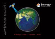
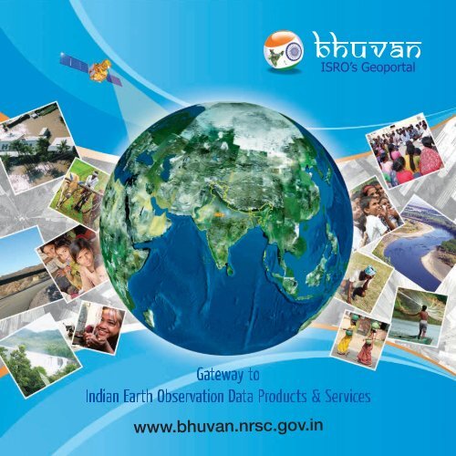
www.bhuvan.nrsc.gov.in<br />
bhuvan<br />
ISRO’s Geoportal
One-stop versatile<br />
Web based Earth Observation<br />
Data Products & Services<br />
Interactive 3D Environment<br />
Societal Applications<br />
Thematic Vectors<br />
3D Geographic Models<br />
Seamless Fly Throughs<br />
<strong>Bhuvan</strong> – Gateway to Indian Earth Observation<br />
Explore, experience, visualise and analyse Indian <strong>Remote</strong><br />
<strong>Sensing</strong> (IRS) images<br />
Rapid access to 3D geospatial data powered with real-time<br />
data sharing and colloboration providing a true Common<br />
Operating Picture<br />
Rich Thematic Datasets to visualise and consume as Open<br />
Open EO Data Archieve<br />
Multi Resolution Terrain<br />
Geospatial Consortium (OGC) web services enabling<br />
interoperability<br />
Visualise different layers, explore Geoprocessing, and feel<br />
empowered with <strong>Bhuvan</strong> 2D having no dependencies<br />
Access to <strong>Bhuvan</strong>, the Earth Browser through smartphones<br />
NRSC Open EO Data Archive (NOEDA) to browse and<br />
download satellite data and products<br />
Vision<br />
To evince the distinctiveness of Indian Earth Observation(EO) capabilities through online rendering of multi-resolution, multi-temporal<br />
and multi-sensor IRS imagery overlaying value added thematic information on 2D/3D virtual globe, providing satellite data and products<br />
for download and consume thematic datasets as OGC web services towards online Geoprocessing, whilst serving for societal good.<br />
www.bhuvan.nrsc.gov.in<br />
............... 2 ...............
Know <strong>Bhuvan</strong><br />
What is it<br />
<strong>Bhuvan</strong> (means Earth in Sanskrit) is a Geoportal of ISRO, to<br />
evince the Indian Earth Observation capabilities from the<br />
Indian <strong>Remote</strong> <strong>Sensing</strong> (IRS) series of satellites.<br />
It is an interactive versatile Earth-Browser which<br />
showcases multi-sensor, mutli-platform and multitemporal<br />
images with capabilities to overlay thematic<br />
information, interpreted from such imagery as a vector<br />
layer, along with near real-time information from Automatic<br />
Weather Stations (AWS), Potential Fishing Zone (PFZ)<br />
information, disaster support related information like forest<br />
fire alerts, periodic agricultural drought assessment etc.<br />
What can it do<br />
Ranging from visualisation, <strong>Bhuvan</strong>ites can also download<br />
IRS data products and consume thematic datasets as<br />
OGC web services towards Geoprocessing.<br />
A Place where users can add their own points of interest<br />
and share them with others<br />
Can delineate vector features as shape files<br />
· Can be connected to Global Positioning System(GPS)<br />
device in real-time or playback mode<br />
· Users can chart routes, plot areas, view terrain profile and<br />
overlay images<br />
· Useful for educators to teach subjects ranging from<br />
sciences to history. Also, take students virtually to an area<br />
being studied and show them the topography, surrounding<br />
areas etc.<br />
· Useful for scientists to facilitate new possibilities from the<br />
IRS geospatial data for collaborative research<br />
· Useful for administrators to monitor various developmental<br />
schemes at the grassroots level<br />
How does it work<br />
· It is a free web based visualisation system. Users can<br />
access <strong>Bhuvan</strong> by visiting www.bhuvan.nrsc.gov.in<br />
· Users can choose <strong>Bhuvan</strong> 2D or <strong>Bhuvan</strong> 3D for EO<br />
visualisation , Open EO data archive for downloading IRS<br />
satellite data and products, and thematic data<br />
dissemination for obtaining interoperable OGC web<br />
services<br />
· Different supporting components like – interactive videos,<br />
virtual tour, discussion forum, help documents are also<br />
available.<br />
· Registration is optional in <strong>Bhuvan</strong>. However, some features<br />
require registration. Users can use the Central<br />
Authentication Service of <strong>Bhuvan</strong> for creating an account<br />
on <strong>Bhuvan</strong> towards single sign-on (SSO). Registered users<br />
are having privilege to share and download the data,<br />
collaborate with other <strong>Bhuvan</strong>ites, discussions in Forum<br />
etc.<br />
A plug-in is to be downloaded and installed to access<br />
<strong>Bhuvan</strong> 3D (for first time use)<br />
Why is it significant<br />
Scientists, academicians, policy makers and general public<br />
can leverage this integration of vast amounts of geospatial<br />
data in an easy-to-use multi-lingual interface without any<br />
additional resources<br />
The tool's visual immediacy could prove enormously<br />
beneficial, for example, for a survey of various geological<br />
structures in a region<br />
Individually, students can use <strong>Bhuvan</strong> to know and examine<br />
places they are studying. Also allows them to create and<br />
share personal resources like data sharing<br />
<strong>Bhuvan</strong> lets users to download specific satellite data and<br />
products, and also encourages users to revisit and explore<br />
availability of new datasets<br />
Where is it going<br />
<strong>Bhuvan</strong> has become more sophisticated , with additional<br />
tools and increased coverage of high resolution imagery, free<br />
satellite data download and thematic data dissemination as<br />
web services<br />
By integrating with other existing applications, <strong>Bhuvan</strong> is<br />
poised to become a spatially based collection of profound<br />
information, coupled with facts and knowledge.<br />
Blogs, user groups, social networking sites and forums are<br />
enabled for users to share ideas and experiences, and post<br />
case studies also.<br />
www.bhuvan.nrsc.gov.in<br />
............... 3 ...............
<strong>Bhuvan</strong> gives you an easy way to<br />
experience, explore, visualise & download<br />
IRS images<br />
ISRO is well known amongst space faring nations for its<br />
world-leading reputation in developing new, indigenous<br />
and innovative service oriented applications using remote<br />
sensing technology. Over the past 2 decades, ISRO has<br />
mastered the art of developing these unique applications<br />
using various spectral, spatial and temporal resolutions<br />
offered by the versatile IRS satellites and these have been<br />
successfully institutionalized in many important areas of<br />
policy making, natural resources management, disaster<br />
support, and enhancing the quality of life across all<br />
sections of the society.<br />
<strong>Bhuvan</strong> an initiative to showcase this distinctiveness of<br />
Indian imaging capabilities including the thematic<br />
information derived from such imagery is of vital<br />
importance to common man. <strong>Bhuvan</strong> an ambitious project<br />
of ISRO to take Indian images and thematic information in<br />
multiple spatial resolutions to people with a web portal<br />
through easy access to information on basic natural<br />
resources in the geospatial domain. <strong>Bhuvan</strong> showcases<br />
Indian images by the superimposition of the IRS satellite<br />
imageries on 2D/ 3D virtual globe. It displays satellite<br />
images of varying resolution of India's surface, allowing<br />
users to visually see things like cities and important places<br />
of interest looking perpendicularly down or at an oblique<br />
angle, with different perspectives and can navigate through<br />
3D viewing environment.<br />
The degree of resolution showcased is based on the points<br />
of interest and popularity, but most of the Indian terrain is<br />
covered up to at least 6 metres of resolution with the least<br />
www.bhuvan.nrsc.gov.in<br />
............... 4 ...............<br />
spatial resolution being 55 metres from AWiFS Sensor,<br />
while some cities are having 2.5 metres and 1 metre<br />
resolution. With such rich content, <strong>Bhuvan</strong> opens the door<br />
to net-centric visualisation of digital geospatial India<br />
allowing individuals to experience the fully interactive<br />
terrain viewing capabilities.<br />
<strong>Bhuvan</strong> 2D offers powerful, user-friendly mapping<br />
technology to organize the satellite and map data along<br />
with myriad information geographically with no<br />
dependencies in an easy way. It also offers Geoprocessing<br />
services, WMS manager, Embeddable HTML and Send<br />
Link options.<br />
Apart from visualisation, <strong>Bhuvan</strong> facilitates user to browse,<br />
select and download satellite data and products through<br />
NOEDA. Through Thematic Services it also facilitates to<br />
select, browse and query thematic datasets and consume<br />
as OGC web services. <strong>Bhuvan</strong> brings a whole lot of<br />
uniqueness in understanding our own natural resources<br />
whilst presenting beautiful images and thematic<br />
information generated from varieties of geospatial data.<br />
<strong>Bhuvan</strong> also attempts to bring out the importance of multitemporal<br />
data and to highlight the changes taking place to<br />
our natural resources, which will serve as a general<br />
awareness on our changing planet. There are lot more<br />
value added services which will be enabled onto this<br />
Geoportal due course of time and each one of those<br />
services are going to be unique to preserving and<br />
conserving our precious natural resources through public<br />
participation.<br />
Knowledge - Insight - Awareness - Action
<strong>Bhuvan</strong> 2D<br />
The two dimensional (2D) <strong>Bhuvan</strong>, a web mapping service application based<br />
on OpenLayers open source project, offers powerful, user-friendly mapping<br />
technology to organise the satellite data and map along with myriad<br />
information geographically with no server-side dependencies in an easy way.<br />
<strong>Bhuvan</strong> 2D is a slick, exciting online mapping application. It provides a highly<br />
responsive, intuitive mapping interface with detailed imagery and map data<br />
embedded. Some of its functional capabilities include map navigation,<br />
drawing point line, polygon, online shapefile creation, Geoprocessing<br />
overview map, linear and areal measurement. These capabilities combine to<br />
make <strong>Bhuvan</strong> 2D a compelling product.<br />
<strong>Bhuvan</strong> 3D<br />
Pocket <strong>Bhuvan</strong><br />
<strong>Bhuvan</strong> 3D showcases images in a multi-sensor, multi-platform and a multitemporal<br />
domain. It lets you access, explore and visualise IRS image and a bundle<br />
of rich thematic information in 3D landscape. On <strong>Bhuvan</strong> 3D, users can fly to<br />
different locations on the terrain and experience unparalleled 3D navigation.<br />
<strong>Bhuvan</strong> 3D has many unique features and easy to use intuitive interface, where<br />
users can virtually experience the physical characteristics of the terrain, especially<br />
the Indian landscape. The urban design tools are a magic galore. Here you can<br />
virtually build roads, junctions and traffic lights in an urban setting! Experience all<br />
this just on <strong>Bhuvan</strong> 3D!<br />
Access Earth Browser in your smart phone.<br />
Supported in devices based on Android,<br />
Windows, Symbian, iOS and BlackBerry OS.<br />
www.bhuvan.nrsc.gov.in<br />
............... 5 ...............
NOEDA<br />
NRSC Open EO Data Archive<br />
NRSC Open EO Data Archive facilitates the users to select,<br />
browse and download satellite data and products. Through<br />
NOEDA <strong>Bhuvan</strong> has laid a step forward in serving Scientific<br />
and Research community by providing free data download.<br />
At present Cartosat-1:DEM: 1 arc sec, Resourcesat-<br />
1:AWiFS Ortho (2008,2009):56m, Resourcesat-1:LISS-III<br />
Ortho (2008-09):24m datasets for Indian region are available<br />
for download and planned to extend for IRS satellite data<br />
coarser than 24m in near future.<br />
It gives the option to select area based on 'Bounding Box,<br />
Mapsheet (SOI), Tiles, Interactive Drawing. Users can see<br />
thumbnail view, metadata (NSDI 2.0) and download the<br />
selected tiles<br />
Thematic Services<br />
<strong>Bhuvan</strong>-Thematic Services facilitate the users to select,<br />
browse and query the Thematic Datasets. Users can<br />
consume these Thematic Datasets and integrate into their<br />
systems as OGC web services. Presently Land Use Land<br />
Cover (50K):2005-06 datasets are available and planned to<br />
extend for other themes like land degradation, soil etc.<br />
It has the options of getting state and district wise statistics,<br />
Area of Interest (AOI) based analysis, URL for WMS/WMTS<br />
services, view based print and adding external WMS layers.<br />
www.bhuvan.nrsc.gov.in<br />
............... 6 ...............
Snapshots of<br />
<strong>Bhuvan</strong> Functionalities<br />
Online Shapefile creation<br />
Terrain Profile<br />
Online Geoprocessing Service<br />
www.bhuvan.nrsc.gov.in<br />
............... 7 ...............
Snapshots of<br />
<strong>Bhuvan</strong> Services<br />
Near Real-time Weather Parameters<br />
Potential Fishing Zone Information<br />
Flood Inundated Area<br />
www.bhuvan.nrsc.gov.in<br />
............... 8 ...............
<strong>Bhuvan</strong><br />
Applications<br />
Societal<br />
Ground Water Prospects<br />
Wasteland Information<br />
Soil Information<br />
www.bhuvan.nrsc.gov.in<br />
............... 9 ...............
<strong>Bhuvan</strong><br />
Features<br />
Seamless visualisation of multi-sensor, mutliplatform<br />
and multi-temporal images with<br />
capabilities to overlay thematic information like soil,<br />
wasteland, water resources etc.<br />
Near real-time information from Automatic Weather<br />
Stations (AWS), Potential Fishing Zone (PFZ)<br />
information, disaster support related information<br />
like forest fire alerts, periodic agricultural drought<br />
assessment etc.<br />
Superpose administrative boundaries of choice on<br />
images.<br />
Categorisation of services – Land, Weather, Ocean<br />
and Disaster services<br />
3D fly through (3D view to fly to locations, objects in<br />
the terrain, and navigate freely using the mouse or<br />
keyboard)<br />
Draw tool with option of exporting the vector<br />
features (point/line/polygon) as shapefiles<br />
Add Layer (allows user to add external WMS, WFS,<br />
KML, georeferenced image, shapefile and share)<br />
Collaborate tool<br />
Add Content (allows user to add their volunteered<br />
geographic information and share with others)<br />
Free satellite data and products download<br />
OGC web services towards Interoperability<br />
Collaboration tool for community participation<br />
GIS Tools (Attribute Query, Buffer Analysis) & Online<br />
Geoprocessing<br />
GPS tool to connect <strong>Bhuvan</strong> with GPS devices in real<br />
time and playback mode<br />
Video On Terrain for surveillance activity<br />
Embeddable HTML and Send <strong>Bhuvan</strong> Link<br />
Multi-Lingual (English, Hindi, Tamil, Telugu and<br />
planned to extend in other Indian Languages)<br />
Other tools: Snapshot, Measure tools, Shadow<br />
analysis, Urban Design tools, Navigation map,<br />
Terrain Profile tool, Contour maps<br />
Add Content tool<br />
www.bhuvan.nrsc.gov.in<br />
...............10...............
About NRSC<br />
<strong>National</strong> <strong>Remote</strong> <strong>Sensing</strong> <strong>Centre</strong><br />
A key constituent of Indian Space Research Organisation (ISRO), Department of Space, Government of India, is at the heart of India's<br />
efforts to advance and benefit from the Indian Earth Observation Programme. NRSC strives to provide high quality, actionable data<br />
products and services in a timely, cost effective and efficient manner, facilitating enhanced utilization of remote sensing and geoinformation<br />
in addressing societal needs and national imperatives. www.nrsc.gov.in<br />
www.bhuvan.nrsc.gov.in<br />
...............11...............
Stay Connected<br />
Get Our Newsletter<br />
Write to bhuvan@nrsc.gov.in<br />
Become a Fan on Facebook<br />
www.facebook.com/isrobhuvan<br />
Follow us on Twitter<br />
www.twitter.com/isrobhuvan<br />
You<br />
Tube<br />
Watch <strong>Bhuvan</strong> Videos<br />
www.youtube.com/bhuvanisro<br />
<strong>Bhuvan</strong> Cell<br />
<strong>National</strong> <strong>Remote</strong> <strong>Sensing</strong> <strong>Centre</strong><br />
Indian Space Research Organisation<br />
Dept. of Space, Govt. of India<br />
Balanagar, Hyderabad-500 037<br />
www.bhuvan.nrsc.gov.in<br />
Contact: bhuvan@nrsc.gov.in