Download - Bhuvan - National Remote Sensing Centre
Download - Bhuvan - National Remote Sensing Centre
Download - Bhuvan - National Remote Sensing Centre

You also want an ePaper? Increase the reach of your titles
YUMPU automatically turns print PDFs into web optimized ePapers that Google loves.
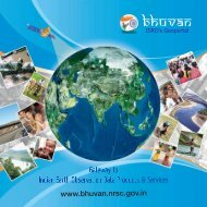
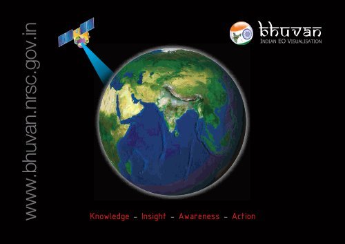
www.bhuvan.nrsc.gov.in<br />
Knowledge - Insight - Awareness - Action<br />
bhuvan<br />
INDIAN EO VISUALISATION
One-stop versatile<br />
web based Earth Observation<br />
Visualisation System<br />
A gateway to explore and discover virtual<br />
earth through a net-centric 3D visualisation<br />
solution with specific emphasis on Indian<br />
region.<br />
Vision<br />
To evince the distinctiveness of Indian imaging<br />
capabilities through online rendering of multiresolution,<br />
multi-temporal and multi-sensor<br />
IRS imagery overlaying value added thematic<br />
maps on 3D globe whilst serving for societal<br />
good.<br />
Multi Resolution Terrain<br />
Societal Applications<br />
3D Geographic Models<br />
Seamless Fly Throughs<br />
Thematic Vectors<br />
Interactive 3D Environment<br />
2bhuvan.nrsc.gov.in
<strong>Bhuvan</strong> gives you an easy way to<br />
experience, explore and visualize<br />
IRS images<br />
ISRO is well known amongst space faring nations for its worldleading<br />
reputation in developing new, indigenous and innovative<br />
service oriented applications using remote sensing technology.<br />
Over the past 2 decades, ISRO has mastered the art of developing<br />
these unique applications using various spectral, spatial and<br />
temporal resolutions offered by the versatile IRS satellites and these<br />
have been successfully institutionalized in many important areas of<br />
policy making, natural resources management, disaster support,<br />
and enhancing the quality of life across all sections of the society.<br />
<strong>Bhuvan</strong>, an initiative to showcase this distinctiveness of Indian<br />
imaging capabilities with a focus on Indian region including the<br />
thematic information derived from such imagery is of vital<br />
importance to common man. <strong>Bhuvan</strong>, an ambitious project of ISRO<br />
to take Indian images and thematic information in multiple spatial<br />
resolutions to people with a web portal through easy access to<br />
information on basic natural resources in the geospatial domain.<br />
<strong>Bhuvan</strong> showcases Indian images by the superimposition of the<br />
IRS satellite imageries on 3D globe. It displays satellite images of<br />
varying resolution of India's surface, allowing users to visually see<br />
things like cities and important places of interest looking<br />
perpendicularly down or at an oblique angle, with different<br />
perspectives and can navigate through 3D viewing environment.<br />
The degree of resolution showcased is based on the points of<br />
interest and popularity, but most of the Indian terrain is covered upto<br />
at least 6 meters of resolution with the least spatial resolution being<br />
55 meters from AWifs Sensor. With such rich content, <strong>Bhuvan</strong><br />
opens the door to net centric visualisation of digital geospatial India<br />
allowing individuals to experience the fully interactive terrain viewing<br />
capabilities.<br />
Multi-resolution images from multi-sensor IRS satellites of India is<br />
seamlessly depicted through the <strong>Bhuvan</strong> web portal to enable<br />
common man to zoom into specific area of interest at high resolution<br />
as per the prevailing <strong>Remote</strong> <strong>Sensing</strong> Data Policy (RSDP) of the<br />
government. <strong>Bhuvan</strong> brings a whole lot of uniqueness in<br />
understanding our own natural resources whilst presenting beautiful<br />
images and thematic information generated from varieties of<br />
geospatial data. <strong>Bhuvan</strong> also attempts to bring out the importance<br />
of multi-temporal data and to highlight the changes taking place to<br />
our natural resources, which will serve as a general awareness on<br />
our changing planet. There are lot more value added services which<br />
will be enabled onto this Indian EO visualisation system in due<br />
course of time and each one of those services are going to be unique<br />
to preserving and conserving our precious natural resources<br />
through public participation.<br />
3bhuvan.nrsc.gov.in
3D Visualisation – Badrinath<br />
Fly to the locations of choice<br />
Navigation map – Hyderabad City<br />
Snapshots of<br />
<strong>Bhuvan</strong> Functionalities<br />
Visualisation of near real time<br />
Weather Parameters (AWS)<br />
Urban Design – Road with trees on both side<br />
Distance Measurement - Horizontal<br />
4bhuvan.nrsc.gov.in
Waste land information<br />
Ground water potential zones<br />
Soil Information<br />
<strong>Bhuvan</strong><br />
Societal<br />
Applications<br />
Watershed details<br />
Flood inundated area<br />
Time series information (NADAMS)<br />
5bhuvan.nrsc.gov.in
Basic<br />
of<br />
<strong>Bhuvan</strong> features 6<br />
Access, explore and visualise 2D and 3D image data along with<br />
rich thematic information on soil, wasteland, water resources<br />
etc.<br />
Visualise multi-resolution, multi-sensor, multi-temporal IRS<br />
image data<br />
Superpose administrative boundaries of choice on images as<br />
required<br />
Visualisation of AWS (Automatic Weather Stations)<br />
data/information in a graphic view and use tabular weather data<br />
of user choice<br />
Fly to locations (to fly from the current location directly to the<br />
selected location)<br />
Heads-Up Display (HUD) navigation controls (tilt slider, north<br />
indicator, opacity, compass ring, zoom slider)<br />
Navigation using the 3D view pop-up menu (fly-in, fly out, jump<br />
in, jump around, view point)<br />
3D fly through (3D view to fly to locations, objects in the terrain,<br />
and navigate freely using the mouse or keyboard)<br />
Drawing 2D objects (text labels, polylines, polygons, rectangles,<br />
2D arrows, circles, ellipse)<br />
Drawing 3D Objects (placing of expressive 3D models, 3D<br />
polygons, boxes)<br />
Snapshot creation (copies the 3D view to a floating window and<br />
allows to save to an external file)<br />
Measurement tools (horizontal distance, aerial distance, vertical<br />
distance)<br />
Shadow analysis (it sets the sun position based on the given<br />
time creating shadows and effects the lighting on the terrain)<br />
Urban Design Tools (to build roads, junctions and traffic lights in<br />
an urban setting)<br />
Contour map (displays a colorized terrain map and contour<br />
lines)<br />
Terrain profile (displays the terrain elevation profile along a path)<br />
Draw tools (creates simple markers, free hand lines, urban<br />
designs)<br />
Navigation map (to jump to and view locations in the 3D India)<br />
Metadata for satellite images<br />
There would be many more value added functions and facilities<br />
which will be added from time to time. Particular interest of<br />
ISRO/DOS would be to provide such functionalities to common man<br />
to engage in participatory approach with scientists to solve simple<br />
problems easily and interactively.<br />
bhuvan.nrsc.gov.in
<strong>National</strong> <strong>Remote</strong> <strong>Sensing</strong> <strong>Centre</strong><br />
A key constituent of Indian Space Research Organisation (ISRO),<br />
Department of Space, Government of India, is at the heart of India's efforts<br />
to advance and benefit from the Indian Earth Observation Programme.<br />
NRSC strives to provide high quality, actionable data products and services<br />
in a timely, cost effective and efficient manner, facilitating enhanced<br />
utilization of remote sensing and geo-information in addressing societal<br />
needs and national imperatives.<br />
<strong>Bhuvan</strong><br />
Functionalities<br />
Future<br />
City Modeling and Flythrough<br />
Airport Surveillance<br />
Live Traffic Management<br />
7bhuvan.nrsc.gov.in
<strong>Bhuvan</strong> Cell<br />
<strong>National</strong> <strong>Remote</strong> <strong>Sensing</strong> <strong>Centre</strong><br />
Indian Space Research Organisation<br />
Dept. of Space, Govt. of India<br />
Balanagar, Hyderabad – 500 625.<br />
www.nrsc.gov.in