Visitor Guide NSW National Parks 2011 - Hke Sydney
Visitor Guide NSW National Parks 2011 - Hke Sydney
Visitor Guide NSW National Parks 2011 - Hke Sydney

Create successful ePaper yourself
Turn your PDF publications into a flip-book with our unique Google optimized e-Paper software.
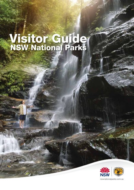
<strong>Visitor</strong> <strong>Guide</strong><br />
<strong>NSW</strong> <strong>National</strong> <strong>Parks</strong><br />
Free<br />
<strong>2011</strong> <strong>Guide</strong>
CONTENTS<br />
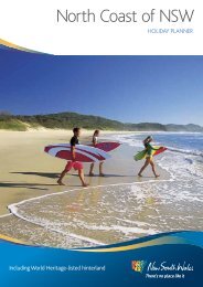
1. NORTH COAST 14<br />
Go there to immerse yourself in World Heritage parks where<br />
magnificent subtropical rainforests meet mountains forged from<br />
ancient volcanoes … a bushwalker and scenery lover’s paradise, this<br />
is a land where beaches sparkle, waterfalls plunge, and trees reach<br />
out to the sun.<br />
2. SYDNEY AND SURROUNDS 34<br />
<strong>Sydney</strong> – city surrounded by national parks, aquatic reserves and<br />
unexpected wildlife. The city surprises with spectacular bushland<br />
walks, many overlooking our world-famous harbour. Wild and rugged,<br />
the World Heritage wilderness of the Blue Mountains is on the city’s<br />
doorstep, great for sightseeing, bushwalking and adventure activities.<br />
3. SOUTH COAST 52<br />
<strong>National</strong> parks hug the coastline protecting diverse habitats including<br />
marine parks and the state’s largest undisturbed wilderness at<br />
Wadbilliga. Head out and discover amazing natural attractions … pristine<br />
beaches, colourful birdlife, marine creatures, forests and islands.<br />
4. SNOWY MOUNTAINS 66<br />
You really are on the roof of Australia. Mt Kosciuszko, our highest<br />
peak, looks down on sub-alpine snowgum woodlands and tall forests<br />
of alpine ash and mountain gum – snow sports dominate in winter;<br />
the warmer months bring wonderful walks, colourful wildflowers and<br />
grand touring routes.<br />
5. HEART OF COUNTRY 72<br />
Mt Kaputar, Oxley Wild Rivers, Cathedral Rock, and the iconic<br />
Warrumbungle <strong>National</strong> Park are just a few of Heart of Country’s mustsee<br />
places. You’re invited to explore diverse natural and cultural heritage<br />
while enjoying the warm country hospitality of this charming region.<br />
6. OUTBACK 84<br />
A dramatic yet fragile environment of blazing sunsets, wide open<br />
spaces, distant horizons and abundant wildlife creates an experience<br />
you’ll never forget. It embraces World Heritage Lake Mungo <strong>National</strong><br />
Park; and ancient Aboriginal artworks in Mutawintji <strong>National</strong> Park<br />
reflect thousands of years of human habitation.<br />
FOUNDATION FOR<br />
NATIONAL PARKS &<br />
WILDLIFE 02<br />
ACKNOWLEDGEMENT<br />
OF ABORIGINAL PEOPLE 02<br />
MEMBERSHIP 03<br />
EXPERIENCE YOUR<br />
NATIONAL PARKS 05<br />
ACCESSIBILITY 07<br />
CAMPING & ENTRY FEES 08<br />
AUSTRALIA’S NATIONAL<br />
LANDSCAPES 10<br />
WORLD HERITAGE<br />
AREAS IN <strong>NSW</strong> 11<br />
THE DEPARTMENT OF<br />
ENVIRONMENT, CLIMATE<br />
CHANGE AND WATER 12<br />
DOGS AND OTHER PETS<br />
IN NATIONAL PARKS 12<br />
HELP US<br />
CONTROL PESTS 12<br />
TREAD SOFTLY 13<br />
SAFETY<br />
MESSAGES 29, 36, 71 & 89<br />
CONTACTS 90<br />
TYPE OF PARKS<br />
AA<br />
AR<br />
CL<br />
HS<br />
Aboriginal area<br />
Aquatic reserve<br />
Conservation<br />
Lands<br />
Historic site<br />
KCR Karst<br />
conservation<br />
reserve<br />
MP<br />
NP<br />
NR<br />
RP<br />
Marine park<br />
<strong>National</strong> park<br />
Nature<br />
Reserve<br />
Regional park<br />
SCA State<br />
conservation<br />
area<br />
SYMBOLS<br />
Aboriginal site<br />
Kiosk<br />
Accommodation<br />
Lighthouse<br />
6<br />
1<br />
Barbeque<br />
Lookout<br />
5<br />
2<br />
SYDNEY<br />
Boat ramp<br />
Camping area<br />
Canoeing<br />
Picnic area<br />
Public<br />
transport<br />
Showers<br />
Caravan site<br />
Swimming<br />
Cycling<br />
Toilets<br />
4<br />
3<br />
Diving/<br />
Snorkelling<br />
Vehicle entry<br />
fee<br />
Dogs on a leash<br />
allowed<br />
Walking<br />
tracks<br />
Front cover image: Blue Mountains <strong>National</strong> Park, Photography: D. Finnegan / DECCW<br />
© 2010 State of <strong>NSW</strong> and Department of Environment, Climate Change and Water <strong>NSW</strong>. The Department of Environment,<br />
Climate Change and Water and State of <strong>NSW</strong> are pleased to allow this material to be reproduced for educational or noncommercial<br />
purposes in whole or in part, provided the meaning is unchanged and its source, publisher and authorship<br />
are acknowledged. Specific permission is required for the reproduction of photographs and images. Every effort has been<br />
made to ensure information in this guide is correct at the time of printing.<br />
Fishing<br />
Historic site<br />
Horse riding<br />
Whale<br />
watching<br />
Wheelchair<br />
access<br />
World<br />
heritage
Welcome<br />
to the <strong>2011</strong> <strong>Guide</strong> to <strong>NSW</strong> <strong>National</strong> <strong>Parks</strong><br />
Lush rainforests, beaches of golden sand, granite gorges, stark sand dunes,<br />
sparkling clear sea, ever-plunging waterfalls … <strong>NSW</strong> national parks and<br />
reserves comprise the most stunning diversity of landscapes and habitats.<br />
<strong>NSW</strong> now includes more than 820 protected areas.<br />
Minutes from the centre of <strong>Sydney</strong> you’ll find harbour-side native bushland<br />
parks and aquatic reserves, great for a day out with family and friends.<br />
Further afield explore pristine forests, ancient tablelands, alpine high country,<br />
marine parks and outback deserts. There are countless opportunities for<br />
relaxation, recreation and adventure all year round.<br />
<strong>NSW</strong> national parks are forever ours. Everyone is invited to visit,<br />
explore, discover and enjoy these special places, and to join our<br />
commitment to their protection and enhancement … so that those to<br />
come may experience what we do today.<br />
We welcome you on your journey of discovery, and thank you<br />
for treading softly in these unique and precious environments.<br />
Green Cape Lighthouse stands over the Sapphire<br />
Coast, Ben Boyd <strong>National</strong> Park<br />
Photography: A. Brown / Courtesy Tourism <strong>NSW</strong><br />
1
Photography: TOP: L. Cosier / DECCW, RIGHT: S. Cottrell / Botanic Gardens Trust, BOTTOM: H. Lund / Courtesy Tourism <strong>NSW</strong><br />
Delicate yellow thornbill in<br />
New England <strong>National</strong> Park<br />
ACKNOWLEDGEMENT OF ABORIGINAL PEOPLE<br />
Ranger at Mutawintji <strong>National</strong> Park<br />
We respectfully<br />
acknowledge the<br />
Aboriginal People<br />
of <strong>NSW</strong> and pay our<br />
respects to the Elders<br />
past and present.<br />
When visiting a park or reserve, please<br />
take a minute to recognise Aboriginal<br />
people’s relationship with the land,<br />
acknowledge the ongoing connection<br />
of Aboriginal people to their Country,<br />
and recognise your own responsibility<br />
to travel thoughtfully.<br />
We ask you to respect Aboriginal beliefs<br />
associated with Country and Culture. As<br />
a visitor, please respect the wishes of<br />
your hosts and any restrictions you have<br />
been asked to observe.<br />
2 For more information visit www.nswnationalparks.com.au<br />
FOUNDATION FOR NATIONAL<br />
PARKS & WILDLIFE<br />
The Foundation for<br />
<strong>National</strong> <strong>Parks</strong> & Wildlife is<br />
a not-for-profit organisation<br />
with the mission to care<br />
for Australia's native<br />
plants, animals and<br />
cultural heritage through<br />
environmental education<br />
and conservation projects.<br />
Through donations from supporters, the<br />
Foundation purchases land for conservation<br />
and funds threatened species recovery actions.<br />
Over one million dollars are raised every year<br />
to support research, habitat regeneration,<br />
land acquisition for habitat, pest eradication<br />
and other long term projects.<br />
Your donation of money or property, or<br />
considering the Foundation in your will,<br />
can protect a piece of Australia forever or<br />
save a species from extinction.<br />
For more information: www.fnpw.org.au<br />
Wattle (acacia pycan tha)
We really saw þe benefits<br />
an annual pass<br />
YOUR CONTRIBUTION TO CONSERVATION –<br />
BECOME AN ANNUAL PASS MEMBER<br />
Vehicle entry fees to national parks help<br />
fund conservation projects and contribute to<br />
building and maintaining facilities in parks and<br />
reserves. Fees apply to only around 50 of the<br />
more than 800 national parks and reserves<br />
in <strong>NSW</strong>.<br />
Purchasing a <strong>NSW</strong> <strong>National</strong> <strong>Parks</strong> Annual Pass<br />
is a great way to get involved in conservation.<br />
Members not only receive great value for<br />
money, but they also provide funds for vital<br />
conservation projects, with all proceeds going<br />
towards managing and enhancing these<br />
precious resources. By purchasing an annual<br />
pass you also have the option of receiving our<br />
quarterly e-newsletter, Naturescapes, which<br />
provides excellent information on great parks<br />
to visit and exciting things to do.<br />
Select the annual pass that suits you best<br />
from the table below.<br />
You can upgrade at any time<br />
(conditions and an administration fee apply).<br />
A few key points:<br />
• Annual passes are valid for privately used<br />
vehicles of up to 8 seats.<br />
• They don’t cover parks and facilities managed<br />
by other agencies or community groups, such<br />
as Worimi Conservation Lands and Booderee<br />
<strong>National</strong> Park at Jervis Bay, or parks in the ACT.<br />
• Fees not covered include camping fees,<br />
entry to museums, Discovery tours and<br />
boat landing fees.<br />
If you don’t have an annual pass, you may still<br />
visit parks requiring a vehicle entry fee – make<br />
sure you bring a small amount of change for<br />
the ticket machine, buy a ticket, and clearly<br />
display your ticket on your vehicle.<br />
On the Yuraygir Coastal Walk,<br />
Yuraygir <strong>National</strong> Park<br />
TYPE OF PASS<br />
1 YEAR<br />
(<strong>NSW</strong> SENIORS)<br />
2 YEARS<br />
(<strong>NSW</strong> SENIORS)<br />
BENEFITS<br />
Single Country Park Pass $22 ($17) $40 ($30)<br />
Country <strong>Parks</strong> Pass $45 ($35) $75 ($60)<br />
Multi <strong>Parks</strong> Pass $65 ($50) $115 ($90)<br />
Vehicle entry to any ONE designated national<br />
park in country* <strong>NSW</strong> except Kosciuszko<br />
Vehicle entry to national parks in country*<br />
<strong>NSW</strong> except Kosciuszko<br />
Vehicle entry to national parks in <strong>NSW</strong><br />
except Kosciuszko<br />
All <strong>Parks</strong> Pass $190 ($152) $335 ($268)<br />
2nd household All <strong>Parks</strong> Pass $95 $167.50<br />
APPLYING FOR A PASS<br />
To apply for an annual pass, pick up a<br />
brochure or application form from any major<br />
NPWS office (see back cover), or visit our<br />
website at www.nswnationalparks.com.au<br />
For further information including concessions<br />
and exemptions, contact the DECCW <strong>National</strong><br />
<strong>Parks</strong> Call Centre:<br />
Phone 02 9585 6068 Fax 02 9585 6831<br />
Mail PO Box 1967<br />
Hurstville <strong>NSW</strong> 1481<br />
Email annual.passes@environment.nsw.gov.au<br />
* See www.nswnationalparks.com.au<br />
for a listing of Country Pass parks.<br />
Fees and locations subject to change.<br />
Single Country<br />
Park Pass<br />
Sunrise at Cocoparra <strong>National</strong> Park<br />
Vehicle entry to ALL parks in <strong>NSW</strong>, including<br />
Kosciuszko<br />
For additional vehicles registered at the same<br />
address (conditions apply)<br />
Country <strong>Parks</strong> Pass Multi <strong>Parks</strong> Pass All <strong>Parks</strong> Pass<br />
Photography: TOP: D. Novak / DECCW, BOTTOM: T. Creighton / Courtesy Tourism <strong>NSW</strong><br />
3
The Blue Mountains <strong>National</strong> Park has over 140 km<br />
of walking tracks – a bushwalker's paradise<br />
Photography: D. Finnegan / DECCW<br />
4 For more information visit www.nswnationalparks.com.au
GREAT THINGS TO DO<br />
IN YOUR NATIONAL PARKS<br />
Naturally, the greatest<br />
national park experience<br />
is simply to be there –<br />
to immerse yourself in<br />
a pristine environment,<br />
revive and rejuvenate,<br />
to breathe fresh air.<br />
Whether you’re looking to be active – or just<br />
find a place to relax – the network of more<br />
than 820 <strong>NSW</strong> national parks and reserves<br />
has plenty to offer.<br />
Check out www.wildwildworld.com.au<br />
and www.wildaboutwhales.com.au for great<br />
ideas on what to do in parks.<br />
Of course, you can head out on your own<br />
outdoor adventure, or let someone else do the<br />
planning for you on a guided tour with one of<br />
the many fantastic recreation and tour operators<br />
offering nature experiences in parks across the<br />
state. You'll find some of them on these pages,<br />
for more operators go to www.environment.nsw.<br />
gov.au/nationalparks/touroperators.aspx<br />
GET MOVING<br />
From easy, flat cruises to more challenging<br />
mountain trails, you’ll find a wealth of cycling<br />
experiences on national park roads, fire trails<br />
and designated tracks. Many national parks<br />
also provide opportunities for vehicle touring,<br />
both for conventional cars and 4-wheel drives.<br />
Australian Wild Escapes offers guided vehicle<br />
touring along with guided bushwalks and<br />
activities in parks across the state.<br />
Contact them on 1300 792 213,<br />
www.australianwildescapes.com.<br />
For a real horse riding adventure, head to<br />
the high country of Kosciuszko <strong>National</strong><br />
Park, where there are trails with camping<br />
areas where horses can be kept. There’s<br />
total adventure to be had: whitewater rafting,<br />
caving, canyoning… your experience can<br />
be as active or as gentle as you like. Once<br />
you’ve chosen your activity, check with<br />
local park offices for park suitability and<br />
conditions. For adventure activities on the<br />
South Coast, Southbound Adventures offers<br />
a range including abseiling and cycling.<br />
Contact them on 4257 4888,<br />
www.southbound.com.au<br />
TAKE THE FAMILY<br />
Anywhere in New South Wales, you don’t have<br />
to go far to find a family-friendly national park.<br />
A place for swimming, picnicking, camping or<br />
walking with the kids under a canopy of trees<br />
with a challenge to spot the greatest number<br />
of birds, a shy wallaby or an echidna.<br />
You can try Nielsen Park in <strong>Sydney</strong> Harbour<br />
<strong>National</strong> Park for spectacular views, the<br />
historic Royal <strong>National</strong> Park down south, or<br />
Ku-ring-gai Chase <strong>National</strong> Park for camping<br />
at The Basin. Elsewhere, just check the guide<br />
to find the best picnic spots, swimming, fishing<br />
and bushwalking options for the whole family.<br />
Or, how about a family eco-cruise in the<br />
Royal <strong>National</strong> Park<br />
Contact Cronulla Cruises on 9544 1400<br />
www.cronullacruises.com.au<br />
Take a tour of Mungo <strong>National</strong> Park<br />
DISCOVER HISTORY<br />
AND CULTURE<br />
Along with protection of native plants and<br />
animals, many parks and reserves protect<br />
Aboriginal cultural landscapes and <strong>NSW</strong><br />
post settlement history.<br />
Cultural and spiritual ties to the landscape<br />
remain strong for today’s Aboriginal people<br />
and work is being done to conserve places<br />
of significance. You can join an Aboriginal<br />
Discovery ranger on a walk, talk or tour to<br />
learn more about Aboriginal culture in a<br />
number of parks. You can also visit historic<br />
European settlement sites throughout the<br />
state, such as the convict-built Old Great<br />
North Road or the 1860s gold rush town<br />
of Hill End. So choose your experience<br />
– and remember, local park offices and<br />
NPWS visitor centres are a great place to<br />
get advice and information.<br />
GO FOR A GREAT WALK<br />
Enjoy an exhilarating ride<br />
Whether you’re out for a short nature<br />
stroll or a five-day hike, walking tracks<br />
provide all kinds of opportunities to<br />
explore the parks and reserves of <strong>NSW</strong>.<br />
Discover a range of different environments,<br />
from eucalypt forests to heathlands<br />
or rainforests to mallee. And take in a<br />
diversity of sites and activities on the<br />
way, from lookouts and swimming to<br />
wildflowers, Aboriginal sites and more.<br />
Some tracks are wheelchair or assisted<br />
wheelchair accessible, look for the access<br />
symbol in this guide.<br />
For ideas and information on great walks,<br />
visit www.wildwalks.com.au<br />
If you are interested in a guided walk,<br />
Tread Lightly Eco Tours operates in the<br />
Blue Mountains parks, contact them on<br />
4788 1229, www.treadlightly.com.au<br />
Camp Somerset Outdoor Learning<br />
Centre offers bushwalking, camping<br />
and educational activities in the Blue<br />
Mountains, they’re on 4575 5292 or<br />
www.campsomerset.com.au<br />
If you want to discover our Outback parks,<br />
Sunraysia Discovery Tours offers coach<br />
tours that include short walks.<br />
They’re on 03 5023 5937<br />
www.sunraysiadiscoverytours.com.au<br />
Join our Aboriginal Discovery<br />
rangers for a great park experience<br />
Photography: TOP: K. Tucker / Australian Blue Horse Riders, CENTRE: D. Fuchs / Courtesy Tourism <strong>NSW</strong>, BOTTOM: Rene Vanderveer<br />
5
Kayaking in New<br />
England <strong>National</strong> Park<br />
Photography: TOP: B. Webster / DECCW, BOTTOM: Adam Taylor / Courtesy Tourism <strong>NSW</strong><br />
You’ll find many unspoiled<br />
beaches in <strong>NSW</strong> <strong>National</strong> <strong>Parks</strong><br />
CAST A LINE<br />
That perfect fishing spot … once you find it you’ll<br />
probably want to keep it to yourself. Throughout<br />
the guide you’ll find the fishing symbol, indicating<br />
parks – including marine parks – open for<br />
recreational fishing. You need to carry a <strong>NSW</strong><br />
fishing licence; contact Industry & Investment<br />
<strong>NSW</strong> on 1300 550 474, www.licence.nsw.gov.au<br />
or local fishing shops to apply.<br />
TRY A KAYAK<br />
Kayaking is a brilliant, low impact way to<br />
explore our waterways. Bundeena<br />
Kayaking will get you started in the Royal<br />
<strong>National</strong> Park, contact them on 9544 5294,<br />
www.bundeenakayaks.com.au, or go with<br />
Action Learning Activities in Kosciuszko<br />
or Ben Boyd <strong>National</strong> Park, they’re on<br />
02 6457 2788, www.action-learning.com.<br />
au, and they offer other adventure activities<br />
including cross-country skiing, camping<br />
and bushwalking.<br />
VISIT A LIGHTHOUSE<br />
Mysterious and isolated, <strong>NSW</strong>’s historic<br />
lighthouses are regional icons, perched<br />
on rugged headlands often surrounded by<br />
spectacular national parks. Many welcome<br />
visitors, some are still functioning and several<br />
offer tours and accommodation. Look for<br />
the lighthouse symbol in this guide.<br />
WHALES! WHALES! WHALES!<br />
<strong>NSW</strong> has adopted whale watching as a major<br />
seasonal activity. The great thing about our<br />
whales is that they’re easily seen from land,<br />
and our coastal parks abound with whale<br />
watching vantage points. Look for the whale<br />
symbol in this guide.<br />
TAKE SOMETHING AWAY…<br />
Photographers are always welcome in our<br />
national parks, photos are one thing we<br />
encourage you to take. Late afternoon light<br />
through the trees, sunrise and sunset, birds,<br />
flowers, wildlife – how could you ever run out<br />
of subjects It’s also a great idea to bring a<br />
sketchbook or even an easel and paints, to<br />
bring out the artist in you. Tri State Safaris<br />
can take you on a photographic journey,<br />
they’re on 08 8088 2389, www.tristate.com.au<br />
A TASTE OF CAVING ADVENTURE<br />
Some of Australia’s finest caves systems are<br />
within <strong>NSW</strong> national parks. There are many<br />
opportunities for adventure; join a guided tour,<br />
go on self-guided tours or contact local caving<br />
clubs. Jenolan Caves offers regular adventure<br />
caving tours including the Mammoth and<br />
Aladdin caves.<br />
6 For more information visit www.nswnationalparks.com.au
DISCOVERY WALKS, TALKS AND<br />
TOURS<br />
It’s a simple fact – the more you discover on<br />
your park visit, the more you’ll enjoy yourself,<br />
and the sooner you’ll want to come back to<br />
explore even more.<br />
You can gain an even greater insight through<br />
the Discovery program of walks, talks and<br />
tours, developed and led by specialist rangers<br />
and designed to help you – and your family –<br />
learn more about nature in a fun way. Whether<br />
you’re five or 95, you can be an explorer,<br />
discovering the secrets and unexpected<br />
delights of the landscape and its inhabitants.<br />
There are plenty of experiences to choose<br />
from, such as tours of Montague Island, the<br />
Cape Byron Sustainability Walk and learning<br />
about nature’s supermarket in <strong>Sydney</strong>’s Royal<br />
Botanic Gardens. Learn about bush tucker<br />
and bush medicine, and how to minimise<br />
your impact on the fragile environment. All<br />
while enjoying breathtaking scenery and<br />
encountering amazing wildlife.<br />
Discovery tours run more frequently over<br />
school holidays, however there are many that<br />
you can enjoy all year round. Kamay Botany<br />
Bay <strong>National</strong> Park offers the Bare Island<br />
Heritage Tour, or you can investigate the Green<br />
Gape lightstation at Ben Boyd <strong>National</strong> Park.<br />
Cape Byron and Barrenjoey lighthouses also<br />
feature regular Discovery tours, or inspect the<br />
Jillabenan and Jersey Caves at Yarrangobilly in<br />
Kosciuszko <strong>National</strong> Park.<br />
Spotlight walks uncover the hidden world<br />
of nocturnal wildlife, relaxing canoe tours<br />
explore estuaries and freshwater environments,<br />
night-time poetry and spooky stories bring<br />
historic sites to life.<br />
Along the coast you can learn about fragile<br />
sand dunes and the inhabitants of rockpools,<br />
or snorkel through marine parks exploring the<br />
secrets of underwater life.<br />
There are geological and botanical tours,<br />
tag along four-wheel drive tours, and unique<br />
opportunities to learn about the culture and<br />
traditional lands of Aboriginal communities.<br />
Through the Aboriginal Discovery program,<br />
Aboriginal people conduct guided tours in<br />
ACCESS FOR PEOPLE<br />
WITH DISABILITIES<br />
This symbol next to a park description<br />
in this guide indicates that certain areas<br />
of the park are wheelchair-accessible, to<br />
assist people with reduced mobility or sight<br />
impaired. Contact individual park offices for<br />
more details.<br />
Examples are Dorrigo <strong>National</strong> Park to<br />
the north, Royal <strong>National</strong> Park in <strong>Sydney</strong>,<br />
Minnamurra Rainforest Centre to the south,<br />
and the Warrumbungle <strong>National</strong> Park out<br />
west.<br />
A person with a disability may be<br />
accompanied by a trained assistance<br />
animal except where areas are closed to<br />
the public.<br />
For more information call local park offices<br />
or visit www.nswnationalparks.com.au<br />
Discovery tours are great<br />
for the kids<br />
parks and reserves around the state, in areas<br />
including the Blue Mountains, Jervis Bay,<br />
<strong>Sydney</strong>’s southern outskirts, and western <strong>NSW</strong>.<br />
The guides interpret their cultural heritage,<br />
celebrating the close connections between<br />
Aboriginal people and their traditional lands.<br />
Discovery walks, talks and tours run throughout<br />
the year and there are lots of activities for<br />
families and kids during the<br />
school holidays. Tours and activities can<br />
be tailored to suit the needs of particular<br />
Many parks are accessible to<br />
people with disabilities<br />
individuals or groups, such as schools,<br />
social clubs and conferences.<br />
For information and booking details,<br />
contact individual park offices or check out<br />
www.wildwildworld.com.au<br />
RECREATION AND<br />
TOUR OPERATORS<br />
Recreation and tour operators play an<br />
invaluable role to promote our parks<br />
and encourage visitors to appreciate,<br />
understand and enjoy them.<br />
Licensed operators offer a wide variety<br />
of activities, including coach and bus<br />
tours, cultural tours, outdoor education<br />
activities, bushwalking, camping,<br />
four-wheel driving, rock climbing<br />
and abseiling, cross-country skiing,<br />
orienteering, wildlife observation, horse<br />
riding, fitness training and surfing.<br />
If you would like to find out more<br />
about guided tourism and recreation<br />
activities in our national parks and<br />
reserves, visit<br />
www.environment.nsw.gov.au/<br />
nationalparks/touroperators.aspx<br />
Photography: TOP: You Shoot TV / DECCW, BOTTOM: P. Foley / Lightmoods<br />
7
Photography: TOP: H. Lund / Courtesy Tourism <strong>NSW</strong>, BOTTOM: P. Foley / Lightmoods<br />
Wollumbin Mt. Warning creates<br />
a splendid panorama<br />
CAMPING AND VEHICLE<br />
ENTRY FEES<br />
CAMPING<br />
Wake up to a crisp<br />
morning, breakfast<br />
cooking in the open air.<br />
No traffic and the chorus<br />
of birds the only noise –<br />
just sit back and let the<br />
morning unfold.<br />
Then a walk or perhaps a swim before lunch,<br />
a lazy afternoon in the shade and dinner<br />
under the stars. That’s camping in a <strong>NSW</strong><br />
national park.<br />
You’ll find excellent facilities for camping and<br />
caravanning in parks across the state. So many,<br />
in fact, that you’re sure to find a place to pitch<br />
your tent far from neighbours – unless you<br />
count inquisitive wildlife such as cheeky<br />
possums and lorikeets.<br />
• Park camp grounds range from remote<br />
bushland clearings to sites with full vehicle<br />
access, flush toilets, hot showers and gas<br />
barbecues.<br />
• In the guide, camping is divided into sites that<br />
are accessible to caravans or campervans;<br />
car-based camping where you can pitch a<br />
tent next to your car; and backpack camping,<br />
where you’ll need to carry your gear in and<br />
out, and you’ll find minimal or no facilities.<br />
• Camping fees reflect the quality and<br />
facilities of the site; check with local park<br />
offices for details.<br />
Pitch a tent and immerse<br />
yourself in nature<br />
NORTH COAST <strong>NSW</strong><br />
PARK<br />
Camping<br />
Fee Levels<br />
Arakoon SCA Special<br />
Barrington Tops<br />
NP/SCA<br />
1, 2, 3<br />
Booti Booti NP 4 $7<br />
Border Ranges NP 2 $7<br />
Bouddi NP 3, 4 $7<br />
Brisbane Waters NP<br />
Bundjalung NP 3, 4 $7<br />
Cape Byron SCA/MP<br />
Crowdy Bay NP 2, 3 $7<br />
Dharug NP 1<br />
Goolawah NP/RP 2, 3<br />
Hat Head NP 2<br />
Lake Macquarie SCA 3<br />
Limeburners Creek NP 3 $7<br />
Mebbin NP 2 $7<br />
Mount Royal NP 1<br />
Munmorah SCA 3 $7<br />
Myall Lakes NP 3 $7<br />
New England NP 2<br />
Nymboi-Binderay NP 2<br />
Richmond Range NP 2<br />
Toonumbar NP 2<br />
Wallingat NP 2<br />
Tyagarah NR $7<br />
Victoria Park NR $7<br />
Watagans NP 1<br />
Werrikimbe NP 1<br />
Whian Whian SCA 3<br />
Woko NP 3<br />
Yuraygir NP 1, 3 $7<br />
Vehicle<br />
Entry Fee<br />
per Day<br />
$7<br />
at Somersby<br />
Falls and<br />
Girrakool<br />
picnic areas<br />
$7<br />
($2 motorbikes)<br />
at Lighthouse<br />
precinct<br />
$7<br />
at Hungry Gate<br />
and Smoky<br />
Beach<br />
SYDNEY AND SURROUNDS<br />
PARK<br />
Abercrombie River NP 1<br />
Camping<br />
Fee Levels<br />
Bents Basin SCA 4 $7<br />
Berowra Valley RP 3<br />
Blue Mountains NP 1, 3<br />
Cattai NP 3 $7<br />
Garigal NP<br />
Georges River NP $7<br />
Heathcote NP 2<br />
Kamay Botany Bay NP $7<br />
Kanangra-Boyd NP 1 $7<br />
Ku-ring-gai Chase NP 4 $11<br />
Lane Cove NP Special $7<br />
Marramarra NP 1<br />
Nattai NP 1<br />
Parr SCA 1<br />
Vehicle<br />
Entry Fee<br />
per Day<br />
$7<br />
at Glenbrook<br />
$7<br />
at Davidson<br />
Park<br />
Royal NP 2, 4 $11<br />
<strong>Sydney</strong> Harbour NP<br />
Fees apply<br />
at most<br />
locations<br />
Turon NP 1<br />
Wollemi NP 1, 2<br />
Yengo NP 2, 3, 4<br />
CAMPING FEE LEVELS<br />
PER NIGHT<br />
Adult<br />
Child<br />
1 free free<br />
2 $5 $3<br />
3 $10 $5<br />
4 $14 $7<br />
8 For more information visit www.nswnationalparks.com.au
Perhaps a swim before lunch,<br />
a lazy afternn in þe shade<br />
and dinner under þe stars...<br />
SOUTH COAST<br />
HEART OF COUNTRY<br />
PARK<br />
Camping<br />
Fee Levels<br />
Vehicle<br />
Entry Fee<br />
per Day<br />
PARK<br />
Camping<br />
Fee Levels<br />
Vehicle<br />
Entry Fee<br />
per Day<br />
Ben Boyd NP 3<br />
Abercrombie KCR<br />
Special<br />
Bournda NP 3 $7<br />
Budderoo NP<br />
Deua NP 1, 2<br />
Eurobodalla NP 1, 3<br />
Mimosa Rocks NP 3<br />
Morton NP 1, 3<br />
Murramarang NP 3, 4 $7<br />
Nattai NP 1<br />
South East Forest NP 1<br />
Wadbilliga NP 1<br />
SNOWY MOUNTAINS<br />
PARK<br />
Kosciuszko NP 1<br />
OUTBACK<br />
PARK<br />
Culgoa NP 1<br />
Gundabooka NP 2<br />
Camping<br />
Fee Levels<br />
Camping<br />
Fee Levels<br />
Kinchega NP 2 $7<br />
Mungo NP 2 $7<br />
Mutawintji NP 2<br />
Paroo-Darling NP/SCA 2<br />
Sturt NP 2 $7<br />
$11<br />
at Minnamurra<br />
$3<br />
at Fitzroy Falls,<br />
$7<br />
at Bundanoon<br />
Vehicle<br />
Entry Fee<br />
per Day<br />
$27 –<br />
winter season<br />
$16 – outside<br />
winter season<br />
Vehicle<br />
Entry Fee<br />
per Day<br />
Bald Rock NP 3 $7<br />
Boonoo Boonoo NP 3 $7<br />
Brindabella NP 1<br />
Bungonia SCA 3 $7<br />
Cathedral Rock NP 2<br />
Cocoparra NP 1<br />
Conimbla NP 1<br />
Coolah Tops NP 1<br />
Gibraltar Range NP 1, 2, 3 $7<br />
Goobang NP 1<br />
Goulburn River NP 1<br />
Guy Fawkes River NP 2<br />
Hill End HS 2, 3<br />
Koreelah NP 2<br />
Kwiambal NP 2<br />
Mann River NR 1<br />
Mount Canobolas 1<br />
Mount Kaputar 2<br />
Nangar NP 1<br />
Oxley Wild Rivers NP 1, 2, 3<br />
Torrington SCA 2<br />
Towarri NP 3<br />
Warrabah NP 1, 2<br />
Warrumbungle NP 1, 2, 3 $7<br />
Washpool NP 1, 2 $7<br />
Weddin Mountains NP 1<br />
Willandra NP 2 $7<br />
Woomargama NR 1<br />
Wombeyan KCR Special<br />
Yanga NP 1<br />
Access Woody Head from the<br />
camping ground in Bundjalung<br />
<strong>National</strong> Park<br />
Whatever you choose,<br />
you can look forward<br />
to cosy nights and<br />
sweet dreams in<br />
nature’s wonderland.<br />
These are just some of the parks that offer<br />
excellent camping options:<br />
NORTH COAST<br />
Barrington NP/SCA – Polblue camping area,<br />
Yuraygir NP, Myall Lakes NP, Bundjalung NP –<br />
Woody Head camping area<br />
SYDNEY AND SURROUNDS<br />
Cattai NP, Kanangra Boyd NP, Bouddi NP,<br />
Ku-ring-gai Chase NP – The Basin camping area<br />
SOUTH COAST<br />
Mimosa Rocks NP, Morton NP, Deua NP,<br />
Hobart Beach camping area in Bournda NP,<br />
Eurobodalla NP – Congo campground<br />
SNOWY MOUNTAINS<br />
Kosciuszko NP – Blue Waterholes<br />
and Bullocks Hill<br />
HEART OF COUNTRY<br />
Coolah Tops NP, Warrumbungle NP<br />
OUTBACK <strong>NSW</strong><br />
Mungo NP, Mutawintji NP, Paroo-Darling NP<br />
– Coach and Horses campground at nearby<br />
Wilga State Forest<br />
Photography: M. Van Ewijk / DECCW<br />
9
AUSTRALIA’S NATIONAL<br />
LANDSCAPES<br />
Australia's <strong>National</strong><br />
Landscapes are the best<br />
of our country’s natural,<br />
cultural and spiritual<br />
wonders – including,<br />
of course, our national<br />
parks. They are our<br />
experiencescapes.<br />
<strong>National</strong> landscapes encourage conservation<br />
partnerships that go beyond traditional<br />
park and state boundaries. The initiative<br />
also helps promote co-operation in tourism<br />
infrastructure and marketing, ensuring that<br />
visitors from Australia and around the world<br />
can access these world class landscapes<br />
– so distinctive to Australia, and so valuable<br />
to the world. The following <strong>National</strong><br />
Landscapes are located in <strong>NSW</strong>:<br />
GREATER BLUE MOUNTAINS<br />
The awe-inspiring Greater Blue Mountains<br />
World Heritage Area comprises one million<br />
hectares of dramatic cliffs, forested valleys,<br />
deep canyons, waterfalls and pristine<br />
bushland. The limestone Jenolan Caves are<br />
the oldest discovered in the world, and the<br />
cave and karst system support a fascinating<br />
ecosystem. Six Aboriginal language groups<br />
have connection to this land.<br />
AUSTRALIA’S GREEN<br />
CAULDRON<br />
This vast caldera is the remnant of an ancient<br />
shield volcano, which stretches from Byron Bay<br />
to the Gold Coast, and west towards the Great<br />
Dividing Range. It includes several World Heritage<br />
listed parks like Wollumbin/Mount Warning,<br />
which has special meaning for Indigenous<br />
communities, as well as other magnificent parks<br />
and reserves featuring a huge diversity of rare<br />
flora and fauna, subtropical rainforests and a<br />
breathtaking rim of mountain ranges.<br />
AUSTRALIA'S COASTAL<br />
WILDERNESS<br />
Australia’s Coastal Wilderness is where tall<br />
forests, lakes and beaches meet. It’s a land<br />
of whales, seabirds, fresh ocean breezes and<br />
precious ecosystems protected in parks such<br />
as Ben Boyd, Mimosa Rocks and Bournda. It’s<br />
a place to indulge your senses with fresh wine<br />
and seafood – oysters, prawns and salmon are<br />
local specialities. You’ll discover fascinating<br />
Aboriginal and European history all along this<br />
region, including middens at Merimbula and<br />
the whaling history of Eden – where these<br />
magnificent creatures are now welcome visitors.<br />
THE AUSTRALIAN ALPS<br />
Sixteen national parks and reserves in<br />
the Australian Alps – including Mount<br />
Kosciuszko and Brindabella – are part of the<br />
Australian Alps <strong>National</strong> Landscape.<br />
Spanning one territory, two states and<br />
around 5 million hectares, the Australian<br />
Alps offer breathtaking vistas and yearround<br />
opportunities for outdoor adventure,<br />
including skiing, mountain biking, rafting,<br />
four wheel driving, horse riding and hiking,<br />
or taking in the wildflower-covered plains.<br />
The Alps feature diverse landscapes; from<br />
low foothills to rolling summits, 20 plant<br />
species found nowhere else in the world,<br />
and unique animals like the corroboree frog.<br />
For more information on Australia's<br />
<strong>National</strong> Landscapes visit:<br />
www.australia.com/campaigns/<br />
nationallandscapes/index.htm<br />
Photography: TOP: S. Wilby / Tourism Australia / DECCW, BOTTOM: S. Cohen / DECCW<br />
RIVER RED GUM FORESTS<br />
OF THE RIVERINA<br />
The forests of the Riverina are exceptional<br />
places. They have an abundance of plants,<br />
animals and birds, are significant to Aboriginal<br />
people and are important to the local and<br />
regional communities that surround them.<br />
There are almost 66,000 ha of new national<br />
parks, over 15,000 ha of new regional parks<br />
and 21,500 ha of Indigenous protected areas.<br />
Together with existing parks in Victoria,<br />
they now form the world’s largest area of<br />
protected river red gums in conservation<br />
reserves in the world.<br />
You can enjoy these magnificent forests<br />
today, knowing they are protected for the<br />
future. Activities you can do in the parks<br />
include camping, boating, fishing, walking<br />
and bird watching.<br />
For information on these parks visit<br />
www.riverredgums.nsw.gov.au<br />
View from Boyds Tower Lookout, Ben<br />
Boyd <strong>National</strong> Park - Australia's Coastal<br />
Wilderness <strong>National</strong> Landscape<br />
Majestic river red gums<br />
on the Murray river<br />
10 For more information visit www.nswnationalparks.com.au
Future generatis<br />
rely us to kp<br />
þese sites pristine<br />
and protected<br />
Protestors Falls in Nightcap <strong>National</strong> Park<br />
- part of the Gondwana Rainforests of<br />
Australia World Heritage Area<br />
GREAT EASTERN RANGES<br />
The Great Eastern Ranges stretch from the<br />
Australian Alps in <strong>NSW</strong> and Victoria to the<br />
Atherton Tablelands in Queensland, and<br />
beyond, forming one of Australia’s largest<br />
conservation corridors. It comprises the Great<br />
Dividing Range and the Great Escarpment,<br />
mountainous ranges and escarpments that<br />
separate Australia's eastern coastal fringe<br />
from the plains and the interior. They are the<br />
backyard to our cities; places we visit for<br />
recreation and to restore our spirits.<br />
They are home to many of Australia’s treasures<br />
of World Heritage listed national parks, alpine<br />
areas, forests, woodlands and rainforests. They<br />
store carbon in their vast forests, breathing out<br />
oxygen we breathe in, and contribute to our<br />
prosperity by sustaining agriculture, tourism<br />
and industry. They are a refuge for our richest<br />
biodiversity, containing 66% of the threatened<br />
species in New South Wales, and are the<br />
source of our clean water, catching and filtering<br />
the rain that feeds into our rivers and dams,<br />
providing drinking water for our cities.<br />
The Great Eastern Ranges Initiative co-ordinates<br />
the activities of six parties – Bush Heritage<br />
Australia, Greening Australia, <strong>National</strong> <strong>Parks</strong><br />
Association of <strong>NSW</strong>, Nature Conservation Trust<br />
of <strong>NSW</strong>, DECCW and OzGREEN. Together,<br />
they’ll work to maintain and improve longterm<br />
connectivity conservation of mountain<br />
ecosystems running the length of eastern<br />
Australia. For more information,<br />
visit www.greateasternranges.org.au<br />
WORLD HERITAGE AREAS IN <strong>NSW</strong><br />
World Heritage Areas<br />
are listed for the<br />
outstanding universal<br />
value of their natural<br />
and/or cultural heritage.<br />
Protected by international convention, the<br />
World Heritage areas within <strong>NSW</strong> <strong>National</strong><br />
<strong>Parks</strong> provide many opportunities for visitors<br />
to explore and discover the exceptional<br />
heritage values of these sites, including<br />
The Old Great North Road (part of the<br />
newly-inscribed Australian Convict sites),<br />
the Gondwana Rainforests of Australia, the<br />
Greater Blue Mountains, Lord Howe Island<br />
Group and the Willandra Lakes Region.<br />
The convict-built Old Great North Road<br />
is one of <strong>NSW</strong>’s Australian Convict Sites<br />
(along with the Cockatoo Island convict site,<br />
Hyde Park Barracks and Old Government<br />
House and Domain in the Greater <strong>Sydney</strong><br />
area). Today, 43 km of the original Great<br />
North Road remain relatively intact. The<br />
Road runs through and alongside Dharug<br />
and Yengo <strong>National</strong> <strong>Parks</strong>, from Wisemans<br />
Ferry north to Mount Manning near<br />
Bucketty and features the oldest surviving<br />
stone bridges in mainland Australia. The<br />
Devines Hill and Finches Line sections<br />
(7.5 km) in Dharug <strong>National</strong> Park are<br />
included in the World Heritage site and<br />
show spectacular and beautifully prepared<br />
examples of stonework including buttresses<br />
and high retaining walls. The road is open<br />
to explore on foot or bicycle but closed to<br />
motor vehicles and makes a great bushwalk<br />
over two or three days or an exhilarating<br />
day’s cycle.<br />
The Gondwana Rainforests of Australia was<br />
inscribed on the World Heritage List in 1986<br />
(and extended in 1994 under the former<br />
name of the Central Eastern Rainforest<br />
Reserves). This World Heritage Area<br />
comprises some 42 reserves and includes<br />
the most extensive areas of subtropical<br />
rainforest in the world, large areas of<br />
warm temperate rainforest and nearly all<br />
remaining Antarctic beech cool temperate<br />
rainforest. Few places on earth contain<br />
so many plants and animals relatively<br />
unchanged from their fossil ancestors.<br />
High waterfalls crashing into steep gorges,<br />
abundant bird life and the stillness of a<br />
rainforest unchanged over the eons are just<br />
some of the experiences on offer. Exploring<br />
these rainforests is easy with many reserves<br />
accessible by road from major towns.<br />
Stretching into south-east Queensland,<br />
a section of the Gondwana Rainforests is<br />
within Australia’s Green Cauldron <strong>National</strong><br />
Landscape. These <strong>National</strong> Landscapes<br />
are inspirational locations which capture the<br />
essence of Australia and provide worldclass<br />
visitor experiences.<br />
Inscribed on the World Heritage List in 2000,<br />
the Greater Blue Mountains Area consists<br />
of 1.03 million ha of sandstone plateaux,<br />
escarpments and gorges dominated<br />
by temperate eucalypt forest. The site,<br />
comprising eight protected areas, was listed<br />
for its representation of the evolutionary<br />
adaptation and diversification of the<br />
eucalypts in Australia’s post-Gondwana<br />
isolation. More than 100 different eucalypt<br />
species are found within the Greater Blue<br />
Mountains Area, some 13% of the world’s<br />
eucalypt variety.<br />
Six Aboriginal language groups have<br />
connection to the Country of the Area, which<br />
is scattered with Dreaming and rock art<br />
sites; over 600,000 hectares are declared as<br />
wilderness. This ancient area of extraordinary<br />
geodiversity conserves whole ecosystems of<br />
unique biodiversity.<br />
The Greater Blue Mountains Area is also a<br />
<strong>National</strong> Landscape, promoting Australia’s<br />
nature and culture to the world.<br />
The Lord Howe Island Group (LHIG) features<br />
oceanic islands and mountains of volcanic<br />
origin, dramatic rock formations and a rich<br />
biodiversity featuring some of the most<br />
spectacular landscapes on Earth. The<br />
surrounding waters are home to an unusual<br />
mix of temperate and tropical organisms and<br />
support the world’s southernmost true coral<br />
reef system. The LHIG protects cloud forests,<br />
diverse low-lying rainforests, palm forests and<br />
coastal plant communities. There are over<br />
241 species of native plants, including many<br />
that are endemic or listed as endangered.<br />
It is an important seabird site, supporting<br />
large colonies of nesting seabirds as well as<br />
endemic land birds such as the Woodhen.<br />
The LHIG was inscribed on the World<br />
Heritage List in 1982 and is managed by the<br />
Lord Howe Island Board, a <strong>NSW</strong> Statutory<br />
Authority, to help conserve and care for the<br />
values for which it was inscribed.<br />
The Willandra Lakes Region, which includes<br />
parts of Mungo <strong>National</strong> Park, is listed for<br />
both natural and cultural values as it provides<br />
outstanding examples of evolutionary<br />
history, ongoing geological processes and<br />
an exceptional testimony to a past civilisation.<br />
It covers an extensive area that contains a<br />
system of ancient lakes formed over the last<br />
2 million years, most of which are fringed<br />
by a crescent shaped dune or lunette. The<br />
remains of a large number of animals have<br />
been found in the region.<br />
Aboriginal people have lived on the shores of<br />
the lakes for at least 50,000 years. In 1968,<br />
excavations uncovered Mungo Lady in the<br />
dunes of Lake Mungo. At 40,000 years old,<br />
this is believed to be the world’s oldest site<br />
of ritual cremation. Mungo Man was also<br />
uncovered nearby and dated the same period.<br />
More recent discoveries have included the<br />
fossilised footprints left by Aboriginal people<br />
some 23,000 years ago as they walked in the<br />
wet clay of the lake system.<br />
For more information on Australia’ s<br />
World Heritage Areas visit:<br />
www.environment.gov.au/heritage<br />
Photography: H. Lund / Courtesy Tourism <strong>NSW</strong><br />
11
DOGS AND OTHER<br />
PETS IN PARKS<br />
Photography: TOP: B. Sullivan / DECCW, BOTTOM: H. Lund / Courtesy Tourism <strong>NSW</strong><br />
Eagle Rock in Royal <strong>National</strong> Park<br />
THE DEPARTMENT OF ENVIRONMENT, CLIMATE CHANGE AND WATER<br />
The Department of Environment, Climate<br />
Change and Water <strong>NSW</strong> (DECCW), comprising<br />
the <strong>NSW</strong> <strong>National</strong> <strong>Parks</strong> and Wildlife Service,<br />
is the <strong>NSW</strong> government agency primarily<br />
responsible for working with the community<br />
to protect and conserve our environment.<br />
Other agencies within the Environment, Climate<br />
change and Water Agency cluster include<br />
Jenolan Caves Reserve Trust, Lord Howe<br />
Island Board, <strong>Sydney</strong> Catchment Authority,<br />
Taronga Conservation Society Australia and<br />
WSN Environmental Solutions.<br />
Rangers can give advice<br />
on protecting our parks<br />
DECCW has a major role in managing national<br />
parks and reserves, which cover more than 8%<br />
of <strong>NSW</strong>. This includes World Heritage areas,<br />
rainforests, beaches, culturally significant<br />
places and alpine areas. Our parks and<br />
reserves play an important role in improving the<br />
wellbeing and health of the community; with<br />
this in mind we encourage people to<br />
visit and enjoy the parks in a way that does<br />
not harm the natural and cultural environment.<br />
For more information on the environment<br />
and the work of the department, visit<br />
www.environment.nsw.com.au<br />
HELP US CONTROL PESTS!<br />
Introduced species such<br />
as lantana and foxes pose<br />
a huge threat to our native<br />
flora and fauna. With help<br />
from volunteers, DECCW<br />
undertakes many pest<br />
animal control and bush<br />
regeneration programs.<br />
It can be hard leaving the family pet at<br />
home sometimes, but when it comes to<br />
national parks, it's for a good cause.<br />
<strong>National</strong> parks and reserves are refuges<br />
for native animals, who see dogs as<br />
predators. One reason dogs and other<br />
domestic pets are not allowed in national<br />
parks is that the lasting scent they leave<br />
can scare small animals and birds away<br />
from their homes, often causing them to<br />
leave their young unprotected.<br />
In regional parks however, you're<br />
welcome to walk your dog on a leash.<br />
These parks, like Western <strong>Sydney</strong><br />
Regional Park, are pleasant open spaces<br />
where the environment has changed<br />
or been modified over time, and where<br />
certain recreational activities that may<br />
not be permitted in national parks – like<br />
dog walking – can be enjoyed. Please<br />
remember to take a plastic bag to clean<br />
up after your dog.<br />
A person with a disability may be<br />
accompanied by a trained assistance<br />
animal (guide dogs, hearing dogs, etc)<br />
in a park, other than in areas closed to<br />
the public.<br />
For more details phone 1300 361 967<br />
or see the detailed regional parks<br />
listing on our website.<br />
For information on walking your dog<br />
in state forests, phone Forests <strong>NSW</strong><br />
on 9871 3377.<br />
Here are some ways you can help:<br />
• Don’t dump unwanted animals, such as<br />
kittens, or garden waste in the bush.<br />
• De-sex and microchip your pet cat or dog.<br />
• Keep cats and dogs inside at night,<br />
especially at dusk when many native<br />
animals are active.<br />
• Look out for new pest invasions in your<br />
area, eg cane toads, fire ants. Report to<br />
1300 361 967.<br />
• Keep to walking tracks in parks.<br />
• Join a landcare or bush regeneration group.<br />
Your local nursery or council can advise<br />
you on the most suitable plants for your<br />
garden, helping you avoid plants that may<br />
become weed problems. Booklets such<br />
as Grow Me Instead (www.sydneyweeds.org.<br />
au/docs/Grow-Me-Instead.pdf) can help you<br />
choose the best options.<br />
12 For more information visit www.nswnationalparks.com.au
A show of Darling Pea Flowers<br />
after rain in Paroo Darling<br />
<strong>National</strong> Park<br />
TREAD SOFTLY<br />
<strong>National</strong> parks are special areas and it’s up to us to treat<br />
them with care while bushwalking, camping or vehicle touring.<br />
Here’s how to keep your impact to a minimum.<br />
WHEN WALKING<br />
• Stay on the track. Walking on track edges<br />
and cutting corners on zigzagging tracks<br />
increases erosion.<br />
• Avoid walking on sensitive vegetation<br />
by staying on rocks and hard ground<br />
wherever possible.<br />
• Tread softly, wearing running shoes or<br />
lightweight walking boots.<br />
WHEN CAMPING<br />
• Use designated fireplaces in camping areas<br />
and observe fire bans. Off the beaten track,<br />
use a fuel stove rather than wood (dead wood<br />
provides habitat for native animals).<br />
• Use rubbish bins or, better still, take rubbish<br />
with you when you leave. Please don’t bury it<br />
as animals dig it up.<br />
• If you must use detergents, toothpaste<br />
or soap, stay at least 50 metres from<br />
waterways. In areas without toilets,<br />
dig a hole 15cm deep at least 100 metres<br />
from waterways to bury human waste.<br />
• Don’t feed native animals – it can damage<br />
their health and make them dependent on<br />
camping areas for food.<br />
• Wherever possible leave everything as<br />
you find it.<br />
• Leave pets, firearms, spearguns, generators<br />
and chainsaws at home.<br />
For more details on camping, see page 8,<br />
and for more information on minimising<br />
impact when walking or camping visit our<br />
website.<br />
WHEN VEHICLE TOURING<br />
• Keep your vehicle in good working order –<br />
for safety and to prevent oil and fuel spills.<br />
• Use designated park entrances so you don’t<br />
disturb park neighbours. Also check that<br />
there are no weeds caught in your tyres or<br />
under your car.<br />
• Follow existing routes and tracks. Avoid<br />
driving on the edges so you don’t widen<br />
them, but be alert for oncoming traffic.<br />
• Avoid dazzling wildlife with high beam,<br />
spotlights or powerful driving lights.<br />
• Cross creeks only at designated crossings, and<br />
approach at 90 o to avoid damaging the banks.<br />
• If you’re with a group, keep the number of<br />
vehicles to a minimum.<br />
Please note that in line with the <strong>NSW</strong><br />
Government commitment to reducing the<br />
amount of rubbish going to landfill, new waste<br />
and recycling facilities have been installed in<br />
several reserves. Several reserves no longer<br />
have rubbish facilities, and visitors are asked<br />
to take their rubbish and sort recyclables at<br />
home for disposal.<br />
Enjoy gentle relaxation near<br />
<strong>Sydney</strong> Harbour<br />
Worki togeþer to care for þese<br />
precious parks and reserves bris<br />
joy to us all<br />
13<br />
Photography: TOP: J. Doyle / DECCW, BOTTOM: D. Smith / DECCW
Lush rainforests, dp blue seas, beaches <br />
golden sand - þe Norþ Coast entices wiþ<br />
its rich natural nders<br />
North Coast<br />
The North Coast region abounds<br />
with natural treasures, centred<br />
on the Gondwana Rainforests of<br />
Australia World Heritage Area and<br />
sparkling beaches. Also within our<br />
north coast parks are waterfalls,<br />
mountains, towering dunes, rocky<br />
headlands, coastal lakes and<br />
estuaries.<br />
Waiting for you to explore are the<br />
magnificent icons – Cape Byron<br />
lighthouse, Wollumbin Mount<br />
Warning, the Dorrigo Rainforest<br />
Centre with its accessible<br />
walkway, Trial Bay Gaol, Sea<br />
Acres Rainforest Centre at Port<br />
Macquarie, Sugarloaf Point<br />
lighthouse at Seal Rocks and<br />
Myall Lakes <strong>National</strong> Park.<br />
Photography: LEFT: DECCW, RIGHT: M. Van Ewijk / DECCW<br />
Rocky headlands and plenty of white sandy beaches<br />
are some features of Tomaree <strong>National</strong> Park<br />
A serene moment on the beach at<br />
Arakoon State Conservation Area<br />
14 For more information visit www.nswnationalparks.com.au/northcoast
HIGHLIGHTS<br />
DORRIGO RAINFOREST CENTRE<br />
DORRIGO NATIONAL PARK<br />
The Dorrigo Rainforest Centre and<br />
Skywalk are only an hour’s drive west<br />
of Coffs Harbour. An interactive display<br />
guides visitors of all ages through different<br />
aspects of this World Heritage listed<br />
rainforest, and staff can provide detailed<br />
information on national parks throughout<br />
north-east <strong>NSW</strong>. The Rainforest Shop<br />
is open 7 days, and sells specialised<br />
books and guides, posters, prints, craft<br />
and souvenirs, and you can enjoy lunch<br />
or coffee at the award-winning Canopy<br />
Café. All facilities are accessible, with a<br />
wheelchair and child carry packs available<br />
to use.<br />
SEA ACRES<br />
RAINFOREST CENTRE<br />
PACIFIC DRIVE PORT MACQUARIE<br />
Sea Acres offers tours of the rare<br />
subtropical rainforest, an ecology display,<br />
a gift shop and conference facilities. There<br />
is an entry fee to the elevated rainforest<br />
walkway. Open 7 days. The Rainforest<br />
Café offers a pleasant leafy venue for<br />
relaxed dining.<br />
Phone 6582 3355<br />
Café enquiries 6582 4444<br />
Phone 6657 2309<br />
Café enquiries 6657 1541<br />
Dorringo<br />
Rainforest<br />
Centre<br />
Enjoy a break<br />
at the Rainforest<br />
Cafe, Sea Acres<br />
Rainforest Centre<br />
<strong>NSW</strong><br />
51<br />
16<br />
20<br />
7 63<br />
34<br />
50<br />
33<br />
40<br />
11 13<br />
BYRON<br />
59 52<br />
2 BAY<br />
14<br />
LISMORE<br />
44<br />
10<br />
!<br />
!<br />
53<br />
BALLINA<br />
QLD<br />
!<br />
12<br />
28<br />
GRAFTON67<br />
!<br />
47<br />
41<br />
15<br />
! 37<br />
23 COFFS HARBOUR<br />
ARMIDALE<br />
5<br />
!<br />
39<br />
66<br />
1<br />
32<br />
KEMPSEY<br />
! 26<br />
60<br />
58<br />
25<br />
31<br />
PORT MACQUARIE<br />
!!<br />
46<br />
48<br />
22<br />
17<br />
62<br />
19<br />
61<br />
!<br />
18 TAREE<br />
3<br />
45<br />
35<br />
6<br />
55<br />
38<br />
SINGLETON<br />
!<br />
43<br />
49<br />
64<br />
57 27<br />
4 ! NEWCASTLE<br />
56 30<br />
24<br />
54<br />
29 36<br />
0 50 100 200 Kilometres<br />
21 42 65<br />
9<br />
8<br />
SYDNEY<br />
!<br />
1 Arakoon SCA pg 18<br />
2 Arakwal NP pg 18<br />
3 Barrington Tops NP/SCA pg 18<br />
4 Blue Gum Hills NP pg 18<br />
5 Bongil Bongil NP pg 19<br />
6 Booti Booti NP pg 19<br />
7 Border Ranges NP pg 19<br />
8 Bouddi NP pg 20<br />
9 Brisbane Water NP pg 20<br />
10 Broken Head NR pg 20<br />
11 Brunswick Heads NR pg 20<br />
12 Bundjalung NP pg 20<br />
13 Cape Byron MP pg 21<br />
14 Cape Byron SCA pg 21<br />
15 Coffs Coast RP pg 21<br />
16 Cook Island AR pg 22<br />
17 Coorabakh NP pg 22<br />
18 Copeland Tops SCA pg 22<br />
19 Crowdy Bay NP pg 23<br />
20 Cudgen NR pg 23<br />
21 Dharug NP pg 23<br />
22 Dooragan NP pg 23<br />
23 Dorrigo NP pg 23<br />
24 Glenrock SCA pg 23<br />
25 Goolawah NP/RP pg 23<br />
26 Hat Head NP pg 24<br />
27 Hunter Wetlands NP pg 24<br />
28 Iluka NR pg 24<br />
29 Jilliby SCA pg 24<br />
30 Lake Macquarie SCA pg 25<br />
31 Limeburners Creek NP pg 25<br />
32 Lord Howe Island MP pg 25<br />
33 Mebbin NP pg 25<br />
34 Moore Park NR pg 25<br />
35 Mount Royal NP pg 26<br />
36 Munmorah SCA pg 26<br />
37 Muttonbird Island NR pg 26<br />
38 Myall Lakes NP pg 26<br />
39 New England NP pg 27<br />
40 Nightcap NP pg 27<br />
41 Nymboi-Binderay NP pg 27<br />
42 Popran NP pg 27<br />
43 Port Stephens Great Lakes MP pg 29<br />
44 Richmond Range NP pg 28<br />
45 Saltwater NP pg 28<br />
46 Sea Acres NP pg 28<br />
47 Solitary Islands MP pg 28<br />
48 Tapin Tops NP pg 28<br />
49 Tomaree NP pg 28<br />
50 Toonumbar NP pg 28<br />
51 Tweed Heads HS pg 30<br />
52 Tyagarah NR pg 30<br />
53 Victoria Park NR pg 30<br />
54 Wallarah NP pg 30<br />
55 Wallingat NP pg 30<br />
56 Watagans NP pg 31<br />
57 Werakata NP pg 31<br />
58 Werrikimbe NP pg 31<br />
59 Whian Whian SCA pg 31<br />
60 Willi Willi NP pg 31<br />
61 Wingham Brush NR pg 32<br />
62 Woko NP pg 32<br />
63 Wollumbin (Mt Warning) NP pg 33<br />
64 Worimi CL pg 32<br />
65 Wyrrabalong NP pg 32<br />
66 Yarriabini NP pg 32<br />
67 Yuraygir NP pg 32<br />
Photography: LEFT: H. Lund / Courtesy Tourism <strong>NSW</strong>, RIGHT: W. Crozier / DECCW<br />
North Coast 15
So much to experience<br />
for people all ages. Go, explore, ce back<br />
refreshed and rejuvenated!<br />
HIGHLIGHTS<br />
This region has so many highlights, it’s<br />
impossible to list them all … so here<br />
are just a few ideas to encourage you to<br />
head out and explore.<br />
IMMERSE YOURSELF IN<br />
NATURE<br />
Wander the delightful forest paths of<br />
Boorganna Nature Reserve; The Bouddi<br />
Coastal Walking Track gives fantastic<br />
views along the coast; seabirds and<br />
whales can often be seen. Experience<br />
World Heritage rainforests on a walk<br />
in Border Ranges or Barrington Tops<br />
<strong>National</strong> <strong>Parks</strong>. Pack a picnic and visit<br />
the breathtaking Protestors Falls in<br />
Nightcap <strong>National</strong> Park. Stand on the<br />
headland at Diamond Head in Crowdy<br />
Bay <strong>National</strong> Park and watch whales<br />
go by. Visit a flying fox maternity site in<br />
the rainforest at Wingham Brush Nature<br />
Reserve west of Taree.<br />
GET YOUR ADRENALIN RUSH<br />
Enjoy unique and exciting challenges<br />
high in the trees, up to 15 m above<br />
the forest floor at TreeTop Adventure<br />
Park, Blue Gum Regional Park.<br />
Challenges are graded to allow children<br />
to participate, and they’ll have huge<br />
fun on the flying foxes, suspension<br />
bridges and wall climbing. Visit www.<br />
treetopadventurepark.com.au.<br />
Get a thrill from rafting the Nymboida<br />
rapids in Nymboi-Binderay <strong>National</strong><br />
Park, or cycle the gravel fire trails of<br />
Bongil Bongil <strong>National</strong> Park.<br />
EXPERIENCE COASTAL<br />
WONDERS<br />
Discover the underwater wonders of<br />
Solitary Islands Marine Park. Sanctuary<br />
zones around the islands are brilliant for<br />
snorkelling or scuba diving. Camp near<br />
the beach at Woody Head in Bundjalung<br />
<strong>National</strong> Park or in Booti Booti <strong>National</strong><br />
Park. Or experience the 4 day Yuraygir<br />
Coastal Walk, where you will come<br />
upon long sandy beaches, crystal clear<br />
creeks and lagoons, and abundant life.<br />
GET IN TOUCH WITH HISTORY<br />
Visit a lighthouse; mysterious and<br />
isolated, <strong>NSW</strong>’s historic lighthouses,<br />
perched on rugged headlands, are<br />
often surrounded by spectacular<br />
national parks. Many welcome visitors,<br />
some are still functioning and several<br />
offer tours and accommodation. Cape<br />
Byron, South Solitary Island, Port<br />
Stephens, Sugarloaf Point … look for<br />
the lighthouse symbol in this guide<br />
for places to see and explore these<br />
heritage icons.<br />
Explore Cape Byron and its Aboriginal<br />
and European heritage, or wander<br />
through historic Trial Bay Gaol, located<br />
in Arakoon Conservation Area. Evening<br />
tours are available during school<br />
holidays. Saltwater <strong>National</strong> Park has<br />
been an Aboriginal seasonal camp site<br />
for thousands of years.<br />
THE RAINFOREST WAY<br />
The Rainforest Way takes you on an<br />
inspirational journey through the World Heritage<br />
listed rainforests of northern <strong>NSW</strong>. Be prepared<br />
for amazing sights, sounds and smells as you<br />
explore this lush, green environment.<br />
Everywhere, as you meander along, you’ll<br />
encounter scenic lookouts and picnic areas,<br />
rainforest walks featuring diverse wildlife,<br />
waterfalls and quirky villages and towns. Choose<br />
a challenging mountain walk, a gentle stroll,<br />
or simply sit and gaze at wonders such as<br />
the dramatic spike of Wollumbin Mt Warning,<br />
beautiful Minyon Falls in Nightcap <strong>National</strong><br />
Park, Protesters Falls on Terania Creek and the<br />
engineering marvel of the Border Loop, a railway<br />
that allows trains to cross the Border Ranges.<br />
You can choose short, half day drives<br />
departing from Murwilllumbah, Lismore,<br />
Casino or Kyogle, or take a few days to explore<br />
it all. You’re sure to gain a new respect for<br />
this awesome region and an understanding<br />
of the community’s commitment to place it<br />
under permanent protection – protection that<br />
assures it is here to stay.<br />
For more information visit the<br />
Murwillumbah World Heritage Rainforest<br />
Centre or www.rainforestway.com.au<br />
THE WATERFALL WAY<br />
Another must-do on your itinerary is the<br />
Waterfall Way, one of the most scenic drives<br />
in Australia. It takes in several national parks,<br />
townships such as Bellingen and Dorrigo, and,<br />
of course, spectacular waterfalls.<br />
Starting from the Pacific Highway at Urunga,<br />
the drive takes you through the lush Bellingen<br />
Valley, then steeply up to Dorrigo <strong>National</strong> Park.<br />
It’s definitely worth a stop for the view from the<br />
Dorrigo Skywalk and perhaps a longer walk<br />
through the Gondwana Rainforests of Australia<br />
World Heritage area.<br />
Photography: H. Lund / Courtesy Tourism <strong>NSW</strong><br />
Immerse yourself in nature<br />
in the Barrington Tops <strong>National</strong> Park<br />
On your way, you’ll encounter the New England<br />
<strong>National</strong> Park, a land of valleys, rainforest and<br />
tall trees. Point Lookout gives the chance to<br />
look out across this rugged wilderness and on<br />
to the Pacific Ocean.<br />
Wollomombi Gorge in Oxley Wild Rivers <strong>National</strong><br />
Park features two spectacular waterfalls, the<br />
Wollomombi Falls, one of Australia’s highest, and<br />
the Chandler Falls. It is a great place to stop to<br />
look at scenery or walk to see the falls plunge into<br />
the misty gorge, most dramatic after heavy rain.<br />
Before finishing the Waterfall Way in Armidale,<br />
explore Gara Gorge and Dangers Gorge in<br />
the World Heritage listed Oxley Wild Rivers<br />
<strong>National</strong> Park.<br />
For more information visit<br />
www.waterfallway.com<br />
16 For more information visit www.nswnationalparks.com.au/northcoast
Staying at the Cape Byron Lighthouse<br />
Keepers' Cottages will let you experience<br />
the many moods of Cape Byron<br />
SUGARLOAF POINT<br />
LIGHTHOUSE COTTAGES<br />
Enjoy the unique experience and romantic<br />
ambience of staying in an Australian<br />
Tourism Award winning heritage listed<br />
lighthouse cottage. Located within Myall<br />
Lakes <strong>National</strong> Park in beautiful Seal Rocks<br />
village, the cottages let you discover an<br />
unspoilt natural environment, experience<br />
cultural heritage or just get away from it all.<br />
Three self-contained heritage cottages are<br />
nestled on the hill below the light station;<br />
built in 1875, they are newly restored and<br />
beautifully appointed. Each has abundant<br />
outdoor space to enjoy breathtaking<br />
panoramas.<br />
GREAT PLACES TO STAY<br />
CAPE BYRON<br />
Imagine seeing the sun rise over the ocean<br />
at the most easterly point of the Australian<br />
mainland – Cape Byron – enjoying the<br />
welcome sight of seabirds and dolphins and,<br />
perhaps, a breaching humpback whale.<br />
Staying in the former lighthouse keepers’<br />
cottages puts you at Cape Byron well<br />
before the day’s visitors arrive and long after<br />
they’ve left. You’ll see the iconic lighthouse<br />
beam sweep across the ocean at night, as<br />
the stars blaze above. You’ll see the Cape’s<br />
mood change with the whim of the weather,<br />
and be part of the multicultural mix drawn<br />
there each day. There are two cottages<br />
available that can sleep up to six people.<br />
You’ll soon see why this rugged headland is<br />
bathed in Aboriginal and European heritage<br />
– it’s a spiritual, magical place of natural and<br />
cultural significance.<br />
The Cape Byron Beach Cottages are<br />
another great accommodation option.<br />
Relax in one of four environmentally-friendly<br />
cottages, step off your deck and onto the<br />
sands of Byron’s beaches. All cottages<br />
have direct access to Byron Bay’s main<br />
beach, a haven for sun lovers and surfers<br />
from all over the world. A national park<br />
holiday you’ll always remember! Reflecting<br />
the days when a beach holiday was a<br />
simple family affair, Partridge Cottage is<br />
one of the last remaining original north<br />
coast beach shacks tastefully renovated<br />
to reflect the 1950’s beachlife. Mildenhall<br />
Cottage and Thomson Cottage allow you<br />
to enjoy luxury comforts whilst taking in<br />
magnificent ocean and mountain views.<br />
Used as a beach holiday shack for nearly<br />
100 years, the recently renovated Imeson<br />
Cottage has a large outdoor deck area and<br />
ocean views to die for.<br />
For more information and bookings<br />
phone 6685 6552, fax 6685 7685,<br />
email: holidays@byronbaypro.com.au or<br />
visit www.byronbaypro.com.au<br />
SMOKY CAPE LIGHTHOUSE<br />
COTTAGES<br />
So you’re looking for a secluded hideaway, a<br />
place to relax in a beautiful spot away from<br />
the crowds Perhaps you’d like to throw in<br />
the romance of a heritage cottage –and all in<br />
a national park.<br />
Smoky Cape Lighthouse B&B is a fullyrestored<br />
lighthouse keeper’s cottage in<br />
Hat Head <strong>National</strong> Park, just minutes from<br />
South West Rocks. You’ll be spoilt with a<br />
three-course country breakfast – or if you<br />
prefer self contained accommodation, the<br />
assistant lighthouse keepers’ cottage is<br />
available for two groups of up to six. You’ll<br />
have easy access to the Smoky Cape<br />
Lighthouse, a popular visitor attraction,<br />
featuring spectacular ocean views and a<br />
great spot for dolphin and whale watching.<br />
Explore the many walking tracks and<br />
pristine beaches that are part of Hat Head<br />
<strong>National</strong> Park, which also protects one of<br />
the largest dune systems in <strong>NSW</strong>. Head to<br />
South West Rocks to visit the historic Trial<br />
Bay Gaol – or simply relax and enjoy some<br />
of the best ocean views you’ll see anywhere.<br />
For more information and bookings<br />
phone 6566 6301 or email: info@<br />
smokycapelighthouse.com<br />
CUTLERS COTTAGE, MYALL<br />
LAKES NATIONAL PARK<br />
This restored cottage sits by the lake in a<br />
secluded location with water views and<br />
its own boat jetty. With three bedrooms it<br />
sleeps up to six people.<br />
For bookings phone 4997 4566<br />
The head keeper's cottage comprises 3<br />
bedrooms each with queen beds (one<br />
4 poster), 2 with a single/trundle bed.<br />
There’s a fully equipped modern kitchen<br />
with dishwasher. The bathroom contains<br />
a full sized bath with separate shower and<br />
toilet. The assistant keepers' cottages has<br />
2 bedrooms each with queen beds (one 4<br />
poster), 1 with single/trundle bed as well.<br />
There is a double sofa bed in the lounge<br />
room and a fully equipped kitchen.<br />
For more information and bookings<br />
phone 02 4997 6590, email:<br />
stay@srla.com.au or visit www.<br />
sealrockslighthouseaccommodation.<br />
com.au<br />
BIG YANGO HOMESTEAD,<br />
YENGO NATIONAL PARK<br />
The journey to the homestead takes you<br />
through beautiful and rugged terrain<br />
along unsealed roads. Stop at Finchley<br />
Trig and enjoy fantastic views across the<br />
landscape to Mount Yengo where you<br />
can learn about the significance of the<br />
area to Aboriginal people. Make a stop<br />
at Finchley camping area and take the<br />
short walk to view the rock engravings at<br />
Finchley Aboriginal Site.<br />
Once at Big Yango enjoy the remoteness<br />
and views over surrounding valleys with<br />
lots of opportunities to enjoy the area. Try<br />
the walk around Mount Yengo, including<br />
the Yango Walk circuit and wilderness<br />
hikes for more experienced walkers. It's<br />
also a great location for 4WD touring,<br />
mountain bike riding or simply sitting on<br />
the verandah and watching the local wild<br />
life, including goannas and wombats.<br />
The homestead accommodates nine<br />
people; larger groups can make use of a<br />
separate cabin 100 m away which has an<br />
extra five beds.<br />
For bookings and enquiries phone<br />
4320 4203<br />
Photography: D. Young / DECCW<br />
North Coast 17
1 ARAKOON<br />
STATE CONSERVATION AREA 114 HA<br />
Camping fee level – special fees<br />
Highlights The heritage-listed Trial Bay Gaol<br />
(1886) is surrounded by rocky foreshores<br />
and pleasant sandy beaches.<br />
Activities Wander through the museum,<br />
explore the ruins or relax on the beach.<br />
You can take a stroll over Monument Hill<br />
to the Little Bay picnic area, or enjoy the<br />
spectacular half-day walk from the picnic<br />
area to historic Smoky Cape Lighthouse in<br />
Hat Head <strong>National</strong> Park. Around the gaol<br />
there are picnic areas and facilities for<br />
car-based and caravan camping, and you<br />
can stay at secluded Little Bay Cottage (for<br />
bookings phone 6566 6168). There’s an entry<br />
fee to the gaol and museum with guided<br />
tours available in holiday periods. Please<br />
contact the gaol office regarding fees.<br />
Access 4 km east of South West Rocks near<br />
the village of Arakoon. Email: trialbay.gaol@<br />
environment.nsw.gov.au<br />
Trial Bay Gaol: 6566 6168<br />
2 ARAKWAL<br />
NATIONAL PARK 186 HA<br />
wilderness, with wild and scenic rivers and<br />
winter snowcaps.<br />
Activities Short interesting walks at<br />
Gloucester Tops feature Antarctic beech<br />
forests, snow gum woodlands and scenic<br />
waterfalls. At Williams River and Jerusalem<br />
Creek there are easy walks through<br />
rainforest and tall blue gums. Wheelchair<br />
access is provided at Devils Hole lookout<br />
and the Williams River picnic area. On the<br />
plateau, short and inspiring walks pass<br />
through snow gum woodland, tall eucalypt<br />
forest, Antarctic beech rainforest and areas<br />
of high-altitude swamp. Wander through the<br />
sub-alpine Polblue Swamp on the Barrington<br />
Plateau and discover why these are such<br />
special places. Car-based camping is<br />
available at Gloucester River, Polblue, Horse<br />
Swamp, Junction Pools, Gummi Falls, Little<br />
Murray and Devils Hole.<br />
Access 38 km west of Gloucester, 40 km<br />
north-west of Dungog and 65 km east of<br />
Scone. Access is generally along unsealed<br />
roads. Entry to Polblue camping area and<br />
barbecue facilities is off the Barrington Tops<br />
Forest Road.<br />
Gloucester office: 6538 5300<br />
Scone office: 6540 2300<br />
Nelson Bay office: 4984 8200<br />
Snow in the forest,<br />
Barrington Tops <strong>National</strong> Park<br />
4 BLUE GUM HILLS<br />
REGIONAL PARK 130 HA<br />
Highlights This regional park is just 4<br />
minutes off the F3, near Minmi west of<br />
Newcastle. Come and join us for a fun,<br />
challenging and adventurous experience in<br />
the network of ropes, bridges, flying foxes,<br />
trapezes and Tarzan jumps at TreeTop<br />
Adventure Park. This new eco-friendly<br />
activity has been installed with graded levels<br />
of difficulty for children from 3 to the most<br />
experienced and fit adventurer. Bookings are<br />
advisable and prices are available at www.<br />
treetopadventurepark.com.au or phone 4026<br />
7616.<br />
Activities Enjoy a picnic or barbecue<br />
in a bushland setting with a children’s<br />
playground, maze and large open spaces. A<br />
number of easy-grade walking tracks near<br />
historic Minmi Cemetery and Minmi Heritage<br />
Garden provide pleasant strolls. Being a<br />
regional park, dogs are permitted on a leash.<br />
This land was previously used for open-cut<br />
coal mining. The park’s significant heritage<br />
from the early years of mining at Minmi is<br />
being preserved, protected and interpreted.<br />
Access 4 minutes off the F3 from the<br />
Wallsend/Minmi turnoff. 14 km from<br />
Newcastle City with access off Minmi Road,<br />
Minmi.<br />
Newcastle office: 4955 0038<br />
Photography: TOP: DECCW, BOTTOM: G. McConnell / Courtesy Tourism <strong>NSW</strong><br />
Highlights Created in 2001 as the result of<br />
an historic agreement with the Bundjalung of<br />
Byron Bay (Arakwal) Aboriginal community,<br />
Arakwal <strong>National</strong> Park protects important<br />
natural and cultural heritage and is comanaged<br />
with the Traditional Owners.<br />
Activities Enjoy 3 km of secluded<br />
unpatrolled beach backed by coastal heath.<br />
Access 2 km south-east of Byron Bay<br />
township along Tallow Beach Road.<br />
Byron Bay Office: 6620 9300<br />
3 BARRINGTON TOPS<br />
NATIONAL PARK/STATE CONSERVATION<br />
AREA 83,403 HA<br />
Camping fee levels 1, 2, 3<br />
Highlights An area of contrasts, with World<br />
Heritage subtropical rainforests in the lower<br />
valleys and sub-alpine woodland on the<br />
upland plateau. Most of the area is declared<br />
Take a self-guided tour of Trial Bay Goal<br />
at Arakoon State Conservation Area<br />
18 For more information visit www.nswnationalparks.com.au/northcoast
5 BONGIL BONGIL<br />
NATIONAL PARK 4,136 HA<br />
6 BOOTI BOOTI<br />
NATIONAL PARK 1,567 HA<br />
7 BORDER RANGES<br />
NATIONAL PARK 31,729 HA<br />
Highlights The 11 km of unspoiled beaches,<br />
coastal rainforest and fascinating estuaries<br />
make Bongil Bongil ideal for family activities.<br />
Cyclists will enjoy the flat terrain and many<br />
kilometres of gravelled fire trails through<br />
beautiful coastal forest. The park also<br />
protects one of the largest koala populations<br />
on the north coast.<br />
Activities The Bongil picnic area is set<br />
among tall trees on the banks of peaceful<br />
Bonville Creek. Explore Bonville and Pine<br />
creeks by canoe from the launching pontoon<br />
or enjoy an easy walk from Tuckers Rocks.<br />
Camping isn’t permitted in the park but you<br />
can stay at Tuckers Rocks Cottage (phone<br />
6655 6616) or privately owned caravan parks<br />
at Mylestom and Sawtell. The beach north<br />
of Bundagen Head is a car-free zone, no<br />
vehicles are permitted in this area.<br />
Access 10 km south of Coffs Harbour via<br />
Williams Road at Bonville (closed sunset to<br />
sunrise) or Tuckers Rocks Road (unsealed)<br />
at Repton.<br />
Coffs Harbour office: 6652 0900<br />
Camping fee level 4<br />
Highlights Wallis Lake and beautiful beaches<br />
of all shapes and sizes offer excellent<br />
opportunities for water activities. Elizabeth<br />
Beach is patrolled in summer. The lookout<br />
tower on Cape Hawke offers 360° views<br />
over the forests of Booti Booti and Wallingat<br />
national parks, the foothills of the Barrington<br />
Tops, Seal Rocks and Crowdy Bay.<br />
Activities Wallis Lake, on the western<br />
boundary, is popular for boating and<br />
windsurfing. Cape Hawke has one of the<br />
state’s most signifi cant stands of coastal<br />
rainforest. There’s car-based and caravan<br />
camping at The Ruins – facilities include hot<br />
showers and gas barbecues. Wood fires are<br />
not permitted in the park or on the beaches.<br />
Access 10 km south of Forster on The Lakes<br />
Way. Vehicle entry fee is $7 per day.<br />
Pacific Palms office: 6591 0300<br />
Nelson Bay office: 4984 8200<br />
Camping fee level 2<br />
Highlights A park within the Gondwana<br />
Rainforests of Australia World Heritage<br />
Area on the rim of a vast, ancient volcano.<br />
Pinnacle Lookout offers views of Wollumbin<br />
Mt Warning, the escarpment and all the<br />
way to the coast. The park is a haven for<br />
native fauna such as Albert’s lyrebird, rufous<br />
scrub-bird and the marbled frogmouth. The<br />
park contains some of the most important<br />
areas of subtropical rainforest in Australia.<br />
This park is co-managed with the Githabul<br />
People.<br />
Activities Explore tall rainforests, ancient<br />
beech forests and crystal clear creeks on<br />
the walking track network. The spectacular<br />
Tweed Scenic Drive (unsealed, but suitable<br />
for 2WD when dry) loops through the eastern<br />
half of the park. There’s car-based camping<br />
at Sheepstation Creek (suitable for caravans;<br />
accessible toilets) or Forest Tops (short<br />
walk from carpark), and opportunities for<br />
extended backpack camping treks.<br />
Visit þe lkout tower <br />
Cape Hawke for amazi views<br />
Access 38 km west of Murwillumbah, off<br />
the Kyogle Road or 15 km north of Kyogle<br />
from the Summerland Way. Unsealed roads.<br />
Vehicle entry fee is $7 per day.<br />
Kyogle office: 6632 0000<br />
Explore the World<br />
Heritage rainforest of<br />
Border Ranges <strong>National</strong> Park<br />
Sunset in Booti Booti <strong>National</strong> Park<br />
Photography: LEFT: H. Lund / Courtesy Tourism <strong>NSW</strong>, RIGHT: DECCW<br />
North Coast 19
8 BOUDDI<br />
NATIONAL PARK 1,532 HA<br />
10 BROKEN HEAD<br />
NATURE RESERVE 98 HA<br />
12 BUNDJALUNG<br />
NATIONAL PARK 20,116 HA<br />
Camping fee levels 3, 4<br />
Highlights Small secluded beaches, fringed<br />
by rainforests, sandstone cliffs and coastal<br />
heaths blanketed in wildflower colour, make<br />
Bouddi <strong>National</strong> Park one of the most diverse<br />
and delightful reserves accessible to <strong>Sydney</strong>.<br />
Activities Drop in at the Maitland Bay<br />
Information Centre for information<br />
(open on weekends only). Camping is<br />
available at Putty Beach (car-based, gas<br />
barbecues, toilets and water – no facilities<br />
for campervans and camper trailers),<br />
Little Beach (700 m walk, gas barbecues,<br />
composting toilets, bring your own water)<br />
and at Tallow Beach (1,200 m walk, limited<br />
facilities). Bookings are essential (phone<br />
4320 4203). Discover picturesque Maitland<br />
Bay and the wreck of the PS Maitland at the<br />
heart of the park’s marine protected area.<br />
Explore the spectacular Bouddi Coastal<br />
Walk with its breathtaking views along the<br />
windswept coastline.<br />
Access 95 km north of <strong>Sydney</strong>, 19 km<br />
south-east of Gosford along Avoca Drive<br />
and the Scenic Road. Vehicle entry fee of<br />
$7 applies at Putty Beach. Catch a Busways<br />
bus from Gosford or Woy Woy Railway<br />
Station (phone 4368 2277 for details).<br />
Gosford Office: 4320 4200<br />
Highlights Encompassing superb headlands<br />
and steep rainforest-clad slopes sweeping<br />
down to secluded beaches, Broken Head<br />
Nature Reserve is a fascinating place to<br />
explore and a peaceful spot to relax. One of<br />
the few areas in <strong>NSW</strong> where the beaches are<br />
fringed with rainforest, you'll also experience<br />
a wealth of bird life in the reserve, both sea<br />
birds and rainforest dwellers.<br />
Activities Walk the Three Sisters walking<br />
track. Starting at the Broken Head day<br />
use area, this 1.6 km return walk ascends<br />
through littoral rainforest, along the cliff top<br />
to the exposed headland and spectacular<br />
views. A great spot for whale watching<br />
during season (May – Nov). The Broken Head<br />
day use area is the spot to stop for a BBQ, or<br />
to venture out for a swim or surf (unpatrolled<br />
beach). No campfires are permitted.<br />
Access 4 km south of Byron Bay, off Coast<br />
Road.<br />
Byron Bay Office: 6620 9300<br />
11 BRU<strong>NSW</strong>ICK HEADS<br />
NATURE RESERVE 204 HA<br />
Features diverse animal and plant<br />
communities, a stopping point for migrating<br />
birds. Protects rare coastal rainforest and<br />
gives access to the Brunswick River.<br />
Camping fee levels 3, 4<br />
Highlights Ten Mile Beach forms part of<br />
Bundjalung’s 38 km of protected coastline.<br />
The Esk River, the largest untouched coastal<br />
river system on the north coast, runs through<br />
the southern half of the park. Other features<br />
include the Jerusalem Creek Peninsula,<br />
freshwater lagoons, mangrove mud flats and<br />
coastal heathlands.<br />
Activities The beaches (unpatrolled) suit<br />
Amazing rock formations at<br />
Bundjalung <strong>National</strong> Park<br />
9 BRISBANE WATER<br />
NATIONAL PARK 11,473 HA<br />
North – Murwillumbah office: 6670 8600<br />
South – Byron Bay Office: 6620 9300<br />
Photography: LEFT: Evolving Images / DECCW, RIGHT: J. Little / DECCW<br />
Highlights This sandstone landscape is rich<br />
in Aboriginal art. You can see engravings at<br />
Bulgandry on Woy Woy Road (accessible<br />
boardwalk, but take care if sight-impaired as<br />
boardwalk is raised), and there are sweeping<br />
water views from Warrah Trig and Staples<br />
Lookout.<br />
Activities Somersby Falls (accessible toilets)<br />
and Girrakool picnic areas have excellent<br />
picnic facilities and forest walks.<br />
Access 60 km north of <strong>Sydney</strong>, 9 km southwest<br />
of Gosford. Girrakool is near Kariong<br />
off the Pacific Highway; Somersby Falls is<br />
along Somersby Falls Road off Wisemans<br />
Ferry Road. Vehicle entry fee of $7 applies at<br />
Somersby Falls and Girrakool picnic areas.<br />
Gosford office: 4320 4200<br />
Cycling the Tommos Loop in<br />
Brisbane Water <strong>National</strong> Park<br />
surfing, fishing and swimming and the Esk<br />
River and tranquil Jerusalem Creek are<br />
popular for canoeing. There’s car-based<br />
camping at Black Rocks (unsealed 2WD<br />
road, no bookings taken), but no drinking<br />
water or showers, so make sure you bring<br />
your own water. Camping, caravan and cabin<br />
accommodation is available at Woody Head<br />
(bookings essential). There are five picnic<br />
areas near Iluka, including Iluka Bluff, which<br />
has a great whale-watching lookout and<br />
cultural heritage display in the picnic shelter.<br />
Access For Black Rocks Camping Area – 5<br />
km south of Woodburn turn left into Gap<br />
Road. For Woody Head Camping – 50 km<br />
south of Ballina, 60 km north of Grafton off<br />
the Pacific Highway on Iluka Road. Vehicle<br />
entry fee is $7 per day for both areas.<br />
North – Alstonville office: 6627 0200<br />
South – Grafton office: 6641 1500<br />
20 For more information visit www.nswnationalparks.com.au/northcoast
13 CAPE BYRON<br />
MARINE PARK 22,700 HA<br />
Highlights Local marine habitats include<br />
a range of exposed and sheltered sandy<br />
beaches, rocky shores, rocky reefs,<br />
submerged pinnacles, small rocky islands,<br />
coral communities, riverine estuaries, coastal<br />
creeks and lakes, and a variety of sandy<br />
seabed habitats.<br />
Marine life includes many species of<br />
dolphins, seabirds, turtles, fish, seaweeds,<br />
and invertebrates such as sponges, corals<br />
and anemones. Threatened marine species<br />
that occur in the Cape Byron Marine Park<br />
include little terns, grey nurse sharks and sea<br />
turtles. Humpback whales travel through the<br />
park on their annual migration.<br />
Sites within the marine park that have been<br />
identified as particularly culturally significant<br />
to Indigenous people include Julian Rocks,<br />
Cocked Hat Rocks, Cape Byron and<br />
beaches around Broken Head.<br />
Activities For the benefit of the marine<br />
environment and for the enjoyment of<br />
visitors, some areas of Cape Byron Marine<br />
Park are protected areas where fishing<br />
and collecting are prohibited. There are<br />
A visit to Cape Byron<br />
is a 'must do'<br />
also general-use areas that support both<br />
commercial and recreational fishing. Phone<br />
6620 9300 or check out the <strong>NSW</strong> Marine<br />
Park Authority’s website (www.mpa.nsw.gov.<br />
au) for the Cape Byron Marine Park Zoning<br />
Plan. Commercial dive operators will take<br />
you diving and snorkelling at Julian Rocks.<br />
Access Cape Byron Marine Park extends<br />
from the Brunswick River to Lennox Head<br />
and from mean high water out to three<br />
nautical miles from the coast or islands. It<br />
includes the tidal waters of the Brunswick<br />
River, Belongil and Tallow creeks.<br />
Byron Bay Office: 6620 9300<br />
14 CAPE BYRON<br />
STATE CONSERVATION AREA 99 HA<br />
Highlights The Cape Byron Lighthouse<br />
has stood on the most easterly point of the<br />
Australian mainland since 1901. A guided<br />
tour (phone 6685 5955 for bookings) of this<br />
heritage listed icon is an experience not to<br />
be missed. It’s a unique opportunity to see<br />
within the walls of an operational lighthouse,<br />
with its superb Fresnel lens, the first of<br />
its kind in Australia. The lighthouse’s top<br />
balcony gives a bird’s eye view of the marine<br />
park and surrounding hinterland.<br />
The rugged Cape Byron headland comprises<br />
a diverse range of natural environments<br />
and has a rich Aboriginal cultural heritage.<br />
Immerse yourself in this land of diverse and<br />
rare plant and bird species, where you can<br />
also view magnificent marine life including<br />
seabirds, dolphins and turtles, and whales<br />
on their annual migration.<br />
Activities One of the main attractions is the<br />
Cape Byron Walking Track. This 3.7 km track<br />
includes coastal cliffs, littoral rainforest and<br />
world class beaches. Allocate at least two<br />
hours to fully appreciate this walk, which<br />
heads high above the coast then down<br />
through sheltered rainforest gullies to whitesanded<br />
sparkling beaches. You’ll look across<br />
the ocean to the world heritage of Wollumbin<br />
Mount Warning and its surrounding rainforest<br />
– truly an uplifting experience.<br />
If you time your walk for dawn, you’ll be the first<br />
to see the sunrise over the east coast. The best<br />
bet is to stay overnight in one of the heritage<br />
lighthouse keeper’s cottages (bookings<br />
essential, phone 6685 6552) where you can<br />
enjoy the many different day and night moods<br />
of this dramatic coastal environment.<br />
The adventurous can enjoy a sea kayak<br />
experience, learn to surf, try hang gliding from<br />
the headland or snorkelling and diving in the<br />
Cape Byron Marine Park. While those seeking<br />
a more relaxing experience might choose to<br />
head to the beach, go for a swim or surf or<br />
simply indulge in a relaxing café lunch.<br />
Walkways and toilets in the lighthouse precinct<br />
are wheelchair accessible, though inside the<br />
lighthouse and other buildings are not.<br />
Access 2 km east of Byron Bay along<br />
Lighthouse Road. Vehicle entry fee is $7 at the<br />
lighthouse precinct ($2 motorbikes), $2 per<br />
hour at The Pass, Captain Cook lookout and<br />
Tallow Beach carparks.<br />
Byron Bay Office: 6620 9300<br />
15 COFFS COAST<br />
REGIONAL PARK 360 HA<br />
Highlights The park’s 26 km of coastal dune<br />
systems, rainforests, heathlands, headlands,<br />
coastal lakes and parklands link coastal<br />
towns, villages and resorts with the Solitary<br />
Islands Marine Park<br />
Activities The developing Solitary Islands<br />
Coastal Walk explores a string of beaches,<br />
estuaries and headlands and takes in<br />
scenery that includes the Solitary Islands<br />
and the Coffs hinterland. There are plenty<br />
of picnic areas and opportunities for water<br />
sports and you’ll find a wide range of<br />
accommodation in the surrounding towns.<br />
Access North of Coffs Harbour via coastal<br />
villages including Arrawarra, Woolgoolga,<br />
Emerald Beach, Sapphire, Korora and<br />
Diggers Beach.<br />
Coffs Harbour office: 6652 0900<br />
Photography: H. Lund / Courtesy Tourism <strong>NSW</strong><br />
North Coast 21
Diamond Head at Crowdy Bay is<br />
a gentle place for a swim<br />
Woolgoolga Headland,<br />
Coffs Coast<br />
Photography: LEFT: G. McConnell / Courtesy Tourism <strong>NSW</strong>, RIGHT: B. Webster / DECCW<br />
16 COOK ISLAND<br />
AQUATIC RESERVE 78 HA<br />
The island has a varied marine life resulting<br />
from the warm east-Australian current from<br />
the north converging with cooler currents<br />
from the south. Temperate, subtropical and<br />
tropical species of fish, crustaceans and<br />
molluscs are found around the island.<br />
Protected species including the giant<br />
Queensland groper, black cod, estuary cod<br />
and the grey nurse shark also enjoy visiting<br />
this area. It’s great for boating, swimming,<br />
diving and snorkelling. Recreation use not<br />
permitted on the island to protect the habitat<br />
of threatened sea birds.<br />
Port Stephens office: 4916 3826<br />
Murwillumbah office: 6670 8600<br />
17 COORABAKH<br />
NATIONAL PARK 1,840 HA<br />
Three prominent volcanic peaks dominate<br />
this park. Newbys Cave is a short stroll<br />
from the road, the lookout offers sweeping<br />
views of the Manning Valley and has picnic<br />
facilities. Starrs Creek has a rainforest<br />
boardwalk. The park is 25 km north of Taree.<br />
Follow the signs on Pacific Highway at<br />
Moorland.<br />
Taree office: 6552 4097<br />
18 COPELAND TOPS<br />
STATE CONSERVATION AREA 2,400HA<br />
This is the largest easily accessible area<br />
of dry rainforest in the Gloucester District<br />
and contains a diverse variety of plants and<br />
animals. A highlight is the Hidden Treasure Trail<br />
taking you back to the old gold mining days.<br />
Join a Discovery guided tour and step<br />
back into the golden days at the historic<br />
Mountain Maid Gold Mine. For public tour<br />
times contact Gloucester <strong>Visitor</strong> Information<br />
Centre on 6558 1408, or NPWS Hunter<br />
Region on 4984 8200.<br />
Barrington Tops office: 6538 5300<br />
Dramatic coastline, glitteri sand<br />
and ocean, brii all your senses alive<br />
22 For more information visit www.nswnationalparks.com.au/northcoast
19 CROWDY BAY<br />
NATIONAL PARK 10,001 HA<br />
Camping fee levels 2, 3<br />
Highlights Beautiful beaches north and<br />
south of Diamond Head. Australian author<br />
Kylie Tennant spent time living and writing<br />
here and her hut has been restored.<br />
Activities At low tide you can explore the<br />
coastline. There’s good fi shing, birdwatching<br />
and fascinating headland walks with<br />
abundant wildlife. Car-based and caravan<br />
camping is available at Diamond Head,<br />
Indian Head, Kylies Beach and Crowdy Gap.<br />
Bring your own drinking water; firewood is<br />
sold on site.<br />
Access Diamond Head is 35 km north-east<br />
of Taree off the Pacific Highway at Moorland;<br />
5 km south of Laurieton via the coast road<br />
from Port Macquarie or 13 km east of Kew<br />
via Laurieton and the coast road. Vehicle<br />
entry fee is $7 per day.<br />
Port Macquarie office: 6588 5555<br />
20 CUDGEN<br />
NATURE RESERVE 917 HA<br />
Sea turtles have been recorded nesting on<br />
the beach; koalas inhabit the forest around<br />
the lake and the Round Mountain area.<br />
Murwillumbah office: 6670 8600<br />
21 DHARUG<br />
NATIONAL PARK 14,850 HA<br />
Camping fee level 1<br />
Highlights The multi-hued sandstone<br />
landscape forms part of <strong>Sydney</strong>’s green belt<br />
and protects vital clear-water tributaries to<br />
the Hawkesbury River.<br />
Activities Try the 1.6 km Grass Tree Circuit<br />
or stroll a section of the convict-built, World<br />
Heritage listed Great North Road, one of the<br />
great construction feats of the early colony<br />
and recognised as a <strong>National</strong> Engineering<br />
Landmark. Picnic at Mill Creek or Hazel<br />
Dell. Discovery walks, talks and tours are<br />
available year round. The park is also good<br />
for mountain biking (bikes must be walked<br />
down Devines Hill); phone the Gosford office<br />
for details. Car-based and trailer camping is<br />
available at Mill Creek – tank water only (fees<br />
apply and bookings are required – phone<br />
4320 4203) and backpack camping at Ten<br />
Mile Hollow.<br />
Access 40 km north-east of Windsor. Mill<br />
Creek is 5.5 km east of Wisemans Ferry<br />
along Wisemans Ferry Road.<br />
Gosford office: 4320 4200<br />
22 DOORAGAN<br />
NATIONAL PARK 1,042 HA<br />
According to Aboriginal legend, North<br />
Brother Mountain is the resting place of<br />
Dooragan, the eldest of three brothers.<br />
Enjoy grand coastal views from wheelchair<br />
accessible lookouts or take a short rainforest<br />
walk. The park is 2 km west of Laurieton.<br />
Port Macquarie office: 6588 5555<br />
23 DORRIGO<br />
NATIONAL PARK 11,902 HA<br />
Highlights Immerse yourself in a lost world –<br />
the ancient Gondwana Rainforests of Australia.<br />
Dorrigo <strong>National</strong> Park is one of Australia’s most<br />
accessible World Heritage areas.<br />
Activities Venture out on the Skywalk (level<br />
ground) and Walk with the Birds boardwalk<br />
(500 metres return, seating provided) – both<br />
suitable for wheelchairs. Picnic with the<br />
brush turkeys at The Glade, visit the Dorrigo<br />
Rainforest Centre and Canopy Cafe or take<br />
one of the frequent Discovery tours. Venture<br />
through subtropical rainforest to the new<br />
suspension bridge over Crystal Shower Falls<br />
or try one of the more challenging walks at<br />
Never Never picnic area.<br />
Access 2 km east of Dorrigo on Dome Road.<br />
Dorrigo Rainforest Centre: 6657 2309<br />
Canopy Café: 6657 1541<br />
24 GLENROCK<br />
STATE CONSERVATION AREA 516 HA<br />
Highlights This coastal strip, bounded by<br />
the suburbs of Merewether and Dudley,<br />
protects the last remnant of coastal<br />
rainforest in the Newcastle region.<br />
Activities Swim (unpatrolled beach), surf or<br />
fish at Dudley or Burwood beach, picnic at<br />
Dudley Beach, or walk the Yeulerbah Track,<br />
Suspension bridge over Crystal<br />
Shower Falls, Dorrigo <strong>National</strong> Park<br />
part of the Great North Walk. A hang gliding<br />
pad is available at Hickson Street.<br />
Access 160 km north of <strong>Sydney</strong>, 5 km east<br />
of Charlestown off Burwood Road via Dudley<br />
Road, and 5 km south of Newcastle via the<br />
Pacific Highway.<br />
Newcastle office: 4955 0038<br />
25 GOOLAWAH<br />
NATIONAL PARK AND REGIONAL PARK 591 HA<br />
Camping fee level - special fees<br />
Highlights Where the Eastern Australian<br />
Current is closest to the coastline, local marine<br />
habitats are diverse and include a range<br />
of exposed and sheltered sandy beaches,<br />
rocky shores, reefs and coastal lagoons. The<br />
beaches (unpatrolled) suit surfing, fishing,<br />
swimming and snorkelling.<br />
The biological diversity of the natural<br />
environment along with significant Aboriginal<br />
heritage makes Goolawah a spectacular<br />
coastal reserve. <strong>Visitor</strong>s can also view<br />
magnificent marine life including seabirds,<br />
dolphins, turtles, and whales on their annual<br />
migration.<br />
Activities Beach activities include swimming,<br />
surfing, snorkelling, fishing and bird watching.<br />
Some short bush walks are available to<br />
explore coastal lagoons and wetlands.<br />
There are 2 beachside campgrounds.<br />
Racecourse Campground is in Goolawah<br />
<strong>National</strong> Park, an undeveloped site with a<br />
toilet and shelter shed. Delicate Campground<br />
is in Goolawah Regional Park, where dogs<br />
are permitted. The campground has a<br />
shelter shed, flushing toilets and cold water<br />
showers. Firewood is currently supplied at<br />
both sites, bring your own drinking water.<br />
Access Via Point Plomer Road which starts<br />
at the township of Crescent Head. Both<br />
campgrounds are on the eastern side of<br />
Plomer Road and are about 3 km apart.<br />
Macleay office: 6566 6621<br />
Photography: M. Van Ewijk / DECCW<br />
North Coast 23
26 HAT HEAD<br />
NATIONAL PARK 7,396 HA<br />
Camping fee level 2<br />
Highlights A rich coastal environment with<br />
superb views from Hat Head and Smoky Cape.<br />
Stay at Smoky Cape<br />
Lighthouse Cottages and<br />
enjoy breakfast with a view<br />
The heritage Smoky Cape<br />
Lighthouse can be visited<br />
as part of a scenic walk in<br />
Hat Head <strong>National</strong> Park<br />
Activities Historic Smoky Cape Lighthouse<br />
offers tours and accommodation in<br />
the assistant lighthouse-keeper’s<br />
cottages (phone 6566 6301 or visit www.<br />
smokycapelighthouse.com). Captain Cook<br />
Lookout has wheelchair access, and there’s<br />
a picnic area with facilities at Smoky Cape.<br />
It’s a great place to spot whales. Car-based<br />
and camper-trailer camping are available<br />
at Smoky Beach and also at Hungry Gate<br />
camping area south of Hat Head.<br />
Access 24 km north-east of Kempsey off the<br />
road to South West Rocks. Vehicle entry fee of<br />
$7 applies at Hungry Gate and Smoky Beach.<br />
Arakoon office: 6566 6621<br />
27 HUNTER WETLANDS<br />
NATIONAL PARK 4,254HA<br />
Includes the previous Kooragang and<br />
Hexham Swamp Nature Reserves, and<br />
incorporates Stockton Sandspit and part of<br />
Ash Island. This is the largest single-estuary<br />
wetland reserve in <strong>NSW</strong>, providing a magnet<br />
for migratory shorebirds from the northern<br />
hemisphere.<br />
Newcastle office: 4955 0038<br />
28 ILUKA<br />
NATURE RESERVE 136 HA<br />
Photography: TOP: M. Van Ewijk / DECCW, BOTTOM: DECCW<br />
A small but very valuable remnant of what<br />
was once an extensive coastal rainforest<br />
offering easy yet rewarding bushwalks<br />
through a part of the Gondwana Rainforests<br />
of Australia World Heritage Area.<br />
Grafton office: 6641 1500<br />
29 JILLIBY<br />
STATE CONSERVATION AREA 12,159 HA<br />
Adjoining Watagans <strong>National</strong> Park, Jilliby<br />
provides opportunities for exploring the past<br />
with disused saw mills, walks to waterfalls<br />
and fantastic views from Muirs lookout.<br />
Munmorah office: 4972 9000<br />
24 For more information visit www.nswnationalparks.com.au/northcoast
30 LAKE MACQUARIE<br />
STATE CONSERVATION AREA 667 HA<br />
Camping fee level 3<br />
Highlights This coastal and lake-shore<br />
forest area, spread over 16 km of foreshore<br />
in six sections around Lake Macquarie,<br />
forms an important habitat for kangaroos,<br />
wallabies, gliders and many birds.<br />
Activities There are opportunities for<br />
picnicking, bushwalking, fishing and boating.<br />
Wangi Wangi Point and Awaba Bay have<br />
established walking track networks, picnic<br />
areas and fishing spots. Many areas are great<br />
for birdwatching. Point Wolstoncroft (run by<br />
the Department of Sport and Recreation,<br />
phone 1800 819 244) has facilities and<br />
accommodation for a minimum of two nights.<br />
Tent and caravan camping, onsite cabins and<br />
powered caravan sites are available at Wangi<br />
Point Holiday Park (fees apply and bookings<br />
are essential, phone 4975 1889).<br />
Access 115 km north-east of <strong>Sydney</strong>, 50 km<br />
north-east of Gosford. Wangi Wangi Point is<br />
accessed via Watkins Road, Awaba Bay is<br />
off The Ridgeway at Bolton Point, and Point<br />
Wolstoncroft is at the end of Kanangra Drive<br />
off the Pacific Highway.<br />
Munmorah office: 4972 9000<br />
31 LIMEBURNERS CREEK<br />
NATIONAL PARK 9,224 HA<br />
Camping fee level 3<br />
Activities The beach is popular for<br />
swimming, surfing, fishing or just relaxing.<br />
You can stay at Plomer Beach House, which<br />
sleeps up to 12 people and is nestled in<br />
a peaceful bushland setting. Car-based<br />
and caravan camping is available at Point<br />
Plomer (for information phone 6583 8805)<br />
or Melaleuca camping area (basic facilities);<br />
however sites are busy in summer and<br />
the access road is unsealed. Bring your<br />
own drinking water, and provide your own<br />
firewood or purchase it on site. Amenities are<br />
wheelchair-accessible.<br />
Access 15 km south of Crescent Head off the<br />
Plomer Road. Vehicle entry fee is $7 per day.<br />
Arakoon office: 6566 6621<br />
32 LORD HOWE ISLAND<br />
MARINE PARK 48,000 HA (STATE WATERS)<br />
Highlights The marine park surrounding<br />
Lord Howe Island contains the world’s<br />
southernmost barrier coral reef. The reef is<br />
close to the shoreline and an amazing array<br />
of coral and fish can be seen while snorkelling<br />
from the beach, kayaking or on glass-bottom<br />
boat tours. The island’s marine environment is<br />
home to over 450 species of fish. Green and<br />
hawksbill turtles are common in summer, and<br />
can also be seen throughout the year.<br />
Activities Swimming, snorkelling, scuba<br />
diving, kayaking, fishing and surfing are all<br />
popular in the crystal waters of the park, and<br />
boat trips, fishing and diving tours operate<br />
from the island. Accommodation is available<br />
in lodges on the island.<br />
Access 700 km north-east of <strong>Sydney</strong>. The<br />
island is served by air services from <strong>Sydney</strong>,<br />
Brisbane and Port Macquarie.<br />
Lord Howe Island Marine Park: 6563 2359<br />
Lord Howe Island Board: 6563 2066<br />
Website: www.mpa.nsw.gov.au/lhimp<br />
33 MEBBIN<br />
NATIONAL PARK 3800 HA<br />
Camping fee level 2<br />
Highlights Mebbin shares its western<br />
boundary with Border Ranges <strong>National</strong> Park<br />
and forms part of the rim of the Wollumbin<br />
Mt Warning volcano. It’s made up of dry<br />
eucalypt and rainforest, with a small section<br />
of old-growth forest.<br />
Activities Picnicking and car-based<br />
camping (fees apply) are available at Cutters<br />
Camp rest area (mostly unsealed road but<br />
suitable for 2WD, except during heavy wet<br />
weather). From Cutters Camp you can take<br />
a 450 m walking track through subtropical<br />
rainforest – including a stand of ancient figs –<br />
ending at Byrrill Creek.<br />
Access 32 km south-west of Murwillumbah<br />
on Byrrill Creek Road (unsealed) off Tyalgum<br />
Road. Vehicle entry fee $7 per day.<br />
Murwillumbah office: 6670 8600<br />
34 MOORE PARK<br />
NATURE RESERVE 15 HA<br />
Protects one of the last remnants of Boyds<br />
Scrub. Several stands of gallery rainforest,<br />
including black bean and silky oak, provide<br />
habitat for a large colony of the endangered<br />
grey-headed flying-foxes.<br />
Kyogle office: 6632 0000<br />
Highlights Spectacular coast between Port<br />
Macquarie and Crescent Head. Heathlands,<br />
banksia and blackbutt forest and the rare<br />
rainforests of Big Hill provide shelter for the<br />
threatened and well-camouflaged ground<br />
parrot. Limeburners Creek, Saltwater Lake<br />
and the surrounding sand ridges support an<br />
unusual mixture of vegetation communities<br />
and habitats.<br />
Sunrise over a Norþ Coast<br />
beach is nature at its best<br />
You can camp near Plomer Beach in<br />
Limeburners Creek <strong>National</strong> Park<br />
Photography: W. Crozier / DECCW<br />
North Coast 25
Spotted Tailed Quoll<br />
37 MUTTONBIRD ISLAND<br />
NATURE RESERVE 8 HA<br />
Significant breeding site for thousands of<br />
muttonbirds, Discovery guided tours are<br />
available.<br />
Coffs Harbour office: 6652 0900<br />
38 MYALL LAKES<br />
NATIONAL PARK 47,493 HA<br />
Photography: LEFT: B. Webster / DECCW, RIGHT: J. Evans / DECCW<br />
Walkers enjoy the first<br />
section of the New England<br />
Wilderness Walk<br />
35 MOUNT ROYAL<br />
NATIONAL PARK 6,920 HA<br />
Camping fee level 1<br />
Shrubland and eucalypt forests provide<br />
habitats for threatened species such as the<br />
Hastings River mouse and parma wallaby.<br />
Bulga office: 6574 5555<br />
36 MUNMORAH<br />
STATE CONSERVATION AREA 1,515 HA<br />
Camping fee level 3<br />
Highlights 12 km of rugged coastline makes<br />
a fine site for water sports, coastal walks<br />
with magnifi cent ocean views and wildflower<br />
displays in spring.<br />
Activities Launch a boat from the ramp at<br />
Elizabeth Bay or swim and surf at a variety<br />
of beaches (surf beaches are not patrolled,<br />
except Frazer Beach which is patrolled<br />
during Christmas and Easter holidays).<br />
Car-based camping is available at Frazer<br />
camping area (gas barbecues, accessible<br />
toilets) and car-based and limited caravan<br />
camping at Freemans camping area (gas<br />
barbecues); bookings essential. Only gas<br />
barbecues may be used in the park.<br />
Access 115 km north-east of <strong>Sydney</strong>, 41 km<br />
north of Gosford via Elizabeth Bay Drive off<br />
the Pacific Highway. Vehicle entry fee is $7<br />
per day.<br />
Munmorah office: 4972 9000<br />
Camping fee level 3<br />
Highlights This park includes one of the<br />
state’s largest coastal lake systems – a<br />
Ramsar Wetland of International Importance<br />
– as well as over 40 km of beaches, giant<br />
sand dunes and areas of forest catchment.<br />
The Grandis, a 76 m high flooded gum,<br />
is one of the tallest trees in the state.<br />
Visit or stay at the historic lighthouse at<br />
Sugarloaf Point, Seal Rocks. Visit www.<br />
sugarloafpointlighthouseaccommodation.<br />
com.au for details.<br />
Activities The lakes and beaches are perfect<br />
for all types of water activities – and if you<br />
don’t have your own craft you can hire one<br />
locally. There are lakeside and forest picnic<br />
and camping areas with car-based and<br />
caravan camping as well as walk-in sites.<br />
Remote boat-based camping is available in<br />
designated areas around the lakes.<br />
Bookings are not required for camping. Most<br />
areas offer basic facilities, but bring your<br />
own drinking water and firewood (check<br />
locations where fires are permitted). Myall<br />
Shores Resort at Bombah Point (phone<br />
4997 4495) offers accommodation, powered<br />
campsites, bar and restaurant, kiosk, fuel,<br />
telephone and boat/canoe hire. The historic<br />
Cutler’s Cottage, situated on the lake’s edge,<br />
offers accommodation for up to six people<br />
26 For more information visit www.nswnationalparks.com.au/northcoast
(phone: 4997 4566). Wheelchair access is<br />
provided at Mungo Brush, Violet Hill and The<br />
Grandis. 4WD beach driving is available from<br />
Hawks Nest to Little Gibber, Mungo to Big<br />
Gibber and on Lighthouse Beach. Please do<br />
not drive on dunes or vegetation.<br />
There are many walks to suit all levels,<br />
including overnight hiking opportunities.<br />
Take the delightful car-ferry ride at Bombah<br />
Point for an ideal touring route between Tea<br />
Gardens and Bulahdelah. O’Sullivans Gap<br />
picnic area is a peaceful rest stop on the old<br />
Pacific Highway, 9 km north of Bulahdelah.<br />
The Grandis is accessible along Stoney<br />
Creek Road from either the Lakes Way or<br />
Old Pacific Highway.<br />
Within the Port Stephens-Great Lakes Marine<br />
Park, Broughton Island is part of Myall Lakes<br />
<strong>National</strong> Park. It’s the largest coastal island<br />
of <strong>NSW</strong>, accessible only by boat. Camping is<br />
permitted at Poverty Beach.<br />
Access 35 km south of Forster off The<br />
Lakes Way, 15 km off Pacific Highway via<br />
Tea Gardens or 11 km via Bulahdelah. Some<br />
roads in the park are unsealed. Vehicle entry<br />
fee is $7 per day.<br />
Pacific Palms (Booti Booti) office:<br />
6591 0300<br />
Nelson Bay office: 4984 8200<br />
39 NEW ENGLAND<br />
NATIONAL PARK 72,241 HA<br />
Camping fee level 2<br />
Highlights A dramatic landscape of basalt<br />
cliffs and rainforests with occasional<br />
snowfalls and lingering mist on the edge of<br />
the Great Escarpment, within the Gondwana<br />
Rainforests of Australia World Heritage Area.<br />
Activities Point Lookout offers spectacular<br />
wilderness views. You can enjoy easy<br />
walks around the lookouts, or take one<br />
of the longer, more challenging tracks.<br />
Experienced bushwalkers may venture down<br />
the escarpment to Darkwood on the 3 day<br />
New England Wilderness Walk. There’s<br />
wheelchair access to the Point Lookout<br />
viewing platform on a 100 m sealed track<br />
from the carpark (accessible parking and<br />
toilets). Stay at The Residence, The Chalet or<br />
Toms Cabin (for bookings phone 6657 2309).<br />
Car-based camping is available at Thungutti<br />
camping area.<br />
Access 85 km east of Armidale on the<br />
Waterfall Way (unsealed roads).<br />
Dorrigo Rainforest Centre: 6657 2309<br />
40 NIGHTCAP<br />
NATIONAL PARK 8,080 HA<br />
Highlights The lush Gondwana Rainforests<br />
of Australia World Heritage Area rainforests<br />
of Nightcap <strong>National</strong> Park were saved by<br />
determined conservationists in the 1980s.<br />
The Mt Nardi and Minyon Falls areas<br />
are easily accessible by car and offer<br />
breathtaking views.<br />
Activities The picnic area near the awesome<br />
100 m Minyon Falls provides a great start to<br />
the 30 km Minyon Drive (unsealed). There<br />
is a range of short to medium tracks for the<br />
experienced walker, or you can take the<br />
shaded 1.4 km return walk from Terania<br />
Creek picnic area (accessible by unsealed<br />
roads) to the breathtaking Protestors<br />
Falls (swimming not permitted). The old<br />
Tuntable Falls track has been closed due to<br />
threatened frog habitat and public safety. No<br />
fires, portable fuel stoves only.<br />
Access 35 km north of Lismore. Whian<br />
Whian Forest Drive (unsealed) is off the<br />
Lismore-Mullumbimby road.<br />
Alstonville office: 6627 0200<br />
41 NYMBOI-BINDERAY<br />
NATIONAL PARK 17,243 HA<br />
Camping fee level 2<br />
Highlights The dramatic granite gorges<br />
and rainforest-lined banks of the rugged<br />
Nymboida River produce rapids renowned<br />
among white-water enthusiasts.<br />
Activities Rafting is certainly the best way<br />
to fully appreciate the stunning beauty of<br />
the river, and commercial operators conduct<br />
tours in the park. If walking is more to your<br />
taste, you can wander through a magnificent<br />
stand of tallowwood trees and coachwood<br />
rainforest at Norman W Jolly Memorial<br />
Grove (wheelchair-accessible). Picnicking,<br />
swimming and car-based camping (not<br />
suitable for caravans) are available at<br />
Platypus Flat (unsealed; 4WD when wet) and<br />
The Junction (4WD only) on the Nymboida<br />
River.<br />
Access 25 km north of Dorrigo on Moonpar<br />
Road (unsealed; 4WD when wet) off<br />
Tyringham Road or Moses Rock Road<br />
(unsealed) from the village of Cascade.<br />
Access to the northern part of the park is on<br />
Black Mountain Road via Grafton, Nymboida<br />
or Glenreagh (unsealed; 4WD only).<br />
Dorrigo Rainforest Centre: 6657 2309<br />
Grafton office: 6641 1500<br />
42 POPRAN<br />
NATIONAL PARK 3,970 HA<br />
Aboriginal sites are dotted throughout the<br />
sandstone cliff-lines and gullies. Emerald<br />
Pool is just one of the pristine small creek<br />
catchments within the park, bushwalkers<br />
and mountain bikers are rewarded with<br />
spectacular views.<br />
Gosford office: 4320 4200<br />
Whale watching at<br />
Muttonbird Island<br />
Nature Reserve<br />
Photography: S. Lehman / DECCW<br />
North Coast 27
Photography: LEFT: H. Lund / Courtesy Tourism <strong>NSW</strong>, RIGHT: K. Carter<br />
44 RICHMOND RANGE<br />
NATIONAL PARK 15,712 HA<br />
Camping fee level 2<br />
The extensive old-growth forests and<br />
rainforests of the Gondwana Rainforests of<br />
Australia World Heritage Area within this park<br />
include the rare Richmond Range spotted<br />
gum, and provide sanctuary for a huge range<br />
of native fauna. This park is co-managed<br />
with the Githabul People.<br />
Kyogle office: 6632 0000<br />
45 SALTWATER<br />
NATIONAL PARK 33 HA<br />
This small coastal reserve east of Taree has<br />
been a popular recreational spot for over a<br />
century, and an Aboriginal seasonal camp for<br />
thousands of years. The park conserves rare<br />
coastal rainforest and wetlands.<br />
Taree office: 6552 4097<br />
46 SEA ACRES<br />
NATIONAL PARK 76 HA<br />
Highlights The Sea Acres coastal rainforest<br />
community is the most diverse in the region<br />
and the Rainforest Centre is a ‘must see’<br />
eco-tourism attraction.<br />
Activities Get into the rainforest on the 1.3<br />
km wheelchair-accessible elevated walkway<br />
(fee applies). You can drive to Shelly Beach<br />
off Pacific Drive or walk in to Miners Beach<br />
off Lighthouse Road. Aboriginal guided bush<br />
tucker tours are offered. The Macquarie<br />
Nature Reserve, historic Roto House and the<br />
Koala Hospital are close by.<br />
Access 4 km south of Port Macquarie on<br />
Pacific Drive.<br />
Sea Acres Rainforest Centre: 6582 3355<br />
47 SOLITARY ISLANDS<br />
MARINE PARK 71,100 HA<br />
Highlights This marine park shelters over<br />
550 species of fish, four species of turtle<br />
and around 90 species of coral. There are<br />
colourful sea slugs and plenty of marine<br />
mammals, including migrating humpback<br />
whales during colder months.<br />
Activities If you’re a water enthusiast, Solitary<br />
Islands has everything – diving, snorkelling,<br />
swimming, surfing, beach walking, whale<br />
watching, birdwatching, fishing and boating.<br />
You can camp in the adjacent Yuraygir<br />
<strong>National</strong> Park (north of Red Rock), or you’ll find<br />
accommodation in Coffs Harbour, Woolgoolga,<br />
Wooli, Red Rock and numerous other places<br />
in the area. Special rules apply in the marine<br />
park, and zoning maps are available from<br />
tourist information centres, bait and tackle<br />
stores, dive shops and the marine park office.<br />
Each August, special helicopter tours visit the<br />
historic South Solitary Island lightstation –<br />
Australia’s most remote lighthouse.<br />
Access The marine park stretches for 75<br />
km along the coast north of Coffs Harbour.<br />
Access is from sealed roads off the Pacific<br />
Highway. Zoning and other information is<br />
available at www.mpa.nsw.gov.au<br />
<strong>NSW</strong> Marine <strong>Parks</strong> Authority: 6652 0900<br />
48 TAPIN TOPS<br />
NATIONAL PARK 10,976 HA<br />
High on the Great Escarpment this park<br />
protects rainforest and old growth forest.<br />
There is a camping area and the lookout at<br />
Rowleys offers sweeping 360° views of the<br />
mountains and valleys. The park is 44 km<br />
north-west of Wingham.<br />
Taree office: 6552 4097<br />
Head Lookout,<br />
Tomaree <strong>National</strong> Park<br />
49 TOMAREE<br />
NATIONAL PARK 2,347 HA<br />
Highlights Rocky headlands and plenty<br />
of white sandy beaches are backed by<br />
angophora and melaleuca forest and springflowering<br />
heath.<br />
Activities Take a walk to the summit of<br />
Tomaree Headland for superb views of Port<br />
Stephens and the coast, or to Fingal Island.<br />
A good path leads up from Zenith Beach<br />
carpark (1.5 hours return).There’s good<br />
rock and beach fishing, and commercial<br />
accommodation nearby.<br />
Access 50 km north of Newcastle, 3 km<br />
north east of Nelson Bay off Shoal Bay Road<br />
or Gan Gan Road.<br />
Nelson Bay office: 4984 8200<br />
50 TOONUMBAR<br />
NATIONAL PARK 14,991 HA<br />
Camping fee level 2<br />
Highlights Extensive subtropical rainforests<br />
protect threatened plants and animals,<br />
including the sooty owl, red-legged<br />
pademelon and yellow-bellied glider. The<br />
rainforests of Dome Mountain and the<br />
Murray Scrub are part of the Gondwana<br />
Rainforests of Australia World Heritage Area.<br />
This park is co-managed with the Githabul<br />
people.<br />
Activities The Murray Scrub walking track<br />
provides access to World Heritage rainforest.<br />
It takes two to three hours and is mostly<br />
easy. Car-based and caravan camping are<br />
available at Iron Pot Creek (wheelchairaccessible<br />
toilets).<br />
Access 25 km west of Kyogle via the Afterlee<br />
Road (part unsealed but suitable for 2WD in<br />
dry weather). Roads may be closed during<br />
wet weather.<br />
Kyogle office: 6632 0000<br />
Family cycling day at<br />
Saltwater <strong>National</strong> Park<br />
28 For more information visit www.nswnationalparks.com.au/northcoast
43 PORT STEPHENS–GREAT<br />
LAKES<br />
MARINE PARK 98,000 HA<br />
Highlights Port Stephens–Great Lakes<br />
Marine Park extends from Cape Hawke Surf<br />
Life Saving Club near Forster south to Birubi<br />
Beach Life Saving Club at the northern end<br />
of Stockton Beach and includes offshore<br />
waters to the 3 nautical mile limit of state<br />
waters. It includes Port Stephens and<br />
the Karuah River, the Myall River, Myall<br />
and Smiths lakes and all their creeks and<br />
tributaries to the tidal limit. The park’s<br />
diverse marine life includes many species of<br />
dolphins, turtles, fish, invertebrates, seabirds<br />
and seaweeds along with threatened species<br />
such as the Gould’s petrel, little tern, grey<br />
nurse shark and green turtle. Humpback<br />
whales travel along the marine park<br />
coastline during their annual migration north.<br />
Important islands, major estuarine wetlands<br />
and lake systems feature among a variety of<br />
park habitats. Many significant Indigenous<br />
cultural and spiritual sites are located within<br />
or adjacent to the marine park.<br />
Activities You can enjoy a wide variety of<br />
water-based recreational activities including<br />
fishing within permitted zones, whale<br />
watching, boating, swimming, snorkelling,<br />
diving and other water sports. Picnic,<br />
camping and accommodation facilities are<br />
available in several national parks and local<br />
towns surrounding the marine park.<br />
Access Numerous access points throughout<br />
Port Stephens and the Great Lakes area.<br />
Port Stephens office: 4984 8200<br />
The yellow boxfi sh is found in<br />
the Port Stephens - Great Lakes<br />
Marine Park<br />
STAYING SAFE ON A<br />
BUSHWALK<br />
Walking tracks provide all kinds of<br />
opportunities to explore our parks<br />
and reserves. For enjoyable and safe<br />
bushwalking, plan ahead and take simple<br />
precautions:<br />
BE WELL PREPARED<br />
• Research your walk, ensure everyone is<br />
comfortable. Don’t overestimate abilities.<br />
• Check weather forecasts and park<br />
conditions.<br />
• Get into groups of three or more – in an<br />
emergency one might need to wait with the<br />
injured person while the other gets help.<br />
• Know how to use your compass and map.<br />
You may not have mobile phone service;<br />
consider taking a locator beacon.<br />
• Wear or take appropriate clothing and<br />
closed-toe footwear. Always take a<br />
windproof and waterproof jacket.<br />
• If camping, take a good tent and<br />
appropriate sleeping bag.<br />
• For longer walks take more water and<br />
snacks and a first aid kit. Remember<br />
insect repellent and a torch.<br />
• Provide route details with friends or the<br />
police. Tell them when to expect you back<br />
and of any medical conditions. Check in<br />
when you return.<br />
BE WATER SMART<br />
• Be self-sufficient with drinking water,<br />
carry enough or know how to treat the<br />
water to make it safe for drinking.<br />
IF YOU BECOME LOST<br />
• Stay where you are – you’ll be easier to<br />
find and will save energy.<br />
• Keep your group together unless one or<br />
more must go for help.<br />
• Don’t leave an injured person alone in<br />
the bush.<br />
• As a last resort activate a locator beacon<br />
(see below).<br />
EMERGENCY BEACONS<br />
• You can hire a Personal Locator Beacon<br />
or Emergency Position Indicating<br />
Response Beacon if you’re planning on<br />
walking in a remote area.<br />
• ‘Think Before You Trek’ is a bush safety<br />
initiative between the <strong>NSW</strong> Police Force<br />
and the <strong>National</strong> <strong>Parks</strong> and Wildlife<br />
Service, providing bushwalkers and<br />
adventurers in the Blue Mountains with<br />
a free loaned Personal Locator Beacon<br />
(PLB). Kosciuszko <strong>National</strong> Park also<br />
hires PLBs to bushwalkers for a small<br />
fee - contact the Tumut, Jindabyne or<br />
Khancoban offices for more information.<br />
For more information, visit www.police.<br />
nsw.gov.au/community_issues/crime_<br />
prevention/trek<br />
For further safety information visit<br />
www.environment.nsw.gov.au/<br />
parksafety<br />
Photography: D. Harasti / DECCW<br />
North Coast 29
Amazi ecosystems are protected<br />
in Norþ Coast parks. Tread lightly<br />
and experience þe nder<br />
54 WALLARAH<br />
NATIONAL PARK 178 HA<br />
Highlights Wallarah <strong>National</strong> Park conserves<br />
a diverse array of vegetation communities,<br />
including cabbage tree palm gullies, coastal<br />
heath, woodlands and forests. A wide range<br />
of native animals is found in the park. You<br />
might see a swamp wallaby or a sea eagle or<br />
whales and dolphins off the coast. There are<br />
birds in the coastal heath and goannas in the<br />
forest. At night, you may be lucky enough to<br />
see a magnificent powerful owl with prey in<br />
its talons.<br />
Activities Pinny Beach is a popular fishing,<br />
swimming and surfing spot found along the<br />
coastal walk from Caves Beach. The walk<br />
leads to spectacular vantage points and<br />
meanders through a diversity of natural<br />
features, including coastal rainforest and<br />
heath. Significant Aboriginal sites in the park<br />
serve as reminders of the region’s culture<br />
and history.<br />
Access Access on foot via the coastal walk<br />
from Spoon Rocks Road at Caves Beach or<br />
via the Wallarah Peninsula Track from either<br />
Murrays Beach or Scenic Drive at Caves Beach.<br />
Munmorah office: 4972 9000<br />
55 WALLINGAT<br />
NATIONAL PARK 6,557 HA<br />
Photography: J. Turbill / DECCW<br />
Beautiful Cattle Egret in breeding season<br />
51 TWEED HEADS<br />
HISTORIC SITE 8 HA<br />
The cultural centre, museum and<br />
Minjungbal’s ceremonial site offer an insight<br />
into local Aboriginal culture. The local Goori<br />
people conduct guided tours.<br />
Murwillumbah office: 6670 8600<br />
Minjungbal Cultural Centre:<br />
(07) 5524 2109<br />
52 TYAGARAH<br />
NATURE RESERVE 800 HA<br />
Tyagarah is a thin strip of protected coast<br />
encompassing 7 km of secluded and<br />
unspoiled beach backed by coastal heath.<br />
Byron Bay office: 6620 9300<br />
53 VICTORIA PARK<br />
NATURE RESERVE 18 HA<br />
One of the last remnants of the ‘Big Scrub’<br />
– a lowland rainforest that once covered<br />
75,000 hectares of northern <strong>NSW</strong>. Over 150<br />
tree species have been recorded here.<br />
Alstonville office: 6627 0200<br />
Camping fee level 2<br />
Highlights Whoota Lookout, one of the best<br />
natural viewing platforms on the mid-north<br />
coast, provides magnificent views of the<br />
park’s eucalypt forests and along the Forster<br />
coastline.<br />
Activities Walking tracks lead from Sugar<br />
Creek through cabbage palm and flooded<br />
gum forests. There are picnic facilities at<br />
Sugar Creek, Gur-um-bee (‘white gum tree’)<br />
and Wallingat River. Car-based camping<br />
(caravans not recommended) is available by<br />
the river. Wallingat Forest Drive is a scenic<br />
route to one of the tallest trees in <strong>NSW</strong>, the<br />
Grandis.<br />
Access 30 km southeast of Forster along the<br />
Lakes Way and Sugar Creek Road. All roads<br />
within the park are unsealed – take care after rain.<br />
Pacific Palms office: 6591 0300<br />
Nelson Bay office: 4984 8200<br />
30 For more information visit www.nswnationalparks.com.au/northcoast
56 WATAGANS<br />
NATIONAL PARK 7,751 HA<br />
Camping fee level 1<br />
Highlights This park protects the<br />
headwaters of Congewai and Quorrobolong<br />
creeks, which flow into the Hunter River, and<br />
Gap and Dora creeks, which feed into Lake<br />
Macquarie.<br />
Activities Magnificent red cedar and<br />
Illawarra flame trees line the walk to Gap<br />
Creek Falls. High points provide marvellous<br />
views of rainforest gullies, while Monkey<br />
Face Lookout sits above the Martinsville<br />
Valley. Boarding House Dam picnic area, set<br />
among large blackbutt and blue gum trees,<br />
offers rainforest walks along the creek, or a<br />
paddle on a hot summer’s day. Check out<br />
the fabulous moss covered wall at Boarding<br />
House Dam. Car-based camping is available<br />
at the small Bangalow and Gap Creek<br />
camping areas with free gas barbecues<br />
adjacent to Bangalow Road, 3.8 km and<br />
4.8 km respectively from the Mt Faulk Road<br />
intersection. Fireplaces are available but<br />
visitors need to bring their own firewood.<br />
Access 150 km north of <strong>Sydney</strong>, 30<br />
km south-west of Newcastle. Enter via<br />
Martinsville Road (partly unsealed) from<br />
Cooranbong, Mt Faulk Road (unsealed) from<br />
Freemans Drive, or Watagan Road<br />
(unsealed) from Cessnock. All roads are<br />
2WD-accessible in dry weather only.<br />
Lake Munmorah office: 4972 9000<br />
57 WERAKATA<br />
NATIONAL PARK 3,337 HA<br />
A rich history of Aboriginal occupation<br />
and, more recently, forestry operation;<br />
today it conserves a diversity of plants and<br />
animals including threatened species and<br />
endangered ecological communities.<br />
Bulga office: 6574 5555<br />
58 WERRIKIMBE<br />
NATIONAL PARK 33,309 HA<br />
Camping fee level 1<br />
A park within the Gondwana Rainforests<br />
of Australia World Heritage Area of wild<br />
magnificence, with rainforests, heaths,<br />
rushing rivers and spring wildflowers,<br />
offering short and long walks.<br />
East – Port Macquarie office: 6588 5555<br />
West – Walcha office: 6777 4700<br />
59 WHIAN WHIAN<br />
STATE CONSERVATION AREA 2,439 HA<br />
Camping fee level 3<br />
Highlights Created in 2003 to protect an<br />
area surrounded by Nightcap <strong>National</strong> Park,<br />
this park is home to threatened species<br />
such as the spotted-tailed quoll, koala and<br />
Albert’s lyrebird.<br />
Activities Camp or picnic in the rainforest<br />
at Rummery Park and enjoy a short walk up<br />
Boggy Creek to Minyon Falls within Nightcap<br />
<strong>National</strong> Park.<br />
Access 35 km north of Lismore via Minyon<br />
Drive off the Lismore-Mullumbimby road.<br />
Alstonville office: 6627 0200<br />
60 WILLI WILLI<br />
NATIONAL PARK 29,870 HA<br />
This mountain park lies within the Gondwana<br />
Rainforests of Australia World Heritage Area,<br />
along a section of the Great Escarpment to<br />
the east of Oxley Wild Rivers and Werrikimbe<br />
<strong>National</strong> <strong>Parks</strong>. It has three delightful walking<br />
tracks along the river to a sparkling waterfall.<br />
Arakoon office: 6566 6621<br />
Kempsey office: 6562 2376<br />
A taste of adventure – abseiling<br />
in Watagans <strong>National</strong> Park<br />
Photography: You Shoot TV / DECCW<br />
North Coast 31
Photography: TOP: D. Novak / DECCW, BOTTOM: D. Novak / DECCW<br />
61 WINGHAM BRUSH<br />
NATURE RESERVE 8 HA<br />
The rainforest here has been regenerated<br />
by the local community and is one of the<br />
state’s most signifi cant maternity sites for<br />
the endangered grey-headed flying fox.<br />
The boardwalk is ideal for experiencing the<br />
rainforest and seeing flying foxes.<br />
Enter from the picnic area on Farquhar Street.<br />
Taree office: 6552 4097<br />
62 WOKO<br />
NATIONAL PARK 8,598 HA<br />
Camping fee level 3<br />
Adventurous bushwalkers who overcome<br />
the steep terrain are rewarded with dramatic<br />
scenery and wonderful birdwatching<br />
opportunities. Or, you can simply sit and<br />
enjoy the tranquil Manning River.<br />
Barrington Tops office: 6538 5300<br />
Nelson Bay office: 4984 8200<br />
64 WORIMI<br />
CONSERVATION LANDS 4,200 HA<br />
Highlights Incorporating the popular<br />
Stockton Beach which stretches from<br />
Stockton to Anna Bay, the Worimi<br />
Conservation Lands are co-managed by<br />
the local Worimi Aboriginal community in<br />
partnership with NPWS. The landscape<br />
contains significant cultural and natural<br />
values of particular importance to the Worimi<br />
community, and contains an extraordinary<br />
number of cultural sites that pre-date the<br />
arrival of non-Aboriginal people to the area.<br />
Activities Enjoy the wide open spaces of<br />
Stockton Beach, a popular beach for 4WD<br />
trips, fishing and picnicking. The beach<br />
within the Worimi Conservation Lands is<br />
unpatrolled. Birubi Surf Lifesaving Club<br />
patrols a swimming area in the adjacent Birubi<br />
Point Crown Reserve near Anna Bay. Dogs on<br />
a leash are permitted on Stockton Beach.<br />
Access 4WD or pedestrian access only.<br />
Approximately 20 km north of Newcastle<br />
CBD to Lavis Lane entrance, Williamtown.<br />
Birubi Entrance is at Anna Bay, Port<br />
Stephens. All vehicles entering the Worimi<br />
Conservation Lands must be registered, and<br />
display a current Worimi Conservation Lands<br />
Beach Vehicle Permit, or in the case of RTA<br />
conditionally registered vehicles, a Worimi<br />
Conservation Lands Recreational Vehicle<br />
Area Permit. These are available from several<br />
local outlets and NPWS Hunter Region.<br />
NPWS annual passes do not apply.<br />
Nelson Bay office: 4984 8200<br />
65 WYRRABALONG<br />
NATIONAL PARK 621 HA<br />
Highlights The park’s two scenic and forestclad<br />
sections of coastline are separated by<br />
The Entrance. The southern part has high<br />
headlands, cliffs and rock platforms. The<br />
north is sandy and protects red gum forest<br />
and coastal rainforest.<br />
Activities Swim at Tuggerah Beach (north)<br />
or Bateau Bay (south). There’s good<br />
birdwatching by the lake, great surfing on<br />
the coast and several walking tracks. Visit<br />
Crackneck Lookout in the southern section,<br />
ideal for whale watching from late May to<br />
July, or enjoy a walk through the red gum<br />
forest in the north. Camping is not permitted.<br />
Access 105 km north-east of <strong>Sydney</strong>. The two<br />
sections of the park are 5 km north and south<br />
of The Entrance off Wilfred Barrett Drive (north)<br />
and The Entrance Road (south) respectively.<br />
Munmorah office: 4972 9000<br />
66 YARRIABINI<br />
NATIONAL PARK 2,183 HA<br />
Mt Yarrahapinni is significant to the local<br />
Gumbaynggirr and Dunghutti people. Steep<br />
coastal foothills sustain old-growth forests.<br />
Coffs Harbour office: 6652 0900<br />
67 YURAYGIR<br />
NATIONAL PARK 30,955 HA<br />
Camping fee levels 1, 3<br />
Highlights 60 km of striking cliffs, rocky<br />
headlands, isolated beaches and quiet lake<br />
systems set against a backdrop of forests,<br />
heaths, estuaries and wetlands make<br />
Yuraygir the longest stretch of undeveloped<br />
coastline in <strong>NSW</strong>.<br />
Activities Plan ahead to take the 4 day<br />
Yuraygir Coastal Walk from Angourie to Red<br />
Rock or enjoy shorter walks from picnic and<br />
camping areas dotted along the route. There’s<br />
car-based and caravan camping at Red Cliff,<br />
Lake Arragan, Sandon River and Illaroo, and<br />
car-based camping at Station Creek.<br />
Access 50 km east of Grafton. Red Cliff,<br />
Lake Arragan and Sandon River are 15 km<br />
south-east of Maclean along Brooms Head<br />
Road (partially unsealed). Illaroo is 47 km<br />
east of Grafton via Wooli Road and Minnie<br />
Water Road (off the Pacific Highway 12 km<br />
south of Grafton). Station Creek is 14 km<br />
north of Woolgoolga via Barcoongerie Way<br />
(unsealed). Vehicle entry fee is $7 per day.<br />
Grafton office: 6641 1500<br />
Emus patrol Boorkoom in<br />
Yuraygir <strong>National</strong> Park<br />
Canoeing on Lake Arragan,<br />
Yuraygir <strong>National</strong> Park<br />
32 For more information visit www.nswnationalparks.com.au/northcoast
63 WOLLUMBIN (MOUNT<br />
WARNING)<br />
NATIONAL PARK 4,117 HA<br />
Highlights The dual named peak of<br />
Wollumbin Mount Warning is the remains of<br />
one of the world’s largest shield volcanos.<br />
Long dormant, the volcano has been carved<br />
by 20 million years of high rainfall into a<br />
green cauldron with Wollumbin at its heart.<br />
Wollumbin <strong>National</strong> Park is of great spiritual<br />
significance to the Bundjalung and other<br />
Aboriginal people of the region.<br />
Activities The rainforests in Wollombin<br />
<strong>National</strong> Park are within the Gondwana<br />
Rainforests of Australia World Heritage Area<br />
and provide habitat to many threatened<br />
species. It’s also a sanctuary for native<br />
birds, mammals and reptiles and supports a<br />
variety of distinct vegetation communities.<br />
The tree variety includes giant stinging trees,<br />
fi gs, booyongs, carabeens, brush box, and<br />
flame trees.<br />
Winding upwards from the Breakfast<br />
Creek parking area is the Wollumbin Mount<br />
Warning Summit Track, which passes<br />
through a variety of vegetation communities,<br />
Subtropical and temperate rainforest, wet<br />
sclerophyll forest and heath shrubland are<br />
all encountered on your journey upward.<br />
There’s plenty of bird and animal life to<br />
reward the observant walker, with more than<br />
100 species of birds recorded in the park.<br />
After a challenging final rock scramble the<br />
track emerges to the summit. However, out<br />
of respect for Bundjalung law and culture,<br />
the Bundjalung people ask that you consider<br />
choosing not to climb Wollumbin. As an<br />
alternative, enjoy a stroll along the 200 m<br />
Lyrebird Track or picnic at Korrumbyn Creek<br />
picnic area. Car-based and caravan camping<br />
is available at a privately run caravan park<br />
adjacent to the park.<br />
Access 15 km south-west of Murwillumbah<br />
off Kyogle Road.<br />
Murwillumbah office: 6670 8600<br />
Wollumbin is a truly majestic sight and<br />
a place of great spiritual signifi cance<br />
Photography: Tweed and Coolangatta<br />
Tourism / Courtesy Tourism <strong>NSW</strong><br />
North Coast 33
Aboriginal, colial and natural<br />
history... waiti for you to explore<br />
Photography: TOP: S. Wright / Courtesy Tourism <strong>NSW</strong>, BOTTOM: H. Lund / Courtesy Tourism <strong>NSW</strong><br />
Looking across Pittwater,<br />
Ku-ring-gai Chase <strong>National</strong> Park<br />
Bush walking in Royal <strong>National</strong> Park<br />
<strong>Sydney</strong> and<br />
Surrounds<br />
Australia’s largest city and its surrounding<br />
area embrace an astonishing selection of<br />
national parks, including the wilderness of<br />
the Blue Mountains <strong>National</strong> Park. Native<br />
bushland thrives within minutes of the centre<br />
of Australia’s largest city, small and large<br />
parks and reserves also protect Aboriginal and<br />
European heritage and the marine environment.<br />
The Royal <strong>National</strong> Park, the oldest in Australia<br />
and second oldest in the world, has long provided<br />
recreation and rejuvenation to <strong>Sydney</strong>siders,<br />
and is a definite must-see. Or explore the hidden<br />
gems of <strong>Sydney</strong> Harbour <strong>National</strong> Park with its<br />
boundless walking and swimming opportunities,<br />
be amazed at the natural wonders so close to a<br />
bustling metropolis.<br />
<strong>NSW</strong><br />
BATHURST<br />
1<br />
37<br />
18<br />
13<br />
20<br />
16<br />
KATOOMBA<br />
5<br />
8<br />
27 35<br />
0 25 50 100 Kilometres<br />
39<br />
3<br />
38<br />
29<br />
40<br />
12<br />
32<br />
30<br />
23<br />
17<br />
15<br />
31<br />
25<br />
22<br />
4<br />
36<br />
33<br />
NEWCASTLE<br />
21<br />
7<br />
2<br />
26<br />
14<br />
24<br />
28 9<br />
34<br />
10<br />
11<br />
19<br />
6<br />
SYDNEY<br />
34 For more information visit www.nswnationalparks.com.au/sydneyandsurrounds
HIGHLIGHTS<br />
WALK THE HARBOUR<br />
Explore one of the greatest and most<br />
scenic harbours in the world on these two<br />
fabulous harbour-side bushwalks.<br />
BRADLEYS HEAD AND<br />
CHOWDER HEAD WALK<br />
Where else can you go on a gentle stroll in<br />
the bush and also see the <strong>Sydney</strong> Opera<br />
House and the Harbour Bridge This 5 km<br />
easy-graded walk starts near the Taronga<br />
Zoo wharf and follows the shoreline around<br />
to Chowder Head. As well as spectacular<br />
views, it gives you a chance to see historic<br />
cannons that once defended <strong>Sydney</strong>. You<br />
can also have a refreshment at Athol Hall,<br />
which once served the soldiers operating<br />
the fortifications. The walk continues<br />
on to Chowder Bay, Middle Head and<br />
Balmoral Beach, and also to The Spit. For<br />
information on this and other walks visit<br />
www.wildwalks.com.<br />
MANLY SCENIC WALKWAY<br />
This classic <strong>Sydney</strong> walk hugs the harbour<br />
shoreline, taking in beaches, Aboriginal<br />
sites, community parks, forests, scrublands<br />
and even pockets of subtropical rainforest.<br />
You can enjoy the full 9.5 km, mediumgraded<br />
walk from The Spit to Manly or vice<br />
versa, or you can start at various points.<br />
Take a detour, visiting historic Grotto Point<br />
Lighthouse, before continuing along to<br />
Arabanoo Lookout to admire sweeping<br />
harbour views. The track passes Reef<br />
Beach and Forty Baskets Beach before<br />
returning to residential areas, in the<br />
suburbs around Manly.<br />
BE ADVENTUROUS<br />
Sandstone tunnel walls in the<br />
1801 Fort at Middle Head,<br />
<strong>Sydney</strong> Harbour <strong>National</strong> Park<br />
Walk, swim, fish, surf, sail, dive – there’s<br />
no end to the activities on offer in <strong>Sydney</strong><br />
Harbour and Surrounding national parks.<br />
1<br />
2<br />
3<br />
4<br />
5<br />
6<br />
7<br />
8<br />
9<br />
10<br />
11<br />
12<br />
13<br />
14<br />
15<br />
16<br />
17<br />
18<br />
19<br />
20<br />
Abercrombie River NP pg 36<br />
Barrenjoey Head AR pg 36<br />
Bents Basin SCA pg 36<br />
Berowra Valley RP pg 36<br />
Blue Mountains NP pg 37<br />
Boat Harbour AR pg 38<br />
Bronte-Coogee AR pg 38<br />
Burragorang SCA pg 38<br />
Cabbage Tree Bay AR pg 38<br />
Cadmans Cottage HS pg 38<br />
Cape Banks AR pg 39<br />
Cattai NP pg 39<br />
Gardens of Stone NP pg 39<br />
Garigal NP pg 40<br />
Georges River NP pg 40<br />
Hartley HS pg 40<br />
Heathcote NP pg 40<br />
Jenolan KCR pg 41<br />
Kamay Botany Bay NP pg 41<br />
Kanangra-Boyd NP pg 41<br />
21 Ku-ring-gai Chase NP pg 42<br />
22 Lane Cove NP pg 43<br />
23 Leacock RP pg 43<br />
24 Long Reef AR pg 43<br />
25 Marramarra NP pg 44<br />
26 Narrabeen Head AR pg 44<br />
27 Nattai NP pg 44<br />
28 North (<strong>Sydney</strong>) Harbour AR pg 45<br />
29 Parr SCA pg 45<br />
30 Rouse Hill RP pg 45<br />
31 Royal NP pg 48<br />
32 Scheyville NP pg 49<br />
33 Shiprock AR pg 49<br />
34 <strong>Sydney</strong> Harbour NP pg 49<br />
35 Thirlmere Lakes NP pg 49<br />
36 Towra Point AR and NR pg 50<br />
37 Turon NP pg 50<br />
38 William Howe RP pg 50<br />
39 Wollemi NP pg 50<br />
40 Yengo NP pg 50<br />
Delightful views from the<br />
Manly Scenic walkway<br />
Take the family to a harbourside park for<br />
a picnic. Head somewhere new for a walk<br />
or cycle. Some of the best beaches you’ll<br />
find anywhere are protected in our parks,<br />
perfect for an active swim or simply to sit<br />
and relax.<br />
Head out of the city and you’ll find the most<br />
remarkable bushwalks, from gentle strolls<br />
to challenging hikes.<br />
It’s wonderful just to get out and explore,<br />
and marvel in the delights on offer so close<br />
to the international city of <strong>Sydney</strong>.<br />
Photography: TOP: R. Vogelzang, BOTTOM: H. Lund / Courtesy Tourism <strong>NSW</strong><br />
<strong>Sydney</strong> and Surrounds 35
1 ABERCROMBIE RIVER<br />
NATIONAL PARK 19,000 HA<br />
Camping fee level 1<br />
Highlights Deep waterholes beneath<br />
towering casuarinas are threaded along<br />
three waterways as they run through the<br />
largest remaining patch of low, open forest in<br />
the south-west central tablelands area.<br />
Activities Fish for trout in the streams<br />
(licence required) or enjoy swimming and<br />
canoeing in the waterholes when water is<br />
high. Car-based camping is available at Silent<br />
Creek, The Sink (Retreat River), The Beach<br />
(Abercrombie River) and Bummaroo Ford<br />
(Abercrombie River). A 4WD is needed for all<br />
parts of the park except Bummaroo Ford.<br />
Access 120 km west of <strong>Sydney</strong>, 40 km south<br />
of Oberon along Abercrombie Road (Oberon<br />
- Goulburn Road).<br />
Oberon office: 6336 1972<br />
Blue Mountains Heritage Centre: 4787 8877<br />
2 BARRENJOEY HEAD<br />
AQUATIC RESERVE APPROX 29 HA<br />
Highlights The reserve includes the entire<br />
rocky platform around Barrenjoey Head<br />
– from the northern end of Station Beach<br />
to the northern end of Palm Beach – and<br />
extends 100m seaward from the mean low<br />
water mark. Barrenjoey Head, which is part<br />
of Ku-ring-gai Chase <strong>National</strong> Park, provides<br />
a degree of protection and contributes to the<br />
natural beauty of the reserve.<br />
Activities For lightstation tours, contact the<br />
Kalkari Discovery Centre (9472 9300). You<br />
can line fish and spearfish (subject to normal<br />
restrictions) and collect rock lobster, sea<br />
lettuce and baitweed only. To protect a range<br />
of marine species, the collection of cunjevoi,<br />
commonly used as bait, and all invertebrates<br />
(dead or alive) is not allowed. This includes<br />
anemones, barnacles, chitons, cockles,<br />
crabs, mussels, octopus, pipis, sea urchins,<br />
starfish, snails, worms and empty shells.<br />
Recreational fishing competitions within the<br />
reserve require a permit.<br />
Access North of the <strong>Sydney</strong> CBD via Mona<br />
Vale Road then Pittwater Road.<br />
Northern Beaches Office:<br />
9451 3479<br />
3 BENTS BASIN<br />
STATE CONSERVATION AREA 48 HA<br />
Camping fee level 4<br />
Highlights Bents Basin forms a deep<br />
waterhole, part of the Gulguer Gorge on the<br />
Nepean River between Camden and Penrith,<br />
and is a popular picnic spot.<br />
Activities Enjoy water-based activities such as<br />
swimming and canoeing. There are picnic areas<br />
with barbecues, fireplaces and accessible<br />
toilet facilities (though the Basin itself is not<br />
wheelchair accessible). Car-based and caravan<br />
camping are available in the camping area<br />
(bookings required). Facilities include hot<br />
showers, camp kitchen and dining shelter. Hire<br />
the function centre with commercial kitchen for<br />
your wedding or event.<br />
Access 60 km west of <strong>Sydney</strong>, 8 km south of<br />
Wallacia and 25 km south west of Penrith. Via<br />
Bents Basin Road, follow Silverdale Road from<br />
the roundabout at Wallacia; Via Wolstenholme<br />
Avenue from the north, follow Greendale<br />
Road from Wallacia; or from the south, follow<br />
Greendale Road from Bringelly.<br />
Note Access to the campground is via<br />
Wolstenholme Avenue only.<br />
Vehicle entry fee is $7 per day.<br />
Bents Basin office: 4774 8662<br />
4 BEROWRA VALLEY<br />
REGIONAL PARK 3,870 HA<br />
Camping fee level 3<br />
Highlights An area of natural bushland along<br />
the Berowra Creek Valley, one of the deep<br />
and scenic gorges that dissect the Hornsby<br />
Plateau. This is a bushwalker’s paradise, with<br />
the Great North Walk and other interesting<br />
tracks and fire trails. Ideal for a quiet picnic<br />
or to visit spectacular lookouts, with vehicle<br />
access to facilities in various locations<br />
including two rest areas at Galston Gorge.<br />
Activities The Great North Walk from <strong>Sydney</strong><br />
to the Hunter Valley passes through the park,<br />
following Berowra Creek. In the south the<br />
track enters from Bellamy Street Thornleigh,<br />
travels north to Galston Gorge, then 7 km on<br />
to the Crosslands Reserve picnic area. From<br />
Crosslands Reserve you can walk a further 7<br />
km north to Berowra Waters, where the track<br />
continues on to Cowan railway station and<br />
beyond.<br />
Barnetts Lookout, tucked away in the suburban<br />
streets of Berowra, features a spectacular view<br />
of the scenic gorges that lead in to Berowra<br />
Creek and Crosslands Reserve. The lookout<br />
has wheelchair access, a children’s play area<br />
and nearby access to the Great North Walk. For<br />
a scenic day out, Crosslands Reserve offers<br />
waterfront picnic and barbeque facilities, toilets<br />
and short walks.<br />
Backpack camping is permitted at approved<br />
locations along the Great North Walk and there<br />
are campsites available at Crosslands Reserve.<br />
For bookings phone Hornsby Shire Council<br />
<strong>Parks</strong> Booking Officer on 9847 6791. Only gas<br />
fires are permitted throughout the park.<br />
Access 24 km north-west of <strong>Sydney</strong>. The main<br />
access point is Crosslands Reserve at the end<br />
of Sommerville Road, Hornsby Heights.<br />
Metro North East Region Information<br />
Centre: 9472 8949<br />
STAYING SAFE AT THE BEACH<br />
Many of our most beautiful beaches are<br />
protected in national parks, and it sure can<br />
be tempting to jump in for a dip. However,<br />
please keep beach safety top of mind,<br />
looking out for yourself and others. Here are<br />
some safety tips:<br />
• At patrolled beaches always swim<br />
between the flags; if the beach is<br />
unpatrolled take extra care. Watch out for<br />
rips (undertows) and currents which can<br />
occur even on still days. If the surf looks<br />
too daunting, there may be a quieter bay<br />
or lagoon nearby.<br />
• Don’t swim or go to isolated<br />
beaches alone.<br />
• Only swim during daylight hours.<br />
• Be very careful when walking on rocks<br />
– they can be slippery, and rogue waves<br />
can be unpredictable.<br />
• Be aware of marine stingers – if you see<br />
bluebottles avoid the water, and leave<br />
octopuses alone. The venomous blueringed<br />
octopus is harmless<br />
unless provoked.<br />
• Remember – protect your skin.<br />
Wear sunscreen and a hat.<br />
• Rock fishing can be a dangerous activity<br />
and is not encouraged in our parks.<br />
• The Department of Primary Industries<br />
operates a shark meshing program at<br />
selected beaches in <strong>Sydney</strong>, the Illawarra<br />
and Central Coast over the swimming<br />
season. Some of these beaches are near<br />
national parks – for more information visit<br />
www.dpi.nsw.gov.au.<br />
For further information visit www.<br />
environment.nsw.gov.au/parksafety<br />
or www.dpi.nsw.gov.au/fisheries.<br />
36 For more information visit www.nswnationalparks.com.au/sydneyandsurrounds
It is quite amazi<br />
þat such a large tract <br />
pristine bushland and<br />
forested ravines lies right <br />
þe drstep Australia’s<br />
biggest city.<br />
Greater Blue Mountains<br />
Photography: D.Finnegan / DECCW<br />
5 BLUE MOUNTAINS<br />
NATIONAL PARK 267,183 HA<br />
Camping fee levels 1, 3<br />
Highlights Traditional home of Darug<br />
and Gundungurra Aboriginal people, this<br />
park is at the centre of a World Heritage<br />
landscape of massive cliffs, deep rain<br />
forested gullies and water smoothed<br />
sandstone canyons. It is quite amazing that<br />
such a large tract of pristine bushland and<br />
forested ravines lies right on the doorstep<br />
of Australia’s biggest city. This remarkable<br />
area achieved World Heritage status due to<br />
its outstanding universal values, reflecting<br />
adaptability and evolution in post-<br />
Gondwana isolation. The park contains<br />
wide representations of eucalypt habitats,<br />
protecting rare and threatened species.<br />
Activities There are over 140 kilometres<br />
of walking tracks of all grades (some<br />
accessible for people with a disability)<br />
in diverse settings, making the Blue<br />
Mountains a bushwalker’s paradise.<br />
Cycling along the fire trails is popular and<br />
several competitive endurance running<br />
events are held annually. The Grand<br />
Canyon at Blackheath is the only Blue<br />
Mountains canyon with a walking track<br />
in it and a great way to begin exploring<br />
the vast Greater Blue Mountains World<br />
Heritage Area.<br />
See the iconic Three Sisters from the<br />
Giant Stairway at Echo Point, Katoomba or<br />
explore the historic Mt Werong and Ruby<br />
Creek area (south of Oberon). The <strong>National</strong><br />
<strong>Parks</strong> Heritage Centre at Blackheath and<br />
visitor centres at Echo Point and Glenbrook<br />
provide information on local walking tracks.<br />
The Fairfax Heritage Track at Blackheath<br />
is a wheelchair-accessible track to Govetts<br />
Leap Lookout, and the Conservation Hut<br />
and Wentworth Falls picnic area also have<br />
great views that are wheelchair-accessible.<br />
The Discovery program of walks and<br />
activities operates most weekends and<br />
during school holidays.<br />
Car-based camping is available in areas<br />
such as Euroka near Glenbrook and<br />
Murphys Glen near Woodford.<br />
Access Blue Mountains <strong>National</strong> Park<br />
lies 50-110 km west of <strong>Sydney</strong> with entry<br />
points off the Great Western Highway<br />
between Glenbrook and Mt Victoria, and<br />
the Oberon–Colong Stock Route. Close to<br />
railway stations at Glenbrook, Wentworth<br />
Falls, Leura, Katoomba, Blackheath and Mt<br />
Victoria. Vehicle entry fee of $7 applies at<br />
Glenbrook only.<br />
Think Before You Trek is a bush safety<br />
initiative between the <strong>NSW</strong> Police Force<br />
and the <strong>National</strong> <strong>Parks</strong> and Wildlife<br />
Service, providing bushwalkers and<br />
adventurers in the Blue Mountains with<br />
a free loaned Personal Locator Beacon<br />
(PLB). For more information visit www.<br />
police.nsw.gov.au/community_issues/<br />
crime_prevention/trek<br />
Upper – Blue Mountains Heritage<br />
Centre, Blackheath: 4787 8877<br />
Eastern – Richmond office: 4588 5247<br />
(4739 2950 weekends)<br />
Western – Oberon office: 6336 1972<br />
<strong>Sydney</strong> and Surrounds 37
6 BOAT HARBOUR<br />
AQUATIC RESERVE APPROX 72 HA<br />
Stokes Creek in Dharawal State<br />
Conservation Area<br />
Photography: TOP: H. Jessup / DECCW, BOTTOM: DECCW<br />
Highlights The reserve includes the<br />
southern part of the Kurnell peninsula,<br />
incorporating most of Merries Reef and<br />
extending east to three green ‘Waterboard’<br />
vents at Potter Point, and extends 100m<br />
seaward from the mean low water mark.<br />
Activities People can line fish and spearfish<br />
(subject to normal restrictions) and collect<br />
rock lobster, sea lettuce and baitweed, but<br />
not cunjevoi, commonly used as bait, and<br />
all invertebrates (dead or alive), including<br />
abalone, anemones, barnacles, chitons,<br />
cockles, crabs, mussels, octopus, pipis, sea<br />
urchins, starfish, snails, worms and empty<br />
shells. Recreational fishing competitions<br />
within the reserve require a permit.<br />
Access Through Kamay Botany Bay <strong>National</strong><br />
Park, Kurnell, via the Cape Baily Track. Also<br />
by boat or by walking from Green Hills along<br />
Cronulla beach and the private 4WD park.<br />
Kamay Botany Bay <strong>Visitor</strong> Centre:<br />
9668 2000<br />
7 BRONTE-COOGEE<br />
AQUATIC RESERVE APPROX 42 HA<br />
The reserve includes the whole foreshore<br />
from the southern end of Bronte Beach to<br />
the rock baths at Coogee Beach, and<br />
extends 100 m seaward from the mean<br />
low water mark. Fishing is not permitted in<br />
the groper enclosure, which runs from the<br />
northern end of Clovelly to the southern end<br />
of Gordons Bay.<br />
Harbour South Office: 9337 5511<br />
8 BURRAGORANG<br />
STATE CONSERVATION AREA 17,642 HA<br />
Highlights The newly-upgraded<br />
Burragorang Lookout is a window on the<br />
Greater Blue Mountains World Heritage Area<br />
and provides breathtaking views of Lake<br />
Burragorang and the Nattai wilderness.<br />
Activities Shaded tables and barbecues<br />
are ideal for picnics. Viewing points provide<br />
scenic vistas unparalleled in the district<br />
and open areas provide play opportunities<br />
for the kids.<br />
Access 80 km south-west of <strong>Sydney</strong>, 20 km<br />
west of Camden along Burragorang Road.<br />
The lookout is open during daylight hours<br />
and is the only part of the park accessible by<br />
vehicle.<br />
Picton office: 4677 0859<br />
9 CABBAGE TREE BAY<br />
AQUATIC RESERVE APPROX 20 HA<br />
Highlights The reserve includes the whole<br />
foreshore of the bay from Manly Surf Life<br />
Saving Club to the northern end of Shelly<br />
Beach Headland, and includes the whole of<br />
Cabbage Tree Bay. There are several types of<br />
rocky shores in this area, from wave exposed<br />
to moderately sheltered. Cabbage Tree Bay<br />
also includes sub-tidal reef habitat, seagrass<br />
beds and offshore kelp communities.<br />
Activities Within the reserve you can enjoy<br />
many forms of recreation such as swimming,<br />
snorkelling and scuba diving. Observe the<br />
marine plants and animals with care. Fishing<br />
by any method is prohibited in the area, as is<br />
collecting cunjevoi, commonly used as bait,<br />
any baitweed species and all invertebrates<br />
(dead or alive), including anemones,<br />
barnacles, chitons, cockles, crabs, mussels,<br />
octopus, pipis, sea urchins, starfish, snails,<br />
worms and empty shells throughout the<br />
reserve.<br />
Access Follow South Steyne Street along<br />
the Manly Beach foreshore. Turn into Bower<br />
Street to a parking area above Shelly Beach.<br />
Walk down the stairs onto Shelly Beach and<br />
Shelly Beach Headland.<br />
Harbour North Office: 9960 6266<br />
10 CADMANS COTTAGE<br />
HISTORIC SITE<br />
Highlights Built in 1816, Cadmans Cottage is<br />
one of only a handful of <strong>Sydney</strong> buildings that<br />
remain from the first 30 years of the colony.<br />
Over the years this sandstone cottage has<br />
been, among other things, a water transport<br />
headquarters, a sailors’ home and a water<br />
police station. It used to be beside the water,<br />
but since the construction and reclaiming of<br />
land at Circular Quay the cottage has ‘moved’<br />
100 m away.<br />
Activities The cottage now houses the<br />
<strong>Sydney</strong> Harbour <strong>National</strong> Park Information<br />
Centre. On the lower level there’s a fascinating<br />
(free) exhibition on the building’s history, its<br />
relationship to <strong>Sydney</strong> Cove, and life in early<br />
<strong>Sydney</strong>.<br />
Access Located in <strong>Sydney</strong>, at 110 George<br />
Street, The Rocks. Walk from Circular Quay<br />
Railway Station or catch any bus headed for<br />
Circular Quay or The Rocks.<br />
Cadmans Cottage: 9247 5033<br />
Cadmans Cottage<br />
38 For more information visit www.nswnationalparks.com.au/sydneyandsurrounds
11 CAPE BANKS<br />
AQUATIC RESERVE APPROX 22 HA<br />
Includes the whole foreshore from the<br />
bridge at Cape Banks to the Endeavour<br />
Light at Henry Head, and extends 100 m<br />
seaward from the mean low water mark.<br />
The reserve is surrounded by the Kamay<br />
Botany Bay <strong>National</strong> Park and is a worldrecognised<br />
site for marine research.<br />
Harbour South Office: 9337 5511<br />
12 CATTAI<br />
NATIONAL PARK 424 HA<br />
Camping fee level 3<br />
Highlights The Cattai Farm area, originally<br />
a land grant to First Fleet assistant surgeon<br />
Thomas Arndell, features Arndell’s 1821<br />
cottage, historic grain silos and ruins of a<br />
windmill believed to be the oldest industrial<br />
building in <strong>NSW</strong>. In a separate section,<br />
nearby Mitchell Park features a variety<br />
of plant communities, including rare<br />
dry rainforest.<br />
Activities Cattai Farm has grassy picnic<br />
areas, barbecues and shelter sheds beside<br />
the Hawkesbury River, and car-based<br />
camping is available year round (bookings<br />
essential). Mitchell Park has an extensive<br />
network of walking tracks, and there are<br />
picnic areas beside scenic Cattai Creek.<br />
Access 55 km north-west of <strong>Sydney</strong>, 13 km<br />
north of Windsor off the Cattai–Wisemans<br />
Ferry road. Vehicle entry fee is $7 per day.<br />
Scheyville office: 4572 3100<br />
13 GARDENS OF STONE<br />
NATIONAL PARK 15,130 HA<br />
Highlights This park, part of the Greater<br />
Blue Mountains World Heritage Area, features<br />
prominent ‘pagoda’ rock formations that<br />
cluster near sandstone escarpments where<br />
erosion has sculpted beehive-shaped domes<br />
and other forms. Banksias, dwarf casuarinas<br />
and other wind-pruned heathland plants give<br />
the area its garden-like appearance.<br />
Activities There are no established walking<br />
tracks but you’ll find plenty of scope for hard<br />
bushwalks. Baal Bone Gap has basic picnic<br />
facilities (4WD necessary). Backpack camping<br />
more than 200 m from roads is permitted<br />
in most areas of the park, though camping<br />
is not permitted in caves or within 200 m of<br />
limestone, and only fuel stoves may be used.<br />
There are no designated camping areas, but<br />
you can camp outside the park at Capertee<br />
or Glen Davis, or at Newnes in Wollemi<br />
<strong>National</strong> Park.<br />
Access 160-175 km north-west of <strong>Sydney</strong>,<br />
30 km north of Lithgow off the Mudgee Road<br />
via unsealed roads from Lidsdale to the south<br />
(4WD) or via Capertee to the north.<br />
Blue Mountains Heritage Centre:<br />
4787 8877<br />
HIGHLIGHTS<br />
OLD GREAT NORTH ROAD<br />
The Great North Road, surveyed in 1825<br />
and completed in 1836, was constructed<br />
using convict labour. Up to 720 convicts<br />
– some in chains – worked on the road,<br />
which spanned 264 km, connecting <strong>Sydney</strong><br />
to the settlements of the Hunter Valley.<br />
It features spectacular and beautifully<br />
preserved examples of stonework, including<br />
buttresses, culverts, bridges and twelve<br />
metre high retaining walls.<br />
Only 43 km of the road remains<br />
undeveloped and relatively intact. Running<br />
through and alongside Dharug <strong>National</strong><br />
Park and Yengo <strong>National</strong> Park, this section<br />
has been named the Old Great North<br />
Road and was recently inscribed as one of<br />
Australia’s World Heritage convict sites.<br />
It goes from Wisemans Ferry in the south<br />
to Mount Manning (near Bucketty) in the<br />
north, and includes the oldest surviving<br />
stone bridges in mainland Australia.<br />
The Devines Hill and Finches Line sections<br />
(7.5 km) in Dharug <strong>National</strong> Park are<br />
included in the World Heritage site. The<br />
road is closed to motor vehicles, but makes<br />
a great walk over two or three days – or an<br />
exhilarating day's cycle.<br />
For more information visit<br />
www.environment.nsw.gov.<br />
au/nswcultureheritage/<br />
TheOldGreatNorthRoad<br />
Amazing views can<br />
be seen while walking<br />
the <strong>National</strong> Pass<br />
Rock formations in Gardens<br />
of Stone <strong>National</strong> Park<br />
BLUE MOUNTAINS WALKS AND<br />
LOOKOUTS<br />
The Greater Blue Mountains area offers<br />
hundreds of kilometres of tracks and trails.<br />
One of the best is the <strong>National</strong> Pass, which<br />
in 2008 won major heritage conservation<br />
awards from UNESCO and the <strong>National</strong><br />
Trust of Australia. It’s a great walk to do<br />
over a leisurely day or a more energetic half<br />
day – either way, the <strong>National</strong> Pass features<br />
majestic lookouts, spectacular bird life,<br />
waterfalls and rainforest canopies.<br />
For more information visit<br />
www.nationalpass.com.au<br />
Photography: LEFT: J. Little / DECCW, RIGHT: D. Finnegan / DECCW<br />
<strong>Sydney</strong> and Surrounds 39
14 GARIGAL<br />
NATIONAL PARK 2,203 HA<br />
Highlights An impressive expanse of diverse<br />
bushland in sandstone country with great<br />
scenery, water and bush views, waterfalls,<br />
significant Aboriginal sites and heritage.<br />
Located close to the heart of <strong>Sydney</strong>, Garigal<br />
covers bushland from Middle Harbour Creek<br />
north to Mona Vale Road and east to the<br />
Wakehurst Parkway.<br />
Activities Garigal <strong>National</strong> Park offers<br />
bushwalkers extensive and outstanding walks,<br />
plus many kilometres of challenging fire trails<br />
for mountain bike riders, horse riders and<br />
walkers. A feature is the central corridor of<br />
tracks that comprise part of the Harbour to<br />
Bantry Bay is the site of part of <strong>Sydney</strong>'s<br />
historic mining and military heritage, the<br />
historic Explosives Magazine complex which<br />
can be viewed from the water. The Bantry Bay<br />
picnic area on the eastern shore has toilets<br />
and a wharf access.<br />
Camping is not permitted in Garigal<br />
<strong>National</strong> Park.<br />
Access Starts 12 km north of <strong>Sydney</strong> CBD.<br />
Entry to Davidson Park Picnic Area and boat<br />
ramp is from the north along Warringah Road<br />
just before the Roseville Bridge. The Davidson<br />
Park Picnic Area gates are closed from 6.30<br />
pm to 6 am, and 8 pm to 6 am during daylight<br />
saving. Other sections of Garigal can be<br />
accessed from Forestville, Killarney Heights,<br />
Frenchs Forest, Seaforth, Lindfield East, St<br />
Ives, Belrose, Davidson and Oxford Falls.<br />
Metro North East Region Information<br />
Centre: 9472 8949<br />
Access 25 km south-west of <strong>Sydney</strong> along<br />
Henry Lawson Drive. Vehicle entry fee is $7<br />
per day. Open only during daylight hours.<br />
Kamay <strong>Visitor</strong> Centre: 9668 2000<br />
16 HARTLEY<br />
HISTORIC SITE 13 HA<br />
Highlights This 19th century village sits on<br />
the western edge of the Blue Mountains,<br />
and features a sandstone courthouse built<br />
in the 1830s. Absconding convicts, petty<br />
thieves, highway robbers, and the drunk<br />
and disorderly all came before the Hartley<br />
magistracy. St Bernards Catholic Church (c<br />
1842) is a romantic stone church still used<br />
for weddings and baptisms. The Post Office,<br />
Royal Hotel and other buildings complete a<br />
streetscape of a bygone era, and Farmers<br />
Inn includes information and souvenir sales.<br />
<strong>Guide</strong>d tours are available.<br />
Activities Stroll around the village or join a<br />
tour of the courthouse (small fee). Visit the<br />
info centre for full list of what’s available.<br />
Access 120 km west of <strong>Sydney</strong>, 12 km south<br />
of Lithgow on the Great Western Highway,<br />
Explore Hartley's Historical site<br />
and the visitor centre<br />
HARTLEY HISTORIC SITE<br />
VISITOR CENTRE<br />
Based in one of Hartley’s historic<br />
buildings, the centre stocks a range<br />
of heritage-style books, oil lamps,<br />
candlesticks, souvenirs and pens, as<br />
well as sweets and drinks. Open 10 am<br />
to 4:30 pm except Christmas Eve and<br />
Christmas Day.<br />
Farmers Inn, Great Western Highway,<br />
Hartley. Phone 6355 2117<br />
Photography: DECCW<br />
Hawkesbury Walking Track, linking<br />
Manly with Berowra.<br />
Mountain bikes and horses are permitted<br />
except on single width or walking tracks.<br />
Davidson Park on the north side of Middle<br />
Harbour Creek (near Roseville Bridge) is a<br />
popular spot for picnicking, boating, paddling<br />
and fishing, with the start of several walking<br />
tracks, canoe launching ramps and a multiple<br />
lane boat ramp. Picnic facilities include<br />
barbecues and wheelchair accessible toilets.<br />
‘Area 2’ in the picnic area can be booked for<br />
private functions. Organised groups of 40 or<br />
more people planning to visit or use the park<br />
also require prior written approval. Call the<br />
Forestville office on 9451 3479 for bookings<br />
and further information. Vehicle entry fee is $7<br />
per vehicle per day, with several coin and credit<br />
card operated 'pay and display' machines.<br />
15 GEORGES RIVER<br />
NATIONAL PARK 337 HA<br />
Highlights Steep forested hillsides, plateaus<br />
and riverside flats conserve some of<br />
<strong>Sydney</strong>’s best river habitat for native plants<br />
and animals.<br />
Activities There are several popular riverside<br />
picnic areas, large and small, and a network<br />
of walking tracks. Stroll around peaceful<br />
Yeramba Lagoon, home to more than 100<br />
bird species, or the Ridge Track, which<br />
offers spectacular river views.<br />
just near the turnoff to Jenolan Caves. Open<br />
every day 10 am to 4:30 pm.<br />
Hartley Historic Site: 6355 2117<br />
17 HEATHCOTE<br />
NATIONAL PARK 2,672 HA<br />
Camping fee level 2<br />
Take one of the series of walking tracks to<br />
see the beauty and diversity of the park’s<br />
rocky bushland, stopping for a swim in a<br />
hidden pool along Heathcote Creek Valley.<br />
Remote camping is permitted at designated<br />
sites (permits and bookings essential; phone<br />
9542 0683 between 10.30 am and 1.30 pm<br />
Monday to Friday).<br />
Audley office: 9542 0648<br />
40 For more information visit www.nswnationalparks.com.au/sydneyandsurrounds
18 JENOLAN<br />
KARST CONSERVATION RESERVE 2,422 HA<br />
19 KAMAY BOTANY BAY<br />
NATIONAL PARK 456 HA<br />
20 KANANGRA-BOYD<br />
NATIONAL PARK 68,661 HA<br />
Highlights These limestone caves are<br />
part of an evolutionary ‘laboratory’ that is<br />
exceptional in the world both in its treasures<br />
from the past and for the species that are<br />
still evolving. Jenolan Caves are the oldest<br />
discovered open caves in the world. Apart<br />
from the spectacular beauty of the caves,<br />
the soil derived from the surrounding<br />
limestone rock supports a special part of the<br />
biodiversity of the Greater Blue Mountains<br />
World Heritage Area. The area is also part<br />
of the living culture of the Wiradjuri, Pejar<br />
and Gundungurra people; stories associated<br />
with this site link Indigenous people across<br />
this region. Combine a visit to Jenolan with<br />
exploring Kanangra-Boyd <strong>National</strong> Park and<br />
see more of our World Heritage landscape.<br />
Today, Jenolan is one of the most popular<br />
tourist destinations in country <strong>NSW</strong>, with<br />
visitors enjoying the wonders of nine Show<br />
Caves and an ever-increasing number<br />
entering the world of adventure caving.<br />
Jenolan Caves House provides comfortable<br />
accommodation. Meals can be enjoyed<br />
at either Trails Bistro or Chisholm’s Dining<br />
Room. Cottages are located approximately 8<br />
km from the caves and are ideal for families.<br />
Activities Take a guided cave tour, stroll<br />
along a choice of scenic bush tracks (from<br />
easy to strenuous) or picnic at the Blue Lake.<br />
There are not many other places where on<br />
almost any day you can spot a shy platypus.<br />
Hiking, swimming and wildlife spotting<br />
are some of the activities you can enjoy in<br />
the area. A journey along the Greater Blue<br />
Mountains Drive will bring you to Wombeyan<br />
Caves and still more spectacular caves to<br />
explore.<br />
Access From <strong>Sydney</strong>, take the M4 Motorway<br />
travelling west through the Blue Mountains,<br />
Katoomba and Mt Victoria on the Great<br />
Western Highway. After Victoria Pass, the<br />
Jenolan Caves turnoff is found just past<br />
Hartley Historic Site. Turning left, this road<br />
passes through Hampton and then down a<br />
steep winding road to Jenolan Caves.<br />
Jenolan Caves: 6359 3911 or visit<br />
www.jenolancaves.org.au<br />
The romantic Blue Lake<br />
at Jenolan Caves<br />
Highlights The two headlands of Botany<br />
Bay (La Perouse and Kurnell) are rich in<br />
Aboriginal and European history. The Kurnell<br />
headland is the site of first contact between<br />
Aboriginal people and the crew of the<br />
Endeavour In 1770. Eighteen years later the<br />
First Fleet entered the Bay followed closely<br />
by the French. The La Perouse headland is<br />
recognised as the last known port of French<br />
explorer La Perouse.<br />
Activities At La Perouse you can take a tour<br />
of Bare Island Fort, learn about the area at<br />
Laperouse Museum and <strong>Visitor</strong> Centre, or<br />
enjoy one of the local beaches (excellent<br />
for diving). At Kurnell visit the Kamay <strong>Visitor</strong><br />
Centre and take the Burrawang Walk. Join<br />
an Aboriginal Discovery tour for an insight<br />
into living with the land and the significance<br />
of this location to Aboriginal Australians.<br />
The Banks-Solander Track is a self-guided<br />
walk, the Burrawang Walk is self-guided and<br />
partially wheelchair-accessible, and Cape<br />
Solander provides a superb vantage point<br />
for watching the annual Humpback Whale<br />
migration during June and July.<br />
Access 15-30 km south of <strong>Sydney</strong>. Entry<br />
to La Perouse is from Anzac Parade. Entry<br />
to Kurnell is from the end of Captain Cook<br />
Drive. Vehicle entry fee of $7 applies at<br />
Kurnell.<br />
Kamay <strong>Visitor</strong> Centre: 9668 2000<br />
La Perouse <strong>Visitor</strong> Centre: 9311 3379 or<br />
9337 5511 (tour bookings)<br />
Cape Solander in Kamay<br />
Botany Bay <strong>National</strong> Park<br />
Camping fee level 1<br />
Highlights This park embraces the Kanangra-<br />
Boyd Wilderness and is part of the Greater<br />
Blue Mountains World Heritage Area. Vast<br />
gorges, high lookouts and wild and scenic<br />
rivers lend Kanangra-Boyd a rugged and<br />
dramatic grandeur. Thurat Spires, Kanangra<br />
Walls and Mt Cloudmaker provide sandstone<br />
scenery on a majestic scale. It is Wiradjuri,<br />
Dharawal and Gundungurra Country.<br />
Activities For experienced bushwalkers<br />
there are plenty of opportunities for extended<br />
walks and backpack camping. Most of the<br />
park is declared wilderness, so group sizes<br />
and activities are restricted. Wildlife abounds<br />
at Boyd Crossing, where car based camping<br />
is available. A pleasant 10 minute walk from<br />
Kanangra Walls carpark takes you to a<br />
lookout over the park. The carpark toilets,<br />
lookout and Boyd River camping area are all<br />
wheelchair accessible. Visit Morong Falls to<br />
see granite rock waterfalls, and Dingo Dell<br />
camping area for basic bush camping (4WD).<br />
Access 180 km west of <strong>Sydney</strong> near<br />
Jenolan Caves on Kanangra Road (unsealed<br />
but suitable for 2WD). Vehicle entry fee is $7<br />
per day.<br />
Oberon office: 6336 1972<br />
Blue Mountains Heritage Centre: 4787 8877<br />
Photography: LEFT: S. Owen Fox / Courtesy Tourism <strong>NSW</strong>, RIGHT: H. Lund / Courtesy Tourism <strong>NSW</strong><br />
<strong>Sydney</strong> and Surrounds 41
Lane Cove, Ku-ri-gai, þe Royal... <strong>Sydney</strong>’s<br />
bustli suburbs stop where þese natural treasures<br />
begin. Grn spaces þat let þe city breaþe.<br />
Ku-ring-gai Chase <strong>National</strong> Park<br />
rewards walkers with wonderful view<br />
METRO NORTH EAST REGION<br />
INFORMATION CENTRE<br />
Ku-ring-gai Chase Road, Bobbin<br />
Head, phone 9472 8949<br />
The centre in historic Bobbin Inn stocks<br />
books, maps, gifts, souvenirs, cards,<br />
posters and other products. Call or drop<br />
in for information on parks and reserves<br />
in northern <strong>Sydney</strong>. Open 7 days, 10 am<br />
to 4 pm (extended in peak times; closed<br />
Christmas Day).<br />
Located between Mount Colah and<br />
Bobbin Head, Kalkari has information<br />
on Discovery activities and walks in the<br />
surrounding reserves. It offers videos,<br />
a 3D slide show and displays on a<br />
variety of themes. There's a wheelchairaccessible<br />
walking track where you can<br />
see a variety of wildlife. Open 7 days, 9<br />
am to 5 pm (closed Christmas Day).<br />
Kalkari Discovery Centre: 9472 9300<br />
Photography: H. Lund / Courtesy Tourism <strong>NSW</strong><br />
21 KU-RING-GAI CHASE<br />
NATIONAL PARK 14,928 HA<br />
Camping fee level 4<br />
Highlights Ku-ring-gai Chase offers a rich<br />
variety of things to see and do in a natural<br />
setting adjacent to <strong>Sydney</strong>’s northern<br />
suburbs. West Head, in the park’s northeast,<br />
has some of <strong>Sydney</strong>’s best water views,<br />
while Bobbin Head, on the western side, is<br />
well known for its waterways, picnic areas<br />
and walking tracks. This park has now been<br />
placed on the <strong>National</strong> Heritage List.<br />
Activities Walking tracks reveal rugged<br />
scenery, quiet beaches and a wealth of<br />
wildflowers and birdlife. There are several<br />
picnic areas, some providing gas and electric<br />
barbecues, no open fires permitted. Larger<br />
picnic shelters at Bobbin Head can be<br />
booked through the <strong>Sydney</strong> North Region<br />
Information Centre. You can see Aboriginal<br />
rock art on The Basin and Red Hand tracks.<br />
Chase Alive volunteers conduct guided<br />
walks (phone 9472 9300). Camping is<br />
permitted only at The Basin; camping fees<br />
apply, bookings essential (phone 9974 1011).<br />
Access is via water taxi or ferry from Palm<br />
Beach; landing fees apply. There are marinas<br />
with cafes at Bobbin Head and Akuna<br />
Bay, and boat ramps at Appletree Bay and<br />
Akuna Bay. Historic Barrenjoey Lighthouse<br />
at Palm Beach offers stunning views of<br />
Broken Bay and the coast (access by uphill<br />
walking track; no toilets or drinking water at<br />
lighthouse site; for lighthouse tours phone<br />
9472 9300).<br />
The iconic Gibberagong Track at Bobbin<br />
Head features a diversity of bushland.<br />
Graded easy to moderate, the walk starts at<br />
the footbridge and boardwalk built in 1994<br />
to celebrate the centenary of the area being<br />
declared a national park. You can watch<br />
birds, fish and crabs feeding on the mudflats<br />
and amongst the mangroves.<br />
From the boardwalk follow the track up a<br />
small climb onto the ridge top and open<br />
woodland, where you are likely to spot a<br />
wallaby feeding or a waratah in full bloom.<br />
Along this rocky open section there’s<br />
evidence of the park’s extensive pre-<br />
European history. Two examples of the<br />
numerous Aboriginal art sites can be<br />
viewed here.<br />
At the intersection with the Rainforest Track<br />
(1.5 km from the bridge) you may wish to<br />
wander back to Bobbin Head, take a short<br />
walk down to the rainforest or for the more<br />
energetic, continue up the Gibberagong<br />
Track for another 4 km as it follows<br />
Gibberagong Creek through tall Turpentine<br />
forests and heathlands. You’ll eventually<br />
emerge at Grosvenor Street, Wahroonga.<br />
Boat ramps at Apple Tree Bay and<br />
Akuna Bay offer gateways to the aquatic<br />
playgrounds of Cowan Creek and Pittwater<br />
that have attracted people since the 1800s.<br />
The rugged cliff lines and pristine waters<br />
make the area ideal for any water activity.<br />
Fishing can be outstanding with species<br />
including bream, kingfi sh, taylor, flathead,<br />
mudcrabs and enormous jewfish.<br />
Waterskiing and jet skiing are popular<br />
activities, allowed in the main channels, or<br />
you can kayak through the many quieter bays<br />
and creeks.<br />
There are free public moorings in many of the<br />
bays around Cowan Creek for use while you<br />
swim, cast a line or stay for the night.<br />
For something more remote, the little<br />
known Brooklyn Dam is 3 km from the small<br />
township of Brooklyn, on the Great North<br />
Walk. Access is via Cowan Train Station (8<br />
km) or William St, Brooklyn (3 km). It was<br />
originally built in the 1880s to supply water<br />
to steam trains heading to and from <strong>Sydney</strong>,<br />
now it’s a wildlife haven, a picturesque spot<br />
ideal for a swim after the strenuous walk<br />
in. There are fire trails, accessible via the<br />
Brooklyn entrance, for mountain bikers and<br />
walkers.<br />
Access 26 km north of the <strong>Sydney</strong> CBD.<br />
Access to the western side is from Bobbin<br />
Head Road via the Pacific Highway (from<br />
the south), or from Ku-ring-gai Chase Road<br />
via the F3 Freeway (from the north). Access<br />
to the eastern side (West Head) is via Mona<br />
Vale Road. Vehicle entry fee is $11 per day.<br />
Metro North East Region Information<br />
Centre: 9472 8949<br />
42 For more information visit www.nswnationalparks.com.au/sydneyandsurrounds
22 LANE COVE<br />
NATIONAL PARK 670 HA<br />
Camping fee level - special fees<br />
Highlights The picturesque Lane Cove<br />
River winds through a peaceful bushland<br />
valley within easy reach of the city centre,<br />
extending from East Ryde to Thornleigh.<br />
The Great North Walk from the southern end<br />
of the park at East Ryde follows the Lane<br />
Cove Valley 17 km north to Thornleigh – a<br />
great day walk through varying vegetation<br />
communities and vistas. For a shorter 10 km<br />
loop walk, try combining the 5 km Riverside<br />
Walk from the Delhi Road or Lane Cove Road<br />
entrances of the park with 5 km of the Great<br />
North Walk on the opposite side of the river.<br />
Use De Burghs Bridge and the Lane Cove<br />
Weir to cross the river at each end.<br />
The Lane Cove River Tourist Park offers<br />
comfortable cabins and campsites on the<br />
park’s doorstep.<br />
Lane Cove <strong>National</strong> Park –<br />
an oasis in the suburbs of <strong>Sydney</strong><br />
Lane Cove<br />
River Tourist<br />
Park offers<br />
award-winning<br />
accomodation<br />
Activities Picnicking, boating and bike<br />
riding, walking through bushland and<br />
along river foreshores. The extensive fire<br />
trail network in the Pennant Hills section<br />
of the park is great for off-road bike riding,<br />
running and walking. Thirty five picnic<br />
sites are available most with wood, gas or<br />
electric barbecues and some with covered<br />
picnic shelters for all weather use (bookings<br />
required for large groups, phone 8448<br />
0406). Cabins and camping facilities are<br />
available at the Lane Cove River Tourist Park,<br />
phone 9888 9133 or visit www.lcrtp.com.<br />
au. Rowboats are for hire from the Boatshed<br />
on weekends and some school holidays<br />
(swimming not advisable). Environmental<br />
volunteer experiences for individuals, groups<br />
and businesses are available in the park. For<br />
those wishing to join the volunteer program<br />
call 9415 3998.<br />
Access 10 km north-west of <strong>Sydney</strong> CBD.<br />
Enter from Lane Cove Road, Delhi Road or<br />
Lady Game Drive. Vehicle entry fee is $7<br />
per day. Various walking track and service<br />
trail entrances in Thornleigh, Pennant Hills,<br />
Epping and Ryde for walkers and cyclists.<br />
The 545 bus service operates regularly from<br />
Chatswood Station and the northern end of<br />
the park can be accessed using the closest<br />
train station at Thornleigh.<br />
Lane Cove office: 8448 0400<br />
Metro North East Region Information<br />
Centre: 9888 9133<br />
23 LEACOCK<br />
REGIONAL PARK 34 HA<br />
Highlights A welcome area of open space<br />
in <strong>Sydney</strong>’s south-west, with bushland views<br />
and extensive walking and cycling tracks.<br />
Dogs permitted on leash.<br />
Parramatta office: 9895 7420<br />
24 LONG REEF<br />
AQUATIC RESERVE APPROX 60 HA<br />
Highlights This unique rock platform is<br />
located on <strong>Sydney</strong>’s Northern Beaches.<br />
It includes two main rocky shores and<br />
has a wide variety of habitats, including<br />
sheltered boulder fields and surf-exposed<br />
ledges. The diversity and abundance of<br />
marine invertebrates, and some species of<br />
plants found here are rarely seen anywhere<br />
else. A number of migratory birds visit the<br />
reserve. The reserve is of great educational<br />
importance and is regularly used by school<br />
groups, university students and marine<br />
researchers.<br />
Activities ‘The Cathedral’ is a popular site<br />
for scuba diving. With the exception of<br />
fishing for fin fish (bring your own bait), for<br />
conservation reasons you cannot collect or<br />
disturb any other marine plant or animal, or<br />
collect cunjevoi, commonly used as bait, and<br />
all invertebrates (dead or alive), including<br />
anemones, barnacles, chitons, cockles,<br />
crabs, mussels, octopus, pipis, sea urchins,<br />
starfish, snails and worms, and empty shells.<br />
It is also prohibited to collect all types of<br />
baitweed. Recreational fishing competitions<br />
within the reserve require a permit.<br />
Access Drive along Anzac Avenue, Collaroy,<br />
to its eastern end at Long Reef Golf Course.<br />
You can walk to the reserve from Long Reef<br />
Surf Club or along Collaroy Beach.<br />
Northern Beaches Office: 9451 3479<br />
The giant cuttlefi sh is often seen<br />
by <strong>Sydney</strong> divers<br />
Photography: TOP: I. Brown / DECCW, BOTTOM LEFT: M. Van Ewijk / DECCW, BOTTOM RIGHT: D. Harasti / DECCW<br />
<strong>Sydney</strong> and Surrounds 43
Marramarra <strong>National</strong> Park offers<br />
tranquil spots for fi shing and boating<br />
Photography: YouShoot.tv / DECCW<br />
25 MARRAMARRA<br />
NATIONAL PARK 11,786 HA<br />
Camping fee level 1<br />
Highlights A largely natural and<br />
undeveloped stretch of bushland overlooking<br />
the Hawkesbury River and Berowra Creek.<br />
The park features long ridgetop fire trails<br />
suitable for walking and cycling, views of<br />
the Hawkesbury and excellent examples of<br />
mangrove forest – Big Bay, Pumpkin Point<br />
and Gentlemans Halt – all on the northwestern<br />
outskirts of <strong>Sydney</strong>.<br />
Activities Walk the Canoelands Ridge Trail<br />
in the spring time to see the diversity of<br />
Hawkesbury sandstone, with wildflowers<br />
and bird life every step. Follow the 8 km fire<br />
trail to the end for a cliff top view over the<br />
Hawkesbury, or take the walking track just<br />
before the end for an additional 2 km hike<br />
down to Gentlemans Halt. Bush camping<br />
(minimal facilities) is available at Gentlemans<br />
Halt, and the area can also be accessed<br />
directly from the Hawkesbury River opposite<br />
Spencer.<br />
Try the circuit loop from Bloodwood Road<br />
to Marramarra Creek via Marramarra<br />
Ridge, returning via Smugglers Ridge. Bush<br />
camping (minimal facilities) is available at<br />
Marramarra Creek, at the right time of year<br />
you may be fortunate enough to pick fresh<br />
oranges, a reminder of past orcharding and<br />
river communities. Marramarra Creek can<br />
also be accessed by water from Berowra<br />
Creek. Paddle in to explore rare coastal<br />
saltmarsh and the magnificent mangroves of<br />
Big Bay.<br />
Access 50 km north-west of <strong>Sydney</strong>. For<br />
walking tracks, enter via Bloodwood Rd,<br />
Arcadia or Canoelands Rd, Glenorie. Boat<br />
access is available from boat ramps at<br />
Berowra Waters, Brooklyn, Mooney Mooney<br />
or Spencer. Picnic and camping areas can<br />
only be accessed by foot or boat.<br />
Metro North East Region Information<br />
Centre: 9472 8949<br />
26 NARRABEEN HEAD<br />
AQUATIC RESERVE APPROX 8 HA<br />
Highlights The reserve includes the whole<br />
foreshore from the south end of Turimetta<br />
Beach to the rock baths at Narrabeen Head,<br />
and extends 100 m seaward from the mean<br />
low water mark. The reserve is regularly<br />
visited by school and university groups for<br />
educational purposes. The reserve offers<br />
line and spearfishing. Collection of cunjevoi,<br />
commonly used as bait, and all invertebrates<br />
(dead or alive) is not allowed. Recreational<br />
fishing competitions within the reserve<br />
require a permit.<br />
Northern Beaches Office: 9451 3479<br />
27 NATTAI<br />
NATIONAL PARK 48,944 HA<br />
Camping fee level 1<br />
Highlights The Warragamba Dam<br />
catchment, within the Greater Blue<br />
Mountains World Heritage Area, protects<br />
<strong>Sydney</strong>’s water supply, and its wilderness<br />
bushland is ideal for experienced<br />
bushwalkers. Nattai <strong>National</strong> Park is within<br />
Dharawal Aboriginal Country.<br />
Activities Minimum impact bushwalking and<br />
backpack camping are permitted, except<br />
in the 3 km zone around Lake Burragorang.<br />
Wilderness walks require a topographic map<br />
and compass, and all walkers need to be<br />
experienced and well-equipped. Phone for<br />
advice and further information on available<br />
walks, camping and the Nattai reserves.<br />
Access 100 km south-west of <strong>Sydney</strong>, 30<br />
km south-west of Camden off Wattle Ridge<br />
Road or Wombeyan Caves Road.<br />
Picton office: 4677 0859<br />
44 For more information visit www.nswnationalparks.com.au/sydneyandsurrounds
28 NORTH (SYDNEY) HARBOUR<br />
AQUATIC RESERVE APPROX 260 HA<br />
29 PARR<br />
STATE CONSERVATION AREA 38,121 HA<br />
30 ROUSE HILL<br />
REGIONAL PARK 43 HA<br />
Highlights The boundaries of the reserve<br />
are formed by a line between the headlands<br />
at North Head and Grotto Point, and a line<br />
joining Little Manly Point, Manly Point, and<br />
Forty Baskets Beach. The inter-tidal rock<br />
pools provide homes for many invertebrates.<br />
Sheltered bays and inlets provide seagrass<br />
and algal habitats for seahorses and sea<br />
dragons. In summer, tropical fish are a<br />
common sight, carried from the Great Barrier<br />
Reef by the East Australian Current.<br />
Activities Within the reserve you can<br />
enjoy recreational activities such as<br />
swimming, snorkelling and scuba diving.<br />
You can also line fish but only for fish<br />
that have fins. Note that the collection<br />
or disturbance of marine life or habitat is<br />
not allowed, including collecting shellfish,<br />
pumping for worms, spearfishing and<br />
collecting dead or empty shells.<br />
Recreational fishing competitions within the<br />
reserve require a permit.<br />
Access From the foreshore of North <strong>Sydney</strong><br />
Harbour/<strong>Sydney</strong> Harbour <strong>National</strong> Park.<br />
<strong>Sydney</strong> Harbour Information Centre:<br />
9247 5033<br />
Camping fee level 1<br />
Highlights A rugged and little-known area of<br />
steep gorges, cliffs and rock outcrops.<br />
Activities Join one of the Discovery walks,<br />
talks or tours (including 4WD tours) that<br />
are conducted throughout the park (phone<br />
4320 4205 for details). Backpack camping is<br />
available at Heartbreak Hill, 18 km from the<br />
eastern end of the park.<br />
Access 35 km north of Windsor via Putty<br />
Road at Colo Heights, 8 km west of<br />
Wisemans Ferry (take the Webbs Creek ferry<br />
at Wisemans Ferry).<br />
Gosford office: 4320 4200<br />
Highlights The landscape surrounding<br />
historic Rouse Hill House, built between 1813<br />
and 1818, has been gradually transformed<br />
from paddock to parkland, retaining existing<br />
features such as Second Ponds Creek, farm<br />
dams and remnant woodland.<br />
Activities Cycling and walking tracks<br />
wind through the park, with adventure play<br />
equipment for toddlers and teenagers. You<br />
can have a picnic or barbecue, and the two<br />
Iron Bark Ridge Pavilions can be hired for<br />
functions. You can walk your dog on a leash.<br />
Access 45 km north-west of the <strong>Sydney</strong><br />
CBD, 10 km north of Blacktown on<br />
Worcester Road off Windsor Road.<br />
Scheyville office: 4572 3100<br />
North Head, at the<br />
entrance to <strong>Sydney</strong> Harbour<br />
Parr State Conservation Area<br />
supports a wide variety of plant life<br />
Photography: TOP: H. Lund / Courtesy Tourism <strong>NSW</strong>, BOTTOM: J. Winter / DECCW<br />
<strong>Sydney</strong> and Surrounds 45
Clark Island, one of five islands that are<br />
part of <strong>Sydney</strong> Harbour <strong>National</strong> Park,<br />
can be accessed by private boat<br />
Photography: Courtesy Tourism <strong>NSW</strong>
31 ROYAL<br />
NATIONAL PARK 15,800 HA<br />
Camping fee levels 2, 4<br />
Highlights This historic national park<br />
– the first in Australia – has now been<br />
placed on the <strong>National</strong> Heritage List and<br />
is easily accessible from <strong>Sydney</strong>. You’re<br />
welcome to join the many thousands<br />
of visitors who come each year, and<br />
who care so deeply for the park and<br />
what it represents. The Garawarra State<br />
Conservation Area borders the Royal<br />
<strong>National</strong> Park.<br />
Activities Walk the coast for magnificent<br />
views, or experience the variety of<br />
habitats, including heath, rainforests,<br />
open woodlands and estuarine systems.<br />
Over 100 kilometres of walking tracks give<br />
access to the park.<br />
The 26 km Coast Track has magnificent<br />
cliff-top views, or you can take the Forest<br />
Island loop walk through cool, rainforested<br />
valleys. The park’s Wattamolla, Garie<br />
and Burning Palms are among the most<br />
beautiful beaches in Australia. Enjoy a<br />
picnic in one of many peaceful, shady<br />
areas or hire a rowboat at historic Audley<br />
and take a paddle up Kangaroo Creek.<br />
There are kiosks at Garie and Wattamolla;<br />
visit for maps, brochures and information<br />
on things to see and do in the park.<br />
Please note the temporary relocation of<br />
the Audley visitor centre to the <strong>National</strong><br />
<strong>Parks</strong> Office building in Farnell Ave in<br />
<strong>2011</strong> – phone 9542 0648 for details. The<br />
Bungoona Track is a 500 m concrete path<br />
with a wheelchair accessible lookout.<br />
The regular Discovery guided tours will<br />
help you to learn more about the national<br />
park. Join an Aboriginal Discovery<br />
ranger for an educational insight into the<br />
land – phone 9542 0649 for Discovery<br />
information and bookings.<br />
Activities range from swimming to surfing,<br />
canoeing, beach fishing, bushwalking,<br />
bush camping and nature study. Bonnie<br />
Vale camping ground is the only carbased<br />
camping area in the park and<br />
provides basic facilities (fees apply). Other<br />
camping sites are limited with bookings<br />
and permits essential.<br />
Access The Royal <strong>National</strong> Park is 32 km<br />
south of <strong>Sydney</strong> CBD via Princes Highway.<br />
Take the Illawarra train line, stopping at<br />
Loftus, Engadine, Heathcote, Waterfall or<br />
Otford. Access the north-eastern area of<br />
the park via the Cronulla line to Cronulla<br />
and then ferry to Bundeena (phone 9523<br />
2990 for timetable). The park is closed<br />
between sunset and sunrise. Vehicle entry<br />
fee is $11 per day.<br />
Audley office: 9542 0648<br />
Photography: J. Winter / DECCW<br />
Wattamolla, Royal <strong>National</strong> Park<br />
48 For more information visit www.nswnationalparks.com.au/sydneyandsurrounds
32 SCHEYVILLE<br />
NATIONAL PARK 920 HA<br />
Highlights Evidence of the area’s rich history<br />
of European occupation can still be seen<br />
in the relics of agriculture, immigration and<br />
military training. The park also contains one<br />
of the largest remaining areas of Cumberland<br />
Plain Woodland, which once covered much<br />
of what is now western <strong>Sydney</strong>, but is now<br />
threatened mainly due to urban expansion.<br />
Activities Walk the history trail and imagine<br />
what life was like in the years of the Casual<br />
Labour Farm, Agricultural Training Farm,<br />
migrant hostel or military occupation. The<br />
walking track around Longneck Lagoon<br />
provides excellent birdwatching. Picnic<br />
facilities and information are available at the<br />
Scheyville office.<br />
Access 45 km north-west of <strong>Sydney</strong>, 6<br />
km east of Windsor on Windsor Road via<br />
Boundary Road and Old Pitt Town Road<br />
(from Parramatta), or on Pitt Town Road<br />
and Saunders Road (from Windsor). Access<br />
gates on Scheyville Road and Old Pitt Town<br />
Road.<br />
Scheyville office: 4572 3100<br />
33 SHIPROCK<br />
AQUATIC RESERVE APPROX 2 HA<br />
The reserve was named after a prominent<br />
ship-like rock which forms the headland<br />
between Burraneer and Dolans Bay at Port<br />
Hacking. A combination of submarine cliffs,<br />
strong currents and oceanic waters provide<br />
a diverse environment inhabited by plants,<br />
invertebrates and fish. More than 130 species<br />
of fish have been recorded within the aquatic<br />
reserve. It is a popular scuba diving site.<br />
Kamay Botany Bay <strong>Visitor</strong> Centre:<br />
9668 2000<br />
34 SYDNEY HARBOUR<br />
NATIONAL PARK 393 HA<br />
Highlights Sections of park scattered around<br />
<strong>Sydney</strong> Harbour offer views of the majestic<br />
harbour entrance, natural bushland, secluded<br />
sandy beaches, harbour islands and rugged<br />
sandstone cliffs – all with the contrast of<br />
cosmopolitan <strong>Sydney</strong> in the background.<br />
The park boasts some fantastic fortifications<br />
including the 1801 Fort, the oldest surviving<br />
fort in Australia which dates back to the days<br />
of Governor King. This fort, located in Middle<br />
Head, complements a host of forts that<br />
spanned the period 1801 until the Vietnam<br />
war, when they were used to train soldiers to<br />
resist torture.<br />
The park is home to a number of threatened<br />
species including endangered populations<br />
of little penguins and long-nosed bandicoots<br />
and endangered bent-wing bats and redcrowned<br />
toadlets.<br />
Aboriginal repatriation sites, rock engravings,<br />
clothes optional beaches, fantastic kayaking<br />
experiences from North Head to Dobroyd<br />
taking in Reef Beach are all part of the<br />
<strong>Sydney</strong> Harbour <strong>National</strong> Park experience.<br />
Why don’t you roll your sleeves up and get<br />
dirty participating in one of our corporate<br />
days or volunteering activities You could<br />
also be a penguin warden.<br />
Activities Swim and picnic at Nielsen Park<br />
(shark-netted during summer), walk the<br />
Hermitage Foreshore Track, Manly Scenic<br />
Walkway or Harbour Bridge to Spit walk,<br />
taking in Bradleys and Middle heads, or visit<br />
North or South head for astonishing views.<br />
Take a tour of the harbour islands, such as<br />
historic Fort Denison (bookings essential).<br />
You can also enjoy a picnic on Shark, Clark<br />
and Rodd islands (landing fees apply). All<br />
island visits and all tours must be booked<br />
and paid for in advance. Swimming at Reef<br />
Beach is a must. Great dining opportunities<br />
are also available in <strong>Sydney</strong> Harbour <strong>National</strong><br />
Park, including Fort Denison, Nielson Park,<br />
Q Station and Athol Hall<br />
Access The park has several access points<br />
around <strong>Sydney</strong> Harbour, most of which<br />
are accessible by car and public transport<br />
(phone 131 500 or visit www.131500.com.<br />
au). For bookings, directions and further<br />
details phone or visit the <strong>Sydney</strong> Harbour<br />
<strong>National</strong> Park Information Centre. Vehicle<br />
entry fee applies at most locations.<br />
<strong>Sydney</strong> Harbour Information Centre:<br />
9247 5033<br />
35 THIRLMERE LAKES<br />
NATIONAL PARK 630 HA<br />
Highlights This park is part of the Greater<br />
Blue Mountains World Heritage Area. Its five<br />
reed-fringed freshwater lakes, abundant with<br />
waterbirds and surrounded by quiet patches<br />
of forest, are among the last undisturbed<br />
lake systems near <strong>Sydney</strong> and have<br />
enormous scientific value.<br />
Activities Only low-impact activities,<br />
such as walking, swimming, canoeing and<br />
picnicking are encouraged. Camping is<br />
not permitted anywhere in the park, and to<br />
ensure the lakes remain undisturbed, power<br />
boats are prohibited.<br />
Access 95 km south-west of <strong>Sydney</strong>, 35 km<br />
south-west of Camden off Remembrance<br />
Drive (unsealed). Open during daylight hours.<br />
Picton office: 4677 0859<br />
Historic Fort Denison in <strong>Sydney</strong> Harbour<br />
<strong>National</strong> Park is a fascinating place to explore<br />
Beaches at Watsons Bay can be accessed<br />
through <strong>Sydney</strong> Harbour <strong>National</strong> Park<br />
Photography: LEFT: K. McGrath / DECCW, RIGHT: M. Van Ewijk / DECCW<br />
<strong>Sydney</strong> and Surrounds 49
A big city, a sparkli blue harbour and<br />
þis beautiful, accessible natural bushland<br />
- where else in þe rld but <strong>Sydney</strong><br />
Sunrise at Dunns Swamp, Wollemi <strong>National</strong> Park<br />
Photography: I. Brown / DECCW<br />
36 TOWRA POINT<br />
AQUATIC RESERVE APPROX 1,400 HA<br />
With the adjacent Towra Point Nature<br />
Reserve this aquatic reserve forms the Towra<br />
International Wetlands, the largest and most<br />
diverse estuarine wetland complex remaining<br />
in the <strong>Sydney</strong> region. Supports migratory<br />
wading birds, mangroves, saltmarsh,<br />
seagrass, tidal mudflats, and terrestrial<br />
vegetation communities. The three permitted<br />
access points are Woolooware Wader<br />
Lagoon, Quibray Bay bird platform and day<br />
use beach.<br />
Kamay Botany Bay <strong>Visitor</strong> Centre:<br />
9668 2000<br />
37 TURON<br />
NATIONAL PARK 2,778 HA<br />
Camping fee level 1<br />
Dominated by Eucalypt forest, with tall<br />
Casuarina trees along the rivers and creeks.<br />
On the site of one of the state’s major<br />
goldfields in an area rich in colonial and<br />
Aboriginal heritage. Good for birdwatching;<br />
species from the western plains mix with<br />
more familiar eastern varieties. Trout fishing<br />
(licence required). The secluded camping<br />
areas at The Diggings and Woolshed Flat<br />
require 4WD to access.<br />
Blue Mountains Heritage Centre: 4787 8877<br />
38 WILLIAM HOWE<br />
REGIONAL PARK 43 HA<br />
A valuable urban refuge for native vegetation,<br />
this park offers expansive views and picnic<br />
areas. Dogs permitted on leash.<br />
Parramatta office: 9895 7420<br />
39 WOLLEMI<br />
NATIONAL PARK 501,698 HA<br />
Camping fee levels 1, 2<br />
Highlights This park, the largest wilderness<br />
area in <strong>NSW</strong> and part of the Greater Blue<br />
Mountains World Heritage Area, is a maze<br />
of canyons, cliffs and undisturbed forest.<br />
It’s home to the Wollemi Pine, a tree whose<br />
nearest relative is a 60 million year old fossil!<br />
Activities Descend to the Colo River on Bob<br />
Turners Track (4 km, 200 m descent, some<br />
steep sections) and enjoy the beaches in one<br />
of the state’s longest and most scenic gorges.<br />
There are historic ruins at Newnes, across the<br />
Wolgan River from the camping area. The Glow<br />
Worm Tunnel is part of the old railway that<br />
serviced the area (access from Clarence on the<br />
Bells Line of Road). On the western side of the<br />
park, Dunns Swamp has easy walks and plenty<br />
of opportunities for swimming and canoeing.<br />
Car-based and small-caravan camping is<br />
available here, camping fees apply. Access is<br />
via unsealed roads. Contact Mudgee office for<br />
information. For Newnes and Coorongooba<br />
contact Blue Mountains Heritage Centre,<br />
and in the east at Wheeny Creek contact<br />
Richmond. Backpack camping is permitted<br />
throughout the park. Bookings and permits for<br />
camping are not required. Wollemi Wilderness<br />
is not easy to explore unaided; make sure you<br />
are well prepared and self reliant.<br />
Access 100-250 km north-west of <strong>Sydney</strong>.<br />
Dunns Swamp is 25 km from Rylstone along<br />
Narrango Road; Newnes is 47 km north<br />
of Lithgow along Wolgan Road; access<br />
Coorongooba via Glen Davis, 35 km north<br />
of Capertee and Bob Turners Track starts<br />
off Putty Road 15 km north-west of Colo. All<br />
roads are unsealed.<br />
North-east: Bulga office: 6574 5555<br />
South-east: Richmond office: 4588 5247<br />
South-west: Blue Mountains Heritage<br />
Centre, Blackheath <strong>Visitor</strong> Centre:<br />
4787 8877<br />
West: Mudgee office: 6372 7199<br />
40 YENGO<br />
NATIONAL PARK 153,115 HA<br />
Camping fee levels 2, 3, 4<br />
Highlights A wild area of steep gorges<br />
and part of the Greater Blue Mountains<br />
World Heritage Area. Mt Yengo is of cultural<br />
significance to the Wiradjuri, Wanaruah and<br />
Darkingjung Aboriginal people, and historic<br />
convict transport routes run within and<br />
adjacent to the park.<br />
Activities Take a guided or self-guided<br />
walk along the Old Great North Road from<br />
Wisemans Ferry in the south-east. Drive<br />
from Wisemans Ferry to St Albans then north<br />
along Mogo Creek to Bucketty, the Hunter<br />
Valley or return to <strong>Sydney</strong> via Peats Ridge.<br />
Those with a 4WD vehicle can explore the<br />
Howes, Yango and Finchley trails, which<br />
can be accessed from Wollombi Road near<br />
Laguna or the Putty Road near Howes Valley<br />
(dry weather access only). There are great<br />
views from Finchley Lookout. Discovery<br />
walks, talks and tours are available<br />
throughout the year. Picnicking and carbased<br />
camping are available at Finchley and<br />
Mogo camping areas (toilets). Big Yango<br />
provides homestead accommodation,<br />
remote car-based camping (toilets) and<br />
scenic 4WD opportunities near the base<br />
of Mt Yengo (entry by permit, phone 4320<br />
4203). There are many opportunities for<br />
backpack camping throughout the park.<br />
Access 80-180 km north-west of <strong>Sydney</strong>.<br />
Finchley camping area is 12 km west of<br />
Laguna along the Finchley Track via Yango<br />
Creek Road (unsealed). Mogo camping area<br />
is 25 km north-west of St Albans on the<br />
unsealed Wollombi (Mogo Creek) Road. Big<br />
Yango is 35 km west of Laguna along the<br />
Yango Track and 20 km east of Howes Valley<br />
along the Howes Trail (unsealed).<br />
North: Bulga office: 6574 5555<br />
South: Gosford office: 4320 4200<br />
50 For more information visit www.nswnationalparks.com.au/sydneyandsurrounds
HIGHLIGHTS<br />
LAPEROUSE MUSEUM<br />
This attraction tells the story of Jean François<br />
de Galaup, comte de La Pérouse, who arrived<br />
at Port Botany very soon after Captain Cook.<br />
The museum contains many hundreds of items<br />
relating to his expedition including the Atlas<br />
of the Voyage of La Perouse, comprising 72<br />
coloured drawings and maps of places the<br />
expedition visited between 1785 and 1788.<br />
Other exhibitions feature Aboriginal,<br />
environmental and local historical records.<br />
Its picturesque location within Kamay Botany<br />
Bay affords spectacular views of the bay and<br />
the landscape of Port Botany.<br />
The museum is a feature of the Meeting<br />
Place Precinct, a key visitor precinct within<br />
a park that is highly culturally significant for<br />
Indigenous and European communities.<br />
VISITOR CENTRE - KAMAY<br />
BOTANY BAY NATIONAL PARK<br />
The visitor centre features an art exhibition<br />
showcasing the beauty and the history of<br />
Botany Bay. View the film “Kamay Botany<br />
Bay” in the theatrette to learn what really<br />
happened when Aboriginal people watched<br />
the Endeavour, captained by James Cook,<br />
entered the bay in 1770. There is a collection<br />
of books on Aboriginal culture, maritime<br />
exploration and early settlement, together<br />
with a retail area, a cafe, a museum and an<br />
Environmental Education Centre for school<br />
groups. During June and July, the Kamay<br />
visitor centre is the starting point for the<br />
Cape Solander Whale Watching experience.<br />
For more information phone 9668 2000<br />
DISCOVER THE ISLANDS OF<br />
SYDNEY HARBOUR<br />
<strong>Sydney</strong> Harbour <strong>National</strong> Park comprises<br />
Shark Island, Clark Island, Goat Island, Rodd<br />
Island and Fort Denison.<br />
Fort Denison has a fascinating place in<br />
<strong>Sydney</strong>'s convict past. Regular tours are<br />
offered, along with morning tea or lunch at<br />
the restaurant. Shark Island is perfect for a<br />
picnic with a large grassy area and shady<br />
trees. Clark and Rodd islands have good<br />
picnic facilities but outside special events<br />
you’ll need your own water transport. Group<br />
tours can be arranged to Goat Island.<br />
Contact the Cadmans Cottage Information<br />
Centre on 9247 5033 to see what island<br />
tours are currently available.<br />
GREATER BLUE MOUNTAINS<br />
DRIVE<br />
The World Heritage listed Greater Blue<br />
Mountains offer plenty of opportunities<br />
for exploring – and now, the Greater Blue<br />
Mountains Drive makes it so easy, with all<br />
the planning done for you.<br />
The Blue Mountains truly is one of Australia’s<br />
great tourism experiences, linking <strong>Sydney</strong><br />
with its World Heritage backyard, and the<br />
delights beyond. The drive features 18<br />
unique Discovery Trails branching off the<br />
core loop. So, you can base yourself in<br />
a local town and head out to explore the<br />
backroads, into the mountains and valleys,<br />
the national parks and regional attractions.<br />
You can relax with gentle walks, picnics,<br />
bicycle rides, or just go sightseeing. There’s<br />
always the option of exploring further into the<br />
parks on foot; this unique environment that<br />
has existed for so long, and that will be there<br />
for all who come.<br />
Take your time exploring this land of diversity<br />
and contrast – an awesome natural attraction<br />
that’s right on <strong>Sydney</strong>’s doorstep.<br />
For more information visit www.<br />
greaterbluemountainsdrive.com.au<br />
BLUE MOUNTAINS HERITAGE<br />
CENTRE AND NATIONAL PARKS<br />
SHOP<br />
End of Govetts Leap Road, Blackheath<br />
Providing information on the Blue Mountains<br />
<strong>National</strong> Park and surrounding areas, an<br />
interactive educational display, screenings and<br />
a gallery. It’s a place to buy maps and walking<br />
track guides, and books covering the Blue<br />
Mountains, Aboriginal heritage and Australian<br />
flora and fauna, plus Australian made<br />
souvenirs. Open 7 days, 9am to 4:30pm.<br />
Discovery activities are organised throughout<br />
the year, mainly during school holidays and<br />
weekends.<br />
Phone 4787 8877<br />
Spectacular views from Pulpit Rock,<br />
Blue Mountains <strong>National</strong> Park<br />
GREAT PLACES TO STAY<br />
STEELE POINT COTTAGE,<br />
GREEN POINT COTTAGE AND<br />
CONSTABLES COTTAGE<br />
<strong>Sydney</strong> Harbour. A blaze of blue water,<br />
elegant watercraft gliding by, mansions<br />
by the waterfront - you can be part of it,<br />
Constables Cottage<br />
relaxing in the heritage Constables and<br />
Green Point Cottages at Watsons Bay,<br />
only metres from Camp Cove beach<br />
and <strong>Sydney</strong> Harbour <strong>National</strong> Park. Or<br />
there’s the romantic getaway, Steele<br />
Point Cottage, at Nielsen Park.<br />
From Constables and Green Point,<br />
walk around the harbour and Gap Bluff,<br />
soaking up the history and harbour<br />
views. Nielsen Park and Bondi Beach<br />
are only a 10-minute drive away. <strong>Sydney</strong><br />
CBD is just 20 minutes by car, with<br />
Watsons Bay Hotel, Doyles Restaurant<br />
and the Gap Bluff conference and<br />
function centre nearby.<br />
Steele Point Cottage is a charming<br />
and intimate romantic getaway, and<br />
also gives you the opportunity to stay<br />
in a place surrounded by some of<br />
the last original native vegetation to<br />
be found south of <strong>Sydney</strong> Harbour.<br />
Perched on the edge of a sandstone<br />
cliff in Nielsen Park, this historic<br />
cottage was built in 1880 as a gunners’<br />
barracks, part of the elaborate system<br />
of harbour defences. The cottage has<br />
been beautifully restored, and is now<br />
available for romantic escapes – with<br />
just one bedroom, it is the ideal couple’s<br />
hideaway.<br />
For more information and bookings<br />
contact Gap Bluff Centre, phone<br />
9337 2333.<br />
WEEMALAH COTTAGE<br />
Located on the shores of the Hacking<br />
River within the Royal <strong>National</strong><br />
Park, this three-bedroom cottage<br />
offers picturesque views from the<br />
deck, surrounded by nature. There<br />
is easy water access with plenty of<br />
fishing spots, and you can also enjoy<br />
bushwalking and birdwatching.<br />
This western cedar cottage was<br />
originally built for ranger use, but is now<br />
available for rental. It’s a great place to<br />
get back to basics without really having<br />
to rough it – there’s the convenience of<br />
a television and barbecue, and a hot<br />
shower at the end of the day’s activities.<br />
Contact Royal <strong>National</strong> Park, phone<br />
9542 0648<br />
Photography: TOP: M. Van Ewijk / DECCW, BOTTOM: D. Finnegan / DECCW<br />
<strong>Sydney</strong> and Surrounds 51
<strong>Sydney</strong><br />
Bournda <strong>National</strong> Park<br />
South Coast<br />
An amazing strip of national parks<br />
follows the southern coastline, inviting<br />
you to discover and uncover. Along the<br />
coast, spotted gums, hundreds of years<br />
old, stretch to the sky, providing food<br />
and habitat to endangered<br />
native species.<br />
For some, the appeal is the colourful<br />
bird life and cheeky native animals.<br />
For others, it’s the grandeur of the<br />
endless blue ocean – sometimes calm,<br />
sometimes boisterous – as the waves<br />
crash noisily over the golden sand.<br />
Whales, dolphins, penguins and seals<br />
find sanctuary here, while up in the sky<br />
you may spot a sea eagle gliding<br />
on the breeze.<br />
It warms the heart to know that this is<br />
how the South Coast will always be.<br />
Photography: LEFT: A. Hutchings / DECCW, RIGHT: A. Brown / DECCW<br />
Green Cape<br />
Lightstation at Ben<br />
Boyd <strong>National</strong> Park<br />
52 For more information visit www.nswnationalparks.com.au/southcoast
¬<br />
33<br />
0 25 50 100 Kilometres<br />
<strong>NSW</strong><br />
7¬<br />
¬<br />
4<br />
25<br />
¬<br />
¬<br />
15<br />
¬<br />
17<br />
18<br />
¬<br />
34<br />
¬<br />
¬<br />
SYDNEY<br />
16<br />
¬<br />
¬<br />
19<br />
! WOLLONGONG<br />
10<br />
22<br />
¬<br />
1 Barren Grounds NR pg 54<br />
9<br />
8<br />
2 Batemans MP pg 54<br />
¬<br />
GOULBURN<br />
¬<br />
1<br />
3 Ben Boyd NP pg 55<br />
!<br />
32<br />
5<br />
4<br />
¬<br />
Bimberamala NP pg 54<br />
27<br />
¬<br />
5<br />
21<br />
Bomaderry Creek RP pg 54<br />
¬<br />
6 Bournda NP pg 54<br />
7 Budawang NP pg 56<br />
12<br />
¬ 20 8 Budderoo NP pg 56<br />
¬ 31<br />
9 Bushrangers Bay AR pg 56<br />
10 Cecil Hoskins NR pg 57<br />
23<br />
¬<br />
11 Clyde River NP pg 57<br />
28<br />
¬ 29<br />
12 Conjola NP pg 57<br />
11<br />
13<br />
13 Cullendulla Creek NR pg 57<br />
!<br />
14<br />
! BATEMANS BAY<br />
Davidson Whaling Station HS pg 57<br />
2<br />
15 Deua NP pg 58<br />
16 Dharawal SCA/NR pg 58<br />
17 Eurobodalla NP pg 58<br />
18 Gulaga NP pg 58<br />
26<br />
19 Illawarra Escarpment SCA pg 59<br />
20 Jervis Bay MP pg 59<br />
21 Jervis Bay NP pg 59<br />
22 Macquarie Pass NP pg 60<br />
BEGA<br />
23 Meroo NP pg 60<br />
! 24<br />
¬<br />
24 Mimosa Rocks NP pg 60<br />
6<br />
25 Monga NP pg 61<br />
26 Montague Island (Barunguba) NR pg 61<br />
27 Morton NP pg 61<br />
! EDEN<br />
!<br />
14<br />
28 Murramarang AA pg 62<br />
¬<br />
3<br />
29 Murramarang NP pg 62<br />
30 Nadgee NR pg 62<br />
31 Narrawallee Creek NR pg 62<br />
30 ¬<br />
32 Seven Mile Beach NP pg 62<br />
33 South East Forest NP pg 63<br />
34 Wadbilliga NP pg 63<br />
White sand and clear water Jervis Bay<br />
HIGHLIGHTS<br />
LIGHT TO LIGHT WALK<br />
The walk from Boyd's Tower to Green<br />
Cape Lightstation in Ben Boyd <strong>National</strong><br />
Park can take up to three days, but you<br />
can choose to do sections of it as a one<br />
day option. It’s a walk of spectacular<br />
coastal scenery, beaches, headlands<br />
and plentiful wildlife. You’re very likely to<br />
see whales during their annual migration<br />
between September and the end of<br />
November, along with pods of dolphins<br />
and magnificent sea birds. It is set in a<br />
landscape of great importance to the<br />
Aboriginal community and is dotted with<br />
vestiges of European efforts to tame this<br />
isolated coast and harvest the wild seas.<br />
MONTAGUE ISLAND<br />
(BARUNGUBA)<br />
Take a tour from Narooma to the natural<br />
haven of Montague Island (Barunguba),<br />
surrounded by Batemans Marine Park.<br />
The island is home to thriving colonies<br />
of little penguins and seals, and offers<br />
fantastic whale watching between early<br />
September and late November. The<br />
island is also a place with a special<br />
Aboriginal story and the legacy of an<br />
historic lighthouse.<br />
For tour details visit<br />
www.montagueisland.com.au<br />
DEPOT BEACH<br />
AND PRETTY BEACH<br />
In Murramarang <strong>National</strong> Park, beautiful<br />
Depot and Pretty beaches offer<br />
comfortable cabins for overnight stays,<br />
along with camping in idyllic bushland<br />
with ocean views. They’re great for day<br />
visits as well. You can easily access a<br />
rich environment of spotted gum forests,<br />
rainforest, abundant wildlife, along with<br />
swimming and fishing.<br />
MINNAMURRA RAINFOREST<br />
Immerse yourself in cool rainforest<br />
beside the river at Minnamurra<br />
Rainforest in Budderoo <strong>National</strong> Park<br />
and enjoy lunch at the café. Just a short<br />
1½ hour drive from <strong>Sydney</strong>.<br />
FITZROY FALLS<br />
Enjoy dramatic views and walks ranging<br />
from two minutes to two hours at<br />
Fitzroy Falls in Morton <strong>National</strong> Park.<br />
On the way to Fitzroy from the Southern<br />
Highlands, you can also explore the<br />
beautiful Belmore and Carrington Falls.<br />
Photography: A. Taylor / Courtesy Tourism <strong>NSW</strong><br />
South Coast 53
<strong>Sydney</strong><br />
1 BARREN GROUNDS<br />
NATURE RESERVE 2,090 HA<br />
2 BATEMANS<br />
MARINE PARK 85,000 HA<br />
5 BOMADERRY CREEK<br />
REGIONAL PARK 85 HA<br />
Highlights This heathland plateau is a<br />
mass of wildflowers in spring attracting<br />
a wide variety of bird species, great for<br />
birdwatching. A range of walks offer<br />
magnificent views of the Illawarra coastline<br />
and surrounding countryside.<br />
Activities There are several walking<br />
tracks, ranging from an easy 1.5 km to a<br />
more demanding 9 km. School education<br />
programs can be conducted on request.<br />
Access 110 km south-west of <strong>Sydney</strong>, 20 km<br />
west of Kiama, and 12 km east of Robertson<br />
off Jamberoo Mountain Road.<br />
Fitzroy Falls <strong>Visitor</strong> Centre: 4887 7270<br />
Marine parks<br />
protect diverse<br />
habitats and<br />
species<br />
Highlights The marine park offers diverse<br />
marine environments and impressive<br />
marine life. The park’s sponge gardens,<br />
sandy beaches, rocky reefs, kelp beds,<br />
ocean waters and numerous island support<br />
hundreds of fi sh species, as well as dolphins,<br />
whales, penguins, seabirds and seals.<br />
Activities Scuba diving, snorkelling,<br />
beach going, whale, seal and other wildlife<br />
watching, fishing, swimming, surfing and<br />
boating are all popular pastimes. Many<br />
scenic walks are available in adjacent<br />
Murramarang and Eurobodalla<br />
national parks.<br />
Access Stretches along the <strong>NSW</strong> south<br />
coast from the north end of Murramarang<br />
Beach near Bawley Point, to Wallaga Lake in<br />
the south, with many access routes off the<br />
Princes Highway in between.<br />
Narooma office: 4476 0800<br />
4 BIMBERAMALA<br />
NATIONAL PARK 4,420 HA<br />
Much of the catchment area of the pristine<br />
Bimberamala River is protected in this<br />
national park. Its untouched state rewards<br />
independent bushwalkers.<br />
Nowra office: 4423 2170<br />
Highlights This park is a small oasis of<br />
bushland just off the Princes Highway<br />
at Bomaderry. It features a small but<br />
spectacular gorge, patches of remnant<br />
rainforest, spotted gum forest, dry woodland<br />
and small hanging swamps. The gorge is rich<br />
in Aboriginal heritage and this is celebrated<br />
on a large rainbow serpent mural developed<br />
with the local Aboriginal community.<br />
Activities A walking track follows Bomaderry<br />
Creek and is suitable for a wide range of<br />
walkers. <strong>Visitor</strong> facilities include grassed<br />
picnic area with sheltered tables, gas<br />
barbecues and toilets.<br />
Activities 140 km south of <strong>Sydney</strong>, 3 km<br />
north of Nowra. Turn off the Princes Highway<br />
at Narang Road, with the entrance gate<br />
300 m on the left.<br />
Nowra office: 4423 2170<br />
6 BOURNDA<br />
NATIONAL PARK 2,648 HA<br />
Camping fee level 3<br />
Highlights A place of great beauty, cultural<br />
and conservation significance, with saltwater<br />
and freshwater lakes, a lagoon, a creek and<br />
beaches. It is also the nesting place for four<br />
species of threatened shorebirds.<br />
Photography: S. Cohen / DECCW<br />
Floating rocks, Malabar Lake,<br />
Batemans Marine Park<br />
Activities There are ample opportunities for<br />
swimming, fishing, canoeing, birdwatching,<br />
cycling and walking. There’s a viewing<br />
platform at North Tura and good picnicking<br />
at Bournda Lagoon. The viewing platform<br />
and beach access at Turingal Head, north<br />
of Wallagoot Lake, is worth a visit to view<br />
the dramatic rock formations around the<br />
river mouth. Take the Kangarutha Walk from<br />
Wallagoot to a hike along coastal cliffs and<br />
boulder bays to Tathra, 9 km north. Carbased<br />
and caravan camping (not powered)<br />
is available at Hobart Beach. Bookings<br />
are essential for the Christmas and Easter<br />
holidays (email fscr@environment.nsw.gov.<br />
au, phone 6495 5000 or write to PO Box 656,<br />
Merimbula 2548).<br />
Access 20 km south-east of Bega on the<br />
Sapphire Coast Drive. Vehicle entry fee<br />
is $7 per day.<br />
Merimbula office: 6495 5000<br />
54 For more information visit www.nswnationalparks.com.au/southcoast
The impressive panorama of Disaster Bay,<br />
Ben Boyd <strong>National</strong> Park<br />
N. Sullivan / Courtesy Tourism <strong>NSW</strong><br />
3 BEN BOYD<br />
NATIONAL PARK 10,486 HA<br />
Camping fee level 3<br />
Highlights Flanking Twofold Bay, Ben Boyd<br />
<strong>National</strong> Park protects a wealth of nature and<br />
heritage, with magnificent stretches of rocky<br />
coastline featuring amazing rock formations,<br />
heaths and banksia forest.<br />
Ben Boyd is a park for discovery, with<br />
remarkable sights such as the Pinnacles –<br />
white sand cliffs topped by vivid red gravel<br />
formed over millions of years – pristine<br />
beaches, and the most incredible bird life.<br />
Boyds Tower, built as a lighthouse by 19th<br />
century entrepreneur Ben Boyd, is at the end<br />
of a wheelchair-accessible walk and lookout.<br />
Unique heritage accommodation is available in<br />
the Green Cape assistant lighthouse keepers’<br />
cottages. These two historical buildings are<br />
a link to early European settlement, along<br />
with the Davidson Whaling Station Historic<br />
Site to the north. It’s remarkable to see relics<br />
that reflect how today’s awe-inspiring whales<br />
were once a commercial resource. During<br />
coastal walks in spring, you might spot these<br />
magnificent migrating marine mammals.<br />
Activities One of the park’s premier activities<br />
is the 31 km Light to Light walk – Boyd’s Tower<br />
to Green Cape – which features spectacular<br />
coastal landscapes and scenery. The entire<br />
walk can be completed camping, one or<br />
two nights along the way, or in sections by<br />
organising a car shuffle.<br />
There’s car-based camping (not for caravans)<br />
at Saltwater Creek and Bittangabee Bay;<br />
bookings are essential for Christmas and<br />
Easter holidays (email fscr@environment.nsw.<br />
gov.au, phone 6495 5000 or write to PO Box<br />
656, Merimbula 2548).<br />
Access Accessible from two sections to the<br />
north and south of Eden. The north section is<br />
via Haycock Road 8 km north of Eden off the<br />
Princes Highway. The south section is 25 km<br />
south of Eden on Green Cape Road (unsealed)<br />
off Edrom Road. Green Cape accommodation<br />
is designed for wheelchair access. Vehicle<br />
entry fee is $7 per day.<br />
Merimbula office: 6495 5000<br />
South Coast 55
<strong>Sydney</strong><br />
Explore walking tracks at<br />
Budderoo <strong>National</strong> Park<br />
8 BUDDEROO<br />
NATIONAL PARK 7,219 HA<br />
9 BUSHRANGERS BAY<br />
AQUATIC RESERVE 4 HA<br />
Photography: TOP: B. Wrigley / DECCW, MIDDLE: M. Van Ewijk / DECCW, BOTTOM: D. Harasti / DECCW<br />
7 BUDAWANG<br />
NATIONAL PARK 23,786 HA<br />
King Parrot<br />
welcomes visitors<br />
to the South Coast<br />
8<br />
A rugged wilderness of steep slopes and<br />
remote trails, Budawang <strong>National</strong> Park is<br />
a challenging invitation to the experienced<br />
bushwalker. The summit of Mt Budawang<br />
reveals a magnificent panoramic view of the<br />
Southern Highlands and the distant coast.<br />
Fitzroy Falls <strong>Visitor</strong> Centre: 4887 7270<br />
Highlights This park features the<br />
spectacular Carrington Falls and the<br />
Minnamurra Rainforest, a variety of walks<br />
and panoramic coastal views.<br />
Activities Short walking tracks, including<br />
one that’s assisted wheelchair-accessible,<br />
lead to lookout platforms with superb<br />
views of Carrington Falls in the plateau<br />
section of the park. There are also picnic<br />
facilities and longer walks. The popular<br />
Minnamurra Rainforest lies below the<br />
sandstone plateau. A wheelchair-accessible<br />
boardwalk leads from the Rainforest Centre<br />
through subtropical and temperate rainforest<br />
areas and a separate paved walk leads to<br />
Minnamurra Falls.<br />
Access 120 km south-west of <strong>Sydney</strong>.<br />
Entry to the park is off Jamberoo Mountain<br />
Road. The Minnamurra Rainforest Centre<br />
is 15 km west of Kiama on Tourist Drive<br />
9 – drive through the historic village of<br />
Jamberoo and follow the rainforest signs.<br />
Minnamurra Rainforest can also be accessed<br />
via Robertson and Carrington Falls. For<br />
Carrington Falls turn off Jamberoo Mountain<br />
Road 8 km east of Robertson. Vehicle entry<br />
fee of $11 applies at Minnamurra only.<br />
Minnamurra Rainforest Centre: 4236 0469<br />
Fitzroy Falls <strong>Visitor</strong> Centre: 4887 7270<br />
An excellent sheltered site, the reserve<br />
covers the whole bay including the shores,<br />
intertidal zones, kelp forests and submarine<br />
cliffs. The intertidal rock pools provide<br />
homes for a great variety of animals. Fish are<br />
abundant and seagrass beds provide a home<br />
for a variety of fish that forage between the<br />
seagrass and the other habitats found within<br />
the reserve.<br />
Port Stephens office: 4916 3826<br />
The shy Eastern Blue Devilfi sh<br />
(paraplesiops bleekeri)<br />
56 For more information visit www.nswnationalparks.com.au/southcoast
10 CECIL HOSKINS<br />
NATURE RESERVE 47 HA<br />
12 CONJOLA<br />
NATIONAL PARK 11,034 HA<br />
13 CULLENDULLA CREEK<br />
NATURE RESERVE 126 HA<br />
These wetlands on the Wingecarribee River<br />
support over 90 bird species. Walks from the<br />
picnic area provide seats and information for<br />
watching the birds.<br />
Fitzroy Falls <strong>Visitor</strong> Centre: 4887 7270<br />
11 CLYDE RIVER<br />
NATIONAL PARK 1263 HA<br />
Approximately 9 km of river frontage on the<br />
peaceful Clyde River support a range of<br />
habitats, including mangrove communities.<br />
Enjoy a picnic and views at Holmes Lookout<br />
or camp beside the river (no facilities). It’s<br />
4 km west of Batemans Bay just south of<br />
Nelligen; enter via unsealed roads off Kings<br />
Highway or by boat up the Clyde River.<br />
Nowra office: 4423 2170<br />
Highlights This coastal park features<br />
extensive forests beside beautiful lakes and<br />
estuaries, and large areas of woodland that<br />
become a mass of wildflowers in spring.<br />
Activities Monument Beach has picnic<br />
facilities, walking tracks and a monument<br />
to the shipwrecked Walter Hood. Other<br />
walks lead to waterholes and waterfalls<br />
off Blackbutt Road and Fishermans Rock<br />
Road. Camping is not permitted but there’s a<br />
range of camping and accommodation in the<br />
surrounding villages and towns.<br />
Access Enter via Goonawarra Drive from<br />
Cudmirrah, Cedar Road on the Bendalong<br />
Road, or Fishermans Rock from Berrara –<br />
all unsealed roads.<br />
Nowra office: 4423 2170<br />
Explore estuarine wetlands and enjoy lovely<br />
views across Batemans Bay to the Tollgate<br />
Islands. Signs offering an insight into the<br />
area are provided along a raised boardwalk<br />
through mangroves beside Cullendulla<br />
Creek. Access is from Myamba Drive, Surfside.<br />
Nowra office: 4423 2170<br />
14 DAVIDSON WHALING STATION<br />
HISTORIC SITE 27 HA<br />
Davidson was the longest running shorebased<br />
whaling station in Australia operating<br />
from the 1860s to the 1920s. It is the site of<br />
a remarkable alliance between humans and<br />
killer whales in the last century.<br />
Merimbula office: 6495 5000<br />
Swan Lake,<br />
Conjola <strong>National</strong> Park<br />
Photography: M. van Ewijk / DECCW<br />
South Coast 57
<strong>Sydney</strong><br />
15 DEUA<br />
NATIONAL PARK 121,417 HA<br />
Camping fee levels 1, 2<br />
Highlights This park is a place of rugged<br />
mountain ranges, plateaus, karst and caves,<br />
wild and scenic rivers and threatened plants<br />
and animal species. A significant portion of<br />
the park is wilderness.<br />
Activities Cavers can explore the limestone<br />
caves (caving permits apply to some sites).<br />
Canoe on the upper Shoalhaven River or<br />
float on an air mattress near the camping<br />
areas. There are also opportunities for<br />
experienced bushwalkers. See The Big Hole<br />
formation (96 m deep) while camping at<br />
Berlang or Wyanbene Cave camping areas,<br />
or follow the Araluen Road and camp at Deua<br />
River, Bakers Flat or Dry Creek (car-based<br />
camping, minimal facilities, fees apply).<br />
A secluded camp area is also available at<br />
Bendethera (4WD only). The Araluen Road<br />
from Moruya to Araluen takes you through<br />
part of the park, following the Deua River.<br />
Access 100 km south-east of Canberra.<br />
Deua River and Bakers Flat camping areas<br />
are both on Araluen Road (unsealed but<br />
2WD accessible). Dry Creek camping area<br />
is nearby on Dry Creek fire trail (4WD access<br />
only). Berlang camping area is on Krawarree<br />
Road, 41 km south of Braidwood. Contact<br />
the Narooma office for directions and<br />
updates for Bendethera camping area<br />
(4WD only).<br />
Narooma office: 4476 0800<br />
16 DHARAWAL<br />
STATE CONSERVATION AREA<br />
AND NATURE RESERVE 7,050 HA<br />
Explore gorges, swamps and rich Aboriginal<br />
heritage. View Maddens Falls and enjoy<br />
bushwalking or mountain bike riding along<br />
the extensive network of management trails<br />
in Dharawal State Conservation Area only.<br />
Wollongong office: 4223 3000<br />
17 EUROBODALLA<br />
NATIONAL PARK 2,913 HA<br />
Camping fee levels 1, 3<br />
Highlights Ocean beaches, spotted gum<br />
forests, wetlands and estuaries offer a<br />
variety of scenery and an important habitat<br />
area for waterbirds and threatened native<br />
animals such as the white-footed dunnart.<br />
The Eurobodalla area also has significant<br />
Aboriginal and European cultural sites.<br />
Activities Enjoy camping, bushwalking,<br />
fishing, swimming, birdwatching, boating and<br />
other water activities. Congo camping area<br />
is suitable for both car and caravan camping.<br />
Brou Lake camping area is not suitable for<br />
caravans. There are plenty of pleasant picnic<br />
spots. Go for a hike along the Bingi Dreaming<br />
Trail, extending 14 km (one way) through<br />
many different types of coastal habitat from<br />
Congo in the north to Tuross Head in the<br />
south. It can be walked in a full day or in<br />
shorter sections.<br />
Access Stretched along the coast from<br />
Moruya Head in the north to Tilba Lake in<br />
the south. Various access points off the<br />
Princes Highway.<br />
Narooma office: 4476 0800<br />
18 GULAGA<br />
NATIONAL PARK 4,673 HA<br />
Gulaga (Mt Dromedary) and the surrounding<br />
landscape have great spiritual significance to<br />
local Aboriginal people, particularly women.<br />
The park is now jointly managed by a majority<br />
Aboriginal Owner Board of Management, the<br />
Yuin people, and the NPWS.<br />
Narooma office: 4476 0800<br />
Photography: J. Pipino / Courtesy Tourism <strong>NSW</strong><br />
Kayaking in the Shoalhaven<br />
58 For more information visit www.nswnationalparks.com.au/southcoast
19 ILLAWARRA ESCARPMENT<br />
STATE CONSERVATION AREA 2,635 HA<br />
20 JERVIS BAY<br />
MARINE PARK 21,450 HA<br />
21 JERVIS BAY<br />
NATIONAL PARK 5,249 HA<br />
Highlights The Escarpment is the signature<br />
landform of the Illawarra. Rising to over<br />
500m, it forms an imposing fortress-wall<br />
dividing the plateau and the coastal plain<br />
and provides a backdrop of spectacular<br />
beauty for the city of Wollongong. Vantage<br />
points at Bulli, Mt Keira and Mt Kembla offer<br />
magnificent coastal views.<br />
Activities Tracks through a variety of<br />
forests, including rainforest, cater for a wide<br />
range of walkers. Picnic facilities at Byarong<br />
Park and most lookouts, some<br />
with wheelchair access.<br />
Access 65 km south of <strong>Sydney</strong> via the<br />
Princes Highway or F6 Freeway to Bulli, Mt<br />
Ousley Road to Mt Keira Road, or Harry<br />
Graham Drive and Cordeaux Road to<br />
Mt Kembla.<br />
Wollongong office: 4223 3000<br />
Fishing at Narooma<br />
Highlights Jervis Bay offers beaches, rocky<br />
platforms and reefs, extensive seagrass<br />
beds, estuaries and deepwater cliffs with<br />
caves. Dolphins are a regular sight in the<br />
crystal-clear waters.<br />
Activities Scuba diving, swimming, surfing,<br />
boating, kayaking and fi shing are all popular.<br />
Picnic facilities and walking tracks are<br />
available in surrounding Jervis Bay<br />
<strong>National</strong> Park.<br />
Access 170 km south of <strong>Sydney</strong>, 25 km<br />
south-east of Nowra, with many access<br />
routes off the Princes Highway.<br />
Huskisson office: 4428 3000<br />
Highlights The park fringes Jervis Bay, St<br />
Georges Basin and ocean beaches. The<br />
area is rich in Aboriginal heritage, includes<br />
important wetlands, and preserves a<br />
flourishing diversity of plants and animals.<br />
It adjoins the Commonwealth-managed<br />
Booderee <strong>National</strong> Park.<br />
Activities The forest, bays and beaches<br />
are great for swimming, bushwalking,<br />
birdwatching or just enjoying the tranquillity.<br />
Greenfield Beach has a picnic area with<br />
electric barbecues, toilets, a shelter shed<br />
and wheelchair access to the beach. From<br />
Greenfield Beach you can follow information<br />
signs on the White Sands Walk to Hyams<br />
Beach and return via the Scribbly Gum Track.<br />
Hammerhead Point near Currarong and Red<br />
Point near Callala Bay on the northern side of<br />
the bay have small picnic areas with toilets.<br />
Camping is not permitted in the park but the<br />
nearby villages and Booderee <strong>National</strong> Park<br />
provide a range of accommodation, including<br />
camping areas and caravan parks.<br />
Access 170 km south of <strong>Sydney</strong>, 25 km<br />
south of Nowra. Greenfield Beach is in<br />
Vincentia off Elizabeth Drive.<br />
Nowra office: 4423 2170<br />
Fitzroy Falls <strong>Visitor</strong> Centre: 4887 7270<br />
Jervis Bay <strong>National</strong> Park<br />
Be inspired by þe Souþ<br />
Coast’s clear, blue seas...<br />
Photography: TOP: S. Mayman / Courtesy Tourism <strong>NSW</strong>, BOTTOM: N. Rains / Courtesy Tourism <strong>NSW</strong><br />
South Coast 59
<strong>Sydney</strong><br />
<br />
22 MACQUARIE PASS<br />
NATIONAL PARK 1,064 HA<br />
23 MEROO<br />
NATIONAL PARK 3,643 HA<br />
24 MIMOSA ROCKS<br />
NATIONAL PARK 5,802 HA<br />
Some of Australia’s most southern<br />
subtropical rainforests grow on the rugged<br />
sandstone escarpment of this park. Enjoy a<br />
walk through the rainforest to the Cascades<br />
Waterfall, from the picnic area at the foot of<br />
Macquarie Pass. A longer walk along Clover<br />
Hill Trail to Macquarie Rivulet begins halfway<br />
up Macquarie Pass.<br />
Fitzroy Falls <strong>Visitor</strong> Centre: 4887 7270<br />
Aragunnu Beach in Mimosa Rocks <strong>National</strong><br />
Park – great for swimming and snorkeling<br />
Highlights A wide variety of forest types<br />
adjoin a beautiful coastline including<br />
Tabourie, Burrill, Termeil and Meroo lakes.<br />
Activities You can enjoy bushwalking,<br />
fishing, swimming and canoeing. Camping<br />
is permitted and there are toilets, a lookout<br />
and walking tracks at Meroo Head in the<br />
southern section of the park.<br />
Access 5 km south of Ulladulla; enter via<br />
unsealed roads off the Princes Highway.<br />
Ulladulla office: 4454 9500<br />
Camping fee level 3<br />
Highlights A diverse coastline of rocky<br />
coves and headlands, long sandy beaches,<br />
and coastal lagoons, all backed by<br />
forested hills.<br />
Activities The park provides opportunities<br />
for fishing, swimming, surfing, snorkelling,<br />
walking, birdwatching or just sightseeing.<br />
Car-based camping is available at Aragunnu,<br />
Picnic Point and Gillards, with only Gillards<br />
suitable for caravans. Walk-in camping is<br />
available at Middle Beach. Camp fees apply<br />
and are payable on site. Picnic areas with<br />
gas barbeques are at Aragunnu, Bithry Inlet,<br />
Middle Beach and Gillards. Carparks for<br />
other activities such as walks to beaches,<br />
lagoons and headlands are at Wajurda<br />
Point, Moon Bay, Nelson Beach and Goalen<br />
Head. Wheelchair accessible boardwalk and<br />
lookouts are at Aragunnu; other lookouts are<br />
at Middle Beach and Wajurda Point.<br />
Access 22 km north-east of Bega off<br />
the Tathra–Bermagui road. The roads are<br />
unsealed but are suitable for 2WD in<br />
all weather.<br />
Narooma <strong>Visitor</strong> Centre: 4476 0800<br />
Photography: TOP: N. Raims / Courtesy Tourism <strong>NSW</strong>, BOTTOM: M. Van Ewijk / DECCW<br />
Relaxing on the beach at Meroo <strong>National</strong> Park<br />
60 For more information visit www.nswnationalparks.com.au/southcoast
Historic lighthouse and buildings,<br />
Montague Island (Barunguba) Nature Reserve<br />
25 MONGA<br />
NATIONAL PARK 26,464 HA<br />
26 MONTAGUE ISLAND<br />
(BARUNGUBA)<br />
NATURE RESERVE 82 HA<br />
Highlights The perfect place for a picnic<br />
and a stroll through lush, beautiful forests.<br />
Penance Grove is a pocket of cool temperate<br />
rainforest featuring ancient plumwood trees<br />
that form a cathedral-like canopy over tree<br />
ferns. The interpreted boardwalk is a must<br />
and children will enjoy the magic of this<br />
place. Mongarlowe River and Dasyurus<br />
picnic areas are shady and tranquil spots<br />
adjacent to the pristine waters of the river.<br />
The Corn Trail is for the more energetic,<br />
extending 15 km (one way) through ancient<br />
forests, down the escarpment to a tributary<br />
of the Clyde River.<br />
Activities Stroll along the Penance Grove<br />
boardwalk and other short walks, picnic at<br />
one of the well-equipped picnic areas or<br />
take a drive through the park (some roads<br />
suitable for 2WD). Enjoy a full day hike down<br />
the Corn Trail.<br />
Access From Braidwood, head 18 km southeast<br />
along the Kings Highway, then turn right<br />
into River Forest Road and travel another<br />
2 km to the park. Alternatively, head 8 km<br />
south of Braidwood on the Araluen Road<br />
before turning left into Reidsdale Road and<br />
following the signs to the park.<br />
Braidwood office: 4842 1426<br />
Narooma <strong>Visitor</strong> Centre: 4476 0800<br />
Highlights From the end of winter to early<br />
December hundreds of seals make their<br />
home on Montague Island (Barunguba). It’s<br />
also a breeding ground for 15 bird species,<br />
including about 8,000 pairs of little penguins.<br />
You can tour the lighthouse and its collection<br />
of historic buildings.<br />
Activities To visit, join a day or evening<br />
adventure tour with a park guide from<br />
Narooma (tour fees apply). Overnight<br />
conservation tours (hosted or selfguided)<br />
are also available. Visit www.<br />
montagueisland.com.au for details.<br />
Access 9 km offshore from Narooma. For<br />
information contact the numbers below.<br />
Tour information and bookings<br />
Narooma <strong>Visitor</strong> Centre: 4476 2881<br />
Narooma Charters: 4476 2240<br />
27 MORTON<br />
NATIONAL PARK 199,745 HA<br />
Camping fee levels 1, 3<br />
Highlights Explore sandstone scenery<br />
and majestic waterfalls on a grand scale<br />
throughout the park. In the north, Fitzroy<br />
Falls and Belmore Falls plunge off the<br />
plateau into rainforest gullies, while Tianjara<br />
Lookout, on the Nowra-Braidwood road,<br />
provides views of Tianjara Falls. To the<br />
south, George Boyd Lookout, Little Forest<br />
Plateau and Pigeon House Mountain<br />
Didthul offer views of the coastline and the<br />
Fitzroy Falls,<br />
Morton <strong>National</strong> Park<br />
Budawang wilderness areas. On the western<br />
side at Tallong there are wonderful views of<br />
the Shoalhaven Gorge from Badgerys and<br />
Longpoint lookouts.<br />
Activities You can drive to a range of<br />
picnic areas and breathtaking lookouts.<br />
Experienced walkers will find extensive<br />
opportunities for remote bushwalking<br />
from several locations, especially in the<br />
spectacular Budawangs, and easier walks at<br />
Fitzroy Falls, Belmore Falls, Little Forest and<br />
Bundanoon. Backpack camping more than<br />
500 m from roads is permitted throughout<br />
most of the park, and there’s car-based<br />
camping at several locations including<br />
Gambells Rest at Bundanoon – facilities<br />
include hot showers (bookings essential and<br />
fees apply). Fires are not permitted. Two<br />
sites provide for caravan access (no power).<br />
Access Multiple entry points. 150-200<br />
km south-west of <strong>Sydney</strong>. Fitzroy Falls is<br />
17 km east of Moss Vale on Nowra Road.<br />
Bundanoon is 17 km south of Moss Vale.<br />
Vehicle entry fees apply at Fitzroy Falls ($3<br />
per day) and Bundanoon ($7 per day).<br />
Fitzroy Falls <strong>Visitor</strong> centre: 4887 7270<br />
Photography: TOP: Rene Vogelzang, BOTTOM: J. Winter / DECCW<br />
South Coast 61
<strong>Sydney</strong><br />
<br />
28 MURRAMARANG<br />
ABORIGINAL AREA 60 HA<br />
This headland complex of Aboriginal<br />
middens is important to local Aboriginal<br />
communities, as well as being scientifically<br />
significant. This is the largest Aboriginal site<br />
on the south coast, one of only three more<br />
than 10,000 years old, and contains a dense<br />
concentration of stone objects, shells and<br />
bones. The variety of tool types illustrates<br />
the long history of its occupation. A selfguided<br />
walking track provides panoramic<br />
views of the coastline, hinterland ranges and<br />
Brush Island.<br />
Nowra office: 4423 2170<br />
29 MURRAMARANG<br />
NATIONAL PARK 12,374 HA<br />
Camping fee levels 3, 4<br />
Highlights Magnificent spotted gum forests<br />
and rainforest gullies provide a backdrop to<br />
beautiful natural coastline.<br />
Wadbilliga <strong>National</strong> Park<br />
protects pristine river systems<br />
Activities Explore beaches, rock platforms<br />
and Durras Lake on a range of walking<br />
tracks. Stay at Depot, Pebbly or Pretty<br />
beaches (caravans, cabins and camping<br />
sites available; bookings essential). Facilities<br />
at Depot Beach and Pretty Beach include<br />
hot showers. Comfortable cabins with beach<br />
views at Depot Beach can accommodate<br />
wheelchairs.<br />
Access 10 km north of Batemans Bay<br />
along various access points off the Princes<br />
Highway. Mostly unsealed roads. Vehicle<br />
entry fee is $7 per day.<br />
Nowra office: 4423 2170<br />
30 NADGEE<br />
NATURE RESERVE 20,671 HA<br />
Camping fee level – special fees<br />
Colourful headland cliffs line the only<br />
coastal wilderness in <strong>NSW</strong>, protecting one<br />
of the largest undeveloped catchments on<br />
the eastern seaboard and offering unique<br />
coastal walks over sandy beaches, rocky<br />
headlands and lush coastal heath.<br />
Merimbula office: 6495 5000<br />
31 NARRAWALLEE CREEK<br />
NATURE RESERVE 872 HA<br />
Explore beautiful estuaries, coastal forests,<br />
quiet beaches and honeycombed rock<br />
platforms. Good for birdwatching. Walking<br />
tracks lead from a picnic area near Conjola<br />
Beach.<br />
Nowra office: 4423 2170<br />
32 SEVEN MILE BEACH<br />
NATIONAL PARK 954 HA<br />
Highlights The long sweep of Seven Mile<br />
Beach is rimmed with sand dunes and a<br />
variety of coastal sand forests, some of<br />
which are listed as endangered ecological<br />
communities.<br />
Activities At Beach Road the timber<br />
walkway and viewing platform provide easy<br />
beach access for all, including wheelchair<br />
access. Close by, there is a large picnic area<br />
with barbecues in a pleasant forest spot.<br />
A second picnic area is located closer to<br />
Gerroa, set among tea trees and banksias<br />
with easy access to the beach. From the<br />
picnic area there are loop walking tracks<br />
through the forest and along the beach.<br />
Camping is not permitted in the park.<br />
Access 140 km south of <strong>Sydney</strong>, 8 km<br />
south of Gerringong along Gerroa Road,<br />
towards Nowra.<br />
Nowra office: 4423 2170<br />
Photography: TOP AND BOTTOM: M. Van Ewijk / DECCW<br />
Caption to be added here<br />
Strolling on Murramarang Beach<br />
62 For more information visit www.nswnationalparks.com.au/southcoast
Beautiful pristine rainforest -<br />
accessible to all...<br />
33 SOUTH EAST FOREST<br />
NATIONAL PARK 115,534 HA<br />
Camping fee level 1<br />
Highlights Spectacular old-growth forests,<br />
heathlands, upland swamps, granite<br />
boulders and moist fern-filled gullies reflect<br />
the diversity of landscapes of this park.<br />
Activities Scenic drives provide access to<br />
picnic areas at Six Mile Creek, White Rock<br />
River, Wolumla Peak, Myrtle Mountain,<br />
Goodenia Rainforest, Big Jack and Myanba<br />
Creek. At Myanba Gorge, viewing platforms<br />
look out across the Towamba Valley; you can<br />
also follow a boardwalk and trail through tall<br />
forests to a waterfall and lookout. Viewing<br />
platforms at Pipers Lookout on Brown<br />
Mountain offer a birds eye view across<br />
the Bega Valley. Car-based camping is<br />
available at Six Mile Creek, Postmans Track,<br />
Nunnock Swamp and Waratah Gully. There<br />
are also two great walks around Nunnock<br />
Swamp; the Swamp Walk and the Heritage<br />
Walk. Don’t miss the spectacular Goodenia<br />
Rainforest Walk west of South Pambula. Low<br />
to moderate grade walking; allow a full day<br />
to attempt both walks. South East Forest<br />
<strong>National</strong> Park driving tours wind through the<br />
villages and hamlets along the escarpment<br />
and into the high country inland of the coast.<br />
Access 440-550 km south of <strong>Sydney</strong>. Six<br />
Mile Creek is 12 km west of Candelo on the<br />
Tantawangalo Mountain Road (unsealed).<br />
Access to Myanba Gorge is via Coolangubra<br />
Forest Way and Kanoonah Road (both<br />
unsealed) or along the Bucky Springs Road<br />
south-east from Bombala. Pipers Lookout<br />
is 60 km west of Bega along the Snowy<br />
Mountains Highway.<br />
Bombala office: 6458 4080<br />
Merimbula office: 6495 5000<br />
Narooma <strong>Visitor</strong> Centre: 4476 0800<br />
34 WADBILLIGA<br />
NATIONAL PARK 98,530 HA<br />
Camping fee level 1<br />
An area of mountainous wilderness cradling<br />
one of the state’s largest undisturbed river<br />
catchments. The Cascades Walk winds<br />
through lush forests, following a spectacular<br />
gorge to a breathtaking waterfall lookout.<br />
There is car-based camping next to the<br />
Turross River.<br />
Narooma <strong>Visitor</strong> Centre: 4476 0800<br />
The gentle mist of South Esat Forest <strong>National</strong> Park<br />
Photography: M. Van Ewijk / DECCW<br />
South Coast 63
<strong>Sydney</strong><br />
GREAT PLACES TO STAY<br />
DEPOT AND<br />
PRETTY BEACH CABINS<br />
Photography: TOP LEFT: M. Van Ewijk / DECCW , TOP RIGHT: N. Sullivan / Courtesy Tourism <strong>NSW</strong>, BOTTOM LEFT: M. Van Ewijk / DECCW, BOTTOM RIGHT: W. Reynolds / DECCW<br />
The <strong>NSW</strong> South Coast is famous for its<br />
perfect, unspoilt beaches. Depot Beach and<br />
Pretty Beach, at the southern end of the<br />
Shoalhaven, offer wonderful day excursions<br />
– but those in the know take advantage of<br />
self-contained cabins to really relax and<br />
unwind in a beautiful beachside location.<br />
Murramarang <strong>National</strong> Park encompasses<br />
these spectacular beaches and more,<br />
offering abundant bird and animal life,<br />
including kangaroos grazing close to the<br />
beaches. Spend your days exploring. You’ll<br />
never tire of the park’s wonderful walks<br />
– beachside, lakeside, level strolls and<br />
challenging climbs leading to spectacular<br />
ocean views.<br />
Activities also include birdwatching – more<br />
than 90 species have been recorded in<br />
the park – photography, nature study, rock<br />
hopping and exploring rockpools, fishing<br />
and picnicking. There are options for the<br />
whole family.<br />
And at night, comfortable cabins allow you<br />
to see a different side to the park, observing<br />
nocturnal animals under the stars. A range<br />
of one and two bed-room cabins will sleep<br />
up to six people and each provide a fullyequipped<br />
kitchen.<br />
Facilities are also available for camping.<br />
For more information and bookings<br />
Depot Beach phone: 4478 6582<br />
Pretty Beach phone: 4457 2019<br />
Depot Beach Cabins<br />
GREEN CAPE LIGHTSTATION<br />
Peaceful, misty mornings and relentless<br />
pounding seas – yours to enjoy from the<br />
comfortable isolation of the restored Green<br />
Cape Lighthouse Keepers’ cottages in Ben<br />
Boyd <strong>National</strong> Park.<br />
The <strong>NSW</strong> South Coast offers some of the<br />
world’s finest whale-watching opportunities<br />
– and what better vantage point could there<br />
be than a light station Whale watching<br />
is available from May to December, with<br />
plenty more to do all year round.<br />
Your comfortable, self-contained<br />
accommodation is a base from which<br />
to explore the park and its surrounds,<br />
including the Light to Light Walk and its<br />
beaches and bays, offering great spots to<br />
fish. A free tour of the lighthouse is available<br />
to guests.<br />
Each cottage can accommodate up to six<br />
people with a maximum two week stay.<br />
For more information and bookings<br />
contact the Merimbula office: 6495 5000<br />
Explore the beautiful<br />
Murramarang <strong>National</strong> Park<br />
Spectacular Humpback whale<br />
64 For more information visit www.nswnationalparks.com.au/southcoast
GRAND PACIFIC DRIVE<br />
The drive from <strong>Sydney</strong> through the Illawarra<br />
and beyond just begs to be taken along<br />
the Grand Pacific Dive. This way, you’ll<br />
enjoy spectacular scenery; discover the<br />
wonderful attractions such as cafes,<br />
restaurants, pubs, art galleries, picnic<br />
areas, quirky small towns, pristine beaches,<br />
bushland, escarpments and rainforests<br />
along this stretch of Illawarra coastline.<br />
The Grand Pacific Drive is well signposted<br />
heading south from <strong>Sydney</strong>, taking the<br />
Lawrence Hargrave Drive through Royal<br />
<strong>National</strong> Park along to the impressive<br />
Sea Cliff Bridge. The drive then takes you<br />
through to Nowra with extensions to the<br />
Southern Highlands or Canberra.<br />
You’ll find many ideal spots for short or long<br />
walks and picnics, along with spectacular<br />
views. <strong>National</strong> <strong>Parks</strong> include the Royal,<br />
Booderee, Jervis Bay and the spectacular<br />
Minnamurra Rainforest.<br />
For more information visit<br />
www.grandpacificdrive.com.au<br />
KINGS HIGHWAY TO<br />
DISCOVERY<br />
The Kings Highway to Discovery follows the<br />
Kings Highway between Canberra and the<br />
<strong>NSW</strong> South Coast, encouraging travellers<br />
to visit towns, villages and national parks<br />
along the way. A feature is Monga <strong>National</strong><br />
Park, providing picnic areas, short walks,<br />
and a 2wd driving tour.<br />
For more information visit<br />
www.kingshwytodiscovery.com.au<br />
MINNAMURRA RAINFOREST<br />
The Minnamurra Rainforest is 15 km west of<br />
Kiama on Tourist Drive 9.<br />
It features elevated walkways through the<br />
rainforest, beside the Minnamurra River<br />
– keep an eye out for superb lyrebirds<br />
scratching in the leaf litter. The paved track<br />
to the Upper Falls is steep but well worth<br />
the effort.<br />
In the newly refurbished <strong>Visitor</strong> Centre<br />
you’ll find information on rainforests and<br />
environmentally themed items for sale.<br />
Enjoy light meals and refreshments at the<br />
Lyrebird Café; picnic and BBQ facilities<br />
are also available. Open 7 days a week, 9<br />
am to 5pm (closed Christmas Day), with<br />
an $11 vehicle entry fee. Allow 45 minutes<br />
to an hour to complete the Loop Walk (1.6<br />
km), last access to the walk is 4 pm. To<br />
undertake the Falls Walk (an additional 2.6<br />
km return) allow 2 hours, and leave from the<br />
<strong>Visitor</strong> Centre no later than 3 pm as the park<br />
gates close at 5 pm (total distance of both<br />
walks is 4.2 km).<br />
Budderoo <strong>National</strong> Park, Minnamurra<br />
Falls Rd, Jamberoo<br />
Phone 4236 0469<br />
FITZROY FALLS VISITOR<br />
CENTRE<br />
A wheelchair-accessible boardwalk<br />
provides spectacular views of the<br />
waterfall, rainforest gullies and sandstone<br />
escarpment. Six kilometres of walking<br />
tracks provide access to 15 lookouts and<br />
picnic tables/barbecues are available. You<br />
can pick up information on all the national<br />
parks in southern <strong>NSW</strong>, Australian-made<br />
souvenirs, annual parks passes, maps,<br />
postcards, books and local crafts. There<br />
are interpretive and interactive displays<br />
and Discovery Rangers can tailor a tour for<br />
your community, business or school group<br />
(bookings required). The Falls Cafe offers<br />
a range of delicious home-cooked meals,<br />
drinks and snacks in an indoor/outdoor<br />
setting.<br />
Open 7 days, 9 am to 5.30 pm (closed<br />
Christmas Day). Vehicle entry fee applies.<br />
Morton <strong>National</strong> Park,<br />
1301 Nowra Road, Fitzroy Falls<br />
Phone 4887 7270<br />
Lush South Coast rainforest<br />
Photography: DECCW<br />
South Coast 65
HIGHLIGHTS<br />
KOSCIUSZKO WALK<br />
Welcome to the roof of Australia - the<br />
summit of Mount Kosciuszko. The<br />
Kosciuszko Walk, one of the most<br />
inspiring day walks in the country,<br />
will take you there. You'll experience<br />
breathtaking views of the alpine area<br />
into the valleys and gorges below,<br />
and the chance to be Australia's<br />
top individual when you reach the<br />
summit. Starting from the snow gums<br />
at Charlotte Pass, the trail descends<br />
and then climbs up the valley through<br />
the headwaters of the river, wildflower<br />
meadows and glacial lakes. The walk<br />
is 21.5 km long with a total climbing<br />
distance of 633 m. Backpack camping<br />
is available virtually anywhere in the<br />
park, but please camp out of sight<br />
of the walking track and away from<br />
watercourses, and note that campfires<br />
are not permitted.<br />
Or, you can start your walk at the top of<br />
the Crackenback chairlift at Thredbo.<br />
After crossing Merritts Creek, the trail<br />
runs beside the rocky outcrops of<br />
Rams Head Range and passes through<br />
Snowy<br />
Mountains<br />
The land climbs steadily higher to the<br />
magnificent alpine environment of the<br />
Snowy Mountains, a place where winter's icy<br />
wonderland gradually gives way to a summer<br />
of brilliant wildflowers, glacial lakes and<br />
sparkling streams.<br />
Come now to explore the rooftop of<br />
Australia... a natural area of outstanding<br />
beauty, protected in all its splendour within<br />
Kosciuszko <strong>National</strong> Park, the state's largest<br />
and one of its very finest.<br />
TUMUT<br />
!<br />
CANBERRA<br />
!<br />
ACT<br />
SYDNEY<br />
! !<br />
2<br />
!<br />
Photography: D. Fuchs / Courtesy Tourism <strong>NSW</strong><br />
Experience your own adventure on the<br />
Kosciuszko Walk<br />
herbfields and heath to Kosciuszko<br />
lookout (2 km). It then crosses the<br />
headwaters of the Snowy River, climbs<br />
to a saddle above Lake Cootapatamba<br />
and continues past Etheridge Range<br />
to Rawson's Pass. From here it is a<br />
gradual climb up the old road to Mount<br />
Kosciuszko's summit.<br />
Either way, it's spectacular, enthralling<br />
and will leave you with a genuine sense<br />
of achievement!<br />
VIC<br />
1<br />
COOMA<br />
!<br />
JINDABYNE<br />
!<br />
<strong>NSW</strong><br />
!<br />
!<br />
EDEN<br />
!<br />
0 25 50 100 Kilometres 1 Kosciuszko NP pg 69<br />
2 Tallaganda NP pg 68<br />
66 For more information visit www.nswnationalparks.com.au/snowymountains
You really are þe<br />
rftop Australia<br />
Dawn light reflected on Blowering Dam near<br />
Jonama Creek, Kosciuszko <strong>National</strong> Park<br />
Photography: Rene Vogelzang<br />
Snowy Mountains 67
Photography: TOP: D. Fuchs / Courtesy Tourism <strong>NSW</strong>, MIDDLE: Courtesy Tourism <strong>NSW</strong>, BOTTOM: Rene Vogelzang<br />
HIGHLIGHTS<br />
<br />
YARRANGOBILLY CAVES<br />
You'll need at least a day to explore the<br />
spectacular limestone Yarrangobilly<br />
Caves, so we recommend an overnight<br />
stay - allowing for an early morning walk<br />
with a chance to see some pretty special<br />
wildlife in the quiet solitude of our<br />
Snowy Mountains. There are guided and<br />
self-guided tours into the underground<br />
nearly every day of the year. Join a<br />
guided tour of Jersey or Jillabenan<br />
Caves, two of the most attractive.<br />
You can take the steep track down to the<br />
thermal pool beside the Yarrangobilly<br />
River. The water is always warm (27°C)<br />
because rain water seeps through<br />
porous rock to almost 800 m below<br />
the ground surface where it is heated<br />
and then forced up through cracks to<br />
emerge as a warm spring. The mildly<br />
mineralised water flows into the pool at<br />
about 100,000L an hour. The pool is 20<br />
m long and up to 2.5 m deep. Kids can<br />
play in the adjacent wading pool.<br />
SNOWY RIVER RAFTING,<br />
KAYAKING AND PADDLING<br />
The Snowy River comes alive after<br />
the winter snow melts, giving another<br />
perspective to the park experience.<br />
Swimming, canoeing, kayaking and<br />
liloing are best between Jacobs River<br />
and the Victorian border at Willis. Here,<br />
the river runs through spectacular<br />
scenery, has long deep pools with<br />
rapids in between and sandy beach<br />
areas for a picnic. There are plenty of<br />
camping areas along the way, including<br />
Jacobs River, Pinch River and Scotchies<br />
Yards. For safety, watch out for snags,<br />
blockages and swift currents. Only<br />
experienced and well prepared paddlers<br />
should attempt the river during high<br />
flows (brown water), and make sure you<br />
arrange a car shuttle or prepare for a<br />
walk back along the river bank.<br />
For more information visit:<br />
www.environment.nsw.gov.au/<br />
nationalparks/touroperators.aspx,<br />
where you'll find a list of licensed<br />
tour operators, who offer a raft of<br />
experiences in Kosciuszko <strong>National</strong><br />
Park and many others.<br />
As þe colours summer replace<br />
þe crisp white snow, þe Snowies<br />
bece a place for adventure.<br />
Walk, climb, canoe, cycle,<br />
ride - or simply stop and<br />
breaþe fresh alpine air<br />
Magnifi cent limestone fomations in<br />
YarrangobillyCave<br />
Peaceful fi shing in the<br />
Murrumbidgee river<br />
Ridin<br />
ing th<br />
e<br />
rap<br />
apids<br />
on<br />
the<br />
Snowy<br />
Riv<br />
er<br />
2 TALLAGANDA<br />
NATIONAL PARK AND STATE<br />
CONSERVATION AREA 21,879 HA<br />
Highlights Two sections of the Great<br />
Dividing Range south-east of Canberra<br />
support a range of forest habitats, including<br />
stringybark, scribbly gum, brown barrel<br />
and peppermint forest, as well as subalpine<br />
snow gum and mountain gum forest.<br />
The park provides habitat for threatened<br />
species such as the spotted-tailed quoll,<br />
powerful owl and barking owl.<br />
Activities The park has no facilities<br />
but there are plenty of opportunities for<br />
bushwalking, orienteering, 4WD touring and<br />
birdwatching. Registered trail bike riding,<br />
horse riding and cycling is permitted on<br />
the park's public trail system. There's an<br />
informal picnic area at Mulloon Creek in the<br />
northern section of the park.<br />
Access 50 km south-east of Canberra,<br />
off the Captains Flat-Braidwood and<br />
Hoskinstown-Braidwood roads (4WD<br />
recommended).<br />
Queanbeyan office: 6229 7000<br />
68 For more information visit www.nswnationalparks.com.au/snowymountains
1 KOSCIUSZKO<br />
NATIONAL PARK 673,524 HA<br />
Camping fee level 1<br />
Highlights Kosciuszko is one of the world's<br />
great national parks, home to the highest<br />
mountains in Australia, the <strong>NSW</strong> ski fields<br />
and the famous Snowy River. There are<br />
endless opportunities for summer walks and<br />
winter snow sports, and a teeming variety<br />
of native wildlife. It comprises six wilderness<br />
areas and its unique beauty is evident across<br />
the distinct changes between summer and<br />
winter.<br />
Activities Snow sports are the big<br />
attractions in winter, but in warmer months<br />
you can admire the alpine wildflowers,<br />
visit historic homesteads on the treeless<br />
plains in the north of the park, or explore<br />
Yarrangobilly Caves and swim in the<br />
thermal pool. Alpine walks are limited to<br />
the warmer months, but lower-altitude<br />
walks are worth taking throughout the<br />
year. The fully sealed Alpine Way provides<br />
a scenic route between Jindabyne and<br />
Khancoban. Car-based camping areas<br />
with fireplaces and toilets are provided<br />
along major roads throughout the park,<br />
including the Alpine Way, the Khancoban<br />
Cabramurra road (closed in winter), the<br />
Snowy Mountains Highway, Elliot Way<br />
and Barry Way; phone for details about<br />
camping in these areas. Commercial<br />
accommodation is available at Thredbo,<br />
Perisher, Smiggin Holes, Charlotte Pass,<br />
Guthega and Sawpit Creek. For a real<br />
old-world high-country experience stay<br />
at Currango Homestead and cottages in<br />
the heart of the snow gum woodlands in<br />
the north of the park or in the picturesque<br />
Yarrangobilly Caves House (phone<br />
6947 7025 for all bookings).<br />
Access 200 km south west of Canberra.<br />
Yarrangobilly Caves are 70 km south-east<br />
of Tumut on the Snowy Mountains Highway;<br />
the ski fields are 90-100 km west of Cooma<br />
on Kosciuszko Road and Alpine Way and at<br />
Selwyn Snowfields north-west of Cooma.<br />
During winter, motorists must carry properly<br />
fitting snow chains on most mountain<br />
roads. A park use fee applies year round in<br />
Southern Kosciuszko (winter season $27 per<br />
day; outside winter season $16 per day).<br />
Jindabyne office: 6450 5600<br />
Tumut office: 6947 7025<br />
Perisher office: 6457 5214<br />
Khancoban office: 6076 9373<br />
Yarrangobilly office: 6454 9597<br />
The glacial Lake Albina<br />
glows an intense blue<br />
Photo: N. Oayda /<br />
Courtesy Tourism <strong>NSW</strong><br />
Snowy Mountains 69
Breaþe dply - take in þat fresh<br />
alpine air and fl your spirits soar...<br />
Photography: TOP: P. Sinclair / Courtesy Tourism <strong>NSW</strong>, BOTTOM LEFT: J. Armstrong / Courtesy Tourism <strong>NSW</strong>, BOTTOM RIGHT: D. Fuchs / Courtesy Tourism <strong>NSW</strong><br />
SNOWY MOUNTAINS<br />
DRIVE AND KOSCIUSZKO<br />
ALPINE WAY<br />
The Snowy Mountains Drive allows you<br />
to explore where much of Australia's<br />
identity lies - a place of myths and<br />
legends, history and heritage, and<br />
spectacular natural beauty. You'll see<br />
the country's highest mountains,<br />
discover amazing flora and fauna and<br />
explore historic towns. It's the land<br />
of The Man from Snowy River, and<br />
everywhere there's stories to hear and<br />
history to discover.<br />
Sealed roads off the Snowy Mountains<br />
Drive take you through towns including<br />
Bredbo, Cooma, Berridale, Jindabyne<br />
and Thredbo.<br />
The Kosciuszko Alpine Way meanders<br />
through the Kosciuszko <strong>National</strong> Park,<br />
affording plenty of opportunities to see<br />
the splendour of this place, the snow,<br />
the wildflowers, the rivers and streams,<br />
the glacial lakes. You'll find plenty of<br />
lookouts, picnic spots, camping sites<br />
and bushwalking trails, so plan to stay<br />
a while and enjoy this meander through<br />
Australia's only true alpine region.<br />
For more information on these drives<br />
visit the touring section of www.<br />
snowymountains.com.au<br />
The www.rta.nsw.gov.au website<br />
gives up to date information on driving<br />
conditions and possible road closures<br />
along these drive.<br />
Heading up to Australia's highest peak,<br />
the summit of Mt. Kosciuszko.<br />
The boulders of Rams Head Range look<br />
dramatic in the afternoon light.<br />
Enjoy an exhilarating walk through Kosciuszko<br />
<strong>National</strong> Park in the warmer months.<br />
70 For more information visit www.nswnationalparks.com.au/snowymountains
GREAT PLACES TO STAY<br />
VIP LODGE,<br />
WASTE POINT<br />
If you're planning a fishing holiday, this<br />
lodge is ideal due to its proximity to Lake<br />
Jindabyne, which offers fine trout fishing.<br />
The lodge has four comfortable ensuite<br />
bedrooms, great for groups and families,<br />
a large lounge room, and fully-equipped<br />
kitchen and laundry.<br />
Skiers can use the lodge as a base<br />
to access resorts within Kosciuszko<br />
<strong>National</strong> Park. During the warmer<br />
months, there are plenty of adventure<br />
activities available including bushwalking,<br />
mountain biking, whitewater rafting and<br />
canoeing, horse riding and kayaking.<br />
For more information and bookings<br />
phone 6450 5600.<br />
YARRANGOBILLY<br />
CAVES HOUSE<br />
In its heyday through the 1940s and<br />
1950s, Yarrangobilly Caves House in<br />
Kosciuszko <strong>National</strong> Park was a popular<br />
cold-climate getaway for Canberra<br />
residents, trout anglers and workers.<br />
It is now back to its former glory,<br />
recreating a bygone era with its heritage<br />
décor and comfortable family rooms.<br />
It's divided into two wings, sleeping<br />
seven and nine in self-contained<br />
accommodation. Great for a family or<br />
bunch of friends.<br />
Caves House has been described as<br />
a hidden gem, offering the perfect,<br />
activity-based holiday. Fishing, walking,<br />
photography and swimming in the natural<br />
thermal pool - there's so much to do and<br />
see close by. The three limestone caves<br />
- South Glory Cave, Jersey Cave and<br />
Jillabenan Cave - are breathtaking, some<br />
of the finest in Australia, and there are<br />
daily guided tours.<br />
CURRANGO<br />
HOMESTEAD<br />
Nestled among the snowgums on<br />
the edge of the Currango Plain, the<br />
heritage Currango Homestead and<br />
Pines and Daffodil cottages offer rustic<br />
accommodation and an experience of<br />
life in the high country 100 years ago.<br />
Currango Homestead is open from the<br />
October to the June long weekends,<br />
subject to weather conditions, and can<br />
accommodate up to 27 people. Discover<br />
other mountain huts within walking<br />
or driving distance; fish in mountain<br />
streams or reservoirs; visit Yarrangobilly<br />
limestone caves. Currango features living<br />
conditions of 100 years ago – historic<br />
weather-board structures with basic<br />
facilities such as pit toilets and old<br />
fashioned bucket showering system.<br />
Maximum of 10 horses permitted.<br />
For more information and bookings<br />
phone 6947 7025.<br />
For more information and bookings<br />
phone 6947 7025.<br />
PARK SAFETY<br />
Alpine areas present special safety<br />
issues, particularly in winter, and you<br />
must be knowledgeable and take<br />
precautions when visiting these areas.<br />
We highly recommend that you visit<br />
www.environment.nsw.gov.au/parksafety<br />
when you plan your trip, to help ensure<br />
your park experience is a safe one.<br />
MOUNTAIN BIKING SAFELY<br />
There's brilliant cycling in Kosciuszko.<br />
For your enjoyment and safety, you need<br />
a clean, well maintained bike, and always<br />
wear a helmet. You're also responsible<br />
for protecting the park, so avoid skidding,<br />
riding in the wet, riding through puddles<br />
or forming new trails.<br />
DRIVING IN THE SNOW<br />
Driving in the snow needs special<br />
attention; watch for signs of tiredness, be<br />
patient, take a break, enjoy your trip.<br />
For your safety, leave double the normal<br />
distance between you and the car in<br />
front. Don't break hard and avoid sharp<br />
steering movements: stopping on icy<br />
roads takes a lot longer.<br />
Your radiator needs effective antifreeze.<br />
Snow chains are compulsory on twowheel-drive<br />
vehicle and recommended<br />
for 4WDs from the June to October long<br />
weekends on the following roads:<br />
• Kosciuszko Road from the park<br />
boundary at Thredbo River<br />
• Alpine Way between Thredbo<br />
and Tom Groggin<br />
• Island Bend/Guthega Road for<br />
its full length<br />
The Roads and Traffi c Authority's<br />
website (www.rta.nsw.gov.au) carries<br />
current information on road conditions<br />
and closures.<br />
CAVING AND CANYONING<br />
SAFELY<br />
Caves and canyons are spectacular<br />
places to visit and caving offers a<br />
thrilling opportunity to explore these<br />
unique environments, however caving<br />
is an activity that involves inherent<br />
risks that can be minimised but not<br />
completely eliminated. Careful research<br />
and planning, competent organisation,<br />
provisioning and training is essential.<br />
Photography: M. Van Ewijk / DECCW<br />
Snowy Mountains 71
Meet the locals at<br />
Warrumbungles <strong>National</strong> Park.<br />
Heart of<br />
Country<br />
It seems hard to believe that our<br />
Heart of Country region contains<br />
such an amazing array of national<br />
parks, preserved for us and for the<br />
future ... sublime natural wonders<br />
found nowhere else on earth.<br />
Such delights as Oxley Wild Rivers,<br />
Mount Kaputar, the Warrumbungles,<br />
Washpool and Abercrombie Karst<br />
allow you to create your own<br />
experience ... to walk gently through<br />
these rocky, tree clad environments,<br />
content in the knowledge that they'll<br />
be there forever.<br />
Photography: LEFT: H. Lund / Courtesy Tourism <strong>NSW</strong>, RIGHT: M. Van Ewijk / DECCW<br />
You're welcome to stay a while in<br />
Heart of Country, enjoying warm<br />
hospitality, country heritage, and, of<br />
course, its natural wonders.<br />
Full moon at East Kunderang,<br />
Oxley Wild Rivers <strong>National</strong> Park<br />
72 For more information visit www.nswnationalparks.com.au/heartofcountry
0 125 250 500 Kilometres<br />
BROKEN HILL<br />
!<br />
«<br />
¬37<br />
«<br />
¬34<br />
<strong>NSW</strong><br />
GRIFFITH ¬9 9<br />
!<br />
DENILIQUIN<br />
!<br />
VIC<br />
BOURKE<br />
!<br />
«<br />
ALBURY<br />
¬36<br />
!<br />
¬31<br />
¬26<br />
¬23<br />
¬11<br />
¬14<br />
DUBBO<br />
!«<br />
¬3 3<br />
« ¬15<br />
MUDGEE<br />
!<br />
¬10<br />
¬33<br />
WAGGA WAGGA<br />
!<br />
¬20<br />
1 Abercrombie KCR pg 74<br />
2 Bald Rock NP pg 74<br />
3 Beni SCA pg 74<br />
4 Boonoo Boonoo NP pg 75<br />
5 Brindabella NP pg 75<br />
6 Bungonia NP/SCA pg 75<br />
7 Burning Mountain NR pg 75<br />
8 Cathedral Rock NP pg 75<br />
9 Cocoparra NP pg 75<br />
10 Conimbla NP pg 76<br />
11 Coolah Tops NP pg 76<br />
12 Gibraltar Range NP pg 76<br />
13 Goobang NP pg 77<br />
14 Goonoo NP/SCA pg 77<br />
15 Goulburn River NP pg 77<br />
16 Guy Fawkes River NP pg 77<br />
17 Hill End HS pg 78<br />
18 Koreelah NP pg 78<br />
19 Kwiambal NP pg 78<br />
«<br />
«<br />
«<br />
«<br />
« «<br />
¬13<br />
¬17<br />
ORANGE<br />
!<br />
¬24<br />
« ¬22<br />
« ¬5 5<br />
«<br />
«<br />
« ¬1 1<br />
«<br />
«<br />
¬35<br />
GOULBURN<br />
!<br />
¬6 6<br />
COOMA<br />
!<br />
MOREE<br />
!<br />
«<br />
«<br />
«<br />
Sculptures in the scrub in their<br />
spectacular location<br />
« ¬18<br />
QLD<br />
¬27<br />
4<br />
« ¬2 2<br />
« ¬19<br />
« ¬28<br />
¬32<br />
« ¬12<br />
« ¬21<br />
« ¬16<br />
ARMIDALE<br />
¬30<br />
!<br />
«<br />
««<br />
¬29¬7<br />
7<br />
!<br />
SCONE<br />
SYDNEY<br />
!<br />
« ¬8 8<br />
«<br />
TAMWORTH<br />
! ¬25<br />
WOLLONGONG<br />
!<br />
CANBERRA<br />
!<br />
BATEMANS BAY<br />
NEWCASTLE<br />
!<br />
CO<br />
!<br />
PO<br />
!<br />
20 Livingstone SCA/NP pg 78<br />
21 Mann River NR pg 79<br />
22 Mount Canobolas SCA pg 79<br />
23 Mount Kaputar NP pg 79<br />
24 Nangar NP pg 79<br />
25 Oxley Wild Rivers NP pg 80<br />
26 Pilliga NR/NP/SCA/AA pg 80<br />
27 Tooloom NP pg 80<br />
28 Torrington SCA pg 80<br />
29 Towarri NP pg 80<br />
30 Warrabah NP pg 80<br />
31 Warrumbungle NP pg 81<br />
32 Washpool NP pg 82<br />
33 Weddin Mountains NP pg 82<br />
34 Willandra NP pg 82<br />
35 Wombeyan KCR pg 82<br />
36 Woomargama NP pg 82<br />
37 Yanga NP pg 82<br />
HIGHLIGHTS<br />
SCULPTURES IN THE SCRUB<br />
This unique new visitor attraction features<br />
four sculptures within Timmallallie <strong>National</strong><br />
Park adjacent to the Dandry Gorge<br />
Aboriginal Area. Renowned sculptors Brett<br />
Garling, Badger Bates, Ken Hutchinson<br />
and Col Henry tell the story of Aboriginal<br />
history, contemporary Aboriginal culture<br />
and connection with the landscape of<br />
the Pilliga. It is amazing to see how they<br />
have interpreted their stories, and to<br />
admire these sculptures set against the<br />
spectacular natural backdrop that the<br />
national park location provides.<br />
A short walk by the scenic Dandry Gorge<br />
will take you to these remarkable works,<br />
and the signage that reveals the stories<br />
they tell. You can stay for a picnic or<br />
barbecue with facilities nearby.<br />
The Pilliga Forest Discovery Centre<br />
provides information on the Sculptures<br />
in the Scrub. The centre also features<br />
interactive displays and exhibitions,<br />
helping you uncover the secrets of the<br />
Pilliga Forest.<br />
Pilliga Forest Discovery Centre:<br />
6843 4011<br />
THE BREADKNIFE AND<br />
BEYOND TO THE GRAND<br />
HIGH TOPS<br />
This is a world class walk in a <strong>National</strong><br />
Heritage Area listed for its geology and<br />
scenic beauty. The Breadknife and Grand<br />
High Tops Circuit is a 4 to 5 hour walk, but<br />
even a shorter walk along the track will<br />
reward you with spectacular views. The<br />
circuit will take you right past the famous<br />
Breadknife, named for the thin and jagged<br />
knife like rock that forms it. Keep going just<br />
that bit further and you will make it to the<br />
Grand High Tops which offers some of the<br />
best views of the Warrumbungle <strong>National</strong><br />
Park. You will look down on the Breadknife<br />
and some of the other amazing geological<br />
features of the former Warrumbungle<br />
volcano. Works have been completed over<br />
the last few years to upgrade sections of<br />
this walk including staircases up some<br />
of the steeper areas along the walk to<br />
make this experience even safer and more<br />
enjoyable.<br />
Warrumbungle <strong>National</strong> Park <strong>Visitor</strong><br />
Centre: 6825 4364<br />
Photography: P. Sherratt / DECCW<br />
Heart of Country 73
A place awese night skies;<br />
shini, twinkli stars ... take a ment<br />
to appreciate þe beauty it all<br />
1 ABERCROMBIE<br />
KARST CONSERVATION RESERVE<br />
Camping fee level – special fees<br />
0<br />
Highlights The Abercrombie Caves lie in<br />
a quiet, picturesque valley, 4 hours from<br />
<strong>Sydney</strong>. Here you'll find the Archway - the<br />
largest natural archway in the Southern<br />
Hemisphere, and a number of other grand<br />
and richly decorated caves. A kiosk at the<br />
caves sells takeaway food and souvenirs.<br />
Activities Cave tours, camping, hiking,<br />
swimming and fossicking. There is an<br />
abundance of wildlife. Open everyday 9 am<br />
to 5 pm.<br />
Access A four-hour drive from <strong>Sydney</strong>.<br />
Follow the M4 motorway west through the<br />
Blue Mountains, Katoomba, Lithgow and on<br />
to Bathurst. The reserve is approximately<br />
one hour from Bathurst on the Trunkey<br />
Creek-Goulburn Road.<br />
Abercrombie Caves: 6368 8603<br />
2 BALD ROCK<br />
NATIONAL PARK 8,883 HA<br />
Camping fee level 3<br />
Highlights The water-streaked dome of Bald<br />
Rock is the largest granite rock in Australia -<br />
750 m long, 500 m wide and 200 m high.<br />
Activities There are canyons and stone<br />
arches on the three-hour return walk to the<br />
summit, which offers panoramic views - on a<br />
clear day you can see well into Queensland.<br />
Other walks (4 to 14 km return) take in the<br />
surrounding granite country. The track to the<br />
foot of Bald Rock is wheelchair-accessible,<br />
with assistance. The camping area suits carbased<br />
camping and medium-sized caravans,<br />
and has toilets and creek water.<br />
Access 29 km north of Tenterfield off the<br />
sealed Mt Lindesay (Woodenbong) road onto<br />
the sealed entrance road. Vehicle entry fee is<br />
$7 per day.<br />
Tenterfield office: 6736 4298<br />
3 BENI<br />
STATE CONSERVATION AREA 1,841 HA<br />
5s<br />
This forested area is a good representation<br />
of the original vegetation around Dubbo and<br />
provides protection for a diverse range of<br />
plant and animal communities. <strong>Visitor</strong>s can<br />
go picnicking, walking and cycling in the park.<br />
Dubbo office: 6841 7199<br />
The Abercrombie Caves<br />
are waiting to be explored<br />
Photography: TOP: Courtesy Tourism <strong>NSW</strong>, BOTTOM: P. Foley / Lightmoods<br />
Spectacular Landscapes in<br />
Bald Rock <strong>National</strong> Park<br />
74 For more information visit www.nswnationalparks.com.au/heartofcountry
4 BOONOO BOONOO<br />
NATIONAL PARK 4,377 HA<br />
HIGHLIGHTS<br />
GIBRALTAR-WASHPOOL<br />
WORLD HERITAGE WALK<br />
Camping fee level 3<br />
Highlights From a lookout platform you<br />
can watch the river plunge 210 m at Boonoo<br />
Boonoo Falls. In spring, the park's granite<br />
woodlands are ablaze with wildflowers.<br />
This walk is an 80 km network of walking<br />
tracks, linking the Gibraltar Range and<br />
Washpool national parks. This is rugged,<br />
mountainous country, high above the<br />
Clarence River Valley on the edge of the<br />
Northern Tablelands.<br />
Activities Cypress-pine camping area,<br />
by Boonoo Boonoo River, suits car based<br />
camping, including medium-sized caravans.<br />
Contact the office to book the park cabin.<br />
The falls are an easy 300 m walk from<br />
Boonoo Boonoo Falls picnic area, and<br />
swimming in the river is popular in summer.<br />
Access 24 km north-east of Tenterfield off<br />
the Mt Lindesay (Woodenbong) Road on<br />
partly unsealed roads. Vehicle entry fee is<br />
$7 per day.<br />
These two national parks protect a rich<br />
variety of wildlife, including many rare and<br />
endangered species. Dry eucalypt forests,<br />
set amidst a collection of ridges and<br />
granite tors, surround a mosaic of swamps.<br />
Lush rainforests include the largest area of<br />
coachwood trees in the world. Within these<br />
ancient pockets of wilderness, waterfalls<br />
plummet from a lacework of streams and<br />
wild rivers. In spring and summer the<br />
heathlands, swamps and open woodlands<br />
erupt in a colourful display of wildflowers.<br />
Tenterfield office: 6736 4298<br />
5 BRINDABELLA<br />
NATIONAL PARK 18,472 HA<br />
0<br />
Camping fee level 1<br />
Highlights Stringybark, scribbly gum, box and<br />
peppermint forest, and subalpine snow gum<br />
and mountain gum forests protect threatened<br />
species, such as the powerful owl and<br />
corroboree frog, in the most northern of the<br />
Australian Alps national parks.<br />
Activities Car-based camping is available at<br />
sites along the Goodradigbee River.<br />
Facilities are provided at Flea Creek.<br />
Responsible 4WD and motorcycle users can<br />
access the system of trails.<br />
Access 30 km west of Canberra off<br />
Brindabella Road (4WD only).<br />
Queanbeyan office: 6229 7000<br />
6 BUNGONIA<br />
NATIONAL PARK AND STATE<br />
CONSERVATION AREA 4,055 HA<br />
5<br />
Camping fee level 3<br />
Highlights A network of walking tracks and<br />
lookouts offers spectacular views to the<br />
Shoalhaven River and the Bungonia Slot<br />
Canyon, and the park is one of Australia's<br />
prime wild caving spots (experience and<br />
equipment essential).<br />
Activities There are opportunities for<br />
various types of adventure recreation, such<br />
as bushwalking, canyoning, abseiling and<br />
caving. (BASE jumping prohibited). The park<br />
has a well equipped car based camping<br />
area (bookings required), including a camp<br />
kitchen, and gas BBQs are provided at<br />
several of the park's visitor sites.<br />
Access 190 km southwest of <strong>Sydney</strong>,<br />
140km northeast of Canberra and 35 km<br />
east of Goulburn via Bungonia township<br />
along Lookdown Road (10 km). Vehicle<br />
entry fee $7 per day.<br />
Info line: 4844 4341<br />
Bungonia office: 4844 4277<br />
7 BURNING MOUNTAIN<br />
NATURE RESERVE 15 HA<br />
Giving the appearance of a volcano, billowing<br />
smoke and ash actually results from a rare,<br />
slow burning coal seam.<br />
Scone office: 6540 2300<br />
Nelson Bay office: 4984 8200<br />
8 CATHEDRAL ROCK<br />
NATIONAL PARK 10,897 HA<br />
Camping Fee Level 2<br />
Giant granite tors and sculptured boulders<br />
make striking subjects for photography<br />
along the walking tracks.<br />
Dorrigo Rainforest Centre: 6657 2309<br />
9 COCOPARRA<br />
NATIONAL PARK 8,358 HA<br />
Camping fee level 1<br />
Ebor Falls, one of the spectacular<br />
waterfalls in this region, are located<br />
in Guy Fawkes <strong>National</strong> Park<br />
Wattles, orchids and blue-tinged cypress<br />
pines contrast against rich red rocks in<br />
one of the Riverina's rare forest remnants.<br />
After heavy winter rains the creeks flow,<br />
waterfalls leap into life and the land is bright<br />
with wildflowers.<br />
Griffith office: 6966 8100<br />
Despite the difficult terrain, the walk is not<br />
too strenuous. Travelling along roads, fire<br />
trails and walking tracks, most walkers<br />
allow 5 days to do the 40 km main loop,<br />
the optional side walks add another 40<br />
km. Most walkers start and end the walk in<br />
Gibraltar Range <strong>National</strong> Park at Mulligans<br />
Camping Area.<br />
BUNGOONA WALK<br />
The Bungoona Walk begins near the picnic<br />
area and leads to the eastern side of Bald<br />
Rock, where a marked track across the<br />
Bald Rock saddle leads to the 1277m-high<br />
summit. The walk has signs along the way<br />
that describe its geological, botanical and<br />
natural features.<br />
HEART OF COUNTRY<br />
WATERFALLS<br />
Some of the state's largest and most<br />
spectacular waterfalls are in the Heart of<br />
Country. The highest falls in Australia are the<br />
Wollomombi falls in the Oxley Wild Rivers<br />
<strong>National</strong> Park. The single fall drops from the<br />
plateau above down to the Wollombi Gorge,<br />
and it's a spectacular sight, particularly<br />
after rain. The smaller Chandler Falls can be<br />
seen from the same vantage point, tumbling<br />
into the Chandler River. Also in Oxley Wild<br />
Rivers is the Apsley Falls, which are actually<br />
two dramatic drops into the Apsley Gorge.<br />
Once you've seen the falls, there are some<br />
lovely walking tracks to explore the rest of<br />
this highly scenic area. And if you head out<br />
to explore Dangars Gorge, you can enjoy<br />
the spectacular 120 m Dangars Falls and a<br />
variety of dry eucalypt forests and grassy<br />
woodlands.<br />
Ebor Falls are in Guy Fawkes <strong>National</strong> Park,<br />
the two-tiered falls result from the Guy<br />
Fawkes River plunging off the tablelands.<br />
Enjoy a picnic or barbecue as you take in<br />
this spectacular sight.<br />
These and other waterfalls can be explored<br />
while touring the Waterfall Way.<br />
For more information visit<br />
www.waterfallway.info<br />
Photography: S. Owen Fox / DECCW<br />
Heart of Country 75
The blissful colours of<br />
Brindabella <strong>National</strong> Park<br />
Cycling in Coolah Tops<br />
<strong>National</strong> Park<br />
Historic Brackens Cottage is available for<br />
accommodation - bookings essential.<br />
Access 30 km east of Coolah, along Coolah<br />
Creek Road (unsealed sections). 4WD is<br />
necessary on some roads in the park, but<br />
camping areas at The Barracks and The<br />
Pines are 2WD accessible.<br />
Mudgee office: 6372 7199<br />
12 GIBRALTAR RANGE<br />
NATIONAL PARK 25,407 HA<br />
Photography: TOP: S. Cohen / DECCW, BOTTOM: C. Pavich / DECCW<br />
10 CONIMBLA<br />
NATIONAL PARK 7,590 HA<br />
Camping fee level 1<br />
Yambira Mountain and its surrounding<br />
forested ranges rise nearly 500 m above<br />
the plain, forming a 'bush island' amid the<br />
Central West farmlands. Features rock<br />
ledges, waterfalls and wildflowers.<br />
Forbes office: 6851 4429<br />
11 COOLAH TOPS<br />
NATIONAL PARK 13,265 HA<br />
5<br />
Camping fee level 1<br />
Highlights Waterfalls plunge from the plateau<br />
heights in this spectacular park. Giant grass<br />
trees and tall, open forests with stands of huge<br />
snow gums shelter abundant wildlife, including<br />
gliders, wallabies, eagles and rare owls.<br />
Activities The higher altitude offers cool walks<br />
through the year and amazing views northward<br />
towards the Liverpool Plains. There are plenty<br />
of opportunities for picnicking, as well as carbased,<br />
caravan (very limited) and backpack<br />
camping at the western end of the park.<br />
5<br />
Camping fee levels 1, 2, 3<br />
Highlights Deep valleys and giant granite<br />
boulders protect rainforest of World Heritage<br />
importance. Scenic creeks and cascades,<br />
swamps, heaths and woodlands can be<br />
explored on more than 80 km of walking tracks.<br />
Activities Short walks lead to famous rock<br />
formations such as The Needles and Anvil<br />
Rock, or you can take the spectacular<br />
five-day World Heritage Walk. Waratahs<br />
and Christmas bells bloom October to<br />
December, and drive-to lookouts give<br />
dramatic wilderness views. Mulligans and<br />
Boundary Creek camping areas have visitor<br />
facilities and suit car-based camping (and<br />
will take medium-sized caravans) or you can<br />
backpack camp throughout the park.<br />
76 For more information visit www.nswnationalparks.com.au/heartofcountry
Access 79 km east of Glen Innes, 104 km west<br />
of Grafton off the Gwydir Highway. The 9 km<br />
park entry road from the highway to Mulligans<br />
is unsealed but suitable for all weather. Vehicle<br />
entry fee $7 per day.<br />
Glen Innes office: 6739 0700<br />
13 GOOBANG<br />
NATIONAL PARK 42,080 HA<br />
Camping fee level 1<br />
Highlights There are two parts to any trip<br />
to Goobang <strong>National</strong> Park. One is exploring<br />
the park itself; the other is the journey to and<br />
from Goobang.<br />
The wooded hillsides of reserves such as<br />
this one are a major feature of the Central<br />
West region surrounding Orange, Parkes<br />
and Forbes. Together with travelling stock<br />
routes, they provide a landscape rich in<br />
scenic touring opportunities for motorists and<br />
cyclists. This is one of a series of conservation<br />
reserves in the Central West located across<br />
the Lachlan Fold Belt, with a total area of<br />
42,080 hectares - one of the largest areas of<br />
natural vegetation in the region.<br />
As Goobang adjoins agricultural holdings,<br />
managed for wool and crop production,<br />
it has a significant role in conserving and<br />
protecting representative samples of central<br />
western flora and fauna such as glossy black<br />
cockatoos and pockets of white box, yellow<br />
box, Blakely's red gum grassy woodland.<br />
There are two camping areas, excellent<br />
bases to access walking tracks and trails<br />
to explore this diverse park or discover the<br />
scenic views of the surrounding agricultural<br />
regions from the Caloma or Burrabadine<br />
lookouts.<br />
Activities Picnicking, walking and<br />
backpack camping. Caloma Trig lookout<br />
offers fantastic views of the surrounding<br />
countryside. There are camping and picnic<br />
areas at Wanda Wandong and Greenbah<br />
Creek camping areas.<br />
Access Wanda Wandong campground<br />
- follow the road signs located north of<br />
Tomingley on the Newell Highway, onto<br />
Gundong Road. This road is almost fully<br />
paved to the national park entrance, and is<br />
suitable for 2WD vehicles towing caravans.<br />
Greenbah Creek Camping Area - follow the<br />
road signs located 8 km south of Peak Hill on<br />
the Newell Highway on to the unpaved Peak<br />
Hill-Baldry road.<br />
Forbes office: 6851 4429<br />
The forest is a major stronghold for the<br />
spectacular glossy black-cockatoo and<br />
contains the eastern-most population of the<br />
endangered malleefowl in Australia.<br />
Ancient red gums line the sandy creek<br />
beds and ironbark trees tower over the<br />
surrounding native pine thickets, box gum<br />
flats and she-oak stands, which provide food<br />
for the rare glossy black cockatoos.<br />
Activities Ride your mountain bike or walk<br />
along the old forestry trails that crisscross<br />
through the park. Enjoy a relaxing picnic by<br />
one of the many dams or natural waterholes<br />
and sit quietly at dusk to watch the elusive<br />
glossy black cockatoos as they come in<br />
for their evening drink. Go bird watching<br />
in spring and admire the colourful array of<br />
wildflowers that cover the forest floor.<br />
Access Goonoo <strong>National</strong> Park and State<br />
Conservation Area along either side of the<br />
Mendooran Road, approximately 25 km<br />
north of Dubbo. All roads are unsealed,<br />
suitable for 4WD vehicles only. Check<br />
conditions before you travel as many roads<br />
become impassable after heavy rain.<br />
Dubbo office: 6841 7100<br />
15 GOULBURN RIVER<br />
NATIONAL PARK 70,649 HA<br />
Camping fee level 1<br />
Highlights The Goulburn River snakes its<br />
way from west to east between dramatic<br />
sandstone cliffs pocked with caves. Emus,<br />
redneck wallabies, goannas, platypuses<br />
and a rich selection of birdlife thrive among<br />
eucalypt woodlands.<br />
Activities Areas of broad, sandy riverbank,<br />
often lined with river oaks, provide easy<br />
walking access to rugged scenery. Picnic<br />
sites and car-based camping are available<br />
along the Goulburn River at Spring Gully<br />
(2WD) and Big River (4WD recommended).<br />
Access 45 km north-east of Mudgee, 22<br />
km south-west of Merriwa. Access is mainly<br />
via unsealed dry-weather roads through<br />
Merriwa, Mudgee or Sandy Hollow. Camping<br />
area access is via Wollar on Mogo Road<br />
(unsealed, dry weather only).<br />
Mudgee office: 6372 7199<br />
16 GUY FAWKES RIVER<br />
NATIONAL PARK 93,085 HA<br />
5<br />
Camping fee level 2<br />
Highlights Secluded, rugged wilderness and<br />
scenic river systems support large plant and<br />
animal populations in this park. Lookouts<br />
and waterfalls are accessible to picnickers<br />
and campers, and experienced walkers can<br />
delve into remote bush.<br />
Activities The park offers long, hard hikes<br />
and backpack camping along the river. There<br />
are good views from lookouts on Misty Creek<br />
Road and Chaelundi Road, and you can have<br />
a picnic beside Ebor Falls, where the Guy<br />
Fawkes River plunges off the tablelands.<br />
There's car based camping and access<br />
to easy walking tracks at Chaelundi rest<br />
area (with accessible campsite and toilets),<br />
as well as car based camping at historic<br />
Dalmorton near the Boyd River - ideal for<br />
camper trailers and small caravans.<br />
Access 60 km north-west of Dorrigo off the<br />
Armidale-Grafton road (includes unsealed<br />
roads). Take Sheep Station Creek Road<br />
(unsealed) at Dundurrabin or Marengo Road<br />
(mostly unsealed) from Hernani, on the<br />
Armidale-Grafton road. Access to Dalmorton<br />
from the Old Grafton-Glen Innes road (2WD<br />
unsealed).<br />
Dorrigo Rainforest Centre: 6657 2309<br />
14 GOONOO<br />
NATIONAL PARK AND STATE<br />
CONSERVATION AREA 62,778 HA<br />
5s<br />
Highlights This extensive forest northeast<br />
of Dubbo protects over 35 threatened<br />
ecological communities, plants and animals,<br />
including koalas, eastern pygmy-possums,<br />
barking owls, turquoise parrots and many<br />
other threatened woodland bird species.<br />
Guy Fawkes River<br />
<strong>National</strong> Park features<br />
dramatic waterfalls<br />
Photography: G. Cole / DECCW<br />
Heart of Country 77
19 KWIAMBAL<br />
NATIONAL PARK 1,301 HA<br />
Historic Building at Hill End<br />
17 HILL END<br />
HISTORIC SITE 134 HA<br />
18 KOREELAH<br />
NATIONAL PARK 5,270 HA<br />
Camping fee level 2<br />
Highlights The Macintyre River rushes<br />
through sculpted granite gorges and plunge<br />
pools at Macintyre Falls before meeting the<br />
Severn River. The park protects regionally<br />
important cypress pine, box and ironbark<br />
woodlands.<br />
Activities Camp or fish by the river or go for<br />
a bushwalk. Car-based and caravan camping<br />
are available by the Severn River at Lemon<br />
Tree Flat, where there are toilets, fireplaces<br />
and shelters. Call the office to book a park<br />
holiday house.<br />
Access 90 km north of Inverell. Go to<br />
Ashford village, then 18 km west on the<br />
Wallangra Road, then turn north for 18 km on<br />
Limestone Road (unsealed). In wet weather<br />
check road conditions in Ashford or phone<br />
the Tenterfield office or local police.<br />
Tenterfield office: 6736 4298<br />
Photography: K. Gillett / DECCW<br />
Camping fee levels 2, 3<br />
Highlights Hill End is a living village<br />
featuring intact goldrush streetscapes<br />
and buildings dating back to the 1860s.<br />
Preserved much as it was in its heyday,<br />
it's the perfect place to relive the early<br />
goldmining days of 19th century <strong>NSW</strong>. Hill<br />
End's landscape also played a significant<br />
role in Australian art, inspiring artists such as<br />
Russell Drysdale, John Olsen, Donald Friend<br />
and Brett Whiteley.<br />
Activities Take a self-guided tour of the<br />
town starting at the visitor centre and<br />
museum. Bald Hill Tourist Mine is a popular<br />
attraction and tours of historic Craigmoor<br />
House are available on the Australia Day<br />
and Easter long weekends. Car based and<br />
caravan camping are available at Glendora<br />
or in the village itself (with 14 powered sites<br />
for caravans - fees $10/$5 powered; $7/$4<br />
unpowered); camping areas have accessible<br />
toilets and hot showers with handrails.<br />
Access 84 km north of Bathurst via Sofala<br />
(25 km unsealed), 72 km via Hargraves (3 km<br />
unsealed), 77 km from Bathurst via Eglinton<br />
and Turondale, fully sealed.<br />
Hill End <strong>Visitor</strong> Centre: 6337 8206<br />
Camping fee level 2<br />
Highlights Pockets of rainforest within the<br />
Gondwana Rainforests of Australia World<br />
Heritage Area hug steep slopes below<br />
Acacia Plateau and Wilsons Peak. Keep<br />
an eye out for the regent bowerbird or the<br />
threatened brush-tailed rock-wallaby.<br />
Activities There's a pleasant car based<br />
camping spot at the small grassy area<br />
beside Koreelah Creek (unsealed road but<br />
suitable for 2WD in dry weather).<br />
Access 30 km west of Woodenbong<br />
on White Swamp Road (unsealed) off<br />
Summerland Way at Old Koreelah.<br />
Kyogle office: 6632 0000<br />
20 LIVINGSTONE<br />
NATIONAL PARK AND STATE<br />
CONSERVATION AREA 2,459 HA<br />
sw<br />
Highlights The park is a relatively<br />
undisturbed area of habitat, within an<br />
agricultural landscape, and home to<br />
threatened species like the squirrel glider<br />
and Yass daisy. There are distinctive<br />
vegetation communities in the park,<br />
including cyprus pine on Pine Ridge Trail and<br />
scribbly gum, a red ironbark overstorey and<br />
a grass tree understorey in Grass Tree Trail.<br />
Activities The network of management trails<br />
provide opportunities for 4WD and trail bikes,<br />
mountain bikes and horse riders explore this<br />
unique park. All vehicles must be registered<br />
and off trail/road driving is not permitted. No<br />
visitor facilities currently exist in the park.<br />
Access 30 km south of Wagga Wagga and<br />
10 km east of Mangoplah. From the Wagga/<br />
Mangoplah road turn into O'Briens Creek<br />
Road, then into Wrigley's Road. 4WD access<br />
only when dry, there is no 2WD access.<br />
Tumut office: 6947 7025<br />
The spirit our great land lives in þe<br />
bush - þis truly is þe Heart Country<br />
78 For more information visit www.nswnationalparks.com.au/heartofcountry
21 MANN RIVER<br />
NATURE RESERVE 7,129 HA<br />
Camping fee level 1<br />
Popular for camping and gentle activity, the<br />
reserve extends into a rugged and largely<br />
untouched landscape, part of the Mann River<br />
Wilderness, which offers ideal solitude.<br />
Glen Innes office: 6739 0700<br />
22 MOUNT CANOBOLAS<br />
STATE CONSERVATION AREA 1,673 HA<br />
Camping fee level 1<br />
Mt Canobolas is the highest point between<br />
the Blue Mountains and Perth, supporting<br />
diverse vegetation and intriguing rock<br />
formations. Explore its seven walking tracks.<br />
Bathurst office: 6332 7640<br />
23 MOUNT KAPUTAR<br />
NATIONAL PARK 51,384 HA<br />
Camping fee level 2<br />
Highlights Seventeen million years of<br />
erosion have sculpted the now-extinct<br />
Nandewar Volcano, forming an island<br />
of wilderness rising 1200 m above the<br />
surrounding plains. Rocky outcrops offer<br />
breathtaking views while a diverse range of<br />
vegetation from semi-arid woodland to wet<br />
sclerophyll forest and subalpine communities<br />
cling to the mountain slopes. The region is<br />
a haven for threatened bats, birds, and a<br />
unique large pink slug, which often appears<br />
after rain.<br />
Activities Walking tracks range from short<br />
easy strolls to more difficult day walks or<br />
overnight treks. Picnic at Dawsons Spring in<br />
the subalpine area, take an easy walk along<br />
the Nature Trail through tall gums and snow<br />
grass, or walk to the summit of Mt Kaputar.<br />
Car based camping is available at Dawsons<br />
Spring or in the stringybark forest at Bark<br />
Hut. Camping areas have free barbecues,<br />
hot showers, toilets and fireplaces (bring<br />
your own firewood). Three cabins are<br />
available at Dawsons Spring (bookings<br />
required).<br />
Sawn Rocks, Australia's best example of the<br />
geological formation known as organ-piping,<br />
is in the northern section of the park (not<br />
accessible from the main part of the park).<br />
It's an easy walk and has free gas barbecues,<br />
picnic tables and toilets. Waa Gorge offers a<br />
more diffi cult half-day walk.<br />
Access The main part of the park is 50 km<br />
east of Narrabri on Mt Kaputar Road (head<br />
south-east out of Narrabri on Maitland<br />
Street). The road has unsealed sections and<br />
caravans are not permitted within the park<br />
as the road is steep and narrow. Sawn Rocks<br />
is 30 minutes from Narrabri on the Bingara<br />
Road (sealed road), and Waa Gorge is 50<br />
minutes from Narrabri along the Terry Hie Hie<br />
Road (unsealed sections). Access to Waa<br />
Gorge is through several gates on private<br />
property and may be closed after rainfall.<br />
Narrabri office: 6792 7300<br />
24 NANGAR<br />
NATIONAL PARK 9,196 HA<br />
5ws 0<br />
Camping fee level 1<br />
The horseshoe-shaped red silt-stone<br />
cliff-lines of the Nangar Murga range are a<br />
landmark of the Central West's rolling plains.<br />
The rocky slopes running down to Terrara<br />
Creek and rich forests form an important<br />
wildlife refuge.<br />
Forbes office: 6851 4429<br />
Relaxing in Mann River <strong>National</strong> Park<br />
The magnifi cent Sawn Rock in<br />
Mount Kaputar <strong>National</strong> Park<br />
Photography: LEFT: P. Matthews / DECCW, RIGHT: N. Sullivan / Courtesy Tourism <strong>NSW</strong><br />
Heart of Country 79
Photography: DECCW<br />
25 OXLEY WILD RIVERS<br />
NATIONAL PARK 145,000 HA<br />
Camping fee levels 1, 2, 3<br />
5 w<br />
Highlights A World Heritage park with<br />
dramatic gorges and waterfalls, extensive<br />
wilderness, wild and scenic rivers, dry<br />
rainforest and many rare plants and animals.<br />
Wollomombi is the highest waterfall in <strong>NSW</strong>,<br />
and the Bicentennial <strong>National</strong> Trail passes<br />
through the park.<br />
Activities The park is large, with 10 separate<br />
visitor areas. Gara Gorge is for day visitors<br />
only. Wollomombi Gorge, Long Point,<br />
Dangars Gorge, Budds Mare, Apsley Falls<br />
and Tia Falls are suitable for 2WD carbased<br />
camping. Riverside and Youdales<br />
Hut suit camping and day visits but can<br />
only be reached in a 4WD vehicle, with no<br />
trailers allowed (bookings required, phone<br />
6777 2755 or 6777 4700). East Kunderang<br />
Homestead has accommodation but<br />
no camping (bookings required, phone<br />
6738 9100). Walks of varying grades and<br />
distances are available from each visitor<br />
area. There are excellent facilities for<br />
people with a disability, including paths to<br />
spectacular lookouts at Apsley, Dangars and<br />
Wollomombi falls.<br />
Access The park begins about 20 km east of<br />
Armidale and Walcha, so there are two main<br />
access roads: the Waterfall Way and Oxley<br />
Highway. Other access roads are good but<br />
unsealed, with 4WD required in a few places.<br />
Check a detailed map for other access<br />
points and seek further information before<br />
visiting.<br />
Armidale office: 6738 9100<br />
Walcha office: 6777 4700<br />
26 PILLIGA<br />
NATURE RESERVE, NATIONAL PARK, STATE<br />
CONSERVATION AREA, ABORIGINAL AREA<br />
236,873 HA<br />
Highlights About 500,000 ha, the Pilliga<br />
Forest is the largest remaining native forest<br />
in Australia west of the Great Divide. Nearly<br />
half the Pilliga Forest is managed by the<br />
<strong>National</strong> <strong>Parks</strong> and Wildlife Service to<br />
protect this unique area including the habitat<br />
of declining woodland bird species and a<br />
large koala population. See Highlights of the<br />
Region for information on the spectacular<br />
new Sculptures in the Scrub attraction.<br />
Activities Follow the bird route through the<br />
Pilliga Forest to observe some of the 240<br />
bird species recorded, including barking<br />
owls, turquoise parrots and other threatened<br />
species.<br />
Enjoy the many forest drives. Picnic<br />
facilities are available at the Salt Caves. The<br />
Sandstone Caves are a special place for<br />
the Gamilaraay people and a good place to<br />
experience Aboriginal culture. Directions to<br />
access the Sandstone Caves are required<br />
as the area is not sign posted (at the request<br />
of Aboriginal Elders). For directions, or to<br />
find out about the best way to experience<br />
the Sandstone Caves call in to the Discovery<br />
centre at Baradine on an Aboriginal<br />
Discovery guided tour.<br />
Access Located between Narrabri and<br />
Coonabarabran on the Newell Highway, the<br />
Pilliga Forest has a complex system of tracks<br />
and roads. It is recommended that advice is<br />
obtained before visiting the area. Many roads<br />
in the area are unsealed and poorly marked.<br />
The Discovery Centre is open between 9am<br />
and 5pm Monday to Friday, 10am to 5pm<br />
weekends.<br />
Pilliga Forest Discovery Centre, 50-58<br />
Wellington Street Baradine: 6843 4011<br />
27 TOOLOOM<br />
NATIONAL PARK 4,380 HA<br />
The Tooloom Scrub rainforest is World<br />
Heritage Area and includes important<br />
areas of subtropical rainforest. There are 10<br />
species of kangaroos and wallabies including<br />
the threatened long-nosed potoroo.<br />
Kyogle office: 6632 0000<br />
28 TORRINGTON<br />
STATE CONSERVATION AREA 30,052 HA<br />
5<br />
Camping fee level 2<br />
A geologically rich part of the tablelands with<br />
beautiful scenery, several historic sites, and<br />
an amazing variety of woodland plants and<br />
animals. Fossickers seek topaz, emerald,<br />
sapphire and quartz crystal here. From<br />
Nomads picnic area, a walk to Thunderbolts<br />
Lookout offers fine 360° views. A popular<br />
walk takes you to a curious rock formation<br />
called the Mystery Face. Ugly Corner Walk<br />
highlights the area's creekside scenery.<br />
Tenterfield office: 6736 4298<br />
Sandstone Caves at<br />
Pilliga Nature Reserve<br />
29 TOWARRI<br />
NATIONAL PARK 5,328 HA<br />
Camping fee level 3<br />
Sandstone outcrops and scenic outlooks<br />
feature in a rugged landscape of former<br />
grazing properties harbouring rainforest,<br />
snow gums and large grass tree stands.<br />
The Washpool's picnic area has wheelchair<br />
access and is a great place to bring the<br />
family.<br />
Scone office: 6540 2300<br />
Nelson Bay office: 4984 8200<br />
30 WARRABAH<br />
NATIONAL PARK 3,471 HA<br />
Camping fee levels 1, 2<br />
One of our few inland river parks, Warrabah<br />
provides an important native refuge, with great<br />
swimming, fishing, canoeing and bushwalking<br />
among nature.<br />
Armidale office: 6738 9100<br />
80 For more information visit www.nswnationalparks.com.au/heartofcountry
31 WARRUMBUNGLE<br />
NATIONAL PARK 23,198 HA<br />
5<br />
Camping fee levels 1, 2, 3<br />
Highlights Its combination of forested<br />
ridges, rocky spires and domes, deep<br />
gorges and plenty of camping and visitor<br />
facilities make Warrumbungle one of the<br />
state's most popular national parks. There's<br />
such magnificent scenery, abundant wildlife<br />
including kangaroos, wallabies, a healthy<br />
koala population, emus and many other<br />
native fauna and flora.<br />
The park's volcanic rock outcrops were<br />
formed over millions of years of wind<br />
and erosion and are remnants of active<br />
volcanoes that once spewed lava across the<br />
area's sandstone floor.<br />
Activities Warrumbungle offers a great<br />
variety of walking trails to suit the interests<br />
of all visitors, including adventurous souls<br />
who tackle the Breadknife Grand High<br />
Tops Walk. Its rewards are well worth the<br />
effort of the steep climb to the base of the<br />
Breadknife, affording stunning views across<br />
the Warrumbungle ranges.<br />
A further short but steep distance beyond<br />
the Breadknife is the Grand High Tops<br />
walk, offering more exceptional views and<br />
photographic opportunities.<br />
Gurianawa track is an easy access bitumen<br />
loop from the visitor centre and leads down<br />
to Spirey Creek with views of the remnant<br />
volcanoes and Siding Spring Observatory.<br />
Walking tracks vary in grade and length,<br />
several are easy and well formed while<br />
others are steep and rough. Picnic areas<br />
are dotted throughout the park, with electric<br />
barbeques at Canyon Picnic area.<br />
Rock climbing (not permitted on the<br />
Breadknife) is popular on the rocky<br />
outcrops, please register at the <strong>Visitor</strong><br />
Centre. Discovery walks, talks and tours<br />
are available in autumn, winter and spring<br />
school holidays and tours can be arranged<br />
throughout the year for schools and groups.<br />
The Discovery program includes Aboriginal<br />
cultural activities guided by local Gamilaroi<br />
people, bird and flora walks, spotlight walks<br />
and a number of special children's activities.<br />
Camping is available at Camp Blackman<br />
(facilities include hot showers and powered<br />
sites), Pincham (for backpack camping)<br />
and Wambelong. Camp Walaay and the<br />
Woolshed (undercover camping) are group<br />
camping areas (bookings essential, phone<br />
6825 4364). There are wheelchair accessible<br />
toilets at Camp Blackman, Canyon Picnic<br />
area, Split Rock, the Woolshed and <strong>Visitor</strong><br />
Centre.<br />
On the second Saturday of November<br />
visitors travel from all over the country for<br />
the outdoor Crooked Mountain Concert,<br />
featuring top line artists in the best natural<br />
outdoor venue in Australia.<br />
Access Warrumbungle <strong>National</strong> Park is<br />
35 km west of Coonabarabran on John<br />
Renshaw Parkway, or 80 km north-east of<br />
Gilgandra via Gumin Road. A daily fee of $7<br />
for park use applies.<br />
Warrumbungle <strong>Visitor</strong> Centre: 6825 4364<br />
Coonabarabran office: 6842 1311<br />
The icic breadknife<br />
is a þrilli sight, dramatic and strg.<br />
This core an ancient volcano sits<br />
cmandily against a big sky<br />
Enjoy scenic views of the Warrumbungles<br />
Photography: S. Wright / Courtesy Tourism <strong>NSW</strong><br />
Heart of Country 81
Photography: B. Hlavica / DECCW<br />
32 WASHPOOL<br />
NATIONAL PARK 65,779 HA<br />
5<br />
Camping fee levels 1, 2<br />
Highlights The landscape of steep gorges,<br />
clear waters and World Heritage rainforest<br />
protects some of the most varied and least<br />
disturbed forest in <strong>NSW</strong>, including the<br />
world's largest stand of coachwood trees.<br />
There are excellent wilderness walking<br />
opportunities.<br />
Activities The Coombadjha Walk, an<br />
easy 1.4 km circuit with educational signs<br />
and creek-side scenery, makes a good<br />
introduction to the park. The 8.5 km<br />
Washpool Walk takes in the park's main<br />
forest types. Camp at Coombadjha (a short<br />
walk from carpark) or Bellbird camping<br />
areas, where there are toilets, shelters and<br />
fireplaces. Bellbird suits car-based camping<br />
and small caravans.<br />
Access 78 km east of Glen Innes and 93<br />
km west of Grafton off the Gwydir Highway.<br />
Includes a 3 km park entry road (unsealed;<br />
take care when wet). Vehicle entry fee is $7<br />
per day.<br />
Glen Innes office: 6739 0700<br />
Tenterfield office: 6736 4298<br />
33 WEDDIN MOUNTAINS<br />
NATIONAL PARK 8,361 HA<br />
Camping fee level 1<br />
The striking crescent of cliffs and ridged gullies<br />
is reputed to be a bushrangers' haunt - Ben<br />
Halls Cave is named for one of the area's most<br />
infamous rogues.<br />
Forbes office: 6851 4429<br />
34 WILLANDRA<br />
NATIONAL PARK 19,386 HA<br />
Camping fee level 2<br />
Highlights Willandra Station was once<br />
famous for its wool, and these days it offers an<br />
insight into the pastoral history of the region.<br />
The homestead, surrounded by gardens<br />
and overlooking peaceful Willandra Creek,<br />
has been restored to its former glory. The<br />
grasslands and black box-lined creek beds<br />
to the west of the homestead are home to<br />
kangaroos, emus and ground-nesting birds.<br />
Activities Wander around the homestead<br />
and gardens, shearing shed, ram shed and<br />
other historic buildings. Watch the waterbirds<br />
and kangaroos, or the sun setting over huge<br />
horizons. Car-based and caravan camping<br />
are available near the homestead, or you<br />
can stay in the cottage and men's quarters<br />
(bookings required, phone 6966 8100).<br />
Access 64 km north-west of Hillston off<br />
Mossgiel Road (unsealed and impassable<br />
after rain). Vehicle entry fee is $7 per day.<br />
Griffith office: 6966 8100<br />
35 WOMBEYAN<br />
KARST CONSERVATION RESERVE<br />
Camping fee level - special fees<br />
Highlights A spectacular drive from <strong>Sydney</strong>,<br />
Canberra or Wollongong will bring you to<br />
Wombeyan Caves. The Wollondilly, Junction,<br />
Korringa and Mulwaree Caves offer excellent<br />
year-round guided tours with a wide variety of<br />
features. The Fig-tree Cave is a spectacular<br />
self-guided cave to experience at your leisure.<br />
Onsite accommodation includes a cottage,<br />
family cabins and dormitories (bookings<br />
essential). Wombeyan Caves also has a large<br />
camping ground with full amenities, a kitchen<br />
and kiosk.<br />
Activities <strong>Guide</strong>d tours, camping, w, tennis<br />
and swimming. Wombeyan is an ideal place for<br />
wildlife spotting and photography.<br />
Access 180 km south of <strong>Sydney</strong> (via<br />
Mittagong). Coming into Goulburn from the<br />
<strong>Sydney</strong> entrance, turn right at the first set of<br />
lights, follow the road to Taralga, 10 km out of<br />
Taralga you will see the sign to Wombeyan.<br />
Wombeyan Caves: 4843 5976<br />
Exploring the Yanga Woolshed<br />
36 WOOMARGAMA<br />
NATIONAL PARK 23,577 HA<br />
Camping fee level 1<br />
Contains the largest remnant of box<br />
woodlands on the south-west slopes of<br />
<strong>NSW</strong> and provides extensive views over the<br />
Riverina.<br />
Tumut office: 6947 7025<br />
37 YANGA<br />
NATIONAL PARK 76,000 HA<br />
Camping fee level 1<br />
5<br />
Highlights One the state's newest parks.<br />
Discover natural, pastoral and Aboriginal<br />
heritage. Picnic with your family, or unwind<br />
for a week and enjoy a choice of settings,<br />
complemented by an array of new visitor<br />
facilities. Enjoy the tranquil Murrumbidgee<br />
River and massive red gums. This changing<br />
landscape provides habitat for an array of<br />
fauna including endangered species and<br />
over 150 kinds of birds.<br />
Activities Take a walk abound the historic<br />
Yanga Homestead and decorative garden.<br />
Discover more of Yanga's history in the<br />
exhibition 'Yanga People-Lake-Country'<br />
housed in what was the cook's cottage<br />
adjacent to the homestead. Visit the<br />
century old Yanga Woolshed which now<br />
houses an interpretive display describing<br />
historical aspects of Yanga Station and<br />
the flood plain. The riverside picnic spot is<br />
great for groups to shelter under the large<br />
covered barbeque area. There are two free<br />
campgrounds. Mamanga Campground is<br />
on the bank of the Murrumbidgee River and<br />
offers car based and caravan camping. The<br />
Willows Campground is an open woodland<br />
setting with car based camping and a<br />
picnic area with electric barbecues great for<br />
birdwatchers.<br />
Access 8 km south east of Balranald, turn<br />
off the Sturt Highway into the Yanga rest<br />
area and travel a further 2 km to the Park<br />
Office and Homestead (open 8:30 am to<br />
4:30 pm daily). The woolshed is located 5<br />
km south west of Balranald on the Windomal<br />
Road. The roads are unsealed and trafficable<br />
after light rainfall. Detailed campground<br />
information is available from the park office.<br />
Yanga office: 03 5020 1764<br />
Hay office: 6990 8200<br />
82 For more information visit www.nswnationalparks.com.au/heartofcountry
GREAT PLACES TO STAY<br />
GIBRALTAR HOUSE<br />
This two bedroom cottage is a great<br />
base for exploring the World Heritage<br />
areas of Gibraltar Range and Washpool<br />
<strong>National</strong> <strong>Parks</strong>. It has been extensively<br />
renovated to cater for those who want<br />
to combine activity and adventure with<br />
comfort and relaxation. Explore the<br />
ancient rainforests of Washpool or climb<br />
the many granite outcrops in Gibraltar<br />
Range. Cyclists can enjoy the World<br />
Heritage Trail, stopping at high vantage<br />
points for spectacular views. On hot<br />
days, the clear waters of Surveyors and<br />
Little Dandahra Creeks will entice you.<br />
Your comfortable accommodation<br />
features a modern kitchen and heating.<br />
For more information and bookings<br />
contact the Glen Innes office on<br />
6739 0700.<br />
WILLANDRA COTTAGE<br />
Willandra Station in Willandra <strong>National</strong><br />
Park was once famous for its wool,<br />
and these days it offers an insight into<br />
the pastoral history of the region. The<br />
homestead and associated buildings,<br />
surrounded by gardens and overlooking<br />
peaceful Willandra Creek, have been<br />
restored to their former glory and are<br />
now available for accommodation and<br />
functions.<br />
Built in the 1940s, the fibro cottage<br />
has two bedrooms, a lounge, kitchen,<br />
bathroom and gauzed-in verandah. It<br />
sleeps up to eight people in bunk beds.<br />
All cooking and eating utensils are<br />
provided and there's air conditioning and<br />
wood heating, an inside bathroom and<br />
outside flushing toilet.<br />
For more information and bookings<br />
contact the Griffith office on<br />
6966 8100.<br />
BUSH CABINS AT MOUNT<br />
KAPUTAR<br />
Mt Kaputar <strong>National</strong> Park is a place<br />
of glorious trees - eucalypts, wattles,<br />
cypress - wilderness and spectacular<br />
open views.<br />
If you long to stay a while, the Dawsons<br />
Spring cabins are available for hire. Selfcontained<br />
cabins comfortably sleep up<br />
to six, perfect for families and groups,<br />
and they're a great winter getaway with<br />
views of misty snow gums and indoor<br />
wood fires.<br />
Activities in the park include<br />
bushwalking, abseiling, bird watching<br />
and rock climbing, and enjoying some of<br />
Australia's beautiful flora and fauna.<br />
Dawsons Spring Nature Trail gives a<br />
great introduction to the park and can be<br />
combined with a walk to the summit of<br />
Mt Kaputar - passing through varied sub<br />
alpine vegetation to a scenic lookout.<br />
Staying in the cabins will also give an<br />
opportunity to view the night sky, and<br />
see why this region is a world centre of<br />
astronomy.<br />
The cabins may be booked up to six<br />
months ahead.<br />
For more information and bookings<br />
phone 6792 7300.<br />
ABERCROMBIE KARST<br />
CONSERVATION AREA<br />
CABINS<br />
This is a place for those who seek<br />
adventure, with challenging walks,<br />
fishing, and, of course, exploring the<br />
caves on guided or self-guided tours.<br />
At Grove Creek there are two basic<br />
standard cabins sleeping up to six, and<br />
two deluxe cabins sleeping four. Arch<br />
Cottage is a self-contained threebedroom<br />
house sleeping up to eight,<br />
allowing you to stay longer and explore<br />
even further.<br />
Abercrombie Caves are the most<br />
accessible in Australia. The Archway<br />
Cave is part of a 1.4 km long selfguided<br />
tour, which brings the visitor to<br />
the southern end of the Archway along<br />
the creek and valley. There are other<br />
interesting caves to explore, such as the<br />
three huge chambers of King Solomon's<br />
Temple and the shawl formations of Red<br />
Shawl Chamber. There are night tours of<br />
the caves, lit to showcase spectacular<br />
arches and natural decoration.<br />
Grove Creek also features deep water<br />
holes where rainbow trout can be fished<br />
from October to June.<br />
For more information and bookings<br />
phone 6368 8603<br />
THE TABLELANDS WAY<br />
From the Greater Blue Mountains World<br />
Heritage Area, The Tablelands Way winds<br />
down through the Heart of Country region,<br />
showcasing its spectacular scenery<br />
and natural beauty. Attractions include<br />
the Wombeyan Caves, where you can<br />
stop to explore this unique karst system,<br />
with a variety of camping and cabin<br />
accommodation available. There's more<br />
exploring to do around Mudgee and<br />
Goulburn, including activities in the Goulburn<br />
River and Coolah Tops national parks.<br />
Goulburn is the gateway to the Bungonia<br />
State Conservation Area, which has the<br />
deepest cave system in Australia and is<br />
popular with adventurers - and everyone<br />
can enjoy spectacular views from the easier<br />
walks and lookouts.<br />
Along The Tablelands Way there are plenty<br />
of opportunities to sample great food and<br />
wine, explore arts and crafts in heritage<br />
country towns, and, of course, enjoy the<br />
warm country hospitality that the Heart of<br />
Country region is famous for.<br />
For more information visit<br />
www.tablelandsway.com.au<br />
WARRUMBUNGLE NATIONAL<br />
PARK VISITOR CENTRE<br />
Coonabarabran: 6825 4364<br />
Located in the central part of the park, the<br />
visitor centre highlights the outstanding<br />
values of the park and provides an<br />
enhanced experience for visitors. The<br />
centre provides information on camping and<br />
walking. The interpretive display shows the<br />
Aboriginal and European history of the area<br />
and the geology, flora and fauna of the park<br />
and surrounding area.<br />
Open daily 9 am to 4 pm (except Christmas,<br />
Boxing and New Year's Day); there is a<br />
range of gifts, books, maps, basic camping<br />
supplies and tea and coffee.<br />
Photography: LEFT: B. Hlavica / DECCW, MIDDLE: B. Hlavica / DECCW, RIGHT: Susan Wright / Courtesy Tourism <strong>NSW</strong><br />
Heart of Country 83
The arid landscape of Sturt <strong>National</strong> Park<br />
gives a sense of endless space.<br />
Outback<br />
Blue skies change to a blazing<br />
sunset above an endless plain as<br />
millions of stars begin to sparkle<br />
in the darkening sky. People have<br />
stood in this place throughout<br />
human history, witnessing this<br />
magnificent display. Our Outback<br />
parks protect a landscape of open<br />
desert, sparkling lakes and ancient<br />
stone sculpted by wind and time.<br />
Aboriginal rock art lines the caves<br />
and overhangs of Mt Grenfell and<br />
Mutawintji. Mungo <strong>National</strong> Park,<br />
situated within the Willandra Lakes<br />
World Heritage Area, protects the<br />
dramatic Walls of China sand and<br />
clay formations.<br />
Photography: LEFT: Courtesy Tourism <strong>NSW</strong>, RIGHT: A. Buzzone / Courtesy Tourism <strong>NSW</strong><br />
River red gums shade the creek<br />
beds, big red kangaroos roam the<br />
plains, birds flock to the precious<br />
wetlands. The <strong>NSW</strong> Outback is a<br />
place like no other and one you<br />
won’t soon forget.<br />
Baby Emus roam<br />
Kinchega <strong>National</strong> Park<br />
84 For more information visit www.nswnationalparks.com.au/outback
HIGHLIGHTS<br />
UNIQUE ACCOMMODATION<br />
Discover the rich history of Kinchega<br />
<strong>National</strong> Park with an overnight stay at the<br />
Kinchega Woolshed. Another wonderful<br />
experience is authentic bush camping at<br />
Coach and Horses Campground in Paroo-<br />
Darling <strong>National</strong> Park, beside the Darling<br />
River that once enticed early settlers and<br />
brought the river boats.<br />
EXPERIENCE THE<br />
BYNGUANO RANGE WALK<br />
The Bynguano Range walk in Mutawintji<br />
<strong>National</strong> Park follows a breathtaking<br />
scenic route. It's well marked out, but best<br />
for enthusiastic and experienced walkers.<br />
Branching from the Homestead Gorge<br />
Trail, the walk takes in spectacular views<br />
of the maze of tranquil valleys and rugged<br />
gorges that dissect the Bynguano Range.<br />
ABORIGINAL ART<br />
See remarkable Aboriginal paintings on<br />
the rock overhangs of Mt Grenfell. Around<br />
a semi-permanent waterhole, it is an<br />
area of shelter and ceremony that shows<br />
magnificent examples of painting depicting<br />
men and women and significant animals.<br />
Take some time to absorb the spirituality<br />
of this area before heading out along the<br />
Ngiyampaa walk for spectacular views.<br />
SA<br />
0 125 250 500 Kilometres<br />
9<br />
TIBOOBURRA<br />
!<br />
BOURKE<br />
!<br />
2<br />
8<br />
6<br />
7<br />
4<br />
COBAR<br />
!<br />
BROKEN HILL<br />
!<br />
3<br />
5<br />
GRIFFITH<br />
!<br />
VIC<br />
Sand dunes of Mungo <strong>National</strong> Park<br />
1<br />
QLD<br />
<strong>NSW</strong><br />
MOREE<br />
!<br />
DUBBO<br />
!<br />
SYDNEY<br />
1 Culgoa NP ORANGE pg 86<br />
!<br />
2 Gundabooka NP pg 86<br />
3 Kinchega NP pg 86<br />
4 Mount Grenfell HS pg 86<br />
5 Mungo NP pg 87<br />
6 Mutawintji HS pg 88<br />
7 Mutawintji NP pg 88<br />
GOULBURN<br />
8 Paroo-Darling NP pg ! 88<br />
WAGGA 9 Sturt WAGGA NP pg 88<br />
!<br />
Photography: TOP LEFT: A. Buzzone / Courtesy Tourism <strong>NSW</strong>, TOP MIDDLE: H. Lund / Courtesy Tourism <strong>NSW</strong>, TOP RIGHT: DECCW, BOTTOM: D. Fuchs / Courtesy Tourism <strong>NSW</strong><br />
Outback 85
1 CULGOA<br />
NATIONAL PARK 36,370 HA<br />
s 0<br />
Camping fee level 1<br />
Watch the amazing birdlife from under the<br />
shade of a coolabah tree; walk along the<br />
riverbank to see wildflowers in spring.<br />
Bourke office: 7872 2744<br />
2 GUNDABOOKA<br />
NATIONAL PARK 89,403 HA<br />
s<br />
0<br />
Camping fee level 2<br />
Highlights Mt Gundabooka rises to 500<br />
m among the rust-coloured cliffs, gorges<br />
and hills of the Gunderbooka Range. The<br />
region is of great significance to the local<br />
Ngiyampaa people and the range has a<br />
history of ceremonial gatherings and rock art.<br />
Activities Dry Tank has a small camping<br />
and picnic area that's accessible by car and<br />
is large enough for a campervan. A 5 km<br />
walking track leads from the site through<br />
mulga woodlands to nearby Little Mountain,<br />
where you can look out over the northern<br />
escarpment of the Gunderbooka Range.<br />
There's accommodation available for small<br />
groups in the six room Belah shearers'<br />
quarters complex, or the Governess's<br />
Cottage. A day use area is open at Bennetts<br />
Gorge with barbecues, toilets and picnic<br />
tables. An easy 1 km return Valley of the<br />
Eagle (Ngana Malyan) walking track leads to<br />
the base of Mt Gunderbooka.<br />
Access 50 km south of Bourke off the Kidman<br />
Way (dry weather only). Use of generators is<br />
not permitted.<br />
Bourke office: 7872 2744<br />
3 KINCHEGA<br />
NATIONAL PARK 44,260 HA<br />
5<br />
0<br />
Camping fee level 2<br />
Highlights Meander amongst the massive river<br />
red gums that silhouette the Darling River or<br />
witness history unfold as you wander along the<br />
lake's dry shores and over the red sand dunes,<br />
all of which have withstood the test of time,<br />
enduring droughts and floods. Sit back and<br />
relax and enjoy watching the birds flit past, the<br />
kangaroos and emus, and where the red sand<br />
reaches up and touches the clear blue sky.<br />
Activities Explore the Aboriginal sites and<br />
European structures, such as the Kinchega<br />
Woolshed. Car-based and caravan camping<br />
are available at the rest area near Lake<br />
Cawndilla, beside Emu Lake or along the river.<br />
You can also stay in the old shearers' quarters<br />
(bookings required).<br />
Access 111 km south-east of Broken Hill along<br />
the road to Menindee. Unsealed roads, closed<br />
when wet. Vehicle entry fee is $7 per day.<br />
Broken Hill office: 08 8080 3200<br />
4 MOUNT GRENFELL<br />
HISTORIC SITE 1,357 HA<br />
s 0<br />
Highlights Hundreds of Aboriginal paintings<br />
in reds, yellows and ochres colour the rock<br />
overhang of Mt Grenfell. In 2004 this historic<br />
site was handed back to the Ngiyampaa<br />
people, who now lease it to the <strong>NSW</strong><br />
Government.<br />
Activities The three main art sites are within<br />
easy walking distance of the carpark, or you<br />
can take the 5 km Ngiyampaa walk, which<br />
reveals the breathtaking scenery of the area.<br />
Access 40 km west of Cobar along the<br />
Barrier Highway, then 32 km of unsealed<br />
road north (impassable after rain).<br />
Cobar office: 6836 2692<br />
Dp, glowi, red dunes give way<br />
to tranquil rivers, glitteri like jewels<br />
under þe wide open sky<br />
Photography: M. Dahlem / Courtesy Tourism <strong>NSW</strong><br />
Darling River Bend, Paroo <strong>National</strong> Park<br />
86 For more information visit www.nswnationalparks.com.au/outback
5 MUNGO NATIONAL PARK<br />
NATIONAL PARK 120,000 HA<br />
5<br />
0<br />
Camping fee level 2<br />
Highlights This remarkable national park<br />
is located in the Willandra Lakes World<br />
Heritage Area. It's where you'll find the Walls<br />
of China, 33km of orange and white earth<br />
surrounded by sand dunes, where erosion<br />
has sculptured the sand and clay into fragile<br />
yet dramatic formations. These look amazing<br />
and offer stunning photo opportunities in the<br />
changing light.<br />
Willandra Lakes maintains a continuous record<br />
of human occupation stretching back well over<br />
40,000 years. Rain and wind have uncovered<br />
ancient fireplaces and hearths, as well as calcified<br />
plant matter, stone tools and animal bones.<br />
Mungo <strong>National</strong> Park is jointly managed by<br />
<strong>National</strong> <strong>Parks</strong> and representatives from the<br />
Aboriginal Traditional Owner groups. The visitor<br />
centre is open every day.<br />
Activities A self-guided 70 km driving tour<br />
provides an opportunity to explore a large<br />
area of the park. Stay at the shearers' quarters<br />
(bookings required), Main Camp (car-based<br />
and caravan) or Belah Camp (car-based),<br />
A boardwalk giving access to views of the<br />
Walls of China is wheelchair-accessible. Short<br />
walking tracks have signs that highlight a<br />
variety of features within the park.<br />
Access Mungo <strong>National</strong> Park is 110 km northeast<br />
of Mildura via Buronga along the Arumpo<br />
Road, or 147 km north-west of Balranald. All<br />
roads are unsealed and are impassable after<br />
rain. A detailed information package is available<br />
from the Buronga office. Vehicle entry fee is $7<br />
per day.<br />
Buronga office: 03 5021 8900<br />
The ancient Walls of China, Mungo <strong>National</strong> Park<br />
Photography: Rene Vogelzang<br />
Outback 87
Photography: TOP: Courtesy Tourism <strong>NSW</strong>, BOTTOM: Courtesy Tourism <strong>NSW</strong><br />
6 MUTAWINTJI<br />
HISTORIC SITE 486 HA<br />
s<br />
This site, which in 1998 was the first to be<br />
returned to its traditional Aboriginal owners,<br />
contains one of the best collections of<br />
Aboriginal rock art in <strong>NSW</strong>.<br />
Broken Hill office: 08 8080 3200<br />
7 MUTAWINTJI<br />
NATIONAL PARK 68,912 HA<br />
s<br />
0<br />
Camping fee level 2<br />
Highlights The rugged, mulga-clad Bynguano<br />
Range is dissected by colourful gorges,<br />
rockpools and creek beds lined with red gums.<br />
Scattered among the caves and overhangs are<br />
galleries of Aboriginal rock art and engravings.<br />
The park was returned to its traditional owners<br />
in 1998 and is held on their behalf by the<br />
Mutawintji Local Aboriginal Land Council.<br />
Activities Car-based and caravan camping are<br />
available at Homestead Creek (no bookings –<br />
first in, first served; no fuel or firewood<br />
available). Backpack camping is permitted<br />
within the Mutawintji Wilderness Area, with<br />
self-registration required (forms available from<br />
the Broken Hill <strong>National</strong> <strong>Parks</strong> office).<br />
Access 130 km north-east of Broken Hill;<br />
turn east off the road to Tibooburra. In<br />
wet weather the road is closed, so check<br />
conditions before travelling.<br />
Broken Hill office: 08 8080 3200<br />
8 PAROO-DARLING<br />
NATIONAL PARK 178,053 HA<br />
0<br />
Camping fee level 2<br />
Highlights After your visit to the Paroo-Darling<br />
<strong>National</strong> Park <strong>Visitor</strong> Centre to learn about the<br />
area and its people, travel out to the national<br />
park. Walk to the beat of the timeless pulse of<br />
Peery Lake, as it cycles though intermittent<br />
flood and prolonged dry periods. Once<br />
filled, the lake can hold water for up to three<br />
years, and the result is a spectacular inland<br />
playground for a myriad of water birds. When<br />
dry, Peery Lake is the only location in <strong>NSW</strong><br />
where artesian mound springs are found in a<br />
lakebed. Take the time to stop and enjoy the<br />
surroundings.<br />
Activities The Coach and Horse Campground<br />
on the Darling River at Wilga offers day use and<br />
camping. Bring your own drinking water and<br />
food. Facilities include gas BBQs and pit toilets.<br />
You can also drive through the park, stopping<br />
to observe the abundant wildlife, or walk along<br />
one of the many tree-lined creeks. You can<br />
also phone 08 8083 7900 to book an Aboriginal<br />
Discovery tour.<br />
Access The park is in a number of separate<br />
sections and can be accessed from several<br />
points: 80 km north of Wilcannia along the<br />
Wanaaring Road, 60 km east of Wilcannia on<br />
the East Road to Bourke, and 20 km east of<br />
White Cliffs along the Mandalay Road. Roads<br />
may be closed when wet.<br />
White Cliffs office: 08 8083 7900<br />
Wide blue sky and ancient rocks in<br />
Mutawintji <strong>National</strong> Park<br />
The Sturt's Desert Pea often flowers in Sturt<br />
<strong>National</strong> Park after rain<br />
9 STURT<br />
NATIONAL PARK 325,329 HA<br />
s<br />
0<br />
Camping fee level 2<br />
Highlights An enormous arid landscape<br />
with its own beauty, a place of space and<br />
solitude. The rolling red-sand dunes of the<br />
Strzelecki Desert ripple through the western<br />
section, graduating past surprising wetlands<br />
surrounded by white sands. Flat-topped<br />
'mesas' and fantastic views characterise the<br />
central jump-up country. Remnant gidgee<br />
woodland, the catchment system of the<br />
ephemeral Twelve-Mile Creek, and gibber and<br />
grass-covered plains dominate the east, while<br />
450-million-year-old granite tors surrounding<br />
Tibooburra form part of the southern boundary<br />
of the park.<br />
Activities Enjoy the self-guided loop drives<br />
accessible by 2WD or go 4WD trekking along<br />
the Middle Road, passing through uniquely<br />
diverse landscapes with lookouts along the way<br />
providing magnificent views. Explore the walks<br />
at Fort Grey, Olive Downs, Dead Horse Gully<br />
and to the summit of Mt Wood - most are easy<br />
to moderate and allow for a short loop walk of<br />
1-3 hours. The four 2WD-accessible campsites<br />
are equipped with free gas barbecues and<br />
toilets and are suitable for caravans, but<br />
bring your own water and please respect<br />
the 'no wood-fire' policy. Mt Wood Historic<br />
Homestead and shearers' quarters provide<br />
accommodation; both have excellent facilities<br />
(call for details). The best time to visit the park<br />
is between April and October. The temperature<br />
sizzles to well above 40°C in summer, but<br />
winter nights can drop to below zero.<br />
Access 335 km north of Broken Hill along<br />
the partly sealed Silver City Highway and 430<br />
km west of Bourke (unsealed). Check the<br />
conditions after rain as roads may be closed.<br />
Vehicle entry fee is $7 per day.<br />
Tibooburra <strong>Visitor</strong> Centre: 08 8091 3308<br />
88 For more information visit www.nswnationalparks.com.au/outback
A timeless land,<br />
a place splendour<br />
STAYING SAFE<br />
IN THE OUTBACK<br />
In outback regions you need to be<br />
particularly aware of safety.<br />
Some tips are:<br />
• Tell someone your travel plans before<br />
setting out.<br />
• Be prepared for unsealed roads that may<br />
be impassable after rain. Check with<br />
local park offices, the Roads and Traffic<br />
Authority, the NRMA and tourism offices<br />
to plan your drive.<br />
• Keep your vehicle in top condition and<br />
carry extra fuel, two spare tyres and<br />
wheel-changing equipment.<br />
• Take extra food and extra water.<br />
• Remain with a broken down or stranded<br />
vehicle to make rescue easier.<br />
• Avoid midsummer heat.<br />
For further information visit<br />
www.environment.nsw.gov.au/<br />
parksafety<br />
Take a break in<br />
Kinchega <strong>National</strong> Park<br />
GREAT PLACES TO STAY<br />
GUNDABOOKA<br />
NATIONAL PARK<br />
Heritage accommodation is available at<br />
Gundabooka <strong>National</strong> Park. There's the<br />
Belah Shearers' Quarters which sleep<br />
up to 12 and is suitable for small groups.<br />
The Belah Governess's Cottage is fully<br />
furnished with a double bed, reverse<br />
cycle air-conditioning and hot shower. It<br />
sleeps two.<br />
The Redbank Homestead is a fully<br />
renovated cottage with Darling River<br />
frontage, sleeping up to 12. It's part of<br />
Yanda Station, which is now part of the<br />
Gundabooka State Conservation Area.<br />
Experience authentic outback rustic<br />
living, including red dirt and unusual<br />
wildlife. BYO linen, blankets<br />
and firewood.<br />
Bourke office: 6872 2744<br />
THE DARLING RIVER RUN<br />
The Darling River is Australia's longest;<br />
it runs more than 2,700 km through<br />
outback <strong>NSW</strong>. The Darling River system<br />
is fed primarily from the summer rains<br />
of southern Queensland and makes its<br />
journey south-west across the state to<br />
Wentworth where it joins the mighty<br />
Murray River.<br />
The Darling River Run is truly one of<br />
Australia's great outback adventures; it<br />
offers many options for exploring unique<br />
towns such as Bourke, Louth, Lightning<br />
Ridge, White Cliffs, Silverton and Broken<br />
SHEARERS QUARTERS<br />
MUNGO NATIONAL PARK<br />
You can soak up Mungo's pastoral<br />
heritage by staying in the park's historic<br />
shearers' quarters, which have been<br />
recently upgraded yet still provide<br />
guests with the rustic charm of a bygone<br />
era. They are located beside the <strong>Visitor</strong>s<br />
Centre, a short distance from Mungo<br />
Woolshed, so you can explore the park<br />
at your leisure and return to comfortable<br />
accommodation at the end of the day.<br />
There is a communal kitchen/dining<br />
room that has all utensils and crockery,<br />
fridges and stove. Barbecues are also<br />
available. There are showers, a toilet<br />
block, and hot water is available.<br />
Buronga office: 5021 8900<br />
Hill; to stay on remote sheep and cattle<br />
station and to experience the most vivid<br />
sunrises and sunset you'll see anywhere.<br />
It's been described as the spine of<br />
Outback <strong>NSW</strong>, enabling travellers to<br />
experience the best of this region via the<br />
many side trips to surrounding areas and<br />
attractions of the Darling River, including<br />
the vivid red Perry Sandhills, the living<br />
culture and spirituality of Mutawintji<br />
<strong>National</strong> Park and the World Heritage<br />
attractions of Mungo <strong>National</strong> Park.<br />
For more information visit<br />
www.visitoutbacknsw.com<br />
Photography: TOP RIGHT AND TOP LEFT: B. Hlavica / DECCW, BOTTOM: Courtesy Tourism <strong>NSW</strong><br />
Outback 89
CONTACT DETAILS<br />
NORTH COAST<br />
SYDNEY AND SURROUNDS<br />
Photography: FROM TOP TO BOTTOM: J. Little/DECCW, H. Lund/Courtesy Tourism <strong>NSW</strong>, N. Raims/Courtesy Tourism <strong>NSW</strong>, Rene Vogelzang, S. Cohen/DECCW, Rene Vogelzang<br />
ALSTONVILLE<br />
8.30am-4.30pm Mon-Fri<br />
Colonial Arcade<br />
75 Main St, Alstonville 2477<br />
Phone: 6627 0200<br />
BYRON BAY<br />
8.30am-4.30pm Mon-Fri<br />
Tallow Beach Rd, Byron Bay 2481<br />
Phone: 6620 9300<br />
GRAFTON<br />
8.30am-4.30pm Mon-Fri<br />
Level 3, 49 Victoria St, Grafton 2460<br />
Phone: 6641 1500<br />
KYOGLE<br />
8.30am-4.30pm Mon-Fri<br />
136 Summerland Way, Kyogle 2474<br />
Phone: 6632 0000<br />
LORD HOWE ISLAND<br />
8.30am-4.30pm Mon-Fri<br />
Lord Howe Island Board,<br />
Lord Howe Island 2898<br />
Phone: 6563 2066<br />
MURWILLUMBAH<br />
8.30am-4.30pm Mon-Fri<br />
4/135 Main St, Murwillumbah 2484<br />
Phone: 6670 8600<br />
ARAKOON<br />
9am-4.30pm daily, closed Christmas<br />
Day Trial Bay Gaol<br />
Arakoon State Conservation Area<br />
Arakoon 2431<br />
Phone: 6566 6168<br />
BULGA<br />
9.30am-4pm Tue, Wed & Thu only<br />
Hunter Range Office<br />
2156 Putty Rd, Bulga 2330<br />
Phone: 6574 5555<br />
COFFS HARBOUR<br />
8.30am-4.30pm Mon-Fri<br />
32 Marina Drive, Coffs Harbour 2450<br />
Phone: 6652 0900<br />
DORRIGO<br />
8.30am-4.30pm Mon-Fri, 9am-4.30pm<br />
weekends, closed Christmas Day<br />
Dorrigo Rainforest Centre<br />
Dome Rd, Dorrigo 2453<br />
Phone: 6657 2309<br />
GLOUCESTER<br />
8.30am-4.30pm Mon-Fri<br />
Church Street, Gloucester 2422<br />
Phone: 6538 5300<br />
NELSON BAY<br />
8.30am-4.30pm Mon-Fri<br />
12b Teramby Rd, Nelson Bay 2315<br />
Phone: 4984 8200<br />
NEWCASTLE<br />
8.30am-4.30pm Mon-Fri<br />
Hunter Wetlands Centre<br />
Sandgate Road, Shortland 2307<br />
Phone: 4955 0038<br />
PACIFIC PALMS<br />
8.30am-4.30pm Mon-Fri<br />
Booti Booti <strong>National</strong> Park,<br />
Pacific Palms 2428<br />
Phone: 6591 0300<br />
PORT MACQUARIE<br />
9am-4.30pm Mon-SunSea Acres<br />
Rainforest Centre<br />
Pacific Drive, Port Macquarie 2444<br />
Phone: 6582 3355<br />
SCONE<br />
8.30am-4.30pm Mon-Fri<br />
137 Kelly Street, Scone 2337<br />
Phone: 6540 2300<br />
AUDLEY<br />
8.30am-4.30pm daily, closed Christmas Day<br />
Farnell Ave, Audley 2232<br />
(Note: temporary relocation of visitor centre<br />
to the Wildlife Office until April <strong>2011</strong>)<br />
Phone: 9542 0648<br />
BLACKHEATH<br />
9am-4.30pm daily, closed Christmas Day<br />
Blue Mountains Heritage Centre<br />
and <strong>National</strong> <strong>Parks</strong> Shop<br />
End of Govetts Leap Road, Blackheath 2780<br />
Phone: 4787 8877<br />
GOSFORD<br />
8.30am-4.30pm Mon-Fri<br />
Suites 36–38, 207 Albany St North,<br />
Gosford 2250<br />
Phone: 4320 4200<br />
Camp bookings: 4320 4203 (9am–3pm)<br />
HARTLEY<br />
10am-4.30pm daily,<br />
closed Christmas Eve and Day<br />
Hartley Historic Site, Hartley 2790<br />
Phone: 6355 2117<br />
HAWKESBURY<br />
8.30am-4.30pm Mon-Fri<br />
Scheyville <strong>National</strong> Park<br />
Scheyville Rd, Scheyville 2756<br />
Phone: 4572 3100<br />
KURNELL<br />
9.30-4.30pm daily<br />
<strong>Visitor</strong> Centre, Kamay Botany<br />
Bay <strong>National</strong> Park<br />
Cape Solander Drive, Kurnell 2231<br />
Phone: 9668 2000<br />
SYDNEY NORTH<br />
Enquires re Ku-ring-gai Chase NP<br />
(including Barrenjoey), Garigal NP,<br />
Lane Cove NP, Marramarra NP<br />
and Berowra Valley RP.<br />
10am-4pm daily except Christmas Day,<br />
closed 12-12.30pm<br />
Bobbin Inn Information Centre<br />
Ku-ring-gai Chase Road, Mount Colah 2079<br />
Phone: 9472 8949<br />
Kalkari Discovery Centre<br />
9am-5pm daily, closed Christmas Day<br />
Ku-ring-gai Chase Road, Mt Colah 2079<br />
Phone: 9472 9300<br />
SYDNEY HARBOUR/LA PEROUSE<br />
Enquiries re <strong>Sydney</strong> Harbour NP,<br />
Bare Island Fort and La Perouse in<br />
Kamay Botany Bay NP<br />
9.30am or 10am-4.30pm daily, closed<br />
Christmas, Boxing, New Years Day<br />
<strong>Sydney</strong> Harbour <strong>National</strong> Park<br />
Information Centre<br />
Cadmans Cottage,<br />
110 George St, The Rocks 2000<br />
Phone: 9247 5033<br />
SYDNEY WEST<br />
Enquiries re Western <strong>Sydney</strong> parks<br />
Level 1, 10 Valentine Ave, Parramatta 2150<br />
Phone: 9895 7420<br />
PARRAMATTA<br />
8.30am-4.30pm Mon-Fri<br />
Level 1, 10 Valentine Ave, Parramatta 2150<br />
Phone: 9895 7420<br />
RICHMOND<br />
8.30am-4.30pm Mon-Fri<br />
Bowmans Cottage, 370 Windsor St,<br />
Windsor 2756<br />
Phone: 4588 2400<br />
SOUTH COAST<br />
BOMBALA<br />
9am-12.30pm Mon-Fri<br />
153 Maybe St, Bombola 2632<br />
Phone: 6458 4080<br />
FITZROY FALLS<br />
9am-5.30pm daily, closes at 5pm in<br />
winter, closed Christmas Day<br />
Nowra Rd, Fitzroy Falls 2577<br />
Phone: 4887 7270<br />
MERIMBULA<br />
8.30am-4.30pm Mon-Fri<br />
Cnr Merimbula Dr & Sapphire Coast Dr,<br />
Merimbula 2548<br />
Phone: 6495 5000<br />
MINNAMURRA<br />
9am-5pm daily, closed Christmas Day<br />
Minnamurra Rainforest Centre<br />
Minnamurra Falls Rd, Jamberoo 2533<br />
Phone: 4236 0469<br />
NAROOMA<br />
8.30am-4.30pm Mon-Fri<br />
Cnr Graham and Burrawang St,<br />
Narooma 2546<br />
Phone: 4476 0800<br />
NOWRA<br />
8.30am-4.30pm Mon-Fri<br />
55 Graham St, Nowra 2541<br />
Phone: 4423 2170<br />
WOLLONGONG<br />
9am-3pm Mon-Fri<br />
Ground floor, State Office Block<br />
84 Crown St, Wollongong 2500<br />
Phone: 4223 3000<br />
90 For more information visit www.nswnationalparks.com.au
SNOWY MOUNTAINS<br />
HEART OF COUNTRY<br />
OUTBACK <strong>NSW</strong><br />
JINDABYNE<br />
8.30am-5pm daily, closed Christmas Day<br />
Snowy Region <strong>Visitor</strong> Centre<br />
Kosciuszko Rd, Jindabyne 2627<br />
Phone: 6450 5600<br />
KHANCOBAN<br />
9am-12:30pm & 1pm-4pm daily,<br />
reduced hours in non-peak periods and<br />
occasionally closed, closed Christmas Day<br />
Khancoban <strong>National</strong> <strong>Parks</strong> and Wildlife<br />
Information Centre<br />
Scott St, Khancoban 2642<br />
Phone: 6076 9373<br />
PERISHER VALLEY<br />
Summer: 8am-12pm & 1pm-4pm<br />
Monday to Friday – closed weekends<br />
and public holidays.<br />
Winter: 8am-4pm daily<br />
Kosciuszko Rd, Perisher Valley 2624<br />
Phone: 6457 4444<br />
QUEANBEYAN<br />
8.30am-5pm Mon-Fri<br />
11 Farrer Plc, Queanbeyan 2620<br />
Phone: 6229 7166<br />
TUMUT<br />
9am-5pm daily, closed Christmas Day<br />
5 Adelong Rd, Tumut 2720<br />
Phone: 6947 7025<br />
YARRANGOBILLY CAVES<br />
9am-5pm daily, closed Christmas Day<br />
6 km off Snowy Mountains Hwy<br />
Yarrangobilly 2720<br />
ARMIDALE<br />
8.30am-4.30pm Mon-Fri<br />
145 Miller St, Armidale 2350<br />
Phone: 6738 9100<br />
BARADINE<br />
8.30am-4.30pm Mon-Fri<br />
50-58 Wellington St, Baradine 2396<br />
Phone: 6843 4000<br />
BATHURST<br />
8.30am-4.30pm Mon-Fri<br />
Level 2, 203–209 Russell St<br />
Bathurst 2795<br />
Phone: 6332 7640<br />
BUNGONIA<br />
Bungonia State Conservation Area<br />
838 Lookdown Rd<br />
Bungonia 2580<br />
Phone: 4844 4277 (Infoline 4844 4341)<br />
COONABARABRAN<br />
8.30am-4.30pm Mon-Fri<br />
30 Timor St, Coonabarabran 2357<br />
Phone: 6842 1311<br />
<strong>Visitor</strong> Centre<br />
9am-4pm daily, closed Christmas Day<br />
Warrumbungle <strong>National</strong> Park<br />
Phone: 6825 4364<br />
DUBBO<br />
8.30am-4.30pm Mon-Fri<br />
Lot 5, 74 River Street, Dubbo 2830<br />
Phone: 6841 7100<br />
FORBES<br />
8.30am-4.30pm Mon-Fri<br />
Government Office Building<br />
1 Camp St, Forbes 2871<br />
Phone: 6851 4429<br />
GLEN INNES<br />
8.30am-4.30pm Mon-Fri<br />
68 Church St, Glen Innes 2370<br />
Phone: 6739 0700<br />
GRIFFITH<br />
8.30am-4.30pm Mon-Fri<br />
200 Yambil St,Griffith 2680<br />
Phone: 6966 8100<br />
HILL END<br />
9.30am-12.30pm, 1.30-4.30pm daily,<br />
closed Christmas Day<br />
Hill End <strong>Visitor</strong> Centre<br />
Hill Street, Hill End 2850<br />
Phone: 6337 8206<br />
MUDGEE<br />
9am-4pm Mon-Thur<br />
18A Industrial Avenue, Mudgee 2850<br />
Phone: 6372 7199<br />
NARRABRI<br />
8.30am-4.30pm Mon-Fri<br />
Level 1, 100 Maitland St, Narrabri 2390<br />
Phone: 6792 7300<br />
OBERON<br />
9am-4.30pm Mon-Fri<br />
38 Ross St, Oberon 2787<br />
Phone: 6336 1972<br />
TENTERFIELD<br />
8.30am-4.30pm Mon-Fri<br />
10 Miles St, Tenterfield 2372<br />
Phone: 6736 4298<br />
WALCHA<br />
9am-4pm Mon-Fri<br />
188W North St, Walcha 2354<br />
Phone: 6777 4700<br />
BOURKE<br />
8.30am-4.30pm Mon-Fri<br />
51 Oxley St, Bourke 2840<br />
Phone: 6872 2744<br />
BROKEN HILL<br />
8.30am-4.30pm Mon-Fri local time,<br />
9am-5pm <strong>NSW</strong> time<br />
183 Argent St, Broken Hill 2880<br />
Phone: 08 8080 3200<br />
Paroo-Darling <strong>National</strong> Park<br />
<strong>Visitor</strong> Centre<br />
8.30am-4.30pm <strong>NSW</strong> time<br />
Keraro Rd, White Cliffs 2836<br />
Phone: 08 8083 7900<br />
BURONGA<br />
8.30am-4.30pm Mon-Fri,<br />
closed 12-1pm<br />
Cnr Sturt Hwy & Melaleuca St,<br />
Buronga 2739<br />
Phone: 03 5021 8900<br />
COBAR<br />
8.30am-4.30pm Mon-Fri, closed 1-2pm<br />
16-18 Barton St, Cobar 2835<br />
Phone: 6836 2692<br />
TIBOOBURRA<br />
8.30am-4.30pm Mon-Fri<br />
Briscoe St, Tibooburra 2880<br />
Phone: 08 8091 3308<br />
WHITE CLIFFS<br />
<strong>NSW</strong> time 8.30am-4.30pm<br />
Mon-Fri and most weekends<br />
Paroo-Darling <strong>National</strong> Park<br />
<strong>Visitor</strong> Centre<br />
Keraro Rd, White Cliffs 2836<br />
Phone: 08 8083 7900<br />
CONTACT DETAILS<br />
ENVIRONMENT LINE<br />
Phone 1300 361 967 or 02 9995 5550<br />
Email: info@environment.nsw.gov.au<br />
Web: www.environment.nsw.gov.au<br />
91
PARK LOCATIONS<br />
OUTBACK<br />
1<br />
2<br />
3<br />
4<br />
5<br />
6<br />
7<br />
8<br />
9<br />
Culgoa NP pg 86<br />
Gundabooka NP pg 86<br />
Kinchega NP pg 86<br />
Mount Grenfell HS pg 86<br />
Mungo NP pg 87<br />
Mutawintji HS pg 88<br />
Mutawintji NP pg 88<br />
Paroo-Darling NP pg 88<br />
Sturt NP pg 88<br />
9<br />
TIBOOBURRA<br />
!<br />
BO<br />
!<br />
8<br />
2<br />
SA<br />
BROKEN HILL<br />
!<br />
6<br />
7<br />
4<br />
COB<br />
!<br />
FOR OTHER PARK LOCATIONS<br />
PLEASE REFER TO NEXT PAGE<br />
3<br />
Highway<br />
Marine <strong>Parks</strong><br />
North Coast<br />
5<br />
34<br />
!<br />
HILLSTON<br />
<strong>Sydney</strong> and Surrounds<br />
Snowy Mountains<br />
Heart of Country<br />
Outback<br />
37<br />
!<br />
G<br />
39<br />
40<br />
37<br />
13<br />
DENILIQUIN<br />
!<br />
29<br />
<br />
!<br />
1<br />
18<br />
20<br />
16<br />
!<br />
<br />
5<br />
8<br />
3<br />
38<br />
12<br />
25<br />
32<br />
30<br />
23<br />
15<br />
17<br />
31<br />
22<br />
4<br />
21<br />
2<br />
26<br />
14<br />
24<br />
28 9<br />
34<br />
10<br />
7 SYDNEY<br />
36<br />
11<br />
19<br />
33<br />
6<br />
V<br />
<br />
27<br />
35
EDEN<br />
DUBBO<br />
COOMA<br />
AR<br />
MOREE<br />
URKE<br />
WALGETT<br />
CONDOBOLIN<br />
ORANGE<br />
RIFFITH<br />
WAGGA WAGGA<br />
ARMIDALE<br />
ALBURY<br />
MUDGEE<br />
TAMWORTH<br />
GOULBURN<br />
WOLLONGONG<br />
CANBERRA<br />
PORT<br />
MACQUARIE<br />
SCONE<br />
BATEMANS BAY<br />
TUMUT<br />
JINDABYNE<br />
LISMORE<br />
BALLINA<br />
GRAFTON<br />
COFFS<br />
HARBOUR<br />
KEMPSEY<br />
SINGLETON<br />
NEWCASTLE<br />
SEE INSET<br />
SYDNEY<br />
QLD<br />
IC<br />
!<br />
!<br />
!<br />
!<br />
!<br />
!<br />
!<br />
!<br />
!<br />
!<br />
!<br />
!<br />
!<br />
!<br />
!<br />
!<br />
!<br />
!<br />
!<br />
!<br />
!<br />
!<br />
!<br />
!<br />
!<br />
!<br />
!<br />
!<br />
!<br />
!<br />
!<br />
1<br />
9<br />
33<br />
20<br />
36<br />
10<br />
24<br />
13<br />
6<br />
5<br />
35<br />
22<br />
1<br />
17<br />
3<br />
15<br />
29 7<br />
11<br />
26<br />
23<br />
30<br />
8<br />
16<br />
21<br />
12<br />
28<br />
19<br />
32<br />
27<br />
18<br />
2<br />
4<br />
25<br />
14<br />
31<br />
5<br />
6<br />
1<br />
3<br />
7<br />
8<br />
10<br />
16<br />
17<br />
18<br />
19<br />
21<br />
20<br />
9<br />
31<br />
32<br />
22<br />
27<br />
23 28<br />
29<br />
24<br />
25<br />
26<br />
30<br />
33<br />
34<br />
11<br />
12<br />
13<br />
2<br />
14<br />
15<br />
4<br />
1<br />
2<br />
37<br />
38<br />
39<br />
40<br />
41<br />
67<br />
44<br />
50<br />
51<br />
63<br />
59<br />
53<br />
52<br />
66<br />
60<br />
58<br />
46<br />
48<br />
62<br />
61<br />
45<br />
55<br />
49<br />
64<br />
57<br />
56 54<br />
65<br />
42<br />
34<br />
9<br />
33<br />
20<br />
36<br />
5<br />
10<br />
24<br />
6<br />
35<br />
22<br />
1<br />
17<br />
3<br />
15<br />
7<br />
11<br />
26<br />
23<br />
30<br />
8<br />
21<br />
12<br />
28<br />
29<br />
19<br />
27<br />
18<br />
4<br />
25<br />
14<br />
31<br />
0 100 200 400 Kilometres
PARK LOCATIONS<br />
NORTH COAST<br />
SYDNEY AND SURROUNDS<br />
1<br />
2<br />
3<br />
4<br />
5<br />
6<br />
7<br />
8<br />
9<br />
10<br />
11<br />
12<br />
13<br />
14<br />
15<br />
16<br />
17<br />
18<br />
19<br />
20<br />
21<br />
22<br />
23<br />
24<br />
25<br />
26<br />
27<br />
28<br />
29<br />
30<br />
31<br />
32<br />
33<br />
34<br />
35<br />
36<br />
37<br />
38<br />
39<br />
40<br />
41<br />
42<br />
43<br />
44<br />
45<br />
46<br />
47<br />
48<br />
49<br />
50<br />
51<br />
52<br />
53<br />
54<br />
55<br />
56<br />
57<br />
58<br />
59<br />
60<br />
61<br />
62<br />
63<br />
64<br />
65<br />
66<br />
67<br />
Arakoon SCA pg 18<br />
Arakwal NP pg 18<br />
Barrington Tops NP/SCA pg 18<br />
Blue Gum Hills RP pg 18<br />
Bongil Bongil NP pg 19<br />
Booti Booti NP pg 19<br />
Border Ranges NP pg 19<br />
Bouddi NP pg 20<br />
Brisbane Water NP pg 20<br />
Broken Head NR pg 20<br />
Brunswick Heads NR pg 20<br />
Bundjalung NP pg 20<br />
Cape Byron MP pg 21<br />
Cape Byron SCA pg 21<br />
Coffs Coast RP pg 21<br />
Cook Island AR pg 22<br />
Coorabakh NP pg 22<br />
Copeland Tops SCA pg 22<br />
Crowdy Bay NP pg 23<br />
Cudgen NR pg 23<br />
Dharug NP pg 23<br />
Dooragan NP pg 23<br />
Dorrigo NP pg 23<br />
Glenrock SCA pg 23<br />
Goolawah NP/RP pg 23<br />
Hat Head NP pg 24<br />
Hunter Wetlands NP pg 24<br />
Iluka NR pg 24<br />
Jilliby SCA pg 24<br />
Lake Macquarie SCA pg 25<br />
Limeburners Creek NP pg 25<br />
Lord Howe Island MP pg 25<br />
Mebbin NP pg 25<br />
Moore Park NR pg 25<br />
Mount Royal NP pg 26<br />
Munmorah SCA pg 26<br />
Muttonbird Island NR pg 26<br />
Myall Lakes NP pg 26<br />
New England NP pg 27<br />
Nightcap NP pg 27<br />
Nymboi-Binderay NP pg 27<br />
Popran NP pg 27<br />
Port Stephens Great Lakes MP pg 29<br />
Richmond Range NP pg 28<br />
Saltwater NP pg 28<br />
Sea Acres NP pg 28<br />
Solitary Islands MP pg 28<br />
Tapin Tops NP pg 28<br />
Tomaree NP pg 28<br />
Toonumbar NP pg 28<br />
Tweed Heads HS pg 30<br />
Tyagarah NR pg 30<br />
Victoria Park NR pg 30<br />
Wallarah NP pg 30<br />
Wallingat NP pg 30<br />
Watagans NP pg 31<br />
Werakata NP pg 31<br />
Werrikimbe NP pg 31<br />
Whian Whian SCA pg 31<br />
Willi Willi NP pg 31<br />
Wingham Brush NR pg 32<br />
Woko NP pg 32<br />
Wollumbin (Mt Warning) NP pg 33<br />
Worimi CL pg 32<br />
Wyrrabalong NP pg 32<br />
Yarriabini NP pg 32<br />
Yuraygir NP pg 32<br />
1<br />
2<br />
3<br />
4<br />
5<br />
6<br />
7<br />
8<br />
9<br />
10<br />
11<br />
12<br />
13<br />
14<br />
15<br />
16<br />
17<br />
18<br />
19<br />
20<br />
21<br />
22<br />
23<br />
24<br />
25<br />
26<br />
27<br />
28<br />
29<br />
30<br />
31<br />
32<br />
33<br />
34<br />
35<br />
36<br />
37<br />
38<br />
39<br />
40<br />
Abercrombie River NP pg 36<br />
Barrenjoey Head AR pg 36<br />
Bents Basin SCA pg 36<br />
Berowra Valley RP pg 36<br />
Blue Mountains NP pg 37<br />
Boat Harbour AR pg 38<br />
Bronte-Coogee AR pg 38<br />
Burragorang SCA pg 38<br />
Cabbage Tree Bay AR pg 38<br />
Cadmans Cottage HS pg 38<br />
Cape Banks AR pg 39<br />
Cattai NP pg 39<br />
Gardens of Stone NP pg 39<br />
Garigal NP pg 40<br />
Georges River NP pg 40<br />
Hartley HS pg 40<br />
Heathcote NP pg 40<br />
Jenolan KCR pg 41<br />
Kamay Botany Bay NP pg 41<br />
Kanangra-Boyd NP pg 41<br />
Ku-ring-gai Chase NP pg 42<br />
Lane Cove NP pg 43<br />
Leacock RP pg 43<br />
Long Reef AR pg 43<br />
Marramarra NP pg 44<br />
Narrabeen Head AR pg 44<br />
Nattai NP pg 44<br />
North (<strong>Sydney</strong>) Harbour AR pg 45<br />
Parr SCA pg 45<br />
Rouse Hill RP pg 45<br />
Royal NP pg 48<br />
Scheyville NP pg 49<br />
Shiprock AR pg 49<br />
<strong>Sydney</strong> Harbour NP pg 49<br />
Thirlmere Lakes NP pg 49<br />
Towra Point AR/NR pg 50<br />
Turon NP pg 50<br />
William Howe RP pg 50<br />
Wollemi NP pg 50<br />
Yengo NP pg 50<br />
SOUTH COAST<br />
1<br />
2<br />
3<br />
4<br />
5<br />
6<br />
7<br />
8<br />
9<br />
10<br />
11<br />
12<br />
13<br />
14<br />
15<br />
16<br />
17<br />
18<br />
19<br />
20<br />
21<br />
22<br />
Barren Grounds NR pg 54<br />
Batemans MP pg 54<br />
Ben Boyd NP pg 55<br />
Bimberamala NP pg 54<br />
Bomaderry Creek RP pg 54<br />
Bournda NP pg 54<br />
Budawang NP pg 56<br />
Budderoo NP pg 56<br />
Bushrangers Bay AR pg 56<br />
Cecil Hoskins NR pg 57<br />
Clyde River NP pg 57<br />
Conjola NP pg 57<br />
Cullendulla Creek NR pg 57<br />
Davidson Whaling Station HS pg 57<br />
Deua NP pg 58<br />
Dharawal SCA/NR pg 58<br />
Eurobodalla NP pg 58<br />
Gulaga NP pg 58<br />
Illawarra Escarpment SCA pg 59<br />
Jervis Bay MP pg 59<br />
Jervis Bay NP pg 59<br />
Macquarie Pass NP pg 60<br />
23 Meroo NP pg 60<br />
24 Mimosa Rocks NP pg 60<br />
25 Monga NP pg 61<br />
26 Montague Island (Barunguba) NR pg 61<br />
27 Morton NP pg 61<br />
28 Murramarang AA pg 62<br />
29 Murramarang NP pg 62<br />
30 Nadgee NR pg 62<br />
31 Narrawallee Creek NR pg 62<br />
32 Seven Mile Beach NP pg 62<br />
33 South East Forest NP pg 63<br />
34 Wadbilliga NP pg 63<br />
SNOWY MOUNTAINS<br />
1 Kosciuszko NP pg 69<br />
2 Tallaganda NP pg 68<br />
HEART OF COUNTRY<br />
1<br />
2<br />
3<br />
4<br />
5<br />
6<br />
7<br />
8<br />
9<br />
Abercrombie KCR<br />
Bald Rock NP<br />
Beni SCA<br />
Boonoo Boonoo NP<br />
Brindabella NP<br />
Bungonia NP/SCA<br />
Burning Mountain NR<br />
Cathedral Rock NP<br />
Cocoparra NP<br />
pg 74<br />
pg 74<br />
pg 74<br />
pg 75<br />
pg 75<br />
pg 75<br />
pg 75<br />
pg 75<br />
pg 75<br />
10 Conimbla NP<br />
11 Coolah Tops NP<br />
12 Gibraltar Range NP<br />
13 Goobang NP<br />
14 Goonoo NP/SCA<br />
15 Goulburn River NP<br />
16 Guy Fawkes River NP<br />
17 Hill End HS<br />
18 Koreelah NP<br />
19 Kwiambal NP<br />
20 Livingstone SCA/NP<br />
21 Mann River NR<br />
22 Mount Canobolas SCA<br />
23 Mount Kaputar NP<br />
24 Nangar NP<br />
25 Oxley Wild Rivers NP<br />
26 Pilliga NR/NP/SCA/AA<br />
27 Tooloom NP<br />
28 Torrington SCA<br />
29 Towarri NP<br />
30 Warrabah NP<br />
31 Warrumbungle NP<br />
32 Washpool NP<br />
33 Weddin Mountains NP<br />
34 Willandra NP<br />
35 Wombeyan KCR<br />
36 Woomargama NP<br />
37 Yanga NP<br />
pg 76<br />
pg 76<br />
pg 76<br />
pg 77<br />
pg 77<br />
pg 77<br />
pg 77<br />
pg 78<br />
pg 78<br />
pg 78<br />
pg 78<br />
pg 79<br />
pg 79<br />
pg 79<br />
pg 79<br />
pg 80<br />
pg 80<br />
pg 80<br />
pg 80<br />
pg 80<br />
pg 80<br />
pg 81<br />
pg 82<br />
pg 82<br />
pg 82<br />
pg 82<br />
pg 82<br />
pg 82
INDEX<br />
Abercrombie KCR pg 74<br />
Abercrombie River NP pg 36<br />
Access for people with<br />
disabilities pg 7<br />
Acknowledgement of<br />
Aboriginal Sovereignty pg 2<br />
Annual pass membership pg 3<br />
Arakoon SCA pg 18<br />
Arakwal NP pg 18<br />
Australia’s <strong>National</strong> Landscapes pg 10<br />
Bald Rock NP pg 74<br />
Barren Grounds NR pg 54<br />
Barrenjoey Head AR pg 36<br />
Barrington Tops NP/SCA pg 18<br />
Batemans MP pg 54<br />
Ben Boyd NP pg 55<br />
Beni SCA pg 74<br />
Bents Basin SCA pg 36<br />
Berowra Valley RP pg 36<br />
Bimberamala NP pg 54<br />
Blue Gum Hills RP pg 18<br />
Blue Mountains NP pg 37<br />
Boat Harbour AR pg 38<br />
Bomaderry Creek RP pg 54<br />
Bongil Bongil NP pg 19<br />
Boonoo Boonoo NP pg 75<br />
Booti Booti NP pg 19<br />
Border Ranges NP pg 19<br />
Botany Bay NP<br />
(see Kamay Botany Bay NP) pg 41<br />
Bouddi NP pg 20<br />
Bournda NP pg 54<br />
Brindabella NP pg 75<br />
Brisbane Water NP pg 20<br />
Broken Head NR pg 20<br />
Bronte Coogee AR pg 38<br />
Brunswick Heads NR pg 20<br />
Budawang NP pg 56<br />
Budderoo NP pg 56<br />
Bundjalung NP pg 20<br />
Bungonia NP/SCA pg 75<br />
Burning Mountain NR pg 75<br />
Burragorang SCA pg 38<br />
Bushrangers Bay AR pg 56<br />
Cabbage Tree Bay AR pg 38<br />
Cadmans Cottage HS pg 38<br />
Camping: sites and fees pg 8<br />
Cape Banks AR pg 39<br />
Cape Byron MP pg 21<br />
Cape Byron SCA pg 21<br />
Cattai NP pg 39<br />
Cathedral Rock NP pg 75<br />
Cecil Hoskins NR pg 57<br />
Clyde River NP pg 57<br />
Cocoparra NP pg 75<br />
Coffs Coast RP pg 21<br />
Conimbla NP pg 76<br />
Conjola NP pg 57<br />
Contact details pg 90<br />
Controlling pests pg 12<br />
Cook Island AR pg 22<br />
Coolah Tops NP pg 76<br />
Coorabakh NP pg 22<br />
Copeland Tops SCA pg 22<br />
Crowdy Bay NP pg 23<br />
Cudgen NR pg 23<br />
Culgoa NP pg 86<br />
Cullendulla Creek NR pg 57<br />
Darling River Run, The pg 89<br />
Davidson Whaling Station HS pg 57<br />
Department of Environment,<br />
Climate Change and Water<br />
<strong>NSW</strong> (DECCW) pg 12<br />
Deua NP pg 58<br />
Dharawal SCA and NR pg 58<br />
Dharug NP pg 23<br />
Discovery walks, talks and tours pg 7<br />
Dogs and other pets pg 12<br />
Dooragan NP pg 23<br />
Dorrigo NP pg 23<br />
Dorrigo Rainforest Centre pg 15<br />
Environment Line pg 91<br />
Eurobodalla NP pg 58<br />
Foundation for <strong>National</strong><br />
<strong>Parks</strong> & Wildlife pg 2<br />
Gardens of Stone NP pg 39<br />
Garigal NP pg 40<br />
Georges River NP pg 40<br />
Gibraltar Range NP pg 76<br />
Glenrock SCA pg 23<br />
Goobang NP pg 77<br />
Goolawah NP/RP pg 23<br />
Goonoo NP/SCA pg 77<br />
Goulburn River NP pg 77<br />
Grand Pacifi c Drive pg 65<br />
Great Eastern Ranges pg 11<br />
Great things to do pg 5<br />
Greater Blue Mountains Drive pg 51<br />
Gulaga NP pg 58<br />
Gundabooka NP pg 86<br />
Guy Fawkes River NP pg 77<br />
Hartley HS pg 40<br />
Hat Head NP pg 24<br />
Heart of Country region pg 72<br />
Heathcote NP pg 40<br />
Hill End HS pg 78<br />
Hunter Wetlands NP pg 24<br />
Illawarra Escarpment SCA pg 59<br />
Iluka NR pg 24<br />
Jenolan KCR pg 41<br />
Jervis Bay MP pg 59<br />
Jervis Bay NP pg 59<br />
Jilliby SCA pg 24<br />
Kamay Botany Bay NP pg 41<br />
Kanangra-Boyd NP pg 41<br />
Kinchega NP pg 86<br />
Kings Highway to Discovery pg 65<br />
Koreelah NP pg 78<br />
Kosciuszko Alpine Way pg 70<br />
Kosciuszko NP pg 69<br />
Ku-ring-gai Chase NP pg 42<br />
Kwiambal NP pg 78<br />
Lake Macquarie SCA pg 25<br />
Lane Cove NP pg 43<br />
Leacock RP pg 43<br />
Limeburners Creek NP pg 25<br />
Livingstone NP/SCA pg 78<br />
Long Reef AR pg 43<br />
Lord Howe Island MP pg 25<br />
Macquarie Pass NP pg 60<br />
Mann River NR pg 79<br />
Marramarra NP pg 44<br />
Mebbin NP pg 25<br />
Meroo NP pg 60<br />
Mimosa Rocks NP pg 60<br />
Minnamurra Rainforest pg 65<br />
Monga NP pg 61<br />
Montague Island (Barunguba) NR pg 61<br />
Moore Park NR pg 25<br />
Morton NP pg 61<br />
Mount Canobolas SCA pg 79<br />
Mount Grenfell HS pg 86<br />
Mount Kaputar NP pg 79<br />
Mount Royal NP pg 26<br />
Mount Warning NP<br />
(see Wollumbin NP) pg 33<br />
Mungo NP pg 87<br />
Munmorah SCA pg 26<br />
Murramarang AA pg 62<br />
Murramarang NP pg 62<br />
Mutawintji HS pg 88<br />
Mutawintji NP pg 88<br />
Muttonbird Island NR pg 26<br />
Myall Lakes NP pg 26<br />
Nadgee NR pg 62<br />
Nangar NP pg 79<br />
Narrabeen Head AR pg 44<br />
Narrawallee Creek NR pg 62<br />
NPWS offi ces pg 90<br />
Nattai NP pg 44<br />
New England NP pg 27<br />
Nightcap NP pg 27<br />
North Coast region pg 14<br />
North (<strong>Sydney</strong>) Harbour AR pg 45<br />
Nymboi-Binderay NP pg 27<br />
Outback region pg 84<br />
Oxley Wild Rivers NP pg 80<br />
Paroo-Darling NP pg 88<br />
Parr SCA pg 45<br />
Pests, controlling pg 12<br />
Pilliga NR, NP, SCA and AA pg 80<br />
Popran NP pg 27<br />
Port Stephens–Great Lakes MP pg 29<br />
Rainforest Way, The pg 16<br />
River Red Gum Forests of<br />
the Riverina pg 10<br />
Reducing impact on<br />
environment – Tread softly pg 13<br />
Richmond Range NP pg 28<br />
Rouse Hill RP pg 45<br />
Royal NP pg 48<br />
Safety tips:<br />
- Alpine pg 71<br />
- Beach pg 36<br />
- Bushwalk pg 29<br />
- Outback pg 89<br />
Saltwater NP pg 28<br />
Scheyville NP pg 49<br />
Sea Acres NP pg 28<br />
Sea Acres Rainforest Centre pg 15<br />
Seven Mile Beach NP pg 62<br />
Shiprock AR pg 49<br />
Snowy Mountains Drive pg 70<br />
Snowy Mountains region pg 66<br />
Solitary Islands MP pg 28<br />
South Coast region pg 52<br />
South East Forest NP pg 63<br />
Sturt NP pg 88<br />
<strong>Sydney</strong> and Surrounds region pg 34<br />
<strong>Sydney</strong> Harbour NP pg 49<br />
Symbols used in this guide Contents<br />
Tablelands Way, The pg 83<br />
Tallaganda NP pg 68<br />
Tapin Tops NP pg 28<br />
Thirlmere Lakes NP pg 49<br />
Tomaree NP pg 28<br />
Tooloom NP pg 80<br />
Toonumbar NP pg 28<br />
Torrington SCA pg 80<br />
Tour operators pg 7<br />
Towarri NP pg 80<br />
Towra Point AR/NR pg 50<br />
Turon NP pg 50<br />
Tweed Heads HS pg 30<br />
Tyagarah NR pg 30<br />
Vehicle entry fees pg 8<br />
Victoria Park NR pg 30<br />
Wadbilliga NP pg 63<br />
Wallarah NP pg 30<br />
Wallingat NP pg 30<br />
Warrabah NP pg 80<br />
Warrumbungle NP pg 81<br />
Washpool NP pg 82<br />
Watagans NP pg 31<br />
Waterfall Way, The pg 16<br />
Weddin Mountains NP pg 82<br />
Werakata NP pg 31<br />
Werrikimbe NP pg 31<br />
Whian Whian SCA pg 31<br />
Willandra NP pg 82<br />
Willi Willi NP pg 31<br />
William Howe RP pg 50<br />
Wingham Brush NR pg 32<br />
Woko NP pg 32<br />
Wollemi NP pg 50<br />
Wollumbin (Mt Warning) NP pg 33<br />
Wombeyan KCR pg 82<br />
Woomargama NP pg 82<br />
Worimi CL pg 32<br />
World Heritage Areas in <strong>NSW</strong> pg 11<br />
Wyrrabalong NP pg 32<br />
Yarriabini NP pg 32<br />
Yanga NP pg 82<br />
Yengo NP pg 50<br />
Yuraygir NP pg 32<br />
AA<br />
AR<br />
CL<br />
HS<br />
KCR<br />
MP<br />
NP<br />
NR<br />
RP<br />
SCA<br />
Aboriginal Area<br />
Aquatic Reserve<br />
Conservation Lands<br />
Historic Site<br />
Karst Conservation<br />
Reserve<br />
Marine Park<br />
<strong>National</strong> Park<br />
Nature Reserve<br />
Regional Park<br />
State Conservation Area
Published by:<br />
Department of Environment,<br />
Climate Change and Water <strong>NSW</strong><br />
59 Goulburn Street<br />
<strong>Sydney</strong> <strong>NSW</strong> 2000<br />
PO Box A290<br />
<strong>Sydney</strong> South 1232<br />
Ph: (02) 9995 5000 (switchboard)<br />
Ph: 131 555 (environment information<br />
and publications requests)<br />
Ph: 1300 361 967 (national parks,<br />
climate change and energy efficiency<br />
information and publications requests)<br />
Fax: (02) 9995 5999<br />
TTY: (02) 9211 4723<br />
Email: info@environment.nsw.gov.au<br />
Website: www.nswnationalparks.com.au<br />
Printed November 2010.<br />
DECCW2010/902<br />
ISSN 1323-269X<br />
Printed on FSC plantation paper.