(IMD) was established in - India Meteorological Department
(IMD) was established in - India Meteorological Department
(IMD) was established in - India Meteorological Department

You also want an ePaper? Increase the reach of your titles
YUMPU automatically turns print PDFs into web optimized ePapers that Google loves.
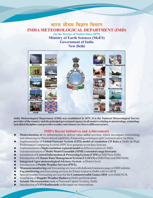
INDIA METEOROLOGICAL DEPARTMENT (<strong>IMD</strong>)<br />
(In the Service of Nation S<strong>in</strong>ce 1875)<br />
M<strong>in</strong>istry of Earth Sciences (MoES)<br />
Government of <strong>India</strong><br />
New Delhi<br />
<strong>India</strong> <strong>Meteorological</strong> <strong>Department</strong> (<strong>IMD</strong>) <strong>was</strong> <strong>established</strong> <strong>in</strong> 1875. It is the National <strong>Meteorological</strong> Service<br />
provider of the country and the pr<strong>in</strong>cipal government agency <strong>in</strong> all matters relat<strong>in</strong>g to meteorology, seismology<br />
and allied discipl<strong>in</strong>es and provides weather and climate services to different sectors.<br />
<strong>IMD</strong>'s Recent Initiatives and Achievements<br />
Modernization of its <strong>in</strong>frastructure to deliver value added services, which encompass refurbish<strong>in</strong>g<br />
and enhanc<strong>in</strong>g its Observational capability, Forecast<strong>in</strong>g techniques and Communication facilities.<br />
Implementation of Global Forecast System (GFS) model at resolution (35 Km) at Delhi on High<br />
Performance Comput<strong>in</strong>g Systems (HPCS) to generate seven days forecast.<br />
Implementation of high resolution regional model at different centres of <strong>IMD</strong>.<br />
Operationalisation of Multi-Model Ensemble (MME) extended range forecasts.<br />
Installation of Central Information & Process<strong>in</strong>g System (CIPS) at <strong>IMD</strong> New Delhi.<br />
Introduction of Climate Data Management System (CLISYS) at <strong>IMD</strong> Pune and <strong>IMD</strong> Delhi.<br />
Integrated Agro-meteorological Advisory System at District level.<br />
Introduction of Public Weather Service (PWS).<br />
Monsoon monitor<strong>in</strong>g and forecast<strong>in</strong>g services with dedicated monsoon page on <strong>IMD</strong> website.<br />
Fog monitor<strong>in</strong>g and forecast<strong>in</strong>g services for Palam Airport <strong>in</strong> Delhi with live RVR.<br />
Special weather forecast<strong>in</strong>g services for the Commonwealth Games 2010 over Delhi NCR.<br />
Installation of Doppler Weather Radars at Delhi and Hyderabad.<br />
Seismic Microzonation study of National Capital Territory, Delhi.<br />
Introduction of GPS Radiosonde <strong>in</strong> the upper-air observations.<br />
1
<strong>India</strong> <strong>Meteorological</strong> <strong>Department</strong><br />
1. Weather Forecast<strong>in</strong>g Services<br />
The National Weather Forecast<strong>in</strong>g Centre (NWFC) has been set up at Mausam Bhawan, Delhi to br<strong>in</strong>g all types of<br />
forecast<strong>in</strong>g services of <strong>IMD</strong> under one umbrella. It provides forecast guidance to six Regional <strong>Meteorological</strong><br />
Centres (RMCs) and State <strong>Meteorological</strong> Centres (MCs).<br />
Salient Features of NWFC<br />
Real time reception and assimilation of multi<br />
sensor observations.<br />
Seamless software tools for various meteorology,<br />
climatology and public weather service<br />
applications.<br />
An <strong>in</strong>tegrated and fully automated forecast<strong>in</strong>g<br />
environment<br />
Synoptic method is overlaid on numerical models<br />
supported by modern graphical and GIS<br />
applications to produce high quality analyses &<br />
forecasts and automated dissem<strong>in</strong>ation of forecast<br />
and warn<strong>in</strong>g.<br />
Backup support of NWFC at <strong>IMD</strong>, Pune <strong>in</strong> the<br />
office of DDGM(Weather and Forecast<strong>in</strong>g)<br />
National Weather Forecast<strong>in</strong>g Centre (NWFC)<br />
Web based Forecast Services : Weather forecast,<br />
meteorological <strong>in</strong>formation, warn<strong>in</strong>gs, normal etc. are<br />
provided through <strong>IMD</strong> Head Quarters at Delhi and<br />
various offices of <strong>IMD</strong>.<br />
<strong>IMD</strong> HQ http://www.imd.gov.<strong>in</strong>/<br />
http://www.mausam.gov.<strong>in</strong>/<br />
<strong>IMD</strong> Pune http://www.imdpune.gov.<strong>in</strong>/<br />
Regional <strong>Meteorological</strong> Centres (RMCs)<br />
<strong>IMD</strong> Delhi http:// www.amssdelhi.gov.<strong>in</strong><br />
<strong>IMD</strong> Mumbai http://www.imdmumbai.gov.<strong>in</strong>/<br />
<strong>IMD</strong> Chennai http://www.imdchennai.gov.<strong>in</strong>/<br />
<strong>IMD</strong> Kolkata http://www.imdkolkata.gov.<strong>in</strong>/<br />
<strong>IMD</strong> Guwahati http://www.imdguwahati.gov.<strong>in</strong>/<br />
<strong>IMD</strong> Nagpur http://www.imdnagpur.gov.<strong>in</strong>/<br />
2<br />
In the Service of Nation S<strong>in</strong>ce 1875
<strong>India</strong> <strong>Meteorological</strong> <strong>Department</strong><br />
Forecast<strong>in</strong>g Cell<br />
Monitor<strong>in</strong>g of weather situation over the country<br />
Issuance of short to medium range forecast with a<br />
outlook on extended range.<br />
Issuance of forecast for mounta<strong>in</strong> region, sports,<br />
tourism and VIP movements etc<br />
Issuance of meteorological sub-division wise<br />
weather warn<strong>in</strong>gs.<br />
Co-ord<strong>in</strong>ation with Regional and State<br />
<strong>Meteorological</strong> Centres for location specific<br />
forecasts<br />
Aviation Cell<br />
Preparation of significant weather charts for<br />
analysis purpose.<br />
Monitor<strong>in</strong>g of aviation weather through 17<br />
Aerodrome <strong>Meteorological</strong> offices, 51<br />
Aeronautical <strong>Meteorological</strong> Weather offices and<br />
<strong>Meteorological</strong> Watch offices (MWO).<br />
(Fog over northern <strong>India</strong> as seen <strong>in</strong> Satellite picture)<br />
Cyclone Warn<strong>in</strong>g & Mar<strong>in</strong>e Forecast<strong>in</strong>g Cell<br />
Responsible for monitor<strong>in</strong>g and prediction of<br />
cyclone disturbances over the north <strong>India</strong>n Ocean.<br />
Issuance of warn<strong>in</strong>g and advisory to national and<br />
<strong>in</strong>ternational disaster management agencies.<br />
Acts as Regional Specialised <strong>Meteorological</strong><br />
Centre (RSMC) to issue tropical cyclone<br />
advisories to World <strong>Meteorological</strong> Organisation<br />
(WMO) /Economic & Social Co-operation for Asia<br />
and Pacific (ESCAP) Panel countries.<br />
Also acts as Tropical Cyclone Advisory Centre<br />
(TCAC) to provide advisories for International<br />
Civil Aviation Organisation (ICAO).<br />
Climate Cell<br />
Climate cell provides the climatological<br />
<strong>in</strong>formation processed through CLYSIS system to<br />
the forecasters.<br />
Satellite and Radar Support Cells<br />
To facilitate the <strong>in</strong>terpretation of satellite and radar<br />
products for forecast<strong>in</strong>g<br />
Interpret the radar products and assist the<br />
forecasters <strong>in</strong> NWFC <strong>in</strong> issuance of weather<br />
advisories and Nowcast<strong>in</strong>g of severe weather.<br />
Satellite application cell monitors and <strong>in</strong>terprets<br />
satellite products and functions <strong>in</strong> the same manner<br />
as the radar cell.<br />
PWS Cell<br />
Generation and dissem<strong>in</strong>ation of customised<br />
weather products from the NWFC.<br />
Nowcast<strong>in</strong>g Cell<br />
Responsible for monitor<strong>in</strong>g and prediction of<br />
severe weather over the country <strong>in</strong> 3-6 hour range.<br />
Issuance of alert to the concerned RMCs/MCs<br />
regard<strong>in</strong>g the impend<strong>in</strong>g severe weather through<br />
video conferenc<strong>in</strong>g.<br />
Agromet and Hydromet Applications Cells<br />
These cells are <strong>in</strong> direct co-ord<strong>in</strong>ation with<br />
forecast<strong>in</strong>g cell and generate Agromet and<br />
Hydromet products on All <strong>India</strong> basis.<br />
3<br />
In the Service of Nation S<strong>in</strong>ce 1875
<strong>India</strong> <strong>Meteorological</strong> <strong>Department</strong><br />
2. Numerical Weather Prediction (NWP) Centre<br />
Global Forecast System (GFS) at T382L64 ( 35 km) resolution has been implemented at <strong>IMD</strong> Delhi on IBM based<br />
High Performance Comput<strong>in</strong>g Systems (HPCS). The new GFS is runn<strong>in</strong>g 2 times a day (00 and 12 UTC) with global<br />
data assimilation and forecast for 7 days. This new higher resolution global forecast model and the correspond<strong>in</strong>g<br />
assimilation system are adopted from NCEP, USA.<br />
Weather Research & Forecast (WRF-Var) System : The regional mesoscale analysis system (WRF-Var) is<br />
<strong>in</strong>stalled on HPCS at <strong>IMD</strong>, Delhi with its all components i.e. pre-process<strong>in</strong>g programs, observation assimilation<br />
program (WRF-Var), boundary condition updation and forecast<strong>in</strong>g model. The model runs with 2 doma<strong>in</strong>s (27 km<br />
and 9 km) at 00 and 12 UTC and forecasts for 3 days.<br />
WRF Non-hydrostatic Mesoscale Model (WRF-<br />
NMM) for tropical cyclone forecast. Run at the time of<br />
tropical cyclone over the <strong>India</strong>n Seas.<br />
Polar WRF for predict<strong>in</strong>g weather conditions over<br />
Antarctica (Maitri), implemented <strong>in</strong> <strong>IMD</strong> <strong>in</strong> October<br />
2010. Forecast of 10m w<strong>in</strong>ds and 2m Temperature for<br />
24 hours over Maitri region.<br />
Extreme Temperature Forecast<strong>in</strong>g : <strong>IMD</strong> from beg<strong>in</strong>n<strong>in</strong>g of 2010 has implemented extreme temperature (Maximum<br />
& M<strong>in</strong>imum) determ<strong>in</strong>istic forecast for two weeks and the monthly probability forecast of extreme temperatures<br />
us<strong>in</strong>g the ensemble members of coupled model outputs.<br />
0<br />
Forecast maximum temperature ( C) anomaly<br />
Based on 08 Apr 2010, valid for 12-18 Apr 2010<br />
0<br />
Forecast m<strong>in</strong>imum temperature ( C) anomaly<br />
Based on 30 Dec 2010, valid for 3-9 Jan 2011<br />
Porbability (%) of Below Normal Maximum Temp<br />
Valid for December 2010 (Based on Nov. 2010)<br />
Porbability (%) of Below Normal M<strong>in</strong>imum Temp<br />
Valid for December 2010 (Based on Nov. 2010)<br />
4<br />
In the Service of Nation S<strong>in</strong>ce 1875
<strong>India</strong> <strong>Meteorological</strong> <strong>Department</strong><br />
3. Nowcast<strong>in</strong>g<br />
Nowcast<strong>in</strong>g falls under the category of weather<br />
forecast<strong>in</strong>g valid for very short duration (say upto 6 hours).<br />
The venue specific forecasts based on meso-scale model<br />
with the assimilation of Delhi Doppler Weather Radar<br />
Observation <strong>was</strong> implemented to support weather forecast<br />
system for Delhi Commonwealth Games 2010. Different<br />
nowcast products are given here :<br />
NOWCAST SYSTEM - SWIRLS<br />
(Based on Delhi Radar Data)<br />
Location Specific Meteograms<br />
(WRF-VAR at 3 KM Resolution)<br />
NOWCAST SYSTEM -WDSSII<br />
(Based on Delhi Radar Data)<br />
MESOSCALE MODEL ARPS<br />
(with DWR assimilation)<br />
4. <strong>Meteorological</strong> Telecommunication<br />
Telecommunication Division of <strong>IMD</strong> provides the support function needed for meteorological data and processed<br />
products to the users, both on national and <strong>in</strong>ternational level. S<strong>in</strong>ce its <strong>in</strong>ception <strong>in</strong> 1969, <strong>IMD</strong> ma<strong>in</strong>ta<strong>in</strong>s an extensive<br />
telecommunication network for speedy collection of meteorological <strong>in</strong>formation, both basic data and processed<br />
products, all over the globe. The ma<strong>in</strong> telecommunication hub of the <strong>IMD</strong>'s telecommunication network is located at<br />
New Delhi. It is now termed the National <strong>Meteorological</strong> Telecommunication Centre (NMTC).<br />
New Delhi is a Regional Telecommunication Hub (RTH) on the Ma<strong>in</strong> Telecommunication Network (MTN)<br />
connect<strong>in</strong>g the two World <strong>Meteorological</strong> Centres, Moscow directly and Wash<strong>in</strong>gton via Tokyo.<br />
The National <strong>Meteorological</strong> Telecommunication Network (NMTN) is designed to collect observational<br />
data and to receive and distribute meteorological <strong>in</strong>formation on a national level through 19 collection<br />
centers (which are either <strong>Meteorological</strong> Centers at the State Capitals or Regional <strong>Meteorological</strong> Centres).<br />
5<br />
In the Service of Nation S<strong>in</strong>ce 1875
<strong>India</strong> <strong>Meteorological</strong> <strong>Department</strong><br />
5. Integrated Data Process<strong>in</strong>g and Communication Systems<br />
This is focused on core (critical) <strong>in</strong>formation systems and <strong>in</strong>tegration of all new components <strong>in</strong>to a comprehensive<br />
s<strong>in</strong>gle system, which <strong>in</strong>cludes follow<strong>in</strong>g major components : TRANSMET, Central Information & Process<strong>in</strong>g<br />
System (CIPS), CLISYS, SYNERGIE and Public Weather System (PWS).<br />
TRANSMET -Is the new central node of <strong>IMD</strong> national & <strong>in</strong>ternational telecommunications.<br />
Central Information & Process<strong>in</strong>g System (CIPS)- To handle, manage, store, process and archive all data<br />
received from <strong>in</strong>ternational and national observation networks, NWP models, products from INSAT & Kalpana<br />
Satellites, and DWR network.<br />
Climate Data Management System (CLISYS)- Systematically gathers weather observations <strong>in</strong> <strong>India</strong>, quality<br />
control, manage, analyze and dissem<strong>in</strong>ate <strong>in</strong> electronic form.<br />
SYNERGIE-<br />
It <strong>in</strong>tegrates all the meteorological data (<strong>in</strong> WMO recommended formats) <strong>in</strong>to the same system and<br />
allow the forecasters to use and/or comb<strong>in</strong>e any type of data at any step of his work.<br />
Public Weather System (PWS)-<br />
Metofactory<br />
- it allows <strong>IMD</strong> to deliver automatically to their end-users the meteorological products and services<br />
they need <strong>in</strong> the right format and at the right time<br />
TV system - To communicate the forecast and the weather situation to public<br />
Visumet- A user friendly graphical format display system for display<strong>in</strong>g different weather phenomenon,<br />
forecast, satellite, Radar images etc.<br />
6<br />
In the Service of Nation S<strong>in</strong>ce 1875
<strong>India</strong> <strong>Meteorological</strong> <strong>Department</strong><br />
6. Surface and Upper Air Observations<br />
One of the mandates of <strong>IMD</strong> is to take meteorological observations on real time basis and to provide current &<br />
past observations for operational and research use.<br />
Surface Observatories are located almost one <strong>in</strong> each district (559 observatories) so as to meet the requirements of<br />
agricultural, transport and other operations.<br />
Under the ongo<strong>in</strong>g modernization program of <strong>IMD</strong>, it is planned to establish a network of 1000 Automatic<br />
Weather Station (AWS) and 3600 Automatic Ra<strong>in</strong> Gauge Stations (ARG) across the county <strong>in</strong> a phased manner.<br />
In addition to the meteorological observatories, <strong>in</strong>struments are also placed <strong>in</strong> the Airports for measur<strong>in</strong>g Runway<br />
Visual Range (RVR).<br />
Installed ARGs RVR equipment Installed AWSs<br />
Upgradation <strong>in</strong> the Upper Air Observ<strong>in</strong>g System<br />
<strong>IMD</strong>'s Upper air observational network comprises 39 radiosonde and 62 pilot balloon observatories spread all over<br />
the country. New GPS based sound<strong>in</strong>g systems have been <strong>in</strong>troduced <strong>in</strong> the observational network for the upper air<br />
observations at 10 locations. The GPS radiosonde operates <strong>in</strong> 1680 MHz and has digital architecture. It uses GPS to<br />
provide the location of the sonde dur<strong>in</strong>g the ascent and hence is used to derive the w<strong>in</strong>d speed and w<strong>in</strong>d direction.<br />
An MoU <strong>was</strong> signed between Society for<br />
Advance Microwave Electronics<br />
Eng<strong>in</strong>eer<strong>in</strong>g and Research (SAMEER), a<br />
Society under M<strong>in</strong>istry of Communication<br />
and Information Technology and <strong>IMD</strong>, <strong>in</strong><br />
May 2007 for explor<strong>in</strong>g the possibilities of<br />
<strong>in</strong>digenous development of various<br />
<strong>in</strong>struments to up-grade the upper air<br />
observational capabilities of <strong>IMD</strong>.<br />
Indigenous GPS sonde ground<br />
receiv<strong>in</strong>g antenna<br />
Semi automation of the Pilot<br />
Balloon Computation System<br />
Semi Automation of the Pilot Balloon<br />
Computation System : The computation<br />
system at all the 62 Pilot Balloon<br />
Observatories has been upgraded to semiautomatic<br />
type by deployment of the Hand<br />
Held Computation System. This is very<br />
user friendly menu driven system, saves<br />
the time, data quality checks are applied<br />
and data availability is <strong>in</strong> near real time to<br />
the forecasters. The data is now be<strong>in</strong>g<br />
archived <strong>in</strong> digital format.<br />
Indigenous Software for data<br />
acquisition<br />
7<br />
In the Service of Nation S<strong>in</strong>ce 1875
<strong>India</strong> <strong>Meteorological</strong> <strong>Department</strong><br />
7. Satellite Meteorology<br />
<strong>IMD</strong> is receiv<strong>in</strong>g and process<strong>in</strong>g meteorological data from two <strong>India</strong>n satellites namely Kalpana-1 and INSAT-3A.<br />
th 0 th<br />
Kalpana-1 <strong>was</strong> launched on 12 September, 2002 and is located at 74 E. INSAT-3A <strong>was</strong> launched on 10 April, 2003<br />
0<br />
and is located at 93.5 E. Kalpana-1 and INSAT-3A both have three channel Very High Resolution Radiometer<br />
(VHRR) for imag<strong>in</strong>g the Earth <strong>in</strong> Visible (0.55-0.75 m), Infra-Red (10.5-12.5m) and Water vapour (5.7-7.1m)<br />
channels hav<strong>in</strong>g resolution of 2X2 kms. <strong>in</strong> visible and 8X8 kms. <strong>in</strong> WV and IR channels. In addition the INSAT-3A<br />
has a three channel Charge Coupled Device payload for imag<strong>in</strong>g the earth <strong>in</strong> Visible (0.62-0.69m), Near Infra Red<br />
(0.77-0.86m) and Short Wave Infra Red (1.55-1.77m) bands of Spectrum. The Resolution of CCD payload <strong>in</strong> all the<br />
three channels is 1 Km × 1 Km. At present about 48 nos. of satellite images are taken daily from Kalpana-1 which is<br />
the ma<strong>in</strong> operational satellite and 9 images are taken from INSAT-3A. Imag<strong>in</strong>g from CCD is done 5 times dur<strong>in</strong>g<br />
daytime only. All the received data from the satellite is processed and archived <strong>in</strong> National Satellite Data Centre<br />
(NSDC), New Delhi. (http://www.imd.gov.<strong>in</strong>/section/satmet/dynamic/<strong>in</strong>sat.htm)<br />
Quantitative Satellite Products<br />
Sea surface Temperatures (SSTs)<br />
Outgo<strong>in</strong>g Longwave Radiation(OLR)<br />
Quantitative Precipitation Estimates (QPEs)<br />
Cloud motion vectors (CMVs)<br />
Water vapor w<strong>in</strong>ds (WVWs)<br />
Sea Surface Temperature<br />
Land Surface Emissivity<br />
A Products catalog for NOAA/MODIS<br />
satellites payloads <strong>was</strong> also prepared and<br />
posted on <strong>IMD</strong> ma<strong>in</strong> website for use of<br />
forecasters and researchers.<br />
Recently three Ground receiv<strong>in</strong>g and<br />
process<strong>in</strong>g systems for NOAA/METOP<br />
and MODIS Polar orbit<strong>in</strong>g satellites were<br />
<strong>in</strong>stalled at <strong>IMD</strong> New Delhi, RMC Chennai<br />
and at RMC Guwahati.<br />
Atmospheric moisture profile<br />
Fog detection<br />
The OCEANSAT-2 Satellite of ISRO<br />
became available for operational use from<br />
July 2010. The Sat. Met. Division has<br />
undertaken projects with SAC (ISRO)<br />
utiliz<strong>in</strong>g the OCEANSAT -2 data for<br />
Tropical Cyclone genesis and use of data <strong>in</strong><br />
NWP models.<br />
Outgo<strong>in</strong>g Longwave Radiation (Jun-Sep, 2010)<br />
Ocean surface w<strong>in</strong>d<br />
Kalpana's WVW<br />
Normalised DifferenceVegetation Index<br />
8<br />
In the Service of Nation S<strong>in</strong>ce 1875
<strong>India</strong> <strong>Meteorological</strong> <strong>Department</strong><br />
INSAT-3D Earth Station and <strong>IMD</strong>'s<br />
read<strong>in</strong>ess<br />
A new Earth station for receiv<strong>in</strong>g the<br />
data from INSAT-3D <strong>was</strong> <strong>in</strong>stalled at<br />
<strong>IMD</strong> New Delhi. It accomplishes<br />
<strong>IMD</strong>'s read<strong>in</strong>ess for INSAT 3D<br />
satellite to be launched soon by ISRO.<br />
The satellite will have a 6 channels<br />
imager and a 19 channels sounder with<br />
1 Km resolution imagery <strong>in</strong> visible<br />
band, 4 Km <strong>in</strong> IR band and 8 Km <strong>in</strong><br />
water vapor channel.<br />
In addition to satellite imagery <strong>in</strong> six<br />
channels several new derived products<br />
along with the vertical profiles of<br />
atmospheric temperature, moisture<br />
and ozone will be available after<br />
process<strong>in</strong>g the data from INSAT-3D.<br />
Modernization of Cyclone Warn<strong>in</strong>g Dissem<strong>in</strong>ation System<br />
Modified Cyclone Warn<strong>in</strong>g Dissem<strong>in</strong>ation System (CWDS) to<br />
replace the exist<strong>in</strong>g network of CWDS is under process.<br />
Implementation of this will make Cyclone Warn<strong>in</strong>g on one of the<br />
DTH television channels.<br />
8. RADAR Meteorology<br />
Basically used for Nowcast<strong>in</strong>g and very short range weather forecast<strong>in</strong>g<br />
A Doppler Weather Radar (DWR) provides velocity and spectrum width data (<strong>in</strong> addition to reflectivity). This<br />
capability permits the forecaster to view weather events like thunderstorms, hailstorm, heavy ra<strong>in</strong>fall etc <strong>in</strong><br />
greater detail.<br />
DWR provides various meteorological, hydrological and aviation products which are very useful for forecasters<br />
<strong>in</strong> estimat<strong>in</strong>g the storm's center, fix<strong>in</strong>g its position and predict<strong>in</strong>g its future path.<br />
In Numerical Weather Prediction models the DWR data, which is <strong>in</strong> digital form, can directly be assimilated, to<br />
have better ra<strong>in</strong>fall estimation, better prediction of the storm track and po<strong>in</strong>t of landfall for tropical cyclones.<br />
By end of phase-i of the moder<strong>in</strong>aztion, 21 DWRs will be <strong>in</strong> operation and by end of phase-ii 55 DWRs will be<br />
operational.<br />
Raw data from DWRs is received onl<strong>in</strong>e at central server and is converted to the format required by modelers and<br />
shared through <strong>IMD</strong>-Telecom (TRANSMET) and also used to create a national radar mosaic.<br />
Exist<strong>in</strong>g and Proposed RADAR<br />
Networks of <strong>IMD</strong><br />
The new DWR <strong>in</strong>stalled at<br />
Hyderabad<br />
rd<br />
DWR imagery of Delhi, of 19<br />
April 2010.<br />
9<br />
In the Service of Nation S<strong>in</strong>ce 1875
<strong>India</strong> <strong>Meteorological</strong> <strong>Department</strong><br />
9. Agromet-Advisory Services (AAS)<br />
<strong>India</strong>n agriculture has, for centuries, been solely dependent on the<br />
weather and vagaries of the monsoon <strong>in</strong> particular. The object of<br />
agriculture meteorology is to m<strong>in</strong>imize the impact of adverse weather<br />
on crops and to make use of crop weather relationship to boost<br />
agricultural production. The Agricultural Meteorology W<strong>in</strong>g of the<br />
<strong>IMD</strong>, which <strong>was</strong> <strong>established</strong> at Pune <strong>in</strong> 1932, supports and<br />
participates <strong>in</strong> multidiscipl<strong>in</strong>ary activities <strong>in</strong> this field. Forecast and<br />
advisories for farmers are issued by Agrometeorological Field Units<br />
at Agroclimatic zone level, <strong>IMD</strong>'s forecast<strong>in</strong>g offices of State capital<br />
and National Agromet Advisory Service Centre, Pune. Besides, it is<br />
also the centre for the research programs <strong>in</strong> Agricultural Meteorology<br />
and has field units <strong>in</strong> various parts of the country.<br />
(Agricultural output is prime for the<br />
country economy)<br />
<strong>IMD</strong> works <strong>in</strong> close association with agricultural universities,<br />
research <strong>in</strong>stitutions and central and state agricultural agencies.<br />
Agromet Scientists <strong>in</strong>teract with experts <strong>in</strong> relevant discipl<strong>in</strong>es and<br />
<strong>IMD</strong>'s experts to frame agrometeorological advisories for farmers and<br />
State <strong>Department</strong> of Agriculture/agricultural <strong>in</strong>stitutions supply crop<br />
data required for <strong>IMD</strong>'s services and research efforts. Helps are<br />
extended to establish and ma<strong>in</strong>ta<strong>in</strong> specialized observatories, provide<br />
access to an extensive agrometeorological database and give <strong>in</strong>puts<br />
for agricultural plann<strong>in</strong>g.<br />
(Central Agromet Observatory, Pune)<br />
District level Agro-Met Advisory Services<br />
About 60 percent population of <strong>India</strong> depends on agriculture and thus weather-based agricultural advisories<br />
are critical. The focus is on strengthen<strong>in</strong>g the farmer's knowledge of weather, climate and suitable farm practices <strong>in</strong><br />
their overall efforts to augment crop productivity. Weather and climatic <strong>in</strong>formation plays a major role before and<br />
dur<strong>in</strong>g the cropp<strong>in</strong>g season and is helpful to the farmer to organize and activate his own resources to respond to the<br />
situation. The Agro-meteorological Advisory Service (AAS) is a mechanism to provide relevant <strong>in</strong>formation on<br />
meteorological and agricultural practices to improve agricultural production; both <strong>in</strong> quantity and quality.<br />
10<br />
In the Service of Nation S<strong>in</strong>ce 1875
<strong>India</strong> <strong>Meteorological</strong> <strong>Department</strong><br />
10. Hydro-meteorological Services<br />
Hydromet division caters to the need of hydromet <strong>in</strong>puts particularly of Water Resources Development and Water<br />
Related Disaster (like floods and drought) monitor<strong>in</strong>g / management and it provides services <strong>in</strong> the follow<strong>in</strong>g fields<br />
viz., Ra<strong>in</strong>fall Monitor<strong>in</strong>g; Hydro met Forecast<strong>in</strong>g (QPF); Hydro met Design; Glaciology; National and International<br />
Co-operation and Public Awareness.<br />
Ma<strong>in</strong> Activities<br />
Real Time Monitor<strong>in</strong>g of Ra<strong>in</strong>fall and preparation of ra<strong>in</strong>fall summary<br />
<strong>Meteorological</strong> support for flood warn<strong>in</strong>g and flood control operations to field units of Central Water<br />
Commission (CWC) through its Flood <strong>Meteorological</strong> Offices (FMOs)<br />
Hydrometeorological analysis of different river catchments for project authorities.<br />
Compilation of ra<strong>in</strong>fall statistics<br />
11. Drought Monitor<strong>in</strong>g - Is<br />
another important service provided by<br />
<strong>IMD</strong> through :-<br />
Monitor<strong>in</strong>g <strong>Meteorological</strong> drought.<br />
Preparation of Drought Climatology<br />
Del<strong>in</strong>eation and identification of<br />
Drought Prone areas.<br />
Monitor<strong>in</strong>g Agricultural drought<br />
conditions dur<strong>in</strong>g Southwest and<br />
Northeast monsoon seasons by<br />
prepar<strong>in</strong>g aridity anomaly maps.<br />
12. Astronomical Services<br />
Areas Show<strong>in</strong>g Classification of<br />
Moderate Drought (1901-2000)<br />
Aridity Anomaly (17-23 Sep 2010)<br />
The Positional Astronomy Centre (PAC) situated <strong>in</strong> Kolkata is the nodal office of the Govt. of <strong>India</strong> who has got the<br />
responsibility to prepare the data on positional astronomy for scientific purposes and national calendar for civic and<br />
religious purposes. (http://www.packolkata.org).<br />
Activities of PAC<br />
Br<strong>in</strong>g out publications (<strong>India</strong>n Astronomical Ephemeris, Tables of<br />
Sunrise & Sunset and Moonrise & Moonset and Rashtriya Panchang).<br />
Take observations on important astronomical events (Solar Eclipse,<br />
Lunar Eclipse, Comet etc).<br />
Render Data Services<br />
Work of Popularisation of Astronomy<br />
11<br />
In the Service of Nation S<strong>in</strong>ce 1875
<strong>India</strong> <strong>Meteorological</strong> <strong>Department</strong><br />
13. <strong>Meteorological</strong> Services to Aviation<br />
<strong>IMD</strong> provides meteorological support to the national and<br />
<strong>in</strong>ternational civil aviation sector through a network of four<br />
<strong>Meteorological</strong> Watch Offices (MWOs) located at the four major<br />
<strong>in</strong>ternational airports at Chennai, Kolkata, Mumbai and New Delhi<br />
cover<strong>in</strong>g the respective Flight Information Region (FIR), 18<br />
Aerodrome <strong>Meteorological</strong> Offices (AMO) <strong>in</strong>clud<strong>in</strong>g the four<br />
MWOs and 53 Aeronautical <strong>Meteorological</strong> Stations (AMS)<br />
located at various airports <strong>in</strong> the country.<br />
A Tropical Cyclone Advisory Centre (TCAC) is also function<strong>in</strong>g at<br />
<strong>IMD</strong>, New Delhi to provide advisory <strong>in</strong>formation on tropical<br />
cyclones.<br />
Services provided<br />
Supply of Current Weather Observations to all<br />
aeronautical users<br />
Integrated Airport <strong>Meteorological</strong> Instrument<br />
System (AMIS) <strong>in</strong>stalled at Amritsar, BIAL<br />
Bangalore, Chennai, Hyderabad, Guwahati, Jaipur,<br />
Mumbai, New Delhi for automatic acquisition,<br />
process<strong>in</strong>g, dissem<strong>in</strong>ation and display <strong>in</strong> real time of<br />
the meteorological parameters affect<strong>in</strong>g land<strong>in</strong>g and<br />
take-off operations.<br />
Issue of forecast and warn<strong>in</strong>gs on meteorological<br />
hazards to aviation:<br />
Land<strong>in</strong>g and Take-off forecast (TREND)<br />
Term<strong>in</strong>al Aerodrome Forecast (TAF)<br />
Route Forecast<br />
Aerodrome Warn<strong>in</strong>g<br />
Area/ Local Forecasts<br />
SIGMET<br />
SIGWX<br />
Web based onl<strong>in</strong>e brief<strong>in</strong>g to Airl<strong>in</strong>es<br />
Future programmes<br />
Implementation of Aviation Weather Decision<br />
Support System at Delhi ( Palam) Airport<br />
Establishment of National Aviation Met Centre<br />
at New Delhi<br />
Application of SYNERGIE system <strong>in</strong> Aviation<br />
met product generation<br />
Provision to run MM5/ WRF meso-scale models<br />
to meet the specific airfield requirements at<br />
AMOs.<br />
Introduction of TREND forecast <strong>in</strong> all AMSs.<br />
Reception of MET data through AMDAR over<br />
<strong>India</strong>n Flight Information Regions to be<br />
<strong>in</strong>troduced.<br />
Implementation of ISO 9000 compatible quality<br />
management system for its aviation<br />
meteorological services.<br />
Tak<strong>in</strong>g up of the Survey <strong>in</strong> order to get the user<br />
feed back.<br />
14. Environmental Monitor<strong>in</strong>g Services<br />
The Environmental Meteorology Unit of <strong>IMD</strong> <strong>was</strong> set up at New Delhi under an agency scheme of the M<strong>in</strong>istry of<br />
Environment & Forests. The unit is now renamed as Environmental Monitor<strong>in</strong>g Research Center (EMRC) <strong>in</strong> <strong>IMD</strong>. It<br />
provides specific services to this M<strong>in</strong>istry and other Government agencies for the assessment of pollution impacts<br />
from various <strong>in</strong>dustries and thermal power plants. Atmospheric dispersion models are employed for prediction of air<br />
quality, under different terra<strong>in</strong> and meteorological conditions. These studies facilitate decisions regard<strong>in</strong>g sit<strong>in</strong>g of<br />
<strong>in</strong>dustries and adoption of control strategies.<br />
Measurements of<br />
Precipitation Chemistry<br />
(Acid ra<strong>in</strong> threats)<br />
Atmospheric turbidity<br />
Radiation<br />
Sunsh<strong>in</strong>e Duration<br />
Evaporation<br />
Ozone (Surface & total)<br />
Antarctica Ozone<br />
Monitor<strong>in</strong>g Climate Forc<strong>in</strong>g Parameters<br />
To establish and operate a permanent network<br />
of stations <strong>in</strong> <strong>India</strong> to monitor atmospheric<br />
composition of radiatively active species<br />
(CO 2,CH 4,N2O,O 3 and aerosols)<br />
To establish a GHG Reference Laboratory and<br />
National GHGs Standards l<strong>in</strong>ked to<br />
International Standards.<br />
To establish a Data Centre<br />
Brewer Ozone Spectrophotometer<br />
at Maitri (Antractica)<br />
12<br />
In the Service of Nation S<strong>in</strong>ce 1875
<strong>India</strong> <strong>Meteorological</strong> <strong>Department</strong><br />
15. Seismological Services<br />
<strong>IMD</strong> is the nodal agency of Government of <strong>India</strong> responsible for monitor<strong>in</strong>g seismic activity <strong>in</strong> and around the<br />
country, with the first seismological observatory of the country hav<strong>in</strong>g been set up by the department at Kolkata<br />
<strong>in</strong> 1898.<br />
The operational task of the department is to quickly estimate the earthquake source parameters immediately on<br />
occurrence of an earthquake and dissem<strong>in</strong>ate the <strong>in</strong>formation to all the user agencies <strong>in</strong>clud<strong>in</strong>g the concerned<br />
State and Central Government agencies responsible for carry<strong>in</strong>g out relief and rehabilitation measures.<br />
<strong>IMD</strong> is ma<strong>in</strong>ta<strong>in</strong><strong>in</strong>g the National Seismological Network (NSN) consist<strong>in</strong>g of 55 observatories, which <strong>in</strong>cludes<br />
17-station Real Time Seismic Monitor<strong>in</strong>g Network (RTSMN) set up for early warn<strong>in</strong>g of tsunamis. <strong>IMD</strong> is also<br />
ma<strong>in</strong>ta<strong>in</strong><strong>in</strong>g a 16-station, V-SAT based digital seismic telemetry system around National Capital Territory (NCT)<br />
of Delhi for close monitor<strong>in</strong>g of seismic activity <strong>in</strong> the region.<br />
The <strong>in</strong>formation relat<strong>in</strong>g to under-sea earthquakes capable of generat<strong>in</strong>g tsunamis on the <strong>India</strong>n coastal regions<br />
is also dissem<strong>in</strong>ated to all concerned user agencies <strong>in</strong>clud<strong>in</strong>g the <strong>India</strong>n National Centre for Ocean Information<br />
Services (INCOIS), Hyderabad for issue of tsunami related messages and warn<strong>in</strong>gs.<br />
The earthquake <strong>in</strong>formation is transmitted to various user agencies <strong>in</strong>clud<strong>in</strong>g public <strong>in</strong>formation channels, press,<br />
media etc. us<strong>in</strong>g different modes of communication, such as SMS, fax, email, IVRS and also posted on <strong>IMD</strong>'s<br />
Website (www.imd.gov.<strong>in</strong> and www. mausam.gov.<strong>in</strong>).<br />
Ma<strong>in</strong> Activities<br />
Archival of processed seismological data at the National<br />
Seismological Database Centre (NSDC) on a regular basis<br />
and supply of the same to various user agencies.<br />
Publication of monthly National Seismological Bullet<strong>in</strong><br />
about all earthquakes located by the Seismological Network<br />
of <strong>IMD</strong>.<br />
Periodical tra<strong>in</strong><strong>in</strong>g programs/refresher courses <strong>in</strong><br />
Seismology<br />
Recent Achievements<br />
Facilities<br />
created for raster scann<strong>in</strong>g, process<strong>in</strong>g and vector<br />
digitization of old analog charts at Seismological<br />
Observatory, Kamla Nehru Ridge, Delhi<br />
Installation of field equipment under Seismic Telemetry<br />
System <strong>in</strong> north east <strong>India</strong> region is <strong>in</strong> process. A new<br />
permanent build<strong>in</strong>g for Seismological observatory at<br />
Imphal is completed .<br />
Bilateral cooperation <strong>in</strong> the fields of Seismology and<br />
earthquake prediction research with Russia and Mexico.<br />
Earthquake Risk Evaluation Center (EREC)<br />
Earthquake Risk Evaluation Center (EREC) <strong>was</strong> <strong>established</strong><br />
<strong>in</strong> February 2004, as a multidiscipl<strong>in</strong>ary Center to provide<br />
purposive turn<strong>in</strong>g po<strong>in</strong>t to guide national endeavor <strong>in</strong><br />
mitigat<strong>in</strong>g the disastrous impacts of earthquakes and<br />
undertake/promote specific tasks related to Earthquake<br />
Hazard Evaluation and Risk Assessment.<br />
In this context 'Seismic Hazard and Risk Microzonation' (SHRM)<br />
provides an important tool. EREC has completed the Seismic<br />
Hazard Microzonation of NCT Delhi on 1:50,000 scale and<br />
EREC has also collaborated <strong>in</strong> the Seismic Hazard<br />
Microzonation of Jabalpur, Guwahati and Bangalore.<br />
EREC is now carry<strong>in</strong>g out Seismic Hazard Microzonation of<br />
NCT Delhi with higher precision on 1:10,000 scale<br />
(Comprises of 75 toposheets).<br />
13<br />
National Seismology Observatory Network<br />
In the Service of Nation S<strong>in</strong>ce 1875
<strong>India</strong> <strong>Meteorological</strong> <strong>Department</strong><br />
16. Climate Services<br />
<strong>IMD</strong> has dedicated networks for climatic observations and has been provid<strong>in</strong>g climate services for more than<br />
a century. <strong>India</strong> specific climate related activities are :-<br />
Climate Monitor<strong>in</strong>g and Analysis Climate Data Management<br />
Climate Research<br />
Climate Prediction (Monthly & Seasonal Forecasts)<br />
National Data Center (NDC) : <strong>IMD</strong> has long time series of various climate data <strong>in</strong> its archive. Data rescue and data<br />
services are ma<strong>in</strong>ly provided by NDC at <strong>IMD</strong>, Pune.<br />
National Climate Centre (NCC):<br />
National Climate Center (NCC) is responsible for long range forecast , climate monitor<strong>in</strong>g, diagnostics and<br />
development of climate data products. It generates, many climate data products for smaller spatial and temporal<br />
scales for the user community like (i) high resolution daily gridded ra<strong>in</strong>fall & temperature, (ii) district wise daily<br />
normal of surface met parameters and (iii) mar<strong>in</strong>e climate summaries for <strong>India</strong>n Ocean region etc.<br />
It also prepares and publishes monthly, seasonal and annual climate diagnostic bullet<strong>in</strong>s for <strong>India</strong>n region.<br />
Long Range Forecasts : <strong>India</strong> <strong>was</strong> the first country to start operational Long Range Forecasts, s<strong>in</strong>ce 1886 by Sir<br />
H F Blanford. <strong>IMD</strong> issues operational long range forecasts for seasonal ra<strong>in</strong>fall for w<strong>in</strong>ter, monsoon ra<strong>in</strong>fall and<br />
northeast monsoon ra<strong>in</strong>fall. These forecasts are prepared us<strong>in</strong>g <strong>in</strong>digenously developed empirical models. <strong>IMD</strong><br />
has also implemented a dynamical prediction system based on an atmospheric GCM for monthly and seasonal<br />
forecasts for the monsoon season. <strong>IMD</strong> also uses coupled models outputs from other centers to prepare<br />
dynamical-empirical hybrid forecast for Southwest monsoon ra<strong>in</strong>fall.<br />
17. Human Resource Development - Capacity Build<strong>in</strong>g<br />
Human Resource Development has always been one of the prime thrust areas of <strong>IMD</strong> for capacity build<strong>in</strong>g and to<br />
keep pace with latest trends <strong>in</strong> various activities of the <strong>Department</strong>. Facilities for meteorological tra<strong>in</strong><strong>in</strong>g at Pune and<br />
New Delhi have been recognized by the World <strong>Meteorological</strong> Organisation (WMO) to function as Regional<br />
<strong>Meteorological</strong> Tra<strong>in</strong><strong>in</strong>g Centre (RMTC) <strong>in</strong> all the four ma<strong>in</strong> discipl<strong>in</strong>es namely, General Meteorology, Upper Air<br />
Instrumaentation, Telecommunication and Agro-meteorology.<br />
Ma<strong>in</strong> Functions of Tra<strong>in</strong><strong>in</strong>g Division<br />
The annual mean temperature for <strong>India</strong> <strong>was</strong> +0.91 C above average, mak<strong>in</strong>g<br />
the year 2009 the warmest year on record s<strong>in</strong>ce 1901.<br />
The Central Tra<strong>in</strong><strong>in</strong>g Institute (CTI) Pune, which is WMO’s RMTC s<strong>in</strong>ce 1986, is the ma<strong>in</strong> tra<strong>in</strong><strong>in</strong>g centre for<br />
operational Meteorologists of <strong>IMD</strong>.<br />
Imparts one year “Advanced meteorological tra<strong>in</strong><strong>in</strong>g course” to the operational Meteorologists of the<br />
neighbor<strong>in</strong>g countries <strong>in</strong> RA-II & V region under WMO regional co-operation programme. The same tra<strong>in</strong><strong>in</strong>g<br />
course is also offered to the officials of other Govt of <strong>India</strong> Organizations (Viz., <strong>India</strong>n Navy, <strong>India</strong>n coast guard,<br />
etc.) and to the newly recruited <strong>IMD</strong> class-I officers.<br />
Provides tra<strong>in</strong><strong>in</strong>g at different levels to the <strong>IMD</strong> personnel.<br />
Under Cont<strong>in</strong>uous Education and Tra<strong>in</strong><strong>in</strong>g (CET) programme, CTI also conducts, on average 3 refresher courses<br />
per year on the themes of topical <strong>in</strong>terest.<br />
14<br />
In the Service of Nation S<strong>in</strong>ce 1875
<strong>India</strong> <strong>Meteorological</strong> <strong>Department</strong><br />
18. Monsoon Monitor<strong>in</strong>g & Forecast<strong>in</strong>g (Monsoon Page)<br />
<strong>IMD</strong> has tried to meet long felt need of Monsoon Meteorologists, Scientists and operational forecasters by creat<strong>in</strong>g<br />
new Monsoon Page on <strong>IMD</strong> website ( http://www.imd.gov.<strong>in</strong>/section/nhac/dynamic/Monsoon_frame.htm) from the<br />
beg<strong>in</strong>n<strong>in</strong>g of the southwest monsoon season 2010, where most of the current and past data related to the Summer<br />
monsoon, monsoon monograph, FAQ on monsoon, meteorological glossary, Bibliography on monsoon etc. are be<strong>in</strong>g<br />
put along with the real time model forecast, bullet<strong>in</strong>s and press release. Hope the data and <strong>in</strong>formation available on<br />
website will be useful to research scientists, operational forecasters and variety of users. A record number of visitors<br />
(more than 5 Lakhs) browsed the page dur<strong>in</strong>g the monsoon season of 2010 from June to September.<br />
Multi -model Extended Range Forecast (two weeks determ<strong>in</strong>istic and monthly probabilistic)<br />
The multi model ensemble forecast us<strong>in</strong>g<br />
coupled models outputs from ECMWF and<br />
NCEP are used for prepar<strong>in</strong>g two weeks<br />
forecasts updated once <strong>in</strong> every week. The<br />
forecast ra<strong>in</strong>fall anomaly based on 09 Sep 2010<br />
and (a) valid for days 5-11 (13-19 Sep) and<br />
(b) valid for days 12-18 (20 -26 Sep) <strong>in</strong>dicat<strong>in</strong>g<br />
delayed withdrawal of monsoon.<br />
(a)<br />
MME forecast ra<strong>in</strong>fall anomaly (mm/day)<br />
Based on 09 Sep, valid for 13-19 Sep 2010<br />
(b)<br />
MME forecast ra<strong>in</strong>fall anomaly (mm/day)<br />
Based on 09 Sep, valid for 20-26 Sep 2010<br />
The real time coupled models outputs are also<br />
used for prepar<strong>in</strong>g monthly probability forecast<br />
once <strong>in</strong> a month. The probability forecasts based<br />
on July 2010 and valid for August 2010 <strong>in</strong> the<br />
form of (a) below normal and (b) above normal<br />
probability of ra<strong>in</strong>fall are shown here.<br />
(a)<br />
Probability (%) of below normal ra<strong>in</strong>fall<br />
Based on Jul 2010, valid for August 2010<br />
(b)<br />
Probability (%) of above normal ra<strong>in</strong>fall<br />
Based on Jul 2010, valid for August 2010<br />
Monsoon Page<br />
19. Quarterly Journal “MAUSAM”<br />
Quarterly Research Journal MAUSAM<br />
Formerly known as <strong>India</strong>n Journal of Meteorology and<br />
Geophysics (IJMG) <strong>was</strong> published regularly from<br />
January 1950. Later the name <strong>was</strong> changed to <strong>India</strong>n<br />
Journal of Meteorology, Hydrology & Geophysics (IJMH<br />
& G) <strong>in</strong> 1975. A concise H<strong>in</strong>di name MAUSAM<strong>was</strong><br />
given 5 year later.<br />
Diamond Jubilee Volume 2009 (to commemorate Sixty<br />
years of Journal “MAUSAM”).<br />
Monsoon Mission Programme of M<strong>in</strong>istry of Earth<br />
Sciences (MoES)<br />
Under the monsoon mission programme, an<br />
Implement<strong>in</strong>g Agreement (IA) on technical<br />
cooperation for the study of dynamical seasonal<br />
prediction of <strong>India</strong>n summer monsoon ra<strong>in</strong>fall has been<br />
signed <strong>in</strong> 2010 between the MoES, <strong>India</strong> and the<br />
NOAA, USA for a period of 5 years with <strong>IMD</strong> as one<br />
participat<strong>in</strong>g <strong>in</strong>stitution. One of he objectives of the<br />
mission is to setup a state of the art dynamical model<strong>in</strong>g<br />
frame work for improv<strong>in</strong>g prediction skill of (i)<br />
Seasonal and Extended range prediction system and<br />
(ii) Short and Medium range prediction system.<br />
MAUSAM<br />
Oct., 2010<br />
Diamond Jubilee<br />
Vol., 2009<br />
Diamond Jubilee<br />
Souvenir<br />
15<br />
In the Service of Nation S<strong>in</strong>ce 1875
<strong>India</strong> <strong>Meteorological</strong> <strong>Department</strong><br />
Photo Features : International/National Events of 2010<br />
First session of South Asian Climate Outlook Forum<br />
(SASCOF-1) meet<strong>in</strong>g organized by <strong>IMD</strong> and WMO<br />
held <strong>in</strong> IITM, Pune dur<strong>in</strong>g 13-15 April 2010.<br />
Inauguration of Doppler Weather Radar at Palam,<br />
Delhi on 20 May 2010 by Hon. M<strong>in</strong>ister Shri<br />
Prithviraj Chavan.<br />
Inauguration of Integrated Forecast<strong>in</strong>g &<br />
Communication Systems (IFCS) at <strong>IMD</strong>, Delhi on<br />
23rd September 2010 by Hon. M<strong>in</strong>ister Shri<br />
Prithviraj Chavan.<br />
One day Bra<strong>in</strong> storm<strong>in</strong>g session on Polar Sciences<br />
th<br />
organized by <strong>IMD</strong> on 24 Sep,2010<br />
Implement<strong>in</strong>g Agreement regard<strong>in</strong>g INSAT-3D Satellite<br />
Data (IA-3D) signed by Dr. Ajit Tyagi, DGM, <strong>IMD</strong> and Ms<br />
Mary E. Kicza, NOAA, USA on 6th Oct 2010.<br />
Major Milestones of <strong>IMD</strong><br />
CGMS-38 meet<strong>in</strong>g organized by <strong>IMD</strong> <strong>in</strong> New<br />
Delhi dur<strong>in</strong>g 8-12 Nov 2010<br />
1793 1875 1954 1982 2000 2010<br />
<strong>India</strong> has some of the<br />
oldest <strong>Meteorological</strong><br />
Observatories of the<br />
world.<br />
First Astronomical &<br />
<strong>Meteorological</strong> Unit<br />
started at Madras <strong>in</strong><br />
1793.<br />
All meteorological<br />
work <strong>in</strong> the country<br />
<strong>was</strong> brought under a<br />
central authority with<br />
the establishment of<br />
<strong>IMD</strong>.<br />
First Headquarters-<br />
The Alipore Office<br />
at Calcutta, started<br />
<strong>in</strong> 1875.<br />
Radars were pressed<br />
<strong>in</strong>to aviation weather<br />
service as early as<br />
1954.<br />
F i r s t C y c l o n e<br />
Detection Radar <strong>was</strong><br />
i n s t a l l e d a t<br />
Vishakhapatnam <strong>in</strong><br />
1970.<br />
INSAT provided a<br />
G e o - s t a t i o n a r y<br />
platform for remote<br />
s e n s i n g o f t h e<br />
atmosphere and<br />
a u t o m a t i c d a t a<br />
collection.<br />
An unmanned Data<br />
Collection Platform.<br />
For further details K<strong>in</strong>dly contact<br />
Office of Director General of Meteorology, <strong>IMD</strong><br />
Mausam Bhawan, Lodi Road, New Delhi - 110003<br />
Toll Free No. 1800 180 1717<br />
Visit the web site http://www.imd.gov.<strong>in</strong> or<br />
http: // www.mausam.gov.<strong>in</strong><br />
W e b - b a s e d Integrated Forcast<strong>in</strong>g &<br />
dissem<strong>in</strong>ation of C o m m u n i c a t i o n<br />
d a t a a n d Systems (IFCS).<br />
<strong>in</strong>formation<br />
Operational global<br />
Modernization of<br />
<strong>IMD</strong> commenced<br />
from 2006.<br />
District Level AAS<br />
model<br />
Operational extended<br />
range forecast<br />
Nowcast<strong>in</strong>g<br />
from 2008.<br />
16<br />
In the Service of Nation S<strong>in</strong>ce 1875