REA08-072 Corrective Deed - Pasco County Government
REA08-072 Corrective Deed - Pasco County Government
REA08-072 Corrective Deed - Pasco County Government

Create successful ePaper yourself
Turn your PDF publications into a flip-book with our unique Google optimized e-Paper software.
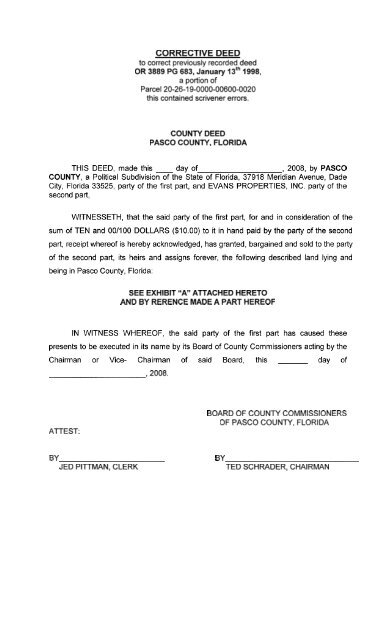
CORRECTIVE DEED<br />
to correct previously recorded deed<br />
OR 3889 PG 683, January 13'~ 1998,<br />
a portion of<br />
Parcel 20-26-1 9-0000-00600-0020<br />
this contained scrivener errors.<br />
COUNTY DEED<br />
PASCO COUNTY, FLORIDA<br />
THIS DEED, made this day of , 2008, by PASCO<br />
COUNTY, a Political Subdivision of the State of Florida, 37918 Meridian Avenue, Dade<br />
City, Florida 33525, party of the first part, and EVANS PROPERTIES, INC. party of the<br />
second part,<br />
WITNESSETH, that the said party of the first part, for and in consideration of the<br />
sum of TEN and 00/100 DOLLARS ($10.00) to it in hand paid by the party of the second<br />
part, receipt whereof is hereby acknowledged, has granted, bargained and sold to the party<br />
of the second part, its heirs and assigns forever, the following described land lying and<br />
being in <strong>Pasco</strong> <strong>County</strong>, Florida:<br />
SEE EXHIBIT "A" ATTACHED HERETO<br />
AND BY RERENCE MADE A PART HEREOF<br />
IN WITNESS WHEREOF, the said party of the first part has caused these<br />
presents to be executed in its name by its Board of <strong>County</strong> Commissioners acting by the<br />
Chairman or Vice- Chairman of said Board, this day of<br />
,2008.<br />
ATTEST:<br />
BOARD OF COUNTY COMMISSIONERS<br />
OF PASCO COUNTY, FLORIDA<br />
BY<br />
JED PITTMAN, CLERK<br />
BY<br />
TED SCHRADER, CHAIRMAN
EXHIBIT "A "<br />
PARCEL "A"<br />
As a Point of Reference, COMMENCE at the Southeast corner of the Southeast 1/4 of<br />
the Northeast 1/4 of Section 19, Township 26 South, Range 19 East, <strong>Pasco</strong> <strong>County</strong><br />
Florida; thence N.00'46'20"E. along the East boundary of said Section 19, 340.00 feet to<br />
the Southernmost corner of that certain first described less out as described in said<br />
Official Records Book 68, Page 279; thence departing said East boundary the following<br />
three (3) courses along said first described parcel (1) N.36'06'20"E., a distance of<br />
138.33 feet; (2) N.00'46'20mE., a distance of 393.00 feet; (3) N.50*46'2OWE., a distance<br />
of 96.98 feet to a point on the Northwesterly boundary of that certain fifth described<br />
parcel, as recorded in said Official Records Book 1824, Page 1234, of said Public<br />
Records of said <strong>Pasco</strong> <strong>County</strong>, Florida; thence the following four (4) courses along said<br />
fifth described parcel; (1) S.39'13'40"E., a distance of 20.00 feet; (2) S.51'46'20"W., a<br />
distance of 81.00 feet; (3) S.32'52'37"E., a distance of 141.00 feet; (4) N.56*05'56"E., a<br />
distance of 142.25 feet (141.64 feet according to said Official Records Book 1824, Page<br />
1234) to a non-tangent point of curvature and a point on the Southwesterly<br />
right-of-way line of said Collier Parkway being the Southwesterly boundary of that first<br />
described parcel in said Official Records Book 1824, Page 1234; thence along said Collier<br />
Parkway Southerly 1135.29 feet along the arc of a curve to the right, said curve having<br />
a radius of 2295.00 feet, a central angle of 28*20135", and a chord bearing and<br />
distance of S.19'55'44"E., 1123.75 feet to the Northernmost corner of that certain fourth<br />
described parcel as described in said Official Records Book 1824, Page 1234; thence the<br />
following two (2) courses along said certain fourth described parcel; (1) S.84'14'34"W., a<br />
distance of 80.00 feet; (2) S.O0'18'25"E., a distance of 293.87 feet for a POINT OF<br />
BEGINNING; thence the following three (3) courses along said certain fourth described<br />
parcel: (1) S,89'41'35"W., a distance of 20.00 feet; (2) S.O0'18'25"E., a distance of<br />
20.00 feet; (3) N.8ga41'35"E., a distance of 20.00 feet; thence departing said certain<br />
fourth described parcel N.O0*18'25"W., a distance of 20.00 feet to the POINT OF<br />
BEGINNING.<br />
Containing 0.009 acres more or less.