AIP Package Woensdrecht - Fokker Services
AIP Package Woensdrecht - Fokker Services
AIP Package Woensdrecht - Fokker Services

You also want an ePaper? Increase the reach of your titles
YUMPU automatically turns print PDFs into web optimized ePapers that Google loves.
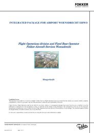
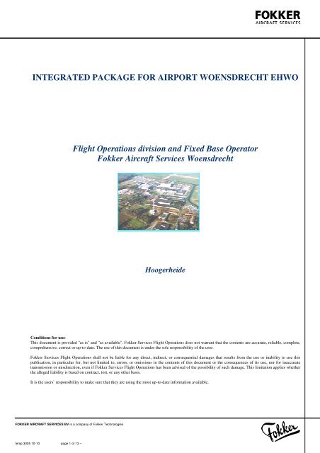
INTEGRATED PACKAGE FOR AIRPORT WOENSDRECHT EHWO<br />
Flight Operations division and Fixed Base Operator<br />
<strong>Fokker</strong> Aircraft <strong>Services</strong> <strong>Woensdrecht</strong><br />
Hoogerheide<br />
Conditions for use:<br />
This document is provided "as is" and "as available". <strong>Fokker</strong> <strong>Services</strong> Flight Operations does not warrant that the contents are accurate, reliable, complete,<br />
comprehensive, correct or up-to-date. The use of this document is under the sole responsibility of the user.<br />
<strong>Fokker</strong> <strong>Services</strong> Flight Operations shall not be liable for any direct, indirect, or consequential damages that results from the use or inability to use this<br />
publication, in particular for, but not limited to, errors, or omissions ions in the contents of this document or the consequences of its use, nor for inaccurate<br />
transmission or misdirection, even if <strong>Fokker</strong> <strong>Services</strong> Flight Operations has been advised of the possibility of such damage. This limitation applies whether<br />
the alleged liability is based on contract, tort, or any other basis.<br />
It is the users` responsibility to make sure that they are using the most up-to-date information available.<br />
FOKKER AIRCRAFT SERVICES BV is a company of <strong>Fokker</strong> Technologies<br />
temp 3005 10-10 page 1 of 13 –
List of changes<br />
March 30 th 2007<br />
Initial issue<br />
August 1, 2007<br />
Fully revised<br />
December 22, 2010<br />
June 05,2012<br />
Opening hours<br />
Taxiway’s<br />
FOKKER AIRCRAFT SERVICES BV is a company of <strong>Fokker</strong> Technologies<br />
temp 3005 10-10 page 2 of 13 –
List of contents<br />
INTRODUCTION<br />
NOTES FOR USE<br />
AD 2.1 AERODROME LOCATION INDICATOR AND NAME<br />
AD 2.2 GEOGRAPHICAL AND ADMINISTRATIVE DATA<br />
AD 2.3 OPERATIONAL HOURS<br />
AD 2.4 HANDLING SERVICES AND FACILITIES<br />
AD 2.5 PASSENGER FACILITIES<br />
AD 2.6 RESCUE AND FIRE FIGHTING SERVICES<br />
AD 2.7 SEASONAL AVAILABILITY – CLEARING<br />
AD 2.8 APRONS, TAXIWAYS AND CHECK LOCATIONS / POSITIONS DATA<br />
4<br />
4<br />
5<br />
5<br />
5<br />
6<br />
6<br />
6<br />
6<br />
7<br />
AD 2.9 SURFACE MOVEMENT GUIDANCE AND CONTROL SYSTEM AND MARKINGS 7<br />
AD 2.10 AERODROME OBSTACLES<br />
AD 2.11 METEOROLOGICAL INFORMATION PROVIDED<br />
AD 2.12 RUNWAY PHYSICAL CHARACTERISTICS<br />
AD 2.13 DECLARED DISTANCES<br />
AD 2.14 APPROACH AND RUNWAY LIGHTING<br />
AD 2.15 OTHER LIGHTING, SECONDARY POWER SUPPLY<br />
AD 2.16 HELICOPTER LANDING AREA<br />
AD 2.17 ATS AIRSPACE<br />
AD 2.18 ATS COMMUNICATION FACILITIES<br />
AD 2.19 RADIO NAVIGATION AND LANDING AIDS<br />
AD 2.20 LOCAL TRAFFIC REGULATIONS<br />
AD 2.21 NOISE ABATEMENT PROCEDURES<br />
AD 2.22 FLIGHT PROCEDURES<br />
AD 2.23 ADDITIONAL INFORMATION<br />
AD 2.24 CHARTS RELATED TO AN AERODROME<br />
7<br />
8<br />
8<br />
8<br />
9<br />
9<br />
9<br />
9<br />
10<br />
10<br />
10<br />
10<br />
11<br />
12<br />
13<br />
FOKKER AIRCRAFT SERVICES BV is a company of <strong>Fokker</strong> Technologies<br />
temp 3005 10-10 page 3 of 13 –
INTRODUCTION<br />
<strong>Fokker</strong> <strong>Services</strong> (FS) is based at the air force base <strong>Woensdrecht</strong>, the Netherlands and offers aircraft maintenance,<br />
repair, overhaul and modification services to customers worldwide. To provide customers with the required data<br />
to operate from this air force base, <strong>Fokker</strong> <strong>Services</strong> Flight Operations has assembled this document.<br />
NOTES FOR USE<br />
The lay-out, abbreviations and measure system used in this document are similar to the ones used in the <strong>AIP</strong><br />
Netherlands, published by Air Traffic Control the Netherlands. Refer to GEN 2.1 of the <strong>AIP</strong> for more<br />
information. The <strong>AIP</strong> can be downloaded through http://www.ais-netherlands.nl/. . The publisher (<strong>Fokker</strong> <strong>Services</strong><br />
Flight Operations) of this integrated package for <strong>Woensdrecht</strong> AFB is not affiliated with Air Traffic Control the<br />
Netherlands, nor does Air Traffic Control the Netherlands have any responsibility for the information published<br />
in this document.<br />
For the conditions of use, refer to the front page of this document.<br />
FOKKER AIRCRAFT SERVICES BV is a company of <strong>Fokker</strong> Technologies<br />
temp 3005 10-10 page 4 of 13 –
AD 2.1 AERODROME LOCATION INDICATOR AND NAME<br />
EHWO - WOENSDRECHT<br />
AD 2.2 GEOGRAPHICAL AND ADMINISTRATIVE DATA<br />
1 ARP co-ordinatesordinates<br />
51° 26.94”N 004°20.53”E<br />
2 Direction and distance from (city) 3 NM SE from Bergen op Zoom<br />
3 Elevation / reference temperature +63 ft AMSL / 15°C<br />
4 Geoide undulatie op AD ELEV PSN Not AVBL<br />
5 MAG VAR<br />
1°W (2005)<br />
6 AD-administration, postal address,<br />
telephone, telefax, telex, AFS<br />
Post:<br />
Stork / <strong>Fokker</strong> <strong>Services</strong><br />
Flight Operations department, W67-00<br />
Post Box 3<br />
4630 AA Hoogerheide<br />
The Netherlands<br />
7 Types of traffic permitted (IFR/VFR)<br />
8 Remarks<br />
Tel:<br />
Fax:<br />
Telex:<br />
AFS:<br />
+31 (0)164 61 84 30<br />
+31 (0)164 61 86 94<br />
-<br />
-<br />
IFR/VFR<br />
For all flights strictly PPR.<br />
AD 2.3 OPERATIONAL HOURS<br />
1 AD administration<br />
( OPR HR )<br />
MON-FRI: 0700-1545 UTC<br />
(0600-1445 UTC during DST).<br />
SAT-SUN: On request.<br />
2 Customs and immigration OPR HR<br />
3 Health and sanitation OPR HR<br />
4 AIS briefing office<br />
OPR HR<br />
5 ATS reporting office (ARO) ATC EHWO;<br />
OPR HR<br />
6 MET briefing office<br />
Information from KNMI and LMG Provided by<br />
Flight Operations Stork / <strong>Fokker</strong> <strong>Services</strong>;<br />
OPR HR<br />
7 ATS<br />
ATC EHWO;<br />
OPR HR<br />
8 Fuelling<br />
<strong>Fokker</strong> <strong>Services</strong>;<br />
OPR HR<br />
9 Handling<br />
<strong>Fokker</strong> <strong>Services</strong>;<br />
OPR HR<br />
10 Security<br />
<strong>Fokker</strong> <strong>Services</strong>;<br />
OPR HR<br />
11 De-icing<br />
<strong>Fokker</strong> <strong>Services</strong>;<br />
OPR HR<br />
12 Remarks<br />
1. Civil traffic: PPR<br />
2. Glider flying activities possible outside OPR<br />
HR.<br />
FOKKER AIRCRAFT SERVICES BV is a company of <strong>Fokker</strong> Technologies<br />
temp 3005 10-10 page 5 of 13 –
AD 2.4 HANDLING SERVICES AND FACILITIES<br />
1 Cargo-handling facilities<br />
2 Types of fuel / oil<br />
3 Fuelling facilities / capacity<br />
4 De-icing facilities<br />
5 Hangar space for visiting aircraft<br />
6 Repair facilities for visiting aircraft<br />
7 Remarks<br />
AVBL<br />
Jet A1 / O/R<br />
Unlimited during OPR HR.<br />
AVBL<br />
O/R via <strong>Fokker</strong> Aircraft <strong>Services</strong><br />
O/R via <strong>Fokker</strong> Aircraft <strong>Services</strong><br />
Handling agent:<br />
Fixed Base Operator Stork / <strong>Fokker</strong> <strong>Services</strong>;<br />
Tel: +31 (0)164 61 84 30<br />
Fax: +31 (0)164 61 86 94<br />
Company FREQ: 133.025 MHz<br />
AD 2.5 PASSENGER FACILITIES<br />
1 Hotels<br />
2 Restaurants<br />
3 Transportation<br />
4 Medical facilities<br />
5 Bank and post office<br />
6 Tourist office<br />
7 Remarks<br />
Accomodation unlimited in Bergen op Zoom.<br />
Near airport.<br />
Bus en taxi.<br />
First aid treatment, hospital in Bergen op Zoom<br />
(3NM).<br />
Near airport.<br />
In Hoogerheide (1NM).<br />
NIL<br />
AD 2.6 RESCUE AND FIRE FIGHTING SERVICES<br />
1 AD-category for fire fighting CAT 4 and 7; O/R CAT 8 or CAT 9<br />
2 Rescue equipment<br />
AVBL<br />
3 Capability for removal of disabled<br />
aircraft<br />
AVBL<br />
4 Remarks<br />
NIL<br />
AD 2.7 SEASONAL AVAILABILITY – CLEARING<br />
1 Types of clearing equipment<br />
2 Clearance priorities<br />
3 Remarks<br />
4 snowsweep combinations with plows, one<br />
snowblower, two de-icing trucks.<br />
Runway, TWY to <strong>Fokker</strong> <strong>Services</strong>, Northern side.<br />
NIL<br />
FOKKER AIRCRAFT SERVICES BV is a company of <strong>Fokker</strong> Technologies<br />
temp 3005 10-10 page 6 of 13 –
AD 2.8 APRONS, TAXIWAYS AND CHECK LOCATIONS / POSITIONS DATA<br />
1 Apron surface and<br />
strength<br />
2 Taxiway width, surface<br />
and strength<br />
Apron <strong>Fokker</strong> <strong>Services</strong><br />
Surface: ASPH, CONC.<br />
Strenght: PCN 32 R/C/W/T<br />
Southern<br />
TWY<br />
Northern<br />
TWY<br />
North-<br />
East<br />
TWY<br />
<strong>Fokker</strong><br />
TWY<br />
Width 14.8 22.5 14.8 14.8<br />
Surface ASPH ASPH CONC ASPH<br />
Strenght 36 38 38 36<br />
INSCT<br />
North A<br />
INSCT<br />
North B<br />
INSCT<br />
North C<br />
Width 14,9 11,9 12<br />
Surface CONC CONC CONC<br />
Strenght 48 89 61<br />
INSCT<br />
South A<br />
INSCT<br />
South B<br />
INSCT<br />
South C<br />
Width 15 12 12<br />
Surface CONC CONC CONC<br />
Strenght 51 26 56<br />
INSCT<br />
North D<br />
11,9<br />
CONC<br />
40<br />
INSCT<br />
South D<br />
20<br />
CONC<br />
53<br />
3 Altimeter checkpoint<br />
location and elevation<br />
4 VOR checkpoints<br />
5 INS checkpoints<br />
51°26.58’N 004°19.64’E<br />
39 ft<br />
Not AVBL<br />
51°26.58’N 004°19.64’E<br />
39 ft<br />
AD 2.9 SURFACE MOVEMENT GUIDANCE AND CONTROL SYSTEM AND MARKINGS<br />
1 Use of aircraft stand ID signs, TWY<br />
guide lines and visual docking / parking<br />
guidance system of aircraft stands<br />
Taxiing guidance: Radio instructions<br />
On <strong>Fokker</strong> <strong>Services</strong> apron: guidance by marshaller.<br />
2 RWY and TWY markings and LGT RWY THR, RWY centre line, RWY<br />
designation, edge lighting.<br />
TWY<br />
TWY centre line, edge lighting.<br />
3 Stopbars<br />
AVBL<br />
4 Remarks<br />
NIL<br />
AD 2.10 AERODROME OBSTACLES<br />
All obstacles are marked day and night.<br />
FOKKER AIRCRAFT SERVICES BV is a company of <strong>Fokker</strong> Technologies<br />
temp 3005 10-10 page 7 of 13 –
AD 2.11 METEOROLOGICAL INFORMATION PROVIDED<br />
1 Associated MET office<br />
2 Hours of service<br />
METoffice outside hours<br />
3 Office responsable for TAF<br />
preparation<br />
Periods of validity<br />
4 Trend forecast<br />
Interval of issuance<br />
5 Briefing / consultation provided<br />
6 Flight documentation<br />
Language(s) used<br />
7 Charts and other information available<br />
for briefing or consultation<br />
8 Supplementary equipment available for<br />
providing information<br />
9 ATS units provided with information<br />
10 Additional information (limitation of<br />
service, etc.)<br />
Information from KNMI and LMG Provided by<br />
Flight Operations Stork/ <strong>Fokker</strong> <strong>Services</strong><br />
OPR HR<br />
-<br />
LMG <strong>Woensdrecht</strong><br />
9<br />
TREND<br />
Every 30 minutes for international METAR.<br />
O/R<br />
Reports, forecasts, charts.<br />
English, Dutch.<br />
S, P, W, T<br />
Internet<br />
<strong>Woensdrecht</strong> TWR<br />
Weather bulletin (Dutch language) and METARs<br />
via Dutch Public TV ‘Teletekst’ page 707.<br />
AD 2.12 RUNWAY PHYSICAL CHARACTERISTICS<br />
Designation<br />
RWY NR<br />
True<br />
BRG<br />
Dimensions<br />
of<br />
RWY (m)<br />
1 2 3<br />
07 071° 2437 x 45<br />
25 251° 2437 x 45<br />
Strenght (PCN)<br />
and surface of<br />
RWY and SWY<br />
THR co-ordinates<br />
RWY end coordinates<br />
THR<br />
GUND<br />
4 5<br />
32 R/C/W/T 51° 27.17’N<br />
004° 21.51’E<br />
32 R/C/W/T 51° 26.71’N<br />
004° 19.54’E<br />
THR elevation<br />
and highest<br />
elevation of TDZ<br />
of precision<br />
APCH RWY<br />
6<br />
11.2 m<br />
19.2 m<br />
Designations<br />
RWY NR<br />
Slope of<br />
RWY<br />
SWY<br />
dimensions (m)<br />
CWY<br />
dimensions (m)<br />
Strip dimensions<br />
(m)<br />
1 7<br />
8 9 10<br />
07 NA NIL<br />
NA 2437 x 45<br />
25 NA NIL<br />
NA 2437 x 45<br />
NA<br />
NA<br />
OFZ<br />
11<br />
AD 2.13 DECLARED DISTANCES<br />
RWY-benaming TORA<br />
1 2<br />
07 2437<br />
25 2437<br />
TODA ASDA LDA<br />
3 4 5<br />
2437 2437 2437<br />
2437 2437 2437<br />
Remarks<br />
6<br />
NIL<br />
NIL<br />
FOKKER AIRCRAFT SERVICES BV is a company of <strong>Fokker</strong> Technologies<br />
temp 3005 10-10 page 8 of 13 –
AD 2.14 APPROACH AND RUNWAY LIGHTING<br />
RWY<br />
APC LGT<br />
type,<br />
length,<br />
INTST<br />
THR<br />
LGT<br />
color,<br />
WBAR<br />
1 2 3<br />
07 NIL G<br />
-<br />
VASIS TDZ RWY CL RWY<br />
(MEHT) LGT LGT edge LGT<br />
PAPI length length, length,<br />
spacing, spacing,<br />
color, color,<br />
INTST INTST<br />
4 5 6 7<br />
PAPI<br />
Left/3°<br />
304 m<br />
NIL NIL 2500 m<br />
30 m<br />
LIH<br />
RWY<br />
end<br />
LGT<br />
color,<br />
WBAR<br />
R<br />
SWY<br />
LGT<br />
length,<br />
color<br />
8 9<br />
NIL<br />
25 CAT 1<br />
900 m<br />
LIH<br />
G<br />
-<br />
PAPI<br />
Left/3°<br />
304 m<br />
NIL NIL 2500 m<br />
30 m<br />
LIH<br />
R<br />
NIL<br />
AD 2.15 OTHER LIGHTING, SECONDARY POWER SUPPLY<br />
1 ABN/IBN location, characteristics and<br />
hours of operation<br />
2 LDI location and LGT<br />
Anemometer location and LGT<br />
3 TWY edge and centre line lighting<br />
4 Secondary power supply<br />
Switch-over time<br />
5 Remarks<br />
NIL<br />
LDI: in front of TWR, lighted<br />
WDI: in front of TWR, not lighted<br />
Edge: TWY: blue<br />
AVBL, two aggregates<br />
12 sec<br />
Northern roll track and Northern intersections; A, B<br />
and C do not have edge lights<br />
AD 2.16 HELICOPTER LANDING AREA<br />
1 Co-ordinates ordinates TLOF or THR of FATO<br />
Geoids undulation<br />
2 TLOF and/or FATO elevation m/ft<br />
3 TLOF and FATO area dimensions,<br />
surface, strength, marking<br />
4 True BRG of FATO<br />
5 Declared distance available<br />
6 APCH and FATO lighting<br />
7 Remarks<br />
51° 27.15’N 004° 20.95’E<br />
Not AVBL<br />
17.2m/56 ft<br />
Rectangle 30 x 30 m, concrete, PCN xx, white edges<br />
and white letter H.<br />
Not AVBL<br />
NIL<br />
NIL<br />
NIL<br />
AD 2.17 ATS AIRSPACE<br />
1 Designation and lateral limits<br />
2 Vertical limits<br />
3 Airspace classification<br />
4 ATS unit call sign<br />
Language(s)<br />
5 Transition altitude<br />
6 Remarks<br />
WOENSDRECHT CTR:<br />
Circle, radius 8.0 NM<br />
centred on 51° 26.94”N 004°20.53”E<br />
GND to 3000 ft AMSL<br />
C<br />
<strong>Woensdrecht</strong> Tower<br />
English<br />
IFR: 3000 ft AMSL; VFR: 3500 ft AMSL.<br />
NIL<br />
FOKKER AIRCRAFT SERVICES BV is a company of <strong>Fokker</strong> Technologies<br />
temp 3005 10-10 page 9 of 13 –
AD 2.18 ATS COMMUNICATION FACILITIES<br />
Service designation<br />
Call sign Frequency Hours of operation Remarks<br />
1 2<br />
3 4<br />
5<br />
APP<br />
Rapcon West 123.575<br />
281.475<br />
OPR HR<br />
Radar Equipped<br />
<strong>Woensdrecht</strong><br />
Arrival<br />
123.575<br />
378.650<br />
Through App.<br />
TWR<br />
<strong>Woensdrecht</strong><br />
Tower<br />
120.425*)<br />
339.000*)<br />
OPR HR<br />
*)Primary Frequency<br />
Outside OPR HR<br />
257.800<br />
contact Dutch Mil.<br />
Info 132.350 MHz<br />
VDF<br />
<strong>Woensdrecht</strong><br />
Tower<br />
As appropriate<br />
120.425<br />
121.500<br />
OPR HR<br />
OPR HR<br />
NIL<br />
Emergency FREQ for<br />
243.000<br />
all services<br />
AD 2.19 RADIO NAVIGATION AND LANDING AIDS<br />
Type of aid, ID<br />
Frequency<br />
MAG VAR,<br />
CAT of ILS/MLS<br />
(VOR/ILS/MLS:<br />
declination)<br />
1 2<br />
ILS<br />
WDO 108.150<br />
Localizer<br />
ILS<br />
WDZ 108.150<br />
Localizer<br />
Glidepath 334.550<br />
DME<br />
VDF<br />
<strong>Woensdrecht</strong><br />
TWR<br />
3 4 5<br />
108.150 H24 51°26’41” N NA<br />
004°19’25”E<br />
108.150 H24 51°27’14” N NA<br />
004°21’44” E<br />
334.550 NA<br />
CH 18Y H24 NA<br />
120.425*) OPR HR<br />
NA<br />
122.100<br />
TACAN WDT CH 97X H24 51° 26' 51" N<br />
004° 20' 38" E<br />
AD 2.20 LOCAL TRAFFIC REGULATIONS<br />
1. Intensive training with Pilatus PC-7 trainer aircraft (RNLAF). Glider and model flying outside OPR HR<br />
in weekends.<br />
2. Prior permission required (PPR) from ATC <strong>Woensdrecht</strong> for all VFR operations. Civil training flights<br />
PPR from ATC <strong>Woensdrecht</strong>.<br />
3. Crossing of VFR traffic shall be carried out via VFR reporting at 1500 ft unless otherwise instructed or<br />
approved by ATC.<br />
4. Visual traffic circuit: RWY 25 right-hand 1000 ft; RWY 07 left-hand 1000 ft.<br />
AD 2.21 NOISE ABATEMENT PROCEDURES<br />
Hours of<br />
operation<br />
Position of<br />
transmitting<br />
antenna coordinates<br />
Elevation of<br />
DME<br />
transmitting<br />
antenna<br />
40 NM/<br />
25000 ft<br />
1 LIMITATIONS<br />
1. Avoid over flying the cities of <strong>Woensdrecht</strong>, Roosendaal and Bergen op Zoom<br />
2. Built-up up areas must be avoided as much as possible<br />
Remarks<br />
6 7<br />
NIL<br />
NIL<br />
NIL<br />
NIL<br />
NIL<br />
FREQ<br />
protected<br />
FOKKER AIRCRAFT SERVICES BV is a company of <strong>Fokker</strong> Technologies<br />
temp 3005 10-10 page 10 of 13 –
AD 2.22 FLIGHT PROCEDURES<br />
1 DEPARTURE PROCEDURES WOENSDRECHT AERODROME (MIL)<br />
1.1 ATC en route clearance<br />
ATC will issue permission as soon as possible after taxi permission has been given.<br />
A clearance contains:<br />
1. Clearance limit: airport of destination.<br />
2. Departure instructions.<br />
3. SSR code.<br />
Example of an en route clearance:<br />
‘RNN345 is cleared to London, SPY 3000 ft, squawk 2123’.<br />
1.2 Maximum speed<br />
Below FL 100: MAX 250 Kts (IAS).<br />
1.3 Transfer of control<br />
Transfer of control will be effected on the basis of current traffic situation and co-ordination between the units<br />
involved.<br />
Traffic via the Schiphol TMAs will be transferred to Schiphol Departure.<br />
1.4 Communication failure<br />
See ENR 1.3 (of the Integrated <strong>Package</strong>, www.ais-netherlands.nl).<br />
2 INITIAL APPROACH PROCEDURES WOENSDRECHT AERODROME (MIL)<br />
2.1 Airport status<br />
The airfield status is used to indicate the priority of aircraft under supervision of Approach Control or Local<br />
Control and is only valid in the local control zone. Pilots have to check the valid status before the recovery to<br />
<strong>Woensdrecht</strong> with Rapcon West (also see Ad 1.18, page seven).<br />
Figure 1.1 Color State<br />
Airfield Status VFR: Weather status ‘blue’.. Airfield status VFR means that all kind of approaches are approved<br />
and that visual approaches have priority over instrument approaches.<br />
2.2 Inbound clearance<br />
A clearance will be issued by Amsterdam ACC or MIL ATCC, containing:<br />
a. Clearance limit: HDR.<br />
b. Route.<br />
c. Flight level.<br />
2.3 Maximum speed<br />
Below FL 100: MAX 250 Kts (IAS).<br />
Airfield Status IFR: Weather status ‘white<br />
to red’: (Figure 1.1) With<br />
weather status ‘white’ the airfield may be local dominant if the local<br />
ATCO decides so. Airfield status IFR means that all IFR equipped<br />
aircraft have to make an instrument approach. Instrument approaches<br />
have priority over other traffic.<br />
FOKKER AIRCRAFT SERVICES BV is a company of <strong>Fokker</strong> Technologies<br />
temp 3005 10-10 page 11 of 13 –
2.4 Transfer of control<br />
Inbound traffic will be transferred by Amsterdam ACC or MIL ATCC to <strong>Woensdrecht</strong> Approach or <strong>Woensdrecht</strong><br />
Tower.<br />
2.5 Approach instructions<br />
Approach instructions will contain, as applicable:<br />
1. Additional instructions with respect to route and level.<br />
2. Approach procedure.<br />
3. Runway in use.<br />
4. QNH.<br />
5. Transition level.<br />
6. MET information.<br />
7. Aerodrome information and other information.<br />
2.6 Radar service<br />
During the initial approach radar service may be provided by Amsterdam ACC, MIL ATCC Nieuw Milligen,<br />
Rapcon West or <strong>Woensdrecht</strong> Arrival.<br />
2.7 Communication failure<br />
If radio contact is lost under VMC conditions:<br />
1. For VFR flights; proceed VFR towards the airfield, stay clear of centre line and try to contact<br />
<strong>Woensdrecht</strong> Tower. If no radio contact can be established, squawk 7600 and execute a VFR non<br />
radio procedure (as described in ENR 1.3 of the Integrated <strong>Package</strong>, www.ais-netherlands.nl).<br />
2. For IFR flights; when on ILS approach, continue with the procedure as published, do not climb above<br />
the last given altitude and try to contact <strong>Woensdrecht</strong> Tower. If no radio contact can be established,<br />
squawk 7600 and continue for a full stop.<br />
If radio contact is lost under IMC conditions:<br />
1. Proceed according to 2.7, point (2)<br />
2. If Tacan is out, squawk 7600, maintain last given heading and altitude (when already below 2500 ft.<br />
climb to 2500 ft.) and try to contact Rapcon West on standard or emergency frequencies. If no radio<br />
contact can be established, ed, act according the non radio procedures.<br />
3 VFR FLIGHT PROCEDURES<br />
3.1 VFR Departures<br />
All outbound VFR flights are to climb out according to ATC instructions.<br />
3.2 VFR approach procedures<br />
1. Jet Propelled Aircraft are to enter the CTR at altitude 2000 ft. QNH via the entry points K or R. To<br />
join the circuit proceed via IP of the runway in use (also see EHWO Visual approach chart, page<br />
12).<br />
2. Conventional Aircraft are to enter the CTR at altitude 1000 ft. QNH whilst over flying the cities of<br />
Roosendaal and Bergen op Zoom has to be avoided. Depending on the runway in use join a left hand<br />
downwind or base leg for RWY 07, or a right hand downwind or base leg for RWY 25.<br />
AD 2.23 ADDITIONAL INFORMATION<br />
NIL<br />
FOKKER AIRCRAFT SERVICES BV is a company of <strong>Fokker</strong> Technologies<br />
temp 3005 10-10 page 12 of 13 –
AD 2.24 CHARTS RELATED TO AN AERODROME<br />
All aerodrome charts and procedures can be downloaded through the website of NATO Central and northern<br />
region flight information publications (http://www.cenor.org).<br />
FOKKER AIRCRAFT SERVICES BV is a company of <strong>Fokker</strong> Technologies<br />
temp 3005 10-10 page 13 of 13 –