Variance Application Form - Grant County Government
Variance Application Form - Grant County Government
Variance Application Form - Grant County Government

You also want an ePaper? Increase the reach of your titles
YUMPU automatically turns print PDFs into web optimized ePapers that Google loves.
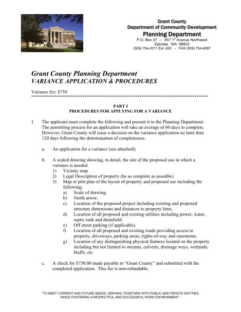
<strong>Grant</strong> <strong>County</strong><br />
Department of Community Development<br />
Planning Department<br />
P.O. Box 37 - 457 1 st Avenue Northwest<br />
Ephrata, WA 98823<br />
(509) 754-2011 Ext. 620 - FAX (509) 754-6097<br />
<strong>Grant</strong> <strong>County</strong> Planning Department<br />
VARIANCE APPLICATION & PROCEDURES<br />
<strong>Variance</strong> fee: $750<br />
******************************************************************************************<br />
PART I<br />
PROCEDURES FOR APPLYING FOR A VARIANCE<br />
1. The applicant must complete the following and present it to the Planning Department.<br />
The permitting process for an application will take an average of 60 days to complete.<br />
However, <strong>Grant</strong> <strong>County</strong> will issue a decision on the variance application no later than<br />
120 days following the determination of completeness.<br />
a. An application for a variance (see attached);<br />
b. A scaled drawing showing, in detail, the site of the proposed use in which a<br />
variance is needed.<br />
1) Vicinity map<br />
2) Legal Description of property (be as complete as possible)<br />
3) Map or plot plan of the layout of property and proposed use including the<br />
following:<br />
a) Scale of drawing.<br />
b) North arrow.<br />
c) Location of the proposed project including existing and proposed<br />
structure dimensions and distances to property lines.<br />
d) Location of all proposed and existing utilities including power, water,<br />
septic tank and drainfield.<br />
e) Off street parking (if applicable).<br />
f) Location of all proposed and existing roads providing access to<br />
property, driveways, parking areas, rights-of-way and easements.<br />
g) Location of any distinguishing physical features located on the property<br />
including but not limited to streams, culverts, drainage ways, wetlands,<br />
bluffs, etc.<br />
c. A check for $750.00 made payable to “<strong>Grant</strong> <strong>County</strong>” and submitted with the<br />
completed application. This fee is non-refundable.<br />
“TO MEET CURRENT AND FUTURE NEEDS, SERVING TOGETHER WITH PUBLIC AND PRIVATE ENTITIES,<br />
WHILE FOSTERING A RESPECTFUL AND SUCCESSFUL WORK ENVIRONMENT.”
d. Please note that if you are requesting a <strong>Variance</strong> to the setback requirements, you<br />
may be required to make changes to the building to comply with the Uniform<br />
Building Code, Uniform Fire Code, and Americans with Disabilities Act, etc. You<br />
are requested to contact the <strong>Grant</strong> <strong>County</strong> Building Department to determine if any<br />
modifications are required. This may prevent spending money on the permit<br />
process only to find out later that the structure cannot be cost effectively<br />
constructed at the proposed location for the intended use.<br />
2. The Planning Department Staff will do the following:<br />
a. Prepare a list of names and addresses of all property owners within three hundred<br />
(300) feet of the exterior boundaries of the subject property;<br />
b. Provide notice of application upon the issuance of a determination of<br />
completeness;<br />
c. Mail notice of any open record hearing (if applicable) to the applicant and the<br />
applicant’s representative, the above list of names, and any person who submits<br />
written or oral comments on the application at least fifteen (15) calendar days prior<br />
to the hearing; and shall<br />
d. Publish legal notice of public hearing of a variance request according to the<br />
requirements of the Local Project Permit Review Ordinance 97-192-CC.<br />
3. The Board of Adjustment meets on the second (2 nd ) Wednesday of the month. The<br />
application will be heard before the Board at an open record public hearing. The<br />
applicant or representative shall be present to answer any questions the Board members<br />
have relative to the proposed use. You will be notified by mail as to what date your<br />
application will be heard before the Board of Adjustment.<br />
4. Hearing: After the open record public hearing and based upon findings of fact, the<br />
Board of Adjustment will determine whether the variance is to be granted, granted with<br />
conditions, or denied. Written notification of the decision is then mailed to the applicant<br />
within 45 days after the issuance of the Decision. Upon receipt of written confirmation<br />
that the conditions of approval, if any, have been met, your variance will be granted.<br />
5. Time Frame for Decision: Once the application is deemed complete, the review<br />
process will begin. Provided there is no continuation of the application, a decision on<br />
the variance will be made within 120 days, subject to an open record public hearing.<br />
6. Appeals: Decisions of the Board of Adjustment shall be final unless the original<br />
applicant or a party with standing makes an appeal to the Superior Court of <strong>Grant</strong><br />
<strong>County</strong> pursuant to RCW 36.70C and the <strong>Grant</strong> <strong>County</strong> Local Project Permit Review<br />
Ordinance, 97-192-CC.<br />
<strong>Variance</strong> <strong>Application</strong> Adopted 3/99, Fee chg 5/09<br />
Page 2<br />
Resolution. #09-037-CC
<strong>Variance</strong> <strong>Application</strong> – Responses to Criteria of Approval<br />
Pursuant to GCC 25.08.050, any request for a variance shall be accompanied by a narrative<br />
statements demonstrating how the proposed request conforms to the criteria for approval<br />
specified in GCC 25.08.060. Please provide a narrative statement addressing each of the<br />
following criteria for approval and how your proposal complies with the criteria<br />
1. Special conditions and circumstances exist that are peculiar to the land such that literal<br />
interpretation and application of the provisions of GCC Titles 22, 23, and 24 would<br />
deprive the applicant of the rights commonly enjoyed by other properties in the same<br />
district under the terms of GCC Titles 22, 23, and 24.<br />
2. Allows the variance will be in harmony with the intent and spirit of GCC Titles 22, 23,<br />
and 24.<br />
3. A variance is necessary for the preservation and enjoyment of a property right<br />
possessed by other property in the same vicinity or district, but which is denied to the<br />
property in question because of special circumstances on that property.<br />
4. The special conditions and circumstances described in Criteria #1 above, are<br />
specifically related to the property and are the result of unique conditions such as<br />
specifically irregular lot shape, size, or natural feature, and the application of GCC<br />
Titles 22, 23, and 24, and not, for example, from deed restrictions or the applicant’s<br />
own actions.<br />
5. The granting of the variance requested will not confer on the person seeking the<br />
variance any special privilege that is denied by this Chapter to other lands, structure,<br />
or buildings under similar circumstances.<br />
6. The variance requested is the minimum necessary to afford relief.<br />
7. The requested variance will not create significant impacts to critical areas and will not<br />
be materially detrimental to the public welfare, injurious to the right of other property<br />
owners in the vicinity, or contrary to the public interest.<br />
8. The variance will not permit a use prohibited by GCC Title 23 in the district in which<br />
the subject property is located.<br />
<strong>Variance</strong> <strong>Application</strong> Adopted 3/99, Fee chg 5/09<br />
Resolution. #09-037-CC
All requested information shall be provided - use black ink or type for photocopying purposes<br />
Fee $750<br />
PART II<br />
VARIANCE APPLICATION<br />
Legal Owner’s Name: _____________________________________________________________<br />
Mailing Address: _____________________________________________________________<br />
City: _____________________ State: ________________ Zip: ________________________<br />
Phone: ____________________ (Work): _______________ Fax: ________________________<br />
If applicant is not the owner, include the written owner authorization form below (see Part III)<br />
designating the contact to serve as representative.<br />
Owner’s Designated Contact: ________________________________________________________<br />
Mailing Address: __________________________________________________________________<br />
City: ______________________ State: ________________ Zip: ________________________<br />
Phone: _____________________ (Work): ______________ Fax: ________________________<br />
Project/Proposal Site Area (Acres or sq. ft.): ____________________________________________<br />
Assessor Tax Parcel No.(s) of Proposal Site: ____________________________________________<br />
Adjacent Area Owned or Controlled (Acres or sq. ft.): ____________________________________<br />
Assessor Tax Parcel No.(s) of Adjacent Land Owned or Controlled: _________________________<br />
Street Address of Proposed Site (if any): _______________________________________________<br />
_________________________________________________________________________________<br />
Describe Existing Use(s) on Proposed Site (Such as buildings, well, sewer drainfield and others):<br />
_________________________________________________________________________________<br />
_________________________________________________________________________________<br />
_________________________________________________________________________________<br />
Existing Zoning Classification: _______________________________________________________<br />
Comprehensive Plan Category: ______________________________________________________<br />
GMA Designation: Within IUGA or UGA ( ) yes ( ) no<br />
School District: ___________________________________________________________________<br />
Fire District: _____________________________________________________________________<br />
Water Purveyor: __________________________________________________________________<br />
Irrigation District: _________________________________________________________________<br />
Proposed Use of Property:<br />
( ) Duplexes ( ) Business ( ) Multi-Family dwelling<br />
( ) Industrial ( ) Mixed Use ( ) Single-family dwelling<br />
( ) Manufactured Homes ( ) Other: Please describe __________<br />
_________________________________________________________________________________<br />
_________________________________________________________________________________<br />
_________________________________________________________________________________<br />
<strong>Variance</strong> <strong>Application</strong> Adopted 3/99, Fee chg 5/09<br />
Page 1 of 3<br />
Resolution. #09-037-CC
List Previous <strong>Grant</strong> <strong>County</strong> Actions Involving this Property: (Such as tax segregation application,<br />
certificate of exemptions, subdivision, lot segregation or Agriculture District segregation, zone<br />
change, variance, temporary use SEPA review, estate transfer, zoning code violation or others)<br />
________________________________________________________________________________<br />
_________________________________________________________________________________<br />
_________________________________________________________________________________<br />
_________________________________________________________________________________<br />
_________________________________________________________________________________<br />
LEGAL INFORMATION<br />
Location of Proposal Site (General description by which direction and how far from roads and<br />
intersections and other community features): _____________________________________________<br />
______________________________________________________________________________________<br />
______________________________________________________________________________________<br />
______________________________________________________________________________________<br />
______________________________________________________________________________________<br />
______________________________________________________________________________________<br />
Section(s): _____ Township: _____ Range: _____ Legal description attached: ( ) yes<br />
( ) no<br />
Name of Public Road (s) providing access: __________________________________________<br />
______________________________________________________________________________<br />
Width of Property Fronting on Public Road: ___________________________________________<br />
Section of the zoning ordinance under which it is claimed that a variance should be granted: ______<br />
_________________________________________________________________________________<br />
Purpose for the requested variance: ___________________________________________________<br />
_________________________________________________________________________________<br />
_________________________________________________________________________________<br />
Are there special circumstances such as lot size, slope, topography or necessary size or shape of the<br />
building which prevent compliance with the zoning ordinance If so, please explain: ___________<br />
________________________________________________________________________________________<br />
________________________________________________________________________________________<br />
________________________________________________________________________________________<br />
Does strict application of the zoning ordinance deprive subject property of rights and privileges<br />
enjoyed by other properties in the vicinity and under the same zoning classification If so, please<br />
explain: _________________________________________________________________________<br />
_________________________________________________________________________________<br />
_________________________________________________________________________________<br />
Is the granting of the variance materially detrimental to the public welfare If so, please explain:<br />
________________________________________________________________________________________<br />
________________________________________________________________________________________<br />
________________________________________________________________________________________<br />
(If you have any additional comments, please attach them on a separate sheet of paper.)<br />
<strong>Variance</strong> <strong>Application</strong> Adopted 3/99, Fee chg 5/09<br />
Page 2 of 3<br />
Resolution. #09-037-CC
PART III<br />
LEGAL OWNER SIGNATURE<br />
(Signature of legal owner or representative as authorized by legal owner)<br />
I, the undersigned, swear or affirm under penalty of perjury that the above responses are made<br />
truthfully and to the best of my knowledge.<br />
I further swear or affirm that I am the owner of record of the area proposed for the previously<br />
identified land use action, or, if not the owner, attached herewith is written permission from the owner<br />
authorizing my actions on his or her behalf.<br />
Name: ________________________________ Date: ______________________________<br />
Address: ________________________________ Home Phone: _______________________<br />
Zip: ________________________________ Work Phone: _______________________<br />
______________________________________<br />
Signature of Applicant or representative<br />
___________________________________<br />
Date<br />
STATE OF WASHINGTON ) ss:<br />
COUNTY OF GRANT )<br />
Notary<br />
(For Part III Above)<br />
SUBSCRIBED AND SWORN to me this _______ day of _______________, 20____.<br />
NOTARY SEAL<br />
_______________________________________<br />
Notary Signature<br />
Notary Public in and for the State of Washington<br />
Residing at: _____________________________<br />
My appointment expires: ___________________<br />
PART IV<br />
(To be completed by the Planning Department)<br />
Date Submitted: _________________________<br />
Total Fees: _____________________________<br />
File #: _________________________________<br />
Planner: _________________________________<br />
Receipt #: ________________________________<br />
Complete <strong>Application</strong>: _____________________<br />
<strong>Variance</strong> <strong>Application</strong> Adopted 3/99, Fee chg 5/09<br />
Page 3 of 3<br />
Resolution. #09-037-CC
SITE PLAN INSTRUCTIONS<br />
INSTRUCTIONS:<br />
A. Complete the information requested in the gray box at the top of the reverse side of this page and draw your site plan<br />
in the space provided; you may use additional 8½ X 11 sheets as needed;<br />
B. Identify the north arrow in the space provided;<br />
C. Use an accurate scale for drawing (ie; “1 inch = 10 feet” or “1 inch = 20 feet” or “1 inch = 100 feet” etc.);<br />
D. Draw the boundaries of the parcel including the dimensions (you may need a plat map copy from the assessor’s office)<br />
E. Draw the location and dimensions of all existing buildings and structures;<br />
F. Draw the location of the proposed project including the structure dimensions, and distances to property lines and<br />
existing buildings and structures;<br />
G. Draw the location of all proposed and existing utilities (including power, phone, water, sewer systems, reserve<br />
drainfield, etc.);<br />
H. Draw the location and dimensions of all existing and proposed roads, driveways, parking areas, rights-of-way and<br />
easements;<br />
I. Draw the location of any distinguishing physical features located on or adjacent to the property (including but not<br />
limited to : streams, culverts, drainage ways, wetlands, slopes, bluffs, etc.);<br />
J. In the gray box at the bottom of the page, please provide detailed directions to the site;<br />
K. If you have questions regarding these instructions, please see the “EXAMPLE” SITE PLAN provided below. If you<br />
have further questions not covered in the example, please call (509) 754-2011, extension 620 for assistance.<br />
“EXAMPLE” SITE PLAN<br />
IN ORDER TO PROCESS LANDUSE APPLICATIONS, ALL SUBMISSIONS MUST INCLUDE A COMPLETED<br />
SITE PLAN MAP OF THE PROPOSED PROJECT (SEE INTRUCTIONS), submission of an incomplete site plan map<br />
will be considered as an incomplete application and returned to the applicant:<br />
PROJECT/ OWNER NAME ___________________________________________ DATE _____________________<br />
PARCEL #(s) ___________________________________ DRAWING SCALE ________ inch(s) = ________ feet<br />
NOTE: Please label all parcel boundaries with “Property Line”<br />
NORTH<br />
ARROW<br />
Directions to the Site:<br />
________________________________________________________________________________________________<br />
________________________________________________________________________________________________<br />
________________________________________________________________________________________________<br />
___
SITE PLAN<br />
IN ORDER TO PROCESS LAND USE APPLICATIONS, ALL SUBMISSIONS MUST INCLUDE A COMPLETED<br />
SITE PLAN MAP OF THE PROPOSED PROJECT (SEE INTRUCTIONS), submission of an incomplete site plan map<br />
will be considered as an incomplete application and returned to the applicant:<br />
PROJECT/ OWNER NAME ___________________________________________ DATE _____________________<br />
PARCEL #(s) ___________________________________<br />
DRAWING SCALE ________ inch(s) = ________ feet<br />
NOTE: Please label all parcel boundaries with “Property Line”<br />
NORTH<br />
ARROW<br />
Directions to the Site: ______________________________________________________________<br />
_______________________________________________________________________________<br />
_______________________________________________________________________________<br />
_______________________________________________________________________________<br />
_______________________________________________________________________________
Critical Areas Checklist<br />
Pursuant to <strong>Grant</strong> <strong>County</strong> 24.08.070<br />
1) Section ______ Township ______ Range ______ Parcel Number ___________________<br />
2) Site Address:______________________________________________________________________<br />
3) Directions to site and landmarks to help staff locate the site:_________________________________<br />
_________________________________________________________________________________<br />
_________________________________________________________________________________<br />
4) If this checklist is submitted independently, please attach a Section map obtained from the Assessor’s<br />
office and highlight the project area. Attached Yes ___ No ___<br />
5) Proposed uses: ____________________________________________________________________<br />
6) For independent CAO review, please attach a Site Plan. Attached Yes ___ No ___<br />
7) Please answer the following questions concerning Critical Area indicators located on or within 300<br />
feet of the project area.<br />
a) Are you aware of any environmental documentation that has been prepared related to critical<br />
areas that includes the subject area (if yes, please attach a list of document titles).<br />
Yes ___ No ___ Unknown ___<br />
b) Are there any surface waters (including year-round and seasonal streams, saltwater, lakes, ponds,<br />
bogs, fens, swamps, marshes)<br />
Yes ___ No ___ Unknown ___<br />
c) Is there vegetation that is associated with wetlands<br />
Yes ___ No ___ Unknown ___<br />
d) Have any wetlands been identified<br />
Yes ___ No ___ Unknown ___<br />
e) Are there areas where the ground is consistently inundated or saturated with water<br />
Yes ___ No ___ Unknown ___<br />
f) Is there any State or Federally listed sensitive, endangered or threatened species and habitats<br />
Yes ___ No ___ Unknown ___<br />
g) Are there slopes of 15% or greater<br />
Yes ___ No ___ Unknown___<br />
h) Is the project located within a Flood Hazard Zone<br />
Yes ___ No ___ Unknown ___<br />
i) Do you know of any geologic hazards (for example: erosion hazards, landslide hazards, seismic<br />
hazards and mine hazards)<br />
Yes ___ No ___ Unknown___<br />
j) Do you know of any cultural resource sites (lands, sites, structures with historic or archaeological<br />
significance) located on the proposed site<br />
Yes ___ No ___ Unknown___<br />
Information regarding endangered species, wetland vegetation and flood hazard zones is available for<br />
public use at the <strong>Grant</strong> <strong>County</strong> Planning Department. I understand that if the information on this form is<br />
later determined to be incorrect, the project or activity may be subject to conditions or denial as necessary<br />
to meet the requirements of GCC 24.08, the <strong>Grant</strong> <strong>County</strong> Critical Areas Ordinance.<br />
__________________________________<br />
Applicant’s Signature<br />
_____________________<br />
Date
PRE-APPLICATION REVIEW CONFERENCE WAIVER<br />
Pre-application conferences are intended as an informal discussion and review of possible<br />
applications to assist the applicant in discovery of appropriate county regulations,<br />
standards, application materials and review processes, that would be required of a project,<br />
as well as to identify environmental issues that may arise in connection with the<br />
application for proposed development.<br />
• However, the requirement for the pre-application conference may be waived by<br />
the administrative official with the concurrence of the applicant.<br />
<strong>Application</strong> No.:<br />
Type of <strong>Application</strong>:<br />
I hereby request a waiver to the pre-application conference as provided<br />
in the <strong>Grant</strong> <strong>County</strong> Local Project Review Ordinance (Ord. #97-192-CC).<br />
I have been provided with copies of the county ordinances and other related<br />
information concerning this application. Furthermore, I have read and<br />
understand the requirements and will be providing all the necessary<br />
information needed for the formal review process of this application.<br />
Name<br />
Date<br />
ADMINISTRATIVE REVIEW<br />
Upon consideration of the application and supplemental materials and information<br />
submitted thus far by the applicant, Administrator finds that:<br />
1) the application itself is / is not relatively simple; and<br />
2) the administrative official had made a good faith determination that the<br />
applicant will / will not be harmed by the failure to hold a pre-application<br />
conference.<br />
The above request for a waiver of the Pre-<strong>Application</strong> Conference requirement is hereby<br />
APPROVED / DENIED.<br />
Project Planner<br />
Date
<strong>Grant</strong> <strong>County</strong><br />
Department of Community Development<br />
Planning Department<br />
P.O. Box 37 - 457 1 st Avenue Northwest<br />
Ephrata, WA 98823<br />
(509) 754-2011 Ext. 620 - FAX (509) 754-6097<br />
LAND USE ACTIVITY<br />
ACKNOWLEDGEMENT AND AUTHORIZATION FORM<br />
I, ___________________________________________________________, legal owner<br />
of Parcel (s) _______-_______-________, _______-_______-_______, hereby authorize<br />
____________________________________________________to act as my agent, in the<br />
_____________________________________________________application filed in the<br />
<strong>Grant</strong> <strong>County</strong> Planning Department.<br />
_________________________________<br />
Legal Owner Signature<br />
_________________________________<br />
Date<br />
__________________________________<br />
Legal Owner Signature<br />
__________________________________<br />
Date