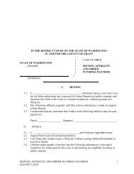
Variance Application Form - Grant County Government
Variance Application Form - Grant County Government
Variance Application Form - Grant County Government

You also want an ePaper? Increase the reach of your titles
YUMPU automatically turns print PDFs into web optimized ePapers that Google loves.
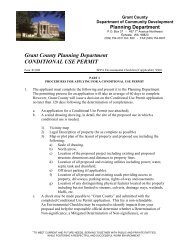
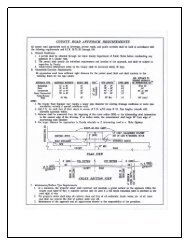
SITE PLAN INSTRUCTIONS<br />
INSTRUCTIONS:<br />
A. Complete the information requested in the gray box at the top of the reverse side of this page and draw your site plan<br />
in the space provided; you may use additional 8½ X 11 sheets as needed;<br />
B. Identify the north arrow in the space provided;<br />
C. Use an accurate scale for drawing (ie; “1 inch = 10 feet” or “1 inch = 20 feet” or “1 inch = 100 feet” etc.);<br />
D. Draw the boundaries of the parcel including the dimensions (you may need a plat map copy from the assessor’s office)<br />
E. Draw the location and dimensions of all existing buildings and structures;<br />
F. Draw the location of the proposed project including the structure dimensions, and distances to property lines and<br />
existing buildings and structures;<br />
G. Draw the location of all proposed and existing utilities (including power, phone, water, sewer systems, reserve<br />
drainfield, etc.);<br />
H. Draw the location and dimensions of all existing and proposed roads, driveways, parking areas, rights-of-way and<br />
easements;<br />
I. Draw the location of any distinguishing physical features located on or adjacent to the property (including but not<br />
limited to : streams, culverts, drainage ways, wetlands, slopes, bluffs, etc.);<br />
J. In the gray box at the bottom of the page, please provide detailed directions to the site;<br />
K. If you have questions regarding these instructions, please see the “EXAMPLE” SITE PLAN provided below. If you<br />
have further questions not covered in the example, please call (509) 754-2011, extension 620 for assistance.<br />
“EXAMPLE” SITE PLAN<br />
IN ORDER TO PROCESS LANDUSE APPLICATIONS, ALL SUBMISSIONS MUST INCLUDE A COMPLETED<br />
SITE PLAN MAP OF THE PROPOSED PROJECT (SEE INTRUCTIONS), submission of an incomplete site plan map<br />
will be considered as an incomplete application and returned to the applicant:<br />
PROJECT/ OWNER NAME ___________________________________________ DATE _____________________<br />
PARCEL #(s) ___________________________________ DRAWING SCALE ________ inch(s) = ________ feet<br />
NOTE: Please label all parcel boundaries with “Property Line”<br />
NORTH<br />
ARROW<br />
Directions to the Site:<br />
________________________________________________________________________________________________<br />
________________________________________________________________________________________________<br />
________________________________________________________________________________________________<br />
___