Sites & Housing Plan - Inspectors Report - Oxford City Council
Sites & Housing Plan - Inspectors Report - Oxford City Council
Sites & Housing Plan - Inspectors Report - Oxford City Council

Create successful ePaper yourself
Turn your PDF publications into a flip-book with our unique Google optimized e-Paper software.
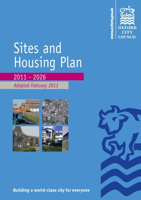
<strong>Sites</strong> and<br />
<strong>Housing</strong> <strong>Plan</strong><br />
2011 - 2026<br />
Adopted February 2013<br />
Building a world-class city for everyone
All maps reproduced under © Crown Copyright and database right 2011. Ordnance Survey 100019348
C O N T E N T S<br />
FOREWORD . . . . . . . . . . . . . . . . . . . . . . . . . . . . . . . . . . .1<br />
INTRODUCTION . . . . . . . . . . . . . . . . . . . . . . . . . . . . . . . .2<br />
PART A: HOUSING<br />
A1 Introduction to <strong>Housing</strong> Policies . . . . . . . . . . . . . . . . . . . . . . . . . . . . . . . . . .9<br />
A2 <strong>Housing</strong> Policies: Mixed and Balanced Communities . . . . . . . . . . . . . . . . . . . .11<br />
Changes to existing homes . . . . . . . . . . . . . . . . . . . . . . . . . . . . . . . . . . . . . . .11<br />
Accessible and adaptable homes . . . . . . . . . . . . . . . . . . . . . . . . . . . . . . . . . . .12<br />
Affordable homes . . . . . . . . . . . . . . . . . . . . . . . . . . . . . . . . . . . . . . . . . . . . .14<br />
Key worker homes . . . . . . . . . . . . . . . . . . . . . . . . . . . . . . . . . . . . . . . . . . . . .17<br />
Student accommodation . . . . . . . . . . . . . . . . . . . . . . . . . . . . . . . . . . . . . . . .18<br />
Houses in multiple occupation . . . . . . . . . . . . . . . . . . . . . . . . . . . . . . . . . . . .22<br />
Homes for boat dwellers . . . . . . . . . . . . . . . . . . . . . . . . . . . . . . . . . . . . . . . .24<br />
Homes for travelling communities . . . . . . . . . . . . . . . . . . . . . . . . . . . . . . . . . .25<br />
A3 <strong>Housing</strong> Policies: Sustainability and Design . . . . . . . . . . . . . . . . . . . . . . . . .26<br />
Design, character and context . . . . . . . . . . . . . . . . . . . . . . . . . . . . . . . . . . . .26<br />
Residential gardens and development . . . . . . . . . . . . . . . . . . . . . . . . . . . . . . .28<br />
Low carbon homes . . . . . . . . . . . . . . . . . . . . . . . . . . . . . . . . . . . . . . . . . . . .29<br />
Living conditions . . . . . . . . . . . . . . . . . . . . . . . . . . . . . . . . . . . . . . . . . . . . .31<br />
Cycle and car parking . . . . . . . . . . . . . . . . . . . . . . . . . . . . . . . . . . . . . . . . . .34<br />
Part A: <strong>Housing</strong> Policies<br />
A1 Introduction<br />
A2 Mixed and Balanced<br />
Communities<br />
A3 Sustainability and Design<br />
Part B: <strong>Sites</strong><br />
B1 Introduction<br />
B2 Site Allocation Policies<br />
Part C: Monitoring and<br />
Implementation<br />
PART B: SITES<br />
B1 Introduction to Site Allocations Policies . . . . . . . . . . . . . . . . . . . . . . . . . . . .41<br />
B2 Site Allocation Policies . . . . . . . . . . . . . . . . . . . . . . . . . . . . . . . . . . . . . . . .52<br />
Maps of allocated sites . . . . . . . . . . . . . . . . . . . . . . . . . . . . . . . . . . . . . . . . .54<br />
Site allocations policies . . . . . . . . . . . . . . . . . . . . . . . . . . . . . . . . . . . . . . . . .58<br />
PART C: MONITORING AND IMPLEMENTATION FRAMEWORK .118<br />
GLOSSARY . . . . . . . . . . . . . . . . . . . . . . . . . . . . . . . . . .152<br />
APPENDICES . . . . . . . . . . . . . . . . . . . . . . . . . . . . . . . .166<br />
1. List of <strong>Oxford</strong> Local <strong>Plan</strong> 2001-2016 policies to be superseded<br />
and Policies Map changes . . . . . . . . . . . . . . . . . . . . . . . . . . . . . . . . . . . . . . .168<br />
2. Method for calculating a financial contribution from residential development . . .171<br />
3. List of main thoroughfares in <strong>Oxford</strong> . . . . . . . . . . . . . . . . . . . . . . . . . . . . . . .172<br />
4. Method for calculating a financial contribution from student accommodation . . .173<br />
5. Illustration showing how to apply Policy HP7 – HMOs . . . . . . . . . . . . . . . . . . .175<br />
6. Energy Statement template . . . . . . . . . . . . . . . . . . . . . . . . . . . . . . . . . . . . .176<br />
7. Illustration for the 45° code . . . . . . . . . . . . . . . . . . . . . . . . . . . . . . . . . . . .180<br />
8. Maximum car parking standards . . . . . . . . . . . . . . . . . . . . . . . . . . . . . . . . . .183<br />
9. Site allocations summary of uses . . . . . . . . . . . . . . . . . . . . . . . . . . . . . . . . . .185<br />
10.<strong>Housing</strong> Trajectory . . . . . . . . . . . . . . . . . . . . . . . . . . . . . . . . . . . . . . . . . . .189<br />
<strong>Sites</strong> and <strong>Housing</strong> <strong>Plan</strong><br />
2011-2026
F O R E W O R D<br />
We want to shape <strong>Oxford</strong> into a more sustainable and a more affordable place to live and<br />
work. The adopted Core Strategy is the first step but it has a big challenge on its hands<br />
in meeting the housing and economic needs of <strong>Oxford</strong> while maintaining it as a world<br />
class city that has many important historical and natural assets.<br />
Vital to the continued economic success and the well being of <strong>Oxford</strong>’s existing and<br />
future residents is that we deliver more housing, especially affordable housing. There is<br />
a severe shortage across the whole country and every place should contribute to meeting<br />
their housing need. <strong>Oxford</strong> has a particularly acute housing shortage and has committed<br />
to building 8,000 houses by 2026 but these ought to be built as soon as possible to<br />
avoid worsening the current backlog and to ensure regular housing supply in the years<br />
before the large strategic sites come forward for development. At the same time we will<br />
ensure that we support other public organisations and utility companies in providing the<br />
infrastructure to support this new development.<br />
Part A: <strong>Housing</strong> Policies<br />
A1 Introduction<br />
A2 Mixed and Balanced<br />
Communities<br />
A3 Sustainability and Design<br />
Part B: <strong>Sites</strong><br />
B1 Introduction<br />
B2 Site Allocation Policies<br />
Part C: Monitoring and<br />
Implementation<br />
This <strong>Sites</strong> and <strong>Housing</strong> <strong>Plan</strong> includes policies that set out what type of housing<br />
development we expect. It also allocates large sites that we consider are suitable for<br />
development for housing and other important uses that will help deliver the aims of the Core<br />
Strategy, the <strong>Oxford</strong> Sustainable Community Strategy and the <strong>City</strong> <strong>Council</strong>’s Corporate <strong>Plan</strong>.<br />
The housing policies (Part A) include new policies against which planning<br />
applications for residential development will be judged. Part A seeks to deliver mixed and<br />
balanced communities across <strong>Oxford</strong>. It will set a clear framework for delivering energy<br />
efficient, sustainable homes. It will ensure high quality design to provide the best<br />
quality of life for occupants of new houses and preserve the amenity and character of<br />
local neighbourhoods. It will help improve the balance of different types of specialist<br />
accommodation such as student accommodation and houses in multiple occupation.<br />
1<br />
The site allocations policies (Part B) allocates sites that we think are suitable for<br />
particular uses with an emphasis on new housing sites. Part B includes sites to focus<br />
existing hospital and medical research in areas of Headington in particular. Locating these<br />
sites close together will help to reduce traffic movements between sites across <strong>Oxford</strong><br />
creating opportunities for shared trips and for the facilities to better support one another.<br />
The allocations also help to implement <strong>Oxford</strong>shire County <strong>Council</strong>’s strategy for improving<br />
public transport in the Eastern Arc of <strong>Oxford</strong> serving the major employment areas. It also<br />
promotes sites for student accommodation to help encourage students to live in halls<br />
rather than in family houses. Critically, it will give landowners a positive steer towards<br />
development which should avoid sites being left empty and encourage institutions to<br />
make better use of their existing sites. With little land available we have to make much<br />
better use of what land we do have and ensure it is developed quickly to address the<br />
chronic housing need in <strong>Oxford</strong> and to support the local economy.<br />
<strong>Council</strong>lor Ed Turner<br />
Deputy Leader of the <strong>Council</strong> and Board Member for Strategic <strong>Plan</strong>ning<br />
<strong>Sites</strong> and <strong>Housing</strong> <strong>Plan</strong><br />
2011-2026
I N T R O D U C T I O N<br />
Adopted February 2013
i) The <strong>Sites</strong> and <strong>Housing</strong> <strong>Plan</strong> is part of <strong>Oxford</strong>’s Local Development Framework (LDF)<br />
and <strong>Oxford</strong>’s Local <strong>Plan</strong> and is one of the documents against which planning<br />
applications are judged. It includes detailed planning policies that planning<br />
applications for residential development are considered against (Part A) and it<br />
allocates sites for development for housing, employment and other uses (Part B).<br />
Relationship with other documents<br />
<strong>Oxford</strong>’s Local Development Framework<br />
Part A: <strong>Housing</strong> Policies<br />
A1 Introduction<br />
A2 Mixed and Balanced<br />
Communities<br />
A3 Sustainability and Design<br />
Part B: <strong>Sites</strong><br />
B1 Introduction<br />
B2 Site Allocation Policies<br />
ii)<br />
<strong>Oxford</strong>’s LDF is comprised of the Core Strategy 1 , West End Area Action <strong>Plan</strong> 2 and saved<br />
policies within the <strong>Oxford</strong> Local <strong>Plan</strong> 2001-2016 3 as well as other documents shown<br />
in Figure 2 which are at various stages of production. Policies should also conform<br />
with any regional planning guidance and be consistent with national planning policy.<br />
Part C: Monitoring and<br />
Implementation<br />
iii)<br />
The Core Strategy sets out the planning<br />
framework for development in <strong>Oxford</strong> up to<br />
2026 and is the overarching document in<br />
<strong>Oxford</strong>’s LDF. It sets out the scale and general<br />
location of future development, and includes<br />
policies to deliver the Core Strategy vision. It<br />
contains city-wide planning policies including<br />
the <strong>City</strong> <strong>Council</strong>’s approach to development in<br />
relation to brownfield sites, the Green Belt, the<br />
flood plain and areas of ecological interest. It<br />
also contains policies on the level of housing<br />
development, where employment, retail,<br />
university and medical research developments<br />
should be directed and allocates large strategic<br />
development sites. The Core Strategy also sets<br />
polices for the overarching requirement to<br />
provide affordable housing, for universities to<br />
provide student accommodation and for<br />
sustainable design and construction methods<br />
to be used.<br />
3<br />
iv)<br />
All <strong>Plan</strong>s should generally conform with the<br />
Core Strategy. Area Action <strong>Plan</strong>s (AAPs)<br />
provide policy approaches for specific areas of<br />
<strong>Oxford</strong> to support the Core Strategy. Other<br />
<strong>Plan</strong>s provide more detailed policy approaches<br />
for development across the whole of <strong>Oxford</strong>.<br />
Supplementary <strong>Plan</strong>ning Documents (SPDs)<br />
provide guidance on detailed issues of<br />
implementation of policies in the Core<br />
Strategy or other <strong>Plan</strong>s.<br />
Figure 1: Stages of the <strong>Sites</strong><br />
and <strong>Housing</strong> <strong>Plan</strong><br />
1<br />
<strong>Oxford</strong>’s Core Strategy 2026 (<strong>Oxford</strong> <strong>City</strong> <strong>Council</strong>) March 2011<br />
2<br />
West End Area Action <strong>Plan</strong> (<strong>Oxford</strong> <strong>City</strong> <strong>Council</strong>) Jun 2008<br />
3<br />
<strong>Oxford</strong> Local <strong>Plan</strong> 2001-2016 (<strong>Oxford</strong> <strong>City</strong> <strong>Council</strong>) Nov 2005<br />
<strong>Sites</strong> and <strong>Housing</strong> <strong>Plan</strong><br />
2011-2026
The <strong>Sites</strong> and <strong>Housing</strong> Development <strong>Plan</strong> Document<br />
v) The overall aim of this document is to help deliver the objectives of the Core<br />
Strategy, to provide greater certainty for developers and local residents and to<br />
reflect changes in circumstances either in terms of general policy issues or<br />
relating to individual sites.<br />
vi)<br />
The housing policies will deliver the Core Strategy aims of delivering more<br />
affordable housing, and achieving balanced communities. It will help create a<br />
mixture of household types and tenures across <strong>Oxford</strong>, and so promote diverse and<br />
inclusive neighbourhoods. It will also encourage new homes in <strong>Oxford</strong> to<br />
contribute to tackling the causes of climate change, and, through quality of<br />
design, promote quality of life.<br />
4<br />
Figure 2: <strong>Oxford</strong>’s Local Development Framework<br />
Adopted February 2013
vii)<br />
viii)<br />
Many of the existing sites allocated within the Local <strong>Plan</strong> have been built but not<br />
all of them. New site allocations policies give the opportunity to review existing<br />
Local <strong>Plan</strong> sites and identify new sites for allocation. Site allocations provide<br />
certainty to developers, local people and infrastructure providers as to what<br />
developments are likely to happen in the area. The overall aim of the site<br />
allocations is to prioritise the use of land to meet the Core Strategy key priorities<br />
of meeting <strong>Oxford</strong>’s housing and employment needs, regeneration, focusing<br />
development on Previously Developed Land and reducing the need to travel. In<br />
particular, this <strong>Plan</strong> places great emphasis on identifying sites for housing which<br />
will encourage the development of housing which would include affordable housing.<br />
This <strong>Plan</strong> supersedes all the remaining development site allocations in Section<br />
14.0 of the Local <strong>Plan</strong> and many housing policies. Appendix 1 contains the full<br />
list of superseded policies.<br />
Part A: <strong>Housing</strong> Policies<br />
A1 Introduction<br />
A2 Mixed and Balanced<br />
Communities<br />
A3 Sustainability and Design<br />
Part B: <strong>Sites</strong><br />
B1 Introduction<br />
B2 Site Allocation Policies<br />
Part C: Monitoring and<br />
Implementation<br />
How to use this document<br />
This document comprises two elements:<br />
Part A contains the <strong>Housing</strong> Policies. These policies should be used to steer most types<br />
of residential development, irrespective of location. They should be read in<br />
conjunction with all other adopted, saved and emerging policies in the Local<br />
Development Framework.<br />
Part B contains the Site Allocations. These policies apply to specific sites identified in<br />
<strong>Oxford</strong>, that are expected to help deliver the aims of the Core Strategy to 2026.<br />
They should be read in conjunction with all other adopted, saved and emerging<br />
policies in the Local Development Framework. Where a site is not allocated, it may<br />
still be suitable for development, subject to other local plan policies.<br />
5<br />
Sustainability Appraisal and Habitats Regulation<br />
Assessment<br />
ix)<br />
A Sustainability Appraisal (SA) 4 considers the social, economic and environmental<br />
impacts of a policy or plan. This <strong>Plan</strong> is accompanied by an SA which assessed<br />
the objectives of the <strong>Sites</strong> and <strong>Housing</strong> <strong>Plan</strong> against the SA objectives to confirm<br />
general consistencies between them. The <strong>Sites</strong> and <strong>Housing</strong> <strong>Plan</strong> objectives are<br />
shown to score positively when appraised against the sustainability objectives.<br />
x) The SA was produced alongside the <strong>Plan</strong> to predict and evaluate the effects of the<br />
document. It ensured that all aspects of sustainability were properly considered<br />
and suggestions were made for improving sustainability. These have been<br />
incorporated into the policies where appropriate.<br />
4<br />
Site Allocations<br />
Sustainability Appraisal<br />
and <strong>Housing</strong> Policies<br />
Sustainability Appraisal<br />
(Feb 2012) <strong>Oxford</strong> <strong>City</strong><br />
<strong>Council</strong>. Addendums<br />
July 2012-October 2012<br />
and Erratum Note July<br />
2012<br />
<strong>Sites</strong> and <strong>Housing</strong> <strong>Plan</strong><br />
2011-2026
xi) The Habitats Regulations Assessment (HRA) 5 is a process used to assess the<br />
impacts of policies against the conservation objectives of a European site and to<br />
determine whether it would adversely affect the integrity of that site. The <strong>City</strong><br />
<strong>Council</strong> undertook a screening process to determine whether or not the <strong>Plan</strong> will<br />
have a significant effect on the <strong>Oxford</strong> Meadows Special Area of Conservation<br />
(SAC). It concludes that the conditional approval set out in the policy wording or<br />
text within the <strong>Sites</strong> and <strong>Housing</strong> <strong>Plan</strong> is sufficient to ensure that there is no<br />
adverse impact on the SAC either alone or in combination with other plans or<br />
projects.<br />
National <strong>Plan</strong>ning Policy Framework<br />
xii)<br />
Policies in Local <strong>Plan</strong>s should follow the approach of the presumption in favour<br />
of sustainable development so that it is clear that development which is<br />
sustainable can be approved without delay. All plans should be based upon and<br />
reflect the presumption in favour of sustainable development, with clear policies<br />
that will guide how the presumption should be applied locally.<br />
6<br />
P o l i c y M P 1 :<br />
Model Policy<br />
When considering development proposals the <strong>Council</strong> will take a positive<br />
approach that reflects the presumption in favour of sustainable development<br />
contained in the National <strong>Plan</strong>ning Policy Framework. It will work proactively<br />
with applicants jointly to find solutions which mean that applications for<br />
sustainable development can be approved where possible, and to secure<br />
development that improves the economic, social and environmental conditions<br />
in the area.<br />
<strong>Plan</strong>ning applications that accord with <strong>Oxford</strong>’s Local <strong>Plan</strong>* (and, where<br />
relevant, with neighbourhood plans) will be approved without delay, unless<br />
material considerations indicate otherwise.<br />
Where there are no policies relevant to the application or relevant policies<br />
are out of date at the time of making the decision then the <strong>Council</strong> will grant<br />
permission unless material considerations indicate otherwise, and unless:<br />
• Any adverse impacts of granting permission would significantly and<br />
demonstrably outweigh the benefits, when assessed against the policies in<br />
the National <strong>Plan</strong>ning Policy Framework taken as a whole; or<br />
• Specific policies in that Framework indicate that development should be<br />
restricted.<br />
*<strong>Oxford</strong>’s Local <strong>Plan</strong> comprises of the Core Strategy, West End Area Action <strong>Plan</strong>, saved policies from the<br />
<strong>Oxford</strong> Local <strong>Plan</strong> 2001-2016.<br />
5<br />
<strong>Sites</strong> and <strong>Housing</strong> <strong>Plan</strong>:<br />
Habitats Regulations<br />
Assessment (Feb 2012)<br />
<strong>Oxford</strong> <strong>City</strong> <strong>Council</strong><br />
Adopted February 2013
Part A: <strong>Housing</strong> Policies<br />
A1 Introduction<br />
A2 Mixed and Balanced<br />
Communities<br />
A3 Sustainability and Design<br />
Part B: <strong>Sites</strong><br />
B1 Introduction<br />
B2 Site Allocation Policies<br />
Part C: Monitoring and<br />
Implementation<br />
7<br />
<strong>Sites</strong> and <strong>Housing</strong> <strong>Plan</strong><br />
2011-2026
8<br />
PART A:<br />
HOUSING POLICIES<br />
Adopted February 2013
Section A1: Introduction to <strong>Housing</strong> Policies<br />
Introduction<br />
Part A: <strong>Housing</strong> Policies<br />
A1 Introduction<br />
A2 Mixed and Balanced<br />
Communities<br />
A3 Sustainability and Design<br />
A1.1 The <strong>Oxford</strong> Core Strategy 2026 sets out a vision for <strong>Oxford</strong>. A key priority is to<br />
provide more affordable and family homes. The <strong>City</strong> <strong>Council</strong>’s vision is to establish<br />
mixed communities to help create a sense of place and build local identities. Good<br />
housing will improve the social, environmental and economic well-being of the<br />
city, and through good design it will reduce our carbon footprint. A strategic<br />
objective is to plan for an appropriate mix of housing tenures, types and sizes to<br />
meet existing needs and future population growth.<br />
Part B: <strong>Sites</strong><br />
B1 Introduction<br />
B2 Site Allocation Policies<br />
Part C: Monitoring and<br />
Implementation<br />
A1.2 This part of the <strong>Sites</strong> and <strong>Housing</strong> <strong>Plan</strong> sets out the housing policies for <strong>Oxford</strong>.<br />
The policies cover specialist types of homes, such as student accommodation and<br />
shared houses, as well as traditional houses and flats. Section A2 sets out policies<br />
that aim to make sure all developments contribute to mixed and balanced<br />
communities across the city. Section A3 sets out policies to make sure all<br />
residential developments are well-designed, respect the character of the area, and<br />
respect the quality of life for existing local people.<br />
Objectives<br />
A1.3 The <strong>Oxford</strong> Core Strategy sets out a number of strategic objectives. These are not<br />
repeated in this document, but have been used to develop objectives for this <strong>Plan</strong><br />
that are specific to residential development. The objectives aim to foster mixed,<br />
balanced and sustainable communities across the city.<br />
9<br />
<strong>Housing</strong> <strong>Plan</strong> Objectives<br />
Objective 1: Increase the supply of affordable housing, reflecting local demand for<br />
different types of tenure.<br />
Objective 2: Improve the balance of residential accommodation types across the<br />
city, including student accommodation, houses in multiple occupation<br />
and other forms of specialist housing.<br />
Objective 3: Ensure all new residential development achieves high design quality,<br />
to provide good quality of life to its occupants, and enhances or<br />
preserves the amenity and character of neighbourhoods.<br />
Objective 4: Reduce carbon emissions from new residential development and move<br />
towards Zero Carbon standards in all developments.<br />
<strong>Sites</strong> and <strong>Housing</strong> <strong>Plan</strong><br />
2011-2026
How to use the <strong>Housing</strong> Policies<br />
A1.4 The <strong>Housing</strong> Policies, as part of <strong>Oxford</strong>’s Local Development Framework (LDF),<br />
should be read as a whole. The <strong>Oxford</strong> Core Strategy 2026 is the <strong>City</strong> <strong>Council</strong>’s<br />
starting point for making decisions on planning applications, while the <strong>Housing</strong><br />
Policies provide more detailed criteria and mechanisms for delivery. The <strong>Housing</strong><br />
Policies should always be read with their supporting text, which in places refers<br />
to other documents from the LDF, particularly the Core Strategy.<br />
10<br />
Adopted February 2013
Section A2: Mixed and Balanced Communities<br />
Overview<br />
A2.1 The <strong>Oxford</strong> Core Strategy has clear strategic objectives that aim to create mixed<br />
and balanced communities, both across <strong>Oxford</strong> and at a more local level, within<br />
the overall priority of delivering new homes. The <strong>City</strong> <strong>Council</strong> will plan to<br />
encourage a range of tenancies and household types, with no one group being<br />
dominant over others. This helps to build sustainable, lifetime communities.<br />
Part A: <strong>Housing</strong> Policies<br />
A1 Introduction<br />
A2 Mixed and Balanced<br />
Communities<br />
A3 Sustainability and Design<br />
Part B: <strong>Sites</strong><br />
B1 Introduction<br />
B2 Site Allocation Policies<br />
Part C: Monitoring and<br />
Implementation<br />
A2.2 Core Strategy Policy CS23 – Mix of <strong>Housing</strong> expects new housing developments<br />
to provide different types and sizes of home, to provide for a range of households,<br />
such as families with children, single people, older people and people with<br />
specialist housing needs. An appropriate mix of homes for different areas of<br />
<strong>Oxford</strong> is set out in the Balance of Dwellings SPD, which specifies the range of<br />
house sizes (by bedrooms) expected.<br />
A2.3 Core Strategy Policy CS24 – Affordable <strong>Housing</strong> states that planning permission<br />
will only be granted for residential development that provides generally a minimum<br />
of 50% of the homes as affordable housing. The policy reflects the need to deliver<br />
a wide choice of high-quality homes, create sustainable, inclusive and mixed<br />
communities, and to tackle the pressing need for more affordable housing.<br />
A2.4 The Core Strategy includes Policy CS25 – Student Accommodation. This recognises<br />
the benefits of increasing the amount of purpose-built student accommodation, to<br />
ease the heavy demand from student occupiers in the private rental market. This<br />
heavy demand is reflected in the high concentration of Houses in Multiple Occupation<br />
(HMOs) in certain parts of <strong>Oxford</strong>. However the Core Strategy recognises that new<br />
student accommodation should not be built at the expense of general housing.<br />
11<br />
A2.5 The policies in this sub-section, together with the Site Allocations, aim to get the right<br />
types of homes in the right places, and to strike a balance between the need for different<br />
types of housing. Developers are especially keen to build some types of housing, such as<br />
houses built for open-market sale and student accommodation. Other types, such as<br />
affordable housing, can be less attractive to commercial developers, but are nevertheless<br />
important to achieving mixed and balanced communities. <strong>Plan</strong>ning policies therefore<br />
have an important role to play in ensuring a reasonable mix is maintained.<br />
Changes of use from existing homes<br />
A2.6 There are not nearly enough homes in <strong>Oxford</strong> to meet the city’s housing needs.<br />
The benefits of building new housing would be undermined if the stock of existing<br />
housing were to reduce. Therefore the start-point for sound planning is to protect<br />
existing housing sites. The <strong>City</strong> <strong>Council</strong> has a longstanding strategy to resist the<br />
net loss of self-contained dwellings in <strong>Oxford</strong>.<br />
<strong>Sites</strong> and <strong>Housing</strong> <strong>Plan</strong><br />
2011-2026
A2.7 The <strong>City</strong> <strong>Council</strong> wishes to support small, home-grown enterprises, or small-scale<br />
community facilities such as local shops and childcare provision. Where an<br />
applicant proposes changing the use of part of any residential building classed as<br />
C3, C4 or Sui Generis HMO to a use not falling within one of these same uses, they<br />
must demonstrate that the remaining residential accommodation on the site still<br />
provides at least the same number of good-quality self-contained homes (or, in<br />
the case of HMOs, that could become self-contained without significant<br />
alteration).<br />
A2.8 Policy HP1 will apply to all changes of use from self-contained dwellings and<br />
Houses in Multiple Occupation (Use Classes C3, C4 and Sui Generis HMO). The<br />
exceptions are that policy HP1 will not apply to changes of use from a single C3<br />
dwelling to an HMO (C4 or Sui Generis), or from a single C4 or Sui Generis HMO<br />
to one or more self-contained (C3) homes.<br />
12<br />
P o l i c y H P 1 :<br />
Changes of Use From Existing Homes<br />
<strong>Plan</strong>ning permission will not be granted for any development that results in the<br />
net loss of one or more self-contained dwellings on a site.<br />
<strong>Plan</strong>ning permission will only be granted for a change of use that results in a<br />
net reduction in residential accommodation where:<br />
a. in the case of houses and flats in Use Class C3 or C4, at least 75m 2 of each<br />
original dwelling’s floorspace is retained as a self-contained dwelling, and<br />
b. the internal and external living conditions of the retained dwelling(s) meet<br />
the requirements of Policies HP12, HP13 and HP14, and<br />
c. the scale and nature of the proposed use is compatible with neighbouring<br />
uses and with the surrounding area, and not likely to give rise to a<br />
significant increase in noise nuisance, traffic or on-street parking.<br />
Accessible and adaptable homes<br />
A2.9 Achieving mixed and balanced communities requires the <strong>City</strong> <strong>Council</strong> to plan for<br />
people’s different physical needs. The <strong>City</strong> <strong>Council</strong> wishes to see new homes built<br />
that are accessible to all who may wish to live in them, and visit them, including<br />
those with disabilities. Many people will become less mobile as they become older,<br />
or through injury, and homes should be able to adapt to these changing needs.<br />
A2.10 Current building regulations require new developments to have a minimum<br />
standard of accessibility into the entrance level of a building. These standards<br />
provide opportunity for disabled people to visit such homes, but only limited<br />
benefits for independent domestic living.<br />
6<br />
Details of the Lifetime<br />
Homes Standard is<br />
found at<br />
www.lifetimehomes.org.uk<br />
A2.11 The Lifetime Homes Standard 6 is a widely used national standard, which goes<br />
further than statutory building regulations. Lifetime Homes specifications ensure<br />
that the spaces and features in new homes can readily meet the needs of most<br />
Adopted February 2013
people, including those with reduced mobility. The standards include level entry<br />
to the home, minimum doorway widths, adequate wheelchair manoeuvring space,<br />
provision for future installation of internal lifts, and appropriate window heights.<br />
Given the need to promote social inclusion, the <strong>City</strong> <strong>Council</strong> considers it<br />
appropriate that all new homes should be built to Lifetime Homes standard.<br />
A2.12 Whilst Lifetime Homes goes some way to assisting wheelchair users’ day-to-day<br />
needs, it does not provide opportunity to adapt homes to include all the features<br />
needed by a wheelchair user. A home designed for easy adaptation to full<br />
wheelchair housing standards can ensure that not only does a wheelchair user<br />
have access to every facility inside and outside of the dwelling, but also has<br />
choice on how best to approach that facility to suit their particular needs. Such<br />
homes should include space for full wheelchair turning, manoeuvring and<br />
transferring to a second chair; space that can easily be converted to a throughfloor<br />
lift for second-floor access, and ensuring the layout of kitchens and<br />
bathrooms allow full access to wheelchair users. Future occupants should be able<br />
to adapt their home to full wheelchair accessible standard without enlarging or<br />
structurally modifying their home.<br />
Part A: <strong>Housing</strong> Policies<br />
A1 Introduction<br />
A2 Mixed and Balanced<br />
Communities<br />
A3 Sustainability and Design<br />
Part B: <strong>Sites</strong><br />
B1 Introduction<br />
B2 Site Allocation Policies<br />
Part C: Monitoring and<br />
Implementation<br />
A2.13 The <strong>City</strong> <strong>Council</strong> has calculated that 5% of all new homes would need to be<br />
wheelchair accessible to meet both the existing backlog of need, and newly<br />
arising need. The policy seeks 5% of all new dwellings should be designed as<br />
wheelchair accessible, or to be easily adaptable to wheelchair use. This is likely<br />
to be less practical on sites of 3 or less homes, which will generally be infill<br />
development or the conversion of houses into flats. Therefore these sites are<br />
exempt from the requirement.<br />
A2.14 50% of the wheelchair accessible or adaptable homes should be provided as open<br />
market homes (or as close as possible to 50% where there are an odd number of<br />
units).<br />
13<br />
A2.15 The <strong>City</strong> <strong>Council</strong> will publish a technical advice note, subject to update, detailing<br />
the Lifetime Homes and Wheelchair Accessible Standards. Applicants will be<br />
expected to demonstrate that Policy HP2 has been complied with in the Design<br />
and Access Statement. Account will be taken of any genuine practical, viability or<br />
heritage constraints.<br />
P o l i c y H P 2<br />
Accessible and Adaptable Homes<br />
<strong>Plan</strong>ning permission will only be granted for new dwellings where<br />
a. all the proposed new dwellings meet the Lifetime Homes standard, and<br />
b. on sites of 4 or more dwellings (gross), at least 5% of all new dwellings (or at<br />
least 1 dwelling for sites below 20 units) are either fully wheelchair accessible,<br />
or easily adapted for full wheelchair use. 50% of these must be provided as<br />
open market dwellings.<br />
The <strong>City</strong> <strong>Council</strong> will take into account any evidence that applying these<br />
requirements would make the development unviable.<br />
<strong>Sites</strong> and <strong>Housing</strong> <strong>Plan</strong><br />
2011-2026
Affordable homes<br />
A2.16 Meeting housing need is a key priority of the <strong>City</strong> <strong>Council</strong>. New affordable housing<br />
has a vital role in delivering sustainable, inclusive and mixed communities, both<br />
within a site, and across <strong>Oxford</strong> as a whole.<br />
A2.17 Core Strategy Policy CS24 – Affordable <strong>Housing</strong> states that generally a<br />
minimum of 50% of residential developments must be provided as affordable<br />
housing. The <strong>City</strong> <strong>Council</strong> generally expects affordable housing to be provided as<br />
part of the same development (‘on-site’), to ensure a balanced community on the<br />
site.<br />
A2.18 Policies HP3 and HP4 set out the detail of how residential developments should<br />
contribute to affordable housing. The policy applies to all types of self-contained<br />
dwelling. This includes retirement homes, sheltered housing, Extra Care <strong>Housing</strong>,<br />
key worker housing, and all parts of any development that fall within Use Class<br />
C3. The policy does not apply to residential institutions such as care homes,<br />
nursing homes or hospitals, or to secure residential institutions, but will apply to<br />
any self-contained staff accommodation within these developments.<br />
14<br />
Provision of affordable housing on-site (10 or more homes)<br />
A2.19 Most sites in <strong>Oxford</strong> that have capacity for 10 or more homes can provide 50%<br />
affordable housing whilst remaining viable 7 . Where a developer considers that<br />
meeting the 50% target will make a site unviable, they must provide robust<br />
evidence of this in the form of an independent viability appraisal. The <strong>City</strong> <strong>Council</strong><br />
will expect the developer to negotiate on an “open book” basis which relates to<br />
the particular site circumstances that have resulted in the development’s nonviability.<br />
The <strong>City</strong> <strong>Council</strong> will always expect developers to have considered the<br />
financial implications of affordable housing policy requirements, and local market<br />
indicators, when purchasing the land for development.<br />
7<br />
<strong>Oxford</strong> Affordable<br />
<strong>Housing</strong> Viability Study<br />
(King Sturge, 2011)<br />
A2.20 If the <strong>City</strong> <strong>Council</strong> is satisfied that the site would be unviable, a cascade approach<br />
will be used to determine an appropriate contribution. Policy HP3 builds on Core<br />
Strategy Policy CS24 by setting out how this cascade approach will operate.<br />
Adopted February 2013
A2.21 Affordable housing must be truly affordable to those that need it. The <strong>City</strong> <strong>Council</strong><br />
will require at least 80% of affordable housing provided on-site to be social<br />
rented. Due to exceptionally high private rents in <strong>Oxford</strong>, the alternative<br />
‘affordable rented’ tenure will not be accepted as a substitute for social rented<br />
homes. Up to 20% of the affordable homes provided on-site may be provided as<br />
affordable rented or as other types of intermediate housing.<br />
A2.22 The <strong>City</strong> <strong>Council</strong> maintains the <strong>Housing</strong> Register for <strong>Oxford</strong>, and also monitors and<br />
manages allocations. The <strong>Council</strong> will use this and other available evidence to<br />
advise on the strategic mix of dwelling sizes required on new housing<br />
developments, including for key workers, to meet <strong>Housing</strong> Strategy objectives.<br />
The strategic mix currently set out in the Affordable <strong>Housing</strong> SPD (July 2006) will<br />
be updated in a future planning document. Affordable dwellings of 2 or more<br />
bedrooms should provide enough space within at least two bedrooms for at least<br />
two people to comfortably share. This allows for children to share bedrooms, and<br />
ensures that there is some extra space for expanding family households.<br />
Part A: <strong>Housing</strong> Policies<br />
A1 Introduction<br />
A2 Mixed and Balanced<br />
Communities<br />
A3 Sustainability and Design<br />
Part B: <strong>Sites</strong><br />
B1 Introduction<br />
B2 Site Allocation Policies<br />
Part C: Monitoring and<br />
Implementation<br />
P o l i c y H P 3<br />
Affordable Homes From Large <strong>Housing</strong> <strong>Sites</strong><br />
<strong>Plan</strong>ning permission will only be granted for residential development on sites with<br />
capacity for 10 or more dwellings, or which have an area of 0.25 hectares or greater,<br />
if generally a minimum 50% of dwellings on the site are provided as affordable homes.<br />
A minimum 80% of the affordable homes must be provided as social<br />
rented, with remaining affordable homes provided as intermediate housing.*<br />
Exceptions will be made only if it can be robustly demonstrated that this level<br />
of provision makes a site unviable, in which case developers and the <strong>City</strong> <strong>Council</strong> will<br />
work through a cascade approach in the following order until a scheme is made viable:<br />
• firstly, reduce the percentage of affordable housing provided (to a minimum<br />
of 40% of all homes) by reducing the intermediate housing element only;<br />
• secondly, at 40% affordable housing, reintroduce an element of<br />
intermediate housing incrementally up to a maximum 8% of all homes;<br />
• thirdly, make a financial contribution in lieu of on-site provision, to be<br />
calculated using the approach set out in Appendix 2.<br />
The applicant must demonstrate that the mix of dwelling sizes meets the<br />
<strong>City</strong> <strong>Council</strong>’s preferred strategic mix for affordable housing.<br />
Developers may not circumvent this policy by artificially subdividing sites.<br />
15<br />
* See Glossary for definitions<br />
Provision of affordable housing through financial contributions (4–9 homes)<br />
A2.23 Much of <strong>Oxford</strong>’s supply of new housing comes from small sites of less than 10 homes,<br />
or less than 0.25 hectares. It is important that these sites contribute to achieving a<br />
balanced community in <strong>Oxford</strong>. It is often not possible for these sites to provide 50%<br />
of homes as affordable without becoming unviable. It is difficult for a Registered<br />
Provider to efficiently manage individual households in dispersed locations.<br />
<strong>Sites</strong> and <strong>Housing</strong> <strong>Plan</strong><br />
2011-2026
A2.24 The Affordable <strong>Housing</strong> Viability Study showed that most small sites of less than<br />
10 homes can however make a financial contribution towards achieving a more<br />
balanced tenure mix across <strong>Oxford</strong>. This will be required on sites of 4 to 9<br />
dwellings, and will specifically be used to deliver affordable housing elsewhere in<br />
<strong>Oxford</strong>. If it can be robustly demonstrated to the <strong>City</strong> <strong>Council</strong> that the full<br />
contribution would make the development unviable, the <strong>Council</strong> will expect any<br />
alternative sum to be negotiated on an “open book” basis, using the same<br />
principles as for on-site affordable housing.<br />
A2.25 In appropriate circumstances, provision may be made as on-site affordable<br />
housing. The <strong>City</strong> <strong>Council</strong> and the applicant must agree that on-site provision is<br />
appropriate. On-site provision would be expected to make up generally a minimum<br />
of 50% of dwellings on the site, unless viability evidence demonstrates a need to<br />
reduce this.<br />
A2.26 Where homes are proposed as part of a mixed-use scheme, together with student<br />
accommodation and/or commercial development, account will be taken of the<br />
overall floorspace of all development on the site. Even if different uses each fall<br />
under the threshold for applying the relevant policy, the development as a whole<br />
may still trigger a requirement to contribute to affordable housing.<br />
A2.27 <strong>Sites</strong> that have capacity to provide only 3 homes or less (gross) will be exempt<br />
from the requirement, so that conversions of large homes to smaller dwellings are<br />
able to come forward, whilst meeting other important requirements such as<br />
Lifetime Homes.<br />
16<br />
P o l i c y H P 4<br />
Affordable Homes From Small <strong>Housing</strong> <strong>Sites</strong><br />
<strong>Plan</strong>ning permission will only be granted for residential development on sites<br />
with capacity for 4 to 9 dwellings, if a financial contribution is secured towards<br />
delivering affordable housing elsewhere in <strong>Oxford</strong>. The contribution required will<br />
be 15% of the total sale value of the development, and will be calculated using<br />
the formula set out in Appendix 2.<br />
Where both the <strong>City</strong> <strong>Council</strong> and the applicant agree that on-site affordable<br />
housing is appropriate, planning permission will be granted if generally a<br />
minimum 50% of dwellings on the site are provided as affordable homes.<br />
If it can be demonstrated to the <strong>City</strong> <strong>Council</strong> that the full contribution<br />
would make the development unviable, the <strong>City</strong> <strong>Council</strong> will accept a lower<br />
contribution, in accordance with Appendix 2 (paragraph 6).<br />
Developers may not circumvent this policy by artificially subdividing sites.<br />
For mixed-use residential developments that include student accommodation<br />
and/or commercial floorspace, the overall development floorspace will be used<br />
to determine the contribution required.<br />
Adopted February 2013
Key worker homes<br />
A2.28 The <strong>Oxford</strong> Core Strategy recognises that <strong>Oxford</strong> is home to many key workers,<br />
including people who work in the public sector for the NHS Trusts, police and fire<br />
service. Core Strategy Paragraph 7.2.7 states that key worker provision will be<br />
supported where it is in addition to the required level of affordable housing.<br />
Therefore, the requirements of Policy HP3 - Affordable Homes from Large <strong>Housing</strong><br />
<strong>Sites</strong> and Policy HP4 – Affordable Homes from Small <strong>Housing</strong> <strong>Sites</strong> must still be<br />
met. On-site provision of affordable housing should provide the required strategic<br />
mix. The <strong>City</strong> <strong>Council</strong> will agree to restrictions on the occupancy of any housing<br />
development meant for key workers, including for affordable homes, provided that<br />
the affordable homes still meet the definitions of affordable housing set out in<br />
the Glossary.<br />
Part A: <strong>Housing</strong> Policies<br />
A1 Introduction<br />
A2 Mixed and Balanced<br />
Communities<br />
A3 Sustainability and Design<br />
Part B: <strong>Sites</strong><br />
B1 Introduction<br />
B2 Site Allocation Policies<br />
Part C: Monitoring and<br />
Implementation<br />
A2.29 Where key worker or staff accommodation is provided as cluster flats 8 , each flat<br />
will be treated as a self-contained unit subject to Policy HP3 and Policy HP4.<br />
Developers may not circumvent these policies by designing non-self-contained<br />
accommodation blocks.<br />
A2.30 Local authorities are expected to set out a definition of key workers, who may be<br />
prioritised for intermediate housing schemes such as shared ownership of newbuild<br />
homes. This definition is then used by Registered Providers in determining<br />
who is given greatest priority for such schemes. The <strong>City</strong> <strong>Council</strong>’s definition of a<br />
key worker is any person who is in paid employment solely within one or more of<br />
the following occupations:<br />
• NHS: all clinical staff except doctors and dentists<br />
• Schools: qualified teachers in any Local Education Authority school or sixthform<br />
college, or any state-funded Academy or Free School; qualified nursery<br />
nurses in any <strong>Oxford</strong>shire County <strong>Council</strong> nursery school<br />
• Universities and colleges: lecturers at further education colleges; lecturers,<br />
academic research staff and laboratory technicians at <strong>Oxford</strong> Brookes<br />
University or any college or faculty within the University of <strong>Oxford</strong><br />
• Police & probation: police officers and community support officers; probation<br />
service officers (and other operational staff who work directly with offenders);<br />
prison officers including operational support<br />
• Local authorities & Government agencies: social workers; occupational<br />
therapists; educational psychologists; speech and language therapists;<br />
rehabilitation officers; planning officers; environmental health officers;<br />
Connexions personal advisors; clinical staff; uniformed fire and rescue staff<br />
below principal level<br />
• Ministry of Defence: servicemen and servicewomen in the Navy, Army or Air<br />
Force; clinical staff (with the exception of doctors and dentists).<br />
17<br />
8<br />
See Glossary<br />
<strong>Sites</strong> and <strong>Housing</strong> <strong>Plan</strong><br />
2011-2026
Student accommodation<br />
A2.31 <strong>Oxford</strong> will always have a large student population. The student communities,<br />
which include undergraduates and postgraduate researchers, contribute greatly to<br />
the diversity and cultural vibrancy of <strong>Oxford</strong>.<br />
A2.32 The accommodation needs of most students are generally short-term, and<br />
different to those of long-term <strong>Oxford</strong> residents. Core Strategy Policy CS25 –<br />
Student Accommodation recognises that the number of students who houseshare<br />
in privately rented accommodation affects the availability of larger houses<br />
in the general market. Development of new student accommodation benefits the<br />
wider market, as it frees up homes that are suitable for families and couples. The<br />
policy requires that no more than 3,000 students of either <strong>Oxford</strong> Brookes<br />
University, or the University of <strong>Oxford</strong>, should be living outside of Universityprovided<br />
accommodation, as a precondition of further academic or administrative<br />
university development. Policy CS25 sets out how such accommodation is<br />
expected to be let and managed, seeking in particular to prevent occupants from<br />
bringing cars to <strong>Oxford</strong>.<br />
Location and design<br />
18<br />
A2.33 Policy HP5 sets out criteria for determining which locations are suitable for<br />
student accommodation, and other conditions for development. Accessibility by<br />
public transport is important, as students in bespoke accommodation do not have<br />
access to a car. It is also important to locate student accommodation in a way<br />
that avoids great increases in activity along quieter residential streets. The policy<br />
should ensure students are able to live in a convenient location, as well as<br />
helping to maintain the character of residential areas.<br />
A2.34 The <strong>City</strong> <strong>Council</strong> considers that only sites located adjacent to a main<br />
thoroughfare, or in a District or <strong>City</strong> centre, are suitable for student<br />
accommodation. Main thoroughfares, for the purposes of this policy, are listed in<br />
Appendix 3. To be adjacent, a site must provide its main pedestrian and cycle<br />
access directly onto the main thoroughfare, or via a route that does not pass any<br />
dwelling frontage (this applies to houses and flats within Use Class C3 or C4). The<br />
<strong>City</strong> centre and District centres are defined on the Policies Map.<br />
A2.35 Student accommodation consisting of 20 or more student bedrooms should<br />
provide both communal indoor space and communal outdoor space which is<br />
available to all residents. Shared indoor space ensures that occupants have space<br />
to gather, socialise and hold events. The nature of provision will depend on the<br />
scale of development, and could be a common room, or an informal lobby area.<br />
Outdoor space ensures there is opportunity for relaxation and quiet outdoor<br />
recreation. At least 10% of the total site area will be required to fulfil these<br />
outdoor space functions, unless the site is exceptionally constrained.<br />
Adopted February 2013
Loss of existing purpose-built student accommodation<br />
A2.36 It is very important that existing student accommodation sites are not lost to<br />
other uses. Proposals that would lead to the loss of student accommodation will<br />
only be acceptable if an equivalent amount of new student accommodation is<br />
available for occupancy, within a reasonable timeframe, by students of the same<br />
university or institution. The new provision must take into account the mix,<br />
occupancy and affordability of the rooms being lost.<br />
Vacation uses<br />
A2.37 Core Strategy Policy CS25 limits occupation to full-time students enrolled on courses of<br />
one academic year (including vacation periods). This restriction does not apply outside<br />
the semester or term-time, provided that during term-time the development is occupied<br />
only by university students. This ensures opportunity for efficient use of the buildings<br />
for short-stay visitors, such as conference delegates or summer language school<br />
students, whist providing permanent university student accommodation when needed.<br />
Part A: <strong>Housing</strong> Policies<br />
A1 Introduction<br />
A2 Mixed and Balanced<br />
Communities<br />
A3 Sustainability and Design<br />
Part B: <strong>Sites</strong><br />
B1 Introduction<br />
B2 Site Allocation Policies<br />
Part C: Monitoring and<br />
Implementation<br />
Parking and loading<br />
A2.38 Policy HP16 – Residential Car Parking states that only operational and disabled<br />
parking should be provided for new student accommodation. Operational parking<br />
should be available for students and their families, for a limited period, arriving<br />
and departing at the start and end of semesters or terms.<br />
P o l i c y H P 5<br />
Location of Student Accommodation<br />
<strong>Plan</strong>ning permission will only be granted for student accommodation in the<br />
following locations:<br />
a. on or adjacent to an existing university or college academic site # , or hospital<br />
and research site (and only if the use during university terms or semesters is<br />
to accommodate students being taught or conducting research at that site), or<br />
b. in the <strong>City</strong> centre or a District centre, or<br />
c. located adjacent to a main thoroughfare*, or<br />
d. on a site which is allocated in the development plan to potentially include<br />
student accommodation.<br />
Also, planning permission will only be granted for student accommodation if:<br />
e. for developments of 20 or more bedrooms, the design includes some indoor<br />
and outdoor communal space, and<br />
f. a management regime has been agreed with the <strong>City</strong> <strong>Council</strong> that will be<br />
implemented on first occupation of the development (to be secured by a<br />
planning condition or planning obligation), and<br />
g. the developer undertakes to prevent residents from parking their cars<br />
anywhere on the site, and anywhere in <strong>Oxford</strong>.<br />
<strong>Plan</strong>ning permission will not be granted for any proposal that results in a net<br />
loss of purpose-built student accommodation.<br />
19<br />
# See glossary definitions *See Appendix 3 for a list of main thoroughfares<br />
<strong>Sites</strong> and <strong>Housing</strong> <strong>Plan</strong><br />
2011-2026
Student accommodation and affordable housing<br />
A2.39 A key objective of the Core Strategy is to ensure that new residential development<br />
contributes to a balance of housing types and tenures, which in turn contribute<br />
to mixed and balanced communities. New student accommodation is often<br />
proposed on sites that could otherwise be developed for general purpose housing,<br />
which would include affordable homes as part of a wider tenure mix.<br />
A2.40 Policy HP6 therefore sets out how student accommodation proposals should<br />
contribute to affordable housing delivery, to ensure that the objective of<br />
achieving mixed and balanced communities is met. This will apply on qualifying<br />
sites providing 20 or more student bedrooms that are otherwise suitable for<br />
general purpose housing: this is broadly equivalent to 10 or more self-contained<br />
homes (the threshold for applying Policy HP3). It is expected that, for qualifying<br />
sites, a financial contribution will generally be appropriate. In certain<br />
circumstances, such as where mixed-use development is proposed that includes<br />
general purpose housing, provision may be made as on-site affordable housing,<br />
where the <strong>City</strong> <strong>Council</strong> and the applicant agree that on-site provision is the most<br />
appropriate way of creating mixed and balanced communities.<br />
20<br />
A2.41 Where student accommodation is proposed as part of a mixed-use scheme, together<br />
with general housing and/or commercial development, account will be taken of the<br />
overall floorspace of all development on the site. Even if different uses each fall<br />
under the threshold for applying the relevant policy, the development as a whole may<br />
still trigger a requirement to contribute to affordable housing. As a general guide,<br />
and including communal areas such as shared kitchens, two purpose-built student<br />
bedrooms have a similar internal floorspace as a 1-bedroom flat, and four purposebuilt<br />
student rooms have a similar internal floorspace as a 3-4 bedroom house.<br />
A2.42 If the applicant can robustly demonstrate that the sum required by applying the<br />
formula in Appendix 4 makes the scheme unviable, and this is accepted by the<br />
<strong>City</strong> <strong>Council</strong>, a lower contribution may be negotiated. This will be on the basis of<br />
the evidence submitted.<br />
A2.43 The policy will apply to all proposals for providing 20 or more student bedrooms<br />
on sites that are not allocated solely for student accommodation in this <strong>Plan</strong>,<br />
including windfall sites that are suitable for general purpose housing, except in<br />
the circumstances set out in the policy. In these circumstances the <strong>City</strong> <strong>Council</strong><br />
will not seek a financial contribution or on-site provision towards affordable<br />
housing.<br />
Adopted February 2013
P o l i c y H P 6<br />
Affordable <strong>Housing</strong> From Student Accommodation<br />
<strong>Plan</strong>ning permission will only be granted for new student accommodation that<br />
includes 20 or more bedrooms if a financial contribution is secured towards<br />
delivering affordable housing elsewhere in <strong>Oxford</strong>. The contribution will be<br />
calculated using the formula in Appendix 4. Alternatively, the affordable<br />
housing contribution can be provided on-site where both the <strong>City</strong> <strong>Council</strong> and<br />
the applicant agree that this provision is appropriate.<br />
If it can be demonstrated to the <strong>City</strong> <strong>Council</strong> that the full financial<br />
contribution, or equivalent on-site provision, would make the development<br />
unviable, the <strong>City</strong> <strong>Council</strong> will accept a lower financial contribution, in<br />
accordance with Appendix 4 (paragraph 6).<br />
An exception to this requirement for delivering affordable housing will be<br />
made where:<br />
a) the proposal is within an existing university or college academic site* or<br />
hospital and research site, as defined in the glossary; or<br />
b) the site has been allocated by the <strong>City</strong> <strong>Council</strong> solely for student<br />
accommodation; or<br />
c) the proposal is for the redevelopment and/or intensification of a site,<br />
including proposals for the extension of a site on contiguous adjoining land,<br />
where the main existing the main existing use is student accommodation; or<br />
d) the proposed student accommodation is necessary to enable either university<br />
to achieve or maintain its 3,000 student numbers threshold referred to in<br />
Core Strategy Policy CS25; or<br />
e) where the <strong>City</strong> <strong>Council</strong> agrees that site is not suitable for, nor capable of<br />
being made suitable for, general purpose housing.<br />
Developers may not circumvent this policy by artificially subdividing sites.<br />
For mixed-use developments of student accommodation with general housing or<br />
commercial floorspace, a pro-rata approach will be used to determine whether<br />
a contribution is required, and how much this should be.<br />
Part A: <strong>Housing</strong> Policies<br />
A1 Introduction<br />
A2 Mixed and Balanced<br />
Communities<br />
A3 Sustainability and Design<br />
Part B: <strong>Sites</strong><br />
B1 Introduction<br />
B2 Site Allocation Policies<br />
Part C: Monitoring and<br />
Implementation<br />
21<br />
*this means sites that existed as a college or campus on 19 December 2011 (the date at which the <strong>Housing</strong><br />
Policies became a material consideration) and continues to exist as such<br />
<strong>Sites</strong> and <strong>Housing</strong> <strong>Plan</strong><br />
2011-2026
Houses in multiple occupation<br />
A2.44 A ‘House in Multiple Occupation’ (HMO) is a house or flat which is shared between<br />
3 or more unrelated occupants living as 2 or more households, who share basic<br />
amenities (such as kitchen or bathroom facilities). There are two different types<br />
of HMO: a ‘small HMO’ of between 3 and 6 occupants (classified as a ‘C4 HMO’),<br />
and a ‘large HMO’ that generally has 7 or more unrelated occupants (termed a ‘Sui<br />
Generis HMO’). Some ‘non-family’ properties are not classified as an HMO;<br />
examples of these are listed in Appendix 5.<br />
A2.45 <strong>Oxford</strong> has a large number of HMOs. These play an important role in meeting<br />
people’s housing needs in <strong>Oxford</strong>, by providing shared accommodation that is<br />
affordable to young workers, postgraduate students, some undergraduate<br />
students, and others. Without HMOs, many young professionals and students<br />
would not be able to afford to live in <strong>Oxford</strong>.<br />
A2.46 However, in some areas of the city, high concentrations of HMOs are resulting in<br />
changes to the character of the local area, and may also contribute to local<br />
parking problems, large numbers of transient households, and the affordability of<br />
renting or buying homes in <strong>Oxford</strong>. This has led some people to believe that their<br />
communities are becoming unbalanced, because the number of short-term<br />
tenants with less established community ties has grown too large.<br />
A2.47 The <strong>City</strong> <strong>Council</strong> requires all HMOs in <strong>Oxford</strong> to be licensed. This is separate to<br />
planning, and ensures a good standard of domestic living for all HMO occupants.<br />
22<br />
A2.48 From February 2012, the <strong>City</strong> <strong>Council</strong> is able to grant or refuse planning permission<br />
for any proposed HMO 9 . The <strong>City</strong> <strong>Council</strong> will use its planning responsibilities to<br />
prevent any further over-concentration of HMOs in areas where there are already<br />
significant numbers. The <strong>City</strong> <strong>Council</strong> considers that more than 20% of buildings<br />
in HMO use within a 200 metres’ length of street is likely to result in overconcentration,<br />
although other site-specific considerations may be material.<br />
9<br />
Note that, under the<br />
terms of the Article 4<br />
Direction on HMOs, any<br />
Class C4 HMO can revert<br />
back to being a single<br />
Class C3 dwelling<br />
without the need to<br />
apply for planning<br />
permission.<br />
10<br />
Guidance on HMO<br />
minimum standards for<br />
licensing purposes is<br />
published by <strong>Oxford</strong><br />
<strong>City</strong> <strong>Council</strong><br />
Environmental<br />
Development service. See<br />
www.oxford.gov.uk/hmo<br />
A2.49 Applicants will be expected to demonstrate that the property fully complies with<br />
its ‘Amenities and Facilities for Houses in Multiple Occupation: Good Practice<br />
Guidance’ 10 (or any <strong>Oxford</strong> <strong>City</strong> <strong>Council</strong> publication which updates or supersedes<br />
this). Adequate provision should be made for refuse storage and collection. Policy<br />
on cycle and car parking for HMOs is set out in Policies HP15 and HP16 and must<br />
also be complied with.<br />
A2.50 The <strong>City</strong> <strong>Council</strong> considers that purpose-built HMOs offer substandard amenities<br />
compared with self-contained homes. Such developments will generally be refused<br />
planning permission.<br />
Adopted February 2013
Part A: <strong>Housing</strong> Policies<br />
A1 Introduction<br />
A2 Mixed and Balanced<br />
Communities<br />
A3 Sustainability and Design<br />
Part B: <strong>Sites</strong><br />
B1 Introduction<br />
B2 Site Allocation Policies<br />
Part C: Monitoring and<br />
Implementation<br />
A2.51 Policy HP7 does not apply to supported housing schemes that are provided and<br />
managed by a local authority or partner Registered Provider, even where such a<br />
scheme is classed as an HMO (C4 or Sui Generis).<br />
A2.52 HMOs in C4 use are classed as ‘dwellinghouses’. These will have the potential to<br />
be a family home. Therefore, any proposal to change the use of a C4 HMO from a<br />
single dwellinghouse into two or more separate dwellings must comply with the<br />
Balance of Dwellings SPD (or any subsequent SPD or <strong>Plan</strong> that superseded it).<br />
P o l i c y H P 7<br />
Houses in Multiple Occupation<br />
<strong>Plan</strong>ning permission will not be granted for any purpose-built house in multiple<br />
occupation (HMO). <strong>Plan</strong>ning permission will only be granted for the change of<br />
use of a dwelling in Use Class C3 to an HMO where:<br />
a. the proportion of buildings used in full or part as an HMO* within 100 metres<br />
of street length either side of the application site does not exceed 20%,<br />
unless the <strong>City</strong> <strong>Council</strong> agrees to make an exception based on other sitespecific<br />
considerations, and<br />
b. the applicant has demonstrated compliance with the <strong>City</strong> <strong>Council</strong>’s good<br />
practice guidance on HMO amenities and facilities.<br />
For the purposes of this policy, street length is defined as:<br />
• the frontage either side of the proposed development, including frontage<br />
that wraps around corners or that is broken by a road or footpath, and<br />
• the frontage either side of the point directly opposite the proposed<br />
development, including frontage that wraps around corners or that is<br />
broken by a road or footpath, and<br />
• all buildings opposite the frontages described above.<br />
Appendix 5 illustrates how Policy HP7 should be applied.<br />
23<br />
*Note that a ‘building’ includes a block of flats. See Appendix 5 for guidance on how buildings in mixed<br />
or multiple use will be considered.<br />
<strong>Sites</strong> and <strong>Housing</strong> <strong>Plan</strong><br />
2011-2026
Homes for boat dwellers<br />
A2.53 Legally moored residential boats and their dwellers contribute to the cultural diversity<br />
of <strong>Oxford</strong>. Much of the boat-dwelling community relies on the existence of residential<br />
moorings, which are defined as having planning permission for long-term mooring in<br />
a fixed location, and for occupation as a household’s sole or main residence.<br />
A2.54 The <strong>City</strong> <strong>Council</strong> recognises that there is demand for new residential moorings in<br />
<strong>Oxford</strong>, and will work with boaters, landowners, navigation authorities and other<br />
interested parties to increase the supply of residential moorings in the <strong>City</strong>. There<br />
is limited mooring space suitable for permanent moorings in <strong>Oxford</strong> and also a<br />
need to balance permanent residential moorings with short-stay visitor moorings,<br />
which have an important role in promoting tourism in the city. New residential<br />
moorings must not conflict with the Canal & River Trust’s or the Environment<br />
Agency’s operational requirements or interfere with navigational safety.<br />
A2.55 The Environment Agency is responsible for the management of the River Thames,<br />
River Cherwell and other river channels that join their main courses. The Canal &<br />
River Trust is responsible for the management of the <strong>Oxford</strong> Canal. Both<br />
organisations have set out policies on the approach taken to residential moorings on<br />
the waterways that they respectively manage. The Environment Agency maintains a<br />
policy of not allowing permanent moorings on the main channel of the River Thames<br />
and supports the creation of new residential moorings in off-river basins.<br />
24<br />
A2.56 Car-free residential moorings on a modest scale will be considered favourably,<br />
provided there are no major residential parking congestion issues within the<br />
vicinity to which the development may contribute. Maximum residential parking<br />
standards, set out in Policy HP16, will apply as with all development in <strong>Oxford</strong>.<br />
Given the particular constraints on this kind of development, the minimum<br />
standards for residential cycle parking in Policy HP15 may be relaxed dependent<br />
on the context of the proposal.<br />
P o l i c y H P 8<br />
Homes for Boat Dwellers<br />
<strong>Plan</strong>ning permission will only be granted for new residential moorings on<br />
<strong>Oxford</strong>’s waterways where:<br />
a. if located on the main river Thames they are provided in off-channel basins, and<br />
b. if located on the <strong>Oxford</strong> Canal or other waterway they do not interfere with<br />
navigational safety or operational requirements, and<br />
c. there is adequate servicing including disposal facilities for sewage and<br />
rubbish, and<br />
d. any car parking provision complies with the standards for residential<br />
development set out in Policy HS15, and<br />
e. there is adequate access for emergency services, and<br />
f. there will be no significant adverse effect on the amenity, biodiversity or<br />
heritage interest of the waterway or surrounding land.<br />
Adopted February 2013
Homes for Travelling Communities<br />
A2.57 The <strong>Oxford</strong> Core Strategy sets out the <strong>City</strong> <strong>Council</strong>’s approach to planning for<br />
gypsies, travellers and travelling showpeople’s accommodation needs. Core<br />
Strategy Policy CS26 Accommodation for Travelling Communities is a positive<br />
policy that sets out criteria for assessing suitable sites in <strong>Oxford</strong>. The Core<br />
Strategy also states that the <strong>City</strong> <strong>Council</strong> will work with other local authorities to<br />
provide additional sites and pitches in <strong>Oxford</strong>shire, including consideration of<br />
suitable sites in the Site Allocations, if needed.<br />
A2.58 The <strong>City</strong> <strong>Council</strong> has considered evidence of need for traveller sites as part of the<br />
preparation of the <strong>Sites</strong> and <strong>Housing</strong> <strong>Plan</strong>. Overall, there is considered to be<br />
insufficient need, or evidence of deliverability, to justify a site allocation<br />
specifically for traveller accommodation. Regard has been had to the following:<br />
• Bi-annual Caravan Counts: There has been 1 illegally sited caravan recorded,<br />
on one occasion, in <strong>Oxford</strong> in the five year period January 2007 – January<br />
2012. This compares with 25 caravans located on unauthorised sites across<br />
<strong>Oxford</strong>shire in the last year.<br />
• Gypsy and Traveller Accommodation Assessment (GTAA) 11 : A Thames Valley GTAA<br />
indicated a need for 57 Gypsy and Traveller pitches in <strong>Oxford</strong>shire, 5 of which<br />
related to need in <strong>Oxford</strong>. A joint <strong>Oxford</strong>shire critical benchmarking of evidence<br />
in the GTAA led to a revised estimate of need of 42 pitches (for the period<br />
2006-16), of which none related to need in <strong>Oxford</strong>.<br />
• Travelling Showpeople Accommodation Assessment (TSAA) 12 : An <strong>Oxford</strong>shire<br />
TSAA indicated a need for 34 Travelling Showpeople plots, 3 of which related<br />
to need in <strong>Oxford</strong>.<br />
• Site Allocations Call for <strong>Sites</strong>: As part of the early preparation of the <strong>Sites</strong> and<br />
<strong>Housing</strong> <strong>Plan</strong>, a Call for <strong>Sites</strong> proforma was sent to 112 landowners, developers<br />
and planning agents, specifically asking whether sites were considered suitable<br />
for Gypsy and Traveller pitch development. Of over 50 sites put forward, none<br />
indicated an interest in providing traveller pitches.<br />
Part A: <strong>Housing</strong> Policies<br />
A1 Introduction<br />
A2 Mixed and Balanced<br />
Communities<br />
A3 Sustainability and Design<br />
Part B: <strong>Sites</strong><br />
B1 Introduction<br />
B2 Site Allocation Policies<br />
Part C: Monitoring and<br />
Implementation<br />
25<br />
A2.59 Part B of this document sets out site allocations for residential development,<br />
which may include traveller pitch provision, provided that the criteria set out in<br />
Core Strategy Policy CS26 and other relevant local plan policies are met. Any site<br />
proposed for traveller accommodation that is not allocated will similarly be<br />
considered against Policy CS26.<br />
A2.60 The <strong>City</strong> <strong>Council</strong> is working with neighbouring local authorities to produce a new<br />
Traveller Accommodation Assessment. The outcome of this will be a material<br />
consideration in assessing proposals for traveller sites.<br />
11<br />
Gypsy and Traveller<br />
Accommodation Needs<br />
Assessment for the<br />
Thames Valley Region<br />
(Tribal Consulting,<br />
2006)<br />
12<br />
<strong>Oxford</strong>shire Needs<br />
Assessment for<br />
Travelling Showpeople<br />
(Tribal Consulting,<br />
2008)<br />
<strong>Sites</strong> and <strong>Housing</strong> <strong>Plan</strong><br />
2011-2026
Section A3: Sustainability and design<br />
Overview<br />
A3.1 The <strong>Oxford</strong> Core Strategy Spatial Vision for <strong>Oxford</strong> emphasises quality of life, with<br />
diverse communities that feel safe and valued. One objective of the Core Strategy<br />
is to ensure that all new development delivers high quality urban design,<br />
architecture and public realm, and also seeks to preserve and enhance <strong>Oxford</strong>’s<br />
distinct townscape characteristics. Another objective is to maximise <strong>Oxford</strong>’s<br />
contribution to tackling the causes of climate change, and minimise the use of<br />
non-renewable resources.<br />
A3.2 At a local level, quality of life is greatly dependent on the home environment. Core<br />
Strategy Policy CS18 emphasises that development should respect and draw<br />
inspiration from <strong>Oxford</strong>’s unique historic environment (above and below ground),<br />
should respond appropriately to its surroundings, and be adaptable, providing for<br />
future alternative uses. Further evidence relating to the historic environment will<br />
be provided in the Heritage <strong>Plan</strong>. Core Strategy Policy CS19 requires new<br />
development to provide safe and attractive environments, which reduce the<br />
opportunity for crime. The policies in this sub-section provide more detailed<br />
policies that make sure all homes provide the space and facilities, both indoor and<br />
out, for a high quality of life.<br />
26<br />
A3.3 Core Strategy Policy CS9 says that all developments should minimise their<br />
carbon emissions, and should show how sustainable design and construction<br />
methods will be incorporated. Policy HP11 below sets out how this should apply<br />
to residential development.<br />
Design, character and context<br />
A3.4 Well designed buildings and spaces are vital to an area’s character and distinctiveness.<br />
Good design is the starting point for all residential development. The context, location<br />
and history of any development site should help determine density, scale and design<br />
of buildings, building materials, landscaping, and how parking is provided. The design<br />
and layout of development should also minimise opportunities for crime and fear of<br />
crime, and comply with Core Strategy CS19 – Community Safety.<br />
13<br />
Further guidance on<br />
how to apply Building<br />
for Life is found at<br />
www.designcouncil.org.<br />
uk/buildingforlife<br />
A3.5 Building for Life 12 13 is a useful tool for local authorities and developers to assess<br />
the design quality of new housing developments. The criteria cover three<br />
categories: ‘Integrating into the neighbourhood’, ‘Creating a place’, and ‘Street &<br />
Home’. New housing developments are assessed against a set of 12 questions on<br />
the quality of their design. High-quality development will generally achieve 12<br />
‘greens’ using a traffic light scoring system. As the criteria in Building for Life<br />
Adopted February 2013
include things such as street design, connectivity and communal space, Building<br />
for Life is generally more suitable for developments of 10 or more dwellings. All<br />
such developments in <strong>Oxford</strong> should achieve ‘green’ for every aspect of Building<br />
for Life that applies to the development. Any aspect that does not achieve ‘green’<br />
must be fully explained in the Design and Access Statement.<br />
A3.6 <strong>Oxford</strong> <strong>City</strong> <strong>Council</strong> has developed its own Character Assessment Toolkit 14 . This<br />
provides an easy-to-use process for developers and the <strong>Council</strong> to help determine how<br />
a development can complement and enhance the established character of an area. The<br />
toolkit encourages users to consider how existing spaces, buildings, views, greenery,<br />
landscape features, light, noise and smell combine to give a rounded site context.<br />
Part A: <strong>Housing</strong> Policies<br />
A1 Introduction<br />
A2 Mixed and Balanced<br />
Communities<br />
A3 Sustainability and Design<br />
Part B: <strong>Sites</strong><br />
B1 Introduction<br />
B2 Site Allocation Policies<br />
Part C: Monitoring and<br />
Implementation<br />
A3.7 Developers will be expected to show they have complied with Policy HP9 through<br />
submission of a Design and Access Statement, which should refer to evidence of<br />
local character and context as appropriate. For developments of 10 or more<br />
homes, the applicant should also demonstrate how each of the 12 Building for<br />
Life criteria have been considered during the design process. The <strong>City</strong> <strong>Council</strong> will<br />
expect distinctive and original public art features to be included in the design of<br />
all schemes that include public or shared open space.<br />
A3.8 Policy HP9 builds on Core Strategy Policy CS12 – Biodiversity; Core Strategy<br />
Policy CS18 – Urban Design, Townscape Character and the Historic<br />
Environment, and Core Strategy Policy CS21 – Green Spaces, Leisure and<br />
Sport. In particular, it is important to provide some public open space in larger<br />
developments of 20 or more dwellings. This may include a seating area, a nature<br />
area, a kick about area or an equipped play area for children; precise details will<br />
depend on the context of the development, taking account of any constraints and<br />
opportunities. Where appropriate, applicants will be expected to enter into a legal<br />
agreement to ensure that the new public space is properly maintained, potentially<br />
by means of a financial contribution to the <strong>City</strong> <strong>Council</strong>. If the <strong>City</strong> <strong>Council</strong> agrees<br />
that on-site provision is not practical, a financial contribution may instead be<br />
accepted toward alternative provision in the vicinity.<br />
27<br />
14<br />
www.oxford.gov.uk/<br />
planning<br />
<strong>Sites</strong> and <strong>Housing</strong> <strong>Plan</strong><br />
2011-2026
28<br />
P o l i c y H P 9<br />
Design, Character and Context<br />
<strong>Plan</strong>ning permission will only be granted for residential development that<br />
responds to the overall character of the area, including its built and natural<br />
features, and meets all of the following criteria:<br />
a. the form, layout and density of the scheme make efficient use of land whilst<br />
respecting the site context and heritage assets;<br />
b. the development exploits opportunities to sustain and enhance the<br />
significance of heritage assets, and makes a positive contribution to local<br />
character and distinctiveness.<br />
c. landscaping, boundary treatments and public art features are provided that<br />
integrate with the development, in a way that clearly defines private and<br />
public space, and maintains natural surveillance of the public realm. This<br />
must include tree and hedge planting and wildlife habitat enhancement;<br />
d. streets and public spaces must be designed to encourage human activity,<br />
natural surveillance, and slow traffic speeds. They must also prioritise the<br />
movement of firstly pedestrians (including disabled people), then cyclists,<br />
then buses (where appropriate), and should accommodate motor vehicle<br />
access, including all service vehicles, and on-street car parking (unless the<br />
development is car-free);<br />
e. there should be no gates across street or estate entrances;<br />
f. there must be no significant increase in surface water runoff. Sustainable<br />
drainage measures will be required in line with <strong>Oxford</strong>shire County <strong>Council</strong><br />
guidance as lead Local Flood Authority;<br />
g. where 20 or more dwellings are proposed, the developed site should provide<br />
a minimum of 10% of the total site area as public open space;<br />
h. developments of 10 or more dwellings must be assessed against all relevant<br />
Building for Life criteria.<br />
Residential gardens and development<br />
A3.9 Areas of private residential garden are often proposed for new homes in <strong>Oxford</strong>.<br />
These are more often developments on the street frontage, or extensions<br />
adjoining or adjacent to existing building plots, rather than “backland”<br />
development. This type of land has made a significant contribution to <strong>Oxford</strong>’s<br />
new housing stock in recent years. However, large areas of adjoining private<br />
gardens can add to the character of an area. They can provide wildlife habitats,<br />
a store for surface water following rainfall, and cumulatively help to regulate local<br />
and global climate.<br />
A3.10 Core Strategy Policy CS2 – Previously Developed and Greenfield Land resists<br />
development on large areas of greenfield land. It does not apply to residential<br />
gardens. Policy HP10 is designed to strike a balance between the contribution of<br />
gardens to local character, and the need to ensure that suitable land can be used<br />
Adopted February 2013
for well-designed residential development. The policy therefore defines residential<br />
garden land differently to ‘greenfield’ land, such that development can continue<br />
to come forward on appropriate sites in residential areas. The policy also ensures<br />
that any negative impacts on biodiversity are properly dealt with.<br />
A3.11 In applying Policy HP10, the <strong>City</strong> <strong>Council</strong> will expect all existing family houses to<br />
retain an area of private garden which is at least equivalent to the footprint of<br />
the original house.<br />
A3.12 The definition of residential garden land is set out in the Glossary.<br />
P o l i c y H P 1 0<br />
Developing on Residential Gardens<br />
<strong>Plan</strong>ning permission will be granted for new dwellings on residential garden<br />
land provided that:<br />
a. the proposal responds to the character and appearance of the area, taking<br />
into account the views from streets, footpaths and the wider residential and<br />
public environment, and<br />
b. the size of plot to be developed is of an appropriate size and shape to<br />
accommodate the proposal, taking into account the scale, layout and spacing<br />
of existing and surrounding buildings, and the minimum requirements for<br />
living conditions set out in Policies HP12, HP13 and HP14 below, and<br />
c. any loss of biodiversity value on the site will be mitigated, and where<br />
practicable measures to enhance biodiversity through habitat creation or<br />
improvement are incorporated.<br />
Low carbon homes<br />
Part A: <strong>Housing</strong> Policies<br />
A1 Introduction<br />
A2 Mixed and Balanced<br />
Communities<br />
A3 Sustainability and Design<br />
Part B: <strong>Sites</strong><br />
B1 Introduction<br />
B2 Site Allocation Policies<br />
Part C: Monitoring and<br />
Implementation<br />
29<br />
A3.13 Core Strategy Policy CS9 – Energy and Natural Resources sets out a<br />
commitment to optimising energy efficiency through a series of measures<br />
including the utilisation of technologies that achieve Zero Carbon developments.<br />
A key strategic objective in the Core Strategy seeks to maximise <strong>Oxford</strong>’s<br />
contribution to tackling the causes of climate change and minimise the use of<br />
non-renewable resources.<br />
A3.14 At the time of writing, the <strong>City</strong> <strong>Council</strong> was producing a Sustainability Strategy.<br />
This strategy sets targets to reduce carbon emissions across the <strong>City</strong>. Specific<br />
targets include the reduction of overall carbon dioxide emissions in the <strong>City</strong> by<br />
40% by 2020 (compared to a 2005 baseline).<br />
A3.15 There is now a wide acceptance that sustainability considerations need to be<br />
factored into the planning of new developments. In <strong>Oxford</strong>, an additional<br />
requirement for 20% on-site renewable/ low carbon energy has been a feature of<br />
new developments across the <strong>City</strong> since 2006. The need to generate renewable or<br />
<strong>Sites</strong> and <strong>Housing</strong> <strong>Plan</strong><br />
2011-2026
low carbon energy in the context of <strong>Oxford</strong>’s limited land supply means that sites<br />
for district level energy solutions are very limited. All new developments should<br />
therefore contribute to <strong>Oxford</strong>’s ambition to be a low carbon city.<br />
A3.16 Statutory building regulations are not part of the planning system, but have an<br />
increasingly important impact on the sustainability of new buildings. ‘Part L’ of<br />
these regulations sets minimum standards for energy efficiency in new buildings,<br />
including homes. Proposed changes to the Building Regulations to improve<br />
energy efficiency in new buildings (Part L) are expected in October 2013 and<br />
October 2016. These changes are expected to reflect the Code for Sustainable<br />
Homes Level 4, with respect to energy efficiency.<br />
A3.17 Energy use in new development can be further reduced by appropriate siting,<br />
design, landscaping and energy efficiencies within the building. New<br />
developments, including conversions and refurbishments, will be expected to<br />
achieve high environmental standards. All development must include the use of<br />
renewable energy where possible.<br />
A3.18 The <strong>Council</strong> will require an assessment of energy demand from all proposals for<br />
residential development and student accommodation. This assessment must<br />
demonstrate that energy efficiencies, including renewable or low carbon<br />
technologies, have been incorporated into the proposals.<br />
30<br />
A3.19 Developments of 10 or more homes are expected to achieve at least 20% of their<br />
energy consumption from renewable or low-carbon technologies, such as thermal<br />
heat pumps, solar panels, and combined heat and power. This requirement is in<br />
addition to meeting Building Regulations (or NRIA SPD standards) in relation to<br />
energy efficiency. Up until October 2013, when new building regulations are due<br />
to be implemented, the <strong>City</strong> <strong>Council</strong>’s Natural Resources Impact Analysis SPD will<br />
be the measurement of sustainability within qualifying developments in <strong>Oxford</strong>.<br />
A3.20 The glossary provides a (non-exhaustive) list of acceptable renewable energy and<br />
low carbon technologies.<br />
Adopted February 2013
P o l i c y H P 1 1<br />
Low Carbon Homes<br />
<strong>Plan</strong>ning permission will only be granted for proposals for residential and<br />
student accommodation development if the development includes an element of<br />
on-site renewable or low carbon technologies where practicable.<br />
All development proposals must submit an energy statement* to show how<br />
energy efficiencies have been incorporated into the development.<br />
<strong>Plan</strong>ning permission will only be granted for qualifying developments<br />
where development proposals include at least 20% of their energy needs from<br />
on-site renewable or low carbon technologies, unless it can be robustly<br />
demonstrated that such provision is either not feasible or makes the<br />
development unviable. The energy statement must include details of how the<br />
20% target will be achieved.<br />
For the purposes of this policy, qualifying developments are:<br />
• 10 or more dwellings, or<br />
• 20 or more student rooms, or<br />
• 500m 2 or more of student accommodation (gross internal area) even<br />
where there are less than 20 rooms.<br />
Until 31 September 2013, the Natural Resources Impact Analysis (NRIA)<br />
SPD checklist will be used to assess compliance with this policy. The NRIA would<br />
no longer apply to residential developments or student accommodation from 1st<br />
October 2013.* From this date, Part L of the Building Regulations will require<br />
improved energy efficiency standards in all new residential development.<br />
The energy statement will replace the NRIA checklist as the means of<br />
assessing sustainability criteria after 1st October 2013.<br />
*Details of the Energy Statement can be found in Appendix 6<br />
**Should Part L of the Building Regulations not be updated in October 2013, then the NRIA will<br />
continue to apply to qualifying development proposals in <strong>Oxford</strong> until such time that the Building<br />
Regulations are updated to reflect improved standards of energy efficiency over and above the Part L of<br />
the Building Regulations 2010.<br />
Part A: <strong>Housing</strong> Policies<br />
A1 Introduction<br />
A2 Mixed and Balanced<br />
Communities<br />
A3 Sustainability and Design<br />
Part B: <strong>Sites</strong><br />
B1 Introduction<br />
B2 Site Allocation Policies<br />
Part C: Monitoring and<br />
Implementation<br />
31<br />
Living conditions<br />
A3.21 The Core Strategy Vision recognises that good housing will improve our social,<br />
environmental and economic well-being. The standard of people’s homes, both<br />
within and outside the building, is crucial in meeting people’s everyday needs and<br />
expectations.<br />
Space for living<br />
A3.22 Within each new home, rooms and corridors should be comfortable, able to<br />
accommodate furniture and household equipment that would be expected in that<br />
part of the home, and allow for convenient circulation and access. Ceilings should<br />
allow sufficient headroom for people to live and move around; any spaces with<br />
insufficient headroom will not generally be counted as habitable space.<br />
<strong>Sites</strong> and <strong>Housing</strong> <strong>Plan</strong><br />
2011-2026
A3.23 New homes should also provide some open space which allows the people living<br />
there to enjoy fresh air and light in privacy. Where appropriate, balconies or<br />
private terraces should be provided for flats, which must have a minimum<br />
dimension of 1.5 metres’ depth by 3 metres’ length. Alternatively, a private<br />
garden can be shared between a small number of flats, but must not be accessible<br />
to the general public. Private outdoor areas should allow space for a table and<br />
chairs, and/or clothes drying space, plus reasonable circulation.<br />
A3.24 Family homes (as defined in the Glossary) will require additional space. Inside<br />
such homes, adequate space should be provided for at least four occupants.<br />
Houses with 2 or more bedrooms must also provide direct access to a private<br />
garden with adequate space for children to play in, and for family activities. The<br />
<strong>City</strong> <strong>Council</strong> will expect an area of private garden for each family house which is<br />
at least equivalent to the original building footprint.<br />
A3.25 Space must be provided for storage of refuse and recycling bins. This must be<br />
large enough to accommodate wheeled bins, of a number and size required for the<br />
size and type of homes proposed. Hard surface access must be provided from the<br />
bin stores to the street. The <strong>City</strong> <strong>Council</strong> will publish a technical advice note,<br />
subject to update, to provide detailed requirements.<br />
32<br />
P o l i c y H P 1 2<br />
Indoor Space<br />
<strong>Plan</strong>ning permission will only be granted for new dwellings that provide goodquality<br />
living accommodation for the intended use if:<br />
a. each dwelling has its own lockable entrance, its own kitchen and at least one<br />
bathroom;<br />
b. the space provided within each room allows for reasonable furnishing,<br />
circulation and use of household facilities in each part of the home, including<br />
for desk-based home working;<br />
c. each dwelling provides adequate storage space, taking account of the<br />
occupation intended.<br />
<strong>Plan</strong>ning permission will not be granted for new dwellings if:<br />
d. any single dwelling provides less than 39m 2 of floorspace (measured<br />
internally), or<br />
e. any single family dwelling provides less than 75m 2 floorspace (measured<br />
internally), or<br />
f. inadequate ceiling height, lack of natural lighting or natural ventilation, or<br />
a restricted outlook prevents proper use and enjoyment of the dwelling.<br />
Adopted February 2013
P o l i c y H P 1 3<br />
Outdoor Space<br />
<strong>Plan</strong>ning permission will only be granted for new dwellings that have direct and<br />
convenient access to an area of private open space, to meet the following<br />
specifications:<br />
a. houses of 2 or more bedrooms must provide a private garden, of adequate<br />
size and proportions for the size of house proposed, for exclusive use by<br />
occupants of that house;<br />
b. flats and maisonettes of 3 or more bedrooms must provide either a private<br />
balcony or terrace of useable level space, or, in the case of ground floor flats,<br />
direct access to a private or shared garden, with some defensible space;<br />
c. 1 or 2 bedroom flats and maisonettes should provide either a private balcony<br />
or terrace of useable level space, or direct access to a private or shared garden.<br />
The following factors will be material in assessing whether adequate space has<br />
been provided:<br />
d. the location and context of the development, in relation to the layout of<br />
existing residential plots, and proximity to public open space;<br />
e. the orientation of the outdoor area in relation to the sun;<br />
f. the degree to which enclosure and overlooking impact on the proposed new<br />
dwellings and any neighbouring dwellings, and<br />
g. the overall shape, access to and usability of the whole space to be provided.<br />
<strong>Plan</strong>ning permission will not be granted for residential dwellings unless<br />
adequate provision is made for the safe, discrete and conveniently accessible<br />
storage of refuse and recycling, in addition to outdoor amenity space.<br />
Part A: <strong>Housing</strong> Policies<br />
A1 Introduction<br />
A2 Mixed and Balanced<br />
Communities<br />
A3 Sustainability and Design<br />
Part B: <strong>Sites</strong><br />
B1 Introduction<br />
B2 Site Allocation Policies<br />
Part C: Monitoring and<br />
Implementation<br />
Privacy and daylight<br />
33<br />
A3.26 All new homes should provide a good level of privacy for their occupants, whilst<br />
also ensuring that adjoining properties do not lose their sense of privacy. When<br />
planning new homes, or changes to existing homes, regard should always be paid<br />
to the impact of windows overlooking other homes’ windows (including French<br />
windows and patio doors) and gardens. Potential for unacceptable overlooking will<br />
depend on the proximity of windows to neighbours’ habitable rooms and gardens,<br />
and the angles of views between windows. There should be at least 20 metres’<br />
distance between directly facing windows to habitable rooms in separate dwellings<br />
(this guideline will be applied flexibly where only student accommodation rooms are<br />
affected).<br />
A3.27 New homes’ access to daylight will depend both on the way new and existing<br />
buildings relate to one another, and the orientation of windows in relation to the<br />
path of the sun. In particular, windows that are overshadowed by buildings, walls,<br />
trees or hedges, or that are north-facing, will receive less light. The <strong>City</strong> <strong>Council</strong> will<br />
use as general guidance the guidelines set out in Appendix 7, but will also take into<br />
account other factors. Compliance with the 45° guidelines illustrated in Appendix<br />
7 does not necessarily mean that a development complies with Policy HP14.<br />
<strong>Sites</strong> and <strong>Housing</strong> <strong>Plan</strong><br />
2011-2026
P o l i c y H P 1 4<br />
Privacy and Daylight<br />
<strong>Plan</strong>ning permission will only be granted for new residential development that<br />
provides reasonable privacy and daylight for the occupants of both existing and<br />
new homes. The following factors will be considered:<br />
a. whether the degree of overlooking to and from neighbouring properties or<br />
gardens resulting from the development significantly compromises the<br />
privacy of either existing or new homes, and<br />
b. the orientation of windows in both existing and new development, in respect<br />
of access to daylight, sunlight and solar gain (i.e. natural heating from direct<br />
sunlight), and<br />
c. existing and proposed walls, hedges, trees and fences, in respect of protecting<br />
or creating privacy, and also in respect of their impact on overshadowing<br />
both existing and new development.<br />
<strong>Plan</strong>ning permission will not be granted for any development that has an<br />
overbearing effect on existing homes.<br />
In respect of access to sunlight and daylight, the 45° guidelines will be<br />
used, as illustrated in Appendix 7, alongside other material factors.<br />
Cycle and car parking<br />
Cycle parking<br />
34<br />
A3.28 Core Strategy Policy CS13 – Supporting Access to New Development states that<br />
planning permission will only be granted for development that prioritises access<br />
by walking, cycling and public transport. A fundamental part of encouraging<br />
cycling is the provision of secure cycle storage within people’s homes.<br />
A3.29 The number of bicycles owned by an average household in <strong>Oxford</strong> is higher than<br />
in other parts of <strong>Oxford</strong>shire, and is especially high in houses. The cycle parking<br />
standards set out in Policy HP15 are minimum standards, which reflect the need<br />
for cycle storage shown by research evidence. 15<br />
A3.30 Sufficient, high-quality cycle parking is especially important for student<br />
accommodation, as it is car-free. The minimum standards for student accommodation<br />
reflect that more students are likely to cycle in <strong>Oxford</strong> if they live away from their<br />
place of study (whereas those within close proximity are likely to walk).<br />
15<br />
<strong>Oxford</strong>shire Design<br />
Partnership Residential<br />
Parking Research and<br />
Draft Guidance (Phil<br />
Jones Associates, 2008)<br />
A3.31 The minimum standards may be relaxed only in exceptional circumstances. For<br />
example, the <strong>City</strong> <strong>Council</strong> may consider proposals that provide below the minimum<br />
standard where a change of use to an existing building is proposed that is<br />
reasonable in all other respects, and it is clearly impossible to accommodate the<br />
full provision due to physical constraints (e.g. some HMOs).<br />
Adopted February 2013
A3.32 All residential cycle parking must, as far as is practical and reasonable, be<br />
enclosed within a secure store, or at least undercover. The location of cycle<br />
parking is also important: where cycle parking for residents is not in a secure<br />
store, it should be located away from the street frontage, to maximise security.<br />
There must be convenient, level access between the bike store and the street that<br />
avoids having to wheel bikes through buildings or corridors. It must also be easy<br />
for residents to access the bike store from a main entrance/exit of the building.<br />
A3.33 All domestic garages should be designed to accommodate cycle storage in<br />
addition to car storage, reflecting the standards set out in Policy HP15. Garage<br />
dimensions and design must comply with <strong>Oxford</strong>shire County <strong>Council</strong>’s ‘Car Parking<br />
Standards for New Residential Developments’ (December 2011).<br />
Part A: <strong>Housing</strong> Policies<br />
A1 Introduction<br />
A2 Mixed and Balanced<br />
Communities<br />
A3 Sustainability and Design<br />
Part B: <strong>Sites</strong><br />
B1 Introduction<br />
B2 Site Allocation Policies<br />
Part C: Monitoring and<br />
Implementation<br />
A3.34 <strong>Oxford</strong>shire County <strong>Council</strong> intends to publish guidance on the design of cycle<br />
parking, including space between cycle racks, and recommended cycle stand<br />
heights. The <strong>City</strong> <strong>Council</strong> will expect compliance with these technical standards<br />
once published. Until then, developers should have regard to current best<br />
practice, and officer advice.<br />
P o l i c y H P 1 5<br />
Residential Cycle Parking<br />
<strong>Plan</strong>ning permission will only be granted for residential development that<br />
complies with the following minimum cycle parking provision:<br />
• Houses and flats up to 2 bedrooms: . . . . .at least 2 spaces per dwelling<br />
• Houses and flats of 3 or more bedrooms: . .at least 3 spaces per dwelling<br />
• Student accommodation: . . . . . . . . . . . . . .at least 3 spaces for every<br />
4 study bedrooms<br />
• HMOs: . . . . . . . . . . . . . . . . . . . . . . . . . . .at least 1 space per occupant<br />
For student accommodation located close to the institution where most of its<br />
occupants will be studying, planning permission may be granted where a<br />
reduced standard of 1 space for every 2 study bedrooms is provided.<br />
<strong>Plan</strong>ning permission will only be granted for other types of residential<br />
development if some opportunity for occupants to own and store bicycles is<br />
demonstrated. The precise amount required will be judged on the merits of each<br />
case, taking account of the likely demand for cycle use arising from future<br />
occupants.<br />
All residential cycle storage must be secure, undercover, preferably<br />
enclosed, and provide level, unobstructed external access to the street.<br />
35<br />
Residential car parking in <strong>Oxford</strong><br />
A3.35 Provision of residential car parking should always be carefully considered when<br />
planning for new homes. Both on-street and off-street parking can have a major<br />
impact on the character of an area, as well as on people’s day-to-day lives. Car<br />
parking provision should also make efficient use of land.<br />
<strong>Sites</strong> and <strong>Housing</strong> <strong>Plan</strong><br />
2011-2026
A3.36 The design of car parking spaces in a scheme (for example their location, their<br />
relationship to buildings and public spaces, and landscaping) is vitally important<br />
to the success of the development. Developers should have regard to current best<br />
practice on how to provide residential parking in different contexts. <strong>Oxford</strong>shire<br />
County <strong>Council</strong> has published ‘Car Parking Standards for New Residential<br />
Developments’ (December 2011) which includes detailed technical guidance on<br />
matters such as car parking space dimensions and visibility from new vehicular<br />
accesses.<br />
36<br />
A3.37 Unallocated parking will be encouraged in suitable locations, as it can be used<br />
more flexibly by both residents and visitors, meaning that less space is needed<br />
overall. The most appropriate locations for developments with a high proportion<br />
of unallocated residents’ parking are controlled parking zones (CPZs), or within<br />
developments where an enforced permit scheme is privately operated.<br />
A3.38 Disabled parking should be provided in all but the smallest developments. Appendix<br />
8 sets out the <strong>City</strong> <strong>Council</strong>’s requirements for residential disabled parking.<br />
A3.39 Where possible, new homes should include charging points for electric vehicles.<br />
All houses with on-plot allocated parking must provide capacity within the<br />
building, and the necessary external cabling, to enable easy installation of an<br />
electric vehicle charging point. This should be demonstrated in the Design and<br />
Access Statement.<br />
Providing car parking in its context<br />
A3.40 Core Strategy Policy CS13 – Supporting Access to New Development<br />
encourages low-parking development in locations accessible by walking, cycling<br />
and public transport. Different amounts of parking space will be suited to<br />
different locations. In calculating an appropriate amount of car parking,<br />
applicants should demonstrate in the Design and Access Statement that they have<br />
Adopted February 2013
considered the context of the surrounding area, i.e. whether the site is in a<br />
controlled parking zone, how parking is provided for existing properties, and how<br />
much capacity there is for more parking on existing streets.<br />
All housing developments in the Transport Central Area:<br />
A3.41 The Transport Central Area (TCA) is defined on the Policies Map. It covers the <strong>City</strong><br />
centre and surrounding areas, including the West End area. The whole of the TCA<br />
falls within controlled parking zones, and there are excellent alternatives to the<br />
car. The maximum parking standards for all new homes within this area are lower<br />
than in the rest of <strong>Oxford</strong>.<br />
Part A: <strong>Housing</strong> Policies<br />
A1 Introduction<br />
A2 Mixed and Balanced<br />
Communities<br />
A3 Sustainability and Design<br />
Part B: <strong>Sites</strong><br />
B1 Introduction<br />
B2 Site Allocation Policies<br />
Part C: Monitoring and<br />
Implementation<br />
Infill housing development outside the Transport Central Area<br />
A3.42 Infill development is defined as proposals for houses and flats that do not include<br />
a new access road or parking court, so that all vehicular access to private<br />
properties is directly from an existing street or close. Such development will be<br />
considered on its merits. The amount and design of parking should respond to the<br />
character of the area, by reflecting the way in which residential parking is provided<br />
for existing neighbouring homes. In the tighter built-up areas where densities are<br />
high and traditionally no on-plot parking is provided, proposals may not need to<br />
include any allocated parking.<br />
A3.43 Where no allocated parking is provided for one or more homes, applicants should<br />
robustly demonstrate that there is sufficient parking capacity on the existing street<br />
to accommodate the additional demand for parking, such that highway safety is not<br />
compromised. Exceptions to this may be made where the proposal is located within,<br />
and may be excluded from, a controlled parking zone, or if the applicant can robustly<br />
demonstrate that the proposal will not result in any worsening in parking congestion.<br />
A planning condition may be applied that prevents development from taking place<br />
unless the scheme is excluded from relevant controlled parking zones, so that future<br />
occupants are not entitled to on-street car parking permits.<br />
37<br />
Larger housing developments outside the Transport Central Area<br />
A3.44 Appendix 8 sets out maximum parking standards for larger developments that<br />
involve the creation of a new access road or parking court. Some unallocated spaces<br />
must always be provided, to meet the needs of visitors and provide flexibility for<br />
residents. If the development is completely within a CPZ, up to 100% unallocated<br />
parking may be appropriate. A financial contribution may be sought towards<br />
including the new development within the CPZ.<br />
A3.45 If the development is outside the CPZ areas, the <strong>City</strong> <strong>Council</strong> will discourage<br />
proposals where less than 50% of all car parking spaces are allocated. The <strong>City</strong><br />
<strong>Council</strong> will encourage proposals for new dwellings outside a CPZ to have at least<br />
one parking space allocated, as well as some unallocated provision. An exception<br />
<strong>Sites</strong> and <strong>Housing</strong> <strong>Plan</strong><br />
2011-2026
to both of these will be made for private parking courts subject to enforcement<br />
measures, in which case parking spaces can be shared between residents of the<br />
development, and their visitors, only. Private parking courts outside CPZs must be<br />
designed and managed so that overspill street parking is unlikely to occur.<br />
A3.46 Unallocated parking available for visitors should be provided that is, as a minimum,<br />
equivalent to 0.2 spaces per home (rounded up to the nearest whole number).<br />
Car-free homes and low-parking development<br />
A3.47 The <strong>City</strong> <strong>Council</strong> encourages car-free and low-parking developments in appropriate<br />
locations, as set out in Policy HP16. Applicants should submit evidence that the<br />
car-free or low-parking status of the development can be enforced on an ongoing<br />
basis. Parking for disabled people, service vehicles and visitors must also be<br />
provided.<br />
HMOs and student accommodation<br />
A3.48 The number of people occupying an HMO will often be higher than for a single<br />
household. The <strong>Council</strong> may refuse planning permission for any new HMO where<br />
proposed in an area where additional parking pressures would compromise<br />
highway safety.<br />
38<br />
A3.49 Large HMOs that generally have 7 or more occupants fall within the planning use<br />
class ‘Sui Generis’. The <strong>City</strong> <strong>Council</strong> will expect that where a Sui Generis HMO is<br />
proposed outside CPZ areas, parking must be available to reflect the standard set<br />
out in Appendix 8. Exceptions may be made where a restriction on occupancy<br />
makes car ownership unlikely, for example supported housing for those who may<br />
otherwise be homeless.<br />
Adopted February 2013
A3.50 Core Strategy Policy CP25 – Student Accommodation states that the <strong>City</strong> <strong>Council</strong><br />
will secure an undertaking that students do not bring cars to <strong>Oxford</strong>. Therefore,<br />
no student parking spaces will be permitted. However some limited operational<br />
parking space should be provided for service and delivery vehicles, which should<br />
also be available, purely as a pick-up/drop-off facility, for students and their<br />
families arriving and departing at the start and end of semesters or terms.<br />
P o l i c y H P 1 6<br />
Residential Car Parking<br />
<strong>Plan</strong>ning permission will only be granted for residential development* where<br />
the relevant maximum car parking standards set out in Appendix 8 are complied<br />
with. Some unallocated spaces must be provided in developments that involve<br />
the creation of a new access road. Disabled parking must be provided to comply<br />
with Appendix 8.<br />
Part A: <strong>Housing</strong> Policies<br />
A1 Introduction<br />
A2 Mixed and Balanced<br />
Communities<br />
A3 Sustainability and Design<br />
Part B: <strong>Sites</strong><br />
B1 Introduction<br />
B2 Site Allocation Policies<br />
Part C: Monitoring and<br />
Implementation<br />
<strong>Plan</strong>ning permission will be granted for car-free or low-parking houses and flats<br />
in locations that have excellent access to public transport, are in a controlled<br />
parking zone, and are within 800 metres of a local supermarket or equivalent<br />
facilities.<br />
*For the purposes of this policy, residential development includes C3 dwellings, C4 and Sui Generis houses<br />
in multiple occupation, student accommodation and all C2 development (residential institutions)<br />
39<br />
<strong>Sites</strong> and <strong>Housing</strong> <strong>Plan</strong><br />
2011-2026
P A R T B : S I T E<br />
A L L O C A T I O N S<br />
P O L I C I E S<br />
40<br />
Adopted February 2013
Section B1: Introduction to Site Allocation Policies<br />
Introduction<br />
Part A: <strong>Housing</strong> Policies<br />
A1 Introduction<br />
A2 Mixed and Balanced<br />
Communities<br />
A3 Sustainability and Design<br />
B1.1 A site allocation policy describes what type of land use, or mix of uses, are likely<br />
to be acceptable in principle on a specific site. When submitting a planning<br />
application for development, the applicant must take into account any site<br />
allocation policy that relates to the site. Site allocations are important because<br />
they help local people understand what may happen in their neighbourhood in<br />
the future and give guidance to developers and landowners. They help<br />
infrastructure providers look at the cumulative impacts of development to enable<br />
them to plan for future needs such as transport schemes, school places and water<br />
infrastructure. They are a positive policy to promote development of a site and<br />
help ensure the right type of development happens in order to meet the aims of<br />
the Core Strategy’s key priorities. If a site is not allocated, it may still be suitable<br />
for development, subject to all other relevant policies in the Core Strategy, other<br />
<strong>Plan</strong>s and the remaining policies in the <strong>Oxford</strong> Local <strong>Plan</strong> 2001-2016 16 .<br />
Part B: <strong>Sites</strong><br />
B1 Introduction<br />
B2 Site Allocation Policies<br />
Part C: Monitoring and<br />
Implementation<br />
National planning policy and the Core Strategy<br />
B1.2 National planning policy seeks to deliver sustainable development. This is<br />
development that meets the needs of the present without compromising the<br />
ability of future generations to meet their own needs. The Government sees<br />
planning for sustainable development meaning planning for economic,<br />
environmental and social progress. These components should be pursued in an<br />
integrated way with Local Authorities looking for solutions which deliver multiple<br />
goals. Increased levels of development and protecting and enhancing the<br />
environment can be complementary providing that development is planned and<br />
undertaken responsibly. A positive planning system is essential because, without<br />
growth, a sustainable future cannot be achieved so Local Authorities are expected<br />
to plan positively towards new development and to ensure that development<br />
occurs without delay.<br />
41<br />
B1.3 The Core Strategy is <strong>Oxford</strong>’s overarching plan for delivering sustainable<br />
development. Its three key principles are:<br />
• Meeting <strong>Oxford</strong>’s housing and employment needs<br />
• Reducing the need to travel<br />
• Regeneration and the reuse of previously developed land.<br />
B1.4 This document allocates sites for development to help achieve these Core Strategy<br />
principles. The table overleaf shows how the site allocations in this document<br />
relate to the relevant policies in the Core Strategy. The key principles are achieved<br />
through these policies:<br />
16<br />
<strong>Oxford</strong> Local <strong>Plan</strong> 2001-<br />
2016 (Nov 2005) <strong>Oxford</strong><br />
<strong>City</strong> <strong>Council</strong>; Saved<br />
Policies Direction letter<br />
(4 June 2008)<br />
Government Office for<br />
the South East<br />
<strong>Sites</strong> and <strong>Housing</strong> <strong>Plan</strong><br />
2011-2026
42<br />
CS1 Hierarchy of<br />
centres and CS31<br />
Retail<br />
CS2 Previously<br />
developed land and<br />
greenfield land<br />
CS3 Regeneration<br />
areas<br />
CS22 Level of<br />
housing growth<br />
CS24 Affordable<br />
housing<br />
CS25 Student<br />
accommodation<br />
CS28 Employment<br />
sites<br />
CS29 The<br />
universities<br />
CS30 Hospitals and<br />
medical research<br />
By directing a mix of town centre uses to the city centre, primary<br />
district centre and four district centres rather than locations outside<br />
of the hierarchy.<br />
By focusing the majority of allocations on previously developed land.<br />
By allocating sites within the five regeneration areas that will deliver<br />
new housing, community facilities and shops.<br />
By ensuring that an appropriate number of sites are identified for<br />
housing that will contribute to the housing target of 8,000 dwellings<br />
between 2006 and 2026, in particular the five year housing land<br />
supply. The allocations do not seek to identify enough sites to meet<br />
the full target as many houses will come from other sources over<br />
future years. This avoids placing greater than necessary emphasis on<br />
greenfield sites. Any sites that are allocated for housing will reduce<br />
the reliance on windfalls during the last 10 years of the Core Strategy<br />
period.<br />
By allocating sites for housing and student accommodation. This<br />
provides the opportunity for delivering new affordable housing on all<br />
qualifying housing sites and contributions from some student<br />
accommodation development (see Policies HP3, HP4 and HP6)<br />
By allocating sites for student accommodation. This helps encourage<br />
students to live in halls rather than in family houses and can help the<br />
two universities to remain beneath their target of no more than 3,000<br />
students living outside of university-provided accommodation.<br />
By retaining employment allocations on Protected Key Employment<br />
<strong>Sites</strong>. Such sites are allocated for alternative uses only where the level<br />
of employment (employees) is retained on site or if an alternative<br />
new suitable employment site is delivered as a replacement. In most<br />
cases, the type of employment use suitable on a site is specified.<br />
Otherwise, employment uses means Class B uses or closely related Sui<br />
Generis uses, such as builders yards, transport operators, local depots<br />
and waste management.<br />
By allocating sites for academic uses for both universities. This helps<br />
support the growth and competitiveness of <strong>Oxford</strong>’s economy and the<br />
skills emerging from them and employment and wealth creation.<br />
By allocating the hospital sites for further development to improve<br />
the quality of their facilities. This helps support the regional, and<br />
sometime international, role of the NHS Trusts. New medical research<br />
is a key sector of <strong>Oxford</strong>’s economy and allocating sites for these uses<br />
within Headington and Marston helps create a critical mass of health<br />
facilities, teaching, research space and expertise in <strong>Oxford</strong> which will<br />
continue to greatly influence the growth in <strong>Oxford</strong>’s cluster of<br />
biotechnology firms. Focusing development in Headington and<br />
Marston creates opportunities for shared trips to the sites which<br />
would reduce traffic movement, provide opportunities to reduce<br />
parking on the sites and provide an incentive for improved public<br />
transport to the sites.<br />
Adopted February 2013
B1.5 Other relevant Core Strategy policies are:<br />
CS11 Flooding<br />
CS12 Biodiversity<br />
By following a strict assessment of the sites against their risk of<br />
flooding in liaison with the Environment Agency. The sequential and<br />
exceptions tests have been applied, supported by Level 1 and 2<br />
Strategic Flood Risk Assessments, which has demonstrated that<br />
development has been directed to areas at lowest risk of flooding and<br />
that any appropriate mitigation measures have been incorporated into<br />
policies.<br />
By following an assessment of the potential biodiversity value of the<br />
sites. In close liaison with Natural England, we undertook a Source<br />
Pathway Receptor Analysis to assess the impact upon <strong>Sites</strong> of Special<br />
Scientific Interest and any appropriate mitigation measures have been<br />
incorporated into policies.<br />
Part A: <strong>Housing</strong> Policies<br />
A1 Introduction<br />
A2 Mixed and Balanced<br />
Communities<br />
A3 Sustainability and Design<br />
Part B: <strong>Sites</strong><br />
B1 Introduction<br />
B2 Site Allocation Policies<br />
Part C: Monitoring and<br />
Implementation<br />
CS14 Supporting<br />
city-wide movement<br />
CS15 Primary<br />
healthcare<br />
CS16 Access to<br />
education<br />
CS17 Infrastructure<br />
and developer<br />
contributions<br />
CS18 Urban design,<br />
townscape character<br />
and the historic<br />
environment<br />
CS19 Community<br />
safety<br />
By working closely with <strong>Oxford</strong>shire County <strong>Council</strong> to incorporate<br />
measures within the relevant policies to help deliver the Local<br />
Transport <strong>Plan</strong> which could include an Eastern Arc Rapid Transit system<br />
to improve public transport accessibility in areas where future travel<br />
demand will be focused. Allocations also promote improved pedestrian<br />
and cycle links where necessary, and reduce dependence on the private<br />
car by reducing the provision of parking spaces at the major<br />
employment sites and hospitals.<br />
By allocating a site for a new health centre in Jericho and by providing<br />
opportunities for new healthcare facilities in Blackbird Leys,<br />
Summertown and Cowley district centres and other sites where a<br />
community facility is appropriate.<br />
By working closely with <strong>Oxford</strong>shire County <strong>Council</strong> to understand where<br />
pressures on school places are likely to arise as a result of new<br />
development, which will help the County <strong>Council</strong> to plan for future<br />
provision. As a result of potential identified future need, we have<br />
allocated a site for a new school in New Hinksey at Bertie Place.<br />
Northfield School is also allocated and providing it is not required as a<br />
special education school or for education during the <strong>Plan</strong> period then care<br />
accommodation and/or residential would be a suitable alternative use.<br />
By consulting with relevant infrastructure providers and utility<br />
companies to understand how the site allocations might impact upon<br />
infrastructure provision and what policy requirements ought to be<br />
included to mitigate against these impacts. The Monitoring and<br />
Implementation Framework provides further detail on how<br />
infrastructure providers will be involved as the sites come forward for<br />
development.<br />
By making particular reference within policies where sites need to<br />
consider the impact upon the historic environment including specific<br />
reference to where a site has known archaeological interest or<br />
potential interest.<br />
By ensuring that, where relevant, new open spaces will be overlooked<br />
by active frontages.<br />
43<br />
<strong>Sites</strong> and <strong>Housing</strong> <strong>Plan</strong><br />
2011-2026
CS20 Cultural and<br />
community<br />
development<br />
By including within some allocation policies reference to community<br />
facilities.<br />
CS21 Green spaces,<br />
leisure and sport<br />
By carefully considering the justification for the loss of private sports<br />
pitches against evidence of provision in the Playing Pitches Strategy.<br />
The development of private open spaces will result in the creation of<br />
new public open space on the site thereby delivering the multiple goal<br />
of new development and increasing the amount of publicly accessible<br />
open space.<br />
CS32 Sustainable<br />
tourism<br />
By allocating sites for commercial hotels on main arterial roads to<br />
encourage short stays.<br />
Corporate <strong>Plan</strong> and Sustainable Community Strategy<br />
B1.6 A long standing priority of the <strong>City</strong> <strong>Council</strong> in its Corporate <strong>Plan</strong> 17 is to increase<br />
the provision of new affordable housing to help tackle the long-term housing<br />
crisis in <strong>Oxford</strong>. <strong>Oxford</strong> is the least affordable city in the UK in terms of housing<br />
and the recent economic downturn has seen a fall in the number of market and<br />
affordable dwellings built compared to a few years ago. Allocating sites for<br />
housing will deliver affordable housing as part of those developments. The<br />
document has pro-actively sought to allocate sites for residential development to<br />
provide every opportunity to reverse this trend.<br />
44<br />
B1.7 The Sustainable Community Strategy 18 has clear aspirations for <strong>Oxford</strong> to build on<br />
its heritage and its international reputation as a place of learning and innovation<br />
and to enhance the regional role of the city within the South East of England by<br />
the development of high quality services and facilities. The Core Strategy seeks to<br />
achieve this by protecting key employment sites and promoting key sectors of<br />
<strong>Oxford</strong>’s economy such as scientific and medical research and knowledge based<br />
industries. <strong>Sites</strong> have been allocated to deliver these aims. The Corporate <strong>Plan</strong><br />
also has a priority to create a vibrant and sustainable economy supported by<br />
innovative and effective education and training.<br />
17<br />
The current version at<br />
publication being the<br />
Corporate <strong>Plan</strong> 2012-16,<br />
<strong>Oxford</strong> <strong>City</strong> <strong>Council</strong><br />
18<br />
<strong>Oxford</strong>’s Sustainable<br />
Community Strategy<br />
2008-2012, <strong>Oxford</strong><br />
Strategic Partnership<br />
Adopted February 2013
Objectives of the site allocations<br />
B1.8 These objectives focus the site allocations on the key elements of the Core<br />
Strategy as well as ensuring that they contain appropriate mitigation measures.<br />
Objective 1: To allocate appropriate sites for housing to contribute to the overall<br />
housing requirement as set out in Core Strategy Policy CS22<br />
Objective 2: To allocate sites for any use other than housing where, on balance<br />
against other competing land uses, it would be an appropriate use that<br />
would help deliver key priorities of the Core Strategy<br />
Objective 3: To promote regeneration and the reuse of previously developed land and<br />
make full and efficient use of all land<br />
Part A: <strong>Housing</strong> Policies<br />
A1 Introduction<br />
A2 Mixed and Balanced<br />
Communities<br />
A3 Sustainability and Design<br />
Part B: <strong>Sites</strong><br />
B1 Introduction<br />
B2 Site Allocation Policies<br />
Part C: Monitoring and<br />
Implementation<br />
Objective 4: To ensure that all site allocations identify any site specific<br />
infrastructure requirements as far as possible<br />
Objective 5: To ensure that all allocated uses are appropriate to the character of the<br />
site and its neighbourhood<br />
Objective 6: To ensure that all site allocations are in accessible locations or that<br />
their accessibility can be improved to minimise overall travel demand<br />
Why do we need to allocate sites for housing<br />
B1.9 Every Local Authority is expected to demonstrate that they have a rolling fiveyear<br />
supply of deliverable sites. Each December, <strong>Oxford</strong> produces a Strategic<br />
<strong>Housing</strong> Land Availability Assessment (SHLAA) and Annual Monitoring <strong>Report</strong><br />
(AMR) to show the current position. The SHLAA provides detailed information on<br />
the site opportunities that exist to meet <strong>Oxford</strong>’s housing target. The purpose of<br />
identifying sites in the SHLAA is to reduce the reliance on windfalls. This provides<br />
more certainty on whether or not <strong>Oxford</strong> is on track to meet its housing target of<br />
8,000 dwellings between 2006 and 2026 and would give the <strong>City</strong> <strong>Council</strong> the<br />
opportunity to take action 19 to get back on track if necessary.<br />
45<br />
B1.10 Since the economic downturn in 2008 the number of dwelling completions each year<br />
has fallen. This has had a knock on impact on the ability to identify deliverable sites<br />
that are likely to be completed during the next five-year period. The SHLAA 20<br />
available during production of this <strong>Plan</strong>, whilst showing that <strong>Oxford</strong> can identify<br />
enough deliverable sites for the next five year period (2011-16), looked less healthy<br />
than previous years. Should that trend continue without the <strong>City</strong> <strong>Council</strong> pro-actively<br />
identifying and allocating new housing sites it is likely that <strong>Oxford</strong> would not have<br />
enough sites to maintain a five-year deliverable housing supply in future years.<br />
B1.11 The housing trajectory in the SHLAA shows that the supply of dwellings from identified<br />
sites remains low in the years to 2014 until the Barton strategic site starts to be built.<br />
It is these early years that it is critical to identify deliverable sites for housing<br />
development. This provides the justification for allocating as many previously developed<br />
sites as possible for residential development but also justifies not rejecting sites on the<br />
19<br />
Policy CS22, <strong>Oxford</strong> Core<br />
Strategy 2026 (March<br />
2011) <strong>Oxford</strong> <strong>City</strong><br />
<strong>Council</strong><br />
20<br />
Strategic <strong>Housing</strong> Land<br />
Availability Assessment<br />
Update <strong>Report</strong> 1d (Dec<br />
2011) <strong>Oxford</strong> <strong>City</strong><br />
<strong>Council</strong><br />
<strong>Sites</strong> and <strong>Housing</strong> <strong>Plan</strong><br />
2011-2026
asis that they are greenfield. Greenfield sites have the advantage in that there are<br />
generally less constraints to development and they can generally be delivered quickly.<br />
B1.12 The Core Strategy Policy CS2 seeks to focus development on previously developed<br />
land. <strong>Oxford</strong> is unlikely to be significantly short in its five-year target in future<br />
years but with an ongoing housing crisis, it is important to strike an appropriate<br />
balance by allocating only a limited number of greenfield sites to ensure supply<br />
is retained and that there is a cushion should the economic downturn continue.<br />
For this reason the only greenfield sites that were considered were those that<br />
were proposed by landowners or allocated in the Local <strong>Plan</strong> 2001-2016.<br />
B1.13 Background Paper 20 amends SHLAA Update <strong>Report</strong> 1d to reflect the housing land<br />
supply position with the <strong>Sites</strong> and <strong>Housing</strong> <strong>Plan</strong> allocations included. It<br />
demonstrates that:<br />
• There are enough deliverable sites to exceed the five-year deliverable sites target;<br />
• There are enough deliverable and developable sites to exceed the 10-year target;<br />
• When completions from the first five years of the plan period are included,<br />
<strong>Oxford</strong> is only about 300 dwellings short of the 8,000 target. This significantly<br />
reduces the reliance on windfalls;<br />
• Greenfield sites allocated in the <strong>Plan</strong> are required to meet the five-year<br />
deliverable sites target.<br />
B1.14 This information on housing land supply is a snapshot of the situation at the time<br />
of its publication and is subject to change. The most recent SHLAA should be<br />
consulted to understand the current housing land supply situation.<br />
46<br />
Why do we need to protect employment sites<br />
B1.15 Core Strategy Policies CS27 and CS28 seek to achieve managed economic growth<br />
which will secure the long-term future of <strong>Oxford</strong>’s key sectors, whilst taking<br />
account of land supply constraints. Some sites are key protected employment<br />
sites and these are important to ensure a sustainable distribution of business<br />
premises and employment land to maintain a range of potential job opportunities<br />
throughout <strong>Oxford</strong>. These sites are retained in employment use unless alternative<br />
new employment sites are found to ensure that there is no net loss of key<br />
protected employment sites. Opportunities for new employment has been<br />
provided on some sites to help facilitate this flexible approach if required.<br />
Why do we need to allocate sites for student<br />
accommodation<br />
B1.16 Core Strategy Policy CS25 requires the two universities to maintain the number of<br />
students living outside of university-provided accommodation below 3,000 each.<br />
This is so that students are encouraged to live in halls rather than in family houses.<br />
The onus is on the universities to deliver new student accommodation to stay below<br />
their target. There is no requirement on the <strong>City</strong> <strong>Council</strong> to find or deliver these<br />
Adopted February 2013
sites but it is important that this Core Strategy policy is supported within this <strong>Plan</strong><br />
and allocating sites for student accommodation will assist the universities. Student<br />
accommodation is not restricted to the two universities making it particularly<br />
important to identify such sites to provide a variety of opportunities.<br />
B1.17 Policy HP5 gives clear direction on where student accommodation would be<br />
appropriate and each of the sites allocated for student accommodation complies with<br />
this policy. In the majority of cases, allocations which include student<br />
accommodation also include residential as an alternative use or as part of a mixed use<br />
development. This ensures that there is competition for the sites and that sites are<br />
not left undeveloped should there be a fall in the need for student accommodation.<br />
Part A: <strong>Housing</strong> Policies<br />
A1 Introduction<br />
A2 Mixed and Balanced<br />
Communities<br />
A3 Sustainability and Design<br />
Part B: <strong>Sites</strong><br />
B1 Introduction<br />
B2 Site Allocation Policies<br />
Part C: Monitoring and<br />
Implementation<br />
How are we reducing the need to travel<br />
B1.18 A strategic objective of the Core Strategy is to reduce the need to travel. <strong>Oxford</strong><br />
is a very accessible location with an excellent public transport network but some<br />
areas suffer significant traffic congestion. <strong>Oxford</strong>shire County <strong>Council</strong>’s Local<br />
Transport <strong>Plan</strong> 21 has ambitious plans to tackle congestion in the Eastern Arc, the<br />
outer wards in the east and south of <strong>Oxford</strong>, where it has identified future travel<br />
demand will be focused. Among other measures, it plans to implement an Eastern<br />
Arc Rapid Transit (EART) system which will include halts with good access to the<br />
major employment areas in the Headington, Marston and Cowley areas of <strong>Oxford</strong>.<br />
• Core Strategy Policy CS30 focuses further hospital related development on<br />
existing sites in Headington and Marston. Focusing related development in the<br />
same location creates opportunities for shared trips to the sites which would<br />
reduce overall traffic movement across <strong>Oxford</strong> between otherwise separated<br />
sites. <strong>Sites</strong> within these areas have been allocated for hospital and related<br />
uses. It is recognised that there will be local impacts on traffic congestion in<br />
these areas and policies seek to mitigate those impacts. New development<br />
provides an opportunity and an incentive to improve public transport. The<br />
allocations expect a reduction in parking on the sites.<br />
• Allocating parts of the hospital sites for some employment uses that have a<br />
particular need to be located close to the hospital allows research companies<br />
direct access to patients without the need to travel between sites.<br />
• Student accommodation is only allocated in the most accessible locations<br />
which are on main thoroughfares, existing university or college academic sites,<br />
hospital and research sites or the city or district centres.<br />
• The allocation of some public car parks for development are likely to result in<br />
a reduction of some public car parking spaces on the sites which will reduce<br />
reliance on the private car in areas with good existing public transport.<br />
• Footpaths and cycle paths are included in allocation policies where this could help<br />
provide links to an EART halt or to improve routes through large development sites.<br />
• Retail development is allocated on sites within district centres in line with the<br />
retail hierarchy in Core Strategy Policy CS31. <strong>City</strong> centre retail sites are<br />
contained within the West End AAP. Some small shops ancillary to the wider<br />
allocation for development are suitable providing that they will not act as<br />
21<br />
Local Transport <strong>Plan</strong><br />
2011-2030 (April 2011)<br />
<strong>Oxford</strong>shire County<br />
<strong>Council</strong><br />
47<br />
<strong>Sites</strong> and <strong>Housing</strong> <strong>Plan</strong><br />
2011-2026
‘destination’ retail shops and that they are of an appropriate scale so that they<br />
do not conflict with the viability of retail units in other existing centres.<br />
The spatial impact of the allocations<br />
How much development is likely within each District Area as a result of<br />
the allocations<br />
B1.19 Each allocated site has been assessed for its likelihood of being delivered and the<br />
<strong>City</strong> <strong>Council</strong> is satisfied that each of the allocated sites within this <strong>Plan</strong> is likely<br />
to come forward for development at some time during the plan period, although<br />
ultimately this is dependant on the landowner.<br />
B1.20 It is very difficult to be exact about how much development will occur on the<br />
allocated sites. Most of the sites are allocated for more than one use so any<br />
estimation of capacity is based on a further estimation about the proportion of<br />
the site that would come forward for each or some of the uses. Factors that will<br />
affect capacities and proportions include the density of development, the mix of<br />
uses, the constraints on the site, how much land is needed for circulation space<br />
and whether some uses are on upper floors. Capacity estimates should therefore<br />
be considered to be very broad estimates of the type of development likely to<br />
occur in an area. Any estimation of capacity does not prejudice any decision made<br />
by the <strong>City</strong> <strong>Council</strong> on a future planning application.<br />
48<br />
B1.21 <strong>Housing</strong> capacities are estimated on an average of approximately 55 dwellings per<br />
hectare. This density tends to achieve a balanced mix of houses, flats and dwelling<br />
sizes but sites in the city centre or district centres might be more suitable for higher<br />
densities. <strong>Sites</strong> with constraints, such as listed buildings or important trees, may<br />
be more suited to a lower density. Employment estimates summarise the amount of<br />
land that might come forward for development for B class employment uses.<br />
B1.22 Many of the employment sites have an estimated forecast of jobs creation from<br />
the Core Strategy. For any new employment sites, employment densities have<br />
been estimated by taking a sample site of ‘B’ Class developments and applying<br />
them to new employment sites.<br />
District Area<br />
<strong>City</strong> Centre<br />
Cowley Road<br />
Cowley/Blackbird Leys<br />
Headington<br />
Summertown<br />
Total<br />
Estimated dwellings from<br />
allocated sites in this<br />
<strong>Plan</strong> (SHLAA Dec 2012)<br />
65<br />
267<br />
1,034<br />
472<br />
420<br />
2,258<br />
Approximate estimated B<br />
employment land on allocated<br />
sites in this <strong>Plan</strong> (hectares)<br />
0<br />
0.2<br />
30<br />
13<br />
2<br />
45.2 hectares<br />
Adopted February 2013
B1.23 These figures give a broad estimation of the dwellings and B class employment<br />
that might come forward on sites allocated within this <strong>Plan</strong>. The West End Area<br />
Action <strong>Plan</strong> identifies sites for housing and employment in the city centre. The<br />
Core Strategy allocates further sites for housing and employment at Barton and<br />
the Northern Gateway. <strong>Housing</strong> and employment will also come forward on other<br />
smaller windfall sites across <strong>Oxford</strong>.<br />
Cumulative impacts<br />
B1.24 The Core Strategy and the table above indicate the focus of new housing and<br />
employment development up to 2026. The development potential of sites<br />
allocated within this <strong>Plan</strong>, along with the strategic sites, is within the overall<br />
level of growth estimated in the Core Strategy. The Core Strategy considered the<br />
impact of this overall growth and includes detailed policies to mitigate against<br />
impacts caused by increased travel demand and pressures on healthcare and<br />
education and the implementation section sets out key infrastructure<br />
requirements to support this new development.<br />
Part A: <strong>Housing</strong> Policies<br />
A1 Introduction<br />
A2 Mixed and Balanced<br />
Communities<br />
A3 Sustainability and Design<br />
Part B: <strong>Sites</strong><br />
B1 Introduction<br />
B2 Site Allocation Policies<br />
Part C: Monitoring and<br />
Implementation<br />
B1.25 The Headington district area is likely to see some growth overall which is a direct<br />
result of the strategic housing site at Barton and the Core Strategy’s aim to focus<br />
hospital development on existing sites within Headington and Marston, although<br />
much of the hospital developments have already taken place and further<br />
development will tend to be infill buildings. The Cowley and Blackbird Leys district<br />
area will see considerable growth as many of the major employment sites are within<br />
this area as well as having some large sites allocated for housing in Littlemore.<br />
B1.26 The key cumulative impact is likely to be that of traffic. The Core Strategy and<br />
Local <strong>Plan</strong> contain policies to minimise overall travel demand, encourage the use<br />
of sustainable modes of transport and require Transport Assessments and Travel<br />
<strong>Plan</strong>s to assess and mitigate against increased traffic impacts. <strong>Oxford</strong>shire County<br />
<strong>Council</strong>’s Local Transport <strong>Plan</strong> (LTP) 22 has specific plans to address the increased<br />
travel demand in these areas. This includes plans to implement a possible Eastern<br />
Arc Rapid Transit (EART) system which would include halts with good access to<br />
these major employment areas. The LTP specifically looked at the pressures from<br />
anticipated growth in <strong>Oxford</strong>’s Core Strategy and incorporated this into its plans<br />
for new transport infrastructure in <strong>Oxford</strong>. To help deliver the LTP, some site<br />
allocations include a requirement to enhance pedestrian and cycle links, including<br />
to a possible future Eastern Arc Rapid Transit (EART) station. Allocation policies<br />
on major employment sites also require a reduction of car parking provision on<br />
sites and an improvement in public transport and footpath and cycle links.<br />
Supporting the LTP throughout this <strong>Plan</strong> will help mitigate against the impact of<br />
new development in the Headington and Cowley/Blackbird Leys district areas.<br />
49<br />
22<br />
Local Transport <strong>Plan</strong><br />
2011-2030 (April 2011)<br />
<strong>Oxford</strong>shire County<br />
<strong>Council</strong><br />
<strong>Sites</strong> and <strong>Housing</strong> <strong>Plan</strong><br />
2011-2026
Delivery and implementation<br />
B1.27 A critical element of a site allocation is having confidence that it will be delivered.<br />
There would be no logic to allocating a site for development if the landowner had<br />
no intention of making the site available or if there were environmental or physical<br />
constraints which prevented the site from being successfully developed. An<br />
allocation that was unlikely to happen may give an inaccurate picture of what<br />
future development was likely to occur in a local area and have an adverse impact<br />
upon infrastructure planning. Ultimately, whether a site comes forward is down to<br />
the landowner or developer but this document has taken the following steps to<br />
maximise the likelihood of an allocation being delivered:<br />
Flexibility: The majority of the site allocations include more than one use that<br />
would be permitted on the site and in some cases there are many uses that are<br />
considered suitable. Sometimes the wishes of the landowner or developer change,<br />
perhaps due to market conditions or local needs, leaving the site vacant or<br />
undeveloped. Identifying a variety of uses that are considered suitable widens the<br />
opportunities available and competition for the site in the market is increased.<br />
50<br />
Viability: The critical element of whether a landowner or developer will bring a<br />
site forward for development is if the development is financially viable. This means<br />
that it needs to make sufficient profit to be worthwhile otherwise the development<br />
is very unlikely to happen. Contributions are intrinsic to most new developments<br />
as they provide funds to deliver new infrastructure to mitigate against the impact<br />
of development or to provide new affordable housing. Developers are therefore<br />
expected to consider the level of contributions required within their financial<br />
viability testing. To ensure that contributions do not make developments unviable<br />
we have undertaken financial viability appraisals 23 on developments to test a<br />
sample of residential sites. This work concluded that in the majority of cases<br />
developments would be viable. In developing the Community Infrastructure Levy,<br />
the <strong>City</strong> <strong>Council</strong> will be conscious of existing policy requirements.<br />
Liaison: Throughout the production of this document we have liaised with<br />
landowners and developers to understand which sites are likely to become<br />
available and what their wishes are for the sites. In the majority of cases the<br />
wishes of the landowner are in line with the aims of the Core Strategy and it is<br />
possible to allocate a site that satisfies both needs. Where inappropriate<br />
development was proposed, such as housing in areas of highest flood risk or in<br />
the Green Belt, then these sites were excluded from the outset. Liaison with<br />
landowners and developers will be ongoing as planning applications come forward<br />
in order to understand proposals and to overcome any barriers to development<br />
that emerge over time.<br />
23<br />
Affordable <strong>Housing</strong><br />
Viability Study: <strong>Oxford</strong><br />
<strong>City</strong> <strong>Council</strong> (June 2011)<br />
King Sturge<br />
Infrastructure: Throughout the production of the document we consulted relevant<br />
infrastructure providers and utility companies to understand how the site allocations<br />
might impact upon infrastructure provision and what policy requirements ought to<br />
Adopted February 2013
e included to mitigate against these impacts. Many of the site allocation policies<br />
include reference to measures such as ensuring sufficient waste water capacity or<br />
ensuring that development does not compromise the proposed Eastern Arc Rapid<br />
Transit. The Monitoring and Implementation Framework provides further detail on<br />
how infrastructure providers will be involved as the sites come forward for<br />
development. Further work will be done as part of the Community Infrastructure<br />
Levy and Local Investment <strong>Plan</strong> to assess future infrastructure requirements.<br />
Stages of production<br />
B1.28 This describes the main stages in the production of the Part B of the document.<br />
Part A: <strong>Housing</strong> Policies<br />
A1 Introduction<br />
A2 Mixed and Balanced<br />
Communities<br />
A3 Sustainability and Design<br />
Part B: <strong>Sites</strong><br />
B1 Introduction<br />
B2 Site Allocation Policies<br />
Part C: Monitoring and<br />
Implementation<br />
Stage<br />
Date<br />
Evidence<br />
gathering and<br />
Pre-Options<br />
We identified potential sites by contacting landowners, identifying undeveloped Local<br />
<strong>Plan</strong> sites, Strategic <strong>Housing</strong> Land Availability Assessment sites and map searches.<br />
<strong>Sites</strong> were filtered on size, progress through the planning system, biodiversity, green<br />
belt, flood zone, site characteristics and deliverability. Core Strategy and West End<br />
Area Action <strong>Plan</strong> sites were excluded.<br />
We consulted local people and organisations at this early stage on sites remaining<br />
after the first filter. Comments received were considered and changes were<br />
incorporated into the Preferred Options. The Pre-Options Consultation <strong>Report</strong><br />
summarises responses received.<br />
Call for sites<br />
Nov 2009<br />
Pre-Options<br />
consultation<br />
Nov/Dec<br />
2010<br />
Preferred<br />
Options and<br />
draft<br />
Sustainability<br />
Appraisal<br />
(SA)<br />
Options for each site were narrowed down based upon comments received and the Core<br />
Strategy. A “do not allocate” option was included for each site. Options were assessed<br />
against whether it would deliver one of the key Core Strategy priorities. If it did not<br />
then an allocation was not pursued. Options were rejected if there was no evidence<br />
that the site could be delivered.<br />
The draft SA assessed the options against the SA objectives. The preferred option<br />
need not be the most sustainable, but the SA can suggest how to make each option<br />
more sustainable. The SA made suggestions for mitigation on about half of the sites.<br />
The Preferred Options consultation involved local people, landowners, stakeholders<br />
and statutory consultees and asked people’s opinion on the options and so it was more<br />
focused than the Pre-Options consultation. The Preferred Options Consultation <strong>Report</strong><br />
summarises responses received.<br />
Preferred<br />
Options<br />
consultation<br />
Jun/Jul<br />
2011<br />
51<br />
Proposed<br />
Submission<br />
and final SA<br />
The Proposed Submission policies were drafted having considered the comments<br />
received at the Preferred Options consultation and by carefully considering again<br />
whether a proposal would help deliver a Core Strategy key priority and whether a site<br />
allocation policy was necessary and appropriate.<br />
Amendments were made to the Sustainability Appraisal based on comments<br />
received and changes required as a result of amendments to the proposed policies.<br />
Publication of the Proposed Submission is the final opportunity to make<br />
representations suggesting changes.<br />
Proposed<br />
Submission<br />
consultation<br />
Feb 2012<br />
Submission<br />
The <strong>Plan</strong> and the SA are submitted to the government along with all comments<br />
received at Proposed Submission stage unless representations received on the<br />
Proposed Submission document raise issues of such significance that fundamental<br />
changes to the plan would be required.<br />
Mar 2012<br />
Examination<br />
Independent Examination of the <strong>Plan</strong> by an Inspector<br />
Sep 2012<br />
Adoption<br />
<strong>Oxford</strong> <strong>City</strong> <strong>Council</strong> adopts the <strong>Plan</strong><br />
Feb 2013<br />
Monitoring<br />
Identified targets are monitored<br />
Ongoing<br />
<strong>Sites</strong> and <strong>Housing</strong> <strong>Plan</strong><br />
2011-2026
Section B2: Site Allocation Policies<br />
B2.1 Developments requiring planning permission are considered against all relevant<br />
policies in the Local Development Framework and Local <strong>Plan</strong> and applicants will<br />
be expected to have considered these policies in their proposals. This document<br />
gives additional direction on what type of development is appropriate on<br />
particular sites, boundaries of which are shown on the Policies Map. These sites<br />
may fall within policy or environmental designations as well. Particular<br />
consideration must be given to whether or not a site is within, or close to, a<br />
conservation area, listed building or view cone as approximately 17% of <strong>Oxford</strong> is<br />
within a conservation area and there are over 1,500 listed buildings. In addition,<br />
the archaeological heritage of the city is particularly rich and a critical element<br />
of the historic environment of <strong>Oxford</strong>, with sites of potential archaeological<br />
interest found across much of the city. Development should seek to maintain the<br />
significance of heritage assets and their setting. <strong>Sites</strong> may fall within an existing<br />
Controlled Parking Zone 24 . <strong>Sites</strong> will be subject to the Community Infrastructure<br />
Levy 25 , which will specify contributions payable towards new off-site<br />
infrastructure which may include highways improvements and other infrastructure<br />
measures.<br />
52<br />
24<br />
http://www.oxfordshire.<br />
gov.uk/cms/content/<br />
controlled-parkingzones-cpzs<br />
25<br />
The Community<br />
Infrastructure Levy<br />
(CIL) allows local<br />
authorities to raise<br />
funds from developers<br />
undertaking new<br />
building projects in<br />
their area. CIL charging<br />
schedule will produce a<br />
‘tariff-based’ levy for<br />
new development that<br />
will make a significant<br />
contribution towards<br />
the provision of<br />
infrastructure to<br />
support new<br />
development.<br />
26<br />
Flood Zones are correct<br />
based on information<br />
within the Level 1<br />
Strategic Flood Risk<br />
Assessment update<br />
(March 2011) Atkins,<br />
and Level 2 Strategic<br />
Flood Risk Assessment<br />
(Aug 2011) Atkins, but<br />
more recent information<br />
should be used if<br />
available.<br />
B2.2 Each site description includes basic information about the site. Site areas are<br />
approximate and the landowner and current uses are based upon the best<br />
available information. The site area is the gross area of the site. The area that is<br />
suitable for development may be smaller due to constraints such as trees,<br />
landscape features, flood risk or important buildings. The Flood Zone indicates<br />
the zone of highest probability of river flooding within the site. <strong>Sites</strong> with less<br />
than 20% of their gross area within that Flood Zone are classified within the<br />
lower flood zone for the purposes of any sequential test which is stated where<br />
relevant 26 .<br />
B2.3 Each allocation policy includes requirements for that site that will be used to<br />
judge a planning application made on the site or on part of the site. To reduce<br />
repetition a number of policies include icons which identify site specific<br />
requirements. These are listed below. These requirements should be demonstrated<br />
through the design and access statement. Other sites may also be required to<br />
satisfy these requirements where appropriate.<br />
Key to symbols<br />
10 metre buffer to water course – A site that is adjacent to or includes a<br />
watercourse. Opportunities should be taken to protect and enhance the<br />
watercourse that is on or adjacent to the site. At least a 10 metre buffer should be<br />
retained between the watercourse and the built development.<br />
Adopted February 2013
Site within the Eastern Arc – A site that is within the geographical area of the<br />
Eastern Arc. The Eastern Arc are the outer wards in the east and south east of<br />
<strong>Oxford</strong> that the Local Transport <strong>Plan</strong> 3 has identified as an area where future travel<br />
demand will be focussed. Opportunities should be taken to enhance pedestrian and<br />
cycle links to a future Eastern Arc Rapid Transit (EART) station.<br />
Not compromising the Eastern Arc Rapid Transit - A site that lies on or adjacent<br />
to a potential route for the Eastern Arc Rapid Transit as set out in <strong>Oxford</strong>shire’s<br />
Local Transport <strong>Plan</strong> 3. Development of this site should not compromise the<br />
development of rapid transit infrastructure which could include a transport<br />
interchange/station, if required.<br />
Part A: <strong>Housing</strong> Policies<br />
A1 Introduction<br />
A2 Mixed and Balanced<br />
Communities<br />
A3 Sustainability and Design<br />
Part B: <strong>Sites</strong><br />
B1 Introduction<br />
B2 Site Allocation Policies<br />
Part C: Monitoring and<br />
Implementation<br />
CH 4<br />
Known hydrocarbon contamination - A site that is known to have hydrocarbon<br />
contamination such as petrol and oils. Applicants will be required to demonstrate<br />
that hydrocarbon remediation and contamination issues can be resolved prior to<br />
commencement.<br />
Proximity to railway - A site that is close to a railway. To eliminate any risk to railway<br />
operations and to ensure the safe operation of the railway, applicants must demonstrate<br />
that the design of development considers guidance provided by Network Rail.<br />
!<br />
Basement development - A site that lies within an area with potentially high<br />
groundwater. Basement development could act as a blockage to groundwater flows<br />
and cause groundwater flooding. Where basement development is proposed,<br />
applicants will be expected to assess the feasibility of underground development<br />
in relation to groundwater flows. Sustainable Drainage systems must be employed<br />
to ensure that there is no reduction in the amount of surface water that is<br />
recharged to groundwater.<br />
53<br />
Groundwater recharge – A site that is on or near the North <strong>Oxford</strong> gravel terrace<br />
and development of which could potentially have an impact on the groundwater<br />
flow, as well as the recharge of groundwater to the <strong>Oxford</strong> Meadows SAC.<br />
Development proposals must be accompanied by a hydrological survey assessing<br />
the impact of development proposals on groundwater flows to the SAC and must<br />
incorporate sustainable drainage. The <strong>City</strong> <strong>Council</strong> must be satisfied that there will<br />
be no significant adverse impact upon the integrity of the SAC. Development will<br />
not be permitted if insufficient evidence is provided or if it fails to demonstrate<br />
that there will be no adverse impacts upon the SAC.<br />
Archaeological interest - A site that has known archaeological interest or<br />
potential interest or it is in the <strong>City</strong> Centre Archaeological Area. Other sites may<br />
also require further archaeological assessment and evaluation. Sufficient<br />
information should be provided to define the character and extent of known or<br />
potential archaeological deposits. Development will not be permitted if the<br />
applicant fails to demonstrate that there will be no loss or damage to important<br />
historic features or their setting.<br />
<strong>Sites</strong> and <strong>Housing</strong> <strong>Plan</strong><br />
2011-2026
Maps of allocated sites<br />
54<br />
Figure 3: The north west area of <strong>Oxford</strong><br />
Adopted February 2013
Part A: <strong>Housing</strong> Policies<br />
A1 Introduction<br />
A2 Mixed and Balanced<br />
Communities<br />
A3 Sustainability and Design<br />
Part B: <strong>Sites</strong><br />
B1 Introduction<br />
B2 Site Allocation Policies<br />
Part C: Monitoring and<br />
Implementation<br />
55<br />
Figure 4: The north east area of <strong>Oxford</strong><br />
<strong>Sites</strong> and <strong>Housing</strong> <strong>Plan</strong><br />
2011-2026
56<br />
Figure 5: The south west area of <strong>Oxford</strong><br />
Adopted February 2013
Part A: <strong>Housing</strong> Policies<br />
A1 Introduction<br />
A2 Mixed and Balanced<br />
Communities<br />
A3 Sustainability and Design<br />
Part B: <strong>Sites</strong><br />
B1 Introduction<br />
B2 Site Allocation Policies<br />
Part C: Monitoring and<br />
Implementation<br />
57<br />
Figure 6: The south east area of <strong>Oxford</strong><br />
<strong>Sites</strong> and <strong>Housing</strong> <strong>Plan</strong><br />
2011-2026
Site allocation policies<br />
Avis, Abbey Road<br />
Site area: 0.32 hectares/0.79 acres<br />
Ward: Jericho and Osney<br />
Landowner: Christ Church College<br />
Current use: Car rental, tool hire, residential, hotel annexe<br />
Flood Zone: FZ3a<br />
B2.4 The site’s current uses are mainly Sui Generis but include some residential properties<br />
and an annexe to the River Hotel. The Sui Generis uses generate few jobs and are<br />
suitable for redeveloping to alternative uses. The buildings along Botley Road and<br />
the site’s north end contribute to the character of the area and should be retained.<br />
B2.5 Residential use of the site in Flood Zone 3a has been justified through the<br />
sequential test. The site satisfied all but one part of the Exception Test (relating<br />
to whether the development is safe) but this remaining part would be difficult to<br />
fulfil until the proposed development is designed. A site specific flood risk<br />
assessment will be required which must demonstrate how the development will be<br />
safe otherwise planning permission will not be granted.<br />
58<br />
P o l i c y S P 1<br />
Avis<br />
<strong>Plan</strong>ning permission will be granted for residential development at the Avis site.<br />
<strong>Plan</strong>ning permission will not be granted for any other uses.<br />
The buildings of 3, 5 and 7 Abbey Road and 4, 6 and 8 Botley Road should<br />
be retained as they contribute to the character of the local area. The change of use<br />
of the River Hotel annexe to residential use is subject to Local <strong>Plan</strong> policy TA.4.<br />
A planning application must be accompanied by a site-specific flood risk<br />
assessment and development should incorporate any necessary mitigation measures.<br />
Development should not have an adverse impact upon the setting of the<br />
Osney Town conservation area.<br />
Banbury Road University <strong>Sites</strong><br />
Site area: 1.95 hectares/4.81 acres (Plot A)<br />
0.52 hectares/1.28 acres (Plot B)<br />
0.64 hectare/1.58 acres (Plot C)<br />
Ward: North<br />
Landowner: University of <strong>Oxford</strong><br />
Current use: Non-residential institution, staff housing, student accommodation<br />
Flood Zone: FZ1<br />
Adopted February 2013
B2.6 This site comprises three separate plots close to each other. They are currently in<br />
academic use. Plot A includes some staff housing and student accommodation.<br />
There is high potential for prehistoric and Roman archaeological interest.<br />
B2.7 Many of the buildings contribute to the character of the North <strong>Oxford</strong> Victorian<br />
Suburb conservation area or are listed. Therefore any major redevelopment is unlikely<br />
to be suitable but there is some potential to intensify the existing use. Further<br />
academic uses on the site would help focus these uses onto existing sites in line with<br />
the Core Strategy. Plots A and C lie within an area with potentially high groundwater.<br />
P o l i c y S P 2<br />
!<br />
Banbury Road University <strong>Sites</strong><br />
<strong>Plan</strong>ning permission will be granted for academic institutional uses, student<br />
accommodation and/or staff housing at the Banbury Road University <strong>Sites</strong>.<br />
<strong>Plan</strong>ning permission will not be granted for any other uses.<br />
Development must retain and enhance the listed buildings. Careful design must<br />
ensure that development proposals contribute towards the character of the<br />
conservation area and preserve and enhance nearby listed buildings and their setting.<br />
Pedestrian and cycle links should be enhanced through Plots A and C and<br />
to the University Science Area and Radcliffe Observatory Quarter.<br />
Part A: <strong>Housing</strong> Policies<br />
A1 Introduction<br />
A2 Mixed and Balanced<br />
Communities<br />
A3 Sustainability and Design<br />
Part B: <strong>Sites</strong><br />
B1 Introduction<br />
B2 Site Allocation Policies<br />
Part C: Monitoring and<br />
Implementation<br />
Barton Road Cricket Ground<br />
Site area: 1.02 hectares/2.52 acres<br />
Ward: Barton and Sandhills<br />
Landowner: Private individual<br />
Current use: Disused private cricket ground<br />
Flood Zone: FZ1<br />
59<br />
B2.8 The site is a former cricket pitch that has been vacant and unused for many years.<br />
The land currently has no public access.<br />
B2.9 Residential development would be an appropriate use in this area. Losing a former<br />
sports facility is considered justified because of the need for and benefits of new<br />
housing, and provided that significant new public open space is created on site<br />
that will improve access in the local area. The open space should be on the Barton<br />
Road frontage so that the area’s existing residents feel welcome to use it. Sports<br />
facilities should be provided on the new open space or by a contribution to the<br />
improvement of a local sports facility, such as the Margaret Road Pavilion.<br />
B2.10 Water supply capacity in this area is unlikely to be able to support the demand<br />
anticipated from this development. Investigations by Thames Water, funded by<br />
the applicant, will be necessary to determine whether an upgrade to the water<br />
infrastructure network is required. Up to three years lead in time could be required<br />
to undertake any such works.<br />
<strong>Sites</strong> and <strong>Housing</strong> <strong>Plan</strong><br />
2011-2026
P o l i c y S P 3<br />
Barton Road Cricket Ground<br />
<strong>Plan</strong>ning permission will be granted for residential development and new public<br />
open space at the Barton Road Cricket Ground site. <strong>Plan</strong>ning permission will not<br />
be granted for any other uses.<br />
The public open space should cover at least 25% of the gross site area and<br />
should be located on the Barton Road frontage. Public sports facilities should<br />
be provided on the open space or a contribution made to improve other local<br />
sports facilities.<br />
Traffic calming should be incorporated along Barton Road near any<br />
vehicular junction to the development site.<br />
Development must not lead to water supply network problems for existing or<br />
new users. Applicants may need to fund an assessment of water supply capacity.<br />
Bertie Place Recreation Ground and Land Behind Wytham Street<br />
Site area: 0.66 hectares/1.63 acres (Plot A)<br />
2.60 hectares/6.42 acres (Plot B)<br />
Ward: Hinksey Park<br />
Landowner: <strong>Oxford</strong> <strong>City</strong> <strong>Council</strong><br />
Current use: Recreation Ground and vacant land<br />
Flood Zone: Plot A is FZ2. Plot B is FZ3b but FZ3a for sequential test.<br />
60<br />
B2.11 This site is comprised of two separate plots. Plot A is a public recreation ground<br />
and Plot B is overgrown land formerly used for land fill. Plot A is suitable for a<br />
new primary school (if one is required). The school playing fields and a<br />
replacement recreation ground should be provided on Plot B.<br />
B2.12 An adequate vehicular turning area must be provided within Plot A for the<br />
dropping off and collection of children. Pedestrian access to the site should be<br />
provided from Bertie Place, from the pathway at the northern end of the site off<br />
Wytham Street, and from the alleyway between 378 and 380 Abingdon Road. The<br />
National Cycle Network Route 5 currently passes through the site and<br />
development proposals should either provide for its retention or replacement by<br />
a suitable alternative route. The new recreation ground on Plot B should include<br />
the provision of pedestrian links from both Bertie Place and Wytham Street via<br />
John Towle Close.<br />
B2.13 Should a new primary school not be required, then planning permission will be<br />
granted for residential development on Plot A with the recreation ground<br />
relocated to Plot B. Development must not take place on the part of the site in<br />
Flood Zone 3b.<br />
Adopted February 2013
B2.14 There is potential for there to be slow worms on Plot B. These are protected<br />
species, although their habitats are not, and if found they can be relocated to<br />
alternative sites. Slow worm sites should not be isolated from other potential<br />
wildlife corridors so, if they are able to be retained on site, a buffer should be<br />
retained along the river and railway corridors.<br />
Part A: <strong>Housing</strong> Policies<br />
A1 Introduction<br />
A2 Mixed and Balanced<br />
Communities<br />
A3 Sustainability and Design<br />
B2.15 Water supply capacity in this area is unlikely to be able to support the demand<br />
anticipated from this development. Investigations by Thames Water, funded by<br />
the applicant, will be necessary to determine whether an upgrade to the water<br />
infrastructure is required. Up to three years lead in time could be required to<br />
undertake any such works.<br />
Part B: <strong>Sites</strong><br />
B1 Introduction<br />
B2 Site Allocation Policies<br />
Part C: Monitoring and<br />
Implementation<br />
P o l i c y S P 4<br />
Bertie Place Recreation Ground and Land Behind Wytham Street<br />
<strong>Plan</strong>ning permission will be granted for a new primary school on Bertie Place<br />
recreation ground (Plot A). A vehicular turning and dropping off area should be<br />
provided within the site.<br />
<strong>Plan</strong>ning permission will only be granted for the new school if the school<br />
playing fields are provided on the Land Behind Wytham Street (Plot B) and that<br />
the existing Bertie Place recreation ground, including a replacement Multi Use<br />
Games Area, is re-provided on this land with adequate pedestrian links provided<br />
from local residential areas.<br />
Should a new primary school not be required, planning permission will be<br />
granted for residential development on Plot A subject to relocation of the<br />
recreation ground to Plot B. <strong>Plan</strong>ning permission will not be granted for any<br />
other uses.<br />
For either a new school or residential development, pedestrian access to<br />
Plot A should be provided from Bertie Place and from existing accesses to the<br />
north and east. The national cycle network route should be retained or replaced<br />
by a suitable alternative route.<br />
Development should be designed to ensure that there is no adverse impact on<br />
the Iffley Meadows SSSI. To minimise impact upon the Iffley Meadows SSSI,<br />
development proposals will be expected to incorporate Sustainable Urban Drainage<br />
Systems and may be required to be accompanied by a groundwater study.<br />
A biodiversity survey will be expected to ensure that development would<br />
have no adverse impact on any UKBAP habitat. A biodiversity study will be<br />
required due to the potential for slow worms and common lizards to be present<br />
on the site. If found, a translocation strategy, together with details of a future<br />
management scheme, shall be submitted and approved prior to commencement.<br />
Development must not lead to water supply network problems for existing<br />
or new users. Applicants may need to fund an assessment of water supply<br />
capacity.<br />
CH 4<br />
61<br />
<strong>Sites</strong> and <strong>Housing</strong> <strong>Plan</strong><br />
2011-2026
Blackbird Leys Central Area<br />
Site area: 5.34 hectares/13.20 acres<br />
Ward: Blackbird Leys<br />
Landowner: Various including <strong>Oxford</strong> <strong>City</strong> <strong>Council</strong>, <strong>Oxford</strong>shire <strong>Council</strong><br />
<strong>Council</strong> and <strong>Oxford</strong> and Cherwell Valley College<br />
Current use: Mixed use<br />
Flood Zone: FZ2 but FZ1 for sequential test<br />
B2.16 This site includes a wide variety of buildings and uses including residential, a pub,<br />
community centre, local shopping parade and college campus which are in need<br />
of improvement. Blackbird Leys is a regeneration area and improved local<br />
facilities, shops, new housing, educational and employment opportunities are<br />
appropriate. Blackbird Leys is one of <strong>Oxford</strong>’s four district centres in the retail<br />
hierarchy and a mix of town centre and community uses are encouraged here.<br />
B2.17 To ensure that the development makes the best use of the site, delivers the policy<br />
requirements and is well designed, it is expected that the site will be developed<br />
as part of a comprehensive regeneration plan for the area. With a number of<br />
different landowners within the site this would help delivery and ensure that<br />
piecemeal development does not prejudice the overall aim of a comprehensive<br />
regeneration of the site. The site includes the tower block sites where there may<br />
be potential to develop residential on the land around the base of the towers.<br />
62<br />
B2.18 Sewerage network capacity in this area is unlikely to be able to support the<br />
demand anticipated from this development. Investigations by Thames Water,<br />
funded by the applicant, will be necessary to determine whether an upgrade to<br />
the sewerage network is required. Up to three years lead in time could be required<br />
to undertake any such works. A very small part of the site is in Flood Zone 2, but<br />
the site has been sequentially tested as Flood Zone 1. Any development in the<br />
area of Flood Zone 2 will need to be supported by a site specific Flood Risk<br />
Assessment that demonstrates that the development will be safe, have a neutral<br />
impact on flood risk elsewhere and reduce flood risk overall.<br />
P o l i c y S P 5<br />
Blackbird Leys Central Area<br />
<strong>Plan</strong>ning permission will be granted for a mixed use development that includes<br />
retail, start-up employment units, residential and community facilities at the<br />
Blackbird Leys Central Area site. Other uses should be appropriate to a district<br />
centre and could include education, live/work units, sport and commercial<br />
leisure. <strong>Plan</strong>ning permission will not be granted for any other uses.<br />
<strong>Plan</strong>ning permission will not be granted for development that prejudices<br />
the comprehensive development of the whole site. Regard should be had for any<br />
regeneration plan for the Blackbird Leys area.<br />
Development must not lead to sewerage network problems for existing or<br />
new users. Applicants may need to fund an assessment of sewerage capacity.<br />
Adopted February 2013
BT Site, Hollow Way<br />
Site area: 1.58 hectares/3.90 acres<br />
Ward: Lye Valley<br />
Landowner: Telereal have long lease<br />
Current use: Telecommunications operational land<br />
Flood Zone: FZ1<br />
B2.19 This site is currently used as a depot which is due to be vacated. Two barracks<br />
buildings on the site possess heritage interest as one of the last historic references<br />
to the military heritage of Cowley. Consideration should be given to incorporating<br />
the stone wall within the development. The impact of development upon the existing<br />
barracks buildings and means of retaining or re-providing local interest should also<br />
be considered. There are some important trees on site which should be retained. The<br />
site is suitable for both residential and student accommodation.<br />
Part A: <strong>Housing</strong> Policies<br />
A1 Introduction<br />
A2 Mixed and Balanced<br />
Communities<br />
A3 Sustainability and Design<br />
Part B: <strong>Sites</strong><br />
B1 Introduction<br />
B2 Site Allocation Policies<br />
Part C: Monitoring and<br />
Implementation<br />
P o l i c y S P 6<br />
BT Site<br />
<strong>Plan</strong>ning permission will be granted for residential or student accommodation<br />
or a mix of both uses at the BT Site. <strong>Plan</strong>ning permission will not be granted for<br />
any other uses.<br />
<strong>Plan</strong>ning permission will only be granted if it can be proven that there<br />
would be no adverse impact upon surface and groundwater flow to the Lye Valley<br />
SSSI. Development proposals should reduce surface water run off in the area and<br />
should be accompanied by an assessment of groundwater and surface water.<br />
Development proposals must incorporate sustainable drainage with an<br />
acceptable management plan.<br />
63<br />
Canalside Land, Jericho<br />
Site area: 0.49 hectares/1.21 acres<br />
Ward: Jericho and Osney<br />
Landowner: Administrators, <strong>Oxford</strong> <strong>City</strong> <strong>Council</strong>, Canal & River Trust,<br />
Church of England<br />
Current use: Part boat hire base, garages, open space, derelict workshops,<br />
boat repair yard<br />
Flood Zone: FZ3b but FZ3a for sequential test<br />
B2.20 This former boatyard and workshop site has been vacant and derelict since 2006. Part<br />
of the site to the north is still used by a boat hire facility while garages and open<br />
space occupy the land owned by the <strong>City</strong> <strong>Council</strong>. The site is in a sensitive area within<br />
the Jericho conservation area and adjacent to the Grade 1 listed St Barnabas Church.<br />
B2.21 A replacement boatyard is required to be provided to offset the loss of the<br />
boatyard previously on this site and to meet local need. Given the historic uses<br />
<strong>Sites</strong> and <strong>Housing</strong> <strong>Plan</strong><br />
2011-2026
of the site, a replacement boatyard would be appropriate. The boatyard should be<br />
of a size to include a wet dock, and allow craneage for narrowboats with possible<br />
supporting chandlery and associated workshop and DIY maintenance facilities.<br />
Other uses that should be provided on the site are residential, a sustainably sized<br />
community centre, a public open space or square and an improved crossing over<br />
the canal for pedestrians and cyclists. The canal hire base at the northern part of<br />
the site should be retained.<br />
B2.22 Building heights should reflect the form and scale of surrounding development,<br />
particularly surrounding the area of public open space and should not exceed 3<br />
storeys. Finished design should respect the waterfront heritage of the site, the<br />
conservation area and Grade 1 Listed Building. Potentially the wall separating the<br />
Church and the proposed new square can be demolished to open up the square<br />
and views of the Grade 1 listed building.<br />
B2.23 Residential use of the site in Flood Zone 3a has been justified through the<br />
sequential test. The site satisfied all but one part of the Exception Test (relating to<br />
whether the development is safe) but this remaining part would be difficult to fulfil<br />
until the proposed development is designed. A site specific flood risk assessment<br />
will be required which must demonstrate how the development will be safe<br />
otherwise planning permission will not be granted. In order to mitigate recreational<br />
impacts on the <strong>Oxford</strong> Meadows SAC, dog and litter bins and an information board<br />
must be provided at the Walton Well Road entrance to Port Meadow.<br />
64<br />
B2.24 Water supply capacity in this area is unlikely to be able to support the demand<br />
anticipated from this development. Investigations by Thames Water, funded by the<br />
applicant, will be necessary to determine whether an upgrade to the water infrastructure<br />
is required. Up to three years lead in time could be required to undertake any such works.<br />
P o l i c y S P 7<br />
Canalside Land<br />
<strong>Plan</strong>ning permission will be granted for a mixed use development at the<br />
Canalside Land site that includes all of the following uses:<br />
a. residential<br />
b. a sustainably-sized community centre<br />
c. public open space/square<br />
d. replacement appropriately sized boatyard<br />
e. a new bridge over the <strong>Oxford</strong> Canal for pedestrians and cyclists<br />
<strong>Plan</strong>ning permission will not be granted for any other uses.<br />
Careful design must ensure that development proposals contribute towards the<br />
character of the conservation area and enhances St Barnabas Church and its setting.<br />
A planning application must be accompanied by a site-specific flood risk assessment<br />
and development should incorporate any necessary mitigation measures.<br />
Development must not lead to water supply network problems for existing or<br />
new users. Applicants may need to fund an assessment of water supply capacity.<br />
Adopted February 2013
Churchill Hospital Site and Ambulance Resource Centre<br />
Site area: 22.73 hectares/56.17 acres<br />
Ward: Churchill<br />
Landowner: <strong>Oxford</strong> University Hospitals NHS Trust<br />
Current use: Hospital<br />
Flood Zone: FZ1<br />
B2.25 The <strong>Oxford</strong> University Hospitals NHS Trust is confident that their future<br />
operational requirements can be met on the site through redevelopment and by<br />
making more efficient use of land. Many of the current buildings on the Churchill<br />
Site are single-storey and floorspace could be increased on the site by<br />
redeveloping these buildings at an appropriate density and scale. Some areas of<br />
the site will no longer be required by the Trust and will become available for<br />
alternative uses. The South Central Ambulance Trust believe that the Ambulance<br />
Resource Centre site is likely to become available in the future. A joint<br />
redevelopment of the Ambulance Resource Centre and the Churchill Hospital site<br />
would assist in making the best use of land or allowing for reconfiguration and<br />
consolidation of hospital uses. Nationally important archaeological remains<br />
belonging to the <strong>Oxford</strong> Roman pottery industry have previously been identified<br />
at this site.<br />
Part A: <strong>Housing</strong> Policies<br />
A1 Introduction<br />
A2 Mixed and Balanced<br />
Communities<br />
A3 Sustainability and Design<br />
Part B: <strong>Sites</strong><br />
B1 Introduction<br />
B2 Site Allocation Policies<br />
Part C: Monitoring and<br />
Implementation<br />
B2.26 The Core Strategy focuses hospital related development on the existing sites in<br />
Headington and Marston. Hospital related uses should remain the main focus of<br />
the site. Focussing development on existing sites creates opportunities for shared<br />
trips to the sites which would reduce traffic movement, provide opportunities to<br />
reduce parking on the site and provide an incentive for improved public transport<br />
to the site. This should remain the aim for any alternative uses developed on the<br />
site. <strong>Oxford</strong>shire County <strong>Council</strong>’s Local Transport <strong>Plan</strong> seeks to reduce car parking<br />
on all the hospital sites within <strong>Oxford</strong> but the <strong>City</strong> <strong>Council</strong> would need to be<br />
satisfied that any new development would not lead to added parking pressure on<br />
surrounding residential areas.<br />
65<br />
B2.27 It would be beneficial for the hospital if the site was developed for uses where<br />
the proximity of being adjacent to the hospital is important. Employment uses<br />
which have a particular need to be located close to the hospital, such as<br />
pharmaceutical companies needing access to patients for research purposes,<br />
would be suitable. It would also be beneficial to locate primary healthcare, a<br />
patient hotel and accommodation for NHS staff on the site. Complementary uses<br />
that would also be suitable but which should not dominate the new development<br />
on the site are residential and student accommodation. Retail development should<br />
be small scale units so as they do not act as destination shops.<br />
<strong>Sites</strong> and <strong>Housing</strong> <strong>Plan</strong><br />
2011-2026
66<br />
P o l i c y S P 8<br />
Churchill Hospital Site and Ambulance Resource Centre<br />
<strong>Plan</strong>ning permission will be granted for further hospital related uses, including<br />
the redevelopment of existing buildings to provide improved facilities on the<br />
Churchill Hospital and Ambulance Resource Centre sites. Other suitable uses<br />
must have an operational link to the hospital and are:<br />
• Employment B1(b), B1(c) and B2; • Patient hotel;<br />
• Primary health care;<br />
• Accommodation for key workers;<br />
• Education;<br />
• Academic institutional.<br />
Complementary acceptable uses are:<br />
• Residential;<br />
• Student accommodation;<br />
• Small scale retail units provided that they are ancillary to the hospital.<br />
<strong>Plan</strong>ning permission will not be granted for any other uses.<br />
Development proposals must not prejudice bus access through the site.<br />
Improvements to public transport access will be required. The development will<br />
be expected to minimise car parking spaces on site. Applicants will be expected<br />
to demonstrate how the development mitigates against traffic impacts and<br />
maximises access by alternative means of transport. Mitigation measures will be<br />
required to ensure that proposals do not lead to increased parking pressure on<br />
nearby residential streets. Footpaths should be created across the site.<br />
<strong>Plan</strong>ning permission will only be granted if it can be proven that there<br />
would be no adverse impact upon surface and groundwater flow to the Lye Valley<br />
SSSI. Development proposals should reduce surface water run off in the area and<br />
should be accompanied by an assessment of groundwater and surface water.<br />
Development proposals must incorporate sustainable drainage with an<br />
acceptable management plan. A buffer zone should be provided during the<br />
construction period to avoid disturbance to the SSSI.<br />
Court Place Gardens, Iffley Village<br />
Site area: 3.89 hectares/9.61acres<br />
Ward: Rose Hill and Iffley<br />
Landowner: University of <strong>Oxford</strong><br />
Current use: University of <strong>Oxford</strong> graduate housing<br />
Flood Zone: FZ3b but FZ2 for sequential test<br />
B2.28 This site is currently poor quality graduate student accommodation. There is a<br />
listed building on the site and the existing development does not enhance the<br />
setting of the listed building or the conservation area. The west side of the site<br />
is open space with dense tree coverage and should not be developed. Important<br />
trees should be retained.<br />
B2.29 There is potential to make better use of the site whilst respecting and improving<br />
the setting of the listed building. The existing graduate accommodation should be<br />
replaced with new self-contained residential accommodation which could be<br />
Adopted February 2013
occupied by graduates. The site is not within an area that satisfies the student<br />
accommodation Policy HP5 so non-self-contained student accommodation would<br />
not be suitable. Opportunities should be explored to open up footpaths for<br />
pedestrians through the site. Part of the site is in Flood Zone 3b and Flood Zone 3a.<br />
However, the site has been sequentially tested as Flood Zone 2 as it is considered<br />
that the size, shape and location within the site of these areas mean that they do<br />
not need to be developed. A site specific flood risk appraisal will be required.<br />
P o l i c y S P 9<br />
Court Place Gardens<br />
<strong>Plan</strong>ning permission will be granted for residential at Court Place Gardens.<br />
<strong>Plan</strong>ning permission will not be granted for any other uses.<br />
Through the redevelopment of the site it must be demonstrated that the<br />
new design will have a positive effect on the setting of the listed building<br />
compared to the existing development. Development should not have an adverse<br />
impact upon the setting of the Iffley Conservation Area.<br />
Development should be designed to ensure that there is no adverse impact<br />
on the Iffley Meadows SSSI. To minimise impact upon the Iffley Meadows SSSI,<br />
development proposals will be expected to incorporate Sustainable Urban<br />
Drainage Systems and may be required to be accompanied by a groundwater<br />
study. Development should not have an adverse impact upon the SLINC.<br />
Part A: <strong>Housing</strong> Policies<br />
A1 Introduction<br />
A2 Mixed and Balanced<br />
Communities<br />
A3 Sustainability and Design<br />
Part B: <strong>Sites</strong><br />
B1 Introduction<br />
B2 Site Allocation Policies<br />
Part C: Monitoring and<br />
Implementation<br />
Cowley Centre, Between Towns Road<br />
Site area: 3.65 hectares/9.02 acres<br />
Ward: Cowley<br />
Landowner: <strong>Oxford</strong> <strong>City</strong> <strong>Council</strong> but Zurich Assurance have a long lease<br />
Current use: Mixed use including retail, residential and car parks<br />
Flood Zone: FZ1<br />
67<br />
B2.30 This site includes the Templars Square shopping centre and a range of other uses.<br />
The shopping centre and surrounding area is dated and is in need of improvement.<br />
Cowley Centre is a Primary District Centre in <strong>Oxford</strong>’s retail hierarchy as set out in<br />
the Core Strategy. A mix of town centre and community uses are encouraged here.<br />
B2.31 To ensure that the development makes the best use of the site, delivers the policy<br />
requirements and is well designed, it is desirable for the site to be developed<br />
comprehensively. This could potentially be through a Cowley Centre masterplan<br />
which would help delivery and ensure that piecemeal development does not<br />
prejudice the overall aim of a comprehensive regeneration of the area.<br />
B2.32 The design of development should consider the special character of the<br />
Beauchamp Lane Conservation Area and should significantly improve the design<br />
of the public realm. Development should take opportunities to improve bus<br />
stopping areas, signage and facilities.<br />
<strong>Sites</strong> and <strong>Housing</strong> <strong>Plan</strong><br />
2011-2026
P o l i c y S P 1 0<br />
Cowley Centre<br />
<strong>Plan</strong>ning permission will be granted for a retail-led mixed use development at<br />
Cowley Centre which could include the following uses:<br />
• Commercial leisure;<br />
• Community facilities;<br />
• Employment;<br />
• Residential.<br />
Other town centre uses may also be appropriate.<br />
<strong>Plan</strong>ning permission will not be granted for development that prejudices<br />
the comprehensive development of the whole site. Regard should be had for any<br />
Cowley Centre masterplan. Development should achieve high standards of design<br />
in the public realm and should improve bus stopping facilities. Development<br />
should not have an adverse impact upon the setting of the Beauchamp<br />
Conservation Area<br />
Cowley Community Centre, Barns Road<br />
Site area: 0.26 hectares/0.64 acres<br />
Ward: Cowley<br />
Landowner: <strong>Oxford</strong> <strong>City</strong> <strong>Council</strong><br />
Current use: Vacant plot, former community centre<br />
Flood Zone: FZ1<br />
68<br />
B2.33 This site used to be occupied by the Cowley Community Centre and is located<br />
within the primary district centre. A development has been proposed which<br />
combines this site with Northway Centre (Policy SP37) and another smaller site<br />
to deliver housing and replacement community centre facilities. Being within the<br />
district centre also makes it suitable for retail. The development should seek to<br />
improve the design of the public realm.<br />
P o l i c y S P 1 1<br />
Cowley Community Centre<br />
<strong>Plan</strong>ning permission will be granted for a replacement community facility and<br />
residential development at Cowley Community Centre. In addition to these uses,<br />
retail on a ground floor frontage would be acceptable. <strong>Plan</strong>ning permission will<br />
not be granted for any other uses.<br />
Development should achieve high standards of design in the public realm.<br />
Adopted February 2013
Cowley Marsh Depot, Marsh Road<br />
Site area: 1.70 hectares/4.20 acres<br />
Ward: Cowley Marsh<br />
Landowner: <strong>Oxford</strong> <strong>City</strong> <strong>Council</strong><br />
Current use: <strong>City</strong> works depot<br />
Flood Zone: FZ1<br />
B2.34 The site is currently in use as a depot by the <strong>City</strong> <strong>Council</strong> which is likely to<br />
relocate. Due to the bulk and nature of the existing depot, the redevelopment of<br />
the site should help improve the setting of the park, provided that it is well<br />
designed, and is likely to lead to a reduction in vehicle movements.<br />
Part A: <strong>Housing</strong> Policies<br />
A1 Introduction<br />
A2 Mixed and Balanced<br />
Communities<br />
A3 Sustainability and Design<br />
Part B: <strong>Sites</strong><br />
B1 Introduction<br />
B2 Site Allocation Policies<br />
Part C: Monitoring and<br />
Implementation<br />
B2.35 The site is suitable for residential or student accommodation or a mix of both<br />
uses. The main pedestrian access to any development of student accommodation<br />
should be from the south west corner of the site onto Cowley Road to minimise<br />
students walking past residential properties.<br />
P o l i c y S P 1 2<br />
Cowley Marsh Depot<br />
<strong>Plan</strong>ning permission will be granted for residential or student accommodation<br />
or a mix of both uses at Cowley Marsh Depot. <strong>Plan</strong>ning permission will not be<br />
granted for any other uses.<br />
Crescent Hall, Crescent Road<br />
Site area: 0.96 hectares/2.37 acres<br />
Ward: Cowley Marsh<br />
Landowner: <strong>Oxford</strong> Brookes University<br />
Current use: Student Accommodation<br />
Flood Zone: FZ1<br />
69<br />
B2.36 This site is currently used as student accommodation but the halls are of lower<br />
design standards than more modern halls and <strong>Oxford</strong> Brookes University would like<br />
to relocate these halls closer to the Headington campus.<br />
B2.37 It is very important that existing student accommodation sites are not lost to<br />
other uses if there is still a need for the existing accommodation. The <strong>City</strong> <strong>Council</strong><br />
will only allow its loss to another use if it is satisfied that provision is in place<br />
to ensure that the number of students living outside of university provided<br />
student accommodation remains below 3,000.<br />
<strong>Sites</strong> and <strong>Housing</strong> <strong>Plan</strong><br />
2011-2026
P o l i c y S P 1 3<br />
Crescent Hall<br />
<strong>Plan</strong>ning permission will be granted for residential development at Crescent Hall<br />
provided that:<br />
a. Prior to granting planning permission, it can be demonstrated that there<br />
are no more than 3,000 <strong>Oxford</strong> Brookes University students living outside<br />
of university provided student accommodation; and<br />
b. Prior to commencement, it can be demonstrated that there is sufficient<br />
alternative provision of student accommodation to ensure that the loss of<br />
units on this site will not result in more than 3,000 <strong>Oxford</strong> Brookes<br />
University students living outside of university provided student<br />
accommodation.<br />
<strong>Plan</strong>ning permission would also be granted for new or refurbished student<br />
accommodation. <strong>Plan</strong>ning permission will not be granted for any other uses.<br />
Development should not have an adverse impact upon the setting of the<br />
Temple Cowley conservation area<br />
Diamond Place and Ewert House, Summertown<br />
70<br />
Site area: 1.73 hectares/4.27 acres<br />
Ward: St Margarets<br />
Landowner: Mainly <strong>Oxford</strong> <strong>City</strong> <strong>Council</strong> and University of <strong>Oxford</strong><br />
Current use: Public car parks, academic, offices<br />
Flood Zone: FZ1<br />
B2.38 This site comprises car parks, office and academic use. The University of <strong>Oxford</strong><br />
intend to relocate the Examination Halls of Ewert House to an alternative site and<br />
the <strong>City</strong> <strong>Council</strong> are seeking to make better use of the car parks. The site is<br />
entirely within the designation of Summertown District Centre so a mix of town<br />
centre uses should be encouraged here. Development should not compromise the<br />
successful development of the adjacent Summertown strategic site (residential<br />
development). There is high potential for archaeological interest as the site is<br />
adjacent to cropmarks of likely prehistoric or Roman date.<br />
B2.39 The <strong>City</strong> and County <strong>Council</strong> are seeking to reduce the use of the private car within<br />
<strong>Oxford</strong> and a reduction in car parking would discourage car use although the car park<br />
is important to local traders and its total loss would be detrimental. The <strong>City</strong> <strong>Council</strong><br />
has undertaken a review of its public car parks and considers that there is potential<br />
for development above the car park which will result in the loss of some car parking<br />
spaces across the site as a whole. Sufficient car parking spaces should be retained<br />
at a level at which the <strong>City</strong> <strong>Council</strong> considers is reasonable to serve and safeguard<br />
the vitality of the local area, bearing in mind the quality of public transport to the<br />
area and the current level of usage of the car park. Supporting information justifying<br />
the proposed level of car parking spaces should accompany any application.<br />
Adopted February 2013
B2.40 The retained car parking could be in a different form such as underground, decking,<br />
decking or surface level with buildings above. Parking beneath ground is less likely<br />
to be appropriate here due to its potential impact on groundwater and any such<br />
proposal will need to assess its effect on groundwater. High quality design will be<br />
expected in order to deliver a safe parking environment with active frontages to<br />
ensure a sense of safety and vitality with easy and clear access to shops. Provision<br />
must be made for a temporary car park during construction.<br />
P o l i c y S P 1 4<br />
!<br />
Diamond Place and Ewert House<br />
<strong>Plan</strong>ning permission will be granted for a retail-led mixed use development at<br />
Diamond Place and Ewert House which could include the following uses:<br />
• Residential;<br />
• Employment;<br />
• Student accommodation.<br />
Other town centre uses may also be appropriate. Retail development<br />
should be on the ground floor. The number of car parking spaces should not be<br />
significantly reduced, but retained at a level at which the <strong>City</strong> <strong>Council</strong> considers<br />
is reasonable to serve the local area and provision must be made for local<br />
temporary public car parking during construction. Cycle stands should be<br />
provided on site.<br />
Pedestrian and cycle links through and to the site should be enhanced.<br />
Development should allow for a pedestrian and cycle links through the site from<br />
Summertown Strategic site to Banbury Road.<br />
Part A: <strong>Housing</strong> Policies<br />
A1 Introduction<br />
A2 Mixed and Balanced<br />
Communities<br />
A3 Sustainability and Design<br />
Part B: <strong>Sites</strong><br />
B1 Introduction<br />
B2 Site Allocation Policies<br />
Part C: Monitoring and<br />
Implementation<br />
East Minchery Farm Allotments, Priory Road<br />
71<br />
Site area: 1.3 hectares/3.21 acres<br />
Ward: Littlemore<br />
Landowner: <strong>Oxford</strong> <strong>City</strong> <strong>Council</strong><br />
Current use: Disused allotments<br />
Flood Zone: FZ1<br />
B2.41 The formal allotments covering the whole of this site fell into disuse many years<br />
ago. Since then the site has become quite overgrown but recently there has been<br />
a renewed interest in food cultivation at this site and local people have been<br />
using part of it for the informal communal growing of produce. An application<br />
would be required to the Secretary of State to remove the allotment designation<br />
on areas not proposed for this use.<br />
B2.42 The local community would like to be involved in delivering a communal open<br />
space on the site to allow for cultivation and to provide some open space for<br />
young people in the area. The <strong>City</strong> <strong>Council</strong> are keen to work with the community<br />
to explore opportunities for communal growing areas or for retaining allotment<br />
space for local people to manage. In order to strike a balance between the need<br />
<strong>Sites</strong> and <strong>Housing</strong> <strong>Plan</strong><br />
2011-2026
for housing and the desire to retain some useful and safe public open space, it<br />
would be appropriate to develop part of the site for housing. This would improve<br />
overlooking and the feeling of safety which would encourage more active use of<br />
the site. If the demand for land retained at this site for allotments ceases the land<br />
may alternatively be used for communal open space.<br />
B2.43 Past surveys have shown there to be slow worms on the site and there is potential<br />
for there to be common lizards on the site. These are protected species, although<br />
their habitats are not, and if found they can be relocated to alternative sites. Once<br />
a detailed development proposal is considered, the most suitable approach may be<br />
to gradually move them to the area retained as open space. To allow them to move<br />
between areas, slow worm sites should not be isolated from other potential wildlife<br />
corridors so a buffer should be retained along the railway corridor.<br />
B2.44 Existing access is from a track off Priory Road to the west and a public right of<br />
way that crosses the east end of the site. The accesses onto the site should be<br />
improved to encourage use of the open space by residents of the Falcon Close area<br />
and of Littlemore. Access to the <strong>Oxford</strong> Academy and the crossing over the railway<br />
line should be improved.<br />
72<br />
P o l i c y S P 1 5<br />
East Minchery Farm Allotments<br />
<strong>Plan</strong>ning permission will be granted for residential development and public open<br />
space at East Minchery Farm Allotments. <strong>Plan</strong>ning permission will not be<br />
granted for any other uses. The communal public open space should cover at<br />
least 10% of the gross site area and should include space suitable for young<br />
people, such as a Multi Use Games Area; in addition, 20% of the gross site area<br />
should be retained as allotments. The development should be designed to ensure<br />
active frontages face onto the open space.<br />
A biodiversity study will be required due to the potential for slow worms<br />
and common lizards to be present on the site. If found, a translocation strategy,<br />
together with details of a future management scheme, shall be submitted and<br />
approved prior to commencement. A buffer should be retained along the railway<br />
corridor to allow for the movement of the protected species.<br />
Accesses from Priory Road and Falcon Close should be improved. The public<br />
right of way should either be retained or provision made for it to be diverted.<br />
Elsfield Hall, Elsfield Way<br />
Site area: 0.76 hectares/1.87 acres<br />
Ward: Wolvercote<br />
Landowner: <strong>Oxford</strong> <strong>City</strong> <strong>Council</strong><br />
Current use: Employment and associating parking<br />
Flood Zone: FZ1<br />
Adopted February 2013
B2.45 Approximately half of the site is a Protected Key Employment site comprising<br />
mainly two storey and single storey buildings. Any redevelopment would be<br />
expected to retain the existing level of employment (employees) on site which<br />
could potentially be achieved by making more efficient use of the site by<br />
developing the employment at a greater density on a smaller footprint. The<br />
remainder of the site would be suitable for residential. The pedestrian access to<br />
Harefields should be improved to encourage the use of Cutteslowe Park as an<br />
alternative recreation site to the <strong>Oxford</strong> Meadows SAC.<br />
P o l i c y S P 1 6<br />
Elsfield Hall<br />
<strong>Plan</strong>ning permission will be granted for residential development and<br />
employment at Elsfield Hall. <strong>Plan</strong>ning permission will not be granted for any<br />
other uses. As a Protected Key Employment site, the existing level of<br />
employment should be retained on site.<br />
Part A: <strong>Housing</strong> Policies<br />
A1 Introduction<br />
A2 Mixed and Balanced<br />
Communities<br />
A3 Sustainability and Design<br />
Part B: <strong>Sites</strong><br />
B1 Introduction<br />
B2 Site Allocation Policies<br />
Part C: Monitoring and<br />
Implementation<br />
Faculty of Music, St Aldate's<br />
Site area: 0.32 hectares/0.79 acres<br />
Ward: Holywell<br />
Landowner: University of <strong>Oxford</strong><br />
Current use: Academic institutional<br />
Flood Zone: FZ3a but FZ2 for sequential test<br />
B2.46 The site is currently occupied by the University of <strong>Oxford</strong>’s Faculty of Music which<br />
is due to be relocated to the Radcliffe Observatory Quarter site. The current<br />
Faculty of Music site is a sensitive location as it backs onto Christ Church meadow,<br />
is in a conservation area and is close to the listed buildings of Christ Church<br />
College. Care will be needed to demonstrate that the setting of if the listed<br />
buildings and Conservation area are preserved and enhanced. There is a high<br />
potential for archaeological interest such as the site of the Crutched Friars. The<br />
site contains some important trees that should be retained.<br />
73<br />
B2.47 Part of the site is in Flood Zone 3a. However, the site has been sequentially tested<br />
as Flood Zone 2 as it is considered that the size, shape and location within the<br />
site of the Flood Zone 3a means that it does not need to be developed. A site<br />
specific flood risk appraisal will be required.<br />
<strong>Sites</strong> and <strong>Housing</strong> <strong>Plan</strong><br />
2011-2026
!<br />
P o l i c y S P 1 7<br />
Faculty of Music<br />
<strong>Plan</strong>ning permission will be granted for academic uses and student<br />
accommodation at the Faculty of Music. <strong>Plan</strong>ning permission will not be granted<br />
for any other uses.<br />
Careful design must ensure that development proposals contribute towards<br />
the character of the conservation area and preserve and enhance nearby listed<br />
buildings and their setting.<br />
Fox and Hounds Public House and Former Petrol Station, Abingdon Road<br />
Site area: 0.32 hectares/0.79 acres<br />
Ward: Hinksey Park<br />
Landowner: Tesco Stores Ltd and Sterling estates<br />
Current use: Vacant and derelict pub and former petrol station site<br />
Flood Zone: FZ3a<br />
74<br />
B2.48 The site comprises the former public house and petrol station which have been<br />
derelict for many years. The site is in owned by two different landowners but it<br />
would be most appropriate to develop the site as a whole to ensure<br />
comprehensive redevelopment of the site. This would ensure that no part of the<br />
site is left derelict and would make the most efficient use of land. The <strong>City</strong> <strong>Council</strong><br />
will, if necessary, consider using its planning and other powers to help bring<br />
forward the site comprehensively. Tesco Stores Limited have been granted<br />
planning permission for a store and residential on the Fox and Hounds Public<br />
House site but this does not include the former petrol station.<br />
B2.49 The site lies within the immediate locality of a cluster of shops identified as<br />
Abingdon Road/North Hinksey Neighbourhood Centre. A local convenience store<br />
is unlikely to result in significant adverse impacts as set out in national planning<br />
guidance and would be appropriate. The site is on the busy corner of Abingdon<br />
Road and Weirs Lane and traffic to the site should be minimised and the number<br />
of car parking spaces should not be excessive for a local convenience store. The<br />
<strong>City</strong> <strong>Council</strong> would need to be satisfied that the loss of the pub was justified<br />
(Policy RC18 of the Local <strong>Plan</strong>).<br />
B2.50 Residential use of the site in Flood Zone 3a has been justified through the<br />
sequential test. The site satisfied all but one part of the Exception Test (relating<br />
to whether the development is safe) but this remaining part would be difficult to<br />
fulfil until the proposed development is designed. A site specific flood risk<br />
assessment will be required which must demonstrate how the development will be<br />
safe otherwise planning permission will not be granted<br />
Adopted February 2013
P o l i c y S P 1 8<br />
Fox and Hounds Public House and Former Petrol Station<br />
<strong>Plan</strong>ning permission will be granted for a mixed-use retail and residential<br />
development or an entirely residential development at the Fox and Hounds<br />
public house and former petrol station site. Any retail development must be on<br />
the ground floor. <strong>Plan</strong>ning permission will not be granted for any other uses.<br />
Development should be designed to ensure that there is no adverse impact on<br />
the Iffley Meadows SSSI. To minimise impact upon the Iffley Meadows SSSI,<br />
development proposals will be expected to incorporate Sustainable Urban Drainage<br />
Systems and may be required to be accompanied by a groundwater study.<br />
A planning application must be accompanied by a site-specific flood risk<br />
assessment and development should incorporate any necessary mitigation measures.<br />
Part A: <strong>Housing</strong> Policies<br />
A1 Introduction<br />
A2 Mixed and Balanced<br />
Communities<br />
A3 Sustainability and Design<br />
Part B: <strong>Sites</strong><br />
B1 Introduction<br />
B2 Site Allocation Policies<br />
Part C: Monitoring and<br />
Implementation<br />
Government Buildings Site, Marston Road<br />
Site area: 1.28 hectares/3.16 acres<br />
Ward: Headington Hill and Northway<br />
Landowner: <strong>Oxford</strong> Centre for Islamic Studies (OCIS)<br />
Current use: Storage area for OCIS<br />
Flood Zone: FZ1<br />
B2.51 The site is adjacent to student accommodation in John Garne Way and opposite<br />
academic uses of the <strong>Oxford</strong> Centre for Islamic Studies (OCIS). The pedestrian<br />
route of Cuckoo Lane along the edge of the site is rural in character enclosed by<br />
mature vegetation and should be retained as a green route and which should be<br />
wide enough to support its role as a wildlife corridor. The site is adjacent to the<br />
Headington Hill and the St Clement’s and Iffley Road Conservation Areas. There is<br />
a high potential for archaeological interest as the site is near identified Civil War<br />
defences and the Fairfax siege line.<br />
75<br />
B2.52 OCIS is keen for it to use this site as an expansion to their existing site on the<br />
opposite side of the road for residential for student accommodation, visiting<br />
lecturers, staff and their families with some ancillary teaching and social space.<br />
This type of allocation would enable OCIS to focus their development around their<br />
existing site.<br />
P o l i c y S P 1 9<br />
Government Buildings Site<br />
<strong>Plan</strong>ning permission will be granted for residential, student accommodation<br />
and academic institutional uses at the Government Buildings site. <strong>Plan</strong>ning<br />
permission will not be granted for any other uses.<br />
Development should not have an adverse impact upon the setting of<br />
Headington Hill and the St Clement’s and Iffley Road conservation areas.<br />
<strong>Sites</strong> and <strong>Housing</strong> <strong>Plan</strong><br />
2011-2026
Harcourt House, Marston Road<br />
Site area: 1.08 hectares/2.67 acres<br />
Ward: Headington Hill and Northway<br />
Landowner: <strong>Oxford</strong> Centre for Islamic Studies<br />
Current use: Temporary permission for vehicle rental.<br />
Army cadets and part vacant<br />
Flood Zone: FZ1<br />
B2.53 This site is on the Marston Road with good public transport links to the city<br />
centre and hospitals. It has footpath access along Cuckoo Lane to the <strong>Oxford</strong><br />
Brookes University Headington campus. The site is leased from the <strong>City</strong> <strong>Council</strong><br />
and there is potential for the site to be redeveloped though consideration must<br />
be had of the impact of proposals on the Headington Hill conservation area.<br />
B2.54 The site is suitable for residential and student accommodation. Being in close proximity<br />
to the <strong>Oxford</strong> Centre for Islamic Studies and <strong>Oxford</strong> Brookes University it is suitable for<br />
some educational use. There is no footway along this part of Marston Road alongside<br />
the site. Any new development should include a footway and a pedestrian crossing.<br />
76<br />
P o l i c y S P 2 0<br />
Harcourt House<br />
<strong>Plan</strong>ning permission will be granted at Harcourt House for either:<br />
• Residential;<br />
• Student accommodation;<br />
• Education;<br />
or a mix of any of these uses.<br />
<strong>Plan</strong>ning permission will not be granted for any other uses.<br />
Development should not have an adverse impact upon the setting of<br />
Headington Hill conservation area. Development should include a footway<br />
alongside the site and a pedestrian crossing.<br />
Horspath Site, Land South of <strong>Oxford</strong> Road<br />
Site area: 15.85 hectares/39.17 acres<br />
Ward: Lye Valley<br />
Landowner: <strong>Oxford</strong> <strong>City</strong> <strong>Council</strong><br />
Current use: Agriculture and disused allotments<br />
Flood Zone: FZ1<br />
B2.55 Most of this site is currently used for agricultural purposes. It includes an area of<br />
disused allotments. An application would be required to the Secretary of State to<br />
remove the designation. Most of the site is within the Green Belt, apart from<br />
about 2ha in the south west corner. Surrounding uses are agricultural, outdoor<br />
sports and the BMW plant.<br />
Adopted February 2013
B2.56 The <strong>City</strong> <strong>Council</strong> is in support of facilitating the expansion of BMW as it would<br />
help safeguard the future of BMW and strengthen <strong>Oxford</strong>’s economy. This could be<br />
achieved by making provision on this site for replacement outdoor sports facilities<br />
that would be lost as a result of the development of car manufacturing on the<br />
Rover Sports and Social Club (SP49).<br />
Part A: <strong>Housing</strong> Policies<br />
A1 Introduction<br />
A2 Mixed and Balanced<br />
Communities<br />
A3 Sustainability and Design<br />
B2.57 Essential facilities for outdoor sport and outdoor recreation are acceptable uses<br />
in principle within the Green Belt but any such development will be considered<br />
against national planning guidance for Green Belts. Built development other than<br />
essential facilities will be directed to the area which is not within the Green Belt.<br />
B2.58 The <strong>City</strong> <strong>Council</strong> is hoping to identify a site for a new cemetery to help meet future<br />
burial needs. Initial studies on this site found that there was potential for groundwater<br />
to be within five metres of the surface. This, as well as the height of the underlying<br />
bedrock, could be a limiting factor. If there were opportunities to undertake<br />
remediation and mitigation work then this site could have potential to be used as a<br />
cemetery.<br />
Part B: <strong>Sites</strong><br />
B1 Introduction<br />
B2 Site Allocation Policies<br />
Part C: Monitoring and<br />
Implementation<br />
P o l i c y S P 2 1<br />
Horspath Site<br />
<strong>Plan</strong>ning permission will be granted for outdoor sports and social facilities and<br />
associated indoor club facilities at the Horspath Site. In addition, cemetery use<br />
may also be suitable on part of the site subject to remediation and mitigation<br />
measures. <strong>Plan</strong>ning permission will not be granted for any other uses.<br />
Any built development associated with the sports and club uses will be<br />
located on the area which is not Green Belt unless it is an essential facility for<br />
outdoor sport and that it can be demonstrated that it preserves the openness<br />
of the Green Belt and does not conflict with the purposes of including land in it<br />
as set out in national planning guidance.<br />
77<br />
Jesus College Sports Ground, Herbert Close<br />
Site area: 0.55 hectares/1.36 acres<br />
Ward: Cowley Marsh<br />
Landowner: Jesus College<br />
Current use: Playing Field<br />
Flood Zone: FZ1<br />
B2.59 This site is private open space used for tennis in the summer. In the light of<br />
Policy HP5’s approach to locating student accommodation, the site is not suitable<br />
for student accommodation as it is not directly adjacent to a main thoroughfare,<br />
within the city centre or a district centre or on an existing university or college<br />
academic site, hospital and research site.<br />
<strong>Sites</strong> and <strong>Housing</strong> <strong>Plan</strong><br />
2011-2026
P o l i c y S P 2 2<br />
Jesus College Sports Ground<br />
<strong>Plan</strong>ning permission will be granted for residential development and new public<br />
open space at Jesus College Sports Ground. <strong>Plan</strong>ning permission will not be<br />
granted for any other uses.<br />
The public open space should cover at least 25% of the gross site area and<br />
should be located on the Barracks Lane frontage. Public sports facilities should<br />
be provided on the open space or a contribution made to improve other local<br />
sports facilities.<br />
Development should be designed to ensure that there is no adverse impact<br />
on the Lye Valley SSSI.<br />
John Radcliffe Hospital Site<br />
Site area: 27.03 hectares/66.79 acres<br />
Ward: Headington<br />
Landowner: <strong>Oxford</strong> University Hospitals NHS Trust<br />
Current use: Hospital<br />
Flood Zone: FZ1<br />
78<br />
B2.60 The <strong>Oxford</strong> University Hospitals NHS Trust is confident that their future operational<br />
requirements can be met on the site through redevelopment and by making more<br />
efficient use of land. Some areas of the site will no longer be required by the Trust<br />
and will become available for alternative uses. Any development would need to<br />
ensure that there was no adverse impact upon the setting of the listed buildings<br />
and Old Headington conservation area, to which the open space and trees on the<br />
site make an important contribution. Any such harm should be weighed against<br />
the public benefits of the proposals, including securing its optimal viable use. The<br />
pedestrian and cycle way of Cuckoo Lane along the southern edge of the site is<br />
enclosed by mature vegetation and should be retained as a green route.<br />
B2.61 The Core Strategy focuses hospital related development on the existing sites in<br />
Headington and Marston. Hospital related uses should remain the main focus of<br />
the site. Focussing development on existing sites creates opportunities for shared<br />
trips to the sites which would reduce traffic movement, provide opportunities to<br />
reduce parking on the site and provide an incentive for improved public transport<br />
to the site. This should remain the aim for any alternative uses developed on the<br />
site. <strong>Oxford</strong>shire County <strong>Council</strong>’s Local Transport <strong>Plan</strong> seeks to reduce car parking<br />
on all the hospital sites within <strong>Oxford</strong>.<br />
B2.62 It would be beneficial for the hospital if the site was developed for uses where<br />
the proximity of being adjacent to the hospital is important. Employment uses<br />
which have a particular need to be located close to the hospital, such as<br />
pharmaceutical companies needing access to patients for research purposes,<br />
would be suitable. It would also be beneficial to locate primary healthcare, a<br />
Adopted February 2013
patient hotel and accommodation for NHS staff on the site. Complementary uses<br />
that would also be suitable but which should not dominate the new development<br />
on the site are residential and student accommodation. Retail development should<br />
be small scale units so as they do not act as destination shops.<br />
B2.63 This site is within an area where development is likely to exacerbate surface<br />
and/or foul water flooding. There is an opportunity to address excess of runoff at<br />
the John Radcliffe Hospital site by ensuring that any development at the site<br />
reduces rather than maintains existing levels. This could take the form of ponds,<br />
wetlands or an on-site attenuation feature.<br />
B2.64 Water supply and sewerage network capacity in this area are unlikely to be able to<br />
support the demand anticipated from this development. Investigations by Thames<br />
Water, funded by the applicant, will be necessary to determine whether an upgrade<br />
to the water infrastructure and sewerage network is required. Up to three years<br />
lead in time could be required to undertake any such works.<br />
Part A: <strong>Housing</strong> Policies<br />
A1 Introduction<br />
A2 Mixed and Balanced<br />
Communities<br />
A3 Sustainability and Design<br />
Part B: <strong>Sites</strong><br />
B1 Introduction<br />
B2 Site Allocation Policies<br />
Part C: Monitoring and<br />
Implementation<br />
P o l i c y S P 2 3<br />
John Radcliffe Hospital Site<br />
<strong>Plan</strong>ning permission will be granted for further hospital related uses, including<br />
the redevelopment of existing buildings to provide improved facilities on the<br />
John Radcliffe Hospital Site. Other suitable uses must have an operational link<br />
to the hospital and are:<br />
• Employment B1(b), B1(c) and B2; • Patient hotel;<br />
• Primary health care;<br />
• Accommodation for key workers;<br />
• Education;<br />
• Academic institutional.<br />
Complementary acceptable uses are:<br />
• Residential;<br />
• Student accommodation;<br />
• Small scale retail units provided that they are ancillary to the hospital.<br />
<strong>Plan</strong>ning permission will not be granted for any other uses.<br />
Careful design must ensure that development proposals contribute towards<br />
the character of the conservation area and preserve and enhance listed buildings<br />
and their setting.<br />
Development proposals must not prejudice bus access through the site.<br />
Improvements to public transport access will be required. The development will<br />
be expected to minimise car parking spaces on site. Applicants will be expected<br />
to demonstrate how the development mitigates against traffic impacts and<br />
maximises access by alternative means of transport.<br />
A drainage strategy will need to be produced by the developer in liaison<br />
with the <strong>City</strong> <strong>Council</strong>, Thames Water and the Environment Agency, to establish<br />
the appropriate drainage mitigation measures for any development. <strong>Plan</strong>ning<br />
permission will only be granted if sufficient drainage mitigation measures are<br />
incorporated into the design of proposals.<br />
Development must not lead to water supply and sewerage network<br />
problems for existing or new users. Applicants may need to fund an assessment<br />
of water supply and sewerage capacity.<br />
79<br />
<strong>Sites</strong> and <strong>Housing</strong> <strong>Plan</strong><br />
2011-2026
Kassam Stadium <strong>Sites</strong>, Grenoble Road<br />
Site area: 8.94 hectares/22.09 acres (Plot A)<br />
2.29 hectares/5.65 acres (Plot B)<br />
Ward: Littlemore<br />
Landowner: Firoka Ltd and <strong>Oxford</strong> <strong>City</strong> <strong>Council</strong><br />
Current use: Football stadium, commercial leisure, food and drink, retail<br />
and car parking<br />
Flood Zone: FZ3b but FZ1 for the sequential test<br />
B2.65 This site consists of two plots. Plot A includes the Kassam football stadium,<br />
parking and some poor quality open space. Plot B is to the north east of Plot A<br />
and is an overflow car park for the football stadium. The sites are located within<br />
an area that includes employment, residential, open space and commercial leisure<br />
and is on the edge of the regeneration area of Blackbird Leys. Access is from<br />
Grenoble Road and there are a number of public rights of way crossing the site.<br />
The north east part of Plot A is a former landfill site but there is a high potential<br />
for archaeological interest on other parts of that plot.<br />
80<br />
B2.66 The car park is overflow for <strong>Oxford</strong> United Football Club (OUFC) who consider that<br />
the land, including that around the stadium could be used more efficiently by<br />
providing the car parking in other ways and introducing new development around<br />
the stadium. This site is suitable for a variety of uses, especially residential, which<br />
will ensure that the land is used more efficiently improve the quality and safety<br />
of the area that adjoins Blackbird Leys. A sufficient and appropriate level of car<br />
parking should be re-provided and opportunities should be identified to improve<br />
sustainable modes of transport to the area. Some small shops ancillary to the<br />
stadium complex would be suitable providing that they will not act as<br />
‘destination’ retail shops. It is important to ensure that any retail units are of an<br />
appropriate scale so that they do not conflict with the viability of retail units in<br />
Blackbird Leys district centre.<br />
B2.67 Slow worms are present on sites in surrounding areas. To allow them to move<br />
between areas a buffer should be retained along the railway corridor. More<br />
vulnerable development will be expected to be directed away from Flood Zone 3b.<br />
Part of the site is in Flood Zone 3b, Flood Zone 3a and Flood Zone 2. However,<br />
the site has been sequentially tested as Flood Zone 1 as it is considered that the<br />
size, shape and location within the site of these areas mean that they do not need<br />
to be developed. A site specific flood risk appraisal will be required.<br />
Adopted February 2013
P o l i c y S P 2 4<br />
Kassam Stadium <strong>Sites</strong><br />
<strong>Plan</strong>ning permission will be granted for a residential-led development and<br />
public open space on the Kassam Stadium sites. In addition, development could<br />
include commercial leisure, education and small-scale local shops ancillary to<br />
the stadium complex. <strong>Plan</strong>ning permission will not be granted for any other<br />
uses.<br />
The football stadium should remain although there may be opportunity to<br />
develop new residential development within the corners of the stadium.<br />
Development should not prejudice the development of the west stand.<br />
A minimum of 10% of the area developed for residential should be for<br />
public open space which should be accessible for existing residents of Blackbird<br />
Leys. The development should be designed to ensure active frontages face onto<br />
the open space.<br />
Access to the site by public transport and other sustainable modes of<br />
transport should be improved. Sufficient car parking should be retained to<br />
complement improvements to sustainable modes of transport. Regard should be<br />
had for any regeneration plan for the Blackbird Leys area which may include<br />
improving vehicular access from the site to Knights Road.<br />
The public rights of way should either be retained or provision made for<br />
them to be diverted. Development should not have an adverse impact upon the<br />
SLINC and a buffer should be retained along the railway corridor to allow for<br />
the movement of protected species.<br />
Part A: <strong>Housing</strong> Policies<br />
A1 Introduction<br />
A2 Mixed and Balanced<br />
Communities<br />
A3 Sustainability and Design<br />
Part B: <strong>Sites</strong><br />
B1 Introduction<br />
B2 Site Allocation Policies<br />
Part C: Monitoring and<br />
Implementation<br />
Land North of Littlemore Mental Health Centre<br />
81<br />
Site area: 3.72 hectares/9.19 acres<br />
Ward: Littlemore<br />
Landowner: The Donnington Hospital Trust<br />
Current use: Field<br />
Flood Zone: FZ1<br />
B2.68 This site is adjacent to the Littlemore Mental Health Centre (SP29) and bounded<br />
by the branch railway line and A4074. Vehicular access from the A4074 as a left<br />
in, left out access is likely to be acceptable to the Highway Authority.<br />
B2.69 The site is on the edge of the Green Belt and development proposals should take<br />
advantage of opportunities to enhance its landscape character. This should<br />
involve the provision of a broad landscaped belt along the western boundary of<br />
the site and the positioning of any substantial buildings at a significant distance<br />
from the A4074 to ensure that the visual amenity of the Green Belt is not harmed<br />
by the development.<br />
<strong>Sites</strong> and <strong>Housing</strong> <strong>Plan</strong><br />
2011-2026
B2.70 The site would be suitable for residential development but it could be very<br />
segregated from neighbouring communities. It is essential that pedestrian and cycle<br />
access to the site is improved so that new residents can easily reach facilities in<br />
Littlemore. This could include a new access across the railway. For security reasons<br />
these links could not be provided through the adjacent Littlemore Mental Health<br />
Centre site. Opportunities should be explored to improve access to public transport.<br />
B2.71 The <strong>Oxford</strong> Health NHS Foundation Trust occupy the adjacent Littlemore Mental<br />
Health Centre and anticipate accommodating all their patient services on that<br />
site. To help with the recruitment and retention of NHS staff it would be logical<br />
to develop part of this site, the Land North of Littlemore Mental Health Centre for<br />
some key worker accommodation.<br />
82<br />
P o l i c y S P 2 5<br />
Land North of Littlemore Mental Health Centre<br />
<strong>Plan</strong>ning permission will be granted for residential development at Land North<br />
of Littlemore Mental Health Centre. A minimum of 0.5 hectares (or<br />
approximately 25 dwellings) should be developed for key worker housing which<br />
could be provided as market housing or affordable housing. If the key worker<br />
housing is provided as affordable housing, as defined in the glossary, it will<br />
contribute towards the general provision of 50% affordable housing on the site.<br />
<strong>Plan</strong>ning permission will not be granted for any other uses.<br />
Pedestrian and cycle access from the site to nearby local facilities in<br />
Littlemore should be improved to ensure that the site is not segregated from<br />
surrounding neighbourhoods. Opportunities should be explored to create a new<br />
access across the railway. Improvements should be made to access to public<br />
transport. The key worker housing should have good pedestrian and cycle access<br />
to Littlemore Mental Health Centre (SP29).<br />
A buffer zone should be provided during the construction period to avoid<br />
disturbance to the nearby Littlemore Railway Cutting SSSI.<br />
Land North of Roger Dudman Way<br />
Site area: 1.53 hectares/3.78 acres<br />
Ward: Jericho and Osney<br />
Landowner: University of <strong>Oxford</strong><br />
Current use: Part vacant former railway sidings, part student accommodation<br />
Flood Zone: FZ2 but FZ1 for sequential test<br />
B2.72 This site is an area of former railway sidings at the northern end of Roger Dudman<br />
Way. It is adjacent to the Cripley Meadow allotments which is a popular and well<br />
used site. The whole site has the benefit of an extant planning permission for 517<br />
student rooms although only the most southerly block has been built to date. A<br />
new planning application was received in November 2011 for 312 student rooms<br />
and flats on the remaining area.<br />
Adopted February 2013
B2.73 The narrowness of the site and of the access means it is most appropriate to<br />
develop the site for student accommodation, which would be car free. It is not<br />
within the <strong>City</strong> Centre boundary but students would only tend to walk past<br />
existing student accommodation rather than private residential properties. It may<br />
be necessary to plan for emergency access from the north. Opportunities should<br />
be taken to improve the overall landscaping of the area.<br />
B2.74 There is the possibility that development here would result in known badgers on<br />
the site being pushed onto the allotments. To mitigate against this risk, adequate<br />
fencing should be installed along the allotment boundary. A very small part of the<br />
site is in Flood Zone 2, but the site has been sequentially tested as Flood Zone 1.<br />
Any development in the area of Flood Zone 2 will need to be supported by a site<br />
specific Flood Risk Assessment that demonstrates that the development will be<br />
safe, have a neutral impact on flood risk elsewhere and reduce flood risk overall.<br />
Part A: <strong>Housing</strong> Policies<br />
A1 Introduction<br />
A2 Mixed and Balanced<br />
Communities<br />
A3 Sustainability and Design<br />
Part B: <strong>Sites</strong><br />
B1 Introduction<br />
B2 Site Allocation Policies<br />
Part C: Monitoring and<br />
Implementation<br />
B2.75 Water supply capacity in this area is unlikely to be able to support the demand<br />
anticipated from this development. Investigations by Thames Water, funded by<br />
the applicant, will be necessary to determine whether an upgrade to the water<br />
infrastructure is required. Up to three years lead in time could be required to<br />
undertake any such works.<br />
P o l i c y S P 2 6<br />
Land North of Roger Dudman Way<br />
<strong>Plan</strong>ning permission will be granted for student accommodation at Land North of<br />
Roger Dudman Way. <strong>Plan</strong>ning permission will not be granted for any other uses.<br />
Adequate measures should be in place to relocate any badger setts found on site.<br />
Development should incorporate fencing along the boundary with the Cripley Meadow<br />
allotments adequate enough to prevent badgers migrating onto the allotments.<br />
Development should be designed to ensure that there is no adverse impact<br />
on the Port Meadow SSSI. Development must not lead to water supply network<br />
problems for existing or new users. Applicants may need to fund an assessment<br />
of water supply capacity.<br />
83<br />
Land Off Manor Place<br />
Site area: 1.24 hectares/3.06 acres<br />
Ward: Holywell<br />
Landowner: Merton College<br />
Current use: Vacant former tennis courts, allotments and orchard<br />
Flood Zone: FZ3b but FZ3a for sequential test<br />
B2.76 This site consists of a mix of disused hard and grass tennis courts, abandoned<br />
private allotments and an orchard. It is a sensitive site as it is close to a number<br />
of listed buildings, the Holywell Cemetery and within the Central Conservation<br />
Area with a number of large trees on site. Any development would need to ensure<br />
<strong>Sites</strong> and <strong>Housing</strong> <strong>Plan</strong><br />
2011-2026
that there was no adverse impact upon the setting of the listed buildings and the<br />
Central conservation area. There is high potential for archaeological interest on<br />
the site with Civil War defences having been excavated previously.<br />
B2.77 The most appropriate vehicular access would be to widen and extend the existing<br />
pedestrian and cycle access from Manor Place to the north of the site,<br />
incorporating land in Merton College’s ownership. Access via Holywell Mill Lane to<br />
the south is unlikely to be deliverable as it is not under the control of Merton<br />
College and the visibility at the junction with St Cross Road is substandard.<br />
B2.78 In order to minimise traffic movements, the most appropriate uses for the site are<br />
either student accommodation or car free residential. The former playing tennis<br />
facility has been adequately re-provided.<br />
B2.79 Development must not take place on the part of the site in Flood Zone 3b. Residential use<br />
of the site in Flood Zone 3a has been justified through the sequential test. The site<br />
satisfied all but one part of the Exception Test (relating to reducing overall flood risk) but<br />
this remaining part would be difficult to fulfil until the proposed development is designed.<br />
A site specific flood risk assessment will be required which must demonstrate how the<br />
development will be safe otherwise planning permission will not be granted.<br />
84<br />
P o l i c y S P 2 7<br />
Land off Manor Place<br />
<strong>Plan</strong>ning permission will be granted for student accommodation or car free<br />
residential development or a mix of both uses at Land off Manor Place. <strong>Plan</strong>ning<br />
permission will not be granted for any other uses.<br />
Careful design must ensure that development proposals contribute towards<br />
the character of the conservation area and preserve and enhance nearby listed<br />
buildings and their setting.<br />
Development should be designed to ensure that there is no adverse impact<br />
on the New Marston Meadows SSSI. A buffer zone should be provided during the<br />
construction period to avoid disturbance to the Magdalen Grove SSSI. Important<br />
trees should be retained. A biodiversity survey will be expected to ensure that<br />
development would have no adverse impact on any UKBAP habitat.<br />
A planning application must be accompanied by a site-specific flood risk<br />
assessment and development should incorporate any necessary mitigation measures.<br />
Lincoln College Sports Ground, Bartlemas Close<br />
Site area: 2.34 hectares/5.78 acres<br />
Ward: Cowley Marsh<br />
Landowner: Lincoln College<br />
Current use: Private sports pitch<br />
Flood Zone: FZ1<br />
Adopted February 2013
B2.80 The site is currently private open air sports facilities for Lincoln College who<br />
consider it surplus to requirements as they plan to share the pitch of Jesus College<br />
to the north. The site has limited access to outside groups on an ad hoc basis.<br />
B2.81 Residential development would be an appropriate use on this site. The loss of the<br />
majority of the sports facility is considered justified because of the need for and<br />
benefits of new housing. However, the loss of the cricket facility would adversely<br />
affect the provision of cricket pitches within <strong>Oxford</strong> of which there is a potential<br />
shortfall. A cricket pitch must be retained unless alternative provision is made.<br />
10% of the site will be required for new public open space which should be sited<br />
to make existing residents feel welcome to use it.<br />
Part A: <strong>Housing</strong> Policies<br />
A1 Introduction<br />
A2 Mixed and Balanced<br />
Communities<br />
A3 Sustainability and Design<br />
Part B: <strong>Sites</strong><br />
B1 Introduction<br />
B2 Site Allocation Policies<br />
Part C: Monitoring and<br />
Implementation<br />
P o l i c y S P 2 8<br />
Lincoln College Sports Ground<br />
<strong>Plan</strong>ning permission will be granted for residential development and public open<br />
space at Lincoln College Sports Ground. <strong>Plan</strong>ning permission will not be granted<br />
for any other uses.<br />
The cricket pitch must be retained on the open space unless an alternative<br />
suitable provision is made. If alternative provision is made the <strong>City</strong> <strong>Council</strong> must<br />
be satisfied that it will be delivered. The Lincoln College Sports Ground site will<br />
still be expected to provide 10% new public open space as part of the residential<br />
development.<br />
Careful design must ensure that development proposals contribute towards<br />
the character of the Bartlemas Conservation Area and preserve and enhance<br />
nearby listed buildings and their setting. Development proposals should<br />
encourage active frontages onto Barracks Lane and the new public open space.<br />
Development should be designed to ensure that there is no adverse impact on<br />
the Lye Valley SSSI.<br />
85<br />
Littlemore Mental Health Centre, Sandford Road<br />
Site area: 7.40 hectares/18.29 acres<br />
Ward: Littlemore<br />
Landowner: <strong>Oxford</strong> Health NHS Foundation Trust<br />
Current use: Mental health care hospital<br />
Flood Zone: FZ1<br />
B2.82 The site is a relatively modern hospital complex adjacent to employment sites to<br />
the south east and bounded by the Cowley branch line and the A4074. There is<br />
high potential for archaeological interest as there is Roman Kiln and late Saxon<br />
evidence from within this site.<br />
B2.83 The <strong>Oxford</strong> Health NHS Foundation Trust require the site to improve and develop<br />
mental health care related facilities which would be in line with the Core Strategy<br />
aim of developing specialist health services in Littlemore.<br />
<strong>Sites</strong> and <strong>Housing</strong> <strong>Plan</strong><br />
2011-2026
P o l i c y S P 2 9<br />
Littlemore Mental Health Centre<br />
<strong>Plan</strong>ning permission will be granted for mental health care uses at Littlemore<br />
Mental Health Centre. <strong>Plan</strong>ning permission will not be granted for any other uses.<br />
Littlemore Park, Armstrong Road<br />
Site area: 5.44 hectares/13.44 acres<br />
Ward: Littlemore<br />
Landowner: <strong>Oxford</strong> University Hospitals NHS Trust<br />
Current use: Vacant previously developed land<br />
Flood Zone: FZ3b but FZ1 for sequential test<br />
B2.84 The site is within a predominantly employment area close to Littlemore and<br />
Sandford-on-Thames and is accessed off Armstrong Road. There are some trees on<br />
the west end of the site.<br />
86<br />
B2.85 This site was a Protected Key Employment site and was a key site for delivering<br />
the Core Strategy’s aim of managed economic growth to 2026. The need for new<br />
employment over this period is anticipated and the loss of this site to any other<br />
use would be contrary to the Core Strategy. The only circumstance by which its loss<br />
to an alternative use is acceptable is if a new site for B1 employment is created<br />
elsewhere within <strong>Oxford</strong> and that it creates at least the same level of employment<br />
(employees) as could have been created on the Littlemore Park site. A site will only<br />
be considered a ‘new’ employment site if it was not allocated for employment, nor<br />
protected as a key employment site, in the Local <strong>Plan</strong> 2001-2016.<br />
B2.86 The <strong>Oxford</strong> University Hospitals NHS Trust would like to focus employment that is<br />
linked to the hospitals, such as pharmaceutical research, onto hospital sites, in<br />
particular the Churchill Hospital site. The policy for the Churchill Hospital site<br />
(SP8) and the John Radcliffe Hospital (SP23) includes provision for employment<br />
to facilitate this relocation. If this could be achieved, the Littlemore Park site<br />
would be most suitable to delivering new residential development.<br />
B2.87 The former playing field should be relocated or facilities improved elsewhere. A<br />
pedestrian and cycle route across the site, as indicated on the Policies Map,<br />
should be included as part of any development on the site. Residential<br />
development would be very segregated from neighbouring communities so<br />
adequate pedestrian and cycle links must be incorporated. Part of the site is in<br />
Flood Zone 3b, Flood Zone 3a and Flood Zone 2. However, the site has been<br />
sequentially tested as Flood Zone 1 as it is considered that the size, shape and<br />
location within the site of these areas mean that they do not need to be<br />
developed. A site specific flood risk appraisal will be required.<br />
Adopted February 2013
P o l i c y S P 3 0<br />
Littlemore Park<br />
<strong>Plan</strong>ning permission will be granted for employment (B1) and complementary<br />
appropriate uses at Littlemore Park.<br />
Residential development is a suitable alternative use but to ensure that<br />
there is no loss of employment sites within <strong>Oxford</strong>, planning permission will only<br />
be granted for residential development on Littlemore Park provided that an<br />
equivalent amount of new B1 employment (employees) is created elsewhere<br />
within <strong>Oxford</strong>. <strong>Plan</strong>ning permission will not be granted for any other uses.<br />
The playing field should be re-provided or a contribution made to another<br />
facility. Pedestrian and cycle links should be enhanced through and to the site,<br />
including to <strong>Oxford</strong> Science Park.<br />
A biodiversity survey will be expected to ensure that development would<br />
have no adverse impact on any UKBAP habitat.<br />
Part A: <strong>Housing</strong> Policies<br />
A1 Introduction<br />
A2 Mixed and Balanced<br />
Communities<br />
A3 Sustainability and Design<br />
Part B: <strong>Sites</strong><br />
B1 Introduction<br />
B2 Site Allocation Policies<br />
Part C: Monitoring and<br />
Implementation<br />
Longlands, Longlands Road<br />
Site area: 0.44 hectares/1.09 acres<br />
Ward: Blackbird Leys<br />
Landowner: <strong>Oxford</strong>shire County <strong>Council</strong><br />
Current use: Elderly persons care home<br />
Flood Zone: FZ1<br />
B2.88 This site is currently a care home for the elderly. <strong>Oxford</strong>shire County <strong>Council</strong> are<br />
continually reviewing their provision of care accommodation and this site could<br />
be suitable for the delivery of care accommodation. This site would also be<br />
suitable for residential.<br />
87<br />
B2.89 If the County <strong>Council</strong> find adequate alternative sites in <strong>Oxford</strong> for their need for<br />
extra care accommodation then this site should be used for a replacement care<br />
home or residential.<br />
P o l i c y S P 3 1<br />
Longlands<br />
<strong>Plan</strong>ning permission will be granted for care accommodation and/or residential<br />
at Longlands. <strong>Plan</strong>ning permission will not be granted for any other uses.<br />
Regard should be had for any regeneration plan for the Blackbird Leys area.<br />
<strong>Sites</strong> and <strong>Housing</strong> <strong>Plan</strong><br />
2011-2026
Marston Court, Marston Road<br />
Site area: 0.42 hectares/1.04 acres<br />
Ward: Marston<br />
Landowner: <strong>Oxford</strong>shire County <strong>Council</strong><br />
Current use: Elderly persons care home<br />
Flood Zone: FZ1<br />
B2.90 This site is currently a care home for the elderly. <strong>Oxford</strong>shire County <strong>Council</strong> are<br />
continually reviewing their provision of care accommodation and this site could<br />
be suitable for the delivery of care accommodation. This site would also be<br />
suitable for residential and student accommodation.<br />
B2.91 If the County <strong>Council</strong> find adequate alternative sites in <strong>Oxford</strong> for their need for<br />
extra care accommodation then this site should be used for a replacement care<br />
home, residential or student accommodation.<br />
P o l i c y S P 3 2<br />
Marston Court<br />
<strong>Plan</strong>ning permission will be granted for care accommodation, residential,<br />
student accommodation or a mix of these uses at Marston Court. <strong>Plan</strong>ning<br />
permission will not be granted for any other uses.<br />
Development should be designed to ensure that there is no adverse impact<br />
on the New Marston SSSI.<br />
88<br />
Marywood House, Leiden Road<br />
Site area: 0.34 hectares/0.84 acres<br />
Ward: Marston<br />
Landowner: <strong>Oxford</strong>shire County <strong>Council</strong><br />
Current use: Elderly persons care home<br />
Flood Zone: FZ1<br />
B2.92 Marywood House was formerly used as a Social Services hostel but it has been<br />
vacant and derelict for a number of years. <strong>Oxford</strong>shire County <strong>Council</strong> are keen to<br />
deliver housing on the site which may be for people with mental health care<br />
needs.<br />
Adopted February 2013
P o l i c y S P 3 3<br />
Marywood House<br />
<strong>Plan</strong>ning permission will be granted for residential development at Marywood<br />
House. <strong>Plan</strong>ning permission will not be granted for any other uses.<br />
<strong>Plan</strong>ning permission will only be granted if it can be proven that there<br />
would be no adverse impact upon surface and groundwater flow to the Lye Valley<br />
SSSI. Development proposals should reduce surface water run off in the area and<br />
should be accompanied by an assessment of groundwater and surface water.<br />
Development proposals must incorporate sustainable drainage with an<br />
acceptable management plan. To ensure there is no adverse impact on the<br />
Brasenose Wood and Shotover Hill SSSI, an assessment should be made of<br />
recreational pressure and a plan made for mitigating any impact as a result of<br />
increased recreational pressures from the development.<br />
A biodiversity survey will be expected to ensure that development would<br />
have no adverse impact on any UKBAP habitat.<br />
Part A: <strong>Housing</strong> Policies<br />
A1 Introduction<br />
A2 Mixed and Balanced<br />
Communities<br />
A3 Sustainability and Design<br />
Part B: <strong>Sites</strong><br />
B1 Introduction<br />
B2 Site Allocation Policies<br />
Part C: Monitoring and<br />
Implementation<br />
Nielsen, London Road<br />
Site area: 4.84 hectares/11.96 acres<br />
Ward: Quarry and Risinghurst<br />
Landowner: ACNielsen<br />
Current use: Employment (B1)<br />
Flood Zone: FZ1<br />
B2.93 This site contains an office development which only occupies a small proportion<br />
of the site. There is an opportunity to use this site more efficiently by introducing<br />
further development. Residential would be the most appropriate. Being located on<br />
a main thoroughfare into <strong>Oxford</strong>, this would be very suitable for a hotel.<br />
89<br />
B2.94 As a Protected Key Employment site, any redevelopment would be expected to<br />
retain or increase the existing level of employment (employees) on site. This<br />
could be achieved by a replacement employment generating use, which could be<br />
a healthcare development provided that there were sufficient employees on the<br />
site to be considered an employment generating use. Small scale employment<br />
units, whilst potentially having a lower employee density than the existing use,<br />
would create a greater range of job opportunities in line with the Core Strategy.<br />
The former playing field should be relocated or facilities improved elsewhere.<br />
B2.95 Sewerage network capacity in this area is unlikely to be able to support the<br />
demand anticipated from this development. Investigations by Thames Water,<br />
funded by the applicant, will be necessary to determine whether an upgrade to<br />
the sewerage network is required. Up to three years lead in time could be required<br />
to undertake any such works.<br />
<strong>Sites</strong> and <strong>Housing</strong> <strong>Plan</strong><br />
2011-2026
P o l i c y S P 3 4<br />
Nielsen<br />
<strong>Plan</strong>ning permission will be granted for a residential-led development at the<br />
Nielsen site which must retain some employment development. A hotel is an<br />
appropriate additional use.<br />
As a Protected Key Employment site, the existing level of employment<br />
should be retained on site. Replacement employment could be in the form of:<br />
• an employment generating use; and/or<br />
• healthcare development provided that the employee level was<br />
sufficient; and/or<br />
• small scale employment units.<br />
<strong>Plan</strong>ning permission will not be granted for any other uses.<br />
Development must not lead to sewerage network problems for existing or<br />
new users. Applicants may need to fund an assessment of sewerage capacity.<br />
The playing field should be re-provided or a contribution made to another<br />
facility.<br />
Northfield Hostel, Sandy Lane West<br />
90<br />
Site area: 0.7 hectares/1.73 acres<br />
Ward: Littlemore<br />
Landowner: <strong>Oxford</strong>shire County <strong>Council</strong><br />
Current use: Hostel for Northfield Special School<br />
Flood Zone: FZ1<br />
B2.96 This site is currently accommodation for pupils at Northfield School (SP36).<br />
<strong>Oxford</strong>shire County <strong>Council</strong> would like to relocate the school and the hostel<br />
elsewhere in <strong>Oxford</strong>shire.<br />
B2.97 <strong>Oxford</strong>shire County <strong>Council</strong> are continually reviewing their provision of care<br />
accommodation and this site could be suitable for the delivery of care<br />
accommodation. This site would also be suitable for residential.<br />
P o l i c y S P 3 5<br />
Northfield Hostel<br />
<strong>Plan</strong>ning permission will be granted for care accommodation and/or residential<br />
at Northfield Hostel.<br />
<strong>Plan</strong>ning permission will not be granted for any other uses.<br />
Adopted February 2013
Northfield School, Knights Road<br />
Site area: 3.32 hectares/8.20 acres<br />
Ward: Northfield Brook<br />
Landowner: <strong>Oxford</strong>shire County <strong>Council</strong><br />
Current use: Special school<br />
Flood Zone: FZ3b but FZ1 for sequential test<br />
B2.98 This site is currently occupied by Northfield Special School. <strong>Oxford</strong>shire County<br />
<strong>Council</strong> would like to relocate the school and Northfield Hostel (SP35) elsewhere<br />
in <strong>Oxford</strong>shire. However, <strong>Oxford</strong>shire County <strong>Council</strong> have indicated that there<br />
could be a need for a new school within this area to serve other new residential<br />
development, and rising pupil numbers in the state sector generally. There may be<br />
a number of options available to the County <strong>Council</strong> in providing new school places<br />
in the local area therefore this site could be suitable for either education,<br />
residential and/or care accommodation. Under the terms of the Education Act 2011<br />
all community school sites which have been used for education purposes in the<br />
previous 8 years have to be considered for general education purposes prior to any<br />
disposal in the future. The Secretary of State would need to give specific consent<br />
to dispose sites in each case and would consider the suitability of such land for<br />
use by an existing or potential academy. This provides some added protection for<br />
the Northfield School site to be retained in education use if required.<br />
Part A: <strong>Housing</strong> Policies<br />
A1 Introduction<br />
A2 Mixed and Balanced<br />
Communities<br />
A3 Sustainability and Design<br />
Part B: <strong>Sites</strong><br />
B1 Introduction<br />
B2 Site Allocation Policies<br />
Part C: Monitoring and<br />
Implementation<br />
B2.99 <strong>Oxford</strong>shire County <strong>Council</strong> are reviewing their provision of care accommodation and<br />
special education sites and should the need be demonstrated this site could be<br />
suitable for special education, education or residential, including care<br />
accommodation. Part of the site is in Flood Zone 3b, Flood Zone 3a and Flood Zone<br />
2. However, the site has been sequentially tested as Flood Zone 1 as it is considered<br />
that the size, shape and location within the site of these areas mean that they do<br />
not need to be developed. A site specific flood risk appraisal will be required.<br />
91<br />
P o l i c y S P 3 6<br />
Northfield School<br />
<strong>Plan</strong>ning permission will be granted for new development at Northfield School<br />
applying the following cascade:<br />
1. Special education; and provided that it is not anticipated to be required for<br />
special edication OR educational purposes during the plan period:<br />
2. Care accommodation and/or residential<br />
<strong>Plan</strong>ning permission will not be granted for any other uses.<br />
Regard should be had for any regeneration plan for the Blackbird Leys area<br />
which may include improving vehicular access from Knights Road through the<br />
site to the Kassam Stadium area. Development should not have an adverse<br />
impact upon the SLINC.<br />
<strong>Sites</strong> and <strong>Housing</strong> <strong>Plan</strong><br />
2011-2026
Northway Centre, Maltfield Road<br />
Site area: 0.78 hectares/1.92 acres<br />
Ward: Headington Hill and Northway<br />
Landowner: <strong>Oxford</strong> <strong>City</strong> <strong>Council</strong><br />
Current use: Community centre<br />
Flood Zone: FZ1<br />
B2.100 This site used to be occupied by <strong>Oxford</strong> <strong>City</strong> <strong>Council</strong> as offices and Northway<br />
Community Centre. A development has been proposed which combines this site<br />
with Cowley Community Centre (Policy SP11) and another smaller site to deliver<br />
housing and replacement community centre facilities. More vulnerable<br />
development will be expected to be directed away from Flood Zone 3b.<br />
B2.101 Development should ensure that there is no adverse impact upon the Great<br />
Crested Newts inhabiting the adjacent Peasemoor Piece which are a protected<br />
species.<br />
B2.102 Water supply and sewerage network capacity in this area are unlikely to be able<br />
to support the demand anticipated from this development. Investigations by<br />
Thames Water, funded by the applicant, will be necessary to determine whether<br />
an upgrade to the water infrastructure and sewerage network is required. Up to<br />
three years lead in time could be required to undertake any such works.<br />
92<br />
P o l i c y S P 3 7<br />
Northway Centre<br />
<strong>Plan</strong>ning permission will be granted for a community centre and residential<br />
development at Northway Centre. <strong>Plan</strong>ning permission will not be granted for<br />
any other uses.<br />
This site is within an area where development is likely to exacerbate<br />
surface and or foul water flooding. A drainage strategy will need to be produced<br />
by the developer in liaison with the <strong>City</strong> <strong>Council</strong>, Thames Water and the<br />
Environment Agency, to establish the appropriate drainage mitigation measures<br />
for any development. <strong>Plan</strong>ning permission will only be granted if sufficient<br />
drainage mitigation measures are incorporated into the design of proposals.<br />
Development must not lead to water supply and sewerage network<br />
problems for existing or new users. Applicants may need to fund an assessment<br />
of water supply and sewerage capacity.<br />
Adopted February 2013
Nuffield Orthopaedic Centre, Windmill Road<br />
Site area: 8.37 hectares/20.68 acres<br />
Ward: Headington<br />
Landowner: <strong>Oxford</strong> University Hospitals NHS Trust<br />
Current use: Hospital, medical research, vacant previously developed land<br />
Flood Zone: FZ1<br />
B2.103 The Nuffield Orthopaedic Centre is a modern hospital site with 2 or 3 storey<br />
buildings to reflect the surrounding residential area. There is high potential for<br />
archaeological interest as Roman remains have been found in the area.<br />
Part A: <strong>Housing</strong> Policies<br />
A1 Introduction<br />
A2 Mixed and Balanced<br />
Communities<br />
A3 Sustainability and Design<br />
Part B: <strong>Sites</strong><br />
B1 Introduction<br />
B2 Site Allocation Policies<br />
Part C: Monitoring and<br />
Implementation<br />
B2.104 The <strong>Oxford</strong> University Hospitals NHS Trust would like to undertake further<br />
improvements to the vacant parts of the site. The Core Strategy focuses hospital<br />
related development on the existing sites in Headington and Marston. Hospital related<br />
uses should remain the primary use of the site. Focussing development on existing<br />
sites creates opportunities for shared trips to the sites which would reduce traffic<br />
movement, provide opportunities to reduce parking on the site and provide an<br />
incentive for improved public transport to the site. <strong>Oxford</strong>shire County <strong>Council</strong>’s Local<br />
Transport <strong>Plan</strong> seeks to reduce car parking on all the hospital sites within <strong>Oxford</strong>.<br />
B2.105 Water supply and sewerage network capacity in this area are unlikely to be able<br />
to support the demand anticipated from this development. Investigations by<br />
Thames Water, funded by the applicant, will be necessary to determine whether<br />
an upgrade to the water infrastructure and sewerage network is required. Up to<br />
three years lead in time could be required to undertake any such works.<br />
P o l i c y S P 3 8<br />
Nuffield Orthopaedic Centre<br />
<strong>Plan</strong>ning permission will be granted for further healthcare facilities and medical<br />
research including staff and patient facilities at the Nuffield Orthopaedic<br />
Centre. <strong>Plan</strong>ning permission will not be granted for any other uses.<br />
Development proposals must not prejudice bus access through the site. The<br />
development will be expected to minimise car parking spaces on site. Applicants<br />
will be expected to demonstrate how the development mitigates against traffic<br />
impacts and maximises access by alternative means of transport.<br />
<strong>Plan</strong>ning permission will only be granted if it can be proven that there<br />
would be no adverse impact upon surface and groundwater flow to the Lye Valley<br />
SSSI. Development proposals should reduce surface water run off in the area and<br />
should be accompanied by an assessment of groundwater and surface water.<br />
Development proposals must incorporate sustainable drainage with an<br />
acceptable management plan.<br />
Development must not lead to water supply and sewerage network<br />
problems for existing or new users. Applicants may need to fund an assessment<br />
of water supply and sewerage capacity.<br />
93<br />
<strong>Sites</strong> and <strong>Housing</strong> <strong>Plan</strong><br />
2011-2026
Old Road Campus<br />
Site area: 6.40 hectares/15.82 acres<br />
Ward: Churchill<br />
Landowner: University of <strong>Oxford</strong> own the west part of the site and are<br />
purchasing the Park Hospital site<br />
Current use: Medical research and facilities used by <strong>Oxford</strong> Health<br />
NHS Foundation Trust<br />
Flood Zone: FZ1<br />
B2.106 The University of <strong>Oxford</strong> wish to continue to develop their Medical Science<br />
Division in this location which would comply with the Core Strategy approach of<br />
focusing medical research facilities in Headington. The site is close to a large area<br />
of Roman occupation so there is a high potential for archaeological interest<br />
within the site. <strong>Oxford</strong>shire County <strong>Council</strong>’s Local Transport <strong>Plan</strong> seeks to reduce<br />
car parking on major employment sites within <strong>Oxford</strong>. <strong>Plan</strong>ning permission was<br />
granted for two medical research buildings in September 2011.<br />
B2.107 The east part of the site, Park Hospital, is currently occupied and owned by <strong>Oxford</strong><br />
Health NHS Foundation Trust. The University of <strong>Oxford</strong> intend to purchase the site and<br />
lease back to the Trust the buildings that they currently occupy. Over the plan period<br />
it is likely that the Trust will leave the site making it available for redevelopment.<br />
There is high potential for archaeological interest as it is close to the site of Roman<br />
occupation on the Churchill site. Important trees within the site should be retained.<br />
94<br />
P o l i c y S P 3 9<br />
Old Road Campus<br />
<strong>Plan</strong>ning permission will be granted for medical teaching and research at Old<br />
Road Campus. <strong>Plan</strong>ning permission will not be granted for any other uses.<br />
The development will be expected to minimise car parking spaces on site.<br />
Applicants will be expected to demonstrate how the development mitigates<br />
against traffic impacts and maximises access by alternative means of transport.<br />
Pedestrian and cycle access should be created across the whole site.<br />
<strong>Plan</strong>ning permission will only be granted if it can be proven that there<br />
would be no adverse impact upon surface and groundwater flow to the Lye Valley<br />
SSSI. Development proposals should reduce surface water run off in the area and<br />
should be accompanied by an assessment of groundwater and surface water.<br />
Development proposals must incorporate sustainable drainage with an<br />
acceptable management plan.<br />
Adopted February 2013
Oriel College Land at King Edward Street and High Street<br />
Site area: 0.26 hectares/0.64 acres<br />
Ward: Holywell<br />
Landowner: Oriel College<br />
Current use: Mix of A1, A2, A3, A4, B1 and C2 uses<br />
Flood Zone: FZ1<br />
B2.108 This site consists of a number of properties including a listed building. As a city<br />
centre location, the site is suitable for a number of uses although with the ground<br />
floor designated as a mix of primary, secondary and street specific frontages, Class<br />
A uses should be maintained here subject to Local <strong>Plan</strong> policies. Any development<br />
would need to ensure that there was no adverse impact upon the setting of the<br />
listed building and conservation area.<br />
Part A: <strong>Housing</strong> Policies<br />
A1 Introduction<br />
A2 Mixed and Balanced<br />
Communities<br />
A3 Sustainability and Design<br />
Part B: <strong>Sites</strong><br />
B1 Introduction<br />
B2 Site Allocation Policies<br />
Part C: Monitoring and<br />
Implementation<br />
P o l i c y S P 4 0<br />
Oriel College Land at King Edward Street and High Street<br />
<strong>Plan</strong>ning permission will be granted for student accommodation, teaching<br />
and/or offices on upper floors at Oriel College Land at King Edward Street and<br />
High Street. Shopping frontages should be maintained on the ground floor.<br />
<strong>Plan</strong>ning permission will not be granted for any other uses.<br />
Careful design must ensure that development proposals contribute towards the<br />
character of the conservation area and enhance the listed building and its setting.<br />
<strong>Oxford</strong> Brookes University Gipsy Lane Campus<br />
Site area: 4.95 hectares/12.20 acres<br />
Ward: Churchill<br />
Landowner: <strong>Oxford</strong> Brookes University<br />
Current use: Academic uses<br />
Flood Zone: FZ1<br />
95<br />
B2.109 The Gipsy Lane campus is the academic core of <strong>Oxford</strong> Brookes University and the<br />
site contains a mix of different building heights and styles. <strong>Oxford</strong> Brookes want<br />
to invest in their facilities, by redeveloping their existing academic space and<br />
using it more efficiently. The masterplan includes the refurbishment and<br />
improvements to the Abercrombie and Sinclair buildings, replacement of the Darcy<br />
building, a new landmark entrance building and new plaza and courtyards.<br />
Development must be consistent with the masterplan that was endorsed by the<br />
<strong>City</strong> <strong>Council</strong> subject to a number of caveats. A planning application for this<br />
development was approved in June 2010. Proposals must consider their impact<br />
upon on the Headington Hill conservation area.<br />
<strong>Sites</strong> and <strong>Housing</strong> <strong>Plan</strong><br />
2011-2026
B2.110 Sewerage network capacity in this area is unlikely to be able to support the<br />
demand anticipated from this development. Investigations by Thames Water,<br />
funded by the applicant, will be necessary to determine whether an upgrade to<br />
the sewerage network is required. Up to three years lead in time could be required<br />
to undertake any such works.<br />
P o l i c y S P 4 1<br />
<strong>Oxford</strong> Brookes University Gipsy Lane Campus<br />
<strong>Plan</strong>ning permission will be granted for teaching and academic uses and student<br />
accommodation at <strong>Oxford</strong> Brookes University Gipsy Lane Campus. Small scale<br />
retail units of a scale appropriate to that of a university campus would also be<br />
appropriate. <strong>Plan</strong>ning permission will not be granted for any other uses.<br />
Development must not lead to sewerage network problems for existing or<br />
new users. Applicants may need to fund an assessment of sewerage capacity.<br />
Careful design must ensure that development proposals contribute towards<br />
the character of the conservation area.<br />
<strong>Oxford</strong> Business Park<br />
Site area: 7.94 hectares/19.62 acres<br />
Ward: Cowley<br />
Landowner: Goodman<br />
Current use: Vacant previously developed land<br />
Flood Zone: FZ1<br />
96<br />
B2.111 The site comprises three plots which remain on the whole undeveloped within the<br />
<strong>Oxford</strong> Business Park. This site is a Protected Key Employment site and as such is<br />
a key site for delivering the Core Strategy’s aim of managed economic growth to<br />
2026. The need for new employment over this period is anticipated with the loss<br />
of this site to any other use being contrary to the Core Strategy. The wider<br />
business park has already had permitted a number of ancillary non-Class B uses<br />
and further such uses would be inappropriate as they would prevent the delivery<br />
of employment on this site. <strong>Plan</strong>ning permission was granted for 9,000m 2 of B1<br />
employment floor space on this site in July 2011 which is under construction.<br />
<strong>Oxford</strong>shire County <strong>Council</strong>’s Local Transport <strong>Plan</strong> seeks to reduce car parking on<br />
major employment sites within <strong>Oxford</strong>.<br />
P o l i c y S P 4 2<br />
<strong>Oxford</strong> Business Park<br />
<strong>Plan</strong>ning permission will be granted for B1 and B2 employment uses at <strong>Oxford</strong><br />
Business Park. <strong>Plan</strong>ning permission will not be granted for any other uses. The<br />
development will be expected to minimise car parking spaces on site. Applicants<br />
will be expected to demonstrate how the development mitigates against traffic<br />
impacts and maximises access by alternative means of transport.<br />
A biodiversity survey will be expected to ensure that development would<br />
have no adverse impact on any UKBAP habitat.<br />
CH 4<br />
Adopted February 2013
<strong>Oxford</strong> Science Park at Littlemore<br />
Site area: 8.06 hectares/19.92 acres<br />
Ward: Littlemore<br />
Landowner: Prudential and Magdalen College<br />
Current use: Vacant<br />
Flood Zone: FZ3b but FZ1 for sequential test<br />
B2.112 The site comprises three plots which remain undeveloped within the <strong>Oxford</strong><br />
Science Park. There is a high potential for Saxon and Roman archaeological<br />
interest and the site is close to Littlemore Hospital which is a listed building.<br />
Part A: <strong>Housing</strong> Policies<br />
A1 Introduction<br />
A2 Mixed and Balanced<br />
Communities<br />
A3 Sustainability and Design<br />
Part B: <strong>Sites</strong><br />
B1 Introduction<br />
B2 Site Allocation Policies<br />
Part C: Monitoring and<br />
Implementation<br />
B2.113 This site is a Protected Key Employment site and as such is a key site for delivering<br />
the Core Strategy’s aim of managed economic growth to 2026. The need for new<br />
employment over this period is anticipated with the loss of this site to any other<br />
use being contrary to the Core Strategy. Until December 2011 development on the<br />
site was restricted to B1(b) uses. Beyond this, it is appropriate to widen potential<br />
uses to any form of B1 use that directly relate to <strong>Oxford</strong>’s key sectors of<br />
employment only. <strong>Oxford</strong>shire County <strong>Council</strong>’s Local Transport <strong>Plan</strong> seeks to reduce<br />
car parking on major employment sites within <strong>Oxford</strong>.<br />
B2.114 Slow worms are present on sites in surrounding areas. To allow them to move<br />
between areas a buffer should be retained along the railway corridor. Part of the site<br />
is in Flood Zone 3b, Flood Zone 3a and Flood Zone 2. However, the site has been<br />
sequentially tested as Flood Zone 1 as it is considered that the size, shape and<br />
location within the site of these areas mean that they do not need to be developed.<br />
P o l i c y S P 4 3<br />
<strong>Oxford</strong> Science Park at Littlemore<br />
<strong>Plan</strong>ning permission will be granted for B1 employment uses that directly relate<br />
to <strong>Oxford</strong>’s key sectors of employment at <strong>Oxford</strong> Science Park at Littlemore.<br />
<strong>Plan</strong>ning permission will not be granted for any other uses.<br />
The development will be expected to minimise car parking spaces on site.<br />
Applicants will be expected to demonstrate how the development mitigates<br />
against traffic impacts and maximises access by alternative means of transport.<br />
A buffer should be retained along the railway corridor to allow for the<br />
movement of the protected species.<br />
97<br />
<strong>Oxford</strong> Science Park at Minchery Farm<br />
Site area: 2.35 hectares/5.80 acres<br />
Ward: Littlemore<br />
Landowner: <strong>Oxford</strong> <strong>City</strong> <strong>Council</strong><br />
Current use: Vacant<br />
Flood Zone: FZ3b but FZ1 for sequential test<br />
<strong>Sites</strong> and <strong>Housing</strong> <strong>Plan</strong><br />
2011-2026
B2.115 This site is a Protected Key Employment site and as such is a key site for<br />
delivering the Core Strategy’s aim of managed economic growth to 2026. The need<br />
for new employment over this period is anticipated with the loss of this site to<br />
any other use being contrary to the Core Strategy. Until December 2011,<br />
development on the site was restricted to B1(b) uses. Beyond this, it is<br />
appropriate to widen potential uses to any form of B1 use that directly relate to<br />
<strong>Oxford</strong>’s key sectors of employment only. <strong>Oxford</strong>shire County <strong>Council</strong>’s Local<br />
Transport <strong>Plan</strong> seeks to reduce car parking on major employment sites within<br />
<strong>Oxford</strong>. More vulnerable development will be expected to be directed away from<br />
Flood Zone 3b. Part of the site is in Flood Zone 3b, Flood Zone 3a and Flood Zone<br />
2. However, the site has been sequentially tested as Flood Zone 1 as it is<br />
considered that the size, shape and location within the site of these areas mean<br />
that they do not need to be developed.<br />
P o l i c y S P 4 4<br />
<strong>Oxford</strong> Science Park at Minchery Farm<br />
<strong>Plan</strong>ning permission will be granted for B1 employment uses that directly relate<br />
to <strong>Oxford</strong>’s key sectors of employment at <strong>Oxford</strong> Science Park at Minchery Farm.<br />
<strong>Plan</strong>ning permission will not be granted for any other uses. The development will<br />
be expected to minimise car parking spaces on site. Applicants will be expected<br />
to demonstrate how the development mitigates against traffic impacts and<br />
maximises access by alternative means of transport.<br />
Development should not have an adverse impact upon the SLINC. Careful<br />
design must ensure that development proposals preserve and enhance the Grade<br />
II* listed Minchery Farmhouse and its setting.<br />
98<br />
<strong>Oxford</strong> University Press Sports Ground, Jordan Hill<br />
Site area: 3.65 hectares/9.02 acres<br />
Ward: Wolvercote<br />
Landowner: <strong>Oxford</strong> University Press<br />
Current use: Private sports ground<br />
Flood Zone: FZ1<br />
B2.116 The site is currently open air sports facilities for <strong>Oxford</strong> University Press and is<br />
adjacent to existing residential properties and Jordan Hill Business Park. Outside<br />
groups are able to use the pitches on an ad hoc basis but demand for the pitches<br />
has diminished and it is now not viable to operate.<br />
B2.117 Residential development would be an appropriate use on this site and some<br />
complementary B1 uses may be suitable due to the site being adjacent to the<br />
Jordan Hill Business Park. The loss of the majority of the sports facility is<br />
considered justified due to the need for and benefits of new housing. However,<br />
the loss of the cricket facility would adversely affect the provision of cricket<br />
pitches within <strong>Oxford</strong> of which there is a potential shortfall. A cricket pitch must<br />
Adopted February 2013
e retained unless an alternative site is found. 10% of the site will be required<br />
for new public open space which should be sited to make existing residents feel<br />
welcome to use it.<br />
B2.118 Any significant increase in traffic is likely to impact upon the nearby Wolvercote<br />
and Cutteslowe roundabouts. Development will be subject to appropriate<br />
mitigation measures.<br />
P o l i c y S P 4 5<br />
!<br />
<strong>Oxford</strong> University Press Sports Ground<br />
<strong>Plan</strong>ning permission will be granted for residential development and public open<br />
space at <strong>Oxford</strong> University Press Sports Grounds. Some complementary B1<br />
employment would also be suitable. <strong>Plan</strong>ning permission will not be granted for<br />
any other uses.<br />
The cricket pitch and the pavilion must be retained unless an alternative<br />
suitable site is found. Opportunities should be explored to join the existing<br />
cricket pitch to the Five Mile Drive Recreation Ground. If an alternative site is<br />
found for a cricket pitch the <strong>City</strong> <strong>Council</strong> must be satisfied that it will be<br />
delivered. The <strong>Oxford</strong> University Press Sports Ground site will still be expected<br />
to provide 10% new public open space as part of the residential development.<br />
Development should encourage active frontages onto the new public open space.<br />
Development should be designed to ensure that there is no adverse impact<br />
on the Port Meadow SSSI and will be subject to appropriate traffic mitigation<br />
measures.<br />
Part A: <strong>Housing</strong> Policies<br />
A1 Introduction<br />
A2 Mixed and Balanced<br />
Communities<br />
A3 Sustainability and Design<br />
Part B: <strong>Sites</strong><br />
B1 Introduction<br />
B2 Site Allocation Policies<br />
Part C: Monitoring and<br />
Implementation<br />
Paul Kent Hall, James Wolfe Road<br />
99<br />
Site area: 0.70 hectares/1.73 acres<br />
Ward: Lye Valley<br />
Landowner: <strong>Oxford</strong> Brookes University<br />
Current use: Student Accommodation<br />
Flood Zone: FZ1<br />
B2.119 This site is currently used as student accommodation but <strong>Oxford</strong> Brookes<br />
University would like to relocate these halls closer to the Headington campus.<br />
B2.120 It is very important that existing student accommodation sites are not lost to<br />
other uses if there is still a need for the existing accommodation. The <strong>City</strong> <strong>Council</strong><br />
will only allow its loss to another use if it is satisfied that provision is in place<br />
to ensure that the number of students living outside of university provided<br />
student accommodation remains below 3,000.<br />
<strong>Sites</strong> and <strong>Housing</strong> <strong>Plan</strong><br />
2011-2026
100<br />
P o l i c y S P 4 6<br />
Paul Kent Hall<br />
<strong>Plan</strong>ning permission will be granted for residential development at Paul Kent<br />
Hall provided that:<br />
a. Prior to granting planning permission, it can be demonstrated that there<br />
are no more than 3,000 <strong>Oxford</strong> Brookes University students living outside<br />
of university provided student accommodation: and<br />
b. Prior to commencement, it can be demonstrated that there is sufficient<br />
alternative provision of student accommodation to ensure that the loss of<br />
units on this site will not result in more than 3,000 <strong>Oxford</strong> Brookes<br />
University students living outside of university provided student<br />
accommodation.<br />
<strong>Plan</strong>ning permission would also be granted for new or refurbished student<br />
accommodation. <strong>Plan</strong>ning permission will not be granted for any other uses.<br />
Pedestrian and cycle links should be improved through and to the site.<br />
<strong>Plan</strong>ning permission will only be granted if it can be proven that there would<br />
be no adverse impact upon surface and groundwater flow to the Lye Valley SSSI.<br />
Development proposals should reduce surface water run off in the area and<br />
should be accompanied by an assessment of groundwater and surface water.<br />
Development proposals must incorporate sustainable drainage with an<br />
acceptable management plan.<br />
To ensure there is no adverse impact on the Brasenose Wood and Shotover<br />
Hill SSSI, an assessment should be made of recreational pressure and a plan<br />
made for mitigating any impact as a result of increased recreational pressures<br />
from the development.<br />
Radcliffe Observatory Quarter<br />
Site area: 4.20 hectares/10.37 acres<br />
Ward: North<br />
Landowner: University of <strong>Oxford</strong><br />
Current use: Vacant with some academic development<br />
Flood Zone: FZ1<br />
B2.121 This site is within an area of predominantly attractive University and residential<br />
buildings. The site excludes the listed building of the former St Paul’s church but<br />
any development would need to ensure that there was no adverse impact upon<br />
the setting of any listed buildings or the conservation area. Whilst there are<br />
already planning permissions for academic development on the site, further<br />
applications are expected. The site is suitable for further academic uses including<br />
student accommodation. The site should include the relocated Jericho Health<br />
Centre which was granted planning permission in May 2011. Development will be<br />
considered against the endorsed masterplan for the site.<br />
Adopted February 2013
P o l i c y S P 4 7<br />
!<br />
Radcliffe Observatory Quarter<br />
<strong>Plan</strong>ning permission will be granted for academic institutional and student<br />
accommodation at the Radcliffe Infirmary Quarter site. Development must<br />
include a relocated Jericho Health Centre. <strong>Plan</strong>ning permission will not be<br />
granted for any other uses.<br />
Careful design must ensure that development proposals contribute towards<br />
the character of the conservation area and preserve and enhance nearby and onsite<br />
listed buildings and their setting.<br />
The development will be expected to minimise car parking spaces on site.<br />
Applicants will be expected to demonstrate how the development mitigates<br />
against traffic impacts and maximises access by alternative means of transport.<br />
Pedestrian and cycle links through and to the site, including to the University<br />
Science Area, should be enhanced.<br />
Development should be designed to ensure that there is no adverse impact<br />
on the Port Meadow SSSI.<br />
Part A: <strong>Housing</strong> Policies<br />
A1 Introduction<br />
A2 Mixed and Balanced<br />
Communities<br />
A3 Sustainability and Design<br />
Part B: <strong>Sites</strong><br />
B1 Introduction<br />
B2 Site Allocation Policies<br />
Part C: Monitoring and<br />
Implementation<br />
Railway Lane, Littlemore<br />
Site area: 0.97 hectares/2.40 acres<br />
Ward: Littlemore<br />
Landowner: WE Black<br />
Current use: Vacant former railway sidings<br />
Flood Zone: FZ1<br />
B2.122 This site is within a predominantly residential area and is former railway sidings. The<br />
site is suitable for residential development having been decontaminated and<br />
remediated in 2001 with follow up tests and risk assessment confirming this in 2006.<br />
101<br />
B2.123 The site is adjacent to the Land North of Littlemore Mental Health Centre (Policy<br />
SP29) which is allocated for residential and mental health care uses but separated<br />
by the railway line. Development of the Railway Lane site might provide an<br />
opportunity to link the residential development on Land North of Littlemore Mental<br />
Health Centre site to the heart of Littlemore which should be considered at design<br />
stage. An outline application for 78 dwellings was submitted in August 2011.<br />
B2.124 Water supply capacity in this area is unlikely to be able to support the demand<br />
anticipated from this development. Investigations by Thames Water, funded by the<br />
applicant, will be necessary to determine whether an upgrade to the water<br />
infrastructure network is required. Up to three years lead in time could be required<br />
to undertake any such works.<br />
<strong>Sites</strong> and <strong>Housing</strong> <strong>Plan</strong><br />
2011-2026
P o l i c y S P 4 8<br />
Railway Lane<br />
<strong>Plan</strong>ning permission will be granted for residential development at Railway<br />
Lane. <strong>Plan</strong>ning permission will not be granted for any other uses.<br />
A pedestrian and cycle access to the north west of the site through to<br />
Sainsburys must be created. The design of development should allow for a<br />
pedestrian and cycle access to be created from new residential development at<br />
Land North of Littlemore Mental Health Centre (Policy SP25) into the site.<br />
A biodiversity survey will be expected to ensure that development would<br />
have no adverse impact on any UKBAP habitat.<br />
Development must not lead to water supply network problems for existing<br />
or new users. Applicants may need to fund an assessment of water supply<br />
capacity. Development should not have an adverse impact upon the setting of<br />
the Littlemore conservation area.<br />
Rover Sports and Social Club, Roman Way<br />
Site area: 9.92 hectares/24.51 acres<br />
Ward: Lye Valley<br />
Landowner: BMW Group<br />
Current use: Sports and social club<br />
Flood Zone: FZ1<br />
102<br />
B2.125 This site is currently used as a sports and social club with pitches and associated<br />
sports facilities. There is a high potential for archaeological interest on the site<br />
as it is a large open area close to the route of a Roman road. The site is in a<br />
sensitive location adjoining the Green Belt and any development should be<br />
designed and landscaped to minimise its visual impact.<br />
B2.126 The site is owned by BMW who are keen to expand the adjacent car manufacturing<br />
plant onto the site and, being a large employer, this will help support the<br />
managed economic growth of <strong>Oxford</strong>. The sports facilities should be re-provided<br />
and the most appropriate site is adjacent to the east on the Horspath Site (Policy<br />
SP21).<br />
P o l i c y S P 4 9<br />
Rover Sports and Social Club<br />
<strong>Plan</strong>ning permission will be granted for car manufacturing at Rover Sports and<br />
Social Club site. <strong>Plan</strong>ning permission will not be granted for any other uses.<br />
All outdoor sports fields and associated indoor facilities currently on the<br />
site must be re-provided elsewhere in the locality.<br />
Adopted February 2013
Ruskin College Campus, Dunstan Road<br />
Site area: 1.86 hectares/4.60 acres<br />
Ward: Headington<br />
Landowner: Ruskin College<br />
Current use: Academic institutional, student accommodation and<br />
sports facilities<br />
Flood Zone: FZ1<br />
B2.127 Ruskin College is an adult residential college providing educational opportunities<br />
for adults with little or no qualifications. There are nine buildings on site including<br />
the listed Rookery and wall, set within landscaped grounds with some large trees.<br />
The buildings are used for academic purposes, student accommodation, student<br />
facilities, administration and tennis courts as well as three buildings which are<br />
currently vacant. The site has a masterplan which was endorsed by the North East<br />
Area Committee in 2008 but with some issues that required further attention.<br />
Evidence for Iron Age activity and Roman pottery production has been recorded<br />
from this site so it has significant archaeological potential.<br />
Part A: <strong>Housing</strong> Policies<br />
A1 Introduction<br />
A2 Mixed and Balanced<br />
Communities<br />
A3 Sustainability and Design<br />
Part B: <strong>Sites</strong><br />
B1 Introduction<br />
B2 Site Allocation Policies<br />
Part C: Monitoring and<br />
Implementation<br />
B2.128 The site is suitable for further academic uses, student accommodation, open space<br />
and sports facilities. Any development would need to ensure that there was no adverse<br />
impact upon the setting of the listed buildings and Old Headington conservation area.<br />
B2.129 Sewerage network capacity in this area is unlikely to be able to support the<br />
demand anticipated from this development. Investigations by Thames Water,<br />
funded by the applicant, will be necessary to determine whether an upgrade to<br />
the sewerage network is required. Up to three years lead in time could be required<br />
to undertake any such works.<br />
103<br />
P o l i c y S P 5 0<br />
Ruskin College Campus<br />
<strong>Plan</strong>ning permission will be granted for academic institutional uses and student<br />
accommodation at Ruskin College Campus. Development could include open<br />
space, sports facilities and allotments. <strong>Plan</strong>ning permission will not be granted<br />
for any other uses.<br />
Development must retain and enhance the listed building and wall and<br />
their setting. Careful design must ensure that development proposals contribute<br />
towards the character of the conservation area and preserve and enhance nearby<br />
listed buildings and their setting.<br />
The development will be expected to minimise car parking spaces on site.<br />
Applicants will be expected to demonstrate how the development mitigates<br />
against traffic impacts and maximises access by alternative means of transport.<br />
Pedestrian and cycle links through and to the site should be enhanced.<br />
Development must not lead to sewerage network problems for existing or new<br />
users. Applicants may need to fund an assessment of sewerage capacity.<br />
<strong>Sites</strong> and <strong>Housing</strong> <strong>Plan</strong><br />
2011-2026
St Clement’s Car Park<br />
Site area: 0.32 hectares/0.79 acres<br />
Ward: St Clement’s<br />
Landowner: <strong>Oxford</strong> <strong>City</strong> <strong>Council</strong><br />
Current use: Public car park<br />
Flood Zone: FZ3b but FZ1 for sequential test<br />
B2.130 This site is within the busy St Clement’s shopping area which has a variety of uses<br />
including retail, restaurants, residential and student accommodation. The site is<br />
adjacent to a Listed Building and is within the St Clement’s and Iffley Road<br />
Conservation Area. Any proposals will be expected to preserve and enhance the<br />
character and setting of the listed buildings and conservation area.<br />
104<br />
B2.131 The <strong>City</strong> and County <strong>Council</strong> are seeking to reduce the use of the private car<br />
within <strong>Oxford</strong> and a reduction in car parking would discourage car use although<br />
the car park is important to local traders and its total loss would be detrimental.<br />
The <strong>City</strong> <strong>Council</strong> has undertaken a review of its public car parks and considers that<br />
there is potential to develop residential or student accommodation above the car<br />
park which will result in the loss of some car parking spaces. Sufficient car<br />
parking spaces should be retained at a level at which the <strong>City</strong> <strong>Council</strong> considers<br />
is reasonable to serve and safeguard the vitality of the local area, bearing in mind<br />
the quality of public transport to the area and the current level of usage of the<br />
car park. Supporting information justifying the proposed level of car parking<br />
spaces should accompany any application. The retained car parking could be in a<br />
different form such as beneath underground or surface level with buildings above.<br />
A planning application for 140 student bedrooms and some replacement car<br />
parking was refused in October 2011 on design grounds and the lack of sufficient<br />
temporary and permanent car parking.<br />
B2.132 The design of development should respect the proximity of the listed buildings<br />
and the conservation area. Part of the site is in Flood Zone 3b, Flood Zone 3a and<br />
Flood Zone 2. However, the site has been sequentially tested as Flood Zone 1 as<br />
it is considered that the size, shape and location within the site of these areas<br />
mean that they do not need to be developed. A site specific flood risk appraisal<br />
will be required.<br />
Adopted February 2013
P o l i c y S P 5 1<br />
St Clement’s Car Park<br />
<strong>Plan</strong>ning permission will be granted for residential or student accommodation,<br />
and car parking at St Clement’s Car Park. <strong>Plan</strong>ning permission will not be<br />
granted for any other uses.<br />
Careful design must ensure that development proposals contribute towards<br />
the character of the conservation area and preserve and enhance nearby listed<br />
buildings and their setting.<br />
The number of car parking spaces should not be significantly reduced, but<br />
retained at a level at which the <strong>City</strong> <strong>Council</strong> considers is reasonable to serve the<br />
local area and provision must be made for local temporary public car parking<br />
during construction.<br />
Part A: <strong>Housing</strong> Policies<br />
A1 Introduction<br />
A2 Mixed and Balanced<br />
Communities<br />
A3 Sustainability and Design<br />
Part B: <strong>Sites</strong><br />
B1 Introduction<br />
B2 Site Allocation Policies<br />
Part C: Monitoring and<br />
Implementation<br />
South Parks Depot, Cheney Lane<br />
Site area: 0.43 hectares/1.06 acres<br />
Ward: St Clement’s<br />
Landowner: <strong>Oxford</strong> <strong>City</strong> <strong>Council</strong><br />
Current use: Depot for South Park<br />
Flood Zone: FZ1<br />
B2.133 This site is a depot used by the <strong>City</strong> <strong>Council</strong> for park maintenance but it is surplus<br />
to requirements. Existing access is off Cheney Lane which is rural in character and<br />
unsuitable for large amounts of traffic. Any development should ensure careful<br />
design and enhance the setting of the listed barn.<br />
P o l i c y S P 5 2<br />
South Parks Depot<br />
<strong>Plan</strong>ning permission will be granted for a limited number of residential<br />
dwellings with a limited level of car parking at South Parks Depot. Student<br />
accommodation would be a suitable alternative use. <strong>Plan</strong>ning permission will<br />
not be granted for any other uses.<br />
Development must retain the listed barn and wall and their setting. In order<br />
to sustain the site as a wildlife corridor, important trees should be retained.<br />
105<br />
Summertown House, Apsley Road<br />
Site area: 1.21 hectares/3.00 acres<br />
Ward: Summertown<br />
Landowner: University of <strong>Oxford</strong><br />
Current use: Graduate student accommodation and nursery<br />
Flood Zone: FZ1<br />
<strong>Sites</strong> and <strong>Housing</strong> <strong>Plan</strong><br />
2011-2026
B2.134 This site is currently graduate accommodation and an associated nursery. There is<br />
some potential to make more efficient use of the site by developing further<br />
graduate accommodation on open areas. There is a listed building in the centre<br />
of the site and any development would be expected to preserve and enhance the<br />
house and its setting.<br />
P o l i c y S P 5 3<br />
Summertown House<br />
<strong>Plan</strong>ning permission will be granted for graduate or student accommodation at<br />
Summertown House. <strong>Plan</strong>ning permission will not be granted for any other uses.<br />
Development must retain and enhance the listed building and its setting.<br />
Temple Cowley Pools, Temple Road<br />
Site area: 0.53 hectares/1.31 acres<br />
Ward: Cowley Marsh<br />
Landowner: <strong>Oxford</strong> <strong>City</strong> <strong>Council</strong><br />
Current use: Swimming pool and gym<br />
Flood Zone: FZ1<br />
106<br />
B2.135 The site is within a mixed use area including a library, records centre, employment<br />
and residential. This site is of archaeological interest because it lies within the<br />
historic core of Temple Cowley. The site is currently a swimming pool but it is life<br />
expired and likely to close. A new, replacement, competition standard pool is<br />
proposed for Blackbird Leys. It is anticipated that the new pool in Blackbird Leys<br />
will satisfy the requirements of Core Strategy Policy CS21.<br />
B2.136 Being predominantly a residential area, housing would be an appropriate use in<br />
this location. In the light of Policy HP5’s approach to locating student<br />
accommodation, the site is not suitable for student accommodation as it is not<br />
directly adjacent to a main thoroughfare, within the city centre or a district<br />
centre or on an existing university or college academic site, hospital and research<br />
site.<br />
P o l i c y S P 5 4<br />
Temple Cowley Pools<br />
<strong>Plan</strong>ning permission will be granted for residential development at Temple<br />
Cowley Pools. <strong>Plan</strong>ning permission will not be granted for any other uses.<br />
The development will be expected to minimise car parking spaces on site.<br />
Applicants will be expected to demonstrate how the development mitigates<br />
against traffic impacts and maximises access by alternative means of transport.<br />
Access should be retained through the site to the school. Development should<br />
not have an adverse impact upon the setting of the Temple Cowley conservation<br />
area. Proposals will be subject to Core Strategy Policy CS21.<br />
Adopted February 2013
Townsend House, Bayswater Road<br />
Site area: 0.44 hectares/1.09 acres<br />
Ward: Barton and Sandhills<br />
Landowner: <strong>Oxford</strong>shire County <strong>Council</strong><br />
Current use: Elderly persons care home<br />
Flood Zone: FZ1<br />
B2.137 This site is currently a care home for the elderly. <strong>Oxford</strong>shire County <strong>Council</strong> are<br />
continually reviewing their provision of care accommodation and this site could<br />
be suitable for the delivery of care accommodation. This site would also be<br />
suitable for residential.<br />
Part A: <strong>Housing</strong> Policies<br />
A1 Introduction<br />
A2 Mixed and Balanced<br />
Communities<br />
A3 Sustainability and Design<br />
Part B: <strong>Sites</strong><br />
B1 Introduction<br />
B2 Site Allocation Policies<br />
Part C: Monitoring and<br />
Implementation<br />
B2.138 Whilst being within the boundary of the Barton Area Action <strong>Plan</strong>, this site is not<br />
subject to the same substantial infrastructure and remediation costs as the strategic<br />
site so the Core Strategy requirement for 50% affordable housing will apply.<br />
P o l i c y S P 5 5<br />
Townsend House<br />
<strong>Plan</strong>ning permission will be granted for care accommodation and/or residential<br />
at Townsend House.<br />
<strong>Plan</strong>ning permission will not be granted for any other uses.<br />
Travis Perkins, Chapel Street<br />
Site area: 0.72 hectares/1.78 acres<br />
Ward: St Clement’s<br />
Landowner: Travis Perkins<br />
Current use: Builders merchant<br />
Flood Zone: FZ1<br />
107<br />
B2.139 This site is currently a builders merchant. It is a relatively large site along side streets<br />
within East <strong>Oxford</strong> and its comprehensive redevelopment for solely employment may<br />
not be viable because of the location and access. It is a Protected Key Employment<br />
site so any redevelopment would be expected to retain the existing level of<br />
employment (employees) on site which could potentially be achieved by making more<br />
efficient use of the site by developing the employment at a greater density on a<br />
smaller footprint. The remainder of the site would be suitable for residential.<br />
B2.140 This site has outline and reserved matters planning permission for employment and<br />
student accommodation. Development must begin by December 2013. Should the<br />
permission expire it would not be suitable for student accommodation in the light<br />
of the approach to locating student accommodation in Policy HP5 as it is not<br />
directly adjacent to a main thoroughfare, within the city centre or a district centre<br />
or on an existing university or college academic site, hospital and research site.<br />
<strong>Sites</strong> and <strong>Housing</strong> <strong>Plan</strong><br />
2011-2026
P o l i c y S P 5 6<br />
Travis Perkins<br />
<strong>Plan</strong>ning permission will be granted for a mix of residential and employment at<br />
Travis Perkins. As a Protected Key Employment site, the existing level of<br />
employment should be retained on site. <strong>Plan</strong>ning permission will not be granted<br />
for any other uses.<br />
The development will be expected to minimise car parking spaces on site.<br />
Applicants will be expected to demonstrate how the development mitigates<br />
against traffic impacts and maximises access by alternative means of transport.<br />
Pedestrian and cycle links through the site should be enhanced.<br />
Union Street Car Park<br />
Site area: 0.25 hectares/0.62 acres<br />
Ward: St Clement’s<br />
Landowner: <strong>Oxford</strong> <strong>City</strong> <strong>Council</strong><br />
Current use: Public car park<br />
Flood Zone: FZ1<br />
B2.141 This site is within the busy Cowley Road District Centre which has a variety of<br />
uses including retail, restaurants, residential and student accommodation. There<br />
is high potential for archaeological interest on the site as it is within the general<br />
area of a poorly understood Civil War parliamentary siege line.<br />
108<br />
B2.142 The <strong>City</strong> and County <strong>Council</strong> are seeking to reduce the use of the private car within<br />
<strong>Oxford</strong> and a reduction in car parking would discourage car use although the car<br />
park is important to local traders and its total loss would be detrimental. The <strong>City</strong><br />
<strong>Council</strong> has undertaken a review of its public car parks and considers that there<br />
is potential to develop residential or student accommodation above the car park<br />
which will result in the loss of some car parking spaces. Sufficient car parking<br />
spaces should be retained at a level at which the <strong>City</strong> <strong>Council</strong> considers is<br />
reasonable to serve and safeguard the vitality of the local area, bearing in mind<br />
the quality of public transport to the area and the current level of usage of the<br />
car park. Supporting information justifying the proposed level of car parking<br />
spaces should accompany any application. The retained car parking could be in a<br />
different form such as underground, decking or surface level with buildings above.<br />
Adopted February 2013
P o l i c y S P 5 7<br />
Union Street Car Park<br />
<strong>Plan</strong>ning permission will be granted for residential or student accommodation,<br />
and car parking at Union Street Car Park. <strong>Plan</strong>ning permission will not be<br />
granted for any other uses.<br />
The number of car parking spaces should not be significantly reduced, but<br />
retained at a level at which the <strong>City</strong> <strong>Council</strong> considers is reasonable to serve the<br />
local area and provision must be made for local temporary public car parking<br />
during construction. Cycle stands should be provided on site.<br />
Part A: <strong>Housing</strong> Policies<br />
A1 Introduction<br />
A2 Mixed and Balanced<br />
Communities<br />
A3 Sustainability and Design<br />
Part B: <strong>Sites</strong><br />
B1 Introduction<br />
B2 Site Allocation Policies<br />
Part C: Monitoring and<br />
Implementation<br />
University of <strong>Oxford</strong> Science Area and Keble Road Triangle<br />
Site area: 12.4 hectares/30.64 acres<br />
Ward: Holywell<br />
Landowner: University of <strong>Oxford</strong><br />
Current use: Academic institutional<br />
Flood Zone: FZ1<br />
B2.143 This site is in the scientific core of the University of <strong>Oxford</strong> and includes four plots<br />
each containing a number of buildings in academic use. Some of the buildings are<br />
listed and development would be expected to have regard to these and the<br />
Conservation Area. There is high potential for archaeological interest on the site<br />
as it is in an area with Bronze Age barrows, Iron Age and Roman activity and Civil<br />
War defences.<br />
B2.144 The University would like to develop many of its buildings within the site to<br />
improve the quality of the academic facilities and add some new floorspace.<br />
Development will be considered against any endorsed masterplan for the site<br />
which would help ensure that development occurred as part of a comprehensive<br />
plan for the area and seek to add character and have regard to the listed buildings<br />
and Conservation Area.<br />
109<br />
<strong>Sites</strong> and <strong>Housing</strong> <strong>Plan</strong><br />
2011-2026
CH 4<br />
P o l i c y S P 5 8<br />
University of <strong>Oxford</strong> Science Area and Keble Road Triangle<br />
<strong>Plan</strong>ning permission will be granted for academic institutional uses and<br />
associated research at University Science Area and Keble Road Triangle.<br />
<strong>Plan</strong>ning permission will not be granted for any other uses.<br />
Development must retain and enhance the listed buildings. Careful design must<br />
ensure that development proposals contribute towards the character of the<br />
conservation area and preserve and enhance nearby listed buildings and their setting.<br />
The development will be expected to minimise car parking spaces on site.<br />
Applicants will be expected to demonstrate how the development mitigates<br />
against traffic impacts and maximises access by alternative means of transport.<br />
Pedestrian and cycle links through and to the site, including to the Radcliffe<br />
Observatory Quarter, should be enhanced.<br />
Development should be designed to ensure that there is no adverse impact<br />
on the New Marston SSSI.<br />
Warneford Hospital, Warneford Lane<br />
Site area: 8.67 hectares/21.42 acres<br />
Ward: Churchill<br />
Landowner: <strong>Oxford</strong> Health NHS Foundation Trust<br />
Current use: Hospital, research, playing fields<br />
Flood Zone: FZ1<br />
110<br />
B2.145 The buildings on the site are used by <strong>Oxford</strong> Health NHS Foundation Trust but they<br />
are in need of major refurbishment or redevelopment to comply with modern NHS<br />
standards. Demolition of the current hospital buildings is not appropriate because<br />
some of them are listed. Development opportunities are also constrained by the<br />
need to protect the landscaped grounds in front of the main hospital buildings,<br />
trees on site and the amenity of neighbouring residential properties. The site does<br />
not include Warneford Meadow which is a registered Town Green.<br />
B2.146 The landowner would like to relocate hospital facilities into new buildings on the<br />
playing fields where there has been a recent permission for the new Highfield<br />
Unit. The loss of the sports facility is considered justified only due to the need<br />
for and benefits of new hospital development. The landowner may not require all<br />
the playing fields for hospital use.<br />
B2.147 It is more difficult to find a future use for the main listed building so a wide range<br />
of uses should be considered in order to maximise the chance of delivering<br />
appropriate new development on the site that is sympathetic to the listed<br />
building. The list of suitable uses only includes B1(a) to maximise the chances of<br />
finding an alternative use for the listed building.<br />
Adopted February 2013
B2.148 Water supply and sewerage network capacity in this area are unlikely to be able<br />
to support the demand anticipated from this development. Investigations by<br />
Thames Water, funded by the applicant, will be necessary to determine whether<br />
an upgrade to the water infrastructure and sewerage network is required. Up to<br />
three years lead in time could be required to undertake any such works.<br />
Part A: <strong>Housing</strong> Policies<br />
A1 Introduction<br />
A2 Mixed and Balanced<br />
Communities<br />
A3 Sustainability and Design<br />
P o l i c y S P 5 9<br />
Warneford Hospital<br />
<strong>Plan</strong>ning permission will be granted for healthcare related facilities at<br />
Warneford Hospital and any of the following uses:<br />
• Residential;<br />
• Student accommodation;<br />
• Hospital and medical research;<br />
• B1(a) and B1(b) provided that they have an operational link to hospital<br />
uses;<br />
• Academic institutional;<br />
• Education.<br />
<strong>Plan</strong>ning permission will not be granted for any other uses. Development<br />
must retain and enhance the listed buildings and their setting. The site would<br />
only be suitable for academic institutional uses provided that it can be<br />
demonstrated that there are no more than 3,000 students of the relevant<br />
university living outside of university provided student accommodation (in<br />
accordance with Core Strategy policy CS25).<br />
The development will be expected to minimise car parking spaces on site.<br />
Applicants will be expected to demonstrate how the development mitigates<br />
against traffic impacts and maximises access by alternative means of transport.<br />
The playing fields should be re-provided or a contribution made to another<br />
facility. To minimise impact upon the very sensitive Lye Valley SSSI, planning<br />
permission will only be granted if it can be proven that there would be no<br />
adverse impact upon surface and groundwater flow to the Lye Valley SSSI.<br />
Development proposals should reduce surface water run off in the area and<br />
should be accompanied by an assessment of groundwater and surface water.<br />
Development proposals must incorporate sustainable drainage with an<br />
acceptable management plan.<br />
Development must not lead to water supply and sewerage network<br />
problems for existing or new users. Applicants may need to fund an assessment<br />
of water supply and sewerage capacity.<br />
Development should not have an adverse impact upon the setting of the<br />
Headington Hill conservation area.<br />
Part B: <strong>Sites</strong><br />
B1 Introduction<br />
B2 Site Allocation Policies<br />
Part C: Monitoring and<br />
Implementation<br />
111<br />
<strong>Sites</strong> and <strong>Housing</strong> <strong>Plan</strong><br />
2011-2026
Warren Crescent<br />
Site area: 0.37 hectares/0.91 acres<br />
Ward: Churchill<br />
Landowner: <strong>Oxford</strong> <strong>City</strong> <strong>Council</strong><br />
Current use: Open space and former garages<br />
Flood Zone: FZ1<br />
B2.149 The site is in a residential area with an area formerly used as garages which have<br />
been demolished. The site has previously been granted planning permission for<br />
residential development.<br />
B2.150 The nearby Lye Valley SSSI is very sensitive to changes in surface water runoff and<br />
groundwater flows. Increased hard standing in close proximity to the SSSI could<br />
have an adverse impact upon surface and ground water flows and it will be<br />
necessary for a surface and groundwater study to be undertaken as concluded in<br />
the Source Pathway Receptor Analysis. Should the study indicate that residential<br />
development will have an adverse impact upon the SSSI, planning permission will<br />
not be granted. Any development will require sustainable drainage with an<br />
acceptable management plan.<br />
112<br />
B2.151 The vehicular access and turning area is essential for the allotment users which<br />
must be re-provided to an adequate standard. A width of 6m and a turning area<br />
may be required. A public footpath that crosses the site will need to be<br />
redirected. An alternative footpath route was agreed as part of the previous<br />
planning permission so this is not considered likely to hinder development of<br />
the site.<br />
P o l i c y S P 6 0<br />
Warren Crescent<br />
<strong>Plan</strong>ning permission will only be granted for residential development at Warren<br />
Crescent if it can be proven that there would be no adverse impact upon surface<br />
and groundwater flow and the Lye Valley SSSI. Development proposals should be<br />
accompanied by an assessment of groundwater and surface water. Development<br />
proposals must incorporate sustainable drainage with an acceptable<br />
management plan. A buffer zone should be provided during the construction<br />
period to avoid disturbance to the SSSI. <strong>Plan</strong>ning permission will not be granted<br />
for any other uses.<br />
Development should ensure that an adequate access is retained to the<br />
Town Furze allotments and that it includes an adequate turning area.<br />
The public right of way should either be retained or provision made for it<br />
to be diverted.<br />
CH 4<br />
Adopted February 2013
West Wellington Square<br />
Site area: 0.88 hectares/2.17 acres<br />
Ward: Carfax<br />
Landowner: University of <strong>Oxford</strong><br />
Current use: Academic institutional uses<br />
Flood Zone: FZ1<br />
B2.152 This site is within the conservation area, to which many of the buildings make a<br />
positive contribution. There is a high potential for archaeological interest as it is<br />
the site of the Wellington Workhouse and a line of Civil War defences. Access is<br />
limited to a single width road between two buildings off Walton Street, which is<br />
not suitable for any material increase in traffic movements.<br />
Part A: <strong>Housing</strong> Policies<br />
A1 Introduction<br />
A2 Mixed and Balanced<br />
Communities<br />
A3 Sustainability and Design<br />
Part B: <strong>Sites</strong><br />
B1 Introduction<br />
B2 Site Allocation Policies<br />
Part C: Monitoring and<br />
Implementation<br />
B2.153 The site could contribute to the University’s need to provide additional graduate<br />
accommodation and staff housing. The site would be likely to continue to contain<br />
some university academic functions, although most of those existing on the site<br />
currently will be relocated to the Radcliffe Observatory Quarter.<br />
P o l i c y S P 6 1<br />
West Wellington Square<br />
<strong>Plan</strong>ning permission will be granted for academic institutional, student<br />
accommodation and staff housing at West Wellington Square. <strong>Plan</strong>ning<br />
permission will not be granted for any other uses.<br />
Careful design must ensure that development proposals contribute towards<br />
the character of the conservation area and preserve and enhance nearby listed<br />
buildings and their setting.<br />
Car parking on site should be reduced.<br />
113<br />
Windale House, Field Avenue<br />
Site area: 0.78 hectares/1.93 acres<br />
Ward: Blackbird Leys<br />
Landowner: <strong>Oxford</strong> <strong>City</strong> <strong>Council</strong><br />
Current use: Sheltered accommodation<br />
Flood Zone: FZ2<br />
B2.154 The site lies within a predominantly residential area close to the district centre of<br />
Blackbird Leys. Existing accesses are off Field Avenue and Andromeda Close. There<br />
are some large trees on site.<br />
B2.155 The site currently accommodates self-contained sheltered housing and includes<br />
Windale House and the block in Andromeda Close. The <strong>City</strong> <strong>Council</strong> would like to<br />
provide new housing on the whole site at a higher density which could include<br />
sheltered accommodation.<br />
<strong>Sites</strong> and <strong>Housing</strong> <strong>Plan</strong><br />
2011-2026
P o l i c y S P 6 2<br />
Windale House<br />
<strong>Plan</strong>ning permission will be granted for residential development at Windale<br />
House which could include sheltered accommodation on site or replaced<br />
elsewhere locally. <strong>Plan</strong>ning permission will not be granted for any other uses.<br />
Car parking on site should be reduced. Regard should be had for any<br />
regeneration plan for the Blackbird Leys area.<br />
Wolvercote Paper Mill, Mill Road<br />
Site area: 4.95 hectares/12.23 acres (Plot A)<br />
1.77 hectares/4.37 acres (Plot B)<br />
Ward: Wolvercote<br />
Landowner: University of <strong>Oxford</strong><br />
Current use: Vacant former paper mill<br />
Flood Zone: Plot A is FZ3b but FZ2 for sequential test<br />
Plot B is FZ2<br />
114<br />
B2.156 The main site (Plot A) is a former paper mill located between the residential area<br />
of Lower Wolvercote village and the A34, and partly within the Wolvercote with<br />
Godstow Conservation Area. The site boundary includes part of Duke’s Meadow to<br />
the north of the site (Plot B). Any proposals will be expected to preserve and<br />
enhance the character and setting of the conservation area. Part of the site may<br />
be noisy due to its proximity to the A34 and noise mitigation measures may be<br />
required.<br />
B2.157 Plot A is suitable for residential development. Opportunities to deliver<br />
complementary small scale employment units, employing a maximum of 50 people<br />
in total to reflect the previous level of employment on site, and community<br />
facilities should be explored. Residential development would increase the pressure<br />
on primary school places which the County <strong>Council</strong> are able to address by the<br />
expansion of existing schools. Small areas of Plot A are within the Green Belt so<br />
built development will not be permitted in these areas.<br />
B2.158 The site is within 200m of the <strong>Oxford</strong> Meadows Special Area of Conservation<br />
(SAC). <strong>Plan</strong>s which could affect a SAC must be assessed under the European<br />
Habitats Directive 26 . The allocation of the site has been assessed by a Habitats<br />
Regulation Assessment (HRA) 27 which concluded that development of the<br />
Wolvercote Paper Mill site is unlikely to significantly affect surface water runoff<br />
to the SAC or significantly increase recreational pressure on the SAC.<br />
B2.159 It also concluded that with safeguards included within the policy wording, there<br />
will be no adverse effects on the air quality and water quality of the SAC. Such<br />
effects can only be properly assessed and mitigated through the design process<br />
Adopted February 2013
at the planning application stage. Historically the site operated as a paper mill<br />
and any development that leads to a reduction in lorry traffic compared to the<br />
previous use is likely to result in no worsening of air quality. but this must be<br />
supported by an air quality assessment. Groundwater flow from the North <strong>Oxford</strong><br />
gravel terrace may have an important role in maintaining water levels in the<br />
Wolvercote Common and Port Meadow areas of the SAC. The <strong>City</strong> <strong>Council</strong> is<br />
satisfied from its HRA that there would be no adverse impacts upon the integrity<br />
of the SAC, although it is important that development proposals are accompanied<br />
by a hydrological survey and include provision for sustainable drainage.<br />
Hydrocarbon contaminants must not spread to the SAC. If for any reason the site<br />
did not come forward, the five year housing land supply can still be met without<br />
relying upon this site.<br />
Part A: <strong>Housing</strong> Policies<br />
A1 Introduction<br />
A2 Mixed and Balanced<br />
Communities<br />
A3 Sustainability and Design<br />
Part B: <strong>Sites</strong><br />
B1 Introduction<br />
B2 Site Allocation Policies<br />
Part C: Monitoring and<br />
Implementation<br />
B2.160 Plot B is within the Green Belt and will not be granted permission for any<br />
inappropriate development as defined in national planning guidance. Proposals<br />
will be expected to create extensive new public open space for the site and the<br />
local community on Plot B. This will reduce recreational pressure on the SAC. The<br />
site includes part of Duke’s Meadow which is a SLINC so opportunities should be<br />
taken to improve the biodiversity of the site. The public open space must include<br />
dog waste bins so as to provide a suitable alternative to walking dogs on the SAC.<br />
In order to mitigate recreational impacts on the <strong>Oxford</strong> Meadows SAC, dog and<br />
litter bins and an information board must be provided at the Godstow Road<br />
entrance to Port Meadow.<br />
B2.161 Sewerage network capacity in this area is unlikely to be able to support the<br />
demand anticipated from this development. Investigations by Thames Water,<br />
funded by the applicant, will be necessary to determine whether an upgrade to<br />
the sewerage network is required. Up to three years lead in time could be required<br />
to undertake any such works.<br />
115<br />
B2.162 Part of the site is in Flood Zone 3b and Flood Zone 3a. However, the site has been<br />
sequentially tested as Flood Zone 2 as it is considered that the size, shape and<br />
location within the site of these areas mean that they do not need to be<br />
developed. A site specific flood risk appraisal will be required.<br />
<strong>Sites</strong> and <strong>Housing</strong> <strong>Plan</strong><br />
2011-2026
116<br />
CH 4<br />
P o l i c y S P 6 3<br />
Wolvercote Paper Mill<br />
<strong>Plan</strong>ning permission will be granted for residential development and public open<br />
space at Wolvercote Paper Mill. This should include complementary small scale<br />
employment units and community facilities unless these are shown to be<br />
unfeasible. <strong>Plan</strong>ning permission will not be granted for any other uses.<br />
Residential development and any employment and community uses must<br />
be located on Plot A. Public open space must be provided on plot B. No<br />
inappropriate built development will be permitted in the Green Belt which<br />
includes small areas of Plot A and the entire Plot B.<br />
Careful design must ensure that development proposals contribute towards<br />
the character of the conservation area and preserve and enhance nearby listed<br />
buildings and their setting.<br />
Development must not lead to sewerage network problems for existing or<br />
new users. Applicants may need to fund an assessment of sewerage capacity.<br />
The <strong>City</strong> <strong>Council</strong> is satisfied that there will be no significant adverse<br />
impact upon the integrity of the <strong>Oxford</strong> Meadows Special Area of Conservation<br />
(SAC). Development proposals must be accompanied by:<br />
• A site specific assessment of the impact of development proposals on air<br />
quality; and<br />
• A hydrological survey assessing the impact of development proposals on<br />
groundwater flows to the SAC.<br />
Development will not be permitted if insufficient evidence is provided or<br />
if it fails to demonstrate that there will be no adverse impacts upon the SAC.<br />
Development proposals must incorporate sustainable drainage.<br />
Development should be designed to ensure that there is no adverse impact<br />
on the Port Meadow SSSI. A biodiversity survey will be expected to ensure that<br />
development would have no adverse impact on any UKBAP habitat.<br />
Adopted February 2013
Part A: <strong>Housing</strong> Policies<br />
A1 Introduction<br />
A2 Mixed and Balanced<br />
Communities<br />
A3 Sustainability and Design<br />
Part B: <strong>Sites</strong><br />
B1 Introduction<br />
B2 Site Allocation Policies<br />
Part C: Monitoring and<br />
Implementation<br />
117<br />
<strong>Sites</strong> and <strong>Housing</strong> <strong>Plan</strong><br />
2011-2026
P A R T C :<br />
118<br />
I M P L E M E N T I N G<br />
A N D M O N I T O R I N G<br />
Adopted February 2013
Section C1: Implementing and Monitoring the<br />
<strong>Housing</strong> Policies<br />
Introduction<br />
Part A: <strong>Housing</strong> Policies<br />
A1 Introduction<br />
A2 Mixed and Balanced<br />
Communities<br />
A3 Sustainability and Design<br />
C1.1 An important part of the plan-making process is to ensure that adopted policies<br />
help to meet the plan objectives. The objectives for the <strong>Housing</strong> Policies are set<br />
out in Section A1. This section sets out how the <strong>Housing</strong> Policies will be<br />
implemented, and also how the effectiveness of the policies will be monitored.<br />
Implementation<br />
Part B: <strong>Sites</strong><br />
B1 Introduction<br />
B2 Site Allocation Policies<br />
Part C: Monitoring and<br />
Implementation<br />
C1.2 The <strong>Housing</strong> Policies should be applied throughout the development management<br />
process. They will inform the decision-making process from the pre-application advice<br />
stage, right through to when either the planning case officer, or the relevant <strong>Council</strong><br />
committee, make their final decision on whether a proposal should be approved.<br />
C1.3 To aid developers in applying the housing policies, the Implementation and<br />
Monitoring Table sets out the specific evidence or information that will be<br />
expected from them to comply with each of the <strong>Housing</strong> Policies. The symbol<br />
against each listed item indicates whether this information should be shown in<br />
the scale plans, in a written statement (usually the Design and Access<br />
Statement), as a strategy, or as a specialist piece of written evidence.<br />
C1.4 If an outline planning application is to be made, some of these may be accepted<br />
at the reserved matters stage; agreement on this should however be sought from<br />
the <strong>Council</strong> first.<br />
119<br />
Monitoring<br />
C1.5 It is important for the <strong>City</strong> <strong>Council</strong> to keep a check on how successful its local plan<br />
documents are at meeting their objectives. The mechanism for monitoring local plan<br />
documents is the Annual Monitoring <strong>Report</strong> (AMR). The AMR reports on data monitored<br />
each year in relation to adopted local plan documents, including the Core Strategy.<br />
C1.6 The Implementation and Monitoring Table sets out targets that allow us to measure<br />
how successful the housing policies are. Each of the targets in the table relate to the<br />
‘Implementation’ column. If the Core Strategy already provides a monitoring<br />
indicator, cross-reference is made to the relevant Core Strategy (CS) policy. The <strong>Oxford</strong><br />
Core Strategy Monitoring Framework is in Section 9 of the Core Strategy, which can<br />
be found on the <strong>Plan</strong>ning Policy website www.oxford.gov.uk/planningpolicy.<br />
C1.7 It is important to note that it will not be possible for the <strong>City</strong> <strong>Council</strong> to check<br />
on every individual planning application approved, when monitoring the success<br />
of the policies. Also, the way in which some of the policies are implemented<br />
<strong>Sites</strong> and <strong>Housing</strong> <strong>Plan</strong><br />
2011-2026
depends heavily on the context of the site, and cannot, realistically, be<br />
monitored. The monitoring framework therefore sets out a pragmatic, rather than<br />
an all-encompassing, approach.<br />
Code:<br />
<strong>Plan</strong>s: Scale plans<br />
and elevations<br />
Policy<br />
number<br />
Policy title<br />
Implementation: Evidence required to<br />
demonstrate compliance with the<br />
<strong>Housing</strong> Policies (to be submitted with<br />
the planning application)<br />
Monitoring target<br />
Evidence: Specialist<br />
evidence<br />
Statement:<br />
Supporting<br />
statement (e.g.<br />
Design and Access<br />
Statement)<br />
Strategy: Strategy<br />
(e.g. management<br />
strategy)<br />
HP1<br />
HP2<br />
Changes of<br />
use to<br />
existing<br />
homes<br />
Accessible<br />
and<br />
adaptable<br />
homes<br />
• <strong>Plan</strong>s to clearly show retained<br />
dwelling space<br />
• Evidence of how the proposal is<br />
compatible with neighbouring<br />
uses and with the surrounding<br />
area<br />
• Design & Access Statement to<br />
show how each of the Lifetime<br />
Homes criteria complied with; if<br />
any are not fully complied with,<br />
this should be clearly justified<br />
• Design & Access Statement to<br />
show how any wheelchair<br />
accessible homes required by the<br />
policy comply with either<br />
specified nationally recognised<br />
standards, or with the <strong>Council</strong>’s<br />
technical advice note<br />
100% of planning<br />
permissions granted in<br />
<strong>Oxford</strong> to result in no net<br />
loss of a whole selfcontained<br />
residential unit<br />
to any other use.<br />
(AMR to report only on<br />
number of known cases not<br />
complying with the policy)<br />
100% of approved planning<br />
applications for new<br />
home(s) to be endorsed by<br />
<strong>Oxford</strong> <strong>City</strong> <strong>Council</strong> Access<br />
Officer.<br />
(Only developments of 4 or<br />
more homes (gross) to be<br />
monitored)<br />
120<br />
HP3<br />
Affordable<br />
homes from<br />
general<br />
housing<br />
• Site plans to show clearly which<br />
dwelling units will be affordable<br />
(on sites that qualify for on-site<br />
provision)<br />
• Evidence: If full requirements of<br />
the policy cannot be met,<br />
applicant must submit an<br />
independent viability appraisal,<br />
and, where on-site units would<br />
normally be required, evidence<br />
that the cascade approach has<br />
been complied with<br />
50% provision of affordable<br />
housing on sites of 10 or<br />
more homes (gross).<br />
(Core Strategy Policy CS24<br />
indicator)<br />
HP4<br />
Affordable<br />
Homes from<br />
Small<br />
<strong>Housing</strong><br />
<strong>Sites</strong><br />
• Evidence submitted that terms of<br />
reference for draft Section 106<br />
legal agreement have been agreed,<br />
to include (where on-site<br />
provision) a schedule of on-site<br />
units, and evidence of a<br />
partnership agreement in principle<br />
with a Registered Provider, or<br />
(where a financial contribution)<br />
the amount required by applying<br />
the formula in Appendix 2.<br />
No set target for sites of 4<br />
to 9 homes – AMR will<br />
include a report on the<br />
financial contributions<br />
collected for affordable<br />
housing.<br />
Adopted February 2013
HP5<br />
Location of<br />
student<br />
accommodation<br />
• <strong>Plan</strong>s to clearly show proposed<br />
location and means of access (this<br />
applies to all planning<br />
applications including outline<br />
ones)<br />
• <strong>Plan</strong>s to clearly show provision of<br />
indoor and outdoor communal<br />
space<br />
• Management strategy, including<br />
details of who has lead<br />
responsibility for day-to-day<br />
management of all parts of the<br />
development, and how the ‘carfree’<br />
status will be enforced<br />
95% of sites approved<br />
for uses including new<br />
student accommodation<br />
to be in one of the<br />
following locations:<br />
• on or adjacent to<br />
an existing<br />
university or<br />
college academic<br />
site, or hospital<br />
and research site<br />
• in the <strong>City</strong> or a<br />
District centre<br />
• located adjacent<br />
to a main<br />
thoroughfare.<br />
Part A: <strong>Housing</strong> Policies<br />
A1 Introduction<br />
A2 Mixed and Balanced<br />
Communities<br />
A3 Sustainability and Design<br />
Part B: <strong>Sites</strong><br />
B1 Introduction<br />
B2 Site Allocation Policies<br />
Part C: Monitoring and<br />
Implementation<br />
HP6<br />
Affordable<br />
homes from<br />
student<br />
accommodation<br />
• Evidence: Terms of reference for<br />
draft Section 106 legal agreement<br />
have been agreed, to include the<br />
amount required by applying the<br />
formula in Appendix 4 or a<br />
schedule of on-site provision of<br />
affordable C3 units together with<br />
evidence of a partnership<br />
agreement in principle with a<br />
Registered Provider<br />
• Evidence: If full requirements of<br />
the policy cannot be met,<br />
applicant must submit an<br />
independent viability appraisal, to<br />
justify the contribution that can<br />
be afforded<br />
No set target – AMR<br />
will include a report<br />
on the financial<br />
contributions<br />
collected for<br />
affordable housing<br />
from development<br />
sites of 20 or more<br />
student bedrooms.<br />
121<br />
HP7<br />
Houses in<br />
Multiple<br />
Occupation<br />
• Evidence of pre-application<br />
research that demonstrates the<br />
proposal will not result in the<br />
HMO threshold in that area being<br />
exceeded (may require record of<br />
currently licensed HMOs)<br />
• Design & Access Statement to<br />
demonstrate compliance with<br />
<strong>Oxford</strong> <strong>City</strong> <strong>Council</strong> good practice<br />
guidance on HMO amenities and<br />
facilities<br />
No set target – AMR<br />
will include a report<br />
on the number of<br />
applications<br />
determined for<br />
creation of new<br />
HMOs within each<br />
ward, and of these<br />
the number<br />
approved.<br />
HP8<br />
Residential<br />
moorings<br />
• Evidence that either the<br />
Environment Agency or the body<br />
responsible for inland waterways<br />
has confirmed there is no conflict<br />
with their policies on moorings<br />
• Design and Access Statement to<br />
show that adequate servicing will<br />
be provided<br />
• Evidence that there are no<br />
biodiversity impacts likely<br />
Nil applications<br />
approved that are<br />
subject to an<br />
unresolved objection<br />
by the body<br />
responsible for<br />
management of the<br />
relevant river<br />
channel or waterway.<br />
<strong>Sites</strong> and <strong>Housing</strong> <strong>Plan</strong><br />
2011-2026
HP9<br />
Design,<br />
character<br />
and context<br />
• Design & Access Statement to<br />
show that all the policy criterion<br />
have been complied with<br />
• For qualifying developments,<br />
Design & Access Statement to<br />
show how each Building for Life<br />
criteria has been considered in<br />
designing the development<br />
95% of new-build<br />
completions on sites of<br />
10 or more homes<br />
should achieve ‘green’<br />
for every aspect of<br />
Building for Life that<br />
applies to the<br />
development.<br />
HP10<br />
Developing<br />
on<br />
residential<br />
gardens<br />
• Design & Access Statement to<br />
show that all the policy criteria<br />
have been complied with<br />
• Evidence that impacts on<br />
biodiversity have been considered,<br />
and where necessary mitigated<br />
No target proposed for<br />
this policy.<br />
Implementation depends<br />
heavily on the site<br />
context, therefore a<br />
target would not be<br />
appropriate.<br />
HP11<br />
Low carbon<br />
homes<br />
• Completed Energy Statement to<br />
be submitted<br />
• For qualifying developments,<br />
energy statement to additionally<br />
show how 20% of the energy<br />
requirements over lifetime of the<br />
development will be met by<br />
renewable or low carbon<br />
technologies, and submitted plans<br />
to indicate how these will be<br />
incorporated within the<br />
development<br />
95% of approved<br />
planning applications<br />
for 10 or more dwellings<br />
to demonstrate that<br />
20% of their ongoing<br />
energy requirements will<br />
be from renewable or<br />
low-carbon sources.<br />
(Core Strategy Policy<br />
CS9 indicator)<br />
122<br />
HP12<br />
Indoor Space<br />
• Submitted plans and elevations to<br />
clearly show how policy criteria<br />
have been complied with<br />
(including scaled illustrations of<br />
furniture, white goods / kitchen<br />
units, doorway opening paths<br />
etc.)<br />
Nil applications approved<br />
that involve the creation<br />
of a self-contained<br />
dwelling that has less than<br />
39m 2 of accommodation<br />
measured internally (i.e.<br />
gross internal floorspace)<br />
(AMR to assess a sample<br />
of new homes completed<br />
during the monitoring<br />
year)<br />
HP13<br />
Outdoor<br />
Space<br />
• Submission of detailed site plan<br />
and external area elevations (or<br />
other suitable illustrations) to show<br />
how policy criteria have been<br />
complied with, including orientation<br />
(preferably including shadow paths),<br />
existing and proposed landscaping<br />
and boundary treatments & heights,<br />
existing and proposed buildings<br />
(including all windows),<br />
refuse/recycling stores, and any onplot<br />
vehicle parking areas<br />
No target proposed for<br />
this policy.<br />
Implementation depends<br />
heavily on the site<br />
context, therefore a<br />
target would not be<br />
appropriate.<br />
Adopted February 2013
HP14<br />
Privacy and<br />
daylight<br />
• Submitted plans and elevations to<br />
clearly show relationships between<br />
existing and proposed buildings<br />
and gardens, including all<br />
windows, doors, balconies<br />
(including ‘Juliette’ balconies),<br />
orientation (preferably including<br />
shadow paths), existing and<br />
proposed landscape features,<br />
boundary treatments & heights,<br />
and any mitigating measures (such<br />
as frosted glass windows)<br />
• Submitted plans and elevations to<br />
show how the 45° guidelines have<br />
been complied with<br />
No target proposed for<br />
this policy.<br />
Implementation depends<br />
heavily on the site<br />
context, therefore a<br />
target would not be<br />
appropriate.<br />
Part A: <strong>Housing</strong> Policies<br />
A1 Introduction<br />
A2 Mixed and Balanced<br />
Communities<br />
A3 Sustainability and Design<br />
Part B: <strong>Sites</strong><br />
B1 Introduction<br />
B2 Site Allocation Policies<br />
Part C: Monitoring and<br />
Implementation<br />
HP15<br />
Residential<br />
cycle parking<br />
• Submitted plans to show how<br />
policy requirements have been<br />
complied with<br />
• If policy is not fully complied<br />
with, submission of evidence as<br />
to why it is impractical or<br />
unnecessary to provide the<br />
minimum standard<br />
100% of approved<br />
planning applications<br />
for any of the residential<br />
developments included<br />
in the policy to comply<br />
with minimum cycle<br />
parking standards.<br />
(AMR to assess a sample<br />
of new homes completed<br />
during the financial<br />
year.)<br />
HP16<br />
Residential<br />
car parking<br />
• Submitted plans to show clearly<br />
the location and dimension of<br />
each parking space or bay<br />
proposed, which of these are<br />
intended for disabled parking,<br />
access to all parking spaces, and<br />
existence of any on-street parking<br />
controls (including CPZs)<br />
• In cases where parking provision<br />
is significantly below the<br />
maximum standard (including carfree<br />
and low-car developments),<br />
transport statement to be<br />
submitted to explain why this is<br />
appropriate (to include any<br />
supporting evidence e.g. a car<br />
parking survey of existing streets)<br />
• For low-car and car-free proposals,<br />
transport statement to<br />
demonstrate access to public<br />
transport and shopping facilities,<br />
and details of any necessary<br />
enforcement or management<br />
regime<br />
Nil approved planning<br />
applications for any of<br />
the residential<br />
developments included<br />
in the policy to exceed<br />
the maximum number of<br />
parking spaces<br />
permissible.<br />
(AMR to assess a sample<br />
of new homes completed<br />
during the financial<br />
year. For the purposes of<br />
monitoring, the<br />
maximum number of<br />
parking spaces<br />
permissible will be<br />
highest number<br />
permitted in the matrix<br />
in Appendix 8,<br />
irrespective of the<br />
allocated/unallocated<br />
split, but taking account<br />
of the mix of unit sizes)<br />
123<br />
<strong>Sites</strong> and <strong>Housing</strong> <strong>Plan</strong><br />
2011-2026
Section C2:<br />
Implementing and Monitoring the<br />
<strong>Sites</strong> Policies<br />
Introduction<br />
C2.1 It is the implementation of these policies that will deliver the sustainable<br />
development needed in <strong>Oxford</strong>. This section sets out how the <strong>Sites</strong> Policies will<br />
be implemented and how the effectiveness of the policies will be monitored.<br />
Implementation<br />
Delivery partners<br />
C2.2 The delivery of these site allocations is not solely the responsibility of the <strong>City</strong><br />
<strong>Council</strong>. A number of third parties including landowners, developers and service<br />
providers will be responsible for delivering the allocations. The <strong>City</strong> <strong>Council</strong> is<br />
committed to working in partnership with a range of stakeholders in the public,<br />
private, community and voluntary sectors in the delivery of the site allocations<br />
set out in this document.<br />
124<br />
C2.3 Landowners and developers have been involved throughout the process from the<br />
early call for sites to commenting on the draft policies. This level of input has<br />
helped us to understand which sites might come forward for development and<br />
what landowners would like to see on them. This has helped us to ensure the<br />
availability and deliverability of sites to the best of our knowledge. Close liaison<br />
with landowners and developers will need to continue into the pre-application<br />
and planning application stages of the process.<br />
C2.4 The successful implementation of the allocations made in this document is<br />
dependant on the timely delivery of the infrastructure required to support it. As<br />
such the involvement of the various service and utility providers has been vital to<br />
ensure that they are aware of the level of growth projected and identify and plan<br />
for any particular capacity issues, ensuring that sites are deliverable.<br />
Physical infrastructure<br />
C2.5 Public Transport - <strong>Oxford</strong>shire County <strong>Council</strong> is the Highway Authority and as<br />
such has been fully involved in the identification of the impact of development<br />
on the transport network. The Local Transport <strong>Plan</strong> (LTP3) has identified a<br />
strategy for the Eastern Arc (the outer wards in the east and south east of <strong>Oxford</strong><br />
adjoining the ring road); this recognises the existing major employment and<br />
residential areas and the projected growth within the Core Strategy and this <strong>Plan</strong>.<br />
The major project of this strategy is to develop a form of high quality “rapid<br />
transit” public transport. This could be in the form of high quality bus, light rail<br />
or guided trolleybus system, serving the Park & Ride sites and major employment<br />
Adopted February 2013
and housing areas in the Eastern Arc. 34 policies specifically reference the Eastern<br />
Arc project, these include those sites adjacent to the potential route and stress<br />
the importance of not compromising the project and also those within the Eastern<br />
Arc geographical area to ensure that opportunities are taken to enhance<br />
pedestrian and cycle links to a future station. (Policies SP5, 6, 8, 9, 10, 11, 15,<br />
16, 21, 22, 23, 24, 25, 28, 29, 30, 31, 32, 33, 34, 35, 36, 37, 38, 39, 42, 43, 44,<br />
45, 48, 49, 50, 55, 59)<br />
C2.6 Pedestrian and cycle links - The <strong>City</strong> <strong>Council</strong> as <strong>Plan</strong>ning Authority and <strong>Oxford</strong>shire<br />
County <strong>Council</strong> as Highway Authority both have key roles to play in the delivery of<br />
pedestrian and cycle links. Good pedestrian and cycle access is a fundamental<br />
infrastructure requirement for all sites; however 12 policies specifically require that<br />
opportunities should be taken to enhance pedestrian and cycle links through and<br />
to the site. (Policies SP2, 4, 14, 25, 30, 39, 46, 47, 48, 50, 56, 58)<br />
Part A: <strong>Housing</strong> Policies<br />
A1 Introduction<br />
A2 Mixed and Balanced<br />
Communities<br />
A3 Sustainability and Design<br />
Part B: <strong>Sites</strong><br />
B1 Introduction<br />
B2 Site Allocation Policies<br />
Part C: Monitoring and<br />
Implementation<br />
C2.7 Utilities - Discussions have been held with the utility companies to ensure that<br />
they are aware of the level of growth projected and to identify any particular<br />
capacity issues. There are some capacity issues that will need to be addressed by<br />
developers with the utility companies when projects come forward. One aspect that<br />
has been identified as requiring a particular network enhancement is the sewerage<br />
network capacity in certain parts of the city. Such network enhancement is likely to<br />
require a 3 year lead in time and as such this has been identified in the relevant<br />
site policies. (Policies SP3, 4, 5, 7, 23, 26, 34, 37, 38, 41, 48, 50, 54, 59)<br />
Social infrastructure<br />
C2.8 Education - <strong>Oxford</strong>shire County <strong>Council</strong> is the Education Authority and as such<br />
discussions have been held to identify the impact of projected growth on schools<br />
provision. The projected growth from the proposed developments will result in an<br />
increased need for school places in future years. Not all the need however can be<br />
met through expanding existing schools and the County have identified the need<br />
for additional schools. This <strong>Plan</strong> allocates Bertie Place as a potential school to<br />
serve the city and retains the special school at Northfield School site for future<br />
special education needs to be demonstrated over the <strong>Plan</strong> period. Additional<br />
school provision will also be made through the Barton Area Action <strong>Plan</strong> and<br />
potentially at Summertown Strategic site if required. The County <strong>Council</strong><br />
continues to undertake work which assesses the need for new school places based<br />
upon the sites contained within this <strong>Plan</strong>. This work identifies any areas where<br />
there may be added pressure on school places or oversubscriptions.<br />
125<br />
C2.9 Health - <strong>Oxford</strong>shire Primary Care Trust is the statutory body that plans and<br />
provides local healthcare services in the city and as such has been involved in the<br />
development of the document. Access to primary care facilities such as GP<br />
practices, dentists, pharmacists and opticians and services such as district nursing<br />
and health visiting are important for any community. 2 sites have been identified<br />
for primary healthcare use (Policies SP8 and 23)<br />
<strong>Sites</strong> and <strong>Housing</strong> <strong>Plan</strong><br />
2011-2026
C2.10 Emergency services - Thames Valley Police, <strong>Oxford</strong>shire Fire and Rescue Service<br />
and South Central Ambulance Trust are the bodies responsible for providing<br />
emergency services for <strong>Oxford</strong>. These bodies have been involved in the<br />
development of the document both in terms of identifying their long term needs<br />
and to make them aware of the projected level of growth over the plan period.<br />
The Core Strategy provides for a new emergency services centre at the Northern<br />
Gateway strategic site.<br />
Green infrastructure<br />
C2.11 Open space - Open space is a key infrastructure requirement for creating successful<br />
residential environments; as such new publicly accessible open space will be created<br />
through many of the site allocation policies. For example, all developments of 20<br />
dwellings or more will be required by policy HP9 to provide a minimum of 10% of<br />
the total site area as public open space. In addition there are 10 policies for specific<br />
sites that require a greater level of provision in recognition of their current use or<br />
location for example. Several policies involve the development of privately<br />
accessible open space and as such the application of the requirement to provide<br />
open space on these sites will result in a net gain of publicly accessible open space.<br />
(Policies 3, 15, 22, 28, 45, 63)<br />
126<br />
C2.12 Biodiversity - There are many areas of importance for biodiversity in the city.<br />
Natural England is the statutory nature conservation body for England and the<br />
Buckinghamshire, Berkshire and <strong>Oxford</strong>shire Wildlife Trust (BBOWT) is a local<br />
voluntary organisation concerned with nature conservation, both have been<br />
consulted during the production of the document. 14 sites have been flagged up<br />
as being adjacent to or including a watercourse and the Environment Agency state<br />
that opportunities should be taken to protect and enhance it and that at least a<br />
10 metre buffer should be retained between the watercourse and the built<br />
development. (Policies SP4, 8, 9, 12, 17, 24, 27, 30, 36, 43, 44, 51, 60, 63). In<br />
liaison with Natural England, a Source Pathway Receptor Analysis has assessed the<br />
impact of a site upon <strong>Sites</strong> of Special Scientific Interest and mitigation measures<br />
have been included within relevant policies (Policies SP4, 6, 8, 9, 18, 22, 25, 26,<br />
27, 28, 32, 33, 38, 39, 45, 46, 58, 59, 60, 63). A Habitats Regulation Assessment<br />
has been undertaken.<br />
Funding<br />
C2.13 These infrastructure projects come at a cost and funding will be sought from a<br />
variety of sources towards this. The Community Infrastructure Levy will allow local<br />
authorities to raise funds from developers undertaking new building projects in<br />
their area to be used to fund a wide range of infrastructure that is needed as a<br />
result of development. The levy will apply to new developments, comprising new<br />
buildings or extensions (over 100m 2 gross internal area). The <strong>City</strong> <strong>Council</strong> is<br />
working to produce a CIL charging schedule which will set out a rate based on<br />
pounds per square metre for different types of development.<br />
Adopted February 2013
C2.14 In addition there may also be requirements for site specific contributions or<br />
provision. It will still be possible to supplement the CIL payment with sitespecific<br />
requirements in the form of developer contributions should this be<br />
appropriate. It may also be a requirement that developers directly provide<br />
infrastructure prior to or as part of development and bear the costs for so doing.<br />
C2.15 Other sources of funding may also be available to help provide the infrastructure<br />
required. Service and utility providers often have their own sources of funding and<br />
these can be directed to help meet the additional demand created by new<br />
development. Other sources of funding may also open up such as Social <strong>Housing</strong><br />
Grant towards affordable housing and transport funding schemes for example.<br />
Part A: <strong>Housing</strong> Policies<br />
A1 Introduction<br />
A2 Mixed and Balanced<br />
Communities<br />
A3 Sustainability and Design<br />
Part B: <strong>Sites</strong><br />
B1 Introduction<br />
B2 Site Allocation Policies<br />
Part C: Monitoring and<br />
Implementation<br />
CITY CENTRE including Grandpont, Jericho, New Hinksey and West <strong>Oxford</strong><br />
Site<br />
Site specific<br />
requirements<br />
Delivery and<br />
partners<br />
Cumulative infrastructure<br />
requirements for the District<br />
Area<br />
Delivery<br />
SP1<br />
Avis Site<br />
SP4<br />
Bertie<br />
Place<br />
Recreation<br />
Ground<br />
and Land<br />
Behind<br />
Wytham<br />
Street<br />
• FRA may show<br />
infrastructure to<br />
mitigate against<br />
flood risk is<br />
necessary<br />
• The watercourse<br />
should be<br />
protected by a 10<br />
metre buffer and<br />
enhanced where<br />
possible<br />
• School playing<br />
fields should be<br />
provided with a<br />
school<br />
• Recreation<br />
ground including a<br />
replacement Multi<br />
use Games Area<br />
should be reprovided<br />
• Pedestrian<br />
access from Bertie<br />
Place and existing<br />
accesses to the<br />
north and east<br />
• National cycle<br />
network route<br />
retained or<br />
replaced<br />
• Vehicular<br />
turning area<br />
within Plot A<br />
• An upgrade to<br />
the water supply<br />
• S106<br />
• As part of<br />
development<br />
• S106<br />
• As part of<br />
development<br />
• Thames<br />
water<br />
Transport: Development sites are<br />
relatively spread out across the<br />
area so there will be no particular<br />
concentration of new<br />
development. It is unlikely to<br />
create a need for significant<br />
network improvements. The<br />
University Science area is close to<br />
other University sites (SP2 and<br />
SP47) but these will mainly be<br />
infill and re-development of<br />
existing sites but footpath and<br />
cycle links will be expected to be<br />
considered holistically. Three sites<br />
are close to the West End AAP<br />
boundary. Cumulative impact of<br />
development in the West End has<br />
mitigation measures in place,<br />
some of which are progressing<br />
e.g. Frideswide Square and <strong>Oxford</strong><br />
Station improvements. Footpaths<br />
and cycle paths to be created<br />
through Local <strong>Plan</strong> policies SR.10<br />
and TR.5 are shown on the<br />
adopted Policies Map.<br />
Improve pedestrian and cycle<br />
environment in <strong>City</strong> centre:<br />
Improve attractiveness and<br />
legibility of <strong>City</strong> centre streets<br />
Improve <strong>City</strong> centre cycle parking<br />
inc. cycle hub: Improve and<br />
increase city centre cycle<br />
parking provision, and develop<br />
bespoke Cycle Hub providing<br />
Oxon CC<br />
£13.27<br />
million<br />
Oxon CC /<br />
Westgate<br />
Centre<br />
developers<br />
£0.35 million<br />
127<br />
<strong>Sites</strong> and <strong>Housing</strong> <strong>Plan</strong><br />
2011-2026
128<br />
SP7<br />
Canalside<br />
SP17<br />
Faculty of<br />
Music<br />
SP18<br />
Fox and<br />
Hounds<br />
Public<br />
House and<br />
Former<br />
Petrol<br />
Station<br />
SP26<br />
Land<br />
North of<br />
Roger<br />
Dudman<br />
Way<br />
network could be<br />
required, which<br />
may take up to 3<br />
yrs<br />
• Should include<br />
an operating<br />
boatyard with a<br />
wet dock allowing<br />
craneage for<br />
narrowboats<br />
• Community<br />
centre<br />
• Public open<br />
space or square<br />
• Improved<br />
crossing<br />
• Infrastructure to<br />
mitigate against<br />
flood risk may be<br />
necessary<br />
• An upgrade to<br />
the water supply<br />
network could be<br />
required, which<br />
may take up to 3<br />
yrs<br />
• The watercourse<br />
should be<br />
protected by a 10<br />
metre buffer and<br />
enhanced where<br />
possible<br />
• SuDS required<br />
• FRA may show<br />
infrastructure to<br />
mitigate against<br />
flood risk is<br />
necessary<br />
• SuDS<br />
• Fencing along<br />
the boundary with<br />
the Cripley<br />
Meadow<br />
allotments<br />
adequate enough<br />
to prevent badgers<br />
migrating onto<br />
the allotments<br />
• An upgrade to<br />
the water supply<br />
network could be<br />
• S106<br />
• As part of<br />
development<br />
• British<br />
Waterways<br />
• <strong>Oxford</strong> <strong>City</strong><br />
<strong>Council</strong><br />
• Thames<br />
Water<br />
• S106<br />
• As part of<br />
development<br />
• S106<br />
• As part of<br />
development<br />
• S106<br />
• As part of<br />
development<br />
• Thames<br />
Water<br />
secure indoor cycle parking with<br />
supporting facilities<br />
Improve junctions around central<br />
<strong>Oxford</strong><br />
Science Area traffic management:<br />
Improvements to traffic<br />
management in Science Area and<br />
Little Clarendon Street<br />
Redbridge Park and Ride<br />
improvements: Expand capacity,<br />
improve bus priority, relocate<br />
<strong>City</strong> centre coach parking<br />
Schools: Primary schools serving<br />
Avis, Canalside, Fox and Hounds<br />
and Land at Manor Place are<br />
oversubscribed so the County<br />
<strong>Council</strong> would seek contributions<br />
for a new school or extending<br />
existing schools. SP4 is proposed<br />
for allocation as a new primary<br />
school. If the site is developed<br />
instead for residential, then the<br />
County <strong>Council</strong> would seek<br />
contributions.<br />
Health centres: The Primary<br />
Care Trust’s strategy is to reduce<br />
the number of small health<br />
centres and replace them with<br />
larger multi-functioning centres.<br />
A new health centre has<br />
planning permission in Jericho.<br />
The Core Strategy actively<br />
encourages such town centre<br />
uses in the city and district<br />
centres which would be<br />
accessible to new residents of<br />
any site within this area.<br />
New GP health centre in the West<br />
End<br />
Water supply, sewerage,<br />
electricity and gas: Thames<br />
Water have identified three sites<br />
where the water and waste<br />
infrastructure is likely to need<br />
upgrading and have suggested that<br />
this can be overcome by making it<br />
Oxon CC<br />
£0.807<br />
million<br />
Oxon CC<br />
£1.1 million<br />
Oxon CC,<br />
<strong>Oxford</strong> <strong>City</strong><br />
<strong>Council</strong><br />
£4.40 million<br />
<strong>Oxford</strong>shire<br />
PCT /<br />
succeeding GP<br />
consortium -<br />
£5 million<br />
Adopted February 2013
SP27<br />
Land Off<br />
Manor<br />
Place<br />
SP40<br />
Oriel<br />
College<br />
Land at<br />
King<br />
Edward St<br />
and High<br />
St<br />
SP58<br />
University<br />
of <strong>Oxford</strong><br />
Science<br />
Area and<br />
Keble<br />
Triangle<br />
SP61<br />
West<br />
Wellington<br />
Square<br />
required, which<br />
may take up to 3<br />
yrs<br />
• SuDS<br />
• Enhanced<br />
pedestrian and<br />
cycle routes to<br />
and through the<br />
site<br />
• SuDS will be<br />
required<br />
Core Strategy allocated site: West End<br />
• S106<br />
• As part of<br />
development<br />
• S106<br />
• As part of<br />
development<br />
• S106<br />
• As part of<br />
development<br />
a requirement of development to<br />
ensure that there is adequate<br />
infrastructure on and off site.<br />
Public open space and sports<br />
facilities: New residential<br />
development creates a local<br />
pressure for open space, however<br />
each residential site is expected to<br />
provide new public open space in<br />
line with the Core Strategy so<br />
overall there will be a gain in<br />
public open space with 3 of the<br />
sites delivering new public open<br />
space to serve the local<br />
community. This new open space<br />
will only come about through the<br />
development of these sites. SP4<br />
requires the replacement of the<br />
recreation ground.<br />
Community centres, libraries and<br />
shops: There is no particular<br />
concentration of need likely to be<br />
created. In addition, SP18 and<br />
SP40 are likely to delivery new<br />
retail, SP7 and Local <strong>Plan</strong> policy<br />
SR.15 will delivery two new<br />
communities facilities to serve the<br />
area. New residential development<br />
will improve the vitality of<br />
existing libraries, community<br />
facilities, neighbourhood centres<br />
and the city centre. The sites have<br />
good access by walking, cycling or<br />
bus to the city centre where town<br />
centre uses are promoted in the<br />
Core Strategy.<br />
Part A: <strong>Housing</strong> Policies<br />
A1 Introduction<br />
A2 Mixed and Balanced<br />
Communities<br />
A3 Sustainability and Design<br />
Part B: <strong>Sites</strong><br />
B1 Introduction<br />
B2 Site Allocation Policies<br />
Part C: Monitoring and<br />
Implementation<br />
129<br />
Improve capacity and accessibility<br />
of Westgate library<br />
New Day Centre: Combined older<br />
people’s day centre and learning<br />
disabilities day centre in West<br />
<strong>Oxford</strong><br />
Oxon CC –<br />
£2.32million<br />
(<strong>City</strong> share)<br />
Oxon CC -<br />
£0.25million<br />
Public realm: There are no<br />
particular cumulative public realm<br />
improvement issues or<br />
opportunities within this area.<br />
<strong>Sites</strong> close to the West End AAP<br />
boundary, where public realm is to<br />
be improved under Policy WE1 are<br />
likely to benefit from these<br />
improvements.<br />
<strong>Sites</strong> and <strong>Housing</strong> <strong>Plan</strong><br />
2011-2026
COWLEY AND BLACKBIRD LEYS including Greater Leys, Littlemore and Rose Hill<br />
Site<br />
Site specific<br />
requirements<br />
Delivery and<br />
partners<br />
Cumulative infrastructure<br />
requirements for the District<br />
Area<br />
Delivery<br />
130<br />
SP5<br />
Blackbird<br />
Leys<br />
Central<br />
Area<br />
SP6<br />
BT Site<br />
SP9<br />
Court<br />
Place<br />
Gardens<br />
SP10<br />
Cowley<br />
Centre<br />
• Opportunities<br />
should be taken to<br />
enhance<br />
pedestrian and<br />
cycle links to a<br />
future Eastern Arc<br />
Rapid Transit<br />
(EART) station<br />
• An upgrade to<br />
the sewerage<br />
system may be<br />
required, which<br />
could take 3 years<br />
to provide<br />
• Opportunities<br />
should be taken to<br />
enhance<br />
pedestrian and<br />
cycle links to a<br />
future Eastern Arc<br />
Rapid Transit<br />
(EART) station<br />
• Surface water<br />
run-off should be<br />
reduced<br />
• Opportunities<br />
should be taken to<br />
enhance<br />
pedestrian and<br />
cycle links to a<br />
future Eastern Arc<br />
Rapid Transit<br />
(EART) station<br />
• The watercourse<br />
should be<br />
protected by a 10<br />
metre buffer and<br />
enhanced where<br />
possible<br />
• SuDS required to<br />
ensure minimal<br />
impact on Iffley<br />
Meadows SSSI<br />
• Opportunities<br />
should be taken to<br />
enhance pedestrian<br />
and cycle links to<br />
a future Eastern<br />
• S106<br />
• As part of<br />
development<br />
• Thames<br />
Water<br />
• <strong>Oxford</strong>shire<br />
County <strong>Council</strong><br />
• S106<br />
• As part of<br />
development<br />
• <strong>Oxford</strong>shire<br />
County <strong>Council</strong><br />
• S106<br />
• As part of<br />
development<br />
• <strong>Oxford</strong>shire<br />
County <strong>Council</strong><br />
• S106<br />
• As part of<br />
development<br />
• <strong>Oxford</strong>shire<br />
County <strong>Council</strong><br />
Transport: This area has a<br />
concentration of new development<br />
sites, especially employment sites,<br />
particularly in the Littlemore area<br />
with any traffic effects most likely<br />
to be felt on the A4074 and the<br />
Grenoble Road area. This level of<br />
growth is within that anticipated<br />
by the Core Strategy and the<br />
traffic from this growth would only<br />
add slightly to the anticipated<br />
background level of growth in<br />
future years. There may be some<br />
localised impacts on specific<br />
routes but this is difficult to<br />
determine without knowing the<br />
scale and type of development.<br />
Detailed transport assessments<br />
and travel plans would be<br />
expected with a planning<br />
application and the <strong>City</strong> <strong>Council</strong><br />
requires that cumulative transport<br />
impacts are considered. The overall<br />
transport impact on surrounding<br />
areas has been assessed in the<br />
Core Strategy and further<br />
assessment will be required once<br />
the proposed form of development<br />
is known. Footpaths and cycle<br />
paths to be created through Local<br />
<strong>Plan</strong> policies SR.10 and TR.5 are<br />
shown on the adopted Policies<br />
Map.<br />
Southern Ring Road improvements:<br />
improve key junctions to<br />
address/mitigate traffic<br />
congestion:<br />
• Hinksey Hill interchange upgrade<br />
• Kennington interchange<br />
improvement<br />
• Littlemore roundabout<br />
improvement<br />
Improvements to Inner Orbital<br />
route: improvements mainly to<br />
B4495 junctions<br />
The County<br />
<strong>Council</strong> are<br />
proposing<br />
strategic<br />
improvements<br />
to the <strong>Oxford</strong><br />
southern<br />
approaches.<br />
Other public<br />
realm<br />
enhancements<br />
will come<br />
about as a<br />
result of Core<br />
Strategy<br />
policies CS14,<br />
CS17 and<br />
CS18.<br />
Oxon CC<br />
£11.8million<br />
(not currently<br />
costed)<br />
£0.55million<br />
Oxon CC<br />
11 junctions<br />
at £0.75<br />
million each<br />
(some in<br />
Headington<br />
area)<br />
Adopted February 2013
SP11<br />
Cowley<br />
Community<br />
Centre<br />
SP15<br />
East<br />
Minchery<br />
Farm<br />
Allotments<br />
Arc Rapid Transit<br />
(EART) station<br />
• Community<br />
facilities<br />
• Improved bus<br />
stopping facilities<br />
• Enhanced public<br />
realm- ensure<br />
regard for any<br />
Cowley Centre<br />
masterplan<br />
• Opportunities<br />
should be taken to<br />
enhance<br />
pedestrian and<br />
cycle links to a<br />
future Eastern Arc<br />
Rapid Transit<br />
(EART) station<br />
• Community<br />
facility<br />
• Opportunities<br />
should be taken to<br />
enhance<br />
pedestrian and<br />
cycle links to a<br />
future Eastern Arc<br />
Rapid Transit<br />
(EART) station<br />
• Must not<br />
compromise the<br />
potential route for<br />
the Eastern Arc<br />
Rapid Transit and<br />
could include a<br />
transport<br />
interchange/<br />
station if required<br />
• Public open<br />
space should cover<br />
at least 30% of<br />
the site area and<br />
should include<br />
space suitable for<br />
young people,<br />
such as a Multi<br />
Use Games Area<br />
• Improved access<br />
to the <strong>Oxford</strong><br />
Academy<br />
• Improved<br />
crossing over the<br />
railway line<br />
• Improved access<br />
• <strong>Oxford</strong> <strong>City</strong><br />
<strong>Council</strong><br />
• S106<br />
• As part of<br />
development<br />
• <strong>Oxford</strong>shire<br />
County <strong>Council</strong><br />
• S106<br />
• As part of<br />
development<br />
• <strong>Oxford</strong>shire<br />
County <strong>Council</strong><br />
• Network<br />
Rail<br />
Improvements to Cowley Centre:<br />
Improved environment for buses,<br />
pedestrians and cyclists<br />
Schools: Primary schools serving<br />
15 of the sites would require<br />
contributions to create new school<br />
places for a new school or<br />
extending existing schools.<br />
New primary school, Blackbird Leys<br />
Extension to primary school at Piers<br />
School<br />
Extension to secondary school at<br />
Piers School<br />
Increased facilities for adult<br />
learning at Cowley<br />
Health centres: The Primary Care<br />
Trust’s strategy is to reduce the<br />
number of small health centres<br />
and replace them with larger<br />
multi-functioning centres. The<br />
Core Strategy actively encourages<br />
such town centre uses in the city<br />
and district centres and the <strong>Sites</strong><br />
and <strong>Housing</strong> <strong>Plan</strong> allocates<br />
Blackbird Leys and Cowley district<br />
centres specifically to encourage<br />
their redevelopment for such uses.<br />
These centres would be accessible<br />
to new residents of any site within<br />
this area.<br />
Water supply, sewerage,<br />
electricity and gas: Thames Water<br />
have identified two sites where<br />
the water and waste infrastructure<br />
is likely to need upgrading and<br />
have suggested that this can be<br />
overcome by making it a<br />
requirement of development to<br />
ensure that there is adequate<br />
infrastructure on and off site.<br />
Public open space and sports<br />
facilities: New residential<br />
development creates a local<br />
pressure for open space, however<br />
each residential site is expected to<br />
provide new public open space in<br />
line with the Core Strategy so<br />
Oxon CC<br />
£5.2million<br />
Oxon CC (not<br />
currently costed)<br />
Oxon CC (not<br />
currently costed)<br />
Oxon CC (not<br />
currently costed)<br />
Oxon CC (not<br />
currently costed)<br />
Part A: <strong>Housing</strong> Policies<br />
A1 Introduction<br />
A2 Mixed and Balanced<br />
Communities<br />
A3 Sustainability and Design<br />
Part B: <strong>Sites</strong><br />
B1 Introduction<br />
B2 Site Allocation Policies<br />
Part C: Monitoring and<br />
Implementation<br />
131<br />
<strong>Sites</strong> and <strong>Housing</strong> <strong>Plan</strong><br />
2011-2026
132<br />
SP21<br />
Horspath<br />
Site<br />
SP24<br />
Kassam<br />
Stadium<br />
<strong>Sites</strong><br />
onto the site to<br />
encourage use of<br />
the open space by<br />
residents of the<br />
Falcon Close area<br />
and Littlemore<br />
• A buffer should<br />
be retained along<br />
the railway<br />
corridor to allow<br />
for the movement<br />
of the protected<br />
species<br />
• Opportunities<br />
should be taken to<br />
enhance<br />
pedestrian and<br />
cycle links to a<br />
future Eastern Arc<br />
Rapid Transit<br />
(EART) station<br />
• Must not<br />
compromise the<br />
potential route for<br />
the Eastern Arc<br />
Rapid Transit and<br />
could include a<br />
transport<br />
interchange/<br />
station if required<br />
• The watercourse<br />
should be protected<br />
by a 10 metre<br />
buffer and<br />
enhanced where<br />
possible<br />
• Possibly<br />
• S106<br />
• As part of<br />
development<br />
• <strong>Oxford</strong>shire<br />
County <strong>Council</strong><br />
• S106<br />
• As part of<br />
development<br />
• <strong>Oxford</strong>shire<br />
County <strong>Council</strong><br />
• Local bus<br />
companies<br />
overall there will be a gain in<br />
public open space with 13 of the<br />
sites delivering new public open<br />
space to serve the local<br />
community. This new open space<br />
will only come about through the<br />
development of these sites.<br />
Blackbird & Greater Leys – new and<br />
improved public open spaces<br />
Blackbird & Greater Leys – Astroturf<br />
pitch<br />
Blackbird & Greater Leys –<br />
Improvements to sports centre<br />
Blackbird Leys new swimming pool<br />
Community centres, libraries and<br />
shops: There is no particular<br />
concentration of residential<br />
developments although there are<br />
some potentially large sites in<br />
Littlemore (SP25 and SP30) both<br />
of which would be within easy<br />
reach by walking, cycle or bus to<br />
local facilities. New residential<br />
development will improve the<br />
vitality of existing libraries,<br />
community facilities,<br />
neighbourhood centres, Cowley<br />
Centre and Blackbird Leys District<br />
Centre where town centre uses are<br />
promoted in the Core Strategy and<br />
this <strong>Plan</strong> (SP5, SP10 and SP11).<br />
Remodel Cowley library<br />
Rose Hill multifunctional<br />
community facility<br />
Blackbird Leys/Greater Leys<br />
community centre<br />
Cowley community centre<br />
<strong>Oxford</strong> <strong>City</strong><br />
<strong>Council</strong> (not<br />
currently costed)<br />
<strong>Oxford</strong> <strong>City</strong><br />
<strong>Council</strong> (not<br />
currently costed)<br />
<strong>Oxford</strong> <strong>City</strong><br />
<strong>Council</strong> (not<br />
currently costed)<br />
<strong>Oxford</strong> <strong>City</strong><br />
<strong>Council</strong> (not<br />
currently costed)<br />
Oxon CC -<br />
£0.15million<br />
<strong>Oxford</strong> <strong>City</strong><br />
<strong>Council</strong>/Oxon<br />
CC -<br />
£8million<br />
<strong>Oxford</strong> <strong>City</strong><br />
<strong>Council</strong> (no<br />
costing)<br />
<strong>Oxford</strong> <strong>City</strong><br />
<strong>Council</strong> (FULLY<br />
FUNDED)<br />
Adopted February 2013
improved access<br />
from Knights Road<br />
if indicated in any<br />
regeneration plan<br />
• A minimum of<br />
10% of the area<br />
should be<br />
developed for<br />
public open space<br />
• Public rights of<br />
way should be<br />
retained or<br />
diverted<br />
• Opportunities<br />
should be taken to<br />
improved<br />
sustainable modes<br />
of transport to the<br />
area<br />
• A buffer should<br />
be retained along<br />
the railway for<br />
slow worms<br />
Public realm: The Cowley Primary<br />
District Centre area has been<br />
identified as an area where public<br />
realm improvements are necessary<br />
and policies SP10 and SP11 have<br />
provided the opportunity to<br />
address this by specifically<br />
referring to public realm<br />
improvements.<br />
Part A: <strong>Housing</strong> Policies<br />
A1 Introduction<br />
A2 Mixed and Balanced<br />
Communities<br />
A3 Sustainability and Design<br />
Part B: <strong>Sites</strong><br />
B1 Introduction<br />
B2 Site Allocation Policies<br />
Part C: Monitoring and<br />
Implementation<br />
SP25<br />
Land<br />
North of<br />
Littlemore<br />
Mental<br />
Health<br />
Centre<br />
• Opportunities<br />
should be taken to<br />
enhance<br />
pedestrian and<br />
cycle links to a<br />
future Eastern Arc<br />
Rapid Transit<br />
(EART) station<br />
• Must not<br />
compromise the<br />
potential route for<br />
the Eastern Arc<br />
Rapid Transit and<br />
could include a<br />
transport<br />
interchange/<br />
station if required<br />
• Improved<br />
pedestrian and<br />
cycle access to<br />
the site so that<br />
new residents can<br />
easily reach<br />
facilities in<br />
Littlemore,<br />
including the<br />
health centre<br />
(could include<br />
new access across<br />
the railway)<br />
• Explore<br />
potential to<br />
• S106<br />
• As part of<br />
development<br />
• <strong>Oxford</strong>shire<br />
County <strong>Council</strong><br />
• Local bus<br />
companies<br />
• Network<br />
Rail<br />
133<br />
<strong>Sites</strong> and <strong>Housing</strong> <strong>Plan</strong><br />
2011-2026
improve access to<br />
public transport<br />
134<br />
SP29<br />
Littlemore<br />
Mental<br />
Health<br />
Centre<br />
SP30<br />
Littlemore<br />
Park<br />
• Opportunities<br />
should be taken to<br />
enhance<br />
pedestrian and<br />
cycle links to a<br />
future Eastern Arc<br />
Rapid Transit<br />
(EART) station<br />
• Must not<br />
compromise the<br />
potential route for<br />
the Eastern Arc<br />
Rapid Transit and<br />
could include a<br />
transport<br />
interchange/<br />
station if required<br />
• The watercourse<br />
should be<br />
protected by a 10<br />
metre buffer and<br />
enhanced where<br />
possible<br />
• Adequate<br />
pedestrian and<br />
cycle links. These<br />
include a<br />
pedestrian and<br />
cycle route across<br />
the site<br />
• The playing field<br />
should be reprovided<br />
or a<br />
contribution made<br />
to another facility<br />
• S106<br />
• As part of<br />
development<br />
• <strong>Oxford</strong>shire<br />
County <strong>Council</strong><br />
• S106<br />
• As part of<br />
development<br />
• <strong>Oxford</strong>shire<br />
County <strong>Council</strong><br />
Adopted February 2013
SP31<br />
Longlands<br />
SP35<br />
Northfield<br />
Hostel<br />
SP36<br />
Northfield<br />
School<br />
SP42<br />
<strong>Oxford</strong><br />
Business<br />
Park<br />
• Opportunities<br />
should be taken to<br />
enhance<br />
pedestrian and<br />
cycle links to a<br />
future Eastern Arc<br />
Rapid Transit<br />
(EART) station<br />
• Opportunities<br />
should be taken to<br />
enhance<br />
pedestrian and<br />
cycle links to a<br />
future Eastern Arc<br />
Rapid Transit<br />
(EART) station<br />
• Must not<br />
compromise the<br />
potential route for<br />
the Eastern Arc<br />
Rapid Transit and<br />
could include a<br />
transport<br />
interchange/<br />
station if required<br />
• Opportunities<br />
should be taken to<br />
enhance<br />
pedestrian and<br />
cycle links to a<br />
future Eastern Arc<br />
Rapid Transit<br />
(EART) station<br />
• The watercourse<br />
should be<br />
protected by a 10<br />
metre buffer and<br />
enhanced where<br />
possible<br />
• Opportunities<br />
should be taken to<br />
enhance<br />
pedestrian and<br />
cycle links to a<br />
future Eastern Arc<br />
Rapid Transit<br />
(EART) station<br />
• Must not<br />
compromise the<br />
potential route for<br />
the Eastern Arc<br />
Rapid Transit and<br />
could include a<br />
• S106<br />
• As part of<br />
development<br />
• <strong>Oxford</strong>shire<br />
County <strong>Council</strong><br />
• S106<br />
• As part of<br />
development<br />
• <strong>Oxford</strong>shire<br />
County <strong>Council</strong><br />
• S106<br />
• As part of<br />
development<br />
• <strong>Oxford</strong>shire<br />
County <strong>Council</strong><br />
• S106<br />
• As part of<br />
development<br />
• <strong>Oxford</strong>shire<br />
County <strong>Council</strong><br />
Part A: <strong>Housing</strong> Policies<br />
A1 Introduction<br />
A2 Mixed and Balanced<br />
Communities<br />
A3 Sustainability and Design<br />
Part B: <strong>Sites</strong><br />
B1 Introduction<br />
B2 Site Allocation Policies<br />
Part C: Monitoring and<br />
Implementation<br />
135<br />
<strong>Sites</strong> and <strong>Housing</strong> <strong>Plan</strong><br />
2011-2026
transport<br />
interchange/<br />
station if required<br />
136<br />
SP43<br />
<strong>Oxford</strong><br />
Science<br />
Park at<br />
Littlemore<br />
SP44<br />
<strong>Oxford</strong><br />
Science<br />
Park at<br />
Minchery<br />
Farm<br />
• Opportunities<br />
should be taken to<br />
enhance<br />
pedestrian and<br />
cycle links to a<br />
future Eastern Arc<br />
Rapid Transit<br />
(EART) station<br />
• Must not<br />
compromise the<br />
potential route for<br />
the Eastern Arc<br />
Rapid Transit and<br />
could include a<br />
transport<br />
interchange/<br />
station if required<br />
• The watercourse<br />
should be<br />
protected by a 10<br />
metre buffer and<br />
enhanced where<br />
possible<br />
• Wildlife buffer<br />
along railway for<br />
slow worm<br />
movements<br />
• Opportunities<br />
should be taken to<br />
enhance<br />
pedestrian and<br />
cycle links to a<br />
future Eastern Arc<br />
Rapid Transit<br />
(EART) station<br />
• The watercourse<br />
should be<br />
protected by a 10<br />
metre buffer and<br />
enhanced where<br />
possible.<br />
• S106<br />
• As part of<br />
development<br />
• <strong>Oxford</strong>shire<br />
County <strong>Council</strong><br />
• S106<br />
• As part of<br />
development<br />
• <strong>Oxford</strong>shire<br />
County <strong>Council</strong><br />
SP46<br />
Paul Kent<br />
Hall<br />
• Improved<br />
pedestrian and<br />
cycle links to and<br />
through the site.<br />
• Surface water<br />
run off to be<br />
reduced<br />
• S106<br />
• As part of<br />
development<br />
• <strong>Oxford</strong>shire<br />
County <strong>Council</strong><br />
Adopted February 2013
SP48<br />
Railway<br />
Lane<br />
• Opportunities<br />
should be taken to<br />
enhance<br />
pedestrian and<br />
cycle links to a<br />
future Eastern Arc<br />
Rapid Transit<br />
(EART) station<br />
• Must not<br />
compromise the<br />
potential route for<br />
the Eastern Arc<br />
Rapid Transit and<br />
could include a<br />
transport<br />
interchange/<br />
station if required<br />
• Pedestrian and<br />
cycle access to<br />
the north west of<br />
the site to<br />
Sainsbury's and<br />
access made<br />
possible from land<br />
North of Littlemore<br />
Mental Health<br />
Centre<br />
• An upgrade to<br />
the water supply<br />
network could be<br />
required, which<br />
may take up to 3<br />
yrs<br />
• S106<br />
• As part of<br />
development<br />
• <strong>Oxford</strong>shire<br />
County <strong>Council</strong><br />
• Sainsbury<br />
• Thames<br />
Water<br />
Part A: <strong>Housing</strong> Policies<br />
A1 Introduction<br />
A2 Mixed and Balanced<br />
Communities<br />
A3 Sustainability and Design<br />
Part B: <strong>Sites</strong><br />
B1 Introduction<br />
B2 Site Allocation Policies<br />
Part C: Monitoring and<br />
Implementation<br />
137<br />
SP49<br />
Rover<br />
Sports and<br />
Social<br />
Club<br />
SP62<br />
Windale<br />
House<br />
• Opportunities<br />
should be taken to<br />
enhance<br />
pedestrian and<br />
cycle links to a<br />
future Eastern Arc<br />
Rapid Transit<br />
(EART) station.<br />
• Existing sports<br />
and social<br />
facilities must be<br />
re-provided in the<br />
locality<br />
• S106<br />
• As part of<br />
development<br />
• <strong>Oxford</strong>shire<br />
County <strong>Council</strong><br />
<strong>Sites</strong> and <strong>Housing</strong> <strong>Plan</strong><br />
2011-2026
COWLEY ROAD including East <strong>Oxford</strong>, St Clements and Temple Cowley<br />
Site<br />
Site specific<br />
requirements<br />
Delivery and<br />
partners<br />
Cumulative infrastructure<br />
requirements for the District<br />
Area<br />
Delivery<br />
138<br />
SP12<br />
Cowley<br />
Marsh<br />
Depot<br />
SP13<br />
Crescent<br />
Hall<br />
SP22<br />
Jesus<br />
College<br />
Sports<br />
Ground<br />
SP28<br />
Lincoln<br />
College<br />
Sports<br />
Ground<br />
• The watercourse<br />
should be<br />
protected by a 10<br />
metre buffer and<br />
enhanced where<br />
possible.<br />
• Main pedestrian<br />
access from the<br />
southern corner of<br />
the site onto<br />
Cowley Road.<br />
• Opportunities<br />
should be taken to<br />
enhance<br />
pedestrian and<br />
cycle links to a<br />
future Eastern Arc<br />
Rapid Transit<br />
(EART) station.<br />
• Public open<br />
space should cover<br />
at least 25% of<br />
the gross site<br />
area.<br />
• Opportunities<br />
should be taken to<br />
enhance<br />
pedestrian and<br />
cycle links to a<br />
future Eastern Arc<br />
Rapid Transit<br />
(EART) station.<br />
• New public open<br />
space should be<br />
provided on at<br />
least 10% of the<br />
site.<br />
• The cricket pitch<br />
should be<br />
maintained unless<br />
an alternative site<br />
is found.<br />
• S106<br />
• As part of<br />
development<br />
• S106<br />
• As part of<br />
development<br />
• <strong>Oxford</strong>shire<br />
County<br />
<strong>Council</strong><br />
• S106<br />
• As part of<br />
development<br />
• <strong>Oxford</strong>shire<br />
County<br />
<strong>Council</strong><br />
Transport: The sites within this<br />
area are relatively dispersed with<br />
limited cumulative traffic impacts.<br />
Two car parks (SP51 and SP57) are<br />
allocated within this area for<br />
development but the policies<br />
ensure sufficient car parking<br />
should be retained which is<br />
reasonable to serve the local area<br />
bearing in mind the quality of<br />
public transport to the area and<br />
the current level of usage of the<br />
car parks. Five sites include<br />
student accommodation as an<br />
appropriate use. Students are<br />
restricted from bringing cars to<br />
<strong>Oxford</strong> which would reduce any<br />
cumulative traffic impacts within<br />
this area. Footpaths and cycle<br />
paths to be created through Local<br />
<strong>Plan</strong> policies SR.10 and TR.5 are<br />
shown on the adopted Policies Map.<br />
Improvements to St Clements and<br />
London Place: Improve environment<br />
for buses, pedestrians and cyclists<br />
Schools: Primary schools serving<br />
all nine of the sites would require<br />
contributions to create new school<br />
places for a new school or<br />
extending existing schools.<br />
Extension to primary school at<br />
<strong>Oxford</strong> Spires Academy<br />
Extension to secondary school at<br />
<strong>Oxford</strong> Spires Academy<br />
Health centres: The Primary Care<br />
Trust’s strategy is to reduce the<br />
number of small health centres<br />
and replace them with larger<br />
multi-functioning centres. The<br />
Core Strategy actively encourages<br />
such town centre uses in the city<br />
and district centres. These centres<br />
would be accessible to new residents<br />
of any site within this area.<br />
Localised<br />
traffic, cycle<br />
and<br />
pedestrian<br />
improvements<br />
have been<br />
completed<br />
along the<br />
Cowley Road.<br />
Oxon CC<br />
£3.3million<br />
Oxon CC<br />
(not currently<br />
costed)<br />
Oxon CC<br />
(not currently<br />
costed)<br />
Adopted February 2013
SP51<br />
St<br />
Clements<br />
Car Park<br />
SP52<br />
South<br />
Parks<br />
Depot<br />
SP54<br />
Temple<br />
Cowley<br />
Pools<br />
SP56<br />
Travis<br />
Perkins<br />
SP57<br />
Union<br />
Street Car<br />
Park<br />
• The watercourse<br />
should be<br />
protected by a 10<br />
metre buffer and<br />
enhanced where<br />
possible.<br />
• Sufficient car<br />
parking, including<br />
temporary parking<br />
during<br />
construction.<br />
• Access retained<br />
through the site<br />
to the school.<br />
• Enhanced<br />
pedestrian and<br />
cycle links<br />
through and to<br />
the site.<br />
• Acceptable level<br />
of public parking<br />
retained and<br />
temporary parking<br />
provided during<br />
construction.<br />
• S106<br />
• As part of<br />
development<br />
• <strong>Oxford</strong> <strong>City</strong><br />
<strong>Council</strong><br />
• S106<br />
• As part of<br />
development<br />
• S106<br />
• As part of<br />
development<br />
• <strong>Oxford</strong>shire<br />
County<br />
<strong>Council</strong><br />
• S106<br />
• As part of<br />
development<br />
• <strong>Oxford</strong> <strong>City</strong><br />
<strong>Council</strong><br />
Water supply, sewerage,<br />
electricity and gas: Thames Water<br />
consider that the water and waste<br />
infrastructure is adequate for the<br />
sites within this area.<br />
Public open space and sports<br />
facilities: New residential<br />
development creates a local<br />
pressure for open space, however<br />
each residential site is expected to<br />
provide new public open space in<br />
line with the Core Strategy so<br />
overall there will be a gain in<br />
public open space with five of the<br />
sites delivering new public open<br />
space to serve the local<br />
community. This new open space<br />
will only come about through the<br />
development of these sites. SP22<br />
and SP28 are currently private<br />
sports pitches. It is assessed that<br />
there is a cumulative need for<br />
cricket pitches so SP28 ensures<br />
their retention or re-provision.<br />
Community centres, libraries and<br />
shops: There is no particular<br />
concentration of residential<br />
developments. All developments<br />
would be within easy reach by<br />
walking, cycle or bus to local<br />
facilities. New residential<br />
development will improve the<br />
vitality of existing libraries,<br />
community facilities,<br />
neighbourhood centres, Cowley<br />
Road and Cowley Centre District<br />
Centres where town centre uses<br />
are promoted in the Core Strategy<br />
and this <strong>Plan</strong> (SP5, SP10 and SP11).<br />
Part A: <strong>Housing</strong> Policies<br />
A1 Introduction<br />
A2 Mixed and Balanced<br />
Communities<br />
A3 Sustainability and Design<br />
Part B: <strong>Sites</strong><br />
B1 Introduction<br />
B2 Site Allocation Policies<br />
Part C: Monitoring and<br />
Implementation<br />
139<br />
Donnington Community Hub<br />
East <strong>Oxford</strong> Community Centre<br />
Public realm: There are no<br />
particular cumulative public realm<br />
improvement issues or<br />
opportunities within this area.<br />
Public Realm improvements have<br />
already been made along the<br />
Cowley Road.<br />
<strong>Oxford</strong> <strong>City</strong><br />
<strong>Council</strong><br />
(not currently<br />
costed)<br />
<strong>Oxford</strong> <strong>City</strong><br />
<strong>Council</strong><br />
(not currently<br />
costed)<br />
<strong>Sites</strong> and <strong>Housing</strong> <strong>Plan</strong><br />
2011-2026
HEADINGTON including Barton, Marston, Northway, Risinghurst and Wood Farm<br />
Site<br />
Site specific<br />
requirements<br />
Delivery and<br />
partners<br />
Cumulative infrastructure<br />
requirements for the District<br />
Area<br />
Delivery<br />
140<br />
SP3<br />
Barton<br />
Road<br />
Cricket<br />
Ground<br />
SP8<br />
Churchill<br />
Hospital<br />
Site<br />
SP19<br />
Government<br />
Buildings<br />
• New public open<br />
space of at least<br />
25% of the site<br />
area. This should<br />
include public<br />
sports facilities or<br />
a separate<br />
contribution to<br />
nearby public<br />
sports facilities<br />
will be required<br />
• Traffic calming<br />
along Barton Road<br />
near any vehicular<br />
junction into the<br />
development site<br />
• An upgrade to<br />
the water supply<br />
network could be<br />
required, which<br />
may take up to 3<br />
yrs<br />
• The watercourse<br />
should be<br />
protected by a 10<br />
metre buffer and<br />
enhanced where<br />
possible<br />
• Opportunities<br />
should be taken to<br />
enhance<br />
pedestrian and<br />
cycle links to a<br />
future Eastern Arc<br />
Rapid Transit<br />
(EART) station<br />
• Surface water<br />
run-off should be<br />
reduced<br />
• Footpaths<br />
should be created<br />
across the site<br />
• Retain<br />
pedestrian and<br />
cycle route along<br />
Cuckoo Lane<br />
• S106<br />
• As part of<br />
development<br />
• <strong>Oxford</strong>shire<br />
County <strong>Council</strong><br />
• Thames<br />
Water<br />
• S106<br />
• As part of<br />
development<br />
• <strong>Oxford</strong>shire<br />
County <strong>Council</strong><br />
• S106<br />
• As part of<br />
development<br />
• <strong>Oxford</strong>shire<br />
County <strong>Council</strong><br />
Transport: This area has a<br />
concentration of development sites<br />
in a few areas, in particular near<br />
the Churchill Hospital area with<br />
any localised traffic effects most<br />
likely to be felt in the general<br />
Headington area and the A40 as a<br />
result of the Barton development.<br />
Developments on the major<br />
employment sites within<br />
Headington are mainly infill or<br />
redevelopment with the vast<br />
majority of the sites already being<br />
extensively developed. The policies<br />
expect development to reduce the<br />
amount of car parking on site and<br />
improve public transport. This level<br />
of growth anticipated is within<br />
that anticipated by the Core<br />
Strategy and the traffic from this<br />
growth would only add slightly to<br />
the anticipated background level of<br />
growth in future years. Detailed<br />
transport assessments and travel<br />
plans would be expected with a<br />
planning application and the <strong>City</strong><br />
<strong>Council</strong> requires that cumulative<br />
transport impacts are considered.<br />
The overall transport impact on<br />
surrounding areas has been<br />
assessed in the Core Strategy and<br />
in the Barton AAP. Footpaths and<br />
cycle paths to be created through<br />
Local <strong>Plan</strong> policies SR.10 and TR.5<br />
are shown on the adopted Policies<br />
Map.<br />
Improvements to Inner Orbital<br />
route: improvements mainly to<br />
B4495 junctions<br />
Schools: Primary schools serving<br />
12 of the sites would require<br />
contributions to create new school<br />
places for a new school or<br />
extending existing schools.<br />
No impact envisaged from the<br />
Headington<br />
Forward is a<br />
forum<br />
represented by<br />
institutions<br />
and residents<br />
groups within<br />
the<br />
Headington<br />
area. This<br />
active forum<br />
provides an<br />
opportunity<br />
to carefully<br />
consider<br />
cumulative<br />
impacts from<br />
developments<br />
within the<br />
Headington<br />
area<br />
Oxon CC<br />
11 junctions<br />
at £0.75<br />
million each<br />
(some in<br />
Headington<br />
area)<br />
Adopted February 2013
SP20<br />
Harcourt<br />
House<br />
• Footway<br />
alongside site and<br />
pedestrian<br />
crossing<br />
• S106<br />
• As part of<br />
development<br />
• <strong>Oxford</strong>shire<br />
County <strong>Council</strong><br />
remaining sites.<br />
Extensions to primary school at<br />
Cheney School<br />
Oxon CC<br />
(not currently<br />
costed)<br />
Part A: <strong>Housing</strong> Policies<br />
A1 Introduction<br />
A2 Mixed and Balanced<br />
Communities<br />
A3 Sustainability and Design<br />
SP23<br />
John<br />
Radcliffe<br />
Hospital<br />
SP32<br />
Marston<br />
Court<br />
SP33<br />
Marywood<br />
House<br />
SP34<br />
Nielsen<br />
• Improvements<br />
to public transport<br />
access required<br />
• Drainage<br />
mitigation<br />
measures<br />
• An upgrade to<br />
the water supply<br />
network and<br />
sewerage network<br />
could be required,<br />
which may take up<br />
to 3 yrs<br />
• Opportunities<br />
should be taken to<br />
enhance<br />
pedestrian and<br />
cycle links to a<br />
future Eastern Arc<br />
Rapid Transit<br />
(EART) station<br />
• Opportunities<br />
should be taken to<br />
enhance<br />
pedestrian and<br />
cycle links to a<br />
future Eastern Arc<br />
Rapid Transit<br />
(EART) station<br />
• Surface water<br />
runoff should be<br />
reduced<br />
• Opportunities<br />
should be taken to<br />
enhance<br />
pedestrian and<br />
cycle links to a<br />
future Eastern Arc<br />
Rapid Transit<br />
(EART) station<br />
• Must not<br />
compromise the<br />
potential route for<br />
the Eastern Arc<br />
Rapid Transit and<br />
could include a<br />
transport<br />
• S106<br />
• As part of<br />
development<br />
• Thames<br />
Water<br />
• S106<br />
• As part of<br />
development<br />
• <strong>Oxford</strong>shire<br />
County <strong>Council</strong><br />
• S106<br />
• As part of<br />
development<br />
• <strong>Oxford</strong>shire<br />
County <strong>Council</strong><br />
• Thames<br />
Water<br />
Extension to secondary school at<br />
Cheney School<br />
Increased facilities for adult<br />
learning at Headington<br />
Health centres: The Primary Care<br />
Trust’s strategy is to reduce the<br />
number of small health centres<br />
and replace them with larger<br />
multi-functioning centres. The<br />
Core Strategy actively encourages<br />
such town centre uses in the city<br />
and district centres. These centres<br />
would be accessible to new<br />
residents of any site within this<br />
area.<br />
Water supply, sewerage,<br />
electricity and gas: Thames Water<br />
have identified eight sites where<br />
the water and waste infrastructure<br />
is likely to need upgrading and<br />
have suggested that this can be<br />
overcome by making it a<br />
requirement of development to<br />
ensure that there is adequate<br />
infrastructure on and off site.<br />
Public open space and sports<br />
facilities: New residential<br />
development creates a local<br />
pressure for open space, however<br />
each residential site is expected to<br />
provide new public open space in<br />
line with the Core Strategy so<br />
overall there will be a gain in<br />
public open space with 11 of the<br />
sites delivering new public open<br />
space to serve the local<br />
community and one site losing<br />
public open space. This new open<br />
space will only come about<br />
through the development of these<br />
sites. SP3 is a long abandoned<br />
private sports pitch but the policy<br />
requires replacement or a<br />
contribution towards<br />
Oxon CC<br />
(not currently<br />
costed)<br />
Oxon CC<br />
(not currently<br />
costed)<br />
Part B: <strong>Sites</strong><br />
B1 Introduction<br />
B2 Site Allocation Policies<br />
Part C: Monitoring and<br />
Implementation<br />
141<br />
<strong>Sites</strong> and <strong>Housing</strong> <strong>Plan</strong><br />
2011-2026
142<br />
SP37<br />
Northway<br />
Centre<br />
SP38<br />
Nuffield<br />
Orthopaedic<br />
Centre<br />
SP39<br />
Old Road<br />
Campus<br />
interchange/<br />
station if required<br />
• An upgrade to<br />
the sewerage<br />
network could be<br />
required, which<br />
may take up to 3<br />
yrs<br />
• Opportunities<br />
should be taken to<br />
enhance<br />
pedestrian and<br />
cycle links to a<br />
future Eastern Arc<br />
Rapid Transit<br />
(EART) station<br />
• Drainage<br />
mitigation<br />
measures will be<br />
required<br />
• An upgrade to<br />
the water supply<br />
network and<br />
sewerage network<br />
could be required,<br />
which may take up<br />
to 3 yrs<br />
• Opportunities<br />
should be taken to<br />
enhance<br />
pedestrian and<br />
cycle links to a<br />
future Eastern Arc<br />
Rapic Transit<br />
(EART) station<br />
• Surface runoff in<br />
the area should be<br />
reduced by<br />
proposals<br />
• An upgrade to<br />
the water supply<br />
network and<br />
sewerage network<br />
could be required,<br />
which may take up<br />
to 3 yrs<br />
• Opportunities<br />
should be taken to<br />
enhance<br />
pedestrian and<br />
cycle links to a<br />
future Eastern Arc<br />
Rapid Transit<br />
(EART) station<br />
• S106<br />
• As part of<br />
development<br />
• <strong>Oxford</strong>shire<br />
County <strong>Council</strong><br />
• Thames<br />
Water<br />
• S106<br />
• As part of<br />
development<br />
• <strong>Oxford</strong>shire<br />
County <strong>Council</strong><br />
• Thames<br />
Water<br />
• S106<br />
• As part of<br />
development<br />
• <strong>Oxford</strong>shire<br />
County <strong>Council</strong><br />
improvements elsewhere in the<br />
locality.<br />
Community centres, libraries and<br />
shops: There is no particular<br />
concentration of residential<br />
developments, except for a number<br />
of smaller sites along the Marston<br />
Road. These developments would<br />
be within easy reach by walking,<br />
cycle or bus to some local<br />
facilities. Local <strong>Plan</strong> policy SR.15<br />
will delivery two new communities<br />
facilities to serve the area. New<br />
residential development will<br />
improve the vitality of existing<br />
libraries, community facilities,<br />
neighbourhood centres,<br />
Headington and Cowley Road<br />
District Centres where town centre<br />
uses are promoted in the Core<br />
Strategy.<br />
Remodel Headington library<br />
Northway Community Centre<br />
Public realm: There are no<br />
particular cumulative public realm<br />
improvement issues or<br />
opportunities within this area.<br />
Some Public Realm improvements<br />
have already been made in<br />
Headington District centre.<br />
Oxon CC -<br />
£0.25million<br />
<strong>Oxford</strong> <strong>City</strong><br />
<strong>Council</strong><br />
(FULLY<br />
FUNDED)<br />
Adopted February 2013
SP41<br />
<strong>Oxford</strong><br />
Brookes<br />
University<br />
Gipsy<br />
Lane<br />
Campus<br />
SP50<br />
Ruskin<br />
College<br />
Campus<br />
SP55<br />
Townsend<br />
House<br />
• Surface runoff in<br />
the area should be<br />
reduced<br />
• An upgrade to<br />
the sewerage<br />
network could be<br />
required, which<br />
may take up to 3<br />
yrs<br />
• Opportunities<br />
should be taken to<br />
enhance<br />
pedestrian and<br />
cycle links to a<br />
future Eastern Arc<br />
Rapid Transit<br />
(EART) station<br />
• Must not<br />
compromise the<br />
potential route for<br />
the Eastern Arc<br />
Rapid Transit and<br />
could include a<br />
transport<br />
interchange/<br />
station if required<br />
• Enhanced<br />
pedestrian and<br />
cycle routes<br />
through the site<br />
• An upgrade to<br />
the sewerage<br />
network could be<br />
required, which may<br />
take up to 3 yrs<br />
• Opportunities<br />
should be taken to<br />
enhance<br />
pedestrian and<br />
cycle links to a<br />
future Eastern Arc<br />
Rapid Transit<br />
(EART) station<br />
• Must not<br />
compromise the<br />
potential route for<br />
the Eastern Arc<br />
Rapid Transit and<br />
could include a<br />
transport<br />
interchange/<br />
station if required<br />
• S106<br />
• As part of<br />
development<br />
• Thames<br />
Water<br />
• S106<br />
• As part of<br />
development<br />
• <strong>Oxford</strong>shire<br />
County <strong>Council</strong><br />
• Thames<br />
Water<br />
• S106<br />
• As part of<br />
development<br />
• <strong>Oxford</strong>shire<br />
County <strong>Council</strong><br />
Part A: <strong>Housing</strong> Policies<br />
A1 Introduction<br />
A2 Mixed and Balanced<br />
Communities<br />
A3 Sustainability and Design<br />
Part B: <strong>Sites</strong><br />
B1 Introduction<br />
B2 Site Allocation Policies<br />
Part C: Monitoring and<br />
Implementation<br />
143<br />
<strong>Sites</strong> and <strong>Housing</strong> <strong>Plan</strong><br />
2011-2026
SP59<br />
Warneford<br />
Hospital<br />
SP60<br />
Warren<br />
Crescent<br />
• Opportunities<br />
should be taken to<br />
enhance<br />
pedestrian and<br />
cycle links to a<br />
future Eastern Arc<br />
Rapid Transit<br />
(EART) station<br />
• An upgrade to<br />
the water supply<br />
network and<br />
sewerage network<br />
could be required,<br />
which may take up<br />
to 3 yrs<br />
• It must be<br />
shown that there<br />
is no adverse<br />
impact on the<br />
SSSI so if this can<br />
be achieved it will<br />
only be with<br />
infrastructure<br />
including SuDS<br />
• S106<br />
• As part of<br />
development<br />
• <strong>Oxford</strong>shire<br />
County <strong>Council</strong><br />
• Thames<br />
Water<br />
• S106<br />
• As part of<br />
development<br />
Core Strategy allocated site: Barton<br />
SUMMERTOWN including Cutteslowe, Walton Manor and Wolvercote<br />
144<br />
Site<br />
Site specific<br />
requirements<br />
Delivery and<br />
partners<br />
Cumulative infrastructure<br />
requirements for the District<br />
Area<br />
Delivery<br />
SP2<br />
Banbury<br />
Road<br />
University<br />
<strong>Sites</strong><br />
SP14<br />
Diamond<br />
Place Car<br />
Park and<br />
Ewert<br />
House<br />
• SuDS required<br />
• Car parking,<br />
including<br />
temporary car<br />
parking as<br />
development takes<br />
place<br />
• SuDS will be<br />
required<br />
• Enhanced cycle<br />
links to and<br />
through the site<br />
including from<br />
Summertown<br />
Strategic site to<br />
Banbury Road<br />
• Cycle stands on<br />
site<br />
• S106<br />
• As part of<br />
development<br />
• S106<br />
• As part of<br />
development<br />
• <strong>Oxford</strong>shire<br />
County <strong>Council</strong><br />
• <strong>Oxford</strong> <strong>City</strong><br />
<strong>Council</strong><br />
Transport: The sites within the<br />
area are relatively dispersed with<br />
the exception of the Core Strategy<br />
Northern Gateway site (which will<br />
be dealt with through a separate<br />
AAP) and SP63 in the north of the<br />
area with any localised traffic<br />
effects most likely to be felt in<br />
near the Pear Tree and Wolvercote<br />
roundabouts. This level of growth<br />
is within that anticipated by the<br />
Core Strategy and the traffic from<br />
sites in this <strong>Plan</strong> would only add<br />
slightly to the anticipated<br />
background level of growth in<br />
future years. Detailed transport<br />
assessments and travel plans<br />
would be expected with a<br />
planning application and the <strong>City</strong><br />
<strong>Council</strong> requires that cumulative<br />
transport impacts are considered.<br />
The overall transport impact on<br />
Adopted February 2013
SP16<br />
Elsfield<br />
Hall<br />
SP45<br />
<strong>Oxford</strong><br />
University<br />
Press<br />
Sports<br />
Ground<br />
SP47<br />
Radcliffe<br />
Observatory<br />
Quarter<br />
• Must not<br />
compromise the<br />
potential route for<br />
the Eastern Arc<br />
Rapid Transit and<br />
could include a<br />
transport<br />
interchange/<br />
station if required<br />
• SuDS<br />
• Opportunities<br />
should be taken to<br />
enhance<br />
pedestrian and<br />
cycle links to a<br />
future Eastern Arc<br />
Rapid Transit<br />
(EART) station<br />
• 10% of the site<br />
must be new<br />
public open space<br />
• SuDS<br />
• Retained cricket<br />
pitch<br />
• Mitigation of<br />
impact on traffic<br />
on Wolvercote and<br />
Cutteslowe<br />
roundabout<br />
• Health centre<br />
• Pedestrian and<br />
cycle links to and<br />
through the site<br />
should be<br />
improved<br />
• SuDS<br />
• S106<br />
• As part of<br />
development<br />
• <strong>Oxford</strong>shire<br />
County <strong>Council</strong><br />
• S106<br />
• As part of<br />
development<br />
• <strong>Oxford</strong>shire<br />
County <strong>Council</strong><br />
• S106<br />
• As part of<br />
development<br />
• <strong>Oxford</strong>shire<br />
County <strong>Council</strong><br />
• <strong>Oxford</strong>shire<br />
Primary Care<br />
Trust<br />
surrounding areas has been<br />
assessed in the Core Strategy.<br />
Footpaths and cycle paths to be<br />
created through Local <strong>Plan</strong><br />
policies SR.10 and TR.5 are shown<br />
on the adopted Policies Map.<br />
A40-A44 link road: New link road<br />
connecting the A40 and A44<br />
primary routes at Peartree<br />
Cutteslowe Roundabout:<br />
Improvements to Cutteslowe<br />
Roundabout (A40/A4165 junction)<br />
Wolvercote Roundabout:<br />
Improvements to Wolvercote<br />
Roundabout (A40/A44 junction)<br />
Peartree Park and Ride<br />
improvement: Improve facilities at<br />
Peartree Park and Ride; possible<br />
relocation in association with<br />
Northern Gateway developments<br />
Schools: Primary schools serving 4<br />
of the sites would require<br />
contributions to create new school<br />
places for a new school or<br />
extending existing schools. There<br />
is a recognised shortage of school<br />
places in the Wolvercote area but<br />
the County <strong>Council</strong> are<br />
undertaking a feasibility study into<br />
the expansion of local schools. No<br />
impact envisaged from the<br />
remaining sites.<br />
Oxon CC<br />
£6.5million<br />
(funded by<br />
Northern<br />
Gateway)<br />
Oxon CC<br />
£1.43million<br />
Oxon CC<br />
£1.46million<br />
Oxon<br />
CC/<strong>Oxford</strong><br />
<strong>City</strong> <strong>Council</strong><br />
£1.2million<br />
Part A: <strong>Housing</strong> Policies<br />
A1 Introduction<br />
A2 Mixed and Balanced<br />
Communities<br />
A3 Sustainability and Design<br />
Part B: <strong>Sites</strong><br />
B1 Introduction<br />
B2 Site Allocation Policies<br />
Part C: Monitoring and<br />
Implementation<br />
145<br />
SP53<br />
Summertown<br />
House<br />
• SuDS will be<br />
required<br />
• The watercourse<br />
should be<br />
protected by a 10<br />
metre buffer and<br />
enhanced where<br />
possible<br />
• Public open<br />
space<br />
• S106<br />
• As part of<br />
development<br />
New primary school in North <strong>Oxford</strong><br />
/ Summertown<br />
Extension to primary school at<br />
Cherwell School<br />
Extension to secondary school at<br />
Cherwell School<br />
Oxon CC<br />
(not currently<br />
costed)<br />
Oxon CC<br />
(not currently<br />
costed)<br />
Oxon CC<br />
(not currently<br />
SP63<br />
Wolvercote<br />
Paper Mill<br />
• SuDS will be<br />
required<br />
• The watercourse<br />
should be<br />
protected by a 10<br />
metre buffer and<br />
• S106<br />
• As part of<br />
development<br />
• Thames<br />
Water<br />
Health centres: The Primary Care<br />
Trust’s strategy is to reduce the<br />
number of small health centres<br />
and replace them with larger<br />
costed)<br />
<strong>Sites</strong> and <strong>Housing</strong> <strong>Plan</strong><br />
2011-2026
enhanced where<br />
possible<br />
• Public open<br />
space<br />
• SuDS will be<br />
required<br />
• An upgrade to<br />
the sewerage<br />
system may be<br />
required, which<br />
could take 3 years<br />
to provide<br />
Core Strategy allocated site: Northern Gateway<br />
Core Strategy allocated site: Summertown<br />
multi-functioning centres. The<br />
Core Strategy actively encourages<br />
such town centre uses in the city<br />
and district centres and the <strong>Sites</strong><br />
and <strong>Housing</strong> <strong>Plan</strong> allocates a site<br />
in Summertown district centre<br />
specifically to encourage their<br />
redevelopment for such uses.<br />
These centres would be accessible<br />
to new residents of any site within<br />
this area.<br />
Replacement health centre,<br />
Wolvercote<br />
Replacement health centre,<br />
Summertown<br />
<strong>Oxford</strong>shire<br />
PCT /<br />
succeeding<br />
GP consortium<br />
- £1million<br />
<strong>Oxford</strong>shire<br />
PCT /<br />
succeeding<br />
GP consortium<br />
(not costed)<br />
146<br />
Water supply, sewerage,<br />
electricity and gas: Thames Water<br />
have identified one site where the<br />
waste infrastructure is likely to<br />
need upgrading and have<br />
suggested that this can be<br />
overcome by making it a<br />
requirement of development to<br />
ensure that there is adequate<br />
infrastructure on and off site.<br />
Public open space and sports<br />
facilities: New residential<br />
development creates a local<br />
pressure for open space, however<br />
each residential site is expected to<br />
provide new public open space in<br />
line with the Core Strategy so<br />
overall there will be a gain in<br />
public open space with 4 of the<br />
sites delivering new public open<br />
space to serve the local<br />
community and one site losing<br />
public open space. This new open<br />
space will only come about<br />
through the development of these<br />
sites. SP45 is currently a private<br />
sports pitches with public access<br />
only at the agreement of the<br />
landowner. It is assessed that<br />
there is a cumulative need for<br />
cricket pitches so SP45 ensures its<br />
retention or re-provision.<br />
Adopted February 2013
Community centres, libraries and<br />
shops These developments would<br />
be within easy reach by walking,<br />
cycle or bus to local facilities.<br />
Local <strong>Plan</strong> policy SR.15 will<br />
delivery a new communities<br />
facility to serve the area. New<br />
residential development will<br />
improve the vitality of existing<br />
libraries, community facilities,<br />
neighbourhood centres and<br />
Summertown District Centre where<br />
town centre uses are promoted in<br />
the Core Strategy and in this <strong>Plan</strong><br />
on SP14.<br />
Part A: <strong>Housing</strong> Policies<br />
A1 Introduction<br />
A2 Mixed and Balanced<br />
Communities<br />
A3 Sustainability and Design<br />
Part B: <strong>Sites</strong><br />
B1 Introduction<br />
B2 Site Allocation Policies<br />
Part C: Monitoring and<br />
Implementation<br />
Public realm: There are no<br />
particular cumulative public realm<br />
improvement issues or<br />
opportunities within this area.<br />
Some Public Realm improvements<br />
have already been made in<br />
Summertown District centre.<br />
CITY WIDE INFRASTRUCTURE<br />
Cumulative infrastructure requirements<br />
Transport<br />
Station enhancement: New bay platform for services terminating<br />
from the south and link building to existing station<br />
Enhance public transport interchange: In association with<br />
station improvements<br />
Evergreen 3: New fast train services to London Marylebone via<br />
Bicester including further platform improvements to <strong>Oxford</strong><br />
Station<br />
Delivery<br />
Network Rail, Oxon CC<br />
£5 million<br />
Network Rail, Oxon CC<br />
£5 million<br />
Chiltern Railways (fully funded)<br />
147<br />
East West Rail: New direct services to Bletchley (Milton Keynes)<br />
and Bedford<br />
<strong>City</strong> centre off-bus ticketing: Infrastructure to enable preboarding<br />
bus ticket purchasing to improve boarding times<br />
Cycle route improvements: Improve orbital and radial cycle routes<br />
East West Rail Consortium<br />
Oxon CC<br />
Oxon CC/<strong>Oxford</strong> <strong>City</strong> <strong>Council</strong><br />
£9.75 million<br />
Parking management improvements: Extend Controlled Parking<br />
Zones to address highway safety issues and reduce commuter<br />
parking<br />
Oxon CC<br />
£1.05 million<br />
<strong>City</strong>-wide Low Emission Zone: Implement <strong>City</strong>-wide LEZ to<br />
maintain good air quality<br />
Oxon CC/<strong>Oxford</strong> <strong>City</strong> <strong>Council</strong><br />
£1 million<br />
Schools<br />
Expansion of special needs education facilities<br />
Expansion of 6th form provision (location to be determined)<br />
Oxon CC - £0.723 million<br />
Oxon CC - £2.783 million<br />
<strong>Sites</strong> and <strong>Housing</strong> <strong>Plan</strong><br />
2011-2026
Public open space and sports facilities<br />
Multi-use games areas sites (street sports)<br />
Outdoor Gym and trails<br />
Improvements to playing pitches and AGPs<br />
Tennis courts<br />
Sports pavilions<br />
Horspath Athletics Track<br />
Improve park kiosks<br />
<strong>Oxford</strong> <strong>City</strong> <strong>Council</strong><br />
£0.25 million<br />
<strong>Oxford</strong> <strong>City</strong> <strong>Council</strong><br />
£0.20 million<br />
<strong>Oxford</strong> <strong>City</strong> <strong>Council</strong><br />
(not costed)<br />
<strong>Oxford</strong> <strong>City</strong> <strong>Council</strong><br />
£0.22 million<br />
<strong>Oxford</strong> <strong>City</strong> <strong>Council</strong>/Football<br />
Foundation/Sport England<br />
£2.3 million<br />
<strong>Oxford</strong> <strong>City</strong> <strong>Council</strong><br />
£0.8 million<br />
<strong>Oxford</strong> <strong>City</strong> <strong>Council</strong><br />
£0.3 million<br />
148<br />
Community facilities and shops<br />
Expansion to three existing Early Intervention Centres<br />
Expansion to three existing Early Years Centres<br />
Expansion to three Children’s Centres<br />
Emergency Services<br />
New emergency services facilities: police, fire, ambulance HQs –<br />
potentially located at Northern Gateway<br />
<strong>Oxford</strong> <strong>City</strong> <strong>Council</strong>/Oxon CC<br />
£0.175 million<br />
<strong>Oxford</strong> <strong>City</strong> <strong>Council</strong>/Oxon CC<br />
£0.1 million<br />
<strong>Oxford</strong> <strong>City</strong> <strong>Council</strong>/Oxon CC<br />
£0.35 million<br />
The emergency services<br />
£1 million<br />
Domestic and Trade Waste<br />
Redbridge recycling facility upgrade: Adaptation/enhancement of<br />
the Redbridge recycling facility<br />
Oxon CC - £0.25 million<br />
Kidlington recycling facility: will when built be closest facility for<br />
north and north-east <strong>Oxford</strong><br />
Oxon CC - £0.75 million for<br />
<strong>Oxford</strong> growth apportionment<br />
Monitoring<br />
C2.16 Preparation of a plan is part of a process that involves keeping a check on how<br />
successful the plan is in delivering what it sets out to do, and making<br />
adjustments to that plan if the checking process reveals that changes are needed.<br />
C2.17 This section outlines how the site allocations will be monitored and implemented.<br />
The <strong>Plan</strong> contains six objectives relating to the site allocations. Objectives 3-6<br />
relate to the successful allocation of sites that make efficient use of land,<br />
Adopted February 2013
promote regeneration, identify site specific infrastructure requirements,<br />
allocate uses appropriate to the character of the site and neighbourhood and<br />
that are in accessible locations with improvements to accessibility. Having<br />
followed these principles throughout the production of the <strong>Plan</strong>, these are<br />
achieved at the point that the <strong>Plan</strong> is adopted and require no further<br />
monitoring.<br />
<strong>Sites</strong> Indicator 1. The Delivery of Residential <strong>Sites</strong><br />
Why will we monitor this<br />
Objective 1 relates specifically to ensuring that housing allocations contribute to<br />
the overall housing requirement in the Core Strategy. This objective will benefit from<br />
continued monitoring to assess the contribution that the allocations are making to<br />
<strong>Oxford</strong>’s housing targets and five-year land supply. It will enable the <strong>City</strong> <strong>Council</strong> to<br />
identify if housing delivery is falling short of its target to take action as set out in<br />
Core Strategy Policy CS22.<br />
Part A: <strong>Housing</strong> Policies<br />
A1 Introduction<br />
A2 Mixed and Balanced<br />
Communities<br />
A3 Sustainability and Design<br />
Part B: <strong>Sites</strong><br />
B1 Introduction<br />
B2 Site Allocation Policies<br />
Part C: Monitoring and<br />
Implementation<br />
What will we monitor<br />
Within the Strategic <strong>Housing</strong> Land Availability Assessments that follow adoption of<br />
the <strong>Plan</strong> we will:<br />
a) Include each site allocated for residential (in whole or in part) as an identified<br />
site unless it has been completed;<br />
b) Include an updated commentary on the status of the site, landowner, estimated<br />
housing capacity and estimate year of completion;<br />
149<br />
c) Demonstrate how any completed allocated sites have contributed to <strong>Oxford</strong>’s<br />
housing target or how uncompleted sites are anticipated to contribute towards<br />
the five-year and 10-year housing supply. It is most useful to monitor the sites<br />
as a whole against how they are contributing to the housing target rather than<br />
whether an individual site is likely to meet its estimated year of delivery.<br />
How frequently will we monitor<br />
Annually within the SHLAA published in December. Each SHLAA will represent the<br />
position at the 31st March in the same year. We will use the Annual Monitoring<br />
<strong>Report</strong> (AMR) to summarise information within the SHLAA on sites allocation for<br />
residential development.<br />
<strong>Sites</strong> and <strong>Housing</strong> <strong>Plan</strong><br />
2011-2026
<strong>Sites</strong> Indicator 2. The Delivery of Non-Residential <strong>Sites</strong><br />
Why will we monitor this<br />
The monitoring of sites which are allocated for non-residential uses is also important<br />
as they will help deliver key priorities of the Core Strategy.<br />
What will we monitor<br />
There are no specific targets within the Core Strategy for the development of other<br />
uses but the AMR will also summarise:<br />
a) Whether a site has been granted planning permission or has been completed. This<br />
will help assess the appropriateness of the land uses allocated, particularly in<br />
relation to the current market and will help with the monitoring of overarching<br />
Core Strategy policies.<br />
b) Which land uses have been granted planning permission or completed on sites<br />
with a competing alternative land use allocation. This will help assess the current<br />
market trends and the impact of affordable housing policies.<br />
How frequently will we monitor<br />
Within the Annual Monitoring <strong>Report</strong> published in December.<br />
<strong>Sites</strong> Indicator 3. Ongoing Deliverability of<br />
Allocated <strong>Sites</strong><br />
150<br />
Why will we monitor this<br />
To ensure that the <strong>City</strong> <strong>Council</strong> are made aware of any barriers to development at an<br />
early stage and to take appropriate actions to help deliver the sites within the<br />
framework of the Core Strategy to help bring the sites forward. This could include:<br />
• work with applicants in providing viability evidence to allow flexibility within<br />
planning policy requirements;<br />
• considering whether the joint affordable housing requirements of a number of<br />
sites could be provided in different proportions across the sites;<br />
• reviewing the site allocation through the next appropriate <strong>Plan</strong>.<br />
What will we monitor<br />
The status of the site and barriers to development by contacting landowners or using<br />
local knowledge.<br />
How frequently will we monitor<br />
As appropriate. The <strong>City</strong> <strong>Council</strong> are in contact with landowners on an ad hoc basis<br />
and so regular updating may not be required. The above two monitoring indicators<br />
will indicate sites that have not been developed which will prompt the need for<br />
contact with the landowner.<br />
Adopted February 2013
Part A: <strong>Housing</strong> Policies<br />
A1 Introduction<br />
A2 Mixed and Balanced<br />
Communities<br />
A3 Sustainability and Design<br />
Part B: <strong>Sites</strong><br />
B1 Introduction<br />
B2 Site Allocation Policies<br />
Part C: Monitoring and<br />
Implementation<br />
151<br />
<strong>Sites</strong> and <strong>Housing</strong> <strong>Plan</strong><br />
2011-2026
152<br />
G L O S S A R Y<br />
Adopted February 2013
Academic Year<br />
A period of one year (12 months), aligned to the duration of a course upon which a<br />
student is enrolled at a single university, college or other academic institution. This<br />
includes the full period of term/semester times and all vacations.<br />
Affordable housing<br />
Dwellings at a rent or price that can be afforded by people who are in housing need<br />
and would otherwise be accommodated by the <strong>City</strong> <strong>Council</strong>. Definitions for social<br />
rented housing, intermediate affordable housing, shared ownership housing and<br />
affordable rented housing are set out elsewhere in this glossary.<br />
Affordable rented housing<br />
Rented housing that has similar characteristics as social rented housing (see below)<br />
except that it is outside the national rent regime, thus subject to other rent controls<br />
that require it to be offered to eligible households at a rent of up to 80% of local<br />
market rents, on a minimum 2-year fixed-term tenancy. Providers will be expected to<br />
consider the Local <strong>Housing</strong> Allowance for the area, and any cap on total household<br />
benefit payments, when setting rents. Affordable rented housing not the same as<br />
social rented housing, and cannot therefore be substituted for social rented.<br />
Part A: <strong>Housing</strong> Policies<br />
A1 Introduction<br />
A2 Mixed and Balanced<br />
Communities<br />
A3 Sustainability and Design<br />
Part B: <strong>Sites</strong><br />
B1 Introduction<br />
B2 Site Allocation Policies<br />
Part C: Monitoring and<br />
Implementation<br />
Allocated parking<br />
Car parking spaces that are reserved for the exclusive use of a particular residential<br />
property. Common forms of allocated parking include driveway and frontage parking<br />
within the curtilage of a building, private garages that are large enough to accommodate<br />
a car, and private parking courts where spaces are reserved for use by a specific property.<br />
Allocation<br />
Land identified (with or without planning permission) within a <strong>Plan</strong> for a particular<br />
land use or mix of uses.<br />
153<br />
Ancillary use<br />
A land use on a site that is of an appropriate scale to only serve<br />
new development on the site. Ancillary retail should not act as ‘destination’ retail<br />
shops and must not conflict with the viability of retail units in district centres.<br />
Annual Monitoring <strong>Report</strong><br />
The Annual Monitoring <strong>Report</strong> monitors how the <strong>Council</strong> is performing against the<br />
timescales set out in the LDS and measure progress made in respect of the documents<br />
being prepared. It reviews the effectiveness of the adopted planning policies; and<br />
monitors the extent to which policies and targets in adopted documents are being<br />
achieved against a range of indicators. It is usually published by the <strong>City</strong> <strong>Council</strong> in<br />
December each year.<br />
Appropriate Assessment<br />
An assessment which forms a stage within the Habitats Regulation Assessment.<br />
<strong>Sites</strong> and <strong>Housing</strong> <strong>Plan</strong><br />
2011-2026
Area Action <strong>Plan</strong> (AAP)<br />
A <strong>Plan</strong> that forms part of the Local Development Framework. AAPs are used to provide<br />
the planning framework for areas subject to significant change or where conservation<br />
is needed. A key feature is a focus on implementation. Once adopted, the AAP forms<br />
the planning policy and spatial framework for the development of the area.<br />
Article 4 direction<br />
An order that can be imposed by the <strong>City</strong> <strong>Council</strong> to formally remove permitted<br />
development rights, meaning that planning permission is required locally for specific<br />
types of changes.<br />
Balance of Dwellings<br />
The relative proportions of homes of different sizes, which will be suitable for different<br />
types of households (e.g. single people, couples, small and larger families). The<br />
Balance of Dwellings SPD contains the details of this in relation to <strong>Oxford</strong>.<br />
Backland development<br />
A term commonly used to describe the development of land at the rear of existing<br />
residential buildings, usually on parts of former residential gardens.<br />
Building for Life<br />
Building for Life is the national standard for well-designed homes and neighbourhoods.<br />
Assessments are scored against 12 Building for Life questions, covering: ‘Integrating into<br />
the Neighbourhood’; ‘Creating a Place’; ‘Street and Home’.<br />
154<br />
Building Regulations<br />
The Building Regulations set standards for the design and construction of new<br />
buildings and many alterations to existing buildings. Part L of the regulations cover<br />
carbon dioxide emissions from energy use through heating, fixed lighting, hot water<br />
and building services. Part L does not cover emissions related to energy use from<br />
cooking or from plug-in electrical appliances such as computers.<br />
Care accommodation<br />
Includes Extra Care <strong>Housing</strong> and care homes. Terminology may change over the <strong>Plan</strong><br />
period.<br />
Car-free development (residential)<br />
Accommodation for people who are prepared to knowingly, and willingly, relinquish their<br />
right to keep a private car in <strong>Oxford</strong>. Such development will be subject to appropriate<br />
conditions and/or planning obligations. For example, developments proposed within a<br />
controlled parking zone would not be eligible for a resident’s parking permit.<br />
Cluster flat<br />
A sub-unit of accommodation within a larger development under common management<br />
by, or on behalf of, an institution. Rooms within a cluster flat will be individually let<br />
to tenants by a provider of institutional accommodation, e.g. a university, college, or<br />
Adopted February 2013
hospital, but within each cluster flat tenants usually have exclusive use of communal<br />
kitchen/lounge and sometimes bathroom facilities. Most cluster flats will have their<br />
own front door within the accommodation block.<br />
Code for Sustainable Homes (CSH)<br />
The national standard for the sustainable design and construction of new homes. The<br />
Code aims to reduce carbon emissions resulting from fuel usage for lighting, heating<br />
and power, and to create homes that are more sustainable. It has been mandatory for<br />
all new homes to be rated against the Code since 2008. The standard is currently set<br />
to CSH Level 3, increasing to CSH Level 4 in 2013. The current goal is to achieve zerocarbon<br />
homes (CSH Level 6) in 2016.<br />
Part A: <strong>Housing</strong> Policies<br />
A1 Introduction<br />
A2 Mixed and Balanced<br />
Communities<br />
A3 Sustainability and Design<br />
Part B: <strong>Sites</strong><br />
B1 Introduction<br />
B2 Site Allocation Policies<br />
Part C: Monitoring and<br />
Implementation<br />
Combined Heat and Power (CHP)<br />
Sometimes know as co-generation, Combined Heat and Power is the use of a single<br />
piece of plant to generate both heat and electricity. In conventional power generation<br />
large quantities of energy in the form of heat are wasted. CHP is much more efficient.<br />
Although not a renewable technology, it can be combined with sustainable fuels to<br />
provide low-cost heating that has a minimal carbon footprint.<br />
Commitment<br />
Proposals for development that are the subject of a current full or outline planning<br />
permission, or unimplemented allocations in the Local <strong>Plan</strong>.<br />
Complementary use<br />
A secondary land use on a site that is both auxiliary and appropriate to the primary<br />
use. The complementary use should combine with the primary use to add vitality to a<br />
site, but is less important than the primary use. A complementary land use should<br />
generally not cover more than 25% of the gross floor area of the proposed<br />
development.<br />
155<br />
Conversion<br />
The change of use of a building, which involves significant physical changes to its<br />
internal and/or external structure or layout. This includes the sub-division of a large<br />
dwelling into smaller dwellings (which may also include extensions to the existing<br />
building), or changing a traditionally non-residential building into one or more<br />
residential units.<br />
Condition<br />
A planning condition can be attached to a planning permission to restrict the use of<br />
that development, or to require particular actions to be taken by the developer or<br />
owner to mitigate the impact of development. This may sometimes need to happen<br />
before the approved development can start.<br />
Controlled Parking Zone (CPZ)<br />
In residential areas, these are often called ‘Resident Parking Zones’. In such areas,<br />
parking of cars and other motor vehicles is generally limited to eligible residents only.<br />
<strong>Sites</strong> and <strong>Housing</strong> <strong>Plan</strong><br />
2011-2026
In <strong>Oxford</strong>, those living in student accommodation will always be excluded from being<br />
eligible for a parking permit. Car-free homes, and some newer homes that have their<br />
own off-street parking, will also be excluded.<br />
Core Strategy<br />
A <strong>Plan</strong> that forms part of the Local Development Framework and contains policies<br />
against which planning applications are assessed.<br />
Corporate <strong>Plan</strong><br />
A document which sets out the core ambitions and priorities of the <strong>City</strong> <strong>Council</strong>.<br />
Delivery<br />
A term used in national planning policy. To be judged 'sound' <strong>Plan</strong> policies must<br />
(among other things) be deliverable.<br />
Dwelling<br />
A self-contained unit of accommodation. All rooms (including kitchen, bathrooms and<br />
toilets) are behind a single door which only occupants of that unit of accommodation<br />
can use.<br />
Disabled parking<br />
Car parking that is designed and specifically allocated for mobility impaired users, who<br />
hold a Blue Badge. These spaces may be legitimately used by Blue Badge holders<br />
travelling in the vehicle as a driver or passenger, or by vehicles collecting or dropping<br />
off blue badge holders.<br />
156<br />
Eastern Arc<br />
The outer wards in the east and south east of <strong>Oxford</strong> adjoining the Ring Road, including<br />
Cowley, Headington and Barton, where much of <strong>Oxford</strong>’s employment is concentrated.<br />
Examination in public (EIP)<br />
A process used to test the soundness of <strong>Plan</strong>s managed by an independent <strong>Plan</strong>ning<br />
Inspector.<br />
Extra-Care <strong>Housing</strong><br />
A type of specialised housing for older and disabled people. It is purpose-built selfcontained<br />
accommodation in which 24-hour personal care and support can be offered<br />
and where various other services are shared.<br />
Family home<br />
A self-contained house (or bungalow) of 2 or more bedrooms, or a self-contained flat<br />
either with 3 or more bedrooms or otherwise deemed likely to encourage occupation by<br />
a family including children.<br />
Flood Zones<br />
Areas with different probabilities of flooding as set out in <strong>Plan</strong>ning Policy Statement 25:<br />
Adopted February 2013
Flood Zone 1 - low probability (less than 1 in 1,000 annual probability)<br />
Flood Zone 2 - medium probability (between 1 in 100 and 1 in 1,000 annual probability)<br />
Flood Zone 3a - high probability (1 in 100 or greater annual probability)<br />
Flood Zone 3b - the functional floodplain (1 in 20 or greater annual probability).<br />
Graduate accommodation<br />
Accommodation occupied by graduates enrolled at one of the two universities. Selfcontained<br />
graduate accommodation is likely to fall within Use Class C3 and as such<br />
would be subject to the requirements of Policies HP3 and HP4 but is not subject to<br />
the requirements of Policy HP5 and HP6.<br />
Non-self-contained graduate accommodation is likely to fall within Sui Generis use and<br />
would be subject to the requirements of Policy HP5 and HP6 and not HP3 and HP4.<br />
Part A: <strong>Housing</strong> Policies<br />
A1 Introduction<br />
A2 Mixed and Balanced<br />
Communities<br />
A3 Sustainability and Design<br />
Part B: <strong>Sites</strong><br />
B1 Introduction<br />
B2 Site Allocation Policies<br />
Part C: Monitoring and<br />
Implementation<br />
Self-contained graduate accommodation would count towards the University’s provision<br />
of student accommodation in relation to Core Strategy Policy CS25 for as long as the<br />
accommodation remains occupied by graduates of the relevant university.<br />
Green Belt<br />
An area of undeveloped land, where the planning policy is to keep it open to (amongst<br />
other purposes) prevent urban sprawl and preserve the setting and special character of<br />
<strong>Oxford</strong> and its landscape setting.<br />
Greenfield<br />
Formerly defined as land which has not been previously developed. There is no formal<br />
definition of greenfield land since the revocation of the Town and Country <strong>Plan</strong>ning<br />
(Residential Development on Greenfield Land) (England) Direction 2000 in 2007.<br />
157<br />
Habitats Regulation Assessment (HRA)<br />
A process used to assess the impacts of proposals and land-use plans against the<br />
conservation objectives of a European site and to ascertain whether it would adversely<br />
affect the integrity of that site.<br />
Heritage asset<br />
A building, monument, site, place, area or landscape positively identified as having a<br />
degree of significance meriting consideration in planning decisions. Heritage assets are<br />
the valued components of the historic environment. They include designated heritage<br />
assets and assets identified by <strong>Oxford</strong> <strong>City</strong> <strong>Council</strong> during the process of decisionmaking<br />
or through the plan-making process (including local listing).<br />
Homes and Communities Agency (HCA)<br />
The national housing and regeneration agency. Its role is to create opportunities for<br />
people to live in high-quality, sustainable places. It provides funding for affordable<br />
housing, brings land back into productive use and improves quality of life by raising<br />
standards for the physical and social environment.<br />
<strong>Sites</strong> and <strong>Housing</strong> <strong>Plan</strong><br />
2011-2026
Hospital and research site<br />
A site used principally for hospital facilities, but which also includes an element of<br />
professional teaching or research for students over the age of 16 years.<br />
House in Multiple Occupation (HMO)<br />
An HMO is generally a house or flat that is shared by three or more people who are<br />
not related as family members. A small HMO (technically called a Class C4 HMO)<br />
includes, in broad terms, small shared houses or flats occupied by between 3 and 6<br />
unrelated individuals who share basic amenities (such as a kitchen and/or bathroom).<br />
A large HMO (technically called a Sui Generis HMO) is the same as a small HMO except<br />
that it is shared by more than 6 people, and sometimes subject to slightly different<br />
planning rules. Student and/or key worker accommodation are excluded from this<br />
definition. Full guidance is set out in CLG Circular 08/2010.<br />
Infill development (houses and flats)<br />
Developments of houses and flats that do not include a new access road, so that all<br />
vehicular access to private properties is directly from an existing street or close. This can<br />
include the sub-division of existing dwellings, extensions to existing buildings to create new<br />
homes, or the sub-division of a residential plot (including gardens) to create new homes.<br />
158<br />
Intermediate affordable housing<br />
<strong>Housing</strong> at prices and rents above those of social rent, but below market prices or rents.<br />
These can include shared ownership, affordable rented housing and intermediate rent.<br />
The <strong>Council</strong> will consider the suitability of other forms of intermediate housing, such as<br />
low-cost market housing, in light of its genuine affordability to those in housing need.<br />
(Key worker housing is defined separately from intermediate affordable housing.)<br />
Key worker<br />
The broad definition of key worker is someone employed in a frontline role delivering an<br />
essential public service where there have been recruitment and retention problems. Section<br />
A2 gives a precise definition of a key worker to apply in <strong>Oxford</strong>.<br />
Key worker housing<br />
<strong>Housing</strong> that includes a condition of tenancy or lease that all least one full-time<br />
occupier of each unit or sub-unit must, at the point of that person’s first occupation,<br />
be a key worker as defined in this document. Key worker housing can also be social<br />
rented housing, or intermediate affordable housing, but only if it complies with the<br />
definitions for affordable housing set out in this document. This may be in the form of<br />
self-contained units or shared accommodation.<br />
Lifetime Homes<br />
Ordinary homes incorporating 16 design criteria that can be universally applied to new<br />
homes at minimal cost. Each design feature adds to the comfort and convenience of the<br />
home and supports the changing needs of individuals and families at different stages of life.<br />
Adopted February 2013
Low-parking development<br />
Development which has overall associated parking provision that is significantly below<br />
maximum parking standards. Such development will be subject to appropriate<br />
conditions and/or planning obligations. For example, developments proposed within a<br />
controlled parking zone would normally not be eligible for a resident’s parking permit.<br />
Local Development Framework (LDF)<br />
A non-statutory term used to describe the portfolio of <strong>Plan</strong>s, Supplementary <strong>Plan</strong>ning<br />
Documents, the Statement of Community Involvement, the Local Development Scheme<br />
and Annual Monitoring <strong>Report</strong>.<br />
Local Development Scheme<br />
A three year project plan for preparing planning documents and provides the starting point<br />
for the local community to find out what the <strong>City</strong> <strong>Council</strong>’s current planning policies are for<br />
the area. It includes ‘milestones’ to inform the public about opportunities to get involved<br />
with the plan making process and to let them know the likely dates for involvement.<br />
Part A: <strong>Housing</strong> Policies<br />
A1 Introduction<br />
A2 Mixed and Balanced<br />
Communities<br />
A3 Sustainability and Design<br />
Part B: <strong>Sites</strong><br />
B1 Introduction<br />
B2 Site Allocation Policies<br />
Part C: Monitoring and<br />
Implementation<br />
Low carbon energy<br />
Low carbon energy uses fossil fuels in a manner which ensures a very high rate of<br />
efficiency (e.g. gas-fired combined heat and power, or CHP). Low carbon technologies<br />
use much less carbon dioxide in the production of usable energy than traditional forms<br />
of energy generation, such as power stations.<br />
Main Thoroughfare<br />
A main radial route, or cross route which serves as a main connector between radial<br />
routes, including the B4495 ‘inner ring road’ and excluding the main ring road (i.e., the<br />
A40, A4142, A423 and A34). A full list of main thoroughfares is set out in Appendix 3.<br />
159<br />
Measured internally (houses and flats)<br />
For self-contained dwellings (e.g. houses and flats), this will be from the insides of<br />
the external walls separating each unit of accommodation from each other, from any<br />
communal areas such as communal hallways, lift shafts and staircases, or from the<br />
outdoors. The width of internal walls should be included in this calculation.<br />
Measured internally (all other residential development)<br />
For student accommodation and other non-self-contained residential development, the<br />
internal area will be measured from the insides of the external walls, and will include<br />
all communal or shared facility areas (such as communal lobbies, staircases, common<br />
rooms, hallways, kitchens and shared bathrooms used by more than one household).<br />
The width of internal walls should be included in this calculation.<br />
More vulnerable development<br />
Development that, due to its nature, is more vulnerable to flood risk. It includes residential,<br />
student accommodation and hospitals and is defined in national planning guidance.<br />
<strong>Sites</strong> and <strong>Housing</strong> <strong>Plan</strong><br />
2011-2026
National <strong>Plan</strong>ning Policy Framework<br />
The National <strong>Plan</strong>ning Policy Framework sets out the Government’s planning policies<br />
for England and how these are expected to be applied. It sets out the Government’s<br />
requirements for the planning system only to the extent that it is relevant,<br />
proportionate and necessary to do so. It provides a framework within which local<br />
people and their accountable councils can produce their own distinctive local and<br />
neighbourhood plans, which reflect the needs and priorities of their communities.<br />
Open book negotiation<br />
An approach where the developer shares the figures in its financial appraisal with the local<br />
authority, in order to make the negotiations transparent, and reduce the risk of dispute.<br />
Operational parking (residential)<br />
Car parking required for essential services and maintenance to the residential<br />
properties, and for use by delivery vehicles, by medical or care staff, or the emergency<br />
services. Operational car parking in residential developments specifically excludes<br />
parking for cars used by residents or their personal visitors, except when needed for<br />
loading, repairs and maintenance.<br />
<strong>Oxford</strong> Local <strong>Plan</strong><br />
The <strong>Oxford</strong> Local <strong>Plan</strong> 2001-2016 is the adopted Local <strong>Plan</strong> containing policies and<br />
proposals for <strong>Oxford</strong>, which will gradually be replaced by the Local Development Framework.<br />
160<br />
<strong>Oxford</strong>shire Local Investment <strong>Plan</strong> (LIP)<br />
A non-statutory document that sets out priorities for delivering housing growth,<br />
economic development, regeneration and infrastructure. Prepared in <strong>Oxford</strong>shire by the<br />
Spatial <strong>Plan</strong>ning and Infrastructure Partnership as result of the 'Single Conversation'<br />
with the Homes and Communities Agency.<br />
Parking court<br />
A communal parking area shared by a number of houses and/or flats. Allocated spaces<br />
that are within a single bounded dwellinghouse or former dwellinghouse curtilage, or<br />
are accessed directly from the public highway, do not fall within this definition.<br />
Photovoltaic cells<br />
A renewable source of energy that converts solar energy into electrical energy.<br />
Previously Developed Land (PDL)<br />
Land which is or was occupied by a permanent structure (excluding agricultural or<br />
forestry buildings). The definition covers the curtilage of the developed land. Private<br />
residential gardens are not defined as previously developed land.<br />
Policies map<br />
A map of <strong>Oxford</strong> forming part of the Local Development Framework and illustrating<br />
particular areas of land to which policies apply.<br />
Adopted February 2013
Proposed Submission<br />
The stage of the plan making process that follows the Preferred Options document. It<br />
sets out detailed wording of the policies that the <strong>City</strong> <strong>Council</strong> proposes to submit to<br />
the Secretary of State. The Proposed Submission undergoes a formal consultation<br />
period to allow people to make comments.<br />
Protected Key Employment Site<br />
<strong>Sites</strong> identified in the <strong>Oxford</strong> Local <strong>Plan</strong> as key employment generating sites.<br />
Public open space<br />
Areas of publicly accessible outdoor land that are maintained, landscaped and managed<br />
to allow social and recreational use by a variety of users. To be publicly accessible, it<br />
must be open to all members of the public all of the time. Where reasonably justified,<br />
it may be permissible to close such land to the general public during hours of darkness,<br />
or on a limited number of days of the year for maintenance purposes. The terms of use<br />
of public open space which is privately maintained may be set out in conditions<br />
attached to the planning application or as part of a planning obligation.<br />
Part A: <strong>Housing</strong> Policies<br />
A1 Introduction<br />
A2 Mixed and Balanced<br />
Communities<br />
A3 Sustainability and Design<br />
Part B: <strong>Sites</strong><br />
B1 Introduction<br />
B2 Site Allocation Policies<br />
Part C: Monitoring and<br />
Implementation<br />
Regeneration Framework<br />
A document that sets out the regeneration challenges facing <strong>Oxford</strong> and provides a<br />
framework for <strong>Oxford</strong> <strong>City</strong> <strong>Council</strong> to work with local and regional partners to respond<br />
to these challenges.<br />
Registered Provider (RP)<br />
An organisation that buys, builds and manages affordable housing, often in partnership<br />
with the local housing authority (i.e. local council). They include housing associations.<br />
Renewable energy<br />
Energy that uses technologies which generally rely on the elements (e.g., sunlight,<br />
wind, rain), biomass, or on generating energy from the earth itself.<br />
161<br />
Residential garden land<br />
Outdoor land within the private or shared curtilage of a residential property or<br />
properties, which has been or is used primarily for relaxation, growing plants, drying<br />
clothes and other private domestic activities. This includes gardens, patios and<br />
terraces for houses, flats, houses in multiple occupation (HMOs), guest houses,<br />
residential care homes and any other building that was originally built as a house<br />
which has not been substantially altered. Residential garden land includes all<br />
landscaped areas, whether turfed or planted, or otherwise, and all paths, domestic<br />
sheds, private driveways and small ancillary outbuildings. However it excludes large<br />
communal car parking areas and large communal storage or utility buildings.<br />
Residential Moorings<br />
This is a long-term/ mooring base for a vessel or floating structure with planning permission<br />
and navigation authority consent for use as a person’s sole or main residence. The vessel may<br />
leave the mooring from time to time to go cruising, undergo repair etc. for any period of time.<br />
<strong>Sites</strong> and <strong>Housing</strong> <strong>Plan</strong><br />
2011-2026
Section 106 Agreements (s106)<br />
Section 106 agreements (also known as planning obligations or planning legal<br />
agreements) are created under Section 106 of the Town and Country <strong>Plan</strong>ning Act<br />
1990. They are legally binding obligations that are attached to a piece of land and are<br />
registered as local land charges against that piece of land. They are negotiated,<br />
usually in the context of planning applications, between local planning authorities and<br />
people with an interest in a piece of land. They are intended to make acceptable<br />
development that would otherwise be unacceptable in planning terms. They enable<br />
councils to secure contributions towards services, infrastructure and amenities to<br />
support and facilitate a proposed development.<br />
Self-contained student accommodation<br />
Self-contained accommodation occupied by a student is likely to fall within Use Class<br />
C3 and as such would be subject to the requirements of Policies HP3 and HP4 of this<br />
<strong>Plan</strong>, but is not subject to the requirements of Policies HP5 and HP6. (See also<br />
definition of Student accommodation)<br />
Sequential test<br />
A systematic approach ranking sites in order, starting with the most appropriate<br />
location for development followed by increasingly unsuitable options e.g. whether<br />
brownfield or greenfield land; <strong>City</strong> centre or out-of-centre.<br />
162<br />
Shared ownership housing<br />
A form of intermediate affordable housing which is partly sold and partly rented to the<br />
occupiers, with a Registered Provider (normally a housing association) being the<br />
landlord. Shared ownership housing should normally offer a maximum initial share of<br />
25% of the open market value of the dwelling. The annual rental charges on the<br />
unsold equity (share) should be no more than 2.75% of this share.<br />
Site of Local Importance for Nature Conservation (SLINC)<br />
A site containing habitats, plants and animals important in the context of <strong>Oxford</strong>.<br />
Site of Special Scientific Interest (SSSI)<br />
Areas identified by Natural England as being of special interest for their ecological or<br />
geological features. Natural England is the government's advisor on the natural environment.<br />
Social rented housing<br />
Homes that are let at a level of rent generally set much lower than those charged on<br />
the open market, available to those recognised by the <strong>Council</strong> as being in housing<br />
need, and offering long term security of tenure (through Secure or Assured tenancies).<br />
The rent should currently be calculated using the formula set out in Appendices C and<br />
D of <strong>Housing</strong> Corporation Circular 27/01 – Rent Influencing Regime – Implementing<br />
the Rent Restructuring Framework. Should this circular be revoked at any time, the <strong>City</strong><br />
<strong>Council</strong> would use a weekly rent figure equivalent to 30% of the lower quartile net<br />
income (after deductions) for full-time employees working in <strong>Oxford</strong>, pending any<br />
revised formula adopted or supported by the <strong>Council</strong>.<br />
Adopted February 2013
Special Area of Conservation (SAC)<br />
Special Areas of Conservation are areas that have been designated at a European level<br />
as important for nature conservation.<br />
Strategic Flood Risk Assessment (SFRA)<br />
An assessment of the flooding issues that affect the city; it provides the flood risk<br />
information needed to inform planning policies.<br />
Strategic <strong>Housing</strong> Land Availability Assessment (SHLAA)<br />
A study of the opportunities that exist to meet housing need.<br />
Student accommodation<br />
Accommodation whose main purpose is to house students of 16 years or above,<br />
registered on full-time courses of an academic year or more in <strong>Oxford</strong>, and is not selfcontained<br />
for each tenant. (See also definition of Self-contained student<br />
accommodation)<br />
Part A: <strong>Housing</strong> Policies<br />
A1 Introduction<br />
A2 Mixed and Balanced<br />
Communities<br />
A3 Sustainability and Design<br />
Part B: <strong>Sites</strong><br />
B1 Introduction<br />
B2 Site Allocation Policies<br />
Part C: Monitoring and<br />
Implementation<br />
Sui generis<br />
Land uses that do not fall within any use class in the Town and Country <strong>Plan</strong>ning (Use<br />
Classes) Order 1987 (as amended).<br />
Supplementary <strong>Plan</strong>ning Document (SPD)<br />
Part of the LDF that supplements and elaborates on policies and proposals in <strong>Plan</strong>s.<br />
Supplementary <strong>Plan</strong>ning Documents do not form part of the statutory development plan.<br />
Sustainability Appraisal (SA)<br />
A social, economic and environmental appraisal of strategy, policies and proposals –<br />
required for the Regional Spatial Strategy and <strong>Plan</strong>s and sometimes Supplementary<br />
<strong>Plan</strong>ning Documents.<br />
163<br />
Sustainable Urban Drainage Systems (SUDS)<br />
Sustainable Urban Drainage Systems are a sequence of water-management practices<br />
and facilities designed to drain surface water and protect against flooding. These<br />
include porous roads, high-level road drainage, swales, soak aways, filter trenches, wet<br />
and dry attenuation ponds and ditches. SUDS helps mimic natural drainage processes<br />
and can provide benefits in terms of sustainability, water quality and amenity.<br />
Sustainable Community Strategy (SCS)<br />
A strategy produced by a Local Strategic Partnership that sets the vision for an area<br />
and identifies the key areas where the partnership feels it can add value.<br />
Transport Assessment (TA)<br />
An assessment that reviews all potential transport impacts of a proposed development<br />
with the aim of minimising any adverse consequences.<br />
<strong>Sites</strong> and <strong>Housing</strong> <strong>Plan</strong><br />
2011-2026
Unallocated parking<br />
Car parking that is not allocated to a specific residential property or properties.<br />
Unallocated parking must be available to all residents and visitors of the proposed<br />
development (except relating to any restrictions on car-free homes). Examples of<br />
unallocated parking are on-street parking (whether or not in a controlled parking<br />
zone), and private parking courts or private roads that are subject to enforced permit<br />
parking (provided parking spaces are not reserved for specific properties).<br />
University or college academic site<br />
A site where the principal use is either for the teaching of students over the age of 16<br />
years, or for academic research by students over the age of 16 years, or a combination<br />
of the two.<br />
Viability<br />
Viability means whether something is financially feasible to develop. This will depend<br />
on the value of the land in its current use, the cost of development (including<br />
construction, planning requirements and cost of finance), the risks involved, and the<br />
expected level of developer profit.<br />
Windfalls<br />
Windfall sites are dwellings which have not been specifically identified in the local<br />
plan process.<br />
164<br />
Wheelchair accessible home, or home easily adaptable for<br />
wheelchair use<br />
A home that allows either immediate occupation by a wheelchair user, or easy<br />
adaptation when the need arises. Such homes will have much in common with lifetime<br />
homes, but with some additional features.<br />
Zero Carbon Home<br />
This is a dwelling whose carbon footprint of does not add to overall carbon emissions.<br />
However the Government have stated that Zero Carbon will only apply to those carbon<br />
dioxide emissions that are covered by building regulations.<br />
45° Guidance<br />
Often referred to as the ’45° code’ or ’45° rule’. A tool used by architects and planning<br />
officers, which gives an initial assessment of whether a proposed new dwelling will<br />
maintain an adequate standard of sunlight and daylight within existing and proposed<br />
homes.<br />
Adopted February 2013
Part A: <strong>Housing</strong> Policies<br />
A1 Introduction<br />
A2 Mixed and Balanced<br />
Communities<br />
A3 Sustainability and Design<br />
Part B: <strong>Sites</strong><br />
B1 Introduction<br />
B2 Site Allocation Policies<br />
Part C: Monitoring and<br />
Implementation<br />
165<br />
<strong>Sites</strong> and <strong>Housing</strong> <strong>Plan</strong><br />
2011-2026
A P P E N D I C E S
Appendix 1:<br />
List of <strong>Oxford</strong> Local <strong>Plan</strong> 2001-2016 Policies<br />
to be superseded and Policies Map changes . . . . . . .168<br />
Appendix 2:<br />
Method for calculating a financial contribution<br />
from residential development . . . . . . . . . . . . . . . . .171<br />
Part A: <strong>Housing</strong> Policies<br />
A1 Introduction<br />
A2 Mixed and Balanced<br />
Communities<br />
A3 Sustainability and Design<br />
Part B: <strong>Sites</strong><br />
B1 Introduction<br />
B2 Site Allocation Policies<br />
Part C: Monitoring and<br />
Implementation<br />
Appendix 3:<br />
List of main thoroughfares in <strong>Oxford</strong> . . . . . . . . . . . .172<br />
Appendix 4:<br />
Method for calculating a financial<br />
contribution from student accommodation . . . . . . . .173<br />
Appendix 5:<br />
Illustration showing how to apply<br />
Policy HP7 – HMOs . . . . . . . . . . . . . . . . . . . . . . . .175<br />
Appendix 6:<br />
Energy Statement template . . . . . . . . . . . . . . . . . .176<br />
167<br />
Appendix 7:<br />
Illustration for the 45° code . . . . . . . . . . . . . . . . .180<br />
Appendix 8:<br />
Maximum car parking standards . . . . . . . . . . . . . . .183<br />
Appendix 9:<br />
Site allocations summary of uses . . . . . . . . . . . . . .185<br />
Appendix 10:<br />
<strong>Housing</strong> Trajectory . . . . . . . . . . . . . . . . . . . . . . . .189<br />
<strong>Sites</strong> and <strong>Housing</strong> <strong>Plan</strong><br />
2011-2026
Appendix 1:<br />
List of <strong>Oxford</strong> Local <strong>Plan</strong> 2001-2016 policies<br />
to be superseded and Policies Map changes<br />
A number of <strong>Oxford</strong> Local <strong>Plan</strong> 2001-2016 site allocation policies were superseded by the<br />
West End Area Action <strong>Plan</strong> in June 2008. Further polices were not saved (deleted)<br />
through the “Saved Policies Direction letter” in November 2008. The Core Strategy<br />
superseded further Local <strong>Plan</strong> policies upon adoption in March 2011.<br />
Of the remaining policies in the Local <strong>Plan</strong>, the following policies are superseded upon<br />
adoption of the <strong>Sites</strong> and <strong>Housing</strong> <strong>Plan</strong>. The deletion of the DS policies listed below will<br />
result in no DS policies remaining in the Local <strong>Plan</strong>.<br />
Local <strong>Plan</strong><br />
Policy No.<br />
Local <strong>Plan</strong> Policy Title<br />
<strong>Housing</strong> (Sections 7.0) policies:<br />
● HS.4 General requirement to provide affordable housing<br />
● HS.9 Change of use of housing<br />
● HS.10 Loss of dwellings<br />
● HS.11 Sub-division of dwellings<br />
● HS.12 Adaptable Dwellings<br />
● HS.15 Houses in multiple occupation<br />
● HS.16 Staff Accommodation<br />
168<br />
● HS.17 Residential moorings<br />
● HS.18 Low Impact <strong>Housing</strong><br />
● HS.19 Privacy and amenity<br />
● HS.20 Local residential environment<br />
● HS.21 Private open space<br />
● HS.22 Provision of new open space and improvements to sporting<br />
facilities as part of new residential development<br />
● HS.23 Children’s play space<br />
Development Site (Section 14.0) policies:<br />
● DS.2 Acland Hospital Site<br />
● DS.4 Arthur Street, off Mill Street<br />
● DS.7 Bertie Place recreation ground, Bertie place and land behind Wytham Street<br />
● DS.8 Between Towns Road – Mixed-Use Development<br />
● DS.9 Bevington Road, Banbury Road, Parks Road and Keble Road<br />
● DS.10 Blackbird Leys Road Regeneration Zone<br />
● DS.11 BMW Garage Site, Banbury Road – Mixed-Use Development<br />
● DS.12 BT Site, Hollow Way<br />
● DS.13 Canalside Land, Jericho<br />
● DS.15 Churchill Hospital Site<br />
Adopted February 2013
● DS.18 Cowley Centre: Templars Square Shopping Centre, and Crowell Road Car<br />
Park, Between Towns Road<br />
● DS.19 Cowley Marsh Depot Site, Marsh Road<br />
● DS.20 Cowley Road, Bingo Hall<br />
● DS.21 Cowley Road Bus Depot Site<br />
● DS.22 Cripley Road, Land at North End Yard<br />
● DS.23 Cutteslowe Court, Wyatt Road<br />
● DS.24 Diamond Place, Ferry Pool Car Park<br />
● DS.25 Donnington Bridge Road, Riversport Centre<br />
● DS.27 Dorset House, London Road<br />
● DS.28 Dunnock Way Site<br />
● DS.29 Elsfield Way<br />
● DS.31 Former Government Buildings Site, Marston Road<br />
● DS.32 Harcourt House, Marston Road<br />
● DS.33 Herbert Close<br />
● DS.34 Horspath Site, Land South of <strong>Oxford</strong> Road<br />
● DS.36 Institute of Health Sciences Site, Old Road<br />
● DS.37 John Radcliffe Hospital Site<br />
● DS.38 Jowett Walk<br />
● DS.39 Lamarsh Road<br />
● DS.41 Leiden Road<br />
● DS.42 Littlemore Mental Health Centre, Littlemore<br />
● DS.43 Littlemore Mental Health Centre, Littlemore – Field at Rear<br />
● DS.44 Littlemore Park, Armstrong Road<br />
● DS.45 Lucy’s Factory Site, Walton Well Road<br />
● DS.46 Mabel Pritchard School Site, St. Nicholas Road<br />
● DS.47 Manor Ground<br />
● DS.48 Milham Ford School Site, Marston<br />
● DS.49 Nielsens, London Road<br />
● DS.50 Northfield House, Sandy Lane West<br />
● DS.51 Northfield School Site, Kestrel Crescent, Blackbird Leys<br />
● DS.52 Nuffield Orthopaedic Centre, Old Road<br />
● DS.55 Osney Mill Site and Adjacent Works, Mill Street<br />
● DS.57 <strong>Oxford</strong> Business Park, Cowley<br />
● DS.58 Land at rear of <strong>Oxford</strong> Retail Park, Garsington Road<br />
● DS.59 <strong>Oxford</strong> Science Park, Littlemore<br />
● DS.60 <strong>Oxford</strong> Science Park, Minchery Farm<br />
● DS.64 Park Hospital Site<br />
● DS.65 Pusey House Site<br />
● DS.66 Radcliffe Infirmary Site, Woodstock Road<br />
● DS.67 Railway Lane, Littlemore<br />
● DS.70 Rover Sports Club Field, Roman Way<br />
● DS.71 Ruskin College, Dunstan Road<br />
● DS.72 Ruskin College Site, Walton Street<br />
● DS.73 Scrap Yard, Jackdaw Lane<br />
Part A: <strong>Housing</strong> Policies<br />
A1 Introduction<br />
A2 Mixed and Balanced<br />
Communities<br />
A3 Sustainability and Design<br />
Part B: <strong>Sites</strong><br />
B1 Introduction<br />
B2 Site Allocation Policies<br />
Part C: Monitoring and<br />
Implementation<br />
169<br />
<strong>Sites</strong> and <strong>Housing</strong> <strong>Plan</strong><br />
2011-2026
● DS.74 Slade Hospital Site, Horspath Driftway<br />
● DS.80 St. Augustine’s School site, Iffley Turn<br />
● DS.81 Suffolk House, Banbury Road, Summertown<br />
● DS.82 St. Clement’s car park<br />
● DS.83 St. Cross College Annex, Holywell Mill Lane<br />
● DS.86 Warneford Hospital Site, Headington<br />
● DS.87 Warneford Meadow Site, Headington<br />
● DS.90 Wolvercote Paper Mill, Wolvercote<br />
Changes to the Policies Map adopted in March 2011<br />
<strong>Oxford</strong> Local <strong>Plan</strong><br />
2001-2016<br />
Section 14.0<br />
Development <strong>Sites</strong><br />
All boundaries associated with Local <strong>Plan</strong><br />
Development <strong>Sites</strong> policies (Section 14.0) are deleted.<br />
Legend reference deleted.<br />
For the avoidance of doubt, where a Local <strong>Plan</strong><br />
development site is also a Local <strong>Plan</strong> Protected Key<br />
Employment Site, the Protected Key Employment Site<br />
status remains.<br />
Houses in Multiple<br />
Occupation<br />
Registration Area<br />
The boundary associated with Local <strong>Plan</strong> policy HS.15<br />
is deleted. Legend reference deleted.<br />
170<br />
<strong>Sites</strong> and <strong>Housing</strong> <strong>Plan</strong><br />
site allocations policies<br />
<strong>Oxford</strong> Local <strong>Plan</strong><br />
2001-2016 Protected<br />
Open Space (SR.2, SR5<br />
and SR.8)<br />
Add new site allocation boundaries as shown in this<br />
document. Legend reference inserted.<br />
The Protected Open Space designation is removed<br />
from within the <strong>Sites</strong> and <strong>Housing</strong> <strong>Plan</strong> site allocation<br />
boundaries of SP3 (Barton Road Cricket Ground), SP15<br />
(East Minchery Farm Allotments), SP24 (Kassam<br />
Stadium <strong>Sites</strong>), SP28 (Lincoln College Sports Ground),<br />
SP45 (<strong>Oxford</strong> University Press Sports Ground), SP49<br />
(Rover Sports and Social Club).<br />
Adopted February 2013
Appendix 2:<br />
Method for calculating affordable housing contributions<br />
relating to residential development<br />
Residential development (houses and flats)<br />
Part A: <strong>Housing</strong> Policies<br />
A1 Introduction<br />
A2 Mixed and Balanced<br />
Communities<br />
A3 Sustainability and Design<br />
1. Policy HP4 requires that sites that provide (or have capacity to provide) 4 to 9<br />
dwellings make a financial contribution toward delivery of affordable housing in<br />
<strong>Oxford</strong>, towards achieving mixed and balanced communities. The <strong>City</strong> <strong>Council</strong><br />
considers that a clear and simple approach is appropriate for calculating this<br />
contribution, which relates to the scale and kind of development on the site.<br />
Part B: <strong>Sites</strong><br />
B1 Introduction<br />
B2 Site Allocation Policies<br />
Part C: Monitoring and<br />
Implementation<br />
2. There is an industry ‘rule of thumb’ that the price a developer can afford to pay for a site<br />
for a housing scheme is roughly 30% - 40% of the value of the houses that you could build<br />
on it. On this basis, the cost of the land that would ideally be available for affordable<br />
housing is roughly 15-20% of the total sale value (representing 50% of the land area).<br />
3. The <strong>City</strong> <strong>Council</strong> will calculate a financial contribution from a qualifying site as what<br />
would have been the cost of providing the land for affordable housing on that site.<br />
For clarity, the <strong>Council</strong> will use the ‘rule of thumb’ that this will be 15% of the total<br />
sale value of the properties to be built – this is a conservative estimate of the land<br />
value given the high value of land in <strong>Oxford</strong>.<br />
4. The sale value will be derived from marketing information (this will usually be publicly<br />
available). If the developer considers that this does not reflect the actual sale value, they<br />
must demonstrate this by providing a copy of the contract of sale for each unit, as soon<br />
as the sales of half the units have completed. The sum will be calculated and must be<br />
paid prior to the sale or occupation of more than 50% of the units.<br />
171<br />
5. The following formula will be used to calculate the financial contribution:<br />
The combined sale<br />
value of all homes<br />
on the site on<br />
completion<br />
multiplied by<br />
equals<br />
X 0.15 =<br />
The<br />
sum<br />
payable<br />
In addition to this, a 5% administration charge will be levied on the<br />
calculated sum payable.<br />
6. If the applicant considers that this level of contribution, together with the requirement<br />
to pay the Community Infrastructure Levy, makes the proposed development unviable,<br />
they may commission, at their own expense, an independent valuer, who shall provide an<br />
open-book valuation of the site. This should take into account the relative land values of<br />
existing and potential future uses, factoring in all on-site and financial planning<br />
obligations required by <strong>Oxford</strong>’s adopted and, where appropriate, emerging development<br />
framework policies. If the <strong>City</strong> <strong>Council</strong> agrees that the viability work has been carried out<br />
robustly and fairly, a reduced contribution may be negotiated based on this evidence.<br />
<strong>Sites</strong> and <strong>Housing</strong> <strong>Plan</strong><br />
2011-2026
Appendix 3:<br />
Main Thoroughfares in <strong>Oxford</strong><br />
Policy HP5 sets out criteria for locations that may be suitable for new student<br />
accommodation. This includes sites located directly adjacent to a main thoroughfare.<br />
<strong>Oxford</strong>’s main thoroughfares, for the purposes of Policy HP5, are:<br />
172<br />
●<br />
●<br />
●<br />
●<br />
●<br />
●<br />
●<br />
●<br />
●<br />
●<br />
●<br />
●<br />
●<br />
●<br />
●<br />
●<br />
●<br />
●<br />
●<br />
●<br />
●<br />
●<br />
●<br />
●<br />
●<br />
●<br />
●<br />
●<br />
●<br />
●<br />
●<br />
●<br />
●<br />
●<br />
●<br />
●<br />
●<br />
●<br />
Abingdon Road (A4144)<br />
Abingdon Road (old section between Bertie Place and Red Bridge Hollow)<br />
Banbury Road (A4165)<br />
Barns Road<br />
Between Towns Road (B4495)<br />
Botley Road (A420)<br />
Cherwell Drive (B4495)<br />
Church Cowley Road (B4495)<br />
Churchill Drive<br />
Cowley Place<br />
Cowley Road (B480)<br />
Donnington Bridge Road (B4495)<br />
Garsington Road (B480)<br />
Gipsy Lane<br />
Headington Road (including Headington Hill) (A420)<br />
Headley Way (B4495)<br />
Henley Avenue (A4158)<br />
Hollow Way (B4495)<br />
Horspath Driftway<br />
Iffley Road (A4158)<br />
London Place (A420)<br />
London Road (A420/A40)<br />
Marsh Lane (B4150)<br />
Marston Ferry Road (B4495)<br />
Marston Road (B4150)<br />
Morrell Avenue<br />
Old Road (except for section east of the <strong>Oxford</strong> Ring Road)<br />
<strong>Oxford</strong> Road, Cowley (B480)<br />
<strong>Oxford</strong> Road, Littlemore (except for section south of <strong>Oxford</strong> Ring Road) (A4158)<br />
Roosevelt Drive<br />
Rose Hill (A4158)<br />
St Clement’s Street (A420)<br />
The Slade<br />
The Roundway<br />
Warneford Lane<br />
Watlington Road (B480)<br />
Windmill Road (B4495)<br />
Woodstock Road (A4144/A44)<br />
Adopted February 2013
Appendix 4:<br />
Method for calculating affordable housing contributions<br />
relating to student development<br />
1. Policy HP6 requires that a site that provides new purpose-built student<br />
accommodation makes a financial contribution towards affordable housing delivery<br />
in <strong>Oxford</strong>.<br />
2. In January 2012, the <strong>Oxford</strong> Affordable <strong>Housing</strong> Viability Study – Student<br />
Accommodation was published. This considered the viability of nine development<br />
sites suitable for, or already developed as, student accommodation.<br />
Part A: <strong>Housing</strong> Policies<br />
A1 Introduction<br />
A2 Mixed and Balanced<br />
Communities<br />
A3 Sustainability and Design<br />
Part B: <strong>Sites</strong><br />
B1 Introduction<br />
B2 Site Allocation Policies<br />
Part C: Monitoring and<br />
Implementation<br />
3. The <strong>City</strong> <strong>Council</strong> would, ideally, seek 50% of the value of the land being developed<br />
as a financial contribution from student accommodation developments. This would<br />
represent the cost of providing what would have been the land for affordable housing<br />
development, should the site have come forward for residential development. On the<br />
evidence of the viability study, this level of contribution would make most<br />
developments unviable.<br />
4. Therefore, the <strong>City</strong> <strong>Council</strong> will seek a standard financial contribution, based on the<br />
‘development surplus’ of sites assessed as viable in the viability study. This figure<br />
works out as £143 per m 2 , which has been rounded down to £140 per m 2 .<br />
5. The following formula will be used to calculate the financial contribution:<br />
Residential<br />
floorspace,<br />
measured<br />
internally 28<br />
multiplied by<br />
X<br />
£140 per m 2<br />
(at the time of<br />
adoption of the<br />
<strong>Plan</strong>)<br />
equals<br />
=<br />
The<br />
sum<br />
payable<br />
173<br />
This figure will be reviewed annually to reflect the All-in Tender Price Index<br />
published by the Building Cost Information Service of the Royal Institution of<br />
Chartered Surveyors.<br />
In addition to this, a 5% administration charge will be levied on the calculated<br />
sum payable<br />
6. If the applicant considers that this level of contribution, together with the<br />
requirement to pay the Community Infrastructure Levy, makes the proposed<br />
development unviable, they may commission, at their own expense, an independent<br />
valuer, who shall provide an open-book valuation of the site. This should take into<br />
account the relative land values of existing and potential future uses, factoring in all<br />
on-site and financial planning obligations required by <strong>Oxford</strong>’s adopted and, where<br />
appropriate, emerging development framework policies. If the <strong>City</strong> <strong>Council</strong> agrees<br />
that the viability work has been carried out robustly and fairly, a reduced<br />
contribution may be negotiated based on this evidence.<br />
28<br />
See glossary definition<br />
of ‘measured internally’<br />
<strong>Sites</strong> and <strong>Housing</strong> <strong>Plan</strong><br />
2011-2026
Appendix 5:<br />
Guidelines for applying Policy HP7 – Houses in Multiple<br />
Occupation<br />
1. Policy HP7 states that planning permission will only be granted for the change of use<br />
of a dwelling in Use Class C3 to an HMO where the proportion of buildings used in<br />
full or part as an HMO within 100 metres of street length either side of the<br />
application site does not exceed 20%.<br />
2. The illustration below shows what is meant by this. The buildings highlighted in the<br />
example below would all be included in assessing whether the 20% threshold has been<br />
exceeded. It should be noted that, for the purposes of applying these guidelines:<br />
i. buildings containing flats are counted as an HMO only if any one of the<br />
flats within the building are being used as an HMO;<br />
ii.<br />
non-residential buildings are counted as an HMO only if any part of the<br />
building is in residential use as an HMO;<br />
174<br />
iii.<br />
iv.<br />
buildings NOT counted as an HMO include all single dwellings that are occupied<br />
by a family, a homeowner together with up to two lodgers, or by up to 6 people<br />
receiving care (e.g. supported housing schemes for people with disabilities).<br />
Also NOT counted as HMOs are social housing, care homes, children’s homes,<br />
religious communes, and all buildings occupied by students and managed by<br />
the educational establishment (this includes student accommodation), as well<br />
as all buildings entirely used for non-residential purposes;<br />
any building that lies partially within the 100 metres will be included in the<br />
calculation.<br />
3. In counting individual properties, the <strong>City</strong> <strong>Council</strong> will have regard to the number of<br />
houses, flats or buildings that are licensed HMOs, or for which a licence application<br />
is pending. The <strong>Council</strong> may also count any other property for which reasonable<br />
evidence exists that the property is in use as an HMO.<br />
4. Full guidance on the classification and interpretation of HMOs is set out in the<br />
Department of Communities and Local Government Circular 08/2010 (or any<br />
document published in future that superseded this).<br />
Adopted February 2013
Part A: <strong>Housing</strong> Policies<br />
A1 Introduction<br />
A2 Mixed and Balanced<br />
Communities<br />
A3 Sustainability and Design<br />
Part B: <strong>Sites</strong><br />
B1 Introduction<br />
B2 Site Allocation Policies<br />
Part C: Monitoring and<br />
Implementation<br />
175<br />
<strong>Sites</strong> and <strong>Housing</strong> <strong>Plan</strong><br />
2011-2026
Appendix 6:<br />
Energy Statement Template<br />
Energy Statement for all residential/ student developments (PART A)<br />
Application reference (if known):<br />
Site Address<br />
Description of Proposed Development<br />
Please use the following prompts to describe the design of your proposal.<br />
Site Design and Layout<br />
How does the design take into account the potential for passive solar gain<br />
(e.g. orientating larger windows to face within 30 degrees of south to make the most<br />
out of sunlight, avoiding over-shadowing of south elevation of existing buildings)<br />
176<br />
How does the design include measures to prevent overheating in summer<br />
(e.g. external shading, natural ventilation, secure ventilation for night cooling, high<br />
thermal mass)<br />
Adopted February 2013
Renewable Energy<br />
How will the design incorporate the use of low carbon energy or energy from renewable<br />
sources on-site<br />
Part A: <strong>Housing</strong> Policies<br />
A1 Introduction<br />
A2 Mixed and Balanced<br />
Communities<br />
A3 Sustainability and Design<br />
Part B: <strong>Sites</strong><br />
B1 Introduction<br />
B2 Site Allocation Policies<br />
How is the renewable or low carbon technology employed in keeping with the character<br />
and context of the area (i.e. have renewable technologies been chosen that integrate<br />
visually, and take account of any archaeological constraints)<br />
Part C: Monitoring and<br />
Implementation<br />
Building Regulations<br />
Have you considered how the scheme will meet the energy performance standards<br />
required by Building Regulations (e.g. large areas of north facing glazing (windows)<br />
may make it very difficult to comply with Part L Building Regulations)<br />
177<br />
Estimated CO 2 emissions and CO 2 emissions savings from meeting Part L of the Building<br />
Regulations<br />
<strong>Sites</strong> and <strong>Housing</strong> <strong>Plan</strong><br />
2011-2026
Building for the Future<br />
How will the scheme be designed to cope with future climate conditions<br />
(e.g. more storms and flooding, hotter summers, wetter winters, increased risk of soil<br />
subsidence)<br />
How will the scheme re-use materials with a reduced energy input<br />
(e.g. re-use of existing on-site materials, recycled materials, or materials listed in the<br />
BRE Green Guide 27 )<br />
How will the development be adaptable in the future in terms of its use and the future<br />
incorporation of energy saving technologies<br />
178<br />
What further steps are being taken to move towards carbon neutrality<br />
27<br />
Building Research<br />
Establishment –<br />
www.bre.co.uk/greenguide<br />
Adopted February 2013
Example Energy Statement for qualifying developments (PART B)<br />
The table below should be used by qualifying developments to demonstrate how energy<br />
efficiency measures and renewable or low carbon energy is factored into the<br />
development.<br />
Energy Energy CO 2 emissions CO 2 emission<br />
demand consumption (kg/ yr) savings (%)<br />
(kWh/yr) savings (%) (optional) (optional)<br />
Proposed baseline<br />
scheme<br />
Part A: <strong>Housing</strong> Policies<br />
A1 Introduction<br />
A2 Mixed and Balanced<br />
Communities<br />
A3 Sustainability and Design<br />
Part B: <strong>Sites</strong><br />
B1 Introduction<br />
B2 Site Allocation Policies<br />
Part C: Monitoring and<br />
Implementation<br />
Proposed scheme<br />
after renewable/<br />
low carbon<br />
technology savings<br />
In addition to Part A, the following information should be supplied:<br />
Applicants should produce an assessment of the energy demand from proposed major<br />
developments, which should demonstrate the expected energy savings from the<br />
renewable energy measures incorporated in the development.<br />
Baseline calculations<br />
Part L of the Building Regulations will be the baseline standard that all new buildings<br />
must meet. <strong>Plan</strong>ning policies are not in place to duplicate regulations.<br />
The calculation of baseline energy demand, including energy consumed in the operation<br />
of the space heating/ cooling and hot water systems, ventilation, all internal lighting,<br />
cooking (regulated emissions) and electrical appliances (unregulated emissions);<br />
179<br />
Renewable Energy Technologies<br />
Development should achieve a minimum reduction of 20% from on-site renewable/ low<br />
carbon energy generation (which can include decentralised renewable energy). Where the<br />
20% target is has not been achieved, scheme specific justification is required. Energy<br />
statements should therefore set out the on-site renewable or low carbon energy<br />
measures specific to the scheme and demonstrate the extent to which they exceed<br />
building regulations.<br />
<strong>Sites</strong> and <strong>Housing</strong> <strong>Plan</strong><br />
2011-2026
Appendix 7:<br />
Sunlight and Daylight – the 45° guideline<br />
1. Many factors are significant in assessing whether new dwellings will enjoy adequate<br />
sunlight and daylight, both internally and externally, and the same factors must be<br />
taken into account when assessing the impact of new development on existing<br />
dwellings.<br />
2. Reflected light and the amount of sky visible affect daylight within a room or garden.<br />
Applicants must consider the function of the room or that part of the garden, and also<br />
whether other windows serve the affected room. Existing features including boundary<br />
walls, trees, proposed buildings and any change in ground level between sites are all<br />
relevant factors which also need to be taken into account.<br />
3. Applicants must also consider the impact on outlook - it is important not to create<br />
conditions which are overbearing (oppressive or claustrophobic) for existing or future<br />
occupiers.<br />
180<br />
4. While development proposals will be considered in the light of these factors, as a<br />
guideline to assess their impact on daylight, sunlight and outlook, the <strong>City</strong> <strong>Council</strong><br />
will use the guidelines illustrated below. In normal circumstances, no development<br />
should intrude over a line drawn at an angle of 45° in the horizontal plane from the<br />
midpoint of the nearest window 28 of a habitable room 29 and rising at an angle of 25°<br />
in the vertical plane from the cill. If a main window to a habitable room in the side<br />
elevation of a dwelling is affected, development will not normally be allowed to<br />
intrude over a line drawn at an angle of 45° in the vertical plane from the cill.<br />
Example 1<br />
A single storey extension as shown below is generally acceptable if the projection is<br />
limited as shown in <strong>Plan</strong> (A). It may not be acceptable if the projection intrudes beyond<br />
the 45° line as shown in <strong>Plan</strong> (B).<br />
28<br />
For the purpose of<br />
these guidelines, patio<br />
doors and glazed French<br />
doors will also be<br />
treated as windows. Cill<br />
level will be judged in<br />
accordance with other<br />
principle windows in<br />
the same part of the<br />
dwelling, or in<br />
neighbouring dwellings<br />
29<br />
For the purpose of<br />
these guidelines,<br />
habitable rooms include<br />
kitchens as well as<br />
living rooms, dining<br />
rooms, studies,<br />
bedrooms and/or<br />
playrooms.<br />
Adopted February 2013
Example 2<br />
If the 45° rule is broken, generally the proposal will still be acceptable if the line drawn<br />
outwards at 45° is tilted upwards at 25° from the cill level, and is unbroken by the<br />
highest part of the extension. This is shown as Drawing (C). The example shown as<br />
Drawing (D) is unlikely to be acceptable.<br />
Part A: <strong>Housing</strong> Policies<br />
A1 Introduction<br />
A2 Mixed and Balanced<br />
Communities<br />
A3 Sustainability and Design<br />
Drawing (C)<br />
✔<br />
Part B: <strong>Sites</strong><br />
B1 Introduction<br />
B2 Site Allocation Policies<br />
Part C: Monitoring and<br />
Implementation<br />
Drawing (D)<br />
✘<br />
181<br />
<strong>Sites</strong> and <strong>Housing</strong> <strong>Plan</strong><br />
2011-2026
Example 3<br />
If a main window to a habitable room in the side elevation of a dwelling is affected,<br />
development will not normally be allowed to intrude over a line drawn at an angle of 45°<br />
in the vertical plane from the cill.<br />
✔<br />
182<br />
✘<br />
Adopted February 2013
Appendix 8: Maximum car parking standards<br />
Policy HP16 sets out <strong>Oxford</strong> <strong>City</strong> <strong>Council</strong>’s policy on providing parking for residential<br />
developments. The standards set out below should be read alongside Policy HP16 and its<br />
supporting text.<br />
Disabled parking – all housing developments<br />
On developments of 4 or more homes, wheelchair accessible or adaptable homes should<br />
provide allocated disabled parking, irrespective of location. This includes flats in the<br />
Transport Central Area. On sites of 20 or more homes, disabled parking should be<br />
provided for at least 5% of dwellings. Disabled parking should have level access to, and<br />
be within 50 metres of, the building entrance which it is intended to serve.<br />
Part A: <strong>Housing</strong> Policies<br />
A1 Introduction<br />
A2 Mixed and Balanced<br />
Communities<br />
A3 Sustainability and Design<br />
Part B: <strong>Sites</strong><br />
B1 Introduction<br />
B2 Site Allocation Policies<br />
Part C: Monitoring and<br />
Implementation<br />
<strong>Housing</strong> development within the Transport Central Area<br />
<strong>Plan</strong>ning permission will only be granted for housing development that complies with<br />
the following maximum parking standards:<br />
Houses (of any size)<br />
1 space per house (may be allocated or unallocated)<br />
Flats (of any size)<br />
Car-free, plus operational, disabled and car club parking<br />
up to 0.2 spaces per dwelling<br />
Wheelchair accessible<br />
or adaptable houses<br />
and flats<br />
1 space per dwelling, to be provided on-plot<br />
(must be designed for wheelchair users)<br />
183<br />
Infill housing development outside the Transport Central Area<br />
Infill development describes houses and flats that do not include a new access road or<br />
parking court. Applications will be decided on their merits, to reflect local context and<br />
existing parking capacity and safety issues. Where new infill homes with no allocated car<br />
parking spaces are proposed, the applicant must robustly demonstrate that the proposal<br />
will not worsen or create parking congestion.<br />
Larger housing developments outside the Transport Central Area<br />
<strong>Plan</strong>ning permission for proposals that involve the creation of a new vehicular access<br />
(including parking courts) will only be granted where some parking provision is provided<br />
as unallocated spaces. For developments outside all CPZs, the <strong>City</strong> <strong>Council</strong> will encourage<br />
all dwellings to have at least 1 allocated parking space. The maximum standards for<br />
allocated and unallocated parking are shown below.<br />
Unallocated provision should be totalled according to the number and mix of dwellings,<br />
and rounded to the nearest whole number. These spaces must be available to be shared<br />
<strong>Sites</strong> and <strong>Housing</strong> <strong>Plan</strong><br />
2011-2026
etween all residents and visitors within the development (or to all permit holders<br />
within the CPZ). Disabled parking must be included; see Policy HP16.<br />
Number of bedrooms per dwelling 1 2 3 4+<br />
Number of allocated spaces 0 1 0 1 2 0 1 2 0 1 2<br />
(bold numbers = maximum)<br />
Number of unallocated spaces 1.0 0.4 1.5 0.7 0.3 1.8 0.9 0.4 2.1 1.2 0.5<br />
(in addition to allocated spaces) *<br />
*These figures are maxima but are recommended for all developments that involve the creation of a new access<br />
road. The minimum requirement for unallocated visitor parking is 0.2 spaces per dwelling.<br />
Other residential development within and outside the Transport Central Area<br />
<strong>Plan</strong>ning permission will only be granted for other residential uses where the following<br />
maximum parking standards are complied with. Where a residential use does not fall into<br />
one of these categories, an adequate but land-efficient level of provision should be<br />
agreed with the <strong>City</strong> <strong>Council</strong>, based on sound evidence.<br />
HMO (Sui Generis)<br />
(outside TCA)<br />
1 space per 2 habitable rooms<br />
184<br />
HMO (Sui Generis)<br />
(within TCA)<br />
HMO (C4)<br />
1 space per HMO dwelling<br />
Refer to standards for houses and flats<br />
Student accommodation<br />
Operational and disabled parking only (to be decided on<br />
merits using a guideline 5% of rooms to provide disabled<br />
parking)<br />
For the following types of development at least 5% of these spaces must be allocated<br />
for disabled users<br />
Retirement homes<br />
1 space per 2 residents’ rooms (plus, 1 space per 2 staff)<br />
Sheltered / extra care homes 1 space per 2 homes (plus, 1 space per 2 staff)<br />
Nursing homes<br />
1 space per 3 residents’ rooms (plus, 1 space per 2 staff)<br />
Where applicable, the <strong>Council</strong> may additionally permit up to 1 additional space per staff<br />
member who permanently lives on the site.<br />
Adopted February 2013
Appendix 9: Site allocations summary of uses<br />
This appendix is intended only as quick reference summary. It does not constitute policy.<br />
The full policy wording should always be referred to.<br />
Residential<br />
● SP1 Avis<br />
● SP2 Banbury Road University <strong>Sites</strong><br />
● SP3 Barton Road Cricket Ground<br />
● SP4 Bertie Place Recreation Ground and Land Behind Wytham Street<br />
● SP5 Blackbird Leys Central Area<br />
● SP6 BT Site<br />
Part A: <strong>Housing</strong> Policies<br />
A1 Introduction<br />
A2 Mixed and Balanced<br />
Communities<br />
A3 Sustainability and Design<br />
Part B: <strong>Sites</strong><br />
B1 Introduction<br />
B2 Site Allocation Policies<br />
Part C: Monitoring and<br />
Implementation<br />
● SP7 Canalside Land<br />
● SP8 Churchill Hospital Site and Ambulance Resource Centre<br />
● SP9 Court Place Gardens<br />
● SP10 Cowley Centre<br />
● SP11 Cowley Community Centre<br />
● SP12 Cowley Marsh Depot<br />
● SP13 Crescent Hall<br />
● SP14 Diamond Place and Ewert House<br />
● SP15 East Minchery Farm Allotments<br />
● SP16 Elsfield Hall<br />
● SP18 Fox and Hounds Public House and Former Petrol Station<br />
● SP19 Government Buildings Site<br />
● SP20 Harcourt House<br />
● SP22 Jesus College Sports Ground<br />
● SP23 John Radcliffe Hospital Site<br />
● SP24 Kassam Stadium <strong>Sites</strong><br />
185<br />
● SP25 Land north of Littlemore Mental Health Centre<br />
● SP27 Land Off Manor Place<br />
● SP28 Lincoln College Sports Ground<br />
● SP30 Littlemore Park<br />
● SP31 Longlands<br />
● SP32 Marston Court<br />
● SP33 Marywood House<br />
● SP34 Nielsen<br />
● SP35 Northfield Hostel<br />
● SP36 Northfield School<br />
● SP37 Northway Centre<br />
● SP45 <strong>Oxford</strong> University Press Sports Ground<br />
● SP46 Paul Kent Hall<br />
● SP48 Railway Lane<br />
● SP51 St Clements Car Park<br />
● SP52 South Parks Depot<br />
● SP54 Temple Cowley Pools<br />
● SP55 Townsend House<br />
<strong>Sites</strong> and <strong>Housing</strong> <strong>Plan</strong><br />
2011-2026
● SP56 Travis Perkins<br />
● SP57 Union Street Car Park<br />
● SP59 Warneford Hospital<br />
● SP60 Warren Crescent<br />
● SP61 West Wellington Square<br />
● SP62 Windale House<br />
● SP63 Wolvercote Paper Mill<br />
Employment (B uses)<br />
● SP5 Blackbird Leys Central Area<br />
● SP8 Churchill Hospital Site and Ambulance Resource Centre<br />
● SP10 Cowley Centre<br />
● SP14 Diamond Place and Ewert House<br />
● SP16 Elsfield Hall, Elsfield Way<br />
● SP23 John Radcliffe Hospital Site<br />
● SP30 Littlemore Park<br />
● SP34 Nielsen<br />
● SP40 Oriel College Land at King Edward Street<br />
● SP42 <strong>Oxford</strong> Business Park<br />
● SP43 <strong>Oxford</strong> Science Park at Littlemore<br />
● SP44 <strong>Oxford</strong> Science Park at Minchery Farm<br />
● SP45 <strong>Oxford</strong> University Press Sports Ground<br />
● SP49 Rover Sports and Social Club<br />
● SP56 Travis Perkins<br />
● SP59 Warneford Hospital<br />
186<br />
● SP63 Wolvercote Paper Mill<br />
Student accommodation<br />
● SP2 Banbury Road University <strong>Sites</strong><br />
● SP6 BT Site<br />
● SP8 Churchill Hospital Site and Ambulance Resource Centre<br />
● SP12 Cowley Marsh Depot<br />
● SP13 Crescent Hall<br />
● SP14 Diamond Place and Ewert House<br />
● SP17 Faculty of Music<br />
● SP19 Government Buildings Site<br />
● SP20 Harcourt House<br />
● SP23 John Radcliffe Hospital Site<br />
● SP26 Land North of Roger Dudman Way<br />
● SP27 Land off Manor Place<br />
● SP32 Marston Court<br />
● SP40 Oriel College site at King Edward Street and High Street<br />
● SP41 <strong>Oxford</strong> Brookes Gipsy Lane campus<br />
● SP46 Paul Kent Hall<br />
● SP47 Radcliffe Observatory Quarter<br />
Adopted February 2013
● SP50 Ruskin College Campus<br />
● SP51 St Clements Car Park<br />
● SP52 South Parks Depot<br />
● SP53 Summertown House<br />
● SP57 Union Street Car Park<br />
● SP59 Warneford Hospital<br />
● SP61 West Wellington Square<br />
Elderly persons accommodation<br />
● SP31 Longlands<br />
● SP32 Marston Court<br />
● SP35 Northfield Hostel<br />
Part A: <strong>Housing</strong> Policies<br />
A1 Introduction<br />
A2 Mixed and Balanced<br />
Communities<br />
A3 Sustainability and Design<br />
Part B: <strong>Sites</strong><br />
B1 Introduction<br />
B2 Site Allocation Policies<br />
Part C: Monitoring and<br />
Implementation<br />
● SP36 Northfield School<br />
● SP55 Townsend House<br />
● SP62 Windale House<br />
Health, hospitals and medical research<br />
● SP8 Churchill Hospital Site and Ambulance Resource Centre<br />
● SP23 John Radcliffe Hospital Site<br />
● SP29 Littlemore Mental Health Centre<br />
● SP34 Nielsen<br />
● SP38 Nuffield Orthopaedic Centre<br />
● SP39 Old Road Campus<br />
● SP47 Radcliffe Observatory Quarter<br />
● SP59 Warneford Hospital<br />
Education and academic facilities<br />
● SP2 Banbury Road University <strong>Sites</strong><br />
187<br />
● SP4 Bertie Place Recreation Ground and Land Behind Wytham Street<br />
● SP5 Blackbird Leys Central Area<br />
● SP8 Churchill Hospital Site and Ambulance Resource Centre<br />
● SP17 Faculty of Music<br />
● SP19 Government Buildings Site<br />
● SP20 Harcourt House<br />
● SP23 John Radcliffe Hospital Site<br />
● SP24 Kassam Stadium <strong>Sites</strong><br />
● SP36 Northfield School<br />
● SP39 Old Road Campus<br />
● SP40 Oriel College Site at King Edward Street and High Street<br />
● SP41 <strong>Oxford</strong> Brookes Gipsy Lane Campus<br />
● SP47 Radcliffe Observatory Quarter<br />
● SP50 Ruskin College Campus<br />
● SP58 University of <strong>Oxford</strong> Science Area and Keble Road Triangle<br />
● SP59 Warneford Hospital<br />
● SP61 West Wellington Square<br />
<strong>Sites</strong> and <strong>Housing</strong> <strong>Plan</strong><br />
2011-2026
Retail<br />
● SP5 Blackbird Leys Central Area<br />
● SP8 Churchill Hospital Site and Ambulance Resource Centre<br />
● SP10 Cowley Centre<br />
● SP11 Cowley Community Centre<br />
● SP14 Diamond Place and Ewert House<br />
● SP18 Fox and Hounds Public House and Former Petrol Station<br />
● SP23 John Radcliffe Hospital Site<br />
● SP24 Kassam Stadium <strong>Sites</strong><br />
● SP24 Oriel College Land at King Edward Street<br />
● SP24 <strong>Oxford</strong> Brookes University Gipsy Lane Campus<br />
Sports and community facilities<br />
● SP3 Barton Road Cricket Ground<br />
● SP4 Bertie Place Recreation Ground and Land Behind Wytham Street<br />
● SP5 Blackbird Leys Central Area<br />
● SP7 Canalside Land<br />
● SP10 Cowley Centre<br />
● SP11 Cowley Community Centre<br />
● SP15 East Minchery Farm Allotments<br />
● SP21 Horspath Site<br />
● SP22 Jesus College Sports Ground<br />
● SP24 Kassam Stadium <strong>Sites</strong><br />
● SP28 Lincoln College Sports Ground<br />
● SP37 Northway Centre<br />
188<br />
● SP45 <strong>Oxford</strong> University Press Sports Ground<br />
● SP50 Ruskin College Campus<br />
● SP63 Wolvercote Paper Mill<br />
Public open space 30<br />
● SP3 Barton Road Cricket Ground<br />
● SP4 Bertie Place Recreation Ground and Land Behind Wytham Street<br />
● SP7 Canalside Land<br />
● SP15 East Minchery Farm Allotments<br />
● SP21 Horspath Site<br />
● SP22 Jesus College Sports Ground<br />
● SP24 Kassam Stadium <strong>Sites</strong><br />
● SP28 Lincoln College Sports Ground<br />
● SP45 <strong>Oxford</strong> University Press Sports Ground<br />
● SP63 Wolvercote Paper Mill<br />
30<br />
<strong>Sites</strong> other than those<br />
listed will be expected<br />
to comply with Local<br />
<strong>Plan</strong> and Local<br />
Development Framework<br />
policies for the<br />
provision of public open<br />
space depending on the<br />
development proposed.<br />
Adopted February 2013
Appendix 10: <strong>Housing</strong> Trajectory<br />
The housing trajectory demonstrates the position based upon the Strategic <strong>Housing</strong> Land<br />
Availability Assessment (Dec 2012) with the addition of sites proposed to be allocated<br />
in the <strong>Sites</strong> and <strong>Housing</strong> <strong>Plan</strong>. No allowance has been made for windfalls.<br />
Part A: <strong>Housing</strong> Policies<br />
A1 Introduction<br />
A2 Mixed and Balanced<br />
Communities<br />
A3 Sustainability and Design<br />
Part B: <strong>Sites</strong><br />
B1 Introduction<br />
B2 Site Allocation Policies<br />
Part C: Monitoring and<br />
Implementation<br />
06/07<br />
07/08<br />
08/09<br />
09/10<br />
10/11<br />
11/12<br />
12/13<br />
13/14<br />
14/15<br />
15/16<br />
16/17<br />
17/18<br />
18/19<br />
19/20<br />
20/21<br />
21/22<br />
22/23<br />
23/24<br />
24/25<br />
25/26<br />
189<br />
06/07<br />
07/08<br />
08/09<br />
09/10<br />
10/11<br />
11/12<br />
12/13<br />
13/14<br />
14/15<br />
15/16<br />
16/17<br />
17/18<br />
18/19<br />
19/20<br />
20/21<br />
21/22<br />
22/23<br />
23/24<br />
24/25<br />
25/26<br />
<strong>Sites</strong> and <strong>Housing</strong> <strong>Plan</strong><br />
2011-2026
2006/07<br />
2007/08<br />
2008/09<br />
2009/10<br />
2010/11<br />
2011/12<br />
2012/13<br />
2013/14<br />
2014/15<br />
2015/16<br />
2016/17<br />
2017/18<br />
2018/19<br />
2019/20<br />
2020/21<br />
2021/22<br />
2022/23<br />
2023/24<br />
2024/25<br />
2025/26<br />
Totals<br />
190<br />
<strong>Sites</strong> and<br />
<strong>Housing</strong><br />
allocations<br />
(deliverable)<br />
<strong>Sites</strong> and<br />
<strong>Housing</strong><br />
allocations<br />
(developable)<br />
West End<br />
AAP sites<br />
Core Strategy<br />
strategic site<br />
(Barton)<br />
Core Strategy<br />
strategic site<br />
(Northern<br />
Gateway)<br />
Other<br />
identified<br />
sites<br />
Commitments<br />
(large sites)<br />
Commitments<br />
(small sites)<br />
<strong>Sites</strong> where<br />
permission<br />
refused but<br />
principle<br />
acceptable<br />
Suitable sites<br />
pending<br />
decision<br />
Windfall sites<br />
Actual<br />
completions<br />
Total<br />
projected<br />
completions<br />
Cumulative<br />
completions<br />
<strong>Housing</strong><br />
target<br />
Cumulative<br />
requirement<br />
Monitor<br />
Manage<br />
- - - - - - 4 549 618 - 100 - - - - - - - - - 1271<br />
- - - - - - - - 161 391 220 42 67 100 - - 6 - - - 987<br />
- - - - - - - 40 403 80 98 - 65 - 27 - - - - - 713<br />
- - - - - - - - 100 175 200 200 175 150 - - - - - - 1000<br />
- - - - - - - - - 200 - - - - - - - - - - 200<br />
- - - - - - - 44 200 10 - - 70 - - - - - - - 324<br />
- - - - - - 118 7 - - - - - - - - - - - - 125<br />
- - - - - - 259 - - - - - - - - - - - - - 259<br />
- - - - - - 10 - - - - - - - - - - - - - 10<br />
- - - - - - - 5 - - - - - - - - - - - - 5<br />
- - - - - - - - - - - - - - - - - - - - 0<br />
821 529 665 257 200 228 - - - - - - - - - - - - - - 2700<br />
- - - - - - 391 645 1482 856 618 242 377 250 27 0 6 0 0 0 4894<br />
821 1350 2015 2272 2472 2700 3091 3736 5218 6074 6692 6934 7311 7561 7588 7588 7594 7594 7594 7594 7594<br />
400 400 400 400 400 400 400 400 400 400 400 400 400 400 400 400 400 400 400 400 8000<br />
400 800 1200 1600 2000 2400 2800 3200 3600 4000 4400 4800 5200 5600 6000 6400 6800 7200 7600 8000 8000<br />
421 550 815 672 472 300 291 536 1618 2074 2292 2134 2111 1961 1588 1188 794 394 -6 -406<br />
400 378 369 352 358 369 379 378 355 253 193 145 133 98 73 82 103 135 203 406 406<br />
Adopted February 2013
<strong>Sites</strong> and<br />
<strong>Housing</strong> <strong>Plan</strong><br />
2011-2026<br />
<strong>Plan</strong>ning Policy Team<br />
<strong>Oxford</strong> <strong>City</strong> <strong>Council</strong><br />
St Aldate’s Chambers<br />
109-113 St Aldate’s<br />
<strong>Oxford</strong> OX1 1DS<br />
www.oxford.gov.uk<br />
E: planningpolicy@oxford.gov.uk<br />
T: 01865 252847 F: 01865 252144