Colusa County Levee Outreach Presentation - FEMA Region 9
Colusa County Levee Outreach Presentation - FEMA Region 9
Colusa County Levee Outreach Presentation - FEMA Region 9

You also want an ePaper? Increase the reach of your titles
YUMPU automatically turns print PDFs into web optimized ePapers that Google loves.
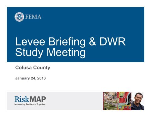
<strong>Levee</strong> Briefing & DWR<br />
Study Meeting<br />
<strong>Colusa</strong> <strong>County</strong><br />
January 24, 2013
Topics<br />
• Welcome & Introductions<br />
• Project Background and History<br />
• <strong>Levee</strong> Certification Requirements<br />
• Procedure Memo 43<br />
• <strong>FEMA</strong>’s Draft <strong>Levee</strong> Mapping Guidance<br />
• Status of <strong>Levee</strong>s in <strong>Colusa</strong> <strong>County</strong><br />
• Roles & Responsibilities<br />
• Next Steps<br />
• DWR Analyses<br />
• Overview of Map Revision Process<br />
• NFIP <strong>Outreach</strong> Information<br />
• Questions<br />
2
Welcome and Introductions<br />
<strong>FEMA</strong> <strong>Region</strong> IX<br />
Kathy Schaefer – Engineer, Study Manager<br />
Eric Simmons – Engineer<br />
Bob Durrin – Natural Hazards Program Specialist<br />
Edie Lohmann – Insurance Liaison<br />
USACE – Sacramento District<br />
Judy Soutierre – Flood Risk Program Manager<br />
California Department of Water Resources<br />
Bill O’Leary – Hydraulic Engineer<br />
Rummy Sandhu – Engineer<br />
CH2M Hill<br />
Bill Fox – Project Manager<br />
Mark Glidden – Technical Manager<br />
Production and Technical Services (PTS) contractor<br />
Sarah Houghland – <strong>Colusa</strong> <strong>County</strong> Study Manager<br />
Lisa Messano – <strong>Outreach</strong> Coordinator<br />
Community Representatives<br />
<strong>Colusa</strong> <strong>County</strong><br />
Please Fill-in the Sign-In Sheet with your Contact Information<br />
0<br />
3
The National Flood Insurance<br />
Program (NFIP)<br />
The primary goal of the NFIP is to reduce the loss of life and property.<br />
This goal is communicated to the public via Flood Insurance Rate Maps<br />
and Flood Insurance Studies.<br />
4
Project Background & History<br />
• Map Modernization update:<br />
May 15, 2003<br />
• Upgrade paper FIRMs to DFIRMs<br />
• Create 1 seamless countywide<br />
FIS report and DFIRM<br />
Orthophoto Basemap<br />
Street Basemap<br />
5
Project Background & History<br />
• Outstanding Issues<br />
• Convert the vertical reference<br />
datum for the flood elevation data<br />
from NGVD 29 to NAVD 88<br />
• <strong>Levee</strong>s accreditation status was not<br />
evaluated for the <strong>County</strong><br />
• Questions concerning the validity of<br />
the SFHAs in Arbuckle, Maxwell &<br />
Williams<br />
6
Project Background & History<br />
• June 10, 2010 Mapping Needs Priority Meeting<br />
• Meeting Objectives:<br />
• Current Effective Data<br />
• Assessment of Effective Detailed Studies (<strong>County</strong> Assessment)<br />
• DWR (CVFED)<br />
• Project Timeline and Expectations<br />
• <strong>Levee</strong>s<br />
• Provisionally Accredited <strong>Levee</strong> (PAL) timeline<br />
• Future Mapping Prioritization<br />
7
<strong>Levee</strong>s<br />
Public Safety Depends on Accurately<br />
Depicting the Risks Associated with <strong>Levee</strong>s<br />
8
<strong>Levee</strong>s – What Could Go Wrong<br />
• No levee system provides full protection<br />
• <strong>Levee</strong>s decay over time<br />
• <strong>Levee</strong>s are designed for a specific flood event and can<br />
be overtopped or breached in larger events<br />
• Upstream development in the watershed increases the<br />
runoff velocity, depth & volume<br />
• Vegetation in stream channels increases the flood<br />
hazard<br />
• Other Impacts:<br />
• Erosion and weathering<br />
• Siltation<br />
• Subsidence<br />
• Under seepage<br />
• Deferred maintenance<br />
9
Key <strong>Levee</strong> Terminology<br />
• Provides Protection: levee on FIRM that is shown as able to sustain<br />
forces associated with the 1% annual chance flood with required<br />
freeboard<br />
• Freeboard: a factor of safety in levee design height usually expressed in<br />
feet above a flood level<br />
• Certification: documentation from a registered PE stating that a levee<br />
will, with reasonable certainty, provide protection against 1% annual<br />
chance flood (as per 44 CFR 65.10)<br />
• Accreditation: <strong>FEMA</strong> recognition of a certified levee on a FIRM as<br />
providing protection against 1% annual chance flood<br />
• Revalidation: the process of re-accrediting a levee by reviewing current<br />
levee data against 44 CFR 65.10 requirements<br />
10
44 Code of Federal Regulations –<br />
65.10<br />
• Current rules for mapping areas protected by levees<br />
were codified in Federal Regulation (44 CFR 65.10) in<br />
1986<br />
• <strong>FEMA</strong> will only accredit those levee systems that<br />
meet, and continue to meet, minimum design,<br />
operation, and maintenance standards consistent with<br />
the 1% annual chance flood<br />
11
44 Code of Federal Regulations –<br />
65.10<br />
• For a levee to be shown as providing protection from the 1% annual<br />
chance flood, <strong>FEMA</strong> must have documentation demonstrating:<br />
• It is designed to withstand forces associated with the 1% annual chance flood<br />
(height, stability, and embankment protection)<br />
• It has adequate freeboard (e.g. levee height is 3+ feet above design flood stage)<br />
• All closure devices function properly – no weak links or holes<br />
• Interior drainage systems (pumps and canals) are functioning<br />
• Operation and Maintenance plans are adequate and in place<br />
• Operation and Maintenance must be the responsibility of a public entity<br />
12
<strong>Levee</strong> Certification<br />
Certification documentation should:<br />
• Document that levee or flood control system meets Federal design,<br />
construction, maintenance, and operations standards to provide protection from<br />
a flood of 1% annual chance or greater<br />
• Standards are outlined in 44 CFR 65.10<br />
• Be based on investigations and review of the current levee condition by a<br />
registered professional<br />
<strong>FEMA</strong> Flood Insurance Rate Maps (FIRMs) are based on<br />
current conditions and reflect the existing risk.<br />
13
<strong>Levee</strong> Accreditation<br />
Once <strong>FEMA</strong> receives levee certification package from a<br />
community, levee owner:<br />
• <strong>FEMA</strong> performs a “completeness” review<br />
• <strong>FEMA</strong> accredits levees based on certification submittal findings received<br />
• <strong>FEMA</strong> reviews against 44 CFR 65.10<br />
• <strong>FEMA</strong> accreditation review checklist is included in Procedure<br />
Memorandum 63<br />
14
Current <strong>Levee</strong> Status is Not Clear<br />
• Existing FIRMs may depict levees that have never been<br />
evaluated for compliance against these regulations<br />
• Certification documentation is outdated or missing<br />
altogether<br />
• Most levees have not been re-certified since originally<br />
accredited on flood maps 5, 10, or 20 years ago<br />
• It is now time to revalidate old levee certifications<br />
15
<strong>Levee</strong>s<br />
<strong>Levee</strong>s Currently Shown as Providing<br />
Protection Fall into 2 Buckets<br />
• <strong>Levee</strong>s that were recognized on a<br />
FIRM, but never certified (pre-1986)<br />
• These levees need to be certified to be<br />
accredited<br />
• <strong>Levee</strong>s that were accredited using<br />
<strong>FEMA</strong>’s 1986 levee standards<br />
• <strong>Levee</strong> certification needs to be revalidated<br />
16
<strong>Levee</strong>s<br />
• The goal for both the pre- and post-1986 levees is to certify that they<br />
currently meet <strong>FEMA</strong> standards<br />
• It is expected that most post-1986 levees (those that have been certified) will be able<br />
to meet <strong>FEMA</strong> standards with minimal effort<br />
• A P.E. must state that the original certification data are still valid<br />
• It is expected that most pre-1986 levees (those that were never certified) will require<br />
much more time for the certification process<br />
• Most likely via the LOMR process<br />
17
Provisionally Accredited <strong>Levee</strong>s –<br />
Procedure Memo 43<br />
• PM 43 Issued on September 25, 2006<br />
• PM 43 aims to minimize the impact of levee<br />
recognition and certification process on Map Mod<br />
program goals<br />
• PM 43 allows <strong>FEMA</strong> to issue preliminary and effective<br />
DFIRMs while some levee owners or communities are<br />
updating or supplementing 44 CFR 65.10<br />
documentation<br />
18
Provisionally Accredited <strong>Levee</strong>s –<br />
Procedure Memo 43<br />
• <strong>Levee</strong>s that are<br />
reasonably expected to<br />
provide 1% annual<br />
chance flood protection<br />
can be given the<br />
Provisionally Accredited<br />
<strong>Levee</strong> (PAL) designation<br />
on a DFIRM<br />
• Areas landward of levees<br />
shown as Zone X (shaded)<br />
with a warning note, for up to<br />
2 years<br />
19
Provisionally Accredited <strong>Levee</strong>s –<br />
Procedure Memo 43<br />
• <strong>FEMA</strong> is coordinating with USACE to identify those<br />
levees that are in the USACE PL 84-99 program that<br />
do not provide protection from the 1% annual chance<br />
flood<br />
• <strong>Levee</strong>s that are no longer eligible for the USACE PL<br />
84-99 program will not meet the 44 CFR 65.10 <strong>FEMA</strong><br />
levee requirements<br />
20
FIVE PM 43 SCENARIOS<br />
Non-<br />
USACE<br />
<strong>Levee</strong>s<br />
USACE Program <strong>Levee</strong>s<br />
A: Non-USACE <strong>Levee</strong>s showing base flood protection:<br />
• A1: <strong>Levee</strong> owner does not request the Maintenance Deficiency Correction Period.<br />
• A2: <strong>Levee</strong> owner requests the Maintenance Deficiency Correction Period.<br />
B: <strong>Levee</strong>s in USACE Program that are eligible for PAL<br />
C: <strong>Levee</strong>s in USACE Program with known deficiencies:<br />
C1: USACE does not grant the Maintenance Deficiency Correction Period.<br />
C2: USACE grants the Maintenance Deficiency Correction Period.<br />
D: <strong>Levee</strong>s in USACE Program not showing base flood<br />
protection<br />
E: <strong>Levee</strong>s in USACE Program that do not meet adequate level<br />
of protection but are showing base flood protection<br />
PAL<br />
Eligible (A, B)<br />
Not PAL<br />
Eligible (C, D, E)<br />
21
Provisionally Accredited <strong>Levee</strong>s – Procedure<br />
Memo 43<br />
• <strong>Levee</strong>s recognized on the Effective FIRMs may be given a PAL<br />
designation if:<br />
• there is no evidence from USACE, State Agencies or other sources to indicate the<br />
levee does not meet <strong>FEMA</strong> standards, at this time<br />
• the levee owner is willing to state to the best of their knowledge that the levee<br />
meets all <strong>FEMA</strong> standards by signing the formal PAL Agreement<br />
22
Provisionally Accredited <strong>Levee</strong>s –<br />
Procedure Memo 43<br />
• If the levee qualifies for the PAL designation, there are<br />
two options to extend <strong>FEMA</strong> accreditation:<br />
• Apply for full accreditation by submitting the certification data right away<br />
• This is the preferred approach<br />
• Apply for provisional accreditation by signing a PAL agreement w/i 90 days<br />
of being offered the PAL and submit the certification data w/i 2 years<br />
Provisionally Accredited <strong>Levee</strong> (PAL) Timeline:<br />
23
Provisionally Accredited <strong>Levee</strong>s –<br />
Procedure Memo 43<br />
• If the levee does not meet<br />
the PAL requirements & can<br />
not be offered the PAL:<br />
• In the past, the area<br />
landward of the levee<br />
was shown as Zone A or<br />
AE<br />
• Now, the pending levee<br />
guidance will provide new<br />
guidelines for showing the<br />
SFHA landward of levee<br />
24
Provisionally Accredited <strong>Levee</strong>s –<br />
Procedure Memo 43<br />
• If a signed PAL agreement is not returned to <strong>FEMA</strong><br />
within 90 days of when it is offered:<br />
• The levee will no longer be eligible for the PAL designation and area<br />
landward of the levee may be shown as a Zone A (or AE in the future)<br />
• Areas subject to inundation by the 1-percent-annual-chance flood event.<br />
Mandatory flood insurance purchase requirements apply.<br />
• If 44 CFR 65.10 certification data is not submitted<br />
to and approved by <strong>FEMA</strong> within 24 months after<br />
the 90 day PAL agreement deadline ends:<br />
• The area landward of the levee may be shown as a Zone A (or AE in the<br />
future)<br />
25
Maintenance Deficiency<br />
• If a non-USACE levee is believed to be certifiable<br />
except for maintenance deficiencies the levee owner<br />
may request a 1 year grace period to remedy those<br />
deficiencies.<br />
• Non-USACE levee owners have 1 year from the end<br />
of the 90-day PAL offer period to remedy maintenance<br />
deficiencies and submit a PAL agreement<br />
26
<strong>Levee</strong> Mapping Options<br />
1) Certify and Accredit<br />
2) Provisionally Accredited <strong>Levee</strong> (PAL)<br />
3) One year maintenance correction then PAL<br />
4) De-accredit<br />
27
Roles & Responsibilities<br />
• Who certifies levees<br />
• Not <strong>FEMA</strong><br />
• If all 44 CFR 65.10 data are sufficient, <strong>FEMA</strong> accredits levees by depicting them as<br />
providing protection against the 1% annual chance flood<br />
• Data are “…supplied to <strong>FEMA</strong> by the community or other party seeking<br />
recognition…”<br />
28
Roles & Responsibilities<br />
• <strong>FEMA</strong> is responsible for:<br />
• Establishing mapping standards<br />
• Establishing & depicting appropriate risk zone determinations on FIRMs<br />
• Accrediting or not accrediting levees as providing protection<br />
• <strong>FEMA</strong> is not responsible for:<br />
• Designing, operating, maintaining or certifying levee systems<br />
• Inspecting levees<br />
• Determining how a structure or system will perform in flood event<br />
• The Party responsible for operating and maintaining<br />
the levee must be:<br />
• Federal or State agency<br />
• Agency created by Federal or State law<br />
• Agency of a community participating in the NFIP<br />
29
Roles and Responsibilities<br />
• Community or <strong>Levee</strong> Owner/Operator:<br />
• Responsible for <strong>Levee</strong> Certification<br />
• Responsible for <strong>Levee</strong> Operation and Maintenance<br />
• Responsible for Additional <strong>Outreach</strong> to the General Public and Other Local<br />
Constituents<br />
30
Status of <strong>Levee</strong>s in My<br />
Community<br />
Available at:<br />
Insert levee map<br />
www.r9map.org<br />
> California > <strong>Colusa</strong><br />
31
GIS Edits to <strong>Levee</strong> Segments<br />
If changes are necessary to the geometry or attribution for any of the levee<br />
segments:<br />
•Contact GIS Specialists<br />
listed at the bottom of the<br />
information collection sheets<br />
•They can make changes to<br />
the database based on<br />
your direction<br />
32
Action Items for Community<br />
Officials<br />
• Provide copy of 44CFR 65.10 <strong>Levee</strong> Certification<br />
Requirements to owners of protecting levees<br />
• Send email to Sarah Houghland confirming owner<br />
and point of contact for each levee segment shown<br />
on <strong>Colusa</strong> <strong>County</strong> levee presentation map<br />
• Provide <strong>Region</strong> IX (Kathy Schaefer) with all levee<br />
certification documents, backup data and<br />
statements of intent to certify or not certify the<br />
levees currently shown as providing protection<br />
33
What’s Next<br />
• 2 nd Round Meeting for Floodplain Management<br />
Professionals<br />
• Determine if any levees are PAL eligible<br />
• Yes - The PAL offer will be extended to communities<br />
• No - The draft revised levee mapping guidelines come<br />
into play<br />
34
New <strong>FEMA</strong> <strong>Levee</strong> Guidance<br />
• The entire “Revised Analysis and Mapping Procedures for Non-<br />
Accredited <strong>Levee</strong>s” available through the <strong>FEMA</strong> library at:<br />
http://www.fema.gov/library/viewRecord.doid=4954<br />
• There are on-line recorded webinars overviewing the approaches<br />
available for viewing and further reference available through the<br />
<strong>FEMA</strong> library at:<br />
http://www.fema.gov/library/viewRecord.doid=5009<br />
• Public Comment period ended on January 30, 2012<br />
Comments are in review and may change things that are<br />
discussed and presented today<br />
35
Why Modify our Current Approach<br />
• Throughout Map Modernization,<br />
stakeholders expressed concern on the<br />
“without-levee” procedures used to map<br />
non-accredited levees<br />
• In February 2011, a group of U.S.<br />
Representatives and Senators wrote to<br />
<strong>FEMA</strong> requesting a revision to the current<br />
practice of mapping levees and their<br />
associated flood risk.<br />
• Stakeholders and Congress felt the<br />
historical mapping approach did not<br />
reflect the hazard reduction that some<br />
non-accredited levees may still afford.<br />
36
Process – Development of New Approach<br />
• <strong>FEMA</strong> placed on-going studies that include non-accredited levees<br />
on-hold.<br />
• <strong>FEMA</strong> established a Project Team that:<br />
• Comprised of <strong>FEMA</strong>, US Army Corps of Engineers, Industry and other<br />
experts<br />
• Explored a spectrum of possible approaches;<br />
• Evaluated the approach scenarios;<br />
• Assessed the feasibility and implementation through “proof of concept”<br />
case studies;<br />
• Sought feedback from internal and external audiences.<br />
37
Requirements for New Approach<br />
• The new Approach had to be:<br />
• Flexible;<br />
• Collaborative<br />
• Understandable and explainable<br />
• Local knowledge and data should be included<br />
• Must address both riverine and coastal levees<br />
• <strong>FEMA</strong>’s Constraints:<br />
• No statutory or regulatory changes<br />
• Cost-effective<br />
• Repeatable<br />
• 44 CFR 65.10 remains in effect for full levee accreditation<br />
• Cannot make changes to the overarching National Flood<br />
Insurance Program<br />
38
The New Approach is NOT:<br />
• Not a holistic solution for levee issues in the NFIP:<br />
• “Phase 2” will be initiated to discuss a<br />
comprehensive NFIP solution for levees<br />
• National Academy of Sciences study has been<br />
kicked-off<br />
• NFIP Reform<br />
• Not a solution addressing all of the<br />
recommendations received from <strong>Levee</strong> Task<br />
Force or National Committee on <strong>Levee</strong> Safety<br />
• Not a communication of the broad risks<br />
associated with levees and potential failures<br />
39
External Reviews & Stakeholder Engagement<br />
• Feasibility Review – <strong>FEMA</strong> and USACE review to ensure<br />
consistency with the Feasibility Criteria (completed)<br />
• Independent Scientific Body – focused on technical aspects<br />
solution (completed)<br />
• Community Roundtable – focus group related to community<br />
impacts and input(completed)<br />
• Public Review - approach posted online for general public review<br />
and comment, includes 3 Online Forums (completed)<br />
• Public review comment period ended January 30, 2012<br />
• 160 submittals with 1400+ comments received<br />
40
What’s New about this New Process<br />
• Interactive stakeholder engagement throughout the analysis and<br />
mapping process:<br />
• <strong>FEMA</strong> will engage community officials and decision makers in a<br />
collaborative discussion<br />
• A suite of analysis and mapping procedures of the hazard<br />
associated with levees will be reviewed with the interested parties<br />
• Intention is to recognize of the uncertainty associated with<br />
hazard identification behind levees.<br />
• New Development – Allows communities to split a levee system<br />
into distinct reaches that are analyzed based on the attributes of<br />
the specific reach.<br />
41
Data Collection & Stakeholder Engagement<br />
<strong>Levee</strong><br />
Stakeholder<br />
Coordination<br />
Data<br />
Collection<br />
Data<br />
Analysis<br />
Meeting and Field<br />
Reconnaissance<br />
Completion of<br />
<strong>Levee</strong> Report<br />
and Database<br />
42
Local <strong>Levee</strong> Working Group<br />
• Purpose<br />
• Provide feedback and data so <strong>FEMA</strong> can make a final decision on<br />
how the levee system should be modeled and how the leveeimpacted<br />
area should be mapped.<br />
• Participants<br />
• CEO or designee (decision making authority)<br />
• <strong>Levee</strong> owner<br />
• Floodplain manager<br />
• Local engineer<br />
• <strong>FEMA</strong> regional representative<br />
• USACE representative (if appropriate)<br />
• CTP or <strong>FEMA</strong> contractor for project<br />
• Others as determined by the community or region<br />
43
Scope of Work for Next <strong>Colusa</strong><br />
Revision<br />
• Build on the Digital Data created during the 2003 update<br />
• Conversion from NGVD29 datum to NAVD88 datum<br />
• Include PAL notes (if necessary)<br />
• Include new floodplain mapping as a result of levee<br />
deaccreditation analyses (if necessary)<br />
• Include the <strong>FEMA</strong>/DWR CTP studies presented today<br />
• Incorporate other data studies from the communities (if<br />
necessary)<br />
44
For More Information<br />
• Sarah Houghland, <strong>Colusa</strong> <strong>County</strong> Study Manager<br />
– Phone: 720-514-1129<br />
– Email: slhoughland@mbakercorp.com<br />
• Online resources:<br />
<strong>FEMA</strong> <strong>Region</strong> IX DFIRM/<strong>Levee</strong><br />
<strong>Outreach</strong> Web Site:<br />
<strong>FEMA</strong> <strong>Levee</strong> Information:<br />
FloodSmart, <strong>Levee</strong> Information:<br />
Mapping Information Platform (MIP):<br />
<strong>FEMA</strong> Map Service Center (MSC):<br />
www.r9map.org<br />
http://www.fema.gov/living-levees-its-shared-responsibility/<br />
www.floodsmart.gov<br />
http://www.hazards.fema.gov<br />
http://www.msc.fema.gov<br />
45