Maidenhead Riverside Conservation Area Appraisal - The Royal ...
Maidenhead Riverside Conservation Area Appraisal - The Royal ...
Maidenhead Riverside Conservation Area Appraisal - The Royal ...
- No tags were found...

Create successful ePaper yourself
Turn your PDF publications into a flip-book with our unique Google optimized e-Paper software.
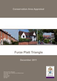
<strong>Maidenhead</strong> <strong>Riverside</strong> <strong>Conservation</strong> <strong>Area</strong> <strong>Appraisal</strong><br />
21<br />
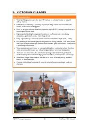
Location, Setting and Development of the <strong>Area</strong> 5<br />
5.13 For many centuries the Thames was a waterway used largely for transportation of goods to and from<br />
London. In the mid 18th century, barges were hauling 69,000 tonnes of goods upstream annually. At this time<br />
<strong>Maidenhead</strong> riverside was an area of working wharves, locks, mills and other buildings of a commercial nature.<br />
5.14 <strong>The</strong> area around Boulters Lock and Ray Mill Island demonstrated the commercial emphasis during this<br />
period and had two important historical associations. One is with the lock itself and associated river traffic and<br />
the other is with Ray Mill. <strong>The</strong>re is reference to a lease of Ray Mill as early as 1346 and it is thought two mills<br />
were operating here in the medieval period. Ray Mills in the 18th century stood at the end of Boulters Lane,<br />
only moving to the island when the present lock was built in 1828.<br />
5.15 Rocques Map of 1761 is the earliest which shows <strong>Maidenhead</strong> in any detail. <strong>The</strong> map shows Ray Mills<br />
and refers to Boulters Lock. <strong>The</strong>re is no residential development on the riverside. At this time the river itself<br />
would have been undeveloped with banks overgrown. <strong>The</strong> towpath was a public right of way but was mainly<br />
used by horses and connected barge workers. Stabling for barge horses and accommodation for bargemen<br />
was located on Ray Mill Island.<br />
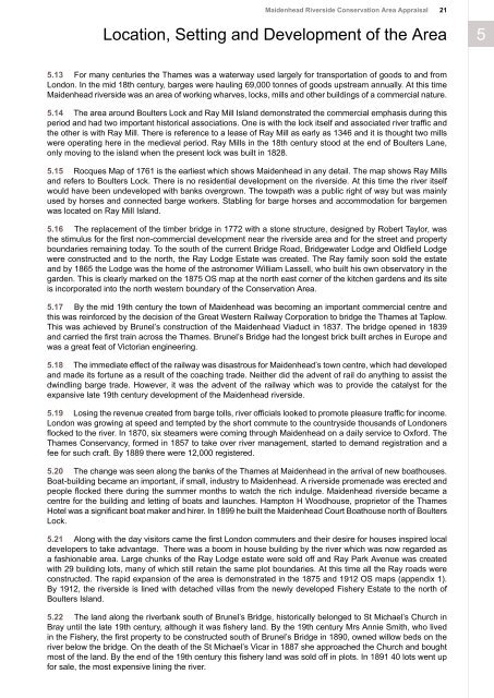
5.16 <strong>The</strong> replacement of the timber bridge in 1772 with a stone structure, designed by Robert Taylor, was<br />
the stimulus for the first non-commercial development near the riverside area and for the street and property<br />
boundaries remaining today. To the south of the current Bridge Road, Bridgewater Lodge and Oldfield Lodge<br />
were constructed and to the north, the Ray Lodge Estate was created. <strong>The</strong> Ray family soon sold the estate<br />
and by 1865 the Lodge was the home of the astronomer William Lassell, who built his own observatory in the<br />
garden. This is clearly marked on the 1875 OS map at the north east corner of the kitchen gardens and its site<br />
is incorporated into the north western boundary of the <strong>Conservation</strong> <strong>Area</strong>.<br />
5.17 By the mid 19th century the town of <strong>Maidenhead</strong> was becoming an important commercial centre and<br />
this was reinforced by the decision of the Great Western Railway Corporation to bridge the Thames at Taplow.<br />
This was achieved by Brunel’s construction of the <strong>Maidenhead</strong> Viaduct in 1837. <strong>The</strong> bridge opened in 1839<br />
and carried the first train across the Thames. Brunel’s Bridge had the longest brick built arches in Europe and<br />
was a great feat of Victorian engineering.<br />
5.18 <strong>The</strong> immediate effect of the railway was disastrous for <strong>Maidenhead</strong>’s town centre, which had developed<br />
and made its fortune as a result of the coaching trade. Neither did the advent of rail do anything to assist the<br />
dwindling barge trade. However, it was the advent of the railway which was to provide the catalyst for the<br />
expansive late 19th century development of the <strong>Maidenhead</strong> riverside.<br />
5.19 Losing the revenue created from barge tolls, river officials looked to promote pleasure traffic for income.<br />
London was growing at speed and tempted by the short commute to the countryside thousands of Londoners<br />
flocked to the river. In 1870, six steamers were coming through <strong>Maidenhead</strong> on a daily service to Oxford. <strong>The</strong><br />
Thames Conservancy, formed in 1857 to take over river management, started to demand registration and a<br />
fee for such craft. By 1889 there were 12,000 registered.<br />
5.20 <strong>The</strong> change was seen along the banks of the Thames at <strong>Maidenhead</strong> in the arrival of new boathouses.<br />
Boat-building became an important, if small, industry to <strong>Maidenhead</strong>. A riverside promenade was erected and<br />
people flocked there during the summer months to watch the rich indulge. <strong>Maidenhead</strong> riverside became a<br />
centre for the building and letting of boats and launches. Hampton H Woodhouse, proprietor of the Thames<br />
Hotel was a significant boat maker and hirer. In 1899 he built the <strong>Maidenhead</strong> Court Boathouse north of Boulters<br />
Lock.<br />
5.21 Along with the day visitors came the first London commuters and their desire for houses inspired local<br />
developers to take advantage. <strong>The</strong>re was a boom in house building by the river which was now regarded as<br />
a fashionable area. Large chunks of the Ray Lodge estate were sold off and Ray Park Avenue was created<br />
with 29 building lots, many of which still retain the same plot boundaries. At this time all the Ray roads were<br />
constructed. <strong>The</strong> rapid expansion of the area is demonstrated in the 1875 and 1912 OS maps (appendix 1).<br />
By 1912, the riverside is lined with detached villas from the newly developed Fishery Estate to the north of<br />
Boulters Island.<br />
5.22 <strong>The</strong> land along the riverbank south of Brunel’s Bridge, historically belonged to St Michael’s Church in<br />
Bray until the late 19th century, although it was fishery land. By the 19th century Mrs Annie Smith, who lived<br />
in the Fishery, the first property to be constructed south of Brunel’s Bridge in 1890, owned willow beds on the<br />
river below the bridge. On the death of the St Michael’s Vicar in 1887 she approached the Church and bought<br />
most of the land. By the end of the 19th century this fishery land was sold off in plots. In 1891 40 lots went up<br />
for sale, the most expensive lining the river.