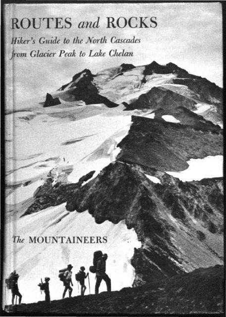
Routes and rocks; hiker's guide to the North Cascades from ... - USGS
Routes and rocks; hiker's guide to the North Cascades from ... - USGS
Routes and rocks; hiker's guide to the North Cascades from ... - USGS
- No tags were found...

Create successful ePaper yourself
Turn your PDF publications into a flip-book with our unique Google optimized e-Paper software.
ROUTES <strong>and</strong> ROCKS<br />
Hiker's Guide <strong>to</strong> <strong>the</strong> <strong>North</strong> <strong>Cascades</strong><br />
jrom Glacier Peak <strong>to</strong> Lake Chelan<br />
*<br />
The MOUNTAINEERS
To Concrete <strong>and</strong>"<br />
SUIATTLE RIVER<br />
WHITE CHUCK RIVER<br />
AND<br />
NORTH FORK SAUK RIVER<br />
DAiWINGroN<br />
To Clear Cr<br />
WESTERN GATEWAYS<br />
g. 28<br />
LEGEND<br />
Campground<br />
U.S. Forest service<br />
District Ranger station<br />
U.S. Forest service Guard Stati<br />
U.S. Highway<br />
State Highway<br />
Gravel or dirt rood<br />
Trail<br />
\ ~> ' Mileage Detween points<br />
'25<<br />
Geologic oote (see text)<br />
Stream<br />
waterfall<br />
Boundary of quadrangle maps<br />
Boundary of supplemental maps<br />
see text figure<br />
INDEX MAP
', 4>ri V» ''^TB-~N *<br />
,^%r ^f • J 1 --*-<br />
--U '' J -' . '^ - - : >vi' ''-.. 3 /y^s- 1 -^<br />
*HITE RIVER<br />
AND<br />
CHIWAWA RIVER<br />
ft Umwwtk<br />
ENTIAT RIVER<br />
AND<br />
LAKE CHELAN
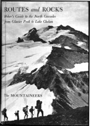
ROUTES <strong>and</strong> ROCKS<br />
Hiker's Guide <strong>to</strong> <strong>the</strong> <strong>North</strong> <strong>Cascades</strong><br />
<strong>from</strong> Glacier Peak <strong>to</strong> Lake Chelan
—for <strong>the</strong>re is no opiate like Alpine pedestrianism."<br />
MARK TWAIN, A Tramp Abroad<br />
<strong>and</strong> some rin up hill <strong>and</strong> down dale,<br />
knapping <strong>the</strong> chucky stanes <strong>to</strong> pieces wi' hammers,<br />
like sae mony roadmakers run daft—<br />
<strong>the</strong>y say it is <strong>to</strong> see how <strong>the</strong> warld was made!"<br />
SIR WALTER SCOTT, St. Ronan's Well<br />
Cover illustration: Glacier Peak <strong>from</strong> Pumice<br />
Creek side trip. (Bob <strong>and</strong> Ira Spring)
ROUTES <strong>and</strong> ROCKS<br />
Hiker's Guide <strong>to</strong> <strong>the</strong> <strong>North</strong> <strong>Cascades</strong><br />
<strong>from</strong> Glacier Peak <strong>to</strong> Lake Chelan<br />
By D. F. Crowder <strong>and</strong> R. W. Tabor<br />
WITH DRAWINGS BY ED HANSON<br />
THE MOUNTAINEERS<br />
Seattle, Washing<strong>to</strong>n
© 1965 by The Mountaineers<br />
THE MOUNTAINEERS<br />
P.O. Box 122<br />
Seattle, Washing<strong>to</strong>n 98111<br />
Organized 1906<br />
Library of Congress Catalog Card Number 65-27406<br />
First Edition 1965<br />
Second printing 1966<br />
DESIGN BY JOHN WARNER<br />
MANUFACTURED IN THE UNITED STATES OF AMERICA<br />
COMPOSITION AND BINDING BY VAIL-BALLOU PRESS, INC.<br />
MAP PRINTING BY RAND MCNALLY & CO.<br />
TEXT PRINTING BY VALLEY OFFSET, INC.
FOREWORD<br />
SINCE 1950 <strong>the</strong> United States Geological Survey, an agency of <strong>the</strong> Department<br />
of <strong>the</strong> Interior, has been making an intensive study of <strong>the</strong><br />
<strong>North</strong> <strong>Cascades</strong> between Glacier Peak <strong>and</strong> Lake Chelan. While participating<br />
in <strong>the</strong> study, <strong>the</strong> authors have had ample opportunity <strong>to</strong> hike<br />
<strong>the</strong> trails <strong>and</strong> off-trail high routes of <strong>the</strong> area, <strong>and</strong> in preparing this<br />
<strong>guide</strong> have combined <strong>the</strong> information <strong>the</strong>y have gained about geology<br />
with <strong>the</strong> information <strong>the</strong>y have gained about trails <strong>and</strong> routes. The result<br />
is a very special <strong>and</strong> valuable sort of <strong>guide</strong>book that not only tells<br />
<strong>the</strong> hiker what places are worth visiting, <strong>and</strong> how <strong>to</strong> get <strong>the</strong>re, but also<br />
adds <strong>to</strong> his wilderness experience by telling him how <strong>the</strong>se peaks <strong>and</strong><br />
valleys came <strong>to</strong> be, <strong>and</strong> why <strong>the</strong>y are what <strong>the</strong>y are.<br />
The Mountaineers take particular pleasure in publishing this book<br />
because it fur<strong>the</strong>rs so well certain purposes of <strong>the</strong> organization, especially<br />
<strong>the</strong> m<strong>and</strong>ates "<strong>to</strong> explore <strong>and</strong> study <strong>the</strong> mountains, forests, <strong>and</strong><br />
water courses of <strong>the</strong> <strong>North</strong>west" <strong>and</strong> "<strong>to</strong> ga<strong>the</strong>r in<strong>to</strong> permanent form <strong>the</strong><br />
his<strong>to</strong>ry <strong>and</strong> traditions of this region"—<strong>and</strong> surely geologic his<strong>to</strong>ry must<br />
here be included.<br />
Fur<strong>the</strong>rmore, The Mountaineers have a profound interest in <strong>the</strong><br />
proper use of America's natural heritage, as does <strong>the</strong> Geological Survey<br />
<strong>and</strong> <strong>the</strong> Department of <strong>the</strong> Interior, which says of itself: "In its assigned<br />
function as <strong>the</strong> nation's principal natural resource agency, <strong>the</strong> Department<br />
of <strong>the</strong> Interior bears a special obligation <strong>to</strong> assure that our expendable<br />
resources are conserved, that renewable resources are managed<br />
<strong>to</strong> produce optimum yields, <strong>and</strong> that all resources contribute <strong>the</strong>ir full
VI<br />
FOREWORD<br />
measure <strong>to</strong> <strong>the</strong> progress, prosperity, <strong>and</strong> security of America, now <strong>and</strong><br />
in <strong>the</strong> future."<br />
By act of Congress in September 1964, <strong>the</strong> Glacier Peak Wilderness,<br />
much of which is covered by this <strong>guide</strong>, was included in <strong>the</strong> National<br />
Wilderness Preservation System, <strong>and</strong> thus set aside as an area where<br />
"<strong>the</strong> earth <strong>and</strong> its community of life are untrammeled by man, where<br />
man himself is a visi<strong>to</strong>r who does not remain." The importance of<br />
<strong>Routes</strong> <strong>and</strong> Rocks, over <strong>and</strong> above <strong>the</strong> immediate pleasure it will<br />
bring alpine pedestrians, is that it will acquaint more people with <strong>the</strong><br />
<strong>North</strong> <strong>Cascades</strong>, <strong>and</strong> in <strong>the</strong> process make more friends for wilderness,<br />
here <strong>and</strong> everywhere.<br />
The Mountaineers, with groups based in Seattle, Everett, Tacoma,<br />
<strong>and</strong> Olympia, warmly invite <strong>the</strong> membership of all who sympathize<br />
with club purposes <strong>and</strong> wish <strong>to</strong> partake in its offerings. In addition<br />
<strong>to</strong> programs of research in<strong>to</strong> <strong>the</strong> best <strong>and</strong> highest uses of "<strong>the</strong> natural<br />
beauty of <strong>North</strong>west America," The Mountaineers sponsor year-round<br />
activities in climbing, hiking, camping, ski-<strong>to</strong>uring, <strong>and</strong> snowshoeing.<br />
Hundreds of outings are scheduled each year, ranging <strong>from</strong> single-day<br />
excursions <strong>to</strong> trips lasting two weeks or more. A climbing school—<strong>the</strong><br />
oldest <strong>and</strong> largest in America—is presented annually, <strong>and</strong> also schools<br />
in hiking <strong>and</strong> camping <strong>and</strong> in ski-mountaineering.<br />
For fur<strong>the</strong>r information on club activities <strong>and</strong> how <strong>to</strong> join, please<br />
write The Mountaineers, P.O. Box 122, Seattle, Washing<strong>to</strong>n 98111.<br />
THE MOUNTAINEERS
O<strong>the</strong>r Books <strong>from</strong> The Mountaineers<br />
Mountaineering: The Freedom of <strong>the</strong> Hills, edited by Harvey Manning.<br />
Textbook of <strong>the</strong> Climbing Course presented annually since 1935 by The<br />
Mountaineers. First published in 1960—more than 20,000 copies how in print.<br />
Chapters: Equipment, Camping <strong>and</strong> Sleeping, Alpine Cuisine, Wilderness<br />
Travel, Navigation in <strong>the</strong> Hills, Routefinding on Rock, Balance, Counterforce,<br />
Roped Climbing, Belaying, Pi<strong>to</strong>ncraft <strong>and</strong> Rappels, Snow, Ice, Glaciers,<br />
Arrests <strong>and</strong> Belays, The Climbing Party <strong>and</strong> its Leadership, Climbing<br />
Dangers, First Aid, Alpine Rescue, Mountain Geology, The Cycle of Snow,<br />
<strong>and</strong> Mountain Wea<strong>the</strong>r. Appendix: Food Requirements for Climbers. 430<br />
pages, 134 drawings. 16 pho<strong>to</strong>graphs. $7.50<br />
The <strong>North</strong> <strong>Cascades</strong>, pho<strong>to</strong>s by Tom Miller, text by Harvey Manning, maps<br />
by Dee Molenaar.<br />
A stunning collection of pho<strong>to</strong>graphs by a climber-pho<strong>to</strong>grapher who has<br />
traveled <strong>the</strong> peaks <strong>and</strong> glaciers, forests <strong>and</strong> meadows, for 20 years, <strong>and</strong> an<br />
urgent plea for creation of a <strong>North</strong> <strong>Cascades</strong> National Park. Published in 1964.<br />
Chapters: Nor<strong>the</strong>rn Pickets, Nooksack Cirque, Park Creek Pass, Cascade<br />
Pass, Kool-Aid Lake <strong>to</strong> White Rock Lakes, Dome Peak, <strong>and</strong> Bonanza-Entiat.<br />
96 pages, 10 x 12 inches; 70 pho<strong>to</strong>s, most occupying a full page; 10 maps<br />
which for each pho<strong>to</strong>graph identify <strong>the</strong> location of <strong>the</strong> camera <strong>and</strong> <strong>the</strong><br />
direction in which it was pointed. $10.00<br />
Mountain Rescue Techniques, by Wastl Mariner.<br />
The acknowledged bible of mountain rescuers throughout <strong>the</strong> world. Translated<br />
<strong>and</strong> published in 1964 in cooperation with <strong>the</strong> Oesterreichischer Alpenverein.<br />
Chapters: Summer Rescue—Specialized Rescue Gear, Transport with<br />
Specialized Gear, Improvised Rescue Gear, Transport with Improvised Gear;<br />
Winter Rescue—Specialized Rescue Gear, Improvised Rescue Gear, Avalanche<br />
Rescue, Winter Transport. Appendix: Principles of First Aid for<br />
Mountaineers. 200 pages, paperbound. 117 drawings. $3.50<br />
Guide <strong>to</strong> Leavenworth Rock Climbing Areas, by Fred Beckey <strong>and</strong> Eric<br />
Bjornstad.<br />
Detailed description of all routes so far completed in <strong>the</strong> principle rockpractice<br />
area of Cascade climbers. Published in 1965, 86 pages, paperbound,<br />
13 drawings. $2.75<br />
Mountain Medicine, edited by James A. Wilkerson, M.D.<br />
Prepared by a group of climber-physicians who among <strong>the</strong>m have experience<br />
ranging <strong>from</strong> Everest <strong>and</strong> K-2 <strong>to</strong> <strong>North</strong>west wilderness. The first<br />
book published in America that goes extensively in<strong>to</strong> <strong>the</strong> principles of<br />
"second-aid," as distinguished <strong>from</strong> first-aid. Due in 1966.<br />
Walking <strong>the</strong> Hills <strong>and</strong> Valleys: 100 Trail Trips, text by Louise Marshall,<br />
pho<strong>to</strong>s by Bob <strong>and</strong> Ira Spring.<br />
A <strong>guide</strong>, in words <strong>and</strong> pho<strong>to</strong>s, <strong>to</strong> 100 of <strong>the</strong> finest trail hikes available in<br />
<strong>the</strong> Puget Sound country, ranging <strong>from</strong> beach hikes <strong>to</strong> high summits. Due in<br />
1966.
PREFACE<br />
As geologists for <strong>the</strong> United States Geological Survey, we <strong>and</strong> our coworkers<br />
have spent al<strong>to</strong>ge<strong>the</strong>r 20 summers making a detailed study of<br />
<strong>the</strong> <strong>rocks</strong> in a small part of <strong>the</strong> wilderness of <strong>the</strong> <strong>North</strong> <strong>Cascades</strong>. From<br />
camps supplied by horses, helicopters, <strong>and</strong> our own backpacks, we have<br />
explored a 600-square-mile area covered by three modern map sheets:<br />
<strong>the</strong> Glacier Peak, Holden, <strong>and</strong> Lucerne quadrangles. Geologic data<br />
ga<strong>the</strong>red by <strong>the</strong> U.S. Geological Survey are most often published in<br />
technical journals <strong>and</strong> books <strong>and</strong> on maps designed <strong>to</strong> reach primarily<br />
<strong>the</strong> professional geologist. We here report <strong>to</strong> hikers parts of <strong>the</strong> geologic<br />
s<strong>to</strong>ry that hopefully will enhance <strong>the</strong>ir enjoyment of <strong>the</strong> <strong>North</strong> <strong>Cascades</strong>.<br />
We speak <strong>to</strong> those who wish <strong>to</strong> savor <strong>the</strong> many byways of this varied<br />
region. The <strong>guide</strong> is written <strong>and</strong> designed <strong>to</strong> be carried in <strong>the</strong> rucksack;<br />
it is not so well-suited for <strong>the</strong> saddlebag, although <strong>the</strong>re is much information<br />
for <strong>the</strong> horseman. Our tendency <strong>to</strong> rush <strong>the</strong> hiker out of canyon<br />
forest up <strong>to</strong> timber-line alp <strong>and</strong> crag is not necessarily because more<br />
<strong>rocks</strong> are <strong>to</strong> be found up <strong>the</strong>re, or because we mean <strong>to</strong> belittle <strong>the</strong><br />
impressive jungles, but because we so often meet people who think of<br />
<strong>the</strong> <strong>North</strong> <strong>Cascades</strong> only in terms of trees. Though we know that evaluation<br />
of view or campsite is subjective, we have tried <strong>to</strong> inspire as well<br />
as <strong>to</strong> direct, <strong>to</strong> give <strong>the</strong> flavor of a route as well as useful details. We<br />
are alpine pedestrians by hobby as well as by profession, <strong>and</strong> hopefully<br />
we hear <strong>the</strong> same music as our readers.<br />
Much of <strong>the</strong> geologic data <strong>and</strong> some of <strong>the</strong> route information has<br />
been supplied by our colleagues: Fred Cater, Art Ford, Cliff Hopson,<br />
Don Kellum, <strong>and</strong> Tom Wright. We thank employees of <strong>the</strong> U.S. Forest<br />
Service at Darring<strong>to</strong>n, Wenatchee Lake, Chelan, <strong>and</strong> Entiat for trail<br />
logs, maintenance schedules, <strong>and</strong> advice. Although most of <strong>the</strong> draw-
X<br />
PREFACE<br />
ings were made by Ed Hanson, some were contributed by Jim Crooks,<br />
Betsy Crowder, Es<strong>the</strong>r McDermott, Dee Molenaar, <strong>and</strong> Meade Norman.<br />
We gratefully acknowledge <strong>the</strong> help of friends, typists, packers, hikers,<br />
draftsmen, administra<strong>to</strong>rs, <strong>and</strong> camp followers: Fidelia Alger, George<br />
Arnold (alias Bill Wallace), Mary Brannock, Bea Bregman, Vera Campbell,<br />
Ray Courtney, King Huber, Fay Koonce, Frances LeBaker, Harvey<br />
Manning, George Martin, Dean Rinehart, Bill Stark, Elizabeth Stevens,<br />
Sumi Sumida, Lesley Tabor, <strong>and</strong> Clancy Yung. We thank <strong>the</strong> following<br />
publishers for permission <strong>to</strong> quote: Harper <strong>and</strong> Row, Inc., New<br />
York (A Tramp Abroad, by Mark Twain); E. P. Dut<strong>to</strong>n & Co., Inc.<br />
(Winnie-<strong>the</strong>-Pooh, by A. A. Milne); Simon <strong>and</strong> Schuster, Inc. (The<br />
Odyssey: A Modern Sequel, by Nikos Kazantzakes, trans, by Kimon<br />
Friar); <strong>and</strong> Apple<strong>to</strong>n-Century-Crofts, Inc., New York (Mont Blanc, by<br />
Albert Smith, quoted in The Book of <strong>the</strong> Mountains, by A. C. Spec<strong>to</strong>rsky).<br />
The final responsibility, however, must lie with <strong>the</strong> authors,<br />
who shared equally in all phases of this effort <strong>from</strong> <strong>the</strong> first "knapping<br />
<strong>the</strong> chucky stanes" <strong>to</strong> <strong>the</strong> last agonizing edit.<br />
Menlo Park, California<br />
1965<br />
DWIGHT CROWDER<br />
ROWLAND TABOR
CONTENTS<br />
Foreword<br />
Preface<br />
Introduction 1<br />
The Setting 1<br />
The Guide 4<br />
Travel Hints 6<br />
Geologic S<strong>to</strong>ry 11<br />
Western Gateways 18<br />
Suiattle River 19<br />
White Chuck River 62<br />
<strong>North</strong> Fork of <strong>the</strong> Sauk River 83<br />
Eastern Gateways 94<br />
White River 94<br />
Chiwawa River 122<br />
Entiat River 140<br />
Lake Chelan 166<br />
Annotated Bibliography . 201<br />
Appendix: Mountain Climbing 206<br />
Index 221<br />
v<br />
ix
<strong>North</strong><br />
<strong>Cascades</strong><br />
CASCADES<br />
Coastal<br />
Mountains<br />
SIERRA NEVADA<br />
Figure 1
INTRODUCTION<br />
The Setting<br />
General Character. Along <strong>the</strong> western edge of <strong>North</strong> America a nearcontinuous<br />
mountain rampart faces <strong>the</strong> sea, keeping ocean moisture<br />
<strong>from</strong> <strong>the</strong> drier deserts <strong>and</strong> plains <strong>to</strong> <strong>the</strong> east <strong>and</strong> becoming ever wetter<br />
northward <strong>from</strong> California. The lofty Sierra Nevada merges in<strong>to</strong> <strong>the</strong><br />
forested Cascade Range of Oregon, where only an occasional snowcapped<br />
volcano rises above <strong>the</strong> general low level. In Washing<strong>to</strong>n, about<br />
a hundred miles south of <strong>the</strong> Canadian border, begins abruptly <strong>the</strong><br />
longest <strong>and</strong> wildest part of <strong>the</strong> Pacific Coast mountain system, extending<br />
<strong>from</strong> Washing<strong>to</strong>n <strong>to</strong> <strong>the</strong> Aleutians. The sou<strong>the</strong>rn end of <strong>the</strong>se wild <strong>and</strong><br />
relatively unexplored mountains is known as <strong>the</strong> <strong>North</strong> <strong>Cascades</strong>. They<br />
stretch <strong>from</strong> <strong>the</strong> vicinity of Stevens Pass in Washing<strong>to</strong>n <strong>to</strong> <strong>the</strong> Fraser<br />
River in British Columbia (Fig. 1).<br />
Here in <strong>the</strong> <strong>North</strong> <strong>Cascades</strong> are deep <strong>and</strong> narrow valleys cloaked<br />
with vegetation, sharp ridges, glaciers, snowfields, <strong>and</strong> fjordlike lakes<br />
that make <strong>the</strong>se mountains utterly different <strong>from</strong> <strong>the</strong> <strong>Cascades</strong> <strong>and</strong><br />
Sierra <strong>to</strong> <strong>the</strong> south. Here also are two more Pacific Coast volcanoes,<br />
Mount Baker <strong>and</strong> Glacier Peak, graceful cones in a sea of jagged peaks.<br />
West of <strong>the</strong> Washing<strong>to</strong>n <strong>Cascades</strong>, in <strong>the</strong> Puget Sound lowl<strong>and</strong>, is<br />
<strong>the</strong> Seattle metropolitan area, noted for a moist maritime climate. On<br />
<strong>the</strong> east, in <strong>the</strong> rain shadow of <strong>the</strong> mountains, are <strong>the</strong> desert-dry <strong>and</strong><br />
sparsely settled Columbia lava plateau <strong>and</strong> <strong>the</strong> rolling hills of <strong>the</strong> Okanogan<br />
highl<strong>and</strong>s.<br />
Altitude <strong>and</strong> Relief. These are not high mountains; Glacier Peak is
2 ROUTES AND ROCKS<br />
only 10,541 feet high <strong>and</strong> most summits are between 7000 <strong>and</strong> 8000<br />
feet. But <strong>the</strong> country is very steep <strong>and</strong> <strong>the</strong> valley bot<strong>to</strong>ms are as low<br />
as 1100 <strong>to</strong> 3000 feet; <strong>the</strong>refore, even <strong>to</strong> reach timberline at 5000 <strong>to</strong><br />
6500 feet is a fair climb. Vegetation in <strong>the</strong> valleys is thick, especially<br />
in canyons west of <strong>the</strong> crest; this, combined with <strong>the</strong> jagged nature of<br />
<strong>the</strong> <strong>to</strong>pography, <strong>the</strong> generally poor condition of trails, <strong>and</strong> <strong>the</strong> prevalence<br />
of glaciers, explains why this <strong>hiker's</strong> <strong>guide</strong> is as detailed as it is.<br />
It is much easier in <strong>the</strong> <strong>North</strong> <strong>Cascades</strong> than in most accessible American<br />
mountains <strong>to</strong> get in<strong>to</strong> difficulty, <strong>and</strong> hikers who leave <strong>the</strong> beaten path<br />
should be sure <strong>the</strong>y are properly trained <strong>and</strong> equipped.<br />
Snow. Snowfall is tremendous. Depths on <strong>the</strong> ground in March, just<br />
east of <strong>the</strong> divide at 2000 <strong>to</strong> 3000 feet (Holden <strong>and</strong> Trinity), commonly<br />
are 10 <strong>to</strong> 15 feet. This represents a snowfall of 40 <strong>to</strong> 60 feet. Far<strong>the</strong>r<br />
east in <strong>the</strong> rain-shadow of <strong>the</strong> divide along Lake Chelan, depths of<br />
only a few feet are <strong>the</strong> rule.<br />
In <strong>the</strong> Lucerne quadrangle, June <strong>and</strong> early July is <strong>the</strong> time for trips<br />
because, in our opinion, <strong>the</strong> spring greenery <strong>and</strong> flowers <strong>and</strong> interspersed<br />
snowbanks are preferable <strong>to</strong> <strong>the</strong> dryness of later summer <strong>and</strong> fall. Such<br />
dryness never exists in <strong>the</strong> wetter region near <strong>and</strong> west of <strong>the</strong> Cascade<br />
Divide, where, even in July, one can count on much snow under foot—<br />
indeed <strong>the</strong>re is enough in some years <strong>to</strong> make travel with s<strong>to</strong>ck difficult.<br />
The very heavy snowfall in all but <strong>the</strong> eastern parts of <strong>the</strong> area, combined<br />
with <strong>the</strong> steep slopes, making this a great country for avalanches.<br />
Despite this, several ski-mountaineering parties have been <strong>to</strong> <strong>the</strong> relatively<br />
safe slopes near Cloudy Pass <strong>and</strong> have stayed at <strong>the</strong> cabin at<br />
Lyman Lake. At least one party has skied on <strong>the</strong> relatively gentle glaciers<br />
south of Glacier Peak.<br />
The discomfort of walking in snow in light shoes should be clear.<br />
Though one may get along elsewhere on trails without good boots, <strong>the</strong>y<br />
definitely are recommended here. The hazards of steep snow should also<br />
be obvious. We strongly recommend that no one take <strong>the</strong> off-trail trips<br />
described in this <strong>guide</strong> without both an ice ax <strong>and</strong> <strong>the</strong> knowledge of<br />
how <strong>to</strong> use it. Early in <strong>the</strong> year <strong>the</strong> ax should be taken even on <strong>the</strong> high<br />
trails for crossing steep snowbanks. A canteen is a foolish burden in<br />
this l<strong>and</strong> of meltwater, though it verges on necessity if one is climbing<br />
in <strong>the</strong> Lake Chelan valley. See Bibliography for a list of references that<br />
give complete information on technique <strong>and</strong> equipment.<br />
Wea<strong>the</strong>r. From June in<strong>to</strong> Oc<strong>to</strong>ber <strong>the</strong> wea<strong>the</strong>r can be good. A nearly<br />
rainless July, August, <strong>and</strong> September is not unknown, but rain at any<br />
time is probable west <strong>and</strong> just east of <strong>the</strong> Cascade Divide, <strong>and</strong> some
INTRODUCTION 3<br />
drops may fall on Lake Chelan. The rains are generally not of <strong>the</strong> short<br />
thunders<strong>to</strong>rm variety familiar <strong>to</strong> many western mountaineers, but are<br />
s<strong>to</strong>rms <strong>from</strong> <strong>the</strong> ocean lasting several days. One soon becomes able <strong>to</strong><br />
recognize <strong>the</strong> high wispy cirrus clouds which usually announce an oncoming<br />
front <strong>and</strong> <strong>to</strong> appreciate <strong>the</strong> comparatively sudden breakup of<br />
<strong>the</strong> solid gray overcast, often in <strong>the</strong> evening, that foretells a fine <strong>to</strong>morrow.<br />
West-side canyons <strong>and</strong> main-divide passes are commonly enveloped<br />
in a blanket of ocean fog—a spectacular sight. The fog wraps around <strong>the</strong><br />
alpine fir, drifts through <strong>the</strong> giants of <strong>the</strong> rain-forest, <strong>and</strong> spills in a<br />
flowing wave over passes. But <strong>to</strong> <strong>the</strong> hiker buried in fog, <strong>the</strong> views are<br />
not spectacular. He must not despair, but climb <strong>and</strong> hope <strong>to</strong> break free<br />
up above. The distinction between thick fog <strong>and</strong> real s<strong>to</strong>rm clouds is not<br />
easy <strong>to</strong> make <strong>from</strong> a canyon, but if it is raining, <strong>the</strong>re is no hope of<br />
climbing above <strong>the</strong> clouds. The visi<strong>to</strong>r who meets a s<strong>to</strong>rm must be patient<br />
<strong>and</strong> realize that fine wea<strong>the</strong>r will normally come within a few days<br />
<strong>and</strong> that without <strong>the</strong> moisture, <strong>the</strong> snow <strong>and</strong> ice <strong>and</strong> greenery that are<br />
<strong>the</strong> unique attractions of <strong>the</strong>se mountains would not exist. Rain is hardly<br />
any problem in midsummer in <strong>the</strong> Lucerne area, <strong>and</strong> fog never gets as<br />
far east.<br />
Since <strong>the</strong> temperatures are mild <strong>and</strong> vicious winds uncommon except<br />
on exposed ridges, it is possible <strong>to</strong> keep warm if one can keep dry; it<br />
will not help <strong>to</strong> realize that <strong>the</strong> skin is waterproof. A tent or at least a<br />
waterproof tarp is a necessary bit of insurance in all parts of <strong>the</strong> Glacier<br />
Peak-Lake Chelan area except in <strong>the</strong> Lucerne quadrangle. Waterproof<br />
garments can extend, but not insure, <strong>the</strong> period of dryness. Those who<br />
hike stripped <strong>and</strong> rely on exercise <strong>to</strong> keep warm will sooner or later,<br />
without eventual dry refuge, be cold <strong>and</strong> miserable. A little more skill<br />
than that needed in dry mountains may be necessary <strong>to</strong> start a fire; dry<br />
matches <strong>and</strong> more complicated artificial aids are useful.<br />
Pests. Mosqui<strong>to</strong>es vary greatly in number <strong>from</strong> place <strong>to</strong> place, month<br />
<strong>to</strong> month, <strong>and</strong> year <strong>to</strong> year; bugproof tents <strong>and</strong> repellents are necessities.<br />
The deerfly <strong>and</strong> horsefly ignore repellents <strong>and</strong> must be <strong>to</strong>lerated, but<br />
<strong>the</strong>y are seldom worse than mildly annoying. Bigger animals—black<br />
bear, mule deer, <strong>and</strong> mountain goat—are <strong>the</strong>ir typical shy selves. The<br />
bears are not familiar with scavenging <strong>and</strong> so seldom molest a camp.<br />
Rattlesnakes are restricted <strong>to</strong> <strong>the</strong> east side of Lake Chelan <strong>and</strong> even<br />
<strong>the</strong>re are not very common. There is no poison ivy, oak, or sumac.
ROUTES AND ROCKS<br />
The Guide<br />
Organization. The area of <strong>the</strong> <strong>guide</strong> is divided in<strong>to</strong> gateways—<strong>the</strong><br />
drainage basins of seven major rivers (Front end paper). These drainage<br />
basins are grouped in<strong>to</strong> eastern gateways <strong>and</strong> western gateways as defined<br />
by <strong>the</strong> Cascade Crest. The three <strong>to</strong>pographic maps of <strong>the</strong> Glacier<br />
Peak, Holden, <strong>and</strong> Lucerne quadrangles, with a special red overprint<br />
of route data, give <strong>the</strong> real details. To scan routes described in <strong>the</strong> <strong>guide</strong>,<br />
refer <strong>to</strong> <strong>the</strong> Geologic Map (Fig. 3) <strong>and</strong> <strong>to</strong> find anything in text or on <strong>the</strong><br />
<strong>to</strong>pographic maps see <strong>the</strong> Index which is keyed <strong>to</strong> both.<br />
Notes describing <strong>the</strong> minerals, <strong>rocks</strong>, <strong>and</strong> o<strong>the</strong>r geologic sights between<br />
Glacier Peak <strong>and</strong> Lake Chelan are with <strong>the</strong> route descriptions;<br />
<strong>the</strong>y are each given a number <strong>and</strong> located on <strong>the</strong> maps. In <strong>the</strong> Geologic<br />
S<strong>to</strong>ry we summarize <strong>the</strong> geologic his<strong>to</strong>ry <strong>and</strong> offer a few basic principles.<br />
If we raise more questions than we answer, well <strong>and</strong> good. (See <strong>the</strong> geologic<br />
references in <strong>the</strong> Bibliography.) Definition of terms are in <strong>the</strong> text<br />
<strong>and</strong> may be found by use of <strong>the</strong> Index.<br />
Distances <strong>and</strong> Classification of <strong>Routes</strong>. <strong>Routes</strong> are divided in<strong>to</strong> trails<br />
<strong>and</strong> high routes. For trails we list <strong>the</strong> distance <strong>and</strong> <strong>the</strong> elevation changes<br />
<strong>and</strong> <strong>the</strong> frequency of maintenance by <strong>the</strong> Forest Service, which is some<br />
measure of <strong>the</strong> condition. Trails maintained periodically may not be<br />
cleared for horses. The reader can estimate for himself if <strong>the</strong> trip will be<br />
easy or difficult—a judgment that depends on his speed <strong>and</strong> <strong>the</strong> load he<br />
carries. On trails it is optimistic for most bipeds <strong>and</strong> quadrupeds <strong>to</strong> count<br />
on averaging much more than 2 miles per hour or over 1000-foot elevation<br />
gain per hour. "Mileage approximate" or "about" indicates our estimate;<br />
o<strong>the</strong>rwise all mileages are by wheel <strong>and</strong> are taken <strong>from</strong> Forest<br />
Service logs.<br />
High routes are by <strong>and</strong> large trailless excursions along <strong>the</strong> high ridges<br />
<strong>and</strong> are not for s<strong>to</strong>ck. Routefinding <strong>and</strong> technical difficulty become fac<strong>to</strong>rs,<br />
so we have rated <strong>the</strong> high routes easy, intermediate, or difficult <strong>and</strong><br />
give, in addition <strong>to</strong> mileage, <strong>the</strong> estimated hours for <strong>the</strong> average backpacker.<br />
An easy high route presents little scrambling or routefinding<br />
difficulties; <strong>the</strong> h<strong>and</strong>s will seldom be needed. A difficult high route is
INTRODUCTION 5<br />
for experienced backpackers only; h<strong>and</strong>s <strong>and</strong> ice ax may be needed.<br />
Only on one high route is a rope recommended. We do not mean <strong>to</strong><br />
imply, however, that high routes rated difficult are for mountain climbers<br />
only; this is a <strong>hiker's</strong> <strong>guide</strong>, not a climber's <strong>guide</strong>. An intermediate<br />
high route is ... well, intermediate.<br />
Glacier Peak Loop. Timberline circumnavigation of Glacier Peak itself<br />
is possible without crossing glaciers by using <strong>the</strong> high routes <strong>and</strong> some<br />
trails. Study <strong>the</strong> Glacier Peak map sheet <strong>to</strong> plan this challenging <strong>and</strong><br />
rewarding trip which has, as far as we know, been done only piecemeal.<br />
Cascade Crest Trail. This link in <strong>the</strong> Pacific Crest Trail System does<br />
not live up <strong>to</strong> its name in <strong>the</strong> area described; only about 3 of roughly 30<br />
miles of Cascade Crest are followed by <strong>the</strong> trail. As with <strong>the</strong> Glacier<br />
Peak loop, we leave <strong>to</strong> <strong>the</strong> reader <strong>the</strong> pleasure of studying <strong>the</strong> maps <strong>and</strong><br />
<strong>the</strong> <strong>guide</strong> <strong>to</strong> piece <strong>to</strong>ge<strong>the</strong>r <strong>the</strong> real Cascade Crest route. This will not be<br />
an easy trip, for parts are high routes we rate intermediate <strong>and</strong> difficult.<br />
Trans-Cascade. The trail usually followed <strong>from</strong> Lake Chelan <strong>to</strong><br />
Glacier Peak is <strong>from</strong> Holden via Lyman Lake, Cloudy Pass, <strong>and</strong> Image<br />
Lake; this route offers some fine scenery <strong>and</strong> an excellent trail, but is<br />
almost as short on high country as <strong>the</strong> Crest Trail is on crest. We recommend<br />
a more consistently scenic route that begins at Lucerne, goes over<br />
Milham Pass, <strong>and</strong> continues west <strong>to</strong>ward <strong>the</strong> scenic climax of <strong>the</strong> region<br />
via ridge-crest trails <strong>and</strong> high routes; only in three places need <strong>the</strong> route<br />
dip down (never below 4200 feet) <strong>to</strong> cross a canyon. This is about a 10-<br />
day junket for <strong>the</strong> experienced backpacker. See Index, <strong>North</strong> <strong>Cascades</strong>.<br />
Entiat Mountains, Chelan Mountains, Methow Mountains. The routes<br />
along <strong>the</strong> crest of <strong>the</strong>se main sub-ranges offer continuous high country.<br />
Walk <strong>the</strong>m <strong>from</strong> south <strong>to</strong> north <strong>to</strong> enjoy a steady improvement of scenery<br />
<strong>and</strong> camp sites.<br />
Short Trips. Unfortunately, many visi<strong>to</strong>rs in <strong>the</strong> <strong>North</strong> <strong>Cascades</strong> spend<br />
<strong>the</strong>ir holiday in <strong>the</strong> roadside forest camps <strong>and</strong> never enjoy <strong>the</strong> timberline<br />
sights for which <strong>the</strong> <strong>North</strong> <strong>Cascades</strong> are famous. It is a major effort in<br />
most places <strong>to</strong> get up above <strong>the</strong> trees, <strong>and</strong> <strong>the</strong> tradition of building <strong>and</strong><br />
maintaining trails in valley bot<strong>to</strong>ms ra<strong>the</strong>r than up spurs <strong>and</strong> along<br />
timberline does not help. However, it is not impossible for <strong>the</strong> one-day<br />
hiker <strong>and</strong> weekend visis<strong>to</strong>r <strong>to</strong> get <strong>to</strong> fine views of <strong>the</strong> high country, <strong>and</strong> in<br />
each section of <strong>the</strong> <strong>guide</strong> we have recommended suitable short trips.
ROUTES AND ROCKS<br />
Travel Hints<br />
Equipment <strong>and</strong> Experience. Preparing for a camping trip in <strong>the</strong> <strong>North</strong><br />
<strong>Cascades</strong> differs little <strong>from</strong> preparing for a trip in any western mountain<br />
range; <strong>the</strong> Bibliography refers <strong>the</strong> inexperienced traveler <strong>to</strong> books that<br />
discuss equipment <strong>and</strong> preparations for such a trip. On preceding pages<br />
we have mentioned natural features peculiar <strong>to</strong> <strong>the</strong> <strong>North</strong> <strong>Cascades</strong><br />
which have some bearing on training, selection of equipment, <strong>and</strong> timing<br />
of <strong>the</strong> expedition. We repeat: do not forget good boots, ice ax, tent, fire<br />
starters, <strong>and</strong> insect repellent. Remember <strong>the</strong> lingering snowpack, formidable<br />
brush, ubiqui<strong>to</strong>us cliffs, steep snow, <strong>and</strong> rapid streams.<br />
Routefinding aided by this <strong>guide</strong> will be easier if a good compass <strong>and</strong><br />
a pocket altimeter are carried. A compass, generally considered essential<br />
anywhere, is of less use here than in flatter, less jagged, <strong>and</strong> less<br />
distinctive mountain terrain. The altimeter (which need not read over<br />
10,000 feet in <strong>the</strong> <strong>North</strong> <strong>Cascades</strong>) is particularly useful, for a foot<br />
moved forward here is usually a foot climbed up or down. Be sure <strong>to</strong><br />
reset <strong>the</strong> instrument at every point of known elevation, such as summits,<br />
stream crossings, <strong>and</strong> route junctions. With a good <strong>to</strong>pographic map,<br />
compass, <strong>and</strong> altimeter, <strong>and</strong> knowledge of how <strong>to</strong> use <strong>the</strong>m, it is impossible<br />
<strong>to</strong> become lost in <strong>the</strong> <strong>North</strong> <strong>Cascades</strong>.<br />
Maps <strong>and</strong> Pho<strong>to</strong>graphs. If read with proficiency, good <strong>to</strong>pographic<br />
maps (see Bibliography for sources) are an invaluable aid <strong>to</strong> any wilderness<br />
trip. Only <strong>the</strong> modern <strong>to</strong>pographic maps of <strong>the</strong> Geological Survey<br />
are fully adequate. Topographic maps of smaller scale—more than one<br />
mile <strong>to</strong> <strong>the</strong> inch—are not accurate <strong>and</strong> should be avoided; if <strong>the</strong>y must<br />
be used, carry in addition a Forest Service planimetric map (without<br />
con<strong>to</strong>urs). Some <strong>to</strong>pographic maps are available around <strong>the</strong> three included<br />
in this <strong>guide</strong> (see Bibliography, Figure 53). The st<strong>and</strong>ard Geological<br />
Survey quadrangles, like those reproduced with this <strong>guide</strong>, have a<br />
green overlay showing <strong>the</strong> distribution of trees <strong>and</strong> brush. The special<br />
shaded relief edition of <strong>the</strong> Holden quadrangle is a fine display emphasizing<br />
glaciated mountains, but its con<strong>to</strong>urs are difficult <strong>to</strong> read. A concise<br />
description of <strong>to</strong>pographic map reading may be found in Mountain-
INTRODUCTION 7<br />
eering, The Freedom of <strong>the</strong> Hills, p. 74-77. Use a plastic envelope <strong>to</strong><br />
protect maps in <strong>the</strong> field. To prevent damage along folds, cut in<strong>to</strong> sections<br />
<strong>and</strong> mount on cloth. Commercial wax-coated cloth for mounting is<br />
available. Geologic buffs need geologic maps—see Bibliography.<br />
A series of 1 by 2 degree small-scale <strong>to</strong>pographic maps (United States<br />
Series, scale 1:250,000 or 1 inch = 4 miles) are sold by <strong>the</strong> Geological<br />
Survey; <strong>the</strong> Wenatchee sheet covers <strong>the</strong> south half of <strong>the</strong> <strong>North</strong> <strong>Cascades</strong><br />
<strong>and</strong> <strong>the</strong> Concrete sheet <strong>the</strong> north half. The Army Map Service (Bibliography)<br />
sells <strong>the</strong>se sheets in raised plastic relief. Whe<strong>the</strong>r flat or in relief,<br />
<strong>the</strong>se maps are useless for wilderness travel, though <strong>the</strong>y do give a general<br />
picture of <strong>the</strong> entire <strong>North</strong> <strong>Cascades</strong>. A better general picture can<br />
be had by study of <strong>the</strong> masterful shaded relief map of <strong>the</strong> <strong>North</strong> Central<br />
<strong>Cascades</strong>, a privately printed map by Martin <strong>and</strong> Pargeter available<br />
locally.<br />
Aerial pho<strong>to</strong>graphs are taken looking straight down <strong>from</strong> an elevation<br />
of 20,000 <strong>to</strong> 40,000 feet; <strong>the</strong>y are quite expensive—about 50(t per<br />
square mile for stereo coverage—<strong>and</strong> take many weeks <strong>to</strong> obtain. But<br />
on good pho<strong>to</strong>s individual trees <strong>and</strong>, even more important, brush patches<br />
can be picked out. The pho<strong>to</strong>s can help in off-route pioneering, <strong>and</strong><br />
studying <strong>the</strong>m at home in stereo is <strong>the</strong> next best thing <strong>to</strong> taking a plane<br />
ride over <strong>the</strong> crags.<br />
Rescue. Make definite plans. Help cannot reach you if no one knows<br />
where you intend <strong>to</strong> go, nor will you be missed if you do not tell someone<br />
when <strong>and</strong> where you are due back. This information is best given<br />
<strong>to</strong> friends who have some interest in your welfare. Registering with <strong>the</strong><br />
Forest Service is second best, but never<strong>the</strong>less is better than nothing <strong>and</strong><br />
should be done. The Forest Service provides registration books at ranger<br />
stations, guard stations, <strong>and</strong> on some main trails. Units of <strong>the</strong> Mountain<br />
Rescue Councils in Seattle, Bellingham, Mt. Vernon, <strong>and</strong> Everett are<br />
volunteer groups that can help in case of emergency, especially when<br />
expert climbers are needed.<br />
Pathfinding. Hikers in <strong>the</strong> <strong>North</strong> <strong>Cascades</strong> who are accus<strong>to</strong>med <strong>to</strong><br />
<strong>the</strong> numerous fine trails in <strong>the</strong> more arid <strong>and</strong> more visited ranges of <strong>the</strong><br />
west, such as <strong>the</strong> Sierra Nevada, are in for a shock. River-bot<strong>to</strong>m trails<br />
<strong>and</strong> <strong>the</strong> Cascade Crest Trail have been built with an eye <strong>to</strong> easy building<br />
<strong>and</strong> <strong>the</strong> requirements of pack s<strong>to</strong>ck; <strong>the</strong>y tend <strong>to</strong> avoid <strong>the</strong> most<br />
scenic routes, which are above timberline, up spurs, <strong>and</strong> along ridges.<br />
Many miles of secondary trails do follow <strong>the</strong> timberline routes. They<br />
were built long ago by <strong>the</strong> occasional sheepherder, prospec<strong>to</strong>r, or <strong>the</strong><br />
Forest Service. They are adequate for good horses <strong>and</strong> good riders <strong>and</strong>
O<br />
ROUTES AND ROCKS<br />
fully adequate for bipeds, but <strong>the</strong>y get little or no maintenance <strong>to</strong>day.<br />
The trees <strong>and</strong> brush close in locally, <strong>and</strong> a pleasant hike can become a<br />
nightmare if what is left of <strong>the</strong> track is lost. These secondary trails can<br />
be much improved if each traveler will do a little maintenance himself<br />
—kick a s<strong>to</strong>ne here, lift a branch <strong>the</strong>re, <strong>and</strong> build a duck, but most<br />
important, stay on <strong>the</strong> trail. Over many miles such simple maintenance<br />
is all that is necessary <strong>to</strong> keep <strong>the</strong> track quite adequate.<br />
We offer <strong>the</strong> following hints at pathfinding <strong>to</strong> be used when both this<br />
<strong>guide</strong> <strong>and</strong> <strong>the</strong> track are vague. New blazes are unmistakable works of<br />
man but old ones must be examined carefully. Rocks flying in<strong>to</strong> <strong>the</strong><br />
woods <strong>from</strong> cliffs above make blazelike scars. Look in <strong>the</strong> dry wood at<br />
<strong>the</strong> center of <strong>the</strong> scar for telltale ax cuts; if <strong>the</strong> scar is healed shut you<br />
are out of luck unless <strong>the</strong> scar has a clear dot-dash pattern. Look, <strong>to</strong>o,<br />
for <strong>the</strong> smooth cuts where branches <strong>and</strong> brush have been cut. In some<br />
places cut twigs or trunks are not easy <strong>to</strong> tell <strong>from</strong> naturally broken<br />
ones; your finger can tell <strong>the</strong> difference between <strong>the</strong> smooth cut <strong>and</strong> <strong>the</strong><br />
rough natural break. Where <strong>the</strong> trail is snow covered look for <strong>the</strong> swale.<br />
Deer often follow <strong>the</strong> snow-covered path with amazing accuracy <strong>and</strong><br />
<strong>the</strong>ir tracks are worth following unless <strong>the</strong>y trend wildly <strong>from</strong> <strong>the</strong> general<br />
route. Sheepherder trails are generally quite steep <strong>and</strong> in many<br />
places dispense with switchbacks al<strong>to</strong>ge<strong>the</strong>r. But <strong>the</strong> whims of trail<br />
builders can never be counted on; as a rule it is best <strong>to</strong> forget <strong>the</strong> general<br />
trend <strong>and</strong> concentrate on looking for blazes <strong>and</strong> o<strong>the</strong>r signs.<br />
Almost always <strong>the</strong> trail offers <strong>the</strong> easiest passage, <strong>and</strong> only <strong>the</strong> novice<br />
would ab<strong>and</strong>on it for his own route through a jungle without first making<br />
a careful search for <strong>the</strong> trail. To plunge down a brushy hillside <strong>to</strong> reach<br />
a valley-bot<strong>to</strong>m trail is <strong>the</strong> best way <strong>to</strong> get brush-bound or, <strong>to</strong> use<br />
climbers' jargon, "hung up" at <strong>the</strong> <strong>to</strong>p of a cliff. As geologists, we have<br />
had <strong>to</strong> make hundreds of such plunges <strong>and</strong> can state with certainty that<br />
it is generally most unpleasant. If you do get brush-bound, head for <strong>the</strong><br />
biggest trees, where <strong>the</strong> shade may have killed <strong>the</strong> underbrush. Because<br />
of <strong>the</strong> heavy snow <strong>and</strong> snowslides in <strong>the</strong>se mountains, <strong>the</strong> brush has<br />
been combed straight down, so it is infinitely more maddening <strong>and</strong> exhausting<br />
<strong>to</strong> cross <strong>the</strong> hillside than <strong>to</strong> go straight up or down.
INTRODUCTION<br />
Wilderness Management. Most of <strong>the</strong> region between Glacier Peak<br />
<strong>and</strong> Lake Chelan belongs <strong>to</strong> all of us <strong>and</strong> is currently managed for us<br />
by <strong>the</strong> Forest Service. Exceptions are a few small patented mining<br />
claims on Miners Ridge, near Holden <strong>and</strong> Trinity, <strong>and</strong> a few areas on<br />
Lake Chelan—primarily at Moore, Meadow Creek, <strong>and</strong> Lucerne. Controlled<br />
sheep grazing, mostly on a biennial schedule, is permitted in some<br />
of <strong>the</strong> meadows in <strong>the</strong> headwaters of <strong>the</strong> White, Napeequa, Chiwawa,<br />
<strong>and</strong> Entiat Rivers, <strong>and</strong> logging is allowed in some gateway canyons.<br />
Most of <strong>the</strong> region lies within <strong>the</strong> Glacier Peak Wilderness which has<br />
been designated by Congress as a National Forest unit of <strong>the</strong> National<br />
Wilderness Preservation System. The area is closed <strong>to</strong> machines. Aircraft<br />
can be used <strong>to</strong> reach marginal areas, principally along Lake Chelan.<br />
Boat service is available on <strong>the</strong> lake (see Lake Chelan section). Forest<br />
Service roads with campgrounds (see front end paper) penetrate <strong>the</strong> edge<br />
of <strong>the</strong> <strong>guide</strong>book area. The district ranger stations* which are of principal<br />
interest <strong>to</strong> visi<strong>to</strong>rs, are mentioned in <strong>the</strong> <strong>guide</strong> <strong>and</strong> located on <strong>the</strong> end<br />
paper. Talk or write <strong>to</strong> district forest rangers in <strong>the</strong>se local stations for<br />
first-h<strong>and</strong> information. The area west of <strong>the</strong> Cascade Crest is in Mt.<br />
Baker National Forest, with headquarters in Bellingham, <strong>and</strong> <strong>the</strong> area<br />
east of <strong>the</strong> crest is in Wenatchee National Forest, with headquarters in<br />
Wenatchee.<br />
S<strong>to</strong>ck. Much of <strong>the</strong> rugged area is not s<strong>to</strong>ck country, <strong>and</strong> compared <strong>to</strong><br />
some o<strong>the</strong>r ranges, packers are scarce—perhaps half a dozen in <strong>the</strong> whole<br />
<strong>North</strong> <strong>Cascades</strong>. To our knowledge, burros are not available. Those interested<br />
in pack trips should write <strong>the</strong> Chambers of Commerce in <strong>the</strong><br />
gateway <strong>to</strong>wns. Contact packers well in advance; remember that <strong>the</strong><br />
dem<strong>and</strong> is greatest during <strong>the</strong> fall hunting season (see below) <strong>and</strong> that<br />
a persistent snowpack can hamper or prevent an early trip.<br />
Fish <strong>and</strong> Game. With some notable exceptions, fishing (for cutthroat,<br />
Dolly Varden, or rainbow trout) is not sensational. The living is <strong>to</strong>ugh<br />
in lakes that can be icebound in<strong>to</strong> August <strong>and</strong> in swift streams, some of<br />
which (notably <strong>the</strong> Suiattle) are cloudy with glacial silt. Most of <strong>the</strong><br />
named lakes have been s<strong>to</strong>cked, <strong>and</strong> fishing in <strong>the</strong>m, though generally<br />
0 Mt. Baker National Forest<br />
Suiattle drainage: Suiattle district, Darring<strong>to</strong>n<br />
Sauk <strong>and</strong> White Chuck drainage: Darring<strong>to</strong>n district, Darring<strong>to</strong>n<br />
Wenatchee National Forest<br />
White River <strong>and</strong> Chiwawa drainages: Lake Wenatchee district, Lake<br />
Wenatchee<br />
Entiat drainage: Entiat district, Entiat<br />
Lake Chelan drainage: Chelan district, Chelan<br />
Q
1O<br />
ROUTES AND ROCKS<br />
erratic, can be good. Fishing in Lake Chelan is confined <strong>to</strong> shallows near<br />
<strong>the</strong> mouths of main streams such as Railroad Creek <strong>and</strong> Fish Creek.<br />
Stream fishing is limited <strong>to</strong> <strong>the</strong> flatter portions of main drainages.<br />
Black bear, mule deer, mountain goat, <strong>and</strong> grouse are <strong>the</strong> game, <strong>and</strong><br />
because of <strong>the</strong> rugged terrain, hunting is not easy. Except for <strong>the</strong> eastern<br />
half of <strong>the</strong> Lucerne quadrangle <strong>and</strong> a few square miles in <strong>the</strong> northwest<br />
corner of <strong>the</strong> Glacier Peak quadrangle, all <strong>the</strong> area between Glacier Peak<br />
<strong>and</strong> Lake Chelan is in what is called <strong>the</strong> High Cascade Deer Area, which<br />
is open <strong>to</strong> an early 2-week hunting season in mid-September. With rifle<br />
or bow <strong>the</strong> expert <strong>and</strong> ambitious can try <strong>the</strong>ir luck in <strong>the</strong> high country<br />
for deer, mountain goat, <strong>and</strong> grouse. The goat hunting requires a special<br />
permit; a limited number of <strong>the</strong>se permits are selected in August <strong>from</strong><br />
a list of applicants. Only a few of <strong>the</strong> better hunters take advantage of<br />
<strong>the</strong> early season, so <strong>the</strong> danger of being shot at this time is at a minimum.<br />
Never<strong>the</strong>less, wear a bright rag. We advise <strong>the</strong> nonhunter <strong>to</strong> stay<br />
out of <strong>the</strong> mountains during <strong>the</strong> shooting seasons.<br />
The main hunting season (for bear, deer, <strong>and</strong> grouse, but not for<br />
goats) generally lasts 3 <strong>to</strong> 4 weeks beginning in mid-Oc<strong>to</strong>ber <strong>and</strong> is open<br />
in <strong>the</strong> whole area of this <strong>guide</strong>.<br />
Brochures giving details on fishing <strong>and</strong> hunting regulations should be<br />
procured <strong>from</strong> sporting shops or <strong>from</strong> Washing<strong>to</strong>n State Department of<br />
Game, 600 <strong>North</strong> Capi<strong>to</strong>l Way, Olympia, Washing<strong>to</strong>n.<br />
Climbing <strong>and</strong> Hiking clubs. Anyone taking up backpacking as a hobby<br />
will benefit greatly by joining a local climbing club <strong>and</strong> participating in<br />
<strong>the</strong>ir training programs <strong>and</strong> trips. The short-time visi<strong>to</strong>r <strong>to</strong> Washing<strong>to</strong>n<br />
can gain much information <strong>from</strong> western clubs. For a list of clubs <strong>the</strong><br />
world over, see Summit Magazine, Vol. 8, No. 9, 1962. A few of <strong>the</strong><br />
larger western clubs are listed below.<br />
Cascadians: P. O. Box 1526, Yakima, Washing<strong>to</strong>n 98901<br />
Mazamas: 909 NW 19th Street, Portl<strong>and</strong>, Oregon 97232<br />
The Mountaineers: P. O. Box 122, Seattle, Washing<strong>to</strong>n 98111<br />
Sierra Club: Mills Tower, San Francisco, California 94104<br />
Spokane Mountaineers: P. O. Box 1013, Spokane, Washing<strong>to</strong>n 99210<br />
Washing<strong>to</strong>n Alpine Club: P. O. Box 353, Seattle, Washing<strong>to</strong>n 98111
I2I°!5' Generalized <strong>from</strong> mapping<br />
by U.S. Geological Survey<br />
SEDIMEMTARY<br />
I GNEOUS<br />
METAMORPH I C<br />
12oV<br />
N<br />
I<br />
S<strong>and</strong>i<strong>to</strong>ne <strong>and</strong><br />
conglomerate<br />
S<strong>and</strong> <strong>and</strong><br />
(travel<br />
Moitly lava<br />
Cind er cones<br />
Gran i te Gneissic granite Gneiss Schist<br />
Gravel road Trails <strong>and</strong> Boundary of Boundary of<br />
high routes U.S.G.S. <strong>to</strong>pographic Glacier Peak<br />
naps<br />
Wilderness Area<br />
Cascade Crest Fault Contact<br />
5 MILES<br />
Geologic note<br />
describing major<br />
feature or rock type<br />
See text<br />
GENERALIZED GEOLOGIC MAP
GEOLOGIC STORY<br />
"To me are mountain masses gr<strong>and</strong>ly dumb<br />
I question nei<strong>the</strong>r whence nor why <strong>the</strong>y come."<br />
Goe<strong>the</strong>, Faust<br />
EARTH his<strong>to</strong>ry is vastly long <strong>and</strong> profoundly obscure. To unravel it, <strong>the</strong><br />
geologist must look closely at <strong>the</strong> <strong>rocks</strong> composing <strong>the</strong> earth. He must<br />
observe how rock masses differ, where <strong>the</strong>y occur, <strong>and</strong> what <strong>the</strong>ir shapes<br />
<strong>and</strong> sizes are. He observes <strong>the</strong> form of <strong>the</strong> l<strong>and</strong> <strong>and</strong> <strong>the</strong> processes at<br />
work on <strong>the</strong> earth <strong>to</strong>day. To do all this, he takes roundabout hikes: he<br />
examines outcrops, hammers off samples, writes notes, <strong>and</strong> plots <strong>the</strong><br />
distribution of rock masses on a map. Back in <strong>the</strong> labora<strong>to</strong>ry, he studies<br />
<strong>the</strong> samples, <strong>and</strong> compares his map <strong>and</strong> observations with those of<br />
o<strong>the</strong>rs.<br />
From <strong>the</strong> moment <strong>the</strong> geologist observes <strong>the</strong> first rock, he starts<br />
imagining what <strong>the</strong> his<strong>to</strong>ry of <strong>the</strong> <strong>rocks</strong> <strong>and</strong> l<strong>and</strong>forms must have been.<br />
He makes guesses: this granite was once molten, this stratum has been<br />
broken, this valley was carved by ice. Now with something definite <strong>to</strong><br />
look for, he searches for more evidence—baked rock around <strong>the</strong> granite,<br />
crushed rock between broken strata, scratches on <strong>the</strong> side of a glaciated<br />
valley. He is delighted if he finds a pattern—a pattern showing how<br />
<strong>rocks</strong> develop, how mountain masses come, how life evolves.<br />
But before gr<strong>and</strong> patterns can be found, <strong>the</strong> geologist must define <strong>the</strong><br />
fundamental building blocks of <strong>the</strong> earth—<strong>the</strong> minerals <strong>and</strong> <strong>rocks</strong>. A<br />
mineral is a natural substance with properties (hardness, shape, composition,<br />
etc.) that are essentially fixed. The properties are nearly fixed<br />
because <strong>the</strong> a<strong>to</strong>ms of elements that form minerals can be packed <strong>and</strong>
12 ROUTES AND ROCKS<br />
held <strong>to</strong>ge<strong>the</strong>r in only a limited number of ways—ways that depend on<br />
how <strong>the</strong> mineral formed (crystallized) <strong>from</strong> a liquid, a vapor, or, more<br />
commonly, <strong>from</strong> ano<strong>the</strong>r mineral. Minerals usually occur in aggregates<br />
of small <strong>and</strong> poorly formed crystals, packed firmly <strong>to</strong>ge<strong>the</strong>r in rock.<br />
Rarely do minerals occur as <strong>the</strong> spectacular specimens seen in museums.<br />
BURIED SEDIMENTS<br />
Hundreds of millions of years ago <strong>the</strong> area of <strong>the</strong> <strong>North</strong> <strong>Cascades</strong> was<br />
an ocean receiving rock fragments <strong>and</strong> chemicals worn or dissolved,<br />
eroded, <strong>from</strong> adjacent l<strong>and</strong>s. The debris, sediments, accumulated as layers<br />
(beds or strata) of mud, s<strong>and</strong>, <strong>and</strong> gravel on <strong>the</strong> sea floor. Volcanos<br />
contributed ash <strong>and</strong> lava <strong>to</strong> <strong>the</strong> pile. The weight of <strong>the</strong> ever-increasing<br />
load of overlying sediment pressed <strong>the</strong> loose material <strong>to</strong>ge<strong>the</strong>r <strong>and</strong><br />
squeezed out <strong>the</strong> water. Percolating water deposited mineral cements<br />
between fragments. Gradually sedimentary <strong>rocks</strong> were formed: mud<br />
became shale, s<strong>and</strong>, s<strong>and</strong>s<strong>to</strong>ne, gravel, conglomerate.<br />
As <strong>the</strong> sea floor sank, heat <strong>and</strong> pressure began <strong>to</strong> metamorphose<br />
(change) <strong>the</strong> sedimentary <strong>rocks</strong>. New minerals formed <strong>from</strong> <strong>the</strong> old <strong>and</strong><br />
a squeezing <strong>from</strong> <strong>the</strong> sides folded <strong>and</strong> crumpled <strong>the</strong> layers. The new<br />
minerals, controlled at least in part by <strong>the</strong> squeezing, became aligned<br />
like sardines in a can. Most probably <strong>the</strong> rock floor beneath <strong>the</strong> sediments<br />
was also metamorphosed <strong>and</strong> blended with this overlying material.<br />
Schist <strong>and</strong> gneiss formed during <strong>the</strong> metamorphism (pronounced<br />
"shist" <strong>and</strong> "nice"). A schist usually contains many small flakes of mica,<br />
closely packed <strong>and</strong> looking like fish scales; <strong>the</strong> rock tends <strong>to</strong> break in<br />
thin slabs. Gneiss, on <strong>the</strong> o<strong>the</strong>r h<strong>and</strong>, has larger grains <strong>and</strong> is richer in<br />
<strong>the</strong> white mineral, feldspar, which does not form flat flakes like <strong>the</strong> mica;<br />
hence <strong>the</strong> gneiss does not break in such thin regular slabs. Indeed, some<br />
gneisses show few aligned minerals at all <strong>and</strong> are called gneissic granite<br />
or just granite (Fig. 4). Such metamorphic granite is not easily distinguished<br />
<strong>from</strong> granite solidified <strong>from</strong> a melt (see below). Emanations <strong>from</strong><br />
surrounding rock <strong>and</strong> below may help convert schist <strong>and</strong> gneiss in<strong>to</strong><br />
granite.<br />
Despite <strong>the</strong> great changes in <strong>the</strong> original sediments, some of <strong>the</strong>ir<br />
layering is still preserved. On <strong>the</strong> geologic map (Fig. 3) <strong>the</strong> northwest<br />
trend of squiggles <strong>and</strong> b<strong>and</strong>s of metamorphic rock represents aligned<br />
minerals formed during metamorphism <strong>and</strong> <strong>the</strong> upturned edges of beds<br />
that were once flat. This alignment, or grain of <strong>the</strong> <strong>rocks</strong>, shows that <strong>the</strong><br />
squeeze during <strong>the</strong> metamorphism was <strong>from</strong> <strong>the</strong> southwest <strong>and</strong> nor<strong>the</strong>ast.<br />
Almost <strong>to</strong>tally lacking, however, are clues in <strong>the</strong> <strong>rocks</strong> that would
GEOLOGIC STORY<br />
help tell more exactly where <strong>the</strong> sediment was deposited, such as mud<br />
cracks indicating shallow water. Ripple marks, <strong>the</strong> fingerprints of currents,<br />
have been found.<br />
SCHIST<br />
GNE/SSIC GRANITE<br />
GNEISS<br />
GRANITE<br />
Figure 4<br />
£.ff<br />
The remains of plants or animals, jossils, are rare in <strong>the</strong> <strong>rocks</strong> of <strong>the</strong><br />
<strong>North</strong> <strong>Cascades</strong>, <strong>and</strong> none have been found in <strong>the</strong> metamorphic <strong>rocks</strong><br />
between Glacier Peak <strong>and</strong> Lake Chelan. Most likely <strong>the</strong> fossils have been<br />
destroyed by <strong>the</strong> metamorphism, but possibly life was only present as<br />
specks or jellys not likely <strong>to</strong> survive burial, much less compaction <strong>and</strong><br />
metamorphism.<br />
OLD MOLTEN ROCKS<br />
Both during <strong>and</strong> after <strong>the</strong> metamorphism, pockets of rock deep in <strong>the</strong><br />
crust melted <strong>and</strong> moved upward. The molten material forced its way<br />
in<strong>to</strong> (intruded) <strong>the</strong> more rigid metamorphic <strong>rocks</strong>. As <strong>the</strong> melt cooled,<br />
crystals of various minerals grew in much <strong>the</strong> same fashion that ice<br />
crystals grow in water. Rocks so formed are called igneous (fire-formed).<br />
When <strong>the</strong>y crystallize deep underground (in <strong>the</strong> realm of Plu<strong>to</strong>), <strong>the</strong>y<br />
are called plu<strong>to</strong>nic. Because <strong>the</strong> molten rock was deep enough in <strong>the</strong><br />
earth (a few thous<strong>and</strong> feet <strong>to</strong> many miles down) <strong>and</strong> well insulated, it<br />
cooled slowly <strong>and</strong> <strong>the</strong> crystals had time <strong>to</strong> grow <strong>to</strong> a fairly large, visible
14 ROUTES AND ROCKS<br />
size; <strong>the</strong> rock so formed has a rough, granular look <strong>and</strong> is called igneous<br />
granite. Granite (an ancient word; 78 A.D.) in <strong>the</strong> strict sense has a certain<br />
composition which most <strong>rocks</strong> in <strong>the</strong> area of this <strong>guide</strong> do not have.<br />
Accurately speaking, <strong>the</strong>y would go by such names as <strong>to</strong>nalite or monzonite<br />
(<strong>from</strong> Mount Tonali <strong>and</strong> Monzone in nor<strong>the</strong>rn Italy) or trondhjemite<br />
(<strong>from</strong> Trondheim in western Norway). Yet even <strong>to</strong> geologists,<br />
some "granites" look very much alike. All have similarities; small but<br />
easily seen dark minerals, biotite <strong>and</strong> hornblende, dot a white mass of<br />
quartz <strong>and</strong> feldspar. The oldest granites studied here pushed up when<br />
<strong>the</strong> surrounding schists <strong>and</strong> gneisses were still hot <strong>and</strong> pliable <strong>and</strong> being<br />
squeezed. The squeezing <strong>and</strong> flowing of <strong>the</strong> molten masses aligned <strong>and</strong><br />
streaked out <strong>the</strong>ir minerals <strong>to</strong> make gneiss <strong>and</strong> gneissic granite. O<strong>the</strong>r<br />
large masses of granite were intruded after <strong>the</strong> main period of metamorphism<br />
<strong>and</strong> show no alignment or streaking.<br />
UPLIFT AND EROSION<br />
Gradually crustal forces began pushing <strong>the</strong> deeply buried <strong>rocks</strong> <strong>to</strong>ward<br />
<strong>the</strong> surface. Erosion slowly stripped off miles of overlying rock as<br />
<strong>the</strong> upheaval continued. Eventually <strong>the</strong> gneisses, schists, <strong>and</strong> much of<br />
<strong>the</strong> granite <strong>and</strong> gneissic granite seen <strong>to</strong>day were exposed in <strong>the</strong> ancestral<br />
<strong>North</strong> <strong>Cascades</strong>. S<strong>and</strong> <strong>and</strong> gravel eroded <strong>from</strong> <strong>the</strong> ridges, were<br />
spread out in nearby valleys by swift streams. This was about 60 million<br />
years ago. Remnants of this s<strong>and</strong> <strong>and</strong> gravel, now s<strong>and</strong>s<strong>to</strong>ne <strong>and</strong> conglomerate,<br />
remain as a small patch just west of Old Gib. The erosion of<br />
<strong>the</strong> earth <strong>and</strong> deposition of sediment, ultimately powered by <strong>the</strong> sun<br />
working on <strong>the</strong> oceans <strong>and</strong> <strong>the</strong> atmosphere, are well-unders<strong>to</strong>od processes.<br />
The cause <strong>and</strong> operation of crustal forces are still little unders<strong>to</strong>od.<br />
But without <strong>the</strong>m erosion would soon reduce all l<strong>and</strong>s <strong>to</strong> a sea-level<br />
plain.<br />
The metamorphic <strong>and</strong> igneous <strong>rocks</strong>, now exposed at <strong>the</strong> cool surface,<br />
could no longer bend <strong>and</strong> stretch as <strong>the</strong>y had done when deeply buried,<br />
but could only crack. Faults formed as one block of rock slid past ano<strong>the</strong>r.<br />
West of Old Gib, one large block (a graben) dropped down between<br />
two faults, carrying with it <strong>the</strong> overlying sedimentary rock.<br />
Yet in <strong>the</strong> depths more rock was melting—or perhaps it had been<br />
liquid all along. It rose up in<strong>to</strong> <strong>the</strong> gneiss <strong>and</strong> schist <strong>and</strong> up in<strong>to</strong> cracks<br />
in <strong>the</strong> s<strong>and</strong>s<strong>to</strong>ne lying on it; <strong>the</strong> granite mass at Cloudy Pass crystallized
GEOLOGIC STORY<br />
<strong>from</strong> such an intrusion. Some of <strong>the</strong> liquid rock came very near <strong>the</strong> surface<br />
<strong>and</strong> at least in one place broke through <strong>to</strong> form a volcano. All that<br />
is left of this volcano is <strong>the</strong> feeder tube that makes Old Gib Mountain;<br />
<strong>the</strong> superstructure has long been stripped away by erosion.<br />
LAVA<br />
Seen molten<br />
Cooled quickly<br />
G-RANITE<br />
Inferred <strong>to</strong> have b«cn molten<br />
Cooled slowly<br />
G-reatly<br />
enlarged<br />
Finccrystals<br />
dnd glass formec. -.-...-vrA----o.--\<br />
after eruption '~ V '>-'V*#AA<br />
Feldspar crystals<br />
formed before<br />
eruption<br />
Quartz crystals<br />
formed after<br />
feldspar<br />
Feldspar cn/stals<br />
formed early<br />
during cooling<br />
Figure 5<br />
RED OR G-RAY LAVA<br />
(Andesite)<br />
It has been mentioned that crystals in a deeply buried molten rock<br />
grow <strong>to</strong> visible size. In contrast, when <strong>the</strong> melted rock reaches <strong>the</strong> surface,<br />
<strong>to</strong> solidify as a volcanic rock, it cools quickly, <strong>and</strong> crystals have no<br />
time <strong>to</strong> grow large (Fig. 5). Instead, a great many smaller ones are<br />
formed <strong>and</strong> <strong>the</strong> resulting lava is relatively smooth; most of <strong>the</strong> crystals<br />
cannot be seen without a lens or microscope. Indeed some volcanic <strong>rocks</strong><br />
cool so quickly that no crystals form at all, so <strong>the</strong> rock is glass. In some
l6<br />
ROUTES AND ROCKS<br />
volcanic <strong>rocks</strong>, however, crystals that formed at depth may be seen as<br />
spots. Small masses of molten rock that penetrate cracks close <strong>to</strong> <strong>the</strong><br />
surface may also cool rapidly <strong>and</strong> like lavas be dense or glassy. Such is<br />
<strong>the</strong> case with many dikes <strong>and</strong> <strong>the</strong> tube that fed <strong>the</strong> Old Gib volcano.<br />
Dissolved in subterranean molten rock is gas that forms bubbles <strong>and</strong><br />
escapes when <strong>the</strong> rock comes near <strong>the</strong> surface—just as does <strong>the</strong> gas in<br />
champagne when <strong>the</strong> bottle is uncorked. The gas may blast forth violently,<br />
ejecting tiny bits of rock (ash), rock froth (pumice), <strong>and</strong> cork in<strong>to</strong><br />
<strong>the</strong> air. Lava flows may be riddled with round holes formed by gas<br />
bubbles (vesicles).<br />
How does a geologist know <strong>the</strong> granite at Cloudy Pass was once molten<br />
Deep subterranean chambers of molten rock are utterly inaccessible<br />
<strong>to</strong> direct study. Still, molten rock does in fact pour out on <strong>the</strong> ground as<br />
lava <strong>and</strong> so must also exist below <strong>the</strong> surface. The geologist searches for<br />
features in <strong>the</strong> rock that verify <strong>the</strong> supposition that it was molten. In<br />
<strong>the</strong> field <strong>the</strong> geologist finds that <strong>the</strong> granite at Cloudy Pass in places fills<br />
cracks in adjoining <strong>rocks</strong> <strong>and</strong> surrounds disarranged fragments as it could<br />
do only if quite fluid. He finds that minerals in <strong>the</strong> <strong>rocks</strong> near this granite,<br />
but not elsewhere, have assumed new shapes, <strong>and</strong> in places are<br />
bleached, <strong>and</strong> altered; <strong>the</strong>se effects are most likely due <strong>to</strong> heat, hot gas,<br />
<strong>and</strong> water that emanated <strong>from</strong> <strong>the</strong> cooling granite. The geologic map<br />
(Fig. 3) clearly shows that <strong>the</strong> granite cuts across <strong>the</strong> grain of <strong>the</strong> surrounding<br />
<strong>rocks</strong>. Most likely it pushed its way in<strong>to</strong> <strong>the</strong>se older <strong>rocks</strong>, thus<br />
interrupting older layers <strong>and</strong> aligned minerals. And in <strong>the</strong> granite <strong>the</strong><br />
microscope may show crystals with certain unique features also found in<br />
lava (Fig. 5). Finally, experiments with molten <strong>rocks</strong> in <strong>the</strong> labora<strong>to</strong>ry<br />
crucible show that minerals like those found in <strong>the</strong> granite do indeed<br />
form as molten rock cools. It is most difficult, however, <strong>to</strong> experiment<br />
with a molten rock containing as many minerals as does a natural rock,<br />
<strong>and</strong> quite impossible <strong>to</strong> keep <strong>the</strong> experiment going for millions of years—<br />
<strong>the</strong> time it may take for a granite <strong>to</strong> cool. Yet when <strong>the</strong> sleuthing is complete<br />
<strong>the</strong> evidence that a particular mass was molten may be quite<br />
convincing. In o<strong>the</strong>r instances <strong>the</strong> evidence is ei<strong>the</strong>r not convincing or<br />
lacking; <strong>the</strong> gneissic granites near Holden, for example, are most likely<br />
much metamorphosed schists <strong>and</strong> gneisses.<br />
MORE EROSION<br />
The latest stage in uplift of <strong>the</strong> <strong>North</strong> <strong>Cascades</strong> is expressed in <strong>the</strong><br />
north-south trend of <strong>the</strong> range. Streams have carved valleys in this up-
GEOLOGIC STORY 17<br />
lifted belt. Beginning about one million years ago glaciers periodically<br />
grew <strong>and</strong> descended <strong>the</strong>se valleys <strong>to</strong> put some of <strong>the</strong> final <strong>to</strong>uches on<br />
<strong>to</strong>day's l<strong>and</strong>scape; valleys were deepened, peaks <strong>and</strong> ridges sharpened,<br />
<strong>and</strong> lake basins formed. One of <strong>the</strong> more spectacular results of this<br />
glaciation is <strong>the</strong> Lake Chelan trench, sculptured by <strong>the</strong> 70-mile-long Ice<br />
Age (Pleis<strong>to</strong>cene) glacier that headed near Cascade Pass <strong>and</strong>, at Chelan,<br />
joined a <strong>to</strong>ngue of Canadian ice that descended <strong>the</strong> Columbia River.<br />
THE LAST VOLCANOS<br />
Some time before 10,000 years ago, molten rock was brewed up again<br />
<strong>and</strong> reached <strong>the</strong> surface. From volcanic centers unlocated, lava fragments<br />
were ejected <strong>to</strong> collect in thick layers of tuff <strong>and</strong> breccia. Eroded remnants<br />
of <strong>the</strong>se deposits, varicolored <strong>and</strong> altered by percolating hot waters,<br />
occur close <strong>to</strong> Glacier Peak. Finally Glacier Peak itself was born.<br />
Its lavas spilled out over all <strong>the</strong> deeply eroded earlier <strong>rocks</strong>. Flows filled<br />
valleys such as <strong>the</strong> Suiattle, blocked streams, <strong>and</strong> caused <strong>the</strong>m <strong>to</strong> seek<br />
o<strong>the</strong>r routes <strong>to</strong> <strong>the</strong> sea. As <strong>the</strong> volcano grew, probably in spurts, glaciers<br />
<strong>and</strong> streams began tearing it down. In addition <strong>to</strong> Glacier Peak, two<br />
very small volcanos were erupted near <strong>the</strong> Cascade Crest.<br />
Well after Glacier Peak had become <strong>the</strong> dominant mountain in <strong>the</strong><br />
region, two huge deposits of s<strong>and</strong> <strong>and</strong> gravel that extend far up <strong>to</strong> <strong>the</strong>ir<br />
source on <strong>the</strong> flanks of <strong>the</strong> cone, filled <strong>the</strong> White Chuck <strong>and</strong> Suiattle<br />
valleys on opposite sides of <strong>the</strong> peak. Much of <strong>the</strong> material in <strong>the</strong>se fills<br />
shows thin <strong>and</strong> irregular beds of round cobbles that indicate it was deposited<br />
by streams. Much of <strong>the</strong> debris, however, is in thick layers<br />
containing large blocks <strong>and</strong> must have been carried down <strong>the</strong> flanks of<br />
<strong>the</strong> peak by big mud slides.<br />
Glacier Peak gave forth its last() gasps in explosive eruptions of<br />
pumice <strong>and</strong> ash which was blown far <strong>and</strong> wide. Much was carried <strong>to</strong> <strong>the</strong><br />
east by prevailing winds. A yellow pumice accumulated on <strong>the</strong> great<br />
fills in <strong>the</strong> White Chuck <strong>and</strong> Suiattle valleys as well as at more distant<br />
spots such as Ice Lakes in <strong>the</strong> Entiat Mountains. During one of <strong>the</strong>se<br />
violent outbreaks, a cloud of hot debris avalanched in<strong>to</strong> <strong>the</strong> White<br />
Chuck valley, settled down, <strong>and</strong> welded <strong>to</strong>ge<strong>the</strong>r. The result is <strong>the</strong> layer<br />
of cliff-forming tuff below Kennedy Hot Springs. Is Glacier Peak dead<br />
No one can say. The three hot springs found about its base suggest that<br />
<strong>the</strong> crustal fires still smoulder. Looking at <strong>the</strong> magnificent peak <strong>from</strong><br />
some safe vantage, one cannot but hope ano<strong>the</strong>r eruption is at h<strong>and</strong>.
WESTERN GATEWAYS<br />
THE roads that lead <strong>to</strong> <strong>the</strong> western side of <strong>the</strong> Cascade Crest provide<br />
only a few tantalizing views of summits, snowfields, <strong>and</strong> timberline<br />
meadows. Some glimpses are across farm fields but most are through a<br />
foreground of second-growth forest. From U.S. 99 on <strong>the</strong> Puget Sound<br />
lowl<strong>and</strong>, turn on<strong>to</strong> paved state road 530 up <strong>the</strong> <strong>North</strong> Fork of <strong>the</strong> Stillaguamish<br />
River. Follow 530 through ARLINGTON <strong>to</strong> DARRINGTON<br />
(78 miles <strong>from</strong> Seattle) where Whitehorse Mountain <strong>to</strong>wers an impressive<br />
6,000 feet above <strong>the</strong> roof<strong>to</strong>ps. Alternatively, go <strong>to</strong> Darring<strong>to</strong>n via<br />
Concrete or over <strong>the</strong> Mountain Loop Highway via Barlow Pass; <strong>the</strong><br />
latter is <strong>the</strong> most scenic. No public transport serves ei<strong>the</strong>r Arling<strong>to</strong>n or<br />
Darring<strong>to</strong>n; <strong>the</strong> lone traveler might try <strong>the</strong> daily mail truck or <strong>the</strong> drayage<br />
concern in Everett.<br />
Arling<strong>to</strong>n <strong>and</strong> Darring<strong>to</strong>n are supported largely by timber cutting<br />
on nearby public l<strong>and</strong>. Both have <strong>to</strong>urist facilities <strong>and</strong> s<strong>to</strong>res. Arling<strong>to</strong>n<br />
has <strong>the</strong> only hospital. Darring<strong>to</strong>n has campgrounds at Clear Creek south<br />
of <strong>to</strong>wn, <strong>and</strong> Squire Creek west of <strong>to</strong>wn. Headquarters for <strong>the</strong> SUI-<br />
ATTLE <strong>and</strong> <strong>the</strong> DARRINGTON DISTRICTS, MOUNT BAKER NA-<br />
TIONAL FOREST, are at <strong>the</strong> large compound north of Darring<strong>to</strong>n,<br />
where climbers <strong>and</strong> hikers are advised <strong>to</strong> register.<br />
[ i ] Darring<strong>to</strong>n lies between <strong>the</strong> Stillaguamish <strong>and</strong> Sank Rivers on a broad<br />
<strong>and</strong> forested flatl<strong>and</strong> underlain by stream gravels. The gravels along <strong>the</strong><br />
Stillaguamish (exposed in roadcuts near Squire Creek) contain pebbles<br />
of Glacier Peak pumice <strong>and</strong> lava, which is surprising only when it is<br />
realized that <strong>to</strong>day <strong>the</strong> Sank, not <strong>the</strong> Stillaguamish, carries such debris<br />
off <strong>the</strong> slopes of <strong>the</strong> volcano. Professor Joseph Vance, University of<br />
Washing<strong>to</strong>n, proposes that <strong>the</strong> Sauk once flowed via <strong>the</strong> present site of<br />
Darring<strong>to</strong>n straight west <strong>to</strong> <strong>the</strong> sea (Fig. 6). The river ab<strong>and</strong>oned this<br />
route because ano<strong>the</strong>r deeper channel was carved for it <strong>to</strong> <strong>the</strong> north by<br />
an Ice Age glacier.<br />
18
SUIATTLE RIVER<br />
Puget Sound<br />
Ab<strong>and</strong>oned course<br />
of Sauk River at<br />
Darring<strong>to</strong>n<br />
Figure 6<br />
The western gateways <strong>to</strong> <strong>the</strong> Glacier Peak area are <strong>the</strong> three main<br />
branches of <strong>the</strong> Sauk: <strong>the</strong> Suiattle, <strong>the</strong> White Chuck, <strong>and</strong> <strong>the</strong> Sauk <strong>North</strong><br />
Fork. The following three sections describe <strong>the</strong> roads in<strong>to</strong> each of <strong>the</strong>se<br />
<strong>and</strong> <strong>the</strong> trails leading <strong>from</strong> <strong>the</strong>m.<br />
Suiattle River<br />
From DARRINGTON (0.0) a paved road (<strong>to</strong> Concrete) leads north 0.0<br />
through second-growth timber <strong>and</strong> past scattered farms <strong>to</strong> <strong>the</strong> SAUK<br />
RIVER BRIDGE (11.0). 11.0<br />
During high runoff, <strong>the</strong> mud-choked Suiattle water can be seen hug- [2]<br />
ging <strong>the</strong> eastern bank of <strong>the</strong> clear green Sauk; most of this mud is<br />
washed <strong>from</strong> s<strong>and</strong> <strong>and</strong> gravel deposits on <strong>the</strong> east side of Glacier Peak.<br />
The Suiattle Road begins just across <strong>the</strong> bridge <strong>and</strong> winds eastward<br />
up <strong>the</strong> river. A bridge over <strong>the</strong> Suiattle (19.0) leads <strong>to</strong> <strong>the</strong> SOUTH SIDE 19.0
2O<br />
ROUTES AND ROCKS<br />
ROAD along which no campgrounds are developed, though camping is<br />
possible in several places. Clear-cut patches near <strong>the</strong> end provide some<br />
moderately good views of rock <strong>and</strong> snow on <strong>the</strong> peaks above. Up lateral<br />
logging roads—Box Mountain Road <strong>and</strong> Lime Creek Road—<strong>the</strong> way is<br />
bumpy, but <strong>the</strong> views are better, <strong>and</strong> one gets a close look at logged<br />
forest in various stages of recovery.<br />
Beyond <strong>the</strong> South Side junction, <strong>the</strong> Suiattle Road leaves <strong>the</strong> secondgrowth<br />
forest <strong>and</strong> enters attractive st<strong>and</strong>s of old timber. BUCK CREEK<br />
24.0 CAMPGROUND (24.0) is <strong>the</strong> best <strong>and</strong> largest developed campground<br />
along <strong>the</strong> way, <strong>and</strong> just down <strong>the</strong> road is SUIATTLE GUARD STA-<br />
TION (24.7). Beyond is GREEN MOUNTAIN PASTURE (27.3) where<br />
<strong>the</strong> Forest Service pastures pack animals <strong>and</strong> helicopters. DOWNEY<br />
29.5 CREEK CAMPGROUND (29.5) serves travelers bound for <strong>the</strong> wilderness<br />
north of <strong>the</strong> Suiattle River. SULPHUR CREEK CAMPGROUND<br />
31.5 (31.5), located among tall <strong>and</strong> stately trees, is <strong>the</strong> h<strong>and</strong>iest camp for<br />
travelers about <strong>to</strong> set off for <strong>the</strong> wilderness of <strong>the</strong> Glacier Peak area.<br />
There is parking space but no camping at <strong>the</strong> END OF THE ROAD<br />
32.5 (32.5).<br />
Recommended short trips <strong>from</strong> Sulphur Creek campground are listed<br />
below:<br />
Sulphur Creek Trail through rain forest <strong>to</strong> a smelly hot spring (0.7<br />
miles each way).<br />
Sulphur Mountain Way directly up <strong>to</strong> timberline <strong>and</strong> gr<strong>and</strong> views<br />
including Glacier Peak (about 4 miles each way).<br />
Milk Creek Trail <strong>to</strong> an avalanche track, a waterfall, <strong>and</strong> a view of<br />
Glacier Peak (3.5 miles each way).<br />
SULPHUR CREEK TRAIL TO SULPHUR<br />
HOT SPRINGS<br />
Maintained yearly<br />
300-foot climb<br />
.7 mile<br />
0.0 The trail begins on <strong>the</strong> SUIATTLE ROAD (1550-0.0) a few hundred<br />
feet below <strong>the</strong> bridge over Sulphur Creek. It climbs a little <strong>from</strong> <strong>the</strong>
SUIATTLE RIVER 21<br />
road through beautiful open forest, traverses <strong>the</strong> hillsides, <strong>and</strong> drops<br />
slightly <strong>to</strong> <strong>the</strong> banks of Sulphur Creek (about 1650-0.5). The trail continues<br />
on up <strong>the</strong> creek for ano<strong>the</strong>r 4 miles but is not maintained <strong>and</strong> is<br />
not described fur<strong>the</strong>r in <strong>the</strong>se pages. Leaving <strong>the</strong> trail, cross <strong>the</strong> creek<br />
on an interesting maze of narrow footlogs <strong>and</strong> continue a short distance<br />
upstream on <strong>the</strong> bank <strong>to</strong> SULPHUR HOT SPRING (1650-0.7). 0.7<br />
This disappointingly small seeping of warm sulphurous water <strong>and</strong> [3]<br />
odoriferous gas (hydrogen sulfide) is <strong>the</strong> smallest of <strong>the</strong> known hot<br />
springs near Glacier Peak <strong>and</strong> <strong>the</strong> most distant <strong>from</strong> it. The o<strong>the</strong>rs are<br />
Kennedy Hot Spring <strong>and</strong> Gamma Hot Spring. (Notes 30 <strong>and</strong> 38).<br />
SULPHUR MOUNTAIN WAY<br />
Maintained periodically<br />
4300-foot climb<br />
5 miles<br />
"To climb steep hills<br />
Requires slow pace at first.'<br />
Shakespeare, King Henry VIII<br />
This is a short route <strong>to</strong> <strong>the</strong> high country; <strong>the</strong> good views <strong>from</strong> timberline,<br />
about 4 miles up, <strong>and</strong> <strong>the</strong> h<strong>and</strong>some granite cliffs make it a rewarding<br />
trip. The peaks <strong>and</strong> pinnacles nor<strong>the</strong>ast of Sulphur Mountain offer<br />
challenging rock climbs not yet tried. Sulphur Mountain itself is an easy<br />
scramble <strong>from</strong> <strong>the</strong> end of <strong>the</strong> trail, where begins <strong>the</strong> Bath Lakes High<br />
Route. Mileages are approximate.<br />
The trail begins on <strong>the</strong> SUIATTLE ROAD 0.1 miles above Sulphur<br />
Creek (1800-0.0) <strong>and</strong> unless it has been recently traveled, is not obvious 0.0<br />
where it climbs <strong>the</strong> steep roadcut. There is a sign on <strong>to</strong>p of <strong>the</strong> cut.<br />
There may also be an official notice "steep <strong>and</strong> dangerous" intended <strong>to</strong><br />
scare off horseback riders. The trail switchbacks up through fir thickets,<br />
avoiding rock ledges of hornblende schist <strong>and</strong> biotite schist.<br />
The repeated rock benches encountered here in step-like succession [4]
22 ROUTES AND ROCKS<br />
are characteristic of this valley side <strong>and</strong> result <strong>from</strong> glacial scour. Layers<br />
in <strong>the</strong> <strong>rocks</strong> differ in hardnesses <strong>and</strong> thus erode at different rates.<br />
1.0 A small stream beyond a slight descent (about 2200-1.0) is <strong>the</strong> last<br />
possibility of water before reaching high snow. The trail <strong>the</strong>n climbs<br />
steadily again in many, many switchbacks. From a semi-open hillside are<br />
glimpses of <strong>the</strong> peaks above Milk Creek. The way continues ever upward<br />
3.0 <strong>to</strong> <strong>the</strong> ridge crest (4800-3.0) where <strong>the</strong> woods are open. To avoid talus<br />
<strong>the</strong> trail leaves <strong>the</strong> ridge (5200-3.2) <strong>and</strong> traverses sou<strong>the</strong>ast before climbing<br />
again <strong>to</strong> <strong>the</strong> first meadows <strong>and</strong> glorious views of Glacier Peak. Here<br />
<strong>the</strong> trail may be a bit hard <strong>to</strong> find. It goes <strong>to</strong>ward <strong>the</strong> 6000-foot saddle<br />
5.0 directly above <strong>and</strong> reaches <strong>the</strong> ridge (6050-5.0) just sou<strong>the</strong>ast of <strong>the</strong><br />
low point. The BATH LAKES HIGH ROUTE begins here.<br />
SULPHUR MOUNTAIN is a rewarding scramble. Follow <strong>the</strong> ridge<br />
sou<strong>the</strong>ast over <strong>the</strong> next grassy hump <strong>to</strong> <strong>the</strong> next saddle (5950) where<br />
camping is possible but water scarce late in <strong>the</strong> season. Scramble up <strong>the</strong><br />
ridge <strong>to</strong> <strong>the</strong> summit for marvelous views.<br />
BATH LAKES HIGH ROUTE<br />
Difficult<br />
3600-foot climb<br />
4500-foot descent<br />
11 <strong>to</strong> 15 miles<br />
12 hours<br />
Figure7<br />
PYROXENE IN GRANITE<br />
This is a trip with lengthy climbs followed by abrupt descents that<br />
will tax <strong>the</strong> endurance <strong>and</strong> patience of even <strong>the</strong> most resolved hiker. It<br />
begins high on Sulphur Mountain <strong>and</strong> ends at Canyon Lake, traversing<br />
very rugged country, <strong>and</strong> allowing visits <strong>to</strong> several alpine lakes. Take<br />
an ice ax for <strong>the</strong> steep snow <strong>and</strong> hea<strong>the</strong>r <strong>and</strong>, if <strong>the</strong> complete trip is<br />
made, carry a belaying rope for <strong>the</strong> short pitch at <strong>the</strong> bot<strong>to</strong>m of <strong>the</strong><br />
"Great Wall" east of Bath Lakes.<br />
Leave SULPHUR MOUNTAIN WAY where it first reaches <strong>the</strong> ridge-
SUIATTLE RIVER 23<br />
crest (6050) <strong>and</strong> drop 100 feet in<strong>to</strong> a draw filled with talus blocks on <strong>the</strong><br />
east side of <strong>the</strong> ridge. Follow game trails, periodically engraved by<br />
horses. Traverse steeply down <strong>to</strong> <strong>the</strong> south (right) over several benches<br />
<strong>and</strong> past camp spots <strong>to</strong> reach <strong>the</strong> creek draining LOOKOUT LAKE.<br />
Cross <strong>the</strong> stream (about 5450) just below some bluffs. SULPHUR<br />
MOUNTAIN LAKE <strong>and</strong> fish are downstream <strong>and</strong> easily reached <strong>from</strong><br />
here.<br />
Turn northward on <strong>the</strong> east side of <strong>the</strong> stream <strong>and</strong> skirt <strong>the</strong> edge of<br />
a large talus. Steer for a hea<strong>the</strong>ry draw which breaches <strong>the</strong> sheer cliffs<br />
of <strong>the</strong> spur east of <strong>the</strong> stream by working up along <strong>the</strong> north (left) margin<br />
of <strong>the</strong> talus. The draw is steep but has good footing, thanks <strong>to</strong> heavy<br />
traffic of goat <strong>and</strong> deer. From <strong>the</strong> hea<strong>the</strong>r saddle (5950) at <strong>the</strong> head<br />
of <strong>the</strong> draw angle sou<strong>the</strong>ast (right) <strong>and</strong> down through trees in<strong>to</strong> <strong>the</strong><br />
open basin directly north of Sulphur Mountain (5750-2 Vz hours) on<br />
grassy flats among jumbles of large talus blocks. At <strong>the</strong> base of <strong>the</strong> steep<br />
slopes, a little fur<strong>the</strong>r east, is an even flatter <strong>and</strong> grassier meadow with<br />
me<strong>and</strong>ering streams.<br />
The many talus blocks in this area reflect <strong>the</strong> numerous joints (cracks) [5]<br />
in <strong>the</strong> granite <strong>and</strong> gneissic granite which make most of <strong>the</strong> ridge between<br />
Canyon Creek <strong>and</strong> Sulphur Creek. A close look at <strong>the</strong> rock reveals<br />
spots of glassy quartz <strong>and</strong> uncommonly large <strong>and</strong> stubby pencils of lightgreen<br />
pyroxene surrounded by white feldspar (Fig. 7). PYROXENE is a<br />
complex mineral common in igneous <strong>and</strong> some metamorphic <strong>rocks</strong>. It is<br />
probable that this rock was once a molten mass which was squeezed <strong>and</strong><br />
altered during metamorphism. Near <strong>the</strong> margin of <strong>the</strong> body, several<br />
miles east of Bath Lake, <strong>the</strong> squeezing has made a streaky gneiss out of<br />
<strong>the</strong> rock.<br />
From <strong>the</strong> edge of <strong>the</strong> easternmost meadows <strong>the</strong> route goes east<br />
through <strong>the</strong> notch in <strong>the</strong> ridge leading nor<strong>the</strong>ast <strong>from</strong> Sulphur Mountain.<br />
Climb eastward up talus leading between cliffs <strong>and</strong> benches <strong>and</strong> on<br />
up talus <strong>and</strong> hea<strong>the</strong>r of a steep basin. Cross through <strong>the</strong> notch (6650)<br />
<strong>to</strong> a spectacular rock table which overlooks an unnamed lake in a chasm<br />
<strong>to</strong> <strong>the</strong> south (see below for <strong>the</strong> alternate route via this lake). Cross <strong>the</strong><br />
rock table <strong>to</strong> ano<strong>the</strong>r obvious notch (6650) <strong>to</strong> <strong>the</strong> east <strong>and</strong> drop on<strong>to</strong><br />
steep snow in Bath Creek drainage. Descend snow <strong>and</strong> rock, paralleling<br />
<strong>the</strong> cliffs on <strong>the</strong> south (right) (Fig. 8). The snow narrows (6100) <strong>and</strong> <strong>the</strong><br />
way becomes a narrow passage between <strong>the</strong> rock walls above <strong>and</strong> cliffs<br />
<strong>and</strong> steep moraine below on <strong>the</strong> north. This narrow passage is a very
24 ROUTES AND ROCKS<br />
steep snow slope or, late in <strong>the</strong> summer, fairly easy rock. Continue<br />
traversing <strong>and</strong> dropping, staying as close <strong>to</strong> <strong>the</strong> bot<strong>to</strong>m of <strong>the</strong> cliffs<br />
above as is comfortable. The cliffs eventually give way <strong>to</strong> hea<strong>the</strong>r. Swing<br />
south (right) <strong>and</strong> cross <strong>the</strong> main ridge via basins, glaciated slabs, <strong>and</strong><br />
hea<strong>the</strong>r-floored swales. Along here are camping spots with water; wood<br />
is scarce (6100-4 hours).<br />
Figure 8<br />
Cross well on<strong>to</strong> <strong>the</strong> south side of <strong>the</strong> ridge before traversing east<br />
again. Skirt down <strong>and</strong> around <strong>the</strong> south side of a tree-covered knob<br />
(6200) on <strong>the</strong> ridge. A good game trail leads up again <strong>to</strong> a grassy swale<br />
(6000) on a long tree-sprinkled spur which extends sou<strong>the</strong>ast in<strong>to</strong> Canyon<br />
Creek. The alternate route via unnamed lakes joins <strong>the</strong> main route<br />
here. The view is a gr<strong>and</strong> panorama southward (Fig. 16). Deer <strong>and</strong><br />
goats abound.<br />
Follow <strong>the</strong> grassy swale back on<strong>to</strong> <strong>the</strong> ridge crest <strong>and</strong> find, near <strong>the</strong><br />
crest, goat trails which lead down <strong>to</strong> a low sharp vale (5850) on <strong>the</strong><br />
divide at <strong>the</strong> head of Bath Creek. In this vale <strong>the</strong>re are two passes separated<br />
by a slight hummock. The western one leads north down steep<br />
talus <strong>and</strong> hea<strong>the</strong>r <strong>to</strong> Bath Creek—do not descend. The o<strong>the</strong>r leads <strong>to</strong><br />
<strong>the</strong> north side of <strong>the</strong> ridge via a goat trail which very adroitly avoids<br />
steep cliffs <strong>and</strong> most of <strong>the</strong> extremely steep hea<strong>the</strong>r slopes. Follow this<br />
goat trail until it disappears above pockets strewn with talus blocks.
SUIATTLE RIVER 25<br />
Follow <strong>the</strong> talus <strong>and</strong> <strong>the</strong> hea<strong>the</strong>r- <strong>and</strong> needle-carpeted slopes beyond<br />
down <strong>to</strong> <strong>the</strong> outlet stream of LOWER BATH LAKE (5650). Camping<br />
here is adequate but cannot compare <strong>to</strong> that of <strong>the</strong> uppermost Bath<br />
Lake.<br />
From <strong>the</strong> outlet climb (north-nor<strong>the</strong>ast) up <strong>the</strong> ridge rimming <strong>the</strong><br />
lake, keeping in hea<strong>the</strong>ry swales free of huckleberry brush. This ridge<br />
becomes broad <strong>and</strong> open above, where <strong>the</strong>re is a pile of large blocks.<br />
Directly above this talus is a steep, shallow, grubby gully, much used by<br />
game, which leads <strong>to</strong> benches above UPPER BATH LAKE (5950-6<br />
hours). Bath Lake is a delightful spot with a perfect combination of blue<br />
water, white rock, <strong>and</strong> green hea<strong>the</strong>r. For those who like spectacular<br />
panoramic views, a short climb <strong>to</strong> <strong>the</strong> ridge <strong>to</strong>p brings immediate satisfaction.<br />
The lake is well-s<strong>to</strong>cked with fish <strong>and</strong> seldom visited.<br />
A longer alternate <strong>to</strong> <strong>the</strong> main <strong>and</strong> easiest route <strong>to</strong> Bath Lakes goes<br />
via <strong>the</strong> two high lakes east of Sulphur Mountain. From <strong>the</strong> flat meadows<br />
north of Sulphur Mountain (5750) climb talus <strong>and</strong> hea<strong>the</strong>r southward <strong>to</strong><br />
<strong>the</strong> pass (6450) east of Sulphur Mountain. Drop down an easy spur <strong>to</strong> a<br />
good camp spot perched on a knoll overlooking <strong>the</strong> FIRST UNNAMED<br />
LAKE (5800-4% hours). Water seeps <strong>from</strong> <strong>the</strong> grass on <strong>the</strong> south side of<br />
<strong>the</strong> knoll. Descend very steep hea<strong>the</strong>r <strong>to</strong> <strong>the</strong> lake <strong>and</strong> cross <strong>the</strong> outlet on<br />
logs. Bounce an echo here. Traverse <strong>and</strong> climb south (right) along a<br />
ledge of hea<strong>the</strong>r <strong>and</strong> scree <strong>to</strong> <strong>the</strong> crest of <strong>the</strong> irregular broken spur which<br />
forms <strong>the</strong> east wall of <strong>the</strong> lake chasm. There is an old burn on <strong>the</strong> lower<br />
part of this small spur. Brush <strong>and</strong> small trees can be avoided by climbing<br />
east <strong>to</strong>ward <strong>the</strong> main spur ridge with its apron of talus. Climb nor<strong>the</strong>ast<br />
<strong>to</strong>ward a broad saddle (6650-5 Vfe hours) on this main spur; this saddle<br />
is <strong>the</strong> only good passage through <strong>the</strong> sheer granite cliffs whose joints<br />
are so wonderfully displayed. To reach pleasant lakeside camping spots<br />
with nice views of Glacier Peak, go down along <strong>the</strong> <strong>to</strong>p of <strong>the</strong> main spur<br />
<strong>to</strong> a broad smooth shoulder (6300) <strong>and</strong> drop over rounded hillocks <strong>to</strong><br />
<strong>the</strong> south side of <strong>the</strong> SECOND UNNAMED LAKE (5900-6 hours). To<br />
rejoin <strong>the</strong> main route <strong>to</strong> Bath Lakes, traverse <strong>and</strong> climb nor<strong>the</strong>astward,<br />
avoiding cliffs by not climbing <strong>to</strong>o high. Head for <strong>the</strong> grassy swale<br />
(6650-6 hours) on <strong>the</strong> tree-spotted spur crossed by <strong>the</strong> main route.<br />
Follow <strong>the</strong> main route <strong>from</strong> <strong>the</strong> outlet of <strong>the</strong> uppermost Bath Lake.<br />
Go easterly around <strong>the</strong> north side <strong>and</strong> up a sharp nose dotted with<br />
groves of alpine fir. Cross filled-in pockets where tiny, s<strong>and</strong>y meadows<br />
are as smooth <strong>and</strong> flat as billiard tables. Swing sou<strong>the</strong>astward on approaching<br />
spur summits <strong>and</strong> talus <strong>and</strong> traverse prominent benches<br />
(game trails) <strong>to</strong> <strong>the</strong> main ridge (6750).<br />
From here on <strong>to</strong> Canyon Lake <strong>the</strong> route traverses <strong>the</strong> south side of
26 ROUTES AND ROCKS<br />
<strong>the</strong> main ridge. Drop 150 feet <strong>and</strong> traverse in<strong>to</strong> a rocky, block-filled<br />
basin containing a small pond (possible camping). Traverse benches<br />
below talus <strong>and</strong> climb slightly <strong>to</strong> <strong>the</strong> <strong>to</strong>p of <strong>the</strong> next spur (6550).<br />
From here survey <strong>the</strong> large open basin <strong>to</strong> <strong>the</strong> east. The eventual goal<br />
is <strong>the</strong> crossing of <strong>the</strong> next spur near Peak 7021, <strong>the</strong> high peak at <strong>the</strong><br />
nor<strong>the</strong>ast corner of <strong>the</strong> basin. Traverse steep meadows (6500); do not<br />
drop much. Goat trails help pass rocky ribs. The traverse should lead<br />
with ease <strong>to</strong> <strong>the</strong> talus-covered benches in <strong>the</strong> center of <strong>the</strong> basin. It is<br />
important <strong>to</strong> cross <strong>the</strong> spur at <strong>the</strong> correct notch <strong>to</strong> avoid difficulty in<br />
descending <strong>the</strong> GREAT WALL beyond. This inconspicuous notch can<br />
be seen 400 feet above <strong>the</strong> basin, about 150 feet below Peak 7021, where<br />
<strong>the</strong> main <strong>rocks</strong> of <strong>the</strong> summit begin. The notch is above <strong>the</strong> highest <strong>and</strong><br />
easternmost irregular patch of talus on <strong>the</strong> south slope of Peak 7021; in<br />
it protrudes a prominent block of black rock.<br />
From <strong>the</strong> notch, go straight down an extremely steep gully of hea<strong>the</strong>r,<br />
grass, <strong>and</strong> dirt (Fig. 9)—a possibly dangerous passage if covered with<br />
Figure 9. Looking west at <strong>the</strong> Great Wall<br />
snow. Go down about 200 feet <strong>to</strong> where an awesomely steep meadow<br />
widens out. Bear a little south (right), keeping about 100 <strong>to</strong> 200 feet<br />
below <strong>the</strong> summit cliffs of <strong>the</strong> spur. Search for goat trails leading down.<br />
The correct tack leads directly <strong>to</strong>ward Fortress Mountain in <strong>the</strong> far
SUIATTLE RIVER<br />
2J<br />
distance. If <strong>the</strong> traverse is carried <strong>to</strong>o far south, <strong>to</strong>o high, a cliffy gully<br />
will be encountered; backtrack <strong>and</strong> drop. Go down through fir <strong>and</strong><br />
cedar patches, angling right, heading <strong>to</strong>ward a vertical rocky buttress<br />
on <strong>the</strong> far side of <strong>the</strong> cliffy gully. The goat trails finally converge on a<br />
narrow, steep ledge, roofed <strong>and</strong> guarded by fir <strong>and</strong> cedar. Crawl down<br />
15 feet <strong>to</strong> a short steep chimney on <strong>the</strong> left leading <strong>to</strong> less steep rocky<br />
ledges below. Belaying is wise at this point. An angling descent along a<br />
broken green dike leads <strong>to</strong> <strong>the</strong> steep meadow below <strong>the</strong> Great Wall.<br />
From <strong>the</strong> base of <strong>the</strong> wall drop <strong>and</strong> traverse north (left) over <strong>the</strong> steep<br />
meadow <strong>to</strong> <strong>the</strong> lip of a nearby rocky basin (5900-9 hours). There is good<br />
camping here.<br />
(NOTE: The Great Wall can be painfully circumnavigated <strong>to</strong> <strong>the</strong><br />
south by dropping down <strong>to</strong> 4700 feet <strong>and</strong> rounding <strong>the</strong> cliffs in trees<br />
<strong>and</strong> steep brush.)<br />
The GREAT WALL st<strong>and</strong>s up because it is composed of a slightly [6]<br />
gneissic granite a little more resistant <strong>to</strong> erosion than <strong>the</strong> rock far<strong>the</strong>r<br />
east, ichich is more gneissic <strong>and</strong> thus more easily split <strong>and</strong> broken.<br />
Climb diagonally nor<strong>the</strong>astward out of <strong>the</strong> basin <strong>and</strong> traverse hea<strong>the</strong>r<br />
<strong>and</strong> rocky benches just above tree line; between 6300 <strong>and</strong> 6400 feet<br />
<strong>the</strong>re is a line of joint-controlled benches making this traverse quite easy<br />
<strong>and</strong> providing small flats for camping.<br />
The next barrier <strong>to</strong> easy travel is ano<strong>the</strong>r cliffy spur about 1 mile east<br />
of <strong>the</strong> Great Wall. A hea<strong>the</strong>r slope (6400) between talus above <strong>and</strong><br />
dense trees below marks <strong>the</strong> best spot <strong>to</strong> go around <strong>the</strong> spur. Climb <strong>the</strong><br />
hea<strong>the</strong>r slope <strong>to</strong> find goat trails traversing a steep grassy draw. Drop<br />
slightly <strong>to</strong> round <strong>the</strong> base of <strong>the</strong> main cliff <strong>and</strong> turn north on steep<br />
meadow <strong>to</strong>ward a deep basin. Drop 50 <strong>to</strong> 100 feet <strong>to</strong> just above <strong>the</strong><br />
trees <strong>and</strong> traverse down goat trails through <strong>the</strong> trees <strong>and</strong> small cliffs <strong>to</strong><br />
rocky meadow in <strong>the</strong> basin. Cross <strong>the</strong> stream (6200) at <strong>the</strong> lip. There is<br />
camping here, but it may be dark <strong>and</strong> gloomy in <strong>the</strong> morning <strong>and</strong><br />
evening.<br />
The hogback spur just passed is <strong>the</strong> last of <strong>the</strong> uniform gneissic gran- [7]<br />
ite of <strong>the</strong> Sulphur Mountain area. To <strong>the</strong> east as far as Canyon Lake are<br />
prominently layered <strong>rocks</strong>—dark layers of gneiss rich in <strong>the</strong> dark minerals,<br />
hornblende <strong>and</strong> biotite, <strong>and</strong> a few layers of light-colored gneiss<br />
rich in feldspar. The deep basin here is carved in a thick layer of white<br />
gneiss, which produces marvelously white talus blocks.<br />
Traversing eastward <strong>from</strong> <strong>the</strong> deep basin can be unpleasant unless <strong>the</strong><br />
route is carefully (or perhaps luckily) chosen. Con<strong>to</strong>ur sou<strong>the</strong>ast (6400);
ROUTES AND ROCKS<br />
stay above <strong>the</strong> thickest scrub trees, but not so high as <strong>to</strong> get in<strong>to</strong> <strong>the</strong><br />
cliffs of white gneiss. Good goat trails can be found which lead neatly<br />
through <strong>the</strong> jungle. Continue around a corner until a steep grassy<br />
meadow is reached; one may come out <strong>to</strong>o high—above a cliff overlooking<br />
this meadow—but it is easy enough <strong>to</strong> descend through tangles of<br />
brush <strong>and</strong> trees <strong>to</strong> reach <strong>the</strong> base of <strong>the</strong> cliff. Follow <strong>the</strong> meadow<br />
around <strong>the</strong> base of <strong>the</strong> cliffs, ano<strong>the</strong>r cuesta, <strong>and</strong> <strong>the</strong>n down <strong>to</strong> a small,<br />
level, rocky basin (5950) containing snow or a shallow pond. Go north<br />
of <strong>the</strong> rock bastion at <strong>the</strong> lower end of this basin <strong>and</strong> climb <strong>to</strong> <strong>the</strong><br />
grassy shoulder (6100) on <strong>the</strong> east.<br />
[8] Note <strong>the</strong> old prospect pits here. Optimistic miners came <strong>to</strong> this place<br />
via Canyon Lake <strong>to</strong> dig in a small pod of soft greenish SERPENTINE.<br />
Hot waters alter peridotite (Note 65) <strong>to</strong> <strong>the</strong> serpentine family of minerals.<br />
Asbes<strong>to</strong>s is a familiar serpentine mineral.<br />
Do not climb high on this spur above <strong>the</strong> grassy shoulder, unless a<br />
side trip <strong>to</strong> TOTEM PASS is intended. Con<strong>to</strong>ur on grassy benches (6100)<br />
<strong>to</strong> find sheep trails which cut diagonally down. The correct trail bypasses<br />
all obstacles of brush <strong>and</strong> cliffs <strong>and</strong> leads down <strong>to</strong> cliff-rimmed CAN-<br />
YON LAKE (5625-12 hours).<br />
The CANYON LAKE TRAIL <strong>to</strong> Image Lake is a bit difficult <strong>to</strong> find.<br />
From <strong>the</strong> lake outlet, go east (bearing 140°) heading just right of a<br />
thicket of trees; this is in a line at approximately right angles <strong>to</strong> <strong>the</strong> long<br />
axis of <strong>the</strong> lake. The trail begins climbing immediately.<br />
/Corner of crystal<br />
never grew<br />
MILK CREEK TRAIL<br />
Maintained yearly<br />
4700-foot climb<br />
11 miles<br />
Figure 10<br />
A hike in<strong>to</strong> <strong>the</strong> Milk Creek valley provides a quick introduction <strong>to</strong><br />
Cascade scenery. The trail is a link in <strong>the</strong> Cascade Crest Trail System,
SUIATTLE RIVER<br />
joining <strong>the</strong> trails <strong>and</strong> high routes of nearby Glacier Peak with <strong>the</strong><br />
Suiattle River Trail. Mileages are approximate.<br />
The Forest Service has plans for a trail up <strong>the</strong> East Fork of Milk<br />
Creek <strong>to</strong> join <strong>the</strong> Cascade Crest Trail (under construction in Dolly Creek<br />
Meadows).<br />
The trail begins at <strong>the</strong> SUIATTLE ROAD END (1651-0.0). It drops 0.0<br />
20 feet down <strong>to</strong> <strong>the</strong> footbridge over <strong>the</strong> Suiattle, a thrilling crossing<br />
when <strong>the</strong> river is high. Immediately across <strong>the</strong> bridge <strong>and</strong> just beyond<br />
<strong>the</strong> riverside brush is <strong>the</strong> junction with <strong>the</strong> RIVORD LAKE HIGH<br />
ROUTE. Past <strong>the</strong> Glacier Peak Wilderness boundary sign, <strong>the</strong> Milk<br />
Creek Trail winds through a dark rain forest of magnificent trees, <strong>the</strong>n<br />
crosses a picturesque stream (1750-0.5) <strong>and</strong> begins switchbacks. After<br />
traversing a gentler slope (2000-1.0), <strong>the</strong> trail begins a climbing traverse<br />
<strong>to</strong> <strong>the</strong> sou<strong>the</strong>ast across a very steep timbered hillside where it dives in<br />
<strong>and</strong> out of gullies (water). The <strong>to</strong>p of a slight rise (2250-2.0) marks <strong>the</strong> 2.0<br />
edge of <strong>the</strong> flat Milk Creek valley.<br />
An interesting explora<strong>to</strong>ry trip can be made <strong>from</strong> just beyond here.<br />
Hunt along <strong>the</strong> left side of <strong>the</strong> trail for an old trail (marked by blazes)<br />
which drops across Milk Creek <strong>and</strong> climbs on<strong>to</strong> <strong>the</strong> northwest nose of<br />
Grassy Point. The trail switchbacks high before disappearing in timbered<br />
cliffs.<br />
Milk Creek valley is a glacial hanging valley (Fig. 37). At one time [9]<br />
it may have contained a lake or two, but all evidence of <strong>the</strong>m is buried<br />
beneath debris <strong>from</strong> <strong>the</strong> steep valley sides.<br />
From <strong>the</strong> entrance <strong>to</strong> <strong>the</strong> valley <strong>the</strong> trail drops slightly as it winds<br />
through evergreen forest; it <strong>the</strong>n enters deciduous woods <strong>and</strong> brush just<br />
beyond a trail camp on a stream bank. Views open out at brush fields<br />
<strong>and</strong> meadows (2350-3.5), revealing <strong>the</strong> first of several enormous snow 3.5<br />
avalanche slopes that characterize this valley. At <strong>the</strong> north edge of this<br />
first avalanche track (possible camping) is <strong>the</strong> first good view of Glacier<br />
Peak <strong>and</strong> of a nearby waterfall. Beyond <strong>the</strong> brush, <strong>the</strong> trail enters <strong>the</strong><br />
woods again, <strong>and</strong> a short distance far<strong>the</strong>r reaches a ford at MILK<br />
CREEK (2400-4.0). To cross, follow a trail upstream <strong>to</strong> (hopefully) a foot 4.0<br />
log. On <strong>the</strong> opposite bank is an uninspiring camp spot in <strong>the</strong> woods.<br />
Continue <strong>to</strong> <strong>the</strong> EAST FORK OF MILK CREEK (2500-4.5, no foot 4.5<br />
log) <strong>and</strong> a passable camp spot just south of <strong>the</strong> creek in a small clearing<br />
—<strong>the</strong> last level camp spot before <strong>the</strong> meadows near Mica Lake.<br />
This way leads on <strong>to</strong> a second avalanche scar (2650-5.0), <strong>and</strong> a fantastic<br />
jumble of downed trees. A gr<strong>and</strong>daddy of a snowslide rushed down<br />
2Q
3O<br />
ROUTES AND ROCKS<br />
<strong>the</strong> western valley wall <strong>and</strong> up <strong>the</strong> eastern. The trail here begins a<br />
slightly more earnest climb. It goes through more trees <strong>and</strong> comes out<br />
in a bouldery brush patch with a view <strong>to</strong> <strong>the</strong> west of cascades draining<br />
<strong>the</strong> Mica Lake cirque. On a sunny day this is a hot stretch of trail, winding<br />
up through blocks of talus <strong>and</strong> oppressive brush bordering <strong>the</strong> <strong>to</strong>rrents<br />
of Milk Creek.<br />
[10] Some welcome relief can be found just beyond a sioitchback on <strong>the</strong><br />
steep canyon side (3400), where a surprisingly cool rush of air issues<br />
<strong>from</strong> a tiny marmot-sized cave on <strong>the</strong> trailside. Several of <strong>the</strong>se cool<br />
caves are passed; <strong>the</strong>y probably connect with extensive labyrinthian<br />
caves in <strong>the</strong> talus.<br />
A few switchbacks <strong>and</strong> rocky traverses bring <strong>the</strong> trail <strong>to</strong> <strong>the</strong> junction<br />
7.0 with <strong>the</strong> DOLLY-DUSTY HIGH ROUTE (4000-7.0) which climbs east<br />
on <strong>the</strong> old Glacier Peak Ridge Trail.<br />
Find logs over MILK CREEK just upstream <strong>from</strong> <strong>the</strong> junction. Desperate<br />
hikers have camped here on flood gravels. Beyond <strong>the</strong> crossing<br />
<strong>the</strong> trail is rarely cleared of brush, hence may be a bit difficult <strong>to</strong> find.<br />
It traverses northward <strong>to</strong> reach trees (3950-7.2) <strong>and</strong> climbs many short<br />
switchbacks. Ano<strong>the</strong>r northward traverse brings <strong>the</strong> trail <strong>to</strong> <strong>the</strong> first<br />
8.2 bouldery meadow (4300-8.2). Camp spots are near a trickling stream<br />
just within <strong>the</strong> trees or by <strong>the</strong> main stream in <strong>the</strong> meadow.<br />
The trail climbs steadily across <strong>the</strong> meadow, <strong>the</strong>n switchbacks up on<br />
<strong>the</strong> north side, crossing <strong>the</strong> same cascading stream several times, <strong>and</strong><br />
traverses through trees <strong>and</strong> over benches covered with blueberry <strong>and</strong><br />
huckleberry bushes. The going is slow in late August when <strong>the</strong> bushes<br />
are drooping with berries.<br />
The trail emerges <strong>from</strong> <strong>the</strong> trees in a pleasant small basin by a rush-<br />
9.5 ing stream (5100-9.5). This is <strong>the</strong> best camping spot for Mica Lake, because<br />
higher up wood is scarce. The trail switchbacks up again—ano<strong>the</strong>r<br />
slow stretch in berry season—<strong>to</strong> reach <strong>the</strong> junction with <strong>the</strong> RIVORD<br />
LAKE HIGH ROUTE (5300-9.9). A few hundred feet on <strong>to</strong> <strong>the</strong> south-<br />
10.0 west <strong>the</strong> trail crosses <strong>the</strong> outlet of MICA LAKE (5450-10.0).<br />
[11] As <strong>the</strong> name Mica Lake implies, <strong>the</strong> schist here is rich in mica—<br />
mostly biotite. Round red garnet <strong>and</strong> black hornblende also occur. Good<br />
exposures of schist occur all along <strong>the</strong> trail <strong>from</strong> <strong>the</strong> lower basin up <strong>to</strong><br />
Fire Creek Pass (Fig. 3). SCHIST is a rock characterized by flat or platy<br />
minerals packed closely <strong>to</strong>ge<strong>the</strong>r like a sheaf of papers. Minerals com-
SUIATTLE RIVER 31<br />
mon in schists are micas: biotite (black mica), muscovite (white mica),<br />
<strong>and</strong> chlorite (green mica). These are glassy-looking minerals which occur<br />
as thin, bendable flakes or books of thin flakes. They are easily scratched<br />
with <strong>the</strong> fingernail <strong>and</strong> characteristically split in<strong>to</strong> finer <strong>and</strong> finer flakes<br />
(Fig. 10).<br />
The trail southwestward <strong>from</strong> Mica Lake zigzags up past a number<br />
of meadows; <strong>the</strong>se were once tarns but are now filled in. They make<br />
interesting but woodless camping places. The trail <strong>to</strong>uches <strong>the</strong> ridge<br />
crest (6150-10.9) at <strong>the</strong> junction with <strong>the</strong> FIRE MOUNTAIN HIGH<br />
ROUTE. Around a rocky corner is FIRE CREEK PASS (6350-11.0). 11.0<br />
The trail continues down <strong>to</strong> <strong>the</strong> White Chuck River as <strong>the</strong> FIRE<br />
CREEK PASS TRAIL.<br />
DOLLY-DUSTY HIGH ROUTE<br />
Difficult<br />
4800-foot climb<br />
2650-foot descent<br />
7 miles Figure 11<br />
9 h ours Conglomerate<br />
"O'er many a frozen,<br />
Many a fiery Alp,<br />
Rocks, caves, lakes, ferns,<br />
bogs, dens, <strong>and</strong> shades of death."<br />
Mil<strong>to</strong>n, Paradise Lost<br />
This high route, a link in <strong>the</strong> timberline circuit of Glacier Peak, takes<br />
<strong>the</strong> hiker <strong>from</strong> Milk Creek through barren wilderness of glaciated upper<br />
Vista <strong>and</strong> Dusty Creeks <strong>and</strong> across <strong>the</strong> meadows <strong>and</strong> goat pastures on<br />
Gamma Ridge. The Forest Service is now building a trail that ultimately<br />
will traverse <strong>the</strong> high route described here between Milk Creek <strong>and</strong> <strong>the</strong><br />
meadows at <strong>the</strong> head of Dolly Creek.
32 ROUTES AND ROCKS<br />
Fresh rock slides often obscure <strong>the</strong> junction (4000) of <strong>the</strong> old Glacier<br />
Peak Ridge Trail with <strong>the</strong> MILK CREEK TRAIL, but <strong>the</strong> tread is wellpreserved<br />
far<strong>the</strong>r up <strong>the</strong> slope. It zigzags up over loose <strong>rocks</strong>, goes in<strong>to</strong><br />
trees on <strong>the</strong> left for a short distance, <strong>and</strong> continues on up <strong>the</strong> talus;<br />
though <strong>the</strong> trail is soon enveloped in brush, <strong>the</strong> going is good. Traverse<br />
northward again in<strong>to</strong> shady woods (4900) <strong>and</strong> up more switchbacks <strong>to</strong><br />
just below <strong>the</strong> crest of <strong>the</strong> ridge. Here <strong>the</strong> improved trail ends but a<br />
crude tread leads steeply up through <strong>the</strong> berry bushes <strong>to</strong> <strong>the</strong> crest of<br />
GLACIER PEAK RIDGE (5600-2 hours). Pleasant camping may be<br />
found along <strong>the</strong> ridge, but water may be hard <strong>to</strong> find.<br />
To reach <strong>the</strong> basin at <strong>the</strong> head of <strong>the</strong> East Fork of Milk Creek, continue<br />
up <strong>the</strong> ridge. Climb on gentle slopes through picturesque nooks<br />
of white rock <strong>and</strong> hea<strong>the</strong>r <strong>to</strong> a treeless shoulder (6000), where an easy<br />
<strong>and</strong> obvious traverse leads down <strong>to</strong> <strong>the</strong> East Fork. Pass near <strong>the</strong> highest<br />
wooded knoll in this basin. Cascading water is abundant here; camping<br />
is good, especially lower down where <strong>the</strong> meadow is flatter <strong>and</strong> wood<br />
more abundant.<br />
To reach <strong>the</strong> meadows at <strong>the</strong> head of Dolly Creek, continue <strong>to</strong> <strong>the</strong><br />
east side of <strong>the</strong> basin <strong>and</strong> cross a rushing stream (about 5700). Climb<br />
diagonally nor<strong>the</strong>astward on steep meadows which extend up in<strong>to</strong> <strong>the</strong><br />
trees. A few gullies must be navigated; <strong>to</strong> avoid most of <strong>the</strong>se, go straight<br />
up. Come out in a swale on <strong>the</strong> ridge (6175) above <strong>the</strong> DOLLY CREEK<br />
MEADOWS; a large snowbank on <strong>the</strong> east side of <strong>the</strong> ridge may mark<br />
<strong>the</strong> spot. Camping is pleasant in <strong>the</strong>se sloping, lush meadows, <strong>and</strong> <strong>the</strong><br />
views are magnificent (5850-4 hours). There usually are trickles of water<br />
in several gullies, but <strong>the</strong> best is in <strong>the</strong> sou<strong>the</strong>asternmost. The VISTA<br />
CREEK TRAIL is easily reached in <strong>the</strong> saddle <strong>to</strong> <strong>the</strong>, nor<strong>the</strong>ast.<br />
A nice side trip <strong>from</strong> here is out along <strong>the</strong> crest of <strong>the</strong> rolling ridge<br />
<strong>to</strong> <strong>the</strong> north (camping in <strong>the</strong> saddle nor<strong>the</strong>ast of knob 5958) <strong>and</strong> up <strong>to</strong><br />
<strong>the</strong> summit of Grassy Point (6505). The cliffy, brushy, north face of<br />
Grassy Point is awesome.<br />
[12] Knob 5958 is an isolated cap or outlier of Glacier Peak lava. On <strong>to</strong>p<br />
of <strong>the</strong> east summit of Grassy Point (6596), look closely at <strong>the</strong> black<br />
schist; it is a jumble of schist fragments (a breccia), probably formed<br />
when a violent ]et of steam blasted up <strong>from</strong> below. Ano<strong>the</strong>r breccia composed<br />
of angular fragments of schist <strong>and</strong> gneiss in a fine-grained igneous<br />
rock (Fig. 12) occurs on <strong>the</strong> saddle west of this summit <strong>and</strong> below on <strong>the</strong><br />
north face of Grassy Point. The intrusion of this igneous breccia in<strong>to</strong> <strong>the</strong><br />
schists near <strong>the</strong> surface of <strong>the</strong> earth caused <strong>the</strong> steam explosion.
SUIATTLE RIVER 33<br />
To continue on <strong>the</strong> high route, climb steeply south <strong>from</strong> <strong>the</strong> meadows<br />
at <strong>the</strong> head of Dolly Creek <strong>to</strong> <strong>the</strong> ridge above Vista Creek. Cross <strong>the</strong><br />
ridge high amid <strong>the</strong> uppermost trees (5850) <strong>and</strong> traverse above <strong>the</strong><br />
brushy <strong>and</strong> cliffy spurs extending down on <strong>the</strong> Vista Creek side. Then<br />
descend a draw on <strong>the</strong> talus <strong>and</strong> <strong>the</strong> scree <strong>to</strong> Vista Creek. Bear <strong>to</strong>ward<br />
<strong>the</strong> high cliff of <strong>and</strong>esite where goats prowl.<br />
At <strong>the</strong> bot<strong>to</strong>m of <strong>the</strong> slope is an outcrop of conglomerate, rich in<br />
boulders of gneiss, schist, <strong>and</strong> granite. At this place <strong>the</strong> young lava of<br />
Glacier Peak spilled out on a slope covered with <strong>the</strong>se boulders of older<br />
rock (Fig. 11).<br />
[13]<br />
BRJECCIA<br />
(Schist fragments in granite )<br />
Figure 12<br />
BRECCIATED SCHIST<br />
(Also called breccia)<br />
SCHIST<br />
In <strong>the</strong> early season <strong>the</strong> crossing of VISTA CREEK (4900-5 hours) may<br />
be difficult, but late in <strong>the</strong> summer hop across on boulders. Head downstream<br />
on <strong>the</strong> sou<strong>the</strong>ast side <strong>and</strong> go around <strong>the</strong> lower end of a sharp<br />
ridge of fresh moraine (4900). Then go straight up <strong>the</strong> valley side in<br />
heavy timber (a little brush lower down) <strong>to</strong> reach <strong>the</strong> edge (5500) of<br />
an open basin blanketed with hea<strong>the</strong>r. There are good camping spots on<br />
knolls next <strong>to</strong> gullied pumice. <strong>North</strong>west of <strong>the</strong> main stream in this<br />
basin are large meadows (5300).<br />
Conspicuous <strong>and</strong> cliffy Gamma Peak (7009) on nearby Gamma Ridge<br />
is off <strong>to</strong> <strong>the</strong> sou<strong>the</strong>ast. Do not cross <strong>the</strong> ridge at <strong>the</strong> lowest saddle just<br />
west of <strong>the</strong> peak but at <strong>the</strong> broad saddle about a mile <strong>to</strong> <strong>the</strong> west which<br />
is marked by white pumice banks <strong>and</strong> lavacliffs. Here in <strong>the</strong> saddle<br />
(6650-7 hours) ends <strong>the</strong> GAMMA RIDGE TRAIL.<br />
The hiker st<strong>and</strong>ing in <strong>the</strong> broad saddle overlooking Dusty Creek is in<br />
<strong>the</strong> midst of well-displayed geologic features (Fig. 13). To his right (west)<br />
at <strong>the</strong> head of Dusty Creek is a great cleaver, consisting of tall vertical<br />
columns of jointed Glacier Peak lava.- This lava rests on older, yellow<br />
rock consisting of layers of volcanic ash <strong>and</strong> volcanic breccia (Fig. 3).<br />
The ash, when solidified in<strong>to</strong> a more or less solid rock, is called TUFF.<br />
[14!
O<br />
73<br />
s<br />
SUIATTLE RIVER 35<br />
A BRECCIA (Fig. 12) is made of course angular rock fragments <strong>and</strong> in<br />
this case <strong>the</strong> fragments are of volcanic rock. Similar volcanic rock underlies<br />
most of Gamma Ridge, but Gamma Peak on this ridge, like <strong>the</strong><br />
cleaver, is composed of Glacier Peak lava. The older tuff <strong>and</strong> breccia<br />
formation was once more extensive, but erosion has carried it away<br />
except where it is protected by overlying lava.<br />
Patches of conglomerate (<strong>to</strong>o small <strong>to</strong> be shown on <strong>the</strong> geologic map;<br />
Fig. 3), which make knobby pinnacles on <strong>the</strong> ridge west <strong>and</strong> east of<br />
Gamma Peak, contain cobbles of nonvolcanic <strong>rocks</strong>, gneiss, <strong>and</strong> schist.<br />
Such nonvolcanic <strong>rocks</strong> are not found <strong>to</strong>day anywhere nearby. These<br />
stream-carried cobbles may have come <strong>from</strong> a bedrock ridge where<br />
Glacier Peak now rises. They were deposited on <strong>to</strong>p of <strong>the</strong> old tuff <strong>and</strong><br />
breccia some time before <strong>the</strong>se younger lavas flowed forth.<br />
To <strong>the</strong> sou<strong>the</strong>ast <strong>the</strong> hiker sees a high bank of gravels, <strong>the</strong> GREAT<br />
FILL, between Chocolate Creek <strong>and</strong> Dusty Creek (Fig. 15). Down <strong>to</strong><br />
<strong>the</strong> left across <strong>and</strong> above Dusty Creek, cliffs of lava st<strong>and</strong> above perpendicular<br />
walls of red gravel fill <strong>and</strong> below a high slope of gray gravel fill.<br />
Apparently a lava sheet flowed out over <strong>the</strong> red gravels during Glacier<br />
Peak eruptions <strong>and</strong> was later covered by gray gravels.<br />
From <strong>the</strong> 6650-foot saddle descend <strong>to</strong> Dusty Creek. Go down steep<br />
hea<strong>the</strong>r <strong>and</strong> scree <strong>to</strong> a stream held up in a narrow basin (6400) behind<br />
a ridge of fresh moraine. Follow <strong>the</strong> stream down <strong>and</strong> in<strong>to</strong> a small<br />
sou<strong>the</strong>ast-trending gully between <strong>the</strong> fresh moraine <strong>and</strong> <strong>the</strong> main ridge.<br />
Although this gully is steep <strong>and</strong> filled with teetering boulders, <strong>the</strong> adjacent<br />
undercut moraine <strong>and</strong> crumbly rock slabs are even steeper. It<br />
leads <strong>the</strong> careful hiker <strong>to</strong> <strong>the</strong> rock-strewn basin at <strong>the</strong> head of Dusty<br />
Creek below (6100) (Fig. 13). Once out of this difficult gully, traverse<br />
(about 6100) southward beneath <strong>the</strong> NORTH TONGUE OF DUSTY<br />
GLACIER. Climb several hundred feet over a moraine-covered buttress<br />
of lava. Then con<strong>to</strong>ur over moraine just beneath <strong>the</strong> SOUTH TONGUE<br />
OF DUSTY GLACIER <strong>and</strong> around <strong>to</strong> <strong>the</strong> rubbly slopes of <strong>the</strong> Great<br />
Fill. Ascend <strong>to</strong> <strong>the</strong> <strong>to</strong>p of <strong>the</strong> fill <strong>and</strong> go east-sou<strong>the</strong>ast across big gullies<br />
<strong>to</strong>ward <strong>the</strong> highest trees (6150-9 hours). A few small but level camping<br />
spots are found in <strong>the</strong> tree thickets here <strong>and</strong> in <strong>the</strong> adjoining meadows.<br />
Water may be scarce in <strong>the</strong> late summer, but usually some trickles can<br />
be found in one of <strong>the</strong> innumerable gullies, though perhaps only late<br />
in <strong>the</strong> day.<br />
The DUSTY CREEK TRAIL which leads down <strong>to</strong> <strong>the</strong> Suiattle River
36 ROUTES AND ROCKS<br />
Trail can be found by going east down <strong>the</strong> Great Fill. Bear off <strong>to</strong>ward<br />
<strong>the</strong> abrupt edge of <strong>the</strong> fill above <strong>the</strong> abyss of Dusty Creek. The trail<br />
is not well-blazed <strong>and</strong> <strong>the</strong> tread is barely visible, but several hundred<br />
yards below timberline it follows a knife-edge gravel ridge on <strong>the</strong> very<br />
brink of <strong>the</strong> fill; it can be picked up here if not before.<br />
The hiker who is making <strong>the</strong> timber-line circuit of Glacier Peak must,<br />
at this point, forsake <strong>the</strong> high meadows (6150) in order <strong>to</strong> bypass <strong>the</strong><br />
Chocolate Creek gorge. He must go down <strong>to</strong> <strong>the</strong> Suiattle River Trail<br />
(3850) <strong>and</strong> <strong>the</strong>n climb back up <strong>the</strong> Cool High Route <strong>to</strong> regain <strong>the</strong> alpine<br />
meadows (about 5500). If he questions this ra<strong>the</strong>r arduous de<strong>to</strong>ur, he<br />
need only traverse southward, across <strong>the</strong> many deep gullies <strong>to</strong> <strong>the</strong> edge<br />
of <strong>the</strong> fill, <strong>and</strong> look down. Incredibly steep slopes of loose gravel slant<br />
down <strong>to</strong> a vertical gorge of gravel that Chocolate Creek has cut in <strong>the</strong><br />
Great Fill. There is no safe crossing of this Chocolate Creek chasm<br />
above 4600 feet.<br />
A party equipped <strong>and</strong> experienced for glacier travel may cross high<br />
on <strong>the</strong> Chocolate Glacier; ropes, ice axes, <strong>and</strong> possibly crampons will<br />
be needed. Climb up <strong>the</strong> fill between Chocolate <strong>and</strong> Dusty Creeks until<br />
it narrows <strong>to</strong> a knife-edge ridge. Follow this spectacular ridge <strong>to</strong> a rock<br />
buttress (7000) between Chocolate <strong>and</strong> Dusty Glaciers <strong>and</strong> rope up.<br />
Usually <strong>the</strong> icefall on <strong>the</strong> south side of this buttress can be crossed<br />
with some step-cutting. Beyond <strong>the</strong> icefall, traverse southward on <strong>the</strong><br />
much-crevassed Chocolate Glacier <strong>to</strong> a bedrock ridge leading back down<br />
<strong>to</strong> <strong>the</strong> timberline meadows <strong>and</strong> <strong>the</strong> Cool High Route.<br />
RIVORD LAKE HIGH ROUTE<br />
Intermediate<br />
2100-foot climb<br />
5700-foot descent<br />
8 miles<br />
7 hours<br />
"Speedwell"<br />
(Veronica)<br />
For <strong>the</strong> lake lover <strong>and</strong> fisherman this route out along Lime Ridge is<br />
most appealing. Counting Mica Lake, eight fair-sized lakes <strong>and</strong> several<br />
x
SUIATTLE RIVER 37<br />
small ponds can be visited. All are scenic <strong>and</strong> a number offer good<br />
fishing.<br />
From <strong>the</strong> Milk Creek Trail just north of <strong>the</strong> outlet of MICA LAKE<br />
(5300), climb westward over hea<strong>the</strong>r-covered humps, up <strong>the</strong> spur that<br />
forms <strong>the</strong> north side of Mica Lake cirque. Cross <strong>the</strong> spur at <strong>the</strong> first<br />
pronounced <strong>and</strong> obviously navigable notch (5950).<br />
Look closely in <strong>the</strong> <strong>rocks</strong> hereabout for round <strong>and</strong> angular pieces of [15]<br />
schist set in a fine-grained matrix; this looks something like a sedimentary<br />
conglomerate. However, <strong>the</strong> matrix is fine-grained granite that has<br />
shot up in<strong>to</strong> <strong>the</strong> schist with such force it shattered <strong>the</strong> schist <strong>and</strong> penetrated<br />
between fragments. This breccia is similar <strong>to</strong> breccias on Grassy<br />
Point (Note 12).<br />
From <strong>the</strong> notch descend steep snow <strong>and</strong> scree; stay close <strong>to</strong> a rocky<br />
buttress on <strong>the</strong> west (left) but drop far enough <strong>to</strong> round its base (5900)<br />
below <strong>the</strong> cliffs. From <strong>the</strong> buttress one can survey <strong>the</strong> more-or-less level<br />
route across <strong>the</strong> broad cirque <strong>to</strong> <strong>the</strong> hea<strong>the</strong>r notch above Lime Lake.<br />
The giant avalanches of snow that sweep down in<strong>to</strong> Milk Creek come<br />
<strong>from</strong> <strong>the</strong>se high slopes. Go northwestward across very steep, sometimes<br />
hard scree <strong>to</strong> <strong>the</strong> gentler slopes beyond. At <strong>the</strong> nor<strong>the</strong>rn edge of <strong>the</strong><br />
cirque climb slightly <strong>from</strong> <strong>the</strong> level benches <strong>to</strong> drop in<strong>to</strong> <strong>the</strong> hea<strong>the</strong>r<br />
notch (5850-2% hours) east of <strong>the</strong> end of LIME LAKE <strong>and</strong> about 200<br />
feet above <strong>the</strong> water. At <strong>the</strong> west end of <strong>the</strong> lake, hea<strong>the</strong>r benches in<br />
<strong>the</strong> trees offer camp spots, but as <strong>the</strong> lake is deep in a chasm <strong>the</strong>se may<br />
be chilly. There are not many fish.<br />
From <strong>the</strong> saddle (5850) at <strong>the</strong> end of Lime Lake, climb diagonally<br />
up steep hea<strong>the</strong>r, through a narrow guard of trees, <strong>to</strong> a second saddle<br />
(5900) just north of <strong>the</strong> lake <strong>and</strong> look down <strong>to</strong> a small pond. Climb down<br />
<strong>to</strong> this pleasant pond (camping here may be sunnier than at Lime Lake)<br />
<strong>and</strong> continue northward over easy slopes of hea<strong>the</strong>r <strong>and</strong> talus <strong>to</strong> MILK<br />
LAKES (5150) where <strong>the</strong>re are good camp sites <strong>and</strong> abundant fish.<br />
The next leg of <strong>the</strong> journey goes over <strong>the</strong> spur at a saddle (5450) just<br />
north of <strong>the</strong> larger Milk Lake; climb up <strong>to</strong> <strong>the</strong> saddle through trees,<br />
skirting small cliffs; some scrambling may be necessary. Then drop 250<br />
feet down a swale, which is open <strong>and</strong> gentle at <strong>the</strong> <strong>to</strong>p <strong>and</strong> steep <strong>and</strong><br />
wooded at <strong>the</strong> bot<strong>to</strong>m, <strong>to</strong> reach <strong>the</strong> LOWER TWIN LAKE (5175-4<br />
hours). Find good camping at ei<strong>the</strong>r of <strong>the</strong> Twin Lakes.<br />
The hiker may wonder why <strong>the</strong>re are so many lakes on Lime Ridge [16]<br />
<strong>and</strong> why most of <strong>the</strong>m are on <strong>the</strong> nor<strong>the</strong>ast side. All <strong>the</strong>se lakes are in
38 ROUTES AND ROCKS<br />
basins carved out by glaciers; such lakes are called TARNS (an Icel<strong>and</strong>ic<br />
term). There are more facial basins on Lime Ridge than on o<strong>the</strong>r ridges<br />
of <strong>the</strong> region. This is first of all because <strong>the</strong> prevailing southwest s<strong>to</strong>rm<br />
winds blow snow over <strong>the</strong> northwest-trending crest <strong>and</strong> dump it on <strong>the</strong><br />
lee side; here on <strong>the</strong> shady north side <strong>the</strong> glaciers grew where <strong>the</strong>y were<br />
protected by <strong>the</strong> ridge crest <strong>from</strong> <strong>the</strong> thawing heat of <strong>the</strong> sun on <strong>the</strong><br />
south side. Second, <strong>the</strong> schist making <strong>the</strong> ridge is comparatively easy for<br />
glaciers <strong>to</strong> grind away. The layers of schist which here parallel <strong>the</strong> ridge<br />
vary in resistance <strong>from</strong> layer <strong>to</strong> layer; as <strong>the</strong> glacier ice slid across <strong>the</strong><br />
upturned layers it could easily pluck <strong>and</strong> rasp away at a weaker layer,<br />
meanwhile riding over <strong>the</strong> resistant one which would later become <strong>the</strong><br />
rim of a lake basin.<br />
From <strong>the</strong> Lower Twin Lake (5175) climb northward over open<br />
hea<strong>the</strong>r <strong>to</strong> trees <strong>and</strong> cliffs just below <strong>the</strong> crest of <strong>the</strong> next spur. Pick<br />
<strong>the</strong> best gully up through <strong>the</strong> cliffs <strong>from</strong> below. Once on <strong>the</strong> spur follow<br />
it down <strong>to</strong> find a gentle ramp of snow <strong>and</strong> hea<strong>the</strong>r which leads down<br />
<strong>to</strong> rolling but gullied slopes. Once on <strong>the</strong>se slopes, east of Rivord Lake,<br />
stay high <strong>and</strong> traverse (about 5600) <strong>to</strong> <strong>the</strong> <strong>to</strong>p of <strong>the</strong> cliffs overlooking<br />
RIVORD LAKE. Drop down <strong>to</strong> <strong>the</strong> knolls at <strong>the</strong> outlet where trails <strong>and</strong><br />
camp spots made by fishermen show <strong>the</strong> place <strong>to</strong> cross <strong>the</strong> chasmlike<br />
outlet stream (5350-5 hours).<br />
Climb west through scattered trees <strong>to</strong> reach <strong>the</strong> lake close below Lime<br />
Mountain (6150) with camping at <strong>the</strong> outlet. LIME MOUNTAIN (6772)<br />
is easily climbed <strong>from</strong> ei<strong>the</strong>r end of this lake <strong>and</strong> <strong>the</strong> view <strong>from</strong> <strong>the</strong> <strong>to</strong>p<br />
is one of <strong>the</strong> most all-encompassing <strong>to</strong> be had in <strong>the</strong> area. From <strong>the</strong><br />
north end of <strong>the</strong> lake go north around glacial-polished bosses of mica<br />
schist. Descend a steep open slope <strong>to</strong> <strong>the</strong> largest BOX MOUNTAIN<br />
LAKE (5550-6 hours) <strong>and</strong> walk along its eastern margin <strong>to</strong> <strong>the</strong> outlet<br />
<strong>and</strong> camp sites.<br />
To reach <strong>the</strong> Suiattle Road, head east-nor<strong>the</strong>ast down through gentle<br />
meadows <strong>and</strong> woods. Blazes <strong>and</strong> crude trails show <strong>the</strong> way. Bear east<br />
(right); stay close <strong>to</strong> <strong>the</strong> steep slope which drops <strong>to</strong> <strong>the</strong> stream draining<br />
Rivord Lake but remain on <strong>the</strong> broad <strong>and</strong> ill-defined spur. A well-chosen<br />
route down through <strong>the</strong> trees meets <strong>the</strong> MILK CREEK TRAIL just<br />
west of <strong>the</strong> SUIATTLE BRIDGE, where <strong>the</strong> trail leaves riverside brush<br />
for <strong>the</strong> big trees (1675-7 hours).
SUIATTLE RIVER 39<br />
SUIATTLE RIVER TRAIL<br />
Maintained yearly <strong>to</strong> Skyline bridge<br />
3100-foot climb<br />
600-foot descent<br />
' *<br />
17 miles Figure 14<br />
"Come w<strong>and</strong>er with me,<br />
For <strong>the</strong> moonbeams are bright<br />
On river <strong>and</strong> forest,<br />
O'er mountain <strong>and</strong> lea."<br />
Charles Jefferys,<br />
Come, W<strong>and</strong>er With Me.<br />
It is a long pull <strong>to</strong> anywhere along <strong>the</strong> Suiattle River Trail, but it will<br />
take <strong>the</strong> misanthropist or wilderness lover as far <strong>from</strong> civilization as he<br />
can get in this area. Interesting side trips are numerous. Mileages are<br />
approximate.<br />
The trail leaves <strong>the</strong> turnabout loop at <strong>the</strong> end of <strong>the</strong> SUIATTLE<br />
ROAD on <strong>the</strong> north side of <strong>the</strong> river (1660-0.0) <strong>and</strong> soon passes <strong>the</strong><br />
turnoff (1660-0.2) <strong>to</strong> a trail shelter. A couple of switchbacks lead down<br />
<strong>to</strong> <strong>the</strong> shelter, which is in brush at <strong>the</strong> river's edge; it can also be approached<br />
via a poor trail directly <strong>from</strong> <strong>the</strong> east end of <strong>the</strong> parking lot.<br />
The shelter is in sad repair <strong>and</strong> has little <strong>to</strong> recommend it over <strong>the</strong><br />
more convenient campgrounds on <strong>the</strong> road.<br />
For several miles <strong>the</strong> trail follows narrow river TERRACES, now on a<br />
high one, now on a low one (Fig. 14). These terraces are made of river<br />
gravels. The Suiattle at one time could not carry all <strong>the</strong> debris delivered<br />
<strong>to</strong> it by <strong>the</strong> side streams <strong>and</strong> glaciers <strong>and</strong> hence deposited <strong>the</strong> surplus in<br />
<strong>the</strong> valley. Now <strong>the</strong> load of debris is less; <strong>the</strong> river has cut down through<br />
<strong>the</strong> gravel in<strong>to</strong> underlying rock <strong>and</strong> carried most of <strong>the</strong> terraces away,<br />
leaving only small patches of gravel here <strong>and</strong> <strong>the</strong>re. At one place (1900-<br />
0.0<br />
[17]
4O<br />
ROUTES AND ROCKS<br />
1.8) <strong>the</strong> trail crosses a "slide" (a steep cut in one of <strong>the</strong> terraces), composed<br />
almost entirely of volcanic material washed down <strong>from</strong> Glacier<br />
Peak.<br />
Beyond a small woodsy camp spot with a crude table (1800-1.1), <strong>the</strong><br />
1.4 trail climbs a short way across a precipi<strong>to</strong>us rocky face (1900-1.4) <strong>and</strong><br />
on<strong>to</strong> ano<strong>the</strong>r terrace. Here on <strong>the</strong> terrace is <strong>the</strong> boundary of <strong>the</strong> Glacier<br />
Peak Wilderness (sign).<br />
[18] At <strong>the</strong> trailside in <strong>the</strong> rocky face is a layer of white granular MARBLE<br />
(Fig. 33) in <strong>the</strong> dark mica <strong>and</strong> hornblende schists. Pure marble is made<br />
of CALCITE—a white mineral soft enough <strong>to</strong> scratch with a knife.<br />
Fragments of broken shells, coral, or sea mud made of tiny calcite crystals<br />
collect as sediment in <strong>the</strong> ocean; when <strong>the</strong>se calcite-rich sediments<br />
are pressed by overlying sediment LIMESTONE is formed. When<br />
buried deeper, heated, <strong>and</strong> fur<strong>the</strong>r pressed, <strong>the</strong> small calcite crystals<br />
grow larger <strong>and</strong> interlock; <strong>the</strong> limes<strong>to</strong>ne is <strong>the</strong>n transformed in<strong>to</strong> marble.<br />
The trail climbs several hundred feet above <strong>the</strong> river <strong>to</strong> avoid <strong>the</strong><br />
rocky gorge at <strong>the</strong> foot of Grassy Point. Through <strong>the</strong> trees are glimpses<br />
of brush, cliffs, <strong>and</strong> cascades on <strong>the</strong> awesome north face. An elaborate<br />
camping place (2250-4.1) is perched in <strong>the</strong> dry woods, with water just<br />
around <strong>the</strong> corner. Beyond is a sizeable side stream with a good bridge<br />
(2300-4.3).<br />
[19] The trail comes out on a flat (2400-4.5), <strong>and</strong> if one looks closely at<br />
boulders here he sees <strong>the</strong>y are gray Glacier Peak lava; this, <strong>the</strong>n, is <strong>the</strong><br />
first appearance of <strong>the</strong> Great Fill (Fig. 15).<br />
Soon one hears <strong>the</strong> roar of CANYON CREEK, <strong>and</strong> an unmarked trail<br />
5.0 junction (2400-5.0) heralds <strong>the</strong> Canyon Creek Shelter, <strong>to</strong> <strong>the</strong> right<br />
<strong>and</strong> down. The shelter is in good repair <strong>and</strong> frequently used in <strong>the</strong><br />
summer, but its setting in dry woods, though near <strong>the</strong> sunny bank of<br />
cascading Canyon Creek, is gloomy <strong>and</strong> dusty. The trail crosses Canyon<br />
Creek on a high <strong>and</strong> impressive bridge (built in 1953) before beginning<br />
a seemingly endless traverse across <strong>the</strong> dry, forested slopes of Miners<br />
Ridge.<br />
[20] Small pines <strong>and</strong> ferns grow on this dry hillside in contrast <strong>to</strong> <strong>the</strong> lush<br />
forest below Canyon Creek. The hillside is out of <strong>the</strong> gloom north of<br />
Grassy Point <strong>and</strong> in <strong>the</strong> rain shadow of Glacier Peak. But <strong>the</strong> dryness is<br />
also caused by <strong>the</strong> nature of <strong>the</strong> rock. Just below Canyon Creek <strong>the</strong> hiker
SUIATTLE RIVER 41<br />
leaves <strong>the</strong> schists <strong>and</strong> gneisses <strong>and</strong> enters granite. The granite is jointed<br />
<strong>and</strong> wea<strong>the</strong>rs <strong>to</strong> a coarse s<strong>and</strong>; water seeps rapidly away through <strong>the</strong><br />
joints <strong>and</strong> s<strong>and</strong> leaving a dry soil. Look for views of granite walls where<br />
<strong>the</strong> trail crosses rocky draws which are quite dry by midsummer.<br />
The rocky draws also provide views across <strong>the</strong> river where a rocky face<br />
<strong>and</strong> talus surmount forested slopes. The blocky jointed cliff is a<br />
truncated lava flow that caps a spur made of granite (Note 29). In trees<br />
below <strong>the</strong> face is a raw l<strong>and</strong>slide scar.<br />
A good view (2850-6.5) breaks <strong>the</strong> mono<strong>to</strong>ny of <strong>the</strong> trees where <strong>the</strong> 6.5<br />
trail turns a corner <strong>and</strong> cuts across a dry slope in<strong>to</strong> yet ano<strong>the</strong>r rocky<br />
draw. To <strong>the</strong> south <strong>the</strong> flat floor of <strong>the</strong> Suiattle valley is well displayed;<br />
this is <strong>the</strong> Great Fill (Fig. 15). In <strong>the</strong> distance snowy peaks of <strong>the</strong><br />
divide lead westward <strong>to</strong> <strong>the</strong> Tenpeak massif. A dry <strong>and</strong> dusty camp<br />
(2850-7.9), an old trail-crew establishment, appears on <strong>the</strong> north, <strong>and</strong><br />
water is just beyond. These l<strong>and</strong>marks announce <strong>the</strong> long-awaited junction<br />
(2900-8.0) with <strong>the</strong> SUIATTLE PASS TRAIL. 8.0<br />
From <strong>the</strong> junction <strong>the</strong> trail drops nearly 300 feet <strong>to</strong> river level. Glacier<br />
Peak comes in<strong>to</strong> view through <strong>the</strong> trees. On <strong>the</strong> river bank <strong>the</strong> trail<br />
passes a smelly bog on <strong>the</strong> east (left) where a few deer may be seen<br />
licking at <strong>the</strong> seeping mineral waters. There is one bad patch of brush<br />
(2675-8.7), <strong>and</strong>, unless <strong>the</strong> trail has been cleared recently, look out for<br />
nettles. A thin but beveled log leads across MINERS CREEK (2798-9.0). 9.0<br />
A few steps upstream is <strong>the</strong> MINERS CREEK SHELTER, in fair condition<br />
<strong>and</strong> with a good supply of rusty pots.<br />
Just down <strong>the</strong> trail <strong>from</strong> <strong>the</strong> shelter an old sign marks <strong>the</strong> ab<strong>and</strong>oned<br />
MIDDLE RIDGE TRAIL. The route up Middle Ridge is good—open<br />
woods most of <strong>the</strong> way. It is hardly worth <strong>the</strong> effort <strong>to</strong> look for <strong>the</strong><br />
old trail, marked by blazes, until brush <strong>and</strong> timber thickets are encountered<br />
at 5000 feet. Here in <strong>the</strong> thickets <strong>the</strong> old trail is as good as<br />
new <strong>and</strong> leads on up <strong>to</strong> <strong>the</strong> Miners Creek Trail. Descending Middle<br />
Ridge is more difficult than going up because side spurs can lead <strong>the</strong><br />
hiker off <strong>the</strong> main ridge; keep an eye out for blazes.<br />
Just beyond <strong>the</strong> Middle Ridge Trail junction are sunny camp spots<br />
on s<strong>and</strong> that has flooded in <strong>and</strong> killed many trees. The Suiattle River<br />
Trail reaches SKYLINE BRIDGE (2750-9.2), where more than one 9.2<br />
horse has fallen in<strong>to</strong> <strong>the</strong> <strong>to</strong>rrent. In winter <strong>the</strong> bridge is removed with<br />
an overhead cable <strong>to</strong> prevent a washout, almost certain in spring floods.<br />
Footlogs are available for <strong>the</strong> off-season traveler.<br />
Where <strong>the</strong> trail turns <strong>from</strong> <strong>the</strong> woods down on<strong>to</strong> <strong>the</strong> river gravel <strong>and</strong>
42 ROUTES AND ROCKS<br />
bridge a "trail ab<strong>and</strong>oned" sign shows <strong>the</strong> location of <strong>the</strong> OLD SUI-<br />
ATTLE RIVER TRAIL on <strong>the</strong> east side of <strong>the</strong> river. One-quarter mile<br />
beyond <strong>the</strong> bridge on this old trail is a modern steel hut, <strong>the</strong> property<br />
of <strong>the</strong> Bear Creek Mining Company. Next <strong>to</strong> it is an old trapper's cabin,<br />
LYMAN CAMP, filled with interesting junk. The mining company l<strong>and</strong>s<br />
helicopters on <strong>the</strong> river gravels nearby. Beyond Lyman Camp, <strong>the</strong> old<br />
trail becomes hard <strong>to</strong> find <strong>and</strong> eventually disappears in flood gravels.<br />
Remnants can be followed at least <strong>to</strong> SMALL CREEK, where <strong>the</strong>re is<br />
an established camping spot in <strong>the</strong> woods near falls. The Forest Service<br />
may rebuild this trail <strong>and</strong> continue it up <strong>the</strong> hillside <strong>to</strong> Buck Creek Pass.<br />
(See below for an alternate route <strong>to</strong> Dusty Creek along this old trail.)<br />
Just across Skyline Bridge, <strong>the</strong> Suiattle River Trail climbs 150 feet<br />
9.5 via switchbacks <strong>to</strong> <strong>the</strong> flat <strong>to</strong>p of <strong>the</strong> Great Fill (2900-9.5).<br />
[21] The GREAT FILL is a thick deposit of s<strong>and</strong> <strong>and</strong> gravel, washed down<br />
<strong>from</strong> Glacier Peak by streams <strong>and</strong> during great floods (Figs. 3 <strong>and</strong> 15).<br />
These sediments partially fill <strong>the</strong> Suiattle valley above Canyon Creek,<br />
<strong>and</strong> extend up <strong>to</strong> <strong>the</strong> glaciers on <strong>the</strong> east side of <strong>the</strong> mountain. First<br />
lavas <strong>and</strong> <strong>the</strong>n <strong>the</strong>se washed-down gravels forced <strong>the</strong> Suiattle River <strong>to</strong><br />
flow in a great crescent around <strong>the</strong> east side of Glacier Peak; this crescent<br />
is obvious <strong>from</strong> any high point above <strong>the</strong> Suiattle <strong>and</strong> on <strong>the</strong><br />
<strong>to</strong>pographic map. As <strong>the</strong>re are no trees en<strong>to</strong>mbed in <strong>the</strong> Great Fill it is<br />
likely that <strong>the</strong> climate was severe, that is glacial, when it was deposited.<br />
The Great Fill is overlain by a blanket of pumice, thought <strong>to</strong> have been<br />
erupted relatively recently. The Suiattle River, Dusty Creek, <strong>and</strong> Chocolate<br />
Creek have cut in<strong>to</strong> <strong>the</strong> Great Fill, making high loose banks like <strong>the</strong><br />
one at Skyline Bridge.<br />
Up on <strong>the</strong> flat <strong>to</strong>p of <strong>the</strong> fill <strong>the</strong> trail goes away <strong>from</strong> <strong>the</strong> river in<br />
9.9 dry woods <strong>to</strong> <strong>the</strong> junction with <strong>the</strong> VISTA CREEK TRAIL (3028-9.9)<br />
<strong>and</strong> <strong>the</strong>n back <strong>to</strong>ward <strong>the</strong> river <strong>to</strong> <strong>the</strong> junction with <strong>the</strong> poorly marked<br />
10.2 GAMMA RIDGE TRAIL (3000-10.2) leading off <strong>to</strong> <strong>the</strong> south (right).<br />
Beyond <strong>the</strong> junction, <strong>the</strong> Suiattle River Trail drops down <strong>the</strong> bank<br />
of <strong>the</strong> Great Fill <strong>and</strong> <strong>to</strong> <strong>the</strong> river (3950-10.4) where it becomes lost<br />
in alder brush <strong>and</strong> flood gravels. Strike out for <strong>the</strong> river's edge, <strong>the</strong>n<br />
continue upstream <strong>to</strong> <strong>the</strong> desolate area of dead logs <strong>and</strong> gravel bars at<br />
<strong>the</strong> mouth of Dusty Creek (3950-10.5). Go a few hundred yards up<br />
<strong>the</strong> west bank of Dusty Creek until a sharp, seedling-covered ridge of<br />
gravel appears on <strong>the</strong> opposite side (east); this spur separates Dusty
43<br />
Chocolate-Dusty glacier in an<br />
ancient valley.<br />
Glaciers retreat; volcanic debris<br />
washed down <strong>from</strong> Glacier<br />
Peak builds up Great Fill; Suiattle<br />
River pushed <strong>to</strong> east side of<br />
valley.<br />
Ancestral Chocolate Creek<br />
spills in falls over saddle in confining<br />
ridge. A new pile of s<strong>and</strong><br />
<strong>and</strong> gravel spreads out on <strong>the</strong><br />
fill. Ancestral Dusty Creek is<br />
formed.<br />
Today—Chocolate Creek has<br />
cut through <strong>the</strong> confining ridge<br />
<strong>and</strong> in<strong>to</strong> <strong>the</strong> Great Fill. Dusty<br />
Creek, hugging Gamma Ridge,<br />
also has cut deeply in<strong>to</strong> <strong>the</strong> fill.<br />
Recently Dusty <strong>and</strong> Chocolate<br />
glaciers entered <strong>the</strong>se valleys.<br />
Figure 15. Development of <strong>the</strong> Great Fill
44 ROUTES AND ROCKS<br />
10.7 Creek <strong>and</strong> <strong>the</strong> Suiattle. Cross DUSTY CREEK (3050-10.7) <strong>and</strong> climb<br />
on<strong>to</strong> this sharp ridge <strong>to</strong> find <strong>the</strong> main trail.<br />
[22] The havoc of dead trees <strong>and</strong> gravels at <strong>the</strong> mouth of Dusty Creek<br />
was reportedly caused by a flood in 1938. There have been smaller<br />
floods since, <strong>and</strong> <strong>the</strong>re will be more, both big <strong>and</strong> little. It is probable<br />
that a lake formed in Chocolate Creek, blocked by a l<strong>and</strong>slide of s<strong>and</strong><br />
<strong>and</strong> gravel <strong>from</strong> <strong>the</strong> steep, unstable sides. The dam was breached <strong>and</strong><br />
a <strong>to</strong>rrent of water <strong>and</strong> gravel flooded <strong>the</strong> valley for many miles downstream.<br />
St<strong>and</strong>s of dead timber, drowned in gravel, can be found along<br />
<strong>the</strong> Suiattle as far as <strong>the</strong> Sauk River, though it is not known which particular<br />
flood was responsible.<br />
The quickest route up <strong>the</strong> Suiattle avoids <strong>the</strong> somewhat annoying<br />
<strong>and</strong> circui<strong>to</strong>us route on<strong>to</strong> <strong>the</strong> Great Fill <strong>and</strong> back down <strong>to</strong> <strong>the</strong> mouth<br />
of Dusty Creek taken by <strong>the</strong> main trail. At Skyline Bridge, take <strong>the</strong> old<br />
trail along <strong>the</strong> east bank. It is hard <strong>to</strong> follow beyond Lyman Camp, but<br />
look for it on <strong>the</strong> hillside above <strong>the</strong> river-cut banks; de<strong>to</strong>ur where necessary<br />
above several washouts. Cross <strong>the</strong> Suiattle on good logs <strong>to</strong> gain <strong>the</strong><br />
chaotic flood plain on <strong>the</strong> east side of Dusty Creek. Go up <strong>the</strong> south<br />
bank <strong>to</strong> <strong>the</strong> aforementioned spur <strong>and</strong> join <strong>the</strong> main trail.<br />
The trail stays on <strong>the</strong> crest of this long, sharp ridge, which is a remnant<br />
of <strong>the</strong> Great Fill. It climbs back on<strong>to</strong> <strong>the</strong> nearly undissected <strong>to</strong>p<br />
<strong>and</strong> enters big trees. There are many down trees, some that obscure<br />
<strong>the</strong> trail, but <strong>the</strong> tread is good <strong>and</strong> may be easily picked up again. The<br />
way climbs gradually, crosses several draws, <strong>the</strong>n heads downhill<br />
(4000-12.9), riverward. At <strong>the</strong> brink of <strong>the</strong> fill is <strong>the</strong> junction with <strong>the</strong><br />
TRIAD CREEK TRAIL (3900-13.4), well-marked with signs of many<br />
13.4 vintages. On <strong>the</strong> main trail, about 100 yards beyond this junction, <strong>the</strong><br />
DUSTY CREEK TRAIL goes off up Glacier Peak.<br />
The river trail is hard <strong>to</strong> find beyond this junction. At <strong>the</strong> edge of <strong>the</strong><br />
15.1 gravel gorge of CHOCOLATE CREEK (4100-15.1) recent floods have<br />
washed it out. However, game <strong>and</strong> climbers have worn a fair route<br />
down <strong>to</strong> <strong>the</strong> gravel flats of <strong>the</strong> creek. Camping spots on <strong>the</strong> gravels can<br />
be found, but <strong>the</strong> water of Chocolate Creek is a bit gritty, especially<br />
on a hot day when <strong>the</strong> creek is up <strong>and</strong> boulders bump along <strong>the</strong> bed.<br />
Stroll down <strong>to</strong> <strong>the</strong> broad gravel flats near <strong>the</strong> confluence of Chocolate<br />
Creek <strong>and</strong> <strong>the</strong> Suiattle for a startling <strong>and</strong> unusual view of Glacier Peak.
SUIATTLE RIVER 45<br />
Here at Chocolate Creek is <strong>the</strong> almost complete desolation of <strong>the</strong> [23]<br />
recent floods. Even <strong>the</strong> mighty Suiattle has been dammed <strong>and</strong> pushed<br />
in<strong>to</strong> <strong>the</strong> trees on <strong>the</strong> eastern bank by <strong>the</strong> gravels spewed out of Chocolate<br />
Creek. Small gravel terraces at various levels show that <strong>the</strong>re have<br />
been many floods.<br />
Cross surprisingly small <strong>and</strong> innocent-looking Chocolate Creek (3975-<br />
15.2) by boulder-hopping or by constructing a bridge <strong>from</strong> <strong>the</strong> many<br />
poles lying about. Scrutinize <strong>the</strong> gravel bank on <strong>the</strong> south side for a<br />
steep track made by game. A large barkless log lying diagonally down<br />
<strong>the</strong> steep embankment may still mark <strong>the</strong> place. Scramble up <strong>the</strong> steep<br />
bank via <strong>the</strong> game trail <strong>to</strong> find <strong>the</strong> main trail on a terrace. Climb diagonally<br />
<strong>from</strong> this terrace <strong>to</strong> regain <strong>the</strong> <strong>to</strong>p of <strong>the</strong> Great Fill. Just beyond <strong>the</strong><br />
edge is a sign <strong>and</strong> junction with <strong>the</strong> very old CHOCOLATE CREEK<br />
TRAIL, <strong>the</strong> lower part of <strong>the</strong> COOL HIGH ROUTE (4100-15.5). 15.5<br />
Beyond Chocolate Creek <strong>the</strong> Suiattle River Trail is almost impossible<br />
<strong>to</strong> follow. The route more or less follows <strong>the</strong> 4,000-foot con<strong>to</strong>ur, passes<br />
an unpleasant swamp (16.0), <strong>and</strong> <strong>the</strong>n goes through fine forest <strong>to</strong> <strong>the</strong><br />
edge of <strong>the</strong> upper Suiattle (4050-17.0). It is just about as easy <strong>to</strong> forget 17.0<br />
<strong>the</strong> trail <strong>and</strong> traverse <strong>the</strong> woods by compass.<br />
After a grim battle with riverside brush, it is possible <strong>to</strong> continue<br />
up <strong>the</strong> Suiattle on <strong>the</strong> north bank <strong>to</strong> reach <strong>the</strong> SUIATTLE GLACIER<br />
<strong>and</strong> high route connections. It is also possible <strong>to</strong> cross <strong>the</strong> river <strong>and</strong><br />
go up <strong>to</strong> <strong>the</strong> tarn at <strong>the</strong> base of Tenpeak Mountain. (See HONEYCOMB<br />
HIGH ROUTE.)
ROUTES AND ROCKS<br />
SUIATTLE PASS TRAIL<br />
Maintained yearly<br />
3100-foot climb<br />
350-foot descent<br />
7.5 miles<br />
Via Image Lake alternate:<br />
3800-foot climb<br />
900-foot descent<br />
10.8 miles<br />
Cassiope<br />
"White hea<strong>the</strong>r*<br />
Red Mountain Heath<br />
"Red Hea<strong>the</strong>r*<br />
This is one of <strong>the</strong> most popular stretches of <strong>the</strong> Cascade Crest Trail<br />
<strong>and</strong> is an integral part of many trans-Cascade trips. The panorama<br />
<strong>from</strong> Image Lake, a short de<strong>to</strong>ur <strong>from</strong> <strong>the</strong> direct route <strong>to</strong> <strong>the</strong> pass, is<br />
by itself well worth <strong>the</strong> long haul.<br />
0.0 The trail climbs <strong>the</strong> hillside above <strong>the</strong> Suiattle River Trail (2900-0.0)<br />
in long gentle switchbacks. Where Glacier Peak comes in<strong>to</strong> view, find<br />
<strong>the</strong> last water (3200-0.5) for 3 uphill miles. Switchbacks continue up<br />
3.0 <strong>to</strong> <strong>the</strong> junction (4800-3.0) with <strong>the</strong> IMAGE LAKE ALTERNATE trail<br />
<strong>to</strong> Suiattle Pass via Miners Ridge Lookout <strong>and</strong> Image Lake. Travelers<br />
bound for Canyon Lake should take this alternate.<br />
Just past this junction, <strong>the</strong> pass trail crosses <strong>the</strong> creek <strong>from</strong> Image<br />
Lake (4850-3.2) <strong>and</strong> climbs through small trees <strong>and</strong> across an ofttimes<br />
distressingly hot <strong>and</strong> dusty hillside. Just beyond <strong>the</strong> junction with <strong>the</strong><br />
4.9 eastern end of <strong>the</strong> Image Lake Alternate (5600-4.9), <strong>the</strong> way passes<br />
below two prospec<strong>to</strong>r's shacks, one old <strong>and</strong> of wood <strong>and</strong> one new, of<br />
corrugated iron. This is <strong>the</strong> site of <strong>the</strong> Glacier Peak "Mines." The wood<br />
shack can provide shelter, <strong>and</strong> behind its west end is a spring. A hundred<br />
yards beyond <strong>the</strong> buildings is <strong>the</strong> edge of a huge avalanche track<br />
5.0 <strong>and</strong> <strong>the</strong> junction with <strong>the</strong> MINERS CREEK TRAIL (5549-5.0) which<br />
leads south <strong>to</strong> Buck Creek Pass (Fig. 16).<br />
Ski-mountaineers should note how <strong>the</strong> snow sliding down on this
SUIATTLE RIVER 47<br />
side of <strong>the</strong> valley has flattened big trees on <strong>the</strong> opposite side. Look up<br />
<strong>to</strong> <strong>the</strong> east <strong>to</strong> see <strong>the</strong> cliff-walled <strong>and</strong> quite inaccessible head of Miners<br />
Creek with Chiwawa Mountain on <strong>the</strong> east; Fortress Mountain is hidden<br />
behind huge cliffs. The Suiattle Pass Trail con<strong>to</strong>urs along <strong>the</strong> slideswept<br />
hillside, crosses a stream above a waterfall (5500-6.2), <strong>and</strong> drops<br />
slightly <strong>to</strong> a small cirque.<br />
6.2<br />
PORTRESS<br />
OUCIER PEAK<br />
Figure 16. Looking south across Miners Ridge. See notes 20, 21, 29, 34<br />
<strong>and</strong> 61.<br />
The Bear Creek Mining Company has based an intensive prospecting<br />
operation on Miners Ridge. Company geologists have explored a lowgrade<br />
copper deposit <strong>and</strong> drilled numerous holes in<strong>to</strong> <strong>the</strong> mountainside<br />
<strong>to</strong> bring out samples. Because <strong>the</strong> claims were made <strong>and</strong> patented before<br />
<strong>the</strong> establishment of <strong>the</strong> Glacier Peak Wilderness, <strong>the</strong> company has<br />
access rights. The small encampment here has been supplied by helicopter<br />
for several years.<br />
[24]<br />
Beyond <strong>the</strong> company shacks, <strong>the</strong> trail climbs up a spur, around bluffs<br />
of granite, <strong>and</strong> through meadows <strong>to</strong>ward Suiattle Pass. A nice camp spot<br />
lies in a small flat meadow on <strong>the</strong> south side of <strong>the</strong> pass <strong>and</strong> east of<br />
<strong>the</strong> trail. One can look down <strong>to</strong> this meadow <strong>from</strong> one place on <strong>the</strong><br />
main trail, where <strong>the</strong>re is a branch trail off <strong>to</strong> <strong>the</strong> right. Down this<br />
branch a hundred feet is a sign saying "For Foot Travel Only." The<br />
lightly laden <strong>and</strong> nimble footed, <strong>to</strong> save 200 feet of climbing, may<br />
follow this alternate through <strong>the</strong> lowest point on <strong>the</strong> divide <strong>and</strong> on<br />
below cliffs <strong>and</strong> across coarse blocks of talus <strong>to</strong> rejoin <strong>the</strong> main trail<br />
below Cloudy Pass. (See Railroad Creek Trail.)<br />
Staggering pedestrians should continue on <strong>the</strong> main trail, which
48 ROUTES AND ROCKS<br />
7.5 makes a short climb <strong>to</strong> SUIATTLE PASS (5983-7.5) above <strong>and</strong> west<br />
of <strong>the</strong> true low point on <strong>the</strong> divide.<br />
From <strong>the</strong> pass <strong>the</strong> main trail traverses north <strong>and</strong> descends <strong>to</strong> a small<br />
stream-crossing (5750-7.8) <strong>and</strong> campspot. Here an unmarked path leads<br />
a short distance north <strong>to</strong> a treeless knoll where <strong>the</strong>re is camping near a<br />
prospec<strong>to</strong>r's cabin, now collapsed. The prospec<strong>to</strong>r's scratchings are in<br />
<strong>the</strong> red-stained cliffs above. The main trail descends <strong>to</strong> a wet meadow<br />
<strong>and</strong> poor camping at <strong>the</strong> junction of <strong>the</strong> AGNES CREEK TRAIL<br />
8.1 (5550-8.1). The Suiattle Pass Trail, now called <strong>the</strong> RAILROAD CREEK<br />
TRAIL crosses South Fork Agnes Creek <strong>and</strong> ascends directly <strong>to</strong> Cloudy<br />
Pass (6438-9.5).<br />
IMAGE LAKE ALTERNATE<br />
" 'Tis distance lends<br />
enchantment <strong>to</strong> <strong>the</strong> view,<br />
And robes <strong>the</strong> mountain<br />
in its azure hue"<br />
Thomas Campbell,<br />
Pleasures of Hope<br />
From <strong>the</strong> junction with <strong>the</strong> Suiattle Pass Trail, <strong>the</strong> alternate begins<br />
(4800-3.0) more switchbacks, soon leaving <strong>the</strong> trees for steep blueberry<br />
slopes <strong>and</strong> wonderful views <strong>to</strong> <strong>the</strong> south <strong>and</strong> west. At <strong>the</strong> crest of Miners<br />
4.7 Ridge (6150-4.7) is ano<strong>the</strong>r junction; <strong>to</strong> <strong>the</strong> west is <strong>the</strong> LOOKOUT<br />
TOWER (manned July <strong>to</strong> September), <strong>to</strong> <strong>the</strong> east Image Lake. The<br />
lookout is usually glad <strong>to</strong> have a visi<strong>to</strong>r sign his guest book <strong>and</strong> in an<br />
emergency can radio civilization. Gr<strong>and</strong> airy knobs out beyond <strong>the</strong> lookout<br />
provide fine camps when snowbanks still provide water. The two<br />
lakes northwest of <strong>the</strong> lookout are shallow <strong>and</strong> surrounded by marshy<br />
flats.<br />
The lake trail winds eastward just under <strong>the</strong> ridge <strong>to</strong>p <strong>and</strong> brings<br />
<strong>the</strong> weary but generally exhilarated hiker <strong>to</strong> IMAGE LAKE <strong>and</strong> Image<br />
5.7 Lake shelter by <strong>the</strong> outlet (6050-5.7).<br />
Image Lake is much visited because of its spectacular setting <strong>and</strong>
view. Campers must be especially careful not <strong>to</strong> litter <strong>and</strong> not <strong>to</strong> develop<br />
new scars <strong>and</strong> trails in <strong>the</strong> fragile meadows. Find relief <strong>from</strong> crowds by<br />
camping at good spots off <strong>the</strong> Canyon Lake Trail. A short hike up <strong>the</strong><br />
meadows <strong>to</strong> <strong>the</strong> north of <strong>the</strong> lake brings one <strong>to</strong> a 6758-foot summit with<br />
fine views of upper Canyon Creek <strong>and</strong> Canyon Lake. Climb PLUMMER<br />
MOUNTAIN <strong>from</strong> Image Lake via easy going along <strong>the</strong> crest of Miners<br />
Ridge for 2.5 miles <strong>and</strong> up 1900 feet. The views are tremendous. Many<br />
campers are satisfied with <strong>the</strong> evening view <strong>from</strong> near <strong>the</strong> shelter, although<br />
<strong>the</strong> camera fan may try for a reflection of Glacier Peak in <strong>the</strong><br />
still water, <strong>and</strong> <strong>the</strong> more energetic may even coax a few fish <strong>from</strong><br />
<strong>the</strong> lake. The view displays many geologic features (Fig. 16).<br />
Leaving <strong>the</strong> Image Lake shelter, <strong>the</strong> trail goes east across rolling<br />
meadow <strong>and</strong> climbs <strong>to</strong> a spur of Miners Ridge (6250-6.1) <strong>and</strong> <strong>the</strong> poorly<br />
marked junction with <strong>the</strong> CANYON LAKE TRAIL.<br />
On eastward along <strong>the</strong> steep <strong>and</strong> grassy side of Miners Ridge <strong>the</strong> trail<br />
drops gradually <strong>to</strong> Lady Camp, in a small cirque (6100-7.0) where<br />
camping is possible. It climbs slightly <strong>from</strong> <strong>the</strong> cirque on<strong>to</strong> a wooded<br />
spur <strong>and</strong> descends switchbacks past old prospect pits <strong>to</strong> <strong>the</strong> end of <strong>the</strong><br />
Image Lake alternate <strong>and</strong> <strong>the</strong> main SUIATTLE PASS TRAIL (5600-7.4).<br />
49<br />
6.1<br />
7.0<br />
7.4<br />
Washboard Smooth breaks<br />
surface reflects (cleavage-at about 90°)<br />
stripes of reflect patches<br />
"9 ht N^^T/of "flirt<br />
CANYON LAKE TRAIL<br />
Maintained periodically<br />
1050-foot climb<br />
1650-foot descent<br />
5.2 miles<br />
Figure 17<br />
typically yrey <strong>and</strong> glassy<br />
compared <strong>to</strong> milky white<br />
fekJspar.<br />
This trail, despite its lack of repair, provides <strong>the</strong> easiest route <strong>to</strong> spectacular<br />
Canyon Lake. Sitting Bull Mountain is a possible climb <strong>from</strong><br />
<strong>the</strong> trail. One end of <strong>the</strong> Bath Lakes High Route anchors at Canyon<br />
Lake. Mileages are approximate.
50 ROUTES AND ROCKS<br />
From <strong>the</strong> junction with <strong>the</strong> IMAGE LAKE ALTERNATE <strong>the</strong> trail<br />
0.0 climbs <strong>to</strong> <strong>the</strong> saddle directly north of Image Lake (6250-0.0), <strong>the</strong>n drops<br />
over hea<strong>the</strong>ry knolls. Good camp spots abound in <strong>the</strong> basins just off<br />
<strong>the</strong> trail on <strong>the</strong> north. The trail swings easterly (6050-1.1) <strong>and</strong> takes a<br />
long dropping traverse across talus <strong>to</strong> <strong>the</strong> block-dotted cirque northwest<br />
of Plummer Mountain <strong>and</strong> a creek-crossing (5500-2.0). The trail con<strong>to</strong>urs<br />
around <strong>the</strong> spur <strong>to</strong> <strong>the</strong> north in timber <strong>and</strong> down in<strong>to</strong> <strong>the</strong> cirque<br />
below SITTING BULL MOUNTAIN. It passes <strong>the</strong> wreckage of a futile<br />
3.0 mining prospect <strong>and</strong> crosses a stream (5150-3.0). Do not camp here,<br />
but climb up <strong>the</strong> hillside <strong>to</strong> <strong>the</strong> north <strong>to</strong> find choice spots on a beautiful<br />
3.7 flat at timberline (5800-3.7).<br />
From here on <strong>the</strong> trail becomes less clear. Climb northward <strong>from</strong><br />
<strong>the</strong> flat <strong>and</strong> eventually escape all <strong>the</strong> trees. Unaccountably, <strong>the</strong> trail<br />
climbs higher yet—probably <strong>to</strong> avoid rocky gullies that are difficult<br />
for s<strong>to</strong>ck but which are easy for <strong>the</strong> hiker. Keep <strong>to</strong> <strong>the</strong> trail if possible<br />
<strong>and</strong> enjoy <strong>the</strong> fine open expanse of bedrock smoo<strong>the</strong>d by s<strong>to</strong>nes frozen<br />
in<strong>to</strong> <strong>the</strong> base of a glacier. There are gurgling rills <strong>and</strong> many hea<strong>the</strong>r<br />
benches which make this an enchanting stretch of mountainside.<br />
[25] The smooth <strong>rocks</strong> are complex mixtures of brownish <strong>and</strong> streaky white<br />
biotite gneiss cut <strong>and</strong> sliced by younger white dike rock. The forms of<br />
<strong>the</strong> dikes are fantastically varied—crooked <strong>and</strong> straight, bent <strong>and</strong><br />
swirled, short <strong>and</strong> fat, long <strong>and</strong> streaky. The streaks in <strong>the</strong> gneiss are<br />
also bent <strong>and</strong> swirled. It looks as if <strong>the</strong> whole mass had been a pasty<br />
mush, stirred by some fantastic spoon. Surely <strong>the</strong> whole mass was never<br />
molten or <strong>the</strong> different <strong>rocks</strong> would have melted <strong>to</strong>ge<strong>the</strong>r.<br />
A search will show that some of <strong>the</strong> white dikes have particularly<br />
large crystals of white, milky feldspar (Fig. 17). These have shiny smooth<br />
breaks (cleavage) which reflect <strong>the</strong> light. Also common is <strong>the</strong> brown<br />
mica, biotite, in stacks or thin flakes, <strong>and</strong> rarer is white muscovite. Dike<br />
<strong>rocks</strong> with large crystals like <strong>the</strong>se are called PEGMATITES, <strong>and</strong> in<br />
many regions, but not here, <strong>the</strong>y contain some of <strong>the</strong> rarest of minerals<br />
—occasionally of gem quality.<br />
After a few false starts <strong>the</strong> trail leads down in earnest for <strong>the</strong> meadows<br />
5.2 along <strong>the</strong> outlet stream of CANYON LAKE (5650-5.2). A superb base<br />
this is, with fishing, fine camping with a sou<strong>the</strong>rn exposure, side trips<br />
out along <strong>the</strong> easy part of <strong>the</strong> BATH LAKES HIGH ROUTE, <strong>and</strong><br />
scrambles <strong>to</strong> views of DOME PEAK <strong>from</strong> TOTEM PASS.
SUIATTLE RIVER 51<br />
Dark vertical chimneys cut <strong>the</strong> cliff wall around <strong>the</strong> north end of <strong>the</strong> [26]<br />
lake; each chimney follows a black dike which has been neatly quarried<br />
away by running water <strong>and</strong> frost.<br />
MINERS CREEK TRAIL<br />
Maintained yearly<br />
2200-foot climb<br />
2000-foot descent<br />
6 miles<br />
This trail leads up <strong>and</strong> down across two spurs of <strong>the</strong> Fortress Mountain<br />
massif. It crosses fine meadows on Middle Ridge <strong>and</strong> leads on <strong>to</strong> <strong>the</strong><br />
cool greenery of Buck Creek Pass <strong>and</strong> Flower Dome, Mileages are<br />
approximate.<br />
From <strong>the</strong> junction with <strong>the</strong> Suiattle Pass Trail on MINERS RIDGE<br />
(5550-0.0), <strong>the</strong> trail goes down gentle switchbacks in dust <strong>and</strong> small 0.0<br />
trees west of an avalanche track. It turns east, crosses <strong>the</strong> track (4900),<br />
a <strong>to</strong>ngue of trees, ano<strong>the</strong>r track, <strong>and</strong> continues on down <strong>to</strong> <strong>the</strong> <strong>to</strong>e of a<br />
third track. Here, by trickles of water, are nice camping spots, better<br />
than those in <strong>the</strong> woods at MINERS CREEK (4450-1.0). Crossing <strong>the</strong> 1.0<br />
main creek on slick logs is tricky at high water. The trail climbs <strong>the</strong><br />
south bank <strong>and</strong> goes westerly a short distance before turning up through<br />
open woods which end in a rocky, grassy cirque nestled below Middle<br />
Ridge. Beyond a stream crossing (5402-2.5) <strong>and</strong> possible camp spots<br />
is a westerly traverse up <strong>to</strong> <strong>the</strong> <strong>to</strong>p of MIDDLE RIDGE (6150-3.5). 3.5<br />
An old trail <strong>to</strong> <strong>the</strong> Suiattle, <strong>the</strong> Middle Ridge Trail, goes directly down<br />
<strong>the</strong> crest of <strong>the</strong> ridge <strong>from</strong> here. (See Suiattle River Trail.)<br />
From <strong>the</strong> ridge is a wide view. Out <strong>to</strong> <strong>the</strong> north lies Plummer Mountain.<br />
To <strong>the</strong> nor<strong>the</strong>ast, beyond <strong>the</strong> nearby steep shoulder of Fortress<br />
Mountain, <strong>and</strong> out across <strong>the</strong> lowest point in <strong>the</strong> divide (Suiattle Pass),<br />
rises <strong>the</strong> square-rigged <strong>to</strong>p of Bonanza Peak—<strong>the</strong> highest peak in <strong>the</strong><br />
entire Cascade Range that is not a volcano.
52 ROUTES AND ROCKS<br />
[27] Note <strong>the</strong> big ramplike benches below Suiattle Pass controlled by joints<br />
in white granite which underlies <strong>the</strong> pass <strong>and</strong> <strong>the</strong> lower slopes of Miners<br />
Ridge. Plummer Mountain <strong>and</strong> <strong>the</strong> crest of Miners Ridge out <strong>to</strong> Image<br />
Lake are carved in a shattered brown gneiss lying over <strong>the</strong> granite (Fig.<br />
18). The <strong>to</strong>p of <strong>the</strong> once-rising mass of melted granite s<strong>to</strong>pped here.<br />
The scratchings by prospec<strong>to</strong>rs on Miners Ridge have been along this<br />
<strong>to</strong>p or roof where fluids <strong>from</strong> <strong>the</strong> once-molten granite concentrated ore<br />
minerals.<br />
Figure 18. Looking north <strong>to</strong> Miners Ridge. Prospects are under gneiss cap.<br />
Flat benches in granite are on joints.<br />
5.0<br />
On <strong>the</strong> south side of Middle Ridge are meadows <strong>and</strong> groves of wonderfully<br />
symmetrical alpine fir. The trail crosses an old burn <strong>and</strong> a side<br />
stream. Pass-No-Pass <strong>and</strong> Helmet Butte loom ahead. A poor camp has<br />
been shoveled out of <strong>the</strong> steep forested bank at SMALL CREEK (5150-<br />
5.0). The trail begins an upward traverse in woods, rounds <strong>the</strong> cliffs<br />
of Helmet Butte, <strong>and</strong> climbs a broad grassy gully <strong>to</strong> <strong>the</strong> saddle by<br />
FLOWER DOME. A stroll <strong>to</strong> <strong>the</strong> <strong>to</strong>p of this aptly named rise (6350)<br />
gives a gr<strong>and</strong>st<strong>and</strong> view of Glacier Peak <strong>and</strong> <strong>the</strong> forests of <strong>the</strong> broad<br />
Suiattle valley.
SUIATTLE RIVER 53<br />
Look across at <strong>the</strong> broad, smooth, timbered ramp of outwash extend- [28]<br />
ing down <strong>from</strong> Glacier Peak. This view of <strong>the</strong> Great Fill (Fig. 15 <strong>and</strong><br />
Note 21) is enough <strong>to</strong> cheer even <strong>the</strong> most jaded geologic buff.<br />
Fog <strong>and</strong> rain, driven by winds <strong>from</strong> <strong>the</strong> Pacific, funnel through BUCK<br />
CREEK PASS (5750-6.0), making it a particularly enchanting spot, 6.0<br />
sometimes a misty, ghostly, dream world of black evergreens, sometimes<br />
a sparkling green garden.<br />
VISTA CREEK TRAIL<br />
Maintained yearly<br />
2350-foot climb<br />
4.5 miles<br />
This trail, extensively improved in 1961-62, will ultimately be part<br />
of <strong>the</strong> Cascade Crest Trail when a new link between Dolly Creek meadows<br />
<strong>and</strong> Milk Creek is completed. Mileages are approximate.<br />
From <strong>the</strong> junction (3028-0.0) with <strong>the</strong> SUIATTLE RIVER TRAIL, 0.0<br />
<strong>the</strong> trail trends northwest through magnificent Canadian-zone forests<br />
on <strong>the</strong> Great Fill. At GAMMA CREEK (2910-0.6) are camp spots in<br />
<strong>the</strong> woods; at <strong>the</strong> VISTA CREEK crossing (2877-1.2) is a developed 1.2<br />
camping place <strong>and</strong> a poor shelter. Between this crossing <strong>and</strong> <strong>the</strong><br />
meadows at <strong>the</strong> head of Dolly Creek, <strong>the</strong>re is little adequate camping.<br />
The trail continues up <strong>the</strong> north side of Vista Creek, switchbacking now<br />
<strong>and</strong> <strong>the</strong>n. The zigzags begin in earnest (about 4100-3.6) as <strong>the</strong> trail<br />
climbs across talus <strong>and</strong> brushy avalanche chutes.<br />
High on <strong>the</strong> ridge <strong>to</strong> <strong>the</strong> north are cliffs of gray Glacier Peak <strong>and</strong>esite. [29]<br />
This ridge is capped by an outlier of Glacier Peak lava which at one<br />
time must have been continuous with <strong>the</strong> flows on <strong>the</strong> peak itself but<br />
has been separated <strong>from</strong> <strong>the</strong>m by erosion. The low <strong>and</strong>esite cliffs on<br />
<strong>the</strong> south are of a much younger lava flow which came down <strong>the</strong> Vista<br />
Creek valley; its flow-shape has not yet been destroyed by erosion<br />
(Fig. 19).<br />
The first blueberry meadows begin in <strong>the</strong> saddle (5350-4.5), where 4.5<br />
<strong>the</strong> trail now ends (1964). There is little water here, but water <strong>and</strong> fine
54<br />
ROUTES AND ROCKS<br />
LavcTf lows in ancient valley*<br />
Streams follow edges of flows<br />
Glaciers descend stream valleys<br />
After glaciatioh<br />
Figure 19<br />
A new flow in <strong>the</strong> valley<br />
camping can be found <strong>to</strong> <strong>the</strong> southwest, 450 feet up <strong>the</strong> ridge in <strong>the</strong><br />
DOLLY CREEK MEADOWS.<br />
GAMMA RIDGE TRAIL<br />
Maintained periodically<br />
4000-foot climb<br />
350-foot descent<br />
5.7 miles<br />
This trail is one of <strong>the</strong> easiest <strong>and</strong> quickest routes <strong>to</strong> <strong>the</strong> high country<br />
<strong>from</strong> <strong>the</strong> upper Suiattle. The trail ends on Gamma Ridge, <strong>and</strong> <strong>the</strong>
SUIATTLE RIVER 55<br />
continuation <strong>to</strong> Gamma Peak <strong>and</strong> beyond is an easy high route. Mileages<br />
are approximate.<br />
From <strong>the</strong> SUIATTLE RIVER TRAIL (3010-0.0), <strong>the</strong> way crosses 0.0<br />
<strong>the</strong> gentle surface of <strong>the</strong> Great Fill <strong>to</strong> a small stream (3380-0.7) <strong>and</strong><br />
<strong>the</strong> abrupt valley wall. Switchbacks lead up through big trees <strong>to</strong> <strong>the</strong><br />
flatter ridge crest (4500-2.0). A crude trail can be followed up <strong>the</strong> easy 2.0<br />
slopes of <strong>the</strong> ridge crest <strong>and</strong> through meadows <strong>and</strong> clumps of alpine<br />
fir, until <strong>the</strong> tread finally fades away. Camp spots abound in <strong>the</strong> grassy<br />
swales <strong>and</strong> saddles on <strong>the</strong> ridge; each has its spectacular view, but<br />
water may have <strong>to</strong> be fetched <strong>from</strong> draws 100 <strong>to</strong> 300 feet below. At<br />
<strong>the</strong> saddle (6450-4.5) just east of Gamma Peak is an overwhelming view 4.5<br />
of Glacier Peak. Near here <strong>the</strong> traveler is likely <strong>to</strong> scare up a large herd<br />
of mountain goats. Side trips for <strong>the</strong> hiker camping in <strong>the</strong> meadows on<br />
Gamma Ridge could be a visit <strong>to</strong> GAMMA HOT SPRINGS or a hike<br />
on up <strong>the</strong> open grassy ridge <strong>to</strong> GAMMA PEAK (7009) for one of <strong>the</strong><br />
best views in this part of <strong>the</strong> Glacier Peak Wilderness.<br />
Gamma Peak is a cap of Glacier Peak lava on a ridge of tuff <strong>and</strong> [30]<br />
breccia. East <strong>and</strong> west of Gamma Peak are knobby outcrops of rock<br />
(<strong>to</strong>o small <strong>to</strong> be shown on <strong>the</strong> geologic map; Fig. 3) which contrast<br />
notably with <strong>the</strong> smooth grassy slopes around <strong>the</strong>m. The knobs are<br />
remnants of conglomerate which also overlies <strong>the</strong> crumbly tuffs making<br />
up Gamma Ridge (Fig. 13 <strong>and</strong> Note 14).<br />
The hot springs, first discovered in 1962 by <strong>the</strong> U.S. Geological Survey,<br />
are at 4800 feet in Gamma Creek <strong>and</strong> are hard <strong>to</strong> reach except<br />
<strong>from</strong> Gamma Ridge. To find <strong>the</strong> springs, con<strong>to</strong>ur westward <strong>and</strong> drop<br />
down in<strong>to</strong> <strong>the</strong> gullied basin at <strong>the</strong> head of Gamma Creek. The final<br />
descent <strong>to</strong> <strong>the</strong> spring has <strong>to</strong> be carefully selected; it is a scramble. The<br />
water is about 130° F <strong>and</strong> very sulfurous; <strong>the</strong> nose is a good <strong>guide</strong>.<br />
Take along a pot for a bath.<br />
To reach <strong>the</strong> Dolly-Dusty High Route, continue up on <strong>the</strong> open<br />
grassy ridge. Skirt Gamma Peak on <strong>the</strong> south side on hea<strong>the</strong>r slopes<br />
between cliffs of lava <strong>to</strong> regain <strong>the</strong> ridge (6500) southwest of <strong>the</strong> summit.<br />
Follow <strong>the</strong> ridge on goat trails <strong>to</strong> <strong>the</strong> third saddle (6650-5.7) <strong>and</strong> 5.7<br />
<strong>the</strong> connection with <strong>the</strong> DOLLY-DUSTY HIGH ROUTE.
56 ROUTES AND ROCKS<br />
TRIAD CREEK TRAIL<br />
Not maintained<br />
2250-foot climb<br />
400-foot descent<br />
4 miles<br />
0.0 From <strong>the</strong> junction with <strong>the</strong> Suiattle River Trail (3900-0.0), <strong>the</strong> trail<br />
drops down <strong>the</strong> Great Fill bank <strong>to</strong> Suiattle gravels. Camp spots are<br />
available on <strong>the</strong> gravel; a small side stream supplies water unclouded<br />
with Suiattle silt.<br />
The problem here, <strong>and</strong> it may be considerable, is crossing <strong>the</strong> river.<br />
Find logs at some distance up or downstream, but once <strong>the</strong> river is<br />
crossed, return easily along <strong>the</strong> river gravels <strong>to</strong> <strong>the</strong> place opposite <strong>the</strong><br />
trail on <strong>the</strong> west bank <strong>and</strong> scout for ducks <strong>and</strong> blazes near <strong>the</strong> trees<br />
on <strong>the</strong> east bank. The tread of <strong>the</strong> trail is good <strong>and</strong> fairly easy <strong>to</strong> find.<br />
It starts up immediately, crosses Triad Creek (3650-1.0), <strong>and</strong> continues<br />
up through <strong>the</strong> forest <strong>to</strong> <strong>the</strong> meadows at BUCK CREEK PASS<br />
4.0 (5750-4.0).<br />
DUSTY CREEK TRAIL<br />
Not maintained<br />
2200-foot climb<br />
3 miles<br />
"Kite mireba<br />
Sahodo made nashi<br />
Fuji no Yama!"<br />
("Seen on close approach, <strong>the</strong> mountain of<br />
Fuji does not come up <strong>to</strong> expectation.")<br />
Japanese proverb<br />
This is a st<strong>and</strong>ard climbing route (also called Glacier Peak Trail) up<br />
Glacier Peak (Appendix). It is a link in <strong>the</strong> Glacier Peak loop <strong>and</strong> in
SUIATTLE RIVER 57<br />
spite of having <strong>to</strong> climb over about 102 logs (1962), <strong>the</strong> hiker will find<br />
this an excellent route <strong>to</strong> <strong>the</strong> timberline hea<strong>the</strong>r meadows.<br />
The route begins (3950-0.0) on <strong>the</strong> SUIATTLE RIVER TRAIL about 0.0<br />
100 yards up <strong>from</strong> <strong>the</strong> signs <strong>to</strong> Triad Creek-Buck Creek Pass at <strong>the</strong><br />
brink of <strong>the</strong> Great Fill. The tread is locally hard <strong>to</strong> find but it goes<br />
directly up an evenly sloping ramp on small ridges or in shallow gullies<br />
<strong>and</strong> through fine open woods. Eventually <strong>the</strong> trail climbs a steep bank<br />
<strong>to</strong> reach a knife-edge ridge (5750-2.5) overlooking a cut in <strong>the</strong> Great 2.5<br />
Fill that drops away a breathtaking 1,000 feet <strong>to</strong> Dusty Creek; here<br />
<strong>the</strong> great thickness of <strong>the</strong> fill deposit can be appreciated. The trail goes<br />
along <strong>the</strong> brink a short distance before swinging back <strong>to</strong> <strong>the</strong> gullied<br />
surface of <strong>the</strong> fill. From here on <strong>the</strong> tread is obscure; it crosses small<br />
flowery meadows as <strong>the</strong> trees thin out. Continue up <strong>to</strong> timberline<br />
(6150-3.0), hea<strong>the</strong>r, fine views, <strong>and</strong> small tent sites. Here is <strong>the</strong> south- 3.0<br />
ern terminus of <strong>the</strong> DOLLY-DUSTY HIGH ROUTE.<br />
The trail has climbed <strong>the</strong> slope of <strong>the</strong> Great Fill. Both Chocolate <strong>and</strong> [31]<br />
Dusty Creeks are cut in<strong>to</strong> this deposit, <strong>and</strong> on a windy day huge dust<br />
clouds rise over Dusty <strong>and</strong> Chocolate Creeks, giving evidence of <strong>the</strong><br />
silt in <strong>the</strong> fill. It is likely that <strong>the</strong> fill was built by many small inter<br />
lacing streams <strong>and</strong> by catastrophic mudflows (Fig. 15).<br />
COOL HIGH ROUTE<br />
Intermediate<br />
4400-foot climb<br />
2400-foot descent<br />
7 miles<br />
7 hours<br />
U.S. Geological<br />
Survey<br />
Touching some of <strong>the</strong> easier climbs of Glacier Peak <strong>and</strong> traversing<br />
some of <strong>the</strong> least-visited country in <strong>the</strong> area, this route is a major link<br />
in a timberline circuit around Glacier Peak. The earliest known exploration<br />
was by C. A. Rusk, who in 1906 came on horseback <strong>from</strong> Lake<br />
Chelan; Rusk named Chocolate Glacier <strong>and</strong> Cool Glacier, <strong>the</strong> latter for<br />
his companion, Colonel Cool.
58 ROUTES AND ROCKS<br />
Beyond its junction with <strong>the</strong> SUIATTLE RIVER TRAIL (4100-15.5),<br />
<strong>the</strong> old Chocolate Creek Trail, which is <strong>the</strong> first leg of <strong>the</strong> high route,<br />
may be hard <strong>to</strong> find. Go directly up <strong>the</strong> edge of <strong>the</strong> Great Fill in open<br />
woods parallel <strong>to</strong> Chocolate Creek. The route is no problem once <strong>the</strong><br />
broad spur becomes narrow (4400). Climb steadily on <strong>the</strong> narrow crest.<br />
To avoid <strong>rocks</strong> higher up (5650), traverse south off <strong>the</strong> spur <strong>and</strong> continue<br />
climbing. Then con<strong>to</strong>ur below <strong>the</strong> rocky spur <strong>and</strong> regain <strong>the</strong> crest at a<br />
saddle (6150-2 hours). The view down in<strong>to</strong> Chocolate Creek is awesome.<br />
Sneak up <strong>to</strong> this saddle with care, for goats may be about. They use<br />
trails which follow <strong>the</strong> spur crest exactly, <strong>and</strong> wherever <strong>the</strong> way along<br />
<strong>the</strong> spur crest is blocked, <strong>the</strong>se wary beasts go out on <strong>the</strong> Chocolate<br />
Creek side <strong>and</strong> traverse insecure dirt above airy cliffs ra<strong>the</strong>r than take<br />
<strong>the</strong> easy way on <strong>the</strong> gentle south side.<br />
Find camping in <strong>the</strong> basin (6000) south of <strong>the</strong> saddle. To continue <strong>the</strong><br />
route, traverse up through <strong>the</strong> basin <strong>to</strong> cross <strong>the</strong> spur on <strong>the</strong> south<br />
(6550) <strong>and</strong> con<strong>to</strong>ur west in <strong>and</strong> out of many gullies cut in pumice.<br />
There is fine camping on hea<strong>the</strong>red knobs below (6150-3 hours). Out<br />
across <strong>the</strong> Suiattle, <strong>the</strong> 4000-foot unclimbed north wall of Tenpeak<br />
Mountain <strong>to</strong>wers above <strong>the</strong> Honeycomb Glacier <strong>and</strong> lesser ridges. Continue<br />
traversing (6500) <strong>to</strong> reach, at timberline, a view overlooking <strong>the</strong><br />
slopes below COOL GLACIER.<br />
[32] The sharp contact between lava of Glacier Peak <strong>and</strong> white granite<br />
can be seen just above, at <strong>the</strong> foot of a black lava <strong>to</strong>wer <strong>and</strong> south of<br />
<strong>the</strong> lowermost ice of Cool Glacier.<br />
Go straight down steep grass <strong>to</strong> a stream (6100) <strong>and</strong> moraine-strewn<br />
granite slabs. Traverse <strong>the</strong> rubbly basin but do not climb above 6100<br />
until across a gully which comes down on <strong>the</strong> south side of <strong>the</strong> prominent<br />
<strong>to</strong>wer of black lava. Beyond this cleft, climb <strong>to</strong> avoid cedar tangles.<br />
Cross several minor gullies <strong>and</strong> <strong>the</strong>n aim downward for <strong>the</strong> base (6300)<br />
of a great cliff of columnar-jointed lava which lies up <strong>the</strong> valley well<br />
beyond <strong>the</strong> last trees.<br />
[33] The overhanging passage below this great wall of lava gives <strong>the</strong> hiker<br />
ample opportunity <strong>to</strong> examine its columnar joints (Fig. 38) <strong>and</strong> <strong>to</strong> look<br />
closely at <strong>the</strong> lava itself. Here <strong>the</strong> rock is dense <strong>and</strong> black with scattered<br />
shiny specks of white feldspar. The field geologist would call it<br />
BASALT <strong>and</strong> thus distinguish it <strong>from</strong> <strong>the</strong> usual <strong>and</strong> more abundant<br />
gray <strong>and</strong> red <strong>and</strong>esite lava of Glacier Peak (Note 44).
SUIATTLE RIVER 59<br />
Round <strong>the</strong> base of this cliff <strong>and</strong> climb steep hea<strong>the</strong>r <strong>and</strong> moraine<br />
<strong>to</strong> outcrops of dark granite cut by white dikes. Continue around <strong>the</strong><br />
cirque over <strong>the</strong> glaciated ribs. Head for a rocky bench (6350-5 hours)<br />
north of <strong>the</strong> Suiattle Glacier <strong>and</strong> directly at <strong>the</strong> head of <strong>the</strong> Suiattle<br />
River; here is <strong>the</strong> junction with <strong>the</strong> HONEYCOMB HIGH ROUTE.<br />
Unless <strong>the</strong> party is trained <strong>and</strong> equipped for travel on glaciers, a<br />
direct route <strong>from</strong> <strong>the</strong> bench across <strong>the</strong> glacier <strong>to</strong> <strong>the</strong> divide <strong>to</strong> <strong>the</strong> west<br />
should be avoided. Instead, go south of <strong>the</strong> glacier where rocky ledges<br />
protrude through <strong>the</strong> snow. Climb high on <strong>the</strong> rock ridge (peak 7739)<br />
of <strong>the</strong> divide, <strong>the</strong>n drop north in<strong>to</strong> <strong>the</strong> saddle (7350-6 hours). Straight<br />
north along <strong>the</strong> ridge over <strong>the</strong> volcanic scree of DISAPPOINTMENT<br />
PEAK is <strong>the</strong> easiest route <strong>to</strong> <strong>the</strong> <strong>to</strong>p of Glacier Peak—see Appendix.<br />
From <strong>the</strong> saddle drop westward directly down a rocky valley <strong>to</strong> a<br />
tarn (6250). Follow <strong>the</strong> outlet stream down <strong>to</strong> find splendid camp spots<br />
<strong>and</strong> <strong>the</strong> junction (6100-7 hours) with <strong>the</strong> DISAPPOINTMENT PEAK<br />
HIGH ROUTE.<br />
HONEYCOMB HIGH ROUTE<br />
Difficult<br />
2800-foot climb<br />
3900-foot descent<br />
7 miles<br />
6 hours<br />
"The cold winds swept<br />
<strong>the</strong> mountain height,<br />
And pathless was <strong>the</strong><br />
dreary wild."<br />
Seba Smith,<br />
The Snow S<strong>to</strong>rm<br />
Begin where <strong>the</strong> Cool High Route reaches a rocky bench at <strong>the</strong> head<br />
of <strong>the</strong> SUIATTLE RIVER (6350). Drop eastward down rubble- <strong>and</strong>
6o<br />
ROUTES AND ROCKS<br />
snow-filled slots <strong>to</strong> a lower, moraine-covered basin just west of <strong>the</strong><br />
terminus of <strong>the</strong> SUIATTLE GLACIER. Cross <strong>the</strong> bare ice at <strong>the</strong> snout<br />
or go around it on moraine. To avoid small cliffs <strong>and</strong> steep moraine,<br />
do not head straight up <strong>from</strong> <strong>the</strong> glacier. Instead climb southwards<br />
along <strong>the</strong> edge of <strong>the</strong> ice <strong>and</strong> <strong>the</strong>nce straight up about 150 feet on steep<br />
snow <strong>and</strong> slabs. Above (6450) are gentle expanses of snow, moraine,<br />
<strong>and</strong> ice. For about 2 miles follow <strong>the</strong> nor<strong>the</strong>rn edges of <strong>the</strong> Suiattle <strong>and</strong><br />
Honeycomb Glaciers. Extra care must be taken here for in many places<br />
<strong>the</strong> edge of <strong>the</strong> ice <strong>and</strong> <strong>the</strong> crevasses will be covered with snow; <strong>the</strong><br />
prudent hiker will traverse above <strong>and</strong> off <strong>the</strong> snow-covered ice, staying<br />
on snowbanks <strong>and</strong> moraine close <strong>to</strong> <strong>the</strong> dike-riddled cliffs.<br />
At several places along <strong>the</strong> edge of HONEYCOMB GLACIER easy<br />
routes can be picked that lead up snow banks <strong>and</strong> talus <strong>to</strong> summits <strong>and</strong><br />
passes on <strong>the</strong> ridge <strong>to</strong> <strong>the</strong> north. It is worth <strong>the</strong> climb, for <strong>the</strong> view <strong>from</strong><br />
this ridge is wide; <strong>the</strong> viewer is on a high pedestal between Glacier Peak<br />
<strong>and</strong> <strong>the</strong> Cascade Divide.<br />
[34] Looking at Glacier Peak <strong>from</strong> this ridge <strong>the</strong> edge of <strong>the</strong> lowest lava<br />
flow is marked clearly by cliffs near <strong>the</strong> 6500-foot level. All <strong>the</strong> <strong>rocks</strong><br />
below are much older than <strong>the</strong> volcanic <strong>rocks</strong>. The same older <strong>rocks</strong><br />
make up <strong>the</strong> viewpoint. What remains of <strong>the</strong> volcano is thus actually<br />
a ra<strong>the</strong>r small excrescence on an old bedrock ridge that is at least 6500-<br />
<strong>to</strong> 7000-feet high.<br />
A small streamlined hump of rock protrudes <strong>from</strong> <strong>the</strong> middle of <strong>the</strong><br />
Honeycomb Glacier a mile above <strong>the</strong> terminus. Geologists call this a<br />
NUNATAK, an Eskimo word adopted by <strong>the</strong> geologist for rock peaks<br />
completely surrounded by glacier.<br />
Continue cautiously along <strong>the</strong> edge of <strong>the</strong> ice <strong>to</strong> a bluff that lies<br />
opposite (north) of <strong>the</strong> lower end of <strong>the</strong> nunatak. To find a verdant<br />
camp spot with magnificent views, go nor<strong>the</strong>rly round <strong>the</strong> bluffs <strong>and</strong><br />
across <strong>and</strong> up moraine <strong>to</strong> <strong>the</strong> ridge crest (6400-2 hours). The only water<br />
is <strong>from</strong> trickling snowbanks.<br />
To continue on <strong>the</strong> main route, go easterly <strong>from</strong> <strong>the</strong> bluff opposite<br />
<strong>the</strong> nunatak, across <strong>the</strong> bare <strong>and</strong> little-crevassed ice <strong>to</strong> a moraine-filled<br />
saddle (5950) at <strong>the</strong> very base of Tenpeak Mountain. Cross <strong>the</strong> saddle<br />
<strong>and</strong> drop straight down snow <strong>and</strong> moraine <strong>to</strong> a TARN (5500-3 hours).<br />
This lake is an ideal base for hi<strong>the</strong>r<strong>to</strong> untried rock climbs on <strong>the</strong> north<br />
face of Tenpeak Mountain. Find wood north of <strong>the</strong> lake on a timbered<br />
spur.
SUIATTLE RIVER<br />
It is possible <strong>to</strong> reach <strong>the</strong> main Suiattle River Trail <strong>from</strong> <strong>the</strong> tarn.<br />
Go nor<strong>the</strong>rly <strong>from</strong> <strong>the</strong> lake out <strong>the</strong> wooded spur <strong>and</strong> descend abruptly<br />
through dense timber down <strong>the</strong> nose; bear easterly (right) <strong>to</strong> avoid cliffs.<br />
At <strong>the</strong> bot<strong>to</strong>m angle northwest across <strong>the</strong> stream <strong>from</strong> Honeycomb<br />
Glacier <strong>to</strong> <strong>the</strong> extensive river gravels. Cross <strong>the</strong> Suiattle on logs <strong>and</strong><br />
search for <strong>the</strong> very vague Suiattle River Trail. Look for camping middens<br />
near <strong>the</strong> trail (1 hour <strong>from</strong> <strong>the</strong> tarn).<br />
To continue <strong>to</strong> <strong>the</strong> Napeequa River, traverse eastward <strong>from</strong> <strong>the</strong> tarn<br />
at <strong>the</strong> foot of Tenpeak. Cross several hundred yards of steep <strong>and</strong> loose<br />
piles of fresh moraine <strong>to</strong> reach steep grassy slopes on older moraine.<br />
Avoid <strong>the</strong> colossal piles of huge boulders which are very loose <strong>and</strong> extremely<br />
dangerous. When slopes are reached which seem more stable,<br />
angle upward <strong>to</strong> <strong>the</strong> base of <strong>the</strong> rock aretes on <strong>the</strong> north face of Tenpeak.<br />
At <strong>the</strong> eastern edge of <strong>the</strong> easternmost cirque on Tenpeak is a<br />
conical pile of moraine (6000). Keep an eye out for falling rock or ice<br />
<strong>and</strong> cross just above (south) of <strong>the</strong> pile.<br />
The white gneissic granite of <strong>the</strong> Tenpeak massif is well exposed here. [35]<br />
To <strong>the</strong> east, in <strong>the</strong> contact zone between <strong>the</strong> schists <strong>and</strong> <strong>the</strong> gneissic<br />
granite (Note 73), layers of dark schist appear in <strong>the</strong> white rock. At <strong>the</strong><br />
lakes far<strong>the</strong>r east <strong>the</strong> gneissic granite is left behind al<strong>to</strong>ge<strong>the</strong>r <strong>and</strong> <strong>the</strong><br />
terrain is of metamorphosed sediments—schists, quartzites, <strong>and</strong> marbles.<br />
Beyond <strong>the</strong> conical pile, scramble across a rocky gully close <strong>to</strong> <strong>the</strong><br />
base of <strong>the</strong> cliffs; <strong>to</strong> cross any lower is much more difficult. Hea<strong>the</strong>r<br />
slopes, benches, <strong>and</strong> moraine lead up <strong>to</strong> UNNAMED LAKES (6450-5<br />
hours). The best camping may be found in <strong>the</strong> hea<strong>the</strong>r on benches north<br />
of <strong>the</strong> lakes.<br />
To reach <strong>the</strong> trail in <strong>the</strong> Napeequa valley, climb <strong>to</strong> <strong>the</strong> saddle (6750)<br />
south of <strong>the</strong> lakes. To avoid <strong>the</strong> rough <strong>and</strong> unstable moraine straight<br />
below in <strong>the</strong> Napeequa, go north along <strong>the</strong> Cascade Crest for about half<br />
a mile before traversing down open slopes of grass <strong>and</strong> hea<strong>the</strong>r <strong>to</strong> <strong>the</strong><br />
valley bot<strong>to</strong>m. Head for <strong>the</strong> lowest raw moraine along <strong>the</strong> stream <strong>and</strong><br />
find <strong>the</strong> end of <strong>the</strong> BOULDER PASS TRAIL in <strong>the</strong> meadows just below<br />
(5250-6 hours).<br />
6l
62 ROUTES AND ROCKS<br />
White Chuck River<br />
The White Chuck Road leaves <strong>the</strong> dusty SAUK RIVER ROAD<br />
(Mountain Loop Highway) 11 miles above Darring<strong>to</strong>n (Front end paper).<br />
The campground developed here on both sides of <strong>the</strong> Sauk Road at<br />
0.0 <strong>the</strong> turnoff (0.0) is not <strong>the</strong> best due <strong>to</strong> heavy log truck traffic <strong>and</strong> dust.<br />
However, a s<strong>to</strong>p is not complete without <strong>the</strong> short stroll down a rough<br />
road, just south of <strong>the</strong> White Chuck bridge, <strong>to</strong> <strong>the</strong> old Sauk River bridge<br />
where a deep pool may be shining silver with salmon.<br />
Up <strong>the</strong> White Chuck Road a Forest Service sign (2.1) gives a brief<br />
summary of mountain goat activity as seen on <strong>the</strong> impressive gray cliffs<br />
of White Chuck Mountain. The road winds on <strong>and</strong> crosses <strong>the</strong> river<br />
5.3 (5.3). Just below <strong>the</strong> bridge, a lane leads down parallel <strong>to</strong> <strong>the</strong> road <strong>to</strong><br />
a hidden grassy clearing, trail shelter, <strong>and</strong> a nice camp site. The river's<br />
roar drowns out that of <strong>the</strong> occasional logging truck. The road climbs<br />
<strong>and</strong> passes <strong>the</strong> very limited parking area for <strong>the</strong> MEADOW MOUN-<br />
6.1 TAIN WAY (6.1). The best of all road views of Glacier Peak begin<br />
<strong>to</strong> appear just before ano<strong>the</strong>r sign (7.6) explains that Glacier Peak is a<br />
volcano resting on <strong>the</strong> older metamorphic <strong>and</strong> igneous <strong>rocks</strong>. Small<br />
9.4 roadside cairns (9.4) at a gravelly parking area mark an old trail that<br />
leads down <strong>to</strong> an ab<strong>and</strong>oned trail bridge over <strong>the</strong> White Chuck River<br />
<strong>and</strong> <strong>to</strong> <strong>the</strong> CAMP CREEK RIDGE TRAIL. At <strong>the</strong> ROAD END (2300-<br />
10.6 10.6) camping is limited <strong>to</strong> a few picnic-table areas beside <strong>the</strong> small<br />
roadside stream. It is difficult <strong>to</strong> see much alpine scenery on easy oneday<br />
trips <strong>from</strong> <strong>the</strong> White Chuck Road. The best possibilities are:<br />
Meadow Mountain Way, directly up <strong>to</strong> pas<strong>to</strong>ral meadows <strong>and</strong> views<br />
(5.3 miles each way).<br />
White Chuck River Trail, through virgin forest <strong>to</strong> <strong>the</strong> gorge along<br />
Pumice Creek (2.2 miles each way).
WHITE CHUCK RIVER<br />
MEADOW MOUNTAIN WAY-FIRE CREEK WAY<br />
Maintained yearly<br />
4300-foot climb<br />
3000-foot descent<br />
14.8 miles<br />
The trail begins on <strong>the</strong> WHITE CHUCK ROAD. Present Forest<br />
Service plans call for logging of <strong>the</strong> forest <strong>and</strong> road construction up <strong>to</strong><br />
<strong>the</strong> 4-mile trail marker at 3850 feet. This road will open up a short<br />
route (1.3 miles) <strong>to</strong> <strong>the</strong> Cascade timberline meadows. The first part of<br />
<strong>the</strong> trail is now much used by scooter riders, especially during hunting<br />
season. Mileages are estimated. (See Fig. 20 for a sketch map <strong>and</strong> Fig.<br />
53 for available <strong>to</strong>pographic maps).<br />
EXPLANATION<br />
Figure 20. Sketch map of Meadow Mountain Way-Fire Creek Way
64 ROUTES AND ROCKS<br />
0.0 After leaving <strong>the</strong> White Chuck Road (0.0), <strong>the</strong> trail follows an old<br />
road, beginning steeply, but after a few hundred yards traverses eastward<br />
<strong>to</strong> cross a brushy, logged patch. Here are some nice views (0.5) of<br />
Glacier Peak <strong>and</strong> Mount Pugh. At <strong>the</strong> end of <strong>the</strong> traverse (1.5), <strong>the</strong> trail<br />
zigzags steeply up <strong>to</strong> <strong>the</strong> west <strong>to</strong> gain <strong>the</strong> uncut forest, <strong>the</strong> first good<br />
5.0 stream (3.0), <strong>and</strong> finally <strong>the</strong> meadows (4800-5.0). New trail mileage<br />
markers have been placed beyond this point in anticipation of <strong>the</strong> new<br />
road; new mile marker 1 corresponds with mile 5 at present.<br />
At <strong>the</strong> first grassy meadows (5.3) is a fine stream but little level<br />
ground for camping. Clusters of trees line <strong>the</strong> way as <strong>the</strong> trail con<strong>to</strong>urs<br />
5.7 in<strong>to</strong> an open basin (5000-5.7). The many branch trails <strong>to</strong> <strong>the</strong> south (right)<br />
go <strong>to</strong> <strong>the</strong> crude MEADOW MOUNTAIN SHELTER. There is camping<br />
here, but water is scarce in late summer; small stagnant pools can be<br />
found <strong>to</strong> <strong>the</strong> north along <strong>the</strong> ridge crest. Beyond <strong>the</strong> shelter is a nicer<br />
but equally dry camp spot in an old lake bed that is now a tiny flat<br />
meadow (6.0).<br />
The trail turns south <strong>to</strong> leave <strong>the</strong> basin of <strong>the</strong> shelter <strong>and</strong> climbs across<br />
a spur (6.3) before beginning a long traverse through grassy meadows<br />
<strong>and</strong> past clumps of cedar <strong>and</strong> fir. Here views of Glacier Peak <strong>and</strong> <strong>the</strong><br />
summits around <strong>the</strong> headwaters of <strong>the</strong> White Chuck River are wonderful.<br />
A slight de<strong>to</strong>ur at a meadowy ridge-crest saddle (6.5) permits a<br />
view <strong>to</strong> <strong>the</strong> north. From left <strong>to</strong> right far in <strong>the</strong> distance, Mounts Baker,<br />
Shuksan, <strong>and</strong> Chaval are prominent.<br />
7.0 In <strong>the</strong> next rolling basin carpeted with hea<strong>the</strong>r <strong>and</strong> grass (7.0) are<br />
<strong>the</strong> best camp spots this side of Diamond Lake. The only water may<br />
be down on <strong>the</strong> north side of <strong>the</strong> ridge.<br />
Abruptly <strong>the</strong> trail climbs <strong>to</strong> a high spur ridge (5800-7.2) where cliffs<br />
go up <strong>to</strong> <strong>the</strong> north <strong>to</strong> <strong>the</strong> ra<strong>the</strong>r sharp, craggy, <strong>and</strong> incongruously named<br />
MEADOW MOUNTAIN. To avoid <strong>the</strong> cliffs <strong>the</strong> trail drops in<strong>to</strong> a<br />
bouldery basin (7.7) with camping <strong>and</strong> plenty of water. It climbs<br />
slightly out of <strong>the</strong> basin, <strong>the</strong>n drops around <strong>the</strong> edge of loose talus<br />
blocks (5400-8.5). For <strong>the</strong> next mile <strong>the</strong> tread is vague. Climb up a<br />
steep tree-covered spur on short switchbacks (edge of <strong>the</strong> Glacier Peak<br />
quadrangle) <strong>to</strong> meadows <strong>and</strong> go through more trees <strong>to</strong> <strong>the</strong> ridge crest<br />
9.0 (5850-9.0).<br />
From here one can descend on <strong>the</strong> north side of <strong>the</strong> ridge (bear west)<br />
<strong>to</strong> DIAMOND LAKE. Less frequented EMERALD LAKE, with good<br />
camp sites, can be reached <strong>from</strong> <strong>the</strong> mouth of Diamond Lake; climb<br />
northwest on hea<strong>the</strong>r over <strong>the</strong> ridge between <strong>the</strong> two lakes.<br />
From <strong>the</strong> ridge south of Diamond Lake (5850), <strong>the</strong> vague trail goes
WHITE CHUCK RIVER 65<br />
up across <strong>the</strong> deep grasses, around a rocky corner <strong>to</strong> <strong>the</strong> ridge crest,<br />
<strong>and</strong> down it <strong>to</strong> a bleak <strong>and</strong> rocky saddle (5950-9.7). The way bears off 9.7<br />
sou<strong>the</strong>rly, down through tree thickets <strong>and</strong> along swales, before con<strong>to</strong>uring<br />
steep meadow. From <strong>the</strong> talus near <strong>the</strong> next spur, switchbacks<br />
climb steeply <strong>to</strong> <strong>the</strong> spur crest (5925-10.8). A little far<strong>the</strong>r, a traverse<br />
leads down through <strong>the</strong> berry bushes <strong>to</strong> <strong>the</strong> best camping on this trail,<br />
in <strong>the</strong> splendid cliff-walled basin (5350-11.2) west of Fire Mountain. 11.2<br />
The trail climbs <strong>to</strong> cross (5550-11.5) <strong>the</strong> southwest spur of Fire Mountain<br />
<strong>and</strong> meet <strong>the</strong> end of <strong>the</strong> FIRE MOUNTAIN HIGH ROUTE <strong>to</strong><br />
Fire Creek Pass. To climb FIRE MOUNTAIN, con<strong>to</strong>ur eastward out<br />
on<strong>to</strong> <strong>the</strong> open slopes <strong>and</strong> go up <strong>the</strong>m directly <strong>to</strong> <strong>the</strong> summit. Nestled<br />
north of <strong>the</strong> summit is a wasting glacier with a pond at its snout—a<br />
perfect example of a north-side glacier (Note 16).<br />
Fire Creek Way descends, goes below coarse talus <strong>and</strong> through pleasant<br />
timberline groves <strong>to</strong> dilapidated FIRE CHIEF SHELTER (5150-<br />
12.3; nice camping). Beyond <strong>the</strong> shelter <strong>the</strong> way is through an old burn 12.3<br />
that extends down <strong>to</strong> FIRE CREEK (3750-13.8). A newly built trail<br />
(1962) goes through woods close above <strong>the</strong> south bank of <strong>the</strong> creek,<br />
rounds a sharp nose, <strong>and</strong> drops <strong>to</strong> <strong>the</strong> WHITE CHUCK RIVER TRAIL<br />
(3300-14.8). 14.8<br />
WHITE CHUCK RIVER TRAIL<br />
Maintained yearly<br />
4500-foot climb<br />
500-foot descent<br />
14.3 miles Cinder Cone<br />
". . . though <strong>the</strong> earth be removed,<br />
<strong>and</strong> though <strong>the</strong> mountains be<br />
carried in<strong>to</strong> <strong>the</strong> sea."<br />
Psalms: 46<br />
This valley-bot<strong>to</strong>m route <strong>to</strong> Red Pass on <strong>the</strong> Cascade Crest has open<br />
vistas only in <strong>the</strong> last few miles. It is popular with hikers because it
66 ROUTES AND ROCKS<br />
reaches Kennedy Hot Springs after only 6 miles <strong>and</strong> a gentle climb of<br />
1600 feet. At <strong>the</strong> springs is a guard station (manned July-September)<br />
where a radio allows emergency contact with civilization. A loop trip<br />
<strong>from</strong> <strong>the</strong> White Chuck River Road via Kennedy, scenic Lake Byrne, <strong>and</strong><br />
along <strong>the</strong> Camp Creek Ridge Trail maximizes high-country travel.<br />
Laterals <strong>from</strong> <strong>the</strong> White Chuck Trail lead directly <strong>to</strong> timberline <strong>and</strong><br />
ice on Glacier Peak. Construction on a new trail has begun <strong>and</strong> when<br />
finished <strong>the</strong> hiker will reach Kennedy Hot Springs via <strong>the</strong> east bank<br />
of <strong>the</strong> White Chuck River without having <strong>to</strong> climb on<strong>to</strong> high benches<br />
of <strong>the</strong> valley fill.<br />
0.0 From <strong>the</strong> end of <strong>the</strong> WHITE CHUCK ROAD (about 2300-0.0) <strong>the</strong><br />
trail w<strong>and</strong>ers through dense rain forest on a flat river terrace. In wet<br />
wea<strong>the</strong>r this is a miserable stretch of trail because of deep mud holes.<br />
In fact, mud holes may be encountered all <strong>the</strong> way <strong>to</strong> Kennedy Hot<br />
Springs. Leaving <strong>the</strong> flat terrace, <strong>the</strong> trail climbs a short distance <strong>and</strong><br />
traverses a steep timbered hillside above <strong>the</strong> White Chuck.<br />
[36] On <strong>the</strong> steep slope above <strong>the</strong> trail are perched a few glacier-carried<br />
boulders, dropped when <strong>the</strong> glacier melted away. The trail here has<br />
been blasted through several rocky ribs of biotite gneiss cut by white<br />
dikes.<br />
1.1 Beyond this hillside, <strong>the</strong> trail drops <strong>to</strong> cross FIRE CREEK (2450-1.1)<br />
by an airy beveled log with railing. Just after climbing a short distance<br />
in<strong>to</strong> <strong>the</strong> woods above <strong>the</strong> Fire Creek stream bed, <strong>the</strong> vague, old White<br />
Chuck River Trail (see below) leads off <strong>to</strong>ward <strong>the</strong> river. After a short<br />
level woodsy stretch, switchbacks climb a steep hillside <strong>and</strong> come out<br />
1.7 (3100-1.7) on a surprising flat.<br />
[37] This steep bank is <strong>the</strong> eroded edge of <strong>the</strong> White Chuck valley •fill,<br />
a thick deposit of volcanic gravel <strong>and</strong> s<strong>and</strong>s washed down <strong>from</strong> Glacier<br />
Peak (Fig. 21). A similar valley fill occurs on <strong>the</strong> east side of Glacier<br />
Peak (Fig. 18). Look through <strong>the</strong> trees, down <strong>the</strong> valley, <strong>to</strong> see <strong>the</strong> continuation<br />
of this high bench on <strong>the</strong> opposite side of <strong>the</strong> river. Bearing<br />
<strong>the</strong> road <strong>and</strong> <strong>the</strong> first mile of trail is a lower terrace (Note 17) cut in <strong>the</strong><br />
fill by <strong>the</strong> river.<br />
Just below <strong>the</strong> flat <strong>to</strong>p of <strong>the</strong> White Chuck fill is some strangely solidlooking<br />
rock, buff-colored on old surfaces, but white <strong>and</strong> powdery where<br />
freshly broken. This is a layer of welded TUFF. According <strong>to</strong> Dr. Arthur<br />
B. Ford, this tuff formed when an explosion high on Glacier Peak
WHITE CHUCK RIVER 67<br />
released a cloud of hot gas-charged pumice fragments, ash, <strong>and</strong> chunks<br />
of <strong>and</strong>esite. This hot cloud rushed down Kennedy Creek <strong>to</strong> spread out<br />
on <strong>the</strong> gravel <strong>and</strong> s<strong>and</strong> of <strong>the</strong> White Chuck fill. The still hot <strong>and</strong> gooey<br />
particles of rock became welded <strong>to</strong>ge<strong>the</strong>r.<br />
Figure 21. White Chuck fill <strong>and</strong> tuff viewed <strong>from</strong> <strong>the</strong> west-southwest<br />
The most spectacular view of this tuff can be had where Pumice Creek<br />
has cut through it in an awesome but picturesque slot. To reach this<br />
gorge, go up <strong>the</strong> trail <strong>to</strong> a point about half a mile beyond <strong>the</strong> edge of<br />
<strong>the</strong> terrace; leave <strong>the</strong> trail <strong>and</strong> go <strong>to</strong> <strong>the</strong> south (right) <strong>to</strong> <strong>the</strong> brink—<br />
careful!<br />
Beyond <strong>the</strong> edge of <strong>the</strong> fill, <strong>the</strong> main trail w<strong>and</strong>ers through <strong>the</strong><br />
woods. In several places a few steps <strong>to</strong>ward Fire Creek will bring a<br />
view of <strong>the</strong> fine cliff formed by <strong>the</strong> tuff layer. At <strong>the</strong> junction with FIRE<br />
CREEK WAY (3300-2.9), <strong>the</strong> trail bears sou<strong>the</strong>astward <strong>and</strong>, after<br />
crossing several small bogs, reaches PUMICE CREEK (3360-3.6). A<br />
log leads across <strong>to</strong> an elaborate camp with a large garbage pit. The<br />
trail shortly reaches <strong>the</strong> edge of <strong>the</strong> relatively flat surface of <strong>the</strong> White<br />
Chuck fill <strong>and</strong> descends past <strong>the</strong> GLACIER RIDGE TRAIL (3400-4.7)<br />
<strong>to</strong> GLACIER CREEK (3050-5.0) <strong>and</strong> a small bridge.<br />
2.9<br />
4.7
68 ROUTES AND ROCKS<br />
A few hundred yards beyond <strong>the</strong> crossing of Glacier Creek is <strong>the</strong><br />
unmarked junction with <strong>the</strong> ab<strong>and</strong>oned OLD WHITE CHUCK RIVER<br />
TRAIL which comes up <strong>the</strong> southwest side of <strong>the</strong> river. This ab<strong>and</strong>oned<br />
trail offers much <strong>to</strong> <strong>the</strong> energetic hiker who wants a change of scene<br />
on <strong>the</strong> way out <strong>from</strong> Kennedy Hot Springs. However, log crossings of<br />
<strong>the</strong> respectable White Chuck River must be found at ei<strong>the</strong>r end of <strong>the</strong><br />
trail, <strong>the</strong> bridges being long-since gone. The trail hugs <strong>the</strong> steep southwest<br />
side of <strong>the</strong> river, traverses several brush patches, <strong>and</strong> dives in<strong>to</strong><br />
scenic side gullies. Toward <strong>the</strong> lower end of <strong>the</strong> trail, <strong>the</strong>re are several<br />
traverses of steep cuts in <strong>the</strong> White Chuck fill; <strong>the</strong> tread is gone <strong>and</strong><br />
<strong>the</strong> hazardous loose slopes must be de<strong>to</strong>ured by dropping. There are<br />
excellent views of cliffs made of <strong>the</strong> tuff layer (Note 37) lying on <strong>the</strong><br />
White Chuck fill. Several nice camp spots are found on terraces <strong>and</strong><br />
an old shelter in remarkably good repair is perched on <strong>the</strong> precipi<strong>to</strong>us<br />
hillside about a mile below FOURTEENMILE CREEK. About half a<br />
mile below <strong>the</strong> shelter, <strong>the</strong> LAKE BYRNE-CAMP CREEK RIDGE<br />
TRAIL comes down <strong>from</strong> <strong>the</strong> heights. Just below <strong>the</strong> junction a lateral<br />
drops off <strong>the</strong> fill <strong>to</strong> <strong>the</strong> boiling river. If a crossing can be forced, <strong>the</strong><br />
main White Chuck River Trail at Fire Creek is close at h<strong>and</strong>. On down<br />
<strong>the</strong> Old White Chuck River Trail is Camp Creek <strong>and</strong> a decrepit bridge<br />
leading over <strong>to</strong> <strong>the</strong> road. (See Camp Creek Ridge Trail.)<br />
From <strong>the</strong> junction with <strong>the</strong> old trail, <strong>the</strong> main White Chuck River<br />
Trail climbs beside rapids in <strong>the</strong> White Chuck River <strong>to</strong> reach <strong>the</strong> KEN-<br />
5.6 NEDY RIDGE TRAIL junction (3275-5.6) <strong>and</strong> a narrow bridge over<br />
KENNEDY CREEK. On through brush on a gravel bar is a large camground<br />
<strong>and</strong> <strong>the</strong> KENNEDY HOT SPRINGS GUARD STATION (3275-<br />
5.9 5.9) <strong>and</strong>, across <strong>the</strong> bridge, <strong>the</strong> LAKE BYRNE-CAMP CREEK RIDGE<br />
TRAIL.<br />
Here on <strong>the</strong> bouldery bar, where some trees have been cut <strong>to</strong> lighten<br />
<strong>the</strong> forest gloom, are two shelters <strong>and</strong> privies, but few suitable tent<br />
spots. A fine cold spring gushes just back of <strong>the</strong> Guard Station. The hot<br />
spring is across <strong>the</strong> river, a few yards up <strong>from</strong> <strong>the</strong> bridge. Despite its<br />
unappealing look, <strong>the</strong> log-welled tank of steaming brown water provides<br />
a warm <strong>and</strong> refreshing bath, especially refreshing if followed by a<br />
plunge, Sc<strong>and</strong>inavian style, in<strong>to</strong> <strong>the</strong> adjacent White Chuck. There is a<br />
small, rustic, doorless dressing room practically on <strong>to</strong>p of <strong>the</strong> spring.<br />
[38] The exact origin of <strong>the</strong>se hot springs, as with <strong>the</strong> o<strong>the</strong>r two near<br />
Glacier Peak (Notes 3 <strong>and</strong> 30), is unknown, but it is likely that <strong>the</strong>ir<br />
heat is a remnant of <strong>the</strong> furnace which fired up Glacier Peak. The water<br />
possibly contains some chemicals that come <strong>from</strong> deep in <strong>the</strong> earth,
WHITE CHUCK RIVER 69<br />
but most of <strong>the</strong> contained chemicals come <strong>from</strong> rain <strong>and</strong> snow water<br />
which has percolated in<strong>to</strong> <strong>the</strong> ground <strong>and</strong> dissolved salts <strong>from</strong> hot <strong>rocks</strong>.<br />
The salts in <strong>the</strong> water attract animals, <strong>and</strong> <strong>the</strong> hillside above <strong>the</strong> hot<br />
springs is crisscrossed with goat <strong>and</strong> deer trails.<br />
The White Chuck River Trail leaves <strong>the</strong> Kennedy Hot Springs campground<br />
between <strong>the</strong> two trail shelters. It again climbs <strong>the</strong> steep bank<br />
cut in White Chuck fill <strong>and</strong> winds through dense woods <strong>to</strong> a shady<br />
camp near <strong>the</strong> sunny banks of Sitkum Creek (3850-7.4) <strong>and</strong> <strong>the</strong> junction 7.4<br />
of <strong>the</strong> FIRE CREEK PASS TRAIL (Cascade Crest Trail). The camp<br />
is a dusty spot cluttered with <strong>the</strong> woodwork of countless craftsmen.<br />
The trail crosses SITKUM CREEK <strong>and</strong> goes through dry woods <strong>to</strong><br />
CHETWOT CREEK (3700-8.3), which falls over granitic precipices 8.3<br />
in<strong>to</strong> <strong>the</strong> glacier-carved White Chuck valley. Here is a field of brush,<br />
<strong>the</strong> delivery zone of a great avalanche chute on Black Mountain <strong>to</strong><br />
<strong>the</strong> west. The trail reenters dense rain forest <strong>and</strong> eventually drops over<br />
pumice banks <strong>to</strong> a ford at BAEKOS CREEK (3900-9.2, unlabeled on 9.2<br />
map).<br />
Beyond Baekos Creek are glimpses of a magnificent cliff. This re- [39]<br />
sistant buttress, trimmed off by a glacier, marks <strong>the</strong> end of <strong>the</strong> granite<br />
seen beneath <strong>the</strong> lavas <strong>from</strong> Kennedy Creek <strong>to</strong> Chetwot Creek.<br />
At <strong>the</strong> substantial high bridge across <strong>the</strong> White Chuck River (4000-<br />
10.2) is an imposing chasm <strong>and</strong> thundering rapids. The trail here begins 10.2<br />
a steep climb up switchbacks in woods next <strong>to</strong> Switchback Creek (local<br />
usage) (4250-10.9). At <strong>the</strong> <strong>to</strong>p it rounds a corner <strong>to</strong> enter a picturesque<br />
rocky ravine, which opens on<strong>to</strong> a small meadow <strong>and</strong> Calloused Palms<br />
Camp (4750-11.1). Better open meadows for camping are found far<strong>the</strong>r 11.1<br />
up <strong>the</strong> valley. The trail crosses <strong>the</strong> creek <strong>and</strong> winds up through grassy<br />
dells, <strong>and</strong> over streamlined rock mounds. The trees begin <strong>to</strong> thin out,<br />
<strong>and</strong> views of <strong>the</strong> surrounding peaks break through.<br />
On <strong>the</strong> right (west), on nearby steep slopes, are black cliffs of lava. [40]<br />
This is not lava <strong>from</strong> Glacier Peak, but a lava flow of a smaller volcano,<br />
<strong>the</strong> WHITE CHUCK CINDER CONE, probably younger than Glacier<br />
Peak. (Notes 58 <strong>and</strong> 59). The cinders are found in a raw pile at <strong>the</strong><br />
summit.<br />
At <strong>the</strong> old <strong>and</strong> collapsed Glacier Peak shelter (5400-12.4) are fine 12.4<br />
camp spots in <strong>the</strong> so-called Glacier Peak Meadows. Here begins <strong>the</strong><br />
DISAPPOINTMENT PEAK HIGH ROUTE.<br />
To reach some of <strong>the</strong> most glorious camp sites in <strong>the</strong> White Chuck
O ROUTES AND ROCKS<br />
area, crawl northwest (right) up a very steep slope of berry bushes <strong>to</strong><br />
<strong>the</strong> nearly flat surface on White Chuck Cinder Cone. Glacier Peak rises<br />
across <strong>the</strong> forested valley, rocky ridges of Portal Peak are <strong>the</strong> backdrop,<br />
<strong>and</strong> parklike hea<strong>the</strong>r meadows dotted with clustered trees stretch out<br />
<strong>from</strong> <strong>the</strong> tent door. Water may be scarce in late summer.<br />
Above <strong>the</strong> collapsed Glacier Peak shelter <strong>the</strong> trail swings westward<br />
<strong>and</strong> winds close (5850-13.0) <strong>to</strong> a high pile of volcanic cinders, an erosional<br />
remnant of <strong>the</strong> White Chuck Cinder Cone, easily climbed straight<br />
up <strong>to</strong> <strong>the</strong> <strong>to</strong>p. Although snow may obscure <strong>the</strong> trail above here, con-<br />
14.3 tinue on up <strong>the</strong> barren valley <strong>to</strong>ward <strong>the</strong> notch of Red Pass (6450-14.3)<br />
<strong>and</strong> <strong>the</strong> junction with <strong>the</strong> BLACK MOUNTAIN HIGH ROUTE <strong>and</strong><br />
NORTH FORK SAUK TRAIL.<br />
GLACIER RIDGE TRAIL<br />
Not maintained<br />
2650-foot climb<br />
3.2 miles<br />
This lateral leading <strong>to</strong> <strong>the</strong> Fire Creek Pass Trail (Cascade Crest Trail)<br />
is best avoided if one has an aversion <strong>to</strong> climbing over logs. However,<br />
<strong>the</strong> trail offers <strong>the</strong> most direct route <strong>from</strong> <strong>the</strong> White Chuck River Road<br />
<strong>to</strong> Fire Creek Pass <strong>and</strong> is <strong>the</strong> beginning of one of <strong>the</strong> climbing routes up<br />
Glacier Peak (Appendix).<br />
0.0 Leave <strong>the</strong> WHITE CHUCK RIVER TRAIL (3450-0.0) on a long<br />
switchback climbing <strong>the</strong> bank cut in <strong>the</strong> fill by Glacier Creek. The first<br />
few logs <strong>to</strong> be hurdled on this steep slope are <strong>the</strong> worst. When <strong>the</strong><br />
trail reaches <strong>the</strong> flat forested <strong>to</strong>p of <strong>the</strong> White Chuck fill, it becomes<br />
difficult <strong>to</strong> follow. It goes north around <strong>the</strong> base of <strong>the</strong> lava cliffs of<br />
Glacier Ridge proper. The tread is good again on switchbacks just north<br />
of <strong>the</strong> cliffs, <strong>and</strong> except for some of <strong>the</strong> larger fallen logs, <strong>the</strong> going is<br />
2.2 excellent. Emerge finally in a brushy clearing (5160-2.2) where a great<br />
pile of rotting wood <strong>and</strong> o<strong>the</strong>r interesting artifacts show <strong>the</strong> site of<br />
<strong>the</strong> old Glacier Ridge fire lookout.<br />
Continue over <strong>the</strong> ruins eastward <strong>to</strong> pick up <strong>the</strong> trail as it drops<br />
slightly <strong>to</strong> a saddle on <strong>the</strong> ridge crest, <strong>the</strong>n winds up through dense<br />
pine thickets. The tread may be easily lost where <strong>the</strong> trail reaches <strong>the</strong>
WHITE CHUCK RIVER<br />
J1<br />
lupine-rich meadows (5500-3.0), but continue up <strong>the</strong> ridge crest <strong>to</strong> gain<br />
<strong>the</strong> FIRE CREEK PASS TRAIL (Cascade Crest Trail) (6100-3.2). 3.2<br />
KENNEDY RIDGE TRAIL<br />
Maintained yearly<br />
875-foot climb<br />
1.1 miles<br />
The Kennedy Ridge Trail provides direct access <strong>from</strong> Kennedy Hot<br />
Springs <strong>to</strong> <strong>the</strong> Fire Creek Pass Trail (Cascade Crest Trail), which leads<br />
<strong>to</strong> scenic country near <strong>the</strong> snout of Kennedy Glacier <strong>and</strong> traverses<br />
timber line meadows <strong>to</strong> Fire Creek Pass. The ridge trail climbs switchbacks<br />
nor<strong>the</strong>astward <strong>from</strong> <strong>the</strong> junction of Kennedy Creek <strong>and</strong> <strong>the</strong><br />
WHITE CHUCK RIVER TRAIL (3275-0.0) <strong>to</strong> <strong>the</strong> crest of Kennedy 0.0<br />
Ridge. Then it follows <strong>the</strong> crest in dry woods <strong>to</strong> <strong>the</strong> junction (4150-1.1) 1.1<br />
with <strong>the</strong> FIRE CREEK PASS TRAIL.<br />
LAKE BYRNE—CAMP CREEK RIDGE TRAIL<br />
Maintained yearly <strong>to</strong> Lake Byrne<br />
2700-foot climb<br />
3600-foot descent<br />
9 miles<br />
"Ano<strong>the</strong>r mountain I (Boswell) called 'immense'.<br />
'No,' said he (Johnson), T^ut 'tis a considerable protuberance'."<br />
Boswell, Journal of a <strong>to</strong>ur <strong>to</strong> <strong>the</strong> Hebrides<br />
The short steep climb <strong>from</strong> Kennedy Hot Springs up <strong>to</strong> azure Lake<br />
Byrne is a must on any but <strong>the</strong> shortest visit <strong>to</strong> <strong>the</strong> upper White Chuck<br />
valley. There is a gr<strong>and</strong>st<strong>and</strong> view of immense Glacier Peak.
72 ROUTES AND ROCKS<br />
0.0 Across <strong>the</strong> bridge over <strong>the</strong> WHITE CHUCK RIVER (3275-0.0), <strong>the</strong><br />
trail starts a steep zigzag climb <strong>to</strong> <strong>the</strong> meadowl<strong>and</strong>. After many zigs <strong>and</strong><br />
zags, <strong>the</strong> first small patches of hea<strong>the</strong>r herald <strong>the</strong> high country (4800-<br />
1.2), <strong>and</strong> just beyond, <strong>the</strong> trail swings over a sharp spur in<strong>to</strong> a small<br />
<strong>and</strong> open rocky basin. Up again climbs <strong>the</strong> trail, past <strong>the</strong> blueberry<br />
bushes <strong>to</strong> rolling hea<strong>the</strong>r slopes. A few final switchbacks climb <strong>to</strong> <strong>the</strong><br />
2.0 edge of deep blue <strong>and</strong> cliff-walled LAKE BYRNE (5550-2.0). The<br />
BLACK MOUNTAIN HIGH ROUTE comes around <strong>the</strong> west side of<br />
<strong>the</strong> lake <strong>to</strong> meet <strong>the</strong> trail here.<br />
Fish are abundant <strong>and</strong> <strong>the</strong>re is camping at <strong>the</strong> lake outlet, but a<br />
better spot, prettier <strong>and</strong> more secluded, lies in a nook over <strong>the</strong> steep<br />
hea<strong>the</strong>r hump <strong>to</strong> <strong>the</strong> south. Crags <strong>and</strong> ice on Glacier Peak loom up<br />
deceptively close across <strong>the</strong> deep forested valley of <strong>the</strong> White Chuck.<br />
Those with sharp eyes or binoculars can watch climbers creeping up<br />
<strong>and</strong> down <strong>the</strong> popular summit route on Sitkum Glacier.<br />
From <strong>the</strong> lake outlet <strong>the</strong> trail goes steeply up <strong>to</strong> <strong>the</strong> <strong>to</strong>p of a cliffy<br />
ridge north of <strong>the</strong> lake <strong>and</strong> traverses west out on<strong>to</strong> <strong>the</strong> <strong>rocks</strong> <strong>and</strong> down<br />
slightly <strong>to</strong> a snowy, rocky hollow known by some as "Little Siberia"<br />
2.5 (5950-2.5). A sign post, if not buried in snow, marks a junction: straight<br />
ahead off <strong>to</strong> <strong>the</strong> west, via Camp Lake <strong>and</strong> Hardtack Lake, is <strong>the</strong> LOST<br />
CREEK RIDGE TRAIL; off <strong>to</strong> <strong>the</strong> north is <strong>the</strong> CAMP CREEK RIDGE<br />
TRAIL.<br />
[41] The <strong>rocks</strong> here are especially clean. A spectacular maze of white dikes,<br />
ribbons, <strong>and</strong> streaks cut a somewhat darker gneiss containing scattered<br />
flakes of brown mica. In <strong>the</strong> Glacier Peak quadrangle (see geologic map),<br />
this gneiss underlies almost all <strong>the</strong> area west of <strong>the</strong> White Chuck River.<br />
The Camp Creek Ridge Trail traverses northward along <strong>the</strong> east side<br />
of Camp Creek Ridge on hea<strong>the</strong>r-carpeted benches between rock fins.<br />
At <strong>the</strong> <strong>to</strong>p of <strong>the</strong> first spur (5850-2.8), <strong>the</strong> trail crosses <strong>to</strong> <strong>the</strong> Camp<br />
Creek side of <strong>the</strong> main ridge, where it goes down across rock ribs <strong>and</strong><br />
on<strong>to</strong> a grassy bench a hundred feet below <strong>the</strong> ridge crest (trail vague<br />
here). It <strong>the</strong>n climbs across <strong>the</strong> side of knob 5889 <strong>to</strong> regain <strong>the</strong> crest,<br />
which it follows <strong>to</strong> <strong>the</strong> first switchbacks (about 4200). These reach a<br />
broad marshy water-course (4400-about 4.7) <strong>and</strong> go down just west of<br />
<strong>the</strong> water <strong>to</strong> <strong>the</strong> sharp brink of <strong>the</strong> White Chuck valley fill (3200-about<br />
5.8 5.3). The way continues down <strong>to</strong> <strong>the</strong> junction (2800-about 5.8) of <strong>the</strong><br />
OLD WHITE CHUCK RIVER TRAIL.<br />
Just beyond this junction, a lateral trail descends steeply (about 200
WHITE CHUCK RIVER 73<br />
feet) <strong>to</strong> <strong>the</strong> rushing White Chuck River. If a crossing can be found, <strong>the</strong><br />
road is easily reached via <strong>the</strong> main White Chuck River Trail. However,<br />
<strong>the</strong> river crossing may be dangerously difficult or impossible, bidding<br />
<strong>the</strong> hiker continue along <strong>the</strong> old trail on <strong>the</strong> south side of <strong>the</strong> river.<br />
The Old White Chuck Trail goes down river along <strong>the</strong> brink of <strong>the</strong><br />
fill where, in places, fallen trees obscure <strong>the</strong> vague tread. The way<br />
becomes a knife-edge spur just before <strong>the</strong> final steep descent <strong>to</strong> CAMP<br />
CREEK. Feel <strong>the</strong> way northward through brush along Camp Creek <strong>and</strong><br />
bear north (right) <strong>to</strong> reach <strong>the</strong> WHITE CHUCK RIVER (about 8.8) <strong>and</strong><br />
<strong>the</strong> remains of <strong>the</strong> old bridge. Cross <strong>and</strong> go directly away <strong>from</strong> <strong>the</strong><br />
river; <strong>the</strong>re is a bit of trivial brush here if <strong>the</strong> trail is lost. Cross a side<br />
stream <strong>and</strong> bear downstream (west). The trail climbs a bank <strong>to</strong> a flat<br />
terrace <strong>and</strong> crosses <strong>to</strong> <strong>the</strong> WHITE CHUCK RIVER ROAD (about 9.0). 9.0<br />
FIRE CREEK PASS TRAIL<br />
(CASCADE CREST TRAIL)<br />
Maintained yearly<br />
3550-foot climb<br />
1050-foot descent<br />
7.9 miles<br />
Figure 22<br />
JA.***.^.*,-.- •-.»,,.- __<br />
^^^<br />
RED OR G-RAY LAVA<br />
(Andesite)<br />
This link in <strong>the</strong> Cascade Crest Trail provides a connecting route for<br />
many round-trip hikes <strong>from</strong> a base at Kennedy Hot Springs or <strong>from</strong><br />
<strong>the</strong> end of <strong>the</strong> White Chuck Road. It has much scenic variety, <strong>from</strong><br />
<strong>the</strong> lava cliffs of Kennedy Creek <strong>and</strong> <strong>the</strong> ice of Kennedy Glacier <strong>to</strong> <strong>the</strong><br />
meadows of Fire Creek Pass.<br />
Leaving <strong>the</strong> camp <strong>and</strong> <strong>the</strong> WHITE CHUCK RIVER TRAIL at Sitkum<br />
Creek (3852-0.0), <strong>the</strong> trail climbs tree-covered gravels. Just before<br />
<strong>the</strong> trail crosses a small stream (4100-0.5) on <strong>the</strong>se gravels is <strong>the</strong> poorly<br />
marked GLACIER PEAK FOOT TRAIL. This climbers' trail is a part<br />
of <strong>the</strong> DISAPPOINTMENT PEAK HIGH ROUTE <strong>and</strong> offers a quick<br />
<strong>and</strong> relatively easy approach <strong>to</strong> <strong>the</strong> high country <strong>and</strong> <strong>the</strong> climbing routes<br />
on <strong>the</strong> west side of Glacier Peak (Appendix).<br />
0.0
74 ROUTES AND ROCKS<br />
[42] These gravels are dropped by Sitkum Creek where it races <strong>from</strong> <strong>the</strong><br />
steep canyon on <strong>the</strong> side of Glacier Peak <strong>and</strong> spreads out on<strong>to</strong> <strong>the</strong> flat<br />
surface of <strong>the</strong> White Chuck fill. Such a deposit has a fan shape <strong>and</strong> is<br />
thus called a FAN. (Fig. 49)<br />
A few hundred yards beyond <strong>the</strong> stream, <strong>the</strong> Fire Creek Pass Trail<br />
reaches <strong>the</strong> edge of <strong>the</strong> White Chuck fill high above Kennedy Creek<br />
<strong>and</strong> begins a long traverse of incredibly steep timbered slopes. Towards<br />
<strong>the</strong> end of this traverse, a huge cedar tree perches on an unstable-looking<br />
overhang of biotite granite, directly over <strong>the</strong> trail. Hurry by <strong>to</strong> reach<br />
1.3 KENNEDY CREEK (4050-1.3) where a collapsed bridge still allows an<br />
easy crossing; a crossing may not be easy in <strong>the</strong> early summer when<br />
<strong>the</strong> water is high.<br />
[43] On <strong>the</strong> traverse in<strong>to</strong> Kennedy Creek are good views of red columnarjointed<br />
lava which makes up Kennedy Ridge across <strong>the</strong> way.<br />
When climbing up on<strong>to</strong> Kennedy Ridge look back (sou<strong>the</strong>ast) at gray,<br />
columnar-jointed lava, overlying <strong>the</strong> older, white, <strong>and</strong> smooth-looking<br />
granite seen below on <strong>the</strong> trail (Fig. 23). The trail itself lies on banks<br />
of loose yellow pumice <strong>and</strong> pebbles of lava; <strong>the</strong>se are part of <strong>the</strong> White<br />
KENNEDY<br />
PEAK<br />
FIRE CREEX<br />
PASS<br />
Figure 23. View eastward over Kennedy Hot Springs. The spurs are shown<br />
cut off <strong>to</strong> reveal <strong>the</strong> <strong>rocks</strong> below <strong>the</strong> surface.
WHITE CHUCK RIVER 75<br />
Chuck fill (Note 37), all but washed out of Kennedy Creek. Where <strong>the</strong><br />
trail reaches <strong>the</strong> crest of Kennedy Ridge, <strong>the</strong> hiker is back on <strong>the</strong> <strong>to</strong>p<br />
of <strong>the</strong> fill.<br />
From <strong>the</strong> junction with <strong>the</strong> KENNEDY RIDGE TRAIL (4150-1.6), 1.6<br />
short switchbacks go up between cliffs of red <strong>and</strong> gray lava, <strong>and</strong> <strong>the</strong>n<br />
on up <strong>the</strong> ridge crest.<br />
The lava so well-exposed in <strong>the</strong> cliffs of Kennedy Ridge is called [44]<br />
ANDESITE, named for similar <strong>rocks</strong> in volcanoes of <strong>the</strong> Andes. Andesite<br />
is <strong>the</strong> most common lava type <strong>from</strong> Glacier Peak <strong>and</strong> all o<strong>the</strong>r<br />
Cascade volcanoes. It is commonly gray or red <strong>and</strong> spotted with scattered<br />
white feldspar crystals. (Fig. 22) Rectangular crystals of darkcolored<br />
hornblende or pyroxene are also common. Volcanic <strong>rocks</strong> are<br />
given different names based mainly on <strong>the</strong>ir chemical composition <strong>and</strong><br />
<strong>the</strong> proportions of different minerals in <strong>the</strong>m.<br />
Beyond <strong>the</strong>se lava cliffs, <strong>the</strong>re is no more solid rock along <strong>the</strong> trail—<br />
only a blanket of pumice overlying <strong>the</strong> flows. The sharp ridge fur<strong>the</strong>r<br />
up is composed of moraine deposited by <strong>the</strong> Kennedy Glacier.<br />
To get a good view of KENNEDY GLACIER, make a short de<strong>to</strong>ur<br />
where <strong>the</strong> trail leaves Kennedy Ridge (about 5500-3.4) by continuing<br />
on up <strong>the</strong> ridge through thickets of alpine fir. Beyond <strong>the</strong> first brush<br />
entanglements <strong>the</strong> going is open, <strong>and</strong> <strong>the</strong> glaciophile can sli<strong>the</strong>r over<br />
loose moraine right up <strong>to</strong> <strong>the</strong> ice snout.<br />
At GLACIER CREEK (5650-3.5) <strong>the</strong>re is some flat ground for camp- 3.5<br />
ing, <strong>and</strong> desperate souls have used <strong>the</strong> trail itself. Switchbacks lead up<br />
through trees <strong>and</strong> across a small draw before <strong>the</strong> final long traverse<br />
reaches GLACIER RIDGE <strong>and</strong> <strong>the</strong> junction of <strong>the</strong> GLACIER RIDGE<br />
TRAIL (6100-4.1). There is good camping beyond at PUMICE CREEK<br />
(5850-4.6), in nooks near <strong>the</strong> trail or, better, on hea<strong>the</strong>r benches several 4.6<br />
hundred feet above in <strong>the</strong> cirque. A side trip directly up Pumice Creek<br />
<strong>to</strong> <strong>the</strong> saddle at its head provides a fine view of ragged PTARMIGAN<br />
GLACIER.<br />
After <strong>the</strong> hiker leaves Glacier Creek <strong>and</strong> <strong>the</strong> lavas of Glacier Peak [45]<br />
(Fig. 23), he sees <strong>the</strong> bold cliffs of Pumice Creek. A great many dikes<br />
of light-colored granite intruded <strong>the</strong> dark mica schists of this region in<br />
all directions. Visible high up in <strong>the</strong> Pumice Creek cirque, however, are<br />
black eroded edges of <strong>the</strong> lava flows which lie a<strong>to</strong>p <strong>the</strong>se <strong>rocks</strong>.
76 ROUTES AND ROCKS<br />
Views <strong>to</strong> <strong>the</strong> west give <strong>the</strong> hiker inspiration as he plods <strong>the</strong> steep<br />
meadows <strong>and</strong> <strong>the</strong> many ups <strong>and</strong> downs along <strong>the</strong> next mile or so of<br />
trail. Beyond a sharp spur, <strong>the</strong> trail drops abruptly through <strong>rocks</strong> <strong>to</strong><br />
6.4 <strong>the</strong> SOUTH FORK OF FIRE CREEK (5250-6.4) <strong>and</strong> pleasant camping<br />
at little-used Grey Bear Camp. Here begins <strong>the</strong> final climb on gentle<br />
7.9 switchbacks <strong>to</strong> plateaulike FIRE CREEK PASS (6350-7.9). There is<br />
snow water here until late summer <strong>and</strong> enough wood for frugal cookery.<br />
An easy scramble up <strong>the</strong> 6914-foot peak <strong>to</strong> <strong>the</strong> south, on some maps<br />
called <strong>the</strong> BLACK CAIRN, provides views in all directions. The pass<br />
itself marks <strong>the</strong> end of <strong>the</strong> MILK CREEK TRAIL, <strong>and</strong> just beyond is <strong>the</strong><br />
beginning of <strong>the</strong> FIRE MOUNTAIN HIGH ROUTE.<br />
FIRE MOUNTAIN HIGH ROUTE<br />
Easy<br />
500-foot climb<br />
1700-foot descent<br />
2 miles<br />
2 hours<br />
Lupine (blue<br />
This short cross-country trip, which can be utilized well <strong>from</strong> a base<br />
in <strong>the</strong> White Chuck valley, takes <strong>the</strong> traveler through enchanting alpine<br />
basins.<br />
From FIRE CREEK PASS (6350), go down <strong>the</strong> Milk Creek Trail <strong>to</strong><br />
<strong>the</strong> place where <strong>the</strong> trail again <strong>to</strong>uches <strong>the</strong> main ridge crest. Leave <strong>the</strong><br />
trail here (6175) <strong>and</strong> descend westward 600 feet down <strong>the</strong> Fire Creek<br />
side on grassy slopes <strong>to</strong> a talus-filled basin. Traverse northwestward<br />
across <strong>the</strong> cirque at a level slightly above <strong>the</strong> tree line (about 5500)<br />
where benches on <strong>the</strong> steep hillside save <strong>the</strong> ankles. Pleasant camping
WHITE CHUCK RIVER 77<br />
places are plentiful on <strong>the</strong>se benches amid flowers <strong>and</strong> hea<strong>the</strong>r, <strong>and</strong><br />
<strong>the</strong> whole cirque abounds in tumbling brooks rushing over smooth <strong>rocks</strong>.<br />
Colorful schists—red, white, <strong>and</strong> black—are cut by many crisscrossing<br />
white dikes. Fire Mountain can be climbed directly by easy scrambling<br />
<strong>from</strong> most anywhere in <strong>the</strong> cirque; <strong>the</strong> best route traverses above <strong>the</strong><br />
rocky pocket described below.<br />
As <strong>the</strong> south-trending spur of Fire Mountain is approached, traverse<br />
up <strong>to</strong> reach <strong>the</strong> lip of a hidden rocky pocket (5900). Climb slightly west<br />
<strong>from</strong> <strong>the</strong> lip before traversing <strong>to</strong> reach <strong>the</strong> spur where it is broad (6100).<br />
Cross <strong>the</strong> spur <strong>to</strong> look over <strong>the</strong> steep meadow on <strong>the</strong> southwest side<br />
of Fire Mountain.<br />
When this viewpoint is reached, southbound travelers may descend<br />
<strong>the</strong> spur directly in<strong>to</strong> <strong>the</strong> trees <strong>and</strong> <strong>the</strong>n angle down <strong>to</strong> <strong>the</strong> west <strong>to</strong> reach<br />
<strong>the</strong> MEADOW MOUNTAIN WAY-FIRE MOUNTAIN WAY (5000-2<br />
hours). Westbound travelers may go down <strong>the</strong> spur until an easy traverse<br />
down <strong>and</strong> westward meets <strong>the</strong> trail high on <strong>the</strong> next spur (5550-2 hours).<br />
DISAPPOINTMENT PEAK<br />
HIGH ROUTE<br />
Difficult<br />
3100-foot climb<br />
4400-foot descent<br />
8 miles Figure 24<br />
10 hours<br />
"As <strong>the</strong> scoriae rivers that roll,<br />
as <strong>the</strong> lavas that restlessly roll"<br />
Edgar Allen Poe, Utalume<br />
This route should not be attempted by hikers unexperienced in difficult<br />
alpine scrambling <strong>and</strong> routefinding. Although arduous, it offers<br />
many rewards: flowery alpine meadows <strong>and</strong> views of <strong>the</strong> expansive
78 ROUTES AND ROCKS<br />
White Chuck Glacier <strong>and</strong> <strong>the</strong> many glacial <strong>to</strong>ngues descending Glacier<br />
Peak. In addition, <strong>the</strong> route leads <strong>to</strong> an easy climb of Glacier Peak.<br />
From <strong>the</strong> WHITE CHUCK RIVER TRAIL in <strong>the</strong> vicinity of <strong>the</strong><br />
collapsed Glacier Peak shelter (5400; 12.4 <strong>from</strong> <strong>the</strong> White Chuck River<br />
Road) go east across meadows <strong>and</strong> climb in<strong>to</strong> <strong>the</strong> enclosed flat-floored<br />
basin (5550) on <strong>the</strong> sou<strong>the</strong>rn branch of <strong>the</strong> White Chuck River. The<br />
branch must be crossed ei<strong>the</strong>r on snow bridges in meadows below <strong>the</strong><br />
rapids, on <strong>rocks</strong> in <strong>the</strong> rapids, or on snow bridges in <strong>the</strong> flat-floored<br />
upper basin. Continue up <strong>the</strong> north side of <strong>the</strong> river on hea<strong>the</strong>r <strong>and</strong> on<br />
rocky slopes <strong>to</strong> a higher basin (6250), where a prominent but narrow<br />
gully comes in <strong>from</strong> <strong>the</strong> north. Go up <strong>the</strong> bot<strong>to</strong>m or along <strong>the</strong> eastern<br />
side of this gully. At <strong>the</strong> <strong>to</strong>p is a shallow moraine-filled basin <strong>and</strong> a lake<br />
(6350), <strong>and</strong> at <strong>the</strong> <strong>to</strong>e of <strong>the</strong> WHITE CHUCK GLACIER, <strong>the</strong> end of<br />
a variation of <strong>the</strong> LIGHTNING CREEK HIGH ROUTE.<br />
The next section of <strong>the</strong> route descends about 300 feet <strong>to</strong> avoid crossing<br />
steep bare ice or crevassed glacier. Skirt <strong>the</strong> lake on <strong>the</strong> west; just<br />
north of it, drop in<strong>to</strong> <strong>the</strong> narrow <strong>and</strong> barren chasm containing a long<br />
thin tarn.<br />
[46] There is stagnant ice under moraine at <strong>the</strong> head of this basin. Scaled<br />
<strong>to</strong> geologic time, <strong>the</strong> glaciers have retreated <strong>from</strong> this basin only minutes<br />
ago.<br />
Keep north of <strong>the</strong> tarn <strong>and</strong> climb north over smooth glaciated bosses<br />
littered with blocks. Below ano<strong>the</strong>r <strong>to</strong>ngue of <strong>the</strong> White Chuck Glacier<br />
reach ano<strong>the</strong>r barren basin with a larger lake (6250). This lake drains<br />
in<strong>to</strong> great cascades on smooth rock slabs. Crossing <strong>the</strong> stream above<br />
<strong>the</strong>m may be difficult if <strong>the</strong>re are no snow bridges. At <strong>the</strong> head of <strong>the</strong><br />
basin a <strong>to</strong>ngue of ice licks around <strong>the</strong> south side of a 6800-foot knob.<br />
Climb nor<strong>the</strong>astward <strong>to</strong> <strong>the</strong> notch (6650-4 hours) north of <strong>the</strong> knob.<br />
[47] The 6800-foot knob is composed of igneous rock, a small plug that<br />
pushed up in<strong>to</strong> <strong>the</strong> brown <strong>and</strong> gray mica schists that occur along this<br />
route. In much of <strong>the</strong> schists are small but easily seen globular crystals<br />
of reddish GARNET (Fig. 24). Garnets are aluminum silicates. Even<br />
though <strong>the</strong>y may contain widely varying amounts of calcium, iron, magnesium,<br />
manganese, <strong>and</strong> chromium, <strong>the</strong>y look very much <strong>the</strong> same.<br />
When large <strong>and</strong> clear <strong>the</strong>y are semi-precious gems.<br />
This notch north of <strong>the</strong> 6800-foot knob can be reached <strong>from</strong> <strong>the</strong> White<br />
Chuck River Trail by a route that is much more direct but more difficult<br />
than <strong>the</strong> one just described. Well above Calloused Palms Camp <strong>and</strong>
WHITE CHUCK RIVER 79<br />
within sight of <strong>the</strong> black lavas of <strong>the</strong> White Chuck Cinder Cone (about<br />
5400; 11.9 <strong>from</strong> White Chuck River Road), go eastward over small ridges<br />
<strong>and</strong> dales <strong>to</strong> <strong>the</strong> White Chuck River. Cross on avalanche snow or logs<br />
<strong>and</strong> climb nor<strong>the</strong>astward up steep <strong>and</strong> brushy slopes <strong>to</strong> <strong>the</strong> branch of<br />
<strong>the</strong> White Chuck that comes down <strong>from</strong> <strong>the</strong> notch. Cross <strong>the</strong> branch<br />
(5700) below <strong>the</strong> great cascades. Climb steep hea<strong>the</strong>r slopes several<br />
hundred yards north of <strong>the</strong> falls <strong>to</strong> reach <strong>the</strong> basin <strong>and</strong> lake described<br />
above (2% hours <strong>from</strong> <strong>the</strong> White Chuck River Trail).<br />
From <strong>the</strong> notch (6650) climb east-nor<strong>the</strong>astward up steep snow <strong>and</strong><br />
loose, unpleasant moraine. Stay off <strong>the</strong> glacier <strong>and</strong> head for <strong>the</strong> broad<br />
saddle on <strong>the</strong> ridge above. From this saddle (7050) is a dazzling view of<br />
<strong>the</strong> White Chuck Glacier <strong>and</strong> possibly of goats on <strong>the</strong> nearby crags.<br />
Descend on snow <strong>and</strong> rock slabs east (right) of a small glacier <strong>and</strong><br />
pass a small tarn (6275) surrounded by bare moraine at <strong>the</strong> head of<br />
BAEKOS CREEK. Follow <strong>the</strong> outlet stream <strong>to</strong> a broad hea<strong>the</strong>ry shelf<br />
(6100-5% hours). Here ends <strong>the</strong> COOL HIGH ROUTE. This is a wonderful<br />
camp spot, smo<strong>the</strong>red in lupine in <strong>the</strong> early summer <strong>and</strong> always<br />
offering a fine view out across <strong>the</strong> White Chuck valley. Goats <strong>and</strong> deer<br />
abound. From this shelf Glacier Peak may be easily climbed without<br />
encountering any glaciers, via <strong>the</strong> loose scree of Disappointment Peak<br />
(Appendix).<br />
If carefully done, <strong>the</strong> route northward is delightfully easy; a mistake<br />
can lead <strong>to</strong> woeful brush or miserable sidehilling. Leave <strong>the</strong> hea<strong>the</strong>ry<br />
shelf below <strong>the</strong> tarn on game trails that con<strong>to</strong>ur (about 6000) steep<br />
meadows above <strong>the</strong> trees, but below outcrops of gray lava. At <strong>the</strong> crest<br />
(about 6150) of a steep, cliffy spur find a game trail where <strong>the</strong>re is a<br />
break in slope, with a small l<strong>and</strong>slide scar above <strong>and</strong> a scattering of<br />
seedling fir below. This trail leads down <strong>the</strong> cliffs of <strong>the</strong> spur <strong>to</strong> steep<br />
grassy meadows. Go <strong>to</strong>ward <strong>the</strong> junction of three creeks which meet<br />
here; cross two of <strong>the</strong> creeks above <strong>the</strong> junction <strong>and</strong> follow a short way<br />
up <strong>the</strong> third creek (nor<strong>the</strong>rnmost) <strong>to</strong> waterfalls. Cross <strong>the</strong> <strong>to</strong>rrent (5900)<br />
here, <strong>and</strong> on game trails climb 100 feet out of <strong>the</strong> gully. Go through <strong>the</strong><br />
narrow fringe of trees at <strong>the</strong> edge <strong>to</strong> enter lush meadows <strong>and</strong> climb<br />
straight up <strong>to</strong> <strong>the</strong> high shoulder (7300) west of Disappointment Peak.<br />
Look up <strong>from</strong> this broad shoulder <strong>to</strong> see layers representing several [48]<br />
lava flows on Glacier Peak. These layers are cut off by <strong>the</strong> unlayered<br />
lava of Disappointment Peak (on <strong>the</strong> right looking up); <strong>the</strong> <strong>rocks</strong> of<br />
Disappointment Peak are of one great flow that came down a valley<br />
cut in <strong>the</strong> older lavas.
8O<br />
ROUTES AND ROCKS<br />
The broad shoulder on ichich <strong>the</strong> hiker st<strong>and</strong>s is made of brown- <strong>and</strong><br />
white-b<strong>and</strong>ed schists <strong>and</strong> gneisses seen <strong>to</strong> <strong>the</strong> south; only <strong>the</strong> <strong>to</strong>p 3,000<br />
feet of 10,541-foot Glacier Peak is made of volcanic <strong>rocks</strong>, mostly lava.<br />
Go northwestward across <strong>the</strong> shoulder, descend diagonally <strong>to</strong> a broad<br />
barren pumice-blanketed saddle (6750-8 hours) on <strong>the</strong> next spur, <strong>and</strong><br />
look down in<strong>to</strong> Sitkum Creek.<br />
[49] While looking down in<strong>to</strong> <strong>the</strong> basin below Sitkum Glacier, notice <strong>the</strong><br />
dark granite below <strong>and</strong> <strong>to</strong> <strong>the</strong> west (Notes 39 <strong>and</strong> 43). Lavas of Glacier<br />
Peak lie above <strong>the</strong> saddle <strong>to</strong> <strong>the</strong> east. Although now so very different<br />
looking, both <strong>rocks</strong> were once molten, <strong>and</strong> both were formed deep in<br />
<strong>the</strong> crust, perhaps by melting of schist <strong>and</strong> gneiss. In <strong>the</strong> case of <strong>the</strong><br />
granite, <strong>the</strong> hot melt moved upwards penetrating fissures, engulfing<br />
fragments, <strong>and</strong> shoving aside <strong>the</strong> overlying <strong>rocks</strong>. It did not reach <strong>the</strong><br />
•surface <strong>to</strong> explode in<strong>to</strong> a volcano, but cooled very slowly, heating <strong>and</strong><br />
modifying <strong>the</strong> nearby older <strong>rocks</strong>. As <strong>the</strong> liquid cooled, minerals grew<br />
in it until <strong>the</strong> ichole mass was a tightly knit group of visible crystals<br />
(Figs. 4 <strong>and</strong> 5). The cooling continued even after <strong>the</strong> liquid solidified,<br />
<strong>and</strong> as a result cracks formed throughout <strong>the</strong> mass.<br />
Many millions of years later, when <strong>the</strong> cooled granite had been raised<br />
up in <strong>the</strong> <strong>North</strong> <strong>Cascades</strong>, stripped of its cover, <strong>and</strong> cut in<strong>to</strong> by streams<br />
<strong>and</strong> glaciers, ano<strong>the</strong>r pocket of melted rock formed deep in <strong>the</strong> earth's<br />
crust. This melted rock welled up <strong>and</strong> actually reached <strong>the</strong> surface; it<br />
flowed forth as LAVA (Note 44). Only tiny crystals <strong>and</strong> glass could<br />
grow in <strong>the</strong> quickly cooled mass. The lava spilled down over its relative,<br />
<strong>the</strong> granite, as <strong>the</strong> cone of Glacier Peak was built.<br />
Descend snow <strong>and</strong> scree <strong>to</strong> Sitkum Creek basin. Camping is not good,<br />
<strong>and</strong> many a climber has suffered here on <strong>the</strong> way up one of <strong>the</strong> most<br />
popular climbing routes on Glacier Peak (Appendix). To find <strong>the</strong><br />
climber's trail, go <strong>to</strong> <strong>the</strong> first creek on <strong>the</strong> south side of <strong>the</strong> basin <strong>and</strong><br />
cross (6100). Angle northwestward <strong>and</strong> down <strong>to</strong>ward scattered alpine<br />
fir on a spur just south of <strong>the</strong> second main creek, which is SITKUM<br />
CREEK. Uncomfortable camp spots are found here. Continue down <strong>the</strong><br />
spur <strong>to</strong> <strong>the</strong> crude but well-traveled <strong>and</strong> blazed climbers' trail (GLACIER<br />
PEAK FOOT TRAIL), which plunges down through very steep woods<br />
<strong>to</strong> <strong>the</strong> FIRE CREEK PASS TRAIL (4100-10 hours; 5 hours <strong>from</strong> <strong>the</strong><br />
campsite at <strong>the</strong> head of Baekos Creek).
WHITE CHUCK RIVER<br />
BLACK MOUNTAIN HIGH ROUTE<br />
Difficult<br />
3000-foot climb<br />
3850-foot descent<br />
7 miles<br />
8 hours Y i,<br />
Columbine<br />
(aquikgia formosct)<br />
This route leads <strong>the</strong> hiker over many passes <strong>and</strong> through many high<br />
cirques. It is a difficult route <strong>to</strong> follow <strong>and</strong> although many variations<br />
are possible, <strong>the</strong> inexperienced rock scrambler had best not stray <strong>to</strong>o far.<br />
From RED PASS (6450) climb directly <strong>to</strong> <strong>the</strong> summit of PORTAL<br />
PEAK (6999). The view of Glacier Peak <strong>and</strong> <strong>the</strong> great glacial basins at<br />
<strong>the</strong> head of <strong>the</strong> White Chuck is fine. The broad river valley stretches off<br />
<strong>to</strong> <strong>the</strong> north <strong>and</strong> <strong>the</strong> remarkably flat surface of <strong>the</strong> White Chuck fill in<br />
<strong>the</strong> valley is readily apparent.<br />
At <strong>the</strong> east base of Portal Peak, <strong>the</strong> parklike area of rounded hills<br />
<strong>and</strong> dales, scarred by sharp stream cuts, neatly outlines <strong>the</strong> remains<br />
of <strong>the</strong> White Chuck Cinder Cone. A raw pile of cinders rises up on <strong>the</strong><br />
south side of <strong>the</strong> cone.<br />
[50]<br />
Descend northwestward along <strong>the</strong> ridge <strong>to</strong> a gentle saddle between<br />
Red Creek <strong>and</strong> <strong>the</strong> White Chuck River. The rounded ridge is carpeted<br />
with wild flowers in early summer. Out <strong>to</strong>ward <strong>the</strong> White Chuck is a<br />
basin recently ab<strong>and</strong>oned by ice, an utterly barren l<strong>and</strong> of glacierquarried<br />
blocks <strong>and</strong> jutting glacier-polished knobs. From <strong>the</strong> <strong>to</strong>p of <strong>the</strong><br />
next peak (6910), descend steeply <strong>to</strong>ward Red Creek. When below <strong>the</strong><br />
cliffs on <strong>the</strong> western side of <strong>the</strong> peak, traverse (6450) below <strong>the</strong>m across<br />
very steep hea<strong>the</strong>r <strong>and</strong> talus <strong>to</strong> regain <strong>the</strong> ridge crest at a rocky saddle
82 ROUTES AND ROCKS<br />
(6350). Work along <strong>the</strong> ridge, following goat trails around GEN-<br />
DARMES (small pinnacles, i.e., guards of rock on <strong>the</strong> ridge) of mica<br />
schist <strong>and</strong> gneiss, <strong>and</strong> climb <strong>the</strong> easy slopes of SKULLCAP PEAK<br />
(6562-4 hours). Pleasant camping places are nearby in <strong>the</strong> high cirques<br />
along <strong>the</strong> east side of <strong>the</strong> ridge.<br />
From Skullcap Peak descend <strong>the</strong> main ridge <strong>to</strong> <strong>the</strong> next saddle (6350).<br />
To avoid precipices on <strong>the</strong> west side, con<strong>to</strong>ur out on <strong>the</strong> east side of <strong>the</strong><br />
ridge <strong>and</strong> climb steep hea<strong>the</strong>r slopes between cliffs <strong>to</strong> regain <strong>the</strong> main<br />
ridge (about 6750). (BLACK MOUNTAIN can be climbed <strong>from</strong> here<br />
via <strong>the</strong> nor<strong>the</strong>ast ridge, but <strong>the</strong> step <strong>from</strong> <strong>the</strong> broad sou<strong>the</strong>rn shoulder<br />
of this nor<strong>the</strong>ast ridge is a bit of a scramble.) Cross <strong>the</strong> main ridge <strong>and</strong><br />
descend northwestward in<strong>to</strong> <strong>the</strong> awesome walled-in basin on <strong>the</strong> south<br />
side of Black Mountain (5750-4 hours). There is fine camping in this<br />
unfrequented spot, but <strong>the</strong>re may be much snow until late summer.<br />
[51] Part of this basin is a filled-in tarn, <strong>and</strong> across <strong>the</strong> flat surface, <strong>the</strong><br />
whispering stream me<strong>and</strong>ers. Even <strong>the</strong> most casual observer will find<br />
<strong>the</strong> gneisses here quite varied. All around <strong>the</strong> basin <strong>the</strong> predominant<br />
biotite gneiss is crosscut by white dikes. A GNEISS characteristically<br />
looks streaky or layered but is seldom so finely layered as "flaky" schist<br />
(see Fig. 4), <strong>and</strong> gneiss will not split in<strong>to</strong> thin tablets like many schists.<br />
This ofttimes subtle difference leads <strong>to</strong> long arguments among semantic<br />
geologists. Look for dark green, hornblende-rich schists in <strong>the</strong> talus,<br />
<strong>and</strong> compare <strong>the</strong>m with <strong>the</strong> lighter-colored gneiss.<br />
Most gneiss is richer in feldspar than schist <strong>and</strong> this blocky mineral,<br />
lacking <strong>the</strong> flakiness of <strong>the</strong> mica or <strong>the</strong> needle-like habit of hornblende,<br />
prevents <strong>the</strong> gneiss <strong>from</strong> breaking (or looking) like schist. In general,<br />
gneisses form under higher temperatures <strong>and</strong> pressures of metamorphism<br />
than does a schist, but <strong>the</strong>y can also form <strong>from</strong> <strong>rocks</strong> rich in<br />
feldspar <strong>to</strong> begin with, such as granite, or <strong>from</strong> any rock <strong>to</strong> which feldspar<br />
constituents have been added by solutions during <strong>the</strong> metamorphism.<br />
From <strong>the</strong> walled-in basin, climb <strong>the</strong> jagged west ridge of Black Mountain.<br />
Go up a hea<strong>the</strong>r swale which can be seen <strong>from</strong> <strong>the</strong> basin extending<br />
<strong>to</strong> a ridge-crest notch (6650). Once across <strong>the</strong> ridge descend <strong>to</strong> avoid a<br />
cliffy spur of Black Mountain. Below <strong>the</strong> cliffs con<strong>to</strong>ur (6000) nor<strong>the</strong>astward<br />
across steep moraine <strong>to</strong> a passage (5800) through <strong>the</strong> next small<br />
spur—a passage found above brush <strong>and</strong> trees <strong>and</strong> below cliffs. From <strong>the</strong>
NORTH FORK SAUK RIVER 83<br />
passage climb hea<strong>the</strong>r <strong>to</strong> a small basin where <strong>the</strong>re are camp spots. Cross<br />
<strong>the</strong> next spur via a sharp notch (5850) just east of a prominent, white,<br />
blocky shoulder <strong>and</strong> drop in<strong>to</strong> a spacious basin beyond with fine camp<br />
spots (5550-8 hours, scarce wood).<br />
The white shoulder just crossed is a large dike of granite extending [52]<br />
down in<strong>to</strong> Lost Creek; it is etched out in bold relief because it is particularly<br />
resistant <strong>to</strong> erosion.<br />
Cross <strong>the</strong> basin <strong>and</strong> climb nor<strong>the</strong>ast up steep grass <strong>and</strong> rocky slopes<br />
<strong>and</strong> through barriers of alpine fir <strong>to</strong> emerge on <strong>the</strong> main ridge (6150).<br />
A goat trail follows <strong>the</strong> narrow ridge<strong>to</strong>p northwestward over <strong>and</strong> around<br />
<strong>the</strong> east side of <strong>the</strong> broad 6200-foot knob overlooking <strong>the</strong> south end of<br />
Lake Byrne. Drop across slabs of clean biotite gneiss <strong>to</strong> <strong>the</strong> west side of<br />
<strong>the</strong> lake <strong>and</strong> swing around <strong>the</strong> north shore <strong>to</strong> <strong>the</strong> LAKE BYRNE-CAMP<br />
CREEK RIDGE TRAIL (5600-8 hours).<br />
<strong>North</strong> Fork of <strong>the</strong> Sank River<br />
This gateway <strong>to</strong> <strong>the</strong> west-side high country, like <strong>the</strong> White Chuck<br />
River, is reached via <strong>the</strong> SAUK RIVER ROAD (Mountain Loop Highway;<br />
front end paper). From Darring<strong>to</strong>n (0.0), <strong>the</strong> way is mostly in sec- 0.0<br />
ond-growth forest. At <strong>the</strong> crossing of <strong>the</strong> White Chuck River (11.0) is a 11.0<br />
Campground (See White Chuck River) <strong>and</strong> <strong>the</strong> White Chuck River<br />
Road. The Pugh Mountain Road (14.0) climbs a short distance eastward 14.0<br />
<strong>to</strong> <strong>the</strong> beginning of <strong>the</strong> PUGH MOUNTAIN TRAIL (2000-0.0) <strong>and</strong> a<br />
fair view. This interesting trail goes up via Metam Lake (3250-1.5) <strong>to</strong> <strong>the</strong><br />
fire lookout on <strong>the</strong> summit of rugged PUGH MOUNTAIN (7150-5.0),<br />
where <strong>the</strong> view is really gr<strong>and</strong>. The last part of <strong>the</strong> "trail" calls for<br />
nimble limbs <strong>and</strong> steady nerves. The junction with <strong>the</strong> NORTH FORK<br />
OF THE SAUK ROAD (18.0) is clearly marked; just beyond it on <strong>the</strong> 18.0<br />
Mountain Loop Highway is fairly nice Bedal Campground.<br />
Up <strong>the</strong> <strong>North</strong> Fork of <strong>the</strong> Sauk is a water fall (19.0; sign), reached by<br />
a short steep descent via a poor footpath, <strong>and</strong> beyond <strong>the</strong> LOST CREEK<br />
RIDGE TRAIL (21.0), are views back down <strong>the</strong> valley of <strong>the</strong> <strong>to</strong>wering
ROUTES AND ROCKS<br />
fa
NORTH FORK SAUK RIVER 85<br />
lower cliffs of Pugh Mountain. Across LOST CREEK <strong>and</strong> just before a<br />
bridge over <strong>the</strong> <strong>North</strong> Fork is <strong>the</strong> turnoff <strong>to</strong> <strong>the</strong> SLOAN CREEK CAMP-<br />
GROUND (25.0) <strong>and</strong> <strong>the</strong> beginning of <strong>the</strong> trails. In rainy wea<strong>the</strong>r, this 25.0<br />
camp is dark <strong>and</strong> muddy. Yet <strong>the</strong>re are tables, privies, <strong>and</strong> a trail shelter;<br />
a grove of shimmering cot<strong>to</strong>nwood provides a pleasant change <strong>from</strong> <strong>the</strong><br />
somber evergreens.<br />
Beyond <strong>the</strong> turnoff <strong>to</strong> <strong>the</strong> Sloan Creek campground, <strong>the</strong> main road<br />
crosses <strong>the</strong> river, goes up Sloan Creek, <strong>and</strong> climbs high on <strong>the</strong> hillside<br />
<strong>to</strong> a magnificent view of Sloan Peak <strong>and</strong> glaciers off <strong>to</strong> <strong>the</strong> west. The<br />
Forest Service plans <strong>to</strong> continue <strong>the</strong> road south <strong>to</strong> <strong>the</strong> Skykomish River.<br />
Recommended short trips <strong>from</strong> <strong>the</strong> <strong>North</strong> Fork of <strong>the</strong> Sauk approach<br />
are:<br />
Pugh Mountain Trail <strong>to</strong> <strong>the</strong> excellent views near <strong>and</strong> at <strong>the</strong> lookout<br />
(5.0 miles each way, see above)<br />
Lost Creek Ridge Trail <strong>to</strong> <strong>the</strong> timberline meadows <strong>and</strong> fine views<br />
(4.0 miles each way)<br />
<strong>North</strong> Fork Sauk Trail <strong>to</strong> savor <strong>the</strong> rain forest <strong>and</strong> get a view of Sloan<br />
Peak <strong>and</strong> <strong>the</strong> cliffs of Red Mountain (2.5 miles each way)<br />
LOST CREEK RIDGE TRAIL<br />
Maintained periodically (<strong>to</strong> Round Lake)<br />
4300-foot climb<br />
300-foot descent<br />
11.5 meS Red Monkey-flower<br />
(mimulus Lewis!)<br />
This direct route <strong>to</strong> timberline leads eastward, high on <strong>the</strong> open <strong>and</strong><br />
sunny side of Lost Creek Ridge, <strong>to</strong> Camp Lake <strong>and</strong> Lake Byrne (Fig.<br />
26). There are continuous fine views <strong>and</strong> <strong>the</strong> traveling is easy, but since<br />
most of <strong>the</strong> trail is little used <strong>and</strong> not maintained, <strong>the</strong>re is a bit of interesting<br />
pathfinding. Mileages are approximate.<br />
The trail leaves <strong>the</strong> NORTH FORK OF THE SAUK ROAD (about
86 ROUTES AND ROCKS<br />
0.0 2000-0.0) on a gravelly tread winding through second-growth forest. It<br />
soon begins climbing switchbacks through open woods of western hemlock,<br />
Douglas fir, <strong>and</strong> cedar. Watch out for a false trail leading west <strong>to</strong> a<br />
dead end (1.0). A few brush-choked gullies provide views up <strong>the</strong> <strong>North</strong><br />
Fork valley, with Sloan Peak on <strong>the</strong> west (right) <strong>and</strong> Red Mountain on<br />
<strong>the</strong> east. The trail reaches <strong>the</strong> ridge in forested BINGLEY GAP (4425-<br />
3.0 3.0). Here a trail (unsurveyed for this <strong>guide</strong> but reportedly very brushy)<br />
goes down Pugh Creek about 5.5 miles <strong>to</strong> <strong>the</strong> long-ab<strong>and</strong>oned old White<br />
Chuck River Trail. A short distance up <strong>the</strong> ridge <strong>to</strong> <strong>the</strong> east are views<br />
of Mount Pugh (nearest monolith) <strong>and</strong> White Chuck Mountain (far<strong>the</strong>r<br />
off <strong>to</strong> <strong>the</strong> northwest, Fig. 25). The route leaves <strong>the</strong> ridge crest <strong>and</strong><br />
traverses upwards along <strong>the</strong> south side <strong>to</strong> gain <strong>the</strong> meadows <strong>and</strong> <strong>the</strong><br />
4.5 junction (5550-4.5) with <strong>the</strong> trail <strong>to</strong> ROUND LAKE, easily viewed <strong>from</strong><br />
<strong>the</strong> nearby ridge crest.<br />
[53] Round Lake is surrounded by cliffs of red <strong>and</strong> brown broken volcanic<br />
<strong>rocks</strong>, strikingly different <strong>from</strong> <strong>the</strong> white <strong>and</strong> massive gneiss that makes<br />
Mount Pugh, looming up on <strong>the</strong> west. According <strong>to</strong> Professor Joseph<br />
Vance, <strong>the</strong>se volcanic <strong>rocks</strong> fill <strong>the</strong> feeder tube or neck of an old volcano,<br />
now largely eroded away. There is good camping here in <strong>the</strong> once-fiery<br />
esophagus.<br />
The trail con<strong>to</strong>urs (about 5600) across lush <strong>and</strong> steep meadows with<br />
views south <strong>to</strong> Sloan Peak <strong>and</strong> straight ahead <strong>to</strong> Glacier Peak. It crosses<br />
rocky spurs <strong>and</strong> smooth slabs <strong>to</strong> reach a rocky basin. Ducks mark <strong>the</strong><br />
route east (right) up <strong>the</strong> basin. A traverse (about 6000) leads slightly<br />
down (trail vague) on rocky, hea<strong>the</strong>r-<strong>to</strong>pped benches, down a watercourse,<br />
<strong>and</strong> round a rocky spur (5750) beneath slabs <strong>and</strong> above a small<br />
talus. From this rocky spot, <strong>the</strong> trail traverses <strong>the</strong> sunny, grassy hillside<br />
upward through <strong>the</strong> tips of <strong>the</strong> highest tree <strong>to</strong>ngues <strong>to</strong> a ridge crest<br />
7.0 saddle (about 5800-7.0) <strong>and</strong> a view north down <strong>to</strong> a small lake at <strong>the</strong><br />
head of Fern Creek (camping, see below). The route con<strong>to</strong>urs along <strong>the</strong><br />
south side of <strong>the</strong> ridge <strong>to</strong> <strong>the</strong> next saddle before crossing <strong>to</strong> <strong>the</strong> cool<br />
north side.<br />
Switchbacks go down talus, bearing east, <strong>to</strong> a spur (5400). Down this<br />
spur, <strong>and</strong> west across <strong>the</strong> hea<strong>the</strong>r <strong>and</strong> benches, is a route <strong>to</strong> lakeside<br />
camping. The vague trail traverses up <strong>to</strong> recross <strong>the</strong> main ridge (5500),<br />
goes across rocky ribs, <strong>and</strong> climbs <strong>to</strong> ano<strong>the</strong>r pass; 50 feet on up <strong>the</strong><br />
grassy ridge (5750), <strong>the</strong> trail again crosses <strong>to</strong> <strong>the</strong> north side <strong>to</strong> remain.<br />
Across a saddle on <strong>the</strong> first spur is a barren rock-floored basin in <strong>the</strong>
NORTH FORK SAUK RIVER 87<br />
Camp Creek drainage that is crossed just above <strong>the</strong> <strong>rocks</strong>. On <strong>the</strong> next<br />
spur (5750; on <strong>the</strong> edge of <strong>the</strong> Glacier Peak <strong>to</strong>pographic sheet) is a fine<br />
view (northwest) of White Chuck Mountain. From this spur <strong>the</strong> vague<br />
tread angles down <strong>to</strong> <strong>the</strong> south (right) <strong>and</strong> traverses a broad open bench<br />
(5550) above shallow HARDTACK LAKE (5450-9.5; campsites). The<br />
route is near <strong>the</strong> uppermost <strong>rocks</strong> which stick up in <strong>the</strong> meadow <strong>and</strong><br />
only 50 feet below <strong>the</strong> pass south of <strong>the</strong> lake.<br />
9.5<br />
^ Bingly<br />
*^ Gap —<br />
Data <strong>from</strong> U.S. Forest Service maps<br />
<strong>and</strong> authors. See also Fig. 53.<br />
Figure 26. Sketch map of Lost Creek Ridge Trail<br />
After traversing talus <strong>and</strong> hummocky terrain at <strong>the</strong> head of Camp<br />
Creek, <strong>the</strong> trail winds up <strong>and</strong> around, amid coarse blocks fallen <strong>from</strong> a<br />
large granite rib. It traverses again before climbing <strong>to</strong> <strong>the</strong> <strong>to</strong>p of <strong>the</strong> next<br />
spur (5800), where <strong>the</strong>re is a view down in<strong>to</strong> CAMP LAKE nestled in a<br />
dark cliff-walled hollow. From <strong>the</strong> outlet (5650-11.0; limited camping<br />
space) <strong>the</strong> trail climbs switchbacks <strong>to</strong> <strong>the</strong> knob (6000) due north of <strong>the</strong><br />
lake, <strong>and</strong> goes down in<strong>to</strong> rock-floored "Little Siberia" <strong>and</strong> <strong>the</strong> junction<br />
with <strong>the</strong> LAKE BYRNE-CAMP CREEK RIDGE TRAIL (5950-11.5).<br />
11.0<br />
11.5
ROUTES AND ROCKS<br />
BLUE LAKES TRAIL<br />
Maintained periodically<br />
4000-foot climb<br />
1400-foot descent<br />
13.5 miles<br />
Figure 27<br />
"They are wet with <strong>the</strong> showers of <strong>the</strong> mountains,<br />
<strong>and</strong> embrace <strong>the</strong> rock for want of a shelter."<br />
Job 24:8<br />
Instead of twice treading <strong>the</strong> valley-bot<strong>to</strong>m forest <strong>and</strong> brush on a<br />
round trip <strong>to</strong> White Pass, take this little-used high trail via Indian Pass.<br />
Blue Lakes alone are worth <strong>the</strong> trip. Mileages are approximate. Outside<br />
<strong>the</strong> Glacier Peak quadrangle Figure 28 must be relied on for a map.<br />
From Rainey Camp, 1.7 miles up <strong>the</strong> NORTH FORK OF THE SAUK<br />
0.0 TRAIL (2450-0.0), a footlog leads across <strong>to</strong> <strong>the</strong> switchbacks which go up<br />
through <strong>the</strong> woods. Where <strong>the</strong> slope eases off (about 4000), <strong>the</strong> way<br />
traverses east up through old moss-covered talus blocks. A few steep<br />
spots may be muddy. A final switchback leads back <strong>to</strong> <strong>the</strong> ridge crest<br />
3.0 (4650-3.0). The route goes eastward up <strong>the</strong> ridge <strong>the</strong>n on<strong>to</strong> <strong>the</strong> rocky<br />
south side. At a bald summit (5300), <strong>the</strong> trail returns <strong>to</strong> <strong>the</strong> ridge (at <strong>the</strong><br />
west edge of <strong>the</strong> Glacier Peak <strong>to</strong>pographic map sheet).<br />
For miles <strong>the</strong> route now follows <strong>the</strong> ridge up <strong>and</strong> down, skirting <strong>the</strong><br />
main knobs high on <strong>the</strong>ir south sides. On clear days look for Mount<br />
Rainier looming up far <strong>to</strong> <strong>the</strong> south. To find a nice camp spot by a tiny<br />
6.5 lake on <strong>the</strong> north side (6150-6.5), climb over <strong>the</strong> saddle east of knob<br />
6265. There are nice views here, off across <strong>the</strong> <strong>North</strong> Fork <strong>to</strong> <strong>the</strong> Red<br />
Pass area.<br />
The grassy summit of Johnson Mountain appears ahead as <strong>the</strong> trail
NORTH FORK SAUK RIVER<br />
To <strong>North</strong> Fork V<br />
Sauk Trail \ <br />
_ Tr<br />
Trail Campsite Side trip<br />
Data <strong>from</strong> U.S. Forest Service maps<br />
<strong>and</strong> authors. See also Fig. 53.<br />
Figure 28. Sketch map of Blue Lakes Trail<br />
Geologic note<br />
See text<br />
traverses out of <strong>the</strong> Glacier Peak quadrangle (Fig. 28) <strong>and</strong> through <strong>the</strong><br />
broad cirque west of <strong>the</strong> summit. The traverse continues near talus <strong>and</strong><br />
through rocky ledges <strong>to</strong> gain <strong>the</strong> west spur of <strong>the</strong> mountain. On up <strong>the</strong><br />
spur a track leads <strong>to</strong> <strong>the</strong> summit of JOHNSON MOUNTAIN. A short<br />
distance down this spur, <strong>the</strong> trail turns easterly again <strong>and</strong> descends on<br />
a long grassy traverse. After passing a lateral trail that leads down <strong>to</strong><br />
<strong>the</strong> lower lake <strong>and</strong> beyond, <strong>the</strong> trail reaches upper BLUE LAKE (5500-<br />
8.5; fine camping). Up <strong>to</strong> <strong>the</strong> sou<strong>the</strong>ast, over bluffs <strong>and</strong> hea<strong>the</strong>ry benches<br />
<strong>and</strong> up switchbacks, is <strong>the</strong> pass that leads over in<strong>to</strong> <strong>the</strong> drainage basin<br />
of <strong>the</strong> Skykomish River. A traverse down through rocky meadows <strong>and</strong><br />
across grassy slopes leads <strong>to</strong> <strong>the</strong> junction with <strong>the</strong> BALD EAGLE<br />
TRAIL—a high trail leading west <strong>to</strong> Curry Gap. On across rocky ribs,<br />
gain <strong>the</strong> Cascade Crest (10.5). Dropping west <strong>from</strong> here <strong>and</strong> <strong>the</strong> junction<br />
is <strong>the</strong> NORTH FORK OF THE SKYKOMISH RIVER TRAIL <strong>and</strong> coming<br />
up <strong>from</strong> <strong>the</strong> south along <strong>the</strong> divide is <strong>the</strong> Cascade Crest Trail.<br />
8.5
ROUTES AND ROCKS<br />
[54] O H <strong>the</strong> long traverse <strong>from</strong> <strong>the</strong> pass above Blue Lakes, watch for large<br />
bluish crystals of kyanite (Fig. 27) sticking out of <strong>the</strong> loose blocks of<br />
gneiss. Kyanite most commonly forms in shales or s<strong>and</strong>s<strong>to</strong>nes that have<br />
been metamorphosed, <strong>and</strong> even when intense heat <strong>and</strong> squeezing (metamorphism)<br />
have changed <strong>the</strong> shale in<strong>to</strong> a gneiss like that around Blue<br />
Lake (difficult <strong>to</strong> believe this hard rock was ever mud!), <strong>the</strong> kyanite<br />
helps prove sedimentary origin of <strong>the</strong> original rock (Note 57).<br />
Near <strong>the</strong> Cascade Crest <strong>the</strong> trail crosses many dark dikes, fingers of<br />
igneous <strong>rocks</strong> that have pushed up in<strong>to</strong> <strong>the</strong>se kyanite gneisses.<br />
The Blue Lakes Trail now follows <strong>the</strong> Crest Trail <strong>to</strong> Indian Pass. After<br />
it <strong>to</strong>uches <strong>the</strong> divide in a narrow pass, it reaches a junction with LITTLE<br />
WENATCHEE RIVER TRAIL <strong>to</strong> nearby Me<strong>and</strong>er Meadow (camping)<br />
<strong>and</strong> points south. After making a short de<strong>to</strong>ur on<strong>to</strong> <strong>the</strong> north side of <strong>the</strong><br />
crest <strong>and</strong> passing a branch of <strong>the</strong> Little Wenatchee River Trail, <strong>the</strong> trail<br />
climbs on a long traverse <strong>to</strong> cross <strong>the</strong> unwooded spur of KODAK PEAK<br />
(6105), where <strong>the</strong> WENATCHEE RIDGE TRAIL goes off <strong>to</strong> <strong>the</strong> south.<br />
Across this open spur, a traverse goes down <strong>and</strong> north over open slopes<br />
<strong>and</strong> through open woods <strong>to</strong> <strong>the</strong> broad meadows of INDIAN PASS<br />
13.5 (5000-13.5).<br />
NORTH FORK OF<br />
THE SAUK TRAIL<br />
Maintained yearly<br />
3700-foot climb<br />
8.9 miles<br />
The well-trodden eastern end of <strong>the</strong> SLOAN CREEK CAMP-<br />
0.0 GROUND narrows <strong>to</strong> <strong>the</strong> beginning of <strong>the</strong> trail (2200-0.0). Up <strong>the</strong> hill<br />
<strong>from</strong> here is a short lateral <strong>to</strong> a cabin (about 1.0); <strong>the</strong> rain forest is<br />
superb, but <strong>the</strong>re is little view. The main trail winds along gravel bars<br />
amid <strong>the</strong> forest giants before climbing on<strong>to</strong> <strong>the</strong> hillside just above <strong>the</strong><br />
river. Look back along this steeper stretch for overwhelming views of<br />
Sloan Peak (7759). Above, on <strong>the</strong> left, <strong>the</strong> extremely rugged hillside of<br />
RED MOUNTAIN is impressive <strong>to</strong>o. The way winds along, up <strong>and</strong>
NORTH FORK SAUK RIVER<br />
[own, <strong>to</strong> Rainy Camp (2450-1.7) <strong>and</strong> 100 yards beyond <strong>to</strong> <strong>the</strong> junction 1.7<br />
rith <strong>the</strong> BLUE LAKES TRAIL. The <strong>North</strong> Fork Trail enters <strong>the</strong> Glacier<br />
'eak quadrangle, climbs slowly but steadily, <strong>and</strong> w<strong>and</strong>ers <strong>from</strong> deep<br />
orest <strong>to</strong> brush at <strong>the</strong> foot of innumerable avalanche tracks. One of <strong>the</strong>se<br />
:hutes on <strong>the</strong> precipi<strong>to</strong>us mountain side contains SKALABATS CREEK<br />
2650-2.6). Goats live on <strong>the</strong> rugged hillside close above.<br />
Just beyond Skalabats Creek, <strong>the</strong> trail passes a long ridge, a fine [55]<br />
example of a terminal moraine (Note 124). Almost every valley in <strong>the</strong><br />
Vort/i <strong>Cascades</strong> that heads near <strong>the</strong> crest has one or more terminal<br />
moraines far below <strong>the</strong> present-day glaciers. They are usually covered<br />
with trees <strong>and</strong> harder <strong>to</strong> recognize than this one.<br />
There is an elaborate trail camp in <strong>the</strong> forest just before <strong>the</strong> log<br />
crossing of RED CREEK (2813-3.8). The trail crosses several large<br />
brush patches, finally reaching MAKINAW SHELTER (2950-5.0; also 5.0<br />
called White Mountain Shelter) located below <strong>the</strong> main trail near <strong>the</strong><br />
river.<br />
Beyond <strong>the</strong> shelter begins a stern climb <strong>to</strong> <strong>the</strong> high country. Switchback<br />
after switchback leads up through <strong>the</strong> dry brush <strong>and</strong> stinging<br />
nettles on slopes cleared of forest by winter avalanches. The trail levels<br />
off a bit (4200-6.0), <strong>the</strong>n continues up through scattered trees <strong>and</strong> brush,<br />
finally taking a long switchback eastward (5300), above <strong>the</strong> trees, <strong>to</strong>ward<br />
White Pass.<br />
Just above <strong>the</strong> trail, beyond <strong>the</strong> beginning of <strong>the</strong> last switchback <strong>to</strong><br />
White Pass, is a clump of blazed trees. Here an old sheepherders' path<br />
begins <strong>to</strong> traverse westward <strong>to</strong> a charming basin below Red Pass. The<br />
old trail is hard <strong>to</strong> follow <strong>and</strong> w<strong>and</strong>ers up <strong>and</strong> down <strong>to</strong> avoid cliffs, but<br />
a clever pathfinder can follow it <strong>to</strong> meadows on Skullcap Peak.<br />
The main trail continues its long tack <strong>to</strong>wards White Pass <strong>and</strong> <strong>the</strong><br />
view opens up with each foot gained. It crosses several small streams <strong>and</strong><br />
reaches a junction (5950-8.4) with <strong>the</strong> trail <strong>to</strong> Red Pass (CASCADE<br />
CREST TRAIL). Spacious <strong>and</strong> meadowy WHITE PASS (5904-8.9) is 8.9<br />
visible a short distance off <strong>to</strong> <strong>the</strong> south at <strong>the</strong> foot of WHITE MOUN-<br />
TAIN. Look for <strong>the</strong> trail shelter in a swale southwest <strong>and</strong> below <strong>the</strong><br />
actual pass. The summit of White Mountain is an easy walk.<br />
The marker on White Mountain was used by <strong>the</strong> Geological Survey in [56]<br />
making <strong>the</strong> modern <strong>to</strong>pographic map of <strong>the</strong> area. Note on <strong>the</strong> map <strong>the</strong><br />
symbols along <strong>the</strong> White River Trail labeled "BM," that is "bench mark,"<br />
Ql
ROUTES AND ROCKS<br />
a point where <strong>the</strong> elevation has been measured icith a level telescope <strong>and</strong><br />
measuring rods, using a leapfrog teclinhjue (Fig. 29). Bench marks are<br />
commonly indicated by a brass plac/ue or an aluminum tag on a tree.<br />
LEVELING<br />
( A is 4 feet above sea level, etc.)<br />
Figure 29<br />
The hcncli mark on White Mountain, "VABM" on <strong>the</strong> map, icas determined<br />
by measuring <strong>the</strong> vertical angle (VA) <strong>to</strong> it <strong>from</strong> some o<strong>the</strong>r bench<br />
mark, probably <strong>the</strong> one at White Pass. In valleys <strong>and</strong> o<strong>the</strong>r convenient<br />
flat places, <strong>the</strong> distance between bench marks may be measured with<br />
a tape. But over <strong>North</strong> Cascade mountainsides, such taping is obviously<br />
impractical. Instead <strong>the</strong> .surveyor measures <strong>the</strong> horizontal angles<br />
between points icith a transit, essentially a telescope mounted on a<br />
protrac<strong>to</strong>r. From a network of <strong>the</strong>se angles <strong>and</strong> taped distances, he can<br />
calculate distances <strong>to</strong> remote mountain peak.s. Today, electronic devices<br />
are being used whieh measure <strong>the</strong> distance by noting <strong>the</strong> exact time it<br />
takes a radio beam <strong>to</strong> travel <strong>from</strong> one point <strong>to</strong> <strong>the</strong> next. Helicopters arc<br />
now much used also <strong>to</strong> take men <strong>and</strong> gadgctry <strong>to</strong> <strong>the</strong> mountain <strong>to</strong>ps-
NORTH FORK SAUK RIVER 93<br />
Once <strong>the</strong> positions of many points within <strong>the</strong> map area are located<br />
(control points), <strong>the</strong> field work is finished except for a final check of<br />
trails, buildings, etc.<br />
Back in <strong>the</strong> office <strong>the</strong> control points are located on pairs of aerial<br />
pho<strong>to</strong>graphs which are projected on a table—one pho<strong>to</strong> in green, one<br />
in red; <strong>the</strong> draftsman, wearing red <strong>and</strong> green glasses, sees <strong>the</strong> projection<br />
in three dimensions. Projected with <strong>the</strong> pho<strong>to</strong>graphs is a small dot<br />
that appears <strong>to</strong> <strong>the</strong> draftsman <strong>to</strong> be ei<strong>the</strong>r on <strong>the</strong> ground or floating<br />
above or below it. He moves <strong>the</strong> dot by adjusting <strong>the</strong> apparatus (stereo<br />
plotter) <strong>and</strong> makes it appear <strong>to</strong> stay on <strong>the</strong> ground. As he moves <strong>the</strong><br />
dot on <strong>the</strong> ground at a given elevation, a pen traces out a con<strong>to</strong>ur line.<br />
Or if he keeps <strong>the</strong> dot on a stream, <strong>the</strong> pen traces <strong>the</strong> stream. Thus <strong>the</strong><br />
con<strong>to</strong>ur lines <strong>and</strong> drainage are drawn using <strong>the</strong> control points for reference<br />
without so much as a glimpse at <strong>the</strong> real l<strong>and</strong>scape.<br />
In <strong>the</strong> good old days of generally poor maps, <strong>the</strong> <strong>to</strong>pographer, as<br />
much artist as surveyor, measured a few control points <strong>and</strong> <strong>the</strong>n sat on<br />
<strong>the</strong> mountain<strong>to</strong>ps sketching in con<strong>to</strong>urs <strong>and</strong> drainage.<br />
The traverse up <strong>to</strong> Red Pass is across a very steep <strong>and</strong> grassy hillside<br />
which may offer difficulty in early summer when snowbanks still cover<br />
<strong>the</strong> trail; an ice ax is helpful. At RED PASS (6500-9.8) look for water 9.8<br />
by snowbanks <strong>to</strong> <strong>the</strong> north.<br />
Along this hillside <strong>the</strong> hiker may notice large brown or bluish-gray [57]<br />
rectangular crystals in <strong>the</strong> chunks of mica schist lying on <strong>the</strong> trail. These<br />
ore crystals of KYANITE, an aluminum-rich mineral common in metamorphic<br />
<strong>rocks</strong> derived <strong>from</strong> mud. Notice that <strong>the</strong> kyanitc is more easily<br />
scratched with a knife along its length than across it—a reflection of<br />
<strong>the</strong> arrangement of <strong>the</strong> a<strong>to</strong>ms in <strong>the</strong> crystal. (Note 54 <strong>and</strong> Fig. 27).
EASTERN GATEWAYS<br />
The approach <strong>to</strong> <strong>the</strong> <strong>North</strong> <strong>Cascades</strong> <strong>from</strong> <strong>the</strong> east is far different <strong>from</strong><br />
<strong>the</strong> western approach; instead of waterways, lush forests, <strong>and</strong> green pastures<br />
<strong>the</strong>re is a dry barren plateau dotted with wheat fields. Near <strong>the</strong><br />
mountains, row after row of irrigated fruit trees grow next <strong>to</strong> rivers<br />
which wind through <strong>the</strong> brown hills <strong>and</strong> <strong>the</strong> open yellow pine forest<br />
Only <strong>the</strong>se swift, full rivers suggest <strong>the</strong> snow <strong>and</strong> coolness of <strong>the</strong> high<br />
mountains beyond—snow <strong>and</strong> coolness hard <strong>to</strong> imagine when <strong>the</strong> summer<br />
sun scorches <strong>the</strong>se barren slopes.<br />
Airlines, trains, <strong>and</strong> buses serve WENATCHEE (130 miles <strong>from</strong><br />
Seattle), <strong>the</strong> "apple metropolis" of <strong>the</strong> eastern foothills. Buses on mam<br />
highways connect <strong>the</strong> gateway <strong>to</strong>wns <strong>and</strong> crossroads. COLES CORNli<br />
<strong>and</strong> LEAVENWORTH are on U.S. Highway 2 at ei<strong>the</strong>r end of State<br />
Highway 207—a good paved road that leads <strong>to</strong> <strong>the</strong> dusty White River<br />
<strong>and</strong> Chiwawa River roads. There is only a restaurant <strong>and</strong> service station<br />
at Coles Corner, but Leavenworth has <strong>the</strong> usual s<strong>to</strong>res.<br />
ENTIAT <strong>and</strong> CHELAN on U.S. 97 serve <strong>the</strong> Entiat River <strong>and</strong> Lake<br />
Chelan drainages respectively. There is no public transportation oft tne<br />
main highways in<strong>to</strong> <strong>the</strong> hinterl<strong>and</strong> except <strong>the</strong> boat <strong>and</strong> air service up <strong>and</strong><br />
down Lake Chelan. Chelan has more <strong>to</strong>urist facilities <strong>and</strong> s<strong>to</strong>res than<br />
Entiat.<br />
White River<br />
The most rugged portions of <strong>the</strong> Cascade Crest in <strong>the</strong> Glacier Peak<br />
area are drained on <strong>the</strong> east by <strong>the</strong> White River <strong>and</strong> its main tributary,<br />
94
WHITE RIVER 95<br />
<strong>the</strong> Napeequa. The high routes <strong>to</strong> <strong>the</strong> most spectacular parts of <strong>the</strong> region<br />
are for <strong>the</strong> experienced hiker.<br />
From Coles Corner on U.S. 2 (0.0), go by WENATCHEE LAKE 0.0<br />
STATE PARK (Rt. 207 <strong>and</strong> 209) <strong>to</strong> reach <strong>the</strong> road end on <strong>the</strong> White<br />
River. On <strong>the</strong> north side of <strong>the</strong> lake <strong>the</strong> main road bypasses lakeshore cottages<br />
<strong>and</strong> small s<strong>to</strong>res <strong>and</strong> passes <strong>the</strong> WENATCHEE LAKE RANGER<br />
STATION (9.0 miles <strong>from</strong> U.S. 2). Above Wenatchee Lake, <strong>the</strong> White 9.0<br />
River me<strong>and</strong>ers through grassy <strong>and</strong> forested bot<strong>to</strong>ms. Glance <strong>to</strong> <strong>the</strong> east<br />
where <strong>the</strong> road crosses <strong>the</strong> Napeequa River for a glimpse of <strong>the</strong> trailless<br />
chasm by which this tributary comes down <strong>from</strong> <strong>the</strong> heights. At <strong>the</strong><br />
WHITE RIVER FALLS CAMPGROUND <strong>and</strong> at <strong>the</strong> road end a mile 21.0<br />
beyond (21 miles <strong>from</strong> U.S. 2), <strong>the</strong> White River itself is a boiling <strong>to</strong>rrent<br />
in a narrow valley.<br />
Scenic short trips <strong>from</strong> this road end are limited:<br />
Mount David Trail for a strenuous junket <strong>to</strong> <strong>the</strong> ab<strong>and</strong>oned lookout<br />
<strong>and</strong> views (6.4 miles each way).<br />
Indian Creek <strong>and</strong> White River Trails for woodsy walks.<br />
MOUNT DAVID TRAIL<br />
Not maintained<br />
5200-foot climb<br />
6.4 miles<br />
This trail was not surveyed for this <strong>guide</strong> above 5000 feet. A foot<br />
bridge at <strong>the</strong> WHITE RIVER FALLS CAMPGROUND (2197-0.0 0.0<br />
crosses <strong>the</strong> river, <strong>and</strong> a path leads upstream <strong>to</strong> a junction with a trail<br />
along <strong>the</strong> west bank. Back downstream on this trail is <strong>the</strong> beginning<br />
(about 0.5) of <strong>the</strong> Mt. David Trail. Endless switchbacks go up through<br />
trees, past a trail camp <strong>and</strong> water (1.5), <strong>and</strong> on <strong>to</strong> <strong>the</strong> ridge crest (about<br />
5000-3.6). The trail follows <strong>the</strong> ridge upward, dropping <strong>to</strong> <strong>the</strong> east side<br />
(4.2) before reaching a saddle with a trail camp (about 5500-4.4). Here 4.4<br />
>s a trail branch leading left in<strong>to</strong> meadows. From <strong>the</strong> saddle <strong>the</strong> way<br />
continues on <strong>the</strong> rugged ridge via "Wall Street" (4.7) <strong>and</strong> climbs up <strong>to</strong><br />
<strong>the</strong> ab<strong>and</strong>oned lookout on <strong>the</strong> eastern summit (7431-6.4). 6.4
96 ROUTES AND ROCKS<br />
INDIAN CREEK TRAIL<br />
Maintained yearly<br />
3100-foot climb<br />
13 miles<br />
PROJECTILES<br />
This route <strong>to</strong> <strong>the</strong> Cascade Crest at Indian Pass begins at <strong>the</strong> road end<br />
<strong>and</strong> is in <strong>the</strong> woods all <strong>the</strong> way (Fig. 30). It is, however, a slightly shorter<br />
<strong>and</strong> a more scenic route <strong>to</strong> White Pass than <strong>the</strong> White River Trail. After<br />
crossing <strong>the</strong> boiling waters on a high bridge at <strong>the</strong> ROAD END (2300-<br />
0.0 0.0) <strong>the</strong> trail goes past a developed campsite (2321-0.2) <strong>and</strong> on through<br />
trees. Beyond a second developed camp (about 2450-2.0) is a trail<br />
branching <strong>to</strong> <strong>the</strong> right which leads down <strong>to</strong> <strong>the</strong> White River <strong>and</strong> a ford<br />
leading <strong>to</strong> <strong>the</strong> White River Trail. The way continues on past an old<br />
cabin <strong>and</strong> <strong>the</strong> unmanned Indian Creek Guard Station, crosses INDIAN<br />
CREEK (2500-2.2) on a bridge, <strong>and</strong> turns <strong>to</strong> climb switchbacks. Above<br />
3.8 <strong>the</strong> climb is a slide <strong>and</strong> a small meadow. In <strong>the</strong> trees beyond (3000-3.8)<br />
is <strong>the</strong> beginning of an unmarked route which leads straight up <strong>the</strong> mountainside<br />
<strong>to</strong> AIRPLANE LAKE <strong>and</strong> <strong>the</strong> INDIAN HEAD HIGH ROUTE.<br />
On up <strong>the</strong> trail at <strong>the</strong> stream draining Airplane Lake (3000-4.2) is camp-<br />
6.9 ing <strong>and</strong> horse feed. The PAPOOSE CREEK TRAIL (3350-6.9) leads <strong>to</strong><br />
<strong>the</strong> ridge crest on <strong>the</strong> south (WENATCHEE RIDGE), where a trail<br />
along <strong>the</strong> <strong>to</strong>p also goes <strong>to</strong> Indian Pass. This longer ridge-crest route,<br />
not surveyed for this <strong>guide</strong>, doubtless provides more vistas than <strong>the</strong><br />
route up Indian Creek.<br />
The Indian Creek Trail continues upstream past <strong>the</strong> BRYANT<br />
7.9 CREEK TRAIL (about 3600-7.9), ano<strong>the</strong>r route <strong>to</strong> Wenatchee Ridge.<br />
A small meadow (about 9.3) in brush offers possible camping <strong>and</strong> a<br />
view of Mount David down <strong>the</strong> valley. Far<strong>the</strong>r on is a mass of alder<br />
<strong>and</strong> Alaskan cedar which ends in bigger meadows announcing <strong>the</strong><br />
nearby Cascade Crest.
WHITE RIVER 97<br />
u
98 ROUTES AND ROCKS<br />
[58] These meadows lie on debris washed of a cinder cone, a small volcano<br />
on <strong>the</strong> north (right) side of <strong>the</strong> valley. The stream gravels contain<br />
solidified globs of molten rock <strong>and</strong> broken bits of molten froth—BOMBS<br />
<strong>and</strong> CINDERS—that were blasted out of <strong>the</strong> crater. Yellow banks of<br />
this material are near <strong>the</strong> trail. At Indian Pass <strong>the</strong> drainage has been<br />
peculiarly rearranged around <strong>the</strong> cone. Just north of Indian Pass, above<br />
<strong>the</strong> Cascade Crest Trail (see below), are weirdly shaped remains of this<br />
cinder cone.<br />
The meadows end in open woods on a gentle slope where <strong>the</strong> trail<br />
ascends <strong>to</strong> <strong>the</strong> broad saddle <strong>and</strong> meadows at INDIAN PASS (5000-<br />
11.0 11.0). The peculiar flats here are ideal for camping, but a dry spot may<br />
be hard <strong>to</strong> find in early summer. The route meets <strong>the</strong> BLUE LAKES<br />
TRAIL (Cascade Crest Trail) here <strong>and</strong> follows it <strong>to</strong> <strong>the</strong> White River<br />
Trail. At <strong>the</strong> junction <strong>and</strong> signs, <strong>the</strong> tread is vague across <strong>the</strong> marshy<br />
gravel. Go north, cross a stream, <strong>and</strong> climb upward before traversing<br />
11.3 across steep grass <strong>and</strong> small brush thickets <strong>to</strong> a spur crest (5200-11.3).<br />
Up this spur is an easy side trip <strong>to</strong> INDIAN HEAD PEAK (7442-1.5<br />
miles; 2200-foot climb) <strong>and</strong> <strong>the</strong> best view in <strong>the</strong> Indian Pass area. To<br />
climb <strong>the</strong> peak ascend <strong>the</strong> spur <strong>to</strong> timberline (side trip <strong>to</strong> cinder cone<br />
begins here—see below) <strong>and</strong> traverse up <strong>and</strong> easterly across vast <strong>and</strong><br />
very steep meadows. Look for <strong>the</strong> old tread of a sheepherders' trail.<br />
Cross a rocky <strong>and</strong> steep shoulder 100 feet below its junction with <strong>the</strong><br />
main ridge. Around this corner a short distance are <strong>the</strong> summits of<br />
Indian Head Peak (<strong>the</strong> highest on <strong>the</strong> east) <strong>and</strong> <strong>the</strong> promised view.<br />
[59] A de<strong>to</strong>ur near timberline, right <strong>and</strong> east off <strong>the</strong> above-mentioned spur,<br />
leads <strong>to</strong> <strong>the</strong> strangely eroded, rough-textured ribs that are <strong>the</strong> remains<br />
of <strong>the</strong> cinder cone. The steeply sloping layers were made by successive<br />
falls of hot cinders on <strong>the</strong> steep flanks of <strong>the</strong> cone. Great fountains of<br />
fro<strong>the</strong>d-up lava built this cone. Such fountains up <strong>to</strong> 1900 feet high<br />
accompany eruptions in Hawaii <strong>to</strong>day. The growth <strong>and</strong> subsequent erosion<br />
of <strong>the</strong> cinder cone altered <strong>the</strong> stream drainage near Indian Pass.<br />
Look down <strong>to</strong> see how Indian Creek descends practically along <strong>the</strong><br />
Cascade Crest before turning sharply eastward.<br />
The Crest Trail leaves <strong>the</strong> aforementioned spur in trees <strong>and</strong> crosses<br />
a very steep grassy basin. It passes KID POND <strong>and</strong> follows benches on<br />
<strong>to</strong> a bumpy <strong>and</strong> parklike saddle <strong>and</strong> <strong>the</strong> junction with <strong>the</strong> WHITE<br />
13.0 RIVER TRAIL (5400-13.0). Below <strong>and</strong> west of <strong>the</strong> saddle, secluded<br />
camps can be made in delightful hea<strong>the</strong>r-carpeted glens.
WHITE RIVER 99<br />
WHITE RIVER TRAIL<br />
Maintained yearly<br />
3600-foot climb<br />
16.3 miles Figure 31<br />
HOGBACKS<br />
Provisions for <strong>the</strong> ascent at Mont Blanc, Hotel de Londres, Chamonix<br />
6 bottles Vin Ordinaire<br />
10 do Bordeaux<br />
10 do St. George<br />
15 do St. Jean<br />
3 do Cognac<br />
1 do Syrup of razberries<br />
6 do lemonade<br />
2 do champagne<br />
20 loaves<br />
10 small cheeses<br />
6 packets of chocolate<br />
6 do sugar<br />
Albert Smith, Mont Blanc, quoted<br />
The Book of <strong>the</strong> Mountains<br />
packets prunes<br />
do raisins<br />
do salt<br />
wax c<strong>and</strong>les<br />
lemons<br />
legs mut<strong>to</strong>n<br />
shoulders mut<strong>to</strong>n<br />
pieces of veal<br />
piece of beef<br />
large fowls<br />
small fowls<br />
by A. C. Spec<strong>to</strong>rsky,<br />
The woods along this valley-bot<strong>to</strong>m highway are pleasant, but wide<br />
views are few, <strong>and</strong> <strong>the</strong> meadows brushy, except in <strong>the</strong> superlative country<br />
along <strong>the</strong> Cascade Crest. Vary a round trip <strong>to</strong> <strong>the</strong> Crest <strong>from</strong> <strong>the</strong><br />
road by using <strong>the</strong> Indian Creek Trail, or, better, one of <strong>the</strong> high routes.<br />
The Napeequa valley offers a variety <strong>and</strong> a feeling of seclusion not <strong>to</strong><br />
be found along <strong>the</strong> White River.<br />
The trail begins at <strong>the</strong> end of <strong>the</strong> WHITE RIVER ROAD (2300-0.0).<br />
Before starting, look at <strong>the</strong> churning rapids <strong>from</strong> <strong>the</strong> high foot bridge<br />
that leads <strong>to</strong> <strong>the</strong> Indian Creek Trail. The trail follows close <strong>to</strong> <strong>the</strong> steep<br />
east bank of <strong>the</strong> river before leaving <strong>the</strong> roaring of <strong>the</strong> rapids for <strong>the</strong><br />
sudden quiet of dense forest. A dry old burn is crossed just before a<br />
junction with a side path (2400-2.2) that goes down <strong>to</strong> <strong>the</strong> river <strong>and</strong> a<br />
0.0<br />
2.2
1OO<br />
ROUTES AND ROCKS<br />
ford <strong>to</strong> <strong>the</strong> Indian Creek Trail. The main trail continues on up <strong>the</strong> White<br />
River, weaving through <strong>the</strong> trees <strong>and</strong> crossing many draws, <strong>to</strong> <strong>the</strong><br />
BOULDER CREEK bridge (2450-3.6). Just beyond <strong>the</strong> bridge are<br />
needle-floored trail camps between huge boulders. A short distance far-<br />
4.0 <strong>the</strong>r, across a draw, is <strong>the</strong> junction (2475-4.0) with <strong>the</strong> BOULDER<br />
PASS TRAIL.<br />
Beyond <strong>the</strong> BOULDER PASS TRAIL <strong>the</strong> White River Trail leaves<br />
<strong>the</strong> trees for brush <strong>and</strong> finally enters <strong>the</strong> first of <strong>the</strong> extensive meadows<br />
4.5 (2500-4.5) along <strong>the</strong> foot of Clark Mountain. Cot<strong>to</strong>nwoods <strong>and</strong> evergreens<br />
line <strong>the</strong> river bank <strong>and</strong> brush partitions <strong>the</strong> meadow. Camping<br />
is fair—better for <strong>the</strong> claustrophobe than <strong>the</strong> woods at Boulder<br />
Creek. Here begins <strong>the</strong> INDIAN HEAD HIGH ROUTE.<br />
On up <strong>the</strong> White River, bare rock in avalanche-scoured gullies comes<br />
down <strong>to</strong> <strong>the</strong> very edge of <strong>the</strong> meadows. Some 6000 feet of arduous <strong>and</strong><br />
difficult scrambling up <strong>the</strong>se gullies is <strong>the</strong> summit of Clark Mountain;<br />
<strong>the</strong> summit is much easier <strong>to</strong> reach <strong>from</strong> <strong>the</strong> Clark Mountain High<br />
Route. Above <strong>the</strong> last meadow is <strong>the</strong> bridge across THUNDER CREEK<br />
(2576-6.2; camping) <strong>and</strong> beyond, through scrubby trees, is a sheep-<br />
6.8 herders' trail leading up <strong>the</strong> canyonside (2750-6.8); this is <strong>the</strong> end of <strong>the</strong><br />
CLARK MOUNTAIN HIGH ROUTE.<br />
The trail now heads west <strong>to</strong>ward <strong>the</strong> Cascade Crest through forest<br />
interspersed with small meadows <strong>and</strong> brush patches. It climbs switchbacks,<br />
passes a camp spot (3000-9.1), <strong>and</strong> goes on through open woods<br />
9.4 <strong>to</strong> <strong>the</strong> bridge at LIGHTNING CREEK (3100-9.4).<br />
[60] On <strong>the</strong> approach <strong>to</strong> Lightning Creek look through <strong>the</strong> trees <strong>to</strong> <strong>the</strong><br />
north (right) for glimpses of black lava cliffs. This lava is <strong>the</strong> last remnant<br />
of a thick flow that at one time may have fitted <strong>the</strong> White River<br />
valley. It came <strong>from</strong> some unknown fissure, possibly located in Lightning<br />
Creek or on <strong>the</strong> divide at <strong>the</strong> head of <strong>the</strong> White River. Towering above<br />
<strong>the</strong> lava, east of Lightning Creek, are 3000-foot cliffs of light-colored<br />
gneissic granite (Figs. 3 <strong>and</strong> 36).<br />
The LIGHTNING CREEK HIGH ROUTE begins in open woods<br />
9.7 just below <strong>the</strong> first brushy meadow (3180-9.7). The river route goes on<br />
through meadows <strong>and</strong> groves <strong>to</strong> a bridge over <strong>the</strong> river (3480-10.9),<br />
follows <strong>the</strong> south bank in fine open forest, <strong>and</strong> crosses back <strong>to</strong> <strong>the</strong> north<br />
side just above <strong>the</strong> mouth of FOAM CREEK (3650-11.5). A short distance<br />
far<strong>the</strong>r, <strong>the</strong> trail zigzags up next <strong>to</strong> roaring cascades before leveling<br />
out in brush (possible, but not good camping). At <strong>the</strong> NORTH-<br />
12.3 WESTERN FORK of <strong>the</strong> White River (4000-12.3) <strong>the</strong>re is a bouldery
WHITE RIVER<br />
ford; a better crossing can generally be found via logs downstream <strong>from</strong><br />
<strong>the</strong> trail. The trail climbs again through trees.<br />
As <strong>the</strong> north side of Indian Head Peak comes in<strong>to</strong> full view, one [61]<br />
can pick out <strong>the</strong> benches, cliffs, <strong>and</strong> lopsided crags forming HOGBACKS<br />
which show that <strong>the</strong> peak is made of layers of rock that slope eastward<br />
(Fig. 31). The unevenly eroded layers might be likened <strong>to</strong> books aslant<br />
on a shelf.<br />
A couple of giant switchbacks lead up through thinning trees <strong>to</strong> <strong>the</strong><br />
hea<strong>the</strong>r. A camp spot on <strong>the</strong> trail (5300-14.0) announces <strong>the</strong> divide <strong>and</strong><br />
<strong>the</strong> junction with <strong>the</strong> CASCADE CREST TRAIL (Indian Pass Trail,<br />
5400-14.2). Secluded campsites can be found in tree-enclosed glens 14.2<br />
west <strong>and</strong> below <strong>the</strong> divide. Con<strong>to</strong>ur north <strong>from</strong> <strong>the</strong> trail junction <strong>to</strong> find,<br />
close by on <strong>the</strong> west side, a very pleasant basin; camp spots here are<br />
complete with caves <strong>and</strong> passages under <strong>the</strong> huge blocks fallen <strong>from</strong> a<br />
volcanic dike—see below.<br />
The route on <strong>to</strong> White Pass climbs northward <strong>and</strong> passes REFLEC-<br />
TION POND (5500-14.5) perched right on <strong>the</strong> crest; this tiny muddy<br />
pool hardly befits <strong>the</strong> glamorous name. Here trees provide a camp with<br />
some protection <strong>from</strong> mist <strong>and</strong> rain blown in vigorously <strong>from</strong> <strong>the</strong> west.<br />
Just above <strong>the</strong> pond on <strong>the</strong> grassy crest is a rocky prong of volcanic [62]<br />
rock; this dike of once-molten rock came up along a crack in <strong>the</strong> surrounding<br />
schists. Perhaps it reached <strong>the</strong> surface <strong>and</strong> flowed out as lava<br />
like that now seen at Lightning Creek in <strong>the</strong> White River valley (Note<br />
60).<br />
The black schist that pokes up here <strong>and</strong> <strong>the</strong>re through <strong>the</strong> meadows<br />
wea<strong>the</strong>rs <strong>to</strong> a black soil. The schist <strong>and</strong> soil are rich in minute specks<br />
of black GRAPHITE—a shiny, slippery mineral made of carbon. Originally<br />
<strong>the</strong> rock was a black mud rich in carbon-bearing plant or animal<br />
remains—fossils.<br />
The trail rounds a corner (5900-about 15.4) below knob 6203 <strong>and</strong><br />
crosses steep dirt banks, as pas<strong>to</strong>ral vistas open up across rolling green<br />
slopes that extend <strong>to</strong> White Pass. Groves of fir dot <strong>the</strong> meadow <strong>and</strong> <strong>the</strong><br />
wild flower display, particularly of <strong>the</strong> yellow glacier lily of early July, is<br />
marvelous. At WHITE PASS (5904-16.3) a short branch trail leads 16.3<br />
southwesterly <strong>and</strong> down a quarter of a mile <strong>to</strong> a trail shelter (5750). The<br />
main trail crosses gradually over <strong>to</strong> <strong>the</strong> west side of <strong>the</strong> crest where it<br />
traverses <strong>to</strong>ward Red Pass <strong>and</strong> <strong>the</strong> junction with <strong>the</strong> NORTH FORK<br />
1O1
1O2<br />
ROUTES AND ROCKS<br />
of <strong>the</strong> SAUK TRAIL. The <strong>to</strong>p of WHITE MOUNTAIN (7030) is an ;<br />
easy stroll <strong>from</strong> White Pass; keep <strong>to</strong> <strong>the</strong> ridge <strong>and</strong> be prepared for a<br />
gr<strong>and</strong> view of Glacier Peak.<br />
[63] The rolling meadows <strong>to</strong> <strong>the</strong> northwest are on <strong>the</strong> eroded remnant of<br />
<strong>the</strong> White Chuck Cinder Cone (Notes 40 <strong>and</strong> 50). It was <strong>from</strong> White<br />
Mountain that I. C. Russel, geologist for <strong>the</strong> Geological Survey, made<br />
<strong>the</strong> first ascent of Glacier Peak in 1898. In those early days Glacier Peak<br />
was thought <strong>to</strong> be a cinder cone also, whereas it proved <strong>to</strong> be made<br />
almost entirely of solid lava flows. (See also Note 56.)<br />
BOULDER PASS TRAIL<br />
Maintained yearly <strong>to</strong> Boulder Pass<br />
4700-foot climb<br />
2000-foot descent<br />
11.3 miles<br />
Figure 32. Fault in <strong>the</strong> Napeequa Valle)<br />
"I think" said Chris<strong>to</strong>pher Robin,<br />
"that we ought <strong>to</strong> eat all our<br />
provisions now, so that we won't<br />
have so much <strong>to</strong> carry."<br />
A. A. Milne, Winnie <strong>the</strong> Pooh<br />
This trail leads <strong>to</strong> <strong>the</strong> Napeequa valley <strong>and</strong> follows it almost <strong>to</strong> th<br />
glacier at its head. High routes <strong>from</strong> <strong>the</strong> Napeequa headwaters lead t
WHITE RIVER 103<br />
rugged cirques <strong>and</strong> glaciers, charming alpine lakes, <strong>and</strong> <strong>the</strong> south slopes<br />
of Glacier Peak. Though <strong>the</strong> high routes are generally difficult, some of<br />
<strong>the</strong> scenic parts can be covered by <strong>the</strong> less experienced hiker as short<br />
side trips <strong>from</strong> a base in <strong>the</strong> Napeequa valley.<br />
Switchbacks begin a steep climb north of Boulder Creek <strong>and</strong> just<br />
above <strong>the</strong> WHITE RIVER TRAIL (2475-0.0), first in timber <strong>and</strong> <strong>the</strong>n in 0.0<br />
a burn. In <strong>the</strong> trees, beyond a very steep <strong>and</strong> dusty sheep driveway<br />
leading straight back down <strong>to</strong> <strong>the</strong> river trail, is a camp established by<br />
trail crews (3900-1.4). The trail leaves <strong>the</strong> trees for a rocky <strong>and</strong> brushy<br />
hillside leading <strong>to</strong> a ford across Boulder Creek (4300-2.0). The patches<br />
of grass grow larger <strong>and</strong> <strong>the</strong> brush less dense as <strong>the</strong> trail climbs, <strong>and</strong><br />
soon <strong>the</strong>re is a view of <strong>the</strong> cliffs <strong>and</strong> <strong>the</strong> summit ridges of Clark Mountain<br />
at <strong>the</strong> valley head.<br />
The white granite in <strong>the</strong> center portion of <strong>the</strong> cliffs is flanked on [64]<br />
ei<strong>the</strong>r side by dark-colored, older schists. The contact between <strong>the</strong> two<br />
rock types may be examined in closer detail near Boulder Pass.<br />
Past camp spots in <strong>the</strong> rolling rocky meadows (4750-about 2.7), <strong>the</strong><br />
trail climbs a<strong>to</strong>p a small moraine (5000-3.2) that parallels <strong>the</strong> east side 3.2<br />
of <strong>the</strong> valley. On this grassy moraine is a trail camp <strong>and</strong> <strong>the</strong> beginning<br />
of <strong>the</strong> CLARK MOUNTAIN HIGH ROUTE. From here <strong>the</strong> old trail<br />
can be seen zigzagging up in trees <strong>to</strong>ward Boulder Pass. The new trail<br />
goes up <strong>the</strong> morainal ridge—an old one judging <strong>from</strong> <strong>the</strong> big trees on it<br />
—<strong>and</strong> climbs steep meadows <strong>to</strong>ward cliffs at <strong>the</strong> head of <strong>the</strong> valley.<br />
The tread is a yard wide, <strong>the</strong> grade gentle, <strong>and</strong> <strong>the</strong> turns spacious<br />
enough for tent spots.<br />
Where <strong>the</strong> trail comes closest <strong>to</strong> <strong>the</strong> cliffs (about 6000-4.0) <strong>the</strong>re is [65]<br />
a view of <strong>the</strong> CONTACT between white granite on <strong>the</strong> west <strong>and</strong> dark<br />
*chist on <strong>the</strong> east. Narrow white streaks of <strong>the</strong> granite cut across <strong>the</strong><br />
*chist <strong>and</strong> surround blocks of schist; such features show that <strong>the</strong> granite<br />
U}as a fluid or pasty mass when it pushed up (intruded) in<strong>to</strong> <strong>the</strong> schist<br />
<strong>from</strong> below. They also show that <strong>the</strong> granite is younger than <strong>the</strong> schist.<br />
These are typical of facts noted by a field geologist. He draws a line on<br />
d»e map showing <strong>the</strong> location of contacts like this one <strong>and</strong> <strong>the</strong>n colors <strong>the</strong><br />
"up using a different color for <strong>the</strong> two different <strong>rocks</strong>. Where he measles<br />
<strong>the</strong> slope <strong>and</strong> trend of cracks or layers or elongate minerals in <strong>the</strong><br />
r °cks, he plots <strong>the</strong> measurements on <strong>the</strong> map with appropriate symbols.<br />
The er d result is a GEOLOGIC MAP (Fig. 3). Accompanying <strong>the</strong> map<br />
* an explanation derived <strong>from</strong> field <strong>and</strong> labora<strong>to</strong>ry study of <strong>the</strong> <strong>rocks</strong>.
104 ROUTES AND ROCKS<br />
Making a geologic map is <strong>the</strong> basic first step in <strong>the</strong> attempt <strong>to</strong> gain<br />
knowledge of <strong>the</strong> earth. But much is <strong>to</strong> be learned by supplemental<br />
work. In <strong>the</strong> labora<strong>to</strong>ry, <strong>the</strong> geologist may use X-ray, spectrographs,<br />
electron probes, <strong>and</strong> computers <strong>to</strong> study <strong>rocks</strong> <strong>and</strong> fossils, muds <strong>and</strong><br />
waters, collected in <strong>the</strong> field. Measurements of gross properties such as<br />
magnetism of <strong>the</strong> area may be made on <strong>the</strong> ground or <strong>from</strong> airplanes.<br />
All <strong>the</strong> gadgetry <strong>and</strong> concepts of chemistry <strong>and</strong> physics may be called<br />
in <strong>to</strong> help. Unless he has made a geologic map, however, <strong>the</strong> geologist<br />
cannot relate information gained <strong>from</strong> study of specimens or <strong>from</strong> instrument<br />
readings back <strong>to</strong> terra firma. And without this correlation he<br />
cannot solve major problems of earth his<strong>to</strong>ry. Thus geologic mapping<br />
is a most fundamental part of <strong>the</strong> effort <strong>to</strong> underst<strong>and</strong> <strong>the</strong> earth.<br />
From <strong>the</strong> granite contact, <strong>the</strong> trail continues up <strong>and</strong> crosses an outcrop<br />
of bright green rock (6000-4.1), distinct <strong>from</strong> ei<strong>the</strong>r <strong>the</strong> dark schist<br />
or <strong>the</strong> white granite. This is a small body of PERIDOTITE (named for<br />
<strong>the</strong> mineral olivine which as a gem is called peridote, a rock rich in iron<br />
<strong>and</strong> magnesium <strong>and</strong> thought <strong>to</strong> have come up <strong>from</strong> great depths.<br />
Swales banked with pumice <strong>and</strong> hea<strong>the</strong>r provide high, alpine camp<br />
4.4 spots just west of <strong>and</strong> below BOULDER PASS (6250-4.4). South of<br />
Boulder Pass, WHITE MOUNTAIN forms a long ridge of even height.<br />
The many blocky summits made of jointed granite are interesting<br />
scrambles. All are reached <strong>from</strong> <strong>the</strong> east slope of <strong>the</strong> mountain which<br />
is gained by crawling south, directly up <strong>the</strong> ridge <strong>from</strong> Boulder Pass.<br />
[66] Below, <strong>the</strong> unusually flat floor of <strong>the</strong> Napeequa valley, which ends in<br />
a granite gorge off <strong>to</strong> <strong>the</strong> south, is probably a filled-in lake basin. On<br />
<strong>the</strong> ragged wall of Chiwawa Ridge, rising beyond, innumerable horizontal<br />
ledges are conspicuous. They are made by layers of schist sloping<br />
gently eastward (Note 84).<br />
The Boulder Pass Trail starts down <strong>from</strong> <strong>the</strong> pass on new switchbacks<br />
<strong>and</strong> bears north <strong>to</strong>wards a cliff where <strong>the</strong> trail is being blasted out<br />
(1962). When completed, <strong>the</strong> new trail will bypass <strong>the</strong> old one which<br />
swings down <strong>to</strong> <strong>the</strong> south (right), where loose talus blocks <strong>and</strong> late snow<br />
make poor footing. At <strong>the</strong> edge of <strong>the</strong> flat-<strong>to</strong>pped knoll below are camp<br />
5.0 spots (5700-5.0; wood scarce) at <strong>the</strong> trailside.<br />
A difficult <strong>and</strong> vague bit of old trail, bad for s<strong>to</strong>ck, begins here; <strong>to</strong><br />
stray <strong>from</strong> <strong>the</strong> route brings peril, for <strong>the</strong> brushy ramparts are formi-
WHITE RIVER 105<br />
dable. Go sou<strong>the</strong>asterly down a gully, zigzag through <strong>the</strong> brush, <strong>and</strong><br />
cross a watercourse. Stumble down an open nose on <strong>rocks</strong> <strong>and</strong> wet, grassy<br />
slopes. Continue dropping steeply <strong>to</strong> <strong>the</strong> south before turning north<br />
(left) <strong>and</strong> traverse down <strong>the</strong> broad damp meadows <strong>to</strong> <strong>the</strong> broad bench<br />
below. In order <strong>to</strong> slip through <strong>the</strong> last brushy walls, traverse north<br />
across <strong>the</strong> meadow grasses <strong>to</strong> a main barrier of trees. Go straight down<br />
<strong>the</strong> steep gully <strong>and</strong> avalanche track just south of <strong>the</strong>se trees. A gentle<br />
grassy swale now leads <strong>to</strong> <strong>the</strong> gravels of <strong>the</strong> Napeequa valley. Camping<br />
on <strong>the</strong> gravels (4275-6.3) or in <strong>the</strong> trees nearby is fair.<br />
To cross <strong>the</strong> river, head straight for <strong>the</strong> opposite side of <strong>the</strong> valley;<br />
cross gravel <strong>and</strong> meadow <strong>to</strong> a gap in <strong>the</strong> riverside brush. This point is<br />
at <strong>the</strong> <strong>to</strong>e of a grassy alluvial fan on <strong>the</strong> eastern bank. Unless a crude<br />
sheepherders' bridge has survived <strong>the</strong> spring floods, a chilling ford across<br />
<strong>the</strong> NAPEEQUA RIVER (4275-6.4) is necessary. On <strong>the</strong> opposite side<br />
is <strong>the</strong> junction with <strong>the</strong> LITTLE GIANT PASS TRAIL (4300-6.5), seen<br />
going off down-valley below <strong>the</strong> brush.<br />
6.3<br />
6.5<br />
Napeequa ford
1O6<br />
ROUTES AND ROCKS<br />
[67] South of <strong>the</strong> Little Giant Trail <strong>and</strong> <strong>the</strong> inconspicuous Little Giant<br />
Pass, a perfectly straight gash cuts diagonally up <strong>the</strong> ridge (Fig. 32).<br />
This sash is along, a FAULT, 7 a crack in <strong>the</strong> earth's crust where two<br />
o o<br />
blocks of rock have slid past one ano<strong>the</strong>r. Movement of <strong>the</strong> blocks breaks<br />
<strong>the</strong> <strong>rocks</strong> <strong>and</strong> even grinds <strong>the</strong>m <strong>to</strong> fine powder. Thus in <strong>the</strong> fault zone<br />
<strong>the</strong> shattered <strong>rocks</strong> are more easily worn away than are <strong>the</strong> surrounding<br />
unbroken <strong>rocks</strong>, <strong>and</strong> <strong>the</strong> fault becomes a gully—or a whole valley.<br />
In <strong>the</strong> meadows here, <strong>the</strong> trail is vague, but near a large rock perched<br />
in <strong>the</strong> grass, find <strong>the</strong> tread going up valley, trending away <strong>from</strong> <strong>the</strong> river.<br />
The trail again swings close <strong>to</strong> <strong>the</strong> river, passes a camp spot on a bar<br />
(4250-about 7.6), <strong>and</strong> traverses a sloping meadow <strong>to</strong> a sprinkling of big<br />
white boulders.<br />
[68] These white blocks of granite have been dropped by a glacier now<br />
seen, much shrunken <strong>and</strong> subdued, above a fantastically brushy cirque<br />
<strong>and</strong> below <strong>the</strong> crags of Clark Mountain. In <strong>the</strong> nearby cliff of schist, <strong>the</strong><br />
white b<strong>and</strong>s are marble.<br />
Follow ducks on <strong>the</strong> white blocks <strong>and</strong> go up through brush <strong>to</strong>ward<br />
9.1 <strong>the</strong> cascades <strong>and</strong> falls of LOUIS CREEK (4675-about 9.1). Not far beyond<br />
<strong>the</strong> ford is a narrow gap up through <strong>the</strong> brush barrier <strong>to</strong> grassy<br />
slopes of <strong>the</strong> valley side; here begins <strong>the</strong> LOUIS CREEK HIGH<br />
ROUTE.<br />
9.2 A little meadow (4700-about 9.2) that slopes down <strong>to</strong> <strong>the</strong> Napeequa<br />
marks <strong>the</strong> route <strong>to</strong> BUTTERFLY BUTTE, a worthwhile <strong>and</strong> easy side<br />
trip (Fig. 34). To reach <strong>the</strong> butte cross <strong>the</strong> Napeequa in <strong>the</strong> meadow <strong>and</strong><br />
climb straight up in dense timber <strong>to</strong> <strong>the</strong> verdant hea<strong>the</strong>r-carpeted paradise.<br />
The greeneiy lies at <strong>the</strong> edge of a barren cirque overshadowed by<br />
crag <strong>and</strong> glacier. Ascents of Clark Mountain can be made <strong>from</strong> here.<br />
Nice camp spots are found along <strong>the</strong> main trail in <strong>the</strong> next small<br />
meadow <strong>and</strong> beyond on a larger riverside flat (4800-9.6). A little far<strong>the</strong>r<br />
10.3 <strong>the</strong> cascading stream (4850-about 10.3) which comes down <strong>from</strong> High<br />
Pass must be forded. The stream scoots through <strong>the</strong> brush on a ramp of<br />
white granite—a small mass in <strong>the</strong> dark schists. About a hundred yards<br />
beyond <strong>the</strong> stream begins <strong>the</strong> HIGH PASS HIGH ROUTE. The main<br />
trail continues on up <strong>the</strong> valley through trees but soon comes out in<br />
open meadows. The meadows end below <strong>the</strong> valleyhead glacier in piles<br />
11.3 of barren moraine (5200-about 11.3). Here is <strong>the</strong> beginning of <strong>the</strong> TEN<br />
PEAK HIGH ROUTE <strong>and</strong> <strong>the</strong> end of <strong>the</strong> HONEYCOMB HIGH<br />
ROUTE.
WHITE RIVER 10 7<br />
CLARK MOUNTAIN HIGH ROUTE<br />
Intermediate<br />
2400-foot climb<br />
4700-foot descent<br />
9.0 miles<br />
8 hours<br />
Figure 33<br />
crystals<br />
unusually<br />
large<br />
This route follows a vague sheepherders' trail across four steep cirques<br />
on <strong>the</strong> west side of Clark Mountain. It offers splendid views of <strong>the</strong> Cascade<br />
Crest region <strong>and</strong> an easy climb of Clark Mountain. The meadows of<br />
Thunder Basin, surrounded by <strong>to</strong>wering walls, make an unforgettable<br />
camp spot, even better than <strong>the</strong> ones in upper Boulder Creek. The route<br />
is especially good in <strong>the</strong> early summer when snow may bridge <strong>the</strong> more<br />
difficult brush in Thunder Creek.<br />
In <strong>the</strong> MEADOWS OF BOULDER CREEK (5000) <strong>the</strong> sheepherders'<br />
trail is vague, but it cuts an apron of brush that lies at <strong>the</strong> <strong>to</strong>e of steep<br />
red slabs. Con<strong>to</strong>ur <strong>the</strong> basin (5000) <strong>and</strong> ford <strong>the</strong> stream <strong>to</strong> pick up <strong>the</strong><br />
tread. Follow <strong>the</strong> trail up through <strong>the</strong> brush <strong>to</strong> hummocky meadows<br />
<strong>and</strong> camp spots (about 5800). The trail continues up across pumice<br />
banks <strong>to</strong> a gentle saddle (6150-1 hour) on <strong>the</strong> ridge between Boulder<br />
Creek <strong>and</strong> <strong>the</strong> White River. The trail crossing is marked by fire pits on<br />
a tree-protected ledge where some hard-pressed w<strong>and</strong>erers have camped.<br />
The trail leaves <strong>the</strong> pass on a northwesterly traverse but does not<br />
continue as one would expect (hidden cliffs ahead). The way turns back<br />
south <strong>and</strong> starts dropping through <strong>the</strong> meadows below <strong>the</strong> pass. It winds<br />
down through trees <strong>to</strong>ward <strong>the</strong> White River <strong>and</strong> finally turns <strong>to</strong> <strong>the</strong><br />
northwest <strong>and</strong> crosses a draw (5600). Continue traversing down across<br />
steep rocky meadows dotted with trees <strong>and</strong> round <strong>the</strong> corner of a cliffy<br />
spur (5350). Enter here <strong>the</strong> FIRST OF FOUR CIRQUES crossed by<br />
this high route. Go through splendid lush brush <strong>and</strong> traverse up steep<br />
meadow (tread vague) <strong>and</strong> a few switchbacks <strong>to</strong> <strong>the</strong> first watercourse<br />
(5800). Go up a grassy nose west of talus <strong>and</strong> snow in this watercourse
1O8<br />
ROUTES AND ROCKS<br />
<strong>and</strong> traverse up <strong>and</strong> across <strong>the</strong> next rill. Cross <strong>the</strong> sharp spur beyond at<br />
a flat spot dotted with snags (6300-2% hours).<br />
To climb CLARK MOUNTAIN <strong>and</strong> increase <strong>the</strong> expanse of <strong>the</strong><br />
already fine view, go directly up this spur <strong>to</strong> <strong>the</strong> summit (2000 feet of<br />
climbing in about 1 mile of easy going). On <strong>the</strong> nor<strong>the</strong>ast side of <strong>the</strong><br />
peak, <strong>the</strong> cool whiteness of <strong>the</strong> glaciers nestled in <strong>the</strong> shadows of <strong>the</strong><br />
summit ridge comes as a sudden contrast <strong>to</strong> <strong>the</strong> green grass <strong>and</strong> sunny<br />
expanses on <strong>the</strong> southwest side.<br />
To cross <strong>the</strong> SECOND CIRQUE go down steeply <strong>from</strong> <strong>the</strong> spur<br />
through trees <strong>and</strong> <strong>rocks</strong>, traverse across steep meadow <strong>to</strong> <strong>the</strong> <strong>to</strong>e of <strong>the</strong><br />
lowest talus (6000), <strong>and</strong> reach <strong>the</strong> next spur crest (6300-3 hours) at <strong>the</strong><br />
highest trees. Clark Mountain <strong>to</strong>wers above <strong>and</strong> may be easily climbed<br />
directly up this spur also.<br />
[69] East, in <strong>the</strong> cliffs, are many white streaks; <strong>the</strong>se are layers of micaceous<br />
marble, a metamorphic rock formed <strong>from</strong> a muddy limes<strong>to</strong>ne.<br />
Marble is made of <strong>the</strong> mineral calcite or dolomite, which is characteristically<br />
soft; ice ax or knife point will easily scratch <strong>the</strong> occasional<br />
block of marble found in <strong>the</strong> rubble along <strong>the</strong> trail (Fig. 33).<br />
Most of <strong>the</strong> o<strong>the</strong>r rock on Clark Mountain is <strong>the</strong> reddish <strong>and</strong> yellowish<br />
quartz schist seen in <strong>the</strong> cliffs above <strong>the</strong> trail. The mineral making<br />
up most of <strong>the</strong> rock is QUARTZ, a hard glassy mineral made of silicon<br />
<strong>and</strong> oxygen (Fig. 40). Quartz cannot be scratched with a knife. With<br />
<strong>the</strong> quartz are a few shiny flakes of soft mica. Quartz grains make up<br />
most of present-day s<strong>and</strong>s; thus this schist, like <strong>the</strong> marble, was once<br />
an old sediment. Also common along <strong>the</strong> trail is a black schist containing<br />
tiny needles of black hornblende (Fig. 43). Lava flows, layers of volcanic<br />
cinders, as well as limy muds may be transformed in<strong>to</strong> hornblende<br />
schist by metamorphism.<br />
Continue traversing <strong>the</strong> steep meadow on <strong>the</strong> broad end of <strong>the</strong> spur <strong>to</strong><br />
a trail junction (6250-3% hours). The sheepherders' trail going down<br />
(<strong>the</strong> main one with <strong>the</strong> best tread) switchbacks steeply through <strong>the</strong> trees,<br />
<strong>the</strong>n swings northwest <strong>to</strong> become lost in <strong>the</strong> brush just above Thunder<br />
Creek. It crosses Thunder Creek (about 3650) <strong>and</strong> climbs on<strong>to</strong> <strong>the</strong> nose<br />
west of <strong>the</strong> creek, where it goes down through an old burn <strong>to</strong> <strong>the</strong> White<br />
River Trail (2750-5 hours).<br />
It is much pleasanter <strong>to</strong> continue traversing northwestward <strong>to</strong>wards<br />
Thunder Basin. There is scenic camping in a rocky, grassy basin (5950)
WHITE RIVER<br />
<strong>the</strong> center of <strong>the</strong> next <strong>and</strong> THIRD CIRQUE. From here head for <strong>the</strong><br />
.vest <strong>rocks</strong> on <strong>the</strong> spur <strong>to</strong> <strong>the</strong> northwest (6150-4 hours). Glacier peaks<br />
<strong>to</strong> view. Con<strong>to</strong>ur <strong>the</strong> FOURTH CIRQUE, <strong>the</strong> largest, at about <strong>the</strong><br />
100-foot level, crossing many cascading streams by delightful campres.<br />
All traces of a tread are gone here. Reach <strong>the</strong> last spur at a point<br />
here <strong>the</strong> meadows pinch out between woods <strong>and</strong> brush below <strong>and</strong> <strong>the</strong><br />
icky crest above (6000-5 hours). Go down <strong>the</strong> spur crest. Just before<br />
iaching a vertical step (6000), look down a rocky gully on <strong>the</strong> west<br />
id note a grassy ledge which will be reached eventually. Do not<br />
escend <strong>the</strong> steep <strong>and</strong> dangerous gully but go down <strong>the</strong> steep grass on<br />
le opposite side of <strong>the</strong> spur. Bear right of a <strong>to</strong>ngue of brush <strong>and</strong> con<strong>to</strong>ur<br />
cross steep grass <strong>and</strong> rock ribs. Reach <strong>the</strong> nose of <strong>the</strong> spur just below<br />
tie above-mentioned vertical step (5700) where rubbly dirt ledges lead<br />
round <strong>to</strong> <strong>the</strong> grassy ledge seen <strong>from</strong> above. Traverse <strong>the</strong> steep grass as<br />
he ledge widens. Keep above slabs <strong>and</strong> close <strong>to</strong> <strong>the</strong> cliffs above but<br />
ollow a slightly dropping course. Continue through or around several<br />
larrow but formidable barriers of alder brush, through gaps <strong>and</strong> on game<br />
rails. This broad grassy ledge is high above <strong>the</strong> meadows of lower<br />
Thunder Creek. Descend gradually <strong>the</strong> steep meadows where <strong>the</strong>y<br />
nerge with <strong>the</strong> flat <strong>and</strong> now welcome floor of THUNDER BASIN<br />
£150-6 hours).<br />
In this spectacular cliff-walled basin, <strong>the</strong> snow may be deep until late<br />
July. The white <strong>and</strong> grey walls, <strong>the</strong> spires of Tenpeak Mountain <strong>and</strong> all<br />
<strong>the</strong> ridge summits <strong>to</strong> <strong>the</strong> west are carved in a gneissic granite. To reach<br />
an excellent view of Glacier Peak above <strong>the</strong> vast expanse of <strong>the</strong> Suiattle<br />
<strong>and</strong> Honeycomb Glaciers, hike up <strong>the</strong> steep gully next <strong>to</strong> <strong>the</strong> falls on <strong>the</strong><br />
west side of <strong>the</strong> basin. Pass over rounded bosses <strong>and</strong> by two small tarns<br />
<strong>and</strong> climb straight up <strong>to</strong> <strong>the</strong> 7450-foot saddle west of Tenpeak. The<br />
climb of TENPEAK requires rope work; it may be approached <strong>from</strong> <strong>the</strong><br />
above-mentioned saddle or <strong>from</strong> <strong>the</strong> col east of <strong>the</strong> summit (Appendix).<br />
The LIGHTNING CREEK CUTOFF connects <strong>the</strong> Clark Mountain<br />
High Route with <strong>the</strong> Lightning Creek High Route without descending<br />
<strong>to</strong> <strong>the</strong> White River Trail. This passage is difficult <strong>and</strong> is not recommended<br />
for inexperienced hikers; a rope should be available for <strong>the</strong><br />
descent <strong>to</strong> Lightning Creek. Begin in THUNDER BASIN (5150) by<br />
climbing up <strong>the</strong> small spur which extends west <strong>from</strong> <strong>the</strong> lip of <strong>the</strong> basin<br />
—not obviously a spur as seen <strong>from</strong> <strong>the</strong> basin floor. Then traverse (5550)<br />
southwest through some small trees <strong>and</strong> brush <strong>and</strong> below talus. When<br />
cliffs 100- <strong>to</strong> 150-feet high are reached, drop straight down <strong>the</strong> hillside<br />
almost 200 feet, <strong>and</strong> climb westward along <strong>the</strong>ir base. Cross rocky<br />
1OQ
11O<br />
ROUTES AND ROCKS<br />
meadows, circumvent brush patches, <strong>and</strong> gain open hea<strong>the</strong>r <strong>and</strong> meadows<br />
which lead <strong>to</strong> a saddle (6050) at <strong>the</strong> head of <strong>the</strong> western tributary of<br />
Thunder Creek. From here descend a cliffy, very steep gully (averages<br />
over 45° at <strong>the</strong> upper end <strong>and</strong> contains dense brush <strong>and</strong> mossy wet<br />
rock) <strong>to</strong> LIGHTNING CREEK (3 hours <strong>from</strong> Thunder Basin, 9 hours<br />
<strong>from</strong> Boulder Creek).<br />
To descend <strong>to</strong> <strong>the</strong> White River <strong>from</strong> THUNDER BASIN (5150),<br />
climb <strong>the</strong> small ridge just west of <strong>the</strong> creek <strong>to</strong> <strong>the</strong> grassy draw hidden<br />
behind it. Down <strong>the</strong> draw, a short plunge through dense brush leads <strong>to</strong> a<br />
steep <strong>to</strong>ngue of rocky meadow (4500). Go down <strong>the</strong> <strong>to</strong>ngue <strong>to</strong> flat meadows<br />
near <strong>the</strong> crossing of <strong>the</strong> west fork of Thunder Creek (4200; good<br />
camping). Keep in <strong>the</strong> woods on <strong>the</strong> west side of <strong>the</strong> valley for about<br />
half a mile, <strong>the</strong>n, at <strong>the</strong> sou<strong>the</strong>rn edge of <strong>the</strong> woods, go once again<br />
through brush; stay as close as convenient <strong>to</strong> <strong>the</strong> steep valley side <strong>and</strong><br />
head for barely visible talus. Cross this talus <strong>to</strong> more-or-less open woods<br />
on <strong>the</strong> shoulder between Thunder Creek <strong>and</strong> <strong>the</strong> White River. On this<br />
shoulder (about 4000) <strong>the</strong> old sheepherders' trail mentioned above zigzags<br />
down through thick brush in an old burn <strong>to</strong> <strong>the</strong> WHITE RIVER<br />
TRAIL (2750-2 hours <strong>from</strong> Thunder Basin; 8 hours <strong>from</strong> Boulder Creek).<br />
LOUIS CREEK HIGH ROUTE<br />
Easy<br />
3100-foot climb<br />
1000-foot descent<br />
3/2 miles<br />
3 hours Mountain goat<br />
This alternate route <strong>to</strong> High Pass crosses <strong>the</strong> unique pumice desert of<br />
upper Louis Creek <strong>and</strong> offers a short easy climb of Buck Mountain.<br />
From <strong>the</strong> gap in <strong>the</strong> brush just up <strong>the</strong> BOULDER PASS TRAIL <strong>from</strong><br />
Louis Creek (4675), ascend steep meadow <strong>and</strong> continue under <strong>the</strong> silvery<br />
dead snags which dot <strong>the</strong> hillside. A camp spot on <strong>the</strong> creek above <strong>the</strong><br />
upper falls (6400) has a wonderful view of Clark Mountain. Barren,
WHITE RIVER 111<br />
I
112 ROUTES AND ROCKS<br />
gullied pumice, carried <strong>from</strong> erupting Glacier Peak <strong>to</strong> <strong>the</strong> adjacent hillsides<br />
by winds <strong>and</strong> <strong>the</strong>re flushed off, fills <strong>the</strong> broad rolling reaches ot<br />
upper Louis Creek. Mountain goats have wallowed in <strong>the</strong> pumice <strong>and</strong><br />
<strong>the</strong> shaggy beasts may be seen at home on <strong>the</strong> steep north face of Buck<br />
Mountain. Cock <strong>the</strong> camera <strong>and</strong> approach <strong>the</strong> cliff-<strong>to</strong>p steathily. To reach<br />
<strong>the</strong> summit of Buck Mountain, go well up in<strong>to</strong> <strong>the</strong> Louis Creek basin <strong>and</strong><br />
climb up <strong>the</strong> black schists <strong>to</strong> <strong>the</strong> <strong>to</strong>p.<br />
To reach High Pass, go west up easy pumice slopes <strong>to</strong> <strong>the</strong><br />
crest (7800) <strong>and</strong> follow <strong>the</strong> spur north <strong>to</strong> <strong>the</strong> saddle below peak<br />
Go northwesterly <strong>and</strong> down <strong>to</strong> join <strong>the</strong> HIGH PASS HIGH R<br />
just below <strong>the</strong> moraine-rimmed lake (6750-3 V 2 hours) south of High<br />
Pass. If <strong>the</strong> descent bears <strong>to</strong>o far north (right), cliffs <strong>and</strong> a glacier obstruct<br />
<strong>the</strong> way.<br />
HIGH PASS HIGH ROUTE<br />
Intermediate<br />
2800-foot climb<br />
1900-foot descent<br />
5 miles<br />
5 hours<br />
Harebell<br />
This route connects <strong>the</strong> enclosed green valley of <strong>the</strong> Napeequa Biver<br />
with <strong>the</strong> flowered roof<strong>to</strong>ps of Buck Creek Pass. It crosses High ras<br />
(6950), offers fine views of Glacier Peak, of icebergs in a mountain lake,<br />
<strong>and</strong> follows <strong>the</strong> actual Cascade Crest for about 2 miles. Eventually <strong>the</strong><br />
Forest Service plans <strong>to</strong> build a trail along this route. ,<br />
From a point on <strong>the</strong> BOULDER PASS TRAIL (4850) about 100 yara<br />
above <strong>the</strong> creek draining High Pass, an old <strong>and</strong> poor trail zigzag<br />
steeply up through an alder patch west of <strong>the</strong> stream. Above <strong>the</strong> alder,<br />
<strong>the</strong> trail continues through an old burn, just below a conspicuous clump<br />
of dead snags. It comes out at a beautiful camp spot (5550) on an open
WHITE RIVER 113<br />
grassy knoll at <strong>the</strong> lip of <strong>the</strong> hanging valley. To <strong>the</strong> south Clark Mountain<br />
rises above Butterfly Butte <strong>and</strong> <strong>the</strong> glaciers.<br />
Looking down <strong>to</strong> <strong>the</strong> flat lower end of <strong>the</strong> Napeequa valley, one can [70]<br />
see a conspicuous fault-controlled gully (Note 67) slicing up <strong>the</strong> valley<br />
side.<br />
On <strong>the</strong> opposite side of <strong>the</strong> High Pass valley, layers of white marble<br />
streak <strong>the</strong> dark schist, certain testimony <strong>to</strong> <strong>the</strong> existence of some ancient<br />
sea. Up <strong>to</strong>ward High Pass <strong>the</strong> schist <strong>and</strong> marble give way abruptly <strong>to</strong><br />
a white <strong>and</strong> massive biotite granite that forms blocky cliffs. On <strong>the</strong> steep<br />
north face of Buck Mountain this same granite mass is seen <strong>from</strong> <strong>the</strong><br />
Buck Creek side as a great white b<strong>and</strong> formed when a thick wedge of<br />
molten rock forced its way (intruded) between layers of <strong>the</strong> schist<br />
(Note 92).<br />
The vague trail follows along <strong>the</strong> west bank of <strong>the</strong> stream for about<br />
half a mile before disappearing, but <strong>the</strong> way is open <strong>and</strong> easy. Keep<br />
near <strong>the</strong> stream <strong>to</strong> avoid numerous gullies cut in loose yellow pumice.<br />
Do not go <strong>to</strong>ward <strong>the</strong> obvious grassy pass appearing ahead. Where<br />
bluffs <strong>and</strong> <strong>rocks</strong> begin near <strong>the</strong> stream (6300), go up steep hea<strong>the</strong>r just<br />
next <strong>to</strong> <strong>the</strong> <strong>to</strong>rrent. Above, where <strong>the</strong> moraine begins (about 6750), <strong>the</strong><br />
LOUIS CREEK HIGH ROUTE comes down <strong>the</strong> hill. Climb north here<br />
up a hea<strong>the</strong>r-carpeted draw <strong>to</strong> avoid <strong>the</strong> poor footing on <strong>the</strong> moraine in<br />
<strong>the</strong> barren upper reaches of <strong>the</strong> creek <strong>and</strong> make an easy traverse on<br />
pumice <strong>and</strong> snow <strong>to</strong> HIGH PASS (6876-2 hours).<br />
Climb on<strong>to</strong> humps of white granite poking through <strong>the</strong> pumice blanket [71 ]<br />
for a view of Mount Baker volcano, far off <strong>to</strong> <strong>the</strong> north, <strong>and</strong> part of<br />
Glacier Peak nearby. These two cones are part of a chain of volcanos<br />
uhich includes peaks <strong>from</strong> Mount Lassen in California <strong>to</strong> Mount Fuji<br />
fo Japan. Indeed, <strong>the</strong> chain extends around <strong>the</strong> entire Pacific Ocean. An<br />
underst<strong>and</strong>ing of one cone is but a tiny part of much larger <strong>and</strong> complex<br />
puzzles.<br />
Steep hard snow can make <strong>the</strong> next part of <strong>the</strong> route nerve-wracking<br />
(at <strong>the</strong> least) <strong>to</strong> hikers without an ice ax. Go <strong>to</strong> <strong>the</strong> nor<strong>the</strong>rnmost saddle<br />
at High Pass <strong>and</strong> drop down <strong>to</strong> <strong>the</strong> snow or adjacent rock. A steep snow<br />
gully about 50 feet wide must be crossed far<strong>the</strong>r down <strong>to</strong> reach easy<br />
talus beyond. The lake below may be reached by descending <strong>from</strong> here.<br />
Cross <strong>the</strong> talus <strong>and</strong> climb <strong>to</strong> <strong>the</strong> ridge above Buck Creek (7150). Descend
ROUTES AND ROCKS<br />
along <strong>the</strong> ridge <strong>to</strong> a broad saddle (6800). To reach camp sites go straight<br />
down steep grass <strong>and</strong> hea<strong>the</strong>r <strong>to</strong> <strong>the</strong> basin below <strong>the</strong> lake.<br />
Continue along <strong>the</strong> ridge crest over rocky points 7276 <strong>and</strong> 6909 <strong>to</strong><br />
<strong>the</strong> saddle (6450-4% hours) just south of LIBERTY CAP. The weaving<br />
<strong>and</strong> scrambling necessary <strong>to</strong> follow <strong>the</strong> approximate crest is probably<br />
easier than traversing <strong>the</strong> very steep grass, snow, <strong>and</strong> <strong>rocks</strong> on ei<strong>the</strong>r<br />
side. To <strong>the</strong> west across <strong>the</strong> remarkably broad valley of <strong>the</strong> Suiattle River<br />
(Note 21) is an unexcelled view of Glacier Peak.<br />
At <strong>the</strong> saddle (6450) south of Liberty Cap find an old trail leading<br />
in<strong>to</strong> a small basin on <strong>the</strong> Buck Creek side. Follow <strong>the</strong> welcome tread<br />
northward around <strong>the</strong> upper part of <strong>the</strong> basin, turn sharply close under<br />
cliffs, <strong>and</strong> traverse straight <strong>to</strong>ward Buck Creek Pass. Reach a broad<br />
grassy swale where <strong>the</strong>re are fine camp spots away <strong>from</strong> <strong>the</strong> possible<br />
congestion at <strong>the</strong> pass. Follow <strong>the</strong> rolling <strong>to</strong>p of <strong>the</strong> swale <strong>and</strong> drop <strong>the</strong><br />
last 50 feet <strong>to</strong> a fallen cabin, a picnic table, garbage pits, <strong>and</strong> <strong>to</strong>ilets<br />
—unusual bits of civilization so far <strong>from</strong> a road. Cross a small stream<br />
<strong>and</strong> reach BUCK CREEK PASS (5787-5 hours) with its cluster of signs,<br />
more tables, <strong>and</strong> main trails.<br />
TENPEAK HIGH ROUTE<br />
Difficult<br />
2500-foot climb<br />
2600-foot descent<br />
3.5 miles<br />
4 hours<br />
WesUm Anemone<br />
%<br />
' a fficult back P ack even for <strong>to</strong>* experienced hiker, is <strong>the</strong><br />
I* 0 4 " day j ° Ume y ^ginning <strong>and</strong> ending at <strong>the</strong> White River<br />
',<br />
P that * akes One in<strong>to</strong> <strong>the</strong> Demote meadows along <strong>the</strong> Napeequa<br />
Tr ^mggCd Walls Bounding Thunder Basin.<br />
PASS TRAU * ^ ° f <strong>the</strong> Na P d <strong>the</strong> moraine begins (5250).<br />
Continue up <strong>the</strong> moraine <strong>to</strong> <strong>the</strong> head of <strong>the</strong> valley. From here <strong>to</strong> <strong>the</strong>
WHITE RIVER<br />
ridge crest, routefinding is crucial. Scramble up rounded outcrops of<br />
gneiss near <strong>the</strong> ice <strong>to</strong> gentler rock slabs above. Bearing west (right),<br />
mount <strong>the</strong> slabs <strong>and</strong> snow <strong>the</strong>reon; head for <strong>the</strong> obvious broad saddle<br />
west of <strong>the</strong> valley glacier. This saddle (7750-2 MJ hours) is <strong>the</strong> lowest<br />
point in <strong>the</strong> ridge <strong>and</strong> is usually marked by a snow cornice on <strong>the</strong> east.<br />
Glaciers lie on ei<strong>the</strong>r side of <strong>the</strong> route; deviation will lead on<strong>to</strong> crevassed<br />
ice (Fig. 34).<br />
From <strong>the</strong> saddle (7750) go down a broad slope, bearing southwest<br />
(left) <strong>to</strong> avoid a line of cliffs which prevents a direct descent; do not be<br />
tempted <strong>to</strong> go down west-trending gullies <strong>and</strong> ribs in this cliff. Continue<br />
down sou<strong>the</strong>rly until <strong>the</strong> broad slope narrows <strong>and</strong> becomes a spur. The<br />
steep open slopes <strong>to</strong> <strong>the</strong> left appear <strong>to</strong> offer an easy way down but end<br />
in precipices. Turn west here (7000) <strong>and</strong> pick a way carefully down<br />
rocky gullies <strong>and</strong> steep snow <strong>to</strong> wide ledges (6500) below <strong>the</strong> aforementioned<br />
line of cliffs. The way must be carefully found; it should never be<br />
attempted in s<strong>to</strong>rm or darkness.<br />
With <strong>the</strong> cliffs successfully past, drop down diagonally west (right)<br />
before winding through <strong>the</strong> lower cliffs which guard <strong>the</strong> level floor of<br />
THUNDER BASIN (5150-4 hours).<br />
INDIAN HEAD HIGH ROUTE<br />
Difficult<br />
7000-foot climb<br />
4000-foot descent<br />
10 miles<br />
11 hours<br />
This route passes Airplane Lake, goes over <strong>the</strong> <strong>to</strong>p of Mount Saul<br />
crosses extensive meadows providing a variety of alpine views, <strong>and</strong><br />
affords a climb of Indian Head Peak.<br />
Leave <strong>the</strong> WHITE RIVER TRAIL (2545-4.5) in <strong>the</strong> first meadows<br />
<strong>and</strong> cross <strong>the</strong> river where cot<strong>to</strong>nwoods line <strong>the</strong> east bank <strong>and</strong> where <strong>the</strong><br />
"ver me<strong>and</strong>ers close against <strong>the</strong> forest of evergreens opposite. The ford
n6<br />
ROUTES AND ROCKS<br />
may be difficult if no log can be found. Keep south of a fair-sized stream<br />
gully <strong>and</strong> climb up steep timbered slopes <strong>to</strong> a basin filled with talus<br />
blocks (5000-2 hours). Climb westerly up <strong>the</strong> talus beneath small cliffs<br />
<strong>to</strong> a hea<strong>the</strong>ry spur (5950). Drop off <strong>the</strong> spur <strong>to</strong> more talus <strong>and</strong> traverse<br />
<strong>to</strong> a broad saddle (5750) just north of Airplane Lake.<br />
AIRPLANE LAKE, surrounded by white walls <strong>and</strong> hea<strong>the</strong>r benches,<br />
provides scenic camping <strong>and</strong> fishing. Reach it by dropping straight down<br />
<strong>from</strong> <strong>the</strong> saddle. It is possible <strong>to</strong> descend <strong>from</strong> <strong>the</strong> lake <strong>to</strong> <strong>the</strong> Indian<br />
Creek Trail along <strong>the</strong> east side of <strong>the</strong> outlet stream.<br />
[72]<br />
Widely spaced cracks, called JOINTS, cut <strong>the</strong> massive cliffs of granite<br />
around <strong>the</strong> lake (Fig. 35). Much granite is characterized by such joints<br />
Figure 35. Talus <strong>and</strong> joints. Note that largest blocks are at bot<strong>to</strong>m of pile.<br />
which more or less dice <strong>the</strong> rock on a giant scale. When <strong>the</strong> hot rock,<br />
once buried deep in <strong>the</strong> earth, was raised up <strong>to</strong> <strong>the</strong> surface, it shrank<br />
<strong>and</strong> cracked as it cooled. Doming of a whole mountain range or release
2. Roadside forest along <strong>the</strong> Suiattle River. (Dick Brooks)<br />
*
3. Mountain goats near Disappointment Peak High Route. (U.S.G.S., Rowl<strong>and</strong><br />
Tabor)
4. Buck Creek Pass. (Iohn Warth)
5. Upper Suiattle River <strong>and</strong> Glacier Peak. (Austin Post)
6. Upper Railroad Creek <strong>from</strong> Rubin Creek side trip. (David Simons)
7. Rocks <strong>and</strong> authors. (Bob <strong>and</strong> Ira Spring)
8. Glacier Peak <strong>from</strong> <strong>the</strong> alternate <strong>to</strong> <strong>the</strong> Bath Lakes High Route. (U.S.G.S.,<br />
Rowl<strong>and</strong> Tabor)
WHITE RIVER 117<br />
of pressure as overlying <strong>rocks</strong> are stripped away by erosion can also<br />
produce such joints. In places, water trickles down <strong>the</strong> cracks, wearing<br />
away <strong>the</strong> rock so that <strong>the</strong> joint is widened <strong>to</strong> a deep gully or a dark<br />
chimney. Elsewhere water freezes <strong>and</strong> exp<strong>and</strong>s in cracks or plant roots<br />
swell in <strong>the</strong>m so that a block is wedged out. If on a hillside, <strong>the</strong> block<br />
rolls down <strong>to</strong> <strong>the</strong> talus below leaving <strong>the</strong> smooth faces <strong>and</strong> sharp corners<br />
that characterize granite terrain in <strong>the</strong> <strong>North</strong> <strong>Cascades</strong>.<br />
From <strong>the</strong> saddle (5750) <strong>to</strong> <strong>the</strong> north of Airplane Lake, climb <strong>the</strong> ridge<br />
<strong>to</strong> <strong>the</strong> summit of MOUNT SAUL (7311-5 hours). From here <strong>the</strong> climb<br />
west along <strong>the</strong> ridge involves much scrambling over moderately steep<br />
rock <strong>and</strong> should not be undertaken by inexperienced hikers. From <strong>the</strong><br />
<strong>to</strong>p follow a sloping rubbly ledge (a joint surface) on <strong>the</strong> north side of<br />
<strong>the</strong> summit pyramid <strong>and</strong> drop in<strong>to</strong> a notch (7000) between <strong>the</strong> main<br />
summit <strong>and</strong> a sharp gendarme on <strong>the</strong> west, a secondary summit pinnacle.<br />
Descend 250 feet down <strong>the</strong> south side of <strong>the</strong> ridge in a steep gully<br />
(possibly snow-filled), <strong>the</strong>n traverse scree-covered ledges around <strong>the</strong> gendarme<br />
<strong>to</strong> reach <strong>the</strong> gentler <strong>rocks</strong> far<strong>the</strong>r west.<br />
Traverse <strong>to</strong> gain <strong>the</strong> crest again (about 6000) <strong>and</strong> follow it until it<br />
levels out <strong>and</strong> can be easily crossed (5800-6 hours). Drop in<strong>to</strong> <strong>the</strong> horseshoe<br />
basin at <strong>the</strong> head of AMBER CREEK where pleasant camp spots<br />
abound.<br />
The <strong>rocks</strong> in this cirque are mica schists, <strong>and</strong> <strong>the</strong>ir crumbly nature [73]<br />
contrasts markedly with <strong>the</strong> resistant gneissic granite of Mount Saul.<br />
To <strong>the</strong> east, <strong>the</strong> imposing wall bounding <strong>the</strong> basin is <strong>the</strong> edge of a thick<br />
tablet of granite between layers of schist. The contact between <strong>the</strong> two<br />
<strong>rocks</strong> can also be seen across Amber Creek where <strong>the</strong> resistant white<br />
granite st<strong>and</strong>s out in bold cliffs sweeping diagonally up <strong>the</strong> slope above<br />
gullied, crumbly brown schists. The Tenpeak massif is composed of<br />
gneissic granite also (Fig. 36). The reason for <strong>the</strong> gneissic look or streakiness<br />
of this granite is not perfectly clear, although it appears that <strong>the</strong><br />
granite penetrated (intruded) between layers of schist while <strong>the</strong> <strong>rocks</strong><br />
were being squeezed during metamorphism.<br />
The cirque at <strong>the</strong> head of Amber Creek is decked with old moraines<br />
covered with vegetation. The swales amid <strong>the</strong> piles of glacier-laid rubble<br />
provide pleasant camping places.<br />
Con<strong>to</strong>ur <strong>the</strong> basin of Amber Creek <strong>and</strong> climb <strong>to</strong> reach <strong>the</strong> saddle at
n8<br />
ROUTES AND ROCKS<br />
its head (5900-7 hours). From <strong>the</strong> saddle, climb up <strong>the</strong> ridge <strong>to</strong> <strong>the</strong> base<br />
(6950) of a 7131-foot knob.<br />
[74] This knob <strong>and</strong> o<strong>the</strong>rs like it on <strong>the</strong> ridge st<strong>and</strong> out because <strong>the</strong> tilted<br />
layers of rock composing <strong>the</strong>m are more resistant <strong>to</strong> erosion than <strong>the</strong><br />
<strong>rocks</strong> around <strong>the</strong>m. This selective erosion etches out <strong>the</strong> layers, emphasizing<br />
<strong>the</strong>m in <strong>the</strong> flatiron- or hogback-shape of <strong>the</strong> knobs <strong>and</strong> spurs<br />
(Note 61 <strong>and</strong> Fig. 31).<br />
TENPEAK<br />
Figure 36. View nor<strong>the</strong>ast across <strong>the</strong> White River <strong>to</strong> granite tablet<br />
To make an easy ascent of INDIAN HEAD PEAK <strong>from</strong> this point,<br />
traverse about a mile along <strong>the</strong> south side of <strong>the</strong> ridge crest <strong>to</strong> <strong>the</strong> main<br />
summit (7442).<br />
From just east of <strong>the</strong> 7131 knob, descend <strong>to</strong> <strong>the</strong> north side of <strong>the</strong> main<br />
ridge. Follow close along a sharp spur coming down <strong>from</strong> <strong>the</strong> knob.<br />
Traverse westward (about 6500), scrambling down steep rocky gullies <strong>to</strong><br />
<strong>the</strong> base of <strong>the</strong> spur. Continue <strong>to</strong> <strong>the</strong> hummocky meadows on partly<br />
eroded old moraine (5550-9 hours) that lies just below fresh moraine.
WHITE RIVER 119<br />
To continue on <strong>to</strong> <strong>the</strong> Cascade Crest, traverse <strong>to</strong> a small tree-covered<br />
saddle (5450) on <strong>the</strong> main spur of Indian Head Peak. Here find a blazed<br />
sheepherders' trail which goes down through trees on <strong>the</strong> west side. At<br />
about 4900 <strong>the</strong> trail turns southwestward <strong>and</strong> up through trees, talus,<br />
<strong>and</strong> meadows (difficult <strong>to</strong> follow in <strong>the</strong> meadows, but look for blazed<br />
trees up <strong>and</strong> across <strong>the</strong> open places). It finally disappears in <strong>the</strong> vast<br />
grassy hillsides that extend around <strong>the</strong> west branch of <strong>the</strong> White River<br />
<strong>to</strong> White Pass <strong>and</strong> beyond. While traversing, keep on <strong>the</strong> hea<strong>the</strong>r-covered<br />
benches <strong>and</strong> on snow where <strong>the</strong> going looks best; stay above <strong>the</strong><br />
brush. Join <strong>the</strong> INDIAN CREEK TRAIL (Cascade Crest Trail) <strong>and</strong> <strong>the</strong><br />
WHITE RIVER TRAIL at <strong>the</strong> low point on <strong>the</strong> crest (5378-11 hours).<br />
LIGHTNING CREEK HIGH ROUTE<br />
Intermediate<br />
4500-foot climb<br />
1000-foot descent<br />
8 miles<br />
7 hours<br />
Figure 37<br />
HANGING VALLEY<br />
From <strong>the</strong> meadows of upper Lightning Creek, over bleak moraine<br />
<strong>and</strong> glacial-polished rock <strong>to</strong> <strong>the</strong> broad expanses of wild flowers at White<br />
Pass, this route encompasses a complete spectrum of alpine scenery.<br />
Coupled with <strong>the</strong> Clark Mountain High Route <strong>the</strong> resulting high traverse<br />
is a rewarding challenge <strong>to</strong> any hiker.<br />
From <strong>the</strong> WHITE RIVER TRAIL (3180; 9.7 <strong>from</strong> <strong>the</strong> White River<br />
Road) climb north up steep timbered slopes <strong>and</strong> cross a ra<strong>the</strong>r sharp<br />
nose <strong>and</strong> a side stream (3800). Then climb nor<strong>the</strong>asterly in timber <strong>to</strong>ward<br />
Lightning Creek <strong>and</strong> across (4300) its northwest tributary just<br />
above <strong>the</strong> great brush patch that surrounds <strong>the</strong> junction. Climb up a<br />
tree-covered spur between <strong>the</strong> main creek <strong>and</strong> <strong>the</strong> tributary. On <strong>the</strong><br />
west side of this spur is an old burn where thick blueberry bushes hide<br />
<strong>the</strong> blackened logs. On up <strong>the</strong> spur are big trees on cliffy humps (4900-<br />
1 Vz hours) that lie just west <strong>and</strong> above <strong>the</strong> lip of <strong>the</strong> flat floor of upper<br />
Lightning Creek.
12O<br />
ROUTES AND ROCKS<br />
From this lower end of <strong>the</strong> flat valley, experienced hikers can reach<br />
Thunder Basin by <strong>the</strong> Lightning Creek Cu<strong>to</strong>ff—see Clark Mountain<br />
High Route. Open meadows <strong>and</strong> camp spots are far<strong>the</strong>r up <strong>the</strong> valley.<br />
Reach <strong>the</strong>m by going down <strong>to</strong> <strong>the</strong> creek <strong>and</strong> up along its west side<br />
across talus <strong>and</strong> small meadows. For <strong>the</strong> rock climber, <strong>the</strong> upper basin<br />
of Lightning Creek serves as a base for much challenging rock work on<br />
<strong>the</strong> great granite wall. Those experienced <strong>and</strong> equipped for travel on<br />
glaciers may cross <strong>the</strong> divide northwest of Lightning Creek <strong>and</strong> travel<br />
on glacier <strong>to</strong> <strong>the</strong> upper White Chuck River.<br />
[75] The valley of Lightning Creek, lying between resistant gneissic<br />
granite on <strong>the</strong> east <strong>and</strong> less resistant schists on <strong>the</strong> west (Fig. 36), is<br />
a typical HANGING VALLEY (Fig. 37) carved by glaciers. The White<br />
River Glacier in <strong>the</strong> main valley eroded much deeper than its small<br />
tributary glacier in Lightning Creek. There may have been a lake in<br />
<strong>the</strong> upper, "hanging," part of <strong>the</strong> Lightning Creek valley after <strong>the</strong><br />
glaciers melted away. S<strong>and</strong> <strong>and</strong> mud, brought in<strong>to</strong> <strong>the</strong> lake by streams,<br />
have filled it in <strong>and</strong> left <strong>the</strong> level floor seen <strong>to</strong>day.<br />
To continue on <strong>the</strong> route without a s<strong>to</strong>pover in Lightning Creek,<br />
climb <strong>from</strong> <strong>the</strong> humps at <strong>the</strong> lip of <strong>the</strong> hanging valley on up <strong>the</strong> spur<br />
through trees <strong>and</strong> open slopes <strong>to</strong> timberline. Then traverse westerly in<strong>to</strong><br />
<strong>the</strong> aforementioned northwest tributary of Lightning Creek (6200-3<br />
hours). A spectacular camp spot can be found on a small hump at timberline<br />
a few hundred feet west of this tributary. Climb <strong>the</strong> spur immediately<br />
above <strong>the</strong> camp spot <strong>to</strong> a rolling rock ridge just south of a<br />
small unnamed glacier. Continue along this moraine-sprinkled ridge,<br />
de<strong>to</strong>uring steep rock, <strong>to</strong> <strong>the</strong> <strong>to</strong>p (7150) of a cliff. Below is <strong>the</strong> narrow<br />
snout of <strong>the</strong> White River Glacier. Drop several hundred feet <strong>to</strong> <strong>the</strong><br />
southwest <strong>to</strong> find gullies breaching <strong>the</strong> cliff <strong>and</strong> cross <strong>the</strong> stream below<br />
<strong>the</strong> glacier terminus. Then climb a rounded rock dome west of <strong>the</strong><br />
stream. A traverse of rubbly slopes immediately beneath rock slabs goes<br />
<strong>to</strong> a passageway that leads <strong>to</strong> <strong>the</strong> glacier. Con<strong>to</strong>ur on snow at <strong>the</strong> very<br />
edge of <strong>the</strong> ice around <strong>the</strong> side of a rock prominence. Beware of crevasses.<br />
This snow leads <strong>to</strong> <strong>the</strong> southwestern terminus of <strong>the</strong> glacier<br />
(6800-4 hours) where a broad platform is crossed by <strong>the</strong> glacial discharge<br />
stream. (An ALTERNATE ROUTE <strong>to</strong> White Pass begins here—see<br />
below.<br />
Go west <strong>from</strong> <strong>the</strong> platform down steep hea<strong>the</strong>r <strong>and</strong> snow <strong>to</strong> ledges<br />
<strong>and</strong> down a narrow passage breaching <strong>the</strong> cliffs along <strong>the</strong> east side of
WHITE RIVER 121<br />
<strong>the</strong> Foam Creek cirque. Drop nearly 500 feet before starting <strong>the</strong> traverse<br />
of <strong>the</strong> cirque.<br />
The <strong>rocks</strong> between Lightning <strong>and</strong> Foam Creeks are schists—some [76]<br />
rich in flakes of mica <strong>and</strong> a jew in black prisms of hornblende. In places<br />
tiny red garnets are easily found (Fig. 24). The schists are locally<br />
streaked by light-colored ribbons—dikes of various sorts. In <strong>the</strong> center<br />
of <strong>the</strong> Foam Creek cirque, more or less dividing it, is a light-colored<br />
rib of resistant granite extending up <strong>to</strong> a fortresslike summit (7587)<br />
(Fig. 3). The blocky look of <strong>the</strong> rock is due <strong>to</strong> <strong>the</strong> coarse jointing.<br />
Traverse <strong>the</strong> granite (6300) below <strong>the</strong> mightiest precipices <strong>and</strong> descend<br />
where necessary <strong>to</strong> avoid small cliffs. White-walled, hea<strong>the</strong>rcarpeted<br />
camping places are abundant. Once beyond <strong>the</strong> white cliffs<br />
of <strong>the</strong> granite, <strong>the</strong> going is easy. Near timberline (6000) on <strong>the</strong> spur<br />
between Foam Creek <strong>and</strong> <strong>the</strong> northwest branch of <strong>the</strong> White River, an<br />
old sheep trail con<strong>to</strong>urs westward <strong>to</strong> White Pass (5904-7 hours) over<br />
steep fields of lupine.<br />
The ALTERNATE ROUTE <strong>to</strong> White Pass begins on <strong>the</strong> platform at<br />
<strong>the</strong> southwest terminus (6850) of <strong>the</strong> White River Glacier. Go up rock<br />
<strong>and</strong> scree on <strong>the</strong> spur leading <strong>to</strong> <strong>the</strong> 7700-foot peak on <strong>the</strong> Cascade<br />
Crest. Rock <strong>and</strong> snow <strong>and</strong> ice of <strong>the</strong> White Chuck Glacier <strong>and</strong> Glacier<br />
Peak dominate <strong>the</strong> view <strong>to</strong> <strong>the</strong> north. From <strong>the</strong> summit drop westward on<br />
<strong>the</strong> Crest <strong>to</strong> a saddle (7250) just east of <strong>the</strong> granite of Foam Creek mentioned<br />
in <strong>the</strong> st<strong>and</strong>ard route. It is an easy scramble along <strong>the</strong> divide <strong>to</strong><br />
<strong>the</strong> summit of <strong>the</strong> granite peak (7587). From <strong>the</strong> saddle (7250) descend<br />
steep snow diagonally northwestward. Stay on <strong>the</strong> steep slopes above<br />
<strong>the</strong> flats of <strong>the</strong> crevassed White Chuck Glacier, <strong>and</strong> at <strong>the</strong> same time<br />
avoid possible crevices between <strong>the</strong> step snow <strong>and</strong> <strong>the</strong> rock. Drop below<br />
cliffs (about 7000) of <strong>the</strong> granite peak <strong>and</strong> descend in<strong>to</strong> a high, morainefilled<br />
basin (snow until late July) containing <strong>the</strong> lake at <strong>the</strong> terminus of<br />
WHITE CHUCK GLACIER. The DISAPPOINTMENT PEAK HIGH<br />
ROUTE can be joined near <strong>the</strong> lake.<br />
On <strong>the</strong> north side of <strong>the</strong> granite peak, <strong>the</strong> contact between white [77]<br />
granite <strong>and</strong> red <strong>and</strong> black mica schist is strikingly displayed.<br />
Continue around beneath <strong>the</strong> cliffs of <strong>the</strong> granite peak <strong>and</strong> climb back<br />
across <strong>the</strong> Cascade Crest at a saddle (6150) west of it. From <strong>the</strong> saddle<br />
drop <strong>to</strong> join (6000) <strong>the</strong> st<strong>and</strong>ard route described above.
122 ROUTES AND ROCKS<br />
Chiwawa River<br />
The Entiat Mountains on <strong>the</strong> east <strong>and</strong> Chiwawa Ridge on <strong>the</strong> west<br />
join at <strong>the</strong> headwaters of <strong>the</strong> Chiwawa River in an arc of splendid high<br />
peaks, all relatively close <strong>to</strong> <strong>the</strong> road. The best scenery is in upper<br />
Phelps Creek <strong>and</strong> near Buck Creek Pass. The Little Giant Trail provides<br />
direct access <strong>to</strong> <strong>the</strong> remote Napeequa valley, although <strong>the</strong> longer Boulder<br />
Pass Trail <strong>from</strong> <strong>the</strong> White River is <strong>the</strong> better tread. Road mileages that<br />
follow are approximate. See Fig. 53 for availability of helpful surrounding<br />
maps.<br />
Leave U.S. 2 at Coles Corner on State Highway 207 or travel north<br />
<strong>from</strong> Leavenworth on paved State Highway 209. The route <strong>from</strong> Leavenworth,<br />
although slower, is more varied <strong>and</strong> offers a glimpse of snowy<br />
peaks across <strong>the</strong> pas<strong>to</strong>ral vale of Plain.<br />
0.0 The beginning of <strong>the</strong> CHIWAWA RIVER ROAD (0.0) is just east<br />
of <strong>the</strong> highway bridge where State 209 crosses <strong>the</strong> Chiwawa River. Not<br />
far <strong>from</strong> <strong>the</strong> highway, <strong>the</strong> dusty road rounds a bluff that offers <strong>the</strong> only<br />
view of <strong>the</strong> lower Chiwawa, an area of rolling hills stretching out <strong>to</strong>ward<br />
Lake Wenatchee.<br />
[78] Glaciers extending doivn <strong>the</strong> narrow valleys <strong>to</strong> <strong>the</strong> west <strong>and</strong> north<br />
once spread out <strong>and</strong> merged <strong>to</strong>ge<strong>the</strong>r over <strong>the</strong>se hills.<br />
3.0 At DEEP CREEK (1.6) <strong>and</strong> GOOSE CREEK (3.0, forest camp) are<br />
lateral dirt roads which join <strong>and</strong> lead east over in<strong>to</strong> <strong>the</strong> Entiat valley.<br />
Beyond, <strong>the</strong> Chiwawa River Road usually climbs steeply <strong>to</strong> de<strong>to</strong>ur a<br />
washout near river level; it <strong>the</strong>n drops back down <strong>to</strong> Grouse Creek<br />
8.4 Forest Camp (8.4).<br />
[79] At <strong>the</strong> washout on <strong>the</strong> main road, <strong>the</strong> river sparkles at <strong>the</strong> foot of<br />
a cliff of s<strong>and</strong>s<strong>to</strong>ne <strong>and</strong> black SHALE. Most shales form <strong>from</strong> muds<br />
deposited in <strong>the</strong> sea, but this shale formed in a lake, or swamp, for it<br />
contains here in <strong>the</strong>se roadcuts <strong>the</strong> fossil leaves of trees <strong>and</strong> shrubs.<br />
The thick forest along <strong>the</strong> way, interrupted by logging roads <strong>and</strong><br />
a large manmade meadow at Chickamin Creek (9.8), continues on <strong>to</strong>
CHIWAWA RIVER 123<br />
<strong>the</strong> ROCK CREEK GUARD STATION (13.6) <strong>and</strong> a shady forest camp. 13.6<br />
From here a trail not surveyed for this <strong>guide</strong> climbs east via Basalt Peak<br />
<strong>to</strong> <strong>the</strong> scenic Shetipo-Garl<strong>and</strong>-Pomas Trail along <strong>the</strong> crest of <strong>the</strong> Entiat<br />
Mountains. Behind <strong>the</strong> Guard Station is a wide view <strong>from</strong> a fine meadow,<br />
<strong>and</strong> on <strong>the</strong> banks of <strong>the</strong> Chiwawa River is <strong>the</strong> beginning of <strong>the</strong><br />
SCHAEFER LAKE TRAIL (maintained yearly; approximately 3000-<br />
foot climb; 4.5 miles). From <strong>the</strong> meadows this trail winds along <strong>the</strong><br />
bank <strong>to</strong> a crossing at a log jam. It follows <strong>the</strong> bot<strong>to</strong>ms a short distance<br />
before traversing up <strong>the</strong> valleyside <strong>and</strong> climbing steeply up along<br />
Schaefer Creek <strong>to</strong> <strong>the</strong> lake.<br />
Boulder-strewn flats announce Rock Creek Crossing Forest Camp<br />
(15.2) <strong>and</strong> <strong>the</strong> bridge over Rock Creek. The low route <strong>to</strong> <strong>the</strong> hinterl<strong>and</strong>, 15.2<br />
<strong>the</strong> ROCK CREEK TRAIL, begins just downstream <strong>from</strong> <strong>the</strong> bridge; <strong>the</strong><br />
high route, <strong>the</strong> ESTES BUTTE TRAIL, begins just above <strong>the</strong> bridge.<br />
Schaefer Forest Camp, on up <strong>the</strong> road, offers more campsites <strong>and</strong> beyond<br />
is <strong>the</strong> boundary of <strong>the</strong> Holden quadrangle (16.8).<br />
The first glimpses of <strong>the</strong> alps, now close at h<strong>and</strong>, are <strong>from</strong> <strong>the</strong> pleasant<br />
riverside meadow at Atchison Flat (private). The road continues past<br />
a short lateral (19.1) that leads across <strong>the</strong> river <strong>to</strong> Maple Creek Forest<br />
Camp <strong>and</strong> <strong>the</strong> LITTLE GIANT TRAIL.<br />
The PHELPS CREEK ROAD (22.2) climbs up nor<strong>the</strong>astward about 22.2<br />
2 miles in<strong>to</strong> <strong>the</strong> throat of <strong>the</strong> Phelps Creek valley <strong>and</strong> <strong>the</strong> beginning of<br />
<strong>the</strong> PHELPS CREEK TRAIL. Clear-cut logging near <strong>the</strong> end of this<br />
lateral road has opened up vistas of <strong>the</strong> crags of Chiwawa Ridge <strong>and</strong><br />
Buck Mountain; this is by far <strong>the</strong> best view of <strong>the</strong> Chiwawa high country<br />
<strong>to</strong> be had <strong>from</strong> <strong>the</strong> road.<br />
The spacious Phelps Creek Forest Camp (22.6) preludes <strong>the</strong> end of<br />
<strong>the</strong> main public road at <strong>the</strong> bridge over Phelps Creek (22.9). The public<br />
right-of-way continues across <strong>the</strong> creek <strong>and</strong> through private l<strong>and</strong>s <strong>to</strong> <strong>the</strong><br />
edge of <strong>the</strong> Glacier Peak Wilderness (24.4) <strong>and</strong> beginning of <strong>the</strong> 24.4<br />
CHIWAWA RIVER TRAIL. Along this stretch of private road are <strong>the</strong><br />
ruins of Trinity <strong>and</strong> great banks of loose yellowish pumice.<br />
The pumice has been flushed off nearby mountain sides where it [80]<br />
showered during eruptions of Glacier Peak.<br />
According <strong>to</strong> newspaper reports, Trinity was promoted by entrepreneurs<br />
in a copper mining venture. A tunnel 2 miles long was bored<br />
through Phelps Ridge (see <strong>the</strong> dump of biotite gneiss above <strong>the</strong> road),<br />
<strong>and</strong> a mill was built <strong>to</strong> concentrate copper ore, which was never produced<br />
in quantity. Since this splurge of optimism in <strong>the</strong> 1920s, <strong>the</strong>
124 ROUTES AND ROCKS<br />
mill has been smashed by <strong>the</strong> weight of winter snow. In <strong>the</strong> winter<br />
of 1953-54, for instance, 64 feet of snow fell on <strong>the</strong> flats here; enough<br />
<strong>to</strong> bury <strong>the</strong> houses <strong>and</strong> put <strong>the</strong> powerlines within a man's reach. Water<br />
<strong>from</strong> Phelps Creek powers <strong>the</strong> electric lights which burn day <strong>and</strong> night;<br />
James Creek is piped <strong>to</strong> fire hydrants that st<strong>and</strong> forlornly in <strong>the</strong> dusty<br />
field. Since 1950 a 70-year-old Vermonter has been looking after <strong>the</strong><br />
property. At times he rents one of <strong>the</strong> few wea<strong>the</strong>rbeaten houses <strong>to</strong><br />
travelers. The caretaker has spent many winters here, snowed in <strong>and</strong><br />
alone <strong>from</strong> November <strong>to</strong> May.<br />
The best short trip <strong>from</strong> <strong>the</strong> Chiwawa River Road is a visit <strong>to</strong> scenic<br />
Spider Meadow via <strong>the</strong> Phelps Creek Trail—an easy 10 miles, round<br />
trip. The more ambitious can try steeper trails:<br />
Estes Butte Trail <strong>to</strong> Estes Butte for gr<strong>and</strong> views (5.2 miles round<br />
trip).<br />
Carne Mountain Trail <strong>to</strong> Carne Mountain for geologic sights <strong>and</strong> good<br />
views (6.8 miles round trip).<br />
Little Giant Trail for an unusually varier! route, drawing <strong>the</strong> persevering<br />
on <strong>to</strong> high meadows or even a view of <strong>the</strong> Napeequa<br />
valley <strong>from</strong> Little Giant Pass (9.6 miles round trip).<br />
ROCK CREEK TRAIL<br />
Maintained yearly (<strong>to</strong> about 8 miles)<br />
4000-foot climb<br />
Y\V\ III' 1<br />
-mT -1 \\WAvalanchfc<br />
10.7 miles x W 7 m y<br />
Only <strong>the</strong> last 3 miles of this forest-deep trail offer wide views <strong>and</strong><br />
varied hiking. The first 2.9 miles of trail are not on <strong>the</strong> enclosed <strong>to</strong>pographic<br />
maps. (See Fig. 53.)<br />
The trail leaves <strong>the</strong> CHIWAWA RIVER ROAD just south of <strong>the</strong><br />
0.0 road bridge over Rock Creek (2515-0.0), switchbacks up <strong>the</strong> steep<br />
wooded hillside, <strong>and</strong> traverses along <strong>the</strong> precipi<strong>to</strong>us wooded slope high<br />
above white water. Beyond a sheep driveway (going off <strong>to</strong> <strong>the</strong> right)<br />
<strong>and</strong> a stream with a woodsy camp spot, is <strong>the</strong> junction with <strong>the</strong> BASALT<br />
2.3 PEAK TRAIL (about 3400-2.3), a route unsurveyed for this <strong>guide</strong> that<br />
leads up <strong>to</strong> <strong>the</strong> Shetipo-Garl<strong>and</strong>-Pomas Trail along <strong>the</strong> crest of Entiat
CHIWAWA RIVER 125<br />
Mountains. The main trail leaves <strong>the</strong> gorge of Rock Creek <strong>and</strong> enters<br />
<strong>the</strong> forested bot<strong>to</strong>m of <strong>the</strong> hanging valley (3500-about 3.1). Camp spots<br />
have been scratched out of <strong>the</strong> duff where creeks come down through<br />
<strong>the</strong> woods. Past <strong>the</strong> sheep driveway (which reappears about 3600-5.3),<br />
<strong>the</strong> trail begins <strong>to</strong> climb steeply <strong>to</strong> reach <strong>the</strong> footbridge crossing of<br />
ROCK CREEK (4100-6.5). Here large glacier-carried boulders covered 6.5<br />
with fern <strong>and</strong> moss crouch in <strong>the</strong> dim forest. Small meadows appear<br />
as <strong>the</strong> trail climbs <strong>to</strong> <strong>the</strong> second Rock Creek crossing <strong>and</strong> a camp spot<br />
(4300-7.1). The meadows become larger, although somewhat brushy,<br />
<strong>and</strong> offer good camping, especially on <strong>the</strong> banks of Rock Creek (4600-<br />
about 8.4) where avalanches have cleared a good view of rocky Pomas 8.4<br />
Pass.<br />
The good tread winds through wood <strong>and</strong> meadow until it reaches a<br />
jackstraw pile of small trees (about 5500-9.5); it may be hard <strong>to</strong> find<br />
a way through this avalanche track, but go west <strong>to</strong>wards <strong>the</strong> low point<br />
at <strong>the</strong> head of <strong>the</strong> valley <strong>and</strong> cross Rock Creek (5700-about 10.0) for<br />
<strong>the</strong> last time. Switchbacks lead up <strong>to</strong> a traverse (6200) of grassy slopes<br />
below rock ribs; here a connecting route <strong>to</strong> Pomas Pass goes off <strong>to</strong> <strong>the</strong><br />
east. More switchbacks lead up <strong>to</strong> <strong>the</strong> CARNE MOUNTAIN-LEROY<br />
CREEK TRAIL (6500-10.7). 10.7<br />
ESTES BUTTE TRAIL<br />
Maintained yearly <strong>to</strong> <strong>the</strong><br />
Lookout on Estes Butte<br />
5300-foot climb<br />
1300-foot descent<br />
8.3 miles<br />
Figure 38<br />
"We are dancing on a volcano"<br />
Comte de Salvanchy, 1830<br />
Cooling lava shrinks in<br />
direction of arrows.<br />
Good views <strong>and</strong> geologic sights along this ridge-crest route <strong>to</strong> upper<br />
Rock Creek recommend it over <strong>the</strong> Rock Creek Trail.
126 ROUTES AND ROCKS<br />
0.0 From <strong>the</strong> CHIWAWA RIVER ROAD (2515-0.0), just north of <strong>the</strong><br />
road bridge over ROCK CREEK, <strong>the</strong> trail crosses <strong>the</strong> bouldery valley<br />
floor before beginning a steep <strong>and</strong> rocky zigzag ascent. When <strong>the</strong> trail<br />
reaches <strong>the</strong> gentler ridge crest, (about 5000) it winds through open pine<br />
2.6 woods <strong>to</strong> ESTES BUTTE LOOKOUT (5942-2.6), which is manned in<br />
July <strong>and</strong> August. From <strong>the</strong> saddle north of <strong>the</strong> lookout (water, down<br />
<strong>to</strong> <strong>the</strong> east) <strong>the</strong> trail becomes vague but continues up <strong>and</strong> down along<br />
<strong>the</strong> ridge <strong>to</strong> reach <strong>the</strong> base of <strong>the</strong> summit crags of OLD GIB MOUN-<br />
4.6 TAIN (6000-4.6). The summit is an easy scramble up <strong>the</strong> ridge.<br />
[81] Out <strong>to</strong> <strong>the</strong> west, Chiwawa Ridge is scalloped by a row of bowl-shaped<br />
basins called CIRQUES. At one time glaciers filled <strong>the</strong>se cirques, <strong>and</strong><br />
at <strong>the</strong>ir heads, water freezing in cracks continually wedged out blocks<br />
which were incorporated in<strong>to</strong> <strong>the</strong> glacier ice <strong>and</strong> carried away.<br />
The trail skirts <strong>the</strong> west side of Old Gib in trees <strong>and</strong> drops in<strong>to</strong> a<br />
pleasant basin with campsites (6100-6.3) at <strong>the</strong> head of Willow Creek<br />
<strong>and</strong> below cliffs.<br />
[82] Old Gib is <strong>the</strong> neck of an ancient volcano (Note 86). The volcanic<br />
<strong>rocks</strong> of <strong>the</strong> summit spine are fractured <strong>and</strong> altered, suggesting <strong>the</strong><br />
violence of eruption <strong>and</strong> activity of fiery gasses which once filled <strong>the</strong><br />
red-hot throat of <strong>the</strong> volcano. Beautifully displayed in <strong>the</strong> lower cliffs<br />
of Old Gib are vertical rock columns. The joints bounding <strong>the</strong> columns<br />
formed when <strong>the</strong> molten rock cooled <strong>and</strong> shrank (Fig. 38).<br />
From <strong>the</strong> north end of Old Gib, <strong>the</strong> trail climbs nearly <strong>to</strong> <strong>the</strong> <strong>to</strong>p of<br />
<strong>the</strong> ridge again <strong>and</strong> makes a long traverse <strong>to</strong>ward Carne Mountain. It<br />
crosses a saddle in a major spur ridge <strong>and</strong> drops a few feet <strong>to</strong> <strong>the</strong> junc-<br />
8.3 rion with <strong>the</strong> CARNE MOUNTAIN-LEROY CREEK TRAIL (6500-8.3).
CHIWAWA RIVER 127<br />
LITTLE GIANT TRAIL<br />
Not maintained<br />
3900-foot climb<br />
2300-foot descent<br />
6.5 miles<br />
This is a poor trail for horses but is a varied <strong>and</strong> scenic footpath <strong>to</strong><br />
<strong>the</strong> Napeequa valley. It offers more spectacular views than does <strong>the</strong><br />
Boulder Pass Trail. Mileages are approximate.<br />
From <strong>the</strong> MAPLE CREEK FOREST CAMP (2650-0.0) <strong>the</strong> trail 0.0<br />
crosses dry gravels <strong>to</strong> <strong>the</strong> base of <strong>the</strong> mountainside. Long switchbacks<br />
soon give way <strong>to</strong> a steep track leading up <strong>to</strong> gentle slopes (4000-2.0)<br />
covered with huckleberry bushes.<br />
The gentle slopes mark <strong>the</strong> crossing of a broad linear zone of crushed [83]<br />
<strong>and</strong> broken <strong>rocks</strong> along a fault (Fig. 3) that follows <strong>the</strong> western side of<br />
a graben along <strong>the</strong> Chiwawa valley (Note 86).<br />
A traverse <strong>and</strong> a steep rutted descent leads <strong>to</strong> LITTLE GIANT<br />
CREEK (4025-2.5) where brushy meadows offer <strong>to</strong>lerable camping. 2.5<br />
From <strong>the</strong> crossing <strong>the</strong> trail climbs steeply in switchbacks through dense<br />
brush <strong>and</strong> trees <strong>to</strong> a rocky spur that leads plodding hikers or stumbling<br />
horses up <strong>to</strong> a small grassy nook <strong>and</strong> a campsite (5150-3.0). The trail<br />
here bears southwesterly <strong>and</strong> climbs up steep muddy ruts, finally escaping<br />
<strong>the</strong> highest trees. Long switchbacks lead up <strong>the</strong> grass <strong>to</strong> LITTLE<br />
GIANT PASS (6409-4.8) <strong>and</strong> views. Over Old Gib Mountain, <strong>to</strong> <strong>the</strong> 4.8<br />
east, rise <strong>the</strong> snow-specked Entiat Mountains, <strong>and</strong> on <strong>the</strong> west is <strong>the</strong><br />
deep-green recess of <strong>the</strong> Napeequa valley.<br />
Rocks at <strong>the</strong> pass are red <strong>and</strong> brown schists <strong>and</strong> thin yellow <strong>and</strong> [84]<br />
white layers of hard dense QUARTZITE (quartz s<strong>and</strong>s<strong>to</strong>ne). The Chiwawa<br />
Ridge crossed here at <strong>the</strong> pass is made of layers all sloping east—<br />
a hogback (Note 61). Note <strong>the</strong> many steps formed by <strong>the</strong> broken edge of
128 ROUTES AND ROCKS<br />
<strong>the</strong> layers above <strong>the</strong> Napeequa <strong>and</strong> <strong>the</strong> smooth gentle slopes where <strong>the</strong><br />
flat surfaces face <strong>the</strong> Chiwawa.<br />
From <strong>the</strong> pass <strong>the</strong> trail winds down through cliffs. The flat upper<br />
reaches of <strong>the</strong> Napeequa valley, which may represent a filled-in lake,<br />
give way downstream <strong>to</strong> a narrow gorge where granite walls <strong>to</strong>wer.<br />
On reaching <strong>the</strong> bot<strong>to</strong>m of <strong>the</strong> mountain, <strong>the</strong> trail descends gradually<br />
northward across a conspicuous alluvial fan <strong>to</strong> meet <strong>the</strong> BOULDER<br />
6.5 PASS TRAIL near <strong>the</strong> river bank (4275-6.5).<br />
CARNE MOUNTAIN-LEROY CREEK TRAIL<br />
Not maintained<br />
4500-foot climb<br />
3850-foot descent<br />
10 miles<br />
Half a dozen delightful timber line basins lie along this route; each<br />
has camp spots, meadows, westward views, <strong>and</strong> short scrambles <strong>to</strong><br />
summit peaks along <strong>the</strong> Entiat Mountains. The Came Mountain area<br />
offers much <strong>to</strong> <strong>the</strong> geology enthusiast. A short side trip <strong>to</strong> high Ice Lakes<br />
is feasible. Mileages are estimated beyond Rock Creek Trail.<br />
0.0 The route leaves <strong>the</strong> PHELPS CREEK TRAIL (4600-0.0) just after it<br />
crosses a creek 0.2 mile above <strong>the</strong> end of <strong>the</strong> Phelps Creek Road. Switchbacks<br />
lead up through <strong>the</strong> woods <strong>and</strong> out (about 4500-1.5) on <strong>to</strong> rocky,<br />
south-facing slopes where <strong>the</strong>re are glimpses of craggy Chiwawa Ridge<br />
through <strong>the</strong> shiny-leaved ceanothus. It may be hot here. As <strong>the</strong> last<br />
brush gives way <strong>to</strong> grass, <strong>the</strong> trail traverses <strong>to</strong> a stream <strong>and</strong> a subst<strong>and</strong>ard<br />
campsite (5600-2.1).<br />
[85] Before reaching <strong>the</strong> stream <strong>and</strong> campsite, <strong>the</strong> trail crosses outcrops<br />
of CONGLOMERATE that make small knobby bluffs above <strong>the</strong> trail<br />
(<strong>to</strong>o small for <strong>the</strong> geologic map, Fig. 3). This sedimentary rock is made<br />
of s<strong>and</strong> <strong>and</strong> cobbles derived <strong>from</strong> <strong>the</strong> gneisses <strong>and</strong> granites that comprise<br />
<strong>the</strong> Entiat Mountains; cobbles <strong>and</strong> s<strong>and</strong> like <strong>the</strong>se are found <strong>to</strong>day<br />
in swift streams like <strong>the</strong> Chiwawa. In lower James Creek, which can
CHIWAWA RIVER<br />
12Q<br />
be seen beyond Trinity, is a similar conglomerate <strong>and</strong> s<strong>and</strong>s<strong>to</strong>ne containing<br />
thin layers of COAL. Coal forms by burial of <strong>the</strong> mat of vegetation<br />
that accumulates in swamps; hence, swift streams <strong>from</strong> bygone<br />
mountains must have spread s<strong>and</strong> <strong>and</strong> cobbles over streamside swamps.<br />
A few switchbacks lead <strong>from</strong> <strong>the</strong> stream up <strong>to</strong> a small meadow <strong>and</strong> a<br />
fine campsite (7150-2.4) nestled in <strong>the</strong> lap of Carne Mountain. Across<br />
<strong>the</strong> meadow, <strong>the</strong> trail skirts east of a larch grove where st<strong>and</strong>s a monarch<br />
larch 6 feet through. Just below a saddle in <strong>the</strong> nearby spur <strong>to</strong><br />
<strong>the</strong> south is <strong>the</strong> junction (6500-3.1) with <strong>the</strong> ESTES BUTTE TRAIL.<br />
The geologic buff must climb <strong>to</strong> <strong>the</strong> saddle in this spur; o<strong>the</strong>rs should<br />
go for <strong>the</strong> view. From <strong>the</strong> saddle, <strong>the</strong> unsurveyed <strong>and</strong> unused Old Carne<br />
Mountain Trail continues off <strong>to</strong> <strong>the</strong> southwest.<br />
To <strong>the</strong> south, <strong>the</strong> rocky pillar of Old Gib rises <strong>from</strong> wooded slopes<br />
(Note 82). This now solid pillar of volcanic rock was <strong>the</strong> feeder tube of<br />
an old volcano <strong>and</strong> is called a VOLCANIC NECK. The old cone has<br />
been stripped away long ago.<br />
The saddle here, <strong>and</strong> <strong>the</strong> one just west of Carne Mountain, were<br />
formed by erosion along a major fault—<strong>the</strong> longest one known in <strong>the</strong><br />
region (Fig. 3). The rupture extends <strong>from</strong> just east of <strong>the</strong> sharp <strong>to</strong>oth,<br />
seen <strong>to</strong> <strong>the</strong> north at <strong>the</strong> head of Phelps Creek, through <strong>the</strong> saddles here<br />
on Carne Mountain, through <strong>the</strong> saddle just east of Old Gib more or<br />
less down Gib Creek, <strong>and</strong> on south through a whole line of saddles <strong>and</strong><br />
valleys <strong>to</strong> Wenatchee 50 miles away. Just above <strong>the</strong> large mass of con-<br />
3.1<br />
[86]<br />
Today after erosion<br />
glomerate <strong>and</strong> s<strong>and</strong>s<strong>to</strong>ne that is seen as smooth tan cliffs low on <strong>the</strong><br />
west side of <strong>the</strong> Chiwawa valley is ano<strong>the</strong>r major fault (Note 83). This<br />
one extends <strong>to</strong> Leavenworth. The 50-mile-long block between <strong>the</strong>se two<br />
major faults has been dropped down thous<strong>and</strong>s of feet, <strong>and</strong> <strong>the</strong> downdropped<br />
block is called a GRABEN (<strong>from</strong> <strong>the</strong> German for trench; Figs.<br />
3 <strong>and</strong> 39). General erosion, denuding <strong>the</strong> l<strong>and</strong>, takes longer <strong>to</strong> strip
13O<br />
ROUTES AND ROCKS<br />
away <strong>the</strong> sedimentary <strong>rocks</strong> in <strong>the</strong> lower <strong>and</strong> thus protected trench than<br />
it does <strong>the</strong> same sedimentary <strong>rocks</strong> which may have been outside it.<br />
From <strong>the</strong> junction with <strong>the</strong> Estes Butte Trail, <strong>the</strong> Carne Mountain-<br />
Leroy Creek Trail traverses north, passes <strong>the</strong> junction of a trail leading<br />
0.3 mile <strong>to</strong> a destroyed lookout, <strong>and</strong> ascends <strong>rocks</strong> <strong>to</strong> <strong>the</strong> PASS (6750-<br />
3.4 3.4) south of Carne Mountain. The view <strong>from</strong> <strong>the</strong> mountain <strong>to</strong>p is even<br />
better.<br />
[87] The movements along a major fault like <strong>the</strong> one just crossed are distributed<br />
over a broad zone. The granite here is laced with dark streaks;<br />
each streak is pulverized rock.<br />
Switchbacks lead down across steep meadows <strong>and</strong> under larch trees<br />
<strong>to</strong> a narrow gully with possible camping nearby. Coming up a steep<br />
3.7 nose next <strong>to</strong> <strong>the</strong> gully is <strong>the</strong> ROCK CREEK TRAIL (6200-3.7). The<br />
main trail traverses up <strong>to</strong> <strong>the</strong> long flat divide between Rock Creek <strong>and</strong><br />
Box Creek (6550-3.8).<br />
<strong>North</strong> of this divide <strong>the</strong> Carne Mountain-Leroy Creek Trail is in<br />
poor condition <strong>and</strong> is in places better called an easy High Route. Descend<br />
through cool grass <strong>and</strong> larch at <strong>the</strong> base of talus <strong>and</strong> traverse <strong>the</strong><br />
steep meadow <strong>to</strong> round a rocky nose (about 6400). Glacier Peak is now<br />
visible <strong>to</strong> <strong>the</strong> west. Go down <strong>to</strong> a rocky basin (6250-4.7) <strong>and</strong> up its lower<br />
edge <strong>to</strong> find blazes <strong>and</strong> vague tread leading down again in<strong>to</strong> woods.<br />
Traverse a loose, rocky slope <strong>to</strong> a fork of Box Creek <strong>and</strong> camping (6200-<br />
5.4 5.4). The route now climbs north in meadow up <strong>the</strong> basin of Box Creek.<br />
Ascend <strong>the</strong> west (left) side of <strong>the</strong> nose that bisects <strong>the</strong> basin <strong>and</strong> reach<br />
more fine meadows <strong>and</strong> camping (6500-5.6). Cross <strong>the</strong> main nor<strong>the</strong>rnmost<br />
fork of BOX CREEK here <strong>and</strong> climb up through pumice-filled<br />
pockets <strong>to</strong> a saddle (7050-5.9) leading <strong>to</strong> Chipmunk Creek.<br />
Tread remnants traverse slightly down <strong>to</strong> cross precipi<strong>to</strong>us CHIP-<br />
6.2 MUNK CREEK (6900-6.2). Below in <strong>the</strong> flat meadow (at 6600) is fine<br />
camping, <strong>and</strong> more fine spots are hidden near <strong>the</strong> stream 200 feet lower.<br />
The ICE LAKES HIGH ROUTE goes up Chipmunk Creek, while <strong>the</strong><br />
Carne Mountain-Leroy Creek Trail rounds <strong>the</strong> next rocky spur (between<br />
6700 <strong>and</strong> 6900). Do not go astray here by following false trails <strong>and</strong><br />
blazes that lead on down <strong>from</strong> this spur <strong>to</strong> boggy meadows below. Continue<br />
instead on a high traverse across larch-studded <strong>and</strong> pumice-strewn<br />
slopes with abundant campsites <strong>to</strong> <strong>the</strong> next spur, where a high saddle<br />
7.2 (6850-7.2) leads <strong>to</strong> Leroy Creek. Ano<strong>the</strong>r branch of <strong>the</strong> ICE LAKES<br />
HIGH ROUTE joins here.
CHIWAWA RIVER 131<br />
Descend steep hea<strong>the</strong>r <strong>and</strong> bouldery slopes on vague tread <strong>to</strong> a field<br />
of large blocks. Go down gullies <strong>and</strong> hea<strong>the</strong>r, bearing nor<strong>the</strong>rly <strong>to</strong> a<br />
lower bouldery meadow. Vague trails may go on down hill, but only<br />
<strong>the</strong> brush enthusiast is advised <strong>to</strong> follow <strong>the</strong>se. Staying high above<br />
bluffs <strong>and</strong> brush, traverse northward across <strong>the</strong> talus fringing <strong>the</strong> cliffs<br />
of Mount Maude <strong>and</strong> up across hea<strong>the</strong>r <strong>and</strong> rocky knolls dotted with<br />
small trees. Continue <strong>to</strong> a grove of larger trees <strong>and</strong> descend through<br />
<strong>the</strong>m <strong>to</strong> <strong>the</strong> flat-floored basin at <strong>the</strong> head of Leroy Creek (6000-8.4). 8.4<br />
There are some interesting side trips <strong>from</strong> nice campsites here: (1)<br />
directly up <strong>the</strong> creek <strong>to</strong> <strong>the</strong> pass (7250) looking over <strong>to</strong> Big Creek, <strong>to</strong><br />
view <strong>the</strong> most inaccessible corner of <strong>the</strong> <strong>guide</strong>book area <strong>and</strong> <strong>the</strong> giant<br />
cliffs of Mount Fernow—<strong>the</strong> third-highest nonvolcanic peak in <strong>the</strong> <strong>North</strong><br />
<strong>Cascades</strong>; (2) up an easy rubbley ramp <strong>to</strong> <strong>the</strong> summit of Seven-fingered<br />
Jack (9077) <strong>and</strong> a breathtaking view of <strong>the</strong> upper Entiat basin (Note 99);<br />
<strong>and</strong> (3) a 2-mile hike <strong>to</strong> <strong>the</strong> northwest over <strong>the</strong> nearby spur (6900) <strong>and</strong><br />
down <strong>to</strong> fine campsites in open timber line meadows (about 6700). Above<br />
<strong>the</strong> meadows a high lake (7250) lies hidden amid huge blocks <strong>and</strong> cliffs.<br />
To descend <strong>to</strong> Phelps Creek, follow patchy meadows on a ridge along<br />
<strong>the</strong> south side of Leroy Creek past several campsites <strong>and</strong> pick up <strong>the</strong><br />
ever-improving trail. Beyond <strong>the</strong> LEROY CREEK crossing (about 5400-<br />
9.0), a traverse leads out <strong>to</strong> <strong>rocks</strong> north of <strong>the</strong> creek <strong>and</strong> switchbacks<br />
lead steeply down <strong>to</strong> <strong>the</strong> junction with PHELPS CREEK TRAIL<br />
(4150-10.0). 10.0<br />
PHELPS CREEK TRAIL<br />
Maintained yearly <strong>to</strong> Spider Meadow<br />
3500-foot climb<br />
7.8 miles<br />
Spider Meadow, a mile long <strong>and</strong> encircled by variegated cliffs, lies<br />
at <strong>the</strong> end of this route; above <strong>the</strong> meadow, a rocky trail leads up <strong>to</strong><br />
Spider Glacier, views, <strong>and</strong> high route connections. The route follows <strong>the</strong><br />
old Phelps Creek Road much of <strong>the</strong> way.<br />
The trail leaves <strong>the</strong> end of <strong>the</strong> improved PHELPS CREEK ROAD
132 ROUTES AND ROCKS<br />
0.0 (3500-0.0), drops across a stream <strong>and</strong> climbs in<strong>to</strong> forest <strong>to</strong> <strong>the</strong> junction<br />
with <strong>the</strong> CARNE MOUNTAIN-LEROY CREEK TRAIL (3500-0.2).<br />
Beyond <strong>the</strong> crossing of Box Creek (3700-1.1), <strong>the</strong> gentle grade reaches<br />
Chipmunk Creek (3800-1.7), where a side road goes down <strong>to</strong> Phelps<br />
Creek <strong>and</strong> a fair camp spot. A mine shaft on <strong>the</strong> nearby hillside<br />
pierced down 1000 feet <strong>to</strong> reach a tunnel <strong>from</strong> Trinity. Tolerable<br />
camp spots are at <strong>the</strong> end of <strong>the</strong> old Phelps Creek Road near <strong>the</strong> banks<br />
of LEROY CREEK; <strong>the</strong> junction with <strong>the</strong> CARNE MOUNTAIN-<br />
3.5 LEROY CREEK TRAIL (4175-3.5) is just across gravel bar <strong>and</strong> creek.<br />
The valley trail, now in deep woods, reaches <strong>the</strong> vague PHELPS<br />
3.7 RIDGE TRAIL (4180-3.7) near a large trailside boulder. It continues,<br />
rutted <strong>and</strong> steeper now, climbing up rocky meadows <strong>and</strong> crossing a<br />
stream (4500-4.9) before reaching campsites at <strong>the</strong> lower end of SPIDER<br />
5.2 MEADOW (4700-5.2). The vast meadow stretches off <strong>to</strong>ward a <strong>to</strong>othlike<br />
crag <strong>and</strong> <strong>the</strong> cliffs of Red Mountain. The trail goes straight up <strong>the</strong><br />
meadow <strong>to</strong> cross PHELPS CREEK (5000-6.1) <strong>and</strong> climb past a collapsed<br />
cabin (5100-6.3). Just above <strong>the</strong> cabin, where <strong>the</strong> main trail leaves <strong>the</strong><br />
creek bank <strong>and</strong> climbs <strong>to</strong> <strong>the</strong> nearby cliff face, a path continues near<br />
<strong>the</strong> stream <strong>to</strong> ab<strong>and</strong>oned prospect pits in <strong>the</strong> cliff-walled head of <strong>the</strong><br />
Phelps Creek valley. The main trail adroitly winds up through <strong>the</strong> cliffs<br />
above <strong>the</strong> cabin <strong>and</strong> ends in <strong>the</strong> narrow rocky basin at <strong>the</strong> snout of<br />
6.9 SPIDER GLACIER (6200-6.9). From <strong>the</strong> lip of this basin <strong>the</strong>re projects<br />
a rocky, larch-dotted knob, offering some spectacular views <strong>and</strong> small<br />
camp spots; wood is scarce. There is no trail <strong>from</strong> here on, but a good<br />
route reaches Lyman Lake. Instead of plodding directly up <strong>the</strong> narrow<br />
snow-covered glacier in its dark defile, scramble up <strong>the</strong> crest of <strong>the</strong> low<br />
spur <strong>to</strong> <strong>the</strong> east <strong>and</strong> enjoy <strong>the</strong> view of <strong>the</strong> rugged Entiat Mountains. The<br />
7.8 spur leads directly <strong>to</strong> <strong>the</strong> PASS TO RAILROAD CREEK (7050-7.8) <strong>and</strong><br />
<strong>the</strong> junction with <strong>the</strong> FORTRESS HIGH ROUTE <strong>and</strong> <strong>the</strong> LYMAN<br />
GLACIER HIGH ROUTE.<br />
[88] The <strong>rocks</strong> on <strong>the</strong> spur just east of Spider Glacier display a most intricate<br />
web of white granites occurring in dark-colored gneiss. The light<strong>and</strong><br />
dark-colored ribbons of rock in places are swirled, <strong>and</strong> layers of<br />
dark gneiss within <strong>the</strong> white granite have pulled apart in<strong>to</strong> trains of<br />
streamlined lenses. When <strong>the</strong> <strong>rocks</strong> formed deep in <strong>the</strong> earth, <strong>the</strong> dark<br />
layers behaved as if embedded in hot plastic dough.
CHIWAWA RIVER 133<br />
PHELPS RIDGE TRAIL<br />
Not maintained<br />
2500-foot climb<br />
700-foot descent<br />
5.5 miles<br />
Marmot<br />
The scenic camping near <strong>the</strong> <strong>to</strong>p of Phelps Ridge <strong>and</strong> <strong>the</strong> gr<strong>and</strong> views<br />
westward have been enjoyed mostly by herds of sheep that occasionally<br />
infest <strong>the</strong> route. The old trail is obscure but <strong>the</strong> route is easy <strong>to</strong> find.<br />
Mileages are approximate.<br />
The trail leaves <strong>the</strong> PHELPS CREEK TRAIL (4180-0.0) <strong>and</strong> descends 0.0<br />
<strong>to</strong> Phelps Creek; a ford may be necessary. Then, in <strong>the</strong> fashion of a<br />
true sheepherders' trail, it switchbacks steeply straight up <strong>the</strong> mountain.<br />
Eventually it bears north (5350-1.0), still climbing, <strong>and</strong> leaves <strong>the</strong> trees<br />
for a narrow, rocky meadow on <strong>the</strong> west side of a stream. The tread<br />
becomes vague <strong>and</strong> follows up <strong>the</strong> rill <strong>to</strong> very pleasant camp spots (about<br />
6000-2.0) just below a flat meadow (6150-2.2). From <strong>the</strong> upper end of<br />
<strong>the</strong> meadow, <strong>the</strong> trail, though here difficult <strong>to</strong> find, goes directly west<br />
up <strong>to</strong> <strong>the</strong> crest of PHELPS RIDGE (6650-3.0). 3.0<br />
From <strong>the</strong> ridge crest, indistinct tread goes straight down <strong>the</strong> mountain<br />
<strong>to</strong> a sheepherders' camp (6300-3.2) tucked behind a screen of trees on a<br />
verdant bench. The route <strong>the</strong>n con<strong>to</strong>urs north across steep meadow,<br />
drops <strong>to</strong> round <strong>the</strong> end of a rocky timbered spur (5900-3.9), <strong>and</strong> traverses<br />
more meadow <strong>to</strong> a derelict cabin. A short climb through trees leads<br />
<strong>to</strong> a grassy bench, past campsites, <strong>and</strong> <strong>to</strong> an ab<strong>and</strong>oned road (6000-5.0).<br />
The road, a recent (1955) wound in <strong>the</strong>se high meadows, traverses up <strong>to</strong><br />
<strong>the</strong> junction with <strong>the</strong> CHIWAWA RIVER TRAIL (6300-5.5), <strong>and</strong> goes 5.5<br />
on ano<strong>the</strong>r 200 yards <strong>to</strong> its end against a red, rocky spur (6400-5.6) of<br />
Red Mountain. Easily reached <strong>from</strong> here is <strong>the</strong> FORTRESS HIGH<br />
ROUTE that traverses <strong>the</strong> nearby slopes of Chiwawa Mountain.
134 ROUTES AND ROCKS<br />
FORTRESS HIGH ROUTE<br />
Intermediate<br />
1800-foot climb<br />
2800-foot descent<br />
5 miles<br />
3V2 hours<br />
Figure 40<br />
Quartz crystals on Red Mountain<br />
— form rarely developed unless<br />
crystals grew in a cavity.<br />
Feldspar<br />
QUARTZ IN GRANITE<br />
typically grey <strong>and</strong> glossy<br />
compared <strong>to</strong> milky white<br />
feWspar.<br />
This route crosses <strong>the</strong> smooth rock benches round <strong>the</strong> head of <strong>the</strong><br />
Chiwawa River <strong>and</strong> picks a way over <strong>the</strong> craggy south ridge of Fortress<br />
Mountain.<br />
From <strong>the</strong> pass (7050) at <strong>the</strong> head of Spider Glacier (PHELPS CREEK<br />
TRAIL), climb up steep snow southward <strong>to</strong> rubble slopes. Cross talus,<br />
snow, <strong>and</strong> one rock rib on a traverse leading up <strong>to</strong> two sharp teeth on<br />
<strong>the</strong> ridge (7350- 3 / 4 hour) north of RED MOUNTAIN. The distant CHI-<br />
WAWA RIVER TRAIL, a vague dent in red talus, can be seen far below<br />
where it climbs <strong>to</strong> small dumps next <strong>to</strong> prospect pits. The easiest route<br />
down <strong>to</strong> <strong>the</strong> west is found by going along <strong>the</strong> ridge a short distance<br />
<strong>to</strong>ward Red Mountain.<br />
[89] Red Mountain is a mixture of breccia, granite, <strong>and</strong> black lavalike<br />
<strong>rocks</strong> spotted with square crystals of feldspar. These <strong>rocks</strong> are thought <strong>to</strong><br />
protrude <strong>from</strong> <strong>the</strong> <strong>to</strong>p of <strong>the</strong> large mass of granite lying beneath <strong>the</strong> surface<br />
here but exposed around Lyman Lake. As this granite cooled,<br />
molten rock <strong>and</strong> gases came up through cracks in <strong>the</strong> Red Mountain<br />
area <strong>and</strong> may indeed have reached <strong>the</strong> surface. Minute amounts of iron<br />
sulphide deposited by <strong>the</strong> gases promote wea<strong>the</strong>ring <strong>to</strong> a rusty red. Also<br />
deposited was quartz <strong>to</strong> be seen as small but nearly perfect prisms in<br />
open cracks (Fig. 40).<br />
To continue westward, descend <strong>to</strong> slopes above <strong>the</strong> small shelf (6300-<br />
\Vz hour; possible camping) where streams converge <strong>to</strong> form <strong>the</strong> east
CHIWAWA RIVER 135<br />
fork of <strong>the</strong> Chiwawa River. The Chiwawa River Trail can be reached<br />
<strong>from</strong> here by following a traverse that keeps above <strong>the</strong> tangled growth<br />
<strong>and</strong> leads sou<strong>the</strong>ast.<br />
The Fortress High Route crosses (about 6400) <strong>the</strong> clean, smooth outcrops<br />
on <strong>the</strong> slopes of Chiwawa Mountain, where a feeling of spaciousness<br />
is given by <strong>the</strong> view down <strong>the</strong> broad valley. Campsites abound on<br />
grassy benches. Drop <strong>to</strong> round small rock ribs, but climb <strong>to</strong> cross (about<br />
6700) <strong>the</strong> main SOUTH SPUR OF CHIWAWA MOUNTAIN. The<br />
southwestern slopes of this spur may be easily climbed <strong>to</strong> <strong>the</strong> summit<br />
<strong>and</strong> a fine view.<br />
Ahead, a large broad spur divides <strong>the</strong> Chiwawa headwaters; cross this<br />
spur at <strong>the</strong> flat (6600-2 hours) where it joins <strong>the</strong> main slopes. From this<br />
elevation a likely looking route con<strong>to</strong>urs <strong>to</strong> an apparent passage around<br />
<strong>the</strong> end of cliffs swinging down in a long diagonal bend <strong>from</strong> <strong>the</strong> south<br />
ridge of Fortress Mountain. It is a good route for fully equipped rock<br />
climbers, but an impossible one for hikers. However, <strong>the</strong> deceptive passage<br />
is a good marker for <strong>the</strong> easy route which passes just below it. To<br />
proceed, descend southwesterly some 700 feet <strong>to</strong> <strong>the</strong> base of cliffs at <strong>the</strong><br />
head of Chiwawa River west fork. There is camping below in a flat<br />
basin. Con<strong>to</strong>ur <strong>the</strong> ankle-twisting slopes (about 5900) below cirque cliffs<br />
<strong>and</strong> climb westerly at <strong>the</strong>ir base up steep grass <strong>to</strong> just below <strong>the</strong> abovementioned<br />
false passage (6500-2% hours).<br />
Turn south here <strong>to</strong> climb up <strong>and</strong> across moraine <strong>and</strong> <strong>the</strong>n steep<br />
hea<strong>the</strong>r. Head <strong>to</strong>ward two sloping grassy ledges in <strong>the</strong> spur ahead, go<br />
up along <strong>the</strong> lower one, <strong>and</strong> climb 50 feet up a steep hea<strong>the</strong>r gully <strong>to</strong><br />
<strong>the</strong> spur <strong>to</strong>p. Climb straight up rocky draws or adjacent hea<strong>the</strong>r <strong>to</strong> a<br />
large talus hidden just above. From <strong>the</strong> <strong>to</strong>p of <strong>the</strong> talus, climb <strong>to</strong> <strong>the</strong><br />
<strong>to</strong>p of <strong>the</strong> cliffy spur that bounds this talus on <strong>the</strong> south. Go up <strong>the</strong><br />
hea<strong>the</strong>r-carpeted spur crest <strong>and</strong> traverse a hea<strong>the</strong>r-covered bench south<br />
<strong>to</strong> <strong>the</strong> low pass (7200-3 hours).<br />
The wea<strong>the</strong>red red of schist <strong>and</strong> gneiss on Phelps Ridge (Note 89) [90]<br />
contrasts strongly with <strong>the</strong> grey granite of <strong>the</strong> high summits of <strong>the</strong> Entiat<br />
Mountains far <strong>to</strong> <strong>the</strong> east.<br />
Descend now in Buck Creek drainage, straight down <strong>the</strong> grassy slopes,<br />
across talus, <strong>and</strong> down draws <strong>to</strong> <strong>the</strong> MASSIE LAKE HIGH ROUTE<br />
which crosses <strong>the</strong> big meadows below (6050-3% hours).
136 ROUTES AND ROCKS<br />
CHIWAWA RIVER TRAIL<br />
Not maintained<br />
3800-foot climb<br />
6.0 miles<br />
Gentian (blue)<br />
The lower end of this trunkline is confused <strong>and</strong> spoiled by roads.<br />
There is nice camping near <strong>the</strong> end of <strong>the</strong> trail <strong>and</strong> <strong>the</strong> route serves <strong>to</strong><br />
reach several scenic high routes.<br />
0.0 From <strong>the</strong> end of <strong>the</strong> CHIWAWA RIVER ROAD (3094-0.0), about 1.5<br />
miles above Trinity, <strong>the</strong> trail follows a primitive road closed <strong>to</strong> mo<strong>to</strong>r<br />
vehicles <strong>and</strong> enters <strong>the</strong> Glacier Peak Wilderness. A fork of this road<br />
branches up <strong>the</strong> hillside (3175-0.3) <strong>and</strong> goes on <strong>to</strong> rejoin <strong>the</strong> Chiwawa<br />
River Trail near its very end on Red Mountain. The road was biiilt<br />
in 1955 <strong>to</strong> allow intensive prospecting on mining claims; this has never<br />
been done.<br />
Beyond <strong>the</strong> prospecting road, <strong>the</strong> trail crosses many steep draws cutting<br />
<strong>the</strong> fern-carpeted forest <strong>and</strong> reaches <strong>the</strong> junction with <strong>the</strong> BUCK<br />
1.4 CREEK TRAIL (3350-1.4). Go down a short distance <strong>to</strong> <strong>the</strong> Chiwawa<br />
River bridge <strong>and</strong> enjoy <strong>the</strong> cool <strong>and</strong> rushing water before returning <strong>to</strong><br />
climb steeply up in<strong>to</strong> <strong>the</strong> upper Chiwawa valley. Above <strong>the</strong> steep climb<br />
<strong>the</strong> trail passes just below <strong>the</strong> prospecting road before reaching a brushy<br />
meadow (4000-2.3; poor camping). Here, beneath <strong>the</strong> awesome brush on<br />
<strong>the</strong> slopes of Phelps Ridge, <strong>the</strong> trail passes close <strong>to</strong> a rock slot where<br />
rapids boil. On upstream, across grassy hillsides, is <strong>the</strong> junction with<br />
3.3 MASSIE LAKE HIGH ROUTE (4250-3.3). The way becomes steeper<br />
<strong>and</strong> <strong>the</strong> forest thicker. A grassy bench at <strong>the</strong> foot of a sloping meadow<br />
(4925-4.6) offers fine camping overlooking <strong>the</strong> brushy, boggy river bot-
CHIWAWA RIVER 137<br />
<strong>to</strong>ms. The ramparts of Fortress Mountain <strong>and</strong> Chiwawa Mountain are<br />
close.<br />
The trail climbs across <strong>the</strong> sloping meadow in<strong>to</strong> <strong>the</strong> trees, switchbacks<br />
past a prospec<strong>to</strong>r's shack <strong>and</strong> foul campsites <strong>and</strong> on up open, rocky<br />
meadow <strong>to</strong> <strong>the</strong> prospec<strong>to</strong>r's road (6850-6.0). The road ends 200 yards 6.0<br />
fur<strong>the</strong>r on against a ruddy rib of Red Mountain. The PHELPS RIDGE<br />
TRAIL leaves <strong>the</strong> road half a mile <strong>to</strong> <strong>the</strong> south <strong>and</strong> leads directly <strong>to</strong><br />
nice camp spots. Westbound travelers on <strong>the</strong> FORTRESS HIGH<br />
ROUTE (<strong>and</strong> those looking for nearby camping) should round <strong>the</strong> spur<br />
on <strong>the</strong> rubbly trail <strong>and</strong> climb slightly. A traverse leads north-northwest<br />
above brushy bluffs <strong>to</strong> reach tiny basins (6900). Eastbound traffic can<br />
climb on up <strong>the</strong> trail past prospect pits directly <strong>to</strong>ward a conspicuous<br />
<strong>to</strong>oth in <strong>the</strong> ridge above.<br />
BUCK CREEK TRAIL<br />
Maintained yearly<br />
2500-foot climb<br />
6.2 miles<br />
"And oh if <strong>the</strong>re be an Elysian on earth,<br />
It is this, it is this!"<br />
Thomas Moore, The Loves of Angels<br />
The roof gardens on <strong>the</strong> Cascade Crest at Buck Creek Pass are a<br />
sudden <strong>and</strong> splendid climax <strong>to</strong> this valley-bot<strong>to</strong>m route.<br />
From <strong>the</strong> end of <strong>the</strong> Chiwawa River Road take <strong>the</strong> Chiwawa River<br />
Trail <strong>to</strong> its junction with <strong>the</strong> Buck Creek Trail, which drops directly <strong>to</strong><br />
<strong>the</strong> bridge over CHIWAWA RIVER (3300-0.0). The trail winds up over 0.0<br />
glacier-rounded rock <strong>and</strong> forest-covered hummocks, across a stream<br />
(bridge <strong>and</strong> <strong>to</strong>lerable camp at 1.2) <strong>and</strong> up <strong>to</strong> a brushy meadow (4250-<br />
1.9). Here is a view of <strong>the</strong> black north face of Buck Mountain, often<br />
Deeming with mountain goats near <strong>the</strong> tiny glaciers. The forest continues<br />
most of <strong>the</strong> way <strong>to</strong> <strong>the</strong> first crossing of BUCK CREEK (4500-3.6). Beyond<br />
are two more crossings <strong>and</strong> numerous small meadows. The trail<br />
leaves <strong>the</strong> last one (4900-5.0) <strong>and</strong> begins an earnest climb.<br />
The small trickle of Buck Creek winds through <strong>the</strong> hummocky green<br />
park of <strong>the</strong> pass <strong>and</strong> round <strong>the</strong> groves of dark somber evergreens. Where
138 ROUTES AND ROCKS<br />
5.9 <strong>the</strong> trail enters <strong>the</strong> park <strong>and</strong> comes <strong>to</strong> <strong>the</strong> edge of this rill (5650-5.9) is<br />
MASSIE LAKE HIGH ROUTE descending <strong>from</strong> trees <strong>to</strong> <strong>the</strong> nor<strong>the</strong>ast.<br />
The main trail leads on up (past a branch trail that ascends northward<br />
6.2 on its way <strong>to</strong> Middle Ridge) <strong>to</strong> reach BUCK CREEK PASS (5800-6.2),<br />
marked by a bevy of signs <strong>and</strong> a table <strong>and</strong> junctions with HIGH PASS<br />
HIGH ROUTE, TRIAD CREEK TRAIL, <strong>and</strong> MINERS CREEK<br />
TRAIL. The High Pass High Route begins as a good tread going south.<br />
It leads in a few yards across a stream (camping), by tables <strong>and</strong> an old<br />
cabin, <strong>and</strong> on <strong>to</strong> o<strong>the</strong>r campsites below Liberty Cap.<br />
If beset with blowing fog at Buck Creek Pass, <strong>the</strong> chances are excellent<br />
that it is a thin <strong>to</strong>ngue shooting out <strong>from</strong> a vast sea of cloud <strong>to</strong> <strong>the</strong><br />
west. To behold this sight <strong>and</strong> chance a wide view in sunshine, climb up<br />
Liberty Cap or Helmet Butte. For a most impressive view of Glacier<br />
Peak, stroll out along <strong>the</strong> Miners Creek Trail <strong>and</strong> out on<strong>to</strong> Flower<br />
Dome.<br />
[91] The rock on Liberty Cap is black hornblende schist. Look closely for<br />
minutely crinkled layers attesting <strong>to</strong> intense compression. The rock on<br />
Helmet Butte is old white granite that was not crinkled by compression<br />
but streaked-out in<strong>to</strong> a gneiss.<br />
MASSIE LAKE HIGH ROUTE<br />
Intermediate<br />
1400-foot climb<br />
2300-foot descent<br />
6 miles<br />
4 hours<br />
Sheepherders Camp<br />
The tread along <strong>the</strong> old trail followed by this route is poor<br />
help <strong>guide</strong> <strong>the</strong> way. Along it are south-facing meadows not<br />
but does<br />
so often
CHIWAWA RIVER 139<br />
dampened by mists as those near Buck Creek Pass; <strong>the</strong>y are lushest early<br />
in <strong>the</strong> season.<br />
Begin where <strong>the</strong> BUCK CREEK TRAIL (5650) reaches <strong>the</strong> small<br />
stream just below Buck Creek Pass. Ascend steeply eastward through<br />
<strong>the</strong> trees <strong>and</strong> traverse up <strong>to</strong> <strong>the</strong> rocky south shoulder of Helmet Butte.<br />
Cross <strong>the</strong> shoulder (5900) just below <strong>the</strong> <strong>rocks</strong> <strong>and</strong> descend a <strong>to</strong>ngue of<br />
steep meadow. Near <strong>the</strong> lower end of <strong>the</strong> open slopes, a traverse (5600)<br />
leads through a gap in a string of big trees <strong>and</strong> on below patches of<br />
alder <strong>and</strong> above talus. The vague tread soon climbs directly <strong>to</strong>ward <strong>the</strong><br />
craggy summit of Fortress Mountain <strong>and</strong> follows a watercourse <strong>to</strong> <strong>the</strong><br />
large meadows (5800-1 hour) below Pass No Pass. If <strong>the</strong> name seems inappropriate,<br />
climb <strong>to</strong> <strong>the</strong> brink overlooking Small Creek.<br />
From <strong>the</strong> meadows, ascend grassy slopes eastward <strong>and</strong> traverse (6100)<br />
<strong>the</strong> steep, rocky hillside. Pass below cliffs <strong>and</strong> descend slightly <strong>to</strong> an<br />
extensive meadowed bench (about 6050-1 % hours) bisected by a grove<br />
of trees <strong>and</strong> offering campsites. The FORTRESS HIGH ROUTE ends<br />
here.<br />
At <strong>the</strong> south end of <strong>the</strong> meadowed bench, cross <strong>the</strong> grassy spur ridge<br />
between bluffs (6050). Go southward, straight down through trees <strong>to</strong> a<br />
slide <strong>and</strong> a stream crossing (5800). Climb out past a <strong>to</strong>lerable campsite<br />
<strong>and</strong> round <strong>the</strong> next broad spur (5850) in an old burn. The vague tread<br />
leads past <strong>the</strong> next small basin <strong>and</strong> campsite (5950-2% hours) <strong>and</strong> up<br />
by a prominent ROCK KNOB (with a campsite nestled close below).<br />
Climb up behind <strong>the</strong> knob <strong>to</strong> a rock-strewn basin (6100) <strong>and</strong> <strong>the</strong> last<br />
good camp on <strong>the</strong> south side of <strong>the</strong> main ridge. Cross <strong>the</strong> rocky basin<br />
<strong>and</strong> traverse steep meadows <strong>to</strong> <strong>the</strong> base of small cliffs. Blazes by confused<br />
pathfinders con<strong>to</strong>ur along <strong>the</strong> hillside <strong>from</strong> here. The best route climbs<br />
up a broad brush ramp bounded by rock ribs. This route through <strong>the</strong><br />
cliffs emerges on grassy slopes <strong>and</strong> traverses (about 6500) <strong>to</strong> <strong>the</strong> crossing<br />
of <strong>the</strong> MAIN RIDGE (6500-3 hours), south of Massie Lake.<br />
Looking at <strong>the</strong> black schist cliffs of Buck Mountain, one can easily [92]<br />
pick out a distinct white layer flanked by smaller white layers. These<br />
layers, large <strong>and</strong> small, are of granite that, when molten, squeezed in<br />
between <strong>the</strong> schist layers. Such an intrusion, parallel <strong>to</strong> layers in its<br />
host, is called a SILL. Out <strong>to</strong> <strong>the</strong> west, near High Pass, <strong>the</strong> granite has<br />
engulfed or pushed aside <strong>the</strong> schist al<strong>to</strong>ge<strong>the</strong>r, forming a large irregular<br />
s<strong>to</strong>ck (Fig. 3).<br />
Traverse north on <strong>the</strong> side of <strong>the</strong> ridge, down meadow, <strong>and</strong> turn more<br />
steeply down <strong>the</strong> side of <strong>the</strong> nearby spur. To reach Massie Lake, cross
140 ROUTES AND ROCKS<br />
this spur on a vague tread in <strong>rocks</strong> (6100). After crossing a stretch of<br />
hea<strong>the</strong>r-carpeted woods, <strong>the</strong> vague side trail drops <strong>to</strong> <strong>the</strong> small meadow<br />
leading north <strong>to</strong> campsites near <strong>the</strong> outlet of MASSIE LAKE (5950-<br />
3% hours).<br />
The main route <strong>to</strong> <strong>the</strong> Chiwawa River goes southwestward <strong>from</strong> <strong>the</strong><br />
aforementioned spur straight down a steep meadow. Drop in<strong>to</strong> a steep<br />
stream course on <strong>the</strong> south (5750) <strong>and</strong> descend it <strong>to</strong> reach open woods<br />
where <strong>the</strong> tread may be found. Descend through <strong>the</strong> woods just north<br />
of a giant brush slope. On reaching boggy bot<strong>to</strong>ms <strong>the</strong> trail turns upstream<br />
<strong>to</strong> cross <strong>the</strong> CHIWAWA RIVER <strong>and</strong> joins <strong>the</strong> CHIWAWA<br />
RIVER TRAIL (4750-4 hours) on <strong>the</strong> opposite bank.<br />
Entiat River<br />
0.0 The <strong>to</strong>wn of ENTIAT (0.0) at <strong>the</strong> junction of <strong>the</strong> Entiat River Road<br />
<strong>and</strong> U.S. 97 has service stations, limited shopping, <strong>and</strong> ENTIAT DIS-<br />
TRICT HEADQUARTERS of <strong>the</strong> FOREST SERVICE.<br />
The valley of <strong>the</strong> lower Entiat River is flat <strong>and</strong> broad, sustaining irrigated<br />
farms <strong>and</strong> orchards; dry pine-forested hills rise up on ei<strong>the</strong>r side.<br />
There is a service station near <strong>the</strong> lumber mill at ARDENVOIR (9.4).<br />
Several spur roads <strong>and</strong> many lateral trails along <strong>the</strong> road are all well<br />
marked by <strong>the</strong> Forest Service. The pavement ends at 19 miles. BRIEF<br />
(21.7) is just that.<br />
28.5 The LAKE CREEK ROAD (28.5) goes over Chelan Summit via innumerable<br />
hairpin curves <strong>to</strong> reach <strong>the</strong> Twenty-Five Mile Creek Boat Dock<br />
on Lake Chelan (28.0 <strong>from</strong> <strong>the</strong> Entiat). From Shady Pass (8.0) at <strong>the</strong><br />
summit, a road leads north (left) <strong>to</strong> PYRAMID MOUNTAIN TRAIL<br />
<strong>and</strong> Big Hill Lookout. At <strong>the</strong> junction on <strong>the</strong> Entiat, <strong>the</strong> Forest Service<br />
has provided an attractive sign <strong>and</strong> a map of recreational byways, <strong>and</strong><br />
<strong>the</strong>re is a view of <strong>the</strong> Entiat Mountains.<br />
Silver Falls Forest Camp (29.5) is large <strong>and</strong> shady. Take a short hike<br />
on SILVER FALLS TRAIL (0.8) for a cooling ramble over picturesque<br />
bridges in a woodsy glen. Silver Creek tumbles over polished white<br />
granite which makes up <strong>the</strong> cliffs along much of this valley side.<br />
The <strong>North</strong> Fork Forest Camp is at <strong>the</strong> junction of <strong>the</strong> NORTH FORK
ENTIAT RIVER 141<br />
ENTIAT RIVER ROAD (32.4). This road, probably <strong>the</strong> dustiest in <strong>the</strong> 32.4<br />
<strong>North</strong> <strong>Cascades</strong>, delivers <strong>the</strong> hiker <strong>to</strong> trail heads: POPE RIDGE TRAIL<br />
<strong>and</strong> NORTH FORK OF THE ENTIAT RIVER TRAIL.<br />
The Entiat Road crosses <strong>the</strong> NORTH FORK (32.5) <strong>and</strong> passes <strong>the</strong><br />
DUNCAN HILL TRAIL (32.7; look sharp for <strong>the</strong> sign is hard <strong>to</strong> see). 32.7<br />
Beyond, on <strong>the</strong> west side (left), are <strong>the</strong> beginnings of <strong>the</strong> Klone Peak<br />
Trail <strong>and</strong> Three Creek Trail (33.7); ei<strong>the</strong>r can be used <strong>to</strong> gain <strong>the</strong> Entiat<br />
Mountains. The road passes on <strong>to</strong> shady Spruce Grove Forest Camp<br />
(34.4) <strong>and</strong> Three Creeks Forest Camp (35.0). A view of Devils Smoke<br />
Stack opens up on <strong>the</strong> left as <strong>the</strong> road descends by banks of pumice <strong>to</strong><br />
COTTONWOOD FOREST CAMP (37.0). Here, among small pines on 37.0<br />
gravelly flats, are numerous sites, each with tap water, tables, fireplaces,<br />
<strong>and</strong> <strong>to</strong>ilets. The gentle Entiat River flows through <strong>the</strong> middle, <strong>and</strong> <strong>the</strong><br />
COTTONWOOD GUARD STATION with telephone is nearby. The<br />
SHETIPO-GARLAND-POMAS TRAIL begins here.<br />
The dry pine forests of <strong>the</strong> lower elevations in <strong>the</strong> Entiat Mountains<br />
merge in<strong>to</strong> more Elysian larch groves higher up. The following one-day<br />
trips take <strong>the</strong> hiker in<strong>to</strong> larch <strong>and</strong> mountain meadows:<br />
Pyramid Mountain Trail out <strong>from</strong> Big Hill Lookout for an easy hike<br />
of any length offering many views.<br />
Duncan Hill Lookout via <strong>the</strong> An<strong>the</strong>m Creek Trail for a good view<br />
after a long climb (5.3 miles each way).<br />
Cow Creek Trail <strong>to</strong> <strong>the</strong> meadows or Cow Creek Pass for pas<strong>to</strong>ral or<br />
alpine views (about 2.5 miles each way).<br />
PYRAMID MOUNTAIN TRAIL<br />
Maintained periodically<br />
3700-foot climb<br />
4450-foot descent<br />
16.5 miles<br />
Many high meadows, larch groves, <strong>and</strong> expansive views make this<br />
route along <strong>the</strong> crest of <strong>the</strong> Chelan Mountains one of <strong>the</strong> finest in <strong>the</strong><br />
Entiat watershed. Several summits of <strong>the</strong> Chelan Mountain crest are<br />
easy scrambles <strong>from</strong> <strong>the</strong> trail, which nowhere drops below an elevation
142 ROUTES AND ROCKS<br />
of 5700 feet. Try a round-trip <strong>to</strong>ur including Emerald Park, Lucerne,<br />
<strong>and</strong> a boat trip on Lake Chelan. The trail begins sou<strong>the</strong>ast of <strong>the</strong> Lucern<br />
quadrangle. (See Front end paper.)<br />
0.0 The trail leaves <strong>the</strong> road <strong>to</strong> BIG HILL LOOKOUT (6500-0.0) on <strong>the</strong><br />
next <strong>to</strong> <strong>the</strong> last switchback, about 0.2 mile below <strong>the</strong> <strong>to</strong>p, <strong>and</strong> traverses<br />
grassy hillsides <strong>to</strong> <strong>the</strong> ridge crest (6550-0.4) at <strong>the</strong> head of Silver Creek.<br />
Here is a junction with <strong>the</strong> first of several ab<strong>and</strong>oned trails—see below.<br />
The way continues <strong>to</strong> <strong>the</strong> junction with <strong>the</strong> POPE RIDGE TRAIL,<br />
2.0 reached just before a saddle in <strong>the</strong> crest (6900-2.0) at <strong>the</strong> head of Crow<br />
Creek. To <strong>the</strong> east, 900 feet below in Corral Creek, is a sheltered<br />
meadow for camping.<br />
[93] Here <strong>the</strong> <strong>rocks</strong> are dark, hornblende-bearing schists, <strong>and</strong> in <strong>the</strong>m,<br />
just up <strong>the</strong> crest <strong>to</strong> <strong>the</strong> east, is a marble layer. These schists extend<br />
far <strong>to</strong> <strong>the</strong> north (Note 94 <strong>and</strong> Fig. 3) as a narrow b<strong>and</strong>. To <strong>the</strong> west<br />
<strong>and</strong> south is a large granite mass—note <strong>the</strong> white rock shining on nearby<br />
Silver Ridge. The rounded granite summits have not necessarily been<br />
glaciated. In dry climates such as this, granular <strong>rocks</strong> like granite disintegrate<br />
in<strong>to</strong> coarse s<strong>and</strong>, <strong>and</strong> sharp corners (bounded by joints) become<br />
rounded off.<br />
Beyond <strong>the</strong> saddle, <strong>the</strong> trail traverses <strong>the</strong> grassy slope of CROW<br />
HILL; switchbacks descend <strong>to</strong> a spur on <strong>the</strong> west where <strong>the</strong> marked<br />
3.3 but poorly defined BUTTE CREEK TRAIL (6425-3.3) heads off through<br />
meadows down a spur.<br />
Between <strong>the</strong> road <strong>and</strong> <strong>the</strong> Butte Creek Trail junction, several ab<strong>and</strong>oned<br />
trails marked by old signs <strong>and</strong> vague treads join <strong>the</strong> route. The<br />
Corral Creek Trail (a direct route in forest down <strong>to</strong> Lake Chelan at 0.4)<br />
is rarely maintained; escalading explorers should get off <strong>the</strong> Lake Chelan<br />
boat at Corral Creek. The Silver Ridge Trail (1.7) <strong>and</strong> Crow Creek Trail<br />
(2.0) that come up <strong>from</strong> <strong>the</strong> Entiat side are ab<strong>and</strong>oned <strong>and</strong> blocked by<br />
hideous brush <strong>and</strong> blowdowns.<br />
Beyond <strong>the</strong> Butte Creek Trail junction, <strong>the</strong> trail ambles through scattered<br />
groves (past a branch of <strong>the</strong> ab<strong>and</strong>oned Corral Creek Trail—see<br />
above) <strong>to</strong> reach <strong>the</strong> first good campsite (6450-4.2) <strong>and</strong> <strong>the</strong> first water<br />
since <strong>the</strong> road. Beyond ano<strong>the</strong>r camp spot, <strong>the</strong> way climbs rubble slopes<br />
almost <strong>to</strong> <strong>the</strong> <strong>to</strong>p of GRAHAM MOUNTAIN (7292), passes <strong>the</strong> ab<strong>and</strong>oned<br />
Graham Harbor Creek Trail (ano<strong>the</strong>r unexplored route <strong>to</strong> Lake<br />
Chelan lost in blowdown, labeled: "Lake Chelan 8") <strong>and</strong> descends <strong>to</strong> <strong>the</strong><br />
ridge crest (6650-5.8); here is a startling view down <strong>to</strong> Lake Chelan.<br />
The trail passes meadows <strong>and</strong> camp spots (6650-6.1) <strong>and</strong> traverses
ENTIAT RIVER 143<br />
rubble <strong>to</strong> <strong>the</strong> junction with PYRAMID MOUNTAIN LOOKOUT<br />
TRAIL (6850-6.7). Down <strong>the</strong> main trail <strong>and</strong> just across a small creek 6.7<br />
(6100-7.5) is <strong>the</strong> junction with an unmarked lateral (poor tread) that<br />
leads straight up <strong>to</strong> join this lookout trail in meadows.<br />
The Lookout Trail goes <strong>to</strong> meadows with camp spots (6700-0.7 mile<br />
<strong>from</strong> ei<strong>the</strong>r junction) <strong>and</strong> climbs bare rocky slopes <strong>to</strong> <strong>the</strong> gr<strong>and</strong> viewpoint<br />
at <strong>the</strong> ab<strong>and</strong>oned lookout on PYRAMID MOUNTAIN (8245-about<br />
2.3 <strong>from</strong> junction). A fine secluded camp spot on Pyramid Creek overlooking<br />
Lake Chelan is a little over a mile <strong>from</strong> <strong>the</strong> meadows. To reach<br />
it, climb northwest <strong>from</strong> <strong>the</strong> meadows <strong>to</strong> <strong>the</strong> saddle on <strong>the</strong> crest (6850)<br />
<strong>and</strong> <strong>the</strong>n up <strong>the</strong> crest <strong>to</strong>ward Pyramid Mountain <strong>to</strong> a flat (7050). Descend<br />
straight down <strong>the</strong> steep rocky gully leading north <strong>to</strong> reach <strong>the</strong><br />
camp spot (5050) suspended far above <strong>the</strong> lake.<br />
On meadowed hillside, <strong>the</strong> main trail descends <strong>to</strong> uninviting Three-<br />
Spruce Camp (5840-7.9) on South Pyramid Creek. The SOUTH PYRA- 7.9<br />
MID CREEK TRAIL comes up <strong>the</strong> valley some 75 yards below <strong>the</strong><br />
camp.<br />
The trail winds up along <strong>the</strong> south fork <strong>to</strong> ever-improving meadow<br />
<strong>and</strong> scenery. It crosses <strong>the</strong> creek (5900) at pleasant Skookum Camp, goes<br />
on <strong>to</strong> Camp Ann (6250-8.9), <strong>and</strong> ascends amid billowy outcrops <strong>to</strong> a<br />
small flat meadow. Where <strong>the</strong> stream exists <strong>the</strong> meadow, <strong>the</strong> PUGH<br />
RIDGE TRAIL (6500-9.3) goes off <strong>to</strong> <strong>the</strong> southwest on larch-studded 9.3<br />
benches. Nor<strong>the</strong>ast (right) across <strong>the</strong> meadow, <strong>the</strong> Pyramid Mountain<br />
Trail climbs <strong>to</strong> <strong>the</strong> summit of PUGH RIDGE (7150-9.9). 9.9<br />
To reach ano<strong>the</strong>r splendid camp spot, perched a vertical mile above<br />
Lake Chelan, traverse north <strong>from</strong> <strong>the</strong> summit of Pugh Ridge (7150) <strong>to</strong><br />
a narrow saddle (7190) at <strong>the</strong> crest of <strong>the</strong> Chelan Mountains. Descend<br />
nor<strong>the</strong>asterly <strong>to</strong> gentle slopes (6600) <strong>and</strong> bear east down <strong>to</strong> <strong>the</strong> meadows<br />
on a branch of <strong>the</strong> SOUTH FORK BEAR CREEK (6150; about 2 miles<br />
<strong>from</strong> <strong>the</strong> summit of Pugh Ridge).<br />
From Pugh Ridge <strong>the</strong> trail drops <strong>to</strong> GROUSE CREEK (6600-10.8)<br />
<strong>and</strong> a campsite just beyond. A traverse leads <strong>to</strong> a sharp spur with views<br />
down <strong>the</strong> timbered valley, <strong>the</strong>n across a dry <strong>and</strong> rocky hillside of dark<br />
schist, past dreary Devils Camp <strong>and</strong> finally <strong>to</strong> <strong>the</strong> junction with NORTH<br />
FORK OF THE ENTIAT TRAIL (6550-12.6). Now at h<strong>and</strong> on <strong>the</strong> 12.6<br />
west side of CARDINAL PEAK are broad meadowed benches <strong>and</strong><br />
many splendid campsites. The trail climbs (6100-13.6) in woods, <strong>and</strong><br />
through <strong>the</strong> <strong>rocks</strong> near tinkling cascades, <strong>to</strong> a tiny rocky meadow (6850-<br />
13.8 camping) nestled between Saska Peak <strong>and</strong> Emerald Peak.<br />
Over <strong>the</strong> crest nestles ano<strong>the</strong>r gem of a high basin, below Emerald<br />
Peak <strong>and</strong> hard by <strong>the</strong> fangs of Bearcat Ridge. It can be reached in an
144 ROUTES AND ROCKS<br />
hour <strong>from</strong> <strong>the</strong> trail by climbing east <strong>to</strong> a crest saddle (7650) <strong>and</strong> dropping<br />
down <strong>to</strong> <strong>the</strong> extensive flats (7000).<br />
On up across meadow, stream, <strong>and</strong> boulder-strewn grass is <strong>the</strong> divide<br />
(7450-14.6) <strong>to</strong> Snow Brushy Creek. Down <strong>to</strong> <strong>the</strong> northwest, across a rock<br />
slide <strong>and</strong> west down a watercourse, is Snow Brushy Creek, <strong>and</strong> across<br />
16.5 it is <strong>the</strong> SNOW BRUSHY CREEK TRAIL (5760-16.5).<br />
POPE RIDGE TRAIL<br />
Not maintained<br />
2500-foot climb<br />
About 3.0 miles<br />
Even though logging has obliterated its lower end, this trail is still<br />
one of <strong>the</strong> best direct routes <strong>from</strong> <strong>the</strong> Entiat River <strong>to</strong> <strong>the</strong> crest of <strong>the</strong><br />
Chelan Mountains.<br />
From just below <strong>the</strong> end of <strong>the</strong> NORTH FORK ENTIAT ROAD, a<br />
logging road (do not stray on<strong>to</strong> <strong>the</strong> steep laterals) leads via three switchbacks<br />
<strong>to</strong> about 4500 feet on <strong>the</strong> nose of POPE RIDGE. Go straight up<br />
through <strong>the</strong> slash <strong>to</strong> open yellow pine <strong>and</strong> search for <strong>the</strong> trail tread<br />
0.0 (about 4600-0.0). The switchbacks lead easterly <strong>to</strong> round <strong>the</strong> nose (5250-<br />
0.7) <strong>and</strong> traverse steadily up <strong>to</strong> <strong>the</strong> broad crest of Pope Ridge (6100-1.8).<br />
Up along <strong>the</strong> crest through <strong>the</strong> scattered trees <strong>and</strong> granite outcrops is<br />
3.0 <strong>the</strong> junction with <strong>the</strong> PYRAMID MOUNTAIN TRAIL (6950-3.0).<br />
NORTH FORK OF THE ENTIAT TRAIL<br />
Maintained yearly<br />
2600-foot climb<br />
8.1 miles<br />
The upper reaches of this trail provide some pretty mountain scenery<br />
<strong>and</strong> access <strong>to</strong> rarely visited Fern Lake.<br />
0.0 From <strong>the</strong> parking space at <strong>the</strong> end (3950-0.0) of <strong>the</strong> NORTH FORK<br />
ENTIAT ROAD, <strong>the</strong> trail descends steeply in<strong>to</strong> CROW CREEK (0.1)
ENTIAT RIVER 145<br />
<strong>and</strong> climbs <strong>the</strong> nor<strong>the</strong>rn bank <strong>to</strong> <strong>the</strong> ab<strong>and</strong>oned Crow Creek Trail<br />
(marked with a metal sign). Travelers insistent on climbing <strong>to</strong> <strong>the</strong><br />
Chelan summit along <strong>the</strong> Crow Creek route had best go straight up<br />
through brush <strong>and</strong> windfall ra<strong>the</strong>r than follow <strong>the</strong> old switchbacks<br />
through even more brush <strong>and</strong> windfall.<br />
The <strong>North</strong> Fork of <strong>the</strong> Entiat Trail continues through second-growth<br />
forest <strong>to</strong> South Pyramid Creek (3975-1.1) <strong>and</strong> climbs <strong>to</strong> a junction with<br />
<strong>the</strong> SOUTH PYRAMID CREEK TRAIL (4050-1.2). The <strong>North</strong> Fork of 1.2<br />
<strong>the</strong> Entiat Trail <strong>the</strong>n continues steadily up past a small stream <strong>and</strong> trail<br />
camp (4350-2.7) <strong>to</strong> <strong>the</strong> PUGH RIDGE TRAIL junction (4350-2.8).<br />
The small meadows that now begin <strong>to</strong> dot <strong>the</strong> route are a welcome<br />
relief <strong>from</strong> <strong>the</strong> dense, dry woods below. The trail passes Camp Isabel<br />
in trees a little off <strong>to</strong> <strong>the</strong> west <strong>and</strong> reaches GROUSE CREEK crossing<br />
(5050-5.4) in dismal, dead forest. An occasional meadow continues <strong>to</strong><br />
delight, but fair campsites are few <strong>and</strong> fine ones absent. To reach FERN<br />
LAKE, cross <strong>the</strong> <strong>North</strong> Fork at a meadow opposite <strong>the</strong> outlet stream<br />
(5250-6.3) <strong>and</strong> go straight up steep slopes just north of <strong>the</strong> stream on 6.3<br />
a fair trail. The <strong>North</strong> Fork of <strong>the</strong> Entiat Trail climbs switchbacks (5650-<br />
7.3) through trees <strong>to</strong> <strong>the</strong> junction with PYRAMID MOUNTAIN TRAIL<br />
(6550-8.1). The hiker who has persevered this far will find large mead- 8.1<br />
ows <strong>and</strong> views a short distance north along this trail.<br />
SOUTH PYRAMID CREEK TRAIL<br />
Maintained yearly<br />
2800-foot climb<br />
3.9 miles<br />
"Birdsbeak" pedicular<br />
There is little but thickets of small trees along <strong>the</strong> lower parts of this<br />
trail, but it is a shorter route <strong>to</strong> scenic high meadows than <strong>the</strong> <strong>North</strong>
146 ROUTES AND ROCKS<br />
Fork of <strong>the</strong> Entiat Trail, <strong>and</strong> it is <strong>the</strong> most direct route <strong>from</strong> <strong>the</strong> Entiat<br />
River <strong>to</strong> <strong>the</strong> fine viewpoint on Pyramid Mountain. The name South<br />
Pyramid Creek is confusing, for this creek joins <strong>the</strong> Entiat River while<br />
Pyramid Creek drains in<strong>to</strong> Lake Chelan.<br />
0.0 From <strong>the</strong> NORTH FORK OF THE ENTIAT TRAIL (4050-0.0), <strong>the</strong><br />
South Pyramid Creek Trail climbs up a rocky alluvial fan <strong>and</strong> traverses a<br />
dry hillside thickly furred with pine. Across South Pyramid Creek (4600-<br />
1.2), <strong>the</strong> tree thickets continue <strong>to</strong> BUTTE CREEK (4850-about 1.7).<br />
1.9 Nearby <strong>the</strong> dusty draw of <strong>the</strong> BUTTE CREEK TRAIL (4850-1.9)<br />
leads up.<br />
The trail crosses South Pyramid Creek again, <strong>the</strong>n climbs steadily <strong>to</strong><br />
reach a small bouldery meadow <strong>and</strong> sheepherders' camp (about<br />
4900-2.2). Beyond a second South Pyramid Creek crossing is a meadow<br />
at <strong>the</strong> base of a large avalanche track coming down <strong>from</strong> <strong>the</strong> west (about<br />
5200-2.7). A mudhole (3.0) must be negotiated <strong>to</strong> reach Eyraud Sheep<br />
Camp (5500-3.2) in meadow <strong>and</strong> brush, <strong>and</strong> finally patchy meadows <strong>and</strong><br />
3-9 <strong>the</strong> junction of <strong>the</strong> PYRAMID MOUNTAIN TRAIL (6850-3.9).<br />
BUTTE CREEK TRAIL<br />
Maintained periodically<br />
1600-foot climb<br />
3 miles<br />
0.0<br />
This trail climbs rapidly <strong>to</strong> <strong>the</strong> crest of <strong>the</strong> Chelan Mountains <strong>and</strong>,<br />
except for <strong>the</strong> Pope Ridge Trail, is <strong>the</strong> most direct route <strong>to</strong> <strong>the</strong> meadows<br />
along <strong>the</strong> Chelan summit.<br />
The trail cuts back <strong>to</strong> <strong>the</strong> sou<strong>the</strong>ast as it leaves <strong>the</strong> SOUTH PYRA-<br />
MID CREEK TRAIL (4850-0.0); <strong>the</strong>re are many sheep-worn paths<br />
through <strong>the</strong> dry woods. The way enters an old burn <strong>and</strong> ascends loose<br />
pumice along Butte Creek. There may be a few logs down here. Across<br />
BUTTE CREEK (5050-0.5; no camping) <strong>the</strong> trail is steep <strong>and</strong> gullied£<br />
open woods. Once on <strong>the</strong> spur crest (6075-2 0) <strong>the</strong> way becomes rocky,<br />
<strong>and</strong>, after winding a short way up <strong>the</strong> exact crest over shattered ribs
ENTIAT RIVER 147<br />
where it may be hard <strong>to</strong> find. Look for blazes <strong>and</strong> continue climbing<br />
gradually across meadows <strong>and</strong> through small clumps of trees <strong>to</strong> <strong>the</strong><br />
saddle (possible camping) where <strong>the</strong> PYRAMID MOUNTAIN TRAIL<br />
(6450-3.0) crosses <strong>the</strong> spur.<br />
G-arnet in<br />
hornblende<br />
schist<br />
3.0<br />
PUGH RIDGE TRAIL<br />
Maintained periodically<br />
2750-foot climb<br />
600-foot descent<br />
5 miles Figure 41<br />
For <strong>the</strong> ridge lover, this trail offers a better route <strong>to</strong> <strong>the</strong> high meadows,<br />
albeit with more ups <strong>and</strong> downs, than <strong>the</strong> <strong>North</strong> Fork of <strong>the</strong> Entiat<br />
Trail or South Pyramid Creek Trail. It crosses some interesting <strong>rocks</strong>.<br />
From <strong>the</strong> NORTH FORK OF THE ENTIAT TRAIL (4350-0.0) <strong>the</strong><br />
route starts up switchbacks through a dead pine thicket. A cool creek at<br />
<strong>the</strong> end of <strong>the</strong> switchbacks (5100-1.0) parallels <strong>the</strong> trail up a partially<br />
meadowed basin (last water) leading <strong>to</strong> <strong>the</strong> ridge <strong>to</strong>p (6600-3.1).<br />
The trail follows <strong>the</strong> rocky ridge crest, traversing reddish-brown biotite<br />
schist (Note 93) with thin beds of dark hornblende schist (Fig. 41)<br />
<strong>and</strong> rounded ribs of whitish marble (Fig. 33). These metamorphosed<br />
sedimentary <strong>rocks</strong>, once s<strong>and</strong>s <strong>and</strong> muds, are cut by many light-colored<br />
dikes which st<strong>and</strong> out as bold ribs on <strong>the</strong> east side of <strong>the</strong> ridge.<br />
The way continues along <strong>the</strong> exact crest, <strong>the</strong>n down a short descent<br />
(7000-4.6) in<strong>to</strong> <strong>the</strong> meadowed cirque of South Pyramid CreeJ: <strong>and</strong> die<br />
junction in a small flat meadow with <strong>the</strong> PYRAMID MOUNTAIN<br />
TRAIL (6500-5.0).<br />
0.0<br />
[94]
148 ROUTES AND ROCKS<br />
DUNCAN HILL TRAIL<br />
Maintained periodically<br />
6200-foot climb<br />
3800-foot descent<br />
16.5 miles<br />
"Rough quarries, <strong>rocks</strong> <strong>and</strong> hills<br />
whose heads <strong>to</strong>uch heaven."<br />
Shakespeare, O<strong>the</strong>llo<br />
This is a long but rewarding trip; it can be shortened via <strong>the</strong> An<strong>the</strong>m<br />
Creek Trail. Small <strong>and</strong> large meadows offer a variety of splendid campsites,<br />
<strong>and</strong> <strong>from</strong> Duncan Hill Lookout, a short side trip, <strong>the</strong> view is<br />
unique. The trail starts south of <strong>the</strong> Lucerne quadrangle.<br />
0.0 The trail leaves <strong>the</strong> ENTIAT RIVER ROAD (about 2600-0.0) <strong>and</strong><br />
climbs a comfortable steady grade on switchbacks through open ponderosa<br />
pine forest carpeted with grass <strong>and</strong> fern. There will be no water for<br />
nearly 7 uphill miles. Zigzags near some rounded outcrops of gray<br />
granite climb on<strong>to</strong> <strong>the</strong> flat ridge crest (4700-2.7).<br />
The trail w<strong>and</strong>ers up <strong>and</strong> down along <strong>the</strong> ridge through thickets <strong>and</strong><br />
through an old burn (5100; down trees). Now <strong>and</strong> <strong>the</strong>n <strong>the</strong> Entiat<br />
Mountains show through <strong>the</strong> trees. A small waterless meadow (5325-<br />
4.8) heralds switchbacks climbing <strong>to</strong> <strong>the</strong> first good VIEWPOINT (5849-<br />
5.5). On up <strong>the</strong> dry ridge <strong>to</strong>p, <strong>the</strong> trail swings <strong>to</strong> <strong>the</strong> west (left) <strong>to</strong> reach,<br />
6.6 at last, a large meadow with camping by WATER (6050-6.6). In late<br />
fall, water can be found beyond <strong>the</strong> first expanse of meadow in a<br />
trenchlike channel beneath scattered trees. The tread is hard <strong>to</strong> follow<br />
across <strong>the</strong> meadow; look for blazes on <strong>the</strong> far side, <strong>to</strong> <strong>the</strong> right <strong>and</strong><br />
near an old grey log.<br />
The way climbs slightly, trending west, <strong>to</strong> ano<strong>the</strong>r meadow <strong>and</strong> a<br />
larger stream (6200-6.9). Pass west of this meadow in thin forest <strong>to</strong> find<br />
switchbacks on a rocky hillside where myriad game trails make <strong>the</strong>
ENTTAT RIVER 149<br />
tread hard <strong>to</strong> follow. Continue up <strong>the</strong> rounded shoulder; scattered,<br />
gnarled trees are blazed. The <strong>to</strong>p of Duncan Hill, crowned by <strong>the</strong> lookout,<br />
will soon appear. At a prominent shoulder (7300-8.4) under <strong>the</strong> 8.4<br />
rocky summit pyramid, <strong>the</strong> trail leaves <strong>the</strong> ridge <strong>and</strong> cuts in airy switchbacks<br />
across <strong>the</strong> precipi<strong>to</strong>us southwest face.<br />
Here dark-colored <strong>rocks</strong> rich in hornblende contrast sharply with <strong>the</strong><br />
light-colored granite. <strong>North</strong>west on gentler slopes is <strong>the</strong> DUNCAN<br />
HILL LOOKOUT TRAIL (7400-9.0) which leads <strong>to</strong> <strong>the</strong> summit <strong>and</strong> a 9.0<br />
fine panorama. The lookout is manned July <strong>to</strong> August <strong>and</strong> during <strong>the</strong><br />
hunting season.<br />
In <strong>the</strong> first pronounced gully (9.1), just north of <strong>the</strong> lookout trail junction<br />
<strong>and</strong> slightly below <strong>the</strong> trail, is <strong>the</strong> lookout's water supply. Below,<br />
where <strong>the</strong> trail switchbacks near <strong>the</strong> same gully (6800-9.7), are lofty<br />
campsites on small rocky ledges. Far<strong>the</strong>r down, <strong>the</strong> trail enters a grove<br />
<strong>and</strong> swings north on a long dusty tack <strong>to</strong> <strong>the</strong> ANTHEM CREEK TRAIL<br />
junction (5900-10.7). 10.7<br />
The Duncan Hill Trail descends past a stream (5800-11.0) <strong>and</strong> tent<br />
spot <strong>and</strong> traverses <strong>to</strong> ANTHEM CREEK (5950-11.8), which flows between<br />
grassy banks. Here are fair campsites in <strong>the</strong> bumpy meadows. Up<br />
<strong>the</strong> creek some 150 yards, <strong>the</strong> trail strikes up <strong>to</strong> a slide where it vanishes.<br />
Above is <strong>the</strong> saddle (6850-13.0) leading over <strong>to</strong> Choral Creek. 13.0<br />
To reach isolated upper An<strong>the</strong>m Creek <strong>and</strong> views in<strong>to</strong> FERN LAKE<br />
or CHORAL LAKE, leave <strong>the</strong> trail below <strong>the</strong> saddle (about 6500) <strong>and</strong><br />
traverse <strong>to</strong> <strong>the</strong> east, skirting talus; climb easy slopes <strong>to</strong> <strong>the</strong> saddles above<br />
<strong>the</strong> lakes.<br />
The steep Duncan Hill Trail descends <strong>from</strong> <strong>the</strong> saddle above Choral<br />
Creek <strong>to</strong> a bench below talus; <strong>the</strong> hea<strong>the</strong>r thrives under <strong>the</strong> larches on<br />
this cool north-facing slope. The way drops just west of a steep wet<br />
meadow until it crosses <strong>the</strong> waterway <strong>and</strong> enters trees opposite. A traverse<br />
leads down <strong>to</strong> <strong>the</strong> CHORAL CREEK crossing (5950-14.2) in narrow<br />
meadows. The best campsites are in a big meadow at <strong>the</strong> next<br />
crossing below (5850-14.7). The trail crosses Choral Creek a third time<br />
<strong>and</strong> descends switchbacks east of <strong>the</strong> roaring creek; locally it is wet <strong>and</strong><br />
boggy. Across Snow Brushy Creek (4950-16.4), a switchback climbs <strong>the</strong><br />
steep bank <strong>to</strong> <strong>the</strong> SNOW BRUSHY CREEK TRAIL (5000-16.5). 16.5
150 ROUTES AND ROCKS<br />
SHETIPO-GARLAND-<br />
POMAS TRAIL<br />
Maintained yearly<br />
6800-foot climb<br />
Figure 42<br />
5600-foot descent<br />
21.3 miles PUMICE FRAGMENT<br />
(mostly holes)<br />
Although <strong>the</strong> long climb <strong>to</strong> <strong>the</strong> divide of <strong>the</strong> Entiat Mountains is<br />
tedious, once <strong>the</strong>re, this route rambles along <strong>the</strong> crest near timberline<br />
providing wonderful vistas for many miles. Lateral trails can be used <strong>to</strong><br />
shorten a full circuit back <strong>to</strong> <strong>the</strong> Entiat Road. Several summits, including<br />
Garl<strong>and</strong> Peak <strong>and</strong> Fifth of July Mountain, can be climbed <strong>from</strong> this<br />
ridge-crest route. Part of <strong>the</strong> route is south of <strong>the</strong> Lucerne quadrangle.<br />
The Shetipo Creek Trail leaves <strong>the</strong> COTTONWOOD FOREST<br />
0.0 CAMP (3075-0.0) just west of <strong>the</strong> bridge. It climbs an alluvial fan before<br />
crossing Shetipo Creek <strong>and</strong> switchbacking up through dry thickets.<br />
Several seasonal streams are crossed before a good drink (4400-1.9) is<br />
reached. Just above, <strong>the</strong> trail leaves <strong>the</strong> Lucerne quadrangle. Beyond<br />
ano<strong>the</strong>r stream <strong>and</strong> past an avalanche scar with new trees is SHETIPO<br />
3.5 CREEK (about 5200-3.5). Across it is a barely adequate camp spot near<br />
patchy meadows. Above a few muddy stretches (made worse by trail<br />
scooters) <strong>the</strong> trees thin <strong>and</strong> <strong>the</strong> larch appears as <strong>the</strong> trail reaches mead-<br />
4.5 ows (4.2) <strong>and</strong> finally <strong>the</strong> junction with <strong>the</strong> divide trail (about 6300-4.5;<br />
MAD RIVER TRAIL <strong>to</strong> <strong>the</strong> south; GARLAND PEAK TRAIL, <strong>to</strong> <strong>the</strong><br />
north, right).<br />
Up along <strong>the</strong> Garl<strong>and</strong> Peak Trail on a gravelly ridge <strong>to</strong>p (Note 93),<br />
snow-covered peaks <strong>to</strong> <strong>the</strong> west are on view: Clark Mountain left, <strong>and</strong><br />
Glacier Peak right. To <strong>the</strong> southwest <strong>the</strong> forested Mad River valley<br />
w<strong>and</strong>ers off in <strong>the</strong> haze; northwest are <strong>the</strong> upper reaches of Rock Creek.<br />
The trail descends in<strong>to</strong> a saddle, <strong>the</strong>n climbs up <strong>and</strong> across a rocky slope<br />
of granite.<br />
[95] The granite here contains greenish hornblende, <strong>and</strong> much of <strong>the</strong> rock<br />
has a ra<strong>the</strong>r greenish, sickly hue. This is an elongate mass of rock, per-
ENTLAT RIVER 151<br />
haps intruded during metamorphism. The original hornblende has been<br />
altered <strong>to</strong> <strong>the</strong> green mica, chlorite.<br />
The trail leaves (about 6500-6.7) <strong>the</strong> rocky open slope <strong>and</strong> descends<br />
through pine <strong>and</strong> larch <strong>to</strong> a dry saddle (6125-7.0; sou<strong>the</strong>rn edge of 7.0<br />
Lucerne quadrangle) overlooking Garl<strong>and</strong> Creek <strong>to</strong> <strong>the</strong> east. About 100<br />
yards west of this saddle (several beaten paths) is Pin<strong>to</strong> Camp: a scrubby<br />
meadow, a muddy unappealing spring, <strong>and</strong> plenty of wood for a fire.<br />
Dusty switchbacks begin (6200-7.5) <strong>and</strong> climb <strong>to</strong> a long traverse of<br />
GARLAND PEAK, which is an easy scramble <strong>from</strong> <strong>the</strong> trail. The views<br />
<strong>to</strong> <strong>the</strong> west continue <strong>to</strong> compensate for <strong>the</strong> many dry miles. Back <strong>to</strong> <strong>the</strong><br />
southwest <strong>the</strong> Chiwawa <strong>and</strong> Wenatchee River valleys are in full display.<br />
Some 900 feet below on <strong>the</strong> west are flat grassy meadows for camping.<br />
An ab<strong>and</strong>oned trail down <strong>to</strong> <strong>the</strong>m is hard <strong>to</strong> find, but <strong>the</strong> meadows are<br />
easily reached without it.<br />
The trail descends <strong>to</strong> a saddle (7000-9.0) west of Garl<strong>and</strong> Peak, <strong>the</strong>n<br />
climbs again up tiresome raveling slopes of pumice, spotted with tangles<br />
of alpine trees. Keep on <strong>the</strong> ridge crest <strong>and</strong> <strong>the</strong> tread will appear as <strong>the</strong><br />
ridge levels out in<strong>to</strong> a great desert of pumice (9.7).<br />
Here is a truly marvelous accumulation of pumice (Fig. 42) consider- [96]<br />
ing <strong>the</strong> distance (19 miles) <strong>the</strong> fragments have been blown <strong>from</strong> Glacier<br />
Peak volcano.<br />
On a flat summit, <strong>the</strong> highest point on this route, is <strong>the</strong> marked junction<br />
with <strong>the</strong> BASALT PEAK TRAIL (7450-9.8). <strong>North</strong> across <strong>the</strong> flat 9.8<br />
<strong>the</strong> trail is obscure until it descends northwest (left) in a few short<br />
switchbacks. Sharp <strong>and</strong> rugged DEVILS SMOKE STACK is now in<br />
view. Just past <strong>the</strong> Stack, a short de<strong>to</strong>ur <strong>to</strong> <strong>the</strong> ridge crest (7100-10.5)<br />
brings a view of <strong>the</strong> awesome north face. Note <strong>the</strong> huge accumulation<br />
of talus at <strong>the</strong> base. RAMPART MOUNTAIN is an easy climb <strong>from</strong> here.<br />
The trail goes westward along <strong>the</strong> south side of Rampart Mountain<br />
<strong>and</strong> drops slightly <strong>to</strong> a sheepherders' camp (7000-10.9), high <strong>and</strong> dry on<br />
a spur. In early summer small gullies below may contain water. The<br />
trail zigzags down this spur, <strong>the</strong>n swings north under cliffs, <strong>and</strong> finally<br />
pulls in<strong>to</strong> a secluded <strong>and</strong> pleasant meadowed basin: Ravens Roost Camp<br />
(5850-12.0). Here is <strong>the</strong> first good stream for many miles. From <strong>the</strong><br />
meadow <strong>the</strong> trail climbs on gentle switchbacks through scattered larch<br />
<strong>to</strong> reach COW CREEK PASS (6950-about 13.5). 13.5<br />
The tiring 1100-foot descent on <strong>the</strong> west side of Rampart Mountain<br />
can be avoided with a bit of cross-country scrambling. This bypass is not
152 ROUTES AND ROCKS<br />
a route for heavy pack or tender foot. From above <strong>the</strong> sheep camp<br />
(7100-10.9), climb up scree <strong>and</strong> talus <strong>to</strong> <strong>the</strong> notched western shoulder<br />
of Rampart Mountain. A deep notch (about 7450) on this shoulder leads<br />
<strong>to</strong> steep scree <strong>and</strong> talus that can be descended <strong>to</strong> reach glacier-carved<br />
benches below <strong>the</strong> northwest face of <strong>the</strong> peak. Traverse northward on<br />
<strong>the</strong>se benches <strong>to</strong> <strong>the</strong> ridge crest <strong>and</strong> descend <strong>to</strong> regain <strong>the</strong> trail at Cow<br />
Creek Pass.<br />
From <strong>the</strong> pass <strong>the</strong> trail is obscure. Do not descend directly <strong>to</strong> <strong>the</strong><br />
Cow Creek side, but climb <strong>the</strong> ridge northward 150 feet; <strong>the</strong> tread<br />
becomes better where <strong>the</strong> trail leaves <strong>the</strong> ridge (7100). FIFTH OF JULY<br />
MOUNTAIN is an easy walk up <strong>the</strong> crest <strong>and</strong> will complete any of <strong>the</strong><br />
360° view missed so far.<br />
The trail goes down rocky ledges of hornblende gneiss <strong>and</strong> traverses<br />
14.1 in trees <strong>to</strong> <strong>the</strong> junction with <strong>the</strong> COW CREEK TRAIL (6500-14.1). On<br />
<strong>the</strong> spur <strong>and</strong> near <strong>the</strong> trail just below this junction are limited camp<br />
spots (plentiful water <strong>and</strong> wood). A long traverse <strong>to</strong> a short climb on<strong>to</strong> a<br />
spur (6350-14.9) brings a tantalizing view of upper Larch Lake. Down<br />
<strong>the</strong> spur, <strong>the</strong> trail turns west <strong>to</strong> <strong>the</strong> meadowed basin above UPPER<br />
LARCH LAKE <strong>and</strong> reaches <strong>the</strong> junction with <strong>the</strong> LARCH LAKES<br />
15.9 TRAIL (5750-15.9).<br />
The trail climbs <strong>to</strong> a small streamcrossing <strong>and</strong> on <strong>to</strong> a pleasant<br />
meadow (6050-16.4; camping). It enters trees <strong>and</strong> begins a steeper climb<br />
that ends in three long switchbacks going up precipi<strong>to</strong>us meadow <strong>to</strong><br />
LARCH LAKES PASS (6450-about 16.9) a<strong>to</strong>p <strong>the</strong> Entiat Mountains.<br />
The track leading south <strong>from</strong> <strong>the</strong> pass on <strong>the</strong> east side of <strong>the</strong> ridge goes<br />
nowhere.<br />
Switchbacks lead north up <strong>the</strong> ridge <strong>to</strong> a grassy traverse (about 7000)<br />
just below <strong>the</strong> crest. Here is ano<strong>the</strong>r gr<strong>and</strong>st<strong>and</strong> view of far-away, iceclad<br />
Clark Mountain, <strong>and</strong> Glacier Peak showing up behind <strong>the</strong> black<br />
<strong>to</strong>oth of Buck Mountain. The trail descends (17.6) <strong>and</strong> traverses across<br />
a rocky hillside, sliced by gullies eroded out along pink dikes, before<br />
entering hea<strong>the</strong>r-carpeted woods <strong>to</strong> reach narrow POMAS PASS (6350-<br />
18.8 18.8). The trail <strong>to</strong> Ice Creek via Pomas Creek does not descend talus<br />
directly below Pomas Pass, but traverses north above cliffs before<br />
descending <strong>the</strong> rocky meadow in switchbacks (poor tread).<br />
Those bent on continuing <strong>the</strong> traverse of die Entiat Mountains can<br />
climb west, back <strong>to</strong> <strong>the</strong> crest <strong>from</strong> where <strong>the</strong> trail starts down <strong>the</strong> abovementioned<br />
rocky meadow. Begin now a traverse westward (about 6200).<br />
For about 1 mile <strong>the</strong> way must be slowly <strong>and</strong> carefully picked across<br />
rocky rib <strong>and</strong> gully <strong>and</strong> across narrow <strong>and</strong> steep grassy slope or snow-
ENTIAT RIVER 153<br />
bank; this is a time-consuming passage; for experienced backpackers<br />
only. Easy going <strong>and</strong> camping is reached in an open, sloping basin<br />
(1-2 hours). Here <strong>the</strong> scrub brush in <strong>the</strong> center is circumvented by<br />
climbing above it <strong>to</strong> <strong>the</strong> base of talus (about 6500). Con<strong>to</strong>ur around <strong>the</strong><br />
end of <strong>the</strong> rocky spur <strong>to</strong> <strong>the</strong> west <strong>and</strong> traverse down <strong>to</strong> a small pocket<br />
(6350; possible camping). To avoid brush <strong>and</strong> scrambling, climb up<br />
again <strong>to</strong> cross ROCK CREEK (about 6600) <strong>and</strong> traverse <strong>the</strong> steep<br />
meadow southward <strong>to</strong> <strong>the</strong> junction with <strong>the</strong> ROCK CREEK TRAIL<br />
(6200-3 hours <strong>from</strong> Pomas Pass).<br />
Smooth breoks<br />
at 120" very<br />
common<br />
HORNBLENDE<br />
IN SCHIST<br />
Crystal<br />
never grew here<br />
Crystal<br />
of hornblende<br />
(faces rarely seen)<br />
Figure 43<br />
The darkest patches of rock near Pomas Pass are made of hornblende [97]<br />
(Fig. 43) <strong>and</strong> are given <strong>the</strong> rock name of HORNBLEND1TE. Special<br />
circumstances are required <strong>to</strong> concentrate any one mineral. Whe<strong>the</strong>r <strong>the</strong><br />
mineral be valuable ore or useless hornblendite, <strong>the</strong> concentration is an<br />
oddity <strong>and</strong> so is of particular interest <strong>to</strong> a geologist. These hornblendites<br />
occur where <strong>the</strong> nearby granite, as a molten mass, pushed its way in<strong>to</strong><br />
<strong>the</strong> engulfed chunks of hornblende schist. The fluids <strong>and</strong> heat of <strong>the</strong><br />
granite helped segregate <strong>the</strong> hornblende of <strong>the</strong> schist in<strong>to</strong> hornblendite.<br />
The trail follows <strong>the</strong> log-strewn, rocky meadow adjacent <strong>to</strong> Pomas<br />
Creek. It enters trees, passes a dingy camp spot where it leaves <strong>the</strong><br />
stream, <strong>and</strong> finally reaches <strong>the</strong> nose of <strong>the</strong> ridge (5450-20.6) <strong>to</strong> <strong>the</strong><br />
north. The Forest Service plans a new trail which will traverse in<strong>to</strong><br />
upper Ice Creek <strong>from</strong> here, but at present <strong>the</strong> trail goes abruptly down<br />
<strong>the</strong> nose <strong>to</strong> a woodsy streamside camp <strong>and</strong> across Ice Creek <strong>to</strong> <strong>the</strong> ICE<br />
CREEK TRAIL (4250-about 21.3). 21.3
154 ROUTES AND ROCKS<br />
ENTIAT RIVER TRAIL<br />
Maintained yearly<br />
2350-foot climb<br />
15 miles Figure 44<br />
"The hills,<br />
Rock-ribbed, <strong>and</strong> ancient as <strong>the</strong> sun."<br />
William Cullen Bryant, Thana<strong>to</strong>psis<br />
Hanging glacier on Mount Maude<br />
(Entiat G-lacier)<br />
This valley bot<strong>to</strong>m arterial is worthwhile not for its own charms,<br />
which are scarce, but for <strong>the</strong> access it provides <strong>to</strong> higher, finer scenery.<br />
It is a long trip in<strong>to</strong> <strong>the</strong> upper Entiat, but <strong>the</strong> flowered meadows, surrounded<br />
by <strong>the</strong> glacier-plastered walls of Mount Maude, Seven-fingered<br />
Jack, <strong>and</strong> Mount Fernow, commonly spotted with goats, reward <strong>the</strong><br />
weary traveler. Use one of <strong>the</strong> higher trails on <strong>the</strong> way out <strong>to</strong> relieve<br />
<strong>the</strong> mono<strong>to</strong>ny.<br />
0.0 At <strong>the</strong> ENTIAT ROAD END (3144-0.0) prepare for a long sustained<br />
pace <strong>and</strong> hit <strong>the</strong> wide, smooth but dusty trail. Look out for trail scooters<br />
on weekends; this is a high-speed scooterway. The trail winds through dry<br />
bushy flats where a few openings give views of <strong>the</strong> steep valley walls. At<br />
<strong>the</strong> first dry wash (1.4) <strong>the</strong> steep slopes of Duncan Hill <strong>to</strong>pped by <strong>the</strong><br />
lookout can be seen <strong>to</strong> <strong>the</strong> east. The way continues on through dry forest<br />
2.5 <strong>to</strong> <strong>the</strong> junction with <strong>the</strong> ANTHEM CREEK TRAIL (3500-2.5). Beyond<br />
glacier-smoo<strong>the</strong>d outcrops is a view straight up <strong>the</strong> Devils Smoke Stack.<br />
At ANTHEM CREEK (3500-2.8) are dusty camp spots in <strong>the</strong> trees. The<br />
trail continues through <strong>the</strong> dry woods <strong>to</strong> <strong>the</strong> junction with <strong>the</strong> COW<br />
4.0 CREEK MEADOWS TRAIL (3750-4.0) <strong>and</strong> past a small meadowy<br />
opening (4.2) that gives a view of Devils Smoke Stack, Rampart Mountain,<br />
<strong>and</strong> Fifth of July Mountain. Past a pasture gate, <strong>the</strong> trail continues<br />
5.0 through trees <strong>to</strong> junction with <strong>the</strong> LARCH LAKES TRAIL (3750-5.0).
ENTIAT RIVER 155<br />
Here is a trail crew camp, but a nicer woodsy camp is on <strong>the</strong> gravelly<br />
outwash fan of SNOW BRUSHY CREEK (3750-5.4) where a fine rustic<br />
table st<strong>and</strong>s in <strong>the</strong> cool shade. Hop boulders <strong>to</strong> cross <strong>the</strong> creek <strong>and</strong> continue<br />
<strong>to</strong> <strong>the</strong> junction with SNOW BRUSHY CREEK TRAIL (Emerald<br />
Park Trail; 3944-6.4). Just 50 yards below (south of) this junction, a 6.4<br />
short trail marked by a few old signs leads down <strong>to</strong> <strong>the</strong> SNOW BRUSHY<br />
MEADOWS along <strong>the</strong> Entiat. Here it is open <strong>and</strong> sunny, <strong>and</strong> a campsite<br />
has a view of Spectacle Buttes <strong>to</strong> <strong>the</strong> north <strong>and</strong> <strong>the</strong> giant causeway that<br />
brings winter avalanches down <strong>to</strong> clear <strong>the</strong> meadow of encroaching<br />
forest.<br />
The river trail begins a more <strong>to</strong>rtuous route of downs <strong>and</strong> especially<br />
ups. Many dry washes, <strong>and</strong> several creeks with bridges (Jenny Creek at<br />
7.2) add nominal interest. The vegetation becomes thicker. Beyond<br />
puncheon over swamp (4050-7.3), <strong>the</strong> trail climbs gradually <strong>to</strong> <strong>the</strong><br />
GLACIER PEAK WILDERNESS boundary sign (4250-8.0).<br />
The climb takes <strong>the</strong> trail (<strong>and</strong> river) out of <strong>the</strong> broad valley of <strong>the</strong> [98]<br />
lower Entiat <strong>and</strong> in<strong>to</strong> a narrower upper valley. Here a glacier <strong>from</strong> <strong>the</strong><br />
Upper Entiat was joined by one descending Ice Creek <strong>and</strong> <strong>the</strong>y combined<br />
<strong>the</strong>ir erosive power <strong>to</strong> broaden <strong>and</strong> deepen <strong>the</strong> main valley. This<br />
is well-shown on <strong>the</strong> <strong>to</strong>pographic map.<br />
Just up trail <strong>from</strong> <strong>the</strong> wilderness boundary, a sign points <strong>to</strong> <strong>the</strong> 45<br />
MILE SHEEP DRIVEWAY (4250-8.1), <strong>and</strong> a short distance beyond is 8.1<br />
a grassy camp spot (water <strong>and</strong> wood). Close by is <strong>the</strong> junction with ICE<br />
LAKES TRAIL (4300-8.3), <strong>and</strong> 50 yards down it is one of <strong>the</strong> region's<br />
nicest trail shelters. The Entiat River Trail dogs steadily along across<br />
Aurora Creek (4300-8.4), several unnamed creeks (bridges), Pinnacle<br />
Creek (4350-9.3), more unnamed creeks, C<strong>and</strong>y Creek (4400-9.6), <strong>and</strong><br />
finally reaches <strong>the</strong> ENTIAT MEADOWS (4550-10.5). 10.5<br />
There are many possibilities for camping in <strong>the</strong> extensive Entiat<br />
Meadows, including Seleen Camp (4600-11.3), Brown Bear Camp (5000-<br />
12.8), <strong>and</strong> McKensie Camp (5150-13.2) at <strong>the</strong> foot of BUCKSKIN<br />
MOUNTAIN. The No See Em Sheep Driveway (unsurveyed for this<br />
<strong>guide</strong>) takes off (about 10.5) <strong>to</strong> parts unknown, <strong>and</strong> at McKensie Camp<br />
<strong>the</strong> poorly marked <strong>and</strong> unmaintained Cool Creek Trail goes off <strong>to</strong> <strong>the</strong><br />
south (left). Dole Lakes are an easy 2- <strong>to</strong> 3-hour trip <strong>from</strong> <strong>the</strong> meadows<br />
via <strong>the</strong> DOLE LAKES HIGH ROUTE (junction about 4700-12.0). 12.0<br />
Go on up <strong>the</strong> Entiat River Trail for an ever-exp<strong>and</strong>ing view. Past<br />
Grou Camp (5300-14.1) is <strong>the</strong> junction with COPPER CREEK HIGH 14.1
156 ROUTES AND ROCKS<br />
ROUTE <strong>and</strong> <strong>the</strong> ICE LAKES HIGH ROUTE at <strong>the</strong> edge of <strong>the</strong> last<br />
thick woods. Close above is <strong>the</strong> END OF THE TRAIL (about 5500-<br />
15.0 15.0). Goats may dot <strong>the</strong> gray cliffs; <strong>the</strong>y have pioneered a <strong>to</strong>rtuous way<br />
for skilled scramblers, not backpackers, through <strong>the</strong> cliffs <strong>to</strong> <strong>the</strong> pass<br />
between Mount Maude <strong>and</strong> Seven-fingered Jack.<br />
[99] An unhindered view of <strong>the</strong> marvelous cirque opens up here: a cliffy<br />
amphi<strong>the</strong>ater highlighted with HANGING GLACIERS (Fig. 44), <strong>the</strong><br />
last remnants of <strong>the</strong> once-mighty Entiat Glacier. A glacier forms wherever<br />
<strong>the</strong> snow accumulated each winter is greater than <strong>the</strong> melt of <strong>the</strong><br />
summer. Here in <strong>the</strong> Entiat, during or before <strong>the</strong> Ice Age, a great pile<br />
of snow grew until <strong>the</strong> snow crystals at <strong>the</strong> bot<strong>to</strong>m were crushed <strong>to</strong>ge<strong>the</strong>r<br />
<strong>and</strong> recrystallized in<strong>to</strong> a coherent mass of ice. As <strong>the</strong> snow piled<br />
higher, <strong>the</strong> weight of <strong>the</strong> increasing mass of ice forced <strong>the</strong> lowermost<br />
material <strong>to</strong> flow like stiff taffy <strong>and</strong> <strong>the</strong> Entiat Glacier began its long trip<br />
down <strong>the</strong> valley. Eventually a change in climate—general warming or<br />
a decrease in snowfall, or both—brought retreat, <strong>and</strong> <strong>the</strong> glacier melted.<br />
Below <strong>the</strong> hanging glaciers, graceful concentric arcs of terminal<br />
moraines nose downvalley, fresh <strong>and</strong> raw at <strong>the</strong> upper end, becoming<br />
more grassy on succeeding older arcs lower down. These terminal<br />
moraines show <strong>the</strong> last halting points of <strong>the</strong> ever-retreating ice.<br />
The ragged summits of Mount Maude, Seven-fingered Jack, <strong>and</strong><br />
Mount Fernow <strong>to</strong>wering above are composed of gneiss <strong>and</strong> gneissic<br />
granite speckled with black crystals of hornblende. Pieces of <strong>the</strong> rock<br />
in <strong>the</strong> moraine can be easily studied.<br />
ANTHEM CREEK TRAIL<br />
Maintained periodically<br />
2400-foot climb Vil //x 7 * %<br />
3.5 miles<br />
Jeffrey Shooting Star<br />
This is <strong>the</strong> short route up Duncan Hill.<br />
The trail leaves <strong>the</strong> ENTIAT RIVER TRAIL (3500-0.0) <strong>and</strong> climbs
ENTIAT RIVER 1$7<br />
very gentle <strong>and</strong> long switchbacks through small trees. An open brush<br />
patch (about 4000-0.6) offers a trickle of water; beyond, a slope of<br />
gneiss rich in swirled dark streaks offers <strong>the</strong> first open view.<br />
The way leads up over several steplike benches carved by <strong>the</strong> Entiat [100]<br />
Glacier; <strong>the</strong> Entiat is an excellent example of a U-shaped glacial<br />
valley. Different hardness of layers in <strong>the</strong> gneiss produced <strong>the</strong> giant<br />
steps on <strong>the</strong> valley side.<br />
At a switchback pointed south, a blazed trail (about 5100-2.0; near<br />
an old 1.8-mile marker) leads off 200 feet <strong>to</strong> a dingy campsite (possible<br />
water). More switchbacks lead up <strong>to</strong> <strong>the</strong> junction with <strong>the</strong> DUNCAN<br />
HILL TRAIL (5900-3.5).<br />
COW CREEK TRAIL<br />
Maintained yearly<br />
2800-foot climb<br />
4 miles<br />
Many weekend hikers use this route, but generally only as far as<br />
Myrtle Lake. Far<strong>the</strong>r up are <strong>the</strong> Cow Creek Meadows with splendid<br />
camps, alpine views, <strong>and</strong> perhaps an incredible swarm of mosqui<strong>to</strong>es.<br />
This is a good alternate route <strong>to</strong> Larch Lakes.<br />
From <strong>the</strong> junction with <strong>the</strong> ENTIAT RIVER TRAIL (3750-0.0) <strong>the</strong> 0.0<br />
Cow Creek Trail drops <strong>to</strong> <strong>the</strong> Entiat River, passes <strong>to</strong>lerable campsites,<br />
<strong>and</strong> crosses a firm bridge. The way climbs up around a rock spur <strong>to</strong><br />
reach MYRTLE LAKE (3740-0.4) amid trees in a deep, glacier-cut hole. 0.4<br />
Fishing enthusiasts may want <strong>to</strong> camp here. Rainbows are small but<br />
numerous.<br />
Switchbacks climb on<strong>to</strong> a glacier-smoo<strong>the</strong>d shoulder where <strong>the</strong> trail<br />
angles up through open woods, passes a cold spring (1.3), <strong>and</strong> goes on<br />
up <strong>to</strong> cross COW CREEK (5100-2.3). About 100 yards beyond <strong>the</strong> 2.3<br />
creek are poorly defined paths <strong>to</strong> <strong>the</strong> south (left) leading <strong>to</strong> <strong>the</strong> COW<br />
CREEK MEADOWS, huge <strong>and</strong> magnificent in contrast <strong>to</strong> <strong>the</strong> woody<br />
confines of <strong>the</strong> Entiat bot<strong>to</strong>ms. Rampart Mountain <strong>to</strong>wers above.<br />
The trail continues through trees before reaching views <strong>from</strong> steep
ROUTES AND ROCKS<br />
airy switchbacks on a rocky slope. The way continues up <strong>to</strong> larch <strong>and</strong><br />
hea<strong>the</strong>r on a spur crest (camping) <strong>and</strong> <strong>the</strong> SHETIPO-GARLAND-<br />
4.0 POMAS TRAIL junction (6550-4.0).<br />
LARCH LAKES TRAIL<br />
Maintained yearly<br />
2000-foot climb<br />
2.8 miles<br />
Larch Lakes <strong>and</strong> surrounding fine meadows help compensate for an<br />
o<strong>the</strong>rwise grim route through an old burn.<br />
0.0 Just beyond <strong>the</strong> ENTIAT RIVER TRAIL junction (3760-0.0), <strong>the</strong><br />
trail crosses a substantial bridge over <strong>the</strong> sparkling, glass-clear Entiat<br />
River <strong>and</strong> starts climbing through forest. It enters an old burn (about<br />
4500-0.7) <strong>and</strong> climbs <strong>to</strong> a traverse at <strong>the</strong> base of a snag-covered rocky<br />
knob. Past a leaping cascade <strong>and</strong> around a rocky corner, <strong>the</strong> trail comes<br />
abruptly upon <strong>the</strong> shores of lower Larch Lake. The LARCH LAKES<br />
SHELTER (5650-2.6) <strong>and</strong> camping spots are here in <strong>the</strong> meadows. Up<br />
a meadowy draw in <strong>the</strong> trees is <strong>the</strong> junction with <strong>the</strong> SHETIPO-GAR-<br />
2.8 LAND-POMAS TRAIL (5750-2.8).<br />
SNOW BRUSHY CREEK TRAIL<br />
Maintained yearly<br />
2700-foot climb<br />
6.0 miles<br />
There is little <strong>to</strong> recommend along much of this trail, although<br />
parts of it make useful connecting links in ambitious alpine <strong>to</strong>urs. It is<br />
<strong>the</strong> best horse route over <strong>the</strong> Chelan crest, <strong>and</strong> <strong>the</strong> upper portions provide<br />
some limited views of nearby peaks.
ENTIAT RIVER 159<br />
The route climbs in trees <strong>from</strong> <strong>the</strong> ENTIAT RIVER TRAIL (3944-<br />
0.0) <strong>to</strong> <strong>the</strong> DUNCAN HILL TRAIL (5000-1.7). It passes a developed 0.0<br />
camp (about 5300-2.5) <strong>and</strong> enters a big slide area with views of nearby<br />
aspen <strong>and</strong> Saska Peak. Beyond Gate Meadows Camp (about 5500-2.9)<br />
are alternating groves <strong>and</strong> meadows with plentiful campsites <strong>and</strong><br />
finally <strong>the</strong> junction with <strong>the</strong> PYRAMID MOUNTAIN TRAIL (5750-<br />
3.5), which begins in a small clearing next <strong>to</strong> <strong>the</strong> creek. The way now<br />
lies through pleasant open woods up past <strong>the</strong> junction with <strong>the</strong> 45-MILE<br />
SHEEP DRIVEWAY (about 6000-about 4.0) <strong>and</strong> a developed camp un- 4.0<br />
der <strong>the</strong> cliffs of SASKA PEAK. It climbs more steeply <strong>to</strong> reach <strong>the</strong><br />
defile of MILHAM PASS (6663-6.0). Through a picturesque foreground 6.0<br />
of larch, talus, <strong>and</strong> cliffs rise <strong>the</strong> pinnacles of Bearcat Ridge. The<br />
EMERALD PARK TRAIL descends <strong>to</strong> Lucerne.<br />
45-MILE SHEEP DRIVEWAY<br />
Maintained periodically<br />
3400-foot climb<br />
1650-foot descent<br />
5.6 miles<br />
"What joy <strong>to</strong> climb <strong>the</strong> mountain's holy solitude<br />
alone in its clear air, a bay leaf in your teeth,<br />
<strong>to</strong> hear <strong>the</strong> blood pound in your veins up <strong>from</strong> your heels<br />
<strong>and</strong> speed on past your knees <strong>and</strong> loins <strong>to</strong> reach your throat<br />
<strong>and</strong> <strong>the</strong>re spread like a river <strong>to</strong> wash your mind's roots."<br />
Nikos Kazantzakes, The Odyssey, A Modern Sequel<br />
(trans. Kimon Friar)<br />
Although out of <strong>the</strong> way <strong>and</strong> little used, this is one of <strong>the</strong> most scenic<br />
routes in <strong>the</strong> Chelan Mountains. On a cross-Cascade junket, it is far<br />
preferable <strong>to</strong> Snow Brushy Creek Trail. Mileages are estimated.
l6o<br />
ROUTES AND ROCKS<br />
Leaving no doubt as <strong>to</strong> its serious intention, <strong>the</strong> trail begins a very<br />
steep switchback course up <strong>the</strong> mountain <strong>from</strong> <strong>the</strong> ENTIAT RIVER<br />
0.0 TRAIL (4250-0.0). Over this first rise is a little surprise basin <strong>and</strong><br />
meadow (4850-0.5; camp spot, but water may be scarce) at <strong>the</strong> foot of<br />
a cliffy avalanche track on BOREALIS RIDGE. The trail goes straight<br />
across <strong>the</strong> meadow well north of <strong>the</strong> brush <strong>and</strong> climbs steeply through<br />
dense forest. Up a gentle, tree-dotted, grassy slope is <strong>the</strong> crossing of<br />
1.5 AURORA CREEK (5700-1.5) where unexciting camp spots have been<br />
scratched out of <strong>the</strong> rocky turf.<br />
[101] The trail here skirts coarse talus of very gneissic granite rich in biotite.<br />
The streaking-out of <strong>the</strong> rock occurred when a narrow part of <strong>the</strong> oncemolten<br />
rock was squeezed between adjacent <strong>rocks</strong>. Far<strong>the</strong>r <strong>to</strong> <strong>the</strong> sou<strong>the</strong>ast<br />
where <strong>the</strong> granite mass is thicker, <strong>the</strong> rock is streaked out only near<br />
its margins.<br />
Leave <strong>the</strong> partial meadows for parklike forest <strong>and</strong> continue by a<br />
pretty grassy nook (6200-2.2; camping). Just beyond this nook <strong>the</strong>re is<br />
a view of red cliffs above a talus.<br />
[102] The schists <strong>and</strong> gneisses making <strong>the</strong>se red cliffs are conspicuous by<br />
<strong>the</strong>ir color <strong>and</strong> pronounced layers. They represent shales, s<strong>and</strong>s<strong>to</strong>nes,<br />
<strong>and</strong> volcanic <strong>rocks</strong>, altered by metamorphism <strong>and</strong> very different <strong>from</strong><br />
<strong>the</strong> more solid-looking gneissic granites near <strong>the</strong>m. Look closely <strong>to</strong> see<br />
small flakes of red-brown biotite <strong>and</strong> tiny red garnets. This narrow b<strong>and</strong><br />
of metamorphosed sediments stretches <strong>from</strong> sou<strong>the</strong>ast of <strong>the</strong> Lucerne<br />
quadrangle <strong>to</strong> <strong>the</strong> Cascade River, 30 miles <strong>to</strong> <strong>the</strong> northwest. (Notes<br />
93, 94, 118 <strong>and</strong> Fig. 3).<br />
Beyond <strong>the</strong> talus <strong>the</strong> trail bears west (left) <strong>to</strong> a meadow <strong>and</strong> crosses<br />
(bearing 350°) <strong>to</strong> blazes on <strong>the</strong> opposite side. It <strong>the</strong>n climbs through<br />
open larch woods <strong>to</strong> a narrow grassy basin (6550-3.0) <strong>and</strong> a crossing of<br />
<strong>the</strong> next brook, where a nice campsite has Pinnacle Mountain as a<br />
backdrop.<br />
The elusive tread, guarded by a few ducks, continues up <strong>the</strong> narrow<br />
basin. Where <strong>the</strong> meadow narrows <strong>and</strong> <strong>the</strong> talus begins, <strong>the</strong> trail keeps<br />
<strong>to</strong> <strong>the</strong> north (left) <strong>and</strong> <strong>the</strong>n climbs a small draw <strong>to</strong> a crossing of <strong>the</strong><br />
3.3 main branch of cascading PINNACLE CREEK (6850-3.3). Up <strong>the</strong> rocky<br />
hillside north of <strong>the</strong> creek is ano<strong>the</strong>r basin (7250-3.7) where a unique<br />
camp spot on grassy greens (try a few putts) is surrounded by rocky
ENTIAT RIVER<br />
bluffs. The hazy blue ridges of <strong>the</strong> Entiat Mountains fade off in <strong>the</strong><br />
western distance.<br />
l6l<br />
From this basin it is possible <strong>to</strong> reach cliff-bound Mirror Lake, although<br />
<strong>the</strong> passage is rough. Climb nor<strong>the</strong>asterly up <strong>the</strong> rocky draw at<br />
<strong>the</strong> head of <strong>the</strong> basin <strong>to</strong> a remarkably flat, narrow gutter where snow<br />
may lie. Continue up talus <strong>to</strong> <strong>the</strong> steep south base of Pinnacle Mountain,<br />
where a notch (7850) marks <strong>the</strong> crossing of <strong>the</strong> main divide. PIN-<br />
NACLE MOUNTAIN (8402) is an easy scramble <strong>from</strong> here. Descend<br />
<strong>the</strong> very steep talus <strong>and</strong> scree in <strong>the</strong> narrow gully <strong>to</strong> a talus- <strong>and</strong> snowfilled<br />
basin (7200) at <strong>the</strong> head of Tumble Creek.<br />
Several graceful concentric terminal moraines limit <strong>the</strong> lower end [103]<br />
of this basin.<br />
Continue on down steep talus <strong>and</strong> grass <strong>to</strong> larch forest <strong>and</strong> cross (about<br />
6000) <strong>to</strong> <strong>the</strong> east side of TUMBLE CREEK. Continue on down <strong>the</strong><br />
creek through <strong>the</strong> lovely woods <strong>to</strong> join <strong>the</strong> crude trail (5750; 2 hours<br />
<strong>from</strong> <strong>the</strong> driveway) leading <strong>to</strong> <strong>the</strong> lake <strong>from</strong> <strong>the</strong> pass northwest of<br />
Emerald Park.<br />
Explorers may pioneer a route on along <strong>the</strong> well-watered north side of<br />
<strong>the</strong> Chelan Mountain crest <strong>to</strong> idyllic Dole Lakes. Try this: <strong>from</strong> <strong>the</strong><br />
upper Pinnacle Creek basin, con<strong>to</strong>ur north (7200) across grass-floored<br />
woods <strong>to</strong>ward prominent cliffs seen crowning <strong>the</strong> nearby spur. Turn<br />
nor<strong>the</strong>ast up <strong>the</strong> bumpy basin (possible camping) at <strong>the</strong> foot of <strong>the</strong>se<br />
cliffs <strong>and</strong> climb <strong>to</strong> cross <strong>the</strong> spur (7825) high on Pinnacle Mountain <strong>and</strong><br />
nor<strong>the</strong>ast of a real pinnacle. Traverse north on talus, down <strong>and</strong> up, <strong>to</strong><br />
<strong>the</strong> crossing of <strong>the</strong> main crest (7400) where talus leads <strong>to</strong> a notch. Descend<br />
talus <strong>to</strong> <strong>the</strong> lovely pond <strong>and</strong> campsite below (6850; 2 hours <strong>from</strong><br />
<strong>the</strong> driveway). Descend <strong>the</strong> pond drain as it skirts talus; where <strong>the</strong><br />
stream turns north <strong>and</strong> drops <strong>to</strong> Railroad Creek, cross <strong>the</strong> talus below<br />
cliffs (about 6300) <strong>and</strong> go up timbered slopes <strong>to</strong> a small basin (6250;<br />
camping) close beneath <strong>the</strong> crest. Traverse north (about 6100) crossing<br />
spurs on talus ramps <strong>to</strong> grassy woods <strong>and</strong> meadow on <strong>the</strong> uniquely flat<br />
spur between Klone <strong>and</strong> Sevenmile Creeks (6300; possible camping).<br />
Go along (about 6200) a narrow grassy walkway, skirting ridgecrest<br />
talus. Enter open woods leading <strong>to</strong> yet ano<strong>the</strong>r basin (6200; camping).<br />
Cross <strong>the</strong> main crest above <strong>the</strong> Entiat (6450) at <strong>the</strong> head of this basin.
l62<br />
ROUTES AND BOCKS<br />
Traverse gradually up <strong>the</strong> sunny, dry, south-facing slopes <strong>to</strong> reach <strong>the</strong><br />
DOLE LAKES HIGH ROUTE (7050) near Tinpan Mountain or putter<br />
down <strong>the</strong> mountain <strong>to</strong> <strong>the</strong> Entiat River Trail. The high route leads<br />
down talus <strong>to</strong> Dole Lakes (about 5 hours <strong>from</strong> <strong>the</strong> driveway).<br />
From <strong>the</strong> meadows in <strong>the</strong> basin of upper Pinnacle Creek, <strong>the</strong> 45-Mile<br />
Sheep Driveway is obscure. Head for <strong>the</strong> flattish crest of Borealis Ridge<br />
directly east of <strong>the</strong> basin. The trail may be found where it makes one<br />
long switchback across <strong>the</strong> basin head. It ascends slopes of loose yellow<br />
pumice under timberline larch <strong>and</strong> passes cliffs of schist <strong>to</strong> reach <strong>the</strong><br />
4.2 rocky but level ridge<strong>to</strong>p (7650-4.2). The tread crosses just north of pinnacles<br />
<strong>and</strong> a large red hump of debris.<br />
Descend eastward on a ramp through small cliffs <strong>and</strong> drop on<strong>to</strong> a<br />
pumice-covered platform. Bear sharply <strong>to</strong> <strong>the</strong> south (right) <strong>to</strong> find traces<br />
of <strong>the</strong> tread leading down steep hea<strong>the</strong>r <strong>and</strong> talus <strong>to</strong> a sheltered basin<br />
(6950-4.7). Camp here with a good view of Emerald Peak. From <strong>the</strong><br />
nor<strong>the</strong>astern corner of <strong>the</strong> basin, <strong>the</strong> trail traverses easterly across several<br />
rocky gullies above a main stream before dropping straight down<br />
a bouldery <strong>and</strong> steep grassy slope <strong>to</strong> a tree-covered but rocky rib.<br />
Anas<strong>to</strong>mosing sheep trails descend southwesterly <strong>to</strong> meadows. Near <strong>the</strong><br />
end of a rocky spur, cross <strong>the</strong> stream <strong>and</strong> climb <strong>the</strong> bank <strong>to</strong> <strong>the</strong> edge of<br />
thick forest <strong>and</strong> a level clearing (6500-5.2; camping). Leave <strong>the</strong> trail<br />
here if necessary <strong>to</strong> avoid innumerable fallen logs <strong>and</strong> descend straight<br />
5.6 down <strong>to</strong> <strong>the</strong> SNOW BRUSHY CREEK TRAIL (6000-5.6).<br />
ICE LAKES TRAIL<br />
Maintained yearly<br />
3000-foot climb<br />
150-foot descent<br />
Goat<br />
7.0 miles Deer<br />
Ice Lakes, two blue gems, lie amid glacier-sculptured bosses shaded<br />
by fea<strong>the</strong>ry larch rooted <strong>to</strong> banks of yellow pumice. This remarkable
ENTIAT RIVER 163<br />
spot rewards both hiker <strong>and</strong> fisherman. Wood is scarce. Mundane in<br />
name but mighty in height is Mount Maude (9082), an easy climb <strong>from</strong><br />
<strong>the</strong> lakes. Try it on a moonlit night.<br />
From <strong>the</strong> ENTIAT RIVER TRAIL (4300-0.0), a short walk leads o.O<br />
down <strong>to</strong> <strong>the</strong> river where <strong>the</strong> new SHELTER with modern conveniences<br />
awaits occupants. This is a fine base for many trips in <strong>the</strong> area. The fall<br />
colors are gorgeous on Spectacle Buttes. Across <strong>the</strong> bridge, <strong>the</strong> unmarked<br />
but partly brushed-out COOL CREEK TRAIL climbs <strong>to</strong> <strong>the</strong> big basin<br />
at <strong>the</strong> head of <strong>the</strong> creek. Enterprising souls might try <strong>to</strong> follow <strong>the</strong> trail<br />
on <strong>to</strong> upper Entiat Meadows.<br />
From <strong>the</strong> bridge, <strong>the</strong> Ice Lakes Trail goes along in trees <strong>and</strong> descends<br />
<strong>to</strong> <strong>the</strong> banks of Ice Creek <strong>and</strong> <strong>the</strong> junction with <strong>the</strong> POMAS CREEK<br />
TRAIL (4250-1.3). It continues upward in <strong>the</strong> trees past springs, bogs, 1.3<br />
mudholes, side streams, <strong>and</strong> meadows made by small avalanches <strong>to</strong> <strong>the</strong><br />
ICE CREEK crossing (4790-3.1). Here a great slide <strong>from</strong> <strong>the</strong> glaciers<br />
high in <strong>the</strong> cliffs <strong>to</strong> <strong>the</strong> west creates meadow <strong>and</strong> brush; at <strong>the</strong> upper<br />
edge of <strong>the</strong> slide area is <strong>the</strong> boundary of <strong>the</strong> GLACIER PEAK WIL-<br />
DERNESS <strong>and</strong> a developed camp. The trail crosses Ice Creek (5080-4.0)<br />
again <strong>and</strong> emerges in a rocky meadow at Camp Long (5200-4.5), where<br />
it all but disappears. This camp spot has a view of falls cascading down<br />
form <strong>the</strong> upper Ice Lake <strong>and</strong> of shattered, ruddy, iron-stained cliffs of<br />
gneiss <strong>to</strong> <strong>the</strong> west.<br />
To reach <strong>the</strong> lakes, ascend <strong>the</strong> hummocky, ever-steepening, rocky<br />
meadows along <strong>the</strong> east side of Ice Creek. Cross <strong>the</strong> eastern branch<br />
(about 5400); recross (about 6000), <strong>and</strong> go up very steep meadow <strong>to</strong> <strong>the</strong><br />
LOWER ICE LAKE outlet (6800-6.0) <strong>and</strong> camping. The ICE LAKES 6.0<br />
HIGH ROUTE skirts <strong>the</strong> north shore.<br />
Turn southwest <strong>and</strong> go below bluffs in narrow pumice-choked swale<br />
<strong>to</strong> reach ponds (6900-6.8; camp spots) <strong>and</strong> <strong>the</strong> stream <strong>from</strong> <strong>the</strong> upper<br />
lake. Scramble up <strong>the</strong> east side of <strong>the</strong> stream <strong>to</strong> reach <strong>the</strong> rock-walled<br />
outlet of UPPER ICE LAKE (7150-7.0) <strong>and</strong> <strong>the</strong> junction with ICE 7.0<br />
LAKE HIGH ROUTE. The rubbley slopes of Mount Maude may be<br />
easily climbed <strong>to</strong> <strong>the</strong> summit.
164 ROUTES AND ROCKS<br />
ICE LAKES HIGH ROUTE<br />
Difficult<br />
3100-foot climb<br />
1400-foot descent<br />
x y 6<br />
4 miles<br />
Ptarmigan<br />
4 hours<br />
To season <strong>the</strong> miles of Entiat valley bot<strong>to</strong>m, add a dash of this alpine<br />
route connecting <strong>the</strong> Entiat Meadows <strong>to</strong> <strong>the</strong> Entiat Mountain crest via<br />
Ice Lakes.<br />
Near GROU CAMP on <strong>the</strong> Entiat River Trail (5200-14.1), pick a<br />
route down through trees <strong>and</strong> meadow <strong>to</strong> <strong>the</strong> Entiat River. Ford <strong>and</strong><br />
climb southward, bearing slightly upriver <strong>to</strong> <strong>the</strong> largest <strong>and</strong> most brushfree<br />
gully. The western wall of <strong>the</strong> gully curves around in a line of cliffs<br />
<strong>to</strong> form <strong>the</strong> prominent wall above <strong>the</strong> Entiat. The rock in <strong>the</strong> gully is<br />
steep <strong>and</strong> crumbly, but careful boulder-hopping <strong>and</strong> side-clinging will<br />
bring <strong>the</strong> hiker safe <strong>and</strong> dry <strong>to</strong> a block-filled pocket (7000) below <strong>the</strong><br />
cliffs. Climb southward, cross bare rubble slopes, <strong>and</strong> gain <strong>the</strong> broad<br />
flattish ridge crest (7450-2 hours) that extends sou<strong>the</strong>ast <strong>to</strong> <strong>the</strong> nor<strong>the</strong>rnmost<br />
Spectacle Buttes (8070). The broad summit is an easy scramble<br />
directly up <strong>the</strong> ridge.<br />
[104] The rock of <strong>the</strong> flat ridge is shattered <strong>and</strong> <strong>the</strong> rock fragments are<br />
bleached white. This is a zone of movement in <strong>the</strong> hard, brittle <strong>rocks</strong>—<br />
a fault zone; hot, watery solutions working up in <strong>the</strong> cracked <strong>rocks</strong> have<br />
altered <strong>the</strong> minerals.<br />
Weave around larches <strong>and</strong> outcrops of gneiss <strong>and</strong> drop down pumice<br />
slopes <strong>to</strong> reach <strong>the</strong> shore of LOWER ICE LAKE (6825). At <strong>the</strong> outlet is<br />
camping (wood scarce) <strong>and</strong> connection with <strong>the</strong> ICE LAKES TRAIL.<br />
Skirt <strong>the</strong> north shore of <strong>the</strong> lake <strong>and</strong> climb <strong>to</strong> reach <strong>the</strong> sou<strong>the</strong>rn shores<br />
of UPPER ICE LAKE. Wonderfully rounded, glaciated swells of rock<br />
poke up through <strong>the</strong> yellow pumice. The yellow pumice, so far <strong>from</strong>
Lower Ice Lake
l66<br />
ROUTES AND ROCKS<br />
Glacier Peak volcano, contrasts enchantingly with <strong>the</strong> blue waters.<br />
Plod through <strong>the</strong> froth <strong>to</strong> <strong>the</strong> rock-walled slot at <strong>the</strong> lake outlet (7150).<br />
Cross <strong>and</strong> scramble up <strong>to</strong> view <strong>the</strong> pass <strong>to</strong> <strong>the</strong> west. Skirt <strong>the</strong> flats where<br />
<strong>the</strong> lake has been partially filled—<strong>the</strong>se lakes never last long, geologically<br />
speaking—<strong>and</strong> ascend talus <strong>and</strong> gentle slopes of snow <strong>and</strong> ice <strong>to</strong><br />
a fine view of far-off Glacier Peak at <strong>the</strong> pass (7650-3% hours).<br />
From <strong>the</strong> pass, southbound traffic should traverse south <strong>and</strong> gradually<br />
down on ledges <strong>to</strong> cross <strong>the</strong> high saddle (7350) in <strong>the</strong> nearby spur;<br />
continue south down a broad gully of talus that gives way <strong>to</strong> hea<strong>the</strong>r <strong>and</strong><br />
leads <strong>to</strong> <strong>the</strong> CARNE MOUNTAIN-LEROY CREEK TRAIL (6800-4<br />
hours). <strong>North</strong>bound traffic can reach this high route in <strong>the</strong> broad, pumice-filled<br />
saddle overlooking Leroy Creek; descend steep, unstable talus<br />
with great care <strong>and</strong> <strong>the</strong>n traverse northwesterly down <strong>to</strong> <strong>the</strong> saddle<br />
(6850-4 hours).<br />
Lake Chelan<br />
"Lake Chelan is a slender body of water 65 miles long, whose sou<strong>the</strong>astern<br />
end lies open <strong>to</strong> <strong>the</strong> sky between <strong>the</strong> grass-grown hills of <strong>the</strong><br />
outer Columbia Valley, while its northwestern lies in shadow between<br />
precipi<strong>to</strong>us mountains in <strong>the</strong> heart of <strong>the</strong> Cascade Range. There are<br />
s<strong>and</strong>y shallows near its outlet, but beneath <strong>the</strong> cliffs of its upper course<br />
<strong>the</strong> water is profoundly deep." (Bailey Willis, 1903, U.S. Geological<br />
Survey Professional Paper 19.)<br />
At <strong>the</strong> lower end of this fjordlike lake is <strong>the</strong> <strong>to</strong>wn of CHELAN where<br />
<strong>the</strong> "grass-grown hills" <strong>and</strong> sagebrush make most alpine pedestrians<br />
eager <strong>to</strong> be off "uplake." At Chelan are many s<strong>to</strong>res, <strong>to</strong>urist accommodations,<br />
<strong>the</strong> CHELAN DISTRICT RANGER STATION, <strong>and</strong>, in <strong>the</strong><br />
spring, scenic Chelan Falls. Two shady parks, one on each side of <strong>the</strong><br />
lake, feature swimming here at <strong>the</strong> warm shallow end. The Chelan Boat<br />
Company's The Lady of <strong>the</strong> Lake or Speedway dock at <strong>the</strong> west end of
LAKE CHELAN 167<br />
Main Street; <strong>the</strong> boat enthusiast may want <strong>to</strong> sail <strong>from</strong> here, but <strong>the</strong><br />
most efficient hikers park <strong>and</strong> board at Twenty-Five Mile Creek.*<br />
The campgrounds most convenient <strong>to</strong> Chelan are reached via a paved<br />
road along <strong>the</strong> south shore of <strong>the</strong> lake. LAKE CHELAN STATE PARK<br />
(9 miles <strong>from</strong> Chelan) has large lawns, playgrounds, <strong>and</strong> swimming, but<br />
is crowded on summer weekends. There is a private campground on <strong>the</strong><br />
banks of TWENTY-FIVE MILE CREEK (19.5 miles <strong>from</strong> Chelan), but<br />
no o<strong>the</strong>r accommodations. From just across Twenty-Five Mile Creek a<br />
Forest Service gravel road climbs west <strong>to</strong> <strong>the</strong> Entiat River Road (28<br />
miles) over <strong>the</strong> summit of <strong>the</strong> Chelan Mountains; near <strong>the</strong> summit begins<br />
<strong>the</strong> PYRAMID MOUNTAIN TRAIL along <strong>the</strong> crest. The TWEN-<br />
TY-FIVE MILE CREEK ROAT DOCK <strong>and</strong> FOREST SERVICE<br />
GUARD STATION are at <strong>the</strong> end of <strong>the</strong> road (20 miles <strong>from</strong> Chelan).<br />
Chelan City dock<br />
State Park<br />
Twenty-five Mile<br />
Creek<br />
Meadow Creek<br />
Lucerne<br />
Stehekin<br />
* Flag s<strong>to</strong>p.<br />
*Lake Chelan Boat Company, Chelan, Washing<strong>to</strong>n<br />
Daily May 15 <strong>to</strong> Sun., Mon., Wed., Fri.<br />
September 30<br />
Oct. 1 <strong>to</strong> May 15<br />
Lv 8:30 AM Ar 6:00 PM Lv 8:30 AM<br />
9:05 f<br />
t<br />
i<br />
10:00<br />
11:50<br />
12:00 PM<br />
12:45 Lv<br />
No Sunday boat November 1 <strong>to</strong> April 15.<br />
4:30<br />
f<br />
2:20<br />
1:45 PM<br />
9:45<br />
t<br />
11:25<br />
Ar 12: 00PM<br />
Ar 3:45 PM<br />
t<br />
2:00<br />
t<br />
12:30<br />
Lv 12: 10PM<br />
No reservations but groups of 25 or more should write in advance. Baggage<br />
allowance 100 pounds per ticket, extra $1.35 per 100 pounds. Present (1965)<br />
round-trip fares: Chelan-Stehekin $6.50; Twenty-five-Mile Cr.-Stehekin<br />
$5.50; Chelan-Lucerne $4.20. Barge for cars, s<strong>to</strong>ck, <strong>and</strong> large freight shipments:<br />
one round trip weekly—Lv. Chelan Wed., return Thurs.; cars $0.45<br />
per 100 pounds each way. Write for barge rates on o<strong>the</strong>r items.<br />
Chelan Airways, Chelan, Washing<strong>to</strong>n<br />
Operates 2-3 passenger charter pon<strong>to</strong>on planes. Approximate rates (1965) <strong>to</strong><br />
Stehekin $12 per person with $25 minimum <strong>from</strong> Chelan, $125 <strong>from</strong> Lake<br />
Union in Seattle, <strong>and</strong> $24 <strong>from</strong> Columbia River in Wenatchee. Write for<br />
reservations <strong>and</strong> details. Even in good wea<strong>the</strong>r, rough water can prevent a<br />
l<strong>and</strong>ing. No l<strong>and</strong>ing permitted in <strong>the</strong> Glacier Peak Wilderness.
l68<br />
ROUTES AND ROCKS<br />
The best view of lower Lake Chelan is <strong>from</strong> 3900-foot CHELAN<br />
BUTTE just south of <strong>to</strong>wn. Go about 2 miles west on US. 97; turn up<br />
<strong>the</strong> hill on a marked road opposite a city park <strong>and</strong> wind up 4 miles of<br />
ruts <strong>to</strong> <strong>the</strong> view on <strong>to</strong>p of <strong>the</strong> butte. Eastward is <strong>the</strong> edge of <strong>the</strong> brown,<br />
semi-arid plateau that stretches across <strong>the</strong> whole of eastern Washing<strong>to</strong>n<br />
<strong>to</strong> <strong>the</strong> foothills of <strong>the</strong> Rocky Mountains. Westward, Lake Chelan disappears<br />
mysteriously in<strong>to</strong> <strong>the</strong> lofty <strong>and</strong> snowcapped mountains. Wrapped<br />
closely around Chelan Butte is <strong>the</strong> deep canyon of <strong>the</strong> Columbia River.<br />
[105] For hundreds of miles <strong>the</strong> Columbia River gorge separates <strong>the</strong> plateau<br />
of basalt lava <strong>from</strong> mountains of schist, gneiss, <strong>and</strong> granite. The basalt<br />
began oozing <strong>from</strong> cracks in <strong>the</strong> earth's crust some 20 million years ago.<br />
Gradually, over millions of years, flow after flow of molten rock drowned<br />
valleys <strong>and</strong> over<strong>to</strong>pped all but a few hills. The rivers, dammed time <strong>and</strong><br />
time again by <strong>the</strong> encroaching lava, were forced northwestward against<br />
<strong>the</strong> foothills of <strong>the</strong> mountains. Here <strong>the</strong> Columbia flows <strong>to</strong>day along <strong>the</strong><br />
base of Chelan Butte, trapped between <strong>the</strong> lava <strong>and</strong> <strong>the</strong> bordering<br />
granitic mountains (Fig. 45).<br />
COU/MBIA ~-J<br />
7 PLATEAU -^<br />
Figure 45<br />
There are uplake resorts at Meadow Creek, Lucerne, <strong>and</strong> Stehekin.<br />
For information, write <strong>the</strong> Chelan Chamber of Commerce. Reservations<br />
are essential if <strong>the</strong> group is large or <strong>the</strong> stay long. Casual peripatetics<br />
may be able <strong>to</strong> find shelter <strong>and</strong> meals without prearrangement, but it is<br />
safest <strong>to</strong> be self-sufficient. On arrangement <strong>the</strong> resorts provide shorthaul<br />
boat service, car rental, <strong>and</strong> taxi service. Stehekin, at <strong>the</strong> north<br />
end of <strong>the</strong> lake, is a unique year-round mountain community, complete<br />
with post office, reached only by boat, plane, horse, or foot. Holden,<br />
once a mining <strong>to</strong>wn, is now a Lu<strong>the</strong>ran summer camp where accommodations<br />
for organized groups of o<strong>the</strong>r churches are available by written
LAKE CHELAN 169<br />
prearrangement. The post office operates <strong>from</strong> June <strong>to</strong> Oc<strong>to</strong>ber, <strong>and</strong><br />
<strong>the</strong> telephones connect with an instrument in <strong>the</strong> Lucerne Guard Station<br />
that is, however, often unmanned. Telephones at Lucerne <strong>and</strong><br />
Stehekin sometimes connect with "outside" <strong>and</strong> can be good exercise<br />
for voice, ears, <strong>and</strong> patience.<br />
The best short trip is, of course, <strong>the</strong> boat trip on Lake Chelan. The<br />
scenery improves steadily <strong>to</strong>ward Stehekin. As Bailey Willis said, "The<br />
walls of <strong>the</strong> canyon, bare, grey <strong>and</strong> desolate, <strong>the</strong> mountain sides <strong>and</strong><br />
cloud-draped peaks are very impressive."<br />
The rounded bluffs <strong>and</strong> huge grooves on <strong>the</strong> rock slopes are ample [106]<br />
evidence that a glacier has sculptured this valley. The ice scooped down<br />
<strong>to</strong> sea level along much of <strong>the</strong> lake <strong>and</strong> in places gouged some 300<br />
<strong>to</strong> 400 feet below sea level. Boating along on a hot day, <strong>the</strong> traveler<br />
will find it difficult <strong>to</strong> visualize <strong>the</strong> 5000-foot thickness of ice that once<br />
filled <strong>the</strong> canyon. The only <strong>to</strong>ehold man has established on <strong>the</strong> steep<br />
shores are on gravelly fans built by debauching streams (Fig. 49).<br />
Camping on <strong>the</strong> shores of Lake Chelan beyond <strong>the</strong> roadheads allows<br />
isolation as well as luxury. The daily boat will not only s<strong>to</strong>p at, but will<br />
deliver mail <strong>and</strong> groceries <strong>to</strong>, any reasonable l<strong>and</strong>ing spot along <strong>the</strong><br />
lake. Leave one mail sack at <strong>the</strong> Chelan post office <strong>and</strong> trade ano<strong>the</strong>r<br />
for it at delivery time. Arrange for groceries with a Chelan grocer; an<br />
order sent in by mail one day will be delivered 2 days hence. There<br />
are several Forest Service campgrounds <strong>and</strong> many o<strong>the</strong>r campsites on<br />
shelves <strong>and</strong> bluffs. The lake water is potable <strong>and</strong> used without treatment<br />
by Chelan. The southwest side of <strong>the</strong> Lake Chelan canyon is very steep<br />
<strong>and</strong> is trailless; shade comes early in <strong>the</strong> day. Nor<strong>the</strong>ast side camping<br />
spots are sunny <strong>and</strong> are connected by <strong>the</strong> Lakeshore Trail. The Prince<br />
Creek campground is <strong>the</strong> most spacious.<br />
By planning transportation with care, <strong>the</strong> following trips can be<br />
squeezed in<strong>to</strong> <strong>the</strong> 26 hours between boats:<br />
From Lucerne:<br />
Domke Lake for woods <strong>and</strong> fair-<strong>to</strong>-poor fishing (6 miles round trip).<br />
Domke Mountain for views of Lake Chelan (8 miles round trip).<br />
Emerald Park for alpine meadows <strong>and</strong> crags (16 miles round trip).<br />
From Holden:<br />
Tenmile Pass for larch woods <strong>and</strong> meadows (6 miles round trip).<br />
Holden Lake for views of nearby glaciers (6 miles round trip).
I/O<br />
BOUTES AND ROCKS<br />
Hart Lake for possibly good fishing <strong>and</strong> modest views (7 miles round<br />
trip).<br />
Upper Copper Creek for alpine meadow <strong>and</strong> <strong>to</strong>wering cliffs (6 miles<br />
round trip).<br />
From any feasible lakeshore l<strong>and</strong>ing point:<br />
Lakeshore Trail for what is missed <strong>from</strong> <strong>the</strong> boat deck. Choose any<br />
portion but arrange pickup with <strong>the</strong> boat pilot.<br />
The Pyramid Mountain Trail (Entiat drainage) or <strong>the</strong> Summit Trail<br />
on <strong>the</strong> east side of Lake Chelan offer fine scenery on <strong>the</strong> return trip<br />
downlake but take more than one night out.<br />
LAKESHORE TRAIL<br />
Maintained yearly<br />
2500-foot climb<br />
2500-foot descent<br />
17.6 miles<br />
"Like a black wall <strong>the</strong> mountain steeps appear."<br />
Wordsworth, An Evening Walk<br />
Along <strong>the</strong> nor<strong>the</strong>ast shore of Lake Chelan winds <strong>the</strong> Lakeshore<br />
Trail <strong>from</strong> slopes of tawny grass burning hot in <strong>the</strong> afternoon sun,<br />
across rounded, gray bluffs frowning on dark waters, <strong>to</strong> cool, breezy<br />
headl<strong>and</strong>s above whitecaps <strong>to</strong>ssed up by a downlake squall. The valley<br />
walls soar up 7,000 feet <strong>from</strong> <strong>the</strong> water's edge. Stroll along among ruddy<br />
pillars of yellow pine <strong>and</strong> through spring-fed groves of aspen. Try lateral<br />
trails leading up a few steep miles <strong>to</strong> <strong>the</strong> timberline meadows. On hot<br />
days watch for rattlesnakes in <strong>the</strong> shade. Do not forget <strong>to</strong> arrange with<br />
<strong>the</strong> boat captain for pickup in unscheduled harbors or on promon<strong>to</strong>ries.<br />
The two ends of <strong>the</strong> trail are not shown on <strong>the</strong> Lucerne quadrangle but<br />
on <strong>the</strong> sketch map, Figure 46.<br />
At PRINCE CREEK <strong>the</strong>re is a shaded <strong>and</strong> grassy campground with<br />
all <strong>the</strong> usual campground amenities. In 1947 a flash flood roared down
LAKE CHELAN 17!<br />
<strong>the</strong> creek <strong>and</strong> buried under boulders an elaborate Forest Service work<br />
camp on <strong>the</strong> Prince Creek fan; <strong>the</strong> fan is being built by just such floods<br />
as <strong>the</strong>se. The Lakeshore Trail begins (1096-0.0) amid <strong>the</strong> barren gravels, 0.0<br />
crosses Prince Creek, <strong>and</strong> soon passes <strong>the</strong> junction with <strong>the</strong> PRINCE<br />
CREEK TRAIL (0.3); this trail, unsurveyed for this <strong>guide</strong>, climbs gradually<br />
<strong>from</strong> <strong>the</strong> lake up <strong>to</strong> <strong>the</strong> Summit Trail (10.8). Travelers wishing <strong>to</strong><br />
reach that part of <strong>the</strong> Summit Trail described in this <strong>guide</strong> will have<br />
<strong>to</strong> continue north along it without assistance for ano<strong>the</strong>r 1.8 miles <strong>to</strong><br />
<strong>the</strong> junction of <strong>the</strong> Hor<strong>to</strong>n Butte Trail.<br />
Beyond <strong>the</strong> Prince Creek Trail junction, <strong>the</strong> Lakeshore Trail soon<br />
leaves <strong>the</strong> barren gravels of <strong>the</strong> Prince Creek fan, climbs on <strong>to</strong> <strong>the</strong><br />
cliffy slopes of <strong>the</strong> Lake Chelan trough, <strong>and</strong> enters <strong>the</strong> area of <strong>the</strong><br />
Lucerne quadrangle. It winds in <strong>and</strong> out of several rocky gullies (intermittent<br />
streams) <strong>and</strong> past artifacts (about 1.7)—remains of <strong>the</strong> powerline<br />
<strong>to</strong> once-thriving Holden. Beyond <strong>the</strong>se relics <strong>and</strong> below <strong>the</strong> trail<br />
are flat benches (1100-about 2.1), which make fine lakeside campsites<br />
under <strong>the</strong> pines. The trail descends <strong>to</strong> <strong>the</strong> water's edge <strong>to</strong> avoid <strong>the</strong><br />
cliffs, <strong>the</strong>n climbs <strong>and</strong> traverses <strong>to</strong> REX CREEK (1500-3.8). The SHEL- 3.8<br />
TER here is adequate but back in <strong>the</strong> brush <strong>and</strong> without a view.<br />
Beyond PIONEER CREEK (1250-4.3) lake views begin again. The<br />
trail rambles on <strong>to</strong> CASCADE CREEK (1450-6.0), where water is<br />
plentiful but <strong>the</strong> hillside <strong>to</strong>o steep for camping. A promon<strong>to</strong>ry (1500-6.6)<br />
with only scattered trees offers a good view up <strong>and</strong> down <strong>the</strong> lake. The<br />
poorly marked junction with <strong>the</strong> BLUE JAY TRAIL (1450-6.9) comes 6.9<br />
up where <strong>the</strong> trail turns <strong>and</strong> descends around a corner <strong>to</strong> MEADOW<br />
CREEK (1400-7.1). The trail SHELTER here is in dry woods <strong>and</strong> is 7.1<br />
seldom used. Just beyond <strong>the</strong> shelter a path leads down <strong>to</strong> private<br />
MEADOW CREEK LODGE on <strong>the</strong> lake shore. The main trail goes on<br />
<strong>to</strong> open grassy slopes <strong>and</strong> <strong>the</strong> junction with <strong>the</strong> HORTON BUTTE<br />
TRAIL (1350-7.5). 7.5<br />
The Lakeshore Trail crosses many intermittent streams <strong>and</strong> reaches<br />
a selectively logged patch of yellow pine where it follows up <strong>the</strong> logging<br />
road. The logging is on private l<strong>and</strong> secured years ago <strong>from</strong> <strong>the</strong><br />
public l<strong>and</strong>s for a homestead. The property at Meadow Creek Lodge was<br />
secured as a millsite for a mine that never materialized. The way leaves<br />
<strong>the</strong> road <strong>to</strong> cross a swale behind knobs, streamlined when <strong>the</strong> Chelan<br />
Glacier scraped over ROUND MOUNTAIN, <strong>and</strong> descends switchbacks<br />
<strong>to</strong> <strong>the</strong> man-made meadows at MOORE. The trail skirts <strong>the</strong> upper edge<br />
of <strong>the</strong> clearing <strong>to</strong> reach FISH CREEK (1250-10.9), where a path leads 10.9<br />
down <strong>to</strong> private buildings at <strong>the</strong> lakeshore. Moore, which is private property,<br />
began as a homestead <strong>and</strong> grew in<strong>to</strong> a successful resort spot until
Lake shore trail
LAKE CHELAN 1/3<br />
ie lodge burned. Across <strong>the</strong> Fish Creek Bridge is <strong>the</strong> FISH CREEK<br />
'RAIL junction <strong>and</strong> Shelter (1270-11.0). 11.0<br />
The Lakeshore Trail climbs rocky slopes <strong>from</strong> Fish Creek <strong>to</strong> skirt<br />
[UNTS BLUFF. It leaves <strong>the</strong> area of <strong>the</strong> Lucerne quadrangle (see Fig.<br />
6) <strong>and</strong> <strong>the</strong>n descends again <strong>to</strong> reach <strong>the</strong> Lakeshore Trail Shelter<br />
[100-14.1). Along <strong>the</strong> precipi<strong>to</strong>us valley side, <strong>the</strong> way w<strong>and</strong>ers across 14.1<br />
'lick Creek (14.8), Fourmile Creek (15.4), <strong>and</strong> finally Hazard Creek<br />
L7.2) --o reach <strong>the</strong> STEHEKIN GUARD STATION (17.6) <strong>and</strong> <strong>the</strong><br />
mction with <strong>the</strong> PURPLE CREEK TRAIL. The Stehekin valley road<br />
17 - 6<br />
egins here, <strong>and</strong> a short distance beyond <strong>the</strong> guard station is STEHEKIN<br />
ad <strong>the</strong> boat l<strong>and</strong>ing.<br />
Three unsurveyed trails (see Fig. 53 for <strong>to</strong>pographic maps) lead<br />
•om near Stehekin back <strong>to</strong> <strong>the</strong> Railroad Creek drainage, <strong>and</strong> <strong>the</strong> realm<br />
f this <strong>guide</strong>:<br />
AGNES CREEK TRAIL (16.9 <strong>to</strong> Railroad Creek Trail; maintained<br />
early). A walk in marvelous forest most of <strong>the</strong> way.* To begin, taxi<br />
0 miles up <strong>the</strong> Stehekin Road <strong>to</strong> High Bridge Campground <strong>and</strong> <strong>the</strong><br />
•ail head.<br />
COMPANY CREEK TRAIL (11.2 <strong>to</strong> Hilgard Cr. divide; maintained<br />
eriodically). Wide views much of <strong>the</strong> way. To begin, go 4.5 miles<br />
p <strong>the</strong> Stehekin Valley Road, cross <strong>the</strong> Stehekin River on a road bridge,<br />
nd go half a mile upstream on <strong>the</strong> road next <strong>to</strong> <strong>the</strong> airstrip. The terlinus<br />
of <strong>the</strong> trail is just across <strong>the</strong> bridge over Company Creek.<br />
DEVORE CREEK TRAIL (12.8 miles <strong>to</strong> Tenmile Pass; maintained<br />
early). Scenic climb up lakeside bluffs at <strong>the</strong> beginning, <strong>and</strong> meadows<br />
f Fourth of July Basin near <strong>the</strong> end (10.6). Pick up <strong>the</strong> trail at <strong>the</strong> south<br />
nd of <strong>the</strong> above-mentioned airstrip. To save 2.8 miles, boat <strong>to</strong> Weaver<br />
'oint Camp across Lake Chelan <strong>from</strong> Stehekin <strong>and</strong> go up a short spur<br />
rail <strong>to</strong> Devore Creek; find <strong>the</strong> main trail just across <strong>the</strong> creek.<br />
"Short excerpt <strong>from</strong> U.S. Forest Service trail log:<br />
"14.40—Spruce campsite<br />
14.50—21 ft. bridge (1954)<br />
14.60—25 ft. puncheon (1954)<br />
14.61—12 ft. puncheon (1940)<br />
14.62—20 ft. puncheon (1946)<br />
14.64—36 ft. puncheon (1946)<br />
14.68—48 ft. puncheon (1954)<br />
14.70—12 ft. bridge <strong>and</strong> 80 ft. ditch (1956)
174 ROUTES AND ROCKS<br />
BLUE JAY TRAIL<br />
Not maintained<br />
5400-foot climb<br />
5.0 miles<br />
•V'X<br />
Yellow Pine<br />
This route <strong>and</strong> <strong>the</strong> Purple Creek Trail vie for honors in gr<strong>and</strong> unob<br />
structed views out over <strong>the</strong> Lake Chelan trench. Be sure <strong>to</strong> fill up or<br />
water before starting; <strong>the</strong> climb is long <strong>and</strong> <strong>the</strong>re are no campsite;<br />
before <strong>the</strong> ridge<strong>to</strong>p, a vertical mile above Lake Chelan. This little-usec<br />
trail is not recommended for horses. Mileages are estimated.<br />
0.0 On <strong>the</strong> LAKESHORE TRAIL (1450-0.0), just above <strong>the</strong> corne<br />
where <strong>the</strong> trail turns down <strong>to</strong> Meadow Creek, look for <strong>the</strong> Blue Ja;<br />
Trail blanketed with needles. The old tread climbs steep switchback<br />
under yellow pine <strong>and</strong> goes up damp draws under shimmering asper<br />
The vague tread goes (about 2300) easterly across <strong>the</strong> <strong>to</strong>p of a clearin<br />
that permits sweeping views of <strong>the</strong> Milham Pass area in <strong>the</strong> Chela<br />
Mountains. Onward <strong>and</strong> upward, switchbacks lead <strong>to</strong> a traverse (400C<br />
2.4) across two rocky gullies where slabs of rock partially block <strong>the</strong> wa)<br />
Via a short rocky climb <strong>and</strong> traverse, reach <strong>the</strong> BLUE JAY prospec<strong>to</strong>r<br />
2.7 cabin (4300-2.7) perched precariously on <strong>the</strong> hillside. From here th<br />
passenger boat on Lake Chelan is a tiny white speck on <strong>the</strong> sinuoi<br />
dark ribbon. The dripping mine prospect may be explored with can<br />
PYRRHOTITE, a magnetic iron sulfide of dull brassy gray color, an<br />
CHALCOPYRITE may be seen in <strong>the</strong> narrow vein exposed in <strong>the</strong> won<br />
ings. The chalcopyrite is a brassy color <strong>and</strong> composed of iron, sulfu<br />
<strong>and</strong> copper; it is one of <strong>the</strong> most common ore minerals of copper.
LAKE CHELAN<br />
To find <strong>the</strong> trail again, climb up <strong>and</strong> slightly east (right) on steep<br />
grass <strong>to</strong> <strong>the</strong> main spur crest (4750-3.0). The trail goes straight up <strong>the</strong><br />
spur <strong>and</strong> is worth finding where it leaves <strong>the</strong> ridge <strong>to</strong>p <strong>to</strong> avoid <strong>rocks</strong><br />
<strong>and</strong> brittle, dry brush. It creeps up <strong>to</strong> timberline (about 6200-4.0), <strong>and</strong><br />
<strong>the</strong> tread finally disappears entirely. Continue straight up <strong>the</strong> grassy<br />
slopes. Stay west (left) of <strong>rocks</strong> <strong>and</strong> rubble. Cross a rocky swale (6750-<br />
4.4), where a camp with water might be made early in <strong>the</strong> season,<br />
<strong>and</strong> traverse slightly east (right) <strong>to</strong> <strong>the</strong> ridge crest (6850-4.6). The vague 4.6<br />
tread of <strong>the</strong> HORTON BUTTE TRAIL comes in along <strong>the</strong> ridge <strong>from</strong><br />
<strong>the</strong> northwest between <strong>the</strong> ridge crest <strong>and</strong> <strong>the</strong> rocky swale. From <strong>the</strong><br />
saddle this trail descends steep dirt banks <strong>to</strong> woods <strong>and</strong> camping in <strong>the</strong><br />
basin <strong>to</strong> <strong>the</strong> north.<br />
HORTON BUTTE TRAIL<br />
Not maintained<br />
7500-foot climb<br />
2500-foot descent<br />
12.0 miles<br />
Up <strong>to</strong> timberline, much of <strong>the</strong> view <strong>from</strong> this trail is blocked by<br />
Round Mountain. The Blue Jay Trail is much <strong>the</strong> better route for viewhungry<br />
backpackers. Mileages are estimated. See Figure 46 for a map<br />
°f <strong>the</strong> route outside <strong>the</strong> Lucerne quadrangle.<br />
From <strong>the</strong> LAKESHORE TRAIL (1400-0.0) near Meadow Creek, <strong>the</strong><br />
trail ascends <strong>the</strong> dry slopes <strong>and</strong> <strong>rocks</strong> of Round Mountain <strong>to</strong> a crossing<br />
of MEADOW CREEK (3025-1.5) <strong>and</strong> <strong>the</strong> junction (3200-1.8) with a 1.5<br />
trail <strong>to</strong> boggy, mosqui<strong>to</strong>-infested, forest-pocketed ROUND LAKE Long<br />
^tchbacks up <strong>the</strong> dry hillside beyond lead through Crackling brush<br />
<strong>to</strong> steep meadows. The trail crosses a shallow grassy gully (6150-4.5)<br />
^ere a shelf in a grove of trees just below provides limited space for a<br />
camp. Above, where <strong>the</strong> trail reaches <strong>the</strong> ridge crest (6600-5.5), a path 5.5<br />
kads north (left) <strong>to</strong> <strong>the</strong> lookout site on Hor<strong>to</strong>n Butte, ab<strong>and</strong>oned in<br />
s pite of <strong>the</strong> view.<br />
Follow vague tread along <strong>the</strong> ridge sou<strong>the</strong>rly over or just west of
176 ROUTES AND ROCKS<br />
<strong>to</strong>ps 7009 <strong>and</strong> 7125 <strong>to</strong> a saddle <strong>and</strong> <strong>the</strong> junction with <strong>the</strong> route of <strong>the</strong><br />
7.0 BLUE JAY TRAIL (6850-7.0). Take a last westward look at <strong>the</strong> mountain<br />
panorama <strong>and</strong> <strong>the</strong> blue-black snake of Lake Chelan a mile below<br />
before descending steep dirt <strong>to</strong> gentle wooded slopes (about 6600) in<br />
<strong>the</strong> basin <strong>to</strong> <strong>the</strong> north (camping). The Lucerne quadrangle is now left<br />
behind (Fig. 46). Traverse eastward <strong>and</strong> up on grass, wonderfully cool<br />
<strong>and</strong> green compared <strong>to</strong> <strong>the</strong> sunny slopes facing Lake Chelan, <strong>and</strong> reach<br />
8.0 a rocky saddle (6800-8.0) <strong>and</strong> old trail signs.<br />
The tread, now evident again, descends eastward <strong>to</strong> a watercourse<br />
(fine camping on flats just across <strong>the</strong> stream <strong>and</strong> above) <strong>and</strong> turns<br />
sharply down <strong>to</strong> <strong>the</strong> north (left) <strong>to</strong> reach <strong>the</strong> junction with <strong>the</strong> INDIAN<br />
HEAD SPUR TRAIL (about 6000-9.5). This lateral leads down 1.5<br />
miles <strong>to</strong> <strong>the</strong> Fish Creek Trail. The main trail crosses meadows below<br />
extensive bogs, rounds a rocky spur, <strong>and</strong> crosses a fork of Fish Creek.<br />
The upper valley of this stream is a wide, beautiful meadow dotted<br />
with larch (many camp spots). At <strong>the</strong> valley head, <strong>the</strong> trail goes up a<br />
shallow draw of rubble <strong>to</strong> <strong>the</strong> pass (about 7200-10.0) <strong>to</strong> Prince Creek<br />
drainage. Here is a view of Surprise Lake <strong>and</strong> peaks carved in granite.<br />
[108] If this area is at all typical of most such terrains, careful mapping<br />
<strong>and</strong> study will probably show <strong>the</strong>re are many different types of granite<br />
intricately intermixed. The differences between granites in many places<br />
are so subtle that <strong>the</strong>y often go undetected until two are seen <strong>to</strong>ge<strong>the</strong>r<br />
in a single outcrop or many specimens are examined <strong>and</strong> analyzed in<br />
<strong>the</strong> labora<strong>to</strong>ry.<br />
The trail traverses northward down a rocky hillside high above swampy<br />
ponds <strong>to</strong> <strong>the</strong> junction with <strong>the</strong> SURPRISE LAKE TRAIL (about 6700-<br />
11.0 11.0). To reach this fishing hole in <strong>the</strong> trees, descend one switchback<br />
<strong>to</strong>ward <strong>the</strong> swampy ponds west of <strong>the</strong> lake before heading eastward<br />
down <strong>the</strong> steep hillside <strong>to</strong> <strong>the</strong> meadows (camping) at <strong>the</strong> upper end of<br />
SURPRISE LAKE (6000-1 mile <strong>from</strong> junction).<br />
Beyond <strong>the</strong> Surprise Lake junction, <strong>the</strong> Hor<strong>to</strong>n Butte Trail continues<br />
on a high traverse far above <strong>the</strong> lake <strong>to</strong> a spur <strong>and</strong> a view of <strong>the</strong> spacious<br />
PRINCE CREEK NORTH FORK. It <strong>the</strong>n descends through <strong>the</strong> larch<br />
<strong>and</strong> on wet slopes around <strong>the</strong> upper part of <strong>the</strong> nearby meadows before<br />
dropping through trees <strong>to</strong> <strong>the</strong> junction with <strong>the</strong> SUMMIT TRAIL (about<br />
12.5 6400-12.5) <strong>and</strong> MULE SHOE CAMP.
LAKE CHELAN 1/7<br />
SUMMIT TRAIL<br />
Maintained yearly<br />
2600-foot climb<br />
2300-foot descent<br />
12.5 miles<br />
"Come live with me <strong>and</strong> be my love,<br />
And we will all <strong>the</strong> pleasures prove<br />
That hills <strong>and</strong> valleys, dales <strong>and</strong> fields,<br />
Woods or steepy mountain yields.<br />
And we will sit upon <strong>the</strong> <strong>rocks</strong>,"<br />
Chris<strong>to</strong>pher Marlowe,<br />
The Passionate Shepard <strong>to</strong> his Love<br />
This ridge route along <strong>the</strong> crest of <strong>the</strong> Saw<strong>to</strong>oth Ridge, <strong>the</strong> Methow<br />
Mountains, <strong>and</strong> nor<strong>the</strong>ast of Lake Chelan is delightful <strong>and</strong> different<br />
<strong>from</strong> ridge routes far<strong>the</strong>r west. It is more pas<strong>to</strong>ral <strong>and</strong> less snowy <strong>and</strong><br />
craggy. The trail is described northward <strong>from</strong> <strong>the</strong> <strong>North</strong> Fork of Prince<br />
Creek only. Southward, it is 15.8 miles <strong>to</strong> <strong>the</strong> terminus at <strong>the</strong> SOUTH<br />
NAVARRE FOREST CAMP on <strong>the</strong> COOPER MOUNTAIN ROAD.<br />
The route is shown on Figure 46. (See also Fig. 53.)<br />
From <strong>the</strong> junction with <strong>the</strong> HORTON BUTTE TRAIL (about 6500-<br />
°-0), <strong>the</strong> Summit Trail goes up through dry forest in<strong>to</strong> larch <strong>and</strong> sloping 0.0<br />
meadows, <strong>to</strong> <strong>the</strong> bare pass (7200-1.0) leading over <strong>to</strong> <strong>the</strong> East Fork of<br />
Fish Creek. It <strong>the</strong>n descends steeply <strong>to</strong> a grassy fringe at <strong>the</strong> <strong>to</strong>e of<br />
sparkling white talus <strong>and</strong> traverses down <strong>the</strong> grass <strong>to</strong> a pleasant basin<br />
with camping. Here <strong>the</strong> junction with <strong>the</strong> FISH CREEK TRAIL (about<br />
6800-1.7; signed <strong>and</strong> maintained by <strong>the</strong> Forest Service but not on <strong>the</strong>ir 1.7<br />
maps) is on <strong>the</strong> south bank of <strong>the</strong> EAST FORK OF FISH CREEK. On<br />
<strong>the</strong> north bank is <strong>the</strong> Buttermilk Trail, unsurveyed for this <strong>guide</strong>, leading<br />
eastward over <strong>the</strong> main divide via Fish Creek Pass.
178 ROUTES AND ROCKS<br />
The trail con<strong>to</strong>urs <strong>the</strong> hillside northward by stark gray snags draped<br />
with yellow lichen, bold against Glacier Peak <strong>and</strong> innumerable lesser<br />
peaks in <strong>the</strong> hazy western distance. It rounds a rocky corner <strong>and</strong> de-<br />
3.7 scends dirt slopes <strong>to</strong> HORSESHOE CREEK (6800-3.7). Camping in <strong>the</strong><br />
basin here, ringed by a saw<strong>to</strong>oth ridge <strong>and</strong> shadowed by Grey Peak, is<br />
Figure 46. Sketch map of Summit <strong>and</strong> Lakeshore Trails
LAKE CHELAN 19<br />
splendid. The HORSESHOE CREEK SPUR TRAIL begins <strong>to</strong> <strong>the</strong> south<br />
on <strong>the</strong> Fish Creek Trail, crosses <strong>the</strong> Summit Trail just south of Horseshoe<br />
Creek <strong>and</strong>, though poorly marked, goes on east over <strong>the</strong> main<br />
divide <strong>to</strong> Oval Creek.<br />
The Summit Trail, marked by cairns, traverses grassy benches, crosses<br />
gurgling rills under <strong>the</strong> larches, <strong>and</strong> climbs <strong>to</strong> <strong>the</strong> spur crest (7200-5.3) 5.3<br />
between <strong>the</strong> two forks of Fish Creek; <strong>the</strong> view is gr<strong>and</strong>. A traverse out<br />
on<strong>to</strong> a side spur leads <strong>to</strong> a crossing <strong>and</strong> a steep descent <strong>to</strong> meadows with<br />
fair camping amid humps of moraine. Across a stream is <strong>the</strong> junction<br />
(6350-5.8) with <strong>the</strong> unsurveyed Eagle Creek Trail coming over <strong>from</strong> 5.8<br />
<strong>the</strong> Twisp River. The main trail swings down along <strong>the</strong> stream in<strong>to</strong> trees,<br />
past dark dry Ten Tree Camp <strong>and</strong> on down across small rocky meadows<br />
in <strong>the</strong> woods <strong>to</strong> <strong>the</strong> junction with <strong>the</strong> NORTH FORK OF FISH CREEK<br />
7>3<br />
TRAIL (5500-7.3).<br />
It is a grim tramp along in <strong>the</strong> dry woods, across several streams,<br />
before <strong>the</strong> trail finally breaks free in<strong>to</strong> a large steep meadow where <strong>the</strong><br />
way winds up through <strong>rocks</strong> <strong>and</strong> flowers. Keep watch for a trail branching<br />
west (left) which crosses a stream <strong>and</strong> goes through trees <strong>to</strong> woody<br />
Camp Comfort (5800-9.0) close by a brook under white cliffs of granite. 9.0<br />
An alternate trail goes on uphill <strong>to</strong> <strong>the</strong> tip of a boggy meadow before<br />
it turns west (left), crosses a stream, <strong>and</strong>, marked only by blazes, joins<br />
<strong>the</strong> main branch ascending steeply <strong>from</strong> Camp Comfort. From this<br />
junction <strong>the</strong> main route goes up parallel <strong>to</strong> cliffs <strong>and</strong> stream <strong>to</strong> <strong>the</strong> spurcrest<br />
above Fourmile Creek (6300-10.1).<br />
Follow cairns nor<strong>the</strong>rly along <strong>the</strong> spurcrest before turning down<br />
gravelly slopes on a poor tread; look sharp for <strong>the</strong> trail traversing out<br />
<strong>to</strong> <strong>the</strong> north (right). A few hundred feet below <strong>the</strong> beginning of this<br />
traverse is an old burn <strong>and</strong> campsite. The trail makes a long traverse<br />
of <strong>the</strong> steep grassy hillside below <strong>the</strong> uppermost <strong>rocks</strong> of SPLAWN<br />
MOUNTAIN. It finally ascends a few steep switchbacks <strong>to</strong> a spur <strong>to</strong>p<br />
<strong>and</strong> traverses through trees <strong>and</strong> <strong>rocks</strong> <strong>to</strong> emerge in <strong>the</strong> sloping meadows<br />
above LAKE JUANITA <strong>and</strong> just below WAR CREEK PASS. Here is<br />
<strong>the</strong> junction with <strong>the</strong> PURPLE CREEK TRAIL (6800-12.5). I 2 - 5
i8o<br />
ROUTES AND ROCKS<br />
FISH CREEK TRAIL<br />
Maintained yearly<br />
Via East Fork<br />
4400-foot climb<br />
9.2 miles<br />
Via <strong>North</strong> Fork<br />
5800-foot climb<br />
6.6 miles<br />
This valley-bot<strong>to</strong>m route is in <strong>the</strong> trees all <strong>the</strong> way <strong>from</strong> <strong>the</strong> lake <strong>to</strong><br />
<strong>the</strong> Summit Trail. Sketch map (Fig. 46) shows part of <strong>the</strong> route not in<br />
<strong>the</strong> Lucerne quadrange.<br />
0.0 From <strong>the</strong> LAKESHORE TRAIL (1270-0.0) <strong>the</strong> route ascends <strong>the</strong><br />
fan built where Fish Creek dumps its load in<strong>to</strong> <strong>the</strong> lake. Beyond an<br />
irrigation ditch that taps <strong>the</strong> creek is <strong>the</strong> junction of a lateral trail<br />
1.7 (2400-1.7) that crosses Fish Creek <strong>and</strong> climbs switchbacks <strong>to</strong> ROUND<br />
LAKE. The main trail climbs steeply where <strong>the</strong> creek has sawed through<br />
a plug of gravel—seen st<strong>and</strong>ing in a wall on <strong>the</strong> opposite bank—<strong>and</strong><br />
reaches a SHELTER (3.3) <strong>and</strong> <strong>the</strong> junction with <strong>the</strong> NORTH FORK OF<br />
FISH CREEK TRAIL (3.5). The <strong>North</strong> Fork of Fish Creek Trail goes up<br />
through woods, crosses <strong>the</strong> creek (4.7), <strong>and</strong>, still in <strong>the</strong> woods, reaches<br />
<strong>the</strong> junction with <strong>the</strong> SUMMIT TRAIL (5500-6.6).<br />
The main Fish Creek Trail (East Fork) crosses <strong>the</strong> <strong>North</strong> Fork <strong>and</strong><br />
6.3 goes up <strong>to</strong> <strong>the</strong> crossing of <strong>the</strong> EAST FORK (6.3). Beyond is <strong>the</strong> junction<br />
with <strong>the</strong> INDIAN HEAD SPUR TRAIL (6.5); this trail leads southward<br />
1.3 miles up <strong>to</strong> <strong>the</strong> Hor<strong>to</strong>n Butte Trail. Continue on <strong>the</strong> main trail <strong>to</strong><br />
7.8 <strong>the</strong> HORSESHOE CREEK SPUR TRAIL (7.8); this trail goes north<br />
(left) 1.5 miles <strong>to</strong> reach gr<strong>and</strong> meadows <strong>and</strong> <strong>the</strong> SUMMIT TRAIL. Up<br />
<strong>the</strong> main trail similar pleasant meadows <strong>and</strong> <strong>the</strong> SUMMIT TRAIL<br />
9.2 (6900-9.2) are a little closer.
LAKE CHELAN<br />
PURPLE CREEK TRAIL<br />
Maintained yearly<br />
5800-foot climb<br />
8.1 miles<br />
This excellent trail climbs on countless well-graded switchbacks <strong>from</strong><br />
Stehekin <strong>to</strong> <strong>the</strong> Summit Trail at War Creek Pass. The only camping<br />
is at tiny Lake Juanita near <strong>the</strong> pass, but <strong>the</strong> views along most of <strong>the</strong><br />
route are magnificent. For a map use Figure 46. Available <strong>to</strong>pographic<br />
maps are shown on Figure 53.<br />
Above <strong>the</strong> STEHEKIN GUARD STATION (1100-0.0), <strong>the</strong> trail passes 0.0<br />
a gate <strong>and</strong> crosses PURPLE CREEK <strong>to</strong> ascend in dusty switchbacks.<br />
The roofs of Stehekin fall away. The trail swings in<strong>to</strong> <strong>the</strong> narrow slot<br />
of Purple Creek (1.9) <strong>and</strong> traverses out <strong>to</strong> airy bluffs. It goes up through<br />
yellow pine on slopes facing Hazard Creek, <strong>to</strong> reach <strong>the</strong> nose of a spur<br />
(5700-5.9) where views open up. Sinister cliffs <strong>and</strong> crags surround <strong>the</strong><br />
route along upper Purple Creek but are left behind at PURPLE PASS<br />
(7000-7.4). 7.4<br />
A traverse up <strong>from</strong> <strong>the</strong> pass leads <strong>to</strong> <strong>the</strong> unmarked junction of <strong>the</strong><br />
BOULDER BUTTE TRAIL (7200-7.6; 0.5 <strong>to</strong> <strong>the</strong> summit). The main<br />
trail descends across <strong>the</strong> larch-dotted hillside <strong>to</strong> a sod hut (about 6800-<br />
7.9) <strong>and</strong> stream, where campsites are plentiful. Near <strong>the</strong> stream, <strong>the</strong><br />
summit route, ab<strong>and</strong>oned <strong>and</strong> unsurveyed for this <strong>guide</strong>, goes off <strong>to</strong><br />
<strong>the</strong> north. Around <strong>the</strong> north shore of LAKE JUANITA (about 6800-8.0),<br />
two trails climb <strong>to</strong> <strong>the</strong> junction with <strong>the</strong> SUMMIT TRAIL (about 6900-<br />
8.1). Just above is WAR CREEK PASS <strong>and</strong> a view of <strong>the</strong> forested head- 8.1<br />
waters of WAR CREEK. A trail <strong>from</strong> here goes down <strong>to</strong> <strong>the</strong> Twisp<br />
River Road.
l82<br />
ROUTES AND ROCKS<br />
EMERALD PARK TRAIL<br />
Maintained yearly<br />
5600-foot climb<br />
10 miles<br />
Alaskan Spirea<br />
"The mountains grow unnoticed<br />
Their purple figures rise."<br />
Emily Dickinson,<br />
The Mountains Grow Unnoticed<br />
Emerald Park, Milham Pass, <strong>and</strong> <strong>the</strong> side trip <strong>to</strong> Mirror Lake are<br />
well worth <strong>the</strong> climb. Mileages are estimated.<br />
From <strong>the</strong> road behind <strong>the</strong> main cluster of buildings at LUCERNE<br />
0.0 (1100-0.0), <strong>the</strong> trail strikes out southward across <strong>the</strong> bouldery fan <strong>to</strong><br />
steep rocky slopes of gneiss <strong>and</strong> climbs <strong>to</strong> a good viewpoint just above<br />
<strong>the</strong> roof<strong>to</strong>ps (1400-0.5). Beyond are switchbacks in trees <strong>to</strong> a spring,<br />
<strong>and</strong> above, <strong>the</strong> DOMKE MOUNTAIN TRAIL (1620-1.0). Where <strong>the</strong><br />
2.0 main trail levels out, a spur trail (2182-2.0) takes off <strong>to</strong> DOMKE LAKE.<br />
Along this spur is a hermitage on <strong>the</strong> lake (0.5) where fishermen can<br />
rent boats <strong>from</strong> <strong>the</strong> resident. At <strong>the</strong> end of <strong>the</strong> spur is a Forest Service<br />
camp (2192-0.7); south across <strong>the</strong> lake is ano<strong>the</strong>r Forest Service camp,<br />
best reached by boat.<br />
The main trail continues on extensive flats through groves of huge<br />
cedars <strong>to</strong> a creek <strong>and</strong> dark, woodsy, <strong>and</strong> mosqui<strong>to</strong>-infested Cedar Camp<br />
at <strong>the</strong> junction with <strong>the</strong> OLD RAILROAD CREEK TRAIL (2350-2.6).<br />
This old trail is utterly ab<strong>and</strong>oned <strong>and</strong> offers no sights that warrant<br />
hurdling <strong>the</strong> uncountable small logs across <strong>the</strong> trail. The Emerald Park<br />
Trail climbs again in switchbacks on grassy slopes in open woods <strong>and</strong><br />
crosses several slabby exposures of granite before reaching <strong>the</strong> spur<br />
4.0 adjacent <strong>to</strong> Emerald Park Creek (3100-4.0). A steady traverse up <strong>and</strong><br />
across <strong>the</strong> dry, brushy, <strong>and</strong> rocky hillside brings ever-improving views.<br />
The way passes through a brushy meadow <strong>and</strong> skirts piles of big <strong>rocks</strong><br />
8.0 —moraine. Beyond a few trees, marvelous EMERALD PARK (5400-8.0)
LAKE CHELAN 183<br />
suddenly exp<strong>and</strong>s. The crags of Emerald Peak <strong>and</strong> Bearcat Ridge <strong>to</strong>wer<br />
above. Water can be found southwest of <strong>the</strong> well-used camp place<br />
(bearing 230° <strong>from</strong> <strong>the</strong> trail signs); <strong>the</strong> spring is in bushes <strong>and</strong> <strong>rocks</strong> at<br />
<strong>the</strong> edge of a meadowy <strong>and</strong> bouldery avalanche slope.<br />
The side trip <strong>to</strong> Mirror Lake begins here. From <strong>the</strong> trees at <strong>the</strong> lower<br />
end of EMERALD PARK, go northwest up <strong>the</strong> <strong>to</strong>ngue of grass that<br />
extends <strong>to</strong> <strong>the</strong> low pass (6750) directly above (nor<strong>the</strong>ast). Descend<br />
straight down <strong>to</strong> TUMBLE CREEK (<strong>the</strong> connection leading <strong>to</strong> <strong>the</strong> 45-<br />
MILE SHEEP DRIVEWAY is here), <strong>and</strong> follow <strong>the</strong> creek down this<br />
lovely narrow, cliff-walled valley, through many small meadows <strong>to</strong> <strong>the</strong><br />
upper end of MIRROR LAKE (5500-2 hrs.). Fishing is good for rainbows<br />
of all sizes up <strong>to</strong> 18 inches. Most of <strong>the</strong> catch will run 10 <strong>to</strong> 14<br />
inches.<br />
Back on <strong>the</strong> head wall of Tumble Creek, sharp fins of rock buttress <strong>the</strong> [109]<br />
pinnacles on <strong>the</strong> ridge<strong>to</strong>p. The slots between <strong>the</strong>se fins are dikes of less<br />
resistant igneous rock <strong>and</strong> zones of faulting.<br />
Milham Pass is worth visiting. The trail weaves around <strong>the</strong> brush<br />
patches at <strong>the</strong> lower end of Emerald Park, crosses <strong>the</strong> meadow, <strong>and</strong><br />
ascends switchbacks over talus of annoying small red s<strong>to</strong>nes. The way<br />
climbs high before traversing in<strong>to</strong> a gully <strong>and</strong> on<strong>to</strong> two tiny but exquisite<br />
meadows set in <strong>the</strong> larches <strong>and</strong> surrounded by ridges of coarse<br />
talus blocks. Narrow MILHAM PASS is just above (6663-10.0). 10.0<br />
Geologists define TALUS as <strong>the</strong> slope made by rock rubble at <strong>the</strong><br />
base of a disintegrating cliff (Figs. 35 <strong>and</strong> 47). SCREE is essentially <strong>the</strong><br />
same thing, but <strong>to</strong> British <strong>and</strong> American mountain climbers, scree<br />
is rubble of small s<strong>to</strong>nes on a slope; a sliding descent on it is called<br />
"screeing."<br />
[no]
Figure 47<br />
View near Milham Pass
LAKE CHELAN<br />
DOMKE MOUNTAIN TRAIL<br />
Maintained yearly<br />
2400-foot climb<br />
4 miles<br />
Figure 48<br />
This is a short hike for nice views of Lake Chelan <strong>and</strong> Domke Lake.<br />
On <strong>to</strong>p is a fire lookout.<br />
From EMERALD PARK TRAIL junction (1620-0.0), <strong>the</strong> trail climbs<br />
switchbacks through open pine forest on <strong>the</strong> very steep hillside. The<br />
trail climbs <strong>from</strong> one glacier-carved bench <strong>to</strong> ano<strong>the</strong>r. These make<br />
pleasant level spots for picnicking <strong>and</strong> contemplating <strong>the</strong> blue of Lake<br />
Chelan. At <strong>the</strong> summit (4050-4.0), visit <strong>the</strong> fire lookout.<br />
The lookout is a good spot <strong>to</strong> conjure images of <strong>the</strong> glacier which<br />
carved <strong>the</strong> basins of Domke Lake <strong>and</strong> Round Lake <strong>and</strong> <strong>the</strong> trench of<br />
Lake Chelan. The summits of both Domke Mountain (4000) <strong>and</strong> Round<br />
Mountain (4379), across <strong>the</strong> lake, are rounded <strong>and</strong> smoo<strong>the</strong>d by <strong>the</strong><br />
ice, indicating <strong>the</strong> Railroad Creek, Fish Creek, <strong>and</strong> Lake Chelan glaciers<br />
filled <strong>the</strong> valleys <strong>to</strong> an elevation above <strong>the</strong>se summits (Fig. 48). The<br />
ice was very thick indeed!<br />
0.0<br />
4.0<br />
[in]
i86<br />
ROUTES AND ROCKS<br />
RAILROAD CREEK ROAD<br />
To Holden<br />
2200-foot climb vv<br />
10.4 miles<br />
To Road End<br />
2300-foot climb<br />
11.8 miles<br />
Lucerne<br />
Figure 49<br />
"Surely <strong>the</strong>re is a vein for <strong>the</strong> silver, <strong>and</strong> a place<br />
for <strong>the</strong> gold where <strong>the</strong>y fine it."<br />
Job 28:1<br />
0.0<br />
.12]<br />
On <strong>the</strong> gravel fan of Railroad Creek are <strong>the</strong> shacks <strong>and</strong> cabins of<br />
LUCERNE, clustered around <strong>the</strong> Chelan boat dock (1100-0.0 miles).<br />
Taxi or car rental <strong>to</strong> Holden may be arranged here with <strong>the</strong> resort<br />
owner. A Forest Service GUARD STATION is along <strong>the</strong> shore <strong>to</strong> <strong>the</strong><br />
east, <strong>and</strong> on <strong>the</strong> cove beyond is a Forest Service CAMPGROUND. The<br />
road <strong>to</strong> Holden passes <strong>the</strong> terminus of <strong>the</strong> EMERALD PARK TRAIL<br />
about 300 yards <strong>from</strong> <strong>the</strong> lake shore. Across Railroad Creek is <strong>the</strong><br />
HOLDEN MINE DOCK (about 0.4).<br />
The rock <strong>from</strong> <strong>the</strong> Holden mine was pulverized in <strong>the</strong> mitt at Holden,<br />
<strong>the</strong> ore minerals removed, <strong>and</strong> <strong>the</strong> refuse spread in huge piles of tailing<br />
near <strong>the</strong> mill. Great buckets of <strong>the</strong> ore concentrate, containing copper,<br />
some zinc, <strong>and</strong> a little free gold were trucked down <strong>to</strong> this dock <strong>and</strong><br />
placed on barges. The concentrate was put on trains in Chelan <strong>and</strong><br />
taken <strong>to</strong> Tacoma for refining. The mining company gave <strong>the</strong> dock <strong>and</strong><br />
Holden buildings, which are on public l<strong>and</strong>, <strong>to</strong> a Christian church group;<br />
now <strong>the</strong> dock serves busloads of souls bound for summer camp.<br />
Above Holden dock <strong>the</strong> good gravel road zigzags up <strong>to</strong> <strong>the</strong> lip of<br />
hanging Railroad Creek valley, 1000 feet above <strong>the</strong> lake (Note 75).<br />
Railroad Creek is deep in a gorge cut since <strong>the</strong> glaciers retreated (Fig.
LAKE CHELAN i8 7<br />
48). Above <strong>the</strong> last dusty switchback is <strong>the</strong> lower terminus of <strong>the</strong><br />
RIDDLE PEAKS TRAIL (2150-about 2.5). Beyond, a narrow shelf for<br />
<strong>the</strong> road has been blasted in granite. Just above NINEMILE CREEK<br />
is <strong>the</strong> upper terminus of <strong>the</strong> RIDDLE PEAKS TRAIL (3093-about 8.5)<br />
near <strong>the</strong> brushy clearings for <strong>the</strong> now defunct power line. Just beyond<br />
TENMILE CREEK begins <strong>the</strong> TENMILE HIGH ROUTE (3190-about<br />
10.1). A <strong>to</strong>wering bank of orange mine tailing appears here, <strong>and</strong> <strong>the</strong><br />
road suddenly breaks <strong>from</strong> <strong>the</strong> trees in<strong>to</strong> Holden (3290-about 10.4).<br />
Past a cul-de-sac, lined with homes for <strong>the</strong> mine administrative staff,<br />
<strong>and</strong> <strong>the</strong> wea<strong>the</strong>r-beaten shingled two-s<strong>to</strong>ry dormi<strong>to</strong>ries, is <strong>the</strong> turnoff<br />
<strong>to</strong> <strong>the</strong> mine, across <strong>the</strong> bridge over Railroad Creek (about 10.7). The<br />
COPPER CREEK HIGH ROUTE <strong>and</strong> <strong>the</strong> DOLE LAKES HIGH<br />
ROUTE begin here.<br />
8.5<br />
10.4<br />
10.7<br />
Holden Mine <strong>and</strong> Tailing<br />
Holden prospered for about 20 years as <strong>the</strong> miners drilled <strong>and</strong> blasted<br />
in <strong>the</strong> flanks of Copper Peak. The mine closed <strong>and</strong> <strong>the</strong> people left in<br />
1957, not because <strong>the</strong> metals ran out, but because of excessive mining<br />
costs. The deepest mine workings are a half-mile below creek level. The<br />
labyrinth of passageways <strong>and</strong> <strong>the</strong> huge caverns where blocks of ore were<br />
[113]
l88<br />
ROUTES AND ROCKS<br />
removed are now filled with water. High on <strong>the</strong> mountainside above <strong>the</strong><br />
remains of buildings at <strong>the</strong> main entrance level, small yellow dumps<br />
mark entrances <strong>to</strong> <strong>the</strong> uppermost <strong>and</strong> still-dry galleries. The huge<br />
amount of rock removed <strong>and</strong> pulverized is best appreciated by contemplating<br />
<strong>the</strong> volume of <strong>the</strong> tailing dumps. Chemicals used <strong>to</strong> separate<br />
<strong>the</strong> ore minerals make <strong>the</strong> tailing barren. The wind lifts clouds of this<br />
pulverized rock <strong>and</strong> dusts it over <strong>the</strong> valley, while Railroad Creek carries<br />
<strong>the</strong> slime <strong>to</strong> Lake Chelan <strong>to</strong> color <strong>the</strong> boulders <strong>the</strong>re a striking<br />
rusty orange. Hopefully, <strong>to</strong>xic chemicals will be slowly leached out <strong>and</strong><br />
<strong>the</strong> piles of loose debris overgrown before floods send masses of orange<br />
mud down <strong>to</strong> Lake Chelan.<br />
The main road crosses an overgrown avalanche track that bisects<br />
Holden. On <strong>the</strong> o<strong>the</strong>r side of <strong>the</strong> track is an area of demolished <strong>and</strong><br />
looted private homes where <strong>the</strong> wilderness is returning. The road drops<br />
<strong>to</strong> cross <strong>the</strong> old ball park <strong>and</strong> <strong>to</strong> pass a CAMPGROUND (about 11.7)<br />
beneath tall cot<strong>to</strong>nwoods. Beyond some tight turns <strong>and</strong> bumps is <strong>the</strong><br />
11.8 beginning of <strong>the</strong> RAILROAD CREEK TRAIL (3375-about 11.8).<br />
RIDDLE PEAKS TRAIL<br />
Not maintained<br />
5000-foot climb<br />
5900-foot descent<br />
11.1 miles<br />
The small meadows of upper Riddle Creek are only a few hours hike<br />
<strong>from</strong> <strong>the</strong> Holden Road.<br />
0.0 The trail leaves <strong>the</strong> HOLDEN ROAD (3093-0.0) about a quarter of<br />
a mile above Ninemile Creek. From <strong>the</strong> narrow strip of trees along <strong>the</strong><br />
road, it crosses <strong>the</strong> overgrown powerline swath <strong>and</strong> climbs gradually<br />
through trees <strong>and</strong> brush <strong>to</strong> <strong>the</strong> base of <strong>the</strong> rocky canyon wall. Switchbacks<br />
galore lead directly up <strong>to</strong> <strong>the</strong> crossing of NINEMILE CREEK<br />
(4800-2.0) <strong>and</strong> on up a rocky hillside <strong>to</strong> a prospect pit, <strong>the</strong> Edil mine<br />
(5800-3.0).
LAKE CHELAN 189<br />
The hornblende in <strong>the</strong> very dark gneissic granite in this general area [114]<br />
is concentrated in layers—a most difficult feature <strong>to</strong> explain if this rock<br />
was once molten. Hornblende crystals may have snowed down in<strong>to</strong><br />
layers as <strong>the</strong>y formed in <strong>the</strong> molten mass during flurries of crystalization.<br />
From <strong>the</strong> prospect, <strong>the</strong> trail traverses many rock ribs <strong>to</strong> cross <strong>the</strong><br />
ridge crest (6450-3.5) <strong>and</strong> descends cool green slopes on <strong>the</strong> north.<br />
After skirting white granite talus, it goes down through woods <strong>to</strong> cross<br />
RIDDLE CREEK (5500-4.5). Good campsites in <strong>the</strong> valley bot<strong>to</strong>m are 4.5<br />
half a mile or so upstream. The best ones are up <strong>to</strong> <strong>the</strong> north in basins<br />
at about 7,000 feet on <strong>the</strong> ridge of Flora Mountain <strong>and</strong> over <strong>the</strong> ridge<br />
at <strong>the</strong> head of Castle Creek (about 6500).<br />
The Riddle Peaks Trail goes down <strong>the</strong> north side of <strong>the</strong> creek <strong>to</strong><br />
recross (5100-5.2) <strong>and</strong> starts <strong>the</strong> climb back <strong>to</strong> Railroad Creek. The 5.2<br />
forest dwindles out at a small basin (5550-6.3, camping), <strong>and</strong> <strong>the</strong> way<br />
continues up past a small pond <strong>and</strong> campsite located just north of <strong>the</strong><br />
trail (6250-6.6). Just above <strong>the</strong> pond, <strong>the</strong> trail switchbacks <strong>to</strong> cross<br />
rocky LUCERNE MOUNTAIN (6750-7.1). Behold Lake Chelan! A 7.1<br />
direct descent <strong>and</strong> rocky traverse (about 6000) lead <strong>to</strong> <strong>the</strong> ridge crest<br />
(6100-7.6) overlooking Railroad Creek. The trail goes down, down <strong>the</strong><br />
steep dry crest, down through fine open forest of yellow pine where<br />
<strong>the</strong> grass is usually green, <strong>and</strong> down smoothly glaciated granite bosses<br />
on <strong>the</strong> gentler arm above <strong>the</strong> dusty Holden Road (2150-11.1). 11.1<br />
TENMILE HIGH ROUTE<br />
Intermediate<br />
3500-foot climb<br />
3 hours<br />
5 miles<br />
Larch twig<br />
Take this short route <strong>to</strong> make connections with <strong>the</strong> Stehekin valley<br />
via little-used trails down Devore, Hilgard, or Company Creeks. Some<br />
very large larch trees grow below <strong>the</strong> pass <strong>to</strong> Devore Creek.
igo<br />
ROUTES AND ROCKS<br />
Leave <strong>the</strong> HOLDEN ROAD (3180) at <strong>the</strong> lower (eastern) end of<br />
<strong>the</strong> mine tailing. Climb north-nor<strong>the</strong>ast over granite ledges <strong>and</strong> through<br />
patches of dry brush <strong>to</strong> <strong>the</strong> nose of Martin Ridge. Just below cliffs of<br />
Martin Ridge, broad timbered ledges high above <strong>the</strong> rocky gash of<br />
Tenmile Creek (about 4300) lead in<strong>to</strong> <strong>the</strong> valley. Keep in trees west of<br />
<strong>the</strong> creek, traverse some talus <strong>and</strong> small brush patches, <strong>and</strong> cross <strong>the</strong><br />
creek (4400-1% hours) <strong>to</strong> reach continuous woods. Proceed straight up<br />
<strong>the</strong> valley through <strong>the</strong> woods <strong>to</strong> meadows <strong>and</strong> camping (5500-2 hours);<br />
keep watch for an old trail which links <strong>the</strong> Company Creek <strong>and</strong> Hilgard<br />
Creek Trails. Climb northward across steep meadows <strong>to</strong> <strong>the</strong> pass (6650-<br />
3 hours) leading over <strong>to</strong> Hilgard Creek. The Stehekin valley road is about<br />
11.2 miles down <strong>the</strong> valley on <strong>the</strong> COMPANY CREEK TRAIL.<br />
West along <strong>the</strong> ridge <strong>from</strong> <strong>the</strong> pass is a route over strikingly b<strong>and</strong>ed<br />
<strong>rocks</strong>—layers of schist <strong>and</strong> gneissic granite—<strong>to</strong> <strong>the</strong> tarn that lies in a<br />
barren basin below <strong>the</strong> red cliffs of Martin Peak.<br />
To reach Tenmile Pass between Tenmile Creek <strong>and</strong> Devore Creek,<br />
leave <strong>the</strong> main route at about 4700, just after crossing Tenmile Creek.<br />
Go nor<strong>the</strong>asterly <strong>and</strong> straight up <strong>the</strong> hillside near <strong>the</strong> watercourse<br />
leading up <strong>to</strong> <strong>the</strong> pass; keep watch for <strong>the</strong> old trail. Continue through<br />
<strong>the</strong> thinning evergreens <strong>to</strong> magnificent groves of larch <strong>and</strong> fine camping<br />
(about 6300-3 hours). The larch is a timber line conifer which<br />
grows in <strong>the</strong> dryer eastern parts of <strong>the</strong> <strong>North</strong> <strong>Cascades</strong>. The twigs are<br />
covered with characteristic woody beads, <strong>and</strong> <strong>the</strong> needles, soft as<br />
fea<strong>the</strong>rs, change <strong>from</strong> light green <strong>to</strong> blazing gold before <strong>the</strong>y fall in<br />
autumn. Above, <strong>to</strong> <strong>the</strong> north, is TENMILE PASS (6550), <strong>and</strong> over it are<br />
more meadows <strong>and</strong> groves in FOURTH OF JULY BASIN. About 12.8<br />
miles down <strong>the</strong> DEVORE CREEK TRAIL is <strong>the</strong> Stehekin valley.<br />
15] In places near <strong>the</strong> pass, <strong>the</strong> granites are strongly b<strong>and</strong>ed; white layers<br />
of feldspar alternate with black layers of hornblende (Note 114).
LAKE CHELAN 101<br />
COPPER CREEK HIGH ROUTE<br />
Intermediate<br />
4000-foot climb<br />
2000-foot descent<br />
5.5 miles<br />
5 hours<br />
The route near <strong>the</strong> ruins of <strong>the</strong> Holden mine is a little difficult <strong>to</strong><br />
find, but <strong>the</strong> spectacular cliff-walled cirque at Copper Creek is an ideal<br />
base for ascents of Copper Peak, Mount Fernow, <strong>and</strong> Buckskin Mountain,<br />
<strong>and</strong> provides a much more interesting approach <strong>to</strong> Entiat Meadows<br />
than <strong>the</strong> long Entiat River Trail.<br />
Cross RAILROAD CREEK (3250) on <strong>the</strong> road <strong>to</strong> <strong>the</strong> ruined mine<br />
buildings at Holden <strong>and</strong> take <strong>the</strong> first fork that leads downstream below<br />
<strong>the</strong> dismantled mill <strong>and</strong> close above <strong>the</strong> tailing piles. Just across COP-<br />
PER CREEK (3300), search <strong>the</strong> dry dirt roadcut for a tread leading<br />
straight up through <strong>the</strong> tree thickets—thickets that lie above a narrow<br />
rim of brush at <strong>the</strong> creek's edge. Look for blazes.<br />
Above (about 4800), <strong>the</strong> rocky trail traverses up at <strong>the</strong> edge of a<br />
vast brush sea in lower Copper Creek. Before reaching <strong>the</strong> cliffs crossed<br />
by <strong>the</strong> cascading creek, it switchbacks up in<strong>to</strong> red-stained gullies coming<br />
down <strong>the</strong> crumbling ridge of Buckskin Mountain. Rock ribs covered<br />
with larch <strong>and</strong> hea<strong>the</strong>r stick up between <strong>the</strong> raw red gashes. Higher up,<br />
a traverse leads in<strong>to</strong> <strong>the</strong> alpine flora, a welcome change <strong>from</strong> <strong>the</strong> harsh<br />
gullies. The trail goes gradually down <strong>to</strong> meadow <strong>and</strong> campsites along<br />
me<strong>and</strong>ering Copper Creek (5550-2 hours).<br />
The gneiss that makes <strong>the</strong> <strong>to</strong>wering cliffs of Copper Peak is cut by a [116]<br />
conspicuous b<strong>and</strong> of black hornblende schist.<br />
Follow Copper Creek <strong>to</strong> <strong>the</strong> end of <strong>the</strong> meadows. Turn sou<strong>the</strong>ast<br />
here <strong>and</strong> climb gullies through brushy slopes <strong>to</strong> <strong>the</strong> talus below <strong>the</strong><br />
soaring cliffs of Buckskin Mountain. Straight south <strong>from</strong> <strong>the</strong> <strong>to</strong>e of this
1Q2<br />
ROUTES AND ROCKS<br />
talus a <strong>to</strong>ngue of s<strong>to</strong>nes leads <strong>to</strong> <strong>the</strong> ridge crest SADDLE (7250-4<br />
hours). The awesome glacier-draped north face of Mount Maude seems<br />
deceptively close across bare moraine of <strong>the</strong> upper Entiat. Approach <strong>the</strong><br />
saddle with caution <strong>to</strong> surprise a goat. A rubble-filled draw leads south<br />
down <strong>the</strong> steep hillside, <strong>and</strong> grassy slopes below extend <strong>to</strong> Grou Camp<br />
on <strong>the</strong> ENTIAT RIVER TRAIL (5300-5 hours).<br />
DOLE LAKES HIGH ROUTE<br />
Difficult<br />
3900-foot ascent<br />
2400-foot descent<br />
6 hours<br />
8 miles<br />
There is no nook on Railroad Creek more scenic than that around <strong>the</strong><br />
three Dole Lakes. However, in spite of its nearness <strong>to</strong> Holden, it rates<br />
honors for brushy access.<br />
Cross RAILROAD CREEK (3250) at Holden, on <strong>the</strong> road <strong>to</strong> <strong>the</strong><br />
mine, <strong>and</strong> take <strong>the</strong> first fork that leads downstream below <strong>the</strong> dismantled<br />
mill <strong>and</strong> close above <strong>the</strong> tailing. Cross COPPER CREEK (3300) <strong>and</strong><br />
pass <strong>the</strong> junction with <strong>the</strong> COPPER CREEK HIGH ROUTE. Follow<br />
<strong>the</strong> road, which eventually becomes <strong>the</strong> old <strong>and</strong> ab<strong>and</strong>oned Railroad<br />
Creek Trail. Go through <strong>the</strong> woods, past obstruction caused by logging,<br />
past WILSON CREEK, <strong>and</strong> on <strong>to</strong> DOLE CREEK (3250-1% hours),<br />
a small cascade draped with brush. Cross <strong>the</strong> creek <strong>and</strong> ascend straight<br />
up <strong>the</strong> east side through <strong>the</strong> thinnest brush <strong>and</strong> trees, well away <strong>from</strong><br />
<strong>the</strong> tangles near <strong>the</strong> creek. The first few hundred feet are <strong>the</strong> worst.<br />
Continue straight up <strong>to</strong> a rocky, narrowing nose which finally leads <strong>to</strong><br />
open woods <strong>and</strong> hea<strong>the</strong>r slopes (6000). Bear west (right) through <strong>the</strong><br />
delightful openness <strong>to</strong> <strong>the</strong> shore of <strong>the</strong> lowest of <strong>the</strong> DOLE LAKES<br />
(6150-4 1 /2 hours) <strong>and</strong> fine camping. Rainbows <strong>to</strong> 18 inches long are<br />
scarce but catchable.<br />
The rest of <strong>the</strong> route over <strong>to</strong> <strong>the</strong> Entiat Meadows is easy. Skirt <strong>the</strong>
LAKE CHELAN<br />
1Q3<br />
west side of <strong>the</strong> two lower lakes <strong>and</strong> ascend talus past <strong>the</strong> upper lake<br />
(6550) <strong>to</strong> <strong>the</strong> saddle (7070) nearest TINPAN MOUNTAIN. Here on<br />
<strong>the</strong> Chelan Mountains a possible route goes off along <strong>the</strong> crest—see<br />
45-Mile Sheep Driveway. Putter straight down <strong>the</strong> hillside <strong>to</strong> reach<br />
<strong>the</strong> ENTIAT RIVER TRAIL (4700-6% hours).<br />
HOLDEN LAKE TRAIL<br />
Maintained yearly<br />
1700-foot climb<br />
3 miles<br />
The cirque of Holden Lake provides a fine close-up of Bonanza Peak<br />
<strong>and</strong> a U-shaped frame for Copper Peak. Those wanting wider horizons<br />
might try <strong>the</strong> high-route return <strong>to</strong> Holden via <strong>the</strong> crest of Martin Ridge<br />
(2400-foot climb, 4500-foot descent, 5 miles <strong>from</strong> <strong>the</strong> lake). Mileages<br />
are approximate.<br />
One mile beyond <strong>the</strong> ball park on <strong>the</strong> RAILROAD CREEK TRAIL<br />
(3600-0.0), <strong>the</strong> Holden Lake Trail cuts through <strong>the</strong> brush on an ava- 0.0<br />
lanche slope <strong>and</strong> climbs <strong>to</strong> <strong>the</strong> base of <strong>the</strong> <strong>rocks</strong> of Martin Ridge. Beyond<br />
a rocky gully (about 4000-0.4), <strong>the</strong> trail climbs steeply before<br />
beginning <strong>the</strong> long traverse in<strong>to</strong> <strong>the</strong> Holden Creek valley. Views up <strong>and</strong><br />
across Railroad Creek are unobstructed. After crossing more avalanche<br />
tracks (logs), <strong>the</strong> route enters big trees <strong>and</strong> w<strong>and</strong>ers <strong>to</strong> <strong>the</strong> edge of<br />
HOLDEN LAKE (5250-3.0). Camp spots are near <strong>the</strong> lake shore <strong>and</strong> 3.0<br />
in glens below <strong>the</strong> lake. Fishing is poor.<br />
The immense glacier-draped wall of Bonanza Peak rises <strong>from</strong> <strong>the</strong> far<br />
shore. The main <strong>and</strong> easiest route <strong>to</strong> <strong>the</strong> <strong>to</strong>p requires ice axes, ropes, <strong>and</strong><br />
experience, for <strong>the</strong> route crosses <strong>to</strong> <strong>the</strong> <strong>to</strong>p of <strong>the</strong> glacier directly <strong>to</strong>ward<br />
<strong>the</strong> summit pyramid, <strong>and</strong> ascends <strong>the</strong> steep exposed rock <strong>to</strong> <strong>the</strong> north.<br />
Between <strong>the</strong> <strong>to</strong>p of <strong>the</strong> glacier <strong>and</strong> <strong>the</strong> rock or snow field above, a [117<br />
BERGSCHRUND (deep crack) forms where <strong>the</strong> glacier pulls away <strong>from</strong><br />
<strong>the</strong> cirque wall. Often <strong>the</strong> crack is snow covered, but commonly it is<br />
exposed <strong>and</strong> difficult <strong>to</strong> cross.
104 ROUTES AND ROCKS<br />
To return <strong>to</strong> Holden via <strong>the</strong> easy high route over MARTIN RIDGE,<br />
go east <strong>from</strong> <strong>the</strong> lake shore up steep meadow; bear sou<strong>the</strong>ast beneath<br />
<strong>the</strong> lowest cliffs of Martin Peak <strong>and</strong> up grass <strong>and</strong> red scree <strong>to</strong> <strong>the</strong> broad<br />
saddle east of <strong>the</strong> peak (7450; 2 hours <strong>from</strong> <strong>the</strong> lake). Beyond summit<br />
7685, stroll down <strong>the</strong> ridge crest <strong>to</strong>ward Holden. The wild walls up<br />
Big Creek are most impressive <strong>from</strong> here.<br />
118] Much of <strong>the</strong> schist <strong>and</strong> gneiss on Martin Ridge was once sedimentary<br />
rock. Along <strong>the</strong> crest, note <strong>the</strong> thin brittle flags of red schist, reminiscent<br />
of <strong>the</strong> mud layers <strong>from</strong> which it was derived. The red color is iron oxide<br />
(rust) <strong>from</strong> wea<strong>the</strong>ring of iron minerals in <strong>the</strong> rock, particularly tiny<br />
brass-colored cubes of pyrite. PYR7TE, a compound of iron <strong>and</strong> sulfur,<br />
is common in <strong>rocks</strong> formed <strong>from</strong> mud which was deposited in stagnant<br />
bot<strong>to</strong>ms. (Notes 93 <strong>and</strong> 94).<br />
Begin a direct descent <strong>to</strong> Holden at elevation 6850 feet, following<br />
a broad b<strong>and</strong> of white gneiss (possibly metamorphosed gravelly s<strong>and</strong>)<br />
east of <strong>the</strong> red schist. The bearing <strong>from</strong> this point <strong>to</strong> Copper Peak is<br />
196°. Go south down <strong>the</strong> slope <strong>to</strong> <strong>the</strong> ruins of <strong>the</strong> westernmost homes<br />
at Holden <strong>and</strong> squirm through a little brush <strong>to</strong> <strong>the</strong> uppermost "street."<br />
(3350-5 hours <strong>from</strong> Holden Lake)<br />
RAILROAD CREEK TRAIL<br />
Maintained yearly<br />
3200-foot climb<br />
1000-foot descent<br />
10.4 miles Figure 50<br />
Glacier-cut valley<br />
It takes but half a day <strong>to</strong> reach timberline near Lyman Lake <strong>and</strong><br />
Cloudy Pass via this excellent trail. The way is varied <strong>and</strong> features brush<br />
fields <strong>and</strong> views of waterfalls <strong>and</strong> rugged cliffs.<br />
The trail begins at <strong>the</strong> upper end of <strong>the</strong> HOLDEN BALL PARK
LAKE CHELAN<br />
(3350-0.0). It follows a jeep track <strong>to</strong> <strong>the</strong> remains of a corral (3450-0.4) 0.0<br />
<strong>and</strong> <strong>the</strong> first of many log walks (puncheons) <strong>and</strong> bridges that cross <strong>the</strong><br />
boggy bot<strong>to</strong>ms along Railroad Creek.<br />
The swath through <strong>the</strong> brush leads up <strong>to</strong> <strong>the</strong> junction with <strong>the</strong><br />
HOLDEN LAKE TRAIL (3600-1.0) <strong>and</strong> continues through jungle before 1.0<br />
reaching woods <strong>and</strong> <strong>the</strong> bridge over HOLDEN CREEK (3525-1.7).<br />
Camping here is dark. Beyond some beaver ponds, <strong>the</strong> faint jeep tracks<br />
end as <strong>the</strong> trail begins climbing. Down <strong>the</strong> valley, views of Copper Peak<br />
<strong>and</strong> Holden appear, <strong>and</strong> close below are gr<strong>and</strong> cascades.<br />
The U-shape of <strong>the</strong> valley indicates that it was partly cut by a [119]<br />
glacier. A glacier is wide <strong>and</strong> massive <strong>and</strong> erodes as a broad chisel or<br />
gouge, thus cutting a wide vertical-walled trench. On <strong>the</strong> o<strong>the</strong>r h<strong>and</strong>, a<br />
mountain stream erodes in<strong>to</strong> <strong>the</strong> rock as a saw; <strong>the</strong> loose material on <strong>the</strong><br />
valley sides slumps <strong>and</strong> creeps <strong>to</strong> <strong>the</strong> stream <strong>and</strong> is carried away; <strong>the</strong><br />
valley profile becomes a V (Fig. 50).<br />
The trail winds amid blocks of rock at <strong>the</strong> base of a 2000-foot cliff<br />
<strong>and</strong> <strong>the</strong>n descends <strong>to</strong> <strong>the</strong> shore of HART LAKE (3960-3.4), where cot- 3.4<br />
<strong>to</strong>nwoods grow amid boulders of gneissic granite. Tent spots are few,<br />
small, <strong>and</strong> rocky. Cutthroat up <strong>to</strong> 14 inches long are hard <strong>to</strong> approach<br />
because impenetrable brush walls two sides of <strong>the</strong> lake <strong>and</strong> <strong>the</strong> creek;<br />
never<strong>the</strong>less, fishing may be good. Notice <strong>the</strong> fingerlike delta of Railroad<br />
Creek. Beyond Hart Lake <strong>the</strong> trail climbs <strong>to</strong> reveal <strong>the</strong> cliffs of<br />
Bonanza Peak.<br />
The smooth open slope here is on a symmetrical fan of debris dropped [120]<br />
by <strong>the</strong> stream that comes cascading down <strong>from</strong> a glacier far above.<br />
The cliffs just west of <strong>the</strong> stream are made of a dense black rock akin<br />
<strong>to</strong> lava, that is, quickly cooled molten rock. A close look at wea<strong>the</strong>red<br />
surfaces shows that angular black fragments are in a cement of <strong>the</strong> same<br />
rock. This fused breccia is not a lava such as flowed on <strong>the</strong> surface but<br />
molten material which intruded a crack in <strong>the</strong> crust (a DIKE). Evidently<br />
<strong>the</strong> molten rock began <strong>to</strong> solidify when renewed movements of<br />
more molten material broke up <strong>the</strong> chilled portion <strong>and</strong> engulfed <strong>the</strong><br />
pieces.<br />
The trail descends <strong>to</strong> low boggy ground <strong>and</strong> crosses many bridges<br />
<strong>to</strong> reach Rebel Campsite (3989-4.4), where <strong>the</strong>re is more wood <strong>and</strong> 4.4<br />
flatter camping than at Hart Lake. The trail finally climbs above <strong>the</strong><br />
1Q5
106 ROUTES AND ROCKS<br />
valley bot<strong>to</strong>ms, <strong>and</strong> views of nearby CROWN POINT FALLS <strong>and</strong><br />
Hart Lake reward <strong>the</strong> hiker.<br />
[121] On a rocky ledge <strong>the</strong> trail passes a dripping entrance <strong>to</strong> a prospec<strong>to</strong>r's<br />
ADIT—a horizontal passageway. On <strong>the</strong> cliffs just south of Crown Point<br />
Falls more adits may be seen above telltale piles of freshly broken rock.<br />
These adits were driven in about 1901 along veins of quartz that contain<br />
silvery, metallic flakes of MOLYBDENITE. This exceedingly soft mineral<br />
(scratch it with a fingernail) is an ore of <strong>the</strong> metal molybdenum<br />
which is used as an alloy <strong>to</strong> make special steels.<br />
The trail rounds a corner <strong>and</strong> crosses below rock slabs. In <strong>the</strong> snagdotted<br />
meadow below, Railroad Creek swings in wide me<strong>and</strong>ers before<br />
leaping over <strong>the</strong> falls. At <strong>the</strong> end of several switchbacks is LYMAN<br />
7.7 CABIN (5510-7.7), owned by a power company <strong>and</strong> used by surveyors<br />
who come in <strong>the</strong> spring <strong>to</strong> measure <strong>the</strong> depth of <strong>the</strong> snow <strong>and</strong> its water<br />
content. LYMAN LAKE is just beyond, <strong>and</strong> <strong>the</strong> outlet creek spills down<br />
7.8 long <strong>and</strong> shining granite aprons. Just above <strong>the</strong> lake outlet (5587-7.8), a<br />
branch trail leads off along <strong>the</strong> west shore <strong>to</strong> Lyman Lake Campground.<br />
Skirt ei<strong>the</strong>r shore of <strong>the</strong> lake <strong>to</strong> begin <strong>the</strong> LYMAN GLACIER HIGH<br />
ROUTE <strong>and</strong> <strong>to</strong> reach more secluded camping spots. Fishing is not<br />
particularly good.<br />
The Railroad Creek Trail climbs <strong>from</strong> <strong>the</strong> shore of Lyman Lake<br />
through thinning trees across several rills <strong>and</strong> past sloping trailside campsites.<br />
The open slopes above, renowned for <strong>the</strong>ir wildflowers in mid-<br />
July, are scarred by a multitude of ruts made by thoughtless individuals<br />
9.0 climbing on diverse routes <strong>to</strong> CLOUDY PASS (6438-9.0). To reach<br />
splendid open meadows <strong>and</strong> innumerable sunny camp spots (wood<br />
scarce) on <strong>the</strong> south slopes of Cloudy Peak <strong>and</strong> <strong>North</strong> Star Mountain,<br />
con<strong>to</strong>ur eastward at <strong>the</strong> elevation of <strong>the</strong> pass.<br />
[122] On <strong>the</strong> south shoulder of Cloudy Peak (about 6500) look about for<br />
a spectacular rock composed of round "eggs" of gneiss <strong>and</strong> dark granite<br />
set in cement of white granite. The origin of this breccia is an enigma.<br />
The main trail descends <strong>from</strong> Cloudy Pass <strong>to</strong> <strong>the</strong> fringe of talus which<br />
it follows <strong>to</strong> <strong>the</strong> lower end. Here a FOOT TRAIL TO SUIATTLE PASS<br />
leaves <strong>the</strong> main route. The foot trail traverses <strong>the</strong> talus <strong>and</strong> steep rocky<br />
meadow <strong>to</strong> reach <strong>the</strong> base of a cliff. It traverses <strong>the</strong> cliff base <strong>to</strong> <strong>the</strong><br />
crossing at Suiattle Pass <strong>and</strong> <strong>the</strong>n drops slightly on <strong>the</strong> west side <strong>to</strong><br />
regain <strong>the</strong> main route. The main horsepack route goes down timbered
LAKE CHELAN<br />
slopes on switchbacks <strong>to</strong> <strong>the</strong> crossing of <strong>the</strong> SOUTH FORK AGNES<br />
CREEK (5550-10.4). Here in a wet meadow (possible camping) is <strong>the</strong><br />
junction with <strong>the</strong> SUIATTLE PASS TRAIL <strong>and</strong> with <strong>the</strong> AGNES<br />
CREEK TRAIL (Cascade Crest Trail) which goes 16.9 miles in forest<br />
<strong>to</strong> <strong>the</strong> Stehekm River Road at High Bridge.<br />
1Q7<br />
LYMAN GLACIER HIGH ROUTE<br />
Easy<br />
1600-foot climb<br />
4 miles ^.•c-mr-<br />
^gr TOURMALINE<br />
2 hours v B1 CRYSTAL<br />
Figure 51<br />
(enlarged)<br />
". . . <strong>and</strong> a<strong>to</strong>p <strong>the</strong> moraine looked down on a very pig<br />
of a glacier, rooting in boulders, stagnant <strong>and</strong> buried<br />
in its own debris."<br />
Will Thompson, quoted by Harvey Manning in<br />
The Mountaineer, 1958.<br />
Along this route <strong>the</strong> alpine greenery contrasts strongly with <strong>the</strong> raw<br />
l<strong>and</strong>scape just emerged <strong>from</strong> retreating Lyman Glacier. There are many<br />
pleasant camp spots.<br />
Cross Railroad Creek on logs at <strong>the</strong> OUTLET OF LYMAN LAKE<br />
(5587) <strong>and</strong> follow fisherman trails up <strong>and</strong> down through <strong>the</strong> brush, below<br />
bluffs near <strong>the</strong> lakeshore. Halfway along <strong>the</strong> lake, traverse upward <strong>to</strong> a<br />
small stream <strong>and</strong> find a trail leading eastward <strong>to</strong> <strong>the</strong> broad ridge crest<br />
(5850) east of Lyman Lake.<br />
On this ridge <strong>the</strong> granite is unusually white, for <strong>the</strong> familiar black [123]<br />
specks of biotite <strong>and</strong> hornblende are nearly absent. What has happened<br />
<strong>to</strong> <strong>the</strong>se darker minerals is revealed under <strong>the</strong> microscope: small pieces<br />
of biotite <strong>and</strong> hornblende are seen engulfed in large crystals of white<br />
feldspar. When <strong>the</strong> more normal, spotted granite in this area was nearly<br />
solid, it was apparently permeated by gas <strong>and</strong> watery solutions stream-
108 ROUTES AND ROCKS<br />
ing up <strong>from</strong> <strong>the</strong> cooling melt below; <strong>the</strong> early crystallized black minerals<br />
were dissolved <strong>and</strong> replaced by this later-formed white feldspar<br />
carried by <strong>the</strong> emanations.<br />
From <strong>the</strong> ridge east of Lyman Lake, a side track leads eastward by<br />
granite bluffs <strong>and</strong> past some tiny lakes (camping). The expert pathfinder<br />
will be able <strong>to</strong> follow it down a bushy burn <strong>to</strong> a large dilapidated cabin<br />
(fair shelter) just across Rubin Creek (about 4900 feet).<br />
The high route, however, goes south through hummocky terrain <strong>and</strong><br />
rolling green meadow <strong>to</strong> a collapsed CABIN (5950- 3 A hour) <strong>and</strong> fine<br />
camping (wood scarce) on <strong>the</strong> edge of <strong>the</strong> barrens "of upper Railroad<br />
Creek.<br />
[124] Here, near <strong>the</strong> old cabin, is a mound of fresh red rock debris, a TER-<br />
MINAL MORAINE (Fig. 52). A terminal moraine forms at <strong>the</strong> lower<br />
end of a glacier. Here <strong>the</strong> melting is just compensated for by ice flowing<br />
down <strong>from</strong> <strong>the</strong> upper end. The snout remains stationary <strong>and</strong> debris<br />
carried in <strong>the</strong> flowing ice is thus delivered <strong>to</strong> <strong>the</strong> terminus as <strong>from</strong> a<br />
conveyor belt. Above <strong>the</strong> red terminal moraine at Lyman Lake, an expanse<br />
of barren gravels is laced with milky streams <strong>from</strong> Lyman Glacier<br />
<strong>and</strong> dotted with shallow tarns; below it a thin film of alpine flora has<br />
already spread over similar features. Here is a graphic example of a<br />
rapidly changing natural environment.<br />
From <strong>the</strong> cabin a fair trail leads sou<strong>the</strong>ast, parallel <strong>to</strong> an old grasscovered<br />
moraine, passing trailside camps <strong>and</strong> larch trees before leading<br />
on<strong>to</strong> <strong>the</strong> <strong>to</strong>p of <strong>the</strong> fresh red moraine. Go along <strong>the</strong> <strong>to</strong>p of <strong>the</strong> moraine,<br />
heading straight for <strong>the</strong> obvious pass <strong>to</strong> <strong>the</strong> sou<strong>the</strong>ast. Views of Lyman<br />
Glacier nestled below Chiwawa Mountain <strong>and</strong> of Sitting Bull Mountain<br />
rising through <strong>the</strong> vale of Cloudy Pass can be enjoyed. Continue up<br />
along a stream flowing through moraine <strong>and</strong> through a steep hummocky<br />
basin. The route ascends sou<strong>the</strong>rly <strong>to</strong> <strong>the</strong> <strong>to</strong>e of a rocky rib coming<br />
down <strong>from</strong> <strong>the</strong> pass, crosses <strong>the</strong> rib (about 6600) <strong>to</strong> a snow <strong>to</strong>ngue <strong>and</strong><br />
tiny glacier, <strong>and</strong> climbs <strong>the</strong> snow close <strong>to</strong> <strong>the</strong> <strong>rocks</strong> on <strong>the</strong> east <strong>to</strong> avoid<br />
crevasses <strong>and</strong> moats (cracks between snow <strong>and</strong> rock). In <strong>the</strong> narrow<br />
rocky pass (7050-2 hours), at <strong>the</strong> head of <strong>the</strong> narrow defile that shelters<br />
Spider Glacier, is <strong>the</strong> junction with <strong>the</strong> FORTRESS HIGH ROUTE<br />
<strong>and</strong> PHELPS CREEK TRAIL.<br />
125] Looking <strong>to</strong>ward Lyman Lake, note how <strong>the</strong> rust-colored gneiss blocks<br />
<strong>from</strong> Chiwawa Mountain that have been carried by Lyman Glacier lie
LAKE CHELAN 199<br />
against <strong>the</strong> white granite on <strong>the</strong> east. Blocks of granite fallen <strong>from</strong> <strong>the</strong><br />
white cliffs are mixed with <strong>the</strong> red moraine—a sharp line as seen <strong>from</strong><br />
this distance but one quite diffuse when seen at close range along <strong>the</strong><br />
route.<br />
Figure 52. Looking south across Lyman Lake <strong>to</strong> terminal moraine <strong>and</strong><br />
Lyman Glacier<br />
Nests or large masses of radiating black needles can be found in <strong>the</strong><br />
brown biotite gneiss at <strong>the</strong> pass. These are needles of TOURMALINE<br />
(Fig. 51). Flawless crystals, when cut <strong>and</strong> polished, are semiprecious<br />
gems. The granite examined at Lyman Lake extends south here under<br />
a roof of gneiss (Fig. 3), <strong>and</strong> as <strong>the</strong> once-molten rock cooled, emanations<br />
entered this fractured roof <strong>and</strong> deposited <strong>the</strong> <strong>to</strong>urmaline (Note 89).
ANNOTATED<br />
BIBLIOGRAPHY<br />
Aerial Pho<strong>to</strong>graphs<br />
See Introduction (maps <strong>and</strong> pho<strong>to</strong>graphs). The st<strong>and</strong>ard size of pho<strong>to</strong>graphs<br />
is 9" x 9", but enlargements are available. To obtain, write <strong>the</strong><br />
appropriate agency <strong>and</strong> ask for exact costs <strong>and</strong> ordering information.<br />
Specify exactly, preferably on a map, <strong>the</strong> area of interest <strong>and</strong> whe<strong>the</strong>r<br />
or not stereo coverage is wanted.<br />
The U.S. Forest Service has <strong>the</strong> best pho<strong>to</strong>graphs of <strong>the</strong> Glacier Peak<br />
<strong>and</strong> Holden quadrangles. Write U.S. Forest Service, P.O. Box 3623,<br />
Portl<strong>and</strong>, Oregon 97208.<br />
The U.S. Geological Survey has <strong>the</strong> best pho<strong>to</strong>graphs of <strong>the</strong> Lucerne<br />
quadrangle. Write Topographic Division, U.S. Geological Survey, 345<br />
Middlefield Road, Menlo Park, California 94025.<br />
Equipment <strong>and</strong> Technique<br />
Information pertinent <strong>to</strong> travel in <strong>the</strong> <strong>North</strong> <strong>Cascades</strong> has been given<br />
in <strong>the</strong> Introduction; a thorough reading of <strong>the</strong> following books will<br />
prepare <strong>the</strong> reader for o<strong>the</strong>r aspects of wilderness travel.<br />
American Alpine Club, Accidents in American Mountaineering. New<br />
York.<br />
This annual pamphlet is educational as well as chilling: a grim but<br />
effective way <strong>to</strong> learn about alpine hazards <strong>and</strong> what <strong>to</strong> do <strong>to</strong> avoid<br />
<strong>the</strong>m.<br />
Brower, David, ed., Going Light with Backpack or Burro. The Sierra<br />
Club, San Francisco, 1958, 152 p. This concise little book contains,<br />
per gram, more pertinent <strong>and</strong> reliable advice than any o<strong>the</strong>r book.<br />
Manning, Harvey, ed., Mountaineering, The Freedom of <strong>the</strong> Hills. The<br />
Mountaineers, Seattle, 1960, 430 p. Most of this textbook was written
2O2, ROUTES AND ROCKS<br />
by people personally acquainted with travel in <strong>the</strong> <strong>North</strong> <strong>Cascades</strong>;<br />
hence it is of particular value <strong>to</strong> <strong>the</strong> newcomer <strong>to</strong> <strong>the</strong> <strong>North</strong>west. Although<br />
primarily for climbers, <strong>the</strong>re is much of interest <strong>and</strong> value<br />
for <strong>the</strong> hiker, especially for those who travel <strong>the</strong> high routes between<br />
Glacier Peak <strong>and</strong> Lake Chelan. Chapter 20 deals with mountain<br />
geology <strong>and</strong> was written with <strong>the</strong> <strong>North</strong> <strong>Cascades</strong> in mind.<br />
Geology<br />
Cloos, Hans, Conversation with <strong>the</strong> Earth. Alfred A. Knopf, New York,<br />
1953, 413 p. A stimulating book for geologist <strong>and</strong> layman. Not only<br />
tells a great deal about <strong>the</strong> earth, but tells what makes a great geologist.<br />
Gilluly, James, Waters, A. C., <strong>and</strong> Woodford, A. O., Principles of<br />
Geology. W. H. Freeman <strong>and</strong> Co., San Francisco, 1951, 631 p. An<br />
excellent textbook stressing concepts; <strong>the</strong> pho<strong>to</strong>graphs <strong>and</strong> drawings<br />
alone provide a basic geologic education.<br />
Hunt, Charles B., How <strong>to</strong> Collect Mountains! W. H. Freeman <strong>and</strong> Co.,<br />
San Francisco, 1958, 38 p. A spoof guaranteed not <strong>to</strong> clarify anything.<br />
Mackin, J. Hoover, <strong>and</strong> Gary, Allen S., Origin of Cascade L<strong>and</strong>scapes:<br />
Div. Mines <strong>and</strong> Geology Inf. Circ. no. 41, Washing<strong>to</strong>n State Dept. of<br />
Conservation, 1965, 35 p. This small booklet gives a remarkably clear<br />
explanation of how Cascade scenery developed. The lucid presentation<br />
of <strong>the</strong> geologic evidence demonstrates how geologists think <strong>and</strong><br />
makes earth his<strong>to</strong>ry vivid. Order <strong>from</strong> <strong>the</strong> publisher, Olympia, Washing<strong>to</strong>n,<br />
98501. Price, 50 cents.<br />
Misch, Peter, Geology of <strong>the</strong> Nor<strong>the</strong>rn <strong>Cascades</strong> of Washing<strong>to</strong>n: The<br />
Mountaineer, v. 45, no. 13, 1952, p. 5-22. A mountain-climbing geologist<br />
describes his work in wilderness north of <strong>the</strong> area of this <strong>guide</strong>.<br />
Although some concepts of <strong>North</strong> Cascade geologic his<strong>to</strong>ry have<br />
changed since publication of this classic reference, unfortunately out<br />
of print, many of <strong>the</strong> basic ideas of rock formation are as timely as<br />
ever, <strong>and</strong> <strong>the</strong>y are enthusiastically described.<br />
Read, H. H., Geology; an Introduction <strong>to</strong> Earth His<strong>to</strong>ry. Oxford University<br />
Press, London, 1949, 248 p. This well-written small textbook<br />
traces <strong>the</strong> his<strong>to</strong>ry of geologic concepts <strong>and</strong> describes controversies<br />
that still rage.<br />
Thornbury, W. D., Principles of Geomorphology. John Wiley <strong>and</strong> Sons,<br />
Inc., New York, 1954, 618 p. See particularly <strong>the</strong> chapters on glaciers<br />
(p. 354-383) <strong>and</strong> on volcanoes (p. 488-514).<br />
U.S. Geological Survey, Geologic map of <strong>the</strong> Glacier Peak quadrangle,
ANNOTATED BIBLIOGRAPHY 203<br />
Snohomish <strong>and</strong> Chelan Counties, Washing<strong>to</strong>n, Geologic Quadrangle<br />
(GQ) Map 473 (In press); Geologic map of <strong>the</strong> Holden quadrangle,<br />
Snohomish <strong>and</strong> Chelan Counties, Washing<strong>to</strong>n; <strong>and</strong> Geologic map of<br />
<strong>the</strong> Lucerne quadrangle, Chelan County, Washing<strong>to</strong>n. These colorful<br />
geologic maps are in <strong>the</strong> final stages of preparation. They will be <strong>to</strong>o<br />
expensive for wallpaper (about $1.25 each), but <strong>the</strong> geology buff will<br />
want <strong>the</strong>m as a companion en route. They will say more about <strong>the</strong><br />
geology than many pages of text <strong>and</strong> will make <strong>the</strong> notes in this <strong>guide</strong><br />
much more meaningful. Purchase when available, with check, money<br />
order, or cash, <strong>from</strong> U.S. Geological Survey, Federal Center, Denver,<br />
Colo., 80225.<br />
Washing<strong>to</strong>n Department of Conservation, Geologic Map of Washing<strong>to</strong>n,<br />
1961. This large map is suitable for wall decoration <strong>and</strong> careful<br />
study. Order <strong>from</strong> <strong>the</strong> publisher, Olympia, Washing<strong>to</strong>n 98501. Price,<br />
$3.00.<br />
Maps<br />
See Introduction (Maps <strong>and</strong> Pho<strong>to</strong>graphs) for recommendations.<br />
Army Map Service, Plastic relief maps: Order <strong>the</strong> Concrete <strong>and</strong> <strong>the</strong><br />
Wenatchee sheets <strong>from</strong> <strong>the</strong> Comm<strong>and</strong>ing Officer, Army Map Service,<br />
San An<strong>to</strong>nio Field Office, Building 4011, Fort Sam Hous<strong>to</strong>n, Texas<br />
78234. $4 each in money order or cashier's check.<br />
Martin, George W. <strong>and</strong> Pargeter, Richard A., The <strong>North</strong> Central <strong>Cascades</strong>,<br />
A Pic<strong>to</strong>rial Relief Map: [n.p.] c. 1964.<br />
U.S. Forest Service, Planimetric maps: Order <strong>the</strong>se free maps (Forest<br />
Series, % inch = 1 mile) <strong>from</strong> <strong>the</strong> Forest headquarters or pick <strong>the</strong>m<br />
up in <strong>the</strong> district offices—see Introduction (Management). For information<br />
on cost of <strong>the</strong> larger scale (1 inch = 1 mile) planimetric<br />
maps of 15' quadrangles, which are excellent for. drainage details, write<br />
<strong>the</strong> U.S. Forest Service, P.O. Box 3623, Portl<strong>and</strong>, Oregon 97208.<br />
U.S. Geological Survey, Topographic maps: Order <strong>to</strong>pographic maps<br />
<strong>from</strong> <strong>the</strong> U.S. Geological Survey, Federal Center, Denver, Colorado<br />
80225 or Washing<strong>to</strong>n, D.C. 20242. A state index map is given free on<br />
request <strong>and</strong> also, if requested, a leaflet showing status of current mapping<br />
<strong>and</strong> available manuscript material. Figure 53 shows available<br />
maps around <strong>the</strong> quadrangles included in this <strong>guide</strong>. St<strong>and</strong>ard quadrangles,<br />
30 cents (indicate if <strong>the</strong> green woodl<strong>and</strong> overlay is not<br />
wanted); special shaded relief edition of Holden quadrangle, 30 cents;<br />
United States Series, 1 inch = 4 miles, 50 cents. Make payment <strong>to</strong> <strong>the</strong><br />
U.S. Geological Survey by check, money order, or cash. Geological
204 ROUTES AND ROCKS<br />
Survey offices in Los Angeles, California; Menlo Park, California; San<br />
Francisco, California; Washing<strong>to</strong>n, D.C.; <strong>and</strong> Spokane, Washing<strong>to</strong>n<br />
have maps of <strong>the</strong> <strong>North</strong> <strong>Cascades</strong> for over-<strong>the</strong>-counter sale. Some<br />
private businesses carry <strong>the</strong> Geological Survey's <strong>to</strong>pographic maps—<br />
some are listed in <strong>the</strong> free index mentioned above.<br />
121°30'<br />
48°30'<br />
121° 120°30' 120°<br />
4<br />
/$,<br />
"s /^<br />
•\ *P<br />
ANNOTATED BIBLIOGRAPHY<br />
Mountains of Washing<strong>to</strong>n. Bos<strong>to</strong>n, 1961, 386 p. The peak-bagger's<br />
bible. Those pages describing ascents of peaks between Glacier Peak<br />
<strong>and</strong> Lake Chelan are here reproduced in <strong>the</strong> Appendix.<br />
Brockman, C. Frank, Flora of Mount Rainier National Park. U.S. Government<br />
Printing Office, Washing<strong>to</strong>n, 1947, 170 p., $1.25. An excellent<br />
illustrated description <strong>and</strong> key <strong>to</strong> flora in <strong>the</strong> <strong>North</strong> <strong>Cascades</strong><br />
as a whole, written for <strong>the</strong> layman. The Mountaineer annual cited<br />
below contains a short chapter dealing specifically with <strong>the</strong> flora of<br />
<strong>the</strong> Glacier Peak Wilderness.<br />
Manning, H., Wild <strong>Cascades</strong>: Forgotten Parkl<strong>and</strong>. Sierra Club, San<br />
Francisco, 1965 (in press). This picture book includes work by Ansel<br />
Adams <strong>and</strong> o<strong>the</strong>rs <strong>and</strong> does not neglect <strong>the</strong> water <strong>and</strong> greenery that<br />
grace <strong>the</strong> snow <strong>and</strong> rock. The text by Manning that hikes us through<br />
<strong>the</strong> whole spectrum rings fresh <strong>and</strong> true. A con<strong>to</strong>ur map (interval 1000<br />
feet, scale 1 inch = 1 mile) shows boundaries of all proposed Wilderness<br />
areas as well as of <strong>the</strong> proposed National Park.<br />
Miller, T., Manning, H., <strong>and</strong> Molenaar, D., The <strong>North</strong> <strong>Cascades</strong>. The<br />
Mountaineers, Seattle, 1964, p. 95. This book does justice <strong>to</strong> <strong>North</strong><br />
Cascade peaks <strong>and</strong> glaciers with pho<strong>to</strong>graphs by Miller <strong>and</strong> a chatty<br />
text by Manning <strong>and</strong> gives a resounding argument for a <strong>North</strong><br />
<strong>Cascades</strong> National Park.<br />
Mountaineers, The Mountaineer: Published monthly by The Mountaineers,<br />
Seattle. The annual magazine issue which appears in <strong>the</strong><br />
spring almost always contains articles about <strong>the</strong> <strong>North</strong> <strong>Cascades</strong>. See,<br />
in particular, v. 51, no. 4, 1958, which is devoted mostly <strong>to</strong> <strong>the</strong><br />
Glacier Peak Wilderness.<br />
Walcott, E. E., Lakes of Washing<strong>to</strong>n, Vol. 1 Western Washing<strong>to</strong>n. Washing<strong>to</strong>n<br />
State Div. Water Resources, Water-Supply Paper 14, Olympia,<br />
1961, 619 p.<br />
, Lakes of Washing<strong>to</strong>n, Vol. 2 Eastern Washing<strong>to</strong>n. Washing<strong>to</strong>n<br />
State Div. Water Resources, Water-Supply Paper 14, Olympia, 1964,<br />
650 p. Monumental compilations with some fine aerial pho<strong>to</strong>graphs<br />
in <strong>the</strong> <strong>guide</strong>book area on which <strong>to</strong> junket vicariously.<br />
Wills, R. H., High Trails, A Guide <strong>to</strong> <strong>the</strong> Cascade Crest Trail. University<br />
of Washing<strong>to</strong>n Press, Seattle, 1962, 157 p. Describes <strong>the</strong> Pacific<br />
Crest Trail in Washing<strong>to</strong>n. Pages 51-63 discuss <strong>the</strong> trail in <strong>the</strong> area<br />
between Glacier Peak <strong>and</strong> Lake Chelan.
APPENDIX<br />
MOUNTAIN CLIMBING<br />
Most summits between Glacier Peak <strong>and</strong> Lake Chelan are easy<br />
scrambles. In <strong>the</strong> text (see Index) are directions for easy ascents if <strong>the</strong>y<br />
begin on a nearby trail or high route. Additional information on o<strong>the</strong>r<br />
routes <strong>and</strong> on routes up Bonanza Peak, Glacier Peak <strong>and</strong> Tenpeak<br />
Mountain, which offer some difficulty, are given below as quoted <strong>from</strong><br />
Climber's Guide <strong>to</strong> <strong>the</strong> Cascade <strong>and</strong> Olympic Mountains of Washing<strong>to</strong>n,<br />
Bos<strong>to</strong>n, 1961, 386 p., with <strong>the</strong> permission of <strong>the</strong> publishers, <strong>the</strong> American<br />
Alpine Club. The authors take no responsibility for <strong>the</strong> accuracy of this<br />
material; <strong>the</strong> climber must look after himself. The sketches are by Dee<br />
Molenaar; those of Glacier Peak have been redrawn for this <strong>guide</strong>.<br />
Bonanza Peak (9511)<br />
Located on <strong>the</strong> Company-Railroad-S. Fork Agnes Creek divide \Vz<br />
miles N. of Hart Lake.<br />
First ascent 1937 by J. Leuthold, C. I. James, <strong>and</strong> B. James.<br />
Route 1. From 1% miles W. of Holden take <strong>the</strong> 2-mile brushy trail<br />
<strong>to</strong> 5200-ft. Holden Lake where camp can be made. Climb N. up talus<br />
<strong>and</strong> snow <strong>to</strong>ward Holden Pass (6400), bearing W. on<strong>to</strong> <strong>the</strong> Mary Green<br />
Glacier. Just before reaching <strong>the</strong> pass, ascend diagonally left under <strong>the</strong><br />
cliffy summit structure <strong>and</strong> climb an ice apron <strong>to</strong> its upper right h<strong>and</strong><br />
corner. Ascend slabby rock up <strong>and</strong> <strong>to</strong> <strong>the</strong> left, reaching <strong>the</strong> ridge at a<br />
prominent notch 100 yards N.E. of <strong>the</strong> summit. The ridge is easily followed<br />
<strong>to</strong> <strong>the</strong> summit. The upper <strong>rocks</strong> are class 3 when free <strong>from</strong> snow,<br />
but before August, with snow on <strong>the</strong> face, <strong>the</strong> climb becomes difficult<br />
<strong>and</strong> dangerous. Time: 8-10 hours up.<br />
A shorter route through <strong>the</strong> Mary Green Glacier ascends <strong>the</strong> large<br />
talus cone just N. of Holden Lake <strong>to</strong> near its tip where a 20-ft. pitch on<br />
<strong>the</strong> right side gives easy access <strong>to</strong> <strong>the</strong> slabs below <strong>the</strong> glacier. Ascend<br />
directly up <strong>the</strong> glacier <strong>to</strong> <strong>the</strong> ice apron.<br />
206
MOUNTAIN CLIMBING 207<br />
Route 2. First ascent by L. Penberthy <strong>and</strong> H. Altenfelder.<br />
The summit of Bonanza may also be reached <strong>from</strong> <strong>the</strong> W. Peak (ca.<br />
9400, sometimes called Number 2), which was first ascended by <strong>the</strong><br />
original Bonanza party. From Holden follow Railroad Creek 4 miles <strong>to</strong><br />
Hart Lake (3956). From <strong>the</strong> upper end of this lake go through cliffs <strong>to</strong><br />
a camp at <strong>the</strong> foot of a moraine below <strong>the</strong> Isella Glacier. Climb <strong>the</strong> W.<br />
side of <strong>the</strong> glacier <strong>and</strong> enter a 1000-ft. steep, hidden snow chute on <strong>the</strong><br />
W. side of a buttress descending <strong>from</strong> <strong>the</strong> W. Peak. The chute ends<br />
just S. of <strong>the</strong> peak. Bonanza is reached by a long traverse of <strong>the</strong> narrow<br />
<strong>and</strong> exposed connecting ridge. The first part traverses <strong>the</strong> S. side of<br />
<strong>the</strong> ridge, <strong>the</strong>n continues on <strong>the</strong> crest. The last gendarme is by-passed<br />
on <strong>the</strong> N. side.<br />
9511*<br />
Climbing routes on Bonanza Peak<br />
Route 3. (Sou<strong>the</strong>ast or Holden Ridge) First ascent 1956 by J.<br />
Burrows <strong>and</strong> D. Isles.<br />
Follow Route 1 almost <strong>to</strong> <strong>the</strong> highest point on <strong>the</strong> Mary Green Glacier,<br />
<strong>the</strong>n traverse S. on<strong>to</strong> <strong>the</strong> Holden Ridge. Shattered rock <strong>and</strong> debris make<br />
access <strong>to</strong> <strong>the</strong> ridge crest difficult. Once on <strong>the</strong> crest climb easy rock <strong>to</strong><br />
a smooth <strong>to</strong>wer which is passed on <strong>the</strong> right by traversing almost horizontally,<br />
<strong>the</strong>n climbing a difficult pitch with small holds. Ano<strong>the</strong>r ledge
2O8<br />
ROUTES AND ROCKS<br />
permits traversing <strong>to</strong> a chimney filled with quartz crystals which is<br />
climbed <strong>to</strong> <strong>the</strong> ridge crest. The summit is <strong>the</strong>n 3 long leads away over<br />
steep, difficult rock where belay stances are found. Anchor pi<strong>to</strong>ns were<br />
used, especially on <strong>the</strong> con<strong>to</strong>urs <strong>and</strong> on <strong>the</strong> last section. Time: 10<br />
hours up.<br />
Route 4. (<strong>North</strong>west Ridge) The complex N. side may be reached<br />
by 2 approaches. The first is via Holden Pass, <strong>the</strong>n across hea<strong>the</strong>r slopes<br />
<strong>to</strong> a pass at <strong>the</strong> foot of <strong>the</strong> N.E. ridge, <strong>the</strong>n on<strong>to</strong> <strong>the</strong> E. edge of <strong>the</strong><br />
Company Creek Glacier which is confined by <strong>the</strong> various ridges of<br />
<strong>the</strong> N. face.<br />
The second approach is via <strong>the</strong> Company Creek trail which extends 5<br />
miles <strong>to</strong> Hilgard Creek. From Hilgard Creek (4000) travel S.W. along<br />
<strong>the</strong> W. fork 2% miles <strong>to</strong> 4500 ft., where <strong>the</strong> creek again forks. Take<br />
<strong>the</strong> left fork (Sable Creek) <strong>and</strong> camp at timberline. This camp is a<br />
suitable base for climbs of <strong>the</strong> N.E. face (formed by <strong>the</strong> N.E. <strong>and</strong> N.<br />
ridges) or <strong>the</strong> N. face. Company Creek may be followed for a camp at<br />
<strong>the</strong> foot of <strong>the</strong> glacier. Both <strong>the</strong>se approaches join <strong>the</strong> Holden Pass approach<br />
<strong>to</strong> <strong>the</strong> N. side.<br />
The N.W. ridge at <strong>the</strong> W. side of <strong>the</strong> Company Creek Glacier was<br />
first climbed <strong>to</strong> <strong>the</strong> W. Peak by J. Leuthold, C. I. James, <strong>and</strong> B. James.<br />
This is a moderate snow <strong>and</strong> rock climb. See Route 2 for <strong>the</strong> traverse<br />
<strong>from</strong> <strong>the</strong> W. Peak <strong>to</strong> <strong>the</strong> summit.<br />
Route 5. (<strong>North</strong> Face) First ascent by L. Penberthy <strong>and</strong> H. Altenfelder.<br />
See Route 4 for approaches. The party climbed halfway up <strong>the</strong> glacier<br />
<strong>and</strong> <strong>the</strong>n on<strong>to</strong> <strong>the</strong> face. This route merges with Route 1 at <strong>the</strong> crest of<br />
<strong>the</strong> N.E. ridge. The rock is solid.<br />
Route 6. (West Face) The W. face above Glacier Creek is reported<br />
<strong>to</strong> be rotten. The best route is on <strong>the</strong> N. end of <strong>the</strong> face, reached <strong>from</strong><br />
<strong>the</strong> creek.<br />
References:<br />
1937 Mazama; 1950 <strong>and</strong> 1951 Mountaineer.<br />
Buck Mountain (8573)<br />
Located 3 miles W.N.W. of Trinity.<br />
Route. Just beyond Buck Creek (3373), 3 miles N.W. of Trinity,<br />
cross <strong>the</strong> Chiwawa River bridge. Leave <strong>the</strong> trail in a few hundred yards,<br />
cross Buck Creek, <strong>and</strong> climb through brush on <strong>the</strong> S. side of <strong>the</strong> creek<br />
descending <strong>from</strong> King Lake. Climb past <strong>the</strong> lake <strong>and</strong> <strong>the</strong> small glacier<br />
<strong>to</strong> <strong>the</strong> rocky upper face. The climb is fairly rugged, though not <strong>to</strong>o difficult.<br />
Time: 6 hours up. By climbing <strong>the</strong> valley 1 mile W. of <strong>the</strong> Buck
MOUNTAIN CLIMBING<br />
2OQ<br />
Creek-Chiwawa River junction on <strong>the</strong> N. side of <strong>the</strong> peak, a 6700-ft.<br />
pass on <strong>the</strong> N.W. side is reached <strong>from</strong> where <strong>the</strong> ascent can be made.<br />
There are several unnamed high summits on <strong>the</strong> main divide <strong>to</strong> <strong>the</strong><br />
N.W. <strong>and</strong> S. of Buck Mountain.<br />
Buckskin Mountain (8100)<br />
Located on <strong>the</strong> Railroad Creek-Entiat River divide 1% miles E. of<br />
Mt. Fernow.<br />
Route. From 1 mile E. of Holden, ascend <strong>the</strong> Copper Creek trail<br />
<strong>and</strong> slopes above <strong>to</strong> <strong>the</strong> 7200-ft. ridge between Mt. Fernow <strong>and</strong> Buckskin<br />
Mountain. Climb E. <strong>to</strong> <strong>the</strong> summit. Time: 6-7 hours. The best approach<br />
<strong>from</strong> Entiat Meadows is <strong>the</strong> E. ridge. The S. ridge <strong>from</strong> <strong>the</strong><br />
meadows offers some class 4 rock.<br />
Cardinal Peak (8595)<br />
Located on <strong>the</strong> N. Fork Entiat River-N. Fork Bear Creek divide.<br />
Route. Leave <strong>the</strong> Entiat River road at <strong>the</strong> 34-mile post (2600), <strong>and</strong><br />
follow <strong>the</strong> N. Fork trail <strong>to</strong> 6800 ft. opposite <strong>the</strong> W. side of <strong>the</strong> mountain<br />
(10 miles). The final ascent <strong>from</strong> here is not difficult. Between this peak<br />
<strong>and</strong> Pyramid Mountain <strong>the</strong>re are several high summits.<br />
Castle Peak (Castle Rock) (8300)<br />
Located between Castle <strong>and</strong> Riddle Creeks 3 miles E. of Lake Chelan.<br />
First ascent 1917 by U. S. G. S.<br />
Route. From upper Devore Creek at 6000 ft. (4th of July Basin)<br />
climb E. <strong>to</strong> 7800 ft. <strong>and</strong> follow a 2-mile ridge that leads <strong>to</strong> a long scree<br />
slope on <strong>the</strong> W. side of <strong>the</strong> summit. Time: 3-4 hours. Riddle Peak <strong>and</strong><br />
Mt. Flora can also easily be climbed on <strong>the</strong> same day.<br />
Reference: 1940 Mazama.<br />
Chiwawa Mountain (8459)<br />
Located 2 miles S. of Lyman Lakes.<br />
Route. From Lyman Lakes, climb <strong>to</strong> <strong>the</strong> S.W. corner of <strong>the</strong> lower<br />
Lyman Glacier. Ascend steep neve slopes around <strong>the</strong> N. side of <strong>the</strong> central<br />
rocky isl<strong>and</strong> <strong>to</strong> <strong>the</strong> upper glacier which is ascended <strong>to</strong> its extreme<br />
S.W. tip. Easy rock is followed <strong>to</strong> <strong>the</strong> summit. The ascent can be made<br />
via <strong>the</strong> upper Chiwawa River trail <strong>from</strong> Trinity Mine.<br />
References: 1921 <strong>and</strong> 1938 Mazama; 1921 Mountaineer.<br />
Clark Mountain (8576)<br />
Located on <strong>the</strong> White River-Napeequa River divide.<br />
Route 1. From <strong>the</strong> end of <strong>the</strong> White River road, travel 4 miles N.<br />
on <strong>the</strong> trail <strong>and</strong> turn right on <strong>the</strong> trail up Boulder Creek. About 3 miles
21O<br />
ROUTES AND ROCKS<br />
up this trail, take <strong>the</strong> left branch <strong>and</strong> continue W. <strong>to</strong> <strong>the</strong> high country<br />
S.E. of <strong>the</strong> peak. Con<strong>to</strong>ur W. on <strong>the</strong> S. side of <strong>the</strong> divide <strong>and</strong> <strong>the</strong>n climb<br />
N. <strong>to</strong> <strong>the</strong> rocky summit.<br />
Route 2. From Maple Creek Camp (2600) on <strong>the</strong> Chiwawa River<br />
road, take <strong>the</strong> trail 4 miles <strong>to</strong> Little Giant Pass (6409) <strong>and</strong> descend 2<br />
miles in<strong>to</strong> <strong>the</strong> picturesque Napeequa Valley (4300). This point may also<br />
be reached in 10 miles <strong>from</strong> <strong>the</strong> White River road end (2400) by <strong>the</strong><br />
trail up Boulder Creek <strong>and</strong> over a 6300-ft. pass.<br />
About 2% miles up <strong>the</strong> Napeequa trail, ford <strong>to</strong> <strong>the</strong> S. side of <strong>the</strong> river<br />
<strong>and</strong> ascend S.W. through open timber <strong>to</strong> a small lake at 5700 ft. near<br />
a meadow S. of Butterfly Butte. Climb S. <strong>to</strong> <strong>the</strong> glacier snout. Early<br />
season ascents with crevasses well bridged may be made up <strong>the</strong> lefth<strong>and</strong><br />
glacier <strong>and</strong> <strong>the</strong>nce <strong>to</strong> <strong>the</strong> summit by <strong>the</strong> E. ridge. O<strong>the</strong>rwise,<br />
ascend <strong>the</strong> right side of <strong>the</strong> righth<strong>and</strong> glacier <strong>to</strong> a col on <strong>the</strong> N.W. ridge.<br />
Traverse <strong>to</strong> <strong>the</strong> S.W. ridge, <strong>and</strong> ascend easy <strong>rocks</strong> <strong>to</strong> <strong>the</strong> summit.<br />
Reference: 1958 Mountaineer.<br />
Copper Peak (8966)<br />
Located on <strong>the</strong> N. side of Mt. Fernow.<br />
Route. From Holden (3262), climb S. for 1000 ft. via a mine trail,<br />
<strong>and</strong> <strong>the</strong>n climb W.S.W. <strong>to</strong> <strong>the</strong> summit. Time: 7 hours.<br />
Dumbell Mountain (8421)<br />
Located between upper Railroad <strong>and</strong> Big Creeks, 2 X A miles E.S.E. of<br />
Lyman Lakes.<br />
First ascent 1938 by 2 miners.<br />
Route. Climb directly S.E. <strong>from</strong> Lyman Lakes along <strong>the</strong> ridge on <strong>the</strong><br />
left side of <strong>the</strong> glacier <strong>to</strong> <strong>the</strong> 7400-ft. ridge connecting Chiwawa <strong>and</strong><br />
Dumbell Mountains. Cross just E. of a small rock peak <strong>and</strong> drop several<br />
hundred feet on <strong>the</strong> S. side. Cross a dry cirque E. <strong>and</strong> ascend <strong>to</strong> <strong>the</strong><br />
far summit. There is a N.E. summit on <strong>the</strong> ridge between Big Creek<br />
<strong>and</strong> Hart Lake. Time: 4-5 hours. The ascent is also possible <strong>from</strong> upper<br />
Phelps Creek.<br />
Devil's Smokestack (7720)<br />
Located 1 mile N.W. of Garl<strong>and</strong> Peak.<br />
First ascent by R. Grant, M. Hane, <strong>and</strong> D. La Violet.<br />
Route. Use same approach as for Garl<strong>and</strong> Peak; route is on <strong>the</strong><br />
"backside." Class 3.<br />
Devore Peak (8300)<br />
Located on <strong>the</strong> Highl<strong>and</strong>-Devore Creek divide 5% miles S.W. of<br />
Stehekin.
MOUNTAIN CLIMBING 211<br />
First ascent 1940 by E. Darr <strong>and</strong> Mrs. E. Darr.<br />
Route. From Devore Creek ascend <strong>the</strong> S.E. ridge, or <strong>from</strong> Marie<br />
Lake on <strong>the</strong> S. side of <strong>the</strong> peak, make <strong>the</strong> ascent <strong>from</strong> <strong>the</strong> saddle above.<br />
Time: \Vz hours <strong>from</strong> <strong>the</strong> saddle.<br />
References: 1940, 1941 Mazama.<br />
Emerald Peak (8422)<br />
Located 1 mile S.E. of Milham Pass.<br />
Route. The route is similar <strong>to</strong> that of Saska Peak. On ei<strong>the</strong>r approach,<br />
climb more <strong>to</strong> <strong>the</strong> E. in <strong>the</strong> latter part of <strong>the</strong> ascent.<br />
Fortress Mountain (8674)<br />
Located in <strong>the</strong> Chiwawa Range 1% miles N.E. of Buck Creek Pass.<br />
Route. From Buck Creek Pass, climb around <strong>the</strong> W. side of Helmet<br />
Butte <strong>to</strong> 6900-ft. Pass No Pass, <strong>from</strong> where <strong>the</strong> S.W. side of <strong>the</strong> peak is<br />
an easy climb. Time: 4-5 hours. The E. side can be climbed <strong>from</strong> <strong>the</strong><br />
Fortress-Chiwawa Mountain saddle, reached via <strong>the</strong> upper Chiwawa<br />
River trail, which branches <strong>from</strong> <strong>the</strong> main trail 3 miles <strong>from</strong> Trinity<br />
Mine.<br />
Glacier Peak (10528)<br />
Located on <strong>the</strong> Suiattle-White Chuck River divide.<br />
First ascent 1898 by T. G. Gerdine (U. S. G. S.) <strong>and</strong> 4 o<strong>the</strong>rs.<br />
Route 1. (South side) From <strong>the</strong> end of <strong>the</strong> N. Fork Sauk River road<br />
at Sloan Creek, take <strong>the</strong> trail 9% miles <strong>to</strong> White Pass (5904), where<br />
camp may be made at <strong>the</strong> shelter. There is ano<strong>the</strong>r shelter, Mackinaw,<br />
5^/2 miles up <strong>the</strong> trail. From <strong>the</strong> pass, travel N.E. around <strong>the</strong> E. side of<br />
White Mountain, <strong>and</strong> climb <strong>to</strong> <strong>the</strong> 6500-ft. ridge beyond. Follow <strong>the</strong><br />
ridge N.E. ca. 1 mile <strong>and</strong> descend N. <strong>to</strong> <strong>the</strong> White Chuck Glacier.<br />
A longer approach <strong>to</strong> <strong>the</strong> glacier is by <strong>the</strong> trail <strong>from</strong> <strong>the</strong> end of <strong>the</strong><br />
White Chuck River road. This approach offers pleasant meadow scenery<br />
<strong>and</strong> passes Kennedy Hot Springs (6 miles). Take <strong>the</strong> trail an additional<br />
7 miles past Kennedy Hot Springs <strong>to</strong> where <strong>the</strong> old Glacier shelter s<strong>to</strong>od<br />
in <strong>the</strong> last clump of timber by <strong>the</strong> trail, in <strong>the</strong> meadowl<strong>and</strong> near <strong>the</strong> head<br />
of <strong>the</strong> White Chuck River. This point offers «. view of <strong>the</strong> route <strong>to</strong> <strong>the</strong><br />
glacier; however, a nicer camp can be made by a stream in <strong>the</strong> meadows<br />
1 mile back on <strong>the</strong> trail. From <strong>the</strong> old shelter site, travel E. <strong>to</strong> <strong>the</strong> White<br />
Chuck River; cross <strong>and</strong> take <strong>the</strong> left (N.) branch up <strong>to</strong> <strong>the</strong> White Chuck<br />
Glacier.<br />
Climb N.E. up <strong>the</strong> l^-mile long glacier, finally ascending a snow<br />
finger <strong>to</strong> <strong>the</strong> ridge adjoining <strong>the</strong> Suiattle Glacier. Follow <strong>the</strong> gentle<br />
pumice ridge N. <strong>to</strong> a point where <strong>the</strong> Suiattle Glacier on <strong>the</strong> E. comes
212 ROUTES AND ROCKS<br />
high on <strong>the</strong> ridge. Leave <strong>the</strong> ridge <strong>and</strong> con<strong>to</strong>ur E. above a rock isl<strong>and</strong><br />
<strong>and</strong> below a glare ice field. Climb directly through minor seracs, keeping<br />
E. of Disappointment Peak, <strong>and</strong> climb left <strong>to</strong> <strong>the</strong> col between it <strong>and</strong> <strong>the</strong><br />
upper slopes. Easy pumice ridges <strong>and</strong> a snow finger lead directly <strong>to</strong> <strong>the</strong><br />
summit. Time: 6-10 hours up; 3-5 hours down.<br />
rppointmenf Pk.<br />
"'''"<br />
Sbacade Crt>~ Trail<br />
Glacier Peak <strong>from</strong> <strong>the</strong> west<br />
Route 2. (Sitkum Glacier) From <strong>the</strong> end of <strong>the</strong> White Chuck River<br />
road, take <strong>the</strong> trail 6 miles <strong>to</strong> Kennedy Hot Springs <strong>and</strong> ca. 2 miles past<br />
<strong>to</strong> a junction with <strong>the</strong> Cascade Crest trail at Sitkum Creek. Follow <strong>the</strong><br />
Crest trail back <strong>to</strong> <strong>the</strong> left (N.) up Sitkum Creek ca. Vz mile <strong>and</strong> <strong>the</strong>n<br />
follow a blazed trail up a steep wooded ridge <strong>to</strong> a boulder basin at timberline.<br />
Camp can be made at Kennedy Hot Springs or on <strong>the</strong> hea<strong>the</strong>r<br />
ridge <strong>to</strong> <strong>the</strong> right (S.) of <strong>the</strong> boulder basin. Ascend <strong>the</strong> snow fields of<br />
<strong>the</strong> Sitkum Glacier directly <strong>to</strong>ward <strong>the</strong> summit rock spire. On <strong>the</strong> upper<br />
portion of <strong>the</strong> glacier, work left in<strong>to</strong> <strong>the</strong> snow saddle immediately above<br />
a sharp, prominent rock spire on <strong>the</strong> ridge <strong>to</strong> <strong>the</strong> N. Ascend <strong>the</strong> pumice<br />
ridge <strong>to</strong> <strong>the</strong> summit rock, working <strong>to</strong> <strong>the</strong> left around <strong>the</strong> summit rock<br />
<strong>to</strong> reach <strong>the</strong> summit snow crest. The summit may also be reached <strong>from</strong><br />
<strong>the</strong> upper Sitkum Glacier by snow <strong>and</strong> scree slopes <strong>to</strong> <strong>the</strong> right of <strong>the</strong><br />
rock <strong>to</strong>wer. Time: 7-9 hours up <strong>from</strong> Kennedy Hot Springs.<br />
Route 3. (Scimitar Glacier) First ascent 1957 by B. Prater <strong>and</strong><br />
party. Approach as for Route 2 <strong>and</strong> ascend <strong>the</strong> shoulder just S. of Sitkum<br />
Creek <strong>to</strong> 5500 ft., where camp may be made. Climb up <strong>and</strong> left <strong>to</strong> cross
MOUNTAIN CLIMBING 213<br />
a rocky ridge at 7200 ft., <strong>from</strong> where a traverse can be made <strong>to</strong> <strong>the</strong><br />
Scimitar Glacier. Ascend <strong>to</strong> <strong>the</strong> saddle (10100) just N. of <strong>the</strong> summit,<br />
<strong>and</strong> bear right <strong>to</strong> <strong>the</strong> summit. Time: 6-8 hours up <strong>from</strong> camp.<br />
Route 4. (Kennedy Ridge) From <strong>the</strong> end of <strong>the</strong> White Chuck<br />
River road, take <strong>the</strong> trail <strong>to</strong>ward Kennedy Hot Springs 5 miles <strong>and</strong> turn<br />
left up <strong>the</strong> Kennedy Ridge trail, following this <strong>to</strong> <strong>the</strong> head of a boulderstrewn<br />
basin. Bear right, around <strong>the</strong> head of <strong>the</strong> basin, remaining on <strong>the</strong><br />
N. side of Kennedy Creek, <strong>to</strong> <strong>the</strong> base of <strong>the</strong> main ridge at ca. 5500 ft.<br />
Follow rock, pumice, <strong>and</strong> snow slopes <strong>to</strong> <strong>the</strong> crater rim. Bear right, following<br />
<strong>the</strong> rim <strong>to</strong> <strong>the</strong> summit % mile S. Time: 6-8 hours up <strong>from</strong> trail.<br />
Route 5. (Glacier Ridge) From <strong>the</strong> end of <strong>the</strong> White Chuck River<br />
road, take <strong>the</strong> trail <strong>to</strong>ward Kennedy Hot Springs 4% miles, turning left<br />
on <strong>the</strong> Glacier Ridge trail. Follow past <strong>the</strong> old lookout <strong>to</strong> junction with<br />
<strong>the</strong> Cascade Crest trail (7 miles in <strong>from</strong> <strong>the</strong> road). There, leave <strong>the</strong> trail<br />
<strong>and</strong> continue up Glacier Ridge, where good camp spots can be found<br />
ca. % mile above <strong>the</strong> trail. Ascend S.E. on Glacier Ridge <strong>to</strong> 8000 ft.,<br />
where a huge rock buttress (Kennedy Peak) is passed on <strong>the</strong> Ptarmigan<br />
Glacier <strong>to</strong> <strong>the</strong> left. Descend 300 ft. <strong>to</strong> a col <strong>and</strong> climb S.E. <strong>to</strong> <strong>the</strong> N.<br />
cleaver, joining Route 6 <strong>from</strong> here <strong>to</strong> <strong>the</strong> summit. Time: 5 hours up<br />
<strong>from</strong> high camp.<br />
Glacier Peak <strong>from</strong> <strong>the</strong> north<br />
Route 6. (Milk Creek) At <strong>the</strong> end of <strong>the</strong> Suiattle River road (1650),<br />
take <strong>the</strong> Milk Creek trail S. 6 miles <strong>to</strong> a fork at 4000 ft. <strong>and</strong> follow <strong>the</strong>
214 ROUTES AND ROCKS<br />
left branch of <strong>the</strong> trail switchbacking steeply up <strong>to</strong> <strong>the</strong> ridge E. of Milk<br />
Creek. Ascend S. up <strong>the</strong> ridge <strong>to</strong> <strong>the</strong> last shrubs <strong>and</strong> con<strong>to</strong>ur <strong>the</strong> E. side,<br />
finally climbing right <strong>to</strong> a pass beyond <strong>the</strong> first buttress on <strong>the</strong> ridge.<br />
Travel S.S.W. on <strong>the</strong> Ptarmigan Glacier on <strong>the</strong> W. side of <strong>the</strong> divide <strong>to</strong><br />
a second pass (1 mile). This pass is also commonly reached by continuing<br />
<strong>from</strong> <strong>the</strong> trail fork <strong>to</strong> <strong>the</strong> head of Milk Creek valley <strong>and</strong> directly up<br />
Ptarmigan Glacier.<br />
From <strong>the</strong> pass climb S. on <strong>the</strong> E. side of <strong>the</strong> main divide, keeping left<br />
of Kennedy Peak at <strong>the</strong> head of <strong>the</strong> glacier. The prominent N. cleaver<br />
above offers a good route <strong>to</strong> its end just beneath <strong>the</strong> N.E. summit. Continue<br />
up <strong>to</strong> this false summit, <strong>and</strong> pass between <strong>the</strong> prominent "Rabbit<br />
Ears," make a short descent <strong>to</strong> <strong>the</strong> S., <strong>and</strong> climb <strong>to</strong> <strong>the</strong> N. rim of <strong>the</strong><br />
crater. The broken S. rim % mile distant is <strong>the</strong> summit. Time: 5-8 hours<br />
up <strong>from</strong> a high camp ei<strong>the</strong>r at <strong>the</strong> head of Milk Creek valley or on <strong>the</strong><br />
ridge <strong>to</strong> <strong>the</strong> E.<br />
This route can be varied by climbing <strong>the</strong> Kennedy Glacier <strong>from</strong> <strong>the</strong><br />
col S.E. of Kennedy Peak as for Route 4.<br />
Note: <strong>Routes</strong> 7, 8, <strong>and</strong> 9 are not always dependable, because <strong>the</strong>y<br />
take <strong>the</strong> climber over glacial terrain which is frequently broken up.<br />
These routes may be approached ei<strong>the</strong>r <strong>from</strong> <strong>the</strong> end of <strong>the</strong> Suiattle<br />
River road by <strong>the</strong> trail up <strong>the</strong> Suiattle River, or <strong>from</strong> <strong>the</strong> end of <strong>the</strong><br />
Chiwawa River road past Trinity by <strong>the</strong> trail over Buck Creek Pass <strong>and</strong><br />
down <strong>to</strong> <strong>the</strong> Suiattle trail.<br />
Route 7. (Gamma Ridge) Take <strong>the</strong> Gamma Ridge trail, S. of<br />
Gamma Creek, up <strong>to</strong> <strong>the</strong> Dusty Glacier. Continue up <strong>the</strong> right side of<br />
<strong>the</strong> glacier, <strong>and</strong> join Route 6 below <strong>the</strong> N.E. summit.<br />
Route 8. (Chocolate Glacier) From <strong>the</strong> end of <strong>the</strong> "Glacier Peak"<br />
trail S. of Dusty Creek, ascend <strong>the</strong> left icefalls of <strong>the</strong> Chocolate Glacier.<br />
Climb <strong>to</strong> <strong>the</strong> saddle left of <strong>the</strong> summit cleaver, <strong>and</strong> continue <strong>to</strong> <strong>the</strong><br />
summit as for Route 1.<br />
Route 9. (Cool Glacier) From <strong>the</strong> Suiattle River trail ca. 4 miles<br />
S. <strong>from</strong> its intersection with <strong>the</strong> Buck Creek Pass trail, climb W. <strong>to</strong> <strong>the</strong><br />
Cool Glacier snout. Ascend <strong>the</strong> glacier W. <strong>to</strong> <strong>the</strong> saddle left of <strong>the</strong> summit<br />
cleaver, <strong>and</strong> continue <strong>to</strong> <strong>the</strong> summit as for Route 1.<br />
References: 1910, 1921, 1928, 1931, 1937, <strong>and</strong> 1948 Mountaineer;<br />
1921, 1926, <strong>and</strong> 1938 Mazama; 1912 Sierra Club Bulletin.<br />
Marmot Pyramid (8500)<br />
Located E. of Mt. Maude <strong>and</strong> connected <strong>to</strong> it by a snow col.<br />
First ascent by D. Moody, C. Franklin, <strong>and</strong> V. Rogers. The pyramid
MOUNTAIN CLIMBING 215<br />
Glacier Peak <strong>from</strong> <strong>the</strong> east<br />
can be climbed <strong>from</strong> Ice Lakes or <strong>from</strong> Entiat Meadows via a rock gully<br />
at <strong>the</strong> E. corner <strong>to</strong> <strong>the</strong> E. ridge. Class 3.<br />
Martin Peak (8511)<br />
Located on <strong>the</strong> Company Creek-Holden Lake-Ten Mile Creek divide.<br />
First ascent 1936 by Mrs. E. Darr.<br />
Route. From Holden Lake climb N. <strong>to</strong> <strong>the</strong> prominent mine dumps<br />
near <strong>the</strong> base of <strong>the</strong> W. ridge. Keeping on <strong>the</strong> S. side of <strong>the</strong> ridge, but<br />
near its crest, climb up <strong>and</strong> <strong>to</strong> <strong>the</strong> right through a gully system <strong>to</strong> <strong>the</strong><br />
summit. Time: 4 hours up. Several deep notches make <strong>the</strong> ascent of <strong>the</strong><br />
S.E. ridge more difficult.<br />
Mt. Fernow (9249)<br />
Located on <strong>the</strong> Entiat River-Big Creek divide 2 miles N. of Mt.<br />
Maude.<br />
First ascent 1933 by H. F. Ulrichs <strong>and</strong> S. Schmerling.<br />
Route 1. First ascent 1957 by C. Magnusson <strong>and</strong> J. Burrows (S.W.<br />
approach).<br />
From Leroy Creek basin (see Mt. Maude), climb <strong>the</strong> water course<br />
of <strong>the</strong> left fork N.N.E. <strong>to</strong> a 7700-ft. col. Descend <strong>to</strong> <strong>the</strong> glacier <strong>and</strong> cross<br />
<strong>to</strong> a rock wall where a diagonal ledge (2 pi<strong>to</strong>ns) leads <strong>to</strong> hea<strong>the</strong>r slopes
2l6<br />
ROUTES AND ROCKS<br />
above. An easier variation is <strong>to</strong> descend <strong>the</strong> glacier 500 ft. <strong>to</strong> rock ledges<br />
leading up <strong>to</strong> <strong>the</strong> hea<strong>the</strong>r slopes. Con<strong>to</strong>ur N. on hea<strong>the</strong>r <strong>and</strong> loose rock<br />
% mile <strong>to</strong> a deep gully which is climbed on <strong>the</strong> right side <strong>to</strong> a snowfield.<br />
Here a rock gully leads N.E. <strong>to</strong> <strong>the</strong> summit, or one may climb E.<br />
<strong>and</strong> cross <strong>the</strong> sharp S. ridge <strong>to</strong> easy ledges on <strong>the</strong> E. side. A gully <strong>to</strong> <strong>the</strong><br />
E. ridge leads <strong>to</strong> <strong>the</strong> summit. Time: 4-5 hours <strong>from</strong> camp.<br />
Route 2. From 5500-ft. Entiat Meadows, 14 miles <strong>from</strong> <strong>the</strong> Entiat<br />
River road, climb W.N.W. across ice <strong>and</strong> rocky slopes <strong>to</strong> <strong>the</strong> 8900-ft. S.<br />
ridge, continuing <strong>from</strong> <strong>the</strong>re <strong>to</strong> <strong>the</strong> summit. By climbing W.N.W. up<br />
steep gullies, <strong>the</strong> E. ridge can be reached at ca. 8000 ft.<br />
Route 3. From 1 mile E. of Holden take <strong>the</strong> short Copper Creek<br />
trail <strong>to</strong> its end, <strong>and</strong> climb S. <strong>to</strong> <strong>the</strong> 6500-ft. upper basin. Climb S.W. <strong>to</strong><br />
<strong>the</strong> E. ridge, following it <strong>to</strong> <strong>the</strong> rocky summit.<br />
Mt. Flora (8100)<br />
Located on <strong>the</strong> Castle-Riddle Creek divide IVa miles W. of Castle<br />
Peak.<br />
First ascent 1940 by J. Leuthold <strong>and</strong> E. Metzger.<br />
Route. From <strong>the</strong> 4th of July Basin at <strong>the</strong> head of Devore Creek<br />
travel E. <strong>to</strong>ward Castle Peak 1% miles <strong>to</strong> <strong>the</strong> S. side of Mt. Flora. Climb<br />
above <strong>the</strong> head of Castle Creek basin <strong>and</strong> on<strong>to</strong> <strong>the</strong> E. ridge of <strong>the</strong> peak.<br />
Cross <strong>to</strong> <strong>the</strong> N. side <strong>and</strong> ascend easy gullies <strong>to</strong> <strong>the</strong> summit. Time: 2-3<br />
hours.<br />
Reference:<br />
1940 Mountaineer.<br />
Mt. Maude (9082)<br />
Located on <strong>the</strong> Entiat River-Ice Creek divide 1 mile N.W. of Ice<br />
Lakes.<br />
First ascent 1932 by H. F. Ulrichs <strong>and</strong> J. Burnett.<br />
Route 1. One-half mile S. of Trinity on <strong>the</strong> Chiwawa River, a road<br />
(passable only <strong>to</strong> four-wheel drive vehicles) goes up Phelps Creek 5<br />
miles <strong>to</strong> Leroy Creek (4300). Take a trail here <strong>to</strong> a campsite in meadows<br />
at <strong>the</strong> head of <strong>the</strong> basin (6000) under Mt. Maude <strong>and</strong> Seven Fingered<br />
Jack. Traverse S.E. above <strong>the</strong> right fork of Leroy Creek <strong>and</strong> take an easy<br />
2000-ft. couloir on <strong>the</strong> W. face <strong>to</strong> <strong>the</strong> summit. The easier S. shoulder<br />
can be reached by traversing far<strong>the</strong>r <strong>to</strong> <strong>the</strong> S.E. end of <strong>the</strong> basin <strong>and</strong><br />
climbing up a scree slope. By continuing over <strong>the</strong> shoulder on this latter<br />
route, Ice Lakes can easily be reached for an ascent of <strong>the</strong> E. or N. face.<br />
These lakes are 14 miles <strong>from</strong> <strong>the</strong> end of <strong>the</strong> Entiat River road, or 9<br />
miles <strong>from</strong> <strong>the</strong> Chiwawa River road near Trinity.<br />
Route 2. (<strong>North</strong> Face) First ascent 1957 by F. Beckey, J. Rupley,<br />
H. Staley, <strong>and</strong> D. Claunch.
MOUNTAIN CLIMBING 217<br />
From Ice Lakes (see Route 1), cross <strong>the</strong> ridge N. <strong>to</strong> <strong>the</strong> Entiat Glacier<br />
<strong>and</strong> con<strong>to</strong>ur W. <strong>to</strong> <strong>the</strong> N. face, which offers 2000 ft. of snow or ice<br />
(40°-50°). The face can also be reached <strong>from</strong> Entiat Meadows.<br />
Reference: 1958 Mountaineer.<br />
The <strong>North</strong> Tower (8700) of Mt. Maude can be climbed <strong>from</strong> <strong>the</strong><br />
Leroy basin <strong>and</strong> <strong>the</strong> 8000-ft. gap between <strong>the</strong> <strong>to</strong>wer <strong>and</strong> Seven Fingered<br />
Jack. Class 3. Time: 3 hours. The traverse of <strong>the</strong> <strong>to</strong>wer <strong>and</strong> <strong>the</strong> N. ridge<br />
of Mt. Maude is interesting <strong>and</strong> is a recommended route <strong>to</strong> Mt. Maude.<br />
<strong>North</strong> Star Mountain (8068)<br />
Located ! 3 /4 miles N.E. of Cloudy Peak.<br />
Route. From <strong>the</strong> Cloudy Pass trail at 6200 ft., ca. 1 mile E. of <strong>the</strong><br />
pass, climb N. up <strong>rocks</strong>lides, keeping right (E.) of Cloudy Peak. Time: 2<br />
hours <strong>from</strong> trail.<br />
Pinnacle Mountain (8402)<br />
Located iy 4 miles N.W. of Milham Pass (6663).<br />
Route. From Milham Pass (see Saska Peak), climb N.W. l 1 /^ miles <strong>to</strong><br />
<strong>the</strong> summit, con<strong>to</strong>uring around intermediate summits. A trail leads <strong>to</strong><br />
<strong>the</strong> W. side of <strong>the</strong> peak, leaving Snow Brushy Creek trail ca. 2 miles<br />
S.W. of Milham Pass.<br />
Red Mountain (6930)<br />
Located between Lost Creek <strong>and</strong> <strong>the</strong> N. Fork Sauk River.<br />
Route. From <strong>the</strong> end of <strong>the</strong> N. Fork Sauk River road at Sloan Creek,<br />
take <strong>the</strong> trail N.E. <strong>to</strong> <strong>the</strong> lookout on <strong>the</strong> 5500-ft. S.W. summit. Continue<br />
N.E. <strong>and</strong> climb <strong>to</strong> <strong>the</strong> main summit, less than 1 mile away.<br />
Riddle Peak (8100)<br />
Located between Riddle, Devore, <strong>and</strong> Ten Mile Creeks.<br />
First ascent 1940 by J. Leuthold, E. Metzger, E. Darr, <strong>and</strong> Mrs. E.<br />
Darr.<br />
Route. From <strong>the</strong> camp 6% miles up Devore Creek go 4 miles beyond<br />
via trail through 4th of July Basin <strong>to</strong> Ten Mile Pass (6700). The<br />
summit is in <strong>the</strong> center of <strong>the</strong> Riddle Peaks <strong>and</strong> is 1 mile E. of this pass,<br />
<strong>the</strong> ascent being via a long, easy ridge. The N. Peak is a better climb.<br />
References: 1940, 1941 Mazama.<br />
Saska Peak (8404)<br />
Located 1 mile S. of Milham Pass.<br />
Route. From Milham Pass, climb S. keeping W. of <strong>the</strong> first minor<br />
peak. The pass is 13 miles <strong>from</strong> <strong>the</strong> Entiat River road via Snow Brushy<br />
Creek <strong>and</strong> ca. 8 miles <strong>from</strong> Lucerne. The N. Fork Entiat River trail<br />
can be used <strong>to</strong> reach <strong>the</strong> S. side of <strong>the</strong> peak (12 miles).
2l8<br />
ROUTES AND ROCKS<br />
Seven Fingered Jack (9077)<br />
Located between Mt. Fernow <strong>and</strong> Mt. Maude.<br />
First ascent 1932 by R. Alt <strong>and</strong> G. Fahey.<br />
Route. From camp in Leroy Creek basin (see Mt. Maude), climb<br />
N.E. on hea<strong>the</strong>r <strong>and</strong> rock slides <strong>to</strong> <strong>the</strong> summit, which is <strong>the</strong> nor<strong>the</strong>rnmost<br />
point seen <strong>from</strong> <strong>the</strong> basin. Time: 3 hours. There are several pointed<br />
<strong>to</strong>wers <strong>to</strong> <strong>the</strong> S.; <strong>the</strong> 3 sou<strong>the</strong>rnmost (class 3-4) can be climbed by gullies<br />
on <strong>the</strong> W. face. There are also several <strong>to</strong>wers of unknown difficulty <strong>to</strong><br />
<strong>the</strong> N. of <strong>the</strong> summit.<br />
Spectacle Buttes (8392)<br />
Located on <strong>the</strong> Ice Creek-Entiat River divide.<br />
Route. Base camp at 7000-ft. Ice Lakes is 9 miles <strong>from</strong> <strong>the</strong> Chiwawa<br />
River road. The 6-mile trail on Ice Creek extends <strong>to</strong> just S. of <strong>the</strong> lakes.<br />
The highest peak is l 1 /^ miles E. of <strong>the</strong> lakes. Con<strong>to</strong>ur E. 1 mile <strong>to</strong> <strong>the</strong><br />
7200-ft. col between <strong>the</strong> 8000-ft. N.W. peak <strong>and</strong> <strong>the</strong> higher S.E. summit,<br />
<strong>from</strong> where ei<strong>the</strong>r can be climbed.<br />
Tenpeak Mountain (8281)<br />
A long ridge of peaks located on <strong>the</strong> Suiattle River-Thunder Creek<br />
divide; most of <strong>the</strong> peaks range over 8000 ft. in elevation. The highest<br />
peak is a 300-ft. granite <strong>to</strong>wer which culminates <strong>the</strong> mass near <strong>the</strong> center<br />
of <strong>the</strong> ridge.<br />
First ascent 1940 by T. T. Campbell <strong>and</strong> L. Anderson (highest <strong>and</strong><br />
W. peaks).<br />
Route. From <strong>the</strong> end of <strong>the</strong> White river road, follow <strong>the</strong> trail 7%<br />
miles <strong>to</strong> Thunder Creek (2700). Leave <strong>the</strong> trail <strong>and</strong> travel along <strong>the</strong> left<br />
bank of Thunder Creek <strong>to</strong> <strong>the</strong> upper meadows for camp. From <strong>the</strong> col<br />
E. of <strong>the</strong> highest peak (at <strong>the</strong> valley head), climb <strong>the</strong> rock couloir <strong>to</strong> its<br />
left via loose rock. From its end 150 ft. below <strong>the</strong> summit, climb a face<br />
<strong>and</strong> <strong>the</strong>n a 65-ft. crack. The route spirals <strong>from</strong> E. <strong>to</strong> N., ending via a<br />
steep slab. Take several safety pi<strong>to</strong>ns. Class 4.<br />
An interesting route might be possible <strong>from</strong> <strong>the</strong> Napeequa Valley<br />
head by climbing S. <strong>and</strong> W. on <strong>the</strong> glacier <strong>and</strong> open slopes above <strong>to</strong> a<br />
7700-ft. col iy 4 miles S.E., of <strong>the</strong> highest peak. Cross <strong>to</strong> <strong>the</strong> S. side of<br />
<strong>the</strong> ridge, <strong>and</strong> traverse W. <strong>to</strong> a point S. of <strong>the</strong> summit. Complete <strong>the</strong><br />
ascent as for ascent <strong>from</strong> Thunder Creek.<br />
The W. peak is climbed via Lightning Creek <strong>from</strong> 3 miles far<strong>the</strong>r W.<br />
on <strong>the</strong> White River trail.<br />
Reference: 1940 <strong>and</strong> 1958 Mountaineer.
MOUNTAIN CLIMBING<br />
Tupshin Peak (8300)<br />
Located on <strong>the</strong> Company-Devore Creek divide, 4 miles W. of Stehekin.<br />
First ascent 1940 by J. Leuthold, E. Metzger, E. Darr, <strong>and</strong> Mrs. E.<br />
Darr.<br />
Route. From 1 % miles N. of Stehekin at <strong>the</strong> head of <strong>the</strong> lake, cross<br />
<strong>the</strong> river (1000) <strong>and</strong> go up <strong>the</strong> Devore Creek trail (32 switchbacks).<br />
Camp can be made 6% miles in at 5200 ft., or 2 miles W. up a branch<br />
creek in <strong>the</strong> basin between Devore <strong>and</strong> Tupshin Peaks at 6200 ft. in <strong>the</strong><br />
flat, alpine ridge with small lakes. Reach <strong>the</strong> peak via <strong>the</strong> long <strong>and</strong><br />
ragged S.W. ridge (7600) which takes ca. 3 hours <strong>to</strong> traverse. Bypass <strong>the</strong><br />
main <strong>to</strong>wers <strong>and</strong> traverse across <strong>the</strong> W. face of <strong>the</strong> peak on narrow<br />
ledges. Ascend a long, steep chimney <strong>to</strong> a cleft between <strong>the</strong> highest <strong>and</strong><br />
second highest summits. From <strong>the</strong> cleft cross <strong>to</strong> <strong>the</strong> E. face, work up<br />
steep <strong>and</strong> rotten granite, <strong>and</strong> cross a narrow ledge <strong>to</strong> <strong>the</strong> left where an<br />
easy chimney leads <strong>to</strong> <strong>the</strong> <strong>to</strong>p. Take rock shoes. Class 4-5. Time: IVz<br />
hours up.<br />
References:<br />
1940, 1941 Mazama.<br />
21Q
INDEX<br />
Boldface type locates a definition of a term or <strong>the</strong> principal description<br />
of a trail, high route, or road. Pages numbered in italics (e.g. 78) bear<br />
an illustration showing <strong>the</strong> entry. EP = Front end paper. The use of letter<br />
<strong>and</strong> numeral (e.g. H2) shows where <strong>to</strong> look on <strong>the</strong> <strong>to</strong>pographic maps—see<br />
<strong>the</strong> map envelope for details.<br />
Accidents in American Mountaineering,<br />
201<br />
adit, 196<br />
Agnes Creek Trail (South Fork). H3,<br />
48, 173<br />
Agnes Mountain quadrangle <strong>to</strong>pographic<br />
map. 204<br />
air service, 167<br />
Airplane Lake, G7, 96. 97, 116<br />
Alaskan spirea, 182<br />
Alpine Creek, H8<br />
altimeter, 6<br />
Amber Creek, G7, 117<br />
American Alpine Club, 201, 204, 206<br />
<strong>and</strong>esite, 15, 53, 58, 73, 75<br />
Anemone, western, 114<br />
animals<br />
bears, 3<br />
beaver, 195<br />
deer, 3, 162<br />
grouse, 10<br />
hunting of, 9-10<br />
marmot, 134<br />
ptarmigan, 164<br />
rattlesnakes. 170<br />
salmon, 62<br />
tracks, 162<br />
troubles with, 3<br />
see also fish, goat, sheep<br />
An<strong>the</strong>m Creek Trail, L9, 141. 156-7<br />
Aquilegia formosa (columbine), 81<br />
Ardenvoir, EP, 140<br />
Arling<strong>to</strong>n, EP, 18, 19<br />
Army Map Service (Plastic maps),<br />
203<br />
asbes<strong>to</strong>s, 28<br />
ash, 16, 33<br />
Atchison Flat, H7, 123<br />
Aurora Creek, L4, 160<br />
avalanche, 2, 29, 37, 46-7, 69, 100,<br />
155<br />
avalanche lily, 124<br />
B<br />
backpacking, 2, 3, 6, 201<br />
Baekos Creek. G5 (unlabeled on map),<br />
69
222 INDEX<br />
Bald Eagle Trail, 89, 89<br />
Baldy Mountain, 178<br />
Barlow Pass, 18<br />
basalt, 58<br />
Basalt Peak Trail, EP. L9. 123. 151<br />
Bath<br />
Creek, G2, 23, 24<br />
Lake (s), Gl, 24, 25<br />
High Route. Gl-2. Plate 8. 22-<br />
8<br />
baths, hot, 55, 68<br />
Battle Mountain, 178<br />
Bear Creek Mining Co., 42, 47<br />
Bear Creek, South Fork, L6. 143<br />
Bearcat Ridge. L5-6. 143<br />
bears, 3<br />
beaver, 195<br />
Beckey, Fred, vii<br />
Bedal Campground, EP, 83<br />
beds, 12<br />
bench mark, 91-2, 137<br />
benches, rock, 21, 22, 157. 169<br />
bergschrund, 193<br />
Big Creek, HI, 131<br />
Big Hill Lookout, EP, 142<br />
Bingley Gap, 86, 87<br />
biotite. 28, 30-1, 50, 72, 121, 160; see<br />
also schist <strong>and</strong> gneiss<br />
birds<br />
grouse, 10<br />
ptarmigan, 164<br />
bird's beak (Pedicularis}. 145<br />
bis<strong>to</strong>rt, 148<br />
Bjornstad, Fred, vii<br />
Black Cairn. G5 (unlabeled on map),<br />
76<br />
Black Mountain. G9, 82<br />
High Route. G9. 81-3<br />
blaze, 8, 8<br />
Blue jay Trail <strong>and</strong> shack, LI, 174-5,<br />
' 178<br />
Blue Lakes Trail, 88-90, 89<br />
blueberries, 30, 119<br />
bombs, 96, 98<br />
Bonanza Peak, H2, 51, 193; climb of,<br />
206-08<br />
boots, 2, 6<br />
Borealis Ridge, L4, 160, 162<br />
Boulder Butte Trail, 178, 181<br />
Boulder<br />
Creek, H9, 103<br />
Pass Trail, H9, 102-06, 111<br />
Box Creek. H6. 130<br />
Box Mountain, G3<br />
Lakes, G3, 38<br />
Road. G3, EP, 20<br />
breccia, 17, 32, 33, 34, 35, 37, 195, 196<br />
Brief, EP, 140<br />
Brockman, C. Frank. 205<br />
Brower, David, 201<br />
brush, 8, 191<br />
Bryant Creek Trail. 96. 97<br />
Buck<br />
Creek (Suiattle drainage), EP, 20<br />
Creek (Chiwawa drainage), H4<br />
Pass, H4, Plate 4, 53. 114, 122,<br />
138<br />
Trail, H4, Plate 4, 137-8<br />
Mountain, H5, Plate 4; climb of,<br />
112, 208-9<br />
Buckskin Mountain, H6, 191; climb of,<br />
209<br />
Burn Creek. L2<br />
burros, 9, 201<br />
Butte Creek Trail, L7, 146-7<br />
Butterfly Butte, H9, 106, 111<br />
Buttermilk Trail. 177, 178<br />
cabins, see shelters<br />
cairn, 141<br />
calcite, 40, 108<br />
Camp<br />
Creek, G4, 63, 68, 87<br />
Creek Ridge Trail, G4, 66, 72-3<br />
Lake, G4, 72, 87<br />
C<strong>and</strong>y Creek. L4. 155<br />
Canyon<br />
Creek <strong>and</strong> shelter Gl, 40<br />
Lake Trail, H3, 28. 49-51<br />
Cardinal Peak. L5, 143; climb of.<br />
209<br />
Came Mountain, H6, 124, 128. 130<br />
Carne Mountain-Leroy Creek Trail.<br />
H6. 128-31<br />
Gary, Allen S.. 202<br />
Cascade Creek. LI, 171
INDEX 223<br />
Cascade Crest Trail, 5<br />
building of, 7, 31<br />
<strong>guide</strong> <strong>to</strong>, 205<br />
route of (sequence listed indicates<br />
route south <strong>to</strong> north), 89-90,<br />
98, 91-3, 73-6, 30-2. 53-4, 41,<br />
46-8<br />
<strong>Cascades</strong>, see <strong>North</strong> <strong>Cascades</strong><br />
Cassiope (white hea<strong>the</strong>r). 46<br />
Castle<br />
Creek, L3, 189<br />
Peak (or Rock); climb of, 209<br />
Cedar Camp, L2<br />
chalcopyrite. 174<br />
Chelan<br />
Butte, EP, 167-8, 168<br />
Falls. 166<br />
glacier, 17, 169, 185<br />
<strong>to</strong>wn of, EP, 94, 167; Chamber of<br />
Commerce, 168<br />
Mountains, L4-5-6, 5, 161<br />
see also Lake Chelan<br />
Chetwot Creek. G4. 69<br />
Chickamin Creek (Chiwawa drainage).<br />
EP, 122<br />
Chikamin Creek (<strong>North</strong> Fork Sauk<br />
drainage), G9<br />
chimneys along dikes, 51<br />
Chipmunk Creek. H6, 130<br />
Chiwawa<br />
Mountain, H5; climb of. 135, 209<br />
Ridge, H8, 104<br />
River drainage basin, H5-7. EP,<br />
122-40<br />
shelters in, 124 (Trinity). 133,<br />
137<br />
River Road. EP. H7, 122-4, 136<br />
River Trail, H5. 136-7<br />
Chiwaukum quadrangle <strong>to</strong>pographic<br />
map, 204<br />
chlorite, 31, 150-1<br />
Chocolate<br />
Creek Trail, G6, 45, 58<br />
Glacier, G6, Plate 5, 36, 57, 215;<br />
route up Glacier Peak, 214, 215<br />
Choral<br />
Creek Trail, L4, 149; see Duncan<br />
Hill Trail<br />
Lake. L5, 149<br />
cinder cone, 65, 98<br />
at Indian Pass, 98<br />
on White Chuck River, 69, 70, 81<br />
cinders, 69, 98<br />
cirque, 126, 193<br />
Clark Mountain, H9, Plate 1, 111;<br />
climb of, 108, 209-10<br />
High Route, H9, G7, Plate 1, 107-<br />
10, 118<br />
Clear Creek Campground, EP, 18<br />
Climbers' Guide <strong>to</strong> <strong>the</strong> Cascade <strong>and</strong><br />
Olympic Mountains of Washing<strong>to</strong>n,<br />
204-5. 206-19<br />
climbing<br />
clubs, 10<br />
methods, book on, 201-2 (Manning)<br />
mountains in <strong>guide</strong>book area, 206-<br />
19<br />
rock, 60, 120<br />
climbs, moonlit, 163<br />
Cloos, Hans, 202<br />
Cloudy<br />
Pass, H3, 14-15, 196<br />
Peak, H2, 196<br />
clubs, climbing <strong>and</strong> hiking, 10<br />
coal, 129<br />
Coles Corner, EP, 94<br />
Columbia River (diversion of) <strong>and</strong><br />
Plateau, EP, 168, 168<br />
columbine (Aquilegia formosa), 81<br />
columnar joints, 58, 125, 126<br />
Company<br />
Creek Trail, 173<br />
Glacier H2, 208<br />
compass, 6<br />
Concrete sheet <strong>to</strong>pographic map, 7,<br />
203<br />
conglomerate, 12, 31, 33, 34, 35, 55,<br />
128, 129<br />
contact, 58, 60, 61, 75, 103, 117. 121<br />
Conversation with <strong>the</strong> Earth, 202<br />
Cool, Colonel, 57<br />
Cool<br />
Creek Trail, L4, 155, 163<br />
Glacier <strong>and</strong> route up Glacier Peak,<br />
Plate 5, G5, 214, 215<br />
High Route, G5-6, Plate 5, 57-9<br />
Cooper Mountain Road, EP, 177<br />
copper, 47, 123, 174, 186-8
224 INDEX<br />
Copper<br />
Creek, HI, 170<br />
High Route, HI, 191-2<br />
Peak, HI, 191; climb of, 210<br />
Corral Creek Trail, L7, 142<br />
Cot<strong>to</strong>nwood forest camp <strong>and</strong> Guard<br />
Station, EP, L8. 141<br />
Cow Creek, L9, 157<br />
Meadows, L9, 157<br />
Pass, L9, 141, 151<br />
Trail, L9, 141, 157-8<br />
Crest Trail—see Cascade Crest Trail<br />
Crow<br />
Creek Trail, L7, 142, 145<br />
Hill, L7, 142<br />
Crown Point Falls, H2, 196<br />
Crystal<br />
Creek, road up, 63<br />
Creek, shelter near mouth of, 62, 63<br />
Lake, 63<br />
crystals, 12, 46, 93, 189; see also minerals,<br />
varieties of<br />
Curry Gap, 89<br />
Cu<strong>to</strong>ff (Lightning Creek), 109-10,<br />
118<br />
D<br />
Darring<strong>to</strong>n, EP, 18-19<br />
Deep Creek, 122<br />
deer, 10, 69, 162<br />
Devils Smoke Stack, L9. 151; climb<br />
of, 210<br />
Devore<br />
Creek Trail, HI, L3, 173<br />
Peak; climb of, 210-11<br />
Diamond Lake. G3, 64<br />
dike, 50, 51, 66, 72, 75 <strong>and</strong> Plate 7,<br />
83, 90, 101, 121, 147, 183, 195<br />
Disappointment Peak, G5, 59, 79, 212<br />
High Route, G5, 77-80, 212 (shows<br />
only part of route <strong>and</strong> terrain)<br />
route up Glacier Peak, 211-12<br />
("south side route")<br />
Dole<br />
Creek, L3, 192<br />
Lakes, L3, 161, 162, 192<br />
High Route, L3, 192<br />
Dolly Creek. G2, 31-2<br />
Dolly-Dusty High Route, G5, 30, 31-<br />
6, 215 (shows terrain, not<br />
route)<br />
dolomite, 108<br />
Dome Peak, 50; quadrangle <strong>to</strong>pographic<br />
map, 204<br />
Domke<br />
Creek <strong>and</strong> Falls, L6<br />
Lake Trail <strong>and</strong> Mountain Trail. LI—<br />
2, 169. 182, 185, 186<br />
Downey<br />
Creek Campground, EP, 20<br />
Mountain quadrangle <strong>to</strong>pographic<br />
map, 204<br />
ducks, 159<br />
Dumbell Mountain, H2; climb of. 210<br />
Duncan<br />
Creek, L8<br />
Hill Trail, L8, 148-9<br />
dust s<strong>to</strong>rms, 57, 188<br />
Dusty<br />
Creek, G6, 35, 43, 44, 57<br />
Trail, G6, 44, 56-7, 215<br />
Glacier, G5. 34, 215<br />
E<br />
Eagle Creek Trail, 178, 179<br />
East Fork<br />
of Fish Creek Trail, 178, 180<br />
of Milk Creek, G2, 29. 32<br />
Edil mine, L3, 188<br />
Emerald Lake. G3, 63, 64<br />
Emerald<br />
Park, L5, 169, 183<br />
Trail, L5, 169. 182-4<br />
Peak, L5, 143; climb of, 211<br />
Entiat<br />
Glacier, H6, 154<br />
Meadows, L4, H6, 155, 191<br />
Mountains, L9, H6, 5, 135<br />
River drainage basin, L4, L9, H6,<br />
EP, 140-66<br />
shelters in, L9, 158; L4, 164<br />
see also <strong>North</strong> Fork Entiat River<br />
River Trail, L4, L9, H6, 154-6, 191<br />
<strong>to</strong>wn of <strong>and</strong> Ranger Station, EP,<br />
93, 140<br />
equipment, 2, 3, 6, 201
INDEX 225<br />
Ermine Glacier, see Vista Glaciers<br />
erosion. 12, 14, 16, 17, 22, 27, 37-8,<br />
51, 53, 54, 81, 83, 117; see also<br />
fault, glacier, Great Fill, hogbacks,<br />
stream<br />
Estes Butte Trail. H7. 124. 125-6<br />
Everett, EP, 18<br />
fan, 74, 169, 186, 195<br />
fauna, see animals<br />
fault, 14, 102, 106, 127, 129-30, 183<br />
alteration along, 164<br />
erosion on, 106, 113, 127, 129-30,<br />
183<br />
feldspar, 12, 49, 50, 58, 75, 82<br />
Fern<br />
Creek. 86, 87<br />
Lake, L8, 145, 149<br />
Fifth of July Mountain, L9, 152<br />
fill, in White Chuck valley, 66-7, 74,<br />
74; see also Great Fill<br />
Finney Peak, 178<br />
Fire<br />
Creek Pass Trail, G5, 31, 73-6, 74,<br />
212<br />
Creek Way, G4, 65, 67<br />
Mountain, G3, 65, 77<br />
High Route, G4, 76-7<br />
Fish Creek<br />
Trail <strong>and</strong> shelters on (E. Fork, N.<br />
Fork), LI, 173, 178, 180<br />
Pass, 177, 178<br />
fish (<strong>and</strong> fishing), 9, 25, 36, 37, 62,<br />
157, 169, 170, 195, 196<br />
Flick Creek, 173, 178<br />
floods, 41, 44, 45, 170-1, 188<br />
Flora of Mt. Rainier National Park, 205<br />
Flower Dome, H4, 52<br />
flowers, see plants<br />
Flora Mountain, L3, 189; climb of,<br />
216<br />
Foam Creek, G8, 121<br />
Ford, A. B., 66<br />
Forest Service, U. S.<br />
campgrounds, EP<br />
headquarters (<strong>and</strong> Ranger Stations),<br />
EP, 9<br />
maps, 6, 7, 203<br />
pho<strong>to</strong>graphs, 201<br />
rescue, 7<br />
see also Guard Station, lookout<br />
Forks Creek, L6<br />
Fortress<br />
High Route, H5, 134-5<br />
Mountain, 114; climb of, 211<br />
fossils, 13, 101, 122, 128-9; lack of, 42<br />
Fourmile Creek, 173, 178<br />
Fourteenmile Creek <strong>and</strong> shelter, G4,<br />
68<br />
Fourth of July Basin, HI, 190<br />
Gamma<br />
Hot Springs, G6, 17, 55, 68-9<br />
Peak, G6, 33-4, 35, 55<br />
Ridge Trail, G6, 33, 34, 35, 42, 54-<br />
5<br />
Ridge route up Glacier Peak, 214<br />
Garl<strong>and</strong> Peak Trail, L9, 150, 151<br />
garnet, 30, 77, 78, 121, 147, 160<br />
gems, 30, 50, 77, 78, 104, 199<br />
gendarmes, 82<br />
gentian, 136<br />
Geological Survey, U. S.<br />
discoveries by, 55, 102<br />
flag, 57<br />
geologic<br />
mapping, 103-04. 167<br />
maps, 202-03<br />
<strong>to</strong>pographic<br />
mapping, 91-3, 137<br />
maps, 203, 204<br />
investigations of, v, ix, 102<br />
offices, 203, 204<br />
pho<strong>to</strong>graphs, 201<br />
purpose, v<br />
Geology, An Introduction <strong>to</strong> Earth<br />
'His<strong>to</strong>ry, 202<br />
Geology of <strong>the</strong> Nor<strong>the</strong>rn <strong>Cascades</strong> of<br />
Washing<strong>to</strong>n, 202<br />
geology, 11<br />
his<strong>to</strong>ry <strong>and</strong> principles, 11—17<br />
maps, 12, 103-04, 202-03<br />
methods of study, 11. 103-04, 197-<br />
8, 202 (Cloos, Gilluly. Mackin,<br />
Read)<br />
references, recommended, 202-03
226 INDEX<br />
Gib Creek, H7<br />
Gilluly, James, 202<br />
glacier<br />
boulders, 66, 106, 125, 198-9<br />
diversion of streams by, 118<br />
erosion by, 21, 22, 38, 54, 69, 120,<br />
126, 155, 157, 169, 185, 194,<br />
195<br />
formation of, 38, 156, 193<br />
hanging, 154, 156<br />
merging, 122, 185<br />
stagnant, 78<br />
valleys, 29, 155, 156, 157, 169, 194<br />
see also moraine<br />
Glacier<br />
Creek (Suiattle drainage), G4, 74,<br />
75<br />
Creek (Lake Chelan drainage), H2,<br />
208<br />
Peak, G5<br />
climbs of, 59, 73, 79, 80, 211-14<br />
erosion of, 18, 19, 79<br />
first ascent <strong>and</strong> early studies. 102<br />
first visit <strong>to</strong> east side, 57<br />
foot trail, 73, 80<br />
formation of, 17, 42, 43, 53, 54,<br />
60, 66, 67, 79, 80, 113<br />
future eruptions, 17<br />
hike around, 5<br />
meadows, 69<br />
"Mines", H3, 46<br />
pictures of, cover, Plates 5, 8, 74,<br />
212, 213, 215<br />
quadrangle maps, 204<br />
Ridge Trail, 30, 32<br />
shelter, 69, 78<br />
views of near roads, 20, 62<br />
Wilderness, vi, 9, 47<br />
see also, breccia, floods. Great<br />
Fill, hot springs, lava, tuff<br />
Ridge<br />
Trail, G4, 70-71, 212<br />
route up Glacier Peak, 212, 213<br />
gneiss, 12, 13, 23, 52, 82, 86<br />
in conglomerate <strong>and</strong> breccia, 32, 33,<br />
35<br />
swirled, 50, 132<br />
varieties of, 27<br />
biotite gneiss, 28, 50, 66, 72<br />
kyanite gneiss, 90<br />
where found, 11 (geologic map)<br />
see also granite, varieties of<br />
goat, Plate 3, 55, 58, 69. 91, 110, 112,<br />
156, 162, 192<br />
Going Light with Backpack <strong>and</strong> Burro,<br />
201<br />
gold, 186<br />
Goode Mountain quadrangle <strong>to</strong>pographic<br />
map, 204<br />
Goose Creek, EP, 122<br />
Gopher Mountain, L5<br />
graben. 14. 127. 129, 129-30<br />
Graham<br />
Harbor Creek Trail, L7, 142<br />
Mountain, L7, 142<br />
granite, 12. 13-16, 22, 23, 49, 74, 80,<br />
121, 169<br />
occurrences of. 11 (geologic map)<br />
dike, 83<br />
in breccia, 37<br />
in conglomerate. 33<br />
sill, 139<br />
tablet, 117, 118<br />
origin, 14-16, 80<br />
processes involving<br />
alteration of, 151<br />
cooling of, 116-17<br />
disintegration of, 27, 41, 142<br />
gases <strong>and</strong> fluids <strong>from</strong>. 52, 134,<br />
197-8, 199<br />
replacement of, 197, 198<br />
squeezing of, 23, 160<br />
see intrusion<br />
references on, 202 (Gilluly. Misch,<br />
Read, especially Read)<br />
relation <strong>to</strong> prospecting, 52, 134, 153<br />
varieties of, 14, 176, 113<br />
gneissic, 23, 27, 61. 82. 100. 117,<br />
138, 160<br />
layered, 189, 190<br />
mixed with gneiss. 132<br />
Grant Glacier, H2<br />
graphite, 101<br />
Grassy Point, G2, side trips up, 29, 32<br />
Great Fill, 17, 35, 40, 42, 43, 57<br />
erosion <strong>and</strong> water <strong>from</strong>, 19, 42, 43<br />
views of, Plate 5, 52-3<br />
where found, 11 (geologic map)<br />
Great Wall, Gl, 22, 26, 27<br />
Green Mountain Pasture, EP, 20
Grey Peak, 178<br />
Grou Camp, H6, 155<br />
Grouse Creek, L8, 143<br />
Guard Station<br />
Cot<strong>to</strong>nwood, L8, 141<br />
Indian Creek, EP. 96. 97<br />
Kennedy, G4, 66, 68<br />
Lucerne, L2, 186<br />
Rock Creek, EP. 122<br />
Stehekin, EP, 173, 178<br />
Suiattle, EP, 20<br />
Twenty Five Mile Creek. EP, 167<br />
<strong>guide</strong>s <strong>to</strong><br />
Cascade Crest Trail, 205<br />
Puget Sound country, vii<br />
rock climbing, vii<br />
Guide <strong>to</strong> Leavenworth Rock Climbing<br />
Areas, vii<br />
H<br />
hanging<br />
glacier, 154, 156<br />
valley, 29, 119, 120<br />
Hardtack Lake. G4, 72, 87<br />
harebell, 112<br />
Hart Lake, Plate 6. H2, 170. 195<br />
Hazard Creek. 173. 178<br />
hea<strong>the</strong>r, 46<br />
helicopter, 42, 47, 92<br />
Helmet Butte, H4, 138<br />
High<br />
Bridge campground. 173<br />
Pass High Route, H4. Ill, 112-14<br />
High Trails, a Guide <strong>to</strong> <strong>the</strong> Cascade<br />
Crest Trail, 205<br />
Hilgard Creek, HI, 190. 208<br />
hogback, 27. 47, 99, 101, 118. 127<br />
Holden<br />
Creek, HI<br />
Lake Trail, HI, 169, 193-4<br />
Mine, HI<br />
dock, L2, 186<br />
operation of, 186-8<br />
powerline <strong>to</strong>, 171, 188<br />
quadrangle <strong>to</strong>pographic map. 6. 203.<br />
204<br />
Village, HI, 187-8<br />
campground, 188<br />
services at, 168<br />
short trips <strong>from</strong>, 169-70<br />
INDEX 227<br />
Honeycomb Glacier <strong>and</strong> High Route,<br />
Plate 5, G7, 45, 59-61, 111<br />
hornblende, 30, 75, 108. 121. 153, 189;<br />
see also schist<br />
hornblendite, 153<br />
horses, availability of, 9<br />
Horseshoe Creek Spur Trail, 178, 179,<br />
180<br />
Hor<strong>to</strong>n Butte Trail, LI, 175-6, 178<br />
hot springs, 17, 68-9<br />
Gamma, G6, 55<br />
Kennedy, G4. 68<br />
Sulphur, 21<br />
huckleberries, 30<br />
Hunt, Charles B., 202<br />
hunting, 10<br />
Hunts<br />
Bluff, L2, 173<br />
Creek, 178<br />
I<br />
ice, see glacier<br />
ice ax. 2. 219<br />
Ice<br />
Creek, H6, L4; shelter, L4, 164<br />
Lakes Trail, H6, L4, 162-3, 165<br />
Lakes High Route, H6, 164-6<br />
igneous rock. 13, 23. 32, 78. 80. 90.<br />
189<br />
varieties of, see ash, bombs, breccia,<br />
cinders, dike, granite, lava,<br />
pumice<br />
where found, 11 (geologic map)<br />
Image Lake <strong>and</strong> Alternate <strong>to</strong>, Gl, H3,<br />
46, 48-9<br />
Indian<br />
Creek Trail. 96-8, 97; ford <strong>to</strong>. 99-<br />
100<br />
Head<br />
High Route, G7, 97, 115-19<br />
Peak. G8. 98; climb of, 98, 118<br />
Spur Trail. 176, 178, 180<br />
Pass. 97, 98<br />
insects. 3<br />
intrusion. 32. 103. 113, 117, 139, 195<br />
iron sulphide. 134<br />
Isella Glacier. H2. 207<br />
J<br />
James Creek. H8. 124. 128
228 INDEX<br />
Jeffrey shooting star, 156<br />
Jenny Creek, 155<br />
Johnson Mountain, 88, 89<br />
joints. 23, 41, 51-2, 52, 116, 116, 121,<br />
142<br />
columnar, 33, 58, 74, 125, 126<br />
erosion along, 117<br />
K<br />
Kennedy<br />
Creek, G4, 74<br />
Glacier, G5, 74, 75, 212<br />
Hot Springs <strong>and</strong> Guard Station, G4,<br />
17, 66, 68-9<br />
Peak, G5. 74, 212<br />
Ridge<br />
route up Glacier Peak. 212, 213<br />
Trail, G4. 68. 71<br />
Kid Pond, 98<br />
King Lake. H5, 208<br />
Klone<br />
Creek, L4, 161<br />
Peak Trail, 141<br />
Kodak Peak, 89, 90<br />
kyanite. 89, 90, 93<br />
Lady of <strong>the</strong> Lake, 166, 170<br />
lakes<br />
filled-in, 29, 104, 120, 166<br />
formation of, 37-8<br />
in Washing<strong>to</strong>n, 205<br />
Lake Byrne, G4, 72<br />
Lake Byrne-Camp Creek Ridge Trail,<br />
G4, 71-2<br />
Lake Chelan (see also Chelan)<br />
accommodations <strong>and</strong> transportation<br />
on, 167-8<br />
boat trip, 166-9<br />
camping on, EP, 167, 169<br />
drainage basin, Ll-3. 5, 6, EP, 166-<br />
99, 178<br />
shelters in, LI, 171; L2, 173; 174;<br />
178; H2, 198<br />
origin of, 17, 169<br />
short trips between boats, 169-71<br />
view of, best, 167-8<br />
Lake Creek Road, EP, 140, 167<br />
Lake Juanita, 179, 181<br />
Lake Sally Ann, 89<br />
Lakes of Washing<strong>to</strong>n, 205<br />
Lakeshore Trail, LI, 170-3, 172, 178<br />
l<strong>and</strong>slide<br />
on Chocolate Creek, 44<br />
on Vista Ridge, 41<br />
Larch Lakes, Creek, Pass, shelter,<br />
Trail, L9, 152, 158<br />
larch tree. 165, 184, 189, 190<br />
lava, 15, 15, 33, 34, 73, 74, 80<br />
diverting rivers, 168, 168<br />
erosion of, 53, 54, 80<br />
in cinder cone, 69<br />
joints <strong>and</strong> cooling, 58, 74, 125, 126<br />
l<strong>and</strong>slide of, 41<br />
relation <strong>to</strong> older rock, 31, 33, 35, 55<br />
remnants (outliers), 32, 34, 100, 118<br />
varieties of, 58, 75<br />
see also igneous, volcano<br />
Leavenworth, EP, vii, 94<br />
Leroy Creek Trail, H6, 131<br />
leveling, in map making, 92<br />
Liberty Cap. H4. 114. 138<br />
Lightning<br />
Creek (Lake Chelan drainage). L2.<br />
12<br />
Creek (White River drainage). G7,<br />
118<br />
Cu<strong>to</strong>ff, G7, 109-10, 118<br />
High Route, G8, 118, 119-21;<br />
alternate of, 121<br />
Lime<br />
Creek Road, EP, 20<br />
Lake, Mountain, Ridge, G3, 37-8<br />
limes<strong>to</strong>ne. 40<br />
Little<br />
Creek, L6<br />
Giant<br />
Creek, H8, 127<br />
Pass Trail, H8, 102, 124, 127-8<br />
Siberia, 72<br />
Wenatchee River Trail, 89, 90<br />
logging, 9, 20, 171<br />
lookout, Forest Service<br />
ab<strong>and</strong>oned, 90, 95, 130, 143, 175<br />
used, 48, 83, 126. 142, 185<br />
Lookout Lake, G2, 23<br />
Lost Creek Ridge Trail. G4, 84, 85-7,<br />
87<br />
Louis Creek High Route, H9. 110. 112
INDEX 229<br />
Lucerne<br />
Mountain, L3, 189<br />
quadrangle <strong>to</strong>pographic map, 204<br />
<strong>to</strong>wn of, L2, 186, 186<br />
services at, 168-9<br />
short trips <strong>from</strong>, 169<br />
lupine, 76<br />
Lyman<br />
Camp, Gl, 42<br />
Lake, H2, 196, 199<br />
Glacier High Route, H2, 197-99,<br />
199, 209<br />
M<br />
Mackin, J. H., 202<br />
Manning, Harvey, 201. 205<br />
Maple Creek, H7<br />
maps<br />
geologic (showing <strong>rocks</strong>), 11, 202-<br />
03; making, 103-04<br />
planimetric <strong>and</strong> <strong>to</strong>pographic (showing<br />
geography)<br />
recommended, 6-7<br />
around <strong>guide</strong>book area, 204<br />
making, 91-3<br />
sources, 203-04<br />
marble, 40, 106. 107, 108. 113. 142.<br />
147<br />
Mariner. Wastl, vii<br />
marmot, 133<br />
Marmot Pyramid; climb of. 214<br />
Marshall. Louise, vii<br />
Martin. G. W.. 7. 203<br />
Martin<br />
Peak. HI. 193. 194; climb of. 215<br />
Ridge, Plate 6. HI. 190<br />
Mary Green Glacier, H2, 206, 207<br />
Massie Lake <strong>and</strong> High Route. H4-5.<br />
138-40<br />
McGregor Mountain quadrangle <strong>to</strong>pographic<br />
map. 204<br />
McKensie Camp. H6. 155<br />
Meadow Creek Lodge <strong>and</strong> shelter, LI,<br />
171<br />
Meadow Mountain Way, G3, 62, 63-<br />
5, 63<br />
Me<strong>and</strong>er Meadow, 89<br />
metamorphism <strong>and</strong> metamorphic rock,<br />
12, 13, 23, 82, 90, 132, 150-1,<br />
160; see also marble, gneiss,<br />
granite (gneissic), schist<br />
Methow<br />
Mountains, EP, 5, 177-9, 178<br />
quadrangle <strong>to</strong>pographic map, 204<br />
mica, 12, 30-1, 108; see also biotite,<br />
chlorite, muscovite, schist<br />
Mica Lake, G5, 30<br />
Middle Ridge Trail, Gl. H3, 41, 51<br />
Milham Pass. 159. 183. 184<br />
Milk<br />
Creek Trail, G2, 20, 22, 28-31<br />
Creek route up Glacier Peak, 214<br />
Creek, East Fork, G2, 29, 32<br />
Lakes, G3, 37<br />
Miller, Tom, vii, 205<br />
Mimulus lewisi (red monkey-flower),<br />
85<br />
mineral, 11-12<br />
cleavage, 50<br />
reference, recommended, 202 (Gulluly)<br />
replacement <strong>and</strong> alteration, 164,<br />
197-8<br />
varieties, see biotite, chalcopyrite,<br />
chlorite, feldspar, garnet, graphite,<br />
hornblende, kyanite, mica,<br />
molybdenite, muscovite, pyrite,<br />
pyroxene, pyrrhotite, quartz,<br />
<strong>to</strong>urmaline<br />
see also mining<br />
Miners<br />
Creek <strong>and</strong> shelter, G1-H3, 41<br />
Creek Trail, H3, 46, 51-3<br />
Ridge, G1-H3, 52<br />
lookout, Gl, 47, 48<br />
crest route on, 49<br />
prospecting, recent, 42, 47<br />
prospecting, old, 46<br />
mining<br />
claims <strong>and</strong> prospects, 9, 28, 47, 49,<br />
50, 134, 136-7, 174, 188<br />
Glacier Peak "Mines", H3, 46<br />
ore, minerals<br />
formation of, 153, 174<br />
relation <strong>to</strong> granite, 52, 134, 153<br />
Red Mountain "Mine," H8, 12.3-4,<br />
132
230 INDEX<br />
mining (continued)<br />
securing public l<strong>and</strong>s for, 171<br />
see also Holden Mine, Miners Ridge<br />
Mirror Lake, L5, 161, 183<br />
Misch, Peter, 202<br />
Molenaar, D., 205, 206<br />
molybdenite, 196<br />
monkey-flower, red (Mimulus letvisi),<br />
85<br />
Moore, L2, 171<br />
Mountain, 178<br />
moraine, 34, 75, 117<br />
terminal, 91, 156, 161, 198, 199<br />
mosqui<strong>to</strong>es, 3<br />
Mount<br />
David Trail, 95, 97<br />
Fernow, H6, 131; climb of. 215<br />
Lyall quadrangle <strong>to</strong>pographic map.<br />
204<br />
Maude, 154, 156; climb of. 163. 216<br />
Saul, G7, 117<br />
mountain<br />
building, 14, 16, 17, 202 (especially<br />
Mackin); see also cinder cone,<br />
erosion, Glacier Peak<br />
climbing, see climbing<br />
goat, see goat<br />
Mountain Loop Highway. EP, 18. 62,<br />
83<br />
Mountain Medicine, vii<br />
Mountain Rescue Techniques, vii<br />
Mountaineering, Freedom of <strong>the</strong> Hills,<br />
201<br />
mountaineering, ski, 2, 46; see also<br />
climbing<br />
Mountaineers, The<br />
activities, vi<br />
address, vi<br />
books of, vii<br />
journal of, 205<br />
purpose, v<br />
muscovite, 31, 50<br />
Myrtle Lake. L9. 157<br />
N<br />
Napeequa River valley, H9, 61, 102,<br />
124<br />
high routes <strong>to</strong>. 59-61, 112-14, 114-<br />
15<br />
trails <strong>to</strong> <strong>and</strong> in. 102-06, 122, 127-8<br />
neck, volcanic, 86, 126, 129<br />
Ninemile Creek, L3, 188<br />
No See Em Sheep Driveway, 155<br />
The <strong>North</strong> <strong>Cascades</strong>, 205<br />
<strong>North</strong> <strong>Cascades</strong><br />
books on, vii, 204-5<br />
character, general (location, wea<strong>the</strong>r,<br />
altitude <strong>and</strong> relief, snowfall),<br />
1-3<br />
on east, 94<br />
on west, 18<br />
l<strong>and</strong>scape development, 14. 16, 17,<br />
202 (Mackin)<br />
maps of, regional, 6-7, 203<br />
pho<strong>to</strong>graphs of, 205 (Miller et al<br />
<strong>and</strong> Manning)<br />
<strong>rocks</strong>, 11-17. 202 (Mackin <strong>and</strong><br />
Misch)<br />
trip across (sequence listed indicates<br />
a recommended route east <strong>to</strong><br />
west), 182-4, 159-62. 155,<br />
164-6, 132. 134-5. 112-14.<br />
106, 114-15, 109-10, 119-21.<br />
91-3, 81-3, 85-7<br />
<strong>North</strong> Fork of Entiat Road <strong>and</strong> Trail,<br />
EP, L7-8, 140-1, 144-5<br />
<strong>North</strong> Fork of Fish Creek Trail. 178,<br />
180<br />
<strong>North</strong> Fork Sauk River. G9, EP. 83-<br />
93<br />
shelters, EP, 85; G9, 91; G8, 101<br />
Road, EP, 83, 85, 87<br />
Trail, G9, 90-3<br />
waterfall, EP, 83<br />
<strong>North</strong> Fork of Skykomish River Trail,<br />
89, 89<br />
<strong>North</strong> Star Mountain, H2, 196; climb<br />
of, 217<br />
<strong>North</strong>west Fork White River, G8, 100<br />
nunatak. 60<br />
O<br />
Old Gib Mountain, H7, 15, 126, 129<br />
ore, see mining<br />
Origin of Cascade L<strong>and</strong>scapes, 202<br />
outlier, 32, 53<br />
Oval Creek, Lakes, Trail, 178, 179<br />
packers, 9
Papoose Creek Trail, 96, 97<br />
Pargeter, R. A., 7, 203<br />
Pass No Pass, H4, 139<br />
Pedicularis (bird's beak), 145<br />
pegmatite, 50<br />
Phelps<br />
Creek, H5, 132<br />
Road, H8, 123<br />
Trail, H5, 131-2<br />
Ridge Trail, H5, 133, 135<br />
pho<strong>to</strong>graphs, aerial<br />
in map making, 93<br />
of lakes, 205 (Walcott)<br />
sources, 201<br />
use of, 7<br />
pho<strong>to</strong>graphs, scenic, of <strong>North</strong> <strong>Cascades</strong>,<br />
205 (Miller, et al., <strong>and</strong><br />
Manning)<br />
pine, yellow, 172, 174<br />
Pinnacle<br />
Creek, L4, 160<br />
Mountain, L4, 161; climb of, 217<br />
Pioneer Creek, LI, 171<br />
Plain, EP. 122<br />
plants<br />
brush. 8, 191<br />
establishing footholds, 198<br />
flowers, common, Alaskan spirea,<br />
182; Anemone, western, 114;<br />
avalanche lily, 124; bird's beak<br />
(Pedicularis), 145; bis<strong>to</strong>rt, 148;<br />
Cassiope (white hea<strong>the</strong>r), 46,<br />
columbine (Aquilegia formosa),<br />
81; gentian, 136; harebell, 112;<br />
Jeffrey shooting star. 156; lupine,<br />
76; red monkey-flower<br />
(Mimulus lewisi), 85; red<br />
mountain heath (red hea<strong>the</strong>r),<br />
46; speedwell (Veronica), 36<br />
<strong>guide</strong> <strong>to</strong>, recommended, 205 (Brockman)<br />
poisonous, 3<br />
trees. Plate 2; larch, 165, 184, 189,<br />
190; yellow pine, 172, 174<br />
Plummer Mountain. H3. 49. 52<br />
plu<strong>to</strong>nic <strong>rocks</strong>. 13<br />
Pomas<br />
Creek, H6. 153<br />
Pass <strong>and</strong> alternate route near. H6,<br />
152<br />
INDEX 231<br />
Pope<br />
Creek, L7<br />
Ridge Trail, L7, 144<br />
Portal Peak, G9, 81<br />
Prince Creek, EP, 170. 178<br />
campground, 169<br />
floods of, 171<br />
<strong>North</strong> Fork of, 176<br />
Trail, 171<br />
Principles of Geology, 202<br />
Principles of Geomorphology, 202<br />
prospect, see mining<br />
ptarmigan, 164<br />
Ptarmigan Glacier, cover pho<strong>to</strong>, G5,<br />
75, 213<br />
Pugh<br />
Creek Trail, 86, 87<br />
Mountain Road <strong>and</strong> Trail, 83, 84,<br />
85<br />
Ridge Trail. L8. 147<br />
pumice, 16, 18, 75, 112, 123, 150, 151<br />
Pumice Creek, G4. 67, 75; gorge,<br />
67<br />
puncheon, 173, 195<br />
Purple Creek Trail. 178, 181<br />
Pyramid<br />
Creek, L6. 143<br />
Mountain Trail. L7, 141-44, 170<br />
pyrite, 194<br />
pyroxene, 22, 23, 75<br />
pyrrhotite, 174<br />
X<br />
quartz, 15, 23, 108, 134; veins, 196<br />
quartzite, 127<br />
R<br />
"Rabbit Ears," 212, 213<br />
Railroad Creek<br />
Road, L2-3, HI, 186-88<br />
Trail, H2, Plate 6, 194-97<br />
Trail, old, 182, 192<br />
Rampart Mountain <strong>and</strong> alternate route<br />
near, L9, 151-2<br />
Ranger Stations, 9; see also Guard<br />
Stations <strong>and</strong> lookouts<br />
rattlesnakes, 170<br />
Read, H. H., 202
232 INDEX<br />
Red Mountain (Chiwawa drainage),<br />
H5, 134<br />
climb of, 217<br />
"Mine," H8, 123-4<br />
Red Mountain <strong>and</strong> Creek (<strong>North</strong> Fork<br />
Sauk drainage). G9. 91<br />
Red Pass, G9, 93<br />
red <strong>rocks</strong>, cause of, 134. 194<br />
Reflection Pond, G8, 101<br />
rescue, mountain, vii, 7, 201<br />
Rex Creek <strong>and</strong> shelter, LI, 171<br />
Riddle<br />
Creek, L3<br />
Peak, climb of, 217<br />
Peaks Trail, L3, 188-9<br />
Ridge Creek, L7<br />
Rivord Lake High Route, G3, 36-8<br />
roads, short trips near, see short trips<br />
rock, 12<br />
changes in, see wea<strong>the</strong>ring, metamorphism<br />
distribution of types, see 11 (geologic<br />
map) <strong>and</strong> maps, geologic<br />
structures in, see joint, fault, hogback<br />
study of, see geology. Geological<br />
Survey<br />
varieties of, see sedimentary, igneous,<br />
metamorphic<br />
Rock<br />
Creek Trail, H7, 124-5<br />
Creek Guard Station <strong>and</strong> campgrounds,<br />
EP. 122. 123<br />
Round<br />
Lake (Lake Chelan drainage), LI,<br />
175<br />
Lake (White Chuck River drainage),<br />
86, 87<br />
Mountain, LI, 171, 185<br />
routes<br />
around Glacier Peak, 5; sketches for,<br />
212, 213, 215<br />
classification of, 4<br />
finding of, 7, 8, 191<br />
mountain climbing, 206—19<br />
recommended, 5, 66; <strong>and</strong> see short<br />
trips <strong>and</strong> <strong>North</strong> <strong>Cascades</strong>, trip<br />
across<br />
trails, sheepherders', 8<br />
see also Cascade Crest Trail<br />
Rubin Creek <strong>and</strong> cabin. Plate 6, H2.<br />
198<br />
Rusk, C. A., 57<br />
Russel, I. C.. 102<br />
salmon, 62<br />
s<strong>and</strong>s<strong>to</strong>ne, 12, 90, 108, 122, 127, 129<br />
Saska Peak, L5, 143; climb of, 211,<br />
217<br />
Sauk River, EP, 19<br />
diversion of, 18-19<br />
Road, 62, 83<br />
Trail, see <strong>North</strong> Fork of Sauk<br />
Saw<strong>to</strong>oth Ridge (Methow Mountains),<br />
178<br />
Schaefer Lake Trail, EP, 123<br />
schist. 12, 13, 21, 30-1, 32, 33, 82.<br />
106, 113. 121<br />
distribution of. 11 (geologic map),<br />
142, 160<br />
in o<strong>the</strong>r <strong>rocks</strong>, 32, 33, 35, 37, 61<br />
origin of, 108. 138<br />
soils, 101<br />
varieties of<br />
biotite (<strong>and</strong> mica) schist, 21, 77,<br />
117, 147<br />
hornblende schist, 21, 82, 108,<br />
138, 147, 153, 191<br />
red schist, 194<br />
Scimitar Glacier, G5, 212; route up<br />
Glacier Peak. 212-13<br />
scooter, 63. 154<br />
scree, 183<br />
sedimentary <strong>rocks</strong> <strong>and</strong> sediments, 12,<br />
14; see also coal, conglomerate,<br />
limes<strong>to</strong>ne, s<strong>and</strong>s<strong>to</strong>ne, shale<br />
serpentine, 28<br />
Seven-fingered Jack, H6, 156; climb<br />
of, 131, 217<br />
Sevenmile Creek, L3, 161<br />
Shady Pass. EP, 140<br />
shale, 12, 90, 122<br />
sheep<br />
grazing, 9, 133<br />
herders' camp, 138<br />
trails, 7, 8, 103<br />
Sheep Creek, L7
INDEX 233<br />
shelters (Forest Service <strong>and</strong> o<strong>the</strong>r),<br />
180; see main drainages, e.g.<br />
Suiattle River drainage basin,<br />
shelters in<br />
Shetipo Creek Trail. L8, 150<br />
Shetipo-Garl<strong>and</strong>-Pomas Trail 150-3<br />
alternate near Pomas Pass, 152-3<br />
alternate near Rampart Mountain,<br />
151-2<br />
shooting star, Jeffrey, 156<br />
short trips near roads <strong>and</strong> <strong>to</strong>wns. 5<br />
Chelan, 197-8<br />
Chiwawa River, 124<br />
Entiat River, 141<br />
Holden, 169-70<br />
Lake Chelan, 169-70<br />
Lucerne, 169<br />
<strong>North</strong> Fork Sauk River, 85<br />
Stehekin, 169, 181<br />
Suiattle River, 20<br />
White Chuck River. 62<br />
White River. 95<br />
sill, 139<br />
Silver<br />
Falls Trail, EP, 140<br />
Ridge Trail. L7. 142<br />
Sitkum<br />
Creek, G4, 74<br />
Glacier, G5, 212; route up Glacier<br />
Peak, G5, 212<br />
Sitting Bull Mountain. H3. 50<br />
Sixmile Creek, L3<br />
Skagit River, 19<br />
Skalabats Creek, G9, 91<br />
ski mountaineering, 2, 46; see also<br />
climbing<br />
Skookum Puss Mountain, 178<br />
Skullcap Peak. G9, 82<br />
Skykomish<br />
quadrangle <strong>to</strong>pographic map, 204<br />
River, <strong>North</strong> Fork, 89, 89<br />
Skyline Bridge, Gl, 41, 42, 44<br />
Sloan Peak, Creek <strong>and</strong> campground,<br />
EP, 85, 90<br />
Small Creek, H4. 42, 52<br />
snakes, 170<br />
Snow Brushy<br />
Creek Trail, L4, 158-9<br />
Meadows, 155<br />
snowfall. 2<br />
Sonny Boy Lakes quadrangle <strong>to</strong>pographic<br />
map, 204<br />
South Fork Agnes Creek, H3, 48<br />
South Fork of Bear Creek, L6, 143<br />
South Lake Creek, L6<br />
South Navarre forest camp, EP, 177<br />
South Pyramid Creek <strong>and</strong> Trail, L7,<br />
145-6<br />
South Side Road, G3, EP, 19, 20<br />
Spectacle Buttes, H6, 164; climb of,<br />
218<br />
Speedway, 166<br />
speedwell (Veronica), 36<br />
Spider Meadow <strong>and</strong> Glacier, H5, 124,<br />
132<br />
spirea, Alaskan, 182<br />
Splawn Mountain, 178, 179<br />
Squire Creek, 18<br />
Star Peak, 178<br />
Stehekin, EP, 173, 178<br />
airstrip, 173<br />
Guard Station, 173, 178<br />
quadrangle <strong>to</strong>pographic map, 204<br />
service at, 168<br />
Stillaguamish River, 18-19, 19<br />
s<strong>to</strong>ck, 9, 139<br />
strata, 12; see hogback<br />
stream<br />
erosion, 39, 194, 195<br />
deposition by, 39, 74<br />
diversion, 18-19, 42, 44-5, 98, 168<br />
Suiattle<br />
Glacier, Plate 5, G8, 45, 59, 60<br />
Guard Station, EP, 20<br />
Pass Trail, G1-H3, 46-8, 52, 196<br />
River drainage basin, Gl-3, 6, EP,<br />
19-61<br />
shelters in; G3, 39; G2, 40; Gl,<br />
41. 42, 48; H3. 46<br />
River<br />
Road, 19-20<br />
Trail, Gl-3, 6, 39-45; old, Gl,<br />
42, 61<br />
Sulphur<br />
Creek, campground <strong>and</strong> Trail, EP,<br />
G3, 20-1<br />
Hot Springs, 17, 20, 21, 68-9<br />
Mountain, G2, 22<br />
Lake, 23<br />
unnamed lakes near, G2, 25
234 INDEX<br />
Sulphur, Mountain (continued)<br />
Way, G3, 20, 21-2<br />
Summit Trail (Methow Mountains—<br />
Saw<strong>to</strong>oth Ridge), EP, 170,<br />
177-9, 178<br />
Sun Mountain, 178<br />
Sunup Lake, 87<br />
Surprise Lake Trail, 176, 178<br />
Switchback Creek, 69<br />
Tahlak Creek, G9<br />
talus, 30, 116, 183, 184<br />
tarn, 37-8<br />
Tenas Creek, L3<br />
Tenrnile Creek, Pass, <strong>and</strong> High Route,<br />
HI, 169, 189-90<br />
Tenpeak<br />
Mountain, G7, 58, 60, 61, 109, 111,<br />
117, 118; climb of, 218<br />
High Route. H9-G7, 111, 114-15,<br />
118<br />
tents, 3, 6<br />
terminal moraine, 91, 156, 161, 198<br />
terrace, 39, 45, 66; see also benches<br />
Thornbury, W. D., 202<br />
Three Creek Trail, L8, 141<br />
Three-Fingers Mountain, 84<br />
Thunder Creek <strong>and</strong> Basin, G7, 107,<br />
109, 118<br />
Tinpan Mountain, L4, 162<br />
Totem Pass. Gl, 28. 50<br />
<strong>to</strong>urmaline, 197, 199<br />
<strong>to</strong>urs, see routes<br />
trails, see routes<br />
trees, see plants<br />
Triad Creek Trail, H4. 44, 56<br />
Trinity, H8, 123-4<br />
Triplet Lakes, 178<br />
trips, recommended, 5; see also routes<br />
tuff, 17, 33, 34, 35; welded, 66-7<br />
Tumble Creek, L2, 161, 183<br />
Tupshin Peak, climb of, 218<br />
Twenty-five Mile Creek <strong>and</strong> boat dock,<br />
EP, 167<br />
Twin Harbor <strong>and</strong> Creek, L6<br />
Twin Lakes, G3, 37<br />
Twisp River, 179<br />
U<br />
U. S. Forest Service—see Forest Service<br />
U. S. Geological Survey—see Geological<br />
Survey<br />
V<br />
VABM, 92<br />
valley, formation of, see glacier, graben,<br />
hanging valley, stream<br />
Van Lake, G9<br />
Vance, Joseph, 18, 86<br />
Veronica (speedwell), 36<br />
vesicles, 16<br />
Vista<br />
Creek Trail, Gl, 32, 53-4<br />
Glaciers, G5, 213<br />
Ridge, Gl, 53<br />
volcanic rock, 14-15, 75, 80<br />
forms of, see dike, neck, outlier,<br />
volcano<br />
structures in, see joints, columnar<br />
varieties of, 15-16; see <strong>and</strong>esite, ash,<br />
basalt, bombs, breccia, cinders,<br />
lava, pumice, tuff<br />
volcanoes<br />
old, 86, 126, 129<br />
small, see cinder cone<br />
see also Glacier Peak<br />
W<br />
Walcott, E. E., 205<br />
Walking <strong>the</strong> Hills <strong>and</strong> Valleys; 100<br />
Trail Trips, vii<br />
War Creek Pass, 178, 181<br />
Washing<strong>to</strong>n, State of<br />
Department of Conservation, geologic<br />
map, 203<br />
Division of Water Resources, books<br />
about lakes, 205<br />
State Parks, EP, 95, 167<br />
Waters, A. C., 202<br />
wea<strong>the</strong>r, 2-3. 53; exposure <strong>to</strong>, 38, 108,<br />
176<br />
wea<strong>the</strong>ring, red, 134, 135, 194<br />
Weaver Point Camp, 173<br />
Wenatchee<br />
Lake <strong>and</strong> State Park, EP, 95<br />
quadrangle map sheet, 7. 203
INDEX<br />
Ridge, 96, 97<br />
Trail, 89, 90, 97<br />
River (Little), 89, 90<br />
<strong>to</strong>wn, EP, 94<br />
western Anemone, 114<br />
White Chuck<br />
cinder cone, G8, 69, 70, 81, 102<br />
Glacier, G8, 78<br />
Mountain, 84<br />
River drainage basin, G4, EP, 63,<br />
62-83<br />
shelters in, 62, 63, 64, 65; G4, 68<br />
River<br />
fill along, 66, 67, 74, 74, 75, 81<br />
Road, EP, 62, 63<br />
Trail, G4, 65-70; old. G4. 63, 66,<br />
68, 72-3<br />
tuff along, 66-7<br />
White Horse Mountain, 18<br />
White<br />
Mountain (on Cascade Crest), G8,<br />
91, 102<br />
Mountain (near Boulder Pass), H9,<br />
104<br />
Pass, G8, 91, 101<br />
River drainage basin, G7-8, H9, EP,<br />
94-121<br />
River<br />
Glacier, G8, 120<br />
<strong>North</strong>west Fork, G8, 100<br />
Road, EP, 95, 97; rapids, 99<br />
Trail, G7-H9, 97, 99-102<br />
Wild <strong>Cascades</strong>: Forgotten Parkl<strong>and</strong>,<br />
205<br />
Wilderness, Glacier Peak, vi, 9, 47<br />
Wilkerson, James A., vii<br />
Willis, Bailey, 167<br />
Wills, R. H., 205<br />
Wilson Creek, L3, 192<br />
Wolverine Creek, L2<br />
Woodford, A. O., 202<br />
yellow pine, 172, 174<br />
zinc, 186<br />
Z
NOTE<br />
Forested areas are colored green on <strong>the</strong> maps.<br />
The gradation <strong>from</strong> dense forest <strong>and</strong> wet wea<strong>the</strong>r<br />
west of <strong>the</strong> Cascade Crest <strong>to</strong> open woods <strong>and</strong><br />
sunnier skies east of <strong>the</strong> crest is depicted by <strong>the</strong><br />
change <strong>from</strong> dark green <strong>to</strong> light green.<br />
Places <strong>and</strong> routes referred <strong>to</strong> in <strong>the</strong> Index (as<br />
Lyman Lake H2 for example) may be located<br />
on <strong>the</strong> maps by using <strong>the</strong> grid system numbered<br />
as shown below. The corners of <strong>the</strong> grid (5 minutes<br />
of latitude by 5 minutes of longitude) are<br />
marked by + marks within <strong>the</strong> map <strong>and</strong> by tick<br />
marks on some margins. H = Holden, G = Glacier<br />
Peak, L — Lucerne.<br />
3 2 1<br />
+ +<br />
4 5 6<br />
+ +<br />
9 8 7
121°00'<br />
HOLDEN QUADRANGLE<br />
Map <strong>to</strong> accompany<br />
ROUTES AND ROCKS<br />
HIKERS GUIDE TO THE NORTH CASCADES FROM GLACIER PEAK TO LAKE CHELAN<br />
by<br />
D. F. Crowder <strong>and</strong> R. W. Tabor<br />
THE MOUNTAINEERS, SEATTLE, WASHINGTON, 1965<br />
120°45'<br />
This map is a modified version of a U.S. Geological<br />
Survey <strong>to</strong>pographic quadrangle,1963. Wilderness<br />
f Cascade Crest Trail<br />
aps, 1961.<br />
Corrected glacier<br />
1952-1962<br />
Lake<br />
Also in blue<br />
H<br />
QE<br />
O z<br />
jg<br />
P<br />
/<br />
APPROXIMATE MEAN<br />
DECLINATION, 1944<br />
SCALE 1:62500<br />
22 )' 3000 0 3000 6000 9000 12000 15000<br />
I 5 0 1 2 3 4<br />
CONTOUR INTERVAL 100 FEET<br />
DASHED LINES REPRESENT HALF-INTERVAL CONTOURS<br />
DATUM IS MEAN SEA LEVEL<br />
f-f ft<br />
Road Trail High Route<br />
18000 21000 FEET<br />
5 KILOMETERS<br />
-L<br />
Route continues<br />
See text<br />
Recommended campsite:<br />
Adequate campsite<br />
®<br />
©<br />
Trail shelter Forest service<br />
campground<br />
Point of geologic interest<br />
See text<br />
120°45'
120°45'<br />
LUCERNE QUADRANGLE<br />
Map <strong>to</strong> accompany<br />
ROUTES AND ROCKS<br />
HIKERS GUIDE TO THE NORTH CASCADES FROM GLACIER PEAK TO LAKE CHELAN<br />
by<br />
D. F. Crowder <strong>and</strong> R. W. Tabor<br />
4(y THE MOUNTAINEERS, SEATTLE, WASHINGTON, 1965 35<br />
BOUNDARY<br />
(APPROX)<br />
This map is a modified version of a U.S. Geological<br />
Survey <strong>to</strong>pographic quadrangle, 1949. Wilderness<br />
Service maps, 1961.<br />
Corrected glacier<br />
1960<br />