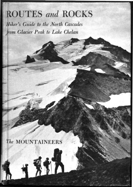
Routes and rocks; hiker's guide to the North Cascades from ... - USGS
Routes and rocks; hiker's guide to the North Cascades from ... - USGS
Routes and rocks; hiker's guide to the North Cascades from ... - USGS
- No tags were found...

You also want an ePaper? Increase the reach of your titles
YUMPU automatically turns print PDFs into web optimized ePapers that Google loves.
IHiker's Guide <strong>to</strong> th~ .<strong>North</strong>, Carcadisjrm Glacier Peak <strong>to</strong> L& ChelanROUTES <strong>and</strong> ROCKS
To Concrete <strong>and</strong>"SUIATTLE RIVERWHITE CHUCK RIVERANDNORTH FORK SAUK RIVERDAiWINGroNTo Clear CrWESTERN GATEWAYSg. 28LEGENDCampgroundU.S. Forest serviceDistrict Ranger stationU.S. Forest service Guard StatiU.S. HighwayState HighwayGravel or dirt roodTrail\ ~> ' Mileage Detween points'25
', 4>ri V» ''^TB-~N *,^%r ^f • J 1 -?-*---U '' J -' . '^ - - : >vi' ''-.. 3 /y^s- 1 -^*HITE RIVERANDCHIWAWA RIVERft UmwwtkENTIAT RIVERANDLAKE CHELAN
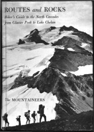
ROUTES <strong>and</strong> ROCKSHiker's Guide <strong>to</strong> <strong>the</strong> <strong>North</strong> <strong>Cascades</strong><strong>from</strong> Glacier Peak <strong>to</strong> Lake Chelan
—for <strong>the</strong>re is no opiate like Alpine pedestrianism."MARK TWAIN, A Tramp Abroad<strong>and</strong> some rin up hill <strong>and</strong> down dale,knapping <strong>the</strong> chucky stanes <strong>to</strong> pieces wi' hammers,like sae mony roadmakers run daft—<strong>the</strong>y say it is <strong>to</strong> see how <strong>the</strong> warld was made!"SIR WALTER SCOTT, St. Ronan's WellCover illustration: Glacier Peak <strong>from</strong> PumiceCreek side trip. (Bob <strong>and</strong> Ira Spring)
ROUTES <strong>and</strong> ROCKSHiker's Guide <strong>to</strong> <strong>the</strong> <strong>North</strong> <strong>Cascades</strong><strong>from</strong> Glacier Peak <strong>to</strong> Lake ChelanBy D. F. Crowder <strong>and</strong> R. W. TaborWITH DRAWINGS BY ED HANSONTHE MOUNTAINEERSSeattle, Washing<strong>to</strong>n
© 1965 by The MountaineersTHE MOUNTAINEERSP.O. Box 122Seattle, Washing<strong>to</strong>n 98111Organized 1906Library of Congress Catalog Card Number 65-27406First Edition 1965Second printing 1966DESIGN BY JOHN WARNERMANUFACTURED IN THE UNITED STATES OF AMERICACOMPOSITION AND BINDING BY VAIL-BALLOU PRESS, INC.MAP PRINTING BY RAND MCNALLY & CO.TEXT PRINTING BY VALLEY OFFSET, INC.
FOREWORDSINCE 1950 <strong>the</strong> United States Geological Survey, an agency of <strong>the</strong> Departmen<strong>to</strong>f <strong>the</strong> Interior, has been making an intensive study of <strong>the</strong><strong>North</strong> <strong>Cascades</strong> between Glacier Peak <strong>and</strong> Lake Chelan. While participatingin <strong>the</strong> study, <strong>the</strong> authors have had ample opportunity <strong>to</strong> hike<strong>the</strong> trails <strong>and</strong> off-trail high routes of <strong>the</strong> area, <strong>and</strong> in preparing this<strong>guide</strong> have combined <strong>the</strong> information <strong>the</strong>y have gained about geologywith <strong>the</strong> information <strong>the</strong>y have gained about trails <strong>and</strong> routes. The resultis a very special <strong>and</strong> valuable sort of <strong>guide</strong>book that not only tells<strong>the</strong> hiker what places are worth visiting, <strong>and</strong> how <strong>to</strong> get <strong>the</strong>re, but alsoadds <strong>to</strong> his wilderness experience by telling him how <strong>the</strong>se peaks <strong>and</strong>valleys came <strong>to</strong> be, <strong>and</strong> why <strong>the</strong>y are what <strong>the</strong>y are.The Mountaineers take particular pleasure in publishing this bookbecause it fur<strong>the</strong>rs so well certain purposes of <strong>the</strong> organization, especially<strong>the</strong> m<strong>and</strong>ates "<strong>to</strong> explore <strong>and</strong> study <strong>the</strong> mountains, forests, <strong>and</strong>water courses of <strong>the</strong> <strong>North</strong>west" <strong>and</strong> "<strong>to</strong> ga<strong>the</strong>r in<strong>to</strong> permanent form <strong>the</strong>his<strong>to</strong>ry <strong>and</strong> traditions of this region"—<strong>and</strong> surely geologic his<strong>to</strong>ry mus<strong>the</strong>re be included.Fur<strong>the</strong>rmore, The Mountaineers have a profound interest in <strong>the</strong>proper use of America's natural heritage, as does <strong>the</strong> Geological Survey<strong>and</strong> <strong>the</strong> Department of <strong>the</strong> Interior, which says of itself: "In its assignedfunction as <strong>the</strong> nation's principal natural resource agency, <strong>the</strong> Departmen<strong>to</strong>f <strong>the</strong> Interior bears a special obligation <strong>to</strong> assure that our expendableresources are conserved, that renewable resources are managed<strong>to</strong> produce optimum yields, <strong>and</strong> that all resources contribute <strong>the</strong>ir full
VIFOREWORDmeasure <strong>to</strong> <strong>the</strong> progress, prosperity, <strong>and</strong> security of America, now <strong>and</strong>in <strong>the</strong> future."By act of Congress in September 1964, <strong>the</strong> Glacier Peak Wilderness,much of which is covered by this <strong>guide</strong>, was included in <strong>the</strong> NationalWilderness Preservation System, <strong>and</strong> thus set aside as an area where"<strong>the</strong> earth <strong>and</strong> its community of life are untrammeled by man, whereman himself is a visi<strong>to</strong>r who does not remain." The importance of<strong>Routes</strong> <strong>and</strong> Rocks, over <strong>and</strong> above <strong>the</strong> immediate pleasure it willbring alpine pedestrians, is that it will acquaint more people with <strong>the</strong><strong>North</strong> <strong>Cascades</strong>, <strong>and</strong> in <strong>the</strong> process make more friends for wilderness,here <strong>and</strong> everywhere.The Mountaineers, with groups based in Seattle, Everett, Tacoma,<strong>and</strong> Olympia, warmly invite <strong>the</strong> membership of all who sympathizewith club purposes <strong>and</strong> wish <strong>to</strong> partake in its offerings. In addition<strong>to</strong> programs of research in<strong>to</strong> <strong>the</strong> best <strong>and</strong> highest uses of "<strong>the</strong> naturalbeauty of <strong>North</strong>west America," The Mountaineers sponsor year-roundactivities in climbing, hiking, camping, ski-<strong>to</strong>uring, <strong>and</strong> snowshoeing.Hundreds of outings are scheduled each year, ranging <strong>from</strong> single-dayexcursions <strong>to</strong> trips lasting two weeks or more. A climbing school—<strong>the</strong>oldest <strong>and</strong> largest in America—is presented annually, <strong>and</strong> also schoolsin hiking <strong>and</strong> camping <strong>and</strong> in ski-mountaineering.For fur<strong>the</strong>r information on club activities <strong>and</strong> how <strong>to</strong> join, pleasewrite The Mountaineers, P.O. Box 122, Seattle, Washing<strong>to</strong>n 98111.THE MOUNTAINEERS
O<strong>the</strong>r Books <strong>from</strong> The MountaineersMountaineering: The Freedom of <strong>the</strong> Hills, edited by Harvey Manning.Textbook of <strong>the</strong> Climbing Course presented annually since 1935 by TheMountaineers. First published in 1960—more than 20,000 copies how in print.Chapters: Equipment, Camping <strong>and</strong> Sleeping, Alpine Cuisine, WildernessTravel, Navigation in <strong>the</strong> Hills, Routefinding on Rock, Balance, Counterforce,Roped Climbing, Belaying, Pi<strong>to</strong>ncraft <strong>and</strong> Rappels, Snow, Ice, Glaciers,Arrests <strong>and</strong> Belays, The Climbing Party <strong>and</strong> its Leadership, ClimbingDangers, First Aid, Alpine Rescue, Mountain Geology, The Cycle of Snow,<strong>and</strong> Mountain Wea<strong>the</strong>r. Appendix: Food Requirements for Climbers. 430pages, 134 drawings. 16 pho<strong>to</strong>graphs. $7.50The <strong>North</strong> <strong>Cascades</strong>, pho<strong>to</strong>s by Tom Miller, text by Harvey Manning, mapsby Dee Molenaar.A stunning collection of pho<strong>to</strong>graphs by a climber-pho<strong>to</strong>grapher who hastraveled <strong>the</strong> peaks <strong>and</strong> glaciers, forests <strong>and</strong> meadows, for 20 years, <strong>and</strong> anurgent plea for creation of a <strong>North</strong> <strong>Cascades</strong> National Park. Published in 1964.Chapters: Nor<strong>the</strong>rn Pickets, Nooksack Cirque, Park Creek Pass, CascadePass, Kool-Aid Lake <strong>to</strong> White Rock Lakes, Dome Peak, <strong>and</strong> Bonanza-Entiat.96 pages, 10 x 12 inches; 70 pho<strong>to</strong>s, most occupying a full page; 10 mapswhich for each pho<strong>to</strong>graph identify <strong>the</strong> location of <strong>the</strong> camera <strong>and</strong> <strong>the</strong>direction in which it was pointed. $10.00Mountain Rescue Techniques, by Wastl Mariner.The acknowledged bible of mountain rescuers throughout <strong>the</strong> world. Translated<strong>and</strong> published in 1964 in cooperation with <strong>the</strong> Oesterreichischer Alpenverein.Chapters: Summer Rescue—Specialized Rescue Gear, Transport withSpecialized Gear, Improvised Rescue Gear, Transport with Improvised Gear;Winter Rescue—Specialized Rescue Gear, Improvised Rescue Gear, AvalancheRescue, Winter Transport. Appendix: Principles of First Aid forMountaineers. 200 pages, paperbound. 117 drawings. $3.50Guide <strong>to</strong> Leavenworth Rock Climbing Areas, by Fred Beckey <strong>and</strong> EricBjornstad.Detailed description of all routes so far completed in <strong>the</strong> principle rockpracticearea of Cascade climbers. Published in 1965, 86 pages, paperbound,13 drawings. $2.75Mountain Medicine, edited by James A. Wilkerson, M.D.Prepared by a group of climber-physicians who among <strong>the</strong>m have experienceranging <strong>from</strong> Everest <strong>and</strong> K-2 <strong>to</strong> <strong>North</strong>west wilderness. The firstbook published in America that goes extensively in<strong>to</strong> <strong>the</strong> principles of"second-aid," as distinguished <strong>from</strong> first-aid. Due in 1966.Walking <strong>the</strong> Hills <strong>and</strong> Valleys: 100 Trail Trips, text by Louise Marshall,pho<strong>to</strong>s by Bob <strong>and</strong> Ira Spring.A <strong>guide</strong>, in words <strong>and</strong> pho<strong>to</strong>s, <strong>to</strong> 100 of <strong>the</strong> finest trail hikes available in<strong>the</strong> Puget Sound country, ranging <strong>from</strong> beach hikes <strong>to</strong> high summits. Due in1966.
PREFACEAs geologists for <strong>the</strong> United States Geological Survey, we <strong>and</strong> our coworkershave spent al<strong>to</strong>ge<strong>the</strong>r 20 summers making a detailed study of<strong>the</strong> <strong>rocks</strong> in a small part of <strong>the</strong> wilderness of <strong>the</strong> <strong>North</strong> <strong>Cascades</strong>. Fromcamps supplied by horses, helicopters, <strong>and</strong> our own backpacks, we haveexplored a 600-square-mile area covered by three modern map sheets:<strong>the</strong> Glacier Peak, Holden, <strong>and</strong> Lucerne quadrangles. Geologic dataga<strong>the</strong>red by <strong>the</strong> U.S. Geological Survey are most often published intechnical journals <strong>and</strong> books <strong>and</strong> on maps designed <strong>to</strong> reach primarily<strong>the</strong> professional geologist. We here report <strong>to</strong> hikers parts of <strong>the</strong> geologics<strong>to</strong>ry that hopefully will enhance <strong>the</strong>ir enjoyment of <strong>the</strong> <strong>North</strong> <strong>Cascades</strong>.We speak <strong>to</strong> those who wish <strong>to</strong> savor <strong>the</strong> many byways of this variedregion. The <strong>guide</strong> is written <strong>and</strong> designed <strong>to</strong> be carried in <strong>the</strong> rucksack;it is not so well-suited for <strong>the</strong> saddlebag, although <strong>the</strong>re is much informationfor <strong>the</strong> horseman. Our tendency <strong>to</strong> rush <strong>the</strong> hiker out of canyonforest up <strong>to</strong> timber-line alp <strong>and</strong> crag is not necessarily because more<strong>rocks</strong> are <strong>to</strong> be found up <strong>the</strong>re, or because we mean <strong>to</strong> belittle <strong>the</strong>impressive jungles, but because we so often meet people who think of<strong>the</strong> <strong>North</strong> <strong>Cascades</strong> only in terms of trees. Though we know that evaluationof view or campsite is subjective, we have tried <strong>to</strong> inspire as wellas <strong>to</strong> direct, <strong>to</strong> give <strong>the</strong> flavor of a route as well as useful details. Weare alpine pedestrians by hobby as well as by profession, <strong>and</strong> hopefullywe hear <strong>the</strong> same music as our readers.Much of <strong>the</strong> geologic data <strong>and</strong> some of <strong>the</strong> route information hasbeen supplied by our colleagues: Fred Cater, Art Ford, Cliff Hopson,Don Kellum, <strong>and</strong> Tom Wright. We thank employees of <strong>the</strong> U.S. ForestService at Darring<strong>to</strong>n, Wenatchee Lake, Chelan, <strong>and</strong> Entiat for traillogs, maintenance schedules, <strong>and</strong> advice. Although most of <strong>the</strong> draw-
XPREFACEings were made by Ed Hanson, some were contributed by Jim Crooks,Betsy Crowder, Es<strong>the</strong>r McDermott, Dee Molenaar, <strong>and</strong> Meade Norman.We gratefully acknowledge <strong>the</strong> help of friends, typists, packers, hikers,draftsmen, administra<strong>to</strong>rs, <strong>and</strong> camp followers: Fidelia Alger, GeorgeArnold (alias Bill Wallace), Mary Brannock, Bea Bregman, Vera Campbell,Ray Courtney, King Huber, Fay Koonce, Frances LeBaker, HarveyManning, George Martin, Dean Rinehart, Bill Stark, Elizabeth Stevens,Sumi Sumida, Lesley Tabor, <strong>and</strong> Clancy Yung. We thank <strong>the</strong> followingpublishers for permission <strong>to</strong> quote: Harper <strong>and</strong> Row, Inc., NewYork (A Tramp Abroad, by Mark Twain); E. P. Dut<strong>to</strong>n & Co., Inc.(Winnie-<strong>the</strong>-Pooh, by A. A. Milne); Simon <strong>and</strong> Schuster, Inc. (TheOdyssey: A Modern Sequel, by Nikos Kazantzakes, trans, by KimonFriar); <strong>and</strong> Apple<strong>to</strong>n-Century-Crofts, Inc., New York (Mont Blanc, byAlbert Smith, quoted in The Book of <strong>the</strong> Mountains, by A. C. Spec<strong>to</strong>rsky).The final responsibility, however, must lie with <strong>the</strong> authors,who shared equally in all phases of this effort <strong>from</strong> <strong>the</strong> first "knapping<strong>the</strong> chucky stanes" <strong>to</strong> <strong>the</strong> last agonizing edit.Menlo Park, California1965DWIGHT CROWDERROWLAND TABOR
CONTENTSForewordPrefaceIntroduction 1The Setting 1The Guide 4Travel Hints 6Geologic S<strong>to</strong>ry 11Western Gateways 18Suiattle River 19White Chuck River 62<strong>North</strong> Fork of <strong>the</strong> Sauk River 83Eastern Gateways 94White River 94Chiwawa River 122Entiat River 140Lake Chelan 166Annotated Bibliography . 201Appendix: Mountain Climbing 206Index 221vix
<strong>North</strong><strong>Cascades</strong>CASCADESCoastalMountainsSIERRA NEVADAFigure 1
INTRODUCTIONThe SettingGeneral Character. Along <strong>the</strong> western edge of <strong>North</strong> America a nearcontinuousmountain rampart faces <strong>the</strong> sea, keeping ocean moisture<strong>from</strong> <strong>the</strong> drier deserts <strong>and</strong> plains <strong>to</strong> <strong>the</strong> east <strong>and</strong> becoming ever wetternorthward <strong>from</strong> California. The lofty Sierra Nevada merges in<strong>to</strong> <strong>the</strong>forested Cascade Range of Oregon, where only an occasional snowcappedvolcano rises above <strong>the</strong> general low level. In Washing<strong>to</strong>n, abouta hundred miles south of <strong>the</strong> Canadian border, begins abruptly <strong>the</strong>longest <strong>and</strong> wildest part of <strong>the</strong> Pacific Coast mountain system, extending<strong>from</strong> Washing<strong>to</strong>n <strong>to</strong> <strong>the</strong> Aleutians. The sou<strong>the</strong>rn end of <strong>the</strong>se wild <strong>and</strong>relatively unexplored mountains is known as <strong>the</strong> <strong>North</strong> <strong>Cascades</strong>. Theystretch <strong>from</strong> <strong>the</strong> vicinity of Stevens Pass in Washing<strong>to</strong>n <strong>to</strong> <strong>the</strong> FraserRiver in British Columbia (Fig. 1).Here in <strong>the</strong> <strong>North</strong> <strong>Cascades</strong> are deep <strong>and</strong> narrow valleys cloakedwith vegetation, sharp ridges, glaciers, snowfields, <strong>and</strong> fjordlike lakesthat make <strong>the</strong>se mountains utterly different <strong>from</strong> <strong>the</strong> <strong>Cascades</strong> <strong>and</strong>Sierra <strong>to</strong> <strong>the</strong> south. Here also are two more Pacific Coast volcanoes,Mount Baker <strong>and</strong> Glacier Peak, graceful cones in a sea of jagged peaks.West of <strong>the</strong> Washing<strong>to</strong>n <strong>Cascades</strong>, in <strong>the</strong> Puget Sound lowl<strong>and</strong>, is<strong>the</strong> Seattle metropolitan area, noted for a moist maritime climate. On<strong>the</strong> east, in <strong>the</strong> rain shadow of <strong>the</strong> mountains, are <strong>the</strong> desert-dry <strong>and</strong>sparsely settled Columbia lava plateau <strong>and</strong> <strong>the</strong> rolling hills of <strong>the</strong> Okanoganhighl<strong>and</strong>s.Altitude <strong>and</strong> Relief. These are not high mountains; Glacier Peak is
2 ROUTES AND ROCKSonly 10,541 feet high <strong>and</strong> most summits are between 7000 <strong>and</strong> 8000feet. But <strong>the</strong> country is very steep <strong>and</strong> <strong>the</strong> valley bot<strong>to</strong>ms are as lowas 1100 <strong>to</strong> 3000 feet; <strong>the</strong>refore, even <strong>to</strong> reach timberline at 5000 <strong>to</strong>6500 feet is a fair climb. Vegetation in <strong>the</strong> valleys is thick, especiallyin canyons west of <strong>the</strong> crest; this, combined with <strong>the</strong> jagged nature of<strong>the</strong> <strong>to</strong>pography, <strong>the</strong> generally poor condition of trails, <strong>and</strong> <strong>the</strong> prevalenceof glaciers, explains why this <strong>hiker's</strong> <strong>guide</strong> is as detailed as it is.It is much easier in <strong>the</strong> <strong>North</strong> <strong>Cascades</strong> than in most accessible Americanmountains <strong>to</strong> get in<strong>to</strong> difficulty, <strong>and</strong> hikers who leave <strong>the</strong> beaten pathshould be sure <strong>the</strong>y are properly trained <strong>and</strong> equipped.Snow. Snowfall is tremendous. Depths on <strong>the</strong> ground in March, justeast of <strong>the</strong> divide at 2000 <strong>to</strong> 3000 feet (Holden <strong>and</strong> Trinity), commonlyare 10 <strong>to</strong> 15 feet. This represents a snowfall of 40 <strong>to</strong> 60 feet. Far<strong>the</strong>reast in <strong>the</strong> rain-shadow of <strong>the</strong> divide along Lake Chelan, depths ofonly a few feet are <strong>the</strong> rule.In <strong>the</strong> Lucerne quadrangle, June <strong>and</strong> early July is <strong>the</strong> time for tripsbecause, in our opinion, <strong>the</strong> spring greenery <strong>and</strong> flowers <strong>and</strong> interspersedsnowbanks are preferable <strong>to</strong> <strong>the</strong> dryness of later summer <strong>and</strong> fall. Suchdryness never exists in <strong>the</strong> wetter region near <strong>and</strong> west of <strong>the</strong> CascadeDivide, where, even in July, one can count on much snow under foot—indeed <strong>the</strong>re is enough in some years <strong>to</strong> make travel with s<strong>to</strong>ck difficult.The very heavy snowfall in all but <strong>the</strong> eastern parts of <strong>the</strong> area, combinedwith <strong>the</strong> steep slopes, making this a great country for avalanches.Despite this, several ski-mountaineering parties have been <strong>to</strong> <strong>the</strong> relativelysafe slopes near Cloudy Pass <strong>and</strong> have stayed at <strong>the</strong> cabin atLyman Lake. At least one party has skied on <strong>the</strong> relatively gentle glacierssouth of Glacier Peak.The discomfort of walking in snow in light shoes should be clear.Though one may get along elsewhere on trails without good boots, <strong>the</strong>ydefinitely are recommended here. The hazards of steep snow should alsobe obvious. We strongly recommend that no one take <strong>the</strong> off-trail tripsdescribed in this <strong>guide</strong> without both an ice ax <strong>and</strong> <strong>the</strong> knowledge ofhow <strong>to</strong> use it. Early in <strong>the</strong> year <strong>the</strong> ax should be taken even on <strong>the</strong> hightrails for crossing steep snowbanks. A canteen is a foolish burden inthis l<strong>and</strong> of meltwater, though it verges on necessity if one is climbingin <strong>the</strong> Lake Chelan valley. See Bibliography for a list of references thatgive complete information on technique <strong>and</strong> equipment.Wea<strong>the</strong>r. From June in<strong>to</strong> Oc<strong>to</strong>ber <strong>the</strong> wea<strong>the</strong>r can be good. A nearlyrainless July, August, <strong>and</strong> September is not unknown, but rain at anytime is probable west <strong>and</strong> just east of <strong>the</strong> Cascade Divide, <strong>and</strong> some
INTRODUCTION 3drops may fall on Lake Chelan. The rains are generally not of <strong>the</strong> shortthunders<strong>to</strong>rm variety familiar <strong>to</strong> many western mountaineers, but ares<strong>to</strong>rms <strong>from</strong> <strong>the</strong> ocean lasting several days. One soon becomes able <strong>to</strong>recognize <strong>the</strong> high wispy cirrus clouds which usually announce an oncomingfront <strong>and</strong> <strong>to</strong> appreciate <strong>the</strong> comparatively sudden breakup of<strong>the</strong> solid gray overcast, often in <strong>the</strong> evening, that foretells a fine <strong>to</strong>morrow.West-side canyons <strong>and</strong> main-divide passes are commonly envelopedin a blanket of ocean fog—a spectacular sight. The fog wraps around <strong>the</strong>alpine fir, drifts through <strong>the</strong> giants of <strong>the</strong> rain-forest, <strong>and</strong> spills in aflowing wave over passes. But <strong>to</strong> <strong>the</strong> hiker buried in fog, <strong>the</strong> views arenot spectacular. He must not despair, but climb <strong>and</strong> hope <strong>to</strong> break freeup above. The distinction between thick fog <strong>and</strong> real s<strong>to</strong>rm clouds is noteasy <strong>to</strong> make <strong>from</strong> a canyon, but if it is raining, <strong>the</strong>re is no hope ofclimbing above <strong>the</strong> clouds. The visi<strong>to</strong>r who meets a s<strong>to</strong>rm must be patient<strong>and</strong> realize that fine wea<strong>the</strong>r will normally come within a few days<strong>and</strong> that without <strong>the</strong> moisture, <strong>the</strong> snow <strong>and</strong> ice <strong>and</strong> greenery that are<strong>the</strong> unique attractions of <strong>the</strong>se mountains would not exist. Rain is hardlyany problem in midsummer in <strong>the</strong> Lucerne area, <strong>and</strong> fog never gets asfar east.Since <strong>the</strong> temperatures are mild <strong>and</strong> vicious winds uncommon excep<strong>to</strong>n exposed ridges, it is possible <strong>to</strong> keep warm if one can keep dry; itwill not help <strong>to</strong> realize that <strong>the</strong> skin is waterproof. A tent or at least awaterproof tarp is a necessary bit of insurance in all parts of <strong>the</strong> GlacierPeak-Lake Chelan area except in <strong>the</strong> Lucerne quadrangle. Waterproofgarments can extend, but not insure, <strong>the</strong> period of dryness. Those whohike stripped <strong>and</strong> rely on exercise <strong>to</strong> keep warm will sooner or later,without eventual dry refuge, be cold <strong>and</strong> miserable. A little more skillthan that needed in dry mountains may be necessary <strong>to</strong> start a fire; drymatches <strong>and</strong> more complicated artificial aids are useful.Pests. Mosqui<strong>to</strong>es vary greatly in number <strong>from</strong> place <strong>to</strong> place, month<strong>to</strong> month, <strong>and</strong> year <strong>to</strong> year; bugproof tents <strong>and</strong> repellents are necessities.The deerfly <strong>and</strong> horsefly ignore repellents <strong>and</strong> must be <strong>to</strong>lerated, but<strong>the</strong>y are seldom worse than mildly annoying. Bigger animals—blackbear, mule deer, <strong>and</strong> mountain goat—are <strong>the</strong>ir typical shy selves. Thebears are not familiar with scavenging <strong>and</strong> so seldom molest a camp.Rattlesnakes are restricted <strong>to</strong> <strong>the</strong> east side of Lake Chelan <strong>and</strong> even<strong>the</strong>re are not very common. There is no poison ivy, oak, or sumac.
ROUTES AND ROCKSThe GuideOrganization. The area of <strong>the</strong> <strong>guide</strong> is divided in<strong>to</strong> gateways—<strong>the</strong>drainage basins of seven major rivers (Front end paper). These drainagebasins are grouped in<strong>to</strong> eastern gateways <strong>and</strong> western gateways as definedby <strong>the</strong> Cascade Crest. The three <strong>to</strong>pographic maps of <strong>the</strong> GlacierPeak, Holden, <strong>and</strong> Lucerne quadrangles, with a special red overprin<strong>to</strong>f route data, give <strong>the</strong> real details. To scan routes described in <strong>the</strong> <strong>guide</strong>,refer <strong>to</strong> <strong>the</strong> Geologic Map (Fig. 3) <strong>and</strong> <strong>to</strong> find anything in text or on <strong>the</strong><strong>to</strong>pographic maps see <strong>the</strong> Index which is keyed <strong>to</strong> both.Notes describing <strong>the</strong> minerals, <strong>rocks</strong>, <strong>and</strong> o<strong>the</strong>r geologic sights betweenGlacier Peak <strong>and</strong> Lake Chelan are with <strong>the</strong> route descriptions;<strong>the</strong>y are each given a number <strong>and</strong> located on <strong>the</strong> maps. In <strong>the</strong> GeologicS<strong>to</strong>ry we summarize <strong>the</strong> geologic his<strong>to</strong>ry <strong>and</strong> offer a few basic principles.If we raise more questions than we answer, well <strong>and</strong> good. (See <strong>the</strong> geologicreferences in <strong>the</strong> Bibliography.) Definition of terms are in <strong>the</strong> text<strong>and</strong> may be found by use of <strong>the</strong> Index.Distances <strong>and</strong> Classification of <strong>Routes</strong>. <strong>Routes</strong> are divided in<strong>to</strong> trails<strong>and</strong> high routes. For trails we list <strong>the</strong> distance <strong>and</strong> <strong>the</strong> elevation changes<strong>and</strong> <strong>the</strong> frequency of maintenance by <strong>the</strong> Forest Service, which is somemeasure of <strong>the</strong> condition. Trails maintained periodically may not becleared for horses. The reader can estimate for himself if <strong>the</strong> trip will beeasy or difficult—a judgment that depends on his speed <strong>and</strong> <strong>the</strong> load hecarries. On trails it is optimistic for most bipeds <strong>and</strong> quadrupeds <strong>to</strong> coun<strong>to</strong>n averaging much more than 2 miles per hour or over 1000-foot elevationgain per hour. "Mileage approximate" or "about" indicates our estimate;o<strong>the</strong>rwise all mileages are by wheel <strong>and</strong> are taken <strong>from</strong> ForestService logs.High routes are by <strong>and</strong> large trailless excursions along <strong>the</strong> high ridges<strong>and</strong> are not for s<strong>to</strong>ck. Routefinding <strong>and</strong> technical difficulty become fac<strong>to</strong>rs,so we have rated <strong>the</strong> high routes easy, intermediate, or difficult <strong>and</strong>give, in addition <strong>to</strong> mileage, <strong>the</strong> estimated hours for <strong>the</strong> average backpacker.An easy high route presents little scrambling or routefindingdifficulties; <strong>the</strong> h<strong>and</strong>s will seldom be needed. A difficult high route is
INTRODUCTION 5for experienced backpackers only; h<strong>and</strong>s <strong>and</strong> ice ax may be needed.Only on one high route is a rope recommended. We do not mean <strong>to</strong>imply, however, that high routes rated difficult are for mountain climbersonly; this is a <strong>hiker's</strong> <strong>guide</strong>, not a climber's <strong>guide</strong>. An intermediatehigh route is ... well, intermediate.Glacier Peak Loop. Timberline circumnavigation of Glacier Peak itselfis possible without crossing glaciers by using <strong>the</strong> high routes <strong>and</strong> sometrails. Study <strong>the</strong> Glacier Peak map sheet <strong>to</strong> plan this challenging <strong>and</strong>rewarding trip which has, as far as we know, been done only piecemeal.Cascade Crest Trail. This link in <strong>the</strong> Pacific Crest Trail System doesnot live up <strong>to</strong> its name in <strong>the</strong> area described; only about 3 of roughly 30miles of Cascade Crest are followed by <strong>the</strong> trail. As with <strong>the</strong> GlacierPeak loop, we leave <strong>to</strong> <strong>the</strong> reader <strong>the</strong> pleasure of studying <strong>the</strong> maps <strong>and</strong><strong>the</strong> <strong>guide</strong> <strong>to</strong> piece <strong>to</strong>ge<strong>the</strong>r <strong>the</strong> real Cascade Crest route. This will not bean easy trip, for parts are high routes we rate intermediate <strong>and</strong> difficult.Trans-Cascade. The trail usually followed <strong>from</strong> Lake Chelan <strong>to</strong>Glacier Peak is <strong>from</strong> Holden via Lyman Lake, Cloudy Pass, <strong>and</strong> ImageLake; this route offers some fine scenery <strong>and</strong> an excellent trail, but isalmost as short on high country as <strong>the</strong> Crest Trail is on crest. We recommenda more consistently scenic route that begins at Lucerne, goes overMilham Pass, <strong>and</strong> continues west <strong>to</strong>ward <strong>the</strong> scenic climax of <strong>the</strong> regionvia ridge-crest trails <strong>and</strong> high routes; only in three places need <strong>the</strong> routedip down (never below 4200 feet) <strong>to</strong> cross a canyon. This is about a 10-day junket for <strong>the</strong> experienced backpacker. See Index, <strong>North</strong> <strong>Cascades</strong>.Entiat Mountains, Chelan Mountains, Methow Mountains. The routesalong <strong>the</strong> crest of <strong>the</strong>se main sub-ranges offer continuous high country.Walk <strong>the</strong>m <strong>from</strong> south <strong>to</strong> north <strong>to</strong> enjoy a steady improvement of scenery<strong>and</strong> camp sites.Short Trips. Unfortunately, many visi<strong>to</strong>rs in <strong>the</strong> <strong>North</strong> <strong>Cascades</strong> spend<strong>the</strong>ir holiday in <strong>the</strong> roadside forest camps <strong>and</strong> never enjoy <strong>the</strong> timberlinesights for which <strong>the</strong> <strong>North</strong> <strong>Cascades</strong> are famous. It is a major effort inmost places <strong>to</strong> get up above <strong>the</strong> trees, <strong>and</strong> <strong>the</strong> tradition of building <strong>and</strong>maintaining trails in valley bot<strong>to</strong>ms ra<strong>the</strong>r than up spurs <strong>and</strong> alongtimberline does not help. However, it is not impossible for <strong>the</strong> one-dayhiker <strong>and</strong> weekend visis<strong>to</strong>r <strong>to</strong> get <strong>to</strong> fine views of <strong>the</strong> high country, <strong>and</strong> ineach section of <strong>the</strong> <strong>guide</strong> we have recommended suitable short trips.
ROUTES AND ROCKSTravel HintsEquipment <strong>and</strong> Experience. Preparing for a camping trip in <strong>the</strong> <strong>North</strong><strong>Cascades</strong> differs little <strong>from</strong> preparing for a trip in any western mountainrange; <strong>the</strong> Bibliography refers <strong>the</strong> inexperienced traveler <strong>to</strong> books thatdiscuss equipment <strong>and</strong> preparations for such a trip. On preceding pageswe have mentioned natural features peculiar <strong>to</strong> <strong>the</strong> <strong>North</strong> <strong>Cascades</strong>which have some bearing on training, selection of equipment, <strong>and</strong> timingof <strong>the</strong> expedition. We repeat: do not forget good boots, ice ax, tent, firestarters, <strong>and</strong> insect repellent. Remember <strong>the</strong> lingering snowpack, formidablebrush, ubiqui<strong>to</strong>us cliffs, steep snow, <strong>and</strong> rapid streams.Routefinding aided by this <strong>guide</strong> will be easier if a good compass <strong>and</strong>a pocket altimeter are carried. A compass, generally considered essentialanywhere, is of less use here than in flatter, less jagged, <strong>and</strong> lessdistinctive mountain terrain. The altimeter (which need not read over10,000 feet in <strong>the</strong> <strong>North</strong> <strong>Cascades</strong>) is particularly useful, for a footmoved forward here is usually a foot climbed up or down. Be sure <strong>to</strong>reset <strong>the</strong> instrument at every point of known elevation, such as summits,stream crossings, <strong>and</strong> route junctions. With a good <strong>to</strong>pographic map,compass, <strong>and</strong> altimeter, <strong>and</strong> knowledge of how <strong>to</strong> use <strong>the</strong>m, it is impossible<strong>to</strong> become lost in <strong>the</strong> <strong>North</strong> <strong>Cascades</strong>.Maps <strong>and</strong> Pho<strong>to</strong>graphs. If read with proficiency, good <strong>to</strong>pographicmaps (see Bibliography for sources) are an invaluable aid <strong>to</strong> any wildernesstrip. Only <strong>the</strong> modern <strong>to</strong>pographic maps of <strong>the</strong> Geological Surveyare fully adequate. Topographic maps of smaller scale—more than onemile <strong>to</strong> <strong>the</strong> inch—are not accurate <strong>and</strong> should be avoided; if <strong>the</strong>y mustbe used, carry in addition a Forest Service planimetric map (withoutcon<strong>to</strong>urs). Some <strong>to</strong>pographic maps are available around <strong>the</strong> three includedin this <strong>guide</strong> (see Bibliography, Figure 53). The st<strong>and</strong>ard GeologicalSurvey quadrangles, like those reproduced with this <strong>guide</strong>, have agreen overlay showing <strong>the</strong> distribution of trees <strong>and</strong> brush. The specialshaded relief edition of <strong>the</strong> Holden quadrangle is a fine display emphasizingglaciated mountains, but its con<strong>to</strong>urs are difficult <strong>to</strong> read. A concisedescription of <strong>to</strong>pographic map reading may be found in Mountain-
INTRODUCTION 7eering, The Freedom of <strong>the</strong> Hills, p. 74-77. Use a plastic envelope <strong>to</strong>protect maps in <strong>the</strong> field. To prevent damage along folds, cut in<strong>to</strong> sections<strong>and</strong> mount on cloth. Commercial wax-coated cloth for mounting isavailable. Geologic buffs need geologic maps—see Bibliography.A series of 1 by 2 degree small-scale <strong>to</strong>pographic maps (United StatesSeries, scale 1:250,000 or 1 inch = 4 miles) are sold by <strong>the</strong> GeologicalSurvey; <strong>the</strong> Wenatchee sheet covers <strong>the</strong> south half of <strong>the</strong> <strong>North</strong> <strong>Cascades</strong><strong>and</strong> <strong>the</strong> Concrete sheet <strong>the</strong> north half. The Army Map Service (Bibliography)sells <strong>the</strong>se sheets in raised plastic relief. Whe<strong>the</strong>r flat or in relief,<strong>the</strong>se maps are useless for wilderness travel, though <strong>the</strong>y do give a generalpicture of <strong>the</strong> entire <strong>North</strong> <strong>Cascades</strong>. A better general picture canbe had by study of <strong>the</strong> masterful shaded relief map of <strong>the</strong> <strong>North</strong> Central<strong>Cascades</strong>, a privately printed map by Martin <strong>and</strong> Pargeter availablelocally.Aerial pho<strong>to</strong>graphs are taken looking straight down <strong>from</strong> an elevationof 20,000 <strong>to</strong> 40,000 feet; <strong>the</strong>y are quite expensive—about 50(t persquare mile for stereo coverage—<strong>and</strong> take many weeks <strong>to</strong> obtain. Bu<strong>to</strong>n good pho<strong>to</strong>s individual trees <strong>and</strong>, even more important, brush patchescan be picked out. The pho<strong>to</strong>s can help in off-route pioneering, <strong>and</strong>studying <strong>the</strong>m at home in stereo is <strong>the</strong> next best thing <strong>to</strong> taking a planeride over <strong>the</strong> crags.Rescue. Make definite plans. Help cannot reach you if no one knowswhere you intend <strong>to</strong> go, nor will you be missed if you do not tell someonewhen <strong>and</strong> where you are due back. This information is best given<strong>to</strong> friends who have some interest in your welfare. Registering with <strong>the</strong>Forest Service is second best, but never<strong>the</strong>less is better than nothing <strong>and</strong>should be done. The Forest Service provides registration books at rangerstations, guard stations, <strong>and</strong> on some main trails. Units of <strong>the</strong> MountainRescue Councils in Seattle, Bellingham, Mt. Vernon, <strong>and</strong> Everett arevolunteer groups that can help in case of emergency, especially whenexpert climbers are needed.Pathfinding. Hikers in <strong>the</strong> <strong>North</strong> <strong>Cascades</strong> who are accus<strong>to</strong>med <strong>to</strong><strong>the</strong> numerous fine trails in <strong>the</strong> more arid <strong>and</strong> more visited ranges of <strong>the</strong>west, such as <strong>the</strong> Sierra Nevada, are in for a shock. River-bot<strong>to</strong>m trails<strong>and</strong> <strong>the</strong> Cascade Crest Trail have been built with an eye <strong>to</strong> easy building<strong>and</strong> <strong>the</strong> requirements of pack s<strong>to</strong>ck; <strong>the</strong>y tend <strong>to</strong> avoid <strong>the</strong> mostscenic routes, which are above timberline, up spurs, <strong>and</strong> along ridges.Many miles of secondary trails do follow <strong>the</strong> timberline routes. Theywere built long ago by <strong>the</strong> occasional sheepherder, prospec<strong>to</strong>r, or <strong>the</strong>Forest Service. They are adequate for good horses <strong>and</strong> good riders <strong>and</strong>
OROUTES AND ROCKSfully adequate for bipeds, but <strong>the</strong>y get little or no maintenance <strong>to</strong>day.The trees <strong>and</strong> brush close in locally, <strong>and</strong> a pleasant hike can become anightmare if what is left of <strong>the</strong> track is lost. These secondary trails canbe much improved if each traveler will do a little maintenance himself—kick a s<strong>to</strong>ne here, lift a branch <strong>the</strong>re, <strong>and</strong> build a duck, but mostimportant, stay on <strong>the</strong> trail. Over many miles such simple maintenanceis all that is necessary <strong>to</strong> keep <strong>the</strong> track quite adequate.We offer <strong>the</strong> following hints at pathfinding <strong>to</strong> be used when both this<strong>guide</strong> <strong>and</strong> <strong>the</strong> track are vague. New blazes are unmistakable works ofman but old ones must be examined carefully. Rocks flying in<strong>to</strong> <strong>the</strong>woods <strong>from</strong> cliffs above make blazelike scars. Look in <strong>the</strong> dry wood at<strong>the</strong> center of <strong>the</strong> scar for telltale ax cuts; if <strong>the</strong> scar is healed shut youare out of luck unless <strong>the</strong> scar has a clear dot-dash pattern. Look, <strong>to</strong>o,for <strong>the</strong> smooth cuts where branches <strong>and</strong> brush have been cut. In someplaces cut twigs or trunks are not easy <strong>to</strong> tell <strong>from</strong> naturally brokenones; your finger can tell <strong>the</strong> difference between <strong>the</strong> smooth cut <strong>and</strong> <strong>the</strong>rough natural break. Where <strong>the</strong> trail is snow covered look for <strong>the</strong> swale.Deer often follow <strong>the</strong> snow-covered path with amazing accuracy <strong>and</strong><strong>the</strong>ir tracks are worth following unless <strong>the</strong>y trend wildly <strong>from</strong> <strong>the</strong> generalroute. Sheepherder trails are generally quite steep <strong>and</strong> in manyplaces dispense with switchbacks al<strong>to</strong>ge<strong>the</strong>r. But <strong>the</strong> whims of trailbuilders can never be counted on; as a rule it is best <strong>to</strong> forget <strong>the</strong> generaltrend <strong>and</strong> concentrate on looking for blazes <strong>and</strong> o<strong>the</strong>r signs.Almost always <strong>the</strong> trail offers <strong>the</strong> easiest passage, <strong>and</strong> only <strong>the</strong> novicewould ab<strong>and</strong>on it for his own route through a jungle without first makinga careful search for <strong>the</strong> trail. To plunge down a brushy hillside <strong>to</strong> reacha valley-bot<strong>to</strong>m trail is <strong>the</strong> best way <strong>to</strong> get brush-bound or, <strong>to</strong> useclimbers' jargon, "hung up" at <strong>the</strong> <strong>to</strong>p of a cliff. As geologists, we havehad <strong>to</strong> make hundreds of such plunges <strong>and</strong> can state with certainty thatit is generally most unpleasant. If you do get brush-bound, head for <strong>the</strong>biggest trees, where <strong>the</strong> shade may have killed <strong>the</strong> underbrush. Becauseof <strong>the</strong> heavy snow <strong>and</strong> snowslides in <strong>the</strong>se mountains, <strong>the</strong> brush hasbeen combed straight down, so it is infinitely more maddening <strong>and</strong> exhausting<strong>to</strong> cross <strong>the</strong> hillside than <strong>to</strong> go straight up or down.
INTRODUCTIONWilderness Management. Most of <strong>the</strong> region between Glacier Peak<strong>and</strong> Lake Chelan belongs <strong>to</strong> all of us <strong>and</strong> is currently managed for usby <strong>the</strong> Forest Service. Exceptions are a few small patented miningclaims on Miners Ridge, near Holden <strong>and</strong> Trinity, <strong>and</strong> a few areas onLake Chelan—primarily at Moore, Meadow Creek, <strong>and</strong> Lucerne. Controlledsheep grazing, mostly on a biennial schedule, is permitted in someof <strong>the</strong> meadows in <strong>the</strong> headwaters of <strong>the</strong> White, Napeequa, Chiwawa,<strong>and</strong> Entiat Rivers, <strong>and</strong> logging is allowed in some gateway canyons.Most of <strong>the</strong> region lies within <strong>the</strong> Glacier Peak Wilderness which hasbeen designated by Congress as a National Forest unit of <strong>the</strong> NationalWilderness Preservation System. The area is closed <strong>to</strong> machines. Aircraftcan be used <strong>to</strong> reach marginal areas, principally along Lake Chelan.Boat service is available on <strong>the</strong> lake (see Lake Chelan section). ForestService roads with campgrounds (see front end paper) penetrate <strong>the</strong> edgeof <strong>the</strong> <strong>guide</strong>book area. The district ranger stations* which are of principalinterest <strong>to</strong> visi<strong>to</strong>rs, are mentioned in <strong>the</strong> <strong>guide</strong> <strong>and</strong> located on <strong>the</strong> endpaper. Talk or write <strong>to</strong> district forest rangers in <strong>the</strong>se local stations forfirst-h<strong>and</strong> information. The area west of <strong>the</strong> Cascade Crest is in Mt.Baker National Forest, with headquarters in Bellingham, <strong>and</strong> <strong>the</strong> areaeast of <strong>the</strong> crest is in Wenatchee National Forest, with headquarters inWenatchee.S<strong>to</strong>ck. Much of <strong>the</strong> rugged area is not s<strong>to</strong>ck country, <strong>and</strong> compared <strong>to</strong>some o<strong>the</strong>r ranges, packers are scarce—perhaps half a dozen in <strong>the</strong> whole<strong>North</strong> <strong>Cascades</strong>. To our knowledge, burros are not available. Those interestedin pack trips should write <strong>the</strong> Chambers of Commerce in <strong>the</strong>gateway <strong>to</strong>wns. Contact packers well in advance; remember that <strong>the</strong>dem<strong>and</strong> is greatest during <strong>the</strong> fall hunting season (see below) <strong>and</strong> thata persistent snowpack can hamper or prevent an early trip.Fish <strong>and</strong> Game. With some notable exceptions, fishing (for cutthroat,Dolly Varden, or rainbow trout) is not sensational. The living is <strong>to</strong>ughin lakes that can be icebound in<strong>to</strong> August <strong>and</strong> in swift streams, some ofwhich (notably <strong>the</strong> Suiattle) are cloudy with glacial silt. Most of <strong>the</strong>named lakes have been s<strong>to</strong>cked, <strong>and</strong> fishing in <strong>the</strong>m, though generally0 Mt. Baker National ForestSuiattle drainage: Suiattle district, Darring<strong>to</strong>nSauk <strong>and</strong> White Chuck drainage: Darring<strong>to</strong>n district, Darring<strong>to</strong>nWenatchee National ForestWhite River <strong>and</strong> Chiwawa drainages: Lake Wenatchee district, LakeWenatcheeEntiat drainage: Entiat district, EntiatLake Chelan drainage: Chelan district, ChelanQ
1OROUTES AND ROCKSerratic, can be good. Fishing in Lake Chelan is confined <strong>to</strong> shallows near<strong>the</strong> mouths of main streams such as Railroad Creek <strong>and</strong> Fish Creek.Stream fishing is limited <strong>to</strong> <strong>the</strong> flatter portions of main drainages.Black bear, mule deer, mountain goat, <strong>and</strong> grouse are <strong>the</strong> game, <strong>and</strong>because of <strong>the</strong> rugged terrain, hunting is not easy. Except for <strong>the</strong> easternhalf of <strong>the</strong> Lucerne quadrangle <strong>and</strong> a few square miles in <strong>the</strong> northwestcorner of <strong>the</strong> Glacier Peak quadrangle, all <strong>the</strong> area between Glacier Peak<strong>and</strong> Lake Chelan is in what is called <strong>the</strong> High Cascade Deer Area, whichis open <strong>to</strong> an early 2-week hunting season in mid-September. With rifleor bow <strong>the</strong> expert <strong>and</strong> ambitious can try <strong>the</strong>ir luck in <strong>the</strong> high countryfor deer, mountain goat, <strong>and</strong> grouse. The goat hunting requires a specialpermit; a limited number of <strong>the</strong>se permits are selected in August <strong>from</strong>a list of applicants. Only a few of <strong>the</strong> better hunters take advantage of<strong>the</strong> early season, so <strong>the</strong> danger of being shot at this time is at a minimum.Never<strong>the</strong>less, wear a bright rag. We advise <strong>the</strong> nonhunter <strong>to</strong> stayout of <strong>the</strong> mountains during <strong>the</strong> shooting seasons.The main hunting season (for bear, deer, <strong>and</strong> grouse, but not forgoats) generally lasts 3 <strong>to</strong> 4 weeks beginning in mid-Oc<strong>to</strong>ber <strong>and</strong> is openin <strong>the</strong> whole area of this <strong>guide</strong>.Brochures giving details on fishing <strong>and</strong> hunting regulations should beprocured <strong>from</strong> sporting shops or <strong>from</strong> Washing<strong>to</strong>n State Department ofGame, 600 <strong>North</strong> Capi<strong>to</strong>l Way, Olympia, Washing<strong>to</strong>n.Climbing <strong>and</strong> Hiking clubs. Anyone taking up backpacking as a hobbywill benefit greatly by joining a local climbing club <strong>and</strong> participating in<strong>the</strong>ir training programs <strong>and</strong> trips. The short-time visi<strong>to</strong>r <strong>to</strong> Washing<strong>to</strong>ncan gain much information <strong>from</strong> western clubs. For a list of clubs <strong>the</strong>world over, see Summit Magazine, Vol. 8, No. 9, 1962. A few of <strong>the</strong>larger western clubs are listed below.Cascadians: P. O. Box 1526, Yakima, Washing<strong>to</strong>n 98901Mazamas: 909 NW 19th Street, Portl<strong>and</strong>, Oregon 97232The Mountaineers: P. O. Box 122, Seattle, Washing<strong>to</strong>n 98111Sierra Club: Mills Tower, San Francisco, California 94104Spokane Mountaineers: P. O. Box 1013, Spokane, Washing<strong>to</strong>n 99210Washing<strong>to</strong>n Alpine Club: P. O. Box 353, Seattle, Washing<strong>to</strong>n 98111
I2I°!5' Generalized <strong>from</strong> mappingby U.S. Geological SurveySEDIMEMTARYI GNEOUSMETAMORPH I C12oVNIS<strong>and</strong>i<strong>to</strong>ne <strong>and</strong>conglomerateS<strong>and</strong> <strong>and</strong>(travelMoitly lavaCind er conesGran i te Gneissic granite Gneiss SchistGravel road Trails <strong>and</strong> Boundary of Boundary ofhigh routes U.S.G.S. <strong>to</strong>pographic Glacier PeaknapsWilderness AreaCascade Crest Fault Contact5 MILESGeologic notedescribing majorfeature or rock typeSee textGENERALIZED GEOLOGIC MAP
GEOLOGIC STORY"To me are mountain masses gr<strong>and</strong>ly dumbI question nei<strong>the</strong>r whence nor why <strong>the</strong>y come."Goe<strong>the</strong>, FaustEARTH his<strong>to</strong>ry is vastly long <strong>and</strong> profoundly obscure. To unravel it, <strong>the</strong>geologist must look closely at <strong>the</strong> <strong>rocks</strong> composing <strong>the</strong> earth. He mus<strong>to</strong>bserve how rock masses differ, where <strong>the</strong>y occur, <strong>and</strong> what <strong>the</strong>ir shapes<strong>and</strong> sizes are. He observes <strong>the</strong> form of <strong>the</strong> l<strong>and</strong> <strong>and</strong> <strong>the</strong> processes atwork on <strong>the</strong> earth <strong>to</strong>day. To do all this, he takes roundabout hikes: heexamines outcrops, hammers off samples, writes notes, <strong>and</strong> plots <strong>the</strong>distribution of rock masses on a map. Back in <strong>the</strong> labora<strong>to</strong>ry, he studies<strong>the</strong> samples, <strong>and</strong> compares his map <strong>and</strong> observations with those ofo<strong>the</strong>rs.From <strong>the</strong> moment <strong>the</strong> geologist observes <strong>the</strong> first rock, he startsimagining what <strong>the</strong> his<strong>to</strong>ry of <strong>the</strong> <strong>rocks</strong> <strong>and</strong> l<strong>and</strong>forms must have been.He makes guesses: this granite was once molten, this stratum has beenbroken, this valley was carved by ice. Now with something definite <strong>to</strong>look for, he searches for more evidence—baked rock around <strong>the</strong> granite,crushed rock between broken strata, scratches on <strong>the</strong> side of a glaciatedvalley. He is delighted if he finds a pattern—a pattern showing how<strong>rocks</strong> develop, how mountain masses come, how life evolves.But before gr<strong>and</strong> patterns can be found, <strong>the</strong> geologist must define <strong>the</strong>fundamental building blocks of <strong>the</strong> earth—<strong>the</strong> minerals <strong>and</strong> <strong>rocks</strong>. Amineral is a natural substance with properties (hardness, shape, composition,etc.) that are essentially fixed. The properties are nearly fixedbecause <strong>the</strong> a<strong>to</strong>ms of elements that form minerals can be packed <strong>and</strong>
12 ROUTES AND ROCKSheld <strong>to</strong>ge<strong>the</strong>r in only a limited number of ways—ways that depend onhow <strong>the</strong> mineral formed (crystallized) <strong>from</strong> a liquid, a vapor, or, morecommonly, <strong>from</strong> ano<strong>the</strong>r mineral. Minerals usually occur in aggregatesof small <strong>and</strong> poorly formed crystals, packed firmly <strong>to</strong>ge<strong>the</strong>r in rock.Rarely do minerals occur as <strong>the</strong> spectacular specimens seen in museums.BURIED SEDIMENTSHundreds of millions of years ago <strong>the</strong> area of <strong>the</strong> <strong>North</strong> <strong>Cascades</strong> wasan ocean receiving rock fragments <strong>and</strong> chemicals worn or dissolved,eroded, <strong>from</strong> adjacent l<strong>and</strong>s. The debris, sediments, accumulated as layers(beds or strata) of mud, s<strong>and</strong>, <strong>and</strong> gravel on <strong>the</strong> sea floor. Volcanoscontributed ash <strong>and</strong> lava <strong>to</strong> <strong>the</strong> pile. The weight of <strong>the</strong> ever-increasingload of overlying sediment pressed <strong>the</strong> loose material <strong>to</strong>ge<strong>the</strong>r <strong>and</strong>squeezed out <strong>the</strong> water. Percolating water deposited mineral cementsbetween fragments. Gradually sedimentary <strong>rocks</strong> were formed: mudbecame shale, s<strong>and</strong>, s<strong>and</strong>s<strong>to</strong>ne, gravel, conglomerate.As <strong>the</strong> sea floor sank, heat <strong>and</strong> pressure began <strong>to</strong> metamorphose(change) <strong>the</strong> sedimentary <strong>rocks</strong>. New minerals formed <strong>from</strong> <strong>the</strong> old <strong>and</strong>a squeezing <strong>from</strong> <strong>the</strong> sides folded <strong>and</strong> crumpled <strong>the</strong> layers. The newminerals, controlled at least in part by <strong>the</strong> squeezing, became alignedlike sardines in a can. Most probably <strong>the</strong> rock floor beneath <strong>the</strong> sedimentswas also metamorphosed <strong>and</strong> blended with this overlying material.Schist <strong>and</strong> gneiss formed during <strong>the</strong> metamorphism (pronounced"shist" <strong>and</strong> "nice"). A schist usually contains many small flakes of mica,closely packed <strong>and</strong> looking like fish scales; <strong>the</strong> rock tends <strong>to</strong> break inthin slabs. Gneiss, on <strong>the</strong> o<strong>the</strong>r h<strong>and</strong>, has larger grains <strong>and</strong> is richer in<strong>the</strong> white mineral, feldspar, which does not form flat flakes like <strong>the</strong> mica;hence <strong>the</strong> gneiss does not break in such thin regular slabs. Indeed, somegneisses show few aligned minerals at all <strong>and</strong> are called gneissic graniteor just granite (Fig. 4). Such metamorphic granite is not easily distinguished<strong>from</strong> granite solidified <strong>from</strong> a melt (see below). Emanations <strong>from</strong>surrounding rock <strong>and</strong> below may help convert schist <strong>and</strong> gneiss in<strong>to</strong>granite.Despite <strong>the</strong> great changes in <strong>the</strong> original sediments, some of <strong>the</strong>irlayering is still preserved. On <strong>the</strong> geologic map (Fig. 3) <strong>the</strong> northwesttrend of squiggles <strong>and</strong> b<strong>and</strong>s of metamorphic rock represents alignedminerals formed during metamorphism <strong>and</strong> <strong>the</strong> upturned edges of bedsthat were once flat. This alignment, or grain of <strong>the</strong> <strong>rocks</strong>, shows that <strong>the</strong>squeeze during <strong>the</strong> metamorphism was <strong>from</strong> <strong>the</strong> southwest <strong>and</strong> nor<strong>the</strong>ast.Almost <strong>to</strong>tally lacking, however, are clues in <strong>the</strong> <strong>rocks</strong> that would
GEOLOGIC STORYhelp tell more exactly where <strong>the</strong> sediment was deposited, such as mudcracks indicating shallow water. Ripple marks, <strong>the</strong> fingerprints of currents,have been found.SCHISTGNE/SSIC GRANITEGNEISSGRANITEFigure 4£.ffThe remains of plants or animals, jossils, are rare in <strong>the</strong> <strong>rocks</strong> of <strong>the</strong><strong>North</strong> <strong>Cascades</strong>, <strong>and</strong> none have been found in <strong>the</strong> metamorphic <strong>rocks</strong>between Glacier Peak <strong>and</strong> Lake Chelan. Most likely <strong>the</strong> fossils have beendestroyed by <strong>the</strong> metamorphism, but possibly life was only present asspecks or jellys not likely <strong>to</strong> survive burial, much less compaction <strong>and</strong>metamorphism.OLD MOLTEN ROCKSBoth during <strong>and</strong> after <strong>the</strong> metamorphism, pockets of rock deep in <strong>the</strong>crust melted <strong>and</strong> moved upward. The molten material forced its wayin<strong>to</strong> (intruded) <strong>the</strong> more rigid metamorphic <strong>rocks</strong>. As <strong>the</strong> melt cooled,crystals of various minerals grew in much <strong>the</strong> same fashion that icecrystals grow in water. Rocks so formed are called igneous (fire-formed).When <strong>the</strong>y crystallize deep underground (in <strong>the</strong> realm of Plu<strong>to</strong>), <strong>the</strong>yare called plu<strong>to</strong>nic. Because <strong>the</strong> molten rock was deep enough in <strong>the</strong>earth (a few thous<strong>and</strong> feet <strong>to</strong> many miles down) <strong>and</strong> well insulated, itcooled slowly <strong>and</strong> <strong>the</strong> crystals had time <strong>to</strong> grow <strong>to</strong> a fairly large, visible
14 ROUTES AND ROCKSsize; <strong>the</strong> rock so formed has a rough, granular look <strong>and</strong> is called igneousgranite. Granite (an ancient word; 78 A.D.) in <strong>the</strong> strict sense has a certaincomposition which most <strong>rocks</strong> in <strong>the</strong> area of this <strong>guide</strong> do not have.Accurately speaking, <strong>the</strong>y would go by such names as <strong>to</strong>nalite or monzonite(<strong>from</strong> Mount Tonali <strong>and</strong> Monzone in nor<strong>the</strong>rn Italy) or trondhjemite(<strong>from</strong> Trondheim in western Norway). Yet even <strong>to</strong> geologists,some "granites" look very much alike. All have similarities; small buteasily seen dark minerals, biotite <strong>and</strong> hornblende, dot a white mass ofquartz <strong>and</strong> feldspar. The oldest granites studied here pushed up when<strong>the</strong> surrounding schists <strong>and</strong> gneisses were still hot <strong>and</strong> pliable <strong>and</strong> beingsqueezed. The squeezing <strong>and</strong> flowing of <strong>the</strong> molten masses aligned <strong>and</strong>streaked out <strong>the</strong>ir minerals <strong>to</strong> make gneiss <strong>and</strong> gneissic granite. O<strong>the</strong>rlarge masses of granite were intruded after <strong>the</strong> main period of metamorphism<strong>and</strong> show no alignment or streaking.UPLIFT AND EROSIONGradually crustal forces began pushing <strong>the</strong> deeply buried <strong>rocks</strong> <strong>to</strong>ward<strong>the</strong> surface. Erosion slowly stripped off miles of overlying rock as<strong>the</strong> upheaval continued. Eventually <strong>the</strong> gneisses, schists, <strong>and</strong> much of<strong>the</strong> granite <strong>and</strong> gneissic granite seen <strong>to</strong>day were exposed in <strong>the</strong> ancestral<strong>North</strong> <strong>Cascades</strong>. S<strong>and</strong> <strong>and</strong> gravel eroded <strong>from</strong> <strong>the</strong> ridges, werespread out in nearby valleys by swift streams. This was about 60 millionyears ago. Remnants of this s<strong>and</strong> <strong>and</strong> gravel, now s<strong>and</strong>s<strong>to</strong>ne <strong>and</strong> conglomerate,remain as a small patch just west of Old Gib. The erosion of<strong>the</strong> earth <strong>and</strong> deposition of sediment, ultimately powered by <strong>the</strong> sunworking on <strong>the</strong> oceans <strong>and</strong> <strong>the</strong> atmosphere, are well-unders<strong>to</strong>od processes.The cause <strong>and</strong> operation of crustal forces are still little unders<strong>to</strong>od.But without <strong>the</strong>m erosion would soon reduce all l<strong>and</strong>s <strong>to</strong> a sea-levelplain.The metamorphic <strong>and</strong> igneous <strong>rocks</strong>, now exposed at <strong>the</strong> cool surface,could no longer bend <strong>and</strong> stretch as <strong>the</strong>y had done when deeply buried,but could only crack. Faults formed as one block of rock slid past ano<strong>the</strong>r.West of Old Gib, one large block (a graben) dropped down betweentwo faults, carrying with it <strong>the</strong> overlying sedimentary rock.Yet in <strong>the</strong> depths more rock was melting—or perhaps it had beenliquid all along. It rose up in<strong>to</strong> <strong>the</strong> gneiss <strong>and</strong> schist <strong>and</strong> up in<strong>to</strong> cracksin <strong>the</strong> s<strong>and</strong>s<strong>to</strong>ne lying on it; <strong>the</strong> granite mass at Cloudy Pass crystallized
GEOLOGIC STORY<strong>from</strong> such an intrusion. Some of <strong>the</strong> liquid rock came very near <strong>the</strong> surface<strong>and</strong> at least in one place broke through <strong>to</strong> form a volcano. All thatis left of this volcano is <strong>the</strong> feeder tube that makes Old Gib Mountain;<strong>the</strong> superstructure has long been stripped away by erosion.LAVASeen moltenCooled quicklyG-RANITEInferred <strong>to</strong> have b«cn moltenCooled slowlyG-reatlyenlargedFinccrystalsdnd glass formec. -.-...-vrA----o.--\after eruption '~ V '>-'V*#AAFeldspar crystalsformed beforeeruptionQuartz crystalsformed afterfeldsparFeldspar cn/stalsformed earlyduring coolingFigure 5RED OR G-RAY LAVA(Andesite)It has been mentioned that crystals in a deeply buried molten rockgrow <strong>to</strong> visible size. In contrast, when <strong>the</strong> melted rock reaches <strong>the</strong> surface,<strong>to</strong> solidify as a volcanic rock, it cools quickly, <strong>and</strong> crystals have notime <strong>to</strong> grow large (Fig. 5). Instead, a great many smaller ones areformed <strong>and</strong> <strong>the</strong> resulting lava is relatively smooth; most of <strong>the</strong> crystalscannot be seen without a lens or microscope. Indeed some volcanic <strong>rocks</strong>cool so quickly that no crystals form at all, so <strong>the</strong> rock is glass. In some
l6ROUTES AND ROCKSvolcanic <strong>rocks</strong>, however, crystals that formed at depth may be seen asspots. Small masses of molten rock that penetrate cracks close <strong>to</strong> <strong>the</strong>surface may also cool rapidly <strong>and</strong> like lavas be dense or glassy. Such is<strong>the</strong> case with many dikes <strong>and</strong> <strong>the</strong> tube that fed <strong>the</strong> Old Gib volcano.Dissolved in subterranean molten rock is gas that forms bubbles <strong>and</strong>escapes when <strong>the</strong> rock comes near <strong>the</strong> surface—just as does <strong>the</strong> gas inchampagne when <strong>the</strong> bottle is uncorked. The gas may blast forth violently,ejecting tiny bits of rock (ash), rock froth (pumice), <strong>and</strong> cork in<strong>to</strong><strong>the</strong> air. Lava flows may be riddled with round holes formed by gasbubbles (vesicles).How does a geologist know <strong>the</strong> granite at Cloudy Pass was once molten?Deep subterranean chambers of molten rock are utterly inaccessible<strong>to</strong> direct study. Still, molten rock does in fact pour out on <strong>the</strong> ground aslava <strong>and</strong> so must also exist below <strong>the</strong> surface. The geologist searches forfeatures in <strong>the</strong> rock that verify <strong>the</strong> supposition that it was molten. In<strong>the</strong> field <strong>the</strong> geologist finds that <strong>the</strong> granite at Cloudy Pass in places fillscracks in adjoining <strong>rocks</strong> <strong>and</strong> surrounds disarranged fragments as it coulddo only if quite fluid. He finds that minerals in <strong>the</strong> <strong>rocks</strong> near this granite,but not elsewhere, have assumed new shapes, <strong>and</strong> in places arebleached, <strong>and</strong> altered; <strong>the</strong>se effects are most likely due <strong>to</strong> heat, hot gas,<strong>and</strong> water that emanated <strong>from</strong> <strong>the</strong> cooling granite. The geologic map(Fig. 3) clearly shows that <strong>the</strong> granite cuts across <strong>the</strong> grain of <strong>the</strong> surrounding<strong>rocks</strong>. Most likely it pushed its way in<strong>to</strong> <strong>the</strong>se older <strong>rocks</strong>, thusinterrupting older layers <strong>and</strong> aligned minerals. And in <strong>the</strong> granite <strong>the</strong>microscope may show crystals with certain unique features also found inlava (Fig. 5). Finally, experiments with molten <strong>rocks</strong> in <strong>the</strong> labora<strong>to</strong>rycrucible show that minerals like those found in <strong>the</strong> granite do indeedform as molten rock cools. It is most difficult, however, <strong>to</strong> experimentwith a molten rock containing as many minerals as does a natural rock,<strong>and</strong> quite impossible <strong>to</strong> keep <strong>the</strong> experiment going for millions of years—<strong>the</strong> time it may take for a granite <strong>to</strong> cool. Yet when <strong>the</strong> sleuthing is complete<strong>the</strong> evidence that a particular mass was molten may be quiteconvincing. In o<strong>the</strong>r instances <strong>the</strong> evidence is ei<strong>the</strong>r not convincing orlacking; <strong>the</strong> gneissic granites near Holden, for example, are most likelymuch metamorphosed schists <strong>and</strong> gneisses.MORE EROSIONThe latest stage in uplift of <strong>the</strong> <strong>North</strong> <strong>Cascades</strong> is expressed in <strong>the</strong>north-south trend of <strong>the</strong> range. Streams have carved valleys in this up-
GEOLOGIC STORY 17lifted belt. Beginning about one million years ago glaciers periodicallygrew <strong>and</strong> descended <strong>the</strong>se valleys <strong>to</strong> put some of <strong>the</strong> final <strong>to</strong>uches on<strong>to</strong>day's l<strong>and</strong>scape; valleys were deepened, peaks <strong>and</strong> ridges sharpened,<strong>and</strong> lake basins formed. One of <strong>the</strong> more spectacular results of thisglaciation is <strong>the</strong> Lake Chelan trench, sculptured by <strong>the</strong> 70-mile-long IceAge (Pleis<strong>to</strong>cene) glacier that headed near Cascade Pass <strong>and</strong>, at Chelan,joined a <strong>to</strong>ngue of Canadian ice that descended <strong>the</strong> Columbia River.THE LAST VOLCANOSSome time before 10,000 years ago, molten rock was brewed up again<strong>and</strong> reached <strong>the</strong> surface. From volcanic centers unlocated, lava fragmentswere ejected <strong>to</strong> collect in thick layers of tuff <strong>and</strong> breccia. Eroded remnantsof <strong>the</strong>se deposits, varicolored <strong>and</strong> altered by percolating hot waters,occur close <strong>to</strong> Glacier Peak. Finally Glacier Peak itself was born.Its lavas spilled out over all <strong>the</strong> deeply eroded earlier <strong>rocks</strong>. Flows filledvalleys such as <strong>the</strong> Suiattle, blocked streams, <strong>and</strong> caused <strong>the</strong>m <strong>to</strong> seeko<strong>the</strong>r routes <strong>to</strong> <strong>the</strong> sea. As <strong>the</strong> volcano grew, probably in spurts, glaciers<strong>and</strong> streams began tearing it down. In addition <strong>to</strong> Glacier Peak, twovery small volcanos were erupted near <strong>the</strong> Cascade Crest.Well after Glacier Peak had become <strong>the</strong> dominant mountain in <strong>the</strong>region, two huge deposits of s<strong>and</strong> <strong>and</strong> gravel that extend far up <strong>to</strong> <strong>the</strong>irsource on <strong>the</strong> flanks of <strong>the</strong> cone, filled <strong>the</strong> White Chuck <strong>and</strong> Suiattlevalleys on opposite sides of <strong>the</strong> peak. Much of <strong>the</strong> material in <strong>the</strong>se fillsshows thin <strong>and</strong> irregular beds of round cobbles that indicate it was depositedby streams. Much of <strong>the</strong> debris, however, is in thick layerscontaining large blocks <strong>and</strong> must have been carried down <strong>the</strong> flanks of<strong>the</strong> peak by big mud slides.Glacier Peak gave forth its last(?) gasps in explosive eruptions ofpumice <strong>and</strong> ash which was blown far <strong>and</strong> wide. Much was carried <strong>to</strong> <strong>the</strong>east by prevailing winds. A yellow pumice accumulated on <strong>the</strong> greatfills in <strong>the</strong> White Chuck <strong>and</strong> Suiattle valleys as well as at more distantspots such as Ice Lakes in <strong>the</strong> Entiat Mountains. During one of <strong>the</strong>seviolent outbreaks, a cloud of hot debris avalanched in<strong>to</strong> <strong>the</strong> WhiteChuck valley, settled down, <strong>and</strong> welded <strong>to</strong>ge<strong>the</strong>r. The result is <strong>the</strong> layerof cliff-forming tuff below Kennedy Hot Springs. Is Glacier Peak dead?No one can say. The three hot springs found about its base suggest that<strong>the</strong> crustal fires still smoulder. Looking at <strong>the</strong> magnificent peak <strong>from</strong>some safe vantage, one cannot but hope ano<strong>the</strong>r eruption is at h<strong>and</strong>.
WESTERN GATEWAYSTHE roads that lead <strong>to</strong> <strong>the</strong> western side of <strong>the</strong> Cascade Crest provideonly a few tantalizing views of summits, snowfields, <strong>and</strong> timberlinemeadows. Some glimpses are across farm fields but most are through aforeground of second-growth forest. From U.S. 99 on <strong>the</strong> Puget Soundlowl<strong>and</strong>, turn on<strong>to</strong> paved state road 530 up <strong>the</strong> <strong>North</strong> Fork of <strong>the</strong> StillaguamishRiver. Follow 530 through ARLINGTON <strong>to</strong> DARRINGTON(78 miles <strong>from</strong> Seattle) where Whitehorse Mountain <strong>to</strong>wers an impressive6,000 feet above <strong>the</strong> roof<strong>to</strong>ps. Alternatively, go <strong>to</strong> Darring<strong>to</strong>n viaConcrete or over <strong>the</strong> Mountain Loop Highway via Barlow Pass; <strong>the</strong>latter is <strong>the</strong> most scenic. No public transport serves ei<strong>the</strong>r Arling<strong>to</strong>n orDarring<strong>to</strong>n; <strong>the</strong> lone traveler might try <strong>the</strong> daily mail truck or <strong>the</strong> drayageconcern in Everett.Arling<strong>to</strong>n <strong>and</strong> Darring<strong>to</strong>n are supported largely by timber cuttingon nearby public l<strong>and</strong>. Both have <strong>to</strong>urist facilities <strong>and</strong> s<strong>to</strong>res. Arling<strong>to</strong>nhas <strong>the</strong> only hospital. Darring<strong>to</strong>n has campgrounds at Clear Creek southof <strong>to</strong>wn, <strong>and</strong> Squire Creek west of <strong>to</strong>wn. Headquarters for <strong>the</strong> SUI-ATTLE <strong>and</strong> <strong>the</strong> DARRINGTON DISTRICTS, MOUNT BAKER NA-TIONAL FOREST, are at <strong>the</strong> large compound north of Darring<strong>to</strong>n,where climbers <strong>and</strong> hikers are advised <strong>to</strong> register.[ i ] Darring<strong>to</strong>n lies between <strong>the</strong> Stillaguamish <strong>and</strong> Sank Rivers on a broad<strong>and</strong> forested flatl<strong>and</strong> underlain by stream gravels. The gravels along <strong>the</strong>Stillaguamish (exposed in roadcuts near Squire Creek) contain pebblesof Glacier Peak pumice <strong>and</strong> lava, which is surprising only when it isrealized that <strong>to</strong>day <strong>the</strong> Sank, not <strong>the</strong> Stillaguamish, carries such debrisoff <strong>the</strong> slopes of <strong>the</strong> volcano. Professor Joseph Vance, University ofWashing<strong>to</strong>n, proposes that <strong>the</strong> Sauk once flowed via <strong>the</strong> present site ofDarring<strong>to</strong>n straight west <strong>to</strong> <strong>the</strong> sea (Fig. 6). The river ab<strong>and</strong>oned thisroute because ano<strong>the</strong>r deeper channel was carved for it <strong>to</strong> <strong>the</strong> north byan Ice Age glacier.18
SUIATTLE RIVERPuget SoundAb<strong>and</strong>oned courseof Sauk River atDarring<strong>to</strong>nFigure 6The western gateways <strong>to</strong> <strong>the</strong> Glacier Peak area are <strong>the</strong> three mainbranches of <strong>the</strong> Sauk: <strong>the</strong> Suiattle, <strong>the</strong> White Chuck, <strong>and</strong> <strong>the</strong> Sauk <strong>North</strong>Fork. The following three sections describe <strong>the</strong> roads in<strong>to</strong> each of <strong>the</strong>se<strong>and</strong> <strong>the</strong> trails leading <strong>from</strong> <strong>the</strong>m.Suiattle RiverFrom DARRINGTON (0.0) a paved road (<strong>to</strong> Concrete) leads north 0.0through second-growth timber <strong>and</strong> past scattered farms <strong>to</strong> <strong>the</strong> SAUKRIVER BRIDGE (11.0). 11.0During high runoff, <strong>the</strong> mud-choked Suiattle water can be seen hug- [2]ging <strong>the</strong> eastern bank of <strong>the</strong> clear green Sauk; most of this mud iswashed <strong>from</strong> s<strong>and</strong> <strong>and</strong> gravel deposits on <strong>the</strong> east side of Glacier Peak.The Suiattle Road begins just across <strong>the</strong> bridge <strong>and</strong> winds eastwardup <strong>the</strong> river. A bridge over <strong>the</strong> Suiattle (19.0) leads <strong>to</strong> <strong>the</strong> SOUTH SIDE 19.0
2OROUTES AND ROCKSROAD along which no campgrounds are developed, though camping ispossible in several places. Clear-cut patches near <strong>the</strong> end provide somemoderately good views of rock <strong>and</strong> snow on <strong>the</strong> peaks above. Up laterallogging roads—Box Mountain Road <strong>and</strong> Lime Creek Road—<strong>the</strong> way isbumpy, but <strong>the</strong> views are better, <strong>and</strong> one gets a close look at loggedforest in various stages of recovery.Beyond <strong>the</strong> South Side junction, <strong>the</strong> Suiattle Road leaves <strong>the</strong> secondgrowthforest <strong>and</strong> enters attractive st<strong>and</strong>s of old timber. BUCK CREEK24.0 CAMPGROUND (24.0) is <strong>the</strong> best <strong>and</strong> largest developed campgroundalong <strong>the</strong> way, <strong>and</strong> just down <strong>the</strong> road is SUIATTLE GUARD STA-TION (24.7). Beyond is GREEN MOUNTAIN PASTURE (27.3) where<strong>the</strong> Forest Service pastures pack animals <strong>and</strong> helicopters. DOWNEY29.5 CREEK CAMPGROUND (29.5) serves travelers bound for <strong>the</strong> wildernessnorth of <strong>the</strong> Suiattle River. SULPHUR CREEK CAMPGROUND31.5 (31.5), located among tall <strong>and</strong> stately trees, is <strong>the</strong> h<strong>and</strong>iest camp fortravelers about <strong>to</strong> set off for <strong>the</strong> wilderness of <strong>the</strong> Glacier Peak area.There is parking space but no camping at <strong>the</strong> END OF THE ROAD32.5 (32.5).Recommended short trips <strong>from</strong> Sulphur Creek campground are listedbelow:Sulphur Creek Trail through rain forest <strong>to</strong> a smelly hot spring (0.7miles each way).Sulphur Mountain Way directly up <strong>to</strong> timberline <strong>and</strong> gr<strong>and</strong> viewsincluding Glacier Peak (about 4 miles each way).Milk Creek Trail <strong>to</strong> an avalanche track, a waterfall, <strong>and</strong> a view ofGlacier Peak (3.5 miles each way).SULPHUR CREEK TRAIL TO SULPHURHOT SPRINGSMaintained yearly300-foot climb.7 mile0.0 The trail begins on <strong>the</strong> SUIATTLE ROAD (1550-0.0) a few hundredfeet below <strong>the</strong> bridge over Sulphur Creek. It climbs a little <strong>from</strong> <strong>the</strong>
SUIATTLE RIVER 21road through beautiful open forest, traverses <strong>the</strong> hillsides, <strong>and</strong> dropsslightly <strong>to</strong> <strong>the</strong> banks of Sulphur Creek (about 1650-0.5). The trail continueson up <strong>the</strong> creek for ano<strong>the</strong>r 4 miles but is not maintained <strong>and</strong> isnot described fur<strong>the</strong>r in <strong>the</strong>se pages. Leaving <strong>the</strong> trail, cross <strong>the</strong> creekon an interesting maze of narrow footlogs <strong>and</strong> continue a short distanceupstream on <strong>the</strong> bank <strong>to</strong> SULPHUR HOT SPRING (1650-0.7). 0.7This disappointingly small seeping of warm sulphurous water <strong>and</strong> [3]odoriferous gas (hydrogen sulfide) is <strong>the</strong> smallest of <strong>the</strong> known hotsprings near Glacier Peak <strong>and</strong> <strong>the</strong> most distant <strong>from</strong> it. The o<strong>the</strong>rs areKennedy Hot Spring <strong>and</strong> Gamma Hot Spring. (Notes 30 <strong>and</strong> 38).SULPHUR MOUNTAIN WAYMaintained periodically4300-foot climb5 miles"To climb steep hillsRequires slow pace at first.'Shakespeare, King Henry VIIIThis is a short route <strong>to</strong> <strong>the</strong> high country; <strong>the</strong> good views <strong>from</strong> timberline,about 4 miles up, <strong>and</strong> <strong>the</strong> h<strong>and</strong>some granite cliffs make it a rewardingtrip. The peaks <strong>and</strong> pinnacles nor<strong>the</strong>ast of Sulphur Mountain offerchallenging rock climbs not yet tried. Sulphur Mountain itself is an easyscramble <strong>from</strong> <strong>the</strong> end of <strong>the</strong> trail, where begins <strong>the</strong> Bath Lakes HighRoute. Mileages are approximate.The trail begins on <strong>the</strong> SUIATTLE ROAD 0.1 miles above SulphurCreek (1800-0.0) <strong>and</strong> unless it has been recently traveled, is not obvious 0.0where it climbs <strong>the</strong> steep roadcut. There is a sign on <strong>to</strong>p of <strong>the</strong> cut.There may also be an official notice "steep <strong>and</strong> dangerous" intended <strong>to</strong>scare off horseback riders. The trail switchbacks up through fir thickets,avoiding rock ledges of hornblende schist <strong>and</strong> biotite schist.The repeated rock benches encountered here in step-like succession [4]
22 ROUTES AND ROCKSare characteristic of this valley side <strong>and</strong> result <strong>from</strong> glacial scour. Layersin <strong>the</strong> <strong>rocks</strong> differ in hardnesses <strong>and</strong> thus erode at different rates.1.0 A small stream beyond a slight descent (about 2200-1.0) is <strong>the</strong> lastpossibility of water before reaching high snow. The trail <strong>the</strong>n climbssteadily again in many, many switchbacks. From a semi-open hillside areglimpses of <strong>the</strong> peaks above Milk Creek. The way continues ever upward3.0 <strong>to</strong> <strong>the</strong> ridge crest (4800-3.0) where <strong>the</strong> woods are open. To avoid talus<strong>the</strong> trail leaves <strong>the</strong> ridge (5200-3.2) <strong>and</strong> traverses sou<strong>the</strong>ast before climbingagain <strong>to</strong> <strong>the</strong> first meadows <strong>and</strong> glorious views of Glacier Peak. Here<strong>the</strong> trail may be a bit hard <strong>to</strong> find. It goes <strong>to</strong>ward <strong>the</strong> 6000-foot saddle5.0 directly above <strong>and</strong> reaches <strong>the</strong> ridge (6050-5.0) just sou<strong>the</strong>ast of <strong>the</strong>low point. The BATH LAKES HIGH ROUTE begins here.SULPHUR MOUNTAIN is a rewarding scramble. Follow <strong>the</strong> ridgesou<strong>the</strong>ast over <strong>the</strong> next grassy hump <strong>to</strong> <strong>the</strong> next saddle (5950) wherecamping is possible but water scarce late in <strong>the</strong> season. Scramble up <strong>the</strong>ridge <strong>to</strong> <strong>the</strong> summit for marvelous views.BATH LAKES HIGH ROUTEDifficult3600-foot climb4500-foot descent11 <strong>to</strong> 15 miles12 hoursFigure7PYROXENE IN GRANITEThis is a trip with lengthy climbs followed by abrupt descents thatwill tax <strong>the</strong> endurance <strong>and</strong> patience of even <strong>the</strong> most resolved hiker. Itbegins high on Sulphur Mountain <strong>and</strong> ends at Canyon Lake, traversingvery rugged country, <strong>and</strong> allowing visits <strong>to</strong> several alpine lakes. Takean ice ax for <strong>the</strong> steep snow <strong>and</strong> hea<strong>the</strong>r <strong>and</strong>, if <strong>the</strong> complete trip ismade, carry a belaying rope for <strong>the</strong> short pitch at <strong>the</strong> bot<strong>to</strong>m of <strong>the</strong>"Great Wall" east of Bath Lakes.Leave SULPHUR MOUNTAIN WAY where it first reaches <strong>the</strong> ridge-
SUIATTLE RIVER 23crest (6050) <strong>and</strong> drop 100 feet in<strong>to</strong> a draw filled with talus blocks on <strong>the</strong>east side of <strong>the</strong> ridge. Follow game trails, periodically engraved byhorses. Traverse steeply down <strong>to</strong> <strong>the</strong> south (right) over several benches<strong>and</strong> past camp spots <strong>to</strong> reach <strong>the</strong> creek draining LOOKOUT LAKE.Cross <strong>the</strong> stream (about 5450) just below some bluffs. SULPHURMOUNTAIN LAKE <strong>and</strong> fish are downstream <strong>and</strong> easily reached <strong>from</strong>here.Turn northward on <strong>the</strong> east side of <strong>the</strong> stream <strong>and</strong> skirt <strong>the</strong> edge ofa large talus. Steer for a hea<strong>the</strong>ry draw which breaches <strong>the</strong> sheer cliffsof <strong>the</strong> spur east of <strong>the</strong> stream by working up along <strong>the</strong> north (left) marginof <strong>the</strong> talus. The draw is steep but has good footing, thanks <strong>to</strong> heavytraffic of goat <strong>and</strong> deer. From <strong>the</strong> hea<strong>the</strong>r saddle (5950) at <strong>the</strong> headof <strong>the</strong> draw angle sou<strong>the</strong>ast (right) <strong>and</strong> down through trees in<strong>to</strong> <strong>the</strong>open basin directly north of Sulphur Mountain (5750-2 Vz hours) ongrassy flats among jumbles of large talus blocks. At <strong>the</strong> base of <strong>the</strong> steepslopes, a little fur<strong>the</strong>r east, is an even flatter <strong>and</strong> grassier meadow withme<strong>and</strong>ering streams.The many talus blocks in this area reflect <strong>the</strong> numerous joints (cracks) [5]in <strong>the</strong> granite <strong>and</strong> gneissic granite which make most of <strong>the</strong> ridge betweenCanyon Creek <strong>and</strong> Sulphur Creek. A close look at <strong>the</strong> rock revealsspots of glassy quartz <strong>and</strong> uncommonly large <strong>and</strong> stubby pencils of lightgreenpyroxene surrounded by white feldspar (Fig. 7). PYROXENE is acomplex mineral common in igneous <strong>and</strong> some metamorphic <strong>rocks</strong>. It isprobable that this rock was once a molten mass which was squeezed <strong>and</strong>altered during metamorphism. Near <strong>the</strong> margin of <strong>the</strong> body, severalmiles east of Bath Lake, <strong>the</strong> squeezing has made a streaky gneiss out of<strong>the</strong> rock.From <strong>the</strong> edge of <strong>the</strong> easternmost meadows <strong>the</strong> route goes eastthrough <strong>the</strong> notch in <strong>the</strong> ridge leading nor<strong>the</strong>ast <strong>from</strong> Sulphur Mountain.Climb eastward up talus leading between cliffs <strong>and</strong> benches <strong>and</strong> onup talus <strong>and</strong> hea<strong>the</strong>r of a steep basin. Cross through <strong>the</strong> notch (6650)<strong>to</strong> a spectacular rock table which overlooks an unnamed lake in a chasm<strong>to</strong> <strong>the</strong> south (see below for <strong>the</strong> alternate route via this lake). Cross <strong>the</strong>rock table <strong>to</strong> ano<strong>the</strong>r obvious notch (6650) <strong>to</strong> <strong>the</strong> east <strong>and</strong> drop on<strong>to</strong>steep snow in Bath Creek drainage. Descend snow <strong>and</strong> rock, paralleling<strong>the</strong> cliffs on <strong>the</strong> south (right) (Fig. 8). The snow narrows (6100) <strong>and</strong> <strong>the</strong>way becomes a narrow passage between <strong>the</strong> rock walls above <strong>and</strong> cliffs<strong>and</strong> steep moraine below on <strong>the</strong> north. This narrow passage is a very
24 ROUTES AND ROCKSsteep snow slope or, late in <strong>the</strong> summer, fairly easy rock. Continuetraversing <strong>and</strong> dropping, staying as close <strong>to</strong> <strong>the</strong> bot<strong>to</strong>m of <strong>the</strong> cliffsabove as is comfortable. The cliffs eventually give way <strong>to</strong> hea<strong>the</strong>r. Swingsouth (right) <strong>and</strong> cross <strong>the</strong> main ridge via basins, glaciated slabs, <strong>and</strong>hea<strong>the</strong>r-floored swales. Along here are camping spots with water; woodis scarce (6100-4 hours).Figure 8Cross well on<strong>to</strong> <strong>the</strong> south side of <strong>the</strong> ridge before traversing eastagain. Skirt down <strong>and</strong> around <strong>the</strong> south side of a tree-covered knob(6200) on <strong>the</strong> ridge. A good game trail leads up again <strong>to</strong> a grassy swale(6000) on a long tree-sprinkled spur which extends sou<strong>the</strong>ast in<strong>to</strong> CanyonCreek. The alternate route via unnamed lakes joins <strong>the</strong> main routehere. The view is a gr<strong>and</strong> panorama southward (Fig. 16). Deer <strong>and</strong>goats abound.Follow <strong>the</strong> grassy swale back on<strong>to</strong> <strong>the</strong> ridge crest <strong>and</strong> find, near <strong>the</strong>crest, goat trails which lead down <strong>to</strong> a low sharp vale (5850) on <strong>the</strong>divide at <strong>the</strong> head of Bath Creek. In this vale <strong>the</strong>re are two passes separatedby a slight hummock. The western one leads north down steeptalus <strong>and</strong> hea<strong>the</strong>r <strong>to</strong> Bath Creek—do not descend. The o<strong>the</strong>r leads <strong>to</strong><strong>the</strong> north side of <strong>the</strong> ridge via a goat trail which very adroitly avoidssteep cliffs <strong>and</strong> most of <strong>the</strong> extremely steep hea<strong>the</strong>r slopes. Follow thisgoat trail until it disappears above pockets strewn with talus blocks.
SUIATTLE RIVER 25Follow <strong>the</strong> talus <strong>and</strong> <strong>the</strong> hea<strong>the</strong>r- <strong>and</strong> needle-carpeted slopes beyonddown <strong>to</strong> <strong>the</strong> outlet stream of LOWER BATH LAKE (5650). Campinghere is adequate but cannot compare <strong>to</strong> that of <strong>the</strong> uppermost BathLake.From <strong>the</strong> outlet climb (north-nor<strong>the</strong>ast) up <strong>the</strong> ridge rimming <strong>the</strong>lake, keeping in hea<strong>the</strong>ry swales free of huckleberry brush. This ridgebecomes broad <strong>and</strong> open above, where <strong>the</strong>re is a pile of large blocks.Directly above this talus is a steep, shallow, grubby gully, much used bygame, which leads <strong>to</strong> benches above UPPER BATH LAKE (5950-6hours). Bath Lake is a delightful spot with a perfect combination of bluewater, white rock, <strong>and</strong> green hea<strong>the</strong>r. For those who like spectacularpanoramic views, a short climb <strong>to</strong> <strong>the</strong> ridge <strong>to</strong>p brings immediate satisfaction.The lake is well-s<strong>to</strong>cked with fish <strong>and</strong> seldom visited.A longer alternate <strong>to</strong> <strong>the</strong> main <strong>and</strong> easiest route <strong>to</strong> Bath Lakes goesvia <strong>the</strong> two high lakes east of Sulphur Mountain. From <strong>the</strong> flat meadowsnorth of Sulphur Mountain (5750) climb talus <strong>and</strong> hea<strong>the</strong>r southward <strong>to</strong><strong>the</strong> pass (6450) east of Sulphur Mountain. Drop down an easy spur <strong>to</strong> agood camp spot perched on a knoll overlooking <strong>the</strong> FIRST UNNAMEDLAKE (5800-4% hours). Water seeps <strong>from</strong> <strong>the</strong> grass on <strong>the</strong> south side of<strong>the</strong> knoll. Descend very steep hea<strong>the</strong>r <strong>to</strong> <strong>the</strong> lake <strong>and</strong> cross <strong>the</strong> outlet onlogs. Bounce an echo here. Traverse <strong>and</strong> climb south (right) along aledge of hea<strong>the</strong>r <strong>and</strong> scree <strong>to</strong> <strong>the</strong> crest of <strong>the</strong> irregular broken spur whichforms <strong>the</strong> east wall of <strong>the</strong> lake chasm. There is an old burn on <strong>the</strong> lowerpart of this small spur. Brush <strong>and</strong> small trees can be avoided by climbingeast <strong>to</strong>ward <strong>the</strong> main spur ridge with its apron of talus. Climb nor<strong>the</strong>ast<strong>to</strong>ward a broad saddle (6650-5 Vfe hours) on this main spur; this saddleis <strong>the</strong> only good passage through <strong>the</strong> sheer granite cliffs whose jointsare so wonderfully displayed. To reach pleasant lakeside camping spotswith nice views of Glacier Peak, go down along <strong>the</strong> <strong>to</strong>p of <strong>the</strong> main spur<strong>to</strong> a broad smooth shoulder (6300) <strong>and</strong> drop over rounded hillocks <strong>to</strong><strong>the</strong> south side of <strong>the</strong> SECOND UNNAMED LAKE (5900-6 hours). Torejoin <strong>the</strong> main route <strong>to</strong> Bath Lakes, traverse <strong>and</strong> climb nor<strong>the</strong>astward,avoiding cliffs by not climbing <strong>to</strong>o high. Head for <strong>the</strong> grassy swale(6650-6 hours) on <strong>the</strong> tree-spotted spur crossed by <strong>the</strong> main route.Follow <strong>the</strong> main route <strong>from</strong> <strong>the</strong> outlet of <strong>the</strong> uppermost Bath Lake.Go easterly around <strong>the</strong> north side <strong>and</strong> up a sharp nose dotted withgroves of alpine fir. Cross filled-in pockets where tiny, s<strong>and</strong>y meadowsare as smooth <strong>and</strong> flat as billiard tables. Swing sou<strong>the</strong>astward on approachingspur summits <strong>and</strong> talus <strong>and</strong> traverse prominent benches(game trails) <strong>to</strong> <strong>the</strong> main ridge (6750).From here on <strong>to</strong> Canyon Lake <strong>the</strong> route traverses <strong>the</strong> south side of
26 ROUTES AND ROCKS<strong>the</strong> main ridge. Drop 150 feet <strong>and</strong> traverse in<strong>to</strong> a rocky, block-filledbasin containing a small pond (possible camping). Traverse benchesbelow talus <strong>and</strong> climb slightly <strong>to</strong> <strong>the</strong> <strong>to</strong>p of <strong>the</strong> next spur (6550).From here survey <strong>the</strong> large open basin <strong>to</strong> <strong>the</strong> east. The eventual goalis <strong>the</strong> crossing of <strong>the</strong> next spur near Peak 7021, <strong>the</strong> high peak at <strong>the</strong>nor<strong>the</strong>ast corner of <strong>the</strong> basin. Traverse steep meadows (6500); do notdrop much. Goat trails help pass rocky ribs. The traverse should leadwith ease <strong>to</strong> <strong>the</strong> talus-covered benches in <strong>the</strong> center of <strong>the</strong> basin. It isimportant <strong>to</strong> cross <strong>the</strong> spur at <strong>the</strong> correct notch <strong>to</strong> avoid difficulty indescending <strong>the</strong> GREAT WALL beyond. This inconspicuous notch canbe seen 400 feet above <strong>the</strong> basin, about 150 feet below Peak 7021, where<strong>the</strong> main <strong>rocks</strong> of <strong>the</strong> summit begin. The notch is above <strong>the</strong> highest <strong>and</strong>easternmost irregular patch of talus on <strong>the</strong> south slope of Peak 7021; init protrudes a prominent block of black rock.From <strong>the</strong> notch, go straight down an extremely steep gully of hea<strong>the</strong>r,grass, <strong>and</strong> dirt (Fig. 9)—a possibly dangerous passage if covered withFigure 9. Looking west at <strong>the</strong> Great Wallsnow. Go down about 200 feet <strong>to</strong> where an awesomely steep meadowwidens out. Bear a little south (right), keeping about 100 <strong>to</strong> 200 feetbelow <strong>the</strong> summit cliffs of <strong>the</strong> spur. Search for goat trails leading down.The correct tack leads directly <strong>to</strong>ward Fortress Mountain in <strong>the</strong> far
SUIATTLE RIVER2Jdistance. If <strong>the</strong> traverse is carried <strong>to</strong>o far south, <strong>to</strong>o high, a cliffy gullywill be encountered; backtrack <strong>and</strong> drop. Go down through fir <strong>and</strong>cedar patches, angling right, heading <strong>to</strong>ward a vertical rocky buttresson <strong>the</strong> far side of <strong>the</strong> cliffy gully. The goat trails finally converge on anarrow, steep ledge, roofed <strong>and</strong> guarded by fir <strong>and</strong> cedar. Crawl down15 feet <strong>to</strong> a short steep chimney on <strong>the</strong> left leading <strong>to</strong> less steep rockyledges below. Belaying is wise at this point. An angling descent along abroken green dike leads <strong>to</strong> <strong>the</strong> steep meadow below <strong>the</strong> Great Wall.From <strong>the</strong> base of <strong>the</strong> wall drop <strong>and</strong> traverse north (left) over <strong>the</strong> steepmeadow <strong>to</strong> <strong>the</strong> lip of a nearby rocky basin (5900-9 hours). There is goodcamping here.(NOTE: The Great Wall can be painfully circumnavigated <strong>to</strong> <strong>the</strong>south by dropping down <strong>to</strong> 4700 feet <strong>and</strong> rounding <strong>the</strong> cliffs in trees<strong>and</strong> steep brush.)The GREAT WALL st<strong>and</strong>s up because it is composed of a slightly [6]gneissic granite a little more resistant <strong>to</strong> erosion than <strong>the</strong> rock far<strong>the</strong>reast, ichich is more gneissic <strong>and</strong> thus more easily split <strong>and</strong> broken.Climb diagonally nor<strong>the</strong>astward out of <strong>the</strong> basin <strong>and</strong> traverse hea<strong>the</strong>r<strong>and</strong> rocky benches just above tree line; between 6300 <strong>and</strong> 6400 feet<strong>the</strong>re is a line of joint-controlled benches making this traverse quite easy<strong>and</strong> providing small flats for camping.The next barrier <strong>to</strong> easy travel is ano<strong>the</strong>r cliffy spur about 1 mile eas<strong>to</strong>f <strong>the</strong> Great Wall. A hea<strong>the</strong>r slope (6400) between talus above <strong>and</strong>dense trees below marks <strong>the</strong> best spot <strong>to</strong> go around <strong>the</strong> spur. Climb <strong>the</strong>hea<strong>the</strong>r slope <strong>to</strong> find goat trails traversing a steep grassy draw. Dropslightly <strong>to</strong> round <strong>the</strong> base of <strong>the</strong> main cliff <strong>and</strong> turn north on steepmeadow <strong>to</strong>ward a deep basin. Drop 50 <strong>to</strong> 100 feet <strong>to</strong> just above <strong>the</strong>trees <strong>and</strong> traverse down goat trails through <strong>the</strong> trees <strong>and</strong> small cliffs <strong>to</strong>rocky meadow in <strong>the</strong> basin. Cross <strong>the</strong> stream (6200) at <strong>the</strong> lip. There iscamping here, but it may be dark <strong>and</strong> gloomy in <strong>the</strong> morning <strong>and</strong>evening.The hogback spur just passed is <strong>the</strong> last of <strong>the</strong> uniform gneissic gran- [7]ite of <strong>the</strong> Sulphur Mountain area. To <strong>the</strong> east as far as Canyon Lake areprominently layered <strong>rocks</strong>—dark layers of gneiss rich in <strong>the</strong> dark minerals,hornblende <strong>and</strong> biotite, <strong>and</strong> a few layers of light-colored gneissrich in feldspar. The deep basin here is carved in a thick layer of whitegneiss, which produces marvelously white talus blocks.Traversing eastward <strong>from</strong> <strong>the</strong> deep basin can be unpleasant unless <strong>the</strong>route is carefully (or perhaps luckily) chosen. Con<strong>to</strong>ur sou<strong>the</strong>ast (6400);
ROUTES AND ROCKSstay above <strong>the</strong> thickest scrub trees, but not so high as <strong>to</strong> get in<strong>to</strong> <strong>the</strong>cliffs of white gneiss. Good goat trails can be found which lead neatlythrough <strong>the</strong> jungle. Continue around a corner until a steep grassymeadow is reached; one may come out <strong>to</strong>o high—above a cliff overlookingthis meadow—but it is easy enough <strong>to</strong> descend through tangles ofbrush <strong>and</strong> trees <strong>to</strong> reach <strong>the</strong> base of <strong>the</strong> cliff. Follow <strong>the</strong> meadowaround <strong>the</strong> base of <strong>the</strong> cliffs, ano<strong>the</strong>r cuesta, <strong>and</strong> <strong>the</strong>n down <strong>to</strong> a small,level, rocky basin (5950) containing snow or a shallow pond. Go northof <strong>the</strong> rock bastion at <strong>the</strong> lower end of this basin <strong>and</strong> climb <strong>to</strong> <strong>the</strong>grassy shoulder (6100) on <strong>the</strong> east.[8] Note <strong>the</strong> old prospect pits here. Optimistic miners came <strong>to</strong> this placevia Canyon Lake <strong>to</strong> dig in a small pod of soft greenish SERPENTINE.Hot waters alter peridotite (Note 65) <strong>to</strong> <strong>the</strong> serpentine family of minerals.Asbes<strong>to</strong>s is a familiar serpentine mineral.Do not climb high on this spur above <strong>the</strong> grassy shoulder, unless aside trip <strong>to</strong> TOTEM PASS is intended. Con<strong>to</strong>ur on grassy benches (6100)<strong>to</strong> find sheep trails which cut diagonally down. The correct trail bypassesall obstacles of brush <strong>and</strong> cliffs <strong>and</strong> leads down <strong>to</strong> cliff-rimmed CAN-YON LAKE (5625-12 hours).The CANYON LAKE TRAIL <strong>to</strong> Image Lake is a bit difficult <strong>to</strong> find.From <strong>the</strong> lake outlet, go east (bearing 140°) heading just right of athicket of trees; this is in a line at approximately right angles <strong>to</strong> <strong>the</strong> longaxis of <strong>the</strong> lake. The trail begins climbing immediately./Corner of crystalnever grewMILK CREEK TRAILMaintained yearly4700-foot climb11 milesFigure 10A hike in<strong>to</strong> <strong>the</strong> Milk Creek valley provides a quick introduction <strong>to</strong>Cascade scenery. The trail is a link in <strong>the</strong> Cascade Crest Trail System,
SUIATTLE RIVERjoining <strong>the</strong> trails <strong>and</strong> high routes of nearby Glacier Peak with <strong>the</strong>Suiattle River Trail. Mileages are approximate.The Forest Service has plans for a trail up <strong>the</strong> East Fork of MilkCreek <strong>to</strong> join <strong>the</strong> Cascade Crest Trail (under construction in Dolly CreekMeadows).The trail begins at <strong>the</strong> SUIATTLE ROAD END (1651-0.0). It drops 0.020 feet down <strong>to</strong> <strong>the</strong> footbridge over <strong>the</strong> Suiattle, a thrilling crossingwhen <strong>the</strong> river is high. Immediately across <strong>the</strong> bridge <strong>and</strong> just beyond<strong>the</strong> riverside brush is <strong>the</strong> junction with <strong>the</strong> RIVORD LAKE HIGHROUTE. Past <strong>the</strong> Glacier Peak Wilderness boundary sign, <strong>the</strong> MilkCreek Trail winds through a dark rain forest of magnificent trees, <strong>the</strong>ncrosses a picturesque stream (1750-0.5) <strong>and</strong> begins switchbacks. Aftertraversing a gentler slope (2000-1.0), <strong>the</strong> trail begins a climbing traverse<strong>to</strong> <strong>the</strong> sou<strong>the</strong>ast across a very steep timbered hillside where it dives in<strong>and</strong> out of gullies (water). The <strong>to</strong>p of a slight rise (2250-2.0) marks <strong>the</strong> 2.0edge of <strong>the</strong> flat Milk Creek valley.An interesting explora<strong>to</strong>ry trip can be made <strong>from</strong> just beyond here.Hunt along <strong>the</strong> left side of <strong>the</strong> trail for an old trail (marked by blazes)which drops across Milk Creek <strong>and</strong> climbs on<strong>to</strong> <strong>the</strong> northwest nose ofGrassy Point. The trail switchbacks high before disappearing in timberedcliffs.Milk Creek valley is a glacial hanging valley (Fig. 37). At one time [9]it may have contained a lake or two, but all evidence of <strong>the</strong>m is buriedbeneath debris <strong>from</strong> <strong>the</strong> steep valley sides.From <strong>the</strong> entrance <strong>to</strong> <strong>the</strong> valley <strong>the</strong> trail drops slightly as it windsthrough evergreen forest; it <strong>the</strong>n enters deciduous woods <strong>and</strong> brush justbeyond a trail camp on a stream bank. Views open out at brush fields<strong>and</strong> meadows (2350-3.5), revealing <strong>the</strong> first of several enormous snow 3.5avalanche slopes that characterize this valley. At <strong>the</strong> north edge of thisfirst avalanche track (possible camping) is <strong>the</strong> first good view of GlacierPeak <strong>and</strong> of a nearby waterfall. Beyond <strong>the</strong> brush, <strong>the</strong> trail enters <strong>the</strong>woods again, <strong>and</strong> a short distance far<strong>the</strong>r reaches a ford at MILKCREEK (2400-4.0). To cross, follow a trail upstream <strong>to</strong> (hopefully) a foot 4.0log. On <strong>the</strong> opposite bank is an uninspiring camp spot in <strong>the</strong> woods.Continue <strong>to</strong> <strong>the</strong> EAST FORK OF MILK CREEK (2500-4.5, no foot 4.5log) <strong>and</strong> a passable camp spot just south of <strong>the</strong> creek in a small clearing—<strong>the</strong> last level camp spot before <strong>the</strong> meadows near Mica Lake.This way leads on <strong>to</strong> a second avalanche scar (2650-5.0), <strong>and</strong> a fantasticjumble of downed trees. A gr<strong>and</strong>daddy of a snowslide rushed down2Q
3OROUTES AND ROCKS<strong>the</strong> western valley wall <strong>and</strong> up <strong>the</strong> eastern. The trail here begins aslightly more earnest climb. It goes through more trees <strong>and</strong> comes outin a bouldery brush patch with a view <strong>to</strong> <strong>the</strong> west of cascades draining<strong>the</strong> Mica Lake cirque. On a sunny day this is a hot stretch of trail, windingup through blocks of talus <strong>and</strong> oppressive brush bordering <strong>the</strong> <strong>to</strong>rrentsof Milk Creek.[10] Some welcome relief can be found just beyond a sioitchback on <strong>the</strong>steep canyon side (3400), where a surprisingly cool rush of air issues<strong>from</strong> a tiny marmot-sized cave on <strong>the</strong> trailside. Several of <strong>the</strong>se coolcaves are passed; <strong>the</strong>y probably connect with extensive labyrinthiancaves in <strong>the</strong> talus.A few switchbacks <strong>and</strong> rocky traverses bring <strong>the</strong> trail <strong>to</strong> <strong>the</strong> junction7.0 with <strong>the</strong> DOLLY-DUSTY HIGH ROUTE (4000-7.0) which climbs eas<strong>to</strong>n <strong>the</strong> old Glacier Peak Ridge Trail.Find logs over MILK CREEK just upstream <strong>from</strong> <strong>the</strong> junction. Desperatehikers have camped here on flood gravels. Beyond <strong>the</strong> crossing<strong>the</strong> trail is rarely cleared of brush, hence may be a bit difficult <strong>to</strong> find.It traverses northward <strong>to</strong> reach trees (3950-7.2) <strong>and</strong> climbs many shortswitchbacks. Ano<strong>the</strong>r northward traverse brings <strong>the</strong> trail <strong>to</strong> <strong>the</strong> first8.2 bouldery meadow (4300-8.2). Camp spots are near a trickling streamjust within <strong>the</strong> trees or by <strong>the</strong> main stream in <strong>the</strong> meadow.The trail climbs steadily across <strong>the</strong> meadow, <strong>the</strong>n switchbacks up on<strong>the</strong> north side, crossing <strong>the</strong> same cascading stream several times, <strong>and</strong>traverses through trees <strong>and</strong> over benches covered with blueberry <strong>and</strong>huckleberry bushes. The going is slow in late August when <strong>the</strong> bushesare drooping with berries.The trail emerges <strong>from</strong> <strong>the</strong> trees in a pleasant small basin by a rush-9.5 ing stream (5100-9.5). This is <strong>the</strong> best camping spot for Mica Lake, becausehigher up wood is scarce. The trail switchbacks up again—ano<strong>the</strong>rslow stretch in berry season—<strong>to</strong> reach <strong>the</strong> junction with <strong>the</strong> RIVORDLAKE HIGH ROUTE (5300-9.9). A few hundred feet on <strong>to</strong> <strong>the</strong> south-10.0 west <strong>the</strong> trail crosses <strong>the</strong> outlet of MICA LAKE (5450-10.0).[11] As <strong>the</strong> name Mica Lake implies, <strong>the</strong> schist here is rich in mica—mostly biotite. Round red garnet <strong>and</strong> black hornblende also occur. Goodexposures of schist occur all along <strong>the</strong> trail <strong>from</strong> <strong>the</strong> lower basin up <strong>to</strong>Fire Creek Pass (Fig. 3). SCHIST is a rock characterized by flat or platyminerals packed closely <strong>to</strong>ge<strong>the</strong>r like a sheaf of papers. Minerals com-
SUIATTLE RIVER 31mon in schists are micas: biotite (black mica), muscovite (white mica),<strong>and</strong> chlorite (green mica). These are glassy-looking minerals which occuras thin, bendable flakes or books of thin flakes. They are easily scratchedwith <strong>the</strong> fingernail <strong>and</strong> characteristically split in<strong>to</strong> finer <strong>and</strong> finer flakes(Fig. 10).The trail southwestward <strong>from</strong> Mica Lake zigzags up past a numberof meadows; <strong>the</strong>se were once tarns but are now filled in. They makeinteresting but woodless camping places. The trail <strong>to</strong>uches <strong>the</strong> ridgecrest (6150-10.9) at <strong>the</strong> junction with <strong>the</strong> FIRE MOUNTAIN HIGHROUTE. Around a rocky corner is FIRE CREEK PASS (6350-11.0). 11.0The trail continues down <strong>to</strong> <strong>the</strong> White Chuck River as <strong>the</strong> FIRECREEK PASS TRAIL.DOLLY-DUSTY HIGH ROUTEDifficult4800-foot climb2650-foot descent7 miles Figure 119 h ours Conglomerate"O'er many a frozen,Many a fiery Alp,Rocks, caves, lakes, ferns,bogs, dens, <strong>and</strong> shades of death."Mil<strong>to</strong>n, Paradise LostThis high route, a link in <strong>the</strong> timberline circuit of Glacier Peak, takes<strong>the</strong> hiker <strong>from</strong> Milk Creek through barren wilderness of glaciated upperVista <strong>and</strong> Dusty Creeks <strong>and</strong> across <strong>the</strong> meadows <strong>and</strong> goat pastures onGamma Ridge. The Forest Service is now building a trail that ultimatelywill traverse <strong>the</strong> high route described here between Milk Creek <strong>and</strong> <strong>the</strong>meadows at <strong>the</strong> head of Dolly Creek.
32 ROUTES AND ROCKSFresh rock slides often obscure <strong>the</strong> junction (4000) of <strong>the</strong> old GlacierPeak Ridge Trail with <strong>the</strong> MILK CREEK TRAIL, but <strong>the</strong> tread is wellpreservedfar<strong>the</strong>r up <strong>the</strong> slope. It zigzags up over loose <strong>rocks</strong>, goes in<strong>to</strong>trees on <strong>the</strong> left for a short distance, <strong>and</strong> continues on up <strong>the</strong> talus;though <strong>the</strong> trail is soon enveloped in brush, <strong>the</strong> going is good. Traversenorthward again in<strong>to</strong> shady woods (4900) <strong>and</strong> up more switchbacks <strong>to</strong>just below <strong>the</strong> crest of <strong>the</strong> ridge. Here <strong>the</strong> improved trail ends but acrude tread leads steeply up through <strong>the</strong> berry bushes <strong>to</strong> <strong>the</strong> crest ofGLACIER PEAK RIDGE (5600-2 hours). Pleasant camping may befound along <strong>the</strong> ridge, but water may be hard <strong>to</strong> find.To reach <strong>the</strong> basin at <strong>the</strong> head of <strong>the</strong> East Fork of Milk Creek, continueup <strong>the</strong> ridge. Climb on gentle slopes through picturesque nooksof white rock <strong>and</strong> hea<strong>the</strong>r <strong>to</strong> a treeless shoulder (6000), where an easy<strong>and</strong> obvious traverse leads down <strong>to</strong> <strong>the</strong> East Fork. Pass near <strong>the</strong> highestwooded knoll in this basin. Cascading water is abundant here; campingis good, especially lower down where <strong>the</strong> meadow is flatter <strong>and</strong> woodmore abundant.To reach <strong>the</strong> meadows at <strong>the</strong> head of Dolly Creek, continue <strong>to</strong> <strong>the</strong>east side of <strong>the</strong> basin <strong>and</strong> cross a rushing stream (about 5700). Climbdiagonally nor<strong>the</strong>astward on steep meadows which extend up in<strong>to</strong> <strong>the</strong>trees. A few gullies must be navigated; <strong>to</strong> avoid most of <strong>the</strong>se, go straightup. Come out in a swale on <strong>the</strong> ridge (6175) above <strong>the</strong> DOLLY CREEKMEADOWS; a large snowbank on <strong>the</strong> east side of <strong>the</strong> ridge may mark<strong>the</strong> spot. Camping is pleasant in <strong>the</strong>se sloping, lush meadows, <strong>and</strong> <strong>the</strong>views are magnificent (5850-4 hours). There usually are trickles of waterin several gullies, but <strong>the</strong> best is in <strong>the</strong> sou<strong>the</strong>asternmost. The VISTACREEK TRAIL is easily reached in <strong>the</strong> saddle <strong>to</strong> <strong>the</strong>, nor<strong>the</strong>ast.A nice side trip <strong>from</strong> here is out along <strong>the</strong> crest of <strong>the</strong> rolling ridge<strong>to</strong> <strong>the</strong> north (camping in <strong>the</strong> saddle nor<strong>the</strong>ast of knob 5958) <strong>and</strong> up <strong>to</strong><strong>the</strong> summit of Grassy Point (6505). The cliffy, brushy, north face ofGrassy Point is awesome.[12] Knob 5958 is an isolated cap or outlier of Glacier Peak lava. On <strong>to</strong>pof <strong>the</strong> east summit of Grassy Point (6596), look closely at <strong>the</strong> blackschist; it is a jumble of schist fragments (a breccia), probably formedwhen a violent ]et of steam blasted up <strong>from</strong> below. Ano<strong>the</strong>r breccia composedof angular fragments of schist <strong>and</strong> gneiss in a fine-grained igneousrock (Fig. 12) occurs on <strong>the</strong> saddle west of this summit <strong>and</strong> below on <strong>the</strong>north face of Grassy Point. The intrusion of this igneous breccia in<strong>to</strong> <strong>the</strong>schists near <strong>the</strong> surface of <strong>the</strong> earth caused <strong>the</strong> steam explosion.
SUIATTLE RIVER 33To continue on <strong>the</strong> high route, climb steeply south <strong>from</strong> <strong>the</strong> meadowsat <strong>the</strong> head of Dolly Creek <strong>to</strong> <strong>the</strong> ridge above Vista Creek. Cross <strong>the</strong>ridge high amid <strong>the</strong> uppermost trees (5850) <strong>and</strong> traverse above <strong>the</strong>brushy <strong>and</strong> cliffy spurs extending down on <strong>the</strong> Vista Creek side. Thendescend a draw on <strong>the</strong> talus <strong>and</strong> <strong>the</strong> scree <strong>to</strong> Vista Creek. Bear <strong>to</strong>ward<strong>the</strong> high cliff of <strong>and</strong>esite where goats prowl.At <strong>the</strong> bot<strong>to</strong>m of <strong>the</strong> slope is an outcrop of conglomerate, rich inboulders of gneiss, schist, <strong>and</strong> granite. At this place <strong>the</strong> young lava ofGlacier Peak spilled out on a slope covered with <strong>the</strong>se boulders of olderrock (Fig. 11).[13]BRJECCIA(Schist fragments in granite )Figure 12BRECCIATED SCHIST(Also called breccia)SCHISTIn <strong>the</strong> early season <strong>the</strong> crossing of VISTA CREEK (4900-5 hours) maybe difficult, but late in <strong>the</strong> summer hop across on boulders. Head downstreamon <strong>the</strong> sou<strong>the</strong>ast side <strong>and</strong> go around <strong>the</strong> lower end of a sharpridge of fresh moraine (4900). Then go straight up <strong>the</strong> valley side inheavy timber (a little brush lower down) <strong>to</strong> reach <strong>the</strong> edge (5500) ofan open basin blanketed with hea<strong>the</strong>r. There are good camping spots onknolls next <strong>to</strong> gullied pumice. <strong>North</strong>west of <strong>the</strong> main stream in thisbasin are large meadows (5300).Conspicuous <strong>and</strong> cliffy Gamma Peak (7009) on nearby Gamma Ridgeis off <strong>to</strong> <strong>the</strong> sou<strong>the</strong>ast. Do not cross <strong>the</strong> ridge at <strong>the</strong> lowest saddle justwest of <strong>the</strong> peak but at <strong>the</strong> broad saddle about a mile <strong>to</strong> <strong>the</strong> west whichis marked by white pumice banks <strong>and</strong> lavacliffs. Here in <strong>the</strong> saddle(6650-7 hours) ends <strong>the</strong> GAMMA RIDGE TRAIL.The hiker st<strong>and</strong>ing in <strong>the</strong> broad saddle overlooking Dusty Creek is in<strong>the</strong> midst of well-displayed geologic features (Fig. 13). To his right (west)at <strong>the</strong> head of Dusty Creek is a great cleaver, consisting of tall verticalcolumns of jointed Glacier Peak lava.- This lava rests on older, yellowrock consisting of layers of volcanic ash <strong>and</strong> volcanic breccia (Fig. 3).The ash, when solidified in<strong>to</strong> a more or less solid rock, is called TUFF.[14!
O73s
SUIATTLE RIVER 35A BRECCIA (Fig. 12) is made of course angular rock fragments <strong>and</strong> inthis case <strong>the</strong> fragments are of volcanic rock. Similar volcanic rock underliesmost of Gamma Ridge, but Gamma Peak on this ridge, like <strong>the</strong>cleaver, is composed of Glacier Peak lava. The older tuff <strong>and</strong> brecciaformation was once more extensive, but erosion has carried it awayexcept where it is protected by overlying lava.Patches of conglomerate (<strong>to</strong>o small <strong>to</strong> be shown on <strong>the</strong> geologic map;Fig. 3), which make knobby pinnacles on <strong>the</strong> ridge west <strong>and</strong> east ofGamma Peak, contain cobbles of nonvolcanic <strong>rocks</strong>, gneiss, <strong>and</strong> schist.Such nonvolcanic <strong>rocks</strong> are not found <strong>to</strong>day anywhere nearby. Thesestream-carried cobbles may have come <strong>from</strong> a bedrock ridge whereGlacier Peak now rises. They were deposited on <strong>to</strong>p of <strong>the</strong> old tuff <strong>and</strong>breccia some time before <strong>the</strong>se younger lavas flowed forth.To <strong>the</strong> sou<strong>the</strong>ast <strong>the</strong> hiker sees a high bank of gravels, <strong>the</strong> GREATFILL, between Chocolate Creek <strong>and</strong> Dusty Creek (Fig. 15). Down <strong>to</strong><strong>the</strong> left across <strong>and</strong> above Dusty Creek, cliffs of lava st<strong>and</strong> above perpendicularwalls of red gravel fill <strong>and</strong> below a high slope of gray gravel fill.Apparently a lava sheet flowed out over <strong>the</strong> red gravels during GlacierPeak eruptions <strong>and</strong> was later covered by gray gravels.From <strong>the</strong> 6650-foot saddle descend <strong>to</strong> Dusty Creek. Go down steephea<strong>the</strong>r <strong>and</strong> scree <strong>to</strong> a stream held up in a narrow basin (6400) behinda ridge of fresh moraine. Follow <strong>the</strong> stream down <strong>and</strong> in<strong>to</strong> a smallsou<strong>the</strong>ast-trending gully between <strong>the</strong> fresh moraine <strong>and</strong> <strong>the</strong> main ridge.Although this gully is steep <strong>and</strong> filled with teetering boulders, <strong>the</strong> adjacentundercut moraine <strong>and</strong> crumbly rock slabs are even steeper. Itleads <strong>the</strong> careful hiker <strong>to</strong> <strong>the</strong> rock-strewn basin at <strong>the</strong> head of DustyCreek below (6100) (Fig. 13). Once out of this difficult gully, traverse(about 6100) southward beneath <strong>the</strong> NORTH TONGUE OF DUSTYGLACIER. Climb several hundred feet over a moraine-covered buttressof lava. Then con<strong>to</strong>ur over moraine just beneath <strong>the</strong> SOUTH TONGUEOF DUSTY GLACIER <strong>and</strong> around <strong>to</strong> <strong>the</strong> rubbly slopes of <strong>the</strong> GreatFill. Ascend <strong>to</strong> <strong>the</strong> <strong>to</strong>p of <strong>the</strong> fill <strong>and</strong> go east-sou<strong>the</strong>ast across big gullies<strong>to</strong>ward <strong>the</strong> highest trees (6150-9 hours). A few small but level campingspots are found in <strong>the</strong> tree thickets here <strong>and</strong> in <strong>the</strong> adjoining meadows.Water may be scarce in <strong>the</strong> late summer, but usually some trickles canbe found in one of <strong>the</strong> innumerable gullies, though perhaps only latein <strong>the</strong> day.The DUSTY CREEK TRAIL which leads down <strong>to</strong> <strong>the</strong> Suiattle River
36 ROUTES AND ROCKSTrail can be found by going east down <strong>the</strong> Great Fill. Bear off <strong>to</strong>ward<strong>the</strong> abrupt edge of <strong>the</strong> fill above <strong>the</strong> abyss of Dusty Creek. The trailis not well-blazed <strong>and</strong> <strong>the</strong> tread is barely visible, but several hundredyards below timberline it follows a knife-edge gravel ridge on <strong>the</strong> verybrink of <strong>the</strong> fill; it can be picked up here if not before.The hiker who is making <strong>the</strong> timber-line circuit of Glacier Peak must,at this point, forsake <strong>the</strong> high meadows (6150) in order <strong>to</strong> bypass <strong>the</strong>Chocolate Creek gorge. He must go down <strong>to</strong> <strong>the</strong> Suiattle River Trail(3850) <strong>and</strong> <strong>the</strong>n climb back up <strong>the</strong> Cool High Route <strong>to</strong> regain <strong>the</strong> alpinemeadows (about 5500). If he questions this ra<strong>the</strong>r arduous de<strong>to</strong>ur, heneed only traverse southward, across <strong>the</strong> many deep gullies <strong>to</strong> <strong>the</strong> edgeof <strong>the</strong> fill, <strong>and</strong> look down. Incredibly steep slopes of loose gravel slantdown <strong>to</strong> a vertical gorge of gravel that Chocolate Creek has cut in <strong>the</strong>Great Fill. There is no safe crossing of this Chocolate Creek chasmabove 4600 feet.A party equipped <strong>and</strong> experienced for glacier travel may cross highon <strong>the</strong> Chocolate Glacier; ropes, ice axes, <strong>and</strong> possibly crampons willbe needed. Climb up <strong>the</strong> fill between Chocolate <strong>and</strong> Dusty Creeks untilit narrows <strong>to</strong> a knife-edge ridge. Follow this spectacular ridge <strong>to</strong> a rockbuttress (7000) between Chocolate <strong>and</strong> Dusty Glaciers <strong>and</strong> rope up.Usually <strong>the</strong> icefall on <strong>the</strong> south side of this buttress can be crossedwith some step-cutting. Beyond <strong>the</strong> icefall, traverse southward on <strong>the</strong>much-crevassed Chocolate Glacier <strong>to</strong> a bedrock ridge leading back down<strong>to</strong> <strong>the</strong> timberline meadows <strong>and</strong> <strong>the</strong> Cool High Route.RIVORD LAKE HIGH ROUTEIntermediate2100-foot climb5700-foot descent8 miles7 hours"Speedwell"(Veronica)For <strong>the</strong> lake lover <strong>and</strong> fisherman this route out along Lime Ridge ismost appealing. Counting Mica Lake, eight fair-sized lakes <strong>and</strong> severalx
SUIATTLE RIVER 37small ponds can be visited. All are scenic <strong>and</strong> a number offer goodfishing.From <strong>the</strong> Milk Creek Trail just north of <strong>the</strong> outlet of MICA LAKE(5300), climb westward over hea<strong>the</strong>r-covered humps, up <strong>the</strong> spur thatforms <strong>the</strong> north side of Mica Lake cirque. Cross <strong>the</strong> spur at <strong>the</strong> firstpronounced <strong>and</strong> obviously navigable notch (5950).Look closely in <strong>the</strong> <strong>rocks</strong> hereabout for round <strong>and</strong> angular pieces of [15]schist set in a fine-grained matrix; this looks something like a sedimentaryconglomerate. However, <strong>the</strong> matrix is fine-grained granite that hasshot up in<strong>to</strong> <strong>the</strong> schist with such force it shattered <strong>the</strong> schist <strong>and</strong> penetratedbetween fragments. This breccia is similar <strong>to</strong> breccias on GrassyPoint (Note 12).From <strong>the</strong> notch descend steep snow <strong>and</strong> scree; stay close <strong>to</strong> a rockybuttress on <strong>the</strong> west (left) but drop far enough <strong>to</strong> round its base (5900)below <strong>the</strong> cliffs. From <strong>the</strong> buttress one can survey <strong>the</strong> more-or-less levelroute across <strong>the</strong> broad cirque <strong>to</strong> <strong>the</strong> hea<strong>the</strong>r notch above Lime Lake.The giant avalanches of snow that sweep down in<strong>to</strong> Milk Creek come<strong>from</strong> <strong>the</strong>se high slopes. Go northwestward across very steep, sometimeshard scree <strong>to</strong> <strong>the</strong> gentler slopes beyond. At <strong>the</strong> nor<strong>the</strong>rn edge of <strong>the</strong>cirque climb slightly <strong>from</strong> <strong>the</strong> level benches <strong>to</strong> drop in<strong>to</strong> <strong>the</strong> hea<strong>the</strong>rnotch (5850-2% hours) east of <strong>the</strong> end of LIME LAKE <strong>and</strong> about 200feet above <strong>the</strong> water. At <strong>the</strong> west end of <strong>the</strong> lake, hea<strong>the</strong>r benches in<strong>the</strong> trees offer camp spots, but as <strong>the</strong> lake is deep in a chasm <strong>the</strong>se maybe chilly. There are not many fish.From <strong>the</strong> saddle (5850) at <strong>the</strong> end of Lime Lake, climb diagonallyup steep hea<strong>the</strong>r, through a narrow guard of trees, <strong>to</strong> a second saddle(5900) just north of <strong>the</strong> lake <strong>and</strong> look down <strong>to</strong> a small pond. Climb down<strong>to</strong> this pleasant pond (camping here may be sunnier than at Lime Lake)<strong>and</strong> continue northward over easy slopes of hea<strong>the</strong>r <strong>and</strong> talus <strong>to</strong> MILKLAKES (5150) where <strong>the</strong>re are good camp sites <strong>and</strong> abundant fish.The next leg of <strong>the</strong> journey goes over <strong>the</strong> spur at a saddle (5450) justnorth of <strong>the</strong> larger Milk Lake; climb up <strong>to</strong> <strong>the</strong> saddle through trees,skirting small cliffs; some scrambling may be necessary. Then drop 250feet down a swale, which is open <strong>and</strong> gentle at <strong>the</strong> <strong>to</strong>p <strong>and</strong> steep <strong>and</strong>wooded at <strong>the</strong> bot<strong>to</strong>m, <strong>to</strong> reach <strong>the</strong> LOWER TWIN LAKE (5175-4hours). Find good camping at ei<strong>the</strong>r of <strong>the</strong> Twin Lakes.The hiker may wonder why <strong>the</strong>re are so many lakes on Lime Ridge [16]<strong>and</strong> why most of <strong>the</strong>m are on <strong>the</strong> nor<strong>the</strong>ast side. All <strong>the</strong>se lakes are in
38 ROUTES AND ROCKSbasins carved out by glaciers; such lakes are called TARNS (an Icel<strong>and</strong>icterm). There are more facial basins on Lime Ridge than on o<strong>the</strong>r ridgesof <strong>the</strong> region. This is first of all because <strong>the</strong> prevailing southwest s<strong>to</strong>rmwinds blow snow over <strong>the</strong> northwest-trending crest <strong>and</strong> dump it on <strong>the</strong>lee side; here on <strong>the</strong> shady north side <strong>the</strong> glaciers grew where <strong>the</strong>y wereprotected by <strong>the</strong> ridge crest <strong>from</strong> <strong>the</strong> thawing heat of <strong>the</strong> sun on <strong>the</strong>south side. Second, <strong>the</strong> schist making <strong>the</strong> ridge is comparatively easy forglaciers <strong>to</strong> grind away. The layers of schist which here parallel <strong>the</strong> ridgevary in resistance <strong>from</strong> layer <strong>to</strong> layer; as <strong>the</strong> glacier ice slid across <strong>the</strong>upturned layers it could easily pluck <strong>and</strong> rasp away at a weaker layer,meanwhile riding over <strong>the</strong> resistant one which would later become <strong>the</strong>rim of a lake basin.From <strong>the</strong> Lower Twin Lake (5175) climb northward over openhea<strong>the</strong>r <strong>to</strong> trees <strong>and</strong> cliffs just below <strong>the</strong> crest of <strong>the</strong> next spur. Pick<strong>the</strong> best gully up through <strong>the</strong> cliffs <strong>from</strong> below. Once on <strong>the</strong> spur followit down <strong>to</strong> find a gentle ramp of snow <strong>and</strong> hea<strong>the</strong>r which leads down<strong>to</strong> rolling but gullied slopes. Once on <strong>the</strong>se slopes, east of Rivord Lake,stay high <strong>and</strong> traverse (about 5600) <strong>to</strong> <strong>the</strong> <strong>to</strong>p of <strong>the</strong> cliffs overlookingRIVORD LAKE. Drop down <strong>to</strong> <strong>the</strong> knolls at <strong>the</strong> outlet where trails <strong>and</strong>camp spots made by fishermen show <strong>the</strong> place <strong>to</strong> cross <strong>the</strong> chasmlikeoutlet stream (5350-5 hours).Climb west through scattered trees <strong>to</strong> reach <strong>the</strong> lake close below LimeMountain (6150) with camping at <strong>the</strong> outlet. LIME MOUNTAIN (6772)is easily climbed <strong>from</strong> ei<strong>the</strong>r end of this lake <strong>and</strong> <strong>the</strong> view <strong>from</strong> <strong>the</strong> <strong>to</strong>pis one of <strong>the</strong> most all-encompassing <strong>to</strong> be had in <strong>the</strong> area. From <strong>the</strong>north end of <strong>the</strong> lake go north around glacial-polished bosses of micaschist. Descend a steep open slope <strong>to</strong> <strong>the</strong> largest BOX MOUNTAINLAKE (5550-6 hours) <strong>and</strong> walk along its eastern margin <strong>to</strong> <strong>the</strong> outlet<strong>and</strong> camp sites.To reach <strong>the</strong> Suiattle Road, head east-nor<strong>the</strong>ast down through gentlemeadows <strong>and</strong> woods. Blazes <strong>and</strong> crude trails show <strong>the</strong> way. Bear east(right); stay close <strong>to</strong> <strong>the</strong> steep slope which drops <strong>to</strong> <strong>the</strong> stream drainingRivord Lake but remain on <strong>the</strong> broad <strong>and</strong> ill-defined spur. A well-chosenroute down through <strong>the</strong> trees meets <strong>the</strong> MILK CREEK TRAIL justwest of <strong>the</strong> SUIATTLE BRIDGE, where <strong>the</strong> trail leaves riverside brushfor <strong>the</strong> big trees (1675-7 hours).
SUIATTLE RIVER 39SUIATTLE RIVER TRAILMaintained yearly <strong>to</strong> Skyline bridge3100-foot climb600-foot descent' *17 miles Figure 14"Come w<strong>and</strong>er with me,For <strong>the</strong> moonbeams are brightOn river <strong>and</strong> forest,O'er mountain <strong>and</strong> lea."Charles Jefferys,Come, W<strong>and</strong>er With Me.It is a long pull <strong>to</strong> anywhere along <strong>the</strong> Suiattle River Trail, but it willtake <strong>the</strong> misanthropist or wilderness lover as far <strong>from</strong> civilization as hecan get in this area. Interesting side trips are numerous. Mileages areapproximate.The trail leaves <strong>the</strong> turnabout loop at <strong>the</strong> end of <strong>the</strong> SUIATTLEROAD on <strong>the</strong> north side of <strong>the</strong> river (1660-0.0) <strong>and</strong> soon passes <strong>the</strong>turnoff (1660-0.2) <strong>to</strong> a trail shelter. A couple of switchbacks lead down<strong>to</strong> <strong>the</strong> shelter, which is in brush at <strong>the</strong> river's edge; it can also be approachedvia a poor trail directly <strong>from</strong> <strong>the</strong> east end of <strong>the</strong> parking lot.The shelter is in sad repair <strong>and</strong> has little <strong>to</strong> recommend it over <strong>the</strong>more convenient campgrounds on <strong>the</strong> road.For several miles <strong>the</strong> trail follows narrow river TERRACES, now on ahigh one, now on a low one (Fig. 14). These terraces are made of rivergravels. The Suiattle at one time could not carry all <strong>the</strong> debris delivered<strong>to</strong> it by <strong>the</strong> side streams <strong>and</strong> glaciers <strong>and</strong> hence deposited <strong>the</strong> surplus in<strong>the</strong> valley. Now <strong>the</strong> load of debris is less; <strong>the</strong> river has cut down through<strong>the</strong> gravel in<strong>to</strong> underlying rock <strong>and</strong> carried most of <strong>the</strong> terraces away,leaving only small patches of gravel here <strong>and</strong> <strong>the</strong>re. At one place (1900-0.0[17]
4OROUTES AND ROCKS1.8) <strong>the</strong> trail crosses a "slide" (a steep cut in one of <strong>the</strong> terraces), composedalmost entirely of volcanic material washed down <strong>from</strong> GlacierPeak.Beyond a small woodsy camp spot with a crude table (1800-1.1), <strong>the</strong>1.4 trail climbs a short way across a precipi<strong>to</strong>us rocky face (1900-1.4) <strong>and</strong>on<strong>to</strong> ano<strong>the</strong>r terrace. Here on <strong>the</strong> terrace is <strong>the</strong> boundary of <strong>the</strong> GlacierPeak Wilderness (sign).[18] At <strong>the</strong> trailside in <strong>the</strong> rocky face is a layer of white granular MARBLE(Fig. 33) in <strong>the</strong> dark mica <strong>and</strong> hornblende schists. Pure marble is madeof CALCITE—a white mineral soft enough <strong>to</strong> scratch with a knife.Fragments of broken shells, coral, or sea mud made of tiny calcite crystalscollect as sediment in <strong>the</strong> ocean; when <strong>the</strong>se calcite-rich sedimentsare pressed by overlying sediment LIMESTONE is formed. Whenburied deeper, heated, <strong>and</strong> fur<strong>the</strong>r pressed, <strong>the</strong> small calcite crystalsgrow larger <strong>and</strong> interlock; <strong>the</strong> limes<strong>to</strong>ne is <strong>the</strong>n transformed in<strong>to</strong> marble.The trail climbs several hundred feet above <strong>the</strong> river <strong>to</strong> avoid <strong>the</strong>rocky gorge at <strong>the</strong> foot of Grassy Point. Through <strong>the</strong> trees are glimpsesof brush, cliffs, <strong>and</strong> cascades on <strong>the</strong> awesome north face. An elaboratecamping place (2250-4.1) is perched in <strong>the</strong> dry woods, with water justaround <strong>the</strong> corner. Beyond is a sizeable side stream with a good bridge(2300-4.3).[19] The trail comes out on a flat (2400-4.5), <strong>and</strong> if one looks closely atboulders here he sees <strong>the</strong>y are gray Glacier Peak lava; this, <strong>the</strong>n, is <strong>the</strong>first appearance of <strong>the</strong> Great Fill (Fig. 15).Soon one hears <strong>the</strong> roar of CANYON CREEK, <strong>and</strong> an unmarked trail5.0 junction (2400-5.0) heralds <strong>the</strong> Canyon Creek Shelter, <strong>to</strong> <strong>the</strong> right<strong>and</strong> down. The shelter is in good repair <strong>and</strong> frequently used in <strong>the</strong>summer, but its setting in dry woods, though near <strong>the</strong> sunny bank ofcascading Canyon Creek, is gloomy <strong>and</strong> dusty. The trail crosses CanyonCreek on a high <strong>and</strong> impressive bridge (built in 1953) before beginninga seemingly endless traverse across <strong>the</strong> dry, forested slopes of MinersRidge.[20] Small pines <strong>and</strong> ferns grow on this dry hillside in contrast <strong>to</strong> <strong>the</strong> lushforest below Canyon Creek. The hillside is out of <strong>the</strong> gloom north ofGrassy Point <strong>and</strong> in <strong>the</strong> rain shadow of Glacier Peak. But <strong>the</strong> dryness isalso caused by <strong>the</strong> nature of <strong>the</strong> rock. Just below Canyon Creek <strong>the</strong> hiker
SUIATTLE RIVER 41leaves <strong>the</strong> schists <strong>and</strong> gneisses <strong>and</strong> enters granite. The granite is jointed<strong>and</strong> wea<strong>the</strong>rs <strong>to</strong> a coarse s<strong>and</strong>; water seeps rapidly away through <strong>the</strong>joints <strong>and</strong> s<strong>and</strong> leaving a dry soil. Look for views of granite walls where<strong>the</strong> trail crosses rocky draws which are quite dry by midsummer.The rocky draws also provide views across <strong>the</strong> river where a rocky face<strong>and</strong> talus surmount forested slopes. The blocky jointed cliff is atruncated lava flow that caps a spur made of granite (Note 29). In treesbelow <strong>the</strong> face is a raw l<strong>and</strong>slide scar.A good view (2850-6.5) breaks <strong>the</strong> mono<strong>to</strong>ny of <strong>the</strong> trees where <strong>the</strong> 6.5trail turns a corner <strong>and</strong> cuts across a dry slope in<strong>to</strong> yet ano<strong>the</strong>r rockydraw. To <strong>the</strong> south <strong>the</strong> flat floor of <strong>the</strong> Suiattle valley is well displayed;this is <strong>the</strong> Great Fill (Fig. 15). In <strong>the</strong> distance snowy peaks of <strong>the</strong>divide lead westward <strong>to</strong> <strong>the</strong> Tenpeak massif. A dry <strong>and</strong> dusty camp(2850-7.9), an old trail-crew establishment, appears on <strong>the</strong> north, <strong>and</strong>water is just beyond. These l<strong>and</strong>marks announce <strong>the</strong> long-awaited junction(2900-8.0) with <strong>the</strong> SUIATTLE PASS TRAIL. 8.0From <strong>the</strong> junction <strong>the</strong> trail drops nearly 300 feet <strong>to</strong> river level. GlacierPeak comes in<strong>to</strong> view through <strong>the</strong> trees. On <strong>the</strong> river bank <strong>the</strong> trailpasses a smelly bog on <strong>the</strong> east (left) where a few deer may be seenlicking at <strong>the</strong> seeping mineral waters. There is one bad patch of brush(2675-8.7), <strong>and</strong>, unless <strong>the</strong> trail has been cleared recently, look out fornettles. A thin but beveled log leads across MINERS CREEK (2798-9.0). 9.0A few steps upstream is <strong>the</strong> MINERS CREEK SHELTER, in fair condition<strong>and</strong> with a good supply of rusty pots.Just down <strong>the</strong> trail <strong>from</strong> <strong>the</strong> shelter an old sign marks <strong>the</strong> ab<strong>and</strong>onedMIDDLE RIDGE TRAIL. The route up Middle Ridge is good—openwoods most of <strong>the</strong> way. It is hardly worth <strong>the</strong> effort <strong>to</strong> look for <strong>the</strong>old trail, marked by blazes, until brush <strong>and</strong> timber thickets are encounteredat 5000 feet. Here in <strong>the</strong> thickets <strong>the</strong> old trail is as good asnew <strong>and</strong> leads on up <strong>to</strong> <strong>the</strong> Miners Creek Trail. Descending MiddleRidge is more difficult than going up because side spurs can lead <strong>the</strong>hiker off <strong>the</strong> main ridge; keep an eye out for blazes.Just beyond <strong>the</strong> Middle Ridge Trail junction are sunny camp spotson s<strong>and</strong> that has flooded in <strong>and</strong> killed many trees. The Suiattle RiverTrail reaches SKYLINE BRIDGE (2750-9.2), where more than one 9.2horse has fallen in<strong>to</strong> <strong>the</strong> <strong>to</strong>rrent. In winter <strong>the</strong> bridge is removed withan overhead cable <strong>to</strong> prevent a washout, almost certain in spring floods.Footlogs are available for <strong>the</strong> off-season traveler.Where <strong>the</strong> trail turns <strong>from</strong> <strong>the</strong> woods down on<strong>to</strong> <strong>the</strong> river gravel <strong>and</strong>
42 ROUTES AND ROCKSbridge a "trail ab<strong>and</strong>oned" sign shows <strong>the</strong> location of <strong>the</strong> OLD SUI-ATTLE RIVER TRAIL on <strong>the</strong> east side of <strong>the</strong> river. One-quarter milebeyond <strong>the</strong> bridge on this old trail is a modern steel hut, <strong>the</strong> propertyof <strong>the</strong> Bear Creek Mining Company. Next <strong>to</strong> it is an old trapper's cabin,LYMAN CAMP, filled with interesting junk. The mining company l<strong>and</strong>shelicopters on <strong>the</strong> river gravels nearby. Beyond Lyman Camp, <strong>the</strong> oldtrail becomes hard <strong>to</strong> find <strong>and</strong> eventually disappears in flood gravels.Remnants can be followed at least <strong>to</strong> SMALL CREEK, where <strong>the</strong>re isan established camping spot in <strong>the</strong> woods near falls. The Forest Servicemay rebuild this trail <strong>and</strong> continue it up <strong>the</strong> hillside <strong>to</strong> Buck Creek Pass.(See below for an alternate route <strong>to</strong> Dusty Creek along this old trail.)Just across Skyline Bridge, <strong>the</strong> Suiattle River Trail climbs 150 feet9.5 via switchbacks <strong>to</strong> <strong>the</strong> flat <strong>to</strong>p of <strong>the</strong> Great Fill (2900-9.5).[21] The GREAT FILL is a thick deposit of s<strong>and</strong> <strong>and</strong> gravel, washed down<strong>from</strong> Glacier Peak by streams <strong>and</strong> during great floods (Figs. 3 <strong>and</strong> 15).These sediments partially fill <strong>the</strong> Suiattle valley above Canyon Creek,<strong>and</strong> extend up <strong>to</strong> <strong>the</strong> glaciers on <strong>the</strong> east side of <strong>the</strong> mountain. Firstlavas <strong>and</strong> <strong>the</strong>n <strong>the</strong>se washed-down gravels forced <strong>the</strong> Suiattle River <strong>to</strong>flow in a great crescent around <strong>the</strong> east side of Glacier Peak; this crescentis obvious <strong>from</strong> any high point above <strong>the</strong> Suiattle <strong>and</strong> on <strong>the</strong><strong>to</strong>pographic map. As <strong>the</strong>re are no trees en<strong>to</strong>mbed in <strong>the</strong> Great Fill it islikely that <strong>the</strong> climate was severe, that is glacial, when it was deposited.The Great Fill is overlain by a blanket of pumice, thought <strong>to</strong> have beenerupted relatively recently. The Suiattle River, Dusty Creek, <strong>and</strong> ChocolateCreek have cut in<strong>to</strong> <strong>the</strong> Great Fill, making high loose banks like <strong>the</strong>one at Skyline Bridge.Up on <strong>the</strong> flat <strong>to</strong>p of <strong>the</strong> fill <strong>the</strong> trail goes away <strong>from</strong> <strong>the</strong> river in9.9 dry woods <strong>to</strong> <strong>the</strong> junction with <strong>the</strong> VISTA CREEK TRAIL (3028-9.9)<strong>and</strong> <strong>the</strong>n back <strong>to</strong>ward <strong>the</strong> river <strong>to</strong> <strong>the</strong> junction with <strong>the</strong> poorly marked10.2 GAMMA RIDGE TRAIL (3000-10.2) leading off <strong>to</strong> <strong>the</strong> south (right).Beyond <strong>the</strong> junction, <strong>the</strong> Suiattle River Trail drops down <strong>the</strong> bankof <strong>the</strong> Great Fill <strong>and</strong> <strong>to</strong> <strong>the</strong> river (3950-10.4) where it becomes lostin alder brush <strong>and</strong> flood gravels. Strike out for <strong>the</strong> river's edge, <strong>the</strong>ncontinue upstream <strong>to</strong> <strong>the</strong> desolate area of dead logs <strong>and</strong> gravel bars at<strong>the</strong> mouth of Dusty Creek (3950-10.5). Go a few hundred yards up<strong>the</strong> west bank of Dusty Creek until a sharp, seedling-covered ridge ofgravel appears on <strong>the</strong> opposite side (east); this spur separates Dusty
43Chocolate-Dusty glacier in anancient valley.Glaciers retreat; volcanic debriswashed down <strong>from</strong> GlacierPeak builds up Great Fill; SuiattleRiver pushed <strong>to</strong> east side ofvalley.Ancestral Chocolate Creekspills in falls over saddle in confiningridge. A new pile of s<strong>and</strong><strong>and</strong> gravel spreads out on <strong>the</strong>fill. Ancestral Dusty Creek isformed.Today—Chocolate Creek hascut through <strong>the</strong> confining ridge<strong>and</strong> in<strong>to</strong> <strong>the</strong> Great Fill. DustyCreek, hugging Gamma Ridge,also has cut deeply in<strong>to</strong> <strong>the</strong> fill.Recently Dusty <strong>and</strong> Chocolateglaciers entered <strong>the</strong>se valleys.Figure 15. Development of <strong>the</strong> Great Fill
44 ROUTES AND ROCKS10.7 Creek <strong>and</strong> <strong>the</strong> Suiattle. Cross DUSTY CREEK (3050-10.7) <strong>and</strong> climbon<strong>to</strong> this sharp ridge <strong>to</strong> find <strong>the</strong> main trail.[22] The havoc of dead trees <strong>and</strong> gravels at <strong>the</strong> mouth of Dusty Creekwas reportedly caused by a flood in 1938. There have been smallerfloods since, <strong>and</strong> <strong>the</strong>re will be more, both big <strong>and</strong> little. It is probablethat a lake formed in Chocolate Creek, blocked by a l<strong>and</strong>slide of s<strong>and</strong><strong>and</strong> gravel <strong>from</strong> <strong>the</strong> steep, unstable sides. The dam was breached <strong>and</strong>a <strong>to</strong>rrent of water <strong>and</strong> gravel flooded <strong>the</strong> valley for many miles downstream.St<strong>and</strong>s of dead timber, drowned in gravel, can be found along<strong>the</strong> Suiattle as far as <strong>the</strong> Sauk River, though it is not known which particularflood was responsible.The quickest route up <strong>the</strong> Suiattle avoids <strong>the</strong> somewhat annoying<strong>and</strong> circui<strong>to</strong>us route on<strong>to</strong> <strong>the</strong> Great Fill <strong>and</strong> back down <strong>to</strong> <strong>the</strong> mouthof Dusty Creek taken by <strong>the</strong> main trail. At Skyline Bridge, take <strong>the</strong> oldtrail along <strong>the</strong> east bank. It is hard <strong>to</strong> follow beyond Lyman Camp, butlook for it on <strong>the</strong> hillside above <strong>the</strong> river-cut banks; de<strong>to</strong>ur where necessaryabove several washouts. Cross <strong>the</strong> Suiattle on good logs <strong>to</strong> gain <strong>the</strong>chaotic flood plain on <strong>the</strong> east side of Dusty Creek. Go up <strong>the</strong> southbank <strong>to</strong> <strong>the</strong> aforementioned spur <strong>and</strong> join <strong>the</strong> main trail.The trail stays on <strong>the</strong> crest of this long, sharp ridge, which is a remnan<strong>to</strong>f <strong>the</strong> Great Fill. It climbs back on<strong>to</strong> <strong>the</strong> nearly undissected <strong>to</strong>p<strong>and</strong> enters big trees. There are many down trees, some that obscure<strong>the</strong> trail, but <strong>the</strong> tread is good <strong>and</strong> may be easily picked up again. Theway climbs gradually, crosses several draws, <strong>the</strong>n heads downhill(4000-12.9), riverward. At <strong>the</strong> brink of <strong>the</strong> fill is <strong>the</strong> junction with <strong>the</strong>TRIAD CREEK TRAIL (3900-13.4), well-marked with signs of many13.4 vintages. On <strong>the</strong> main trail, about 100 yards beyond this junction, <strong>the</strong>DUSTY CREEK TRAIL goes off up Glacier Peak.The river trail is hard <strong>to</strong> find beyond this junction. At <strong>the</strong> edge of <strong>the</strong>15.1 gravel gorge of CHOCOLATE CREEK (4100-15.1) recent floods havewashed it out. However, game <strong>and</strong> climbers have worn a fair routedown <strong>to</strong> <strong>the</strong> gravel flats of <strong>the</strong> creek. Camping spots on <strong>the</strong> gravels canbe found, but <strong>the</strong> water of Chocolate Creek is a bit gritty, especiallyon a hot day when <strong>the</strong> creek is up <strong>and</strong> boulders bump along <strong>the</strong> bed.Stroll down <strong>to</strong> <strong>the</strong> broad gravel flats near <strong>the</strong> confluence of ChocolateCreek <strong>and</strong> <strong>the</strong> Suiattle for a startling <strong>and</strong> unusual view of Glacier Peak.
SUIATTLE RIVER 45Here at Chocolate Creek is <strong>the</strong> almost complete desolation of <strong>the</strong> [23]recent floods. Even <strong>the</strong> mighty Suiattle has been dammed <strong>and</strong> pushedin<strong>to</strong> <strong>the</strong> trees on <strong>the</strong> eastern bank by <strong>the</strong> gravels spewed out of ChocolateCreek. Small gravel terraces at various levels show that <strong>the</strong>re havebeen many floods.Cross surprisingly small <strong>and</strong> innocent-looking Chocolate Creek (3975-15.2) by boulder-hopping or by constructing a bridge <strong>from</strong> <strong>the</strong> manypoles lying about. Scrutinize <strong>the</strong> gravel bank on <strong>the</strong> south side for asteep track made by game. A large barkless log lying diagonally down<strong>the</strong> steep embankment may still mark <strong>the</strong> place. Scramble up <strong>the</strong> steepbank via <strong>the</strong> game trail <strong>to</strong> find <strong>the</strong> main trail on a terrace. Climb diagonally<strong>from</strong> this terrace <strong>to</strong> regain <strong>the</strong> <strong>to</strong>p of <strong>the</strong> Great Fill. Just beyond <strong>the</strong>edge is a sign <strong>and</strong> junction with <strong>the</strong> very old CHOCOLATE CREEKTRAIL, <strong>the</strong> lower part of <strong>the</strong> COOL HIGH ROUTE (4100-15.5). 15.5Beyond Chocolate Creek <strong>the</strong> Suiattle River Trail is almost impossible<strong>to</strong> follow. The route more or less follows <strong>the</strong> 4,000-foot con<strong>to</strong>ur, passesan unpleasant swamp (16.0), <strong>and</strong> <strong>the</strong>n goes through fine forest <strong>to</strong> <strong>the</strong>edge of <strong>the</strong> upper Suiattle (4050-17.0). It is just about as easy <strong>to</strong> forget 17.0<strong>the</strong> trail <strong>and</strong> traverse <strong>the</strong> woods by compass.After a grim battle with riverside brush, it is possible <strong>to</strong> continueup <strong>the</strong> Suiattle on <strong>the</strong> north bank <strong>to</strong> reach <strong>the</strong> SUIATTLE GLACIER<strong>and</strong> high route connections. It is also possible <strong>to</strong> cross <strong>the</strong> river <strong>and</strong>go up <strong>to</strong> <strong>the</strong> tarn at <strong>the</strong> base of Tenpeak Mountain. (See HONEYCOMBHIGH ROUTE.)
ROUTES AND ROCKSSUIATTLE PASS TRAILMaintained yearly3100-foot climb350-foot descent7.5 milesVia Image Lake alternate:3800-foot climb900-foot descent10.8 milesCassiope"White hea<strong>the</strong>r*Red Mountain Heath"Red Hea<strong>the</strong>r*This is one of <strong>the</strong> most popular stretches of <strong>the</strong> Cascade Crest Trail<strong>and</strong> is an integral part of many trans-Cascade trips. The panorama<strong>from</strong> Image Lake, a short de<strong>to</strong>ur <strong>from</strong> <strong>the</strong> direct route <strong>to</strong> <strong>the</strong> pass, isby itself well worth <strong>the</strong> long haul.0.0 The trail climbs <strong>the</strong> hillside above <strong>the</strong> Suiattle River Trail (2900-0.0)in long gentle switchbacks. Where Glacier Peak comes in<strong>to</strong> view, find<strong>the</strong> last water (3200-0.5) for 3 uphill miles. Switchbacks continue up3.0 <strong>to</strong> <strong>the</strong> junction (4800-3.0) with <strong>the</strong> IMAGE LAKE ALTERNATE trail<strong>to</strong> Suiattle Pass via Miners Ridge Lookout <strong>and</strong> Image Lake. Travelersbound for Canyon Lake should take this alternate.Just past this junction, <strong>the</strong> pass trail crosses <strong>the</strong> creek <strong>from</strong> ImageLake (4850-3.2) <strong>and</strong> climbs through small trees <strong>and</strong> across an ofttimesdistressingly hot <strong>and</strong> dusty hillside. Just beyond <strong>the</strong> junction with <strong>the</strong>4.9 eastern end of <strong>the</strong> Image Lake Alternate (5600-4.9), <strong>the</strong> way passesbelow two prospec<strong>to</strong>r's shacks, one old <strong>and</strong> of wood <strong>and</strong> one new, ofcorrugated iron. This is <strong>the</strong> site of <strong>the</strong> Glacier Peak "Mines." The woodshack can provide shelter, <strong>and</strong> behind its west end is a spring. A hundredyards beyond <strong>the</strong> buildings is <strong>the</strong> edge of a huge avalanche track5.0 <strong>and</strong> <strong>the</strong> junction with <strong>the</strong> MINERS CREEK TRAIL (5549-5.0) whichleads south <strong>to</strong> Buck Creek Pass (Fig. 16).Ski-mountaineers should note how <strong>the</strong> snow sliding down on this
SUIATTLE RIVER 47side of <strong>the</strong> valley has flattened big trees on <strong>the</strong> opposite side. Look up<strong>to</strong> <strong>the</strong> east <strong>to</strong> see <strong>the</strong> cliff-walled <strong>and</strong> quite inaccessible head of MinersCreek with Chiwawa Mountain on <strong>the</strong> east; Fortress Mountain is hiddenbehind huge cliffs. The Suiattle Pass Trail con<strong>to</strong>urs along <strong>the</strong> slideswepthillside, crosses a stream above a waterfall (5500-6.2), <strong>and</strong> dropsslightly <strong>to</strong> a small cirque.6.2PORTRESSOUCIER PEAKFigure 16. Looking south across Miners Ridge. See notes 20, 21, 29, 34<strong>and</strong> 61.The Bear Creek Mining Company has based an intensive prospectingoperation on Miners Ridge. Company geologists have explored a lowgradecopper deposit <strong>and</strong> drilled numerous holes in<strong>to</strong> <strong>the</strong> mountainside<strong>to</strong> bring out samples. Because <strong>the</strong> claims were made <strong>and</strong> patented before<strong>the</strong> establishment of <strong>the</strong> Glacier Peak Wilderness, <strong>the</strong> company hasaccess rights. The small encampment here has been supplied by helicopterfor several years.[24]Beyond <strong>the</strong> company shacks, <strong>the</strong> trail climbs up a spur, around bluffsof granite, <strong>and</strong> through meadows <strong>to</strong>ward Suiattle Pass. A nice camp spotlies in a small flat meadow on <strong>the</strong> south side of <strong>the</strong> pass <strong>and</strong> east of<strong>the</strong> trail. One can look down <strong>to</strong> this meadow <strong>from</strong> one place on <strong>the</strong>main trail, where <strong>the</strong>re is a branch trail off <strong>to</strong> <strong>the</strong> right. Down thisbranch a hundred feet is a sign saying "For Foot Travel Only." Thelightly laden <strong>and</strong> nimble footed, <strong>to</strong> save 200 feet of climbing, mayfollow this alternate through <strong>the</strong> lowest point on <strong>the</strong> divide <strong>and</strong> onbelow cliffs <strong>and</strong> across coarse blocks of talus <strong>to</strong> rejoin <strong>the</strong> main trailbelow Cloudy Pass. (See Railroad Creek Trail.)Staggering pedestrians should continue on <strong>the</strong> main trail, which
48 ROUTES AND ROCKS7.5 makes a short climb <strong>to</strong> SUIATTLE PASS (5983-7.5) above <strong>and</strong> wes<strong>to</strong>f <strong>the</strong> true low point on <strong>the</strong> divide.From <strong>the</strong> pass <strong>the</strong> main trail traverses north <strong>and</strong> descends <strong>to</strong> a smallstream-crossing (5750-7.8) <strong>and</strong> campspot. Here an unmarked path leadsa short distance north <strong>to</strong> a treeless knoll where <strong>the</strong>re is camping near aprospec<strong>to</strong>r's cabin, now collapsed. The prospec<strong>to</strong>r's scratchings are in<strong>the</strong> red-stained cliffs above. The main trail descends <strong>to</strong> a wet meadow<strong>and</strong> poor camping at <strong>the</strong> junction of <strong>the</strong> AGNES CREEK TRAIL8.1 (5550-8.1). The Suiattle Pass Trail, now called <strong>the</strong> RAILROAD CREEKTRAIL crosses South Fork Agnes Creek <strong>and</strong> ascends directly <strong>to</strong> CloudyPass (6438-9.5).IMAGE LAKE ALTERNATE" 'Tis distance lendsenchantment <strong>to</strong> <strong>the</strong> view,And robes <strong>the</strong> mountainin its azure hue"Thomas Campbell,Pleasures of HopeFrom <strong>the</strong> junction with <strong>the</strong> Suiattle Pass Trail, <strong>the</strong> alternate begins(4800-3.0) more switchbacks, soon leaving <strong>the</strong> trees for steep blueberryslopes <strong>and</strong> wonderful views <strong>to</strong> <strong>the</strong> south <strong>and</strong> west. At <strong>the</strong> crest of Miners4.7 Ridge (6150-4.7) is ano<strong>the</strong>r junction; <strong>to</strong> <strong>the</strong> west is <strong>the</strong> LOOKOUTTOWER (manned July <strong>to</strong> September), <strong>to</strong> <strong>the</strong> east Image Lake. Thelookout is usually glad <strong>to</strong> have a visi<strong>to</strong>r sign his guest book <strong>and</strong> in anemergency can radio civilization. Gr<strong>and</strong> airy knobs out beyond <strong>the</strong> lookoutprovide fine camps when snowbanks still provide water. The twolakes northwest of <strong>the</strong> lookout are shallow <strong>and</strong> surrounded by marshyflats.The lake trail winds eastward just under <strong>the</strong> ridge <strong>to</strong>p <strong>and</strong> brings<strong>the</strong> weary but generally exhilarated hiker <strong>to</strong> IMAGE LAKE <strong>and</strong> Image5.7 Lake shelter by <strong>the</strong> outlet (6050-5.7).Image Lake is much visited because of its spectacular setting <strong>and</strong>
view. Campers must be especially careful not <strong>to</strong> litter <strong>and</strong> not <strong>to</strong> developnew scars <strong>and</strong> trails in <strong>the</strong> fragile meadows. Find relief <strong>from</strong> crowds bycamping at good spots off <strong>the</strong> Canyon Lake Trail. A short hike up <strong>the</strong>meadows <strong>to</strong> <strong>the</strong> north of <strong>the</strong> lake brings one <strong>to</strong> a 6758-foot summit withfine views of upper Canyon Creek <strong>and</strong> Canyon Lake. Climb PLUMMERMOUNTAIN <strong>from</strong> Image Lake via easy going along <strong>the</strong> crest of MinersRidge for 2.5 miles <strong>and</strong> up 1900 feet. The views are tremendous. Manycampers are satisfied with <strong>the</strong> evening view <strong>from</strong> near <strong>the</strong> shelter, although<strong>the</strong> camera fan may try for a reflection of Glacier Peak in <strong>the</strong>still water, <strong>and</strong> <strong>the</strong> more energetic may even coax a few fish <strong>from</strong><strong>the</strong> lake. The view displays many geologic features (Fig. 16).Leaving <strong>the</strong> Image Lake shelter, <strong>the</strong> trail goes east across rollingmeadow <strong>and</strong> climbs <strong>to</strong> a spur of Miners Ridge (6250-6.1) <strong>and</strong> <strong>the</strong> poorlymarked junction with <strong>the</strong> CANYON LAKE TRAIL.On eastward along <strong>the</strong> steep <strong>and</strong> grassy side of Miners Ridge <strong>the</strong> traildrops gradually <strong>to</strong> Lady Camp, in a small cirque (6100-7.0) wherecamping is possible. It climbs slightly <strong>from</strong> <strong>the</strong> cirque on<strong>to</strong> a woodedspur <strong>and</strong> descends switchbacks past old prospect pits <strong>to</strong> <strong>the</strong> end of <strong>the</strong>Image Lake alternate <strong>and</strong> <strong>the</strong> main SUIATTLE PASS TRAIL (5600-7.4).496.17.07.4Washboard Smooth breakssurface reflects (cleavage-at about 90°)stripes of reflect patches"9 ht N^^T/of "flirtCANYON LAKE TRAILMaintained periodically1050-foot climb1650-foot descent5.2 milesFigure 17typically yrey <strong>and</strong> glassycompared <strong>to</strong> milky whitefekJspar.This trail, despite its lack of repair, provides <strong>the</strong> easiest route <strong>to</strong> spectacularCanyon Lake. Sitting Bull Mountain is a possible climb <strong>from</strong><strong>the</strong> trail. One end of <strong>the</strong> Bath Lakes High Route anchors at CanyonLake. Mileages are approximate.
50 ROUTES AND ROCKSFrom <strong>the</strong> junction with <strong>the</strong> IMAGE LAKE ALTERNATE <strong>the</strong> trail0.0 climbs <strong>to</strong> <strong>the</strong> saddle directly north of Image Lake (6250-0.0), <strong>the</strong>n dropsover hea<strong>the</strong>ry knolls. Good camp spots abound in <strong>the</strong> basins just off<strong>the</strong> trail on <strong>the</strong> north. The trail swings easterly (6050-1.1) <strong>and</strong> takes along dropping traverse across talus <strong>to</strong> <strong>the</strong> block-dotted cirque northwes<strong>to</strong>f Plummer Mountain <strong>and</strong> a creek-crossing (5500-2.0). The trail con<strong>to</strong>ursaround <strong>the</strong> spur <strong>to</strong> <strong>the</strong> north in timber <strong>and</strong> down in<strong>to</strong> <strong>the</strong> cirquebelow SITTING BULL MOUNTAIN. It passes <strong>the</strong> wreckage of a futile3.0 mining prospect <strong>and</strong> crosses a stream (5150-3.0). Do not camp here,but climb up <strong>the</strong> hillside <strong>to</strong> <strong>the</strong> north <strong>to</strong> find choice spots on a beautiful3.7 flat at timberline (5800-3.7).From here on <strong>the</strong> trail becomes less clear. Climb northward <strong>from</strong><strong>the</strong> flat <strong>and</strong> eventually escape all <strong>the</strong> trees. Unaccountably, <strong>the</strong> trailclimbs higher yet—probably <strong>to</strong> avoid rocky gullies that are difficultfor s<strong>to</strong>ck but which are easy for <strong>the</strong> hiker. Keep <strong>to</strong> <strong>the</strong> trail if possible<strong>and</strong> enjoy <strong>the</strong> fine open expanse of bedrock smoo<strong>the</strong>d by s<strong>to</strong>nes frozenin<strong>to</strong> <strong>the</strong> base of a glacier. There are gurgling rills <strong>and</strong> many hea<strong>the</strong>rbenches which make this an enchanting stretch of mountainside.[25] The smooth <strong>rocks</strong> are complex mixtures of brownish <strong>and</strong> streaky whitebiotite gneiss cut <strong>and</strong> sliced by younger white dike rock. The forms of<strong>the</strong> dikes are fantastically varied—crooked <strong>and</strong> straight, bent <strong>and</strong>swirled, short <strong>and</strong> fat, long <strong>and</strong> streaky. The streaks in <strong>the</strong> gneiss arealso bent <strong>and</strong> swirled. It looks as if <strong>the</strong> whole mass had been a pastymush, stirred by some fantastic spoon. Surely <strong>the</strong> whole mass was nevermolten or <strong>the</strong> different <strong>rocks</strong> would have melted <strong>to</strong>ge<strong>the</strong>r.A search will show that some of <strong>the</strong> white dikes have particularlylarge crystals of white, milky feldspar (Fig. 17). These have shiny smoothbreaks (cleavage) which reflect <strong>the</strong> light. Also common is <strong>the</strong> brownmica, biotite, in stacks or thin flakes, <strong>and</strong> rarer is white muscovite. Dike<strong>rocks</strong> with large crystals like <strong>the</strong>se are called PEGMATITES, <strong>and</strong> inmany regions, but not here, <strong>the</strong>y contain some of <strong>the</strong> rarest of minerals—occasionally of gem quality.After a few false starts <strong>the</strong> trail leads down in earnest for <strong>the</strong> meadows5.2 along <strong>the</strong> outlet stream of CANYON LAKE (5650-5.2). A superb basethis is, with fishing, fine camping with a sou<strong>the</strong>rn exposure, side tripsout along <strong>the</strong> easy part of <strong>the</strong> BATH LAKES HIGH ROUTE, <strong>and</strong>scrambles <strong>to</strong> views of DOME PEAK <strong>from</strong> TOTEM PASS.
SUIATTLE RIVER 51Dark vertical chimneys cut <strong>the</strong> cliff wall around <strong>the</strong> north end of <strong>the</strong> [26]lake; each chimney follows a black dike which has been neatly quarriedaway by running water <strong>and</strong> frost.MINERS CREEK TRAILMaintained yearly2200-foot climb2000-foot descent6 milesThis trail leads up <strong>and</strong> down across two spurs of <strong>the</strong> Fortress Mountainmassif. It crosses fine meadows on Middle Ridge <strong>and</strong> leads on <strong>to</strong> <strong>the</strong>cool greenery of Buck Creek Pass <strong>and</strong> Flower Dome, Mileages areapproximate.From <strong>the</strong> junction with <strong>the</strong> Suiattle Pass Trail on MINERS RIDGE(5550-0.0), <strong>the</strong> trail goes down gentle switchbacks in dust <strong>and</strong> small 0.0trees west of an avalanche track. It turns east, crosses <strong>the</strong> track (4900),a <strong>to</strong>ngue of trees, ano<strong>the</strong>r track, <strong>and</strong> continues on down <strong>to</strong> <strong>the</strong> <strong>to</strong>e of athird track. Here, by trickles of water, are nice camping spots, betterthan those in <strong>the</strong> woods at MINERS CREEK (4450-1.0). Crossing <strong>the</strong> 1.0main creek on slick logs is tricky at high water. The trail climbs <strong>the</strong>south bank <strong>and</strong> goes westerly a short distance before turning up throughopen woods which end in a rocky, grassy cirque nestled below MiddleRidge. Beyond a stream crossing (5402-2.5) <strong>and</strong> possible camp spotsis a westerly traverse up <strong>to</strong> <strong>the</strong> <strong>to</strong>p of MIDDLE RIDGE (6150-3.5). 3.5An old trail <strong>to</strong> <strong>the</strong> Suiattle, <strong>the</strong> Middle Ridge Trail, goes directly down<strong>the</strong> crest of <strong>the</strong> ridge <strong>from</strong> here. (See Suiattle River Trail.)From <strong>the</strong> ridge is a wide view. Out <strong>to</strong> <strong>the</strong> north lies Plummer Mountain.To <strong>the</strong> nor<strong>the</strong>ast, beyond <strong>the</strong> nearby steep shoulder of FortressMountain, <strong>and</strong> out across <strong>the</strong> lowest point in <strong>the</strong> divide (Suiattle Pass),rises <strong>the</strong> square-rigged <strong>to</strong>p of Bonanza Peak—<strong>the</strong> highest peak in <strong>the</strong>entire Cascade Range that is not a volcano.
52 ROUTES AND ROCKS[27] Note <strong>the</strong> big ramplike benches below Suiattle Pass controlled by jointsin white granite which underlies <strong>the</strong> pass <strong>and</strong> <strong>the</strong> lower slopes of MinersRidge. Plummer Mountain <strong>and</strong> <strong>the</strong> crest of Miners Ridge out <strong>to</strong> ImageLake are carved in a shattered brown gneiss lying over <strong>the</strong> granite (Fig.18). The <strong>to</strong>p of <strong>the</strong> once-rising mass of melted granite s<strong>to</strong>pped here.The scratchings by prospec<strong>to</strong>rs on Miners Ridge have been along this<strong>to</strong>p or roof where fluids <strong>from</strong> <strong>the</strong> once-molten granite concentrated oreminerals.Figure 18. Looking north <strong>to</strong> Miners Ridge. Prospects are under gneiss cap.Flat benches in granite are on joints.5.0On <strong>the</strong> south side of Middle Ridge are meadows <strong>and</strong> groves of wonderfullysymmetrical alpine fir. The trail crosses an old burn <strong>and</strong> a sidestream. Pass-No-Pass <strong>and</strong> Helmet Butte loom ahead. A poor camp hasbeen shoveled out of <strong>the</strong> steep forested bank at SMALL CREEK (5150-5.0). The trail begins an upward traverse in woods, rounds <strong>the</strong> cliffsof Helmet Butte, <strong>and</strong> climbs a broad grassy gully <strong>to</strong> <strong>the</strong> saddle byFLOWER DOME. A stroll <strong>to</strong> <strong>the</strong> <strong>to</strong>p of this aptly named rise (6350)gives a gr<strong>and</strong>st<strong>and</strong> view of Glacier Peak <strong>and</strong> <strong>the</strong> forests of <strong>the</strong> broadSuiattle valley.
SUIATTLE RIVER 53Look across at <strong>the</strong> broad, smooth, timbered ramp of outwash extend- [28]ing down <strong>from</strong> Glacier Peak. This view of <strong>the</strong> Great Fill (Fig. 15 <strong>and</strong>Note 21) is enough <strong>to</strong> cheer even <strong>the</strong> most jaded geologic buff.Fog <strong>and</strong> rain, driven by winds <strong>from</strong> <strong>the</strong> Pacific, funnel through BUCKCREEK PASS (5750-6.0), making it a particularly enchanting spot, 6.0sometimes a misty, ghostly, dream world of black evergreens, sometimesa sparkling green garden.VISTA CREEK TRAILMaintained yearly2350-foot climb4.5 milesThis trail, extensively improved in 1961-62, will ultimately be par<strong>to</strong>f <strong>the</strong> Cascade Crest Trail when a new link between Dolly Creek meadows<strong>and</strong> Milk Creek is completed. Mileages are approximate.From <strong>the</strong> junction (3028-0.0) with <strong>the</strong> SUIATTLE RIVER TRAIL, 0.0<strong>the</strong> trail trends northwest through magnificent Canadian-zone forestson <strong>the</strong> Great Fill. At GAMMA CREEK (2910-0.6) are camp spots in<strong>the</strong> woods; at <strong>the</strong> VISTA CREEK crossing (2877-1.2) is a developed 1.2camping place <strong>and</strong> a poor shelter. Between this crossing <strong>and</strong> <strong>the</strong>meadows at <strong>the</strong> head of Dolly Creek, <strong>the</strong>re is little adequate camping.The trail continues up <strong>the</strong> north side of Vista Creek, switchbacking now<strong>and</strong> <strong>the</strong>n. The zigzags begin in earnest (about 4100-3.6) as <strong>the</strong> trailclimbs across talus <strong>and</strong> brushy avalanche chutes.High on <strong>the</strong> ridge <strong>to</strong> <strong>the</strong> north are cliffs of gray Glacier Peak <strong>and</strong>esite. [29]This ridge is capped by an outlier of Glacier Peak lava which at onetime must have been continuous with <strong>the</strong> flows on <strong>the</strong> peak itself buthas been separated <strong>from</strong> <strong>the</strong>m by erosion. The low <strong>and</strong>esite cliffs on<strong>the</strong> south are of a much younger lava flow which came down <strong>the</strong> VistaCreek valley; its flow-shape has not yet been destroyed by erosion(Fig. 19).The first blueberry meadows begin in <strong>the</strong> saddle (5350-4.5), where 4.5<strong>the</strong> trail now ends (1964). There is little water here, but water <strong>and</strong> fine
54ROUTES AND ROCKSLavcTf lows in ancient valley*Streams follow edges of flowsGlaciers descend stream valleysAfter glaciatiohFigure 19A new flow in <strong>the</strong> valleycamping can be found <strong>to</strong> <strong>the</strong> southwest, 450 feet up <strong>the</strong> ridge in <strong>the</strong>DOLLY CREEK MEADOWS.GAMMA RIDGE TRAILMaintained periodically4000-foot climb350-foot descent5.7 milesThis trail is one of <strong>the</strong> easiest <strong>and</strong> quickest routes <strong>to</strong> <strong>the</strong> high country<strong>from</strong> <strong>the</strong> upper Suiattle. The trail ends on Gamma Ridge, <strong>and</strong> <strong>the</strong>
SUIATTLE RIVER 55continuation <strong>to</strong> Gamma Peak <strong>and</strong> beyond is an easy high route. Mileagesare approximate.From <strong>the</strong> SUIATTLE RIVER TRAIL (3010-0.0), <strong>the</strong> way crosses 0.0<strong>the</strong> gentle surface of <strong>the</strong> Great Fill <strong>to</strong> a small stream (3380-0.7) <strong>and</strong><strong>the</strong> abrupt valley wall. Switchbacks lead up through big trees <strong>to</strong> <strong>the</strong>flatter ridge crest (4500-2.0). A crude trail can be followed up <strong>the</strong> easy 2.0slopes of <strong>the</strong> ridge crest <strong>and</strong> through meadows <strong>and</strong> clumps of alpinefir, until <strong>the</strong> tread finally fades away. Camp spots abound in <strong>the</strong> grassyswales <strong>and</strong> saddles on <strong>the</strong> ridge; each has its spectacular view, butwater may have <strong>to</strong> be fetched <strong>from</strong> draws 100 <strong>to</strong> 300 feet below. At<strong>the</strong> saddle (6450-4.5) just east of Gamma Peak is an overwhelming view 4.5of Glacier Peak. Near here <strong>the</strong> traveler is likely <strong>to</strong> scare up a large herdof mountain goats. Side trips for <strong>the</strong> hiker camping in <strong>the</strong> meadows onGamma Ridge could be a visit <strong>to</strong> GAMMA HOT SPRINGS or a hikeon up <strong>the</strong> open grassy ridge <strong>to</strong> GAMMA PEAK (7009) for one of <strong>the</strong>best views in this part of <strong>the</strong> Glacier Peak Wilderness.Gamma Peak is a cap of Glacier Peak lava on a ridge of tuff <strong>and</strong> [30]breccia. East <strong>and</strong> west of Gamma Peak are knobby outcrops of rock(<strong>to</strong>o small <strong>to</strong> be shown on <strong>the</strong> geologic map; Fig. 3) which contrastnotably with <strong>the</strong> smooth grassy slopes around <strong>the</strong>m. The knobs areremnants of conglomerate which also overlies <strong>the</strong> crumbly tuffs makingup Gamma Ridge (Fig. 13 <strong>and</strong> Note 14).The hot springs, first discovered in 1962 by <strong>the</strong> U.S. Geological Survey,are at 4800 feet in Gamma Creek <strong>and</strong> are hard <strong>to</strong> reach except<strong>from</strong> Gamma Ridge. To find <strong>the</strong> springs, con<strong>to</strong>ur westward <strong>and</strong> dropdown in<strong>to</strong> <strong>the</strong> gullied basin at <strong>the</strong> head of Gamma Creek. The finaldescent <strong>to</strong> <strong>the</strong> spring has <strong>to</strong> be carefully selected; it is a scramble. Thewater is about 130° F <strong>and</strong> very sulfurous; <strong>the</strong> nose is a good <strong>guide</strong>.Take along a pot for a bath.To reach <strong>the</strong> Dolly-Dusty High Route, continue up on <strong>the</strong> opengrassy ridge. Skirt Gamma Peak on <strong>the</strong> south side on hea<strong>the</strong>r slopesbetween cliffs of lava <strong>to</strong> regain <strong>the</strong> ridge (6500) southwest of <strong>the</strong> summit.Follow <strong>the</strong> ridge on goat trails <strong>to</strong> <strong>the</strong> third saddle (6650-5.7) <strong>and</strong> 5.7<strong>the</strong> connection with <strong>the</strong> DOLLY-DUSTY HIGH ROUTE.
56 ROUTES AND ROCKSTRIAD CREEK TRAILNot maintained2250-foot climb400-foot descent4 miles0.0 From <strong>the</strong> junction with <strong>the</strong> Suiattle River Trail (3900-0.0), <strong>the</strong> traildrops down <strong>the</strong> Great Fill bank <strong>to</strong> Suiattle gravels. Camp spots areavailable on <strong>the</strong> gravel; a small side stream supplies water uncloudedwith Suiattle silt.The problem here, <strong>and</strong> it may be considerable, is crossing <strong>the</strong> river.Find logs at some distance up or downstream, but once <strong>the</strong> river iscrossed, return easily along <strong>the</strong> river gravels <strong>to</strong> <strong>the</strong> place opposite <strong>the</strong>trail on <strong>the</strong> west bank <strong>and</strong> scout for ducks <strong>and</strong> blazes near <strong>the</strong> treeson <strong>the</strong> east bank. The tread of <strong>the</strong> trail is good <strong>and</strong> fairly easy <strong>to</strong> find.It starts up immediately, crosses Triad Creek (3650-1.0), <strong>and</strong> continuesup through <strong>the</strong> forest <strong>to</strong> <strong>the</strong> meadows at BUCK CREEK PASS4.0 (5750-4.0).DUSTY CREEK TRAILNot maintained2200-foot climb3 miles"Kite mirebaSahodo made nashiFuji no Yama!"("Seen on close approach, <strong>the</strong> mountain ofFuji does not come up <strong>to</strong> expectation.")Japanese proverbThis is a st<strong>and</strong>ard climbing route (also called Glacier Peak Trail) upGlacier Peak (Appendix). It is a link in <strong>the</strong> Glacier Peak loop <strong>and</strong> in
SUIATTLE RIVER 57spite of having <strong>to</strong> climb over about 102 logs (1962), <strong>the</strong> hiker will findthis an excellent route <strong>to</strong> <strong>the</strong> timberline hea<strong>the</strong>r meadows.The route begins (3950-0.0) on <strong>the</strong> SUIATTLE RIVER TRAIL about 0.0100 yards up <strong>from</strong> <strong>the</strong> signs <strong>to</strong> Triad Creek-Buck Creek Pass at <strong>the</strong>brink of <strong>the</strong> Great Fill. The tread is locally hard <strong>to</strong> find but it goesdirectly up an evenly sloping ramp on small ridges or in shallow gullies<strong>and</strong> through fine open woods. Eventually <strong>the</strong> trail climbs a steep bank<strong>to</strong> reach a knife-edge ridge (5750-2.5) overlooking a cut in <strong>the</strong> Great 2.5Fill that drops away a breathtaking 1,000 feet <strong>to</strong> Dusty Creek; here<strong>the</strong> great thickness of <strong>the</strong> fill deposit can be appreciated. The trail goesalong <strong>the</strong> brink a short distance before swinging back <strong>to</strong> <strong>the</strong> gulliedsurface of <strong>the</strong> fill. From here on <strong>the</strong> tread is obscure; it crosses smallflowery meadows as <strong>the</strong> trees thin out. Continue up <strong>to</strong> timberline(6150-3.0), hea<strong>the</strong>r, fine views, <strong>and</strong> small tent sites. Here is <strong>the</strong> south- 3.0ern terminus of <strong>the</strong> DOLLY-DUSTY HIGH ROUTE.The trail has climbed <strong>the</strong> slope of <strong>the</strong> Great Fill. Both Chocolate <strong>and</strong> [31]Dusty Creeks are cut in<strong>to</strong> this deposit, <strong>and</strong> on a windy day huge dustclouds rise over Dusty <strong>and</strong> Chocolate Creeks, giving evidence of <strong>the</strong>silt in <strong>the</strong> fill. It is likely that <strong>the</strong> fill was built by many small interlacing streams <strong>and</strong> by catastrophic mudflows (Fig. 15).COOL HIGH ROUTEIntermediate4400-foot climb2400-foot descent7 miles7 hoursU.S. GeologicalSurveyTouching some of <strong>the</strong> easier climbs of Glacier Peak <strong>and</strong> traversingsome of <strong>the</strong> least-visited country in <strong>the</strong> area, this route is a major linkin a timberline circuit around Glacier Peak. The earliest known explorationwas by C. A. Rusk, who in 1906 came on horseback <strong>from</strong> LakeChelan; Rusk named Chocolate Glacier <strong>and</strong> Cool Glacier, <strong>the</strong> latter forhis companion, Colonel Cool.
58 ROUTES AND ROCKSBeyond its junction with <strong>the</strong> SUIATTLE RIVER TRAIL (4100-15.5),<strong>the</strong> old Chocolate Creek Trail, which is <strong>the</strong> first leg of <strong>the</strong> high route,may be hard <strong>to</strong> find. Go directly up <strong>the</strong> edge of <strong>the</strong> Great Fill in openwoods parallel <strong>to</strong> Chocolate Creek. The route is no problem once <strong>the</strong>broad spur becomes narrow (4400). Climb steadily on <strong>the</strong> narrow crest.To avoid <strong>rocks</strong> higher up (5650), traverse south off <strong>the</strong> spur <strong>and</strong> continueclimbing. Then con<strong>to</strong>ur below <strong>the</strong> rocky spur <strong>and</strong> regain <strong>the</strong> crest at asaddle (6150-2 hours). The view down in<strong>to</strong> Chocolate Creek is awesome.Sneak up <strong>to</strong> this saddle with care, for goats may be about. They usetrails which follow <strong>the</strong> spur crest exactly, <strong>and</strong> wherever <strong>the</strong> way along<strong>the</strong> spur crest is blocked, <strong>the</strong>se wary beasts go out on <strong>the</strong> ChocolateCreek side <strong>and</strong> traverse insecure dirt above airy cliffs ra<strong>the</strong>r than take<strong>the</strong> easy way on <strong>the</strong> gentle south side.Find camping in <strong>the</strong> basin (6000) south of <strong>the</strong> saddle. To continue <strong>the</strong>route, traverse up through <strong>the</strong> basin <strong>to</strong> cross <strong>the</strong> spur on <strong>the</strong> south(6550) <strong>and</strong> con<strong>to</strong>ur west in <strong>and</strong> out of many gullies cut in pumice.There is fine camping on hea<strong>the</strong>red knobs below (6150-3 hours). Outacross <strong>the</strong> Suiattle, <strong>the</strong> 4000-foot unclimbed north wall of TenpeakMountain <strong>to</strong>wers above <strong>the</strong> Honeycomb Glacier <strong>and</strong> lesser ridges. Continuetraversing (6500) <strong>to</strong> reach, at timberline, a view overlooking <strong>the</strong>slopes below COOL GLACIER.[32] The sharp contact between lava of Glacier Peak <strong>and</strong> white granitecan be seen just above, at <strong>the</strong> foot of a black lava <strong>to</strong>wer <strong>and</strong> south of<strong>the</strong> lowermost ice of Cool Glacier.Go straight down steep grass <strong>to</strong> a stream (6100) <strong>and</strong> moraine-strewngranite slabs. Traverse <strong>the</strong> rubbly basin but do not climb above 6100until across a gully which comes down on <strong>the</strong> south side of <strong>the</strong> prominent<strong>to</strong>wer of black lava. Beyond this cleft, climb <strong>to</strong> avoid cedar tangles.Cross several minor gullies <strong>and</strong> <strong>the</strong>n aim downward for <strong>the</strong> base (6300)of a great cliff of columnar-jointed lava which lies up <strong>the</strong> valley wellbeyond <strong>the</strong> last trees.[33] The overhanging passage below this great wall of lava gives <strong>the</strong> hikerample opportunity <strong>to</strong> examine its columnar joints (Fig. 38) <strong>and</strong> <strong>to</strong> lookclosely at <strong>the</strong> lava itself. Here <strong>the</strong> rock is dense <strong>and</strong> black with scatteredshiny specks of white feldspar. The field geologist would call itBASALT <strong>and</strong> thus distinguish it <strong>from</strong> <strong>the</strong> usual <strong>and</strong> more abundantgray <strong>and</strong> red <strong>and</strong>esite lava of Glacier Peak (Note 44).
SUIATTLE RIVER 59Round <strong>the</strong> base of this cliff <strong>and</strong> climb steep hea<strong>the</strong>r <strong>and</strong> moraine<strong>to</strong> outcrops of dark granite cut by white dikes. Continue around <strong>the</strong>cirque over <strong>the</strong> glaciated ribs. Head for a rocky bench (6350-5 hours)north of <strong>the</strong> Suiattle Glacier <strong>and</strong> directly at <strong>the</strong> head of <strong>the</strong> SuiattleRiver; here is <strong>the</strong> junction with <strong>the</strong> HONEYCOMB HIGH ROUTE.Unless <strong>the</strong> party is trained <strong>and</strong> equipped for travel on glaciers, adirect route <strong>from</strong> <strong>the</strong> bench across <strong>the</strong> glacier <strong>to</strong> <strong>the</strong> divide <strong>to</strong> <strong>the</strong> westshould be avoided. Instead, go south of <strong>the</strong> glacier where rocky ledgesprotrude through <strong>the</strong> snow. Climb high on <strong>the</strong> rock ridge (peak 7739)of <strong>the</strong> divide, <strong>the</strong>n drop north in<strong>to</strong> <strong>the</strong> saddle (7350-6 hours). Straightnorth along <strong>the</strong> ridge over <strong>the</strong> volcanic scree of DISAPPOINTMENTPEAK is <strong>the</strong> easiest route <strong>to</strong> <strong>the</strong> <strong>to</strong>p of Glacier Peak—see Appendix.From <strong>the</strong> saddle drop westward directly down a rocky valley <strong>to</strong> atarn (6250). Follow <strong>the</strong> outlet stream down <strong>to</strong> find splendid camp spots<strong>and</strong> <strong>the</strong> junction (6100-7 hours) with <strong>the</strong> DISAPPOINTMENT PEAKHIGH ROUTE.HONEYCOMB HIGH ROUTEDifficult2800-foot climb3900-foot descent7 miles6 hours"The cold winds swept<strong>the</strong> mountain height,And pathless was <strong>the</strong>dreary wild."Seba Smith,The Snow S<strong>to</strong>rmBegin where <strong>the</strong> Cool High Route reaches a rocky bench at <strong>the</strong> headof <strong>the</strong> SUIATTLE RIVER (6350). Drop eastward down rubble- <strong>and</strong>
6oROUTES AND ROCKSsnow-filled slots <strong>to</strong> a lower, moraine-covered basin just west of <strong>the</strong>terminus of <strong>the</strong> SUIATTLE GLACIER. Cross <strong>the</strong> bare ice at <strong>the</strong> snou<strong>to</strong>r go around it on moraine. To avoid small cliffs <strong>and</strong> steep moraine,do not head straight up <strong>from</strong> <strong>the</strong> glacier. Instead climb southwardsalong <strong>the</strong> edge of <strong>the</strong> ice <strong>and</strong> <strong>the</strong>nce straight up about 150 feet on steepsnow <strong>and</strong> slabs. Above (6450) are gentle expanses of snow, moraine,<strong>and</strong> ice. For about 2 miles follow <strong>the</strong> nor<strong>the</strong>rn edges of <strong>the</strong> Suiattle <strong>and</strong>Honeycomb Glaciers. Extra care must be taken here for in many places<strong>the</strong> edge of <strong>the</strong> ice <strong>and</strong> <strong>the</strong> crevasses will be covered with snow; <strong>the</strong>prudent hiker will traverse above <strong>and</strong> off <strong>the</strong> snow-covered ice, stayingon snowbanks <strong>and</strong> moraine close <strong>to</strong> <strong>the</strong> dike-riddled cliffs.At several places along <strong>the</strong> edge of HONEYCOMB GLACIER easyroutes can be picked that lead up snow banks <strong>and</strong> talus <strong>to</strong> summits <strong>and</strong>passes on <strong>the</strong> ridge <strong>to</strong> <strong>the</strong> north. It is worth <strong>the</strong> climb, for <strong>the</strong> view <strong>from</strong>this ridge is wide; <strong>the</strong> viewer is on a high pedestal between Glacier Peak<strong>and</strong> <strong>the</strong> Cascade Divide.[34] Looking at Glacier Peak <strong>from</strong> this ridge <strong>the</strong> edge of <strong>the</strong> lowest lavaflow is marked clearly by cliffs near <strong>the</strong> 6500-foot level. All <strong>the</strong> <strong>rocks</strong>below are much older than <strong>the</strong> volcanic <strong>rocks</strong>. The same older <strong>rocks</strong>make up <strong>the</strong> viewpoint. What remains of <strong>the</strong> volcano is thus actuallya ra<strong>the</strong>r small excrescence on an old bedrock ridge that is at least 6500-<strong>to</strong> 7000-feet high.A small streamlined hump of rock protrudes <strong>from</strong> <strong>the</strong> middle of <strong>the</strong>Honeycomb Glacier a mile above <strong>the</strong> terminus. Geologists call this aNUNATAK, an Eskimo word adopted by <strong>the</strong> geologist for rock peakscompletely surrounded by glacier.Continue cautiously along <strong>the</strong> edge of <strong>the</strong> ice <strong>to</strong> a bluff that liesopposite (north) of <strong>the</strong> lower end of <strong>the</strong> nunatak. To find a verdantcamp spot with magnificent views, go nor<strong>the</strong>rly round <strong>the</strong> bluffs <strong>and</strong>across <strong>and</strong> up moraine <strong>to</strong> <strong>the</strong> ridge crest (6400-2 hours). The only wateris <strong>from</strong> trickling snowbanks.To continue on <strong>the</strong> main route, go easterly <strong>from</strong> <strong>the</strong> bluff opposite<strong>the</strong> nunatak, across <strong>the</strong> bare <strong>and</strong> little-crevassed ice <strong>to</strong> a moraine-filledsaddle (5950) at <strong>the</strong> very base of Tenpeak Mountain. Cross <strong>the</strong> saddle<strong>and</strong> drop straight down snow <strong>and</strong> moraine <strong>to</strong> a TARN (5500-3 hours).This lake is an ideal base for hi<strong>the</strong>r<strong>to</strong> untried rock climbs on <strong>the</strong> northface of Tenpeak Mountain. Find wood north of <strong>the</strong> lake on a timberedspur.
SUIATTLE RIVERIt is possible <strong>to</strong> reach <strong>the</strong> main Suiattle River Trail <strong>from</strong> <strong>the</strong> tarn.Go nor<strong>the</strong>rly <strong>from</strong> <strong>the</strong> lake out <strong>the</strong> wooded spur <strong>and</strong> descend abruptlythrough dense timber down <strong>the</strong> nose; bear easterly (right) <strong>to</strong> avoid cliffs.At <strong>the</strong> bot<strong>to</strong>m angle northwest across <strong>the</strong> stream <strong>from</strong> HoneycombGlacier <strong>to</strong> <strong>the</strong> extensive river gravels. Cross <strong>the</strong> Suiattle on logs <strong>and</strong>search for <strong>the</strong> very vague Suiattle River Trail. Look for camping middensnear <strong>the</strong> trail (1 hour <strong>from</strong> <strong>the</strong> tarn).To continue <strong>to</strong> <strong>the</strong> Napeequa River, traverse eastward <strong>from</strong> <strong>the</strong> tarnat <strong>the</strong> foot of Tenpeak. Cross several hundred yards of steep <strong>and</strong> loosepiles of fresh moraine <strong>to</strong> reach steep grassy slopes on older moraine.Avoid <strong>the</strong> colossal piles of huge boulders which are very loose <strong>and</strong> extremelydangerous. When slopes are reached which seem more stable,angle upward <strong>to</strong> <strong>the</strong> base of <strong>the</strong> rock aretes on <strong>the</strong> north face of Tenpeak.At <strong>the</strong> eastern edge of <strong>the</strong> easternmost cirque on Tenpeak is aconical pile of moraine (6000). Keep an eye out for falling rock or ice<strong>and</strong> cross just above (south) of <strong>the</strong> pile.The white gneissic granite of <strong>the</strong> Tenpeak massif is well exposed here. [35]To <strong>the</strong> east, in <strong>the</strong> contact zone between <strong>the</strong> schists <strong>and</strong> <strong>the</strong> gneissicgranite (Note 73), layers of dark schist appear in <strong>the</strong> white rock. At <strong>the</strong>lakes far<strong>the</strong>r east <strong>the</strong> gneissic granite is left behind al<strong>to</strong>ge<strong>the</strong>r <strong>and</strong> <strong>the</strong>terrain is of metamorphosed sediments—schists, quartzites, <strong>and</strong> marbles.Beyond <strong>the</strong> conical pile, scramble across a rocky gully close <strong>to</strong> <strong>the</strong>base of <strong>the</strong> cliffs; <strong>to</strong> cross any lower is much more difficult. Hea<strong>the</strong>rslopes, benches, <strong>and</strong> moraine lead up <strong>to</strong> UNNAMED LAKES (6450-5hours). The best camping may be found in <strong>the</strong> hea<strong>the</strong>r on benches northof <strong>the</strong> lakes.To reach <strong>the</strong> trail in <strong>the</strong> Napeequa valley, climb <strong>to</strong> <strong>the</strong> saddle (6750)south of <strong>the</strong> lakes. To avoid <strong>the</strong> rough <strong>and</strong> unstable moraine straightbelow in <strong>the</strong> Napeequa, go north along <strong>the</strong> Cascade Crest for about halfa mile before traversing down open slopes of grass <strong>and</strong> hea<strong>the</strong>r <strong>to</strong> <strong>the</strong>valley bot<strong>to</strong>m. Head for <strong>the</strong> lowest raw moraine along <strong>the</strong> stream <strong>and</strong>find <strong>the</strong> end of <strong>the</strong> BOULDER PASS TRAIL in <strong>the</strong> meadows just below(5250-6 hours).6l
62 ROUTES AND ROCKSWhite Chuck RiverThe White Chuck Road leaves <strong>the</strong> dusty SAUK RIVER ROAD(Mountain Loop Highway) 11 miles above Darring<strong>to</strong>n (Front end paper).The campground developed here on both sides of <strong>the</strong> Sauk Road at0.0 <strong>the</strong> turnoff (0.0) is not <strong>the</strong> best due <strong>to</strong> heavy log truck traffic <strong>and</strong> dust.However, a s<strong>to</strong>p is not complete without <strong>the</strong> short stroll down a roughroad, just south of <strong>the</strong> White Chuck bridge, <strong>to</strong> <strong>the</strong> old Sauk River bridgewhere a deep pool may be shining silver with salmon.Up <strong>the</strong> White Chuck Road a Forest Service sign (2.1) gives a briefsummary of mountain goat activity as seen on <strong>the</strong> impressive gray cliffsof White Chuck Mountain. The road winds on <strong>and</strong> crosses <strong>the</strong> river5.3 (5.3). Just below <strong>the</strong> bridge, a lane leads down parallel <strong>to</strong> <strong>the</strong> road <strong>to</strong>a hidden grassy clearing, trail shelter, <strong>and</strong> a nice camp site. The river'sroar drowns out that of <strong>the</strong> occasional logging truck. The road climbs<strong>and</strong> passes <strong>the</strong> very limited parking area for <strong>the</strong> MEADOW MOUN-6.1 TAIN WAY (6.1). The best of all road views of Glacier Peak begin<strong>to</strong> appear just before ano<strong>the</strong>r sign (7.6) explains that Glacier Peak is avolcano resting on <strong>the</strong> older metamorphic <strong>and</strong> igneous <strong>rocks</strong>. Small9.4 roadside cairns (9.4) at a gravelly parking area mark an old trail thatleads down <strong>to</strong> an ab<strong>and</strong>oned trail bridge over <strong>the</strong> White Chuck River<strong>and</strong> <strong>to</strong> <strong>the</strong> CAMP CREEK RIDGE TRAIL. At <strong>the</strong> ROAD END (2300-10.6 10.6) camping is limited <strong>to</strong> a few picnic-table areas beside <strong>the</strong> smallroadside stream. It is difficult <strong>to</strong> see much alpine scenery on easy onedaytrips <strong>from</strong> <strong>the</strong> White Chuck Road. The best possibilities are:Meadow Mountain Way, directly up <strong>to</strong> pas<strong>to</strong>ral meadows <strong>and</strong> views(5.3 miles each way).White Chuck River Trail, through virgin forest <strong>to</strong> <strong>the</strong> gorge alongPumice Creek (2.2 miles each way).
WHITE CHUCK RIVERMEADOW MOUNTAIN WAY-FIRE CREEK WAYMaintained yearly4300-foot climb3000-foot descent14.8 milesThe trail begins on <strong>the</strong> WHITE CHUCK ROAD. Present ForestService plans call for logging of <strong>the</strong> forest <strong>and</strong> road construction up <strong>to</strong><strong>the</strong> 4-mile trail marker at 3850 feet. This road will open up a shortroute (1.3 miles) <strong>to</strong> <strong>the</strong> Cascade timberline meadows. The first part of<strong>the</strong> trail is now much used by scooter riders, especially during huntingseason. Mileages are estimated. (See Fig. 20 for a sketch map <strong>and</strong> Fig.53 for available <strong>to</strong>pographic maps).EXPLANATIONFigure 20. Sketch map of Meadow Mountain Way-Fire Creek Way
64 ROUTES AND ROCKS0.0 After leaving <strong>the</strong> White Chuck Road (0.0), <strong>the</strong> trail follows an oldroad, beginning steeply, but after a few hundred yards traverses eastward<strong>to</strong> cross a brushy, logged patch. Here are some nice views (0.5) ofGlacier Peak <strong>and</strong> Mount Pugh. At <strong>the</strong> end of <strong>the</strong> traverse (1.5), <strong>the</strong> trailzigzags steeply up <strong>to</strong> <strong>the</strong> west <strong>to</strong> gain <strong>the</strong> uncut forest, <strong>the</strong> first good5.0 stream (3.0), <strong>and</strong> finally <strong>the</strong> meadows (4800-5.0). New trail mileagemarkers have been placed beyond this point in anticipation of <strong>the</strong> newroad; new mile marker 1 corresponds with mile 5 at present.At <strong>the</strong> first grassy meadows (5.3) is a fine stream but little levelground for camping. Clusters of trees line <strong>the</strong> way as <strong>the</strong> trail con<strong>to</strong>urs5.7 in<strong>to</strong> an open basin (5000-5.7). The many branch trails <strong>to</strong> <strong>the</strong> south (right)go <strong>to</strong> <strong>the</strong> crude MEADOW MOUNTAIN SHELTER. There is campinghere, but water is scarce in late summer; small stagnant pools can befound <strong>to</strong> <strong>the</strong> north along <strong>the</strong> ridge crest. Beyond <strong>the</strong> shelter is a nicerbut equally dry camp spot in an old lake bed that is now a tiny flatmeadow (6.0).The trail turns south <strong>to</strong> leave <strong>the</strong> basin of <strong>the</strong> shelter <strong>and</strong> climbs acrossa spur (6.3) before beginning a long traverse through grassy meadows<strong>and</strong> past clumps of cedar <strong>and</strong> fir. Here views of Glacier Peak <strong>and</strong> <strong>the</strong>summits around <strong>the</strong> headwaters of <strong>the</strong> White Chuck River are wonderful.A slight de<strong>to</strong>ur at a meadowy ridge-crest saddle (6.5) permits aview <strong>to</strong> <strong>the</strong> north. From left <strong>to</strong> right far in <strong>the</strong> distance, Mounts Baker,Shuksan, <strong>and</strong> Chaval are prominent.7.0 In <strong>the</strong> next rolling basin carpeted with hea<strong>the</strong>r <strong>and</strong> grass (7.0) are<strong>the</strong> best camp spots this side of Diamond Lake. The only water maybe down on <strong>the</strong> north side of <strong>the</strong> ridge.Abruptly <strong>the</strong> trail climbs <strong>to</strong> a high spur ridge (5800-7.2) where cliffsgo up <strong>to</strong> <strong>the</strong> north <strong>to</strong> <strong>the</strong> ra<strong>the</strong>r sharp, craggy, <strong>and</strong> incongruously namedMEADOW MOUNTAIN. To avoid <strong>the</strong> cliffs <strong>the</strong> trail drops in<strong>to</strong> abouldery basin (7.7) with camping <strong>and</strong> plenty of water. It climbsslightly out of <strong>the</strong> basin, <strong>the</strong>n drops around <strong>the</strong> edge of loose talusblocks (5400-8.5). For <strong>the</strong> next mile <strong>the</strong> tread is vague. Climb up asteep tree-covered spur on short switchbacks (edge of <strong>the</strong> Glacier Peakquadrangle) <strong>to</strong> meadows <strong>and</strong> go through more trees <strong>to</strong> <strong>the</strong> ridge crest9.0 (5850-9.0).From here one can descend on <strong>the</strong> north side of <strong>the</strong> ridge (bear west)<strong>to</strong> DIAMOND LAKE. Less frequented EMERALD LAKE, with goodcamp sites, can be reached <strong>from</strong> <strong>the</strong> mouth of Diamond Lake; climbnorthwest on hea<strong>the</strong>r over <strong>the</strong> ridge between <strong>the</strong> two lakes.From <strong>the</strong> ridge south of Diamond Lake (5850), <strong>the</strong> vague trail goes
WHITE CHUCK RIVER 65up across <strong>the</strong> deep grasses, around a rocky corner <strong>to</strong> <strong>the</strong> ridge crest,<strong>and</strong> down it <strong>to</strong> a bleak <strong>and</strong> rocky saddle (5950-9.7). The way bears off 9.7sou<strong>the</strong>rly, down through tree thickets <strong>and</strong> along swales, before con<strong>to</strong>uringsteep meadow. From <strong>the</strong> talus near <strong>the</strong> next spur, switchbacksclimb steeply <strong>to</strong> <strong>the</strong> spur crest (5925-10.8). A little far<strong>the</strong>r, a traverseleads down through <strong>the</strong> berry bushes <strong>to</strong> <strong>the</strong> best camping on this trail,in <strong>the</strong> splendid cliff-walled basin (5350-11.2) west of Fire Mountain. 11.2The trail climbs <strong>to</strong> cross (5550-11.5) <strong>the</strong> southwest spur of Fire Mountain<strong>and</strong> meet <strong>the</strong> end of <strong>the</strong> FIRE MOUNTAIN HIGH ROUTE <strong>to</strong>Fire Creek Pass. To climb FIRE MOUNTAIN, con<strong>to</strong>ur eastward ou<strong>to</strong>n<strong>to</strong> <strong>the</strong> open slopes <strong>and</strong> go up <strong>the</strong>m directly <strong>to</strong> <strong>the</strong> summit. Nestlednorth of <strong>the</strong> summit is a wasting glacier with a pond at its snout—aperfect example of a north-side glacier (Note 16).Fire Creek Way descends, goes below coarse talus <strong>and</strong> through pleasanttimberline groves <strong>to</strong> dilapidated FIRE CHIEF SHELTER (5150-12.3; nice camping). Beyond <strong>the</strong> shelter <strong>the</strong> way is through an old burn 12.3that extends down <strong>to</strong> FIRE CREEK (3750-13.8). A newly built trail(1962) goes through woods close above <strong>the</strong> south bank of <strong>the</strong> creek,rounds a sharp nose, <strong>and</strong> drops <strong>to</strong> <strong>the</strong> WHITE CHUCK RIVER TRAIL(3300-14.8). 14.8WHITE CHUCK RIVER TRAILMaintained yearly4500-foot climb500-foot descent14.3 miles Cinder Cone". . . though <strong>the</strong> earth be removed,<strong>and</strong> though <strong>the</strong> mountains becarried in<strong>to</strong> <strong>the</strong> sea."Psalms: 46This valley-bot<strong>to</strong>m route <strong>to</strong> Red Pass on <strong>the</strong> Cascade Crest has openvistas only in <strong>the</strong> last few miles. It is popular with hikers because it
66 ROUTES AND ROCKSreaches Kennedy Hot Springs after only 6 miles <strong>and</strong> a gentle climb of1600 feet. At <strong>the</strong> springs is a guard station (manned July-September)where a radio allows emergency contact with civilization. A loop trip<strong>from</strong> <strong>the</strong> White Chuck River Road via Kennedy, scenic Lake Byrne, <strong>and</strong>along <strong>the</strong> Camp Creek Ridge Trail maximizes high-country travel.Laterals <strong>from</strong> <strong>the</strong> White Chuck Trail lead directly <strong>to</strong> timberline <strong>and</strong>ice on Glacier Peak. Construction on a new trail has begun <strong>and</strong> whenfinished <strong>the</strong> hiker will reach Kennedy Hot Springs via <strong>the</strong> east bankof <strong>the</strong> White Chuck River without having <strong>to</strong> climb on<strong>to</strong> high benchesof <strong>the</strong> valley fill.0.0 From <strong>the</strong> end of <strong>the</strong> WHITE CHUCK ROAD (about 2300-0.0) <strong>the</strong>trail w<strong>and</strong>ers through dense rain forest on a flat river terrace. In wetwea<strong>the</strong>r this is a miserable stretch of trail because of deep mud holes.In fact, mud holes may be encountered all <strong>the</strong> way <strong>to</strong> Kennedy HotSprings. Leaving <strong>the</strong> flat terrace, <strong>the</strong> trail climbs a short distance <strong>and</strong>traverses a steep timbered hillside above <strong>the</strong> White Chuck.[36] On <strong>the</strong> steep slope above <strong>the</strong> trail are perched a few glacier-carriedboulders, dropped when <strong>the</strong> glacier melted away. The trail here hasbeen blasted through several rocky ribs of biotite gneiss cut by whitedikes.1.1 Beyond this hillside, <strong>the</strong> trail drops <strong>to</strong> cross FIRE CREEK (2450-1.1)by an airy beveled log with railing. Just after climbing a short distancein<strong>to</strong> <strong>the</strong> woods above <strong>the</strong> Fire Creek stream bed, <strong>the</strong> vague, old WhiteChuck River Trail (see below) leads off <strong>to</strong>ward <strong>the</strong> river. After a shortlevel woodsy stretch, switchbacks climb a steep hillside <strong>and</strong> come out1.7 (3100-1.7) on a surprising flat.[37] This steep bank is <strong>the</strong> eroded edge of <strong>the</strong> White Chuck valley •fill,a thick deposit of volcanic gravel <strong>and</strong> s<strong>and</strong>s washed down <strong>from</strong> GlacierPeak (Fig. 21). A similar valley fill occurs on <strong>the</strong> east side of GlacierPeak (Fig. 18). Look through <strong>the</strong> trees, down <strong>the</strong> valley, <strong>to</strong> see <strong>the</strong> continuationof this high bench on <strong>the</strong> opposite side of <strong>the</strong> river. Bearing<strong>the</strong> road <strong>and</strong> <strong>the</strong> first mile of trail is a lower terrace (Note 17) cut in <strong>the</strong>fill by <strong>the</strong> river.Just below <strong>the</strong> flat <strong>to</strong>p of <strong>the</strong> White Chuck fill is some strangely solidlookingrock, buff-colored on old surfaces, but white <strong>and</strong> powdery wherefreshly broken. This is a layer of welded TUFF. According <strong>to</strong> Dr. ArthurB. Ford, this tuff formed when an explosion high on Glacier Peak
WHITE CHUCK RIVER 67released a cloud of hot gas-charged pumice fragments, ash, <strong>and</strong> chunksof <strong>and</strong>esite. This hot cloud rushed down Kennedy Creek <strong>to</strong> spread ou<strong>to</strong>n <strong>the</strong> gravel <strong>and</strong> s<strong>and</strong> of <strong>the</strong> White Chuck fill. The still hot <strong>and</strong> gooeyparticles of rock became welded <strong>to</strong>ge<strong>the</strong>r.Figure 21. White Chuck fill <strong>and</strong> tuff viewed <strong>from</strong> <strong>the</strong> west-southwestThe most spectacular view of this tuff can be had where Pumice Creekhas cut through it in an awesome but picturesque slot. To reach thisgorge, go up <strong>the</strong> trail <strong>to</strong> a point about half a mile beyond <strong>the</strong> edge of<strong>the</strong> terrace; leave <strong>the</strong> trail <strong>and</strong> go <strong>to</strong> <strong>the</strong> south (right) <strong>to</strong> <strong>the</strong> brink—careful!Beyond <strong>the</strong> edge of <strong>the</strong> fill, <strong>the</strong> main trail w<strong>and</strong>ers through <strong>the</strong>woods. In several places a few steps <strong>to</strong>ward Fire Creek will bring aview of <strong>the</strong> fine cliff formed by <strong>the</strong> tuff layer. At <strong>the</strong> junction with FIRECREEK WAY (3300-2.9), <strong>the</strong> trail bears sou<strong>the</strong>astward <strong>and</strong>, aftercrossing several small bogs, reaches PUMICE CREEK (3360-3.6). Alog leads across <strong>to</strong> an elaborate camp with a large garbage pit. Thetrail shortly reaches <strong>the</strong> edge of <strong>the</strong> relatively flat surface of <strong>the</strong> WhiteChuck fill <strong>and</strong> descends past <strong>the</strong> GLACIER RIDGE TRAIL (3400-4.7)<strong>to</strong> GLACIER CREEK (3050-5.0) <strong>and</strong> a small bridge.2.94.7
68 ROUTES AND ROCKSA few hundred yards beyond <strong>the</strong> crossing of Glacier Creek is <strong>the</strong>unmarked junction with <strong>the</strong> ab<strong>and</strong>oned OLD WHITE CHUCK RIVERTRAIL which comes up <strong>the</strong> southwest side of <strong>the</strong> river. This ab<strong>and</strong>onedtrail offers much <strong>to</strong> <strong>the</strong> energetic hiker who wants a change of sceneon <strong>the</strong> way out <strong>from</strong> Kennedy Hot Springs. However, log crossings of<strong>the</strong> respectable White Chuck River must be found at ei<strong>the</strong>r end of <strong>the</strong>trail, <strong>the</strong> bridges being long-since gone. The trail hugs <strong>the</strong> steep southwestside of <strong>the</strong> river, traverses several brush patches, <strong>and</strong> dives in<strong>to</strong>scenic side gullies. Toward <strong>the</strong> lower end of <strong>the</strong> trail, <strong>the</strong>re are severaltraverses of steep cuts in <strong>the</strong> White Chuck fill; <strong>the</strong> tread is gone <strong>and</strong><strong>the</strong> hazardous loose slopes must be de<strong>to</strong>ured by dropping. There areexcellent views of cliffs made of <strong>the</strong> tuff layer (Note 37) lying on <strong>the</strong>White Chuck fill. Several nice camp spots are found on terraces <strong>and</strong>an old shelter in remarkably good repair is perched on <strong>the</strong> precipi<strong>to</strong>ushillside about a mile below FOURTEENMILE CREEK. About half amile below <strong>the</strong> shelter, <strong>the</strong> LAKE BYRNE-CAMP CREEK RIDGETRAIL comes down <strong>from</strong> <strong>the</strong> heights. Just below <strong>the</strong> junction a lateraldrops off <strong>the</strong> fill <strong>to</strong> <strong>the</strong> boiling river. If a crossing can be forced, <strong>the</strong>main White Chuck River Trail at Fire Creek is close at h<strong>and</strong>. On down<strong>the</strong> Old White Chuck River Trail is Camp Creek <strong>and</strong> a decrepit bridgeleading over <strong>to</strong> <strong>the</strong> road. (See Camp Creek Ridge Trail.)From <strong>the</strong> junction with <strong>the</strong> old trail, <strong>the</strong> main White Chuck RiverTrail climbs beside rapids in <strong>the</strong> White Chuck River <strong>to</strong> reach <strong>the</strong> KEN-5.6 NEDY RIDGE TRAIL junction (3275-5.6) <strong>and</strong> a narrow bridge overKENNEDY CREEK. On through brush on a gravel bar is a large camground<strong>and</strong> <strong>the</strong> KENNEDY HOT SPRINGS GUARD STATION (3275-5.9 5.9) <strong>and</strong>, across <strong>the</strong> bridge, <strong>the</strong> LAKE BYRNE-CAMP CREEK RIDGETRAIL.Here on <strong>the</strong> bouldery bar, where some trees have been cut <strong>to</strong> lighten<strong>the</strong> forest gloom, are two shelters <strong>and</strong> privies, but few suitable tentspots. A fine cold spring gushes just back of <strong>the</strong> Guard Station. The hotspring is across <strong>the</strong> river, a few yards up <strong>from</strong> <strong>the</strong> bridge. Despite itsunappealing look, <strong>the</strong> log-welled tank of steaming brown water providesa warm <strong>and</strong> refreshing bath, especially refreshing if followed by aplunge, Sc<strong>and</strong>inavian style, in<strong>to</strong> <strong>the</strong> adjacent White Chuck. There is asmall, rustic, doorless dressing room practically on <strong>to</strong>p of <strong>the</strong> spring.[38] The exact origin of <strong>the</strong>se hot springs, as with <strong>the</strong> o<strong>the</strong>r two nearGlacier Peak (Notes 3 <strong>and</strong> 30), is unknown, but it is likely that <strong>the</strong>irheat is a remnant of <strong>the</strong> furnace which fired up Glacier Peak. The waterpossibly contains some chemicals that come <strong>from</strong> deep in <strong>the</strong> earth,
WHITE CHUCK RIVER 69but most of <strong>the</strong> contained chemicals come <strong>from</strong> rain <strong>and</strong> snow waterwhich has percolated in<strong>to</strong> <strong>the</strong> ground <strong>and</strong> dissolved salts <strong>from</strong> hot <strong>rocks</strong>.The salts in <strong>the</strong> water attract animals, <strong>and</strong> <strong>the</strong> hillside above <strong>the</strong> hotsprings is crisscrossed with goat <strong>and</strong> deer trails.The White Chuck River Trail leaves <strong>the</strong> Kennedy Hot Springs campgroundbetween <strong>the</strong> two trail shelters. It again climbs <strong>the</strong> steep bankcut in White Chuck fill <strong>and</strong> winds through dense woods <strong>to</strong> a shadycamp near <strong>the</strong> sunny banks of Sitkum Creek (3850-7.4) <strong>and</strong> <strong>the</strong> junction 7.4of <strong>the</strong> FIRE CREEK PASS TRAIL (Cascade Crest Trail). The campis a dusty spot cluttered with <strong>the</strong> woodwork of countless craftsmen.The trail crosses SITKUM CREEK <strong>and</strong> goes through dry woods <strong>to</strong>CHETWOT CREEK (3700-8.3), which falls over granitic precipices 8.3in<strong>to</strong> <strong>the</strong> glacier-carved White Chuck valley. Here is a field of brush,<strong>the</strong> delivery zone of a great avalanche chute on Black Mountain <strong>to</strong><strong>the</strong> west. The trail reenters dense rain forest <strong>and</strong> eventually drops overpumice banks <strong>to</strong> a ford at BAEKOS CREEK (3900-9.2, unlabeled on 9.2map).Beyond Baekos Creek are glimpses of a magnificent cliff. This re- [39]sistant buttress, trimmed off by a glacier, marks <strong>the</strong> end of <strong>the</strong> graniteseen beneath <strong>the</strong> lavas <strong>from</strong> Kennedy Creek <strong>to</strong> Chetwot Creek.At <strong>the</strong> substantial high bridge across <strong>the</strong> White Chuck River (4000-10.2) is an imposing chasm <strong>and</strong> thundering rapids. The trail here begins 10.2a steep climb up switchbacks in woods next <strong>to</strong> Switchback Creek (localusage) (4250-10.9). At <strong>the</strong> <strong>to</strong>p it rounds a corner <strong>to</strong> enter a picturesquerocky ravine, which opens on<strong>to</strong> a small meadow <strong>and</strong> Calloused PalmsCamp (4750-11.1). Better open meadows for camping are found far<strong>the</strong>r 11.1up <strong>the</strong> valley. The trail crosses <strong>the</strong> creek <strong>and</strong> winds up through grassydells, <strong>and</strong> over streamlined rock mounds. The trees begin <strong>to</strong> thin out,<strong>and</strong> views of <strong>the</strong> surrounding peaks break through.On <strong>the</strong> right (west), on nearby steep slopes, are black cliffs of lava. [40]This is not lava <strong>from</strong> Glacier Peak, but a lava flow of a smaller volcano,<strong>the</strong> WHITE CHUCK CINDER CONE, probably younger than GlacierPeak. (Notes 58 <strong>and</strong> 59). The cinders are found in a raw pile at <strong>the</strong>summit.At <strong>the</strong> old <strong>and</strong> collapsed Glacier Peak shelter (5400-12.4) are fine 12.4camp spots in <strong>the</strong> so-called Glacier Peak Meadows. Here begins <strong>the</strong>DISAPPOINTMENT PEAK HIGH ROUTE.To reach some of <strong>the</strong> most glorious camp sites in <strong>the</strong> White Chuck
O ROUTES AND ROCKSarea, crawl northwest (right) up a very steep slope of berry bushes <strong>to</strong><strong>the</strong> nearly flat surface on White Chuck Cinder Cone. Glacier Peak risesacross <strong>the</strong> forested valley, rocky ridges of Portal Peak are <strong>the</strong> backdrop,<strong>and</strong> parklike hea<strong>the</strong>r meadows dotted with clustered trees stretch out<strong>from</strong> <strong>the</strong> tent door. Water may be scarce in late summer.Above <strong>the</strong> collapsed Glacier Peak shelter <strong>the</strong> trail swings westward<strong>and</strong> winds close (5850-13.0) <strong>to</strong> a high pile of volcanic cinders, an erosionalremnant of <strong>the</strong> White Chuck Cinder Cone, easily climbed straightup <strong>to</strong> <strong>the</strong> <strong>to</strong>p. Although snow may obscure <strong>the</strong> trail above here, con-14.3 tinue on up <strong>the</strong> barren valley <strong>to</strong>ward <strong>the</strong> notch of Red Pass (6450-14.3)<strong>and</strong> <strong>the</strong> junction with <strong>the</strong> BLACK MOUNTAIN HIGH ROUTE <strong>and</strong>NORTH FORK SAUK TRAIL.GLACIER RIDGE TRAILNot maintained2650-foot climb3.2 milesThis lateral leading <strong>to</strong> <strong>the</strong> Fire Creek Pass Trail (Cascade Crest Trail)is best avoided if one has an aversion <strong>to</strong> climbing over logs. However,<strong>the</strong> trail offers <strong>the</strong> most direct route <strong>from</strong> <strong>the</strong> White Chuck River Road<strong>to</strong> Fire Creek Pass <strong>and</strong> is <strong>the</strong> beginning of one of <strong>the</strong> climbing routes upGlacier Peak (Appendix).0.0 Leave <strong>the</strong> WHITE CHUCK RIVER TRAIL (3450-0.0) on a longswitchback climbing <strong>the</strong> bank cut in <strong>the</strong> fill by Glacier Creek. The firstfew logs <strong>to</strong> be hurdled on this steep slope are <strong>the</strong> worst. When <strong>the</strong>trail reaches <strong>the</strong> flat forested <strong>to</strong>p of <strong>the</strong> White Chuck fill, it becomesdifficult <strong>to</strong> follow. It goes north around <strong>the</strong> base of <strong>the</strong> lava cliffs ofGlacier Ridge proper. The tread is good again on switchbacks just northof <strong>the</strong> cliffs, <strong>and</strong> except for some of <strong>the</strong> larger fallen logs, <strong>the</strong> going is2.2 excellent. Emerge finally in a brushy clearing (5160-2.2) where a greatpile of rotting wood <strong>and</strong> o<strong>the</strong>r interesting artifacts show <strong>the</strong> site of<strong>the</strong> old Glacier Ridge fire lookout.Continue over <strong>the</strong> ruins eastward <strong>to</strong> pick up <strong>the</strong> trail as it dropsslightly <strong>to</strong> a saddle on <strong>the</strong> ridge crest, <strong>the</strong>n winds up through densepine thickets. The tread may be easily lost where <strong>the</strong> trail reaches <strong>the</strong>
WHITE CHUCK RIVERJ1lupine-rich meadows (5500-3.0), but continue up <strong>the</strong> ridge crest <strong>to</strong> gain<strong>the</strong> FIRE CREEK PASS TRAIL (Cascade Crest Trail) (6100-3.2). 3.2KENNEDY RIDGE TRAILMaintained yearly875-foot climb1.1 milesThe Kennedy Ridge Trail provides direct access <strong>from</strong> Kennedy HotSprings <strong>to</strong> <strong>the</strong> Fire Creek Pass Trail (Cascade Crest Trail), which leads<strong>to</strong> scenic country near <strong>the</strong> snout of Kennedy Glacier <strong>and</strong> traversestimber line meadows <strong>to</strong> Fire Creek Pass. The ridge trail climbs switchbacksnor<strong>the</strong>astward <strong>from</strong> <strong>the</strong> junction of Kennedy Creek <strong>and</strong> <strong>the</strong>WHITE CHUCK RIVER TRAIL (3275-0.0) <strong>to</strong> <strong>the</strong> crest of Kennedy 0.0Ridge. Then it follows <strong>the</strong> crest in dry woods <strong>to</strong> <strong>the</strong> junction (4150-1.1) 1.1with <strong>the</strong> FIRE CREEK PASS TRAIL.LAKE BYRNE—CAMP CREEK RIDGE TRAILMaintained yearly <strong>to</strong> Lake Byrne2700-foot climb3600-foot descent9 miles"Ano<strong>the</strong>r mountain I (Boswell) called 'immense'.'No,' said he (Johnson), T^ut 'tis a considerable protuberance'."Boswell, Journal of a <strong>to</strong>ur <strong>to</strong> <strong>the</strong> HebridesThe short steep climb <strong>from</strong> Kennedy Hot Springs up <strong>to</strong> azure LakeByrne is a must on any but <strong>the</strong> shortest visit <strong>to</strong> <strong>the</strong> upper White Chuckvalley. There is a gr<strong>and</strong>st<strong>and</strong> view of immense Glacier Peak.
72 ROUTES AND ROCKS0.0 Across <strong>the</strong> bridge over <strong>the</strong> WHITE CHUCK RIVER (3275-0.0), <strong>the</strong>trail starts a steep zigzag climb <strong>to</strong> <strong>the</strong> meadowl<strong>and</strong>. After many zigs <strong>and</strong>zags, <strong>the</strong> first small patches of hea<strong>the</strong>r herald <strong>the</strong> high country (4800-1.2), <strong>and</strong> just beyond, <strong>the</strong> trail swings over a sharp spur in<strong>to</strong> a small<strong>and</strong> open rocky basin. Up again climbs <strong>the</strong> trail, past <strong>the</strong> blueberrybushes <strong>to</strong> rolling hea<strong>the</strong>r slopes. A few final switchbacks climb <strong>to</strong> <strong>the</strong>2.0 edge of deep blue <strong>and</strong> cliff-walled LAKE BYRNE (5550-2.0). TheBLACK MOUNTAIN HIGH ROUTE comes around <strong>the</strong> west side of<strong>the</strong> lake <strong>to</strong> meet <strong>the</strong> trail here.Fish are abundant <strong>and</strong> <strong>the</strong>re is camping at <strong>the</strong> lake outlet, but abetter spot, prettier <strong>and</strong> more secluded, lies in a nook over <strong>the</strong> steephea<strong>the</strong>r hump <strong>to</strong> <strong>the</strong> south. Crags <strong>and</strong> ice on Glacier Peak loom updeceptively close across <strong>the</strong> deep forested valley of <strong>the</strong> White Chuck.Those with sharp eyes or binoculars can watch climbers creeping up<strong>and</strong> down <strong>the</strong> popular summit route on Sitkum Glacier.From <strong>the</strong> lake outlet <strong>the</strong> trail goes steeply up <strong>to</strong> <strong>the</strong> <strong>to</strong>p of a cliffyridge north of <strong>the</strong> lake <strong>and</strong> traverses west out on<strong>to</strong> <strong>the</strong> <strong>rocks</strong> <strong>and</strong> downslightly <strong>to</strong> a snowy, rocky hollow known by some as "Little Siberia"2.5 (5950-2.5). A sign post, if not buried in snow, marks a junction: straightahead off <strong>to</strong> <strong>the</strong> west, via Camp Lake <strong>and</strong> Hardtack Lake, is <strong>the</strong> LOSTCREEK RIDGE TRAIL; off <strong>to</strong> <strong>the</strong> north is <strong>the</strong> CAMP CREEK RIDGETRAIL.[41] The <strong>rocks</strong> here are especially clean. A spectacular maze of white dikes,ribbons, <strong>and</strong> streaks cut a somewhat darker gneiss containing scatteredflakes of brown mica. In <strong>the</strong> Glacier Peak quadrangle (see geologic map),this gneiss underlies almost all <strong>the</strong> area west of <strong>the</strong> White Chuck River.The Camp Creek Ridge Trail traverses northward along <strong>the</strong> east sideof Camp Creek Ridge on hea<strong>the</strong>r-carpeted benches between rock fins.At <strong>the</strong> <strong>to</strong>p of <strong>the</strong> first spur (5850-2.8), <strong>the</strong> trail crosses <strong>to</strong> <strong>the</strong> CampCreek side of <strong>the</strong> main ridge, where it goes down across rock ribs <strong>and</strong>on<strong>to</strong> a grassy bench a hundred feet below <strong>the</strong> ridge crest (trail vaguehere). It <strong>the</strong>n climbs across <strong>the</strong> side of knob 5889 <strong>to</strong> regain <strong>the</strong> crest,which it follows <strong>to</strong> <strong>the</strong> first switchbacks (about 4200). These reach abroad marshy water-course (4400-about 4.7) <strong>and</strong> go down just west of<strong>the</strong> water <strong>to</strong> <strong>the</strong> sharp brink of <strong>the</strong> White Chuck valley fill (3200-about5.8 5.3). The way continues down <strong>to</strong> <strong>the</strong> junction (2800-about 5.8) of <strong>the</strong>OLD WHITE CHUCK RIVER TRAIL.Just beyond this junction, a lateral trail descends steeply (about 200
WHITE CHUCK RIVER 73feet) <strong>to</strong> <strong>the</strong> rushing White Chuck River. If a crossing can be found, <strong>the</strong>road is easily reached via <strong>the</strong> main White Chuck River Trail. However,<strong>the</strong> river crossing may be dangerously difficult or impossible, bidding<strong>the</strong> hiker continue along <strong>the</strong> old trail on <strong>the</strong> south side of <strong>the</strong> river.The Old White Chuck Trail goes down river along <strong>the</strong> brink of <strong>the</strong>fill where, in places, fallen trees obscure <strong>the</strong> vague tread. The waybecomes a knife-edge spur just before <strong>the</strong> final steep descent <strong>to</strong> CAMPCREEK. Feel <strong>the</strong> way northward through brush along Camp Creek <strong>and</strong>bear north (right) <strong>to</strong> reach <strong>the</strong> WHITE CHUCK RIVER (about 8.8) <strong>and</strong><strong>the</strong> remains of <strong>the</strong> old bridge. Cross <strong>and</strong> go directly away <strong>from</strong> <strong>the</strong>river; <strong>the</strong>re is a bit of trivial brush here if <strong>the</strong> trail is lost. Cross a sidestream <strong>and</strong> bear downstream (west). The trail climbs a bank <strong>to</strong> a flatterrace <strong>and</strong> crosses <strong>to</strong> <strong>the</strong> WHITE CHUCK RIVER ROAD (about 9.0). 9.0FIRE CREEK PASS TRAIL(CASCADE CREST TRAIL)Maintained yearly3550-foot climb1050-foot descent7.9 milesFigure 22JA.***.^.*,-.- •-.»,,.- __^^^RED OR G-RAY LAVA(Andesite)This link in <strong>the</strong> Cascade Crest Trail provides a connecting route formany round-trip hikes <strong>from</strong> a base at Kennedy Hot Springs or <strong>from</strong><strong>the</strong> end of <strong>the</strong> White Chuck Road. It has much scenic variety, <strong>from</strong><strong>the</strong> lava cliffs of Kennedy Creek <strong>and</strong> <strong>the</strong> ice of Kennedy Glacier <strong>to</strong> <strong>the</strong>meadows of Fire Creek Pass.Leaving <strong>the</strong> camp <strong>and</strong> <strong>the</strong> WHITE CHUCK RIVER TRAIL at SitkumCreek (3852-0.0), <strong>the</strong> trail climbs tree-covered gravels. Just before<strong>the</strong> trail crosses a small stream (4100-0.5) on <strong>the</strong>se gravels is <strong>the</strong> poorlymarked GLACIER PEAK FOOT TRAIL. This climbers' trail is a par<strong>to</strong>f <strong>the</strong> DISAPPOINTMENT PEAK HIGH ROUTE <strong>and</strong> offers a quick<strong>and</strong> relatively easy approach <strong>to</strong> <strong>the</strong> high country <strong>and</strong> <strong>the</strong> climbing routeson <strong>the</strong> west side of Glacier Peak (Appendix).0.0
74 ROUTES AND ROCKS[42] These gravels are dropped by Sitkum Creek where it races <strong>from</strong> <strong>the</strong>steep canyon on <strong>the</strong> side of Glacier Peak <strong>and</strong> spreads out on<strong>to</strong> <strong>the</strong> flatsurface of <strong>the</strong> White Chuck fill. Such a deposit has a fan shape <strong>and</strong> isthus called a FAN. (Fig. 49)A few hundred yards beyond <strong>the</strong> stream, <strong>the</strong> Fire Creek Pass Trailreaches <strong>the</strong> edge of <strong>the</strong> White Chuck fill high above Kennedy Creek<strong>and</strong> begins a long traverse of incredibly steep timbered slopes. Towards<strong>the</strong> end of this traverse, a huge cedar tree perches on an unstable-lookingoverhang of biotite granite, directly over <strong>the</strong> trail. Hurry by <strong>to</strong> reach1.3 KENNEDY CREEK (4050-1.3) where a collapsed bridge still allows aneasy crossing; a crossing may not be easy in <strong>the</strong> early summer when<strong>the</strong> water is high.[43] On <strong>the</strong> traverse in<strong>to</strong> Kennedy Creek are good views of red columnarjointedlava which makes up Kennedy Ridge across <strong>the</strong> way.When climbing up on<strong>to</strong> Kennedy Ridge look back (sou<strong>the</strong>ast) at gray,columnar-jointed lava, overlying <strong>the</strong> older, white, <strong>and</strong> smooth-lookinggranite seen below on <strong>the</strong> trail (Fig. 23). The trail itself lies on banksof loose yellow pumice <strong>and</strong> pebbles of lava; <strong>the</strong>se are part of <strong>the</strong> WhiteKENNEDYPEAKFIRE CREEXPASSFigure 23. View eastward over Kennedy Hot Springs. The spurs are showncut off <strong>to</strong> reveal <strong>the</strong> <strong>rocks</strong> below <strong>the</strong> surface.
WHITE CHUCK RIVER 75Chuck fill (Note 37), all but washed out of Kennedy Creek. Where <strong>the</strong>trail reaches <strong>the</strong> crest of Kennedy Ridge, <strong>the</strong> hiker is back on <strong>the</strong> <strong>to</strong>pof <strong>the</strong> fill.From <strong>the</strong> junction with <strong>the</strong> KENNEDY RIDGE TRAIL (4150-1.6), 1.6short switchbacks go up between cliffs of red <strong>and</strong> gray lava, <strong>and</strong> <strong>the</strong>non up <strong>the</strong> ridge crest.The lava so well-exposed in <strong>the</strong> cliffs of Kennedy Ridge is called [44]ANDESITE, named for similar <strong>rocks</strong> in volcanoes of <strong>the</strong> Andes. Andesiteis <strong>the</strong> most common lava type <strong>from</strong> Glacier Peak <strong>and</strong> all o<strong>the</strong>rCascade volcanoes. It is commonly gray or red <strong>and</strong> spotted with scatteredwhite feldspar crystals. (Fig. 22) Rectangular crystals of darkcoloredhornblende or pyroxene are also common. Volcanic <strong>rocks</strong> aregiven different names based mainly on <strong>the</strong>ir chemical composition <strong>and</strong><strong>the</strong> proportions of different minerals in <strong>the</strong>m.Beyond <strong>the</strong>se lava cliffs, <strong>the</strong>re is no more solid rock along <strong>the</strong> trail—only a blanket of pumice overlying <strong>the</strong> flows. The sharp ridge fur<strong>the</strong>rup is composed of moraine deposited by <strong>the</strong> Kennedy Glacier.To get a good view of KENNEDY GLACIER, make a short de<strong>to</strong>urwhere <strong>the</strong> trail leaves Kennedy Ridge (about 5500-3.4) by continuingon up <strong>the</strong> ridge through thickets of alpine fir. Beyond <strong>the</strong> first brushentanglements <strong>the</strong> going is open, <strong>and</strong> <strong>the</strong> glaciophile can sli<strong>the</strong>r overloose moraine right up <strong>to</strong> <strong>the</strong> ice snout.At GLACIER CREEK (5650-3.5) <strong>the</strong>re is some flat ground for camp- 3.5ing, <strong>and</strong> desperate souls have used <strong>the</strong> trail itself. Switchbacks lead upthrough trees <strong>and</strong> across a small draw before <strong>the</strong> final long traversereaches GLACIER RIDGE <strong>and</strong> <strong>the</strong> junction of <strong>the</strong> GLACIER RIDGETRAIL (6100-4.1). There is good camping beyond at PUMICE CREEK(5850-4.6), in nooks near <strong>the</strong> trail or, better, on hea<strong>the</strong>r benches several 4.6hundred feet above in <strong>the</strong> cirque. A side trip directly up Pumice Creek<strong>to</strong> <strong>the</strong> saddle at its head provides a fine view of ragged PTARMIGANGLACIER.After <strong>the</strong> hiker leaves Glacier Creek <strong>and</strong> <strong>the</strong> lavas of Glacier Peak [45](Fig. 23), he sees <strong>the</strong> bold cliffs of Pumice Creek. A great many dikesof light-colored granite intruded <strong>the</strong> dark mica schists of this region inall directions. Visible high up in <strong>the</strong> Pumice Creek cirque, however, areblack eroded edges of <strong>the</strong> lava flows which lie a<strong>to</strong>p <strong>the</strong>se <strong>rocks</strong>.
76 ROUTES AND ROCKSViews <strong>to</strong> <strong>the</strong> west give <strong>the</strong> hiker inspiration as he plods <strong>the</strong> steepmeadows <strong>and</strong> <strong>the</strong> many ups <strong>and</strong> downs along <strong>the</strong> next mile or so oftrail. Beyond a sharp spur, <strong>the</strong> trail drops abruptly through <strong>rocks</strong> <strong>to</strong>6.4 <strong>the</strong> SOUTH FORK OF FIRE CREEK (5250-6.4) <strong>and</strong> pleasant campingat little-used Grey Bear Camp. Here begins <strong>the</strong> final climb on gentle7.9 switchbacks <strong>to</strong> plateaulike FIRE CREEK PASS (6350-7.9). There issnow water here until late summer <strong>and</strong> enough wood for frugal cookery.An easy scramble up <strong>the</strong> 6914-foot peak <strong>to</strong> <strong>the</strong> south, on some mapscalled <strong>the</strong> BLACK CAIRN, provides views in all directions. The passitself marks <strong>the</strong> end of <strong>the</strong> MILK CREEK TRAIL, <strong>and</strong> just beyond is <strong>the</strong>beginning of <strong>the</strong> FIRE MOUNTAIN HIGH ROUTE.FIRE MOUNTAIN HIGH ROUTEEasy500-foot climb1700-foot descent2 miles2 hoursLupine (blueThis short cross-country trip, which can be utilized well <strong>from</strong> a basein <strong>the</strong> White Chuck valley, takes <strong>the</strong> traveler through enchanting alpinebasins.From FIRE CREEK PASS (6350), go down <strong>the</strong> Milk Creek Trail <strong>to</strong><strong>the</strong> place where <strong>the</strong> trail again <strong>to</strong>uches <strong>the</strong> main ridge crest. Leave <strong>the</strong>trail here (6175) <strong>and</strong> descend westward 600 feet down <strong>the</strong> Fire Creekside on grassy slopes <strong>to</strong> a talus-filled basin. Traverse northwestwardacross <strong>the</strong> cirque at a level slightly above <strong>the</strong> tree line (about 5500)where benches on <strong>the</strong> steep hillside save <strong>the</strong> ankles. Pleasant camping
WHITE CHUCK RIVER 77places are plentiful on <strong>the</strong>se benches amid flowers <strong>and</strong> hea<strong>the</strong>r, <strong>and</strong><strong>the</strong> whole cirque abounds in tumbling brooks rushing over smooth <strong>rocks</strong>.Colorful schists—red, white, <strong>and</strong> black—are cut by many crisscrossingwhite dikes. Fire Mountain can be climbed directly by easy scrambling<strong>from</strong> most anywhere in <strong>the</strong> cirque; <strong>the</strong> best route traverses above <strong>the</strong>rocky pocket described below.As <strong>the</strong> south-trending spur of Fire Mountain is approached, traverseup <strong>to</strong> reach <strong>the</strong> lip of a hidden rocky pocket (5900). Climb slightly west<strong>from</strong> <strong>the</strong> lip before traversing <strong>to</strong> reach <strong>the</strong> spur where it is broad (6100).Cross <strong>the</strong> spur <strong>to</strong> look over <strong>the</strong> steep meadow on <strong>the</strong> southwest sideof Fire Mountain.When this viewpoint is reached, southbound travelers may descend<strong>the</strong> spur directly in<strong>to</strong> <strong>the</strong> trees <strong>and</strong> <strong>the</strong>n angle down <strong>to</strong> <strong>the</strong> west <strong>to</strong> reach<strong>the</strong> MEADOW MOUNTAIN WAY-FIRE MOUNTAIN WAY (5000-2hours). Westbound travelers may go down <strong>the</strong> spur until an easy traversedown <strong>and</strong> westward meets <strong>the</strong> trail high on <strong>the</strong> next spur (5550-2 hours).DISAPPOINTMENT PEAKHIGH ROUTEDifficult3100-foot climb4400-foot descent8 miles Figure 2410 hours"As <strong>the</strong> scoriae rivers that roll,as <strong>the</strong> lavas that restlessly roll"Edgar Allen Poe, UtalumeThis route should not be attempted by hikers unexperienced in difficultalpine scrambling <strong>and</strong> routefinding. Although arduous, it offersmany rewards: flowery alpine meadows <strong>and</strong> views of <strong>the</strong> expansive
78 ROUTES AND ROCKSWhite Chuck Glacier <strong>and</strong> <strong>the</strong> many glacial <strong>to</strong>ngues descending GlacierPeak. In addition, <strong>the</strong> route leads <strong>to</strong> an easy climb of Glacier Peak.From <strong>the</strong> WHITE CHUCK RIVER TRAIL in <strong>the</strong> vicinity of <strong>the</strong>collapsed Glacier Peak shelter (5400; 12.4 <strong>from</strong> <strong>the</strong> White Chuck RiverRoad) go east across meadows <strong>and</strong> climb in<strong>to</strong> <strong>the</strong> enclosed flat-flooredbasin (5550) on <strong>the</strong> sou<strong>the</strong>rn branch of <strong>the</strong> White Chuck River. Thebranch must be crossed ei<strong>the</strong>r on snow bridges in meadows below <strong>the</strong>rapids, on <strong>rocks</strong> in <strong>the</strong> rapids, or on snow bridges in <strong>the</strong> flat-flooredupper basin. Continue up <strong>the</strong> north side of <strong>the</strong> river on hea<strong>the</strong>r <strong>and</strong> onrocky slopes <strong>to</strong> a higher basin (6250), where a prominent but narrowgully comes in <strong>from</strong> <strong>the</strong> north. Go up <strong>the</strong> bot<strong>to</strong>m or along <strong>the</strong> easternside of this gully. At <strong>the</strong> <strong>to</strong>p is a shallow moraine-filled basin <strong>and</strong> a lake(6350), <strong>and</strong> at <strong>the</strong> <strong>to</strong>e of <strong>the</strong> WHITE CHUCK GLACIER, <strong>the</strong> end ofa variation of <strong>the</strong> LIGHTNING CREEK HIGH ROUTE.The next section of <strong>the</strong> route descends about 300 feet <strong>to</strong> avoid crossingsteep bare ice or crevassed glacier. Skirt <strong>the</strong> lake on <strong>the</strong> west; justnorth of it, drop in<strong>to</strong> <strong>the</strong> narrow <strong>and</strong> barren chasm containing a longthin tarn.[46] There is stagnant ice under moraine at <strong>the</strong> head of this basin. Scaled<strong>to</strong> geologic time, <strong>the</strong> glaciers have retreated <strong>from</strong> this basin only minutesago.Keep north of <strong>the</strong> tarn <strong>and</strong> climb north over smooth glaciated bosseslittered with blocks. Below ano<strong>the</strong>r <strong>to</strong>ngue of <strong>the</strong> White Chuck Glacierreach ano<strong>the</strong>r barren basin with a larger lake (6250). This lake drainsin<strong>to</strong> great cascades on smooth rock slabs. Crossing <strong>the</strong> stream above<strong>the</strong>m may be difficult if <strong>the</strong>re are no snow bridges. At <strong>the</strong> head of <strong>the</strong>basin a <strong>to</strong>ngue of ice licks around <strong>the</strong> south side of a 6800-foot knob.Climb nor<strong>the</strong>astward <strong>to</strong> <strong>the</strong> notch (6650-4 hours) north of <strong>the</strong> knob.[47] The 6800-foot knob is composed of igneous rock, a small plug thatpushed up in<strong>to</strong> <strong>the</strong> brown <strong>and</strong> gray mica schists that occur along thisroute. In much of <strong>the</strong> schists are small but easily seen globular crystalsof reddish GARNET (Fig. 24). Garnets are aluminum silicates. Eventhough <strong>the</strong>y may contain widely varying amounts of calcium, iron, magnesium,manganese, <strong>and</strong> chromium, <strong>the</strong>y look very much <strong>the</strong> same.When large <strong>and</strong> clear <strong>the</strong>y are semi-precious gems.This notch north of <strong>the</strong> 6800-foot knob can be reached <strong>from</strong> <strong>the</strong> WhiteChuck River Trail by a route that is much more direct but more difficultthan <strong>the</strong> one just described. Well above Calloused Palms Camp <strong>and</strong>
WHITE CHUCK RIVER 79within sight of <strong>the</strong> black lavas of <strong>the</strong> White Chuck Cinder Cone (about5400; 11.9 <strong>from</strong> White Chuck River Road), go eastward over small ridges<strong>and</strong> dales <strong>to</strong> <strong>the</strong> White Chuck River. Cross on avalanche snow or logs<strong>and</strong> climb nor<strong>the</strong>astward up steep <strong>and</strong> brushy slopes <strong>to</strong> <strong>the</strong> branch of<strong>the</strong> White Chuck that comes down <strong>from</strong> <strong>the</strong> notch. Cross <strong>the</strong> branch(5700) below <strong>the</strong> great cascades. Climb steep hea<strong>the</strong>r slopes severalhundred yards north of <strong>the</strong> falls <strong>to</strong> reach <strong>the</strong> basin <strong>and</strong> lake describedabove (2% hours <strong>from</strong> <strong>the</strong> White Chuck River Trail).From <strong>the</strong> notch (6650) climb east-nor<strong>the</strong>astward up steep snow <strong>and</strong>loose, unpleasant moraine. Stay off <strong>the</strong> glacier <strong>and</strong> head for <strong>the</strong> broadsaddle on <strong>the</strong> ridge above. From this saddle (7050) is a dazzling view of<strong>the</strong> White Chuck Glacier <strong>and</strong> possibly of goats on <strong>the</strong> nearby crags.Descend on snow <strong>and</strong> rock slabs east (right) of a small glacier <strong>and</strong>pass a small tarn (6275) surrounded by bare moraine at <strong>the</strong> head ofBAEKOS CREEK. Follow <strong>the</strong> outlet stream <strong>to</strong> a broad hea<strong>the</strong>ry shelf(6100-5% hours). Here ends <strong>the</strong> COOL HIGH ROUTE. This is a wonderfulcamp spot, smo<strong>the</strong>red in lupine in <strong>the</strong> early summer <strong>and</strong> alwaysoffering a fine view out across <strong>the</strong> White Chuck valley. Goats <strong>and</strong> deerabound. From this shelf Glacier Peak may be easily climbed withoutencountering any glaciers, via <strong>the</strong> loose scree of Disappointment Peak(Appendix).If carefully done, <strong>the</strong> route northward is delightfully easy; a mistakecan lead <strong>to</strong> woeful brush or miserable sidehilling. Leave <strong>the</strong> hea<strong>the</strong>ryshelf below <strong>the</strong> tarn on game trails that con<strong>to</strong>ur (about 6000) steepmeadows above <strong>the</strong> trees, but below outcrops of gray lava. At <strong>the</strong> crest(about 6150) of a steep, cliffy spur find a game trail where <strong>the</strong>re is abreak in slope, with a small l<strong>and</strong>slide scar above <strong>and</strong> a scattering ofseedling fir below. This trail leads down <strong>the</strong> cliffs of <strong>the</strong> spur <strong>to</strong> steepgrassy meadows. Go <strong>to</strong>ward <strong>the</strong> junction of three creeks which mee<strong>the</strong>re; cross two of <strong>the</strong> creeks above <strong>the</strong> junction <strong>and</strong> follow a short wayup <strong>the</strong> third creek (nor<strong>the</strong>rnmost) <strong>to</strong> waterfalls. Cross <strong>the</strong> <strong>to</strong>rrent (5900)here, <strong>and</strong> on game trails climb 100 feet out of <strong>the</strong> gully. Go through <strong>the</strong>narrow fringe of trees at <strong>the</strong> edge <strong>to</strong> enter lush meadows <strong>and</strong> climbstraight up <strong>to</strong> <strong>the</strong> high shoulder (7300) west of Disappointment Peak.Look up <strong>from</strong> this broad shoulder <strong>to</strong> see layers representing several [48]lava flows on Glacier Peak. These layers are cut off by <strong>the</strong> unlayeredlava of Disappointment Peak (on <strong>the</strong> right looking up); <strong>the</strong> <strong>rocks</strong> ofDisappointment Peak are of one great flow that came down a valleycut in <strong>the</strong> older lavas.
8OROUTES AND ROCKSThe broad shoulder on ichich <strong>the</strong> hiker st<strong>and</strong>s is made of brown- <strong>and</strong>white-b<strong>and</strong>ed schists <strong>and</strong> gneisses seen <strong>to</strong> <strong>the</strong> south; only <strong>the</strong> <strong>to</strong>p 3,000feet of 10,541-foot Glacier Peak is made of volcanic <strong>rocks</strong>, mostly lava.Go northwestward across <strong>the</strong> shoulder, descend diagonally <strong>to</strong> a broadbarren pumice-blanketed saddle (6750-8 hours) on <strong>the</strong> next spur, <strong>and</strong>look down in<strong>to</strong> Sitkum Creek.[49] While looking down in<strong>to</strong> <strong>the</strong> basin below Sitkum Glacier, notice <strong>the</strong>dark granite below <strong>and</strong> <strong>to</strong> <strong>the</strong> west (Notes 39 <strong>and</strong> 43). Lavas of GlacierPeak lie above <strong>the</strong> saddle <strong>to</strong> <strong>the</strong> east. Although now so very differentlooking, both <strong>rocks</strong> were once molten, <strong>and</strong> both were formed deep in<strong>the</strong> crust, perhaps by melting of schist <strong>and</strong> gneiss. In <strong>the</strong> case of <strong>the</strong>granite, <strong>the</strong> hot melt moved upwards penetrating fissures, engulfingfragments, <strong>and</strong> shoving aside <strong>the</strong> overlying <strong>rocks</strong>. It did not reach <strong>the</strong>•surface <strong>to</strong> explode in<strong>to</strong> a volcano, but cooled very slowly, heating <strong>and</strong>modifying <strong>the</strong> nearby older <strong>rocks</strong>. As <strong>the</strong> liquid cooled, minerals grewin it until <strong>the</strong> ichole mass was a tightly knit group of visible crystals(Figs. 4 <strong>and</strong> 5). The cooling continued even after <strong>the</strong> liquid solidified,<strong>and</strong> as a result cracks formed throughout <strong>the</strong> mass.Many millions of years later, when <strong>the</strong> cooled granite had been raisedup in <strong>the</strong> <strong>North</strong> <strong>Cascades</strong>, stripped of its cover, <strong>and</strong> cut in<strong>to</strong> by streams<strong>and</strong> glaciers, ano<strong>the</strong>r pocket of melted rock formed deep in <strong>the</strong> earth'scrust. This melted rock welled up <strong>and</strong> actually reached <strong>the</strong> surface; itflowed forth as LAVA (Note 44). Only tiny crystals <strong>and</strong> glass couldgrow in <strong>the</strong> quickly cooled mass. The lava spilled down over its relative,<strong>the</strong> granite, as <strong>the</strong> cone of Glacier Peak was built.Descend snow <strong>and</strong> scree <strong>to</strong> Sitkum Creek basin. Camping is not good,<strong>and</strong> many a climber has suffered here on <strong>the</strong> way up one of <strong>the</strong> mostpopular climbing routes on Glacier Peak (Appendix). To find <strong>the</strong>climber's trail, go <strong>to</strong> <strong>the</strong> first creek on <strong>the</strong> south side of <strong>the</strong> basin <strong>and</strong>cross (6100). Angle northwestward <strong>and</strong> down <strong>to</strong>ward scattered alpinefir on a spur just south of <strong>the</strong> second main creek, which is SITKUMCREEK. Uncomfortable camp spots are found here. Continue down <strong>the</strong>spur <strong>to</strong> <strong>the</strong> crude but well-traveled <strong>and</strong> blazed climbers' trail (GLACIERPEAK FOOT TRAIL), which plunges down through very steep woods<strong>to</strong> <strong>the</strong> FIRE CREEK PASS TRAIL (4100-10 hours; 5 hours <strong>from</strong> <strong>the</strong>campsite at <strong>the</strong> head of Baekos Creek).
WHITE CHUCK RIVERBLACK MOUNTAIN HIGH ROUTEDifficult3000-foot climb3850-foot descent7 miles8 hours Y i,Columbine(aquikgia formosct)This route leads <strong>the</strong> hiker over many passes <strong>and</strong> through many highcirques. It is a difficult route <strong>to</strong> follow <strong>and</strong> although many variationsare possible, <strong>the</strong> inexperienced rock scrambler had best not stray <strong>to</strong>o far.From RED PASS (6450) climb directly <strong>to</strong> <strong>the</strong> summit of PORTALPEAK (6999). The view of Glacier Peak <strong>and</strong> <strong>the</strong> great glacial basins at<strong>the</strong> head of <strong>the</strong> White Chuck is fine. The broad river valley stretches off<strong>to</strong> <strong>the</strong> north <strong>and</strong> <strong>the</strong> remarkably flat surface of <strong>the</strong> White Chuck fill in<strong>the</strong> valley is readily apparent.At <strong>the</strong> east base of Portal Peak, <strong>the</strong> parklike area of rounded hills<strong>and</strong> dales, scarred by sharp stream cuts, neatly outlines <strong>the</strong> remainsof <strong>the</strong> White Chuck Cinder Cone. A raw pile of cinders rises up on <strong>the</strong>south side of <strong>the</strong> cone.[50]Descend northwestward along <strong>the</strong> ridge <strong>to</strong> a gentle saddle betweenRed Creek <strong>and</strong> <strong>the</strong> White Chuck River. The rounded ridge is carpetedwith wild flowers in early summer. Out <strong>to</strong>ward <strong>the</strong> White Chuck is abasin recently ab<strong>and</strong>oned by ice, an utterly barren l<strong>and</strong> of glacierquarriedblocks <strong>and</strong> jutting glacier-polished knobs. From <strong>the</strong> <strong>to</strong>p of <strong>the</strong>next peak (6910), descend steeply <strong>to</strong>ward Red Creek. When below <strong>the</strong>cliffs on <strong>the</strong> western side of <strong>the</strong> peak, traverse (6450) below <strong>the</strong>m acrossvery steep hea<strong>the</strong>r <strong>and</strong> talus <strong>to</strong> regain <strong>the</strong> ridge crest at a rocky saddle
82 ROUTES AND ROCKS(6350). Work along <strong>the</strong> ridge, following goat trails around GEN-DARMES (small pinnacles, i.e., guards of rock on <strong>the</strong> ridge) of micaschist <strong>and</strong> gneiss, <strong>and</strong> climb <strong>the</strong> easy slopes of SKULLCAP PEAK(6562-4 hours). Pleasant camping places are nearby in <strong>the</strong> high cirquesalong <strong>the</strong> east side of <strong>the</strong> ridge.From Skullcap Peak descend <strong>the</strong> main ridge <strong>to</strong> <strong>the</strong> next saddle (6350).To avoid precipices on <strong>the</strong> west side, con<strong>to</strong>ur out on <strong>the</strong> east side of <strong>the</strong>ridge <strong>and</strong> climb steep hea<strong>the</strong>r slopes between cliffs <strong>to</strong> regain <strong>the</strong> mainridge (about 6750). (BLACK MOUNTAIN can be climbed <strong>from</strong> herevia <strong>the</strong> nor<strong>the</strong>ast ridge, but <strong>the</strong> step <strong>from</strong> <strong>the</strong> broad sou<strong>the</strong>rn shoulderof this nor<strong>the</strong>ast ridge is a bit of a scramble.) Cross <strong>the</strong> main ridge <strong>and</strong>descend northwestward in<strong>to</strong> <strong>the</strong> awesome walled-in basin on <strong>the</strong> southside of Black Mountain (5750-4 hours). There is fine camping in thisunfrequented spot, but <strong>the</strong>re may be much snow until late summer.[51] Part of this basin is a filled-in tarn, <strong>and</strong> across <strong>the</strong> flat surface, <strong>the</strong>whispering stream me<strong>and</strong>ers. Even <strong>the</strong> most casual observer will find<strong>the</strong> gneisses here quite varied. All around <strong>the</strong> basin <strong>the</strong> predominantbiotite gneiss is crosscut by white dikes. A GNEISS characteristicallylooks streaky or layered but is seldom so finely layered as "flaky" schist(see Fig. 4), <strong>and</strong> gneiss will not split in<strong>to</strong> thin tablets like many schists.This ofttimes subtle difference leads <strong>to</strong> long arguments among semanticgeologists. Look for dark green, hornblende-rich schists in <strong>the</strong> talus,<strong>and</strong> compare <strong>the</strong>m with <strong>the</strong> lighter-colored gneiss.Most gneiss is richer in feldspar than schist <strong>and</strong> this blocky mineral,lacking <strong>the</strong> flakiness of <strong>the</strong> mica or <strong>the</strong> needle-like habit of hornblende,prevents <strong>the</strong> gneiss <strong>from</strong> breaking (or looking) like schist. In general,gneisses form under higher temperatures <strong>and</strong> pressures of metamorphismthan does a schist, but <strong>the</strong>y can also form <strong>from</strong> <strong>rocks</strong> rich infeldspar <strong>to</strong> begin with, such as granite, or <strong>from</strong> any rock <strong>to</strong> which feldsparconstituents have been added by solutions during <strong>the</strong> metamorphism.From <strong>the</strong> walled-in basin, climb <strong>the</strong> jagged west ridge of Black Mountain.Go up a hea<strong>the</strong>r swale which can be seen <strong>from</strong> <strong>the</strong> basin extending<strong>to</strong> a ridge-crest notch (6650). Once across <strong>the</strong> ridge descend <strong>to</strong> avoid acliffy spur of Black Mountain. Below <strong>the</strong> cliffs con<strong>to</strong>ur (6000) nor<strong>the</strong>astwardacross steep moraine <strong>to</strong> a passage (5800) through <strong>the</strong> next smallspur—a passage found above brush <strong>and</strong> trees <strong>and</strong> below cliffs. From <strong>the</strong>
NORTH FORK SAUK RIVER 83passage climb hea<strong>the</strong>r <strong>to</strong> a small basin where <strong>the</strong>re are camp spots. Cross<strong>the</strong> next spur via a sharp notch (5850) just east of a prominent, white,blocky shoulder <strong>and</strong> drop in<strong>to</strong> a spacious basin beyond with fine campspots (5550-8 hours, scarce wood).The white shoulder just crossed is a large dike of granite extending [52]down in<strong>to</strong> Lost Creek; it is etched out in bold relief because it is particularlyresistant <strong>to</strong> erosion.Cross <strong>the</strong> basin <strong>and</strong> climb nor<strong>the</strong>ast up steep grass <strong>and</strong> rocky slopes<strong>and</strong> through barriers of alpine fir <strong>to</strong> emerge on <strong>the</strong> main ridge (6150).A goat trail follows <strong>the</strong> narrow ridge<strong>to</strong>p northwestward over <strong>and</strong> around<strong>the</strong> east side of <strong>the</strong> broad 6200-foot knob overlooking <strong>the</strong> south end ofLake Byrne. Drop across slabs of clean biotite gneiss <strong>to</strong> <strong>the</strong> west side of<strong>the</strong> lake <strong>and</strong> swing around <strong>the</strong> north shore <strong>to</strong> <strong>the</strong> LAKE BYRNE-CAMPCREEK RIDGE TRAIL (5600-8 hours).<strong>North</strong> Fork of <strong>the</strong> Sank RiverThis gateway <strong>to</strong> <strong>the</strong> west-side high country, like <strong>the</strong> White ChuckRiver, is reached via <strong>the</strong> SAUK RIVER ROAD (Mountain Loop Highway;front end paper). From Darring<strong>to</strong>n (0.0), <strong>the</strong> way is mostly in sec- 0.0ond-growth forest. At <strong>the</strong> crossing of <strong>the</strong> White Chuck River (11.0) is a 11.0Campground (See White Chuck River) <strong>and</strong> <strong>the</strong> White Chuck RiverRoad. The Pugh Mountain Road (14.0) climbs a short distance eastward 14.0<strong>to</strong> <strong>the</strong> beginning of <strong>the</strong> PUGH MOUNTAIN TRAIL (2000-0.0) <strong>and</strong> afair view. This interesting trail goes up via Metam Lake (3250-1.5) <strong>to</strong> <strong>the</strong>fire lookout on <strong>the</strong> summit of rugged PUGH MOUNTAIN (7150-5.0),where <strong>the</strong> view is really gr<strong>and</strong>. The last part of <strong>the</strong> "trail" calls fornimble limbs <strong>and</strong> steady nerves. The junction with <strong>the</strong> NORTH FORKOF THE SAUK ROAD (18.0) is clearly marked; just beyond it on <strong>the</strong> 18.0Mountain Loop Highway is fairly nice Bedal Campground.Up <strong>the</strong> <strong>North</strong> Fork of <strong>the</strong> Sauk is a water fall (19.0; sign), reached bya short steep descent via a poor footpath, <strong>and</strong> beyond <strong>the</strong> LOST CREEKRIDGE TRAIL (21.0), are views back down <strong>the</strong> valley of <strong>the</strong> <strong>to</strong>wering
ROUTES AND ROCKSfa
NORTH FORK SAUK RIVER 85lower cliffs of Pugh Mountain. Across LOST CREEK <strong>and</strong> just before abridge over <strong>the</strong> <strong>North</strong> Fork is <strong>the</strong> turnoff <strong>to</strong> <strong>the</strong> SLOAN CREEK CAMP-GROUND (25.0) <strong>and</strong> <strong>the</strong> beginning of <strong>the</strong> trails. In rainy wea<strong>the</strong>r, this 25.0camp is dark <strong>and</strong> muddy. Yet <strong>the</strong>re are tables, privies, <strong>and</strong> a trail shelter;a grove of shimmering cot<strong>to</strong>nwood provides a pleasant change <strong>from</strong> <strong>the</strong>somber evergreens.Beyond <strong>the</strong> turnoff <strong>to</strong> <strong>the</strong> Sloan Creek campground, <strong>the</strong> main roadcrosses <strong>the</strong> river, goes up Sloan Creek, <strong>and</strong> climbs high on <strong>the</strong> hillside<strong>to</strong> a magnificent view of Sloan Peak <strong>and</strong> glaciers off <strong>to</strong> <strong>the</strong> west. TheForest Service plans <strong>to</strong> continue <strong>the</strong> road south <strong>to</strong> <strong>the</strong> Skykomish River.Recommended short trips <strong>from</strong> <strong>the</strong> <strong>North</strong> Fork of <strong>the</strong> Sauk approachare:Pugh Mountain Trail <strong>to</strong> <strong>the</strong> excellent views near <strong>and</strong> at <strong>the</strong> lookout(5.0 miles each way, see above)Lost Creek Ridge Trail <strong>to</strong> <strong>the</strong> timberline meadows <strong>and</strong> fine views(4.0 miles each way)<strong>North</strong> Fork Sauk Trail <strong>to</strong> savor <strong>the</strong> rain forest <strong>and</strong> get a view of SloanPeak <strong>and</strong> <strong>the</strong> cliffs of Red Mountain (2.5 miles each way)LOST CREEK RIDGE TRAILMaintained periodically (<strong>to</strong> Round Lake)4300-foot climb300-foot descent11.5 meS Red Monkey-flower(mimulus Lewis!)This direct route <strong>to</strong> timberline leads eastward, high on <strong>the</strong> open <strong>and</strong>sunny side of Lost Creek Ridge, <strong>to</strong> Camp Lake <strong>and</strong> Lake Byrne (Fig.26). There are continuous fine views <strong>and</strong> <strong>the</strong> traveling is easy, but sincemost of <strong>the</strong> trail is little used <strong>and</strong> not maintained, <strong>the</strong>re is a bit of interestingpathfinding. Mileages are approximate.The trail leaves <strong>the</strong> NORTH FORK OF THE SAUK ROAD (about
86 ROUTES AND ROCKS0.0 2000-0.0) on a gravelly tread winding through second-growth forest. Itsoon begins climbing switchbacks through open woods of western hemlock,Douglas fir, <strong>and</strong> cedar. Watch out for a false trail leading west <strong>to</strong> adead end (1.0). A few brush-choked gullies provide views up <strong>the</strong> <strong>North</strong>Fork valley, with Sloan Peak on <strong>the</strong> west (right) <strong>and</strong> Red Mountain on<strong>the</strong> east. The trail reaches <strong>the</strong> ridge in forested BINGLEY GAP (4425-3.0 3.0). Here a trail (unsurveyed for this <strong>guide</strong> but reportedly very brushy)goes down Pugh Creek about 5.5 miles <strong>to</strong> <strong>the</strong> long-ab<strong>and</strong>oned old WhiteChuck River Trail. A short distance up <strong>the</strong> ridge <strong>to</strong> <strong>the</strong> east are viewsof Mount Pugh (nearest monolith) <strong>and</strong> White Chuck Mountain (far<strong>the</strong>roff <strong>to</strong> <strong>the</strong> northwest, Fig. 25). The route leaves <strong>the</strong> ridge crest <strong>and</strong>traverses upwards along <strong>the</strong> south side <strong>to</strong> gain <strong>the</strong> meadows <strong>and</strong> <strong>the</strong>4.5 junction (5550-4.5) with <strong>the</strong> trail <strong>to</strong> ROUND LAKE, easily viewed <strong>from</strong><strong>the</strong> nearby ridge crest.[53] Round Lake is surrounded by cliffs of red <strong>and</strong> brown broken volcanic<strong>rocks</strong>, strikingly different <strong>from</strong> <strong>the</strong> white <strong>and</strong> massive gneiss that makesMount Pugh, looming up on <strong>the</strong> west. According <strong>to</strong> Professor JosephVance, <strong>the</strong>se volcanic <strong>rocks</strong> fill <strong>the</strong> feeder tube or neck of an old volcano,now largely eroded away. There is good camping here in <strong>the</strong> once-fieryesophagus.The trail con<strong>to</strong>urs (about 5600) across lush <strong>and</strong> steep meadows withviews south <strong>to</strong> Sloan Peak <strong>and</strong> straight ahead <strong>to</strong> Glacier Peak. It crossesrocky spurs <strong>and</strong> smooth slabs <strong>to</strong> reach a rocky basin. Ducks mark <strong>the</strong>route east (right) up <strong>the</strong> basin. A traverse (about 6000) leads slightlydown (trail vague) on rocky, hea<strong>the</strong>r-<strong>to</strong>pped benches, down a watercourse,<strong>and</strong> round a rocky spur (5750) beneath slabs <strong>and</strong> above a smalltalus. From this rocky spot, <strong>the</strong> trail traverses <strong>the</strong> sunny, grassy hillsideupward through <strong>the</strong> tips of <strong>the</strong> highest tree <strong>to</strong>ngues <strong>to</strong> a ridge crest7.0 saddle (about 5800-7.0) <strong>and</strong> a view north down <strong>to</strong> a small lake at <strong>the</strong>head of Fern Creek (camping, see below). The route con<strong>to</strong>urs along <strong>the</strong>south side of <strong>the</strong> ridge <strong>to</strong> <strong>the</strong> next saddle before crossing <strong>to</strong> <strong>the</strong> coolnorth side.Switchbacks go down talus, bearing east, <strong>to</strong> a spur (5400). Down thisspur, <strong>and</strong> west across <strong>the</strong> hea<strong>the</strong>r <strong>and</strong> benches, is a route <strong>to</strong> lakesidecamping. The vague trail traverses up <strong>to</strong> recross <strong>the</strong> main ridge (5500),goes across rocky ribs, <strong>and</strong> climbs <strong>to</strong> ano<strong>the</strong>r pass; 50 feet on up <strong>the</strong>grassy ridge (5750), <strong>the</strong> trail again crosses <strong>to</strong> <strong>the</strong> north side <strong>to</strong> remain.Across a saddle on <strong>the</strong> first spur is a barren rock-floored basin in <strong>the</strong>
NORTH FORK SAUK RIVER 87Camp Creek drainage that is crossed just above <strong>the</strong> <strong>rocks</strong>. On <strong>the</strong> nextspur (5750; on <strong>the</strong> edge of <strong>the</strong> Glacier Peak <strong>to</strong>pographic sheet) is a fineview (northwest) of White Chuck Mountain. From this spur <strong>the</strong> vaguetread angles down <strong>to</strong> <strong>the</strong> south (right) <strong>and</strong> traverses a broad open bench(5550) above shallow HARDTACK LAKE (5450-9.5; campsites). Theroute is near <strong>the</strong> uppermost <strong>rocks</strong> which stick up in <strong>the</strong> meadow <strong>and</strong>only 50 feet below <strong>the</strong> pass south of <strong>the</strong> lake.9.5^ Bingly*^ Gap —Data <strong>from</strong> U.S. Forest Service maps<strong>and</strong> authors. See also Fig. 53.Figure 26. Sketch map of Lost Creek Ridge TrailAfter traversing talus <strong>and</strong> hummocky terrain at <strong>the</strong> head of CampCreek, <strong>the</strong> trail winds up <strong>and</strong> around, amid coarse blocks fallen <strong>from</strong> alarge granite rib. It traverses again before climbing <strong>to</strong> <strong>the</strong> <strong>to</strong>p of <strong>the</strong> nextspur (5800), where <strong>the</strong>re is a view down in<strong>to</strong> CAMP LAKE nestled in adark cliff-walled hollow. From <strong>the</strong> outlet (5650-11.0; limited campingspace) <strong>the</strong> trail climbs switchbacks <strong>to</strong> <strong>the</strong> knob (6000) due north of <strong>the</strong>lake, <strong>and</strong> goes down in<strong>to</strong> rock-floored "Little Siberia" <strong>and</strong> <strong>the</strong> junctionwith <strong>the</strong> LAKE BYRNE-CAMP CREEK RIDGE TRAIL (5950-11.5).11.011.5
ROUTES AND ROCKSBLUE LAKES TRAILMaintained periodically4000-foot climb1400-foot descent13.5 milesFigure 27"They are wet with <strong>the</strong> showers of <strong>the</strong> mountains,<strong>and</strong> embrace <strong>the</strong> rock for want of a shelter."Job 24:8Instead of twice treading <strong>the</strong> valley-bot<strong>to</strong>m forest <strong>and</strong> brush on around trip <strong>to</strong> White Pass, take this little-used high trail via Indian Pass.Blue Lakes alone are worth <strong>the</strong> trip. Mileages are approximate. Outside<strong>the</strong> Glacier Peak quadrangle Figure 28 must be relied on for a map.From Rainey Camp, 1.7 miles up <strong>the</strong> NORTH FORK OF THE SAUK0.0 TRAIL (2450-0.0), a footlog leads across <strong>to</strong> <strong>the</strong> switchbacks which go upthrough <strong>the</strong> woods. Where <strong>the</strong> slope eases off (about 4000), <strong>the</strong> waytraverses east up through old moss-covered talus blocks. A few steepspots may be muddy. A final switchback leads back <strong>to</strong> <strong>the</strong> ridge crest3.0 (4650-3.0). The route goes eastward up <strong>the</strong> ridge <strong>the</strong>n on<strong>to</strong> <strong>the</strong> rockysouth side. At a bald summit (5300), <strong>the</strong> trail returns <strong>to</strong> <strong>the</strong> ridge (at <strong>the</strong>west edge of <strong>the</strong> Glacier Peak <strong>to</strong>pographic map sheet).For miles <strong>the</strong> route now follows <strong>the</strong> ridge up <strong>and</strong> down, skirting <strong>the</strong>main knobs high on <strong>the</strong>ir south sides. On clear days look for MountRainier looming up far <strong>to</strong> <strong>the</strong> south. To find a nice camp spot by a tiny6.5 lake on <strong>the</strong> north side (6150-6.5), climb over <strong>the</strong> saddle east of knob6265. There are nice views here, off across <strong>the</strong> <strong>North</strong> Fork <strong>to</strong> <strong>the</strong> RedPass area.The grassy summit of Johnson Mountain appears ahead as <strong>the</strong> trail
NORTH FORK SAUK RIVERTo <strong>North</strong> Fork VSauk Trail \ _ TrTrail Campsite Side tripData <strong>from</strong> U.S. Forest Service maps<strong>and</strong> authors. See also Fig. 53.Figure 28. Sketch map of Blue Lakes TrailGeologic noteSee texttraverses out of <strong>the</strong> Glacier Peak quadrangle (Fig. 28) <strong>and</strong> through <strong>the</strong>broad cirque west of <strong>the</strong> summit. The traverse continues near talus <strong>and</strong>through rocky ledges <strong>to</strong> gain <strong>the</strong> west spur of <strong>the</strong> mountain. On up <strong>the</strong>spur a track leads <strong>to</strong> <strong>the</strong> summit of JOHNSON MOUNTAIN. A shortdistance down this spur, <strong>the</strong> trail turns easterly again <strong>and</strong> descends ona long grassy traverse. After passing a lateral trail that leads down <strong>to</strong><strong>the</strong> lower lake <strong>and</strong> beyond, <strong>the</strong> trail reaches upper BLUE LAKE (5500-8.5; fine camping). Up <strong>to</strong> <strong>the</strong> sou<strong>the</strong>ast, over bluffs <strong>and</strong> hea<strong>the</strong>ry benches<strong>and</strong> up switchbacks, is <strong>the</strong> pass that leads over in<strong>to</strong> <strong>the</strong> drainage basinof <strong>the</strong> Skykomish River. A traverse down through rocky meadows <strong>and</strong>across grassy slopes leads <strong>to</strong> <strong>the</strong> junction with <strong>the</strong> BALD EAGLETRAIL—a high trail leading west <strong>to</strong> Curry Gap. On across rocky ribs,gain <strong>the</strong> Cascade Crest (10.5). Dropping west <strong>from</strong> here <strong>and</strong> <strong>the</strong> junctionis <strong>the</strong> NORTH FORK OF THE SKYKOMISH RIVER TRAIL <strong>and</strong> comingup <strong>from</strong> <strong>the</strong> south along <strong>the</strong> divide is <strong>the</strong> Cascade Crest Trail.8.5
ROUTES AND ROCKS[54] O H <strong>the</strong> long traverse <strong>from</strong> <strong>the</strong> pass above Blue Lakes, watch for largebluish crystals of kyanite (Fig. 27) sticking out of <strong>the</strong> loose blocks ofgneiss. Kyanite most commonly forms in shales or s<strong>and</strong>s<strong>to</strong>nes that havebeen metamorphosed, <strong>and</strong> even when intense heat <strong>and</strong> squeezing (metamorphism)have changed <strong>the</strong> shale in<strong>to</strong> a gneiss like that around BlueLake (difficult <strong>to</strong> believe this hard rock was ever mud!), <strong>the</strong> kyanitehelps prove sedimentary origin of <strong>the</strong> original rock (Note 57).Near <strong>the</strong> Cascade Crest <strong>the</strong> trail crosses many dark dikes, fingers ofigneous <strong>rocks</strong> that have pushed up in<strong>to</strong> <strong>the</strong>se kyanite gneisses.The Blue Lakes Trail now follows <strong>the</strong> Crest Trail <strong>to</strong> Indian Pass. Afterit <strong>to</strong>uches <strong>the</strong> divide in a narrow pass, it reaches a junction with LITTLEWENATCHEE RIVER TRAIL <strong>to</strong> nearby Me<strong>and</strong>er Meadow (camping)<strong>and</strong> points south. After making a short de<strong>to</strong>ur on<strong>to</strong> <strong>the</strong> north side of <strong>the</strong>crest <strong>and</strong> passing a branch of <strong>the</strong> Little Wenatchee River Trail, <strong>the</strong> trailclimbs on a long traverse <strong>to</strong> cross <strong>the</strong> unwooded spur of KODAK PEAK(6105), where <strong>the</strong> WENATCHEE RIDGE TRAIL goes off <strong>to</strong> <strong>the</strong> south.Across this open spur, a traverse goes down <strong>and</strong> north over open slopes<strong>and</strong> through open woods <strong>to</strong> <strong>the</strong> broad meadows of INDIAN PASS13.5 (5000-13.5).NORTH FORK OFTHE SAUK TRAILMaintained yearly3700-foot climb8.9 milesThe well-trodden eastern end of <strong>the</strong> SLOAN CREEK CAMP-0.0 GROUND narrows <strong>to</strong> <strong>the</strong> beginning of <strong>the</strong> trail (2200-0.0). Up <strong>the</strong> hill<strong>from</strong> here is a short lateral <strong>to</strong> a cabin (about 1.0); <strong>the</strong> rain forest issuperb, but <strong>the</strong>re is little view. The main trail winds along gravel barsamid <strong>the</strong> forest giants before climbing on<strong>to</strong> <strong>the</strong> hillside just above <strong>the</strong>river. Look back along this steeper stretch for overwhelming views ofSloan Peak (7759). Above, on <strong>the</strong> left, <strong>the</strong> extremely rugged hillside ofRED MOUNTAIN is impressive <strong>to</strong>o. The way winds along, up <strong>and</strong>
NORTH FORK SAUK RIVER[own, <strong>to</strong> Rainy Camp (2450-1.7) <strong>and</strong> 100 yards beyond <strong>to</strong> <strong>the</strong> junction 1.7rith <strong>the</strong> BLUE LAKES TRAIL. The <strong>North</strong> Fork Trail enters <strong>the</strong> Glacier'eak quadrangle, climbs slowly but steadily, <strong>and</strong> w<strong>and</strong>ers <strong>from</strong> deeporest <strong>to</strong> brush at <strong>the</strong> foot of innumerable avalanche tracks. One of <strong>the</strong>se:hutes on <strong>the</strong> precipi<strong>to</strong>us mountain side contains SKALABATS CREEK2650-2.6). Goats live on <strong>the</strong> rugged hillside close above.Just beyond Skalabats Creek, <strong>the</strong> trail passes a long ridge, a fine [55]example of a terminal moraine (Note 124). Almost every valley in <strong>the</strong>Vort/i <strong>Cascades</strong> that heads near <strong>the</strong> crest has one or more terminalmoraines far below <strong>the</strong> present-day glaciers. They are usually coveredwith trees <strong>and</strong> harder <strong>to</strong> recognize than this one.There is an elaborate trail camp in <strong>the</strong> forest just before <strong>the</strong> logcrossing of RED CREEK (2813-3.8). The trail crosses several largebrush patches, finally reaching MAKINAW SHELTER (2950-5.0; also 5.0called White Mountain Shelter) located below <strong>the</strong> main trail near <strong>the</strong>river.Beyond <strong>the</strong> shelter begins a stern climb <strong>to</strong> <strong>the</strong> high country. Switchbackafter switchback leads up through <strong>the</strong> dry brush <strong>and</strong> stingingnettles on slopes cleared of forest by winter avalanches. The trail levelsoff a bit (4200-6.0), <strong>the</strong>n continues up through scattered trees <strong>and</strong> brush,finally taking a long switchback eastward (5300), above <strong>the</strong> trees, <strong>to</strong>wardWhite Pass.Just above <strong>the</strong> trail, beyond <strong>the</strong> beginning of <strong>the</strong> last switchback <strong>to</strong>White Pass, is a clump of blazed trees. Here an old sheepherders' pathbegins <strong>to</strong> traverse westward <strong>to</strong> a charming basin below Red Pass. Theold trail is hard <strong>to</strong> follow <strong>and</strong> w<strong>and</strong>ers up <strong>and</strong> down <strong>to</strong> avoid cliffs, buta clever pathfinder can follow it <strong>to</strong> meadows on Skullcap Peak.The main trail continues its long tack <strong>to</strong>wards White Pass <strong>and</strong> <strong>the</strong>view opens up with each foot gained. It crosses several small streams <strong>and</strong>reaches a junction (5950-8.4) with <strong>the</strong> trail <strong>to</strong> Red Pass (CASCADECREST TRAIL). Spacious <strong>and</strong> meadowy WHITE PASS (5904-8.9) is 8.9visible a short distance off <strong>to</strong> <strong>the</strong> south at <strong>the</strong> foot of WHITE MOUN-TAIN. Look for <strong>the</strong> trail shelter in a swale southwest <strong>and</strong> below <strong>the</strong>actual pass. The summit of White Mountain is an easy walk.The marker on White Mountain was used by <strong>the</strong> Geological Survey in [56]making <strong>the</strong> modern <strong>to</strong>pographic map of <strong>the</strong> area. Note on <strong>the</strong> map <strong>the</strong>symbols along <strong>the</strong> White River Trail labeled "BM," that is "bench mark,"Ql
ROUTES AND ROCKSa point where <strong>the</strong> elevation has been measured icith a level telescope <strong>and</strong>measuring rods, using a leapfrog teclinhjue (Fig. 29). Bench marks arecommonly indicated by a brass plac/ue or an aluminum tag on a tree.LEVELING( A is 4 feet above sea level, etc.)Figure 29The hcncli mark on White Mountain, "VABM" on <strong>the</strong> map, icas determinedby measuring <strong>the</strong> vertical angle (VA) <strong>to</strong> it <strong>from</strong> some o<strong>the</strong>r benchmark, probably <strong>the</strong> one at White Pass. In valleys <strong>and</strong> o<strong>the</strong>r convenientflat places, <strong>the</strong> distance between bench marks may be measured witha tape. But over <strong>North</strong> Cascade mountainsides, such taping is obviouslyimpractical. Instead <strong>the</strong> .surveyor measures <strong>the</strong> horizontal anglesbetween points icith a transit, essentially a telescope mounted on aprotrac<strong>to</strong>r. From a network of <strong>the</strong>se angles <strong>and</strong> taped distances, he cancalculate distances <strong>to</strong> remote mountain peak.s. Today, electronic devicesare being used whieh measure <strong>the</strong> distance by noting <strong>the</strong> exact time ittakes a radio beam <strong>to</strong> travel <strong>from</strong> one point <strong>to</strong> <strong>the</strong> next. Helicopters arcnow much used also <strong>to</strong> take men <strong>and</strong> gadgctry <strong>to</strong> <strong>the</strong> mountain <strong>to</strong>ps-
NORTH FORK SAUK RIVER 93Once <strong>the</strong> positions of many points within <strong>the</strong> map area are located(control points), <strong>the</strong> field work is finished except for a final check oftrails, buildings, etc.Back in <strong>the</strong> office <strong>the</strong> control points are located on pairs of aerialpho<strong>to</strong>graphs which are projected on a table—one pho<strong>to</strong> in green, onein red; <strong>the</strong> draftsman, wearing red <strong>and</strong> green glasses, sees <strong>the</strong> projectionin three dimensions. Projected with <strong>the</strong> pho<strong>to</strong>graphs is a small dotthat appears <strong>to</strong> <strong>the</strong> draftsman <strong>to</strong> be ei<strong>the</strong>r on <strong>the</strong> ground or floatingabove or below it. He moves <strong>the</strong> dot by adjusting <strong>the</strong> apparatus (stereoplotter) <strong>and</strong> makes it appear <strong>to</strong> stay on <strong>the</strong> ground. As he moves <strong>the</strong>dot on <strong>the</strong> ground at a given elevation, a pen traces out a con<strong>to</strong>ur line.Or if he keeps <strong>the</strong> dot on a stream, <strong>the</strong> pen traces <strong>the</strong> stream. Thus <strong>the</strong>con<strong>to</strong>ur lines <strong>and</strong> drainage are drawn using <strong>the</strong> control points for referencewithout so much as a glimpse at <strong>the</strong> real l<strong>and</strong>scape.In <strong>the</strong> good old days of generally poor maps, <strong>the</strong> <strong>to</strong>pographer, asmuch artist as surveyor, measured a few control points <strong>and</strong> <strong>the</strong>n sat on<strong>the</strong> mountain<strong>to</strong>ps sketching in con<strong>to</strong>urs <strong>and</strong> drainage.The traverse up <strong>to</strong> Red Pass is across a very steep <strong>and</strong> grassy hillsidewhich may offer difficulty in early summer when snowbanks still cover<strong>the</strong> trail; an ice ax is helpful. At RED PASS (6500-9.8) look for water 9.8by snowbanks <strong>to</strong> <strong>the</strong> north.Along this hillside <strong>the</strong> hiker may notice large brown or bluish-gray [57]rectangular crystals in <strong>the</strong> chunks of mica schist lying on <strong>the</strong> trail. Theseore crystals of KYANITE, an aluminum-rich mineral common in metamorphic<strong>rocks</strong> derived <strong>from</strong> mud. Notice that <strong>the</strong> kyanitc is more easilyscratched with a knife along its length than across it—a reflection of<strong>the</strong> arrangement of <strong>the</strong> a<strong>to</strong>ms in <strong>the</strong> crystal. (Note 54 <strong>and</strong> Fig. 27).
EASTERN GATEWAYSThe approach <strong>to</strong> <strong>the</strong> <strong>North</strong> <strong>Cascades</strong> <strong>from</strong> <strong>the</strong> east is far different <strong>from</strong><strong>the</strong> western approach; instead of waterways, lush forests, <strong>and</strong> green pastures<strong>the</strong>re is a dry barren plateau dotted with wheat fields. Near <strong>the</strong>mountains, row after row of irrigated fruit trees grow next <strong>to</strong> riverswhich wind through <strong>the</strong> brown hills <strong>and</strong> <strong>the</strong> open yellow pine forestOnly <strong>the</strong>se swift, full rivers suggest <strong>the</strong> snow <strong>and</strong> coolness of <strong>the</strong> highmountains beyond—snow <strong>and</strong> coolness hard <strong>to</strong> imagine when <strong>the</strong> summersun scorches <strong>the</strong>se barren slopes.Airlines, trains, <strong>and</strong> buses serve WENATCHEE (130 miles <strong>from</strong>Seattle), <strong>the</strong> "apple metropolis" of <strong>the</strong> eastern foothills. Buses on mamhighways connect <strong>the</strong> gateway <strong>to</strong>wns <strong>and</strong> crossroads. COLES CORNli<strong>and</strong> LEAVENWORTH are on U.S. Highway 2 at ei<strong>the</strong>r end of StateHighway 207—a good paved road that leads <strong>to</strong> <strong>the</strong> dusty White River<strong>and</strong> Chiwawa River roads. There is only a restaurant <strong>and</strong> service stationat Coles Corner, but Leavenworth has <strong>the</strong> usual s<strong>to</strong>res.ENTIAT <strong>and</strong> CHELAN on U.S. 97 serve <strong>the</strong> Entiat River <strong>and</strong> LakeChelan drainages respectively. There is no public transportation oft tnemain highways in<strong>to</strong> <strong>the</strong> hinterl<strong>and</strong> except <strong>the</strong> boat <strong>and</strong> air service up <strong>and</strong>down Lake Chelan. Chelan has more <strong>to</strong>urist facilities <strong>and</strong> s<strong>to</strong>res thanEntiat.White RiverThe most rugged portions of <strong>the</strong> Cascade Crest in <strong>the</strong> Glacier Peakarea are drained on <strong>the</strong> east by <strong>the</strong> White River <strong>and</strong> its main tributary,94
WHITE RIVER 95<strong>the</strong> Napeequa. The high routes <strong>to</strong> <strong>the</strong> most spectacular parts of <strong>the</strong> regionare for <strong>the</strong> experienced hiker.From Coles Corner on U.S. 2 (0.0), go by WENATCHEE LAKE 0.0STATE PARK (Rt. 207 <strong>and</strong> 209) <strong>to</strong> reach <strong>the</strong> road end on <strong>the</strong> WhiteRiver. On <strong>the</strong> north side of <strong>the</strong> lake <strong>the</strong> main road bypasses lakeshore cottages<strong>and</strong> small s<strong>to</strong>res <strong>and</strong> passes <strong>the</strong> WENATCHEE LAKE RANGERSTATION (9.0 miles <strong>from</strong> U.S. 2). Above Wenatchee Lake, <strong>the</strong> White 9.0River me<strong>and</strong>ers through grassy <strong>and</strong> forested bot<strong>to</strong>ms. Glance <strong>to</strong> <strong>the</strong> eastwhere <strong>the</strong> road crosses <strong>the</strong> Napeequa River for a glimpse of <strong>the</strong> traillesschasm by which this tributary comes down <strong>from</strong> <strong>the</strong> heights. At <strong>the</strong>WHITE RIVER FALLS CAMPGROUND <strong>and</strong> at <strong>the</strong> road end a mile 21.0beyond (21 miles <strong>from</strong> U.S. 2), <strong>the</strong> White River itself is a boiling <strong>to</strong>rrentin a narrow valley.Scenic short trips <strong>from</strong> this road end are limited:Mount David Trail for a strenuous junket <strong>to</strong> <strong>the</strong> ab<strong>and</strong>oned lookout<strong>and</strong> views (6.4 miles each way).Indian Creek <strong>and</strong> White River Trails for woodsy walks.MOUNT DAVID TRAILNot maintained5200-foot climb6.4 milesThis trail was not surveyed for this <strong>guide</strong> above 5000 feet. A footbridge at <strong>the</strong> WHITE RIVER FALLS CAMPGROUND (2197-0.0 0.0crosses <strong>the</strong> river, <strong>and</strong> a path leads upstream <strong>to</strong> a junction with a trailalong <strong>the</strong> west bank. Back downstream on this trail is <strong>the</strong> beginning(about 0.5) of <strong>the</strong> Mt. David Trail. Endless switchbacks go up throughtrees, past a trail camp <strong>and</strong> water (1.5), <strong>and</strong> on <strong>to</strong> <strong>the</strong> ridge crest (about5000-3.6). The trail follows <strong>the</strong> ridge upward, dropping <strong>to</strong> <strong>the</strong> east side(4.2) before reaching a saddle with a trail camp (about 5500-4.4). Here 4.4>s a trail branch leading left in<strong>to</strong> meadows. From <strong>the</strong> saddle <strong>the</strong> waycontinues on <strong>the</strong> rugged ridge via "Wall Street" (4.7) <strong>and</strong> climbs up <strong>to</strong><strong>the</strong> ab<strong>and</strong>oned lookout on <strong>the</strong> eastern summit (7431-6.4). 6.4
96 ROUTES AND ROCKSINDIAN CREEK TRAILMaintained yearly3100-foot climb13 milesPROJECTILESThis route <strong>to</strong> <strong>the</strong> Cascade Crest at Indian Pass begins at <strong>the</strong> road end<strong>and</strong> is in <strong>the</strong> woods all <strong>the</strong> way (Fig. 30). It is, however, a slightly shorter<strong>and</strong> a more scenic route <strong>to</strong> White Pass than <strong>the</strong> White River Trail. Aftercrossing <strong>the</strong> boiling waters on a high bridge at <strong>the</strong> ROAD END (2300-0.0 0.0) <strong>the</strong> trail goes past a developed campsite (2321-0.2) <strong>and</strong> on throughtrees. Beyond a second developed camp (about 2450-2.0) is a trailbranching <strong>to</strong> <strong>the</strong> right which leads down <strong>to</strong> <strong>the</strong> White River <strong>and</strong> a fordleading <strong>to</strong> <strong>the</strong> White River Trail. The way continues on past an oldcabin <strong>and</strong> <strong>the</strong> unmanned Indian Creek Guard Station, crosses INDIANCREEK (2500-2.2) on a bridge, <strong>and</strong> turns <strong>to</strong> climb switchbacks. Above3.8 <strong>the</strong> climb is a slide <strong>and</strong> a small meadow. In <strong>the</strong> trees beyond (3000-3.8)is <strong>the</strong> beginning of an unmarked route which leads straight up <strong>the</strong> mountainside<strong>to</strong> AIRPLANE LAKE <strong>and</strong> <strong>the</strong> INDIAN HEAD HIGH ROUTE.On up <strong>the</strong> trail at <strong>the</strong> stream draining Airplane Lake (3000-4.2) is camp-6.9 ing <strong>and</strong> horse feed. The PAPOOSE CREEK TRAIL (3350-6.9) leads <strong>to</strong><strong>the</strong> ridge crest on <strong>the</strong> south (WENATCHEE RIDGE), where a trailalong <strong>the</strong> <strong>to</strong>p also goes <strong>to</strong> Indian Pass. This longer ridge-crest route,not surveyed for this <strong>guide</strong>, doubtless provides more vistas than <strong>the</strong>route up Indian Creek.The Indian Creek Trail continues upstream past <strong>the</strong> BRYANT7.9 CREEK TRAIL (about 3600-7.9), ano<strong>the</strong>r route <strong>to</strong> Wenatchee Ridge.A small meadow (about 9.3) in brush offers possible camping <strong>and</strong> aview of Mount David down <strong>the</strong> valley. Far<strong>the</strong>r on is a mass of alder<strong>and</strong> Alaskan cedar which ends in bigger meadows announcing <strong>the</strong>nearby Cascade Crest.
WHITE RIVER 97u
98 ROUTES AND ROCKS[58] These meadows lie on debris washed of a cinder cone, a small volcanoon <strong>the</strong> north (right) side of <strong>the</strong> valley. The stream gravels containsolidified globs of molten rock <strong>and</strong> broken bits of molten froth—BOMBS<strong>and</strong> CINDERS—that were blasted out of <strong>the</strong> crater. Yellow banks ofthis material are near <strong>the</strong> trail. At Indian Pass <strong>the</strong> drainage has beenpeculiarly rearranged around <strong>the</strong> cone. Just north of Indian Pass, above<strong>the</strong> Cascade Crest Trail (see below), are weirdly shaped remains of thiscinder cone.The meadows end in open woods on a gentle slope where <strong>the</strong> trailascends <strong>to</strong> <strong>the</strong> broad saddle <strong>and</strong> meadows at INDIAN PASS (5000-11.0 11.0). The peculiar flats here are ideal for camping, but a dry spot maybe hard <strong>to</strong> find in early summer. The route meets <strong>the</strong> BLUE LAKESTRAIL (Cascade Crest Trail) here <strong>and</strong> follows it <strong>to</strong> <strong>the</strong> White RiverTrail. At <strong>the</strong> junction <strong>and</strong> signs, <strong>the</strong> tread is vague across <strong>the</strong> marshygravel. Go north, cross a stream, <strong>and</strong> climb upward before traversing11.3 across steep grass <strong>and</strong> small brush thickets <strong>to</strong> a spur crest (5200-11.3).Up this spur is an easy side trip <strong>to</strong> INDIAN HEAD PEAK (7442-1.5miles; 2200-foot climb) <strong>and</strong> <strong>the</strong> best view in <strong>the</strong> Indian Pass area. Toclimb <strong>the</strong> peak ascend <strong>the</strong> spur <strong>to</strong> timberline (side trip <strong>to</strong> cinder conebegins here—see below) <strong>and</strong> traverse up <strong>and</strong> easterly across vast <strong>and</strong>very steep meadows. Look for <strong>the</strong> old tread of a sheepherders' trail.Cross a rocky <strong>and</strong> steep shoulder 100 feet below its junction with <strong>the</strong>main ridge. Around this corner a short distance are <strong>the</strong> summits ofIndian Head Peak (<strong>the</strong> highest on <strong>the</strong> east) <strong>and</strong> <strong>the</strong> promised view.[59] A de<strong>to</strong>ur near timberline, right <strong>and</strong> east off <strong>the</strong> above-mentioned spur,leads <strong>to</strong> <strong>the</strong> strangely eroded, rough-textured ribs that are <strong>the</strong> remainsof <strong>the</strong> cinder cone. The steeply sloping layers were made by successivefalls of hot cinders on <strong>the</strong> steep flanks of <strong>the</strong> cone. Great fountains offro<strong>the</strong>d-up lava built this cone. Such fountains up <strong>to</strong> 1900 feet highaccompany eruptions in Hawaii <strong>to</strong>day. The growth <strong>and</strong> subsequent erosionof <strong>the</strong> cinder cone altered <strong>the</strong> stream drainage near Indian Pass.Look down <strong>to</strong> see how Indian Creek descends practically along <strong>the</strong>Cascade Crest before turning sharply eastward.The Crest Trail leaves <strong>the</strong> aforementioned spur in trees <strong>and</strong> crossesa very steep grassy basin. It passes KID POND <strong>and</strong> follows benches on<strong>to</strong> a bumpy <strong>and</strong> parklike saddle <strong>and</strong> <strong>the</strong> junction with <strong>the</strong> WHITE13.0 RIVER TRAIL (5400-13.0). Below <strong>and</strong> west of <strong>the</strong> saddle, secludedcamps can be made in delightful hea<strong>the</strong>r-carpeted glens.
WHITE RIVER 99WHITE RIVER TRAILMaintained yearly3600-foot climb16.3 miles Figure 31HOGBACKSProvisions for <strong>the</strong> ascent at Mont Blanc, Hotel de Londres, Chamonix6 bottles Vin Ordinaire10 do Bordeaux10 do St. George15 do St. Jean3 do Cognac1 do Syrup of razberries6 do lemonade2 do champagne20 loaves10 small cheeses6 packets of chocolate6 do sugarAlbert Smith, Mont Blanc, quotedThe Book of <strong>the</strong> Mountainspackets prunesdo raisinsdo saltwax c<strong>and</strong>leslemonslegs mut<strong>to</strong>nshoulders mut<strong>to</strong>npieces of vealpiece of beeflarge fowlssmall fowlsby A. C. Spec<strong>to</strong>rsky,The woods along this valley-bot<strong>to</strong>m highway are pleasant, but wideviews are few, <strong>and</strong> <strong>the</strong> meadows brushy, except in <strong>the</strong> superlative countryalong <strong>the</strong> Cascade Crest. Vary a round trip <strong>to</strong> <strong>the</strong> Crest <strong>from</strong> <strong>the</strong>road by using <strong>the</strong> Indian Creek Trail, or, better, one of <strong>the</strong> high routes.The Napeequa valley offers a variety <strong>and</strong> a feeling of seclusion not <strong>to</strong>be found along <strong>the</strong> White River.The trail begins at <strong>the</strong> end of <strong>the</strong> WHITE RIVER ROAD (2300-0.0).Before starting, look at <strong>the</strong> churning rapids <strong>from</strong> <strong>the</strong> high foot bridgethat leads <strong>to</strong> <strong>the</strong> Indian Creek Trail. The trail follows close <strong>to</strong> <strong>the</strong> steepeast bank of <strong>the</strong> river before leaving <strong>the</strong> roaring of <strong>the</strong> rapids for <strong>the</strong>sudden quiet of dense forest. A dry old burn is crossed just before ajunction with a side path (2400-2.2) that goes down <strong>to</strong> <strong>the</strong> river <strong>and</strong> a0.02.2
1OOROUTES AND ROCKSford <strong>to</strong> <strong>the</strong> Indian Creek Trail. The main trail continues on up <strong>the</strong> WhiteRiver, weaving through <strong>the</strong> trees <strong>and</strong> crossing many draws, <strong>to</strong> <strong>the</strong>BOULDER CREEK bridge (2450-3.6). Just beyond <strong>the</strong> bridge areneedle-floored trail camps between huge boulders. A short distance far-4.0 <strong>the</strong>r, across a draw, is <strong>the</strong> junction (2475-4.0) with <strong>the</strong> BOULDERPASS TRAIL.Beyond <strong>the</strong> BOULDER PASS TRAIL <strong>the</strong> White River Trail leaves<strong>the</strong> trees for brush <strong>and</strong> finally enters <strong>the</strong> first of <strong>the</strong> extensive meadows4.5 (2500-4.5) along <strong>the</strong> foot of Clark Mountain. Cot<strong>to</strong>nwoods <strong>and</strong> evergreensline <strong>the</strong> river bank <strong>and</strong> brush partitions <strong>the</strong> meadow. Campingis fair—better for <strong>the</strong> claustrophobe than <strong>the</strong> woods at BoulderCreek. Here begins <strong>the</strong> INDIAN HEAD HIGH ROUTE.On up <strong>the</strong> White River, bare rock in avalanche-scoured gullies comesdown <strong>to</strong> <strong>the</strong> very edge of <strong>the</strong> meadows. Some 6000 feet of arduous <strong>and</strong>difficult scrambling up <strong>the</strong>se gullies is <strong>the</strong> summit of Clark Mountain;<strong>the</strong> summit is much easier <strong>to</strong> reach <strong>from</strong> <strong>the</strong> Clark Mountain HighRoute. Above <strong>the</strong> last meadow is <strong>the</strong> bridge across THUNDER CREEK(2576-6.2; camping) <strong>and</strong> beyond, through scrubby trees, is a sheep-6.8 herders' trail leading up <strong>the</strong> canyonside (2750-6.8); this is <strong>the</strong> end of <strong>the</strong>CLARK MOUNTAIN HIGH ROUTE.The trail now heads west <strong>to</strong>ward <strong>the</strong> Cascade Crest through forestinterspersed with small meadows <strong>and</strong> brush patches. It climbs switchbacks,passes a camp spot (3000-9.1), <strong>and</strong> goes on through open woods9.4 <strong>to</strong> <strong>the</strong> bridge at LIGHTNING CREEK (3100-9.4).[60] On <strong>the</strong> approach <strong>to</strong> Lightning Creek look through <strong>the</strong> trees <strong>to</strong> <strong>the</strong>north (right) for glimpses of black lava cliffs. This lava is <strong>the</strong> last remnan<strong>to</strong>f a thick flow that at one time may have fitted <strong>the</strong> White Rivervalley. It came <strong>from</strong> some unknown fissure, possibly located in LightningCreek or on <strong>the</strong> divide at <strong>the</strong> head of <strong>the</strong> White River. Towering above<strong>the</strong> lava, east of Lightning Creek, are 3000-foot cliffs of light-coloredgneissic granite (Figs. 3 <strong>and</strong> 36).The LIGHTNING CREEK HIGH ROUTE begins in open woods9.7 just below <strong>the</strong> first brushy meadow (3180-9.7). The river route goes onthrough meadows <strong>and</strong> groves <strong>to</strong> a bridge over <strong>the</strong> river (3480-10.9),follows <strong>the</strong> south bank in fine open forest, <strong>and</strong> crosses back <strong>to</strong> <strong>the</strong> northside just above <strong>the</strong> mouth of FOAM CREEK (3650-11.5). A short distancefar<strong>the</strong>r, <strong>the</strong> trail zigzags up next <strong>to</strong> roaring cascades before levelingout in brush (possible, but not good camping). At <strong>the</strong> NORTH-12.3 WESTERN FORK of <strong>the</strong> White River (4000-12.3) <strong>the</strong>re is a bouldery
WHITE RIVERford; a better crossing can generally be found via logs downstream <strong>from</strong><strong>the</strong> trail. The trail climbs again through trees.As <strong>the</strong> north side of Indian Head Peak comes in<strong>to</strong> full view, one [61]can pick out <strong>the</strong> benches, cliffs, <strong>and</strong> lopsided crags forming HOGBACKSwhich show that <strong>the</strong> peak is made of layers of rock that slope eastward(Fig. 31). The unevenly eroded layers might be likened <strong>to</strong> books aslan<strong>to</strong>n a shelf.A couple of giant switchbacks lead up through thinning trees <strong>to</strong> <strong>the</strong>hea<strong>the</strong>r. A camp spot on <strong>the</strong> trail (5300-14.0) announces <strong>the</strong> divide <strong>and</strong><strong>the</strong> junction with <strong>the</strong> CASCADE CREST TRAIL (Indian Pass Trail,5400-14.2). Secluded campsites can be found in tree-enclosed glens 14.2west <strong>and</strong> below <strong>the</strong> divide. Con<strong>to</strong>ur north <strong>from</strong> <strong>the</strong> trail junction <strong>to</strong> find,close by on <strong>the</strong> west side, a very pleasant basin; camp spots here arecomplete with caves <strong>and</strong> passages under <strong>the</strong> huge blocks fallen <strong>from</strong> avolcanic dike—see below.The route on <strong>to</strong> White Pass climbs northward <strong>and</strong> passes REFLEC-TION POND (5500-14.5) perched right on <strong>the</strong> crest; this tiny muddypool hardly befits <strong>the</strong> glamorous name. Here trees provide a camp withsome protection <strong>from</strong> mist <strong>and</strong> rain blown in vigorously <strong>from</strong> <strong>the</strong> west.Just above <strong>the</strong> pond on <strong>the</strong> grassy crest is a rocky prong of volcanic [62]rock; this dike of once-molten rock came up along a crack in <strong>the</strong> surroundingschists. Perhaps it reached <strong>the</strong> surface <strong>and</strong> flowed out as lavalike that now seen at Lightning Creek in <strong>the</strong> White River valley (Note60).The black schist that pokes up here <strong>and</strong> <strong>the</strong>re through <strong>the</strong> meadowswea<strong>the</strong>rs <strong>to</strong> a black soil. The schist <strong>and</strong> soil are rich in minute specksof black GRAPHITE—a shiny, slippery mineral made of carbon. Originally<strong>the</strong> rock was a black mud rich in carbon-bearing plant or animalremains—fossils.The trail rounds a corner (5900-about 15.4) below knob 6203 <strong>and</strong>crosses steep dirt banks, as pas<strong>to</strong>ral vistas open up across rolling greenslopes that extend <strong>to</strong> White Pass. Groves of fir dot <strong>the</strong> meadow <strong>and</strong> <strong>the</strong>wild flower display, particularly of <strong>the</strong> yellow glacier lily of early July, ismarvelous. At WHITE PASS (5904-16.3) a short branch trail leads 16.3southwesterly <strong>and</strong> down a quarter of a mile <strong>to</strong> a trail shelter (5750). Themain trail crosses gradually over <strong>to</strong> <strong>the</strong> west side of <strong>the</strong> crest where ittraverses <strong>to</strong>ward Red Pass <strong>and</strong> <strong>the</strong> junction with <strong>the</strong> NORTH FORK1O1
1O2ROUTES AND ROCKSof <strong>the</strong> SAUK TRAIL. The <strong>to</strong>p of WHITE MOUNTAIN (7030) is an ;easy stroll <strong>from</strong> White Pass; keep <strong>to</strong> <strong>the</strong> ridge <strong>and</strong> be prepared for agr<strong>and</strong> view of Glacier Peak.[63] The rolling meadows <strong>to</strong> <strong>the</strong> northwest are on <strong>the</strong> eroded remnant of<strong>the</strong> White Chuck Cinder Cone (Notes 40 <strong>and</strong> 50). It was <strong>from</strong> WhiteMountain that I. C. Russel, geologist for <strong>the</strong> Geological Survey, made<strong>the</strong> first ascent of Glacier Peak in 1898. In those early days Glacier Peakwas thought <strong>to</strong> be a cinder cone also, whereas it proved <strong>to</strong> be madealmost entirely of solid lava flows. (See also Note 56.)BOULDER PASS TRAILMaintained yearly <strong>to</strong> Boulder Pass4700-foot climb2000-foot descent11.3 milesFigure 32. Fault in <strong>the</strong> Napeequa Valle)"I think" said Chris<strong>to</strong>pher Robin,"that we ought <strong>to</strong> eat all ourprovisions now, so that we won'thave so much <strong>to</strong> carry."A. A. Milne, Winnie <strong>the</strong> PoohThis trail leads <strong>to</strong> <strong>the</strong> Napeequa valley <strong>and</strong> follows it almost <strong>to</strong> thglacier at its head. High routes <strong>from</strong> <strong>the</strong> Napeequa headwaters lead t
WHITE RIVER 103rugged cirques <strong>and</strong> glaciers, charming alpine lakes, <strong>and</strong> <strong>the</strong> south slopesof Glacier Peak. Though <strong>the</strong> high routes are generally difficult, some of<strong>the</strong> scenic parts can be covered by <strong>the</strong> less experienced hiker as shortside trips <strong>from</strong> a base in <strong>the</strong> Napeequa valley.Switchbacks begin a steep climb north of Boulder Creek <strong>and</strong> justabove <strong>the</strong> WHITE RIVER TRAIL (2475-0.0), first in timber <strong>and</strong> <strong>the</strong>n in 0.0a burn. In <strong>the</strong> trees, beyond a very steep <strong>and</strong> dusty sheep drivewayleading straight back down <strong>to</strong> <strong>the</strong> river trail, is a camp established bytrail crews (3900-1.4). The trail leaves <strong>the</strong> trees for a rocky <strong>and</strong> brushyhillside leading <strong>to</strong> a ford across Boulder Creek (4300-2.0). The patchesof grass grow larger <strong>and</strong> <strong>the</strong> brush less dense as <strong>the</strong> trail climbs, <strong>and</strong>soon <strong>the</strong>re is a view of <strong>the</strong> cliffs <strong>and</strong> <strong>the</strong> summit ridges of Clark Mountainat <strong>the</strong> valley head.The white granite in <strong>the</strong> center portion of <strong>the</strong> cliffs is flanked on [64]ei<strong>the</strong>r side by dark-colored, older schists. The contact between <strong>the</strong> tworock types may be examined in closer detail near Boulder Pass.Past camp spots in <strong>the</strong> rolling rocky meadows (4750-about 2.7), <strong>the</strong>trail climbs a<strong>to</strong>p a small moraine (5000-3.2) that parallels <strong>the</strong> east side 3.2of <strong>the</strong> valley. On this grassy moraine is a trail camp <strong>and</strong> <strong>the</strong> beginningof <strong>the</strong> CLARK MOUNTAIN HIGH ROUTE. From here <strong>the</strong> old trailcan be seen zigzagging up in trees <strong>to</strong>ward Boulder Pass. The new trailgoes up <strong>the</strong> morainal ridge—an old one judging <strong>from</strong> <strong>the</strong> big trees on it—<strong>and</strong> climbs steep meadows <strong>to</strong>ward cliffs at <strong>the</strong> head of <strong>the</strong> valley.The tread is a yard wide, <strong>the</strong> grade gentle, <strong>and</strong> <strong>the</strong> turns spaciousenough for tent spots.Where <strong>the</strong> trail comes closest <strong>to</strong> <strong>the</strong> cliffs (about 6000-4.0) <strong>the</strong>re is [65]a view of <strong>the</strong> CONTACT between white granite on <strong>the</strong> west <strong>and</strong> dark*chist on <strong>the</strong> east. Narrow white streaks of <strong>the</strong> granite cut across <strong>the</strong>*chist <strong>and</strong> surround blocks of schist; such features show that <strong>the</strong> graniteU}as a fluid or pasty mass when it pushed up (intruded) in<strong>to</strong> <strong>the</strong> schist<strong>from</strong> below. They also show that <strong>the</strong> granite is younger than <strong>the</strong> schist.These are typical of facts noted by a field geologist. He draws a line ond»e map showing <strong>the</strong> location of contacts like this one <strong>and</strong> <strong>the</strong>n colors <strong>the</strong>"up using a different color for <strong>the</strong> two different <strong>rocks</strong>. Where he measles<strong>the</strong> slope <strong>and</strong> trend of cracks or layers or elongate minerals in <strong>the</strong>r °cks, he plots <strong>the</strong> measurements on <strong>the</strong> map with appropriate symbols.The er d result is a GEOLOGIC MAP (Fig. 3). Accompanying <strong>the</strong> map* an explanation derived <strong>from</strong> field <strong>and</strong> labora<strong>to</strong>ry study of <strong>the</strong> <strong>rocks</strong>.
104 ROUTES AND ROCKSMaking a geologic map is <strong>the</strong> basic first step in <strong>the</strong> attempt <strong>to</strong> gainknowledge of <strong>the</strong> earth. But much is <strong>to</strong> be learned by supplementalwork. In <strong>the</strong> labora<strong>to</strong>ry, <strong>the</strong> geologist may use X-ray, spectrographs,electron probes, <strong>and</strong> computers <strong>to</strong> study <strong>rocks</strong> <strong>and</strong> fossils, muds <strong>and</strong>waters, collected in <strong>the</strong> field. Measurements of gross properties such asmagnetism of <strong>the</strong> area may be made on <strong>the</strong> ground or <strong>from</strong> airplanes.All <strong>the</strong> gadgetry <strong>and</strong> concepts of chemistry <strong>and</strong> physics may be calledin <strong>to</strong> help. Unless he has made a geologic map, however, <strong>the</strong> geologistcannot relate information gained <strong>from</strong> study of specimens or <strong>from</strong> instrumentreadings back <strong>to</strong> terra firma. And without this correlation hecannot solve major problems of earth his<strong>to</strong>ry. Thus geologic mappingis a most fundamental part of <strong>the</strong> effort <strong>to</strong> underst<strong>and</strong> <strong>the</strong> earth.From <strong>the</strong> granite contact, <strong>the</strong> trail continues up <strong>and</strong> crosses an outcropof bright green rock (6000-4.1), distinct <strong>from</strong> ei<strong>the</strong>r <strong>the</strong> dark schis<strong>to</strong>r <strong>the</strong> white granite. This is a small body of PERIDOTITE (named for<strong>the</strong> mineral olivine which as a gem is called peridote, a rock rich in iron<strong>and</strong> magnesium <strong>and</strong> thought <strong>to</strong> have come up <strong>from</strong> great depths.Swales banked with pumice <strong>and</strong> hea<strong>the</strong>r provide high, alpine camp4.4 spots just west of <strong>and</strong> below BOULDER PASS (6250-4.4). South ofBoulder Pass, WHITE MOUNTAIN forms a long ridge of even height.The many blocky summits made of jointed granite are interestingscrambles. All are reached <strong>from</strong> <strong>the</strong> east slope of <strong>the</strong> mountain whichis gained by crawling south, directly up <strong>the</strong> ridge <strong>from</strong> Boulder Pass.[66] Below, <strong>the</strong> unusually flat floor of <strong>the</strong> Napeequa valley, which ends ina granite gorge off <strong>to</strong> <strong>the</strong> south, is probably a filled-in lake basin. On<strong>the</strong> ragged wall of Chiwawa Ridge, rising beyond, innumerable horizontalledges are conspicuous. They are made by layers of schist slopinggently eastward (Note 84).The Boulder Pass Trail starts down <strong>from</strong> <strong>the</strong> pass on new switchbacks<strong>and</strong> bears north <strong>to</strong>wards a cliff where <strong>the</strong> trail is being blasted out(1962). When completed, <strong>the</strong> new trail will bypass <strong>the</strong> old one whichswings down <strong>to</strong> <strong>the</strong> south (right), where loose talus blocks <strong>and</strong> late snowmake poor footing. At <strong>the</strong> edge of <strong>the</strong> flat-<strong>to</strong>pped knoll below are camp5.0 spots (5700-5.0; wood scarce) at <strong>the</strong> trailside.A difficult <strong>and</strong> vague bit of old trail, bad for s<strong>to</strong>ck, begins here; <strong>to</strong>stray <strong>from</strong> <strong>the</strong> route brings peril, for <strong>the</strong> brushy ramparts are formi-
WHITE RIVER 105dable. Go sou<strong>the</strong>asterly down a gully, zigzag through <strong>the</strong> brush, <strong>and</strong>cross a watercourse. Stumble down an open nose on <strong>rocks</strong> <strong>and</strong> wet, grassyslopes. Continue dropping steeply <strong>to</strong> <strong>the</strong> south before turning north(left) <strong>and</strong> traverse down <strong>the</strong> broad damp meadows <strong>to</strong> <strong>the</strong> broad benchbelow. In order <strong>to</strong> slip through <strong>the</strong> last brushy walls, traverse northacross <strong>the</strong> meadow grasses <strong>to</strong> a main barrier of trees. Go straight down<strong>the</strong> steep gully <strong>and</strong> avalanche track just south of <strong>the</strong>se trees. A gentlegrassy swale now leads <strong>to</strong> <strong>the</strong> gravels of <strong>the</strong> Napeequa valley. Campingon <strong>the</strong> gravels (4275-6.3) or in <strong>the</strong> trees nearby is fair.To cross <strong>the</strong> river, head straight for <strong>the</strong> opposite side of <strong>the</strong> valley;cross gravel <strong>and</strong> meadow <strong>to</strong> a gap in <strong>the</strong> riverside brush. This point isat <strong>the</strong> <strong>to</strong>e of a grassy alluvial fan on <strong>the</strong> eastern bank. Unless a crudesheepherders' bridge has survived <strong>the</strong> spring floods, a chilling ford across<strong>the</strong> NAPEEQUA RIVER (4275-6.4) is necessary. On <strong>the</strong> opposite sideis <strong>the</strong> junction with <strong>the</strong> LITTLE GIANT PASS TRAIL (4300-6.5), seengoing off down-valley below <strong>the</strong> brush.6.36.5Napeequa ford
1O6ROUTES AND ROCKS[67] South of <strong>the</strong> Little Giant Trail <strong>and</strong> <strong>the</strong> inconspicuous Little GiantPass, a perfectly straight gash cuts diagonally up <strong>the</strong> ridge (Fig. 32).This sash is along, a FAULT, 7 a crack in <strong>the</strong> earth's crust where twoo oblocks of rock have slid past one ano<strong>the</strong>r. Movement of <strong>the</strong> blocks breaks<strong>the</strong> <strong>rocks</strong> <strong>and</strong> even grinds <strong>the</strong>m <strong>to</strong> fine powder. Thus in <strong>the</strong> fault zone<strong>the</strong> shattered <strong>rocks</strong> are more easily worn away than are <strong>the</strong> surroundingunbroken <strong>rocks</strong>, <strong>and</strong> <strong>the</strong> fault becomes a gully—or a whole valley.In <strong>the</strong> meadows here, <strong>the</strong> trail is vague, but near a large rock perchedin <strong>the</strong> grass, find <strong>the</strong> tread going up valley, trending away <strong>from</strong> <strong>the</strong> river.The trail again swings close <strong>to</strong> <strong>the</strong> river, passes a camp spot on a bar(4250-about 7.6), <strong>and</strong> traverses a sloping meadow <strong>to</strong> a sprinkling of bigwhite boulders.[68] These white blocks of granite have been dropped by a glacier nowseen, much shrunken <strong>and</strong> subdued, above a fantastically brushy cirque<strong>and</strong> below <strong>the</strong> crags of Clark Mountain. In <strong>the</strong> nearby cliff of schist, <strong>the</strong>white b<strong>and</strong>s are marble.Follow ducks on <strong>the</strong> white blocks <strong>and</strong> go up through brush <strong>to</strong>ward9.1 <strong>the</strong> cascades <strong>and</strong> falls of LOUIS CREEK (4675-about 9.1). Not far beyond<strong>the</strong> ford is a narrow gap up through <strong>the</strong> brush barrier <strong>to</strong> grassyslopes of <strong>the</strong> valley side; here begins <strong>the</strong> LOUIS CREEK HIGHROUTE.9.2 A little meadow (4700-about 9.2) that slopes down <strong>to</strong> <strong>the</strong> Napeequamarks <strong>the</strong> route <strong>to</strong> BUTTERFLY BUTTE, a worthwhile <strong>and</strong> easy sidetrip (Fig. 34). To reach <strong>the</strong> butte cross <strong>the</strong> Napeequa in <strong>the</strong> meadow <strong>and</strong>climb straight up in dense timber <strong>to</strong> <strong>the</strong> verdant hea<strong>the</strong>r-carpeted paradise.The greeneiy lies at <strong>the</strong> edge of a barren cirque overshadowed bycrag <strong>and</strong> glacier. Ascents of Clark Mountain can be made <strong>from</strong> here.Nice camp spots are found along <strong>the</strong> main trail in <strong>the</strong> next smallmeadow <strong>and</strong> beyond on a larger riverside flat (4800-9.6). A little far<strong>the</strong>r10.3 <strong>the</strong> cascading stream (4850-about 10.3) which comes down <strong>from</strong> HighPass must be forded. The stream scoots through <strong>the</strong> brush on a ramp ofwhite granite—a small mass in <strong>the</strong> dark schists. About a hundred yardsbeyond <strong>the</strong> stream begins <strong>the</strong> HIGH PASS HIGH ROUTE. The maintrail continues on up <strong>the</strong> valley through trees but soon comes out inopen meadows. The meadows end below <strong>the</strong> valleyhead glacier in piles11.3 of barren moraine (5200-about 11.3). Here is <strong>the</strong> beginning of <strong>the</strong> TENPEAK HIGH ROUTE <strong>and</strong> <strong>the</strong> end of <strong>the</strong> HONEYCOMB HIGHROUTE.
WHITE RIVER 10 7CLARK MOUNTAIN HIGH ROUTEIntermediate2400-foot climb4700-foot descent9.0 miles8 hoursFigure 33crystalsunusuallylargeThis route follows a vague sheepherders' trail across four steep cirqueson <strong>the</strong> west side of Clark Mountain. It offers splendid views of <strong>the</strong> CascadeCrest region <strong>and</strong> an easy climb of Clark Mountain. The meadows ofThunder Basin, surrounded by <strong>to</strong>wering walls, make an unforgettablecamp spot, even better than <strong>the</strong> ones in upper Boulder Creek. The routeis especially good in <strong>the</strong> early summer when snow may bridge <strong>the</strong> moredifficult brush in Thunder Creek.In <strong>the</strong> MEADOWS OF BOULDER CREEK (5000) <strong>the</strong> sheepherders'trail is vague, but it cuts an apron of brush that lies at <strong>the</strong> <strong>to</strong>e of steepred slabs. Con<strong>to</strong>ur <strong>the</strong> basin (5000) <strong>and</strong> ford <strong>the</strong> stream <strong>to</strong> pick up <strong>the</strong>tread. Follow <strong>the</strong> trail up through <strong>the</strong> brush <strong>to</strong> hummocky meadows<strong>and</strong> camp spots (about 5800). The trail continues up across pumicebanks <strong>to</strong> a gentle saddle (6150-1 hour) on <strong>the</strong> ridge between BoulderCreek <strong>and</strong> <strong>the</strong> White River. The trail crossing is marked by fire pits ona tree-protected ledge where some hard-pressed w<strong>and</strong>erers have camped.The trail leaves <strong>the</strong> pass on a northwesterly traverse but does notcontinue as one would expect (hidden cliffs ahead). The way turns backsouth <strong>and</strong> starts dropping through <strong>the</strong> meadows below <strong>the</strong> pass. It windsdown through trees <strong>to</strong>ward <strong>the</strong> White River <strong>and</strong> finally turns <strong>to</strong> <strong>the</strong>northwest <strong>and</strong> crosses a draw (5600). Continue traversing down acrosssteep rocky meadows dotted with trees <strong>and</strong> round <strong>the</strong> corner of a cliffyspur (5350). Enter here <strong>the</strong> FIRST OF FOUR CIRQUES crossed bythis high route. Go through splendid lush brush <strong>and</strong> traverse up steepmeadow (tread vague) <strong>and</strong> a few switchbacks <strong>to</strong> <strong>the</strong> first watercourse(5800). Go up a grassy nose west of talus <strong>and</strong> snow in this watercourse
1O8ROUTES AND ROCKS<strong>and</strong> traverse up <strong>and</strong> across <strong>the</strong> next rill. Cross <strong>the</strong> sharp spur beyond ata flat spot dotted with snags (6300-2% hours).To climb CLARK MOUNTAIN <strong>and</strong> increase <strong>the</strong> expanse of <strong>the</strong>already fine view, go directly up this spur <strong>to</strong> <strong>the</strong> summit (2000 feet ofclimbing in about 1 mile of easy going). On <strong>the</strong> nor<strong>the</strong>ast side of <strong>the</strong>peak, <strong>the</strong> cool whiteness of <strong>the</strong> glaciers nestled in <strong>the</strong> shadows of <strong>the</strong>summit ridge comes as a sudden contrast <strong>to</strong> <strong>the</strong> green grass <strong>and</strong> sunnyexpanses on <strong>the</strong> southwest side.To cross <strong>the</strong> SECOND CIRQUE go down steeply <strong>from</strong> <strong>the</strong> spurthrough trees <strong>and</strong> <strong>rocks</strong>, traverse across steep meadow <strong>to</strong> <strong>the</strong> <strong>to</strong>e of <strong>the</strong>lowest talus (6000), <strong>and</strong> reach <strong>the</strong> next spur crest (6300-3 hours) at <strong>the</strong>highest trees. Clark Mountain <strong>to</strong>wers above <strong>and</strong> may be easily climbeddirectly up this spur also.[69] East, in <strong>the</strong> cliffs, are many white streaks; <strong>the</strong>se are layers of micaceousmarble, a metamorphic rock formed <strong>from</strong> a muddy limes<strong>to</strong>ne.Marble is made of <strong>the</strong> mineral calcite or dolomite, which is characteristicallysoft; ice ax or knife point will easily scratch <strong>the</strong> occasionalblock of marble found in <strong>the</strong> rubble along <strong>the</strong> trail (Fig. 33).Most of <strong>the</strong> o<strong>the</strong>r rock on Clark Mountain is <strong>the</strong> reddish <strong>and</strong> yellowishquartz schist seen in <strong>the</strong> cliffs above <strong>the</strong> trail. The mineral makingup most of <strong>the</strong> rock is QUARTZ, a hard glassy mineral made of silicon<strong>and</strong> oxygen (Fig. 40). Quartz cannot be scratched with a knife. With<strong>the</strong> quartz are a few shiny flakes of soft mica. Quartz grains make upmost of present-day s<strong>and</strong>s; thus this schist, like <strong>the</strong> marble, was oncean old sediment. Also common along <strong>the</strong> trail is a black schist containingtiny needles of black hornblende (Fig. 43). Lava flows, layers of volcaniccinders, as well as limy muds may be transformed in<strong>to</strong> hornblendeschist by metamorphism.Continue traversing <strong>the</strong> steep meadow on <strong>the</strong> broad end of <strong>the</strong> spur <strong>to</strong>a trail junction (6250-3% hours). The sheepherders' trail going down(<strong>the</strong> main one with <strong>the</strong> best tread) switchbacks steeply through <strong>the</strong> trees,<strong>the</strong>n swings northwest <strong>to</strong> become lost in <strong>the</strong> brush just above ThunderCreek. It crosses Thunder Creek (about 3650) <strong>and</strong> climbs on<strong>to</strong> <strong>the</strong> nosewest of <strong>the</strong> creek, where it goes down through an old burn <strong>to</strong> <strong>the</strong> WhiteRiver Trail (2750-5 hours).It is much pleasanter <strong>to</strong> continue traversing northwestward <strong>to</strong>wardsThunder Basin. There is scenic camping in a rocky, grassy basin (5950)
WHITE RIVER<strong>the</strong> center of <strong>the</strong> next <strong>and</strong> THIRD CIRQUE. From here head for <strong>the</strong>.vest <strong>rocks</strong> on <strong>the</strong> spur <strong>to</strong> <strong>the</strong> northwest (6150-4 hours). Glacier peaks<strong>to</strong> view. Con<strong>to</strong>ur <strong>the</strong> FOURTH CIRQUE, <strong>the</strong> largest, at about <strong>the</strong>100-foot level, crossing many cascading streams by delightful campres.All traces of a tread are gone here. Reach <strong>the</strong> last spur at a poin<strong>the</strong>re <strong>the</strong> meadows pinch out between woods <strong>and</strong> brush below <strong>and</strong> <strong>the</strong>icky crest above (6000-5 hours). Go down <strong>the</strong> spur crest. Just beforeiaching a vertical step (6000), look down a rocky gully on <strong>the</strong> westid note a grassy ledge which will be reached eventually. Do notescend <strong>the</strong> steep <strong>and</strong> dangerous gully but go down <strong>the</strong> steep grass onle opposite side of <strong>the</strong> spur. Bear right of a <strong>to</strong>ngue of brush <strong>and</strong> con<strong>to</strong>urcross steep grass <strong>and</strong> rock ribs. Reach <strong>the</strong> nose of <strong>the</strong> spur just belowtie above-mentioned vertical step (5700) where rubbly dirt ledges leadround <strong>to</strong> <strong>the</strong> grassy ledge seen <strong>from</strong> above. Traverse <strong>the</strong> steep grass ashe ledge widens. Keep above slabs <strong>and</strong> close <strong>to</strong> <strong>the</strong> cliffs above bu<strong>to</strong>llow a slightly dropping course. Continue through or around severallarrow but formidable barriers of alder brush, through gaps <strong>and</strong> on gamerails. This broad grassy ledge is high above <strong>the</strong> meadows of lowerThunder Creek. Descend gradually <strong>the</strong> steep meadows where <strong>the</strong>ynerge with <strong>the</strong> flat <strong>and</strong> now welcome floor of THUNDER BASIN£150-6 hours).In this spectacular cliff-walled basin, <strong>the</strong> snow may be deep until lateJuly. The white <strong>and</strong> grey walls, <strong>the</strong> spires of Tenpeak Mountain <strong>and</strong> all<strong>the</strong> ridge summits <strong>to</strong> <strong>the</strong> west are carved in a gneissic granite. To reachan excellent view of Glacier Peak above <strong>the</strong> vast expanse of <strong>the</strong> Suiattle<strong>and</strong> Honeycomb Glaciers, hike up <strong>the</strong> steep gully next <strong>to</strong> <strong>the</strong> falls on <strong>the</strong>west side of <strong>the</strong> basin. Pass over rounded bosses <strong>and</strong> by two small tarns<strong>and</strong> climb straight up <strong>to</strong> <strong>the</strong> 7450-foot saddle west of Tenpeak. Theclimb of TENPEAK requires rope work; it may be approached <strong>from</strong> <strong>the</strong>above-mentioned saddle or <strong>from</strong> <strong>the</strong> col east of <strong>the</strong> summit (Appendix).The LIGHTNING CREEK CUTOFF connects <strong>the</strong> Clark MountainHigh Route with <strong>the</strong> Lightning Creek High Route without descending<strong>to</strong> <strong>the</strong> White River Trail. This passage is difficult <strong>and</strong> is not recommendedfor inexperienced hikers; a rope should be available for <strong>the</strong>descent <strong>to</strong> Lightning Creek. Begin in THUNDER BASIN (5150) byclimbing up <strong>the</strong> small spur which extends west <strong>from</strong> <strong>the</strong> lip of <strong>the</strong> basin—not obviously a spur as seen <strong>from</strong> <strong>the</strong> basin floor. Then traverse (5550)southwest through some small trees <strong>and</strong> brush <strong>and</strong> below talus. Whencliffs 100- <strong>to</strong> 150-feet high are reached, drop straight down <strong>the</strong> hillsidealmost 200 feet, <strong>and</strong> climb westward along <strong>the</strong>ir base. Cross rocky1OQ
11OROUTES AND ROCKSmeadows, circumvent brush patches, <strong>and</strong> gain open hea<strong>the</strong>r <strong>and</strong> meadowswhich lead <strong>to</strong> a saddle (6050) at <strong>the</strong> head of <strong>the</strong> western tributary ofThunder Creek. From here descend a cliffy, very steep gully (averagesover 45° at <strong>the</strong> upper end <strong>and</strong> contains dense brush <strong>and</strong> mossy wetrock) <strong>to</strong> LIGHTNING CREEK (3 hours <strong>from</strong> Thunder Basin, 9 hours<strong>from</strong> Boulder Creek).To descend <strong>to</strong> <strong>the</strong> White River <strong>from</strong> THUNDER BASIN (5150),climb <strong>the</strong> small ridge just west of <strong>the</strong> creek <strong>to</strong> <strong>the</strong> grassy draw hiddenbehind it. Down <strong>the</strong> draw, a short plunge through dense brush leads <strong>to</strong> asteep <strong>to</strong>ngue of rocky meadow (4500). Go down <strong>the</strong> <strong>to</strong>ngue <strong>to</strong> flat meadowsnear <strong>the</strong> crossing of <strong>the</strong> west fork of Thunder Creek (4200; goodcamping). Keep in <strong>the</strong> woods on <strong>the</strong> west side of <strong>the</strong> valley for abouthalf a mile, <strong>the</strong>n, at <strong>the</strong> sou<strong>the</strong>rn edge of <strong>the</strong> woods, go once againthrough brush; stay as close as convenient <strong>to</strong> <strong>the</strong> steep valley side <strong>and</strong>head for barely visible talus. Cross this talus <strong>to</strong> more-or-less open woodson <strong>the</strong> shoulder between Thunder Creek <strong>and</strong> <strong>the</strong> White River. On thisshoulder (about 4000) <strong>the</strong> old sheepherders' trail mentioned above zigzagsdown through thick brush in an old burn <strong>to</strong> <strong>the</strong> WHITE RIVERTRAIL (2750-2 hours <strong>from</strong> Thunder Basin; 8 hours <strong>from</strong> Boulder Creek).LOUIS CREEK HIGH ROUTEEasy3100-foot climb1000-foot descent3/2 miles3 hours Mountain goatThis alternate route <strong>to</strong> High Pass crosses <strong>the</strong> unique pumice desert ofupper Louis Creek <strong>and</strong> offers a short easy climb of Buck Mountain.From <strong>the</strong> gap in <strong>the</strong> brush just up <strong>the</strong> BOULDER PASS TRAIL <strong>from</strong>Louis Creek (4675), ascend steep meadow <strong>and</strong> continue under <strong>the</strong> silverydead snags which dot <strong>the</strong> hillside. A camp spot on <strong>the</strong> creek above <strong>the</strong>upper falls (6400) has a wonderful view of Clark Mountain. Barren,
WHITE RIVER 111I
112 ROUTES AND ROCKSgullied pumice, carried <strong>from</strong> erupting Glacier Peak <strong>to</strong> <strong>the</strong> adjacent hillsidesby winds <strong>and</strong> <strong>the</strong>re flushed off, fills <strong>the</strong> broad rolling reaches otupper Louis Creek. Mountain goats have wallowed in <strong>the</strong> pumice <strong>and</strong><strong>the</strong> shaggy beasts may be seen at home on <strong>the</strong> steep north face of BuckMountain. Cock <strong>the</strong> camera <strong>and</strong> approach <strong>the</strong> cliff-<strong>to</strong>p steathily. To reach<strong>the</strong> summit of Buck Mountain, go well up in<strong>to</strong> <strong>the</strong> Louis Creek basin <strong>and</strong>climb up <strong>the</strong> black schists <strong>to</strong> <strong>the</strong> <strong>to</strong>p.To reach High Pass, go west up easy pumice slopes <strong>to</strong> <strong>the</strong>crest (7800) <strong>and</strong> follow <strong>the</strong> spur north <strong>to</strong> <strong>the</strong> saddle below peakGo northwesterly <strong>and</strong> down <strong>to</strong> join <strong>the</strong> HIGH PASS HIGH Rjust below <strong>the</strong> moraine-rimmed lake (6750-3 V 2 hours) south of HighPass. If <strong>the</strong> descent bears <strong>to</strong>o far north (right), cliffs <strong>and</strong> a glacier obstruct<strong>the</strong> way.HIGH PASS HIGH ROUTEIntermediate2800-foot climb1900-foot descent5 miles5 hoursHarebellThis route connects <strong>the</strong> enclosed green valley of <strong>the</strong> Napeequa Biverwith <strong>the</strong> flowered roof<strong>to</strong>ps of Buck Creek Pass. It crosses High ras(6950), offers fine views of Glacier Peak, of icebergs in a mountain lake,<strong>and</strong> follows <strong>the</strong> actual Cascade Crest for about 2 miles. Eventually <strong>the</strong>Forest Service plans <strong>to</strong> build a trail along this route. ,From a point on <strong>the</strong> BOULDER PASS TRAIL (4850) about 100 yaraabove <strong>the</strong> creek draining High Pass, an old <strong>and</strong> poor trail zigzagsteeply up through an alder patch west of <strong>the</strong> stream. Above <strong>the</strong> alder,<strong>the</strong> trail continues through an old burn, just below a conspicuous clumpof dead snags. It comes out at a beautiful camp spot (5550) on an open
WHITE RIVER 113grassy knoll at <strong>the</strong> lip of <strong>the</strong> hanging valley. To <strong>the</strong> south Clark Mountainrises above Butterfly Butte <strong>and</strong> <strong>the</strong> glaciers.Looking down <strong>to</strong> <strong>the</strong> flat lower end of <strong>the</strong> Napeequa valley, one can [70]see a conspicuous fault-controlled gully (Note 67) slicing up <strong>the</strong> valleyside.On <strong>the</strong> opposite side of <strong>the</strong> High Pass valley, layers of white marblestreak <strong>the</strong> dark schist, certain testimony <strong>to</strong> <strong>the</strong> existence of some ancientsea. Up <strong>to</strong>ward High Pass <strong>the</strong> schist <strong>and</strong> marble give way abruptly <strong>to</strong>a white <strong>and</strong> massive biotite granite that forms blocky cliffs. On <strong>the</strong> steepnorth face of Buck Mountain this same granite mass is seen <strong>from</strong> <strong>the</strong>Buck Creek side as a great white b<strong>and</strong> formed when a thick wedge ofmolten rock forced its way (intruded) between layers of <strong>the</strong> schist(Note 92).The vague trail follows along <strong>the</strong> west bank of <strong>the</strong> stream for abouthalf a mile before disappearing, but <strong>the</strong> way is open <strong>and</strong> easy. Keepnear <strong>the</strong> stream <strong>to</strong> avoid numerous gullies cut in loose yellow pumice.Do not go <strong>to</strong>ward <strong>the</strong> obvious grassy pass appearing ahead. Wherebluffs <strong>and</strong> <strong>rocks</strong> begin near <strong>the</strong> stream (6300), go up steep hea<strong>the</strong>r justnext <strong>to</strong> <strong>the</strong> <strong>to</strong>rrent. Above, where <strong>the</strong> moraine begins (about 6750), <strong>the</strong>LOUIS CREEK HIGH ROUTE comes down <strong>the</strong> hill. Climb north hereup a hea<strong>the</strong>r-carpeted draw <strong>to</strong> avoid <strong>the</strong> poor footing on <strong>the</strong> moraine in<strong>the</strong> barren upper reaches of <strong>the</strong> creek <strong>and</strong> make an easy traverse onpumice <strong>and</strong> snow <strong>to</strong> HIGH PASS (6876-2 hours).Climb on<strong>to</strong> humps of white granite poking through <strong>the</strong> pumice blanket [71 ]for a view of Mount Baker volcano, far off <strong>to</strong> <strong>the</strong> north, <strong>and</strong> part ofGlacier Peak nearby. These two cones are part of a chain of volcanosuhich includes peaks <strong>from</strong> Mount Lassen in California <strong>to</strong> Mount Fujifo Japan. Indeed, <strong>the</strong> chain extends around <strong>the</strong> entire Pacific Ocean. Anunderst<strong>and</strong>ing of one cone is but a tiny part of much larger <strong>and</strong> complexpuzzles.Steep hard snow can make <strong>the</strong> next part of <strong>the</strong> route nerve-wracking(at <strong>the</strong> least) <strong>to</strong> hikers without an ice ax. Go <strong>to</strong> <strong>the</strong> nor<strong>the</strong>rnmost saddleat High Pass <strong>and</strong> drop down <strong>to</strong> <strong>the</strong> snow or adjacent rock. A steep snowgully about 50 feet wide must be crossed far<strong>the</strong>r down <strong>to</strong> reach easytalus beyond. The lake below may be reached by descending <strong>from</strong> here.Cross <strong>the</strong> talus <strong>and</strong> climb <strong>to</strong> <strong>the</strong> ridge above Buck Creek (7150). Descend
ROUTES AND ROCKSalong <strong>the</strong> ridge <strong>to</strong> a broad saddle (6800). To reach camp sites go straightdown steep grass <strong>and</strong> hea<strong>the</strong>r <strong>to</strong> <strong>the</strong> basin below <strong>the</strong> lake.Continue along <strong>the</strong> ridge crest over rocky points 7276 <strong>and</strong> 6909 <strong>to</strong><strong>the</strong> saddle (6450-4% hours) just south of LIBERTY CAP. The weaving<strong>and</strong> scrambling necessary <strong>to</strong> follow <strong>the</strong> approximate crest is probablyeasier than traversing <strong>the</strong> very steep grass, snow, <strong>and</strong> <strong>rocks</strong> on ei<strong>the</strong>rside. To <strong>the</strong> west across <strong>the</strong> remarkably broad valley of <strong>the</strong> Suiattle River(Note 21) is an unexcelled view of Glacier Peak.At <strong>the</strong> saddle (6450) south of Liberty Cap find an old trail leadingin<strong>to</strong> a small basin on <strong>the</strong> Buck Creek side. Follow <strong>the</strong> welcome treadnorthward around <strong>the</strong> upper part of <strong>the</strong> basin, turn sharply close undercliffs, <strong>and</strong> traverse straight <strong>to</strong>ward Buck Creek Pass. Reach a broadgrassy swale where <strong>the</strong>re are fine camp spots away <strong>from</strong> <strong>the</strong> possiblecongestion at <strong>the</strong> pass. Follow <strong>the</strong> rolling <strong>to</strong>p of <strong>the</strong> swale <strong>and</strong> drop <strong>the</strong>last 50 feet <strong>to</strong> a fallen cabin, a picnic table, garbage pits, <strong>and</strong> <strong>to</strong>ilets—unusual bits of civilization so far <strong>from</strong> a road. Cross a small stream<strong>and</strong> reach BUCK CREEK PASS (5787-5 hours) with its cluster of signs,more tables, <strong>and</strong> main trails.TENPEAK HIGH ROUTEDifficult2500-foot climb2600-foot descent3.5 miles4 hoursWesUm Anemone%' a fficult back P ack even for <strong>to</strong>* experienced hiker, is <strong>the</strong>I* 0 4 " day j ° Ume y ^ginning <strong>and</strong> ending at <strong>the</strong> White River',?P that * akes One in<strong>to</strong> <strong>the</strong> Demote meadows along <strong>the</strong> NapeequaT?r ^mggCd Walls Bounding Thunder Basin.PASS TRAU * ^ ° f <strong>the</strong> Na P d <strong>the</strong> moraine begins (5250).Continue up <strong>the</strong> moraine <strong>to</strong> <strong>the</strong> head of <strong>the</strong> valley. From here <strong>to</strong> <strong>the</strong>
WHITE RIVERridge crest, routefinding is crucial. Scramble up rounded outcrops ofgneiss near <strong>the</strong> ice <strong>to</strong> gentler rock slabs above. Bearing west (right),mount <strong>the</strong> slabs <strong>and</strong> snow <strong>the</strong>reon; head for <strong>the</strong> obvious broad saddlewest of <strong>the</strong> valley glacier. This saddle (7750-2 MJ hours) is <strong>the</strong> lowestpoint in <strong>the</strong> ridge <strong>and</strong> is usually marked by a snow cornice on <strong>the</strong> east.Glaciers lie on ei<strong>the</strong>r side of <strong>the</strong> route; deviation will lead on<strong>to</strong> crevassedice (Fig. 34).From <strong>the</strong> saddle (7750) go down a broad slope, bearing southwest(left) <strong>to</strong> avoid a line of cliffs which prevents a direct descent; do not betempted <strong>to</strong> go down west-trending gullies <strong>and</strong> ribs in this cliff. Continuedown sou<strong>the</strong>rly until <strong>the</strong> broad slope narrows <strong>and</strong> becomes a spur. Thesteep open slopes <strong>to</strong> <strong>the</strong> left appear <strong>to</strong> offer an easy way down but endin precipices. Turn west here (7000) <strong>and</strong> pick a way carefully downrocky gullies <strong>and</strong> steep snow <strong>to</strong> wide ledges (6500) below <strong>the</strong> aforementionedline of cliffs. The way must be carefully found; it should never beattempted in s<strong>to</strong>rm or darkness.With <strong>the</strong> cliffs successfully past, drop down diagonally west (right)before winding through <strong>the</strong> lower cliffs which guard <strong>the</strong> level floor ofTHUNDER BASIN (5150-4 hours).INDIAN HEAD HIGH ROUTEDifficult7000-foot climb4000-foot descent10 miles11 hoursThis route passes Airplane Lake, goes over <strong>the</strong> <strong>to</strong>p of Mount Saulcrosses extensive meadows providing a variety of alpine views, <strong>and</strong>affords a climb of Indian Head Peak.Leave <strong>the</strong> WHITE RIVER TRAIL (2545-4.5) in <strong>the</strong> first meadows<strong>and</strong> cross <strong>the</strong> river where cot<strong>to</strong>nwoods line <strong>the</strong> east bank <strong>and</strong> where <strong>the</strong>"ver me<strong>and</strong>ers close against <strong>the</strong> forest of evergreens opposite. The ford
n6ROUTES AND ROCKSmay be difficult if no log can be found. Keep south of a fair-sized streamgully <strong>and</strong> climb up steep timbered slopes <strong>to</strong> a basin filled with talusblocks (5000-2 hours). Climb westerly up <strong>the</strong> talus beneath small cliffs<strong>to</strong> a hea<strong>the</strong>ry spur (5950). Drop off <strong>the</strong> spur <strong>to</strong> more talus <strong>and</strong> traverse<strong>to</strong> a broad saddle (5750) just north of Airplane Lake.AIRPLANE LAKE, surrounded by white walls <strong>and</strong> hea<strong>the</strong>r benches,provides scenic camping <strong>and</strong> fishing. Reach it by dropping straight down<strong>from</strong> <strong>the</strong> saddle. It is possible <strong>to</strong> descend <strong>from</strong> <strong>the</strong> lake <strong>to</strong> <strong>the</strong> IndianCreek Trail along <strong>the</strong> east side of <strong>the</strong> outlet stream.[72]Widely spaced cracks, called JOINTS, cut <strong>the</strong> massive cliffs of granitearound <strong>the</strong> lake (Fig. 35). Much granite is characterized by such jointsFigure 35. Talus <strong>and</strong> joints. Note that largest blocks are at bot<strong>to</strong>m of pile.which more or less dice <strong>the</strong> rock on a giant scale. When <strong>the</strong> hot rock,once buried deep in <strong>the</strong> earth, was raised up <strong>to</strong> <strong>the</strong> surface, it shrank<strong>and</strong> cracked as it cooled. Doming of a whole mountain range or release
2. Roadside forest along <strong>the</strong> Suiattle River. (Dick Brooks)*
3. Mountain goats near Disappointment Peak High Route. (U.S.G.S., Rowl<strong>and</strong>Tabor)
4. Buck Creek Pass. (Iohn Warth)
5. Upper Suiattle River <strong>and</strong> Glacier Peak. (Austin Post)
6. Upper Railroad Creek <strong>from</strong> Rubin Creek side trip. (David Simons)
7. Rocks <strong>and</strong> authors. (Bob <strong>and</strong> Ira Spring)
8. Glacier Peak <strong>from</strong> <strong>the</strong> alternate <strong>to</strong> <strong>the</strong> Bath Lakes High Route. (U.S.G.S.,Rowl<strong>and</strong> Tabor)
WHITE RIVER 117of pressure as overlying <strong>rocks</strong> are stripped away by erosion can alsoproduce such joints. In places, water trickles down <strong>the</strong> cracks, wearingaway <strong>the</strong> rock so that <strong>the</strong> joint is widened <strong>to</strong> a deep gully or a darkchimney. Elsewhere water freezes <strong>and</strong> exp<strong>and</strong>s in cracks or plant rootsswell in <strong>the</strong>m so that a block is wedged out. If on a hillside, <strong>the</strong> blockrolls down <strong>to</strong> <strong>the</strong> talus below leaving <strong>the</strong> smooth faces <strong>and</strong> sharp cornersthat characterize granite terrain in <strong>the</strong> <strong>North</strong> <strong>Cascades</strong>.From <strong>the</strong> saddle (5750) <strong>to</strong> <strong>the</strong> north of Airplane Lake, climb <strong>the</strong> ridge<strong>to</strong> <strong>the</strong> summit of MOUNT SAUL (7311-5 hours). From here <strong>the</strong> climbwest along <strong>the</strong> ridge involves much scrambling over moderately steeprock <strong>and</strong> should not be undertaken by inexperienced hikers. From <strong>the</strong><strong>to</strong>p follow a sloping rubbly ledge (a joint surface) on <strong>the</strong> north side of<strong>the</strong> summit pyramid <strong>and</strong> drop in<strong>to</strong> a notch (7000) between <strong>the</strong> mainsummit <strong>and</strong> a sharp gendarme on <strong>the</strong> west, a secondary summit pinnacle.Descend 250 feet down <strong>the</strong> south side of <strong>the</strong> ridge in a steep gully(possibly snow-filled), <strong>the</strong>n traverse scree-covered ledges around <strong>the</strong> gendarme<strong>to</strong> reach <strong>the</strong> gentler <strong>rocks</strong> far<strong>the</strong>r west.Traverse <strong>to</strong> gain <strong>the</strong> crest again (about 6000) <strong>and</strong> follow it until itlevels out <strong>and</strong> can be easily crossed (5800-6 hours). Drop in<strong>to</strong> <strong>the</strong> horseshoebasin at <strong>the</strong> head of AMBER CREEK where pleasant camp spotsabound.The <strong>rocks</strong> in this cirque are mica schists, <strong>and</strong> <strong>the</strong>ir crumbly nature [73]contrasts markedly with <strong>the</strong> resistant gneissic granite of Mount Saul.To <strong>the</strong> east, <strong>the</strong> imposing wall bounding <strong>the</strong> basin is <strong>the</strong> edge of a thicktablet of granite between layers of schist. The contact between <strong>the</strong> two<strong>rocks</strong> can also be seen across Amber Creek where <strong>the</strong> resistant whitegranite st<strong>and</strong>s out in bold cliffs sweeping diagonally up <strong>the</strong> slope abovegullied, crumbly brown schists. The Tenpeak massif is composed ofgneissic granite also (Fig. 36). The reason for <strong>the</strong> gneissic look or streakinessof this granite is not perfectly clear, although it appears that <strong>the</strong>granite penetrated (intruded) between layers of schist while <strong>the</strong> <strong>rocks</strong>were being squeezed during metamorphism.The cirque at <strong>the</strong> head of Amber Creek is decked with old morainescovered with vegetation. The swales amid <strong>the</strong> piles of glacier-laid rubbleprovide pleasant camping places.Con<strong>to</strong>ur <strong>the</strong> basin of Amber Creek <strong>and</strong> climb <strong>to</strong> reach <strong>the</strong> saddle at
n8ROUTES AND ROCKSits head (5900-7 hours). From <strong>the</strong> saddle, climb up <strong>the</strong> ridge <strong>to</strong> <strong>the</strong> base(6950) of a 7131-foot knob.[74] This knob <strong>and</strong> o<strong>the</strong>rs like it on <strong>the</strong> ridge st<strong>and</strong> out because <strong>the</strong> tiltedlayers of rock composing <strong>the</strong>m are more resistant <strong>to</strong> erosion than <strong>the</strong><strong>rocks</strong> around <strong>the</strong>m. This selective erosion etches out <strong>the</strong> layers, emphasizing<strong>the</strong>m in <strong>the</strong> flatiron- or hogback-shape of <strong>the</strong> knobs <strong>and</strong> spurs(Note 61 <strong>and</strong> Fig. 31).TENPEAKFigure 36. View nor<strong>the</strong>ast across <strong>the</strong> White River <strong>to</strong> granite tabletTo make an easy ascent of INDIAN HEAD PEAK <strong>from</strong> this point,traverse about a mile along <strong>the</strong> south side of <strong>the</strong> ridge crest <strong>to</strong> <strong>the</strong> mainsummit (7442).From just east of <strong>the</strong> 7131 knob, descend <strong>to</strong> <strong>the</strong> north side of <strong>the</strong> mainridge. Follow close along a sharp spur coming down <strong>from</strong> <strong>the</strong> knob.Traverse westward (about 6500), scrambling down steep rocky gullies <strong>to</strong><strong>the</strong> base of <strong>the</strong> spur. Continue <strong>to</strong> <strong>the</strong> hummocky meadows on partlyeroded old moraine (5550-9 hours) that lies just below fresh moraine.
WHITE RIVER 119To continue on <strong>to</strong> <strong>the</strong> Cascade Crest, traverse <strong>to</strong> a small tree-coveredsaddle (5450) on <strong>the</strong> main spur of Indian Head Peak. Here find a blazedsheepherders' trail which goes down through trees on <strong>the</strong> west side. Atabout 4900 <strong>the</strong> trail turns southwestward <strong>and</strong> up through trees, talus,<strong>and</strong> meadows (difficult <strong>to</strong> follow in <strong>the</strong> meadows, but look for blazedtrees up <strong>and</strong> across <strong>the</strong> open places). It finally disappears in <strong>the</strong> vastgrassy hillsides that extend around <strong>the</strong> west branch of <strong>the</strong> White River<strong>to</strong> White Pass <strong>and</strong> beyond. While traversing, keep on <strong>the</strong> hea<strong>the</strong>r-coveredbenches <strong>and</strong> on snow where <strong>the</strong> going looks best; stay above <strong>the</strong>brush. Join <strong>the</strong> INDIAN CREEK TRAIL (Cascade Crest Trail) <strong>and</strong> <strong>the</strong>WHITE RIVER TRAIL at <strong>the</strong> low point on <strong>the</strong> crest (5378-11 hours).LIGHTNING CREEK HIGH ROUTEIntermediate4500-foot climb1000-foot descent8 miles7 hoursFigure 37HANGING VALLEYFrom <strong>the</strong> meadows of upper Lightning Creek, over bleak moraine<strong>and</strong> glacial-polished rock <strong>to</strong> <strong>the</strong> broad expanses of wild flowers at WhitePass, this route encompasses a complete spectrum of alpine scenery.Coupled with <strong>the</strong> Clark Mountain High Route <strong>the</strong> resulting high traverseis a rewarding challenge <strong>to</strong> any hiker.From <strong>the</strong> WHITE RIVER TRAIL (3180; 9.7 <strong>from</strong> <strong>the</strong> White RiverRoad) climb north up steep timbered slopes <strong>and</strong> cross a ra<strong>the</strong>r sharpnose <strong>and</strong> a side stream (3800). Then climb nor<strong>the</strong>asterly in timber <strong>to</strong>wardLightning Creek <strong>and</strong> across (4300) its northwest tributary justabove <strong>the</strong> great brush patch that surrounds <strong>the</strong> junction. Climb up atree-covered spur between <strong>the</strong> main creek <strong>and</strong> <strong>the</strong> tributary. On <strong>the</strong>west side of this spur is an old burn where thick blueberry bushes hide<strong>the</strong> blackened logs. On up <strong>the</strong> spur are big trees on cliffy humps (4900-1 Vz hours) that lie just west <strong>and</strong> above <strong>the</strong> lip of <strong>the</strong> flat floor of upperLightning Creek.
12OROUTES AND ROCKSFrom this lower end of <strong>the</strong> flat valley, experienced hikers can reachThunder Basin by <strong>the</strong> Lightning Creek Cu<strong>to</strong>ff—see Clark MountainHigh Route. Open meadows <strong>and</strong> camp spots are far<strong>the</strong>r up <strong>the</strong> valley.Reach <strong>the</strong>m by going down <strong>to</strong> <strong>the</strong> creek <strong>and</strong> up along its west sideacross talus <strong>and</strong> small meadows. For <strong>the</strong> rock climber, <strong>the</strong> upper basinof Lightning Creek serves as a base for much challenging rock work on<strong>the</strong> great granite wall. Those experienced <strong>and</strong> equipped for travel onglaciers may cross <strong>the</strong> divide northwest of Lightning Creek <strong>and</strong> travelon glacier <strong>to</strong> <strong>the</strong> upper White Chuck River.[75] The valley of Lightning Creek, lying between resistant gneissicgranite on <strong>the</strong> east <strong>and</strong> less resistant schists on <strong>the</strong> west (Fig. 36), isa typical HANGING VALLEY (Fig. 37) carved by glaciers. The WhiteRiver Glacier in <strong>the</strong> main valley eroded much deeper than its smalltributary glacier in Lightning Creek. There may have been a lake in<strong>the</strong> upper, "hanging," part of <strong>the</strong> Lightning Creek valley after <strong>the</strong>glaciers melted away. S<strong>and</strong> <strong>and</strong> mud, brought in<strong>to</strong> <strong>the</strong> lake by streams,have filled it in <strong>and</strong> left <strong>the</strong> level floor seen <strong>to</strong>day.To continue on <strong>the</strong> route without a s<strong>to</strong>pover in Lightning Creek,climb <strong>from</strong> <strong>the</strong> humps at <strong>the</strong> lip of <strong>the</strong> hanging valley on up <strong>the</strong> spurthrough trees <strong>and</strong> open slopes <strong>to</strong> timberline. Then traverse westerly in<strong>to</strong><strong>the</strong> aforementioned northwest tributary of Lightning Creek (6200-3hours). A spectacular camp spot can be found on a small hump at timberlinea few hundred feet west of this tributary. Climb <strong>the</strong> spur immediatelyabove <strong>the</strong> camp spot <strong>to</strong> a rolling rock ridge just south of asmall unnamed glacier. Continue along this moraine-sprinkled ridge,de<strong>to</strong>uring steep rock, <strong>to</strong> <strong>the</strong> <strong>to</strong>p (7150) of a cliff. Below is <strong>the</strong> narrowsnout of <strong>the</strong> White River Glacier. Drop several hundred feet <strong>to</strong> <strong>the</strong>southwest <strong>to</strong> find gullies breaching <strong>the</strong> cliff <strong>and</strong> cross <strong>the</strong> stream below<strong>the</strong> glacier terminus. Then climb a rounded rock dome west of <strong>the</strong>stream. A traverse of rubbly slopes immediately beneath rock slabs goes<strong>to</strong> a passageway that leads <strong>to</strong> <strong>the</strong> glacier. Con<strong>to</strong>ur on snow at <strong>the</strong> veryedge of <strong>the</strong> ice around <strong>the</strong> side of a rock prominence. Beware of crevasses.This snow leads <strong>to</strong> <strong>the</strong> southwestern terminus of <strong>the</strong> glacier(6800-4 hours) where a broad platform is crossed by <strong>the</strong> glacial dischargestream. (An ALTERNATE ROUTE <strong>to</strong> White Pass begins here—seebelow.Go west <strong>from</strong> <strong>the</strong> platform down steep hea<strong>the</strong>r <strong>and</strong> snow <strong>to</strong> ledges<strong>and</strong> down a narrow passage breaching <strong>the</strong> cliffs along <strong>the</strong> east side of
WHITE RIVER 121<strong>the</strong> Foam Creek cirque. Drop nearly 500 feet before starting <strong>the</strong> traverseof <strong>the</strong> cirque.The <strong>rocks</strong> between Lightning <strong>and</strong> Foam Creeks are schists—some [76]rich in flakes of mica <strong>and</strong> a jew in black prisms of hornblende. In placestiny red garnets are easily found (Fig. 24). The schists are locallystreaked by light-colored ribbons—dikes of various sorts. In <strong>the</strong> centerof <strong>the</strong> Foam Creek cirque, more or less dividing it, is a light-coloredrib of resistant granite extending up <strong>to</strong> a fortresslike summit (7587)(Fig. 3). The blocky look of <strong>the</strong> rock is due <strong>to</strong> <strong>the</strong> coarse jointing.Traverse <strong>the</strong> granite (6300) below <strong>the</strong> mightiest precipices <strong>and</strong> descendwhere necessary <strong>to</strong> avoid small cliffs. White-walled, hea<strong>the</strong>rcarpetedcamping places are abundant. Once beyond <strong>the</strong> white cliffsof <strong>the</strong> granite, <strong>the</strong> going is easy. Near timberline (6000) on <strong>the</strong> spurbetween Foam Creek <strong>and</strong> <strong>the</strong> northwest branch of <strong>the</strong> White River, anold sheep trail con<strong>to</strong>urs westward <strong>to</strong> White Pass (5904-7 hours) oversteep fields of lupine.The ALTERNATE ROUTE <strong>to</strong> White Pass begins on <strong>the</strong> platform at<strong>the</strong> southwest terminus (6850) of <strong>the</strong> White River Glacier. Go up rock<strong>and</strong> scree on <strong>the</strong> spur leading <strong>to</strong> <strong>the</strong> 7700-foot peak on <strong>the</strong> CascadeCrest. Rock <strong>and</strong> snow <strong>and</strong> ice of <strong>the</strong> White Chuck Glacier <strong>and</strong> GlacierPeak dominate <strong>the</strong> view <strong>to</strong> <strong>the</strong> north. From <strong>the</strong> summit drop westward on<strong>the</strong> Crest <strong>to</strong> a saddle (7250) just east of <strong>the</strong> granite of Foam Creek mentionedin <strong>the</strong> st<strong>and</strong>ard route. It is an easy scramble along <strong>the</strong> divide <strong>to</strong><strong>the</strong> summit of <strong>the</strong> granite peak (7587). From <strong>the</strong> saddle (7250) descendsteep snow diagonally northwestward. Stay on <strong>the</strong> steep slopes above<strong>the</strong> flats of <strong>the</strong> crevassed White Chuck Glacier, <strong>and</strong> at <strong>the</strong> same timeavoid possible crevices between <strong>the</strong> step snow <strong>and</strong> <strong>the</strong> rock. Drop belowcliffs (about 7000) of <strong>the</strong> granite peak <strong>and</strong> descend in<strong>to</strong> a high, morainefilledbasin (snow until late July) containing <strong>the</strong> lake at <strong>the</strong> terminus ofWHITE CHUCK GLACIER. The DISAPPOINTMENT PEAK HIGHROUTE can be joined near <strong>the</strong> lake.On <strong>the</strong> north side of <strong>the</strong> granite peak, <strong>the</strong> contact between white [77]granite <strong>and</strong> red <strong>and</strong> black mica schist is strikingly displayed.Continue around beneath <strong>the</strong> cliffs of <strong>the</strong> granite peak <strong>and</strong> climb backacross <strong>the</strong> Cascade Crest at a saddle (6150) west of it. From <strong>the</strong> saddledrop <strong>to</strong> join (6000) <strong>the</strong> st<strong>and</strong>ard route described above.
122 ROUTES AND ROCKSChiwawa RiverThe Entiat Mountains on <strong>the</strong> east <strong>and</strong> Chiwawa Ridge on <strong>the</strong> westjoin at <strong>the</strong> headwaters of <strong>the</strong> Chiwawa River in an arc of splendid highpeaks, all relatively close <strong>to</strong> <strong>the</strong> road. The best scenery is in upperPhelps Creek <strong>and</strong> near Buck Creek Pass. The Little Giant Trail providesdirect access <strong>to</strong> <strong>the</strong> remote Napeequa valley, although <strong>the</strong> longer BoulderPass Trail <strong>from</strong> <strong>the</strong> White River is <strong>the</strong> better tread. Road mileages thatfollow are approximate. See Fig. 53 for availability of helpful surroundingmaps.Leave U.S. 2 at Coles Corner on State Highway 207 or travel north<strong>from</strong> Leavenworth on paved State Highway 209. The route <strong>from</strong> Leavenworth,although slower, is more varied <strong>and</strong> offers a glimpse of snowypeaks across <strong>the</strong> pas<strong>to</strong>ral vale of Plain.0.0 The beginning of <strong>the</strong> CHIWAWA RIVER ROAD (0.0) is just eas<strong>to</strong>f <strong>the</strong> highway bridge where State 209 crosses <strong>the</strong> Chiwawa River. Notfar <strong>from</strong> <strong>the</strong> highway, <strong>the</strong> dusty road rounds a bluff that offers <strong>the</strong> onlyview of <strong>the</strong> lower Chiwawa, an area of rolling hills stretching out <strong>to</strong>wardLake Wenatchee.[78] Glaciers extending doivn <strong>the</strong> narrow valleys <strong>to</strong> <strong>the</strong> west <strong>and</strong> northonce spread out <strong>and</strong> merged <strong>to</strong>ge<strong>the</strong>r over <strong>the</strong>se hills.3.0 At DEEP CREEK (1.6) <strong>and</strong> GOOSE CREEK (3.0, forest camp) arelateral dirt roads which join <strong>and</strong> lead east over in<strong>to</strong> <strong>the</strong> Entiat valley.Beyond, <strong>the</strong> Chiwawa River Road usually climbs steeply <strong>to</strong> de<strong>to</strong>ur awashout near river level; it <strong>the</strong>n drops back down <strong>to</strong> Grouse Creek8.4 Forest Camp (8.4).[79] At <strong>the</strong> washout on <strong>the</strong> main road, <strong>the</strong> river sparkles at <strong>the</strong> foot ofa cliff of s<strong>and</strong>s<strong>to</strong>ne <strong>and</strong> black SHALE. Most shales form <strong>from</strong> mudsdeposited in <strong>the</strong> sea, but this shale formed in a lake, or swamp, for itcontains here in <strong>the</strong>se roadcuts <strong>the</strong> fossil leaves of trees <strong>and</strong> shrubs.The thick forest along <strong>the</strong> way, interrupted by logging roads <strong>and</strong>a large manmade meadow at Chickamin Creek (9.8), continues on <strong>to</strong>
CHIWAWA RIVER 123<strong>the</strong> ROCK CREEK GUARD STATION (13.6) <strong>and</strong> a shady forest camp. 13.6From here a trail not surveyed for this <strong>guide</strong> climbs east via Basalt Peak<strong>to</strong> <strong>the</strong> scenic Shetipo-Garl<strong>and</strong>-Pomas Trail along <strong>the</strong> crest of <strong>the</strong> EntiatMountains. Behind <strong>the</strong> Guard Station is a wide view <strong>from</strong> a fine meadow,<strong>and</strong> on <strong>the</strong> banks of <strong>the</strong> Chiwawa River is <strong>the</strong> beginning of <strong>the</strong>SCHAEFER LAKE TRAIL (maintained yearly; approximately 3000-foot climb; 4.5 miles). From <strong>the</strong> meadows this trail winds along <strong>the</strong>bank <strong>to</strong> a crossing at a log jam. It follows <strong>the</strong> bot<strong>to</strong>ms a short distancebefore traversing up <strong>the</strong> valleyside <strong>and</strong> climbing steeply up alongSchaefer Creek <strong>to</strong> <strong>the</strong> lake.Boulder-strewn flats announce Rock Creek Crossing Forest Camp(15.2) <strong>and</strong> <strong>the</strong> bridge over Rock Creek. The low route <strong>to</strong> <strong>the</strong> hinterl<strong>and</strong>, 15.2<strong>the</strong> ROCK CREEK TRAIL, begins just downstream <strong>from</strong> <strong>the</strong> bridge; <strong>the</strong>high route, <strong>the</strong> ESTES BUTTE TRAIL, begins just above <strong>the</strong> bridge.Schaefer Forest Camp, on up <strong>the</strong> road, offers more campsites <strong>and</strong> beyondis <strong>the</strong> boundary of <strong>the</strong> Holden quadrangle (16.8).The first glimpses of <strong>the</strong> alps, now close at h<strong>and</strong>, are <strong>from</strong> <strong>the</strong> pleasantriverside meadow at Atchison Flat (private). The road continues pasta short lateral (19.1) that leads across <strong>the</strong> river <strong>to</strong> Maple Creek ForestCamp <strong>and</strong> <strong>the</strong> LITTLE GIANT TRAIL.The PHELPS CREEK ROAD (22.2) climbs up nor<strong>the</strong>astward about 22.22 miles in<strong>to</strong> <strong>the</strong> throat of <strong>the</strong> Phelps Creek valley <strong>and</strong> <strong>the</strong> beginning of<strong>the</strong> PHELPS CREEK TRAIL. Clear-cut logging near <strong>the</strong> end of thislateral road has opened up vistas of <strong>the</strong> crags of Chiwawa Ridge <strong>and</strong>Buck Mountain; this is by far <strong>the</strong> best view of <strong>the</strong> Chiwawa high country<strong>to</strong> be had <strong>from</strong> <strong>the</strong> road.The spacious Phelps Creek Forest Camp (22.6) preludes <strong>the</strong> end of<strong>the</strong> main public road at <strong>the</strong> bridge over Phelps Creek (22.9). The publicright-of-way continues across <strong>the</strong> creek <strong>and</strong> through private l<strong>and</strong>s <strong>to</strong> <strong>the</strong>edge of <strong>the</strong> Glacier Peak Wilderness (24.4) <strong>and</strong> beginning of <strong>the</strong> 24.4CHIWAWA RIVER TRAIL. Along this stretch of private road are <strong>the</strong>ruins of Trinity <strong>and</strong> great banks of loose yellowish pumice.The pumice has been flushed off nearby mountain sides where it [80]showered during eruptions of Glacier Peak.According <strong>to</strong> newspaper reports, Trinity was promoted by entrepreneursin a copper mining venture. A tunnel 2 miles long was boredthrough Phelps Ridge (see <strong>the</strong> dump of biotite gneiss above <strong>the</strong> road),<strong>and</strong> a mill was built <strong>to</strong> concentrate copper ore, which was never producedin quantity. Since this splurge of optimism in <strong>the</strong> 1920s, <strong>the</strong>
124 ROUTES AND ROCKSmill has been smashed by <strong>the</strong> weight of winter snow. In <strong>the</strong> winterof 1953-54, for instance, 64 feet of snow fell on <strong>the</strong> flats here; enough<strong>to</strong> bury <strong>the</strong> houses <strong>and</strong> put <strong>the</strong> powerlines within a man's reach. Water<strong>from</strong> Phelps Creek powers <strong>the</strong> electric lights which burn day <strong>and</strong> night;James Creek is piped <strong>to</strong> fire hydrants that st<strong>and</strong> forlornly in <strong>the</strong> dustyfield. Since 1950 a 70-year-old Vermonter has been looking after <strong>the</strong>property. At times he rents one of <strong>the</strong> few wea<strong>the</strong>rbeaten houses <strong>to</strong>travelers. The caretaker has spent many winters here, snowed in <strong>and</strong>alone <strong>from</strong> November <strong>to</strong> May.The best short trip <strong>from</strong> <strong>the</strong> Chiwawa River Road is a visit <strong>to</strong> scenicSpider Meadow via <strong>the</strong> Phelps Creek Trail—an easy 10 miles, roundtrip. The more ambitious can try steeper trails:Estes Butte Trail <strong>to</strong> Estes Butte for gr<strong>and</strong> views (5.2 miles roundtrip).Carne Mountain Trail <strong>to</strong> Carne Mountain for geologic sights <strong>and</strong> goodviews (6.8 miles round trip).Little Giant Trail for an unusually varier! route, drawing <strong>the</strong> perseveringon <strong>to</strong> high meadows or even a view of <strong>the</strong> Napeequavalley <strong>from</strong> Little Giant Pass (9.6 miles round trip).ROCK CREEK TRAILMaintained yearly (<strong>to</strong> about 8 miles)4000-foot climbY\V\ III' 1-mT -1 \\WAvalanchfc10.7 miles x W 7 m yOnly <strong>the</strong> last 3 miles of this forest-deep trail offer wide views <strong>and</strong>varied hiking. The first 2.9 miles of trail are not on <strong>the</strong> enclosed <strong>to</strong>pographicmaps. (See Fig. 53.)The trail leaves <strong>the</strong> CHIWAWA RIVER ROAD just south of <strong>the</strong>0.0 road bridge over Rock Creek (2515-0.0), switchbacks up <strong>the</strong> steepwooded hillside, <strong>and</strong> traverses along <strong>the</strong> precipi<strong>to</strong>us wooded slope highabove white water. Beyond a sheep driveway (going off <strong>to</strong> <strong>the</strong> right)<strong>and</strong> a stream with a woodsy camp spot, is <strong>the</strong> junction with <strong>the</strong> BASALT2.3 PEAK TRAIL (about 3400-2.3), a route unsurveyed for this <strong>guide</strong> thatleads up <strong>to</strong> <strong>the</strong> Shetipo-Garl<strong>and</strong>-Pomas Trail along <strong>the</strong> crest of Entiat
CHIWAWA RIVER 125Mountains. The main trail leaves <strong>the</strong> gorge of Rock Creek <strong>and</strong> enters<strong>the</strong> forested bot<strong>to</strong>m of <strong>the</strong> hanging valley (3500-about 3.1). Camp spotshave been scratched out of <strong>the</strong> duff where creeks come down through<strong>the</strong> woods. Past <strong>the</strong> sheep driveway (which reappears about 3600-5.3),<strong>the</strong> trail begins <strong>to</strong> climb steeply <strong>to</strong> reach <strong>the</strong> footbridge crossing ofROCK CREEK (4100-6.5). Here large glacier-carried boulders covered 6.5with fern <strong>and</strong> moss crouch in <strong>the</strong> dim forest. Small meadows appearas <strong>the</strong> trail climbs <strong>to</strong> <strong>the</strong> second Rock Creek crossing <strong>and</strong> a camp spot(4300-7.1). The meadows become larger, although somewhat brushy,<strong>and</strong> offer good camping, especially on <strong>the</strong> banks of Rock Creek (4600-about 8.4) where avalanches have cleared a good view of rocky Pomas 8.4Pass.The good tread winds through wood <strong>and</strong> meadow until it reaches ajackstraw pile of small trees (about 5500-9.5); it may be hard <strong>to</strong> finda way through this avalanche track, but go west <strong>to</strong>wards <strong>the</strong> low pointat <strong>the</strong> head of <strong>the</strong> valley <strong>and</strong> cross Rock Creek (5700-about 10.0) for<strong>the</strong> last time. Switchbacks lead up <strong>to</strong> a traverse (6200) of grassy slopesbelow rock ribs; here a connecting route <strong>to</strong> Pomas Pass goes off <strong>to</strong> <strong>the</strong>east. More switchbacks lead up <strong>to</strong> <strong>the</strong> CARNE MOUNTAIN-LEROYCREEK TRAIL (6500-10.7). 10.7ESTES BUTTE TRAILMaintained yearly <strong>to</strong> <strong>the</strong>Lookout on Estes Butte5300-foot climb1300-foot descent8.3 milesFigure 38"We are dancing on a volcano"Comte de Salvanchy, 1830Cooling lava shrinks indirection of arrows.Good views <strong>and</strong> geologic sights along this ridge-crest route <strong>to</strong> upperRock Creek recommend it over <strong>the</strong> Rock Creek Trail.
126 ROUTES AND ROCKS0.0 From <strong>the</strong> CHIWAWA RIVER ROAD (2515-0.0), just north of <strong>the</strong>road bridge over ROCK CREEK, <strong>the</strong> trail crosses <strong>the</strong> bouldery valleyfloor before beginning a steep <strong>and</strong> rocky zigzag ascent. When <strong>the</strong> trailreaches <strong>the</strong> gentler ridge crest, (about 5000) it winds through open pine2.6 woods <strong>to</strong> ESTES BUTTE LOOKOUT (5942-2.6), which is manned inJuly <strong>and</strong> August. From <strong>the</strong> saddle north of <strong>the</strong> lookout (water, down<strong>to</strong> <strong>the</strong> east) <strong>the</strong> trail becomes vague but continues up <strong>and</strong> down along<strong>the</strong> ridge <strong>to</strong> reach <strong>the</strong> base of <strong>the</strong> summit crags of OLD GIB MOUN-4.6 TAIN (6000-4.6). The summit is an easy scramble up <strong>the</strong> ridge.[81] Out <strong>to</strong> <strong>the</strong> west, Chiwawa Ridge is scalloped by a row of bowl-shapedbasins called CIRQUES. At one time glaciers filled <strong>the</strong>se cirques, <strong>and</strong>at <strong>the</strong>ir heads, water freezing in cracks continually wedged out blockswhich were incorporated in<strong>to</strong> <strong>the</strong> glacier ice <strong>and</strong> carried away.The trail skirts <strong>the</strong> west side of Old Gib in trees <strong>and</strong> drops in<strong>to</strong> apleasant basin with campsites (6100-6.3) at <strong>the</strong> head of Willow Creek<strong>and</strong> below cliffs.[82] Old Gib is <strong>the</strong> neck of an ancient volcano (Note 86). The volcanic<strong>rocks</strong> of <strong>the</strong> summit spine are fractured <strong>and</strong> altered, suggesting <strong>the</strong>violence of eruption <strong>and</strong> activity of fiery gasses which once filled <strong>the</strong>red-hot throat of <strong>the</strong> volcano. Beautifully displayed in <strong>the</strong> lower cliffsof Old Gib are vertical rock columns. The joints bounding <strong>the</strong> columnsformed when <strong>the</strong> molten rock cooled <strong>and</strong> shrank (Fig. 38).From <strong>the</strong> north end of Old Gib, <strong>the</strong> trail climbs nearly <strong>to</strong> <strong>the</strong> <strong>to</strong>p of<strong>the</strong> ridge again <strong>and</strong> makes a long traverse <strong>to</strong>ward Carne Mountain. Itcrosses a saddle in a major spur ridge <strong>and</strong> drops a few feet <strong>to</strong> <strong>the</strong> junc-8.3 rion with <strong>the</strong> CARNE MOUNTAIN-LEROY CREEK TRAIL (6500-8.3).
CHIWAWA RIVER 127LITTLE GIANT TRAILNot maintained3900-foot climb2300-foot descent6.5 milesThis is a poor trail for horses but is a varied <strong>and</strong> scenic footpath <strong>to</strong><strong>the</strong> Napeequa valley. It offers more spectacular views than does <strong>the</strong>Boulder Pass Trail. Mileages are approximate.From <strong>the</strong> MAPLE CREEK FOREST CAMP (2650-0.0) <strong>the</strong> trail 0.0crosses dry gravels <strong>to</strong> <strong>the</strong> base of <strong>the</strong> mountainside. Long switchbackssoon give way <strong>to</strong> a steep track leading up <strong>to</strong> gentle slopes (4000-2.0)covered with huckleberry bushes.The gentle slopes mark <strong>the</strong> crossing of a broad linear zone of crushed [83]<strong>and</strong> broken <strong>rocks</strong> along a fault (Fig. 3) that follows <strong>the</strong> western side ofa graben along <strong>the</strong> Chiwawa valley (Note 86).A traverse <strong>and</strong> a steep rutted descent leads <strong>to</strong> LITTLE GIANTCREEK (4025-2.5) where brushy meadows offer <strong>to</strong>lerable camping. 2.5From <strong>the</strong> crossing <strong>the</strong> trail climbs steeply in switchbacks through densebrush <strong>and</strong> trees <strong>to</strong> a rocky spur that leads plodding hikers or stumblinghorses up <strong>to</strong> a small grassy nook <strong>and</strong> a campsite (5150-3.0). The trailhere bears southwesterly <strong>and</strong> climbs up steep muddy ruts, finally escaping<strong>the</strong> highest trees. Long switchbacks lead up <strong>the</strong> grass <strong>to</strong> LITTLEGIANT PASS (6409-4.8) <strong>and</strong> views. Over Old Gib Mountain, <strong>to</strong> <strong>the</strong> 4.8east, rise <strong>the</strong> snow-specked Entiat Mountains, <strong>and</strong> on <strong>the</strong> west is <strong>the</strong>deep-green recess of <strong>the</strong> Napeequa valley.Rocks at <strong>the</strong> pass are red <strong>and</strong> brown schists <strong>and</strong> thin yellow <strong>and</strong> [84]white layers of hard dense QUARTZITE (quartz s<strong>and</strong>s<strong>to</strong>ne). The ChiwawaRidge crossed here at <strong>the</strong> pass is made of layers all sloping east—a hogback (Note 61). Note <strong>the</strong> many steps formed by <strong>the</strong> broken edge of
128 ROUTES AND ROCKS<strong>the</strong> layers above <strong>the</strong> Napeequa <strong>and</strong> <strong>the</strong> smooth gentle slopes where <strong>the</strong>flat surfaces face <strong>the</strong> Chiwawa.From <strong>the</strong> pass <strong>the</strong> trail winds down through cliffs. The flat upperreaches of <strong>the</strong> Napeequa valley, which may represent a filled-in lake,give way downstream <strong>to</strong> a narrow gorge where granite walls <strong>to</strong>wer.On reaching <strong>the</strong> bot<strong>to</strong>m of <strong>the</strong> mountain, <strong>the</strong> trail descends graduallynorthward across a conspicuous alluvial fan <strong>to</strong> meet <strong>the</strong> BOULDER6.5 PASS TRAIL near <strong>the</strong> river bank (4275-6.5).CARNE MOUNTAIN-LEROY CREEK TRAILNot maintained4500-foot climb3850-foot descent10 milesHalf a dozen delightful timber line basins lie along this route; eachhas camp spots, meadows, westward views, <strong>and</strong> short scrambles <strong>to</strong>summit peaks along <strong>the</strong> Entiat Mountains. The Came Mountain areaoffers much <strong>to</strong> <strong>the</strong> geology enthusiast. A short side trip <strong>to</strong> high Ice Lakesis feasible. Mileages are estimated beyond Rock Creek Trail.0.0 The route leaves <strong>the</strong> PHELPS CREEK TRAIL (4600-0.0) just after itcrosses a creek 0.2 mile above <strong>the</strong> end of <strong>the</strong> Phelps Creek Road. Switchbackslead up through <strong>the</strong> woods <strong>and</strong> out (about 4500-1.5) on <strong>to</strong> rocky,south-facing slopes where <strong>the</strong>re are glimpses of craggy Chiwawa Ridgethrough <strong>the</strong> shiny-leaved ceanothus. It may be hot here. As <strong>the</strong> lastbrush gives way <strong>to</strong> grass, <strong>the</strong> trail traverses <strong>to</strong> a stream <strong>and</strong> a subst<strong>and</strong>ardcampsite (5600-2.1).[85] Before reaching <strong>the</strong> stream <strong>and</strong> campsite, <strong>the</strong> trail crosses outcropsof CONGLOMERATE that make small knobby bluffs above <strong>the</strong> trail(<strong>to</strong>o small for <strong>the</strong> geologic map, Fig. 3). This sedimentary rock is madeof s<strong>and</strong> <strong>and</strong> cobbles derived <strong>from</strong> <strong>the</strong> gneisses <strong>and</strong> granites that comprise<strong>the</strong> Entiat Mountains; cobbles <strong>and</strong> s<strong>and</strong> like <strong>the</strong>se are found <strong>to</strong>dayin swift streams like <strong>the</strong> Chiwawa. In lower James Creek, which can
CHIWAWA RIVER12Qbe seen beyond Trinity, is a similar conglomerate <strong>and</strong> s<strong>and</strong>s<strong>to</strong>ne containingthin layers of COAL. Coal forms by burial of <strong>the</strong> mat of vegetationthat accumulates in swamps; hence, swift streams <strong>from</strong> bygonemountains must have spread s<strong>and</strong> <strong>and</strong> cobbles over streamside swamps.A few switchbacks lead <strong>from</strong> <strong>the</strong> stream up <strong>to</strong> a small meadow <strong>and</strong> afine campsite (7150-2.4) nestled in <strong>the</strong> lap of Carne Mountain. Across<strong>the</strong> meadow, <strong>the</strong> trail skirts east of a larch grove where st<strong>and</strong>s a monarchlarch 6 feet through. Just below a saddle in <strong>the</strong> nearby spur <strong>to</strong><strong>the</strong> south is <strong>the</strong> junction (6500-3.1) with <strong>the</strong> ESTES BUTTE TRAIL.The geologic buff must climb <strong>to</strong> <strong>the</strong> saddle in this spur; o<strong>the</strong>rs shouldgo for <strong>the</strong> view. From <strong>the</strong> saddle, <strong>the</strong> unsurveyed <strong>and</strong> unused Old CarneMountain Trail continues off <strong>to</strong> <strong>the</strong> southwest.To <strong>the</strong> south, <strong>the</strong> rocky pillar of Old Gib rises <strong>from</strong> wooded slopes(Note 82). This now solid pillar of volcanic rock was <strong>the</strong> feeder tube ofan old volcano <strong>and</strong> is called a VOLCANIC NECK. The old cone hasbeen stripped away long ago.The saddle here, <strong>and</strong> <strong>the</strong> one just west of Carne Mountain, wereformed by erosion along a major fault—<strong>the</strong> longest one known in <strong>the</strong>region (Fig. 3). The rupture extends <strong>from</strong> just east of <strong>the</strong> sharp <strong>to</strong>oth,seen <strong>to</strong> <strong>the</strong> north at <strong>the</strong> head of Phelps Creek, through <strong>the</strong> saddles hereon Carne Mountain, through <strong>the</strong> saddle just east of Old Gib more orless down Gib Creek, <strong>and</strong> on south through a whole line of saddles <strong>and</strong>valleys <strong>to</strong> Wenatchee 50 miles away. Just above <strong>the</strong> large mass of con-3.1[86]Today after erosionglomerate <strong>and</strong> s<strong>and</strong>s<strong>to</strong>ne that is seen as smooth tan cliffs low on <strong>the</strong>west side of <strong>the</strong> Chiwawa valley is ano<strong>the</strong>r major fault (Note 83). Thisone extends <strong>to</strong> Leavenworth. The 50-mile-long block between <strong>the</strong>se twomajor faults has been dropped down thous<strong>and</strong>s of feet, <strong>and</strong> <strong>the</strong> downdroppedblock is called a GRABEN (<strong>from</strong> <strong>the</strong> German for trench; Figs.3 <strong>and</strong> 39). General erosion, denuding <strong>the</strong> l<strong>and</strong>, takes longer <strong>to</strong> strip
13OROUTES AND ROCKSaway <strong>the</strong> sedimentary <strong>rocks</strong> in <strong>the</strong> lower <strong>and</strong> thus protected trench thanit does <strong>the</strong> same sedimentary <strong>rocks</strong> which may have been outside it.From <strong>the</strong> junction with <strong>the</strong> Estes Butte Trail, <strong>the</strong> Carne Mountain-Leroy Creek Trail traverses north, passes <strong>the</strong> junction of a trail leading0.3 mile <strong>to</strong> a destroyed lookout, <strong>and</strong> ascends <strong>rocks</strong> <strong>to</strong> <strong>the</strong> PASS (6750-3.4 3.4) south of Carne Mountain. The view <strong>from</strong> <strong>the</strong> mountain <strong>to</strong>p is evenbetter.[87] The movements along a major fault like <strong>the</strong> one just crossed are distributedover a broad zone. The granite here is laced with dark streaks;each streak is pulverized rock.Switchbacks lead down across steep meadows <strong>and</strong> under larch trees<strong>to</strong> a narrow gully with possible camping nearby. Coming up a steep3.7 nose next <strong>to</strong> <strong>the</strong> gully is <strong>the</strong> ROCK CREEK TRAIL (6200-3.7). Themain trail traverses up <strong>to</strong> <strong>the</strong> long flat divide between Rock Creek <strong>and</strong>Box Creek (6550-3.8).<strong>North</strong> of this divide <strong>the</strong> Carne Mountain-Leroy Creek Trail is inpoor condition <strong>and</strong> is in places better called an easy High Route. Descendthrough cool grass <strong>and</strong> larch at <strong>the</strong> base of talus <strong>and</strong> traverse <strong>the</strong>steep meadow <strong>to</strong> round a rocky nose (about 6400). Glacier Peak is nowvisible <strong>to</strong> <strong>the</strong> west. Go down <strong>to</strong> a rocky basin (6250-4.7) <strong>and</strong> up its loweredge <strong>to</strong> find blazes <strong>and</strong> vague tread leading down again in<strong>to</strong> woods.Traverse a loose, rocky slope <strong>to</strong> a fork of Box Creek <strong>and</strong> camping (6200-5.4 5.4). The route now climbs north in meadow up <strong>the</strong> basin of Box Creek.Ascend <strong>the</strong> west (left) side of <strong>the</strong> nose that bisects <strong>the</strong> basin <strong>and</strong> reachmore fine meadows <strong>and</strong> camping (6500-5.6). Cross <strong>the</strong> main nor<strong>the</strong>rnmostfork of BOX CREEK here <strong>and</strong> climb up through pumice-filledpockets <strong>to</strong> a saddle (7050-5.9) leading <strong>to</strong> Chipmunk Creek.Tread remnants traverse slightly down <strong>to</strong> cross precipi<strong>to</strong>us CHIP-6.2 MUNK CREEK (6900-6.2). Below in <strong>the</strong> flat meadow (at 6600) is finecamping, <strong>and</strong> more fine spots are hidden near <strong>the</strong> stream 200 feet lower.The ICE LAKES HIGH ROUTE goes up Chipmunk Creek, while <strong>the</strong>Carne Mountain-Leroy Creek Trail rounds <strong>the</strong> next rocky spur (between6700 <strong>and</strong> 6900). Do not go astray here by following false trails <strong>and</strong>blazes that lead on down <strong>from</strong> this spur <strong>to</strong> boggy meadows below. Continueinstead on a high traverse across larch-studded <strong>and</strong> pumice-strewnslopes with abundant campsites <strong>to</strong> <strong>the</strong> next spur, where a high saddle7.2 (6850-7.2) leads <strong>to</strong> Leroy Creek. Ano<strong>the</strong>r branch of <strong>the</strong> ICE LAKESHIGH ROUTE joins here.
CHIWAWA RIVER 131Descend steep hea<strong>the</strong>r <strong>and</strong> bouldery slopes on vague tread <strong>to</strong> a fieldof large blocks. Go down gullies <strong>and</strong> hea<strong>the</strong>r, bearing nor<strong>the</strong>rly <strong>to</strong> alower bouldery meadow. Vague trails may go on down hill, but only<strong>the</strong> brush enthusiast is advised <strong>to</strong> follow <strong>the</strong>se. Staying high abovebluffs <strong>and</strong> brush, traverse northward across <strong>the</strong> talus fringing <strong>the</strong> cliffsof Mount Maude <strong>and</strong> up across hea<strong>the</strong>r <strong>and</strong> rocky knolls dotted withsmall trees. Continue <strong>to</strong> a grove of larger trees <strong>and</strong> descend through<strong>the</strong>m <strong>to</strong> <strong>the</strong> flat-floored basin at <strong>the</strong> head of Leroy Creek (6000-8.4). 8.4There are some interesting side trips <strong>from</strong> nice campsites here: (1)directly up <strong>the</strong> creek <strong>to</strong> <strong>the</strong> pass (7250) looking over <strong>to</strong> Big Creek, <strong>to</strong>view <strong>the</strong> most inaccessible corner of <strong>the</strong> <strong>guide</strong>book area <strong>and</strong> <strong>the</strong> giantcliffs of Mount Fernow—<strong>the</strong> third-highest nonvolcanic peak in <strong>the</strong> <strong>North</strong><strong>Cascades</strong>; (2) up an easy rubbley ramp <strong>to</strong> <strong>the</strong> summit of Seven-fingeredJack (9077) <strong>and</strong> a breathtaking view of <strong>the</strong> upper Entiat basin (Note 99);<strong>and</strong> (3) a 2-mile hike <strong>to</strong> <strong>the</strong> northwest over <strong>the</strong> nearby spur (6900) <strong>and</strong>down <strong>to</strong> fine campsites in open timber line meadows (about 6700). Above<strong>the</strong> meadows a high lake (7250) lies hidden amid huge blocks <strong>and</strong> cliffs.To descend <strong>to</strong> Phelps Creek, follow patchy meadows on a ridge along<strong>the</strong> south side of Leroy Creek past several campsites <strong>and</strong> pick up <strong>the</strong>ever-improving trail. Beyond <strong>the</strong> LEROY CREEK crossing (about 5400-9.0), a traverse leads out <strong>to</strong> <strong>rocks</strong> north of <strong>the</strong> creek <strong>and</strong> switchbackslead steeply down <strong>to</strong> <strong>the</strong> junction with PHELPS CREEK TRAIL(4150-10.0). 10.0PHELPS CREEK TRAILMaintained yearly <strong>to</strong> Spider Meadow3500-foot climb7.8 milesSpider Meadow, a mile long <strong>and</strong> encircled by variegated cliffs, liesat <strong>the</strong> end of this route; above <strong>the</strong> meadow, a rocky trail leads up <strong>to</strong>Spider Glacier, views, <strong>and</strong> high route connections. The route follows <strong>the</strong>old Phelps Creek Road much of <strong>the</strong> way.The trail leaves <strong>the</strong> end of <strong>the</strong> improved PHELPS CREEK ROAD
132 ROUTES AND ROCKS0.0 (3500-0.0), drops across a stream <strong>and</strong> climbs in<strong>to</strong> forest <strong>to</strong> <strong>the</strong> junctionwith <strong>the</strong> CARNE MOUNTAIN-LEROY CREEK TRAIL (3500-0.2).Beyond <strong>the</strong> crossing of Box Creek (3700-1.1), <strong>the</strong> gentle grade reachesChipmunk Creek (3800-1.7), where a side road goes down <strong>to</strong> PhelpsCreek <strong>and</strong> a fair camp spot. A mine shaft on <strong>the</strong> nearby hillsidepierced down 1000 feet <strong>to</strong> reach a tunnel <strong>from</strong> Trinity. Tolerablecamp spots are at <strong>the</strong> end of <strong>the</strong> old Phelps Creek Road near <strong>the</strong> banksof LEROY CREEK; <strong>the</strong> junction with <strong>the</strong> CARNE MOUNTAIN-3.5 LEROY CREEK TRAIL (4175-3.5) is just across gravel bar <strong>and</strong> creek.The valley trail, now in deep woods, reaches <strong>the</strong> vague PHELPS3.7 RIDGE TRAIL (4180-3.7) near a large trailside boulder. It continues,rutted <strong>and</strong> steeper now, climbing up rocky meadows <strong>and</strong> crossing astream (4500-4.9) before reaching campsites at <strong>the</strong> lower end of SPIDER5.2 MEADOW (4700-5.2). The vast meadow stretches off <strong>to</strong>ward a <strong>to</strong>othlikecrag <strong>and</strong> <strong>the</strong> cliffs of Red Mountain. The trail goes straight up <strong>the</strong>meadow <strong>to</strong> cross PHELPS CREEK (5000-6.1) <strong>and</strong> climb past a collapsedcabin (5100-6.3). Just above <strong>the</strong> cabin, where <strong>the</strong> main trail leaves <strong>the</strong>creek bank <strong>and</strong> climbs <strong>to</strong> <strong>the</strong> nearby cliff face, a path continues near<strong>the</strong> stream <strong>to</strong> ab<strong>and</strong>oned prospect pits in <strong>the</strong> cliff-walled head of <strong>the</strong>Phelps Creek valley. The main trail adroitly winds up through <strong>the</strong> cliffsabove <strong>the</strong> cabin <strong>and</strong> ends in <strong>the</strong> narrow rocky basin at <strong>the</strong> snout of6.9 SPIDER GLACIER (6200-6.9). From <strong>the</strong> lip of this basin <strong>the</strong>re projectsa rocky, larch-dotted knob, offering some spectacular views <strong>and</strong> smallcamp spots; wood is scarce. There is no trail <strong>from</strong> here on, but a goodroute reaches Lyman Lake. Instead of plodding directly up <strong>the</strong> narrowsnow-covered glacier in its dark defile, scramble up <strong>the</strong> crest of <strong>the</strong> lowspur <strong>to</strong> <strong>the</strong> east <strong>and</strong> enjoy <strong>the</strong> view of <strong>the</strong> rugged Entiat Mountains. The7.8 spur leads directly <strong>to</strong> <strong>the</strong> PASS TO RAILROAD CREEK (7050-7.8) <strong>and</strong><strong>the</strong> junction with <strong>the</strong> FORTRESS HIGH ROUTE <strong>and</strong> <strong>the</strong> LYMANGLACIER HIGH ROUTE.[88] The <strong>rocks</strong> on <strong>the</strong> spur just east of Spider Glacier display a most intricateweb of white granites occurring in dark-colored gneiss. The light<strong>and</strong>dark-colored ribbons of rock in places are swirled, <strong>and</strong> layers ofdark gneiss within <strong>the</strong> white granite have pulled apart in<strong>to</strong> trains ofstreamlined lenses. When <strong>the</strong> <strong>rocks</strong> formed deep in <strong>the</strong> earth, <strong>the</strong> darklayers behaved as if embedded in hot plastic dough.
CHIWAWA RIVER 133PHELPS RIDGE TRAILNot maintained2500-foot climb700-foot descent5.5 milesMarmotThe scenic camping near <strong>the</strong> <strong>to</strong>p of Phelps Ridge <strong>and</strong> <strong>the</strong> gr<strong>and</strong> viewswestward have been enjoyed mostly by herds of sheep that occasionallyinfest <strong>the</strong> route. The old trail is obscure but <strong>the</strong> route is easy <strong>to</strong> find.Mileages are approximate.The trail leaves <strong>the</strong> PHELPS CREEK TRAIL (4180-0.0) <strong>and</strong> descends 0.0<strong>to</strong> Phelps Creek; a ford may be necessary. Then, in <strong>the</strong> fashion of atrue sheepherders' trail, it switchbacks steeply straight up <strong>the</strong> mountain.Eventually it bears north (5350-1.0), still climbing, <strong>and</strong> leaves <strong>the</strong> treesfor a narrow, rocky meadow on <strong>the</strong> west side of a stream. The treadbecomes vague <strong>and</strong> follows up <strong>the</strong> rill <strong>to</strong> very pleasant camp spots (about6000-2.0) just below a flat meadow (6150-2.2). From <strong>the</strong> upper end of<strong>the</strong> meadow, <strong>the</strong> trail, though here difficult <strong>to</strong> find, goes directly westup <strong>to</strong> <strong>the</strong> crest of PHELPS RIDGE (6650-3.0). 3.0From <strong>the</strong> ridge crest, indistinct tread goes straight down <strong>the</strong> mountain<strong>to</strong> a sheepherders' camp (6300-3.2) tucked behind a screen of trees on averdant bench. The route <strong>the</strong>n con<strong>to</strong>urs north across steep meadow,drops <strong>to</strong> round <strong>the</strong> end of a rocky timbered spur (5900-3.9), <strong>and</strong> traversesmore meadow <strong>to</strong> a derelict cabin. A short climb through trees leads<strong>to</strong> a grassy bench, past campsites, <strong>and</strong> <strong>to</strong> an ab<strong>and</strong>oned road (6000-5.0).The road, a recent (1955) wound in <strong>the</strong>se high meadows, traverses up <strong>to</strong><strong>the</strong> junction with <strong>the</strong> CHIWAWA RIVER TRAIL (6300-5.5), <strong>and</strong> goes 5.5on ano<strong>the</strong>r 200 yards <strong>to</strong> its end against a red, rocky spur (6400-5.6) ofRed Mountain. Easily reached <strong>from</strong> here is <strong>the</strong> FORTRESS HIGHROUTE that traverses <strong>the</strong> nearby slopes of Chiwawa Mountain.
134 ROUTES AND ROCKSFORTRESS HIGH ROUTEIntermediate1800-foot climb2800-foot descent5 miles3V2 hoursFigure 40Quartz crystals on Red Mountain— form rarely developed unlesscrystals grew in a cavity.FeldsparQUARTZ IN GRANITEtypically grey <strong>and</strong> glossycompared <strong>to</strong> milky whitefeWspar.This route crosses <strong>the</strong> smooth rock benches round <strong>the</strong> head of <strong>the</strong>Chiwawa River <strong>and</strong> picks a way over <strong>the</strong> craggy south ridge of FortressMountain.From <strong>the</strong> pass (7050) at <strong>the</strong> head of Spider Glacier (PHELPS CREEKTRAIL), climb up steep snow southward <strong>to</strong> rubble slopes. Cross talus,snow, <strong>and</strong> one rock rib on a traverse leading up <strong>to</strong> two sharp teeth on<strong>the</strong> ridge (7350- 3 / 4 hour) north of RED MOUNTAIN. The distant CHI-WAWA RIVER TRAIL, a vague dent in red talus, can be seen far belowwhere it climbs <strong>to</strong> small dumps next <strong>to</strong> prospect pits. The easiest routedown <strong>to</strong> <strong>the</strong> west is found by going along <strong>the</strong> ridge a short distance<strong>to</strong>ward Red Mountain.[89] Red Mountain is a mixture of breccia, granite, <strong>and</strong> black lavalike<strong>rocks</strong> spotted with square crystals of feldspar. These <strong>rocks</strong> are thought <strong>to</strong>protrude <strong>from</strong> <strong>the</strong> <strong>to</strong>p of <strong>the</strong> large mass of granite lying beneath <strong>the</strong> surfacehere but exposed around Lyman Lake. As this granite cooled,molten rock <strong>and</strong> gases came up through cracks in <strong>the</strong> Red Mountainarea <strong>and</strong> may indeed have reached <strong>the</strong> surface. Minute amounts of ironsulphide deposited by <strong>the</strong> gases promote wea<strong>the</strong>ring <strong>to</strong> a rusty red. Alsodeposited was quartz <strong>to</strong> be seen as small but nearly perfect prisms inopen cracks (Fig. 40).To continue westward, descend <strong>to</strong> slopes above <strong>the</strong> small shelf (6300-\Vz hour; possible camping) where streams converge <strong>to</strong> form <strong>the</strong> east
CHIWAWA RIVER 135fork of <strong>the</strong> Chiwawa River. The Chiwawa River Trail can be reached<strong>from</strong> here by following a traverse that keeps above <strong>the</strong> tangled growth<strong>and</strong> leads sou<strong>the</strong>ast.The Fortress High Route crosses (about 6400) <strong>the</strong> clean, smooth outcropson <strong>the</strong> slopes of Chiwawa Mountain, where a feeling of spaciousnessis given by <strong>the</strong> view down <strong>the</strong> broad valley. Campsites abound ongrassy benches. Drop <strong>to</strong> round small rock ribs, but climb <strong>to</strong> cross (about6700) <strong>the</strong> main SOUTH SPUR OF CHIWAWA MOUNTAIN. Thesouthwestern slopes of this spur may be easily climbed <strong>to</strong> <strong>the</strong> summit<strong>and</strong> a fine view.Ahead, a large broad spur divides <strong>the</strong> Chiwawa headwaters; cross thisspur at <strong>the</strong> flat (6600-2 hours) where it joins <strong>the</strong> main slopes. From thiselevation a likely looking route con<strong>to</strong>urs <strong>to</strong> an apparent passage around<strong>the</strong> end of cliffs swinging down in a long diagonal bend <strong>from</strong> <strong>the</strong> southridge of Fortress Mountain. It is a good route for fully equipped rockclimbers, but an impossible one for hikers. However, <strong>the</strong> deceptive passageis a good marker for <strong>the</strong> easy route which passes just below it. Toproceed, descend southwesterly some 700 feet <strong>to</strong> <strong>the</strong> base of cliffs at <strong>the</strong>head of Chiwawa River west fork. There is camping below in a flatbasin. Con<strong>to</strong>ur <strong>the</strong> ankle-twisting slopes (about 5900) below cirque cliffs<strong>and</strong> climb westerly at <strong>the</strong>ir base up steep grass <strong>to</strong> just below <strong>the</strong> abovementionedfalse passage (6500-2% hours).Turn south here <strong>to</strong> climb up <strong>and</strong> across moraine <strong>and</strong> <strong>the</strong>n steephea<strong>the</strong>r. Head <strong>to</strong>ward two sloping grassy ledges in <strong>the</strong> spur ahead, goup along <strong>the</strong> lower one, <strong>and</strong> climb 50 feet up a steep hea<strong>the</strong>r gully <strong>to</strong><strong>the</strong> spur <strong>to</strong>p. Climb straight up rocky draws or adjacent hea<strong>the</strong>r <strong>to</strong> alarge talus hidden just above. From <strong>the</strong> <strong>to</strong>p of <strong>the</strong> talus, climb <strong>to</strong> <strong>the</strong><strong>to</strong>p of <strong>the</strong> cliffy spur that bounds this talus on <strong>the</strong> south. Go up <strong>the</strong>hea<strong>the</strong>r-carpeted spur crest <strong>and</strong> traverse a hea<strong>the</strong>r-covered bench south<strong>to</strong> <strong>the</strong> low pass (7200-3 hours).The wea<strong>the</strong>red red of schist <strong>and</strong> gneiss on Phelps Ridge (Note 89) [90]contrasts strongly with <strong>the</strong> grey granite of <strong>the</strong> high summits of <strong>the</strong> EntiatMountains far <strong>to</strong> <strong>the</strong> east.Descend now in Buck Creek drainage, straight down <strong>the</strong> grassy slopes,across talus, <strong>and</strong> down draws <strong>to</strong> <strong>the</strong> MASSIE LAKE HIGH ROUTEwhich crosses <strong>the</strong> big meadows below (6050-3% hours).
136 ROUTES AND ROCKSCHIWAWA RIVER TRAILNot maintained3800-foot climb6.0 milesGentian (blue)The lower end of this trunkline is confused <strong>and</strong> spoiled by roads.There is nice camping near <strong>the</strong> end of <strong>the</strong> trail <strong>and</strong> <strong>the</strong> route serves <strong>to</strong>reach several scenic high routes.0.0 From <strong>the</strong> end of <strong>the</strong> CHIWAWA RIVER ROAD (3094-0.0), about 1.5miles above Trinity, <strong>the</strong> trail follows a primitive road closed <strong>to</strong> mo<strong>to</strong>rvehicles <strong>and</strong> enters <strong>the</strong> Glacier Peak Wilderness. A fork of this roadbranches up <strong>the</strong> hillside (3175-0.3) <strong>and</strong> goes on <strong>to</strong> rejoin <strong>the</strong> ChiwawaRiver Trail near its very end on Red Mountain. The road was biiiltin 1955 <strong>to</strong> allow intensive prospecting on mining claims; this has neverbeen done.Beyond <strong>the</strong> prospecting road, <strong>the</strong> trail crosses many steep draws cutting<strong>the</strong> fern-carpeted forest <strong>and</strong> reaches <strong>the</strong> junction with <strong>the</strong> BUCK1.4 CREEK TRAIL (3350-1.4). Go down a short distance <strong>to</strong> <strong>the</strong> ChiwawaRiver bridge <strong>and</strong> enjoy <strong>the</strong> cool <strong>and</strong> rushing water before returning <strong>to</strong>climb steeply up in<strong>to</strong> <strong>the</strong> upper Chiwawa valley. Above <strong>the</strong> steep climb<strong>the</strong> trail passes just below <strong>the</strong> prospecting road before reaching a brushymeadow (4000-2.3; poor camping). Here, beneath <strong>the</strong> awesome brush on<strong>the</strong> slopes of Phelps Ridge, <strong>the</strong> trail passes close <strong>to</strong> a rock slot whererapids boil. On upstream, across grassy hillsides, is <strong>the</strong> junction with3.3 MASSIE LAKE HIGH ROUTE (4250-3.3). The way becomes steeper<strong>and</strong> <strong>the</strong> forest thicker. A grassy bench at <strong>the</strong> foot of a sloping meadow(4925-4.6) offers fine camping overlooking <strong>the</strong> brushy, boggy river bot-
CHIWAWA RIVER 137<strong>to</strong>ms. The ramparts of Fortress Mountain <strong>and</strong> Chiwawa Mountain areclose.The trail climbs across <strong>the</strong> sloping meadow in<strong>to</strong> <strong>the</strong> trees, switchbackspast a prospec<strong>to</strong>r's shack <strong>and</strong> foul campsites <strong>and</strong> on up open, rockymeadow <strong>to</strong> <strong>the</strong> prospec<strong>to</strong>r's road (6850-6.0). The road ends 200 yards 6.0fur<strong>the</strong>r on against a ruddy rib of Red Mountain. The PHELPS RIDGETRAIL leaves <strong>the</strong> road half a mile <strong>to</strong> <strong>the</strong> south <strong>and</strong> leads directly <strong>to</strong>nice camp spots. Westbound travelers on <strong>the</strong> FORTRESS HIGHROUTE (<strong>and</strong> those looking for nearby camping) should round <strong>the</strong> spuron <strong>the</strong> rubbly trail <strong>and</strong> climb slightly. A traverse leads north-northwestabove brushy bluffs <strong>to</strong> reach tiny basins (6900). Eastbound traffic canclimb on up <strong>the</strong> trail past prospect pits directly <strong>to</strong>ward a conspicuous<strong>to</strong>oth in <strong>the</strong> ridge above.BUCK CREEK TRAILMaintained yearly2500-foot climb6.2 miles"And oh if <strong>the</strong>re be an Elysian on earth,It is this, it is this!"Thomas Moore, The Loves of AngelsThe roof gardens on <strong>the</strong> Cascade Crest at Buck Creek Pass are asudden <strong>and</strong> splendid climax <strong>to</strong> this valley-bot<strong>to</strong>m route.From <strong>the</strong> end of <strong>the</strong> Chiwawa River Road take <strong>the</strong> Chiwawa RiverTrail <strong>to</strong> its junction with <strong>the</strong> Buck Creek Trail, which drops directly <strong>to</strong><strong>the</strong> bridge over CHIWAWA RIVER (3300-0.0). The trail winds up over 0.0glacier-rounded rock <strong>and</strong> forest-covered hummocks, across a stream(bridge <strong>and</strong> <strong>to</strong>lerable camp at 1.2) <strong>and</strong> up <strong>to</strong> a brushy meadow (4250-1.9). Here is a view of <strong>the</strong> black north face of Buck Mountain, oftenDeeming with mountain goats near <strong>the</strong> tiny glaciers. The forest continuesmost of <strong>the</strong> way <strong>to</strong> <strong>the</strong> first crossing of BUCK CREEK (4500-3.6). Beyondare two more crossings <strong>and</strong> numerous small meadows. The trailleaves <strong>the</strong> last one (4900-5.0) <strong>and</strong> begins an earnest climb.The small trickle of Buck Creek winds through <strong>the</strong> hummocky greenpark of <strong>the</strong> pass <strong>and</strong> round <strong>the</strong> groves of dark somber evergreens. Where
138 ROUTES AND ROCKS5.9 <strong>the</strong> trail enters <strong>the</strong> park <strong>and</strong> comes <strong>to</strong> <strong>the</strong> edge of this rill (5650-5.9) isMASSIE LAKE HIGH ROUTE descending <strong>from</strong> trees <strong>to</strong> <strong>the</strong> nor<strong>the</strong>ast.The main trail leads on up (past a branch trail that ascends northward6.2 on its way <strong>to</strong> Middle Ridge) <strong>to</strong> reach BUCK CREEK PASS (5800-6.2),marked by a bevy of signs <strong>and</strong> a table <strong>and</strong> junctions with HIGH PASSHIGH ROUTE, TRIAD CREEK TRAIL, <strong>and</strong> MINERS CREEKTRAIL. The High Pass High Route begins as a good tread going south.It leads in a few yards across a stream (camping), by tables <strong>and</strong> an oldcabin, <strong>and</strong> on <strong>to</strong> o<strong>the</strong>r campsites below Liberty Cap.If beset with blowing fog at Buck Creek Pass, <strong>the</strong> chances are excellentthat it is a thin <strong>to</strong>ngue shooting out <strong>from</strong> a vast sea of cloud <strong>to</strong> <strong>the</strong>west. To behold this sight <strong>and</strong> chance a wide view in sunshine, climb upLiberty Cap or Helmet Butte. For a most impressive view of GlacierPeak, stroll out along <strong>the</strong> Miners Creek Trail <strong>and</strong> out on<strong>to</strong> FlowerDome.[91] The rock on Liberty Cap is black hornblende schist. Look closely forminutely crinkled layers attesting <strong>to</strong> intense compression. The rock onHelmet Butte is old white granite that was not crinkled by compressionbut streaked-out in<strong>to</strong> a gneiss.MASSIE LAKE HIGH ROUTEIntermediate1400-foot climb2300-foot descent6 miles4 hoursSheepherders CampThe tread along <strong>the</strong> old trail followed by this route is poorhelp <strong>guide</strong> <strong>the</strong> way. Along it are south-facing meadows notbut doesso often
CHIWAWA RIVER 139dampened by mists as those near Buck Creek Pass; <strong>the</strong>y are lushest earlyin <strong>the</strong> season.Begin where <strong>the</strong> BUCK CREEK TRAIL (5650) reaches <strong>the</strong> smallstream just below Buck Creek Pass. Ascend steeply eastward through<strong>the</strong> trees <strong>and</strong> traverse up <strong>to</strong> <strong>the</strong> rocky south shoulder of Helmet Butte.Cross <strong>the</strong> shoulder (5900) just below <strong>the</strong> <strong>rocks</strong> <strong>and</strong> descend a <strong>to</strong>ngue ofsteep meadow. Near <strong>the</strong> lower end of <strong>the</strong> open slopes, a traverse (5600)leads through a gap in a string of big trees <strong>and</strong> on below patches ofalder <strong>and</strong> above talus. The vague tread soon climbs directly <strong>to</strong>ward <strong>the</strong>craggy summit of Fortress Mountain <strong>and</strong> follows a watercourse <strong>to</strong> <strong>the</strong>large meadows (5800-1 hour) below Pass No Pass. If <strong>the</strong> name seems inappropriate,climb <strong>to</strong> <strong>the</strong> brink overlooking Small Creek.From <strong>the</strong> meadows, ascend grassy slopes eastward <strong>and</strong> traverse (6100)<strong>the</strong> steep, rocky hillside. Pass below cliffs <strong>and</strong> descend slightly <strong>to</strong> anextensive meadowed bench (about 6050-1 % hours) bisected by a groveof trees <strong>and</strong> offering campsites. The FORTRESS HIGH ROUTE endshere.At <strong>the</strong> south end of <strong>the</strong> meadowed bench, cross <strong>the</strong> grassy spur ridgebetween bluffs (6050). Go southward, straight down through trees <strong>to</strong> aslide <strong>and</strong> a stream crossing (5800). Climb out past a <strong>to</strong>lerable campsite<strong>and</strong> round <strong>the</strong> next broad spur (5850) in an old burn. The vague treadleads past <strong>the</strong> next small basin <strong>and</strong> campsite (5950-2% hours) <strong>and</strong> upby a prominent ROCK KNOB (with a campsite nestled close below).Climb up behind <strong>the</strong> knob <strong>to</strong> a rock-strewn basin (6100) <strong>and</strong> <strong>the</strong> lastgood camp on <strong>the</strong> south side of <strong>the</strong> main ridge. Cross <strong>the</strong> rocky basin<strong>and</strong> traverse steep meadows <strong>to</strong> <strong>the</strong> base of small cliffs. Blazes by confusedpathfinders con<strong>to</strong>ur along <strong>the</strong> hillside <strong>from</strong> here. The best route climbsup a broad brush ramp bounded by rock ribs. This route through <strong>the</strong>cliffs emerges on grassy slopes <strong>and</strong> traverses (about 6500) <strong>to</strong> <strong>the</strong> crossingof <strong>the</strong> MAIN RIDGE (6500-3 hours), south of Massie Lake.Looking at <strong>the</strong> black schist cliffs of Buck Mountain, one can easily [92]pick out a distinct white layer flanked by smaller white layers. Theselayers, large <strong>and</strong> small, are of granite that, when molten, squeezed inbetween <strong>the</strong> schist layers. Such an intrusion, parallel <strong>to</strong> layers in itshost, is called a SILL. Out <strong>to</strong> <strong>the</strong> west, near High Pass, <strong>the</strong> granite hasengulfed or pushed aside <strong>the</strong> schist al<strong>to</strong>ge<strong>the</strong>r, forming a large irregulars<strong>to</strong>ck (Fig. 3).Traverse north on <strong>the</strong> side of <strong>the</strong> ridge, down meadow, <strong>and</strong> turn moresteeply down <strong>the</strong> side of <strong>the</strong> nearby spur. To reach Massie Lake, cross
140 ROUTES AND ROCKSthis spur on a vague tread in <strong>rocks</strong> (6100). After crossing a stretch ofhea<strong>the</strong>r-carpeted woods, <strong>the</strong> vague side trail drops <strong>to</strong> <strong>the</strong> small meadowleading north <strong>to</strong> campsites near <strong>the</strong> outlet of MASSIE LAKE (5950-3% hours).The main route <strong>to</strong> <strong>the</strong> Chiwawa River goes southwestward <strong>from</strong> <strong>the</strong>aforementioned spur straight down a steep meadow. Drop in<strong>to</strong> a steepstream course on <strong>the</strong> south (5750) <strong>and</strong> descend it <strong>to</strong> reach open woodswhere <strong>the</strong> tread may be found. Descend through <strong>the</strong> woods just northof a giant brush slope. On reaching boggy bot<strong>to</strong>ms <strong>the</strong> trail turns upstream<strong>to</strong> cross <strong>the</strong> CHIWAWA RIVER <strong>and</strong> joins <strong>the</strong> CHIWAWARIVER TRAIL (4750-4 hours) on <strong>the</strong> opposite bank.Entiat River0.0 The <strong>to</strong>wn of ENTIAT (0.0) at <strong>the</strong> junction of <strong>the</strong> Entiat River Road<strong>and</strong> U.S. 97 has service stations, limited shopping, <strong>and</strong> ENTIAT DIS-TRICT HEADQUARTERS of <strong>the</strong> FOREST SERVICE.The valley of <strong>the</strong> lower Entiat River is flat <strong>and</strong> broad, sustaining irrigatedfarms <strong>and</strong> orchards; dry pine-forested hills rise up on ei<strong>the</strong>r side.There is a service station near <strong>the</strong> lumber mill at ARDENVOIR (9.4).Several spur roads <strong>and</strong> many lateral trails along <strong>the</strong> road are all wellmarked by <strong>the</strong> Forest Service. The pavement ends at 19 miles. BRIEF(21.7) is just that.28.5 The LAKE CREEK ROAD (28.5) goes over Chelan Summit via innumerablehairpin curves <strong>to</strong> reach <strong>the</strong> Twenty-Five Mile Creek Boat Dockon Lake Chelan (28.0 <strong>from</strong> <strong>the</strong> Entiat). From Shady Pass (8.0) at <strong>the</strong>summit, a road leads north (left) <strong>to</strong> PYRAMID MOUNTAIN TRAIL<strong>and</strong> Big Hill Lookout. At <strong>the</strong> junction on <strong>the</strong> Entiat, <strong>the</strong> Forest Servicehas provided an attractive sign <strong>and</strong> a map of recreational byways, <strong>and</strong><strong>the</strong>re is a view of <strong>the</strong> Entiat Mountains.Silver Falls Forest Camp (29.5) is large <strong>and</strong> shady. Take a short hikeon SILVER FALLS TRAIL (0.8) for a cooling ramble over picturesquebridges in a woodsy glen. Silver Creek tumbles over polished whitegranite which makes up <strong>the</strong> cliffs along much of this valley side.The <strong>North</strong> Fork Forest Camp is at <strong>the</strong> junction of <strong>the</strong> NORTH FORK
ENTIAT RIVER 141ENTIAT RIVER ROAD (32.4). This road, probably <strong>the</strong> dustiest in <strong>the</strong> 32.4<strong>North</strong> <strong>Cascades</strong>, delivers <strong>the</strong> hiker <strong>to</strong> trail heads: POPE RIDGE TRAIL<strong>and</strong> NORTH FORK OF THE ENTIAT RIVER TRAIL.The Entiat Road crosses <strong>the</strong> NORTH FORK (32.5) <strong>and</strong> passes <strong>the</strong>DUNCAN HILL TRAIL (32.7; look sharp for <strong>the</strong> sign is hard <strong>to</strong> see). 32.7Beyond, on <strong>the</strong> west side (left), are <strong>the</strong> beginnings of <strong>the</strong> Klone PeakTrail <strong>and</strong> Three Creek Trail (33.7); ei<strong>the</strong>r can be used <strong>to</strong> gain <strong>the</strong> EntiatMountains. The road passes on <strong>to</strong> shady Spruce Grove Forest Camp(34.4) <strong>and</strong> Three Creeks Forest Camp (35.0). A view of Devils SmokeStack opens up on <strong>the</strong> left as <strong>the</strong> road descends by banks of pumice <strong>to</strong>COTTONWOOD FOREST CAMP (37.0). Here, among small pines on 37.0gravelly flats, are numerous sites, each with tap water, tables, fireplaces,<strong>and</strong> <strong>to</strong>ilets. The gentle Entiat River flows through <strong>the</strong> middle, <strong>and</strong> <strong>the</strong>COTTONWOOD GUARD STATION with telephone is nearby. TheSHETIPO-GARLAND-POMAS TRAIL begins here.The dry pine forests of <strong>the</strong> lower elevations in <strong>the</strong> Entiat Mountainsmerge in<strong>to</strong> more Elysian larch groves higher up. The following one-daytrips take <strong>the</strong> hiker in<strong>to</strong> larch <strong>and</strong> mountain meadows:Pyramid Mountain Trail out <strong>from</strong> Big Hill Lookout for an easy hikeof any length offering many views.Duncan Hill Lookout via <strong>the</strong> An<strong>the</strong>m Creek Trail for a good viewafter a long climb (5.3 miles each way).Cow Creek Trail <strong>to</strong> <strong>the</strong> meadows or Cow Creek Pass for pas<strong>to</strong>ral oralpine views (about 2.5 miles each way).PYRAMID MOUNTAIN TRAILMaintained periodically3700-foot climb4450-foot descent16.5 milesMany high meadows, larch groves, <strong>and</strong> expansive views make thisroute along <strong>the</strong> crest of <strong>the</strong> Chelan Mountains one of <strong>the</strong> finest in <strong>the</strong>Entiat watershed. Several summits of <strong>the</strong> Chelan Mountain crest areeasy scrambles <strong>from</strong> <strong>the</strong> trail, which nowhere drops below an elevation
142 ROUTES AND ROCKSof 5700 feet. Try a round-trip <strong>to</strong>ur including Emerald Park, Lucerne,<strong>and</strong> a boat trip on Lake Chelan. The trail begins sou<strong>the</strong>ast of <strong>the</strong> Lucernquadrangle. (See Front end paper.)0.0 The trail leaves <strong>the</strong> road <strong>to</strong> BIG HILL LOOKOUT (6500-0.0) on <strong>the</strong>next <strong>to</strong> <strong>the</strong> last switchback, about 0.2 mile below <strong>the</strong> <strong>to</strong>p, <strong>and</strong> traversesgrassy hillsides <strong>to</strong> <strong>the</strong> ridge crest (6550-0.4) at <strong>the</strong> head of Silver Creek.Here is a junction with <strong>the</strong> first of several ab<strong>and</strong>oned trails—see below.The way continues <strong>to</strong> <strong>the</strong> junction with <strong>the</strong> POPE RIDGE TRAIL,2.0 reached just before a saddle in <strong>the</strong> crest (6900-2.0) at <strong>the</strong> head of CrowCreek. To <strong>the</strong> east, 900 feet below in Corral Creek, is a shelteredmeadow for camping.[93] Here <strong>the</strong> <strong>rocks</strong> are dark, hornblende-bearing schists, <strong>and</strong> in <strong>the</strong>m,just up <strong>the</strong> crest <strong>to</strong> <strong>the</strong> east, is a marble layer. These schists extendfar <strong>to</strong> <strong>the</strong> north (Note 94 <strong>and</strong> Fig. 3) as a narrow b<strong>and</strong>. To <strong>the</strong> west<strong>and</strong> south is a large granite mass—note <strong>the</strong> white rock shining on nearbySilver Ridge. The rounded granite summits have not necessarily beenglaciated. In dry climates such as this, granular <strong>rocks</strong> like granite disintegratein<strong>to</strong> coarse s<strong>and</strong>, <strong>and</strong> sharp corners (bounded by joints) becomerounded off.Beyond <strong>the</strong> saddle, <strong>the</strong> trail traverses <strong>the</strong> grassy slope of CROWHILL; switchbacks descend <strong>to</strong> a spur on <strong>the</strong> west where <strong>the</strong> marked3.3 but poorly defined BUTTE CREEK TRAIL (6425-3.3) heads off throughmeadows down a spur.Between <strong>the</strong> road <strong>and</strong> <strong>the</strong> Butte Creek Trail junction, several ab<strong>and</strong>onedtrails marked by old signs <strong>and</strong> vague treads join <strong>the</strong> route. TheCorral Creek Trail (a direct route in forest down <strong>to</strong> Lake Chelan at 0.4)is rarely maintained; escalading explorers should get off <strong>the</strong> Lake Chelanboat at Corral Creek. The Silver Ridge Trail (1.7) <strong>and</strong> Crow Creek Trail(2.0) that come up <strong>from</strong> <strong>the</strong> Entiat side are ab<strong>and</strong>oned <strong>and</strong> blocked byhideous brush <strong>and</strong> blowdowns.Beyond <strong>the</strong> Butte Creek Trail junction, <strong>the</strong> trail ambles through scatteredgroves (past a branch of <strong>the</strong> ab<strong>and</strong>oned Corral Creek Trail—seeabove) <strong>to</strong> reach <strong>the</strong> first good campsite (6450-4.2) <strong>and</strong> <strong>the</strong> first watersince <strong>the</strong> road. Beyond ano<strong>the</strong>r camp spot, <strong>the</strong> way climbs rubble slopesalmost <strong>to</strong> <strong>the</strong> <strong>to</strong>p of GRAHAM MOUNTAIN (7292), passes <strong>the</strong> ab<strong>and</strong>onedGraham Harbor Creek Trail (ano<strong>the</strong>r unexplored route <strong>to</strong> LakeChelan lost in blowdown, labeled: "Lake Chelan 8") <strong>and</strong> descends <strong>to</strong> <strong>the</strong>ridge crest (6650-5.8); here is a startling view down <strong>to</strong> Lake Chelan.The trail passes meadows <strong>and</strong> camp spots (6650-6.1) <strong>and</strong> traverses
ENTIAT RIVER 143rubble <strong>to</strong> <strong>the</strong> junction with PYRAMID MOUNTAIN LOOKOUTTRAIL (6850-6.7). Down <strong>the</strong> main trail <strong>and</strong> just across a small creek 6.7(6100-7.5) is <strong>the</strong> junction with an unmarked lateral (poor tread) thatleads straight up <strong>to</strong> join this lookout trail in meadows.The Lookout Trail goes <strong>to</strong> meadows with camp spots (6700-0.7 mile<strong>from</strong> ei<strong>the</strong>r junction) <strong>and</strong> climbs bare rocky slopes <strong>to</strong> <strong>the</strong> gr<strong>and</strong> viewpointat <strong>the</strong> ab<strong>and</strong>oned lookout on PYRAMID MOUNTAIN (8245-about2.3 <strong>from</strong> junction). A fine secluded camp spot on Pyramid Creek overlookingLake Chelan is a little over a mile <strong>from</strong> <strong>the</strong> meadows. To reachit, climb northwest <strong>from</strong> <strong>the</strong> meadows <strong>to</strong> <strong>the</strong> saddle on <strong>the</strong> crest (6850)<strong>and</strong> <strong>the</strong>n up <strong>the</strong> crest <strong>to</strong>ward Pyramid Mountain <strong>to</strong> a flat (7050). Descendstraight down <strong>the</strong> steep rocky gully leading north <strong>to</strong> reach <strong>the</strong>camp spot (5050) suspended far above <strong>the</strong> lake.On meadowed hillside, <strong>the</strong> main trail descends <strong>to</strong> uninviting Three-Spruce Camp (5840-7.9) on South Pyramid Creek. The SOUTH PYRA- 7.9MID CREEK TRAIL comes up <strong>the</strong> valley some 75 yards below <strong>the</strong>camp.The trail winds up along <strong>the</strong> south fork <strong>to</strong> ever-improving meadow<strong>and</strong> scenery. It crosses <strong>the</strong> creek (5900) at pleasant Skookum Camp, goeson <strong>to</strong> Camp Ann (6250-8.9), <strong>and</strong> ascends amid billowy outcrops <strong>to</strong> asmall flat meadow. Where <strong>the</strong> stream exists <strong>the</strong> meadow, <strong>the</strong> PUGHRIDGE TRAIL (6500-9.3) goes off <strong>to</strong> <strong>the</strong> southwest on larch-studded 9.3benches. Nor<strong>the</strong>ast (right) across <strong>the</strong> meadow, <strong>the</strong> Pyramid MountainTrail climbs <strong>to</strong> <strong>the</strong> summit of PUGH RIDGE (7150-9.9). 9.9To reach ano<strong>the</strong>r splendid camp spot, perched a vertical mile aboveLake Chelan, traverse north <strong>from</strong> <strong>the</strong> summit of Pugh Ridge (7150) <strong>to</strong>a narrow saddle (7190) at <strong>the</strong> crest of <strong>the</strong> Chelan Mountains. Descendnor<strong>the</strong>asterly <strong>to</strong> gentle slopes (6600) <strong>and</strong> bear east down <strong>to</strong> <strong>the</strong> meadowson a branch of <strong>the</strong> SOUTH FORK BEAR CREEK (6150; about 2 miles<strong>from</strong> <strong>the</strong> summit of Pugh Ridge).From Pugh Ridge <strong>the</strong> trail drops <strong>to</strong> GROUSE CREEK (6600-10.8)<strong>and</strong> a campsite just beyond. A traverse leads <strong>to</strong> a sharp spur with viewsdown <strong>the</strong> timbered valley, <strong>the</strong>n across a dry <strong>and</strong> rocky hillside of darkschist, past dreary Devils Camp <strong>and</strong> finally <strong>to</strong> <strong>the</strong> junction with NORTHFORK OF THE ENTIAT TRAIL (6550-12.6). Now at h<strong>and</strong> on <strong>the</strong> 12.6west side of CARDINAL PEAK are broad meadowed benches <strong>and</strong>many splendid campsites. The trail climbs (6100-13.6) in woods, <strong>and</strong>through <strong>the</strong> <strong>rocks</strong> near tinkling cascades, <strong>to</strong> a tiny rocky meadow (6850-13.8 camping) nestled between Saska Peak <strong>and</strong> Emerald Peak.Over <strong>the</strong> crest nestles ano<strong>the</strong>r gem of a high basin, below EmeraldPeak <strong>and</strong> hard by <strong>the</strong> fangs of Bearcat Ridge. It can be reached in an
144 ROUTES AND ROCKShour <strong>from</strong> <strong>the</strong> trail by climbing east <strong>to</strong> a crest saddle (7650) <strong>and</strong> droppingdown <strong>to</strong> <strong>the</strong> extensive flats (7000).On up across meadow, stream, <strong>and</strong> boulder-strewn grass is <strong>the</strong> divide(7450-14.6) <strong>to</strong> Snow Brushy Creek. Down <strong>to</strong> <strong>the</strong> northwest, across a <strong>rocks</strong>lide <strong>and</strong> west down a watercourse, is Snow Brushy Creek, <strong>and</strong> across16.5 it is <strong>the</strong> SNOW BRUSHY CREEK TRAIL (5760-16.5).POPE RIDGE TRAILNot maintained2500-foot climbAbout 3.0 milesEven though logging has obliterated its lower end, this trail is stillone of <strong>the</strong> best direct routes <strong>from</strong> <strong>the</strong> Entiat River <strong>to</strong> <strong>the</strong> crest of <strong>the</strong>Chelan Mountains.From just below <strong>the</strong> end of <strong>the</strong> NORTH FORK ENTIAT ROAD, alogging road (do not stray on<strong>to</strong> <strong>the</strong> steep laterals) leads via three switchbacks<strong>to</strong> about 4500 feet on <strong>the</strong> nose of POPE RIDGE. Go straight upthrough <strong>the</strong> slash <strong>to</strong> open yellow pine <strong>and</strong> search for <strong>the</strong> trail tread0.0 (about 4600-0.0). The switchbacks lead easterly <strong>to</strong> round <strong>the</strong> nose (5250-0.7) <strong>and</strong> traverse steadily up <strong>to</strong> <strong>the</strong> broad crest of Pope Ridge (6100-1.8).Up along <strong>the</strong> crest through <strong>the</strong> scattered trees <strong>and</strong> granite outcrops is3.0 <strong>the</strong> junction with <strong>the</strong> PYRAMID MOUNTAIN TRAIL (6950-3.0).NORTH FORK OF THE ENTIAT TRAILMaintained yearly2600-foot climb8.1 milesThe upper reaches of this trail provide some pretty mountain scenery<strong>and</strong> access <strong>to</strong> rarely visited Fern Lake.0.0 From <strong>the</strong> parking space at <strong>the</strong> end (3950-0.0) of <strong>the</strong> NORTH FORKENTIAT ROAD, <strong>the</strong> trail descends steeply in<strong>to</strong> CROW CREEK (0.1)
ENTIAT RIVER 145<strong>and</strong> climbs <strong>the</strong> nor<strong>the</strong>rn bank <strong>to</strong> <strong>the</strong> ab<strong>and</strong>oned Crow Creek Trail(marked with a metal sign). Travelers insistent on climbing <strong>to</strong> <strong>the</strong>Chelan summit along <strong>the</strong> Crow Creek route had best go straight upthrough brush <strong>and</strong> windfall ra<strong>the</strong>r than follow <strong>the</strong> old switchbacksthrough even more brush <strong>and</strong> windfall.The <strong>North</strong> Fork of <strong>the</strong> Entiat Trail continues through second-growthforest <strong>to</strong> South Pyramid Creek (3975-1.1) <strong>and</strong> climbs <strong>to</strong> a junction with<strong>the</strong> SOUTH PYRAMID CREEK TRAIL (4050-1.2). The <strong>North</strong> Fork of 1.2<strong>the</strong> Entiat Trail <strong>the</strong>n continues steadily up past a small stream <strong>and</strong> trailcamp (4350-2.7) <strong>to</strong> <strong>the</strong> PUGH RIDGE TRAIL junction (4350-2.8).The small meadows that now begin <strong>to</strong> dot <strong>the</strong> route are a welcomerelief <strong>from</strong> <strong>the</strong> dense, dry woods below. The trail passes Camp Isabelin trees a little off <strong>to</strong> <strong>the</strong> west <strong>and</strong> reaches GROUSE CREEK crossing(5050-5.4) in dismal, dead forest. An occasional meadow continues <strong>to</strong>delight, but fair campsites are few <strong>and</strong> fine ones absent. To reach FERNLAKE, cross <strong>the</strong> <strong>North</strong> Fork at a meadow opposite <strong>the</strong> outlet stream(5250-6.3) <strong>and</strong> go straight up steep slopes just north of <strong>the</strong> stream on 6.3a fair trail. The <strong>North</strong> Fork of <strong>the</strong> Entiat Trail climbs switchbacks (5650-7.3) through trees <strong>to</strong> <strong>the</strong> junction with PYRAMID MOUNTAIN TRAIL(6550-8.1). The hiker who has persevered this far will find large mead- 8.1ows <strong>and</strong> views a short distance north along this trail.SOUTH PYRAMID CREEK TRAILMaintained yearly2800-foot climb3.9 miles"Birdsbeak" pedicularThere is little but thickets of small trees along <strong>the</strong> lower parts of thistrail, but it is a shorter route <strong>to</strong> scenic high meadows than <strong>the</strong> <strong>North</strong>
146 ROUTES AND ROCKSFork of <strong>the</strong> Entiat Trail, <strong>and</strong> it is <strong>the</strong> most direct route <strong>from</strong> <strong>the</strong> EntiatRiver <strong>to</strong> <strong>the</strong> fine viewpoint on Pyramid Mountain. The name SouthPyramid Creek is confusing, for this creek joins <strong>the</strong> Entiat River whilePyramid Creek drains in<strong>to</strong> Lake Chelan.0.0 From <strong>the</strong> NORTH FORK OF THE ENTIAT TRAIL (4050-0.0), <strong>the</strong>South Pyramid Creek Trail climbs up a rocky alluvial fan <strong>and</strong> traverses adry hillside thickly furred with pine. Across South Pyramid Creek (4600-1.2), <strong>the</strong> tree thickets continue <strong>to</strong> BUTTE CREEK (4850-about 1.7).1.9 Nearby <strong>the</strong> dusty draw of <strong>the</strong> BUTTE CREEK TRAIL (4850-1.9)leads up.The trail crosses South Pyramid Creek again, <strong>the</strong>n climbs steadily <strong>to</strong>reach a small bouldery meadow <strong>and</strong> sheepherders' camp (about4900-2.2). Beyond a second South Pyramid Creek crossing is a meadowat <strong>the</strong> base of a large avalanche track coming down <strong>from</strong> <strong>the</strong> west (about5200-2.7). A mudhole (3.0) must be negotiated <strong>to</strong> reach Eyraud SheepCamp (5500-3.2) in meadow <strong>and</strong> brush, <strong>and</strong> finally patchy meadows <strong>and</strong>3-9 <strong>the</strong> junction of <strong>the</strong> PYRAMID MOUNTAIN TRAIL (6850-3.9).BUTTE CREEK TRAILMaintained periodically1600-foot climb3 miles0.0This trail climbs rapidly <strong>to</strong> <strong>the</strong> crest of <strong>the</strong> Chelan Mountains <strong>and</strong>,except for <strong>the</strong> Pope Ridge Trail, is <strong>the</strong> most direct route <strong>to</strong> <strong>the</strong> meadowsalong <strong>the</strong> Chelan summit.The trail cuts back <strong>to</strong> <strong>the</strong> sou<strong>the</strong>ast as it leaves <strong>the</strong> SOUTH PYRA-MID CREEK TRAIL (4850-0.0); <strong>the</strong>re are many sheep-worn pathsthrough <strong>the</strong> dry woods. The way enters an old burn <strong>and</strong> ascends loosepumice along Butte Creek. There may be a few logs down here. AcrossBUTTE CREEK (5050-0.5; no camping) <strong>the</strong> trail is steep <strong>and</strong> gullied£open woods. Once on <strong>the</strong> spur crest (6075-2 0) <strong>the</strong> way becomes rocky,<strong>and</strong>, after winding a short way up <strong>the</strong> exact crest over shattered ribs
ENTIAT RIVER 147where it may be hard <strong>to</strong> find. Look for blazes <strong>and</strong> continue climbinggradually across meadows <strong>and</strong> through small clumps of trees <strong>to</strong> <strong>the</strong>saddle (possible camping) where <strong>the</strong> PYRAMID MOUNTAIN TRAIL(6450-3.0) crosses <strong>the</strong> spur.G-arnet inhornblendeschist3.0PUGH RIDGE TRAILMaintained periodically2750-foot climb600-foot descent5 miles Figure 41For <strong>the</strong> ridge lover, this trail offers a better route <strong>to</strong> <strong>the</strong> high meadows,albeit with more ups <strong>and</strong> downs, than <strong>the</strong> <strong>North</strong> Fork of <strong>the</strong> EntiatTrail or South Pyramid Creek Trail. It crosses some interesting <strong>rocks</strong>.From <strong>the</strong> NORTH FORK OF THE ENTIAT TRAIL (4350-0.0) <strong>the</strong>route starts up switchbacks through a dead pine thicket. A cool creek at<strong>the</strong> end of <strong>the</strong> switchbacks (5100-1.0) parallels <strong>the</strong> trail up a partiallymeadowed basin (last water) leading <strong>to</strong> <strong>the</strong> ridge <strong>to</strong>p (6600-3.1).The trail follows <strong>the</strong> rocky ridge crest, traversing reddish-brown biotiteschist (Note 93) with thin beds of dark hornblende schist (Fig. 41)<strong>and</strong> rounded ribs of whitish marble (Fig. 33). These metamorphosedsedimentary <strong>rocks</strong>, once s<strong>and</strong>s <strong>and</strong> muds, are cut by many light-coloreddikes which st<strong>and</strong> out as bold ribs on <strong>the</strong> east side of <strong>the</strong> ridge.The way continues along <strong>the</strong> exact crest, <strong>the</strong>n down a short descent(7000-4.6) in<strong>to</strong> <strong>the</strong> meadowed cirque of South Pyramid CreeJ: <strong>and</strong> diejunction in a small flat meadow with <strong>the</strong> PYRAMID MOUNTAINTRAIL (6500-5.0).0.0[94]
148 ROUTES AND ROCKSDUNCAN HILL TRAILMaintained periodically6200-foot climb3800-foot descent16.5 miles"Rough quarries, <strong>rocks</strong> <strong>and</strong> hillswhose heads <strong>to</strong>uch heaven."Shakespeare, O<strong>the</strong>lloThis is a long but rewarding trip; it can be shortened via <strong>the</strong> An<strong>the</strong>mCreek Trail. Small <strong>and</strong> large meadows offer a variety of splendid campsites,<strong>and</strong> <strong>from</strong> Duncan Hill Lookout, a short side trip, <strong>the</strong> view isunique. The trail starts south of <strong>the</strong> Lucerne quadrangle.0.0 The trail leaves <strong>the</strong> ENTIAT RIVER ROAD (about 2600-0.0) <strong>and</strong>climbs a comfortable steady grade on switchbacks through open ponderosapine forest carpeted with grass <strong>and</strong> fern. There will be no water fornearly 7 uphill miles. Zigzags near some rounded outcrops of graygranite climb on<strong>to</strong> <strong>the</strong> flat ridge crest (4700-2.7).The trail w<strong>and</strong>ers up <strong>and</strong> down along <strong>the</strong> ridge through thickets <strong>and</strong>through an old burn (5100; down trees). Now <strong>and</strong> <strong>the</strong>n <strong>the</strong> EntiatMountains show through <strong>the</strong> trees. A small waterless meadow (5325-4.8) heralds switchbacks climbing <strong>to</strong> <strong>the</strong> first good VIEWPOINT (5849-5.5). On up <strong>the</strong> dry ridge <strong>to</strong>p, <strong>the</strong> trail swings <strong>to</strong> <strong>the</strong> west (left) <strong>to</strong> reach,6.6 at last, a large meadow with camping by WATER (6050-6.6). In latefall, water can be found beyond <strong>the</strong> first expanse of meadow in atrenchlike channel beneath scattered trees. The tread is hard <strong>to</strong> followacross <strong>the</strong> meadow; look for blazes on <strong>the</strong> far side, <strong>to</strong> <strong>the</strong> right <strong>and</strong>near an old grey log.The way climbs slightly, trending west, <strong>to</strong> ano<strong>the</strong>r meadow <strong>and</strong> alarger stream (6200-6.9). Pass west of this meadow in thin forest <strong>to</strong> findswitchbacks on a rocky hillside where myriad game trails make <strong>the</strong>
ENTTAT RIVER 149tread hard <strong>to</strong> follow. Continue up <strong>the</strong> rounded shoulder; scattered,gnarled trees are blazed. The <strong>to</strong>p of Duncan Hill, crowned by <strong>the</strong> lookout,will soon appear. At a prominent shoulder (7300-8.4) under <strong>the</strong> 8.4rocky summit pyramid, <strong>the</strong> trail leaves <strong>the</strong> ridge <strong>and</strong> cuts in airy switchbacksacross <strong>the</strong> precipi<strong>to</strong>us southwest face.Here dark-colored <strong>rocks</strong> rich in hornblende contrast sharply with <strong>the</strong>light-colored granite. <strong>North</strong>west on gentler slopes is <strong>the</strong> DUNCANHILL LOOKOUT TRAIL (7400-9.0) which leads <strong>to</strong> <strong>the</strong> summit <strong>and</strong> a 9.0fine panorama. The lookout is manned July <strong>to</strong> August <strong>and</strong> during <strong>the</strong>hunting season.In <strong>the</strong> first pronounced gully (9.1), just north of <strong>the</strong> lookout trail junction<strong>and</strong> slightly below <strong>the</strong> trail, is <strong>the</strong> lookout's water supply. Below,where <strong>the</strong> trail switchbacks near <strong>the</strong> same gully (6800-9.7), are loftycampsites on small rocky ledges. Far<strong>the</strong>r down, <strong>the</strong> trail enters a grove<strong>and</strong> swings north on a long dusty tack <strong>to</strong> <strong>the</strong> ANTHEM CREEK TRAILjunction (5900-10.7). 10.7The Duncan Hill Trail descends past a stream (5800-11.0) <strong>and</strong> tentspot <strong>and</strong> traverses <strong>to</strong> ANTHEM CREEK (5950-11.8), which flows betweengrassy banks. Here are fair campsites in <strong>the</strong> bumpy meadows. Up<strong>the</strong> creek some 150 yards, <strong>the</strong> trail strikes up <strong>to</strong> a slide where it vanishes.Above is <strong>the</strong> saddle (6850-13.0) leading over <strong>to</strong> Choral Creek. 13.0To reach isolated upper An<strong>the</strong>m Creek <strong>and</strong> views in<strong>to</strong> FERN LAKEor CHORAL LAKE, leave <strong>the</strong> trail below <strong>the</strong> saddle (about 6500) <strong>and</strong>traverse <strong>to</strong> <strong>the</strong> east, skirting talus; climb easy slopes <strong>to</strong> <strong>the</strong> saddles above<strong>the</strong> lakes.The steep Duncan Hill Trail descends <strong>from</strong> <strong>the</strong> saddle above ChoralCreek <strong>to</strong> a bench below talus; <strong>the</strong> hea<strong>the</strong>r thrives under <strong>the</strong> larches onthis cool north-facing slope. The way drops just west of a steep wetmeadow until it crosses <strong>the</strong> waterway <strong>and</strong> enters trees opposite. A traverseleads down <strong>to</strong> <strong>the</strong> CHORAL CREEK crossing (5950-14.2) in narrowmeadows. The best campsites are in a big meadow at <strong>the</strong> nextcrossing below (5850-14.7). The trail crosses Choral Creek a third time<strong>and</strong> descends switchbacks east of <strong>the</strong> roaring creek; locally it is wet <strong>and</strong>boggy. Across Snow Brushy Creek (4950-16.4), a switchback climbs <strong>the</strong>steep bank <strong>to</strong> <strong>the</strong> SNOW BRUSHY CREEK TRAIL (5000-16.5). 16.5
150 ROUTES AND ROCKSSHETIPO-GARLAND-POMAS TRAILMaintained yearly6800-foot climbFigure 425600-foot descent21.3 miles PUMICE FRAGMENT(mostly holes)Although <strong>the</strong> long climb <strong>to</strong> <strong>the</strong> divide of <strong>the</strong> Entiat Mountains istedious, once <strong>the</strong>re, this route rambles along <strong>the</strong> crest near timberlineproviding wonderful vistas for many miles. Lateral trails can be used <strong>to</strong>shorten a full circuit back <strong>to</strong> <strong>the</strong> Entiat Road. Several summits, includingGarl<strong>and</strong> Peak <strong>and</strong> Fifth of July Mountain, can be climbed <strong>from</strong> thisridge-crest route. Part of <strong>the</strong> route is south of <strong>the</strong> Lucerne quadrangle.The Shetipo Creek Trail leaves <strong>the</strong> COTTONWOOD FOREST0.0 CAMP (3075-0.0) just west of <strong>the</strong> bridge. It climbs an alluvial fan beforecrossing Shetipo Creek <strong>and</strong> switchbacking up through dry thickets.Several seasonal streams are crossed before a good drink (4400-1.9) isreached. Just above, <strong>the</strong> trail leaves <strong>the</strong> Lucerne quadrangle. Beyondano<strong>the</strong>r stream <strong>and</strong> past an avalanche scar with new trees is SHETIPO3.5 CREEK (about 5200-3.5). Across it is a barely adequate camp spot nearpatchy meadows. Above a few muddy stretches (made worse by trailscooters) <strong>the</strong> trees thin <strong>and</strong> <strong>the</strong> larch appears as <strong>the</strong> trail reaches mead-4.5 ows (4.2) <strong>and</strong> finally <strong>the</strong> junction with <strong>the</strong> divide trail (about 6300-4.5;MAD RIVER TRAIL <strong>to</strong> <strong>the</strong> south; GARLAND PEAK TRAIL, <strong>to</strong> <strong>the</strong>north, right).Up along <strong>the</strong> Garl<strong>and</strong> Peak Trail on a gravelly ridge <strong>to</strong>p (Note 93),snow-covered peaks <strong>to</strong> <strong>the</strong> west are on view: Clark Mountain left, <strong>and</strong>Glacier Peak right. To <strong>the</strong> southwest <strong>the</strong> forested Mad River valleyw<strong>and</strong>ers off in <strong>the</strong> haze; northwest are <strong>the</strong> upper reaches of Rock Creek.The trail descends in<strong>to</strong> a saddle, <strong>the</strong>n climbs up <strong>and</strong> across a rocky slopeof granite.[95] The granite here contains greenish hornblende, <strong>and</strong> much of <strong>the</strong> rockhas a ra<strong>the</strong>r greenish, sickly hue. This is an elongate mass of rock, per-
ENTLAT RIVER 151haps intruded during metamorphism. The original hornblende has beenaltered <strong>to</strong> <strong>the</strong> green mica, chlorite.The trail leaves (about 6500-6.7) <strong>the</strong> rocky open slope <strong>and</strong> descendsthrough pine <strong>and</strong> larch <strong>to</strong> a dry saddle (6125-7.0; sou<strong>the</strong>rn edge of 7.0Lucerne quadrangle) overlooking Garl<strong>and</strong> Creek <strong>to</strong> <strong>the</strong> east. About 100yards west of this saddle (several beaten paths) is Pin<strong>to</strong> Camp: a scrubbymeadow, a muddy unappealing spring, <strong>and</strong> plenty of wood for a fire.Dusty switchbacks begin (6200-7.5) <strong>and</strong> climb <strong>to</strong> a long traverse ofGARLAND PEAK, which is an easy scramble <strong>from</strong> <strong>the</strong> trail. The views<strong>to</strong> <strong>the</strong> west continue <strong>to</strong> compensate for <strong>the</strong> many dry miles. Back <strong>to</strong> <strong>the</strong>southwest <strong>the</strong> Chiwawa <strong>and</strong> Wenatchee River valleys are in full display.Some 900 feet below on <strong>the</strong> west are flat grassy meadows for camping.An ab<strong>and</strong>oned trail down <strong>to</strong> <strong>the</strong>m is hard <strong>to</strong> find, but <strong>the</strong> meadows areeasily reached without it.The trail descends <strong>to</strong> a saddle (7000-9.0) west of Garl<strong>and</strong> Peak, <strong>the</strong>nclimbs again up tiresome raveling slopes of pumice, spotted with tanglesof alpine trees. Keep on <strong>the</strong> ridge crest <strong>and</strong> <strong>the</strong> tread will appear as <strong>the</strong>ridge levels out in<strong>to</strong> a great desert of pumice (9.7).Here is a truly marvelous accumulation of pumice (Fig. 42) consider- [96]ing <strong>the</strong> distance (19 miles) <strong>the</strong> fragments have been blown <strong>from</strong> GlacierPeak volcano.On a flat summit, <strong>the</strong> highest point on this route, is <strong>the</strong> marked junctionwith <strong>the</strong> BASALT PEAK TRAIL (7450-9.8). <strong>North</strong> across <strong>the</strong> flat 9.8<strong>the</strong> trail is obscure until it descends northwest (left) in a few shortswitchbacks. Sharp <strong>and</strong> rugged DEVILS SMOKE STACK is now inview. Just past <strong>the</strong> Stack, a short de<strong>to</strong>ur <strong>to</strong> <strong>the</strong> ridge crest (7100-10.5)brings a view of <strong>the</strong> awesome north face. Note <strong>the</strong> huge accumulationof talus at <strong>the</strong> base. RAMPART MOUNTAIN is an easy climb <strong>from</strong> here.The trail goes westward along <strong>the</strong> south side of Rampart Mountain<strong>and</strong> drops slightly <strong>to</strong> a sheepherders' camp (7000-10.9), high <strong>and</strong> dry ona spur. In early summer small gullies below may contain water. Thetrail zigzags down this spur, <strong>the</strong>n swings north under cliffs, <strong>and</strong> finallypulls in<strong>to</strong> a secluded <strong>and</strong> pleasant meadowed basin: Ravens Roost Camp(5850-12.0). Here is <strong>the</strong> first good stream for many miles. From <strong>the</strong>meadow <strong>the</strong> trail climbs on gentle switchbacks through scattered larch<strong>to</strong> reach COW CREEK PASS (6950-about 13.5). 13.5The tiring 1100-foot descent on <strong>the</strong> west side of Rampart Mountaincan be avoided with a bit of cross-country scrambling. This bypass is not
152 ROUTES AND ROCKSa route for heavy pack or tender foot. From above <strong>the</strong> sheep camp(7100-10.9), climb up scree <strong>and</strong> talus <strong>to</strong> <strong>the</strong> notched western shoulderof Rampart Mountain. A deep notch (about 7450) on this shoulder leads<strong>to</strong> steep scree <strong>and</strong> talus that can be descended <strong>to</strong> reach glacier-carvedbenches below <strong>the</strong> northwest face of <strong>the</strong> peak. Traverse northward on<strong>the</strong>se benches <strong>to</strong> <strong>the</strong> ridge crest <strong>and</strong> descend <strong>to</strong> regain <strong>the</strong> trail at CowCreek Pass.From <strong>the</strong> pass <strong>the</strong> trail is obscure. Do not descend directly <strong>to</strong> <strong>the</strong>Cow Creek side, but climb <strong>the</strong> ridge northward 150 feet; <strong>the</strong> treadbecomes better where <strong>the</strong> trail leaves <strong>the</strong> ridge (7100). FIFTH OF JULYMOUNTAIN is an easy walk up <strong>the</strong> crest <strong>and</strong> will complete any of <strong>the</strong>360° view missed so far.The trail goes down rocky ledges of hornblende gneiss <strong>and</strong> traverses14.1 in trees <strong>to</strong> <strong>the</strong> junction with <strong>the</strong> COW CREEK TRAIL (6500-14.1). On<strong>the</strong> spur <strong>and</strong> near <strong>the</strong> trail just below this junction are limited campspots (plentiful water <strong>and</strong> wood). A long traverse <strong>to</strong> a short climb on<strong>to</strong> aspur (6350-14.9) brings a tantalizing view of upper Larch Lake. Down<strong>the</strong> spur, <strong>the</strong> trail turns west <strong>to</strong> <strong>the</strong> meadowed basin above UPPERLARCH LAKE <strong>and</strong> reaches <strong>the</strong> junction with <strong>the</strong> LARCH LAKES15.9 TRAIL (5750-15.9).The trail climbs <strong>to</strong> a small streamcrossing <strong>and</strong> on <strong>to</strong> a pleasantmeadow (6050-16.4; camping). It enters trees <strong>and</strong> begins a steeper climbthat ends in three long switchbacks going up precipi<strong>to</strong>us meadow <strong>to</strong>LARCH LAKES PASS (6450-about 16.9) a<strong>to</strong>p <strong>the</strong> Entiat Mountains.The track leading south <strong>from</strong> <strong>the</strong> pass on <strong>the</strong> east side of <strong>the</strong> ridge goesnowhere.Switchbacks lead north up <strong>the</strong> ridge <strong>to</strong> a grassy traverse (about 7000)just below <strong>the</strong> crest. Here is ano<strong>the</strong>r gr<strong>and</strong>st<strong>and</strong> view of far-away, icecladClark Mountain, <strong>and</strong> Glacier Peak showing up behind <strong>the</strong> black<strong>to</strong>oth of Buck Mountain. The trail descends (17.6) <strong>and</strong> traverses acrossa rocky hillside, sliced by gullies eroded out along pink dikes, beforeentering hea<strong>the</strong>r-carpeted woods <strong>to</strong> reach narrow POMAS PASS (6350-18.8 18.8). The trail <strong>to</strong> Ice Creek via Pomas Creek does not descend talusdirectly below Pomas Pass, but traverses north above cliffs beforedescending <strong>the</strong> rocky meadow in switchbacks (poor tread).Those bent on continuing <strong>the</strong> traverse of die Entiat Mountains canclimb west, back <strong>to</strong> <strong>the</strong> crest <strong>from</strong> where <strong>the</strong> trail starts down <strong>the</strong> abovementionedrocky meadow. Begin now a traverse westward (about 6200).For about 1 mile <strong>the</strong> way must be slowly <strong>and</strong> carefully picked acrossrocky rib <strong>and</strong> gully <strong>and</strong> across narrow <strong>and</strong> steep grassy slope or snow-
ENTIAT RIVER 153bank; this is a time-consuming passage; for experienced backpackersonly. Easy going <strong>and</strong> camping is reached in an open, sloping basin(1-2 hours). Here <strong>the</strong> scrub brush in <strong>the</strong> center is circumvented byclimbing above it <strong>to</strong> <strong>the</strong> base of talus (about 6500). Con<strong>to</strong>ur around <strong>the</strong>end of <strong>the</strong> rocky spur <strong>to</strong> <strong>the</strong> west <strong>and</strong> traverse down <strong>to</strong> a small pocket(6350; possible camping). To avoid brush <strong>and</strong> scrambling, climb upagain <strong>to</strong> cross ROCK CREEK (about 6600) <strong>and</strong> traverse <strong>the</strong> steepmeadow southward <strong>to</strong> <strong>the</strong> junction with <strong>the</strong> ROCK CREEK TRAIL(6200-3 hours <strong>from</strong> Pomas Pass).Smooth breoksat 120" verycommonHORNBLENDEIN SCHISTCrystalnever grew hereCrystalof hornblende(faces rarely seen)Figure 43The darkest patches of rock near Pomas Pass are made of hornblende [97](Fig. 43) <strong>and</strong> are given <strong>the</strong> rock name of HORNBLEND1TE. Specialcircumstances are required <strong>to</strong> concentrate any one mineral. Whe<strong>the</strong>r <strong>the</strong>mineral be valuable ore or useless hornblendite, <strong>the</strong> concentration is anoddity <strong>and</strong> so is of particular interest <strong>to</strong> a geologist. These hornblenditesoccur where <strong>the</strong> nearby granite, as a molten mass, pushed its way in<strong>to</strong><strong>the</strong> engulfed chunks of hornblende schist. The fluids <strong>and</strong> heat of <strong>the</strong>granite helped segregate <strong>the</strong> hornblende of <strong>the</strong> schist in<strong>to</strong> hornblendite.The trail follows <strong>the</strong> log-strewn, rocky meadow adjacent <strong>to</strong> PomasCreek. It enters trees, passes a dingy camp spot where it leaves <strong>the</strong>stream, <strong>and</strong> finally reaches <strong>the</strong> nose of <strong>the</strong> ridge (5450-20.6) <strong>to</strong> <strong>the</strong>north. The Forest Service plans a new trail which will traverse in<strong>to</strong>upper Ice Creek <strong>from</strong> here, but at present <strong>the</strong> trail goes abruptly down<strong>the</strong> nose <strong>to</strong> a woodsy streamside camp <strong>and</strong> across Ice Creek <strong>to</strong> <strong>the</strong> ICECREEK TRAIL (4250-about 21.3). 21.3
154 ROUTES AND ROCKSENTIAT RIVER TRAILMaintained yearly2350-foot climb15 miles Figure 44"The hills,Rock-ribbed, <strong>and</strong> ancient as <strong>the</strong> sun."William Cullen Bryant, Thana<strong>to</strong>psisHanging glacier on Mount Maude(Entiat G-lacier)This valley bot<strong>to</strong>m arterial is worthwhile not for its own charms,which are scarce, but for <strong>the</strong> access it provides <strong>to</strong> higher, finer scenery.It is a long trip in<strong>to</strong> <strong>the</strong> upper Entiat, but <strong>the</strong> flowered meadows, surroundedby <strong>the</strong> glacier-plastered walls of Mount Maude, Seven-fingeredJack, <strong>and</strong> Mount Fernow, commonly spotted with goats, reward <strong>the</strong>weary traveler. Use one of <strong>the</strong> higher trails on <strong>the</strong> way out <strong>to</strong> relieve<strong>the</strong> mono<strong>to</strong>ny.0.0 At <strong>the</strong> ENTIAT ROAD END (3144-0.0) prepare for a long sustainedpace <strong>and</strong> hit <strong>the</strong> wide, smooth but dusty trail. Look out for trail scooterson weekends; this is a high-speed scooterway. The trail winds through drybushy flats where a few openings give views of <strong>the</strong> steep valley walls. At<strong>the</strong> first dry wash (1.4) <strong>the</strong> steep slopes of Duncan Hill <strong>to</strong>pped by <strong>the</strong>lookout can be seen <strong>to</strong> <strong>the</strong> east. The way continues on through dry forest2.5 <strong>to</strong> <strong>the</strong> junction with <strong>the</strong> ANTHEM CREEK TRAIL (3500-2.5). Beyondglacier-smoo<strong>the</strong>d outcrops is a view straight up <strong>the</strong> Devils Smoke Stack.At ANTHEM CREEK (3500-2.8) are dusty camp spots in <strong>the</strong> trees. Thetrail continues through <strong>the</strong> dry woods <strong>to</strong> <strong>the</strong> junction with <strong>the</strong> COW4.0 CREEK MEADOWS TRAIL (3750-4.0) <strong>and</strong> past a small meadowyopening (4.2) that gives a view of Devils Smoke Stack, Rampart Mountain,<strong>and</strong> Fifth of July Mountain. Past a pasture gate, <strong>the</strong> trail continues5.0 through trees <strong>to</strong> junction with <strong>the</strong> LARCH LAKES TRAIL (3750-5.0).
ENTIAT RIVER 155Here is a trail crew camp, but a nicer woodsy camp is on <strong>the</strong> gravellyoutwash fan of SNOW BRUSHY CREEK (3750-5.4) where a fine rustictable st<strong>and</strong>s in <strong>the</strong> cool shade. Hop boulders <strong>to</strong> cross <strong>the</strong> creek <strong>and</strong> continue<strong>to</strong> <strong>the</strong> junction with SNOW BRUSHY CREEK TRAIL (EmeraldPark Trail; 3944-6.4). Just 50 yards below (south of) this junction, a 6.4short trail marked by a few old signs leads down <strong>to</strong> <strong>the</strong> SNOW BRUSHYMEADOWS along <strong>the</strong> Entiat. Here it is open <strong>and</strong> sunny, <strong>and</strong> a campsitehas a view of Spectacle Buttes <strong>to</strong> <strong>the</strong> north <strong>and</strong> <strong>the</strong> giant causeway thatbrings winter avalanches down <strong>to</strong> clear <strong>the</strong> meadow of encroachingforest.The river trail begins a more <strong>to</strong>rtuous route of downs <strong>and</strong> especiallyups. Many dry washes, <strong>and</strong> several creeks with bridges (Jenny Creek at7.2) add nominal interest. The vegetation becomes thicker. Beyondpuncheon over swamp (4050-7.3), <strong>the</strong> trail climbs gradually <strong>to</strong> <strong>the</strong>GLACIER PEAK WILDERNESS boundary sign (4250-8.0).The climb takes <strong>the</strong> trail (<strong>and</strong> river) out of <strong>the</strong> broad valley of <strong>the</strong> [98]lower Entiat <strong>and</strong> in<strong>to</strong> a narrower upper valley. Here a glacier <strong>from</strong> <strong>the</strong>Upper Entiat was joined by one descending Ice Creek <strong>and</strong> <strong>the</strong>y combined<strong>the</strong>ir erosive power <strong>to</strong> broaden <strong>and</strong> deepen <strong>the</strong> main valley. Thisis well-shown on <strong>the</strong> <strong>to</strong>pographic map.Just up trail <strong>from</strong> <strong>the</strong> wilderness boundary, a sign points <strong>to</strong> <strong>the</strong> 45MILE SHEEP DRIVEWAY (4250-8.1), <strong>and</strong> a short distance beyond is 8.1a grassy camp spot (water <strong>and</strong> wood). Close by is <strong>the</strong> junction with ICELAKES TRAIL (4300-8.3), <strong>and</strong> 50 yards down it is one of <strong>the</strong> region'snicest trail shelters. The Entiat River Trail dogs steadily along acrossAurora Creek (4300-8.4), several unnamed creeks (bridges), PinnacleCreek (4350-9.3), more unnamed creeks, C<strong>and</strong>y Creek (4400-9.6), <strong>and</strong>finally reaches <strong>the</strong> ENTIAT MEADOWS (4550-10.5). 10.5There are many possibilities for camping in <strong>the</strong> extensive EntiatMeadows, including Seleen Camp (4600-11.3), Brown Bear Camp (5000-12.8), <strong>and</strong> McKensie Camp (5150-13.2) at <strong>the</strong> foot of BUCKSKINMOUNTAIN. The No See Em Sheep Driveway (unsurveyed for this<strong>guide</strong>) takes off (about 10.5) <strong>to</strong> parts unknown, <strong>and</strong> at McKensie Camp<strong>the</strong> poorly marked <strong>and</strong> unmaintained Cool Creek Trail goes off <strong>to</strong> <strong>the</strong>south (left). Dole Lakes are an easy 2- <strong>to</strong> 3-hour trip <strong>from</strong> <strong>the</strong> meadowsvia <strong>the</strong> DOLE LAKES HIGH ROUTE (junction about 4700-12.0). 12.0Go on up <strong>the</strong> Entiat River Trail for an ever-exp<strong>and</strong>ing view. PastGrou Camp (5300-14.1) is <strong>the</strong> junction with COPPER CREEK HIGH 14.1
156 ROUTES AND ROCKSROUTE <strong>and</strong> <strong>the</strong> ICE LAKES HIGH ROUTE at <strong>the</strong> edge of <strong>the</strong> lastthick woods. Close above is <strong>the</strong> END OF THE TRAIL (about 5500-15.0 15.0). Goats may dot <strong>the</strong> gray cliffs; <strong>the</strong>y have pioneered a <strong>to</strong>rtuous wayfor skilled scramblers, not backpackers, through <strong>the</strong> cliffs <strong>to</strong> <strong>the</strong> passbetween Mount Maude <strong>and</strong> Seven-fingered Jack.[99] An unhindered view of <strong>the</strong> marvelous cirque opens up here: a cliffyamphi<strong>the</strong>ater highlighted with HANGING GLACIERS (Fig. 44), <strong>the</strong>last remnants of <strong>the</strong> once-mighty Entiat Glacier. A glacier forms wherever<strong>the</strong> snow accumulated each winter is greater than <strong>the</strong> melt of <strong>the</strong>summer. Here in <strong>the</strong> Entiat, during or before <strong>the</strong> Ice Age, a great pileof snow grew until <strong>the</strong> snow crystals at <strong>the</strong> bot<strong>to</strong>m were crushed <strong>to</strong>ge<strong>the</strong>r<strong>and</strong> recrystallized in<strong>to</strong> a coherent mass of ice. As <strong>the</strong> snow piledhigher, <strong>the</strong> weight of <strong>the</strong> increasing mass of ice forced <strong>the</strong> lowermostmaterial <strong>to</strong> flow like stiff taffy <strong>and</strong> <strong>the</strong> Entiat Glacier began its long tripdown <strong>the</strong> valley. Eventually a change in climate—general warming ora decrease in snowfall, or both—brought retreat, <strong>and</strong> <strong>the</strong> glacier melted.Below <strong>the</strong> hanging glaciers, graceful concentric arcs of terminalmoraines nose downvalley, fresh <strong>and</strong> raw at <strong>the</strong> upper end, becomingmore grassy on succeeding older arcs lower down. These terminalmoraines show <strong>the</strong> last halting points of <strong>the</strong> ever-retreating ice.The ragged summits of Mount Maude, Seven-fingered Jack, <strong>and</strong>Mount Fernow <strong>to</strong>wering above are composed of gneiss <strong>and</strong> gneissicgranite speckled with black crystals of hornblende. Pieces of <strong>the</strong> rockin <strong>the</strong> moraine can be easily studied.ANTHEM CREEK TRAILMaintained periodically2400-foot climb Vil //x 7 * %3.5 milesJeffrey Shooting StarThis is <strong>the</strong> short route up Duncan Hill.The trail leaves <strong>the</strong> ENTIAT RIVER TRAIL (3500-0.0) <strong>and</strong> climbs
ENTIAT RIVER 1$7very gentle <strong>and</strong> long switchbacks through small trees. An open brushpatch (about 4000-0.6) offers a trickle of water; beyond, a slope ofgneiss rich in swirled dark streaks offers <strong>the</strong> first open view.The way leads up over several steplike benches carved by <strong>the</strong> Entiat [100]Glacier; <strong>the</strong> Entiat is an excellent example of a U-shaped glacialvalley. Different hardness of layers in <strong>the</strong> gneiss produced <strong>the</strong> giantsteps on <strong>the</strong> valley side.At a switchback pointed south, a blazed trail (about 5100-2.0; nearan old 1.8-mile marker) leads off 200 feet <strong>to</strong> a dingy campsite (possiblewater). More switchbacks lead up <strong>to</strong> <strong>the</strong> junction with <strong>the</strong> DUNCANHILL TRAIL (5900-3.5).COW CREEK TRAILMaintained yearly2800-foot climb4 milesMany weekend hikers use this route, but generally only as far asMyrtle Lake. Far<strong>the</strong>r up are <strong>the</strong> Cow Creek Meadows with splendidcamps, alpine views, <strong>and</strong> perhaps an incredible swarm of mosqui<strong>to</strong>es.This is a good alternate route <strong>to</strong> Larch Lakes.From <strong>the</strong> junction with <strong>the</strong> ENTIAT RIVER TRAIL (3750-0.0) <strong>the</strong> 0.0Cow Creek Trail drops <strong>to</strong> <strong>the</strong> Entiat River, passes <strong>to</strong>lerable campsites,<strong>and</strong> crosses a firm bridge. The way climbs up around a rock spur <strong>to</strong>reach MYRTLE LAKE (3740-0.4) amid trees in a deep, glacier-cut hole. 0.4Fishing enthusiasts may want <strong>to</strong> camp here. Rainbows are small butnumerous.Switchbacks climb on<strong>to</strong> a glacier-smoo<strong>the</strong>d shoulder where <strong>the</strong> trailangles up through open woods, passes a cold spring (1.3), <strong>and</strong> goes onup <strong>to</strong> cross COW CREEK (5100-2.3). About 100 yards beyond <strong>the</strong> 2.3creek are poorly defined paths <strong>to</strong> <strong>the</strong> south (left) leading <strong>to</strong> <strong>the</strong> COWCREEK MEADOWS, huge <strong>and</strong> magnificent in contrast <strong>to</strong> <strong>the</strong> woodyconfines of <strong>the</strong> Entiat bot<strong>to</strong>ms. Rampart Mountain <strong>to</strong>wers above.The trail continues through trees before reaching views <strong>from</strong> steep
ROUTES AND ROCKSairy switchbacks on a rocky slope. The way continues up <strong>to</strong> larch <strong>and</strong>hea<strong>the</strong>r on a spur crest (camping) <strong>and</strong> <strong>the</strong> SHETIPO-GARLAND-4.0 POMAS TRAIL junction (6550-4.0).LARCH LAKES TRAILMaintained yearly2000-foot climb2.8 milesLarch Lakes <strong>and</strong> surrounding fine meadows help compensate for ano<strong>the</strong>rwise grim route through an old burn.0.0 Just beyond <strong>the</strong> ENTIAT RIVER TRAIL junction (3760-0.0), <strong>the</strong>trail crosses a substantial bridge over <strong>the</strong> sparkling, glass-clear EntiatRiver <strong>and</strong> starts climbing through forest. It enters an old burn (about4500-0.7) <strong>and</strong> climbs <strong>to</strong> a traverse at <strong>the</strong> base of a snag-covered rockyknob. Past a leaping cascade <strong>and</strong> around a rocky corner, <strong>the</strong> trail comesabruptly upon <strong>the</strong> shores of lower Larch Lake. The LARCH LAKESSHELTER (5650-2.6) <strong>and</strong> camping spots are here in <strong>the</strong> meadows. Upa meadowy draw in <strong>the</strong> trees is <strong>the</strong> junction with <strong>the</strong> SHETIPO-GAR-2.8 LAND-POMAS TRAIL (5750-2.8).SNOW BRUSHY CREEK TRAILMaintained yearly2700-foot climb6.0 milesThere is little <strong>to</strong> recommend along much of this trail, althoughparts of it make useful connecting links in ambitious alpine <strong>to</strong>urs. It is<strong>the</strong> best horse route over <strong>the</strong> Chelan crest, <strong>and</strong> <strong>the</strong> upper portions providesome limited views of nearby peaks.
ENTIAT RIVER 159The route climbs in trees <strong>from</strong> <strong>the</strong> ENTIAT RIVER TRAIL (3944-0.0) <strong>to</strong> <strong>the</strong> DUNCAN HILL TRAIL (5000-1.7). It passes a developed 0.0camp (about 5300-2.5) <strong>and</strong> enters a big slide area with views of nearbyaspen <strong>and</strong> Saska Peak. Beyond Gate Meadows Camp (about 5500-2.9)are alternating groves <strong>and</strong> meadows with plentiful campsites <strong>and</strong>finally <strong>the</strong> junction with <strong>the</strong> PYRAMID MOUNTAIN TRAIL (5750-3.5), which begins in a small clearing next <strong>to</strong> <strong>the</strong> creek. The way nowlies through pleasant open woods up past <strong>the</strong> junction with <strong>the</strong> 45-MILESHEEP DRIVEWAY (about 6000-about 4.0) <strong>and</strong> a developed camp un- 4.0der <strong>the</strong> cliffs of SASKA PEAK. It climbs more steeply <strong>to</strong> reach <strong>the</strong>defile of MILHAM PASS (6663-6.0). Through a picturesque foreground 6.0of larch, talus, <strong>and</strong> cliffs rise <strong>the</strong> pinnacles of Bearcat Ridge. TheEMERALD PARK TRAIL descends <strong>to</strong> Lucerne.45-MILE SHEEP DRIVEWAYMaintained periodically3400-foot climb1650-foot descent5.6 miles"What joy <strong>to</strong> climb <strong>the</strong> mountain's holy solitudealone in its clear air, a bay leaf in your teeth,<strong>to</strong> hear <strong>the</strong> blood pound in your veins up <strong>from</strong> your heels<strong>and</strong> speed on past your knees <strong>and</strong> loins <strong>to</strong> reach your throat<strong>and</strong> <strong>the</strong>re spread like a river <strong>to</strong> wash your mind's roots."Nikos Kazantzakes, The Odyssey, A Modern Sequel(trans. Kimon Friar)Although out of <strong>the</strong> way <strong>and</strong> little used, this is one of <strong>the</strong> most scenicroutes in <strong>the</strong> Chelan Mountains. On a cross-Cascade junket, it is farpreferable <strong>to</strong> Snow Brushy Creek Trail. Mileages are estimated.
l6oROUTES AND ROCKSLeaving no doubt as <strong>to</strong> its serious intention, <strong>the</strong> trail begins a verysteep switchback course up <strong>the</strong> mountain <strong>from</strong> <strong>the</strong> ENTIAT RIVER0.0 TRAIL (4250-0.0). Over this first rise is a little surprise basin <strong>and</strong>meadow (4850-0.5; camp spot, but water may be scarce) at <strong>the</strong> foot ofa cliffy avalanche track on BOREALIS RIDGE. The trail goes straightacross <strong>the</strong> meadow well north of <strong>the</strong> brush <strong>and</strong> climbs steeply throughdense forest. Up a gentle, tree-dotted, grassy slope is <strong>the</strong> crossing of1.5 AURORA CREEK (5700-1.5) where unexciting camp spots have beenscratched out of <strong>the</strong> rocky turf.[101] The trail here skirts coarse talus of very gneissic granite rich in biotite.The streaking-out of <strong>the</strong> rock occurred when a narrow part of <strong>the</strong> oncemoltenrock was squeezed between adjacent <strong>rocks</strong>. Far<strong>the</strong>r <strong>to</strong> <strong>the</strong> sou<strong>the</strong>astwhere <strong>the</strong> granite mass is thicker, <strong>the</strong> rock is streaked out only nearits margins.Leave <strong>the</strong> partial meadows for parklike forest <strong>and</strong> continue by apretty grassy nook (6200-2.2; camping). Just beyond this nook <strong>the</strong>re isa view of red cliffs above a talus.[102] The schists <strong>and</strong> gneisses making <strong>the</strong>se red cliffs are conspicuous by<strong>the</strong>ir color <strong>and</strong> pronounced layers. They represent shales, s<strong>and</strong>s<strong>to</strong>nes,<strong>and</strong> volcanic <strong>rocks</strong>, altered by metamorphism <strong>and</strong> very different <strong>from</strong><strong>the</strong> more solid-looking gneissic granites near <strong>the</strong>m. Look closely <strong>to</strong> seesmall flakes of red-brown biotite <strong>and</strong> tiny red garnets. This narrow b<strong>and</strong>of metamorphosed sediments stretches <strong>from</strong> sou<strong>the</strong>ast of <strong>the</strong> Lucernequadrangle <strong>to</strong> <strong>the</strong> Cascade River, 30 miles <strong>to</strong> <strong>the</strong> northwest. (Notes93, 94, 118 <strong>and</strong> Fig. 3).Beyond <strong>the</strong> talus <strong>the</strong> trail bears west (left) <strong>to</strong> a meadow <strong>and</strong> crosses(bearing 350°) <strong>to</strong> blazes on <strong>the</strong> opposite side. It <strong>the</strong>n climbs throughopen larch woods <strong>to</strong> a narrow grassy basin (6550-3.0) <strong>and</strong> a crossing of<strong>the</strong> next brook, where a nice campsite has Pinnacle Mountain as abackdrop.The elusive tread, guarded by a few ducks, continues up <strong>the</strong> narrowbasin. Where <strong>the</strong> meadow narrows <strong>and</strong> <strong>the</strong> talus begins, <strong>the</strong> trail keeps<strong>to</strong> <strong>the</strong> north (left) <strong>and</strong> <strong>the</strong>n climbs a small draw <strong>to</strong> a crossing of <strong>the</strong>3.3 main branch of cascading PINNACLE CREEK (6850-3.3). Up <strong>the</strong> rockyhillside north of <strong>the</strong> creek is ano<strong>the</strong>r basin (7250-3.7) where a uniquecamp spot on grassy greens (try a few putts) is surrounded by rocky
ENTIAT RIVERbluffs. The hazy blue ridges of <strong>the</strong> Entiat Mountains fade off in <strong>the</strong>western distance.l6lFrom this basin it is possible <strong>to</strong> reach cliff-bound Mirror Lake, although<strong>the</strong> passage is rough. Climb nor<strong>the</strong>asterly up <strong>the</strong> rocky draw at<strong>the</strong> head of <strong>the</strong> basin <strong>to</strong> a remarkably flat, narrow gutter where snowmay lie. Continue up talus <strong>to</strong> <strong>the</strong> steep south base of Pinnacle Mountain,where a notch (7850) marks <strong>the</strong> crossing of <strong>the</strong> main divide. PIN-NACLE MOUNTAIN (8402) is an easy scramble <strong>from</strong> here. Descend<strong>the</strong> very steep talus <strong>and</strong> scree in <strong>the</strong> narrow gully <strong>to</strong> a talus- <strong>and</strong> snowfilledbasin (7200) at <strong>the</strong> head of Tumble Creek.Several graceful concentric terminal moraines limit <strong>the</strong> lower end [103]of this basin.Continue on down steep talus <strong>and</strong> grass <strong>to</strong> larch forest <strong>and</strong> cross (about6000) <strong>to</strong> <strong>the</strong> east side of TUMBLE CREEK. Continue on down <strong>the</strong>creek through <strong>the</strong> lovely woods <strong>to</strong> join <strong>the</strong> crude trail (5750; 2 hours<strong>from</strong> <strong>the</strong> driveway) leading <strong>to</strong> <strong>the</strong> lake <strong>from</strong> <strong>the</strong> pass northwest ofEmerald Park.Explorers may pioneer a route on along <strong>the</strong> well-watered north side of<strong>the</strong> Chelan Mountain crest <strong>to</strong> idyllic Dole Lakes. Try this: <strong>from</strong> <strong>the</strong>upper Pinnacle Creek basin, con<strong>to</strong>ur north (7200) across grass-flooredwoods <strong>to</strong>ward prominent cliffs seen crowning <strong>the</strong> nearby spur. Turnnor<strong>the</strong>ast up <strong>the</strong> bumpy basin (possible camping) at <strong>the</strong> foot of <strong>the</strong>secliffs <strong>and</strong> climb <strong>to</strong> cross <strong>the</strong> spur (7825) high on Pinnacle Mountain <strong>and</strong>nor<strong>the</strong>ast of a real pinnacle. Traverse north on talus, down <strong>and</strong> up, <strong>to</strong><strong>the</strong> crossing of <strong>the</strong> main crest (7400) where talus leads <strong>to</strong> a notch. Descendtalus <strong>to</strong> <strong>the</strong> lovely pond <strong>and</strong> campsite below (6850; 2 hours <strong>from</strong><strong>the</strong> driveway). Descend <strong>the</strong> pond drain as it skirts talus; where <strong>the</strong>stream turns north <strong>and</strong> drops <strong>to</strong> Railroad Creek, cross <strong>the</strong> talus belowcliffs (about 6300) <strong>and</strong> go up timbered slopes <strong>to</strong> a small basin (6250;camping) close beneath <strong>the</strong> crest. Traverse north (about 6100) crossingspurs on talus ramps <strong>to</strong> grassy woods <strong>and</strong> meadow on <strong>the</strong> uniquely flatspur between Klone <strong>and</strong> Sevenmile Creeks (6300; possible camping).Go along (about 6200) a narrow grassy walkway, skirting ridgecresttalus. Enter open woods leading <strong>to</strong> yet ano<strong>the</strong>r basin (6200; camping).Cross <strong>the</strong> main crest above <strong>the</strong> Entiat (6450) at <strong>the</strong> head of this basin.
l62ROUTES AND BOCKSTraverse gradually up <strong>the</strong> sunny, dry, south-facing slopes <strong>to</strong> reach <strong>the</strong>DOLE LAKES HIGH ROUTE (7050) near Tinpan Mountain or putterdown <strong>the</strong> mountain <strong>to</strong> <strong>the</strong> Entiat River Trail. The high route leadsdown talus <strong>to</strong> Dole Lakes (about 5 hours <strong>from</strong> <strong>the</strong> driveway).From <strong>the</strong> meadows in <strong>the</strong> basin of upper Pinnacle Creek, <strong>the</strong> 45-MileSheep Driveway is obscure. Head for <strong>the</strong> flattish crest of Borealis Ridgedirectly east of <strong>the</strong> basin. The trail may be found where it makes onelong switchback across <strong>the</strong> basin head. It ascends slopes of loose yellowpumice under timberline larch <strong>and</strong> passes cliffs of schist <strong>to</strong> reach <strong>the</strong>4.2 rocky but level ridge<strong>to</strong>p (7650-4.2). The tread crosses just north of pinnacles<strong>and</strong> a large red hump of debris.Descend eastward on a ramp through small cliffs <strong>and</strong> drop on<strong>to</strong> apumice-covered platform. Bear sharply <strong>to</strong> <strong>the</strong> south (right) <strong>to</strong> find tracesof <strong>the</strong> tread leading down steep hea<strong>the</strong>r <strong>and</strong> talus <strong>to</strong> a sheltered basin(6950-4.7). Camp here with a good view of Emerald Peak. From <strong>the</strong>nor<strong>the</strong>astern corner of <strong>the</strong> basin, <strong>the</strong> trail traverses easterly across severalrocky gullies above a main stream before dropping straight downa bouldery <strong>and</strong> steep grassy slope <strong>to</strong> a tree-covered but rocky rib.Anas<strong>to</strong>mosing sheep trails descend southwesterly <strong>to</strong> meadows. Near <strong>the</strong>end of a rocky spur, cross <strong>the</strong> stream <strong>and</strong> climb <strong>the</strong> bank <strong>to</strong> <strong>the</strong> edge ofthick forest <strong>and</strong> a level clearing (6500-5.2; camping). Leave <strong>the</strong> trailhere if necessary <strong>to</strong> avoid innumerable fallen logs <strong>and</strong> descend straight5.6 down <strong>to</strong> <strong>the</strong> SNOW BRUSHY CREEK TRAIL (6000-5.6).ICE LAKES TRAILMaintained yearly3000-foot climb150-foot descentGoat7.0 miles DeerIce Lakes, two blue gems, lie amid glacier-sculptured bosses shadedby fea<strong>the</strong>ry larch rooted <strong>to</strong> banks of yellow pumice. This remarkable
ENTIAT RIVER 163spot rewards both hiker <strong>and</strong> fisherman. Wood is scarce. Mundane inname but mighty in height is Mount Maude (9082), an easy climb <strong>from</strong><strong>the</strong> lakes. Try it on a moonlit night.From <strong>the</strong> ENTIAT RIVER TRAIL (4300-0.0), a short walk leads o.Odown <strong>to</strong> <strong>the</strong> river where <strong>the</strong> new SHELTER with modern conveniencesawaits occupants. This is a fine base for many trips in <strong>the</strong> area. The fallcolors are gorgeous on Spectacle Buttes. Across <strong>the</strong> bridge, <strong>the</strong> unmarkedbut partly brushed-out COOL CREEK TRAIL climbs <strong>to</strong> <strong>the</strong> big basinat <strong>the</strong> head of <strong>the</strong> creek. Enterprising souls might try <strong>to</strong> follow <strong>the</strong> trailon <strong>to</strong> upper Entiat Meadows.From <strong>the</strong> bridge, <strong>the</strong> Ice Lakes Trail goes along in trees <strong>and</strong> descends<strong>to</strong> <strong>the</strong> banks of Ice Creek <strong>and</strong> <strong>the</strong> junction with <strong>the</strong> POMAS CREEKTRAIL (4250-1.3). It continues upward in <strong>the</strong> trees past springs, bogs, 1.3mudholes, side streams, <strong>and</strong> meadows made by small avalanches <strong>to</strong> <strong>the</strong>ICE CREEK crossing (4790-3.1). Here a great slide <strong>from</strong> <strong>the</strong> glaciershigh in <strong>the</strong> cliffs <strong>to</strong> <strong>the</strong> west creates meadow <strong>and</strong> brush; at <strong>the</strong> upperedge of <strong>the</strong> slide area is <strong>the</strong> boundary of <strong>the</strong> GLACIER PEAK WIL-DERNESS <strong>and</strong> a developed camp. The trail crosses Ice Creek (5080-4.0)again <strong>and</strong> emerges in a rocky meadow at Camp Long (5200-4.5), whereit all but disappears. This camp spot has a view of falls cascading downform <strong>the</strong> upper Ice Lake <strong>and</strong> of shattered, ruddy, iron-stained cliffs ofgneiss <strong>to</strong> <strong>the</strong> west.To reach <strong>the</strong> lakes, ascend <strong>the</strong> hummocky, ever-steepening, rockymeadows along <strong>the</strong> east side of Ice Creek. Cross <strong>the</strong> eastern branch(about 5400); recross (about 6000), <strong>and</strong> go up very steep meadow <strong>to</strong> <strong>the</strong>LOWER ICE LAKE outlet (6800-6.0) <strong>and</strong> camping. The ICE LAKES 6.0HIGH ROUTE skirts <strong>the</strong> north shore.Turn southwest <strong>and</strong> go below bluffs in narrow pumice-choked swale<strong>to</strong> reach ponds (6900-6.8; camp spots) <strong>and</strong> <strong>the</strong> stream <strong>from</strong> <strong>the</strong> upperlake. Scramble up <strong>the</strong> east side of <strong>the</strong> stream <strong>to</strong> reach <strong>the</strong> rock-walledoutlet of UPPER ICE LAKE (7150-7.0) <strong>and</strong> <strong>the</strong> junction with ICE 7.0LAKE HIGH ROUTE. The rubbley slopes of Mount Maude may beeasily climbed <strong>to</strong> <strong>the</strong> summit.
164 ROUTES AND ROCKSICE LAKES HIGH ROUTEDifficult3100-foot climb1400-foot descentx y 64 milesPtarmigan4 hoursTo season <strong>the</strong> miles of Entiat valley bot<strong>to</strong>m, add a dash of this alpineroute connecting <strong>the</strong> Entiat Meadows <strong>to</strong> <strong>the</strong> Entiat Mountain crest viaIce Lakes.Near GROU CAMP on <strong>the</strong> Entiat River Trail (5200-14.1), pick aroute down through trees <strong>and</strong> meadow <strong>to</strong> <strong>the</strong> Entiat River. Ford <strong>and</strong>climb southward, bearing slightly upriver <strong>to</strong> <strong>the</strong> largest <strong>and</strong> most brushfreegully. The western wall of <strong>the</strong> gully curves around in a line of cliffs<strong>to</strong> form <strong>the</strong> prominent wall above <strong>the</strong> Entiat. The rock in <strong>the</strong> gully issteep <strong>and</strong> crumbly, but careful boulder-hopping <strong>and</strong> side-clinging willbring <strong>the</strong> hiker safe <strong>and</strong> dry <strong>to</strong> a block-filled pocket (7000) below <strong>the</strong>cliffs. Climb southward, cross bare rubble slopes, <strong>and</strong> gain <strong>the</strong> broadflattish ridge crest (7450-2 hours) that extends sou<strong>the</strong>ast <strong>to</strong> <strong>the</strong> nor<strong>the</strong>rnmostSpectacle Buttes (8070). The broad summit is an easy scrambledirectly up <strong>the</strong> ridge.[104] The rock of <strong>the</strong> flat ridge is shattered <strong>and</strong> <strong>the</strong> rock fragments arebleached white. This is a zone of movement in <strong>the</strong> hard, brittle <strong>rocks</strong>—a fault zone; hot, watery solutions working up in <strong>the</strong> cracked <strong>rocks</strong> havealtered <strong>the</strong> minerals.Weave around larches <strong>and</strong> outcrops of gneiss <strong>and</strong> drop down pumiceslopes <strong>to</strong> reach <strong>the</strong> shore of LOWER ICE LAKE (6825). At <strong>the</strong> outlet iscamping (wood scarce) <strong>and</strong> connection with <strong>the</strong> ICE LAKES TRAIL.Skirt <strong>the</strong> north shore of <strong>the</strong> lake <strong>and</strong> climb <strong>to</strong> reach <strong>the</strong> sou<strong>the</strong>rn shoresof UPPER ICE LAKE. Wonderfully rounded, glaciated swells of rockpoke up through <strong>the</strong> yellow pumice. The yellow pumice, so far <strong>from</strong>
Lower Ice Lake
l66ROUTES AND ROCKSGlacier Peak volcano, contrasts enchantingly with <strong>the</strong> blue waters.Plod through <strong>the</strong> froth <strong>to</strong> <strong>the</strong> rock-walled slot at <strong>the</strong> lake outlet (7150).Cross <strong>and</strong> scramble up <strong>to</strong> view <strong>the</strong> pass <strong>to</strong> <strong>the</strong> west. Skirt <strong>the</strong> flats where<strong>the</strong> lake has been partially filled—<strong>the</strong>se lakes never last long, geologicallyspeaking—<strong>and</strong> ascend talus <strong>and</strong> gentle slopes of snow <strong>and</strong> ice <strong>to</strong>a fine view of far-off Glacier Peak at <strong>the</strong> pass (7650-3% hours).From <strong>the</strong> pass, southbound traffic should traverse south <strong>and</strong> graduallydown on ledges <strong>to</strong> cross <strong>the</strong> high saddle (7350) in <strong>the</strong> nearby spur;continue south down a broad gully of talus that gives way <strong>to</strong> hea<strong>the</strong>r <strong>and</strong>leads <strong>to</strong> <strong>the</strong> CARNE MOUNTAIN-LEROY CREEK TRAIL (6800-4hours). <strong>North</strong>bound traffic can reach this high route in <strong>the</strong> broad, pumice-filledsaddle overlooking Leroy Creek; descend steep, unstable taluswith great care <strong>and</strong> <strong>the</strong>n traverse northwesterly down <strong>to</strong> <strong>the</strong> saddle(6850-4 hours).Lake Chelan"Lake Chelan is a slender body of water 65 miles long, whose sou<strong>the</strong>asternend lies open <strong>to</strong> <strong>the</strong> sky between <strong>the</strong> grass-grown hills of <strong>the</strong>outer Columbia Valley, while its northwestern lies in shadow betweenprecipi<strong>to</strong>us mountains in <strong>the</strong> heart of <strong>the</strong> Cascade Range. There ares<strong>and</strong>y shallows near its outlet, but beneath <strong>the</strong> cliffs of its upper course<strong>the</strong> water is profoundly deep." (Bailey Willis, 1903, U.S. GeologicalSurvey Professional Paper 19.)At <strong>the</strong> lower end of this fjordlike lake is <strong>the</strong> <strong>to</strong>wn of CHELAN where<strong>the</strong> "grass-grown hills" <strong>and</strong> sagebrush make most alpine pedestrianseager <strong>to</strong> be off "uplake." At Chelan are many s<strong>to</strong>res, <strong>to</strong>urist accommodations,<strong>the</strong> CHELAN DISTRICT RANGER STATION, <strong>and</strong>, in <strong>the</strong>spring, scenic Chelan Falls. Two shady parks, one on each side of <strong>the</strong>lake, feature swimming here at <strong>the</strong> warm shallow end. The Chelan BoatCompany's The Lady of <strong>the</strong> Lake or Speedway dock at <strong>the</strong> west end of
LAKE CHELAN 167Main Street; <strong>the</strong> boat enthusiast may want <strong>to</strong> sail <strong>from</strong> here, but <strong>the</strong>most efficient hikers park <strong>and</strong> board at Twenty-Five Mile Creek.*The campgrounds most convenient <strong>to</strong> Chelan are reached via a pavedroad along <strong>the</strong> south shore of <strong>the</strong> lake. LAKE CHELAN STATE PARK(9 miles <strong>from</strong> Chelan) has large lawns, playgrounds, <strong>and</strong> swimming, butis crowded on summer weekends. There is a private campground on <strong>the</strong>banks of TWENTY-FIVE MILE CREEK (19.5 miles <strong>from</strong> Chelan), butno o<strong>the</strong>r accommodations. From just across Twenty-Five Mile Creek aForest Service gravel road climbs west <strong>to</strong> <strong>the</strong> Entiat River Road (28miles) over <strong>the</strong> summit of <strong>the</strong> Chelan Mountains; near <strong>the</strong> summit begins<strong>the</strong> PYRAMID MOUNTAIN TRAIL along <strong>the</strong> crest. The TWEN-TY-FIVE MILE CREEK ROAT DOCK <strong>and</strong> FOREST SERVICEGUARD STATION are at <strong>the</strong> end of <strong>the</strong> road (20 miles <strong>from</strong> Chelan).Chelan City dockState ParkTwenty-five MileCreekMeadow CreekLucerneStehekin* Flag s<strong>to</strong>p.*Lake Chelan Boat Company, Chelan, Washing<strong>to</strong>nDaily May 15 <strong>to</strong> Sun., Mon., Wed., Fri.September 30Oct. 1 <strong>to</strong> May 15Lv 8:30 AM Ar 6:00 PM Lv 8:30 AM9:05 fti10:0011:5012:00 PM12:45 LvNo Sunday boat November 1 <strong>to</strong> April 15.4:30f2:201:45 PM9:45t11:25Ar 12: 00PMAr 3:45 PMt2:00t12:30Lv 12: 10PMNo reservations but groups of 25 or more should write in advance. Baggageallowance 100 pounds per ticket, extra $1.35 per 100 pounds. Present (1965)round-trip fares: Chelan-Stehekin $6.50; Twenty-five-Mile Cr.-Stehekin$5.50; Chelan-Lucerne $4.20. Barge for cars, s<strong>to</strong>ck, <strong>and</strong> large freight shipments:one round trip weekly—Lv. Chelan Wed., return Thurs.; cars $0.45per 100 pounds each way. Write for barge rates on o<strong>the</strong>r items.Chelan Airways, Chelan, Washing<strong>to</strong>nOperates 2-3 passenger charter pon<strong>to</strong>on planes. Approximate rates (1965) <strong>to</strong>Stehekin $12 per person with $25 minimum <strong>from</strong> Chelan, $125 <strong>from</strong> LakeUnion in Seattle, <strong>and</strong> $24 <strong>from</strong> Columbia River in Wenatchee. Write forreservations <strong>and</strong> details. Even in good wea<strong>the</strong>r, rough water can prevent al<strong>and</strong>ing. No l<strong>and</strong>ing permitted in <strong>the</strong> Glacier Peak Wilderness.
l68ROUTES AND ROCKSThe best view of lower Lake Chelan is <strong>from</strong> 3900-foot CHELANBUTTE just south of <strong>to</strong>wn. Go about 2 miles west on US. 97; turn up<strong>the</strong> hill on a marked road opposite a city park <strong>and</strong> wind up 4 miles ofruts <strong>to</strong> <strong>the</strong> view on <strong>to</strong>p of <strong>the</strong> butte. Eastward is <strong>the</strong> edge of <strong>the</strong> brown,semi-arid plateau that stretches across <strong>the</strong> whole of eastern Washing<strong>to</strong>n<strong>to</strong> <strong>the</strong> foothills of <strong>the</strong> Rocky Mountains. Westward, Lake Chelan disappearsmysteriously in<strong>to</strong> <strong>the</strong> lofty <strong>and</strong> snowcapped mountains. Wrappedclosely around Chelan Butte is <strong>the</strong> deep canyon of <strong>the</strong> Columbia River.[105] For hundreds of miles <strong>the</strong> Columbia River gorge separates <strong>the</strong> plateauof basalt lava <strong>from</strong> mountains of schist, gneiss, <strong>and</strong> granite. The basaltbegan oozing <strong>from</strong> cracks in <strong>the</strong> earth's crust some 20 million years ago.Gradually, over millions of years, flow after flow of molten rock drownedvalleys <strong>and</strong> over<strong>to</strong>pped all but a few hills. The rivers, dammed time <strong>and</strong>time again by <strong>the</strong> encroaching lava, were forced northwestward against<strong>the</strong> foothills of <strong>the</strong> mountains. Here <strong>the</strong> Columbia flows <strong>to</strong>day along <strong>the</strong>base of Chelan Butte, trapped between <strong>the</strong> lava <strong>and</strong> <strong>the</strong> borderinggranitic mountains (Fig. 45).COU/MBIA ~-J7 PLATEAU -^Figure 45There are uplake resorts at Meadow Creek, Lucerne, <strong>and</strong> Stehekin.For information, write <strong>the</strong> Chelan Chamber of Commerce. Reservationsare essential if <strong>the</strong> group is large or <strong>the</strong> stay long. Casual peripateticsmay be able <strong>to</strong> find shelter <strong>and</strong> meals without prearrangement, but it issafest <strong>to</strong> be self-sufficient. On arrangement <strong>the</strong> resorts provide shorthaulboat service, car rental, <strong>and</strong> taxi service. Stehekin, at <strong>the</strong> nor<strong>the</strong>nd of <strong>the</strong> lake, is a unique year-round mountain community, completewith post office, reached only by boat, plane, horse, or foot. Holden,once a mining <strong>to</strong>wn, is now a Lu<strong>the</strong>ran summer camp where accommodationsfor organized groups of o<strong>the</strong>r churches are available by written
LAKE CHELAN 169prearrangement. The post office operates <strong>from</strong> June <strong>to</strong> Oc<strong>to</strong>ber, <strong>and</strong><strong>the</strong> telephones connect with an instrument in <strong>the</strong> Lucerne Guard Stationthat is, however, often unmanned. Telephones at Lucerne <strong>and</strong>Stehekin sometimes connect with "outside" <strong>and</strong> can be good exercisefor voice, ears, <strong>and</strong> patience.The best short trip is, of course, <strong>the</strong> boat trip on Lake Chelan. Thescenery improves steadily <strong>to</strong>ward Stehekin. As Bailey Willis said, "Thewalls of <strong>the</strong> canyon, bare, grey <strong>and</strong> desolate, <strong>the</strong> mountain sides <strong>and</strong>cloud-draped peaks are very impressive."The rounded bluffs <strong>and</strong> huge grooves on <strong>the</strong> rock slopes are ample [106]evidence that a glacier has sculptured this valley. The ice scooped down<strong>to</strong> sea level along much of <strong>the</strong> lake <strong>and</strong> in places gouged some 300<strong>to</strong> 400 feet below sea level. Boating along on a hot day, <strong>the</strong> travelerwill find it difficult <strong>to</strong> visualize <strong>the</strong> 5000-foot thickness of ice that oncefilled <strong>the</strong> canyon. The only <strong>to</strong>ehold man has established on <strong>the</strong> steepshores are on gravelly fans built by debauching streams (Fig. 49).Camping on <strong>the</strong> shores of Lake Chelan beyond <strong>the</strong> roadheads allowsisolation as well as luxury. The daily boat will not only s<strong>to</strong>p at, but willdeliver mail <strong>and</strong> groceries <strong>to</strong>, any reasonable l<strong>and</strong>ing spot along <strong>the</strong>lake. Leave one mail sack at <strong>the</strong> Chelan post office <strong>and</strong> trade ano<strong>the</strong>rfor it at delivery time. Arrange for groceries with a Chelan grocer; anorder sent in by mail one day will be delivered 2 days hence. Thereare several Forest Service campgrounds <strong>and</strong> many o<strong>the</strong>r campsites onshelves <strong>and</strong> bluffs. The lake water is potable <strong>and</strong> used without treatmentby Chelan. The southwest side of <strong>the</strong> Lake Chelan canyon is very steep<strong>and</strong> is trailless; shade comes early in <strong>the</strong> day. Nor<strong>the</strong>ast side campingspots are sunny <strong>and</strong> are connected by <strong>the</strong> Lakeshore Trail. The PrinceCreek campground is <strong>the</strong> most spacious.By planning transportation with care, <strong>the</strong> following trips can besqueezed in<strong>to</strong> <strong>the</strong> 26 hours between boats:From Lucerne:Domke Lake for woods <strong>and</strong> fair-<strong>to</strong>-poor fishing (6 miles round trip).Domke Mountain for views of Lake Chelan (8 miles round trip).Emerald Park for alpine meadows <strong>and</strong> crags (16 miles round trip).From Holden:Tenmile Pass for larch woods <strong>and</strong> meadows (6 miles round trip).Holden Lake for views of nearby glaciers (6 miles round trip).
I/OBOUTES AND ROCKSHart Lake for possibly good fishing <strong>and</strong> modest views (7 miles roundtrip).Upper Copper Creek for alpine meadow <strong>and</strong> <strong>to</strong>wering cliffs (6 milesround trip).From any feasible lakeshore l<strong>and</strong>ing point:Lakeshore Trail for what is missed <strong>from</strong> <strong>the</strong> boat deck. Choose anyportion but arrange pickup with <strong>the</strong> boat pilot.The Pyramid Mountain Trail (Entiat drainage) or <strong>the</strong> Summit Trailon <strong>the</strong> east side of Lake Chelan offer fine scenery on <strong>the</strong> return tripdownlake but take more than one night out.LAKESHORE TRAILMaintained yearly2500-foot climb2500-foot descent17.6 miles"Like a black wall <strong>the</strong> mountain steeps appear."Wordsworth, An Evening WalkAlong <strong>the</strong> nor<strong>the</strong>ast shore of Lake Chelan winds <strong>the</strong> LakeshoreTrail <strong>from</strong> slopes of tawny grass burning hot in <strong>the</strong> afternoon sun,across rounded, gray bluffs frowning on dark waters, <strong>to</strong> cool, breezyheadl<strong>and</strong>s above whitecaps <strong>to</strong>ssed up by a downlake squall. The valleywalls soar up 7,000 feet <strong>from</strong> <strong>the</strong> water's edge. Stroll along among ruddypillars of yellow pine <strong>and</strong> through spring-fed groves of aspen. Try lateraltrails leading up a few steep miles <strong>to</strong> <strong>the</strong> timberline meadows. On hotdays watch for rattlesnakes in <strong>the</strong> shade. Do not forget <strong>to</strong> arrange with<strong>the</strong> boat captain for pickup in unscheduled harbors or on promon<strong>to</strong>ries.The two ends of <strong>the</strong> trail are not shown on <strong>the</strong> Lucerne quadrangle bu<strong>to</strong>n <strong>the</strong> sketch map, Figure 46.At PRINCE CREEK <strong>the</strong>re is a shaded <strong>and</strong> grassy campground withall <strong>the</strong> usual campground amenities. In 1947 a flash flood roared down
LAKE CHELAN 17!<strong>the</strong> creek <strong>and</strong> buried under boulders an elaborate Forest Service workcamp on <strong>the</strong> Prince Creek fan; <strong>the</strong> fan is being built by just such floodsas <strong>the</strong>se. The Lakeshore Trail begins (1096-0.0) amid <strong>the</strong> barren gravels, 0.0crosses Prince Creek, <strong>and</strong> soon passes <strong>the</strong> junction with <strong>the</strong> PRINCECREEK TRAIL (0.3); this trail, unsurveyed for this <strong>guide</strong>, climbs gradually<strong>from</strong> <strong>the</strong> lake up <strong>to</strong> <strong>the</strong> Summit Trail (10.8). Travelers wishing <strong>to</strong>reach that part of <strong>the</strong> Summit Trail described in this <strong>guide</strong> will have<strong>to</strong> continue north along it without assistance for ano<strong>the</strong>r 1.8 miles <strong>to</strong><strong>the</strong> junction of <strong>the</strong> Hor<strong>to</strong>n Butte Trail.Beyond <strong>the</strong> Prince Creek Trail junction, <strong>the</strong> Lakeshore Trail soonleaves <strong>the</strong> barren gravels of <strong>the</strong> Prince Creek fan, climbs on <strong>to</strong> <strong>the</strong>cliffy slopes of <strong>the</strong> Lake Chelan trough, <strong>and</strong> enters <strong>the</strong> area of <strong>the</strong>Lucerne quadrangle. It winds in <strong>and</strong> out of several rocky gullies (intermittentstreams) <strong>and</strong> past artifacts (about 1.7)—remains of <strong>the</strong> powerline<strong>to</strong> once-thriving Holden. Beyond <strong>the</strong>se relics <strong>and</strong> below <strong>the</strong> trailare flat benches (1100-about 2.1), which make fine lakeside campsitesunder <strong>the</strong> pines. The trail descends <strong>to</strong> <strong>the</strong> water's edge <strong>to</strong> avoid <strong>the</strong>cliffs, <strong>the</strong>n climbs <strong>and</strong> traverses <strong>to</strong> REX CREEK (1500-3.8). The SHEL- 3.8TER here is adequate but back in <strong>the</strong> brush <strong>and</strong> without a view.Beyond PIONEER CREEK (1250-4.3) lake views begin again. Thetrail rambles on <strong>to</strong> CASCADE CREEK (1450-6.0), where water isplentiful but <strong>the</strong> hillside <strong>to</strong>o steep for camping. A promon<strong>to</strong>ry (1500-6.6)with only scattered trees offers a good view up <strong>and</strong> down <strong>the</strong> lake. Thepoorly marked junction with <strong>the</strong> BLUE JAY TRAIL (1450-6.9) comes 6.9up where <strong>the</strong> trail turns <strong>and</strong> descends around a corner <strong>to</strong> MEADOWCREEK (1400-7.1). The trail SHELTER here is in dry woods <strong>and</strong> is 7.1seldom used. Just beyond <strong>the</strong> shelter a path leads down <strong>to</strong> privateMEADOW CREEK LODGE on <strong>the</strong> lake shore. The main trail goes on<strong>to</strong> open grassy slopes <strong>and</strong> <strong>the</strong> junction with <strong>the</strong> HORTON BUTTETRAIL (1350-7.5). 7.5The Lakeshore Trail crosses many intermittent streams <strong>and</strong> reachesa selectively logged patch of yellow pine where it follows up <strong>the</strong> loggingroad. The logging is on private l<strong>and</strong> secured years ago <strong>from</strong> <strong>the</strong>public l<strong>and</strong>s for a homestead. The property at Meadow Creek Lodge wassecured as a millsite for a mine that never materialized. The way leaves<strong>the</strong> road <strong>to</strong> cross a swale behind knobs, streamlined when <strong>the</strong> ChelanGlacier scraped over ROUND MOUNTAIN, <strong>and</strong> descends switchbacks<strong>to</strong> <strong>the</strong> man-made meadows at MOORE. The trail skirts <strong>the</strong> upper edgeof <strong>the</strong> clearing <strong>to</strong> reach FISH CREEK (1250-10.9), where a path leads 10.9down <strong>to</strong> private buildings at <strong>the</strong> lakeshore. Moore, which is private property,began as a homestead <strong>and</strong> grew in<strong>to</strong> a successful resort spot until
Lake shore trail
LAKE CHELAN 1/3ie lodge burned. Across <strong>the</strong> Fish Creek Bridge is <strong>the</strong> FISH CREEK'RAIL junction <strong>and</strong> Shelter (1270-11.0). 11.0The Lakeshore Trail climbs rocky slopes <strong>from</strong> Fish Creek <strong>to</strong> skirt[UNTS BLUFF. It leaves <strong>the</strong> area of <strong>the</strong> Lucerne quadrangle (see Fig.6) <strong>and</strong> <strong>the</strong>n descends again <strong>to</strong> reach <strong>the</strong> Lakeshore Trail Shelter[100-14.1). Along <strong>the</strong> precipi<strong>to</strong>us valley side, <strong>the</strong> way w<strong>and</strong>ers across 14.1'lick Creek (14.8), Fourmile Creek (15.4), <strong>and</strong> finally Hazard CreekL7.2) --o reach <strong>the</strong> STEHEKIN GUARD STATION (17.6) <strong>and</strong> <strong>the</strong>mction with <strong>the</strong> PURPLE CREEK TRAIL. The Stehekin valley road17 - 6egins here, <strong>and</strong> a short distance beyond <strong>the</strong> guard station is STEHEKINad <strong>the</strong> boat l<strong>and</strong>ing.Three unsurveyed trails (see Fig. 53 for <strong>to</strong>pographic maps) lead•om near Stehekin back <strong>to</strong> <strong>the</strong> Railroad Creek drainage, <strong>and</strong> <strong>the</strong> realmf this <strong>guide</strong>:AGNES CREEK TRAIL (16.9 <strong>to</strong> Railroad Creek Trail; maintainedearly). A walk in marvelous forest most of <strong>the</strong> way.* To begin, taxi0 miles up <strong>the</strong> Stehekin Road <strong>to</strong> High Bridge Campground <strong>and</strong> <strong>the</strong>•ail head.COMPANY CREEK TRAIL (11.2 <strong>to</strong> Hilgard Cr. divide; maintainederiodically). Wide views much of <strong>the</strong> way. To begin, go 4.5 milesp <strong>the</strong> Stehekin Valley Road, cross <strong>the</strong> Stehekin River on a road bridge,nd go half a mile upstream on <strong>the</strong> road next <strong>to</strong> <strong>the</strong> airstrip. The terlinusof <strong>the</strong> trail is just across <strong>the</strong> bridge over Company Creek.DEVORE CREEK TRAIL (12.8 miles <strong>to</strong> Tenmile Pass; maintainedearly). Scenic climb up lakeside bluffs at <strong>the</strong> beginning, <strong>and</strong> meadowsf Fourth of July Basin near <strong>the</strong> end (10.6). Pick up <strong>the</strong> trail at <strong>the</strong> southnd of <strong>the</strong> above-mentioned airstrip. To save 2.8 miles, boat <strong>to</strong> Weaver'oint Camp across Lake Chelan <strong>from</strong> Stehekin <strong>and</strong> go up a short spurrail <strong>to</strong> Devore Creek; find <strong>the</strong> main trail just across <strong>the</strong> creek."Short excerpt <strong>from</strong> U.S. Forest Service trail log:"14.40—Spruce campsite14.50—21 ft. bridge (1954)14.60—25 ft. puncheon (1954)14.61—12 ft. puncheon (1940)14.62—20 ft. puncheon (1946)14.64—36 ft. puncheon (1946)14.68—48 ft. puncheon (1954)14.70—12 ft. bridge <strong>and</strong> 80 ft. ditch (1956)
174 ROUTES AND ROCKSBLUE JAY TRAILNot maintained5400-foot climb5.0 miles•V'XYellow PineThis route <strong>and</strong> <strong>the</strong> Purple Creek Trail vie for honors in gr<strong>and</strong> unobstructed views out over <strong>the</strong> Lake Chelan trench. Be sure <strong>to</strong> fill up orwater before starting; <strong>the</strong> climb is long <strong>and</strong> <strong>the</strong>re are no campsite;before <strong>the</strong> ridge<strong>to</strong>p, a vertical mile above Lake Chelan. This little-usectrail is not recommended for horses. Mileages are estimated.0.0 On <strong>the</strong> LAKESHORE TRAIL (1450-0.0), just above <strong>the</strong> cornewhere <strong>the</strong> trail turns down <strong>to</strong> Meadow Creek, look for <strong>the</strong> Blue Ja;Trail blanketed with needles. The old tread climbs steep switchbackunder yellow pine <strong>and</strong> goes up damp draws under shimmering asperThe vague tread goes (about 2300) easterly across <strong>the</strong> <strong>to</strong>p of a clearinthat permits sweeping views of <strong>the</strong> Milham Pass area in <strong>the</strong> ChelaMountains. Onward <strong>and</strong> upward, switchbacks lead <strong>to</strong> a traverse (400C2.4) across two rocky gullies where slabs of rock partially block <strong>the</strong> wa)Via a short rocky climb <strong>and</strong> traverse, reach <strong>the</strong> BLUE JAY prospec<strong>to</strong>r2.7 cabin (4300-2.7) perched precariously on <strong>the</strong> hillside. From here thpassenger boat on Lake Chelan is a tiny white speck on <strong>the</strong> sinuoidark ribbon. The dripping mine prospect may be explored with canPYRRHOTITE, a magnetic iron sulfide of dull brassy gray color, anCHALCOPYRITE may be seen in <strong>the</strong> narrow vein exposed in <strong>the</strong> wonings. The chalcopyrite is a brassy color <strong>and</strong> composed of iron, sulfu<strong>and</strong> copper; it is one of <strong>the</strong> most common ore minerals of copper.
LAKE CHELANTo find <strong>the</strong> trail again, climb up <strong>and</strong> slightly east (right) on steepgrass <strong>to</strong> <strong>the</strong> main spur crest (4750-3.0). The trail goes straight up <strong>the</strong>spur <strong>and</strong> is worth finding where it leaves <strong>the</strong> ridge <strong>to</strong>p <strong>to</strong> avoid <strong>rocks</strong><strong>and</strong> brittle, dry brush. It creeps up <strong>to</strong> timberline (about 6200-4.0), <strong>and</strong><strong>the</strong> tread finally disappears entirely. Continue straight up <strong>the</strong> grassyslopes. Stay west (left) of <strong>rocks</strong> <strong>and</strong> rubble. Cross a rocky swale (6750-4.4), where a camp with water might be made early in <strong>the</strong> season,<strong>and</strong> traverse slightly east (right) <strong>to</strong> <strong>the</strong> ridge crest (6850-4.6). The vague 4.6tread of <strong>the</strong> HORTON BUTTE TRAIL comes in along <strong>the</strong> ridge <strong>from</strong><strong>the</strong> northwest between <strong>the</strong> ridge crest <strong>and</strong> <strong>the</strong> rocky swale. From <strong>the</strong>saddle this trail descends steep dirt banks <strong>to</strong> woods <strong>and</strong> camping in <strong>the</strong>basin <strong>to</strong> <strong>the</strong> north.HORTON BUTTE TRAILNot maintained7500-foot climb2500-foot descent12.0 milesUp <strong>to</strong> timberline, much of <strong>the</strong> view <strong>from</strong> this trail is blocked byRound Mountain. The Blue Jay Trail is much <strong>the</strong> better route for viewhungrybackpackers. Mileages are estimated. See Figure 46 for a map°f <strong>the</strong> route outside <strong>the</strong> Lucerne quadrangle.From <strong>the</strong> LAKESHORE TRAIL (1400-0.0) near Meadow Creek, <strong>the</strong>trail ascends <strong>the</strong> dry slopes <strong>and</strong> <strong>rocks</strong> of Round Mountain <strong>to</strong> a crossingof MEADOW CREEK (3025-1.5) <strong>and</strong> <strong>the</strong> junction (3200-1.8) with a 1.5trail <strong>to</strong> boggy, mosqui<strong>to</strong>-infested, forest-pocketed ROUND LAKE Long^tchbacks up <strong>the</strong> dry hillside beyond lead through Crackling brush<strong>to</strong> steep meadows. The trail crosses a shallow grassy gully (6150-4.5)^ere a shelf in a grove of trees just below provides limited space for acamp. Above, where <strong>the</strong> trail reaches <strong>the</strong> ridge crest (6600-5.5), a path 5.5kads north (left) <strong>to</strong> <strong>the</strong> lookout site on Hor<strong>to</strong>n Butte, ab<strong>and</strong>oned ins pite of <strong>the</strong> view.Follow vague tread along <strong>the</strong> ridge sou<strong>the</strong>rly over or just west of
176 ROUTES AND ROCKS<strong>to</strong>ps 7009 <strong>and</strong> 7125 <strong>to</strong> a saddle <strong>and</strong> <strong>the</strong> junction with <strong>the</strong> route of <strong>the</strong>7.0 BLUE JAY TRAIL (6850-7.0). Take a last westward look at <strong>the</strong> mountainpanorama <strong>and</strong> <strong>the</strong> blue-black snake of Lake Chelan a mile belowbefore descending steep dirt <strong>to</strong> gentle wooded slopes (about 6600) in<strong>the</strong> basin <strong>to</strong> <strong>the</strong> north (camping). The Lucerne quadrangle is now leftbehind (Fig. 46). Traverse eastward <strong>and</strong> up on grass, wonderfully cool<strong>and</strong> green compared <strong>to</strong> <strong>the</strong> sunny slopes facing Lake Chelan, <strong>and</strong> reach8.0 a rocky saddle (6800-8.0) <strong>and</strong> old trail signs.The tread, now evident again, descends eastward <strong>to</strong> a watercourse(fine camping on flats just across <strong>the</strong> stream <strong>and</strong> above) <strong>and</strong> turnssharply down <strong>to</strong> <strong>the</strong> north (left) <strong>to</strong> reach <strong>the</strong> junction with <strong>the</strong> INDIANHEAD SPUR TRAIL (about 6000-9.5). This lateral leads down 1.5miles <strong>to</strong> <strong>the</strong> Fish Creek Trail. The main trail crosses meadows belowextensive bogs, rounds a rocky spur, <strong>and</strong> crosses a fork of Fish Creek.The upper valley of this stream is a wide, beautiful meadow dottedwith larch (many camp spots). At <strong>the</strong> valley head, <strong>the</strong> trail goes up ashallow draw of rubble <strong>to</strong> <strong>the</strong> pass (about 7200-10.0) <strong>to</strong> Prince Creekdrainage. Here is a view of Surprise Lake <strong>and</strong> peaks carved in granite.[108] If this area is at all typical of most such terrains, careful mapping<strong>and</strong> study will probably show <strong>the</strong>re are many different types of graniteintricately intermixed. The differences between granites in many placesare so subtle that <strong>the</strong>y often go undetected until two are seen <strong>to</strong>ge<strong>the</strong>rin a single outcrop or many specimens are examined <strong>and</strong> analyzed in<strong>the</strong> labora<strong>to</strong>ry.The trail traverses northward down a rocky hillside high above swampyponds <strong>to</strong> <strong>the</strong> junction with <strong>the</strong> SURPRISE LAKE TRAIL (about 6700-11.0 11.0). To reach this fishing hole in <strong>the</strong> trees, descend one switchback<strong>to</strong>ward <strong>the</strong> swampy ponds west of <strong>the</strong> lake before heading eastwarddown <strong>the</strong> steep hillside <strong>to</strong> <strong>the</strong> meadows (camping) at <strong>the</strong> upper end ofSURPRISE LAKE (6000-1 mile <strong>from</strong> junction).Beyond <strong>the</strong> Surprise Lake junction, <strong>the</strong> Hor<strong>to</strong>n Butte Trail continueson a high traverse far above <strong>the</strong> lake <strong>to</strong> a spur <strong>and</strong> a view of <strong>the</strong> spaciousPRINCE CREEK NORTH FORK. It <strong>the</strong>n descends through <strong>the</strong> larch<strong>and</strong> on wet slopes around <strong>the</strong> upper part of <strong>the</strong> nearby meadows beforedropping through trees <strong>to</strong> <strong>the</strong> junction with <strong>the</strong> SUMMIT TRAIL (about12.5 6400-12.5) <strong>and</strong> MULE SHOE CAMP.
LAKE CHELAN 1/7SUMMIT TRAILMaintained yearly2600-foot climb2300-foot descent12.5 miles"Come live with me <strong>and</strong> be my love,And we will all <strong>the</strong> pleasures proveThat hills <strong>and</strong> valleys, dales <strong>and</strong> fields,Woods or steepy mountain yields.And we will sit upon <strong>the</strong> <strong>rocks</strong>,"Chris<strong>to</strong>pher Marlowe,The Passionate Shepard <strong>to</strong> his LoveThis ridge route along <strong>the</strong> crest of <strong>the</strong> Saw<strong>to</strong>oth Ridge, <strong>the</strong> MethowMountains, <strong>and</strong> nor<strong>the</strong>ast of Lake Chelan is delightful <strong>and</strong> different<strong>from</strong> ridge routes far<strong>the</strong>r west. It is more pas<strong>to</strong>ral <strong>and</strong> less snowy <strong>and</strong>craggy. The trail is described northward <strong>from</strong> <strong>the</strong> <strong>North</strong> Fork of PrinceCreek only. Southward, it is 15.8 miles <strong>to</strong> <strong>the</strong> terminus at <strong>the</strong> SOUTHNAVARRE FOREST CAMP on <strong>the</strong> COOPER MOUNTAIN ROAD.The route is shown on Figure 46. (See also Fig. 53.)From <strong>the</strong> junction with <strong>the</strong> HORTON BUTTE TRAIL (about 6500-°-0), <strong>the</strong> Summit Trail goes up through dry forest in<strong>to</strong> larch <strong>and</strong> sloping 0.0meadows, <strong>to</strong> <strong>the</strong> bare pass (7200-1.0) leading over <strong>to</strong> <strong>the</strong> East Fork ofFish Creek. It <strong>the</strong>n descends steeply <strong>to</strong> a grassy fringe at <strong>the</strong> <strong>to</strong>e ofsparkling white talus <strong>and</strong> traverses down <strong>the</strong> grass <strong>to</strong> a pleasant basinwith camping. Here <strong>the</strong> junction with <strong>the</strong> FISH CREEK TRAIL (about6800-1.7; signed <strong>and</strong> maintained by <strong>the</strong> Forest Service but not on <strong>the</strong>ir 1.7maps) is on <strong>the</strong> south bank of <strong>the</strong> EAST FORK OF FISH CREEK. On<strong>the</strong> north bank is <strong>the</strong> Buttermilk Trail, unsurveyed for this <strong>guide</strong>, leadingeastward over <strong>the</strong> main divide via Fish Creek Pass.
178 ROUTES AND ROCKSThe trail con<strong>to</strong>urs <strong>the</strong> hillside northward by stark gray snags drapedwith yellow lichen, bold against Glacier Peak <strong>and</strong> innumerable lesserpeaks in <strong>the</strong> hazy western distance. It rounds a rocky corner <strong>and</strong> de-3.7 scends dirt slopes <strong>to</strong> HORSESHOE CREEK (6800-3.7). Camping in <strong>the</strong>basin here, ringed by a saw<strong>to</strong>oth ridge <strong>and</strong> shadowed by Grey Peak, isFigure 46. Sketch map of Summit <strong>and</strong> Lakeshore Trails
LAKE CHELAN 1?9splendid. The HORSESHOE CREEK SPUR TRAIL begins <strong>to</strong> <strong>the</strong> southon <strong>the</strong> Fish Creek Trail, crosses <strong>the</strong> Summit Trail just south of HorseshoeCreek <strong>and</strong>, though poorly marked, goes on east over <strong>the</strong> maindivide <strong>to</strong> Oval Creek.The Summit Trail, marked by cairns, traverses grassy benches, crossesgurgling rills under <strong>the</strong> larches, <strong>and</strong> climbs <strong>to</strong> <strong>the</strong> spur crest (7200-5.3) 5.3between <strong>the</strong> two forks of Fish Creek; <strong>the</strong> view is gr<strong>and</strong>. A traverse ou<strong>to</strong>n<strong>to</strong> a side spur leads <strong>to</strong> a crossing <strong>and</strong> a steep descent <strong>to</strong> meadows withfair camping amid humps of moraine. Across a stream is <strong>the</strong> junction(6350-5.8) with <strong>the</strong> unsurveyed Eagle Creek Trail coming over <strong>from</strong> 5.8<strong>the</strong> Twisp River. The main trail swings down along <strong>the</strong> stream in<strong>to</strong> trees,past dark dry Ten Tree Camp <strong>and</strong> on down across small rocky meadowsin <strong>the</strong> woods <strong>to</strong> <strong>the</strong> junction with <strong>the</strong> NORTH FORK OF FISH CREEK7>3TRAIL (5500-7.3).It is a grim tramp along in <strong>the</strong> dry woods, across several streams,before <strong>the</strong> trail finally breaks free in<strong>to</strong> a large steep meadow where <strong>the</strong>way winds up through <strong>rocks</strong> <strong>and</strong> flowers. Keep watch for a trail branchingwest (left) which crosses a stream <strong>and</strong> goes through trees <strong>to</strong> woodyCamp Comfort (5800-9.0) close by a brook under white cliffs of granite. 9.0An alternate trail goes on uphill <strong>to</strong> <strong>the</strong> tip of a boggy meadow beforeit turns west (left), crosses a stream, <strong>and</strong>, marked only by blazes, joins<strong>the</strong> main branch ascending steeply <strong>from</strong> Camp Comfort. From thisjunction <strong>the</strong> main route goes up parallel <strong>to</strong> cliffs <strong>and</strong> stream <strong>to</strong> <strong>the</strong> spurcrestabove Fourmile Creek (6300-10.1).Follow cairns nor<strong>the</strong>rly along <strong>the</strong> spurcrest before turning downgravelly slopes on a poor tread; look sharp for <strong>the</strong> trail traversing out<strong>to</strong> <strong>the</strong> north (right). A few hundred feet below <strong>the</strong> beginning of thistraverse is an old burn <strong>and</strong> campsite. The trail makes a long traverseof <strong>the</strong> steep grassy hillside below <strong>the</strong> uppermost <strong>rocks</strong> of SPLAWNMOUNTAIN. It finally ascends a few steep switchbacks <strong>to</strong> a spur <strong>to</strong>p<strong>and</strong> traverses through trees <strong>and</strong> <strong>rocks</strong> <strong>to</strong> emerge in <strong>the</strong> sloping meadowsabove LAKE JUANITA <strong>and</strong> just below WAR CREEK PASS. Here is<strong>the</strong> junction with <strong>the</strong> PURPLE CREEK TRAIL (6800-12.5). I 2 - 5
i8oROUTES AND ROCKSFISH CREEK TRAILMaintained yearlyVia East Fork4400-foot climb9.2 milesVia <strong>North</strong> Fork5800-foot climb6.6 milesThis valley-bot<strong>to</strong>m route is in <strong>the</strong> trees all <strong>the</strong> way <strong>from</strong> <strong>the</strong> lake <strong>to</strong><strong>the</strong> Summit Trail. Sketch map (Fig. 46) shows part of <strong>the</strong> route not in<strong>the</strong> Lucerne quadrange.0.0 From <strong>the</strong> LAKESHORE TRAIL (1270-0.0) <strong>the</strong> route ascends <strong>the</strong>fan built where Fish Creek dumps its load in<strong>to</strong> <strong>the</strong> lake. Beyond anirrigation ditch that taps <strong>the</strong> creek is <strong>the</strong> junction of a lateral trail1.7 (2400-1.7) that crosses Fish Creek <strong>and</strong> climbs switchbacks <strong>to</strong> ROUNDLAKE. The main trail climbs steeply where <strong>the</strong> creek has sawed througha plug of gravel—seen st<strong>and</strong>ing in a wall on <strong>the</strong> opposite bank—<strong>and</strong>reaches a SHELTER (3.3) <strong>and</strong> <strong>the</strong> junction with <strong>the</strong> NORTH FORK OFFISH CREEK TRAIL (3.5). The <strong>North</strong> Fork of Fish Creek Trail goes upthrough woods, crosses <strong>the</strong> creek (4.7), <strong>and</strong>, still in <strong>the</strong> woods, reaches<strong>the</strong> junction with <strong>the</strong> SUMMIT TRAIL (5500-6.6).The main Fish Creek Trail (East Fork) crosses <strong>the</strong> <strong>North</strong> Fork <strong>and</strong>6.3 goes up <strong>to</strong> <strong>the</strong> crossing of <strong>the</strong> EAST FORK (6.3). Beyond is <strong>the</strong> junctionwith <strong>the</strong> INDIAN HEAD SPUR TRAIL (6.5); this trail leads southward1.3 miles up <strong>to</strong> <strong>the</strong> Hor<strong>to</strong>n Butte Trail. Continue on <strong>the</strong> main trail <strong>to</strong>7.8 <strong>the</strong> HORSESHOE CREEK SPUR TRAIL (7.8); this trail goes north(left) 1.5 miles <strong>to</strong> reach gr<strong>and</strong> meadows <strong>and</strong> <strong>the</strong> SUMMIT TRAIL. Up<strong>the</strong> main trail similar pleasant meadows <strong>and</strong> <strong>the</strong> SUMMIT TRAIL9.2 (6900-9.2) are a little closer.
LAKE CHELANPURPLE CREEK TRAILMaintained yearly5800-foot climb8.1 milesThis excellent trail climbs on countless well-graded switchbacks <strong>from</strong>Stehekin <strong>to</strong> <strong>the</strong> Summit Trail at War Creek Pass. The only campingis at tiny Lake Juanita near <strong>the</strong> pass, but <strong>the</strong> views along most of <strong>the</strong>route are magnificent. For a map use Figure 46. Available <strong>to</strong>pographicmaps are shown on Figure 53.Above <strong>the</strong> STEHEKIN GUARD STATION (1100-0.0), <strong>the</strong> trail passes 0.0a gate <strong>and</strong> crosses PURPLE CREEK <strong>to</strong> ascend in dusty switchbacks.The roofs of Stehekin fall away. The trail swings in<strong>to</strong> <strong>the</strong> narrow slo<strong>to</strong>f Purple Creek (1.9) <strong>and</strong> traverses out <strong>to</strong> airy bluffs. It goes up throughyellow pine on slopes facing Hazard Creek, <strong>to</strong> reach <strong>the</strong> nose of a spur(5700-5.9) where views open up. Sinister cliffs <strong>and</strong> crags surround <strong>the</strong>route along upper Purple Creek but are left behind at PURPLE PASS(7000-7.4). 7.4A traverse up <strong>from</strong> <strong>the</strong> pass leads <strong>to</strong> <strong>the</strong> unmarked junction of <strong>the</strong>BOULDER BUTTE TRAIL (7200-7.6; 0.5 <strong>to</strong> <strong>the</strong> summit). The maintrail descends across <strong>the</strong> larch-dotted hillside <strong>to</strong> a sod hut (about 6800-7.9) <strong>and</strong> stream, where campsites are plentiful. Near <strong>the</strong> stream, <strong>the</strong>summit route, ab<strong>and</strong>oned <strong>and</strong> unsurveyed for this <strong>guide</strong>, goes off <strong>to</strong><strong>the</strong> north. Around <strong>the</strong> north shore of LAKE JUANITA (about 6800-8.0),two trails climb <strong>to</strong> <strong>the</strong> junction with <strong>the</strong> SUMMIT TRAIL (about 6900-8.1). Just above is WAR CREEK PASS <strong>and</strong> a view of <strong>the</strong> forested head- 8.1waters of WAR CREEK. A trail <strong>from</strong> here goes down <strong>to</strong> <strong>the</strong> TwispRiver Road.
l82ROUTES AND ROCKSEMERALD PARK TRAILMaintained yearly5600-foot climb10 milesAlaskan Spirea"The mountains grow unnoticedTheir purple figures rise."Emily Dickinson,The Mountains Grow UnnoticedEmerald Park, Milham Pass, <strong>and</strong> <strong>the</strong> side trip <strong>to</strong> Mirror Lake arewell worth <strong>the</strong> climb. Mileages are estimated.From <strong>the</strong> road behind <strong>the</strong> main cluster of buildings at LUCERNE0.0 (1100-0.0), <strong>the</strong> trail strikes out southward across <strong>the</strong> bouldery fan <strong>to</strong>steep rocky slopes of gneiss <strong>and</strong> climbs <strong>to</strong> a good viewpoint just above<strong>the</strong> roof<strong>to</strong>ps (1400-0.5). Beyond are switchbacks in trees <strong>to</strong> a spring,<strong>and</strong> above, <strong>the</strong> DOMKE MOUNTAIN TRAIL (1620-1.0). Where <strong>the</strong>2.0 main trail levels out, a spur trail (2182-2.0) takes off <strong>to</strong> DOMKE LAKE.Along this spur is a hermitage on <strong>the</strong> lake (0.5) where fishermen canrent boats <strong>from</strong> <strong>the</strong> resident. At <strong>the</strong> end of <strong>the</strong> spur is a Forest Servicecamp (2192-0.7); south across <strong>the</strong> lake is ano<strong>the</strong>r Forest Service camp,best reached by boat.The main trail continues on extensive flats through groves of hugecedars <strong>to</strong> a creek <strong>and</strong> dark, woodsy, <strong>and</strong> mosqui<strong>to</strong>-infested Cedar Campat <strong>the</strong> junction with <strong>the</strong> OLD RAILROAD CREEK TRAIL (2350-2.6).This old trail is utterly ab<strong>and</strong>oned <strong>and</strong> offers no sights that warranthurdling <strong>the</strong> uncountable small logs across <strong>the</strong> trail. The Emerald ParkTrail climbs again in switchbacks on grassy slopes in open woods <strong>and</strong>crosses several slabby exposures of granite before reaching <strong>the</strong> spur4.0 adjacent <strong>to</strong> Emerald Park Creek (3100-4.0). A steady traverse up <strong>and</strong>across <strong>the</strong> dry, brushy, <strong>and</strong> rocky hillside brings ever-improving views.The way passes through a brushy meadow <strong>and</strong> skirts piles of big <strong>rocks</strong>8.0 —moraine. Beyond a few trees, marvelous EMERALD PARK (5400-8.0)
LAKE CHELAN 183suddenly exp<strong>and</strong>s. The crags of Emerald Peak <strong>and</strong> Bearcat Ridge <strong>to</strong>werabove. Water can be found southwest of <strong>the</strong> well-used camp place(bearing 230° <strong>from</strong> <strong>the</strong> trail signs); <strong>the</strong> spring is in bushes <strong>and</strong> <strong>rocks</strong> at<strong>the</strong> edge of a meadowy <strong>and</strong> bouldery avalanche slope.The side trip <strong>to</strong> Mirror Lake begins here. From <strong>the</strong> trees at <strong>the</strong> lowerend of EMERALD PARK, go northwest up <strong>the</strong> <strong>to</strong>ngue of grass thatextends <strong>to</strong> <strong>the</strong> low pass (6750) directly above (nor<strong>the</strong>ast). Descendstraight down <strong>to</strong> TUMBLE CREEK (<strong>the</strong> connection leading <strong>to</strong> <strong>the</strong> 45-MILE SHEEP DRIVEWAY is here), <strong>and</strong> follow <strong>the</strong> creek down thislovely narrow, cliff-walled valley, through many small meadows <strong>to</strong> <strong>the</strong>upper end of MIRROR LAKE (5500-2 hrs.). Fishing is good for rainbowsof all sizes up <strong>to</strong> 18 inches. Most of <strong>the</strong> catch will run 10 <strong>to</strong> 14inches.Back on <strong>the</strong> head wall of Tumble Creek, sharp fins of rock buttress <strong>the</strong> [109]pinnacles on <strong>the</strong> ridge<strong>to</strong>p. The slots between <strong>the</strong>se fins are dikes of lessresistant igneous rock <strong>and</strong> zones of faulting.Milham Pass is worth visiting. The trail weaves around <strong>the</strong> brushpatches at <strong>the</strong> lower end of Emerald Park, crosses <strong>the</strong> meadow, <strong>and</strong>ascends switchbacks over talus of annoying small red s<strong>to</strong>nes. The wayclimbs high before traversing in<strong>to</strong> a gully <strong>and</strong> on<strong>to</strong> two tiny but exquisitemeadows set in <strong>the</strong> larches <strong>and</strong> surrounded by ridges of coarsetalus blocks. Narrow MILHAM PASS is just above (6663-10.0). 10.0Geologists define TALUS as <strong>the</strong> slope made by rock rubble at <strong>the</strong>base of a disintegrating cliff (Figs. 35 <strong>and</strong> 47). SCREE is essentially <strong>the</strong>same thing, but <strong>to</strong> British <strong>and</strong> American mountain climbers, screeis rubble of small s<strong>to</strong>nes on a slope; a sliding descent on it is called"screeing."[no]
Figure 47View near Milham Pass
LAKE CHELANDOMKE MOUNTAIN TRAILMaintained yearly2400-foot climb4 milesFigure 48This is a short hike for nice views of Lake Chelan <strong>and</strong> Domke Lake.On <strong>to</strong>p is a fire lookout.From EMERALD PARK TRAIL junction (1620-0.0), <strong>the</strong> trail climbsswitchbacks through open pine forest on <strong>the</strong> very steep hillside. Thetrail climbs <strong>from</strong> one glacier-carved bench <strong>to</strong> ano<strong>the</strong>r. These makepleasant level spots for picnicking <strong>and</strong> contemplating <strong>the</strong> blue of LakeChelan. At <strong>the</strong> summit (4050-4.0), visit <strong>the</strong> fire lookout.The lookout is a good spot <strong>to</strong> conjure images of <strong>the</strong> glacier whichcarved <strong>the</strong> basins of Domke Lake <strong>and</strong> Round Lake <strong>and</strong> <strong>the</strong> trench ofLake Chelan. The summits of both Domke Mountain (4000) <strong>and</strong> RoundMountain (4379), across <strong>the</strong> lake, are rounded <strong>and</strong> smoo<strong>the</strong>d by <strong>the</strong>ice, indicating <strong>the</strong> Railroad Creek, Fish Creek, <strong>and</strong> Lake Chelan glaciersfilled <strong>the</strong> valleys <strong>to</strong> an elevation above <strong>the</strong>se summits (Fig. 48). Theice was very thick indeed!0.04.0[in]
i86ROUTES AND ROCKSRAILROAD CREEK ROADTo Holden2200-foot climb vv10.4 milesTo Road End2300-foot climb11.8 milesLucerneFigure 49"Surely <strong>the</strong>re is a vein for <strong>the</strong> silver, <strong>and</strong> a placefor <strong>the</strong> gold where <strong>the</strong>y fine it."Job 28:10.0.12]On <strong>the</strong> gravel fan of Railroad Creek are <strong>the</strong> shacks <strong>and</strong> cabins ofLUCERNE, clustered around <strong>the</strong> Chelan boat dock (1100-0.0 miles).Taxi or car rental <strong>to</strong> Holden may be arranged here with <strong>the</strong> resor<strong>to</strong>wner. A Forest Service GUARD STATION is along <strong>the</strong> shore <strong>to</strong> <strong>the</strong>east, <strong>and</strong> on <strong>the</strong> cove beyond is a Forest Service CAMPGROUND. Theroad <strong>to</strong> Holden passes <strong>the</strong> terminus of <strong>the</strong> EMERALD PARK TRAILabout 300 yards <strong>from</strong> <strong>the</strong> lake shore. Across Railroad Creek is <strong>the</strong>HOLDEN MINE DOCK (about 0.4).The rock <strong>from</strong> <strong>the</strong> Holden mine was pulverized in <strong>the</strong> mitt at Holden,<strong>the</strong> ore minerals removed, <strong>and</strong> <strong>the</strong> refuse spread in huge piles of tailingnear <strong>the</strong> mill. Great buckets of <strong>the</strong> ore concentrate, containing copper,some zinc, <strong>and</strong> a little free gold were trucked down <strong>to</strong> this dock <strong>and</strong>placed on barges. The concentrate was put on trains in Chelan <strong>and</strong>taken <strong>to</strong> Tacoma for refining. The mining company gave <strong>the</strong> dock <strong>and</strong>Holden buildings, which are on public l<strong>and</strong>, <strong>to</strong> a Christian church group;now <strong>the</strong> dock serves busloads of souls bound for summer camp.Above Holden dock <strong>the</strong> good gravel road zigzags up <strong>to</strong> <strong>the</strong> lip ofhanging Railroad Creek valley, 1000 feet above <strong>the</strong> lake (Note 75).Railroad Creek is deep in a gorge cut since <strong>the</strong> glaciers retreated (Fig.
LAKE CHELAN i8 748). Above <strong>the</strong> last dusty switchback is <strong>the</strong> lower terminus of <strong>the</strong>RIDDLE PEAKS TRAIL (2150-about 2.5). Beyond, a narrow shelf for<strong>the</strong> road has been blasted in granite. Just above NINEMILE CREEKis <strong>the</strong> upper terminus of <strong>the</strong> RIDDLE PEAKS TRAIL (3093-about 8.5)near <strong>the</strong> brushy clearings for <strong>the</strong> now defunct power line. Just beyondTENMILE CREEK begins <strong>the</strong> TENMILE HIGH ROUTE (3190-about10.1). A <strong>to</strong>wering bank of orange mine tailing appears here, <strong>and</strong> <strong>the</strong>road suddenly breaks <strong>from</strong> <strong>the</strong> trees in<strong>to</strong> Holden (3290-about 10.4).Past a cul-de-sac, lined with homes for <strong>the</strong> mine administrative staff,<strong>and</strong> <strong>the</strong> wea<strong>the</strong>r-beaten shingled two-s<strong>to</strong>ry dormi<strong>to</strong>ries, is <strong>the</strong> turnoff<strong>to</strong> <strong>the</strong> mine, across <strong>the</strong> bridge over Railroad Creek (about 10.7). TheCOPPER CREEK HIGH ROUTE <strong>and</strong> <strong>the</strong> DOLE LAKES HIGHROUTE begin here.8.510.410.7Holden Mine <strong>and</strong> TailingHolden prospered for about 20 years as <strong>the</strong> miners drilled <strong>and</strong> blastedin <strong>the</strong> flanks of Copper Peak. The mine closed <strong>and</strong> <strong>the</strong> people left in1957, not because <strong>the</strong> metals ran out, but because of excessive miningcosts. The deepest mine workings are a half-mile below creek level. Thelabyrinth of passageways <strong>and</strong> <strong>the</strong> huge caverns where blocks of ore were[113]
l88ROUTES AND ROCKSremoved are now filled with water. High on <strong>the</strong> mountainside above <strong>the</strong>remains of buildings at <strong>the</strong> main entrance level, small yellow dumpsmark entrances <strong>to</strong> <strong>the</strong> uppermost <strong>and</strong> still-dry galleries. The hugeamount of rock removed <strong>and</strong> pulverized is best appreciated by contemplating<strong>the</strong> volume of <strong>the</strong> tailing dumps. Chemicals used <strong>to</strong> separate<strong>the</strong> ore minerals make <strong>the</strong> tailing barren. The wind lifts clouds of thispulverized rock <strong>and</strong> dusts it over <strong>the</strong> valley, while Railroad Creek carries<strong>the</strong> slime <strong>to</strong> Lake Chelan <strong>to</strong> color <strong>the</strong> boulders <strong>the</strong>re a strikingrusty orange. Hopefully, <strong>to</strong>xic chemicals will be slowly leached out <strong>and</strong><strong>the</strong> piles of loose debris overgrown before floods send masses of orangemud down <strong>to</strong> Lake Chelan.The main road crosses an overgrown avalanche track that bisectsHolden. On <strong>the</strong> o<strong>the</strong>r side of <strong>the</strong> track is an area of demolished <strong>and</strong>looted private homes where <strong>the</strong> wilderness is returning. The road drops<strong>to</strong> cross <strong>the</strong> old ball park <strong>and</strong> <strong>to</strong> pass a CAMPGROUND (about 11.7)beneath tall cot<strong>to</strong>nwoods. Beyond some tight turns <strong>and</strong> bumps is <strong>the</strong>11.8 beginning of <strong>the</strong> RAILROAD CREEK TRAIL (3375-about 11.8).RIDDLE PEAKS TRAILNot maintained5000-foot climb5900-foot descent11.1 milesThe small meadows of upper Riddle Creek are only a few hours hike<strong>from</strong> <strong>the</strong> Holden Road.0.0 The trail leaves <strong>the</strong> HOLDEN ROAD (3093-0.0) about a quarter ofa mile above Ninemile Creek. From <strong>the</strong> narrow strip of trees along <strong>the</strong>road, it crosses <strong>the</strong> overgrown powerline swath <strong>and</strong> climbs graduallythrough trees <strong>and</strong> brush <strong>to</strong> <strong>the</strong> base of <strong>the</strong> rocky canyon wall. Switchbacksgalore lead directly up <strong>to</strong> <strong>the</strong> crossing of NINEMILE CREEK(4800-2.0) <strong>and</strong> on up a rocky hillside <strong>to</strong> a prospect pit, <strong>the</strong> Edil mine(5800-3.0).
LAKE CHELAN 189The hornblende in <strong>the</strong> very dark gneissic granite in this general area [114]is concentrated in layers—a most difficult feature <strong>to</strong> explain if this rockwas once molten. Hornblende crystals may have snowed down in<strong>to</strong>layers as <strong>the</strong>y formed in <strong>the</strong> molten mass during flurries of crystalization.From <strong>the</strong> prospect, <strong>the</strong> trail traverses many rock ribs <strong>to</strong> cross <strong>the</strong>ridge crest (6450-3.5) <strong>and</strong> descends cool green slopes on <strong>the</strong> north.After skirting white granite talus, it goes down through woods <strong>to</strong> crossRIDDLE CREEK (5500-4.5). Good campsites in <strong>the</strong> valley bot<strong>to</strong>m are 4.5half a mile or so upstream. The best ones are up <strong>to</strong> <strong>the</strong> north in basinsat about 7,000 feet on <strong>the</strong> ridge of Flora Mountain <strong>and</strong> over <strong>the</strong> ridgeat <strong>the</strong> head of Castle Creek (about 6500).The Riddle Peaks Trail goes down <strong>the</strong> north side of <strong>the</strong> creek <strong>to</strong>recross (5100-5.2) <strong>and</strong> starts <strong>the</strong> climb back <strong>to</strong> Railroad Creek. The 5.2forest dwindles out at a small basin (5550-6.3, camping), <strong>and</strong> <strong>the</strong> waycontinues up past a small pond <strong>and</strong> campsite located just north of <strong>the</strong>trail (6250-6.6). Just above <strong>the</strong> pond, <strong>the</strong> trail switchbacks <strong>to</strong> crossrocky LUCERNE MOUNTAIN (6750-7.1). Behold Lake Chelan! A 7.1direct descent <strong>and</strong> rocky traverse (about 6000) lead <strong>to</strong> <strong>the</strong> ridge crest(6100-7.6) overlooking Railroad Creek. The trail goes down, down <strong>the</strong>steep dry crest, down through fine open forest of yellow pine where<strong>the</strong> grass is usually green, <strong>and</strong> down smoothly glaciated granite bosseson <strong>the</strong> gentler arm above <strong>the</strong> dusty Holden Road (2150-11.1). 11.1TENMILE HIGH ROUTEIntermediate3500-foot climb3 hours5 milesLarch twigTake this short route <strong>to</strong> make connections with <strong>the</strong> Stehekin valleyvia little-used trails down Devore, Hilgard, or Company Creeks. Somevery large larch trees grow below <strong>the</strong> pass <strong>to</strong> Devore Creek.
igoROUTES AND ROCKSLeave <strong>the</strong> HOLDEN ROAD (3180) at <strong>the</strong> lower (eastern) end of<strong>the</strong> mine tailing. Climb north-nor<strong>the</strong>ast over granite ledges <strong>and</strong> throughpatches of dry brush <strong>to</strong> <strong>the</strong> nose of Martin Ridge. Just below cliffs ofMartin Ridge, broad timbered ledges high above <strong>the</strong> rocky gash ofTenmile Creek (about 4300) lead in<strong>to</strong> <strong>the</strong> valley. Keep in trees west of<strong>the</strong> creek, traverse some talus <strong>and</strong> small brush patches, <strong>and</strong> cross <strong>the</strong>creek (4400-1% hours) <strong>to</strong> reach continuous woods. Proceed straight up<strong>the</strong> valley through <strong>the</strong> woods <strong>to</strong> meadows <strong>and</strong> camping (5500-2 hours);keep watch for an old trail which links <strong>the</strong> Company Creek <strong>and</strong> HilgardCreek Trails. Climb northward across steep meadows <strong>to</strong> <strong>the</strong> pass (6650-3 hours) leading over <strong>to</strong> Hilgard Creek. The Stehekin valley road is about11.2 miles down <strong>the</strong> valley on <strong>the</strong> COMPANY CREEK TRAIL.West along <strong>the</strong> ridge <strong>from</strong> <strong>the</strong> pass is a route over strikingly b<strong>and</strong>ed<strong>rocks</strong>—layers of schist <strong>and</strong> gneissic granite—<strong>to</strong> <strong>the</strong> tarn that lies in abarren basin below <strong>the</strong> red cliffs of Martin Peak.To reach Tenmile Pass between Tenmile Creek <strong>and</strong> Devore Creek,leave <strong>the</strong> main route at about 4700, just after crossing Tenmile Creek.Go nor<strong>the</strong>asterly <strong>and</strong> straight up <strong>the</strong> hillside near <strong>the</strong> watercourseleading up <strong>to</strong> <strong>the</strong> pass; keep watch for <strong>the</strong> old trail. Continue through<strong>the</strong> thinning evergreens <strong>to</strong> magnificent groves of larch <strong>and</strong> fine camping(about 6300-3 hours). The larch is a timber line conifer whichgrows in <strong>the</strong> dryer eastern parts of <strong>the</strong> <strong>North</strong> <strong>Cascades</strong>. The twigs arecovered with characteristic woody beads, <strong>and</strong> <strong>the</strong> needles, soft asfea<strong>the</strong>rs, change <strong>from</strong> light green <strong>to</strong> blazing gold before <strong>the</strong>y fall inautumn. Above, <strong>to</strong> <strong>the</strong> north, is TENMILE PASS (6550), <strong>and</strong> over it aremore meadows <strong>and</strong> groves in FOURTH OF JULY BASIN. About 12.8miles down <strong>the</strong> DEVORE CREEK TRAIL is <strong>the</strong> Stehekin valley.15] In places near <strong>the</strong> pass, <strong>the</strong> granites are strongly b<strong>and</strong>ed; white layersof feldspar alternate with black layers of hornblende (Note 114).
LAKE CHELAN 101COPPER CREEK HIGH ROUTEIntermediate4000-foot climb2000-foot descent5.5 miles5 hoursThe route near <strong>the</strong> ruins of <strong>the</strong> Holden mine is a little difficult <strong>to</strong>find, but <strong>the</strong> spectacular cliff-walled cirque at Copper Creek is an idealbase for ascents of Copper Peak, Mount Fernow, <strong>and</strong> Buckskin Mountain,<strong>and</strong> provides a much more interesting approach <strong>to</strong> Entiat Meadowsthan <strong>the</strong> long Entiat River Trail.Cross RAILROAD CREEK (3250) on <strong>the</strong> road <strong>to</strong> <strong>the</strong> ruined minebuildings at Holden <strong>and</strong> take <strong>the</strong> first fork that leads downstream below<strong>the</strong> dismantled mill <strong>and</strong> close above <strong>the</strong> tailing piles. Just across COP-PER CREEK (3300), search <strong>the</strong> dry dirt roadcut for a tread leadingstraight up through <strong>the</strong> tree thickets—thickets that lie above a narrowrim of brush at <strong>the</strong> creek's edge. Look for blazes.Above (about 4800), <strong>the</strong> rocky trail traverses up at <strong>the</strong> edge of avast brush sea in lower Copper Creek. Before reaching <strong>the</strong> cliffs crossedby <strong>the</strong> cascading creek, it switchbacks up in<strong>to</strong> red-stained gullies comingdown <strong>the</strong> crumbling ridge of Buckskin Mountain. Rock ribs coveredwith larch <strong>and</strong> hea<strong>the</strong>r stick up between <strong>the</strong> raw red gashes. Higher up,a traverse leads in<strong>to</strong> <strong>the</strong> alpine flora, a welcome change <strong>from</strong> <strong>the</strong> harshgullies. The trail goes gradually down <strong>to</strong> meadow <strong>and</strong> campsites alongme<strong>and</strong>ering Copper Creek (5550-2 hours).The gneiss that makes <strong>the</strong> <strong>to</strong>wering cliffs of Copper Peak is cut by a [116]conspicuous b<strong>and</strong> of black hornblende schist.Follow Copper Creek <strong>to</strong> <strong>the</strong> end of <strong>the</strong> meadows. Turn sou<strong>the</strong>as<strong>the</strong>re <strong>and</strong> climb gullies through brushy slopes <strong>to</strong> <strong>the</strong> talus below <strong>the</strong>soaring cliffs of Buckskin Mountain. Straight south <strong>from</strong> <strong>the</strong> <strong>to</strong>e of this
1Q2ROUTES AND ROCKStalus a <strong>to</strong>ngue of s<strong>to</strong>nes leads <strong>to</strong> <strong>the</strong> ridge crest SADDLE (7250-4hours). The awesome glacier-draped north face of Mount Maude seemsdeceptively close across bare moraine of <strong>the</strong> upper Entiat. Approach <strong>the</strong>saddle with caution <strong>to</strong> surprise a goat. A rubble-filled draw leads southdown <strong>the</strong> steep hillside, <strong>and</strong> grassy slopes below extend <strong>to</strong> Grou Campon <strong>the</strong> ENTIAT RIVER TRAIL (5300-5 hours).DOLE LAKES HIGH ROUTEDifficult3900-foot ascent2400-foot descent6 hours8 milesThere is no nook on Railroad Creek more scenic than that around <strong>the</strong>three Dole Lakes. However, in spite of its nearness <strong>to</strong> Holden, it rateshonors for brushy access.Cross RAILROAD CREEK (3250) at Holden, on <strong>the</strong> road <strong>to</strong> <strong>the</strong>mine, <strong>and</strong> take <strong>the</strong> first fork that leads downstream below <strong>the</strong> dismantledmill <strong>and</strong> close above <strong>the</strong> tailing. Cross COPPER CREEK (3300) <strong>and</strong>pass <strong>the</strong> junction with <strong>the</strong> COPPER CREEK HIGH ROUTE. Follow<strong>the</strong> road, which eventually becomes <strong>the</strong> old <strong>and</strong> ab<strong>and</strong>oned RailroadCreek Trail. Go through <strong>the</strong> woods, past obstruction caused by logging,past WILSON CREEK, <strong>and</strong> on <strong>to</strong> DOLE CREEK (3250-1% hours),a small cascade draped with brush. Cross <strong>the</strong> creek <strong>and</strong> ascend straightup <strong>the</strong> east side through <strong>the</strong> thinnest brush <strong>and</strong> trees, well away <strong>from</strong><strong>the</strong> tangles near <strong>the</strong> creek. The first few hundred feet are <strong>the</strong> worst.Continue straight up <strong>to</strong> a rocky, narrowing nose which finally leads <strong>to</strong>open woods <strong>and</strong> hea<strong>the</strong>r slopes (6000). Bear west (right) through <strong>the</strong>delightful openness <strong>to</strong> <strong>the</strong> shore of <strong>the</strong> lowest of <strong>the</strong> DOLE LAKES(6150-4 1 /2 hours) <strong>and</strong> fine camping. Rainbows <strong>to</strong> 18 inches long arescarce but catchable.The rest of <strong>the</strong> route over <strong>to</strong> <strong>the</strong> Entiat Meadows is easy. Skirt <strong>the</strong>
LAKE CHELAN1Q3west side of <strong>the</strong> two lower lakes <strong>and</strong> ascend talus past <strong>the</strong> upper lake(6550) <strong>to</strong> <strong>the</strong> saddle (7070) nearest TINPAN MOUNTAIN. Here on<strong>the</strong> Chelan Mountains a possible route goes off along <strong>the</strong> crest—see45-Mile Sheep Driveway. Putter straight down <strong>the</strong> hillside <strong>to</strong> reach<strong>the</strong> ENTIAT RIVER TRAIL (4700-6% hours).HOLDEN LAKE TRAILMaintained yearly1700-foot climb3 milesThe cirque of Holden Lake provides a fine close-up of Bonanza Peak<strong>and</strong> a U-shaped frame for Copper Peak. Those wanting wider horizonsmight try <strong>the</strong> high-route return <strong>to</strong> Holden via <strong>the</strong> crest of Martin Ridge(2400-foot climb, 4500-foot descent, 5 miles <strong>from</strong> <strong>the</strong> lake). Mileagesare approximate.One mile beyond <strong>the</strong> ball park on <strong>the</strong> RAILROAD CREEK TRAIL(3600-0.0), <strong>the</strong> Holden Lake Trail cuts through <strong>the</strong> brush on an ava- 0.0lanche slope <strong>and</strong> climbs <strong>to</strong> <strong>the</strong> base of <strong>the</strong> <strong>rocks</strong> of Martin Ridge. Beyonda rocky gully (about 4000-0.4), <strong>the</strong> trail climbs steeply beforebeginning <strong>the</strong> long traverse in<strong>to</strong> <strong>the</strong> Holden Creek valley. Views up <strong>and</strong>across Railroad Creek are unobstructed. After crossing more avalanchetracks (logs), <strong>the</strong> route enters big trees <strong>and</strong> w<strong>and</strong>ers <strong>to</strong> <strong>the</strong> edge ofHOLDEN LAKE (5250-3.0). Camp spots are near <strong>the</strong> lake shore <strong>and</strong> 3.0in glens below <strong>the</strong> lake. Fishing is poor.The immense glacier-draped wall of Bonanza Peak rises <strong>from</strong> <strong>the</strong> farshore. The main <strong>and</strong> easiest route <strong>to</strong> <strong>the</strong> <strong>to</strong>p requires ice axes, ropes, <strong>and</strong>experience, for <strong>the</strong> route crosses <strong>to</strong> <strong>the</strong> <strong>to</strong>p of <strong>the</strong> glacier directly <strong>to</strong>ward<strong>the</strong> summit pyramid, <strong>and</strong> ascends <strong>the</strong> steep exposed rock <strong>to</strong> <strong>the</strong> north.Between <strong>the</strong> <strong>to</strong>p of <strong>the</strong> glacier <strong>and</strong> <strong>the</strong> rock or snow field above, a [117BERGSCHRUND (deep crack) forms where <strong>the</strong> glacier pulls away <strong>from</strong><strong>the</strong> cirque wall. Often <strong>the</strong> crack is snow covered, but commonly it isexposed <strong>and</strong> difficult <strong>to</strong> cross.
104 ROUTES AND ROCKSTo return <strong>to</strong> Holden via <strong>the</strong> easy high route over MARTIN RIDGE,go east <strong>from</strong> <strong>the</strong> lake shore up steep meadow; bear sou<strong>the</strong>ast beneath<strong>the</strong> lowest cliffs of Martin Peak <strong>and</strong> up grass <strong>and</strong> red scree <strong>to</strong> <strong>the</strong> broadsaddle east of <strong>the</strong> peak (7450; 2 hours <strong>from</strong> <strong>the</strong> lake). Beyond summit7685, stroll down <strong>the</strong> ridge crest <strong>to</strong>ward Holden. The wild walls upBig Creek are most impressive <strong>from</strong> here.118] Much of <strong>the</strong> schist <strong>and</strong> gneiss on Martin Ridge was once sedimentaryrock. Along <strong>the</strong> crest, note <strong>the</strong> thin brittle flags of red schist, reminiscen<strong>to</strong>f <strong>the</strong> mud layers <strong>from</strong> which it was derived. The red color is iron oxide(rust) <strong>from</strong> wea<strong>the</strong>ring of iron minerals in <strong>the</strong> rock, particularly tinybrass-colored cubes of pyrite. PYR7TE, a compound of iron <strong>and</strong> sulfur,is common in <strong>rocks</strong> formed <strong>from</strong> mud which was deposited in stagnantbot<strong>to</strong>ms. (Notes 93 <strong>and</strong> 94).Begin a direct descent <strong>to</strong> Holden at elevation 6850 feet, followinga broad b<strong>and</strong> of white gneiss (possibly metamorphosed gravelly s<strong>and</strong>)east of <strong>the</strong> red schist. The bearing <strong>from</strong> this point <strong>to</strong> Copper Peak is196°. Go south down <strong>the</strong> slope <strong>to</strong> <strong>the</strong> ruins of <strong>the</strong> westernmost homesat Holden <strong>and</strong> squirm through a little brush <strong>to</strong> <strong>the</strong> uppermost "street."(3350-5 hours <strong>from</strong> Holden Lake)RAILROAD CREEK TRAILMaintained yearly3200-foot climb1000-foot descent10.4 miles Figure 50Glacier-cut valleyIt takes but half a day <strong>to</strong> reach timberline near Lyman Lake <strong>and</strong>Cloudy Pass via this excellent trail. The way is varied <strong>and</strong> features brushfields <strong>and</strong> views of waterfalls <strong>and</strong> rugged cliffs.The trail begins at <strong>the</strong> upper end of <strong>the</strong> HOLDEN BALL PARK
LAKE CHELAN(3350-0.0). It follows a jeep track <strong>to</strong> <strong>the</strong> remains of a corral (3450-0.4) 0.0<strong>and</strong> <strong>the</strong> first of many log walks (puncheons) <strong>and</strong> bridges that cross <strong>the</strong>boggy bot<strong>to</strong>ms along Railroad Creek.The swath through <strong>the</strong> brush leads up <strong>to</strong> <strong>the</strong> junction with <strong>the</strong>HOLDEN LAKE TRAIL (3600-1.0) <strong>and</strong> continues through jungle before 1.0reaching woods <strong>and</strong> <strong>the</strong> bridge over HOLDEN CREEK (3525-1.7).Camping here is dark. Beyond some beaver ponds, <strong>the</strong> faint jeep tracksend as <strong>the</strong> trail begins climbing. Down <strong>the</strong> valley, views of Copper Peak<strong>and</strong> Holden appear, <strong>and</strong> close below are gr<strong>and</strong> cascades.The U-shape of <strong>the</strong> valley indicates that it was partly cut by a [119]glacier. A glacier is wide <strong>and</strong> massive <strong>and</strong> erodes as a broad chisel orgouge, thus cutting a wide vertical-walled trench. On <strong>the</strong> o<strong>the</strong>r h<strong>and</strong>, amountain stream erodes in<strong>to</strong> <strong>the</strong> rock as a saw; <strong>the</strong> loose material on <strong>the</strong>valley sides slumps <strong>and</strong> creeps <strong>to</strong> <strong>the</strong> stream <strong>and</strong> is carried away; <strong>the</strong>valley profile becomes a V (Fig. 50).The trail winds amid blocks of rock at <strong>the</strong> base of a 2000-foot cliff<strong>and</strong> <strong>the</strong>n descends <strong>to</strong> <strong>the</strong> shore of HART LAKE (3960-3.4), where cot- 3.4<strong>to</strong>nwoods grow amid boulders of gneissic granite. Tent spots are few,small, <strong>and</strong> rocky. Cutthroat up <strong>to</strong> 14 inches long are hard <strong>to</strong> approachbecause impenetrable brush walls two sides of <strong>the</strong> lake <strong>and</strong> <strong>the</strong> creek;never<strong>the</strong>less, fishing may be good. Notice <strong>the</strong> fingerlike delta of RailroadCreek. Beyond Hart Lake <strong>the</strong> trail climbs <strong>to</strong> reveal <strong>the</strong> cliffs ofBonanza Peak.The smooth open slope here is on a symmetrical fan of debris dropped [120]by <strong>the</strong> stream that comes cascading down <strong>from</strong> a glacier far above.The cliffs just west of <strong>the</strong> stream are made of a dense black rock akin<strong>to</strong> lava, that is, quickly cooled molten rock. A close look at wea<strong>the</strong>redsurfaces shows that angular black fragments are in a cement of <strong>the</strong> samerock. This fused breccia is not a lava such as flowed on <strong>the</strong> surface butmolten material which intruded a crack in <strong>the</strong> crust (a DIKE). Evidently<strong>the</strong> molten rock began <strong>to</strong> solidify when renewed movements ofmore molten material broke up <strong>the</strong> chilled portion <strong>and</strong> engulfed <strong>the</strong>pieces.The trail descends <strong>to</strong> low boggy ground <strong>and</strong> crosses many bridges<strong>to</strong> reach Rebel Campsite (3989-4.4), where <strong>the</strong>re is more wood <strong>and</strong> 4.4flatter camping than at Hart Lake. The trail finally climbs above <strong>the</strong>1Q5
106 ROUTES AND ROCKSvalley bot<strong>to</strong>ms, <strong>and</strong> views of nearby CROWN POINT FALLS <strong>and</strong>Hart Lake reward <strong>the</strong> hiker.[121] On a rocky ledge <strong>the</strong> trail passes a dripping entrance <strong>to</strong> a prospec<strong>to</strong>r'sADIT—a horizontal passageway. On <strong>the</strong> cliffs just south of Crown PointFalls more adits may be seen above telltale piles of freshly broken rock.These adits were driven in about 1901 along veins of quartz that containsilvery, metallic flakes of MOLYBDENITE. This exceedingly soft mineral(scratch it with a fingernail) is an ore of <strong>the</strong> metal molybdenumwhich is used as an alloy <strong>to</strong> make special steels.The trail rounds a corner <strong>and</strong> crosses below rock slabs. In <strong>the</strong> snagdottedmeadow below, Railroad Creek swings in wide me<strong>and</strong>ers beforeleaping over <strong>the</strong> falls. At <strong>the</strong> end of several switchbacks is LYMAN7.7 CABIN (5510-7.7), owned by a power company <strong>and</strong> used by surveyorswho come in <strong>the</strong> spring <strong>to</strong> measure <strong>the</strong> depth of <strong>the</strong> snow <strong>and</strong> its watercontent. LYMAN LAKE is just beyond, <strong>and</strong> <strong>the</strong> outlet creek spills down7.8 long <strong>and</strong> shining granite aprons. Just above <strong>the</strong> lake outlet (5587-7.8), abranch trail leads off along <strong>the</strong> west shore <strong>to</strong> Lyman Lake Campground.Skirt ei<strong>the</strong>r shore of <strong>the</strong> lake <strong>to</strong> begin <strong>the</strong> LYMAN GLACIER HIGHROUTE <strong>and</strong> <strong>to</strong> reach more secluded camping spots. Fishing is notparticularly good.The Railroad Creek Trail climbs <strong>from</strong> <strong>the</strong> shore of Lyman Lakethrough thinning trees across several rills <strong>and</strong> past sloping trailside campsites.The open slopes above, renowned for <strong>the</strong>ir wildflowers in mid-July, are scarred by a multitude of ruts made by thoughtless individuals9.0 climbing on diverse routes <strong>to</strong> CLOUDY PASS (6438-9.0). To reachsplendid open meadows <strong>and</strong> innumerable sunny camp spots (woodscarce) on <strong>the</strong> south slopes of Cloudy Peak <strong>and</strong> <strong>North</strong> Star Mountain,con<strong>to</strong>ur eastward at <strong>the</strong> elevation of <strong>the</strong> pass.[122] On <strong>the</strong> south shoulder of Cloudy Peak (about 6500) look about fora spectacular rock composed of round "eggs" of gneiss <strong>and</strong> dark graniteset in cement of white granite. The origin of this breccia is an enigma.The main trail descends <strong>from</strong> Cloudy Pass <strong>to</strong> <strong>the</strong> fringe of talus whichit follows <strong>to</strong> <strong>the</strong> lower end. Here a FOOT TRAIL TO SUIATTLE PASSleaves <strong>the</strong> main route. The foot trail traverses <strong>the</strong> talus <strong>and</strong> steep rockymeadow <strong>to</strong> reach <strong>the</strong> base of a cliff. It traverses <strong>the</strong> cliff base <strong>to</strong> <strong>the</strong>crossing at Suiattle Pass <strong>and</strong> <strong>the</strong>n drops slightly on <strong>the</strong> west side <strong>to</strong>regain <strong>the</strong> main route. The main horsepack route goes down timbered
LAKE CHELANslopes on switchbacks <strong>to</strong> <strong>the</strong> crossing of <strong>the</strong> SOUTH FORK AGNESCREEK (5550-10.4). Here in a wet meadow (possible camping) is <strong>the</strong>junction with <strong>the</strong> SUIATTLE PASS TRAIL <strong>and</strong> with <strong>the</strong> AGNESCREEK TRAIL (Cascade Crest Trail) which goes 16.9 miles in forest<strong>to</strong> <strong>the</strong> Stehekm River Road at High Bridge.1Q7LYMAN GLACIER HIGH ROUTEEasy1600-foot climb4 miles ^.•c-mr-^gr TOURMALINE2 hours v B1 CRYSTALFigure 51(enlarged)". . . <strong>and</strong> a<strong>to</strong>p <strong>the</strong> moraine looked down on a very pigof a glacier, rooting in boulders, stagnant <strong>and</strong> buriedin its own debris."Will Thompson, quoted by Harvey Manning inThe Mountaineer, 1958.Along this route <strong>the</strong> alpine greenery contrasts strongly with <strong>the</strong> rawl<strong>and</strong>scape just emerged <strong>from</strong> retreating Lyman Glacier. There are manypleasant camp spots.Cross Railroad Creek on logs at <strong>the</strong> OUTLET OF LYMAN LAKE(5587) <strong>and</strong> follow fisherman trails up <strong>and</strong> down through <strong>the</strong> brush, belowbluffs near <strong>the</strong> lakeshore. Halfway along <strong>the</strong> lake, traverse upward <strong>to</strong> asmall stream <strong>and</strong> find a trail leading eastward <strong>to</strong> <strong>the</strong> broad ridge crest(5850) east of Lyman Lake.On this ridge <strong>the</strong> granite is unusually white, for <strong>the</strong> familiar black [123]specks of biotite <strong>and</strong> hornblende are nearly absent. What has happened<strong>to</strong> <strong>the</strong>se darker minerals is revealed under <strong>the</strong> microscope: small piecesof biotite <strong>and</strong> hornblende are seen engulfed in large crystals of whitefeldspar. When <strong>the</strong> more normal, spotted granite in this area was nearlysolid, it was apparently permeated by gas <strong>and</strong> watery solutions stream-
108 ROUTES AND ROCKSing up <strong>from</strong> <strong>the</strong> cooling melt below; <strong>the</strong> early crystallized black mineralswere dissolved <strong>and</strong> replaced by this later-formed white feldsparcarried by <strong>the</strong> emanations.From <strong>the</strong> ridge east of Lyman Lake, a side track leads eastward bygranite bluffs <strong>and</strong> past some tiny lakes (camping). The expert pathfinderwill be able <strong>to</strong> follow it down a bushy burn <strong>to</strong> a large dilapidated cabin(fair shelter) just across Rubin Creek (about 4900 feet).The high route, however, goes south through hummocky terrain <strong>and</strong>rolling green meadow <strong>to</strong> a collapsed CABIN (5950- 3 A hour) <strong>and</strong> finecamping (wood scarce) on <strong>the</strong> edge of <strong>the</strong> barrens "of upper RailroadCreek.[124] Here, near <strong>the</strong> old cabin, is a mound of fresh red rock debris, a TER-MINAL MORAINE (Fig. 52). A terminal moraine forms at <strong>the</strong> lowerend of a glacier. Here <strong>the</strong> melting is just compensated for by ice flowingdown <strong>from</strong> <strong>the</strong> upper end. The snout remains stationary <strong>and</strong> debriscarried in <strong>the</strong> flowing ice is thus delivered <strong>to</strong> <strong>the</strong> terminus as <strong>from</strong> aconveyor belt. Above <strong>the</strong> red terminal moraine at Lyman Lake, an expanseof barren gravels is laced with milky streams <strong>from</strong> Lyman Glacier<strong>and</strong> dotted with shallow tarns; below it a thin film of alpine flora hasalready spread over similar features. Here is a graphic example of arapidly changing natural environment.From <strong>the</strong> cabin a fair trail leads sou<strong>the</strong>ast, parallel <strong>to</strong> an old grasscoveredmoraine, passing trailside camps <strong>and</strong> larch trees before leadingon<strong>to</strong> <strong>the</strong> <strong>to</strong>p of <strong>the</strong> fresh red moraine. Go along <strong>the</strong> <strong>to</strong>p of <strong>the</strong> moraine,heading straight for <strong>the</strong> obvious pass <strong>to</strong> <strong>the</strong> sou<strong>the</strong>ast. Views of LymanGlacier nestled below Chiwawa Mountain <strong>and</strong> of Sitting Bull Mountainrising through <strong>the</strong> vale of Cloudy Pass can be enjoyed. Continue upalong a stream flowing through moraine <strong>and</strong> through a steep hummockybasin. The route ascends sou<strong>the</strong>rly <strong>to</strong> <strong>the</strong> <strong>to</strong>e of a rocky rib comingdown <strong>from</strong> <strong>the</strong> pass, crosses <strong>the</strong> rib (about 6600) <strong>to</strong> a snow <strong>to</strong>ngue <strong>and</strong>tiny glacier, <strong>and</strong> climbs <strong>the</strong> snow close <strong>to</strong> <strong>the</strong> <strong>rocks</strong> on <strong>the</strong> east <strong>to</strong> avoidcrevasses <strong>and</strong> moats (cracks between snow <strong>and</strong> rock). In <strong>the</strong> narrowrocky pass (7050-2 hours), at <strong>the</strong> head of <strong>the</strong> narrow defile that sheltersSpider Glacier, is <strong>the</strong> junction with <strong>the</strong> FORTRESS HIGH ROUTE<strong>and</strong> PHELPS CREEK TRAIL.125] Looking <strong>to</strong>ward Lyman Lake, note how <strong>the</strong> rust-colored gneiss blocks<strong>from</strong> Chiwawa Mountain that have been carried by Lyman Glacier lie
LAKE CHELAN 199against <strong>the</strong> white granite on <strong>the</strong> east. Blocks of granite fallen <strong>from</strong> <strong>the</strong>white cliffs are mixed with <strong>the</strong> red moraine—a sharp line as seen <strong>from</strong>this distance but one quite diffuse when seen at close range along <strong>the</strong>route.Figure 52. Looking south across Lyman Lake <strong>to</strong> terminal moraine <strong>and</strong>Lyman GlacierNests or large masses of radiating black needles can be found in <strong>the</strong>brown biotite gneiss at <strong>the</strong> pass. These are needles of TOURMALINE(Fig. 51). Flawless crystals, when cut <strong>and</strong> polished, are semipreciousgems. The granite examined at Lyman Lake extends south here undera roof of gneiss (Fig. 3), <strong>and</strong> as <strong>the</strong> once-molten rock cooled, emanationsentered this fractured roof <strong>and</strong> deposited <strong>the</strong> <strong>to</strong>urmaline (Note 89).
ANNOTATEDBIBLIOGRAPHYAerial Pho<strong>to</strong>graphsSee Introduction (maps <strong>and</strong> pho<strong>to</strong>graphs). The st<strong>and</strong>ard size of pho<strong>to</strong>graphsis 9" x 9", but enlargements are available. To obtain, write <strong>the</strong>appropriate agency <strong>and</strong> ask for exact costs <strong>and</strong> ordering information.Specify exactly, preferably on a map, <strong>the</strong> area of interest <strong>and</strong> whe<strong>the</strong>ror not stereo coverage is wanted.The U.S. Forest Service has <strong>the</strong> best pho<strong>to</strong>graphs of <strong>the</strong> Glacier Peak<strong>and</strong> Holden quadrangles. Write U.S. Forest Service, P.O. Box 3623,Portl<strong>and</strong>, Oregon 97208.The U.S. Geological Survey has <strong>the</strong> best pho<strong>to</strong>graphs of <strong>the</strong> Lucernequadrangle. Write Topographic Division, U.S. Geological Survey, 345Middlefield Road, Menlo Park, California 94025.Equipment <strong>and</strong> TechniqueInformation pertinent <strong>to</strong> travel in <strong>the</strong> <strong>North</strong> <strong>Cascades</strong> has been givenin <strong>the</strong> Introduction; a thorough reading of <strong>the</strong> following books willprepare <strong>the</strong> reader for o<strong>the</strong>r aspects of wilderness travel.American Alpine Club, Accidents in American Mountaineering. NewYork.This annual pamphlet is educational as well as chilling: a grim buteffective way <strong>to</strong> learn about alpine hazards <strong>and</strong> what <strong>to</strong> do <strong>to</strong> avoid<strong>the</strong>m.Brower, David, ed., Going Light with Backpack or Burro. The SierraClub, San Francisco, 1958, 152 p. This concise little book contains,per gram, more pertinent <strong>and</strong> reliable advice than any o<strong>the</strong>r book.Manning, Harvey, ed., Mountaineering, The Freedom of <strong>the</strong> Hills. TheMountaineers, Seattle, 1960, 430 p. Most of this textbook was written
2O2, ROUTES AND ROCKSby people personally acquainted with travel in <strong>the</strong> <strong>North</strong> <strong>Cascades</strong>;hence it is of particular value <strong>to</strong> <strong>the</strong> newcomer <strong>to</strong> <strong>the</strong> <strong>North</strong>west. Althoughprimarily for climbers, <strong>the</strong>re is much of interest <strong>and</strong> valuefor <strong>the</strong> hiker, especially for those who travel <strong>the</strong> high routes betweenGlacier Peak <strong>and</strong> Lake Chelan. Chapter 20 deals with mountaingeology <strong>and</strong> was written with <strong>the</strong> <strong>North</strong> <strong>Cascades</strong> in mind.GeologyCloos, Hans, Conversation with <strong>the</strong> Earth. Alfred A. Knopf, New York,1953, 413 p. A stimulating book for geologist <strong>and</strong> layman. Not onlytells a great deal about <strong>the</strong> earth, but tells what makes a great geologist.Gilluly, James, Waters, A. C., <strong>and</strong> Woodford, A. O., Principles ofGeology. W. H. Freeman <strong>and</strong> Co., San Francisco, 1951, 631 p. Anexcellent textbook stressing concepts; <strong>the</strong> pho<strong>to</strong>graphs <strong>and</strong> drawingsalone provide a basic geologic education.Hunt, Charles B., How <strong>to</strong> Collect Mountains! W. H. Freeman <strong>and</strong> Co.,San Francisco, 1958, 38 p. A spoof guaranteed not <strong>to</strong> clarify anything.Mackin, J. Hoover, <strong>and</strong> Gary, Allen S., Origin of Cascade L<strong>and</strong>scapes:Div. Mines <strong>and</strong> Geology Inf. Circ. no. 41, Washing<strong>to</strong>n State Dept. ofConservation, 1965, 35 p. This small booklet gives a remarkably clearexplanation of how Cascade scenery developed. The lucid presentationof <strong>the</strong> geologic evidence demonstrates how geologists think <strong>and</strong>makes earth his<strong>to</strong>ry vivid. Order <strong>from</strong> <strong>the</strong> publisher, Olympia, Washing<strong>to</strong>n,98501. Price, 50 cents.Misch, Peter, Geology of <strong>the</strong> Nor<strong>the</strong>rn <strong>Cascades</strong> of Washing<strong>to</strong>n: TheMountaineer, v. 45, no. 13, 1952, p. 5-22. A mountain-climbing geologistdescribes his work in wilderness north of <strong>the</strong> area of this <strong>guide</strong>.Although some concepts of <strong>North</strong> Cascade geologic his<strong>to</strong>ry havechanged since publication of this classic reference, unfortunately ou<strong>to</strong>f print, many of <strong>the</strong> basic ideas of rock formation are as timely asever, <strong>and</strong> <strong>the</strong>y are enthusiastically described.Read, H. H., Geology; an Introduction <strong>to</strong> Earth His<strong>to</strong>ry. Oxford UniversityPress, London, 1949, 248 p. This well-written small textbooktraces <strong>the</strong> his<strong>to</strong>ry of geologic concepts <strong>and</strong> describes controversiesthat still rage.Thornbury, W. D., Principles of Geomorphology. John Wiley <strong>and</strong> Sons,Inc., New York, 1954, 618 p. See particularly <strong>the</strong> chapters on glaciers(p. 354-383) <strong>and</strong> on volcanoes (p. 488-514).U.S. Geological Survey, Geologic map of <strong>the</strong> Glacier Peak quadrangle,
ANNOTATED BIBLIOGRAPHY 203Snohomish <strong>and</strong> Chelan Counties, Washing<strong>to</strong>n, Geologic Quadrangle(GQ) Map 473 (In press); Geologic map of <strong>the</strong> Holden quadrangle,Snohomish <strong>and</strong> Chelan Counties, Washing<strong>to</strong>n; <strong>and</strong> Geologic map of<strong>the</strong> Lucerne quadrangle, Chelan County, Washing<strong>to</strong>n. These colorfulgeologic maps are in <strong>the</strong> final stages of preparation. They will be <strong>to</strong>oexpensive for wallpaper (about $1.25 each), but <strong>the</strong> geology buff willwant <strong>the</strong>m as a companion en route. They will say more about <strong>the</strong>geology than many pages of text <strong>and</strong> will make <strong>the</strong> notes in this <strong>guide</strong>much more meaningful. Purchase when available, with check, moneyorder, or cash, <strong>from</strong> U.S. Geological Survey, Federal Center, Denver,Colo., 80225.Washing<strong>to</strong>n Department of Conservation, Geologic Map of Washing<strong>to</strong>n,1961. This large map is suitable for wall decoration <strong>and</strong> carefulstudy. Order <strong>from</strong> <strong>the</strong> publisher, Olympia, Washing<strong>to</strong>n 98501. Price,$3.00.MapsSee Introduction (Maps <strong>and</strong> Pho<strong>to</strong>graphs) for recommendations.Army Map Service, Plastic relief maps: Order <strong>the</strong> Concrete <strong>and</strong> <strong>the</strong>Wenatchee sheets <strong>from</strong> <strong>the</strong> Comm<strong>and</strong>ing Officer, Army Map Service,San An<strong>to</strong>nio Field Office, Building 4011, Fort Sam Hous<strong>to</strong>n, Texas78234. $4 each in money order or cashier's check.Martin, George W. <strong>and</strong> Pargeter, Richard A., The <strong>North</strong> Central <strong>Cascades</strong>,A Pic<strong>to</strong>rial Relief Map: [n.p.] c. 1964.U.S. Forest Service, Planimetric maps: Order <strong>the</strong>se free maps (ForestSeries, % inch = 1 mile) <strong>from</strong> <strong>the</strong> Forest headquarters or pick <strong>the</strong>mup in <strong>the</strong> district offices—see Introduction (Management). For informationon cost of <strong>the</strong> larger scale (1 inch = 1 mile) planimetricmaps of 15' quadrangles, which are excellent for. drainage details, write<strong>the</strong> U.S. Forest Service, P.O. Box 3623, Portl<strong>and</strong>, Oregon 97208.U.S. Geological Survey, Topographic maps: Order <strong>to</strong>pographic maps<strong>from</strong> <strong>the</strong> U.S. Geological Survey, Federal Center, Denver, Colorado80225 or Washing<strong>to</strong>n, D.C. 20242. A state index map is given free onrequest <strong>and</strong> also, if requested, a leaflet showing status of current mapping<strong>and</strong> available manuscript material. Figure 53 shows availablemaps around <strong>the</strong> quadrangles included in this <strong>guide</strong>. St<strong>and</strong>ard quadrangles,30 cents (indicate if <strong>the</strong> green woodl<strong>and</strong> overlay is notwanted); special shaded relief edition of Holden quadrangle, 30 cents;United States Series, 1 inch = 4 miles, 50 cents. Make payment <strong>to</strong> <strong>the</strong>U.S. Geological Survey by check, money order, or cash. Geological
204 ROUTES AND ROCKSSurvey offices in Los Angeles, California; Menlo Park, California; SanFrancisco, California; Washing<strong>to</strong>n, D.C.; <strong>and</strong> Spokane, Washing<strong>to</strong>nhave maps of <strong>the</strong> <strong>North</strong> <strong>Cascades</strong> for over-<strong>the</strong>-counter sale. Someprivate businesses carry <strong>the</strong> Geological Survey's <strong>to</strong>pographic maps—some are listed in <strong>the</strong> free index mentioned above.121°30'48°30'121° 120°30' 120°4/$,"s /^•\ *P
ANNOTATED BIBLIOGRAPHYMountains of Washing<strong>to</strong>n. Bos<strong>to</strong>n, 1961, 386 p. The peak-bagger'sbible. Those pages describing ascents of peaks between Glacier Peak<strong>and</strong> Lake Chelan are here reproduced in <strong>the</strong> Appendix.Brockman, C. Frank, Flora of Mount Rainier National Park. U.S. GovernmentPrinting Office, Washing<strong>to</strong>n, 1947, 170 p., $1.25. An excellentillustrated description <strong>and</strong> key <strong>to</strong> flora in <strong>the</strong> <strong>North</strong> <strong>Cascades</strong>as a whole, written for <strong>the</strong> layman. The Mountaineer annual citedbelow contains a short chapter dealing specifically with <strong>the</strong> flora of<strong>the</strong> Glacier Peak Wilderness.Manning, H., Wild <strong>Cascades</strong>: Forgotten Parkl<strong>and</strong>. Sierra Club, SanFrancisco, 1965 (in press). This picture book includes work by AnselAdams <strong>and</strong> o<strong>the</strong>rs <strong>and</strong> does not neglect <strong>the</strong> water <strong>and</strong> greenery thatgrace <strong>the</strong> snow <strong>and</strong> rock. The text by Manning that hikes us through<strong>the</strong> whole spectrum rings fresh <strong>and</strong> true. A con<strong>to</strong>ur map (interval 1000feet, scale 1 inch = 1 mile) shows boundaries of all proposed Wildernessareas as well as of <strong>the</strong> proposed National Park.Miller, T., Manning, H., <strong>and</strong> Molenaar, D., The <strong>North</strong> <strong>Cascades</strong>. TheMountaineers, Seattle, 1964, p. 95. This book does justice <strong>to</strong> <strong>North</strong>Cascade peaks <strong>and</strong> glaciers with pho<strong>to</strong>graphs by Miller <strong>and</strong> a chattytext by Manning <strong>and</strong> gives a resounding argument for a <strong>North</strong><strong>Cascades</strong> National Park.Mountaineers, The Mountaineer: Published monthly by The Mountaineers,Seattle. The annual magazine issue which appears in <strong>the</strong>spring almost always contains articles about <strong>the</strong> <strong>North</strong> <strong>Cascades</strong>. See,in particular, v. 51, no. 4, 1958, which is devoted mostly <strong>to</strong> <strong>the</strong>Glacier Peak Wilderness.Walcott, E. E., Lakes of Washing<strong>to</strong>n, Vol. 1 Western Washing<strong>to</strong>n. Washing<strong>to</strong>nState Div. Water Resources, Water-Supply Paper 14, Olympia,1961, 619 p., Lakes of Washing<strong>to</strong>n, Vol. 2 Eastern Washing<strong>to</strong>n. Washing<strong>to</strong>nState Div. Water Resources, Water-Supply Paper 14, Olympia, 1964,650 p. Monumental compilations with some fine aerial pho<strong>to</strong>graphsin <strong>the</strong> <strong>guide</strong>book area on which <strong>to</strong> junket vicariously.Wills, R. H., High Trails, A Guide <strong>to</strong> <strong>the</strong> Cascade Crest Trail. Universityof Washing<strong>to</strong>n Press, Seattle, 1962, 157 p. Describes <strong>the</strong> PacificCrest Trail in Washing<strong>to</strong>n. Pages 51-63 discuss <strong>the</strong> trail in <strong>the</strong> areabetween Glacier Peak <strong>and</strong> Lake Chelan.
APPENDIXMOUNTAIN CLIMBINGMost summits between Glacier Peak <strong>and</strong> Lake Chelan are easyscrambles. In <strong>the</strong> text (see Index) are directions for easy ascents if <strong>the</strong>ybegin on a nearby trail or high route. Additional information on o<strong>the</strong>rroutes <strong>and</strong> on routes up Bonanza Peak, Glacier Peak <strong>and</strong> TenpeakMountain, which offer some difficulty, are given below as quoted <strong>from</strong>Climber's Guide <strong>to</strong> <strong>the</strong> Cascade <strong>and</strong> Olympic Mountains of Washing<strong>to</strong>n,Bos<strong>to</strong>n, 1961, 386 p., with <strong>the</strong> permission of <strong>the</strong> publishers, <strong>the</strong> AmericanAlpine Club. The authors take no responsibility for <strong>the</strong> accuracy of thismaterial; <strong>the</strong> climber must look after himself. The sketches are by DeeMolenaar; those of Glacier Peak have been redrawn for this <strong>guide</strong>.Bonanza Peak (9511)Located on <strong>the</strong> Company-Railroad-S. Fork Agnes Creek divide \Vzmiles N. of Hart Lake.First ascent 1937 by J. Leuthold, C. I. James, <strong>and</strong> B. James.Route 1. From 1% miles W. of Holden take <strong>the</strong> 2-mile brushy trail<strong>to</strong> 5200-ft. Holden Lake where camp can be made. Climb N. up talus<strong>and</strong> snow <strong>to</strong>ward Holden Pass (6400), bearing W. on<strong>to</strong> <strong>the</strong> Mary GreenGlacier. Just before reaching <strong>the</strong> pass, ascend diagonally left under <strong>the</strong>cliffy summit structure <strong>and</strong> climb an ice apron <strong>to</strong> its upper right h<strong>and</strong>corner. Ascend slabby rock up <strong>and</strong> <strong>to</strong> <strong>the</strong> left, reaching <strong>the</strong> ridge at aprominent notch 100 yards N.E. of <strong>the</strong> summit. The ridge is easily followed<strong>to</strong> <strong>the</strong> summit. The upper <strong>rocks</strong> are class 3 when free <strong>from</strong> snow,but before August, with snow on <strong>the</strong> face, <strong>the</strong> climb becomes difficult<strong>and</strong> dangerous. Time: 8-10 hours up.A shorter route through <strong>the</strong> Mary Green Glacier ascends <strong>the</strong> largetalus cone just N. of Holden Lake <strong>to</strong> near its tip where a 20-ft. pitch on<strong>the</strong> right side gives easy access <strong>to</strong> <strong>the</strong> slabs below <strong>the</strong> glacier. Ascenddirectly up <strong>the</strong> glacier <strong>to</strong> <strong>the</strong> ice apron.206
MOUNTAIN CLIMBING 207Route 2. First ascent by L. Penberthy <strong>and</strong> H. Altenfelder.The summit of Bonanza may also be reached <strong>from</strong> <strong>the</strong> W. Peak (ca.9400, sometimes called Number 2), which was first ascended by <strong>the</strong>original Bonanza party. From Holden follow Railroad Creek 4 miles <strong>to</strong>Hart Lake (3956). From <strong>the</strong> upper end of this lake go through cliffs <strong>to</strong>a camp at <strong>the</strong> foot of a moraine below <strong>the</strong> Isella Glacier. Climb <strong>the</strong> W.side of <strong>the</strong> glacier <strong>and</strong> enter a 1000-ft. steep, hidden snow chute on <strong>the</strong>W. side of a buttress descending <strong>from</strong> <strong>the</strong> W. Peak. The chute endsjust S. of <strong>the</strong> peak. Bonanza is reached by a long traverse of <strong>the</strong> narrow<strong>and</strong> exposed connecting ridge. The first part traverses <strong>the</strong> S. side of<strong>the</strong> ridge, <strong>the</strong>n continues on <strong>the</strong> crest. The last gendarme is by-passedon <strong>the</strong> N. side.9511*Climbing routes on Bonanza PeakRoute 3. (Sou<strong>the</strong>ast or Holden Ridge) First ascent 1956 by J.Burrows <strong>and</strong> D. Isles.Follow Route 1 almost <strong>to</strong> <strong>the</strong> highest point on <strong>the</strong> Mary Green Glacier,<strong>the</strong>n traverse S. on<strong>to</strong> <strong>the</strong> Holden Ridge. Shattered rock <strong>and</strong> debris makeaccess <strong>to</strong> <strong>the</strong> ridge crest difficult. Once on <strong>the</strong> crest climb easy rock <strong>to</strong>a smooth <strong>to</strong>wer which is passed on <strong>the</strong> right by traversing almost horizontally,<strong>the</strong>n climbing a difficult pitch with small holds. Ano<strong>the</strong>r ledge
2O8ROUTES AND ROCKSpermits traversing <strong>to</strong> a chimney filled with quartz crystals which isclimbed <strong>to</strong> <strong>the</strong> ridge crest. The summit is <strong>the</strong>n 3 long leads away oversteep, difficult rock where belay stances are found. Anchor pi<strong>to</strong>ns wereused, especially on <strong>the</strong> con<strong>to</strong>urs <strong>and</strong> on <strong>the</strong> last section. Time: 10hours up.Route 4. (<strong>North</strong>west Ridge) The complex N. side may be reachedby 2 approaches. The first is via Holden Pass, <strong>the</strong>n across hea<strong>the</strong>r slopes<strong>to</strong> a pass at <strong>the</strong> foot of <strong>the</strong> N.E. ridge, <strong>the</strong>n on<strong>to</strong> <strong>the</strong> E. edge of <strong>the</strong>Company Creek Glacier which is confined by <strong>the</strong> various ridges of<strong>the</strong> N. face.The second approach is via <strong>the</strong> Company Creek trail which extends 5miles <strong>to</strong> Hilgard Creek. From Hilgard Creek (4000) travel S.W. along<strong>the</strong> W. fork 2% miles <strong>to</strong> 4500 ft., where <strong>the</strong> creek again forks. Take<strong>the</strong> left fork (Sable Creek) <strong>and</strong> camp at timberline. This camp is asuitable base for climbs of <strong>the</strong> N.E. face (formed by <strong>the</strong> N.E. <strong>and</strong> N.ridges) or <strong>the</strong> N. face. Company Creek may be followed for a camp at<strong>the</strong> foot of <strong>the</strong> glacier. Both <strong>the</strong>se approaches join <strong>the</strong> Holden Pass approach<strong>to</strong> <strong>the</strong> N. side.The N.W. ridge at <strong>the</strong> W. side of <strong>the</strong> Company Creek Glacier wasfirst climbed <strong>to</strong> <strong>the</strong> W. Peak by J. Leuthold, C. I. James, <strong>and</strong> B. James.This is a moderate snow <strong>and</strong> rock climb. See Route 2 for <strong>the</strong> traverse<strong>from</strong> <strong>the</strong> W. Peak <strong>to</strong> <strong>the</strong> summit.Route 5. (<strong>North</strong> Face) First ascent by L. Penberthy <strong>and</strong> H. Altenfelder.See Route 4 for approaches. The party climbed halfway up <strong>the</strong> glacier<strong>and</strong> <strong>the</strong>n on<strong>to</strong> <strong>the</strong> face. This route merges with Route 1 at <strong>the</strong> crest of<strong>the</strong> N.E. ridge. The rock is solid.Route 6. (West Face) The W. face above Glacier Creek is reported<strong>to</strong> be rotten. The best route is on <strong>the</strong> N. end of <strong>the</strong> face, reached <strong>from</strong><strong>the</strong> creek.References:1937 Mazama; 1950 <strong>and</strong> 1951 Mountaineer.Buck Mountain (8573)Located 3 miles W.N.W. of Trinity.Route. Just beyond Buck Creek (3373), 3 miles N.W. of Trinity,cross <strong>the</strong> Chiwawa River bridge. Leave <strong>the</strong> trail in a few hundred yards,cross Buck Creek, <strong>and</strong> climb through brush on <strong>the</strong> S. side of <strong>the</strong> creekdescending <strong>from</strong> King Lake. Climb past <strong>the</strong> lake <strong>and</strong> <strong>the</strong> small glacier<strong>to</strong> <strong>the</strong> rocky upper face. The climb is fairly rugged, though not <strong>to</strong>o difficult.Time: 6 hours up. By climbing <strong>the</strong> valley 1 mile W. of <strong>the</strong> Buck
MOUNTAIN CLIMBING2OQCreek-Chiwawa River junction on <strong>the</strong> N. side of <strong>the</strong> peak, a 6700-ft.pass on <strong>the</strong> N.W. side is reached <strong>from</strong> where <strong>the</strong> ascent can be made.There are several unnamed high summits on <strong>the</strong> main divide <strong>to</strong> <strong>the</strong>N.W. <strong>and</strong> S. of Buck Mountain.Buckskin Mountain (8100)Located on <strong>the</strong> Railroad Creek-Entiat River divide 1% miles E. ofMt. Fernow.Route. From 1 mile E. of Holden, ascend <strong>the</strong> Copper Creek trail<strong>and</strong> slopes above <strong>to</strong> <strong>the</strong> 7200-ft. ridge between Mt. Fernow <strong>and</strong> BuckskinMountain. Climb E. <strong>to</strong> <strong>the</strong> summit. Time: 6-7 hours. The best approach<strong>from</strong> Entiat Meadows is <strong>the</strong> E. ridge. The S. ridge <strong>from</strong> <strong>the</strong>meadows offers some class 4 rock.Cardinal Peak (8595)Located on <strong>the</strong> N. Fork Entiat River-N. Fork Bear Creek divide.Route. Leave <strong>the</strong> Entiat River road at <strong>the</strong> 34-mile post (2600), <strong>and</strong>follow <strong>the</strong> N. Fork trail <strong>to</strong> 6800 ft. opposite <strong>the</strong> W. side of <strong>the</strong> mountain(10 miles). The final ascent <strong>from</strong> here is not difficult. Between this peak<strong>and</strong> Pyramid Mountain <strong>the</strong>re are several high summits.Castle Peak (Castle Rock) (8300)Located between Castle <strong>and</strong> Riddle Creeks 3 miles E. of Lake Chelan.First ascent 1917 by U. S. G. S.Route. From upper Devore Creek at 6000 ft. (4th of July Basin)climb E. <strong>to</strong> 7800 ft. <strong>and</strong> follow a 2-mile ridge that leads <strong>to</strong> a long screeslope on <strong>the</strong> W. side of <strong>the</strong> summit. Time: 3-4 hours. Riddle Peak <strong>and</strong>Mt. Flora can also easily be climbed on <strong>the</strong> same day.Reference: 1940 Mazama.Chiwawa Mountain (8459)Located 2 miles S. of Lyman Lakes.Route. From Lyman Lakes, climb <strong>to</strong> <strong>the</strong> S.W. corner of <strong>the</strong> lowerLyman Glacier. Ascend steep neve slopes around <strong>the</strong> N. side of <strong>the</strong> centralrocky isl<strong>and</strong> <strong>to</strong> <strong>the</strong> upper glacier which is ascended <strong>to</strong> its extremeS.W. tip. Easy rock is followed <strong>to</strong> <strong>the</strong> summit. The ascent can be madevia <strong>the</strong> upper Chiwawa River trail <strong>from</strong> Trinity Mine.References: 1921 <strong>and</strong> 1938 Mazama; 1921 Mountaineer.Clark Mountain (8576)Located on <strong>the</strong> White River-Napeequa River divide.Route 1. From <strong>the</strong> end of <strong>the</strong> White River road, travel 4 miles N.on <strong>the</strong> trail <strong>and</strong> turn right on <strong>the</strong> trail up Boulder Creek. About 3 miles
21OROUTES AND ROCKSup this trail, take <strong>the</strong> left branch <strong>and</strong> continue W. <strong>to</strong> <strong>the</strong> high countryS.E. of <strong>the</strong> peak. Con<strong>to</strong>ur W. on <strong>the</strong> S. side of <strong>the</strong> divide <strong>and</strong> <strong>the</strong>n climbN. <strong>to</strong> <strong>the</strong> rocky summit.Route 2. From Maple Creek Camp (2600) on <strong>the</strong> Chiwawa Riverroad, take <strong>the</strong> trail 4 miles <strong>to</strong> Little Giant Pass (6409) <strong>and</strong> descend 2miles in<strong>to</strong> <strong>the</strong> picturesque Napeequa Valley (4300). This point may alsobe reached in 10 miles <strong>from</strong> <strong>the</strong> White River road end (2400) by <strong>the</strong>trail up Boulder Creek <strong>and</strong> over a 6300-ft. pass.About 2% miles up <strong>the</strong> Napeequa trail, ford <strong>to</strong> <strong>the</strong> S. side of <strong>the</strong> river<strong>and</strong> ascend S.W. through open timber <strong>to</strong> a small lake at 5700 ft. neara meadow S. of Butterfly Butte. Climb S. <strong>to</strong> <strong>the</strong> glacier snout. Earlyseason ascents with crevasses well bridged may be made up <strong>the</strong> lefth<strong>and</strong>glacier <strong>and</strong> <strong>the</strong>nce <strong>to</strong> <strong>the</strong> summit by <strong>the</strong> E. ridge. O<strong>the</strong>rwise,ascend <strong>the</strong> right side of <strong>the</strong> righth<strong>and</strong> glacier <strong>to</strong> a col on <strong>the</strong> N.W. ridge.Traverse <strong>to</strong> <strong>the</strong> S.W. ridge, <strong>and</strong> ascend easy <strong>rocks</strong> <strong>to</strong> <strong>the</strong> summit.Reference: 1958 Mountaineer.Copper Peak (8966)Located on <strong>the</strong> N. side of Mt. Fernow.Route. From Holden (3262), climb S. for 1000 ft. via a mine trail,<strong>and</strong> <strong>the</strong>n climb W.S.W. <strong>to</strong> <strong>the</strong> summit. Time: 7 hours.Dumbell Mountain (8421)Located between upper Railroad <strong>and</strong> Big Creeks, 2 X A miles E.S.E. ofLyman Lakes.First ascent 1938 by 2 miners.Route. Climb directly S.E. <strong>from</strong> Lyman Lakes along <strong>the</strong> ridge on <strong>the</strong>left side of <strong>the</strong> glacier <strong>to</strong> <strong>the</strong> 7400-ft. ridge connecting Chiwawa <strong>and</strong>Dumbell Mountains. Cross just E. of a small rock peak <strong>and</strong> drop severalhundred feet on <strong>the</strong> S. side. Cross a dry cirque E. <strong>and</strong> ascend <strong>to</strong> <strong>the</strong>far summit. There is a N.E. summit on <strong>the</strong> ridge between Big Creek<strong>and</strong> Hart Lake. Time: 4-5 hours. The ascent is also possible <strong>from</strong> upperPhelps Creek.Devil's Smokestack (7720)Located 1 mile N.W. of Garl<strong>and</strong> Peak.First ascent by R. Grant, M. Hane, <strong>and</strong> D. La Violet.Route. Use same approach as for Garl<strong>and</strong> Peak; route is on <strong>the</strong>"backside." Class 3.Devore Peak (8300)Located on <strong>the</strong> Highl<strong>and</strong>-Devore Creek divide 5% miles S.W. ofStehekin.
MOUNTAIN CLIMBING 211First ascent 1940 by E. Darr <strong>and</strong> Mrs. E. Darr.Route. From Devore Creek ascend <strong>the</strong> S.E. ridge, or <strong>from</strong> MarieLake on <strong>the</strong> S. side of <strong>the</strong> peak, make <strong>the</strong> ascent <strong>from</strong> <strong>the</strong> saddle above.Time: \Vz hours <strong>from</strong> <strong>the</strong> saddle.References: 1940, 1941 Mazama.Emerald Peak (8422)Located 1 mile S.E. of Milham Pass.Route. The route is similar <strong>to</strong> that of Saska Peak. On ei<strong>the</strong>r approach,climb more <strong>to</strong> <strong>the</strong> E. in <strong>the</strong> latter part of <strong>the</strong> ascent.Fortress Mountain (8674)Located in <strong>the</strong> Chiwawa Range 1% miles N.E. of Buck Creek Pass.Route. From Buck Creek Pass, climb around <strong>the</strong> W. side of HelmetButte <strong>to</strong> 6900-ft. Pass No Pass, <strong>from</strong> where <strong>the</strong> S.W. side of <strong>the</strong> peak isan easy climb. Time: 4-5 hours. The E. side can be climbed <strong>from</strong> <strong>the</strong>Fortress-Chiwawa Mountain saddle, reached via <strong>the</strong> upper ChiwawaRiver trail, which branches <strong>from</strong> <strong>the</strong> main trail 3 miles <strong>from</strong> TrinityMine.Glacier Peak (10528)Located on <strong>the</strong> Suiattle-White Chuck River divide.First ascent 1898 by T. G. Gerdine (U. S. G. S.) <strong>and</strong> 4 o<strong>the</strong>rs.Route 1. (South side) From <strong>the</strong> end of <strong>the</strong> N. Fork Sauk River roadat Sloan Creek, take <strong>the</strong> trail 9% miles <strong>to</strong> White Pass (5904), wherecamp may be made at <strong>the</strong> shelter. There is ano<strong>the</strong>r shelter, Mackinaw,5^/2 miles up <strong>the</strong> trail. From <strong>the</strong> pass, travel N.E. around <strong>the</strong> E. side ofWhite Mountain, <strong>and</strong> climb <strong>to</strong> <strong>the</strong> 6500-ft. ridge beyond. Follow <strong>the</strong>ridge N.E. ca. 1 mile <strong>and</strong> descend N. <strong>to</strong> <strong>the</strong> White Chuck Glacier.A longer approach <strong>to</strong> <strong>the</strong> glacier is by <strong>the</strong> trail <strong>from</strong> <strong>the</strong> end of <strong>the</strong>White Chuck River road. This approach offers pleasant meadow scenery<strong>and</strong> passes Kennedy Hot Springs (6 miles). Take <strong>the</strong> trail an additional7 miles past Kennedy Hot Springs <strong>to</strong> where <strong>the</strong> old Glacier shelter s<strong>to</strong>odin <strong>the</strong> last clump of timber by <strong>the</strong> trail, in <strong>the</strong> meadowl<strong>and</strong> near <strong>the</strong> headof <strong>the</strong> White Chuck River. This point offers «. view of <strong>the</strong> route <strong>to</strong> <strong>the</strong>glacier; however, a nicer camp can be made by a stream in <strong>the</strong> meadows1 mile back on <strong>the</strong> trail. From <strong>the</strong> old shelter site, travel E. <strong>to</strong> <strong>the</strong> WhiteChuck River; cross <strong>and</strong> take <strong>the</strong> left (N.) branch up <strong>to</strong> <strong>the</strong> White ChuckGlacier.Climb N.E. up <strong>the</strong> l^-mile long glacier, finally ascending a snowfinger <strong>to</strong> <strong>the</strong> ridge adjoining <strong>the</strong> Suiattle Glacier. Follow <strong>the</strong> gentlepumice ridge N. <strong>to</strong> a point where <strong>the</strong> Suiattle Glacier on <strong>the</strong> E. comes
212 ROUTES AND ROCKShigh on <strong>the</strong> ridge. Leave <strong>the</strong> ridge <strong>and</strong> con<strong>to</strong>ur E. above a rock isl<strong>and</strong><strong>and</strong> below a glare ice field. Climb directly through minor seracs, keepingE. of Disappointment Peak, <strong>and</strong> climb left <strong>to</strong> <strong>the</strong> col between it <strong>and</strong> <strong>the</strong>upper slopes. Easy pumice ridges <strong>and</strong> a snow finger lead directly <strong>to</strong> <strong>the</strong>summit. Time: 6-10 hours up; 3-5 hours down.rppointmenf Pk."'''"Sbacade Crt>~? TrailGlacier Peak <strong>from</strong> <strong>the</strong> westRoute 2. (Sitkum Glacier) From <strong>the</strong> end of <strong>the</strong> White Chuck Riverroad, take <strong>the</strong> trail 6 miles <strong>to</strong> Kennedy Hot Springs <strong>and</strong> ca. 2 miles past<strong>to</strong> a junction with <strong>the</strong> Cascade Crest trail at Sitkum Creek. Follow <strong>the</strong>Crest trail back <strong>to</strong> <strong>the</strong> left (N.) up Sitkum Creek ca. Vz mile <strong>and</strong> <strong>the</strong>nfollow a blazed trail up a steep wooded ridge <strong>to</strong> a boulder basin at timberline.Camp can be made at Kennedy Hot Springs or on <strong>the</strong> hea<strong>the</strong>rridge <strong>to</strong> <strong>the</strong> right (S.) of <strong>the</strong> boulder basin. Ascend <strong>the</strong> snow fields of<strong>the</strong> Sitkum Glacier directly <strong>to</strong>ward <strong>the</strong> summit rock spire. On <strong>the</strong> upperportion of <strong>the</strong> glacier, work left in<strong>to</strong> <strong>the</strong> snow saddle immediately abovea sharp, prominent rock spire on <strong>the</strong> ridge <strong>to</strong> <strong>the</strong> N. Ascend <strong>the</strong> pumiceridge <strong>to</strong> <strong>the</strong> summit rock, working <strong>to</strong> <strong>the</strong> left around <strong>the</strong> summit rock<strong>to</strong> reach <strong>the</strong> summit snow crest. The summit may also be reached <strong>from</strong><strong>the</strong> upper Sitkum Glacier by snow <strong>and</strong> scree slopes <strong>to</strong> <strong>the</strong> right of <strong>the</strong>rock <strong>to</strong>wer. Time: 7-9 hours up <strong>from</strong> Kennedy Hot Springs.Route 3. (Scimitar Glacier) First ascent 1957 by B. Prater <strong>and</strong>party. Approach as for Route 2 <strong>and</strong> ascend <strong>the</strong> shoulder just S. of SitkumCreek <strong>to</strong> 5500 ft., where camp may be made. Climb up <strong>and</strong> left <strong>to</strong> cross
MOUNTAIN CLIMBING 213a rocky ridge at 7200 ft., <strong>from</strong> where a traverse can be made <strong>to</strong> <strong>the</strong>Scimitar Glacier. Ascend <strong>to</strong> <strong>the</strong> saddle (10100) just N. of <strong>the</strong> summit,<strong>and</strong> bear right <strong>to</strong> <strong>the</strong> summit. Time: 6-8 hours up <strong>from</strong> camp.Route 4. (Kennedy Ridge) From <strong>the</strong> end of <strong>the</strong> White ChuckRiver road, take <strong>the</strong> trail <strong>to</strong>ward Kennedy Hot Springs 5 miles <strong>and</strong> turnleft up <strong>the</strong> Kennedy Ridge trail, following this <strong>to</strong> <strong>the</strong> head of a boulderstrewnbasin. Bear right, around <strong>the</strong> head of <strong>the</strong> basin, remaining on <strong>the</strong>N. side of Kennedy Creek, <strong>to</strong> <strong>the</strong> base of <strong>the</strong> main ridge at ca. 5500 ft.Follow rock, pumice, <strong>and</strong> snow slopes <strong>to</strong> <strong>the</strong> crater rim. Bear right, following<strong>the</strong> rim <strong>to</strong> <strong>the</strong> summit % mile S. Time: 6-8 hours up <strong>from</strong> trail.Route 5. (Glacier Ridge) From <strong>the</strong> end of <strong>the</strong> White Chuck Riverroad, take <strong>the</strong> trail <strong>to</strong>ward Kennedy Hot Springs 4% miles, turning lef<strong>to</strong>n <strong>the</strong> Glacier Ridge trail. Follow past <strong>the</strong> old lookout <strong>to</strong> junction with<strong>the</strong> Cascade Crest trail (7 miles in <strong>from</strong> <strong>the</strong> road). There, leave <strong>the</strong> trail<strong>and</strong> continue up Glacier Ridge, where good camp spots can be foundca. % mile above <strong>the</strong> trail. Ascend S.E. on Glacier Ridge <strong>to</strong> 8000 ft.,where a huge rock buttress (Kennedy Peak) is passed on <strong>the</strong> PtarmiganGlacier <strong>to</strong> <strong>the</strong> left. Descend 300 ft. <strong>to</strong> a col <strong>and</strong> climb S.E. <strong>to</strong> <strong>the</strong> N.cleaver, joining Route 6 <strong>from</strong> here <strong>to</strong> <strong>the</strong> summit. Time: 5 hours up<strong>from</strong> high camp.Glacier Peak <strong>from</strong> <strong>the</strong> northRoute 6. (Milk Creek) At <strong>the</strong> end of <strong>the</strong> Suiattle River road (1650),take <strong>the</strong> Milk Creek trail S. 6 miles <strong>to</strong> a fork at 4000 ft. <strong>and</strong> follow <strong>the</strong>
214 ROUTES AND ROCKSleft branch of <strong>the</strong> trail switchbacking steeply up <strong>to</strong> <strong>the</strong> ridge E. of MilkCreek. Ascend S. up <strong>the</strong> ridge <strong>to</strong> <strong>the</strong> last shrubs <strong>and</strong> con<strong>to</strong>ur <strong>the</strong> E. side,finally climbing right <strong>to</strong> a pass beyond <strong>the</strong> first buttress on <strong>the</strong> ridge.Travel S.S.W. on <strong>the</strong> Ptarmigan Glacier on <strong>the</strong> W. side of <strong>the</strong> divide <strong>to</strong>a second pass (1 mile). This pass is also commonly reached by continuing<strong>from</strong> <strong>the</strong> trail fork <strong>to</strong> <strong>the</strong> head of Milk Creek valley <strong>and</strong> directly upPtarmigan Glacier.From <strong>the</strong> pass climb S. on <strong>the</strong> E. side of <strong>the</strong> main divide, keeping lef<strong>to</strong>f Kennedy Peak at <strong>the</strong> head of <strong>the</strong> glacier. The prominent N. cleaverabove offers a good route <strong>to</strong> its end just beneath <strong>the</strong> N.E. summit. Continueup <strong>to</strong> this false summit, <strong>and</strong> pass between <strong>the</strong> prominent "RabbitEars," make a short descent <strong>to</strong> <strong>the</strong> S., <strong>and</strong> climb <strong>to</strong> <strong>the</strong> N. rim of <strong>the</strong>crater. The broken S. rim % mile distant is <strong>the</strong> summit. Time: 5-8 hoursup <strong>from</strong> a high camp ei<strong>the</strong>r at <strong>the</strong> head of Milk Creek valley or on <strong>the</strong>ridge <strong>to</strong> <strong>the</strong> E.This route can be varied by climbing <strong>the</strong> Kennedy Glacier <strong>from</strong> <strong>the</strong>col S.E. of Kennedy Peak as for Route 4.Note: <strong>Routes</strong> 7, 8, <strong>and</strong> 9 are not always dependable, because <strong>the</strong>ytake <strong>the</strong> climber over glacial terrain which is frequently broken up.These routes may be approached ei<strong>the</strong>r <strong>from</strong> <strong>the</strong> end of <strong>the</strong> SuiattleRiver road by <strong>the</strong> trail up <strong>the</strong> Suiattle River, or <strong>from</strong> <strong>the</strong> end of <strong>the</strong>Chiwawa River road past Trinity by <strong>the</strong> trail over Buck Creek Pass <strong>and</strong>down <strong>to</strong> <strong>the</strong> Suiattle trail.Route 7. (Gamma Ridge) Take <strong>the</strong> Gamma Ridge trail, S. ofGamma Creek, up <strong>to</strong> <strong>the</strong> Dusty Glacier. Continue up <strong>the</strong> right side of<strong>the</strong> glacier, <strong>and</strong> join Route 6 below <strong>the</strong> N.E. summit.Route 8. (Chocolate Glacier) From <strong>the</strong> end of <strong>the</strong> "Glacier Peak"trail S. of Dusty Creek, ascend <strong>the</strong> left icefalls of <strong>the</strong> Chocolate Glacier.Climb <strong>to</strong> <strong>the</strong> saddle left of <strong>the</strong> summit cleaver, <strong>and</strong> continue <strong>to</strong> <strong>the</strong>summit as for Route 1.Route 9. (Cool Glacier) From <strong>the</strong> Suiattle River trail ca. 4 milesS. <strong>from</strong> its intersection with <strong>the</strong> Buck Creek Pass trail, climb W. <strong>to</strong> <strong>the</strong>Cool Glacier snout. Ascend <strong>the</strong> glacier W. <strong>to</strong> <strong>the</strong> saddle left of <strong>the</strong> summitcleaver, <strong>and</strong> continue <strong>to</strong> <strong>the</strong> summit as for Route 1.References: 1910, 1921, 1928, 1931, 1937, <strong>and</strong> 1948 Mountaineer;1921, 1926, <strong>and</strong> 1938 Mazama; 1912 Sierra Club Bulletin.Marmot Pyramid (8500)Located E. of Mt. Maude <strong>and</strong> connected <strong>to</strong> it by a snow col.First ascent by D. Moody, C. Franklin, <strong>and</strong> V. Rogers. The pyramid
MOUNTAIN CLIMBING 215Glacier Peak <strong>from</strong> <strong>the</strong> eastcan be climbed <strong>from</strong> Ice Lakes or <strong>from</strong> Entiat Meadows via a rock gullyat <strong>the</strong> E. corner <strong>to</strong> <strong>the</strong> E. ridge. Class 3.Martin Peak (8511)Located on <strong>the</strong> Company Creek-Holden Lake-Ten Mile Creek divide.First ascent 1936 by Mrs. E. Darr.Route. From Holden Lake climb N. <strong>to</strong> <strong>the</strong> prominent mine dumpsnear <strong>the</strong> base of <strong>the</strong> W. ridge. Keeping on <strong>the</strong> S. side of <strong>the</strong> ridge, butnear its crest, climb up <strong>and</strong> <strong>to</strong> <strong>the</strong> right through a gully system <strong>to</strong> <strong>the</strong>summit. Time: 4 hours up. Several deep notches make <strong>the</strong> ascent of <strong>the</strong>S.E. ridge more difficult.Mt. Fernow (9249)Located on <strong>the</strong> Entiat River-Big Creek divide 2 miles N. of Mt.Maude.First ascent 1933 by H. F. Ulrichs <strong>and</strong> S. Schmerling.Route 1. First ascent 1957 by C. Magnusson <strong>and</strong> J. Burrows (S.W.approach).From Leroy Creek basin (see Mt. Maude), climb <strong>the</strong> water courseof <strong>the</strong> left fork N.N.E. <strong>to</strong> a 7700-ft. col. Descend <strong>to</strong> <strong>the</strong> glacier <strong>and</strong> cross<strong>to</strong> a rock wall where a diagonal ledge (2 pi<strong>to</strong>ns) leads <strong>to</strong> hea<strong>the</strong>r slopes
2l6ROUTES AND ROCKSabove. An easier variation is <strong>to</strong> descend <strong>the</strong> glacier 500 ft. <strong>to</strong> rock ledgesleading up <strong>to</strong> <strong>the</strong> hea<strong>the</strong>r slopes. Con<strong>to</strong>ur N. on hea<strong>the</strong>r <strong>and</strong> loose rock% mile <strong>to</strong> a deep gully which is climbed on <strong>the</strong> right side <strong>to</strong> a snowfield.Here a rock gully leads N.E. <strong>to</strong> <strong>the</strong> summit, or one may climb E.<strong>and</strong> cross <strong>the</strong> sharp S. ridge <strong>to</strong> easy ledges on <strong>the</strong> E. side. A gully <strong>to</strong> <strong>the</strong>E. ridge leads <strong>to</strong> <strong>the</strong> summit. Time: 4-5 hours <strong>from</strong> camp.Route 2. From 5500-ft. Entiat Meadows, 14 miles <strong>from</strong> <strong>the</strong> EntiatRiver road, climb W.N.W. across ice <strong>and</strong> rocky slopes <strong>to</strong> <strong>the</strong> 8900-ft. S.ridge, continuing <strong>from</strong> <strong>the</strong>re <strong>to</strong> <strong>the</strong> summit. By climbing W.N.W. upsteep gullies, <strong>the</strong> E. ridge can be reached at ca. 8000 ft.Route 3. From 1 mile E. of Holden take <strong>the</strong> short Copper Creektrail <strong>to</strong> its end, <strong>and</strong> climb S. <strong>to</strong> <strong>the</strong> 6500-ft. upper basin. Climb S.W. <strong>to</strong><strong>the</strong> E. ridge, following it <strong>to</strong> <strong>the</strong> rocky summit.Mt. Flora (8100)Located on <strong>the</strong> Castle-Riddle Creek divide IVa miles W. of CastlePeak.First ascent 1940 by J. Leuthold <strong>and</strong> E. Metzger.Route. From <strong>the</strong> 4th of July Basin at <strong>the</strong> head of Devore Creektravel E. <strong>to</strong>ward Castle Peak 1% miles <strong>to</strong> <strong>the</strong> S. side of Mt. Flora. Climbabove <strong>the</strong> head of Castle Creek basin <strong>and</strong> on<strong>to</strong> <strong>the</strong> E. ridge of <strong>the</strong> peak.Cross <strong>to</strong> <strong>the</strong> N. side <strong>and</strong> ascend easy gullies <strong>to</strong> <strong>the</strong> summit. Time: 2-3hours.Reference:1940 Mountaineer.Mt. Maude (9082)Located on <strong>the</strong> Entiat River-Ice Creek divide 1 mile N.W. of IceLakes.First ascent 1932 by H. F. Ulrichs <strong>and</strong> J. Burnett.Route 1. One-half mile S. of Trinity on <strong>the</strong> Chiwawa River, a road(passable only <strong>to</strong> four-wheel drive vehicles) goes up Phelps Creek 5miles <strong>to</strong> Leroy Creek (4300). Take a trail here <strong>to</strong> a campsite in meadowsat <strong>the</strong> head of <strong>the</strong> basin (6000) under Mt. Maude <strong>and</strong> Seven FingeredJack. Traverse S.E. above <strong>the</strong> right fork of Leroy Creek <strong>and</strong> take an easy2000-ft. couloir on <strong>the</strong> W. face <strong>to</strong> <strong>the</strong> summit. The easier S. shouldercan be reached by traversing far<strong>the</strong>r <strong>to</strong> <strong>the</strong> S.E. end of <strong>the</strong> basin <strong>and</strong>climbing up a scree slope. By continuing over <strong>the</strong> shoulder on this latterroute, Ice Lakes can easily be reached for an ascent of <strong>the</strong> E. or N. face.These lakes are 14 miles <strong>from</strong> <strong>the</strong> end of <strong>the</strong> Entiat River road, or 9miles <strong>from</strong> <strong>the</strong> Chiwawa River road near Trinity.Route 2. (<strong>North</strong> Face) First ascent 1957 by F. Beckey, J. Rupley,H. Staley, <strong>and</strong> D. Claunch.
MOUNTAIN CLIMBING 217From Ice Lakes (see Route 1), cross <strong>the</strong> ridge N. <strong>to</strong> <strong>the</strong> Entiat Glacier<strong>and</strong> con<strong>to</strong>ur W. <strong>to</strong> <strong>the</strong> N. face, which offers 2000 ft. of snow or ice(40°-50°). The face can also be reached <strong>from</strong> Entiat Meadows.Reference: 1958 Mountaineer.The <strong>North</strong> Tower (8700) of Mt. Maude can be climbed <strong>from</strong> <strong>the</strong>Leroy basin <strong>and</strong> <strong>the</strong> 8000-ft. gap between <strong>the</strong> <strong>to</strong>wer <strong>and</strong> Seven FingeredJack. Class 3. Time: 3 hours. The traverse of <strong>the</strong> <strong>to</strong>wer <strong>and</strong> <strong>the</strong> N. ridgeof Mt. Maude is interesting <strong>and</strong> is a recommended route <strong>to</strong> Mt. Maude.<strong>North</strong> Star Mountain (8068)Located ! 3 /4 miles N.E. of Cloudy Peak.Route. From <strong>the</strong> Cloudy Pass trail at 6200 ft., ca. 1 mile E. of <strong>the</strong>pass, climb N. up <strong>rocks</strong>lides, keeping right (E.) of Cloudy Peak. Time: 2hours <strong>from</strong> trail.Pinnacle Mountain (8402)Located iy 4 miles N.W. of Milham Pass (6663).Route. From Milham Pass (see Saska Peak), climb N.W. l 1 /^ miles <strong>to</strong><strong>the</strong> summit, con<strong>to</strong>uring around intermediate summits. A trail leads <strong>to</strong><strong>the</strong> W. side of <strong>the</strong> peak, leaving Snow Brushy Creek trail ca. 2 milesS.W. of Milham Pass.Red Mountain (6930)Located between Lost Creek <strong>and</strong> <strong>the</strong> N. Fork Sauk River.Route. From <strong>the</strong> end of <strong>the</strong> N. Fork Sauk River road at Sloan Creek,take <strong>the</strong> trail N.E. <strong>to</strong> <strong>the</strong> lookout on <strong>the</strong> 5500-ft. S.W. summit. ContinueN.E. <strong>and</strong> climb <strong>to</strong> <strong>the</strong> main summit, less than 1 mile away.Riddle Peak (8100)Located between Riddle, Devore, <strong>and</strong> Ten Mile Creeks.First ascent 1940 by J. Leuthold, E. Metzger, E. Darr, <strong>and</strong> Mrs. E.Darr.Route. From <strong>the</strong> camp 6% miles up Devore Creek go 4 miles beyondvia trail through 4th of July Basin <strong>to</strong> Ten Mile Pass (6700). Thesummit is in <strong>the</strong> center of <strong>the</strong> Riddle Peaks <strong>and</strong> is 1 mile E. of this pass,<strong>the</strong> ascent being via a long, easy ridge. The N. Peak is a better climb.References: 1940, 1941 Mazama.Saska Peak (8404)Located 1 mile S. of Milham Pass.Route. From Milham Pass, climb S. keeping W. of <strong>the</strong> first minorpeak. The pass is 13 miles <strong>from</strong> <strong>the</strong> Entiat River road via Snow BrushyCreek <strong>and</strong> ca. 8 miles <strong>from</strong> Lucerne. The N. Fork Entiat River trailcan be used <strong>to</strong> reach <strong>the</strong> S. side of <strong>the</strong> peak (12 miles).
2l8ROUTES AND ROCKSSeven Fingered Jack (9077)Located between Mt. Fernow <strong>and</strong> Mt. Maude.First ascent 1932 by R. Alt <strong>and</strong> G. Fahey.Route. From camp in Leroy Creek basin (see Mt. Maude), climbN.E. on hea<strong>the</strong>r <strong>and</strong> rock slides <strong>to</strong> <strong>the</strong> summit, which is <strong>the</strong> nor<strong>the</strong>rnmostpoint seen <strong>from</strong> <strong>the</strong> basin. Time: 3 hours. There are several pointed<strong>to</strong>wers <strong>to</strong> <strong>the</strong> S.; <strong>the</strong> 3 sou<strong>the</strong>rnmost (class 3-4) can be climbed by gullieson <strong>the</strong> W. face. There are also several <strong>to</strong>wers of unknown difficulty <strong>to</strong><strong>the</strong> N. of <strong>the</strong> summit.Spectacle Buttes (8392)Located on <strong>the</strong> Ice Creek-Entiat River divide.Route. Base camp at 7000-ft. Ice Lakes is 9 miles <strong>from</strong> <strong>the</strong> ChiwawaRiver road. The 6-mile trail on Ice Creek extends <strong>to</strong> just S. of <strong>the</strong> lakes.The highest peak is l 1 /^ miles E. of <strong>the</strong> lakes. Con<strong>to</strong>ur E. 1 mile <strong>to</strong> <strong>the</strong>7200-ft. col between <strong>the</strong> 8000-ft. N.W. peak <strong>and</strong> <strong>the</strong> higher S.E. summit,<strong>from</strong> where ei<strong>the</strong>r can be climbed.Tenpeak Mountain (8281)A long ridge of peaks located on <strong>the</strong> Suiattle River-Thunder Creekdivide; most of <strong>the</strong> peaks range over 8000 ft. in elevation. The highestpeak is a 300-ft. granite <strong>to</strong>wer which culminates <strong>the</strong> mass near <strong>the</strong> centerof <strong>the</strong> ridge.First ascent 1940 by T. T. Campbell <strong>and</strong> L. Anderson (highest <strong>and</strong>W. peaks).Route. From <strong>the</strong> end of <strong>the</strong> White river road, follow <strong>the</strong> trail 7%miles <strong>to</strong> Thunder Creek (2700). Leave <strong>the</strong> trail <strong>and</strong> travel along <strong>the</strong> leftbank of Thunder Creek <strong>to</strong> <strong>the</strong> upper meadows for camp. From <strong>the</strong> colE. of <strong>the</strong> highest peak (at <strong>the</strong> valley head), climb <strong>the</strong> rock couloir <strong>to</strong> itsleft via loose rock. From its end 150 ft. below <strong>the</strong> summit, climb a face<strong>and</strong> <strong>the</strong>n a 65-ft. crack. The route spirals <strong>from</strong> E. <strong>to</strong> N., ending via asteep slab. Take several safety pi<strong>to</strong>ns. Class 4.An interesting route might be possible <strong>from</strong> <strong>the</strong> Napeequa Valleyhead by climbing S. <strong>and</strong> W. on <strong>the</strong> glacier <strong>and</strong> open slopes above <strong>to</strong> a7700-ft. col iy 4 miles S.E., of <strong>the</strong> highest peak. Cross <strong>to</strong> <strong>the</strong> S. side of<strong>the</strong> ridge, <strong>and</strong> traverse W. <strong>to</strong> a point S. of <strong>the</strong> summit. Complete <strong>the</strong>ascent as for ascent <strong>from</strong> Thunder Creek.The W. peak is climbed via Lightning Creek <strong>from</strong> 3 miles far<strong>the</strong>r W.on <strong>the</strong> White River trail.Reference: 1940 <strong>and</strong> 1958 Mountaineer.
MOUNTAIN CLIMBINGTupshin Peak (8300)Located on <strong>the</strong> Company-Devore Creek divide, 4 miles W. of Stehekin.First ascent 1940 by J. Leuthold, E. Metzger, E. Darr, <strong>and</strong> Mrs. E.Darr.Route. From 1 % miles N. of Stehekin at <strong>the</strong> head of <strong>the</strong> lake, cross<strong>the</strong> river (1000) <strong>and</strong> go up <strong>the</strong> Devore Creek trail (32 switchbacks).Camp can be made 6% miles in at 5200 ft., or 2 miles W. up a branchcreek in <strong>the</strong> basin between Devore <strong>and</strong> Tupshin Peaks at 6200 ft. in <strong>the</strong>flat, alpine ridge with small lakes. Reach <strong>the</strong> peak via <strong>the</strong> long <strong>and</strong>ragged S.W. ridge (7600) which takes ca. 3 hours <strong>to</strong> traverse. Bypass <strong>the</strong>main <strong>to</strong>wers <strong>and</strong> traverse across <strong>the</strong> W. face of <strong>the</strong> peak on narrowledges. Ascend a long, steep chimney <strong>to</strong> a cleft between <strong>the</strong> highest <strong>and</strong>second highest summits. From <strong>the</strong> cleft cross <strong>to</strong> <strong>the</strong> E. face, work upsteep <strong>and</strong> rotten granite, <strong>and</strong> cross a narrow ledge <strong>to</strong> <strong>the</strong> left where aneasy chimney leads <strong>to</strong> <strong>the</strong> <strong>to</strong>p. Take rock shoes. Class 4-5. Time: IVzhours up.References:1940, 1941 Mazama.21Q
INDEXBoldface type locates a definition of a term or <strong>the</strong> principal descriptionof a trail, high route, or road. Pages numbered in italics (e.g. 78) bearan illustration showing <strong>the</strong> entry. EP = Front end paper. The use of letter<strong>and</strong> numeral (e.g. H2) shows where <strong>to</strong> look on <strong>the</strong> <strong>to</strong>pographic maps—see<strong>the</strong> map envelope for details.Accidents in American Mountaineering,201adit, 196Agnes Creek Trail (South Fork). H3,48, 173Agnes Mountain quadrangle <strong>to</strong>pographicmap. 204air service, 167Airplane Lake, G7, 96. 97, 116Alaskan spirea, 182Alpine Creek, H8altimeter, 6Amber Creek, G7, 117American Alpine Club, 201, 204, 206<strong>and</strong>esite, 15, 53, 58, 73, 75Anemone, western, 114animalsbears, 3beaver, 195deer, 3, 162grouse, 10hunting of, 9-10marmot, 134ptarmigan, 164rattlesnakes. 170salmon, 62tracks, 162troubles with, 3see also fish, goat, sheepAn<strong>the</strong>m Creek Trail, L9, 141. 156-7Aquilegia formosa (columbine), 81Ardenvoir, EP, 140Arling<strong>to</strong>n, EP, 18, 19Army Map Service (Plastic maps),203asbes<strong>to</strong>s, 28ash, 16, 33Atchison Flat, H7, 123Aurora Creek, L4, 160avalanche, 2, 29, 37, 46-7, 69, 100,155avalanche lily, 124Bbackpacking, 2, 3, 6, 201Baekos Creek. G5 (unlabeled on map),69
222 INDEXBald Eagle Trail, 89, 89Baldy Mountain, 178Barlow Pass, 18basalt, 58Basalt Peak Trail, EP. L9. 123. 151BathCreek, G2, 23, 24Lake (s), Gl, 24, 25High Route. Gl-2. Plate 8. 22-8baths, hot, 55, 68Battle Mountain, 178Bear Creek Mining Co., 42, 47Bear Creek, South Fork, L6. 143Bearcat Ridge. L5-6. 143bears, 3beaver, 195Beckey, Fred, viiBedal Campground, EP, 83beds, 12bench mark, 91-2, 137benches, rock, 21, 22, 157. 169bergschrund, 193Big Creek, HI, 131Big Hill Lookout, EP, 142Bingley Gap, 86, 87biotite. 28, 30-1, 50, 72, 121, 160; seealso schist <strong>and</strong> gneissbirdsgrouse, 10ptarmigan, 164bird's beak (Pedicularis}. 145bis<strong>to</strong>rt, 148Bjornstad, Fred, viiBlack Cairn. G5 (unlabeled on map),76Black Mountain. G9, 82High Route. G9. 81-3blaze, 8, 8Blue jay Trail <strong>and</strong> shack, LI, 174-5,' 178Blue Lakes Trail, 88-90, 89blueberries, 30, 119bombs, 96, 98Bonanza Peak, H2, 51, 193; climb of,206-08boots, 2, 6Borealis Ridge, L4, 160, 162Boulder Butte Trail, 178, 181BoulderCreek, H9, 103Pass Trail, H9, 102-06, 111Box Creek. H6. 130Box Mountain, G3Lakes, G3, 38Road. G3, EP, 20breccia, 17, 32, 33, 34, 35, 37, 195, 196Brief, EP, 140Brockman, C. Frank. 205Brower, David, 201brush, 8, 191Bryant Creek Trail. 96. 97BuckCreek (Suiattle drainage), EP, 20Creek (Chiwawa drainage), H4Pass, H4, Plate 4, 53. 114, 122,138Trail, H4, Plate 4, 137-8Mountain, H5, Plate 4; climb of,112, 208-9Buckskin Mountain, H6, 191; climb of,209Burn Creek. L2burros, 9, 201Butte Creek Trail, L7, 146-7Butterfly Butte, H9, 106, 111Buttermilk Trail. 177, 178cabins, see shelterscairn, 141calcite, 40, 108CampCreek, G4, 63, 68, 87Creek Ridge Trail, G4, 66, 72-3Lake, G4, 72, 87C<strong>and</strong>y Creek. L4. 155CanyonCreek <strong>and</strong> shelter Gl, 40Lake Trail, H3, 28. 49-51Cardinal Peak. L5, 143; climb of.209Came Mountain, H6, 124, 128. 130Carne Mountain-Leroy Creek Trail.H6. 128-31Gary, Allen S.. 202Cascade Creek. LI, 171
INDEX 223Cascade Crest Trail, 5building of, 7, 31<strong>guide</strong> <strong>to</strong>, 205route of (sequence listed indicatesroute south <strong>to</strong> north), 89-90,98, 91-3, 73-6, 30-2. 53-4, 41,46-8<strong>Cascades</strong>, see <strong>North</strong> <strong>Cascades</strong>Cassiope (white hea<strong>the</strong>r). 46CastleCreek, L3, 189Peak (or Rock); climb of, 209Cedar Camp, L2chalcopyrite. 174ChelanButte, EP, 167-8, 168Falls. 166glacier, 17, 169, 185<strong>to</strong>wn of, EP, 94, 167; Chamber ofCommerce, 168Mountains, L4-5-6, 5, 161see also Lake ChelanChetwot Creek. G4. 69Chickamin Creek (Chiwawa drainage).EP, 122Chikamin Creek (<strong>North</strong> Fork Saukdrainage), G9chimneys along dikes, 51Chipmunk Creek. H6, 130ChiwawaMountain, H5; climb of. 135, 209Ridge, H8, 104River drainage basin, H5-7. EP,122-40shelters in, 124 (Trinity). 133,137River Road. EP. H7, 122-4, 136River Trail, H5. 136-7Chiwaukum quadrangle <strong>to</strong>pographicmap, 204chlorite, 31, 150-1ChocolateCreek Trail, G6, 45, 58Glacier, G6, Plate 5, 36, 57, 215;route up Glacier Peak, 214, 215ChoralCreek Trail, L4, 149; see DuncanHill TrailLake. L5, 149cinder cone, 65, 98at Indian Pass, 98on White Chuck River, 69, 70, 81cinders, 69, 98cirque, 126, 193Clark Mountain, H9, Plate 1, 111;climb of, 108, 209-10High Route, H9, G7, Plate 1, 107-10, 118Clear Creek Campground, EP, 18Climbers' Guide <strong>to</strong> <strong>the</strong> Cascade <strong>and</strong>Olympic Mountains of Washing<strong>to</strong>n,204-5. 206-19climbingclubs, 10methods, book on, 201-2 (Manning)mountains in <strong>guide</strong>book area, 206-19rock, 60, 120climbs, moonlit, 163Cloos, Hans, 202CloudyPass, H3, 14-15, 196Peak, H2, 196clubs, climbing <strong>and</strong> hiking, 10coal, 129Coles Corner, EP, 94Columbia River (diversion of) <strong>and</strong>Plateau, EP, 168, 168columbine (Aquilegia formosa), 81columnar joints, 58, 125, 126CompanyCreek Trail, 173Glacier H2, 208compass, 6Concrete sheet <strong>to</strong>pographic map, 7,203conglomerate, 12, 31, 33, 34, 35, 55,128, 129contact, 58, 60, 61, 75, 103, 117. 121Conversation with <strong>the</strong> Earth, 202Cool, Colonel, 57CoolCreek Trail, L4, 155, 163Glacier <strong>and</strong> route up Glacier Peak,Plate 5, G5, 214, 215High Route, G5-6, Plate 5, 57-9Cooper Mountain Road, EP, 177copper, 47, 123, 174, 186-8
224 INDEXCopperCreek, HI, 170High Route, HI, 191-2Peak, HI, 191; climb of, 210Corral Creek Trail, L7, 142Cot<strong>to</strong>nwood forest camp <strong>and</strong> GuardStation, EP, L8. 141Cow Creek, L9, 157Meadows, L9, 157Pass, L9, 141, 151Trail, L9, 141, 157-8Crest Trail—see Cascade Crest TrailCrowCreek Trail, L7, 142, 145Hill, L7, 142Crown Point Falls, H2, 196CrystalCreek, road up, 63Creek, shelter near mouth of, 62, 63Lake, 63crystals, 12, 46, 93, 189; see also minerals,varieties ofCurry Gap, 89Cu<strong>to</strong>ff (Lightning Creek), 109-10,118DDarring<strong>to</strong>n, EP, 18-19Deep Creek, 122deer, 10, 69, 162Devils Smoke Stack, L9. 151; climbof, 210DevoreCreek Trail, HI, L3, 173Peak; climb of, 210-11Diamond Lake. G3, 64dike, 50, 51, 66, 72, 75 <strong>and</strong> Plate 7,83, 90, 101, 121, 147, 183, 195Disappointment Peak, G5, 59, 79, 212High Route, G5, 77-80, 212 (showsonly part of route <strong>and</strong> terrain)route up Glacier Peak, 211-12("south side route")DoleCreek, L3, 192Lakes, L3, 161, 162, 192High Route, L3, 192Dolly Creek. G2, 31-2Dolly-Dusty High Route, G5, 30, 31-6, 215 (shows terrain, notroute)dolomite, 108Dome Peak, 50; quadrangle <strong>to</strong>pographicmap, 204DomkeCreek <strong>and</strong> Falls, L6Lake Trail <strong>and</strong> Mountain Trail. LI—2, 169. 182, 185, 186DowneyCreek Campground, EP, 20Mountain quadrangle <strong>to</strong>pographicmap, 204ducks, 159Dumbell Mountain, H2; climb of. 210DuncanCreek, L8Hill Trail, L8, 148-9dust s<strong>to</strong>rms, 57, 188DustyCreek, G6, 35, 43, 44, 57Trail, G6, 44, 56-7, 215Glacier, G5. 34, 215EEagle Creek Trail, 178, 179East Forkof Fish Creek Trail, 178, 180of Milk Creek, G2, 29. 32Edil mine, L3, 188Emerald Lake. G3, 63, 64EmeraldPark, L5, 169, 183Trail, L5, 169. 182-4Peak, L5, 143; climb of, 211EntiatGlacier, H6, 154Meadows, L4, H6, 155, 191Mountains, L9, H6, 5, 135River drainage basin, L4, L9, H6,EP, 140-66shelters in, L9, 158; L4, 164see also <strong>North</strong> Fork Entiat RiverRiver Trail, L4, L9, H6, 154-6, 191<strong>to</strong>wn of <strong>and</strong> Ranger Station, EP,93, 140equipment, 2, 3, 6, 201
INDEX 225Ermine Glacier, see Vista Glacierserosion. 12, 14, 16, 17, 22, 27, 37-8,51, 53, 54, 81, 83, 117; see alsofault, glacier, Great Fill, hogbacks,streamEstes Butte Trail. H7. 124. 125-6Everett, EP, 18fan, 74, 169, 186, 195fauna, see animalsfault, 14, 102, 106, 127, 129-30, 183alteration along, 164erosion on, 106, 113, 127, 129-30,183feldspar, 12, 49, 50, 58, 75, 82FernCreek. 86, 87Lake, L8, 145, 149Fifth of July Mountain, L9, 152fill, in White Chuck valley, 66-7, 74,74; see also Great FillFinney Peak, 178FireCreek Pass Trail, G5, 31, 73-6, 74,212Creek Way, G4, 65, 67Mountain, G3, 65, 77High Route, G4, 76-7Fish CreekTrail <strong>and</strong> shelters on (E. Fork, N.Fork), LI, 173, 178, 180Pass, 177, 178fish (<strong>and</strong> fishing), 9, 25, 36, 37, 62,157, 169, 170, 195, 196Flick Creek, 173, 178floods, 41, 44, 45, 170-1, 188Flora of Mt. Rainier National Park, 205Flower Dome, H4, 52flowers, see plantsFlora Mountain, L3, 189; climb of,216Foam Creek, G8, 121Ford, A. B., 66Forest Service, U. S.campgrounds, EPheadquarters (<strong>and</strong> Ranger Stations),EP, 9maps, 6, 7, 203pho<strong>to</strong>graphs, 201rescue, 7see also Guard Station, lookoutForks Creek, L6FortressHigh Route, H5, 134-5Mountain, 114; climb of, 211fossils, 13, 101, 122, 128-9; lack of, 42Fourmile Creek, 173, 178Fourteenmile Creek <strong>and</strong> shelter, G4,68Fourth of July Basin, HI, 190GammaHot Springs, G6, 17, 55, 68-9Peak, G6, 33-4, 35, 55Ridge Trail, G6, 33, 34, 35, 42, 54-5Ridge route up Glacier Peak, 214Garl<strong>and</strong> Peak Trail, L9, 150, 151garnet, 30, 77, 78, 121, 147, 160gems, 30, 50, 77, 78, 104, 199gendarmes, 82gentian, 136Geological Survey, U. S.discoveries by, 55, 102flag, 57geologicmapping, 103-04. 167maps, 202-03<strong>to</strong>pographicmapping, 91-3, 137maps, 203, 204investigations of, v, ix, 102offices, 203, 204pho<strong>to</strong>graphs, 201purpose, vGeology, An Introduction <strong>to</strong> Earth'His<strong>to</strong>ry, 202Geology of <strong>the</strong> Nor<strong>the</strong>rn <strong>Cascades</strong> ofWashing<strong>to</strong>n, 202geology, 11his<strong>to</strong>ry <strong>and</strong> principles, 11—17maps, 12, 103-04, 202-03methods of study, 11. 103-04, 197-8, 202 (Cloos, Gilluly. Mackin,Read)references, recommended, 202-03
226 INDEXGib Creek, H7Gilluly, James, 202glacierboulders, 66, 106, 125, 198-9diversion of streams by, 118erosion by, 21, 22, 38, 54, 69, 120,126, 155, 157, 169, 185, 194,195formation of, 38, 156, 193hanging, 154, 156merging, 122, 185stagnant, 78valleys, 29, 155, 156, 157, 169, 194see also moraineGlacierCreek (Suiattle drainage), G4, 74,75Creek (Lake Chelan drainage), H2,208Peak, G5climbs of, 59, 73, 79, 80, 211-14erosion of, 18, 19, 79first ascent <strong>and</strong> early studies. 102first visit <strong>to</strong> east side, 57foot trail, 73, 80formation of, 17, 42, 43, 53, 54,60, 66, 67, 79, 80, 113future eruptions, 17hike around, 5meadows, 69"Mines", H3, 46pictures of, cover, Plates 5, 8, 74,212, 213, 215quadrangle maps, 204Ridge Trail, 30, 32shelter, 69, 78views of near roads, 20, 62Wilderness, vi, 9, 47see also, breccia, floods. GreatFill, hot springs, lava, tuffRidgeTrail, G4, 70-71, 212route up Glacier Peak, 212, 213gneiss, 12, 13, 23, 52, 82, 86in conglomerate <strong>and</strong> breccia, 32, 33,35swirled, 50, 132varieties of, 27biotite gneiss, 28, 50, 66, 72kyanite gneiss, 90where found, 11 (geologic map)see also granite, varieties ofgoat, Plate 3, 55, 58, 69. 91, 110, 112,156, 162, 192Going Light with Backpack <strong>and</strong> Burro,201gold, 186Goode Mountain quadrangle <strong>to</strong>pographicmap, 204Goose Creek, EP, 122Gopher Mountain, L5graben. 14. 127. 129, 129-30GrahamHarbor Creek Trail, L7, 142Mountain, L7, 142granite, 12. 13-16, 22, 23, 49, 74, 80,121, 169occurrences of. 11 (geologic map)dike, 83in breccia, 37in conglomerate. 33sill, 139tablet, 117, 118origin, 14-16, 80processes involvingalteration of, 151cooling of, 116-17disintegration of, 27, 41, 142gases <strong>and</strong> fluids <strong>from</strong>. 52, 134,197-8, 199replacement of, 197, 198squeezing of, 23, 160see intrusionreferences on, 202 (Gilluly. Misch,Read, especially Read)relation <strong>to</strong> prospecting, 52, 134, 153varieties of, 14, 176, 113gneissic, 23, 27, 61. 82. 100. 117,138, 160layered, 189, 190mixed with gneiss. 132Grant Glacier, H2graphite, 101Grassy Point, G2, side trips up, 29, 32Great Fill, 17, 35, 40, 42, 43, 57erosion <strong>and</strong> water <strong>from</strong>, 19, 42, 43views of, Plate 5, 52-3where found, 11 (geologic map)Great Wall, Gl, 22, 26, 27Green Mountain Pasture, EP, 20
Grey Peak, 178Grou Camp, H6, 155Grouse Creek, L8, 143Guard StationCot<strong>to</strong>nwood, L8, 141Indian Creek, EP. 96. 97Kennedy, G4, 66, 68Lucerne, L2, 186Rock Creek, EP. 122Stehekin, EP, 173, 178Suiattle, EP, 20Twenty Five Mile Creek. EP, 167<strong>guide</strong>s <strong>to</strong>Cascade Crest Trail, 205Puget Sound country, viirock climbing, viiGuide <strong>to</strong> Leavenworth Rock ClimbingAreas, viiHhangingglacier, 154, 156valley, 29, 119, 120Hardtack Lake. G4, 72, 87harebell, 112Hart Lake, Plate 6. H2, 170. 195Hazard Creek. 173. 178hea<strong>the</strong>r, 46helicopter, 42, 47, 92Helmet Butte, H4, 138HighBridge campground. 173Pass High Route, H4. Ill, 112-14High Trails, a Guide <strong>to</strong> <strong>the</strong> CascadeCrest Trail, 205Hilgard Creek, HI, 190. 208hogback, 27. 47, 99, 101, 118. 127HoldenCreek, HILake Trail, HI, 169, 193-4Mine, HIdock, L2, 186operation of, 186-8powerline <strong>to</strong>, 171, 188quadrangle <strong>to</strong>pographic map. 6. 203.204Village, HI, 187-8campground, 188services at, 168short trips <strong>from</strong>, 169-70INDEX 227Honeycomb Glacier <strong>and</strong> High Route,Plate 5, G7, 45, 59-61, 111hornblende, 30, 75, 108. 121. 153, 189;see also schisthornblendite, 153horses, availability of, 9Horseshoe Creek Spur Trail, 178, 179,180Hor<strong>to</strong>n Butte Trail, LI, 175-6, 178hot springs, 17, 68-9Gamma, G6, 55Kennedy, G4. 68Sulphur, 21huckleberries, 30Hunt, Charles B., 202hunting, 10HuntsBluff, L2, 173Creek, 178Iice, see glacierice ax. 2. 219IceCreek, H6, L4; shelter, L4, 164Lakes Trail, H6, L4, 162-3, 165Lakes High Route, H6, 164-6igneous rock. 13, 23. 32, 78. 80. 90.189varieties of, see ash, bombs, breccia,cinders, dike, granite, lava,pumicewhere found, 11 (geologic map)Image Lake <strong>and</strong> Alternate <strong>to</strong>, Gl, H3,46, 48-9IndianCreek Trail. 96-8, 97; ford <strong>to</strong>. 99-100HeadHigh Route, G7, 97, 115-19Peak. G8. 98; climb of, 98, 118Spur Trail. 176, 178, 180Pass. 97, 98insects. 3intrusion. 32. 103. 113, 117, 139, 195iron sulphide. 134Isella Glacier. H2. 207JJames Creek. H8. 124. 128
228 INDEXJeffrey shooting star, 156Jenny Creek, 155Johnson Mountain, 88, 89joints. 23, 41, 51-2, 52, 116, 116, 121,142columnar, 33, 58, 74, 125, 126erosion along, 117KKennedyCreek, G4, 74Glacier, G5, 74, 75, 212Hot Springs <strong>and</strong> Guard Station, G4,17, 66, 68-9Peak, G5. 74, 212Ridgeroute up Glacier Peak. 212, 213Trail, G4. 68. 71Kid Pond, 98King Lake. H5, 208KloneCreek, L4, 161Peak Trail, 141Kodak Peak, 89, 90kyanite. 89, 90, 93Lady of <strong>the</strong> Lake, 166, 170lakesfilled-in, 29, 104, 120, 166formation of, 37-8in Washing<strong>to</strong>n, 205Lake Byrne, G4, 72Lake Byrne-Camp Creek Ridge Trail,G4, 71-2Lake Chelan (see also Chelan)accommodations <strong>and</strong> transportationon, 167-8boat trip, 166-9camping on, EP, 167, 169drainage basin, Ll-3. 5, 6, EP, 166-99, 178shelters in, LI, 171; L2, 173; 174;178; H2, 198origin of, 17, 169short trips between boats, 169-71view of, best, 167-8Lake Creek Road, EP, 140, 167Lake Juanita, 179, 181Lake Sally Ann, 89Lakes of Washing<strong>to</strong>n, 205Lakeshore Trail, LI, 170-3, 172, 178l<strong>and</strong>slideon Chocolate Creek, 44on Vista Ridge, 41Larch Lakes, Creek, Pass, shelter,Trail, L9, 152, 158larch tree. 165, 184, 189, 190lava, 15, 15, 33, 34, 73, 74, 80diverting rivers, 168, 168erosion of, 53, 54, 80in cinder cone, 69joints <strong>and</strong> cooling, 58, 74, 125, 126l<strong>and</strong>slide of, 41relation <strong>to</strong> older rock, 31, 33, 35, 55remnants (outliers), 32, 34, 100, 118varieties of, 58, 75see also igneous, volcanoLeavenworth, EP, vii, 94Leroy Creek Trail, H6, 131leveling, in map making, 92Liberty Cap. H4. 114. 138LightningCreek (Lake Chelan drainage). L2.12Creek (White River drainage). G7,118Cu<strong>to</strong>ff, G7, 109-10, 118High Route, G8, 118, 119-21;alternate of, 121LimeCreek Road, EP, 20Lake, Mountain, Ridge, G3, 37-8limes<strong>to</strong>ne. 40LittleCreek, L6GiantCreek, H8, 127Pass Trail, H8, 102, 124, 127-8Siberia, 72Wenatchee River Trail, 89, 90logging, 9, 20, 171lookout, Forest Serviceab<strong>and</strong>oned, 90, 95, 130, 143, 175used, 48, 83, 126. 142, 185Lookout Lake, G2, 23Lost Creek Ridge Trail. G4, 84, 85-7,87Louis Creek High Route, H9. 110. 112
INDEX 229LucerneMountain, L3, 189quadrangle <strong>to</strong>pographic map, 204<strong>to</strong>wn of, L2, 186, 186services at, 168-9short trips <strong>from</strong>, 169lupine, 76LymanCamp, Gl, 42Lake, H2, 196, 199Glacier High Route, H2, 197-99,199, 209MMackin, J. H., 202Manning, Harvey, 201. 205Maple Creek, H7mapsgeologic (showing <strong>rocks</strong>), 11, 202-03; making, 103-04planimetric <strong>and</strong> <strong>to</strong>pographic (showinggeography)recommended, 6-7around <strong>guide</strong>book area, 204making, 91-3sources, 203-04marble, 40, 106. 107, 108. 113. 142.147Mariner. Wastl, viimarmot, 133Marmot Pyramid; climb of. 214Marshall. Louise, viiMartin. G. W.. 7. 203MartinPeak. HI. 193. 194; climb of. 215Ridge, Plate 6. HI. 190Mary Green Glacier, H2, 206, 207Massie Lake <strong>and</strong> High Route. H4-5.138-40McGregor Mountain quadrangle <strong>to</strong>pographicmap. 204McKensie Camp. H6. 155Meadow Creek Lodge <strong>and</strong> shelter, LI,171Meadow Mountain Way, G3, 62, 63-5, 63Me<strong>and</strong>er Meadow, 89metamorphism <strong>and</strong> metamorphic rock,12, 13, 23, 82, 90, 132, 150-1,160; see also marble, gneiss,granite (gneissic), schistMethowMountains, EP, 5, 177-9, 178quadrangle <strong>to</strong>pographic map, 204mica, 12, 30-1, 108; see also biotite,chlorite, muscovite, schistMica Lake, G5, 30Middle Ridge Trail, Gl. H3, 41, 51Milham Pass. 159. 183. 184MilkCreek Trail, G2, 20, 22, 28-31Creek route up Glacier Peak, 214Creek, East Fork, G2, 29, 32Lakes, G3, 37Miller, Tom, vii, 205Mimulus lewisi (red monkey-flower),85mineral, 11-12cleavage, 50reference, recommended, 202 (Gulluly)replacement <strong>and</strong> alteration, 164,197-8varieties, see biotite, chalcopyrite,chlorite, feldspar, garnet, graphite,hornblende, kyanite, mica,molybdenite, muscovite, pyrite,pyroxene, pyrrhotite, quartz,<strong>to</strong>urmalinesee also miningMinersCreek <strong>and</strong> shelter, G1-H3, 41Creek Trail, H3, 46, 51-3Ridge, G1-H3, 52lookout, Gl, 47, 48crest route on, 49prospecting, recent, 42, 47prospecting, old, 46miningclaims <strong>and</strong> prospects, 9, 28, 47, 49,50, 134, 136-7, 174, 188Glacier Peak "Mines", H3, 46ore, mineralsformation of, 153, 174relation <strong>to</strong> granite, 52, 134, 153Red Mountain "Mine," H8, 12.3-4,132
230 INDEXmining (continued)securing public l<strong>and</strong>s for, 171see also Holden Mine, Miners RidgeMirror Lake, L5, 161, 183Misch, Peter, 202Molenaar, D., 205, 206molybdenite, 196monkey-flower, red (Mimulus letvisi),85Moore, L2, 171Mountain, 178moraine, 34, 75, 117terminal, 91, 156, 161, 198, 199mosqui<strong>to</strong>es, 3MountDavid Trail, 95, 97Fernow, H6, 131; climb of. 215Lyall quadrangle <strong>to</strong>pographic map.204Maude, 154, 156; climb of. 163. 216Saul, G7, 117mountainbuilding, 14, 16, 17, 202 (especiallyMackin); see also cinder cone,erosion, Glacier Peakclimbing, see climbinggoat, see goatMountain Loop Highway. EP, 18. 62,83Mountain Medicine, viiMountain Rescue Techniques, viiMountaineering, Freedom of <strong>the</strong> Hills,201mountaineering, ski, 2, 46; see alsoclimbingMountaineers, Theactivities, viaddress, vibooks of, viijournal of, 205purpose, vmuscovite, 31, 50Myrtle Lake. L9. 157NNapeequa River valley, H9, 61, 102,124high routes <strong>to</strong>. 59-61, 112-14, 114-15trails <strong>to</strong> <strong>and</strong> in. 102-06, 122, 127-8neck, volcanic, 86, 126, 129Ninemile Creek, L3, 188No See Em Sheep Driveway, 155The <strong>North</strong> <strong>Cascades</strong>, 205<strong>North</strong> <strong>Cascades</strong>books on, vii, 204-5character, general (location, wea<strong>the</strong>r,altitude <strong>and</strong> relief, snowfall),1-3on east, 94on west, 18l<strong>and</strong>scape development, 14. 16, 17,202 (Mackin)maps of, regional, 6-7, 203pho<strong>to</strong>graphs of, 205 (Miller et al<strong>and</strong> Manning)<strong>rocks</strong>, 11-17. 202 (Mackin <strong>and</strong>Misch)trip across (sequence listed indicatesa recommended route east <strong>to</strong>west), 182-4, 159-62. 155,164-6, 132. 134-5. 112-14.106, 114-15, 109-10, 119-21.91-3, 81-3, 85-7<strong>North</strong> Fork of Entiat Road <strong>and</strong> Trail,EP, L7-8, 140-1, 144-5<strong>North</strong> Fork of Fish Creek Trail. 178,180<strong>North</strong> Fork Sauk River. G9, EP. 83-93shelters, EP, 85; G9, 91; G8, 101Road, EP, 83, 85, 87Trail, G9, 90-3waterfall, EP, 83<strong>North</strong> Fork of Skykomish River Trail,89, 89<strong>North</strong> Star Mountain, H2, 196; climbof, 217<strong>North</strong>west Fork White River, G8, 100nunatak. 60OOld Gib Mountain, H7, 15, 126, 129ore, see miningOrigin of Cascade L<strong>and</strong>scapes, 202outlier, 32, 53Oval Creek, Lakes, Trail, 178, 179packers, 9
Papoose Creek Trail, 96, 97Pargeter, R. A., 7, 203Pass No Pass, H4, 139Pedicularis (bird's beak), 145pegmatite, 50PhelpsCreek, H5, 132Road, H8, 123Trail, H5, 131-2Ridge Trail, H5, 133, 135pho<strong>to</strong>graphs, aerialin map making, 93of lakes, 205 (Walcott)sources, 201use of, 7pho<strong>to</strong>graphs, scenic, of <strong>North</strong> <strong>Cascades</strong>,205 (Miller, et al., <strong>and</strong>Manning)pine, yellow, 172, 174PinnacleCreek, L4, 160Mountain, L4, 161; climb of, 217Pioneer Creek, LI, 171Plain, EP. 122plantsbrush. 8, 191establishing footholds, 198flowers, common, Alaskan spirea,182; Anemone, western, 114;avalanche lily, 124; bird's beak(Pedicularis), 145; bis<strong>to</strong>rt, 148;Cassiope (white hea<strong>the</strong>r), 46,columbine (Aquilegia formosa),81; gentian, 136; harebell, 112;Jeffrey shooting star. 156; lupine,76; red monkey-flower(Mimulus lewisi), 85; redmountain heath (red hea<strong>the</strong>r),46; speedwell (Veronica), 36<strong>guide</strong> <strong>to</strong>, recommended, 205 (Brockman)poisonous, 3trees. Plate 2; larch, 165, 184, 189,190; yellow pine, 172, 174Plummer Mountain. H3. 49. 52plu<strong>to</strong>nic <strong>rocks</strong>. 13PomasCreek, H6. 153Pass <strong>and</strong> alternate route near. H6,152INDEX 231PopeCreek, L7Ridge Trail, L7, 144Portal Peak, G9, 81Prince Creek, EP, 170. 178campground, 169floods of, 171<strong>North</strong> Fork of, 176Trail, 171Principles of Geology, 202Principles of Geomorphology, 202prospect, see miningptarmigan, 164Ptarmigan Glacier, cover pho<strong>to</strong>, G5,75, 213PughCreek Trail, 86, 87Mountain Road <strong>and</strong> Trail, 83, 84,85Ridge Trail. L8. 147pumice, 16, 18, 75, 112, 123, 150, 151Pumice Creek, G4. 67, 75; gorge,67puncheon, 173, 195Purple Creek Trail. 178, 181PyramidCreek, L6. 143Mountain Trail. L7, 141-44, 170pyrite, 194pyroxene, 22, 23, 75pyrrhotite, 174Xquartz, 15, 23, 108, 134; veins, 196quartzite, 127R"Rabbit Ears," 212, 213Railroad CreekRoad, L2-3, HI, 186-88Trail, H2, Plate 6, 194-97Trail, old, 182, 192Rampart Mountain <strong>and</strong> alternate routenear, L9, 151-2Ranger Stations, 9; see also GuardStations <strong>and</strong> lookoutsrattlesnakes, 170Read, H. H., 202
232 INDEXRed Mountain (Chiwawa drainage),H5, 134climb of, 217"Mine," H8, 123-4Red Mountain <strong>and</strong> Creek (<strong>North</strong> ForkSauk drainage). G9. 91Red Pass, G9, 93red <strong>rocks</strong>, cause of, 134. 194Reflection Pond, G8, 101rescue, mountain, vii, 7, 201Rex Creek <strong>and</strong> shelter, LI, 171RiddleCreek, L3Peak, climb of, 217Peaks Trail, L3, 188-9Ridge Creek, L7Rivord Lake High Route, G3, 36-8roads, short trips near, see short tripsrock, 12changes in, see wea<strong>the</strong>ring, metamorphismdistribution of types, see 11 (geologicmap) <strong>and</strong> maps, geologicstructures in, see joint, fault, hogbackstudy of, see geology. GeologicalSurveyvarieties of, see sedimentary, igneous,metamorphicRockCreek Trail, H7, 124-5Creek Guard Station <strong>and</strong> campgrounds,EP. 122. 123RoundLake (Lake Chelan drainage), LI,175Lake (White Chuck River drainage),86, 87Mountain, LI, 171, 185routesaround Glacier Peak, 5; sketches for,212, 213, 215classification of, 4finding of, 7, 8, 191mountain climbing, 206—19recommended, 5, 66; <strong>and</strong> see shorttrips <strong>and</strong> <strong>North</strong> <strong>Cascades</strong>, tripacrosstrails, sheepherders', 8see also Cascade Crest TrailRubin Creek <strong>and</strong> cabin. Plate 6, H2.198Rusk, C. A., 57Russel, I. C.. 102salmon, 62s<strong>and</strong>s<strong>to</strong>ne, 12, 90, 108, 122, 127, 129Saska Peak, L5, 143; climb of, 211,217Sauk River, EP, 19diversion of, 18-19Road, 62, 83Trail, see <strong>North</strong> Fork of SaukSaw<strong>to</strong>oth Ridge (Methow Mountains),178Schaefer Lake Trail, EP, 123schist. 12, 13, 21, 30-1, 32, 33, 82.106, 113. 121distribution of. 11 (geologic map),142, 160in o<strong>the</strong>r <strong>rocks</strong>, 32, 33, 35, 37, 61origin of, 108. 138soils, 101varieties ofbiotite (<strong>and</strong> mica) schist, 21, 77,117, 147hornblende schist, 21, 82, 108,138, 147, 153, 191red schist, 194Scimitar Glacier, G5, 212; route upGlacier Peak. 212-13scooter, 63. 154scree, 183sedimentary <strong>rocks</strong> <strong>and</strong> sediments, 12,14; see also coal, conglomerate,limes<strong>to</strong>ne, s<strong>and</strong>s<strong>to</strong>ne, shaleserpentine, 28Seven-fingered Jack, H6, 156; climbof, 131, 217Sevenmile Creek, L3, 161Shady Pass. EP, 140shale, 12, 90, 122sheepgrazing, 9, 133herders' camp, 138trails, 7, 8, 103Sheep Creek, L7
INDEX 233shelters (Forest Service <strong>and</strong> o<strong>the</strong>r),180; see main drainages, e.g.Suiattle River drainage basin,shelters inShetipo Creek Trail. L8, 150Shetipo-Garl<strong>and</strong>-Pomas Trail 150-3alternate near Pomas Pass, 152-3alternate near Rampart Mountain,151-2shooting star, Jeffrey, 156short trips near roads <strong>and</strong> <strong>to</strong>wns. 5Chelan, 197-8Chiwawa River, 124Entiat River, 141Holden, 169-70Lake Chelan, 169-70Lucerne, 169<strong>North</strong> Fork Sauk River, 85Stehekin, 169, 181Suiattle River, 20White Chuck River. 62White River. 95sill, 139SilverFalls Trail, EP, 140Ridge Trail. L7. 142SitkumCreek, G4, 74Glacier, G5, 212; route up GlacierPeak, G5, 212Sitting Bull Mountain. H3. 50Sixmile Creek, L3Skagit River, 19Skalabats Creek, G9, 91ski mountaineering, 2, 46; see alsoclimbingSkookum Puss Mountain, 178Skullcap Peak. G9, 82Skykomishquadrangle <strong>to</strong>pographic map, 204River, <strong>North</strong> Fork, 89, 89Skyline Bridge, Gl, 41, 42, 44Sloan Peak, Creek <strong>and</strong> campground,EP, 85, 90Small Creek, H4. 42, 52snakes, 170Snow BrushyCreek Trail, L4, 158-9Meadows, 155snowfall. 2Sonny Boy Lakes quadrangle <strong>to</strong>pographicmap, 204South Fork Agnes Creek, H3, 48South Fork of Bear Creek, L6, 143South Lake Creek, L6South Navarre forest camp, EP, 177South Pyramid Creek <strong>and</strong> Trail, L7,145-6South Side Road, G3, EP, 19, 20Spectacle Buttes, H6, 164; climb of,218Speedway, 166speedwell (Veronica), 36Spider Meadow <strong>and</strong> Glacier, H5, 124,132spirea, Alaskan, 182Splawn Mountain, 178, 179Squire Creek, 18Star Peak, 178Stehekin, EP, 173, 178airstrip, 173Guard Station, 173, 178quadrangle <strong>to</strong>pographic map, 204service at, 168Stillaguamish River, 18-19, 19s<strong>to</strong>ck, 9, 139strata, 12; see hogbackstreamerosion, 39, 194, 195deposition by, 39, 74diversion, 18-19, 42, 44-5, 98, 168SuiattleGlacier, Plate 5, G8, 45, 59, 60Guard Station, EP, 20Pass Trail, G1-H3, 46-8, 52, 196River drainage basin, Gl-3, 6, EP,19-61shelters in; G3, 39; G2, 40; Gl,41. 42, 48; H3. 46RiverRoad, 19-20Trail, Gl-3, 6, 39-45; old, Gl,42, 61SulphurCreek, campground <strong>and</strong> Trail, EP,G3, 20-1Hot Springs, 17, 20, 21, 68-9Mountain, G2, 22Lake, 23unnamed lakes near, G2, 25
234 INDEXSulphur, Mountain (continued)Way, G3, 20, 21-2Summit Trail (Methow Mountains—Saw<strong>to</strong>oth Ridge), EP, 170,177-9, 178Sun Mountain, 178Sunup Lake, 87Surprise Lake Trail, 176, 178Switchback Creek, 69Tahlak Creek, G9talus, 30, 116, 183, 184tarn, 37-8Tenas Creek, L3Tenrnile Creek, Pass, <strong>and</strong> High Route,HI, 169, 189-90TenpeakMountain, G7, 58, 60, 61, 109, 111,117, 118; climb of, 218High Route. H9-G7, 111, 114-15,118tents, 3, 6terminal moraine, 91, 156, 161, 198terrace, 39, 45, 66; see also benchesThornbury, W. D., 202Three Creek Trail, L8, 141Three-Fingers Mountain, 84Thunder Creek <strong>and</strong> Basin, G7, 107,109, 118Tinpan Mountain, L4, 162Totem Pass. Gl, 28. 50<strong>to</strong>urmaline, 197, 199<strong>to</strong>urs, see routestrails, see routestrees, see plantsTriad Creek Trail, H4. 44, 56Trinity, H8, 123-4Triplet Lakes, 178trips, recommended, 5; see also routestuff, 17, 33, 34, 35; welded, 66-7Tumble Creek, L2, 161, 183Tupshin Peak, climb of, 218Twenty-five Mile Creek <strong>and</strong> boat dock,EP, 167Twin Harbor <strong>and</strong> Creek, L6Twin Lakes, G3, 37Twisp River, 179UU. S. Forest Service—see Forest ServiceU. S. Geological Survey—see GeologicalSurveyVVABM, 92valley, formation of, see glacier, graben,hanging valley, streamVan Lake, G9Vance, Joseph, 18, 86Veronica (speedwell), 36vesicles, 16VistaCreek Trail, Gl, 32, 53-4Glaciers, G5, 213Ridge, Gl, 53volcanic rock, 14-15, 75, 80forms of, see dike, neck, outlier,volcanostructures in, see joints, columnarvarieties of, 15-16; see <strong>and</strong>esite, ash,basalt, bombs, breccia, cinders,lava, pumice, tuffvolcanoesold, 86, 126, 129small, see cinder conesee also Glacier PeakWWalcott, E. E., 205Walking <strong>the</strong> Hills <strong>and</strong> Valleys; 100Trail Trips, viiWar Creek Pass, 178, 181Washing<strong>to</strong>n, State ofDepartment of Conservation, geologicmap, 203Division of Water Resources, booksabout lakes, 205State Parks, EP, 95, 167Waters, A. C., 202wea<strong>the</strong>r, 2-3. 53; exposure <strong>to</strong>, 38, 108,176wea<strong>the</strong>ring, red, 134, 135, 194Weaver Point Camp, 173WenatcheeLake <strong>and</strong> State Park, EP, 95quadrangle map sheet, 7. 203
INDEXRidge, 96, 97Trail, 89, 90, 97River (Little), 89, 90<strong>to</strong>wn, EP, 94western Anemone, 114White Chuckcinder cone, G8, 69, 70, 81, 102Glacier, G8, 78Mountain, 84River drainage basin, G4, EP, 63,62-83shelters in, 62, 63, 64, 65; G4, 68Riverfill along, 66, 67, 74, 74, 75, 81Road, EP, 62, 63Trail, G4, 65-70; old. G4. 63, 66,68, 72-3tuff along, 66-7White Horse Mountain, 18WhiteMountain (on Cascade Crest), G8,91, 102Mountain (near Boulder Pass), H9,104Pass, G8, 91, 101River drainage basin, G7-8, H9, EP,94-121RiverGlacier, G8, 120<strong>North</strong>west Fork, G8, 100Road, EP, 95, 97; rapids, 99Trail, G7-H9, 97, 99-102Wild <strong>Cascades</strong>: Forgotten Parkl<strong>and</strong>,205Wilderness, Glacier Peak, vi, 9, 47Wilkerson, James A., viiWillis, Bailey, 167Wills, R. H., 205Wilson Creek, L3, 192Wolverine Creek, L2Woodford, A. O., 202yellow pine, 172, 174zinc, 186Z
NOTEForested areas are colored green on <strong>the</strong> maps.The gradation <strong>from</strong> dense forest <strong>and</strong> wet wea<strong>the</strong>rwest of <strong>the</strong> Cascade Crest <strong>to</strong> open woods <strong>and</strong>sunnier skies east of <strong>the</strong> crest is depicted by <strong>the</strong>change <strong>from</strong> dark green <strong>to</strong> light green.Places <strong>and</strong> routes referred <strong>to</strong> in <strong>the</strong> Index (asLyman Lake H2 for example) may be locatedon <strong>the</strong> maps by using <strong>the</strong> grid system numberedas shown below. The corners of <strong>the</strong> grid (5 minutesof latitude by 5 minutes of longitude) aremarked by + marks within <strong>the</strong> map <strong>and</strong> by tickmarks on some margins. H = Holden, G = GlacierPeak, L — Lucerne.3 2 1+ +4 5 6+ +9 8 7