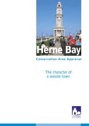
Herne Bay and Whitstable Landscape appraisal June 2006
Herne Bay and Whitstable Landscape appraisal June 2006
Herne Bay and Whitstable Landscape appraisal June 2006

You also want an ePaper? Increase the reach of your titles
YUMPU automatically turns print PDFs into web optimized ePapers that Google loves.
Paragraphs 6.83-6.93 of the Local Plan deal with conservation areas <strong>and</strong> include policies<br />
BE7, BE8, BE9 <strong>and</strong> NE5. Policy BE7 provides the primary guidance to developers about<br />
conservation areas.<br />
The planning system has recently changed <strong>and</strong> ultimately a Local Development<br />
Framework (LDF) will replace the Local Plan. The LDF consists of a collection of Local<br />
Development Documents, including the Core Strategy, Proposals Maps, Area Action<br />
Plans, <strong>and</strong> other development plan documents, which may deal with conservation issues<br />
as well as Supplementary Planning Documents<br />
Heritage, Archaeology <strong>and</strong> Conservation Supplementary Planning Document<br />
The Heritage, Archaeology <strong>and</strong> Conservation Supplementary Planning Document was<br />
approved in October 2007. Chapter 4 explains the features that make up a general<br />
conservation <strong>and</strong> are Chapter 5 provides detailed guidance for developments in<br />
Conservation Areas.<br />
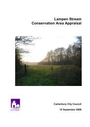
2. Location <strong>and</strong> Setting<br />
The Elbridge House Conservation Area is within the Lampen Stream valley between<br />
Trenleypark Wood in the west <strong>and</strong> Stodmarsh in the east. The Lampen Stream rises<br />
about half a mile south of the Canterbury to Littlebourne Road <strong>and</strong> flows in a northeasterly<br />
direction running west to east through the conservation area from Trenleypark<br />
Wood past Elbridge Farm <strong>and</strong> Elbridge House <strong>and</strong> on into the Lampen Stream<br />
Conservation Area to enter the Great Stour north of Stodmarsh.<br />
The Conservation Area includes the former park to Elbridge House, the ornamental<br />
grounds north of Elbridge farm <strong>and</strong> wooded areas to the north, south <strong>and</strong> west. Elbridge<br />
House is situated on the south-facing slope of the Lampen Stream Valley <strong>and</strong> is one of a<br />
small group of attractive historic buildings. The house is set within a small park <strong>and</strong> there<br />
is other ornamental tree planting in the area.<br />
The valley at this point is well wooded.<br />
Most of the l<strong>and</strong> was laid out as formal<br />
parkl<strong>and</strong> setting for the two major houses<br />
<strong>and</strong> the remaining areas included within the<br />
boundary are mostly old un-improved<br />
pasture, woodl<strong>and</strong> <strong>and</strong> l<strong>and</strong> bordering the<br />
Lampen Stream.<br />
The conservation area does not include any<br />
settlements. The built environment consists<br />
of a cluster of buildings near Elbridge House<br />
<strong>and</strong> Elbridge Farmhouse <strong>and</strong> an isolated farmstead <strong>and</strong> cottages, the rest of the<br />
conservation area consists of woods, fields, meadows <strong>and</strong> the Lampen Stream.<br />
2.1 Topography<br />
The Lampen Stream valley is a relatively rare watered valley. It has a weathered<br />
l<strong>and</strong>scape consisting of a wooded stream with fields sloping down to a shallow valley floor<br />
on either side of the stream. Narrow country lanes run along the top ridgelines on either<br />
side of the valley <strong>and</strong> the l<strong>and</strong> flattens out in the south onto a plateau. The base of the<br />
valley is flat <strong>and</strong> has obviously been formed by the stream changing course over many<br />
thous<strong>and</strong>s of years.<br />
4