JWC Hull War, Strikes, Terrorism and Related Perils Listed Areas (8 ...
JWC Hull War, Strikes, Terrorism and Related Perils Listed Areas (8 ...
JWC Hull War, Strikes, Terrorism and Related Perils Listed Areas (8 ...
- No tags were found...

Create successful ePaper yourself
Turn your PDF publications into a flip-book with our unique Google optimized e-Paper software.
101.01.02 兆 產 備 11210010388 號 客 戶 申 訴 及 24 小 時 服 務 專 線 : 0800-053-588<br />
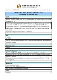
<strong>JWC</strong> <strong>Hull</strong> <strong>War</strong>, <strong>Strikes</strong>, <strong>Terrorism</strong> <strong>and</strong> <strong>Related</strong> <strong>Perils</strong><br />
<strong>Listed</strong> <strong>Areas</strong> (8 December 2011)<br />
Africa<br />
Benin<br />
Djibouti excluding transit<br />
Eritrea, but only South of 15º N<br />
Gulf of Guinea, but only the waters of the Beninese <strong>and</strong> Nigerian Exclusive Economic Zones north of<br />
Latitude 3º N<br />
Libya<br />
Nigeria<br />
Somalia<br />
Indian Ocean / Arabian Sea / Gulf of Aden / Gulf of Oman / Southern Red Sea<br />
Waters as defined overleaf<br />
Asia<br />
Pakistan<br />
Eastern Europe<br />
Georgia<br />
Indonesia / Malaysia/Philippines<br />
The port of Balikpapan (SE Borneo) including waters out to 25 nautical miles<br />
Borneo, but only the north east coast between the ports of Kudat <strong>and</strong> Tarakan inclusive<br />
The port of Jakarta<br />
Sulu Archipelago including Jolo, as defined overleaf<br />
Sumatera (Sumatra), but only the north eastern coast between 5º 40' N <strong>and</strong> 0º 48' N, excluding transit<br />
Middle East<br />
Bahrain excluding transit<br />
Iran<br />
Iraq, including all Iraqi offshore oil terminals<br />
Israel<br />
Lebanon<br />
Saudi Arabia excluding transit<br />
Syria<br />
Yemen<br />
South America<br />
Venezuela, including all offshore installations in the Venezuelan EEZ
101.01.02 兆 產 備 11210010388 號 客 戶 申 訴 及 24 小 時 服 務 專 線 : 0800-053-588<br />
Definitions:<br />
Named Countries shall include their coastal waters up to 12 nautical miles offshore, unless<br />
specifically varied above.<br />
Named Ports shall include all facilities/terminals within areas controlled by the relevant port<br />
authority/ies (or as may be more precisely defined by Insurers) including offshore<br />
terminals/facilities, <strong>and</strong> all waters within 12 nautical miles of such but not exceeding 12 nautical<br />
miles offshore unless specifically stated.<br />
Sulu Archipelago<br />
The area enclosed between:<br />
a) on the western side, a straight line between Tanjung Bidadari (5°49′6N, 118°21′0E) to position<br />
3°32′0N, 118°57′0E<br />
b) on the south eastern side, a straight line from there to position 5°50′0N, 122°31′0E, <strong>and</strong> thence<br />
northwards to position 7°06′6N, 122°31′0E<br />
c) on the northern side, a straight line from there to Batorampon Point Light (7°06′6N, 121°53′8E)<br />
d) <strong>and</strong> on the north western side, a straight line from there back to Tanjung Bidadari.<br />
Indian Ocean / Arabian Sea / Gulf of Aden / Gulf of Oman / Southern Red Sea<br />
The waters enclosed by the following boundaries:<br />
a) On the north-west, by the Red Sea, south of Latitude 15° N<br />
b) on the west of the Gulf of Oman by Longitude 58° E<br />
c) on the east, Longitude 78° E<br />
d) <strong>and</strong> on the south, Latitude 12° S<br />
excepting coastal waters of adjoining territories up to 12 nautical miles offshore unless otherwise provided.