The Sierra Echo - Sierra Club - Angeles Chapter
The Sierra Echo - Sierra Club - Angeles Chapter
The Sierra Echo - Sierra Club - Angeles Chapter

Create successful ePaper yourself
Turn your PDF publications into a flip-book with our unique Google optimized e-Paper software.
leaders has been an emphasis of the LTC and I have<br />
worked with our AMP leaders, Dan Richter and Pat<br />
Mckusky, to bring more leaders into our fold. We<br />
have some energetic new leaders, like Matt Hengst<br />
(now our committee Outreach leader), who lead<br />
the most SPS trips this last year. We need more<br />
leaders like Matt. This is the key to our continuing<br />
mission.<br />
by Greg Mason<br />
Hello SPS members,<br />
Welcome to a new year for the SPS. I’d<br />
like to thank Kathy Rich for her excellent<br />
leadership the last 3 years on the SPS committee.<br />
I am happy to have her continue on as our vice<br />
chair. As the chair of our committee this year, I<br />
promise to work to build upon the previous SPS<br />
traditions while also introducing new ideas to help<br />
maintain our mission, climbing the <strong>Sierra</strong> peaks. I<br />
believe the primary goal of the SPS committee is<br />
to promote, encourage and sponsor our leaders to<br />
conduct outings.<br />
<strong>The</strong> last few years has seen a reduction in SPS<br />
sponsored outings. Consensus has shown we<br />
require revitalization efforts to increase the number<br />
of sponsored trips. So a focus of our committee<br />
this year is to work on this task. Training new<br />
I’m sure all SPS members wouldn’t like to see the<br />
SPS succumb to becoming solely a list management<br />
organization with no sponsored trips. In the next<br />
few months I hope to gather information from our<br />
members using tools like surveys, member focus<br />
groups, leader meetings and networking to put<br />
together a plan to sustain our SPS group. Today,<br />
we have a smaller world due to the internet and we<br />
will be using information technology to bring us<br />
closer together. We will also look into developing<br />
tools which our leaders could use to easily find<br />
active SPS co-leaders/assists who want to lead and<br />
to readily manage and plan trips online. Once our<br />
plan is in place, I hope to bring it to the member<br />
leaders for implementation.<br />
Our other committee members will assist in this<br />
effort. Alexander Smirnoff, as our treasurer, Eric<br />
Scheidemantle, as our Secretary along with Kathy<br />
and Matt will work our hardest to bring a new<br />
revitalization to the SPS. I also encourage our<br />
key SPS appointed position volunteers (outings,<br />
archives, safety, etc) and regional representatives<br />
to actively participate with our efforts.<br />
I encourage all members to provide their ideas for<br />
increasing outings and membership for the SPS.<br />
We will be using this newsletter and email to<br />
gather information from our members, so please<br />
try to participate whenever asked. I look forward<br />
to seeing you in the mountains this year. I have<br />
created a new web presence for our committee<br />
using sierrapeaks.org site implemeted with Google<br />
apps. Please direct all correspondence to me via<br />
email at the address chair@sierrapeaks.org.<br />
<br />
<strong>The</strong> <strong>Sierra</strong> <strong>Echo</strong>
<strong>The</strong> <strong>Sierra</strong> <strong>Echo</strong>
<strong>The</strong> 2012 Management Committee is pleased to announce the new<br />
SPS Explorer Emblem.<br />
In the December ballot, the membership voted to approve this new Emblem by a 2:1 margin. It turns out that Emblems<br />
are part of the SPS Policies and Procedures, not the Bylaws, and hence can actually be decided by the Management<br />
Committee. However, it was gratifying to have the support of the membership for this new Emblem. After<br />
considerable input and discussion, the Management Committee has defined the parameters of the Explorer Emblem<br />
(see below) and this will be incorporated into the revised Policies and Procedures. We look forward to receiving applications<br />
for this new Emblem!<br />
Explorer Emblem: A member of the Section who has climbed 50 peaks not on the <strong>Sierra</strong> Peaks List,<br />
who has been a Section member for at least one year, and who applies to the Secretary in writing,<br />
listing the peaks, their location, source of name, elevation and the dates climbed, shall be awarded<br />
Emblem Status. <strong>The</strong> peaks must be located in the <strong>Sierra</strong> Nevada and north of Hwy 178 and south of<br />
Hwy 36, and named on either on USGS 7.5 minute or 15 minute maps, or in the GNIS database, and<br />
be 7000’ or more. HPS peaks are not allowed (to avoid overlap).<br />
Sincerely,<br />
2012 SPS Management Committee<br />
* * * * * * * * * * * * * * * * * * * * * * * * * * * * * * * * * * * * * *<br />
SPS Members Will Be Honored At the 2012 Annual Awards Banquet<br />
Phil Wheeler for the Chester Versteeg Outings Awards<br />
<strong>The</strong> CHESTER VERSTEEG OUTINGS PLAQUE is the highest<br />
outings leadership award conferred by the <strong>Angeles</strong> <strong>Chapter</strong>. It is<br />
awarded to a <strong>Sierra</strong> <strong>Club</strong> member who has provided long-term and<br />
outstanding leadership in furthering the enjoyment and safety of the<br />
outings program.<br />
by Mary Morales<br />
Phil Wheeler is singled out for his extensive service to the <strong>Chapter</strong> Safety Committee and the Leadership<br />
Training Committee as well as his decades of service to the entire <strong>Chapter</strong> outings program. Wheeler has<br />
overseen completion of a new <strong>Chapter</strong> Safety Policy and spearheaded implementation of quick turnaround<br />
outings approval and associated web site publishing. He was instrumental in the launch of the <strong>Chapter</strong>’s new<br />
Outdoor Activity Registration System (OARS). He is an I-rated leader and has been chair of the <strong>Chapter</strong>’s<br />
Safety Committee since 2008.<br />
Outings Services Awards<br />
Jack Kieffer<br />
Bob Draney<br />
Matthew Hengst<br />
New Active Member: James Porter<br />
New Active Member: Alan Slocum<br />
New Active Member: Celia Stewart<br />
New Active Member: Angie Capece<br />
<br />
<strong>The</strong> <strong>Sierra</strong> <strong>Echo</strong>
y Barbara Lilly<br />
MOUNTAIN SICKNESS HELP<br />
Larry Pemberthy, founder of Mountain Safety Research, known for the MSR stove and metal-shafted ice<br />
ax, did research on mountain sickness in the 1970’s involving climbers, urine and litmus paper which<br />
suggested that excessive acidity was a contributing factor. He recommended that climbers consume<br />
Rollaids or similar anti-acid tablets while ascending, and the results were good. I saw this actually work<br />
with someone who usually felt ill at higher altitudes. It might be handy to bring some along in your first<br />
aid kit.<br />
MT. ANDREA LAWRENCE<br />
For those interested, this recently named summit in the <strong>Sierra</strong> Nevada is Pk. 12,440’ on the Koip 7.5<br />
map and is located 0.6 miles ENE of Donohue Pk. in Yosemite National Park. (It shows as Pk. 12,223<br />
on the Mono Craters 15’ map.) And it does indeed take an act of Congress to name a peak in a Wilderness<br />
Area.<br />
Having an incentive to climb unlisted peaks in the <strong>Sierra</strong> is great. However, it is suggested that the<br />
amendment be “amended” to include any peak recognized by the Board of Geographic Names, as it can<br />
take considerable time for a new peak name to appear on a topographic map.<br />
* * * * * * * * * * * * * * * * * * * * * * * * * * * * * * * * * * * * * *<br />
Don’t forget to renew!<br />
<strong>The</strong> 2012 SPS Renewal Form was sent to members with last issue or go to<br />
http://angeles.sierraclub.org/sps/SPS_Membership_Renewal_Form_2012.pdf<br />
SPS List Serve<br />
You can find the information you need as a subscriber by checking out our listserv<br />
support site. Go to this address to enroll for the SPS E-mail list service: http://angeles.<br />
sierraclub.org/sps/listserver.htm.<br />
* * * * * * * * * * * * * * * * * * * * * * * * * * * * * * * * * * * * * *<br />
Meeting info<br />
<strong>The</strong> SPS Management Committee will hold meetings every quarter at a location to be determined.<br />
Please contact SPS Chair Greg Mason at chair@sierrapeaks.org. for meeting times, date and place.<br />
<strong>The</strong> <strong>Sierra</strong> <strong>Echo</strong>
Many thanks to our treasured treasurer Henry Arnebold.<br />
Henry Served the SPS in many ways not only in providing balance<br />
to our books but also at times to the Management Committee. He also<br />
kept our roster updated and Mc’d many of our banquets. As editor of the<br />
<strong>Echo</strong>, I depended a lot on Henry as did the Management Committee with<br />
his excellent guidance. I’m sure I’ll see you around Henry!<br />
Sara Danta - <strong>Echo</strong> Editor<br />
SPS TreaSURER’S Report 4 th Quarter 12/31/2011<br />
Checking Account<br />
Income<br />
Expenditures<br />
<strong>Echo</strong>----------------------------360.00<br />
Printing-----------------454.44<br />
T-shirts------------------------ -40.00<br />
Postage-----------------354.52<br />
Pins------------------------------60.00<br />
Pins---------------------669.10<br />
$460.00 $1,478.06<br />
Balance on 9/30/2011----------------4136.66<br />
Income-----------------------------------460.00<br />
4596.66<br />
Expenditures---------------------- -1478.06<br />
3118.60<br />
Savings account closed and---------5009.36<br />
Deposited into checking acct. $8,127.96<br />
REGARDING E-MAIL DISTRIBUTION OF THE ECHO<br />
Please contact this email address (newsletter@sierrapeaks.org) for any<br />
issues with hardcopy or email version distribution.<br />
fROM THE EDITOR<br />
<strong>The</strong> <strong>Sierra</strong> <strong>Echo</strong> is a quarterly publication of the <strong>Sierra</strong> Peaks Section of the <strong>Sierra</strong><br />
<strong>Club</strong>’s <strong>Angeles</strong> <strong>Chapter</strong>. For more information, see the back of this newsletter. All<br />
questions, copy and photo submissions should be directed to Sara Danta, Editor, <strong>The</strong><br />
<strong>Sierra</strong> <strong>Echo</strong>, preferably via email at s_wyrens@yahoo.com. Mailing address is 9741<br />
Reseda Blvd., Unit 46, Northridge, CA 91324. <strong>The</strong> <strong>Echo</strong> will also be available as a PDF<br />
download at the SPS website and via a link to all SPS members opting for this method.<br />
<br />
<strong>The</strong> <strong>Sierra</strong> <strong>Echo</strong>
http://www.eenews.net/cw/<br />
Learn more about the Bowman Design Group and Bowman Global Change at<br />
www.bowmandesigngroup.com<br />
Also, check out http://ClimateEngage.org to read more the latest efforts in<br />
fostering more public engagement in climate issues!<br />
Tom Bowman<br />
Announcing a new Meetup!<br />
Welcome, Hiking and Wilderness Travel Enthusiasts!<br />
Got to http://www.meetup.com/Hiking-Wilderness-Travel-Adventures-<br />
Snowshoeing-Backpacking/#calendar to learn more.<br />
SPS TEES<br />
<strong>The</strong> <strong>Sierra</strong> <strong>Echo</strong>
2011 ended with a note of sadness. Rich Gnagy was missed at the DPS Christmas pot-luck<br />
and the HPS banquet. A call was made by one of his climbing friends to his home and the sad<br />
news of his passing was learned. Rich climbed Mt. Diablo in December 2011. Shortly after the<br />
climbing trip he came down with pneumonia. After a couple weeks in the hospital Rich, passed<br />
away from complications from the pneumonia on December 23, 2011 at the age of 86.<br />
have many memories of trips with Rich. He was<br />
I always one of my favorite participants to sign-up<br />
when Scot Jamison or Larry and I were leading trips<br />
in the desert or <strong>Sierra</strong>. As Scot wrote “I treasure the<br />
trips I took with Rich, and will really miss not seeing<br />
him. Barbee and I first got to know him in the early<br />
‘90s on trips like Potosi, Mummy, Charleston, Tin<br />
and Dry.”<br />
<strong>The</strong> first trip to Mummy and Potosi in Jun<br />
1993 was memorable. Rich was new to our<br />
group and when we decided to stop at a<br />
picnic area and BBQ our chicken dinner<br />
before driving down to the Potosi trail<br />
head, he hesitated, but went along with<br />
us. While getting the coals ready and<br />
cooking the chicken. Scot or I pulled<br />
out a bottle of Scotch – after all, it was<br />
cocktail hour. We were rewarded<br />
with that classic Rich’s smile. He<br />
became a regular on many of our<br />
trips for the drink, food and climbs.<br />
Rich was an enthusiast climber with<br />
strong goals to climb a peak or finish<br />
the list. He was also always ready to<br />
encourage and celebrate others climbing<br />
accomplishments. Campfires<br />
on DPS trips are always<br />
a special time. Anyone who cooks knew that Rich<br />
would be your best friend, even the bartender got<br />
second place.<br />
Desert trips always have memories. On that first trip<br />
to Potosi Rich was driving a huge Lincoln, Chevrolet<br />
or some big town car – not the best desert roads<br />
car and sure enough it got stuck.<br />
<strong>The</strong>n there was the cactus trip, I can’t find the<br />
photo, but I spent a long time pulling spines out<br />
of Rich’s back after he somehow backed<br />
into a cactus.<br />
Rich’s skills as a rock climber and hiker<br />
remained strong throughout his climbing<br />
career. He always had excellent<br />
judgment on the trail. Later when he<br />
began to slow down that judgment continued<br />
to make him a perfect participant,<br />
he signed up for trips that fit his abilities<br />
and never expected others to cater to<br />
him…unless of course we were<br />
cooking dinner.<br />
I will miss his smile and hugs at<br />
the trailhead. I know we will all<br />
miss his companionship on the<br />
trail.<br />
<br />
<strong>The</strong> <strong>Sierra</strong> <strong>Echo</strong>
Barbee and Rich 2007 SPS Banquet<br />
Submitted by Jerry Keating<br />
As part of the paperwork for the old-timers series, there<br />
are capsules about many of the vintage climbers. One<br />
reads as follows: “Rich Gnagy joined the club in early 1956<br />
after starting his climbing career with the Rock Climbing<br />
Section. He did nine HPS peaks in early 1956 before getting<br />
his first SPS peak, Alta, on July 1, 1956, on a scheduled<br />
trip. By year’s end, he’d climbed 13 SPS listed peaks<br />
with 10 of them done on scheduled trips. By May of 1957,<br />
he appeared as John Robinson’s assistant leader on an SPS<br />
Olancha Peak trip. All of this occurred before he moved<br />
from the Los<br />
<strong>Angeles</strong> area to<br />
Sacramento.”<br />
L-R, Frank Bressel, Barbara Lilley, Gordon MacLeod, Mary Motheral,<br />
Rich Gnagy, Ret Moore & Jerry Keating on Dome Rock 09/13/08,<br />
with <strong>The</strong> Needles & the Kern Plateau as the backdrop. Olancha Pk<br />
appears on the extreme right skyline. Bressel & Lilley are founding<br />
members of the SPS. Lilley, MacLeod, Motheral, Gnagy, Moore &<br />
Keating are SPS list finishers. Photo by Ralph Wright.<br />
Rich (below) and Burl Parkinson (above)<br />
on the high point of Mt. Brewer on August<br />
31, 1958, during an SPS climb. (Burl and<br />
a fellow SPSer were killed on Boundary<br />
Peak less than a year later.)<br />
Head shot of Rich<br />
taken in early August<br />
1970 at Finger<br />
Lake on the S. Fork<br />
of Big Pine Creek.<br />
Rich, Barbara Lilley<br />
and I (Jerry Keating)<br />
were on an<br />
independent trip,<br />
and Rich climbed<br />
Disappointment<br />
the next day.<br />
Rich (with me)<br />
on 9/10/2011,<br />
at Lupine<br />
Campground<br />
during the<br />
SPS old-timers<br />
trip. Rich<br />
had climbed<br />
Fresno Dome that day & went on to do the Goat Mtn.<br />
above Bass Lake the following day, the final part of the<br />
SPS trip. This may have been Rich’s final scheduled<br />
trip with the SPS.<br />
<strong>The</strong> <strong>Sierra</strong> <strong>Echo</strong>
Check out Bob’s web site, www.snwburd.com<br />
Bob Burd, known for organizing the extreme <strong>Sierra</strong> Challenge each<br />
year, was the honored speaker at our annual banquet held January 29th.<br />
As stated in the last <strong>Echo</strong> edition, <strong>The</strong> <strong>Sierra</strong><br />
Challenge is an annual series of ten consecutive<br />
dayhikes to some of the most challenging peaks<br />
in the <strong>Sierra</strong> Nevada, most often drawn from the<br />
SPS Peaks List.<br />
Bob Burd’s solitary and fast climbing style gives<br />
the SPS a unique approach to peak bagging in the<br />
<strong>Sierra</strong>. His accomplishments are quite impressive<br />
and I congratulate him. He is in the realm of a few and warrants the motto<br />
“Professional Driver (climber). Do Not Attempt This At Home”. Greg Mason<br />
10 <strong>The</strong> <strong>Sierra</strong> <strong>Echo</strong>
<strong>The</strong> enthralled on-lookers<br />
L-R Alex Smirnoff, Don Crowley, Mary Joe<br />
Dungfelder, Gary Schenk, Larry Tidball<br />
<strong>The</strong> <strong>Sierra</strong> <strong>Echo</strong> 11
y Daryn Dodge and Greg Vernon<br />
In the interest of keeping alive some of the history<br />
behind climbing and mountaineering clubs that<br />
have left their mark in <strong>Sierra</strong> climbing lore, the<br />
Vagmarken <strong>Sierra</strong> Crest List is featured here. No<br />
recognition by the SPS is currently planned for<br />
those that complete the list, but is simply presented<br />
for the interest of peakbaggers everywhere.<br />
<strong>The</strong> Vagmarken were the climbing club of<br />
Rockwell International. <strong>The</strong>y were on the books<br />
as the Rockatomics Stamp club, as they didn’t want<br />
Rockwell management to have a clue that they<br />
were doing something risky. Members worked for<br />
Rocketdyne or Atomics International in Canoga<br />
Park. <strong>The</strong> club was founded Feb. 4, 1964 originally<br />
as the Rocketdyne Mountaineering <strong>Club</strong> before<br />
changing their name to the Vagmarken.<br />
At its height in the late-1960s and 1970s, the club<br />
numbered several dozen members.By 1975, the<br />
club had sponsored an estimated 700 trips, including<br />
many visits to major peaks on other continents. <strong>The</strong><br />
Vagmarken undertook a program in 1965 to rep<br />
lace old register cans in the <strong>Sierra</strong>s and elsewhere;<br />
by 1975 they had placed over 160 cans on mountain<br />
summits. <strong>Club</strong> members were also the primary<br />
movers in naming a peak in Yosemite National Park<br />
after Amelia Earhart in 1967. This 11,982-foot<br />
peak was named to honor the famous female flyer<br />
that disappeared over the Pacific on a 1937 aroundthe-world<br />
flight. <strong>The</strong> club also created their own<br />
Vagmarken handbook and published a newsletter<br />
called the “Yeti Yells”.<br />
<strong>The</strong> Vagmarken <strong>Sierra</strong> Crest Award was the work of<br />
Danny Levack, an aerospace engineer. <strong>The</strong> Award<br />
consists of the 100 named peaks on the crest of the<br />
<strong>Sierra</strong> Nevada stretching from Olancha Pass in the<br />
south to Sonora Pass to the north.Although many of<br />
the peaks on this list will be familiar to those who<br />
know the <strong>Sierra</strong> Peaks Section List, over one-fourth<br />
(27 peaks) of the Vagmarken peaks are not on the SPS<br />
list. Other lists created by club members include the<br />
100 Rock Route List, the Winter ascent list, plus several<br />
others. However, the Vagmarken <strong>Sierra</strong> Crest List is<br />
unique in that it lists the named peaks in the region of<br />
the <strong>Sierra</strong>s many consider to be the High <strong>Sierra</strong>.<br />
<strong>The</strong> name Vagmarken is a Swedish term for<br />
trail markers or cairns. <strong>The</strong> inspiration for the<br />
club’s name came from the title of an autobiography,<br />
“Markings” (Vagmarken) by Dag Hammarskjold.<br />
<strong>The</strong> book was published in 1963, two years after Dag<br />
Hammerskjold’s death in a plane crash in Northern<br />
Rhodesia. John F. Kennedy called Dag the greatest<br />
statesman of the 20th century.<br />
Every Vagmarken had a “yeticlature”, a name with yeti<br />
in it. Long-time SPS member Gerg Vernon was known<br />
as the Lone Yeti because of his solo adventures. <strong>The</strong><br />
most notable member was Herb Laeger (Big Daddy<br />
Yeti). Herb had a Ph.D. from Rutgers and was a rather<br />
accomplished East Coast climber when he came to work<br />
for Rockwell. He established several routes at Joshua<br />
Tree(Solid Gold, Tumbling Rainbow, plus several other<br />
classics), Needles, Sequoia Park, Courtright, Shuteye<br />
Ridge, and more. He never got the credit he deserved<br />
for his contribution to California rockclimbing. Other<br />
notables included “Puffin’” Bud Ford Yeti, who held<br />
an annual spaghetti dinner, and John Otter (Silent Yeti)<br />
who along with Greg Vernon published the newsletter<br />
for 3 years and put together an annual banquet.<br />
After about 1980, the Vagmarken sort of evaporated.<br />
Boeing took over Rocketdyne, and several members<br />
found employment in diverse locations. However, the<br />
Vagmarken <strong>Club</strong> still lives on in some of the remaining<br />
old <strong>Sierra</strong> peak registers where entries by club members<br />
can be found.<br />
Many thanks to Greg Vernon for his assistance in<br />
relating the history of the Vagmarken.<br />
See Vagmarken <strong>Club</strong> <strong>Sierra</strong> Crest List next page<br />
12 <strong>The</strong> <strong>Sierra</strong> <strong>Echo</strong>
<strong>The</strong> Vagmarken <strong>Sierra</strong> Crest List<br />
1. Leavitt Pk (11570)<br />
2. Grizzly Pk (10320+)*<br />
3. Forsyth Pk (11180)*<br />
4. Tower Pk (11755)<br />
5. EhrnbeckPk (11240)*<br />
6. HawksbeakPk (11120+)*<br />
7. Center Mtn (11273)*<br />
8. Cirque Mtn (10714)*<br />
9. Crown Point (11346)*<br />
10. Slide Mtn (11120+)*<br />
11. Kettle Pk (11010)*<br />
12. Matterhorn Pk (12264)<br />
13. Twin Peaks (12314)<br />
14. CamiacaPk (11739)*<br />
15. Excelsior Mtn (12446)<br />
16. Shepard Crest (12015)*<br />
17. North Pk (12242)<br />
18. Mt Conness (12590)<br />
19. White Mtn (12000+)*<br />
20. GaylorPk (11004)*<br />
21. Mt Dana (13053)<br />
22. Mt Gibbs (12764)<br />
23. Mt Lewis (12296)*<br />
24. Kuna Pk (12880+)*<br />
25. KoipPk (12979)<br />
26. Blacktop Pk (12710)*<br />
27. Donohue Pk (12023)*<br />
28. Mt Lyell (13114)<br />
29. Rodgers Pk (12978)<br />
30. Mt Davis (12311)<br />
31. Carson Pk (10909)*<br />
32. San Joaquin Mtn (11600)<br />
33. Two Teats (11387)*<br />
34. Mammoth Mtn (11053)*<br />
35. Red Slate Mtn (13163)<br />
36. Red & White Mtn (12850)<br />
37. Mt Crocker (12457)*<br />
38. Mt Stanford (12851)<br />
39. Mt Huntington (12405)*<br />
40. Mt Starr (12870)*<br />
41. Mt Mills (13468)<br />
42. Mt Abbott (13715)<br />
43. Mt Dade (13600)<br />
44. Bear Creek Spire (13713)<br />
45. Mt Julius Caesar (13196)<br />
46. Four Gables (12920)<br />
47. Mt Humphreys (13986)<br />
48. Mt Lamarck (13417)<br />
49. Mt Darwin (13830)<br />
50. Mt Haekel (13435)<br />
51. Mt Wallace (13377)<br />
52. Mt Powell (13400+)* a<br />
53. Mt. Thompson (13480)<br />
54. Mt Gilbert (13103)<br />
55. Mt Johnson (12868)<br />
56. Mt Goode (13092)<br />
57. Mt Agassiz (13891)<br />
58. Mt Winchell (13768)<br />
59. Thunderbolt Pk (14040)<br />
60. North Palisade (14242)<br />
61. Mt Sill (14162)<br />
62. Palisade Crest (13550)<br />
63. Middle Palisade (14040)<br />
64. Disappointment Pk (13917)<br />
65. <strong>The</strong> Thumb (13388)<br />
66. Mt Bolton-Brown (13538)<br />
67. Mt Prater (13329)<br />
68. Split Mtn (14058)<br />
69. Cardinal Mtn (13397)<br />
70. Striped Mtn (13189)<br />
71. Mt Perkins (12591)<br />
72. ColosseumMtn (12473)<br />
73. Mt Baxter (13125)<br />
74. Diamond Pk (13126)<br />
75. Black Mtn (13289)<br />
76. Dragon Pk (12995)<br />
77. Mt Gould (13005)<br />
78. University Pk (13632)<br />
79. Mt Bradley (13289)<br />
80. Mt Keith (13977)<br />
81. Junction Pk (13888)<br />
82. Mt Tyndall (14018)<br />
83. Mt Versteeg (13470)*<br />
84. Trojan Pk (13950)<br />
85. Mt Barnard (13990)<br />
86. TunnaboraPk (13565)<br />
87. Mt Carillon (13552)<br />
88. Mt Russell (14086)<br />
89. Mt Whitney (14495)<br />
90. Mt Muir (14015)<br />
91. Discovery Pinnacle<br />
(13680+)*<br />
92. Mt McAdie (13720)<br />
93. Mt Irvine (13770)<br />
94. Mt Mallory(13850)<br />
95. Mt LeConte (13960)<br />
96. Mt Corcoran (13760)<br />
97. Mt Langley (14042)<br />
98. Cirque Pk (12900)<br />
99. Trail Pk (11623)*<br />
100. OlanchaPk (12123)<br />
Peak elevations in the table are the known elevations in the mid-1970s<br />
* Not on the <strong>Sierra</strong> Peaks Section (SPS) List<br />
a<br />
In keeping with the intent of the <strong>Sierra</strong> Crest List, the named Mt. Powell is located just<br />
east of <strong>Echo</strong> Col, and is not the peak named Point Powell currently on the SPS List.<br />
<strong>The</strong> <strong>Sierra</strong> <strong>Echo</strong> 13
Leadership Training Committee<br />
2012 Schedule of Activities<br />
Leadership Training Program Seminar<br />
April 14, 2012 LTC Seminar - Costa Mesa Community Center Steve Botan<br />
Wilderness First Aid http://wildernessfirstaidcourse.org<br />
Apr 27-29, 2012<br />
Navigation Practices and Checkouts<br />
Steve Schuster<br />
Mar 31-Apr1, 2012 I Places We’ve Saved Navigation - Workshop Robert Myers<br />
Apr 21-22, 2012 I/M/E Warren Pt. Navigaiton Checkoff/Practice Robert Myers<br />
May 26, 2012 I Local Mtns Beginning Navigaiton Clinic Diane Dunbar<br />
Jun 2, 2012 I/M/E Heart Bar/Grinnel Ridge Checkoff/Practice Robert Myers<br />
Aug 5, 2012 I/M/E Mt. Pinos Navigaiton Checkoff/Practice Robert Myers<br />
Sept 23, 2012 I/M/E Grinnel Ridge Navigation Checkoff/Practice Robert Myers<br />
Rock Practices and Checkouts<br />
Apr 18 , 2012 Advanced Mountaineering Program 5 - Safety Dan Richter<br />
Apr 21, 2012 Advanced Mountaineering Program 5 - Belaying Dan Richter<br />
Apr 28, 2012 Advanced Mountaineering Program 5 - Rappelling Dan Richter<br />
May 5-6, 2012 Advanced Mountaineering Program 5- Anchors Dan Richter<br />
Various Dates - M/E P Vertical Adventures (This is not a <strong>Sierra</strong> <strong>Club</strong> activity, but can prepare<br />
candidates for rock checkoffs.) http://www.verticaladventures.com/<br />
Snow Practices and Checkouts<br />
Apr 14-15, 2012 M/E <strong>Sierra</strong> Snow Checkoff/Practice Nile Sorenson<br />
Apr 28, 2012 M/E Snow Practice and Check Off Tina Bowman<br />
Snow travel, avalanche, & related training - Kurt Wedberg’s <strong>Sierra</strong> Mountaineering Int’l (Not<br />
a SC activity, but can prepare candidates for snow checkoffs.) http://sierramountaineering.com<br />
Environmental Awareness<br />
Check out the LTC website which has a calendar of events sponsered by the Natural Science section<br />
& info about training not offered by the <strong>Sierra</strong> <strong>Club</strong>: http://angeles.sierraclub.org/ltc/<br />
14 <strong>The</strong> <strong>Sierra</strong> <strong>Echo</strong>
<strong>The</strong> <strong>Sierra</strong> Peaks Section maintains a website at<br />
http://angeles.sierraclub.org/sps.<br />
Mar 31-Apr 1 | Sat-Sun LTC, WTC, DPS,<br />
Desert Committee<br />
I: Places We’ve Saved Navigation Noodle in Mojave<br />
National Preserve: Join us for our 10th annual<br />
journey through this jewel of the Mojave; preserved<br />
under the Calif Desert Protection Act, as a result of<br />
the efforts of SC activists & others. A basic/intermediate<br />
xc nav day-hike workshop will be conducted<br />
out of the Mid Hills area in the pinyon and juniper<br />
forests at 5500′ elevation. Potluck & social on Sat,<br />
& for those arriving early Fri. Limited to 14 participants.<br />
Send email/sase to Ldr: ROBERT MY-<br />
ERS. Co-Ldrs: VIRGIL SHIELDS, ANN SHIELDS,<br />
ADRIENNE BENEDICT<br />
Apr 7-8 | Sat-Sun<br />
SPS<br />
M: Spanish Needle (7841’), Sawtooth Pk (8000’);<br />
Day hikes and Car Camping in the Southern <strong>Sierra</strong>.<br />
Seldom led Spanish Needle requires bushwhack and<br />
3rd class rock, 5mi 2000’ gain. Sawtooth easy hikes<br />
on trail and cross-country travel 5 mi, 2000’ gain,<br />
(maybe add Lamont Peak too) Send e-SASE and 3rd<br />
rock class experience to Leaders: Larry & Barbee<br />
Tidball.<br />
Apr 14 | Sat<br />
LTC<br />
Leadership Training Seminar: Become a qualified<br />
<strong>Sierra</strong> <strong>Club</strong> leader. Seminar in Costa Mesa. No<br />
registration after March 31st or at door. Next seminar:<br />
Fall 2012.<br />
Apr 14-15 | Sat –Sun<br />
LTC, SPS, DPS<br />
M/E: <strong>Sierra</strong> Snow Checkoff/Practice: For M & E<br />
candidates wanting to check off leadership ratings<br />
or others who wish to practice new techniques.<br />
Restricted to SC mbrs with some prior basic training<br />
with the ice axe. Send SC#, climbing resume, email,<br />
H&W phones to Ldr: NILE SORENSON Co-ldr:<br />
DOUG MANTLE.<br />
Apr 18 | Wed<br />
LTC, SPS, DPS, WTC<br />
M/ER: Workshop: Advanced Mountaineering<br />
Program (AMP5) – Basic Safety System: 1st of 4<br />
climbing workshops open to SC members w/ prior<br />
roped climbing exp. <strong>The</strong> indoor evening workshop<br />
of 4 hrs reviewing ropes, knots, harnesses, helmets,<br />
& basic climbing gear will take place in Pasadena.<br />
P riority will be given to participants who commit to<br />
all four workshops. Send sase or e-mail with SC#,<br />
resume, phones to Ldr: Dan Richter (dan@<br />
danrichter.com). Asst: Pat McKusky<br />
Apr 21 | Sat<br />
LTC, SPS, DPS, WTC<br />
M/ER: Advanced Mountaineering Program<br />
(AMP5) – Belaying: 2nd of 4 climbing workshops<br />
open to SC members with prior roped climbing<br />
experience. Today at Stoney Point in Chatsworth,<br />
focus is on belaying and principles of anchor<br />
building. As space is limited priority will be given<br />
to participants who commit to all four workshops.<br />
Send sase or e-mail with SC#, resume, phones to<br />
Ldr: Dan Richter (dan@danrichter.com). Asst:<br />
Pat McKusky<br />
Apr 21-22| Sat-Sun LTC,WTC,HPS, DPS, SPS<br />
I: Warren Point Navigation: Navigation noodle at<br />
Joshua Tree National Park to satisfy the Basic (I/<br />
M) level navigation requirements. Sat for practice,<br />
skills refresher, altimeter, homework, campfire.<br />
Sun checkout. Send email/sase, contact info, navigation<br />
experience/training, any WTC, leader rating,<br />
<strong>The</strong> <strong>Sierra</strong> <strong>Echo</strong> 15
ideshare, to Ldr: Robert Myers. Asst: Phil<br />
Wheeler<br />
April 21-22 | Sat-Sun<br />
SPS, WTC, SPS<br />
MR : Lone Pine Peak (12,943’). Sat backpack 3.5<br />
miles with 3500’ of gain up the Meysan Lake trail,<br />
to Grass lake to camp. Sunday we will climb the<br />
Sorthwest chute ,1.7 mi and 2150’ gain, to the summit<br />
, return to camp and pack out. Ice axe, crampons<br />
and helmets required. Send e-mail or SASE with<br />
current resume and recent experience. Trip is restricted<br />
to <strong>Club</strong> members and that medical forms are<br />
required. Ldr: Dave Chapman, Co-Ldr: Neal<br />
Robbins.<br />
Apr 27- 29 | Fri – Sun LTC, Harwood Lodge<br />
C: Wilderness First Aid Course: Runs from 7:30<br />
am Fri to 5:00 pm Sun. Fee includes lodging, meals<br />
and practice first aid kit. Proof of CPR within previous<br />
4 years required to enroll. Fee $210 (full refund<br />
through March 23). For application contact (e-mail<br />
preferred) to Ldr: Steve Schuster<br />
Apr 28 | Sat<br />
LTC, SPS, DPS, WTC<br />
M/ER: Advanced Mountaineering Program<br />
(AMP5) – Rappelling: 3rd of 4 climbing workshops<br />
open to SC members with prior roped climbing<br />
experience. Today at Stoney Point in Chatsworth,<br />
focus is on rappelling. As space is limited priority<br />
will be given to participants who commit to all four<br />
workshops. Send sase or e-mail with SC#, resume,<br />
phones to Ldr: Dan Richter (dan@danrichter.<br />
com). Asst: Pat McKusky<br />
Apr 28-29 | Sat -Sun<br />
LTC, SPS, DPS<br />
M/E: <strong>Sierra</strong> Snow Checkoff/Practice: For M & E<br />
candidates wanting to check off leadership ratings or<br />
others who wish to practice new techniques. Restricted<br />
to SC mbrs with some prior basic training with the ice<br />
axe. Send SC#, climbing resume, email, H&W phones<br />
to Ldr: Tina Bowman Co-ldr: Tom Bowman<br />
May 5-6 | Sat-Sun LTC, SPS, DPS, WTC<br />
M/ER: Advanced Mountaineering Program<br />
(AMP5) – Rock Climbing Techniques and<br />
Anchors: 4th of 4 climbing workshops open to<br />
SC members with prior roped climbing experience.<br />
This weekend completes the series of AMP<br />
workshops at Joshua Tree National Park and<br />
focuses on climbing and anchors. As space is<br />
limited priority will be given to participants who<br />
commit to all four workshops. Send sase or e-mail<br />
with SC#, resume, phones to Ldr: Dan Richter<br />
(dan@danrichter.com). Asst: Pat McKusky<br />
May 11-13 | Fri-Sun<br />
SPS<br />
MR: Birch Mtn (13,602’), <strong>The</strong> Thumb (13,356’):<br />
Join us for a mid spring snow climb of two peaks<br />
near Big Pine. Fri backpack to Birch Lake, 5 mi,<br />
4500’ gain. Sat climb the NW slope of Birch, and<br />
the SE slope of <strong>The</strong> Thumb, 5.5 mi, 4500’ of gain.<br />
Sun backpack to cars. Comfort and experience<br />
climbing snow with ice axe and crampons<br />
required. Restricted to <strong>Sierra</strong> <strong>Club</strong> members. Send<br />
email or sase with resume, conditioning, carpool<br />
info, <strong>Sierra</strong> <strong>Club</strong> number and medical form to<br />
Ldr: Gary Schenk. Asst: Tina Bowman<br />
May 19 - 20 | Sat -Sun<br />
WTC, SPS<br />
MR: Mount Abbot (13,704’): Snow mountaineering<br />
outing for <strong>Sierra</strong> <strong>Club</strong> members only. Sat backpack<br />
from Mosquito Flat trailhead to camp by Mills<br />
Lake, 3.5 mi, 1,800’. Sun cross country snow<br />
climb Mount Abbot from Mills Lake, third-class<br />
via the Abbot glacier, 2 mi rt, 2000’, then pack out.<br />
Helmets, ice ax, crampons, medical form and recent<br />
snow and 3rd class rock mountaineering experience<br />
required. Send an e-mail with resume of recent<br />
mountaineering experience and conditioning, H&W<br />
phones, and rideshare info to Ldr: Stephanie<br />
Smith. Assistant: Mike Adams.<br />
May 19-20 | Sat-Sun<br />
SPS<br />
MR: Lone Pine Peak (12,943’). Backpack to<br />
camp near Meysan Lake. 3.5 mi, 3400’ gain) If<br />
snow conditions permit, igloo building lesson in<br />
afternoon. Sun: climb peak w/ ice ax, crampons<br />
1800’ gain, return to camp, pack out. Restricted<br />
to <strong>Sierra</strong> <strong>Club</strong> members. Send e-SASE and ice ax<br />
experience, SC number, medical form to Leaders:<br />
Larry & Barbee Tidball.<br />
Continued next Page<br />
16 <strong>The</strong> <strong>Sierra</strong> <strong>Echo</strong>
May 26 | Sat<br />
LTC, WTC, HPS<br />
I: Beginning Navigation Clinic: Spend the day<br />
one-on-one with an instructor, learning/practicing<br />
map and compass in our local mountains. Beginners<br />
to rusty old-timers welcome, and practice is<br />
available at all skill levels. Not a checkout, but it<br />
will help you prepare. Many expert leaders will<br />
attend; many I-rated leaders started here in the past.<br />
4 mi, 500’ gain. Send sase, phones, $25 deposit<br />
(<strong>Sierra</strong> <strong>Club</strong>, refunded at trailhead) to Ldr: DIANE<br />
DUNBAR. Co-Ldr: RICHARD BOARDMAN<br />
June 2 | Sat LTC, WTC, HPS, DPS, SPS<br />
I: Heart Bar Peak (8332’): Practice navigation for<br />
Sunday’s checkoff on this 7 mile rt, 1400’ gain hike.<br />
We will take a cross-country route to Heart Bar Pk<br />
and practice micro-navigation skills along the way.<br />
Send email (preferred) or sase, with contact info &<br />
recent conditioning to Ldr: ROBERT MYERS. Co-<br />
Ldrs: JANE SIMPSON, ADRIENNE BENEDICT,<br />
ANN PEDRESCHI<br />
June 3 | Sun LTC, WTC, HPS, DPS, SPS<br />
I: Grinnell Ridge Navigation: Navigation Noodle in<br />
San Bernardino National Forest for either checkout<br />
or practice to satisfy Basic (I/M) or Advanced (E)<br />
level navigation requirements. Send email/sase,<br />
contact info, navigation experience/training, any<br />
WTC, leader rating, rideshare, to Ldr: ROBERT<br />
MYERS. Asst: PHIL WHEELER<br />
June 9-10 | Sat -Sun<br />
WTC, SPS<br />
MR: University Peak (13,589: Snow<br />
mountaineering outing for <strong>Sierra</strong> <strong>Club</strong> members<br />
only. Sat backpack from Onion Valley trailhead<br />
to camp by Bench Lake, 3 mi, 1,667’. Sun cross<br />
country snow climb University Peak from Bench<br />
Lake, third-class via the north face, 5 mi rt,<br />
2746’, then pack out. Helmets, ice ax, crampons,<br />
medical form and recent snow and 3rd class rock<br />
mountaineering experience required. Send an e-mail<br />
with resume of recent mountaineering experience<br />
and conditioning, H&W phones, and rideshare<br />
info to Ldr: Stephanie Smith. Assistant Ldr:<br />
Neal Robbins.<br />
June 22-24 | Fri - Sun<br />
WTC, SPS<br />
I: Merced Peak (11,726’), Red Peak (11,699’):<br />
Two peaks in southern Yosemite National Park. Fri<br />
7:30am start from trailhead near Quartz Mtn that is<br />
27mi from Oakhurst along a windy road. Strenuous<br />
13mi, 2900’ gain from trailhead to camp at or near<br />
Lower Ottoway Lake (9656’). Sat climb Merced<br />
Peak and Red Peak, 6mi, 3300’ steep xc with talus<br />
and scree. Sun pack out. Trip designed for strong<br />
WTC students and others with comfort on loose<br />
terrain at elevation. Happy Hour both nights. Email<br />
recent high altitude tolerance, distance conditioning<br />
to Ldr: Sandy Lara, Co-ldrs: KC Reid, Peter<br />
Lara<br />
June 22-24 | Fri-Sun<br />
SPS, WTC<br />
I: Angora Mtn (10,202), Coyote Peak (10,892):<br />
Long backpack to remote peaks in Golden Trout<br />
Wilderness. Sat hike from Jerkey Meadows across<br />
Little Kern to camp, approximately 12.5 mi, 3700’<br />
gain. Communal happy hour. Sun climb Angora<br />
& Coyote, 13 mi, 3800’ gain, some xc travel. Mon<br />
pack out, 1700’ gain. Send resume of conditioning<br />
& experience, h&w phones in email to Ldr:<br />
Beth Epstein. CO-Ldr: Tina Bowman<br />
June 23-24 | Sat-Sun<br />
SPS<br />
MR: Mt Dade (13,600’), Mt Mills (13,451’), Mt<br />
Abbot (13,704’): Sat dayhike from Mosquito Flat<br />
to Treasure Lakes; climb Dade via <strong>The</strong> Hourglass<br />
(12mi, 3400gain). Sun climb Mills via class 3 east<br />
couloir (10mi, 3,100gain). If time, climb Abbot via<br />
SE Buttress, then hike out (addl. 1.5 mi, 1,400 gain).<br />
Trip restricted to SC members having experience<br />
w/3rd class rock, ice axe/crampons. Send email w/<br />
SC #, medical form & resume detailing experience,<br />
conditioning & rideshare info to: Ldr: Matt<br />
Hengst. Co-Ldr: Daryn Dodge.<br />
July 14-15 | Sat-Sun<br />
SPS<br />
M: Mt Izaak Walton (12,077’): Join us for this<br />
Western <strong>Sierra</strong> approach peak, <strong>Sierra</strong> wild flowers<br />
and 3rd class rock climbing. Ferry across Thomas<br />
Edison Lk and backpack to camp at Mott Lk. 7.5<br />
mi and 2800’ gain Saturday. Sun climb peak 1800’<br />
gain 4 mi rt and head home. Send email with<br />
resume detailing experience, including on 3rd class,<br />
<strong>The</strong> <strong>Sierra</strong> <strong>Echo</strong> 17
ideshare info, phone Ldr.: Larry Tidball Co-<br />
Ldr: Barbee Tidball<br />
July 28-29 | Sat-Sun<br />
WTC, SPS<br />
I: Basin Mountain (13,240’): Moderate WTC<br />
exterience trip to climb to the top of Basin Mountain<br />
out of Bishop for wonderful views of the Owens<br />
Valley. Sat. backpack on trail 4 mi., 2200’ gain to<br />
camp at Horton Lake. Sun. class 2 climb to Basin<br />
2.25 mi., 3,200’ gain all cross-country, then pack<br />
out to cars. Send email (preferred) or SASE with<br />
conditioning/experience to Ldr: PAUL GARRY.<br />
Asst: Joseph Bell.<br />
Aug 3-5 | Fri-Sun<br />
SPS, WTC<br />
I: Seven Gables (13,080’) Join us for three days<br />
of fun deep in the <strong>Sierra</strong> and climb the spectacular<br />
SPS Mountaineers Peak Seven Gables. Friday we’ll<br />
hike in from Lake Thomas Edison then join up with<br />
the PCT to Upper Bear Creek Meadows (12 mi,<br />
3800’) Saturday we’ll summit (4 mi, 3000’) and<br />
Sunday we’ll hike out (12 mi, 1000’) Send email<br />
with conditioning & experience to Ldr: Matthew<br />
Hengst Asst: Bill Payne<br />
Aug. 4-5 | Sat-Sun<br />
SPS, WTC<br />
I: Three Sisters (10,572’): Gourmet Backpack!<br />
Join Us for Decadent Wilderness Weekend X!<br />
Sat backpack 5 mi, 1200 ft gain from Courtright<br />
Reservoir to Cliff Lake for 5-star dining experience.<br />
Sun work off those calories with 1.5-mi, 1200’ gain<br />
to Three Sisters. Send e-mail (preferred) or sase with<br />
H&W phones, recent conditioning and your most<br />
outrageous culinary ideas to Ldr: Ron Campbell.<br />
Assts: Georgette Rieck, Ed Cottone Lisa<br />
Buckley.<br />
Aug 5 | Sun LTC, WTC, HPS, DPS, SPS<br />
I: Mt. Pinos Navigation: Navigation noodle in<br />
Los Padres National Forest for either checkout<br />
or practice to satisfy Basic (I/M) or Advanced<br />
(E) level navigation requirements. Send<br />
email/sase, contact info, navigation experience/<br />
training, any WTC, leader rating, rideshare, to<br />
Ldr: ROBERT MYERS. Asst: KIM HOMAN<br />
Aug 9-12 | Thur-Sun<br />
SPS<br />
MR: Ruskin Peak (12,920’), Arrow Peak<br />
(12,958’), Cardinal Mountain (13,397’): Join us<br />
for 2 rocky peaks & a walkup up over the dreaded<br />
Taboos Pass. Thursday we’ll pack into Kings<br />
Canyon (9 mi, 6000’) & set up camp. Over the<br />
next 2 days we’ll do 3rd class climbs of Ruskin &<br />
Arrow w/possibility of additional peaks. Sun we’ll<br />
finish up w/spectacular views on Cardinal before<br />
descending. Experience on exposed 3rd class rock<br />
required. Restricted to SC members, Send SC<br />
#, medical form,& resume to Ldr: Matthew<br />
Hengst Co-ldr: Neal Robbins<br />
Aug 11-12 | Sat-Sun<br />
SPS<br />
I: Mt. Rixford (12,887), Mt Bago (11,870) or<br />
option Mt. Gould (13,005): Saturday backback<br />
over Kearsarge Pass 2400’ gain and over to Charlotte<br />
Lk to camp 7 mi. total trip. Afternoon climb Bago,<br />
1500’ gain. Sunday climb Mt. Rixford, 2500’ gain<br />
4-5 mi rt and then back 7 mi to cars. Send email<br />
with resume detailing experience, rideshare info,<br />
phone Ldr: Larry Tidball Co-Ldr: Barbee<br />
Tidball<br />
Aug 12 – 18 | Sun – Sat Mule Pack, SPS, WTC<br />
O/I: Thousand Island Lake Mule Pack: Mt Davis<br />
(12,303’), Rodgers Peak (12,978’), Electra Peak<br />
(12,442’): Trip designed for strong hikers who desire<br />
cross-country routes and peak bagging. Start Sun<br />
AM from Agnew Meadows (8300’) in Mammoth<br />
area, hike 9 miles, 2500’, to camp at Thousand<br />
Island Lake (9850’). <strong>The</strong>se peaks, many lakes, the<br />
John Muir Trail, and other trails are accessible from<br />
base camp. Mon-Fri climb peaks, hike, photo, fish,<br />
or relax in camp. Enjoy nightly organized dinners<br />
(you’ll know exactly what to bring and won’t have<br />
to guess) with wine provided. Sat hike out. $325.<br />
Mules will carry 50 lbs gear per person. Participants<br />
selected will be asked to complete the Participant<br />
Medical Form found at http://angeles.sierraclub.<br />
org/ltc/forms/html. Note reservation/cancellation<br />
policy. It can be found at: http://angeles.sierraclub.<br />
org/mps/Reservation_Policy.htm. To apply, email<br />
or phone high altitude and distance conditioning to<br />
Co-ldr: Sandy Lara. Co-ldr: Peter Lara.<br />
18 <strong>The</strong> <strong>Sierra</strong> <strong>Echo</strong>
Aug 13-16 | Mon – Thur<br />
SPS, WTC<br />
I: Mount Davis (12,303), Rodgers Peak (12,978),<br />
Electra Peak (12,442), FoersterPeak (12,057):<br />
Backpack to the beautiful Ansel Adams Wilderness<br />
from Agnew Meadowsvia the PCT and then x-c over<br />
North Glacier Pass. Four days of mountaineering will<br />
cover 41 mls. and 14,100’ gain. Contact leader with resume<br />
and current conditioning. Ldr. Rudy Fleck,<br />
rudy.fleck@gmail.com; Co-Ldr.Tina Bowman.<br />
Aug 18-20 | Sat-Mon<br />
SPS, WTC<br />
I: Red Slate Mtn (13,123’): SPS Intro Trip geared<br />
to WTC Students and prospective SPSers. Relaxed,<br />
casual and enjoyable with slow to moderate pace.<br />
Sat backpack upMcGee Creek to Big McGee Lake<br />
at 10,472’ in 7 mi, 2300’ gain. Sun climb class 2<br />
Mountaineers Peak, 6 mi rt, 2700’ gain, considerable<br />
cross country. Mon hike out. Legendary community<br />
happy hours Sat and Sun eve. Send SASE with $5.00<br />
permit fee, recent conditioning and high altitude experience,<br />
H,W and Cell phones, ride share info to<br />
Ldr: PATTY KLINE. Asst. MAT KELLIHER.<br />
Aug 24-26 | Fri-Sun<br />
SPS<br />
I: Four Gables (12,720’); Pilot Knob<br />
(12,245’): Climb 2 peaks near Humphreys Basin<br />
in the eastern <strong>Sierra</strong>. Friday, backpack from<br />
North Lake, over Piute Pass, to camp near Lower<br />
Desolation Lake (8 miles, 2100’). Saturday, hike<br />
cross country to climb Four Gables by the class 1<br />
southern slopes (8 miles rt, 1500’). Sunday, climb<br />
nearby Pilot Knob, then pack out. Happy hour both<br />
nights. Send email (preferred) or SASE with conditioning<br />
and rideshare info (resume preferred) to<br />
Ldr: Joe Speigl; Co-ldr: Anne Marie Richardson.<br />
Sept 14-16 |Fri-Sun-Sun<br />
SPS,WTC<br />
I: Mt. Julius Caesar (13,200’): SPS introductory<br />
trip in eastern <strong>Sierra</strong> geared to prospective SPSers<br />
and WTC students. Fri backpack from Pine Creek<br />
to Honeymoon Lake (10,600’), 7 mi and 3200’ gain.<br />
Sat climb Mt Julius Caesar via Italy Pass, 9 mi rt.,<br />
2600’ gain. Sun pack out. Legendary community<br />
happy hours both evenings. Send e-mail or SASE<br />
with recent experience. Ldr: Neal Robbins, Co-<br />
Ldr: KC Reid<br />
Sept 14-16 | Fri-Sun<br />
SPS<br />
O: Western <strong>Sierra</strong> Redux: Leisurely hikes to three<br />
unlisted peaks in Kings Canyon/Sequoia Nat’l Parks<br />
with car camping in Giant Sequoia Nat’l Mon. Part<br />
of an “old-timers” series, the trip is open to vintage<br />
climbers and newcomers. Long happy hours guaranteed<br />
Fri and Sat nights at USFS’s Stony Creek<br />
CG (6400’). On Sat, climb Big Baldy (8209’), 4.4<br />
miles rt/600’ gain, then ample free time to ascend<br />
spectacular Buck Rock LO (8502’) via its 172<br />
airy steps. On Sun, a quick climb of Buena Vista<br />
Pk (7602’), 2 mi rt/430’ gain, then plan to climb<br />
Little Baldy (8044’), 3.4 mi rt/700’ gain. Or Sun,<br />
independently join a 2.5-mi trail hike in Converse<br />
Basin to view the Boole Tree, one of the world’s<br />
largest trees. Ldr: Mary McMannes. Send<br />
sase with H&W phones and e-mail address (sase<br />
not needed for those supplying e-mail addresses)<br />
to Reservationist/Asst Ldr: Jerry Keating.<br />
Sept 19-23 | Wed-Sun<br />
SPS, WTC<br />
I: Mt Pickering (13,474’), Joe Devel Peak (13,327’),<br />
Mt Newcomb (13,422’), Mt Chamberlin (13,169’)<br />
Mt Guyot (12,300”); Strenuous backpack, including<br />
significant xc travel in the High <strong>Sierra</strong>. From Horseshoe<br />
Mdw, hike 12-miles on trail to Soldier Lakes<br />
(10,400’). We’ll make camp and from here climb<br />
nearby peaks Thursday through Saturday. Thursday<br />
Pickering and Joe Devel (9 mi. rt. 3800’ gain). Friday<br />
Guyot ( 16 mi, 4,200’ gain), Saturday (Chamberlin<br />
and Newcomb ( 5 mi, rt. 2,700’gain). Sunday<br />
pack out. E-mail experience, recent conditioning,<br />
phone to Ldr: KC Reid. Asst Jack Kieffer<br />
<strong>The</strong> <strong>Sierra</strong> <strong>Echo</strong> 19
T R I P R E P O R T<br />
by Burt Falk<br />
My son, Steve, recently informed me that he was<br />
taking his son, my grandson, Nathan, surfing<br />
in Nicaragua during the winter break of Nathan’s<br />
sophomore year at Claremont-McKenna College.<br />
“Wow, nice,” I said. “Maybe you could climb the<br />
country’s highpoint while you’re there” (my highpoint<br />
switch is always in the ‘on’ position). Steve replied<br />
that he had actually considered the prospect, but that<br />
according to the material he had read it would be too<br />
dangerous due to landmines. Furthermore, he noted that<br />
he and Nathan were really more interested in surfing<br />
(proving that premium genetics and/or environment may<br />
not ensure good taste). He also reminded me that I had<br />
taken him on a trip—to Ecuador—during winter break<br />
of his sophomore year at Reed College, back in 1982.<br />
Well, that set me to reminiscing, and pretty soon I was<br />
reading the journal I had kept during our 1982 Ecuadorian<br />
adventures.<br />
It was such a great trip that I decided to write it up.<br />
Jim Scott—my friend ever since our kindergarten<br />
days together at Fern Avenue School in Torrance,<br />
CA—Steve, and I departed Los <strong>Angeles</strong> for Miami, via<br />
Pan Am, on the afternoon of January 7, 1982. While<br />
waiting for our 1 a.m. Braniff flight to Quito at the<br />
Miami Airport, we met the rest of our group, including<br />
our Rainer Mountaineering guide, Mike Targett; D.C.<br />
Flynn, a restaurateur from Lake Charles, LA; and, best<br />
of all, Charlie Winger, a self-employed programmer<br />
from Denver, who, even now, thirty years later, remains<br />
a great friend and climbing partner extraordinaire.<br />
Arriving in 9,200’ Quito, Ecuador’s capital city, the next<br />
Cotopaxi<br />
morning, we became immediately aware that we were<br />
deep in the heart of Andes. To the west, towering over<br />
the city was15,710’ Rucu Pichincha. Thirty air-miles<br />
to the south lay the perfect cone of 19,347’ Cotopaxi.<br />
Our Ecuadorian adventures had begun.<br />
Ecuador lies at the intersection of the equator (for which<br />
the country was named) and the mighty Andes, the<br />
seismically unstable western perimeter of the Pacific<br />
Rim of Fire.<br />
<strong>The</strong> country has four distinct geographic areas: the<br />
western coastal region, the central Andes, the eastern<br />
jungle, and the Gálapagos Islands. <strong>The</strong> Ecuadorian<br />
Andes consist of two parallel chains running north/<br />
south, joined at intervals by transverse foothills.<br />
Chimborazo (20,565’), the highest peak in the country,<br />
lies on the western chain, the Cordillera Occidental,<br />
while Cotopaxi (19,347’), Ecuador’s second-highest,<br />
lies on the eastern range, the Cordillera Oriente. In<br />
1802, the German explorer, Alexander von Humboldt,<br />
christened the route between the two ranges, now the<br />
site of the Pan-American Highway, “<strong>The</strong> Avenue of the<br />
Volcanoes.”<br />
From the airport, we squeezed into a van and drove<br />
into the heart of Quito to reassemble at the home of<br />
Jorge Anhalzer, our 22 year-old Ecuadorian guide.<br />
Jorge’s father, incidentally, owned the franchise for<br />
the Kentucky Fried Chicken outlets in Ecuador. (In a<br />
perfect example of vertical integration, Jorge’s dad also<br />
owned grain fields and a poultry farm). From there we<br />
drove some 45 miles north, crossing the equator on our<br />
way, to Otavalo, a town famous for its Saturday market.<br />
20 <strong>The</strong> <strong>Sierra</strong> <strong>Echo</strong>
Suffering from near-terminal jet lag, we spent the rest of<br />
the day napping at a local hotel.<br />
Next morning, a Saturday, we visited the market, which<br />
in my journal I described as, “(B)reathtaking. Hundreds,<br />
if not thousands, are crowded into the plaza selling their<br />
wares. <strong>The</strong> average Ecuadorian Indian is on the small<br />
side—very few more than 5’5”; many below 5’. <strong>The</strong><br />
men wear white pants and the women, with gold beads<br />
around their necks, wear long, dark dresses. Many<br />
women are barefoot, while most men wear their hair in<br />
a braid. All wear felt hats.”<br />
“Nearly all the goods sold at the market are made of<br />
wool—hats, gloves, sweaters, rugs, yarn, handbags,<br />
and decorative pieces. Foodstuffs (including a huge<br />
variety of potatoes) are sold in streets along the plaza’s<br />
periphery, and there is a great carnival atmosphere<br />
about the entire activity. <strong>The</strong> Indians seem friendly,<br />
soft-spoken and polite.”<br />
That afternoon we returned to Quito, where we had<br />
a dinner consisting of a gigantic 2 lb., $4.50 T-bone<br />
steak.<br />
After spending the next day, Sunday, touring Quito—<br />
population approximately 1.7 million—we departed<br />
Monday morning, January 10, for the spacious, two-story<br />
José Ribas hut, situated at 15,700’on the northern slopes<br />
of Cotopaxi. In my journal I wrote, “Unfortunately,<br />
our van, carrying seven passengers and all our luggage,<br />
doesn’t have enough power to make it all the way up<br />
the steep road to the hut. We off-load the passengers,<br />
after which, with a little pushing to help, Jorge manages<br />
to drive the luggage-filled van to the hut. We climbers<br />
follow on foot.”<br />
Cotopaxi is one of the highest active volcanoes in<br />
the world. Since 1738, the volcano has erupted<br />
more than 50 times, the resulting mudflows usually<br />
creating havoc below. Similar to Italy’s Mt. Etna and<br />
Washington’s Mt. Rainier, any future eruption could<br />
pose a huge risk to the local population.<br />
In 1802, Alexander von Humboldt became the first<br />
European to attempt to climb Cotopaxi. <strong>The</strong> first<br />
successful ascent, however, didn’t occur until Wilhelm<br />
Reiss, a German geologist, and his local guide, Ángel<br />
Escobar, accomplished the feat in November 1872.<br />
Tuesday, January 12, we arose at 1:30 a.m., downed a<br />
quick breakfast, and left the hut at 3:30 a.m. “<strong>The</strong> first<br />
leg of the climb is a steep 350’ section for which we<br />
rope up (we’re also equipped with crampons, ice axes<br />
and headlamps). We then wend our way a bit to the<br />
east through the heavily creavassed glacier. Later, as<br />
morning light begins to glow in the east, we drop our<br />
packs and traverse to the west under a large rock cliff.<br />
<strong>The</strong> final section is a steep climb in deep, wind-driven<br />
snow that gives way with each step. So that following<br />
climbers won’t have to create new footprints, we shorten<br />
the roped distance between each climber to 4 feet. As<br />
we near the rim we begin to smell the sulphurous fumes<br />
wafting up from the crater. We arrive at the summit at<br />
10:30 a.m., a seven hour ascent which Jorge tells us is<br />
about average.”<br />
<strong>The</strong> views from the top were impressive. Steve, Jim,<br />
Charlie and I were four happy climbers as the 19,000’+<br />
summit was our highest to date.<br />
On our descent we encountered a brief whiteout, and<br />
on the steep section just above the hut, we set up a<br />
stationary rope for a belay. That night at the hut I was<br />
so tired that I didn’t sleep well.<br />
Next day, January 13, after a late start, we drove south<br />
to La Ciénega, a magnificent 350 year-old estate—now<br />
a hostería—complete with dairy farm, stables, patios<br />
with Moorish fountains, and a chapel.<br />
We entered the grounds along a half-mile road lined<br />
with the largest, most beautiful ecualyptus trees I’d ever<br />
seen. That evening we relished grilled shrimp, vino<br />
blanco, and bananas in cream. Delicious.<br />
Because two of our climbers were under the weather the<br />
next morning, we decided to take the day off. To spend<br />
our time fruitfully, most of us drove into the small town<br />
of Saquisilí, where we spent the morning prowling<br />
through the local market. That afternoon we drove<br />
through small hillside farms to the rim overlooking<br />
Ecuador’s answer to Crater Lake, Laguna de Quilotoa.<br />
That evening we were the only guests at La Ciénega.<br />
Jan. 15, dawned clear and beautiful. “I spend so much<br />
time taking photos of Cotopaxi and nearby Illiniza Sur<br />
(17,218’), that I almost miss breakfast.”<br />
Leaving La Ciénega and driving south once more, we<br />
head, via Latacunga, for Ambato, a city of 200,000.<br />
<strong>The</strong> <strong>Sierra</strong> <strong>Echo</strong> 21
Burt, Jim & Steve, Summit Tungurahua,<br />
Chimborazo in background<br />
In fact, for many years Chimborazo, an inactive<br />
volcano, was believed to be the highest mountain<br />
in the world, a belief sustained until the discovery of<br />
Dhaulagiri (26,794 ft.) in 1808.<br />
Although the energetic Humboldt attempted to climb<br />
Chimborazo in 1802 (and was apparently defeated<br />
by altitude sickness), it remained for the Englishman,<br />
Edward Whymper, of Matterhorn fame, along with the<br />
brothers Louis and Jean-Antoine Carrel to make the first<br />
ascent in 1880.<br />
Illiniza Sur from La Cienega<br />
Continuing toward Chimborazo, we detour to view an<br />
Inca Tambo—a way station of sorts—where we eat<br />
lunch. Later, as we start up the volcano, the weather<br />
deteriorates. “It starts to hail as we proceed along the<br />
rich, dark brown mountain slopes. Steve says it reminds<br />
him of powdered sugar on brownies.”<br />
We couldn’t drive all the way to the 16,000’+ Whymper<br />
Hut, so, leaving our van in a parking lot, we lugged our<br />
packs to the lodging. Because we needed to arise before<br />
midnight, we bolted down an early dinner and, thanks to<br />
dalmane, were asleep by 6 p.m.<br />
Chimborazo is the highest peak in the Americas<br />
north of Peru. Even more impressive is the fact that<br />
Chimborazo’s summit is the farthest fixed point from<br />
Earth’s center. Oh sure, the summit of Mount Everest<br />
reaches a higher elevation above sea level, but the<br />
summit of Chimborazo—because the Earth, not a perfect<br />
sphere, bulges out around the equator—is even loftier if<br />
you use this method of high-point measurement.<br />
“We arise at 11 p.m. and are on the trail by 12:30 a.m.<br />
<strong>The</strong> night sky is clear as we move up the mountain on<br />
the Whymper route. About 2 hours into the climb, just<br />
before we rope up for a steep ice section, (one of our<br />
group) has to give it up. Couldn’t breathe properly, he<br />
said.”<br />
“We move carefully up an icy couloir, then head to the<br />
left below some large, overhanging ice. Glancing up<br />
from concentrating on my foot placement, I see the first<br />
light in the east. Moving rapidly under the ice, we round<br />
a corner and come to the north face of the mountain,<br />
steep and snow-filled. We split our teams here, Jorge’s<br />
heading directly toward the false Veintimilla summit,<br />
while Mike’s team (mine), switchbacks up the mountain,<br />
first easterly, then southerly, also heading for the false<br />
summit.”<br />
“After consolodating our two rope teams at the<br />
Veintimilla summit, Jim Scott and I alone start east across<br />
an 800 meter saddle to the 150’ higher true summit <strong>The</strong><br />
traverse through deep snow is enervating, however. It<br />
takes a half an hour to reach the true summit, but it’s<br />
worth the effort—Jim’s and my first 20,000’+ peak!”<br />
22 <strong>The</strong> <strong>Sierra</strong> <strong>Echo</strong>
Chimborazo is the highest peak in the Americas north of Peru.<br />
“Starting down about 10 a.m., our descent goes well<br />
until we approach the overhanging ice. Mike, concerned<br />
with possible avalanches, opts to plow a new trail<br />
below our ascent route in the now sun-softened snow.<br />
With Mike leading my rope team, me in the middle and<br />
Charlie at the end, snow balls up in my crampons and,<br />
losing my footing, I slide 30 or 40 ft. down the mountain<br />
before being arrested by my companions. Front pointing<br />
back up the slope is woefully exhausting. My summit<br />
exultation turns to chagrin.”<br />
Two other interesting aspects of out descent: 1) We<br />
encountered a greenhouse effect after entering a layer<br />
of clouds at the 17,000’ level. It felt like a sun lamp<br />
beating down on my Gortex jacket; 2) Still in the cloud<br />
at the end of a long glissade, we lost sight of the hut<br />
Voices coming from the lodge helped us locate the<br />
building.<br />
That afternoon, although everyone was thouroughly<br />
bushed, we hiked down to the van and drove, via Ambato,<br />
to Baños, a town famous for its thermal springs, situated<br />
near the base of Tungurahua in the Cordillera Oriente.<br />
Tungurahua (16,480’), the third and last on our list of<br />
peaks to be climbed, is one of the most active volcanoes<br />
in Ecuador. In fact, volcanic action has been ongoing<br />
ever since 1999, including major eruptions in August<br />
2006, February 2008, May 2010, December 2010 and<br />
April 2011. <strong>The</strong> volcano’s eruptions are classified<br />
as strombolian in nature, i.e, accompanied by strong<br />
explosions, pyroclastic flows, and sometimes lava<br />
flows.<br />
<strong>The</strong> German explorers Alphons Stübel and Wilhelm<br />
Reiss, in February 1873, were the first to climb<br />
Tungurahua.<br />
<strong>The</strong> next day, January 17, thankfully, was a rest day.<br />
We drove through lush jungle, down alongside the Rio<br />
Pastaza, a headwater of the Amazon, where we walked<br />
over a suspension foot bridge crossing the muddy,<br />
raging river.<br />
On January 18, 1982—coincidentally my 46 th birthday—<br />
we left much of our gear at our hotel, the Sangay,<br />
drove to Tungurahua’s nearby trailhead, and began a<br />
long slog to a hut located at the 12,000’ level. Passing<br />
several small farms early in our climb, in mid morning<br />
we stopped at country store where my climbing mates<br />
presented me with a granola bar with a lit candle on the<br />
top. Nice. Thanks guys.<br />
Shortly thereafter, we came to a shanty where we found<br />
a man willing to rent us donkeys to carry our loads to<br />
the hut above. Steve and I gladly accepted the offer.<br />
“In the early afternoon, as my energy flags, we leave<br />
the last of the farms behind and enter a zone of heather,<br />
ferns and blue bonnet-like flowers which are in full<br />
bloom. <strong>The</strong> trees become moss-covered. About 4 p.m.,<br />
shades of glory, we reach the 12,000’ hut. Six-thousand<br />
feet of gain—Rabbit Peak all over again.”<br />
Next morning, Tuesday, January 19, we got off to a 4<br />
a.m. start. Wearing my new plastic boots climbing the<br />
steep, rocky terrain was difficult. I was delighted when<br />
we finally arrived at the snow line and I was able to<br />
strap on my crampons.<br />
“We arrive at the 16,480’ summit about 9 a.m. and are<br />
greeted with a grand panorama of volcanoes. (From north<br />
to south: Pichincha, Cotopaxi, Illiniza, Chimborazo,<br />
El Altar, Sangay). To the east the Amazonian Basin is<br />
covered with fluffy cumulus clouds. Spectacular is the<br />
word.”<br />
On our descent, we stopped at the same country store<br />
that we’d patronized on the way up, where we—believe<br />
it or not—along with some locals, played three games<br />
of volleyball. “We play with vigor because the losing<br />
team is meant to buy jugo de cano (sugar cane juice) for<br />
the winning team in Baños.”<br />
Alas, the cane juice was our downfall. <strong>The</strong> juicing<br />
machine was covered with flies and the juice itself was<br />
served in ice-filled glasses. Employing unusually good<br />
judgment, I declined to try it, but Steve did, and for our<br />
remaining three days in Ecuador he was reluctant to be<br />
out of sight of a bathroom.<br />
Except for the juice incident, however, Steve and I<br />
had a great time in Ecuador. Here’s hoping that his<br />
trip in Nicaragua with Nathan will hold as many fond<br />
memories for him as my trip in Ecuador with him still<br />
holds for me.<br />
<strong>The</strong> <strong>Sierra</strong> <strong>Echo</strong> 23
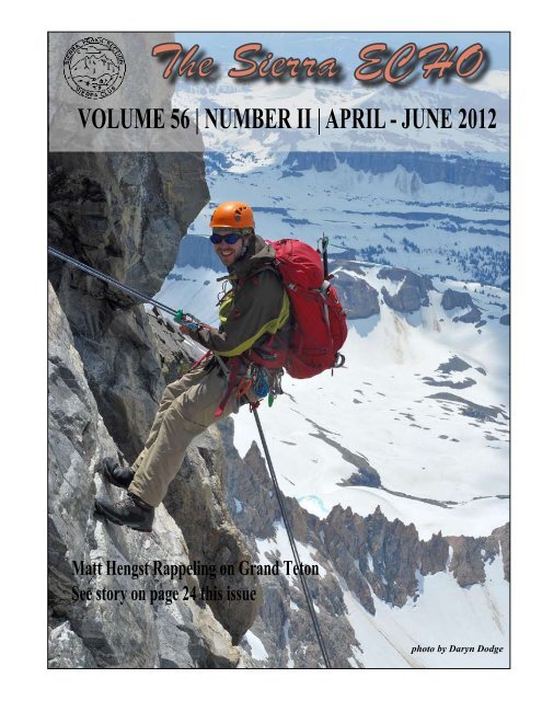
T R I P R E P O R T<br />
by Kathy Rich<br />
We started planning our Grand Teton trip in<br />
early 2011 and secured a backcountry permit<br />
reservation for 2 nights, July 10-11 th - normally prime<br />
climbing season– but this was before it became clear<br />
that 2011 would be a huge year for snow not just<br />
in California, but in Wyoming as well and that the<br />
summer climbing season would be later than usual.<br />
By the time July came around, our initial group of<br />
6 had dwindled to just three (Matt Hengst, Daryn<br />
Dodge and myself, with Matt as our lead climber) to<br />
climb this majestic and famous peak. Steve Eckert<br />
was particularly bummed not to join us as he had<br />
injured his back just the week before the trip.<br />
<strong>The</strong>re is an abundance of information and trip<br />
reports on the web - one very useful webpage is by<br />
Alan Ellis on Summitpost: http://www.summitpost.<br />
org/grand-teton/150312. Quoting from the site:<br />
“<strong>The</strong> Grand Teton! Even the name inspires one to<br />
explore and climb its classic routes. Grand Teton<br />
is a classic alpine peak in itself to the point that an<br />
entire national park was named after it. Climbers<br />
have been drawn to “<strong>The</strong> Grand” for over 100 years<br />
and continue to make pilgrimages from all over the<br />
world. With over 35 routes and 50 variations to those<br />
routes, there is something for everyone from 5.4 to<br />
5.12. Even the easiest route, the Owen-Spalding, is<br />
a technical endeavor and should not be taken lightly.<br />
At Grade II, 5.4, the Owen-Spalding is the standard<br />
route and requires technical rock climbing skills and<br />
equipment”.<br />
In addition, the Jennie Lake Rangers were extremely<br />
knowledgeable and helpful. After reading up on the<br />
various routes, we were cautiously optimistic of<br />
climbing the Upper Exum Ridge Route (named after<br />
Grand Teton pioneer, Glenn Exum). Rated at 5.5,<br />
this route is a little more technical than the standard<br />
Owen-Spalding route, but is reported to provide more<br />
enjoyable climbing, plus it’s mostly in the sunshine!<br />
Overview of the main routes: Owen-Spalding,yellow;<br />
Upper Exum, red; Lower Exum, green; Petzoldt<br />
Ridge, magenta (Alan Ellis, SummitPost)<br />
However, we felt it wise to wait until we got there<br />
and were able to assess the current conditions (snow,<br />
weather) before making our final decision. In any<br />
case, we were told to be sure to bring crampons, ice<br />
24 <strong>The</strong> <strong>Sierra</strong> <strong>Echo</strong>
axe, one or two 60 meter ropes and a light alpine rack.<br />
A bear canister is also recommended to protect food<br />
from marmots while camping.<br />
At 7.7 miles and 7000’ gain from the Lupine Meadows<br />
TH, the Grand can be done as a dayhike – the speed<br />
record is an amazing 3hr and 6min - but a high camp<br />
allows for some flexibility with the weather. Storms<br />
can blow in at any time. Although the guide huts are<br />
located at the Lower Saddle, the rangers advised us<br />
that it can be horribly windy there and suggested the<br />
Upper Moraine instead (~11,000’). This meant that<br />
we had a little farther to go in the morning, but it<br />
was well worth it. We paid a $20 reservation fee to<br />
secure our permit ahead of time. An alternative is to<br />
pick up a permit at the ranger station on arrival which<br />
allows one to gauge the weather, although you run<br />
the risk them being all sold out. Other useful websites<br />
are: http://www.mountainproject.com/v/grandteton/105803123,<br />
and http://wyomingwhiskey.net./<br />
they had any vacancies. To our delight, the answer<br />
was yes (maybe only because of it being a heavy<br />
snow year) and we were shown to a rustic log cabin<br />
with bunk beds for 4. <strong>The</strong> AAC Climber’s Ranch<br />
really is a gem, with hot showers, an outside kitchen<br />
area and a library full of climbing books along with<br />
a computer with internet access. At $14 a night for<br />
AAC members, and $21 a night for non-members,<br />
it’s also very reasonably priced. Oh, and don’t forget<br />
the magnificent view of the Teton Range as well.<br />
On Saturday afternoon, we stopped by the Jennie<br />
Lake Rangers Station to pick up our permit and<br />
get some beta about the routes. Being more in the<br />
shade, apparently the Owen-Spalding route still had<br />
significant snow/ice, so we were encouraged to go<br />
for the Upper Exum route. This meant beginning the<br />
climb on the O-S route, but moving over to the Upper<br />
Exum route via ‘Wall Street’. (<strong>The</strong> Lower Exum route<br />
is even more technical, rated 5.7). It seems that the<br />
rangers climb these routes themselves all the time,<br />
so they knew them inside out and even showed us<br />
photos they’d taken of the route several days before.<br />
Thankfully the weather was clear, so we felt fully<br />
amped and ready for our adventure!<br />
American Alpine <strong>Club</strong> Climbers Ranch, with the<br />
Tetons in the background (Grand Teton is in the<br />
middle of the photo) – photo by MH<br />
We had heard good things about the American<br />
Alpine <strong>Club</strong> Climber’s Ranch, situated just<br />
outside Jackson Hole, and a couple of miles from the<br />
Lupine Meadows TH. Hedging our bets and thinking<br />
we would most be in need of a hot shower after the<br />
climb, we made reservations online for the night of<br />
Tuesday July 12 th . However, on arrival Friday night,<br />
we stopped by to check it out and see if by chance<br />
Daryn and Matt on their way up Garnet Canyon,<br />
not far from Lupine Meadows TH – photo by KR<br />
On Sunday morning, we set off from the Lupine<br />
Meadows TH (6700’) and followed the trail up<br />
through Garnet Canyon. Fully equipped with snow<br />
and rock gear, our packs were pretty heavy. <strong>The</strong><br />
<strong>The</strong> <strong>Sierra</strong> <strong>Echo</strong> 25
headwall was steep snow, but not too bad (a fixed<br />
rope is normally used to ascend, class 3/4).<br />
Upper Moraine camping zone, with the snow-covered<br />
headwall leading to the Lower Saddle in the<br />
distance – photo by MH<br />
first part was very scenic with lots of flowers and<br />
views of the valley. From the Meadows it was solid<br />
snow all the way to the Upper Moraine (~11,000’),<br />
where we fortunately found dry areas to set up our<br />
tents. Several guided groups trudged on up past us<br />
in the late afternoon. We watched as they zig-zagged<br />
up the still snow-covered rocky headwall just below<br />
the Lower Saddle that we would face ourselves in<br />
the wee hours before dawn. Thanks to Matt, we got<br />
up at 3am Monday morning and set off by 4. <strong>The</strong><br />
<strong>The</strong> Lower Saddle was …windy. From there we<br />
started up the first 500’ or so of the O-S route, with<br />
its quaintly named sections: the Black Dyke and<br />
the Needle, after which we traversed right to the<br />
infamous Wall Street, an initially wide sloping ledge<br />
that tapers to an extremely exposed ‘step-around’ to<br />
gain the Upper Exum route. Matt wasted no time in<br />
exiting Wall Street and setting up a belay for Daryn<br />
and myself, which we were glad to have. From here<br />
it’s ~1200’ to the summit up the southwest ridge,<br />
the major sections being - Golden Staircase, Wind<br />
Tunnel, Friction Pitch and V-Pitch. <strong>The</strong> trip reports<br />
we had read indicated there could be lots of traffic<br />
on the route, however, that particular day we saw<br />
no-one at all until we reached the summit. This<br />
meant for a bit of tricky route-finding at times, but<br />
fortunately I had brought along several print-outs<br />
and pictures of the route, which turned out to be<br />
very helpful.<br />
Kathy at our rocky camping spot in the Upper<br />
Moraine area – photo by DD<br />
Matt approaching the ledge leading to Wall<br />
Street (the step-around is at the upper right<br />
corner) – photo by KR<br />
We roped up for the Golden Staircase, but once<br />
we located the Friction Pitch (the crux of the<br />
route), we realized that we had scrambled on through<br />
the Wind Tunnel section without feeling the need<br />
for a rope. After the Friction Pitch (5.5) which Matt<br />
led very comfortably, we found a nice snow slope to<br />
the right of the ridge and inadvertently bypassed the<br />
V-pitch. Apparently this is not uncommon as there<br />
are numerous possible variations of the ‘standard’<br />
26 <strong>The</strong> <strong>Sierra</strong> <strong>Echo</strong>
oute. Not realizing we had missed the V-pitch, we<br />
were temporarily stymied as to our location until we<br />
recognized Petzoldt’s lieback pitch in front of us from<br />
one of the photos we had with us. It was an awkward<br />
move with a pack on, so we rigged up a rope to bring<br />
our packs up. After another short section of snow,<br />
we were on the summit! <strong>The</strong> view was magnificent.<br />
It was around noon, but we didn’t want to linger as<br />
clouds were gathering on the horizon, plus we were a<br />
little apprehensive about finding the rap stations for<br />
our descent via the O-S route. However, fortunately<br />
for us, just at that moment two climbers appeared<br />
on the summit from the O-S route who offered to<br />
show us the route down. <strong>The</strong>re are two rap stations,<br />
one at Sargent’s Chimney (~60’) and the other just<br />
to the right of the Catwalk (~120’), which take you<br />
down to the Upper Saddle (13,200’), and the roping<br />
up point for the O-S route. We had brought 2 fulllength<br />
ropes, but the rangers told us it was possible<br />
to get away with one by throwing the rope down in a<br />
particular direction. In addition, if others are on the<br />
route, it is possible to share ropes with another party,<br />
as we did ourselves.<br />
out, eagerly looking forward to a hot shower and<br />
a celebratory meal back in town. In our haste, we<br />
made a wrong turn at a trail junction a mere 3 miles<br />
from the cars, causing us a rather painful back track.<br />
Finally we were back at the Climber’s Ranch, where<br />
we took a well-earned hot shower. In the meantime,<br />
the weather had closed in and by the time we headed<br />
out for something to eat, it was pouring with rain (in<br />
fact it rained off and on for the next 24hr).<br />
As Matt was due to fly out later that afternoon,<br />
we decided to find somewhere to eat close<br />
to the airport, rather than driving all the way into<br />
Jackson Hole. Dornan’s restaurant (in Moose, WY)<br />
had excellent food and beer on tap. Following a tip<br />
from the rangers, Daryn and I took a drive looking<br />
for bison along the Antelope Flats Rd, east of the<br />
highway. Initially we saw nothing but were then<br />
rewarded with dozens of bison along both sides of<br />
the road. It was quite an amazing sight. Later on we<br />
also saw a huge moose nibbling on a tree quite near<br />
to the ranger station. No need to fight the tourists in<br />
Yellowstone to see some wildlife! It was a fitting end<br />
to a great trip.<br />
For those interested in a bit of history, I’d recommend<br />
watching an interview of Glen Exum (Teton climbing<br />
pioneer and a founder of the Exum Mountain Guides)<br />
filmed in 1997, in which he talks about his first ascent<br />
(solo) of the Upper Exum Route on July 15, 1931.<br />
It makes for a fascinating story: http://www.archive.<br />
org/details/GlennExumInterview<br />
Matt on the summit of the Grand Teton (13,770’)<br />
– photo by KR<br />
After completing the 2 nd rappel, we began our scramble<br />
back down to the Lower Saddle. <strong>The</strong> residual snow/<br />
ice on the rocky face necessitated careful movements<br />
and use of our ice axes. By 4pm we were back at our<br />
tents at the Upper Moraine. We briefly considered<br />
hiking out, but decided to camp there for the night<br />
instead. Around 9.30pm, a thunderstorm blew in and<br />
pelted our tents with hail. Next morning we hiked<br />
Daryn on the second rappel (~120’), taking us to<br />
the Upper Saddle of the O-S route, photo KR<br />
<strong>The</strong> <strong>Sierra</strong> <strong>Echo</strong> 27
Kennedy Mountain Trip Report October 1973 by Bob Wyka<br />
When I was going through some of my college papers from the 70’s I came across my<br />
English 104 class assignments. One of my assignments was to write about the climb<br />
of Kennedy Mountain. Fran Smith was the leader and I refer to him by name. I also refer to a<br />
Mona and John but I don’t know who they are.<br />
28 <strong>The</strong> <strong>Sierra</strong> <strong>Echo</strong>
Kennedy Mountain Trip Report October 1973 by Bob Wyka<br />
<strong>The</strong> <strong>Sierra</strong> <strong>Echo</strong> 29
Kennedy Mountain Trip Report October 1973 by Bob Wyka<br />
30 <strong>The</strong> <strong>Sierra</strong> <strong>Echo</strong>
Kennedy Mountain Trip Report October 1973 by Bob Wyka<br />
Shane’s write-up of Kennedy and Harrington featured in Jan-Mar 2009<br />
<strong>Echo</strong> where he referred to the summit register that contained his granddads<br />
sign in for which I am now submitting the write-up.<br />
<strong>The</strong> <strong>Sierra</strong> <strong>Echo</strong> 31
<strong>The</strong> <strong>Sierra</strong> <strong>Echo</strong><br />
<strong>The</strong> <strong>Sierra</strong> <strong>Echo</strong> is published quarterly by the <strong>Sierra</strong> Peaks Section (SPS) of the <strong>Sierra</strong><br />
<strong>Club</strong>, <strong>Angeles</strong> <strong>Chapter</strong>; this issue edited by Sara Danta<br />
Publication dates are Jun 15, Sept 15, Dec 15 and Mar<br />
15. All text submissions for publication, including trip<br />
reports, articles, etc., can be submitted in electronic format<br />
such as MS Word, WordPerfect, email (electronic<br />
format is preferable), or through regular U.S. mail.<br />
Photos may be submitted as electronic files (jpeg, tiff or<br />
Photoshop in a resolution high enough for print media)<br />
or submitted as prints or slides. If submissions are to be<br />
returned to you please include a return envelope with<br />
sufficient postage. All submissions should be sent to<br />
Sara Danta or emailed to s_wyrens@yahoo.com.<br />
Deadline for all submissions is three (3) weeks<br />
prior to the publication date.<br />
<strong>The</strong> <strong>Sierra</strong> <strong>Echo</strong> is the property of the <strong>Sierra</strong> Peaks Section<br />
of the <strong>Sierra</strong> <strong>Club</strong>, <strong>Angeles</strong> <strong>Chapter</strong>. All rights reserved.<br />
<strong>The</strong> <strong>Sierra</strong> Peaks Secton maintains a website at<br />
http://angeles.sierraclub.org/sps.<br />
ing year. Only one ECHO subscription is necessary for<br />
multiple members of a family residing at one address.<br />
Contributions or gifts to the <strong>Sierra</strong> <strong>Club</strong> or SPS are not<br />
tax deductible.<br />
Advertising Private activity announcements and advertisements<br />
are accepted at the following rates: Private<br />
trip announcements / $1 for the first 4 lines and $1 each<br />
additional line. Other announcements and product/service<br />
advertisements / $1 per line or $25 for half page<br />
space. Send copy and check to the <strong>Echo</strong> Editor, payable<br />
to SPS.<br />
Address Changes Send to the Alexander Smirnoff;<br />
email alsmir1701@gmail.com<br />
Peaks List Copies of the SPS Peaks List can be obtained<br />
by sending $1 and a SASE to the section Treasurer<br />
Alexander Smirnoff.<br />
Subscriptions $10 per year, due by April 30. Subscribing<br />
to the <strong>Echo</strong> is a requirement for active membership<br />
in the SPS. A suggested donation to the section: $25.00<br />
which includes $10.00, plus a suggested $15.00 donation<br />
to the SPS operating fund. Thank you for your<br />
support of SPS. Submit new subscription applications<br />
and renewals to the Section Treasurer Alexander<br />
Smirnoff; include your <strong>Sierra</strong> <strong>Club</strong> number. New applications<br />
received after Oct 1 are credited to the follow-<br />
Missing Issues Inquires regarding missing issues should<br />
be directed to the section Mailer Beth Epstein..<br />
Awards Send notification to Secretary Eric Scheidmantle;<br />
email scheie@alum.rpi.edu Awards merchandise<br />
is available through Patty Kline and include Emblem<br />
pins ($15) and SPS section patches ($5). Make checks<br />
payable to SPS. All prices include sales tax.<br />
<strong>Sierra</strong> <strong>Club</strong>, <strong>Angeles</strong> <strong>Chapter</strong><br />
<strong>Sierra</strong> Peaks Section<br />
3435 Wilshire Blvd., Suite 320<br />
Los <strong>Angeles</strong>, CA 90010-1904<br />
Non-Profit Org.<br />
U.S. Postage Paid<br />
Permit No. 36438<br />
Los <strong>Angeles</strong>, CA<br />
ADDRESS SERVICE REQUESTED