INDIAN NOTICES TO MARINERS - National Hydrographic Office
INDIAN NOTICES TO MARINERS - National Hydrographic Office
INDIAN NOTICES TO MARINERS - National Hydrographic Office
You also want an ePaper? Increase the reach of your titles
YUMPU automatically turns print PDFs into web optimized ePapers that Google loves.
5.1<br />
SECTION – V<br />
NAVAREA – VIII WARNINGS IN FORCE<br />
1. For details of NAVAREA limits and organisation/coordination, please refer to Notice No. 12 of the Special<br />
edition of Indian Notice to Mariners – 2012.<br />
2. NAVAREA VIII Warnings inforce as on 15 Apr 13.<br />
2012 SERIES – 465 531 596 661 662<br />
2013 SERIES – 003 007 008 012 026 035 036 046 070 135 147 148 149 152 160 163 164 171<br />
175 176 177 183 187 191 193 197 198 199 200 201 202 203 204 206 207 208<br />
3. NAVAREA VIII Warnings issued during the period from 01 Apr to 15 Apr 13 (both dates inclusive) are as<br />
tabulated below: –<br />
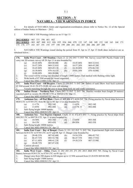
176. India West Coast – Off Mumbai. Charts 21 22 292 INT 71 INT 706. Survey vessel MV Pacific Finder will<br />
carry out 2D seismic survey till 20 Apr 13 in area bounded by:<br />
(a) 18-45.00N 069-00.00E (b) 18-45.00N 069-32.01E<br />
(c) 18-57.28N 069-32.01E (d) 18-57.28N 069-45.20E<br />
(e) 18-45.00N 069-49.13E (f) 18-30.00N 070-06.53E<br />
(g) 18-30.06N 070-10.11E (h) 18-01.30N 070-10.00E<br />
(j) 18-00.00N 069-30.00E<br />
2. The vessel will be towing one streamer of length 12000 metres. End marked with flashing white light.<br />
3. Wide berth of 07 NM around the vessel requested.<br />
4. Cancel this MSG 210001 UTC Apr 13.<br />
177. India West Coast – Off Beypore. Charts 22 259 INT 71 INT 706. Debris of sunk Dhow Arul Seeli scattered<br />
05 NM around 10-41.5N 075-29.0E. 03 crew still missing.<br />
2. Vessels transiting through the area to keep sharp look out and render assistance.<br />
178. Indian Ocean – Northern Part. Charts INT 71 INT 72 INT 706. Derelict wooden boat (length 20 metres)<br />
reported adrift in vicinity 08-29S 067-57E at 300510 UTC Mar 13.<br />
2. Cancel this MSG 020510 UTC Apr 13.<br />
179. Andaman Sea – off Port Blair. Charts 41 405 406 473 4030 INT 706. Firing practice by Naval ships between<br />
0030 UTC to 0730 UTC from 06 Apr to 08 Apr 13 in area bounded by:<br />
(a) 11-17N 092-34E (b) 11-05N 092-34E<br />
(c) 11-05N 092-48E (d) 11-17N 0 092-48E<br />
2. Safe flying height 10000 metres.<br />
3. Cancel this MSG 080830 UTC Apr 13.<br />
180. Andaman Sea – Ten Degrees Channel. Charts 33 41 472 473 INT 71. Firing practice by Naval ships from<br />
080130 UTC to 090730 UTC Apr 13 in area bounded by:<br />
(a) 10-50N 092-36E (b) 11-05N 093-30E<br />
(c) 10-13N 093-45E (d) 09-58N 092-55E<br />
2. Safe flying height 10000 metres.<br />
3. Cancel this MSG 090830 UTC Apr 13.<br />
181. India East Coast – Bay of Bengal. Charts 31 351 352 INT 71 INT 706. Experimental flight trial scheduled<br />
between 0230 UTC to 0730 UTC on 07 and 08 Apr 13. Danger zone bounded by:<br />
(a) 20-48.33N 087-02.60E (b) 19-54.35N 086-45.71E<br />
(c) 06-47.73N 085-52.70E (d) 06-47.73N 088-17.91E<br />
(e) 07-11.48N 090-41.23E (f) 19-58.31N 087-33.98E<br />
(g) 20-48.73N 087-07.43E<br />
2. Caution advised.<br />
3. Cancel this MSG 080830 UTC Apr 13.<br />
182. India West Coast – Okha. Charts 21 202 203 251 271 291 2013 2068 INT 705. Firing by Naval Coast<br />
Battery between 0530 UTC to 0730 UTC on 09 Apr 13.<br />
2. Danger area from 300 degree to 020 degree up to 12 NM seaward from 22-28.03N 069-04.98E.<br />
3. Safe flying height 13000 metres.<br />
4. Cancel this MSG 090830 UTC Apr 13.


