Name and Surname: Masoud Moradi Birth date: 1971 Telephone ...
Name and Surname: Masoud Moradi Birth date: 1971 Telephone ...
Name and Surname: Masoud Moradi Birth date: 1971 Telephone ...
You also want an ePaper? Increase the reach of your titles
YUMPU automatically turns print PDFs into web optimized ePapers that Google loves.
C.V.<br />
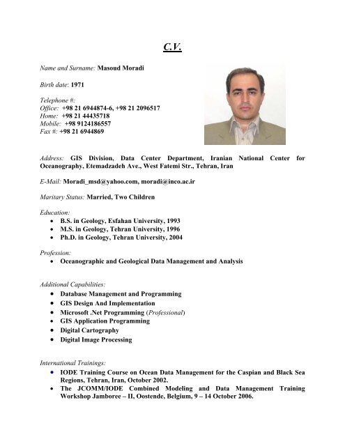
<strong>Name</strong> <strong>and</strong> <strong>Surname</strong>: <strong>Masoud</strong> <strong>Moradi</strong><br />
<strong>Birth</strong> <strong>date</strong>: <strong>1971</strong><br />
<strong>Telephone</strong> #:<br />
Office: +98 21 6944874-6, +98 21 2096517<br />
Home: +98 21 44435718<br />
Mobile: +98 9124186557<br />
Fax #: +98 21 6944869<br />
Address: GIS Division, Data Center Department, Iranian National Center for<br />
Oceanography, Etemadzadeh Ave., West Fatemi Str., Tehran, Iran<br />
E-Mail: <strong>Moradi</strong>_msd@yahoo.com, moradi@inco.ac.ir<br />
Maritary Status: Married, Two Children<br />
Education:<br />
• B.S. in Geology, Esfahan University, 1993<br />
• M.S. in Geology, Tehran University, 1996<br />
• Ph.D. in Geology, Tehran University, 2004<br />
Profession:<br />
• Oceanographic <strong>and</strong> Geological Data Management <strong>and</strong> Analysis<br />
Additional Capabilities:<br />
• Database Management <strong>and</strong> Programming<br />
• GIS Design And Implementation<br />
• Microsoft .Net Programming (Professional)<br />
• GIS Application Programming<br />
• Digital Cartography<br />
• Digital Image Processing<br />
International Trainings:<br />
• IODE Training Course on Ocean Data Management for the Caspian <strong>and</strong> Black Sea<br />
Regions, Tehran, Iran, October 2002.<br />
• The JCOMM/IODE Combined Modeling <strong>and</strong> Data Management Training<br />
Workshop Jamboree – II, Oostende, Belgium, 9 – 14 October 2006.
• Training on the End to End data Management (E2EDM) System. , Oostende,<br />
Belgium, 22 – 25 October 2007.<br />
Employment Records:<br />
FROM 1998<br />
To Now<br />
EMPLOYER<br />
Iranian National Center for Oceanography<br />
POSITION HELD AND<br />
Assistant Professor of the Data <strong>and</strong> Information<br />
DESCRIPTION OF DUTIES<br />
Department, RS/GIS Division.<br />
Working on Marine <strong>and</strong> Coastal RS/GIS; <strong>and</strong><br />
Oceanographic Data Management<br />
FROM 1996 To 1998<br />
EMPLOYER<br />
Earth Science <strong>and</strong> Technology Research Institute<br />
(ESTRI) Consultant engineers (under the auspices<br />
of Geological Survey of Iran)<br />
POSITION HELD AND<br />
Researcher<br />
DESCRIPTION OF DUTIES Research on Geological Data Analysis <strong>and</strong><br />
Management <strong>and</strong> Geological GIS<br />
FROM 1995 To 1996<br />
EMPLOYER<br />
Iranian Ministry of Interior, Marine Geology<br />
POSITION HELD AND<br />
DESCRIPTION OF DUTIES<br />
Project<br />
Researcher<br />
Research on Marine Geology GIS<br />
Work Undertaken that Best Illustrates Capability to H<strong>and</strong>le the Tasks Assigned:<br />
<strong>Name</strong> of assignment or project Design <strong>and</strong> Developing an ArcGIS toolbar for<br />
Oceanographic Data Management based on ARCMARINE<br />
Data Model<br />
Year 2007<br />
Location -<br />
Client<br />
Main project features<br />
Iranian National Center for Oceanography<br />
The ArcMarine data model has a great capability for<br />
management of Oceanographic data. However, there is no<br />
a customized toolbar for automatic data entry <strong>and</strong><br />
management of Oceanographic Data in the ArcGIS<br />
software. In this project an ArcGIS toolbar has developed<br />
for Ocean Data management, <strong>and</strong> also some aspects of<br />
ArcMarine were modified for better match with the client<br />
prospectives.<br />
Positions held<br />
Project Supervisor, Software Programming<br />
<strong>Name</strong> of assignment or project Development a System for Generating Calibrated Sea<br />
Surface Temperature (SST) Maps in the Iranian Seas,<br />
Using NOAA-AVHRR <strong>and</strong> MODIS Images<br />
Year 2006<br />
Location -
Client<br />
Iranian National Center for Oceanography<br />
Main project features<br />
Developing a calibrated Sea Surface Temperature<br />
alogorithme for the Iranian Seas based on known<br />
alogorithmes <strong>and</strong> in suite measurements. All processing<br />
<strong>and</strong> analysis procedures were automated <strong>and</strong> finally a data<br />
bank developed from 2002 until 2006, <strong>and</strong> will go on.<br />
Positions held<br />
Project Advisor, Software Programming<br />
<strong>Name</strong> of assignment or project Developing a GIS based system for Water Quality<br />
Management of the Iranian Watersheds<br />
Year 2005<br />
Location -<br />
Client<br />
Main project features<br />
Ministry of Energy of Iran<br />
Developing a computerized system for water quality<br />
management which contains the Monitoring Planning,<br />
Spatial Data Analysis, Water Quality Projects <strong>and</strong> Plane<br />
Management, WQ Emergency <strong>and</strong> Database subsystems.<br />
This system can be used as a supporting system for<br />
decision making.<br />
Positions held<br />
GIS <strong>and</strong> Software Design & Programming<br />
<strong>Name</strong> of assignment or project GIS based Oceanographic Database Management Software<br />
Year 2005<br />
Location -<br />
Client<br />
Iranian national Center for Oceanography<br />
Main project features<br />
Development a software for oceanographic data which<br />
include the: Oceanic Data Management, Marine Cruises<br />
Data Analysis <strong>and</strong> Management, Automatic Cruise<br />
Summary Report, Automatic Meta Data <strong>and</strong> Suitable<br />
Tools for Marine GIS features<br />
Positions held<br />
Software Design <strong>and</strong> Programming, Project Manager<br />
<strong>Name</strong> of assignment or project Iran Wave Atlas Software<br />
Year 2005<br />
Location<br />
Persian Gulf, Oman Sea <strong>and</strong> Caspian Sea<br />
Client<br />
Ports <strong>and</strong> Shipping Organization of Iran<br />
Main project features<br />
The Waves of the Persian Gulf, Oman Sea <strong>and</strong> Caspian<br />
Sea were modeled using the 3th generation models <strong>and</strong> a<br />
GIS based software was developed for data management,<br />
analysis <strong>and</strong> visualization. Timeseriea analysis, Spectral<br />
Data Analysis, Two dimentional gridded data analysis,<br />
Statistical analysis, Rose Plots, Spatial Data Query, Data<br />
Extraction <strong>and</strong> Data Management are the main features of<br />
this software. This software is able to manage <strong>and</strong> analyze<br />
the timeseries data of oceanic stations such as bouyes,<br />
weather stations <strong>and</strong> Topex/Poseidon tracks.<br />
Positions held<br />
<strong>Name</strong> of assignment or project<br />
Software Design <strong>and</strong> Programming<br />
Towards a methodology for Persian Gulf <strong>and</strong> Oman Sea
Coral Reef, Seagrass <strong>and</strong> Mangrove mapping using<br />
L<strong>and</strong>sat TM/ETM images<br />
Year 2002<br />
Location<br />
Persian Gulf <strong>and</strong> Oman Sea<br />
Client<br />
Department of Environment of Iran, Beauro of Marine<br />
Environment<br />
Main project features<br />
Mapping <strong>and</strong> classification of the Persian Gulf <strong>and</strong> Oman<br />
Sea Coral Reefs <strong>and</strong> detection of changes of them during<br />
the years of 1990 to 2000<br />
Positions held<br />
Technical Advisor of RS <strong>and</strong> GIS<br />
<strong>Name</strong> of assignment or project Maz<strong>and</strong>aran Province basic Database for Integrated<br />
Coastal Area Management<br />
Year 2000<br />
Location<br />
Maz<strong>and</strong>aran Province<br />
Client<br />
Main project features<br />
Project <strong>and</strong> Plane Office of Maz<strong>and</strong>aran Province<br />
A basic spatial database of environmental system was<br />
developed <strong>and</strong> also a GIS was established for thematic<br />
maps <strong>and</strong> spatial data analysis.<br />
Positions held<br />
GIS Technical Advisor <strong>and</strong> Software Development<br />
<strong>Name</strong> of assignment or project Modeling of Damav<strong>and</strong> Volcano<br />
Year 1995<br />
Location<br />
Alborz Province, Iran<br />
Client<br />
University of Tehran<br />
Main project features<br />
Development of a Physical Model of Damav<strong>and</strong> Volcano<br />
using spatial Data analysis <strong>and</strong> modeling the eruption<br />
using the GIS based methods.<br />
Positions held<br />
GIS Technical Advisor<br />
<strong>Name</strong> of assignment or project Geological map of Khomain ,Golpaygan ,Zar<strong>and</strong> ,Shaz<strong>and</strong><br />
Year 1994<br />
Location<br />
Markazi Province of Iran<br />
Client<br />
Ministry of Energy<br />
Main project features<br />
Preparation <strong>and</strong> modification of Geological Maps in<br />
purposes of Hydrological approaches using satellite images<br />
Positions held<br />
GIS Technical Advisor<br />
<strong>Name</strong> of assignment or project Metalogeny of Sistan-Baluchestan mineral indices<br />
Year 1993<br />
Location<br />
Sistan-Baluchestan Province<br />
Client<br />
Sistan-Baluchestan Province Government<br />
Main project features<br />
Exploring the metalogenic indices of the Sistan-<br />
Baluchestan Province <strong>and</strong> modeling the genetic fenomena.<br />
A GIS system was developed for Data Management <strong>and</strong><br />
Map Preparation.<br />
Positions held<br />
GIS Technical Advisor
Publications:<br />
Book:<br />
• <strong>Moradi</strong>, M., 2007. Fundamentals of Geological Remote Sensing. Mehr-e-Vahid<br />
Publication, Tehran, Iran, 353 P., ISBN: 9789649477398, (In Persian).<br />
• <strong>Moradi</strong>, M., 2007. Oceanographic Data Management. Iranian National Center for<br />
Oceanography Publication, Tehran, Iran, 257 P. (in Persian), …. In Press<br />
Conferences <strong>and</strong> Workshops:<br />
• <strong>Moradi</strong>,M., 2001. Oceanographic Data Management. In: Caspian Sea workshop, May<br />
2001, Iranian National Center for Oceanography, Tehran, Iran.<br />
• <strong>Moradi</strong>. M. <strong>and</strong> Ghazban, F., 2002. Morphodynamical Features of SE Zagros Salt Plugs,<br />
Onshore <strong>and</strong> Offshore Iran. MENA 2002 Oil & Gas Conference 3 rd Middle East <strong>and</strong><br />
North Africa Oil <strong>and</strong> Gas Conference. 19 & 20 September, The Imperial College, London<br />
SW7, UK<br />
• <strong>Moradi</strong>,M., 2005. Detection of Changes in the Persian Gulf Coral Reef Communities<br />
using L<strong>and</strong>sat TM/ETM + Images. Proceeding of the Kuwait First International Remote<br />
Sensing Conference, Sep. 26-28, Kuwait.<br />
Reports:<br />
• <strong>Moradi</strong>,M., 1999. Integrated Software for Iranian Marine Database (ISIMAD), Software<br />
products, Iranian National Center for Oceanography internal Report, (in Persian).<br />
• <strong>Moradi</strong>,M., 1999. Multicriteria Database Development for Iranian Marine Data, INCO,<br />
Research report no. 01-102-378,59p., (in Persian).<br />
• <strong>Moradi</strong>,M., 2004. Mapping <strong>and</strong> Monitoring of Coral Reefs, Seagrasses <strong>and</strong> Mangroves<br />
of the Persian Gulf <strong>and</strong> Oman Sea Using L<strong>and</strong>sat TM/ETM images. Department of<br />
Environment of Iran, Marine Environment Bureau, Internal Report, 125 P.<br />
• Yalciner, A.C., Kanbua, W., <strong>Moradi</strong>, M., Sojisuporn, P. <strong>and</strong> Kirugara, D., 2006.<br />
SUMMARY REPORT FOR JAMBOREE-II ON NUMERICAL MODELING<br />
TSUNAMI GENERATION AND PROPAGATION. The JCOMM/IODE Combined<br />
Modeling <strong>and</strong> Data Management Training Workshop Jamboree – II, Oostende, Belgium,<br />
9 – 14 October 2006.<br />
Papres:<br />
• Darvish Zadeh,A. And M. <strong>Moradi</strong>, 1997. Fall differentiation in pyroclastic fall deposits<br />
of Damav<strong>and</strong> volcano, Journal of science, Tehran University, Vol. 23, No.1, pp. 31-45 (in<br />
Persian).
• Darvish Zadeh,A. And M. <strong>Moradi</strong>, 1998. Pyroclastic Flow deposits of Damav<strong>and</strong><br />
Volcano, Journal of science, Esfahan university, Vol. 13, No. 1, pp. 107-124 (in Persian).<br />
• <strong>Moradi</strong>, M., 2001. Sub sea effective reflectances of Khark <strong>and</strong> Kharkoo habitats on<br />
L<strong>and</strong>sat TM images, Journal of Oceanography, Iranian National Center for<br />
Oceanography, Tehran, Vol. 5, p 30-40., (in Persian).<br />
• <strong>Moradi</strong>, M., 2004. Depth invariant index calculation of sub sea habitats around Khark<br />
<strong>and</strong> Kharkoo on L<strong>and</strong>sat TM images. Journal of Oceanography, Iranian National Center<br />
for Oceanography, Tehran, Vol. 8, p 11-21., (in Persian).<br />
• <strong>Moradi</strong>, M., 2004. Determination of Sub Sea objects effective reflectances on L<strong>and</strong>sat<br />
TM images: a case study of Khark <strong>and</strong> Kharkoo Isl<strong>and</strong>s. Iranian Journal of Science <strong>and</strong><br />
Technology, Vol. 28 -B1, pp. 87-94.<br />
• <strong>Moradi</strong>, M., 2006. Application of Relational Database <strong>and</strong> Geographical Information<br />
System for Marine Cruises Data Management <strong>and</strong> Visualization. Journal of<br />
Oceanography, Iranian National Center for Oceanography, Tehran, Vol. 11, p 41-52., (in<br />
Persian).


