2001_000
2001_000
2001_000

Create successful ePaper yourself
Turn your PDF publications into a flip-book with our unique Google optimized e-Paper software.
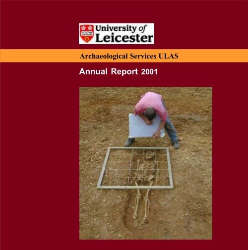
University of Leicester Archaeological Services<br />
Archaeological Services ULAS<br />
Annual Report <strong>2001</strong>
Annual Report <strong>2001</strong><br />
How long ago was that Putting dates to periods<br />
Palaeolithic – Old Stone Age – 500,<strong>000</strong> BC-9500 BC<br />
First hunter gatherer groups. Climatic changes<br />
Mesolithic – Middle Stone Age – 9500 BC-4500 BC<br />
Hunter gatherer groups. Climate getting warmer<br />
Neolithic – New Stone Age – 4500 BC-2<strong>000</strong> BC<br />
The first farming communities<br />
Bronze Age – 2<strong>000</strong> BC-700BC<br />
First use of metals<br />
Iron Age – 700 BC-AD43<br />
Introduction of iron-working<br />
Roman – AD 43-AD 410<br />
Roman occupation of Britain<br />
Anglo-Saxon – AD 410-1066<br />
Saxon and Scandinavian migration<br />
Medieval – 1066-1500<br />
Norman Conquest to the first Tudor kings<br />
Post-medieval – 1500-1800<br />
Tudor - Stuart - Georgian periods<br />
Modern – 1800-present day<br />
Industrial to nuclear age
University of Leicester Archaeological Services<br />
University of Leicester<br />
Archaeological Services<br />
ULAS<br />
Annual Report<br />
<strong>2001</strong><br />
University of Leicester<br />
University Road<br />
Leicester LE1 7RH<br />
Tel: 0116 252 2848<br />
Fax: 0116 252 2614<br />
On the Internet<br />
www.le.ac.uk/ulas
Annual Report <strong>2001</strong><br />
Institute of Field<br />
Archaeologists<br />
University of Leicester<br />
Archaeological Services<br />
ULAS<br />
Contents<br />
1 Introduction 1<br />
2 Living on the Edge – The Environs of a Neolithic Causwayed Enclosure 2<br />
3 Roman Leicester Revealed – The Stibbe Buildings Evaluation 5<br />
4 Sawgate Bridge Rediscovered 8<br />
5 The Hospital of St John the Baptist 10<br />
6 Leicester Abbey Revisited 12<br />
7 One Man and Two Boats 15<br />
8 Civil War Siege – Excavations at Mill Lane 16<br />
9 A Palace of Dreams – Recoding a 1930s Cinema in Northampton 18<br />
10 A South Wales Blast Furnace – Twentieth-Century Heavy Industry 20<br />
12 ULAS Staff <strong>2001</strong> 22<br />
13 Publications and Conferences <strong>2001</strong> 24<br />
14 Outreach <strong>2001</strong> 25<br />
15 Archaeological Projects <strong>2001</strong> 26<br />
14 ULAS Clients <strong>2001</strong> 29
University of Leicester Archaeological Services<br />
Introduction<br />
The past year has been one of major achievement for<br />
both the University of Leicester Archaeological Services<br />
and the School of Archaeology and Ancient History, to<br />
which it is attached. As is immediately apparent from<br />
this report, ULAS continues to provide a high standard<br />
of service, as a professional archaeological contracting<br />
unit, to a large number of satisfied customers. At the<br />
same time ULAS staff contribute to (and are supported<br />
by) the academic wing of the School. The School was<br />
assessed for both its Research output and its Teaching<br />
and Learning quality in <strong>2001</strong> and came through both<br />
exercises with flying colours, with top ratings of 5A for<br />
research (only 5* is higher) and 24/24 for its teaching<br />
quality. Several ULAS staff were cited in the Research<br />
submission and no less than ten ULAS staff have<br />
contributed their expertise to the School’s teaching<br />
programme in the last year. Similarly, academic advisors<br />
from the School’s core staff are routinely attached to<br />
major ULAS field projects to make the most of a twoway<br />
exchange of expertise within the School. This<br />
symbiosis between academic school and professional<br />
archaeological unit has been a major factor in the success<br />
of ULAS and gives the latter an edge over many of its<br />
professional competitors.<br />
ULAS had a quality audit of its own in the autumn, with<br />
a validation visit by the IFA (Institute of Field<br />
Archaeologists) – the body that serves the professional<br />
archaeology community. The visit passed off very<br />
successfully, with the IFA re-confirming its validation<br />
of the services ULAS offers. Those commissioning work<br />
can do so confident in the knowledge that ULAS meets<br />
exacting professional standards. In addition, as part of<br />
their overall strategy for<br />
offering their staff opportunities<br />
for career development, and<br />
customers a better and better<br />
service, ULAS are also seeking<br />
validation this year under the<br />
Investors in People scheme.<br />
This involves enhancing the<br />
existing staff development and<br />
training structures and once<br />
again, this will help the unit maintain and build on its<br />
reputation for high quality and efficient project work.<br />
It is clear, from the list of projects undertaken, that ULAS<br />
is frequently active in several counties, but the focus of<br />
the work, understandably, remains Leicestershire and<br />
Rutland. After a ten-year period of limited activity, the<br />
past year has seen the start of a major new wave of<br />
construction and redevelopment in Leicester city centre.<br />
ULAS has already been involved in several of these sites<br />
and hopes to continue to contribute its local knowledge<br />
and long experience to excavations in Leicester over<br />
the coming few years. These are exciting times ahead<br />
and ULAS and the School intend to be at the forefront<br />
of archaeology for many years to come.<br />
David Mattingly<br />
Professor of Roman Archaeology<br />
Acting Head of School of Archaeology and Ancient History<br />
March 2002<br />
1
Annual Report <strong>2001</strong><br />
Living on the Edge – The Environs of a Neolithic Causewayed Enclosure<br />
In 1998, geophysical survey by ULAS located a major<br />
Neolithic monument at Husbands Bosworth, Leicestershire<br />
– a causewayed enclosure dating from around 3<strong>000</strong> BC–<br />
the first of its kind known from the county. The monument<br />
consisted of a circular open area,<br />
150m in diameter, originally<br />
enclosed by interrupted banks and<br />
ditches, and would have served for<br />
meetings and ceremonies for the<br />
early farming communities living in<br />
the surrounding Soar, Welland, Swift<br />
and Avon valleys. When the<br />
significance of the discovery had<br />
been established, the site was<br />
withdrawn from proposals for gravel<br />
extraction, and has now been<br />
designated a Scheduled Ancient<br />
Monument (SAM), providing<br />
protection from future development.<br />
Following survey and evaluation, a<br />
modified area was granted planning<br />
permission for gravel extraction, and<br />
three phases of archaeological work<br />
have been undertaken since the<br />
commencement of the quarry<br />
extension.<br />
Right: a Neolithic crouched<br />
burial with flint tool-kit at feet.<br />
Initially, archaeological monitoring was carried out during<br />
topsoil stripping for a tunnel, beneath the road, linking the<br />
new quarry with the existing one, a haul road and new areas<br />
allocated for extraction and landscaping. This was followed<br />
by trial trenching and excavation of features found by<br />
geophysical survey to the southwest of the monument.<br />
Further topsoil stripping was then monitored to the north<br />
and south-west of the monument. This has located<br />
archaeological remains of<br />
Neolithic, Bronze Age and<br />
Iron Age date in the areas<br />
surrounding the causewayed<br />
enclosure.<br />
The earliest features on the site<br />
are large numbers of ‘tree<br />
throws’ – round pits with<br />
distinctive dark crescents of<br />
silt on one side where fallen<br />
tree boles have rotted away.<br />
The trees would have been<br />
part of the natural landscape<br />
before the woodland was<br />
cleared and the causewayed<br />
enclosure was constructed.<br />
Contemporary evidence to the<br />
north and south-west of the<br />
Neolithic causewayed<br />
enclosure has been found. To<br />
the north were clusters of pits<br />
in groups containing flint and<br />
Neolithic pottery of the type known as Peterborough ware.<br />
Two of these were of particular interest containing, in<br />
addition to pottery and flint, large saddle querns (grinding<br />
stones) and charred deposits with identifiable cereal remains.<br />
These may have been ‘special deposits’ placed as offerings,<br />
or the querns may have been buried for re-use during<br />
2
University of Leicester Archaeological Services<br />
seasonal visits to the site. A pit to the west of the enclosure<br />
contained slightly later Beaker style pottery of late Neolithicearly<br />
Bronze Age date.<br />
The area south of the enclosure had rather different<br />
Neolithic remains, including a circular monument and human<br />
burials – an inhumation (skeleton) in a crouched position<br />
and two cremations.<br />
The crouched inhumation burial lay at the base of a deep<br />
rectangular pit which was capped by a layer of<br />
burnt cobbles and stones. The burial was positioned<br />
with the head to the south-east. Bone survival<br />
was unusual in that it was either present in generally<br />
reasonable condition or there was very little trace<br />
of it. The pelvis, ribcage and spine and most of the<br />
left leg and arm (i.e. the lower side of the body)<br />
were missing. Although some of the skull had<br />
decayed badly, one side of the upper jaw was in<br />
good condition. Initial indications suggest that the<br />
burial was of a 30-35 year old male.<br />
Near the crouched burial were several Iron Age pits, dug<br />
perhaps 1500 years after the burial, some of which contained<br />
quantities of large burnt cobbles. Could these stones have<br />
come from a stone mound or cairn which had once covered<br />
the burial pit<br />
Trial trenching and excavation were carried out in two<br />
further areas of the quarry extension, targeting features<br />
located by geophysical survey, including a ring ditch and a<br />
small rectangular enclosure. The excavation confirmed the<br />
Enclosure<br />
Neolithic Pits<br />
A tool kit of five late Neolithic/early Bronze Age<br />
flints, which may have originally been in a bag, lay<br />
by the feet, a flint flake near the skull, and two<br />
pieces of animal bone with a flint flake were by<br />
the wrist. Charred remains of an oak plank had<br />
been laid on its edge along the length of the side<br />
of the pit to the north-west of the burial. The plank’s<br />
position in the pit corresponded with a natural layer<br />
of loose silt and gravel along one side, and it may<br />
have acted as shuttering. This could imply that<br />
the pit was dug some time before the body was<br />
placed in it, or that the body remained uncovered<br />
for some time before the pit was filled in.<br />
Right: map of the site showing the<br />
causwayed enclosure and other features.<br />
Late Neolithic Pits<br />
Causwayed Enclosure<br />
Enclosure<br />
Enclosure<br />
Circular Building<br />
Pit Alignments<br />
Ring-ditch<br />
Enclosure<br />
Cremation Burials<br />
Iron Age Pits<br />
Iron Age Pits<br />
Inhumation<br />
Area of Scheduled<br />
Ancient Monument<br />
Geophysical Anomaly<br />
Archaeological Feature<br />
Extent of Watching Brief/Excavation<br />
3
Annual Report <strong>2001</strong><br />
presence of the ring ditch with two narrow causeways to<br />
the north-west. On the basis of the geophysical surveys<br />
this had been interpreted as a ploughed-out circular Bronze<br />
Age barrow. However, although the ditches were extremely<br />
deeply cut, no burial was present nor any feature likely to<br />
have contained one. There was no surviving evidence of a<br />
mound or external banks, although the initial geophysical<br />
survey had indicated that banks might have been<br />
present. The ditch varied in depth, perhaps suggesting<br />
that it had originally been dug out by different groups<br />
of people. Few finds were present the only dating<br />
evidence being sherds of Neolithic Peterborough<br />
ware pottery suggesting that the site was in use<br />
around 3<strong>000</strong>-2500 BC.<br />
Two pit alignments, one crossing the ring ditch, were<br />
also located. Although not closely datable, these may<br />
be evidence of land division in the late Bronze-Early<br />
Iron Age. More<br />
tangible evidence of<br />
occupation occurred in<br />
the Middle to Late Iron<br />
Age, with a circular<br />
building, pits and<br />
enclosures to the south,<br />
and pits and an<br />
enclosure to the north<br />
of the monument. The<br />
circular building cut the<br />
upper layers of the ring<br />
ditch, suggesting that the monument was no longer visible<br />
at this time, with the banks or mound having eroded and the<br />
ditch now backfilled. By this time when the land was being<br />
divided up, it is unclear whether the causewayed enclosure<br />
was still visible as an earthwork.<br />
The work to date at Husbands Bosworth has shown that<br />
the causewayed enclosure was a focus of activity during<br />
the prehistoric period, with evidence of seasonal occupation,<br />
the construction of a circular monument – perhaps a local<br />
variation of a ‘henge’ – and burials, during the Neolithic.<br />
There appears to have been a decline in activity during the<br />
Bronze Age until a period of land division using pit alignments<br />
began, perhaps early in the first millennium BC. By the late<br />
Iron Age, the land was being settled more intensively with<br />
several enclosures and at least one circular building. It is<br />
Above: monumental ring-ditch overlain by<br />
remnants of Iron Age house (foreground).<br />
Left: a large saddle quern (grinding<br />
stone) recovered from one of the pits.<br />
uncertain when the causewayed enclosure ceased to be<br />
visible as a feature in the landscape. Further work may<br />
help to elucidate what influence this important monument<br />
had on evolution of the surrounding landscape.<br />
We would like to thank Lafarge Redland Aggregates and<br />
their consultants, Oxford Archaeological Associates, for their<br />
help and co-operation during this project.<br />
4
University of Leicester Archaeological Services<br />
Roman Leicester Revealed – The Stibbe Buildings Evaluation<br />
In January and February <strong>2001</strong>, ULAS<br />
excavated a series of trial trenches on the site<br />
of the former Stibbe Buildings on Great Central<br />
Street, Leicester. The site lies within the historic<br />
core of the Roman and medieval town and is<br />
earmarked for redevelopment, although no<br />
definite plans have been drawn up as yet.<br />
An initial desk-based archaeological<br />
assessment confirmed that there are known<br />
archaeological remains, of great significance,<br />
within the study area, including the possible<br />
north wall of the Roman macellum (market hall)<br />
and at least one other Roman building. Roman<br />
tessellated pavements, mosaics, painted wall<br />
plaster and masonry walls had all been<br />
previously recorded on the site. The Cyparissus<br />
Pavement, a mosaic on display at Jewry Wall<br />
Museum, may also have been found on this site<br />
in the 17th century. The site lies partially on the frontage of<br />
the medieval High Street, now Highcross Street. The deskbased<br />
assessment confirmed the locations of deep cellars<br />
associated with the former Victorian Stibbe Buildings, which<br />
are known to have caused a great deal of destruction to<br />
archaeological deposits. The report also demonstrated that<br />
in areas away from the cellars there was potential for their<br />
survival.<br />
Ten trenches were excavated across the site, mainly using<br />
a 360º mechanical excavator, with three located over the<br />
areas of the known cellars, in order to confirm the depths<br />
of the cellar floors. The remaining trenches were placed in<br />
areas where cellars were unconfirmed.<br />
Above: a plain tessellated Roman floor.<br />
The trench in the north-western corner of the site, on the<br />
Great Central Street frontage, uncovered Roman<br />
archaeological deposits, surviving 1m below the present<br />
ground surface, sealed by medieval garden soils and modern<br />
demolition debris. The Roman remains had been partially<br />
disturbed by medieval pits, modern wall trenches and a<br />
shallow cellar. The trench revealed a possible Roman road,<br />
aligned north-north-west, in the far western edge of the<br />
trench. This was bounded to the east by a series of gravel<br />
and sand layers, possibly yard surfaces. The remainder of<br />
the trench overlay at least two rooms and a corridor of a<br />
Roman building. Three wall lines, parallel with the possible<br />
5
Annual Report <strong>2001</strong><br />
road, were visible as medieval robber trenches (dated to<br />
the 11th -12th centuries), with two walls on a perpendicular<br />
alignment also hinted at, although unconfirmed. The main<br />
part of the trench overlay a single room with a sequence of<br />
floor layers that suggested a prolonged period of use and<br />
regular refurbishment during the Roman period. One of<br />
the floors was constructed of rough grey tesserae (mosaic<br />
N<br />
Great Central Street<br />
Possible layout of<br />
mosaic<br />
Building 1:<br />
corridor & three<br />
rooms<br />
Above: plan of the Stibbe site with Roman<br />
roads superimposed (grey).<br />
Building 2:<br />
mosaic &<br />
hypocaust<br />
Building 3: the<br />
macellum<br />
tiles). A second room to the south was indicated by a small<br />
patch of floor, made of red ceramic tesserae, with a very<br />
different sequence of floor layers beneath, when compared<br />
with those seen in the room to the north. Bounded by two<br />
of the robber trenches on the eastern side of these rooms<br />
was a particularly well-made grey tessellated floor, appearing<br />
to represent a corridor from which these other rooms would<br />
have been accessed.<br />
The trench could not be<br />
extended to the east due<br />
to the presence of a<br />
substantial modern<br />
concrete floor, so it was<br />
not possible to see what<br />
lay on the eastern side of<br />
the corridor.<br />
Highcross Street<br />
The trench in the<br />
northern part of the site<br />
had been disturbed by<br />
modern services.<br />
However, evidence for<br />
medieval rear-yard<br />
activity, in the form of<br />
numerous pits, was<br />
recorded. Areas of the<br />
base of the trench also<br />
revealed the remains of<br />
a Roman building with a<br />
stone-lined flue for a<br />
hypocaust (under-floor<br />
heating system), with<br />
mortar floors above. In<br />
the north side of the<br />
trench, above the flue,<br />
lay part of a mosaic of<br />
fine white, grey and<br />
black tesserae, and<br />
above this, the collapsed superstructure of the building.<br />
Vaughan Way<br />
6
University of Leicester Archaeological Services<br />
Evidence for other mortar floors and a wall, since robbed<br />
of its stone, were also found within the trench.<br />
The two trenches in the middle of the site revealed wellpreserved<br />
medieval and Roman levels at a depth of around<br />
1m from the present ground surface. The excavation of<br />
medieval pits and part of a well exposed further evidence<br />
of the robbed walls<br />
and clay floor of a<br />
Roman building.<br />
Two small handexcavated<br />
trenches to<br />
the south-east<br />
provided evidence for<br />
post-medieval and<br />
medieval buildings.<br />
These would have<br />
fronted on to<br />
Highcross Street, and<br />
pre-dated those that<br />
were demolished in<br />
the mid-twentieth<br />
century, prior to the<br />
construction of<br />
Vaughan Way.<br />
The trench in the southern part of the site produced part of<br />
a substantial stone wall, with 0.5m deep footings, in its<br />
northern end. The wall was aligned close to east-west. A<br />
parallel wall, 2.8m to the south, was also seen surviving<br />
beneath the brick floor of the modern cellar. The top of this<br />
wall was level and suggests that it was a base for a<br />
‘stylobate’ – a horizontal course of stone blocks onto which<br />
columns would have been stood to form a colonnade. These<br />
walls may be part of the substantial stone structure seen<br />
during the Blue Boar Lane excavations to the south of the<br />
site in 1958.<br />
The evaluation has shown that particularly well-preserved<br />
archaeological remains exist within the area, close to the<br />
present ground surface. They may also survive beneath<br />
some of the modern cellar floors. At least two substantial<br />
Roman buildings were revealed. To the north, a room with<br />
a hypocaust (central heating system) and fine quality<br />
patterned mosaic floor, next to a corridor with rooms leading<br />
off it, was found,<br />
suggesting the<br />
presence of a high<br />
status town house.<br />
To the south, on the<br />
other side of a<br />
Roman street, lay a<br />
substantial stone built<br />
building, which may<br />
have been the town’s<br />
market hall – a large<br />
public building known<br />
as the macellum.<br />
Above: a glimpse of a fine patterned mosaic<br />
floor below a collapsed Roman building.<br />
During the medieval<br />
period it is likely<br />
that this area was<br />
mainly gardens or<br />
agricultural land, with<br />
buildings only on the frontage of Highcross Street and Friars<br />
Causeway, thus little structural evidence from the medieval<br />
period was revealed in the majority of the site area.<br />
We would like to thank Westmoreland Properties both for<br />
their help and co-operation, and for funding this project.<br />
7
Annual Report <strong>2001</strong><br />
Sawgate Bridge Rediscovered<br />
ULAS was commissioned by the Environment Agency to<br />
supervise the groundworks during the excavation of silt traps<br />
on Burton Brook and the river Eye, south of Melton<br />
Mowbray, and east of Burton Lazars.<br />
The site lies on Burton Brook, half a mile east of Burton<br />
Lazars where Europe’s largest leper colony and hospital<br />
stood for over 400<br />
years. The leper<br />
hospital was founded by<br />
Roger de Mowbray<br />
after he inherited the<br />
land from his father<br />
Nigel d’Aubigny in<br />
1138. This was<br />
documented in a charter<br />
dated to 1154-1162<br />
which records that<br />
Roger donated a<br />
hospital and a mill<br />
(presumably Man Mill<br />
at the nearby village of<br />
Brentingby).<br />
The brethren of the<br />
hospital soon became large landowners, as a result of<br />
numerous donations. Their management interest in the estate<br />
resulted in the creation of a large open-field system by the<br />
12th century, incorporating 2,800 acres of farming land.<br />
Excavations were carried out within this planned medieval<br />
landscape, at the site of a new silt trap, being constructed<br />
as part of a flood alleviation scheme. These unearthed the<br />
remains of a medieval stone bridge which was not only<br />
contemporary with the Leper hospital, but is even mentioned<br />
by name as ‘Salgate Brygge’ in 14th-century land surveys.<br />
The Saltgate bridge got its name from the Roman ‘Sawgate’<br />
road on which it sat. This was one of the main routes from<br />
the east coast via which salt was traded into the interior of<br />
Britain. The road is<br />
thought to diverge from<br />
the Fosse Way at<br />
Syston to follow the<br />
ridge north-east to near<br />
Frisby-on-the-Wreake.<br />
Here it appears to turn<br />
east past Eye Kettleby,<br />
through Burton Lazars,<br />
crossing Burton Brook<br />
and on to Cord Hill and<br />
Thistleton.<br />
Above:excavation in progress; a multi-phase stonebuilt<br />
medieval bridge takes shape in the mud.<br />
The Bridge<br />
The excavation of the bridge showed that it had been built<br />
in several distinct phases. The first involved the laying of<br />
large cobbles in the base of the brook, which for several<br />
8
University of Leicester Archaeological Services<br />
years may have sufficed as a ford crossing. At a later date<br />
a more substantial bridge was built of limestone. Evidence<br />
of this first stone construction was found only on the west<br />
bank of the brook, and consisted of a large D-shaped<br />
Although there is no direct evidence that Saltgate Bridge<br />
was built by or for the farming brethren of Burton Lazars<br />
hospital, it is clear that it was standing during the hospital’s<br />
heyday and would certainly have been an important crossing<br />
point, and instrumental in the day to day management of<br />
the planned farming landscape that the brethren had<br />
established.<br />
Thanks are due to the Environment Agency for their help<br />
and co-operation with this project.<br />
Left:Burton Brook in flood, the medieval<br />
bridge still spans the current course of<br />
the brook.<br />
abutment terraced into the bank of the brook. It is presumed<br />
that a wooden superstructure (which has since been lost)<br />
may have sat atop this structure and spanned the brook to a<br />
similar structure on the east bank. No evidence of a<br />
coresponding abutment was found during excavation, but it<br />
remains possible that this may lie just outside of the area of<br />
investigation or its stone may<br />
simply have been reused in<br />
the construction of later<br />
phases of the bridge.<br />
Following several years of<br />
flooding a third phase of<br />
construction was added, in<br />
the form of a well-hewn<br />
sandstone parapet, the<br />
squared blocks of which still bore clear tooling marks. Later<br />
the banks of the brook, just down-stream of the bridge, were<br />
consolidated with a broad layer of pebbles.<br />
Above: well-shaped blocks were used in the<br />
parapet of the bridge during the third phase of<br />
construction.<br />
9
Annual Report <strong>2001</strong><br />
The Hospital of St. John the Baptist, Lutterworth<br />
The hospital of St. John the Baptist, Lutterworth,<br />
Leicestershire, was founded on land known locally as ‘the<br />
warren’ during the reign of King John in 1218, and was<br />
dissolved in 1577. The hospital complex was a wealthy<br />
institution in its day, its revenue being greater than that of<br />
the contemporary parish church of St. Mary’s. Much of<br />
this wealth was doubtless generated by two mills,<br />
documented as belonging<br />
to the estate upon its<br />
dissolution in 1577, and<br />
from farming land at<br />
Gilmorton, Cotesbach,<br />
Shawell and Bitteswell. It<br />
is, however, unclear<br />
whether the hospital mills<br />
occupied the ‘warren’ site<br />
itself.<br />
In the 1890s, rubble and<br />
human bones were discovered during<br />
the construction of what is now the<br />
A426 main road. Not only had<br />
remnants of the hospital buildings been<br />
unearthed but, for the first time, there<br />
was evidence that the hospital had its<br />
own cemetery.<br />
Avove: one grave, two burials; these two burials<br />
were found one on top of the other in a ‘doubledecker’<br />
style. The top grave contained 14thcentury<br />
floor tiles, the bottom one a coffin.<br />
A small team of excavators from ULAS had undertaken<br />
evaluative trenching of the land, now occupied by Mill Farm,<br />
in 1996 on behalf of the new landowners, Hallam Land<br />
Management, who were proposing to redevelop the site.<br />
The discovery of five graves confirmed the existence of<br />
the hospital cemetery, while spreads of cobbles also hinted<br />
at the presence of structures, although their character was<br />
unclear.<br />
In <strong>2001</strong> ULAS was commissioned to carry out more<br />
extensive work to ensure satisfactory recording of the areas<br />
of archaeological importance which<br />
would be affected by the proposed<br />
development. In particular a large<br />
area was stripped to better define<br />
the cemetery and the possible<br />
cobble structures.<br />
Twenty-two complete graves were<br />
identified in a very<br />
overgrown plot of land<br />
to the south of the<br />
farmhouse. There had<br />
been much disturbance<br />
to this cemetery in the<br />
years since its<br />
abandonment, including<br />
modern ditches and<br />
sand quarrying pits,<br />
which had clearly<br />
destroyed many more<br />
graves, judging by the<br />
large quantities of disturbed human bones in their backfills.<br />
The excavated graves all contained well-preserved<br />
skeletons, all but one of which were interred according to<br />
Christian tradition, with their heads at the west end of the<br />
graves. One individual, the only juvenile, was buried the<br />
other way round, with the head at the east.<br />
Despite the Christian rules banning the inclusion of gravegoods<br />
in burials of this date, some interesting artefacts were<br />
10
University of Leicester Archaeological Services<br />
Above: some of the<br />
items found in the<br />
graves.<br />
and the remnants of some external mortared walls were<br />
also visible. Unfortunately, much of this structure had been<br />
destroyed by a modern farm building. Few datable finds<br />
were recovered although some fragments of floor tiles<br />
(similar to those found in the grave) were identified. It is,<br />
however, uncertain whether the 14th-century tile fragments<br />
were contemporary with the structure or whether they had<br />
been incorporated into its fabric at a later date. Additional<br />
cobble structures, including a long enclosure wall, were also<br />
identified within the excavation area.<br />
recovered from the grave fills. One individual was found to<br />
be wearing a very plain ‘penannular’ style brooch,<br />
commonly used as a fastening for clothing, while another<br />
was found with six 14th-century floor tiles, four of which<br />
were decorated with the Arms of Beauchamp. Although<br />
most of the burials appeared to be simple interments, without<br />
coffins (the bodies may simply have been wrapped in<br />
shrouds that have since rotted), one burial was found to<br />
incorporate a wooden coffin held together with iron nails.<br />
Interestingly this coffin burial was also the only double<br />
interment, found in ‘double-decker’ style below the burial<br />
containing the tiles.<br />
Detailed laboratory analysis of the skeletons indicated that<br />
the population consisted primarily of mature adult males,<br />
bearing the obvious signs of old age; arthritis was very<br />
common. Only one female and one juvenile, of 15 years,<br />
broke the trend.<br />
To the south-west of the cemetery area, a simple track<br />
was identified running in a north-west to south-east direction.<br />
This made use of small rounded pebbles embedded in clay,<br />
presumably to stabilise the ground and to prevent rutting by<br />
cartwheels. This track may have led from the hospital<br />
buildings to the cemetery.<br />
Adjacent to the pebble track lay a large cluster of cobbles<br />
which appeared to form the internal flooring of a cobble<br />
building, built in a similar style to the local parish church. A<br />
slate-lined drainage channel could be seen below the floor<br />
Above: the cobble-built structure and floor.<br />
A great deal of analytical work on the finds from the site at<br />
Mill Farm remains to be completed, and it is hoped that in<br />
the near future a more detailed picture may be formed of<br />
the nature of these remains. What is already apparent is<br />
that the latest excavations have succeeded in locating at<br />
least part of the lost hospital of St. John’s.<br />
We would like to thank Hallam Land Management for their<br />
help and co-operation with this project.<br />
11
Annual Report <strong>2001</strong><br />
Leicester Abbey Revisited<br />
In July and August <strong>2001</strong>, ULAS supervised a second training<br />
excavation in Abbey Grounds, Abbey Park, Leicester for<br />
second-year students of the School of Archaeology and<br />
Ancient History, Leicester University. The Abbey Grounds<br />
lie to the west of the<br />
River Soar, and<br />
contain the<br />
excavated plan of<br />
Leicester Abbey,<br />
one of the<br />
wealthiest Augustinian<br />
houses in the<br />
country, together<br />
with the ruins of<br />
Cavendish House, a<br />
16th-17th century<br />
mansion. The fieldwork<br />
concentrated<br />
on Cavendish<br />
House, although<br />
trenches were also<br />
examined within the<br />
Chapter house of the Abbey.<br />
Cavendish House<br />
Although most of the abbey buildings, including the church,<br />
were razed to the ground within a few years of the<br />
Dissolution of the Monasteries in 1538, the main gatehouse,<br />
boundary walls and farm buildings survived. Under the<br />
ownership of the Hastings and Cavendish families in the<br />
16th and 17th centuries, the gatehouse became a domestic<br />
residence and underwent many structural modifications. It<br />
was burnt down in 1645 during the English Civil War and in<br />
the 18th and 19th centuries the ruined shell was once again<br />
re-used and rebuilt<br />
several times, as a<br />
farm.<br />
Our current<br />
understanding of the<br />
structural sequence<br />
of the surviving<br />
fabric of Cavendish<br />
House is based on an<br />
examination of 18th<br />
and 19th century<br />
prints, supplemented<br />
by a visual<br />
inspection of the<br />
interior and exterior<br />
of the building. The<br />
Above: reconstruction drawing of Leicester Abbey,<br />
reproduced by kind permission of John Finney.<br />
upstanding portion of the building is now known as Abbey<br />
House and was uninhabited at the time of the evaluation.<br />
Access to the building allowed time for analysis of its internal<br />
fabric and of its constructional phases.<br />
12
University of Leicester Archaeological Services<br />
Above: an engraving of Cavendish house in 1841.<br />
Excavations were undertaken in the region of the<br />
standing people.<br />
The 1538 survey of the abbey describes the<br />
gatehouse as ‘a square lodging on either side<br />
of the gatehouse in which are five chambers<br />
with chimneys and large glazed windows, the<br />
walls being of stone and covered with lead,<br />
and with four stone turrets at the corners of<br />
the same’. Evidence relating to the southern<br />
façade of the building, including the southwestern<br />
corner tower, was uncovered during<br />
the evaluation. The remains of this tower,<br />
suggest that it contained a spiral staircase<br />
to gain access to both the upper rooms, as<br />
well as to a cellar. Possible evidence for the<br />
north-eastern corner tower is visible on the<br />
existing northern façade of Cavendish House,<br />
whilst evidence for the north-west tower may<br />
be indicated by irregular stone foundations visible within<br />
the existing cellars of Abbey House. Engravings also show<br />
Although the evaluative excavations within the area<br />
of Cavendish House were of a very limited nature,<br />
they have enabled the identification of a series of<br />
discrete phases of structural activity for which a<br />
relative chronology may be tentatively proposed.<br />
The earliest structure encountered almost certainly<br />
relates to the medieval abbey gatehouse. This was<br />
probably originally of a simple form, comprising a<br />
central north-south carriageway some 2.5m (8.3ft)<br />
wide at its narrowest, flanked on either side by a<br />
range of rooms. Evidence for the walls of this<br />
structure came in the form of surviving masonry<br />
footings and robber trenches. The existence of a<br />
structure on the northern side of the building,<br />
possibly a porch, projected from the results of the<br />
2<strong>000</strong> season evaluation, was confirmed.<br />
Above: training excavations in progress at Cavendish house.<br />
13
Annual Report <strong>2001</strong><br />
the northern edge of the earlier foundations. The<br />
eastern wing also appears to have been rebuilt<br />
at this time as a stair tower. The extant large<br />
double chimney breast to the west on the the<br />
southern façade which appears on engravings,<br />
may also be of a similar date to this phase of<br />
rebuilding, perhaps serving a kitchen complex.<br />
Engravings show that the former gatehouse<br />
towers on the southern façade were retained in<br />
this later rebuild phase.<br />
Claustral buildings<br />
Above: floor tiles uncovered in the cloister walk of<br />
Leicester Abbey.<br />
towers projecting from the southern façade of Cavendish<br />
House, flanking the carriageway entrance through the<br />
building, and the footings for both of these structures were<br />
also revealed. The excavated evidence would suggest that<br />
although the northern wall of the medieval gatehouse was<br />
probably incorporated into this phase of construction, the<br />
southern wall was entirely replaced.<br />
By the late 16th century, an east and west wing were added<br />
to the northern façade of the medieval gatehouse and<br />
evidence suggesting that both wings were cellared was also<br />
found.<br />
In the early 17th-century, the northern façade of the building<br />
with its projecting medieval porch and later flanking wings,<br />
seems to have been flattened with the construction of a<br />
linking wall. The only evidence for this is from the surviving<br />
north wall itself, which respects the line of the foundations<br />
of the postulated medieval porch, being built directly against<br />
Two trenches were positioned within the eastern<br />
part of the Chapter House of the Abbey. The<br />
trenches were located in order to clarify the<br />
position of the Chapter House walls which had been<br />
reconstructed in the 1930s after excavation. This evidence<br />
had been uncovered again during the 2<strong>000</strong> season of<br />
evaluation. One of the trenches revealed a large stone<br />
wall footing, not corresponding to any of the reconstructed<br />
walls. Two possible robber trenches were also recorded,<br />
one corresponding with that seen during the 2<strong>000</strong> season.<br />
The second trench was excavated in an attempt to uncover<br />
the expected continuation of the stone footings, but they<br />
were not found. In both trenches it was evident that in<br />
places a 1m depth of re-deposited natural gravels existed<br />
over what is thought to have been undisturbed ground. A<br />
single trench was excavated on the eastern side of the<br />
reconstructed wall of the Chapter House, which suggested<br />
that the undisturbed natural ground lay directly below the<br />
topsoil on this side of the wall. The work within the Chapter<br />
House would suggest that the reconstructed walls appear<br />
to surround a structure with a reduced floor level. However,<br />
the layout of the reconstructed walls remains open to<br />
question with nothing of the original medieval evidence used<br />
to set them out having survived.<br />
14
University of Leicester Archaeological Services<br />
One Man and Two Boats<br />
Above: the Tug ‘Birmingham’. The<br />
hull has been over-plated at the bow and<br />
stern and the cabin is not the original.<br />
In early <strong>2001</strong>, ULAS were commissioned to carry out an<br />
external survey of two historic craft, for British Waterways,<br />
using a Reflectorless EDM Theodolite. This equipment<br />
permits the swift recording of thousands of points on any<br />
surface, be it on iron, brick or wood, and can be operated<br />
by one person.<br />
The form and visible repairs of the two boats were to be<br />
recorded, while out of the water, before restoration work.<br />
The vessels will form part of British Waterways’ fleet of<br />
boats used for education programmes.<br />
The reflectorless survey provided accurate base drawings<br />
that were to be augmented with more detailed study.<br />
The two vessels represented different<br />
aspects of the history of the waterways<br />
– one is a Tug and the other is an<br />
unpowered carrying boat called a Day<br />
Boat or ‘Joey’.<br />
The Tug, ‘Birmingham’, built of iron, is<br />
45 feet (13.61m) long with a beam of<br />
just under 7 feet (2.09m) and a draught of 4 feet (1.35m)<br />
and was built in 1912. It was one of a series of similar tugs<br />
built for the Worcester and Birmingham Canal for pulling<br />
unpowered boats through tunnels. The shape of the stern<br />
was designed for a large propeller to give optimum pulling<br />
power.<br />
Joeys were 70 feet (21.63m) long, and 7 feet (2.08m) wide,<br />
with either open or small closed cabins at the stern. They<br />
were built in their thousands making them the most common<br />
boats on the canals of the West Midlands. The boat shown<br />
here was also of riveted iron construction. Patches have<br />
been welded to the outside of the hull, where corrosion behind<br />
the internal frames or knees had occurred during its long<br />
periods of use.<br />
Right: ‘Joey’, BW Asset<br />
80393. This particular<br />
boat could only be<br />
steered from one end.<br />
Others may have had a<br />
rudder at either end.<br />
15
Annual Report <strong>2001</strong><br />
Civil War Siege - Excavations at Mill Lane, Leicseter<br />
16<br />
Evaluation by trial trenching at a site on the south side of<br />
Mill Lane, Leicester for De Montfort University, located,<br />
amongst other things, a massive north-east to south-west<br />
aligned ditch. Further work confirmed that this formed part<br />
of Leicester’s town defences at the time of the English<br />
Civil War in the mid 17th century. By this date the earlier<br />
medieval town defences had all but disappeared, the walls<br />
robbed for building stone and the ditches infilled to allow<br />
new building as the<br />
town expanded<br />
beyond its early core.<br />
A new defensive<br />
circuit of earthen<br />
banks and ditches was<br />
therefore constructed,<br />
enclosing most of the<br />
prosperous north and<br />
east suburbs but not<br />
the poorer suburb to<br />
the south, which was<br />
apparently considered<br />
expendable. Houses<br />
on the line of, or lying<br />
outside the new<br />
defences, were<br />
demolished, and the<br />
Records of the Borough of Leicester record payments made<br />
for taking down houses ‘beyond the south gate’ in 1643-44.<br />
Incorporated into the defensive line was the precinct wall<br />
of the Newarke (a corruption of ‘New Work’). This<br />
substantial stone-built wall had originally enclosed an<br />
ecclesiastical college founded in the early fourteenth century,<br />
but following the Dissolution of the Monasteries, the area<br />
had become an exclusive residential suburb which was home<br />
to many of Leicester’s wealthiest citizens. Contemporary<br />
documentary accounts indicate that the Newarke was not<br />
adequately fortified prior to the Royalist assault on Friday<br />
30th May 1645, and is probably no coincidence, therefore,<br />
that when this attack came, it was from the south. The<br />
southern wall of the Newarke precinct, on the north side of<br />
Mill Lane – opposite the excavation site, bore the brunt of<br />
this attack, from a<br />
battery of cannon<br />
stationed somewhere<br />
in the vicinity of the<br />
present day<br />
Above: the massive 17th-century<br />
defensive ditch identified at Mill Lane.<br />
Leicester Royal<br />
Infirmary, and was<br />
soon breached. After<br />
the town’s capture by<br />
the Royalists, the<br />
breach was repaired<br />
and work on<br />
strengthening the<br />
defences around the<br />
Newarke was begun.<br />
It is unclear, however,<br />
how much was done<br />
prior to the Parliamentarian recapture of the town on June<br />
16th, just over a fortnight later, following their decisive victory<br />
at Naseby. The documentary evidence for the inadequacy<br />
of the defences around the Newarke, makes it possible to
University of Leicester Archaeological Services<br />
suggest, with some degree of confidence, that the Mill Lane<br />
ditch dates to the period after the first siege. Less clear,<br />
however, is whether this was a Royalist work completed<br />
before June 16th, or a later Parliamentarian defence. The<br />
least truncated section of the ditch permits some appreciation<br />
of the original scale of this earthwork. With an equivalent<br />
bank on the north-west side, the difference in height between<br />
base of ditch and top of bank would have been somewhere<br />
in the region of 6.5m. Given the time it would have taken to<br />
construct an earthwork of this scale, it<br />
may be tentatively suggested that it was<br />
probably not completed until after the<br />
town’s recapture by Parliamentarian<br />
forces.<br />
Few finds were recovered from the ditch,<br />
which would have been regularly cleaned<br />
out when in use, and was quickly<br />
backfilled following the end of the conflict.<br />
A single lead musket ball was found<br />
embedded in the north-west side of the<br />
ditch, however. Weighing 0.8 ounces (20<br />
shot to the pound), this is smaller than the<br />
standard sized musket shot (12 to the<br />
pound) in use at the time. Problems with<br />
the standardisation of military ordnance<br />
were not uncommon, however, and 20 to<br />
the pound shot has been found in quantity<br />
at other Civil War period sites. A fragment of a possible<br />
lead cannon ball was also found. This was similar in size to<br />
iron cannonballs of the period previously found in the area,<br />
lead cannonballs were certainly used at the siege of<br />
Leicester and one was found embedded in the wall of Trinity<br />
Hospital, in the Newarke, in 1901. The incomplete and<br />
distorted shape of the Mill Lane find may represent impact<br />
damage.<br />
Examination of the information from this and other sites in<br />
the vicinity where Civil War period remains have been found,<br />
together with the evidence from contemporary sources,<br />
should permit a reconstruction of the form and development<br />
of the Civil War defences around the south of the town.<br />
We would like to thank De Montfort University for their<br />
help and co-operation with this project.<br />
Above: repaired breach in the Newarke wall, adjacent<br />
to the excavation site as it appeared in the 19th century,<br />
after Hollings (1840).<br />
This site has provided the rare opportunity for archaeological<br />
evidence to be linked to well documented and dated events.<br />
17
Annual Report <strong>2001</strong><br />
A Palace of Dreams - Recording a 1930s Cinema in Northampton<br />
Historic building survey formed an increasing<br />
part of the work of ULAS in <strong>2001</strong>, including<br />
a rare departure from our normal repertoire<br />
of domestic and industrial structures; the<br />
recording of a twentieth-century modernist<br />
building in Northampton, the grade II listed<br />
Savoy Cinema (latterly the ‘Cannon’). The<br />
building was designed by the house architect<br />
for Associated British Cinemas (ABC), W.R.<br />
Glen, and opened its doors in 1936 with a<br />
showing of ‘Broadway Melody’ starring Jack<br />
Benny and Eleanor Powell. Coverage of the<br />
opening of the cinema in the local paper, the<br />
Chronicle and Echo extols the virtues of the<br />
new building, regarded as ‘the last word in comfort,<br />
splendour and<br />
modern equipment’.<br />
The building, which<br />
could accommodate<br />
1,954 persons,<br />
including circle<br />
seating of 696, was<br />
furnished with a<br />
state-of-the-art air<br />
conditioning plant,<br />
projection and sound<br />
systems and could be<br />
evacuated in minutes<br />
in the event of fire.<br />
The cinema had full<br />
stage facilities and<br />
was the venue for many famous live acts including, in<br />
November 1963, the Beatles who performed ten numbers<br />
on stage, culminating with ‘Twist and Shout’ during ‘twentysix<br />
minutes of mass frenzy’. Two additional screens were<br />
installed in the 1970s and the cinema finally closed in 1995<br />
after a showing of ‘Pulp Fiction’. The building is now owned<br />
by the Jesus Army Charitable trust – sponsors of the survey<br />
– who propose to turn it into a worship and care centre.<br />
English Heritage has recognised the value of cinema history<br />
and has undertaken a study of surviving buildings throughout<br />
the country, with a view to adding to those already on the<br />
statutory lists, noting that ‘many cinemas and<br />
former cinema buildings are not<br />
only a unique, but a<br />
much loved, part of our<br />
culture’. Survey of the<br />
Savoy has shown that it<br />
survives remarkably intact<br />
as one of the few remaining<br />
examples of purpose-built<br />
18
University of Leicester Archaeological Services<br />
1930s ‘super cinemas’ of the ABC chain in the region. The<br />
safety and comfort of the audience along with a desire to<br />
create an atmosphere of opulence and escapism as part of<br />
decoration in all public parts of the cinema has long since<br />
disappeared under later rather garish paintwork (see back<br />
cover), but the survey and documentary research has<br />
provided valuable information which will inform<br />
future restoration proposals.<br />
The project has proved to be most rewarding and<br />
has highlighted the importance of an integrated<br />
approach to the recording of historic structures, using<br />
evidence not only from original survey, but from<br />
documentary sources, such as newspaper reports,<br />
eyewitness accounts and original building plans.<br />
Above: the original cinema interior showing<br />
the organ in position (courtesy Allen Eyles).<br />
the picture-going experience was clearly at the forefront of<br />
the architect’s brief. Hence, the building is not only<br />
innovative in terms of architecture and interior decoration,<br />
but also in terms of provision for fire prevention, means of<br />
escape and environmental controls.<br />
Although some damage has occurred to the original façade<br />
and entrance hall, the main auditorium is largely intact, with<br />
its magnificent proscenium arch, balcony and concealed<br />
lighting, was regarded as one of the most remarkable<br />
features of the building at the time of closure. The illuminated<br />
console of the Compton organ would originally have risen<br />
from the centre of the stage. The organ not only produced<br />
a wide range of musical effects, but its lighting could also<br />
be made to change in harmony with the sounds. The original<br />
The mighty Compton Organ installed in this<br />
theatre embodies many new features.<br />
Possessing a natural quality of resonance,<br />
the Organ gives a wonderful impression of<br />
tone, since the notes of a melody literally<br />
melt in to eachother. By means of an<br />
amazingly clever system of lighting, the<br />
console yields a remarkable range and<br />
combination of colours.<br />
In this way the instrument gives a pleasing<br />
effect both to the ear and eye.<br />
19
Annual Report <strong>2001</strong><br />
A South Wales Blast Furnace - Twentieth-Century Heavy Industry<br />
Despite the importance of iron and steel manufacture to<br />
the British economy in the 20th century, no complete steelcased<br />
furnace has been preserved and only a handful of<br />
these remain, such as Redcar and<br />
Scunthorpe in England and Port<br />
Talbot in Wales. ULAS was<br />
approached when one of the Port<br />
Talbot furnaces was made the<br />
subject of an environmental impact<br />
assessment for a proposed<br />
regeneration project including a<br />
new road. The School of<br />
Archaeology and Ancient History<br />
has recognised expertise in<br />
Industrial Archaeology and ULAS<br />
was fortunate in having access to<br />
the knowledge and experience of<br />
Professor Marilyn Palmer and<br />
Peter Neaverson whilst carrying<br />
carry out this work. Blast furnace<br />
No. 3 at the Margam Steel works,<br />
Port Talbot, the subject of this<br />
assessment, is certainly one of the<br />
largest industrial structures<br />
examined by these experts.<br />
Swansea and its immediate surroundings had become a<br />
centre for copper smelting during the 18th century. Ores<br />
from south-west England were shipped into the area and<br />
smelted using the abundant supply of cheap coal; copper<br />
works were established at Taibach (now part of Port Talbot)<br />
and Cwmavon. Iron production in the hinterland, using local<br />
ore, coal and limestone, grew rapidly in the early 19th<br />
century. However, suitable local ore supplies became<br />
exhausted and the ironworks became reliant on ore from<br />
other parts of England. The economic disadvantages of this<br />
resulted in the import of foreign<br />
ores which eventually led to the<br />
movement of iron and steel making<br />
towards the coast, which enabled<br />
them to take advantage of the<br />
local market for steel for tinplate<br />
manufacture. The Margam iron<br />
and steel works at Port Talbot were<br />
the result of investment by a large<br />
tinplate manufacturer at a new site<br />
with good shipping and railway<br />
facilities. Baldwins’ integrated iron<br />
and steel works opened in 1920<br />
with two of the three blast<br />
furnaces originally planned in<br />
operation and probably<br />
represented the best of then<br />
current practice.<br />
Left: blast furnace no.3 protrudes<br />
through the cast house roof.<br />
Further development at Margam works slowed down during<br />
the depression in the 1920s and 1930s. However, increased<br />
wartime demand probably led to the completion of the No.<br />
3 blast furnace by 1941. In the post-war reconstruction,<br />
Baldwins became part of the Steel Company of Wales which<br />
made a massive further capital investment at Port Talbot.<br />
This involved rebuilding and enlarging the three blast furnaces<br />
20
University of Leicester Archaeological Services<br />
at Margam Works and building a new open-hearth steel<br />
plant and hot-strip continuous rolling mill at Abbey Works<br />
on adjacent reclaimed land to the south. The original three<br />
furnaces were rebuilt with substantial increases in their<br />
production capacity but their further enlargement was limited<br />
by the constraints of their dockside site. In the 1950s two<br />
Above: Margam works from the air in 1957. The original<br />
blast furnaces can be seen next to the quay, far left.<br />
new furnaces were built, and later a new deep-water<br />
harbour to allow much larger ships to off-load to a new ore<br />
storage area. Once the new No. 4 and 5 furnaces began<br />
production, the older furnaces, Nos. 1 and 2 were<br />
demolished. However, No. 3 furnace was retained as a<br />
stand-by, refurbished and brought back into service in 1991/<br />
2 for a limited period. Since that date the furnace and the<br />
ancillary plant have been abandoned and allowed to<br />
deteriorate.<br />
The present buildings and structures within the development<br />
site fall into two main categories, the ore handling facilities<br />
and the blast furnace plant, both of which were originally<br />
planned in 1917 as a ‘state of the art’ integrated iron and<br />
steel works to produce pig iron using imported ores. The<br />
ore handling facilities are, in part, some 80 years old with<br />
the remainder representing modifications to handle everincreasing<br />
amounts of ore imports required by the enlarged<br />
furnaces, until the new harbour and ore storage areas to<br />
the south-west were brought into use around 1969/70. The<br />
blast furnace plant is mostly of comparatively recent date,<br />
much stemming from the rebuilding of the furnace in 1950/<br />
2, although some of the remaining plant may be the original,<br />
now over 80 years old.<br />
No. 3 blast furnace is steel-cased and about 70m (225ft)<br />
high, representing the rebuild of 1950 to 1952, when the<br />
hearth diameter was increased from 16ft to 25ft 9in (c.<br />
4.9 - 7.9m). The rebuilding was carried out on the base<br />
of the original furnace which seems to have been<br />
constructed during World War II. The cast house encloses<br />
the base of the furnace with floor channels for slag and<br />
molten iron, which was directed into rail-mounted ladle<br />
cars on the north-east side, and the slag to cars on the<br />
south east side. An overhead travelling crane and some<br />
ladle cars remain in situ. The furnace remains as abandoned<br />
after its last use in 1991/2, although much of the furnace,<br />
equipment, walkways, guard rails, pipe work and support<br />
structures are severely corroded.<br />
The No. 3 blast furnace at Port Talbot represents an<br />
important example of Britain’s 20th century industrial history.<br />
Although no examples are preserved in Britain, steel-cased<br />
blast furnace structures have been retained elsewhere in<br />
Europe and the USA. At the time of writing the future of<br />
the blast furnace at Port Talbot is uncertain. However there<br />
is a case for either No 3 or the more modern No. 4 (1956)<br />
or No. 5 (1959) blast furnaces, should they become<br />
redundant in the future, to be retained as examples of this<br />
significant part of Britain’s industrial heritage.<br />
We would like to thank Corus and Parsons Brinkerhoff Ltd.<br />
for help and co-operation during this assessment.<br />
21
Annual Report <strong>2001</strong><br />
ULAS Staff <strong>2001</strong><br />
Directors<br />
Richard Buckley BA, MIFA<br />
Dr Patrick Clay BA, PhD, FSA, AMA, MIFA<br />
Finds Officers<br />
Nick Cooper BSc, Dip. Post-Ex.<br />
Patrick Marsden BA, MA<br />
22<br />
Finance Clerk<br />
Ethne Shannon<br />
Project Manager<br />
James Meek BA (from 1.12.<strong>2001</strong>)<br />
Project Officers<br />
Matthew Beamish MA, AIFA<br />
Lynden Cooper BA<br />
Neil Finn<br />
James Meek BA (until 1.12.<strong>2001</strong>)<br />
Susan Ripper BA<br />
Field Officers<br />
Vicki Priest BA<br />
John Thomas BA<br />
Environmental Officer<br />
Angela Monckton BSc, MIFA<br />
Senior Supervisors<br />
Jennifer Browning BA, MA (Animal Bone Analyst)<br />
Adrian Butler BSc, MA, AIFA (Geophysics)<br />
Simon Chapman BA, MA (Human Bone Analyst)<br />
Jon Coward<br />
Tim Higgins<br />
Supervisors<br />
Michael Derrick BSc, MA<br />
Tony Gnanaratnam BA, MA, PIFA<br />
Wayne Jarvis BA, MA<br />
Stephen Jones HND<br />
Dr. Roger Kipling, BA, MA, PhD<br />
Martin Shore<br />
Sally Anne Smith MA<br />
Archaeological Assistants<br />
Heidi Addison BA (Finds processing)<br />
Siobhan Brocklehurst BA<br />
Sandie Bush BA<br />
Andrew Hyam BA<br />
Keith Johnson<br />
Ian Reed BSc
University of Leicester Archaeological Services<br />
Michael Hawkes BA, MA<br />
Matthew Parker BA<br />
Clare Strachan BA<br />
John Tate BA<br />
ULAS Consultants and sub-contractors<br />
In addition to School of Archaeology and Ancient History<br />
staff, the following individuals and organisations<br />
have acted as consultants or sub-contractors to ULAS<br />
during <strong>2001</strong>.<br />
Dr. Simon Colcutt, Oxford Archaeological Associates<br />
Dr. Paul Courtney - Documentary Historian<br />
Debbie Sawday - Medieval Pottery<br />
David Smith - Architectural Historian<br />
Dr. Anne Woodward - Prehistoric Pottery<br />
ULAS Board of Management <strong>2001</strong><br />
Professor Marilyn Palmer BA, PhD, FSA (chair)<br />
Dr. Alan McWhirr BA, MA, PhD, FSA, MIFA<br />
(Secretary)<br />
Richard Buckley BA, MIFA<br />
Dr. Patrick Clay BA, PhD, FSA, AMA, MIFA<br />
Dr. Graham Morgan MPhil, PhD, FIIC, FSA<br />
Deirdre O’Sullivan BA, MPhil<br />
Dr. Jeremy Taylor BA, PhD<br />
Dr. Rob Young BA, PhD<br />
23
Annual Report <strong>2001</strong><br />
Publications and Conferences <strong>2001</strong><br />
M.Beamish, ‘Excavations at Willington, South Derbyshire.<br />
Interim Report’, Derbyshire Archaeological<br />
Journal 121, 1-18.<br />
M.Beamish and S.Ripper, ‘Burnt Mounds in the East<br />
Midlands’, Antiquity 75, 37-38.<br />
S. Chapman, ‘The human remains’ in R. Pollard ‘ An Iron<br />
Age inhumation from Rushey Mead, Leicester’<br />
Transactions of the Leicestershire Archaeological<br />
and Historical Society 76, 28-29 (20-35).<br />
P. Clay, ‘Leicestershire and Rutland in the First Millennium<br />
BC’. Transactions of the Leicestershire<br />
Archaeological and Historical Society 76, 1-18.<br />
L. Cooper. ‘The Glaston glutton and other strange beasts’.<br />
Rescue News 83, 1-3. Rescue: the British<br />
Archaeological Trust.<br />
L. Cooper (with A.G. Brown, C. R. Salisbury & D. N. Smith)<br />
‘Late Holocene channel changes of the Middle Trent:<br />
channel responses to a thousand-year flood record’,<br />
Geomorphology 39, 69-82.<br />
L. Cooper, (with R.M. Jacobi ), ‘Two Late Glacial finds<br />
from north-west Leicestershire’. Transactions of<br />
the Leicestershire Archaeological and Historical<br />
Society 75, 118-121.<br />
N. Finn ‘A ‘new’ cruck-framed building at Littlethorpe’.<br />
Transactions of the Leicestershire Archaeological<br />
and Historical Society 76, 121-4.<br />
‘An Iron Age inhumation from Rushey Mead,<br />
Leicester’. Transactions of the Leicestershire<br />
Archaeological and Historical Society 76, 29-31<br />
(20-35).<br />
R. Buckley continued as Hon. Editor Transactions of the<br />
Leicestershire Archaeological and Historical<br />
Society<br />
Conferences<br />
ULAS staff contributed to the following conferences:<br />
– 4th International Conference on Archaeological<br />
Prospection, Vienna, September <strong>2001</strong> (Poster session<br />
by A.Butler).<br />
– Community Archaeology Conference, University of<br />
Leicester (papers by M.Beamish, P. Clay, L.Cooper,<br />
N. Cooper and A.Monckton).<br />
– Neolithic Studies Group, Society of Antiquaries, London<br />
(paper by P.Clay).<br />
– Palaeolithic-Mesolithic day, The British Museum–<br />
(paper by L.Cooper).<br />
24<br />
A. Monckton, ‘The charred plant remains’ in R. Pollard
University of Leicester Archaeological Services<br />
Outreach <strong>2001</strong><br />
ULAS staff provided demonstrations, interviews, tours or lectures for the following groups and organisations:<br />
Abbey Park, Leicester. National Archaeology Day Site tours<br />
Appleby Heritage and Environment Movement<br />
BBC Radio Leicester<br />
Boston Local History Group<br />
Burton on Trent Natural History and Archaeological Society<br />
Charnwood Borough Council; Leicestershire Planning Officers meeting<br />
Council for British Archaeology Group 14: Reports meeting, Lincoln<br />
Council for British Archaeology Group 14: Reports meeting, Wing, Rutland<br />
Council for British Archaeology Group 14: Leicester Abbey and Castle tours<br />
De Montfort University School of Architecture, Leicester Castle<br />
Evington Centre Official Opening, Leicestershire and Rutland Healthcare<br />
East Midlands SMR Working Party – Research Framework Seminars<br />
Enderby Heritage Group<br />
Friends of Charnwood Museum<br />
Glaston Local History Group<br />
Great Easton Fieldworkers Group<br />
Leicester City Museums Public Lectures, Jewry Wall Museum<br />
Leicester City Museums Service, Leicester Castle tours<br />
Leicestershire Museums Arts and Records Service, Donington le Heath<br />
Museum ‘Romans Day’<br />
Leicester University, Life Long Learning: Archaeology Certificate Course Above: ULAS director Dr. Patrick Clay<br />
(left) and Peter Crane of Leicestershire<br />
Kirby Bellars Local History Group<br />
NHS Trust, present archaeological finds<br />
Melton Rotary Club<br />
to HRH The Duchess of Gloucester, who<br />
Ockbrook & Borrowash Archaeological & Historical Society<br />
opened the new Mental Health Hospital<br />
Peterborough Regional College (A-level Archaeology Course)<br />
at Leicester General. An excavation by<br />
Retford Archaeological Society<br />
ULAS had unearthed evidence of Iron<br />
Rutland County Museum: National Archaeology Day<br />
Age settlement and Roman farming on<br />
Sawley Historical Society<br />
the site.<br />
Sheffield Archaeological Society<br />
Sherwood Archaeological Society, Mansfield<br />
W.E.A. Barrow on Soar ‘Archaeology Now’ evening class<br />
W.E.A. Birstall ‘Hands On Archaeology’ and ‘Our Roman and Saxon Past’<br />
W.E.A. Leicester ‘Our Roman and Saxon Past’ evening class<br />
W.E.A. Rothley ‘Hands On Archaeology’ and ‘Our Roman and Saxon Past’ evening classes<br />
25
Annual Report <strong>2001</strong><br />
Archaeological Projects <strong>2001</strong><br />
Consultancies<br />
Alconbury Airfield, Cambridgeshire<br />
East Midlands SMR Working Party<br />
Kegworth, Fulcrum, Leicestershire<br />
Leicester Castle<br />
Loughborough (Coates Viyella Factory), Leicestershire<br />
Watermead Business Park, Syston, Leicestershire<br />
Desk-based assessments<br />
Anstey, Leicestershire<br />
Bardon, Leicestershire<br />
Cossington Brook, Leicestershire<br />
Cossington, Main Street, Leicestershire<br />
Earl Shilton, Leicestershire<br />
East Goscote, Leicestershire<br />
Hinckley, Leicestershire<br />
Leicester, Cank Street<br />
Leicester, Castle Street<br />
Leicester, Evington, High Street,<br />
Leicester, Mill Lane<br />
Leicester, Raw Dykes Road<br />
Leicester, Royal Infirmary<br />
Leicester, Rutland Street<br />
Leicester, St. Nicholas Circle<br />
Leicester, The Newark area<br />
Lockington-Hemington, Leicestershire<br />
Loughborough, Beacon Road, Leicestershire<br />
Loughborough, Park Grange, Leicestershire<br />
Melton Mowbray (Dalby Road), Leicestershire<br />
Melton Mowbray (King Street), Leicestershire<br />
Mountsorrel, Leicestershire<br />
Northampton, (Cannon Cinema)<br />
Nottingham, Bilborough College<br />
Nottingham, Blenheim Road, Bulwell<br />
Quorn, Leicestershire<br />
Quorn/Woodhouse, Leicestershire<br />
Port Talbot, Glamorgan<br />
Ratby, Leicestershire<br />
Rearsby Brook, Leicestershire<br />
Seaton, Rutland<br />
Shepshed (Fire Station), Leicestershire<br />
Sutton Bonington, Nottinghamshire<br />
Building Surveys<br />
Bradley, (Working Boats survey), West Midlands<br />
Hinckley, Regent Street, Leicestershire<br />
Leicester, Rutland Street<br />
Northampton, (Cannon Cinema)<br />
Northampton, (General Hospital)<br />
Ratby, Leicestershire<br />
Seagrave, Leicestershire<br />
Fieldwalking Surveys<br />
Wanlip (Hallam Fields), Leicestershire<br />
Geophysical Surveys<br />
Desford, Leicestershire<br />
Hatton, Derbyshire<br />
Husbands Bosworth, Leicestershire<br />
Leicester, Humberstone (Hamilton North)<br />
Hallaton, Leicestershire<br />
26
University of Leicester Archaeological Services<br />
Quorn/Woodhouse, Leicestershire<br />
Rearsby, Leicestershire<br />
Syston (Fosse Way North), Leicestershire<br />
Uppingham (The Beeches), Rutland<br />
Wanlip (Hallam Fields), Leicestershire<br />
Wanlip, Leicestershire<br />
Evaluations<br />
Anstey, Leicestershire<br />
Belvoir, (Belvoir Castle), Leicestershire<br />
Burton Lazars, Leicestershire<br />
Claybrooke Parva, Leicestershire<br />
Earl Shilton, Leicestershire<br />
Greatford, Lincolnshire<br />
Hallaton, Leicestershire<br />
Hatton, Derbyshire<br />
Husbands Bosworth, Leicestershire<br />
Ketton, Rutland<br />
Leicester, Leicester Abbey<br />
Leicester, Cank Street<br />
Leicester, Castle Street<br />
Leicester, Evington, High Street<br />
Leicester, Falconer Crescent<br />
Leicester, Great Central Street/Vaughan Way<br />
Leicester, Humberstone (Manor Farm)<br />
Leicester, Humberstone (Quakesick Spinney)<br />
Leicester, Mill Lane<br />
Leicester, Mowmacre<br />
Leicester, The Guildhall<br />
Lockington-Hemington (Warren Farm), Leicestershire<br />
Loughborough, The Rushes, Leicestershire<br />
Lutterworth (Mill Farm), Leicestershire<br />
Melton Mowbray (Burton Brook), Leicestershire<br />
Melton Mowbray (Dalby Road), Leicestershire<br />
Melton Mowbray (King Street), Leicestershire<br />
Ratby, Leicestershire<br />
Rothwell, Northamptonshire<br />
Shepshed, Leicestershire<br />
Stockerston, Leicestershire<br />
Sutton Bonington, Nottinghamshire<br />
Thorney, Peterborough<br />
Thurlaston, Leicestershire<br />
Uppingham (The Beeches), Rutland<br />
Walton on the Wolds, Leicestershire<br />
Willington, Derbyshire<br />
Excavations<br />
Claybrooke Parva, Leicestershire<br />
Cossington, Leicestershire<br />
Husbands Bosworth, Leicestershire<br />
Leicester, Humberstone (Manor Farm)<br />
Lutterworth (Mill Farm), Leicestershire<br />
Seagrave, Leicestershire<br />
Watching briefs<br />
Alcester, Warwickshire<br />
Allexton, Leicestershire<br />
Atherstone, Warwickshire<br />
Aston-Burbage, Leicestershire<br />
Ashby Magna, Leicestershire<br />
Ashwell, Rutland<br />
Birstall, Leicestershire<br />
Branston, Leicestershire<br />
Burbage (Sketchley Lane), Leicestershire<br />
Burton Overy, Leicestershire<br />
Burrough on the Hill, Leicestershire<br />
Claybrooke Parva, Leicestershire<br />
Clipsham, Rutland<br />
Desford (Peckleton Lane North), Leicestershire<br />
Drayton, Leicestershire<br />
Eaton, Leicestershire<br />
Elmsthorpe, Leicestershire<br />
27
Annual Report <strong>2001</strong><br />
Exton, Rutland<br />
Glen Parva, Leicestershire<br />
Glenfield, Leicestershire<br />
Great Dalby, Leicestershire<br />
Hatton, Derbyshire<br />
Hambledon, Rutland<br />
Husbands Bosworth Quarry, Leicestershire<br />
Leicester, Blackfriars Street<br />
Leicester, Braunstone Church<br />
Leicester, General Hospital<br />
Leicester, Great Central Street<br />
Leicester, The Guildhall<br />
Leicester, Humberstone<br />
Leicester, Lower Brown Street<br />
Leicester, New Street<br />
Leicester, Northgate Street<br />
Little Casterton, Rutland<br />
Lowesby, Leicestershire<br />
Loughborough, Leicestershire<br />
Lubbersthorpe, Leicestershire<br />
Market Overton, Rutland<br />
Market Harborough, Leicestershire<br />
Melton Mowbray, King Street, Leicestershire<br />
Melton Mowbray, (flood defences), Leicestershire<br />
Nottingham, Standard Hill<br />
Newton, Warwickshire<br />
Oakham (Castle), Rutland<br />
Oakham (High Street), Rutland<br />
Orton on the Hill, Leicestershire<br />
Peckleton, Stapleton Church, Leicestershire<br />
Preston, Rutland<br />
Rearsby, Leicestershire<br />
Sapcote, Leicestershire<br />
Saxby, Leicestershire<br />
Seagrave, Leicestershire<br />
Shangton, Leicestershire.<br />
Slawston, Leicestershire<br />
Sproxton, Leicestershire<br />
Swinford, Leicestershire<br />
Teigh Church, Rutland<br />
Twycross, Leicestershire<br />
Wanlip, Church Lane, Leicestershire<br />
Whissendine, Rutland<br />
Whitwell, Rutland<br />
Wigston Parva, Leicestershire<br />
Wymeswold, Brook Street, Leicestershire<br />
Wymeswold, Church Street, Leicestershire<br />
Willington, Derbyshire<br />
Witherley, Leicestershire<br />
Post-excavation projects<br />
Castle Donington (Willow Farm), Leicestershire<br />
Cossington, Leicestershire<br />
Enderby, Leicestershire<br />
Desford (Leicester Lane), Leicestershire<br />
Glaston, Rutland<br />
Hereford, (Magistrates Court)<br />
Hereford, (St Martins Street)<br />
Huncote, Leicestershire<br />
Launde, Leicestershire<br />
Melton Mowbray (Leicester Road), Leicestershire<br />
Wing-Whatborough pipeline, Leicestershire, Rutland<br />
28
University of Leicester Archaeological Services<br />
ULAS Clients <strong>2001</strong><br />
Acresford Sand and Gravel Co.<br />
Alconbury Development Ltd<br />
Allen Homes<br />
Allexton Investments<br />
Anglian Water plc<br />
Archaeological Project Services<br />
Ms. A. Astley<br />
BBC<br />
Mr. A. E. Bailey<br />
Bellway Homes Ltd.<br />
The Belvoir Estate<br />
Mr. J R Bentley<br />
Birch Homes<br />
Birse Construction Ltd.<br />
J. S. Bloor (Measham) Ltd.<br />
Borough Court Ltd.<br />
Bond Group plc.<br />
Mr. R. E. G. Boyle<br />
British Waterways<br />
Mr. and Mrs Bromwich<br />
Mr. N.Bryan-Peach<br />
Bryant Homes<br />
Byrne Building Company (Leicester Ltd.)<br />
A. R. Cartwright<br />
Catterpiller (UK) Ltd.<br />
Charnwood Brick and Tile Co.<br />
Charnwood Borough Council<br />
Charnwood Wildlife Trust<br />
Cheslyn Developments<br />
Mr. P. Chilton<br />
Churches Conservation Trust<br />
Mr. M. Collins<br />
Mr. J. T. Cook<br />
Corporate Architecture Ltd<br />
Crosby Homes<br />
Crown Estates<br />
David Jackson Architectural Services<br />
David Langham Associates<br />
David Locke Associates<br />
David Wilson Homes<br />
De Montfort University<br />
D and M Builders<br />
East Midlands Electricity<br />
Edren Homes Ltd.<br />
Mr. D. Elliot<br />
English Heritage<br />
Environment Agency<br />
Mr. and Mrs. C Evans<br />
Faulks, Perry, Culley and Rech<br />
P. J. Fletcher and Son<br />
Mr. C. Fone<br />
Freeman Construction Ltd<br />
Freer Bouskell Solicitors<br />
Mr. R G. Gale<br />
The Gibson Hamilton Partnership<br />
Great Easton PCC<br />
G. A. Developments<br />
Hallam Land Management<br />
Highview Homes<br />
Mrs. B. R. Hilton<br />
Mr. B. L .Hinsley<br />
Humberstone PCC<br />
Charles Haswell Engineering<br />
HI Ltd.<br />
JEMA Property Fund<br />
Jelson Homes Ltd.<br />
Jesus Army Charitable Trust<br />
Kelvin Investments<br />
29
Annual Report <strong>2001</strong><br />
Mr. D. Kottler<br />
Mr. R. J. Kuzmiczw<br />
Lafarge Redland Aggregates<br />
Landyke Countyside Consultancy Service<br />
Mr. C. Langton<br />
Lattice Properties Ltd.<br />
LASMO<br />
Leicester City Consultants Ltd.<br />
Leicester City Council<br />
Leicestershire County Council; Museums Arts and<br />
Records Service<br />
Leicestershire County Council; Planning and<br />
Transportation (Highways)<br />
Leicestershire Area Health Trust<br />
Lorien Engineering Solutions<br />
Lychgate Homes<br />
Lindum Construction Ltd.<br />
Maber Associates<br />
Martyn Jones Ltd<br />
McLean Homes<br />
Miller Homes<br />
Mr. M. Moore<br />
Mr R.Moreton<br />
W. Morrison plc<br />
Moseley Estates<br />
Newbuild Homes<br />
Nicholls Colton<br />
Northampton Health Authority<br />
Nottingham University Consultants Ltd.<br />
OHL Ltd.<br />
J. K. Oldham<br />
Oxford Archaeological Associates<br />
Mr. K. Oliver<br />
Parsons Brinkerhoff Ltd.<br />
Persimmon Homes<br />
Pipeline Consultants Ltd.<br />
Mr. and Mrs. Pruden<br />
RJB Mining (UK) Ltd<br />
Raynseway Estates<br />
Rayner Davies<br />
Mr. G. Read<br />
Redrow Homes (Midlands) Ltd.<br />
Mr. R. Robinson<br />
Rutland Country Homes<br />
Rutland County Council<br />
Mr. D.Ross<br />
Ross Thain Architects<br />
RMC Aggregates (Eastern) Ltd.<br />
RMC Aggregates (Western) Ltd.<br />
RPS Clousten<br />
J. R. Sainsbury Ltd.<br />
Mr. N.Satt<br />
Sapcote Playing Fields<br />
Savage Haywood Associates<br />
T. P. Scott and Sons<br />
Severn Trent Water plc.<br />
Shepherd Gilmour<br />
Skanska Construction<br />
Soar Valley Homes<br />
Sol Construction Ltd.<br />
Sowden Group<br />
Mr. C. Stapley<br />
Stoneleigh Planning<br />
Stonewold Homes Ltd.<br />
Troy Newborne<br />
Trent and Peak Archaeological Unit<br />
Van Allen Properties.<br />
Victoria Hall Consultants<br />
Waterwheel Ltd.<br />
Webbir Homes<br />
Wessex Archaeology<br />
Westmoreland Properties<br />
Whissendine PCC<br />
Mr. N. F. Willett<br />
Williamson Cliff Limited<br />
Wilson Bowden Properties<br />
Wimpey Homes<br />
Mr. C. Yates<br />
30
University of Leicester Archaeological Services<br />
Published by University of Leicester Archaeological Services - ULAS<br />
Copyright © ULAS 2002<br />
Compiled by the staff of ULAS<br />
Report design by Simon Chapman (ULAS)<br />
Printed by University of Leicester Reprographic Services<br />
Front Cover: Recording a grave at St. John’s Hospital, Lutterworth.<br />
Back Cover: Savoy Cinema, Northampton, interior.
Annual Report <strong>2001</strong><br />
University of Leicester · Leicester LE1 7RH<br />
United Kingdom<br />
www.le.ac.uk/ulas